2008 Natural Heritage Inventory of Lancaster County, PA
2008 Natural Heritage Inventory of Lancaster County, PA
2008 Natural Heritage Inventory of Lancaster County, PA

You also want an ePaper? Increase the reach of your titles
YUMPU automatically turns print PDFs into web optimized ePapers that Google loves.
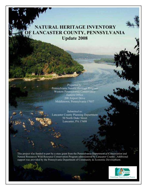
NATURAL HERITAGE INVENTORYOF LANCASTER COUNTY, PENNSYLVANIAUpdate <strong>2008</strong>Prepared by:Pennsylvania <strong>Natural</strong> <strong>Heritage</strong> ProgramWestern Pennsylvania ConservancyEastern Office208 Airport DriveMiddletown, Pennsylvania 17057Submitted to:<strong>Lancaster</strong> <strong>County</strong> Planning Department50 North Duke Street<strong>Lancaster</strong>, <strong>PA</strong> 17608This project was funded in part by a state grant from the Pennsylvania Department <strong>of</strong> Conservation and<strong>Natural</strong> Resources Wild Resource Conservation Program administered by <strong>Lancaster</strong> <strong>County</strong>. Additionalsupport was provided by the Pennsylvania Department <strong>of</strong> Community & Economic Development.
<strong>Natural</strong> <strong>Heritage</strong> <strong>Inventory</strong> <strong>of</strong><strong>Lancaster</strong> <strong>County</strong>, PennsylvaniaUpdate <strong>2008</strong>Prepared by:Pennsylvania <strong>Natural</strong> <strong>Heritage</strong> Program (PNHP)Western Pennsylvania Conservancy (WPC)Middletown Office208 Airport DriveMiddletown, <strong>PA</strong> 17057Jake Boyle, GIS SpecialistAnthony F. Davis, Senior EcologistJeremy Deeds, Aquatic Zoology CoordinatorAlice Doolittle, Conservation AssistantCharlie Eichelberger, HerpetologistKathy Derge Gipe, HerpetologistWilliam (Rocky) Gleason, <strong>County</strong> <strong>Inventory</strong> CoordinatorJim Hart, MammalogistDenise Johnson, <strong>County</strong> <strong>Inventory</strong> EcologistSusan Klugman, Conservation Information ManagerJohn Kunsman, BotanistBetsy Ray Leppo, Invertebrate ZoologistGreg Podniesinski, <strong>Inventory</strong> and Assessment ManagerSally Ray, Assistant ZoologistErika Schoen, Conservation Information AssistantStephanie Seymour, Seasonal Field EcologistAndrew Strassman, EcologistChristopher Tracey, EcologistJeff Wagner, Director PNHPMary Walsh, Aquatic Ecologist
PREFACEThe <strong>Lancaster</strong> <strong>County</strong> <strong>Natural</strong> <strong>Heritage</strong> <strong>Inventory</strong>Update is a document compiled and written by thePennsylvania <strong>Natural</strong> <strong>Heritage</strong> Program (PNHP) <strong>of</strong> theWestern Pennsylvania Conservancy (WPC). It buildson the original <strong>Natural</strong> Areas <strong>Inventory</strong> <strong>of</strong> <strong>Lancaster</strong><strong>County</strong> completed in 1990 by the PennsylvaniaScience Office <strong>of</strong> The Nature Conservancy. Thisdocument contains information on the locations <strong>of</strong>rare, threatened, and endangered species and <strong>of</strong> thehighest quality natural areas in the county; it is not aninventory <strong>of</strong> all open space. It is intended as aconservation tool and should in no way be treated orused as a field guide. Accompanying each sitedescription are general management recommendationsthat would help to ensure the protection and continuedexistence <strong>of</strong> these natural communities, rare plants,and animals. The recommendations are based on thebiological needs <strong>of</strong> these elements (communities andspecies). The recommendations are strictly those <strong>of</strong>the PNHP and do not necessarily reflect the policies <strong>of</strong>the state or the policies <strong>of</strong> the county or townships forwhich the report was prepared.Managed areas such as state, county and townshiplands as well as those <strong>of</strong> the <strong>Lancaster</strong> <strong>County</strong>Conservancy, the major utility companies andrailroads along the Susquehanna River are alsoprovided on the maps based on information obtainedfrom the <strong>Lancaster</strong> <strong>County</strong> GIS Department. Thisinformation is useful in determining where gaps occurin the protection <strong>of</strong> land with ecologically significanthabitats, natural communities, and rare species. Themapped boundaries are approximate and our list <strong>of</strong>managed areas may be incomplete, as new sites arealways being added.Implementation <strong>of</strong> the recommendations is up to thediscretion <strong>of</strong> the landowners. However, cooperativeefforts to protect the highest quality natural featuresthrough the development <strong>of</strong> site-specific managementplans are greatly encouraged. Landowners working onthe management <strong>of</strong>, or site plans for specific areasdescribed in this document are encouraged to contactthe PNHP for further information.The results presented in this report represent a snapshotin time, highlighting the sensitive natural areas within<strong>Lancaster</strong> <strong>County</strong>. The sites in the <strong>Lancaster</strong> <strong>County</strong><strong>Natural</strong> <strong>Heritage</strong> <strong>Inventory</strong> have been identified to helpguide wise land use and county planning. The<strong>Lancaster</strong> <strong>County</strong> <strong>Natural</strong> <strong>Heritage</strong> <strong>Inventory</strong> is aplanning tool, but is not meant to be used as asubstitute for environmental review, since informationis constantly being updated as natural resources areboth destroyed and discovered. Planning Commissionsand applicants for building permits should conductfree, online, environmental reviews to inform them<strong>of</strong> project-specific potential conflicts with sensitivenatural resources. Environmental reviews can beconducted by visiting the PNHP website, at0Uhttp://www.naturalheritage.state.pa.us/H. If conflicts arenoted during the environmental review process, theapplicant is informed <strong>of</strong> the steps to take to minimizenegative effects on the county’s sensitive naturalresources. If additional information on species <strong>of</strong>special concern becomes available duringenvironmental review, the review may be reconsideredby the jurisdictional agency.iii
ACKNOWLEDGEMENTSThis project was funded in part by a state grant fromthe Pennsylvania Department <strong>of</strong> Conservation and<strong>Natural</strong> Resources Wild Resource ConservationProgram administered by <strong>Lancaster</strong> <strong>County</strong>.Additional support was provided by thePennsylvania Department <strong>of</strong> Community &Economic Development. Thanks to everyone whoprovided financial and administrative support for theinventory. Without your help, this study would nothave been possible.The species information utilized in the inventorycame from many sources as well as our own fieldsurveys. We wish to acknowledge all <strong>of</strong> those whocarried out botanical and zoological survey workover the years. Without their contributions, thisreport would have been far less complete.The report benefited from the help <strong>of</strong> localnaturalists and conservationists who gave generously<strong>of</strong> their time. Thanks to all the help and supportgiven by:Tim Draude, botanist and local naturalistSteve Johnson for Lepidopteron surveys andidentificationLarry Coble Jr., for mussel surveys and other naturalhistory informationDr. Larry Klotz, for botanical surveysDr. Carol Loeffler, pilot for aerial surveysMike Bertram, Serpentine Habitat RestorationCoordinatorMuhlenberg Botanical SocietyThe <strong>Lancaster</strong> <strong>County</strong> GIS Department provided ahuge quantity <strong>of</strong> very useful data layers and supportfor mapping the county. The thoroughness <strong>of</strong> thisreport is largely a result <strong>of</strong> the voluminous data setsavailable from the <strong>County</strong> GIS Department.Thanks to the many other private citizens whocontacted our <strong>of</strong>fice with information on naturalareas.Many thanks to everyone who participated in the<strong>Lancaster</strong> <strong>County</strong> Green Infrastructure SteeringCommittee. In particular, appreciation for guidanceand input on the report go to Mike Domin & ScottStandish <strong>of</strong> the <strong>Lancaster</strong> <strong>County</strong> PlanningCommission; David Rouse – WRT, Tim Staub –RETTEW Associates, Ralph Goodno - <strong>Lancaster</strong><strong>County</strong> Conservancy, Sally Just and Diane Kripas <strong>of</strong>DCNR.Copies <strong>of</strong> this document may be obtained from:<strong>Lancaster</strong> <strong>County</strong> Planning Commission50 North Duke Street<strong>Lancaster</strong>, <strong>PA</strong> 17608This document is also available in electronic format from:Pennsylvania <strong>Natural</strong> <strong>Heritage</strong> Program website: 1Uwww.naturalheritage.state.pa.usWestern Pennsylvania Conservancy website at: 1Uwww.paconserve.orgThis reference may be cited as:<strong>Natural</strong> <strong>Heritage</strong> <strong>Inventory</strong> <strong>of</strong> <strong>Lancaster</strong> <strong>County</strong> - Update <strong>2008</strong>. Pennsylvania <strong>Natural</strong> <strong>Heritage</strong> Program. <strong>2008</strong>.Western Pennsylvania Conservancy. Middletown, <strong>PA</strong>.vi
1York HavenLegendDauphin <strong>County</strong>225ConoyMiddletownElizabethtownWestDonegalColumbia West324EastDonegalMount Joy26York <strong>County</strong><strong>Lancaster</strong> Couty <strong>Natural</strong> <strong>Heritage</strong> AreasOther <strong>County</strong> <strong>Natural</strong> <strong>Heritage</strong> AreasTownshipsUSGS QuadranglesMiles0 1 2 4 6 8Red LionManheim27Lebanon <strong>County</strong>28RaphoWestHempfieldSafe Harbor423Manor2129531306EastHempfield34LebanonRichlandColumbia East<strong>Lancaster</strong>3550Penn36333249Elizabeth720Manheim485737Pequea47608Clay22 19AirvilleHoltwoodConestoga<strong>Lancaster</strong>WarwickLititzWestLampeterConestogaEastLampeter46Providence51Martic525355 565458Delta18DrumoreEphrata59UpperLeacock67Strasburg45WestCocalico16EastDrumoreFulton61626617West Earl43MarylandEphrata Womelsdorf15Eden65EastCocalicoLeolaLeacockQuarryville44GapWakefieldConowingoDamParadiseLittleBritain64Berks <strong>County</strong>Earl4263BartColerain9BrecknockEast Earl41Sinking Spring4038Terre Hill14New HollandSalisburySadsburyKirkwoodRising Sun1039Caernarvon1312Morgantown11Chester <strong>County</strong>Honey BrookParkesburgOxfordSite Index<strong>Lancaster</strong> <strong>County</strong><strong>Natural</strong> <strong>Heritage</strong> <strong>Inventory</strong>Update <strong>2008</strong>Indexmap #<strong>Natural</strong> <strong>Heritage</strong> Area Name Significance Page #1 Conowago Falls High Pg 2152 Conowago Creek High Pg 2073 Helt's Woods Notable Pg 3074 Chiques Creek Headwaters High Pg 1715 Chiques Creek Exceptional Pg 1776 Penryn Park, Walnut Run Exceptional Pg 4057 Lower Middle Creek, Segloch Run Woods Exceptional Pg 3558 Middle Creek Wildlife Management Area Exceptional Pg 3719 Little Muddy Creek High Pg 34910 State Game Lands #52 Notable Pg 47711 Conestoga River Headwaters High Pg 19712 West Branch Brandywine Creek High Pg 51313 Pequea Creek Headwaters High Pg 41114 Welsh Mountains High Pg 50715 Hahnstown Notable Pg 29516 Ephrata Community Hospital Notable Pg 25917 Brownstown Notable Pg 15318 Lititz Run @ Conestoga River High Pg 33319 Holland Heights Notable Pg 31120 Lititz Spring Notable Pg 33921 Indian Springs Notable Pg 31722 Ironville Mud Pond Notable Pg 32123 Chiques Creek Bluff Notable Pg 16524 Donegal Springs Notable Pg 24325 Brunner (Lows) Island Exceptional Pg 15726 Accomac, Marietta, Wrightsville Rivershore High Pg 12527 Chickies Rock Park High Pg 18328 Conejohela Flats Exceptional Pg 18929 Frys Run Slopes High Pg 26930 Apollo Park Notable Pg 13331 Safe Harbor Woods High Pg 45332 Safe Harbor East Woods Notable Pg 44733 Silver Mine Park High Pg46534 Owl Bridge, Stehman Church Woods Notable Pg 40135 Little Conestoga Creek High Pg 34336 Conestoga River High Pg20137Danville Pike Cave, Williamson Park, Kiwanis ParkWoodsHigh Pg 23738 East Branch Octoraro Headwaters High Pg 24739 Steelville Hollow Notable Pg 48140 East Branch Octoraro Creek, Bull Run High Pg 25341 Octoraro Reservoir Notable Pg 39542 Fulton View Woods Notable Pg 27543 Stewart Run Woods High Pg 48544 Conner's Mill Woods High Pg 22345 Gleissners Swamp Notable Pg 27946 Smithville Swamp High Pg 47147 Refton Cave High Pg 43548Trout Run Ravine, Red Hill Hollow, Camp SnyderWoodsHigh Pg 48949 Shenk's Ferry Wildflower Preserve High Pg 45950 Blair, Duncan, Urey, Weise Islands High Pg 14551 Pequea Creek Woods High Pg 41752 Reed Run, House Rock Slope, Wind Cave Outcrop High Pg 42753 Tucquan Glen High Pg 49554 Kelly's Run, Tobe Run High Pg 32555 Muddy Run Reservoir Notable Pg 38356 Fishing Creek @ Scalpy Hollow Road Exceptional Pg 26357 Conowingo Islands Exceptional Pg 22958 Midway Station. Wissler Ravine High Pg 37759 Benton Ravine High Pg 13960 Lower Susquehanna River Notable Pg 36361 Peters Creek Notable Pg 42362 Wakefield Notable Pg 50363 Oakryn Barren Local Pg 39364 Goat Hill Serpentine Community Exceptional Pg 28765 Rock Springs Serpentine Community Exceptional Pg 44166 New Texas Serpentine Community Exceptional Pg 38767 Haines Glen High Pg 299
<strong>Lancaster</strong> <strong>County</strong><strong>Natural</strong> <strong>Heritage</strong> <strong>Inventory</strong>,Update <strong>2008</strong>A <strong>County</strong> <strong>Natural</strong> <strong>Heritage</strong> <strong>Inventory</strong>(CNHI) is designed to identify and mapareas that support species <strong>of</strong> concern,exemplary natural communities, and broadexpanses <strong>of</strong> intact natural ecosystems thatsupport important components <strong>of</strong>Pennsylvania’s native biodiversity. Inaddition, this project has mapped anddescribed natural connections between andamong these rare species habitats as a meansto help prevent their isolation from thenatural landscape.While the habitats <strong>of</strong> species <strong>of</strong> concernis a primary focus <strong>of</strong> this project, manyother ecological factors were weighed whendefining the “Green Infrastructure” <strong>of</strong><strong>Lancaster</strong> <strong>County</strong> and the surrounding area.These include: steep slopes; intact forests;interior forests; native habitat quality;wetlands, streams and rivers; riparian bufferwidth and quality; and bedrock geology.These natural attributes, or the “greeninfrastructure” <strong>of</strong> the area was compared tothe built landscape, or “gray infrastructure”to highlight those areas that are most in need<strong>of</strong> conservation action. In order to connectthese “hubs” to the surrounding landscape, aseries <strong>of</strong> “greenways” were identified aspotential migratory pathways to helpfacilitate animal and plant movement in arapidly changing environment.The restoration <strong>of</strong> streamside vegetation,or riparian buffers, may have the mostsignificant effect on improving habitatconnections while simultaneouslyimproving water quality passing through thecounty to the Susquehanna River and theChesapeake Bay.Conservation Value Summary:While all <strong>of</strong> the natural habitats within thecounty contribute to the overall health <strong>of</strong> the<strong>County</strong>’s ecological systems, the highestpriority natural habitats and the potentialconnections between them become evidentby combining the landscape featuresdiscussed above.The map on the right indicates the potentialnatural value <strong>of</strong> all areas within the county andthe surrounding area. Darker colors indicate ahigher relative ecological value that lightercolors. The highest priority natural areas includethe State Line Serpentine Barrens habitats,Conowingo Islands, the Welsh Mountains, theFurnace Hills and the headwaters <strong>of</strong> ChiquesCreek, Middle Creek and Cocalico Creek. Theprimary connecting features within the county arethe contiguous forested areas and the network <strong>of</strong>streams and rivers in the county.<strong>Lancaster</strong> Green Infrastructure Plan:Hubs and GreenwaysHubConewago Creek GreenwayUpper Susquehanna River HubGreenwayConservation Value Summary:LowHighMany streams will require restoration <strong>of</strong> theriparian buffer area to fully function as habitatand migratory corridors within the county.Hubs and Greenways:In addition to those areas containing species <strong>of</strong>concern, the analysis <strong>of</strong> the combined landscapefeatures helped to determine the most evidenthabitat linkages as well as the most likelypotential linkages. These habitat linkages arenecessary to help keep natural habitats frombecoming isolated islands in a sea <strong>of</strong> humanChiques Creek GreenwayUpper Susquehanna Forested GreenwayFurnace Hills Forests HubCocalico Creek GreenwayCentral Susquehanna Forested GreenwaySusquehanna River Gorge Hubmodified landscape. Portions <strong>of</strong> the <strong>County</strong>containing groupings <strong>of</strong> <strong>Natural</strong> <strong>Heritage</strong> Areasand other high quality natural habitats weregrouped into broadly defined regions forincorporation into the <strong>Lancaster</strong> <strong>County</strong> GreenInfrastructure Plan.Definitions:Hubs are the large natural landscapes <strong>of</strong> thecounty that contain concentrations <strong>of</strong> high qualityhabitats and <strong>Natural</strong> <strong>Heritage</strong> Areas. These areascurrently provide habitat and regional migratoryConestoga River GreenwayMill Creek GreenwayMine Ridge GreenwayBowmansville HIlls Forests HubWelsh Mountains HubOctoraro Creek Headwaters HubBrandywine River Headwater Flats HubSerpentine Barrens Hubpotential for most <strong>of</strong> the<strong>County</strong>’s native plants and animals and are theprimary components <strong>of</strong> the <strong>County</strong>’s naturalenvironments.Greenways are those areas identified ascontributing to the local migratory potential withinthe <strong>County</strong> that help to bridge the gaps between theHubs. These areas were chosen because <strong>of</strong> existingfragments <strong>of</strong> linking habitats such as smaller patches<strong>of</strong> forest, woodlots, and stream corridors. In mostcases, these corridors are in need <strong>of</strong> restoration toimprove their utility as habitats and migratorypotential.
Site IndexSite Index (<strong>Natural</strong> <strong>Heritage</strong> Areas listed by name, alphabetically)Indexmap # <strong>Natural</strong> <strong>Heritage</strong> Area Name Significance Municipality(ies)26Accomac, Marietta, WrightsvilleRivershoreHigh30 Apollo Park NotableConoy Twp.East Donegal Twp.West Hempfield Twp.Manor Twp.& York Co.59 Benton Ravine High Drumore Twp.50 Blair, Duncan, Urey, Weise Islands HighConestoga Twp.Manor Twp.Martic Twp.& York Co.USGSquadrangleColumbia West,York HavenPage #Pg 125Safe Harbor Pg 133Holtwood,WakefieldAirville,Conestoga,Holtwood,Safe harborPg 139Pg 14517 Brownstown Notable West Earl Twp. Ephrata Pg 15325 Brunner (Lows) Island Exceptional27 Chickies Rock Park High5 Chiques Creek Exceptional23 Chiques Creek Bluff Notable4 Chiques Creek Headwaters High28 Conejohela Flats Exceptional36 Conestoga River High11 Conestoga River Headwaters HighConoy Twp.East Donegal Twp.& York Co.East Donegal Twp.West Hempfield Twp.Manheim BoroPenn Twp.Rapho Twp.Rapho Twp.West Hempfield Twp.Rapho Twp.& Dauphin Co.Manor Twp.West Hempfield Twp.<strong>Lancaster</strong> Twp.Pequea Twp.Caernarvon Twp.& Berks <strong>County</strong>York Haven Pg 157Columbia West Pg 183LititzManheimPg 177Columbia East Pg 165Manheim Pg 171Columbia EastColumbia WestRed LionSafe HarborConestogaElversonMorgantownPg 189Pg201Pg 19744 Conner's Mill Woods High Colerain Twp. Gap Pg 2232 Conowago Creek High1 Conowago Falls High57 Conowingo Islands Exceptional37Danville Pike Cave, Williamson Park,Kiwanis Park WoodsHigh24 Donegal Springs NotableConoy Twp.& Dauphin Co.Conoy Twp.& Dauphin & York Cos.Drumore Twp.Martic Twp.& York Co.<strong>Lancaster</strong> City<strong>Lancaster</strong> Twp.West Lampeter Twp.East Donegal Twp.West Donegal Twp.Middletown Pg 207MiddletownYork HavenPg 215Holtwood Pg 229<strong>Lancaster</strong> Pg 237Columbia West Pg 243viii
Site IndexIndexmap # <strong>Natural</strong> <strong>Heritage</strong> Area Name Significance Municipality(ies)38 East Branch Octoraro Creek High40 East Branch Octoraro Headwaters High16 Ephrata Community Hospital Notable56Fishing Creek @ Scalpy HollowRoadExceptionalBart Twp.Colerain Twp.& Chester Co.Bart Twp.Sadsbury Twp.Christiana Boro& Chester <strong>County</strong>:Ephrata Twp.Ephrata BoroDrumore Twp.USGSquadrangleGapKirkwoodOxfordGapParkesburgPgPg 247Pg 253Ephrata Pg 259HoltwoodWakefieldPg 26329 Frys Run Slopes High Manor Twp. Safe Harbor Pg 26942 Fulton View Woods Notable Little Britain Twp. Wakefield Pg 27545 Gleissners Swamp Notable64 Goat Hill Serpentine Barren ExceptionalEast Drumore Twp.Eden Twp.Providence Twp.Fulton Twp.Little Britain Twp.& Chester Co.& Maryland15 Hahnstown Notable Ephrata Twp.67 Haines Glen HighFulton Twp.& MarylandQuarryville Pg 279Conowingo DamKirkwoodRising SunEphrataTerre HillPg 287Pg 295Conowingo Dam Pg 2993 Helt's Woods Notable Mount Joy Twp. Elizabethtown Pg 30719 Holland Heights Notable21 Indian Springs NotableEast Lampeter Twp.Manheim Twp.Upper Leacock Twp.East Hempfield Twp.Penn Twp.Rapho Twp.<strong>Lancaster</strong>LeolaColumbia EastManheimPg 311Pg 31722 Ironville Mud Pond Notable West Hempfield Twp. Columbia East Pg 32154 Kelly's Run, Tobe Run High Martic Twp. Holtwood Pg 32518 Lititz Run @ Conestoga River High20 Lititz Spring NotableManheim Twp.Upper Leacock Twp.Lititz BoroWarwick Twp.35 Little Conestoga Creek High Manor Twp.9 Little Muddy Creek HighBrecknock Twp.East Cocalico Twp.& Berks Co.<strong>Lancaster</strong>LeolaPg 333Lititz Pg 339Columbia EastConestoga<strong>Lancaster</strong>Safe HarborTerre HillSinking SpringPg 343Pg 349ix
Site IndexIndexmap # <strong>Natural</strong> <strong>Heritage</strong> Area Name Significance Municipality(ies)7Lower Middle Creek, Segloch RunWoodsExceptional60 Lower Susquehanna River Notable8Middle Creek Wildlife ManagementAreaExceptionalClay Twp.Elizabeth Twp.Drumore Twp.Fulton Twp.& York Co.& MarylandClay Twp.& Lebanon Co.USGSquadrangleLititzRichlandConowingo DamDeltaHoltwoodWakefieldRichlandWomelsdorfPgPg 355Pg 363Pg 37158 Midway Station. Wissler Ravine High Drumore Twp. Holtwood Pg 37755 Muddy Run Reservoir Notable66 New Texas Serpentine Barren Exceptional63 Oakryn Barren Local41 Octoraro Reservoir NotableMartic Twp.Drumore Twp.East Earl Twp.Salisbury twp.Fulton Twp.Little Britain Twp.Colerain Twp.Little Britain Twp.34 Owl Bridge, Stehman Church Woods Notable Manor Twp.6 Penryn Park, Walnut Run ExceptionalElizabeth Twp.Penn Twp.& Lebanon Co.Holtwood Pg 383New Holland Pg 387Wakefield Pg 393Kirkwood Pg 395Conestoga.Safe HarborLebanonLititzManheimPg 401Pg 40513 Pequea Creek Headwaters High Salisbury Twp. Honeybrook Pg 41151 Pequea Creek Woods HighConestoga Twp.Martic Twp.Conestoga Pg 41761 Peters Creek Notable Fulton Twp. Wakefield Pg 42352Reed Run, House Rock Slope, WindCave OutcropHigh47 Refton Cave HighMartic Twp.Pequea Twp.Providence Twp.Strasburg Twp.West Lampeter Twp.ConestogaHoltwoodConestogaQuarryvillePg 427Pg 43565 Rock Springs Serpentine Barren Exceptional Fulton Twp. Conowingo Dam Pg 44132 Safe Harbor East Woods Notable Conestoga Twp.ConestogaSafe HarborPg 44731 Safe Harbor Woods High Manor Twp. Safe Harbor Pg 45349 Shenk's Ferry Wildflower Preserve High Conestoga Twp. Conestoga Pg 45933 Silver Mine Park HighMartic Twp.Pequea Twp.ConestogaPg465x
Site IndexIndexmap # <strong>Natural</strong> <strong>Heritage</strong> Area Name Significance Municipality(ies)USGSquadranglePg46 Smithville Swamp High Providence Twp. Quarryville Pg 47110 State Game Lands #52 Notable39 Steelville Hollow Notable43 Stewart Run Woods High48Trout Run Ravine, Red Hill Hollow,Camp Snyder WoodsHighBrecknock Twp.Caernarvon Twp.Sadsbury Twp.& Chester Co.Colerain Twp.East Drumore Twp.Conestoga Twp.Martic Twp.Providence Twp.Morgantown Pg 477GapParkesburgKirkwodWakefieldPg 481Pg 485Conestoga Pg 48953 Tucquan Glen High Martic Twp. Holtwood Pg 49562 Wakefield Notable Fulton Twp. Wakefield Pg 50314 Welsh Mountains High East Earl Twp. New Holland Pg 50712 West Branch Brandywine Creek HighCaernarvon Twp.Salisbury Twp.& Chester Co.Honey Brook Pg 513xi
TABLE OF CONTENTSPREFACE................................................................................................................................... iiiACKNOWLEDGEMENTS......................................................................................................... vSITE INDEX (<strong>Natural</strong> <strong>Heritage</strong> Areas listed by name, alphabetically) ................................... viiiEXECUTIVE SUMMARY ......................................................................................................... 1Introduction............................................................................................................................ 1Methods ................................................................................................................................. 1Landscape Analysis ............................................................................................................... 2Hubs and Greenways ............................................................................................................. 9<strong>Lancaster</strong> <strong>County</strong> <strong>Natural</strong> <strong>Heritage</strong> Areas Summary........................................................... 15Conservation Recommendations ......................................................................................... 37INTRODUCTION ..................................................................................................................... 43<strong>Natural</strong> History Overview <strong>of</strong> <strong>Lancaster</strong> <strong>County</strong>..................................................................... 45Physiography and Geology ................................................................................................. 45Soils..................................................................................................................................... 46Vegetation ........................................................................................................................... 47Unique <strong>Natural</strong> Communities in <strong>Lancaster</strong> <strong>County</strong> ............................................................ 49Habitat Disturbance.............................................................................................................56Legacy Sediments ............................................................................................................ 57Invasive Species............................................................................................................... 58A Review <strong>of</strong> <strong>Lancaster</strong> <strong>County</strong>’s Animal Biodiversity ...................................................... 65Mammals <strong>of</strong> <strong>Lancaster</strong> <strong>County</strong>........................................................................................ 65Birds <strong>of</strong> <strong>Lancaster</strong> <strong>County</strong> ............................................................................................... 70Reptiles and Amphibians in <strong>Lancaster</strong> <strong>County</strong>................................................................ 76Introduction to Invertebrates............................................................................................ 87Aquatic Community Classification for <strong>Lancaster</strong> <strong>County</strong> ............................................... 94METHODS…………………………………………………………………………………....109Pennsylvania <strong>Natural</strong> <strong>Heritage</strong> Program Data System ...................................................... 109Information Gathering ....................................................................................................... 110Map and Air Photo Interpretation...................................................................................... 110Field Work ......................................................................................................................... 111Data Analysis..................................................................................................................... 111Species Ranking................................................................................................................. 111Landscape Analysis ........................................................................................................... 112RESULTS AND DISCUSSION.............................................................................................. 114Forest Block Analysis--Landscape-scale Conservation..................................................... 114Recommendations for all Forest Blocks............................................................................ 117Riparian Buffer Recommendations.................................................................................... 118NATURAL HERITAGE AREAS OF LANCASTER COUNTY........................................ 123Accomac, Marietta, Wrightsville Rivershore .................................................................... 125Apollo Park, Susquehanna River ....................................................................................... 133Benton Ravine, Ferncliff.................................................................................................... 139Blair, Duncan, Urey, Weise Islands................................................................................... 145Brownstown....................................................................................................................... 153Brunner (Lows) Island ....................................................................................................... 157Chiques Creek Bluff .......................................................................................................... 165Chiques Creek Headwaters................................................................................................ 171Chiques Creek.................................................................................................................... 177Chickies Rock Park............................................................................................................ 183Conejohela Flats ................................................................................................................ 189Conestoga River Headwaters............................................................................................. 197xii
Conestoga River................................................................................................................. 201Conewago Creek................................................................................................................ 207Conewago Falls.................................................................................................................. 215Conners Mill Woods.......................................................................................................... 223Conowingo Islands ............................................................................................................ 229Danville Pike Cave, Williamson Park, Kiwanis Park Woods............................................ 237Donegal Springs................................................................................................................. 243East Branch Octoraro Creek .............................................................................................. 247East Branch Octoraro Headwaters..................................................................................... 253Ephrata Community Hospital ............................................................................................ 259Fishing Creek @ Scalpy Hollow Road.............................................................................. 263Fry’s Run Slopes................................................................................................................ 269Fulton View Woods........................................................................................................... 275Gleissners Swamp.............................................................................................................. 279Goat Hill Serpentine Barren ............................................................................................. 287Hahnstown ......................................................................................................................... 295Haines Glen........................................................................................................................ 299Helt’s Woods ..................................................................................................................... 307Holland Heights ................................................................................................................. 311Indian Springs.................................................................................................................... 317Ironville Mud Pond............................................................................................................ 321Kelly Run, Tobe Run......................................................................................................... 325Lititz Run at Conestoga River............................................................................................ 333Lititz Springs...................................................................................................................... 339Little Conestoga Creek ...................................................................................................... 343Little Muddy Creek............................................................................................................ 349Lower Middle Creek, Segloch Run Woods ....................................................................... 355Lower Susquehanna River ................................................................................................. 363Middle Creek Wildlife Management Area ........................................................................ 371Midway Station, Wissler Run............................................................................................ 377Muddy Run Reservoir........................................................................................................ 383New Texas Serpentine Barrens.......................................................................................... 387Oakryn Barren.................................................................................................................... 393Octoraro Reservoir............................................................................................................. 395Owl Bridge, Stehman Church Woods................................................................................ 401Penryn Park, Walnut Run .................................................................................................. 405Pequea Creek Headwaters ................................................................................................. 411Pequea Creek Woods......................................................................................................... 417Peters Creek ....................................................................................................................... 423Reed Run, House Rock Slopes, Wind Cave ...................................................................... 427Refton Cave ....................................................................................................................... 435Rock Springs Serpentine Barrens ...................................................................................... 441Safe Harbor East Woods.................................................................................................... 447Safe Harbor Woods............................................................................................................ 453Shenk’s Ferry Wildflower Preserve................................................................................... 459Silver Mine Park ................................................................................................................ 465Smithville Swamp.............................................................................................................. 471State Game Lands #52 ....................................................................................................... 477Steelville Hollow ............................................................................................................... 481Stewart Run Woods ........................................................................................................... 485Trout Run Ravine, Red Hill Hollow, Camp Snyder Woods.............................................. 489Tucquan Glen..................................................................................................................... 495Wakefield........................................................................................................................... 503xiii
Welsh Mountains ............................................................................................................... 507West Branch Brandywine Creek........................................................................................ 513Glossary................................................................................................................................... 519References and Literature Cited .............................................................................................. 521Appendices .............................................................................................................................. 527APPENDIX I: PNHP Program Ranks, and State and Federal Status................................... 528APPENDIX II: Pennsylvania Element Occurrence Quality Ranks..................................... 532APPENDIX III: Field Survey Form ..................................................................................... 533APPENDIX IV: Community Classification ......................................................................... 534APPENDIX VI : <strong>PA</strong> Noxious Weed and Aquatic Nuisance Species Lists.......................... 540APPENDIX VII: Sustainable Forestry Information Sources ............................................... 542APPENDIX VIII: Species <strong>of</strong> Concern in <strong>Lancaster</strong> <strong>County</strong> ................................................ 543APPENDIX IX: Selected Fact Sheets for Species <strong>of</strong> Concern............................................ 546xiv
EXECUTIVE SUMMARYIntroductionOur natural environment is key to human healthand sustenance. A healthy environment provides cleanair and water; supports fish, game, and agriculture; andfurnishes renewable sources <strong>of</strong> raw materials forcountless aspects <strong>of</strong> our livelihoods and economy.An ecosystem is “the complex <strong>of</strong> interconnectedliving organisms inhabiting a particular area or unit <strong>of</strong>space, together with their environment and all theirinterrelationships and relationships with theenvironment” (Ostroumov 2002). All the parts <strong>of</strong> anecosystem are interconnected—the survival <strong>of</strong> anyspecies or the continuation <strong>of</strong> a given natural processdepends upon the system as a whole, and in turn, thesespecies and processes contribute to maintaining thesystem. An important consideration in assessingecosystem health is the concept <strong>of</strong> biodiversity.Biodiversity can be defined as the full variety <strong>of</strong> lifethat occurs in a given place, and is measured at severalscales: genetic diversity, species, natural communities,and landscapes. One <strong>of</strong> the first steps in ensuringprotection <strong>of</strong> our natural environment is to recognizeenvironmentally sensitive or ecologically importantareas and to provide information regarding theirvulnerability to various land use activities.A <strong>County</strong> <strong>Natural</strong> <strong>Heritage</strong> <strong>Inventory</strong> (NHI) isdesigned to identify and map areas that support species<strong>of</strong> concern (those considered rare, threatened orendangered at state or federal level), exemplary naturalcommunities, and broad expanses <strong>of</strong> intact naturalecosystems that support important components <strong>of</strong>Pennsylvania’s native species biodiversity. In addition,this project has mapped and described naturalconnections between and among these species <strong>of</strong>concern habitats as a means to help prevent theirisolation from the natural landscape. The intendedpurpose <strong>of</strong> this report is to provide information tomunicipal, county, and state governments, localconservation organizations, private individuals, andbusiness interests so that they may plan developmentwith the preservation <strong>of</strong> an ecologically healthylandscape for future generations in mind. This report isintended to be a component <strong>of</strong> the larger <strong>Lancaster</strong><strong>County</strong> Green Infrastructure Plan which will in turn bea component <strong>of</strong> the <strong>Lancaster</strong> <strong>County</strong> ComprehensivePlan.In order to determine the long-term needs <strong>of</strong> thepriority landscapes <strong>of</strong> the county and their connectionsto the landscape, we conducted this assessment in fourphases:1) Reviewed and updated the status <strong>of</strong> species andnatural communities <strong>of</strong> concern.2) Provided site-specific recommendations for theconservation <strong>of</strong> biodiversity within and betweenhigh priority landscapes.3) Evaluated the condition <strong>of</strong> large contiguous forestblocks and all watercourses in the county for theirutility as components <strong>of</strong> Green Infrastructure.4) Conducted a landscape-level analysis to determinethe role <strong>of</strong> individual natural areas within thelarger ecological picture <strong>of</strong> southeasternPennsylvania and to identify the naturalconnections between them.Conservation Planning:The priority natural habitats identified in thisreport were designated and ranked with regard to theirecological significance to provide the informationnecessary to plan for the conservation <strong>of</strong> biodiversityat the species, community, and ecosystem levels. The<strong>Natural</strong> <strong>Heritage</strong> Areas are mapped to include both theimmediate habitat and surrounding lands important inthe support <strong>of</strong> these special elements as well as thenatural corridors that connect them. For moreinformation on specific recommendations for an area,refer to the text for that <strong>Natural</strong> <strong>Heritage</strong> Area.MethodsSixty <strong>of</strong> Pennsylvania’s sixty-seven counties havecompleted <strong>Natural</strong> <strong>Heritage</strong> Inventories to date. Theoriginal <strong>Lancaster</strong> <strong>County</strong> NHI, (originally called<strong>Natural</strong> Areas <strong>Inventory</strong> or NAI), was the first <strong>County</strong><strong>Inventory</strong> completed in Pennsylvania and proceeded ina manner that was a template for all subsequent<strong>County</strong> Inventories. This update is intended to build onthe information generated in the first inventory and toprovide <strong>Lancaster</strong> <strong>County</strong> with additional knowledgeuseful for the conservation <strong>of</strong> its unique naturalheritage.A significant emphasis <strong>of</strong> this report is onidentifying the connections between the high qualityhabitats <strong>of</strong> <strong>Lancaster</strong> to those outside <strong>of</strong> the county, toprovide a regional ecological framework for the<strong>Lancaster</strong> <strong>County</strong> Green Infrastructure Plan. With thisin mind, our analysis begins as a ten-mile boundaryaround <strong>Lancaster</strong> <strong>County</strong>, to better understand thelandscape scale connections within the region. Manymapping features were incorporated into the analysis1
EXECUTIVE SUMMARY 2to help identify and define the high priority naturalhabitats <strong>of</strong> <strong>Lancaster</strong> <strong>County</strong>.Information GatheringSince most <strong>of</strong> the remaining natural landscape <strong>of</strong><strong>Lancaster</strong> <strong>County</strong> has been well documented over thepast 20 years, identification <strong>of</strong> new areas for species <strong>of</strong>concern in the county was not a priority for thisproject. A review <strong>of</strong> the Pennsylvania <strong>Natural</strong> <strong>Heritage</strong>Program (PNHP) database determined where locationsfor special concern species and important naturalcommunities were known to exist in <strong>Lancaster</strong><strong>County</strong>. Since the original <strong>Lancaster</strong> <strong>County</strong> NHI(NAI) was completed, many pr<strong>of</strong>essional andrecreational naturalists, including those from our own<strong>of</strong>fice, have visited and revisited many <strong>of</strong> the county’smost significant natural areas. The data generated fromthese visits has accumulated over the years in thePHNP database. Field forms submitted from thesevisits were reviewed to determine if updates to theinformation was necessary or desirable.Knowledgeable individuals were consultedconcerning the occurrence <strong>of</strong> rare plants, animals andunique natural communities in the county. VoluminousGIS data sets were provided by the county for ouranalysis. Recent aerial photos, Geological maps,United States Geologic Survey (USGS) topographicalmaps, National Wetlands <strong>Inventory</strong> maps, UnitedStates Department <strong>of</strong> Agriculture (USDA) soil surveysand many other published materials were also used toidentify and characterize areas <strong>of</strong> potential ecologicalsignificance.Field WorkA limited number <strong>of</strong> ground surveys were conductedto collect detailed information on the status <strong>of</strong> thespecies and communities present at a location, thethreats it faces, management needs, and what size <strong>of</strong>an area should be protected to preserve the uniquehabitat. <strong>Inventory</strong> Ecologists concentrated on the areaswith the most interesting, unique, diverse and suitablehabitat for species <strong>of</strong> concern and exemplary naturalcommunities. The flora, fauna, level <strong>of</strong> disturbanceand local threats were among the most important datarecorded for each site. Sites were not ground surveyedin cases where permission from private propertyowners to visit a site was not granted or when enoughinformation was available from other sources.Data AnalysisData obtained during the field season wascombined with prior existing data and summarized.All locations with species or communities <strong>of</strong> statewideconcern, as well as exceptional examples <strong>of</strong> morecommon natural communities were mapped anddescribed.The boundaries defining each species <strong>of</strong> concerncore habitat were based on physical and ecologicalfactors, and specifications for species protectiondeveloped by PNHP biologists based on scientificliterature review. The sites were then assigned asignificance rank based on size, condition, rarity <strong>of</strong> theunique feature, and quality <strong>of</strong> the surroundinglandscape. Spatial data on the elements <strong>of</strong> concernwere then compiled in a geographic informationsystem (GIS) and combined with other available GISlayers for landscape analysis.Landscape Analysis:Many mapping elements went into determining anddefining the network <strong>of</strong> natural habitats within<strong>Lancaster</strong> <strong>County</strong>. The primary elements include:o <strong>Natural</strong> <strong>Heritage</strong> Areaso Forest Blockso Interior Forestso <strong>Natural</strong> Communitieso Riparian Corridorso Floodplains (100 & 500-year)o Steep Slopes (>25%)o Important Bird Areaso Important Mammal Areas2<strong>Natural</strong> <strong>Heritage</strong> Areas: <strong>Natural</strong> <strong>Heritage</strong> Areas arehabitats that contain plant or animal species consideredrare, threatened or endangered at state or federal levels.<strong>Natural</strong> <strong>Heritage</strong> Areas can also be delineated aroundhigh quality natural communities, which are thoseconsidered to be uncommon in the state, or among thebest <strong>of</strong> their type within the state.Sixty-seven <strong>Natural</strong> <strong>Heritage</strong> Areas are recognized in<strong>Lancaster</strong> <strong>County</strong> for this NHI Update. The distribution<strong>of</strong> <strong>Natural</strong> <strong>Heritage</strong> Areas across the county is shownon the site index map. Documented are 129 species <strong>of</strong>concern including 72 plants, 9 birds, 4 reptiles, 4freshwater mussels, 3 cave invertebrates, 10 butterflies,28 moths, and one dragonfly. Many <strong>of</strong> these species
EXECUTIVE SUMMARY 3have multiple population occurrences in the county. SeeAppendix VIII for a complete list <strong>of</strong> species <strong>of</strong> concern.In addition, 60 other <strong>Natural</strong> <strong>Heritage</strong> Areas weredelineated in adjacent counties within 10 milessurrounding <strong>Lancaster</strong> <strong>County</strong>. Only those <strong>Natural</strong><strong>Heritage</strong> Areas that are entirely or partially within<strong>Lancaster</strong> <strong>County</strong> are described in this report.Significance ranks <strong>of</strong> <strong>Natural</strong> <strong>Heritage</strong> Areas(exceptional, high, notable and local) in order <strong>of</strong> theircontribution to the protection <strong>of</strong> the biological diversityand ecological integrity <strong>of</strong> the region are given in Table1: <strong>Lancaster</strong> <strong>County</strong> <strong>Natural</strong> <strong>Heritage</strong> Areas Summary(page 21).<strong>Lancaster</strong> <strong>County</strong><strong>Natural</strong> <strong>Heritage</strong> <strong>Inventory</strong> Update <strong>2008</strong>o “Supporting <strong>Natural</strong> Landscape” includes areasnecessary to maintain vital ecological processes orsecondary habitat that could be impacted by certaintypes <strong>of</strong> habitat-disturbing activities. Consult theindividual <strong>Natural</strong> <strong>Heritage</strong> Area descriptions to getspecific management recommendations for eachlocation. Much <strong>of</strong> the Supporting Landscape overlapsbetween the various <strong>Natural</strong> <strong>Heritage</strong> Areas creating arather continuous and integrated area that should beconsidered the framework <strong>of</strong> the <strong>County</strong>’s GreenwaysInfrastructure. Many <strong>of</strong> the Supporting Landscape areaswere derived from the upstream watersheds adjacent tothe species <strong>of</strong> concern core habitat. Activities that occurwithin the upstream portions <strong>of</strong> the watershed can havea significant impact on the <strong>Natural</strong> <strong>Heritage</strong> Area CoreHabitat.LegendRare species core habitat<strong>Natural</strong> <strong>Heritage</strong> AreaSupporting LandscapeDefinitions:o “<strong>Natural</strong> <strong>Heritage</strong> Area” is a convenient label forspecies <strong>of</strong> concern core habitats that occur singly or inoverlapping or adjacent habitats. This designation isused primarily as a frame for discussion <strong>of</strong> the variousnatural features that occur within a particular area. The<strong>Natural</strong> <strong>Heritage</strong> Area is further delineated into tworegions based on its susceptibility to habitatdisturbance:o “Species <strong>of</strong> Concern Core Habitat” delineates theactual and adjacent similar habitat <strong>of</strong> individual species<strong>of</strong> concern (plants and/or animals considered rare,threatened or endangered at state or federal levels)exemplary natural communities, or exceptional nativediversity. This level <strong>of</strong> mapping delineates essentialhabitat that cannot absorb significant levels <strong>of</strong> habitatdisturbingactivity without substantial impact to theelements <strong>of</strong> concern.Species <strong>of</strong> Concern Core Habitat; RelativeEcological Importance: All <strong>of</strong> the species <strong>of</strong> concerncore habitats are highly important for the species <strong>of</strong>concern they harbor, but ranking them based on number<strong>of</strong> species <strong>of</strong> concern and the degree <strong>of</strong> rareness helpsto illustrate the relative importance <strong>of</strong> each area inrelation to one another. This map integrates the number,quality and rarity <strong>of</strong> the species <strong>of</strong> concern in each area.Darker shading on the map represents areas where morespecies <strong>of</strong> concern ‘stack up’ and representconcentrations <strong>of</strong> species <strong>of</strong> concern into “hotspots”.This analysis clearly portrays the State LineSerpentine Barrens and the Conowingo Islands asthe most significant areas for species <strong>of</strong> concern inthe county. This is due to the high numbers <strong>of</strong>species <strong>of</strong> concern documented at these locations aswell as the relative degree <strong>of</strong> state and global rarity<strong>of</strong> each species.3
EXECUTIVE SUMMARY 4Forest Blocks / <strong>Natural</strong> Habitats: Through theconservation <strong>of</strong> large forested blocks / natural habitats,the necessary environmental conditions for whole suites<strong>of</strong> species both common and rare are preserved. Thelargest contiguous forest blocks / natural habitats <strong>of</strong> thecounty were identified and ranked according to size,with the assumption that bigger is better. These forestblocks and their adjacent natural habitats should beconsidered the backbone <strong>of</strong> wildlife habitat in thecounty. Conservation efforts in the county shouldconcentrate on maintaining these large forest blocks byavoiding further fragmentation with additional roads,development, and utility rights-<strong>of</strong>-way. The largestforest blocks are concentrated among the Furnace Hillsalong <strong>Lancaster</strong>’s northern border with Lebanon<strong>County</strong> and the Welsh Mountains in the east-centralpart <strong>of</strong> the county along the border with Chester<strong>County</strong>.Interior forests: Interior forest, for this report, isdefined as forest at least 100 meters in from the edge <strong>of</strong>4any human-created opening such as a field, road,railway line or utility rights-<strong>of</strong>-way. Interior forest is animportant habitat type for many species <strong>of</strong> plants andanimals. The area between the forest edge and 100meters into the forest is considered highly influenced byedge effects, such as increased levels <strong>of</strong> light,temperature, wind and dryness which create muchdifferent habitat conditions from those found in interiorforest. Interior forest patches were ranked according tosize with larger patches considered relatively morevaluable than smaller patches. Interior forest patchessmaller than five acres were dropped from the analysisas likely too small to be suitable habitat for forestinterior species. As with the Forest Block analysis, theresults reveal that the largest blocks in the county areconcentrated among the Furnace Hills, BowmansvilleHills, Welsh Mountains, and a small area in TexterMountain in the north part <strong>of</strong> the county.<strong>Natural</strong> Communities: The natural habitats <strong>of</strong><strong>Lancaster</strong> <strong>County</strong> are not a uniform expanse <strong>of</strong> shrubs,trees and other plants, but instead contain species thatreflect the environmental conditions found in thatgeneral location such as wetness, slope, sunlight, andbedrock geology. When plant distributions areexamined at a finer level, patterns <strong>of</strong> characteristic plantassociations can be determined. A natural community isdefined as a group <strong>of</strong> organisms occurring in aparticular area based on the environmental conditionsfound there. The natural communities for this projectwere delineated from the inspection <strong>of</strong> aerialphotographs taken in 2005 and followed up by selectivetargeted ground-truthing. All <strong>of</strong> the primary areas <strong>of</strong>natural vegetation and any significant portions <strong>of</strong>potential corridors have been classified based on“Terrestrial & Palustrine Plant Communities <strong>of</strong>Pennsylvania” (Fike 1999). All areas were given a
EXECUTIVE SUMMARY 5quality rank based on the degree <strong>of</strong> naturalness <strong>of</strong> thevegetation community present.<strong>Natural</strong> communities were ranked by assigning a 3(highest rank) to a habitat identified as a “naturalcommunity type” as in “Terrestrial & Palustrine PlantCommunities <strong>of</strong> Pennsylvania” by Jean Fike, publishedby <strong>PA</strong> DCNR in 1999. These were regarded asessentially ‘natural’ communities with little evidence <strong>of</strong>invasion by introduced species. Those habitat typesidentified as a natural community with a negativeinfluence, such as “weedy” or “grazed”, were given arank <strong>of</strong> 2. At the low end <strong>of</strong> the scale, ranked 1, werethose habitats considered in an early stage <strong>of</strong>succession, recovering from recent past disturbancessuch as farming or repeated timber harvest. Theseforests are typically highly invaded by introducedplants and are consequently a low quality naturalcommunity. Highly modified landscapes such as thosedominated by agriculture or urban areas were notconsidered in this analysis.Riparian Corridors: Riparian areas are lands directlyadjacent to streams, creeks, and rivers. Land adjacentto waterways and wetlands has an immediate influenceon the quality <strong>of</strong> the water and the habitat it supports.Protect, enhance and restore riparian buffers to helpimprove water quality while also providing habitat andmigratory corridors for many animals and plantsthrough all parts <strong>of</strong> the county.temperature control, filter pollutants from run<strong>of</strong>f andprovide coarse woody debris into the system, whichis necessary for aquatic organisms. Based on studies<strong>of</strong> variously-sized riparian buffers, a general width <strong>of</strong>100 meters (328 feet) from creek bank isrecommended to maintain the water quality <strong>of</strong> thestream or wetland as well as to support many <strong>of</strong> thespecies <strong>of</strong> wildlife found in these sites. This results ina uniform buffer that is easy to apply.The approach that was used to calculate therecommended riparian buffer width in <strong>Lancaster</strong><strong>County</strong> was based on several site-specifictopographic variables. The recommended riparianbuffer extends upland 100 meters from the edge <strong>of</strong>the 100-year floodplain, but is modified bytopographic variables specific to all areas. One <strong>of</strong> theprimary interests in calculating a riparian bufferwidth is to provide enough area for stormwater run<strong>of</strong>fto slow and be filtered or be absorbed into thegroundwater before it reaches a stream. Since animpervious surface like a road or parking lot does notallow stormwater to be slowed or filtered into thegroundwater, these were not counted towards the 100meter buffer width calculation. Similarly, since steepslopes (those over 25%) do not significantly allowwater to slow or be filtered into the ground water,these were not considered as contributing to the 100meter buffer width. Slopes <strong>of</strong> smaller degrees alsolessen the ability <strong>of</strong> the run<strong>of</strong>f to be filtered orabsorbed based on the amount <strong>of</strong> slope. For ourcalculation, two feet <strong>of</strong> buffer were added for each1% <strong>of</strong> slope in lands adjacent to the stream.This resulted in an undulating riparian buffer thatincorporates floodplains, steep slopes, adjacentwetlands, and impervious surfaces into thecalculation. As the size <strong>of</strong> a buffer increases, theeffectiveness <strong>of</strong> that buffer to improve water quality,flow, and wildlife habitat increases.o Riparian Buffer Width: The scientific literature varieswith regard to recommended riparian buffer widths.From a strictly water quality standpoint, nativeforested buffers <strong>of</strong> 35-100 feet are thought to besufficient for water quality maintenance. Thesenarrow buffers will help provide shade for5
EXECUTIVE SUMMARY 6from meeting the 100-meter riparian buffer goal andshould be considered priorities for restoration.However, another way to consider this analysis is t<strong>of</strong>ocus on those that fall in the middle <strong>of</strong> the spectrum.Those that are in the second-best potential qualitywould take much less effort and expense to raise themto the highest level <strong>of</strong> quality. Similarly, those that arein the second lowest quality category could be indanger <strong>of</strong> falling into the lowest quality category if theydo not receive prompt restoration action.Blue Marsh LakeRiparian Buffer Quality: Each riparian buffersegment in the county, excluding the mainstem <strong>of</strong>the Susquehanna River, was analyzed using eightvariables and ranked according to their potentialcumulative effect on water quality. These variablesinclude:A. Percent <strong>of</strong> riparian buffer in agricultureB. Percent <strong>of</strong> riparian buffer in urbanizationC. Percent <strong>of</strong> riparian buffer undeveloped (combinedforested area, wetlands, etc.)D. Percent <strong>of</strong> total upstream watershed agricultureE. Percent total upstream watershed urbanizationF. Percent total upstream watershed undeveloped(combined forested area, wetlands, etc.)G. Number <strong>of</strong> upstream road crossingsH. Number <strong>of</strong> upstream point sources <strong>of</strong> pollutionThe cumulative scores were then sorted from bestto lowest quality and represent four categories <strong>of</strong>potential conservation status:1. Highest Restoration Priority (lowest potentialquality)2. Secondary Restoration Priority (second-lowestpotential quality)3. Secondary Conservation Priority (second-bestpotential quality)4. Highest Conservation Priority (best potentialquality)Water and habitat quality is referred to as “potential”because these categories are based on GIS-derived data,which is subject to error. These categories should guideplanning efforts and aid in the decision-making process,but should not be substituted for on-site streamassessments. This analysis helps to highlight thoseriparian areas that meet a goal for 100-meter vegetatedbuffers and should be considered priorities forpreservation. This also highlights those that are furthest6Hershey Special HabitatMiddle Creek Wildlife Management AreaConejohela FlatsL. Susquehanna R. Gorge - Conowingo/Muddy RunHay Creek/French Creek Forest BlockCreek Road AreaOctoraro ReservoirState Line BarrensGlen Morgan LakeImportant Bird Areas: In an effort to conserve theCommonwealth’s avifauna, the Pennsylvania Chapter<strong>of</strong> the National Audubon Society, along with thePennsylvania Ornithological Technical Committee <strong>of</strong>the Pennsylvania Biological Survey, has identified 81areas within the state that are considered to be a part <strong>of</strong>a global network <strong>of</strong> places recognized for theiroutstanding value to bird conservation. TermedImportant Bird Areas, or IBAs, six <strong>of</strong> these areas occurwithin <strong>Lancaster</strong> <strong>County</strong>:Great Marsh
EXECUTIVE SUMMARY 7Middle Creek Wildlife Management Area / SGL 46Hopewell Big WoodsImportant Mammal Areas: The Important MammalAreas Project (IMAP) is being carried out by a broadbased alliance <strong>of</strong> sportsmen, conservationorganizations, wildlife pr<strong>of</strong>essionals, and scientists.Precedence is given to sites with species <strong>of</strong> concern butthe project is also interested in habitats that have highmammalian diversity or those that <strong>of</strong>fer exceptionaleducational value. Nominated sites are reviewed byIMAP personnel and local scientists, with final siteselection managed by the Mammal TechnicalCommittee <strong>of</strong> the Pennsylvania Biological Survey. Theprimary concern <strong>of</strong> the project is to help ensure thefuture <strong>of</strong> Pennsylvania's wild mammals, both game andnon-game species.7
EXECUTIVE SUMMARY 8Landscape Analysis Results:While all <strong>of</strong> the natural habitats within the countycontribute to the overall health <strong>of</strong> the <strong>County</strong>’s ecologicalsystems, the highest priority natural habitats and thepotential connections between them become evident bycombining the landscape features discussed above.The map below indicates the potential natural value <strong>of</strong>all areas within the county and the surrounding area.Darker colors indicate a higher relative ecological valuethat lighter colors. The highest priority natural areasinclude the State Line Serpentine Barrens habitats,Conowingo Islands, the Welsh Mountains, the FurnaceHills and the headwaters <strong>of</strong> Chiques Creek, Middle Creekand Cocalico Creek.The primary connecting features within the county arethe contiguous forested areas and the network <strong>of</strong> streamsand rivers in the county. Many streams will requirerestoration <strong>of</strong> the riparian buffer area to fully function ashabitat and migratory corridors within the county.8
EXECUTIVE SUMMARY 9Hubs and Greenways:In addition to those areas containing species <strong>of</strong> concern,the analysis <strong>of</strong> the combined landscape features helpedto determine the most evident habitat linkages as well asthe most likely potential linkages. These habitat linkagesare necessary to help keep natural habitats frombecoming isolated islands in a sea <strong>of</strong> human modifiedlandscape. Portions <strong>of</strong> the <strong>County</strong> containing groupings<strong>of</strong> <strong>Natural</strong> <strong>Heritage</strong> Areas and other high quality naturalhabitats were grouped into broadly defined regions forincorporation into the <strong>Lancaster</strong> <strong>County</strong> GreenInfrastructure Plan.Definitions:o Hubs are the large natural landscapes <strong>of</strong> the countythat contain concentrations <strong>of</strong> high quality habitatsand <strong>Natural</strong> <strong>Heritage</strong> Areas. These areas currentlyprovide habitat and regional migratory potential formost <strong>of</strong> the <strong>County</strong>’s native plants and animals andare the primary components <strong>of</strong> the <strong>County</strong>’s naturalenvironments.o Greenways are those areas identified as contributingto the local migratory potential within the <strong>County</strong>that help to bridge the gaps between the Hubs. Theseareas were chosen because <strong>of</strong> existing fragments <strong>of</strong>linking habitats such as smaller patches <strong>of</strong> forest,woodlots, and stream corridors. In most cases, thesecorridors are in need <strong>of</strong> restoration to improve theirutility as habitats and migratory potential.9
<strong>Lancaster</strong> <strong>County</strong> Hubs and Greenways DescriptionsHUBS (Listed alphabetically):EXECUTIVE SUMMARY 10The Bowmansville Hills Forests Hub includes the forested hills and rich stream valleys that straddlethe <strong>Lancaster</strong> / Berks county border and contains numerous interior forest blocks. Creeks originating inthe forested landscape feed the Conestoga River and Cocalico Creek in <strong>Lancaster</strong> <strong>County</strong> as well as theSchuylkill River in Berks <strong>County</strong>. The floodplains and associated wetlands <strong>of</strong> the many streamsmeandering through the area provide important habitat for numerous native plant and animal speciesincluding several species <strong>of</strong> concern in ten <strong>Natural</strong> <strong>Heritage</strong> Areas, many <strong>of</strong> which are shared with oroccur completely within Berks <strong>County</strong>. The streams emanating from the forested landscape are <strong>of</strong> highquality, but become quickly degraded as they progress though the agricultural / urban landscape.Preservation <strong>of</strong> high quality creeks and restoration <strong>of</strong> floodplain and wetland habitats on all lower qualitycreeks within these watersheds should be a priority activity within this hub. In addition, preserve theconnectivity <strong>of</strong> natural habitats, especially unbroken forests and riparian corridors, to help provideessential habitat and potential migratory pathways for native plants and animals.The Brandywine River Headwater Flats Hub is primarily in Chester <strong>County</strong>, but encompassessimilar habitat in <strong>Lancaster</strong> <strong>County</strong>. The streams draining south from the Welsh Mountains meanderacross the relatively flat valley <strong>of</strong> the Pequea Creek watershed. The agriculturally dominated landscapealso contains considerable forested habitats, primarily in Chester <strong>County</strong>. The forests and other naturalenvironments provide essential habitat for many native plants and animals as well as a potential migratorypathway connecting the Bowmansville Hills Forests though the Welsh Mountains to the Octoraro CreekHeadwaters. The meandering stream floodplains also provide essential habitat for several species <strong>of</strong>concern in six <strong>Natural</strong> <strong>Heritage</strong> Areas stretching into Chester <strong>County</strong>. Restoration <strong>of</strong> floodplain andwetland habitats on all creeks should be a priority activity within this hub.The Conewago Creek Greenway includes the section <strong>of</strong> the creek between the <strong>PA</strong> Turnpike and thecreek’s confluence with the Susquehanna River. The creek and its vegetated banks and uplands providehabitat for a variety <strong>of</strong> native plants and animals including several species <strong>of</strong> concern in two <strong>Natural</strong><strong>Heritage</strong> Areas. The greenway contains numerous patches <strong>of</strong> natural habitat including several blocks <strong>of</strong>interior forest forming a “stepping stone” connection between the forested expanses <strong>of</strong> the Furnace Hillsand the Susquehanna River. Most <strong>of</strong> the forested habitat <strong>of</strong> this greenway occurs on top <strong>of</strong> a linearbedrock outcrop <strong>of</strong> diabase, a hard rock <strong>of</strong> volcanic origin. The thin soils over the diabase bedrockprevented easy conversion to agricultural uses; so much <strong>of</strong> the area has remained forested. The floodplain<strong>of</strong> the Conewago Creek contains fewer expanses <strong>of</strong> natural habitat and should be considered a priority forrestoration to improve the habitat for resident species and as a potential migratory pathway. The lineargreenway provided though a restoration <strong>of</strong> the habitat would also supply a suitable linear public park,serving municipalities along the <strong>Lancaster</strong> / Dauphin / Lebanon <strong>County</strong> border.The Furnace Hills Forests Hub includes the expanse <strong>of</strong> forest between <strong>Lancaster</strong> and LebanonCounties referred to as the Furnace Hills. This area contains the largest expanse <strong>of</strong> forested habitatsincluding the most significant interior forest blocks remaining in <strong>Lancaster</strong> <strong>County</strong>. Composed primarily<strong>of</strong> State Game Lands, the continually forested area provides substantial habitat and migratory potential fora wide variety <strong>of</strong> native plants and animals including a number <strong>of</strong> species <strong>of</strong> concern in ten <strong>Natural</strong><strong>Heritage</strong> Areas. The nearly uninterrupted natural habitats provide a link to similar habitats in Lebanon andBerks Counties. In portions <strong>of</strong> the forest, the lack <strong>of</strong> understory recruitment <strong>of</strong> native trees and shrubs anda visible browse line suggests that action needs to be taken to reduce the deer herd. This in turn coulddecrease herbivory pressure on the understory and help improve future forest composition. Invasivespecies <strong>of</strong> shrubs and trees dominate the understory in other locations indicating a need for silviculturalrestoration to improve future forest stands. Included in this hub are the headwaters <strong>of</strong> Chiques Creek,Cocalico Creek and Middle Creek, which provide essential habitat for common native species as well asseveral species <strong>of</strong> concern. The streams within the forested habitats <strong>of</strong> the Furnace Hills represent a large10
EXECUTIVE SUMMARY 11concentration <strong>of</strong> the highest quality streams in the county. Once the creeks leave the forest and enter theagricultural / urban landscape, the water quality decreases with each mile before reaching theSusquehanna River. Restoration <strong>of</strong> floodplain and wetland habitats on all creeks within these watershedsshould be a priority activity within the southern portion <strong>of</strong> this hub.The Octoraro Creek Headwaters Hub encompasses the boundary between <strong>Lancaster</strong> and ChesterCounties. The many branches <strong>of</strong> the creek, in places, meander across wide floodplains that have beenused for pasture and hay crops. Portions <strong>of</strong> the floodplain have become revegetated in characteristicfloodplain plant communities, primarily on the Chester <strong>County</strong> side <strong>of</strong> the creek, while the <strong>Lancaster</strong>county side remains mostly in active agricultural production. Floodplains with native vegetation providehabitat for a wide variety <strong>of</strong> plants and animals as well as a potential natural migratory pathway betweenChester <strong>County</strong> through the Welsh Mountains and south to Maryland. Restoration <strong>of</strong> floodplain andwetland habitats on all creeks within these watersheds should be a priority activity within this hub. Arevegetated floodplain and its adjacent reforested uplands could be compatible with a carefully sitedrecreational trail. Any future park design plans should place primary emphasis on promoting a viablefloodplain natural community rather than on providing recreational opportunities though active parkfacilities and infrastructure.The Serpentine Barrens Hub contains a mixture <strong>of</strong> agricultural lands and rural residences withscattered woodlots and includes outcrops <strong>of</strong> serpentine bedrock. The serpentine habitats <strong>of</strong> southern<strong>Lancaster</strong> and Chester Counties and into Maryland are among the most globally important habitats inPennsylvania. The bedrock substrate underlying the serpentine habitat is a geologic rarity itself. When itis exposed at the surface <strong>of</strong> the ground, it typically harbors a suite <strong>of</strong> plants and associated insectsuncommon for the region. Frequently, there are also species that are endemic to these habitats and grownowhere else. The serpentine barrens habitats contain a very high concentration <strong>of</strong> plant and insectspecies <strong>of</strong> concern in ten <strong>Natural</strong> <strong>Heritage</strong> Areas stretching into Chester <strong>County</strong> and Maryland. Theserpentine habitats are part <strong>of</strong> a series <strong>of</strong> terrestrial habitat “islands” stretching into Maryland that shouldbe thought <strong>of</strong> as a single system. These serpentine habitats occur in isolated patches as the bedrockmaterial, serpentinite, is exposed at the surface <strong>of</strong> the ground in a scattered fashion much like anarchipelago chain <strong>of</strong> islands.Active stewardship <strong>of</strong> these habitats is necessary, contrary to a hands-<strong>of</strong>f management approach typicalto other types <strong>of</strong> natural areas. In the absence <strong>of</strong> natural fire disturbance, or active vegetation removal,these habitats will succeed into woodlands and forests, replacing the globally rare habitat with a morecommon type. The plants that characterize these habitats are adapted to the dry, nutrient poor soils andperiodic fire events. A priority for the security <strong>of</strong> these globally rare habitats should be to establishprotection for the core habitats as well as to provide for the landscape context in which natural processcan be maintained.A long range goal for these isolated habitats is to recognize them as a single system and plan for theirecological needs. The area between and around these habitats should be maintained to provide thenecessary buffer to allow prescribed burns to sustain the open habitat once the bulk <strong>of</strong> the woody specieshave been removed. <strong>Natural</strong> corridors between the barrens will help keep the genetic flow between theisolated populations <strong>of</strong> species in circulation. These systems may be best maintained in an agricultural orrural setting. Residential development near or between these barrens should be strongly discouraged.The Susquehanna River Gorge Hub includes the Susquehanna River between the Conestoga Riverat Safe Harbor and the Maryland border. The steep, hilly topography along the southern half <strong>of</strong> theSusquehanna River in <strong>Lancaster</strong> <strong>County</strong> has made most <strong>of</strong> it unsuitable for conversion to agriculturaluses. Consequently, the area has retained much <strong>of</strong> its natural character in contrast to the rest <strong>of</strong> the county.This hub contains 16 <strong>Natural</strong> <strong>Heritage</strong> Areas with numerous species <strong>of</strong> concern and also provides a widecorridor <strong>of</strong> natural habitats that is a vital link in the regional migratory pathway. Although most <strong>of</strong> thearea was repeatedly logged in the past, the steep, narrow gorges draining into the Susquehanna River giveus a view <strong>of</strong> what <strong>Lancaster</strong> <strong>County</strong> may have looked like before its conversion to agricultural uses. Many<strong>of</strong> the cool, moist ravines provide habitat for an impressive suite <strong>of</strong> spring wildflowers. For this reason,11
EXECUTIVE SUMMARY 12Shenk’s Ferry and other ravines are popular spring tourist destinations, drawing crowds <strong>of</strong> people duringthe peak spring blooming season. Numerous species <strong>of</strong> concern also occur within the forested habitats <strong>of</strong>the ravines. The streams flowing though the forested ravines <strong>of</strong> this area are considered to have some <strong>of</strong>the best riparian buffers in the county for protection <strong>of</strong> water quality.In addition to the forested ravines, the river, its floodplain and associated islands provide amplehabitat for a wide array <strong>of</strong> native plants and animals. The deep water area associated with Holtwood damis a popular recreational boating area. The Susquehanna River below Holtwood Dam is one <strong>of</strong>Pennsylvania’s most unusual and picturesque riverine landscapes. The water level <strong>of</strong> the river fluctuateswidely due to seasonal flooding and dry spells, alternately inundating and exposing numerous islands inthe river. Deposits <strong>of</strong> soil have filled cracks, crevices and depressions in the exposed bedrock, to providea distinctive habitat for many species <strong>of</strong> plants uncommon to Pennsylvania. Recently improved fishladders on the three major dams on the Susquehanna River have helped to alleviate formerly impassablebarriers to migratory fishes that travel between fresh and salt water habitats. While the passages haveimproved the migratory pathway for fishes that live in salt water and migrate to freshwater habitats tospawn, the American eel, which lives in fresh water but breeds in the ocean, has not been helped by thecurrent fish ladder designs. The American eel may be an important link in the lifecycle <strong>of</strong> several nativefreshwater mussels, so an improvement in eel migratory routes may help improve freshwater musselpopulations as well.The Upper Susquehanna River Hub includes the section <strong>of</strong> the Susquehanna River between<strong>Lancaster</strong> <strong>County</strong>’s border with Dauphin <strong>County</strong> at Conewago Creek down to the Conestoga River atSafe Harbor Dam. Sections <strong>of</strong> the river are popular recreational boating destinations due to thepredictably deep water created by the York Haven and Safe Harbor dams. This area also contains manysignificant riverine habitats, including eight <strong>Natural</strong> <strong>Heritage</strong> Areas, and functions as an important naturalmigration corridor for many birds and fish. Most <strong>of</strong> the existing natural habitat is within the river or itsfloodplain and associated islands. These habitats support a wide variety <strong>of</strong> native plants and animalsincluding several species <strong>of</strong> concern associated with the river habitats. The Susquehanna River is subjectto extreme seasonal water level fluctuations, from raging floodwaters to a mere trickle during droughtevents. This natural disturbance <strong>of</strong> flooding and drying along with seasonal ice scour helps produce theunique habitats associated with the river. The natural disturbance cycle also creates conditions favorablefor the establishment <strong>of</strong> invasive species <strong>of</strong> plants, which frequently dominate the shoreline <strong>of</strong> the river.Recently improved fish ladders on the three major dams on the Susquehanna River have helped toalleviate formerly impassable barriers to migratory fishes that travel between fresh and salt water habitats.While the passages have improved the migratory pathway for fishes that live in salt water and migrate t<strong>of</strong>reshwater habitats to spawn, the American eel, which lives in fresh water but breeds in the ocean, has notbeen helped by the current fish ladder designs. The American eel may be an important link in the lifecycle<strong>of</strong> several native freshwater mussels, so an improvement in eel migratory routes may help improvefreshwater mussel populations as well.The hilly topography referred to as the Welsh Mountains Hub is dominated by large continuouslyforested areas with several significant interior forest blocks. The large forested blocks <strong>of</strong> this hub shouldbe considered one <strong>of</strong> the primary natural habitats <strong>of</strong> the county. The forested landscape provides essentialhabitat and migratory potential for a wide variety <strong>of</strong> native plants and animals including several species <strong>of</strong>concern in one <strong>Natural</strong> <strong>Heritage</strong> Area. It provides both a habitat refuge for local native species as well asa large enough habitat to be considered part <strong>of</strong> a regional corridor connecting with similar habitats inChester and Berks Counties. Most <strong>of</strong> this hub is maintained as relatively undisturbed forest; however,several roads and numerous residences fragment the canopy. This hub includes <strong>Lancaster</strong> <strong>County</strong> MoneyRocks Park. Additional lands are controlled by the New Holland Borough Authority and maintained aswatershed protection for the New Holland Reservoir. This land should be retained by the borough andmaintained in its current use as forested land for watershed protection. Other streams draining from theWelsh Mountains lead to the Conestoga River, Mill Creek and Pequea Creek12
GREENWAYS (Listed alphabetically):EXECUTIVE SUMMARY 13The Chiques Creek Greenway follows Chiques Creek from Manheim Borough to the SusquehannaRiver. This potential Greenway currently has only fragments <strong>of</strong> natural habitat along the creek, itsfloodplain and associated uplands. The many branches and tributaries <strong>of</strong> Chiques Creek originate in theFurnace Hills, where they are considered among the best quality streams in the county. Once the creekleaves the forest and enters the agricultural / urban landscape, the water quality decreases with each milebefore Chiques Creek empties into the Susquehanna River. Restoration <strong>of</strong> floodplain, wetland and uplandforest habitats should be a priority activity along the entire length <strong>of</strong> Chiques Creek. The restored habitatwould help provide suitable habitat for plants and animals, improve the water quality <strong>of</strong> Chiques Creekand help connect the Furnace Hills with the Susquehanna River though a landscape dominated byagriculture and urban uses. The linear greenway provided though a restoration <strong>of</strong> the habitat could alsosupply a suitable linear public park, serving municipalities along the length <strong>of</strong> Chiques Creek. Any futurepark design plans should place primary emphasis on promoting a viable floodplain natural communityrather than on providing recreational opportunities though active park facilities and infrastructure.The Cocalico Creek Greenway is a potential connection between the Furnace Hills Forests Hub, theBowmansville Hills Forests Hub, to the Conestoga River and eventually the Susquehanna River. Thispotential greenway makes use <strong>of</strong> existing undeveloped and less developed land around Ephrata Boroughand the surrounding suburban development as well as the Cocalico Creek floodplain. Additional potentiallinkages could incorporate other sections <strong>of</strong> Cocalico Creek and its floodplain. This potential Greenwaycurrently has only fragments <strong>of</strong> natural habitat along the creek, its floodplain and associated uplands. Therestored habitat would help provide suitable habitat for plants and animals, improve the water quality <strong>of</strong>Cocalico Creek and help provide a local migratory pathway though a landscape dominated by agricultureand urban uses. The linear greenway provided though a restoration <strong>of</strong> the habitat could also supply asuitable linear public park, serving communities around Ephrata Borough. Any future park design plansshould place primary emphasis on promoting a viable floodplain natural community rather than onproviding recreational opportunities though active park facilities and infrastructure.The Conestoga River Greenway is a potential greenway corridor that contains numerous fragments<strong>of</strong> natural habitat scattered from its headwaters to its confluence with the Susquehanna River. TheConestoga River makes many bends and curves and has forested uplands where the creek is flanked bysteep slopes. Wide floodplains occur intermittently along the length <strong>of</strong> the river. Upstream anddownstream <strong>of</strong> <strong>Lancaster</strong> City, the habitat is primarily dominated by agriculture and rural residentialdevelopment and newer suburban developments. The river passes though southern <strong>Lancaster</strong> City,creating a potential dead end for any migrating animals using this river as a migratory pathway. With acombination <strong>of</strong> preservation <strong>of</strong> the fragments remaining and restoration <strong>of</strong> floodplain, wetland and uplandforest habitats, the river could become a significant habitat connector through the county to theSusquehanna River. Restoration <strong>of</strong> floodplain, wetland and upland forest habitats should be a priorityactivity along the entire length <strong>of</strong> the Conestoga River and its tributaries. The restored habitat would helpprovide suitable habitat for plants and animals, improve the water quality <strong>of</strong> the Conestoga River and helpprovide a local migratory pathway though a landscape dominated by agriculture and urban uses. Thelinear greenway provided though a restoration <strong>of</strong> the habitat could also enhance and expand the currentlinear public park, serving communities along the length <strong>of</strong> the Conestoga River. Any future park designplans should place primary emphasis on promoting a viable floodplain natural community rather than onproviding recreational opportunities though active park facilities and infrastructure.Mill Creek Greenway like the other potential greenways, currently has only scattered fragments <strong>of</strong>natural habitats to provide a connection between the Welsh Mountains and the Susquehanna River. MillCreek flows though a landscape dominated by agriculture and rural residences and suburbandevelopments. With a combination <strong>of</strong> preservation <strong>of</strong> the fragments remaining and restoration <strong>of</strong>floodplain, wetland and upland forest habitats, Mill Creek could become a significant habitat connectorthrough the county to the Susquehanna River. Restoration <strong>of</strong> floodplain, wetland and upland forest13
EXECUTIVE SUMMARY 14habitats should be a priority activity along the entire length <strong>of</strong> Mill Creek and its tributaries. The restoredhabitat would help provide suitable habitat for plants and animals, improve the water quality <strong>of</strong> MillCreek and help provide a local migratory pathway though a landscape dominated by agriculture and urbanuses. The linear greenway provided though a restoration <strong>of</strong> the habitat could also supply a suitable linearpublic park, serving municipalities along the length <strong>of</strong> Mill Creek. Any future park design plans shouldplace primary emphasis on promoting a viable floodplain natural community, with secondary emphasis onproviding recreational opportunities though active park facilities and infrastructure.Mine Ridge Greenway does not follow a creek or river like the other potential greenways, butinstead follows a significant string <strong>of</strong> upland forested habitats along a ridgeline <strong>of</strong> undulating hills on top<strong>of</strong> quartzite bedrock. The hilly topography and thin soils over hard bedrock are the likely factors to havekept the land out <strong>of</strong> agricultural production. Despite several significant interruptions, particularly in thevicinity <strong>of</strong> Route 222, the forested ridgeline makes a natural migratory pathway between the <strong>Lancaster</strong> /Chester county line and the Susquehanna River. Restoration <strong>of</strong> natural habitats along the floodplains <strong>of</strong>Big Beaver Creek and Little Beaver Creek may help provide the missing connection. With a combination<strong>of</strong> preservation <strong>of</strong> the connected forested ridgeline and restoration <strong>of</strong> floodplain and wetland habitats,Mine Ridge could become a significant habitat connector through the county to the Susquehanna River.The restored habitat would help provide suitable habitat for plants and animals and help provide a localmigratory pathway though a landscape dominated by agriculture and urban uses.The associated Upper Susquehanna Forested Greenway and Central Susquehanna ForestedGreenway are the terrestrial (upland) corridors associated with the river corridor. These two greenwayscurrently have minimal natural habitat, the landscape having been converted to agricultural, urban andsuburban uses over the past several centuries. While the Susquehanna River provides an excellentmigration corridor for those plants and animals that can use the aquatic habitat, the agricultural andurbanized landscape on the <strong>Lancaster</strong> side <strong>of</strong> the river contains minimal natural habitat and leaves littleopportunity for land-based migration. This greenway is currently limited to the frequently very narrowarea between the river bank and the railroad tracks. An expansion <strong>of</strong> the upland natural habitat along theentire length <strong>of</strong> the Susquehanna River between the Conewago Creek and the Conestoga River should beconsidered a restoration priority to help improve a vital link in this important regional migratory pathway.The expanded natural vegetation greenway would also provide a suitable linear public park, connectingmunicipalities along the river.14
EXECUTIVE SUMMARY 15Table 1:<strong>Lancaster</strong> <strong>County</strong> <strong>Natural</strong> <strong>Heritage</strong> Areas SummaryThe areas <strong>of</strong> significance for the protection <strong>of</strong> biological diversity in <strong>Lancaster</strong> <strong>County</strong> categorized alphabetically within foursignificance ranks. More in-depth information on each area including detailed descriptions and management recommendations,where appropriate, can be found in the text <strong>of</strong> the report listed alphabetically by site name.IndexMap#<strong>Natural</strong> <strong>Heritage</strong> AreaNameMunicipalities(USGS quadrangles)Exceptional SignificanceDescription Page #IndexMap#25Brunner (Lows) Island<strong>Lancaster</strong> <strong>County</strong>:Conoy TownshipYork <strong>County</strong>:Hellam, East Manchester &Newberry Twps,& York Haven Boro(York Haven Quad)Location: This <strong>Natural</strong> <strong>Heritage</strong> Area includes the section <strong>of</strong> the Susquehanna Riversouth <strong>of</strong> the borough <strong>of</strong> York Haven to the railroad bridge crossing the river at themouth <strong>of</strong> Codorus Creek. Brunner Island is the site <strong>of</strong> a PPL owned coal-fired electricgenerating plant. A public hiking trail is along the remnants <strong>of</strong> the Pennsylvania Canal.Ecological considerations: Several large islands occur in this section <strong>of</strong> the riverincluding Haldeman, Ely and Pole Islands. The majority <strong>of</strong> these islands retain most <strong>of</strong>their natural conditions. This portion <strong>of</strong> the river also contains an extensive region <strong>of</strong>bedrock outcrop, referred to as Haldeman Riffles, which is dramatically revealedduring times <strong>of</strong> seasonally low water. These shallow water habitats and the adjacentforested shoreline support eight animal species <strong>of</strong> concern and two plant species <strong>of</strong>concern.Primary conservation goals: Coordinate the protection <strong>of</strong> this landscape between<strong>Lancaster</strong> and York Counties. High water quality and appropriate substrate are bothcritical aspects to sustaining suitable habitat in this section <strong>of</strong> the river. Establish atleast 100 meter buffer <strong>of</strong> woody vegetation along the river shore and all segments <strong>of</strong>tributary streams to help protect the water quality <strong>of</strong> the river by reducing erosion,sedimentation, and pollution. Consider establishing a 300 meter wide strip <strong>of</strong> nativevegetation as a terrestrial habitat corridor along both shores <strong>of</strong> the river to improvethe quality <strong>of</strong> the Susquehanna River regional migratory corridor.Pg.157IndexMap#5Chiques CreekManheim Boro,Penn & Rapho Twps.(Lititz & Manheim Quads)Location: This large <strong>Natural</strong> <strong>Heritage</strong> Area covers portions <strong>of</strong> several sub-watershedsincluding Shearers Creek, Boyer’s Run and the section <strong>of</strong> Chiques Creek Watershedbetween the Pennsylvania Turnpike and Manheim Borough.Ecological considerations: The relatively flat topography <strong>of</strong> the region allows water topool in low lying areas, creating wetlands <strong>of</strong> varying types. Most <strong>of</strong> these wetlandswere drained or dammed to create fields or farm ponds for agricultural production. Theremaining wetland fragments should be considered the backbone for a restoration <strong>of</strong>this habitat type in the Chiques Creek watershed. The species <strong>of</strong> concern inhabitingthese shallow wetlands require specific plant communities with a matrix <strong>of</strong> opencanopied habitats.Primary conservation goals: Maintain and restore this <strong>Natural</strong> <strong>Heritage</strong> Area as afloodplain wetland complex composed <strong>of</strong> multiple types <strong>of</strong> open and closed canopywetlands. Habitat modification by beavers could help to improve the integrity <strong>of</strong> this<strong>Natural</strong> <strong>Heritage</strong> Area by reestablishing the matrix <strong>of</strong> open canopied wetlandcomplexes. Once the open habitat within the historic floodplain has been restored,light grazing could be an effective tool to maintaining the habitat for all wet meadowspecies.Pg.17715
IndexMap#<strong>Natural</strong> <strong>Heritage</strong> AreaNameMunicipalities(USGS quadrangles)Exceptional SignificanceEXECUTIVE SUMMARY 16Description Page #IndexMap#28Conejohela Flats<strong>Lancaster</strong> <strong>County</strong>:Manor &West Hempfield Twps, &Columbia & WashingtonBoroughsYork <strong>County</strong>:Chanceford, Hellam,Lower Windsor Twps, &Wrightsville Borough,(Columbia East, ColumbiaWest, Red Lion & SafeHarbor Quads)Location: This <strong>Natural</strong> <strong>Heritage</strong> Area describes the section <strong>of</strong> the Susquehanna Riverand the adjacent banks between the Columbia – Wrightsville Bridge to Turkey Hill,south <strong>of</strong> Washington Borough. The water level <strong>of</strong> this section <strong>of</strong> the river is impactedby Safe Harbor Dam, which forms Lake Clarke, a popular area for recreationalboating.Ecological considerations: Conejohela Flats is a combination <strong>of</strong> small brushy islandsand mud flats located in the Susquehanna River just west <strong>of</strong> Washington Borough.This area has been designated an Important Bird Area by the Pennsylvania AudubonSociety primarily because the mud flats provide an important habitat and migratorystopover for shore birds that is found in few other locations in Pennsylvania. Sixanimal and two plant species <strong>of</strong> concern have been documented in the habitats <strong>of</strong> theriver and adjacent uplands. These habitats also help provide a vital link in theSusquehanna River regional migratory corridor.Primary conservation goals: Coordinate the protection <strong>of</strong> this landscape between<strong>Lancaster</strong> and York Counties. Protect and expand the natural vegetation along bothshores <strong>of</strong> the river floodplain and adjacent upland. Consider establishment <strong>of</strong> a 300-meter wide strip <strong>of</strong> native vegetation as a terrestrial habitat corridor along the easternshore <strong>of</strong> the river where development hasn’t already eliminated this possibility.Encourage agricultural areas along the banks <strong>of</strong> the river and its adjacent bluffs toretreat from the river’s edge and to revert to a forested landscape. Establish a 100-meter buffer <strong>of</strong> woody vegetation along all segments <strong>of</strong> tributary streams to helpprotect the water quality <strong>of</strong> the river by reducing erosion, sedimentation, and pollution.The forest cover <strong>of</strong> the river slopes should be allowed to achieve and maintain oldgrowthcharacteristics.Pg.189IndexMap#57Conowingo Islands<strong>Lancaster</strong> <strong>County</strong>:Drumore & Martic Twps.York <strong>County</strong>:Lower Chanceford Twp.(Holtwood Quad)Location: This <strong>Natural</strong> <strong>Heritage</strong> Area includes the section <strong>of</strong> the Susquehanna Riverimmediately below Holtwood DamEcological considerations: This area should be considered one <strong>of</strong> <strong>Lancaster</strong> <strong>County</strong>’stop preservation priorities. Seasonally fluctuating river levels alternately flood, scourand expose the bedrock boulders below the Holtwood dam to create one <strong>of</strong>Pennsylvania’s most unusual and picturesque riverine landscapes. The unusualenvironment also provides suitable habitat for seventeen plant species <strong>of</strong> concern andthree animal species <strong>of</strong> concern.Primary conservation goals: Coordinate the protection <strong>of</strong> this landscape between<strong>Lancaster</strong> and York Counties. Almost all <strong>of</strong> the core habitat is currently owned by thePPL Corporation and is presently considered to be <strong>of</strong> secondary concern forconversion to incompatible uses based on the assumption that the current land use andownership will remain for the foreseeable future. Continue protection <strong>of</strong> this landscapeas an important ecological resource. If the utility companies choose to divestthemselves <strong>of</strong> portions <strong>of</strong> this landscape, it should be considered a high priority forconservation acquisition. Avoid building, replacing or expanding dams.Improve fish passage over the three major dams for the American eel.Pg.22916
IndexMap#<strong>Natural</strong> <strong>Heritage</strong> AreaNameMunicipalities(USGS quadrangles)Exceptional SignificanceEXECUTIVE SUMMARY 17Description Page #IndexMap#56Fishing Creek @ ScalpyHollow RoadDrumore Twp.(Holtwood &Wakefield Quads)Location: This <strong>Natural</strong> <strong>Heritage</strong> Area is in the very center <strong>of</strong> Drumore Township.Ecological considerations: Glade spurge is a plant species <strong>of</strong> concern that has arelatively small global range. Fewer than 10 populations, most <strong>of</strong> them with only a fewindividuals, are currently known from Pennsylvania. At this location, glade spurge isgrowing in the moist seepages and along damp road banks. Inappropriate roadmaintenance activities could easily eliminate portions <strong>of</strong> this population. The largeforested areas adjacent to this <strong>Natural</strong> <strong>Heritage</strong> Area help provide a habitat linkage tothe Susquehanna River.Primary conservation goals: Coordinate road maintenance activities between landstewards <strong>of</strong> the <strong>Lancaster</strong> <strong>County</strong> Conservancy and Drumore Township roadmaintenance crews to provide adequate protection considerations for this species. Theviability <strong>of</strong> the known populations <strong>of</strong> glade spurge and its habitat may be enhanced byestablishing buffers around wetlands, controlling invasive species, and protecting thenatural hydrology surrounding wetlands. Logging <strong>of</strong> the adjacent slopes is a potentialconcern. This species may be impacted by excessive browsing by deer in somelocations. Deer exclosure fencing may be necessary to protect this species occurrence.Pg.263IndexMap#64Goat Hill SerpentineCommunity<strong>Lancaster</strong> <strong>County</strong>:Fulton &Little Britain Twps.Chester <strong>County</strong>:West Nottingham Twp.Maryland: Cecil <strong>County</strong>(Conowingo Dam,Kirkwood &Rising Sun Quads)Location: This area occurs at the <strong>Lancaster</strong> / Chester <strong>County</strong> boundary along theOctoraro Creek and the Maryland State line.Ecological considerations: This area contains approximately 450 acres <strong>of</strong> globally rareserpentine habitat in a mosaic <strong>of</strong> the characteristic serpentine barrens plantcommunities. Goat Hill is currently known to support 19 plant species <strong>of</strong> concern and36 animal species <strong>of</strong> concern, most <strong>of</strong> which are butterflies & moths that feed on theplants present. The serpentine community itself is considered globally imperiled due tothe limited occurrences <strong>of</strong> this habitat type around the world.Primary conservation goals: Most <strong>of</strong> the core species <strong>of</strong> concern habitat occurs onprotected lands in Chester <strong>County</strong>. Additional potential habitat occurs adjacent to theOctoraro Creek in <strong>Lancaster</strong> <strong>County</strong>. Active stewardship <strong>of</strong> these habitats is necessary.In the absence <strong>of</strong> natural fire disturbance, or active vegetation removal, these habitatswill succeed into woodlands and forests, replacing the globally rare habitat with amore common type. Habitat restoration activities should strive to establish a mosaic <strong>of</strong>habitat types to accommodate the variety <strong>of</strong> organisms and their diverse habitatpreferences.Pg.287IndexMap#7Lower Middle Creek,Segloch Run WoodsClay, Ephrata &Elizabeth Twp.(Ephrata, Lititz &Richland Quads)Location: This <strong>Natural</strong> <strong>Heritage</strong> Area includes most <strong>of</strong> the Middle Creek watershedbetween the <strong>PA</strong> Turnpike and where Middle Creek meets Cocalico Creek. The westernedge <strong>of</strong> this area includes Speedwell Forge Lake <strong>County</strong> Park, while the northernportion is part <strong>of</strong> State Game Lands #46.Ecological considerations: This <strong>Natural</strong> <strong>Heritage</strong> Area is made up <strong>of</strong> large expanses <strong>of</strong>agricultural fields interspersed with a mosaic <strong>of</strong> woodlots along Middle Creek,Hammer Creek, Segloch Run and their tributaries. Two plant species <strong>of</strong> concern andeight animal species <strong>of</strong> concern (mostly butterflies) are known to occur within thesewetland and floodplain habitats. The floodplains and wetlands along all streams andtributaries within this <strong>Natural</strong> <strong>Heritage</strong> Area should be considered existing or potentialcore habitat for species <strong>of</strong> concern.Primary conservation goals: Maintain and restore this <strong>Natural</strong> <strong>Heritage</strong> Area as awetland complex, composed <strong>of</strong> multiple types <strong>of</strong> open and closed canopy wetlands.Habitat modification by beavers could help to improve the integrity <strong>of</strong> this <strong>Natural</strong><strong>Heritage</strong> Area by reestablishing the matrix <strong>of</strong> open canopied wetland complexes. Oncethe open habitat within the historic floodplain has been restored, light grazing could bean effective tool to maintaining the habitat for all wet meadow species.Pg.35517
IndexMap#<strong>Natural</strong> <strong>Heritage</strong> AreaNameMunicipalities(USGS quadrangles)Exceptional SignificanceEXECUTIVE SUMMARY 18Description Page #IndexMap#8Middle Creek WildlifeManagement Area<strong>Lancaster</strong> <strong>County</strong>:Clay &West Cocalico Twps.Lebanon <strong>County</strong>:Heidelberg &Mill Creek Twps.(Richland &Womelsdorf Quads)Location: This large <strong>Natural</strong> <strong>Heritage</strong> Area includes the northern portions <strong>of</strong> Clay andWest Cocalico Townships and extends into Lebanon <strong>County</strong> and slightly into Berks<strong>County</strong>.Ecological considerations: This area contains a wide diversity <strong>of</strong> habitat types, in anagriculture dominated landscape containing important wetland habitats. Middle CreekWildlife Management Area makes up a significant part <strong>of</strong> this <strong>Natural</strong> <strong>Heritage</strong> Area,which is part <strong>of</strong> the Furnace Hills Forests Hub. Six sensitive species <strong>of</strong> concern havebeen documented from different parts <strong>of</strong> this area.Primary conservation goals: Maintain this area as a wetland complex, composed <strong>of</strong>multiple types <strong>of</strong> wetlands. Habitat modification by beavers could help to improve theintegrity <strong>of</strong> this <strong>Natural</strong> <strong>Heritage</strong> Area, by reestablishing the matrix <strong>of</strong> open canopiedwetland habitats.Pg.371IndexMap#66New Texas SerpentineCommunityFulton Twp.(Conowingo Dam &Wakefield Quads)Location: This <strong>Natural</strong> <strong>Heritage</strong> Area occurs between Wakefield Borough and thePennsylvania / Maryland border. Conowingo Creek passes though this area.Ecological considerations: The serpentine habitats <strong>of</strong> southern <strong>Lancaster</strong> <strong>County</strong> areamong the most globally important habitats in Pennsylvania. This area containsapproximately 200 acres <strong>of</strong> globally rare serpentine habitat in a good mosaic <strong>of</strong> thecharacteristic serpentine barrens plant communities. Eleven plant species <strong>of</strong> concernand seven animal species <strong>of</strong> concern have been documented in this habitat. Activestewardship <strong>of</strong> these habitats is necessary to prevent succession to more commonwoodland types.Primary conservation goals: Consider this habitat the top priority for preservation <strong>of</strong>species <strong>of</strong> concern habitat in <strong>Lancaster</strong> <strong>County</strong>. A combination <strong>of</strong> fee simpleacquisition, conservation easements, transfer <strong>of</strong> development rights and tax incentivescould be employed towards this goal. Consider this area to be a part <strong>of</strong> the larger StateLine Serpentine Barrens habitat and provide for the long term maintenance <strong>of</strong> thisdisturbance dependent system. In the absence <strong>of</strong> naturally occurring fire, activestewardship is necessary to maintain the open aspect <strong>of</strong> the habitat. Focus vegetationremoval efforts on coniferous trees on hilltops. Eventually, prescribed burning shouldbe employed to help maintain herbaceous openings. Link regional serpentine habitatsthrough wide habitat corridors. Keep the surrounding landscape in an agriculturalsetting to avoid potential conflict between restoration activities and suburbandevelopment.Pg.387IndexMap#6Penryn Park, WalnutRun<strong>Lancaster</strong> <strong>County</strong>:Elizabeth, Penn &Rapho Twps.Lebanon <strong>County</strong>:Cornwall Boro,Heidelberg &South Lebanon Twps.(Lebanon, Lititz,Manheim &Richland Quads)Location: This large <strong>Natural</strong> <strong>Heritage</strong> Area includes portions <strong>of</strong> State Game Lands#156 and the YMCA Camp Shand or Penryn Park at the <strong>Lancaster</strong> / Lebanon countyboundary. The Horseshoe Trail also passes though this area.Ecological considerations: The landscape is mostly forested, but the vegetationclearing done on the utility rights-<strong>of</strong>-way has helped to provide the habitat conditionsfavorable for several species <strong>of</strong> concern. Overall, eight species <strong>of</strong> concern are knownfrom this area.Primary conservation goals: Maintain the open habitats along the utility rights-<strong>of</strong>-way.This wet opening helps to provide the habitat requirements <strong>of</strong> several <strong>of</strong> the species <strong>of</strong>concern known from this location. Otherwise, preserve the intact forest canopy. Thissite is part <strong>of</strong> one <strong>of</strong> the most contiguous tracts <strong>of</strong> forest in the county and forested landextends well beyond the <strong>Natural</strong> <strong>Heritage</strong> Area. Establishing permanent protectionand maintaining connectivity to adjacent forested land is important to provide anextensive interior forest habitat corridor linking to habitats out <strong>of</strong> the county.Pg.40518
IndexMap#IndexMap#65<strong>Natural</strong> <strong>Heritage</strong> AreaNameMunicipalities(USGS quadrangles)Exceptional SignificanceRock SpringsSerpentine CommunityFulton Twp. &Cecil <strong>County</strong>, Maryland(Conowingo Dam Quad)High SignificanceEXECUTIVE SUMMARY 19Description Page #Location: This <strong>Natural</strong> <strong>Heritage</strong> Area occurs adjacent to Route 222 at the Pennsylvania/ Maryland border.Ecological considerations: The serpentine habitats <strong>of</strong> southern <strong>Lancaster</strong> <strong>County</strong> areamong the most globally important habitats in Pennsylvania. Six plant species <strong>of</strong>concern and eight animal species <strong>of</strong> concern have been documented in this habitat.This area had been severely overgrown, the canopy closure threatening to eliminate thesuitable habitat for the serpentine adapted species. Recent restoration activities haveremoved the tree canopy to expose the soil and bedrock substrate. Active stewardship<strong>of</strong> these habitats is necessary to prevent succession to more common woodland types.Primary conservation goals: Consider the serpentine habitats the top priority forpreservation <strong>of</strong> species <strong>of</strong> concern in <strong>Lancaster</strong> <strong>County</strong>. Since most <strong>of</strong> the suitable corehabitat is owned by the <strong>Lancaster</strong> <strong>County</strong> Conservancy, proper restoration activities isthe most immediate goal. Acquire adjacent habitat to expand and buffer the existingserpentine habitat. Consider this area to be a single part <strong>of</strong> the State Line SerpentineBarrens habitat and provide for the long term maintenance <strong>of</strong> this disturbancedependent system. In the absence <strong>of</strong> naturally occurring fire, active stewardship isnecessary to maintain the open aspect <strong>of</strong> the habitat. Eventual prescribed burningshould be employed to help maintain herbaceous openings. Link regional serpentinehabitats through wide habitat corridors. Keep the surrounding landscape in anagricultural setting to avoid potential conflict between restoration activities andsuburban development. A large pile <strong>of</strong> used tires abuts the serpentine habitat andshould be removed before prescribed fires are employed.Pg.441IndexMap#26Accomac, Marietta,Wrightsville Rivershore<strong>Lancaster</strong> <strong>County</strong>:Conoy, East Donegal, WestHempfield Twps, &Marietta BoroYork <strong>County</strong>:Hellam Twp, WrightsvilleBoro(Columbia West & YorkHaven Quads)Location: This site includes the section <strong>of</strong> the Susquehanna River between the railroadbridge at the Conoy / East Donegal Township line to the Columbia / WrightsvilleBridge. Most <strong>of</strong> the species <strong>of</strong> concern core habitat occurs within the shallow mudflatsand flood prone banks <strong>of</strong> the river, but also includes a small wooded ravine on thewestern shore.Ecological considerations: Seven plant species <strong>of</strong> concern and two animal species <strong>of</strong>concern are known to occur within this stretch <strong>of</strong> the river. The shallow mudflatsexposed during periods <strong>of</strong> low river level provide habitat for wading birds that feed onaquatic plants and animals. The mudflats also provide an important migratory stoppingplace for these and other birds that use the Susquehanna River as a migratory pathway.Primary conservation goals: Coordinate the protection <strong>of</strong> this landscape between<strong>Lancaster</strong> and York Counties. Preserve the natural hydrologic conditions <strong>of</strong> the river.Protect and expand the natural vegetation along the eastern shore <strong>of</strong> the riverfloodplain and adjacent upland to preserve and improve its utility as a regionalmigratory corridor. Consider establishing a 300-meter wide strip <strong>of</strong> native vegetationas a terrestrial habitat corridor along the eastern shore <strong>of</strong> the river where currentdevelopment hasn’t already prevented this option.Pg.12519
IndexMap#<strong>Natural</strong> <strong>Heritage</strong> AreaNameMunicipalities(USGS quadrangles)High SignificanceEXECUTIVE SUMMARY 20Description Page #IndexMap#59Benton RavineDrumore Township(Holtwood &Wakefield Quads)Location: This <strong>Natural</strong> <strong>Heritage</strong> Area includes a forested ravine along theSusquehanna River in southern Drumore Township. The area has been designated aNational <strong>Natural</strong> Landmark.Ecological considerations: Benton Ravine, also known as Ferncliff Wildflower &Wildlife Preserve, is a forested, steep-sided narrow valley with a cascading stream,large rock exposures, and a rich spring wildflower display. The deeper portion <strong>of</strong> theravine is dominated by a hemlock-tuliptree-birch forest <strong>of</strong> high enough quality (for itstype) to be considered an exceptional natural community. In addition, one plantspecies <strong>of</strong> concern is known to occur within the area. The landscape drops <strong>of</strong>f abruptlytowards the Susquehanna River, forming a ridgeline <strong>of</strong> steep bluffs overlooking theriver. The forested landscape provides an essential link in the Susquehanna Riverregional migratory corridor.Primary conservation goals: Safeguard the expanse and quality <strong>of</strong> the native forestcanopy within the rare species core habitat. The forested landscape also helps toprotect the water quality <strong>of</strong> the small streams that drain through this <strong>Natural</strong> <strong>Heritage</strong>Area into the Susquehanna River and provides refuge for a multitude <strong>of</strong> other forestdependent species. Most <strong>of</strong> the critical rare species habitat is owned by the <strong>Lancaster</strong><strong>County</strong> Conservancy and likely will not be vulnerable to land use changes or loggingactivities. Prevent the conversion <strong>of</strong> the surrounding agricultural lands to residential orindustrial development. Establish wide, forested buffers along streams and creekswhere they are lacking and preserve and enhance them where they are present.Pg.139IndexMap#59Blair, Duncan, Urey,Weise Islands<strong>Lancaster</strong> <strong>County</strong>:Conestoga, Manor &Martic TownshipsYork <strong>County</strong>:Chanceford &Lower ChancefordTownships(Airville, Conestoga,Holtwood & Safe HarborQuads)Location: This includes the portion <strong>of</strong> the Susquehanna River between Safe HarborDam and Holtwood Dam and contains a large impounded area <strong>of</strong> the river referred toas Lake Aldred.Ecological considerations: There are several islands and bedrock outcrops within theriver that provide habitat for four plant and three animal species <strong>of</strong> concern. Thesurrounding uplands on both sides <strong>of</strong> the river are primarily forested and provide anessential terrestrial link in the Susquehanna River regional migratory corridor.Primary conservation goals: Coordinate the protection <strong>of</strong> this landscape between<strong>Lancaster</strong> and York Counties. Most <strong>of</strong> the priority core habitat within ConowingoIslands is owned by the Exelon and PPL utility producing companies and ispresently considered to be <strong>of</strong> secondary concern for conversion to incompatible usesbased on the current management regime. Discourage the establishment <strong>of</strong> seasonalcottages and year-round residences along the river shoreline and river islands.Improve fish passage over the three major dams for the American eel.Pg.14520
IndexMap#<strong>Natural</strong> <strong>Heritage</strong> AreaNameMunicipalities(USGS quadrangles)High SignificanceEXECUTIVE SUMMARY 21Description Page #IndexMap#27Chickies Rock ParkEast Donegal &West Hempfield Twps,& Columbia Boro(Columbia West Quad)Location: Chickies Rock <strong>County</strong> Park is located along the Susquehanna River betweenMarietta and Columbia Boroughs.Ecological considerations: This popular public park includes sheer cliff faces as wellas bottomland habitats along Chickies Creek at its confluence with the SusquehannaRiver. The parkland is mostly forested and provides necessary habitat for a number <strong>of</strong>native species due to its variety <strong>of</strong> habitat types including two plant species <strong>of</strong> concern.The plant community covering portions <strong>of</strong> the sheer rock face <strong>of</strong> Chickies Rock isconsidered a “Little bluestem-Pennsylvania sedge opening”. These openings typicallyoccur on dry, acidic sites where woody invasion is prevented or slowed by thin soil,droughty conditions, frequent fire or other natural disturbances. This large naturallandscape functions as an important terrestrial component <strong>of</strong> the Susquehanna Riverregional migratory corridor.Primary conservation goals: Since this <strong>Natural</strong> <strong>Heritage</strong> Area is almost entirely withinthe <strong>County</strong> Park System, proper stewardship <strong>of</strong> the natural resources present is the toppriority. Conserve the intact forest canopy and a healthy native shrub layer. Prohibitlogging on the slopes facing the Susquehanna River. Allow the forest <strong>of</strong> ChickiesRock Park to approach old growth conditions. Control invasive species <strong>of</strong> plants.Pg.183IndexMap#4Chiques CreekHeadwaters<strong>Lancaster</strong> <strong>County</strong>:Rapho Twp.Lebanon <strong>County</strong>:West Cornwall Twp.(Manheim Quad)Location: Chiques Creek begins in the springs and seeps <strong>of</strong> Governor Dick Park inLebanon <strong>County</strong> before flowing into <strong>Lancaster</strong> <strong>County</strong> north <strong>of</strong> the PennsylvaniaTurnpike.Ecological considerations: This large expanse <strong>of</strong> forest provides important interiorforest habitat and acts a part <strong>of</strong> a regional migratory corridor across the top <strong>of</strong><strong>Lancaster</strong> <strong>County</strong>. Though logged repeatedly in the past, the forest is maturing and hasan interesting mix <strong>of</strong> trees, shrubs and wildflowers associated with slightly calcareousdiabase bedrock including one plant species <strong>of</strong> concern.Primary conservation goals: Pursue conservation easements, transfer <strong>of</strong> developmentrights and fee simple acquisition on larger parcels along Chiques Creek. Allow theforest to achieve and maintain old-growth conditions. The hunting policy <strong>of</strong>Governor Dick Park should be amended to allow deer hunting on the property toprotect the future forest composition.Pg.171IndexMap#36Conestoga RiverConestoga, <strong>Lancaster</strong>,Manor & Pequea Twps,& Millersville Boro(Conestoga &<strong>Lancaster</strong> Quads)Location: This <strong>Natural</strong> <strong>Heritage</strong> Area is located along the winding bends <strong>of</strong> theConestoga River between <strong>Lancaster</strong> City and Millersville Borough.Ecological considerations: The Conestoga River makes a series <strong>of</strong> tight bends south <strong>of</strong><strong>Lancaster</strong> City, on its way to the Susquehanna River. Two species <strong>of</strong> concern weredocumented along this stretch <strong>of</strong> the Conestoga River. The core habitat for thesesensitive species <strong>of</strong> concern is both the river and the adjacent upland forest. Thesespecies may utilize slightly different locations up and down this stretch <strong>of</strong> the riverevery year. These species <strong>of</strong> concern require abundant food source in the river and itstributaries as well as breeding areas in the adjacent upland forest.Primary conservation goals: The overall objective for this area should be to restore andestablish a wide forested/vegetated riparian corridor along this stretch <strong>of</strong> the ConestogaRiver and its tributaries. Encourage agricultural areas along the banks <strong>of</strong> the river toretreat from the river’s edge and to revert to a forested or wetland landscape as issuitable to the topography and hydrology. The forested floodplain along this stretch <strong>of</strong>the Conestoga could be an appropriate location for a linear municipal park serving<strong>Lancaster</strong> City and Millersville Borough. Emphasis should be on promoting a viablefloodplain natural community rather than on active park facilities and infrastructure.Pg.20121
IndexMap#IndexMap#11IndexMap#1<strong>Natural</strong> <strong>Heritage</strong> AreaNameMunicipalities(USGS quadrangles)High SignificanceConestoga RiverHeadwaters<strong>Lancaster</strong> <strong>County</strong>:Caernarvon Twp.Berks <strong>County</strong>:Caernarvon Twp.(Elverson &Morgantown Quads)Conewago Falls<strong>Lancaster</strong> <strong>County</strong>:Conoy &Londonderry Twps.Dauphin <strong>County</strong>:Newberry Twp.York <strong>County</strong>:York Haven Boro(Middletown &York Haven Quads)EXECUTIVE SUMMARY 22Description Page #Location: Most <strong>of</strong> this <strong>Natural</strong> <strong>Heritage</strong> Area occurs in Berks <strong>County</strong>, with only asmall portion occurring in Brecknock and Caernarvon Townships in <strong>Lancaster</strong> <strong>County</strong>.Ecological considerations: This landscape contains a diversity <strong>of</strong> habitats within alandscape formerly dominated by agriculture. Wetlands along the Conestoga River andits tributaries provide habitat for wetland species <strong>of</strong> plants and animals. The forestedhabitats and stream corridors help connect to locations outside <strong>of</strong> the county.Primary conservation goals: Restore a series <strong>of</strong> slow moving marsh systems alongthis portion <strong>of</strong> the Conestoga River and its tributaries. Habitat modification bybeavers could help to improve the integrity <strong>of</strong> this habitat. Preserve the integrity <strong>of</strong>large forested areas by avoiding additional fragmenting features such as roads,development and utility infrastructure.Location: This <strong>Natural</strong> <strong>Heritage</strong> Area encompasses the section <strong>of</strong> the SusquehannaRiver from the Safe Harbor Dam down river to Bainbridge.Ecological considerations: Seasonally fluctuating river levels alternately flood, scourand expose the bedrock boulders providing suitable habitat for four plant species <strong>of</strong>concern adapted to these conditions. The floodplain forest north <strong>of</strong> Bainbridgeincludes wetland habitats. Three freshwater mussel species <strong>of</strong> concern and three otheranimal species <strong>of</strong> concern have been documented within this stretch <strong>of</strong> river and itsfloodplain habitats.Primary conservation goals: Coordinate the protection <strong>of</strong> this landscape between<strong>Lancaster</strong>, Dauphin and York Counties. Protect and expand the native vegetation alongboth shores <strong>of</strong> the river floodplain and adjacent upland. Establish at least a 100 meterbuffer <strong>of</strong> woody native vegetation along the river shore and a 100 foot buffer along allsegments <strong>of</strong> tributary streams to help protect the water quality <strong>of</strong> the river. Considerexpansion <strong>of</strong> a 300-meter wide strip <strong>of</strong> native vegetation as a terrestrial habitat corridoralong both shores <strong>of</strong> the river where development hasn’t already eliminated thispossibility. Future development projects and subdivisions should be discouragedwithin the floodplain <strong>of</strong> the river, its tributaries, or wooded habitats. A wooded publicwalking trail is maintained by Conoy Township along the old canal towpath. Thehabitats <strong>of</strong> the river shoreline and floodplain would be compatible for an expandedpassive recreation park system.Pg.197Pg.215IndexMap#44Conner's Mill WoodsColerain Township(Gap Quad)Location: Conners Mill Woods is a steep, wooded ravine surrounding Bowery Runnear its confluence with the West Branch <strong>of</strong> the Octoraro Creek.Ecological considerations: The site contributes to a large, relatively un-fragmentedtract <strong>of</strong> forested land along the West Branch <strong>of</strong> the Octoraro Creek and its tributariesthat help form the backbone <strong>of</strong> a natural corridor to the Octoraro Reservoir.A few rock outcrops in the area contain Bradley’s spleenwort, a plant species <strong>of</strong>concern. All <strong>of</strong> the currently known populations <strong>of</strong> this plant in <strong>PA</strong> occur in a fewscattered sites in <strong>Lancaster</strong> <strong>County</strong>. Since all <strong>of</strong> this plant’s limited occurrences in <strong>PA</strong>are in <strong>Lancaster</strong> <strong>County</strong>, the <strong>County</strong> has a proportionally large responsibility for itscontinued existence in the state.Primary conservation goals: The outcrops and surrounding woods should be left intheir current condition. Removal <strong>of</strong> the forested canopy around the rock outcrops couldalter the microhabitat conditions that the fern prefers; therefore, logging operationsshould not occur along the steep slopes facing Bowery Run and the West Branch <strong>of</strong> theOctoraro Creek. Permanent protection <strong>of</strong> these lands, particularly in the core habitat,through conservation easements or acquisition should be a priority. Emphasis shouldbe placed on preserving this site’s intact forest canopy, which provides importanthabitat requirements for Bradley’s spleenwort. The wooded landscape is compatiblewith passive recreation such as fishing, hunting and hiking, but more intensiverecreational opportunities are not recommended for the core or supporting landscapefor this area.Pg.22322
IndexMap#IndexMap#37<strong>Natural</strong> <strong>Heritage</strong> AreaNameMunicipalities(USGS quadrangles)High SignificanceDanville Pike Cave,Williamson Park,Kiwanis Park Woods<strong>Lancaster</strong>, Pequea &West Lampeter Twps.& <strong>Lancaster</strong> City(<strong>Lancaster</strong> Quad)EXECUTIVE SUMMARY 23Description Page #Location: Most <strong>of</strong> this <strong>Natural</strong> <strong>Heritage</strong> Area occurs within <strong>Lancaster</strong> <strong>County</strong> CentralPark and the adjacent Buchmiller <strong>County</strong> Park.Ecological considerations: Two plant species <strong>of</strong> concern occur in specialized habitatswithin the park boundaries. In addition, two cave invertebrate species <strong>of</strong> concern weredocumented at a roadside spring opening. These species are presumably moreprevalent in the connected subterranean habitatPrimary conservation goals: A long term objective for the area should be to restore theforested/vegetated floodplain <strong>of</strong> the Conestoga River, Mill Creek and the adjacentslopes and uplands to include all the area within the 100-meter riparian buffer.Restoration <strong>of</strong> the riparian buffer will help connect habitats along the length <strong>of</strong> theConestoga River to provide an intra-county corridor to the Susquehanna River. Anadditional objective should be to protect and improve the quality <strong>of</strong> the groundwater.Water quality improvement will benefit the local human communities as well as thehabitat <strong>of</strong> the cave-dwelling species <strong>of</strong> concern present at this location.Pg.237IndexMap#38East Branch OctoraroCreek<strong>Lancaster</strong> <strong>County</strong>:Colerain Twp.Chester <strong>County</strong>:Lower Oxford &Upper Oxford Twps.(Kirkwood Quad)Location: The East Branch Octoraro Creek forms the boundary between <strong>Lancaster</strong> and ChesterCounties.Ecological considerations: The relatively flat topography <strong>of</strong> the region allows water topool in low lying areas, creating wetlands <strong>of</strong> varying types. Most <strong>of</strong> these wetlandswere drained or dammed to create fields or farm ponds for agricultural production. Theremaining wetland fragments should be considered the backbone for a restoration <strong>of</strong>this habitat type in the Octoraro watershed. The three species <strong>of</strong> concern inhabitingthese shallow wetlands require specific plant communities within a matrix <strong>of</strong> opencanopied habitats.Primary conservation goals: Coordinate the protection <strong>of</strong> this landscape between<strong>Lancaster</strong> and Chester Counties. Long term goal for this <strong>Natural</strong> <strong>Heritage</strong> Area shouldbe to reestablish the slow moving marsh systems that dominated this area before it wasdrained for agricultural production. Maintain this floodplain as a wetland complex,composed <strong>of</strong> multiple types <strong>of</strong> wetlands with both open and closed canopies. Habitatmodification by beavers could help to improve the integrity <strong>of</strong> this area byreestablishing the matrix <strong>of</strong> open canopied wetland complexes.Pg.247IndexMap#38East Branch OctoraroHeadwaters<strong>Lancaster</strong> <strong>County</strong>:Bart & SadsburyTownships, ChristianaBoroughChester <strong>County</strong>:West Fallowfield &West SadsburyTownships,Atglen Borough(Gap & Parkesburg Quads)Location: This <strong>Natural</strong> <strong>Heritage</strong> Area includes most <strong>of</strong> the northern half <strong>of</strong> SadsburyTownship, and extends into Chester <strong>County</strong>.Ecological considerations: The floodplains <strong>of</strong> Pine Creek and Valley Creek combineat this site to form a rich bottomland wet meadow habitat dominated by grasses andgrass-like plants. One animal and one plant species <strong>of</strong> concern are known to occurwithin these wetland and floodplain habitats. The floodplains and wetlands along allstreams and tributaries within this <strong>Natural</strong> <strong>Heritage</strong> Area should be considered existingor potential core habitat for species <strong>of</strong> concern.Primary conservation goals: Maintain and restore this <strong>Natural</strong> <strong>Heritage</strong> Area as awetland complex, composed <strong>of</strong> multiple types <strong>of</strong> open and closed canopy wetlands.Habitat modification by beavers could help to improve the integrity <strong>of</strong> this <strong>Natural</strong><strong>Heritage</strong> Area by reestablishing the matrix <strong>of</strong> open canopied wetland complexes. Oncethe open habitat within the historic floodplain has been restored, light grazing, <strong>of</strong>tenconsidered compatible with high financial yield organic meat and dairy production,could be an effective tool to maintaining the habitat for all wet meadow species.Pg.24723
IndexMap#<strong>Natural</strong> <strong>Heritage</strong> AreaNameMunicipalities(USGS quadrangles)High SignificanceEXECUTIVE SUMMARY 24Description Page #IndexMap#29Frys Run SlopesManor Township(Safe Harbor Quad)Location: This <strong>Natural</strong> <strong>Heritage</strong> Area includes the forested slopes along theSusquehanna River between Turkey Hill and the Little Conestoga River.Ecological considerations: Two species <strong>of</strong> concern have been documented within thisarea. This large natural landscape also functions as an important terrestrial component<strong>of</strong> the Susquehanna River regional habitat corridor.Primary conservation goals: Provide for the long-term protection <strong>of</strong> the core habitatthrough conservation easements and fee-simple acquisition. Create “no spray” zones alongthe most sensitive areas <strong>of</strong> the railroad rights-<strong>of</strong>-way to avoid unintentionaldestruction <strong>of</strong> the species <strong>of</strong> concern or their habitats. Prevent fragmentation andincursions into the forested landscape. The forest cover <strong>of</strong> the river slopes should beallowed to achieve and maintain old-growth characteristics. Provide periodicculverts or other crossing opportunities for small animals to traverse the railroadtracks from river to uplands and visa versa.Pg.269IndexMap#67Haines Glen<strong>Lancaster</strong> <strong>County</strong>:Fulton Twp.(Extends into Maryland)(Conowingo Dam Quad)Location: This section <strong>of</strong> the Susquehanna River is roughly seven miles long, runningfrom the railroad bridge just north <strong>of</strong> the Conoy / East Donegal Township line to theColumbia / Wrightsville Bridge, and includes riverside portions <strong>of</strong> the Borough <strong>of</strong>Marietta.Ecological considerations: The hilly upland features remain forested in this otherwiseagricultural landscape. Steep forested bluffs drop down to the Susquehanna River,exposing west-facing bedrock outcrops along the railroad tracks paralleling theshoreline. This area supports four plant species <strong>of</strong> concern and one animal species <strong>of</strong>concern. The riverside forested habitat also provides an essential link in theSusquehanna River regional migratory corridor.Primary conservation goals: Prevent fragmentation and incursions into the forestedlandscape. The forest cover should be allowed to achieve and maintain old-growthcharacteristics. Create “no spray” zones along the most sensitive areas <strong>of</strong> the railroadrights-<strong>of</strong>-way to avoid unintentional destruction <strong>of</strong> the species <strong>of</strong> concern or theirhabitats. Develop a restoration plan for the small serpentine influenced habitat.Pg.299IndexMap#54Kelly's Run, Tobe RunMartic Twp.(Holtwood Quad)Location: The habitat is exceptionally scenic and hosts a portion <strong>of</strong> the popularConestoga Trail.Ecological considerations: Scenic Kelly Run tumbles past impressive rock outcropsand scattered boulders though this steep-sided forested ravine on its way to theSusquehanna River. Four plant species <strong>of</strong> concern are currently known from this<strong>Natural</strong> <strong>Heritage</strong> Area. The deeper portion <strong>of</strong> the ravine is dominated by a hemlocktuliptree-birchforest <strong>of</strong> high enough quality (for its type) to be considered anexceptional natural community. This large natural landscape functions as an importantterrestrial component <strong>of</strong> the Susquehanna River regional migratory corridor.Primary conservation goals: Prevent fragmentation <strong>of</strong> the forested landscape.Suppress the establishment and spread <strong>of</strong> invasive species <strong>of</strong> plants. The forest covershould be allowed to achieve and maintain old-growth characteristics. Most <strong>of</strong> thishabitat is currently protected as a nature sanctuary by PPL and the <strong>Lancaster</strong> <strong>County</strong>Conservancy. If PPL chooses to divest itself <strong>of</strong> this property, it should be considereda high priority for conservation acquisition.Pg.32524
IndexMap#<strong>Natural</strong> <strong>Heritage</strong> AreaNameMunicipalities(USGS quadrangles)High SignificanceEXECUTIVE SUMMARY 25Description Page #IndexMap#18Lititz Run @ ConestogaRiverManheim &Upper Leacock Twps.(<strong>Lancaster</strong> & Leola Quads)Location: Lititz Run joins the Conestoga River after passing underneath several busy roadsincluding Route 222, north <strong>of</strong> <strong>Lancaster</strong> City.Ecological considerations: Small patches <strong>of</strong> woods occur sporadically along the banks <strong>of</strong>both Lititz Run and the Conestoga River here. Two different animal species <strong>of</strong> concernwere documented at the confluence <strong>of</strong> these two creeks in the 1980’s and 1990’s, buthave not been documented since. Both <strong>of</strong> these sensitive species <strong>of</strong> concern live andbreed in the forested habitat along waterways and feed primarily on aquatic organismsin smaller streams and rivers. The core habitat for these sensitive species <strong>of</strong> concern isboth the creek and the adjacent upland forest.Primary conservation goals: The riparian streamside forests need to be restored allalong Lititz Run, the Conestoga River and its tributaries. Prevent the conversion <strong>of</strong>agricultural or natural lands adjacent to Lititz Run, the Conestoga River or itstributaries to residential or industrial development. Protect and expand the naturalvegetation along the creek floodplain and adjacent upland.Pg.333IndexMap#35Little Conestoga CreekManor Twp.(Columbia East,Conestoga, <strong>Lancaster</strong> &Safe Harbor Quads)Location: This <strong>Natural</strong> <strong>Heritage</strong> Area occurs along the Little Conestoga River west <strong>of</strong>the Borough <strong>of</strong> Millersville.Ecological considerations: The Little Conestoga River flows though a landscapedominated by urban and suburban development. Even so, much <strong>of</strong> the creek thoughthis <strong>Natural</strong> <strong>Heritage</strong> Area retains a wide forested buffer. An animal species <strong>of</strong> concernlives and breed in the forested habitat along this waterway and feeds primarily onaquatic organisms in smaller streams and rivers. The core habitat for this species <strong>of</strong>concern is both the creek and the adjacent upland forest.Primary conservation goals: Conserve / restore the mature floodplain forests and theassociated upland buffer forests along both shores <strong>of</strong> the Little Conestoga Creek andits tributaries.Pg.343IndexMap#9Little Muddy Creek<strong>Lancaster</strong> <strong>County</strong>:Adamstown Boro,Brecknock &East Cocalico Twps.Berks <strong>County</strong>:Brecknock &Spring Twps.(Sinking Spring &Terre Hill Quads)Location: This <strong>Natural</strong> <strong>Heritage</strong> Area spans the boundary between Brecknock and EastCocalico Townships in <strong>Lancaster</strong> <strong>County</strong> and also extends into Chester <strong>County</strong>.Ecological considerations: Wetland fragments within this landscape should beconsidered the backbone for a restoration <strong>of</strong> this habitat type in the Little MuddyCreek watershed.Primary conservation goals: Reestablish the slow moving marsh systems that oncedominated this area. Habitat modification by beavers could help to improve theintegrity <strong>of</strong> this <strong>Natural</strong> <strong>Heritage</strong> Area, by reestablishing the matrix <strong>of</strong> opencanopied wetland complexes. Reconnect habitats on either side <strong>of</strong> the <strong>PA</strong> Turnpikeand Route 222 by reconfiguring stream culverts and bridges to allow for moresuccessful animal migration.Pg.349IndexMap#58Midway Station,Wissler RavineDrumore Twp.(Holtwood Quad)Location: This <strong>Natural</strong> <strong>Heritage</strong> Area occurs just south <strong>of</strong> Muddy Run Reservoir alongthe Susquehanna River and includes Susquehannock State Park.Ecological considerations: Four plant species <strong>of</strong> concern occur along the woodedravines, steep forested slopes and exposed rock outcrops facing the SusquehannaRiver. The hilly topography has discouraged past conversion to other uses such asagriculture. This forested natural landscape functions as an important terrestrialcomponent <strong>of</strong> the Susquehanna River regional migratory corridor.Primary conservation goals: Preserve the forested connections along the SusquehannaRiver ravines. The rock outcrops along the railroad should be established as “no spray”zones and vegetation management conducted with the knowledge <strong>of</strong> rare plants in theimmediate vicinity. The forest cover should be allowed to achieve old-growthcharacteristics.Pg.37725
IndexMap#IndexMap#13IndexMap#51<strong>Natural</strong> <strong>Heritage</strong> AreaNameMunicipalities(USGS quadrangles)High SignificancePequea CreekHeadwatersSalisbury Twp.(Honeybrook Quad)Pequea Creek WoodsConestoga & Martic Twps.(Conestoga Quad)EXECUTIVE SUMMARY 26Description Page #Location: The tributaries that flow south from the Welsh Mountains enter theagriculturally dominated landscape <strong>of</strong> Pequea Creek valley.Ecological considerations: The species <strong>of</strong> concern inhabiting these wetland habitatsrequires specific plant communities with a mix <strong>of</strong> open canopied habitats. Carefullytargeted woody vegetation removal may be necessary to maintain wetland openingspreferred by this species.Primary conservation goals: Reestablish the slow moving marsh systems that oncedominated this area. Habitat modification by beavers could help to improve theintegrity <strong>of</strong> this <strong>Natural</strong> <strong>Heritage</strong> Area, by reestablishing the matrix <strong>of</strong> open canopiedwetland complexes.Location: This section <strong>of</strong> the creek is the boundary between Conestoga Township tothe northwest and Martic Township to the southeast.Ecological considerations: Pequea Creek, at its confluence with the SusquehannaRiver, is hemmed in by steep forested slopes that rise approximately 300 feet from thestream banks to the hill summit. This site is mostly forested and hilly, with severalpatches <strong>of</strong> interior forest that contain three plant species <strong>of</strong> concern. This forestednatural landscape functions as an important terrestrial component <strong>of</strong> the SusquehannaRiver regional migratory corridor.Primary conservation goals: Conserve the current forest cover and improve orexpand the amount <strong>of</strong> forest cover in non-forested areas. Avoid additionalfragmenting features such as roads, buildings, and utility rights-<strong>of</strong>-way. The forestcover should be allowed to achieve old-growth characteristics.Pg.411Pg.417IndexMap#52Reed Run, House RockSlope, Wind CaveOutcropMartic Twp.(Conestoga &Holtwood Quads)Location: This <strong>Natural</strong> <strong>Heritage</strong> Area occurs along the Susquehanna River south <strong>of</strong> PequeaBorough.Ecological considerations: This area is composed <strong>of</strong> a variety <strong>of</strong> habitats including thesteep, forested slopes overlooking the Susquehanna River, the river’s floodplain andbanks, and the richly vegetated Reeds Run ravine. Numerous bedrock outcroppings areexposed along the steep slope from the hill crests to the river. The Conestoga Trailparallels the river shoreline, traversing the slopes past House Rock, which provides aspectacular view <strong>of</strong> the Susquehanna River. Five plant species <strong>of</strong> concern and oneanimal species <strong>of</strong> concern have been documented in these habitats. This forestednatural landscape functions as an important terrestrial component <strong>of</strong> the SusquehannaRiver regional migratory corridor.Primary conservation goals: Safeguard the quality and expanse <strong>of</strong> the forestedlandscape. Prevent fragmentation <strong>of</strong> the forested landscape. Suppress the establishmentand spread <strong>of</strong> invasive species <strong>of</strong> plants. Encourage the regeneration <strong>of</strong> native trees,shrubs and herbaceous layers. The forest cover should be allowed to achieve oldgrowthcharacteristics.Pg.427IndexMap#47Refton CavePequea, Providence,Strasburg &West Lampeter Twps.(Conestoga &Quarryville Quads)Location: This <strong>Natural</strong> <strong>Heritage</strong> Area occurs along the Pequea Creek near the town <strong>of</strong>Refton.Ecological considerations: Refton Cave is a limestone solutional cave with largeunderground pools <strong>of</strong> water. The cave is home to several invertebrate cave species <strong>of</strong>concern, one <strong>of</strong> which, Refton cave planarian, is currently considered globallyimperiled due to the very few known populations <strong>of</strong> this species in the world.Primary conservation goals: Protect and improve the quality <strong>of</strong> the groundwater byrestoring the forested/vegetated floodplain <strong>of</strong> the Pequea Creek, Little Beaver Creekand the adjacent slopes and uplands to include all the area within 100-meters fromthe upper edge <strong>of</strong> the floodplain. Water quality improvement will benefit the localhuman communities as well as the habitat <strong>of</strong> the cave-dwelling species <strong>of</strong> concernpresent at this location. Implement an Aquifer Protection Overlay Zone within thesupporting landscape for this <strong>Natural</strong> <strong>Heritage</strong> Area to help protect ground waterresources.Pg.43526
IndexMap#IndexMap#31IndexMap#49IndexMap#33<strong>Natural</strong> <strong>Heritage</strong> AreaNameMunicipalities(USGS quadrangles)High SignificanceSafe Harbor WoodsConoy,East Donegal,West Hempfield Twps, &Marietta Borough(Columbia West &York Haven Quads)Shenk's FerryWildflower PreserveConestoga Township(Conestoga Quad)Silver Mine ParkConestoga, Martic &Pequea Twps(Conestoga Quad)EXECUTIVE SUMMARY 27Description Page #Location: This wooded habitat on the west side <strong>of</strong> the mouth <strong>of</strong> the Conestoga Rivercontains steep-sided, narrow ravines that feed into the Conestoga River.Ecological considerations: The habitat is rich, and supports a diverse spring wildflowercommunity. Exposed bedrock outcrops jut out from the scenic ridgeline and slopesalong the river. Three plant and one animal species <strong>of</strong> concern have been documentedwithin this wooded landscape. This forested natural landscape functions as animportant terrestrial component <strong>of</strong> the Susquehanna River regional migratory corridor.Primary conservation goals: Safeguard the quality and expanse <strong>of</strong> the forestedlandscape, especially as it extends into the supporting landscape between the branches<strong>of</strong> Witmer Run. Prevent fragmentation and incursions into the forested landscape.Suppress the establishment and spread <strong>of</strong> invasive species <strong>of</strong> plants. Encourage theregeneration <strong>of</strong> native trees, shrubs and herbaceous layers. The forest cover should beallowed to achieve and maintain old-growth characteristics.Location: Shenk’s Ferry is a wooded ravine along the Susquehanna River north <strong>of</strong>Pequea Borough.Ecological considerations: The lower slopes <strong>of</strong> this wooded ravine support a very richand diverse herbaceous layer. This area is a popular destination for spring wildflowerviewing. Among the rich diversity <strong>of</strong> spring wildflowers present, two plant species <strong>of</strong>concern have been documented from this location. This forested natural landscapefunctions as an important terrestrial component <strong>of</strong> the Susquehanna River regionalmigratory corridor.Primary conservation goals: Provide for the long-term protection <strong>of</strong> the core habitat.The Shenks Ferry Wildflower Preserve is currently owned by PPL. If PPL choosesto divest itself <strong>of</strong> the property, it should be considered a high priority forconservation acquisition. Adjacent forested properties should be acquired orprovided with conservation easements to help expand and provide a buffer to thishabitat. Remove invasive species <strong>of</strong> plants. Reduce the size <strong>of</strong> the deer herd. Allowthe forest to return to near old-growth conditionsLocation: This area roughly parallels the Conestoga / Pequea Township boundarybetween the Conestoga River and Pequea Creek with Silver Mine Township Parkoccurring along Pequea Creek.Ecological considerations: This <strong>Natural</strong> <strong>Heritage</strong> Area is dominated by an agriculturallandscape over limestone bedrock. Two cave invertebrate species <strong>of</strong> concern and asensitive species <strong>of</strong> concern have been documented at two locations associated withunderground passages. In addition, a sensitive species <strong>of</strong> concern uses the fields,pastures and wood edges <strong>of</strong> the agricultural landscape as its primary habitat.Primary conservation goals: Implement a Karst Hazard / Aquifer Protection OverlayZone within the supporting landscape for this <strong>Natural</strong> <strong>Heritage</strong> Area to help protectground water resources. Restore the forested/vegetated floodplain <strong>of</strong> the ConestogaRiver, Pequea Creek and all their tributaries.Pg.453Pg.459Pg.465IndexMap#46Smithville SwampProvidence Township(Quarryville Quad)Location: This <strong>Natural</strong> <strong>Heritage</strong> Area consists <strong>of</strong> various patchy woodlots in an agriculture andresidential dominated landscape.Ecological considerations: An interesting forested and open wetland within this areacontains an unusual mix <strong>of</strong> plants more typically associated with the coastal plain <strong>of</strong>Delaware & New Jersey including five plant species <strong>of</strong> concern.Primary conservation goals: The primary goal should be to acquire the patch <strong>of</strong> wetwoods described as a “Red maple-magnolia coastal plain palustrine forest” and thesurrounding “Red maple terrestrial forest” as a dedicated nature preserve. Secondarily,other woodlots in the <strong>Natural</strong> <strong>Heritage</strong> Area should be considered potential species <strong>of</strong>concern habitat and connected to form a network <strong>of</strong> suitable habitat. Restore a forestedbuffer around the wetland habitat to help protect the sensitive wetland habitat fromfurther encroachmentPg.47127
IndexMap#IndexMap#43IndexMap#48IndexMap#53<strong>Natural</strong> <strong>Heritage</strong> AreaNameMunicipalities(USGS quadrangles)High SignificanceStewart Run WoodsColerain &East Drumore Twps.(Wakefield &Kirkwood Quads)Trout Run Ravine, RedHill Hollow, CampSnyder WoodsConestoga, Martic &Providence Twps.(Conestoga Quad)Tucquan GlenMartic Township(Holtwood Quad)EXECUTIVE SUMMARY 28Description Page #Location: Stewart Run flows through this wooded stream valley on its way to the WestBranch <strong>of</strong> the Octoraro Creek. <strong>County</strong> owned Theodore A. Parker III <strong>Natural</strong> Areaconstitutes a large portion <strong>of</strong> the core habitat at this site.Ecological considerations: The steep ravine slopes in this valley contain a number <strong>of</strong> bedrockoutcrops that provide habitat for lobed spleenwort, a small fern that grows on dry shaded cliffsand rock outcrops.Primary conservation goals: Much <strong>of</strong> Stewart Run Woods is interior forest and aprimary conservation goal for this site is the maintenance <strong>of</strong> an intact forest canopythroughout the site. Permanently protect and maintain connectivity to adjacent forestedland through acquisition or conservation easement. Removal <strong>of</strong> the forested canopyaround rock outcrops could alter the microhabitat conditions that the fern presentlybenefits from; therefore, logging operations should not occur within the core habitatfor this species.Location: This area contains Martic Township Park and <strong>Lancaster</strong> <strong>County</strong>Conservancy’s Haver-Trout Run Nature Preserve.Ecological considerations: This hilly, forested tributary to Pequea Creek containsimpressive rock outcrops, small wetlands and several significant blocks <strong>of</strong> interiorforest. The variety <strong>of</strong> forest dominated natural communities provides suitable habitatsfor a large diversity <strong>of</strong> common native plants and animals as well as for six plantspecies <strong>of</strong> concern and two butterfly species <strong>of</strong> concern.Primary conservation goals: Provide for the long-term protection <strong>of</strong> the core habitatthrough conservation easements and fee-simple acquisition. Expand the protection<strong>of</strong> the habitat as a nature sanctuary by <strong>Lancaster</strong> <strong>County</strong> Conservancy and/or as anexpansion <strong>of</strong> Martic Township Park. Any future park expansion should emphasizepreserving viable natural communities rather than on active park facilities andinfrastructure.Location: This <strong>Natural</strong> <strong>Heritage</strong> Area is a wooded ravine that occurs along theSusquehanna River between Pequea Borough and Muddy Run Reservoir.Ecological considerations: This area contains a narrow, scenically outstanding,forested ravine that ends at the Susquehanna River, which supports a lush, diverse,relatively undisturbed herbaceous undergrowth. Along with a good diversity <strong>of</strong> nativespecies the site also contains six plant species <strong>of</strong> concern. The hemlock-tuliptree-birchforest present within the ravine is a high-quality example <strong>of</strong> this forest communitytype. The age <strong>of</strong> the trees suggest nearly old growth conditions. This forested naturallandscape functions as an important terrestrial component <strong>of</strong> the Susquehanna Riverregional migratory corridor.Primary conservation goals: Prevent fragmentation <strong>of</strong> the forested landscape. Suppressthe establishment and spread <strong>of</strong> invasive species <strong>of</strong> plants. Encourage the regeneration<strong>of</strong> native trees, shrubs and herbaceous layers. The forest cover should be allowed tomaintain old-growth characteristics. The hemlock component <strong>of</strong> the forest is injeopardy due to the infestation <strong>of</strong> hemlock woolly adelgid and would benefit fromtimely introduction <strong>of</strong> verified biological control agents for the pest. Much <strong>of</strong> thevulnerable habitat is already under the protection <strong>of</strong> the <strong>Lancaster</strong> <strong>County</strong>Conservancy. Conservation easements should be sought for adjacent forested andagricultural properties to help provide terrestrial connectivity along the SusquehannaRiver.Pg.485Pg.489Pg.49528
IndexMap#<strong>Natural</strong> <strong>Heritage</strong> AreaNameMunicipalities(USGS quadrangles)High SignificanceEXECUTIVE SUMMARY 29Description Page #IndexMap#12West BranchBrandywine Creek<strong>Lancaster</strong> <strong>County</strong>:Salisbury TownshipChester <strong>County</strong>:Honey Brook Twp.(Honey Brook &Wagontown Quads)Location: This <strong>Natural</strong> <strong>Heritage</strong> Area is primarily in Chester <strong>County</strong>, but includes aportion <strong>of</strong> the West Branch Brandywine Creek watershed near Route 322 in SalisburyTownship.Ecological considerations: Most <strong>of</strong> the historic wetlands <strong>of</strong> this watershed weredrained or dammed to create fields or farm ponds for agricultural production. Theremaining wetland fragments should be considered the backbone for a restoration <strong>of</strong>this habitat type in the watershed. Four species <strong>of</strong> concern are currently known fromthese habitats. The species <strong>of</strong> concern inhabiting these shallow wetlands requirespecific plant communities within a matrix <strong>of</strong> open canopied habitats.Primary conservation goals: Maintain and restore this <strong>Natural</strong> <strong>Heritage</strong> Area as afloodplain wetland complex composed <strong>of</strong> multiple types <strong>of</strong> open and closed canopywetlands. Provide for riparian connections between and among wetland habitats.Habitat modification by beavers could help to improve the integrity <strong>of</strong> this <strong>Natural</strong><strong>Heritage</strong> Area by reestablishing the matrix <strong>of</strong> open canopied wetland complexes. Oncethe open habitat within the historic floodplain has been restored, light grazing could bean effective tool to maintaining the habitat for all wet meadow species.Pg.513Notable SignificanceIndexMap#30Apollo Park<strong>Lancaster</strong> <strong>County</strong>:Manor Twp.York <strong>County</strong>:Chanceford Twp.(Safe Harbor Quad)Location: Though primarily in York <strong>County</strong>, this area includes the section <strong>of</strong> theSusquehanna River between Turkey Hill and the Safe Harbor Dam and the adjacentforested slopes in York <strong>County</strong>Ecological considerations: One plant and one animal species <strong>of</strong> concern are currentlyknown to occur along this section <strong>of</strong> the river. In addition, the forested slopes on thewestern shore <strong>of</strong> the river contain relatively large blocks <strong>of</strong> interior forest. The riverand adjacent forested and other natural habitats help provide a vital link in theSusquehanna River regional migratory corridor.Primary conservation goals: Coordinate the protection <strong>of</strong> this landscape between<strong>Lancaster</strong> and York Counties. Protect the natural vegetation along the shore <strong>of</strong> theriver floodplain and the integrity <strong>of</strong> the large interior forest within the adjacent uplandsby avoiding additional fragmenting features such as roads, residences and utilityrights-<strong>of</strong>-ways.Pg.133IndexMap#17BrownstownWest Earl Township(Ephrata &Leola Quads)Location: There is a strong curve in the Conestoga River just east <strong>of</strong> Brownstownwhere the floodplain widens and a small portion <strong>of</strong> the natural floodplain forest alongthe river remains intact.Ecological considerations: The small patch <strong>of</strong> forest here supports a breedingpopulation <strong>of</strong> an animal species <strong>of</strong> concern that lives and breeds in the forested habitatadjacent to waterways and feeds primarily on aquatic organisms in smaller streams andrivers. This species is apparently not sensitive to human activity as it has been found inurban and suburban settings as long as the appropriate habitat is available.Primary conservation goals:Strict enforcement <strong>of</strong> zoning regulations to prohibit building activity within the 100-year floodplain <strong>of</strong> the Conestoga River would help protect the habitat <strong>of</strong> this species<strong>of</strong> concern. The forested floodplain along this stretch <strong>of</strong> the Conestoga may be anappropriate location for a municipal park serving Brownstown and West EarlTownship. Emphasis should be on promoting a viable floodplain natural communityrather than on active park facilities and infrastructure.Pg.15329
IndexMap#<strong>Natural</strong> <strong>Heritage</strong> AreaNameMunicipalities(USGS quadrangles)Notable SignificanceEXECUTIVE SUMMARY 30Description Page #IndexMap#23Chiques Creek BluffRapho &West Hempfield Twps.(Columbia East Quad)Location: Chickies Creek forms a series <strong>of</strong> tight loops as is passes along the borderbetween Rapho and West Hempfield Townships.Ecological considerations: There are nearly vertical, north-facing limestone outcropsin several <strong>of</strong> these bends. One <strong>of</strong> these steep outcrops supports a population <strong>of</strong> jeweledshooting star, a plant species <strong>of</strong> concern.Primary conservation goals: Restore the forested canopy 100 feet from the top <strong>of</strong> the cliffto help provide cool, moist microclimate conditions necessary for the jeweled shooting star.Remove invasive species <strong>of</strong> plants that threaten the jeweled shooting star population. Verylittle natural habitat occurs in the vicinity <strong>of</strong> this section <strong>of</strong> Chiques Creek.Restoration <strong>of</strong> wide forested riparian corridors along Chiques Creek and alltributaries should be a priority for this section <strong>of</strong> the Chiques Creek watershed tohelp improve water quality and provide habitat and local migratory potential formany native animal and plant species.Pg.165IndexMap#2Conewago Creek<strong>Lancaster</strong> <strong>County</strong>:Conoy, Mount Joy, &West Donegal Twps.Dauphin <strong>County</strong>:Londonderry Twp.(Middletown &Elizabethtown Quads)Location: This <strong>Natural</strong> <strong>Heritage</strong> Area is designated along Conewago Creek betweenthe Pennsylvania Turnpike to the Creek’s confluence with the Susquehanna River.Ecological considerations: Large patches <strong>of</strong> forest in the area coincide with thin soilsover diabase bedrock, which discouraged agricultural activities. Regard the ConewagoCreek and the adjacent large forest patches <strong>of</strong> the diabase bedrock region as a singleunit that combine to form a link in a regional migration corridor between the FurnaceHills and the Susquehanna River. Two freshwater mussel species <strong>of</strong> concern have beendocumented for the creek.Primary conservation goals: This area should be considered one <strong>of</strong> <strong>Lancaster</strong><strong>County</strong>’s top restoration priorities. Coordinate the protection and restoration <strong>of</strong> thislandscape between <strong>Lancaster</strong> and Dauphin Counties. Conewago Creek should beconsidered potentially one <strong>of</strong> the primary forested riparian corridors in the <strong>County</strong>.The creek and surrounding natural habitats, with some careful restoration, canfacilitate animal migration in an east-west direction, connecting the Furnace Hillsforested corridor to the Susquehanna River. A wide forested, naturally vegetatedcorridor along both shores <strong>of</strong> the creek would be compatible with a linear park ortrail system. The Conewago Recreational Trail already serves as the trail, but thearea would benefit from the restoration <strong>of</strong> floodplain forests and marshes on bothsides <strong>of</strong> the creek. This link is in danger <strong>of</strong> erasure due to infill from suburbansprawl. Prevent the conversion <strong>of</strong> agricultural or natural lands adjacent to ConewagoCreek or its tributaries to residential or industrial development.Pg.207IndexMap#24Donegal SpringsEast Donegal &West Donegal Twps(Columbia West Quad)Location: Donegal Springs occurs on Donegal Presbyterian Church property west <strong>of</strong>Mount Joy Borough.Ecological considerations: A small cave-dwelling species <strong>of</strong> concern has beendocumented among the leaf litter where the spring empties into the pool.Primary conservation goals: The focus <strong>of</strong> conservation efforts for this species, and theunderground cave habitat as a whole, is the protection <strong>of</strong> the quality <strong>of</strong> thegroundwater. Consider implementing an Aquifer Protection Overlay Zone to helpprotect groundwater resources. Sinkholes within the area should be considered directconduits to the groundwater and should be protected from above ground sources <strong>of</strong>pollution by buffered with native vegetation to help slow the flow <strong>of</strong> water before itenters the sinkhole. Avoid contamination <strong>of</strong> the groundwater by preventingagricultural, residential, industrial and roadway run<strong>of</strong>f from entering the system.Pg.24330
IndexMap#IndexMap#16IndexMap#42IndexMap#45<strong>Natural</strong> <strong>Heritage</strong> AreaNameMunicipalities(USGS quadrangles)Notable SignificanceEphrata CommunityHospitalEphrata Boro &Ephrata Twp.(Ephrata Quad)Fulton View WoodsEast Drumore &Little Britain Twps.(Wakefield Quad)Gleissners SwampEden, East Drumore &Providence Twps.(Quarryville Quad)EXECUTIVE SUMMARY 31Description Page #Location: Indian Run joins Cocalico Creek at Ephrata Borough where small portions<strong>of</strong> the natural floodplain forest remain intact.Ecological considerations: The small patch <strong>of</strong> forest here supports a breedingpopulation <strong>of</strong> a sensitive species <strong>of</strong> concern. The adjacent landscape is dominated bythe Ephrata Borough and the neighboring suburbs. The core habitat for these sensitivespecies <strong>of</strong> concern is both the creek and the adjacent upland forest. This sensitivespecies <strong>of</strong> concern requires abundant food source in the river and breeding areas in theadjacent upland forest.Primary conservation goals: Improve the water quality <strong>of</strong> Cocalico Creek by protectingand expanding the natural forest/vegetation buffer along the creek, its floodplain andall its tributaries.Location: This <strong>Natural</strong> <strong>Heritage</strong> Area occurs along the boundary between EastDrumore and Little Britain Townships.Ecological considerations: The connected forested blocks represent an existing link ina habitat corridor supporting the Octoraro Creek watershed. American holly, a plantspecies <strong>of</strong> concern has also been documented in this forested habitat.Primary conservation goals: Maintain an intact forest canopy, which provides keyhabitat for American holly, helps to protect water quality <strong>of</strong> local streams and serves asa migratory corridor to the West Branch Octoraro Creek for many forest dependentspecies.Location:Ecological considerations: Gleissners Swamp is an isolated, streamside red maplemagnoliacoastal plain palustrine forest that has largely been destroyed due to pastconversions to agricultural activities and by recently expanded grazing. Thoughseverely degraded, this relatively diverse community is ecologically significant as itrepresents an uncommon community in this part <strong>of</strong> the state that is more frequentlyfound in coastal New Jersey and Delaware. It currently supports five plant species <strong>of</strong>concern, though historically, seven additional species <strong>of</strong> concern were documentedfrom this location.Primary conservation goals: The overall objective for this area should be to restore andestablish a wide forested/vegetated corridor between these isolated wetlands and BigBeaver Creek. The existing fragmented patches <strong>of</strong> habitat may be able to serve as thebackbone <strong>of</strong> future habitat restoration efforts for this ecologically significant area. Thewetland habitats at this location are too delicate to withstand recreational pressure andare not suitable for public use and instead should be preserved as a dedicated naturesanctuary.Pg.259Pg.275Pg.279IndexMap#15HahnstownEphrata Township(Ephrata &Terre Hill Quads)Location: This <strong>Natural</strong> <strong>Heritage</strong> Area occurs in Ephrata Township south <strong>of</strong> Route 222.Ecological considerations: This agriculture dominated area contains several smalltributaries to the Conestoga River, but <strong>of</strong>fers little natural habitat. In spite <strong>of</strong> theintensively cultivated landscape, the remnants <strong>of</strong> streamside vegetation have attracteda sensitive species <strong>of</strong> concern.Primary conservation goals: Restoration <strong>of</strong> wide forested riparian corridors along theConestoga River and all its tributaries should be a priority for this watershed.Pg.295IndexMap#3Helt's WoodsElizabethtown Boro &Mount Joy Twp.(Elizabethtown Quad)Location: This small <strong>Natural</strong> <strong>Heritage</strong> Area occurs at the Elizabethtown exit rampfrom Route 283.Ecological considerations: A small patch <strong>of</strong> a plant species <strong>of</strong> concern occurs in thisfragmented patch <strong>of</strong> forest. There is more potential habitat for this plant in the largeforested area on the eastern side <strong>of</strong> Route 283.Primary conservation goals: Consider this small patch <strong>of</strong> woods a part <strong>of</strong> the largerhabitat corridor <strong>of</strong> the diabase bedrock area and the adjacent Conewago Creek.Pg.30731
IndexMap#IndexMap#19<strong>Natural</strong> <strong>Heritage</strong> AreaNameMunicipalities(USGS quadrangles)Notable SignificanceHolland HeightsEast Lampeter,Manheim &Upper Leacock Twps.(<strong>Lancaster</strong> & Leola Quads)EXECUTIVE SUMMARY 32Description Page #Location: This <strong>Natural</strong> <strong>Heritage</strong> Area occurs along the floodplain and adjacent ripariancorridor <strong>of</strong> the Conestoga River north <strong>of</strong> the Borough <strong>of</strong> Eden.Ecological considerations: The Conestoga River though this area has a wide, welldefined, naturally vegetated floodplain, while the surrounding uplands are nearly filledwith suburban development. A sensitive species <strong>of</strong> concern has been documentedalong this section <strong>of</strong> the river.Primary conservation goals: Restoration <strong>of</strong> vegetated stream buffers along theConestoga River and its tributaries will help increase the quality <strong>of</strong> the habitat andfood source for the species <strong>of</strong> concern while improving water conditions for theConestoga River, Susquehanna River and the Chesapeake Bay.Pg.311IndexMap#21Indian SpringsEast Hempfield, Penn &Rapho Twps(Columbia East &Manheim Quads)Location: These spring openings occur near Chiques Creek south <strong>of</strong> ManheimBorough.Ecological considerations: A cave species <strong>of</strong> concern has been documented from twosmall springs in this intensively agricultural setting. The focus <strong>of</strong> conservation effortsfor this species, and the subterranean habitat as a whole, is the protection <strong>of</strong> thegroundwater quality.Primary conservation goals: Avoid contamination <strong>of</strong> the groundwater by preventingagricultural, residential and roadway run<strong>of</strong>f from entering the system. Sinkholeswithin the area should be considered direct conduits to the groundwater and shouldbe protected from above ground sources <strong>of</strong> pollution by buffering with trees &native vegetation to help slow and filter the flow <strong>of</strong> water before it enters thesinkhole. Consider implementing an Aquifer Protection Overlay Zone within thesupporting landscape for this <strong>Natural</strong> <strong>Heritage</strong> Area to help protect groundwaterresources.Pg.317IndexMap#22Ironville Mud PondWest Hempfield Twp.(Columbia East Quad)Location: A former quarry site north <strong>of</strong> Mountville contains three bodies <strong>of</strong> waterresulting from past quarrying activity: Mud Lake, Grubb Lake and Purple Lake.Ecological considerations: A plant species <strong>of</strong> concern occurs on disturbed soils alongthe edge <strong>of</strong> the quarry pit. The surrounding woodlot is densely infested with invasivespecies and weed native plants.Primary conservation goals: Pursue acquisition <strong>of</strong> the other quarry pits and theremainder <strong>of</strong> the adjacent woodlot as an expansion <strong>of</strong> the Grubb Lake Public Park. Nospecial management should be necessary for the plant species <strong>of</strong> concern as long as thecurrent habitat conditions persist. The adjacent woodlot would benefit from theremoval <strong>of</strong> low quality vegetation and invasive species <strong>of</strong> plants.Pg.321IndexMap#20Lititz SpringLititz Boro &Warwick Twp.(Lititz Quad)Location: Lititz Spring is on private land owned and operated by the Lititz MoravianCongregation and maintained as a public park in the borough <strong>of</strong> Lititz.Ecological considerations: A cave species <strong>of</strong> concern has been documented from thespring. The focus <strong>of</strong> conservation efforts for this species, and the subterranean habitatas a whole, is the protection <strong>of</strong> the groundwater quality.Primary conservation goals: Avoid contamination <strong>of</strong> the groundwater by preventingagricultural, residential and roadway run<strong>of</strong>f from entering the system. Sinkholes withinthe area should be considered direct conduits to the groundwater and should beprotected from above ground sources <strong>of</strong> pollution by buffering with trees & nativevegetation to help slow and filter the flow <strong>of</strong> water before it enters the sinkhole.Consider implementing an Aquifer Protection Overlay Zone within the supportinglandscape for this <strong>Natural</strong> <strong>Heritage</strong> Area to help protect groundwater resources.Pg.33932
IndexMap#IndexMap#60IndexMap#55<strong>Natural</strong> <strong>Heritage</strong> AreaNameMunicipalities(USGS quadrangles)Notable SignificanceLower SusquehannaRiver<strong>Lancaster</strong> <strong>County</strong>:Drumore & Fulton Twps.York <strong>County</strong>:Peach Bottom Twp.Maryland:Cecil & Harford Counties(Conowingo Dam,Delta, Holtwood &Wakefield Quads)Muddy Run ReservoirDrumore & Martic Twps.(Holtwood Quad)EXECUTIVE SUMMARY 33Description Page #Location: This <strong>Natural</strong> <strong>Heritage</strong> Area includes the section <strong>of</strong> the Susquehanna Riversouth <strong>of</strong> the Conowingo Islands below the Holtwood Dam to the Pennsylvania /Maryland border.Ecological considerations: The flat water area backed up by the construction <strong>of</strong>Conowingo Dam in Maryland provides an important habitat to fish feeding birds.Mount Johnson Island also hosts one known plant species <strong>of</strong> concern.Primary conservation goals: Pursue conservation easements, transfer <strong>of</strong> developmentrights and fee simple acquisition on properties along the river shoreline, the adjacentslopes and forested plateaus to help conserve the effectiveness <strong>of</strong> the SusquehannaRiver natural corridor. Preserve and expand the native vegetation along the rivercorridor to include land within 300-meters <strong>of</strong> the river’s floodplain and within 100-meters <strong>of</strong> all tributaries to the river.Location: Muddy Run Reservoir was created by damming the Muddy Run Valley forpower generation. It occurs south <strong>of</strong> Route 372 at the Susquehanna River.Ecological considerations: The man-made lake provides habitat for a nesting pair <strong>of</strong>Ospreys, which utilize aquatic habitats for food gathering and upland habitats orprominent features as nesting areas. The forested edge <strong>of</strong> the lake as well as the largebody <strong>of</strong> water are both important habitat components for this speciesPrimary conservation goals: Leave standing snags around the edge <strong>of</strong> the reservoir toincrease nesting opportunities for Ospreys. Expand the forested buffer surroundingMuddy Run Reservoir to increase the water quality <strong>of</strong> the reservoir and improvehabitat opportunities for other wildlife. Replace conifer plantations with native treesand shrubs to mimic quality natural communities in adjacent areas <strong>of</strong> similartopographic position.Pg.363Pg.383IndexMap#41Octoraro Reservoir<strong>Lancaster</strong> <strong>County</strong>:Colerain &Little Britain Twps,Chester <strong>County</strong>:Lower Oxford Twp.(Kirkwood Quad)Location: Octoraro Reservoir is on the boundary between <strong>Lancaster</strong> and ChesterCounties at the confluence <strong>of</strong> the east and west branches <strong>of</strong> Octoraro Creek.Ecological considerations: The Octoraro Reservoir occupies former agricultural andnatural lands that were flooded to provide for a municipal water supply. Much <strong>of</strong> thesurrounding area is owned by the Chester Municipal Water Authority. Two species <strong>of</strong>plants associated with open habitats and a sensitive species <strong>of</strong> concern can be found inthis area.Primary conservation goals: A riparian buffer along all floodplains <strong>of</strong> all tributaries inthe watershed should be restored to native herbaceous plants, shrubs and trees toprovide an increased buffer for storm water and agricultural run<strong>of</strong>f filtration, and toprovide habitat diversity for a wider range <strong>of</strong> native plants and animals.Pg.395IndexMap#34Owl Bridge, StehmanChurch WoodsManor Twp.(Conestoga &Safe Harbor Quads)Location: This area southwest <strong>of</strong> Millersville includes the confluence <strong>of</strong> the LittleConestoga Creek and the West Branch <strong>of</strong> the Little Conestoga Creek and theassociated upstream habitats.Ecological considerations: Floodplain and limestone outcrop habitats along bothcreeks provide the necessary habitat for two plant species <strong>of</strong> concern. In addition, thenatural habitats along the creeks help to provide a link in a local migratory corridorconnecting the Little Conestoga Creek to the Susquehanna River.Primary conservation goals: The long term goal for the area should be toconserve/restore the mature floodplain forests and the associated upland buffer forestsalong the Little Conestoga Creek, the West Branch <strong>of</strong> the Little Conestoga Creek andtheir tributaries. The habitats at this location are well on their way towards afunctioning riparian buffer, and with additional attention could become a model forother restoration activities.Pg.40133
IndexMap#IndexMap#61<strong>Natural</strong> <strong>Heritage</strong> AreaNameMunicipalities(USGS quadrangles)Notable SignificancePeters CreekFulton Twp.(Wakefield Quad)EXECUTIVE SUMMARY 34Description Page #Location: Peters Creek flows through a partially wooded, partially agriculturallandscape in western Fulton Township before emptying into the Susquehanna River.Ecological considerations: Wet meadows within the floodplain <strong>of</strong> the creek provide thenecessary habitat for elephant’s foot, a plant species <strong>of</strong> concern.Primary conservation goals: Protect natural habitats along the creek floodplain throughland acquisition, conservation easements, and riparian restoration initiatives.Pg.423IndexMap#32Safe Harbor EastWoodsConestoga Twp.(Conestoga &Safe Harbor Quads)Location: This <strong>Natural</strong> <strong>Heritage</strong> Area occurs on the south side <strong>of</strong> the Conestoga Riverwhere it empties into the Susquehanna River.Ecological considerations: The area is dominated by a hardwood forest with a richherbaceous layer along the steep slopes <strong>of</strong> several unnamed streams and includes twolarge interior forest patches. A single plant species <strong>of</strong> concern has been documentedhere. Approximately half <strong>of</strong> the <strong>Natural</strong> <strong>Heritage</strong> Area is owned by Safe HarborPower Company. Overbrowsing by white-tailed deer is a serious threat to the overallunderstory plant diversity. This forested natural landscape functions as an importantterrestrial component <strong>of</strong> the Susquehanna River regional migratory corridor.Primary conservation goals: Provide for the long-term protection <strong>of</strong> the core habitat.Consider fee-simple acquisition, or conservation easement options with the largestproperty owners <strong>of</strong> the core habitat outside <strong>of</strong> the Safe Harbor Water PowerCorporation property holdings. Allow the forest to return to near old-growthconditions. Reduce the size <strong>of</strong> the deer herd.Pg.447IndexMap#10State Game Lands #52Brecknock &Caernarvon Twps.(Morgantown Quad)Location: This <strong>Natural</strong> <strong>Heritage</strong> Area occurs between the <strong>PA</strong> Turnpike and the<strong>Lancaster</strong>/Berks <strong>County</strong> line the in northeastern part <strong>of</strong> the county.Ecological considerations:This is a small portion <strong>of</strong> a larger forest on diabase bedrock that contains a smallpopulation <strong>of</strong> a plant species <strong>of</strong> concern. The adjacent forested landscape includesrelatively large patches <strong>of</strong> interior forest that connect to the larger forested landscape<strong>of</strong> northern <strong>Lancaster</strong> <strong>County</strong> and western Berks <strong>County</strong>. Much <strong>of</strong> the forestunderstory is dominated by invasive species <strong>of</strong> shrubs.Primary conservation goals: Preserve and improve the quality and expanse <strong>of</strong> the intactforested landscape. Establish habitat connections between the north and south sides <strong>of</strong>the <strong>PA</strong> Turnpike through the construction <strong>of</strong> green underpasses, overpasses andculverts.Pg.477IndexMap#39Steelville Hollow<strong>Lancaster</strong> <strong>County</strong>:Sadsbury Twp.Chester <strong>County</strong>:West Fallowfield Twp.(Gap & Parkesburg Quads)Location: This <strong>Natural</strong> <strong>Heritage</strong> Area occurs along the West Branch Octoraro Creek atthe <strong>Lancaster</strong> / Chester <strong>County</strong> boundary.Ecological considerations: Steep wooded hillsides border the East Branch <strong>of</strong> theOctoraro Creek at this site and create a deep stream valley. These slopes provideimportant habitat for two plant species <strong>of</strong> concern. The viability <strong>of</strong> existingpopulations <strong>of</strong> these plants, and their rock outcrop habitat may be enhanced bymaintaining a surrounding buffer <strong>of</strong> forest.Primary conservation goals: Permanent protection <strong>of</strong> the forest habitat, particularly inthe core habitat, through conservation easements or acquisition should be a priority.Management should focus on limiting disturbance, maintaining an intact forest canopyand expanding forest coverage.Pg.48134
IndexMap#<strong>Natural</strong> <strong>Heritage</strong> AreaNameMunicipalities(USGS quadrangles)Notable SignificanceEXECUTIVE SUMMARY 35Description Page #IndexMap#62WakefieldFulton Twp.(Wakefield Quad)Location: This <strong>Natural</strong> <strong>Heritage</strong> Area occurs along the Conowingo Creek just south <strong>of</strong>Wakefield Borough.Ecological considerations: The Conowingo Creek in this <strong>Natural</strong> <strong>Heritage</strong> Area passesthough a landscape dominated by agricultural activities. Small patches <strong>of</strong> forest occuralong its banks. In places, the floodplain widens into wet meadow habitats. The corehabitat for this sensitive species <strong>of</strong> concern is both the wider streams in the area andthe adjacent forest patches.Primary conservation goals: Implement the conservation / restoration <strong>of</strong> a wide strip <strong>of</strong>native vegetation as a terrestrial habitat corridor along the creek floodplain and all itstributaries. Prevent the conversion <strong>of</strong> agricultural or natural lands adjacent toConowingo Creek, or its tributaries to residential or industrial development.Floodplain regulations should be updated to restrict agricultural activities within the100-year floodplain as well as building activities.Pg.503IndexMap#14Welsh MountainsEast Earl TownshipSalisbury Township(Honeybrook &New Holland Quads)Location: This <strong>Natural</strong> <strong>Heritage</strong> Area includes the adjacent large blocks <strong>of</strong> interiorforest referred to as the Welsh Mountains that surround the watershed for NewHolland Reservoir.Ecological considerations: Several streams originate in the area and flow through apredominantly dry-oak heath forest on their way to the reservoir. The large forestedblocks at this site should be considered one <strong>of</strong> the primary natural corridors <strong>of</strong> thecounty. This area also supports three plant species <strong>of</strong> concern.Primary conservation goals: Prevent fragmentation <strong>of</strong> the forested landscape.Management <strong>of</strong> lands should focus on maintaining the large intact forest canopy. Two<strong>of</strong> the plant species <strong>of</strong> concern prefer open habitats. Active management - such as fire,mowing, or invasive species removal - is <strong>of</strong>ten required to maintain the propersuccessional stage at sites where it grows.Pg.507Local SignificanceIndexMap#63Oakryn BarrenFulton &Little Britain Twps.(Wakefield Quad)Location: This <strong>Natural</strong> <strong>Heritage</strong> Area occurs along the Little Conowingo Creek east <strong>of</strong>Wakefield Borough at the Fulton / Little Britain Township border.Ecological considerations: This area currently contains no known species <strong>of</strong> concern,but has the potential for restoration <strong>of</strong> serpentine barrens habitats. The bedrockgeology is serpentine and the thin coniferous woods resemble similar habitats prior torestoration activities.Primary conservation goals: Conduct surveys <strong>of</strong> the area for potential serpentinehabitat restoration. Connect this habitat to similar habitat at New Texas along theserpentine bedrock geology and Little Conowingo Creek.Pg.39335
EXECUTIVE SUMMARY 3636
EXECUTIVE SUMMARY 37Conservation RecommendationsThe following are general recommendations for protecting the biological diversity <strong>of</strong> <strong>Lancaster</strong> <strong>County</strong>.1. Incorporate <strong>Lancaster</strong> <strong>County</strong> NHI information into planning efforts at the county, municipaland regional level. Consider the NHI information as the backbone for future Greenwaysplanning efforts within this area.2. Create or expand funding opportunities to support planning, acquisition and stewardship <strong>of</strong>natural areas.3. Encourage conservation initiatives for natural areas on private land.4. Prepare management plans that address species <strong>of</strong> concern and natural communities.5. Provide for low-impact buffers around natural areas.6. Protect and improve conditions <strong>of</strong> streams, rivers and other bodies <strong>of</strong> water.7. Reduce fragmentation <strong>of</strong> surrounding landscape.8. Encourage local grassroots organizations (watershed groups, Environmental ActionCommittees, etc.) to work for the protection and maintenance <strong>of</strong> natural areas.9. Manage for invasive species. The formation <strong>of</strong> a “Weed Warriors Program” can help empowerlocal citizenry to engage in restoration activities.10. Encourage community education on ecology, biodiversity and habitat management.The following are long range conservation goals for <strong>Lancaster</strong> <strong>County</strong>:A combination <strong>of</strong> efforts will be necessary to provide for the future health <strong>of</strong> the ecologicalresources <strong>of</strong> <strong>Lancaster</strong> <strong>County</strong> and to link them with those <strong>of</strong> the surrounding landscape. Theseinclude the active stewardship <strong>of</strong> specific sites that host unique species and communities,broader-scale planning to maintain and improve the connectivity <strong>of</strong> its forested regions, andrestoration efforts to alleviate water pollution and restore ecological function to damagedlandscapes and waterways.Conservation <strong>of</strong> habitats for uncommon species has been a primary focus <strong>of</strong> past <strong>County</strong><strong>Natural</strong> <strong>Heritage</strong> Inventories. These species typically inhabit small, distinct natural communitytypes that could easily be eliminated by any number <strong>of</strong> unfortunate events, natural and man-made.Besides the conservation <strong>of</strong> rare species, this report focuses on conserving and improving thehealth <strong>of</strong> the habitats <strong>of</strong> common species, to help prevent them from becoming rare in the future.A major component <strong>of</strong> this aspect will be to maintain natural connections within the landscape, toprovide a green infrastructure that provides natural linkages between and among habitats.A major obstacle to overcome for <strong>of</strong> all <strong>of</strong> these recommendations is to secure funding fortheir implementation. It is beyond the capacity <strong>of</strong> this report to identify those potential sources.1. Primary conservation actions should focus on securing protection for those <strong>Natural</strong> <strong>Heritage</strong>Areas ranked “Exceptional” and for broad swaths <strong>of</strong> natural habitats that function as regionalmigratory pathways.a. Protect the globally rare State Line Serpentine Barrens <strong>Natural</strong> Communities. Activemanagement will be necessary to maintain ecological conditions favorable for theglobally rare species <strong>of</strong> concern within these habitats. Coordinate the protection <strong>of</strong> thislandscape between <strong>Lancaster</strong> and Chester Counties and the state <strong>of</strong> Maryland.b. Protect the forested ravines, slopes, floodplains and river bedrock communities on bothshores <strong>of</strong> the lower Susquehanna River. Coordinate the protection <strong>of</strong> this landscapebetween <strong>Lancaster</strong> and York Counties. Allow the gorges and slopes <strong>of</strong> the lowerSusquehanna River to achieve and maintain old growth conditions.c. Protect the quality <strong>of</strong> cave habitats within the county. The porous nature <strong>of</strong> limestonebedrock allows groundwater to directly enter cave systems though sinkholes and otherfissures. Implement restoration measures to prevent the contamination <strong>of</strong> groundwaterthough surface entryways.2. Preserve, enhance and restore migratory pathways among and between <strong>Natural</strong> <strong>Heritage</strong> Areasboth locally and regionally.37
EXECUTIVE SUMMARY 38a. The Susquehanna River, Furnace Hills and Welsh Mountains areas are essential parts <strong>of</strong>regional migratory pathways through <strong>Lancaster</strong> <strong>County</strong> to other parts <strong>of</strong> Eastern NorthAmerica and beyond. Preserve, enhance and restore the uninterrupted connectionbetween natural habitats. Protect or restore at least a 300 meter wide strip <strong>of</strong> nativevegetation along both shores <strong>of</strong> the Susquehanna River where current open spaceprovides this opportunity. Establishment <strong>of</strong> a 300 meter wide, permanently protectedcorridor <strong>of</strong> natural vegetation will help provide habitat and a regional migration corridorfor many species <strong>of</strong> plants and animals.i. While the lower Susquehanna River provides an excellent migratory opportunity,the eastern shore <strong>of</strong> the river north <strong>of</strong> Turkey Hill will require habitat restoration.ii. The Furnace Hills provides habitat and migratory potential across most <strong>of</strong>northern <strong>Lancaster</strong> <strong>County</strong>, but fails to adequately connect to the SusquehannaRiver. The link between the Furnace Hills and the Susquehanna River alongiii.Conewago Creek is in need <strong>of</strong> restoration.Reestablish habitat connections between the north and south sides <strong>of</strong> the <strong>PA</strong>Turnpike and other major roadways through the construction <strong>of</strong> greenunderpasses, overpasses and culverts. These major roads are impenetrablebarriers for many animals, severing the potential for migration and geneticmingling <strong>of</strong> populations.b. Protect, enhance and restore wide, native vegetation buffers for all streams, creeks andnatural wetlands in the county. In addition to improving water quality for humans and theenvironment, vegetated riparian buffers can help maintain local and regional migratorypathways. Streams within the county vary in the quality <strong>of</strong> their riparian buffers. Whilemany streams in the county have wide, forested riparian zones, many streams stillcompletely lack stream side vegetation.i. Recognize the 100-year floodplain as part <strong>of</strong> an active waterway. The riparianbuffer should begin at the upper edge <strong>of</strong> the 100-year floodplain to lessen theimpact <strong>of</strong> human modified landscapes and activities on the river system. Theriparian buffer should extend inland optimally 100 meters from the upper edge <strong>of</strong>the floodplain. Other lesser buffer widths are acceptable as necessary toaccommodate existing dwellings and infrastructure, but new construction shouldbe strongly discouraged from this riparian zone.ii.iii.Take into account the presence <strong>of</strong> legacy sediments at historic milldam locationsand appropriately restore the historic floodplain as feasible. Priorities forrestoration <strong>of</strong> historic floodplain topography should be where the end resultwould be a functioning floodplain wetland habitat.Careful determination is needed to avoid planting trees in floodplains thatshould remain as herbaceous open wetland habitats. These habitats should bemaintained in their current open condition, with tree plantings to occur beyondthe historic floodplain <strong>of</strong> the drainages.iv. Restoration efforts should be designed to mimic nearby natural community types<strong>of</strong> similar topographic and hydrologic conditions by encouraging or planting asimilar composition <strong>of</strong> native trees and shrubs. Reforestation is a labor intensiveeffort that requires long term monitoring and maintenance to avoid infestation byinvasive species <strong>of</strong> plants.v. Reestablish the slow moving marsh systems that dominated many <strong>of</strong> the<strong>County</strong>’s floodplains before modern agricultural practices worked to minimizethe areas <strong>of</strong> lands considered un-cultivatable. This may require that roadcrossings involve bridge systems that would preserve the wide, sluggish watersassociated with marshes and slow flowing waterways. Allow beaver activity tohelp provide cyclical wetland succession in the riparian landscape.c. Other considerations:38
EXECUTIVE SUMMARY 39i. The three dams on the Susquehanna River in <strong>Lancaster</strong> <strong>County</strong> currently trapmuch <strong>of</strong> the sediment and nutrients suspended in the river water before it entersthe Chesapeake Bay. These dams are rapidly approaching their sediment holdingcapacity and are predicted to no longer serve this function in the near future. One<strong>of</strong> the most important ways to mitigate the loss <strong>of</strong> this sediment holding capacityis to reduce the amount <strong>of</strong> sediment and nutrients entering all tributaries to theSusquehanna River. The establishment <strong>of</strong> wide vegetated riparian buffers can bethe most effective means <strong>of</strong> trapping and filtering sediment and nutrient loadsbefore they enter the Susquehanna’s tributaries.ii. The vegetation communities <strong>of</strong> the <strong>County</strong> represent a variety <strong>of</strong> habitat types.Some <strong>of</strong> these areas are <strong>of</strong> higher quality, and could be used as reference habitatsfor the long-term goal <strong>of</strong> restoring large sections <strong>of</strong> the riparian corridor and theassociated uplands within the <strong>County</strong>. Those forests identified as “modifiedsuccessional forest” are likely in need <strong>of</strong> additional restoration measures toremove infestations <strong>of</strong> invasive species <strong>of</strong> plants and restore native tree, shruband herb layers. Tilled fields, pastures and wet meadows within the floodplaincan potentially be restored back to floodplain forest or other open wetlandhabitats as appropriate to the topography and hydrology.iii. Vegetation maintenance crews should be knowledgeable or instructed about thedistinction between native and non-native species <strong>of</strong> plants. Vegetationmanagement should be conducted selectively to reduce invasive species whileencouraging the development <strong>of</strong> native species. Indiscriminate use <strong>of</strong> mowing,brush-hogging or herbicides should be discouraged.3. Use the <strong>Natural</strong> <strong>Heritage</strong> <strong>Inventory</strong> in <strong>Lancaster</strong> <strong>County</strong> Planning Processes: The following arerecommendations that will serve to incorporate the information in this report into planning andland conservation activities in <strong>Lancaster</strong> <strong>County</strong>.a. The county should work to incorporate the NHI into the implementation <strong>of</strong> the GreenInfrastructure Plan and consequently, the <strong>County</strong> Comprehensive Plan and to use the NHIto guide future planning, subdivision review, acquisition, development and conservationinitiatives.i. Make the NHI report available to all municipalities in the county and to localwatershed and conservation organizations, such as the <strong>Lancaster</strong> <strong>County</strong>Conservancy. GIS layers resulting from the NHI will be available from the<strong>Lancaster</strong> <strong>County</strong> GIS Department.b. Revise the county future land use planning map by incorporating the NHI core sites intoparameters used for designating the <strong>Natural</strong> Resource Protection Area and the RuralDevelopment Area. Some <strong>of</strong> the <strong>Natural</strong> <strong>Heritage</strong> Areas, such as pastoral features andkarst resources, can be compatible with rural land uses, given that appropriatemanagement practices are encouraged, and could be incorporated into the RuralDevelopment Area. Others would be more consistent with the <strong>Natural</strong> ResourceProtection Areas.c. Potential zoning options for conservation enhancement:i. Pequea Township has a Karst Hazard Overlay District in Article IV-B <strong>of</strong> itsZoning Ordinance which helps to provide protection <strong>of</strong> groundwater resources.Other Municipalities with Karst features should consider adopting similarordinances.ii. Most, if not all Townships in the <strong>County</strong>, have zoning ordinances restricting newdevelopment within the floodplain <strong>of</strong> all waterways. Strict enforcement <strong>of</strong> theseregulations will help prevent conversion <strong>of</strong> the floodplain to many unsuitableuses. Floodplain regulations should be updated to prohibit agricultural activitieswithin the 100-year floodplain as well. Chemical, nutrient and sediment run<strong>of</strong>f39
EXECUTIVE SUMMARY 40into waterways from agricultural sources can be significantly reduced byreturning seasonally flooded areas to natural habitats.iii. Areas currently in agriculture that are <strong>of</strong> high quality agricultural soils should bezoned agricultural and considered fully built-out. Poorer quality agricultural soilsand those within the 100-year floodplain should be encouraged to regenerate int<strong>of</strong>orest cover / natural wetland communities.iv. Establish a “Riparian Buffer Zoning District” along all watercourses in thecounty. <strong>Lancaster</strong> Township’s floodplain regulation appears to provide for theestablishment <strong>of</strong> a 100-foot forested riparian buffer on all water courses in theTownship, but this may also conflict with a regulation requiring only a 15–footgrass strip between tilled land and water courses (Section 1310.8 A-E). A 100-foot forested riparian buffer along all water courses is a reasonable andachievable goal and would go a long way towards protecting and improvingwater quality locally as well as regionally, while the 15-foot grass strip will <strong>of</strong>fera bare minimum <strong>of</strong> water quality protection. The riparian buffer regulation couldgo further by beginning at the upper edge <strong>of</strong> the 100-year floodplain to provideprotection for the entire aquatic system, which the floodplain is a part <strong>of</strong> and byextending 100-meters inland to provide plant and animal habitat and migratorycorridors as well as water quality protection.v. Many Townships have zoning designations that attempt to preserve open spaceby implementing a Conservation District zone. These regulations typicallyrestrict the minimum building lot to 2 acres or more. While allowing a veneer <strong>of</strong>habitat to remain under fully built conditions, these regulations do little to protectthe intended resources. It would be better to allow cluster housing on a similarfootprint percentage <strong>of</strong> the area and avoid fragmenting the remaining forestedhabitat with the infrastructure associated with single family dwellings.vi. Growth within the <strong>County</strong> should be discouraged to occur within 100 meters <strong>of</strong>the 100-year floodplain <strong>of</strong> any water course in the <strong>County</strong>.vii. Growth within the <strong>County</strong> should be encouraged to occur clustered in closeproximity to existing infrastructure to avoid unnecessary destruction <strong>of</strong> naturalhabitat and prime farmland. Municipal and regional land use plans can supportconnectivity through green infrastructure by encouraging residential orcommercial projects to re-develop in existing town centers or re-use previouslyaltered landscapes, rather than orienting new infrastructure through unfragmentednatural landscapes.40
EXECUTIVE SUMMARY 41Environmental Review Considerations:o Evaluating Proposed Activity Within <strong>Natural</strong><strong>Heritage</strong> Areas. A very important part <strong>of</strong>encouraging conservation <strong>of</strong> the areas identifiedwithin the <strong>Lancaster</strong> <strong>County</strong> NHI is the carefulreview <strong>of</strong> proposed land use changes or developmentactivities that overlap with <strong>Natural</strong> <strong>Heritage</strong> Areas.The following overview should provide guidance inthe review <strong>of</strong> these projects or activities. Always contact the <strong>Lancaster</strong> <strong>County</strong> PlanningCommission.The <strong>County</strong> Planning Commission should be aware<strong>of</strong> all activities that may occur within <strong>Natural</strong><strong>Heritage</strong> Areas in the county so that they mayinteract with the <strong>County</strong> Conservation District andother necessary organizations or agencies to betterunderstand the implications <strong>of</strong> proposed activities.They can also provide guidance to the landowners,developers, or project managers as to possibleconflicts and courses <strong>of</strong> action. Conduct free online preliminary environmentalreviews.Applicants for building permits should conductfree, online, environmental reviews to inform them<strong>of</strong> project-specific potential conflicts with sensitivenatural resources. Environmental reviews can beconducted by visiting the PNHP website, atUhttp://www.naturalheritage.state.pa.us/H. If conflictsare noted during the environmental review process,the applicant is informed <strong>of</strong> the steps to take tominimize negative effects on the county’s sensitivenatural resources. If additional information onspecies <strong>of</strong> special concern becomes availableduring environmental review, the review may bereconsidered by the jurisdictional agency.Depending upon the resources contained within the<strong>Natural</strong> <strong>Heritage</strong> Area, the agencies/entitiesresponsible for them will then be contacted. Thepoints <strong>of</strong> contact and arrangements for that contactwill be determined on a case-by-case basis. Ingeneral, the responsibility for reviewing naturalresources is partitioned among agencies in thefollowing manner:o U.S. Fish and Wildlife Service: all federally listedplants or animals.o Pennsylvania Game Commission: all birds andmammals.o Pennsylvania Fish and Boat Commission: allreptiles, amphibians, fish, and aquaticinvertebrates.41o Pennsylvania Department <strong>of</strong> Conservation and<strong>Natural</strong> Resources: all plants, all naturalcommunities, and terrestrial invertebrates (withPNHP).Questions regarding potential conflicts betweenproposed projects and species <strong>of</strong> concernmentioned in this report should be directed to theEnvironmental Review Specialist at the PNHP<strong>of</strong>fice in Harrisburg (717) 772-0258.(Uhttp://www.naturalheritage.state.pa.us/H)PNHP and agency biologists can provide moredetailed information with regard to the location <strong>of</strong>natural resources <strong>of</strong> concern in a project area, theneeds <strong>of</strong> the particular resources in question, andthe potential impacts <strong>of</strong> the project to thoseresources.Plan ahead.If a ground survey is necessary to determinewhether significant natural resources are present inthe area <strong>of</strong> the project, the agency biologistreviewing the project will recommend a survey beconducted. PNHP, through the WesternPennsylvania Conservancy (WPC), or otherknowledgeable contractors can be retained for thispurpose. Early consideration <strong>of</strong> natural resourceimpacts is recommended to allow sufficient timefor thorough evaluation. Given that some speciesare only observable or identifiable during certainphases <strong>of</strong> their life cycle (i.e., the flowering season<strong>of</strong> a plant or the flight period <strong>of</strong> a butterfly), asurvey may need to be scheduled for a particulartime <strong>of</strong> year.Work to minimize environmental degradation.If the decision is made to move forward with aproject in a sensitive area, PNHP can work withmunicipal <strong>of</strong>ficials and project personnel during thedesign process to develop strategies for minimizingthe project’s ecological impact while meeting theproject’s objectives. The resource agencies in thestate may do likewise.Finally, preliminary consultation with PNHP oranother agency does not take the place <strong>of</strong> theenvironmental review. However, early consultationand planning as detailed above can provide for amore efficient and better integrated permit review,promoting a better understanding among the partiesinvolved as to the scope <strong>of</strong> any needed projectmodifications.
EXECUTIVE SUMMARY 4242
INTRODUCTION<strong>Lancaster</strong> <strong>County</strong> is historically one <strong>of</strong> the mostproductive agricultural counties in the country. Thecounty is approximately 980 square miles andcontains many areas <strong>of</strong> natural vegetation andapproximately 1100 miles <strong>of</strong> waterways thatcontribute to the quality <strong>of</strong> life in the <strong>County</strong>. The<strong>Lancaster</strong> <strong>County</strong> <strong>Natural</strong> Areas <strong>Inventory</strong> (1990), orCNAI, identified 45 species <strong>of</strong> concern and 6exemplary community types at 27 locations,including the Serpentine Barrens at New Texas andRock Springs, and 23 areas <strong>of</strong> local significance foropen space conservation. The 1993 <strong>Lancaster</strong> CNAIupdate refined the information on species <strong>of</strong> concernand plant communities in the county.In the intervening years, <strong>Lancaster</strong> <strong>County</strong>, andin particular, the <strong>Lancaster</strong> <strong>County</strong> Conservancy hastaken steps to protect many <strong>of</strong> these areas andgreenways. However, many <strong>of</strong> the remaining naturalareas are not only isolated by agriculture, but nowsuburban sprawl development is taking over much <strong>of</strong>the prime farmland and moving into many <strong>of</strong> theremaining, unprotected natural lands.Increasingly, farmland and open space is beingsold and developed for residential and commercialuses. Farms represent many generations <strong>of</strong> culturalheritage and some farms contain a natural componentor are adjacent to a natural area. In addition tomaintaining high quality agricultural soils for foodproduction, a primary goal <strong>of</strong> the county should be toensure that there is sufficient green space in thecounty to protect air and water quality, to provide foropen-space recreation, scenic vistas, and that theremaining natural areas can continue to supportnative species <strong>of</strong> plants and animals in a functioningecosystem.An ecosystem is “the complex <strong>of</strong> interconnectedliving organisms inhabiting a particular area or unit<strong>of</strong> space, together with their environment and all theirinterrelationships and relationships with theenvironment” (Ostroumov 2002). All the parts <strong>of</strong> anecosystem are interconnected—the survival <strong>of</strong> anyspecies or the continuation <strong>of</strong> a given natural processdepends upon the system as a whole, and in turn,these species and processes contribute to maintainingthe system. An important consideration in assessingecosystem health is the concept <strong>of</strong> biodiversity.Biodiversity can be defined as the full variety <strong>of</strong> lifethat occurs in a given place, and is measured atseveral scales: genetic diversity, species, naturalcommunities, and landscapes.Like most <strong>of</strong> southeastern Pennsylvania, very little<strong>of</strong> <strong>Lancaster</strong> <strong>County</strong>’s landscape has been left in a“natural” state. Most <strong>of</strong> the land is relatively flat, veryfertile and was converted to agricultural productionlong ago. The areas that were left with a forest canopywere typically those areas that were too steep, wet orstony to plow. These undeveloped lands are theprimary locations for the native plants and animals <strong>of</strong>the county including those considered rare, threatenedor endangered <strong>of</strong> extinction at the state or federal level.The goals <strong>of</strong> this report are to identify areasimportant in sustaining biodiversity at the species,natural community and landscape levels and to providethat information to more fully inform land usedecisions. Conservation <strong>of</strong> these habitats for “species<strong>of</strong> concern” has been a principal focus <strong>of</strong> past <strong>County</strong><strong>Natural</strong> <strong>Heritage</strong> Inventories. These species typicallyinhabit small, distinct natural community types thatcould easily be eliminated by any number <strong>of</strong>unfortunate events, natural and man-made, makingtheir chances for continued survival that much moreprecarious. Besides the conservation <strong>of</strong> species <strong>of</strong>concern, this report focuses on conserving andimproving the health <strong>of</strong> the habitats <strong>of</strong> commonspecies, to help prevent them from becoming rare inthe future. A major component <strong>of</strong> this aspect will be tomaintain natural connections within the landscape, toprotect and enhance a “green infrastructure” thatprovides natural linkages between and among habitats.Without natural connections, these habitats becomeisolated islands in a sea <strong>of</strong> human-impacted landscape.These “habitat islands” serve as a refuge for manycommon native species as well as species <strong>of</strong> concern.However, many natural habitats have been degraded byinvasive exotic plants and animals, lessening the ability<strong>of</strong> these areas to support native species. Asdevelopment begins to completely surround nativehabitat islands, native species are less able to maintainpopulations due to isolation, habitat degradation andcompetition from non-native species.The natural areas that comprise the natural heritage<strong>of</strong> <strong>Lancaster</strong> <strong>County</strong> can be easily lost without carefulplanning <strong>of</strong> growth and development. Ironically, thescenic and remote nature <strong>of</strong> these areas may makethem prime targets for residential developments.Protecting the integrity <strong>of</strong> these natural systemsprovides benefits to humans as well as providing forthe survival <strong>of</strong> all flora and fauna, rare and otherwise.Planning for long-term sustainability can maintainopen space that is inclusive <strong>of</strong> natural environmentsand the plants and animals associated with them.43
Using a <strong>Natural</strong> <strong>Heritage</strong> <strong>Inventory</strong> as a conservationplanning tool can steer development away fromenvironmentally sensitive areas, creating a neededbalance between growth and the conservation <strong>of</strong>scenic and natural resources.It is important that county and municipalgovernment, the public, developers, and plannersknow the location <strong>of</strong> such environmentally sensitiveareas in order to maintain a balance and protection <strong>of</strong>these areas. Knowing where these areas are locatedcan help prevent potential land-use conflicts, andhelp focus conservation efforts and limited funds tothe most vulnerable areas. The Pennsylvania <strong>Natural</strong><strong>Heritage</strong> Program (PNHP), under contract with the<strong>Lancaster</strong> <strong>County</strong> Planning Commission, hasundertaken this project to provide a document andmaps that will aid in the identification <strong>of</strong> theseimportant areas.This <strong>Natural</strong> <strong>Heritage</strong> <strong>Inventory</strong> (NHI) reportpresents the known outstanding natural features in<strong>Lancaster</strong> <strong>County</strong>. The <strong>Inventory</strong> provides maps <strong>of</strong>the best natural communities (habitats) and thelocations <strong>of</strong> animal and plant species <strong>of</strong> specialconcern (rare, threatened, or endangered) in<strong>Lancaster</strong> <strong>County</strong>. The maps do not pinpoint thelocation <strong>of</strong> the species <strong>of</strong> concern but rather representthe actual habitat as well as likely adjacent habitat forthe species. A written description and a summarytable <strong>of</strong> the areas, including quality, degree <strong>of</strong> rarity,and last-observed date, accompany each map.Potential threats and suggestions for protection <strong>of</strong> thehabitat for the species <strong>of</strong> concern are included theindividual site descriptions.The information and maps presented in thisreport provide a useful guide for conserving naturalareas, for sighting recreational parks, for planningcommercial and residential developments, and forsetting priorities for the preservation <strong>of</strong> the mostvulnerable natural areas in the county. All <strong>of</strong> thenatural areas in this report were evaluated for theirimportance in protecting biological diversity on astate and local level, but many also have scenic value,provide water quality protection, and are potentialareas for low-impact passive recreation, natureobservation, and/or environmental education.The NHI will be provided to each municipalitythrough the <strong>Lancaster</strong> <strong>County</strong> Planning Commission.The NHI is a conservation tool that will aid in thecreation <strong>of</strong> municipal, county, and comprehensiveplans. Its emphasis on biological diversity shouldinform county and regional open space plans alreadyunderway. <strong>Lancaster</strong> <strong>County</strong>, its municipalities, landtrusts, and other organizations can also use the NHIto identify potential protection projects that may beeligible for funding through state or community grantprograms such as the Growing Greener II fund.Landowners too may find this inventory useful inmanaging and planning for the use <strong>of</strong> their land; itgives them the opportunity to explore alternatives thatwill provide for their needs and still protect the speciesand habitats that occur on their land. For example, theForest Stewardship program, coordinated by DCNR’sBureau <strong>of</strong> Forestry, assists landowners in creatingmanagement plans. This plan incorporates landownerobjectives (e.g., wildlife or timber management) aswell as enhances habitats for natural resources. Otherprograms include the USDA’s Forest Legacy Program,the Pennsylvania Department <strong>of</strong> Agriculture’sAgricultural Land Preservation Program, andlandowner assistance programs within PGC and PFBC.Land managers may wish to consult with this reportand the PNHP in an effort to avoid potential conflictsin areas with species <strong>of</strong> special concern and/or identifyways <strong>of</strong> enhancing or protecting this resource. Users<strong>of</strong> this document are encouraged to contact theMiddletown <strong>of</strong>fice <strong>of</strong> the PNHP (717-948-3962) foradditional information.Questions regarding potential conflicts betweenproposed projects and species <strong>of</strong> concernmentioned in this report should be directed to theEnvironmental Review Specialist at the PNHP<strong>of</strong>fice in Harrisburg (717) 772-0258.(2Uhttp://www.naturalheritage.state.pa.us/H)Particular species names, common and scientific,are provided in coordination with the appropriatejurisdictional agency. Plants, natural communities,and terrestrial invertebrates are under thejurisdiction <strong>of</strong> the <strong>PA</strong> Department <strong>of</strong> Conservationand <strong>Natural</strong> Resources (DCNR). Mammals andbirds are under the jurisdiction <strong>of</strong> the <strong>PA</strong> GameCommission (PGC). Aquatic animals, reptiles, andamphibians are under the jurisdiction <strong>of</strong> the <strong>PA</strong>Fish and Boat Commission (PFBC). Some species<strong>of</strong> concern are <strong>of</strong>ten subject to unauthorizedcollection and are therefore not identified in thetext <strong>of</strong> this report, at the request <strong>of</strong> the agencies, inorder to provide some measure <strong>of</strong> protection.44
NATURAL HISTORY OVERVIEW OF LANCASTER COUNTYThe climate, topography, geology, and soilshave been particularly important in development <strong>of</strong>ecosystems (forests, fields, wetlands) and physicalfeatures (streams, rivers, mountains) that occur in<strong>Lancaster</strong> <strong>County</strong>. Many disturbances, both naturaland human, have been influential in forming andaltering many <strong>of</strong> <strong>Lancaster</strong> Counties’ ecosystems,causing extinction <strong>of</strong> some species and theintroduction <strong>of</strong> others. These combined factorsprovide the framework for locating and identifyingexemplary natural communities and species <strong>of</strong>concern in the county. The following sectionsprovide a brief overview <strong>of</strong> the physiography,geology, soils, surface water, and vegetation <strong>of</strong><strong>Lancaster</strong> <strong>County</strong>.Physiography and GeologyCharacteristic landscapes and distinctivegeological formations classify a PhysiographicProvince. Physiography relates in part to a region’stopography and climate. These two factors, alongwith bedrock type, significantly influence soildevelopment, hydrology, and land use patterns <strong>of</strong>an area. Additionally, both physiography andgeology are important to the patterns <strong>of</strong> plantcommunity distribution, which in turn influencesanimal distribution. Because <strong>of</strong> the differencesin climate, soils, and moisture regime,certain plant communities would beexpected to occur within someprovinces and not in others.Physiographic and geologicinformation was obtainedfrom many sourcesincluding Ground Water inNortheastern Pennsylvania(Lohman 1957), TheGeology <strong>of</strong> Pennsylvania (<strong>PA</strong>Geological Survey and PittsburghGeological Survey 1999), Soil Survey<strong>of</strong> <strong>Lancaster</strong> Counties, Pennsylvania(USDA 1985), and Physiographic Provinces<strong>of</strong> Pennsylvania (Sevan 2000).<strong>Lancaster</strong> <strong>County</strong> lies almost entirely withinthe Piedmont physiographic province which isdivided into three sections (Cuff et al. 1989).o While the northernmost tip <strong>of</strong> the county is inthe Reading Prong section, most <strong>of</strong> the northernportion <strong>of</strong> the county is in the Gettysburg-NewarkLowland Section <strong>of</strong> the Piedmont province. It ischaracterized by low rolling hills with diabasebedrock geology. Large rounded boulders arecommonly exposed above ground. Most <strong>of</strong> thisprovince in <strong>Lancaster</strong> <strong>County</strong> is forested due to thediabase bedrock which prevented its conversion toagricultural production.o The Piedmont Lowland Section makes up most <strong>of</strong>the central portion <strong>of</strong> the county. This relatively flatarea is underlain by limestone and dolomite bedrockwhich results in very high quality agricultural soils.Large expanses <strong>of</strong> agricultural production dominatethis area, which is quickly being replaced bysuburban development. Caves, sinkholes, springs andother karst features are common in this section aswater has dissolved a network <strong>of</strong> fissures through thelimestone bedrock.o The Piedmont Upland Section is characterized bygently rolling hills and valleys over a predominantlyschist bedrock. Smaller farms interspersed withwoodlots and stream valleys characterize thislandscape. The lower gorges <strong>of</strong> the SusquehannaRiver are part <strong>of</strong> this section. Spectacular views canbe had <strong>of</strong> the region from several lookouts includingChickies rock, House Rock and the PinnacleOverlook.45Physiographic Provinces <strong>of</strong> <strong>Lancaster</strong> <strong>County</strong>
SoilsThe soils and parent bedrock geology play a verysignificant role in the ecological composition <strong>of</strong> theregion. A soil association is a group <strong>of</strong> soils with adistinctive, proportional pattern <strong>of</strong> occurrence in thelandscape. There have been nine soil associationsmapped for <strong>Lancaster</strong> <strong>County</strong>.For more information on the soils and geology <strong>of</strong><strong>Lancaster</strong> <strong>County</strong> please refer to the appropriatereferences. This depiction <strong>of</strong> the soils <strong>of</strong> <strong>Lancaster</strong><strong>County</strong> comes from The Soil Survey <strong>of</strong> Juniata and<strong>Lancaster</strong> Counties (USDA, 1981) and more recentinformation provided by the <strong>Lancaster</strong> <strong>County</strong>Conservation District.Figure X. Soil Associations <strong>of</strong> <strong>Lancaster</strong> <strong>County</strong>Soil AssociationsHighfield-EdgemontTioga-Duncannon-ChaviesManor-Glenelg-ChesterHagerstown-Duffield-ClarksburgUngers-PennWeikert-BerksPequea-Letort-Hollinger-ConestogaChromeNeshaminy-Lehigh-GlenelgWater46
VegetationThe interaction <strong>of</strong> geology and climateproduces the pattern <strong>of</strong> vegetation expressedon the landscape. Vegetation provides severalcritical functions in the landscape includingthe regulation <strong>of</strong> biogeochemical cycles(water, carbon and nitrogen), soil formationand wildlife habitat. The classification <strong>of</strong>vegetation communities typically revolvesaround the dominant species, habitat and theirgrowth form. Discussion <strong>of</strong> vegetationcommunities in this report is divided betweenterrestrial forested communities and wetlandcommunities. Boundaries betweencommunity types in the field are generally lessdistinct. A sampling <strong>of</strong> community types arepresented below.Forest Communities<strong>Lancaster</strong> <strong>County</strong> lies within the Oak-Chestnut Forest Region as described by Braun(1950). The American chestnut once dominated<strong>Lancaster</strong> <strong>County</strong> like many <strong>of</strong> the Eastern NorthAmerican Hardwood Forests from Maine to Alabama tothe Mississippi River. However, around 1904, achestnut blight (Cryphonectria parasitica) wasintroduced to North America from Asia. The blightspread from the Bronx Zoo northward and southward,and by 1960, there were basically no mature chestnutsleft standing. Today, some young sprouts and shootsstill remain, but very few will ever reach maturity due tothe blight. The loss <strong>of</strong> the chestnut from the canopy lefthuge breaks all across the eastern United States. Theseholes have since filled with many <strong>of</strong> the chestnut’sassociated species, including species <strong>of</strong> oak and hickory.These oak species comprise the Appalachian OakForest, which is the dominant vegetation type in thedrier uplands <strong>of</strong> <strong>Lancaster</strong> <strong>County</strong> (Cuff et al. 1989).White oak (Quercus alba), northern red oak (Q. rubra),black oak (Q. velutina) and chestnut oak (Q. montana)dominate the drier upland forest communities along withan array <strong>of</strong> other hardwood species.Moving downslope from the dryer hilltops, thediversity <strong>of</strong> the vegetation increases as soil moistureincreases. Forests on the lower sections <strong>of</strong> the slopesand within narrow, shaded valleys along the lowerSusquehanna River tend to be dominated by tulippopular (Liriodendron tulipifera), red (Acer rubrum) andsugar maple (A. saccharum), American beech (Fagusgrandifolia), basswood (Tilia americana), easternhemlock (Tsuga canadensis) and ash (Fraxinusamericana). These forests typically support rich shruband herbaceous layers.a pre and post chestnut blight forestWetlandsWetlands are infrequent in the current landscape <strong>of</strong><strong>Lancaster</strong> <strong>County</strong>. Historically, wetlands likely existedat most locations where water exits the ground at aspring or where the floodplain widened considerably.Most <strong>of</strong> these wetlands were drained or dammed tocreate fields or farm ponds for agricultural production inpast centuries, but some remain or have recovered froma cessation <strong>of</strong> these activities. The loss <strong>of</strong> <strong>Lancaster</strong><strong>County</strong>’s wetlands has meant the loss <strong>of</strong> manyassociated species <strong>of</strong> plants and animals. Wetlands arethe key to the survival <strong>of</strong> many species considered rarein the state. Even though wetlands account for only twopercent <strong>of</strong> Pennsylvania’s total area, they are home to adiverse array <strong>of</strong> rare plants and animals and are anextremely productive part <strong>of</strong> the landscape as a whole(Cuff et al. 1989).Wetlands differ in size, structure, and speciesdiversity. Wetlands also differ according to theirplacement on the landscape – at stream headwaters, dipsin valleys, or on slopes where ground water discharges;and whether the water contained is flowing or stagnant.These different scenarios result in peat wetlands,marshes, swamps, floodplain forests, forested wetlands,wet meadows, and seeps. It may seem out <strong>of</strong> character tomention peat wetlands, <strong>of</strong>ten referred to as bogs, in<strong>Lancaster</strong> <strong>County</strong>, as these are more typical <strong>of</strong> morenorthern climates, but specimens <strong>of</strong> plants collected inthe 1800’s indicate peatlands occurred in scatteredlocations in the county. Remnant farm ponds exist in47
their place, but these are so degraded that their potentialfor recovery is not very promising.Besides topographic position, wetlands arefrequently categorized based on their dominantvegetation.o Floodplains <strong>of</strong> creeks and rivers are seasonally orintermittently flooded and are typically dominated bysycamore (Platanus occidentalis), red maple, silvermaple (Acer saccharinum), riverbirch (Betula nigra),ash and box elder (Acer negundo). Floodplains aresubject to frequent natural disturbances and arecommonly heavily influenced by invasive species <strong>of</strong>plants.o Forested swamps are usually dominated by redmaple, yellow birch (Betula alleghaniensis), easternhemlock (Tsuga canadensis) and ash species (Fraxinusspp.). The understory typically consists <strong>of</strong> shrub speciessuch as highbush blueberry (Vaccinium corymbosum),rhododendron and azaleas (Rhododendron spp.),winterberry holly (Ilex verticillata), alders (Alnus spp.),swamp rose (Rosa palustris) and many others.o Seepage swamps are relatively small, forested orshrub-dominated wetlands found on lower slopes wherewater emerges at the surface as diffuse flow. These seepareas are frequently dominated by hemlock, yellow birchand red maple, with an understory <strong>of</strong> rhododendron,swamp azalea (Rhododendron viscosum), spicebush andhighbush blueberry (Vaccinium corymbosum). Commonherbs in these seepage wetlands include skunk cabbage(Symplocarpus foetidus), violets, manna grass (Glyceriaspp.), various sedges (Carex spp.) and ferns, includingcinnamon fern (Osmunda cinnamomea), royal fern (O.regalis) and sensitive fern (Onoclea sensibilis).Sphagnum (Sphagnum spp.) and other mosses typicallyform a thick mat in these wetlands.o Graminoid marshes, also known as emergentmarshes, are wetlands dominated by grass-like(graminoid) plants such as cattails, sedges, rushes, andgrasses. This type <strong>of</strong> wetland may be found inassociation with slow streams or in areas withgroundwater seepages. Emergent marshes in the countyare usually formed as successional communitiesfollowing the breach <strong>of</strong> dams or other impoundments.o Shrub swamps are wetlands occurring on mineralsoils usually with a thick accumulation <strong>of</strong> peat moss(Sphagnum spp.) and other organic matter with waternear or above the surface most <strong>of</strong> the year (Cuff et al1989). Shrubs under 20 feet tall dominate this type <strong>of</strong>wetland. Shrub swamps in the county frequently includehighbush blueberry, chokeberry (Aronia spp.), mountainholly (Nemopanthus mucronatus), alder, swamp rose,meadowsweet and steeplebush (Spiraea spp.), andsedges (Carex spp.).o Due to the rarity <strong>of</strong> undisturbed examples <strong>of</strong>wetlands in <strong>Lancaster</strong> <strong>County</strong> and Pennsylvania, allgood examples <strong>of</strong> these habitats should be preservedwhenever possible. Wetlands provide valuable habitatfor breeding and migrating birds, mammals, reptiles,amphibians and insects. Wetlands also provide a refugefor many species <strong>of</strong> wetland dependent rare plants.These systems also provide critical roles in maintenance<strong>of</strong> water quality for human communities as well.oClassification <strong>of</strong> <strong>Natural</strong> Plant Communities in PennsylvaniaTerrestrial & Palustrine Plant Communities <strong>of</strong> Pennsylvania (Fike 1999)is the most current community classification system for Pennsylvania’spalustrine and terrestrial plant communities. This report was developedby the Pennsylvania <strong>Natural</strong> <strong>Heritage</strong> Program to update and refineSmith’s 1991 report Classification <strong>of</strong> <strong>Natural</strong> Communities inPennsylvania (draft), the first effort dedicated specifically to theclassification <strong>of</strong> natural communities in the state. Work is ongoing toimprove the current classification system and therefore, future editionsmay define new community types or alter currently defined types.Aquatic communities (lakes, streams, and rivers), communities wherevegetation is absent or not a definitive characteristic (caves, screeslopes), and communities resulting from extensive human disturbance(old agricultural fields, manmade wetlands, etc.), are not addressed inthis classification. Until more extensive work can be completed to definethese types <strong>of</strong> communities and incorporate them into a single statewideframework, the <strong>County</strong> <strong>Natural</strong> <strong>Heritage</strong> <strong>Inventory</strong> reports willprovisionally refer to features <strong>of</strong> ecological interest that fall outside theFike 1999 system using categories described in Smith 1991. (moreinformation on community classification in Pennsylvania is available at1http://www.naturalheritage.state.pa.us/fikebook.aspx )48
Unique <strong>Natural</strong> Communities in <strong>Lancaster</strong> <strong>County</strong>In addition to the more common and broadlydefined habitats described above, <strong>Lancaster</strong> <strong>County</strong> hasseveral distinctive habitat types that further define thespecial character <strong>of</strong> the county. Different regions <strong>of</strong> thestate have characteristic landforms that contain theregions’ most biologically interesting habitats.Northwestern <strong>PA</strong> has the only Great Lakes habitat in thestate, southeastern <strong>PA</strong> has the state’s only tidal marshes,northeastern and northwestern <strong>PA</strong> have extensivewetland systems formed by glacial activity, north-central<strong>PA</strong> has large expanses <strong>of</strong> unbroken forest, includingsome remnant old growth forests. <strong>Lancaster</strong> <strong>County</strong> hasits own special places that should be considered uniqueto the landscape and a source <strong>of</strong> local satisfaction. Theseinclude the Lower Susquehanna River with itsoutstanding bedrock islands; the adjacent river gorgeswith their spectacular spring wildflower displays; theserpentine habitats <strong>of</strong> the state line area that support anassortment <strong>of</strong> globally rare species in a distinctivespecialized habitat; and the system <strong>of</strong> caves resultingfrom the county’s underlying limestone bedrockgeology.o Serpentine Habitats. The serpentine habitats <strong>of</strong>southern <strong>Lancaster</strong> and Chester Counties and intoMaryland are among the most globally importanthabitats in Pennsylvania. The bedrock substrateunderlying the serpentine habitat is a geologic rarityitself. When it is exposed at the surface <strong>of</strong> the ground, ittypically harbors a suite <strong>of</strong> plants and associated insectsuncommon for the region. Frequently, there are alsospecies that are endemic to these habitats and grownowhere else. The New Texas Serpentine Barrenscontains eleven species <strong>of</strong> plants and seven species <strong>of</strong>insects that are rare to the state including the serpentineaster (Symphyotrichum depauperatum), which isglobally rare, currently known to occur only on theserpentine habitats <strong>of</strong> the State Line Barrens system.The serpentinehabitats <strong>of</strong><strong>Lancaster</strong> andadjacent Chester<strong>County</strong> are part <strong>of</strong>a series <strong>of</strong> habitatislands stretchinginto Maryland thatshould be thought<strong>of</strong> as a singlesystem. Theseserpentine habitatsoccur in isolatedpatches as thebedrock material,serpentinite, isexposed at theSerpentine Aster G2, S2 PT(Symphyotrichum depauperatum)surface <strong>of</strong> the ground in a scattered fashion much like anarchipelago chain <strong>of</strong> islands. Each habitat has a slightlydifferent species composition, largely due to the slightlydifferent environmental conditions found at each distinctlocation.New Texas Serpentine Barrens showing a patchwork <strong>of</strong> herbaceous openings and pine/red cedar/oak woodlands.49
Active stewardship <strong>of</strong> these habitats is necessary,contrary to a hands-<strong>of</strong>f management approach typical toother types <strong>of</strong> natural areas. In the absence <strong>of</strong> natural firedisturbance, or active vegetation removal, these habitatswill succeed into woodlands and forests, replacing theglobally rare habitat with a more common type. Theplants that characterize these habitats are adapted to thedry, nutrient poor soils and periodic fire events. Apriority for the security <strong>of</strong> these globally rare habitatsshould be to establish protection for the core habitats aswell as to provide for the landscape context in whichnatural process can be maintained.In the past, naturally occurring fires helped maintainthe open aspect characteristic <strong>of</strong> the serpentine barrenhabitat. Today, active vegetation management, in theform <strong>of</strong> volunteer work crews, helps to remove trees andshrubs that in the past would have been cleared by fireevents. These work crews have made great progress overthe years to create the mosaic <strong>of</strong> patchy openingsresembling in places, a grass land, in others, an oaksavannah, or pitch pine woodland, or juniper–catbriershrubland, or mixed oak forest, or bare soil gravel bed.All these, as well as other small patch naturalcommunities, play an important role in sustaining thediversity <strong>of</strong> plants and animals in these importantecosystems.A long range goal for these isolated habitats is torecognize them as a single system and plan for theirecological needs. The area between and around thesehabitats should be maintained to provide the necessarybuffer to allow prescribed burns to maintain the openhabitat once the bulk <strong>of</strong> the woody species have beenremoved. <strong>Natural</strong> corridors between the barrens willhelp keep the genetic flow between the isolatedpopulations <strong>of</strong> species in circulation.These systems may be best maintained in anagricultural or rural setting. Residential developmentnear or between these barrens should be stronglydiscouraged. Prescribed fires would likely be no morewelcome in a residential neighborhood than manyagricultural activities such as the spreading <strong>of</strong> freshmanure.Serpentine habitat restoration: In the absence <strong>of</strong> fire, the herbaceous openings <strong>of</strong> the serpentine barrens have beencolonized by early successional trees, primarily red cedar, Virginia pine and pitch pine. Volunteers working with The NatureConservancy are restoring herbaceous openings by removing early successional trees. A successfully restored serpentinehabitat should include a mosaic <strong>of</strong> patches <strong>of</strong> bare ground, herbaceous openings, early successional growth and oak-pinewoodlands.50
o Susquehanna River Glens.The central portion <strong>of</strong> <strong>Lancaster</strong> <strong>County</strong> is a relativelyflat fertile plain, conducive to farming, which it hassustained for centuries. As the landscape approaches theSusquehanna River to the west, the land becomesincreasingly folded and hilly until dropping sharply <strong>of</strong>fto the river’s edge. The steep and stony nature <strong>of</strong> theslopes prevented their conversion to agricultural uses.Though timbering operations have harvested severalgenerations <strong>of</strong> trees from the area, thedeepest ravines have remainedrelatively untouched by conversion toother land uses and have asurprisingly wild and primordialcharm. Many <strong>of</strong> the glens on bothsides <strong>of</strong> the river south <strong>of</strong> Turkey Hillcontain spectacular spring wildflowerassemblages including many plantsuncommon in Pennsylvania. Thehemlock-tuliptree-birch forests <strong>of</strong>Benton Ravine, Kelly’s Run andTucquan Glen are considered to be <strong>of</strong>significant quality and age to benoteworthy examples <strong>of</strong> their plantcommunity type.Large, older trees, a range <strong>of</strong> ageclasses that provide a layered structureto the forest and the presence <strong>of</strong>species <strong>of</strong> plants indicative <strong>of</strong> a rich,moist habitat contribute to thisassessment.These habitats should be considered the remnants <strong>of</strong>the forests that once cloaked habitats <strong>of</strong> topographic andhydrologic similarity along the lower SusquehannaRiver valley. They should also be considered a referenceexample <strong>of</strong> what restoration efforts in the vicinity shouldtry to mimic on similar sites. Allow these areas toachieve old growth conditions. This may sound like ahands-<strong>of</strong>f approach to management, but unfortunatelythese habitats are severely stressed by the encroachment<strong>of</strong> invasive species <strong>of</strong> plants, and in the case <strong>of</strong> thehemlock tree, introduced insect pests. Intensive handsonmanagement will be needed to keep these forestremnants from becoming overrun with weedy tree, shruband herb species.A long range goal for the river glens if to considerthem parts <strong>of</strong> a larger habitat that occurs on both sides <strong>of</strong>the river from Turkey Hill and extending southward intoMaryland. Treated as a continuous landscape, the areashould be managed to achieve and maintain old growthconditions.Umbrella Magnolia (Magnolia tripetala)Susquehanna trillium (Trillium sp.)51
o River Scour HabitatsThe Susquehanna River below Holtwood Dam is one<strong>of</strong> Pennsylvania’s most unusual and picturesque riverinelandscapes. The water level <strong>of</strong> the river fluctuateswidely due to seasonal flooding and dry spellsalternately inundating and exposing numerous islands inthe river. These islands are different than most in theSusquehanna River. While most river islands arecomposed <strong>of</strong> deposits <strong>of</strong> loose material, the ConowingoIsland group represents the erosional remnants <strong>of</strong> schistand gneiss metamorphic bedrock. There are about 60islands in all, one reaching a height <strong>of</strong> 200 feet above thewater level. Much <strong>of</strong> the surface <strong>of</strong> the islands and riverbed is composed <strong>of</strong> exposed bedrock. Deposits <strong>of</strong> soilhave filled cracks, crevices and depressions to provide adistinctive habitat for many species <strong>of</strong> plants uncommonto Pennsylvania. Sixteen plant species <strong>of</strong> concern andthree animal species <strong>of</strong> concern contribute to the overalluniqueness <strong>of</strong> this exceptional natural community.Though the construction <strong>of</strong> the Holtwood Dam resultedin the disturbance <strong>of</strong> the upstream portion <strong>of</strong> this habitat,the utility ownership <strong>of</strong> the islands and surroundingsupporting habitat has likely protected this area fromfurther development. This area should be considered ahigh priority for conservation action in the countyFringe-tree (Chionanthus virginicus)Aster-like Boltonia(Boltonia asteroids)Eastern Gamma-grass(Tripsacum dactyloides)Sticky Goldenrod(Solidago simplex ssp.randii var. racemosa)52Wild Oat (Chasmanthium latifolium)
o Cave and Karst Systems<strong>Lancaster</strong> <strong>County</strong> has a cave and karst systemconsidered ecologically significant habitat for a number<strong>of</strong> globally rare cave adapted species. They are alsodelicate environments that <strong>of</strong>fer a window into theregion’s water resources. The map below shows thegeneral location <strong>of</strong> these systems along with associatedelements such as sinkholes and cave invertebrates.Pennsylvania’s karst landscapes with solutionalcaves are renowned nation-wide. Solutional caves areformed in limestone or dolomite by the dissolving action<strong>of</strong> groundwater. Water has formed most <strong>of</strong> the caves in<strong>Lancaster</strong> <strong>County</strong>, eroding limestone both physically andchemically. Several <strong>of</strong> the county’s caves, such as WindCave have been formed by tectonic processes, involvingthe movement <strong>of</strong> rock formations. Karst ConservationAreas in <strong>Lancaster</strong> <strong>County</strong>, as shown below, werecreated using a combination <strong>of</strong> features including thepresence <strong>of</strong> Threatened or Endangered invertebratespecies, presence <strong>of</strong> significant surface depressions suchas sinkholes, underlying rock structure, hydrology andtopology to generate a conservation polygon. Theseareas are also important to the water resources due to thepossibility <strong>of</strong> increased pollution from surface run-<strong>of</strong>f.Much <strong>of</strong> <strong>Lancaster</strong> <strong>County</strong> is underlain byOrdovician and Cambrian carbonate rocks contained inthe Piedmont Lowlands Section <strong>of</strong> the PiedmontProvince. These rocks include elements <strong>of</strong> the NewOxford, Cocalico and Conestoga formations yieldingsome <strong>of</strong> the purist and highest quality limestones in thestate. Approximately 60 caves exist ranging in size fromsmall rock shelters less than 5m in size to 10 significantcaves over 200m in total length. Although many arefound within sinkholes along the karst topography,others are found at joints formed between limestonerocks and other rock types such as sandstones and havesomewhat picturesque entrances such as the one picturedbelow.Above ground indicators <strong>of</strong> underground karstsystems include:o Closed depressionso Open sinkholeso Seasonal high water table indicatorso Unplowed areas in plowed fieldso Surface drainage into groundo "Ghost lakes" after rainfallo Lineaments and faultso Limonite excavations and quarrieso Contacts between geologic formations(Adapted from Pequea Township’s Karst HazardDistrict Zoning Ordinance)Caves and karst features are fragile resources thathave unique recreational and ecological value, providinghabitats for common, rare, and threatened andendangered species. Cave systems also serve as directconduits to the groundwater table, a serious issue for<strong>Lancaster</strong> <strong>County</strong>’s communities that rely on well water.Many <strong>of</strong> the areas in the county containing caves areA typical cave entrance.Photo source: PNHPSignificant caves and karst areas in <strong>Lancaster</strong> <strong>County</strong>.53
prime agricultural areas where run-<strong>of</strong>f from bothagricultural practices and sedimentation can affectthe groundwater resources at a large scale.Conservation <strong>of</strong> cave and karst resources needs to bea concern for all who use or impact the caveenvironment as well as for communities in karst areasthat rely on clean groundwater.Many human activities threaten caves and thefauna that depend on them. Terrestrial pollution inkarst terrains results in a very real subterraneanthreat. Because water moves readily from the earth’ssurface down through solution cavities and fracturesand undergoes very little filtration, groundwater inkarst limestone is easily polluted. Contamination <strong>of</strong>groundwater can come from industrial sources aswell as sewage, fertilizers, herbicides, and pesticidesfrom municipal, agricultural, and residential sources.Even stormwater may be considered a pollutingsubstance as overland run<strong>of</strong>f transfers surfacematerial, including pollutants and excessive nutrients,into the fragile underground environment throughopenings such as the small sinkhole shown below.Typical surface sinkhole. Photo source: PNHPPictured is a typical sinkhole filled with waterduring a rainstorm. Pequea Township has a Karst HazardOverlay District in Article IV-B <strong>of</strong> its Zoning Ordinancewhich helps to provide protection <strong>of</strong> groundwaterresources. Other Municipalities with Karst featuresshould consider adopting similar ordinances.Cluster <strong>of</strong> hibernating bats.Photo source: PNH<strong>PA</strong>lthough <strong>Lancaster</strong> <strong>County</strong> is not known to havecaves with significant colonies <strong>of</strong> hibernating bats, mostcaves in the county harbor small populations that shouldnot be disturbed from October 1 to May 1. When batsare disturbed in hibernation, they use up much <strong>of</strong> theirfat reserves and may not survive through the winter.While bats have been unjustly feared and persecuted inthe past, they play a critical ecological role and alsoprovide benefit to humans in the form <strong>of</strong> insect control.Caves are also home to a host <strong>of</strong> invertebrate speciessuch as isopods, amphipods, flatworms, spiders, cricketsand many other species. Most <strong>of</strong> these species areadapted to the cave environment and spend very little, ifany <strong>of</strong> their lives above ground and are calledTroglobites. Troglobitic adaptations include the loss, orreduction <strong>of</strong> eyes, increases in other sensory structuressuch as antennae, and loss <strong>of</strong> pigmentation. Mosttroglobitic invertebrate species are extremely rareglobally and in need <strong>of</strong> conservation efforts. In somecases, cave invertebrate species may only be knownfrom a handful <strong>of</strong> caves in the world. In <strong>Lancaster</strong><strong>County</strong>, the Refton Cave Planarian (Sphalloplana pricei)is a perfect example <strong>of</strong> this global rarity. The planarianin this cave is only known to still exist in two locationsin the world, and the population in <strong>Lancaster</strong> <strong>County</strong> isthe only one that has been assessed in the last 10 years.Only 20% <strong>of</strong> Pennsylvania’s counties have currentrecords <strong>of</strong> cave invertebrates, and 20% <strong>of</strong> all totalcurrent records for cave invertebrates are from <strong>Lancaster</strong><strong>County</strong>.Cave invertebrates are primary processors <strong>of</strong> thedebris washed into a cave during periodic flooding <strong>of</strong> thecave environment and are very dependant on waterquality. In some cases, nutrient flow relationships54
etween other cave dwellers and the cave crustaceansare known. Bats, woodrats and cave crickets providenutrient rich waste which is used as a source <strong>of</strong> nutrientinput to these isolated systems. In some cases, carcasses<strong>of</strong> other animals may fall into the pools in caves and areA cave crustacean from a <strong>Lancaster</strong> <strong>County</strong> cave.Photo source: PNHPbroken down by cave invertebrates.The nature <strong>of</strong> these isolated habitats has led tounique speciation <strong>of</strong> the animals that inhabit theseenvirons. In Pennsylvania, the majority <strong>of</strong> caveinvertebrates are restricted to the karst regions that createlimestone solution caves, and are not found very <strong>of</strong>ten intectonic caves. The speciation within these undergroundsystems has led to highly restricted ranges for caveinvertebrates. In the lower 48 states, 61% <strong>of</strong> all cavespecies are restricted to single counties (Culver et al.2000). A detailed description <strong>of</strong> the speciation <strong>of</strong>troglobites was crafted by Barr and Holsinger (1985) andexplains the history behind how caves were colonized byinvertebrates and the unique patterns <strong>of</strong> habitation bythis understudied group <strong>of</strong> organisms.55Cave invertebrates are highly vulnerable toextinction because <strong>of</strong> their highly restricted ranges, theiraquatic life histories, and the susceptibility <strong>of</strong>groundwater systems to contamination. If caveinvertebrate species disappear from a cave system, it islikely that some form <strong>of</strong> pollution is present. Because <strong>of</strong>this aspect <strong>of</strong> their lives, they are sometimes referred tothe “canaries <strong>of</strong> water quality”. The hydrology forsolutional cave systems is extremely complex anddifficult to trace. Depending on the structure <strong>of</strong> thecave, the time water spends in a cave, known as theresidence time, can be measured anywhere from a fewhours, to centuries. Inputs <strong>of</strong> water sources to cavesystems housing cave invertebrates must be maintainedin good condition, because <strong>of</strong> the possibility for rapidcontamination, in the case <strong>of</strong> short residence time, andthe possibility <strong>of</strong> lingering contamination <strong>of</strong> even smallpollutant doses, in the case <strong>of</strong> long residence time.The links between contamination <strong>of</strong> surface watersand subsequently cave waters has been documented inseveral studies (Boyer & Pasquarell 1995, Hobbs 1998,Notenboom et al. 1994, Pasquarell & Boyer 1996), andprotection <strong>of</strong> only the cave will rarely, if ever, protectthe inhabitants <strong>of</strong> these fragile systems (Culver et al.2000). Rather, cave invertebrates are only protected ifthe surface waters and vegetation are protected in thesedrainage basins (Culver et al. 2000).Identification <strong>of</strong> cave resources in this report isprovided as a highlight <strong>of</strong> geologic and natural resources<strong>of</strong> the county and should not be considered a guide tocave exploration. Individual landowners control theaccess to caves on their property and should be contactedprior to visiting a cave. More information about caveexploration in Pennsylvania is available through thelocal cave clubs, such as York Grotto, Franklin <strong>County</strong>Grotto, Pennsylvania Cave Conservancy, and the Mid-Atlantic Cave Conservancy. To contact any <strong>of</strong> theseorganizations, please visit the National SpeleologicalSociety’s website at 1http://www.caves.orgBarr Jr., T.C., and J.R. Holsinger. 1985. Speciation in Cave Faunas. Ann. Rev. Ecol. Syst. 16:313-337.Culver, D.C., Master, L. L., Christman, M.C., and H.H. Hobbs III. 2000. Obligate Cave Fauna <strong>of</strong> the 48 Contiguous UnitedStates. Conservation Biology 14:386-401.Hobbs, H.H. 1988. Gasoline pollution in an Indiana cave. National Speleological Society Bulletin 50:29.Notenboom, J., S. Plenet, and M.J. Turquin. 1994. Groundwater contamination and its impact on groundwater animals andecosystems. Pages 477-504 in Gibert, D.L. Danielopol, and J. A. Stanford, editors. Groundwater Ecology. Academic Press, SanDiego, California.Pasquarell, G.C., and D.G. Boyer. 1996. Herbicides in karst groundwater in southeast West Virginia. Journal <strong>of</strong> EnvironmentalQuality 25:755-765.Boyer, D.G., and G.C. Pasquarell. 1995. Nitrate concentrations in karst springs in an extensively grazed area. Water ResourcesBulletin 31:729-736.
Habitat DisturbanceDisturbances to the natural landscape, whethernatural or human-induced, have played a key role inshaping many <strong>of</strong> the natural communities and theassociated species. The frequency and scale <strong>of</strong> thesedisturbances have played a large part in the appearance<strong>of</strong> natural communities today.<strong>Natural</strong> disturbances such as fire and flooding canactually benefit certain natural communities andspecies. For example, periodic fires are needed tomaintain serpentine barren areas in order to facilitatenew growth <strong>of</strong> the habitat and prevent succession.Floodplain forests benefit from the periodic scouringand deposition <strong>of</strong> sediments as streams overtop theirbanks. At the same time, streamside wetlands holdexcess water, thus reducing the scale <strong>of</strong> floodingdownstream.Another disturbance, over-browsing by deer, canhave detrimental effects on natural communities andspecies (Rhoads and Klein, 1993). Excessive deerbrowse can decrease the understory <strong>of</strong> some forests,and halt regeneration <strong>of</strong> new growth <strong>of</strong> the canopy andunderstory. Deer feeding preferences can have a directeffect on rare plants and severely decrease essentialhabitat for other animal species including birds,mammals, reptiles, amphibians and insects. Privatelandowners should be encouraged to control deerpopulations by allowing hunting on their lands.Human and natural disturbances create differenthabitats in different scenarios, but human disturbances<strong>of</strong>ten leave the most lasting effect on the environment.Many human disturbances can be beneficial, especiallyto species that require an early successionalhabitat. However, what may be beneficial to afew species is <strong>of</strong>ten detrimental to otherspecies. Many rare species have become rarebecause they cannot adapt to disturbance <strong>of</strong>their particular habitat, which is <strong>of</strong>ten aspecialized niche. Consequently, manyspecies have declined due to human alteration<strong>of</strong> the landscape. Human disturbances aresemi-permanent parts <strong>of</strong> landscape, butdecisions about the type, timing, location, andextent <strong>of</strong> future disturbances are important tothe natural ecological diversity that remains.From a historical perspective, humandisturbance to the natural communities <strong>of</strong> thecounty has been occurring for hundreds, if notthousands, <strong>of</strong> years. In many cases, humandisturbances have directly affected naturalcommunities and animal and plant species incertain areas. In <strong>Lancaster</strong> <strong>County</strong>, farmingand urbanization have created biological“islands” where small natural areas are56surrounded by agriculture or development. Thisisolates gene pools <strong>of</strong> wildlife and/or plant species,inhibiting the gene flow between populations. Inaddition, logging and mining can affect forest age andnatural community structure. For example, old-growthforest has virtually disappeared despite the fact thatsome scattered old trees remain. Additionally, manywetlands have been intentionally flooded or drainedresulting in severe losses <strong>of</strong> biodiversity at a given site.As farming remains an important industry in <strong>Lancaster</strong><strong>County</strong>, some farm practices and abandoned farmlandmake conditions favorable for some grassland birds.Birds such as Short-eared Owl, Eastern Meadowlark,Bobolink, Henslow’s Sparrow and Vesper Sparrowhave benefited from human created and managed earlysuccessional habitats, including reclaimed strip minesin western Pennsylvania.Agriculture, residences, road building, industry,mining and other activities have contributed to thedegradation <strong>of</strong> water quality in many areas <strong>of</strong> thecounty. Protecting the quality and purity <strong>of</strong> surfaceand groundwater resources contributes to the futurewell being <strong>of</strong> all plants and animals including humancommunities. The Pennsylvania State-wide SurfaceWaters Assessment Program can provide informationon potential sources <strong>of</strong> water impairment within<strong>Lancaster</strong> <strong>County</strong>. Much information on the water andgeological resources <strong>of</strong> the county can be found on the<strong>PA</strong> DEP eMap web page:http://www.emappa.dep.state.pa.us/emappa/This photograph showcases the destruction possible from an overpopulation <strong>of</strong>deer. While many people are attracted to the park-like atmosphere in a forest likethis, there is very limited habitat in this type <strong>of</strong> forest, and it is representative <strong>of</strong> anunhealthy ecosystem. Allowing hunting on lands could eventually allow thisforest to recover, but this particular stand may require hands-on management toremove some <strong>of</strong> the hay scented fern that carpets the forest floor, shading outsprouting trees and shrubs. Photo source: PNHP
Legacy SedimentsThe limestone enriched lands <strong>of</strong> <strong>Lancaster</strong><strong>County</strong> were quickly recognized by early Europeansettlers as extremely fertile and highly suitable foragricultural production. The productive soils yieldedhigh quantities <strong>of</strong> grain that needed to be processedinto meal and flour. The streams and creeks <strong>of</strong> thecounty provided freshwater and fish, but also energyto run grain mills for the first few centuries <strong>of</strong>European colonization. Each grain mill required amill pond created behind a dam on the stream toprovide the water power to run the mill.Hundreds if not thousands <strong>of</strong> dams were built onstreams throughout the county. As the fertilelimestone soils were converted to intensiveagricultural production, the bare, tilled soils readilywashed into the adjacent streams with every rainfall.As the stream’s water slowed at the pond behind thedam, it dropped its deposit <strong>of</strong> silt and sediment in thepond.A recent study <strong>of</strong> the historic floodplains <strong>of</strong><strong>Lancaster</strong>’s creeks conducted by Robert Walter andDorothy Merritts <strong>of</strong> Franklin and Marshall Collegesuggest that the form <strong>of</strong> the stream channel andadjacent floodplain <strong>of</strong> many, if not most <strong>of</strong> thesections <strong>of</strong> creeks within the county have beenstrongly modified by the accumulation <strong>of</strong> sedimentbehind the dams (Walter & Merritts <strong>2008</strong>). As thedams were breached, the streams quickly cut deepchannels through the accumulated sediment leaving acreek with high, steep banks. The creeks remaintrapped in these narrow channels while the historicalfloodplain remains buried beneath the accumulatedsediments from the mill dam, referred to as legacysediments.These steep sided creek banks are unnatural anddo not reflect the original condition <strong>of</strong> the streams’floodplains, which were typically much wider,shallower, more diffused, and branching withintermittent peat-accumulating wetlands. Streamrestoration efforts in the county should take intoaccount the potential or likely presence <strong>of</strong> legacysediments and restore historical floodplains prior toreplanting stream banks in an effort to reconnect thestream to its natural floodplain.DamsPennsylvania has thousands <strong>of</strong> dams on its rivers,creeks and streams. Some <strong>of</strong> these dams currentlyserve important purposes, but many <strong>of</strong> these dams nolonger serve their intended uses and have fallen into astate <strong>of</strong> disrepair. These unnecessary structures can bea liability to their owners, as many run-<strong>of</strong>-the-riverdams create dangerous hydraulic conditions at theirbase, making them a threat to stream users in the area.Due to this public safety threat, owners <strong>of</strong> existing run<strong>of</strong>-the-riverdams and permittees for the construction <strong>of</strong>new run-<strong>of</strong>-the-river dams are required to mark theareas above and below the dam to warn river users <strong>of</strong>the dangerous conditions around the dam structure.This requirement went into effect on January 1, 1999through an amendment to the Fish and Boat Codeknown as Act 91 <strong>of</strong> 1998 (P.L. 702, No. 91).Besides acting as liabilities and maintenanceheadaches, dams cause numerous environmentalimpacts including reduced water quality, thermalpollution, disrupted sediment transport processes thatincrease sedimentation in impounded areas andincrease streambed and streambank erosion indownstream areas, altered flow regimes, and habitatdestruction and fragmentation. By removing theunused, unnecessary dams from our rivers and streams,we can re-establish natural free-flowing dynamicswhich support diverse ecosystems, reduce localizedflooding and erosion, improve water quality and restorehabitat and access to upstream habitat for aquaticorganisms. To address the impacts to resources undertheir management, the <strong>PA</strong> Fish & Boat Commissionhas authority (<strong>PA</strong> Code Chapter 57, Section 22) torequest that dam owners install fish passage structureson dams to benefit migratory or resident fish species.Pennsylvania currently leads the nation in damremoval and Governor Rendell received a NationalAward <strong>of</strong> Merit from the Association <strong>of</strong> State DamSafety Officials in 2004 for his commitment to damsafety in Pennsylvania. Numerous agencies, non-pr<strong>of</strong>itorganizations and engineering firms have experiencewith dam removal in Pennsylvania. For moreinformation on dam safety, dam owner requirements,and dam removal, please contact the Department <strong>of</strong>Environmental Protection Division <strong>of</strong> Dam Safety, at717-787-8568 or at1http://www.dep.state.pa.us/dep/deputate/watermgt/we/damprogram/main.htm.57
Invasive Species<strong>Natural</strong> habitats within <strong>Lancaster</strong> <strong>County</strong> arethreatened by the invasion <strong>of</strong> exotic (non-native) plantand animal species. These invasive species are plants,animals, or other organisms that do not naturally occurin the area and which are likely to cause harm to thenatural environment, the economy or to human health.In 2000 the year economic cost in the US <strong>of</strong> non-nativeinvasive species was estimated at $137 billion(Pimentel et al. 2000). Because they have no naturalenemies to limit their reproduction, they usually spreadrampantly. Once they are established, it is extremelydifficult to control their spread. Invasive species arerecognized as one <strong>of</strong> the leading threats to biodiversityand impose enormous costs to agriculture, forestry,fisheries, and other enterprises, as well as to humanhealth (www.invasivespeciesinfo.gov).The introduction <strong>of</strong> non-native species intoPennsylvania first began with initial settlement in the17th century (Thompson 2002) and continues to thisday. Plants and animals have been deliberatelyintroduced for a variety <strong>of</strong> reasons including foodsources, erosion control, landscaping, and game forhunting and fishing. Other species have beenaccidentally introduced as “stowaways” throughincreases in global trade and transportation. Theseintroductions have had drastic effects onPennsylvania’s biodiversity over time. For example,over 37% <strong>of</strong> the plant species now found in theCommonwealth did not occur here during the firstperiod <strong>of</strong> European settlement (Thompson 2002).o Invasive PlantsInvasive plants are ones that reproduce rapidly,spread quickly over the landscape, and have few, ifany, natural controls such as herbivores and diseases tokeep them in check. Invasive plants share a number <strong>of</strong>characteristics that allow them to spread rapidly andmake them difficult to remove or control:1. Spreading aggressively by runners or rhizomes;2. Producing large numbers <strong>of</strong> seeds that surviveto germinate;3. Dispersing seeds away from the parent plantthrough various means such as wind, water,wildlife, and people.Invasive plants are capable <strong>of</strong> displacing nativeplants from natural communities, especially those withrare, vulnerable, or limited populations (Swearingen etal. 2002). This initial impact is worsened by thetendency for native wildlife to prefer native species toinvasive species for food. (Swearingen et al. 2002). Insome cases, a switch to the invasive plant food supplymay affect the physiology <strong>of</strong> the prey species. Forexample, many invasive shrubs, including bushhoneysuckle, provide fruits that native birds findattractive, yet these fruits do not provide the nutritionand high-fat content the birds need in their diets(Swearingen et al. 2002).Aggressive invasive plants can also transform adiverse small-scale ecosystem, such as a wetland ormeadow, into a monoculture <strong>of</strong> a single species,drastically reducing the overall plant richness <strong>of</strong> an areaand limiting its ecological value (Swearingen et al.2002). The decrease in plant biodiversity can, in turn,impact the mammals, birds and insects in an area, asthe invasive plants do not provide the same food andcover value as the natural native plant species did(Swearingen et al., 2002).Edge habitat that has been invaded by aggressive species<strong>of</strong> plants including tree-<strong>of</strong>-heaven, Japanese honeysuckle,multiflora rose, and Oriental bittersweet becomes asnarled, poor quality forest referred to in this report asmodified successional forest.Control methods for these invasive species canrange from hand pulling to mechanical methods (e.g.mowing) to herbicides. A variety <strong>of</strong> tools have beendeveloped for control <strong>of</strong> several <strong>of</strong> these species (e.g.the Weed Wrench and the Honeysuckle Popper).Herbicide control should only be performed byindividuals with proper training and licensing by thePennsylvania Department <strong>of</strong> Agriculture. Whenworking in sensitive habitats such as wetlands, a‘wetland-safe’ herbicide should be used to avoidindirect effects on other organisms. It should be notedthat each different invasive species present on a sitemay require a different technique or suite <strong>of</strong> techniquesfor effective control. Generally speaking, controlefforts should be concentrated before these speciesdisperse their seed for the year. Specific controlmethods for these species can be found at:1www.invasive.org/eastern/.A list <strong>of</strong> the most prevalent invasive plants in <strong>Lancaster</strong><strong>County</strong> is provided in Table 2.58
Table 3. Significant invasive plant species potentially found throughout <strong>Lancaster</strong> <strong>County</strong>.See individual fact sheets for more information.SpeciesDescription and ThreatNorway mapleResearch has recently shown that forests that have been invaded by Norway maple suffer(Acer platanoides) losses in diversity <strong>of</strong> native forest wildflowers compared with forests in which the canopyis dominated by native species such as sugar maple.Tree-<strong>of</strong>-heavenThis fast growing tree is a prolific seeder and can also proliferate through vegetative(Ailanthus altissima)Fiveleaf akebia(Akebia quinata)Garlic mustard(Alliaria petiolata)Japanese barberry(Berberis thunbergii)Oriental Bittersweet(Celastrus orbiculatus)Spotted knapweed(Centaurea stoebe spp.micranthus)Autumn olive(Elaeagnus umbellata)Winged burning bush(Euonymus alatus)English IvyHedera helixJapanese hopsHumulus japonicusJapanese honeysuckle(Lonicera japonica)Privet(Ligustrum spp.)Bush honeysuckles(Lonicera tatarica, L.morrowii, and L. maackii)Purple loosestrife(Lythrum salicaria)Japanese stiltgrass(Microstegium vimineum)Mile-a-minute(Polygonum perfoliatum)Japanese knotweed(Polygonum cuspidatum)Kudzu(Pueraria lobata)Lesser celandine(Ranunculus ficaria)Jetbead(Rhodotypos scandens)Multiflora rose(Rosa multiflora)Reed canary grass(Phalaris arundinacea)means, outcompeting native vegetation.This vigorous vine grows as a groundcover and climbs shrubs and trees by twining.Once established, its dense growth crowds out native plants.An increasingly common invasive biennial herb spreading through natural areas throughoutthe region. Recent scientific evidence has shown that this species can disrupt microrhizylrelationships that trees depend on for their growth.Commonly planted ornamental that escapes and forms dense stands in a variety <strong>of</strong> habitats,including forests and wetlands, displacing native vegetation.These vines cover and outcompete native vegetation as well as girdle trees by their twiningclimbing.Competes with native species by capturing moisture and nutrients. Poses a high threat toshale barrens and other dry habitats.A drought-tolerant species that thrives in many soil conditions. Threatens nativeecosystems through competition and alteration <strong>of</strong> natural succession patterns and nutrientcycling.A shrub that can form dense thickets that displace native woody and herbaceous plants.English ivy climbs trees and covers the ground, forming dense monocultures that kills treesand excludes native plants.A sprawling vine that forms dense mats, covering and excluding native vegetation.These vines cover and outcompete native vegetation as well as girdle trees by twining upthem.These shrubs can form dense thickets in floodplains, forests, wetlands, and fields that canoutcompete native vegetation.Found in a variety <strong>of</strong> environments from wetlands to uplands. Competes with native plantsfor moisture, nutrients, and pollinators. Fruits do not provide high energy food formigrating birds.A herbaceous wetland invasive that is present at scattered sites throughout the county.Once established in a wetland this species is difficult to eradicate and will displace nativespecies.A fast-spreading grass that is typically found along forest roads, streambanks, and othercool moist habitats. Outcompetes native vegetation and may have an effect on animalspecies that use streamside microhabitats.A vine that invades open and disturbed areas and scrambles over native vegetation in openand disturbed areas, limiting their photosynthesis.These large fast-growing exotics displace natural vegetation and greatly alters naturalecosystems. Typically found along stream banks and other low-lying areas, as well as oldhome sites and waste areas.This extremely aggressive vine climbs trees and covers the ground, forming densemonocultures that kills trees and excludes native plants.This spring wildflower is a vigorous growing groundcover that forms large, dense patchesin floodplain habitats, displacing and preventing native plants from co-occurring.A shrub that forms dense thickets that displace native woody plants and shades outherbaceous groundcover.Widely planted shrub that invades a variety <strong>of</strong> habitats excluding most native shrubs andherbs. May be detrimental to the nest <strong>of</strong> native birds.This grass, though native to <strong>PA</strong>, forms dense, monospecific stands in open wetlands, wetmeadows and riparian areas. It effectively excludes all other plant species, causing greatlydecreased biological diversity in wetland communities.59
o Invasive Animal SpeciesIn addition to invasive plants, Pennsylvania is nowhome to several exotic species <strong>of</strong> animals includingmammals, birds, fish, and reptiles (Table 3). Thesespecies can directly threaten populations <strong>of</strong> nativeanimals through direct competition or predation.Other invasive exotic animals can alter habitats andecosystems by changing plant cover or diversity.Some <strong>of</strong> these invasive animals such as the NorwayRat (Rattus norvegicus) and House Mouse (Musmuscula) are all too common encounters in our homesand built areas.Arguably, the most significant threat from aninvasive animal species to the biodiversity <strong>of</strong><strong>Lancaster</strong> <strong>County</strong> is the Hemlock Woolly Adelgid(Adelges tsugae). This is a small aphid-like insect thatfeeds on the leaves <strong>of</strong> eastern hemlock trees (Tsugacanadensis). Infestations <strong>of</strong> the Woolly Adelgidappear as whitish fluffy clumps <strong>of</strong> feeding adults andeggs along the underside <strong>of</strong> the branch tips <strong>of</strong> thehemlock.Hemlock decline and mortality typically occurswithin four to ten years <strong>of</strong> initial infestation. Theadelgid can cause up to 90% mortality in easternhemlocks, which are important for shading troutstreams, provide habitat for about 90 species <strong>of</strong> birdsand mammals, and are an essential element <strong>of</strong> easternforests. Several control options are currently beingtested. This species originates from Japan and Chinaand was introduced accidentally to North Americaaround 1924 (McClure 2001). It is currentlydistributed from Maine to Georgia and can be found inmost <strong>of</strong> the counties in Pennsylvania with infection <strong>of</strong>the entire state expected in the near future (<strong>PA</strong> DCNR2007).The Gypsy Moth (Lymantria dispar L.) has causedextensive defoliation <strong>of</strong> forests in the northeast. ThisEuropean moth was intentionally introduced to theU.S. in 1869 as part <strong>of</strong> a failed commercial silkproduction venture. Its main impact is that it defoliatestrees, in particular oak species. This defoliation resultsin a reduction in the rate <strong>of</strong> a tree’s growth and seedproduction and possibly the eventual death <strong>of</strong> the tree.The European Starling (Sturnus vulgaris) wasintroduced to North America in the late 1890s as part<strong>of</strong> a plan to introduce all <strong>of</strong> the birds mentioned in theworks <strong>of</strong> Shakespeare to Central Park in New YorkCity. It has since spread throughout the US. Inaddition to competing with native bird species for foodand space (specifically smaller cavity nesting birds),large flocks <strong>of</strong> this species can destroy fields <strong>of</strong> crops.Hemlock Woolly Adelgid infestation along a hemlock branchPhoto source: Connecticut Agricultural Experiment Station ArchivesSeveral invasive animal species are spreadingthroughout the streams, rivers, and lakes <strong>of</strong>Pennsylvania, but in many cases the impact <strong>of</strong> thesespecies remains unknown. The Zebra Mussel(Driessena polymorpha) was accidentally introduced tothe Great Lakes in the 1980’s and has been spreadingin Pennsylvania’s waters. Not currently known to<strong>Lancaster</strong> <strong>County</strong>, this mussel poses a great threat toindustry, recreation, and native fish and mussel speciesand should be controlled wherever it occurs. Anothernon-native bivalve, the Asian Clam (Corbiculafluminea), has spread throughout most <strong>of</strong>Pennsylvania’s waterways, including the SusquehannaRiver. Of greatest concern to biodiversity is thecapacity <strong>of</strong> the clam to alter the ecology <strong>of</strong> an aquaticsystem, making it less hospitable to the nativeassemblage <strong>of</strong> freshwater mussels, fish, invertebrates,and plants. Another aquatic species, the RustyCrayfish (Orconectes rusticus), has been introducedfrom its native range in the midwestern US to many <strong>of</strong>Pennsylvania’s watersheds. Rusty Crayfish canreproduce in large numbers and reduce lake and streamvegetation, depriving native fish and their prey <strong>of</strong>cover and food. Their size and aggressive nature keepsmany fish species from feeding on them. RustyCrayfish may also reduce native crayfish, freshwatermussels, and reptile and amphibian populations by outcompetingthem for food and habitat or by preying onthe young <strong>of</strong> these species. Rusty Crayfish have beenfound in much <strong>of</strong> the Susquehanna River watershed in<strong>Lancaster</strong> <strong>County</strong>..60
Table 4. Significant invasive animal species for potential to be found throughout <strong>Lancaster</strong> <strong>County</strong>.SpeciesHemlock Woolly Adelgid(Adelges tsugae)Gypsy Moth (Lymantria dispar)Common Pine Shoot Beetle(Tomicus piniperda)Sirex Woodwasp (Sirex noctilio)Multicolored Asian Ladybird Beetle(Harmonia axyridis)Asian Clam (Corbicula fluminea)Rusty Crayfish(Orconectes rusticus)Grass Carp(Ctnopharyngodon idella)Common Carp (Cyprinis carpio)House Sparrow (Passer domesticus)European Starling (Sturnus vulgaris)Rock Dove / European Pigeon(Columba livia)Mute Swan (Cygus olor)House Mouse (Mus musculus)Norway Rat (Rattus norvegicus)House Cat (Felis silvestris)Description and ThreatThis species is causing severe damage to eastern hemlock (Tsuga canadensis) killing up to90% <strong>of</strong> infected trees, thus greatly modifying ecosystems.Feeding preferentially on oak trees (Quercus spp.) and their relatives this species will eatalmost any plant when in need and can cause severe environmental and economic damage.A pest <strong>of</strong> pine trees (Pinus spp.) this species damages terminal shoots stunting the growth <strong>of</strong>trees thus weakening the trees and increasing their susceptibility to other pests.A recent invader, this species attacks living pines and is likely to cause great amounts <strong>of</strong>damage to pine plantations throughout the nation.Preying on native insects and invading houses each winter, this species was likelyintroduced in an attempt to control non-native aphids.Found in extremely high densities along major tributaries and rivers, this species is directlycompeting with native mussels for food and habitat.Found in many <strong>of</strong> our streams, this recent invader is displacing native crayfish, reducing fishpopulations by feeding on young fish, and generally disrupting aquatic systems.A voracious herbivore, this species was introduced to control weeds in eutrophied lakes.However, it now causes significant damage to native wetland vegetation that is important forreducing nutrients in water-bodies.Introduced as a food fish, this species is now found anywhere with warm, slow-movingwater. As a bottom feeder it greatly increase turbidity and mobilizes large amounts <strong>of</strong>sediment.Generally found any place humans are, this species can cause crop damage, but mainlycompetes with small, native cavity nesting birds.Competing directly with native cavity-nesting birds, this species also cause severe cropdamage.Generally found around human structures, this species can cause crop damage, is a knowncarrier for several serious human diseases, and causes a general mess where it nests androosts.While considered pretty by some, this European invader causes significant damage towetland vegetation that it “grubs” out during feeding. Additionally, it is fiercelycompetitive and will exclude all other native waterfowl from its nesting territory to the point<strong>of</strong> killing intruders.Ubiquitous throughout the world, this species carries many diseases, competes directly withmany native species, and can cause significant damage to crops and structures.Generally a pest <strong>of</strong> human infrastructure, the Norway Rat is also found around rivers andother water systems. Known as a carrier for many diseases, this species is a threat anywhereit occurs.House Cats, both domestic and feral, can individually kill several small animals each day.Summed among the great number <strong>of</strong> House Cats out-<strong>of</strong>-doors this adds up to billions <strong>of</strong>small amphibians, reptiles, birds, and mammals each year in the United States.Overall Invasive RecommendationsAlthough <strong>Lancaster</strong> <strong>County</strong> has many sites thatare free from non-native species, invasive speciesare an increasing threat to biodiversity harboredwithin <strong>Lancaster</strong> <strong>County</strong>. Successful control <strong>of</strong>invasive plant species is a time, labor, and resourceintensiveprocess. Prevention or control during theearly stages <strong>of</strong> invasion is the best strategy. In areaswhere invasive plants are well established, multiplecontrol strategies and follow-up treatments may benecessary. Specific treatment depends on the targetspecies' biological characteristics and populationsize. Invasive plants can be controlled usingbiological, mechanical, or chemical methods.The following are presented as ways to deal withinvasive species in the region: <strong>Natural</strong> <strong>Heritage</strong> Areas identified in this report canserve as useful high conservation value “focusareas” for the control <strong>of</strong> invasive species.61
Cooperative Weed Management Areas(CWMAs), once largely confined to the westernstates, are increasingly forming in the east. ACWMA is a partnership <strong>of</strong> landowners, includingfederal, state, and local government agencies,individuals, and various interested groups that worktogether to manage noxious weeds and invasiveplants in a defined geographic area. An overview <strong>of</strong>CWMAs can be found online at:1http://www.weedcenter.org/weed_mgmt_areas/wma_overview.html. Weed Warriors Program It is far more cost effective to prevent invasivespecies introductions and to control introductionswhile they are still small, than to control invasivespecies populations after they have becomeestablished. Some nurseries in Pennsylvania nowcarry a selection <strong>of</strong> tree, shrub, and herbaceousspecies that are native to Pennsylvania, and these arerecommended where plantings are necessary in, oradjacent to, natural areas. Additionally, when grownfrom local seed stock, these native plants are <strong>of</strong>tenhardier than non-native cultivars because they arealready adapted to Pennsylvania’s climate. TheVascular Flora <strong>of</strong> Pennsylvania (Rhoads and Klein1993) is a helpful reference for determining whethera plant species is native to the state or not.Additional references include two <strong>PA</strong> Department <strong>of</strong>Conservation and <strong>Natural</strong> Resources publications:Invasive Plants in Pennsylvania and Landscapingwith Native Plants in Pennsylvania . Many education resources exist regardinginvasive exotic species. Regional groups such as theMid-Atlantic Exotic Pest Plant Council (MA-EPPC)can help with funding opportunities and educationaloutreach on invasive species. A membershipbrochure is available as a pdf file at:http://www.ma-eppc.org . Several excellent web sites exist to provideinformation about invasive exotic species. Thefollowing sources provide individual species pr<strong>of</strong>ilesfor the most troublesome invaders, with information5Uhttp://www.dcnr.state.pa.us/forestry/wildplant/invasive.aspxH6Uhttp://www.dcnr.state.pa.us/forestry/wildplant/native.aspxsuch as the species’ country <strong>of</strong> origin, ecologicalimpact, geographic distribution, as well as anevaluation <strong>of</strong> possible control techniques:‣ Invasive Plant Tutorialhttp://intraforestry/invasivetutorial/index.htm‣ The Nature Conservancy’s Weeds on the Webhttp://tncweeds.ucdavis.edu/‣ The Virginia <strong>Natural</strong> <strong>Heritage</strong> Program’sinvasive plant pagehttp://www.dcr.state.va.us/dnh/invinfo.htm‣ The Missouri Department <strong>of</strong> Conservation’sMissouri Vegetation Management Manualhttp://www.conservation.state.mo.us/nathis/exotic/vegman/‣ National invasive species informationclearinghouse 1http://www.invasivespecies.gov/Pennsylvania has a Noxious Weed law thatprevents the propagation, sale, or transport <strong>of</strong> severalweed species within the Commonwealth (AppendixI). This list includes several plants, such as PurpleLoosestrife, Mile-a-minute, Canadian thistle andMultiflora rose, that are known to invade naturalareas. The Pennsylvania Fish and Boat Commissionmaintains a list <strong>of</strong> aquatic nuisance species that areprohibited from possession, sale, barter, ordistribution within the Commonwealth (<strong>PA</strong> Code62
58.71.6). This list includes the Zebra Mussel andthe Rusty Crayfish among others. (Appendix I)After intensive removal <strong>of</strong> invasive species,restoration <strong>of</strong> natural habitats through replantingwith native species is <strong>of</strong>ten needed. Nurseries andhorticultural pr<strong>of</strong>essionals can assist with nativeplant restoration. Complete eradication <strong>of</strong> invasivenon-native plants from a site may not be completelyachieved, but it is possible to reduce infestationswithin native plant communities to a level that canbe routinely maintained. Control <strong>of</strong> invasive plantsis critical to the long-term protection <strong>of</strong>Pennsylvania's natural areas and rare species.63
W OF LANCASTER COUNTY64
A REVIEW OF LANCASTER COUNTY’S ANIMAL BIODIVERSITYMammals and Mammalian Habitats in <strong>Lancaster</strong> <strong>County</strong>James Hart – Pennsylvania <strong>Natural</strong> <strong>Heritage</strong> Program<strong>Lancaster</strong> <strong>County</strong> lies in the Piedmont Province,characterized by gentle rolling fields with low elevationforested uplands. As with most counties in thisprovince, <strong>Lancaster</strong> remains a prime agricultural areawithin the commonwealth. Although deer hunting isnot considered to be an important regional economicfactor, <strong>Lancaster</strong> <strong>County</strong> contains large populations <strong>of</strong>white-tailed deer (Odocoileus virginianus) wheremoderately small woodlands and forests lie adjacent toagricultural lands. Vast areas <strong>of</strong> the county are closedto hunting due to development pressure and urbansprawl. This overpopulation <strong>of</strong> deer, along with limitedaccess to deer hunting in certain areas, will likely leadto increased conflicts between deer and the residents <strong>of</strong><strong>Lancaster</strong> <strong>County</strong>.The over abundance <strong>of</strong> deer has negativelyimpacted much <strong>of</strong> <strong>Lancaster</strong> <strong>County</strong>’s native species,both plant and animal. Deer will browse all typicalforested habitats until food resources are low and thenturn to agricultural crops as well as ornamentalplantings such as those found around housingdevelopments. As they become more reliant on nontypicalfood resources, populations continue to growunchecked by traditional game management techniques.Despite much <strong>of</strong> the public’s perception that deerWhite-tailed deer (Odocoileus virginianus)photo source: Charlie EichelbergerA dramatic browse line due to an over-abundant deerpopulation.photo source: PNHPnumbers are dwindling in many portions <strong>of</strong> the state, amultitude <strong>of</strong> scientific studies have shown that deerpopulations in the state remain strong. With the lighthunting pressures in <strong>Lancaster</strong> <strong>County</strong>, the deer overpopulation remains a challenge to conservation <strong>of</strong>biodiversity. As early as the 1950s, the MammalSurvey <strong>of</strong> Southeastern Pennsylvania noted that the deerpopulation in this region was increasing, and in<strong>Lancaster</strong> <strong>County</strong>, they were noted as being a nuisance(Roberts & Early 1952).Many other mammal species occurring throughout<strong>Lancaster</strong> <strong>County</strong> are quite unremarkable in that theypossess abilities that ensure their survival in a widerange <strong>of</strong> habitat types and are well representedthroughout the county. These species are termed“generalists” and include the northern short-tailed shrew(Blarina brevicauda), gray squirrel (Sciuruscarolinensis), raccoon (Procyon lotor), white-footedmouse (Peromyscus leucopus), striped skunk (Mephitismephitis), Virginia opossum (Didelphis virginiana),65
Beaver (Castor canadensis)photo source: Tim Maretred fox (Vulpes vulpes), coyote (Canis latrans) and theubiquitous chipmunk (Tamias striatus). All <strong>of</strong> thesespecies occur throughout the many and diverse habitatswithin <strong>Lancaster</strong> <strong>County</strong>, and the rest <strong>of</strong> Pennsylvania,and are in no jeopardy <strong>of</strong> disappearing from thelandscape.Other species have fairly restricted habitat needsand are termed “habitat specialists”. They may berestricted to grassland habitats, the forest interior, upperelevation ridgelines, wetlands and streams or caves andmines. Examples <strong>of</strong> these species include the meadowvole (Microtus pennsylvanicus) which relies ongrasslands and meadows, bats which hibernate in cavesand mines, and muskrats (Ondatra zibethicus) andbeaver (Castor canadensis) both <strong>of</strong> which arespecialized to live in wetlands and streams. Beaverwere extirpated from Pennsylvania by 1912, butreintroduction efforts were underway within a fewyears. Today, beavers have rebounded remarkably inthe state, and while not nearly as common beforeEuropean settlement, are likely to start appearing soonin <strong>Lancaster</strong> <strong>County</strong>. The Allegheny woodrat(Neotoma magister) is a resident <strong>of</strong> upper elevationridges, as well as caves. This state threatened specieshas suffered dramatic declines and its existence in<strong>Lancaster</strong> <strong>County</strong> is now questionable. Once aresident <strong>of</strong> some <strong>of</strong> <strong>Lancaster</strong>’s caves, woodrats arenow thought to be gone from this habitat. They mayhowever, still exist in rock outcrops in the county, butare currently undetected in this habitat. More surveywork is needed for this species in the county todetermine if a population exists.Wetlands and streams play a major role inproviding habitat for mammals as well as serving as66corridors for dispersal throughout the county.Whenever biologists research mammals, one <strong>of</strong> the firstenvirons investigated are marshes and streams, as thesehabitats are <strong>of</strong>ten sites where mammalian diversity ishighest. It is not uncommon to find multiple species <strong>of</strong>shrews, rodents, weasels, and bats as well as sign <strong>of</strong> thevarious medium-sized carnivores and deer along thesehabitats. Some <strong>of</strong> the weasels, including the ermine(Mustela erminea), mink (Mustela vison), and longtailedweasel (Mustela frenata), can be found in avariety <strong>of</strong> habitats, but are frequently associated withthese wetlands and waterways where prey items areabundant. An extremely secretive species, the starnosedmole (Condylura cristata) is also associated withwetlands, and is an adept swimmer and diver.The largest member <strong>of</strong> Pennsylvania’s extantweasels, the river otter (Lontra canadensis), has beenreintroduced to many regions <strong>of</strong> Pennsylvania where itwas previously trapped to near extirpation. While none<strong>of</strong> the reintroduction sites were in <strong>Lancaster</strong> <strong>County</strong>, thespecies is making an outstanding comeback and may bespotted along the Susquehanna River in the comingyears from source populations <strong>of</strong> reintroduced animalsto the north, or from the rebounding Marylandpopulation from the south.Open land in the form <strong>of</strong> meadows and revertinggrasslands are commonly found along the valleys <strong>of</strong><strong>Lancaster</strong> <strong>County</strong>. Species <strong>of</strong> mammals known to occurwithin open lands include the eastern cottontail rabbit(Sylvilagus floridanus), woodchuck (Marmota monax),and meadow jumping mouse (Zapus hudsonius). Als<strong>of</strong>ound in this habitat, the southern bog lemming(Synaptomys cooperi), may exist in very low densities,unlike many other small rodents whose populations areconsistently large.The hairy-tailed mole (Parascalops breweri) andeastern mole (Scalopus aquaticus) can be found in welldrained soils throughout habitats harboring a wealth <strong>of</strong>subterranean invertebrates, including earthworms.Allegheny Woodrat (Neotoma magister)photo source: Cal Butchkoski
These mammals <strong>of</strong>fer invaluable benefits to humans,by turning over soils, and keeping some invertebratepest species in check. Another inhabitant <strong>of</strong> these welldrained areas is the woodland vole (Microtuspinetorum), a common species whose stronghold is inthe southeastern portion <strong>of</strong> the state. Also using openhabitats is the prairie deer mouse (Peromyscusmaniculatus bairdii). This native species has beenexpanding its range in recent years, and could now befound in <strong>Lancaster</strong> <strong>County</strong>.One species that may occur within the fields andmeadows <strong>of</strong> <strong>Lancaster</strong> <strong>County</strong> is the least shrew(Cryptotis parva), a small mammal species that iscurrently listed as “state endangered”. Once commonthroughout much <strong>of</strong> Pennsylvania, only a handful <strong>of</strong>sites are known to harbor this insectivore. Historicallythe species was widespread throughout much <strong>of</strong> thestate, occurring in early successional fields andmeadows that were kept open by rotational croppingpractices or intensive forestry practices. Today it isonly known from Adams and York Counties. Althoughnot currently known to occur in <strong>Lancaster</strong>, it is likelythat further inventories <strong>of</strong> early successional habitatswould reveal its presence. The habitat still occursthroughout much <strong>of</strong> the county but is threatened byintensive development and rising urban sprawl.The remaining forested tracts <strong>of</strong> <strong>Lancaster</strong> <strong>County</strong>,while relatively small, are also important habitat forthe regions mammals. The gray fox (Urocyoncinereoargenteus) is primarily a denizen <strong>of</strong> forests,though it may also be found foraging in more openhabitats. This native fox is known to be an adept treeclimber, and feeds on rabbits and other smallmammals. Also living in forested habitats is thesouthern red-backed vole (Clethrionomys gapperi).This species serves as an important food source formany other mammals, as well as birds <strong>of</strong> prey.The masked shrew (Sorex cinereus), smoky shrew(Sorex fumeus), and Maryland shrew (Sorex fontinalis)are found in a number <strong>of</strong> different habitats, but tend toprefer cool, moist forests and woodlands. Theseshrews can also be found close to waterways whereinsect populations, the major food source for thesespecies, are healthy.Favoring conifer patches, the red squirrel(Tamiasciurus hudsonicus) is much smaller than themore common widespread gray squirrel. Though muchsmaller than it’s larger gray cousin, the red squirrel ishighly territorial, and it’s loud staccato “cherr” is usedto fend <strong>of</strong>f potential predators. The native eastern foxsquirrel (Sciurus niger vulpinus) prefers floodplainforests, and possibly occurs in <strong>Lancaster</strong> <strong>County</strong>. Littleis known about the distribution <strong>of</strong> this native subspeciesin Pennsylvania, but the introduced western subspecies67Least Shrew (Cryptotis parva)photo source: Jim Hart(Sciurus niger rufiventer), which is difficult todistinguish from the native form, is expanding its rangecomplicates study <strong>of</strong> eastern fox squirrels. Moreresearch is needed to determine the interactions betweenthese two subspecies, since anecdotal evidence suggeststhe western fox squirrel may be overtaking the easternfox squirrels habitat. The nocturnal southern flyingsquirrel (Glaucomys volans) is also known from<strong>Lancaster</strong> <strong>County</strong>, living in mixed forests with adequatetree cavities, in which they nest.Bats are common residents <strong>of</strong> <strong>Lancaster</strong> <strong>County</strong>,most <strong>of</strong>ten encountered during the summer monthsRed Bat (Lasiurus borealis)photo source: PNHPalong the streams and open bodies <strong>of</strong> water. The littlebrown bat (Myotis lucifugus), big brown bat (Eptesicusfuscus), northern myotis (M. septentrionalis), andeastern pipestrelle (Perimyotis subflavus) are all yearround residents <strong>of</strong> <strong>Lancaster</strong> <strong>County</strong>. These bats spendthe active season foraging along waterways and rearingyoung in forested areas with dead woody timber, or insome cases in man made structures like garages, barns,and sheds. During the winter, these species are knownto hibernate in <strong>Lancaster</strong> <strong>County</strong>’s caves and mines.The state threatened eastern small-footed bat (Myotis
leibii) likely occurs in <strong>Lancaster</strong>, and raises its youngamong rocky hillsides and boulder fields where crevicesprovide ample cover to avoid predators. While most <strong>of</strong><strong>Lancaster</strong>’s bats disappear into the many caves andmines to hibernate during the winter, several speciessuch as the hoary bat (Lasiurus cinereus), red bat(Lasiurus borealis), and silver-haired bat (Lasionycterisnoctivagans) don’t over-winter in the state at all andmigrate further south to states like the Carolinas andFlorida and are thought to spend their winter months inhibernation under deep patches <strong>of</strong> leaf and forest floorlitter.Northern Myotis (Myotis septentrionalis)photo source: PNHPUnfortunately, several invasive mammal species arewidespread throughout <strong>Lancaster</strong> <strong>County</strong>. Frequentlyencountered in urban and suburban areas, the Norwayrat (Rattus norvegicus) and house mouse (Musmusculus), both old world species, have become wellestablished. These two introduced species are the truepests <strong>of</strong> the county, being nuisance to residents, causingmuch damage to farmer’s crops, competing with nativespecies, and altering natural food webs.With <strong>Lancaster</strong> <strong>County</strong>’s early conversion from precolonialvirgin forests to a primarily agrarian landscape,the mammalian fauna <strong>of</strong> the county was likely one <strong>of</strong>the earliest in the state to be altered by Europeancolonization. While this change increased thepopulations <strong>of</strong> species adapted to more openenvironments, a corresponding loss <strong>of</strong> those speciesconsidered incompatible with human land use occurred.Lost from the county’s mammalian fauna were thebison, elk, martin, fisher, mountain lion, and gray wolf.Though these species would never be able to bereintroduced to the county for many reasons, somemammals formerly abundant in <strong>Lancaster</strong> <strong>County</strong> maysomeday benefit from reintroduction programs,including the Allegheny woodrat, and the least shrew.Monitoring <strong>of</strong> existing populations <strong>of</strong> the mammalspecies <strong>of</strong> the county could provide a better picture <strong>of</strong>the conservation needs <strong>of</strong> <strong>Lancaster</strong>’s mammals, as wellas where and when reintroductions may be possible forlost or declining species. Of utmost importance to thediversity <strong>of</strong> <strong>Lancaster</strong> <strong>County</strong>’s mammals, is themaintenance <strong>of</strong> acreage <strong>of</strong> fallow fields (instead <strong>of</strong> rowcrops), avoidance <strong>of</strong> fragmentation <strong>of</strong> the remainingforested patches, and protection <strong>of</strong> existing wetlands.The potential restoration <strong>of</strong> previously destroyedwetlands is needed to secure those mammal species thatlive in these declining environs. Though humans canprovide this type <strong>of</strong> habitat restoration, the long termeffects that beavers may play in modifying wetlandsystems may naturally allow for this restoration overtime. These restored habitats would serve a multitude<strong>of</strong> mammal species, as well as many other species <strong>of</strong>plants and animals, both common and rare, in thecounty.As outlined here, <strong>Lancaster</strong> <strong>County</strong> is diverse interms <strong>of</strong> the habitats available to the mammal fauna <strong>of</strong>Pennsylvania. While the large forested blocks commonin the north central part <strong>of</strong> the state are mostly absent in<strong>Lancaster</strong> <strong>County</strong>, the Furnace Hills and WelshMountain still provide relatively good forested land formany species <strong>of</strong> mammals. Vegetated stream and rivercorridors serve as avenues <strong>of</strong> dispersal to the diverse list<strong>of</strong> mammals noted to occur in the county. Development<strong>of</strong> land, splitting <strong>of</strong> habitats by un-crossable barrierssuch as major highways, drainage <strong>of</strong> wetland areas andenvironmental degradation have all served to confinemany mammal species to very localized populationsthat become limited in their ability to survive any majorchange in food resources, availability <strong>of</strong> nesting habitator increased predation. These populations may bedoomed to what is termed as “localized extinction”. Ifenough <strong>of</strong> these populations disappear from thelandscape, these species’ existence in Pennsylvania maybe in jeopardy. Continued vigilance as well asenlightened management will ensure that this list willnot be shortened and may grow in the future providingopportunities to all Pennsylvanians to enjoy the state’smammalian wildlife.68
Important Mammal Areas in <strong>Lancaster</strong> <strong>County</strong>The Important Mammal Areas Project (IMAP) isbeing carried out by a broad based alliance <strong>of</strong>sportsmen, conservation organizations, wildlifepr<strong>of</strong>essionals, and scientists. Nominated sites arereviewed by IMAP personnel and local scientists,with final site selection managed by the MammalTechnical Committee <strong>of</strong> the Pennsylvania BiologicalSurvey. The primary concern <strong>of</strong> the project is tohelp ensure the future <strong>of</strong> Pennsylvania's wildmammals, both game and non-game species.Precedence is given to sites with species <strong>of</strong> specialconcern but the project is also interested in habitatsthat have high mammalian diversity or those that<strong>of</strong>fer exceptional educational value.Important Mammal Areas <strong>of</strong> Pennsylvania (left),and <strong>Lancaster</strong> <strong>County</strong> (below)Middle Creek Wildlife Management Area / SGL 46Hopewell Big Woods69
Birds <strong>of</strong> <strong>Lancaster</strong> <strong>County</strong>Adapted by Denise Johnson – Pennsylvania <strong>Natural</strong> <strong>Heritage</strong> ProgramPennsylvania provides a variety <strong>of</strong> habitats forbirds and other plant and animal species. Althoughmuch <strong>of</strong> the land use in <strong>Lancaster</strong> <strong>County</strong> is currentlyagricultural, there is still an abundance <strong>of</strong> habitatavailable for birds. Birds breed, migrate, and overwinterin the agricultural fields, forests, and wetlands.Those areas that have not been disturbed byagricultural, residential, and industrial developmentshould be considered priorities for conservation in anattempt maintain the species diversity found in thecounty.Grassland BirdsBy far the most abundant habitat type in <strong>Lancaster</strong><strong>County</strong>, hayfields and other early successional areasprovide habitat for some <strong>of</strong> the most quickly andseverely declining bird species in the country.Historically, grasslands in Pennsylvania occurred insmall, scattered pockets, as well as naturally occurringgrasslands like those in the serpentine barrens.Grasslands became much more abundant around thetime <strong>of</strong> European settlement. During this time,grassland birds expanded their ranges.Although more grasslands have been created in thishistorically forested area, a large number <strong>of</strong> grasslandbirds appear to be declining throughout the East, asdocumented in the American Breeding Bird Survey(BBS). Most grassland birds, including commonspecies like Eastern Meadowlark, show a decline <strong>of</strong>around 40 to 60 percent (Sauer et al. 2000). Theirdecline has resulted from changes in agriculturalpractices, habitat fragmentation, pesticide application,natural fire suppression, and human development.Converting hay fields and pasture to row crops limitsits use as grassland bird habitat. Currently, almost halfCommon Grassland Dependent Birds in <strong>Lancaster</strong> <strong>County</strong>Grasshopper Sparrow Ammodramus savannarumKilldeerCharadrius vociferusBobolinkDolichonyx oryzivorusHorned LarkEremophila alpestrisEastern Meadowlark Sturnella magnaPartners In Flight (PIF) Priority Grassland BirdsHenslow’s Sparrow Ammodramus henslowiiGrasshopper Sparrow Ammodramus savannarumPNHP bird species <strong>of</strong> special concern found in grasslandsShort-eared OwlAsio flammeusUpland Sandpiper Bartramia longicaudaNorthern HarrierCircus cyaneusDickcisselSpiza americanaBarn OwlTyto alba<strong>of</strong> <strong>Lancaster</strong> <strong>County</strong> is used for row crops.Grassland maintenance is difficult due to thenatural succession <strong>of</strong> forests, the timing <strong>of</strong> agriculturalpractices, and conflicting views <strong>of</strong> land managers.Programs like the Conservation Reserve EnhancementProgram (CREP) through the US Department <strong>of</strong>Agriculture provide incentive to farmers to restorehabitats to healthy conditions. Additional practices,such as restricting mowing fields until late July, canBarn OwlPhoto source: Bob Moulallow most young birds to fledge.Marsh and Wetland BirdsWetlands and riparian zones are an imperiledhabitat across the state (Myers et al. 2000), and<strong>Lancaster</strong> <strong>County</strong> is no exception. From 1956-1979,38% <strong>of</strong> Pennsylvania’s wetlands with emergentvegetation were drained, filled, or succumbed tosuccession (Tiner 1990). Of the 1,900 species <strong>of</strong>breeding birds in North America, 138 requirewetlands, many <strong>of</strong> which are facing severe declines inpopulation.Wetlands are transitional lands between terrestrial andaquatic systems and have high species diversity andexceptional environmental value. Saturation by waterdetermines the soil development, which in turninfluences plant diversity. Common wetland birdspecies include waterfowl, shorebirds, herons, rails,bitterns, swallows, and sparrows. Many wetlanddependent birds are <strong>of</strong> special concern for thePennsylvania <strong>Natural</strong> <strong>Heritage</strong> Program (PNHP).Many <strong>of</strong> these birds are also secretive, cryptic, andhard to flush, making marshes difficult areas to survey.70
OspreyPhoto Source: Bob MoulThese species are very habitat specific and unknownfrom other habitats.Wetlands and riparian zones also provide breedingand foraging habitat for various raptors and wadingbirds. Raptors, such as the Osprey and Bald Eagles,prefer nesting on top <strong>of</strong> tall trees near water with agood view <strong>of</strong> the surrounding land. Wading birdsprefer clumps <strong>of</strong> trees to place their rookeries in. GreatBlue Herons, Great Egrets, Black-crowned Nightherons,and Yellow-crowned Night-herons are allspecies <strong>of</strong> concernknown to nest in rookeries.Conservation and management programs for marshbirds are critical to sustain healthy populations <strong>of</strong>breeding birds as well as general ecosystem viability.Immediate needs include the preservation <strong>of</strong> emergentwetlands that provide nesting, feeding, and winteringhabitats. Primary management needs include theCommon Wetland Dependent Birds in <strong>Lancaster</strong> <strong>County</strong>Great Blue HeronArdea herodiasRed-winged Blackbird Agelaius phoeniceusSwamp SparrowMelospiza georgianaSong SparrowMelospiza melodiaGreat EgretArdea albaPNHP bird species <strong>of</strong> special concern found in wetlandsAmerican BitternBotaurus lentiginosusSedge WrenCistothorus platensisMarsh WrenCistothorus palustris)American CootFulica americanaCommon MoorhenGallinula chloropusBald EagleHaliaeetus leucocephalusLeast BitternIxobrychus exilisYellow-crowned Night-heron Nyctanassa violaceaBlack-crowned Night-heron Nycticorax nycticoraxOspreyPandion haliaetusSoraPorzana carolinaKing RailRallus elegansVirginia RailRallus limicola71protection <strong>of</strong> wetlands from draining and filling,pollution, siltation, and invasion by exotic plantspecies.Wetlands are not only important during thebreeding season, but provide important habitat duringmigration as well. Several areas in <strong>Lancaster</strong> <strong>County</strong>provide stopover locations for birds during the springand fall migration. These areas have all been identifiedas Important Bird Areas (IBAs) by AudubonPennsylvania.Middle Creek Wildlife Management Area has becomerecognized as one to the best places to see waterfowlmigrate. In the spring, hundreds <strong>of</strong> thousands <strong>of</strong>Canada and Snow Geese, Tundra Swans, and otherwaterfowl stop over at the lake and other wetlands inthis area.Black-crowned Night-heron (left) andYellow-crowned Night-heron (right)Photo Source: Bob MoulConejohela Flats and the Lower SusquehannaRiver Gorge /Conowingo Reservoir are located alongthe Susquehanna River and provide breeding habitatfor numerous bird species <strong>of</strong> concern and a feedingand stopover location for migration for many shorebirdand waterfowl species. The migratory species areattracted to the mudflats that are exposed as the level<strong>of</strong> the river is lowered. These areas along theSusquehanna River are some <strong>of</strong> the few places inPennsylvania that provide this type <strong>of</strong> habitat forshorebirds, which is why the shorebird diversity is sohigh.Although wetlands make up a small portion <strong>of</strong> thecounty, they provide vital habitat to a number <strong>of</strong>species, many <strong>of</strong> which are considered species <strong>of</strong>special concern in the state. Destruction and pollutionfor agricultural and residential areas threaten theintegrity <strong>of</strong> the remaining wetlands. Wetlands shouldbe a priority for protection and conservation.
Forest Interior BirdsVery little forest remains in <strong>Lancaster</strong> <strong>County</strong>, andmuch <strong>of</strong> what is left has been fragmented. In fact,<strong>Lancaster</strong> <strong>County</strong> is second only to Philadelphia<strong>County</strong> for the least amount <strong>of</strong> forest in the state. Thismakes the few patches <strong>of</strong> forest remaining in thecounty an important refuge for interior forest birds.Many <strong>of</strong> the species that require large tracts <strong>of</strong>unfragmented forests, such as Northern Goshawk andCerulean Warbler, do not breed in the county due tothe lack <strong>of</strong> adequately sized forest patches.Large contiguous tracts <strong>of</strong> forests, necessary forforest interior species, are declining in most regions(Askins et al.1991). Forestinterior, or coreforest, is definedas contiguousforest that is 300feet and greaterfrom a road oredge (Whitcombet al. 1981).This criticalhabitat isdeclining, with70% percent <strong>of</strong>Pennsylvania’score forest landBlack and White WarblerPhoto source: Bob Moulfound in patches<strong>of</strong> 5,000 acres orless, indicating ahighlyfragmented landscape. As an example a square,unbroken 40-acre patch <strong>of</strong> forest contains on ly 12acres <strong>of</strong> forest interior while a similar 640-acre patchcontains 503 acres <strong>of</strong> interior. Fragmentation andsmaller interior area negatively affects the nestingsuccess <strong>of</strong> these bird species (Whitcomb et al. 1981).Increased forest edges, created by forest managementpractices such as logging and utility development,exposes nesting birds to greater dangers such as broodparasitism and nest predation (Robinson 1994). Forexample, interior birds nesting near edges are more<strong>of</strong>ten parasitized by Brown-headed Cowbirds, whichlay their eggs in other bird nests where they are raisedat the owner’s expense.The most heavily forested areas remaining in<strong>Lancaster</strong> <strong>County</strong> occur along the northern border andthe SusquehannaRiver. Forest interiorsusually have high birddiversity. Thesecommunities include avariety <strong>of</strong> warblers,tanagers, vireos, owls,woodpeckers, andhawks. In addition toconservation effortsfor rare species,maintaining viablepopulations <strong>of</strong>common birds isincreasingly importantas formerly commonforest interior speciesScarlet TanagerPhoto source: Bob Moulhave shown a persistent population decline over time(Sauer et al. 2000).To sustain viable populations, the remaining foreststructure must remain intact. The structural diversity <strong>of</strong>the forest, such as natural openings (not caused by treeremoval or management) and complex vertical layeringCommon Forest Interior Bird Species in <strong>Lancaster</strong> <strong>County</strong>Broad-winged HawkButeo platypterusPileated Woodpecker Dryocopus pileatusAcadian FlycatcherEmpidonax virescensBlack and White Warbler Mniotilta variaScarlet TanagerPiranga olivaceaHairy WoodpeckerPicoides villosusOvenbirdSeiurus aurocapillusBarred OwlStrix variaPartners In Flight (PIF) Priority Forest Interior BirdsCerulean WarblerDendroica ceruleaWood ThrushHylocichla mustelinaKentucky WarblerOporornis formosusLouisiana Waterthrush Seiurus motacillaPNHP bird species <strong>of</strong> special concern found in interior forestNorthern GoshawkAccipiter gentilisNorthern Saw-whet Owl Aegolius acadicusSwainson’s ThrushCatharus ustulatusYellow-bellied Flycatcher Empidonax flavescens<strong>of</strong> trees provides more types <strong>of</strong> feeding, perching, andnesting habitats. Maintaining structural diversity isaccomplished by maximizing the size <strong>of</strong> contiguousforest tracks, keeping larger forest patches closelygrouped, harvesting around forest edges, andestablishing forested corridors between contiguousblocks (Pashley et al. 2000).A list <strong>of</strong> the birds seen in <strong>Lancaster</strong> <strong>County</strong> during all times <strong>of</strong> the year can be found at:1Uhttp://ebird.org/ebird/GuideMe?cmd=decisionPage&getLocations=counties&counties=US-<strong>PA</strong>-071&locRSID=RS2571823&bYear=1900&eYear=<strong>2008</strong>&bMonth=1&eMonth=12&reportType=location&parentState=US-<strong>PA</strong>&chartID=1884844120&rowsPerPage=29472
Important Bird Areas <strong>of</strong> <strong>Lancaster</strong> <strong>County</strong>In an effort to conserve the Commonwealth’s avifauna, the Pennsylvania Chapter <strong>of</strong> the National AudubonSociety, along with the Pennsylvania Ornithological Technical Committee <strong>of</strong> the Pennsylvania BiologicalSurvey, has identified 81 areas within the state that are considered to be a part <strong>of</strong> a global network <strong>of</strong> placesrecognized for their outstanding value to bird conservation. Termed Important Bird Areas, or IBAs, six <strong>of</strong>these areas occur within <strong>Lancaster</strong> <strong>County</strong>:o Conejohela Flatso Creek Road Areao Lower Susquehanna River Gorge – ConowingoReservoiro Middle Creek Wildlife Management Areao Octoraro Reservoiro State Line BarrensThe IBAs extend beyond <strong>Lancaster</strong> <strong>County</strong>; therefore, features described below pertain to the entire IBA andare not necessarily confined to the county. The descriptions below are adapted from site reports provided bythe Audubon Society <strong>of</strong> Pennsylvania. More information about the Important Bird Area Program can befound at Audubon <strong>PA</strong>’s website (1http://pa.audubon.org/)Note: the following information is adapted from the Audubon Pennsylvania IBA site descriptions (Audubon2002).Additional information can be found at http://pa.audubon.org/iba/.Important bird areas <strong>of</strong> Pennsylvania (left)and <strong>Lancaster</strong> <strong>County</strong> and surrounding area (below)Blue Marsh LakeHershey Special HabitatHay Creek/French Creek Forest BlockMiddle Creek Wildlife Management AreaGreat MarshCreek Road AreaGlen Morgan LakeConejohela FlatsL. Susquehanna R. Gorge - Conowingo/Muddy RunOctoraro ReservoirState Line Barrens73
Conejohela Flats IBAConejohela Flats is a combination <strong>of</strong> small brushy islands andmud flats located along the Susquehanna River. The mudflats are exposed when the water level is lowered by the SafeHarbor Dam to generate electricity. The mud flats provideimportant habitat for shore birds that is found few otherplaces in Pennsylvania. Many other species <strong>of</strong> wetland birdsand waterfowl also use this area during migration. BaldEagles and Ospreys are regularly seen in this area.This area satisfies the following IBA criteria:Large numbers <strong>of</strong> migratory snow geese and tundraswan, as well as shorebird species, including semipalmatedplover and spotted sandpiperSemi-palmated SandpiperBald Eagle, Osprey, Black Tern, Peregrine Falcon,Photo source: Bob MoulShort-eared Owl, and Common Tern during winterand migrationProthonotary Warbler (Breeding), Green-winged Teal, American Coot, Pied-billed Grebe, Black-crowned Nightheron,Northern Harrier, and Marsh Wren during winter and migrationRare habitat: Mud flats provide feeding and stopover for numerous and diverse species<strong>Lancaster</strong> <strong>County</strong> Bird Club has monitored birds at this site for over 40 yearsCreek Road Area IBAThe second largest Black-crowned Night-heron rookery in Pennsylvania is located at the Creek Road Area IBA. Therookery was first seen in 1992, and now contains more than 100 nests, most <strong>of</strong> which are located in sycamore treesadjacent to Lititz Run Creek.This area satisfies the following IBA criteria:Black-crowned Night-heron rookery with approximately 100 nestsThe colony has been monitored since 1992 after it was first reported by the Game CommissionLower Susquehanna River Gorge – Conowingo Reservoir IBAThe Conowingo Reservoir was created when Muddy Run was flooded, and a 985 acre pump storage reservoir wascreated. Mitigation projects created a 100 acre recreational lake, 500 acre park and 1900 acres <strong>of</strong> old fields, woodland,cultivated fields and plantings by the Game Commission and the <strong>Natural</strong> Resource Conservation Service are alsoincluded in this IBA. This area had provided habitat for 250 species <strong>of</strong> birds since 1973. There is a variety <strong>of</strong> availablehabitat in this IBA including: a stretch <strong>of</strong> the Susquehanna River than remains ice-free because <strong>of</strong> the turbulence createdby the Muddy Run Power Plant, heavily wooded river hills, fluctuating levels <strong>of</strong> the pumped-storage reservoir, and oldfield habitat in the project area.This area satisfies the following IBA criteria: Large numbers <strong>of</strong> Snow Geese, Tundra Swan, and American Black Duck Breeding Bald Eagle and Osprey74
Middle Creek Wildlife Management Area IBAThis IBA is owned by the Pennsylvania GameCommission, and is managed as an area for wildlifeprotection and propagation. Middle Creek was dammed tocreate a 400 acre man-made lake. This and other marshyponds and potholes that were created in the area providehabitat for a variety <strong>of</strong> waterfowl. Middle Creek is bestknown for the abundance <strong>of</strong> Snow Geese and TundraSwans, as well as other waterfowl, that appear in earlyspring, a sight that draws hundreds <strong>of</strong> thousands <strong>of</strong> peopleevery year. Fields surrounding the lake are farmed toprovide pasture for waterfowl and other wildlife.This area satisfies the following IBA criteria:Approximately 280 bird species have beenrecorded at this site, including large numbers <strong>of</strong>Tundra Swan, Snow Goose, Canada Goose, Common Merganser, and RedheadMiddle Creek is a dedicated wildlife management area. Long term waterfowl research is being done by thePennsylvania Game CommissionOctoraro Reservoir IBALocated on the border with Chester <strong>County</strong>, Octoraro Reservoir was created by damming Octoraro Creek. The resultinglake provides habitat for wading birds and waterfowl. Migrating shorebirds stop along the mudflats during migration. Thesurrounding hardwood forest and pine plantation attract a variety <strong>of</strong> bird species, including seven species <strong>of</strong> owl, AcadianFlycatcher, Warbling Vireo, Louisiana Waterthrush, Yellow-throated Vireo, and Cerulean Warbler.This area satisfies the following IBA criteria:Tundra Swans at Middle CreekPhoto source: Denise Johnson, PNHPLarge numbers <strong>of</strong> Canada Goose, Snow Goose, andCommon Merganser in the winter and during migrationBald Eagle (breeding) and OspreyPied-billed Grebe, Prothonotary Warbler (breeding), andCommon SnipeState Line Barrens IBAThe group <strong>of</strong> oak-pine barrens, including Nottingham, Goat Hill,and Chrome, are grouped together as the State Line Barrens. Thesebarrens are one <strong>of</strong> few places in the country where this type <strong>of</strong>habitat occurs. The barrens are characterized by small savannas,prairies, and grassy meadows with dry soil that contain numerousrare plant species. Early successional and grassland bird species arecommon in this IBA.This area satisfies the following IBA criteria:Breeding population <strong>of</strong> Northern BobwhiteHabitat is rare or unusual within state or region. Oak-pinebarrens with associated species. Exceptional representative<strong>of</strong> a characteristic habitat within its physiographic province.province.Bobwhite QuailPhoto Source: Bob Moul75
Reptiles and Amphibians in <strong>Lancaster</strong> <strong>County</strong>Charlie Eichelberger – Pennsylvania <strong>Natural</strong> <strong>Heritage</strong> ProgramPennsylvania’s mixed landscapes create a greatdiversity <strong>of</strong> habitats for a wide range <strong>of</strong> reptile andamphibian species. Pennsylvania’s reptile andamphibian makeup, known as the herpet<strong>of</strong>auna, isquite unique. The ranges <strong>of</strong> most Pennsylvaniareptiles and amphibians are restricted to certainregions <strong>of</strong> the state, a testament to the variedtopography and physiographic provinces within theregion. Today, the Commonwealth is home to 72native herptile species, including those common inthe glaciated regions <strong>of</strong> the Canadian Shield, many<strong>of</strong> the southern species from the lower regions <strong>of</strong> theAppalachians, several associated with westernprairies, and a few connected with the coastal plain.<strong>Lancaster</strong> <strong>County</strong> is home to many common,generalist species, such as the Eastern Garter Snake(Thamnophis sirtalis), the Red-spotted Newt(Notophthalmus viridescens), the Bull and GreenFrogs (Rana catesbeiana, R. clamitans), and thePainted and Snapping Turtles (Chrysemys picta,Chelydra serpentina). These species occur in manydifferent habitats, exist throughout the entire state,and are the most commonly encountered reptiles andamphibians in the Commonwealth. Along withthese common species, <strong>Lancaster</strong> <strong>County</strong> includesseveral less common species <strong>of</strong> herptiles. Many <strong>of</strong>these species have restricted ranges or are consideredspecialists, meaning their life histories have morespecific habitat requirements.Eastern Garter Snake (Thamnophis sirtalis)photo source: Charlie Eichelberger, PNHPGreen Frog (Rana clamitans)photo source: Charlie Eichelberger, PNHPMuch <strong>of</strong> southeastern Pennsylvania hassuccumbed to a large amount <strong>of</strong> habitat degradation,destruction, and fragmentation due to conversion <strong>of</strong>land to agriculture and development. A small number<strong>of</strong> larger forested tracts remain in <strong>Lancaster</strong> <strong>County</strong>,particularly in the Furnace Hills and Welsh Mountain,as well as along the Susquehanna River corridor.These areas, while small when compared to otherportions <strong>of</strong> the state, provide a good amount <strong>of</strong>contiguous habitat for <strong>Lancaster</strong> <strong>County</strong>’s herptiles.The array <strong>of</strong> habitats within these larger forestedblocks serves the generalist and many <strong>of</strong> the specialistspecies. In other cases, light agricultural practiceswhich mimic natural expansive openings whichhistorically occurred throughout Pennsylvania, arewell suited to the needs <strong>of</strong> certain specialist species inthe county. In many cases, <strong>Lancaster</strong> <strong>County</strong>’s landuse is compatible with herptile conservation and lightagriculture benefits some herptile habitats within thecounty.SalamandersThe terrestrial woodland salamanders depend oncanopied forests with adequate amounts <strong>of</strong> leaf litter.These salamanders are voracious predators <strong>of</strong> theforest floor. Their role in limiting the numbers <strong>of</strong> leafdecomposing invertebrates has been shown to besignificant in maintaining a rich layer <strong>of</strong> organicmatter on the forest floor, <strong>of</strong>ten an indicator <strong>of</strong> foresthealth. The Red-backed and Slimy Salamanders(Plethodon cinereus, P. glutinosis) are the mostcommon woodland species in <strong>Lancaster</strong> <strong>County</strong>’sforests.76
The numerous waterways and streams <strong>of</strong><strong>Lancaster</strong> <strong>County</strong> provide habitat for the brooksalamanders, including the Northern DuskySalamander (Desmognathus fuscus), the NorthernTwo-lined and Long-tailed Salamanders (Euryceabislineata, E. longicauda) and the Northern SpringSalamander (Gyrinophilus porphyriticus). In thecold-water drainages <strong>of</strong> the county, the brilliantNorthern Red Salamander (Pseudotriton ruber) canbe found under the litter and rocks in seeps andspring heads. All <strong>of</strong> the streamside salamandersrequire high water quality.The largest salamander on the continent, theHellbender (Cryptobranchus alleganiensis) wasonce found in the Susquehanna River through<strong>Lancaster</strong> <strong>County</strong>. Able to reach over two feet inlength, this bizarre-looking harmless salamander israrely seen, as it spends the majority <strong>of</strong> the timeunder large flat rocks in swift moving, high qualitywaters. Hellbender populations have been decliningvery rapidly due to decreases in water quality andintroductions <strong>of</strong> aggressive non-native crayfish. Thehighly modified lower Susquehanna River has variedthe former Hellbender habitats drastically. Thesmall scour island chains have been replaced withdeep, sluggish lakes behind the 3 behemoth dams in<strong>Lancaster</strong>’s stretch <strong>of</strong> the Susquehanna. Amphibiansas a whole are particularly sensitive to pollution.Consequently, pollutants and heavy sediments loadscan be detrimental to the Hellbenders inhabitingaffected streams. While there have been no directedHellbender surveys in <strong>Lancaster</strong> <strong>County</strong> in recentyears, reports <strong>of</strong> their continued presence in thelower Susquehanna drainage are few.Spring Peeper (Pseudacris crucifer)photo source: Charlie Eichelberger, PNHPLong-tailed Salamander (Eurycea longicauda)photo source: Charlie Eichelberger, PNHPTemporary wetlands and vernal pools are criticalto a group <strong>of</strong> amphibians that rely on the wet/dryannual cycle that eliminates the possibility <strong>of</strong> fishpopulations being established. The SpottedSalamander (Ambystoma maculatum), which is avernal pool obligate, is known from <strong>Lancaster</strong> <strong>County</strong>and one historical record exists for the JeffersonSalamander (Ambystoma jeffersonianum). While theMarbled Salamander is not known from <strong>Lancaster</strong>,this highly secretive species may occur, but has notyet been documented. These species cannotreproduce without the presence <strong>of</strong> fish free ephemeralwetlands. The Four-toed Salamander (Hemidactyliumscutatum) is not a vernal pool obligate but can befound in association with these habitats. Thisdiminutive salamander lays its eggs in peat mosses(Sphagnum spp.) and can be found in the margins <strong>of</strong>seeps, springs and streamsides where Sphagnum mossis found above cool, clear water. The Four-toedSalamander tends its clutch, which is laid in verticalmats <strong>of</strong> Sphagnum, until the young hatch.Frogs and ToadsThe Wood Frog (Rana sylvatica), like theAmbystomatid salamanders discussed earlier, isconsidered a vernal pool obligate species, howeverwood Frogs are one <strong>of</strong> the more “liberal” vernal poolspecies and can also be found breeding in shallowmarshes and ditches. The American Toad (Bufoamercianus), Spring Peeper (Pseudacris crucifer),Grey Tree Frog (Hyla versicolor), and NorthernCricket Frog (Acris crepitans) are regular visitors tomany different types <strong>of</strong> wetlands where they breedand forage. Though the Northern Cricket Frog waswidespread across Pennsylvania, numbers havedropped <strong>of</strong>f rapidly, and there is currently only one77
site in the state where cricket frogs are still known tobreed.The Fowler’s Toad (Bufo fowleri) is generallyless common than the related American Toad, withthe former typically inhabiting areas <strong>of</strong> sandy soilsand the latter being far more general in its habitatrequirements. The Pickerel Frog (Rana palustris)and Northern Leopard Frog (Rana pipiens) requireheavily vegetated streams and creeks. OncePennsylvania’s most common species <strong>of</strong> frog, theNorthern Leopard Frog has rapidly disappeared frommuch <strong>of</strong> its range for mysterious reasons and there isnow concern for the future <strong>of</strong> this species. Likewise,the Upland Chorus Frog (Pseudacris feriarum) canbe found using herbaceous marshes, riparianbackwaters, and ephemeral wetlands where there isplenty <strong>of</strong> cover among the grasses and sedges. Thisspecies has also declined precipitously in the pastfew decades for unknown reasons.range. The Eastern Box Turtle (Terrapene carolina)is an easily recognized, generalist species foundthroughout the county. While this species is stillconsidered common, with a lifespan that may reachbeyond a century, many biologists believe that BoxTurtle populations have been in a steady decline dueto road mortality and predation on nests and juveniles.Turtle nests are laid in suitable substrates with sunexposure, frequently along waterways. These sites areused by many nesting females and are easily targetedby overpopulations <strong>of</strong> raccoons, skunks, andopossums. There is growing concern for many <strong>of</strong>Pennsylvania’s turtles, because numerous populationsare nearly void <strong>of</strong> juvenile turtles, indicating that thereis little successful reproduction occurring.Eastern Box Turtle (Terrapene carolina)photo source: Charlie Eichelberger, PNHPStinkpot Turtle (Sternothrous odoratus)photo source: Charlie Eichelberger, PNHPTurtlesThe Spotted Turtle (Clemmys guttata) is a smallsemiaquatic turtle that can inhabit a range <strong>of</strong>wetlands, from vernal pools, to wet meadows,marshes, and slow moving streams. Spotted Turtlesare becoming increasingly rare in the state because<strong>of</strong> habitat loss, predation, and illegal collection. TheStinkpot Turtle (Sternothrous odoratus) inhabitsmost moderate-to-large wetlands, though it isinfrequently encountered because <strong>of</strong> its secretivenature. The Map Turtle (Graptemys geographica) isa common occurrence in the larger tributaries <strong>of</strong> theSusquehanna River. The semi-aquatic Wood Turtle(Glyptemys insculpta) relies on wooded creeks andrivers, and while it can be locally common in areas,the species is becoming increasingly rare across itsTwo <strong>of</strong> Pennsylvania’s rarest turtles are found in<strong>Lancaster</strong> <strong>County</strong>. The Bog Turtle (Glyptemysmuhlenbergii), is a federally threatened species and islisted as state endangered. This species has sufferedsevere declines due to habitat destruction, habitatfragmentation, illegal collection, and predation. Thedistinctive orange spots on either side <strong>of</strong> the neck arethe most obvious identifying character. Bog turtlesare habitat specialists, requiring open herbaceouswetlands with spring fed water and mucky soils.<strong>Lancaster</strong>’s wetlands remain critical to the survival <strong>of</strong>Bog Turtles. More information on the complexmanagement practices for this species can be found inthe following sectionThe Red-bellied Turtle (Pseudemys rubriventris)is listed as a Pennsylvania Threatened species. Thevery restricted range <strong>of</strong> this species is confined to thesoutheastern counties <strong>of</strong> Pennsylvania. One <strong>of</strong> theconcerns for this species is the introduction <strong>of</strong> theinvasive Sliders (Trachemys scripta). These turtlesare native to the southeastern US, and are now widely78
distributed outside <strong>of</strong> its native range, a result <strong>of</strong> petowners releasing their turtles. There is concern thatthe sliders may be displacing the Red-bellied Turtle.Red-bellied Turtles are also known to travelconsiderable distances from their aquatic habitats inorder to lay their eggs. As these females moveacross land in search <strong>of</strong> suitable nesting habitats,they face an onslaught <strong>of</strong> threats, including predationand road mortality.Lizards and SnakesThe Northern Fence Lizard (Sceloporusundulatus), the Five-lined Skink (Eumeces faciatus),and the Broadhead Skink (Eumeces laticeps) are allknown from <strong>Lancaster</strong> <strong>County</strong>. These species occurin relatively small, isolated populations in dryhabitats with an abundance <strong>of</strong> cover objects andbasking areas. These habitats <strong>of</strong>ten include manysun-exposed rocks and dead woody debris. Thesespecies are particularly susceptible to localizedextinction because <strong>of</strong> their populations’ small sizesand isolation from other lizard populations.<strong>Lancaster</strong> <strong>County</strong> one <strong>of</strong> only two locales forBroadhead Skinks in the state, and the only recentrecord for this species. While this species is morecommon to the south, the <strong>Lancaster</strong> <strong>County</strong> recordrepresents the northernmost occurrence <strong>of</strong> this lizardin the eastern US.The Northern Black Racer (Coluber constrictor)and the Black Rat Snake (Elaphe allegheniensis),two fairly common species in the state, can be foundin many different habitats across the county. Thesetwo species prey upon small mammals includingmice and squirrels. The brilliantly patterned EasternMilk Snake (Lampropeltis triagulatum) can be foundin a variety <strong>of</strong> habitats and though it is common, thisRibbon Snake (Thamnophis sauritis)photo source: Charlie Eichelberger, PNHPspecies is rather secretive and is rarely seen. A morefrequently observed snake, Northern Water Snake(Nerodia sipedon) is a widespread resident <strong>of</strong><strong>Lancaster</strong> <strong>County</strong>. This species hunts along openwaterways, searching for amphibians and small fish.Often overlapping habitats with the NorthernWatersnake is the Queen Snake (ReginaNorthern Fence Lizard (Sceloporus undulatus)photo source: John Kunsman (PNHP)septemvittata). This snake is smaller than theNorthern Watersnake, with an unpatterned olivebrownback, and a belly that is yellowish tan andstriped with four black bands that run the length <strong>of</strong> thesnake. This species is specialized to feed on crayfish,and is thought to be declining in the state because <strong>of</strong>water pollution and the introduction <strong>of</strong> the invasiveRusty Crayfish. The range <strong>of</strong> the Eastern HognoseSnake (Heterodon platirhinos) extends throughout<strong>Lancaster</strong> <strong>County</strong>, though this snake has not yet beendocumented in the county. This harmless, toad-eatingsnake is known to flare its neck into a hood, and strikeat predators while hissing loudly. If the performancedoesn’t work, this snake will feign death and roll onits back while becoming limp and gaping its mouth.The Eastern Ribbon Snake (Thamnophis sauritis),a slender species <strong>of</strong> garter snake, depends on thesedge and grass covered edges <strong>of</strong> wetlands and isthought to be declining due to wetland destruction.The Smooth Green Snake (Liochlorophis vernalis) islikely common in grassy areas but is difficult to locatebecause its camouflage allows it to virtually disappearinto vegetation. Though this snake is rarely seen, thespecies is apparently secure in the state. Asuperficially similar snake, the Rough Green Snake(Opheodrys aestivus) is a very rare species inPennsylvania. Listed as state endangered, this speciesis only known from two extant locations in the state,including southern <strong>Lancaster</strong> <strong>County</strong> and79
southwestern Chester <strong>County</strong>. This species isarboreal, meaning it lives in trees and shrubs, wherethey can be found foraging for spiders, caterpillars,and grasshoppers. Specific recommendations forRough Green Snakes can be found in the followingsectionSeveral small and secretive snake species in thecounty include the Northern Brown Snake (Storeriadekayi), the Ringneck Snake (Diadophus punctatus),the Eastern Worm Snake (Carphophis amoenus) andformerly the Smooth Earth Snake (Virginiavaleriae). The Ringneck Snake and the NorthernBrown Snake are common residents and can befound beneath rocks and decaying wood and bark,and in the case <strong>of</strong> the Northern Brown Snake, invacant lots in urban settings. Worm Snakes andSmooth Earth Snakes are exclusively fossorial,meaning they spend their lives underground. Littleis known about these species in Pennsylvania andrecent surveys for the Smooth Earth Snake havebeen unsuccessful. It has now been over 40 yearssince the last sighting <strong>of</strong> a Smooth Earth Snake inthe state. More survey work needs to be conductedto update the status <strong>of</strong> Eastern Worm Snakes and todetermine if the Smooth Earth Snake still exists inPennsylvania.The Timber Rattlesnake (Crotalus horridus) andNorthern Copperhead (Agkistrodon contortrix) havelong been persecuted due to their venomous nature.Although these snakes may deliver a serious bite ifthreatened, the danger they pose has been drasticallyover-exaggerated. In fact, there has never been ahuman fatality in Pennsylvania from a Rattlesnake orCopperhead bite. The forested ridges <strong>of</strong> <strong>Lancaster</strong><strong>County</strong> likely once housed Timber Rattlesnakes, butthe species is now absent from the county.Copperheads are able to use a wide range <strong>of</strong> habitatsPennsylvania Fish and Boat CommissionRegulationsIn Pennsylvania, the Fish and Boat Commissionhas jurisdiction over the reptiles and amphibians.Recently, regulations concerning the herptileswere reviewed and there have been considerablechanges with how this group is managed. Theregulations now include a list <strong>of</strong> “no-take”species that are thought to be declining. Moreinformation on the amphibian and reptileregulations can be found on the Fish and BoatCommission’s website at8Uhttp://sites.state.pa.us/<strong>PA</strong>_Exec/Fish_Boat/regs_nongame.htmH.and may be encountered throughout the forestedportions <strong>of</strong> the county and can be found frommountaintops to valley floors in dry settings as well aswetland edges. They may forage in a variety <strong>of</strong>habitats, but favor forested areas with healthy smallmammal populations.Copperheads are considered a game species bythe Pennsylvania Fish and Boat Commission and canbe collected with an appropriate <strong>PA</strong>FBC permit.Despite the allowance <strong>of</strong> Copperhead hunting, thespecies is in decline, and is considered a “watchlist”species by PNHP.<strong>Lancaster</strong> <strong>County</strong> is a significant spot in the statefor the Commonwealth’s reptiles and amphibians.The forested tracts, though relatively small, andnumerous waterways and wetlands provide criticalhabitat for the reptiles and amphibians. Of utmostimportance to the conservation <strong>of</strong> the county’sherpet<strong>of</strong>auna is the protection <strong>of</strong> the region’s forests,streams, marshes, and especially the wet meadows.The past half century has seen a dramatic change inagricultural practices. The intense, hard, mechanizedapproach to agriculture has led to much habitatdestruction for <strong>Lancaster</strong>’s reptiles and amphibians,and efforts to restore some <strong>of</strong> these habitats should bemade. The rich and diverse herpet<strong>of</strong>auna <strong>of</strong> <strong>Lancaster</strong><strong>County</strong> is unique to Pennsylvania and should beconsidered in the long term plan <strong>of</strong> the region.This text has been created by examining the rangemaps for Pennsylvania herptile species and examiningrecords found in museums, databases, and variousmonographs. While this information has been basedon decades <strong>of</strong> scientific research and inventories, thesecretive nature <strong>of</strong> herptiles make them difficult tosurvey for. Therefore, there could be other herptilespecies that occur in the county that have not yet beenrecorded.Pennsylvania Herpetological AtlasThe Pennsylvania Herpetological Atlas, begun in1997, serves to fill some <strong>of</strong> the gaps in ourknowledge <strong>of</strong> herptile distributions in the state.The atlas is a volunteer based project and citizensare encouraged to submit records for species <strong>of</strong>conservation concern to the atlas. Submissionsmay be made online at7Uhttp://webspace.ship.edu/tjmare/herp.htmH.80
Bog TurtlesIntroduction and Habitat UseThe smallest turtle in North America, the federallythreatended bog turtle (Glyptemys muhlenbergii), wasfirst discovered in <strong>Lancaster</strong> <strong>County</strong> in the late 18 thcentury. Since the turtle’s discovery, it has remainedone <strong>of</strong> the most obscure reptiles in North America, withvery few studies conducted on the species until the1970’s. <strong>Lancaster</strong> <strong>County</strong> has traditionally been knownas a stronghold for the species and the pioneeringecological studies <strong>of</strong> the species were conducted in<strong>Lancaster</strong> <strong>County</strong>. Newer research techniques haveenabled herpetologists to better grasp the ecology <strong>of</strong> thisspecies and more robust studies are shedding new lightThe Bog Turtle (Glyptemys muhlernbergii) inhabitsopen canopied wet meadows and marshes that haves<strong>of</strong>t mucky soils and are usually fed by spring waters.photo source: Charlie Eichelberger, PNHPon this misunderstood species. As a result, themanagement recommendations from just a few yearsago are being revised to reflect this new research.Bog turtles have slightly domed, brown to blackshells with distinctive orange blotches that flank eitherside <strong>of</strong> the turtles head and neck. Being one <strong>of</strong> the rarestturtles in North America, and the threats posed to theremaining populations and their habitats, the WorldWildlife Fund has placed the bog turtle on its list <strong>of</strong> theten most endangered vertebrates in the world alongsidethe black rhinoceros and giant panda (Herman andTryon 1997). The global population <strong>of</strong> bog turtles is byno means secure. Population estimates in the early1970’s for the entire species hovered around 15,000individuals. By the early 1990’s those numbers werethought to have halved. Several authors have claimedthat the frequent discovery <strong>of</strong> new sites indicates thatthe species is not as rare as was once thought, but ratherthat the turtles are so secretive that they are simplyinfrequently encountered (Arndt 1977, Herman andGeorge 1985). Although the turtles are secretive, thesearguments have been largely discredited (Klemens2000). These “new” sites <strong>of</strong>ten represent the lastindividuals <strong>of</strong> non-reproducing colonies (Klemens1997).Bog Turtles inhabit open, shallow marshy areaswith s<strong>of</strong>t, mucky substrates. These areas are <strong>of</strong>ten inthe middle stages <strong>of</strong> hydrarch succession, as openwetlands succeed to upland forests (Ernst 1985). Forsuccessful reproduction, bog turtles require opencanopied nest areas with Sphagnum hummocks or sedgetussocks (usually <strong>of</strong> the tussock sedge, Carex stricta) tolay their eggs. The absence <strong>of</strong> Sphagnum hummocksand sedge tussocks for nesting can lead to the inevitablelocal extinction <strong>of</strong> a colony, despite the presence <strong>of</strong>reproductive adult turtles.Bog Turtle hibernacula sites are most <strong>of</strong>ten found inshrub swamps or swamp forests adjacent to openhabitats. Bog turtles can hibernate in spring heads,muskrat tunnels, and on the bottom <strong>of</strong> small streams ifthe substrate is suitable, but the preferred hibernaculasites appear to be located in the flooded root systems <strong>of</strong>woody vegetation. Mesic areas with woody vegetationadjacent to open areas are a critical component <strong>of</strong> theBog Turtle habitat.81
A wet meadow typical <strong>of</strong> Bog Turtle habitat. Thisparticular meadow is lightly grazed with cattle, whichdeters succession <strong>of</strong> woody plants, and stirs up the soilstrata into the mucky soils needed by Bog Turtles. Thesewet meadows are <strong>of</strong>ten placed in conservation programs,such as CREP, where trees are planted to establishforested buffers around waterways. It is important to notethat this practice can severely degrade Bog Turtle habitats,and should be discouraged in certain parts <strong>of</strong> <strong>Lancaster</strong><strong>County</strong>.photo source: PNHPIn the past, beavers (Castor canadensis) played acritical role in the long term sustainability <strong>of</strong> bog turtlepopulations (Herman and Tryon 1997, Kivat 1978, Leeand Norden 1996). Beaver dams cause waters to slowand the upstream limits <strong>of</strong> beaver ponds containshallow, open marshy areas suitable for bog turtles.Typically beavers will inhabit an area for several years,then abandon their ponds and move to other areaswithin the watershed. Beavers are capable <strong>of</strong> creatingexpansive openings in the forest by both flooding anddowning woody vegetation around their ponds. As thestructures built by beavers deteriorate, the pond basins,which have accumulated a base <strong>of</strong> s<strong>of</strong>t sediment andincreased solar exposure due to the decrease in theforest canopy, are repatriated by marsh plants (Merritt1987). The open canopy, s<strong>of</strong>t mud, and marshgramanoids and mosses serve as ideal bog turtle habitat.In the few remaining places where beavers and bogturtles coexist, this periodic cycle <strong>of</strong> forest-beaveractivity-beaver abandonment-bog turtle colonization hasbeen confirmed (John Behler pers. comm.).Historically, as succession has closed the canopy aroundbog turtle habitat, the turtles have moved to other opencanopy wetlands within large wetland complexes.These wandering individuals served to populate sitesnewly opened due to natural disturbance via beavers(Lee and Norden 1996).In the pre-Columbian Appalachians, beavers existedin large numbers (Herman and Tryon 1997). It isestimated that the current number <strong>of</strong> beavers in NorthAmerica is about 5% <strong>of</strong> the numbers that existed priorto European settlement, with most <strong>of</strong> these remainingbeavers occurring in unpopulated areas far from thecurrent range <strong>of</strong> the bog turtle. In Pennsylvania, thebeaver was extirpated by 1912, but reintroduction planswere in place within five years <strong>of</strong> their disappearance(Merritt 1987). Today, Pennsylvania’s bog turtles maybe experiencing the delayed effects <strong>of</strong> too few beaversfor too long a time. Many bog turtle sites formerlymaintained by beavers are now threatened withsuccession because beavers are considered undesirableas cohabitants with humans.In addition to the habitat creation caused bybeavers, large numbers <strong>of</strong> elk (Cervus elaphus) andbison (Bison bison) grazed, wallowed, and watered inwet meadows and marshes, maintaining their seralcondition and perpetuating suitable habitat for bogturtles (Lee and Norden 1996). The historic range <strong>of</strong>both elk and bison in the Appalachians roughly overlapsthe range <strong>of</strong> the bog turtle and historic evidence showsthat these large ungulates created expansive openingsaround watering holes (Lee and Norden 1996). Bisonwere extirpated from Pennsylvania in 1801 and elkremained in the Commonwealth until 1877 (Merritt1987).Current ThreatsDue to successful legislation, wetland destructionhas slowed in recent years. Although strides have beenmade in the protection <strong>of</strong> the immediate habitats, thelinks between wetland patches continue to be at risk.Suburban sprawl fragments bog turtle habitat that existas wetland complexes, thereby eliminating the abilityfor turtles to move within these complexes (Klemens1997). Since bog turtles historically functioned inmetapopulations, fragmentation due to developmentsevers the connectedness <strong>of</strong> patches within largermetapopulations (Buhlmann et al. 1997).82
<strong>Natural</strong> succession poses a tremendous threat toBog Turtle habitat. Fifty years ago, succession was notthought <strong>of</strong> as a threat to Bog Turtles because the processis considered a natural ecological function. Today, werealize that as open canopied Bog Turtle habitats areinvaded by woody species, turtles may remain in smallwet pockets that persist, but may not represent viablecolonies due to the lack <strong>of</strong> suitable nesting areas.The other observed threat <strong>of</strong> natural succession isthe dispersal <strong>of</strong> adult turtles from habitats becomingunsuitable via natural succession. These individualsmay never find additional suitable habitats because <strong>of</strong> alack <strong>of</strong> suitable habitats in wetland systems that havebecome too fragmented due to development.Wandering individuals are particularly susceptible topredation, as well as being hit by vehicles whileattempting to cross roadways in search <strong>of</strong> suitablehabitats.Increase in road surface and increased road traffichas made it all but impossible for wandering bog turtlesto successfully reach suitable pockets <strong>of</strong> habitat whenroadways bisect wetland systems. Road mortality hasalso been shown to be a significant component <strong>of</strong> bogturtle mortality when roads lie adjacent to turtlecolonies (Arndt 1977).Exotic plant species also threaten bog turtlehabitats. Multiflora rose (Rosa multiflora), purpleloosestrife (Lythrum salicaria), Japanese stilt grass(Microstegium vimineum), mile-a-minute weed(Polygonum perfoliatum), and the exotic varieties <strong>of</strong>common reed (Phragmites australis) and reed canarygrass (Phalaris arundinacea) all degrade wetlands usedby bog turtles (Klemens 2000, Thorne 2001). Inaddition to crowding out the native flora that the bogturtle relies on, purple loosestrife, common reed, andreed canary grass all accumulate dead stems whichpersist over winter. This accumulation can quickly dryup shallow wetlands and eliminate prime early springbasking areas used by bog turtles (Breisch 1997).Populations <strong>of</strong> raccoons (Procyon lotor), opossums(Didelphis virginiana), striped skunks (Mephitismephitis), red foxes (Vulpes vulpes), and domestic andferal cats (Felis domesticus) have increased since thedecline <strong>of</strong> trapping in the late 1970’s. Suburban sprawlalso aids populations <strong>of</strong> these generalist predators,subsidizing their diets with human refuse. This artificialfood source allows these predators to avoid the naturalbottlenecks during periods <strong>of</strong> natural food shortages,which once naturally kept their numbers under control.Though most <strong>of</strong> these mesopredators are native, theirrising numbers are wreaking havoc on all life stages <strong>of</strong>the Bog Turtle (Mitchell and Klemens 2000). Predationby mesopredators on bog turtle nests has been welldocumented (Arndt 1977, Bloomer 2004, Whitlock2002). The mesopredator issue is a large contributor tobog turtle declines and must be addressed soon or thebog turtle could disappear from the northeast within thenext century (Klemens 1997).Management RecommendationsThe reliance <strong>of</strong> bog turtles on wetlands in themiddle stages <strong>of</strong> hydrarch succession has led to aninterest in restoring degraded late-successional habitatsthrough management practices. Removal <strong>of</strong> woodyvegetation from an area should help maintain wetlandcharacteristics, and therefore prolong the period wherehabitat is suitable for use by bog turtles. Thismanagement may be necessary where large dynamicwetland complexes have been altered by fragmentationand destruction.Zappalorti (1997) found that cutting the woodyvegetation at a bog turtle site in New Jersey decreasedthe canopy cover and improved the integrity <strong>of</strong> thehabitat, though only five years later many <strong>of</strong> the shrubsand trees had made a considerable comeback. Manualpractices for maintaining bog turtle habitat is laborintensive and in certain situations, natural patterns <strong>of</strong>seral disruption may be the most effective manner <strong>of</strong>maintaining habitat where natural succession degradesprime habitat.Today, domestic cattle may be used to mimic thefunction <strong>of</strong> bison and elk in maintaining bog turtlehabitat. This method must be used with caution, as toomany cattle or cattle during certain seasons coulddegrade the habitat and cause harm to the habitat. Theuse <strong>of</strong> domestic animals can be successful inmaintaining habitat, but fall short <strong>of</strong> being able to createbog turtle habitat.Prescribed burns have been used to control theseinvasives and although they immediately improve theintegrity <strong>of</strong> the wetlands, burns have not been shown toreduce the spread <strong>of</strong> these exotics into bog turtle habitat(Breisch 1997). Several other management techniqueshave been employed to control exotic invasives anddisrupt the natural succession which further threatensthe continued existence <strong>of</strong> the bog turtle (Ernst 1985,Zappalorti 1997). These measures include manualweeding, herbicide application, flooding, grazing,mowing, girdling and cutting. Canopy closurejeopardizes suitable habitat by drying up sedgemeadows and eliminating the vital plant communitiesupon which the bog turtle relies.To address overpopulations <strong>of</strong> mesopredators,landowners (both private and public) should encouragerecreational trapping on their properties to limit predatornumbers. Animal control agencies should be instructed83
to euthanize any mesopreadators caught within thecounty, rather than the common “trap and release”method. These efforts can not only be positive for BogTurtles, but many other declining forms <strong>of</strong> wildlife willbenefit including mammals, birds, freshwater mussels,reptiles and amphibians known to be in decline. Thesecontrol measures may also be effective at warding <strong>of</strong>flocal rabies outbreaks.In historic bog turtle drainages in <strong>Lancaster</strong> <strong>County</strong>,much <strong>of</strong> the remaining patches <strong>of</strong> habitat have beenseverely degraded over the past decades as successionhas dried up wet meadows and crowded out much <strong>of</strong> thebog turtle habitat. Removal <strong>of</strong> woody vegetationthrough manual methods can be effective as disruptingsuccession, however methods employed by humanshave fallen short <strong>of</strong> providing the optimal conditionsthat beaver modifications can provide. Therefore, in thehistorical drainages where bog turtles were known toexist, but may currently only exist in small pockets <strong>of</strong>suitable habitat, the disturbance by beavers for the longterm cycle <strong>of</strong> bog turtle population dynamics, should beembraced.Reestablishment <strong>of</strong> wetland systems that allowfunctioning metapopulations <strong>of</strong> turtles to exist should bea long term goal <strong>of</strong> <strong>Lancaster</strong> <strong>County</strong>. Ideal conditionsfor the establishment <strong>of</strong> functioning metapopulationsinclude a matrix <strong>of</strong> habitats. Certainly, at known bogturtle sites, management practices should be employedto maintain ideal Bog Turtle habitat. The US Fish &Wildlife Service, as well as the <strong>PA</strong> Fish & BoatCommission can provide site specific managementrecommendations at current Bog Turtle sites and mustbe consulted for habitat management. Along eachhistorical Bog Turtle drainage, open canopy graminoidmarshes should be established where open habitats arescarce. These marsh areas need not be massive. Often,Bog Turtle colonies are able to function in only a fewhectares if habitat is prime. The establishment <strong>of</strong> openhabitats must be done with caution as considerablemanpower may be necessary to control invasive plantsin these created habitats. Bog Turtle populations shouldnot be thought <strong>of</strong> as static sites, rather, the corridoralong the drainage should be managed so that the longterm cyclic functioning <strong>of</strong> turtle metapopulations ispossible.It has been over 200 years since the Bog Turtle wasdiscovered in <strong>Lancaster</strong> <strong>County</strong>. The management <strong>of</strong>the remaining habitat and the corridors between thesehabitats, and control <strong>of</strong> the mesopredator populations in<strong>Lancaster</strong> <strong>County</strong> could secure the county’s Bog Turtlepopulations beyond the next 200 years.A group <strong>of</strong> volunteersmanaging a known Bog Turtlesite. By removing invadingwoody vegetation from thishummocky soggy meadow, thehabitat will be suitable to BogTurtles for foraging, basking,and nesting. These volunteersare part <strong>of</strong> a group organized bythe USFWS and the PFBC. Itis critical to note that anyhabitat management for bogturtles must consult the USFWSand the PFBC. Themanagement recommendationsin the appendix are only to beused as guidelines forcooperators working with theseagencies.photo source: George Gress (TNC)84
Introduction and Habitat UseThe Rough Green Snake (Opheodrys aestivus) isprimarily thought <strong>of</strong> as a riparian species, living inshrubs and trees along waterways. The majority <strong>of</strong>specimens collected throughout the snake’s range havebeen collected within a few meters <strong>of</strong> large bodies <strong>of</strong>water. However, if suitable cover and food sources areavailable, Rough Green Snakes may thrive inwoodland areas far from water. The snakes areinvertivores, surviving on slugs, caterpillars, spiders,grasshoppers, dragonflies and damselflies and mayexist wherever good food sources are available andample cover exists.Pennsylvania’s extant Rough Green Snakepopulations are only found in southern <strong>Lancaster</strong> andChester Counties. One Rough Green Snake wasidentified by PNHP in mid 1990s along theSusquehanna River and the population wasreconfirmed in 2006 by PNHP. While the populationat the Susquehanna River site still exists, the status <strong>of</strong>the population is unknown. In contacting landownersfor access to the known Susquehanna population,PNHP learned that an adjacent property owner notedthat two Rough Green Snakes were killed on hisdriveway within the last five years. More work mustbe done with this population to determine its status aswell as additional surveys on adjacent properties tosearch for other areas suitable for Rough GreenSnakes.The other site in the countyknown to house Rough Green Snakesis along the Octoraro Creek. Thispopulation on the <strong>Lancaster</strong> <strong>County</strong>side <strong>of</strong> the creek was not assessed inthe 2006 season, Rough Green Snakeswere located in Chester <strong>County</strong>,several hundred meters from the<strong>Lancaster</strong> <strong>County</strong> border. The snakeson both sides <strong>of</strong> the creek are thoughtto be one population as the species isan adept swimmer. The site on the<strong>Lancaster</strong> <strong>County</strong> side <strong>of</strong> the creek isthought to have been healthy in 1991,as snakes were observed at thislocation regularly. The status <strong>of</strong> thispopulation is largely unknown asrelatively little ground has be coveredin surveying for the species.At both locations assessed inRough Green Snake2006, the snakes were found using patches <strong>of</strong>greenbrier (Smilax rotundifolia, S. glauca) located insparse canopied woodlands. The snakes were foundin the thick greenbrier patches where their slenderbodies and bright green coloration blends perfectlywith the stems <strong>of</strong> the greenbrier. The common traitamong the known Rough Green Snake sites inPennsylvania is the presence <strong>of</strong> greenbrier. Thisplant serves as excellent camouflage for the snakesand provides suitable foraging habitat for the snakes.Both populations were found considerabledistances from water, indicating that thePennsylvania populations are also likely to be foundoutside <strong>of</strong> riparian areas. Rough green snakes havevery restricted home ranges, generally using lessthan a hectare, but able to live in rather highconcentrations suggesting that there is high sitefidelity but little territoriality among members <strong>of</strong>populations. Therefore, Rough Green Snakepopulations have the potential to be small, utilizing alimited area, and are consequently more susceptibleto localized extinction.The serpentine areas <strong>of</strong> <strong>Lancaster</strong> <strong>County</strong> areglobally unique and house as number <strong>of</strong> globallyrare species, notably plants and invertebrates. By nomeans rare, greenbrier is naturally a component <strong>of</strong>the habitat and while the various species <strong>of</strong>greenbrier are native, its presence degrades theoverall quality <strong>of</strong> serpentine. Frequently,The Rough Green Snake (Opheodrys aestivus) is listed as state endangeredin Pennsylvania.photo source: Charlie Eichelberger, PNHP85
management plans for serpentine habitats targetgreenbrier invasion as a threat to serpentine habitat.While the globally rare serpentine species must bemanaged for at these sites, a balance should be madeto support areas <strong>of</strong> greenbrier so that the Rough GreenSnake habitat is maintained.While the Rough Green Snake is not globally rare,the Pennsylvania population is at the periphery <strong>of</strong> itsrange. The Pennsylvania observations <strong>of</strong> this speciesrepresent the northernmost occurrence in the snake’sentire range. Peripheral species are an importantcomponent <strong>of</strong> the whole <strong>of</strong> a population.Traditionally, species that occurred in the core <strong>of</strong> therange <strong>of</strong> a species were thought to be <strong>of</strong> greatersignificance to the species than the populations foundon the edge <strong>of</strong> the species range. Today, conservationbiologists recognize the importance <strong>of</strong> peripheralpopulations because the unique genetic makeup <strong>of</strong>these individuals living on the edge <strong>of</strong> the speciesrange allows them to be better adapted to less thanideal environmental conditions for the species. Theseoutlying populations represent a significant componentin the genetic makeup <strong>of</strong> the species.Current ThreatsThreats to the Rough Green Snake populations in<strong>Lancaster</strong> <strong>County</strong> include habitat destruction andmodification, as well as predation from domestic andferal cats. Mitchell (1994) cites that cats as one <strong>of</strong> themain threats to Rough Green Snakes in Virginia.Pesticide and herbicide use in Rough Green Snakehabitat could deplete not only the vegetation used byRough Green Snakes, but also disrupt the foodsource for the snakes. As invertivores, these snakesrequire healthy populations <strong>of</strong> caterpillars, slugs, andspiders. Special care must be taken to ensure thecontinuance <strong>of</strong> patches <strong>of</strong> greenbrier. While littlework has been done to assess the status <strong>of</strong> the RoughGreen Snake population in Pennsylvania, the recentsightings <strong>of</strong> numerous snakes lead us to believe thatthe population in the state is small, but healthy.More survey work needs to be done to determine thestatus <strong>of</strong> the known populations and to review theextent <strong>of</strong> the species in the state.Management RecommendationsWhile herbicide and pesticide use may not be afactor on certain tracts that contain Rough GreenSnakes, others, such as the population along theSusquehanna River could be threatened withherbicide use when controlling the invasive speciesthat are continuing to spread along the SusquehannaRiver and the adjacent properties.In some areas where greenbrier exists, Japanesehoneysuckle appears to be competing with thegreenbrier. In these situations, manual weeding incombination with localized herbicide applicationmay be necessary to maintain patches <strong>of</strong> suitableRough Green Snake habitat. The Pennsylvania Fishand Boat Commission must be consulted beforemanaging Rough Green Snake HabitatRough Green Snakes are very well cam<strong>of</strong>lauged, appearing as a stem <strong>of</strong> greenbriarphoto source: PNHP86
Introduction to InvertebratesBetsy Leppo – Pennsylvania <strong>Natural</strong> <strong>Heritage</strong> ProgramInvertebrates are critical to the healthy functioning <strong>of</strong>an ecosystem, performing vital ecological services suchas pollination, decomposition, and nutrient cycling.They also provide an abundant supply <strong>of</strong> bite-sized, fatand nutrient-rich morsels for animals including fish,reptiles, amphibians, birds, bats and other smallmammals, and even larger mammals like bears.Over the past several decades, biologists havepreferentially studied certain groups <strong>of</strong> invertebrates inPennsylvania. Insects like butterflies and dragonflies arepopular with collectors because they are large, showy,and easy to find in the daytime. Other species, likecaddisflies, mayflies, and stoneflies, are important t<strong>of</strong>isherman and biologists alike because they indicate goodwater quality and therefore good fishing. Economicallyimportant species are also well studied, such asmosquitoes, black flies, and a wide variety <strong>of</strong> agriculturalpest species. Based on data collected on these speciesgroups, we have a fairly good idea about where and whenthey can be found, what they feed on, and how commonor rare they are. But all <strong>of</strong> the better known insect taxacombined make up a small fraction <strong>of</strong> the invertebratebiodiversity found in Pennsylvania. There are thousands<strong>of</strong> invertebrate species whose life history is a completeblank, or whose presence has not been documented inPennsylvania. There are certainly species new to sciencethat are waiting to be discovered.Given these limitations and gaps in our knowledge, itis a challenge to inventory or develop managementrecommendations for all invertebrates. Strategies areneeded that address the requirements <strong>of</strong> many species,without having to know the identities or life histories <strong>of</strong>all those that may be present at a site.One approach is to use a well known species orgroup <strong>of</strong> species as a representation <strong>of</strong> the largerinvertebrate community. For example, surveys for aninsect intolerant <strong>of</strong> pollution and associated with highquality wetlands would allow surveyors to focus surveytechniques and timing on one species. Sites where thetarget insect occurs are probably high quality since theysupport a sensitive species. Protection <strong>of</strong> habitats withthe indicator species would provide umbrella protectionto all the other species present that also require that type<strong>of</strong> wetland. Note that unsuccessful surveys for aninvertebrate species does not necessarily mean it is trulyabsent. True absence <strong>of</strong> a species cannot be determinedunless surveys are repeated under optimal conditionsover a period <strong>of</strong> years, and all yield negative results. Amore detailed ecological picture can be painted byconducting inventory for a diverse group <strong>of</strong> species thatis fairly well known. For example, a baseline inventory<strong>of</strong> moths can provide a good picture <strong>of</strong> the condition <strong>of</strong> aforest, and even shed light into past management history.Periodic resurveys <strong>of</strong> moths every five to ten years canshow changes in forest health and composition inresponse to management techniques or natural trends likesuccession.But what if information on indicator species or suites<strong>of</strong> species is not available for a site? Or when surveysare unsuccessful or inconclusive? A second andcomplimentary strategy to protect invertebratebiodiversity is a habitat-based approach. On a largescale, identification and protection <strong>of</strong> a variety <strong>of</strong> naturalhabitats within a region will go a great distance inprotecting the associated invertebrate communities, sinceeach habitat supports its own suite <strong>of</strong> species. Once siteshave been identified as important for protectinginvertebrate biodiversity, a variety <strong>of</strong> strategies can beused to enhance these sites for invertebrates. Creatingnaturally vegetated corridors through developed oragricultural landscapes to connect natural habitats wouldfacilitate movement <strong>of</strong> species between sites and increaselong term viability <strong>of</strong> populations. Managementtechniques can improve habitats by encouraging nativeplant species that are adapted to the conditions found inthat habitat. It is equally critical to discourage invasivespecies that disrupt the fine-tuned balance between soils,microbes, insects, plants, and animals. On a local scale,it is also important to identify and protect sub/microhabitats where moisture, soil, elevation, slope, aspect,etc. vary significantly from the surrounding area.Microhabitats can <strong>of</strong>ten be easily identified by a changein vegetation composition or structure. ThePennsylvania State Wildlife Action Plan, InvertebrateSection, lists habitats and microhabitats important forinvertebrates in Pennsylvania, and also lists species <strong>of</strong>special concern associated with those habitats andsubhabitats.Whether it be a windswept ridgetop with poor sandysoils, or a rich and moist bottomland, there are a variety<strong>of</strong> insects that work hand in hand with their plantcounterparts to create healthy ecosystems, upon whichthe larger vertebrate community depends.87
There are several rare species <strong>of</strong> dragonflies, butterflies and moths documented in <strong>Lancaster</strong> <strong>County</strong>. Thefollowing is a general introduction to their life history and habitat requirements.Dragonflies and Damselflies: The OdonatesDamselflies and dragonflies are grouped together inthe scientific order called Odonata (or informally, theodonates). Odonata comes from the Greek word ‘odon,’which means ‘tooth’. Both adult and larval (immature)odonates possess mouthparts armed with serrated, toothlikeedges and grasping hooks that help them catch andeat their prey.Life History And HabitatsAdult odonates lay their eggs (oviposit) in or nearwater. There are two common methods <strong>of</strong> oviposition.Some species lay their eggs inside the stems or leaves <strong>of</strong>living or dead plant material. Other species lay theireggs in the water, singly or in a mass. Odonate eggsdevelop at different rates depending on the species, butin general development quickens as temperatureincreases (Brooks 2003). In temperate regions likePennsylvania, eggs develop over a period <strong>of</strong> severalweeks to several months.months for some species and up to several years forothers. The number <strong>of</strong> molts depends upon the speciesand also on environmental conditions (Westfall and May1996).When a larva is fully developed, it undergoesmetamorphosis inside its larval skin. Then it crawls out<strong>of</strong> the water for its final molt. This movement <strong>of</strong> thelarva out <strong>of</strong> the aquatic habitat to shed its larval skin iscalled emergence. Once properly positioned, the larvalskin is shed one last time and a winged adult emerges.Odonates emerge from the water, transforming fromcamouflaged stalkers into jeweled fighter planes. Adultodonates now feed on the emerged adults <strong>of</strong> thephoto source: PNH<strong>PA</strong> damselflyAs larvae, odonates are found in a wide variety <strong>of</strong>aquatic habitats, such as seeps, seasonal pools, streams,rivers, ponds, lakes, and other wetlands. Within eachhabitat, larvae seek out favorable microhabitats with theright combination <strong>of</strong> water flow, vegetation, substratetexture, etc. They feed on the other insect larvae thatshare their aquatic habitat, such as mosquitoes, midges,gnats, and other flies. During larval development,odonates undergo 5-15 molts over a period <strong>of</strong> a fewA dragonflyphoto source: PNHPcommunity <strong>of</strong> insects with whom they shared anunderwater life as larvae. They also add to their dietadditional insects they encounter for the first time asadults, such as butterflies.Adult odonates are closely associated with the larvalhabitat during mating and subsequent oviposition whenthe eggs are laid in suitable habitat. However, it isimportant to recognize the additional habitatrequirements <strong>of</strong> the adults. For example, some specieshave specific perching preferences, and will not use ahabitat that lacks proper perches, even when suitablelarval habitat is present (Westfall and May 1996).Feeding areas are also very important for odonates.After the process <strong>of</strong> metamorphosis and emergence, afresh adult has very little energy in reserve and mustbegin feeding as soon as possible. Young adult femalesin particular avoid breeding areas for a period <strong>of</strong> timewhile they build up mass, mostly in growth <strong>of</strong> their88
ovaries. Males and females can frequently be foundfeeding far away from breeding habitat, along roadsides,in wooded glades, in open meadows, and other uplandand aquatic habitats. Some males and females disperselong distances from their natal aquatic habitat to findSpecies Diversity In PennsylvaniaIn North America, there are an estimated 350 species<strong>of</strong> dragonflies (Needham et. al. 2000) and 161 species <strong>of</strong>damselflies (Westfall and May 1996). In Pennsylvania,we currently have 121 species <strong>of</strong> dragonflies and 55species <strong>of</strong> damselflies (PNHP, 2006). Several <strong>of</strong> thesespecies are tracked as rare in the state because <strong>of</strong> theirsensitivity to habitat loss or poor water quality inwetlands and rivers.Families <strong>of</strong> Damselflies (Order Odonata,Suborder Zygoptera) in Pennsylvania:Calopterygidae – Broad-winged DamselfliesCoenagrionidae – Pond DamselsLestidae - SpreadwingsAn adult dragonfly, newly emerged from its nymphalexoskeletonphoto source: PNHPnew breeding areas, an important process thatstrengthens populations by diversifying the gene pool.Families <strong>of</strong> Dragonflies (Order Odonata,Suborder Anisoptera) in Pennsylvania:Aeshnidae - DarnersCordulegastridae - SpiketailsCorduliidae - EmeraldsGomphidae - ClubtailsLibellulidae - SkimmersMacromiidae - CruisersPetaluridae – Petaltails89
Butterflies and Moths: The LepidopteraButterflies and moths are grouped together in thescientific order called Lepidoptera. Lepidopteracomes from the Greek words ‘lepido,’ which meansscale, and ‘ptera,’ which means wing. A butterfly ormoth has two forewings and two hindwings. Wheninspected closely with a hand lens, each wing willreveal thousands <strong>of</strong> neatly arranged scales <strong>of</strong> differentcolors, which form patterns on the wings. Lepidopteraare also characterized by a coiled, tubular mouthpartcalled the proboscis, which is used to drink nectar.Finally, lepidoptera are a group <strong>of</strong> insects that undergocomplete metamorphosis in a life cycle that includeseggs, caterpillars, pupae, and adults.transformation from caterpillar to adult occurs. Aftera period <strong>of</strong> time that varies from species to species,climate, and location, the adult emerges with a plumpabdomen and withered wings and immediately beginspumping fluids from the abdomen into the wing veinsuntil they are fully expanded. Then the fluids arewithdrawn from the wing veins, the wings harden, andthe moth or butterfly takes <strong>of</strong>f on its maiden flight.American CopperPhoto source: PNHPLife History And HabitatsThe Lepidoptera cycle <strong>of</strong> life starts with an egglaid on a specific plant called a host plant. The egghatches and a tiny caterpillar (larva) emerges. Thecaterpillar feeds and grows larger, and will shed itsskin several times to allow for growth. After thecaterpillar has grown through several molts (instars),typically 4-6, it is ready to pupate. The pupa emergeswhen a fully-grown caterpillar sheds its skin andexposes a protective shell. Inside this shell theCommon Least Skipper (Ancyloxypha numitor)photo source: Sally RayButterflies and moths are closely related insects,and they share many features. They have similar lifehistories and utilize a similar suite <strong>of</strong> habitats.Butterfly adults have thread-like antennae with a smallrounded club at the end. Moths can have plumose(feather-like) or thread-like antennae, but they will nothave a small club at the end. Some moths have veryplump and fuzzy bodies, while butterflies tend to havesleeker and smoother bodies. Additionally, somemoth adults lose their mouthparts and do not feed asadults. Moths typically land and spread their wingsopen flat, while butterflies will <strong>of</strong>ten land and closetheir wings together over their back, or at 45-degreeangles (the skippers). Moths are mostly active at nightand butterflies fly during the day, but there are alsomany day-flying moths. Butterfly pupae have asmooth exterior called a chrysalis, while moth pupaeform a cocoon, which is typically wrapped in silkyfibers.Many Lepidoptera depend not only on a specifichabitat, but also a specific plant within that habitat.The larvae <strong>of</strong> many species will <strong>of</strong>ten use only a singlehost plant. The Monarch (Danaus plexippus) usesonly milkweed (Asclepias spp.) or closely relatedplants. The Spicebush Swallowtail caterpillar (PapilioButterfly eggs hatching on the leaf <strong>of</strong> a foodplantPhoto source: PNHP90
troilus) prefers to feed on spicebush (Linderabenzoin). The same type <strong>of</strong> relationship exists withmany moths.Species Diversity In PennsylvaniaIn North America north <strong>of</strong> the Mexican border,there are an estimated 13,000 species <strong>of</strong> Lepidoptera(Wagner 2005). Pennsylvania’s varied habitatssupport a large range <strong>of</strong> butterflies. Altogether, thestate has about 156 species <strong>of</strong> butterflies and theclosely related skippers (Wright 2007; Appendix II),as well as an unmeasured number <strong>of</strong> species <strong>of</strong> moths.No state agency is directly responsible for managingLepidoptera, and scientists suspect the populationtrends for many species are headed down. This groupis understudied, but the PNHP tracks several species<strong>of</strong> butterflies, skippers, and moths as rare inPennsylvania and targets them in surveys during thecounty inventory projects.Serpentine Barrens Moths and ButterfliesIntroduction/DescriptionLittle patches <strong>of</strong> serpentine barrens are scattered likegemstones across south-eastern Pennsylvania. <strong>Lancaster</strong><strong>County</strong> is home to several <strong>of</strong> these jewels, the NewTexas and Rock Springs barrens. These barrens have aunique combination <strong>of</strong> geology and soils that supportunusual communities <strong>of</strong> plants and animals, includingbutterflies and moths that are globally rare.Moth and Butterfly Species <strong>of</strong> Concern and Habitats:There are twelve known state-listed moths andbutterflies inhabiting the serpentine barrens in <strong>Lancaster</strong><strong>County</strong>. Many <strong>of</strong> these species are limited indistribution in Pennsylvania to serpentine and othergrassland habitats, which are <strong>of</strong>ten set in a matrix <strong>of</strong>open oak and pine woodlands. A list <strong>of</strong> theselepidoptera and the plants upon which their caterpillarsfeed are summarized in the table below. Manyadditional lepidoptera species <strong>of</strong> special concern areknown from the more heavily surveyed serpentinebarrens in Chester <strong>County</strong>. Some <strong>of</strong> these species arelikely to show up in <strong>Lancaster</strong> <strong>County</strong> barrens withadditional survey effort.RangeMost <strong>of</strong> these species are limited in distribution inPennsylvania to serpentine and other barrens andgrassland habitats.Conservation/StatusConservation <strong>of</strong> these lepidoptera species requiresprotection <strong>of</strong> the habitat they use during all stages <strong>of</strong>their life cycles. Changing farming and landmanagement practices, coupled with increaseddevelopment has led to a decline in grassland andbarrens habitats and the species that utilize them.Maintaining a mosaic <strong>of</strong> grassland, oak, and pineareas at <strong>Lancaster</strong> <strong>County</strong> serpentine barrens sites willcreate a diverse and healthy habitat capable <strong>of</strong>supporting the rare lepidoptera listed above.91Historically, fire was an important factor in maintainingthe unique natural communities found on serpentinebarrens. Today, a disturbance regime is still needed tokeep grassland patches open, and in wooded areas, toencourage tree species adapted to fire such as pitch pineand scrub oak. Without periodic fires the barrenshabitats will eventually succeed to more common shruband forest habitats. Other management practices that canbe used with or in place <strong>of</strong> fire include mowing,Small Tolype (Tolype notialis) adultPhoto by Ernest C. Bernard,University <strong>of</strong> Tennessee Bugwood.orgSmall Tolype (Tolype notialis) caterpillarPhoto by Ernest C. Bernard,University <strong>of</strong> Tennessee Bugwood.org
selective tree and shrub removal, and grazing. In areaswhere succession is advanced, even scraping awayaccumulated organic matter may be necessary torehabilitate a site.Plantings <strong>of</strong> native herbaceous food plants anddesirable nectar sources may also help increase theexisting lepidoptera populations or allow for thereintroduction <strong>of</strong> other rarities that are missing from<strong>Lancaster</strong> <strong>County</strong> barrens but persist at nearby locationsin Chester <strong>County</strong>. Several lepidoptera species typicallyassociated with grassland habitats have been decliningacross their ranges to the point <strong>of</strong> extirpation in somestates. Two globally rare butterflies, the Frosted Elfin(Callophrys irus) whose caterpillars feed on Wild Indigo(Baptisia tinctoria), and the Mottled Duskywing(Erynnis martialis), whose caterpillars feed on NewJersey Tea (Ceanothus americanus), could bereintroduced at <strong>Lancaster</strong> <strong>County</strong> serpentine barrens siteswith management efforts to improve and maintain thehabitat and provide abundant nectar sources andhostplant. Creation <strong>of</strong> corridors between barrens siteswould also encourage movement <strong>of</strong> species betweensites and create more secure populations.Many historical sites <strong>of</strong> grasslands and barrens havebeen lost to residential, commercial, and industrialdevelopment in southeastern Pennsylvania, so it iscritical to protect the remaining best examples <strong>of</strong>serpentine barrens and other grassland, old field, andnative pine and oak habitats in the state in order to fullyprotect the rare moths that depend upon these naturalcommunities. Additional inventories and monitoring areneeded to determine the distribution and health <strong>of</strong>lepidoptera species in a variety <strong>of</strong> barrens communitiesin Pennsylvania.Moth and butterfly species <strong>of</strong> special concern known from <strong>Lancaster</strong> <strong>County</strong> serpentine barrens (Feb. <strong>2008</strong>)Taxa Scientific Name Common Name Global State Caterpillar Food PlantRank RankMoth Artace cribraria Dot-lined White Moth G5 S1 Mainly oaks, also members <strong>of</strong> the Rosaceaefamily.Moth Cisthene packardii Packard’s lichen moth G5 S1S3 LichensMoth Holomolina laeta Joyful Holomelina G4 S1S2 Dandilions and plantainMoth Hypagyrtis esther Esther Moth G5 S2S3 PinesMoth Panthea sp. 1 a moth G4 SU Pitch pine and possibly other hard pinesMoth Tolype notialis Small Tolype Moth G4G5 S1 ConifersButterfly Anthocaris midea Falcate Orangetip G4G5 S3 Crucifers such as Arabis and CardamineButterfly Atrytonopsis hianna Dusted Skipper G4G5 S2 Bluestem grasses (Andropogon)Butterfly Callophrys grynea Juniper Hairstreak G5 S3 Red cedar (Juniperus virginiana)Butterfly Hesperia leonardus Leonard’s Skipper G4 S3 GrassesButterfly Hesperia metea Cobweb Skipper G4G5 S2 Bluestem grasses (Andropogon)Conservation Recommendations for InsectsThe specific habitat requirements <strong>of</strong> many odonatesand Lepidoptera and other insects are not well known.Protecting habitats where species <strong>of</strong> special concerncurrently occur is a first step towards ensuring their longtermsurvival. Alteration or destruction <strong>of</strong> habitat is thegreatest threat to populations <strong>of</strong> Odonata and Lepidopteraand other insects.There are a few important pieces <strong>of</strong> informationneeded when developing conservation andmanagement plans for Odonata and Lepidoptera thatare unique to these taxa:Research and define the specific habitatrequirements <strong>of</strong> each life stage <strong>of</strong> the species <strong>of</strong>concern.Most research on the habitats <strong>of</strong> Odonata andLepidoptera has focused on the larval habitat andfoodplants. This makes sense because <strong>of</strong> the moresedentary nature <strong>of</strong> the larvae compared to the adultsand the subsequently tighter association <strong>of</strong> larvae tohabitat. The adults are also associated with the larvalhabitat during mating and oviposition when the eggsmust be placed in suitable habitat. However, it isimportant not to lose sight <strong>of</strong> the additional habitatrequirements <strong>of</strong> the adults such as perching/puddlingand upland feeding areas.92
photo source: PNH<strong>PA</strong>cknowledge and maintain the balance that isnecessary between predators and their prey.Larval and adult odonates feed on the other insectsthat share their environment such as mosquitoes,midges, gnats, and other flies. Odonates help controlinsect species that are considered pests. However,when homes encroach upon wetland habitats,municipalities and homeowners <strong>of</strong>ten take pest controlinto their own hands. The pesticides used to controlmosquitoes and other nuisance insects have manynegative effects on non-target species. Direct mortality<strong>of</strong> all insect species occurs when broad-based killingagents are used. More specific killing agents areavailable that only harm black flies or mosquitoes, butindirectly this still affects predators such as fish andinsects, which experience a decrease in foodavailability when their formerly abundant prey itemsare eliminated.Indirect effects <strong>of</strong> pest control can also severelyreduce populations <strong>of</strong> lepidoptera. These species arevulnerable to changes in the distribution andabundance <strong>of</strong> the foodplants. Applications <strong>of</strong>herbicides or vegetation removal (e.g., mowing) whilethe eggs or larvae are on the plants can cause declinesin Lepidoptera and interrupt stages <strong>of</strong> the life cycle <strong>of</strong>these animals. Applications <strong>of</strong> insecticides can havenon-target effects as well. In an effort to slow thespread <strong>of</strong> gypsy moth and to protect timber resources,various insecticides including lead arsenate, DDT,and carbaryl (Sevin), have been sprayed over theyears. Presently, the biological insecticide Bacillusthuringiensis (Bt) and the insect growth regulatordiflubenzuron (Dimilin) are considered moreenvironmentally safe than other sprays and are theprimary means <strong>of</strong> gypsy moth control. However,both chemicals affect species <strong>of</strong> insects beyond thetarget gypsy moth. The Bt variety used against gypsymoth (Bt kurstaki) is toxic primarily to caterpillars, orlarvae <strong>of</strong> Lepidoptera. Species with 1 st and 2 nd instarsat the time <strong>of</strong> spraying and that feed on foliage aremost at risk. In order to protect rare or smallpopulations <strong>of</strong> non-target organisms, the size <strong>of</strong> thespray blocks and the timing <strong>of</strong> spraying for gypsymoths can be adjusted on a site-by-site basis.Great Spangled Fritillaries nectaring on milkweed.Photo source: PNHPProtect the species and habitats within a healthy,functioning ecosystem.Landscape scale conservation <strong>of</strong> wetland,meadow, and forested habitats and the supportingupland habitat is needed for long term survival <strong>of</strong>healthy odonate and lepidoptera populations.93
Aquatic Community Classification for <strong>Lancaster</strong> <strong>County</strong>Mary Walsh & Jeremy Deeds – Pennsylvania <strong>Natural</strong> <strong>Heritage</strong> ProgramA statewide project <strong>of</strong> the PNHP, the PennsylvaniaAquatic Classification Project, collected aquaticdatasets from state and federal agencies, interstatebasin commissions, and universities, analyzedinformation with standard statistical methods, andidentified community types and habitat associations(Walsh et al. 2007a, 2007b). The most commoncommunity type per watershed was chosen torepresent typical watershed organisms and habitats.Although other community types may exist in aparticular watershed, the major community type isdescribed.What is an aquatic community?An aquatic community represents a group <strong>of</strong>organisms that occur together in a particular habitat.The organisms require similar habitat features, may bedependent on each other for food or other resources,and/or may be dependent on similar processes in theirenvironment.The aquatic communities in this report refer tothree types <strong>of</strong> organisms: fish, macroinvertebrates, andmussels. Aquatic communities for each type <strong>of</strong>organism can be used to describe the aquaticresources, habitat types, and stream quality.Where do aquatic communities occur?Flowing water habitats, such as rivers and streams,and their community types are addressed herein.Aquatic community types such as lakes, wetlands, andponds, which are closed systems, have not beenassessed to date.Aquatic communities are identified withinwatersheds. The term watershed* describes an area <strong>of</strong>land that drains down slope to the lowest point. Thewater moves through a network <strong>of</strong> drainage pathways,both underground and on the surface. Generally, thesepathways converge into streams and rivers, whichbecome progressively larger as the water moves ondownstream, eventually reaching an estuary and theocean. Watersheds can be large or small, but all landis part <strong>of</strong> a watershed. Every stream, tributary, andriver has an associated watershed, with smallwatersheds merging to become larger watersheds. Inthis report, relatively small watersheds (hydrologicunit code 12 or HUC12) are described by theircommunity types. For example, the Mid-AtlanticRegion is a HUC1 covering many states, while asmall unnamed headwater would be a HUC14 orhigher. For more information on the HUC systemsee: 1http://water.usgs.gov/GIS/huc.html.What do fish, macroinvertebrates, and musselstell me about my streams and watersheds?All three types <strong>of</strong> organisms hold unique placesin Pennsylvania’s streams and rivers.Macroinvertebrates include aquatic insects, worms,and crustaceans, like crayfish and leeches, whichoccupy the lower levels <strong>of</strong> food webs in aquaticsystems. The presence <strong>of</strong> certain macroinvertebratesreflects food availability, water quality, and habitats,and gives an overall picture <strong>of</strong> stream health.Additionally, these organisms are the major recyclerswithin any aquatic system.Fish then prey upon macroinvertebrates and otherstream organisms. Food resources and spawninghabitats can be specific for fish. They, too, areinfluenced by the stream quality and the entirewatershed environment. For example, fine sedimentfrom unnatural land erosion may degrade fishspawning habitat and reduce fish reproduction andpopulations.Many factors influence the occurrence <strong>of</strong> aquaticcommunities, including natural variations in streamhabitats. Fast-flowing, cold streams arising on ridgesprovide a different environment than slow, warmrivers meandering through valleys, and aquaticcommunities reflect their environment. Geology alsovaries across Pennsylvania and the chemicalcomposition <strong>of</strong> flowing water is effected by the rockthat it contacts.Any alteration to the landscape causes variationwithin the connected aquatic environments. Ifimplemented improperly, timber harvest, agriculture,urban development, and roads may cause decreasesin water quality and stream habitats from both directand non-point source pollution. Additional pointsources include pollutants form sewage treatmentplant discharges, mines drainage, and industrial andagricultural sources.94
How are communities described?Communities <strong>of</strong> fish and macroinvertebrates aregiven descriptive names. Other organisms that may befound in the community are also listed. While notevery organism described in a community will occurin every community location, organisms listed bycommunity types give a general account <strong>of</strong> whatorganisms to expect in a community.Species <strong>of</strong> concern (considered state or globallyrare) that may occur within each community type arelisted with state and global rank. Definitions <strong>of</strong> theseranks are available in Appendix I. Environmental andwater quality habitats typically associated with thecommunity type are also described.Each community type occurring in <strong>Lancaster</strong><strong>County</strong> has a one-page description. These descriptionsinclude:1) Community description and habitat - Theenvironment <strong>of</strong> the stream where the communityoccurs is described by watershed and streamcharacteristics. Average values <strong>of</strong> the communitycharacteristics across their entire range from a largedataset are presented. Size <strong>of</strong> the stream andwatershed, gradient (slope), and elevation are a fewhabitat characteristics that may be important to thecommunity type. Local conditions are also mentioned.Some water chemistry variables are also valuable inunderstanding the conditions <strong>of</strong> the community,including:pH – A measure <strong>of</strong> the concentration <strong>of</strong> hydrogenions in a solution with lower numbers indicatingmore hydrogen ion. A pH >7.4 is basic, a pH
How does this Classification relate to the DEPstream designations?The purpose and meanings differ between theclasses defined in Pennsylvania aquatic life use/specialprotection designations and aquatic fish assemblagesfrom the Pennsylvania Aquatic CommunityClassification. The nomenclature <strong>of</strong> bothclassifications is similar. In both cases it is meant torelatively define the organisms and aquatic habitatsalong a gradient <strong>of</strong> water temperatures (andassociated stream size). The <strong>PA</strong> stream designationsbroadly encompass habitats occupied by severalAquatic Community Classification fish assemblagesand are used in water quality regulation.Pennsylvania aquatic life uses and special protection water designations and their occurrenceable 8: Comparison with fish <strong>of</strong> ACC assemblages. and DEP (EV stream = Exceptional classifications Value Waters, HQ = High Quality Waters, CWF=Cold Water Fishes, WWF= Warm Figure Water 6: DEP Fishes, River TSF= Classification Trout Stocking, MF= Migratory Fishes)AquaticCommunityClassification-FishEV HQ CWF WWF TSF MFIncreasing watershedareaColdwater X X XWarmwater 1,Warmwater 2X X X XRiver &ImpoundmentXXWatersheds in <strong>Lancaster</strong> <strong>County</strong>Cocalico Creek -Indian RunLittle Muddy CreekHammer CreekMiddle CreekConewago CreekConewago CreekConoy CreekChickies CreekLittle ChickiesCreekDonegal CreekFishingCreekChickies CreekChickies Creek -Rife RunLittle ConestogaCreekLititz RunLittle ConestogaCreek-Brubaker RunConestoga RiverCocalico CreekConestoga River -Cocalico CreekMill CreekBig Beaver CreekMuddy CreekConestoga River -Muddy CreekEshleman RunW. Br.BrandywineCreekHydrologic Unit Code - 10(HUC-10) WatershedsConowingo CreekUpper Conestoga RiverConoy CreekSusquehanna RiverLower Conestoga RiverChickies CreekW. Br. Brandywine CreekOctoraro CreekConewago CreekPequea CreekHUC-12 WatershedsACC WatershedsStream OrderFirstSecondThirdFourthFifthSusquehanna River(Seventh Order)Pequea Creek96Pequea CreekMuddy CreekHaines BranchConowingo DamBig BeaverCreekConowingo CreekWest BranchSouthBuck RunEast BranchNorth
Watersheds in <strong>Lancaster</strong> <strong>County</strong> and fish and macroinvertebrate community types.Watershed Name † Fish Communities 1 Macroinvertebrate Communities 2 Stocking*TroutBig Beaver Creek Warmwater Community 1Low Gradient Valley StreamCommunityYBuck Run Not Assessed** Not Assessed** YChickies Creek Warmwater Community 2 Not Assessed**Chickies Creek-Rife Run Warmwater Community 2 Not Assessed**Cocalico Creek Coolwater Community 2Limestone / Agricultural StreamCommunityCocalico Creek-Indian Run Warmwater Community 2Limestone / Agricultural StreamCommunityYConestoga River Warmwater Community 2Low Gradient Valley StreamCommunityConestoga River-Cocalico CreekNot Assessed**Limestone / Agricultural StreamCommunityConestoga River-Muddy Creek Coolwater Community 1Limestone / Agricultural StreamCommunityConewago Creek Warmwater Community 1Low Gradient Valley StreamCommunityYConowingo Creek Warmwater Community 1Low Gradient Valley StreamCommunityConoy Creek Warmwater Community 1 Not Assessed** Y†Donegal Creek Coolwater Community 2 Not Assessed** YE. Branch Octoraro CreekRiver and ImpoundmentCommunityNot Assessed**YHammer Creek Warmwater Community 2 Not Assessed** YLititz Run Warmwater Community 2High Quality Headwater StreamCommunityLittle Chickies Creek Warmwater Community 1 Not Assessed** Y.Little Conestoga Creek Not Assessed** Not Assessed** YLittle Conestoga Creek-Brubaker Run Warmwater Community 2 Not Assessed** YLittle Muddy Creek Warmwater Community 2High Quality Small StreamCommunityYMiddle Creek Warmwater Community 2 Not Assessed** YMill Creek Warmwater Community 2Limestone / Agricultural StreamCommunityMuddy Creek Warmwater Community 1Limestone / Agricultural StreamCommunityOctoraro Creek - NorthRiver and ImpoundmentCommunityNot Assessed**Octoraro Creek - South Coolwater Community 1High Quality Headwater StreamCommunity2 Macroinvertebrate community types were described in the Susquehanna and Potomac basins (Walsh et al., 2007).YYY97
Watersheds in <strong>Lancaster</strong> <strong>County</strong> and fish and macroinvertebrate community types (continued)Watershed Name † Fish Communities 1 Macroinvertebrate Communities 2 Stocking*TroutPequea Creek Coolwater Community 1Low Gradient Valley StreamCommunityYPequea Creek-Big Beaver Creek Warmwater Community 2Limestone / Agricultural StreamCommunityYPequea Creek-Eshleman Run Warmwater Community 1Low Gradient Valley StreamCommunitySusquehanna River-Chickies CreekRiver and Impoundment High Quality Headwater StreamCommunityCommunitySusquehanna River-Conowingo Dam Coolwater Community 2High Quality Headwater StreamCommunitySusquehanna River-Fishing CreekRiver and Impoundment High Quality Headwater StreamCommunityCommunitySusquehanna River-Haines Branch Coolwater Community 2High Quality Small StreamCommunityYSusquehanna River-Muddy CreekRiver and Impoundment High Quality Small StreamCommunityCommunityYSusquehanna River-Pequea CreekRiver and Impoundment Common Headwater StreamCommunityCommunityYWest Branch Octoraro Creek Warmwater Community 1 Not Assessed**Pennsylvania Watershed Boundary Dataset DRAFT, USDA, <strong>Natural</strong> Resources Conservation Service: Watershed (10-digit hydrologic unitarea) and Subwatershed (12-digit hydrologic unit area) delineation based on Federal Standard for Delineation <strong>of</strong> Hydrologic UnitBoundaries, October 2004 publication. For more information, go to 1http://www.ncgc.nrcs.usda.gov/products/datasets/watershed/*A “Y” indicates that the watershed has one or more streams designated as a Trout-Stocked Fishery.**A lack <strong>of</strong> assessment may be caused by either a lack <strong>of</strong> data or existing data that has not yet been incorporated.1 Fish community types were developed for all the Pennsylvania basins flowing to the Atlantic Ocean, including the Susquehanna,Potomac, and Delaware watersheds (Walsh et al., 2007).2 Macroinvertebrate community types were described in the Susquehanna and Potomac basins (Walsh et al., 2007).98
Aquatic Community Fact Sheet: FishCoolwater Community 1Typified by: Slimy sculpin (Cottus cognatus), stockedbrown trout (Salmo trutta), fathead minnow(Pimephales promelas), pearl dace (Margariscusmargarita)CommunityDescription andHabitat: Thiscommunitygenerally occursin high gradientstreams,mean watershed area 54 mi 2mean elevation 367 mmean gradient
Aquatic Community Fact Sheet: FishCoolwater Community 2Typified by: Blacknose dace (Rhinichthys atratulus), whitesucker (Catostomus commersoni), golden shiner(Notemigonus crysoleucas)Community Description and Habitat: This communitytype is similar to Atlantic Coolwater Community 1 since itoccurs in small to medium size in valley streams. Streamsmay be low gradient and slow moving compared to streams<strong>of</strong> a similar size, flowing from ridges. Examples <strong>of</strong> streamswith Coolwater Community 2 habitat are Donegal Creek,Indian Run (a tributary to Cocalico Creek), parts <strong>of</strong> Fishingmean watershed area 46 mi 2mean elevation 243 mmean gradient 1.0 %mean alkalinity 55.6 mg/lmean conductivity 213 μS/cmmean pH 7.2Creek, Little Elk Creek,and the headwaters <strong>of</strong> WestBranch White Clay Creek.Fish found in thiscommunity type are habitatgeneralists and generallypollution tolerant. There are few fish species present in theCoolwater Community 2. In some locations thiscommunity is coincident with <strong>PA</strong> DEP designated as ColdWater Fishery streams, or as a Trout-Stocked Fishery.Some species like the blacknose dace and white sucker arealso occur with brown trout. Some Cold Water Fisherystreams may also be seasonally warm and can still supportrelatively tolerant brown trout.Stream quality rating: Low2. Excess siltation and nutrients contributed from cropfields and livestock grazing lead to degraded streamconditions. Many <strong>of</strong> the Coolwater 2 Communityhabitats are designated as “impaired” by <strong>PA</strong> DEP (DEP2006), such as Donegal Creek, Cocalico Creek, LittleElk, and West Branch White Clay Creek. Lowdissolved oxygen and siltation are the results <strong>of</strong> nutrientand sediment run<strong>of</strong>f into Coolwater Community 2streams. Urban storm sewers also degrade habitat andwater quality in some community streams.Blacknose Dacephoto source: http://www.ohiodnr.com/dnapConservation Recommendations: Sedimentation andexcess nutrient loading impair some habitats for theAtlantic Coolwater Community 2. Restoration <strong>of</strong>stream temperature may be particularly important toimproving the habitats for this community type. Revegetation<strong>of</strong> stream banks and restoration <strong>of</strong> in-streamhabitats will bring back more natural conditions wherethe Atlantic Coolwater Community 2 occurs.Mitigating run<strong>of</strong>f from crops and livestock pastures willreduce sedimentation and nutrient loading. Upgrades orenhancements in treatment systems for hazardouseffluents from industrial and municipal point sourcescan vastly improve water quality.Coolwater Community 2 is found in a variety <strong>of</strong>habitats in medium-sized streams and small rivers.Habitat-generalist fish can tolerate slow and siltystreams.photo source: PNHPThreats and Disturbances: Poorly managed agriculture isthe most pressing threat to Atlantic Coolwater Community100
Aquatic Community Fact Sheet: FishWarmwater Community 1Typified by: Central stoneroller (Campostoma anomalum),northern hogsucker (Hypentelium nigricans), river chub(Nocomis micropogon), longnose dace (Rhinichthyscataractae), cutlips minnow (Exoglossum maxillingua),mottled sculpin (Cottus bairdii), margined madtom(Noturus insignis), creek chub (Semotilus atromaculatus),rosyface shiner (Notropis rubellus), fantail darter(Etheostoma flabellare), greenside darter (Etheostomablennioides)Community Description and Habitat: This communityusually occurs in small tomean watershed area 128 mi 2medium size streams andmean elevation 255 mmean gradient
Aquatic Community Fact Sheet: FishWarmwater Community 2Typified by: Sunfish (Lepomis spp.), rock bass(Ambloplites rupestris), smallmouth bass (Micropterusdolomieu), largemouth bass (Micropterus salmoides),common shiner (Luxilus cornutus), satinfin shiner(Cyprinella analostana), spotfin shiner (Cyprinellaspiloptera), spottail shiner (Notropis hudsonius),swallowtail shiner (Notropis procne), shield darter(Percina peltata), tessellated darter (Etheostomaolmstedi), American eel (Anguilla rostrata), bluntnoseminnow (Pimephales notatus), common carp (Cyprinuscarpio)Community Description and Habitat: The AtlanticWarmwater Community 2 is found in many largerwaterways. The typical habitat is low-gradient,medium-to-large sized streams at low elevations.Typical water chemistry values are moderate alkalinityand conductivity. The pH is neutral and watertemperatures are warm.The community fish preferpools in warm streams.Some indicator fish aretolerant <strong>of</strong> low dissolvedoxygen and turbid waters.Many community fish arehabitat generalists including game fish, which werelikely stocked in many locations and have since becomenaturalized.In <strong>Lancaster</strong> <strong>County</strong>, the valley creeks flowing to theSusquehanna River were classified as the Warmwater 2Community. Community habitatsoccur in Little Cocalico Creek, LittleMuddy Creek, Middle Creek,Hammer Creek, Chickies Creek,Little Conestoga Creek, andConestoga River.Stream Quality Rating: mediumThreats and Disturbances: Nonpointsource pollution is a threat tothe community. The large amounts <strong>of</strong>watershed agricultural land coverleads to some degradation <strong>of</strong> habitatand water quality <strong>of</strong> valley streams in<strong>Lancaster</strong> <strong>County</strong>. In addition to <strong>PA</strong>DEP’s impairment classification(DEP 2006) for agricultural pollutionfrom nutrients and siltation in theHammer Creek, Chickies Creek,Little Conestoga River, and Eshlemanmean watershed area 626 mi 2mean elevation 96 mmean gradient 1.1%mean alkalinity 47 mg/lmean conductivity 237 μS/cmThis community occurs in largestreams and rivers with warm watersbecause <strong>of</strong> variety <strong>of</strong> habitatssupports a diverse fish community.photo source: Andrew Strassman (PNHP)102Redbreast Sunfishphoto source: http://www.ohiodnr.com/dnapRun, the community habitat is threatened by urbanrun<strong>of</strong>f in Lititz Run and Little Conestoga River. DEPalso finds that the fishery resource in Conestoga Riveris has high levels <strong>of</strong> mercury.Because developments and roads occur near valleystreams, poor watershed management and associatedstream discharges are particularly detrimental to thiscommunity group. Urban run<strong>of</strong>f and sewer dischargecontain silt, nutrients, and other pollutants that damagestream conditions.Many fish in the community were not originally presentin the Susquehanna River watershed that covers theeastern and central regions <strong>of</strong> Pennsylvania. Forinstance, rock bass and smallmouth bass wereintroduced into the Susquehanna River Basin and arewidely stocked.Conservation Recommendations: This community isdownstream <strong>of</strong> many human settlements and has beenaltered to some degree from itsnatural condition. Protection <strong>of</strong> thevariety <strong>of</strong> habitats in small rivers isimportant for maintaining a diversefish community. Shallow and deeppools (slow moving areas) and swiftcurrent habitats are examples <strong>of</strong>habitat types in a small river. Control<strong>of</strong> combined sewer overflows,residential and road run<strong>of</strong>f, andstream habitat improvements inpopulated areas would improvecommunity quality. Alternatively,the restoration <strong>of</strong> riparian bufferzones, exclusion <strong>of</strong> livestock fromstreams, rotational grazing, and soilconservation are some mitigationtechniques to control non-pointsource pollution in agriculturalstreams.
Aquatic Community Fact Sheet: FishRiver and Impoundment CommunityTypified by: Walleye (Sander vitreus), yellow perch(Perca flavescens), black crappie (Pomoxisnigromaculatus), goldfish (Carassius auratus)Community Description and Habitat: The River andImpoundment Community habitat is relatively lowgradient large streams andrivers at low elevations.Dam impoundments alongrivers create deep poolswith s<strong>of</strong>t-sediment streambottoms. Thisenvironment occurs atmoderate elevation instreams with low gradients. Streams are characterizedby warm-waters with relatively high conductivity andalkalinity, and slightly alkaline pH. Landscapeassociates <strong>of</strong> large streams and rivers wereSome examples <strong>of</strong> community habitat are the EastBranch Octoraro Creek and the Susquehanna River.The presence <strong>of</strong> game fish in larger streams and rivers,where there is diverse flowing water habitat, isindicative <strong>of</strong> this community type.Stream Quality Rating: mediumThreats and Disturbances: Large streams and rivers,downstream <strong>of</strong> many human settlements, are subject tomany types <strong>of</strong> pollution. Large rivers, like theSusquehanna River, may receive effluents fromindustrial, sewage treatment plants, and storm waterYellow Perchphoto source: http://www.cnr.vt.edu/efmean watershed area 325 mi 2mean elevation 203 mmean gradient
Aquatic Community Fact Sheet: MacroinvertebratesHigh Quality Small Stream CommunityTypified by: Brushlegged mayfly (Isonychiidae),fingernet caddisfly (Philopotamidae), dobsonfly(Corydalidae), saddlecase maker (Glossosomatidae),watersnipe fly (Athericidae), common burrower(Ephemeridae), snail-case maker caddisfly(Helicopsychidae)Community Description and Habitat: Thiscommunity is found in small to medium-size streams <strong>of</strong>moderate elevation andintermediate gradient.Like other streams in<strong>Lancaster</strong> <strong>County</strong>,agricultural land in thewatershed may have someadverse influence onwater quality where thiscommunity resides.mean watershed area 67 mi 2mean elevation 251 mmean gradient 1.4%mean alkalinity 53 mg/lmean conductivity 203 μS/cmmean pH neutralThe High Quality Small Stream Community is typicallyfound in streams with sandy bottoms mixed with largercobble and boulders. This community type is usuallyindicative <strong>of</strong> high quality streams, but communitymembers may tolerate some pollution.Typical community habitats are small to medium-sizedstreams with diverse stream-bottom habitats and highwater quality. photo source: Andrew Strassman (PNHP)104Water chemistry values <strong>of</strong> the streams that support thiscommunity type are usually typified by moderatealkalinity, moderate conductivity, and a neutral pH.In <strong>Lancaster</strong> <strong>County</strong>, the community was found at theheadwaters <strong>of</strong> Little Muddy Creek, <strong>of</strong> Muddy Creek, <strong>of</strong>Pequea Creek, and <strong>of</strong> West Branch Brandywine Creek.A tributary to the Susquehanna River, Fishing Creek,was also inhabited by this community.Stream Quality Rating: highBrushlegged Mayflyphoto source: www.dec.state.ny.usThreats and Disturbances:High quality habitats and water quality are suggestedfor the streams that this community occupies. Althoughthe community habitat may have fewer impairmentsthan that associated with other assemblages in<strong>Lancaster</strong> <strong>County</strong>, degradation may result in a shift to acommunity indicative <strong>of</strong> poor water quality.Impairments resulting from poorly buffered agriculturalland include excess nutrient and sediment input fromcropland or livestock pastures. Some streams occupiedby this community, such as Little Muddy Creek,Conestoga River, and Pequea Creek, are impairedbecause <strong>of</strong> excess sediment and nutrients, contributedfrom crop and livestock grazing agricultural sources(<strong>PA</strong> DEP 2006).Conservation Recommendations: While some nonpointsource pollution occurs in watersheds supportingthis community, the pollution problems here are lesssevere than in other stream types. In areas where nonpointsource agricultural pollution is occurring, run<strong>of</strong>fand stream bank erosion can be controlled with riparianbuffers <strong>of</strong> an adequate width along pastures and cropfields and excluding livestock from streams and riparianzones. We also recommend practices for soilconservation, nutrient management, and other reducedimpactagriculture to protect <strong>County</strong> streams.
Aquatic Community Fact Sheet: MacroinvertebratesHigh Quality Headwater StreamCommunityTypified by: Rolledwinged stonefly (Leuctridae), smallminnow mayfly (Baetidae), crayfish (Cambaridae),trumpetnet caddisfly (Polycentropodidae), darnerdragonflies (Aeshnidae)Habitat: In most locations, the community is typicallyfound in small, swift streams; this community isindicative <strong>of</strong> high quality stream habitats. Somecommunity organisms are relatively intolerant <strong>of</strong> poorwater quality. However, a shift in the relative dominance<strong>of</strong> organisms in the community may occur under thestress <strong>of</strong> pollution and habitat degradation. In <strong>Lancaster</strong><strong>County</strong>, the community primarily occurs in waters withsandstone geology. The terrain, e.g., low elevationrolling hills in the <strong>County</strong>, limits the number <strong>of</strong> smallstreams that are fast flowing in contrast to somePennsylvania regions, where steep ridges form the highgradient watershed headwaters. In <strong>Lancaster</strong> <strong>County</strong>, thecommunity may be associated with streams that are lowto relatively high gradients, but community habitatsnearly always occur in small watersheds.Small, high-gradient streams with rocky habitats aretypical <strong>of</strong> this community type.Photo source: PNHPThis community is typified by a diverse group <strong>of</strong>macroinvertebrates that are sensitive to organic pollution.However, the community may be dominated by somespecies <strong>of</strong> small minnow flies, where habitats aredegraded. Small tributaries to the Susquehanna River, theheadwaters <strong>of</strong> Santo Domingo Creek, and the headwatersSmall minnow mayflyPhoto source: www. guillaume.doucet.free.fr<strong>of</strong> Octoraro Creek were the community habitat in<strong>Lancaster</strong> <strong>County</strong>.Stream quality rating: HighThreats: This community type occurs inwatersheds with low to moderate amounts <strong>of</strong>agricultural influences. In some locations, siltationand excess nutrients from agriculture may beimpairing stream systems. Some <strong>of</strong> the communityhabitats are classified as “impaired” by <strong>PA</strong> DEP(DEP 2006). For instance, livestock grazingagriculture and crop agriculture contributes to theimpairment status in parts <strong>of</strong> Little Muddy Creek,Conestoga River, and Pequea Creek, where thecommunity habitat occurs.Conservation recommendations: Conservingsmall headwater streams in good condition isimportant for maintaining watershed health and theCommunity habitats. Reducing run<strong>of</strong>f from poorlybuffered agricultural land would be most beneficialfor improving stream quality for the High QualityHeadwater Stream Community. In areas such asthese, run<strong>of</strong>f and stream bank erosion can becontrolled by installing riparian buffers <strong>of</strong> anadequate width along pastures and crop fields andexcluding livestock from streams and riparian zones.Stream habitats will improve over time with theaddition <strong>of</strong> riparian buffers. Benefits to the fisheryresource and macroinvertebrate communities canalso be accomplished with nutrient management andsoil conservation practices.mean alkalinity 51 mg/lmean conductivity 223 μS/cmmean pH neutralmean watershed area 33 mi 2mean elevation 397 mmean gradient 2.3%105
Common Headwater Stream CommunityTypified by: little plain brown sedge (Lepidostomatidae),slender winter stonefly (Capniidae), spiketail dragonflies(Cordulegastridae)Habitat: The Common Headwater Stream Community isgenerally found in small, high gradient streams.Community habitats appear to have a diversity <strong>of</strong> in-streamhabitat types with little channelization or ripariandisturbance.Aquatic Community Fact Sheet: MacroinvertebratesStreams that support this community type generally havelow amounts <strong>of</strong> dissolved ions; this community type isassociated with non-calcareous streams.The community habitat or water quality may be threatenedby point sources, mining, or watershed disturbances. In<strong>Lancaster</strong> <strong>County</strong>, poorly managed agricultural practicesare the main threat to small streams. The communityhabitat is mainlysmall tributaries <strong>of</strong>the SusquehannaRiver.mean watershed area 10mi 2mean elevation 397 mmean gradient 3.0%mean alkalinity 22 mg/lmean conductivity 269 μS/cmmean pH neutralStream quality rating: Low to moderateslender winter stoneflyphoto source: www.dec.state.ny.usThreats:Because small, headwater streams are the mostnumerous in Pennsylvania waterways and contributethe most stream miles <strong>of</strong> all flowing water types, thequality <strong>of</strong> small streams can have a great influence onthe overall status <strong>of</strong> the Commonwealth’s waters.Small, high-gradient tributaries to the Susquehanna River aretypical <strong>of</strong> this community type.Photo source: PNHPNutrient enrichment and sedimentation <strong>of</strong> many smallwaterways in the Susquehanna River Basin contributesto the pollution and degradation <strong>of</strong> the ChesapeakeBay. Concerted conservation efforts to protect the largenumber <strong>of</strong> small streams from non-point sourcepollution will improve the Bay’s water quality.Conservation Recommendations:Addressing point source pollution and particularly nonpointsource pollution from agricultural sources shouldbe the primary conservation strategy for small,headwater streams in <strong>Lancaster</strong> <strong>County</strong>. Restoringdegraded water quality and habitat with riparianbuffers to exclude livestock and to buffer sediment andnutrients run<strong>of</strong>f. will benefit streams conditions.Habitat improvements in degraded channels may alsobenefit aquatic life. Conservation measures likeeasements and land protection for headwater streamswill ensure that high quality headwater streams willpersist.106
Aquatic Community Fact Sheet: MacroinvertebratesLimestone / Agricultural Stream CommunityTypified by: Scud (Amphipoda), black fly (Simuliidae),aquatic sowbug (Isopoda), Planaria (Turbellaria),segmented worms (Annelida), midge (Chironomidae),common pond snail (Physidae), predacious divingbeetle (Dytiscidae), ram’s horn snail (Planorbidae)Community Description and Habitat: Thiscommunity is found in large streams with low gradients.It occurs at moderate to lowelevation mainly in valley mean watershed area 368 mi 2streams with calcareousmean elevation 200 mgeology, including limestonemean gradient 1.1%and dolomite formationsmean alkalinity 95 mg/ltypes that are common in mean conductivity 364 μS/cmcentral <strong>Lancaster</strong> <strong>County</strong>.mean pH neutralNon-point source pollutionfrom agriculture and urban areas in the watershed mayScudPhoto source: www.dec.state.ny.uscontribute to degradation <strong>of</strong> stream habitat.Exceptional Value, in watersheds dominated bycalcareous geology.Landscape alterations can have negative effects onstream habitat. Poorly buffered agricultural areas canlead to excess nutrient loading and siltation <strong>of</strong> streams,altering habitat and adversely affecting residentcommunities. DEP designates some community habitatsas “impaired” such as Meadow Run, parts <strong>of</strong> ConestogaRiver, and Mill Creek (DEP 2006). Aquatic life inimpaired streams is threatened by siltation and excessnutrient loading from poorly managed farmingpractices.Conservation Recommendations:Protecting high quality mid to large-sized calcareousstreams should be a priority for watershed managers.The long-term health <strong>of</strong> stream communities is linkedto the maintenance <strong>of</strong> high quality water conditions andhabitat. Ensuring that agricultural operationsimplement measures to protect streams, like streambank fencing, riparian buffers, rotational grazing, andsoil conservation, will maintain this community. Theagricultural non-point source pollution issues associatedwith this community may be more severe than instreams indicated by other community types, based onwatershed characteristics and the characteristic taxa. Inareas where agricultural pollution is occurring,installing riparian buffers along pastures and crop fieldsand excluding livestock from streams and riparianzones can control bank erosion and improve streamhabitats over time.Stream fauna, such as scuds and sowbugs, areassociated with the relatively alkaline waters.Organisms may be specialized for habitats and waterchemistry associated with limestone streams. Examples<strong>of</strong> the community type occur in Meadow Run, upperConestoga River, and Mill Creek.Stream Quality Rating: LowThreats and Disturbances: Because high qualityagricultural lands occur in limestone bedrock valleys,intensive watershed land use in agriculture is common.Minimally degraded limestone streams are very rare inthe Commonwealth. In <strong>Lancaster</strong> <strong>County</strong>, there are nostreams with the state’s highest water quality class,Low gradient streams in calcareous geology provideshabitat for the Limestone / Agricultural StreamCommunity.Photo source: PNHP107
Aquatic Community Fact Sheet: MacroinvertebratesLow Gradient Valley Stream Communitytypified by: Riffle beetle (Elmidae), waterpenny beetle(Psephenidae) netspinning caddisfly (Hydropsychidae),Asian Clam (Corbicula fluminea), narrow-wingeddamselfly (Coenagrionidae), rusty dun mayfly (Caenidae),fingernail clam (Sphaeriidae), freshwater limpet(Ancylidae), broad-winged damselfly (Calopterygidae)Community Description and Habitat: Thiscommunity generally occurs in medium-sized streams,intermediate- gradientvalley streams.The water chemistryassociated with thiscommunity is distinctfrom othermacroinvertebratemean watershed area 75.3 mi 2mean elevation 201 mmean gradient 1.0%mean alkalinity 76 mg/lmean conductivity 318 μS/cmcommunities because alkalinity and conductivity arerelatively high, but pH is neutral. Moderately highamounts <strong>of</strong> urban and agricultural land cover in thewatershed contribute to water quality issues inwatersheds where this community occurs. Additionally,forest cover is relatively low in these watersheds.In <strong>Lancaster</strong> <strong>County</strong>, valley streams like Pequea Creek,Conestoga River, Big Beaver Creek, and South Fork BigBeaver Creek characterized this community’s habitat.practices. Community habitat in Pequea Creek, SouthFork Big Beaver Creek, and Conowingo Creek isimpaired for excess nutrients, low dissolved oxygen,and/or siltation (<strong>PA</strong> DEP 2006). Fish in Conestoga Riverare under a fish consumption advisory because <strong>of</strong>mercury contamination.Conservation Recommendations: Where thiscommunity is common, non-point source pollution fromthe surrounding watershed is contributing to moderatelydegraded water quality and habitat conditions. Althoughthis community type does not signify extremely poorstream quality, some stresses to stream condition areindicated.Areas with large amounts <strong>of</strong> agriculture and roads havethe potential for non-point source pollution. Inagricultural environments, run<strong>of</strong>f and stream bankRiffle Beetlephoto source: www.epa.govStream Quality Rating: intermediateThreats and Disturbances: The exotic Asian Clam(Corbicula fluminea) commonly occurs with thiscommunity type. The Asian clam is a threat to otherbivalves due to competition for food resources andhabitat.The habitat for this community type may receivepollution from agricultural sources. In streams wherethis community is found, water quality may bemoderately degraded from excess nutrients, habitatmodification, and siltation due to improper agricultural108This community is typically found in low gradientvalley streams with some influence from agriculturalpractices in the watershed.photo source: PNHPerosion can be controlled by rehabilitating riparianbuffers <strong>of</strong> an adequate width along pastures and cropfields and excluding livestock from streams and riparianzones. Practicing soil conservation and low impact cropagriculture is also recommended to maintain healthyvalley streams.Recommended for other valley streams, management <strong>of</strong>storm water from roads and urban developments andmitigation <strong>of</strong> any stream effluents is recommended.Retention and treatment <strong>of</strong> storm water is ideal andwould ameliorate water quality in streams receivingurban effluents. Keeping sewage treatment systems upto-datewould also improve stream habitats that supportaquatic communities. Air pollution bringing mercury tocounty stream may be contributed from long-distancesources and may need to be address in regionalinitiatives or national legislation..
NATURAL HERITAGE INVENTORY METHODSMethods used in the <strong>Lancaster</strong> <strong>County</strong> <strong>Natural</strong><strong>Heritage</strong> <strong>Inventory</strong> Update for the most part followedPennsylvania <strong>Natural</strong> <strong>Heritage</strong> Program (PNHP)procedures <strong>of</strong> past biological inventories. However,since a previous county inventory had been conducted,and since a lot <strong>of</strong> information exists on the relativelyfew areas <strong>of</strong> natural habitat in the county, emphasis forthis project was placed on providing more detailedinformation on the existing high quality natural areas.The inventory proceeded in three stages: 1)information was gathered from a number <strong>of</strong> sources:the PNHP database files, <strong>Lancaster</strong> <strong>County</strong> GISdepartment, local experts, and map and air photointerpretation; 2) ground surveys conducted (precededby one low-altitude flight over the county); and 3) dataare analyzed and mapped.Pennsylvania <strong>Natural</strong> <strong>Heritage</strong> Program DataSystemThe Pennsylvania <strong>Natural</strong> <strong>Heritage</strong> Program(PNHP) was established in 1982 as a joint venturebetween the <strong>PA</strong> Department <strong>of</strong> EnvironmentalResources, The Nature Conservancy, and the WesternPennsylvania Conservancy (WPC). Today thispartnership continues under the leadership <strong>of</strong> WPC,the Department <strong>of</strong> Conservation and <strong>Natural</strong>Resources (DCNR), the Pennsylvania GameCommission (PGC), and the Pennsylvania Fish andBoat Commission (PFBC). The PNHP database hasbecome Pennsylvania’s chief storehouse <strong>of</strong>information on outstanding natural habitat types(natural communities) and sensitive plant and animalspecies <strong>of</strong> special concern. Several other noteworthynatural features are also stored in the database,including Department <strong>of</strong> Environmental Protection(DEP)-designated Exceptional Value Streams(Shertzer 1992) and outstanding geologic features(based on recommendations from Geyer and Bolles1979 and 1987).The database includes existing data onoccurrences <strong>of</strong> species and communities <strong>of</strong> specialconcern, gathered from publications, herbarium andmuseum specimens, and the knowledge <strong>of</strong> expertbotanists, zoologists, ecologists, and naturalists.From this foundation, PNHP has focused its effortson, and conducts systematic inventories for, thebest occurrences <strong>of</strong> the priority species and naturalcommunities.As <strong>of</strong> January 2007, PNHP has recorded nearly18,000 detailed occurrences <strong>of</strong> species andcommunities <strong>of</strong> special concern, largely the result<strong>of</strong> field surveys. These are stored in computer andmanual files and denoted on topographic maps.Additional data are stored in extensive manual anddigital files set up for over 200 natural communitytypes, 1,400 animals, and 3,500 plants. These filesare organized by each <strong>of</strong> Pennsylvania’s 881 7½USGS topographic quadrangle maps using ageographic information system (GIS).In order to conduct an inventory <strong>of</strong> significantflora, fauna, and natural communities in the county,biologists from the Middletown <strong>of</strong>fice firstconsulted the database maintained by the PNHP.They then used this systematic inventory approachto identify the areas <strong>of</strong> highest natural integrity in<strong>Lancaster</strong> <strong>County</strong>. The natural community andsensitive species data are the basis for judging thebiological values <strong>of</strong> sites within the county.Protecting the sites with the best occurrences <strong>of</strong> thecounty’s natural communities, and viablepopulations <strong>of</strong> sensitive plant and animal speciescan help to insure that a full range <strong>of</strong> biologicalThe Pennsylvania <strong>Natural</strong> <strong>Heritage</strong> Program database is a collection <strong>of</strong> data on occurrences <strong>of</strong> species and communities(elements) <strong>of</strong> special concern, drawing from publications, herbarium 109 and museum specimens, and the knowledge <strong>of</strong> expertbotanists, zoologists, ecologists, and naturalists.
diversity in <strong>Lancaster</strong> <strong>County</strong> is preserved for thefuture. Information GatheringA list <strong>of</strong> natural features found in the county wasprepared from the PNHP database and supplementedwith information volunteered by local individuals andorganizations familiar with <strong>Lancaster</strong> <strong>County</strong>. PNHPstaff solicited information about natural communities,plant species <strong>of</strong> special concern and important wildlifebreeding areas from knowledgeable individuals andlocal conservation groups. The <strong>Lancaster</strong> <strong>County</strong> GISDepartment provided voluminous spatial data to assistin the analysis <strong>of</strong> the county’s natural landscape Map and Air Photo InterpretationPNHP ecologists familiarized themselves with theair photo characteristics <strong>of</strong> high quality naturalcommunities already documented. Additional datafrom vegetation maps, soil survey maps, field surveyrecords and other sources were consulted to gainfamiliarity with <strong>Lancaster</strong> <strong>County</strong>’s natural systems.This information, along with references onphysiography, geology, and soils, was used to interpretphotos and designate probable vegetation types andpotential locations for exemplary communities andrare species. In many instances, vegetation wasclassified at an ecosystem level, and it was thereforecritical that an ecologist or person with similar traininginterpret the maps and aerial photos.Work progressed systematically within the areaencompassed by each USGS topographic map. Thenatural area potential <strong>of</strong> all parcels <strong>of</strong> land wasassessed using aerial photographs. Areas on <strong>Lancaster</strong><strong>County</strong> aerial imagery that continued into adjacentcounties were examined in their entirety. Topographicmaps used during field surveys were marked toindicate locations and types <strong>of</strong> potential naturalheritage sites based on characteristics observed onthe photos. For example, an uneven canopy withtall canopy trees could indicate an older forest; aforest opening, combined with information fromgeology and soils maps, could indicate a seepageswamp community with potential for several rareplant species. Baseline information on sitesappearing to have good quality communities orpotential for rare species was compiled to helpprioritize fieldwork.After an initial round <strong>of</strong> photo interpretation,field surveys were conducted to evaluate thepotential targets. In March <strong>of</strong> 2007, a low altitudereconnaissance flight was flown over the county toprovide a more accurate overview <strong>of</strong> the currentcondition and extent <strong>of</strong> known natural heritage sitesand to assess the potential <strong>of</strong> any additional areas.Locations with minimally disturbed naturalcommunities or with species <strong>of</strong> special concernwere noted on topographic quadrangle maps. Thephoto signatures (characteristic patterns, texture,tone <strong>of</strong> vegetation, and other features on thephotos) <strong>of</strong> these sites were then used as a guide forcontinued photo interpretation and future fieldsurveys. Photo signatures with poor quality sitesled to the elimination <strong>of</strong> further fieldwork on othersites with similar signatures.Using aerial photography, skilled PNHP staff are able to identify areas with characteristic signatures that potentially indicateareas with high biological significance. Aerial photography interpretation can give a quick overview <strong>of</strong> the condition <strong>of</strong>particular areas in the county and is helpful in identifying and delineating vegetation community composition.110
Field WorkExperienced PNHP biologists and contractorsconducted targeted field surveys to the mostecologically significant areas in <strong>Lancaster</strong> <strong>County</strong>.Biologists evaluated the degree <strong>of</strong> naturalness <strong>of</strong>habitats (including assessment <strong>of</strong> percent <strong>of</strong> native vs.non-native plant species, degree <strong>of</strong> human disturbance,age <strong>of</strong> trees, etc.) and searched for plant andanimal species <strong>of</strong> concern. Workers alsocategorized the vegetation <strong>of</strong> each potentialsite visited. An evaluation <strong>of</strong> quality wasmade for each potential natural communityelement, with care being taken to give reasonsfor the quality rank. Boundaries <strong>of</strong> thecommunity types were redrawn, if needed,based on new field information. Communityinformation recorded included the dominant,common, and other species, as well asdisturbances to the community. Field formswere completed for all occurrences <strong>of</strong> plantand animal species <strong>of</strong> special concern andnatural communities (see sample Field SurveyForm, Appendix III), the quality <strong>of</strong> eachpopulation or community was assessed, andlocations were marked with GPS units.summarized on PNHP Element OccurrenceRecords for mapping and computerization.Mapped locations <strong>of</strong> natural features, includingapproximate watershed or subwatershed supportinghabitat boundaries, were then created and addedelectronically to PNHP’s Geographical InformationSystem (GIS) layer.Data AnalysisTo organize the natural features data andset conservation priorities, each naturalcommunity or species (element) is rankedusing factors <strong>of</strong> rarity and threat on a statewide(state element ranking) and range-wide(global element ranking) basis (see AppendixI). Each location <strong>of</strong> a species (an elementoccurrence) is ranked according tonaturalness, its potential for future survival orrecovery, its extent or population size, and any threatsto it. An explanation <strong>of</strong> the five element occurrencequality ranks is given in Appendix II.The element-ranking and element occurrencerankingsystems help PNHP personnel tosimultaneously gauge the singular importance <strong>of</strong> eachoccurrence <strong>of</strong>, for example, a Hemlock-tuliptree-birch<strong>Natural</strong> Community or puttyroot orchid occurrence in<strong>Lancaster</strong> <strong>County</strong>, as well as the statewide or worldwideimportance <strong>of</strong> these natural features. Obviously,sites with a greater number <strong>of</strong> highly ranked elementsmerit more immediate attention than sites with asmaller number <strong>of</strong> lower ranked elements.Field data for natural communities <strong>of</strong> D-rank orbetter, and for all plant and animal species <strong>of</strong> concernfound, were combined with existing data andExperienced PNHP staff conduct botanical surveys and habitatassessments for species <strong>of</strong> special concern. All sites are evaluated fortheir natural condition. Associated disturbances and threats are notedand recommendations are made to minimize negative impacts.Information on the needs <strong>of</strong> the rare species inthis report has come from a variety <strong>of</strong> sources,including field guides and research publications.For reptiles and amphibians, the major sources areHulse et al. (2001) and DeGraaf and Rudis (1981);for birds, Brauning (1992) McWilliams andBrauning (2000); for moths, Covell (1984); forbutterflies, Opler and Krizek (1984) and Opler andMalikul (1992); Schweitzer (1981) provided much<strong>of</strong> the information on rare moth and butterflyspecies in Pennsylvania. A list <strong>of</strong> Plant andAnimals <strong>of</strong> Concern in <strong>Lancaster</strong> <strong>County</strong> isprovided in Appendix VIII. Species RankingEach year biologists representing varioustaxonomic groups <strong>of</strong> the Pennsylvania Biological111
Survey meet to discuss and rank the most importantspecies for the protection <strong>of</strong> biodiversity inPennsylvania. The various Biological TechnicalCommittees include the Bryophyte and LichenTechnical Committee, the Fish Technical Committee,the Fungi Technical Committee, the HerpetologicalTechnical Committee, the Invertebrate TechnicalCommittee (with subcommittees <strong>of</strong> aquatic, terrestrial,arachnid and mollusk), the Mammal TechnicalCommittee, the Ornithological Technical Committee,and the Vascular Plant Technical Committee. Thesemeetings consist <strong>of</strong> a review and ranking <strong>of</strong> species <strong>of</strong>concern within the state, in terms <strong>of</strong> the rarity andquality <strong>of</strong> the species or habitats <strong>of</strong> concern, potentialthreats, and protection needs. The results <strong>of</strong> thesemeetings provide a baseline for evaluating thestatewide significance <strong>of</strong> the species recognized in the<strong>Natural</strong> <strong>Heritage</strong> <strong>Inventory</strong>. Landscape AnalysisBackground: Fragmentation <strong>of</strong> the landscape byroads, utility lines, and other human disturbances canimpact the surrounding landscape significantly. Aroad or utility line cut through a forested block cleavesthe large block into two smaller blocks andsignificantly increases the amount <strong>of</strong> edge habitatwithin the forest. When a forest with a closed canopyis disturbed by road building activities, the newlydisturbed soil and open canopy favor the establishment<strong>of</strong> invasive species <strong>of</strong> plants and animals. Many <strong>of</strong>these will out-compete and displace native species inthis disturbed habitat.These smaller forest fragments will havesignificantly more edge habitat and less forestinterior than the original forest block. Furthermore,fragmentation <strong>of</strong> large forest blocks decreases theability <strong>of</strong> many species to migrate across manmadebarriers such as roads. Migration corridors, oncesevered, isolate populations <strong>of</strong> species one fromanother, limit the gene flow between populationsand create islands <strong>of</strong> suitable habitat surrounded byhuman activity. Much <strong>of</strong> the native biologicaldiversity <strong>of</strong> an area can be preserved by avoidingfurther fragmentation <strong>of</strong> these large forested areas.Historically, edge habitat was created toprovide habitat for animals, namely game species,which <strong>of</strong>ten thrive in disturbed areas. Today, werealize that by fragmenting forests we areeliminating habitats for the forest interior species.Those species that utilize edge habitats are typicallyconsidered generalists, capable <strong>of</strong> utilizing manydifferent habitats and are usually not <strong>of</strong> immediateconservation concern.The larger forested blocks in the county havebeen highlighted in an effort to draw attention tothe significance <strong>of</strong> large forested blocks within thecounty. Besides being habitat suitable for manynative species, large unfragmented forest blocks inclose proximity to each other become naturalcorridors for species movement within and throughthe county. In many cases, by highlighting thelarger forested blocks, and the smaller blocksbetween them, the most natural landscape corridorsbecome evident.112
Site Mapping and RankingBoundaries defining core habitat and supportingnatural landscape for each species <strong>of</strong> concern weredelineated based on PNHP conservation planningspecifications for the elements <strong>of</strong> concern. Thesespecifications are based on scientific literature andpr<strong>of</strong>essional judgment for individual species or animalassemblages and may incorporate physical factors(e.g., slope, aspect, hydrology), ecological factors (e.g.,species composition, disturbance regime), and inputprovided by government agencies with jurisdictionover the species. Boundaries tend to vary in size andextent depending on the physical characteristics <strong>of</strong> agiven site and the ecological requirements <strong>of</strong> its uniquenatural elements. For instance, two wetlands <strong>of</strong> exactlythe same size occurring in the same region may requirevery different buffers if one receives mostly groundwater and the other mostly surface water, or if onesupports migratory waterfowl and the other does not.Sites were then assigned a significance rank to helpprioritize future conservation efforts. The PNHPconsiders several criteria when ranking NHI sites toensure that all sites, regardless <strong>of</strong> ecologicaldifferences, are evaluated systematically. Eachcriterion is considered independently and then all areexamined collectively to ensure that no one criterionreceives more emphasis than another. First, thecommonness/rareness <strong>of</strong> the species at a site, definedby the global and state ranks (G & S ranks AppendixI), is considered in the site ranking process. Thosesites that include rarer species with higher ranks (i.e.G3 or S1) are given precedence over sites with morecommon, lower ranked species (i.e. G5 or S3). Next,the number <strong>of</strong> different species occurring at a site isalso considered in the ranking process. Sites withmultiple species <strong>of</strong> concern are considered to behigher conservation priorities than sites with fewerspecies <strong>of</strong> concern. The ecological characteristics <strong>of</strong>the species at each site are also considered in theranking process. For example, species that havehighly specialized habitat requirements and are notknown to readily disperse during periods <strong>of</strong>disturbance are under greater ecological pressure thanspecies that have more general habitat requirementsand have a greater capacity for dispersion. Finally,the site ranking process examines the landscapecontext <strong>of</strong> each site. For example, a site that isentirely isolated due to fragmentation, with littlechance <strong>of</strong> restoration <strong>of</strong> connectedness, is a lowerconservation priority than a site that remainsconnected to other suitable patches <strong>of</strong> habitat. Siteconnectedness is critical because the potential forconnected populations to remain viable is far greaterthan small isolated populations. By considering thesecriteria, the conservation priorities within <strong>Lancaster</strong><strong>County</strong> are highlighted to promote appropriate use <strong>of</strong>conservation dollars and efforts.The <strong>Natural</strong> <strong>Heritage</strong> Areas <strong>of</strong> <strong>Lancaster</strong> <strong>County</strong>are ranked into four significance categories:Exceptional, High, Notable, and Local . These rankshave been used to prioritize all identified sites andsuggest the relative attention that sites should receivefor protection (see below).<strong>County</strong> <strong>Natural</strong> <strong>Heritage</strong> Areas Significance RanksRanks DescriptionSites that are <strong>of</strong> exceptional importance for the biological diversity and ecological integrity <strong>of</strong> the countyExceptionalor region. Sites in this category contain one or more occurrences <strong>of</strong> state or national species <strong>of</strong> specialconcern or a rare natural community type that are <strong>of</strong> a good size and extent and are in a relativelyundisturbed condition. Sites <strong>of</strong> exceptional significance merit quick, strong, and complete protection.Sites that are <strong>of</strong> high importance for the biological diversity and ecological integrity <strong>of</strong> the county orregion. These sites contain species <strong>of</strong> special concern or natural communities that are highly ranked, andHigh because <strong>of</strong> their size or extent, and/or relatively undisturbed setting, rate as areas with high potential forprotecting ecological resources in the county. Sites <strong>of</strong> high significance merit strong protection in thefuture.Sites that are important for the biological diversity and ecological integrity <strong>of</strong> the county or region. Sitesin this category contain occurrences <strong>of</strong> species <strong>of</strong> special concern or natural communities that are eitherNotable <strong>of</strong> lower rank (G and S rank) or smaller size and extent than exceptional or high ranked areas, or arecompromised in quality by activity or disturbance. Sites <strong>of</strong> notable significance merit protection withinthe context <strong>of</strong> their quality and degree <strong>of</strong> disturbance.Sites that have great potential for protecting biodiversity in the county but are not, as yet, known toLocalcontain species <strong>of</strong> special concern or state significant natural communities. Often recognized because <strong>of</strong>their size, undisturbed character, or proximity to areas <strong>of</strong> known significance, these sites invite furthersurvey and investigation. In some cases, these sites could be revealed as high or exceptional sites.113
RESULTS AND DISCUSSION Landscape-scale ConservationSeveral factors have to be weighed withrespect to landscape scale conservation andthe identification <strong>of</strong> natural wildlifecorridors through the region. Differentgroups <strong>of</strong> animals, and the plant propagules(seeds) traveling along with them, willutilize different aspects <strong>of</strong> the landscape formigration and local movement. Largemammals frequently prefer forest canopy,<strong>of</strong>ten traveling along forested streams,valleys and ridges. Some species <strong>of</strong> birdsare more likely to follow the edges <strong>of</strong>woodlands, while others require grassyopenings, or open water, or interior forest.Aquatic animals are restricted to waterways,but animals that require both wetland andupland habitats such as turtles, some birdsand mammals, dragonflies etc, will requirea safe means <strong>of</strong> traveling between the twohabitats. Forests and waterways are theprimary landscape features considered forthis corridor analysis.Forested areas <strong>of</strong> Pennsylvania before (a) and after fragmentation due tohuman created features (b).Forested areas in PennsylvaniaForest Block Analysis--LandscapescaleConservationForest blocks were identified in<strong>Lancaster</strong> <strong>County</strong> and grouped into severalsize classes to help highlight the largercontiguous forest blocks. The largest blocksare concentrated among the Furnace Hillsalong <strong>Lancaster</strong>’s northern border withLebanon <strong>County</strong> and the Welsh Mountainsin the east-central part <strong>of</strong> the county alongthe border with Chester <strong>County</strong>. Adiscussion <strong>of</strong> the importance <strong>of</strong> consideringthese large remaining forested areas inconservation follows.Prior to European settlement, forestcovered more than 90% <strong>of</strong> Pennsylvania(Goodrich et al. 2003). Today, 62% <strong>of</strong> the state isforested (map (a) above), comprising an area <strong>of</strong> over17 million acres (Goodrich et al. 2003, Myers et al.2000). However, much <strong>of</strong> this forest exists asrelatively small islands isolated by surrounding linearfeatures such as roads, utility right-<strong>of</strong>-ways, railroadsand all-terrain vehicle and snowmobile trails, as wellas non-forest lands. Map (b) above shows forestedareas greater than 250 acres that remain inPennsylvania after fragmentation by interstate, US,b. Forested areas, greater than one acre,that remain after fragmentation byinterstates, state and local roads,active railroads, and utility right-<strong>of</strong>ways.ACRES10,000and state highways; state and local roads; publicforest roads; utility right-<strong>of</strong> ways; and activerailroads. The forest blocks represent potentialcontiguous habitat for animals sensitive to all scales<strong>of</strong> fragmenting features, such as amphibians andinterior forest birds. The acreage size c lassesshown in this figure roughly correspond to areasensitivespecies requirements.A number <strong>of</strong> studies have looked at the effects<strong>of</strong> roads and other linear features on the landscape.114
Ecological impacts <strong>of</strong> these fragmenting featuresinclude:(1) direct mortality <strong>of</strong> wildlife from vehicles(2) disruption <strong>of</strong> wildlife dispersal(3) habitat fragmentation and loss(4) imposition <strong>of</strong> edge effects(5) spread <strong>of</strong> exotic species(6) alteration <strong>of</strong> the chemical environmentRoads can be a significant source <strong>of</strong> mortality for avariety <strong>of</strong> animals. Amphibians may be especiallyvulnerable to road-kill, because their life histories<strong>of</strong>ten involve migration between wetland and uplandhabitats, and individuals are inconspicuous. One studyconducted in southeastern Pennsylvania documentedover 100 road-killed salamanders and frogs in onerainy night on a one-mile stretch <strong>of</strong> road in the springbreeding season (Goodrich et al. 2003).Large and mid-sized mammals are particularlysusceptible to vehicle collisions on secondary roads,while birds and small mammals are most vulnerableon wider, high-speed highways (Forman andAlexander 1998). In Upper St. Clair Township,Allegheny <strong>County</strong>, Pennsylvania, over the last fouryears, white-tailed deer (Odocoileus virginianus)mortality due to road-kills was approximately fourtimes higher than mortality due to hunting (Upper St.Clair Township Department <strong>of</strong> Deer Management).Six hundred thirty seven bobcats (Lynx rufus) werereported as road-kills in Pennsylvania from 1985 to2000 (Goodrich et al. 2003). A 10-year study <strong>of</strong> roadmortality in New Jersey recorded 250 raptorsrepresenting 12 species along a 90-mile section <strong>of</strong> road(Loos and Kerlinger 1993, cited in Goodrich et al.2003).Animals may alter their behavior in the presence<strong>of</strong> a road. One study found that small forest mammals(e.g., eastern chipmunk, eastern gray squirrel, and deermouse) were reluctant to venture onto road surfaceswhere the distance between forest margins exceeded20 m. The same study concluded that a four-lanedivided highway might be as effective a barrier to thedispersal <strong>of</strong> small forest mammals as a body <strong>of</strong> freshwater twice as wide (Oxley et al. 1974). A studyconducted in North Carolina found that black bearsshift their home ranges away from areas with highroad densities (Brody and Pelton 1989). Traffic noisehas been shown to interfere with songbird vocalcommunication thus affecting their territorial behaviorand mating success (Seiler 2001). Roads, wide trails,and grassy corridors can also function as barriersrestricting the movement <strong>of</strong> invertebrates andamphibians. Populations <strong>of</strong> microhabitat-specificspecies like land snails and salamanders, that generallyrequire moist habitats, may be isolated byinhospitable, xeric corridors (Williams 1995,Blaustein et al. 1994). Some forest butterflies, likethe West Virginia white (Pieris virginiensis), willnot cross open habitats and its current rarity may bea function <strong>of</strong> habitat fragmentation and isolation(Williams 1995). Consequences <strong>of</strong> the isolation <strong>of</strong>populations include reduced genetic diversity andlow recruitment rates that can, in turn, result inlocal extinctions (Seiler 2001).Large forested blocks are critical habitats forplants and animals that are dependent <strong>of</strong> forestinterior conditions such as many migrating birdspecies, fishers, bobcats, Northern Goshawks andBarred Owls. These forest blocks and theiradjacent streams should be considered thebackbone <strong>of</strong> wildlife habitat in the county.Conservation efforts in the county shouldconcentrate on maintaining these large forest blocksby avoiding further fragmentation with additionalroads, development, and utility rights-<strong>of</strong>-way.Fragmentation <strong>of</strong> contiguous forestedlandscapes into smaller, isolated tracts has an effecton plant and animal distribution and communitycomposition. When an extensive forest tract isfragmented, the resulting forest islands may lackthe full range <strong>of</strong> microhabitats that existed in theoriginal tract or may be smaller than the minimumarea required by a given species (Lynch andWhigham 1984). For example, the LouisianaWaterthrush (Seirus motacilla) is rarely found insmall woodlots, because they require upland foreststreams within their territory, and most smallwoodlots lack this necessary component (Robbins1980, Robinson 1995). Area-sensitive species suchas Northern Goshawk (Accipiter gentilis), BarredOwl (Strix varia), Bobcat, and Timber Rattlesnake(Crotalus horridus) require interior forest areas inexcess <strong>of</strong> 6,000 acres to accommodate breeding andforaging territories (Squires and Reynolds 1997,115Even a moderately sized gravel road can act as afragmenting feature in a large tract <strong>of</strong> forest.Photo source: PNHP
Mazur and James 2000, Ciszek 2002, NatureServe2005).Along with a reduction in total forested area,forest fragmentation creates a suite <strong>of</strong> “edge effects”which can extend more than 300 meters into theremaining fragment (Forman and Deblinger 2000).Edge forest is composed <strong>of</strong> a zone <strong>of</strong> alteredmicroclimate and contrasting community structuredistinct from the interior, or core forest (Matlack1993). Edges experience increased light intensity,altered insect and plant abundance, a depressedabundance and species richness in macroinvertebratesoil fauna, and a reduced depth <strong>of</strong> the leaf-litter layer(Yahner 1995, Haskell 2000, Watkins et al. 2003).The macroinvertebrate fauna <strong>of</strong> the leaf litter issignificant for the pivotal role it plays in energy andnutrient cycling; these macroinvertebrates also provideprey for salamanders and ground-feeding birds. Anumber <strong>of</strong> studies have shown that the nesting success<strong>of</strong> forest-interior songbirds is lower near forest edgesthan in the interior because <strong>of</strong> increased densities <strong>of</strong>nest predators and brood parasites (reviewed in Murcia1995).Roads can act as corridors for plant dispersal, andexotic species increase their range by spreading alongroadsides (Watkins et al. 2003). Vehicles and road-filloperations transport exotic plant seeds into uninfestedareas, and road construction and maintenanceoperations provide safe sites for seed germination andseedling establishment (Schmidt 1989; Greenberg etal. 1997; Trombulak and Frissell 2000).Road traffic and maintenance <strong>of</strong> right-<strong>of</strong>-wayscontribute at least six different classes <strong>of</strong> chemicals tothe environment: heavy metals, salt, organicpollutants, ozone, nutrients, and herbicides (Formanand Alexander 1998, Trombulak and Frissell 2000).Heavy metals such as lead and iron contaminatesoils, plants, and invertebrates up to 200 metersfrom roads, as well as vertebrate fauna foragingwithin the affected zone (Trombulak and Frissell2000). Deicing salts contribute ions to the soil,altering pH and soil chemical composition, whichaffects plant growth (Forman and Alexander 1998,Trombulak and Frissell 2000). Airborne sodiumchloride from road salt may cause leaf injury totrees up to 120 meters from a road (Forman andAlexander 1998). Organic pollutants such asdioxins and polychlorinated biphenyls (PCBs) arepresent in higher concentrations along roads, andhydrocarbons may accumulate in aquaticecosystems near roads (Trombulak and Frissell2000). Storm run<strong>of</strong>f from roads, particularly whereroads abut or cross water bodies, results in thetransport <strong>of</strong> nutrients and sediments into aquaticecosystems (Trombulak and Frissell 2000).Drifting or misapplied herbicides applied toroadsides and utility right-<strong>of</strong>-ways to controlwoody plant growth may damage forest edge andinterior plant species (Williams 1995).Humans are an integral part <strong>of</strong> natural history,where we function as ecosystem engineers, alteringthe landscape around us to suit our needs. Somespecies benefit from human-induced changes, suchas birds that inhabit the early successional and edgehabitats provided by utility corridors ordisturbance-adapted plants that colonize roadsides.But as is more <strong>of</strong>ten the case, species with specifichabitat requirements tend to suffer decliningnumbers when faced with human encroachment.Given the pervasiveness <strong>of</strong> human influencethroughout the northeastern United States, theecological importance <strong>of</strong> large areas <strong>of</strong> relativelyForest Blocks > 1 acreAcres1 - 100500 - 1000Total forest cover <strong>of</strong> <strong>Lancaster</strong> <strong>County</strong> > 1 acre.100 - 250 1000 - 3000250 - 500116Forested blocks in <strong>Lancaster</strong> <strong>County</strong>.
pristine habitat cannot be overstated. Not only arethey potential habitat for a number <strong>of</strong> area-sensitivespecies, they are also important for the maintenance <strong>of</strong>vital ecosystem processes such as nutrient cycling,pollination, predator-prey interactions, and naturaldisturbance regimes (Heilman et al. 2002). Inaddition, large forested areas also serve to filter andregulate the flows <strong>of</strong> streams within watersheds andstore large quantities <strong>of</strong> carbon as biomass. Recommendations for all Forest BlocksA significant portion <strong>of</strong> the land encompassed bythese forest blocks is under public ownership, whichpresents land managers with the opportunity tocoordinate sustainable management as well asbiodiversity conservation. The Pennsylvania GameCommission, which is responsible for managing asignificant portion <strong>of</strong> land within these largest forestblocks, focuses on management practices aimed atenhancing habitat for game wildlife. The utilitycompanies also own significant forested parcels,primarily along the Susquehanna River. It isrecommended that both <strong>of</strong> these agencies take intoconsideration the uniqueness <strong>of</strong> the contiguous forestcontained within these areas, managing for olderforests through longer rotations and silviculturalpractices that enhance multiple-aged forest structure.A number <strong>of</strong> resources, listed in Appendix VII, areavailable to private landowners interested insustainably managing their forestlands forbiodiversity conservation, forest health, and forestproducts including timber, mushrooms, and highvaluemedicinal herbs. A good place to start is theForest Stewardship Program, which assistslandowners in developing a forest managementplan based on their envisioned goals for their land.Landowners interested in bringing deer numbersback into balance with their habitat may want toconsider enrolling in the Pennsylvania GameCommission’s Deer Management Program.Forest fragmentation can be minimized byutilizing existing disturbed areas for new projects(e.g., wind farms) rather than clearing additionalforest, by consolidating roads and right-<strong>of</strong>-wayswhere multiple routes exist, and by restoringunused cleared areas such as abandoned roads orrailroad tracks to forest. When planningdevelopment, it is preferable to avoid completedivision <strong>of</strong> the forest block to minimize impacts.Contiguity could be improved by establishingforested corridors at least 300 meters (1000 feet)wide between forest blocks that are separate. Theimpact <strong>of</strong> individual features such as wells, roads,right-<strong>of</strong>-ways, or other clearings can also beminimized by the use <strong>of</strong> ecologically informed bestmanagement practices in construction andmaintenance.117
Riparian Buffer RecommendationsRiparian areas are lands directly adjacent tostreams, creeks, and rivers. Land adjacent towaterways and wetlands has an immediate influenceon the quality <strong>of</strong> the water and the habitat it supports.An undisturbed (no-cut) riparian buffer <strong>of</strong> 100 metersis recommended adjacent to all streams. The riparianbuffers recommended in this report also includewetlands, while artificially created farm ponds havebeen excluded from this riparian buffer.The literature varies with regard to bufferdistances. From a strictly water quality standpoint,wetland buffers <strong>of</strong> 35-100 feet are thought to besufficient for water quality maintenance (Wenger1999). However, many <strong>of</strong> these bufferrecommendations do not take wildlife habitat intoaccount. Unfortunately, many states still refer toolder literature with regard to wetland buffers andmany <strong>of</strong> these studies are now considered to berather obsolete. Newer scientific techniques haveallowed researchers to conduct better studies withregard to habitat buffers. For example, wetlandbuffers <strong>of</strong> 15-30 meters were once thought to besufficient to protect vernal pool amphibians. Aseries <strong>of</strong> papers from Conservation Biology(Semlitsch and Brodie 2003 - Buffer Zones forWetlands and Riparian Habitats) conclude thatbuffers <strong>of</strong> this size are inadequate to protectterrestrial habitats for amphibians and reptiles. Asthe size <strong>of</strong> a buffer increases, the functions <strong>of</strong> thatbuffer for water quality, flow, and wildlife habitatexpand (Wenger 1999, Palone and Todd 1997).Many species <strong>of</strong> mammals and birds require muchlarger forested buffers to persist.Based on studies <strong>of</strong> variously-sized riparianbuffers, a general width <strong>of</strong> 100 meters (328 feet)from creek bank is recommended to maintain thewater quality <strong>of</strong> the stream or wetland as well as tosupport many <strong>of</strong> the species <strong>of</strong> wildlife found inthese sites. This results in a uniform buffer that iseasy to apply.Another approach that can be tailored to aparticular location involves calculating bufferwidth based on site specific variables (Wegner1999).These include :o Base width: 100 ft (30.5 m) from stream edgeplus 2 ft per 1% <strong>of</strong> slope.o Extend to edge <strong>of</strong> floodplain.o Include adjacent wetlands. The buffer width isextended by the width <strong>of</strong> the wetlands, whichguarantees that the entire wetland and anadditional buffer are protected.oooExisting impervious services in the riparian zonedo not count toward buffer width (i.e., thewidth is extended by the width <strong>of</strong> theimpervious service, just as it is for wetlands).Slopes over 25% do not count towards the width(buffer width is increased by the length <strong>of</strong> theslope >25%).The buffer applies to all perennial andintermittent streams.These buffers were not created for any oneRiparian corridor exampleRecommended riparian buffers <strong>of</strong> <strong>Lancaster</strong> <strong>County</strong>118
particular species but are thought to overlap thehabitats used by both common and rare species foundat these sites. Certainly, expanding these buffers willstill provide water quality protection while increasinghabitat for species that require larger blocks <strong>of</strong>contiguous forest, such as the Fisher and NorthernGoshawk.Each riparian buffer segment in the county,excluding the mainstem <strong>of</strong> the Susquehanna River,was analyzed using eight variables and rankedaccording to their potential cumulative effect on waterquality (see map below). Predictably, the highestquality stream buffers are found at the margins <strong>of</strong>the county, where they coincide with establishedtree cover. Those streams though the center <strong>of</strong> thecounty pass through the most intensively developedand most thoroughly cultivated agriculturallandscapes <strong>of</strong> the county and reflect the lack <strong>of</strong>vegetated buffers.Where these buffers coincide with largeforested blocks, the riparian corridor is a priorityfor conservation. Where the creek edges lackvegetated buffers, these are riparian corridors thatshould be considered priorities for restoration.Riparian buffers through large forest blocks,such as this section <strong>of</strong> the Octararo Creek(above), should be considered a priority forconservationRiparian buffers through non-forested areasshould be considered a priority forrestoration (left). This all-to-common sight in<strong>Lancaster</strong> <strong>County</strong> results in significantdegradation <strong>of</strong> the water quality <strong>of</strong> the<strong>County</strong>, the Susquehanna River and theChesapeake Bay. Restoration <strong>of</strong>vegetated/forested stream buffers along allstreams in the county will greatly helpimprove water quality throughout the region.119
As outlined above, <strong>Lancaster</strong> <strong>County</strong> is highlydiverse in terms <strong>of</strong> the habitats available to plants andanimals. In most portions <strong>of</strong> the county, habitats arefragmented and the ecosystems necessary for thesurvival <strong>of</strong> many species have become small,occupied blocks within a matrix <strong>of</strong> inhospitablehabitat. Development <strong>of</strong> land, splitting <strong>of</strong> habitats byun-crossable barriers such as major highways,drainage <strong>of</strong> wetland areas and environmentaldegradation have all served to confine many animalspecies to localized populations that become limitedin their ability to survive any major change in foodresources, availability <strong>of</strong> nesting habitat or increasedpredation. These populations may be doomed to whatis termed as “localized extinction.” If enough <strong>of</strong> thesepopulations disappear from the landscape, thesespecies’ existence in Pennsylvania may be injeopardy. Conservation <strong>of</strong> critical habitats andresponsible land use and development will ensure thatthis list will not be shortened and may grow in thefuture.To conserve the native biological diversity <strong>of</strong><strong>Lancaster</strong> <strong>County</strong> we recommend the use <strong>of</strong> a twotieredapproach to selecting areas for theircontribution to the entire ecological environment.The “fine-filter/coarse-filter” approach focusesattention on both the immediate habitat <strong>of</strong> the atriskspecies, as well as the larger landscape scaleprocesses that help to keep common speciescommon.o The fine-filter approach targets protection foruncommon species that generally occur inspecialized and discrete habitats. Focusingconservation efforts on these smaller habitats willhelp defend these species from local or globalextinction. This fine-filter approach has been thefocus <strong>of</strong> past field surveys – to find the locations <strong>of</strong>these unique species and their habitats, and to drawattention to the potential for their inadvertentdestruction. These at-risk species and their habitatsare described in the <strong>Natural</strong> <strong>Heritage</strong> Areas(NHAs).o The coarse-filter approach suggests that wholesuites <strong>of</strong> species as well as general ecological andenvironmental processes can be <strong>of</strong>fered protectionby focusing conservation efforts on large expanses<strong>of</strong> quality habitats <strong>of</strong> all types. We address thecoarse filter approach by highlighting the largestunfragmented forest/natural habitats and creek,stream and river riparian corridors. The highestpriority landscape scale habitats in the county arereferred to as Hubs and their potential connectingcorridors as Greenways. See descriptions <strong>of</strong> theHubs and Greenways in the Executive Summary.Besides these highest priority landscapes, all <strong>of</strong>the habitats <strong>of</strong> the county will benefit fromconservation <strong>of</strong> large forested blocks and forestedriparian corridors. Through a combined effort <strong>of</strong>these two approaches, we can help to assure thatuncommon species avoid local or global extinctionand that common species stay common in <strong>Lancaster</strong><strong>County</strong>.Sixty-seven <strong>Natural</strong> <strong>Heritage</strong> Areas wereidentified in the <strong>Lancaster</strong> <strong>County</strong> <strong>Natural</strong> <strong>Heritage</strong><strong>Inventory</strong> (see the fold-out Site Index). Table 1prioritizes sites with species <strong>of</strong> concern andexemplary natural communities documented in<strong>Lancaster</strong> <strong>County</strong>. This table ranks sites from themost important and threatened to the least, with“Exceptional” representing the highest priority sitesand “Local” representing the lowest priority<strong>Natural</strong> <strong>Heritage</strong> Areas for the conservation <strong>of</strong>biodiversity in the county. All <strong>of</strong> the species <strong>of</strong>concern core habitats are highly important for thespecies <strong>of</strong> concern they harbor, but ranking thembased on number <strong>of</strong> species <strong>of</strong> concern and thedegree <strong>of</strong> rareness helps to illustrate the relativeimportance <strong>of</strong> each area in relation to one another.The State Line Serpentine Barrens and theConowingo Islands are the most significant areasfor species <strong>of</strong> concern in the county. This is due tothe high numbers <strong>of</strong> species <strong>of</strong> concern documentedat these locations as well as the relative degree <strong>of</strong>state and global rarity <strong>of</strong> each species.Detailed maps and descriptions <strong>of</strong> each <strong>Natural</strong><strong>Heritage</strong> Area follows, organized alphabetically by<strong>Natural</strong> <strong>Heritage</strong> Area name. For each site, a map,summary table, and full report are provided. The<strong>Natural</strong> <strong>Heritage</strong> Area description sections include: A designation <strong>of</strong> a <strong>Natural</strong> <strong>Heritage</strong> Area’srelative significance is listed after the sitename. Table 1 (has a summary <strong>of</strong> sites bysignificance category.Listed under each site name are any statesignificantnatural communities and species<strong>of</strong> concern that have been documentedwithin the area. Some species perceived to be highlyvulnerable to intentional disturbance arereferred to as “Sensitive species <strong>of</strong>concern” rather than by their species name,and no ranks are revealed at the request <strong>of</strong>120
the jurisdictional agency overseeing itsprotection.The PNHP rarity ranks and current legalstatus (detailed in Appendix I) are listed foreach community and species. The text that follows each table discussesthe natural qualities <strong>of</strong> the site and includesdescriptions, potential threats, andrecommendations for protection.Each <strong>of</strong> the primary <strong>Natural</strong> <strong>Heritage</strong> Areasidentified in this report has associated with it areasmapped as Core Habitat and Supporting <strong>Natural</strong>Landscape. Core Habitat areas are intended toidentify the essential habitat <strong>of</strong> the species <strong>of</strong>concern or exceptional natural community that canabsorb very little activity or disturbance withoutsubstantial impact to the natural features. TheSupporting Landscape identifies areassurrounding or adjacent to Core Habitat that are notconsidered the primary habitat <strong>of</strong> the species <strong>of</strong>concern or natural community, but may serve assecondary habitat. These areas provide support bymaintaining vital ecological processes as well asisolation from potential environmental degradation.Supporting <strong>Natural</strong> Landscape areas may be able toaccommodate some types <strong>of</strong> activities withoutdetriment to natural resources <strong>of</strong> concern. Eachshould be considered on a site-by-site and speciesby-speciesbasis.121
122
NATURAL HERITAGE AREAS OF OF LANCASTER COUNTYKelly’s RunPhoto source: PNHP123
Conoy CreekOAKBULLMOOSEDONEGAL S<strong>PA</strong>ccomac, Marietta, Wrightsville RivershoreMEETING HSH ARONARIANPINKERTON772Conoy TownshipEast Donegal TownshipMaytown441Chiques CreekDonegal CreekMariettaSusquehanna RiverWest HempfieldTownshipChanceford Township<strong>Lancaster</strong> <strong>County</strong><strong>Natural</strong> <strong>Heritage</strong> <strong>Inventory</strong>Update <strong>2008</strong>LegendSpecies <strong>of</strong> concern core habitat<strong>Natural</strong> <strong>Heritage</strong> AreaSupporting LandscapeStreamsRiparian Buffer(Limit <strong>of</strong> Aerial imagery)Roads<strong>PA</strong> TurnpikeAll other roadsMunicipal Boundary(Limit <strong>of</strong> Aerial imagery)WrightsvilleBoro30462York <strong>County</strong>ColumbiaBoro<strong>Lancaster</strong> <strong>County</strong>0 0.25 0.5 1 1.5 2Miles
Accomac, Marietta, Wrightsville RivershoreAccomac, Marietta, Wrightsville Rivershore – High significanceSpecies <strong>of</strong> Concern:PNHP Rank 1Global StateStateStatus 1Last Observed(y-m-d)Quality 2Plants:Scarlet ammannia (Ammannia coccinea) G5 S2 PE 2006-10-03 CWaterpod (Ellisia nyctelea) G5 S2 PT 1991-05-14 CCarolina leaf-flower (Phyllanthus caroliniensis) G5 S1 PE 2006-10-03 BCTooth-cup (Rotala ramosior) G5 S3 PR 2006-10-03 CRiver bulrush (Schoenoplectus fluviatilis) G5 S3 PR 2006-10-03 CSida (Sida hermaphrodita) G3 S2 PE 2006-10-03 CDSusquehanna trillium (Trillium sp.) GU SU TU 1996-05-01 CAnimals:Bronze copper butterfly (Lycaena hyllus) G5 SU - 1996-08-31 ESensitive species <strong>of</strong> concern 3 - - - 1994 E1 Please refer to Appendix IV for an explanation <strong>of</strong> PNHP ranks and legal status2 Please refer to Appendix V for an explanation <strong>of</strong> quality ranks3 This species is not named at the request <strong>of</strong> the agency overseeing its protectionLocation: This section <strong>of</strong> the Susquehanna River is roughlyseven miles long, running from the railroad bridge just north <strong>of</strong>the Conoy / East Donegal Township line to the Columbia /Wrightsville Bridge, and includes riverside portions <strong>of</strong> theBorough <strong>of</strong> Marietta.o Municipalities:o Conoy Township, (<strong>Lancaster</strong> <strong>County</strong>)o East Donegal Township, (<strong>Lancaster</strong> <strong>County</strong>)o Marietta Borough, (<strong>Lancaster</strong> <strong>County</strong>)o West Hempfield Township, (<strong>Lancaster</strong> <strong>County</strong>)o Hellam Township, (York <strong>County</strong>)o Wrightsville Borough, (York <strong>County</strong>)o USGS Quadrangles:o Columbia West Quadrangleo York Haven Quadrangleo 1990 <strong>Lancaster</strong> <strong>Natural</strong> Areas <strong>Inventory</strong> reference:o “Vinegar Ferry” – (Columbia West Quadrangle)Description: The low, flood prone shoreline primarily on the <strong>Lancaster</strong> side <strong>of</strong> the Susquehanna River providesthe appropriate habitat for most <strong>of</strong> the species <strong>of</strong> concern documented at this location. Flooding and river icescour the shoreline, removing and replacing soil seasonally, which helps to create conditions favorable toannual plants that can go from seed to maturity in one growing season. The seasonally flooded areas andshallow mudflats between the railroad tracks and the river are <strong>of</strong> particular interest for plant species that thrivein the habitat created by this natural disturbance. Mudflats and shallow water habitats occur among thebedrock outcrops on either side <strong>of</strong> the Route 30 Bridge west <strong>of</strong> Columbia Borough; directly in front <strong>of</strong> theBorough <strong>of</strong> Marietta; on the west shore <strong>of</strong> the river and adjacent to Riverfront Park at Vinegar Ferry Road.The shallow mudflats exposed during periods <strong>of</strong> low river level provide habitat for wading birds who feed on125
Accomac, Marietta, Wrightsville Rivershoreaquatic plants and animals. This habitat also provides an important migratory stopping place for these andother birds that use the Susquehanna River as a migratory pathway.Species <strong>of</strong> Concern Considerations:Plants:o Four plant species <strong>of</strong> concern documented at this location are annual plants: the globally secure (G5),state imperiled (S2) scarlet ammania; the globally secure (G5), state imperiled (S2) waterpod; the globallysecure (G5), state critically imperiled (S1) Carolina leaf-flower; and the globally secure (G5), state rare(S3) tooth-cup. They reach maturity from seed in a single season. They are adapted to the seasonalflooding disturbance and shallow water conditions inherent along the floodplain <strong>of</strong> the SusquehannaRiver and do well in habitats favoring ‘weedy’ species <strong>of</strong> plants. Populations <strong>of</strong> these species can beenhanced by maintaining the natural seasonal fluctuations in the water level <strong>of</strong> the river and the naturalconditions <strong>of</strong> its shoreline.o River bulrush is a globally secure (G5), state rare (S3) perennial plant that is also adapted to the naturaldisturbance <strong>of</strong> seasonal flooding along the river. It is an emergent aquatic plant that can form dense standsfrom spreading roots. Populations <strong>of</strong> this plant can be enhanced by maintaining the natural seasonalfluctuations in the water level <strong>of</strong> the river and the natural conditions <strong>of</strong> its shoreline.o Sida is considered globally rare (G3) and state imperiled (S2) due to the few localized populations thatoccur around the world. Sida is a tall, robust, perennial plant that is also adapted to the natural disturbance<strong>of</strong> seasonal flooding along the river. Populations <strong>of</strong> this plant can be enhanced by maintaining the naturalseasonal fluctuations in the water level <strong>of</strong> the river and the natural conditions <strong>of</strong> its shoreline.o Susquehanna trillium occurs in a forest ravine on the York <strong>County</strong> side <strong>of</strong> the Susquehanna River. Thepopulations <strong>of</strong> declined trillium in the lower Susquehanna ravines are plants <strong>of</strong> uncertain taxonomy,which is to say, the populations <strong>of</strong> this trillium do not fall neatly into one species characterization. Thesepopulations may be hybrids between declined trillium and purple trillium (Trillium flexipes and Trilliumerectum) and may be unique to the lower Susquehanna River. With the taxonomic uncertainty in mind,the Susquehanna trillium has not been given global and state status ranks. This taxonomic puzzle needs tobe investigated further, but either way, the populations <strong>of</strong> these trilliums are worthy <strong>of</strong> conservationaction. Conservation <strong>of</strong> the rich forested habitat should provide the protection needed for this species.Unauthorized collection for wildflower gardens is also a potential threat.Animals:o The principal habitat <strong>of</strong> the globally secure (G5), state undetermined (SU) bronze copper butterfly isfound in wet meadows and marshes especially along river floodplains. The primary food source <strong>of</strong> thecaterpillars <strong>of</strong> this species are plants in the buckwheat family (Polygonaceae) such as peach-leaved dock(Rumex altissimus). Conservation and expansion <strong>of</strong> this type <strong>of</strong> habitat in the area will help ensurecontinued breeding success for this species. Mowing <strong>of</strong> the area should be nonexistent, or selective andinfrequent to help promote growth <strong>of</strong> host plants supporting this butterfly species <strong>of</strong> concern.o The core habitat for this sensitive species <strong>of</strong> concern is primarily in the adjacent Brunner (Lows) Island<strong>Natural</strong> <strong>Heritage</strong> Area to the north. This sensitive species <strong>of</strong> concern requires abundant food source andbreeding areas. This can be achieved by preserving and improving the water quality <strong>of</strong> the SusquehannaRiver and by protecting and expanding the natural vegetation buffer along the river.Forest Cover / <strong>Natural</strong> Communities: The plant community types depicted are only approximations delineatedfrom 2005 aerial photography interpretation and were followed up with minimal selective ground-truthing.Community types follow “Terrestrial & Palustrine Plant Communities <strong>of</strong> Pennsylvania” (Fike 1999) whereappropriate, and describe general land cover types where they are not.o Most <strong>of</strong> the York <strong>County</strong> side <strong>of</strong> the river and adjacent hills is in nearly continuous forest coverdominated by a dry oak - heath forest and includes significant patches <strong>of</strong> interior forest. The narrowwestern shoreline floodplain has been largely converted to residential uses.o The <strong>Lancaster</strong> <strong>County</strong> side <strong>of</strong> the river is dominated by agriculture, urban and suburban land uses withonly a few small parcels <strong>of</strong> forest cover remaining. The floodplain between the railroad tracks and the126
Accomac, Marietta, Wrightsville Rivershoreriver adjacent to Riverfront Park is seasonally flooded and contains remnants <strong>of</strong> a silver maplefloodplain forest and wet meadows interspersed with active agricultural fields and parkland.Ownership:o Much <strong>of</strong> the species <strong>of</strong> concern core habitat occurs in floodplain habitat that is subject to such intenseflooding as to be considered part <strong>of</strong> the river. Floodplain areas between the river and the railroad tracksin this section are mostly owned by the respective municipalities.o A portion <strong>of</strong> the widest section <strong>of</strong> floodplain contains a small public park (Riverfront Park).o An industrial complex occupies a large parcel north <strong>of</strong> the Borough <strong>of</strong> Marietta.o The remaining river floodplain is held in several agricultural parcels and numerous urban residentialparcels.Habitat Disturbances:o Historic –o The original forest cover <strong>of</strong> the area had been removed and converted to agricultural uses overthe past several centuries, leaving little <strong>of</strong> the original vegetation in place. The borough <strong>of</strong>Marietta was constructed on the banks <strong>of</strong> the river including a portion <strong>of</strong> the floodplain.o Railroad tracks were built along the shoreline <strong>of</strong> the river, effectively severing the river frommuch <strong>of</strong> the original floodplain and the adjacent uplands.o Aerial photographs from 1940 indicate that a railroad siding/transfer hub appears to have beenconstructed north <strong>of</strong> Marietta, which is currently a large industrial complex.o Current –o Most <strong>of</strong> the eastern shore <strong>of</strong> this section <strong>of</strong> the river fails to function as a terrestrial habitatcorridor through the region. A much wider and enhanced vegetated buffer is needed on thefloodplain on the eastern shore <strong>of</strong> the Susquehanna River. The vegetated area between therailroad tracks and the river is in many areas too narrow to adequately function as a terrestrialhabitat corridor. Animals traveling northward though the extensive forested river hills area aresuddenly forced into a very narrow strip <strong>of</strong> land between the river and the railroad tracks toavoid the heavily urban, suburban and agricultural land uses north <strong>of</strong> Washington Borough,Columbia and Marietta.o The borough <strong>of</strong> Marietta has not grown significantly since 1940, although suburban growth haseffectively filled the open space between Marietta and Maytown. Stormwater run<strong>of</strong>f fromMarietta and the surrounding communities flows into the river system with little opportunity tobe filtered, a potentially significant non-point source <strong>of</strong> pollution. Treated wastewater fromMarietta is also returned to the river system.o The railroad hub north <strong>of</strong> Marietta has grown into a large industrial complex. Run<strong>of</strong>f from pastand present activities at this complex could be a significant source <strong>of</strong> thermal and chemicalpollution directly entering the Susquehanna River. A past survey <strong>of</strong> the river shoreline nearMarietta indicated that aluminum shavings were washing from a nearby factory into the river.o A significant section <strong>of</strong> mature floodplain forest south <strong>of</strong> Vinegar Ferry Road has been cleared.This was an unfortunate elimination <strong>of</strong> a good example <strong>of</strong> this habitat type for this area.o Many cottages and residences have been built along the western shore <strong>of</strong> the river in York<strong>County</strong>, disturbing, altering and removing the natural river shore floodplain habitat. Severalnew access roads, utility rights-<strong>of</strong>-way and residences have been built on the hills overlookingthe river, fragmenting this otherwise intact forest. Portions <strong>of</strong> the forest that had been in activeagriculture in 1940 photographs have since returned to forest cover.o Wave action from motorboats can also have an impact on the shallow water habitats in the area.Increased wave action can dislodge small plants from mudflats. Boaters should also avoidharassing nesting and feeding birds.o Garden debris and other refuse dumped into the river floodplain can be a significant source <strong>of</strong>invasive plant species and general habitat degradation.o Exotic Species –127
Accomac, Marietta, Wrightsville RivershoreoThe natural disturbance <strong>of</strong> seasonal flooding and ice scour create ideal conditions for manyintroduced species <strong>of</strong> plants. Consequently, the river shoreline is prone to invasion from a largenumber <strong>of</strong> invasive species. Past site surveys were unlikely to document newly introducedhighly aggressive species such as mile-a-minute (Polygonum perfoliatum) and Japanesestiltgrass (Microstegium vimineum) which are likely to occur in these habitats. Invasive speciesthat were recorded during past surveys include:o Japanese honeysuckle (Lonicera japonica)o Garlic mustard (Alliaria petiolata)o Common privet (Ligustrum vulgare, Ligustrum obtusifolium)o Multiflora rose (Rosa multiflora)o Asiatic bittersweet (Celastrus orbiculatus)o Bush honeysuckles (Lonicera morrowii, Lonicera maackii)o Japanese knotweed (Polygonum cuspidatum)o Purple loosestrife (Lythrum salicaria)o Tree-<strong>of</strong>-heaven (Ailanthus altissima)Conservation Actions:Overall:oooooCoordinate the protection <strong>of</strong> this landscape between <strong>Lancaster</strong> and York Counties.Protect and expand the natural vegetation along the eastern shore <strong>of</strong> the river floodplain andadjacent upland. Consider expansion <strong>of</strong> a wide strip <strong>of</strong> native vegetation as a terrestrial habitatcorridor along the eastern shore <strong>of</strong> the river.Avoid building, replacing or expanding dams on the Susquehanna River.Riparian corridors <strong>of</strong> all stream tributaries to this section <strong>of</strong> the Susquehanna River and the rivershoreline itself on the <strong>Lancaster</strong> <strong>County</strong> side need additional restoration measures. Manystretches <strong>of</strong> streams in this area lack vegetated riparian buffers and are nearly or fully unprotectedfrom agricultural run<strong>of</strong>f.High water quality and appropriate substrate are both critical aspects to sustaining suitable habitatin this section <strong>of</strong> the river. Establish at least 100 m (328 ft) buffer <strong>of</strong> woody vegetation along theriver shore and all segments <strong>of</strong> tributary streams to help protect the water quality <strong>of</strong> the river byreducing erosion, sedimentation, and pollution. Best management practices (BMPs) that focus onlimiting nutrient and soil loss into surface and groundwater should be applied to surroundingagricultural lands. This would help maintain and improve water quality in the river.Within the Core Habitat:o Most <strong>of</strong> the species <strong>of</strong> concern core habitat occurs within the riverbed or its adjacent floodplain.Maintain the natural hydrology <strong>of</strong> the river system by avoiding building dams. Maintain andimprove water quality <strong>of</strong> the river by providing vegetated buffers along inflows to the river.Detention basins and rain gardens can be incorporated into borough infrastructure to allowstormwater to be filtered before entering the river.o The floodplain adjacent to Riverfront Park should be considered a priority for restoration to wetmeadow and floodplain forest natural communities, perhaps as an expansion <strong>of</strong> Riverfront Park.Emphasis should be on promoting a viable floodplain natural community rather than expansion <strong>of</strong>active park facilities and infrastructure. Mowing <strong>of</strong> the area should be minimized or eliminatedwith special emphasis on protecting and expanding wet meadow areas with native vegetation andrestoration and protection <strong>of</strong> the natural condition <strong>of</strong> the shoreline.o The rainwater run<strong>of</strong>f from the agricultural fields and pastures should be considered a potentialsource <strong>of</strong> significant contamination for the river. Run<strong>of</strong>f from these sources have significantlyhigher levels <strong>of</strong> sediment, nutrients, pesticides, herbicides and other pollutants than run<strong>of</strong>f filteredthrough a natural habitat. Stormwater management measures such as the creation <strong>of</strong> detention128
Accomac, Marietta, Wrightsville Rivershorebasins or vegetated swales should be implemented to break up the uninterrupted expanses <strong>of</strong>cultivated ground in these large agricultural landscapes.Within the Supporting Landscape: The supporting landscape was drawn around the subwatersheds leadingto this stretch <strong>of</strong> the Susquehanna River. Activities and land use patterns in the subwatersheds can have asignificant impact on the water quality <strong>of</strong> the river and the habitats <strong>of</strong> the species <strong>of</strong> concern.oooooooooAll <strong>of</strong> the conservation actions for the core habitat also apply to the supporting landscape.In addition, the intensively cultivated landscape <strong>of</strong>fers little natural habitat for native species <strong>of</strong>plants and animals. Portions <strong>of</strong> the area, particularly the unnamed tributaries to the SusquehannaRiver culminating at Rowenna, Marietta and through the industrial complex should be restored tonative trees and shrubs to provide an increased buffer for storm water and agricultural run<strong>of</strong>ffiltration, and to provide habitat diversity for a wider range <strong>of</strong> native plants and animals. Expansion<strong>of</strong> native vegetation along the creeks and streams will also provide greater connectivity betweenand among the adjacent natural habitats, providing a corridor for animal and plant movement withinthis portion <strong>of</strong> the county.Preserve and improve the integrity <strong>of</strong> the large unfragmented forest blocks on the western shore <strong>of</strong>the Susquehanna River. These large forested areas provide a significant filter for run<strong>of</strong>f entering theriver from these slopes. The steep, rocky nature <strong>of</strong> the wooded slopes likely precludes most types <strong>of</strong>development activity. The flatter hilltops, however, could prove tempting building sites. Avoidactivities that would fragment this habitat or create more edge areas, such as road building, whichencourages the introduction <strong>of</strong> invasive plants or edge-adapted species.The immediate watershed draining into the river includes some forested areas and agricultural fields.Logging <strong>of</strong> wooded areas, specifically along steep slopes and riparian borders would be detrimental tothe watershed. Nutrients from agricultural fields, failures from septic systems within the watershed, lawncare fertilizers and other sources can accumulate in the river leading to algal blooms and the consequentdeath <strong>of</strong> aquatic organisms. The amount <strong>of</strong> impervious surfaces around the river can allow all types <strong>of</strong>chemical run<strong>of</strong>f from roads, building materials etc. to reach and contaminate the river.The long term goal for the area should be to restore mature floodplain forests and the associatedupland buffer forests along the eastern shore <strong>of</strong> the river. Expand the native vegetation along theriver corridor to include land within 300 meters <strong>of</strong> the river’s banks. Reforestation efforts shouldbe designed to mimic the adjacent natural community type by planting a similar composition <strong>of</strong>native trees and shrubs <strong>of</strong> varying age classes. Reforestation is a labor intensive effort thatrequires long term monitoring and maintenance to avoid infestation by invasive species <strong>of</strong> plants.The habitat <strong>of</strong> the western shoreline floodplain would be improved by the removal <strong>of</strong> theresidences lining the floodplain <strong>of</strong> the river.Pursue conservation easements and fee simple acquisition on properties along the river shoreline,the adjacent slopes and forested plateaus to help conserve the effectiveness <strong>of</strong> the SusquehannaRiver natural corridor.Educate homeowners about the effects <strong>of</strong> the overuse <strong>of</strong> fertilizers, pesticides, and herbicides ongroundwater. Promote groundwater quality awareness when conducting education and outreachprograms, and provide educational information about potential threats to water supply.Potential zoning options for conservation enhancement:o Strict enforcement <strong>of</strong> regulations restricting building activity on slopes greater than 25%would help prevent the forested slopes from being converted to other uses.oConoy, East Donegal and West Hempfield Townships all have a zoning ordinance intheir Comprehensive Plans restricting new construction within the 100-year floodplain <strong>of</strong>all waterways. Strict enforcement <strong>of</strong> these regulations will help prevent conversion <strong>of</strong> thefloodplain to many unsuitable uses and help protect most <strong>of</strong> the species <strong>of</strong> concern corehabitat.oFloodplain regulations should be updated to prohibit agricultural activities withinthe 100-year floodplain as well. Chemical, nutrient and sediment run<strong>of</strong>f intowaterways from agricultural sources can be significantly reduced by returningseasonally flooded areas to natural habitats.129
Accomac, Marietta, Wrightsville Rivershoreoo West Hempfield Township’s floodplain ordinance requires a minimum 15 footfilter strip planted in grass between any watercourse and any tilled land. Theordinance should be updated to allow native trees and shrubs to be planted in thefilter strip. Mowing along filter strips should be discouraged.o Zoning regulations should discourage further fragmentation <strong>of</strong> contiguous or interiorforest blocks. Parcels currently forested should be zoned to conserve this attribute.o Parcels currently in agriculture that are <strong>of</strong> high quality agricultural soils should be zonedagricultural and considered fully built-out. Poorer quality agricultural soils and thosewithin the 100-year floodplain should be encouraged to regenerate into forest cover /natural wetland communities.o Growth within the Township should be discouraged to occur within 300 meters <strong>of</strong> the100-year floodplain <strong>of</strong> the Susquehanna River or within 100 meters from the floodplain<strong>of</strong> its tributaries.o Growth should be encouraged to occur clustered in close proximity to existinginfrastructure to avoid unnecessary habitat destruction.Potential restoration activities:o Streams through forested areas should be considered high priority for conservation in thehabitat. The forested riparian corridor helps to regulate the temperature <strong>of</strong> the stream andcreates streamside conditions that contribute to improved water quality and aquatic habitat.Streams through non-forested areas should be restored with native trees and shrubsappropriate to the habitat.o Careful determination is needed to avoid planting trees in floodplains that containherbaceous wetland habitats. These habitats should be maintained in their current opencondition, with tree plantings to occur at the periphery <strong>of</strong> natural wetland openings.o Riparian Buffers:o An ideal vegetated stream buffer should be at least 100 meters (~300 feet) in widthfrom the edge <strong>of</strong> the 100-year floodplain.o An intermediate vegetated stream buffer should be at least 100 feet in width fromthe edge <strong>of</strong> the 100-year floodplain.o A minimum vegetated buffer should be at least 35 feet in width from the edge <strong>of</strong>the 100-year floodplain.o Remove invasive species <strong>of</strong> plants. The river floodplain is naturally susceptible to weedyplant invasion and will require a sustained and targeted approach to invasive management.Aggressive invasive species along the floodplain can have a significant impact on theavailable habitat for the species <strong>of</strong> concern, particularly sida and river bulrush, which canoccupy much the same habitat as purple loosestrife and Japanese knotweed. Control <strong>of</strong>invasive species along the river floodplain will require extensive and continual effort.Focus non-chemical control efforts on selected areas surrounding species <strong>of</strong> concern.o Target pioneer populations <strong>of</strong> invasive plants for immediate and continued removal,particularly tree-<strong>of</strong>-heaven, non-native bush honeysuckles, Japanese honeysuckle,multiflora rose and common privet. It is much easier and more effective to keep a placeinvasive-free than to try and repair a heavily infested habitat.o Invasive species are a significant feature <strong>of</strong> the railroad rights-<strong>of</strong>-way. However,indiscriminate use <strong>of</strong> herbicides as rights-<strong>of</strong>-way defoliants is not acceptable. Asmarter, more selective use <strong>of</strong> chemical controls is required in these areas that containboth invasive species and species <strong>of</strong> concern.o Invasive species management needs to be coordinated by individuals familiar with therare species as well as the invasive species present.o Continual invasive species monitoring and control will be necessary.o Litter removal along the shores <strong>of</strong> the river will need to be conducted on a periodic andcontinual basis due to the seasonal flooding regimen <strong>of</strong> the river.130
Accomac, Marietta, Wrightsville Rivershore131
RBORApollo Park, Susquehanna RiverManns RunMan ns RunRIVER RDWITMERWitmer RunFisherman Run<strong>Lancaster</strong> <strong>County</strong>CHESTNUT GROVE RDSusquehanna RiverOAK RDFrys R unYork <strong>County</strong>OBSERVATION RDPOWERHOU<strong>Lancaster</strong> <strong>County</strong><strong>Natural</strong> <strong>Heritage</strong> <strong>Inventory</strong>Update <strong>2008</strong>LegendSpecies <strong>of</strong> concern core habitat<strong>Natural</strong> <strong>Heritage</strong> AreaSupporting LandscapeStreamsRiparian BufferChanceford TownshipRoads<strong>PA</strong> TurnpikeAll other roadsMunicipal BoundaryManorTownshipConestoga TownshipMiles0 0.15 0.3 0.6 0.9 1.2
Apollo Park, Susquehanna RiverApollo Park, Susquehanna River – Notable significanceSpecies <strong>of</strong> Concern:PNHP Rank 1Global StateStateStatus 1Last Observed(y-m-d)Quality 2Plants:River bulrush (Schoenoplectus fluviatilis) G5 S3 PR 1995-07-19 BCAnimals:Sensitive species <strong>of</strong> concern 3 - - - 2006 B1 Please refer to Appendix IV for an explanation <strong>of</strong> PNHP ranks and legal status2 Please refer to Appendix V for an explanation <strong>of</strong> quality ranks3 This species is not named at the request <strong>of</strong> the agency overseeing its protectionLocation: Though primarily in York <strong>County</strong>, the area selected for this description includes the section <strong>of</strong>the Susquehanna River between Turkey Hill to the north andSafe Harbor Dam to the south.o Municipalities:o Manor Township, (<strong>Lancaster</strong> <strong>County</strong>)o Chanceford Township, (York <strong>County</strong>)o USGS Quadrangle:o Safe Harbor Quadrangleo 1990 <strong>Lancaster</strong> <strong>Natural</strong> Areas <strong>Inventory</strong> reference:o NoneDescription: The western shore <strong>of</strong> this section <strong>of</strong> theSusquehanna River has excellent forest cover likely due to itstopographic unsuitability for agriculture. The forested hills andsteep rocky slopes leading to the western shore <strong>of</strong> theSusquehanna River include Apollo <strong>County</strong> Park in York <strong>County</strong>.This section <strong>of</strong> the river has been dammed by the Safe HarborDam, and the resulting slow body <strong>of</strong> water is referred to as Lake Clark. The slow, open water is popularfor recreational boating activities.Species <strong>of</strong> concern considerations:Plants:o River bulrush is a globally secure (G5), state imperiled (S2) perennial plant that is also adapted tothe natural disturbance <strong>of</strong> seasonal flooding along the river. It is an emergent aquatic plant that canform dense stands from spreading roots. Populations <strong>of</strong> this plant can be enhanced by maintainingthe natural seasonal fluctuations in the water level <strong>of</strong> the river and the natural conditions <strong>of</strong> itsshoreline.Animals:o The core habitat for this sensitive species <strong>of</strong> concern is both the river and the adjacent upland forest.This sensitive species <strong>of</strong> concern requires an abundant food source in the river and breeding areasin the adjacent upland forest. This can be achieved by preserving and improving the water quality<strong>of</strong> the Susquehanna River and by protecting and expanding the natural vegetation buffer along theriver.Forest Cover / <strong>Natural</strong> Communities: The plant community types depicted are only approximationsdelineated from 2005 aerial photography interpretation and were followed up with minimal selective133
Apollo Park, Susquehanna Riverground-truthing. Community types follow “Terrestrial & Palustrine Plant Communities <strong>of</strong> Pennsylvania”(Fike 1999) where appropriate, and describe general land cover types where they are not.o This <strong>Natural</strong> <strong>Heritage</strong> Area is drawn around the large unfragmented forested blocks among thehills on the York <strong>County</strong> side <strong>of</strong> the river. Consequently, almost the entire terrestrial portion <strong>of</strong>the <strong>Natural</strong> <strong>Heritage</strong> Area is in continuous forest cover. The western shoreline <strong>of</strong> the riverremains intact, with little disturbance from roads, utility corridors or residences. The majority <strong>of</strong>the upland hills are dominated by dry oak-heath forest, while the narrow, shaded ravines andnortheast-facing steep slopes are dominated by hemlock (white pine)-red oak mixed hardwoodforest.o Red oak-mixed hardwood foresto Dry oak-heath foresto Hemlock (white pine)-red oak mixed hardwood forestOwnership: The terrestrial portions <strong>of</strong> this <strong>Natural</strong> <strong>Heritage</strong> Area are in York <strong>County</strong>, where tax parcelinformation was not obtained as part <strong>of</strong> this project.Habitat Disturbances:o Historic –o Safe Harbor Dam was built across the Susquehanna River in the 1930s for electric powergeneration forming what is referred to as Lake Clark. This large, nearly still portion <strong>of</strong>the river significantly differs from the original hydrology <strong>of</strong> the river that was much moreinfluenced by the natural disturbances <strong>of</strong> seasonal flooding and ice scour. A number <strong>of</strong>islands and bedrock outcrops were permanently flooded as water backed up behind thedam. The original shoreline <strong>of</strong> the river was also permanently flooded. This modification<strong>of</strong> the river environment likely permanently flooded seasonally shallow water habitatsthat would likely have supported plants and animals in similar habitats including manyspecies <strong>of</strong> concern. Much <strong>of</strong> the silt and other particulates transported by erosion in theSusquehanna River watershed settle to the riverbed as the swifter river water enters theslow waters <strong>of</strong> Lake Clark. This deposition <strong>of</strong> material will eventually fill all the spacebehind the dam.o Current –o The western Susquehanna River shoreline and adjacent uplands is remarkably intact andunfragmented by roads, residences and utility rights-<strong>of</strong>-way.o Safe Harbor Dam continues to modify the natural hydrology <strong>of</strong> the river and reduce theinfluence <strong>of</strong> natural flooding on the environment.o Overbrowsing by white-tailed deer (Odocoileus virginianus) is a serious threat to the overallunderstory plant diversity. An overabundance <strong>of</strong> deer can create the effect <strong>of</strong> park-like forestsin which the understory and vertical stratification is greatly reduced. Removal <strong>of</strong> understoryspecies eliminates habitat for some nesting songbirds as well as increases competitionbetween deer and other wildlife due to reduced food sources. Furthermore, deer prefer higherquality food leaving poorer, less diverse species to mature and dominant the overstory.o Exotic Species – Unknown.Conservation Actions:Overall:o Coordinate the protection <strong>of</strong> this landscape between <strong>Lancaster</strong> and York Counties.o Protect the natural vegetation along the shore <strong>of</strong> the river floodplain and the integrity <strong>of</strong> thelarge interior forest within the adjacent uplands by avoiding additional fragmenting featuressuch as roads, residences and utility rights-<strong>of</strong>-ways.o Avoid building, replacing or expanding dams on the Susquehanna River.Within the Core Habitat:134
Apollo Park, Susquehanna RiveroooooThe sensitive species <strong>of</strong> concern at this location use the waters <strong>of</strong> the river for feeding andthe forested uplands for breeding habitat, so both must be considered.Preserve and improve the water quality <strong>of</strong> the Susquehanna River to help provide acontinued and increased food chain. All tributaries within the adjacent watersheds to thisstretch <strong>of</strong> the river can help improve water quality by decreasing unfiltered run<strong>of</strong>f fromnon-point sources <strong>of</strong> pollution. Restore vegetated riparian buffers along all tributaries to theriver.Maintain the unmodified western shoreline <strong>of</strong> the river. Avoid building roads, docks,residences and utility rights-<strong>of</strong>-way along the shoreline. Cluster these amenities in existinglocations to avoid unnecessary habitat disturbance.Maintain and improve interior forest conditions within the uplands adjacent to the river.Avoid building roads, residences and utility rights-<strong>of</strong>-way though unfragmented patches <strong>of</strong>forest. Cluster these amenities in existing locations to avoid unnecessary habitatdisturbance.Remove invasive species <strong>of</strong> plants. The river floodplain is naturally susceptible to weedyplant invasion and will require a sustained and targeted approach to invasive management.Aggressive invasive species along the floodplain can have a significant impact on theavailable habitat for the species <strong>of</strong> concern, particularly sida and river bulrush, which canoccupy much the same habitat as purple loosestrife and Japanese knotweed. Control <strong>of</strong>invasive species along the river floodplain will require extensive and continual effort.Focus non-chemical control efforts on selected areas surrounding species <strong>of</strong> concern.o Target pioneer populations <strong>of</strong> invasive plants for immediate and continued removal,particularly tree-<strong>of</strong>-heaven, non-native bush honeysuckles, Japanese honeysuckle,multiflora rose and common privet. It is much easier and more effective to keep aplace invasive-free than to try and repair a heavily infested habitat.o Invasive species are a significant feature <strong>of</strong> the railroad rights-<strong>of</strong>-way. However,indiscriminate use <strong>of</strong> herbicides as rights-<strong>of</strong>-way defoliants is not acceptable. Asmarter, more selective use <strong>of</strong> chemical controls is required in these areas thatcontain both invasive species and species <strong>of</strong> concern.o Invasive species management needs to be coordinated by individuals familiar withthe rare species as well as the invasive species present.o Continual invasive species monitoring and control will be necessary.Within the Supporting Landscape: The supporting landscape was drawn around the subwatershedsleading to this stretch <strong>of</strong> the Susquehanna River. Activities and land use patters in the subwatershedscan have a significant impact on the water quality <strong>of</strong> the river and the habitats <strong>of</strong> the species <strong>of</strong>concern.oooAll <strong>of</strong> the conservation actions for the core habitat also apply to the supporting landscape.Activities within the supporting landscape should focus primarily on reducing non-pointsources <strong>of</strong> pollution from entering the river environment. Much <strong>of</strong> the supporting landscapeis in active agricultural production. While the river-facing slopes are well forested, the hilltopplateaus are in active agricultural production. Most <strong>of</strong> the streams in the immediatesubwatersheds appear to have adequate forested/vegetated riparian buffers, which should beconserved. The rainwater run<strong>of</strong>f from the agricultural fields and pastures should beconsidered a potential source <strong>of</strong> significant contamination for the river. Run<strong>of</strong>f from thesesources have significantly higher levels <strong>of</strong> sediment, nutrients, pesticides, herbicides andother pollutants than run<strong>of</strong>f filtered through a natural habitat.Preserve and improve the integrity <strong>of</strong> the large unfragmented forest blocks on the westernshore <strong>of</strong> the Susquehanna River. These large forested areas provide a significant filter forrun<strong>of</strong>f entering the river from these slopes. The steep, rocky nature <strong>of</strong> the wooded slopeslikely precludes most types <strong>of</strong> development activity. The flatter hilltops, however, couldprove tempting building sites. Avoid any additional fragmenting features such as roads,135
Apollo Park, Susquehanna Riverutility corridors or suburban development within these large forest blocks. Avoiddevelopment <strong>of</strong> the hill-top plateaus adjacent to the river-facing slopes.o Agricultural fields on high quality soils should be maintained as such and considered fullybuilt out. Poorer quality agricultural soils and those within the 100 year floodplain shouldbe encouraged to regenerate into natural vegetation/forest cover appropriate to thetopography and hydrology <strong>of</strong> the area.o Growth within the Township should be discouraged to occur within 300 meters <strong>of</strong> the 100-year floodplain <strong>of</strong> the river or within 100 meters <strong>of</strong> the floodplain <strong>of</strong> its tributaries.136
Apollo Park, Susquehanna River137
Benton RavineFERNGLEN DRFURNISS RDFishing Cre ekHARMONY RIDGE DRBALD EAGLE R DSLATE HILL RDBEN TON HOLLOW RDSusquehanna RiverBALD EAGLE R DSLATE HILL RDSLATE HILL RD<strong>Lancaster</strong> <strong>County</strong><strong>Natural</strong> <strong>Heritage</strong> <strong>Inventory</strong>Update <strong>2008</strong>LegendSpecies <strong>of</strong> concern core habitat<strong>Natural</strong> <strong>Heritage</strong> AreaSupporting LandscapeStreamsRiparian BufferRoads<strong>PA</strong> TurnpikeAll other roadsMunicipal BoundaryDrumore TownshipFulton TownshipSTUBBS MILL RDPeters CreekMiles0 0.1 0.2 0.3 0.4 0.5
Benton Ravine, FerncliffBenton Ravine, Ferncliff – High significanceSpecies <strong>of</strong> Concern:PNHP Rank 1Global StateStateStatus 1Last Observed(y-m-d)Quality 2Plants:Puttyroot (Aplectrum hyemale) G5 S3 PR 1987-10-29 DSusquehanna trillium (Trillium sp.) G? S? TU 2006 EExceptional <strong>Natural</strong> Communities:Hemlock-tuliptree-birch forest GNR S2 N/A 1987-10-29 C Please refer to Appendix IV for an explanation <strong>of</strong> PNHP ranks and legal status2 Please refer to Appendix V for an explanation <strong>of</strong> quality ranksLocation: This <strong>Natural</strong> <strong>Heritage</strong> Area includes a forestedravine along the Susquehanna River in southern DrumoreTownship.o Municipalities:o Drumore Townshipo USGS Quadrangles:o Holtwood Quadrangleo Wakefield Quadrangleo 1990 <strong>Lancaster</strong> <strong>Natural</strong> Areas <strong>Inventory</strong> reference:o “Benton Ravine” (Holtwood Quadrangle)o “Benton Ravine” (Wakefield Quadrangle)Description: Benton Ravine, also known as FerncliffWildflower & Wildlife Preserve, is a forested, steep-sidednarrow valley with a cascading stream, large rock exposures,and a rich spring wildflower display. The area has been designated a National <strong>Natural</strong> Landmark. Thedeeper portion <strong>of</strong> the ravine is dominated by a 1hemlock-tuliptree-birch forest <strong>of</strong> high enough quality forits type to be considered an exceptional natural community. An unpaved road follows the creek throughthe ravine to the Susquehanna River. The landscape drops <strong>of</strong>f abruptly towards the Susquehanna River,forming a ridgeline <strong>of</strong> steep bluffs overlooking the river. At the mouth <strong>of</strong> the creek there are severalsmall dwellings and a makeshift boat dock which provides access to the Susquehanna beneath an activerailroad that parallels the river shoreline.1Species <strong>of</strong> Concern Considerations:Plants:o1Puttyroot occurs sparingly in this ravine. Last documented at this location in 1987, this population <strong>of</strong>puttyroot should be the object <strong>of</strong> future ground surveys. This is a plant <strong>of</strong> moist, rich, maturewoodlands. Conservation <strong>of</strong> this habitat and its quality will help this plant population persist at thislocation.o The populations <strong>of</strong> Susquehanna trillium in the lower Susquehanna ravines are plants <strong>of</strong> uncertaintaxonomy, which is to say, the populations <strong>of</strong> this trillium do not fall neatly into one speciescharacterization. These populations may be hybrids between declined trillium and purple trillium(Trillium flexipes and Trillium erectum). This taxonomic puzzle needs to be investigated further, buteither way, the populations <strong>of</strong> these trilliums are worthy <strong>of</strong> conservation action. Conservation <strong>of</strong> therich forested habitat should provide the protection needed for this species. Unauthorized collection forwildflower gardens is also a potential threat.139
Benton Ravine, Ferncliffo Other plant species <strong>of</strong> concern have been reported from this area. Additional surveys arerecommended.Exceptional <strong>Natural</strong> Communities:o The 1hemlock-tuliptree-birch forest at this location is considered a good quality example <strong>of</strong> this forestcommunity type. The hemlock component <strong>of</strong> this forest is likely subject to stress by the hemlockwoolly adelgid, an introduced pest <strong>of</strong> hemlocks that has the potential to devastate the hemlocks in thearea. As biological control measures for this insect pest are developed, they should be deployed inthis area to allow the hemlock to reestablish. The forest should be allowed to approach old growthcharacteristics. The adjacent forest acts as a very important buffer for this forest community.1Forest Cover / <strong>Natural</strong> Communities: The plant community types depicted are only approximationsdelineated from 2005 aerial photography interpretation and were followed up with minimal selectiveground-truthing. Community types follow “Terrestrial & Palustrine Plant Communities <strong>of</strong> Pennsylvania”(Fike 1999) where appropriate, and describe general land cover types where they are not (*).o All <strong>of</strong> the species <strong>of</strong> concern core habitat is forested, while approximately 50% <strong>of</strong> the <strong>Natural</strong><strong>Heritage</strong> Area and roughly 35% <strong>of</strong> the supporting landscape have forest cover. The forest has beenfragmented by a small unpaved road through the ravine, but still contains a small patch <strong>of</strong> interiorforest. Part <strong>of</strong> the species <strong>of</strong> concern core habitat is drawn around a good quality example <strong>of</strong> ahemlock-tuliptree-birch forest, which is <strong>of</strong> high enough quality for its type to be considered anexceptional natural community.o Hemlock-tuliptree-birch foresto Tuliptree-beech-maple foresto Dry oak-heath foresto Pitch pine-heath woodlando modified successional forest*1Ownership: The <strong>Natural</strong> <strong>Heritage</strong> Area for this area contains 490 acres <strong>of</strong> mixed forest and adjacentagricultural fields.o Approximately 15% <strong>of</strong> the <strong>Natural</strong> <strong>Heritage</strong> Area, 73 acres, and most <strong>of</strong> the species <strong>of</strong> concern corehabitat is owned by the <strong>Lancaster</strong> <strong>County</strong> Conservancy and maintained as a nature preserve.o Smaller portions <strong>of</strong> the <strong>Natural</strong> <strong>Heritage</strong> Area and supporting landscape are owned by ExelonCorporation and PPL Corporation, primarily as transmission corridors though the area.o Norfolk Southern Railroad maintains an active rail line along the banks <strong>of</strong> the Susquehanna River.o Agricultural easements are currently maintained on 198 acres, or 28% <strong>of</strong> the <strong>Natural</strong> <strong>Heritage</strong> Areaarea.o There are several primary landowners <strong>of</strong> the remaining area <strong>of</strong> the <strong>Natural</strong> <strong>Heritage</strong> Area andsupporting landscape.Habitat Disturbances:o Historic –o There has been very little change in the landscape within the <strong>Natural</strong> <strong>Heritage</strong> Area in thepast 65 years according to aerial photography from 1940. Forest and agricultural fieldswere in virtually the same places in 1940 as they are today.o Two power transmission corridors have been run through the northern and southern ends <strong>of</strong>the <strong>Natural</strong> <strong>Heritage</strong> Area since 1940.o A small unpaved road has followed the creek through Benton Ravine to provide access tothe Susquehanna River and several dwellings along the shoreline.o Current –oThere has been a slight increase in residential development along Slate Hill Road, but itsimpact on Benton Ravine should be minimal as the long as the residents bear in mind theconsequences <strong>of</strong> their daily activities on downstream ecosystems.140
Benton Ravine, Ferncliffoooo Exotic Species –oConservation Actions:The railroad along the Susquehanna shoreline impedes animal movement from the river tothe uplands and visa versa, especially for small animals like turtles and salamanders thatmay regard the railroad as an insurmountable obstacle.Active agriculture dominates much <strong>of</strong> the <strong>Natural</strong> <strong>Heritage</strong> Area and supporting landscape.In most cases, the adjacent streams are well buffered with forested riparian zones, though insections, forested buffers are lacking. Some sections appear to lack livestock fencing,allowing livestock direct access to the streams and creeks. Without fenced and heavilyvegetated buffers, streams can fill with sediment, herbicides, pesticides, fertilizers and othernon-point sources <strong>of</strong> agricultural pollution ultimately impacting the Susquehanna River andthe Chesapeake Bay.Overbrowsing by white-tailed deer is a serious threat to the overall understory plantdiversity. An overabundance <strong>of</strong> deer can create the effect <strong>of</strong> park-like forests in which theunderstory and vertical stratification is greatly reduced. Removal <strong>of</strong> understory specieseliminates habitat for some nesting songbirds as well as increases competition between deerand other wildlife due to reduced food sources. Furthermore, deer prefer higher qualityfood leaving poorer, less diverse species to mature and dominant the overstory.Few invasive plant species were listed in field forms from past surveys for this area. Thiswould indicate that this area is relatively weed free, so priority habitat management at thislocation should be to regularly monitor for and eradicate pioneer populations <strong>of</strong> invasivespecies to keep this habitat in good condition. English Ivy is relatively easy to remove byhand, but should be hauled <strong>of</strong>f site or burned. This persistent vine will require repeatedremoval efforts. Invasive species may dominate the borders <strong>of</strong> the railroad rights-<strong>of</strong>-wayalong the river shoreline as well as the transition zones between forested and agriculturalhabitats. Control options for invasive plants range from mechanical to chemical. Invasivespecies documented in past surveys include:• 1Multiflora rose (Rosa multiflora)• 1Japanese honeysuckle (Lonicera japonica)• 1Garlic mustard (Alliaria petiolata)• 1English ivy (Hedera helix)• Orange day-lily (Hemerocallis fulva)Overall: Safeguard the expanse and quality <strong>of</strong> the native forest canopy within the species <strong>of</strong> concern corehabitat. While providing the primary habitat for the population <strong>of</strong> puttyroot, the forested landscapealso helps to protect the water quality <strong>of</strong> the small streams that drain through this <strong>Natural</strong> <strong>Heritage</strong>Area into the Susquehanna River and provides refuge for a multitude <strong>of</strong> other forest dependentspecies. Most <strong>of</strong> the critical species <strong>of</strong> concern core habitat is owned by the <strong>Lancaster</strong> <strong>County</strong>Conservancy and likely will not be vulnerable to land use changes or logging activities. Prevent the conversion <strong>of</strong> the surrounding agricultural lands to residential or industrialdevelopment. Establish wide, forested buffers along streams and creeks where they are lacking and preserve andenhance them where they are present.Within the Core Habitat: Provide for the long-term protection <strong>of</strong> the core habitat. Most <strong>of</strong> the core habitat is owned by the <strong>Lancaster</strong> <strong>County</strong> Conservancy, whose missionstatement provides for the continued protection <strong>of</strong> lands under its ownership.141
Benton Ravine, FerncliffApproximately 20% <strong>of</strong> the forested core habitat, including a portion <strong>of</strong> the bluffs adjacentto the Susquehanna River, is privately owned by a single landowner and should beconsidered a priority for conservation easement or acquisition. The steep, rocky nature <strong>of</strong>the immediate habitat <strong>of</strong> the species <strong>of</strong> concern likely precludes most types <strong>of</strong> developmentactivity. The flatter hilltops, however, could prove tempting building sites.Avoid logging within the core habitat. The forest itself is considered an exceptional naturalcommunity and should be allowed to achieve and maintain old growth conditions.Maintain existing invasive-free conditions within the <strong>Natural</strong> <strong>Heritage</strong> Area by regularmonitoring for and eradication <strong>of</strong> pioneer populations <strong>of</strong> weedy shrubs, trees, vines andherbs.Within the <strong>Natural</strong> <strong>Heritage</strong> Area / Supporting Landscape: The <strong>Natural</strong> <strong>Heritage</strong> Area for this location was drawn to exclude the most unnatural portions <strong>of</strong> theadjacent habitat, which are primarily active agricultural fields and residential areas. The supportinglandscape for this <strong>Natural</strong> <strong>Heritage</strong> Area is derived from the sub-watershed feeding the creekflowing through Benton Ravine. Activities within the watershed can have a direct impact on thecore habitats <strong>of</strong> the <strong>Natural</strong> <strong>Heritage</strong> Area and the species <strong>of</strong> concern it contains. Conservation easements or transfer <strong>of</strong> development rights should be sought for forested andagricultural properties adjacent to the <strong>Natural</strong> <strong>Heritage</strong> Area to provide a buffer to this habitatand to help provide connectivity to other nearby <strong>Natural</strong> <strong>Heritage</strong> Areas. Additionalpopulations <strong>of</strong> species <strong>of</strong> concern could occur on adjacent parcels. The riparian corridor leading to Benton Ravine in the supporting landscape is conspicuouslyforested through most <strong>of</strong> its course in what appears to be the modified successional foresttype. This forest type is typically the product <strong>of</strong> early successional processes and may be inthe process <strong>of</strong> recovering from past logging, grazing or other agricultural activities. Thesedisturbed habitats are typically highly susceptible to colonization by invasive species <strong>of</strong>plants and <strong>of</strong>ten become severely infested. Target pioneer populations <strong>of</strong> invasive plants forimmediate and continued removal, particularly tree-<strong>of</strong>-heaven, non-native bush honeysuckles,Japanese honeysuckle, multiflora rose, Asiatic bittersweet and common privet.• Agricultural fields on poor quality soils adjacent to the core habitat should be encouraged toreturn to forest to expand the area <strong>of</strong> interior forest at this location and to provide anadditional buffer for the core habitat. Reforestation efforts should be designed to mimic theadjacent natural community type by planting a similar composition <strong>of</strong> native trees and shrubsor varying age classes. Reforestation is a labor intensive effort that requires long termmonitoring and maintenance to avoid infestation by invasive species <strong>of</strong> plants. Avoid logging in this area.Allow the forest to return to old-growth conditions.Leave fallen trees in place to help build soil nutrients, humus, tilth and plant and animalmicrohabitats.• Trees that have fallen over approved trails can be cut through as necessary.Remove non-native trees and shrubs. The railroad rights-<strong>of</strong>-way and forest/agriculturaltransition zones are likely the primary location <strong>of</strong> non-native trees and shrubs within thisarea.Encourage native tree and shrub recruitment.• Reduce the size <strong>of</strong> the deer herd. Uncommon species <strong>of</strong> plants are particularlysusceptible to deer herbivory. Block access to forested areas by <strong>of</strong>f road vehicles, ATVs and other motorized vehicles. Additional surveys for species <strong>of</strong> concern are recommended.Potential restoration activities: Conservation, expansion and improvement <strong>of</strong> this forested riparian corridor should beconsidered a priority for activities within the supporting landscape for this area. The headwaters142
Benton Ravine, Ferncliff<strong>of</strong> several small tributaries to Benton Ravine pass unbuffered though active pastures orcultivated fields. These areas should be fenced to exclude livestock and encouraged to bereforested. Forested zones along waterways help filter run<strong>of</strong>f from roads, residences andagricultural areas, removing many contaminants contained in the run<strong>of</strong>f before it enters largerstreams and rivers. Forested creek edges also slow the speed and force <strong>of</strong> run<strong>of</strong>f, allowing thewater to percolate into the groundwater. Streams through forested areas should be considered high priority for conservation.Streams through non-forested areas should be restored with native trees, shrubs andwetland plants as appropriate to the habitat. Careful determination is needed to avoid planting trees in floodplains that shouldremain as herbaceous wetland habitats. These habitats should be maintained in theircurrent open condition, with tree plantings to occur at the periphery <strong>of</strong> natural wetlandopenings. Ideal forested stream buffers should be 100 meters (~300 feet) in width from theedge <strong>of</strong> the 100-year floodplain Intermediate forested stream buffer <strong>of</strong> 100 feet in width from the edge <strong>of</strong> the100-year floodplain Minimum forested buffer <strong>of</strong> 35 feet in width from the edge <strong>of</strong> the 100-yearfloodplainPotential zoning options for conservation enhancement: Drumore Township has a zoning ordinance restricting construction within the 100-yearfloodplain <strong>of</strong> all waterways. Strict enforcement <strong>of</strong> these regulations will help preventconversion <strong>of</strong> the floodplain to many unsuitable uses.Floodplain regulations should be updated to restrict agricultural activities within the100-year floodplain as well. Chemical, nutrient and sediment run<strong>of</strong>f into waterwaysfrom agricultural sources can be significantly reduced by returning seasonallyflooded areas to natural habitats. Additionally, wetlands should be afforded the sameprotection as floodplains in zoning ordinances to help protect most <strong>of</strong> the species <strong>of</strong>concern core habitat at this location. Strict enforcement <strong>of</strong> regulations restricting building activity on slopes greater than 25%will provide protection for approximately 80% <strong>of</strong> the area within the core habitat, ~33% <strong>of</strong>the <strong>Natural</strong> <strong>Heritage</strong> Area and ~10% <strong>of</strong> the supporting landscape.Zoning regulations should discourage further fragmentation <strong>of</strong> contiguous or interior forestblocks. Adjacent parcels currently forested should be zoned to conserve this attribute.Adjacent parcels currently in agriculture that are <strong>of</strong> high quality agricultural soils should bezoned agricultural and considered fully built-out. Poorer quality agricultural soils and thosewithin the 100-year floodplain should be encouraged to regenerate into forest cover.Growth within the Township should be discouraged to occur within the core, <strong>Natural</strong><strong>Heritage</strong> Area or supporting landscape identified for this area.143
RIVER RDBlair, Duncan, Urey, Weise IslandsManor TownshipConestoga TownshipSusquehanna River(Limit <strong>of</strong> Aerial imagery)MARTICVILLE RDPequea CreekRIVER RDChanceford TownshipLower Chanceford Township(Limit <strong>of</strong> Aerial imagery)324BRIDGE VALLEY RDRIVER RDTucquan CreekMartic TownshipRIVER RD<strong>Lancaster</strong> <strong>County</strong><strong>Natural</strong> <strong>Heritage</strong> <strong>Inventory</strong>Update <strong>2008</strong>Kellys RunLegendSpecies <strong>of</strong> concern core habitat<strong>Natural</strong> <strong>Heritage</strong> AreaSupporting LandscapeStreamsRiparian BufferRoads<strong>PA</strong> TurnpikeAll other roadsMunicipal BoundaryTobe R unMiles0 0.25 0.5 1 1.5 2York <strong>County</strong><strong>Lancaster</strong> <strong>County</strong>
Blair, Duncan, Urey, Weise IslandsBlair, Duncan, Urey, Weise Islands – High significanceSpecies <strong>of</strong> Concern:PNHP Rank 1Global StateStateStatus 1Last Observed(y-m-d)Quality 2Plants:Scarlet ammannia (Ammannia coccinea) G5 S2 PE 1987-08-03 AUpright primrose-willow (Ludwigia decurrens) G5 S1 PE 1987-08-03 CTooth-cup (Rotala ramosior) G5 S3 PR 1985-08-09 ASida (Sida hermaphrodita) G3 S2 PE 1987-08-09 FAnimals:Osprey (Pandion haliaetus) G5 S2B PT 1998 EProthonotary Warbler (Protonotaria citrea) G5 S2S3B _ 2005-06-21 ESensitive species <strong>of</strong> concern 3 _ _ _ 2005-06-21 E1 Please refer to Appendix IV for an explanation <strong>of</strong> PNHP ranks and legal status2 Please refer to Appendix V for an explanation <strong>of</strong> quality ranks3 This species is not named at the request <strong>of</strong> the agency overseeing its protectionLocation: This includes the portion <strong>of</strong> the Susquehanna River between Safe Harbor Dam to the north andHoltwood Dam to the south, which includes a large impounded area <strong>of</strong> the river referred to as Lake Aldred.o Municipalities:o Conestoga Township, (<strong>Lancaster</strong> <strong>County</strong>)o Manor Township, (<strong>Lancaster</strong> <strong>County</strong>)o Martic Township, (<strong>Lancaster</strong> <strong>County</strong>)o Chanceford Township, (York <strong>County</strong>)o Lower Chanceford Township, (York <strong>County</strong>)o USGS Quadrangles:o Airville Quadrangleo Conestoga Quadrangleo Holtwood Quadrangleo Safe Harbor Quadrangleo 1990 <strong>Lancaster</strong> <strong>Natural</strong> Areas <strong>Inventory</strong> reference:o “Urey Islands” - (Airville, Conestoga, Safe Harbor Quadrangles)Description: This section <strong>of</strong> the Susquehanna River is between Holtwood Dam to the south and Safe HarborDam to the north. Holtwood Dam creates the flat water area known as Lake Aldred, which is used extensivelyfor recreational boating and fishing. There are several large and small islands and bedrock outcrops within theriver that provide the required habitat conditions for several species <strong>of</strong> concern. A broad area <strong>of</strong> bedrockoutcrop is exposed during seasonal low water conditions just below the Safe Harbor Dam. The surroundinguplands on both sides <strong>of</strong> the river are primarily forested, though roads, railroads, utility rights-<strong>of</strong>-ways andsmall villages occur scattered along the banks <strong>of</strong> the river and the adjacent uplands.Species <strong>of</strong> Concern Considerations:Plants:145
Blair, Duncan, Urey, Weise IslandsooooAnimals:oooScarlet ammannia is a globally secure (G5) though state imperiled (S2) plant that inhabits various dampto wet habitats, especially on the shorelines <strong>of</strong> rivers, streams, and ponds, and may also be found inhuman-created disturbances that simulate natural habitats. Conservation <strong>of</strong> this habitat type will helpthis species persist at this location.Upright primrose-willow is a globally secure (G5), state critically imperiled (S1) plant that has onlybeen documented in the state at this location. The viability <strong>of</strong> the single known occurrence can beenhanced by maintaining the natural seasonal fluctuations in the water levels and the natural condition<strong>of</strong> the shoreline and islands <strong>of</strong> the Susquehanna River.Tooth cup is a globally secure (G5), state rare (S3) annual plant that occupies exposed shorelines,stream margins, streambed outcrops, and other damp, open places. The populations <strong>of</strong> toothcup thatoccur along streams and rivers can be enhanced by maintaining the natural seasonal fluctuations in thewater level <strong>of</strong> the stream and the natural conditions <strong>of</strong> its shoreline.Sida is considered globally rare (G3) and state imperiled (S2) due to the few localized populations thatoccur around the world. Sida is a tall, robust, perennial plant that is also adapted to the naturaldisturbance <strong>of</strong> seasonal flooding along the river. Last observed in 1987, this species was unable to berelocated during recent surveys. Additional surveys on the river shoreline and islands are recommendedfor this globally rare species.Ospreys have been increasing in number along the Susquehanna River and its tributaries due to areintroduction program in the 1980s. These birds adapt readily to human activity and <strong>of</strong>ten constructnests on man-made structures (Brauning 1992). Being primarily fish eaters, Ospreys utilize aquatichabitats for food gathering and upland habitats or prominent features as nesting areas. The forested edge<strong>of</strong> the river as well as the aquatic habitat <strong>of</strong> the river are both important components <strong>of</strong> this specieshabitat preferences.This population <strong>of</strong> Prothonotary Warblers overlaps with the <strong>Natural</strong> <strong>Heritage</strong> Area “Reed Run”. Thisforested floodplain is intermediate habitat between the aquatic river habitat and the upland terrestrialhabitat. Prothonotary Warblers were observed in late June 2005, hunting and continually returning tothe same place, evidently feeding young. The typical nesting period for this bird species is betweenMay 25 th and July 20 th , so this observation is considered a nesting location for this species. The forestedfloodplain and associated wetlands along the Susquehanna River is the primary habitat for this speciesat this location. Because this bird nests in tree cavities, dead trees along the river shore and adjacentwetlands should be left standing to provide nesting habitat.An additional sensitive species <strong>of</strong> concern was documented along this stretch <strong>of</strong> the river. The corehabitat for this sensitive species <strong>of</strong> concern is both the river and the adjacent upland forest. Thissensitive species <strong>of</strong> concern requires abundant food source in the river and breeding areas in theadjacent upland forest. This can be achieved by preserving and improving the water quality <strong>of</strong> theSusquehanna River and by protecting and expanding the natural vegetation buffer along the river.Forest Cover / <strong>Natural</strong> Communities: The plant community types depicted are only approximations delineatedfrom 2005 aerial photography interpretation and were followed up with minimal selective ground-truthing.Community types follow “Terrestrial & Palustrine Plant Communities <strong>of</strong> Pennsylvania” (Fike 1999) whereappropriate, and describe general land cover types where they are not.o This <strong>Natural</strong> <strong>Heritage</strong> Area is drawn relatively tightly around the river and the immediately adjacentuplands. The natural community types present represent the floodplains and upland forests inimmediate proximity to the river. The dominant natural community types are:o Terrestrial (upland ) communities:o Hemlock-tuliptree-birch foresto Hemlock (white pine)-red oak-mixed hardwood foresto Dry oak-heath foresto Dry oak-heath woodlando Red oak-mixed hardwood forest146
Blair, Duncan, Urey, Weise Islandsoo Tuliptree-beech-maple forestPalustrine (wetland) communities:o River birch-sycamore floodplain scrubo Sycamore (river birch)-box elder floodplain foresto Silver maple floodplain foresto Water willow-smartweed riverbed communityOwnership:o The PPL Corporation owns much <strong>of</strong> the shoreline and adjacent uplands along the river as well as most<strong>of</strong> the islands in the river.o Norfolk Southern Railroad maintains an active rail line along the banks <strong>of</strong> the Susquehanna River.o A portion <strong>of</strong> State Game Lands #181 is included in this <strong>Natural</strong> <strong>Heritage</strong> Area.o The <strong>Lancaster</strong> <strong>County</strong> Conservancy owns portions <strong>of</strong> the adjacent <strong>Natural</strong> <strong>Heritage</strong> Areas - Reed Runand Tucquan Glen.Habitat Disturbances:o Historic –o Blair and Urey Islands show a much more open appearance in aerial photos from the 1940s,suggesting that they may have been grazed or heavily timbered. They have since reverted t<strong>of</strong>orest cover.o Reed and Hartman Islands appear much reduced in size compared to 1940s photos, but this maybe an artifact <strong>of</strong> seasonal water level fluctuation.o The natural disturbance <strong>of</strong> the seasonally fluctuating water level helps to provide the ideal baresoilhabitat for the plant species <strong>of</strong> concern documented at this location.o Holtwood Dam was built in the early 1930s to create electric power. As the water backed up tocreate Lake Aldred, shallow water habitats and many smaller islands were permanentlyflooded. The construction <strong>of</strong> many smaller dams on the Susquehanna River and its tributaries inthe early 1800s severely reduced the American shad and other anadromous fish (which live inthe ocean, but spawn in freshwater) from much <strong>of</strong> their traditional spawning streams.Catadromous fish such as American eel, which live in fresh water habitats but spawn in theocean, were also severely affected by dams large and small in the Susquehanna Riverwatershed. Many dams were breached in the late 1800s and the fish migration temporarilyresumed. The construction <strong>of</strong> the series <strong>of</strong> four large hydroelectric dams on the SusquehannaRiver between 1904 and 1932 eliminated the anadromous and catadromous fish from the upperreaches <strong>of</strong> the Susquehanna almost to the close <strong>of</strong> the century. Fish trap and transport programsimplemented during the 1970s moved fish upriver by trucks in an effort to bolster shadpopulations. Improved fish ladders were constructed on the Holtwood and Safe Harbor dams inthe 1990s to reopen the upper Susquehanna River for shad spawning. Effective downstreamfish passages for eels have not been developed and eels remain eliminated from their historicrange in the Susquehanna watershed.o By 1940 the railroad had already been constructed along the eastern shore <strong>of</strong> the SusquehannaRiver, effectively severing the river from upland habitats for many small animal populations.o The native forests were replaced by agricultural fields on much <strong>of</strong> the flat terraces overlookingthe Susquehanna River. Some <strong>of</strong> these fields have since reverted to forest or conifer plantations.o Current –ooThe railroad along the Susquehanna shoreline impedes animal movement from the river to theuplands and visa versa, especially for small animals like reptiles, amphibians and smallmammals that may consider the railroad an insurmountable obstacle.The four hydroelectric dams on the Susquehanna River provide the major obstacle toanadromous and catadromous fish migration. Recently installed fish ladders have improved thecondition for anadromous fishes, but catadromous fishes continue to be excluded from theSusquehanna River watershed.147
Blair, Duncan, Urey, Weise Islandso Residential development has increased along the York <strong>County</strong> side <strong>of</strong> the river.o There are several small seasonal cabins on a few <strong>of</strong> the islands.o Exotic Species –o The river floodplain is naturally susceptible to weedy plant invasion. The railroad rights-<strong>of</strong>-wayand the transition zone between forested and agricultural landscapes are also areas <strong>of</strong> greatestinvasive plant species concentrations.• Norway Maple (Acer platanoides)• 1Tree-<strong>of</strong>-heaven (Ailanthus altissima)• Garlic mustard (Alliaria petiolata)• 1Kudzu (Pueraria lobata)• 1Bush honeysuckles (Lonicera morrowii, Lonicera maackii)• 1Oriental bittersweet (Celastrus orbiculatus)• Common privet (Ligustrum vulgare, Ligustrum obtusifolium)• 1Japanese & European barberry (Berberis thunbergii, Berberis vulgaris)• 1English ivy (Hedera helix)• Mile-a-minute (Polygonum perfoliatum)• 1Multiflora rose (Rosa multiflora)• Common mugwort (Artemisia vulgaris)• 1Japanese honeysuckle (Lonicera japonica)• 1Japanese knotweed (Polygonum cuspidatum)• 1Purple loosestrife (Lythrum salicaria)• 1Japanese stilt grass (Microstegium vimineum)• 1Princess tree (Paulownia tomentosa)• 1Wineberry (Rubus phoenicolasius)• Japanese hops (Humulus japonicus)Conservation Actions:Overall:o Almost all <strong>of</strong> the core habitat is currently owned by the PPL Corporation and is presently considered tobe <strong>of</strong> secondary concern for conversion to incompatible uses based on the assumption that the currentland use and ownership will remain for the foreseeable future. Continue protection <strong>of</strong> this landscape asan important ecological resource. If the utility companies choose to divest themselves <strong>of</strong> portions <strong>of</strong> thislandscape, it should be considered a high priority for conservation acquisition.o Coordinate the protection <strong>of</strong> this landscape between <strong>Lancaster</strong> and York Counties. Property ownershipis unknown for the York <strong>County</strong> side <strong>of</strong> the river and may be more susceptible to conversion toinappropriate uses.o Encourage agricultural areas at the edge <strong>of</strong> the river bluffs to retreat from the slope’s edge and to revertto a forested landscape. The forested landscape helps to protect the water quality <strong>of</strong> the small streamsthat drain through this <strong>Natural</strong> <strong>Heritage</strong> Area into the Susquehanna River and provides refuge andhabitat for other forest dependent species.o Avoid building, replacing or expanding dams.o Improve fish passage for both anadromous fish (American shad) and catadromous fish (American eel).o Restore the river to its original hydrologic regime as the end <strong>of</strong> Holtwood Dam’s life expectancy nears.Within the Core Habitat:o Most <strong>of</strong> the priority core habitat within Conowingo Islands is owned by the Exelon and PPLutility producing companies and is presently considered to be <strong>of</strong> secondary concern forconversion to incompatible uses based on the current management regime.o The steep, rocky, inaccessible and flood-prone nature <strong>of</strong> the immediate habitat <strong>of</strong> the species <strong>of</strong>concern likely precludes most types <strong>of</strong> development activity.148
Blair, Duncan, Urey, Weise Islandsoo Discouraged the establishment <strong>of</strong> seasonal cottages and year-round residences along the rivershoreline and river islands. Limit and reduce the impact <strong>of</strong> seasonal cabins on the shoreline andislands <strong>of</strong> the river. Septic systems for these structures are frequently inadequate or nonexistent.Disturbance on shorelines and islands includes loss or impairment <strong>of</strong> critical habitat due toconstruction <strong>of</strong> cabins, access roads, boat docks, lawns and vegetation clearing. Some vegetationremoval can be beneficial to the habitat, but an increase in island or shoreline cottages can onlyresult in a decrease in habitat for species adapted to these specific habitat conditions. The westernshoreline floodplain would be improved by the removal <strong>of</strong> the residences lining the banks <strong>of</strong> theriver.o Indiscriminate herbicide use is inappropriate for this location.o Provide periodic culverts or other crossing opportunities for small animals to traverse the railroadtracks from river to uplands and visa versa.Conserve the intact forest canopy.ooAvoid additional fragmenting features such as roads, buildings, and utility rights-<strong>of</strong>-way.Avoid logging activities on slopes adjacent to the Susquehanna River to allow for thedevelopment <strong>of</strong> old growth conditions.Within the Supporting Landscape:The supporting landscape for this <strong>Natural</strong> <strong>Heritage</strong> Area is drawn closely around the <strong>Natural</strong> <strong>Heritage</strong> Areaand rare species core habitats. Conservation actions appropriate for these zones also apply to the supportinglandscape.o Potential zoning options for conservation enhancement:o Conestoga, Manor and Martic Townships have zoning ordinances restricting newconstruction within the 100-year floodplain <strong>of</strong> all waterways. Strict enforcement <strong>of</strong> theseregulations will help prevent conversion <strong>of</strong> the floodplain to unsuitable uses and help protectmost <strong>of</strong> the species <strong>of</strong> concern core habitat.o Floodplain regulations should be updated to prohibit agricultural activities within the100-year floodplain as well. Chemical, nutrient and sediment run<strong>of</strong>f into waterwaysfrom agricultural sources can be significantly reduced by returning seasonallyflooded areas to natural habitats.o Zoning regulations should discourage further fragmentation <strong>of</strong> contiguous or interior forestblocks. Adjacent parcels currently forested should be zoned to conserve this attribute.o Adjacent parcels currently in agriculture that are <strong>of</strong> high quality agricultural soils should bezoned agricultural and considered fully built-out. Poorer quality agricultural soils should beencouraged to regenerate into forest cover.o Growth within the Township should be discouraged to occur within 300 meters <strong>of</strong> the 100-year floodplain <strong>of</strong> the river or within 100 meters <strong>of</strong> the floodplain <strong>of</strong> its tributaries.o Potential restoration activities:o Streams through forested areas should be considered high priority for conservation in thehabitat. Streams through non-forested areas should be reforested with native trees and shrubsappropriate to the habitat. Careful determination is needed to avoid planting trees infloodplains that contain herbaceous wetland habitats. These habitats should be maintained intheir current open condition, with tree plantings to occur at the periphery <strong>of</strong> natural wetlandopenings.o Ideal forested stream buffers should be 100 meters (~300 feet) in width from the edge <strong>of</strong>the 100-year floodplaino Intermediate forested stream buffer <strong>of</strong> 100 feet in width from the edge <strong>of</strong> the 100-yearfloodplaino Minimum forested buffer <strong>of</strong> 35 feet in width from the edge <strong>of</strong> the 100-year floodplaino Remove invasive species <strong>of</strong> plants. The river floodplain is naturally susceptible to weedyplant invasion and will require a sustained and targeted approach to invasive management.149
Blair, Duncan, Urey, Weise IslandsooooTarget pioneer populations <strong>of</strong> invasive plants for immediate and continued removal,particularly tree-<strong>of</strong>-heaven, non-native bush honeysuckles, Japanese honeysuckle,Japanese hops, multiflora rose and common privet. It is much easier and more effective tokeep a place invasive-free than to try and repair a heavily infested habitat.Invasive species are a significant feature <strong>of</strong> the railroad rights-<strong>of</strong>-way and river shoreline.However, indiscriminate use <strong>of</strong> herbicides as rights-<strong>of</strong>-way defoliants is not acceptable.A smarter, more selective use <strong>of</strong> chemical controls is required in these areas that containboth invasive species and species <strong>of</strong> concern.Invasive species management needs to be coordinated by individuals familiar with therare species as well as the invasive species present.Continual invasive species monitoring and control will be necessary.150
Blair, Duncan, Urey, Weise Islands151
WAYEphrataTownship45THBrownstownEphrata BoroMAINEphrataTownshipWarwickTownshipTOBACCO RDFARMERSVILLE RDOREGON PIKE222772Cocalic o CreekWest EarlTownshipBrownstownManheimTownshipConestoga RiverLOCUST STGr<strong>of</strong>f CreekFARMERSVILLE RDGLENBROOK RDEUpper LeacockTownshipCENTER SQUARE RDBALMERSTOWN RDBQUARRY<strong>Lancaster</strong> <strong>County</strong><strong>Natural</strong> <strong>Heritage</strong> <strong>Inventory</strong>Update <strong>2008</strong>LegendSpecies <strong>of</strong> concern core habitat<strong>Natural</strong> <strong>Heritage</strong> AreaSupporting LandscapeStreamsRiparian BufferRoads<strong>PA</strong> TurnpikeAll other roadsMunicipal BoundaryMiles0 0.25 0.5 0.75 1MAIN STY
BrownstownBrownstown – Notable significanceSpecies <strong>of</strong> Concern:GlobalPNHP Rank 1StateStateStatus 1LastObserved(y-m-d)Quality 2Animals:Sensitive species <strong>of</strong> concern 3 G5 S1B PE 1999 E1 Please refer to Appendix IV for an explanation <strong>of</strong> PNHP ranks and legal status2 Please refer to Appendix V for an explanation <strong>of</strong> quality ranks3 This species is not named at the request <strong>of</strong> the agency overseeing its protectionLocation:o Municipalities:o West Earl Townshipo USGS Quadrangles:o Ephrata Quadrangleo Leola Quadrangleo 1990 <strong>Lancaster</strong> <strong>Natural</strong> Areas <strong>Inventory</strong> reference: NoneDescription: There is a strong curve in the Conestoga River justeast <strong>of</strong> Brownstown where the floodplain widens and a small portion<strong>of</strong> the natural floodplain forest along the river remains intact. The smallpatch <strong>of</strong> forest here supports a breeding population <strong>of</strong> a sensitive species <strong>of</strong>concern. The adjacent landscape is dominated by active agricultural fields andpastures, as well as the borough <strong>of</strong> Brownstown. Route 222 passes within a halfmile to the floodplain forest patch.Species <strong>of</strong> Concern Considerations:o Though considered secure at the global level, there are only a few locations where this sensitivespecies <strong>of</strong> concern is known to breed in Pennsylvania, where it is considered criticallyimperiled. Most <strong>of</strong> the recently documented occurrences <strong>of</strong> this species are along the ConestogaRiver in <strong>Lancaster</strong> <strong>County</strong> and several locations along the lower Susquehanna River. Thisspecies lives and breeds in the forested habitat adjacent to waterways and feeds primarily onaquatic organisms in smaller streams and rivers. This species is apparently not sensitive tohuman activity as it has been found in urban and suburban settings as long as the appropriatehabitat is available.Forest Cover / <strong>Natural</strong> Communities: The plant community types depicted are only approximationsdelineated from 2005 aerial photography interpretation and were followed up with minimal selectiveground-truthing. Community types follow “Terrestrial & Palustrine Plant Communities <strong>of</strong>Pennsylvania” (Fike 1999) where appropriate, and describe general land cover types where they are not.o This small patch <strong>of</strong> silver maple floodplain forest is surrounded by human altered landscape.The forest includes some sycamore (Platanus occidentalis) and river birch (Betula nigra), butappears dominated by silver maple (Acer saccharinum). The understory <strong>of</strong> small patches <strong>of</strong>forest in this context is typically dominated by invasive species. This area may also be used as agrazing pasture for livestock. The riparian buffer <strong>of</strong> the Conestoga River through the area islimited to a single row <strong>of</strong> trees in most places, and entirely lacking vegetation in others.153
BrownstownOwnership: Most <strong>of</strong> the suitable habitat for the species <strong>of</strong> concern is held in large agricultural parcels.Ownership fragmentation along the shoreline <strong>of</strong> the Conestoga River may impede future conservationactions.Habitat Disturbances:o Historic –o The landscape surrounding this <strong>Natural</strong> <strong>Heritage</strong> Area was gradually cleared <strong>of</strong> itsoriginal forest cover over 200 years ago and replaced by the intensively cultivatedlandscape that we see today. This small patch <strong>of</strong> floodplain forest has remained afixture <strong>of</strong> the landscape since 1940 based on aerial photos taken during the era.o A small dam is apparent on the Conestoga River just upstream from the forestedfloodplain in 1940 photographs. Several other historic milldams occurred along theConestoga River in the vicinity <strong>of</strong> this <strong>Natural</strong> <strong>Heritage</strong> Area. The legacy sedimentsthat are trapped behind the dams alter the topography <strong>of</strong> the floodplain and trap streambanks in unnatural channels when they are suddenly breached.o Current –o Large expanses <strong>of</strong> cultivated fields dominate the landscape with little interruption fromany natural habitat.o Little natural habitat remains in the area except for an intermittent narrow band <strong>of</strong> treesalong the Conestoga River. Restoration <strong>of</strong> wide, vegetated/forested stream buffersshould be a priority for the entire watershed.o Exotic Species –o The exotic species composition and threat <strong>of</strong> this location is unknown, though narrowcorridors in unnatural surroundings are frequently dominated by invasive species <strong>of</strong>plants.Conservation Actions:Overall:Within the Core Habitat:o Most <strong>of</strong> the core habitat for the species <strong>of</strong> concern falls within the floodplain for the river.Strict enforcement <strong>of</strong> zoning regulations to prohibit building activity within the 100-yearfloodplain <strong>of</strong> the Conestoga River would help protect the habitat <strong>of</strong> this species <strong>of</strong> concern.o The forested floodplain along this stretch <strong>of</strong> the Conestoga may be an appropriate locationfor a municipal park serving Brownstown and West Earl Township. Emphasis should be onpromoting a viable floodplain natural community rather than on active park facilities andinfrastructure. Mowing <strong>of</strong> the area should be minimized or eliminated with specialemphasis on protecting and expanding areas with native vegetation and restoration andprotection <strong>of</strong> the natural condition <strong>of</strong> the shoreline.o Restoration <strong>of</strong> vegetated stream buffers along the Conestoga River and its tributaries willhelp increase the quality <strong>of</strong> the habitat and food source for the species <strong>of</strong> concern whileimproving water conditions for the Conestoga River, Susquehanna River and theChesapeake Bay.o The habitat <strong>of</strong> the stream-dependent species can be considerably impacted from nearbyland use decisions. Use <strong>of</strong> herbicides, pesticides and fertilizers in agricultural productionmay have a significant impact on the water quality at this location. Conservation effortsshould focus on protecting and improving the quality <strong>of</strong> the surface water for both the localhuman community as well as for the habitat for the sensitive species <strong>of</strong> concern. Therainwater run<strong>of</strong>f from the agricultural fields and pastures should be considered a potentialsource <strong>of</strong> significant surface water contamination. Run<strong>of</strong>f from these sources havesignificantly higher levels <strong>of</strong> sediment, nutrients, pesticides, herbicides and other pollutants154
Brownstownthan run<strong>of</strong>f filtered through a natural habitat. Stormwater management measures such as thecreation <strong>of</strong> detention basins or vegetated swales should be implemented to break up theuninterrupted expanses <strong>of</strong> cultivated ground in these large agricultural landscapes.Within the <strong>Natural</strong> <strong>Heritage</strong> Area/Supporting Landscape:oooooooAll <strong>of</strong> the conservation actions for the core habitat also apply to the supporting landscape.The intensively cultivated adjacent landscape <strong>of</strong>fers little natural habitat for native species <strong>of</strong>plants and animals. Portions <strong>of</strong> the area, particularly along the floodplain <strong>of</strong> the ConestogaRiver should be restored to native trees and shrubs to provide an increased buffer for stormwater and agricultural run<strong>of</strong>f filtration, and to provide habitat diversity for a wider range <strong>of</strong>native plants and animals. Expansion <strong>of</strong> native vegetation along the creeks and water coursesin the area will also provide greater connectivity between and among the adjacent naturalhabitats, providing a corridor for animal and plant movement within this portion <strong>of</strong> thecounty.West Earl Township zoning ordinances currently restrict development within the floodplain<strong>of</strong> all waterways. Strict enforcement <strong>of</strong> these regulations will help prevent conversion <strong>of</strong> thefloodplain to many unsuitable uses and help protect most <strong>of</strong> the species <strong>of</strong> concern corehabitat.oFloodplain regulations should be updated to prohibit agricultural activities withinthe 100-year floodplain as well. Chemical, nutrient and sediment run<strong>of</strong>f intowaterways from agricultural sources can be significantly reduced by returningseasonally flooded areas to natural habitats.Other narrow waterways in the supporting landscape have been strongly channelized and thelack <strong>of</strong> vegetated riparian buffers provides little, if any, protection from agricultural run<strong>of</strong>f.o Ideal forested stream buffers should be 100 meters (~300 feet) in width from theedge <strong>of</strong> the 100-year floodplaino Intermediate forested stream buffer <strong>of</strong> 100 feet in width from the edge <strong>of</strong> the100-year floodplaino Minimum forested buffer <strong>of</strong> 35 feet in width from the edge <strong>of</strong> the 100-yearfloodplainTake into account the presence <strong>of</strong> legacy sediments at historic milldam locations andappropriately restore the historic floodplain.Adjacent parcels currently in agriculture that are <strong>of</strong> high quality agricultural soils should bezoned agricultural and considered fully built-out.Growth should be encouraged to occur clustered in close proximity to existinginfrastructure to avoid unnecessary habitat and farmland destruction.155
RIVER RDMILLRBrunner (Lows) IslandKEENER RDSnitz CreekWest DonegalTownship241<strong>Lancaster</strong> <strong>County</strong>NewberryTownshipSTONE MILL DRSTACKSTOWN RDConoy CreekYork <strong>County</strong>BainbridgeConoy CreekSusquehanna River(Limit <strong>of</strong> Aeial imagery)East ManchesterTownship(Limit <strong>of</strong> Aeial imagery)RIVER RD<strong>Lancaster</strong> <strong>County</strong><strong>Natural</strong> <strong>Heritage</strong> <strong>Inventory</strong>Update <strong>2008</strong>LegendSpecies <strong>of</strong> concern core habitat<strong>Natural</strong> <strong>Heritage</strong> Area RoadsSupporting Landscape<strong>PA</strong> TurnpikeStreamsAll other roadsRiparian BufferMunicipal BoundaryHellamTownshipMiles0 0.5 1 1.5 2
Brunner (Lows) IslandBrunner (Lows) Island – Exceptional significanceSpecies <strong>of</strong> Concern:PNHP Rank 1Global StateStateStatus 1Last Observed(y-m-d)Quality 2Plants:Scarlet ammannia (Ammannia coccinea) G5 S2 PE 1997-08-10 CTooth-cup (Rotala ramosior) G5 S3 PR 1997-08-10 CAnimals:Elktoe mussel (Alasmidonta marginata) G4 S4 - 2002-08-31 ETriangle floater mussel (Alasmidonta undulata) G4 S3S4 - 1999-08-06 EYellow lampmussel (Lampsilis cariosa) G3G4 S3S4 - 2006-08-19 EOsprey (Pandion haliaetus) G5 S2B PT 2003 EVirginia Rail (Rallus limicola) G5 S3B - 1987 ESensitive species <strong>of</strong> concern (A) 3 - - - 2002 ESensitive species <strong>of</strong> concern (B) 3 - - - 2003 ESensitive species <strong>of</strong> concern (C) 3 - - - 1996-05-30 D1 Please refer to Appendix IV for an explanation <strong>of</strong> PNHP ranks and legal status2 Please refer to Appendix V for an explanation <strong>of</strong> quality ranks3 This species is not named at the request <strong>of</strong> the agency overseeing its protectionLocation: This <strong>Natural</strong> <strong>Heritage</strong> Area includes the section <strong>of</strong> the SusquehannaRiver south <strong>of</strong> the borough <strong>of</strong> York Haven to the railroad bridge crossingthe river at the mouth <strong>of</strong> Codorus Creek. Brunner Island is directly acrossthe river from the borough <strong>of</strong> Bainbridge in <strong>Lancaster</strong> <strong>County</strong>.o Municipalities:o Conoy Township, (<strong>Lancaster</strong> <strong>County</strong>)o Hellam Township, (York <strong>County</strong>)o East Manchester Township, (York <strong>County</strong>)o Newberry Township, (York <strong>County</strong>)o York Haven Borough, (York <strong>County</strong>)o USGS Quadrangles:o York Haven Quadrangleo 1990 <strong>Lancaster</strong> <strong>Natural</strong> Areas <strong>Inventory</strong> reference:o “Haldeman Island” – (York Haven Quadrangle)Description: As Conewago Creek enters the Susquehanna River it divides into several channels and cutsthe delta-like Brunner Island (the lower portion is also called Lows Island) from the main shore <strong>of</strong> York<strong>County</strong>. Brunner Island is the site <strong>of</strong> a PPL owned coal-fired electric generating plant that beganoperating in the early 1960s. Several other large islands occur in this section <strong>of</strong> the river includingHaldeman, Ely and Pole Islands. The majority <strong>of</strong> these islands retain most <strong>of</strong> their natural conditions. Thisportion <strong>of</strong> the river also contains an extensive region <strong>of</strong> bedrock outcrop, referred to as Haldeman Riffles,157
Brunner (Lows) Islandwhich is dramatically revealed during times <strong>of</strong> seasonally low water. A public hiking trail is along theremnants <strong>of</strong> the Pennsylvania Canal.Species <strong>of</strong> Concern Considerations:Plants:o Scarlet ammannia is a globally secure (G5) though state imperiled (S2) plant that inhabits variousdamp to wet habitats, especially on the sandy shorelines, mudflats and intermittently floodedzones <strong>of</strong> rivers, streams, and ponds, and may also be found in human-created disturbances thatsimulate natural habitats. Conservation <strong>of</strong> this habitat type will help this species to persist at thislocation.o Tooth cup is a globally secure (G5), state rare (S3) annual plant that occupies exposed shorelines,stream margins, streambed outcrops, and other damp, open places. The populations <strong>of</strong> toothcupthat occur along streams and rivers can be enhanced by maintaining the natural seasonalfluctuations in the water level <strong>of</strong> the stream and the natural conditions <strong>of</strong> its shoreline.Animals:o Ospreys have been increasing in number along the Susquehanna River and its tributaries due to areintroduction program in the 1980s. These birds adapt readily to human activity and <strong>of</strong>tenconstruct nests on man-made structures (Brauning 1992). Being primarily fish eaters, Ospreysutilize aquatic habitats for food gathering and upland habitats or prominent features as nestingareas. The forested edge <strong>of</strong> the river, as well as the aquatic habitat <strong>of</strong> the river are both importantcomponents <strong>of</strong> this species habitat preferences.o Three freshwater mussel species <strong>of</strong> concern, elktoe, triangle floater and yellow lampmussel, alongwith four additional species <strong>of</strong> mussels were documented in this section <strong>of</strong> the Susquehanna Riverby local naturalist, Larry Coble. Historically, the dwarf wedge mussel, a federally endangeredspecies, was also documented as occurring in the Susquehanna River near this location. Musselsare filter feeders and are strongly impacted by poor water quality and unsuitable creek bedsubstrate. Mussels exist as a parasite on certain fish species in their early life stage, and decreasedpopulations <strong>of</strong> the host fish can negatively affect mussel populations. Dams that impede fishmigration also restrict the habitat available to mussels. All streams, creeks and tributaries to theSusquehanna River should have wide forested/vegetated buffers in order to help ensure properwater quality for freshwater mussel habitat. Impediments to fish movement such as dams andimproper stream crossings should be corrected to improve available habitat for mussels and theirfish hosts.o The river is habitat for a sensitive species <strong>of</strong> concern documented over several years at thislocation. Maintain and improve water quality and movement above dams for fish migration toimprove the habitat for this species <strong>of</strong> concern.o Two additional sensitive species <strong>of</strong> concern were documented along this stretch <strong>of</strong> the river. Thecore habitat for these sensitive species <strong>of</strong> concern is both the river and the adjacent upland forest.These sensitive species <strong>of</strong> concern require an abundant food source in the river and breedingareas in the adjacent upland forest. This can be achieved by preserving and improving the waterquality <strong>of</strong> the Susquehanna River and by protecting and expanding the natural vegetation bufferalong the river and all its tributariesForest Cover / <strong>Natural</strong> Communities: The plant community types depicted are only approximationsdelineated from 2005 aerial photography interpretation and were followed up with minimal selectiveground-truthing. Community types follow “Terrestrial & Palustrine Plant Communities <strong>of</strong> Pennsylvania”(Fike 1999) where appropriate, and describe general land cover types where they are not.oThis <strong>Natural</strong> <strong>Heritage</strong> Area is drawn relatively tightly around the river and the immediatelyadjacent uplands. The natural community types present represent the floodplains and uplandforests in immediate proximity to the river. The dominant natural community types are:o Terrestrial (upland) communities:158
Brunner (Lows) Islandoo Hemlock-tuliptree-birch foresto Tuliptree-beech-maple forestPalustrine (wetland) communities:o Red maple-black gum palustrine foresto Red maple-elm-willow floodplain swampo River birch-sycamore floodplain scrubo Silver maple floodplain foresto Sycamore (river birch)-box elder floodplain forestOwnership:o Most <strong>of</strong> the islands in this section <strong>of</strong> the river are privately owned.o Three small, but ecologically significant islands are owned by the Commonwealth <strong>of</strong>Pennsylvania.o A small piece <strong>of</strong> Haldeman Island and a significant portion <strong>of</strong> the eastern shore <strong>of</strong> theSusquehanna River north <strong>of</strong> Bainbridge is owned by the PPL Corporation.Habitat Disturbances:o Historic – The landscape surrounding this <strong>Natural</strong> <strong>Heritage</strong> Area was gradually cleared <strong>of</strong> itsoriginal forest cover over 200 years ago and replaced by the intensively cultivated landscape thatwe see today.ooThe borough <strong>of</strong> Bainbridge was built along the banks <strong>of</strong> the Susquehanna River.The Pennsylvania Canal and then the Pennsylvania Railroad line were built along theeastern shore <strong>of</strong> the river and a railroad was built along the western shore <strong>of</strong> the river aswell.o Numerous roads were built as infrastructure for the growing population <strong>of</strong> the area.o Most <strong>of</strong> the adjacent land in <strong>Lancaster</strong> and York counties was in agricultural production,with scattered quarry operations in 1940.o Brunner Island was almost entirely in active agricultural production based on aerialphotographs taken in 1940.o The small channel that used to separate Brunner Island from Lows Island was filled.o The PPL coal-fired electric generating plant was opened on the island in 1961.o Current –o Most <strong>of</strong> the eastern and western shorelines <strong>of</strong> this section <strong>of</strong> the river fail to function as aterrestrial habitat corridor through the region. A much wider and enhanced vegetatedbuffer is needed adjacent to the floodplain on both shores <strong>of</strong> the Susquehanna River.While the Susquehanna River acts as a primary migratory pathway for many species <strong>of</strong>birds and bats, the vegetated area between the railroad tracks and the river is in mostareas too narrow to adequately function as a regional terrestrial habitat corridor. Animalstraveling northward though the extensive forested River Hills area <strong>of</strong> <strong>Lancaster</strong> <strong>County</strong>are suddenly forced into a very narrow strip <strong>of</strong> land between the river and the railroadtracks to avoid the heavily urban, suburban and agricultural land uses north <strong>of</strong> TurkeyHill. Similarly, the extensively forested areas in the southwestern shore <strong>of</strong> the river inYork <strong>County</strong> dissipate northward where the landscape has been converted to agriculturaland urban land uses.ooThe habitat <strong>of</strong> Bruner Island has been almost entirely converted to industrial uses thoughthe perimeter <strong>of</strong> the island remains vegetated. Coal piles, fill and residue cover most <strong>of</strong>the island area, which can lead to coal pile run<strong>of</strong>f and decrease river water quality. Waterheated by coal to produce steam for electric generation is returned back into the river,raising the local temperature <strong>of</strong> the surrounding river water.In contrast to some <strong>of</strong> <strong>Lancaster</strong> <strong>County</strong>’s more intensively cultivated landscapes, many<strong>of</strong> the streams and smaller tributaries to the Susquehanna River have retained moderately159
Brunner (Lows) Islandsized vegetated buffers despite the high level <strong>of</strong> agricultural conversion <strong>of</strong> the naturallandscape. These narrow habitat corridors help provide a natural environment for nativespecies <strong>of</strong> plants and animals, but due to the narrowness <strong>of</strong> the corridor in the disturbedlandscape, are typically strongly dominated by invasive species <strong>of</strong> plants.o Residential development activity is increasing in the Conoy Creek watershed.o Illegal dumps occur scattered throughout the river floodplain.o Exotic Species – The natural disturbance <strong>of</strong> seasonal flooding and ice scour create idealconditions for many introduced species <strong>of</strong> plants. Consequently, the river shoreline is prone toinvasion from a large number <strong>of</strong> invasive species. In addition, when cultivated land is idled, itis highly susceptible to invasion by aggressive invasive plants. Some <strong>of</strong> the former fields andclearings along the river have succeeded to a very weed infested woody landscape. ThePennsylvania Canal trail is particularly infested with invasive species <strong>of</strong> plants. Nativegrapevines contribute to the tangled aspect <strong>of</strong> the forest. Invasive species observed include:o Norway Maple (Acer platanoides)o1Tree-<strong>of</strong>-heaven (Ailanthus altissima)o Common mugwort (Artemisia vulgaris)o1Japanese & European barberry (Berberis thunbergii, Berberis vulgaris)o1Oriental bittersweet (Celastrus orbiculatus)o1English ivy (Hedera helix)o Asiatic day lily (Hemerocallis fulva)o Common privet (Ligustrum vulgare, Ligustrum obtusifolium)o1Japanese honeysuckle (Lonicera japonica)o1Bush honeysuckles (Lonicera morrowii, Lonicera maackii)o1Purple loosestrife (Lythrum salicaria)o1Japanese stilt grass (Microstegium vimineum)o1Princess tree (Paulownia tomentosa)o Common reed (Phragmites australis)o1Japanese knotweed (Polygonum cuspidatum)o Mile-a-minute (Polygonum perfoliatum)o Callery ‘Bradford’ pear (Pyrus calleryana)o Jetbead (Rhodotypos scandens)o1Multiflora rose (Rosa multiflora)o1Wineberry (Rubus phoenicolasius)Conservation Actions:Overall:o Coordinate the protection <strong>of</strong> this landscape between <strong>Lancaster</strong> and York Counties.o Protect and expand the natural vegetation along both shores <strong>of</strong> the river floodplain and adjacentupland. Consider expansion <strong>of</strong> a wide strip <strong>of</strong> native vegetation as a terrestrial habitat corridoralong both shores <strong>of</strong> the river.o Avoid building, replacing or expanding dams on the Susquehanna River.o Riparian corridors <strong>of</strong> all stream tributaries to this section <strong>of</strong> the Susquehanna River and theriver shoreline itself need additional restoration measures. Several stretches <strong>of</strong> streams in thisarea lack vegetated riparian buffers and are nearly or fully unprotected from agricultural andurban run<strong>of</strong>f.o High water quality and appropriate substrate are both critical aspects to sustaining suitablehabitat in this section <strong>of</strong> the river. Establish at least 100 meter buffer <strong>of</strong> woody vegetation alongthe river shore and all segments <strong>of</strong> tributary streams to help protect the water quality <strong>of</strong> theriver by reducing erosion, sedimentation, and pollution. Additionally, best managementpractices (BMPs) that focus on limiting nutrient and soil loss into surface and groundwater160
Brunner (Lows) Islandshould be applied to surrounding agricultural lands. This would help maintain and improvewater quality in the river.Within the Core Habitat:o Most <strong>of</strong> the species <strong>of</strong> concern core habitat occurs along the shorelines <strong>of</strong> the islands and <strong>of</strong> theadjacent river floodplain. Maintain the natural hydrology <strong>of</strong> the river system by avoidingbuilding dams or draining or permanently flooding adjacent wetlands. Preserve and improve thewater quality <strong>of</strong> the Susquehanna River to help provide a continued and increased food chain.Maintain and improve water quality <strong>of</strong> the river by providing vegetated buffers along inflows tothe river and along the river shoreline. Detention basins and rain gardens can be incorporatedinto borough infrastructure to allow stormwater to be filtered before entering the river.o The industrialization <strong>of</strong> Brunner Island severely limits the short tem potential for habitatrestoration on the majority <strong>of</strong> this island. The perimeter <strong>of</strong> the island is in a relatively naturalcondition and should be preserved and expanded as area is available. The area along WagoRoad is one <strong>of</strong> the narrowest vegetated buffers for the island. Shallow areas along the perimeter<strong>of</strong> the island should not be dredged. Material piles on the island should be strongly containedor covered to prohibit run<strong>of</strong>f from entering the river. The PPL Corporation maintains naturepreserves and hosts many nature related activities for the public on this island as well as itsother landholdings in <strong>Lancaster</strong> & York Counties. These activities help promote localstewardship <strong>of</strong> important natural resources.o The river floodplain between the river shoreline and River Road north <strong>of</strong> Bainbridge Boroughshould be considered a priority for conservation and expansion <strong>of</strong> natural habitats, and wouldbe suitable for a passive recreation park. The area currently has a walking trial along the oldPennsylvania Canal. Emphasis for restoration in this area should be on promoting a viablefloodplain natural community and protection <strong>of</strong> the natural condition <strong>of</strong> the shoreline ratherthan the addition <strong>of</strong> active park facilities and infrastructure.o Other large islands should be considered a priority for conservation acquisition or easements.Biological inventories <strong>of</strong> these islands are recommended.Within the Supporting Landscape: The supporting landscape was drawn to include a 300 meter buffer tothis section <strong>of</strong> the Susquehanna River and a 100-meter riparian buffer for all tributaries. Activities andland use patters in the adjacent subwatersheds can have a significant impact on the water quality <strong>of</strong> theriver and the habitats <strong>of</strong> the species <strong>of</strong> concern.ooooMost <strong>of</strong> the conservation actions for the core habitat also apply to the supporting landscape.The long term goal for the area should be to restore mature floodplain forests and theassociated upland buffer forests along both shores <strong>of</strong> the river. Expand the nativevegetation along the river corridor to ideally include land within 300 meters <strong>of</strong> the river’sbanks. Reforestation efforts should be designed to mimic the adjacent natural communitytype by planting a similar composition <strong>of</strong> native trees and shrubs <strong>of</strong> varying age classes.Reforestation is a labor intensive effort that requires long term monitoring and maintenanceto avoid infestation by invasive species <strong>of</strong> plants.The rainwater run<strong>of</strong>f from the agricultural, urban, suburban and industrial sources shouldbe considered a potential source <strong>of</strong> significant contamination for the river. Run<strong>of</strong>f fromthese sources have significantly higher levels <strong>of</strong> sediment, nutrients, pesticides, herbicidesand other pollutants than run<strong>of</strong>f filtered through a natural habitat. Stormwater managementmeasures such as the creation <strong>of</strong> detention basins or vegetated swales should beimplemented within Bainbridge and other urban/suburban lands to slow the overlandmovement <strong>of</strong> stormwater. Existing wetlands also fulfill this function without the need foradditional expenditures.The surrounding intensively cultivated landscape <strong>of</strong>fers only modest natural habitat for nativespecies <strong>of</strong> plants and animals. Conoy Creek has a respectable riparian buffer through Conoy161
Brunner (Lows) IslandoooTownship and should be considered a priority for conservation. There are, however,intermittent agricultural fields that abut the creek with very little buffer. Within WestDonegal Township the riparian buffers dwindle to inadequate on many <strong>of</strong> the smallertributaries feeding the larger Conoy Creek. These small feeder streams can have a significantimpact on the overall sediment and pollution load <strong>of</strong> Conoy Creek and should be consideredpriorities for restoration <strong>of</strong> vegetated riparian buffers within this watershed.Pursue conservation easements and fee simple acquisition on properties along the rivershoreline to help conserve and improve the effectiveness <strong>of</strong> the Susquehanna River as anatural corridor.Potential zoning options for conservation enhancement:o Conoy Township has a zoning ordinance restricting new construction within the100-year floodplain <strong>of</strong> all waterways. Strict enforcement <strong>of</strong> this regulation will helpprevent conversion <strong>of</strong> the floodplain to many unsuitable uses and help protect most<strong>of</strong> the species <strong>of</strong> concern core habitat.o Floodplain regulations should be updated to prohibit agricultural activitieswithin the 100-year floodplain as well. Chemical, nutrient and sedimentrun<strong>of</strong>f into waterways from agricultural sources can be significantly reducedby returning seasonally flooded areas to natural habitats.o Parcels currently in agriculture outside <strong>of</strong> the floodplain that are <strong>of</strong> high qualityagricultural soils should be zoned agricultural and considered fully built-out.Poorer quality agricultural soils and those in the 100-year floodplain should beencouraged to regenerate into forest cover.o Growth within the Township should be discouraged to occur within 300 meters <strong>of</strong>the 100-year floodplain <strong>of</strong> the river or within 100 meters <strong>of</strong> the floodplain <strong>of</strong> itstributaries.o Growth should be encouraged to occur clustered in close proximity to existinginfrastructure to avoid unnecessary habitat destruction though suburban sprawl.Potential restoration activities:o Numerous historic milldams occurred along the length <strong>of</strong> Conoy Creek and itsbranches. An analysis <strong>of</strong> the legacy sediments these dams trapped and the feasibility torestore the original topography should be conducted prior to replanting efforts. Alltributaries to the Susquehanna River should be restored to native trees and shrubs toprovide an increased buffer for storm water and agricultural run<strong>of</strong>f filtration, and toprovide habitat diversity for a wider range <strong>of</strong> native plants and animals. Expansion <strong>of</strong>native vegetation along the creeks and streams will also provide greater connectivitybetween and among the adjacent natural habitats, providing a corridor for animal andplant movement within this portion <strong>of</strong> the county.o Streams through forested areas should be considered high priority for conservation.The forested riparian corridor helps to regulate the temperature <strong>of</strong> the stream andcreates streamside conditions that contribute to improved water quality and aquatichabitat. Streams through non-forested areas should be reforested with native trees andshrubs appropriate to the habitat. Other narrow waterways in the supportinglandscape have been strongly channelized and the lack <strong>of</strong> vegetated riparian buffersprovides little, if any, protection from agricultural run<strong>of</strong>f. Careful determination isneeded to avoid planting trees in floodplains that contain herbaceous wetlandhabitats. These habitats should be maintained in their current open condition, withtree plantings to occur at the periphery <strong>of</strong> natural wetland openings.o Ideal forested stream buffers should be 100 meters (~300 feet) in width fromthe edge <strong>of</strong> the 100-year floodplaino Intermediate forested stream buffer <strong>of</strong> 100 feet in width from the edge <strong>of</strong> the100-year floodplain162
Brunner (Lows) Islandoooo Minimum forested buffer <strong>of</strong> 35 feet in width from the edge <strong>of</strong> the 100-yearfloodplaino Take into account the presence <strong>of</strong> legacy sediments at historic milldamlocations and appropriately restore the historic floodplain as feasible.o Priorities for restoration <strong>of</strong> historic floodplain topography should be wherethe end result would be a functioning wetland habitat.Remove invasive species <strong>of</strong> plants. The river floodplain is naturally susceptible toweedy plant invasion and will require a sustained and targeted approach to invasivemanagement. Aggressive invasive species along the floodplain can have a significantimpact on the available habitat for the species <strong>of</strong> concern, which can occupy muchthe same habitat as many invasive species. Control <strong>of</strong> invasive species along the riverfloodplain will require extensive and continual effort. Focus non-chemical controlefforts on selected areas surrounding species <strong>of</strong> concern.o Target pioneer populations <strong>of</strong> invasive plants for immediate and continuedremoval, particularly tree-<strong>of</strong>-heaven, non-native bush honeysuckles, Japanesehoneysuckle, multiflora rose, common privet, Jetbead, and callery pear. It ismuch easier and more effective to keep a place invasive-free than to try andrepair a heavily infested habitat.o Invasive species are a significant feature along the old canal and railroadrights-<strong>of</strong>-way. However, indiscriminate use <strong>of</strong> herbicides as rights-<strong>of</strong>-waydefoliants is not acceptable. A smarter, more selective use <strong>of</strong> chemical controlsis required in these areas that contain both invasive species and species <strong>of</strong>concern.o Invasive species management needs to be coordinated by individuals familiarwith the rare species as well as the invasive species present.o Continual invasive species monitoring and control will be necessary.Illegal dumps should be removed and monitored for future activity.Litter removal along the shores <strong>of</strong> the river will need to be conducted on a periodicand continual basis due to the seasonal flooding regimen <strong>of</strong> the river.163
Chiques Creek BluffOLD HARRISBURG PIKENEWCOMER RDEBY CHIQUES RDGARFIELD RDPLEASURE RDRapho TownshipQUARRY RDPINKERTON RDChiques CreekWest Hempfield TownshipChiques CreekSIEGRIST RD<strong>Lancaster</strong> <strong>County</strong><strong>Natural</strong> <strong>Heritage</strong> <strong>Inventory</strong>Update <strong>2008</strong>BRIDGE VALLEY RDLegendSpecies <strong>of</strong> concern core habitat<strong>Natural</strong> <strong>Heritage</strong> AreaSupporting LandscapeStreamsRiparian BufferRoads<strong>PA</strong> TurnpikeAll other roadsMunicipal BoundaryMiles0 0.125 0.25 0.5 0.75 1
Chiques Creek BluffChiques Creek Bluff - Notable significanceSpecies <strong>of</strong> Concern:PNHP Rank 1Global StateStateStatus 1Last Observed(y-m-d)Quality 2Plants:Jeweled shooting-star(Dodecatheon radicatum)G5 S2 PT 1991-05-04 B1 Please refer to Appendix IV for an explanation <strong>of</strong> PNHP ranks and legal status2 Please refer to Appendix V for an explanation <strong>of</strong> quality ranksLocation:o Municipalities:o Rapho Townshipo West Hempfield Townshipo USGS Quadrangles:o Columbia East Quadrangleo 1990 <strong>Lancaster</strong> <strong>Natural</strong> Areas <strong>Inventory</strong> reference:o “SP509” (Columbia East Quadrangle)Description: Chiques Creek forms a series <strong>of</strong> tight loops as it passesalong the border between Rapho and West Hempfield Townships. Thereare nearly vertical, north-facing limestone outcrops in several <strong>of</strong> these bends.One <strong>of</strong> these steep outcrops supports a population <strong>of</strong> jeweled shooting star, a plantspecies <strong>of</strong> concern. The surrounding landscape is under intensive agricultural cultivation.Very little natural habitat occurs in the vicinity <strong>of</strong> this section <strong>of</strong> Chiques Creek.Species <strong>of</strong> Concern Considerations:Plants:o Jeweled shooting star is a spring wildflower that, in the Susquehanna watershed, prefers moist,shaded north-facing limestone outcrops that tend to exhibit a dripping quality. The habitat at thislocation has been degraded by removal <strong>of</strong> the surrounding tree cover, changing the localmicroclimate from cool and moist to a much drier and warmer environment. Infestation by invasivespecies <strong>of</strong> plants is also a considerable problem at this location. A site survey is necessary toestablish that the species still occupies this site. Careful removal <strong>of</strong> invasive species <strong>of</strong> plants andrestoration <strong>of</strong> the upland forest are likely necessary to maintain jeweled shooting star at thislocation. Additional surveys along this stretch <strong>of</strong> Chiques Creek are recommended. Severaladjacent locations may be suitable for careful expansion <strong>of</strong> the population <strong>of</strong> jeweled shooting star.Forest Cover / <strong>Natural</strong> Communities: The plant community types depicted are only approximationsdelineated from interpretation <strong>of</strong> 2005 aerial photography and were followed up with minimal selectiveground-truthing. Community types follow “Terrestrial & Palustrine Plant Communities <strong>of</strong> Pennsylvania”(Fike 1999) where appropriate, and describe general land cover types where they are not.o Almost the entire surrounding landscape is under intensive agricultural cultivation, with little nativevegetation remaining except for small isolated patches <strong>of</strong> forest along Chiques Creek. Thoseremaining fragments appear to include patches <strong>of</strong> Sycamore (river birch)-box elder floodplainforest and several small wet meadow openings, the rest being modified successional forest.Ownership: The small forested patch that contains the species <strong>of</strong> concern core habitat is primarily ownedby a single landowner. Most <strong>of</strong> the area within the supporting landscape is held in large agriculturalparcels. Future ownership fragmentation along the banks <strong>of</strong> Chiques Creek may impede future165
Chiques Creek Bluffconservation actions. Conservation action along the creek corridor should be set in motion beforeownership fragmentation makes this more difficult.Habitat Disturbances:o Historic –o The landscape surrounding this <strong>Natural</strong> <strong>Heritage</strong> Area was gradually cleared <strong>of</strong> itsoriginal forest cover over 200 years ago and replaced by the intensively cultivatedlandscape that we see today. Little natural vegetation remains to provide habitat fornative plants and animals. This limestone outcrop with its small patch <strong>of</strong> forest hasremained a fixture <strong>of</strong> the landscape since 1940 based on aerial photos taken during theera, likely because it was too steep and stony to cultivate.o Several milldams were active along this stretch <strong>of</strong> Chiques Creek including one at thebase <strong>of</strong> the rock outcrop <strong>of</strong> the jeweled shooting star. Milldams frequently trapped manytons <strong>of</strong> sediment behind them, altering the topography <strong>of</strong> the floodplain in the process.o Several small quarries were in the vicinity in 1940.o Several roads and bridges cross Chiques Creek at this location.o Current –o The loss <strong>of</strong> the forest cover along Chiques Creek is the major downfall <strong>of</strong> this habitat.Large expanses <strong>of</strong> cultivated fields dominate the landscape with little interruption fromany natural habitat. Clearing the land resulted in warmer and drier habitat conditionsalong the length <strong>of</strong> the creek including the area for the jeweled shooting star, whichrequires cool, wet conditions.o Prospect Road was constructed and passes within feet <strong>of</strong> the top <strong>of</strong> the cliff.o One <strong>of</strong> the quarries has grown to a considerable size. Run<strong>of</strong>f from this large miningoperation may contribute considerable sediment and other pollutants to the surface waterentering Chiques Creek.o A former small quarry site along the outcrops overlooking the creek appears to have alarge collection <strong>of</strong> machinery and other debris scattered around the property. This is apotential source <strong>of</strong> chemical contamination for Chiques Creek.o Little natural habitat remains in the area except for an intermittent narrow band <strong>of</strong> treesalong the Chiques Creek. Restoration <strong>of</strong> wide, vegetated/forested stream buffers shouldbe a priority for the entire watershed.o Other narrow waterways in the supporting landscape have been strongly channelized andthe lack <strong>of</strong> vegetated riparian buffers provides little, if any, protection from agriculturalrun<strong>of</strong>f.o Exotic Species – Site surveys were last conducted in 1991. Invasive species were considered aconsiderable threat at the time. Since then, several invasive plants have become serious problemsthroughout <strong>Lancaster</strong> <strong>County</strong>. These species were documented as present and potentially impactingthe jeweled shooting star at this location, while others are also likely present:o Norway maple (Acer platanoides)o Garlic mustard (Alliaria petiolata)o Japanese honeysuckle (Lonicera japonica)Conservation Actions:Overall:o Restoration <strong>of</strong> wide forested riparian corridors along Chiques Creek and all tributaries should be apriority for this section <strong>of</strong> the Chiques Creek watershed.o Use <strong>of</strong> herbicides, pesticides and fertilizers in agricultural production may have a significantimpact on the water quality at this location. Conservation efforts should focus on protecting andimproving the quality <strong>of</strong> the surface water for both the local human community as well as for the166
Chiques Creek Bluffnatural habitat. The rainwater run<strong>of</strong>f from the agricultural fields and pastures should beconsidered a potential source <strong>of</strong> significant surface water contamination. Run<strong>of</strong>f from thesesources have significantly higher levels <strong>of</strong> sediment, nutrients, pesticides, herbicides and otherpollutants than run<strong>of</strong>f filtered through a natural habitat. Storm water management measures suchas the creation <strong>of</strong> detention basins or vegetated swales should be implemented to break up theuninterrupted expanses <strong>of</strong> cultivated ground in these large agricultural landscapes.Within the Core Habitat:o Most <strong>of</strong> the core habitat for the species <strong>of</strong> concern occurs on a small, steep cliff at a bend inthe creek. This steep rocky cliff is an unlikely building site, but may be vulnerable to miningactivity due to the limestone bedrock present. Prohibit mining at any creek side bedrockexposures, or within 300 meters <strong>of</strong> the creek.o A grassy pasture is at the top <strong>of</strong> the cliff and livestock should be blocked from grazing nearthe wooded portion <strong>of</strong> the cliff edge.o Restoration:o Restore the forested canopy to within 100 feet <strong>of</strong> the top <strong>of</strong> the cliff to help provide cool,moist microclimate conditions. Recommended trees for restoration <strong>of</strong> the uplands includebasswood (Tilia americana), red oak (Quercus rubra), white oak (Quercus alba), blackbirch (Betula lenta), hop-hornbeam (Ostrya virginiana) and hackberry (Celtisoccidentalis),which are all native species documented at this location.o Remove excessive machinery and debris from property overlooking the creek. Run<strong>of</strong>ffrom this property is a potential source <strong>of</strong> chemical contamination for the creek.o Restore vegetated stream buffers along Chiques Creek and its tributaries to help increasethe quality <strong>of</strong> the habitat while improving water conditions for Chiques Creek, theSusquehanna River and the Chesapeake Bay. Floodplain plantings should strive to mimicnatural communities identified for this location: Sycamore (river birch)-box elderfloodplain forest (see Fike 1999 for a description <strong>of</strong> the typical species composition forthis natural community type).o Remove invasive species <strong>of</strong> plants. Focus initial attention on hand pulling non-nativecompetition for the jeweled shooting star population. Extreme care must be taken not todetrimentally impact the jeweled shooting star population. Herbicide use would beinappropriate at this location.Within the Supporting Landscape:o Pursue conservation easements and fee simple acquisition on properties along ChiquesCreek to help conserve and improve its effectiveness as a natural corridor.o Potential zoning options for conservation enhancement:o Rapho and West Hempfield Townships have a zoning ordinance restricting newconstruction within the 100-year floodplain <strong>of</strong> all waterways. Strict enforcement <strong>of</strong>these regulations will help prevent conversion <strong>of</strong> the floodplain to many unsuitable usesand help protect most <strong>of</strong> the species <strong>of</strong> concern core habitat.o Floodplain regulations should be updated to prohibit agricultural activities withinthe 100-year floodplain as well. Chemical, nutrient and sediment run<strong>of</strong>f intowaterways from agricultural sources can be significantly reduced by returningseasonally flooded areas to natural habitats.o Adjacent parcels currently in agriculture that are <strong>of</strong> high quality agricultural soilsshould be zoned agricultural. Poorer quality agricultural soils and those within the 100-year floodplain should be encouraged to regenerate into forest cover.o Growth within the Township should be discouraged to occur within the core, <strong>Natural</strong><strong>Heritage</strong> Area or supporting landscape identified for this location.167
Chiques Creek Bluffoo Growth should be encouraged to occur clustered in close proximity to existinginfrastructure to avoid unnecessary habitat destruction though suburban sprawl.Potential restoration activities:o Several steep north-facing limestone outcrops occur along Chiques Creek in thevicinity <strong>of</strong> this occurrence <strong>of</strong> jeweled shooting star. These locations may be suitable forexpansion <strong>of</strong> this population. The sites should be evaluated for their ability to providethe necessary habitat for jeweled shooting star. Reintroduction efforts should only bemade with seed source collected from the adjacent site.o All tributaries in the watershed should be restored to native trees and shrubs to providean increased buffer for storm water and agricultural run<strong>of</strong>f filtration, and to providehabitat diversity for a wider range <strong>of</strong> native plants and animals. Expansion <strong>of</strong> nativevegetation along the creeks and streams will also provide greater connectivity betweenand among the adjacent natural habitats, providing a corridor for animal and plantmovement within this portion <strong>of</strong> the county.o Numerous historic milldams occurred along the length <strong>of</strong> Chiques Creek and itsbranches. An analysis <strong>of</strong> the legacy sediments these dams trapped and the feasibility torestore the original topography should be conducted prior to replanting efforts.o Streams through forested areas should be considered high priority for conservation. Theforested riparian corridor helps to regulate the temperature <strong>of</strong> the stream and createsstreamside conditions that contribute to improved water quality and aquatic habitat.Streams through non-forested areas should be restored with native trees and shrubsappropriate to the habitat.o Careful determination is needed to avoid planting trees in floodplains that containherbaceous wetland habitats. These habitats should be maintained in their currentopen condition, with tree plantings to occur at the periphery <strong>of</strong> natural wetlandopenings.o Take into account the presence <strong>of</strong> legacy sediments at historic milldam locations andappropriately restore the historic floodplain as feasible.o Priorities for restoration <strong>of</strong> historic floodplain topography should be where theend result would be a functioning wetland habitat.o Other narrow waterways in the supporting landscape have been strongly channelizedand the lack <strong>of</strong> vegetated riparian buffers provides little, if any, protection fromagricultural run<strong>of</strong>f.o Ideal forested stream buffers should be 100 meters (~300 feet) in width from the edge<strong>of</strong> the 100-year floodplaino Intermediate forested stream buffer <strong>of</strong> 100 feet in width from the edge <strong>of</strong> the 100-year floodplaino Minimum forested buffer <strong>of</strong> 35 feet in width from the edge <strong>of</strong> the 100-year floodplain168
Chiques Creek Bluff169
Chiques Creek Headwaters72CornwallBoroWest CornwallTownshipLebanon <strong>County</strong><strong>Lancaster</strong> <strong>County</strong>7676PINCH RD<strong>Lancaster</strong> <strong>County</strong><strong>Natural</strong> <strong>Heritage</strong> <strong>Inventory</strong>Update <strong>2008</strong>CAMP RDRapho Township72LegendSpecies <strong>of</strong> concern core habitat<strong>Natural</strong> <strong>Heritage</strong> AreaSupporting LandscapeStreamsRiparian BufferRoads<strong>PA</strong> TurnpikeAll other roadsMunicipal BoundaryMOUNTAIN RDMiles0 0.125 0.25 0.5CIDER PRESS RD
Chiques Creek HeadwatersChiques Creek Headwaters – High significanceSpecies <strong>of</strong> Concern:PNHP Rank 1Global StateStateStatus 1Last Observed(y-m-d)Quality 2Plants:Clinton’s wood fern (Dryopterisclintoniana)G5 S2 - 2002-07-20 B1 Please refer to Appendix IV for an explanation <strong>of</strong> PNHP ranks and legal status2 Please refer to Appendix V for an explanation <strong>of</strong> quality ranksLocation: Chiques Creek begins in the springs and seeps <strong>of</strong> GovernorDick Park in Lebanon <strong>County</strong> before flowing into <strong>Lancaster</strong><strong>County</strong> north <strong>of</strong> the Pennsylvania Turnpike.o Municipalities:o Rapho Township, (<strong>Lancaster</strong> <strong>County</strong>)o West Cornwall Township, (Lebanon <strong>County</strong>)o USGS Quadrangles:o Manheim Quadrangleo 1990 <strong>Lancaster</strong> <strong>Natural</strong> Areas <strong>Inventory</strong> reference: NoneDescription: The large forested expanse <strong>of</strong> Governor Dick Park shadesthe springs and seeps that become the headwaters <strong>of</strong> Chiques Creek. The forestis underlain by diabase bedrock, with large rounded boulders frequently exposed.Though logged repeatedly in the past, the forest is maturing and has an interestingmix <strong>of</strong> trees, shrubs and wildflowers associated with the rich habitat provided by the slightly calcareousdiabase bedrock.Species <strong>of</strong> Concern Considerations:o Clinton’s wood fern grows in swampy woodlands. In Pennsylvania, it has been documentedhistorically in numerous widespread counties. About 15 populations, mostly <strong>of</strong> them in thenorthwestern region, are currently known from the state. The viability <strong>of</strong> the known populations <strong>of</strong>Clinton’s wood fern and its habitat may be enhanced by creating buffers around wetlands,controlling invasive species, and protecting the natural hydrology surrounding wetlands.Forest Cover / <strong>Natural</strong> Communities: The plant community types depicted are only approximationsdelineated from 2005 aerial photography interpretation and were followed up with minimal selectiveground-truthing. Community types follow “Terrestrial & Palustrine Plant Communities <strong>of</strong> Pennsylvania”(Fike 1999) where appropriate, and describe general land cover types where they are not (*).o Terrestrial (upland) communities:o Tuliptree-beech-maple foresto Dry oak-mixed hardwood foresto Dry white pine (hemlock)-oak foresto modified successional forest*Ownership: The forested habitat <strong>of</strong> this <strong>Natural</strong> <strong>Heritage</strong> Area in <strong>Lancaster</strong> <strong>County</strong> is privately ownedand held in a few larger sized parcels. In Lebanon <strong>County</strong>, most the primary habitat is part <strong>of</strong> theGovernor Dick Park, though residential subdivision has occurred on the east side <strong>of</strong> Chiques Creek.Habitat Disturbances:o Historic –171
Chiques Creek Headwaterso The trees <strong>of</strong> the area had been harvested several times since colonial days for lumber andas a source <strong>of</strong> charcoal for iron furnaces.o Aerial photos from the 1940s show the area in Lebanon <strong>County</strong> as almost fully forested,with few fragmenting features such as roads or agricultural fields. In <strong>Lancaster</strong> <strong>County</strong>,there appears to have been more recent disturbances to the forested landscape withrecent cutting and agricultural fields occurring adjacent to the creek.o Current –o Residential development and a campground have fragmented the forested landscape onthe eastern side <strong>of</strong> the creek in Lebanon <strong>County</strong>.o A utility rights-<strong>of</strong>-way was cut through the forest, roughly paralleling the <strong>Lancaster</strong> /Lebanon <strong>County</strong> border.o Excessive deer browsing has reduced the quality and quantity <strong>of</strong> native understoryvegetation including the regeneration <strong>of</strong> tree seedlings.o A large artificial pond was created along the creek at a sportsman’s association.o Exotic Species – High priority for invasive species control at this site should be targeted towardsremoving small populations <strong>of</strong> newly established invasive plants in the most weed-free areas<strong>of</strong> the <strong>Natural</strong> <strong>Heritage</strong> Area , in particular bush honeysuckles, Japanese barberry, multiflorarose and tree-<strong>of</strong>-heaven. Invasive species control efforts should try to maintain weed-free areasfirst, and then concentrate on removing invasive species in lightly infested areas, continuallypushing back the line <strong>of</strong> invasion. This needs to be an unending process <strong>of</strong> monitoring andcontrol efforts.Conservation Actions:Overall:o Coordinate the management <strong>of</strong> this <strong>Natural</strong> <strong>Heritage</strong> Area between <strong>Lancaster</strong> and LebanonCounties.o Since much <strong>of</strong> this <strong>Natural</strong> <strong>Heritage</strong> Area occurs within the Governor Dick Park, properstewardship <strong>of</strong> the natural resources present is the top priority.o Conserve the intact forest canopy and a healthy native shrub layer.o Allow the forest to approach old growth conditions.o Control invasive species <strong>of</strong> plants.o Reduce the size <strong>of</strong> the deer herd.Within the Core Habitat:o Pursue conservation easements, transfer <strong>of</strong> development rights and fee simpleacquisition on larger parcels along Chiques Creek.o Avoid additional fragmenting features such as roads, buildings, and utility rights-<strong>of</strong>ways.Park infrastructure improvements should stay clustered in close proximity toexisting infrastructure to avoid fragmenting the forest canopy.o Avoid logging <strong>of</strong> the forest. Allow the forest to achieve and maintain old-growthconditions. Leave fallen trees in place to help build soil nutrients, humus, tilth and plantand animal microhabitats. Removal <strong>of</strong> non-native species <strong>of</strong> trees is encouraged but clearcut or selective harvesting should be avoided. Deer browsing pressure has reduced thequality <strong>of</strong> the understory and future canopy <strong>of</strong> the forest. Deer exclosures may need to beerected to allow tree seedlings to mature above the reach <strong>of</strong> deer.o Reduce the size <strong>of</strong> the deer herd. Native and uncommon species <strong>of</strong> plants are particularlysusceptible to deer herbivory. Over browsing by white-tailed deer is a serious threat tothe overall understory plant diversity and future forest canopy composition. Anoverabundance <strong>of</strong> deer can create the effect <strong>of</strong> park-like forests in which the understoryand vertical stratification is greatly reduced. Removal <strong>of</strong> understory species eliminateshabitat for some nesting songbirds as well as increases competition between deer andother wildlife due to reduced food sources. Furthermore, deer prefer higher quality food172
Chiques Creek Headwatersooooleaving poorer, less diverse species to mature and dominate the forest. Over browsing bydeer severely impacts the future composition <strong>of</strong> the forest by eating favored food sourcesfirst, and leaving less palatable species, frequently introduced weed species to populatethe forest. Hunting is currently prohibited in Governor Dick Park. This policy <strong>of</strong> the parkshould be amended to allow deer hunting on the property to protect the future forestcomposition.Remove non-native species <strong>of</strong> plants. Invasive species are a significant feature <strong>of</strong> theutility rights-<strong>of</strong>-way. However, indiscriminate use <strong>of</strong> herbicides as rights-<strong>of</strong>-waydefoliants is not acceptable. A smarter, more selective use <strong>of</strong> chemical controls isrequired in these areas that contain both invasive species and species <strong>of</strong> concern.The clearing associated with the utility rights-<strong>of</strong>-way, while fragmenting the forestedlandscape, in turn provides habitat conditions favorable for a number <strong>of</strong> native plants andanimals more adapted to open canopy conditions. Invasive species management needs tobe coordinated by individuals familiar with native species as well as the invasive speciespresent.Block access to forested areas by <strong>of</strong>f road vehicles, ATVs and other motorized vehicles.Additional surveys for rare species are recommended.Within the Supporting Landscape:o Preserve the habitat connections between this <strong>Natural</strong> <strong>Heritage</strong> Area and others withinthe Furnace Hills Forests Hub. This <strong>Natural</strong> <strong>Heritage</strong> Area is part <strong>of</strong> a larger forestedlandscape covering the northern boundary <strong>of</strong> <strong>Lancaster</strong> <strong>County</strong> that is a component <strong>of</strong> acritical regional migratory corridor between the Susquehanna River and areas withinLebanon and Berks Counties.o Pursue conservation easements or fee simple acquisition <strong>of</strong> properties as apotential link between State Game Lands #146 and #156o Establish habitat connections between the north and south sides <strong>of</strong> the <strong>PA</strong>Turnpike. This could be achieved by the construction <strong>of</strong> green underpasses,overpasses and culverts. Restoration at key locations can help re-establish themigratory corridor function to the landscape.o Potential zoning options for conservation enhancement:o Rapho Township has a zoning ordinance restricting new construction within the 100-year floodplain <strong>of</strong> all waterways. Strict enforcement <strong>of</strong> this regulation will helpprevent conversion <strong>of</strong> the floodplain to many unsuitable uses and help protect most <strong>of</strong>the species <strong>of</strong> concern core habitat.o Floodplain regulations should be updated to restrict tilling <strong>of</strong> fields and chemicalor nutrient application within the 100-year floodplain as well. Chemical, nutrientand sediment run<strong>of</strong>f into waterways from agricultural sources can be significantlyreduced by returning seasonally flooded areas to natural habitats.o Zoning regulations should discourage further fragmentation <strong>of</strong> contiguous or interiorforest blocks. Adjacent parcels currently forested should be zoned to conserve thisattribute.o Growth within the Township should be discouraged to occur within the core, <strong>Natural</strong><strong>Heritage</strong> Area or supporting landscape identified for this area.o Recommended restoration activities:o Streams through forested areas should be considered high priority for conservation.Streams through non-forested areas should be restored with native trees, shrubs andwetland plants as appropriate to the habitat.o Careful determination is needed to avoid planting trees in floodplains that shouldremain as herbaceous wetland habitats. These habitats should be maintained intheir current open condition, with tree plantings to occur at the periphery <strong>of</strong> naturalwetland openings.173
Chiques Creek HeadwatersoooAn ideal forested stream buffer should be at least 100 meters in width from theupper edge <strong>of</strong> the 100-year floodplain.An intermediate forested stream buffer should be at least 100 feet in widthfrom the upper edge <strong>of</strong> the 100-year floodplain.A minimum forested buffer should be at least 35 feet in width from the upperedge <strong>of</strong> the 100-year floodplain.174
Chiques Creek Headwaters175
DOE RUN RDChiques Creek0South Lebanon TownshipElizabethTownshipWest CornwallTownshipLebanon <strong>County</strong><strong>Lancaster</strong> <strong>County</strong>7676CIDER PRESS RD1243HORN7NEWPORT RD5ELIZABETHTOWN RD89Penn Township10Rapho Township11726OLD LINE RDSHELLY<strong>Lancaster</strong> <strong>County</strong><strong>Natural</strong> <strong>Heritage</strong> <strong>Inventory</strong>Update <strong>2008</strong>HOSSLERLegendFAIRVIEWSpecies <strong>of</strong> concern core habitat<strong>Natural</strong> <strong>Heritage</strong> AreaSupporting LandscapeStreamsRiparian BufferCOLEBROOKRoads<strong>PA</strong> TurnpikeAll other roadsMunicipal BoundaryMiles0 0.25 0.5 1 1.5 21MOUNT JOYSectionsManheim BoroFRUITVILLE PIKE72772
Chiques CreekChiques Creek – Exceptional significanceSpecies <strong>of</strong> Concern:GlobalPNHP Rank 1StateStateStatus 1LastObserved(y-m-d)Quality 2Sensitive species <strong>of</strong> concern 3 - - - 2007 E1 Please refer to Appendix IV for an explanation <strong>of</strong> PNHP ranks and legal status2 Please refer to Appendix V for an explanation <strong>of</strong> quality ranks3 This species is not named at the request <strong>of</strong> the agency overseeing its protectionLocation: This large <strong>Natural</strong> <strong>Heritage</strong> Area covers portions <strong>of</strong> severalsub-watersheds including Shearers Creek, Boyer’s Run and thesection <strong>of</strong> Chiques Creek Watershed between the PennsylvaniaTurnpike and Manheim Borough.o Municipalities:o Manheim Borougho Penn Townshipo Rapho Townshipo USGS Quadrangles:o Lititz Quadrangleo Manheim Quadrangleo 1990 <strong>Lancaster</strong> <strong>Natural</strong> Areas <strong>Inventory</strong> reference:o “White Oak - SA511” - (Manheim Quadrangle)Description: This portion <strong>of</strong> Chiques Creek watershed is in a landscape that has long been dominated byagricultural activities. The relatively flat topography <strong>of</strong> the region, while being conducive to agriculture,also allows water to pool in low lying areas, creating wetlands <strong>of</strong> varying types. Historically, wetlandslikely existed at most locations where water exits the ground at a spring or where the floodplain widenedconsiderably. Most <strong>of</strong> these wetlands were drained or dammed to create fields or farm ponds foragricultural production in past centuries, but some remain or have recovered from a cessation <strong>of</strong> theseactivities. These wetland fragments should be considered the backbone for a restoration <strong>of</strong> this habitattype in the Chiques Creek watershed.Species <strong>of</strong> Concern Considerations:o The species <strong>of</strong> concern inhabiting these shallow wetlands require specific plant communities with amatrix <strong>of</strong> open canopied habitats. In addition to the species <strong>of</strong> concern currently found at this site,several plant species <strong>of</strong> concern and an animal species <strong>of</strong> concern were lost from this area whenstreams and wetlands were modified for agricultural purposes. Round-leaf eupatorium(Eupatorium rotundifolium), southern bog clubmoss (Lycopodiella appressa), cross-leavedmilkwort (Polygala cruciata), pink milkwort (Polygala incarnata), and an animal species <strong>of</strong> specialconcern were historically known from this area and the reestablishment <strong>of</strong> the marshes at this sitewould recreate suitable habitat for these species, and in some cases, the species <strong>of</strong> concern mayreturn once the habitat has been restored.Forest Cover / <strong>Natural</strong> Communities: The plant community types depicted are only approximationsdelineated from interpretation <strong>of</strong> 2005 aerial photography and were followed up with minimal selective177
Chiques Creekground-truthing. Community types follow “Terrestrial & Palustrine Plant Communities <strong>of</strong> Pennsylvania”(Fike 1999) where appropriate, and describe general land cover types where they are not (*).o The majority <strong>of</strong> the landscape <strong>of</strong> the Chiques Creek watershed has been converted from itsoriginal native vegetation to intensive agricultural production. The fragments that remain areprimarily narrow strips along the banks <strong>of</strong> streams, forming the framework <strong>of</strong> riparian corridors.Some <strong>of</strong> these remnants are considered <strong>of</strong> higher quality, and could potentially be used asreference habitats for the long-term goal <strong>of</strong> restoring large sections <strong>of</strong> the watershed. The naturalcommunities within this area include:o Terrestrial (upland) habitatso Hemlock-tuliptree-birch foresto Tuliptree-beech-maple foresto Dry oak-mixed hardwood foresto modified successional forest*o shrubland*o Palustrine (wetland) habitats:o Sycamore (river birch)-box elder floodplain foresto Red maple-black gum palustrine foresto Red maple-mixed shrub palustrine woodlando Tussock sedge marsho Bluejoint-reed canary grass marsho Cattail marsho shrub wetland*o wet meadow*Ownership: This entire <strong>Natural</strong> <strong>Heritage</strong> Area appears to be in private ownership. Much <strong>of</strong> the area <strong>of</strong> thesub-watershed is in large agricultural parcels including most <strong>of</strong> the area considered to be <strong>of</strong> highestecological significance. Future ownership fragmentation along the banks <strong>of</strong> the many branches <strong>of</strong>Chiques Creek may impede future conservation actions. Conservation action along the creek corridorshould be set in motion before ownership fragmentation makes this process more difficult.Habitat Disturbances:o Historic –o The landscape within this <strong>Natural</strong> <strong>Heritage</strong> Area was cleared <strong>of</strong> its original forest coverand the wetlands drained or dammed to accommodate the expansion <strong>of</strong> intensiveagriculture that we see today. Little natural vegetation remained to provide habitat fornative plants and animals.o Aerial photos <strong>of</strong> the area taken in 1940 show that agricultural fields abutted wetlands,most <strong>of</strong> which were grazed, mowed or cultivated. Few streams had any tree cover.o Several milldams were active along this stretch <strong>of</strong> Chiques Creek. Milldams frequentlytrapped many tons <strong>of</strong> sediment behind them, altering the topography <strong>of</strong> the floodplain inthe process. When the dams were breached, the streams frequently cut a deep channelthrough the accumulation <strong>of</strong> sediment. Many <strong>of</strong> these stream reaches <strong>of</strong> the ChiquesCreek watershed remain trapped in these deep narrow channels.o Roads crisscross the landscape, including the Pennsylvania Turnpike, which effectivelysevers the habitat <strong>of</strong> the Chiques Creek headwaters from sections south <strong>of</strong> the turnpike.o A rail line was built along Chiques Creek between White Oak and Manheim.o Current –o The rail line along Chiques Creek has since become inactive, though the berms used tocreate an even grade for the tracks continue to divide the drainage.o Many wet areas that had been devoid <strong>of</strong> trees now have considerable tree cover.Unfortunately, many <strong>of</strong> the areas that now have tree cover are areas that had been openwet sedge meadows, which provide critical habitat for a number <strong>of</strong> species <strong>of</strong> concern.178
Chiques Creeko Exotic Species – The natural disturbance <strong>of</strong> seasonal flooding in conjunction with agriculturalclearing creates ideal conditions for many introduced species <strong>of</strong> plants. Consequently, the creekfloodplain is prone to invasion from a large number <strong>of</strong> invasive species.Conservation Actions:Overall: Maintain this <strong>Natural</strong> <strong>Heritage</strong> Area as a wetland complex, composed <strong>of</strong> multiple types <strong>of</strong>wetlands. Habitat modification by beavers could help to improve the integrity <strong>of</strong> this <strong>Natural</strong> <strong>Heritage</strong>Area, by reestablishing the matrix <strong>of</strong> open canopied wetland complexes. At this point, if beavers wouldexpand into this system, they should be left to modify and restore some <strong>of</strong> the open habitats thatpreviously existed at this site. Beaver numbers are on the rise in Pennsylvania, and it is very possiblethat they could be documented in this stretch <strong>of</strong> Chiques Creek in the near future if they don’t alreadyexist there.Within the Core Habitat:o Long term goals <strong>of</strong> this <strong>Natural</strong> <strong>Heritage</strong> Area should be to reestablish the slow moving marshsystems that dominated this area before modern agricultural practices worked to minimize theareas <strong>of</strong> lands considered un-cultivatable. Conversion <strong>of</strong> these wet meadows to drier lands thatare more suitable for row crops, involved channelizing these systems to improve drainage andrapidly direct water downstream. Prior to this hydrological modification, light farming andgrazing practices were compatible with the species <strong>of</strong> concern found at this site.o All <strong>of</strong> the species <strong>of</strong> concern that have been lost from this <strong>Natural</strong> <strong>Heritage</strong> Area would benefitfrom the habitat restoration under the management recommendations provided below. Somekey general activities that should be considered within this area include:o Further fragmentation <strong>of</strong> this <strong>Natural</strong> <strong>Heritage</strong> Area should be avoided, and wherenecessary, should be conducted with the continuity <strong>of</strong> the wetland systems in mind.This may require that road crossings involve bridge systems that would preserve thewide sluggish waters associated with marshes and slow flowing waterways.o Light grazing with pastoral animals can be an effective tool to maintain these soggymeadows in their preferred condition. Once the open habitat within the historicfloodplain has been restored, light grazing, <strong>of</strong>ten considered compatible with highfinancial yield organic meat and dairy production, could be an effective tool tomaintaining the habitat for all wet meadow species.o Ironically, the conversion <strong>of</strong> wetlands for production <strong>of</strong> row crops limited theconsistent water supplies used for irrigation, livestock watering, and farm fireprotection. To compensate for the loss <strong>of</strong> wetlands, farm ponds were created to providea consistent supply <strong>of</strong> water for farming uses. Many <strong>of</strong> these farm ponds were builtwhere drainage was poor, <strong>of</strong>ten on top <strong>of</strong> existing springs, seeps, and other naturalwetlands. These natural wetlands were replaced with highly modified deep, steep sidedponds, which serve little to no use for wildlife. Creation <strong>of</strong> additional farm pondsshould be discouraged to maintain the existing hydrology within the <strong>Natural</strong> <strong>Heritage</strong>Area. Additionally, as the existing farm ponds deteriorate and are in need <strong>of</strong>maintenance, the removal <strong>of</strong> such ponds should be encouraged, in order to recreate thenatural flows <strong>of</strong> the landscape.o Because the species <strong>of</strong> concern noted from this site rely upon open canopied habitats,programs that support establishment <strong>of</strong> riparian buffers with trees, such as CREP,should be avoided in areas close to the streams. Instead, these programs may be bettersuited beyond the historic floodplain <strong>of</strong> the drainages delineated within this <strong>Natural</strong><strong>Heritage</strong> Area.o Legacy sediment removal may be explored, but must be done with caution to avoiddirect harm to the species <strong>of</strong> concern noted from this <strong>Natural</strong> <strong>Heritage</strong> Area.179
Chiques CreekoIn addition to the above general recommendations for the entire <strong>Natural</strong> <strong>Heritage</strong> Area are theserecommendations for specific sections <strong>of</strong> the many branches <strong>of</strong> Chiques Creek:(Refer to Chiques Creek Sections map)A- The dyked wetlands and farm ponds thatoccur in this stretch should not be repairedor replaced; rather, their basins shouldnaturally revert to their original condition.B- Improvement <strong>of</strong>, or creation <strong>of</strong> road crossingsshould be done with wildlife corridors inmind.C- Establishment <strong>of</strong> forested riparian buffersshould avoid any existing springs, seeps,and wet meadows that may exist along thestream.D- Existing wet meadows should not be modified(i.e. dammed, planted in trees or farmed).E- Current land use is compatible with thissection; sparsely pasturing animals in thisarea could benefit the habitat.F- Legacy sediments should be removed abovethe former mill dam.G- Any remaining railroad tracks that may existStream Recommendation Prioritysection ID 1 2 3 4 51 A B C D2 A B C D H3 B C D E4 A B C D H5 A H6 B C D F I7 B C D I8 A B9 A H I10 A H11 A Halong the abandoned railway corridor should be removed.H- The heavy agriculture in portions <strong>of</strong> this area should be allowed to revert back to naturaldrainages; light to moderate grazing in this area would be compatible.I- The wetlands in this area could be improved by active management to setback successionby cutting trees and shrubs.Within the <strong>Natural</strong> <strong>Heritage</strong> Area / Supporting Landscape:o There are multiple landowners that own the property within this <strong>Natural</strong> <strong>Heritage</strong> Area.Pursue conservation easements, fee simple acquisition and other programs that may restorethe wetlands on properties along the branches <strong>of</strong> Chiques Creek to help conserve andimprove its effectiveness as a natural corridor.o Avoid subdivision <strong>of</strong> large parcels as this would likely impede broad conservationinitiatives. Agricultural zoning is compatible with this <strong>Natural</strong> <strong>Heritage</strong> Area.o Adjacent parcels currently in agriculture that are <strong>of</strong> high quality agricultural soils should bezoned agricultural and considered fully built out. Poorer quality agricultural soils should beencouraged to regenerate into natural vegetation cover.o Growth within the Township should be discouraged to occur within the core or supportinglandscape identified for this location.o Reestablishment <strong>of</strong> the wide floodplain, and wet meadows would serve as an effective bufferto flooding that may occur downstream in the town <strong>of</strong> Manheim.o The western side <strong>of</strong> Chiques Creek is currently zoned Agricultural Resource (RR-AR) whilethe eastern side is zoned Agricultural 1 (RR-A1). Agricultural zoning is compatible with this<strong>Natural</strong> <strong>Heritage</strong> Area.o Penn and Rapho Townships have zoning ordinances restricting new construction within the100-year floodplain <strong>of</strong> all waterways. Strict enforcement <strong>of</strong> these regulations will helpprevent conversion <strong>of</strong> the floodplain to many unsuitable uses and help protect most <strong>of</strong> thespecies <strong>of</strong> concern core habitat.o Floodplain regulations should be updated to restrict tilling <strong>of</strong> fields and chemical ornutrient application within the 100-year floodplain as well. Chemical, nutrient and180
Chiques Creekosediment run<strong>of</strong>f into waterways from agricultural sources can be significantlyreduced by returning seasonally flooded areas to natural habitats.o In addition, the floodplain regulation should remove farm pond construction from itslist <strong>of</strong> permitted uses.Streams through forested areas should be considered high priority for conservation.Streams through non-forested areas should be restored with native trees, shrubs andwetland plants as appropriate to the topography and hydrology.o Careful determination is needed to avoid planting trees in floodplains that shouldremain as herbaceous wetland habitats. These habitats should be maintained in theircurrent open condition, with tree plantings to occur at the periphery <strong>of</strong> naturalwetland openings.o An ideal vegetated stream buffer should be at least 100 meters (~300 feet) in widthfrom the edge <strong>of</strong> the 100-year floodplain.o An intermediate vegetated stream buffer should be at least 100 feet in width from theedge <strong>of</strong> the 100-year floodplain.o A minimum vegetated buffer should be at least 35 feet in width from the edge <strong>of</strong> the100-year floodplain.181
DRapho TownshipChickies Rock ParkETORE MINE RDRIVER RDCLAYEast DonegalTownshipMARIETTA AVEKAMES HILL RDFAIRVIEW RDLANCASTER COUNTYWest HempfieldTownshipCHICKIES HILL RDYORK COUNTYHellam TownshipSusquehanna River<strong>Lancaster</strong> <strong>County</strong><strong>Natural</strong> <strong>Heritage</strong> <strong>Inventory</strong>Update <strong>2008</strong>LegendROUTE 3030Columbia BoroAVESpecies <strong>of</strong> concern core habitat<strong>Natural</strong> <strong>Heritage</strong> AreaSupporting LandscapeStreamsRiparian BufferRoads<strong>PA</strong> TurnpikeAll other roadsMunicipal Boundary462Miles0 0.125 0.25 0.5 0.75 1A
Chickies Rock ParkChickies Rock Park – High significanceSpecies <strong>of</strong> Concern:PNHP Rank 1Global StateStateStatus 1Last Observed(y-m-d)Quality 2Plants:Bradley’s spleenwort (Asplenium bradleyi) G4 S1 PE 1997-10-20 CWaterpod (Ellisia nyctelea) G5 S2 - 1991-05-14 CExceptional <strong>Natural</strong> Communities:Little bluestem-Pennsylvania sedge opening - S2 - 2007 CGeologic Features:Chickies Rock Anticline - - - - -1 Please refer to Appendix IV for an explanation <strong>of</strong> PNHP ranks and legal status2 Please refer to Appendix V for an explanation <strong>of</strong> quality ranksLocation: Chickies Rock <strong>County</strong> Park is located along the SusquehannaRiver between Marietta and Columbia Boroughs.o Municipalities:o East Donegal Townshipo West Hempfield Townshipo Columbia Borougho USGS Quadrangles:o Columbia West Quadrangleo 1990 <strong>Lancaster</strong> <strong>County</strong> <strong>Natural</strong> Areas <strong>Inventory</strong> reference:o “Chickies Rock <strong>County</strong> Park: SP505, NA529, GE518”- (Columbia West Quadrangle)Description: The dominant feature <strong>of</strong> the landscape is the large quartzite outcrop formed as part <strong>of</strong> ananticline, where the bedrock has been folded sharply upward in an arching fashion. From the top <strong>of</strong> theanticline there is a spectacular view <strong>of</strong> the Susquehanna River and its western shore. This popular publicpark includes sheer cliff faces as well as bottomland habitats along Chickies Creek at its confluence withthe Susquehanna River. The parkland is mostly forested and provides necessary habitat for a number <strong>of</strong>native species due to its variety <strong>of</strong> habitat types. This large natural landscape functions as an importantterrestrial component <strong>of</strong> the Susquehanna River regional habitat corridor.Species <strong>of</strong> Concern Considerations:Plants:o Bradley’s spleenwort is a fern <strong>of</strong> very limited distribution in Pennsylvania. Rock outcrops along theriver-facing slopes provide habitat for Bradley’s spleenwort at this location. Portions <strong>of</strong> thepopulation occur on outcrops directly adjacent to the railroad rights-<strong>of</strong>-way. Rock outcroppings alongthis section <strong>of</strong> the track should be posted as “no spray” zones and vegetation managed by mechanicalmeans only, with the presence <strong>of</strong> the rare species always a consideration. Removal <strong>of</strong> the forestedcanopy around rock out crops could alter the microhabitat conditions that the fern prefers; therefore,logging operations should not occur along the slopes facing the Susquehanna River. All <strong>of</strong> thecurrently known populations <strong>of</strong> this plant in <strong>PA</strong> occur on similar rock outcrops along theSusquehanna River or other scattered locations in <strong>Lancaster</strong> <strong>County</strong>. Since all <strong>of</strong> this plant’s limitedoccurrences in <strong>PA</strong> are in <strong>Lancaster</strong> <strong>County</strong>, the <strong>County</strong> has a proportionally large responsibility for its183
Chickies Rock Parkcontinued existence in the state. The exact location <strong>of</strong> this species at all locations in the county shouldbe limited to authorized researchers to avoid its extirpation by unauthorized collection. There arenumerous outcrops in this area that should be considered potential habitat for this species. Additionalsurveys are recommended to more accurately determine the current extent <strong>of</strong> this species.o Waterpod is a spring annual plant that grows on damp, shady stream banks with rich alluvial soils andsometimes in disturbed ground. The rich shady stream banks that ellisia depends upon are highlyinfluenced by flooding events. Alteration <strong>of</strong> the natural flood cycle, dam building, increased erosion,and clearing <strong>of</strong> floodplain forests all affect the quality <strong>of</strong> suitable habitat. Populations are alsothreatened by loss <strong>of</strong> habitat from development and displacement by invasive plants. Protection <strong>of</strong>ellisia will require maintenance <strong>of</strong> known populations and preservation <strong>of</strong> rich, shaded stream bankcommunities. This may include sustaining appropriate hydrology, removal <strong>of</strong> invasive plants, andestablishment <strong>of</strong> buffers that can moderate the effects <strong>of</strong> scouring events and run-<strong>of</strong>f. Management <strong>of</strong>the known sites requires long term monitoring <strong>of</strong> populations.Exceptional <strong>Natural</strong> Communities:o The particular collection <strong>of</strong> plants covering portions <strong>of</strong> the sheer rock face <strong>of</strong> Chickies Rock isconsidered a “Little bluestem-Pennsylvania sedge opening” or, as it was known in the original<strong>Lancaster</strong> <strong>County</strong> NHI, a “Northern Appalachian Acidic Cliff <strong>Natural</strong> Community”. These openingstypically occur on dry, acidic sites where woody invasion is prevented or slowed by thin soil,droughty conditions, frequent fire or other natural disturbances (Fike 1999).Forest Cover / <strong>Natural</strong> Communities: The plant community types depicted are only approximationsdelineated from 2005 aerial photography interpretation and were followed up with minimal selectiveground-truthing. Community types follow “Terrestrial & Palustrine Plant Communities <strong>of</strong> Pennsylvania”(Fike 1999) where appropriate, and describe general land cover types where they are not (*).o Most <strong>of</strong> the park area is forested and includes both upland and floodplain communities including:o Terrestrial (upland) Communities:• Tuliptree-beech-maple forest• Dry oak-mixed hardwood forest• modified successional forest*• shrubland*o Palustrine (wetland) communities:• Silver maple floodplain forest• Sycamore (river birch)-box elder floodplain forestOwnership:o Most <strong>of</strong> the species <strong>of</strong> concern core habitat as well as most <strong>of</strong> the supporting landscape is owned bythe <strong>County</strong> <strong>of</strong> <strong>Lancaster</strong> and operated as a public park.o The Norfolk Southern Rail Corporation owns a rights-<strong>of</strong>-way paralleling the shore <strong>of</strong> theSusquehanna River.o PPL owns several parcels at the southern end <strong>of</strong> the <strong>Natural</strong> <strong>Heritage</strong> Area.Habitat Disturbances:o Historic –o The area was formerly used for mining and historical iron mills. Remnants <strong>of</strong> theseactivities are scattered through the site.o The landscape was considerably altered when Route 441 was rerouted and straightened,fragmenting the forested landscape into two smaller pieces. A valley was filled to level theroad grade.o By 1940, the railroad had already been constructed along the eastern shore <strong>of</strong> theSusquehanna River, effectively severing the river from upland habitats for many species <strong>of</strong>small animals.184
Chickies Rock Parko Current –o The old trolley road is a popular hiking trail though the park, but is a wide fragmentingfeature in the forested habitat that provides invasive species an avenue into the forestinterior.o The railroad along the Susquehanna shoreline impedes animal movement from the river tothe uplands and visa versa, especially for small animals like turtles and salamanders andsmall mammals that may consider the railroad an insurmountable obstacle.o Excessive deer browsing has reduced the quality and quantity <strong>of</strong> native understoryvegetation including the regeneration <strong>of</strong> tree seedlings.o Exotic Species –o Much <strong>of</strong> the top <strong>of</strong> the park is infested with numerous invasive plants due in part to the pastmining disturbances and subsequent landscape alterations. The forest bordering the oldtrolley line is particularly overgrown with mile-a-minute, Japanese honeysuckle and tree<strong>of</strong>-heaven.o The river floodplain is naturally susceptible to weedy plant invasion. The lower part <strong>of</strong> thepark along Chickies Creek is a floodplain habitat that is invaded by fiveleaf-akebia,periwinkle, lesser celandine, and several large stands <strong>of</strong> bamboo in addition to the morecommon invasive plant species.o The railroad rights-<strong>of</strong>-way and the transition zone between forested and agriculturallandscapes are also areas <strong>of</strong> considerable invasive plant species concentrations.o Norway Maple (Acer platanoides)o Tree-<strong>of</strong>-heaven (Ailanthus altissima)o Fiveleaf Akebia (Akebia petiolata)o Oriental bittersweet (Celastrus orbiculatus)o Garlic mustard (Alliaria petiolata)o Dame’s rocket (Hesperis matronalis)o Bush honeysuckles (Lonicera morrowii, Lonicera maackii)o Common privet (Ligustrum vulgare, Ligustrum obtusifolium)o Japanese honeysuckle (Lonicera japonica)o Japanese stilt grass (Microstegium vimineum)o Mile-a-minute (Polygonum perfoliatum)o Bamboo (Pseudosasa japonica)o Lesser celandine (Ranunculus ficaria)o Multiflora rose (Rosa multiflora)o Periwinkle (Vinca minor)Conservation Actions:Overall:o Since this <strong>Natural</strong> <strong>Heritage</strong> Area is almost entirely within the <strong>County</strong> Park System, properstewardship <strong>of</strong> the natural resources present is the top priority.o Conserve the intact forest canopy and a healthy native shrub layer. Prohibit logging on the slopesfacing the Susquehanna River. Removal <strong>of</strong> the forest canopy would likely result in drier andwarmer microclimate conditions. Allow the forest <strong>of</strong> Chickies Rock Park to approach old growthconditions.o Control invasive species <strong>of</strong> plants.Within the Core Habitat:o Avoid additional fragmenting features such as roads, buildings, and utility rights-<strong>of</strong>-ways.185
Chickies Rock ParkooooooRemove non-native species. The park is heavily infested with a variety <strong>of</strong> aggressive invasiveplants. Radical measures may need to be taken in parts <strong>of</strong> the landscape, particularly in thefloodplain <strong>of</strong> Chickies Creek and along the old trolley line at the top <strong>of</strong> the park.o Invasive species are typically a significant feature <strong>of</strong> the railroad rights-<strong>of</strong>-way and riverfloodplain. However, indiscriminate use <strong>of</strong> herbicides as rights-<strong>of</strong>-way defoliants is notacceptable. A smarter, more selective use <strong>of</strong> chemical controls is required in these areasthat contain both invasive species and species <strong>of</strong> concern.o Invasive species management needs to be coordinated by individuals familiar with therare species as well as the invasive species present.Encourage native tree and shrub recruitment. Planting additional native species may benecessary. Insist that plants that are introduced into the landscape be native to the county andfrom local seed source. Strive to mimic the species composition <strong>of</strong> similar high qualitynatural communities in nearby locations.Reduce the size <strong>of</strong> the deer herd. Native and especially uncommon species <strong>of</strong> plants areparticularly susceptible to deer herbivory. Over browsing by white-tailed deer is a seriousthreat to the overall understory plant diversity. An overabundance <strong>of</strong> deer can create theeffect <strong>of</strong> park-like forests in which the understory and vertical stratification is greatlyreduced. Removal <strong>of</strong> understory species eliminates habitat for some nesting songbirds as wellas increases competition between deer and other wildlife due to reduced food sources.Furthermore, deer prefer higher quality food leaving poorer, less diverse species to matureand dominate the forest.Block access to forested areas by <strong>of</strong>f road vehicles, ATVs and other motorized vehicles.Provide periodic culverts or other crossing opportunities for small animals to traverse therailroad tracks from river to uplands and visa versa.Additional surveys for rare species are recommended.Within the <strong>Natural</strong> <strong>Heritage</strong> Area / Supporting Landscape:o The forest cover <strong>of</strong> the river slopes should be allowed to achieve and maintain old-growthcharacteristics.o Provide periodic culverts or other crossing opportunities for small animals to traverse therailroad tracks from river to uplands and visa versa.o Streams through forested areas should be considered high priority for conservation in thehabitat.o Stream segments lacking natural vegetation buffers should be reforested with native trees andshrubs appropriate to the habitat. Careful determination is needed to avoid planting trees infloodplains that contain herbaceous wetland habitats. These habitats should be maintained intheir current open condition, with tree plantings to occur at the periphery <strong>of</strong> natural wetlandopenings.o Ideal forested stream buffers should be 100 meters (~300 feet) in width from the edge <strong>of</strong>the 100-year floodplaino Intermediate forested buffer <strong>of</strong> 100 feet from 100-year floodplaino Minimum forested buffer <strong>of</strong> 35 feet from 100-year floodplain186
Chickies Rock Park187
30462Conejohela FlatsColumbia BoroCOLUMBIA AVEWest HempfieldTownshipWrightsvilleBoro441FRANKLIN RDHellamTownship(Limit <strong>of</strong> Aerial imagery)Lower WindsorTownshipPENN STManor TownshipRIVER RDEast ProspectSusquehanna River<strong>Lancaster</strong> <strong>County</strong><strong>Natural</strong> <strong>Heritage</strong> <strong>Inventory</strong>Update <strong>2008</strong>LegendLOWER WINDSORSpecies <strong>of</strong> concern core habitat<strong>Natural</strong> <strong>Heritage</strong> AreaSupporting LandscapeStreamsRiparian BufferRoads<strong>PA</strong> TurnpikeAll other roadsMunicipal BoundaryMiles0 0.25 0.5 1 1.5 2425Chanceford TownshipYORKCOUNTYLANCASTERCOUNTY
Conejohela FlatsConejohela Flats – Exceptional significanceSpecies <strong>of</strong> Concern:PNHP Rank 1Global StateStateStatus 1Last Observed(y-m-d)Quality 2Plants:Scarlet ammannia (Ammannia coccinea) G5 S2 PE 2003-08-15 BTooth-cup (Rotala ramosior) G5 S3 PR 2003-08-15 BAnimals:Great Egret (Casmerodius albus) G5 S1B PE 1986 FProthonotary Warbler (Protonotaria citrea) G5 S2S3B - 1989-06-02 BSensitive species <strong>of</strong> concern-(A) 3 - - - 1991-05-18 ESensitive species <strong>of</strong> concern-(B) 3 - - - 2003 ESensitive species <strong>of</strong> concern-(C) 3 - - - 1989-06-02 ESensitive species <strong>of</strong> concern-(D) 3 - - - 1987 E1 Please refer to Appendix IV for an explanation <strong>of</strong> PNHP ranks and legal status2 Please refer to Appendix V for an explanation <strong>of</strong> quality ranks3 This species is not named at the request <strong>of</strong> the agency overseeing its protectionLocation: This <strong>Natural</strong> <strong>Heritage</strong> Area describes the section <strong>of</strong> the Susquehanna River and the adjacentbanks between the Columbia – Wrightsville Bridge down river to Turkey Hill, south <strong>of</strong> WashingtonBorough. The water level <strong>of</strong> this section <strong>of</strong> the river is impacted by Safe harbor Dam, which forms thisslow water area referred to as Lake Clarke, a popular area for recreational boating.o Municipalities:o Manor Township, (<strong>Lancaster</strong> <strong>County</strong>)o West Hempfield Township, (<strong>Lancaster</strong> <strong>County</strong>)o Columbia Borough, (<strong>Lancaster</strong> <strong>County</strong>)o Washington Borough, (<strong>Lancaster</strong> <strong>County</strong>)o Chanceford Township, (York <strong>County</strong>)o Hellam Township, (York <strong>County</strong>)o Lower Windsor Township, (York <strong>County</strong>)o Wrightsville Borough, (York <strong>County</strong>)o USGS Quadrangles:o Columbia East Quadrangleo Columbia West Quadrangleo Red Lion Quadrangleo Safe Harbor Quadrangleo 1990 <strong>Lancaster</strong> <strong>County</strong> <strong>Natural</strong> Areas <strong>Inventory</strong> reference:o “Rookery Islands (Conejohela Flats)” – (Columbia East Quadrangle)o “Rookery Islands (Conejohela Flats)” – (Safe Harbor Quadrangle)Description: Conejohela Flats is a combination <strong>of</strong> small brushy islands and mud flats located in theSusquehanna River just west <strong>of</strong> Washington Borough. The series <strong>of</strong> islands and the shoreline are periodically189
Conejohela Flatsdisturbed by seasonal flooding and scouring by ice. The mud flats are also exposed when the water level islowered by the Safe Harbor Dam to generate electricity. This area has been designated an Important Bird Areaby the Pennsylvania Audubon Society primarily because the mud flats provide an important habitat for shorebirds that is found in few other locations in Pennsylvania. A rookery, (a concentrated breeding area for birds),exists within the island habitat. Many other species <strong>of</strong> wetland birds and waterfowl also use this area duringmigration. During one survey, 73 species <strong>of</strong> wadding birds, ducks and shorebirds were observed. Grassy flatsand gravel bars are important for feeding and resting during both spring and fall migration. The adjacentuplands and forested slopes are an important aspect <strong>of</strong> this <strong>Natural</strong> <strong>Heritage</strong> Area, as these terrestrial habitatsprovide essential nesting and breeding locations for several <strong>of</strong> the species <strong>of</strong> concern.Species <strong>of</strong> Concern Considerations:Plants:o Scarlet ammannia is a globally secure (G5) though state imperiled (S2) plant that inhabitsvarious damp to wet habitats, especially on the shorelines <strong>of</strong> rivers, streams, and ponds, and mayalso be found in human-created disturbances that simulate natural habitats. The core habitat forthis species is primarily along the damp edges <strong>of</strong> the islands, mudflats and shallow water areas.The higher elevations <strong>of</strong> the islands are not considered part <strong>of</strong> the primary habitat for thisspecies. Conservation <strong>of</strong> this habitat type will help this species persist at this location.o Tooth cup is a globally secure (G5), state rare (S3) annual plant that occupies exposedshorelines, stream margins, streambed outcrops, and other damp, open places. The populations <strong>of</strong>toothcup that occur along streams and rivers can be enhanced by maintaining the natural seasonalfluctuations in the water level <strong>of</strong> the stream and the natural conditions <strong>of</strong> its shoreline. The corehabitat for this species is primarily along the damp edges <strong>of</strong> the islands, mudflats and shallowwater areas. The higher elevations <strong>of</strong> the islands are not considered part <strong>of</strong> the primary habitatfor this species.Animals:o Prothonotary Warblers were documented successfully nesting for much <strong>of</strong> the 1980s. Recentrecords for this bird’s success at this location are lacking. The islands and the adjacent floodplainforests are the primary habitats for this species at this location. Because this bird nests in treecavities, dead trees along the river shore and adjacent wetlands should be left standing to providenesting habitat. Recreational boaters can have a significant negative impact on the breedingsuccess <strong>of</strong> this species. Harassment <strong>of</strong> nesting locations can cause adults to abandon the site. Abuffer from boating activities needs to be established around nesting locations during breedingseason to help prevent inadvertent conflict.o Great Egret was observed successfully nesting at this location in 1986, but has not beendocumented recently. This area was considered a failed breeding location for this species in 1988and 1989. Though the species has been regularly observed in the area, only breeding occurrencesare considered as core habitat for bird species <strong>of</strong> concern. Regular breeding season surveys <strong>of</strong> thearea should be conducted with consideration <strong>of</strong> the potential to disrupt nesting behavior.Recreational boaters can have a significant negative impact on the breeding success <strong>of</strong> thisspecies. Harassment <strong>of</strong> nesting locations can cause adults to abandon the site. A buffer fromboating activities needs to be established around nesting locations during breeding season to helpprevent inadvertent conflict.o A sensitive species <strong>of</strong> concern (A) utilizes the steep, dry, southwest-facing wooded slopes alongthe Susquehanna River. The suitable habitat for this species is mapped as occurring from TurkeyHill all the way down to the mouth <strong>of</strong> the Conestoga River. The core habitat for this speciesoverlaps with the Fry’s Run Slopes <strong>Natural</strong> <strong>Heritage</strong> Area. A dead specimen was found betweenthe two rails <strong>of</strong> the train tracks along the river. The railroad can be a substantial barrier for smallanimal movement between upland and lowland habitats. Periodic under-track culverts, or othermeans <strong>of</strong> mitigating the barrier effect <strong>of</strong> the tracks, should be integrated into future railroadmaintenance plans.190
Conejohela FlatsoSeveral populations <strong>of</strong> three additional sensitive species <strong>of</strong> concern (B, C & D) were documentedalong this stretch <strong>of</strong> the river. The core habitat for these sensitive species <strong>of</strong> concern is both theriver and the adjacent upland forest. These sensitive species <strong>of</strong> concern require abundant foodsource in the river and its tributaries as well as breeding areas in the adjacent upland forest. Thiscan be achieved by preserving and improving the water quality <strong>of</strong> the Susquehanna River and byprotecting and expanding the natural vegetation buffer along the river and all its tributaries.Recreational boaters can have a significant negative impact on the breeding success <strong>of</strong> thesespecies. Harassment <strong>of</strong> nesting locations can cause adults to abandon the site. A buffer fromboating activities needs to be established around nesting locations during breeding season to helpprevent inadvertent conflict.Forest Cover / <strong>Natural</strong> Communities: The plant community types depicted are only approximationsdelineated from 2005 aerial photography interpretation and were followed up with minimal selectiveground-truthing. Community types follow “Terrestrial & Palustrine Plant Communities <strong>of</strong> Pennsylvania”(Fike 1999) where appropriate, and describe general land cover types where they are not (*).o This <strong>Natural</strong> <strong>Heritage</strong> Area is drawn tightly along the banks <strong>of</strong> the Susquehanna River, withmost <strong>of</strong> the area in the river itself. The natural communities are primarily associated with theriver floodplain, which is dominated by silver maple floodplain forest and river birch-sycamorefloodplain scrub. Lower islands have expanses <strong>of</strong> grassy flats and sand/gravel bars.o The western shore <strong>of</strong> the river and the adjacent uplands have significant patches <strong>of</strong> forest coverincluding several interior forest blocks.o The <strong>Lancaster</strong> <strong>County</strong> side <strong>of</strong> the river is dominated by agriculture, urban and suburban landuses with only a few small parcels <strong>of</strong> forest cover remaining. The floodplain between the railroadtracks and the river is seasonally flooded and contains remnants <strong>of</strong> a silver maple floodplainforest.o Terrestrial (upland) communities:o Red oak-mixed hardwood foresto Hemlock-tuliptree-birch foresto Dry oak-heath foresto modified successional forest*o Palustrine (wetland) communities:o River birch-sycamore floodplain scrubo Silver maple floodplain forestOwnership:o Much <strong>of</strong> the species <strong>of</strong> concern core habitat occurs in floodplain habitat that is subject to suchintense flooding that it should be considered part <strong>of</strong> the river.o Most <strong>of</strong> the islands in the river are owned by Safe Harbor Water Power Corporation, and manycontain areas leased for seasonal cabins. Safe Harbor also owns several parcels along the rivershoreline.o <strong>Lancaster</strong> <strong>County</strong> Conservancy owns a forested parcel just north <strong>of</strong> Turkey Hill.o The Norfolk Southern Rail Corporation owns a rights-<strong>of</strong>-way paralleling the shore <strong>of</strong> theSusquehanna River.o The <strong>Lancaster</strong> Area Sewer Authority owns several large parcels just south <strong>of</strong> WashingtonBorough.o Much <strong>of</strong> the undeveloped floodplain and upland shoreline is owned by a number <strong>of</strong> privateproperty owners and maintained in agricultural production.Habitat Disturbances:o Historic –o The original forest cover <strong>of</strong> the area had been removed and converted to agricultural usesover the past several centuries, leaving little <strong>of</strong> the original vegetation in place on the191
oooo Current –ooooooConejohela Flats<strong>Lancaster</strong> <strong>County</strong> side <strong>of</strong> the river. Portions <strong>of</strong> the York <strong>County</strong> side <strong>of</strong> the river remainsin natural forest cover likely due to the steepness <strong>of</strong> the terrain. Where the topographywas flat enough, first agriculture then suburban development replaced the original forestcover. The boroughs <strong>of</strong> Columbia, Wrightsville & Washington were constructed on thebanks <strong>of</strong> the river including a portion <strong>of</strong> the floodplain. Additional narrow areas alongthe river shoreline were developed on both sides <strong>of</strong> the river, especially Long LevelRoad in York <strong>County</strong>.Aerial photographs from the 1940s show that many <strong>of</strong> the smaller islands, which wereless affected by flooding than the larger ones, were mostly cleared and used foragriculture.Safe Harbor Dam was built in the early 1930s to create electric power. As the waterbacked up to create Lake Clarke, shallow water habitats and many smaller islands werepermanently flooded. The construction <strong>of</strong> many smaller dams on the Susquehanna Riverand its tributaries in the early 1800s severely reduced the American shad and otheranadromous fish (which live in the ocean, but spawn in freshwater) from much <strong>of</strong> theirtraditional spawning streams. Catadromous fish such as American eel, which live infresh water habitats but spawn in the ocean, were also severely affected by dams largeand small in the Susquehanna River watershed. Many dams were breached in the late1800s and the fish migration temporarily resumed. The construction <strong>of</strong> the series <strong>of</strong> fourlarge hydroelectric dams on the Susquehanna River between 1904 and 1932 eliminatedthe anadromous and catadromous fish from the upper reaches <strong>of</strong> the Susquehanna almostto the close <strong>of</strong> the century. Fish trap and transport programs implemented during the1970s moved fish upriver by trucks in an effort to bolster shad populations. Improvedfish ladders were constructed on the Holtwood and Safe Harbor dams in the 1990s toreopen the upper Susquehanna River for shad spawning. Effective downstream fishpassages for eels have not been developed and eels remain eliminated from their historicrange in the Susquehanna watershed.Railroad tracks were built along the shoreline <strong>of</strong> the river, effectively severing the riverfrom much <strong>of</strong> the original floodplain and the adjacent uplands.The four hydroelectric dams on the Susquehanna River provide the major obstacle toanadromous and catadromous fish migration. Recently installed fish ladders haveimproved the condition for anadromous fishes, but catadromous fishes continue to beexcluded from the Susquehanna River watershed.Several <strong>of</strong> the islands are heavily populated with leased seasonal cabins. The habitat <strong>of</strong>the islands is significantly degraded by the density <strong>of</strong> cabins, their outbuildings, docksand debris. Recent aerial photographs show the islands as flooded. These floodedseasonal residences can contribute significantly to the contamination <strong>of</strong> the SusquehannaRiver.The railroad along the Susquehanna shoreline impedes animal movement from the riverto the uplands and visa versa, especially for small animals like reptiles, amphibians andsmall mammals that may consider the railroad an insurmountable obstacle.Residential development has increased along the York <strong>County</strong> side <strong>of</strong> the river.Many small towns, cottages and residences have been built along the both shores <strong>of</strong> theriver, disturbing, altering and removing the natural river shore floodplain habitat.Recreational boaters can have a significant negative impact on the breeding success <strong>of</strong>nesting birds. Harassment <strong>of</strong> nesting locations can cause adults to abandon the site. Abuffer from boating activities needs to be established around the large islands duringbreeding season, which host most <strong>of</strong> the nesting locations, to help prevent inadvertentconflict. Wave action from motorboats can also have an impact on the shallow waterhabitats in the area. Increased wave action can dislodge small plants from mudflats.192
Conejohela Flatso Turkey Hill, to the north <strong>of</strong> the <strong>Natural</strong> <strong>Heritage</strong> Area, has been developed as a landfillfor <strong>Lancaster</strong> <strong>County</strong>.o Garden debris and other refuse dumped into the river floodplain can be a significantsource <strong>of</strong> invasive plant species and general habitat degradation.o Exotic Species –o The river floodplain is naturally susceptible to weedy plant invasion. The railroad rights<strong>of</strong>-wayand the transition zone between forested and agricultural landscapes are alsoareas <strong>of</strong> greatest invasive plant species concentrations. The river’s edge is particularlysusceptible to invasion by purple loosestrife and Japanese knotweed, which are commoninvaders <strong>of</strong> wetland edges.o1Tree-<strong>of</strong>-heaven (Ailanthus altissima)o Mile-a-minute (Polygonum perfoliatum)o1Multiflora rose (Rosa multiflora)o Common mugwort (Artemisia vulgaris)o1Japanese honeysuckle (Lonicera japonica)o1Japanese knotweed (Polygonum cuspidatum)o1Purple loosestrife (Lythrum salicaria)o Japanese hops (Humulus japonicus)Conservation Actions:Overall:o Coordinate the protection <strong>of</strong> this landscape between <strong>Lancaster</strong> and York Counties.o Prevent fragmentation and incursions into the forested landscape.o Protect and expand the natural vegetation along both shores <strong>of</strong> the river floodplain and adjacentupland. Consider expansion <strong>of</strong> a wide strip <strong>of</strong> native vegetation as a terrestrial habitat corridoralong the eastern shore <strong>of</strong> the river. Encourage agricultural areas along the banks <strong>of</strong> the river andits adjacent bluffs to retreat from the river’s edge and to revert to a forested landscape. Theforested landscape helps to protect the water quality <strong>of</strong> the small streams that drain through this<strong>Natural</strong> <strong>Heritage</strong> Area into the Susquehanna River and provides refuge and habitat for otherforest dependent species.o Avoid building, replacing or expanding dams on the Susquehanna River.o While many sections <strong>of</strong> tributaries to the Susquehanna River here have adequate vegetatedriparian buffers, many sections <strong>of</strong> streams, as well as the river shoreline itself, need additionalrestoration measures. Numerous stretches <strong>of</strong> streams in this area lack vegetated riparian buffersand are nearly or fully unprotected from agricultural run<strong>of</strong>f. High water quality and appropriatesubstrate are both critical aspects to sustaining suitable habitat in this section <strong>of</strong> the river.Establish a 300-meter buffer <strong>of</strong> native woody vegetation along the Susquehanna River shorewhere open space exists and a 100-meter vegetated buffer along all segments <strong>of</strong> tributary streamsto help protect the water quality <strong>of</strong> the river by reducing erosion, sedimentation, and pollution.Additionally, best management practices (BMPs) that focus on limiting nutrient and soil loss intosurface and groundwater should be applied to surrounding agricultural lands. This would helpmaintain and improve water quality in the river.o Suppress the establishment and spread <strong>of</strong> invasive species <strong>of</strong> plants.o Encourage the regeneration <strong>of</strong> native trees, shrubs and herbaceous layers. The forest cover <strong>of</strong> theriver slopes should be allowed to achieve and maintain old-growth characteristics.Within the Core Habitat:o Discourage the establishment <strong>of</strong> seasonal cottages and year-round residences along the rivershoreline and river islands. Limit and reduce the number <strong>of</strong> seasonal cabins on the shorelineand islands <strong>of</strong> the river. There are currently too many seasonal cabins on many <strong>of</strong> the islands,particularly Mud Island, Garden Island and Heises Island. Septic systems for these structures193
Conejohela Flatsare frequently inadequate or nonexistent. Disturbance on shorelines and islands includes lossor impairment <strong>of</strong> critical habitat due to construction <strong>of</strong> cabins, access roads, boat docks,lawns and vegetation clearing. Some vegetation removal can be beneficial to the habitat, butan increase in island or shoreline cottages can only result in a decrease in habitat for speciesadapted to these specific habitat conditions. The floodplain habitat <strong>of</strong> the river would beimproved by the removal <strong>of</strong> the residences within the floodplain. The island habitat would beimproved by the removal <strong>of</strong> seasonal cabins.Within the <strong>Natural</strong> <strong>Heritage</strong> Area / Supporting Landscape:o Most <strong>of</strong> the conservation actions for the core habitat also apply to the supporting landscape.o The long term goal for the area should be to restore mature floodplain forests and theassociated upland buffer forests along both shores <strong>of</strong> the river. Expand the native vegetationalong the river corridor to include land within 300 meters <strong>of</strong> the river’s banks. Reforestationefforts should be designed to mimic the adjacent natural community type by recruiting asimilar composition <strong>of</strong> native trees and shrubs <strong>of</strong> varying age classes. Reforestation is a laborintensive effort that requires long term monitoring and maintenance to avoid infestation byinvasive species <strong>of</strong> plants.o Avoid additional fragmenting features such as roads, buildings, & utility rights-<strong>of</strong>-wayespecially along the river shoreline and any large forested blocks. Preserve and improve theintegrity <strong>of</strong> the large unfragmented forest blocks on the western shore <strong>of</strong> the SusquehannaRiver. These large forested areas provide a significant filter for run<strong>of</strong>f entering the river fromthese slopes. The steep, rocky nature <strong>of</strong> the wooded slopes likely precludes most types <strong>of</strong>development activity. The flatter hilltops, however, could prove tempting building sites.Avoid activities that would fragment this habitat or create more edge areas, such as road building,which encourage the introduction <strong>of</strong> invasive plants or edge-adapted species and diminish thehabitat available to interior forest dwelling species.o Avoid logging activities on slopes adjacent to the Susquehanna River to allow for thedevelopment <strong>of</strong> old growth conditions. The immediate watershed draining into the riverincludes some forested areas and agricultural fields. Logging <strong>of</strong> wooded areas, specifically alongsteep slopes and riparian borders would be detrimental to the watershed. Nutrients fromagricultural fields, failures from septic systems within the watershed, lawn care fertilizers andother sources can accumulate in the river leading to algal blooms and the consequent death <strong>of</strong>aquatic organisms. The amount <strong>of</strong> impervious surfaces around the river can allow all types <strong>of</strong>chemical run<strong>of</strong>f from roads, building materials etc. to reach and contaminate the river.o The habitat <strong>of</strong> the shoreline floodplain would be improved by the removal <strong>of</strong> residenceswithin the floodplain <strong>of</strong> the river.o Pursue conservation easements and fee simple acquisition on properties along the rivershoreline, the adjacent slopes and forested plateaus to help conserve the effectiveness <strong>of</strong> theSusquehanna River natural corridor.o Potential zoning options for conservation enhancement:o Manor and West Hempfield Townships have zoning ordinances restricting newconstruction within the 100-year floodplain <strong>of</strong> all waterways. Strict enforcement <strong>of</strong>these regulations will help prevent conversion <strong>of</strong> the floodplain to unsuitable uses andhelp protect most <strong>of</strong> the species <strong>of</strong> concern core habitat.o Floodplain regulations should be updated to prohibit agricultural activitieswithin the 100-year floodplain as well. Chemical, nutrient and sediment run<strong>of</strong>finto waterways from agricultural sources can be significantly reduced byreturning seasonally flooded areas to natural habitats.o Strict enforcement <strong>of</strong> regulations restricting building activity on 1slopes greater than25% would help prevent the forested slopes from being converted to other uses.o Zoning regulations should discourage further fragmentation <strong>of</strong> contiguous or interiorforest blocks. Parcels currently forested should be zoned to conserve this attribute.194
Conejohela Flatso Parcels currently in agriculture that are <strong>of</strong> high quality agricultural soils should bezoned agricultural and considered fully built-out. Poorer quality agricultural soilsshould be encouraged to regenerate into forest cover.o Growth within the Township should be discouraged to occur within 300 meters <strong>of</strong> the100-year floodplain <strong>of</strong> the river or within 100 meters <strong>of</strong> the floodplain <strong>of</strong> itstributaries.o Growth should be encouraged to occur clustered in close proximity to existinginfrastructure to avoid unnecessary habitat destruction, particularly along the shoreline<strong>of</strong> the Susquehanna River.o Potential restoration activities:o Streams through forested areas should be considered high priority for conservation in thehabitat. The forested riparian corridor helps to regulate the temperature <strong>of</strong> the stream andcreates streamside conditions that contribute to improved water quality and aquatic habitat.Streams through non-forested areas should be reforested with native trees and shrubsappropriate to the habitat. Careful determination is needed to avoid planting trees infloodplains that contain herbaceous wetland habitats. These habitats should be maintainedin their current open condition, with tree plantings to occur at the periphery <strong>of</strong> naturalwetland openings.o Ideal forested stream buffers should be 100 meters (~300 feet) in width from the edge<strong>of</strong> the 100-year floodplaino Intermediate forested stream buffer <strong>of</strong> 100 feet in width from the edge <strong>of</strong> the 100-yearfloodplaino Minimum forested buffer <strong>of</strong> 35 feet in width from the edge <strong>of</strong> the 100-year floodplaino Remove invasive species <strong>of</strong> plants. The river floodplain is naturally susceptible to weedyplant invasion and will require a sustained and targeted approach to invasive management.o Target pioneer populations <strong>of</strong> invasive plants for immediate and continued removal,particularly tree-<strong>of</strong>-heaven, non-native bush honeysuckles, Japanese honeysuckle,Japanese hops, multiflora rose and common privet. It is much easier and moreeffective to keep a place invasive-free than to try and repair a heavily infested habitat.o Invasive species are a significant feature <strong>of</strong> the railroad rights-<strong>of</strong>-way and rivershorelines. However, indiscriminate use <strong>of</strong> herbicides as rights-<strong>of</strong>-way defoliants is notacceptable. A smarter, more selective use <strong>of</strong> chemical controls is required in theseareas that contain both invasive species and species <strong>of</strong> concern.o Invasive species management needs to be coordinated by individuals familiar with therare species as well as the invasive species present.o Continual invasive species monitoring and control will be necessary.195
SKYVIEW(Limit <strong>of</strong> Aerial imagery)Conestoga River HeadwatersRobeson TownshipBrecknock Township10BERKS COUNTYLANCASTER COUNTY(Limit <strong>of</strong> Aerial imagery)POPLAR10Brecknock TownshipBlack C reek176Caernarvon Township76SCHOOL HOUSEZER BESWAMP(Limit <strong>of</strong> Aerial imagery)WOODCherryRRED SC HOOLSWAMPMOREVIEWCaernarvon Township23MainSHORT10Conestog a RiverTW IN C OUN TY23WINDSOR<strong>Lancaster</strong> <strong>County</strong><strong>Natural</strong> <strong>Heritage</strong> <strong>Inventory</strong>Update <strong>2008</strong>POOL FORGE322LANCASTER COUNTYCHESTER COUNTYLegendWELSHTwin <strong>County</strong>ASHSpecies <strong>of</strong> concern core habitat<strong>Natural</strong> <strong>Heritage</strong> AreaCHESTERSupporting Landscape HONEY BROOKStreamsRiparian BufferRoads<strong>PA</strong> TurnpikeAll other roadsMunicipal BoundaryMiles0 0.25 0.5 1 1.5 2
Conestoga River HeadwatersConestoga River Headwaters – High significanceSpecies <strong>of</strong> Concern:PNHP Rank 1Global StateStateStatus 1Last Observed(y-m-d)Quality 2Sensitive species <strong>of</strong> concern 3 - - - 2000-06-17 CD1 Please refer to Appendix IV for an explanation <strong>of</strong> PNHP ranks and legal status2 Please refer to Appendix V for an explanation <strong>of</strong> quality ranks3 This species is not named at the request <strong>of</strong> the agency overseeing its protectionLocation: Most <strong>of</strong> this <strong>Natural</strong> <strong>Heritage</strong> Area occurs in Berks <strong>County</strong>,with only a small portion occurring in Brecknock and CaernarvonTownships in <strong>Lancaster</strong> <strong>County</strong>.o Municipalities:o Brecknock Township, (<strong>Lancaster</strong> <strong>County</strong>)o Caernarvon Township, (<strong>Lancaster</strong> <strong>County</strong>)o Caernarvon Township, (Berks <strong>County</strong>)o USGS Quadrangles:o Elverson Quadrangleo Morgantown Quadrangleo 1990 <strong>Lancaster</strong> <strong>Natural</strong> Areas <strong>Inventory</strong> reference: NoneDescription: This landscape contains a diversity <strong>of</strong> habitats within a landscape formerly dominated byagriculture, which is rapidly converting to other uses. Large blocks <strong>of</strong> forest remain in the area, likelydue to the presence <strong>of</strong> a hard diabase bedrock which prevented its conversion to agricultural uses.Though the large forested blocks have been fragmented by many roads including the <strong>PA</strong> Turnpike andUS-176, significant patches <strong>of</strong> interior forest remain. Wetlands along the Conestoga River and itstributaries provide habitat for wetland species <strong>of</strong> plants and animals. The forested habitats and streamcorridors <strong>of</strong> this <strong>Natural</strong> <strong>Heritage</strong> Area help connect the Furnace Hills and Welsh Mountains Hubs tosimilar habitats within the Bowmansville Hills Forests Hub and to locations outside <strong>of</strong> the county.Species <strong>of</strong> Concern Considerations:o The sensitive species <strong>of</strong> concern inhabiting these shallow wetlands requires specific plantcommunities within a matrix <strong>of</strong> open canopied habitats. Restoration <strong>of</strong> the marshy habitatshistorically associated with the creek floodplains will help to provide expanded habitatopportunities for this sensitive species <strong>of</strong> concern.Forest Cover / <strong>Natural</strong> Communities: The plant community types depicted are only approximationsdelineated from 2005 aerial photography interpretation and were followed up with minimal selectiveground-truthing. Community types follow “Terrestrial & Palustrine Plant Communities <strong>of</strong> Pennsylvania”(Fike 1999) where appropriate, and describe general land cover types where they are not (*).o The forested hillsides are dominated by a tuliptree-beech-maple forest, while smaller patchcommunities occur along the creek floodplains.o Terrestrial (upland) communities:o Tuliptree-beech-maple foresto Palustrine (wetland) communities:o Red maple-black gum palustrine foresto Red maple-mixed shrub palustrine woodlando Bluejoint-reed canary grass marsh197
Conestoga River HeadwatersOwnership: Most <strong>of</strong> the supporting landscape extending into <strong>Lancaster</strong> <strong>County</strong> for this area is owned bythe <strong>PA</strong> Game Commission and maintained for hunting. Property ownership within Berks <strong>County</strong> was notconsidered for this project.Habitat Disturbances:o Historic –o Morgantown was established along the Conestoga River floodplain and most <strong>of</strong> the rivervalley had been converted to agriculture, mining and other uses over several centuries.o Current –o The large highways split formerly intact habitats and present an impenetrable barrier tomany animals. These isolated populations need to be reconnected to allow geneticintermingling <strong>of</strong> these populations.o The highways that intersect here have initiated the construction <strong>of</strong> associatedcommercial, industrial and residential development in the vicinity <strong>of</strong> Morgantown.o Exotic Species –o The exotic species composition and threat <strong>of</strong> this location is unknown, though narrowcorridors in unnatural surroundings are frequently dominated by invasive species <strong>of</strong>plants.Conservation Actions:Overall: Maintain this <strong>Natural</strong> <strong>Heritage</strong> Area as a linear wetland complex, composed <strong>of</strong> multiple types<strong>of</strong> wetlands along a wide forested upland stream corridor. Habitat modification by beavers could helpto improve the integrity <strong>of</strong> this <strong>Natural</strong> <strong>Heritage</strong> Area, by reestablishing the matrix <strong>of</strong> open canopiedwetland complexes. If beavers expand into this system, they should be left to modify and restore some<strong>of</strong> the open habitats that previously existed at this site. Beaver numbers are on the rise inPennsylvania, and it is very possible that they could be documented in the near future if they don’talready exist here.Within the Core Habitat:o Long term goals <strong>of</strong> this <strong>Natural</strong> <strong>Heritage</strong> Area should be to restore a series <strong>of</strong> slow movingmarsh systems along this portion <strong>of</strong> the Conestoga River and its tributaries.o The sensitive species <strong>of</strong> concern known from this <strong>Natural</strong> <strong>Heritage</strong> Area would benefit fromhabitat restoration under the management recommendations provided below. Some keygeneral activities that should be considered within this area include:o Further fragmentation <strong>of</strong> this <strong>Natural</strong> <strong>Heritage</strong> Area should be avoided, and wherenecessary, should be conducted with the continuity <strong>of</strong> the wetland systems in mind. Thismay require that road crossings involve bridge systems that would preserve the widesluggish waters associated with marshes and slow flowing waterways.o Light grazing with pastoral animals can be an effective tool to maintain these soggymeadows in their preferred condition. Once the open habitat within the historicfloodplain has been restored, light grazing, <strong>of</strong>ten considered compatible with highfinancial yield organic meat and dairy production, could be an effective tool tomaintaining the habitat for all wet meadow species.o Creation <strong>of</strong> additional farm ponds should be discouraged to maintain the existinghydrology within the <strong>Natural</strong> <strong>Heritage</strong> Area. Additionally, as the existing farm pondsdeteriorate and are in need <strong>of</strong> maintenance, the removal <strong>of</strong> such ponds should beexplored, in order to recreate the natural flows <strong>of</strong> the landscape.o Because several <strong>of</strong> the species <strong>of</strong> concern noted from this site rely upon open canopiedhabitats, programs that support establishment <strong>of</strong> riparian buffers with trees, such asCREP, should be avoided in areas close to the streams. Instead, these programs may bebetter suited beyond the historic floodplain <strong>of</strong> the drainages delineated within in this<strong>Natural</strong> <strong>Heritage</strong> Area.198
Conestoga River HeadwatersoIn addition to the above general recommendations for the entire <strong>Natural</strong> <strong>Heritage</strong> Area arethese recommendations for the species <strong>of</strong> concern core habitat:o The dyked wetlands and farm ponds that occur in this stretch should not be repaired orreplaced; rather, their basins should naturally revert to their original condition.o Existing wet meadows should not be modified (i.e. dammed, planted in trees or farmed).o The wetlands in this area could be improved by active management to setbacksuccession by cutting trees and shrubs.Within the Supporting Landscape:o Preserve the integrity <strong>of</strong> large forested areas by avoiding additional fragmenting featuressuch as roads, development and utility infrastructure.o Reestablishment <strong>of</strong> the wide floodplain and its associated wetlands, swamps and wetmeadows would serve as an effective buffer to flooding that may occur downstream.o Restore and enhance habitat connections between the north and south sides <strong>of</strong> the <strong>PA</strong>Turnpike. This could be achieved by the construction <strong>of</strong> green underpasses, overpasses andculverts. Restoration at key locations can help re-establish the migratory corridor functionto the landscape.o Clay and West Cocalico Townships have zoning ordinances restricting new constructionwithin the 100-year floodplain <strong>of</strong> all waterways. In addition, Clay Township alsoincludes the 500-year floodplain and lands containing alluvial or floodplain soils in itsfloodplain district. Strict enforcement <strong>of</strong> these regulations will help prevent conversion<strong>of</strong> the floodplain to many unsuitable uses and help protect most <strong>of</strong> the species <strong>of</strong> concerncore habitat.o Floodplain regulations should be updated to restrict tilling <strong>of</strong> fields and chemicalor nutrient application within the floodplain district as well. Chemical, nutrient andsediment run<strong>of</strong>f into waterways from agricultural sources can be significantlyreduced by returning seasonally flooded areas to natural habitats.o Streams through forested areas should be considered high priority for conservation.Streams through non-forested areas should be restored with native trees, shrubs andwetland plants as appropriate to the habitat.o Careful determination is needed to avoid planting trees in floodplains that shouldremain as herbaceous wetland habitats. These habitats should be maintained intheir current open condition, with tree plantings to occur at the periphery <strong>of</strong> naturalwetland openings.o An ideal forested stream buffer should be at least 100 meters in width from theupper edge <strong>of</strong> the 100-year floodplain.o An intermediate forested stream buffer should be at least 100 feet in widthfrom the upper edge <strong>of</strong> the 100-year floodplain.o A minimum forested buffer should be at least 35 feet in width from the upperedge <strong>of</strong> the 100-year floodplain.199
LILLFI51801WTERT E TAILConestoga River999<strong>Lancaster</strong> CityMILL POND<strong>Lancaster</strong>Township222999Millersville Boro<strong>Lancaster</strong>Township741Mill CreekWest Lampeter TownshipHARVLittle Conestoga CreekGASDUBLINLETORT RDManorTownshipConestoga River324741WHIPPORWILL RDNEW DANVILLE PIKEStehman RunSIndian RunConestogaTownshipPequeaTownship324Little Conestoga CreekWALNUT HILL RD<strong>Lancaster</strong> <strong>County</strong><strong>Natural</strong> <strong>Heritage</strong> <strong>Inventory</strong>Update <strong>2008</strong>SAFE HARBOR RDConestoga Ri verMAIN STLegendSpecies <strong>of</strong> concern core habitat<strong>Natural</strong> <strong>Heritage</strong> AreaSupporting LandscapeStreamsRiparian BufferRoads<strong>PA</strong> TurnpikeAll other roadsMunicipal BoundaryMiles0 0.25 0.5 1 1.5 2WA
Conestoga RiverConestoga River – High significanceSpecies <strong>of</strong> Concern:GlobalPNHP Rank 1StateStateStatus 1LastObserved(y-m-d)Quality 2Animals:Sensitive species <strong>of</strong> concern- (A) 3 - - - 2003 ESensitive species <strong>of</strong> concern- (B) 3 - - - 1982-06 E1 Please refer to Appendix IV for an explanation <strong>of</strong> PNHP ranks and legal status2 Please refer to Appendix V for an explanation <strong>of</strong> quality ranks3 This species is not named at the request <strong>of</strong> the agency overseeing its protectionLocation: This <strong>Natural</strong> <strong>Heritage</strong> Area is located along the winding bends <strong>of</strong> theConestoga River between <strong>Lancaster</strong> City and Millersville Borough.o Municipalities:o Conestoga Townshipo <strong>Lancaster</strong> Townshipo Manor Townshipo Millersville Borougho Pequea Townshipo USGS Quadrangles:o Conestoga Quadrangleo <strong>Lancaster</strong> Quadrangleo 1990 <strong>Lancaster</strong> <strong>County</strong> <strong>Natural</strong> Areas <strong>Inventory</strong> reference: NoneDescription: The Conestoga River makes a series <strong>of</strong> tight bends south <strong>of</strong><strong>Lancaster</strong> City, on its way to the Susquehanna River. Much <strong>of</strong> the adjacent upland has adequate forestcover on the steep slopes along portions <strong>of</strong> the shoreline. The Conestoga River appears to be a dividebetween the heavily urbanized <strong>Lancaster</strong> City and its surroundings on the northern side <strong>of</strong> the river, andthe intensively cultivated agricultural landscape on the southern side <strong>of</strong> the river.Species <strong>of</strong> Concern Considerations:o Two sensitive species <strong>of</strong> concern were documented along this stretch <strong>of</strong> the Conestoga River.The core habitat for these sensitive species <strong>of</strong> concern is both the river and the adjacent uplandforest. These species may utilize slightly different locations up and down this stretch <strong>of</strong> the riverevery year. These sensitive species <strong>of</strong> concern require abundant food source in the river and itstributaries as well as breeding areas in the adjacent upland forest. This can be achieved bypreserving and improving the water quality <strong>of</strong> the Conestoga River and by protecting andexpanding the natural vegetation buffer along the river and all its tributaries. Harassment <strong>of</strong>nesting locations can cause adults to abandon the site. Additionally, the forested upland area inthe core habitat needs to be protected from disturbances during the spring and early summerbreeding season. An expansion <strong>of</strong> the vegetated/forested buffer along the length <strong>of</strong> theConestoga River will help improve water quality and nesting habitat and can be the primaryfactor for continued success <strong>of</strong> this species at this location.201
Conestoga RiverForest Cover / <strong>Natural</strong> Communities: The plant community types depicted are only approximationsdelineated from 2005 aerial photography interpretation and were followed up with minimal selectiveground-truthing. Community types follow “Terrestrial & Palustrine Plant Communities <strong>of</strong> Pennsylvania”(Fike 1999) where appropriate, and describe general land cover types where they are not (*).o The natural communities within this area include:o Terrestrial (upland) communities:o Hemlock (white pine)-red oak-mixed hardwood foresto Tuliptree-beech-maple foresto Dry oak-mixed hardwood foresto modified successional forest*o shrubland*o grassland*o Palustrine (wetland) communities:o Sycamore (river birch)-box elder floodplain foresto wet meadow*o The <strong>Natural</strong> Community types are closely associated with the Conestoga River, its floodplainand the adjacent uplands. The majority <strong>of</strong> the landscape <strong>of</strong> the Conestoga River watershed hasbeen converted from its original native vegetation to intensive agricultural production and thehighly urban and suburban surroundings <strong>of</strong> <strong>Lancaster</strong> City. The fragments that remain areprimarily narrow strips along the banks <strong>of</strong> streams and steep slopes, forming the framework <strong>of</strong>riparian corridors. Most <strong>of</strong> these narrow strips <strong>of</strong> forest are highly impacted by edge effects andare considered “modified successional forest”. Some <strong>of</strong> these remnants are considered <strong>of</strong> higherquality, and could potentially be used as reference habitats for the long-term goal <strong>of</strong> restoringlarge sections <strong>of</strong> the riparian corridor within the watershed. Those identified as modifiedsuccessional forest are likely in need <strong>of</strong> additional restoration measures to remove infestations <strong>of</strong>invasive species <strong>of</strong> plants and restore native tree, shrub and herb layers.Ownership: This <strong>Natural</strong> <strong>Heritage</strong> Area is in close proximity to the heavily populated <strong>Lancaster</strong> City andits suburbs. Most <strong>of</strong> the habitat is broken into many small private lots particularly on the northern side <strong>of</strong>the river, making broad conservation action less likely. However, several larger parcels remain in thisrapidly developing region <strong>of</strong> the county, primarily on the southern side <strong>of</strong> the river. Conservation activityshould focus on these larger parcels before land subdivision impedes conservation progress. Millersville University owns several large parcels along the river in close proximity to the corehabitat for the species <strong>of</strong> concern. <strong>Lancaster</strong> <strong>County</strong> Conservancy owns a small portion <strong>of</strong> forested slope along the river corridor atthe northern edge <strong>of</strong> the supporting landscape. <strong>Lancaster</strong> Township owns a small partly wooded and grassy parcel at the tip <strong>of</strong> a bend in theriver that appears to function as a public park for the adjacent housing development. The remaining large parcels are privately owned. Several are owned by real estate developmentcorporations and are currently undergoing subdivision and conversion to residentialdevelopment.Habitat Disturbances:o Historic –o The landscape within this <strong>Natural</strong> <strong>Heritage</strong> Area was cleared <strong>of</strong> its original forest coverover several centuries to accommodate the expansion <strong>of</strong> intensive agriculture, which inturn was largely replaced by urban and suburban development. Only small isolatedpockets <strong>of</strong> natural vegetation remained to provide habitat for native plants and animals.o Two milldams were active along this stretch <strong>of</strong> the Conestoga River. Milldamsfrequently trapped many tons <strong>of</strong> sediment behind them, altering the topography <strong>of</strong> thefloodplain in the process. When the dams were breached, the streams frequently cut a202
Conestoga Riverdeep channel through the accumulation <strong>of</strong> sediment. Portions <strong>of</strong> the historic ConestogaRiver floodplain remain trapped in these deep, narrow channels.o A quarry had been operating along the banks <strong>of</strong> the river, but has since filled with water.o Current –o Much <strong>of</strong> the landscape that had in the past been dedicated to agricultural production hassince been converted to residential development. In particular, most <strong>of</strong> the land north <strong>of</strong>the river and several <strong>of</strong> the loops within the Conestoga River have been completely orpartially filled with residential development. A campground completely occupies anotherriver loop.o Exotic Species –o The exotic species composition and threat to this location is undocumented, thoughnarrow corridors in unnatural surroundings are frequently dominated by invasive species<strong>of</strong> plants. Control <strong>of</strong> invasive plants and restoration <strong>of</strong> native vegetation will likely benecessary.Conservation Actions:o The overall objective for this area should be to restore and establish a wide forested/vegetatedriparian corridor along this stretch <strong>of</strong> the Conestoga River and its tributaries.o Protect and expand the natural vegetation along both shores <strong>of</strong> the river floodplain and adjacentupland. Consider expansion <strong>of</strong> a wide strip <strong>of</strong> native vegetation as a terrestrial habitat corridoralong the shoreline <strong>of</strong> the river. Encourage agricultural areas along the banks <strong>of</strong> the river toretreat from the river’s edge and to revert to a forested or wetland landscape as is suitable to thetopography and hydrology. The forested/vegetated landscape helps to protect the water quality <strong>of</strong>the small streams that drain through this <strong>Natural</strong> <strong>Heritage</strong> Area into the Susquehanna River andprovides refuge and habitat for many species <strong>of</strong> animals and plants.o Suppress the establishment and spread <strong>of</strong> invasive species <strong>of</strong> plants.o Encourage the regeneration <strong>of</strong> native trees, shrubs and herbaceous layers. The forest cover <strong>of</strong> theriver slopes should be allowed to achieve and maintain old-growth characteristics.o The establishment <strong>of</strong> a wide linear habitat corridor along the river could be compatible with acarefully sited public hiking / biking trail.Overall:Within the Core Habitat:o Establish a corridor <strong>of</strong> naturally vegetated public space within 100 meters <strong>of</strong> the river’s edge.Fragmentation <strong>of</strong> ownership <strong>of</strong> the habitat limits the potential for consistent conservation habitatmanagement. The forested floodplain along this stretch <strong>of</strong> the Conestoga could be an appropriatelocation for a linear municipal park serving <strong>Lancaster</strong> City and Millersville Borough. Emphasisshould be on promoting a viable floodplain natural community rather than on active parkfacilities and infrastructure. Mowing <strong>of</strong> the area should be minimized or eliminated with specialemphasis on protection and expansion <strong>of</strong> areas with native vegetation and restoration andprotection <strong>of</strong> the natural condition <strong>of</strong> the shoreline. Any trails constructed though the area shouldstay at least 50 feet from the river banks to avoid degrading the fragile shoreline.o Incorporate the public space/ natural corridor into future subdivision development plans alongthe river.o Restoration <strong>of</strong> vegetated stream buffers along the Conestoga River and its tributaries will helpincrease the quality <strong>of</strong> the habitat and food source for the species <strong>of</strong> concern while improvingwater conditions for the Conestoga River, Susquehanna River and the Chesapeake Bay.o The habitat <strong>of</strong> the stream-dependent species can be considerably impacted from nearby land usedecisions. Storm water run<strong>of</strong>f through urban areas can be a significant source <strong>of</strong> chemicalpollutants for the river, which can severely impact water quality and the food chain <strong>of</strong> the river.The use <strong>of</strong> herbicides, pesticides and fertilizers in agricultural production can also have a203
Conestoga Riversignificant impact on the water quality at this location. Run<strong>of</strong>f from these sources havesignificantly higher levels <strong>of</strong> sediment, nutrients, pesticides, herbicides and other pollutants thanrun<strong>of</strong>f filtered through a natural habitat. Stormwater management measures such as the creation<strong>of</strong> detention basins or vegetated swales should be implemented to slow and capture water flow inthese expanses <strong>of</strong> urban and cultivated landscapes. Conservation efforts should focus onprotecting and improving the quality <strong>of</strong> the surface water for both the local human community aswell as for the habitat for the sensitive species <strong>of</strong> concern.Within the <strong>Natural</strong> <strong>Heritage</strong> Area / Supporting Landscape:o Most <strong>of</strong> the conservation actions for the core habitat also apply to the supporting landscape.o The long term goal for the area should be to restore mature floodplain forests and the associatedupland buffer forests along both shores <strong>of</strong> the Conestoga River. Ideally, expand the nativevegetation along the river corridor to include land within 100 meters <strong>of</strong> the river’s banks.Alternately, the 100 foot riparian buffer can substitute for the 100 meter buffer wheredevelopment has already eliminated the preferred option. Reforestation efforts should bedesigned to mimic the adjacent natural community type in a similar topographic and hydrologicposition by recruiting a comparable composition <strong>of</strong> native trees and shrubs <strong>of</strong> varying ageclasses. Reforestation is a labor intensive effort that requires long term monitoring andmaintenance to avoid infestation by invasive species <strong>of</strong> plants.o Avoid additional fragmenting features such as roads, buildings, and utility rights-<strong>of</strong>-wayespecially along the river shoreline and any remaining natural habitats. These natural habitatsprovide a significant filter for run<strong>of</strong>f entering the river from the adjacent uplands.o The immediate watershed draining into the river includes some forested areas and agricultural fields.Logging <strong>of</strong> wooded areas, specifically along steep slopes and riparian borders would be detrimental tothe watershed. Nutrients from agricultural fields, failures from septic systems within the watershed, lawncare fertilizers, road and parking lot run<strong>of</strong>f and other sources can accumulate in the river leading to theconsequent death <strong>of</strong> aquatic organisms. The amount <strong>of</strong> impervious surfaces around the river can allowall types <strong>of</strong> chemical run<strong>of</strong>f from roads, building materials etc. to reach and contaminate the river.Specific recommendations for reducing and preventing pollution <strong>of</strong> surface and groundwater can befound in various sources including the Urban Subwatershed Restoration Manual Series produced bythe Center for Watershed Protection (1http://www.cwp.org/index.html)o Pursue conservation easements and fee simple acquisition on properties along the river shoreline,the adjacent slopes and adjacent farmlands to help improve the effectiveness <strong>of</strong> the ConestogaRiver as a habitat and natural corridor.o Potential zoning options for conservation enhancement:o Conestoga, <strong>Lancaster</strong>, Manor and Pequea Townships all have zoning ordinances restrictingnew construction within the 100-year floodplain <strong>of</strong> all waterways. In addition, <strong>Lancaster</strong>and Pequea Townships extend the floodplain district to the 500-year floodplain.o <strong>Lancaster</strong> Township’s floodplain regulation appears to provide for the establishment<strong>of</strong> a 100-foot forested riparian buffer on all water courses in the Township, but thisappears to conflict with a regulation requiring only a 15–foot grass strip betweentilled land and water courses (Section 1310.8 A-E). A 100-foot forested riparianbuffer along all water courses is a reasonable and achievable goal and would go along way towards protecting and improving water quality locally as well asregionally, while the 15-foot grass strip will <strong>of</strong>fer a bare minimum <strong>of</strong> water qualityprotection.o Floodplain regulations should be updated to prohibit agricultural activities within the100-year floodplain as well. Chemical, nutrient and sediment run<strong>of</strong>f into waterwaysfrom agricultural sources can be significantly reduced by returning seasonallyflooded areas to natural habitats.204
Conestoga Riveroo Strict enforcement <strong>of</strong> regulations restricting building activity on slopes greater than 25%would help prevent the adjacent forested slopes from being converted to other uses.o Zoning regulations should discourage further fragmentation <strong>of</strong> contiguous or interior forestblocks. Parcels currently forested should be zoned to conserve this attribute.o Parcels currently in agriculture that are <strong>of</strong> high quality agricultural soils should be zonedagricultural and considered fully built-out. Poorer quality agricultural soils and thosewithin the 100-year floodplain should be encouraged to regenerate into forest/naturalvegetation cover.o Growth within the Township should be discouraged to occur within 100 meters <strong>of</strong> the 100-year floodplain <strong>of</strong> the Conestoga River or the recommended riparian buffer <strong>of</strong> itstributaries.o Growth should be encouraged to occur clustered in close proximity to existinginfrastructure to avoid unnecessary habitat destruction.Potential restoration activities:oRiparian buffers:ooStreams through forested areas should be considered high priority for conservation. Theforested riparian corridor helps to regulate the temperature <strong>of</strong> the stream and createsstreamside conditions that contribute to improved water quality and aquatic habitat.Streams through non-forested areas should be reforested with native trees and shrubsappropriate to the habitat. Other narrow waterways in the supporting landscape havebeen strongly channelized and the lack <strong>of</strong> vegetated riparian buffers provides little, ifany, protection from agricultural run<strong>of</strong>f.All tributaries in the watershed should be restored to native trees and shrubs to providean increased buffer from storm water and agricultural run<strong>of</strong>f filtration, and to providehabitat diversity for a wider range <strong>of</strong> native plants and animals. Expansion <strong>of</strong> nativevegetation along the creeks and streams will also provide greater connectivity betweenand among the adjacent natural habitats, providing a corridor for animal and plantmovement within this portion <strong>of</strong> the county.ooCareful determination is needed to avoid planting trees in floodplains that containherbaceous wetland habitats. These habitats should be maintained in their currentopen condition, with tree plantings to occur at the periphery <strong>of</strong> natural wetlandopenings.Areas within the floodplain that are currently in agricultural production should berestored to wetlands or floodplain forests.o Ideal forested stream buffers should be 100 meters (~300 feet) in width fromthe edge <strong>of</strong> the 100-year floodplaino Intermediate forested stream buffer <strong>of</strong> 100 feet in width from the edge <strong>of</strong> the100-year floodplaino Minimum forested buffer <strong>of</strong> 35 feet in width from the edge <strong>of</strong> the 100-yearfloodplain205
76341Conewago Creek(Limit <strong>of</strong> Aerial imagery)ConewagoTownship(Limit <strong>of</strong> Aerial imagery)SouthLondonderryTownship230283(Limit <strong>of</strong> Aerial imagery)230LondonderryTownship(Limit <strong>of</strong> Aerial imagery)DAUPHINCOUNTYCREEKHANOVER241ElizabethtownBoroMount JoyTownshipLANCASTERCOUNTY283441230ConoyTownshipWest DonegalTownshipCEM ETERY<strong>Lancaster</strong> <strong>County</strong><strong>Natural</strong> <strong>Heritage</strong> <strong>Inventory</strong>Update <strong>2008</strong>LegendBRIA RCLIFFSpecies <strong>of</strong> concern core habitat<strong>Natural</strong> <strong>Heritage</strong> AreaSupporting LandscapeStreamsRiparian BufferRoads<strong>PA</strong> TurnpikeAll other roadsMunicipal BoundaryBR241Miles0 0.5 1 2LEYLA
Conewago CreekConewago Creek – Notable significanceSpecies <strong>of</strong> Concern:PNHP Rank 1Global StateStateStatus 1Last Observed(y-m-d)Quality 2Animals:Triangle floater mussel (Alasmidonta undulata) G4 S3S4 - 2004-08-07 EYellow lampmussel (Lampsilis cariosa) G3G4 S3S4 - 2004-08-07 E1 Please refer to Appendix IV for an explanation <strong>of</strong> PNHP ranks and legal status2 Please refer to Appendix V for an explanation <strong>of</strong> quality ranksLocation: This <strong>Natural</strong> <strong>Heritage</strong> Area is designated along the ten milelength <strong>of</strong> Conewago Creek between the Pennsylvania Turnpiketo the Creek’s confluence with the Susquehanna River.o Municipalities:o Conoy Township, (<strong>Lancaster</strong> <strong>County</strong>)o Mount Joy Township, (<strong>Lancaster</strong> <strong>County</strong>)o West Donegal Township, (<strong>Lancaster</strong> <strong>County</strong>)o Londonderry Township, (Dauphin <strong>County</strong>)o USGS Quadrangles:o Middletown Quadrangleo Elizabethtown Quadrangleo 1990 <strong>Lancaster</strong> <strong>County</strong> <strong>Natural</strong> Areas <strong>Inventory</strong> reference: NoneDescription: Conewago Creek is the boundary between <strong>Lancaster</strong> and Dauphin Counties. Thecreek passes though a mostly agricultural landscape, but includes significant blocks <strong>of</strong> forestedhabitat, including several interior forest patches. Though the creek is largely bedded in shalesandstone,there is a large intrusion <strong>of</strong> diabase bedrock paralleling the length <strong>of</strong> the creek.Large patches <strong>of</strong> forest in the area coincide with exposed rounded boulders and thin soils overdiabase bedrock, which discouraged agricultural activities. Conewago Creek should beconsidered potentially one <strong>of</strong> the primary forested riparian corridors in the county. The creekand surrounding natural habitats, with some careful restoration, can facilitate animal migrationin an east-west direction, connecting the Furnace Hills forested corridor to the SusquehannaRiver. A wide forested, naturally vegetated corridor along both shores <strong>of</strong> the creek would becompatible with a linear park or trail system. The Conewago Recreational Trail already servesas the trail, but the area would benefit from the restoration <strong>of</strong> floodplain forests and marshes onboth sides <strong>of</strong> the creek.Species <strong>of</strong> Concern Considerations:o Two freshwater mussel species <strong>of</strong> concern, triangle floater and yellow lampmussel havebeen documented at several locations along the length <strong>of</strong> the creek along with threeadditional native species <strong>of</strong> mussels during surveys conducted by local naturalist, LarryCoble. The occurrences are within a close enough proximity to be considered a singlepopulation occurrence, so the entire length <strong>of</strong> the creek from the headwaters to itsconfluence with the Susquehanna River should be considered core habitat for thesefreshwater mussel species. Mussels are filter feeders and are strongly impacted by poorwater quality and unsuitable creek bed substrate. Mussels exist as a parasite on certain207
Conewago Creekfish species in their early life stage, and decreased populations <strong>of</strong> the host fish cannegatively affect mussel populations. Dams that impede fish migration also restrict thehabitat available to mussels. All streams, creeks and tributaries to the Conewago Creekshould have wide forested/vegetated buffers in order to help ensure proper water qualityfor freshwater mussel habitat. Impediments to fish movement such as dams and improperstream crossings should be corrected to improve available habitat for mussels and theirfish hosts.Forest Cover / <strong>Natural</strong> Communities: The plant community types depicted are onlyapproximations delineated from 2005 aerial photography interpretation and were followed upwith minimal selective ground-truthing. Community types follow “Terrestrial & PalustrinePlant Communities <strong>of</strong> Pennsylvania” (Fike 1999) where appropriate, and describe general landcover types where they are not (*).o The floodplain <strong>of</strong> the creek is dominated by modified successional forest, which istypically associated with fragmentation and past disturbances dominated by earlysuccessional, weedy tree species, invasive plants, and vines and are likely in the earlystages <strong>of</strong> recovery from past agricultural activity. The floodplain and adjacent uplandsdo contain small remnant stands <strong>of</strong> higher quality natural communities that can beconsidered reference communities for future restoration activities.o The diabase bedrock area is dominated by several forest types, primarily tuliptreebeech-mapleforest and dry oak-mixed hardwoods forest. The forests along the diabasebedrock intrusion includes many patches <strong>of</strong> interior forest. In addition, these naturalcommunity types were delineated in this large area:o Terrestrial (upland) communities:• Hemlock-tuliptree-birch forest• Tuliptree-beech-maple forest• Red oak-mixed hardwood forest• Dry oak-mixed hardwood forest• juniper-hardwood woodland*• modified successional forest*• juniper-mixed shrub woodland*• shrubland*• grassland/hay/agriculture*o Palustrine (wetland) communities:• Silver maple floodplain forest• Sycamore (river birch)-box elder floodplain forest• Red maple-elm-willow floodplain swamp• River birch-sycamore floodplain scrub• Red maple-mixed shrub palustrine woodland• Black willow scrub/shrub wetland• Bluejoint-reed canary grass marsh• Bottomland oak-hardwood palustrine forest• shrub wetland*• wet meadow*Ownership: Almost the entire landscape bordering the creek is privately owned. Much <strong>of</strong> theimmediate border <strong>of</strong> the creek is held in larger parcels. Conservation actions should proceedbefore parcel subdivision makes this more difficult.o Elizabethtown Area Park Authority owns several parcels near where the creek iscrossed by Route 743.208
Conewago CreekoMilton Hershey Farm owns several large parcels near where Route 283 crosses thecreek.Habitat Disturbances:o Historic –o Clearing for agricultural practices removed much <strong>of</strong> the original vegetation <strong>of</strong>the area, replacing it with a limited number <strong>of</strong> agricultural commodities.Elimination <strong>of</strong> creek side buffers allowed large amounts <strong>of</strong> sediment andagricultural run<strong>of</strong>f to enter the aquatic system, reducing water quality whileincreasing stream temperatures due to lack <strong>of</strong> shading. Existing wetlands weredrained to provide additional agricultural acreage. Several areas were notconverted to agricultural and remain forested, likely due to the shallow soilswhich barely cover the stony diabase bedrock.o Three historic milldams are documented to have occurred along the length <strong>of</strong>the creek. Milldams frequently trapped many tons <strong>of</strong> sediment behind them,altering the topography <strong>of</strong> the natural floodplain in the process.o Rural roads and railroads crisscrossed the landscape, frequently crossing thecreek.o Some small patches <strong>of</strong> forest were beginning to regenerate by the time 1940aerial photographs were taken.o Current –o Additional roads and utility infrastructure were built though the area and acrossthe creek including the four-lane Route 283.o Many wetland, floodplain and riparian forested areas along the length <strong>of</strong> thecreek are currently recovering from past clearing and draining including theexpansive marsh where Route 283 crosses the creek.o Conewago Industrial Park occupies a large parcel along the banks <strong>of</strong> the creek.A few buildings are within the secondary floodplain. Storm water run<strong>of</strong>f fromthese expansive impervious surfaces can have a significant impact on thetemperature and water quality <strong>of</strong> the creek.o There has been a substantial increase in residential development near theborder with Dauphin <strong>County</strong>, principally near Elizabethtown, including areasthat had previously remained forested due to the diabase bedrock. Subdivision<strong>of</strong> the few remaining large forest patches in the county severely limits thefuture ability <strong>of</strong> the habitat to support many forest dependent species.o Exotic Species –oThe natural disturbance <strong>of</strong> seasonal flooding in conjunction with agriculturalclearing creates ideal conditions for many introduced species <strong>of</strong> plants.Consequently, the creek shoreline is prone to invasion from a large number <strong>of</strong>invasive species. Invasive species that are likely to occur include:oooooooooooTree-<strong>of</strong>-heaven (Ailanthus altissima)Garlic mustard (Alliaria petiolata)Asiatic bittersweet (Celastrus orbiculatus)Common privet (Ligustrum vulgare, Ligustrum obtusifolium)Japanese honeysuckle (Lonicera japonica)Bush honeysuckles (Lonicera morrowii, Lonicera maackii)Purple loosestrife (Lythrum salicaria)Japanese stiltgrass (Microstegium vimineum)Common reed (Phragmites australis)Japanese knotweed (Polygonum cuspidatum)Mile-a-minute (Polygonum perfoliatum)209
Conewago CreekoMultiflora rose (Rosa multiflora)Conservation Actions:Overall:o Coordinate the protection <strong>of</strong> this landscape between <strong>Lancaster</strong> and DauphinCounties.o Regard the Conewago Creek and the adjacent large forest patches <strong>of</strong> the diabasebedrock region as a single unit that combine to form a link in a regionalmigration corridor between the Furnace Hills and the Susquehanna River. Thislink is in danger <strong>of</strong> erasure due to infill from suburban sprawl.o Prevent the conversion <strong>of</strong> agricultural or natural lands adjacent to ConewagoCreek or its tributaries to residential or industrial development.o High water quality and appropriate substrate are both critical aspects tosustaining suitable habitat in this section <strong>of</strong> the river. Protect and expand thenatural vegetation along both shores <strong>of</strong> the creek floodplain and adjacent upland.Implement the conservation / restoration <strong>of</strong> a wide strip <strong>of</strong> native vegetation as aterrestrial habitat corridor along both shores <strong>of</strong> the creek. Riparian corridors <strong>of</strong> allstream tributaries to Conewago Creek and the creek shoreline itself needadditional restoration measures. Many stretches <strong>of</strong> streams in this area lackvegetated riparian buffers and are nearly or fully unprotected from agricultural,residential and roadway run<strong>of</strong>f. Establish at least 100 meter (328 ft) buffer <strong>of</strong>woody vegetation along the Conewago Creek shore and a 100 ft buffer along allsegments <strong>of</strong> tributary streams to help protect the water quality <strong>of</strong> the creek byreducing erosion, sedimentation, and pollution. Additionally, best managementpractices (BMPs) that focus on limiting nutrient and soil loss into surface andgroundwater should be applied to surrounding agricultural lands. This would helpmaintain and improve water quality in the river. Forested buffers will also helpshade the creek, cooling the water temperature, which allows the water to carrymore oxygen for a healthier aquatic system.o Avoid building, replacing or expanding dams on the Conewago Creek.Within the Core Habitat:o The species <strong>of</strong> concern core habitat occurs within the riverbed, but the adjacentfloodplain and a small portion <strong>of</strong> the uplands was included as the core area ascontributing most to the immediate water quality <strong>of</strong> the creek. Maintain thenatural hydrology <strong>of</strong> the creek by avoiding building dams. Maintain and improvewater quality <strong>of</strong> the creek by providing wide vegetated buffers along the creekand all tributaries. Detention basins and rain gardens can be incorporated intoMunicipal infrastructure to allow storm water to be slowed and filtered beforeentering the river from road crossings and other breaks in the vegetated buffer.o Many areas along and within the floodplain currently in agricultural activities(hay, pasture, row crops) are good potential floodplain restoration sites.Chemical, nutrient and sediment run<strong>of</strong>f into waterways from agricultural sourcescan be significantly reduced by restoring seasonally flooded areas to naturalhabitats.o The creek floodplain where the creek crosses Route 282 and Route 743 north <strong>of</strong>Elizabethtown, should be considered a priority for restoration to wet meadow andfloodplain forest natural communities, perhaps as an expansion <strong>of</strong> ElizabethtownArea Park. This area is currently an extensive marsh complex that is currentlyrecovering from past agricultural activity. Emphasis should be on promoting aviable floodplain/marsh natural community rather than expansion <strong>of</strong> active park210
Conewago Creekfacilities and infrastructure. The Conewago Recreational Trail passes throughportions <strong>of</strong> this habitat. Mowing <strong>of</strong> the area should be minimized or eliminatedwith special emphasis on protecting and expanding wet meadow and marshhabitats and restoration and protection <strong>of</strong> the natural condition <strong>of</strong> the floodplain.Within the Supporting Landscapeo Protect and expand the natural vegetation along both shores <strong>of</strong> the creekfloodplain and adjacent upland. The rainwater run<strong>of</strong>f from the adjacentagricultural fields and pastures should be considered a source <strong>of</strong> significantcontamination for the creek. Run<strong>of</strong>f from these sources have significantly higherlevels <strong>of</strong> sediment, nutrients, pesticides, herbicides and other pollutants thanrun<strong>of</strong>f filtered through a vegetated natural habitat. Storm water managementmeasures such as the creation <strong>of</strong> detention basins or vegetated swales should beimplemented to break up the uninterrupted expanses <strong>of</strong> cultivated ground in theselarge agricultural landscapes.o Restore and enhance habitat connections between both sides <strong>of</strong> Route 283. Thiscould be achieved by the construction <strong>of</strong> green underpasses, overpasses andculverts to allow for more successful animal migration. Restoration at keylocations can help re-establish the migratory corridor function to the landscape.o Pursue conservation easements and fee simple acquisition on properties alongConewago Creek to help conserve and improve its effectiveness as a naturalcorridor.o Preserve the integrity <strong>of</strong> unfragmented forested areas. Subdivision andfragmentation <strong>of</strong> large forested areas severely degrades its utility to interior forestdependent species, such as many species <strong>of</strong> neotropical migrant songbirds. Mostlands with diabase bedrock had avoided past conversion to agricultural uses.Future development projects should be discouraged within these habitats.o Potential zoning options for conservation enhancement:o Conoy, Mount Joy and West Donegal Townships all have a zoning ordinancerestricting new construction within the 100-year floodplain <strong>of</strong> all waterways.Strict enforcement <strong>of</strong> these regulations will help prevent conversion <strong>of</strong> thefloodplain to many unsuitable uses and help protect most <strong>of</strong> the species <strong>of</strong>concern core habitat. Floodplain regulations should be updated to prohibitagricultural activities within the 100-year floodplain as well. Chemical,nutrient and sediment run<strong>of</strong>f into waterways from agricultural sources can besignificantly reduced by returning seasonally flooded areas to naturalhabitats.o Adjacent parcels currently in agriculture that are <strong>of</strong> high quality agriculturalsoils should be zoned agricultural and considered fully built out. Poorerquality agricultural soils should be encouraged to regenerate into naturalvegetation cover.o Growth within the Township should be discouraged to occur within the coreor supporting landscape identified for this location.o Growth should be encouraged to occur clustered in close proximity toexisting infrastructure to avoid unnecessary habitat destruction thoughsuburban sprawl.o All tributaries in the watershed should be restored to native trees and shrubs toprovide an increased buffer for storm water and agricultural run<strong>of</strong>f filtration,and to provide habitat diversity for a wider range <strong>of</strong> native plants and animals.Expansion <strong>of</strong> native vegetation along the creeks and streams will also providegreater connectivity between and among the adjacent natural habitats,211
Conewago Creekooooproviding a corridor for animal and plant movement within this portion <strong>of</strong> thecounty.Potential restoration activities:o Three historic milldams occurred along the length <strong>of</strong> Conewago Creek. Ananalysis <strong>of</strong> the legacy sediments these dams trapped and the feasibility torestore the original topography should be conducted prior to replanting efforts.o Priorities for restoration <strong>of</strong> historic floodplain topography should bewhere the end result would be a functioning wetland habitat.Riparian buffers:o Streams through forested areas should be considered high priority forconservation. The forested riparian corridor helps to regulate the temperature <strong>of</strong>the stream and creates streamside conditions that contribute to improved waterquality and aquatic habitat. Streams through non-forested areas should bereforested with native trees and shrubs appropriate to the habitat. Other narrowwaterways in the supporting landscape have been strongly channelized and thelack <strong>of</strong> vegetated riparian buffers provides little, if any, protection fromagricultural run<strong>of</strong>f.o Careful determination is needed to avoid planting trees in floodplainsthat contain herbaceous wetland habitats. These habitats should bemaintained in their current open condition, with tree plantings to occur atthe periphery <strong>of</strong> natural wetland openings.o Take into account the presence <strong>of</strong> legacy sediments at historic milldamlocations and appropriately restore the historic floodplain as feasible.o An ideal vegetated stream buffers should be at least 100 meters(~300 feet) in width from the edge <strong>of</strong> the 100-year floodplain.o An intermediate vegetated stream buffer should be at least 100 feetin width from the edge <strong>of</strong> the 100-year floodplain.o A minimum vegetated buffer should be at least 35 feet in widthfrom the edge <strong>of</strong> the 100-year floodplain.Remove invasive species <strong>of</strong> plants. The creek floodplain is naturally susceptibleto weedy plant invasion and will require a sustained and targeted approach toinvasive management. Aggressive invasive species along the floodplain can havea significant impact on the available habitat for native species <strong>of</strong> plants, whichcan occupy much the same habitat as purple loosestrife and Japanese knotweed.Control <strong>of</strong> invasive species along the creek floodplain will require extensive andcontinual effort.o Target pioneer populations <strong>of</strong> invasive plants for immediate andcontinued removal, particularly tree-<strong>of</strong>-heaven, non-native bushhoneysuckles, Japanese honeysuckle, multiflora rose and common privet.It is much easier and more effective to keep a place invasive-free than totry and repair a heavily infested habitat.o Implement a “1Weed Warriors” program to allow citizen involvement ininvasive species control on public lands.o Continual invasive species monitoring and control will be necessary.Litter removal along the shores <strong>of</strong> the creek will need to be conducted on aperiodic and continual basis due to the seasonal flooding regimen <strong>of</strong> the creek.212
Conewago Creek213
Conewago FallsSAWMILLLondonderryTownshipDAUPHINCOUNTYConewago CreekBECKER RDTURNPIKE RD441ConoyTownshipLANCASTERCOUNTYFALMOUTH RDKEENER RDBAIR RDSnitz CreekNewberryTownshipYORKCOUNTYAMOSITE RD382York HavenBoroRIVER RD<strong>Lancaster</strong> <strong>County</strong><strong>Natural</strong> <strong>Heritage</strong> <strong>Inventory</strong>Update <strong>2008</strong>2ndLegendNEWBERRYSpecies <strong>of</strong> concern core habitat<strong>Natural</strong> <strong>Heritage</strong> AreaSupporting LandscapeStreamsRiparian BufferRoads<strong>PA</strong> TurnpikeAll other roadsMunicipal BoundaryEast ManchesterTownshipMiles0 0.25 0.5 1
Conewago FallsConewago Falls – High significanceSpecies <strong>of</strong> Concern:PNHP Rank 1GlobalStateStateStatus 1LastObserved(y-m-d)Quality 2Plants:Aster-like boltonia (Boltonia asteroides) G5 S1 PE 2001-08-21 DSedge (Carex shortiana) G5 S3 N 2001-06-18 CDFlat-stemmed spike-rush (Eleochariscompressa)G4 S1 PE 1991-09-09 CWaterpod (Ellisia nyctelea) G5 S2 PT 1996-05-06 BAnimals:Elktoe mussel (Alasmidonta marginata) G4 S4 - 2002-08-31 ETriangle floater mussel (Alasmidontaundulata)G4 S3S4 - 1999-08-06 EYellow lampmussel (Lampsilis cariosa) G3G4 S3S4 - 2006-08-19 EBronze copper butterfly (Lycaena hyllus) G5 SU - 1995-09-03 EProthonotary warbler (Protonotaria citrea) G5 S2S3B - 2006-07 ESensitive species <strong>of</strong> concern 3 - - - 2002 EExemplary <strong>Natural</strong> CommunitiesRiverside Outcrop Community GNR S1S2 - 1992-07-07 CD1 Please refer to Appendix IV for an explanation <strong>of</strong> PNHP ranks and legal status2 Please refer to Appendix V for an explanation <strong>of</strong> quality ranks3 This species is not named at the request <strong>of</strong> the agency overseeing its protectionLocation: This <strong>Natural</strong> <strong>Heritage</strong> Area encompasses the section <strong>of</strong> the Susquehanna River from theSafe Harbor Dam down river to Bainbridge. The focus is on the area <strong>of</strong> shallow water below the damreferred to as Conewago Falls and the eastern shore <strong>of</strong> the river.o Municipalities:o Conoy Township, (<strong>Lancaster</strong> <strong>County</strong>)o Londonderry Township, (Dauphin <strong>County</strong>)o Newberry Township, (York <strong>County</strong>)o York Haven Borough, (York <strong>County</strong>)o USGS Quadrangles:o Middletown Quadrangleo York Haven Quadrangleo 1990 <strong>Lancaster</strong> <strong>Natural</strong> Areas <strong>Inventory</strong> reference:o “Conewago Falls: NC511” (Middletown Quadrangle)o “Conewago Falls: SP509, NC513” (York Haven Quadrangle)215
Conewago FallsDescription: The Susquehanna River cuts though a diabase bedrock intrusion forming a low falls orrapids area with highly sculpted outcrops referred to as “potholes”. Seasonally fluctuating river levelsalternately flood, scour and expose the bedrock boulders. Deposits <strong>of</strong> soil have filled cracks, crevices anddepressions to provide a distinctive habitat for several species <strong>of</strong> plants uncommon to Pennsylvania. Awooded public walking trail is maintained by Conoy Township along the old canal towpath. Thefloodplain forest north <strong>of</strong> Bainbridge includes wetland habitats. The habitats <strong>of</strong> the river shoreline andfloodplain would be compatible for an expanded passive recreation park system.Species <strong>of</strong> Concern Considerations:Plants:o Aster-like Boltonia is adapted to the area <strong>of</strong> the river that is subject to periodic flooding, butusually remains well above the water line. This area includes the bedrock outcrops where plantscolonize the cracks and crevices <strong>of</strong> the ice-scoured and flood-prone river shoreline. The speciesappears well-adapted to the seasonal fluctuations in water levels, especially the lower waterlevels <strong>of</strong> summer and fall when the plant is flowering and fruiting. The viability <strong>of</strong> populations<strong>of</strong> aster-like boltonia and its habitat depends on maintaining the natural hydrology and naturalcondition <strong>of</strong> the shoreline and islands <strong>of</strong> the lower Susquehanna River. Invasive speciesrepresent a threat to this species and its habitat.o Carex shortiana grows in wet meadows, bottomlands, swamps, or in moist woods, especially oncalcareous (limestone) substrates. Creating buffers around wetlands, controlling invasive species,and protecting wetland hydrology will help to maintain occurrences <strong>of</strong> Short’s sedge.o Flat-stemmed spike-rush thrives in a sandy, silty or muddy substrate in shallow water at theedges <strong>of</strong> the islands and along the river shoreline. The viability <strong>of</strong> the known populations <strong>of</strong> thisspecies will require maintaining the natural hydrology <strong>of</strong> the rivers, with the seasonalfluctuations and scouring, as well as retaining the natural conditions <strong>of</strong> the shorelines, riverbedoutcrops, and islands.o Waterpod is a spring annual plant that grows on damp, shady stream banks with rich alluvialsoils and sometimes in disturbed ground. The rich shady stream banks that ellisia depends uponare highly influenced by flooding events. Alteration <strong>of</strong> the natural flood cycle, dam building,increased erosion, and clearing <strong>of</strong> floodplain forests all affect the quality <strong>of</strong> suitable habitat.Populations are also threatened by loss <strong>of</strong> habitat from development and displacement byinvasive plants. Protection <strong>of</strong> Ellisia will require maintenance <strong>of</strong> known populations andpreservation <strong>of</strong> rich, shaded stream bank communities. This may include sustaining appropriatehydrology, removal <strong>of</strong> invasive plants, and establishment <strong>of</strong> buffers that can moderate the effects<strong>of</strong> scouring events and run-<strong>of</strong>f. Management <strong>of</strong> the known sites requires long term monitoring <strong>of</strong>populations.Animals:o Three freshwater mussel species <strong>of</strong> concern, elktoe, triangle floater and yellow lampmussel,along with four additional species <strong>of</strong> mussels were documented in this section <strong>of</strong> theSusquehanna River during surveys conducted by local naturalist, Larry Coble. Historically, thedwarf wedge mussel, a federally endangered species, was also documented as occurring in theSusquehanna River near this location. Mussels are filter feeders and are strongly impacted bypoor water quality and unsuitable creek bed substrate. Mussels exist as a parasite on certain fishspecies in their early life stage, and decreased populations <strong>of</strong> the host fish can negatively affectmussel populations. Dams that impede fish migration also restrict the habitat available tomussels. All streams, creeks and tributaries to the Susquehanna River should have wideforested/vegetated buffers in order to help ensure proper water quality for freshwater musselhabitat. Impediments to fish movement such as dams and improper stream crossings should becorrected to improve available habitat for mussels and their fish hosts.o The principal habitat <strong>of</strong> the bronze copper butterfly is found in wet meadows and marshesespecially along river floodplains. The primary food source <strong>of</strong> the caterpillars <strong>of</strong> this species areplants in the buckwheat family (Polygonaceae) such as peach-leaved dock (Rumex altissimus).Conservation and expansion <strong>of</strong> this type <strong>of</strong> habitat in the area will help ensure continued216
Conewago Fallsbreeding success for this species. Mowing <strong>of</strong> floodplain and riverbank areas should bediscouraged, or selective and infrequent to help promote growth <strong>of</strong> host plants supporting thisbutterfly species <strong>of</strong> concern.o Prothonotary Warblers breed at several locations in this forested floodplain, which isintermediate habitat between the aquatic river habitat and the upland terrestrial habitat. Theforested floodplain and associated wetlands along the Susquehanna River is the primary habitatfor this species at this location. Because this bird nests in tree cavities, dead trees along the rivershore and adjacent wetlands should be left standing to provide nesting habitat.o The river is habitat for a sensitive species <strong>of</strong> concern documented over several years at thislocation. Maintain and improve water quality and movement above dams for fish migration toimprove the habitat for this species <strong>of</strong> concern.Exemplary <strong>Natural</strong> Communities:o Riverside Outcrop Community - This sparsely vegetated community is found on outcrops <strong>of</strong>circumneutral or calcareous rock along rivershores. Substrates are usually dolomite, limestone,or slate. Most are flooded annually at high water; this helps to maintain open conditions and alsoprovides silt that accumulates in the rock crevices. The annual disturbance pattern <strong>of</strong> floodingand ice-scour restricts the vegetation to tough crevice-rooting herbs and low shrubs. Totalvegetation cover is <strong>of</strong>ten less than 20%. Floristic composition can vary considerably(NatureServe, 2007)Forest Cover / <strong>Natural</strong> Communities: The plant community types depicted are approximations delineatedfrom 2005 aerial photography interpretation and were followed up with minimal selective groundtruthing.Community types follow “Terrestrial & Palustrine Plant Communities <strong>of</strong> Pennsylvania” (Fike1999) where appropriate, and otherwise describe general land cover types (*).o The floodplain <strong>of</strong> the river is dominated by a silver maple-floodplain forest while the woodeduplands <strong>of</strong> the diabase bedrock are dominated by a tuliptree-beech-maple forest.o Terrestrial (upland) communities:o Tuliptree-beech-maple foresto Dry oak-mixed hardwood foresto modified successional forest*o shrubland* (mostly along powerline clearings)o Palustrine (wetland) communities:o Silver maple floodplain foresto Red maple-black gum palustrine foresto Red maple-elm-willow floodplain swampo River birch-sycamore floodplain scrubo Red maple-mixed shrub palustrine woodlando Bluejoint-reed canary grass marsho Cattail marsho wet meadow*Ownership:o The Commonwealth <strong>of</strong> Pennsylvania owns key portions <strong>of</strong> the river bedrock outcrops at thislocation. A river access boat ramp is maintained by the <strong>PA</strong> Fish & Boat Commission.o Conoy Township owns a narrow strip along the old canal towpath, which is maintained as apublic walking trail.o PPL Corporation owns several larger parcels north <strong>of</strong> Bainbridge, including some wetlandhabitat, which it maintains as a nature preserve.o Norfolk Southern Railroad maintains an active rail line along the banks <strong>of</strong> the SusquehannaRiver.o Most <strong>of</strong> the remaining private property along the river floodplain and adjacent uplands is held inlarger parcels. Future ownership fragmentation or parcel subdivision may impede conservationaction.217
Conewago FallsHabitat Disturbances:o Historic –o Much <strong>of</strong> the original vegetation <strong>of</strong> the level expanses <strong>of</strong> land adjacent to theSusquehanna River had been cleared for agricultural production over several centuries.Large patches <strong>of</strong> forest remained where soil, slope, wetness or bedrock conditionsprevented their conversion to agricultural uses.o Water quality <strong>of</strong> the river was severely degraded by direct pollution from sewage,industry, mining, agriculture and was exacerbated by the removal <strong>of</strong> most <strong>of</strong> the forestcanopy within the upstream watershed at the turn <strong>of</strong> the century.o The York Haven Dam was constructed across the river contributing to limited migrationpotential for anadromous and catadromous fishes, which spend part <strong>of</strong> their lives in saltwater and part <strong>of</strong> their lives in fresh water. Run<strong>of</strong>f from agricultural fields and erosionfrom all types <strong>of</strong> earth disturbances including coal mining has resulted in sedimentsbeing deposited behind the dam. Over time, the dam will be completely filled in withsediment from run<strong>of</strong>f.o The construction <strong>of</strong> many smaller dams on the Susquehanna River and its tributaries inthe early 1800s severely reduced the American shad and other anadromous andcatadromous fish from much <strong>of</strong> their traditional spawning streams. Many dams werebreached in the late 1800s and the shad migration temporarily resumed. The construction<strong>of</strong> the series <strong>of</strong> four large hydroelectric dams on the Susquehanna River between 1904and 1932 eliminated the American shad from the upper reaches <strong>of</strong> the Susquehannaalmost to the close <strong>of</strong> the century. Fish trap and transport programs implemented duringthe 1970s moved fish upriver by trucks in an effort to bolster shad populations.Improved fish ladders were constructed on the Conowingo, Holtwood, Safe Harbor andYork Haven dams in the 1990s to reopen the upper Susquehanna River for shadspawning.o With the elimination <strong>of</strong> anadromous and catadromous fishes from much <strong>of</strong> their historicrange in the Susquehanna watershed, several species <strong>of</strong> freshwater mussels, whichdepend on suitable fish hosts for a portion <strong>of</strong> their lifecycle, also experienced declines.The total range <strong>of</strong> fish hosts for several mussel species is clearly understood, but recentstudies indicate that the American eel may have been an important host for severalmussel species. Since the eel is eliminated from much <strong>of</strong> the Susquehanna River, thismay have led to considerable declines in mussel populations.o The railroad was built along the Susquehanna River.o Two milldams historically occurred along Snitz Creek. Milldams frequently trappedmany tons <strong>of</strong> sediment behind them, altering the topography <strong>of</strong> the natural floodplain inthe process. When the dams were breached, the streams frequently cut a deep channelthrough the accumulation <strong>of</strong> sediment. Portions <strong>of</strong> the creek remain trapped in these deepnarrow channels.o Current –o The railroad along the Susquehanna shoreline impedes animal movement from the riverto the uplands and visa versa, especially for small animals like turtles and salamandersthat may consider the railroad an insurmountable obstacle.o The four hydroelectric dams on the Susquehanna River present the major obstacle toanadromous and catadromous fish migration. Recently installed fish ladders haveimproved the condition for anadromous fishes, but catadromous fishes continue to beexcluded from the Susquehanna River watershed.o Several additional utility corridors were recently cut through the otherwise forestedblocks on both shores <strong>of</strong> the river.o Residential development has replaced agricultural landuse in many areas and also isbeginning to encroach on previously unfragmented forested areas.o Exotic Species – The natural disturbance <strong>of</strong> an active floodplain creates ideal conditions formany invasive species <strong>of</strong> plants, which are typically adapted to open, disturbed conditions. The218
Conewago Fallsnarrow linear canal towpath park is exceptionally infested with a number <strong>of</strong> aggressive invasiveplants. Control efforts should be directed toward eradicating small populations <strong>of</strong> pioneerspecies, before they get established in the area. See fact sheets on invasive species for specificcontrol options. Invasive plants to target for removal to improve the riparian habitat include:o Norway Maple (Acer platanoides)o Tree-<strong>of</strong>-heaven (Ailanthus altissima)o Common mugwort (Artemisia vulgaris)o Japanese & European barberry (Berberis thunbergii, Berberis vulgaris)o Asiatic bittersweet (Celastrus orbiculatus)o English ivy (Hedera helix)o Japanese honeysuckle (Lonicera japonica)o Bush honeysuckles (Lonicera morrowii, Lonicera maackii)o Common privet (Ligustrum vulgare, Ligustrum obtusifolium)o Purple loosestrife (Lythrum salicaria)o Japanese stilt grass (Microstegium vimineum)o Princess tree (Paulownia tomentosa)o Japanese knotweed (Polygonum cuspidatum)o Mile-a-minute (Polygonum perfoliatum)o Callery “Bradford” pear (Pyrus calleryana and its cultivars)o Jetbead (Rhodotypos scandens)o Multiflora rose (Rosa multiflora)o Wineberry (Rubus phoenicolasius)Conservation Actions:Overall:o Coordinate the protection <strong>of</strong> this landscape between <strong>Lancaster</strong>, Dauphin and York Counties.o Protect and expand the natural vegetation along both shores <strong>of</strong> the river floodplain andadjacent upland. Consider expansion <strong>of</strong> a wide strip <strong>of</strong> native vegetation as a terrestrial habitatcorridor along both shores <strong>of</strong> the river.o Avoid building, replacing or expanding dams on the Susquehanna River.o Riparian corridors <strong>of</strong> all stream tributaries to this section <strong>of</strong> the Susquehanna River and theriver shoreline itself need additional restoration measures. Several stretches <strong>of</strong> streams in thisarea lack vegetated riparian buffers and are nearly or fully unprotected from agricultural andurban run<strong>of</strong>f.o High water quality and appropriate substrate are both critical aspects to sustaining suitablehabitat in this section <strong>of</strong> the river. Establish at least 100 meter (328 ft) buffer <strong>of</strong> woodyvegetation along the river shore and 100 foot buffer along all segments <strong>of</strong> tributary streams tohelp protect the water quality <strong>of</strong> the river by reducing erosion, sedimentation, and pollution.Additionally, best management practices (BMPs) that focus on limiting nutrient and soil lossinto surface and groundwater should be applied to surrounding agricultural lands. This wouldhelp maintain and improve water quality in the river.o Preserve the integrity <strong>of</strong> the adjacent unfragmented forested areas. Subdivision andfragmentation <strong>of</strong> large forested areas severely degrades its suitability to interior forestdependent species, such as many species <strong>of</strong> neotropical migrant songbirds. Most lands withdiabase bedrock in this area had avoided past conversion to agricultural uses. Futuredevelopment projects and subdivision should be discouraged within these habitats.Within the Core Habitat:o Acquire larger parcels within the 100-year and secondary floodplains <strong>of</strong> the SusquehannaRiver. These areas would be compatible with a passive recreation park. Emphasis shouldbe on promoting a viable floodplain natural community rather than construction <strong>of</strong> activepark facilities and infrastructure. Mowing <strong>of</strong> the area should be minimized or eliminated219
Conewago Fallsooowith special emphasis on protecting and expanding floodplain forest areas with nativevegetation and restoration and protection <strong>of</strong> the natural condition <strong>of</strong> the shoreline.Seek conservation easements on larger parcels within 300 meters <strong>of</strong> the river floodplain.Stormwater run<strong>of</strong>f from agricultural fields, residences, industry and roadways should beconsidered a potential source <strong>of</strong> significant contamination for the river. Run<strong>of</strong>f from thesesources have significantly higher levels <strong>of</strong> sediment, nutrients, pesticides, herbicides andother pollutants than run<strong>of</strong>f filtered through a natural habitat. Stormwater managementmeasures such as the creation <strong>of</strong> detention basins or vegetated swales should beimplemented to intercept run<strong>of</strong>f at its source and at road crossings or other breaks in thevegetated buffer.Provide periodic culverts or other crossing opportunities for small animals to traverse therailroad tracks from river to uplands and visa versa. Care must be taken not toinadvertently drain the wetlands north <strong>of</strong> Bainbridge due to culvert construction.Within the Supporting Landscape: The supporting landscape was drawn around the 100 meterriparian buffer <strong>of</strong> all tributaries leading to this stretch <strong>of</strong> the Susquehanna River. It also includes a300 meter buffer from the 100-year floodplain <strong>of</strong> the Susquehanna River itself. Activities and landuse patterns in these areas can have a significant impact on the water quality <strong>of</strong> the river and thehabitats <strong>of</strong> the species <strong>of</strong> concern.o The long term goal for the area should be to restore mature floodplain forests and theassociated upland buffer forests along the river. Expand the native vegetation along theriver corridor to include land within 300 meters <strong>of</strong> the river’s banks. Reforestation effortsshould be designed to mimic the adjacent natural community type by planting a similarcomposition <strong>of</strong> native trees and shrubs <strong>of</strong> varying age classes. Reforestation is a laborintensive effort that requires long term monitoring and maintenance to avoid infestation byinvasive species <strong>of</strong> plants.o Riparian buffers <strong>of</strong> stream tributaries to this section <strong>of</strong> the Susquehanna River and theriver shoreline itself have substantial forest/natural vegetation cover. With moderate effortto extend these attributes to the recommended width, these riparian buffers could becomevery good examples <strong>of</strong> restored/conserved riparian habitat corridors for this portion <strong>of</strong> thecounty.o Conoy Township has a zoning ordinance restricting new construction within the 100-yearfloodplain <strong>of</strong> all waterways. Strict enforcement <strong>of</strong> this regulation will help preventconversion <strong>of</strong> the floodplain to many unsuitable uses and help protect most <strong>of</strong> the specieso<strong>of</strong> concern core habitat.oFloodplain regulations should be updated to prohibit agricultural activities withinthe 100-year floodplain as well. Chemical, nutrient and sediment run<strong>of</strong>f intowaterways from agricultural sources can be significantly reduced by returningseasonally flooded areas to natural habitats.Potential restoration activities:o Two milldams occurred on Snitz Creek. An analysis <strong>of</strong> the legacy sediments these damstrapped and the feasibility to restore the original topography should be conducted priorto replanting efforts.oStreams through forested areas should be considered high priority for conservation. Theforested riparian corridor helps to regulate the temperature <strong>of</strong> the stream and createsstreamside conditions that contribute to improved water quality and aquatic habitat.Streams through non-forested areas should be reforested with native trees and shrubsappropriate to the habitat.oCareful determination is needed to avoid planting trees in floodplains that containherbaceous wetland habitats. These habitats should be maintained in their currentopen condition, with tree plantings to occur at the periphery <strong>of</strong> natural wetlandopenings.220
Conewago Fallsooo Take into account the presence <strong>of</strong> legacy sediments at historic milldam locationsand appropriately restore the historic floodplain as feasible.o Priorities for restoration <strong>of</strong> historic floodplain topography should be where theend result would be a functioning wetland habitat.o An ideal forested stream buffer should be at least 100 meters in widthfrom the upper edge <strong>of</strong> the 100-year floodplain.o An intermediate forested stream buffer should be at least 100 feet in widthfrom the upper edge <strong>of</strong> the 100-year floodplain.o A minimum forested buffer should be at least 35 feet in width from theupper edge <strong>of</strong> the 100-year floodplain.Remove invasive species <strong>of</strong> plants. The river floodplain and areas <strong>of</strong> past agriculturalactivity are naturally susceptible to weedy plant invasion and will require a sustained andtargeted approach to invasive management. Aggressive invasive species along thefloodplain can have a significant impact on the available habitat for native species, whichcan occupy much the same habitat as purple loosestrife and Japanese knotweed. Control <strong>of</strong>invasive species along the river floodplain will require extensive and continual effort.Focus non-chemical control efforts on selected areas surrounding species <strong>of</strong> concern.o Target pioneer populations <strong>of</strong> invasive plants for immediate and continuedremoval, particularly tree-<strong>of</strong>-heaven, non-native bush honeysuckles, Japanesehoneysuckle, multiflora rose, jetbead, Asiatic bittersweet and common privet. It ismuch easier and more effective to keep a place invasive-free than to try and repaira heavily infested habitat.o Invasive species management needs to be coordinated by individuals familiar withnative species as well as the invasive species present.o Continual invasive species monitoring and control will be necessary.Remove and monitor illegal dumps. Litter removal along the shore <strong>of</strong> the river will need tobe conducted on a periodic and continual basis due to the seasonal flooding regimen <strong>of</strong> theriver.221
Connors Mill WoodsHOLLOW RDDRY WELLS RDCHERRY HILL RDBart TownshipEden TownshipOctoraro Creek West BranchFAIRVIEW RDBowery RunOctoraro Creek West BranchColerain TownshipSALEM RDCoopers RunPUMPING STATION RD<strong>Lancaster</strong> <strong>County</strong><strong>Natural</strong> <strong>Heritage</strong> <strong>Inventory</strong>Update <strong>2008</strong>Coopers RunLegendSpecies <strong>of</strong> concern core habitat<strong>Natural</strong> <strong>Heritage</strong> AreaSupporting LandscapeStreamsRiparian BufferRoads<strong>PA</strong> TurnpikeAll other roadsMunicipal BoundaryKings RunMiles0 0.250.5 1
Connors Mill WoodsConners Mill Woods – High significanceSpecies <strong>of</strong> Concern:PNHP Rank 1Global StateStateStatus 1Last Observed(y-m-d)Quality 2Plants:Bradley’s spleenwort (Asplenium bradleyi) G4 S1 PE 1995-10-17 C1 Please refer to Appendix IV for an explanation <strong>of</strong> PNHP ranks and legal status2 Please refer to Appendix V for an explanation <strong>of</strong> quality ranksLocation:o Municipalities:o Colerain Townshipo USGS Quadrangles:o Gap Quadrangleo 1990 <strong>Lancaster</strong> <strong>County</strong> <strong>Natural</strong> Areas <strong>Inventory</strong> reference:o “West Branch Octoraro Creek” – (Gap Quadrangle)Description: Conners Mill Woods is a steep, wooded ravine surroundingBowery Run near its confluence with the West Branch <strong>of</strong> the Octoraro Creek.The site contributes to a large, relatively un-fragmented tract <strong>of</strong> forested landalong the West Branch <strong>of</strong> the Octoraro Creek and its tributaries that help form thebackbone <strong>of</strong> a natural corridor to Octoraro Reservoir.Species <strong>of</strong> concern considerations:o Bradley’s spleenwort is a fern <strong>of</strong> very limited distribution in Pennsylvania. Rock outcrops <strong>of</strong>Wissahickon Schist occur along the steep hillsides that provide habitat for Bradley’s spleenwortat this location. The outcrop containing Bradley’s spleenwort is surrounded by a buffer <strong>of</strong>undisturbed woodland. The outcrops and surrounding woods should be left in their currentcondition. Removal <strong>of</strong> the forested canopy around the rock outcrops could alter the microhabitatconditions that the fern prefers; therefore, logging operations should not occur along the steepslopes facing Bowery Run and the West Branch <strong>of</strong> the Octoraro Creek. All <strong>of</strong> the currentlyknown populations <strong>of</strong> this plant in <strong>PA</strong> occur on similar rock outcrops along the SusquehannaRiver and a few other scattered sites in <strong>Lancaster</strong> <strong>County</strong> like the one at this location. Since all <strong>of</strong>this plant’s limited occurrences in <strong>PA</strong> are in <strong>Lancaster</strong> <strong>County</strong>, the <strong>County</strong> has a proportionallylarge responsibility for its continued existence in the state. The exact location <strong>of</strong> this species at alllocations in the county should be limited to authorized researchers to avoid its extirpation byunauthorized collection. There are numerous outcrops along the West Branch <strong>of</strong> the OctoraroCreek that should be considered potential habitat for this species. Additional surveys arerecommended to more accurately determine the current extent <strong>of</strong> this species.Forest Cover / <strong>Natural</strong> Communities: The plant community types depicted are only approximationsdelineated from 2005 aerial photography interpretation and were followed up with minimal selectiveground-truthing. Community types follow “Terrestrial & Palustrine Plant Communities <strong>of</strong> Pennsylvania”(Fike 1999) where appropriate, and describe general land cover types where they are not.o Tuliptree-beech-maple forest occurs along the lower slopes near Bowery Run, while the welldrainedupper slopes support a dry oak-heath forest, dominated by trees such as chestnut oak(Quercus prinus), sweet birch (Betula lenta), and red oak (Quercus rubra). These forests includeseveral patches <strong>of</strong> interior forest that help form the backbone <strong>of</strong> a natural corridor following theWest Branch <strong>of</strong> the Octoraro Creek to Octoraro Reservoir.223
Connors Mill WoodsOwnership: Most <strong>of</strong> the wooded habitat is held in a number <strong>of</strong> private parcels ranging in size from 5 acresto about 40 acres. Conservation actions should focus on these larger parcels before land subdivisionimpedes conservation progress.o The <strong>County</strong> <strong>of</strong> <strong>Lancaster</strong> owns about 40 acres <strong>of</strong> upland forested property along Bowery Run andPumping Station Road.o The Pennsylvania American Water Company owns a 20 acre parcel along Bowery Run.Habitat Disturbances:o Historic:o The patch <strong>of</strong> woods identified as the supporting landscape for this <strong>Natural</strong> <strong>Heritage</strong> Area wasmostly forested and mostly undisturbed based on 1940 aerial photographs <strong>of</strong> the area. Smallpatches were open cleared fields, and several larger patches contained conifer plantations,which may <strong>of</strong>fer suitable habitat for a small group <strong>of</strong> plants and animals, but contribute littleto the overall biological integrity <strong>of</strong> the area.o Several milldams were active along this stretch <strong>of</strong> Bowers Run and the West Branch <strong>of</strong> theOctoraro Creek including one near the confluence <strong>of</strong> the two streams. Milldams frequentlytrapped many tons <strong>of</strong> sediment behind them, altering the topography <strong>of</strong> the floodplain inthe process. When the dams were breached, the streams frequently cut a deep channelthrough the accumulation <strong>of</strong> sediment. Portions <strong>of</strong> the historic West Branch <strong>of</strong> the OctoraroCreek floodplain may remain trapped in these deep, narrow channels.o Current:o This site appears to have little visitation and disturbance. A trail for <strong>of</strong>f-road vehiclesextends along the stream, and adjacent to the trail there is an old quarry. Lands upslope <strong>of</strong>the core habitat are in residential or agricultural use. Disturbance in the form <strong>of</strong> logging,fragmentation or development <strong>of</strong> the upland areas <strong>of</strong> the <strong>Natural</strong> <strong>Heritage</strong> Area would likelyimpact the quality <strong>of</strong> habitat down slope <strong>of</strong> the core habitat.o Conifer plantations still exist on several parcels <strong>of</strong> the upland habitat.o Invasive Species:o Invasive species were not noted past survey to the outcrops, but do occur along the <strong>of</strong>f-roadtrail and stream banks. Efforts should focus on mechanical or water-safe chemical removal<strong>of</strong> invasive plants along the stream bank and trail. Off-road vehicle use can facilitate trashdumping and the spread <strong>of</strong> invasive plants, so limiting use or closing trails to <strong>of</strong>f-road vehicletraffic will help to reduce further disturbance.Conservation Actions:Overall:o This site is comprised <strong>of</strong> a number <strong>of</strong> parcels owned by private landowners, <strong>Lancaster</strong> <strong>County</strong>and Pennsylvania American Water Company. Permanent protection <strong>of</strong> these lands, particularlyin the core habitat, through conservation easements or acquisition should be a priority. Emphasisshould be placed on preserving this site’s intact forest canopy, which provides important habitatrequirements for Bradley’s spleenwort.o The wooded landscape is compatible with passive recreation such as fishing, hunting and hiking,but more intensive recreational opportunities are not recommended for the core or supportinglandscape for this area.Within the Core Habitat:o Provide permanent protection <strong>of</strong> the forested land on properties through acquisition orconservation easements, particularly focusing on areas that include rock outcrops.224
Connors Mill Woodsooooo Easements should include language that maintains limited, passive use <strong>of</strong> forests andprohibits the construction <strong>of</strong> numerous or wide trails.Preserve an intact forest canopy.o Close trails to <strong>of</strong>f-road vehicles and limit the construction <strong>of</strong> new trails.o Avoid additional fragmenting features such as roads, buildings, & utility rights-<strong>of</strong>-way.o Bradley’s spleenwort is sensitive to the changes in light level and humidity thataccompany fragmentation and may not persist at this site if forested land in thecore is reduced.o Avoid logging in this area.o Logging in areas upslope from Bradley’s spleenwort populations may beparticularly detrimental.o Allow the forest to return to near old-growth conditions.o Leave fallen trees in place to help build soil nutrients, humus, tilth and animalmicrohabitats.o Encourage native tree and shrub recruitment.o Reduce the size <strong>of</strong> the deer herd. Native species <strong>of</strong> plants are particularlysusceptible to deer herbivory.Allow agricultural fields immediately adjacent to core habitat to return to forest cover.o This will provide an important buffer and enhance habitat quality for Bradley’sspleenwort populations.Remove invasive species <strong>of</strong> plants.o Invasive plants along the trail and stream bank as well as pioneer populations should betargeted.o Invasive species management should be coordinated by individuals familiar with nativespecies as well as the invasive species present.o Continual invasive species monitoring and control will be necessary.Additional surveys for Bradley’s spleenwort and other rare species are recommended.o Lobed spleenwort, another member <strong>of</strong> the Asplenium genus and species <strong>of</strong> concern, growsnearby. Habitat at this site is suitable for lobed spleenwort as well.Within the Supporting Landscape:o The forest cover <strong>of</strong> the steep slopes along the creeks should be allowed to achieve and maintainold-growth characteristics.o Permanently protect and maintain connectivity to adjacent forested land through acquisition orconservation easement.o This site is part <strong>of</strong> a large forested block and is connected along wooded floodplains andsteep slopes to other <strong>Natural</strong> <strong>Heritage</strong> Areas, forming a natural corridor though the area.Rock outcrops along these wooded corridors may provide additional habitat forBradley’s spleenwort.o <strong>County</strong> owned land within the supporting landscape should be retained and maintain its currentmanagement.o Harvest conifer plantations and plant in native tree and shrub cover to mimic adjacent naturalcommunities in a similar topographic and hydrologic situation.o Additional surveys for species <strong>of</strong> concern are recommended.o Potential restoration activities:o Streams through forested areas should be considered high priority for conservation. Theforested riparian corridor helps to regulate the temperature <strong>of</strong> the stream and createsstreamside conditions that contribute to improved water quality and aquatic habitat.Streams through non-forested areas should be reforested with native trees and shrubsappropriate to the habitat. Other narrow waterways outside <strong>of</strong> the supporting landscape225
Connors Mill Woodsohave been strongly channelized in the intensively cultivated fields and the lack <strong>of</strong>vegetated riparian buffers provides little, if any, protection from agricultural run<strong>of</strong>f.o All tributaries in the watershed should be restored to native trees and shrubs to provide anincreased buffer from storm water and agricultural run<strong>of</strong>f filtration, and to provide habitatdiversity for a wider range <strong>of</strong> native plants and animals. Expansion <strong>of</strong> native vegetationalong the creeks and streams will also provide greater connectivity between and among theadjacent natural habitats, providing a corridor for animal and plant movement within thisportion <strong>of</strong> the county.o Careful determination is needed to avoid planting trees in floodplains thatcontain herbaceous wetland habitats. These habitats should be maintained in theircurrent open condition, with tree plantings to occur at the periphery <strong>of</strong> naturalwetland openings.o An ideal forested stream buffer should be at least 100 meters in width fromthe upper edge <strong>of</strong> the 100-year floodplain.o An intermediate forested stream buffer should be at least 100 feet in widthfrom the upper edge <strong>of</strong> the 100-year floodplain.o A minimum forested buffer should be at least 35 feet in width from theupper edge <strong>of</strong> the 100-year floodplaino Take into account the presence <strong>of</strong> legacy sediments at historic milldam locationsand appropriately restore the historic floodplain as feasible.o Priorities for restoration <strong>of</strong> historic floodplain topography should be wherethe end result would be a functioning wetland habitat.o Areas within the floodplain that are currently in agricultural production should berestored to wetlands or floodplain forests.Zoning options for conservation enhancement:o Enforcement <strong>of</strong> regulations restricting building activity on slopes greater than 25% willprovide protection for most <strong>of</strong> the core habitat and preserve potential habitat in nearbyareas.o Colerain Township has a zoning ordinance restricting new construction within the 500-year floodplain <strong>of</strong> all waterways. Strict enforcement <strong>of</strong> these regulations will helpprevent conversion <strong>of</strong> the floodplain to many unsuitable uses and help protect most <strong>of</strong>the species <strong>of</strong> concern core habitat.o Floodplain regulations should be updated to restrict agricultural activities withinthe 100-year floodplain as well. Chemical, nutrient and sediment run<strong>of</strong>f intowaterways from agricultural sources can be significantly reduced by returningseasonally flooded areas to natural habitats.o Zoning regulations should discourage further fragmentation <strong>of</strong> contiguous or interiorforest blocks.o Conservation <strong>of</strong> the 100 foot riparian buffer option will <strong>of</strong>fer protection for most <strong>of</strong> thecore habitat and supporting landscape and provide a high degree <strong>of</strong> habitat connectivitythough the area.o Adjacent parcels currently in agriculture that are <strong>of</strong> high quality agricultural soils shouldbe zoned agricultural and considered fully built out.o Growth within the Township should be discouraged within the core or supportinglandscape identified for this area.226
Connors Mill Woods227
OLD RIVER RDOLD HOLTConowingo IslandsHOLTWOOD RD<strong>PA</strong>RKRIVER RD(Limit <strong>of</strong> Aerial imagery)<strong>Lancaster</strong> <strong>County</strong><strong>Natural</strong> <strong>Heritage</strong> <strong>Inventory</strong>Update <strong>2008</strong>LegendSpecies <strong>of</strong> concern core habitat<strong>Natural</strong> <strong>Heritage</strong> AreaSupporting LandscapeStreamsRiparian BufferRoads<strong>PA</strong> TurnpikeAll other roadsMunicipal BoundaryMiles0 0.125 0.25 0.5 0.75 1
Connors Mill WoodsConowingo Islands – Exceptional significanceSpecies <strong>of</strong> Concern:PNHP Rank 1Global StateState Status 1Last Observed(y-m-d)Quality 2Plants:1Arrow-feathered three awn(Aristida purpurascens)G5 S2 PT 1985-09-13 A1Bradley's spleenwort (Asplenium bradleyi) G4 S1 PE 1982-08-16 D1Aster-like boltonia (Boltonia asteroids) G5 S1 PE 2006-08-15 AWild oat (Chasmanthium latifolium) G5 S1 PE 2006-08-15 B1Fringe-tree (Chionanthus virginicus) G5 S3 PT 2006-08-15 BC1Reflexed flatsedge (Cyperus refractus) G5 S1 PE 1991-09-20 C1Flat-stemmed spike-rush(Eleocharis compressa)1Bicknell's hoary rockrose(Helianthemum bicknellii)G4 S1 PE 1993-06-23 BG5 S2 PE 2006-08-15 BC1American holly (Ilex opaca) G5 S2 PT 1995-06-06 A1Swamp dog-hobble (Leucothoe racemosa) G5 S2S3 PT 2006-08-15 BC1Common hemicarpa (Lipocarpha micrantha) G5 S1 PE 1995-09-19 C1False loosestrife seedbox(Ludwigia polycarpa)G4 S1 PE 1993-10-02 D1Three-flowered melic-grass (Melica nitens) G5 S2 PT 1995-06-21 C1Tooth-cup (Rotala ramosior) G5 S3 PR 1995-09-19 CD2Sticky golden-rod(Solidago simplex ssp. randii var. racemosa)G5T3? S1 PE 1995-08-08 B2Eastern gamma-grass(Tripsacum dactyloides)G5 S1 PE 2006-08-15 CSensitive species <strong>of</strong> concern (A) 3 - - - 2000-7-12 CAnimals:Osprey (Pandion haliaetus) G5 S2B PT 2003 ERusset-tipped clubtail dragonfly(Stylurus plagiatus)G5 S1 - 2004-09-11 ESensitive species <strong>of</strong> concern (B) 3 - - - 2004 EExemplary <strong>Natural</strong> CommunitiesRiverside Outcrop Community GNR S1S2 - 1987-06-16 A1 Please refer to Appendix IV for an explanation <strong>of</strong> PNHP ranks and legal status2 Please refer to Appendix V for an explanation <strong>of</strong> quality ranks3 This species is not named at the request <strong>of</strong> the agency overseeing its protection229
Conowingo IslandsLocation:o Municipalities:o Drumore Township, (<strong>Lancaster</strong> <strong>County</strong>)o Martic Township, (<strong>Lancaster</strong> <strong>County</strong>)o Lower Chanceford Township, (York <strong>County</strong>)o USGS Quadrangles:o Holtwood Quadrangleo 1990 <strong>Lancaster</strong> <strong>Natural</strong> Areas <strong>Inventory</strong> reference:o “Conowingo Islands” – (Holtwood Quadrangle)Description: The Susquehanna River below Holtwood Dam is one <strong>of</strong>Pennsylvania’s most unusual and picturesque riverine landscapes. The waterlevel <strong>of</strong> the river fluctuates widely due to seasonal flooding and dry spells, alternatelyinundating and exposing numerous islands in the river. These islands are different than most in theSusquehanna River. While most river islands are composed <strong>of</strong> deposits <strong>of</strong> loose material, the ConowingoIsland group represents the erosional remnants <strong>of</strong> schist and gneiss metamorphic bedrock. There are about60 islands in all, one reaching a height <strong>of</strong> 200feet above the water level. Much <strong>of</strong> thesurface <strong>of</strong> the islands and river bed iscomposed <strong>of</strong> exposed bedrock.Deposits <strong>of</strong> soil have filled cracks,crevices and depressions to provide adistinctive habitat for many species <strong>of</strong> plantsuncommon to Pennsylvania. Sixteen plantspecies <strong>of</strong> concern and three animal species <strong>of</strong>concern contribute to the overall uniqueness<strong>of</strong> this exceptional natural community.Though the construction <strong>of</strong> the HoltwoodDam resulted in the disturbance <strong>of</strong> theupstream portion <strong>of</strong> this habitat, the utilityownership <strong>of</strong> the islands and surroundingsupporting habitat has likely protected thisarea from further development. This areashould be considered a high priority for conservation action in the county.2Species <strong>of</strong> Concern Considerations:Plants:The plant species <strong>of</strong> concern here are generally near the northern limit <strong>of</strong> their geographic ranges. Theuncommon plants present in this habitat can be grouped according to their common habitat preference atthis location. There is a good probability <strong>of</strong> locating other populations <strong>of</strong> rare species during futuresurveys.o Several <strong>of</strong> the plants are found primarily along the main river shore or in deeper soils on higherground on several <strong>of</strong> the islands. These plants could be considered “high-and-dry”, and are notadapted to the ice and flood scour conditions found in lower parts <strong>of</strong> the river. These includeBradley's spleenwort, American holly, wild oat, three-flowered melic-grass, arrow-feathered threeawn and a sensitive species <strong>of</strong> concern (A). The Bradley’s spleenwort occurs in cracks in high-anddryrock outcrops while American holly can be found on several <strong>of</strong> the islands with deeper soil andscattered sparsely on the shoreline.o Other plants are adapted to the area slightly lower in the river system which is subject to periodicflooding, but usually remains well above the water line. This area includes many <strong>of</strong> the lower bedrock230
Conowingo Islandsoutcrops where plants colonize the cracks and crevices and the flood-prone river shoreline. Theseinclude aster-like boltonia, reflexed flatsedge, fringe-tree, Bicknell's hoary rockrose , swamp doghobble,false loosestrife seedbox, sticky golden-rod, eastern gamma-grasso Those plants that thrive in the lowest regions <strong>of</strong> the river inhabit the regularly wet areas in a sandy,silty or muddy substrate at the edges <strong>of</strong> the islands and along the river shoreline. These include flatstemmedspike-rush, common hemicarpa and tooth-cup.Animals:o Ospreys have been documented successfully nesting in the Conowingo Islands area for the past twodecades.o The russet-tipped clubtail dragonfly is typically associated with s<strong>of</strong>t substrates, like mucky,freshwater tidal habitats and is likely taking advantage <strong>of</strong> similar habitats along this section <strong>of</strong> theriver.o An additional sensitive species <strong>of</strong> concern (B) has also been documented as a resident <strong>of</strong> this <strong>Natural</strong><strong>Heritage</strong> Area. The core habitat for this sensitive species <strong>of</strong> concern is both the river and the adjacentupland forest. This sensitive species <strong>of</strong> concern requires abundant food source in the river andbreeding areas in the adjacent upland forest. This can be achieved by preserving and improving thewater quality <strong>of</strong> the Susquehanna River and by protecting and expanding the natural vegetation bufferalong the river.Exemplary <strong>Natural</strong> Communities:o Riverside Outcrop Community - This sparsely vegetated community is found on outcrops <strong>of</strong>circumneutral or calcareous rock along rivershores. Substrates are usually dolomite, limestone, orslate. Most are flooded annually at high water; this helps to maintain open conditions and alsoprovides silt that accumulates in the rock crevices. The annual disturbance pattern <strong>of</strong> flooding andice-scour restricts the vegetation to tough crevice-rooting herbs and low shrubs. Total vegetationcover is <strong>of</strong>ten less than 20%. Floristic composition can vary considerably (NatureServe, 2007)2Forest Cover / <strong>Natural</strong> Communities: The plant community types depicted are approximations delineatedfrom 2005 aerial photography interpretation and were followed up with minimal selective groundtruthing.Community types follow “Terrestrial & Palustrine Plant Communities <strong>of</strong> Pennsylvania” (Fike1999) where appropriate, and otherwise describe general land cover types (*).o Terrestrial (upland) communities:o Hemlock-tuliptree-birch foresto Dry white pine (hemlock)- oak foresto Tuliptree-beech-maple foresto Red oak-mixed hardwood foresto Dry oak-heath foresto Virginia pine-mixed hardwood foresto modified successional forest*o Palustrine (wetland) communities:o Silver maple floodplain foresto Riverside ice scour communityo The <strong>Natural</strong> <strong>Heritage</strong> Area and supporting landscape are drawn fairly tightly around the adjacentslopes along the Susquehanna River’s edge. Most <strong>of</strong> the <strong>Natural</strong> <strong>Heritage</strong> Area and supportinglandscape is forested or with natural vegetation covering with a few exceptions around active powergenerating facilities and includes several large blocks <strong>of</strong> interior forest. The west-facing slopes onthe <strong>Lancaster</strong> side <strong>of</strong> the river are dominated by dry oak-heath forests, while the east-facing slopeson the York side <strong>of</strong> the river are dominated by tuliptree-beech-maple forests. The larger islands arepredominantly dry white pine (hemlock)-oak forests with smaller patches <strong>of</strong> other plant communitytypes scattered around the area as bedrock substrate, topography, sunlight and available moisturedictate.231
Conowingo Islands2Ownership:o Virtually all <strong>of</strong> the property on the <strong>Lancaster</strong> <strong>County</strong> side <strong>of</strong> the Susquehanna River at this location iscontrolled by four primary owners. Exelon Corporation owns the primary group <strong>of</strong> islands below theRoute 372 bridge as well as the entire area <strong>of</strong> Muddy Run Reservoir and the adjacent slopes.o PPL Corporation owns the Holtwood Dam and most <strong>of</strong> the islands between the dam and the Route372 bridge as well as the adjacent slopes and uplands.o Susquehannock State Park owns the uplands in the southern portion <strong>of</strong> this <strong>Natural</strong> <strong>Heritage</strong> Area.o Norfolk Southern Rail Corporation owns a rights-<strong>of</strong>-way corridor paralleling the Susquehanna Rivershoreline.Habitat Disturbances:o 2Historic –o Water quality <strong>of</strong> the river was severely degraded by direct pollution from sewage, industry,mining, agriculture and was exacerbated by the removal <strong>of</strong> most <strong>of</strong> the forest canopy withinthe upstream watershed at the turn <strong>of</strong> the century.o Before the construction <strong>of</strong> the Holtwood Dam, the interesting habitat present below thedam likely existed above the dam as well. The construction <strong>of</strong> the dam has resulted in thelong-term flooding <strong>of</strong> the habitat. Run<strong>of</strong>f from agricultural fields and erosion from all types<strong>of</strong> earth disturbances including coal mining has resulted in sediments being depositedbehind the dam. Over time, the dam will be completely filled in with sediment from run<strong>of</strong>f.o The construction <strong>of</strong> many smaller dams on the Susquehanna River and its tributaries in theearly 1800s severely reduced the American shad and other anadromous and catadromousfish from much <strong>of</strong> their traditional spawning streams. Many dams were breached in the late1800s and the shad migration temporarily resumed. The construction <strong>of</strong> the series <strong>of</strong> fourlarge hydroelectric dams on the Susquehanna River between 1904 and 1932 eliminated theAmerican shad from the upper reaches <strong>of</strong> the Susquehanna almost to the close <strong>of</strong> thecentury. Fish trap and transport programs implemented during the 1970s moved fishupriver by trucks in an effort to bolster shad populations. Improved fish ladders wereconstructed on the Conowingo, Holtwood, Safe Harbor and York Haven dams in the 1990sto reopen the upper Susquehanna River for shad spawning.o With the elimination <strong>of</strong> anadromous and catadromous fishes from much <strong>of</strong> their historicrange in the Susquehanna watershed, several species <strong>of</strong> freshwater mussels, which dependon suitable fish hosts for a portion <strong>of</strong> their lifecycle, also experienced declines. The totalrange <strong>of</strong> fish hosts for several mussel species is clearly understood, but recent studiesindicate that the American eel may have been an important host for several mussel species.Since the eel is eliminated from much <strong>of</strong> the Susquehanna River, this may have led toconsiderable declines in mussel populations.o The railroad was built along the Susquehanna River.o Active agricultural fields crowd the slopes near Muddy Run.o Current –o Muddy Run has since been dammed to create a power generating reservoir.o Powerline corridors were cut and transmission towers were built in the river, on severalislands and on the adjacent shoreline slopes.o The railroad along the Susquehanna shoreline impedes animal movement from the river tothe uplands and visa versa, especially for small animals like turtles and salamanders thatmay consider the railroad an insurmountable obstacle.o The four hydroelectric dams on the Susquehanna River present the major obstacle toanadromous and catadromous fish migration. Recently installed fish ladders have improvedthe condition for anadromous fishes, but catadromous fishes continue to be excluded fromthe Susquehanna River watershed.o Route 372 and its bridge over the Susquehanna River were built on foundations in the river.232
Conowingo Islandso Residential development has increased along the York <strong>County</strong> side <strong>of</strong> the river, particularlyin the large forest block at Boeckel Landing.o There are several small seasonal cabins on a few <strong>of</strong> the islands.o Exotic Species – The natural disturbance <strong>of</strong> an active floodplain creates ideal conditions for manyinvasive species <strong>of</strong> plants, which are typically adapted to open conditions. The Susquehanna Riverfloodplain at this location is no exception, but the bedrock islands are surprisingly uninvaded at thistime. Control efforts should be directed to eradicating small populations <strong>of</strong> pioneer species, beforethey get established in the area. Control <strong>of</strong> invasive species on the islands would be very difficultfor a number <strong>of</strong> reason including inaccessibility and proximity to the aquatic habitat. The rivershoreline would benefit from invasive plant control. See fact sheets on invasive species for specificcontrol options. Invasive plants to target for removal to improve the riparian habitat include:o Norway Maple (Acer platanoides)o2Tree-<strong>of</strong>-heaven (Ailanthus altissima)o2Kudzu (Pueraria lobata)o2Bush honeysuckles (Lonicera morrowii, Lonicera maackii)o2Oriental bittersweet (Celastrus orbiculatus)o Common privet (Ligustrum vulgare, Ligustrum obtusifolium)o2Japanese & European barberry (Berberis thunbergii, Berberis vulgaris)o2English ivy (Hedera helix)o Mile-a-minute (Polygonum perfoliatum)o2Multiflora rose (Rosa multiflora)o Common mugwort (Artemisia vulgaris)o2Japanese honeysuckle (Lonicera japonica)o2Japanese knotweed (Polygonum cuspidatum)o2Purple loosestrife (Lythrum salicaria)o2Japanese stilt grass (Microstegium vimineum)o2Princess tree (Paulownia tomentosa)o2Wineberry (Rubus phoenicolasius)Conservation Actions:Overall: Almost all <strong>of</strong> the core habitat is currently owned by the PPL Corporation and is presentlyconsidered to be <strong>of</strong> secondary concern for conversion to incompatible uses based on the assumptionthat the current land use and ownership will remain for the foreseeable future. Continue protection<strong>of</strong> this landscape as an important ecological resource. If the utility companies choose to divestthemselves <strong>of</strong> portions <strong>of</strong> this landscape, it should be considered a high priority for conservationacquisition. Coordinate the protection <strong>of</strong> this landscape between <strong>Lancaster</strong> and York Counties. Propertyownership on the York <strong>County</strong> side <strong>of</strong> the river was not reviewed for this report and may be moresusceptible to conversion to inappropriate uses. Avoid building, replacing or expanding dams. Improve fish passage for both anadromous fish (American shad) and catadromous fish (Americaneel). Restore the river to its original hydrologic regime as the end <strong>of</strong> Holtwood Dam’s life expectancynears.Within the Core Habitat: The steep, rocky, inaccessible and flood-prone nature <strong>of</strong> the immediate habitat <strong>of</strong> thespecies <strong>of</strong> concern likely precludes most types <strong>of</strong> development activity. The flatter hilltops,however, could prove tempting building sites.233
Conowingo Islands Most <strong>of</strong> the priority core habitat within Conowingo Islands is owned by the Exelon andPPL utility producing companies and is presently considered to be <strong>of</strong> secondary concern forconversion to incompatible uses based on the current management regime. Chemical, nutrient and sediment run<strong>of</strong>f into waterways from agricultural sources can besignificantly reduced by returning seasonally flooded areas to natural habitats. Limit and reduce the impact <strong>of</strong> seasonal cabins on the shoreline and islands <strong>of</strong> the river.Septic systems for these structures are frequently inadequate or nonexistent. Disturbance onislands includes loss or impairment <strong>of</strong> critical habitat due to construction <strong>of</strong> cabins, boatdocks, lawns and vegetation clearing. Some vegetation removal can be beneficial to thehabitat, but an increase in island or shoreline cottages can only result in a decrease inhabitat for species adapted to these specific habitat conditions. Provide periodic culverts or other crossing opportunities for small animals to traverse therailroad tracks from river to uplands and visa versa. Indiscriminate herbicide use is inappropriate for this location.Conserve the intact forest canopy. Avoid additional fragmenting features such as roads, buildings, & utility rights-<strong>of</strong>-way. Avoid logging activities in this area to allow for the development <strong>of</strong> old growth conditions.Within the <strong>Natural</strong> <strong>Heritage</strong> Area / Supporting Landscape:The supporting landscape for this <strong>Natural</strong> <strong>Heritage</strong> Area is drawn closely around the species <strong>of</strong> concerncore habitat. Conservation actions appropriate for these zones also apply to the supporting landscape. Avoid logging in this area.Allow the forest to return to near old-growth conditions.Leave fallen trees in place to help build soil nutrients, humus, tilth and animalmicrohabitats.• Trees that have fallen over approved trails can be cut through as necessary.Remove non-native trees and shrubs. The railroad rights-<strong>of</strong>-way and the river floodplain arethe primary locations <strong>of</strong> non-native trees and shrubs within this area.Encourage native tree and shrub recruitment.• Reduce the size <strong>of</strong> the deer herd. Uncommon species <strong>of</strong> plants are particularlysusceptible to deer herbivory.High levels <strong>of</strong> public activity are potentially detrimental to the habitat, so only passive recreationshould be allowed to occur. Block access to forested areas by <strong>of</strong>f road vehicles, ATVs, motorcycles and bicycles.Additional surveys for rare species are recommended.Potential zoning options for conservation enhancement: Strict enforcement <strong>of</strong> regulations restricting building activity on 2slopes greater than 25%will provide protection for approximately 80% <strong>of</strong> the area within the core habitat, ~90% <strong>of</strong>the <strong>Natural</strong> <strong>Heritage</strong> Area and ~50% <strong>of</strong> the supporting landscape.Drumore & Martic Townships have zoning ordinances restricting new construction withinthe 100-year floodplain <strong>of</strong> all waterways. Strict enforcement <strong>of</strong> these regulations will helpprevent conversion <strong>of</strong> the floodplain to many unsuitable uses and help protect most <strong>of</strong> thespecies <strong>of</strong> concern core habitat.• Floodplain regulations should be updated to restrict agricultural activities withinthe 100-year floodplain as well. Chemical, nutrient and sediment run<strong>of</strong>f intowaterways from agricultural sources can be significantly reduced by returningseasonally flooded areas to natural habitats.Zoning regulations should discourage further fragmentation <strong>of</strong> contiguous or interior forestblocks. Adjacent parcels currently forested should be zoned to conserve this attribute.Adjacent parcels currently in agriculture that are <strong>of</strong> high quality agricultural soils should bezoned agricultural and considered fully built-out. Poorer quality agricultural soils and those234
Conowingo Islandswithin the 100-year floodplain should be encouraged to regenerate into natural habitats orforest cover suitable to the topography and hydrology. Growth within the Township should be discouraged to occur within the core, <strong>Natural</strong><strong>Heritage</strong> Area or supporting landscape identified for this area. Growth should be encouraged to occur clustered in close proximity to existinginfrastructure to avoid unnecessary destruction <strong>of</strong> natural habitat and prime farmland.Recommended restoration activities: Streams through forested areas should be considered high priority for conservation in thehabitat. Streams through non-forested areas should be reforested with native trees and shrubsappropriate to the habitat. Careful determination is needed to avoid planting trees in floodplainsthat contain herbaceous wetland habitats. These habitats should be maintained in their currentopen condition, with tree plantings to occur at the periphery <strong>of</strong> natural wetland openings. Ideal forested stream buffers should be 100 meters (~300 feet) in width from the edge <strong>of</strong>the 100-year floodplain Intermediate forested stream buffer <strong>of</strong> 100 feet in width from the edge <strong>of</strong> the 100-yearfloodplain Minimum forested buffer <strong>of</strong> 35 feet in width from the edge <strong>of</strong> the 100-year floodplain Remove invasive species <strong>of</strong> plants. The river floodplain is naturally susceptible to weedy plantinvasion and will require a sustained and targeted approach to invasive management. Target pioneer populations <strong>of</strong> invasive plants for immediate and continued removal,particularly tree-<strong>of</strong>-heaven, non-native bush honeysuckles, Japanese honeysuckle,multiflora rose and common privet. It is much easier and more effective to keep a placeinvasive-free than to try and repair a heavily infested habitat. Invasive species are a significant feature <strong>of</strong> the railroad rights-<strong>of</strong>-way. However,indiscriminate use <strong>of</strong> herbicides as rights-<strong>of</strong>-way defoliants is not acceptable. A smarter,more selective use <strong>of</strong> chemical controls is required in these areas that contain both invasivespecies and species <strong>of</strong> concern. Invasive species management needs to be coordinated by individuals familiar with the rarespecies as well as the invasive species present. Continual invasive species monitoring and control will be necessary.235
Danville Pike Cave, Williamson Park, Kiwanis Park WoodsMANHEIMMANHEIMEAST LAMPETERManheimTownshipHarrisburg3023272462<strong>Lancaster</strong>City340East LampeterTownshipConestoga RiverConestoga River999<strong>Lancaster</strong>Townshipill CreekMMill CreekWest LampeterTownshipBig Spring RunConestoga River324PequeaTownship<strong>Lancaster</strong> <strong>County</strong><strong>Natural</strong> <strong>Heritage</strong> <strong>Inventory</strong>Update <strong>2008</strong>LegendSpecies <strong>of</strong> concern core habitat741<strong>Natural</strong> <strong>Heritage</strong> AreaSupporting LandscapeStreamsRiparian BufferRoads<strong>PA</strong> TurnpikeAll other roadsMunicipal BoundaryStehman Run324Miles0 0.25 0.5 1
Danville Pike Cave, Williamson Park, Kiwanis Park WoodsDanville Pike Cave, Williamson Park, Kiwanis Park Woods – High significanceSpecies <strong>of</strong> Concern:PNHP Rank 1Global StateStateStatus 1Last Observed(y-m-d)Quality 2Plants:Puttyroot (Aplectrum hyemale) G5 S3 PR 1992-02-25 BCJeweled shooting star(Dodecatheon radicatum)GNR S2 PT 1991-05-02 BAnimals:Price’s cave amphipod (Caecidotea pricei) G5 S2S3 - 1993-02-19 CPizzini’s cave amphipod (Stygobromus pizzinii) G3G4 S1 - 1993-02-19 E1 Please refer to Appendix IV for an explanation <strong>of</strong> PNHP ranks and legal status2 Please refer to Appendix V for an explanation <strong>of</strong> quality ranksLocation: Most <strong>of</strong> this <strong>Natural</strong> <strong>Heritage</strong> Area occurs within <strong>Lancaster</strong> <strong>County</strong> Central Park and the adjacentBuchmiller <strong>County</strong> Park.o Municipalities:o <strong>Lancaster</strong> Cityo <strong>Lancaster</strong> Townshipo Pequea Townshipo West Lampeter Townshipo USGS Quadrangles:o <strong>Lancaster</strong> Quadrangleo 1990 <strong>Lancaster</strong> <strong>Natural</strong> Areas <strong>Inventory</strong> reference:o “SP518” – (<strong>Lancaster</strong> Quadrangle)Description: This <strong>Natural</strong> <strong>Heritage</strong> Area includes several loops in theConestoga River just south <strong>of</strong> the City <strong>of</strong> <strong>Lancaster</strong>. Portions <strong>of</strong> two <strong>County</strong>parks are included in this area, <strong>Lancaster</strong> <strong>County</strong> Central Park and Buchmiller Park.Species <strong>of</strong> Concern Considerations:Plants:o Puttyroot is a plant <strong>of</strong> moist, rich, mature woodlands. Potential habitat for this plant occurs thoughoutthe wooded portions <strong>of</strong> the park. Conservation <strong>of</strong> this habitat and its quality will help this plantpopulation persist at this location. Excavation activities (perhaps as an expansion <strong>of</strong> park facilitiesand infrastructure) and lawn creation within the park have been recorded as detrimentally affectingthe population <strong>of</strong> puttyroot at this location. An update on the status <strong>of</strong> this population isrecommended.o Jeweled shooting star is a spring wildflower that, in the Susquehanna watershed, prefers moist,shaded north-facing limestone outcrops that tend to exhibit a dripping quality. The population at thislocation has been recorded as robust and healthy. It sits within <strong>County</strong> Park property and should besecure in its current situation as long as expansion <strong>of</strong> park infrastructure does not disturb the treecanopy near the slope or the adjacent hilltop. Invasive species <strong>of</strong> plants can overwhelm the habitat <strong>of</strong>jeweled shooting star. Rock climbing should also be prohibited at this location. Rock climbingactivities could easily dislodge plants and destroy the habitat for this plant species. Additional surveys237
Animals:oDanville Pike Cave, Williamson Park, Kiwanis Park Woodsfor this species in similar habitats along this stretch <strong>of</strong> the Conestoga Creek are recommended.Several adjacent locations may be suitable for careful expansion <strong>of</strong> this population.Pizzini’s cave amphipod and Price’s cave amphipod are small cave-dwelling crustaceans that havebeen documented among the leaf litter where the spring from a small cave opening empties into acatchment basin. These species are presumably more prevalent in the connected subterranean habitat.The focus <strong>of</strong> conservation efforts for this species, and the underground cave habitat as a whole, is theprotection <strong>of</strong> the quality <strong>of</strong> the groundwater. The specific hydrology <strong>of</strong> underground systems isdifficult to determine, but in general, conditions above ground have a significant effect on the habitatunderground. Avoid contamination <strong>of</strong> the groundwater by preventing agricultural, residential,industrial and roadway run<strong>of</strong>f from entering the system.Forest Cover / <strong>Natural</strong> Communities: The plant community types depicted are only approximations delineatedfrom 2005 aerial photography interpretation and were followed up with minimal selective ground-truthing.Community types follow “Terrestrial & Palustrine Plant Communities <strong>of</strong> Pennsylvania” (Fike 1999) whereappropriate, and describe general land cover types where they are not (*).oNarrow bands <strong>of</strong> forest remain along the banks <strong>of</strong> the Conestoga River where the steep slopes havehistorically prevented their conversion to other uses such as agriculture. The smaller and narrowerpatches <strong>of</strong> forest are highly influenced by edge effects, producing a weedy forest in the early stages <strong>of</strong>recovery from past disturbances referred to as modified successional forest. The larger patch <strong>of</strong> forestalong Mill Creek, including the majority <strong>of</strong> <strong>Lancaster</strong> Central Park, is dominated by a tuliptree-beechmapleforest.ooTerrestrial (upland) communities:o Tuliptree-beech-maple foresto Dry oak-mixed hardwood foresto modified successional forest*Palustrine (wetland) communities:o Sycamore (river birch)-box elder floodplain forestOwnership:o Much <strong>of</strong> the core habitat for both <strong>of</strong> the plant species <strong>of</strong> concern is part <strong>of</strong> <strong>Lancaster</strong> <strong>County</strong> CentralPark.o <strong>Lancaster</strong> <strong>County</strong> Conservancy owns or holds conservation easements on several smaller woodedparcels along the banks <strong>of</strong> the Conestoga River.o Several cemeteries and a golf course occur in this area.o A few larger parcels remain in agricultural production, with the balance in highly subdivided privateparcels. Fragmentation <strong>of</strong> ownership <strong>of</strong> the habitat may limit the potential for consistent conservationhabitat management.Habitat Disturbances:o Historic –o Most <strong>of</strong> the habitat identified for this <strong>Natural</strong> <strong>Heritage</strong> Area was gradually cleared <strong>of</strong> itsoriginal forest cover over 200 years ago and replaced by an intensively cultivated landscape,which in turn was converted to the urban city and its suburban component that we see today.Only small isolated pockets <strong>of</strong> natural vegetation remained to provide habitat for nativeplants and animals.o Several milldams were historically active along this stretch <strong>of</strong> the Conestoga River and MillCreek. Milldams frequently trapped many tons <strong>of</strong> sediment behind them, altering thetopography <strong>of</strong> the floodplain in the process. When the dams were breached, the streamsfrequently cut a deep channel through the accumulation <strong>of</strong> sediment. Portions <strong>of</strong> the historic238
Danville Pike Cave, Williamson Park, Kiwanis Park WoodsConestoga River and Mill Creek floodplains may remain trapped in these deep, narrowchannels.o Current –o Subdivision and residential development have replaced many <strong>of</strong> the former farms in the area.Run<strong>of</strong>f from impervious surfaces can degrade groundwater quality.o Most <strong>of</strong> the area surrounding the spring/cave opening has been cleared and converted toagricultural and then residential development.o Exotic Species –oConservation Actions:The exotic species composition and threat to this location is unknown, though narrowcorridors in unnatural surroundings are frequently dominated by invasive species <strong>of</strong> plants.Overall: A long term objective for the area should be to restore the forested/vegetated floodplain <strong>of</strong> theConestoga River, Mill Creek and the adjacent slopes and uplands to include all the area within the 100-meter riparian buffer. An additional objective should be to protect and improve the quality <strong>of</strong> thegroundwater. Water quality improvement will benefit the local human communities as well as the habitat <strong>of</strong>the cave-dwelling species <strong>of</strong> concern present at this location.Within the Core Habitat:o Opportunity still exists to preserve and restore a riparian buffer <strong>of</strong> 100 meters in this rapidlydeveloping area <strong>of</strong> the county. The riparian corridor would be compatible with a passiverecreational trail or linear park which could help connect <strong>Lancaster</strong> City to Millersville. Emphasisshould be on promoting a viable floodplain natural community and its adjacent uplands ratherthan construction <strong>of</strong> active park facilities and infrastructure. Mowing <strong>of</strong> the area should beminimized or eliminated with special emphasis on protecting and expanding floodplain forestareas with native vegetation and restoration and protection <strong>of</strong> the natural condition <strong>of</strong> theshoreline. Any trails constructed though the area should stay at least 50 feet from the river banksto avoid degrading the fragile shoreline.o The subterranean habitat <strong>of</strong> the cave-dwelling species can be considerably impacted from aboveground land use decisions. Storm water run<strong>of</strong>f through urban areas can be a significant source <strong>of</strong>chemical pollutants for the river, which can severely impact water quality and the food chain <strong>of</strong>both surface and subsurface waters. The use <strong>of</strong> herbicides, pesticides and fertilizers in residential,park, golf course and cemetery grounds can also have a significant impact on the water quality atthis location. Run<strong>of</strong>f from these sources have significantly higher levels <strong>of</strong> sediment, nutrients,pesticides, herbicides and other pollutants than run<strong>of</strong>f filtered through a natural habitat. Stormwater management measures such as the creation <strong>of</strong> detention basins or vegetated swales shouldbe implemented to slow and capture water flow in these expanses <strong>of</strong> urban and cultivatedlandscapes. Conservation efforts should focus on protecting and improving the quality <strong>of</strong> thesurface and ground water for both the local human community as well as for the habitat for nativeplants and animals and species <strong>of</strong> concern.o Incorporate the public space/ natural corridor into future subdivision development plans along theConestoga River and Mill Creek.o Restoration <strong>of</strong> vegetated stream buffers along the Conestoga River and its tributaries will helpincrease the quality <strong>of</strong> the habitat and food source for the species <strong>of</strong> concern while improvingwater conditions for the Conestoga River, Susquehanna River and the Chesapeake Bay.Within the Supporting Landscape:o Most <strong>of</strong> the conservation actions for the core habitat also apply to the supporting landscape.o The long term goal for the area should be to restore mature floodplain forests and the associatedupland buffer forests along both shores <strong>of</strong> the Conestoga River. Ideally, expand the native239
Danville Pike Cave, Williamson Park, Kiwanis Park Woodsooooovegetation along the river corridor to include land within 100 meters <strong>of</strong> the river’s banks.Alternately, the 100 foot riparian buffer can substitute for the 100 meter buffer wheredevelopment has already eliminated the preferred option. Reforestation efforts should bedesigned to mimic the adjacent natural community type in a similar topographic and hydrologicposition by recruiting a comparable composition <strong>of</strong> native trees and shrubs <strong>of</strong> varying age classes.Reforestation is a labor intensive effort that requires long term monitoring and maintenance toavoid infestation by invasive species <strong>of</strong> plants.Avoid additional fragmenting features such as roads, buildings, & utility rights-<strong>of</strong>-way especiallyalong the river shoreline and any remaining natural habitats. These natural habitats provide asignificant filter for run<strong>of</strong>f entering the river from the adjacent uplands.The immediate watershed draining into the river includes some forested areas and agricultural fields.Logging <strong>of</strong> wooded areas, specifically along steep slopes and riparian borders would be detrimental tothe watershed. Nutrients from agricultural fields, failures from septic systems within the watershed,lawn care fertilizers, road and parking lot run<strong>of</strong>f and other sources can accumulate in the river leadingto the consequent death <strong>of</strong> aquatic organisms. The amount <strong>of</strong> impervious surfaces around the river canallow all types <strong>of</strong> chemical run<strong>of</strong>f from roads, building materials etc. to reach and contaminate theriver.Pursue conservation easements and fee simple acquisition on properties along the river shoreline,the adjacent slopes and adjacent farmlands to help improve the effectiveness <strong>of</strong> the ConestogaRiver as a habitat and natural corridor.Potential zoning options for conservation enhancement:o <strong>Lancaster</strong>, Pequea and West Lampeter Townships have zoning ordinances restricting newconstruction within the 500-year floodplain <strong>of</strong> all waterways. Strict enforcement <strong>of</strong> theseregulations will help prevent conversion <strong>of</strong> the floodplain to many unsuitable uses and helpprotect most <strong>of</strong> the species <strong>of</strong> concern core habitat.o Floodplain regulations should be updated to restrict agricultural activities within the500-year floodplain as well. Chemical, nutrient and sediment run<strong>of</strong>f into waterwaysfrom agricultural sources can be significantly reduced by returning seasonallyflooded areas to natural habitats.o <strong>Lancaster</strong> Township’s floodplain regulation appears to provide for the establishment<strong>of</strong> a 100-foot forested riparian buffer on all water courses in the Township, but thisappears to conflict with a regulation requiring only a 15–foot grass strip betweentilled land and water courses (Section 1310.8 A-E). A 100-foot forested riparianbuffer along all water courses is a reasonable and achievable goal and would go along way towards protecting and improving water quality locally as well asregionally, while the 15-foot grass strip will <strong>of</strong>fer a bare minimum <strong>of</strong> water qualityprotection.oConsider implementing an Aquifer Protection Overlay Zone within the supporting landscapefor this <strong>Natural</strong> <strong>Heritage</strong> Area to help protect ground water resources.o Strict enforcement <strong>of</strong> regulations restricting building activity on slopes greater than 25%would help prevent the adjacent forested slopes from being converted to other uses.o Growth within the Township should be discouraged to occur within 100 meters <strong>of</strong> the 100-year floodplain <strong>of</strong> the Conestoga River or the recommended riparian buffer <strong>of</strong> its tributaries.o Growth should be encouraged to occur clustered in close proximity to existing infrastructureto avoid unnecessary habitat destruction.Recommended restoration activities:o Streams through forested areas should be considered high priority for conservation. The forestedriparian corridor helps to regulate the temperature <strong>of</strong> the stream and creates streamside conditionsthat contribute to improved water quality and aquatic habitat. Streams through non-forested areasshould be reforested with native trees and shrubs appropriate to the habitat.240
oDanville Pike Cave, Williamson Park, Kiwanis Park WoodsAll tributaries in the watershed should be restored to native trees and shrubs to provide an increasedbuffer from storm water and agricultural run<strong>of</strong>f filtration, and to provide habitat diversity for awider range <strong>of</strong> native plants and animals. Expansion <strong>of</strong> native vegetation along the creeks andstreams will also provide greater connectivity between and among the adjacent natural habitats,providing a corridor for animal and plant movement within this portion <strong>of</strong> the county.o An ideal vegetated stream buffer should be at least 100 meters (~300 feet) in width fromthe edge <strong>of</strong> the 100-year floodplain.o An intermediate vegetated stream buffer should be at least 100 feet in width from the edge<strong>of</strong> the 100-year floodplain.o A minimum vegetated buffer should be at least 35 feet in width from the edge <strong>of</strong> the 100-year floodplain.ooCareful determination is needed to avoid planting trees in floodplains that containherbaceous wetland habitats. These habitats should be maintained in their current opencondition, with tree plantings to occur at the periphery <strong>of</strong> natural wetland openings.Take into account the presence <strong>of</strong> legacy sediments at historic milldam locations andappropriately restore the historic floodplain as feasible.Priorities for restoration <strong>of</strong> historic floodplain topography should be where the end result would be afunctioning wetland habitat.241
Donegal SpringsMount JoyTownship283FAIRVIEW RDWest DonegalTownshipHARRISBURG AVE230743Mount JoyBoroDONEGAL SPRINGS RDDonegal CreekDonegal CreekDONEGAL SPRINGS RDMUSSER RDMAYTOWN RDEast DonegalTownship<strong>Lancaster</strong> <strong>County</strong><strong>Natural</strong> <strong>Heritage</strong> <strong>Inventory</strong>Update <strong>2008</strong>LegendSpecies <strong>of</strong> concern core habitat<strong>Natural</strong> <strong>Heritage</strong> AreaSupporting LandscapeStreamsRiparian Buffer441Roads<strong>PA</strong> TurnpikeAll other roadsMunicipal Boundary772Miles0 0.25 0.5 1Waterford23
Donegal Springs Donegal – Notable Springs significanceSpecies <strong>of</strong> Concern:PNHP Rank 1Global StateStateStatus 1Last Observed(y-m-d)Quality 2Animals:Price’s Cave Isopod (Caecidotea pricei) G5 S2S3 _ 1995-02-01 BC1 Please refer to Appendix IV for an explanation <strong>of</strong> PNHP ranks and legal status2 Please refer to Appendix V for an explanation <strong>of</strong> quality ranksLocation:o Municipalities:o East Donegal Townshipo West Donegal Townshipo USGS Quadrangles:o Columbia West Quadrangleo 1990 <strong>Lancaster</strong> <strong>Natural</strong> Areas <strong>Inventory</strong> reference: NoneDescription: The spring emerges from a wall and empties into a stonewalledpool. The pool has a channelized outflow that leads to Donegal Creek.Species <strong>of</strong> Concern Considerations:o Pizzini’s cave amphipod is a small cave-dwelling crustacean that has been documented amongthe leaf litter where the spring empties into the pool. The focus <strong>of</strong> conservation efforts for thisspecies, and the underground cave habitat as a whole, is the protection <strong>of</strong> the quality <strong>of</strong> thegroundwater. The specific hydrology <strong>of</strong> underground systems is difficult to determine, but ingeneral, conditions above ground have a significant effect on the habitat underground. Avoidcontamination <strong>of</strong> the groundwater by preventing agricultural, residential, industrial and roadwayrun<strong>of</strong>f from entering the system.Forest Cover / Natrual Communities: The surrounding church property is maintained in an open park-likesetting with large shade trees. North <strong>of</strong> the spring, Donegal Creek passes though a small, deciduouswoodlot. Active agricultural fields and pastures dominate the surrounding area.Ownership: Donegal Springs is located on property owned by Donegal Presbyterian Church.Habitat Disturbances:o Historic – Most <strong>of</strong> the core habitat identified for this species has been relatively unchangedsince 1940 based on aerial photos taken during the era. The surrounding landscape wasgradually cleared <strong>of</strong> its original forest cover over 200 years ago and replaced by the intensivelycultivated landscape that we see today.o Current – The park-like land surrounding the springs helps to buffer the groundwater from nonpointsources <strong>of</strong> pollution. However, chemical treatments <strong>of</strong> the park grounds should beavoided to prevent groundwater contamination. The land surrounding the church property isintensively cleared and cultivated for agriculture. Run<strong>of</strong>f from non-point sources <strong>of</strong> pollution,particularly silt, nutrients and chemicals from agricultural activities, has a high potential to243
Donegal Springsoseverely degrade the quality <strong>of</strong> the ground water. There has been minor subdivision <strong>of</strong> the landsadjacent to the church property.Exotic Species – The subterranean habitats <strong>of</strong> the cave-dwelling species <strong>of</strong> concern at thislocation are not currently at risk from invasive species.Conservation Actions:Overall: A long term objective for this habitat should be to protect and improve the quality <strong>of</strong> thegroundwater. Water quality improvement will benefit the local human communities as well as thehabitat <strong>of</strong> the cave-swelling species <strong>of</strong> concern present at this location.Within the Core Habitat:o The cave-dwelling species <strong>of</strong> concern feeds among the leaf litter at the spring opening. Avoidthe temptation to clean leaf debris out <strong>of</strong> the pool area.o Conservation easements should be sought for forested properties adjacent to the Churchproperty to provide a buffer to this habitat. Additional populations <strong>of</strong> cave dwelling species<strong>of</strong> concern could occur at spring openings and caves on adjacent parcels.o The subterranean habitat <strong>of</strong> the cave-dwelling species can be considerably impacted fromabove ground land use decisions. Use <strong>of</strong> herbicides and pesticides should be avoided withinthe Church grounds and the adjacent properties. The rainwater run<strong>of</strong>f from the adjacent roadsand agricultural fields should be considered a potential source <strong>of</strong> significant groundwatercontamination. Run<strong>of</strong>f from these sources can have significantly higher levels <strong>of</strong> silt,nutrients and other pollutants than run<strong>of</strong>f filtered through a natural habitat.o Conserve and expand the forested aspect <strong>of</strong> the Church grounds and the adjacent largerwoodlot along Donegal Creek. Include restoration <strong>of</strong> native shrub and herb layers to provideincreased habitat diversity. Expand the forested riparian buffer around the spring, thetributary to Donegal Creek and Donegal Creek throughout the area.Within the Supporting Landscape: Since the groundwater recharge area for the springs is largelyundetermined, the supporting landscape for this area is derived from a perimeter around the caveopening in alignment with subsurface geology. Activities within the surrounding area can have adirect impact on the subterranean habitat <strong>of</strong> the species <strong>of</strong> concern.o Consider implementing an Aquifer Protection or Karst Hazard Overlay Zone within thesupporting landscape for this <strong>Natural</strong> <strong>Heritage</strong> Area to help protect groundwater resources.o Numerous sinkholes are apparent from aerial photography <strong>of</strong> the area. Sinkholes within the areashould be considered direct conduits to the groundwater and should be protected from aboveground sources <strong>of</strong> pollution. Sinkholes should be buffered with native vegetation to help slowthe flow <strong>of</strong> water before it enters the sinkhole. Water that is reduced in velocity will dropsediment and other heavy particles as it slows down.o Adjacent parcels currently in agriculture that are <strong>of</strong> high quality agricultural soils should bezoned agricultural and considered fully built-out. Poorer quality agricultural soils should beencouraged to regenerate into forest cover.o The intensively cultivated adjacent landscape <strong>of</strong>fers little natural habitat for native species <strong>of</strong>plants and animals. Portions <strong>of</strong> the area, particularly along the floodplain <strong>of</strong> Donegal Creekshould be restored to native trees and shrubs to provide an increased buffer for storm water andagricultural run<strong>of</strong>f filtration, and to provide habitat diversity for a wider range <strong>of</strong> native plantsand animals. Expansion <strong>of</strong> native vegetation along the creeks and water courses in the area willalso provide greater connectivity between and among the adjacent natural habitats, providing acorridor for animal and plant movement within this portion <strong>of</strong> the county.o The section <strong>of</strong> Donegal Creek between Kraybill Church Road and Meeting House Run Roadhas a well developed vegetated riparian buffer. Portions <strong>of</strong> this buffer that are currently in a wet244
Donegal Springsooomeadow habitat should not be considered for conversion to forest though programs such asCREP, but rather the forested habitat should begin at the edges <strong>of</strong> these wetland openings. Thissection <strong>of</strong> Donegal Creek should be considered an example <strong>of</strong> successful streamside fencingpractices and imitated along other portions <strong>of</strong> the creek. Reforestation efforts should beconcentrated on areas adjacent to the creek with greater slope. Reforestation <strong>of</strong> stream bankswill help improve overall water quality by filtering run<strong>of</strong>f and shading the creek. The oxygenholding capacity <strong>of</strong> the water is greater in cold water that warm water, improving conditions forcold water species like native trout.Other narrow waterways in the supporting landscape have been strongly channelized and thelack <strong>of</strong> vegetated riparian buffers provides little, if any, protection from agricultural run<strong>of</strong>f.East Donegal & West Donegal Townships have zoning ordinances restricting new constructionwithin the 100-year floodplain <strong>of</strong> all waterways. Strict enforcement <strong>of</strong> these regulations willhelp prevent conversion <strong>of</strong> the floodplain to many unsuitable uses and help protect most <strong>of</strong> thespecies <strong>of</strong> concern core habitat.o Floodplain regulations should be updated to restrict agricultural activities within the 100-year floodplain as well. Chemical, nutrient and sediment run<strong>of</strong>f into waterways fromagricultural sources can be significantly reduced by returning seasonally flooded areas tonatural habitats.Streams through forested areas should be considered high priority for conservation in thehabitat. Streams through non-forested areas should be reforested with native trees and shrubsappropriate to the habitat.oCareful determination is needed to avoid planting trees in floodplains that containherbaceous wetland habitats. These habitats should be maintained in their current opencondition, with tree plantings to occur at the periphery <strong>of</strong> natural wetland openings.oooAn ideal vegetated stream buffer should be at least 100 meters (~300 feet) in widthfrom the edge <strong>of</strong> the 100-year floodplain.An intermediate vegetated stream buffer should be at least 100 feet in width fromthe edge <strong>of</strong> the 100-year floodplain.A minimum vegetated buffer should be at least 35 feet in width from the edge <strong>of</strong>the 100-year floodplain.245
East Branch Octoraro CreekBartTownshipLANCASTERCOUNTYCHESTERCOUNTYGEORGETOWN RDSadsburyTownshipWest FallowfieldTownshipBELL RD10912135 84NOBLE RD37BELL RDKIRKWOOD PIKE211ColerainTownship1SPROUL RDUpper OxfordTownship6Miles0 0.5 1 2<strong>Lancaster</strong> <strong>County</strong><strong>Natural</strong> <strong>Heritage</strong> <strong>Inventory</strong>Update <strong>2008</strong>LegendOctoraro LakeBLUE GILLGables RunSpecies <strong>of</strong> concern core habitat<strong>Natural</strong> <strong>Heritage</strong> AreaLITTLE Supporting BRITAINLandscapeStreamsRiparian BufferOctoraro LakeGables Run1RoadsOctoraro LakeLANCASTERCOUNTYSections<strong>PA</strong> TurnpikeAll other roadsMunicipal BoundaryCHESTERCOUNTYLower OxfordTownship(Limit <strong>of</strong> Aerial imagery)
East Branch Octoraro CreekEast Branch Octoraro Creek – High significanceSpecies <strong>of</strong> Concern:PNHP Rank 1Global StateStateStatus 1Last Observed(y-m-d)Quality 2Plants:Maryland golden-aster (Chrysopsis mariana) G5 S1 PT 1996-10-10 DStiff cowbane (Oxypolis rigidior) G5 S2 TU 1997-09-13 BCSensitive species <strong>of</strong> concern 3 - - - 2002 E1 Please refer to Appendix IV for an explanation <strong>of</strong> PNHP ranks and legal status2 Please refer to Appendix V for an explanation <strong>of</strong> quality ranks3 This species is not named at the request <strong>of</strong> the agency overseeing its protectionLocation: The East Branch Octoraro Creek forms the boundary between <strong>Lancaster</strong> and Chester Counties.o Municipalities:1. Colerain Township, (<strong>Lancaster</strong> <strong>County</strong>)2. Lower Oxford Township, (Chester <strong>County</strong>)3. Upper Oxford Township, (Chester <strong>County</strong>)o USGS Quadrangles:1. Kirkwood Quadrangleo 1990 <strong>Lancaster</strong> <strong>Natural</strong> Areas <strong>Inventory</strong> reference: NoneDescription: The East Branch Octoraro Creek meanders across awide floodplain that has been used for pasture and hay crops. Historically,wetlands likely existed at most locations where water exits the ground at aspring or where the floodplain widens. Most <strong>of</strong> these wetlands were drained ordammed to create fields or farm ponds for agricultural production in past centuries;but some remain or have recovered from a cessation <strong>of</strong> these activities. Portions <strong>of</strong> thefloodplain have become revegetated in characteristic floodplain plant communities, mostlyon the Chester <strong>County</strong> side <strong>of</strong> the creek. These wetland fragments should be considered the backbone fora restoration <strong>of</strong> this habitat type in the East Branch Octoraro Creek watershed. A revegetated floodplainand its adjacent reforested uplands could be compatible with a carefully sited recreational trail.Species <strong>of</strong> Concern Considerations:o Maryland golden-aster grows in woodland borders, successional openings, open woods, andserpentine barrens. In Pennsylvania, it is near a northern border <strong>of</strong> its range, and has beendocumented historically in a few southeastern counties, with about 10 populations currently knownin the state. Existing populations <strong>of</strong> Maryland golden-aster are threatened by natural succession,invasive species, and the indiscriminate application <strong>of</strong> herbicide. Given the preference <strong>of</strong> thespecies for relatively open habitats, active management – such as fire, mowing, or invasive speciesremoval – is <strong>of</strong>ten required to maintain the proper successional stage at sites where it grows. Thispopulation <strong>of</strong> Maryland golden-aster is growing in a mowed meadow or hayfield. Early seasonyearly mowing may help to keep the habitat open and favorable for this species, but cultivationcould potentially destroy the site.o Stiff Cowbane at this location occurs in a red maple shrub swamp along the floodplain <strong>of</strong> the EastBranch Octoraro Creek. A portion <strong>of</strong> the site is currently protected under a conservation easement.o The sensitive species <strong>of</strong> concern inhabiting these shallow wetlands require specific plantcommunities within a matrix <strong>of</strong> open canopied wetland habitats.247
East Branch Octoraro CreekForest Cover / <strong>Natural</strong> Communities: The plant community types depicted are approximations delineatedfrom 2005 aerial photography interpretation and were followed up with minimal selective groundtruthing.Community types follow “Terrestrial & Palustrine Plant Communities <strong>of</strong> Pennsylvania” (Fike1999) where appropriate, and otherwise describe general land cover types (*).o The natural communities within this area include:o Terrestrial (upland) communities:• Dry oak-mixed hardwood forest• Dry oak-heath forest• modified successional forest*• grassland/hay/agriculture*o Palustrine (wetland) communities:• Sycamore (river birch)-box elder floodplain forest• Red maple-elm-willow floodplain swamp• Red maple-mixed shrub palustrine woodland• Tussock sedge marsh• Bluejoint-reed canary grass marsh• wet meadow*o Much <strong>of</strong> the floodplain <strong>of</strong> the East Branch Octoraro has been identified as “wet meadow”, a genericterm applied to open floodplain habitats that have been utilized in some form <strong>of</strong> agriculturalproduction, typically as hay or pasture. This type <strong>of</strong> habitat is suitable for the plant species <strong>of</strong>concern identified for this area. <strong>Natural</strong> oxbow ponds occur scattered throughout the floodplain andmay be important for waterfowl and other wildlife. The wet meadow habitats have good potentialfor floodplain restoration.o Much <strong>of</strong> the adjacent woodlands are in narrow strips that are characterized as “modifiedsuccessional forest”, which are highly impacted by edge effects. Small patches <strong>of</strong> floodplain forestand upland forest appear to exhibit more mature and less disturbed qualities. Some <strong>of</strong> theseremnants are considered <strong>of</strong> higher quality, and could potentially be used as reference habitats forthe long-term goal <strong>of</strong> restoring large sections <strong>of</strong> the riparian corridor within the watershed. Thoseidentified as modified successional forest are likely in need <strong>of</strong> additional restoration measures toremove infestations <strong>of</strong> invasive species <strong>of</strong> plants and restore native tree, shrub and herb layers.Ownership: A small portion <strong>of</strong> this <strong>Natural</strong> <strong>Heritage</strong> Area is owned by the Chester Municipal Authorityas a buffer to Octoraro Reservoir. The remainder is primarily held in large parcels in agriculturalproduction. Fragmentation <strong>of</strong> the habitat and subdivision <strong>of</strong> parcels limits the potential for consistentconservation habitat management. Conservation activity should focus on these large parcels before landsubdivision impedes conservation progress.Habitat Disturbances:o Historic –o The landscape within this <strong>Natural</strong> <strong>Heritage</strong> Area was cleared <strong>of</strong> its original forest coverover several centuries to accommodate the expansion <strong>of</strong> intensive agriculture. Severalpockets <strong>of</strong> natural vegetation remained on areas less easily converted to agriculturalpurposes. These habitat fragments continue to provide habitat for native plants andanimals.o Two milldams occurred within the <strong>Natural</strong> <strong>Heritage</strong> Area, one on Bells Run and one onCoopers Run. Milldams frequently trapped many tons <strong>of</strong> sediment behind them, alteringthe topography <strong>of</strong> the floodplain in the process. When the dams were breached, thestreams frequently cut a deep channel through the accumulation <strong>of</strong> sediment. Portions <strong>of</strong>the historic floodplains <strong>of</strong> these two creeks may remain trapped in deep, narrow channels.o The creeks were crossed in several locations by roads.248
East Branch Octoraro Creeko Current –o The landscape remains mostly as it was when aerial photos were taken in 1940. Theexception is that portions <strong>of</strong> the floodplains <strong>of</strong> the creeks have reverted to floodplainforest or other wetland communities from former agricultural activities. Fencing to keeplivestock out <strong>of</strong> the streams in this area appears to have had very positive consequenceson the riparian habitat. Ironically, the species <strong>of</strong> concern currently known from thislocation are adapted to more open canopy conditions. Removal <strong>of</strong> some woodyvegetation in selected areas may be necessary to maintain the open wetland conditions.o Other portions <strong>of</strong> the floodplain remain in agricultural activities.o Exotic Species – The exotic species composition and threat <strong>of</strong> this location is unknown, thoughnarrow corridors in unnatural surroundings are frequently dominated by invasive species <strong>of</strong>plants.Conservation Actions:Overall: Maintain this <strong>Natural</strong> <strong>Heritage</strong> Area as a wetland complex, composed <strong>of</strong> multiple types <strong>of</strong>wetlands. Habitat modification by beavers could help to improve the integrity <strong>of</strong> this <strong>Natural</strong><strong>Heritage</strong> Area, by reestablishing the matrix <strong>of</strong> open canopied wetland complexes. At this point, ifbeavers would expand into this system, they should be left to modify and restore some <strong>of</strong> the openhabitats that previously existed at this site. Beaver numbers are on the rise in Pennsylvania, and itis very possible that they could be documented here in the near future if they aren’t already present.o Coordinate the protection <strong>of</strong> this landscape between <strong>Lancaster</strong> and Chester Counties.o The overall objective for this area should be to restore and establish a wide naturallyvegetated riparian corridor along the East Branch Octoraro Creek and its tributaries.o Protect and expand the natural vegetation along both shores <strong>of</strong> the creek floodplain, adjacentupland and its tributaries. Consider expansion <strong>of</strong> a wide strip <strong>of</strong> native vegetation as aterrestrial habitat corridor along the floodplain <strong>of</strong> the creek. The forested/vegetated landscapehelps to protect the water quality <strong>of</strong> the small streams that drain through this <strong>Natural</strong> <strong>Heritage</strong>Area into the Susquehanna River and provides refuge and habitat for many species <strong>of</strong> animalsand plants.ooSuppress the establishment and spread <strong>of</strong> invasive species <strong>of</strong> plants.The establishment <strong>of</strong> a wide linear habitat corridor along the creek floodplain could becompatible with a carefully sited public hiking / biking trail.Within the Core Habitat:o Long term goals <strong>of</strong> this <strong>Natural</strong> <strong>Heritage</strong> Area should be to reestablish the slow movingmarsh systems that dominated this area before modern agricultural practices worked tominimize the areas <strong>of</strong> lands considered un-cultivatable. Conversion <strong>of</strong> these wet meadowsto drier lands that are more suitable for row crops, involved channelizing these systems toimprove drainage and rapidly direct water downstream. Prior to this hydrologicalmodification, light farming and grazing practices were in harmony with the species <strong>of</strong>concern found at this site.o All <strong>of</strong> the species <strong>of</strong> concern from this <strong>Natural</strong> <strong>Heritage</strong> Area would benefit from thehabitat restoration under the management recommendations provided below. Some keygeneral activities that should be considered within this area include:o Further fragmentation <strong>of</strong> this <strong>Natural</strong> <strong>Heritage</strong> Area should be avoided, and wherenecessary, should be conducted with the continuity <strong>of</strong> the wetland systems in mind.This may require that road crossings involve bridge systems that would preservethe wide sluggish waters associated with marshes and slow flowing waterways.o Light grazing with pastoral animals can be an effective tool to maintain thesesoggy meadows in their preferred condition. Once the open habitat within the249
East Branch Octoraro Creekohistoric floodplain has been restored, light grazing, <strong>of</strong>ten considered compatiblewith high financial yield organic meat and dairy production, could be an effectivetool to maintaining the habitat for all wet meadow species.o Creation <strong>of</strong> additional farm ponds should be discouraged to maintain the existinghydrology within the <strong>Natural</strong> <strong>Heritage</strong> Area. Additionally, as the existing farmponds deteriorate and are in need <strong>of</strong> maintenance, the removal <strong>of</strong> such pondsshould be explored, in order to recreate the natural flows <strong>of</strong> the landscape.o Because the species <strong>of</strong> concern noted from this site rely upon open canopiedhabitats, programs that support establishment <strong>of</strong> riparian buffers with trees, such asCREP, should be avoided in areas close to the streams. Instead, these programsmay be better suited beyond the historic floodplain <strong>of</strong> the drainages delineatedwithin in this <strong>Natural</strong> <strong>Heritage</strong> Area.o Legacy sediment removal may be explored, but must be done with caution to avoiddirect harm to the species <strong>of</strong> concern noted from this <strong>Natural</strong> <strong>Heritage</strong> Area.In addition to the above general recommendations for the entire <strong>Natural</strong> <strong>Heritage</strong> Area are theserecommendations for specific sections <strong>of</strong> the East Branch Octoraro Creek (refer to map):A - The dyked wetlands and farm ponds that occur in thisstretch should not be repaired or replaced; rather, theirbasins should naturally revert to their original condition.B - Improvement <strong>of</strong>, or creation <strong>of</strong> road crossings should bedone with wildlife corridors in mind.C - Establishment <strong>of</strong> forested riparian buffers should avoidany existing springs, seeps, and wet meadows that mayexist along the stream.D - Existing wet meadows should not be modified (i.e.dammed, planted in trees or farmed).E - Current land use is compatible with this section; sparselypasturing animals in this area could benefit the habitat.F - Legacy sediments should be removed above the formermill dam.G - Any remaining railroad tracks that may exist along theabandoned railway corridor should be removed.H - The heavy agriculture in portions <strong>of</strong> this area should beallowed to revert back to natural drainages; light tomoderate grazing in this area would be compatible.I - The wetlands in this area could be improved by activemanagement to setback succession by cutting trees andshrubs.Stream Recommendation Prioritysection ID 1 2 3 4 51 A B C D2 D J3 A D4 B C D5 C D6 B C D H7 I8 D H9 C D10 C D11 C D12 B I13 A B IoooEstablish a corridor <strong>of</strong> naturally vegetated habitat within 100 meters <strong>of</strong> the creek’s floodplain.Mowing every other year within the area <strong>of</strong> the species <strong>of</strong> concern may help increase thesuitable habitat for Maryland golden-aster. Any trails constructed though the floodplain areashould stay at least 50 feet from the edge <strong>of</strong> the floodplain to avoid degrading the fragilehabitat.Restoration <strong>of</strong> vegetated floodplain buffers along the East Branch Octoraro Creek and itstributaries will help increase the quality <strong>of</strong> the habitat for the plant species <strong>of</strong> concern whileimproving water conditions for the Octoraro Creek, Susquehanna River and the ChesapeakeBay.Incorporate the conservation <strong>of</strong> the natural floodplain and the adjacent 100-meter uplandbuffer into any future subdivision development plans along the creek and its tributaries.250
East Branch Octoraro CreekoRemove invasive species <strong>of</strong> plants. The creek floodplain and areas <strong>of</strong> past agriculturalactivity are highly susceptible to weedy plant invasion and will require a sustained andtargeted approach to invasive management. Aggressive invasive species along the floodplaincan have a significant impact on the available habitat for native species, which can occupymuch the same habitat. Control <strong>of</strong> invasive species along the floodplain will require extensiveand continual effort.o Target pioneer populations <strong>of</strong> invasive plants for immediate and continuedremoval, particularly tree-<strong>of</strong>-heaven, non-native bush honeysuckles, Japanesehoneysuckle, multiflora rose, Asiatic bittersweet and common privet. It is mucheasier and more effective to keep a place invasive-free than to try and repair aheavily infested habitat.o Invasive species management needs to be coordinated by individuals familiar withnative species as well as the invasive species present.o Continual invasive species monitoring and control will be necessary.Within the Supporting Landscape:o All <strong>of</strong> the conservation actions for the core habitat also apply to the supporting landscape.o Expansion <strong>of</strong> native vegetation in a series <strong>of</strong> wetland habitats along the creeks and watercourses in the area will also provide greater connectivity between and among the adjacentnatural habitats, providing a corridor for animal and plant movement within this portion <strong>of</strong> thecounty.o Streams through forested or naturally vegetated areas should be considered high priority forconservation in the habitat. Streams through non-vegetated areas should be restored with nativetrees, shrubs and wetland plants as appropriate to the habitat. Other narrow waterways in thesupporting landscape have been strongly channelized and the lack <strong>of</strong> vegetated riparian buffersprovides little, if any, protection from agricultural run<strong>of</strong>f.o Careful determination is needed to avoid planting trees in floodplains that should remainas herbaceous wetland habitats. These habitats should be maintained in their current opencondition, with tree plantings to occur at the periphery <strong>of</strong> natural wetland openings. Seeriparian corridor section for site specific recommendations.o Ideal forested stream buffers should be 100 meters (~300 feet) in width from the edge<strong>of</strong> the 100-year floodplaino Intermediate forested stream buffer <strong>of</strong> 100 feet in width from the edge <strong>of</strong> the 100-year floodplaino Minimum forested buffer <strong>of</strong> 35 feet in width from the edge <strong>of</strong> the 100-year floodplaino Take into account the presence <strong>of</strong> legacy sediments at historic milldam locations andappropriately restore the historic floodplain.o Colerain Township has a zoning ordinance restricting new construction within the 100-yearfloodplain <strong>of</strong> all waterways. Strict enforcement <strong>of</strong> this regulation will help prevent conversion<strong>of</strong> the floodplain to many unsuitable uses and help protect most <strong>of</strong> the species <strong>of</strong> concern corehabitat.o Floodplain regulations should be updated to restrict tilling <strong>of</strong> fields and chemical ornutrient application within the 100-year floodplain as well. Chemical, nutrient andsediment run<strong>of</strong>f into waterways from agricultural sources can be significantly reduced byreturning seasonally flooded areas to natural habitats.o Adjacent parcels currently in agriculture that are <strong>of</strong> high quality agricultural soils should bezoned agricultural and considered fully built-outo Growth should be encouraged to occur clustered in close proximity to existing infrastructureto avoid unnecessary habitat and farmland destruction.251
East Branch Octoraro Creek252
Ephrata Community HospitalClayTownshipWest CocalicoTownshipEast CocalicoTownshipSCHOENECK RDSPRINGVILLE RDEphrataTownship272Cocal ico CreekIndian RunMARKET STMAIN STEphrataBoroEphrataTownship272MEADOW VALLEY RDEphrataBoroMAIN STCocalico CreekEphrataTownshipBETHANYTOMBROSSMANJEFFLANDISBLUEBIRD<strong>Lancaster</strong> <strong>County</strong><strong>Natural</strong> <strong>Heritage</strong> <strong>Inventory</strong>Update <strong>2008</strong>LegendSpecies <strong>of</strong> concern core habitat<strong>Natural</strong> <strong>Heritage</strong> AreaSupporting LandscapeStreamsRiparian BufferPLEASANT VALLEYRoadsWEST EARL Miles0 0.25 0.5 1HESS<strong>PA</strong> TurnpikeROUTE 222RIDGEAll other roadsMunicipal Boundary
Ephrata Community HospitalEphrata Community Hospital – Notable significanceSpecies <strong>of</strong> Concern:PNHP Rank 1Global StateStateStatus 1Last Observed(y-m-d)Quality 2Animals:Sensitive species <strong>of</strong> concern 3 G5 S2S3B PE 2006-06-01 E1 Please refer to Appendix IV for an explanation <strong>of</strong> PNHP ranks and legal status2 Please refer to Appendix V for an explanation <strong>of</strong> quality ranks3 This species is not named at the request <strong>of</strong> the agency overseeing its protectionLocation:o Municipalities:o Ephrata Borougho Ephrata Townshipo USGS Quadrangles:1. Ephrata Quadrangleo 1990 <strong>Lancaster</strong> <strong>Natural</strong> Areas <strong>Inventory</strong> reference: NoneDescription: Indian Run joins Cocalico Creek at Ephrata Boroughwhere small portions <strong>of</strong> the natural floodplain forest remain intact. Thesmall patch <strong>of</strong> forest here supports a breeding population <strong>of</strong> a sensitive species<strong>of</strong> concern. The adjacent landscape is dominated by the Ephrata Borough and theneighboring suburbs.Species <strong>of</strong> Concern Considerations:o This sensitive species <strong>of</strong> concern lives and breeds in the forested habitat along waterways andfeeds primarily on aquatic organisms in smaller streams and rivers. The core habitat for thissensitive species <strong>of</strong> concern is both the creek and the adjacent upland forest. This species isapparently not sensitive to human activity as it has been found in urban and suburban settings aslong as the appropriate habitat is available. This sensitive species <strong>of</strong> concern requires abundantfood source in the river and breeding areas in the adjacent upland forest. This can be achieved bypreserving and improving the water quality <strong>of</strong> Cocalico Creek and by protecting and expandingthe natural forested/vegetation buffer along the creek, its floodplain and all its tributaries.Forest Cover / <strong>Natural</strong> Communities: The plant community types depicted are only approximationsdelineated from 2005 aerial photography interpretation and were followed up with minimal selectiveground-truthing. Community types follow “Terrestrial & Palustrine Plant Communities <strong>of</strong> Pennsylvania”(Fike 1999) where appropriate, and describe general land cover types where they are not.o Several small patches <strong>of</strong> silver maple floodplain forest are surrounded by human alteredlandscape. The forest includes some sycamore (Platanus occidentalis) and river birch (Betulanigra), but appears dominated by silver maple (Acer saccharinum). The understory <strong>of</strong> smallpatches <strong>of</strong> forest in this context is typically dominated by invasive species. The riparian buffer <strong>of</strong>the Cocalico Creek through the area is limited to a single row <strong>of</strong> trees in many places, andentirely lacking vegetation in others.Ownership:Ephrata Borough, Ephrata School District, Ephrata Community Hospital and other public or quasi-publicentities all own parcels containing floodplain or the adjacent uplands along Cocalico Creek.259
Ephrata Community HospitalConservation Actions:Overall:o Prevent the conversion <strong>of</strong> agricultural or natural lands adjacent to Conewago Creek or itstributaries to residential or industrial development.o Protect and expand the natural vegetation along both shores <strong>of</strong> the creek floodplain andadjacent upland. Implement the conservation / restoration <strong>of</strong> a wide strip <strong>of</strong> nativevegetation as a terrestrial habitat corridor along both shores <strong>of</strong> the creek. Riparian corridors<strong>of</strong> all stream tributaries to Cocalico Creek and the creek shoreline itself need additionalrestoration measures. Avoid building, replacing or expanding dams on the Cocalico Creek.Within the Core Habitat:o Most <strong>of</strong> the core habitat for the species <strong>of</strong> concern falls within the floodplain for the river.Strict enforcement <strong>of</strong> zoning regulations to prohibit building activity within the 100-yearfloodplain would help protect the habitat <strong>of</strong> this species <strong>of</strong> concern.o The forested floodplain and the adjacent uplands may be an appropriate location for amunicipal park serving Ephrata Borough. Emphasis should be on promoting a viablefloodplain natural community rather than on active park facilities and infrastructure.Mowing <strong>of</strong> the area should be minimized or eliminated with special emphasis on protectingand expanding areas with native vegetation and restoration and protection <strong>of</strong> the naturalcondition <strong>of</strong> the floodplain.o The rainwater run<strong>of</strong>f from the ro<strong>of</strong>s, roads and parking lots <strong>of</strong> the adjacent schools andbusinesses should be considered a potential source <strong>of</strong> significant groundwatercontamination. Run<strong>of</strong>f from these sources can have significantly higher temperatures andlevels <strong>of</strong> pollutants than run<strong>of</strong>f filtered through a natural habitat. Storm water managementmeasures such as creation <strong>of</strong> detention basins and rain gardens can be incorporated intoMunicipal infrastructure to allow storm water to be slowed and filtered before entering thecreek from road crossings and other breaks in the vegetated buffer. Restoration <strong>of</strong> vegetatedstream buffers along Cocalico Creek and its tributaries will help increase the quality <strong>of</strong> thehabitat and food source for the species <strong>of</strong> concern while improving water conditions for thecreek, Susquehanna River and the Chesapeake Bay.o Ephrata Township has a zoning ordinance restricting new construction within the 100-yearfloodplain <strong>of</strong> all waterways. Strict enforcement <strong>of</strong> this regulation will help preventconversion <strong>of</strong> the floodplain to many unsuitable uses and help protect most <strong>of</strong> the species <strong>of</strong>concern core habitat.o Floodplain regulations should be updated to restrict agricultural activities within the100-year floodplain as well. Chemical, nutrient and sediment run<strong>of</strong>f into waterwaysfrom agricultural sources can be significantly reduced by returning seasonallyflooded areas to natural habitats.Within the <strong>Natural</strong> <strong>Heritage</strong> Area / Supporting Landscape:o The habitat <strong>of</strong> the stream-dependent species can be considerably impacted from nearbyland use decisions, especially upstream from the core habitat. Upstream use <strong>of</strong> herbicides,pesticides and fertilizers in agricultural production may have a significant impact on thewater quality and food chain at this location. Conservation efforts should focus onprotecting and improving the quality <strong>of</strong> the surface water for both the local humancommunity as well as for the habitat for the sensitive species <strong>of</strong> concern. The rainwaterrun<strong>of</strong>f from the urban, suburban and agricultural areas should be considered a potentialsource <strong>of</strong> significant surface water contamination. Stormwater management measures suchas the creation <strong>of</strong> detention basins or vegetated swales should be implemented to break upthe uninterrupted expanses <strong>of</strong> cultivated ground in these large agricultural landscapes.260
Ephrata Community HospitaloMany stretches <strong>of</strong> streams in this area lack vegetated riparian buffers and are nearly or fullyunprotected from urban, residential, agricultural and roadway run<strong>of</strong>f. Establish at least 100foot buffer <strong>of</strong> woody vegetation along the Cocalico Creek through the Borough <strong>of</strong> Ephrataand a 100 meter buffer outside <strong>of</strong> areas that have already been highly built up to helpprotect the water quality <strong>of</strong> the creek by reducing erosion, sedimentation, and pollution.Additionally, best management practices (BMPs) that focus on limiting nutrient and soilloss into surface and groundwater should be applied to surrounding agricultural lands. Thiswould help maintain and improve water quality in the river. Forested buffers will also helpshade the creek, cooling the water temperature, which allows the water to carry moreoxygen for a healthier aquatic system.261
Muddy RunFishing Creek @ Scalpy Hollow RoadFishing CreekEastDrumoreTownshipMarticTownshipMuddy RunPENNY RDLANCASTER PIKEFishing CreekDrumoreTownshipSUSQUEHANNOCK DRRIVER RDFURNISS RD<strong>Lancaster</strong> <strong>County</strong><strong>Natural</strong> <strong>Heritage</strong> <strong>Inventory</strong>Update <strong>2008</strong>LegendSpecies <strong>of</strong> concern core habitat<strong>Natural</strong> <strong>Heritage</strong> AreaSupporting LandscapeStreamsRiparian BufferRoadsGLEN DALE RD<strong>PA</strong> TurnpikeAll other roadsMunicipal BoundaryMiles0 0.25 0.5 1FISHING CREEK RDFishing CreekFURNISS RDFISHING CREEK RD
Fishing Creek @ Scalpy Hollow RoadFishing Creek @ Scalpy Hollow Road – Exceptional significanceSpecies <strong>of</strong> Concern:PNHP Rank 1Global StateStateStatus 1Last Observed(y-m-d)Quality 2Plants:Glade spurge (Euphorbia purpurea) G3 S1 PE 2007-06-06 BC1 Please refer to Appendix IV for an explanation <strong>of</strong> PNHP ranks and legal status2 Please refer to Appendix V for an explanation <strong>of</strong> quality ranksLocation: This <strong>Natural</strong> <strong>Heritage</strong> Area is in the very center <strong>of</strong> Drumore Township.o Municipalities:o Drumore Townshipo USGS Quadrangles:o Holtwood Quadrangleo Wakefield Quadrangleo 1990 <strong>Lancaster</strong> <strong>Natural</strong> Areas <strong>Inventory</strong> reference: NoneDescription: Numerous springs and seeps flow <strong>of</strong>f the adjacent slopes intoFishing Creek as it winds its way though a forested ravine at this location. Thisarea is entirely within Drumore Township.Species <strong>of</strong> Concern Considerations:o Glade spurge has a relatively small global range, extending from New Jersey into Ohio, and southinto North Carolina. Currently, around 50 populations are known to exist worldwide. Fewer than 10populations, most <strong>of</strong> them with only a few individuals, are currently known from Pennsylvania. Atthis location, glade spurge is growing in the moist seepages and along damp road banks. Portions <strong>of</strong>the glade spurge population occur in close proximity to the road edge. Inappropriate roadmaintenance activities could easily eliminate portions <strong>of</strong> this population. Coordinate roadmaintenance activities between land stewards <strong>of</strong> the <strong>Lancaster</strong> <strong>County</strong> Conservancy and DrumoreTownship road maintenance crews to provide adequate protection considerations for this species. Theviability <strong>of</strong> the known populations <strong>of</strong> glade spurge and its habitat may be enhanced by establishingbuffers around wetlands, controlling invasive species, and protecting the natural hydrologysurrounding wetlands. Logging <strong>of</strong> the adjacent slopes is a potential concern. This species may beimpacted by excessive browsing by deer in some locationso Other plant species <strong>of</strong> concern have been reported from this area. Additional surveys arerecommended.Forest Cover / <strong>Natural</strong> Communities: The plant community types depicted are approximations delineatedfrom 2005 aerial photography interpretation and were followed up with minimal selective groundtruthing.Community types follow “Terrestrial & Palustrine Plant Communities <strong>of</strong> Pennsylvania” (Fike1999) where appropriate, and otherwise describe general land cover types (*).o Terrestrial (upland) communities:o Tuliptree-beech-maple foresto Dry white pine (hemlock)-oak foresto Dry oak-heath foresto modified successional forest*o grass-shrubland*o Palustrine (wetland) communities:o Sycamore (river birch)-box elder floodplain forest263
Fishing Creek @ Scalpy Hollow RoadoForest canopy covers almost all <strong>of</strong> the core habitat and <strong>Natural</strong> <strong>Heritage</strong> Area, with only minorincursions from roads, residences and agricultural fields. The forest type is predominantly dry oakheath,but also includes smaller pockets <strong>of</strong> dry white pine (hemlock)-oak forest, tuliptree-beechmapleforest, and sycamore (river birch)-box elder floodplain forest. The large interior forest block isdivided into two smaller portions by Fishing Creek Hollow Road.Ownership: The core habitat is drawn to include the steep slopes adjacent to Fishing Creek. The <strong>Natural</strong><strong>Heritage</strong> Area includes the surrounding forested habitat.o The most critical portions <strong>of</strong> the species <strong>of</strong> concern core habitat are owned by the <strong>Lancaster</strong> <strong>County</strong>Conservancy, which owns about 40% <strong>of</strong> the core habitat area.o The remainder is held in about 30 private property lots <strong>of</strong> varying size.Habitat Disturbances:o Historic – By 1940, most <strong>of</strong> the area outside <strong>of</strong> the <strong>Natural</strong> <strong>Heritage</strong> Area had been converted toactive agricultural uses. The area within the <strong>Natural</strong> <strong>Heritage</strong> Area was densely forested except fora few clearings which have since reverted to forest.o Current –oooooThere are currently few disturbances to this habitat. Fishing Creek Hollow Road fragmentsan otherwise contiguous block <strong>of</strong> interior forest, following the creek. The presence <strong>of</strong> thisroad along the creek also has a negative impact on the water quality <strong>of</strong> the creek byallowing sediment and other non-point sources <strong>of</strong> pollution to directly enter the creek.Illegal dumping has occurred in areas adjacent to the road. Fill has been dumped over theroadside bank, nearly burying a portion <strong>of</strong> the glade spurge population.Road maintenance activities have the potential to destroy portions <strong>of</strong> the glade spurge.There has been a marked increase in residences along most roads in the vicinity <strong>of</strong> the<strong>Natural</strong> <strong>Heritage</strong> Area since 1940, though the land use continues to be strongly agricultural.Overbrowsing by white-tailed deer (Odocoileus virginianus) is a serious threat to theoverall understory plant diversity. An overabundance <strong>of</strong> deer can create the effect <strong>of</strong> parklikeforests in which the understory and vertical stratification is greatly reduced. Removal<strong>of</strong> understory species eliminates habitat for some nesting songbirds as well as increasescompetition between deer and other wildlife due to reduced food sources. Furthermore,deer prefer higher quality food leaving poorer, less diverse species to mature and dominantthe overstory.o Exotic Species – Control options for invasive plants range from mechanical to chemical (seeindividual fact sheets). Invasive species <strong>of</strong> plants known at this location include, but are not likelylimited to:oooConservation Actions:Tree-<strong>of</strong>-heaven (Ailanthus altissima)Garlic mustard (Alliaria petiolata)Gill-over-the-ground (Glechoma hederacea)Overall:o Protect the glade spurge from inappropriate road maintenance or other land use activities.o Conserve the native forest canopy. While providing the primary habitat for the populations <strong>of</strong> gladespurge, the forested landscape also helps to protect water quality <strong>of</strong> the small streams that drainthrough this <strong>Natural</strong> <strong>Heritage</strong> Area into Fishing Creek and provides refuge for other forest dependentspecies. Most <strong>of</strong> the critical species <strong>of</strong> concern habitat is owned by the <strong>Lancaster</strong> <strong>County</strong>Conservancy and likely will not be vulnerable to land use changes or logging activities.Within the Core Habitat:o Provide for the long-term protection <strong>of</strong> the core habitat.264
Fishing Creek @ Scalpy Hollow Roadooooo Approximately 40% <strong>of</strong> the core habitat is owned by the <strong>Lancaster</strong> <strong>County</strong> Conservancy,whose mission statement provides for the continued protection <strong>of</strong> lands under itsownership.o First, coordinate road maintenance activities between the <strong>Lancaster</strong> <strong>County</strong> Conservancyland stewards and the Drumore Township road maintenance crew to avoid destruction <strong>of</strong>the glade spurge habitat.o Second, consider fee-simple acquisition, or conservation easement options with the largestproperty owners <strong>of</strong> the core outside <strong>of</strong> the <strong>Lancaster</strong> <strong>County</strong> Conservancy propertyholdings. Many adjacent landowners own a small portion <strong>of</strong> the wooded landscape. Thesteep slopes <strong>of</strong> the immediate habitat <strong>of</strong> the species <strong>of</strong> concern likely prevent most types <strong>of</strong>development activity. The flatter hilltops, however, could prove tempting building sites.o Fencing <strong>of</strong> the population <strong>of</strong> glade spurge may be necessary to avoid herbivory by deer orinadvertent destruction from foot traffic.Avoid logging in this area.o Allow the forest to return to near old-growth conditions.o Leave fallen trees in place to help build soil nutrients, humus and tilth.o Trees that have fallen over approved trails can be cut through as necessary.o Removal <strong>of</strong> non-native trees will be necessary.Remove invasive species <strong>of</strong> plants.o Invasive species management needs to be coordinated by individuals familiar with thespecies <strong>of</strong> concern as well as the invasive species present.o Coordinate invasive species management along the roadways.o Continual invasive species monitoring and management is recommended.High levels <strong>of</strong> public activity are potentially detrimental to the habitat, so only passive recreationshould be allowed to occur.o Block access to forested areas by <strong>of</strong>f road vehicles, ATVs, motorcycles and bicycles.Additional surveys for species <strong>of</strong> concern are recommended.Within the Supporting Landscape:o The supporting landscape for this location was drawn to exclude the most disturbed portions <strong>of</strong> theadjacent habitat, which are primarily active agricultural fields and residential areas.o Agricultural fields within the supporting landscape should be encouraged to return to forest toexpand the area <strong>of</strong> interior forest at this location. Reforestation efforts should be designed tomimic the adjacent natural community type by planting a similar composition <strong>of</strong> native treesand shrubs or varying age classes. Reforestation is a labor intensive effort that requires longterm monitoring and maintenance to avoid infestation by invasive species <strong>of</strong> plants.o Adjacent forested properties should be acquired or provided with conservation easements to helpprovide a buffer to this habitat. Additional populations <strong>of</strong> species <strong>of</strong> concern could occur onadjacent forested parcels.o Remove invasive species <strong>of</strong> plants.o Monitor and control invasive species <strong>of</strong> plants especially at the transition zone betweenforest and agricultural fields.o Avoid logging in this area.o Allow the forest to return to near old-growth conditions.o Remove non-native trees and shrubs.o Encourage native tree and shrub recruitment.o Reduce the size <strong>of</strong> the deer herd. Native species <strong>of</strong> plants are particularly susceptible todeer herbivory.o The interior forest habitat at this location can be significantly increased by closing FishingCreek Hollow Road. There are nearby parallel roads that can serve the same function asFishing Creek Hollow Road, so its closure would have minimal impact on the localcommunity while providing significant benefits to the landscape.265
Fishing Creek @ Scalpy Hollow RoadooStreams through forested areas should be considered high priority for conservation. Streamsthrough non-forested areas should be restored with native trees, shrubs and wetland plants asappropriate to the topography and hydrology.o Careful determination is needed to avoid planting trees in floodplains that should remain asherbaceous wetland habitats. These habitats should be maintained in their current opencondition, with tree plantings to occur at the periphery <strong>of</strong> natural wetland openings.o An ideal vegetated stream buffer should be at least 100 meters (~300 feet) in widthfrom the edge <strong>of</strong> the 100-year floodplain.o An intermediate vegetated stream buffer should be at least 100 feet in width from theedge <strong>of</strong> the 100-year floodplain.o A minimum vegetated buffer should be at least 35 feet in width from the edge <strong>of</strong> the100-year floodplain.Potential zoning options for conservation enhancement:o Strict enforcement <strong>of</strong> regulations restricting building activity on 100 year floodplains andslopes greater than 25% will provide protection for virtually all <strong>of</strong> the area within the corehabitat and ~65% <strong>of</strong> the <strong>Natural</strong> <strong>Heritage</strong> Area.o Zoning regulations should discourage further fragmentation <strong>of</strong> contiguous or interior forestblocks. Adjacent parcels currently forested should be zoned to conserve this attribute.o Adjacent parcels currently in agriculture that are <strong>of</strong> high quality agricultural soils should bezoned agricultural and considered fully built out. Poorer quality agricultural soils should beencouraged to regenerate into forest cover.o Growth within the Township should be discouraged to occur within the core or supportinglandscape identified for this area.266
Fishing Creek @ Scalpy Hollow Road267
Fry's Run SlopesBRENNEMAN RDHIGHVILLE RDSAFE HARBOR RDIndian RunRIVER RDManns RunINDIAN MARKER RDManorTownshipPITTSBURG VALLEY RDRIVER RDWitmer Ru nFisherm an R unCHESTNUT GROVE RDChancefordTownship<strong>Lancaster</strong> <strong>County</strong><strong>Natural</strong> <strong>Heritage</strong> <strong>Inventory</strong>Update <strong>2008</strong>LegendSpecies <strong>of</strong> concern core habitat<strong>Natural</strong> <strong>Heritage</strong> AreaSupporting LandscapeStreamsRiparian BufferRoads<strong>PA</strong> TurnpikeAll other roadsMunicipal BoundaryMiles0 0.25 0.5 1Susquehanna RiverYORK COUNTYLANCASTER COUNTYFry s RunOAK RD
Fry’s Run SlopesFry’s Run Slopes– High significanceSpecies <strong>of</strong> Concern:PNHP Rank 1Global StateStateStatus 1Last Observed(y-m-d)Quality 2Plants:Wild oat (Chasmanthium latifolium) G5 S1 PE 2006-10-10 EAnimals:Sensitive species <strong>of</strong> concern 3 - - - 1991-05-18 E1 Please refer to Appendix IV for an explanation <strong>of</strong> PNHP ranks and legal status2 Please refer to Appendix V for an explanation <strong>of</strong> quality ranks3 This species is not named at the request <strong>of</strong> the agency overseeing its protectionLocation:o Municipalities:o Manor Townshipo USGS Quadrangles:o Safe Harbor Quadrangleo 1990 <strong>Lancaster</strong> <strong>Natural</strong> Areas <strong>Inventory</strong> reference: NoneDescription: This <strong>Natural</strong> <strong>Heritage</strong> Area is drawn around thesteep, forested, river-facing slopes above the Susquehanna Riverin this otherwise agricultural landscape. Active agricultural fields utilizethe flat uplands <strong>of</strong>ten right up to the edge <strong>of</strong> the steep river slopes. Westfacingbedrock outcrops are exposed along the railroad tracks paralleling theshoreline. Fry’s Run, Fisherman’s Run and Mann’s Run drain <strong>of</strong>f the surroundingagricultural uplands down the forested slopes and into the river. Much <strong>of</strong> the habitatis a dry, oak-dominated forest. This large natural landscape functions as an importantterrestrial component <strong>of</strong> the Susquehanna River regional habitat corridor.Species <strong>of</strong> Concern Considerations:Plants:o Wild oat at this location is growing on dry, thin, schist-derived soils on rock ledges adjacent to therailroad tracks along the Susquehanna River. This plant is adapted to the disturbed, openconditions created by the railroad and will likely persist in the absence <strong>of</strong> competition frominvasive species. Indiscriminate use <strong>of</strong> herbicides for vegetation management is not advisable inthis location. Establish a “no spray” zone along the tracks in this area. This plant will likelyrespond favorably to the reduction <strong>of</strong> competition through periodic mowing. Maintenanceactivities should strongly consider their impact on this and other rare plants in the rights-<strong>of</strong>-way.Animals:o A sensitive species <strong>of</strong> concern utilizes the steep, dry, southwest-facing wooded slopes along theSusquehanna River. The suitable habitat for this animal species is mapped as occurring fromTurkey Hill all the way down to the mouth <strong>of</strong> the Conestoga River. A dead specimen was foundbetween the two rails <strong>of</strong> the train tracks along the river. The railroad can be a substantial barrier forsmall animal movement between upland and lowland habitats. Periodic under-track culverts, orother means <strong>of</strong> mitigating the barrier effect <strong>of</strong> the tracks, should be integrated into future railroadmaintenance plans.269
Fry’s Run SlopesForest Cover / <strong>Natural</strong> Communities: The plant community types depicted are approximations delineatedfrom 2005 aerial photography interpretation and were followed up with minimal selective groundtruthing.Community types follow “Terrestrial & Palustrine Plant Communities <strong>of</strong> Pennsylvania” (Fike1999) where appropriate, and otherwise describe general land cover types (*).oThe species <strong>of</strong> concern core habitat is drawn around the forested portions <strong>of</strong> the immediatelandscape, so this entire habitat is forested. The <strong>Natural</strong> <strong>Heritage</strong> Area for this site has roughly65% forest cover. The supporting landscape is mostly in active agriculture with few areas coveredby forest. The forest appears dominated by dry oak-heath forest. Other forest communities presentinclude:oTerrestrial (upland) communities:o Tuliptree-beech-maple foresto Red oak-mixed hardwood foresto Dry oak-mixed hardwood foresto Dry oak-heath foresto Red maple terrestrial foresto Dry oak-heath woodlando Pitch pine- mixed hardwood woodlando Virginia pine-mixed hardwood woodlando modified successional forest*o juniper woodland*Ownership:o The <strong>Lancaster</strong> <strong>County</strong> Refuse Authority owns most <strong>of</strong> the river-facing slopes from Turkey Hill toFisherman’s Run.o PPL owns several narrow utility rights-<strong>of</strong>-way corridors and a larger parcel at the southern end <strong>of</strong>the <strong>Natural</strong> <strong>Heritage</strong> Area.o The Norfolk Southern Rail Corporation owns a wide rights-<strong>of</strong>-way paralleling the shore <strong>of</strong> theSusquehanna River that includes quite a bit <strong>of</strong> the steep slopes <strong>of</strong> this area.o The remainder <strong>of</strong> the area, including a significant portion <strong>of</strong> the river slopes is privately owned andheld in various-sized parcels.Habitat Disturbances:o Historic –o Most <strong>of</strong> the suitable landscape had been converted to agricultural uses by 1940 based onaerial photographs from the era. The relatively flat landscape on top <strong>of</strong> the slopesoverlooking the Susquehanna River encouraged forests to be cleared right up to the edge<strong>of</strong> the steep drop <strong>of</strong>f. This provided very little buffer for run<strong>of</strong>f from agriculturalpractices. Erosional gullies can be seen draining cultivated fields towards the river, likelyloaded with silt, nutrients and agricultural chemicals.o By 1940 the railroad had already been constructed along the Susquehanna River.o Current –o The railroad along the Susquehanna shoreline impedes animal movement from the riverto the uplands and visa versa, especially for small animals like turtles and salamandersthat may consider the railroad an insurmountable obstacle.o Active agricultural fields continue to press up against the edge <strong>of</strong> the SusquehannaRiver slopes.o Turkey Hill, to the north <strong>of</strong> the <strong>Natural</strong> <strong>Heritage</strong> Area, has been developed as a landfillfor <strong>Lancaster</strong> <strong>County</strong>.o Overbrowsing by white-tailed deer (Odocoileus virginianus) is a serious threat to theoverall understory plant diversity. An overabundance <strong>of</strong> deer can create the effect <strong>of</strong>park-like forests in which the understory and vertical stratification is greatly reduced.Removal <strong>of</strong> understory species eliminates habitat for some nesting songbirds as well asincreases competition between deer and other wildlife due to reduced food sources.270
o Exotic Species –oConservation Actions:Fry’s Run SlopesFurthermore, deer prefer higher quality food leaving poorer, less diverse species tomature and dominant the overstory.Few invasive species were noted during past field surveys, but the railroad rights-<strong>of</strong>-wayand the transition zone between forested and agricultural landscapes are likely the areas<strong>of</strong> greatest invasive plant species concentrations. Invasive species noted included a wellestablished invasion <strong>of</strong> Japanese honeysuckle.Overall: Create “no spray” zones along the most sensitive areas <strong>of</strong> the railroad rights-<strong>of</strong>-way to avoidunintentional destruction <strong>of</strong> the species <strong>of</strong> concern or their habitats. Safeguard the quality and expanse <strong>of</strong> the forested landscape along the river-facing steep slopes. Encourage agricultural areas at the edge <strong>of</strong> the river bluffs to retreat from the slope’s edge and torevert to a forested landscape. The forested landscape helps to protect the water quality <strong>of</strong> thesmall streams that drain through this <strong>Natural</strong> <strong>Heritage</strong> Area into the Susquehanna River andprovides refuge and habitat for other forest dependent species. Prevent fragmentation and incursions into the forested landscape. Suppress the establishment andspread <strong>of</strong> invasive species <strong>of</strong> plants. Encourage the regeneration <strong>of</strong> native trees, shrubs and herbaceous layers. The forest cover <strong>of</strong> theriver slopes should be allowed to achieve and maintain old-growth characteristics.Within the Core Habitat: Provide for the long-term protection <strong>of</strong> the core habitat through conservation easements and feesimpleacquisition.o The species <strong>of</strong> concern core habitats overlap along the narrow band <strong>of</strong> steep slopesfacing the Susquehanna River. The lower portion <strong>of</strong> the slopes is currently owned byNorfolk Southern Railroad Corporation. Indiscriminate railroad herbicide use isinappropriate for this location. A “no spray” zone should be established at rock outcropsand where the wild oat population occurs. Vegetation should be managed mechanicallyin these areas to avoid unintentional collateral damage to the rare plant population.o Provide periodic culverts or other crossing opportunities for small animals to traverse therailroad tracks from river to uplands and visa versa.o A significant portion <strong>of</strong> the species <strong>of</strong> concern core habitat is owned by various privateproperty owners. The steep slopes <strong>of</strong> the habitat likely prevent most types <strong>of</strong>development activity, the flatter hilltops, however, could prove tempting building sites.Logging <strong>of</strong> these sensitive slopes is also a potential threat. The forested portions <strong>of</strong> theseparcels should be considered a high priority for fee-simple acquisition or conservationeasement options for this <strong>Natural</strong> <strong>Heritage</strong> Area. The agricultural portions <strong>of</strong> theseproperties should be considered a secondary priority for conservation or agriculturaleasements. Protection <strong>of</strong> the adjacent agricultural landscape will help provide a bufferfor the core habitat from other, less-reversible types <strong>of</strong> development. Conserve the intact forest canopy and a healthy native shrub layer. Avoid additional fragmenting features such as roads, buildings, and utility rights-<strong>of</strong>-way.Within the <strong>Natural</strong> <strong>Heritage</strong> Area / Supporting Landscape:The supporting landscape for this <strong>Natural</strong> <strong>Heritage</strong> Area is derived from the sub-watershed <strong>of</strong> HainesBranch and the adjacent sub-watersheds entering the Susquehanna River. Activities within thewatersheds can have a direct impact on the core habitats <strong>of</strong> the <strong>Natural</strong> <strong>Heritage</strong> Area and the species <strong>of</strong>concern it contains.271
Fry’s Run SlopesEncourage agricultural areas at the edge <strong>of</strong> the river bluffs to retreat 100 meters from the slope’sedge and to revert to a forested landscape. The forested landscape helps to protect the waterquality <strong>of</strong> the small streams that drain through this <strong>Natural</strong> <strong>Heritage</strong> Area into the SusquehannaRiver and provides refuge and habitat for other forest dependent species.Agricultural fields on high quality soils should be maintained as such. Agricultural easementsmay be the appropriate tool for these properties.Agricultural fields on poor quality soils adjacent to the core habitat should be encouraged toreturn to forest to expand the area <strong>of</strong> interior forest at this location and to provide an additionalbuffer for the core habitat. Reforestation efforts should be designed to mimic the adjacent naturalcommunity type by planting a similar composition <strong>of</strong> native trees and shrubs <strong>of</strong> varying ageclasses. Reforestation is a labor intensive effort that requires long term monitoring andmaintenance to avoid infestation by invasive species <strong>of</strong> plantsRemove non-native trees and shrubs. The railroad rights-<strong>of</strong>-way and forest/agricultural transitionzones are likely the primary location <strong>of</strong> non-native trees and shrubs within this area. Care mustbe taken to distinguish between native and non-native species <strong>of</strong> plants. Coordinate invasivespecies control with those familiar with plant identification. Encourage native tree and shrub recruitment.• Reduce the size <strong>of</strong> the deer herd. Plant species <strong>of</strong> concern are particularlysusceptible to deer herbivory.Block access to forested areas by <strong>of</strong>f road vehicles, ATVs and other motorized vehiclesAdditional surveys for species <strong>of</strong> concern are recommended.Conservation easements should be sought for agricultural properties adjacent to the <strong>Natural</strong><strong>Heritage</strong> Area to provide a buffer to this habitat and to help provide connectivity to other nearbygreenway <strong>Natural</strong> <strong>Heritage</strong> Areas.Potential zoning options for conservation enhancement: Strict enforcement <strong>of</strong> regulations restricting building activity on slopes greater than 25%could provide protection for approximately 80% <strong>of</strong> the area within the core habitat,~45% <strong>of</strong> the <strong>Natural</strong> <strong>Heritage</strong> Area and ~5% <strong>of</strong> the supporting landscape.Zoning regulations should discourage further fragmentation <strong>of</strong> contiguous or interiorforest blocks. Adjacent parcels currently forested should be zoned to conserve thisattribute.Adjacent parcels currently in agriculture that are <strong>of</strong> high quality agricultural soils shouldbe zoned agricultural and considered fully built-out. Poorer quality agricultural soilsshould be encouraged to regenerate into forest cover. Growth within the Township should be discouraged to occur within the core, <strong>Natural</strong><strong>Heritage</strong> Area or supporting landscape identified for this area.Recommended restoration activities: Streams through forested areas should be considered high priority for conservation. Streamsthrough non-forested areas should be restored with native trees, shrubs and wetland plants asappropriate to the habitat.Careful determination is needed to avoid planting trees in floodplains that should remainas herbaceous wetland habitats. These habitats should be maintained in their currentopen condition, with tree plantings to occur at the periphery <strong>of</strong> natural wetland openings. An ideal forested stream buffer should be at least 100 meters in width from the upperedge <strong>of</strong> the 100-year floodplain. An intermediate forested stream buffer should be at least 100 feet in width from theupper edge <strong>of</strong> the 100-year floodplain. A minimum forested buffer should be at least 35 feet in width from the upper edge<strong>of</strong> the 100-year floodplain.Remove invasive species <strong>of</strong> plants. Invasive species are typically a significant feature <strong>of</strong> the railroad rights-<strong>of</strong>-way.However, indiscriminate use <strong>of</strong> herbicides as rights-<strong>of</strong>-way defoliants is not acceptable.272
Fry’s Run SlopesA smarter, more selective use <strong>of</strong> chemical controls is required in these areas that containboth invasive species and species <strong>of</strong> concern. Mechanical control, (mowing) is an optionthat will also require attention to the location and timing <strong>of</strong> mowing. Early-mid springseason mowing will result in stunted growth for most <strong>of</strong> the invasive species. Allow theplant species <strong>of</strong> concern to bloom and set seed before late season mowing takes place.Invasive species management needs to be coordinated by individuals familiar with thespecies <strong>of</strong> concern as well as the invasive species present.273
Stewart RunFulton View WoodsC ENTER RDEast DrumoreTownshipColerainTownshipSPRING VALLEY RD222PUSEYVILLE RDOctoraro Creek West BranchJackson RunBLACK BEAR RDNOBLE RDLittle BritainTownshipFAIRMOUNT RDWIDDOWSON RDLittle Conowingo CreekConowingo CreekFultonTownship222ASHVILLE RDLITTLE BRITAIN RD
Fulton View WoodsFulton View Woods – Notable significanceSpecies <strong>of</strong> Concern:PNHP Rank 1Global StateStateStatus 1Last Observed(y-m-d)Quality 2Plants:American holly (Ilex opaca) G5 S2 PT 1991-06-27 D1 Please refer to Appendix IV for an explanation <strong>of</strong> PNHP ranks and legal status2 Please refer to Appendix V for an explanation <strong>of</strong> quality ranksLocation:o Municipalities:o Little Britain Townshipo USGS Quadrangles:o Wakefield Quadrangleo 1990 <strong>Lancaster</strong> <strong>Natural</strong> Areas <strong>Inventory</strong> reference: NoneDescription: This <strong>Natural</strong> <strong>Heritage</strong> Area includes a patch <strong>of</strong> forestalong a tributary to the West Branch Octoraro Creek that is otherwisesurrounded by agricultural activity. The eastern end <strong>of</strong> the area includespatches <strong>of</strong> interior forest. This forested habitat represents an existing linkin a habitat corridor supporting the Octoraro Creek watershed.Species <strong>of</strong> Concern Considerations:Fulton View Woods supports a healthy herb and shrub layer including a stand <strong>of</strong> American holly (Ilexopaca), a plant species <strong>of</strong> concern. The conservation <strong>of</strong> American holly in Pennsylvania has concentratedon protecting populations that are believed to be indigenous and that represent native genotypes.Occurrences <strong>of</strong> the species that have resulted from escapes from plantings are <strong>of</strong> uncertain genetic originand are not considered to be <strong>of</strong> conservation significance. As a woodland species, proper forestmanagement and control <strong>of</strong> invasive species are important for the long term viability <strong>of</strong> American holly.Gathering <strong>of</strong> the branches <strong>of</strong> wild trees for winter decoration should be discouraged.Forest Cover / <strong>Natural</strong> Communities: The plant community types depicted are only approximations delineatedfrom 2005 aerial photography interpretation and were followed up with minimal selective ground-truthing.Community types follow “Terrestrial & Palustrine Plant Communities <strong>of</strong> Pennsylvania” (Fike 1999) whereappropriate, and describe general land cover types where they are not.o Fulton View Woods is a rich forested site dominated by species typical <strong>of</strong> a dry oak-mixed hardwoodforest, such as chestnut oak (Quercus prinus), black oak (Quercus velutina), and white oak (Quercusalba). Additional patches <strong>of</strong> forest are considered to be a tuliptree-beech-maple forest. The remainderis modified successional forest which is considered a forest type in the early stages <strong>of</strong> recovery frompast disturbances such as farming, grazing or clear cutting. This site is adjacent to a relatively largeforested block that serves as a buffer to tributaries <strong>of</strong> the West Branch <strong>of</strong> the Octoraro Creek.Habitat Disturbances:o HistoricoAerial photos from the 1940s show that the area that is currently forested was forested then,though some areas had been recently harvested.o The surrounding landscape is mostly in agricultural production, though many streams haveforested buffers.o Current-275
Fulton View Woodsoo The portion <strong>of</strong> the forest that had been logged in the 1940s appears not to have regeneratedvery well, or has been selectively cut again. This frequently logged area is considered“modified successional forest” in the early stages <strong>of</strong> recovery from past disturbances. Also, asthe forest is adjacent to commercial and residential use, it has been exposed to accidental fireand a sizable portion was burned in 1991. Trails have been cut into the forest for <strong>of</strong>f-roadvehicle use, which compacts soil, disturbs understory growth, and provides a favorableenvironment for the spread <strong>of</strong> invasive plants.Exotic Species– A number <strong>of</strong> invasive plant species have been documented at this site, including:o Barberry (Berberis thunbergii)o Japanese honeysuckle (Lonicera japonica)o Japanese stilt grass (Microstegium vimineum)o Beefsteak plant (Perilla frutescens)o Multiflora rose (Rosa multiflora)o Wineberry (Rubus phoenicolasius)These invasive species <strong>of</strong>ten thrive in disturbed sites and along forest edges, so minimizing disturbance andfragmentation <strong>of</strong> this area will help to reduce further spread <strong>of</strong> these species. In addition, mechanical orchemical removal <strong>of</strong> plants in areas where they are well established may be needed. The edges <strong>of</strong> the forestand the patch <strong>of</strong> modified successional forest are the primary sources <strong>of</strong> invasive species <strong>of</strong> plants. Thelogged portion <strong>of</strong> the forest is part <strong>of</strong> a larger patch <strong>of</strong> interior forest that could be improved if allowed tomature more thoroughly before the next timber harvest.Conservation Actions:Overall: Fulton View Woods is in private ownership and electively maintained as forested land by its owners.Permanent protection <strong>of</strong> this land should be sought through conservation easements or acquisition. Aprimary conservation goal for this site is the maintenance <strong>of</strong> an intact forest canopy, which provideskey habitat for American holly, helps to protect water quality <strong>of</strong> local streams and serves as a travelcorridor to the West Branch Octoraro Creek for many forest dependent species.Within the Core Habitat: Protect the core habitat <strong>of</strong> the species <strong>of</strong> concern through acquisition, easements, and landownereducation. Develop forestland tax matching programs to provide incentives to help keep adjacentforested parcels as forested. Maintain an intact forest canopy.o Avoid logging in the core habitat to minimize disturbance to the American holly populationand maintain habitat quality.o Close <strong>of</strong>f-road vehicle trails and avoid the construction <strong>of</strong> roads or buildings that wouldfragment the forest canopy. Remove invasive species <strong>of</strong> plants.o Invasive plant populations in immediate proximity to American holly should have highpriority for elimination.o Invasive species management needs to be coordinated by individuals familiar with thespecies <strong>of</strong> concern as well as the invasive species present.o Continual invasive species monitoring and control will be necessary.Within the <strong>Natural</strong> <strong>Heritage</strong> Area / Surrounding Landscape: Maintain integrity <strong>of</strong> forested tract and connectivity to nearby forested land.276
Fulton View Woodso Fragmentation <strong>of</strong> this parcel may eliminate interior forest within the area and degrade thehabitat quality.o This site is narrowly connected to a much larger block <strong>of</strong> forested land along tributaries <strong>of</strong>the West Branch <strong>of</strong> the Octoraro Creek. This connection should be maintained and widenedto provide a travel corridor for forest species and link to other potential habitat forAmerican holly.Avoid logging in this area.o Allow the forest to return to near old-growth conditions. Discourage the use <strong>of</strong> highgradingtimber harvest practices, which lower the quality <strong>of</strong> future forests. Use timberharvest only to improve the quality <strong>of</strong> the forest, culling the low quality trees whileretaining the high quality species and individuals. Avoid fragmenting the forest withlogging roads or <strong>of</strong>f road vehicle trails.o Leave fallen trees in place to help build soil nutrients, humus, tilth and animalmicrohabitats.o Encourage native tree and shrub recruitment.o Reduce the size <strong>of</strong> the deer herd. Encourage/allow increased deer hunting on privateproperty. Plant species <strong>of</strong> concern are particularly susceptible to deer herbivory.Provide additional forested buffer between residential area and core habitat by providingagricultural easements on adjacent properties and considering them fully built out.Permanently protect adjacent forested land through acquisition or conservation easement. Theselands provide additional potential habitat for American holly and also serve to protect the waterquality <strong>of</strong> local streams while increasing habitat connectivity.o Reforesting riparian areas along the West Branch <strong>of</strong> the Octoraro Creek would establishconnectivity between large forested parcels in the area and link this <strong>Natural</strong> <strong>Heritage</strong> Areato a large forest block that includes portions <strong>of</strong> State Game Lands #136.Provide a forested buffer around the site.o The American holly population occurs near the edge <strong>of</strong> this long and narrow forested area.Adjacent agricultural fields should be encouraged to return to forest, to provide a buffer forthe population and expand its available habitat.Potential zoning options for conservation enhancement:o Zoning regulations should encourage the conservation <strong>of</strong> contiguous or interior forestblocks.o Adjacent parcels currently in agriculture that are <strong>of</strong> high quality agricultural soils should bezoned agricultural. Poorer quality agricultural soils should be encouraged to regenerate int<strong>of</strong>orest cover.o Growth within the Township should be discouraged to occur within the core <strong>Natural</strong><strong>Heritage</strong> Area or supporting landscape identified for this area.Additional surveys for species <strong>of</strong> concern are recommended.o There is a historical record from the area for white milkweed (Asclepias variegata), anotherplant species <strong>of</strong> concern. Habitat within the <strong>Natural</strong> <strong>Heritage</strong> Area appears suitable forwhite milkweed.277
PENNSY RDGleissners SwampN OLD RD222StrasburgTownshipSPRINGVILLE RDEdenTownshipBig Beaver CreekProvidenceTownshipMOUN T AIRY RDSCHOOLHOUS E RDBUCK RDQuarryvilleBoro472272372East DrumoreTownshipCONO WINGO RDStewart Run<strong>Lancaster</strong> <strong>County</strong><strong>Natural</strong> <strong>Heritage</strong> <strong>Inventory</strong>Update <strong>2008</strong>LegendDRUMORESpecies <strong>of</strong> concern core habitatRoads<strong>Natural</strong> <strong>Heritage</strong> AreaSupporting Landscape<strong>PA</strong> TurnpikeStreamsAll other roadsRiparian BufferMunicipal BoundaryROBERT FULTON HWYConowingo CreekLANCASTER PIKMiles0 0.375 0.75 1.5
Gleissners SwampGleissners Swamp – Notable significanceSpecies <strong>of</strong> Concern:PNHP Rank 1Global StateStateStatus 1Last Observed(y-m-d)Quality 2Plants:Rough-leaved aster (Eurybia radula) G5 S2 N 1993-09-10 DAmerican holly (Ilex opaca) G5 S2 PT 1993-06-29 DSweet bay magnolia (Magnolia virginiana) G5 S2 PT 1993-06-29 BCShining panic-grass (Panicum lucidum) GNR S1 TU 1993-09-10 DPossum-haw (Viburnum nudum) G5 S1 PE 1993-06-29 D1 Please refer to Appendix IV for an explanation <strong>of</strong> PNHP ranks and legal status2 Please refer to Appendix V for an explanation <strong>of</strong> quality ranksLocation: Just west <strong>of</strong> the Borough <strong>of</strong> Quarryvilleo Municipalities:o Eden Townshipo East Drumore Townshipo Providence Townshipo USGS Quadrangles:o Quarryville Quadrangleo 1990 <strong>Lancaster</strong> <strong>Natural</strong> Areas <strong>Inventory</strong> reference:o “Gleissner’s Swamp: SP506, SP517, SP525”– (Quarryville Quadrangle)Description: Gleissners Swamp is an isolated, streamside red maplemagnoliacoastal plain palustrine forest in a primarily agricultural setting.This habitat has largely been destroyed due to past conversions to agriculturalactivities and by recently expanded grazing. Though severely degraded, this relatively diversecommunity is ecologically significant as it represents an uncommon community in this part <strong>of</strong>the state that is more frequently found in coastal New Jersey and Delaware. It currentlysupports five plant species <strong>of</strong> concern, though historically, seven additional species <strong>of</strong> concernwere documented from this location. Additional potential core habitat patches are scatteredaround the actual swamp habitat and include modified successional forests, tuliptree-beechmapleforests, and grazed wet meadows. These fragmented patches <strong>of</strong> habitat may be able toserve as the backbone <strong>of</strong> future habitat restoration efforts <strong>of</strong> this ecologically significant area.The wetlands <strong>of</strong> this area should be preserved as a dedicated nature sanctuary.Species <strong>of</strong> Concern Considerations:Plants:o Rough-leaved aster grows in wet woods, swamps, seeps, bogs, and along streams. Theviability <strong>of</strong> known populations <strong>of</strong> rough-leaved aster and its habitat may be enhanced bycreating buffers around wetlands, controlling <strong>of</strong> invasive species, and protecting thenatural hydrology surrounding wetlands. Excessive browsing by deer may be a threat insome locations.o The conservation <strong>of</strong> American holly in Pennsylvania has concentrated on protectingpopulations that are believed to be indigenous and that represent native genotypes.279
Gleissners SwampoooOccurrences <strong>of</strong> the species that have resulted from escapes from plantings are <strong>of</strong>uncertain genetic origin and are not considered to be <strong>of</strong> conservation significance. As awoodland species, proper forest management and control <strong>of</strong> invasive species areimportant for the long term viability <strong>of</strong> American holly. Gathering <strong>of</strong> the branches <strong>of</strong>wild trees for winter decoration should be discouraged.Sweet bay magnolia is a southerly species that has been documented in severalsoutheastern counties. It occurs in wetlands, particularly swamps and seepy woodlands.The viability <strong>of</strong> populations <strong>of</strong> sweet bay magnolia and its habitat type will be enhancedby creating buffers around wetlands, controlling invasive species, and protecting thehydrology <strong>of</strong> the wetland and its surroundings. Excessive deer browse may be a threat insome locations. This and other populations <strong>of</strong> sweet bay magnolia occurring west <strong>of</strong> theCoastal Plain in the state have significance for plant geography and possibly for geneticdiversity.Shining panic-grass grows in swamps, seepy woods, bog places, and along low volumestreamlets. In Pennsylvania, it has been documented historically in a few southeasterncounties. The viability <strong>of</strong> known populations <strong>of</strong> shining panic-grass and its habitat typecan be enhanced by creating buffers around wetlands, controlling invasive species, andprotecting the hydrology <strong>of</strong> the wetland and its surroundings. More field work is neededto determine the range, relative frequency, and ecological requirements <strong>of</strong> this species.Possum-haw has a mostly coastal range from New York west and south into Texas andFlorida. In Pennsylvania, it represents a southerly species and has been documented in afew southeastern counties. It grows in wetlands, particularly swamps, wet thickets, andthe margins <strong>of</strong> ponds. Fewer than 10 populations, most <strong>of</strong> them with only a fewindividuals, are known from the state. The viability <strong>of</strong> known populations <strong>of</strong> possumhawand its habitat would be enhanced by creating buffers around wetlands, controlling<strong>of</strong> invasive species, and protecting the hydrology <strong>of</strong> the wetland and its surroundings.This species may be impacted by deer browsing in some locations.Forest Cover/ <strong>Natural</strong> Communities: The plant community types depicted are onlyapproximations delineated from interpretation <strong>of</strong> 2005 aerial photography and were followed upwith minimal selective ground-truthing. Community types follow “Terrestrial & Palustrine PlantCommunities <strong>of</strong> Pennsylvania” (Fike 1999) where appropriate, and describe general land covertypes where they are not (*).o Much <strong>of</strong> the natural vegetation is dominated by “modified successional forest” which istypically an early stage <strong>of</strong> recovery from past disturbance such as intensive logging oragricultural production. Tuliptree-beech-maple forests area also frequent in portions <strong>of</strong> thelandscape.o Of particular concern are the unusual Red maple-magnolia coastal plain palustrine forestswhich are considered isolated remnants <strong>of</strong> a habitat type more common along the coastalregions <strong>of</strong> Delaware and New Jersey. These and other communities likely present include:o Terrestrial (upland) communities:o Hemlock-tuliptree-birch foresto Tuliptree-beech-maple foresto Dry oak-mixed hardwood foresto Dry oak-heath foresto modified successional forest*o Palustrine (wetland) communities:o Red maple-magnolia coastal plain palustrine foresto Red maple-mixed shrub palustrine woodlando Tussock sedge marsh280
Gleissners Swampowet meadow*Ownership: Much <strong>of</strong> the habitat is broken into several private lots making broad conservationaction more difficult, though several larger parcels remain. Conservation activity should focus onthese larger parcels before land subdivision impedes conservation progressHabitat Disturbances:o HistoricoPast habitat disturbances to this area have been extensive. The landscapesurrounding the forested wetlands was gradually cleared <strong>of</strong> its original forestcover over 200 years ago and replaced by the intensively cultivated landscapethat we see today. This small wetland and patch <strong>of</strong> forested wetland hasremained a fixture <strong>of</strong> the landscape since 1940 based on aerial photos takenduring the era, likely because it was too wet to cultivate.o A railroad passes though the <strong>Natural</strong> <strong>Heritage</strong> Area.o Current –o Pastured and cultivated land surrounds much <strong>of</strong> the core habitat. Though grazingand drainage continue to be significant disturbances that impair the quality <strong>of</strong> thissite, the area that is now in wetland vegetation appears to be much greater than itwas in 1940. Past agricultural activities appear to have receded from the wetlandssince 1940. Surveys in the 1980s and 1990s suggest just the opposite, that thewetland has substantially decreased in size due to grazing activity.o Drainage ditches are evident in pastured areas. The unique community supportedby this site is made possible by the site’s wetland hydrology. Altering thewetland hydrology <strong>of</strong> the swamp forest eliminates critical wetland habitat.o The swamp is in close proximity to agricultural fields and is likely exposed toagricultural run-<strong>of</strong>f. Nutrients, chemical compounds and sediments carried inrun-<strong>of</strong>f may impact water and habitat quality.o Clearing trees and firewood cutting in forests also disturb the site by alteringlight and humidity levels.o Many areas that are currently isolated patches <strong>of</strong> forest were being used foragriculture in the 1940s, so there has been some recover in the areao Though forest cover has recovered from agricultural uses in some areas, othershave been converted to residential development. Residential development fromFairview Road, Good Road and Shenks Wood Court has recently removed somepotential habitat <strong>of</strong> this uncommon natural community.o Exotic species– Japanese stilt grass (Microstegium vimineum) and multiflora rose (Rosamultiflora) are both present here and Japanese stilt grass is particularly abundant inheavily grazed areas. Other invasive species are likely invading the habitat as well.Conservation Actions:Overall:o The wetlands <strong>of</strong> this area should be preserved as a dedicated nature sanctuary.o Wetland habitats at this location are too delicate to withstand recreational pressure andare not suitable for public use.o The overall objective for this area should be to restore and establish a wideforested/vegetated corridor between these isolated wetlands and Big Beaver Creek.281
Gleissners SwampoooThe core habitats here are a series <strong>of</strong> modified, patchy natural areas surrounded by land inagricultural or residential use. Permanent protection <strong>of</strong> the core habitats, particularly thered maple-magnolia swamp, should be a high priority.A 300 meters protective forested buffer <strong>of</strong> should be established around the core habitatareas. <strong>Natural</strong> habitat should be expanded at the site to provide additional habitat andbuffer and to help connect these isolated communities to help provide a long term viablehabitat context for this area.This site is owned by a number <strong>of</strong> private landowners and it is unprotected forconservation. Encourage the establishment <strong>of</strong> farmland/forestland tax incentive programsor transfer <strong>of</strong> development rights to help keep land that is currently in agriculture/forestfrom being converted to other residential, commercial or industrial uses.Within the Core Habitat:o The wetlands <strong>of</strong> this area should be preserved as a dedicated nature sanctuary. The redmaple-magnolia swamp should be considered a high priority for protection throughacquisition or conservation easement.o The remaining natural habitats within the area should also be considered forsimilar protection.o Conservation easements should include language that provides protection for thespecific habitat required by the species <strong>of</strong> concern.o Grazing and drainage <strong>of</strong> the red-maple magnolia swamp and other riparian areas shouldbe eliminated. Fence wetlands to eliminate grazing from swamp and streamsideareas.o Critical swamp habitat has been greatly reduced in size due to increased pastureencroachment. These grazed areas should be encouraged to regenerate andexpand swamp habitat.o Restore wetland hydrology to drained areas and remove drainage features.o Expand and restore natural areas along streams and around core habitat.o Allow cropland or pasture adjacent to core habitats to return to forested ornatural cover in order to provide a buffer from disturbance.o Reforest streamside corridors in appropriate areas. This will expand potentialhabitat and protect water quality.o Careful determination is needed to avoid planting trees in floodplains thatcontain wet meadows or shrublands. These habitats should be maintained intheir current open condition, with tree plantings to occur at the periphery <strong>of</strong>natural wetland openings.o Avoid logging and fragmentation <strong>of</strong> forests. Allow forests to return to near oldgrowthconditions. Leave fallen trees in place to help build soil nutrients, humus,tilth and animal microhabitats.o Encourage native tree and shrub recruitment.o Reduce the size <strong>of</strong> the deer herd. The Deer Management Assistance Programcan be used by private landowners to register their land for increased deerhunting opportunities.o Remove invasive species <strong>of</strong> plants.o Invasive plants in the swamp should be targeted for careful eradication.o Invasive species management needs to be coordinated by individuals familiarwith the species <strong>of</strong> concern as well as the invasive species present.o Continual invasive species monitoring in the swamp will be needed.o Conduct update surveys <strong>of</strong> the forested wetlands and the species <strong>of</strong> concern they contain.Develop a monitoring plan to gauge population trends, natural community health and282
Gleissners Swampmanagement success at this location. Additional wet habitats in the vicinity could alsocontain similar species.Within the <strong>Natural</strong> <strong>Heritage</strong> Area / Supporting Landscape:o A nearby <strong>Natural</strong> <strong>Heritage</strong> Area provides additional habitat for sweet bay magnolia andrough-leaved aster in a similar wetland habitat. Connection between these two sites viacontiguous forested tracts and riparian corridors is desirable and could be achievedthough restoration at key locations.o Protection <strong>of</strong> multiple populations <strong>of</strong> these species could be used to help restorepopulations between sites and may help to ensure the continued survival <strong>of</strong> thespecies <strong>of</strong> concern.o Considering the significant potential for this community type to harbor species <strong>of</strong>concern, efforts should be made to restore other sites in the vicinity that have thepotential to support this habitat.o Discourage clearing or fragmenting the remaining forested land in the area, particularlyin riparian areas.o Avoid significant alteration <strong>of</strong> hydrology or stream channels in this area.o Potential zoning options for conservation enhancement:o Adjacent parcels currently in agriculture that are <strong>of</strong> high quality agriculturalsoils should be zoned agricultural. Poorer quality agricultural soils or areas withhydric soils should be encouraged to regenerate into natural cover.o Growth within the Township should be discouraged within the core andsupporting landscape identified for this area.o Providence and East Drumore Townships have zoning ordinances restrictingconstruction within the 100-year floodplain <strong>of</strong> all waterways. Strict enforcement <strong>of</strong>these regulations will help prevent conversion <strong>of</strong> the floodplain to many unsuitableouses.oFloodplain regulations should be updated to restrict agricultural activities withinthe 100-year floodplain as well. Chemical, nutrient and sediment run<strong>of</strong>f intowaterways from agricultural sources can be significantly reduced by returningseasonally flooded areas to natural habitats. Additionally, wetlands should beafforded the same protection as floodplains in zoning ordinances to help protectmost <strong>of</strong> the species <strong>of</strong> concern core habitat at this location.Recommended restoration activities:o Streams through forested areas should be considered high priority for conservation.The forested riparian corridor helps to regulate the temperature <strong>of</strong> the stream andcreates streamside conditions that contribute to improved water quality and aquatichabitat. Streams through non-forested areas should be reforested with native trees andshrubs appropriate to the habitat. Other narrow waterways in the supportinglandscape have been strongly channelized and the lack <strong>of</strong> vegetated riparian buffersprovides little, if any, protection from agricultural run<strong>of</strong>foAll tributaries in the watershed should be restored to native trees and shrubs toprovide an increased buffer from storm water and agricultural run<strong>of</strong>f, and to providehabitat diversity for a wider range <strong>of</strong> native plants and animals. Expansion <strong>of</strong> nativevegetation along the creeks and streams will also provide greater connectivitybetween and among the adjacent natural habitats, providing a corridor for animal andplant movement within this portion <strong>of</strong> the county.oAreas within the floodplain that are currently in agricultural productionshould be restored to wetlands or floodplain forests.283
Gleissners SwampoCareful determination is needed to avoid planting trees in floodplains thatshould remain as herbaceous wetland habitats. These habitats should bemaintained in their current open condition, with tree plantings to occur atthe periphery <strong>of</strong> natural wetland openings.o An ideal forested stream buffer should be at least 100 meters inwidth from the upper edge <strong>of</strong> the 100-year floodplain.o An intermediate forested stream buffer should be at least 100 feet inwidth from the upper edge <strong>of</strong> the 100-year floodplain.o A minimum forested buffer should be at least 35 feet in width fromthe upper edge <strong>of</strong> the 100-year floodplain.Other plant species <strong>of</strong> concern historically documented from this habitat or nearby include:Common name Scientific name G-Rank S-Rank Last observedColic-root Aletris farinosa G5 S1 1924-07-09Red Milkweed Asclepias rubra G4G5 SX 1957-07-12Brown Sedge Carex buxbaumii G5 S3 1929-07-21Matted Spike-rush Eleocharis intermedia G5 S2 1910-09-05Soapwort Gentian Gentiana saponaria G5 S1S2 1938-10-22Quillwort Isoetes valida G4? SU 1965-07-06Southern Bog Clubmoss Lycopodiella appressa G5 S2 1936-09-12Swamp Lousewort Pedicularis lanceolata G5 S1S2 1910-09-05Cross-leaved Milkwort Polygala cruciata G5 S1 1957-07-02Bushy Aster Symphyotrichum dumosum G5 S2 1910-09-05Twisted Yellow-eyed Grass Xyris torta G5 S1 1924-08-02284
Gleissners Swamp
CORNWALLGoat Hill Serpentine BarrensLittle BritainTownship222172CHESTERCOUNTYHAPPY HOLLOWBLACK BARRENFulton TownshipConowingo Cree kWest NottinghamTownshipSON DIXONLANCASTER COUNTYMARYLAND<strong>Lancaster</strong> <strong>County</strong><strong>Natural</strong> <strong>Heritage</strong> <strong>Inventory</strong>Update <strong>2008</strong>LegendSpecies <strong>of</strong> concern core habitat<strong>Natural</strong> <strong>Heritage</strong> AreaSupporting LandscapeStreamsRiparian BufferRoads<strong>PA</strong> TurnpikeAll other roadsMunicipal BoundaryMiles0 0.375 0.75 1.5
Goat Hill Serpentine Barren– Exceptional significanceSpecies <strong>of</strong> Concern:PNHP Rank 1GlobalStateStateStatus 1LastObserved(y-m-d)Quality 2Plants:Arrow-feather (Aristida purpurascens) G5 S2 PT 2006-10-19 ERichardson's sedge (Carex richardsonii) G4 S1 PE 2005-05-03 BCSerpentine chickweed(Cerastium arvense var. villosissimum) G5T1Q S1 PE 1999-08-27 AFringe-tree (Chionanthus virginicus) G5 S3 2001-07-20 DMaryland golden-aster (Chrysopsis mariana) G5 S1 PT 1996-09-28 CTufted hairgrass (Deschampsia cespitosa) G5 S3 TU 2003-07-02 BNuttalls' tick-trefoil (Desmodium nuttallii) G5 S2 TU 1991-08-21 CDElephant's foot (Elephantopus carolinianus) G5 S1 PE 1991-10-21 CGlade spurge (Euphorbia purpurea) G3 S1 PE 2000-06-23 BSandplain wild flax (Linum intercursum) G4 S1 PE 1990-07-21 BSerpentine panic-grass (Panicum annulum) GNR S2 PT 1995-06-14 BVirginia ground-cherry (Physalis virginiana) G5 S1S2 PE 1994-08-03 BCSouthern red oak (Quercus falcata) G5 S1 PE 1992-07-08 DFew-flowered nutrush (Scleria pauciflora) G5 S2 PT 1992-07-08 CDSerpentine aster (Symphyotrichumdepauperatum) G2 S2 PT 2007 APlain ragwort (Senecio anonymus) G5 S2 PR 1995-06-14 CDPrairie dropseed (Sporobolus heterolepis) G5 S1 PE 1990-08-14 CCranefly orchid (Tipularia discolor) G4G5 S3 PR 1992-04-05 BSensitive species <strong>of</strong> concern (A) - - - 2007 BAnimals:Sensitive species <strong>of</strong> concern (B) 3 - - - 1991-06-22 ASensitive species <strong>of</strong> concern (C) 3 - - - 2006-04-05 ESensitive species <strong>of</strong> concern (D) 3 - - - 1997-05-14 DButterflies & Moths:Common roadside-skipper (Amblyscirtes vialis) G5 S2S4 - 1995-06-02 ESpiny oakworm moth (Anisota stigma) G5 S1S2 - 2004-07-16 CFalcate orangetip (Anthocharis midea) G4G5 S3 - 1995-06-02 EA geometer moth (Apodrepanulatrix liberaria) G4 S3 - 2001-10-13 CDDot-lined white moth (Artace cribraria) G5 S1 - 2000-07-01 EDusted skipper (Atrytonopsis hianna) G4G5 S2S3 - 1997-05-14 CJuniper hairstreak (Callophrys gryneus) G5 S2S4 - 1997-05-14 CDPackard's lichen moth (Cisthene packardii) G5 S1S3 - 2004-08-27 C287
Goat Hill Serpentine Barren– Exceptional significanceSpecies <strong>of</strong> Concern:PNHP Rank 1GlobalStateStateStatus 1LastObserved(y-m-d)Quality 2Butterflies & Moths: (continued)Lead colored lichen moth (Cisthene plumbea) G5 S1 - 2004-08-27 ERegal moth (Citheronia regalis) G4G5 SU - 2004-07-16 EPure lichen moth (Crambidia pura) G4 SU - 2004-08-27 EA moth (Elaphria cornutinis) G5 SU - 2004-07-16 EBroad-lined erastria moth (Erastria coloraria) G4 S1 - 2002-06-22 CDMottled duskywing (Erynnis martialis) G3G4 SH - 1987-05-13 X?Barrens buckmoth (Hemileuca maia) G5 S1S2 - 1997-05-14 CLeonard's skipper (Hesperia leonardus) G4 S3S4 - 2002-09-07 BCobweb skipper (Hesperia metea) G4G5 S2S3 - 1997-05-14 CA wave moth (Idaea violacearia) G4 S1 - 2001-10-13 BBlack-waved flannel moth (Lagoa crispata) G5 S1 - 2004-06-12 CFootpath sallow moth (Metaxaglaea semitaria) G5 S2 - 2000-09-30 EA moth (Panthea sp. 1) G4 SU - 2004-08-27 CA moth (Papaipema pterisii) G5 - - 2000-08-26 EA moth (Parahypenodes quadralis) G4 SU - 1998-08-31 EA moth (Renia sp. 1 nr. discoloralis) G4 S1? - 2000-08-26 CA noctuid moth (Richia acclivis) G4G5 S1S2 - 2000-08-26 EA moth (Sutyna privata teltowa) G5T4 S1 - 2001-09-15 CTolype moth (Tolype notialis) G4G5 S1 - 2004-07-16 CSouthern variable dart moth (Xestia elimata) G5 S2S3 - 2004-08-27 CA zale moth (Zale curema) G3G4 S1 - 1997-05-14 COblique zale moth (Zale obliqua) G5 S1 - 1998-07-02 CA zale moth (Zale squamularis) G4 S2S3 - 2004-07-16 CA zale moth (Zale submediana) G4 S2 - 1997-05-14 CPine barrens zanclognatha(Zanclognatha martha) G4 S1S2 - 2004-08-27 CExceptional <strong>Natural</strong> Communities:Eastern serpentine barrens G2 S2 - 2007 A1 Please refer to Appendix IV for an explanation <strong>of</strong> PNHP ranks and legal status2 Please refer to Appendix V for an explanation <strong>of</strong> quality ranks3 This species is not named at the request <strong>of</strong> the agency overseeing its protection288
Goat Hill Serpentine BarrenLocation: This <strong>Natural</strong> <strong>Heritage</strong> Area occurs along the <strong>Lancaster</strong> / Chester <strong>County</strong> boundary along theOctoraro Creek at the Maryland State line. Much <strong>of</strong> the critical habitat for this area occurs in Chester<strong>County</strong>, though significant portions <strong>of</strong> several species <strong>of</strong> concern core habitat also occur in <strong>Lancaster</strong><strong>County</strong>.o Municipalities:o Fulton Township, (<strong>Lancaster</strong> <strong>County</strong>)o Little Britain Township, (<strong>Lancaster</strong> <strong>County</strong>)o West Nottingham Township , (Chester <strong>County</strong>)o Cecil <strong>County</strong>, (Maryland)o USGS Quadrangles:o Conowingo Dam Quadrangleo Kirkwood Quadrangleo Rising Sun Quadrangleo 1990 <strong>Lancaster</strong> <strong>Natural</strong> Areas <strong>Inventory</strong> reference:o “SP519” (Rising Sun Quadrangle)o “Horseshoe Boy Scout Camp” (Conowingo Dam Quadrangle)Description: This area contains approximately 450 acres <strong>of</strong> globally rare serpentine habitat in a mosaic <strong>of</strong>the characteristic serpentine barrens plant communities including open gravel areas, grassy meadows andconifer and deciduous dominated woodland habitats. Goat Hill is one <strong>of</strong> several serpentine habitats thatmake up the State Line Serpentine Barrens, an ecologically unique system. The serpentine habitats are <strong>of</strong>tenreferred to as grasslands, and they do have a strong representation <strong>of</strong> warm season grasses and grass-likeplants, but they also contain a good diversity <strong>of</strong> other plant species, many uncommon at the state and globallevels. Goat Hill is known to support 19 plant species <strong>of</strong> concern and 36 animal species <strong>of</strong> concern, most <strong>of</strong>which are butterflies & moths that feed on the unique variety <strong>of</strong> plants present. The serpentine communityitself is considered globally imperiled due to the limited occurrences <strong>of</strong> this habitat type around the world.Species <strong>of</strong> Concern Considerations:Plants:o Many <strong>of</strong> the plant species <strong>of</strong> concern found within this large <strong>Natural</strong> <strong>Heritage</strong> Area are foundprimarily within the strongly serpentine influenced small herbaceous openings or within theadjacent thin woodlands. Among these include arrow feather, richardson's sedge, serpentinechickweed, Maryland golden-aster, tufted hairgrass, elephant's foot, sandplain wild flax, serpentinepanic-grass, Heller’s witchgrass, Virginia ground-cherry, few-flowered nutrush, serpentine aster,plain ragwort, prairie dropseed and a sensitive species <strong>of</strong> concern. In the past, natural disturbance,such as wild fires, would have helped to keep these areas in an open condition. With the relativelyrecent suppression <strong>of</strong> fire, the open areas have gradually closed due to natural succession. An activerestoration effort to restore the serpentine openings will be necessary to ensure the continuedexistence <strong>of</strong> these habitats and the species they contain.o Other plants within this area are not specifically adapted to the open habitats, but are more closelyassociated with wooded and forested habitats. These include fringe-tree, Nuttalls' tick-trefoil, gladespurge, southern red oak & cranefly orchid. Efforts to restore serpentine openings should take intoaccount the presence <strong>of</strong> these species and avoid disturbing the habitat where they occur.o Several <strong>of</strong> the plants noted above deserve special mention based on their potential for globalextinction due to their extremely limited global populations.o The serpentine chickweed at this location may be a taxonomically distinct variety <strong>of</strong> thisspecies and this location is currently the only known location for the plant in the world. Theutmost care should be exercised to preserve the known and potential habitat for this speciesuntil its taxonomic identity is more clearly understood.289
ooAnimals:ooooGoat Hill Serpentine BarrenSerpentine aster is only known to occur in the eastern serpentine barrens <strong>of</strong> Pennsylvania andMaryland. This extremely limited distribution has given this species the status <strong>of</strong> G2 –globally imperiled. Serpentine aster is typically found in the more open areas <strong>of</strong> serpentinebarrens, suggesting that fire may be needed to weed out woody overgrowth and maintain thispreferred habitat.Glade spurge has a relatively small global range, extending from New Jersey into Ohio, andsouth into North Carolina. Currently, around 50 populations are known to exist worldwide.Fewer than 10 populations, most <strong>of</strong> them with only a few individuals, are currently knownfrom Pennsylvania. At this location, glade spurge is growing in the moist seepages <strong>of</strong>tributaries to the Octoraro Creek. The viability <strong>of</strong> the known populations <strong>of</strong> glade spurge andits habitat may be enhanced by establishing buffers around wetlands, controlling invasivespecies, and protecting the natural hydrology surrounding wetlands. Logging <strong>of</strong> the adjacentslopes is a potential concern. This species may be impacted by excessive browsing by deer insome locations.The sensitive species <strong>of</strong> concern (B) at this location is sensitive to alteration <strong>of</strong> its habitat andfood source by herbicides and pesticides. Preserve the native vegetation at this location, includinga mosaic <strong>of</strong> trees, shrubs, vines and herbaceous plants to help maintain the proper habitat for thisspecies.Sensitive species <strong>of</strong> concern (C) was documented along this stretch <strong>of</strong> the Octoraro Creek. Thissensitive species <strong>of</strong> concern requires abundant food source in the creek and its tributaries as wellas breeding areas in the adjacent upland forest. This can be achieved by preserving and improvingthe water quality <strong>of</strong> the Octoraro Creek and by protecting and expanding the natural vegetationbuffer along the creek and all its tributaries. Harassment <strong>of</strong> nesting locations can cause adults toabandon the site. Additionally, the forested upland area in the core habitat needs to be protectedfrom disturbances during the spring and early summer breeding season.Sensitive species <strong>of</strong> concern (D) requires qrassy-mixed forb openings with sheltering nearby treesand shrubs. The creation <strong>of</strong> a mosaic <strong>of</strong> interspersed openings and woodland edges should help tomaintain the habitat for this species.Butterflies & moths (Lepidoptera): Many <strong>of</strong> these species are limited in distribution inPennsylvania to serpentine and other grassland habitats, which are <strong>of</strong>ten set in a matrix <strong>of</strong> openoak and pine woodlands. Conservation <strong>of</strong> these species requires protection <strong>of</strong> the habitat they useduring all stages <strong>of</strong> their life cycles. Maintaining a mosaic <strong>of</strong> grassland, oak, and pine areas at<strong>Lancaster</strong> <strong>County</strong> serpentine barrens sites and the surrounding area will create a diverse andhealthy habitat capable <strong>of</strong> supporting the rare Lepidoptera listed above. Plantings <strong>of</strong> nativeherbaceous food plants and desirable nectar sources may also help increase the existingLepidoptera populations. Creation <strong>of</strong> corridors between barrens sites would also encouragemovement <strong>of</strong> species between sites and create more secure populations. Pesticide application,especially for the control <strong>of</strong> gypsy moths, can have a devastating effect on populations <strong>of</strong>Lepidoptera species <strong>of</strong> concern and should be eliminated in this area.Forest Cover / <strong>Natural</strong> Communities:The plant community types depicted are only approximationsdelineated from 2005 aerial photography interpretation and were followed up with minimal selectiveground-truthing. Community types follow “Terrestrial & Palustrine Plant Communities <strong>of</strong> Pennsylvania”(Fike 1999) where appropriate, and describe general land cover types where they are not (*).The area most influenced by the serpentine bedrock is primarily in Chester <strong>County</strong> and is currently amix <strong>of</strong> habitat types dominated by a serpentine pitch pine-oak forest, which contains small pockets <strong>of</strong> otherserpentine influenced habitat types. Most <strong>of</strong> the plant species <strong>of</strong> concern occur within these small openhabitats. This habitat was historically less dominated by woody trees and shrubs, but recent fire preventionhas favored the expansion <strong>of</strong> wooded habitats at the expense <strong>of</strong> herbaceous openings. Invasion <strong>of</strong> serpentineherbaceous openings by woody trees and shrubs can influence the surrounding habitat. As woody290
Goat Hill Serpentine Barrenvegetation encroaches on the openings, they tend to trap more organic debris and allow deeper soils toaccumulate. As deeper soils occur on the site, they succeed to more common woodland and forest types.Fire disturbances have maintained these herbaceous openings in the past. Active woody vegetation removalwill be necessary to maintain these openings in the absence <strong>of</strong> fire.The habitats toward the eastern portion <strong>of</strong> this <strong>Natural</strong> <strong>Heritage</strong> Area are less influenced by serpentinebedrock and are dominated by a dry oak-heath forest community. These and other communities delineatedfrom aerial photo inspection include:o Terrestrial (upland) communities:o Hemlock-tuliptree-birch foresto Tuliptree-beech-maple foresto Red oak-mixed hardwood foresto Dry oak-heath foresto Dry oak-mixed hardwood foresto Virginia pine-mixed hardwood foresto Pitch pine-mixed oak foresto Serpentine pitch pine-oak foresto Serpentine Virginia pine-oak foresto Serpentine grasslando Serpentine gravel-forb communityo modified successional forest*o juniper woodland*o shrubland*o grass-shrubland*o grassland*o Palustrine (wetland) communities:o Sycamore (river birch)-box elder floodplain foresto wet meadow*Ownership: Much <strong>of</strong> this <strong>Natural</strong> <strong>Heritage</strong> Area is in Chester <strong>County</strong>, including the best portion <strong>of</strong> theserpentine barrens habitat.o A large portion <strong>of</strong> the most significant habitat is under the jurisdiction <strong>of</strong> the <strong>PA</strong> Bureau <strong>of</strong> Forestryand managed as a Wild Plant Sanctuary.o An adjacent important habitat is owned by The Nature Conservancy.o The Boy Scouts <strong>of</strong> America own an ecologically significant area overlooking the Octoraro Creek.o The Chester <strong>County</strong> municipal Authority has jurisdiction over a narrow strip <strong>of</strong> land along thebanks <strong>of</strong> the Octoraro River.o Fulton Township Supervisors have jurisdiction over a 45 acre wooded parcel along Quarry Road.o A large quarry operates on a significant portion <strong>of</strong> the serpentine bedrock area along the banks <strong>of</strong>the Octoraro Creek in <strong>Lancaster</strong> <strong>County</strong>.o Several other large private property parcels own portions <strong>of</strong> the ecologically important serpentineinfluenced habitat. Future ownership fragmentation <strong>of</strong> this globally significant habitat may impedefuture conservation actions. Conservation activities throughout this <strong>Natural</strong> <strong>Heritage</strong> Area shouldbe set in motion before ownership fragmentation makes this more difficult.Habitat Disturbances:o Historic –o Historically, wildfires likely helped to maintain the open aspect <strong>of</strong> these habitats. Earlyaccounts record the intentional setting <strong>of</strong> fire in these habitats by Native Americans to helpopen the area for greater potential hunting success.291
ooooo Current –oooooGoat Hill Serpentine BarrenBased on aerial photos from the 1940s, small portions <strong>of</strong> the serpentine habitat were clearedfor farming or grazing in the past, while much <strong>of</strong> this area had a thin cover <strong>of</strong> conifer trees.Considerable erosion from cleared fields is evident in the photos.The Maryland side <strong>of</strong> the state line boundary has had much more conversion <strong>of</strong> this habitatto agricultural uses than in Pennsylvania.In the 1940 photos, the wooded slopes on the east shore <strong>of</strong> the Octoraro Creek show signs<strong>of</strong> a recent fire and appear severely charred. Smoke from an active fire is also evidentwithin the serpentine habitat. The chance capture <strong>of</strong> this fire event during aerialphotography may indicate the past prevalence <strong>of</strong> fire in this habitat.Several small quarries operated in the area.Ironically, the lack <strong>of</strong> natural fire disturbance poses one <strong>of</strong> the greatest threats to thishabitat. In the absence <strong>of</strong> natural fire events, most <strong>of</strong> the open serpentine barrens habitatswill gradually succeed to more common woody vegetation such as junipers, pines and oaks.Some residential development has been occurring at the periphery <strong>of</strong> the serpentine habitat.An extensive quarry operates on the western shore <strong>of</strong> the Octoraro Creek. This quarry hasgreatly altered the globally significant serpentine habitat at this location. The former hilland its unique plant and animal community have been reduced to crushed stone material.There is virtually no buffer between the quarry operation and the Octoraro Creek andsediment from the operation appears to flow freely into the creek.The state boundary between Pennsylvania and Maryland can be clearly seen in currentaerial photos based on the differences in land use between the two states. While theserpentine habitat in Pennsylvania is mostly in natural woody or open habitats, parcels onthe Maryland side <strong>of</strong> the border are in active agriculture or residential development.o Exotic Species –oConservation Actions:Similarly, the Chester <strong>County</strong> side <strong>of</strong> the Octoraro Creek is mostly in natural habitats,while the <strong>Lancaster</strong> side is dominated by agricultural activities.Most <strong>of</strong> the serpentine habitat is naturally resistant to invasion by introduced species <strong>of</strong>plants due to its unusual chemical makeup, but invasive species are present in some areasespecially the invasive grass, Japanese stilt grass (Microstegium vimineum).Overall:o A management plan specifically for Goat Hill was recently developed by the <strong>PA</strong> <strong>Natural</strong> <strong>Heritage</strong>Program with input and participation from other serpentine experts and organizations. Consultthat plan for fine details about management recommendations at this location.o Coordinate the conservation <strong>of</strong> this habitat between <strong>Lancaster</strong> and Chester Counties and the state<strong>of</strong> Maryland. The state line serpentine habitats are part <strong>of</strong> a series <strong>of</strong> habitat “islands” stretchinginto Maryland that should be thought <strong>of</strong> as a single system.o Active stewardship <strong>of</strong> these habitats is necessary. In the absence <strong>of</strong> natural fire disturbance, oractive vegetation removal, these habitats will succeed into woodlands and forests, replacing theglobally rare habitat with a more common type.o Habitat restoration activities should strive to establish a mosaic <strong>of</strong> habitat types to accommodatethe variety <strong>of</strong> organisms and their diverse habitat preferences. While some <strong>of</strong> these plants willonly thrive in the open on thin soils, or even bare bedrock conditions, others need the limitedshelter <strong>of</strong> scattered trees or even the deep shade provided by a mature forest. Some <strong>of</strong> the insectspecies require conifers during part <strong>of</strong> their life cycle while others need deciduous trees orspecific shrubs or wildflower host plants. There is no “one-size-fits-all” managementrecommendation for this habitat other than to provide for a mosaic <strong>of</strong> habitat diversity.292
Goat Hill Serpentine Barreno Conservation <strong>of</strong> the core habitat and supporting landscape and connecting linkages between thisserpentine habitat and those nearby should be considered the highest conservation priority in thecounty.Within the Core Habitat:o While much <strong>of</strong> the core serpentine habitat is protected by the <strong>PA</strong> Bureau <strong>of</strong> Forestry and TheNature Conservancy, much more known and potential habitat for species <strong>of</strong> concern occursoutside <strong>of</strong> the protected areas. Focus conservation efforts on acquisition <strong>of</strong> the largest parcelswithin the lower loops <strong>of</strong> the Octoraro Creek. Transfer <strong>of</strong> development rights, conservationeasements and fee simple acquisition are all appropriate tools for securing the conservationstatus <strong>of</strong> the parcels <strong>of</strong> varying ecological significance.o Expand herbaceous openings on convex landscapes by removing trees and other woodyplants. Focus woody plant removal on pines and junipers, which tend to indicate dryerthinner soils. The establishment <strong>of</strong> hardwoods should be taken as an indicator <strong>of</strong> deeper,moister soils. Where deeper soils occur, soil removal may be necessary to establish thin soilsover serpentine bedrock.o Locate, preserve and expand nectar plants for specialized Lepidoptera species, in particular,wild indigo (Baptisia tinctoria) and New Jersey tea (Ceanothus americanus). These speciesare the preferred larval host for two Lepidoptera species <strong>of</strong> concern. Deer exclosures may benecessary to protect these host plant populations.Within the Supporting Landscape:o These serpentine habitats occur in isolated patches as the bedrock material, serpentinite, isexposed at the surface <strong>of</strong> the ground in a scattered fashion much like an archipelago chain <strong>of</strong>islands. Each habitat has a slightly different species composition, largely due to the slightlydifferent environmental conditions found at each distinct location. A long range goal for theseisolated habitats is to recognize them as a single system and plan for their ecological needs. Thearea between and around these habitats should be maintained to provide the necessary buffer toallow prescribed burns to maintain the mosaic <strong>of</strong> open habitat once a network <strong>of</strong> the woodyspecies have been removed. <strong>Natural</strong> habitat corridors between the barrens will help keep thegenetic flow between the isolated populations <strong>of</strong> species in circulation.o The plants that characterize these habitats are adapted to the dry, nutrient poor soils andperiodic fire events. A priority for the security <strong>of</strong> these globally rare habitats should be toestablish protection for the core habitats as well as to provide for the landscape context inwhich natural process can be maintained.o In the past, naturally occurring fires helped maintain the open aspect characteristic <strong>of</strong> theserpentine barren habitat. Today, active vegetation management, in the form <strong>of</strong> volunteerwork crews, helps to remove trees and shrubs that in the past would have been cleared byfire events. These work crews have made great progress over the years to create the mosaic<strong>of</strong> patchy openings resembling in places, a grass land, in others, an oak savannah, or pitchpine woodland, or juniper–catbrier shrubland, or mixed oak forest, or bare soil gravel bed.All these, as well as other small patch natural communities, play an important role insustaining the diversity <strong>of</strong> plants and animals in these important ecosystems.o These systems may be best maintained in an agricultural or rural setting. Residentialdevelopment near or between these barrens should be strongly discouraged.o Educate the adjacent landowners on the significance <strong>of</strong> the globally rare habitat and theneed for ongoing management activities.293
E CHURCH STHahnstownMartin222HAHNSTOWN RDHAHNSTOWN RD322GLENWOOD DRMARTINDALE RDMuddy CreekFRYS RDConestoga RiverCABIN RDFARMERS LN<strong>Lancaster</strong> <strong>County</strong><strong>Natural</strong> <strong>Heritage</strong> <strong>Inventory</strong>Update <strong>2008</strong>Conestoga Rive rGOODS RDLegendSpecies <strong>of</strong> concern core habitat<strong>Natural</strong> <strong>Heritage</strong> AreaSupporting LandscapeStreamsRiparian BufferRoadsCLEARVIEW DRWANNER RD<strong>PA</strong> TurnpikeAll other roadsMunicipal BoundaryMiles0 0.250.5 1
HahnstownHahnstown – Notable significanceSpecies <strong>of</strong> Concern:PNHP Rank 1Global StateStateStatus 1Last Observed(y-m-d)Quality 2Animals:Sensitive species <strong>of</strong> concern 3 - - - 2006 E1 Please refer to Appendix IV for an explanation <strong>of</strong> PNHP ranks and legal status2 Please refer to Appendix V for an explanation <strong>of</strong> quality ranks3 This species is not named at the request <strong>of</strong> the agency overseeing its protectionLocation: This <strong>Natural</strong> <strong>Heritage</strong> Area occurs in Ephrata Township south <strong>of</strong>Route 222. This area is adjacent to a large forested block to the northand to the Conestoga River to the south which are part <strong>of</strong> theBowmansville Hills Forests Hub and the Conestoga RiverGreenway.o Municipalities:1. Ephrata Townshipo USGS Quadrangles:o Ephrata Quadrangleo Terre Hill Quadrangleo 1990 <strong>Lancaster</strong> <strong>Natural</strong> Areas <strong>Inventory</strong> reference: NoneDescription: This agriculture dominated area contains several small tributaries tothe Conestoga River, but <strong>of</strong>fers little natural habitat. In spite <strong>of</strong> the intensively cultivatedlandscape, the remnants <strong>of</strong> streamside vegetation have attracted a sensitive species <strong>of</strong> concern.Species <strong>of</strong> Concern Considerations:o A sensitive species <strong>of</strong> concern was documented along these tributaries to the Conestoga River.The core habitat for this sensitive species <strong>of</strong> concern is both the creek and the adjacent uplandriparian habitat. This sensitive species <strong>of</strong> concern requires abundant food source in the waterwaysand breeding areas in the adjacent upland forest. This can be achieved by preserving andimproving the water quality <strong>of</strong> the local waterways and by protecting and expanding the naturalvegetation buffer along the Conestoga River and all its tributariesForest Cover / <strong>Natural</strong> Communities: This <strong>Natural</strong> <strong>Heritage</strong> Area is nearly devoid <strong>of</strong> natural vegetation.There are currently only very narrow intermittent strips <strong>of</strong> trees along portions <strong>of</strong> these tributaries to theConestoga River.Ownership: All <strong>of</strong> this <strong>Natural</strong> <strong>Heritage</strong> Area is privately owned with most <strong>of</strong> the area in large parcels inactive agricultural production. Future ownership fragmentation within this area may impede coordination<strong>of</strong> future conservation actions. Conservation action along the creek corridor should be set in motionbefore ownership fragmentation makes this process more difficult.Habitat Disturbances:o Historic –o The landscape surrounding this <strong>Natural</strong> <strong>Heritage</strong> Area was gradually cleared <strong>of</strong> its originalforest cover over 200 years ago and replaced by the intensively cultivated landscape thatwe see today. The cultivated fields extend right up to the banks <strong>of</strong> the streams and creeks in295
o Current –ooHahnstownthe area. Examination <strong>of</strong> aerial photos from 1940 show erosional gullies leading <strong>of</strong>f <strong>of</strong>cultivated fields into the streams. Little natural vegetation remained to provide habitat fornative plants and animals.The loss <strong>of</strong> the forest cover along these tributaries to the Conestoga River is the majordownfall <strong>of</strong> this habitat. Large expanses <strong>of</strong> cultivated fields dominate the landscape withlittle interruption from any natural habitat. Clearing the land resulted in siltation <strong>of</strong> thewaterways and allowed chemical and nutrient run<strong>of</strong>f to directly enter the stream system.Little natural habitat remains in the area except for an intermittent narrow band <strong>of</strong> treesalong these tributaries. Restoration <strong>of</strong> wide, vegetated/forested stream buffers should be apriority for the entire watershed. Other narrow waterways have been strongly channelizedand the lack <strong>of</strong> vegetated riparian buffers provides little, if any, protection from agriculturalrun<strong>of</strong>f.o Residential development has increased along Hahnstown Road and Glenwood Road.Residential development can contribute significantly to the non-point source pollution <strong>of</strong>the creeks and streams in the area. Improperly functioning septic systems can also impactthe regional groundwater and surface water.o Exotic Species – The invasive species concerns for this area are not well known.Conservation Actions:Overall:Within the Core Habitat:o Restoration <strong>of</strong> wide forested riparian corridors along the Conestoga River and all itstributaries should be a priority for this watershed.o The 100-year floodplain should be restored to natural vegetation appropriate to thefloodplain topography and hydrology.o Use <strong>of</strong> herbicides, pesticides and fertilizers in agricultural production may have asignificant impact on the water quality at this location. Conservation efforts should focuson protecting and improving the quality <strong>of</strong> the surface water for both the local humancommunity as well as for the natural habitat. The rainwater run<strong>of</strong>f from the agriculturalfields and pastures should be considered a source <strong>of</strong> significant surface watercontamination. Run<strong>of</strong>f from these sources have significantly higher levels <strong>of</strong> sediment,nutrients, pesticides, herbicides and other pollutants than run<strong>of</strong>f filtered through a naturalhabitat. Storm water management measures such as the creation <strong>of</strong> detention basins orvegetated swales should be implemented to break up the uninterrupted expanses <strong>of</strong>cultivated ground in these large agricultural landscapes.Within the Supporting Landscape:o Pursue conservation easements and transfer <strong>of</strong> development rights on properties alongtributaries to the Conestoga River to help conserve and improve its effectiveness as habitatand as a natural corridor.o Restoration:o Streams through non-forested areas should be reforested with native trees and shrubsappropriate to the habitat.o Careful determination is needed to avoid planting trees in floodplains that contain orcould be restored to herbaceous wetland habitats. These habitats should bemaintained in their current open condition, with tree plantings to occur at theperiphery <strong>of</strong> natural wetland openings.o Ideal forested stream buffers should be 100 meters (~300 feet) in width fromthe edge <strong>of</strong> the 100-year floodplain296
Hahnstownoo Intermediate forested stream buffer <strong>of</strong> 100 feet in width from the edge <strong>of</strong> the100-year floodplaino Minimum forested buffer <strong>of</strong> 35 feet in width from the edge <strong>of</strong> the 100-yearfloodplainPotential zoning options for conservation enhancement:o Ephrata Township has a zoning ordinance restricting new construction within the100-year floodplain <strong>of</strong> all waterways. Strict enforcement <strong>of</strong> these regulations willhelp prevent conversion <strong>of</strong> the floodplain to many unsuitable uses and help protectmost <strong>of</strong> the species <strong>of</strong> concern core habitat.o Floodplain regulations should be updated to prohibit agricultural activitieswithin the 100-year floodplain as well. Chemical, nutrient and sedimentrun<strong>of</strong>f into waterways from agricultural sources can be significantly reducedby returning seasonally flooded areas to natural habitats.o Adjacent parcels currently in agriculture that are <strong>of</strong> high quality agricultural soilsshould be zoned agricultural. Poorer quality agricultural soils and those within the100-year floodplain should be encouraged to regenerate into natural vegetation/forestcover.o Growth within the Township should be discouraged to occur within the core, <strong>Natural</strong><strong>Heritage</strong> Area or supporting landscape identified for this location.o Growth should be encouraged to occur clustered in close proximity to existinginfrastructure to avoid unnecessary habitat destruction and loss <strong>of</strong> prime farmlandthough suburban sprawl.297
Haines GlenRIGBY RDCHERRY HILL RDHAPPY HOLLOW RDRIVERVIEW RDHaines RunPILOTTOWN RDBLACK BARREN RDCORNWALL LNGRUBBS CORNER RDFulton TownshipMASON DIXON RDSusquehanna RiverOLD MILL RDConowingo CreekLANCASTER COUNTYMARYLAND<strong>Lancaster</strong> <strong>County</strong><strong>Natural</strong> <strong>Heritage</strong> <strong>Inventory</strong>Update <strong>2008</strong>Miles0 0.250.5 1LegendSpecies <strong>of</strong> concern core habitat<strong>Natural</strong> <strong>Heritage</strong> AreaSupporting LandscapeStreamsRiparian BufferRoads<strong>PA</strong> TurnpikeAll other roadsMunicipal Boundary
Haines GlenHaines Glen – High significanceSpecies <strong>of</strong> Concern:PNHP Rank 1Global StateStateStatus 1Last Observed(y-m-d)Quality 2Plants:Lobed spleenwort (Asplenium pinnatifidum) G4 S3 PR 1995-10-11 DWild oat (Chasmanthium latifolium) G5 S1 PE 2007 EAnnual fimbry (Fimbristylis annua) G5 S2 PT 1989-09-12 DCranefly orchid (Tipularia discolor) G5 S1 PR 1984-12-17 CAnimals:Sensitive species <strong>of</strong> concern 3 - - - 2006-10-04 E1 Please refer to Appendix IV for an explanation <strong>of</strong> PNHP ranks and legal status2 Please refer to Appendix V for an explanation <strong>of</strong> quality ranks3 This species is not named at the request <strong>of</strong> the agency overseeing its protectionLocation: This section <strong>of</strong> the Susquehanna River is roughly seven mileslong, running from the railroad bridge just north <strong>of</strong> the Conoy / EastDonegal Township line to the Columbia / Wrightsville Bridge, andincludes riverside portions <strong>of</strong> the Borough <strong>of</strong> Marietta.o Municipalities:o Fulton Township, (<strong>Lancaster</strong> <strong>County</strong>)o (Extends into Maryland)o USGS Quadrangles:o Conowingo Dam Quadrangleo 1990 <strong>Lancaster</strong> <strong>Natural</strong> Areas <strong>Inventory</strong> reference:o “SP523 & SP565” – (Conowingo Dam Quadrangle)Description: This <strong>Natural</strong> <strong>Heritage</strong> Area and the species <strong>of</strong> concern core habitat itcontains are drawn around the surrounding forested area which extends from southernFulton Township into neighboring Maryland. The hilly upland features remain forested in this otherwiseagricultural landscape. Steep forested bluffs drop down to the Susquehanna River, exposing west-facingbedrock outcrops along the railroad tracks paralleling the shoreline. Much <strong>of</strong> the forested habitat is dry,oak-dominated forest underlain by blueberries, mountain laurel and a thick tangle <strong>of</strong> greenbrier.Species <strong>of</strong> Concern Considerations:Plants:o The lobed spleenwort is a small fern that utilizes the lightly shaded rock outcrops along theSusquehanna River as its primary habitat. There are numerous outcrops in this area that potentiallysupport additional populations <strong>of</strong> this species. Removal <strong>of</strong> the forested canopy around rock outcropscould alter the microhabitat conditions that the fern presently benefits from; therefore, loggingoperations should not occur within the core habitat for this species. A “no spray” zone should beestablished near all rock outcrops along this section <strong>of</strong> the railroad rights-<strong>of</strong>-way. Additional surveysare recommended to more accurately determine the current extent <strong>of</strong> this species.299
oooHaines GlenWild oat at this location is growing on dry, thin, schist-derived soils on rock ledges adjacent to therailroad tracks along the Susquehanna River. Indiscriminate use <strong>of</strong> herbicides for vegetationmanagement is not advisable in this location. Establish a “no spray” zone along the tracks in this area.This plant will likely respond favorably to the reduction <strong>of</strong> competition through periodic mowing.Maintenance activities should strongly consider their impact on this and other rare plants in the rights<strong>of</strong>-way.Annual fimbry is a small, annual grass-like plant that, in Pennsylvania, occurs in association withserpentine substrates and habitats. This location has a small juniper-grassland opening among largerpatches <strong>of</strong> juniper, pines and mixed hardwoods. The invasive plants multiflora rose and Japanesehoneysuckle were noted as potential threats to the habitat as were general closure <strong>of</strong> the canopy due tonatural succession. Serpentine habitats in <strong>PA</strong> have been shaped by past natural disturbances,particularly fire. Since naturally occurring fires are now quickly extinguished, these habitats typicallyrequire active management to prevent the successive growth <strong>of</strong> shrubs and trees from converting thehabitat to forest cover. Review historical aerial photos to help develop a management plan to restorethe serpentine habitat in this area. Additional surveys to this area are encouraged to assess the qualityand restoration potential <strong>of</strong> the serpentine habitat.The cranefly orchid is a plant <strong>of</strong> moist, rich forests. It is usually found individually, with few otherspecimens in the area. It can be easily overlooked due to its small size and individual nature. Theentire rich, moist, forest environment should be considered potential habitat for this plant. Maintainthe native forest canopy and encourage native tree and shrub recruitment into the understory tocontinue to provide sufficient available habitat for this species.Animals:oThe sensitive species <strong>of</strong> concern at this location is sensitive to alteration <strong>of</strong> its habitat and food sourceby herbicides and pesticides. Preserve the native vegetation at this location, including trees, shrubs,vines and herbaceous plants to help maintain the proper habitat for this species. Establish a “no spray”zone along the railroad rights-<strong>of</strong>-way at this location.Forest Cover / <strong>Natural</strong> Communities: The plant community types depicted are approximations delineatedfrom 2005 aerial photography interpretation and were followed up with minimal selective ground-truthing.Community types follow “Terrestrial & Palustrine Plant Communities <strong>of</strong> Pennsylvania” (Fike 1999) whereappropriate, and otherwise describe general land cover types (*).o Though appearing highly fragmented due to clearing for agriculture and scattered roads andresidences, this <strong>Natural</strong> <strong>Heritage</strong> Area contains several fair sized patches <strong>of</strong> interior forest. Most <strong>of</strong>the area is dominated by dry oak-heath forest, with smaller patches <strong>of</strong> other natural communitytypes scattered as topography, sunlight and available moisture dictate including:o Terrestrial (upland) communities:o Dry oak-heath foresto Dry oak-heath woodlando Tuliptree-beech-maple foresto Red oak-mixed hardwood foresto Pitch pine-mixed oak foresto Hemlock-tuliptree-birch foresto Serpentine grasslando modified successional forest*o Of particular interest in this area is the presence <strong>of</strong> a small serpentine grassland natural community.This habitat type is uncommon globally, and presents an unsuitable environment to most othertypes <strong>of</strong> plants. This has given rise to a suite <strong>of</strong> plants and associated insects that can tolerate thesetypically inhospitable conditions. Some <strong>of</strong> these species are only found in serpentine habitats alongthe Pennsylvania/Maryland state line area. Conservation <strong>of</strong> these serpentine habitats should be apriority concern for <strong>Lancaster</strong> <strong>County</strong>.300
Haines GlenOwnership:o Most <strong>of</strong> this <strong>Natural</strong> <strong>Heritage</strong> Area is owned by several large private property owners who maintainactive farms.o Nearly 300 acres <strong>of</strong> this <strong>Natural</strong> <strong>Heritage</strong> Area is enrolled in agricultural easements.o PECO/Excelon Corporation owns the steep west-facing slopes adjacent to the Susquehanna River andallows access for recreational purposes.o Norfolk Southern Rail Corporation owns a narrow rights-<strong>of</strong>-way along the shoreline <strong>of</strong> the River.Habitat Disturbances:o Historic –o Aerial photos from 1940 show that most <strong>of</strong> the forested habitat <strong>of</strong> this area had beenconverted to agricultural uses. Those lands left forested were likely too steep, stony, or wetto be easily converted to agricultural uses.o Current –oooooo Exotic Species –oConservation Actions:Comparison <strong>of</strong> aerial photos from 1940 and 2005 indicate that forests and agriculturalfields are in roughly the same areas now as they were then, though some agricultural areashave been converted to forest and visa versa.The 1940 aerial photos show a much larger serpentine grassland natural communitystraddling the Pennsylvania / Maryland border. Most <strong>of</strong> this open serpentine habitat hassucceeded to forested habitats. Active management will be necessary to restore thisimportant natural community type.One forest block in particular has undergone fragmentation since 1940 by cutting a longroad though the middle <strong>of</strong> a large interior forest block along Haines Branch for a singlehouse on a bluff overlooking the river. It is unfortunate that this large, healthy expanse <strong>of</strong>forest has been disfigured by this intrusion into the landscape. Since there are so few largeinterior forest blocks left in the county, every effort should be made to avoid this type <strong>of</strong>unnecessary landscape fragmentation. This particular misuse <strong>of</strong> the landscape should beheld up as an example <strong>of</strong> what should be avoided elsewhere in the county and especiallyalong the bluffs overlooking the Susquehanna River.The railroad along the Susquehanna shoreline impedes animal movement from the river tothe uplands and visa versa, especially for small animals like turtles and salamanders thatmay consider the railroad an insurmountable obstacle.Overbrowsing by white-tailed deer is a serious threat to the overall understory plantdiversity. An overabundance <strong>of</strong> deer can create the effect <strong>of</strong> park-like forests in which theunderstory and vertical stratification is greatly reduced. Removal <strong>of</strong> understory specieseliminates habitat for some nesting songbirds as well as increases competition between deerand other wildlife due to reduced food sources. Furthermore, deer prefer higher qualityfood leaving poorer, less diverse species to mature and dominant the overstory.Few invasive species were noted during past field surveys, but the railroad rights-<strong>of</strong>-wayand the transition zone between forested and agricultural landscapes are likely the areas <strong>of</strong>greatest invasive plant species concentrations. Invasive species noted include:• Princess tree (Paulownia tomentosa)• Japanese honeysuckle (Lonicera japonica)• Multiflora rose (Rosa multiflora)Overall: Safeguard the quality and expanse <strong>of</strong> the forested landscape. While providing the primary habitatfor the populations <strong>of</strong> species <strong>of</strong> concern, the forested landscape also helps to protect the water301
Haines Glenquality <strong>of</strong> the small streams that drain through this <strong>Natural</strong> <strong>Heritage</strong> Area into the SusquehannaRiver and provides refuge and habitat for other forest dependent species. Prevent fragmentation andincursions into the forested landscape. Suppress the establishment and spread <strong>of</strong> invasive species <strong>of</strong>plants. Encourage the regeneration <strong>of</strong> native trees, shrubs and herbaceous layers. The forest covershould be allowed to achieve and maintain old-growth characteristics.Create “no spray” zones along the most sensitive areas <strong>of</strong> the railroad rights-<strong>of</strong>-way to avoidunintentional destruction <strong>of</strong> the species <strong>of</strong> concern or their habitats.Develop a restoration plan for the small serpentine influenced habitat. This will necessitate tree andshrub removal and perhaps more drastic measures such as scraping the surface to expose the thinserpentine derived soils or managing with carefully orchestrated prescribed fires.Within the Core Habitat: Provide for the long-term protection <strong>of</strong> the core habitat through conservation easements and feesimpleacquisition.o The species <strong>of</strong> concern core habitats overlap along the narrow band <strong>of</strong> steep slopes facingthe Susquehanna River. This area is currently owned by PECO/Exelon Corporation and ispresently considered to be <strong>of</strong> secondary concern for conversion to incompatible uses basedon the assumption that the current land use and ownership will remain for the foreseeablefuture. If PRCO/Exelon chooses to divest itself <strong>of</strong> the property, it should be considered ahigh priority for conservation acquisition.o The remaining area <strong>of</strong> the <strong>Natural</strong> <strong>Heritage</strong> Area is privately owned and divided into anumber <strong>of</strong> large parcels. The forested portions <strong>of</strong> these parcels should be considered a highpriority for fee-simple acquisition or conservation easement options for this <strong>Natural</strong><strong>Heritage</strong> Area. The agricultural portions <strong>of</strong> these properties should be considered asecondary priority for conservation or agricultural easements. Protection <strong>of</strong> the adjacentagricultural landscape will help provide a buffer for the species <strong>of</strong> concern core habitat.o The steep, rocky nature <strong>of</strong> the immediate habitat <strong>of</strong> the species <strong>of</strong> concern likely precludesmost types <strong>of</strong> development activity. The flatter hilltops, however, could prove temptingbuilding sites.o Indiscriminate railroad herbicide use is inappropriate for this location. Establish “no spray”zones at rock outcrops adjacent to the railroad. Control <strong>of</strong> native vegetation along theremainder <strong>of</strong> the railroad rights-<strong>of</strong>-way should be done by mechanical means. Limited spottreatments at other locations along the railroad may be necessary to control heavyinfestations <strong>of</strong> invasive species.o Provide periodic culverts or other crossing opportunities for small animals to traverse therailroad tracks from river to uplands and visa versa. Conserve the intact forest canopy and a healthy native shrub layer. Avoid additional fragmenting features such as roads, buildings, and utility rights-<strong>of</strong>-way. Consider native shrubs and vines an important component <strong>of</strong> the forest understory. Removenon-native species, but be careful to leave native shrub species such as spicebush, mountainlaurel, blueberries and greenbrier as an essential part <strong>of</strong> the habitat. Remove invasive species <strong>of</strong> plants. Invasive species are a significant feature <strong>of</strong> the railroad rights-<strong>of</strong>-way. However,indiscriminate use <strong>of</strong> herbicides as rights-<strong>of</strong>-way defoliants is not acceptable. A smarter,more selective use <strong>of</strong> chemical controls is required in these areas that contain both invasivespecies and species <strong>of</strong> concern. Mechanical control, (mowing) is an option that will alsorequire attention to the location and timing <strong>of</strong> mowing. Early-mid spring season mowingwill result in stunted growth for most <strong>of</strong> the invasive species. Allow the plant species <strong>of</strong>concern to bloom and set seed before late season mowing takes place. Invasive species management needs to be coordinated by individuals familiar with thespecies <strong>of</strong> concern as well as the invasive species present.302
Haines GlenWithin the <strong>Natural</strong> <strong>Heritage</strong> Area / Supporting Landscape:The supporting landscape for this <strong>Natural</strong> <strong>Heritage</strong> Area is derived from the sub-watershed <strong>of</strong> HainesBranch and the adjacent sub-watersheds entering the Susquehanna River. Activities within the watershedscan have a direct impact on the core habitat and the species <strong>of</strong> concern it contains. Forested properties adjacent to the core habitat should be acquired or provided with conservationeasements to help provide a buffer to this habitat. Additional populations <strong>of</strong> species <strong>of</strong> concerncould occur on adjacent forested parcels. Agricultural fields on high quality soils should be maintained as such. Agricultural easements maybe the appropriate tool for these properties. Agricultural fields on poor quality soils adjacent to the core habitat should be encouraged to returnto forest to expand the area <strong>of</strong> interior forest at this location and to provide an additional buffer forthe core habitat. Reforestation efforts should be designed to mimic the adjacent natural communitytype by planting a similar composition <strong>of</strong> native trees and shrubs <strong>of</strong> varying age classes.Reforestation is a labor intensive effort that requires long term monitoring and maintenance toavoid infestation by invasive species <strong>of</strong> plants Remove non-native trees and shrubs. The railroad rights-<strong>of</strong>-way and forest/agricultural transitionzones are likely the primary location <strong>of</strong> non-native trees and shrubs within this area. Care must betaken to distinguish between native and non-native species <strong>of</strong> plants. Coordinate invasive speciescontrol with those familiar with plant identification. Encourage native tree and shrub recruitment.• Reduce the size <strong>of</strong> the deer herd. Plants species <strong>of</strong> concern are particularlysusceptible to deer herbivory. Block access to forested areas by <strong>of</strong>f road vehicles, ATVs and other motorized vehiclesoAdditional surveys for species <strong>of</strong> concern are recommended.Conservation easements should be sought for forested and agricultural properties adjacent to the<strong>Natural</strong> <strong>Heritage</strong> Area to provide a buffer to this habitat and to help provide connectivity to othernearby greenway <strong>Natural</strong> <strong>Heritage</strong> Areas. Additional populations <strong>of</strong> species <strong>of</strong> concern could occuron adjacent parcels.Recommended restoration activities:oAlmost the entire system <strong>of</strong> streams and creeks in this area has well developed forestedbuffers and can be considered appropriate examples to emulate. Streams through forestedareas should be considered high priority for conservation in the habitat.o Streams through non-forested areas should be restored with native trees, shrubs andwetland plants as appropriate to the habitat.o Careful determination is needed to avoid planting trees in floodplains that shouldremain as herbaceous wetland habitats. These habitats should be maintained in theircurrent open condition, with tree plantings to occur at the periphery <strong>of</strong> naturalwetland openings.o An ideal forested stream buffer should be at least 100 meters in width from theupper edge <strong>of</strong> the 100-year floodplain.o An intermediate forested stream buffer should be at least 100 feet in width fromthe upper edge <strong>of</strong> the 100-year floodplain.o A minimum forested buffer should be at least 35 feet in width from the upperedge <strong>of</strong> the 100-year floodplain.Potential zoning options for conservation enhancement: Strict enforcement <strong>of</strong> regulations restricting building activity on slopes greater than 25%will provide protection for approximately 60% <strong>of</strong> the area within the core habitat and ~10%<strong>of</strong> the supporting landscape.Zoning regulations should discourage further fragmentation <strong>of</strong> contiguous or interior forestblocks. Adjacent parcels currently forested should be zoned to conserve this attribute.303
Haines GlenAdjacent parcels currently in agriculture that are <strong>of</strong> high quality agricultural soils should bezoned agricultural and considered fully built-out. Poorer quality agricultural soils and thosewithin the 100-year floodplain should be encouraged to regenerate into forest cover.Growth within the Township should be discouraged to occur within the core or supportinglandscape identified for this area.Other plant species <strong>of</strong> concern historically documented from this habitat or nearby include:Common name Scientific name G-Rank S-Rank Last obs.Lobed Spleenwort Asplenium pinnatifidum G4 S3 1959-04-27Eastern Baccharis Baccharis halimifolia G5 S3 1939-11-06Jeweled Shooting-star Dodecatheon radicatum GNR S2 1907St Andrew's-cross Hypericum stragulum G5 S2 1860-09-10Florida Paspalum (Beadgrass) Paspalum floridanum var. glabratum G5TU SNA 1933-08-06Carolina Leaf-flower Phyllanthus caroliniensis G5 S1 1932-09-04Blackseed Needlegrass Piptochaetium avenaceum G5 S1 1904-07River Bulrush Schoenoplectus fluviatilis G5 S3 1866-07-22Horse-gentian Triosteum angustifolium G5 S1 1909-05-18Eastern Gamma-grass Tripsacum dactyloides G5 S1 1933-08-06304
Haines Glen305
Helt'sWoodsOld HersheyMount Joy Township241283743Miles0 0.05 0.1 0.2TowerElizabethtown BoroFie<strong>Lancaster</strong> <strong>County</strong><strong>Natural</strong> <strong>Heritage</strong> <strong>Inventory</strong>Update <strong>2008</strong>LegendldstoneSpecies <strong>of</strong> concern core habitat<strong>Natural</strong> <strong>Heritage</strong> AreaSupporting LandscapeStreamsRiparian BufferRoadsCountryFarmlandConoyWindemere<strong>PA</strong> TurnpikeAll other roadsMunicipal BoundaryNorthbrooke
Helt’s WoodsHelt’s Woods – Notable significanceSpecies <strong>of</strong> Concern:GlobalPNHP Rank 1StateStateStatus 1LastObserved(y-m-d)Quality 2Plants:Puttyroot (Aplectrum hyemale) G5 S3 PR 1993-06-10 C1 Please refer to Appendix IV for an explanation <strong>of</strong> PNHP ranks and legal status2 Please refer to Appendix V for an explanation <strong>of</strong> quality ranksLocation: This small <strong>Natural</strong> <strong>Heritage</strong> Area occurs at the Elizabethtown exit ramp from Route 283.o Municipalities:1. Elizabethtown Borough2. Mount Joy Townshipo USGS Quadrangles:1. Elizabethtown Quadrangleo 1990 <strong>Lancaster</strong> <strong>Natural</strong> Areas <strong>Inventory</strong> reference: NoneDescription: This small patch <strong>of</strong> woods occurs in one quadrant <strong>of</strong> ahighway exit ramp. The bedrock geology is diabase, which is not easilyconverted to agriculture uses hence the area has remained wooded in anotherwise agricultural landscape.Species <strong>of</strong> Concern Considerations:o A small patch <strong>of</strong> puttyroot occurs in this fragmented patch <strong>of</strong> forest. There is more potential habitatfor this small, inconspicuous orchid in the large forested area on the eastern side <strong>of</strong> Route 283 andadditional surveys may reveal that this is part <strong>of</strong> a larger population that was split by the highwayconstruction.Forest Cover / <strong>Natural</strong> Communities: The plant community types depicted are approximations delineatedfrom 2005 aerial photography interpretation and were followed up with minimal selective groundtruthing.Community types follow “Terrestrial & Palustrine Plant Communities <strong>of</strong> Pennsylvania” (Fike1999) where appropriate, and otherwise describe general land cover types.o This small patch <strong>of</strong> woods is considered a red oak-mixed hardwood forest. It was separated fromthe larger forest to the east by the construction <strong>of</strong> Route 283.Ownership:o The woodlot is privately owned. It’s proximity to the interchange may lead to commercialdevelopment.o The Elizabethtown Park Authority owns several parcels on the opposite side <strong>of</strong> the highway fromthis population <strong>of</strong> puttyroot.Habitat Disturbances:o Historic – This large forested landscape has historically avoided dramatic habitat disturbancesbecause the diabase bedrock is not suitable for agriculture.o Current –307
Helt’s Woodso The construction <strong>of</strong> Route 283 and other infrastructure fragmented the forest into smallerparts.o Residential development is encroaching on the forested habitat.o Exotic Species – Invasive species <strong>of</strong> plants were not noted during surveys in the early 1990s.Conservation Actions:Overall:o Consider this small patch <strong>of</strong> woods a part <strong>of</strong> the larger habitat corridor <strong>of</strong> the diabase bedrockarea and the adjacent Conewago Creek. The entire diabase area represents one <strong>of</strong> the fewremaining large forested areas <strong>of</strong> the county. Avoid further subdivision and development <strong>of</strong> anyportion <strong>of</strong> the diabase bedrock habitat.Within the Core Habitat:o Avoid development <strong>of</strong> this small patch <strong>of</strong> woods. The population <strong>of</strong> puttyroot willlikely persist at this location if disturbance is kept to a minimum.Within the Supporting Landscape: The supporting landscape for this habitat should be consideredto be the entire forested diabase bedrock area. Additional populations <strong>of</strong> puttyroot are likely to befound throughout this similar habitat.o Avoid subdivision or fragmentation <strong>of</strong> the forested diabase bedrock area.308
Helt’s Woods309
Hazelwood272Holland HeightsConestoga Riv erManheimTownshipUpper LeacockTownshipConestoga River222Conestoga River23Landis RunManheimTownshipEast LampeterTownship23Miles0 0.125 0.25 0.5<strong>Lancaster</strong> <strong>County</strong><strong>Natural</strong> <strong>Heritage</strong> <strong>Inventory</strong>Update <strong>2008</strong>LegendSpecies <strong>of</strong> concern core habitat30Conestoga RiverStauffer Run<strong>Natural</strong> <strong>Heritage</strong> AreaSupporting LandscapeStreamsRiparian BufferRoads<strong>PA</strong> TurnpikeAll other roadsMunicipal Boundary
Holland HeightsHolland Heights – Notable significanceSpecies <strong>of</strong> Concern:GlobalPNHP Rank 1StateStateStatus 1LastObserved(y-m-d)Quality 2Animals:Sensitive species <strong>of</strong> concern 3 G5 S1B PE 1997 E1 Please refer to Appendix IV for an explanation <strong>of</strong> PNHP ranks and legal status2 Please refer to Appendix V for an explanation <strong>of</strong> quality ranks3 This species is not named at the request <strong>of</strong> the agency overseeing its protectionLocation: This <strong>Natural</strong> <strong>Heritage</strong> Area occurs along the floodplain andadjacent riparian corridor <strong>of</strong> the Conestoga River north <strong>of</strong> theBorough <strong>of</strong> Eden.o Municipalities:o East Lampeter Townshipo Manheim Townshipo Upper Leacock Townshipo USGS Quadrangles:o <strong>Lancaster</strong> Quadrangleo Leola Quadrangleo 1990 <strong>Lancaster</strong> <strong>Natural</strong> Areas <strong>Inventory</strong> reference:o “SA542” – (<strong>Lancaster</strong> Quadrangle)Description: The Conestoga River though this area has a wide, well defined, naturally vegetatedfloodplain, while the surrounding uplands are nearly filled with suburban development. Some portions <strong>of</strong>the river’s riparian buffer are in active agricultural production, while much <strong>of</strong> the remainder has beenconverted to suburban development. Potential still exists to expand the natural habitat along theConestoga River to include a forested riparian buffer adjacent to the active floodplain. A sensitive species<strong>of</strong> concern has been documented at various locations along this section <strong>of</strong> the river over a number <strong>of</strong>years.Species <strong>of</strong> Concern Considerations:o This sensitive species <strong>of</strong> concern lives and breeds in the forested habitat along waterways andfeeds primarily on aquatic organisms in smaller streams and rivers. The core habitat for thissensitive species <strong>of</strong> concern is both the creek and the adjacent upland forest. This species isapparently not sensitive to human activity as it has been found in urban and suburban settings aslong as the appropriate habitat is available. This sensitive species <strong>of</strong> concern requires abundantfood source in the river and breeding areas in the adjacent upland forest. This can be achieved bypreserving and improving the water quality <strong>of</strong> the Conestoga River and by protecting andexpanding the natural forested/vegetation buffer along the creek, its floodplain and all itstributaries.Forest Cover / <strong>Natural</strong> Communities: The plant community types depicted are only approximationsdelineated from 2005 aerial photography interpretation and were followed up with minimal selectiveground-truthing. Community types follow “Terrestrial & Palustrine Plant Communities <strong>of</strong> Pennsylvania”(Fike 1999) where appropriate, and describe general land cover types where they are not (*).o The <strong>Natural</strong> Community types are closely associated with the Conestoga River, its floodplain andthe adjacent uplands. The majority <strong>of</strong> the landscape <strong>of</strong> the Conestoga River watershed has been311
Holland Heightsconverted from its original native vegetation to intensive agricultural production and the highlyurban and suburban surroundings <strong>of</strong> <strong>Lancaster</strong> City. The fragments that remain are primarilynarrow strips along the banks <strong>of</strong> streams and steep slopes, forming the framework <strong>of</strong> ripariancorridors. Most <strong>of</strong> these narrow strips <strong>of</strong> forest are highly impacted by edge effects and areconsidered “modified successional forest”. Some <strong>of</strong> these remnants are considered <strong>of</strong> higherquality, and are identified as “Sycamore (river birch)-box elder floodplain forest” and “Tuliptreebeech-mapleforest” and could potentially be used as reference habitats for the long-term goal <strong>of</strong>restoring large sections <strong>of</strong> the riparian corridor within the watershed. Those identified as“modified successional forest” are likely in need <strong>of</strong> additional restoration measures to removeinfestations <strong>of</strong> invasive species <strong>of</strong> plants and restore native tree, shrub and herb layers.Ownership: This <strong>Natural</strong> <strong>Heritage</strong> Area is in close proximity to the heavily populated <strong>Lancaster</strong> City andits suburbs. Most <strong>of</strong> the habitat is broken into many small private lots making broad conservation actionless likely. However, several larger parcels remain in this rapidly developing region <strong>of</strong> the county.Conservation activity should focus on these larger parcels before land subdivision impedes conservationprogress.oManheim Township owns several acres <strong>of</strong> river floodplain north <strong>of</strong> New Holland Pike that ismaintained as a public park.Habitat Disturbances:o Historic –o The landscape within this <strong>Natural</strong> <strong>Heritage</strong> Area was cleared <strong>of</strong> its original forest coverover several centuries to accommodate the expansion <strong>of</strong> intensive agriculture, which in turnwas largely replaced by urban and suburban development. Only small isolated pockets <strong>of</strong>natural vegetation remained to provide habitat for native plants and animals.o Three milldams were active along this stretch <strong>of</strong> the Conestoga River. Milldams frequentlytrapped many tons <strong>of</strong> sediment behind them, altering the topography <strong>of</strong> the floodplain in theprocess. When the dams were breached, the streams frequently cut a deep channel throughthe accumulation <strong>of</strong> sediment. Portions <strong>of</strong> the historic Conestoga River floodplain remaintrapped in these deep, narrow channels.o Current –o Much <strong>of</strong> the landscape that had in the past been dedicated to agricultural production hassince been converted to residential development. Stormwater run<strong>of</strong>f from developed areascan flow into the river system with little opportunity to be filtered, creating a potentiallysignificant non-point source <strong>of</strong> pollution.o Garden debris and other refuse dumped into the river floodplain can be a significant source<strong>of</strong> invasive plant species and general habitat degradation.o Exotic Species –o The exotic species composition and threat to this location is undocumented, though narrowcorridors in unnatural surroundings are frequently dominated by invasive species <strong>of</strong> plants.Control <strong>of</strong> invasive plants and restoration <strong>of</strong> native vegetation will likely be necessary.Conservation Actions:Overall:Within the Core Habitat:o Most <strong>of</strong> the core habitat for the species <strong>of</strong> concern falls within the floodplain for the river andthe adjacent uplands. Strict enforcement <strong>of</strong> zoning regulations to prohibit building activitywithin the 100-year floodplain <strong>of</strong> the Conestoga River would help protect the habitat <strong>of</strong> thisspecies <strong>of</strong> concern. In addition, restore a native vegetated / forested riparian buffer within 100meters <strong>of</strong> the upper edge <strong>of</strong> the floodplain, or within 100 feet from the upper edge <strong>of</strong> thefloodplain where development has already precluded this option. Any trails constructed312
Holland Heightsoooothough the area should stay at least 50 feet from the river banks to avoid degrading the fragileshoreline.Incorporate the public space/ natural corridor into future subdivision development plansalong the river.Restoration <strong>of</strong> vegetated stream buffers along the Conestoga River and its tributaries willhelp increase the quality <strong>of</strong> the habitat and food source for the species <strong>of</strong> concern whileimproving water conditions for the Conestoga River, Susquehanna River and the ChesapeakeBay.The forested floodplain along this stretch <strong>of</strong> the Conestoga may be an appropriate location fora municipal park serving East Lampeter and Manheim Townships. Emphasis should be onpromoting a viable floodplain natural community rather than on active park facilities andinfrastructure. Mowing <strong>of</strong> the area should be minimized or eliminated with special emphasison protecting and expanding areas with native vegetation and restoration and protection <strong>of</strong>the natural condition <strong>of</strong> the shoreline.The habitat <strong>of</strong> the stream-dependent species can be considerably impacted from nearby landuse decisions. Storm water run<strong>of</strong>f through suburban areas can be a significant source <strong>of</strong>chemical pollutants for the river, which can severely impact water quality and the food chain<strong>of</strong> the river. The use <strong>of</strong> herbicides, pesticides and fertilizers in agricultural production canalso have a significant impact on the water quality at this location. Run<strong>of</strong>f from these sourceshave significantly higher levels <strong>of</strong> sediment, nutrients, pesticides, herbicides and otherpollutants than run<strong>of</strong>f filtered through a natural habitat. Stormwater management measuressuch as the creation <strong>of</strong> detention basins or vegetated swales should be implemented to slowand capture water flow in these expanses <strong>of</strong> urban and cultivated landscapes. Conservationefforts should focus on protecting and improving the quality <strong>of</strong> the surface water for both thelocal human community as well as for the habitat for the sensitive species <strong>of</strong> concern.Within the Supporting Landscape:o Most <strong>of</strong> the conservation actions for the core habitat also apply to the supporting landscape.o The long term goal for the area should be to restore mature floodplain forests and theassociated upland buffer forests along both shores <strong>of</strong> the Conestoga River and all itstributaries. Ideally, expand the native vegetation along the river corridor to include landwithin 100 meters <strong>of</strong> the river’s banks. Alternately, the 100 foot riparian buffer can substitutefor the 100 meter buffer where development has already eliminated the preferred option.Reforestation efforts should be designed to mimic the adjacent natural community type in asimilar topographic and hydrologic position by recruiting a comparable composition <strong>of</strong> nativetrees and shrubs <strong>of</strong> varying age classes. Reforestation is a labor intensive effort that requireslong term monitoring and maintenance to avoid infestation by invasive species <strong>of</strong> plants.o Avoid additional fragmenting features such as roads, buildings, and utility rights-<strong>of</strong>-wayespecially along the river shoreline and any remaining natural habitats. These natural habitatsprovide an essential filter for run<strong>of</strong>f entering the river from the adjacent uplands, but roadcrossings can significantly reduce their effectiveness.o The immediate watershed draining into the river includes some forested areas and agricultural fields.Logging <strong>of</strong> wooded areas, specifically along steep slopes and riparian borders would be detrimentalto the watershed. Nutrients from agricultural fields, failures from septic systems within thewatershed, lawn care fertilizers, road and parking lot run<strong>of</strong>f and other sources can accumulate in theriver leading to the consequent death <strong>of</strong> aquatic organisms. The amount <strong>of</strong> impervious surfacesaround the river can allow all types <strong>of</strong> chemical run<strong>of</strong>f from roads, building materials etc. to reachand contaminate the river. Specific recommendations for reducing and preventing pollution <strong>of</strong>surface and groundwater can be found in various sources including the Urban SubwatershedRestoration Manual Series produced by the Center for Watershed Protection:(2http://www.cwp.org/index.html)313
Holland Heightsoo Pursue conservation easements, transfer <strong>of</strong> development rights and fee simple acquisition onproperties along the river shoreline, the adjacent slopes and adjacent farmlands to helpimprove the effectiveness <strong>of</strong> the Conestoga River as a habitat and natural corridor.o Potential zoning options for conservation enhancement:o East Lampeter and Upper Leacock Townships have zoning ordinances restricting newconstruction within the 100-year floodplain <strong>of</strong> all waterways. Strict enforcement <strong>of</strong> theseregulations will help prevent conversion <strong>of</strong> the floodplain to many unsuitable uses and helpprotect most <strong>of</strong> the species <strong>of</strong> concern core habitat.o Floodplain regulations should be updated to prohibit agricultural activities within the100-year floodplain as well. Chemical, nutrient and sediment run<strong>of</strong>f into waterwaysfrom agricultural sources can be significantly reduced by returning seasonally<strong>of</strong>looded areas to natural habitats.Parcels currently in agriculture that are <strong>of</strong> high quality agricultural soils should be zonedagricultural and considered fully built-out. Poorer quality agricultural soils and those withinthe 100-year floodplain should be encouraged to regenerate into forest/natural vegetationcover.o Strict enforcement <strong>of</strong> regulations restricting building activity on slopes greater than 25%would help prevent the adjacent forested slopes from being converted to other uses.o Growth within the Township should be discouraged to occur within 100 meters <strong>of</strong> the 100-year floodplain <strong>of</strong> the Conestoga River or its tributaries.oGrowth should be encouraged to occur clustered in close proximity to existinginfrastructure to avoid unnecessary destruction <strong>of</strong> natural habitat and prime farmland.o Many Townships have a Conservation District zoning designation that attempts topreserve open space by restricting the minimum building lot to 2 acres or more. Whileallowing a veneer <strong>of</strong> habitat to remain under fully built conditions, these regulations dolittle to protect the intended resources. It would be better to allow cluster housing on asimilar footprint percentage <strong>of</strong> the area and avoid fragmenting the remaining forestedhabitat with the infrastructure associated with single family dwellings.Restoration:oooStreams through forested areas should be considered high priority for conservation. Theforested riparian corridor helps to regulate the temperature <strong>of</strong> the stream and creates streamsideconditions that contribute to improved water quality and aquatic habitat. Streams through nonforestedareas should be reforested with native trees and shrubs appropriate to the habitat.All tributaries in the watershed should be restored to native trees and shrubs to provide anincreased buffer from storm water and agricultural run<strong>of</strong>f filtration, and to provide habitatdiversity for a wider range <strong>of</strong> native plants and animals. Expansion <strong>of</strong> native vegetation alongthe creeks and streams will also provide greater connectivity between and among the adjacentnatural habitats, providing a corridor for animal and plant movement within this portion <strong>of</strong> thecounty.oCareful determination is needed to avoid planting trees in floodplains that containherbaceous wetland habitats. These habitats should be maintained in their currentopen condition, with tree plantings to occur at the upland periphery <strong>of</strong> naturalwetland openings.o Areas within the floodplain that are currently in agricultural production should berestored to wetlands or floodplain forests as appropriate to the topography andhydrology.Riparian buffers:o Ideal forested stream buffers should be 100 meters (~300 feet) in width from theedge <strong>of</strong> the 100-year floodplaino Intermediate forested stream buffer <strong>of</strong> 100 feet in width from the edge <strong>of</strong> the 100-year floodplaino Minimum forested buffer <strong>of</strong> 35 feet in width from the edge <strong>of</strong> the 100-yearfloodplain.314
Holland Heights315
Indian SpringsDellinger RunChiques Creek772Chiques CreekDellinger Run283Chiques CreekChiques CreekChiqu es C reekProspect<strong>Lancaster</strong> <strong>County</strong><strong>Natural</strong> <strong>Heritage</strong> <strong>Inventory</strong>Update <strong>2008</strong>LegendSpecies <strong>of</strong> concern core habitat<strong>Natural</strong> <strong>Heritage</strong> AreaSupporting LandscapeStreamsRiparian BufferRoads<strong>PA</strong> TurnpikeAll other roadsMunicipal Boundary283Swarr RunMiles0 0.2 0.4 0.8
Indian SpringsIndian Springs – Notable significanceSpecies <strong>of</strong> Concern:PNHP Rank 1Global StateStateStatus 1Last Observed(y-m-d)Quality 2Animals:Price's Cave Isopod (Caecidotea pricei) G5 S2S3 - 1993-02-04 BC1 Please refer to Appendix IV for an explanation <strong>of</strong> PNHP ranks and legal status2 Please refer to Appendix V for an explanation <strong>of</strong> quality ranksLocation: These spring openings occur near Chiques Creek south <strong>of</strong> Manheim Borough.o Municipalities:o East Hempfield Townshipo Penn Townshipo Rapho Townshipo USGS Quadrangles:o Columbia East Quadrangleo Manheim Quadrangleo 1990 <strong>Lancaster</strong> <strong>Natural</strong> Areas <strong>Inventory</strong> reference: NoneDescription: Two small springs issue from the ground in this intensivelyagricultural setting. The surrounding landscape has little topographic variationproviding ample opportunity for large agricultural fields.Species <strong>of</strong> Concern Considerations:o Price’s cave amphipod is a small cave-dwelling crustacean that has been documented among theleaf litter where water issues from the springs. The focus <strong>of</strong> conservation efforts for this species,and the subterranean habitat as a whole, is the protection <strong>of</strong> the water quality. The specifichydrology <strong>of</strong> underground systems is difficult to determine, but in general, conditions aboveground have a significant impact on the habitat underground. Avoid contamination <strong>of</strong> thegroundwater by preventing agricultural, residential and roadway run<strong>of</strong>f from entering the system.Forest Cover / <strong>Natural</strong> Communities:The entire area is in active agricultural fields except for a narrow band <strong>of</strong> trees and shrubs alongthe banks <strong>of</strong> Chiques Creek.Ownership:The land that contains the springs is privately owned and under active agricultural production. Aportion <strong>of</strong> the supporting landscape is owned by the Penn State College <strong>of</strong> Agricultural Sciences andis also in active agricultural production.Disturbances:o Historic –The natural community that once occupied this area was replaced by the agrarianlandscape modifications <strong>of</strong> the European colonists over 200 years ago.o Current – The landscape is intensively cultivated, with little <strong>of</strong> the natural vegetationremaining.o Exotic Species – The subterranean habitats <strong>of</strong> the cave-dwelling species <strong>of</strong> concern at thislocation are not currently at risk from invasive species.317
Indian SpringsConservation Actions:Overall: A long term objective for this habitat should be to protect and improve the quality <strong>of</strong> thegroundwater. Water quality improvement will benefit the local human communities as well as thehabitat <strong>of</strong> the cave-swelling species <strong>of</strong> concern present at this location.Within the Core Habitat: The subterranean habitat <strong>of</strong> the cave-dwelling species can be considerably impacted fromabove ground land use decisions. Use <strong>of</strong> herbicides, pesticides and fertilizers inagricultural production may have a significant impact on the groundwater quality and thecave-dwelling species <strong>of</strong> concern at this location. Since both the intensive agriculturallandscape and the cave species <strong>of</strong> concern have been coexisting for considerable time, itis uncertain what effect agricultural practices have on the biology <strong>of</strong> the species. Despitethis uncertainty, it would be prudent to protect and improve the quality <strong>of</strong> thegroundwater for both the local human community as well as for the habitat for the cavespecies <strong>of</strong> concern. The rainwater run<strong>of</strong>f from the agricultural fields and pastures shouldbe considered a potential source <strong>of</strong> significant groundwater contamination. Run<strong>of</strong>f fromthese sources have significantly higher levels <strong>of</strong> sediment, nutrients, pesticides,herbicides and other pollutants than run<strong>of</strong>f filtered through a natural habitat. Stormwatermanagement measures such as the creation <strong>of</strong> detention basins or vegetated swales shouldbe implemented to break up the uninterrupted expanses <strong>of</strong> cultivated ground in theselarge agricultural landscapes. Sinkholes within the area should be considered direct conduits to the groundwater andshould be protected from above ground sources <strong>of</strong> pollution. Sinkholes should bebuffered with native vegetation to help slow the flow <strong>of</strong> water before it enters thesinkhole. Water that is reduced in velocity will drop sediment and other heavy particlesas it slows down.Within the Supporting Landscape: Since the groundwater recharge area for the springs islargely undetermined, the supporting landscape for this area is derived from a perimeteraround the cave opening in alignment with subsurface geology. Activities within thesurrounding area can have a direct impact on the subterranean habitat <strong>of</strong> the species <strong>of</strong>concern. All <strong>of</strong> the conservation actions for the core habitat also apply to the supporting landscape. In addition, the intensively cultivated landscape <strong>of</strong>fers little natural habitat for nativespecies <strong>of</strong> plants and animals. Portions <strong>of</strong> the area, particularly along the floodplains <strong>of</strong>Chiques Creek and Dellinger Run should be restored to native trees and shrubs to providean increased buffer for storm water and agricultural run<strong>of</strong>f filtration, and to provide habitatdiversity for a wider range <strong>of</strong> native plants and animals. Expansion <strong>of</strong> native vegetationalong the creeks will also provide greater connectivity between and among the adjacentnatural habitats, providing a corridor for animal and plant movement within this portion <strong>of</strong>the county. Consider implementing an Aquifer Protection / Karst Hazard Overlay Zone within thesupporting landscape for this <strong>Natural</strong> <strong>Heritage</strong> Area to help protect groundwater resources. East Hempfield, Penn & Rapho Townships all have zoning ordinances restrictingconstruction within the 100-year floodplain <strong>of</strong> all waterways. Strict enforcement <strong>of</strong> thisregulation will help prevent conversion <strong>of</strong> the floodplain to many unsuitable uses and helpprotect the water quality entering the groundwater habitat <strong>of</strong> the species <strong>of</strong> concern.• Floodplain regulations should be updated to restrict agricultural activities withinthe 100-year floodplain as well. Chemical, nutrient and sediment run<strong>of</strong>f intowaterways from agricultural sources can be significantly reduced by returningseasonally flooded areas to natural habitats.318
Indian Springs319
Chi ques CreekSIEGRIST RDIronville Mud PondVALENCIA DRPROSPECT RDWest Hempfield Township23MARIETTA AVEFAIRVIEW RDIRONVILLE PIKESUMMIT DR30Meadow0 0.250.5 1462PROSPECT RDMiles<strong>Lancaster</strong> <strong>County</strong><strong>Natural</strong> <strong>Heritage</strong> <strong>Inventory</strong>Update <strong>2008</strong>LegendMARIA LNSpecies <strong>of</strong> concern core habitat<strong>Natural</strong> <strong>Heritage</strong> AreaSupporting LandscapeStreamsRiparian BufferStrickler RunStrickler RunRoadsStrickler RunStrickler Run<strong>PA</strong> TurnpikeAll other roads<strong>PA</strong>RK AVEMunicipal BoundaryN MANOR ST
Ironville Mud PondIronville Mud Pond– Notable significanceSpecies <strong>of</strong> Concern:GlobalPNHP Rank 1StateStateStatus 1LastObserved(y-m-d)Quality 2Plants:Southern bog clubmoss(Lycopodiella appressa)G5 S2 PT 1993-09-08 CD1 Please refer to Appendix IV for an explanation <strong>of</strong> PNHP ranks and legal status2 Please refer to Appendix V for an explanation <strong>of</strong> quality ranksLocation: A former quarry site north <strong>of</strong> Mountville contains three bodies <strong>of</strong> waterresulting from past quarrying activity: Mud Lake, Grubb Lake and Purple Lake.o Municipalities:1. West Hempfield Townshipo USGS Quadrangles:o Columbia Easto 1990 <strong>Lancaster</strong> <strong>Natural</strong> Areas <strong>Inventory</strong> reference:Description: This area contains an abandoned iron ore quarry withstanding water and a small intermittent stream entering from the northwestcorner. Most <strong>of</strong> the quarry pit is steep sided with river birch dominating thequarry margins. The surrounding woodlot is densely infested with invasive speciesand weedy native plants.Species <strong>of</strong> Concern Considerations:o Southern bog clubmoss grows in sandy to peaty seepages, depressions, and damp successionalopenings with a mostly coastal distribution from Nova Scotia west and south into Texas andFlorida. About 12 populations are currently documented in Pennsylvania, where it has a <strong>PA</strong> legalrarity status <strong>of</strong> Threatened. At this location, a small population <strong>of</strong> southern bog clubmoss grows onopen soil along the edge <strong>of</strong> the quarry pit where vegetation is sparse and competition is low. Theviability <strong>of</strong> known populations <strong>of</strong> southern bog clubmoss and its habitat type can be enhanced bycreating buffers around wetlands, controlling invasive species, and protecting the hydrology <strong>of</strong> thewetland and its surroundings. This species can colonize certain types <strong>of</strong> disturbed ground, such asabandoned quarries and utility rights-<strong>of</strong>-way, if the proper substrate and moisture conditions arepresent. <strong>Natural</strong> succession, invasive species, and the indiscriminate application <strong>of</strong> herbicide can bethreats at these sites.Forest Cover / <strong>Natural</strong> Communities: The plant community types depicted are only approximationsdelineated from 2005 aerial photography interpretation and were followed up with minimal selectiveground-truthing. Community types follow “Terrestrial & Palustrine Plant Communities <strong>of</strong> Pennsylvania”(Fike 1999) where appropriate, and describe general land cover types where they are not.o The natural habitat <strong>of</strong> this area is the result <strong>of</strong> mining disturbance. The weedy woodlandsurrounding the quarry is considered a “modified successional forest”, an early stage <strong>of</strong> recoveryfrom past disturbance. Preserve native trees within these woods and selectively remove low qualityvegetation to help improve the quality <strong>of</strong> this small woodlot.Ownership:321
Ironville Mud PondoooOne <strong>of</strong> the quarry lakes, Grubb Lake and the accompanying 55 acres is owned by Mountvilleborough and maintained as a public park with nature trails.Other portions <strong>of</strong> the former quarry are privately owned.The area surrounding the former quarry is mostly comprised <strong>of</strong> suburban development, though afew larger agricultural parcels remain adjacent to the quarry site.Habitat Disturbances:o Historic –o The area was mined in the past, disturbing the natural landscape and hydrology.o The natural vegetation <strong>of</strong> the surrounding landscape was converted to agricultural usesover several centuries.o Current –o The former quarry pits have filled with water and the adjacent area has grown up in ayoung, weed-infested forest.o Residential subdivision has replaced farms in the surrounding area, particularly adjacentto Ironville Pike.o There is a network <strong>of</strong> ATV trails though the woodlot and some areas <strong>of</strong> dumping andlitter.o Exotic Species –o The woodlot surrounding the former iron quarry pits is a highly disturbed, weed infestedhabitat. Invasive species noted from past surveys include but is likely not limited to:o Oriental bittersweet (Celastrus orbiculatus)o Japanese honeysuckle (Lonicera japonica)o Bush honeysuckles (Lonicera morrowii, Lonicera maackii)o Japanese stilt grass (Microstegium vimineum)o Mile-a-minute (Polygonum perfoliatum)Conservation Actions:Overall:o Pursue acquisition <strong>of</strong> the other quarry pits and the remainder <strong>of</strong> the adjacent woodlot as anexpansion <strong>of</strong> the Grubb Lake Public Park.o Remove invasive species <strong>of</strong> plants from the woodlot to improve the future composition <strong>of</strong> theforest.o Additional surveys to update the status <strong>of</strong> this plant and search for other this and other species<strong>of</strong> concern is recommended.Within the Core Habitat:o The southern bog clubmoss occurs on the exposed banks <strong>of</strong> the former quarry pit at MudLake. Maintain the open aspect <strong>of</strong> the shoreline to prevent trees and shrubs from crowdingout the species <strong>of</strong> concern. Avoid building trails or infrastructure along the bank <strong>of</strong> MudLake.o ATV traffic has been a past disturbance along the shore <strong>of</strong> the quarry pit. Close the area toATV traffic and block existing trails.Within the Supporting Landscape:o Much <strong>of</strong> the area surrounding the former quarry has already been converted to suburbandevelopment. Opportunity still exists to provide vegetated riparian buffers to theunnamed tributary leading out <strong>of</strong> Grubb Lake all the way to its confluence with ChiquesCreek.322
Ironville Mud Pond323
TUCQUAN GLEN RDKelly Run, Tobe RunHILLDALE RDMartic TownshipPINNACLE RD WRIVER RDDRYTOWN RDKellys RunOLD H OLTWOOD RDTobe RunNEW VILLAGE RD372Crystal BrookSusquehanna RiverTobe Run<strong>Lancaster</strong> <strong>County</strong><strong>Natural</strong> <strong>Heritage</strong> <strong>Inventory</strong>Update <strong>2008</strong><strong>PA</strong>RK LNLower ChancefordTownshipYORK COUNTYLANCASTER COUNTYLegendSpecies <strong>of</strong> concern core habitat<strong>Natural</strong> <strong>Heritage</strong> AreaSupporting LandscapeStreamsRiparian BufferMiles0 0.250.5 1HOLTWOOD RDRoads<strong>PA</strong> TurnpikeAll other roadsRIVER RDMunicipal Boundary
Kelly Run, Tobe RunKelly Run, Tobe Run – High significanceSpecies <strong>of</strong> Concern:PNHP Rank 1Global StateStateStatus 1Last Observed(y-m-d)Quality 2Plants:American holly (Ilex opaca) G5 S2 PT 1988-11-18 COblique milkvine (Matelea obliqua) G4 S1? PE 1994-08-25 ELeaf-cup (Polymnia uvedalia) G4G5 SNR PT 2002-08-14 BCAppalachian gametophyte fern(Vittaria appalachiana)G4 S2 PT 2005-04-19 BExceptional <strong>Natural</strong> Communities:Hemlock-tuliptree-birch forest GNR S4 - 1988-11-18 CD1 Please refer to Appendix IV for an explanation <strong>of</strong> PNHP ranks and legal status2 Please refer to Appendix V for an explanation <strong>of</strong> quality ranksLocation:o Municipalities:o Martic Townshipo USGS Quadrangles:o Holtwood Quadrangleo 1990 <strong>Lancaster</strong> <strong>Natural</strong> Areas <strong>Inventory</strong> reference:o “Kelly’s Run – SP612, SP617, NC619” – (Holtwood Quadrangle)Description: Scenic Kelly Run tumbles past impressive rock outcrops andscattered boulders though this steep-sided forested ravine on its way to theSusquehanna River. In portions <strong>of</strong> the ravine, a hemlock-mixed hardwoods forestis underlain with a thick stand <strong>of</strong> rhododendron producing a cool, moist, shadedmicroclimate. The habitat is exceptionally scenic and hosts a portion <strong>of</strong> the popularConestoga Trail, which passes through the ravine.Species <strong>of</strong> Concern Considerations:Plants:o A few scattered American holly trees <strong>of</strong> varying age occur within this area. The species has a <strong>PA</strong>legal rarity status <strong>of</strong> Threatened. Populations <strong>of</strong> holly in the lower Susquehanna ravines are some <strong>of</strong>the few in the state to be considered native to the state, and not the result <strong>of</strong> cultivation, ornaturalized from cultivated specimens. As a woodland species, proper forest management andcontrol <strong>of</strong> invasive species are important for the long term viability <strong>of</strong> American holly. Collectingfor holiday greens may be the biggest threat for this species at this location.o Oblique milkvine grows in limestone glades, open woodlands, and thickets. It has a <strong>PA</strong> legal raritystatus <strong>of</strong> Endangered. This species seems to do particularly well in open woodlands created by fire.At this location, it occurs on the west facing forested slope adjacent to the Susquehanna River alonga gated, little-used road leading down the slope to the river’s edge. The habitat is exceptionallyweedy with much Japanese honeysuckle, tree-<strong>of</strong>-heaven and Norway maple. Improper maintenance<strong>of</strong> this road could eliminate this part <strong>of</strong> the oblique milkvine population. Maintenance <strong>of</strong> knownpopulations and preservation <strong>of</strong> the open communities where oblique milkvine grows will be325
Kelly Run, Tobe Runcrucial to its survival. Removal <strong>of</strong> overgrowth and invasive species with the integration <strong>of</strong> fireregimes, when appropriate, will help to preserve the integrity <strong>of</strong> the sites.o Leaf-cup typically grows in ravines, moist thickets, and along the banks <strong>of</strong> streams or rivers. It hasa <strong>PA</strong> legal rarity status <strong>of</strong> Threatened. At this location, it is found primarily along an old, gated,little-used road leading to the Susquehanna River. Protection <strong>of</strong> leaf-cup will require maintenance<strong>of</strong> known populations and preservation <strong>of</strong> stream and riverbank habitat. This may includesustaining appropriate hydrology, removal <strong>of</strong> invasive plants, and establishment <strong>of</strong> buffers that canmoderate the effects <strong>of</strong> scouring events and run-<strong>of</strong>f. Management <strong>of</strong> the known sites requires longterm monitoring <strong>of</strong> populations.o The Appalachian gametophyte fern occupies a few <strong>of</strong> the cool, damp, shaded overhangs on thelarge cliffs in the ravine. These microclimate conditions appear to be critical for this species. It hasa <strong>PA</strong> legal rarity status <strong>of</strong> Threatened. The viability <strong>of</strong> the known populations <strong>of</strong> Appalachiangametophyte fern and its habitat can be enhanced by maintaining a buffer <strong>of</strong> forest immediatelysurrounding the rock outcrop that supports the population. Since hemlock is <strong>of</strong>ten a majorconstituent <strong>of</strong> the forest at populations <strong>of</strong> this fern, the loss <strong>of</strong> hemlock due to the hemlock woollyadelgid represents a threat. Loss <strong>of</strong> the hemlock canopy could result in a drier, warmer habitat thatwould likely prove unsuitable for this species.Exceptional <strong>Natural</strong> Communities:o During surveys in 1988, the hemlock-tuliptree-birch forest at this location was considered to qualifyas one <strong>of</strong> the better quality examples <strong>of</strong> this community type in the state. Since then, the hemlockwoolly adelgid, an introduced insect pest <strong>of</strong> hemlocks, has killed many <strong>of</strong> the older hemlocks in thisravine. Though the hemlock component <strong>of</strong> the forest may be severely depleted, the other elements<strong>of</strong> this natural community remain. The hemlocks may be able to recover from the woolly adelgidinfestation in time. Allow the forest to achieve old growth characteristics. Remove non-native treesand shrubs to allow the native trees and shrubs to regenerate.Forest Cover / <strong>Natural</strong> Communities: The plant community types depicted are only approximationsdelineated from 2005 aerial photography interpretation and were followed up with minimal selectiveground-truthing. Community types follow “Terrestrial & Palustrine Plant Communities <strong>of</strong> Pennsylvania”(Fike 1999) where appropriate, and describe general land cover types where they are not (*).o Forests cover almost all <strong>of</strong> the species <strong>of</strong> concern core habitat and approximately 90% <strong>of</strong> this<strong>Natural</strong> <strong>Heritage</strong> Area, which also contains a large interior forest block. A primary conservationgoal for this area is to conserve this uninterrupted aspect <strong>of</strong> the forest canopy. There are currentlyonly minor incursions or disturbances to this area. The forest cover on the north-facing slopes <strong>of</strong>the ravine is a fair quality example <strong>of</strong> a hemlock-tuliptree-beech forest with structural elementsthat approach old growth conditions. The remainder <strong>of</strong> the <strong>Natural</strong> <strong>Heritage</strong> Area containsseveral other dominant forest community types including:o Terrestrial (upland) communities:o Tuliptree-beech-maple foresto Dry oak-mixed hardwood foresto Dry oak-heath foresto Dry oak-heath woodlando modified successional forest*Ownership:o Approximately 70% <strong>of</strong> the <strong>Natural</strong> <strong>Heritage</strong> Area is owned by the PPL Corporation who allowspublic access in a park-like setting.o An adjacent 8% <strong>of</strong> the <strong>Natural</strong> <strong>Heritage</strong> Area is owned by the <strong>Lancaster</strong> <strong>County</strong> Conservancy.Together, these two entities protect most <strong>of</strong> the sensitive habitat within this <strong>Natural</strong> <strong>Heritage</strong> Area.o Norfolk Southern Railroad owns a rights-<strong>of</strong>-way paralleling the Susquehanna River shoreline.326
Disturbances:Kelly Run, Tobe Runo Historic –o The amount <strong>of</strong> forest cover along the edges <strong>of</strong> the <strong>Natural</strong> <strong>Heritage</strong> Area has increasedsince the 1940 aerial photos were taken, where areas that were active agriculture havereverted to forest. These areas that were formerly agricultural fields and are now forestare primarily <strong>of</strong> the modified successional forest type – a rather weedy, poor qualityforest that represents the initial stages <strong>of</strong> succession from bare ground. Forests <strong>of</strong> thistype should be targets for forest management techniques that improve the forestcomposition, favoring a reestablishment <strong>of</strong> native species-dominated late-successionalforest cover, mimicking forest types found in similar habitats nearby. Older native treesshould be considered valuable as local seed sources rather than as lumber and leftstanding.o The railroads and utility rights-<strong>of</strong>-way were already in place by the 1940s.o Current –ooooooThe ravine has been spared from past road building activities, which leaves the interiorforest intact. Numerous small logging roads or ATV trails twist through the forest on thenorthern side <strong>of</strong> the ravine. Several small residential and agricultural areas occur towardsthe outer perimeter <strong>of</strong> the <strong>Natural</strong> <strong>Heritage</strong> Area.A utility rights-<strong>of</strong>-way clear cut crosses the eastern tip <strong>of</strong> the <strong>Natural</strong> <strong>Heritage</strong> Area withtwo more crossing the eastern tip <strong>of</strong> the supporting landscape.The railroad along the Susquehanna shoreline impedes animal movement from the riverto the uplands and visa versa, especially for small animals like turtles and salamandersthat may consider the railroad an insurmountable obstacle.The habitat created by the railroad rights-<strong>of</strong>-way is a product <strong>of</strong> habitat disturbance. Therights-<strong>of</strong>-way is a narrow band <strong>of</strong> exceptional weediness in this otherwise intactlandscape. This habitat disturbance has also resulted in habitat creation for a species <strong>of</strong>concern at this location. Leaf-cup is a plant adapted to disturbed conditions and maydisappear from the site in the absence <strong>of</strong> some form <strong>of</strong> disturbance.There has been much residential building activity since 1940 along the southeasternboundary <strong>of</strong> the <strong>Natural</strong> <strong>Heritage</strong> Area, particularly along Drytown Road, Street Roadand Old Holtwood Road on land that was formerly active agricultural fields.Overbrowsing by white-tailed deer is a serious threat to the overall understory plantdiversity. An overabundance <strong>of</strong> deer can create the affect <strong>of</strong> park-like forests in which theunderstory and vertical stratification is greatly reduced. Removal <strong>of</strong> understory specieseliminates habitat for some nesting songbirds as well as increases competition betweendeer and other wildlife due to reduced food sources. Furthermore, deer prefer higherquality food leaving poorer, less diverse species to mature and dominant the overstory.o Exotic Species – The steepest parts <strong>of</strong> the ravine and the creek edge are mostly free <strong>of</strong> invasiveplant species and the weed-free slopes have an almost unvegetated appearance in early spring.The upper slopes, however, are becoming quite tangled with a variety <strong>of</strong> herbaceous, vine andshrub invasive weed species.ooooOf particular interest is the dominance in the understory <strong>of</strong> burning bush (Euonymusalatus), an invasive shrub commonly used in landscape plantings.Also <strong>of</strong> interest is the occurrence <strong>of</strong> a sizable patch <strong>of</strong> kudzu along a road in the vicinity<strong>of</strong> Old Pinnacle Road. The <strong>PA</strong> Department <strong>of</strong> Agriculture is currently targeting all knownpopulations <strong>of</strong> kudzu in the state for eradication.The railroad rights-<strong>of</strong>-way is also heavily infested with a variety <strong>of</strong> invasive species <strong>of</strong>plants and should be considered a major source <strong>of</strong> unwanted weed species.The transition zone between forest and agricultural fields is also heavily infested withweed species, especially multiflora rose and Japanese honeysuckle.327
Kelly Run, Tobe RunoooAn insect pest on hemlock trees, the hemlock woolly adelgid, which was accidentallyintroduced from Asia, has killed numerous hemlock trees in the ravine. Additionalinformation on this insect pest can be obtained from the <strong>PA</strong> Bureau <strong>of</strong> Forestry web siteat . If this insect pestsucceeds in decimating the hemlock population at this location, it could have a severeaffect on the microclimate <strong>of</strong> the ravine, creating a drier and warmer environment.Other invasive plants documented at this site include, but are not likely limited to:o Norway maple (Acer platanoides)o Tree-<strong>of</strong>-heaven (Ailanthus altissima)o Garlic mustard (Alliaria petiolata)o Burning bush (Euonymus alatus)o Gill-over-the-ground (Glechoma hederacea)o English ivy (Hedera helix)o Japanese honeysuckle (Lonicera japonica)o Bush honeysuckles (Lonicera morrowii, Lonicera maackii)o Kudzu (Pueraria lobata)o Multiflora rose (Rosa multiflora)Control options for invasive plants range from mechanical to chemical (see individualfact sheets). High priority for invasive species control at this site should be targetedtowards removing small populations <strong>of</strong> newly established invasive plants in the mostweed-free areas <strong>of</strong> the <strong>Natural</strong> <strong>Heritage</strong> Area , in particular burning bush, bushhoneysuckles, multiflora rose and tree-<strong>of</strong>-heaven. Invasive species control efforts shouldtry to maintain weed-free areas first, and then concentrate <strong>of</strong> removing invasive species inlightly infested areas, continually pushing back the line <strong>of</strong> invasion. This needs to be anunending process <strong>of</strong> monitoring and control efforts.Conservation Actions:Overall: The primary conservation concern for this habitat should be to focus on safeguarding the qualityand expanse <strong>of</strong> the forested landscape. While providing the primary habitat for the populations <strong>of</strong>species <strong>of</strong> concern, the forested landscape also helps to protect water quality <strong>of</strong> the small streamsthat drain through this <strong>Natural</strong> <strong>Heritage</strong> Area into the Susquehanna River and provides refuge andhabitat for other forest dependent species. Prevent fragmentation and incursions into the forestedlandscape. Suppress the establishment and spread <strong>of</strong> invasive species <strong>of</strong> plants. Encourage theregeneration <strong>of</strong> native trees, shrubs and herbaceous layers. The forest cover should be allowed toachieve and maintain old-growth characteristics. Since most <strong>of</strong> this habitat is currently protected as a nature sanctuary by PPL and <strong>Lancaster</strong><strong>County</strong> Conservancy, this area is considered a low priority for conservation action. If PPLchooses to divest itself <strong>of</strong> this property, it should be considered a high priority for conservationacquisition.Within the Core Habitat: Provide for the long-term protection <strong>of</strong> the core habitat. Much <strong>of</strong> the priority core habitat within Kelly Run is currently owned by PPLCorporation and is presently considered to be <strong>of</strong> secondary concern for conversion toincompatible uses based on the current management regime. A significant portion is alsoowned by the <strong>Lancaster</strong> <strong>County</strong> Conservancy, whose mission statement provides for thecontinued protection <strong>of</strong> lands under its ownership.328
Kelly Run, Tobe Run• Consider fee-simple acquisition, or conservation easement options with thelargest property owners <strong>of</strong> the core habitat outside <strong>of</strong> the <strong>Lancaster</strong> <strong>County</strong>Conservancy and PPL Corporation property holdings• Consider fee-simple acquisition, or conservation easement options with the PPLCorporation property holdings to provide long-tem protection for this area. The steep, rocky nature <strong>of</strong> the immediate habitat <strong>of</strong> the species <strong>of</strong> concern likelyprecludes most types <strong>of</strong> development activity. The flatter hilltops, however, could provetempting building sites. Indiscriminate herbicide use along railroad rights-<strong>of</strong>-way is inappropriate for thislocation.Conserve the intact forest canopy <strong>of</strong> Kelly’s Run. It may be necessary to encourage or replant hemlock seedlings for the eventualrestoration <strong>of</strong> the hemlock component <strong>of</strong> this habitat. Avoid additional fragmenting features such as roads, buildings, and utility rights-<strong>of</strong>-way.The forested landscape <strong>of</strong> Kelly Run has avoided past road building disturbances likethose that have fragmented the forest <strong>of</strong> similar nearby ravines. Avoid the temptation toprovide vehicular access to the ravine by building a road. Such a road would ruin the veryattributes which make this place a high quality environment. Avoid logging activities in this area to allow for the development <strong>of</strong> old growthconditions.Provide open conditions favorable for the oblique milkvine population where it occurs. Invasivespecies removal in the vicinity <strong>of</strong> the population would provide most <strong>of</strong> this opening. Monitor forchanges in population size in reaction to habitat modification.Remove invasive species <strong>of</strong> plants.Focus weed management activities on pushing the line <strong>of</strong> infestation back away from thefloor <strong>of</strong> the ravine. It is much easier and more effective to keep a place invasive-free thanto try and repair a heavily infested habitat.• Target pioneer populations <strong>of</strong> invasive shrubs for immediate and continuedremoval, particularly tree-<strong>of</strong>-heaven, non-native bush honeysuckles, Japanesehoneysuckle, multiflora rose, English ivy and burning bush.Invasive species are a significant feature <strong>of</strong> the railroad rights-<strong>of</strong>-way. However,indiscriminate use <strong>of</strong> herbicides as rights-<strong>of</strong>-way defoliants is not acceptable. A smarter,more selective use <strong>of</strong> chemical controls is required in these areas that contain bothinvasive species and species <strong>of</strong> concern. Mechanical control, (mowing) is an option thatwill also require attention to the location and timing <strong>of</strong> mowing. Early-mid spring seasonmowing will result in stunted growth for most <strong>of</strong> the invasive species. Allow the plantspecies <strong>of</strong> concern to bloom and set seed before late season mowing takes place.Invasive species management needs to be coordinated by individuals familiar with thespecies <strong>of</strong> concern as well as the invasive species present.Continual invasive species monitoring and control will be necessary.Within the <strong>Natural</strong> <strong>Heritage</strong> Area / Supporting Landscape: The supporting landscape for this <strong>Natural</strong><strong>Heritage</strong> Area is derived from a portion <strong>of</strong> the Kelly Run watershed. Activities within the watershed canhave a direct impact on the core habitats <strong>of</strong> the <strong>Natural</strong> <strong>Heritage</strong> Area and the species <strong>of</strong> concern it contains. Conservation easements should be sought for adjacent forested and agricultural properties toprovide a buffer to this habitat and to help provide connectivity to other nearby <strong>Natural</strong> <strong>Heritage</strong>Areas. Focus conservation actions first on parcels exhibiting high quality forest types (ranked 2 or3). Additional populations <strong>of</strong> species <strong>of</strong> concern could occur on adjacent parcels. Avoid logging in this area. Allow the forest to return to near old-growth conditions.329
Kelly Run, Tobe Run Leave fallen trees in place to help build soil nutrients, humus, tilth and animalmicrohabitats.• Trees that have fallen over approved trails can be cut through as necessary. A utility rights-<strong>of</strong>-way clear cut crosses the eastern tip <strong>of</strong> the <strong>Natural</strong> <strong>Heritage</strong> Areaeffectively severing connectivity for many forest adapted species. Encouragereforestation in the ravine, which is well below the high tension wires. Encourage native tree and shrub recruitment.• Reduce the size <strong>of</strong> the deer herd by allowing hunter access. Rare species <strong>of</strong> plantsare particularly susceptible to deer herbivory.High levels <strong>of</strong> public activity are potentially detrimental to the habitat, so only passive recreationshould be allowed to occur.Block access to forested areas by <strong>of</strong>f road vehicles.Streams through forested areas should be considered high priority for conservation in the habitat.Streams through non-forested areas should be reforested with native trees and shrubs appropriateto the habitat. Careful determination is needed to avoid planting trees in floodplains that containherbaceous wetland habitats. These habitats should be maintained in their current open condition,with tree plantings to occur at the periphery <strong>of</strong> natural wetland openings. Ideal forested stream buffers should be 100 meters (~300 feet) in width from the edge <strong>of</strong>the 100-year floodplain Intermediate forested stream buffer <strong>of</strong> 100 feet in width from the edge <strong>of</strong> the 100-yearfloodplain Minimum forested buffer <strong>of</strong> 35 feet in width from the edge <strong>of</strong> the 100-year floodplainAdditional surveys for species <strong>of</strong> concern are recommended.Potential zoning options for conservation enhancement: Strict enforcement <strong>of</strong> regulations restricting building activity on slopes greater than 25%will provide protection for approximately 80% <strong>of</strong> the area within the core habitat, ~50%<strong>of</strong> the <strong>Natural</strong> <strong>Heritage</strong> Area and ~30% <strong>of</strong> the supporting landscape. Zoning regulations should discourage further fragmentation <strong>of</strong> contiguous or interiorforest blocks. Adjacent parcels currently forested should be zoned to conserve thisattribute. Adjacent parcels currently in agriculture that are <strong>of</strong> high quality agricultural soils shouldbe zoned agricultural. Poorer quality agricultural soils should be encouraged to regenerateinto forest cover. Growth within the Township should be discouraged to occur within the core, <strong>Natural</strong><strong>Heritage</strong> Area or supporting landscape identified for this location.330
Kelly Run, Tobe Run331
HUNSECKER RDLititz Run at Conestoga RiverWarwickTownshipWest EarlTownship722Cocalico CreekManheimTownship272QUARRY RDUpper LeacockTownship222Conestoga R iver<strong>Lancaster</strong> <strong>County</strong><strong>Natural</strong> <strong>Heritage</strong> <strong>Inventory</strong>Update <strong>2008</strong>Landis RunNEW HOLLAND PIKEEast LampeterTownshipLegendSpecies <strong>of</strong> concern core habitat<strong>Natural</strong> <strong>Heritage</strong> AreaSupporting LandscapeHOR NStreamsRiparian BufferIG RDPORTER WAYRoads<strong>PA</strong> TurnpikeAll other roadsMunicipal BoundaryMiles0 0.25 0.5 1
Lititz Run at Conestoga RiverLititz Run at Conestoga River – High significanceSpecies <strong>of</strong> Concern:PNHP Rank 1Global StateStateStatus 1Last Observed(y-m-d)Quality 2Animals:Sensitive species <strong>of</strong> concern 3 G5 S2S3B PE 1992-04-16 ESensitive species <strong>of</strong> concern 3 G5 S1B PE 1988-05-18 B1 Please refer to Appendix IV for an explanation <strong>of</strong> PNHP ranks and legal status2 Please refer to Appendix V for an explanation <strong>of</strong> quality ranks3 This species is not named at the request <strong>of</strong> the agency overseeing its protectionLocation: Confluence <strong>of</strong> Lititz Run with the Conestoga Rivero Municipalities:o Manheim Townshipo Upper Leacock Townshipo USGS Quadrangles:o <strong>Lancaster</strong> Quadrangleo Leola Quadrangleo 1990 <strong>Lancaster</strong> <strong>Natural</strong> Areas <strong>Inventory</strong> reference:o “SA502” – (Leola Quadrangle)Description: Lititz Run joins the Conestoga River after passing underneathseveral busy roads including Route 222. Small patches <strong>of</strong> woods occur sporadicallyalong the banks <strong>of</strong> both Lititz Run and the Conestoga River here. The surroundinglandscape has been dominated by agriculture, but suburban development is beginning t<strong>of</strong>ill in portions <strong>of</strong> the area. Limestone quarries also occur in the area.Species <strong>of</strong> Concern Considerations:o Two different sensitive species <strong>of</strong> concern were documented at the confluence <strong>of</strong> these twocreeks in the 1980’s and 1990’s, but have not been documented since. These species may utilizeslightly different locations up and down this stretch <strong>of</strong> the waterways every year. An update tothese two occurrences is needed to see if either <strong>of</strong> the species is still using the area. Both <strong>of</strong> thesesensitive species <strong>of</strong> concern live and breed in the forested habitat along waterways and feedprimarily on aquatic organisms in smaller streams and rivers. The core habitat for these sensitivespecies <strong>of</strong> concern is both the creek and the adjacent upland forest. These species are apparentlynot sensitive to human activity as they have been found in urban and suburban settings as long asthe appropriate habitat is available. This sensitive species <strong>of</strong> concern requires abundant foodsource in the waterways as well as breeding areas in the adjacent upland forest. This can beachieved by preserving and improving the water quality <strong>of</strong> Lititz Run and the Conestoga Riverand by protecting and expanding the natural forested/vegetated buffer along the creek, itsfloodplain and all its tributaries.Forest Cover / <strong>Natural</strong> Communities: The plant community types depicted are only approximationsdelineated from 2005 aerial photography interpretation and were followed up with minimal selectiveground-truthing. Community types follow “Terrestrial & Palustrine Plant Communities <strong>of</strong> Pennsylvania”(Fike 1999) where appropriate, and describe general land cover types where they are not.o Only small fragments <strong>of</strong> natural habitat remain in this area. Most <strong>of</strong> these narrow strips <strong>of</strong> forestare highly impacted by edge effects and are considered “modified successional forest”. Some <strong>of</strong>333
Lititz Run at Conestoga Riverthese remnants appear to be <strong>of</strong> higher quality, and could potentially be used as reference habitatsfor the long-term goal <strong>of</strong> restoring large sections <strong>of</strong> the riparian corridor within the watershed.Those identified as modified successional forest are likely in need <strong>of</strong> additional restorationmeasures to remove infestations <strong>of</strong> invasive species <strong>of</strong> plants and restore native tree, shrub andherb layers. Within the floodplain <strong>of</strong> the run and river are small remnant patches <strong>of</strong> Sycamore(river-birch)-box elder floodplain forest and Silver maple floodplain forest. Wet meadows andpastures within the floodplain can potentially be restored back to floodplain forest or otherwetland habitats as appropriate for the topography and hydrology.Ownership: There are numerous private landowners with parcels <strong>of</strong> various sizes throughout the area.Fragmentation <strong>of</strong> ownership <strong>of</strong> the habitat may limit the potential for consistent conservation habitatmanagement.Habitat Disturbances:o Historic –o The landscape within this <strong>Natural</strong> <strong>Heritage</strong> Area was cleared <strong>of</strong> its original forest coverover several centuries to accommodate the expansion <strong>of</strong> intensive agriculture, which inturn was largely replaced by urban and suburban development. Only small isolatedpockets <strong>of</strong> natural vegetation remained to provide habitat for native plants and animals.o Current –o A limestone quarry is active on the banks <strong>of</strong> the Conestoga River, providing very littlebuffer between the quarry operation and the river.o Major and minor roads cross the Conestoga River and its tributaries including Route 222.o Residential development occurs scattered along the Conestoga River and its tributaries.o Exotic Species –o The exotic species composition and threat to this location is unknown, though narrowcorridors in unnatural surroundings are frequently dominated by invasive species <strong>of</strong>plants.Conservation Actions:Overall: The riparian streamside forests need to be restored all along Lititz Run, the Conestoga Riverand its tributaries.o Prevent the conversion <strong>of</strong> agricultural or natural lands adjacent to Lititz Run, the ConestogaRiver or its tributaries to residential or industrial development.o Protect and expand the natural vegetation along the creek floodplain and adjacent upland.Implement the conservation / restoration <strong>of</strong> a wide strip <strong>of</strong> native vegetation as a terrestrialhabitat corridor along the run and river. Riparian corridors <strong>of</strong> all stream tributaries to LititzRun and the Conestoga River in this area need additional restoration measures. Avoidbuilding, replacing or expanding dams on waterways.o Restoration <strong>of</strong> vegetated stream buffers along the Lititz Run, Conestoga River and itstributaries will help increase the quality <strong>of</strong> the habitat and food source for the species <strong>of</strong>concern while improving water conditions for the Conestoga River, Susquehanna River andthe Chesapeake Bay.Within the Core Habitat:o Protect and expand the natural vegetation along all waterways, their floodplains andadjacent upland. Consider expansion <strong>of</strong> a wide strip <strong>of</strong> native vegetation as a terrestrialhabitat corridor along the shoreline <strong>of</strong> waterways. Encourage agricultural areas along thebanks <strong>of</strong> the run/river to retreat from the river’s edge and to revert to a forested or wetlandlandscape as is suitable to the topography and hydrology. The forested/vegetated landscapehelps to protect the water quality <strong>of</strong> the small streams that drain through this <strong>Natural</strong>334
Lititz Run at Conestoga River<strong>Heritage</strong> Area into the Susquehanna River and provides refuge and habitat for manyspecies <strong>of</strong> animals and plants.Within the Supporting Landscape:o The habitat <strong>of</strong> the stream-dependent species can be considerably impacted from nearbyland use decisions, especially upstream from the core habitat. Upstream use <strong>of</strong> herbicides,pesticides and fertilizers in agricultural production may have a significant impact on thewater quality and food chain at this location. Conservation efforts should focus onprotecting and improving the quality <strong>of</strong> the surface water for both the local humancommunity as well as for the habitat for the sensitive species <strong>of</strong> concern. The rainwaterrun<strong>of</strong>f from the urban, suburban and agricultural areas should be considered a potentialsource <strong>of</strong> significant surface water contamination. Stormwater management measures suchas the creation <strong>of</strong> detention basins or vegetated swales should be implemented to break upthe uninterrupted expanses <strong>of</strong> cultivated ground in these large agricultural landscapes.o Many stretches <strong>of</strong> streams in this area lack vegetated riparian buffers and are nearly or fullyunprotected from urban, residential, agricultural and roadway run<strong>of</strong>f. Establish at least 100foot buffer <strong>of</strong> woody vegetation along waterways through developed areas and a 100 meterbuffer outside <strong>of</strong> areas that have already been highly built up to help protect the waterquality <strong>of</strong> the creek from erosion, sedimentation, and pollution. Additionally, bestmanagement practices (BMPs) that focus on limiting nutrient and soil loss into surface andgroundwater should be applied to surrounding agricultural lands. This would help maintainand improve water quality in the river. Forested buffers will also help shade the creek,cooling the water temperature, which allows the water to carry more oxygen for a healthieraquatic system.o The forested floodplain and the adjacent uplands may be an appropriate location for amunicipal park serving Manheim and Upper Leacock Townships. Emphasis should be onpromoting a viable floodplain natural community along the Conestoga River rather than onactive park facilities and infrastructure. Mowing <strong>of</strong> the area should be minimized oreliminated with special emphasis on protecting and expanding areas with native vegetationand restoration and protection <strong>of</strong> the natural condition <strong>of</strong> the floodplain.o Floodplain regulations should be updated to restrict agricultural activities within the 100-year floodplain <strong>of</strong> all creeks and streams. Chemical, nutrient and sediment run<strong>of</strong>f intowaterways from agricultural sources can be significantly reduced by returning seasonallyflooded areas to natural habitats.o Parcels currently in agriculture that are <strong>of</strong> high quality agricultural soils should be zonedagricultural and considered fully built-out. Poorer quality agricultural soils and those withinthe 100-year floodplain should be encouraged to regenerate into forest/natural vegetationcover.o Growth within the Township should be discouraged to occur within 100 meters <strong>of</strong> the 100-year floodplain <strong>of</strong> the Conestoga River or its tributaries.o Growth should be encouraged to occur clustered in close proximity to existinginfrastructure to avoid unnecessary destruction <strong>of</strong> natural habitat and prime farmland.o Many Townships have a Conservation District zoning designation that attempts topreserve open space by restricting the minimum building lot to 2 acres or more. Whileallowing a veneer <strong>of</strong> habitat to remain under fully built conditions, these regulations dolittle to protect the intended resources. It would be better to allow cluster housing on asimilar footprint percentage <strong>of</strong> the area and avoid fragmenting the remaining forestedhabitat with the infrastructure associated with single family dwellings.oRestoration:oStreams through forested areas should be considered high priority for conservation. Theforested riparian corridor helps to regulate the temperature <strong>of</strong> the stream and creates streamside335
Lititz Run at Conestoga Riverooconditions that contribute to improved water quality and aquatic habitat. Streams through nonforestedareas should be reforested with native trees and shrubs appropriate to the habitat.All tributaries in the watershed should be restored to native trees and shrubs to provide anincreased buffer from storm water and agricultural run<strong>of</strong>f filtration, and to provide habitatdiversity for a wider range <strong>of</strong> native plants and animals. Expansion <strong>of</strong> native vegetation alongthe creeks and streams will also provide greater connectivity between and among the adjacentnatural habitats, providing a corridor for animal and plant movement within this portion <strong>of</strong> thecounty.ooRiparian buffers:oCareful determination is needed to avoid planting trees in floodplains that containherbaceous wetland habitats. These habitats should be maintained in their currentopen condition, with tree plantings to occur at the upland periphery <strong>of</strong> naturalwetland openings.Areas within the floodplain that are currently in agricultural production should berestored to wetlands or floodplain forests as appropriate to the topography andhydrology.Ideal forested stream buffers should be 100 meters (~300 feet) in width from theedge <strong>of</strong> the 100-year floodplain.o Intermediate forested stream buffer <strong>of</strong> 100 feet in width from the edge <strong>of</strong> the 100-oyear floodplain.Minimum forested buffer <strong>of</strong> 35 feet in width from the edge <strong>of</strong> the 100-yearfloodplain.336
Lititz Run at Conestoga River337
DOE RUN RDElizabeth TownshipKREIDER RDLOOP RDLititz SpringsW NEWPORT RDE LEXINGTON RDMoores RunFURNACE HILLS PIKEWarwick TownshipSanto Domingo CreekHubers RunPenn TownshipTEMPERANCE HIL L RD772Lititz BoroLititz RunFRUITVILLE PIKELITITZ RDWOODCREST AVEBachman RunMiles0 0.375 0.75 1.5Manheim TownshipLITITZ PIKE<strong>Lancaster</strong> <strong>County</strong><strong>Natural</strong> <strong>Heritage</strong> <strong>Inventory</strong>Update <strong>2008</strong>LegendE MILLPORT RDSpecies <strong>of</strong> concern core habitat<strong>Natural</strong> <strong>Heritage</strong> AreaSupporting LandscapeStreamsRiparian BufferRoadsKISSEL HILL RD<strong>PA</strong> TurnpikeAll other roadsKEENS RDMunicipal Boundary
Lititz SpringsLititz Springs – Notable significanceSpecies <strong>of</strong> Concern:PNHP Rank 1Global StateStateStatus 1Last Observed(y-m-d)Quality 2Animals:Price's Cave Isopod (Caecidotea pricei) G5 S2S3 - 1993-02-15 CD1 Please refer to Appendix IV for an explanation <strong>of</strong> PNHP ranks and legal status2 Please refer to Appendix V for an explanation <strong>of</strong> quality ranksLocation:o Municipalities:o Lititz Borougho Warwick Townshipo USGS Quadrangles:o Lititz Quadrangleo 1990 <strong>Lancaster</strong> <strong>Natural</strong> Areas <strong>Inventory</strong> reference: NoneDescription: Lititz Springs is on private land owned and operated bythe Lititz Moravian Congregation and maintained as a public park in theborough <strong>of</strong> Lititz. The small pond within the park is fed by groundwater issuingfrom several small cave openings in the limestone bedrock, which then flow thougha constructed channel though the park to the pond. The park land is surrounded byresidences, schools and businesses in the town <strong>of</strong> Lititz.Species <strong>of</strong> Concern Considerations:o Pizzini’s cave amphipod is a small cave-dwelling crustacean that has been documented amongthe leaf litter where water issues from the cave openings. The focus <strong>of</strong> conservation efforts forthis species, and the cave habitat as a whole, is the protection <strong>of</strong> the water quality <strong>of</strong> the cave. Thespecific hydrology <strong>of</strong> underground systems is difficult to determine, but in general, conditionsabove ground have a significant effect on the habitat underground. Avoid contamination <strong>of</strong> thegroundwater by preventing agricultural, residential, industrial and roadway run<strong>of</strong>f from enteringthe system. Specific recommendations for reducing and preventing pollution <strong>of</strong> the groundwatercan be found in various sources including the Urban Subwatershed Restoration Manual Seriesproduced by the Center for Watershed Protection (http://www.cwp.org/index.html)Forest Cover / <strong>Natural</strong> Communities:o The scattered trees within the manicured park setting help provide shade to the area and alsocontribute as a small patch <strong>of</strong> habitat for plants and animals.Ownership: The land that contains the cave openings and springs is privately owned and operated as apublic park. The current land use is compatible with this species <strong>of</strong> concern.Disturbances:o Historic – Historic records indicate that several acres <strong>of</strong> wetlands occurred along the northernside <strong>of</strong> the springs. The area surrounding these springs has been cleared, cultivated and developedfor over 200 years. The natural community that once occupied this area was replaced by theagrarian landscape modifications <strong>of</strong> the European colonists to provide for food, clothing and shelterincluding stone walls around the springs, stream and pond.339
Lititz Springso Current – The park land surrounding the springs helps to buffer the groundwater from non-pointsources <strong>of</strong> pollution. However, chemical treatments <strong>of</strong> the park grounds should be avoided toprevent groundwater contamination.o Exotic Species – The subterranean habitats <strong>of</strong> the cave-dwelling species <strong>of</strong> concern at thislocation are not currently at risk from invasive species.Conservation Actions:Overall:o A long term objective for this habitat should be to protect and improve the quality <strong>of</strong> thegroundwater. Water quality improvement will benefit the local human communities as well asthe habitat <strong>of</strong> the cave-swelling species <strong>of</strong> concern present at this location.Within the Core Habitat:o The subterranean habitat <strong>of</strong> the cave-dwelling species can be considerably impacted from aboveground land use decisions. Use <strong>of</strong> herbicides and pesticides should be avoided within the parkgrounds and the adjacent school yards. The rainwater run<strong>of</strong>f from the ro<strong>of</strong>s, roads and parkinglots <strong>of</strong> the adjacent schools and businesses should be considered a potential source <strong>of</strong>significant groundwater contamination. Run<strong>of</strong>f from these sources can have significantly highertemperatures and levels <strong>of</strong> pollutants than run<strong>of</strong>f filtered through a natural habitat. Stormwatermanagement measures such as creation <strong>of</strong> detention basins and rain gardens need to beimplemented if they are not already in place for these large impervious surfaces.o The manicured park <strong>of</strong>fers little natural habitat for native species <strong>of</strong> plants and animals. Astrees die, they should be replaced with trees species native to <strong>Lancaster</strong> <strong>County</strong>. For the mostpart, the park lacks a native shrub or herb layer. Portions <strong>of</strong> the park could be restored toinclude these stratified native vegetation layers to provide habitat diversity for a wider range <strong>of</strong>native plants and animals. Restoration <strong>of</strong> a wetland with native vegetation along the spring andchannel would also improve the park for native species.Within the Supporting Landscape: Since the groundwater recharge area for the cave is largelyundetermined, the supporting landscape for this area is derived from a perimeter around the cave openingin alignment with subsurface geology. Activities within the surrounding area can have a direct impact onthe subterranean habitat <strong>of</strong> the species <strong>of</strong> concern.o Consider implementing an Aquifer Protection Overlay Zone within the supporting landscapefor this <strong>Natural</strong> <strong>Heritage</strong> Area to help protect groundwater resources.o Sinkholes within the area should be considered direct conduits to the groundwater and should beprotected from above ground sources <strong>of</strong> pollution. Sinkholes, especially within agricultural areas,should be buffered with native vegetation to help slow the flow <strong>of</strong> water before entering thesinkhole. Water that is reduced in velocity will drop sediment and other heavy particles.o Retention basins and rain gardens should be implemented to slow and halt the flow <strong>of</strong> rainwaterin urbanized areas with a greater degree <strong>of</strong> impervious surfaces such as ro<strong>of</strong>s, roads and parkinglots. Halting the flow <strong>of</strong> water by capturing it in retention basins will allow the water to filterthough the soil before entering the groundwater.340
Lititz Springs341
Little Conestoga CreekLittle Cone stoga Creek<strong>Lancaster</strong>TownshipManor TownshipMILLERSVILLE PIKEDONNERVILLE RD999MANOR AVE741<strong>Lancaster</strong> CityN GEORGE STBENDER RDDONNERVILLE RD<strong>Lancaster</strong> <strong>County</strong><strong>Natural</strong> <strong>Heritage</strong> <strong>Inventory</strong>Update <strong>2008</strong>LegendLittle Conestoga CreekLETORT RDOWL BRIDGE RDSpecies <strong>of</strong> concern core habitat<strong>Natural</strong> <strong>Heritage</strong> AreaSupporting LandscapeStreamsRiparian BufferRoads<strong>PA</strong> TurnpikeAll other roadsMunicipal BoundaryMiles0 0.250.5 1
Little Conestoga CreekLittle Conestoga Creek – High significanceSpecies <strong>of</strong> Concern:PNHP Rank 1GlobalStateStateStatus 1LastObserved(y-m-d)Quality 2Animals:Sensitive species <strong>of</strong> concern 3 G5 S1B PE 1989-06-02 B1 Please refer to Appendix IV for an explanation <strong>of</strong> PNHP ranks and legal status2 Please refer to Appendix V for an explanation <strong>of</strong> quality ranks3 This species is not named at the request <strong>of</strong> the agency overseeing its protectionLocation: This <strong>Natural</strong> <strong>Heritage</strong> Area occurs along theLittle Conestoga River west <strong>of</strong> the Borough <strong>of</strong> Millersville.o Municipalities:o Manor Townshipo USGS Quadrangles:o Columbia East Quadrangleo Conestoga Quadrangleo <strong>Lancaster</strong> Quadrangleo Safe Harbor Quadrangleo 1990 <strong>Lancaster</strong> <strong>Natural</strong> Areas <strong>Inventory</strong> reference: NoneDescription: The Little Conestoga River flows though a landscapedominated by urban and suburban development. First agriculture, and thenextensive subdivision and development has drastically reduced the natural habitat<strong>of</strong> the area. Surprisingly, much <strong>of</strong> the creek though this <strong>Natural</strong> <strong>Heritage</strong> Area retains a wide forestedbuffer.Species <strong>of</strong> Concern Considerations:o The core habitat for this sensitive species <strong>of</strong> concern is both the Little Conestoga Creek and theadjacent upland forest where it may utilize slightly different locations up and down this stretch <strong>of</strong>the creek every year. The sensitive species <strong>of</strong> concern requires abundant food source in the creekand its tributaries as well as breeding areas in the adjacent upland forest. This can be achieved bypreserving and improving the water quality <strong>of</strong> the Little Conestoga Creek and by protecting andexpanding the natural vegetation buffer along the creek and all its tributaries. Harassment <strong>of</strong>nesting locations can cause adults to abandon the site. Additionally, the forested upland area inthe core habitat needs to be protected from disturbances during the spring and early summerbreeding season. An expansion <strong>of</strong> the vegetated/forested buffer along the length <strong>of</strong> the LittleConestoga Creek will help improve water quality and nesting habitat and can be the primaryfactor for continued success <strong>of</strong> this species at this location.Forest Cover / <strong>Natural</strong> Communities: The plant community types depicted are only approximationsdelineated from 2005 aerial photography interpretation and were followed up with minimal selectiveground-truthing. Community types follow “Terrestrial & Palustrine Plant Communities <strong>of</strong> Pennsylvania”(Fike 1999) where appropriate, and describe general land cover types where they are not.o The wooded banks <strong>of</strong> the creek are dominated by modified successional forest, which isconsidered a forest type in the early stages <strong>of</strong> recovery from past disturbances such as farming,grazing or clear cutting. Patches <strong>of</strong> tuliptree-beech-maple forest also occur in the lower portion <strong>of</strong>this <strong>Natural</strong> <strong>Heritage</strong> Area and could be considered a forest type to emulate for upland streamsiderestoration. These wooded patches serve as a riparian buffer to the Little Conestoga Creek.343
Little Conestoga CreekOwnership: The landscape has been highly fragmented and repeatedly subdivided making consistentconservation actions more difficult. Many residential lots are long and narrow, with each parcel retaininga small portion <strong>of</strong> the creek and its floodplain. Future subdivision plans should provide for preservation <strong>of</strong>a 100 meter buffer from the creek floodplain, or a 100 foot buffer where development has alreadyprecluded this option.o Manor Township owns several key parcels <strong>of</strong> floodplain along the Little Conestoga Creek.Together, they begin to form a linear park along the length <strong>of</strong> the portion <strong>of</strong> the creek.o Several larger parcels are still actively farmed. Conservation easements on a 100 meter bufferfrom the creek’s floodplain should be a top conservation goal for these parcels.Habitat Disturbances:o Historic –o The landscape within this <strong>Natural</strong> <strong>Heritage</strong> Area was cleared <strong>of</strong> its original forest coverover several centuries to accommodate the expansion <strong>of</strong> intensive agriculture, which inturn was largely replaced by urban and suburban development. Only small isolatedpockets <strong>of</strong> natural vegetation remained to provide habitat for native plants and animals.o Current –o The formerly agricultural landscape surrounding Little Conestoga Creek has been almostentirely converted to suburban development. Nearly all <strong>of</strong> the open space between<strong>Lancaster</strong> City and the small town <strong>of</strong> Millersville has been subdivided and developed.The area between <strong>Lancaster</strong> City and Columbia is also quickly filling in.o In the absence <strong>of</strong> vegetated/forested streams and creeks, both agricultural activities andsuburban development severely degrade water quality entering the surface water andground water.o Agricultural activities present extreme modifications to the environment, buturban/suburbanization typically represents a more permanent habitat erasure.o Many small properties each contain a portion <strong>of</strong> the creek bank or floodplain. Manyproperties have removed most <strong>of</strong> the vegetation within the floodplain, converting the areainto a lawn.o With the amount <strong>of</strong> natural habitat lost, first to agriculture, then to suburbandevelopment, the value <strong>of</strong> the currently forested riparian corridors along the LittleConestoga should be fully appreciated for the many services it provides to the residents<strong>of</strong> the area.o Exotic Species –o Narrow corridors in disturbed surroundings are frequently highly invaded with aggressiveintroduced plants, which will require dedicated persistent action to give native species achance to compete.Conservation Actions:Overall: The long term goal for the area should be to conserve/restore the mature floodplain forests andthe associated upland buffer forests along both shores <strong>of</strong> the Little Conestoga Creek and it s tributaries.Reforestation efforts should be designed to mimic the adjacent natural community type in a similartopographic and hydrologic position by recruiting a comparable composition <strong>of</strong> native trees and shrubs<strong>of</strong> varying age classes. Reforestation is a labor intensive effort that requires long term monitoring andmaintenance to avoid infestation by invasive species <strong>of</strong> plants.Within the Core Habitat:o Establish a corridor <strong>of</strong> naturally vegetated public space within 100 meters <strong>of</strong> the creek’s edgeor 100 feet where development has already precluded this option. Fragmentation <strong>of</strong>ownership <strong>of</strong> the habitat limits the potential for consistent conservation habitat management.344
Little Conestoga CreekooooooThe forested floodplain along this stretch <strong>of</strong> the Little Conestoga Creek could be anappropriate location for a linear nature park as an extension <strong>of</strong> Manor Township Park.Emphasis should be on promoting a viable floodplain natural community and its adjacentupland forest rather than on active park facilities and infrastructure. Mowing <strong>of</strong> the areashould be minimized or eliminated with special emphasis on protection and expansion <strong>of</strong>areas with native vegetation and restoration and protection <strong>of</strong> the natural condition <strong>of</strong> thefloodplain. Any trails constructed though the area should stay at least 50 feet from the creekbanks to avoid degrading the fragile shoreline.Incorporate the public space/ natural corridor into future subdivision development plansalong the creek and its tributaries.Restoration <strong>of</strong> vegetated stream buffers along the creek and its tributaries will help increasethe quality <strong>of</strong> the habitat and food source for the species <strong>of</strong> concern and other native plantsand animals while improving water conditions for the <strong>County</strong>, the Susquehanna River and theChesapeake Bay.Minimize or eliminate mowing within 100 feet <strong>of</strong> the creek floodplain. Properties abuttingthe creek floodplain should be encouraged to restore native tree, shrub and herbaceousvegetation.The habitat <strong>of</strong> the stream-dependent species can be considerably impacted from nearby landuse decisions. Storm water run<strong>of</strong>f through urban areas can be a significant source <strong>of</strong> chemicalpollutants for the creek, which can severely impact water quality and the food chain <strong>of</strong> thewaterway. The use <strong>of</strong> herbicides, pesticides and fertilizers in agricultural production can alsohave a significant impact on the water quality at this location. Run<strong>of</strong>f from these sources havesignificantly higher levels <strong>of</strong> sediment, nutrients, pesticides, herbicides and other pollutantsthan run<strong>of</strong>f filtered through a natural habitat. Stormwater management measures such as thecreation <strong>of</strong> detention basins or vegetated swales should be implemented to slow and capturewater flow in these expanses <strong>of</strong> urban and cultivated landscapes. Conservation efforts shouldfocus on protecting and improving the quality <strong>of</strong> the surface water for both the local humancommunity as well as for the habitat for the sensitive species <strong>of</strong> concern.Residents that live within the supporting landscape should keep in mind the effect theireveryday actions has on the natural habitat that adjoins or includes part <strong>of</strong> their property.o Domestic pets (cats and dogs) can take a significant toll on native animals. Petsoooooshould be kept indoors, on leashes or within enclosed yards.Trails for all-terrain-vehicles can fragment the landscape, damage understoryvegetation and disrupt wildlife. ATV trails through the area should be blocked andtheir use discouraged or prohibited.Individual households can be a significant source <strong>of</strong> pesticide, herbicide, nutrient andother chemical run<strong>of</strong>f entering the streams and creeks. Minimize the use <strong>of</strong> yardchemicals and watering by using native species <strong>of</strong> plants that are already adapted tothe local growing conditions. Native plants in the yard can help increase the availablehabitat for native plants and animals, especially native birds and insect pollinators.Municipal sewage and residential septic systems may need to be upgraded to helpimprove water quality.Yard waste dumped into or near natural areas can be a significant source <strong>of</strong> invasivespecies <strong>of</strong> plants.Even outdoor lighting can affect the quality <strong>of</strong> the natural habitat for native animals.Street and residential lighting should have shielding to direct lights downward.Unnecessary outdoor lighting should be minimized or eliminated.Within the Supporting Landscape:o Most <strong>of</strong> the conservation actions for the core habitat also apply to the supporting landscape.o The rainwater run<strong>of</strong>f from the ro<strong>of</strong>s, roads and parking lots <strong>of</strong> the adjacent residences,schools and businesses should be considered a potential source <strong>of</strong> significant surface and345
Little Conestoga Creekoooogroundwater contamination. Run<strong>of</strong>f from these sources can have significantly highertemperatures and levels <strong>of</strong> pollutants than run<strong>of</strong>f filtered through a natural habitat. Stormwater management measures such as creation <strong>of</strong> retention basins and rain gardens can beincorporated into Municipal infrastructure to allow storm water to be slowed and filteredbefore entering the creek from road crossings and other breaks in the vegetated buffer.Restoration <strong>of</strong> vegetated stream buffers along Little Conestoga Creek and its tributaries willhelp increase the quality <strong>of</strong> the habitat and food source for the species <strong>of</strong> concern whileimproving water conditions for the creek, Susquehanna River and the Chesapeake Bay.The floodplain and the adjacent forested uplands would be compatible with a linearmunicipal nature park. Manor Township already owns several key parcels along the creekand additional conservation easements on the largest parcels could provide much <strong>of</strong> theadditional corridor. Any subdivision plans for areas adjacent to the creek or its tributariesshould include a provision to protect the floodplain and a 100 foot forested/vegetated bufferas a public natural space.Avoid additional fragmenting features such as roads, buildings, and utility rights-<strong>of</strong>-wayespecially along the creek shoreline and any remaining natural habitats. These naturalhabitats provide a significant filter for run<strong>of</strong>f entering the river from the adjacent uplands.Logging <strong>of</strong> wooded areas, specifically within 100 feet <strong>of</strong> the creek floodplain would be damagingto the watershed. The amount <strong>of</strong> impervious surfaces around the creek can allow all types <strong>of</strong>chemical run<strong>of</strong>f from roads, building materials etc. to reach and contaminate the creek.o Pursue conservation easements and fee simple acquisition on properties adjacent to thecreek floodplain, the adjoining slopes and neighboring farmlands to help improve theeffectiveness <strong>of</strong> the Conestoga River as a habitat and natural corridor.o Zoning options for conservation enhancement:• Manor Township has a zoning ordinance restricting new construction within the100-year floodplain <strong>of</strong> all waterways. Strict enforcement <strong>of</strong> this regulation willhelp prevent conversion <strong>of</strong> the floodplain to many unsuitable uses and helpprotect most <strong>of</strong> the species <strong>of</strong> concern core habitat. Floodplain regulations shouldbe updated to restrict agricultural activities within the 100-year floodplain aswell. Chemical, nutrient and sediment run<strong>of</strong>f into waterways from agriculturalsources can be significantly reduced by returning seasonally flooded areas tonatural habitats.• In addition, building should be restricted from the 100-meter riparian bufferwhere the property is currently undeveloped or from the 100-foot riparian bufferwhere development has already precluded this option.• Parcels currently in agriculture that are <strong>of</strong> high quality agricultural soils shouldbe zoned agricultural and considered fully built-out. Poorer quality agriculturalsoils should be encouraged to regenerate into forest/natural vegetation cover.• Rezone areas within the 100-foot riparian buffer as Urban Open Space (UG-OS).• Currently, several large agricultural parcels with a narrow meandering tributaryare zoned light industrial (UG-I1). These parcels lie east <strong>of</strong> Centerville Road andnorth <strong>of</strong> Charlestown Road. The zoning should be modified to exclude the 100meter riparian buffer areas from the industrial zone. In addition, the portion <strong>of</strong>the parcels south west <strong>of</strong> the tributary should be rezoned as AgriculturalResource (RR-AR) similar to the parcels west <strong>of</strong> Centerville Road.• Growth within the Township should be discouraged to occur within 100 meters<strong>of</strong> the recommended riparian buffer <strong>of</strong> the Little Conestoga Creek or itstributaries.• Growth should be encouraged to occur clustered in close proximity to existinginfrastructure to avoid unnecessary habitat destruction.Restoration:346
ooLittle Conestoga CreekStreams through forested areas should be considered high priority for conservation. Theforested riparian corridor helps to regulate the temperature <strong>of</strong> the stream and creates streamsideconditions that contribute to improved water quality and aquatic habitat. Streams through nonforestedareas should be reforested with native trees and shrubs appropriate to the habitat.All tributaries in the watershed should be restored to native trees and shrubs to provide anincreased buffer from storm water and agricultural run<strong>of</strong>f filtration, and to provide habitatdiversity for a wider range <strong>of</strong> native plants and animals. Expansion <strong>of</strong> native vegetation alongthe creeks and streams will also provide greater connectivity between and among the adjacentnatural habitats, providing a corridor for animal and plant movement within this portion <strong>of</strong> thecounty.• Careful determination is needed to avoid planting trees in floodplains that containherbaceous wetland habitats. These habitats should be maintained in their currentopen condition, with tree plantings to occur at the periphery <strong>of</strong> natural wetlandopenings.o Three historic milldams occurred along this portion <strong>of</strong> the Little Conestoga Creek. Ananalysis <strong>of</strong> the legacy sediments these dams trapped and the feasibility to restore the originaltopography should be conducted prior to replanting efforts.o Take into account the presence <strong>of</strong> legacy sediments at historic milldam locations andappropriately restore the historic floodplain as feasible.• Priorities for restoration <strong>of</strong> historic floodplain topography should be where theend result would be a functioning wetland habitat.o Other narrow waterways in the supporting landscape have been strongly channelizedand the lack <strong>of</strong> vegetated riparian buffers provides little, if any, protection fromagricultural run<strong>of</strong>f.o Ideal forested stream buffers should be 100 meters in width from the edge <strong>of</strong> the100-year floodplaino Include adjacent wetlandso Add a buffer equal to the width <strong>of</strong> the wetlando Slopes over 25% should not count toward the buffero Non-porous surfaces should not be included in the buffer calculationo Intermediate forested buffer <strong>of</strong> 100 feet from the edge <strong>of</strong> the 100-year floodplaino Minimum forested buffer <strong>of</strong> 35 feet from creek bank347
Little Muddy Creek(Limit <strong>of</strong> Aerial imagery)SpringTownshipFrys Run897East CocalicoTownshipWNAdamstownBoro12BrecknockTownshipStony RunBERKS COUNTY625LANCASTER COUNTY3BrecknockTownshipSH ARP2225476MAP8976Miles0 0.51 2<strong>Lancaster</strong> <strong>County</strong><strong>Natural</strong> <strong>Heritage</strong> <strong>Inventory</strong>Update <strong>2008</strong>LegendMESSNERPLEASANT VALLEYSUNSETMuddy CreekMuddy CreekSpecies <strong>of</strong> concern core habitatGOOD<strong>Natural</strong> <strong>Heritage</strong> AreaSupporting LandscapeStreamsRiparian BufferCENTER CH URC HSPOOKRAYBILOAK LEAFVON NEIDA1RoadsCEDARLAU RELMuddy CreekSections<strong>PA</strong> TurnpikeAll other roadsMunicipal BoundarySPOTT S
Little Muddy CreekLittle Muddy Creek – High significanceSpecies <strong>of</strong> Concern:PNHP Rank 1Global StateStateStatus 1Last Observed(y-m-d)Quality 2Animals:Sensitive species <strong>of</strong> concern 3 - - - 2001 BC1 Please refer to Appendix IV for an explanation <strong>of</strong> PNHP ranks and legal status2 Please refer to Appendix V for an explanation <strong>of</strong> quality ranks3 This species is not named at the request <strong>of</strong> the agency overseeing its protectionLocation: This <strong>Natural</strong> <strong>Heritage</strong> Area spans the boundary between Brecknock and East Cocalico Townshipsin <strong>Lancaster</strong> <strong>County</strong> and also extends into Chester <strong>County</strong>.o Municipalities:o Adamstown Borough, (<strong>Lancaster</strong> <strong>County</strong>)o Brecknock Township, (<strong>Lancaster</strong> <strong>County</strong>)o East Cocalico Township, (<strong>Lancaster</strong> <strong>County</strong>)o Brecknock Township, (Berks <strong>County</strong>)o Spring Township, (Berks <strong>County</strong>)o USGS Quadrangles:o Sinking Spring Quadrangleo Terre Hill Quadrangleo 1990 <strong>Lancaster</strong> <strong>Natural</strong> Areas <strong>Inventory</strong> reference:o “Adamstown Marsh - SA503” (Terre Hill Quadrangle)Description: This portion <strong>of</strong> the Little Muddy Creek watershed is in a landscapethat has long been dominated by agricultural activities. The relatively flat topography<strong>of</strong> the region, while being conducive to agriculture, also allows water to pool in low lyingareas, creating wetlands <strong>of</strong> varying types. Historically, wetlands likely existed at most locations where thefloodplain widens, or where water exits the ground at a spring. Most <strong>of</strong> these wetlands were drained ordammed to create fields or farm ponds for agricultural production in past centuries, but some remain orhave recovered from a cessation <strong>of</strong> these activities. These wetland fragments should be considered thebackbone for a restoration <strong>of</strong> this habitat type in the Little Muddy Creek watershed.Species <strong>of</strong> Concern Considerations:The sensitive species <strong>of</strong> concern inhabiting these shallow wetlands require specific plant communities witha matrix <strong>of</strong> open canopied habitats. The reestablishment <strong>of</strong> the open canopy marshes and wetlands inappropriate locations along all tributaries within this watershed would help improve suitable habitat forthese species.Forest Cover / <strong>Natural</strong> Communities: The plant community types depicted are only approximationsdelineated from 2005 aerial photography interpretation and were followed up with minimal selectiveground-truthing. Community types follow “Terrestrial & Palustrine Plant Communities <strong>of</strong> Pennsylvania”(Fike 1999) where appropriate, and describe general land cover types where they are not (*).o The natural communities within this area include:o Terrestrial (upland) communities:o Hemlock-tuliptree-birch foresto Tuliptree-beech-maple foresto Dry oak-mixed hardwood foresto Red maple terrestrial forest349
Little Muddy Creekooo modified successional forest*o juniper-hardwood woodland*o juniper woodland*o juniper-mixed shrub woodland*o juniper-grass woodland*o grass-shrubland*o grassland*o Palustrine (wetland) communities:o Hemlock-mixed hardwood palustrine foresto Sycamore (river birch)-box elder floodplain foresto Red maple-black gum palustrine foresto Red maple-mixed shrub palustrine woodlando Red maple-sedge palustrine woodlando Tussock sedge marsho Bluejoint-reed canary grass marsho Cattail marsho wet meadow*The natural habitats within this area are primarily small scattered fragments within a landscapedominated by agricultural activity. The fragments that remain are mostly narrow strips along thebanks <strong>of</strong> streams, forming the framework <strong>of</strong> riparian corridors. Some <strong>of</strong> these remnants areconsidered <strong>of</strong> higher quality, and could potentially be used as reference habitats for the long-termgoal <strong>of</strong> restoring large sections <strong>of</strong> the watershed.Areas identified as “Fike types” could be considered potential reference communities whenrestoring habitats in similar topographic and hydrologic settings. Those identified as “modifiedsuccessional forest” are typically in an early stage <strong>of</strong> recovery from past disturbances such asagricultural activity or repeated logging. These habitats are <strong>of</strong>ten heavily infested with invasivespecies <strong>of</strong> plants and will require long term active management to help accelerate the recoveryprocess. Invasive species control and encouragement <strong>of</strong> native species regeneration are the primaryactivities necessary to help these habitats recover.Ownership: While the ownership <strong>of</strong> the portion <strong>of</strong> this <strong>Natural</strong> <strong>Heritage</strong> Area in Chester <strong>County</strong> isunknown, the area within <strong>Lancaster</strong> <strong>County</strong> is entirely in private ownership. Most <strong>of</strong> the parcels arerelatively large and maintained in agricultural production. Future ownership fragmentation along the banks<strong>of</strong> the many tributaries <strong>of</strong> Little Muddy Creek may impede future conservation actions. Conservation actionalong the creek corridor should be set in motion before ownership fragmentation makes this process moredifficult.Habitat Disturbances:o Historic –o The landscape within this <strong>Natural</strong> <strong>Heritage</strong> Area was cleared <strong>of</strong> most <strong>of</strong> its original forestcover and the wetlands drained or dammed to accommodate the expansion <strong>of</strong> intensiveagriculture that we see today.o Based on aerial photos from 1940, some natural vegetation remained in the landscapeincluding wide vegetated floodplain corridors, and on top <strong>of</strong> diabase bedrock that helped toprovide habitat for native plants and animals.o Several milldams were active within this portion <strong>of</strong> the Little Muddy Creek watershed.Milldams frequently trapped many tons <strong>of</strong> sediment behind them, altering the topography <strong>of</strong>the floodplain in the process. When the dams were breached, the streams frequently cut adeep channel through the accumulation <strong>of</strong> sediment. Many <strong>of</strong> these stream reaches <strong>of</strong> theLittle Muddy Creek watershed remain trapped in these deep narrow channels.350
Little Muddy Creeko Current –o Agriculture, road building and suburban sprawl have further reduced the naturally vegetatedportions <strong>of</strong> this area since 1940, limiting the potential natural habitat for native plants andanimals.o Roads crisscross the landscape, including the Pennsylvania Turnpike and Route 222, both <strong>of</strong>which can be an impenetrable barrier for many species <strong>of</strong> animals, effectively disconnectingthe habitat on either side <strong>of</strong> the road.o Exotic Species – The invasive species concerns for this area are not known. The natural disturbance<strong>of</strong> seasonal flooding in conjunction with agricultural clearing and road building activities creates idealconditions for many introduced species <strong>of</strong> plants. Consequently, the creek floodplain and roadsides inthis area are prone to invasion from a large number <strong>of</strong> invasive species.Conservation Actions:Overall: Maintain this <strong>Natural</strong> <strong>Heritage</strong> Area as an expansive wetlands complex, composed <strong>of</strong> multipletypes <strong>of</strong> wetlands. Habitat modification by beavers could help to improve the integrity <strong>of</strong> this <strong>Natural</strong><strong>Heritage</strong> Area, by reestablishing the matrix <strong>of</strong> open canopied wetland complexes. At this point, if beaverswould expand into this system, they should be left to modify and restore some <strong>of</strong> the open habitats thatpreviously existed at this site. Beaver numbers are on the rise in Pennsylvania, and it is very possible thatthey could be documented in this stretch <strong>of</strong> Little Muddy Creek in the near future if they don’t alreadyexist here.Within the Core Habitat:o Long term goals <strong>of</strong> this <strong>Natural</strong> <strong>Heritage</strong> Area should be to reestablish the slow moving marshsystems that dominated this area before modern agricultural practices worked to minimize theareas <strong>of</strong> lands considered un-cultivatable. Conversion <strong>of</strong> these wet meadows to drier lands thatare more suitable for row crops, involved channelizing these systems to improve drainage andrapidly direct water downstream. Prior to this hydrological modification, light farming andgrazing practices were compatible with the species <strong>of</strong> concern found at this site.o The sensitive species <strong>of</strong> concern known from this <strong>Natural</strong> <strong>Heritage</strong> Area would benefit fromhabitat restoration under the management recommendations provided below. Some key generalactivities that should be considered within this area include:o Further fragmentation <strong>of</strong> this <strong>Natural</strong> <strong>Heritage</strong> Area should be avoided, and wherenecessary, should be conducted with the continuity <strong>of</strong> the wetland systems in mind. Thismay require that road crossings involve bridge systems that would preserve the widesluggish waters associated with marshes and slow flowing waterways.o Light grazing with pastoral animals can be an effective tool to maintain these soggymeadows in their preferred condition. Once the open habitat within the historicfloodplain has been restored, light grazing, <strong>of</strong>ten considered compatible with highfinancial yield organic meat and dairy production, could be an effective tool tomaintaining the habitat for all wet meadow species.o Creation <strong>of</strong> additional farm ponds should be discouraged to maintain the existinghydrology within the <strong>Natural</strong> <strong>Heritage</strong> Area. Additionally, as the existing farm pondsdeteriorate and are in need <strong>of</strong> maintenance, the removal <strong>of</strong> such ponds should beexplored, in order to recreate the natural flows <strong>of</strong> the landscape.o Because the species <strong>of</strong> concern noted from this site rely upon open canopied habitats,programs that support establishment <strong>of</strong> riparian buffers with trees, such as CREP, shouldbe avoided in areas close to the streams. Instead, these programs may be better suitedbeyond the historic floodplain <strong>of</strong> the drainages delineated within in this <strong>Natural</strong> <strong>Heritage</strong>Area.351
Little Muddy Creekoo Legacy sediment removal may be explored, but must be done with caution to avoid directharm to the species <strong>of</strong> concern noted from this <strong>Natural</strong> <strong>Heritage</strong> Area.In addition to the above general recommendations for the entire <strong>Natural</strong> <strong>Heritage</strong> Area are theserecommendations for specific sections <strong>of</strong> the several branches <strong>of</strong> Little Muddy Creek:A. The dyked wetlands and farm ponds that occur inthis stretch should not be repaired or replaced, rather,their basins should naturally revert to their originalcondition.B. Improvement <strong>of</strong>, or creation <strong>of</strong> road crossings shouldbe done with wildlife corridors in mind.C. Establishment <strong>of</strong> forested riparian buffers shouldavoid any existing springs, seeps, and wet meadowsthat may exist along the stream.D. Existing wet meadows should not be modified (i.e.dammed, planted in trees or farmed).Stream Recommendationsection ID 1 2 3 4 51 A B C D I2 A B C D I3 B I4 A B C D F5 C H I6 A B C FE. Current land use is compatible with this section; sparsely pasturing animals in this area couldbenefit the habitat.F. Legacy sediments should be removed above the former mill dam.G. Any remaining railroad tracks that may exist along the abandoned railway corridor should beremoved.H. The heavy agriculture in portions <strong>of</strong> this area should be allowed to revert back to natural drainages;light to moderate grazing in this area would be compatible.I. The wetlands in this area could be improved by active management to setback succession bycutting trees and shrubs.Within the <strong>Natural</strong> <strong>Heritage</strong> Area / Supporting Landscape:o There are multiple landowners that own the property within this <strong>Natural</strong> <strong>Heritage</strong> Area.Pursue conservation easements, fee simple acquisition and other programs that may restorethe wetlands on properties along the branches <strong>of</strong> Little Muddy Creek to help conserve andimprove its effectiveness as a natural corridor.o Avoid subdivision <strong>of</strong> large parcels as this would likely impede broad conservation initiatives.Agricultural zoning is compatible with this <strong>Natural</strong> <strong>Heritage</strong> Area.o Restore and enhance habitat connections between the north and south sides <strong>of</strong> the <strong>PA</strong>Turnpike and Route 222. This could be achieved by the construction <strong>of</strong> green underpasses,overpasses and culverts to allow for more successful animal migration. Restoration at keylocations can help re-establish the migratory corridor function to the landscape.o Adjacent parcels currently in agriculture that are <strong>of</strong> high quality agricultural soils should bezoned agricultural and considered fully built out. Poorer quality agricultural soils should beencouraged to regenerate into natural vegetation cover.o Growth within the Township should be discouraged to occur within the core or supportinglandscape identified for this location.o Reestablishment <strong>of</strong> the wide floodplain and its associated wetlands, swamps and wet meadowswould serve as an effective buffer to flooding that may occur downstream.o Brecknock and Caernarvon Townships have zoning ordinances restricting new constructionwithin the 100-year floodplain <strong>of</strong> all waterways. In addition, Caernarvon Township includesthe 500-year floodplain and alluvial or floodplain soils in the definition <strong>of</strong> floodplain area.Strict enforcement <strong>of</strong> these regulations will help prevent conversion <strong>of</strong> the floodplain to manyunsuitable uses and help protect most <strong>of</strong> the species <strong>of</strong> concern core habitat. Floodplainregulations should be updated to restrict tilling <strong>of</strong> fields and chemical or nutrient application352
Little Muddy Creekowithin the 100-year floodplain as well. Chemical, nutrient and sediment run<strong>of</strong>f intowaterways from agricultural sources can be significantly reduced by returning seasonallyflooded areas to natural habitats.Streams through forested areas should be considered high priority for conservation. Streamsthrough non-forested areas should be restored with native trees, shrubs and wetland plants asappropriate to the habitat.ooooCareful determination is needed to avoid planting trees in floodplains that shouldremain as herbaceous wetland habitats. These habitats should be maintained in theircurrent open condition, with tree plantings to occur at the periphery <strong>of</strong> natural wetlandopenings.An ideal vegetated stream buffers should be at least 100 meters (~300 feet) in widthfrom the edge <strong>of</strong> the 100-year floodplain.An intermediate vegetated stream buffer should be at least 100 feet in width from theedge <strong>of</strong> the 100-year floodplain.A minimum vegetated buffer should me at least 35 feet in width from the edge <strong>of</strong> the100-year floodplain.353
Lower Middle Creek, Segloch Run WoodsSouth Lebanon Township322LEBANONCOUNTYHammer CreekLANCASTERCOUNTYHeidelbergTownshipSegloch RunMiddle CreekKLEINFELTERSVILLE RD764Furnace Run213CLEARVIEW RDClayTownshipSLEEPY HOLLOW RD501ElizabethTownshipBRUNNERVILLE RD322PennTownshipHammer Creek5LINCOLN RDEphrataTownshipRD<strong>Lancaster</strong> <strong>County</strong><strong>Natural</strong> <strong>Heritage</strong> <strong>Inventory</strong>Update <strong>2008</strong>LegendWarwickTownshipMoores RunSpecies <strong>of</strong> concern core habitat<strong>Natural</strong> <strong>Heritage</strong> AreaSupporting LandscapeStreamsRiparian BufferRoads1Sections<strong>PA</strong> TurnpikeAll other roadsMunicipal BoundaryMiles0 0.25 0.5 1 1.5 2
Lower Middle Creek, Segloch Run WoodsLower Middle Creek, Segloch Run Woods– Exceptional significanceSpecies <strong>of</strong> Concern:PNHP Rank 1Global StateStateStatus 1Last Observed(y-m-d)Quality 2Plants:Bog bluegrass (Poa paludigena) G3 S3 PR 2001-05-30 BCAmerican Holly (Ilex opaca) G5 S2 PT 2001-05-30 DAnimals:Tawny Emperor (Asterocampa clyton) G5 S3S4 - 1997-07-12 EBaltimore Checkerspot (Euphydryas phaeton) G4 S2S4 - 1999-06-26 EBlack Dash (Euphyes conspicuous) G4 S3 - 1999-06-26 EGiant Swallowtail (Papilio cresphontes) G5 S2 - 1999-06-06 EMulberry Wing (Poanes massasoit) G4 S3 - 1997-07-12 ECoral Hairstreak (Satyrium titus) G5 S3S4 - 1999-06-26 ESouthern Cloudywing (Thorybes bathyllus) G5 S3S4 - 1997-07-12 ESensitive species <strong>of</strong> concern 3 - - - 2006-06-01 E1 Please refer to Appendix IV for an explanation <strong>of</strong> PNHP ranks and legal status2 Please refer to Appendix V for an explanation <strong>of</strong> quality ranks3 This species is not named at the request <strong>of</strong> the agency overseeing its protectionLocation: This <strong>Natural</strong> <strong>Heritage</strong> Area includes most <strong>of</strong> the Middle Creek watershed between the <strong>PA</strong>Turnpike and where Middle Creek meets Cocalico Creek. The western edge <strong>of</strong> this area includesSpeedwell Forge Lake <strong>County</strong> Park, while the northern portion is part <strong>of</strong> State Game Lands #46.o Municipalities:o Clay Townshipo Ephrata Townshipo Elizabeth Townshipo USGS Quadrangles:o Ephrata Quadrangleo Lititz Quadrangleo Richland Quadrangleo 1990 <strong>Lancaster</strong> <strong>Natural</strong> Areas <strong>Inventory</strong> reference:o “Hopeland – SA513” – (Lititz Quadrangle)o “Segloch Run” – (Richland Quadrangle)o “Speedwell Forge” – (Lititz Quadrangle)Description: This <strong>Natural</strong> <strong>Heritage</strong> Area is made up <strong>of</strong> large expanses <strong>of</strong> agriculturalfields interspersed with a mosaic <strong>of</strong> woodlots and wetlands associated with the network <strong>of</strong> streamsfeeding into Middle Creek. Historically, wetlands likely existed at most locations where water exits theground at a spring or where the floodplain widened. Most <strong>of</strong> these wetlands were drained or dammed tocreate fields or farm ponds for agricultural production in past centuries, but some remain or have355
Lower Middle Creek, Segloch Run Woodsrecovered from a cessation <strong>of</strong> these activities. These wetland fragments should be considered thebackbone for a restoration <strong>of</strong> this habitat type in the Middle Creek watershed.Species <strong>of</strong> Concern Considerations:Plants:o Bog bluegrass is a globally rare species that grows in swamps, seepy woods, and along springfedstreamlets. The viability <strong>of</strong> populations <strong>of</strong> bog blue-grass and its habitat may be enhanced bycreating buffers around wetlands, controlling invasive species, and protecting the naturalhydrology surrounding wetlands. The areas supporting populations should be managed in a waythat ensures the continuation <strong>of</strong> excellent water quality and neutral or calcareous waterchemistry. At this location along Segloch Run, preserve the forested canopy and hydrology <strong>of</strong>seepy habitats feeding the stream.o American holly grows on wooded slopes and streambanks. In Pennsylvania, it is near thenorthern end <strong>of</strong> its range, and occurs mostly in the southeastern counties. It has also been grownas an ornamental, particularly in the southeastern counties, and may escape locally to woodlots,thickets, and fencerows. The conservation <strong>of</strong> American holly in Pennsylvania has concentratedon protecting populations that are believed to be indigenous and that represent native genotypes.Occurrences <strong>of</strong> the species that have resulted from escapes from plantings are <strong>of</strong> uncertaingenetic origin and are considered to be <strong>of</strong> much lower conservation significance. As a woodlandspecies, proper forest management and control <strong>of</strong> invasive species are important for the longterm viability <strong>of</strong> American holly. Gathering <strong>of</strong> the branches <strong>of</strong> wild trees for winter decorationshould be discouragedAnimals: Seven butterfly species <strong>of</strong> concern were documented among a total <strong>of</strong> 33 species identifiedduring a Fourth <strong>of</strong> July butterfly count, which has been held annually for five years in theBrickerville area.ooooooThe Tawny emperor butterfly can be found in thickets, watercourses, ridge tops, woodland edgesand clearings, fencerows, and parks where it is closely associated with hackberry trees. Twobroods occur in most <strong>of</strong> this species’ range. Mature caterpillars occur in May and June, thenagain in July and August. Adults occur mostly June through July and August through earlySeptember. Since the larvae overwinter in leaf litter, don't rake around hackberry trees to helpimprove habitat for this species.Black Dash is associated with wet meadows and fresh-water marshes. Presence <strong>of</strong> swamp milkweedis a good indicator. Larval host plants are sedges (Carex spp).Baltimore checkerspot had formerly been considered scarce and local in damp meadows withstands <strong>of</strong> turtlehead. It appears to have increased in some areas where larvae feed on introducedEnglish plantain. The preferred habitat for this species is wet meadows, open floodplains, andless commonly, fields. The larval host plants include turtlehead (Chelone glabra), which isfavored for egg laying, but plantain (Plantago) and yellow foxglove (Aureolaria = Digitalis) arealso used.Giant Swallowtail larvae feed on prickly ash (Xanthoxylum americanum) and hop tree (Pteliatrifoliata), which are closely linked to calcareous (limestone) substrates. Preferred habitat for thisspecies is shrubby areas containing these plants. The residue from a commonly used insecticide,Bt (Bacillus thuringiensis) is very lethal to this speciesMulberry Wing is associated with wet meadows, open freshwater marshes, fens, or bogs. Thelarval host plant includes sedges (Carex spp.)Coral Hairstreak is associated with cherry, chokeberry, and other members <strong>of</strong> the rose family(Rosaceae), which are the preferred larval host plants for this species.o Southern Cloudywing is associated with a wide variety <strong>of</strong> open situations, especially dry fieldswith low brushy areas where adults like to perch. Larval host plants include native bush clovers(Lespedeza spp.) and other legumes.356
Lower Middle Creek, Segloch Run WoodsoThe sensitive species <strong>of</strong> concern inhabiting these shallow wetlands requires specific plantcommunities with a matrix <strong>of</strong> open canopied habitats. Conservation and reestablishment <strong>of</strong> themarshes along Middle Creek and its tributaries will help to provide the necessary habitat for thecontinued survival <strong>of</strong> this species.Forest Cover / <strong>Natural</strong> Communities: The plant community types depicted are only approximationsdelineated from 2005 aerial photography interpretation and were followed up with minimal selectiveground-truthing. Community types follow “Terrestrial & Palustrine Plant Communities <strong>of</strong> Pennsylvania”(Fike 1999) where appropriate, and describe general land cover types where they are not (*).o The landscape along this portion <strong>of</strong> Middle Creek and its tributaries is a mixture <strong>of</strong> agriculturalfields, woodlots and, in the upper reaches <strong>of</strong> Speedwell Forge Lake, a mosaic <strong>of</strong> wetlands,forested wetlands and floodplains. North <strong>of</strong> the <strong>PA</strong> Turnpike, Segloch Run passes though a largearea <strong>of</strong> interior forest.o Terrestrial (upland) communities:o Hemlock-tuliptree-birch foresto Hemlock (white pine)-red oak-mixed hardwood foresto Tuliptree-beech-maple foresto Red oak-mixed hardwood foresto Dry oak-mixed hardwood foresto Red maple terrestrial foresto Palustrine (wetland) communities:o Red maple-black gum palustrine foresto Sycamore (river birch)-box elder floodplain foresto Red maple-mixed shrub palustrine woodlando Black willow scrub/shrub wetlando Tussock sedge marsho Bluejoint-reed canary grass marsho Cattail marsho shrub wetland*o shrub-emergent wetland*Ownership:o Most <strong>of</strong> the area is held in large agricultural parcels. Ownership fragmentation <strong>of</strong> large forestedparcels and along the floodplains <strong>of</strong> Hammer Creek, Furnace Run, Middle Creek and SeglochRun and their tributaries may impede future conservation actions. Conservation action alongthese riparian corridors should be set in motion before ownership fragmentation makes thisprocess more difficult.o North <strong>of</strong> the <strong>PA</strong> Turnpike, most <strong>of</strong> this <strong>Natural</strong> <strong>Heritage</strong> Area is managed as State Game Lands#46.o A portion <strong>of</strong> Speedwell Forge <strong>County</strong> Park occurs along the western edge <strong>of</strong> this <strong>Natural</strong><strong>Heritage</strong> Area.Habitat Disturbances:o Historic –o The landscape within this <strong>Natural</strong> <strong>Heritage</strong> Area was cleared <strong>of</strong> most <strong>of</strong> its originalforest cover and the wetlands drained or dammed to accommodate the expansion <strong>of</strong>intensive agriculture that we see today. Little natural vegetation remained south <strong>of</strong> the<strong>PA</strong> turnpike to provide habitat for native plants and animals. Many streams in the areawere cultivated right to the banks <strong>of</strong> the stream, allowing sediment and nutrients to flowdirectly into waterways.357
oo Current –ooooLower Middle Creek, Segloch Run WoodsNumerous milldams were active along Middle Creek and its tributaries, especiallyHammer Creek. Milldams frequently trapped many tons <strong>of</strong> sediment behind them,altering the topography <strong>of</strong> the floodplain in the process. When the dams were breached,the streams frequently cut a deep channel through the accumulation <strong>of</strong> sediment. Many<strong>of</strong> these stream reaches within the watershed remain trapped in these deep narrowchannels.The construction <strong>of</strong> the Speedwell Forge dam flooded the Hammer Creek Valley,submerging quality floodplain and wetland habitats to create a lake. The headwater area<strong>of</strong> the lake has since become a valuable wetland habitat complex.Mary areas formerly in agricultural production have since been converted to other uses.Residential development has expanded along major roads, adjacent to Brickerville andHopeland, next to Speedwell Forge Lake as well as the Mountain View Mobile HomePark.Roads crisscross the landscape, including the Pennsylvania Turnpike, which effectivelysevers the headwaters habitat <strong>of</strong> Furnace Run, Segloch Run and Middle Creek fromsections south <strong>of</strong> the turnpike.Many streams in the area are still cultivated right to the banks <strong>of</strong> the stream, allowingsediment and nutrients to flow directly into waterways.o Exotic Species – The natural disturbance <strong>of</strong> seasonal flooding in conjunction with agriculturalclearing creates ideal conditions for many introduced species <strong>of</strong> plants. Consequently, the creekfloodplain is prone to invasion from a large number <strong>of</strong> invasive species.Conservation Actions:Overall: Maintain this <strong>Natural</strong> <strong>Heritage</strong> Area as a wetland complex, composed <strong>of</strong> multiple types <strong>of</strong>wetlands within the floodplain <strong>of</strong> the streams and creeks. Improve the filtering capacity <strong>of</strong> the riparianbuffer by establishing a broad strip <strong>of</strong> native woody vegetation beginning at the upper edge <strong>of</strong> thefloodplain. Open wetlands and wet meadows within the area should be maintained in an opencondition. Habitat modification by beavers could help to improve the integrity <strong>of</strong> this <strong>Natural</strong> <strong>Heritage</strong>Area, by reestablishing the matrix <strong>of</strong> open canopied wetland complexes. At this point, if beavers wouldexpand into this system, they should be left to modify and restore some <strong>of</strong> the open habitats thatpreviously existed at this site.Within the Core Habitat:o Long term goals <strong>of</strong> this <strong>Natural</strong> <strong>Heritage</strong> Area should be to reestablish the slow moving marshsystems that dominated this area before modern agricultural practices worked to minimize theareas <strong>of</strong> lands considered un-cultivatable. Conversion <strong>of</strong> these wet meadows to drier lands thatare more suitable for row crops, involved channelizing these systems to improve drainage andrapidly direct water downstream. Prior to this hydrological modification, light farming andgrazing practices were compatible with the species <strong>of</strong> concern found at this site.o All <strong>of</strong> the species <strong>of</strong> concern that have been lost from this <strong>Natural</strong> <strong>Heritage</strong> Area would benefitfrom the habitat restoration under the management recommendations provided below. Somekey general activities that should be considered within this area include:o Further fragmentation <strong>of</strong> this <strong>Natural</strong> <strong>Heritage</strong> Area should be avoided, and wherenecessary, should be conducted with the continuity <strong>of</strong> the wetland systems in mind.This may require that road crossings involve bridge systems that would preserve thewide sluggish waters associated with marshes and slow flowing waterways.o Light grazing with pastoral animals can be an effective tool to maintain these soggymeadows in their preferred condition. Once the open habitat within the historicfloodplain has been restored, light grazing, <strong>of</strong>ten considered compatible with high358
Lower Middle Creek, Segloch Run Woods<strong>of</strong>inancial yield organic meat and dairy production, could be an effective tool tomaintaining the habitat for all wet meadow species.o Creation <strong>of</strong> additional farm ponds should be discouraged to maintain the existinghydrology within the <strong>Natural</strong> <strong>Heritage</strong> Area. Additionally, as the existing farm pondsdeteriorate and are in need <strong>of</strong> maintenance, the removal <strong>of</strong> such ponds should beencouraged, in order to recreate the natural flows <strong>of</strong> the landscape.o Because many <strong>of</strong> the species <strong>of</strong> concern noted from this area rely upon open canopiedhabitats, programs that support establishment <strong>of</strong> riparian buffers with trees, such asCREP, should be avoided in areas close to the streams. Instead, these programs maybe better suited beyond the historic floodplain <strong>of</strong> the drainages delineated within this<strong>Natural</strong> <strong>Heritage</strong> Area.o Legacy sediment removal may be explored, but must be done with caution to avoiddirect harm to the species <strong>of</strong> concern noted from this <strong>Natural</strong> <strong>Heritage</strong> Area.In addition to the above general recommendations for the entire <strong>Natural</strong> <strong>Heritage</strong> Area arethese recommendations for specific sections <strong>of</strong> the many branches <strong>of</strong> Middle Creek:(Refer to Lower Middle Creek Sections map)A. The dyked wetlands and farm ponds thatoccur in this stretch should not be repaired orreplaced; rather, their basins should naturallyrevert to their original condition.B. Improvement <strong>of</strong>, or creation <strong>of</strong> road crossingsshould be done with wildlife corridors inmind.C. Establishment <strong>of</strong> forested riparian buffersshould avoid any existing springs, seeps, andwet meadows that may exist along the stream.Stream Recommendationsection ID 1 2 3 4 51 A B C2 A B C D3 B4 C F B5 F H B CD. Existing wet meadows should not be modified (i.e. dammed, planted in trees or farmed).E. Current land use is compatible with this section; sparsely pasturing animals in this areacould benefit the habitat.F. Legacy sediments should be removed above the former mill dam.G. Any remaining railroad tracks that may exist along the abandoned railway corridor should beremoved.H. The heavy agriculture in portions <strong>of</strong> this area should be allowed to revert back to naturaldrainages; light to moderate grazing in this area would be compatible.I. The wetlands in this area could be improved by active management to setback successionby cutting trees and shrubs.Within the <strong>Natural</strong> <strong>Heritage</strong> Area / Supporting Landscape:o There are multiple landowners that own the property within this <strong>Natural</strong> <strong>Heritage</strong> Area.Pursue conservation easements, transfer <strong>of</strong> development rights, fee simple acquisition andother programs that may help preserve and fund restoration activities <strong>of</strong> the wetlands onproperties along the branches <strong>of</strong> Middle Creek and its tributaries to help conserve andimprove its effectiveness as a natural corridor.o Restore and enhance habitat connections between the north and south sides <strong>of</strong> the <strong>PA</strong>Turnpike. This could be achieved by the construction <strong>of</strong> green underpasses, overpasses andculverts to allow for more successful animal migration. Restoration at key locations canhelp re-establish the migratory corridor function to the landscape.o Avoid subdivision <strong>of</strong> large parcels as this would likely impede broad conservationinitiatives. Agricultural zoning is compatible with this <strong>Natural</strong> <strong>Heritage</strong> Area.359
Lower Middle Creek, Segloch Run WoodsoooooAdjacent parcels currently in agriculture that are <strong>of</strong> high quality agricultural soils shouldbe zoned agricultural and considered fully built out. Poorer quality agricultural soils shouldbe encouraged to regenerate into natural vegetation cover.Growth within the Township should be discouraged to occur within the core or supportinglandscape identified for this location.Reestablishment <strong>of</strong> the wide floodplain and its associated wetlands, swamps and wetmeadows would serve as an effective buffer to flooding that may occur downstream.Clay, Ephrata and Elizabeth Townships have zoning ordinances restricting newconstruction within the 100-year floodplain <strong>of</strong> all waterways. In addition, Clay Townshipalso includes the 500-year floodplain and lands containing alluvial or floodplain soils in itsfloodplain district. Strict enforcement <strong>of</strong> these regulations will help prevent conversion <strong>of</strong>the floodplain to many unsuitable uses and help protect most <strong>of</strong> the species <strong>of</strong> concern corehabitat.o Floodplain regulations should be updated to restrict tilling <strong>of</strong> fields and chemical ornutrient application within the 100-year floodplain as well. Chemical, nutrient andsediment run<strong>of</strong>f into waterways from agricultural sources can be significantlyreduced by returning seasonally flooded areas to natural habitats.o In addition, the floodplain regulation should remove farm pond construction from itslist <strong>of</strong> permitted uses.Streams through forested areas should be considered high priority for conservation.Streams through non-forested areas should be restored with native trees, shrubs andwetland plants as appropriate to the habitat.o Careful determination is needed to avoid planting trees in floodplains that shouldremain as herbaceous wetland habitats. These habitats should be maintained in theircurrent open condition, with tree plantings to occur at the periphery <strong>of</strong> naturalwetland openings.o An ideal vegetated stream buffers should be at least 100 meters (~300 feet) in widthfrom the edge <strong>of</strong> the 100-year floodplain.o An intermediate vegetated stream buffer should be at least 100 feet in width from theoedge <strong>of</strong> the 100-year floodplain.A minimum vegetated buffer should me at least 35 feet in width from the edge <strong>of</strong> the100-year floodplain.360
Lower Middle Creek, Segloch Run Woods361
Lower Susquehanna RiverFISHING CDrumoreTownshipH ARMONY RIDGE D RBALD EAGLE RDSLATE HILL RD(Limit <strong>of</strong> Aerial imagery)PEA CH BOTTOM RDPeach BottomTownshipRIVERVIEW RD(Limit <strong>of</strong> Aerial imagery)HAINES STATION R DFultonTownship<strong>Lancaster</strong> <strong>County</strong><strong>Natural</strong> <strong>Heritage</strong> <strong>Inventory</strong>Update <strong>2008</strong>LegendYORKCOUNTYLANCASTERCOUNTYMARYLANDCOOKSLANDING RDSpecies <strong>of</strong> concern core habitat<strong>Natural</strong> <strong>Heritage</strong> AreaSupporting LandscapeStreamsRiparian BufferRoads<strong>PA</strong> TurnpikeAll other roadsMunicipal BoundaryMiles0 0.51 2
Lower Susquehanna RiverLower Susquehanna River – Notable significanceSpecies <strong>of</strong> Concern:PNHP Rank 1Global StateStateStatus 1Last Observed(y-m-d)Quality 2Plants:Sensitive species <strong>of</strong> concern 3 - - - 2000-07-12 CAnimals:Osprey (Pandion haliaetus) G5 S2B PT 2004-06-07 E1 Please refer to Appendix IV for an explanation <strong>of</strong> PNHP ranks and legal status2 Please refer to Appendix V for an explanation <strong>of</strong> quality ranks3 This species is not named at the request <strong>of</strong> the agency overseeing its protectionLocation: This <strong>Natural</strong> <strong>Heritage</strong> Area includes the section <strong>of</strong> the Susquehanna River south <strong>of</strong> theConowingo Islands below the Holtwood Dam to the Pennsylvania / Maryland border.o Municipalities:o Drumore Township, (<strong>Lancaster</strong> <strong>County</strong>)o Fulton Township, (<strong>Lancaster</strong> <strong>County</strong>)o Peach Bottom Township, (York <strong>County</strong>)o Cecil & Harford Counties, Marylando USGS Quadrangles:o Conowingo Dam Quadrangleo Delta Quadrangleo Holtwood Quadrangleo Wakefield Quadrangleo 1990 <strong>Lancaster</strong> <strong>Natural</strong> Areas <strong>Inventory</strong> reference:o “SA592” (Holtwood Quadrangle)Description: This <strong>Natural</strong> <strong>Heritage</strong> Area does not include the cluster <strong>of</strong>islands and bedrock outcrops just south <strong>of</strong> the Holtwood Dam, but instead focuseson the flat water area between the Conowingo Dam in Maryland and the first dam on the SusquehannaRiver in Pennsylvania at Holtwood, referred to as Conowingo Reservoir. The slow, open water is popularfor recreational boating activities. This portion <strong>of</strong> the river has only a few small islands that remain afterthe flooding <strong>of</strong> this portion <strong>of</strong> the river by the construction <strong>of</strong> the Conowingo Dam in Maryland. Theupland shoreline on both sides <strong>of</strong> the river within 300 meters <strong>of</strong> the river’s floodplain is included withinthis area.Species <strong>of</strong> Concern Considerations:Plants:o The sensitive plant species at this location typically grows on dry, open, rocky ground, such ason shale barrens, slopes, and cliffs. Occurrences <strong>of</strong> this species and its habitat are threatened byhuman-related habitat loss, natural succession, invasive species, quarrying, and the collection <strong>of</strong>wild plants by gardeners. Because <strong>of</strong> the preference <strong>of</strong> the species for sunny conditions, activemanagement – such as fire or invasive species removal - may be required to maintain the propersuccessional stage and ecological conditions.Animals:o The man-made lake on the Susquehanna River formed by the Conowingo Dam provides habitatfor a nesting pair <strong>of</strong> Ospreys. These birds adapt readily to human activity and <strong>of</strong>ten constructnests on man-made structures (Brauning 1992). Being primarily fish eaters, Ospreys utilizeaquatic habitats for food gathering and upland habitats or prominent features as nesting areas.363
Lower Susquehanna RiverThe forested edge <strong>of</strong> the river and the large body <strong>of</strong> flat water are both important components <strong>of</strong>the Osprey’s habitat preferences.Forest Cover / <strong>Natural</strong> Communities: The plant community types depicted are only approximationsdelineated from 2005 aerial photography interpretation and were followed up with minimal selectiveground-truthing. Community types follow “Terrestrial & Palustrine Plant Communities <strong>of</strong> Pennsylvania”(Fike 1999) where appropriate, and describe general land cover types where they are not (*).o Most <strong>of</strong> this <strong>Natural</strong> <strong>Heritage</strong> Area is the open water <strong>of</strong> the Susquehanna River, but is also includesthe forested slopes adjacent to the river. The natural communities delineated for this area include:o Hemlock-tuliptree-birch foresto Tuliptree-beech-maple foresto Red oak-mixed hardwood foresto Dry oak-heath foresto modified successional forest*o shrubland*o Areas identified as modified successional forest are considered an early stage <strong>of</strong> recovery fromdisturbance from past agricultural activity, repeated logging or other intensive land uses. In time,these areas can return to more mature conditions. The process <strong>of</strong> natural succession can be assistedby invasive species removal, selective removal <strong>of</strong> early successional trees and reducing deerpopulations to allow native trees to grow above the browse line. Forest restoration efforts shouldstrive to mimic nearby high quality natural communities in a similar topographic and hydrologicposition.Ownership:o Norfolk Southern Rail Corp owns an active railroad rights-<strong>of</strong>-way along the eastern shore <strong>of</strong> theriver.o <strong>Lancaster</strong> <strong>County</strong> Conservancy owns the adjacent Ferncliffo PECO Energy Corp / Exelon owns Mount Johnson Island, the only sizable island in this portion<strong>of</strong> the river, much <strong>of</strong> the uplands adjacent to the river and utility rights-<strong>of</strong>-way leading east andwest across the river.o Except for the residential lots associated with the towns <strong>of</strong> Peach Bottom and Fishing Creek,most <strong>of</strong> the area on the <strong>Lancaster</strong> <strong>County</strong> side <strong>of</strong> the river is held in relatively large parcel size.Habitat Disturbances:o Historic –o Water quality <strong>of</strong> the river was severely degraded by direct pollution from sewage,industry, mining, agriculture and was exacerbated by the removal <strong>of</strong> most <strong>of</strong> the forestcanopy within the upstream watershed at the turn <strong>of</strong> the century.o Conowingo Dam was built across the Susquehanna River in the 1930s for electric powergeneration forming what is referred to as Conowingo Reservoir. The construction <strong>of</strong> thedam has resulted in the long-term flooding <strong>of</strong> the original riverine habitat. This large,nearly still portion <strong>of</strong> the river significantly differs from the original hydrology <strong>of</strong> theriver that was much more influenced by the natural disturbances <strong>of</strong> seasonal floodingand ice scour. A number <strong>of</strong> islands and bedrock outcrops were permanently flooded aswater backed up behind the dam. The original shoreline <strong>of</strong> the river was alsopermanently flooded. This modification <strong>of</strong> the river environment likely permanentlyflooded seasonally shallow water habitats that would likely have supported plants andanimals in similar habitats potentially including species <strong>of</strong> concern. Much <strong>of</strong> the silt andother particulates transported by erosion in the Susquehanna River watershed settle tothe riverbed as the swifter river water enters the slow waters <strong>of</strong> Conowingo Reservoir.This deposition <strong>of</strong> material will eventually fill all the space behind the dam.364
ooooo Current –ooooooLower Susquehanna RiverThe construction <strong>of</strong> many smaller dams on the Susquehanna River and its tributaries inthe early 1800s severely reduced the American shad and other anadromous andcatadromous fish from much <strong>of</strong> their traditional spawning streams. Many dams werebreached in the late 1800s and the shad migration temporarily resumed. The construction<strong>of</strong> the series <strong>of</strong> four large hydroelectric dams on the Susquehanna River between 1904and 1932 eliminated the American shad from the upper reaches <strong>of</strong> the Susquehannaalmost to the close <strong>of</strong> the 20 th century. Fish trap and transport programs implementedduring the 1970s moved fish upriver by trucks in an effort to bolster shad populations.Improved fish ladders were constructed on the Conowingo, Holtwood, Safe Harbor andYork Haven dams in the 1990s to reopen the upper Susquehanna River for shadspawning.With the elimination <strong>of</strong> anadromous and catadromous fishes from much <strong>of</strong> their historicrange in the Susquehanna watershed, several species <strong>of</strong> freshwater mussels, whichdepend on suitable fish hosts for a portion <strong>of</strong> their lifecycle, also experienced declines.The total range <strong>of</strong> fish hosts for several mussel species is clearly understood, but recentstudies indicate that the American eel may have been an important host for severalmussel species. Since the eel is eliminated from much <strong>of</strong> the Susquehanna River, thismay have led to considerable declines in native mussel populations.The railroad was built along the east shore <strong>of</strong> the Susquehanna River.The native forests were replaced by agricultural fields on much <strong>of</strong> the flat terracesoverlooking the Susquehanna River. Active agricultural fields crowd the slopes <strong>of</strong> theSusquehanna River in several places.The Peach Bottom electric generating facility was built along the western shore <strong>of</strong> theriver. Water heated to produce steam for electric generation is returned back into theriver, raising the local temperature <strong>of</strong> the surrounding river water.Powerline corridors were cut though the upland forests and transmission towers werebuilt in the river on Mount Johnson Island and on the adjacent shoreline slopes.The railroad along the Susquehanna shoreline impedes animal movement from the riverto the uplands and visa versa, especially for small animals like amphibians, reptiles andsmall mammals that may consider the railroad an insurmountable obstacle.The four hydroelectric dams on the Susquehanna River present the major obstacle toanadromous and catadromous fish migration. Recently installed fish ladders haveimproved the condition for anadromous fishes, but catadromous fishes continue to beexcluded from most <strong>of</strong> the Susquehanna River watershed.Residential development has increased along both sides <strong>of</strong> the river including thefloodplain <strong>of</strong> the river and on the slopes overlooking the river.Garden debris and other refuse dumped into the river floodplain can be a significantsource <strong>of</strong> invasive plant species and general habitat degradation.o Exotic Species –oConservation Actions:The river floodplain is naturally susceptible to weedy plant invasion. The railroad rights<strong>of</strong>-way,the utility rights-<strong>of</strong>-way and the transition zone between forested andagricultural landscapes are also areas <strong>of</strong> greatest invasive plant species concentrations.Overall:o Coordinate the protection <strong>of</strong> this landscape between <strong>Lancaster</strong> and York Counties.o Recognize the river floodplain as an active part <strong>of</strong> the river and establish riparian bufferprotection from the upper edge <strong>of</strong> the floodplain. Protect the natural vegetation within 300meters <strong>of</strong> the river floodplain and the integrity <strong>of</strong> the large interior forests within the adjacentuplands by avoiding additional fragmenting features such as roads, residences and utility rights-365
Lower Susquehanna Riveroo<strong>of</strong>-ways. A wide, naturally vegetated corridor along both sides <strong>of</strong> the river will help provide aminimal habitat and migration corridor for plants and animals in addition to help improve waterquality entering the river. The protection <strong>of</strong> the wide floodplain will also help mitigate thedownstream effects <strong>of</strong> flood events by providing an area where floodwaters can spread outwithout endangering human communities.Encourage agricultural areas along the banks <strong>of</strong> the river and its adjacent bluffs to retreat fromthe river’s edge and to revert to a forested landscape. Encourage the regeneration <strong>of</strong> native trees,shrubs and herbaceous layers. The forest cover <strong>of</strong> the river slopes should be allowed to achieveand maintain old-growth characteristics.Avoid building, replacing or expanding dams on the Susquehanna River.Within the Core Habitat:o Preserve and improve the water quality <strong>of</strong> the Susquehanna River to help provide acontinued and increased food chain. Maintain and improve water quality <strong>of</strong> the river byproviding vegetated buffers along inflows to the river and along the river shoreline.o Discouraged the establishment <strong>of</strong> seasonal cottages and year-round residences along the rivershoreline bluffs overlooking the river. Limit and reduce the number <strong>of</strong> seasonal cabins on theshoreline <strong>of</strong> the river. Septic systems for these structures are frequently inadequate.Disturbance on shorelines includes loss or impairment <strong>of</strong> critical habitat due to construction<strong>of</strong> cabins, access roads, boat docks, lawns and vegetation clearing. Some vegetation removalcan be beneficial to the habitat, but an increase in shoreline cottages can only result in adecrease in habitat for species adapted to these specific habitat conditions. The floodplainhabitat <strong>of</strong> the river would be improved by the removal <strong>of</strong> the residences within thefloodplain.o Maintain and improve interior forest conditions within the uplands adjacent to the river.Avoid building roads, residences and utility rights-<strong>of</strong>-way though unfragmented patches <strong>of</strong>forest. Cluster these amenities in existing locations to avoid unnecessary habitat disturbance.o Remove invasive species <strong>of</strong> plants. The river floodplain is naturally susceptible to weedyplant invasion and will require a sustained and targeted approach to invasive management.o Target pioneer populations <strong>of</strong> invasive plants for immediate and continued removal,particularly tree-<strong>of</strong>-heaven, non-native bush honeysuckles, Japanese honeysuckle,Japanese hops, Japanese knotweed, multiflora rose, mile-a-minute and common privet. Itis much easier and more effective to keep a place invasive-free than to try and repair aheavily infested habitat.o Invasive species are a significant feature <strong>of</strong> the railroad and utility rights-<strong>of</strong>-way andriver shorelines. However, indiscriminate use <strong>of</strong> herbicides as rights-<strong>of</strong>-way defoliants isnot acceptable. A smarter, more selective use <strong>of</strong> chemical controls is required in theseareas that contain both invasive species and species <strong>of</strong> concern.o Invasive species management needs to be coordinated by individuals familiar with therare species as well as the invasive species present.o Continual invasive species monitoring and control will be necessary.Within the Supporting Landscape: The supporting landscape was drawn to include a 300 meterbuffer to this section <strong>of</strong> the Susquehanna River and a 100-meter riparian buffer for all tributaries.Activities and land use patters in the adjacent subwatersheds can have a significant impact on thewater quality <strong>of</strong> the river and the habitats <strong>of</strong> the species <strong>of</strong> concern.o Most <strong>of</strong> the conservation actions for the core habitat also apply to the supportinglandscape.o Pursue conservation easements, transfer <strong>of</strong> development rights and fee simpleacquisition on properties along the river shoreline, the adjacent slopes and forestedplateaus to help conserve the effectiveness <strong>of</strong> the Susquehanna River natural corridor.366
Lower Susquehanna Riverooo The long term goal for the area should be to restore or maintain the mature floodplainforests and the associated upland buffer forests along both shores <strong>of</strong> the river. Preserveand expand the native vegetation along the river corridor to include land within 300meters <strong>of</strong> the river’s floodplain. Reforestation efforts should be designed to mimic theadjacent natural community type by recruiting a similar composition <strong>of</strong> native trees andshrubs <strong>of</strong> varying age classes. Reforestation is a labor intensive effort that requires longterm monitoring and maintenance to avoid infestation by invasive species <strong>of</strong> plants.o Avoid additional fragmenting features such as roads, buildings, and utility rights-<strong>of</strong>-wayespecially along the river shoreline and any large forested blocks. Preserve and improvethe integrity <strong>of</strong> the large unfragmented forest blocks on the western shore <strong>of</strong> theSusquehanna River. These large forested areas provide a significant filter for run<strong>of</strong>fentering the river from these slopes. The steep, rocky nature <strong>of</strong> the wooded slopes likelyprecludes most types <strong>of</strong> development activity. The flatter hilltops, however, could provetempting building sites. Avoid activities that would fragment this habitat or create moreedge areas, such as road building, which encourage the introduction <strong>of</strong> invasive plants oredge-adapted species and diminish the habitat available to interior forest dwelling species.o Avoid logging activities on slopes adjacent to the Susquehanna River to allow for thedevelopment <strong>of</strong> old growth conditions. The immediate watershed draining into the riverincludes some forested areas and agricultural fields. Logging <strong>of</strong> wooded areas,specifically along steep slopes and riparian borders would be detrimental to thewatershed. Nutrients from agricultural fields, failures from septic systems within thewatershed, lawn care fertilizers and other sources can accumulate in the river leading toalgal blooms and the consequent death <strong>of</strong> aquatic organisms. The amount <strong>of</strong> impervioussurfaces around the river can allow all types <strong>of</strong> chemical run<strong>of</strong>f from roads, buildingmaterials etc. to reach and contaminate the river.Streams through forested areas should be considered high priority for conservation in thehabitat. The forested riparian corridor helps to regulate the temperature <strong>of</strong> the stream andcreates streamside conditions that contribute to improved water quality and aquatic habitat.Streams through non-forested areas should be restored with native trees and shrubs appropriateto the topography and hydrology.o Careful determination is needed to avoid planting trees in floodplains that containherbaceous wetland habitats. These habitats should be maintained in their current opencondition, with tree plantings to occur at the periphery <strong>of</strong> natural wetland openings.o An ideal forested stream buffer should be at least 100 meters in width from the upperedge <strong>of</strong> the 100-year floodplain.o An intermediate forested stream buffer should be at least 100 feet in width from theupper edge <strong>of</strong> the 100-year floodplain.o A minimum forested buffer should be at least 35 feet in width from the upper edge <strong>of</strong>the 100-year floodplain.Zoning options for conservation enhancement:o Drumore and Fulton Townships have zoning ordinances restricting new constructionwithin the 100-year floodplain <strong>of</strong> all waterways. Strict enforcement <strong>of</strong> theseregulations will help prevent conversion <strong>of</strong> the floodplain to unsuitable uses and helpprotect most <strong>of</strong> the species <strong>of</strong> concern core habitat.o Floodplain regulations should be updated to prohibit agricultural activitieswithin the 100-year floodplain as well. Chemical, nutrient and sediment run<strong>of</strong>finto waterways from agricultural sources can be significantly reduced byreturning seasonally flooded areas to natural habitats.o Strict enforcement <strong>of</strong> regulations restricting building activity on slopes greater than25% would help prevent the forested slopes from being converted to other uses.o Zoning regulations should discourage further fragmentation <strong>of</strong> contiguous or interiorforest blocks. Parcels currently forested should be zoned to conserve this attribute.367
Lower Susquehanna RiveroooParcels currently in agriculture that are <strong>of</strong> high quality agricultural soils should bezoned agricultural and considered fully built-out. Poorer quality agricultural soils andthose within the 100-year floodplain should be encouraged to regenerate into forestcover.Growth within the Township should be discouraged to occur within 300 meters <strong>of</strong> the100-year floodplain <strong>of</strong> the Susquehanna River, or within 100 meters <strong>of</strong> the floodplain<strong>of</strong> its tributaries.Growth should be encouraged to occur clustered in close proximity to existinginfrastructure to avoid unnecessary habitat destruction, particularly along the shoreline<strong>of</strong> the Susquehanna River.368
Lower Susquehanna River369
Middle Creek Wildlife Management AreaHeidelbergTownshipBERKSCOUNTYMillcreekTownshipSouth HeidelbergTownshipLEBANONCOUNTYHeidelbergTownship1092357811641897Segloch RunClayTownshipLANCASTERCOUNTYWest CocalicoTownship<strong>Lancaster</strong> <strong>County</strong><strong>Natural</strong> <strong>Heritage</strong> <strong>Inventory</strong>Update <strong>2008</strong>LegendELIZABETH Species <strong>of</strong> concern core habitat<strong>Natural</strong> <strong>Heritage</strong> AreaSupporting LandscapeFurnace RunSegloch RunFurnace RunStreamsRiparian BufferSegloch Run1 SectionsRoads<strong>PA</strong> TurnpikeAll other roadsMunicipal BoundaryMiles0 0.5 1 2Middle Creek476MOUNT AIRY RDIndian Ru nCOCALICO RDCocalico CreekDenver Boro76East CocalicoTownship
Middle Creek Wildlife Management AreaMiddle Creek Wildlife Management Area – Exceptional significanceSpecies <strong>of</strong> Concern:GlobalPNHP Rank 1StateStateStatus 1LastObserved(y-m-d)Quality 2Animals:Sensitive species <strong>of</strong> concern (A) - - - 2004-08-06 ESensitive species <strong>of</strong> concern (B) 3 - - - 2003 ESensitive species <strong>of</strong> concern (C) 3 - - - 2006-07-17 ESensitive species <strong>of</strong> concern (D) 3 - - - 2006 ESensitive species <strong>of</strong> concern (E) 3 - - - 1988 ESensitive species <strong>of</strong> concern (F) 3 - - - 1985 E1 Please refer to Appendix IV for an explanation <strong>of</strong> PNHP ranks and legal status2 Please refer to Appendix V for an explanation <strong>of</strong> quality ranks3 This species is not named at the request <strong>of</strong> the agency overseeing its protectionLocation: This large <strong>Natural</strong> <strong>Heritage</strong> Area includes the northern portions<strong>of</strong> Clay and West Cocalico Townships and extends into Lebanon<strong>County</strong> and slightly into Berks <strong>County</strong>.o Municipalities:o Clay Township, (<strong>Lancaster</strong> <strong>County</strong>)o West Cocalico Township, (<strong>Lancaster</strong> <strong>County</strong>)o Heidelberg Township, (Lebanon <strong>County</strong>)o Mill Creek Township, (Lebanon <strong>County</strong>)o USGS Quadrangles:o Richland Quadrangleo Womelsdorf Quadrangleo 1990 <strong>Lancaster</strong> <strong>Natural</strong> Areas <strong>Inventory</strong> reference:o “Cocalico Creek Wetlands – SA501” – (Womelsdorf Quadrangle)Description: This large <strong>Natural</strong> <strong>Heritage</strong> Area contains a wide diversity <strong>of</strong> habitat types, and includes largeforested areas, man made wetlands and an agriculture dominated landscape containing important wetlandhabitats. Middle Creek Wildlife Management Area makes up a significant part <strong>of</strong> this <strong>Natural</strong> <strong>Heritage</strong>Area, which is part <strong>of</strong> the Furnace Hills Forests Hub. The shallow lakes at Middle Creek provide a rest stopfor huge flocks <strong>of</strong> migrating birds such as Tundra Swan, Snow Goose, Canada Goose, Common Merganser,and Redhead Duck. Six sensitive species <strong>of</strong> concern have been documented from different parts <strong>of</strong> this area.The Horseshoe Trail passes though a portion <strong>of</strong> this area.Species <strong>of</strong> Concern Considerations:o The sensitive species <strong>of</strong> concern (A & B) require abundant aquatic food source and upland breedingareas. This can be achieved by preserving and improving the water quality <strong>of</strong> the Middle Creek area371
Middle Creek Wildlife Management Areaoooand by protecting and expanding the natural vegetation buffer along all tributary streams andcreeks.Sensitive species <strong>of</strong> concern (C) requires appropriate nesting structures such as dead trees and openareas for food gathering. Farming operations that employ infrequent mowing can help maintain thehabitat for this species.The sensitive species <strong>of</strong> concern (D & E) require specific wetland plant communities with a matrix<strong>of</strong> open canopied habitats.Sensitive species <strong>of</strong> concern (F) requires appropriate nesting area, and feeding habitat. This can beachieved by maintaining existing conifer groves or plantations near open field habitats.Forest Cover / <strong>Natural</strong> Communities: The plant community types depicted are only approximationsdelineated from 2005 aerial photography interpretation and were followed up with minimal selectiveground-truthing. Community types follow “Terrestrial & Palustrine Plant Communities <strong>of</strong> Pennsylvania”(Fike 1999) where appropriate, and describe general land cover types where they are not (*).This <strong>Natural</strong> <strong>Heritage</strong> Area is largely dominated by agriculture and open water, with scattered patches <strong>of</strong>natural habitats primarily along streams. There is a large forested area abutting this <strong>Natural</strong> <strong>Heritage</strong> Areato the south which provides part <strong>of</strong> an important regional migratory corridor connecting to other habitatsoutside <strong>of</strong> the county.o Terrestrial (upland) communities:o Hemlock-tuliptree-birch foresto Tuliptree-beech-maple foresto Dry oak-mixed hardwood foresto Dry oak-heath foresto Red maple terrestrial foresto modified successional forest*o juniper-hardwood woodland*o conifer plantation*o grassland*o grassland/hay/agriculture*o Palustrine (wetland) communities:o Red maple-black gum palustrine foresto Red maple-mixed shrub palustrine woodlando Black willow scrub/shrub wetlando Tussock sedge marsho Bluejoint-reed canary grass marsho Cattail marsho red maple/open water pond*o wet meadow*o open water*Ownership:o A large portion <strong>of</strong> this area is maintained by the <strong>PA</strong> Game Commission as State Game Lands #46.o The remainder <strong>of</strong> the site is made up <strong>of</strong> a multitude <strong>of</strong> private property parcels <strong>of</strong> varying size.Future ownership fragmentation may impede future conservation actions. Conservation actionshould be set in motion before ownership fragmentation makes this process more difficult.Habitat Disturbances:o Historic –o Aerial photos from the 1940’s show the Middle Creek area as a mix <strong>of</strong> wet woods andmeandering streams in an agriculture-dominated landscape. Besides the areas <strong>of</strong> wet372
ooo Current –ooMiddle Creek Wildlife Management Areawoods, most <strong>of</strong> the area had been converted to agricultural production, leaving only littlenatural habitat within the landscape. While most <strong>of</strong> the area was intensively farmed, aerialphotos show that the floodplain <strong>of</strong> many creeks and streams was not so intensivelycultivated, providing a starting point for riparian habitat restoration within the watershed.Several milldams were active along the tributaries to Middle Creek and Cocalico Creek.Milldams frequently trapped many tons <strong>of</strong> sediment behind them, altering the topography<strong>of</strong> the floodplain in the process. When the dams were breached, the streams frequently cut adeep channel through the accumulation <strong>of</strong> sediment. Many <strong>of</strong> these stream reaches <strong>of</strong> thewatershed remain trapped in these deep narrow channels.The swamp forest habitats <strong>of</strong> Middle Creek were flooded to create the shallow open waterlake that the area is now known for. While providing an important bird migration stoppingplace, this action also flooded prime habitat for a number <strong>of</strong> other native species <strong>of</strong> plantsand animals. Many <strong>of</strong> these species may still occur on the periphery <strong>of</strong> the open waterhabitats, or within the remaining swamp forest habitats.East <strong>of</strong> the Middle Creek area, the landscape remains dominated by agriculture. Manyportions <strong>of</strong> the tributaries to Cocalico Creek now have forested or vegetated floodplains,though many remain in cultivation or pasture.o Exotic Species –o Invasive species information for this area was unavailable.Conservation Actions:Overall: Maintain this <strong>Natural</strong> <strong>Heritage</strong> Area as a wetland complex, composed <strong>of</strong> multiple types <strong>of</strong>wetlands. Habitat modification by beavers could help to improve the integrity <strong>of</strong> this <strong>Natural</strong> <strong>Heritage</strong>Area, by reestablishing the matrix <strong>of</strong> open canopied wetland complexes. At this point, if beavers wouldexpand into this system, they should be left to modify and restore some <strong>of</strong> the open habitats thatpreviously existed at this site. Beaver numbers are on the rise in Pennsylvania, and it is very possible thatthey could be documented in the near future if they don’t already exist here.Within the Core Habitat:o The long term goal for this <strong>Natural</strong> <strong>Heritage</strong> Area should be to reestablish the slow moving marshsystems that dominated this area before modern agricultural practices worked to minimize theareas <strong>of</strong> lands considered un-cultivatable. Conversion <strong>of</strong> these wet meadows to drier lands thatare more suitable for row crops, involved channelizing these systems to improve drainage andrapidly direct water downstream. Prior to this hydrological modification, light farming andgrazing practices were compatible with the species <strong>of</strong> concern found at this site.o Most <strong>of</strong> the species <strong>of</strong> concern known from this <strong>Natural</strong> <strong>Heritage</strong> Area would benefit from thehabitat restoration under the management recommendations provided below. Some key generalactivities that should be considered within this area include:o Further fragmentation <strong>of</strong> this <strong>Natural</strong> <strong>Heritage</strong> Area should be avoided, and wherenecessary, should be conducted with the continuity <strong>of</strong> the wetland systems in mind. Thismay require that road crossings involve bridge systems that would preserve the widesluggish waters associated with marshes and slow flowing waterways.o Light grazing with pastoral animals can be an effective tool to maintain these soggymeadows in their preferred condition. Once the open habitat within the historicfloodplain has been restored, light grazing, <strong>of</strong>ten considered compatible with highfinancial yield organic meat and dairy production, could be an effective tool tomaintaining the habitat for all wet meadow species.373
Middle Creek Wildlife Management Areaoo Creation <strong>of</strong> additional farm ponds should be discouraged to maintain the existinghydrology within the <strong>Natural</strong> <strong>Heritage</strong> Area. Additionally, as the existing farm pondsdeteriorate and are in need <strong>of</strong> maintenance, the removal <strong>of</strong> such ponds should beencouraged, in order to recreate the natural flows <strong>of</strong> the landscape.o Because several <strong>of</strong> the species <strong>of</strong> concern noted from this site rely upon open canopiedhabitats, programs that support establishment <strong>of</strong> riparian buffers with trees, such asCREP, should be avoided in areas close to the streams. Instead, these programs may bebetter suited beyond the historic floodplain <strong>of</strong> the drainages delineated within this <strong>Natural</strong><strong>Heritage</strong> Area.o Legacy sediment removal may be explored, but must be done with caution to avoid directharm to the species <strong>of</strong> concern noted from this <strong>Natural</strong> <strong>Heritage</strong> Area.In addition to the above general recommendations for the entire <strong>Natural</strong> <strong>Heritage</strong> Area are theserecommendations for specific sections <strong>of</strong> the branches <strong>of</strong> Middle Creek and Cocalico Creek:(Refer to Middle Creek sections map)A. The dyked wetlands and farm ponds that occurin this stretch should not be repaired orreplaced; rather, their basins should naturallyrevert to their original condition.B. Improvement <strong>of</strong>, or creation <strong>of</strong> road crossingsshould be done with wildlife corridors inmind.C. Establishment <strong>of</strong> forested riparian buffersshould avoid any existing springs, seeps, andwet meadows that may exist along the stream.D. Existing wet meadows should not be modified(i.e. dammed, planted in trees or farmed).E. Current land use is compatible with thissection; sparsely pasturing animals in this areacould benefit the habitat.F. Legacy sediments should be removed abovethe former mill dam.Stream Recommendationsection ID 1 2 3 4 51 A B I2 C D E J3 D E J4 A B C I5 A H I6 A B I7 A B C D E8 B C D9 B C D10 A C E I11 A B C HG. Any remaining railroad tracks that may exist along the abandoned railway corridor should beremoved.H. The heavy agriculture in portions <strong>of</strong> this area should be allowed to revert back to naturaldrainages; light to moderate grazing in this area would be compatible.I. The wetlands in this area could be improved by active management to setback successionby cutting trees and shrubs.J. Maintain a matrix <strong>of</strong> different wetlands with ample shallow marshy areas.Within the <strong>Natural</strong> <strong>Heritage</strong> Area / Supporting Landscape:o There are multiple landowners that own the property within this <strong>Natural</strong> <strong>Heritage</strong> Area.Pursue conservation easements, transfer <strong>of</strong> development rights, fee simple acquisition andother programs that may help preserve and fund restoration activities <strong>of</strong> the wetlands onproperties along the branches <strong>of</strong> Middle Creek and Cocalico Creek to help conserve andimprove its effectiveness as a natural corridor.o Avoid subdivision <strong>of</strong> large parcels as this would likely impede broad conservation initiatives.Agricultural zoning is compatible with this <strong>Natural</strong> <strong>Heritage</strong> Area.374
Middle Creek Wildlife Management AreaooooooAdjacent parcels currently in agriculture that are <strong>of</strong> high quality agricultural soils should bezoned agricultural and considered fully built out. Poorer quality agricultural soils should beencouraged to regenerate into natural vegetation cover.Growth within the Township should be discouraged to occur within the core or supportinglandscape identified for this location.Reestablishment <strong>of</strong> the wide floodplain and its associated wetlands, swamps and wet meadowswould serve as an effective buffer to flooding that may occur downstream.Clay and West Cocalico Townships have zoning ordinances restricting new constructionwithin the 100-year floodplain <strong>of</strong> all waterways. In addition, Clay Township also includes the500-year floodplain and lands containing alluvial or floodplain soils in its floodplain district.Strict enforcement <strong>of</strong> these regulations will help prevent conversion <strong>of</strong> the floodplain to manyunsuitable uses and help protect most <strong>of</strong> the species <strong>of</strong> concern core habitat.o Floodplain regulations should be updated to restrict tilling <strong>of</strong> fields and chemical ornutrient application within the 100-year floodplain as well. Chemical, nutrient andsediment run<strong>of</strong>f into waterways from agricultural sources can be significantly reducedby returning seasonally flooded areas to natural habitats.1. In addition, the floodplain regulation should remove farm pond construction from itslist <strong>of</strong> permitted uses.West Cocalico Township has two additional zoning options that could help contribute towardconservation <strong>of</strong> ecologically sensitive habitats.a. The “Ecologically Sensitive District seeks to protect the wooded hillsides <strong>of</strong> northernWest Cocalico Township within the headwaters <strong>of</strong> the Cocalico Creek watershed.”Unfortunately, this zoning option allows single family detached dwellings to be builton 25-acre lots within the district, reducing its effectiveness for retaining the intactquality <strong>of</strong> these habitats. This district should be updated to prohibit this buildingactivity from this district to help conserve the unbroken continuity <strong>of</strong> the forestedlandscape in this location.b. The “Woodland District seeks to preserve and protect open areas, essential watershedsand woodlands from intensive development within the District.” Similarly, thisdesignation allows for the construction <strong>of</strong> single family homes on two-acre lots. If thisarea were fully built out to this specification, it would result in the severe fragmentation<strong>of</strong> the forest landscape. This district should also be updated to either encourage clusterhousing, or to restrict building activity to preserve the integrity <strong>of</strong> the forested habitat.Streams through forested areas should be considered high priority for conservation. Streamsthrough non-forested areas should be restored with native trees, shrubs and wetland plants asappropriate to the habitat.ooooCareful determination is needed to avoid planting trees in floodplains that shouldremain as herbaceous wetland habitats. These habitats should be maintained in theircurrent open condition, with tree plantings to occur at the periphery <strong>of</strong> natural wetlandopenings.An ideal vegetated stream buffers should be at least 100 meters (~300 feet) in widthfrom the edge <strong>of</strong> the 100-year floodplain.An intermediate vegetated stream buffer should be at least 100 feet in width from theedge <strong>of</strong> the 100-year floodplain.A minimum vegetated buffer should me at least 35 feet in width from the edge <strong>of</strong> the100-year floodplain.375
Midway Station, Wissler RunFishing CreekMarticTownshipDrumoreTownshipFURNISS RDFURNISS RDRIVER RDGLEN DALE RDWissler R u n<strong>PA</strong>RK DRFERNGLEN DRSUSQUEHANNOCK DRRIVERVUE DR NFishing CreekHARMON Y RI DGE DR<strong>Lancaster</strong> <strong>County</strong><strong>Natural</strong> <strong>Heritage</strong> <strong>Inventory</strong>Update <strong>2008</strong>LegendSpecies <strong>of</strong> concern core habitat<strong>Natural</strong> <strong>Heritage</strong> AreaYORK Supporting LandscapeStreamsPEACHRiparianBOTTOMBufferRoads<strong>PA</strong> TurnpikeAll other roadsMunicipal BoundaryMiles0 0.25 0.5 1Susquehanna RiverBENTON HOLLOW RD
Midway Station, Wissler RunMidway Station, Wissler Run – High significanceSpecies <strong>of</strong> Concern:PNHP Rank 1Global StateStateStatus 1Last Observed(y-m-d)Quality 2Plants:Bradley’s spleenwort (Asplenium bradleyi) G4 S1 PE 1995-10-30 BCLobed spleenwort (Asplenium pinnatifidum) G4 S3 PR 1995-10-30 DAmerican holly (Ilex opaca) G5 S2 PT 1995-10-30 DCranefly orchid (Tipularia discolor) G4G5 S3 PR 2006-04-25 B1 Please refer to Appendix IV for an explanation <strong>of</strong> PNHP ranks and legal status2 Please refer to Appendix V for an explanation <strong>of</strong> quality ranksLocation:o Municipalities:o Drumore townshipo USGS Quadrangles:o Holtwood Quadrangleo 1990 <strong>Lancaster</strong> <strong>County</strong> <strong>Natural</strong> Areas <strong>Inventory</strong> reference:o “Susquehannock State Park: SP564” – (Holtwood Quadrangle)Species <strong>of</strong> Concern Considerations:Plants:o Bradley’s spleenwort is a fern <strong>of</strong> very limited distribution in Pennsylvania.Rock outcrops along the river-facing slopes provide habitat for Bradley’sspleenwort at this location. Portions <strong>of</strong> the population occur on outcrops directlyadjacent to the railroad rights-<strong>of</strong>-way. Indiscriminate herbicide use along the railroad haseliminated portions <strong>of</strong> this population in the past few years. Rock outcroppings along this section<strong>of</strong> the track should be posted as “no spray” zones and vegetation managed by mechanical meansonly, with the presence <strong>of</strong> the species <strong>of</strong> concern always a consideration. Removal <strong>of</strong> the forestedcanopy around rock outcrops could alter the microhabitat conditions that the fern presentlybenefits from; therefore, logging operations should not occur within the core habitat for thisspecies. All <strong>of</strong> the currently known populations <strong>of</strong> this plant in <strong>PA</strong> occur on rock outcrops alongthe Susquehanna River or other scattered locations in <strong>Lancaster</strong> <strong>County</strong>. Since all <strong>of</strong> this plant’slimited occurrences in <strong>PA</strong> are in <strong>Lancaster</strong> <strong>County</strong>, the <strong>County</strong> has a proportionally largeresponsibility for its continued existence in the state. The exact location <strong>of</strong> this species at alllocations in the county should be limited to authorized researchers to avoid its extirpation byunauthorized collection. There are numerous outcrops in this area that should be consideredpotential habitat for this species. Additional surveys are recommended to more accuratelydetermine the current extent <strong>of</strong> this species.o The lobed spleenwort is a small fern that grows on dry shaded cliffs and rock outcrops,particularly on sandstone and schist. There are numerous lightly shaded rock outcrops along theSusquehanna River that potentially support additional populations <strong>of</strong> this species. The viability <strong>of</strong>existing populations and its rock outcrop habitat may be enhanced by establishing a surroundingbuffer <strong>of</strong> forest. Removal <strong>of</strong> the forested canopy around rock outcrops could alter themicrohabitat conditions that the fern presently benefits from; therefore, logging operations shouldnot occur within the core habitat for this species. A “no spray” zone should be established nearall rock outcrops along this section <strong>of</strong> the railroad rights-<strong>of</strong>-way. Additional surveys arerecommended to more accurately determine the current extent <strong>of</strong> this species.377
Midway Station, Wissler RunooA few scattered American holly trees <strong>of</strong> varying age occur within this area. Populations <strong>of</strong> hollyin the lower Susquehanna ravines are some <strong>of</strong> the few to be considered native to the state, and notthe result <strong>of</strong> cultivation, or naturalized from cultivated specimens. Collecting for holiday greensmay be the biggest threat for this species at this location.The cranefly orchid is a plant <strong>of</strong> moist, rich forests. It is usually found individually, with fewother specimens in the area. It can be easily overlooked due to its small size and individualnature. The entire rich, moist, forest environment should be considered potential habitat for thisplant. Maintain the native forest canopy and encourage native tree and shrub recruitment into theunderstory to continue to provide sufficient available habitat for this species.Forest Cover / <strong>Natural</strong> Communities: The plant community types depicted are only approximationsdelineated from 2005 aerial photography interpretation and were followed up with minimal selectiveground-truthing. Community types follow “Terrestrial & Palustrine Plant Communities <strong>of</strong> Pennsylvania”(Fike 1999) where appropriate, and describe general land cover types where they are not (*).o The entire species <strong>of</strong> concern core habitat has a continuous forest canopy, while approximately45% <strong>of</strong> the supporting landscape is forested. The <strong>Natural</strong> <strong>Heritage</strong> Area includes two largeinterior forest patches that are separated by an access road and the building infrastructure <strong>of</strong>Susquehannock State Park. The area is dominated by dry oak-heath forest with smaller patches<strong>of</strong> other natural community types scattered as topography, sunlight and available moisturedictate including:o Terrestrial (upland) communities:o Hemlock-tuliptree-birch foresto Tuliptree-beech-maple foresto Dry oak-mixed hardwood foresto Dry oak-heath foresto modified successional forest*Ownership:o Approximately 230 acres, or 32%, <strong>of</strong> the <strong>Natural</strong> <strong>Heritage</strong> Area is under management <strong>of</strong>Susquehannock State Park.o The Exelon Corporation owns approximately 20% <strong>of</strong> the <strong>Natural</strong> <strong>Heritage</strong> Area, part <strong>of</strong> theMuddy Run Reservoir area west <strong>of</strong> Wissler Run.o The <strong>Lancaster</strong> <strong>County</strong> Conservancy owns approximately 19 acres, or 13% <strong>of</strong> the <strong>Natural</strong> <strong>Heritage</strong>Area.o Norfolk Southern Railroad Corporation owns a rights-<strong>of</strong>-way along the banks <strong>of</strong> the SusquehannaRiver.o Most <strong>of</strong> the remaining area <strong>of</strong> the <strong>Natural</strong> <strong>Heritage</strong> Area is owned by a few large landownersmaintained as active agricultural fields.o There is a cluster <strong>of</strong> smaller residential lots along Rivervue Drive. Ownership fragmentationdiminishes the future prospects for preservation <strong>of</strong> large landscape scale features.Habitat Disturbances:o Historic –o Aerial photographs from 1940 show that agricultural fields existed up to the edge <strong>of</strong> thebluffs overlooking the Susquehanna River as they do today. The areas <strong>of</strong> steepest slopewere wooded, while all readily tillable land was in agriculture, which continues to be thesituation at this location. The railroad was already along the river shoreline by 1940.o Current –o Since 1940, the Muddy Run Reservoir was constructed on the northern border <strong>of</strong> this<strong>Natural</strong> <strong>Heritage</strong> Area, flooding Muddy Run. Supporting infrastructure for the pumpingstation added access roads and buildings along Wissler Run and the shore <strong>of</strong> the378
oooMidway Station, Wissler RunSusquehanna River. The access road to the riverside pumping station has spoiled theformerly undisturbed character <strong>of</strong> Wissler Run and fragmented the large interior forestblock that occurred here.The railroad along the Susquehanna shoreline impedes animal movement from the river tothe uplands and visa versa, especially for small animals like turtles and salamanders thatwould consider the railroad an insurmountable obstacle.Herbicide use for vegetation management along the railroad has resulted in the decimation<strong>of</strong> a portion <strong>of</strong> this population <strong>of</strong> Bradley’s spleenwort.Overbrowsing by white-tailed deer is a serious threat to the overall understory plantdiversity. An overabundance <strong>of</strong> deer can create the effect <strong>of</strong> park-like forests in which theunderstory and vertical stratification is greatly reduced. Removal <strong>of</strong> understory specieseliminates habitat for some nesting songbirds as well as increases competition between deerand other wildlife due to reduced food sources. Furthermore, deer prefer higher qualityfood leaving poorer, less diverse species to mature and dominant the overstory.o Exotic Species –oConservation Actions:Notes from past field surveys <strong>of</strong> the area do not indicate many invasive species <strong>of</strong> plants atthis location, though Japanese honeysuckle was considered well established. In alllikelihood, invasive species dominate the borders <strong>of</strong> the railroad rights-<strong>of</strong>-way along theriver shoreline as well as the transition zones between forested and agricultural habitats.Invasive species control efforts at this location should concentrate on maintaining weedfree conditions where they exist and eliminating pioneer populations <strong>of</strong> invasive species innewly invaded habitats, effectively enlarging the weed-free habitat.Overall: The primary conservation concern for this area should be to focus on preserving the forestedconnections along the Susquehanna River ravines while safeguarding the habitat for the tworock outcrop dwelling fern species, Bradley’s spleenwort and lobed spleenwort. The rockoutcrops along the railroad in this area should be established as “no spray” zones andvegetation management conducted with the knowledge <strong>of</strong> native plants in the immediatevicinity. In addition, conservation efforts should focus on safeguarding the quality and expanse <strong>of</strong> theforested landscape <strong>of</strong> the area. While providing the primary habitat for the populations <strong>of</strong>species <strong>of</strong> concern, the forested landscape also helps to protect water quality <strong>of</strong> the smallstreams that drain through this <strong>Natural</strong> <strong>Heritage</strong> Area into the Susquehanna River and providesrefuge and habitat for other forest dependent species. Prevent fragmentation and incursions intothe forested landscape. Suppress the establishment and spread <strong>of</strong> invasive species <strong>of</strong> plants.Encourage the regeneration <strong>of</strong> native trees, shrubs and herbaceous layers. The forest covershould be allowed to achieve old-growth characteristics.Within the Core Habitat: Provide for the long-term protection <strong>of</strong> the core habitat. A significant portion <strong>of</strong> the core habitat along the river bluffs is currently privateproperty and should be considered a priority for acquisition or conservation easementsfor this <strong>Natural</strong> <strong>Heritage</strong> Area. The steep, rocky nature <strong>of</strong> the immediate habitat <strong>of</strong> thespecies <strong>of</strong> concern likely precludes most types <strong>of</strong> development activity. The flatterhilltops, however, could prove tempting building sites. Indiscriminate railroad herbicide use is inappropriate for this location. Establish “nospray” zones at rock outcrops adjacent to the railroad.379
Midway Station, Wissler RunWithin the <strong>Natural</strong> <strong>Heritage</strong> Area / Supporting Landscape:The supporting landscape for this area is derived from the Wissler Run Watershed and the adjacentSusquehanna River viewshed. Activities within the watershed can have a direct impact on the corehabitats and the species <strong>of</strong> concern it contains. The riparian corridor <strong>of</strong> Wissler Run in the supporting landscape is conspicuously forestedthrough most <strong>of</strong> its course in what appears to be good quality forest communities. Conservationand expansion <strong>of</strong> the forested riparian corridor <strong>of</strong> Wissler Run should be considered a priorityfor activities within the supporting landscape for this area. The ultimate headwaters <strong>of</strong> WisslerRun pass unbuffered though active pastures. These areas should be fenced to exclude livestockand encouraged to be reforested. (See riparian buffer guidelines.) Forested zones along creekshelp filter run<strong>of</strong>f from roads, residences and agricultural areas, cleansing the run<strong>of</strong>f before itenters larger streams and rivers. Forested creek edges also slow run<strong>of</strong>f, allowing the water torecharge the groundwater. These narrow corridors are highly susceptible to colonization byinvasive species <strong>of</strong> plants. Target pioneer populations <strong>of</strong> invasive plants for immediate andcontinued removal, particularly tree-<strong>of</strong>-heaven, non-native bush honeysuckles, Japanesehoneysuckle, multiflora rose and common privet. Conservation easements should be sought for forested and agricultural properties adjacent tothe <strong>Natural</strong> <strong>Heritage</strong> Area to provide a buffer to this habitat and to help provide connectivity toother nearby <strong>Natural</strong> <strong>Heritage</strong> Areas. Additional populations <strong>of</strong> species <strong>of</strong> concern could occuron adjacent parcels. Agricultural fields within the <strong>Natural</strong> <strong>Heritage</strong> Area should be encouraged to return to forest toexpand the area <strong>of</strong> interior forest at this location and to provide an additional buffer for the corehabitat. Reforestation efforts should be designed to mimic the adjacent natural community typeby planting a similar composition <strong>of</strong> native trees and shrubs or varying age classes.Reforestation is a labor intensive effort that requires long term monitoring and maintenance toavoid infestation by invasive species <strong>of</strong> plants. Avoid logging in this area.Allow the forest to return to near old-growth conditions.Leave fallen trees in place to help build soil nutrients, humus, tilth and animalmicrohabitats.• Trees that have fallen over approved trails can be cut through as necessary.Remove invasive species <strong>of</strong> plants, trees and shrubs. The railroad rights-<strong>of</strong>-way andforest/agricultural transition zones are the likely location <strong>of</strong> non-native trees and shrubswithin this area.Encourage native tree and shrub recruitment.• Reduce the size <strong>of</strong> the deer herd. Native species <strong>of</strong> plants are particularlysusceptible to deer herbivory. Block access to forested areas by <strong>of</strong>f road vehicles, ATVs and other motorizedvehicles. Additional surveys for species <strong>of</strong> concern are recommended.Streams through forested areas should be considered high priority for conservation in thehabitat. Streams through non-forested areas should be reforested with native trees and shrubsappropriate to the habitat. Careful determination is needed to avoid planting trees in floodplainsthat contain herbaceous wetland habitats. These habitats should be maintained in their currentopen condition, with tree plantings to occur at the periphery <strong>of</strong> natural wetland openings. Seeriparian corridor section for site specific recommendations.Ideal forested stream buffers should be 100 meters (~300 feet) in width from the edge<strong>of</strong> the 100-year floodplainIntermediate forested buffer <strong>of</strong> 100 feet in width from the edge <strong>of</strong> the 100-yearfloodplainMinimum forested buffer <strong>of</strong> 35 feet in width from the edge <strong>of</strong> the 100-year floodplain380
Midway Station, Wissler RunPotential zoning options for conservation enhancement: Strict enforcement <strong>of</strong> regulations restricting building activity on slopes greater than25% will provide protection for approximately 90% <strong>of</strong> the area within the core habitat,~43% <strong>of</strong> the <strong>Natural</strong> <strong>Heritage</strong> Area and ~15% <strong>of</strong> the supporting landscape. Zoning regulations should discourage further fragmentation <strong>of</strong> contiguous or interiorforest blocks. Adjacent parcels currently forested should be zoned to conserve thisattribute. Adjacent parcels currently in agriculture that are <strong>of</strong> high quality agricultural soilsshould be zoned agricultural and considered fully built-out. Poorer quality agriculturalsoils should be encouraged to regenerate into forest cover. Growth within the Township should be discouraged to occur within the core orsupporting landscape identified for this area.381
RIVER RDLANCASTER PIKEMARTIC HEIGHTS DRMuddy Run ReservoirProvidenceTownshipTR UCE RDMarticTownshipTucquan CreekDRYTOWN RDMuddy RunBUCK HEIGHTS RDFishing CreekHOLTWOOD RDFishing CreekKellys RunMuddy RunDrumoreTownshipFishing Creek372Lower ChancefordTownshipYORKWissler RunLANCASTERCOUNTY<strong>Lancaster</strong> <strong>County</strong><strong>Natural</strong> <strong>Heritage</strong> <strong>Inventory</strong>Update <strong>2008</strong>LegendRIVERVUE DR NFERNGLEN DRSpecies <strong>of</strong> concern core habitat<strong>Natural</strong> <strong>Heritage</strong> AreaSupporting LandscapeStreamsRiparian BufferFISHING CREEK RDFORD LNFishing C ree kRoadsFishing Creek<strong>PA</strong> TurnpikeAll other roadsMunicipal BoundaryH ARMON Y RIDGE DRMilesCOUNTY0 0.25 0.5 1 1.5
Muddy Run ReservoirMuddy Run Reservoir – Notable significanceSpecies <strong>of</strong> Concern:PNHP Rank 1Global StateStateStatus 1Last Observed(y-m-d)Quality 2AnimalsOsprey (Pandion haliaetus) G5 S2B PT 2003 E1 Please refer to Appendix IV for an explanation <strong>of</strong> PNHP ranks and legal status2 Please refer to Appendix V for an explanation <strong>of</strong> quality ranksLocation: Muddy Run Reservoir occurs south <strong>of</strong> Route 372 at the Susquehanna River.o Municipalities:o Drumore Townshipo Martic Townshipo USGS Quadrangles:o Holtwood Quadrangleo 1990 <strong>Lancaster</strong> <strong>Natural</strong> Areas <strong>Inventory</strong> reference: NoneDescription: Muddy Run Reservoir was created by damming theMuddy Run Valley for power generation.Species <strong>of</strong> Concern Considerations:o The man-made lake provides habitat for a nesting pair <strong>of</strong> Ospreys.These birds adapt readily to human activity and <strong>of</strong>ten construct nests onman-made structures (Brauning 1992). Being primarily fish eaters, Ospreysutilize aquatic habitats for food gathering and upland habitats or prominent features as nestingareas. The forested edge <strong>of</strong> the lake as well as the large body <strong>of</strong> water are both importantcomponents <strong>of</strong> this species habitat preferences.Forest Cover / <strong>Natural</strong> Communities: The plant community types depicted are approximations delineatedfrom 2005 aerial photography interpretation and were followed up with minimal selective groundtruthing.Community types follow “Terrestrial & Palustrine Plant Communities <strong>of</strong> Pennsylvania” (Fike1999) where appropriate, and otherwise describe general land cover types (*).o Most <strong>of</strong> the area is the open water lake, but the surrounding areas are dominated by a dry whitepine (hemlock)-oak forest. Portions <strong>of</strong> the area contain conifer plantations, while most <strong>of</strong> theremainder is modified successional forest, an early stage <strong>of</strong> reforestation from agriculture or otherintensive land uses. Plant communities present include:o Terrestrial (upland) communities:o Hemlock-tuliptree-birch foresto Dry white pine (hemlock)-oak foresto Virginia pine-mixed hardwood foresto Tuliptree-beech-maple foresto Dry oak-mixed hardwood foresto Dry oak-heath foresto modified successional forest*o Palustrine (wetland) communities:o Silver maple floodplain foresto Bluejoint-reed canary grass marsh383
Muddy Run ReservoirOwnership: The entire Muddy Run Reservoir and adjacent uplands habitats are owned by the PECO/ExelonPower Company.Habitat Disturbances:o Historic –o The reservoir itself is the product <strong>of</strong> disturbance. The small wooded stream valley <strong>of</strong>Muddy Run was flooded to create the power generating reservoir. The area surroundingMuddy Run had been primarily in agricultural production except for a wide forestedriparian corridor <strong>of</strong> Muddy Run.o Current –o Conifer plantations on the shore <strong>of</strong> the reservoir lack biological diversity.o Much <strong>of</strong> the wooded landscape surrounding the reservoir is dominated by modifiedsuccessional forest, an early stage <strong>of</strong> recovery from disturbance from agricultural or otherintensive land uses.o Exotic Species – The invasive species <strong>of</strong> the area are currently unknown, but likely include manycommon introduced species.Conservation Actions:Overall:Within the Core Habitat:o Leave standing snags around the edge <strong>of</strong> the reservoir. This action will increase nestingopportunities for Ospreys and also increase habitat options for a diversity <strong>of</strong> other wildlife.Within the Supporting Landscape:o Expand the forested buffer surrounding Muddy Run Reservoir to increase the water quality<strong>of</strong> the reservoir and improve habitat opportunities for other wildlife.o Replace conifer plantations with native trees and shrubs to mimic quality naturalcommunities in adjacent areas <strong>of</strong> similar topographic position.o Silvicultural practices can help improve stands <strong>of</strong> modified successional forest. Selectivelyremove non-native and low quality trees, shrubs and vines. Selective harvest could employdraft horses to minimize ground compaction and understory disturbance.384
Muddy Run Reservoir385
PEAC H BOTTOM RDPuddle Duck CreekFultonTownshipNew Texas Serpentine BarrensPILOTTOWN RDLITTLE BRITAIN CHUR CH RD222Haines RunConowingo Cre ekPILOTTOWN RD<strong>Lancaster</strong> <strong>County</strong><strong>Natural</strong> <strong>Heritage</strong> <strong>Inventory</strong>Update <strong>2008</strong>LegendSpecies <strong>of</strong> concern core habitat<strong>Natural</strong> <strong>Heritage</strong> AreaSupporting LandscapeStreamsRiparian BufferRoads<strong>PA</strong> TurnpikeAll other roadsMunicipal BoundaryMiles0 0.25 0.5 1
New Texas Serpentine BarrensNew Texas Serpentine Barrens – Exceptional significanceSpecies <strong>of</strong> Concern:PNHP Rank 1Global StateStateStatus 1Last Observed(y-m-d)Quality 2Plants:Arrow-feathered three-awn(Aristida purpurascens)G5 S2 PT 1994-09-21 CMead’s sedge (Carex meadii) G4G5 S1 TU 1993-06-16 CAnnual fimbry (Fimbristylis annua) G5 S2 PT 1994-09-21 CForked rush (Juncus dichotomus) G5 S1 PE 1995-06-29 EGrooved yellow flax (Linum sulcatum) G5 S1 PE 1998-09-12 BFew-flowered nutrush (Scleria pauciflora) G5 S2 PT 1994-09-21 APlain ragwort (Senecio anonymus) G5 S2 PR 1994-09-21 CPrairie dropseed (Sporobolus heterolepis) G5 S1 PE 1994-09-21 BSerpentine aster(Symphyotrichum depauperatum)G2 S2 PT 1994-09-21 ASensitive Species <strong>of</strong> Concern (A) 3 G4 S1 TU 1996-09-12 CDSensitive Species <strong>of</strong> Concern (B) 3 G4 S2 PT 1994-09-21 BAnimals:Falcate orangetip (Anthocharis midea) G4G5 S3 - 1995-05-03 EDusted skipper (Atrytonopsis hianna) G4G5 S2S3 - 1995-05-24 CJuniper hairstreak (Callophrys gryneus) G5 S2S4 - 1996-07-20 CRed-banded hairstreak (Calycopis cecrops) G5 S4 - 1996-09-05 CPackard’s lichen moth (Cisthene packardii) G5 S1S3 - 1995-08-14 ELeonard’s skipper (Hesperia leonardus) G4 S3S4 - 1995-08-14 ECobweb skipper (Hesperia metea) G4G5 S2S3 - 1995-05-24 BCExemplary <strong>Natural</strong> Communities:Eastern serpentine barrens G2 S2 - 1994-09-21 A1 Please refer to Appendix IV for an explanation <strong>of</strong> PNHP ranks and legal status2 Please refer to Appendix V for an explanation <strong>of</strong> quality ranks3 This species is not named at the request <strong>of</strong> the agency overseeing its protection387
New Texas Serpentine BarrensLocation: This <strong>Natural</strong> <strong>Heritage</strong> Area occurs between WakefieldBorough and the Pennsylvania / Maryland border.Conowingo Creek passes though this area.o Municipalities:o Fulton Townshipo USGS Quadrangles:o Conowingo Dam Quadrangleo Wakefield Quadrangleo 1990 <strong>Lancaster</strong> <strong>Natural</strong> Areas <strong>Inventory</strong> reference:o “New Texas” – (Conowingo Dam Quadrangle)o “New Texas” – (Wakefield Quadrangle)Description: This area contains approximately 200 acres <strong>of</strong> globally rare serpentine habitat in a very goodmosaic <strong>of</strong> the characteristic serpentine barrens plant communities. The serpentine habitats are <strong>of</strong>ten referred toas grasslands, and they do have a strong representation <strong>of</strong> warm season grasses and grass-like plants, but theyalso contain a good diversity <strong>of</strong> other plant species, many uncommon to the state. Fire disturbances havemaintained these herbaceous openings in the past. Active woody vegetation removal will be necessary tomaintain these openings in the absence <strong>of</strong> fire.Species <strong>of</strong> Concern Considerations:Plants:o The plant species <strong>of</strong> concern currently known to occur within this <strong>Natural</strong> <strong>Heritage</strong> Area are foundprimarily in the strongly serpentine influenced herbaceous openings or within the adjacent thinwoodlands. The variety <strong>of</strong> openings reflects the amount <strong>of</strong> cover established at each location.Gravel barrens, grasslands and savannas contain all <strong>of</strong> the known plant species <strong>of</strong> concern. Theseinclude arrow feather, Mead's sedge, annual fimbry, tufted hairgrass, forked rush, grooved yellowflax, few-flowered nutrush, plain ragwort, prairie dropseed, serpentine aster and two sensitivespecies <strong>of</strong> concern. In the past, natural disturbance, such as wild fires, would have helped to keepthese areas in an open condition. With the relatively recent suppression <strong>of</strong> fire, the open areas havegradually closed due to natural succession. An active restoration effort to restore the serpentineopenings will be necessary to ensure the continued existence <strong>of</strong> these habitats and the species theycontain.o Serpentine aster, mentioned above, is only known to occur in the eastern serpentine barrens <strong>of</strong>Pennsylvania and Maryland. This extremely limited distribution has given this species the status <strong>of</strong>G2 – globally imperiled. Serpentine aster is typically found in the more open areas <strong>of</strong> serpentinebarrens, suggesting that fire may be needed to weed out woody overgrowth and maintain thispreferred habitat.Animals:o All <strong>of</strong> the animal species <strong>of</strong> concern currently known from Rock Springs are butterflies & moths(Lepidoptera). Many <strong>of</strong> these species are limited in distribution in Pennsylvania to serpentine andother grassland habitats, which are <strong>of</strong>ten set in a matrix <strong>of</strong> open oak and pine woodlands.Conservation <strong>of</strong> these species requires protection <strong>of</strong> the habitat they use during all stages <strong>of</strong> theirlife cycles. Maintaining a mosaic <strong>of</strong> grassland, oak, and pine areas at serpentine barrens sites andthe surrounding area will create a diverse and healthy habitat capable <strong>of</strong> supporting the rareLepidoptera listed above. Plantings <strong>of</strong> native herbaceous food plants and desirable nectar sourcesmay also help increase the existing Lepidoptera populations. Creation <strong>of</strong> corridors between barrenssites would also encourage movement <strong>of</strong> species between sites and create more secure populations.Pesticide application, especially for the control <strong>of</strong> gypsy moths, can have a devastating effect onpopulations <strong>of</strong> Lepidoptera species <strong>of</strong> concern and should be eliminated in this area.388
New Texas Serpentine BarrensForest Cover / <strong>Natural</strong> Communities: The plant community types depicted are approximations delineatedfrom 2005 aerial photography interpretation and were followed up with minimal selective ground-truthing.Community types follow “Terrestrial & Palustrine Plant Communities <strong>of</strong> Pennsylvania” (Fike 1999) whereappropriate, and otherwise describe general land cover types (*).Current open grasslands the result <strong>of</strong> previous grazing. The grasslands at New Texas are considered thelargest <strong>of</strong> all the <strong>PA</strong> barrens, but are being lost to Virginia pine encroachment.The area is currently a mix <strong>of</strong> habitat types dominated by a Serpentine Virginia pine-oak forest, whichcontains a network <strong>of</strong> serpentine influenced herbaceous openings. Most <strong>of</strong> the plant species <strong>of</strong> concern occurwithin these open habitats. This habitat was historically less dominated by woody trees and shrubs, but recentfire prevention has favored the expansion <strong>of</strong> wooded habitats at the expense <strong>of</strong> herbaceous openings. Invasion<strong>of</strong> serpentine herbaceous openings by woody trees and shrubs can influence the surrounding habitat. Aswoody vegetation encroaches on the openings, they tend to trap more organic debris and allow deeper soils toaccumulate. As deeper soils occur on the site, they allow the area to succeed to more common woodland andforest types. Fire disturbances have maintained these herbaceous openings in the past. Active woodyvegetation removal will be necessary to maintain these openings in the absence <strong>of</strong> fire.o Terrestrial (upland) communities:o Tuliptree-beech-maple foresto Dry oak-heath foresto Serpentine Virginia pine-oak foresto Red cedar-pine serpentine shrublando Serpentine grasslando modified successional forest*o shrubland*o Palustrine (wetland) communities:o Sycamore (river birch)-box elder floodplain foresto Red maple-black gum palustrine foresto Red maple-mixed shrub palustrine woodlando Tussock sedge marsho wet meadow*Ownership: This entire habitat is in private ownership. Most <strong>of</strong> the core species <strong>of</strong> concern habitat is ownedby a few large landowners. Future ownership fragmentation <strong>of</strong> this globally rare habitat may impede futureconservation actions. Conservation action within this <strong>Natural</strong> <strong>Heritage</strong> Area should be set in motion beforeownership fragmentation makes this more difficult.Habitat Disturbances:o Historic –o Historically, wildfires likely helped to maintain the open aspect <strong>of</strong> these habitats. Earlyaccounts record the intentional setting <strong>of</strong> fire in these habitats by Native Americans to helpopen the area for greater potential hunting success.o Based on aerial photos from the 1940s, much <strong>of</strong> the serpentine habitat was cleared bygrazing in the past, while small portions <strong>of</strong> this area had a cover <strong>of</strong> trees, primarily alongthe stream banks and adjacent valleys. Past grazing activities likely helped to maintain theopen aspect <strong>of</strong> the barrens habitat.o Most <strong>of</strong> the surrounding landscape had been cleared <strong>of</strong> its original forest cover andconverted to agricultural production over several centuries.o Current –o The barrens habitat remains relatively undisturbed, likely due to its low potential foragricultural production. Ironically, the lack <strong>of</strong> natural fire disturbance poses one <strong>of</strong> the389
New Texas Serpentine Barrensgreatest threats to this habitat. In the absence <strong>of</strong> natural fire events, most <strong>of</strong> the openserpentine barrens habitats will gradually succeed to more common woody vegetation suchas junipers, pines and oaks. Volunteers with The Nature Conservancy have worked for thepast decade to remove woody vegetation to help prevent the eventual conversion <strong>of</strong> thisglobally rare habitat to a more common type <strong>of</strong> forest.Some residential development has been occurring at the periphery <strong>of</strong> the serpentine habitat.oo Exotic Species –oConservation Actions:Most <strong>of</strong> the serpentine habitat is naturally resistant to invasion by introduced species <strong>of</strong>plants due to its unusual chemical makeup, but invasive species are well established insome areas especially Japanese honeysuckle (Lonicera japonica) and Japanese stilt grass(Microstegium vimineum).Overall:o Conservation <strong>of</strong> the core habitat and supporting landscape and connecting linkages between thisserpentine habitat and those nearby should be considered the highest conservation priority in thecounty.o A management plan specifically for Goat Hill Serpentine Barrens was recently developed by the<strong>PA</strong> <strong>Natural</strong> <strong>Heritage</strong> Program with input and participation from other serpentine experts andorganizations. Much <strong>of</strong> management recommendations for Goat Hill also apply to New Texas.Consult that plan for a finer level <strong>of</strong> management detail.o The state line serpentine habitats are part <strong>of</strong> a series <strong>of</strong> habitat “islands” stretching into Marylandthat should be thought <strong>of</strong> as a single system. Connect these habitats by maintaining naturalvegetation along waterways and over serpentine bedrock geology. A surrounding agriculturallandscape is suitable for properties adjacent to this <strong>Natural</strong> <strong>Heritage</strong> Area.o Active stewardship <strong>of</strong> these habitats is necessary. In the absence <strong>of</strong> natural fire disturbance, oractive vegetation removal, these habitats will succeed into woodlands and forests, replacing theglobally rare habitat with a more common type.o Habitat restoration activities should strive to establish a mosaic <strong>of</strong> habitat types to accommodatethe variety <strong>of</strong> organisms and their diverse habitat preferences. While some <strong>of</strong> these plants willonly thrive in the open on thin soils, or even bare bedrock conditions, others need the limitedshelter <strong>of</strong> scattered trees. Some <strong>of</strong> the insect species require conifers during part <strong>of</strong> their life cyclewhile others need deciduous trees or specific shrubs or wildflower host plants. There is no “onesize-fits-all”management recommendation for this habitat other than to provide for a mosaic <strong>of</strong>habitat diversity.Within the Core Habitat:o Focus conservation efforts on acquisition <strong>of</strong> the largest parcels within the <strong>Natural</strong> <strong>Heritage</strong>Area. Transfer <strong>of</strong> development rights, conservation easements and fee simple acquisition areall appropriate tools for securing the conservation status <strong>of</strong> the parcels with varyingecological significance. Fee simple acquisition is the most appropriate option for the areascontaining the species <strong>of</strong> concern core habitat.o In the past, naturally occurring fires helped maintain the open aspect characteristic <strong>of</strong> theserpentine barren habitat. Today, active vegetation management, in the form <strong>of</strong> volunteerwork crews, helps to remove trees and shrubs that in the past would have been cleared byfire events. These work crews have made great progress over the years to create the mosaic<strong>of</strong> patchy openings resembling in places a grassland, in others, an oak savannah, or pitchpine woodland, or juniper–catbrier shrubland, or mixed oak forest, or bare soil gravel bed.390
New Texas Serpentine BarrensoAll these, as well as other small patch natural communities, play an important role insustaining the diversity <strong>of</strong> plants and animals in these important ecosystems.Continue woody vegetation management. Expand herbaceous openings on hilltops with athin cover <strong>of</strong> juniper and Virginia pine by removing trees and other woody plants. Focuswoody plant removal on pines and junipers, which tend to indicate dryer, thinner soils. Theestablishment <strong>of</strong> hardwoods should be taken as an indicator <strong>of</strong> deeper, moister soils. Leavetrees on deeper soils and valleys to help create the mosaic <strong>of</strong> habitats necessary for thevariety <strong>of</strong> plants and animals that this habitat supports.Within the Supporting Landscape:o The plants that characterize these habitats are adapted to the dry, nutrient poor soils andperiodic fire events. A priority for the security <strong>of</strong> these globally rare habitats should be toestablish protection for the core habitats as well as to provide for the landscape context inwhich natural process can be maintained. These systems may be best maintained in anagricultural or rural setting. Residential development near or between these barrens shouldbe strongly discouraged.o These serpentine habitats occur in isolated patches as the bedrock material, serpentinite, isexposed at the surface <strong>of</strong> the ground in a scattered fashion much like an archipelago chain <strong>of</strong>islands. Each habitat has a slightly different species composition, largely due to the slightlydifferent environmental conditions found at each distinct location. The area between andaround these habitats should be maintained to provide the necessary buffer to allow prescribedburns to sustain the mosaic <strong>of</strong> open habitat once a network <strong>of</strong> the woody species have beenremoved. A long range goal for these isolated habitats is to recognize them as a single systemand plan for their ecological needs. Connect New Texas to Rock Springs, Goat Hill and OakrynBarren though natural habitat corridors along streams and over serpentine bedrock geology.<strong>Natural</strong> habitat corridors between the barrens will help keep the genetic flow between theisolated populations <strong>of</strong> species in circulation.o Educate the adjacent landowners on the significance <strong>of</strong> the globally rare habitat and theneed for ongoing management activities.391
Oakryn Barren222BALANCE MEETING RDNOTTINGHAM RD272FultonTownshipLittle BritainTownshipConowingo Creek222Little Conowingo CreekLITTLE BRITAIN CHURCH RD<strong>Lancaster</strong> <strong>County</strong><strong>Natural</strong> <strong>Heritage</strong> <strong>Inventory</strong>Update <strong>2008</strong>BLACK BARREN RDConowingo CreekLegendSpecies <strong>of</strong> concern core habitat<strong>Natural</strong> <strong>Heritage</strong> AreaSupporting LandscapeStreamsConowingo CreekRiparian BufferRoads<strong>PA</strong> TurnpikeAll other roadsMunicipal BoundaryLITTLE BRITAIN RDMiles0 0.250.5 1
Oakryn BarrenOakryn Barren – Local significanceSpecies <strong>of</strong> Concern:PNHP Rank 1Global StateStateStatus 1Last Observed(y-m-d)Quality 2None currently known - - - - -1 Please refer to Appendix IV for an explanation <strong>of</strong> PNHP ranks and legal status2 Please refer to Appendix V for an explanation <strong>of</strong> quality ranksLocation:o Municipalities:o Fulton Townshipo Little Britain Townshipo USGS Quadrangles:o Wakefield Quadrangleo 1990 <strong>Lancaster</strong> <strong>Natural</strong> Areas <strong>Inventory</strong> reference: NoneDescription: Oakryn Barren is a potential serpentine barren habitatbased on the bedrock serpentine geology and the similarity <strong>of</strong> the currentvegetation to that <strong>of</strong> current serpentine habitats prior to restoration activities.Species <strong>of</strong> Concern Considerations: None currently known, though potential exists.Forest Cover / <strong>Natural</strong> Communities: The plant community types depicted are approximationsdelineated from 2005 aerial photography interpretation and were followed up with minimalselective ground-truthing. Community types follow “Terrestrial & Palustrine PlantCommunities <strong>of</strong> Pennsylvania” (Fike 1999) where appropriate, and otherwise describe generalland cover types (*).o The area is currently dominated by early successional trees and shrubs associated withother nearby overgrown serpentine habitats. Restoration <strong>of</strong> the serpentine habitat is stillvery feasible based on the current conditions.o Terrestrial (upland) communities:o Dry oak-heath foresto Virginia pine-mixed hardwood foresto Red cedar-pine serpentine shrublando modified successional forest*Ownership:o The primary potential serpentine habitat is owned by a single landowner. Conservationaction should take place before ownership fragmentation decreases the potential forconsistent habitat conservation.o PECO Energy Company owns a utility rights-<strong>of</strong>-way though the primary habitat.Habitat Disturbances:o Historic –o Historically, wildfires likely helped to maintain the open aspect <strong>of</strong> thesehabitats. Early accounts record the intentional setting <strong>of</strong> fire in these habitats byNative Americans to help open the area for greater potential hunting success.393
ooo Current –ooOakryn BarrenBased on aerial photos from the 1940s, much <strong>of</strong> the potential serpentine habitatwas open and grassy, likely cleared by grazing in the past, while trees andshrubs and even exposed bedrock occurred in scattered patches.Most <strong>of</strong> the surrounding landscape had been cleared <strong>of</strong> its original forest coverand converted to agricultural production over several centuries.The potential barrens habitat remains relatively undisturbed, likely due to itslow potential for agricultural production. Ironically, the lack <strong>of</strong> natural firedisturbance poses one <strong>of</strong> the greatest threats to this habitat. In the absence <strong>of</strong>natural fire events, most <strong>of</strong> the open serpentine barrens habitats have graduallysucceed to more common woody vegetation such as junipers, pines and oaks.A utility rights-<strong>of</strong>-way crosses the potential barrens habitat, and all woodyvegetation has been removed beneath the wires. Ironically, this disturbance hashelped to provide the open conditions favorable for the reestablishment <strong>of</strong>serpentine adapted plants.o Exotic Species – Unknown for this location.Conservation Actions:Overall:o Ground surveys are needed to establish the potential for restoration <strong>of</strong> serpentinebarrens habitat at this location. Surveys for serpentine adapted plants and associatedbutterfly and moth species will help determine the restoration potential.Within the Core Habitat:o Once the potential for serpentine habitat restoration has been verified, work toacquire the property as part <strong>of</strong> the state line serpentine barrens system.o Habitat restoration activities should strive to establish a mosaic <strong>of</strong> habitat types toaccommodate the variety <strong>of</strong> organisms and their diverse habitat preferences.o Active stewardship <strong>of</strong> these habitats is necessary. In the absence <strong>of</strong> natural firedisturbance, or active vegetation removal, these habitats will succeed into woodlandsand forests, replacing the globally rare habitat with a more common type.Within the Supporting Landscape:o The state line serpentine habitats are part <strong>of</strong> a series <strong>of</strong> habitat “islands” stretchinginto Maryland that should be thought <strong>of</strong> as a single system. Connect these habitats bymaintaining natural vegetation along waterways and over serpentine bedrockgeology.o The plants that characterize these habitats are adapted to the dry, nutrient poor soilsand periodic fire events. A priority for the security <strong>of</strong> these globally rare habitatsshould be to establish protection for the core habitats as well as to provide for thelandscape context in which natural process can be maintained. These systems maybe best maintained in an agricultural or rural setting. Residential development nearor between these barrens should be strongly discouraged.394
Octoraro ReservoirCoopers RunBall RunCoopers Run472Kings RunSPROUL RDBells R unUpper OxfordTownshipNOBLE RDBELL RDColerainTownshipKIRKWOOD PIKELower OxfordTownshipLittle BritainTownshipL LOYDS RD272McCreary RunLANCASTERCOUNTYASHVILLE RDOctoraro Creek<strong>Lancaster</strong> <strong>County</strong><strong>Natural</strong> <strong>Heritage</strong> <strong>Inventory</strong>Update <strong>2008</strong>LegendSpecies <strong>of</strong> concern core habitat<strong>Natural</strong> <strong>Heritage</strong> AreaSupporting LandscapeStreamsRiparian BufferCHESTERCOUNTYRoads<strong>PA</strong> TurnpikeAll other roadsMunicipal BoundaryMiles0 0.51 2
Octoraro ReservoirOctoraro Reservoir – Notable significanceSpecies <strong>of</strong> Concern:PNHP Rank 1Global StateStateStatus 1Last Observed(y-m-d)Quality 2Plants:Maryland golden-aster (Chrysopsis mariana) G5 S1 PT 1994-10-01 DTooth-cup (Rotala ramosior) G5 S3 PR 1994-08-25 BAnimals:Sensitive species <strong>of</strong> concern 3 - - - 2000 E1 Please refer to Appendix IV for an explanation <strong>of</strong> PNHP ranks and legal status2 Please refer to Appendix V for an explanation <strong>of</strong> quality ranks3 This species is not named at the request <strong>of</strong> the agency overseeing its protectionLocation: Octoraro Reservoir is on the boundary between <strong>Lancaster</strong> and Chester Counties at theconfluence <strong>of</strong> the east and west branches <strong>of</strong> Octoraro Creek.o Municipalities:o Colerain Township, (<strong>Lancaster</strong> <strong>County</strong>)o Little Britain Township, (<strong>Lancaster</strong> <strong>County</strong>)o Lower Oxford Township, (Chester <strong>County</strong>)o USGS Quadrangles:o Kirkwood Quadrangleo 1990 <strong>Lancaster</strong> <strong>Natural</strong> Areas <strong>Inventory</strong> reference: NoneDescription: The Octoraro Reservoir occupies former agriculturaland natural lands that were flooded to provide for a municipal watersupply. Much <strong>of</strong> the surrounding area is owned by the Chester MunicipalWater Authority. The uplands are dominated by conifer plantations that helpto filter the water entering the reservoir, but provide little natural habitat value.Two species <strong>of</strong> plants associated with open habitats and a sensitive species <strong>of</strong>concern can be found in this <strong>Natural</strong> <strong>Heritage</strong> Area.Species <strong>of</strong> Concern Considerations:o Maryland golden-aster grows in woodland borders, successional openings, open woods,and serpentine barrens. In Pennsylvania, it is near a northern border <strong>of</strong> its range, whereabout 10 populations are currently known in the state. Given the preference <strong>of</strong> the speciesfor relatively open habitats, active management – such as fire, mowing, or invasivespecies removal – is <strong>of</strong>ten required to maintain the proper successional stage at siteswhere it grows.o Toothcup grows on exposed shorelines, stream margins, streambed outcrops, and otherdamp, open places. In Pennsylvania, it has been documented historically in numeroussouthern counties, particularly along the Susquehanna River. About 30 populations arecurrently known from the state. The populations <strong>of</strong> toothcup that occur along streams andrivers can be enhanced by maintaining the natural seasonal fluctuations in the water level<strong>of</strong> the stream and the natural conditions <strong>of</strong> its shoreline. Despite its somewhat narrowhabitat requirements, this species appears to be fairly successful in reproducing itself andcolonizing new areas. Invasive species may be a threat in some locations.o A sensitive species <strong>of</strong> concern was documented nesting along this shoreline <strong>of</strong> theOctoraro Reservoir. The core habitat for these sensitive species <strong>of</strong> concern is both the395
Octoraro Reservoirreservoir, the branches <strong>of</strong> the Octoraro River and the adjacent upland forest. Thissensitive species <strong>of</strong> concern requires an abundant food source in the aquatic habitats aswell as breeding areas in the adjacent upland forest. This can be achieved by preservingand improving the water quality <strong>of</strong> the Octoraro River and by protecting and expandingthe natural vegetation buffer along the reservoir, the river and all its tributaries.Harassment <strong>of</strong> nesting locations can cause adults to abandon the site. Additionally, theforested upland area in the core habitat needs to be protected from disturbances duringthe spring and early summer breeding season. An expansion <strong>of</strong> the vegetated/forestedbuffer along the length <strong>of</strong> the Octoraro River and its tributaries will help improve waterquality and nesting habitat and can be the primary factor for continued success <strong>of</strong> thisspecies at this location.Forest Cover / <strong>Natural</strong> Communities: The plant community types depicted are approximationsdelineated from 2005 aerial photography interpretation and were followed up with minimalselective ground-truthing. Community types follow “Terrestrial & Palustrine PlantCommunities <strong>of</strong> Pennsylvania” (Fike 1999) where appropriate, and otherwise describe generalland cover types.o Most <strong>of</strong> the area surrounding the open water lake has been converted to coniferplantations, which typically contribute very little towards native biodiversity, butsignificant areas <strong>of</strong> natural communities are still present in scattered patches. Plantcommunities present include:o Terrestrial (upland) communities:o Tuliptree-beech-maple foresto Dry oak-mixed hardwood foresto Palustrine (wetland) communities:o Red maple-elm-willow floodplain swampo Black willow scrub/shrub wetlando Bluejoint-reed canary grass marsho Cattail marshOwnership: Most, if not all <strong>of</strong> the immediate shoreline as well as significant portions <strong>of</strong> theupland habitats are controlled by the Chester <strong>County</strong> Water Authority and maintained asmunicipal watershed protection. A residential development occurs outside <strong>of</strong> a narrow buffer <strong>of</strong>forest owned by the Water Authority. A few other larger private parcels also occur within this<strong>Natural</strong> <strong>Heritage</strong> Area.Habitat Disturbances:o Historic –o The reservoir itself is the product <strong>of</strong> disturbance. The small stream valley at theconfluence <strong>of</strong> the east and west branches <strong>of</strong> Octoraro Creek was flooded to createa municipal water supply reservoir. The area adjacent to the branches <strong>of</strong> OctoraroCreek had been primarily in agricultural production and scattered wooded areasprior to its flooding.o Several historic milldams occurred along the branches and tributaries <strong>of</strong> theOctoraro River in the vicinity <strong>of</strong> this <strong>Natural</strong> <strong>Heritage</strong> Area. The legacysediments that are trapped behind the dams alter the topography <strong>of</strong> the floodplainand trap stream banks in unnatural channels when they are suddenly breached.396
Octoraro Reservoiro Current –o The conifer plantations adjacent to the reservoir help to buffer the reservoir fromnon-point sources <strong>of</strong> pollution, but contribute very little to the regionalbiodiversity. These tree farms are uniform stands <strong>of</strong> single species <strong>of</strong> trees withminimal understory composition.o Residential development near the reservoir shore can contribute to non-pointsources <strong>of</strong> pollution through run<strong>of</strong>f <strong>of</strong> chemicals from lawns, impervioussurfaces, and from improperly functioning septic systems.o Exotic Species –o The exotic species composition and threat <strong>of</strong> this location is unknown, thoughnarrow corridors in unnatural surroundings are frequently dominated by invasivespecies <strong>of</strong> plants.Conservation Actions:Overall:o Coordinate the protection <strong>of</strong> this landscape between <strong>Lancaster</strong> and ChesterCounties.o Protect the natural vegetation along the shore <strong>of</strong> the reservoir and the integrity <strong>of</strong>the adjacent uplands by avoiding additional fragmenting features such as roads,residences and utility rights-<strong>of</strong>-ways.Within the Core Habitat:o The sensitive species <strong>of</strong> concern at this location uses the waters <strong>of</strong> the reservoirand the nearby tributaries for feeding and the forested uplands for breedinghabitat, so both must be considered.o Avoid building roads, residences and utility rights-<strong>of</strong>-way though unfragmentedpatches <strong>of</strong> forest. Cluster these amenities in existing locations to avoidunnecessary habitat disturbance.o Replace conifer plantations with native trees and shrubs to mimic quality naturalcommunities in adjacent areas <strong>of</strong> similar topographic position.Within the Supporting Landscape:o All <strong>of</strong> the conservation actions for the core habitat also apply to the supportinglandscape.o A riparian buffer along all floodplains <strong>of</strong> all tributaries in the watershed should berestored to native shrubs and trees to provide an increased buffer for storm waterand agricultural run<strong>of</strong>f filtration, and to provide habitat diversity for a wider range<strong>of</strong> native plants and animals. Expansion <strong>of</strong> native vegetation along the creeks andstreams will also provide greater connectivity between and among the adjacentnatural habitats, providing a corridor for animal and plant movement within thisportion <strong>of</strong> the county.o Preserve and improve the water quality <strong>of</strong> the Octoraro River tributaries tohelp provide a continued and increased food chain. All tributaries withinthe adjacent watersheds to this stretch <strong>of</strong> the river can help improve waterquality by decreasing unfiltered run<strong>of</strong>f from non-point sources <strong>of</strong> pollution.Restore vegetated riparian buffers along all tributaries to the reservoir.o Activities within the supporting landscape should focus primarily onreducing non-point sources <strong>of</strong> pollution from entering the riverenvironment. Much <strong>of</strong> the supporting landscape is in active agriculturalproduction. The rainwater run<strong>of</strong>f from the agricultural fields and pasturesshould be considered a potential source <strong>of</strong> significant contamination for the397
Octoraro Reservoirooriver. Run<strong>of</strong>f from these sources have significantly higher levels <strong>of</strong>sediment, nutrients, pesticides, herbicides and other pollutants than run<strong>of</strong>ffiltered through a natural habitat.Potential conservation zoning options:o Growth should be encouraged to occur clustered in close proximity toexisting infrastructure to avoid unnecessary habitat and farmlanddestruction.o Colerain and Little Britain Townships have zoning ordinances restrictingnew construction within the 100-year floodplain <strong>of</strong> all waterways. Inaddition, Colerain Township extends the floodplain district to the 500-yearfloodplain. Strict enforcement <strong>of</strong> these regulations will help preventconversion <strong>of</strong> the floodplain to many unsuitable uses and help protect most<strong>of</strong> the species <strong>of</strong> concern core habitat. Floodplain regulations should beupdated to prohibit agricultural activities within the 100-year floodplain aswell. Chemical, nutrient and sediment run<strong>of</strong>f into waterways fromagricultural sources can be significantly reduced by returning seasonallyflooded areas to natural habitats.o Parcels currently in agriculture that are <strong>of</strong> high quality agricultural soilsshould be zoned agricultural and considered fully built-out. Poorer qualityagricultural soils and those in the 100-year floodplain should beencouraged to regenerate into forest/natural vegetation cover.Restoration activities:oooStreams through forested areas should be considered high priority forconservation. The forested riparian corridor helps to regulate the temperature<strong>of</strong> the stream and creates streamside conditions that contribute to improvedwater quality and aquatic habitat. Streams through non-forested areas shouldbe restored with native trees and shrubs appropriate to the habitat.oCareful determination is needed to avoid planting trees in floodplainsthat contain herbaceous wetland habitats. These habitats should bemaintained in their current open condition, with tree plantings to occurat the periphery <strong>of</strong> natural wetland openings and at the upper edge <strong>of</strong>floodplains.Take into account the presence <strong>of</strong> legacy sediments at historic milldamlocations and appropriately restore the historic floodplain as feasible.o Priorities for restoration <strong>of</strong> historic floodplain topography should bewhere the end result would be a functioning wetland habitat.Other narrow waterways in the supporting landscape have been stronglychannelized and the lack <strong>of</strong> vegetated riparian buffers provides little, ifany, protection from agricultural run<strong>of</strong>f.ooIdeal forested stream buffers should be 100 meters (~300 feet) in widthfrom the edge <strong>of</strong> the 100-year floodplain.Intermediate forested stream buffer <strong>of</strong> 100 feet in width from the edge<strong>of</strong> the 100-year floodplain.o Minimum forested buffer <strong>of</strong> 35 feet in width from the edge <strong>of</strong> the 100-year floodplain.398
Octoraro Reservoir399
Little Conestoga Creek West BrOwl Bridge, Stehman Church WoodsSHADOWSTONE DRMillersvilleBoroDONNERVILLE RDLittle Conestoga CreekLETORT RDCEN TRAL MANOR RDManorTownshipConestoga RiverSAFE HARBOR RDConestogaTownshipConestoga RiverLONG LNIndian RunWALNUT HILL RD<strong>Lancaster</strong> <strong>County</strong><strong>Natural</strong> <strong>Heritage</strong> <strong>Inventory</strong>Update <strong>2008</strong>LegendINDIAN RUN RDSpecies <strong>of</strong> concern core habitat<strong>Natural</strong> <strong>Heritage</strong> AreaSupporting LandscapeStreamsRiparian BufferCREEK RDRoadsCONESTOGA BLVD<strong>PA</strong> TurnpikeAll other roadsMunicipal BoundaryBOY SCOUT RD0 0.25 0.5 1Miles
Owl Bridge, Stehman Church WoodsOwl Bridge, Stehman Church Woods – Notable significanceSpecies <strong>of</strong> Concern:1PNHP RankUGlobal StateStateStatus 1Last Observed(y-m-d)Quality 2Plants:Jeweled shooting-start(Dodecatheon radicatum)GNR S2 PT 1984-05-09 CLimestone petunia (Ruellia strepens) G4G5 S2 PT 1988-07-12 C1 Please refer to Appendix IV for an explanation <strong>of</strong> PNHP ranks and legal status2 Please refer to Appendix V for an explanation <strong>of</strong> quality ranksULocation: This area southwest <strong>of</strong> Millersville includes the confluence<strong>of</strong> the Little Conestoga Creek and the West Branch <strong>of</strong> the Little ConestogaCreek and the associated upstream habitats.o Municipalities:o Manor Townshipo USGS Quadrangles:o Safe Harbor quadrangleo Conestoga quadrangleo 1990 <strong>Lancaster</strong> <strong>Natural</strong> Areas <strong>Inventory</strong> reference:o “SP517 & SP547” – (Safe Harbor quadrangle map)UDescription: The floodplains and adjacent slopes along these two creekshave seen significant recovery since 1940, when almost the entire area waseither farmed or cleared <strong>of</strong> natural vegetation. The steep slopes have revegetatedto young forests and the active floodplain appears to be recovering from past disturbances.Restoration activities should continue with this trend to secure a functioning riparian buffer.Species <strong>of</strong> Concern Considerations:o Jeweled shooting star is a spring wildflower that, in the Susquehanna watershed, prefers moist,shaded north-facing limestone outcrops that tend to exhibit a dripping quality. The habitat at thislocation can be maintained by protecting the surrounding tree cover, to avoid changing the localmicroclimate from cool and moist to a much drier and warmer environment. Infestation byinvasive species <strong>of</strong> plants is also a potential problem at this location. A site survey is necessary toestablish that the species still occupies this site. Careful removal <strong>of</strong> invasive species <strong>of</strong> plants andprotection <strong>of</strong> the upland forest are likely necessary to maintain this population at this location.Additional surveys for this species in similar habitats along both creeks are recommended.Advise the landowner on the importance <strong>of</strong> these plants and on potential habitat improvements tohelp maintain its habitat.o Limestone petunia grows on wooded hillsides, floodplains, and streambanks, especially oncalcareous substrates. In Pennsylvania, it has been documented historically in numerous southerncounties. About 35 populations are currently known from the state. The viability <strong>of</strong> populations<strong>of</strong> limestone petunia and its habitat can be enhanced by maintaining forested conditions onfloodplains and streambanks. The population <strong>of</strong> limestone petunia at this location has not beenseen since 1988 despite return visits. Additional habitat for this species exists along the floodplain<strong>of</strong> both creeks and further surveys are encouraged. If found, seeds from the population should beused to repopulate similar habitat within the nearby area to help secure the future <strong>of</strong> thispopulation.401
Owl Bridge, Stehman Church WoodsUForest Cover / <strong>Natural</strong> Communities:U The plant community types depicted are approximations delineatedfrom 2005 aerial photography interpretation and were followed up with minimal selective groundtruthing.Community types follow “Terrestrial & Palustrine Plant Communities <strong>of</strong> Pennsylvania” (Fike1999) where appropriate, and otherwise describe general land cover types (*).o Terrestrial (upland) communities:o Tuliptree-beech-maple foresto Dry oak-mixed hardwood foresto modified successional foresto grassland*o Palustrine (wetland) communities:o Silver maple floodplain foresto Sycamore (river birch)-box elder floodplain foresto wet meadow*Ownership:o The <strong>Lancaster</strong> <strong>County</strong> Conservancy owns two small parcels within this area.o The remainder is held in a number <strong>of</strong> private parcels <strong>of</strong> varying size. Fragmentation <strong>of</strong> ownership<strong>of</strong> the habitat limits the potential for consistent conservation habitat management.Habitat Disturbances:o Historic –o The area surrounding these two creeks has been cleared, cultivated and developed forover 200 years. The variety <strong>of</strong> natural communities that once occupied this area werereplaced by the agrarian landscape modifications <strong>of</strong> the European colonists to provide forfood, clothing and shelter for a growing population. A review <strong>of</strong> aerial photos from the1940s shows that the land was so efficiently converted to agricultural production, thatvery little natural habitats remain anywhere within this <strong>Natural</strong> <strong>Heritage</strong> Area.o Two mill dams historically impounded portions <strong>of</strong> both creeks. Milldams frequentlytrapped many tons <strong>of</strong> sediment behind them, altering the topography <strong>of</strong> the floodplainand the creek bed in the process.o Current –o The habitat <strong>of</strong> the floodplain and adjacent slopes along both creeks has improvedsignificantly since 1940. The adjacent slopes are mostly forested, and much <strong>of</strong> thefloodplain appears to be out <strong>of</strong> agricultural production and not impacted by developmentactivities. Though the habitat would benefit from an expansion in width <strong>of</strong> the adjacentforested habitat, this area is progressing towards a good example <strong>of</strong> riparian bufferrestoration.o Exotic Species –UConservation Actions:Overall:o The long term goal for the area should be to conserve/restore the mature floodplain forests andthe associated upland buffer forests along the Little Conestoga Creek, the West Branch <strong>of</strong> theLittle Conestoga Creek and their tributaries. Restoration efforts should be designed to mimicthe adjacent natural community type in a similar topographic and hydrologic position byrecruiting a comparable composition <strong>of</strong> native trees and shrubs <strong>of</strong> varying age classes.Restoration is a labor intensive effort that requires long term monitoring and maintenance toavoid infestation by invasive species <strong>of</strong> plants. The habitats at this location are well on theirway towards a functioning riparian buffer, and with additional attention could become a modelfor other restoration activities.402
Owl Bridge, Stehman Church Woodso Restoration activities should also strive to connect this <strong>Natural</strong> <strong>Heritage</strong> Area to adjacent onesthough the expansion <strong>of</strong> native vegetation within the riparian buffer corridor <strong>of</strong> both creeks andtheir tributaries.Within the Core Habitat:o Protect natural habitats along the creek floodplain through land acquisition, conservationeasements, and riparian restoration initiatives.o Work with the current landowners to establish a corridor <strong>of</strong> native vegetation within 100meters <strong>of</strong> the creek’s edge or 100 feet where development has already precluded this option.o Restoration <strong>of</strong> vegetated stream buffers along the creek and its tributaries will help increasethe quality <strong>of</strong> the habitat for the species <strong>of</strong> concern and other native plants and animals whileimproving water conditions for the <strong>County</strong>, the Susquehanna River and the Chesapeake Bay.o Properties abutting the creek floodplain should be encouraged to restore native tree, shruband herbaceous vegetation.o Incorporate a public space / natural corridor into any future subdivision development plansalong the creek and its tributaries.Within the Supporting Landscape:o Expand and restore natural areas along both streams and around core habitat.o Allow cropland or pasture adjacent to core habitats to return to forested or nativefloodplain vegetation in order to provide a buffer from disturbance.o Reforest streamside corridors in appropriate areas. This will expand potential habitat andprotect water quality.o Careful determination is needed to avoid planting trees in floodplains that contain wetmeadows or shrublands. These habitats should be maintained in their current opencondition, with tree plantings to occur at the periphery <strong>of</strong> natural wetland openings.o Historic milldams occurred along this portion <strong>of</strong> the Little Conestoga Creek and West BranchLittle Conestoga Creek. An analysis <strong>of</strong> the legacy sediments these dams trapped and thefeasibility to restore the original topography should be conducted prior to replanting efforts.o Take into account the presence <strong>of</strong> legacy sediments at historic milldam locations andappropriately restore the historic floodplain as feasible.o Priorities for restoration <strong>of</strong> historic floodplain topography should be where the endresult would be a functioning wetland habitat.o Zoning options for conservation enhancement:o Strict enforcement <strong>of</strong> regulations restricting building activity on slopes greater than 25%will provide protection for much <strong>of</strong> the habitat adjacent to both creeks, including theimmediate habitat for the jeweled shooting star.o Manor Township has a zoning ordinance restricting construction within the 100-yearfloodplain <strong>of</strong> all waterways. Strict enforcement <strong>of</strong> these regulations will help preventconversion <strong>of</strong> the floodplain habitat to many unsuitable uses.o Floodplain regulations should be updated to restrict agricultural activities within the 100-year floodplain as well. Chemical, nutrient and sediment run<strong>of</strong>f into waterways fromagricultural sources can be significantly reduced by returning seasonally flooded areas tonatural habitats.403
Hammer C reekPenryn Park, Walnut Run(Limit <strong>of</strong> Aerial imagery)South LebanonTownshipHeidelbergTownshipCornwallBoro322LEBANONCOUNTYHammer CreekKettle RunRaphoTownship76Boyers RunLANCASTERCOUNTYElizabethTownship3227672PennTownshipLO N<strong>Lancaster</strong> <strong>County</strong><strong>Natural</strong> <strong>Heritage</strong> <strong>Inventory</strong>Update <strong>2008</strong>LegendSpecies <strong>of</strong> concern core habitat<strong>Natural</strong> <strong>Heritage</strong> AreaSupporting LandscapeStreamsRiparian BufferRoads<strong>PA</strong> TurnpikeAll other roadsMunicipal BoundaryRife RunMiles0 0.25 0.5 1
Penryn Park, Walnut RunPenryn Park, Walnut Run– Exceptional significanceSpecies <strong>of</strong> Concern:PNHP Rank 1Global StateStateStatus 1Last Observed(y-m-d)Quality 2Plants:Puttyroot (Aplectrum hyemale) G5 S3 PR 1997-06-11 DTorrey’s rush (Juncus torreyi) G5 S2 PT 2002-08-01 BCVirginia bunchflower (Melanthium virginicum) G5 SU N 2002-06-21 BBog bluegrass (Poa paludigena) G3 S3 PT 2001-06-15 BCSensitive species <strong>of</strong> concern (A) 3 - - - 2002-07-19 BSensitive species <strong>of</strong> concern (B) 3 - - - 2002-04-26 BCAnimals:Sensitive species <strong>of</strong> concern (C) 3 - - - 1987-05-18 BSensitive species <strong>of</strong> concern (D) 3 - - - 2001 E1 Please refer to Appendix IV for an explanation <strong>of</strong> PNHP ranks and legal status2 Please refer to Appendix V for an explanation <strong>of</strong> quality ranks3 This species is not named at the request <strong>of</strong> the agency overseeing its protectionLocation:o Municipalities:o Elizabeth Township, <strong>Lancaster</strong> <strong>County</strong>o Penn Township, <strong>Lancaster</strong> <strong>County</strong>o Rapho Township, (<strong>Lancaster</strong> <strong>County</strong>)o Cornwall Borough, (Lebanon <strong>County</strong>)o Heidelberg Township, (Lebanon <strong>County</strong>)o South Lebanon Township, (Lebanon <strong>County</strong>)o USGS Quadrangles:o Lebanon quadrangleo Lititz quadrangleo Manheim quadrangleo Richland quadrangleo 1990 <strong>Lancaster</strong> <strong>Natural</strong> Areas <strong>Inventory</strong> reference:o “SP509” – (Manheim quadrangle)Description: This large <strong>Natural</strong> <strong>Heritage</strong> Area includes portions <strong>of</strong> State Game Lands #156 and theYMCA Camp Shand or Penryn Park. The Horseshoe Trail also passes though this area. The landscape ismostly forested on top <strong>of</strong> diabase and sandstone bedrock. The forest is fragmented by encroachingresidential development and a utility rights-<strong>of</strong>-way, which passes though a wetland. Interestingly, thevegetation clearing done on the utility rights-<strong>of</strong>-way has helped to provide the habitat conditionsfavorable for several species <strong>of</strong> concern. Other species <strong>of</strong> concern use different portions <strong>of</strong> this <strong>Natural</strong><strong>Heritage</strong> Area. Overall, eight species <strong>of</strong> concern are known from within this area.Species <strong>of</strong> Concern Considerations:405
Penryn Park, Walnut RunoooooPuttyroot grows in moist woodlands and on forested slopes and streambanks. In Pennsylvania,about 40 populations are currently known, primarily in southeastern counties. The knownpopulations <strong>of</strong> puttyroot have threats from habitat loss, invasive species, and in some locations,excessive browsing by deer. Establishing buffers around fragmented forested habitat and removal<strong>of</strong> invasive species will help to maintain populations.Torrey’s rush typically requires damp to seepy disturbed soil in full sun. At this location, it isfound within the open conditions maintained by the utility rights-<strong>of</strong>-way though this area. Periodicvegetation management, especially for the control <strong>of</strong> invasive species <strong>of</strong> plants, will likely benecessary to retain the conditions favorable for this species.Virginia bunchflower occurs in rich woods, thickets and along the margins <strong>of</strong> swamps and bogs. Atthis location, the opening maintained by the utility rights-<strong>of</strong>-way helps to provide the preferredhabitat <strong>of</strong> this species.Bog bluegrass has a range primarily in the Great Lakes states and mid Atlantic states, from NewYork south into North Carolina and west into Minnesota and Iowa. Despite this relatively largerange, this species is considered globally vulnerable to extinction due to its limited number <strong>of</strong>occurrences worldwide. In Pennsylvania, it has been documented historically in numerous widelyscattered counties. It grows in swamps, seepy woods, and along spring-fed streamlets. About 30populations are currently known from the state. The areas supporting populations should bemanaged in a way that ensures the continuation <strong>of</strong> excellent water quality and neutral or calcareouswater chemistry.Two additional sensitive plant species <strong>of</strong> concern (A & B) and two sensitive animal species <strong>of</strong>concern (C & D) also occur within this large <strong>Natural</strong> <strong>Heritage</strong> Area.Forest Cover / <strong>Natural</strong> Communities: The plant community types depicted are approximations delineatedfrom 2005 aerial photography interpretation and were followed up with minimal selective groundtruthing.Community types follow “Terrestrial & Palustrine Plant Communities <strong>of</strong> Pennsylvania” (Fike1999) where appropriate, and otherwise describe general land cover types (*).A large portion <strong>of</strong> this <strong>Natural</strong> <strong>Heritage</strong> Area lies in Lebanon <strong>County</strong> and is outside <strong>of</strong> the area delineatedfor <strong>Natural</strong> Communities. The area is primarily dominated by a dry oak-heath forest, but contains anumber <strong>of</strong> other community types as well. Those natural communities within <strong>Lancaster</strong> <strong>County</strong> or nearto the border include:o Terrestrial (upland) communities:o Hemlock-tuliptree-birch foresto Tuliptree-beech-maple foresto Dry white pine (hemlock)-oak foresto Dry oak-mixed hardwood foresto Dry oak-heath foresto modified successional forest*o juniper-mixed shrub woodland*o shrubland*o wet meadow*o grassland*o Palustrine (wetland) communities:o Hemlock-mixed hardwood palustrine foresto Red maple-black gum palustrine forestOwnership:o Most <strong>of</strong> this <strong>Natural</strong> <strong>Heritage</strong> Area in <strong>Lancaster</strong> <strong>County</strong> is under the jurisdiction <strong>of</strong> the <strong>PA</strong> GameCommission as State Game Lands #156.o The YMCA Camp Shand (Penryn Park) owns a portion <strong>of</strong> this area.o The <strong>Lancaster</strong> <strong>County</strong> Conservancy owns several parcels adjacent to this <strong>Natural</strong> <strong>Heritage</strong> Area,which helps to provide a buffer to the species <strong>of</strong> concern core habitat.o Other parts <strong>of</strong> this area are privately owned.406
Penryn Park, Walnut RunHabitat Disturbances:o Historic –o Aerial photos from the 1940 show this area as almost completely forested at that time,indicating it had not been converted to agricultural production in the recent past. In 1940this large forested area was largely undisturbed and represented a significant expanse <strong>of</strong>natural habitat for the county.o A large clear cut logging operation had recently been completed south <strong>of</strong> the YMCAcamp in 1940 leaving a network <strong>of</strong> logging trails.o A narrow utility rights-<strong>of</strong>-way was cut through the forest.o Several roads were built though this large forested area connecting <strong>Lancaster</strong> andLebanon Counties.o Current –o The utility rights-<strong>of</strong>-way has been widened significantly since 1940.o The <strong>PA</strong> Turnpike skirts the southern border <strong>of</strong> this large forested area, avoiding theforest, but creating a nearly impassible barrier between this forest and points to thesouth.o A large part <strong>of</strong> this forest in Lebanon <strong>County</strong> has been severely fragmented by recentresidential development. This has fragmented the otherwise unbroken forest, and hascreated avenues into the forest interior for invasive species <strong>of</strong> plants and animals.o Several large clearings and associated access roads have been created on the State GameLands to provide food plots for game animals, but effectively shattering the availableinterior forest habitat.o Exotic Species – Many exotic species dominate portions <strong>of</strong> the utility rights-<strong>of</strong>-way and theedges <strong>of</strong> roads and food plots. Some <strong>of</strong> these include:o Norway maple (Acer platanoides)o Tree-<strong>of</strong>-heaven (Ailanthus altissima)o Garlic mustard (Alliaria petiolata)o Japanese barberry (Berberis thunbergii)o Autumn olive (Elaeagnus umbellata)o Japanese honeysuckle (Lonicera japonica)o Bush honeysuckles (Lonicera morrowii, Lonicera maackii)o Japanese stilt grass (Microstegium vimineum)o Multiflora rose (Rosa multiflora)Control options for invasive plants range from mechanical to chemical (see individual factsheets). High priority for invasive species control at this site should be targeted towardsremoving small populations <strong>of</strong> newly established invasive plants in the most weed-free areas <strong>of</strong>the <strong>Natural</strong> <strong>Heritage</strong> Area , in particular bush honeysuckles, multiflora rose and tree-<strong>of</strong>-heaven.Invasive species control efforts should try to maintain weed-free areas first, and then concentrateon removing invasive species in lightly infested areas, continually pushing back the line <strong>of</strong>invasion. This needs to be an unending process <strong>of</strong> monitoring and control efforts.Conservation Actions:Overall: Coordinate the conservation <strong>of</strong> this landscape between <strong>Lancaster</strong> and Lebanon Counties.Within the Core Habitat:o Provide for the long-term protection <strong>of</strong> the core habitat.o Much <strong>of</strong> the core habitat is owned by the <strong>PA</strong> Game Commission and is not currentlyconsidered to be <strong>of</strong> concern for conversion to incompatible uses. The creation <strong>of</strong>additional food plots and access roads should be avoided.ooAvoid additional fragmenting features.Consider fee-simple acquisition, transfer <strong>of</strong> development rights or conservation easementoptions with the largest property owners <strong>of</strong> the core habitat outside <strong>of</strong> the <strong>PA</strong> Game407
Penryn Park, Walnut RunCommission property holdings to help expand the protected habitat spanning the<strong>Lancaster</strong> / Lebanon boundary.o Maintain the open habitats along the utility rights-<strong>of</strong>-way. This wet opening helps to providethe habitat requirements <strong>of</strong> several <strong>of</strong> the species <strong>of</strong> concern known from this location.o The dyked wetlands and farm ponds that occur in this area should not be repaired or replaced;rather, their basins should naturally revert to their original condition.o Remove invasive species <strong>of</strong> plants and encourage native tree and shrub recruitment. Improvethe forest composition by removing non-native trees and shrubs.o The understory <strong>of</strong> many parts <strong>of</strong> the forest is dominated by invasive species <strong>of</strong> shrubs.Invasive species removal, especially surrounding food plots and their access roadsshould be a priority conservation activity in this area.o Reduce the size <strong>of</strong> the deer herd. Uncommon native species <strong>of</strong> plants are particularlysusceptible to deer herbivory.o Invasive species management needs to be coordinated by individuals familiar with thespecies <strong>of</strong> concern as well as the invasive species present.o Coordinate invasive species management within the utility rights-<strong>of</strong>-way.o Continual invasive species monitoring and control is recommended.o Additional surveys for species <strong>of</strong> concern are recommended.Within the Supporting Landscape:o Preserve the intact forest canopy. This site is part <strong>of</strong> one <strong>of</strong> the most contiguous tracts <strong>of</strong>forest in the county and forested land extends well beyond the <strong>Natural</strong> <strong>Heritage</strong> Area.Establish permanent protection and maintain connectivity to adjacent forested land toprovide a large expanse <strong>of</strong> interior forest habitat as well as an extensive habitat corridorlinking to similar habitats out <strong>of</strong> the county.o Avoid additional fragmenting features such as roads, buildings, and utility rights-<strong>of</strong>-ways.o Growth within the Township should be discouraged within the core habitat, supportinglandscape or <strong>Natural</strong> <strong>Heritage</strong> Area identified for this location.o Restore and enhance the habitat connections between the north and south sides <strong>of</strong> the <strong>PA</strong>Turnpike. This could be achieved by the construction <strong>of</strong> green underpasses, overpasses andculverts. Restoration at key locations can help re-establish the migratory corridor function tothe landscape.o Elizabeth, Penn and Rapho Townships have zoning ordinances restricting new constructionwithin the 100-year floodplain <strong>of</strong> all waterways. Strict enforcement <strong>of</strong> this regulation will helpprevent conversion <strong>of</strong> the floodplain to many unsuitable uses and help protect most <strong>of</strong> thespecies <strong>of</strong> concern core habitat.o Floodplain regulations should be updated to restrict tilling <strong>of</strong> fields and chemical ornutrient application within the 100-year floodplain as well. Chemical, nutrient andsediment run<strong>of</strong>f into waterways from agricultural sources can be significantlyreduced by returning seasonally flooded areas to natural habitats.o Streams through forested areas should be considered high priority for conservation. Streamsthrough non-forested areas should be restored with native trees, shrubs and wetland plants asappropriate to the habitat.o Careful determination is needed to avoid planting trees in floodplains that shouldremain as herbaceous wetland habitats. These habitats should be maintained in theircurrent open condition, with tree plantings to occur at the periphery <strong>of</strong> naturalwetland openings.o An ideal forested stream buffer should be at least 100 meters in width from theupper edge <strong>of</strong> the 100-year floodplain.o An intermediate forested stream buffer should be at least 100 feet in widthfrom the upper edge <strong>of</strong> the 100-year floodplain.o A minimum forested buffer should be at least 35 feet in width from the upperedge <strong>of</strong> the 100-year floodplain.408
Penryn Park, Walnut Run409
Pequea Creek Headwaters0East EarlTownship12Honey BrookTownshipMEETING HOUSE RD3546Richardson RunSalisburyTownship7LANCASTERCOUNTYCHESTERCOUNTYSPRINGVILLE RDWest CalnTownshipOLD PHILADELPHIA PIKE340Pequea C reekWHITE HORSE RDPequea C reek<strong>Lancaster</strong> <strong>County</strong><strong>Natural</strong> <strong>Heritage</strong> <strong>Inventory</strong>Update <strong>2008</strong>LegendIndian SpringSpecies <strong>of</strong> concern core habitat<strong>Natural</strong> <strong>Heritage</strong> AreaSupporting LandscapeStreamsRiparian BufferRoadsSections<strong>PA</strong> TurnpikeAll other roadsMunicipal BoundaryMiles0 0.51 21
Pequea Creek HeadwatersPequea Creek Headwaters – High significanceSpecies <strong>of</strong> Concern:PNHP Rank 1Global StateStateStatus 1Last Observed(y-m-d)Quality 2Animals:Sensitive species <strong>of</strong> concern 3 - - - 2001-06 E1 Please refer to Appendix IV for an explanation <strong>of</strong> PNHP ranks and legal status2 Please refer to Appendix V for an explanation <strong>of</strong> quality ranks3 This species is not named at the request <strong>of</strong> the agency overseeing its protectionLocation: The tributaries that flow south from the Welsh Mountains enterthe agriculturally dominated landscape <strong>of</strong> Pequea Creek valley.o Municipalities:o Salisbury Townshipo USGS Quadrangles:o Honeybrook Quadrangleo 1990 <strong>Lancaster</strong> <strong>Natural</strong> Areas <strong>Inventory</strong> reference: NoneDescription: This portion <strong>of</strong> the Pequea Creek watershed is in alandscape that has long been dominated by agricultural activities, butis quickly being converted to residential development. The relatively flattopography <strong>of</strong> the region, while being conducive to agriculture, also allowswater to pool in low lying areas, creating wetlands <strong>of</strong> varying types. Historically,wetlands likely existed at most locations where water exits the ground at a spring orwhere the floodplain widened considerably. Most <strong>of</strong> these wetlands were drained or dammed to createfields or farm ponds for agricultural production in past centuries, but some remain or have recovered from acessation <strong>of</strong> these activities. These wetland fragments should be considered the backbone for a restoration<strong>of</strong> this habitat type in the Pequea Creek watershed.Species <strong>of</strong> Concern Considerations:o The sensitive species <strong>of</strong> concern inhabiting these wetland habitats requires specific plantcommunities with a matrix <strong>of</strong> open canopied habitats. Conservation and reestablishment <strong>of</strong> themarshes along Pequea Creek and its tributaries will help to provide the necessary habitat for thecontinued survival <strong>of</strong> this species. Woody vegetation removal may be necessary to maintainwetland openings preferred by this species.Forest Cover / <strong>Natural</strong> Communities: The plant community types depicted are only approximationsdelineated from 2005 aerial photography interpretation and were followed up with minimal selectiveground-truthing. Community types follow “Terrestrial & Palustrine Plant Communities <strong>of</strong> Pennsylvania”(Fike 1999) where appropriate, and describe general land cover types where they are not (*)o Terrestrial (upland) communities:o Tuliptree-beech-maple foresto Dry oak-heath foresto modified successional forest*o grassland*o Palustrine (wetland) communities:o Tussock sedge marsho wet meadow*o This <strong>Natural</strong> <strong>Heritage</strong> Area is largely dominated by agriculture with scattered patches <strong>of</strong> naturalhabitats primarily along streams that help to form a habitat corridor through the area. There is a411
Pequea Creek Headwaterslarge forested area abutting this <strong>Natural</strong> <strong>Heritage</strong> Area to the north which provides part <strong>of</strong> animportant regional migratory corridor connecting to other habitats outside <strong>of</strong> the county.Ownership: All <strong>of</strong> this area is privately owned. Most <strong>of</strong> the habitat along Pequea Creek and its tributariesare currently held in larger parcels and are under active agricultural production. Numerous residentialhousing developments are replacing the larger agricultural parcels with many smaller residential lots. Futureownership fragmentation along the banks <strong>of</strong> the branches <strong>of</strong> Pequea Creek may impede future conservationactions. Conservation action along the creek corridor should be set in motion before ownershipfragmentation makes this process more difficult.Habitat Disturbances:o Historic –o The landscape within this <strong>Natural</strong> <strong>Heritage</strong> Area was cleared <strong>of</strong> its original forest cover andthe wetlands drained or dammed to accommodate the expansion <strong>of</strong> intensive agriculture thatwe see today.o Aerial photos <strong>of</strong> the area taken in 1940 show that many streams and creeks, though flowingthrough agricultural landscapes, had wide naturally vegetated floodplains, providing aframework for a natural habitat corridor. Other streams though this area were cultivated orgrazed right to their banks, providing no vegetated buffer for water quality protection ornatural habitat.o Several milldams were active along this stretch <strong>of</strong> Pequea Creek. Milldams frequentlytrapped many tons <strong>of</strong> sediment behind them, altering the topography <strong>of</strong> the floodplain in theprocess. When the dams were breached, the streams frequently cut a deep channel throughthe accumulation <strong>of</strong> sediment. Many <strong>of</strong> these stream reaches <strong>of</strong> the Pequea Creek watershedremain trapped in these deep narrow channels.o Current –o Residential development has increased considerably in the area, replacing farmland, forestsand natural habitat in the area including one development ironically called “Farm ViewAcres”.o A few wet meadow habitats appear to have been recently ditched to drain the fields to makethem more suitable for agricultural production.o Recent farm ponds have been constructed in what had formerly been wetland and floodplainhabitats.o Exotic Species – The natural disturbance <strong>of</strong> seasonal flooding in conjunction with agriculturalclearing creates ideal conditions for many introduced species <strong>of</strong> plants. Consequently, the creekfloodplain is prone to invasion from a large number <strong>of</strong> invasive species.Conservation Actions:Overall: Maintain this <strong>Natural</strong> <strong>Heritage</strong> Area as a wetland complex, composed <strong>of</strong> multiple types <strong>of</strong>wetlands. Habitat modification by beavers could help to improve the integrity <strong>of</strong> this <strong>Natural</strong> <strong>Heritage</strong>Area, by reestablishing the matrix <strong>of</strong> open canopied wetland complexes. At this point, if beavers wouldexpand into this system, they should be left to modify and restore some <strong>of</strong> the open habitats thatpreviously existed at this site.Within the Core Habitat:o The long term goal for this <strong>Natural</strong> <strong>Heritage</strong> Area should be to reestablish the slow moving marshsystems that dominated this area before modern agricultural practices worked to minimize theareas <strong>of</strong> lands considered un-cultivatable. Conversion <strong>of</strong> these wet meadows to drier lands thatare more suitable for row crops, involved channelizing these systems to improve drainage andrapidly direct water downstream. Prior to this hydrological modification, light farming andgrazing practices were compatible with the species <strong>of</strong> concern found at this site.412
ooPequea Creek HeadwatersThe species <strong>of</strong> concern known from this <strong>Natural</strong> <strong>Heritage</strong> Area would benefit from the habitatrestoration under the management recommendations provided below. Some key general activitiesthat should be considered within this area include:o Further fragmentation <strong>of</strong> this <strong>Natural</strong> <strong>Heritage</strong> Area should be avoided, and wherenecessary, should be conducted with the continuity <strong>of</strong> the wetland systems in mind. Thismay require that road crossings involve bridge systems that would preserve the widesluggish waters associated with marshes and slow flowing waterways.o Light grazing with pastoral animals can be an effective tool to maintain these soggymeadows in their preferred condition. Once the open habitat within the historicfloodplain has been restored, light grazing, <strong>of</strong>ten considered compatible with highfinancial yield organic meat and dairy production, could be an effective tool tomaintaining the habitat for all wet meadow species.o Creation <strong>of</strong> additional farm ponds should be discouraged to maintain the existinghydrology within the <strong>Natural</strong> <strong>Heritage</strong> Area. Additionally, as the existing farm pondsdeteriorate and are in need <strong>of</strong> maintenance, the removal <strong>of</strong> such ponds should beencouraged, in order to recreate the natural flows <strong>of</strong> the landscape.o Because several <strong>of</strong> the species <strong>of</strong> concern noted from this site rely upon open canopiedhabitats, programs that support establishment <strong>of</strong> riparian buffers with trees, such asCREP, should be avoided in areas close to the streams. Instead, these programs may bebetter suited beyond the historic floodplain <strong>of</strong> the drainages delineated within this <strong>Natural</strong><strong>Heritage</strong> Area.o Legacy sediment removal may be explored, but must be done with caution to avoid directharm to the species <strong>of</strong> concern noted from this <strong>Natural</strong> <strong>Heritage</strong> Area.In addition to the above general recommendations for the entire <strong>Natural</strong> <strong>Heritage</strong> Area are theserecommendations for specific sections <strong>of</strong> the branches <strong>of</strong> Pequea Creek and its tributaries:A. The dyked wetlands and farm ponds that occur in thisstretch should not be repaired or replaced, rather, theirbasins should naturally revert to their originalcondition.B. Improvement <strong>of</strong>, or creation <strong>of</strong> road crossings shouldbe done with wildlife corridors in mind.C. Establishment <strong>of</strong> forested riparian buffers should avoidany existing springs, seeps, and wet meadows that mayexist along the stream.D. Existing wet meadows should not be modified (i.e.dammed, planted in trees or farmed).Stream Recommendationsection ID 1 2 3 4 51 B I2 B C D3 A B C D4 B C I5 A B C D H6 B I7 B C D HE. Current land use is compatible with this section; sparsely pasturing animals in this area could benefitthe habitat.F. Legacy sediments should be removed above the former mill dam.G. Any remaining railroad tracks that may exist along the abandoned railway corridor should be removed.H. The heavy agriculture in portions <strong>of</strong> this area should be allowed to revert back to natural drainages;light to moderate grazing in this area would be compatible.I. The wetlands in this area could be improved by active management to setback succession by cuttingtrees and shrubs.J. Maintain a matrix <strong>of</strong> different wetlands with ample shallow marshy areas.Within the <strong>Natural</strong> <strong>Heritage</strong> Area / Supporting Landscape:o There are multiple landowners that own the property within this <strong>Natural</strong> <strong>Heritage</strong> Area.Pursue conservation easements, transfer <strong>of</strong> development rights, fee simple acquisition andother programs that may help preserve and fund restoration activities <strong>of</strong> the wetlands and413
oooooooPequea Creek Headwatersriparian buffers on properties along the branches <strong>of</strong> Pequea Creek and its tributaries to helpconserve and improve its effectiveness as a natural corridor.Avoid subdivision <strong>of</strong> large parcels as this would likely impede broad conservation initiatives.Agricultural zoning is compatible with this <strong>Natural</strong> <strong>Heritage</strong> Area.Adjacent parcels currently in agriculture that are <strong>of</strong> high quality agricultural soils should bezoned agricultural and considered fully built out. Poorer quality agricultural soils and those inthe 100-year floodplain should be encouraged to regenerate into natural vegetation cover.Growth within the Township should be discouraged to occur within the core or supportinglandscape identified for this location.Reestablishment <strong>of</strong> the wide floodplain and its associated wetlands, swamps and wet meadowswould serve as an effective buffer to flooding that may occur downstream.Salisbury Township has a zoning ordinance restricting new construction within the 500-yearfloodplain <strong>of</strong> all waterways. Strict enforcement <strong>of</strong> this regulation will help prevent conversion<strong>of</strong> the floodplain to many unsuitable uses and help protect most <strong>of</strong> the species <strong>of</strong> concern corehabitat.o Floodplain regulations should be updated to restrict tilling <strong>of</strong> fields and chemical ornutrient application within the floodplain as well. Chemical, nutrient and sedimentrun<strong>of</strong>f into waterways from agricultural sources can be significantly reduced byreturning seasonally flooded areas to natural habitats.1. In addition, the floodplain regulation should remove farm pond construction from itslist <strong>of</strong> permitted uses.Salisbury Township has an additional zoning option intended to help contribute towardconservation <strong>of</strong> ecologically sensitive habitats. The Open Space Zone “…seeks to protectenvironmentally-sensitive areas <strong>of</strong> the Township that also have significant value forpassive/active recreation pursuits. Specifically, forested areas, steep slopes, stream and creekvalleys, lakes and floodplains are included. Permitted uses within this zone encourage the mostappropriate conservation/recreation activities for these areas; however, some forms <strong>of</strong>development are allowed under prescribed criteria.”a. Unfortunately, this zoning option allows single family detached dwellings to be builton 1-acre lots within the district, reducing its effectiveness for retaining the intactquality <strong>of</strong> these habitats. This district should be updated to prohibit this buildingactivity from this district to help conserve the remaining unbroken continuity <strong>of</strong> theforested landscape in this Township.Streams through forested areas should be considered high priority for conservation. Streamsthrough non-forested areas should be restored with native trees, shrubs and wetland plants asappropriate to the habitat.o Careful determination is needed to avoid planting trees in floodplains that shouldremain as herbaceous wetland habitats. These habitats should be maintained in theircurrent open condition, with tree plantings to occur at the periphery <strong>of</strong> natural wetlandopenings.o An ideal vegetated stream buffers should be at least 100 meters (~300 feet) in widthfrom the edge <strong>of</strong> the 100-year floodplain.o An intermediate vegetated stream buffer should be at least 100 feet in width from theedge <strong>of</strong> the 100-year floodplain.o A minimum vegetated buffer should me at least 35 feet in width from the edge <strong>of</strong> the100-year floodplain.414
Pequea Creek Headwaters415
Pequea Creek WoodsSusquehanna RiverConestogaTownshipG R EEN HILL RDPequea CreekFOX HOLLOW RDMarticTownshipRIVER HILL RDT R OLLEY R DWESTVIEW RDBRI DGE VALLEY RDHOUSE ROCK RD<strong>Lancaster</strong> <strong>County</strong><strong>Natural</strong> <strong>Heritage</strong> <strong>Inventory</strong>Update <strong>2008</strong>LegendSpecies <strong>of</strong> concern core habitat<strong>Natural</strong> <strong>Heritage</strong> AreaSupporting LandscapeLOWER CHANCEFORD StreamsRiparian BufferRoads<strong>PA</strong> TurnpikeAll other roadsMunicipal BoundaryReed RunRIVER RDMiles0 0.250.5 1
Pequea Creek WoodsPequea Creek Woods – High significanceSpecies <strong>of</strong> Concern:PNHP Rank 1Global StateStateStatus 1Last Observed(y-m-d)Quality 2Plants:Lobed spleenwort(Asplenium pinnatifidum)G4 S3 PR 1995-04-26 CDCranefly orchid (Tipularia discolor) G4G5 S3 PR 1995-04-26 DSusquehanna trillium (Trillium sp.) G? S? TU 2006-04-10 A1 Please refer to Appendix IV for an explanation <strong>of</strong> PNHP ranks and legal status2 Please refer to Appendix V for an explanation <strong>of</strong> quality ranksLocation:o Municipalities:o Conestoga Townshipo Martic Townshipo USGS Quadrangles:o Conestoga Quadrangleo 1990 <strong>Lancaster</strong> <strong>County</strong> <strong>Natural</strong> Areas <strong>Inventory</strong> reference: NoneDescription: Pequea Creek, at its confluence with the SusquehannaRiver, is hemmed in by steep forested slopes that rise approximately300 feet from the stream banks to the hill summits. This section <strong>of</strong> thecreek forms the boundary between Conestoga Township to the northwestand Martic Township to the southeast. Most <strong>of</strong> this area is forested and hilly,with several patches <strong>of</strong> interior forest. Besides the species <strong>of</strong> concern located here,the forested areas provide habitat for plants and animals excluded from most other areas <strong>of</strong> <strong>Lancaster</strong><strong>County</strong>. This forested natural landscape functions as an important terrestrial component <strong>of</strong> theSusquehanna River regional migratory corridor.Species <strong>of</strong> Concern Considerations:o The lobed spleenwort is a small fern that utilizes the shaded rock outcrops as its primaryhabitat. The viability <strong>of</strong> existing populations <strong>of</strong> lobed spleenwort and its rock outcrop habitatmay be enhanced by maintaining a forested buffer. Removal <strong>of</strong> the forested canopy around rockoutcrops could alter the microhabitat conditions that the fern presently benefits from; therefore,logging operations should not occur within the core habitat for this species. Additional surveysare recommended to more accurately determine the current extent <strong>of</strong> this species.o In Pennsylvania, cranefly orchid can be found mostly in the southeast where it grows in moistdeciduous forests and along stream banks. The entire rich, moist, forest environment should beconsidered potential habitat for this plant. Cranefly orchid populations are threatened by theloss <strong>of</strong> their rich woodland habitat. These high quality woodlands may also be altered byencroachment <strong>of</strong> invasive species, over-browsing by deer, and forest fragmentation.Fragmentation <strong>of</strong> the forest by roads, logging operations and other interior forest disturbancescan have a drying effect on the habitat and promote invasive species growth. Maintenance <strong>of</strong>known populations and preservation <strong>of</strong> the communities where cranefly orchid grows will becrucial to its survival. Creating buffers around fragmented habitat and removal <strong>of</strong> invasivespecies will help to maintain populations and encourage new population growth. The417
oPequea Creek Woodsmanagement <strong>of</strong> the known sites requires long term monitoring <strong>of</strong> populations. Potential sites forrestoration should be evaluated.Susquehanna trillium, a form <strong>of</strong> trillium <strong>of</strong> indistinct taxonomy, is found in great pr<strong>of</strong>usionamong some <strong>of</strong> the ravines <strong>of</strong> the lower Susquehanna River, is also present at this location. Thisplant has an unclear taxonomic status, as it may represent a form <strong>of</strong> the declined trillium(Trillium flexipes), a white-flowered form <strong>of</strong> the purple trillium (Trillium erectum), or possiblya hybrid between these two species. This taxonomic puzzle needs to be investigated further, buteither way, the populations <strong>of</strong> these trilliums are worthy <strong>of</strong> conservation action. Conservation<strong>of</strong> the rich forested habitat should provide the protection needed for this species. Unauthorizedcollection for wildflower gardens is also a potential threat.Forest Cover / <strong>Natural</strong> Communities: The plant community types depicted are only approximationsdelineated from 2005 aerial photography interpretation and were followed up with minimalselective ground-truthing. Community types follow “Terrestrial & Palustrine Plant Communities <strong>of</strong>Pennsylvania” (Fike 1999) where appropriate, and otherwise describe general land cover types (*).o Terrestrial (upland) communities:o Hemlock-tuliptree-birch foresto Tuliptree-beech-maple foresto Dry oak-heath foresto modified successional forest*o shrubland*o grassland*o Palustrine (wetland) communities:o Sycamore (river birch)-box elder floodplain foresto This <strong>Natural</strong> <strong>Heritage</strong> Area contains several forest community types as delineated from aerialphotography. Tuliptree-beech-maple hardwood forest dominates most <strong>of</strong> his area. Dry oakheathforest occurs on portions <strong>of</strong> the hillsides. Bottomland in the floodplain <strong>of</strong> the creekcontains a small sycamore (river-birch)-box elder floodplain forest. Hemlock-tuliptree-birchforest occupies the steep slopes at a tight bend in the creek, which is also the primary habitatfor both <strong>of</strong> the species <strong>of</strong> concern known from this location.o Two large interior forest patches occur with this area. The creek, and the road on its westernshore, separate the two large interior forest blocks. The topography is varied and convoluted,with steep slopes interspersed with relatively flat hill tops.Ownership: This <strong>Natural</strong> <strong>Heritage</strong> Area straddles the boundary between Martic & ConestogaTownships.o PPL Corporation owns roughly half <strong>of</strong> the species <strong>of</strong> concern core habitat. PPL allows publicaccess to these lands.o There are several primary landowners that own the remaining land within this <strong>Natural</strong> <strong>Heritage</strong>Area.o There are numerous small holdings along the Martic Township side <strong>of</strong> the Creek, most withcottages, or houses. These houses were likely used as summer cottages in the past and appear tohave been converted to full time residences.Disturbances:o Historic – Historical aerial photos from 1940 reflect that little has changed in the area in thepast 60 years. Houses and cottages occurred along the Martic Township side <strong>of</strong> the lowerreaches <strong>of</strong> Pequea Creek. A few houses were already present on top <strong>of</strong> the hill overlookingthe Susquehanna River on the Conestoga Township side <strong>of</strong> the creek with a nearby cultivatedfield. The utility rights-<strong>of</strong>-way were already in place.o Current – There are few disturbances apparent within this area. A campground occurs in thefloodplain <strong>of</strong> the creek. There is a network <strong>of</strong> ATV/logging trails on top <strong>of</strong> the hill418
Pequea Creek Woodsoverlooking the Susquehanna River in Conestoga Township. A mobile home park existswithin the forested landscape to the northeast <strong>of</strong> the <strong>Natural</strong> <strong>Heritage</strong> Area. These featuresfragment an otherwise intact landscape.o Exotic Species – Invasive species were not considered an extensive problem during surveys in1991 and 1994. Invasive species noted during surveys included:o Garlic mustard (Alliaria petiolata)o Japanese honeysuckle (Lonicera japonica)o Barberry (Berberis thunbergii)o Ivy-leaved speedwell (Veronica hederifolia)Additional ground surveys should be conducted to determine the current invasive species controlneeds at this location as the spread <strong>of</strong> invasive plants has been significant throughout the county.Conservation Actions:Overall:o Approximately half <strong>of</strong> this area is currently owned by the PPL Corporation, which allowspublic access to the site. While providing the primary habitat for the populations <strong>of</strong> craneflyorchid, cliff spleenwort and trillium, the forested landscape also helps to protect water quality<strong>of</strong> the small streams that drain through this area into Pequea Creek and provides refuge forother forest dependent species.o Conservation priorities should be to conserve the current forest cover in its current condition,and to improve or expand the amount <strong>of</strong> forest cover in non-forested areas. The forest covershould be allowed to achieve old-growth characteristics.Within the Core Habitat:o Provide for the long-term protection <strong>of</strong> the species <strong>of</strong> concern core habitat.o The steep, rocky nature <strong>of</strong> the immediate habitat <strong>of</strong> the species <strong>of</strong> concern likelyprecludes most types <strong>of</strong> development activity. Road widening or maintenanceactivities could impact the species <strong>of</strong> concern at this location. Indiscriminate roadsideherbicide use is inappropriate for this location.o Approximately half <strong>of</strong> the species <strong>of</strong> concern core habitat is owned by PPLCorporation and is currently considered to be <strong>of</strong> secondary concern for conversion toincompatible uses.o First, consider fee-simple acquisition, or conservation easement options withthe largest property owners <strong>of</strong> the core habitat outside <strong>of</strong> the PPLCorporation property holdings.o Second, consider fee-simple acquisition, or conservation easement optionswith the PPL Corporation property holdings.o Conserve the intact forest canopyo Avoid additional fragmenting features such as roads, buildings, & utility rights-<strong>of</strong>way.o Remove invasive species <strong>of</strong> plants.o Though invasive species are not currently considered an extensive problem at thislocation that is exactly the reason to take an aggressive approach to invasive speciescontrol. It is much easier and more effective to keep a place weed-free than to try andrepair a heavily infested habitat.o Invasive species management needs to be coordinated by individuals familiar withthe native species as well as the invasive species present.o Coordinate invasive species management along roadways and within the utilityrights-<strong>of</strong>-way. Spot treating aggressive invasive plants with appropriate herbicides419
oPequea Creek Woodsmay be necessary along the utility rights-<strong>of</strong>-way. Establish native shrubs and herbsunder power lines to help prevent recolonization by invasive species.Continual invasive species monitoring and control will be necessary.Within the <strong>Natural</strong> <strong>Heritage</strong> Area / Supporting Landscape:o Conservation easements should be sought for adjacent forested and agricultural properties toprovide a buffer to this habitat and to help provide connectivity to other nearby <strong>Natural</strong><strong>Heritage</strong> Areas. Additional populations <strong>of</strong> species <strong>of</strong> concern could occur on adjacent parcels.o This <strong>Natural</strong> <strong>Heritage</strong> Area was drawn to exclude the most disturbed portions <strong>of</strong> the adjacenthabitat. The utility rights-<strong>of</strong>-way are currently the primary sources <strong>of</strong> disturbance within thearea. These linear openings fragment the forest habitat, increasing edge to interior forest ratioand reduce the available habitat for forest interior species. They also act as actual barriers toanimals that will not venture into open habitats. Despite these disturbances to the forestedhabitat, these clearings can also provide important habitat for many native species adapted toincreased light levels.o Care must be taken to distinguish between clearings that are composed <strong>of</strong> native vs.introduced vegetation and managed accordingly.o Forested areas with full canopy cover should be established within the utility rights<strong>of</strong>-wayin appropriate locations to act as habitat bridges for animals & plants.o This will be most easily accommodated in low elevation areas between hills,where power line function will not be affected by a mature tree canopy.o Native shrubs and shorter understory trees should be used where the wireheight may be impeded by mature canopy trees.o Native short shrubs and herbaceous species should be encouraged where wireheight is lowest.o Adjacent forested properties should be acquired or provided with conservation easements tohelp provide a buffer to this habitat. Additional populations <strong>of</strong> species <strong>of</strong> concern could occuron adjacent parcels.o Avoid logging in this area.o Allow the forest to return to near old-growth conditions.o Leave fallen trees in place to help build soil nutrients, humus and tilth.o Trees that have fallen over approved trails can be cut through as necessary.o Removal <strong>of</strong> non-native trees will be necessary. The upland habitats at the edges <strong>of</strong>this preserve are the primary location <strong>of</strong> non-native trees within this area. Focus treeremoval efforts on tree-<strong>of</strong>-heaven (Ailanthus altissimus) and Norway maple (Acerplatanoides)o Encourage native tree and shrub recruitment.o Reduce the size <strong>of</strong> the deer herd. Overbrowsing by white-tailed deer is a seriousthreat to the overall understory plant diversity. An overabundance <strong>of</strong> deer can createthe effect <strong>of</strong> park-like forests in which the understory and vertical stratification isgreatly reduced. Removal <strong>of</strong> understory species eliminates habitat for some nestingsongbirds as well as increases competition between deer and other wildlife due toreduced food sources. Furthermore, deer prefer higher quality food leaving poorer,less diverse species to mature and dominant the overstory.o Deer fencing may be necessary to allow native species recruitment.o Native tree and shrub planting may be necessary.o High levels <strong>of</strong> public activity are potentially detrimental to the habitat, so only passiverecreation should be allowed to occur.o Block access to forested areas by <strong>of</strong>f road vehicles, ATVs, motorcycles and bicycles.o Additional surveys for species <strong>of</strong> concern are recommended. Recent surveys for the plantspecies <strong>of</strong> concern, harbinger <strong>of</strong> spring (Erigenia bulbosa), have not succeeded in finding this420
oooPequea Creek Woodsplant though the habitat is appropriate for this species. Past historical biological surveys havealso documented the following species to have occurred in the area:o Umbrella-tree (Magnolia tripetala)o Rough green snake (Opheodrys aestivus)A campground exists along the eastern edge <strong>of</strong> the <strong>Natural</strong> <strong>Heritage</strong> Area and negativelyimpacts the natural habitat. The campground should not expand beyond its current footprint.Year-round camping facilities should be discouraged as they tend to develop into permanentdwellings.Streams through forested areas should be considered high priority for conservation. Streamsthrough non-forested areas should be reforested with native trees and shrubs appropriate tothe habitat. Careful determination is needed to avoid planting trees in floodplains that containherbaceous wetland habitats. These habitats should be maintained in their current opencondition, with tree plantings to occur at the periphery <strong>of</strong> natural wetland openings.o Ideal forested stream buffers should be 100 meters (~300 feet) in width from the edge<strong>of</strong> the 100-year floodplaino Intermediate forested stream buffer <strong>of</strong> 100 feet in width from the edge <strong>of</strong> the 100-year floodplaino Minimum forested buffer <strong>of</strong> 35 feet in width from the edge <strong>of</strong> the 100-year floodplainPotential zoning options for conservation enhancement:o Strict enforcement <strong>of</strong> regulations restricting building activity on slopes greater than25% will provide protection for approximately 2/3 <strong>of</strong> the area.o Zoning regulations should discourage further fragmentation <strong>of</strong> contiguous or interiorforest blocks. Adjacent parcels currently forested should be encouraged to conservethis attribute.o Adjacent parcels currently in agriculture that are <strong>of</strong> high quality agricultural soilsshould be zoned agricultural and considered fully built out. Poorer qualityagricultural soils should be encouraged to regenerate into forest cover.o Growth within the Township should be discouraged to occur within the core habitator supporting landscape identified for this area.421
Peters CreekEast DrumoreTownshipFURNISS RD272DrumoreTownshipFURNISS RD222Peter s CreekFultonTownshipPeters CreekPEACH BOTTOM RDPuddle Duck CreekPILOTTOWN RD<strong>Lancaster</strong> <strong>County</strong><strong>Natural</strong> <strong>Heritage</strong> <strong>Inventory</strong>Update <strong>2008</strong>LegendMiles0 0.25 0.5 1Species <strong>of</strong> concern core habitat<strong>Natural</strong> <strong>Heritage</strong> AreaSupporting LandscapeStreamsRiparian BufferRoads<strong>PA</strong> TurnpikeAll other roadsMunicipal Boundary
Peters CreekPeters Creek – Notable significanceSpecies <strong>of</strong> Concern:PNHP Rank 1Global StateState Status 1Last Observed(y-m-d)Quality 2Plants:Elephant’s foot (Elephantopus carolinianus) G5 S1 PE 1992-03-22 B1 Please refer to Appendix IV for an explanation <strong>of</strong> PNHP ranks and legal status2 Please refer to Appendix V for an explanation <strong>of</strong> quality ranksLocation:o Municipalities:o Fulton Townshipo USGS Quadrangles:o Wakefield Quadrangleo 1990 <strong>Lancaster</strong> <strong>Natural</strong> Areas <strong>Inventory</strong> reference: NoneDescription: Peters Creek flows through a partially wooded, partiallyagricultural landscape. Wet meadows within the floodplain <strong>of</strong> the creekprovide the necessary habitat for elephant’s foot, a plant species <strong>of</strong> concern.Species <strong>of</strong> Concern Considerations:o Elephant’s foot grows in open woodlands, woodland borders, and serpentine barrens, <strong>of</strong>ten insomewhat disturbed conditions. In Pennsylvania, it represents a southerly species and occurs at anorthern border <strong>of</strong> its range, and has been found in a few southern, particularly southeastern, counties.About 10 populations are currently documented from the state. Since the species may occupydisturbed habitats, active management may be required to create the proper successional stage andecological conditions for the species to thrive. At this location, elephant’s foot is growing along thefloodplain <strong>of</strong> Peters Creek in a wet meadow that may be used as a pasture.Forest Cover / <strong>Natural</strong> Communities:The plant community types depicted are only approximationsdelineated from 2005 aerial photography interpretation and were followed up with minimal selectiveground-truthing. Community types follow “Terrestrial & Palustrine Plant Communities <strong>of</strong> Pennsylvania”(Fike 1999) where appropriate, and otherwise describe general land cover types(*).The habitat along either side <strong>of</strong> Peters Creek is dominated by modified successional forest, acharacteristic weedy forest type that frequently follows heavy disturbance such as recent agriculturalactivity or repeated logging. This habitat type is usually dominated by early successional trees and shrubsincluding many invasive species. Restoration <strong>of</strong> this habitat type should try to mimic nearby higherquality natural communities in similar topographic and hydrologic settings. <strong>Natural</strong> Communitiesidentified for this area include:o Terrestrial (upland) communities:o Tuliptree-beech-maple foresto Dry oak-heath foresto Dry oak-mixed hardwood foresto modified successional forest*o shrubland*o Palustrine (wetland) communities:423
oPeters CreekSycamore (river birch)-box elder floodplain forestOwnership:o A portion <strong>of</strong> this <strong>Natural</strong> <strong>Heritage</strong> Area is owned by PECO Energy Company.o The remainder is owned by a few large parcel private owners. Future ownership fragmentation mayimpede future conservation actions. Conservation action within this <strong>Natural</strong> <strong>Heritage</strong> Area should beset in motion before ownership fragmentation makes this more difficultHabitat Disturbances:o Historic –o Most <strong>of</strong> the area along Peters Creek has been cleared, cultivated and developed for over 200years. The mosaic <strong>of</strong> natural communities that once occupied this area was replaced by theagrarian landscape modifications <strong>of</strong> the European colonists to provide for food, clothing andshelter.o Two mill dams occurred on Peters Creek at either end <strong>of</strong> this <strong>Natural</strong> <strong>Heritage</strong> Area. Legacysediments may have buried the historic floodplain and caused the channelization <strong>of</strong> the creek.o A small road was built along most <strong>of</strong> the floodplain <strong>of</strong> Peters Creek.o Current –ooAbout half <strong>of</strong> this <strong>Natural</strong> <strong>Heritage</strong> Area is currently in active agricultural production,while the remainder has reverted to forest cover. However, the active pasturing may helpmaintain the open habitat preferred by elephant’s foot.o Exotic Species –oConservation Actions:A quarry or some other industrial use has fragmented the habitat in the southwesternportion <strong>of</strong> this area. Much <strong>of</strong> this activity occurs on steep slopes that lead directly to thecreek.Invasive species were not documented during past surveys <strong>of</strong> this area, though they arelikely to have a significant presence in this disturbed habitat.Overall:o Prevent the conversion <strong>of</strong> Peters Creek floodplain or the adjacent steep slopes to inappropriateuses.Within the Core Habitat:o Protect natural habitats along the creek floodplain through land acquisition, conservationeasements, and riparian restoration initiatives.o Work with local landowners to help maintain the habitat conditions necessary for this plantspecies. Active pastures along Peters Creek have helped to maintain the open aspect preferredby elephant’s foot. However, stream side fencing should prevent livestock from entering thestream or grazing within the creek’s 100 year floodplain. A rotation <strong>of</strong> annual mowing <strong>of</strong>different portions <strong>of</strong> the floodplain habitat can help preserve the open aspect <strong>of</strong> the floodplainwithout the severely negative impacts caused by livestock.o Monitor the quarry/industrial activity in the vicinity <strong>of</strong> Peters Creek Road and Peach BottomRoad. Implement strategies to prevent sediment, chemical pollution and industrial debrisfrom reaching the creek, or alternately, end the industrial activity along the steep slopesleading to the creek.o Allow the forests <strong>of</strong> the steep slopes along the creek to mature with a goal <strong>of</strong> establishing amixed age forest <strong>of</strong> native species with well defined canopy, sub-canopy, shrub andherbaceous layers.Within the Supporting Landscape:424
oooPeters CreekEnhance and restore native vegetation along all tributaries to Peters Creek. Encourage nativetree and shrub recruitment. Planting additional native species may be necessary. Insist thatplants that are introduced into the landscape be native to the county and from local seedsource. Strive to mimic the species composition <strong>of</strong> similar high quality natural communitiesin nearby locations.Remove non-native species. Invasive species management needs to be coordinated byindividuals familiar with the rare species as well as the invasive species present.Riparian buffers:ooStreams through forested areas should be considered high priority for conservation. Theforested riparian corridor helps to regulate the temperature <strong>of</strong> the stream and createsstreamside conditions that contribute to improved water quality and aquatic habitat.Streams through non-forested areas should be reforested with native trees and shrubsappropriate to the habitat.All tributaries in the watershed should be restored to native trees and shrubs to provide anincreased buffer from storm water and agricultural run<strong>of</strong>f filtration, and to provide habitatdiversity for a wider range <strong>of</strong> native plants and animals. Expansion <strong>of</strong> native vegetationalong the creeks and streams will also provide greater connectivity between and among theadjacent natural habitats, providing a corridor for animal and plant movement.ooooCareful determination is needed to avoid planting trees in floodplains that containherbaceous wetland habitats. These habitats should be maintained in their currentopen condition, with tree plantings to occur at the periphery <strong>of</strong> natural wetlandopenings.Take into account the presence <strong>of</strong> legacy sediments at historic milldam locations andappropriately restore the historic floodplain as feasible.o Priorities for restoration <strong>of</strong> historic floodplain topography should be where theend result would be a functioning wetland habitat.Areas within the floodplain that are currently in agricultural production should berestored to wetlands or floodplain forests.Other narrow waterways within the supporting landscape have been stronglychannelized in the intensively cultivated fields and the lack <strong>of</strong> vegetated riparianbuffers provides little, if any, protection from agricultural run<strong>of</strong>f.425
Reed Run, House Rock Slopes, Wind CaveChanceford TownshipConestogaTownshipPEQUEA BLVDPequea CreekB RIDGE VALLEY RDHOUSE ROCK RDMarticTownshipMARTIC HEIGHTS DRReed RunTucquan CreekLower ChancefordTownshipRIVER RDMiles0 0.25 0.5 1<strong>Lancaster</strong> <strong>County</strong><strong>Natural</strong> <strong>Heritage</strong> <strong>Inventory</strong>Update <strong>2008</strong>Kellys RunLegendSpecies <strong>of</strong> concern core habitat<strong>Natural</strong> <strong>Heritage</strong> AreaSupporting LandscapeStreamsRiparian BufferRoads<strong>PA</strong> TurnpikeAll other roadsMunicipal BoundaryYORKCOUNTYLANCASTERCOUNTY
Reed Run, House Rock Slopes, Wind CaveReed Run, House Rock Slopes, Wind Cave – High significanceSpecies <strong>of</strong> Concern:PNHP Rank 1Global StateStateStatus 1Last Observed(y-m-d)Quality 2Plants:Lobed spleenwort (Asplenium pinnatifidum) G4 S3 PR 2006-08-18 CDVasey’s eupatorium (Eupatoriumgodfreyanum)G4 S2 TU 2002-09-13 BCUmbrella magnolia (Magnolia tripetala) G5 S2 PR 2006-08-18 ALeaf-cup (Polymnia uvedalia) G4G5 SNR PT 2006-08-18 BCranefly orchid (Tipularia discolor) G4G5 S3 PR 2006-08-18 DAnimals:Prothonotary Warbler (Protonotaria citrea) G5 S2S3B CR 2005-06-21 E1 Please refer to Appendix IV for an explanation <strong>of</strong> PNHP ranks and legal status2 Please refer to Appendix V for an explanation <strong>of</strong> quality ranksLocation: This <strong>Natural</strong> <strong>Heritage</strong> Area occurs along the Susquehanna Riversouth <strong>of</strong> Pequea Borough.o Municipalities:o Martic Townshipo USGS Quadrangles:o Conestoga Quadrangleo Holtwood Quadrangleo 1990 <strong>Lancaster</strong> <strong>Natural</strong> Areas <strong>Inventory</strong> reference:o “NC514, NC515, SP517, SP506” – (Holtwood Quadrangle)Description: This <strong>Natural</strong> <strong>Heritage</strong> Area, which is entirely withinMartic Township, is composed <strong>of</strong> a variety <strong>of</strong> habitats including thesteep, forested slopes overlooking the Susquehanna River, the river’sfloodplain and banks, and the richly vegetated Reeds Run ravine. Numerousbedrock outcroppings are exposed along the steep slope from the hill crests to the river. The ConestogaTrail parallels the river shoreline, traversing the slopes past House Rock, which provides a spectacularview <strong>of</strong> the Susquehanna River. This <strong>Natural</strong> <strong>Heritage</strong> Area joins the Tucquan Glen <strong>Natural</strong> <strong>Heritage</strong>Area to the south.Species <strong>of</strong> Concern Considerations:Plants:o The lobed spleenwort is a small fern that utilizes the lightly shaded rock outcrops as its primaryhabitat. It was documented on boulders in the area near Wind Cave. Removal <strong>of</strong> the forestedcanopy around rock outcrops could alter the microhabitat conditions that the fern presentlybenefits from; therefore, logging operations should not occur within the core habitat for thisspecies. Much more suitable habitat is available for this species among the outcrops overlookingthe Susquehanna River. Additional surveys are encouraged.o This population <strong>of</strong> Vasey’s eupatorium is growing in a narrow band <strong>of</strong> lower slope along therailroad rights-<strong>of</strong>-way between Reed Run and Tucquan Creek in dry, schist-derived substrate.This plant is adapted to the disturbed, open conditions created by this railroad and will likelypersist in the absence <strong>of</strong> competition from invasive species. Indiscriminate use <strong>of</strong> herbicides for427
oooAnimals:oReed Run, House Rock Slopes, Wind Cavevegetation management is not advisable in this location. This plant will likely respond favorablyto the reduction <strong>of</strong> competition through periodic mowing and targeted spot treatments withherbicides. Maintenance activities should consider their impact on this and other rare plants in therights-<strong>of</strong>-way.Umbrella magnolia occurs in the moist shaded habitat <strong>of</strong> Reed Run ravine. The plant is doingvery well at this location with successful seedling recruitment into the understory. Thispopulation <strong>of</strong> umbrella magnolia is considered to be one <strong>of</strong> the few in the state to not have beenintentionally planted or escaped from cultivation.Leaf-cup typically grows in ravines, moist thickets, and along the banks <strong>of</strong> streams or rivers. Ithas a <strong>PA</strong> legal rarity status <strong>of</strong> Threatened. At this location, it is found primarily along the railroadrights-<strong>of</strong>-way and portions <strong>of</strong> the adjacent floodplain and hillside. Protection <strong>of</strong> leaf-cup willrequire maintenance <strong>of</strong> known populations and preservation <strong>of</strong> stream and riverbank habitat. Thismay include sustaining appropriate hydrology, removal <strong>of</strong> invasive plants, and establishment <strong>of</strong>buffers that can moderate the effects <strong>of</strong> scouring events and run-<strong>of</strong>f. Management <strong>of</strong> the knownsites requires long term monitoring <strong>of</strong> populations.The cranefly orchid is a plant <strong>of</strong> moist, rich forests. It is usually found individually, with fewother specimens in the area. It can be easily overlooked due to its small size and individualnature. It was primarily found in the moist, rich forested habitat <strong>of</strong> Reed Run. The entire adjacentforest environment should be considered potential habitat for this plant.Two adult Prothonotary Warblers were observed in late June 2005, hunting and continuallyreturning to the same place, evidently feeding young. The typical nesting period for this birdspecies is between May 25 th and July 20 th , so this observation is considered a nesting location forthis species. The forested floodplain and associated wetlands along the Susquehanna River is theprimary habitat for this species at this location. Because this bird nests in tree cavities, dead treesalong the river shore and adjacent wetlands should be left standing to provide nesting habitat.Forest Cover / <strong>Natural</strong> Communities: The plant community types depicted are only approximationsdelineated from 2005 aerial photography interpretation and were followed up with minimal selectiveground-truthing. Community types follow “Terrestrial & Palustrine Plant Communities <strong>of</strong>Pennsylvania” (Fike 1999) where appropriate, and otherwise describe general land cover types (*).o Forests cover roughly 80% <strong>of</strong> this <strong>Natural</strong> <strong>Heritage</strong> Area, which includes a number <strong>of</strong> differentforest types. There are currently only minor incursions or disturbances to this area. The <strong>Natural</strong><strong>Heritage</strong> Area contains portions <strong>of</strong> two large interior forest blocks, (~500 acres & ~2000 acres). Aprimary conservation goal for this area is to conserve this uninterrupted aspect <strong>of</strong> the forestcanopy. Both forest and woodland vegetation types are present in this area. Forests are consideredto be areas where the tree canopy is nearly or completely closed with the majority <strong>of</strong> the treecrowns overlapping, and there is between 60% to 100% tree cover. Woodlands have a muchsparser canopy, with between 10% and 60% tree cover. Shrubs may be present in a woodland, butdo not dominate the understory. Tuliptree-beech-maple forest and Dry oak-health forest are theprimary forest types occurring within this <strong>Natural</strong> <strong>Heritage</strong> Area. The other forest/woodlandcommunities occur in much smaller patches.o Terrestrial (upland) communities:o Tuliptree-beech-maple foresto Dry oak-mixed hardwood foresto Dry oak-heath foresto Dry oak-heath woodlando Birch (black gum) rocky slope woodlando Virginia pine-mixed hardwood shale woodlando modified successional forest*o Palustrine (wetland) communities:o Silver maple floodplain forest428
Reed Run, House Rock Slopes, Wind Caveo Sycamore (river birch)-box elder floodplain forestOwnership:o Most <strong>of</strong> Reed Run and other portions <strong>of</strong> the core habitat are owned by the <strong>Lancaster</strong> <strong>County</strong>Conservancy.o Much <strong>of</strong> the core habitat for rare species along the Susquehanna River at this location is ownedby the PPL Corporation or falls within the Norfolk Southern Railroad rights-<strong>of</strong>-way.o The rest <strong>of</strong> the <strong>Natural</strong> <strong>Heritage</strong> Area is owned by three primary private landowners. The LancoBeagle Club owns nearly 200 acres, which contains part <strong>of</strong> a significant block <strong>of</strong> interior forest.There are numerous house lots along Bridge Valley Road and House Rock Road with eachcontaining a small portion <strong>of</strong> a larger forest block. Ownership fragmentation diminishes the futureprospects for preservation <strong>of</strong> large landscape scale features.Habitat Disturbances:o Historic –o Aerial photos from 1940 show agricultural fields on the hilltops that are currently forested,so there has been a gain in forest cover since the 1940’s.o The railroad was already in place by the 1940’s.o An extensive sandbar can be seen along the shoreline <strong>of</strong> the Susquehanna River. Thissandbar may have been habitat for several plant species currently found in similar habitatsin the river floodplain. The seasonal flooding and ice scour that typically occurs along theriver has likely eroded this sandbar and deposited it elsewhere along the river’s course. Thishelps to demonstrate the temporary character <strong>of</strong> land in the floodplain <strong>of</strong> this dynamic riversystem.o Current –o The railroad along the Susquehanna shoreline impedes animal movement from the river tothe uplands and visa versa, especially for small animals like turtles and salamanders thatmay regard the railroad as an insurmountable obstacle. The habitat created by the railroadrights-<strong>of</strong>-way is a product <strong>of</strong> habitat disturbance. The rights-<strong>of</strong>-way is a narrow band <strong>of</strong>exceptional weediness in this otherwise intact landscape. This habitat disturbance has alsoresulted in habitat creation for two species <strong>of</strong> concern at this location. The plants leaf-cupand Vasey’s eupatorium are plants adapted to disturbed conditions and may disappear fromthe site in the absence <strong>of</strong> some form <strong>of</strong> disturbance.o Logging roads and access trails are apparent primarily in the southern portion <strong>of</strong> the<strong>Natural</strong> <strong>Heritage</strong> Area, which fragment the large block <strong>of</strong> interior forest. Agricultural fieldsoccur on the flatter portions <strong>of</strong> the hill tops.o Overbrowsing by white-tailed deer (Odocoileus virginianus) is a serious threat to theoverall understory plant diversity. An overabundance <strong>of</strong> deer can create the effect <strong>of</strong> parklikeforests in which the understory and vertical stratification is greatly reduced. Removal<strong>of</strong> understory species eliminates habitat for some nesting songbirds as well as increasescompetition between deer and other wildlife due to reduced food sources. Furthermore,deer prefer higher quality food leaving poorer, less diverse species to mature and dominantthe overstory.o Exotic Species – Purple loosestrife is primarily restricted to wet habitats. While it is known tooccur in many other locations in the county, it currently only occurs along the banks <strong>of</strong> theSusquehanna River within this <strong>Natural</strong> <strong>Heritage</strong> Area. Japanese knotweed currently occupiesportions <strong>of</strong> the river banks and the adjacent floodplain. Japanese knotweed can inhabit muchdrier habitats and small pioneer populations that show up should be targeted for controlmeasures before they become firmly established. English Ivy occurs within the forested habitatnear the Conestoga Trail head on Bridge Valley road. Control <strong>of</strong> this species should be bypulling, as its waxy coating makes it especially resistant to herbicides. Invasive species controlefforts should focus on maintaining the relatively invasive-free conditions <strong>of</strong> Reed Run.429
Reed Run, House Rock Slopes, Wind CaveControl options for invasive plants range from mechanical to chemical (see individual factsheets). Invasive species <strong>of</strong> plants at this location include:o Mile-a-minute (Polygonum perfoliatum)o Wine berry (Rubus phoenicolasius)o Common mugwort (Artemisia vulgaris)o Japanese stilt grass (Microstegium vimineum)o Kudzu (Pueraria lobata)o Japanese honeysuckle (Lonicera japonica)o Tree-<strong>of</strong>-heaven (Ailanthus altissima)o Princess tree (Paulownia tomentosa)o Japanese knotweed (Polygonum cuspidatum)o Purple loosestrife (Lythrum salicaria)o Multiflora rose (Rosa multiflora)o Bush honeysuckles (Lonicera morrowii, Lonicera maackii)o English ivy (Hedera helix)o Common privet (Ligustrum vulgare, Ligustrum obtusifolium)o Japanese & European barberry (Berberis thunbergii, Berberis vulgaris)Conservation Actions:Overall: Safeguard the quality and expanse <strong>of</strong> the forested landscape. While providing the primaryhabitat for the populations <strong>of</strong> species <strong>of</strong> concern, the forested landscape also helps to protectwater quality <strong>of</strong> the small streams that drain through this <strong>Natural</strong> <strong>Heritage</strong> Area into theSusquehanna River and provides refuge and habitat for other forest dependent species. Preventfragmentation and incursions into the forested landscape. Suppress the establishment andspread <strong>of</strong> invasive species <strong>of</strong> plants. Encourage the regeneration <strong>of</strong> native trees, shrubs andherbaceous layers. The forest cover should be allowed to achieve old-growth characteristics. This site should be considered a medium priority for conservation acquisition. If PPL choosesto divest itself <strong>of</strong> its portion <strong>of</strong> the property, it should be considered a high priority forconservation acquisition.Within the Core Habitat: Provide for the long-term protection <strong>of</strong> the core habitat. The steep, rocky nature <strong>of</strong> the immediate habitat <strong>of</strong> the species <strong>of</strong> concern likelyprecludes most types <strong>of</strong> development activity. The flatter hilltops, however, couldprove tempting building sites. Indiscriminate railroad herbicide use is inappropriate forthis location. Much <strong>of</strong> the priority core habitat within Reed Run is owned by the <strong>Lancaster</strong> <strong>County</strong>Conservancy, whose mission statement provides for the continued protection <strong>of</strong> landsunder its ownership. A significant portion <strong>of</strong> the core habitat along the river slopes iscurrently owned by PPL Corporation and is presently considered to be <strong>of</strong> secondaryconcern for conversion to incompatible uses based on the current management regime.• First, consider fee-simple acquisition, or conservation easement options withthe largest property owners <strong>of</strong> the core habitat outside <strong>of</strong> the <strong>Lancaster</strong> <strong>County</strong>Conservancy and PPL Corporation property holdings. One primary landowner,the Lanco Beagle Club, owns the most significant remaining portion <strong>of</strong> thiscore habitat including a section <strong>of</strong> a large interior forest block.• Second, consider fee-simple acquisition, or conservation easement options withthe PPL Corporation property holdings to provide long-tem protection for thisarea. Conserve the intact forest canopy.430
Reed Run, House Rock Slopes, Wind Cave Avoid additional fragmenting features such as roads, buildings, and utility rights-<strong>of</strong>way. Avoid logging activities in this area to allow for the development <strong>of</strong> old growthconditions.Remove invasive species <strong>of</strong> plants. Invasive species are not currently a significant problem in Reed Run. Though invasivespecies are not currently considered an extensive problem at this location, this isexactly the reason to take an aggressive approach to invasive species control. It is mucheasier and more effective to keep a place invasive-free than to try and repair a heavilyinfested habitat.• Target pioneer populations <strong>of</strong> invasive plants for immediate and continuedremoval, particularly tree-<strong>of</strong>-heaven, non-native bush honeysuckles, Japanesehoneysuckle, multiflora rose and common privet. Invasive species are a significant feature <strong>of</strong> the railroad rights-<strong>of</strong>-way. However,indiscriminate use <strong>of</strong> herbicides as rights-<strong>of</strong>-way defoliants is not acceptable. Asmarter, more selective use <strong>of</strong> chemical controls is required in these areas that containboth invasive species and species <strong>of</strong> concern. Mechanical control, (mowing) is anoption that will also require attention to the location and timing <strong>of</strong> mowing. Early-midspring season mowing will result in stunted growth for most <strong>of</strong> the invasive species.Allow the plant species <strong>of</strong> concern to bloom and set seed before late season mowingtakes place. Invasive species management needs to be coordinated by individuals familiar with therare species as well as the invasive species present. Continual invasive species monitoring and control will be necessary.Within the <strong>Natural</strong> <strong>Heritage</strong> Area / Supporting Landscape:The supporting landscape is derived from the adjacent subwatersheds <strong>of</strong> Reed Run, Brubaker Run andHouse Rock Run. Activities within these watersheds can have a direct impact on the core habitats and thespecies <strong>of</strong> concern it contains. The supporting landscape for this area was drawn to exclude the mostdisturbed portions <strong>of</strong> the adjacent habitat, which are primarily active agricultural fields and residentialareas.Conservation easements should be sought for adjacent forested and agricultural properties toprovide a buffer to this habitat and to help provide connectivity to other nearby greenway<strong>Natural</strong> <strong>Heritage</strong> Areas. Additional populations <strong>of</strong> rare species could occur on adjacent parcels.The numerous residential lots along Bridge Valley Road and House Rock Road each contain asmall portion <strong>of</strong> a larger forest block. The land owners should be encouraged to cooperatetowards conserving the intactness <strong>of</strong> this large forest block. Conservation easements may be anappropriate tool toward this effort.Portions <strong>of</strong> the Lanco Beagle Club property currently consists <strong>of</strong> a maze <strong>of</strong> shrub rows used fordog training. These shrub rows are frequently composed <strong>of</strong> a tangle <strong>of</strong> invasive shrubsincluding multiflora rose, autumn olive and non-native bush honeysuckles and are a primesource <strong>of</strong> invasive species for the area. Removal <strong>of</strong> these shrubs and conversion <strong>of</strong> this habitatback to upland forest will help increase the interior forest in this area and help eliminate amajor source <strong>of</strong> invasive shrub species. This property should be considered a high priority foracquisition or conservation easements within this area.Avoid logging in this area.Allow the forest to return to near old-growth conditions.Leave fallen trees in place to help build soil nutrients, humus, tilth and animalmicrohabitats.• Trees that have fallen over approved trails can be cut through as necessary.Remove non-native trees and shrubs. The railroad rights-<strong>of</strong>-way are the primarylocation <strong>of</strong> non-native trees and shrubs within this area.431
Reed Run, House Rock Slopes, Wind Cave Encourage native tree and shrub recruitment.• Reduce the size <strong>of</strong> the deer herd. Rare species <strong>of</strong> plants are particularlysusceptible to deer herbivory.• Low quality agricultural fields within the supporting landscape should be encouraged to returnto forest to expand the area <strong>of</strong> interior forest at this location. Remove invasive species <strong>of</strong> plants. High levels <strong>of</strong> public activity are potentially detrimental to the habitat, so only passiverecreation should be allowed to occur. Block access to forested areas by <strong>of</strong>f road vehicles. Streams through forested areas should be considered high priority for conservation. Streamsthrough non-forested areas should be restored with native trees, shrubs and wetland plants asappropriate to the topography and hydrology. Careful determination is needed to avoid planting trees in floodplains that should remain asherbaceous wetland habitats. These habitats should be maintained in their current opencondition, with tree plantings to occur at the periphery <strong>of</strong> natural wetland openings. An ideal vegetated stream buffer should be at least 100 meters (~300 feet) in widthfrom the edge <strong>of</strong> the 100-year floodplain. An intermediate vegetated stream buffer should be at least 100 feet in width from theedge <strong>of</strong> the 100-year floodplain. A minimum vegetated buffer should be at least 35 feet in width from the edge <strong>of</strong> the100-year floodplain. Additional surveys for rare species are recommended. Potential zoning options for conservation enhancement: Strict enforcement <strong>of</strong> regulations restricting building activity on slopes greater than25% will provide protection for approximately 80% <strong>of</strong> the area within the core habitat,~50% <strong>of</strong> the <strong>Natural</strong> <strong>Heritage</strong> Area and ~30% <strong>of</strong> the supporting landscape. Zoning regulations should discourage further fragmentation <strong>of</strong> contiguous or interiorforest blocks. Adjacent parcels currently forested should be zoned to conserve thisattribute. Adjacent parcels currently in agriculture that are <strong>of</strong> high quality agricultural soilsshould be zoned agricultural. Poorer quality agricultural soils should be encouraged toregenerate into forest cover. Growth within the Township should be discouraged to occur within the core orsupporting landscape identified for this area.432
Reed Run, House Rock Slopes, Wind Cave433
Pequea CreekRefton CavePENN GRANT RD222West LampeterTownshipWALNUT RUN RDWalnut RunPequea CreekStrasburgTownshipREFTON RDWILLOW STREET PIKE NLittle Beaver CreekPequeaTownshipBEAVER VALLEY PIKEBig Beaver CreekProvidenceTownshipPequea Creek272SMITHVIL LE RDHuber Run<strong>Lancaster</strong> <strong>County</strong><strong>Natural</strong> <strong>Heritage</strong> <strong>Inventory</strong>Update <strong>2008</strong>LegendSpecies <strong>of</strong> concern core habitat<strong>Natural</strong> <strong>Heritage</strong> AreaSupporting LandscapeStreamsRiparian BufferRoads<strong>PA</strong> TurnpikeAll other roadsMunicipal BoundaryMiles0 0.25 0.5 1
Refton CaveRefton Cave – High significanceSpecies <strong>of</strong> Concern:PNHP Rank 1Global StateStateStatus 1Last Observed(y-m-d)Quality 2Animals:Price's Cave Isopod (Caecidotea pricei) G5 S2S3 - 1999-03-11 ARefton Cave Planarian (Sphalloplana pricei) G2G3 S1 - 1999-03-11 APizzini's Cave Amphipod (Stygobromus pizzinii) G3G4 S1 - 1999-03-11 AExemplary <strong>Natural</strong> CommunitiesSolution cave aquatic community GNR S3 - 1999-03-11 AB1 Please refer to Appendix IV for an explanation <strong>of</strong> PNHP ranks and legal status2 Please refer to Appendix V for an explanation <strong>of</strong> quality ranksLocation: This <strong>Natural</strong> <strong>Heritage</strong> Area occurs along the Pequea Creek near the town <strong>of</strong> Refton.o Municipalities:o Pequea Townshipo Providence Townshipo Strasburg Townshipo West Lampeter Townshipo USGS Quadrangles:o Conestoga Quadrangleo Quarryville Quadrangleo 1990 <strong>Lancaster</strong> <strong>Natural</strong> Areas <strong>Inventory</strong> reference:o “Refton Cave – NC527, SA501, SA502, SA507”(Quarryville Quadrangle)Description: Refton Cave is a limestone solutional cave with largeunderground pools <strong>of</strong> water. The cave is near a bend in Pequea Creekwhich is joined by Big Beaver Creek and Little Beaver Creek. Several nearbysinkholes likely also lead into the cave system. The surrounding land is primarily agricultural with amixture <strong>of</strong> woodlots and newer residential lots. The cave is home to several invertebrate cave species <strong>of</strong>concern, one <strong>of</strong> which, Refton cave planarian, is currently considered globally imperiled due to the veryfew known populations <strong>of</strong> this species in the world.Species <strong>of</strong> Concern Considerations:o Cave invertebrates: There are several rare cave invertebrates known from the Refton Cavesystem: Refton cave planarian (a flatworm), Price’s cave isopod and Pinzzini’s cave amphipod(crustaceans). There are currently very few known locations for Refton cave planarian in theworld. Since this is likely the best <strong>of</strong> the known locations for this animal species globally,<strong>Lancaster</strong> <strong>County</strong> has a very high degree <strong>of</strong> responsibility for its continued existence. The focus<strong>of</strong> conservation efforts for this species, and the cave habitat as a whole, is the protection <strong>of</strong> thewater quality <strong>of</strong> the cave. The specific hydrology <strong>of</strong> underground systems is difficult todetermine, but in general, conditions above ground effects the habitat underground. Preventcontamination <strong>of</strong> the groundwater by preventing agricultural, residential, industrial and roadwayrun<strong>of</strong>f from entering the system.435
Refton CaveForest Cover / <strong>Natural</strong> Communities: The plant community types depicted are only approximationsdelineated from 2005 aerial photography interpretation and were followed up with minimal selectiveground-truthing. Community types follow “Terrestrial & Palustrine Plant Communities <strong>of</strong> Pennsylvania”(Fike 1999) where appropriate, and otherwise describe general land cover types (*).o Terrestrial (upland) communities:o Hemlock-tuliptree-birch foresto Tuliptree-beech-maple foresto Dry oak-mixed hardwood foresto Dry oak-heath foresto modified successional forest*o grassland*o Palustrine (wetland) communities:o Sycamore (river birch)-box elder floodplain foresto wet meadow*o The upland forested habitats <strong>of</strong> the area are dominated by a mixture <strong>of</strong> tuliptree, beech and redmaple, while the areas within and adjacent to the floodplain <strong>of</strong> Pequea Creek are dominated bysycamore, river birch and box elder. Some <strong>of</strong> these areas appear to be <strong>of</strong> higher quality, and couldpotentially be used as reference habitats for the long-term goal <strong>of</strong> restoring large sections <strong>of</strong> theriparian corridor within the watershed. Those identified as modified successional forest are likelyin need <strong>of</strong> additional restoration measures to remove infestations <strong>of</strong> invasive species <strong>of</strong> plants andrestore native tree, shrub and herb layers. Wet meadows and pastures within the floodplain canpotentially be restored back to floodplain forest or other open wetland habitats as appropriate tothe topography and hydrology.Ownership:o Most <strong>of</strong> the area surrounding Refton Cave is held in larger sized parcels in active agriculturalproduction, though subdivision development has encroached on the area.o The <strong>Lancaster</strong> <strong>County</strong> Conservancy owns a wooded parcel <strong>of</strong> about 37 acres.Disturbances:o Historic –o The landscape surrounding Refton Cave was gradually cleared <strong>of</strong> its original forest coverover 200 years ago and replaced by an intensively cultivated landscape. Aerial photosfrom the 1940’s show that agricultural fields left very little natural habitat remaining. Inmost areas, fields extended to the banks <strong>of</strong> Pequea Creek and its tributaries. Erosionalgullies can be observed crossing fields leading to the creek.o Several forested patches were fixtures <strong>of</strong> the landscape in 1940 including the parcelcurrently owned by the <strong>Lancaster</strong> <strong>County</strong> Conservancy. The age <strong>of</strong> this patch <strong>of</strong> forestmay suggest it has utility as a reference natural community for restoration <strong>of</strong> areas <strong>of</strong>similar topography and hydrology.o Three milldams occurred along Pequea Creek and Big Beaver Creek just outside <strong>of</strong> this<strong>Natural</strong> <strong>Heritage</strong> Area. The legacy sediments that are trapped behind the dams alter thetopography <strong>of</strong> the floodplain and trap stream banks in unnatural channels when they aresuddenly breached.o Current –o Forest cover has increased in this area as some agricultural lands were retired,particularly in the immediate vicinity <strong>of</strong> Refton Cave.o In contrast, residential development has increased in the area along Shiprock Road, Route272 and adjacent to parts <strong>of</strong> Pequea Creek.o Route 272 was built through the area, and a Route 222 bypass around Refton wasconstructed.436
Refton Caveoo Much <strong>of</strong> the Pequea Creek floodplain remains in active agricultural production with littleto no vegetated buffer between the banks <strong>of</strong> the creek and agricultural fields.Exotic Species – The exotic species composition and threat to this location is unknown, thoughnarrow corridors in unnatural surroundings are frequently dominated by invasive species <strong>of</strong>plants.Conservation Actions:Overall:o Restore the forested/vegetated floodplain <strong>of</strong> the Pequea Creek, Little Beaver Creek and theadjacent slopes and uplands to include all the area within 100-meters from the upper edge <strong>of</strong> thefloodplain.o Protect and improve the quality <strong>of</strong> the groundwater. Water quality improvement will benefit thelocal human communities as well as the habitat <strong>of</strong> the cave-dwelling species <strong>of</strong> concern presentat this location.o Implement an Aquifer Protection Overlay Zone within the supporting landscape for this <strong>Natural</strong><strong>Heritage</strong> Area to help protect ground water resources.Within the Core Habitat:o The subterranean habitat <strong>of</strong> the cave-dwelling species can be considerably impacted fromabove ground land use decisions. Storm water run<strong>of</strong>f through rural and suburban areas canbe a significant source <strong>of</strong> chemical and nutrient pollutants, which can severely impact waterquality and the food chain <strong>of</strong> both surface and subsurface waters. Run<strong>of</strong>f from agriculturalfields typically have significantly higher levels <strong>of</strong> sediment, nutrients, pesticides, herbicidesand other pollutants than run<strong>of</strong>f filtered through a natural habitat. Storm water managementmeasures such as the creation <strong>of</strong> detention basins or vegetated swales should beimplemented to slow and capture water flow in these expanses <strong>of</strong> cultivated landscapes.Conservation efforts should focus on protecting and improving the quality <strong>of</strong> the surfaceand ground water for both the local human community as well as for the habitat for nativeplants and animals and species <strong>of</strong> concern.Within the Supporting Landscape:o Sinkholes within the area should be considered direct conduits to the groundwater andshould be protected from above ground sources <strong>of</strong> pollution. Sinkholes should be bufferedwith native vegetation to help slow the flow <strong>of</strong> water before it enters the sinkhole. Waterthat is reduced in velocity will drop sediment and other heavy particles as it slows down.o The long term goal for the area should be to restore mature floodplain forests and theassociated upland buffer forests along both shores <strong>of</strong> Pequea Creek and its tributaries.Ideally, expand the native vegetation along the river corridor to include land within 100meters <strong>of</strong> the creek’s floodplain. Alternately, the 100 foot riparian buffer can substitute forthe 100 meter buffer where development has already eliminated the preferred option.Restoration efforts should be designed to mimic the adjacent natural community type in asimilar topographic and hydrologic position by recruiting a comparable composition <strong>of</strong>native trees and shrubs <strong>of</strong> varying age classes. Restoration is a labor intensive effort thatrequires long term monitoring and maintenance to avoid infestation by invasive species <strong>of</strong>plants.o Prevent the conversion <strong>of</strong> agricultural or natural lands adjacent to Pequea Creek, LittleBeaver Creek or their tributaries to residential or industrial development. Avoid additionalfragmenting features such as roads, buildings, & utility rights-<strong>of</strong>-way especially along thecreek shoreline and any remaining natural habitats. These natural habitats provide asignificant filter for run<strong>of</strong>f entering the creek from the adjacent uplands.o Potential zoning options for conservation enhancement:437
Refton CaveoooooImplement an Aquifer Protection Overlay Zone or Karst Hazard Overlay Zone within thesupporting landscape for this <strong>Natural</strong> <strong>Heritage</strong> Area. Refer to the example in the PequeaTownship Zoning Ordinance.Pequea, Providence, Strassburg and West Lampeter Townships have zoning ordinancesrestricting new construction within the 100-year floodplain <strong>of</strong> all waterways. Pequea andWest Lampeter Townships include the 500-year floodplain in the definition <strong>of</strong> theirfloodplain district. Strict enforcement <strong>of</strong> these regulations will help prevent conversion <strong>of</strong>the floodplain to unsuitable uses and help protect most <strong>of</strong> the species <strong>of</strong> concern corehabitat.oFloodplain regulations should be updated to prohibit agricultural activities withinthe 100-year floodplain as well. Chemical, nutrient and sediment run<strong>of</strong>f intowaterways from agricultural sources can be significantly reduced by returningseasonally flooded areas to natural habitats.Zoning regulations should discourage further fragmentation <strong>of</strong> contiguous or interiorforest blocks. Adjacent parcels currently forested should be zoned to conserve thisattribute.Adjacent parcels currently in agriculture that are <strong>of</strong> high quality agricultural soils shouldbe zoned agricultural and considered fully built-out. Poorer quality agricultural soils andthose within the 100-year floodplain should be encouraged to regenerate into naturalhabitats.o Growth within the Township should be discouraged to occur within 100 meters <strong>of</strong> the100-year floodplain <strong>of</strong> Pequea Creek or its tributaries.o Growth should be encouraged to occur clustered in close proximity to existinginfrastructure to avoid unnecessary destruction <strong>of</strong> natural habitat and prime farmland.Potential restoration activities:o Historic milldams occurred along water courses in this area. An analysis <strong>of</strong> the legacysediments these dams trapped and the feasibility to restore the original topography shouldbe conducted prior to replanting efforts.oo Priorities for restoration <strong>of</strong> historic floodplain topography should be where the endresult would be a functioning wetland habitat.Streams through forested areas should be considered high priority for conservation.Streams through non-forested areas should be reforested with native trees and shrubsappropriate to the habitat.oCareful determination is needed to avoid planting trees in floodplains that containherbaceous wetland habitats. These habitats should be maintained in their currentopen condition, with tree plantings to occur at the periphery <strong>of</strong> natural wetlandopenings.oooAn ideal vegetated stream buffer should be at least 100 meters (~300 feet) inwidth from the edge <strong>of</strong> the 100-year floodplain.An intermediate vegetated stream buffer should be at least 100 feet in width fromthe edge <strong>of</strong> the 100-year floodplain.A minimum vegetated buffer should be at least 35 feet in width from the edge <strong>of</strong>the 100-year floodplain.438
Refton Cave439
Rock Springs Serpentine BarrenConowingo CreekBLACK BARREN RD222FultonTownshipConowingo CreekLITTLE BRITAIN RDL LNMASON DIXON RDDConowingo CreekLANCASTER COUNTYMARYLAND<strong>Lancaster</strong> <strong>County</strong><strong>Natural</strong> <strong>Heritage</strong> <strong>Inventory</strong>Update <strong>2008</strong>LegendSpecies <strong>of</strong> concern core habitat<strong>Natural</strong> <strong>Heritage</strong> AreaSupporting LandscapeStreamsRiparian BufferRoads<strong>PA</strong> TurnpikeAll other roadsMunicipal BoundaryMiles0 0.250.5 1
Rock Springs Serpentine BarrensRock Springs Serpentine Barrens – Exceptional significanceSpecies <strong>of</strong> Concern:PNHP Rank 1Global StateStateStatus 1Last Observed(y-m-d)Quality 2Plants:Annual fimbry (Fimbristylis annua) G5 S2 PT 1993-04-05 AFew flowered nutrush (Scleria pauciflora) G5 S2 PT 1993-04-05 APlain ragwort (Senecio anonymus) G5 S2 PR 1993-04-05 APrairie dropseed (Sporobolus heterolepis) G5 S1 PE 1986-10-28 DSerpentine aster(Symphyotrichum depauperatum)G2 S2 PT 1986-10-28 ESensitive species <strong>of</strong> concern 3 - - - 1986-09-09 DAnimals:Dot-lined white moth (Artace cribraria) G5 S1 - 2004-07-03 EA moth (Panthea sp. 1) G4 SU - 2004-08-27 CTolype moth (Tolype notialis) G4G5 S1 - 2004-07-03 ESouthern variable dart moth (Xestia elimata) G5 S2S3 - 2004-08-27 CA zale moth (Zale curema) G3G4 S1 - 1997-05-14 COblique zale moth (Zale obliqua) G5 S1 - 1998-07-02 CA zale moth (Zale squamularis) G4 S2S3 - 2004-07-16 CA zale moth (Zale submediana) G4 S2 - 1997-05-14 CExemplary <strong>Natural</strong> Communities:Eastern serpentine barrens G2 S2 - 1993-04-05 BC1 Please refer to Appendix IV for an explanation <strong>of</strong> PNHP ranks and legal status2 Please refer to Appendix V for an explanation <strong>of</strong> quality ranks3 This species is not named at the request <strong>of</strong> the agency overseeing its protection441
Rock Springs Serpentine BarrensLocation: This <strong>Natural</strong> <strong>Heritage</strong> Area occurs adjacent to Route 222 at the Pennsylvania / Maryland border.o Municipalities:o Fulton Townshipo Cecil <strong>County</strong>, Marylando USGS Quadrangles:o Conowingo Dam Quadrangleo 1990 <strong>Lancaster</strong> <strong>Natural</strong> Areas <strong>Inventory</strong> reference:o “Rock Springs” – (Conowingo Dam Quadrangle)Description: Rock Springs is a globally rare serpentine influencedhabitat similar to those <strong>of</strong> nearby New Texas and Goat Hill and is part<strong>of</strong> the ecologically unique State Line Serpentine Barrens complex. Theserpentine habitats are <strong>of</strong>ten referred to as grasslands, and they do have astrong representation <strong>of</strong> warm season grasses and grass-like plants, but theyalso contain a good diversity <strong>of</strong> other plant species, many uncommon at the stateand global levels. Rock Springs is known to support six plant species <strong>of</strong> concern andeight animal species <strong>of</strong> concern, all <strong>of</strong> which are butterflies & moths that feed on the unique variety <strong>of</strong> plantspresent. The serpentine community itself is considered globally imperiled due to the limited occurrences <strong>of</strong>this habitat type around the world. The suppression <strong>of</strong> fire and lack <strong>of</strong> past woody vegetation managementhad allowed the serpentine herbaceous openings at Rock Springs to succumb to their eventual replacement bywoody vegetation to become a more common habitat type. Recent management activities, at first glance, mayappear harsh, but the removal <strong>of</strong> the woody vegetation is an essential step in the restoration <strong>of</strong> this habitat.Species <strong>of</strong> Concern Considerations:Plants:o The plant species <strong>of</strong> concern known to occur at Rock Springs have been found primarily in thestrongly serpentine influenced herbaceous openings or within the adjacent thin woodlands. Theseinclude annual fimbry, few-flowered nutrush, plain ragwort, prairie dropseed, serpentine aster and asensitive species <strong>of</strong> concern. In the past, natural disturbance, such as wild fires, would have helped tokeep these areas in an open condition. With the relatively recent suppression <strong>of</strong> fire, the open areashave gradually closed due to natural succession. Before restoration activities at Rock Springs, theinvasion <strong>of</strong> woody plants was nearly complete, eliminating open habitats for the serpentine adaptedspecies <strong>of</strong> concern known from this site. An active restoration effort to restore the serpentineopenings has been initiated to ensure the continued existence <strong>of</strong> these habitats and the species theycontain.o Serpentine aster, mentioned above, is only known to occur in the eastern serpentine barrens <strong>of</strong>Pennsylvania and Maryland. This extremely limited distribution has given this species the status <strong>of</strong>G2 – globally imperiled. Serpentine aster is typically found in the more open areas <strong>of</strong> serpentinebarrens, suggesting that fire may be needed to weed out woody overgrowth and maintain thispreferred habitat.Animals:o All <strong>of</strong> the animal species <strong>of</strong> concern currently known from New Texas are butterflies & moths(Lepidoptera). Many <strong>of</strong> these species are limited in distribution in Pennsylvania to serpentine andother grassland habitats, which are <strong>of</strong>ten set in a matrix <strong>of</strong> open oak and pine woodlands.Conservation <strong>of</strong> these species requires protection <strong>of</strong> the habitat they use during all stages <strong>of</strong> their lifecycles. Maintaining a mosaic <strong>of</strong> grassland, oak, and pine areas at serpentine barrens sites and thesurrounding area will create a diverse and healthy habitat capable <strong>of</strong> supporting the rare Lepidopteralisted above. Plantings <strong>of</strong> native herbaceous food plants and desirable nectar sources may also helpincrease the existing Lepidoptera populations. Creation <strong>of</strong> corridors between barrens sites would alsoencourage movement <strong>of</strong> species between sites and create more secure populations. Pesticide442
Rock Springs Serpentine Barrensapplication, especially for the control <strong>of</strong> gypsy moths, can have a devastating effect on populations <strong>of</strong>Lepidoptera species <strong>of</strong> concern and should be eliminated in this area.Forest Cover / <strong>Natural</strong> Communities: The plant community types depicted are only approximations delineatedfrom 2005 aerial photography interpretation and were followed up with minimal selective ground-truthing.Community types follow “Terrestrial & Palustrine Plant Communities <strong>of</strong> Pennsylvania” (Fike 1999) whereappropriate, and otherwise describe general land cover types.Most <strong>of</strong> the species <strong>of</strong> concern core habitat at Rock Springs has recently been cleared <strong>of</strong> vegetation. Thebare ground is being colonized by early successional plants including many invasive species. Historically, thishabitat contained a mosaic <strong>of</strong> herbaceous openings interspersed with small woodlots, but recent fireprevention and the removal <strong>of</strong> grazing animals has favored the expansion <strong>of</strong> wooded habitats at the expense <strong>of</strong>herbaceous openings. The invasion <strong>of</strong> serpentine herbaceous openings by woody trees and shrubs caninfluence the surrounding habitat. As woody vegetation encroaches on the openings, they tend to trap moreorganic debris and allow deeper soils to accumulate. As deeper soils occur on the site, they allow the area tosucceed to more common woodland and forest types. Fire disturbances have maintained these herbaceousopenings in the past. Active woody vegetation removal will be necessary to maintain these openings in theabsence <strong>of</strong> fire. Other natural community types occur adjacent to the recently cleared area <strong>of</strong> Rock Springsinclude:o Terrestrial (upland) communities:o Red oak-mixed hardwood foresto Dry oak-heath foresto Pitch pine-mixed oak foresto Red cedar-pine serpentine shrublando Serpentine grasslandOwnership:o The <strong>Lancaster</strong> <strong>County</strong> Conservancy owns much <strong>of</strong> the historic serpentine barrens area and maintainsit as a dedicated nature preserve.o The remainder <strong>of</strong> this <strong>Natural</strong> <strong>Heritage</strong> Area contains a number <strong>of</strong> private parcels <strong>of</strong> varying sizes,though the primary habitat is made up <strong>of</strong> larger parcels. Future ownership fragmentation <strong>of</strong> thisglobally rare habitat may impede future conservation actions. Conservation action within this <strong>Natural</strong><strong>Heritage</strong> Area should be set in motion before ownership fragmentation makes this more difficultHabitat Disturbances:o Historic –o Historically, wildfires likely helped to maintain the open aspect <strong>of</strong> these habitats. Earlyaccounts record the intentional setting <strong>of</strong> fire in these habitats by Native Americans to helpopen the area for greater potential hunting success.o Based on aerial photos from the 1940s, much <strong>of</strong> the serpentine habitat was likely cleared bygrazing in the past, while small portions <strong>of</strong> this area had a cover <strong>of</strong> trees and shrubs.o Most <strong>of</strong> the surrounding landscape had been cleared <strong>of</strong> its original forest cover and convertedto agricultural production over several centuries.o The serpentine habitat was bisected by Mason Dixon Road.o Current –o The lack <strong>of</strong> fire disturbance had allowed for an almost complete conversion <strong>of</strong> the serpentineherbaceous openings to a pine-oak forest. A portion <strong>of</strong> the property owned by the <strong>Lancaster</strong><strong>County</strong> Conservancy has recently been cleared <strong>of</strong> vegetation as a first step towardsrestoration <strong>of</strong> this serpentine habitat.o An auto salvage yard with an enormous pile <strong>of</strong> used tires occupies a portion <strong>of</strong> the historicserpentine barrens.o Some residential development has been occurring at the periphery <strong>of</strong> the serpentine habitat.443
Rock Springs Serpentine Barrenso Exotic Species –o The removal <strong>of</strong> the existing vegetation has created favorable conditions for a number <strong>of</strong>aggressive invasive plant species especially mile-a-minute, (Polygonum perfoliatum)Japanese honeysuckle (Lonicera japonica) and Japanese stilt grass (Microstegium vimineum).Conservation Actions:Overall:o Conservation <strong>of</strong> the core habitat, supporting landscape and connecting linkages between thisserpentine habitat and those nearby should be considered a high conservation priority in the county.o The state line serpentine habitats are part <strong>of</strong> a series <strong>of</strong> habitat “islands” stretching into Marylandthat should be thought <strong>of</strong> as a single system. Connect these habitats by maintaining naturalvegetation along waterways and over serpentine bedrock geology. A surrounding agriculturallandscape is suitable for properties adjacent to this <strong>Natural</strong> <strong>Heritage</strong> Area.o Active stewardship <strong>of</strong> these habitats is necessary. In the absence <strong>of</strong> natural fire disturbance, oractive vegetation removal, these habitats will succeed into woodlands and forests, replacing theglobally rare habitat with a more common type.o Habitat restoration activities should strive to establish a mosaic <strong>of</strong> habitat types to accommodate thevariety <strong>of</strong> organisms and their diverse habitat preferences. While some <strong>of</strong> these plants will onlythrive in the open on thin soils, or even bare bedrock conditions, others need the limited shelter <strong>of</strong>scattered trees. Some <strong>of</strong> the insect species require conifers during part <strong>of</strong> their life cycle whileothers need deciduous trees or specific shrubs or wildflower host plants. There is no “one-size-fitsall”management recommendation for this habitat other than to provide for a mosaic <strong>of</strong> habitatdiversity.Within the Core Habitat:o Focus conservation efforts on acquisition <strong>of</strong> the largest parcels identified as part <strong>of</strong> the EasternSerpentine Barrens <strong>Natural</strong> Community that are not already preserved by the <strong>Lancaster</strong> <strong>County</strong>Conservancy. Transfer <strong>of</strong> development rights, conservation easements and fee simple acquisitionare all appropriate tools for securing the conservation status <strong>of</strong> the parcels with varying ecologicalsignificance.o Since much <strong>of</strong> the historic serpentine habitat has been cleared <strong>of</strong> vegetation, a monitoring planneeds to be established to document the changes in vegetation. This will help direct futurerestoration activities.o Monitor for invasive species <strong>of</strong> plants. Invasive plant establishment may be an indicator <strong>of</strong> deepersoils. Additional soil removal may be necessary to expose the serpentine bedrock.o Additional parts <strong>of</strong> the historic serpentine habitat occur on <strong>Lancaster</strong> <strong>County</strong> Conservancy propertysouth <strong>of</strong> Mason Dixon Road. Restoration attempts in this area should strive to establish a mosaic <strong>of</strong>different habitat types by gradually removing trees on hilltops dominated by junipers and pinesespecially where the trees are underlain by native warm season grasses or other serpentineindicators. Areas that are dominated by oaks and other hardwoods likely indicate deeper soils andshould be left in place to provide habitat diversity.o The auto salvage operation is not a compatible use with the eventual goal <strong>of</strong> using prescribed firesto help manage this habitat. At a minimum, the tire pile should be relocated.Within the Supporting Landscape:o The plants that characterize these habitats are adapted to the dry, nutrient poor soils and periodicfire events. A priority for the security <strong>of</strong> these globally rare habitats should be to establishprotection for the core habitats as well as to provide for the landscape context in which naturalprocess can be maintained. These systems may be best maintained in an agricultural or ruralsetting.444
Rock Springs Serpentine BarrensoooResidential and industrial development near or between these barrens should be stronglydiscouraged.These serpentine habitats occur in isolated patches as the bedrock material, serpentinite, isexposed at the surface <strong>of</strong> the ground in a scattered fashion much like an archipelago chain <strong>of</strong>islands. Each habitat has a slightly different species composition, largely due to the slightlydifferent environmental conditions found at each distinct location. The area between and aroundthese habitats should be maintained to provide the necessary buffer to allow prescribed burns tohelp sustain the mosaic <strong>of</strong> open habitat once a network <strong>of</strong> the woody species have been removed.A long range goal for these isolated habitats is to recognize them as a single system and plan fortheir ecological needs. Connect Rock Springs to New Texas, Goat Hill and Oakryn Barren thoughnatural habitat corridors along streams and over serpentine bedrock geology. <strong>Natural</strong> habitatcorridors between the barrens will help keep the genetic flow between the isolated populations <strong>of</strong>species in circulation.Educate the adjacent landowners on the significance <strong>of</strong> the globally rare habitat and the need forongoing management activities.445
Safe Harbor East WoodsB OY SCOUT RDManorTownshipSTONE HILL RDWITM ER RDConestoga RiverVALLEY RDWitmer RunConestogaTownshipRIVER RDMAIN STOBSERVATION RDSASSAFRAS RDSusquehanna River<strong>Lancaster</strong> <strong>County</strong><strong>Natural</strong> <strong>Heritage</strong> <strong>Inventory</strong>Update <strong>2008</strong>SHENKS FERRY RDLegendSpecies <strong>of</strong> concern core habitat<strong>Natural</strong> <strong>Heritage</strong> AreaSupporting LandscapeStreamsCHANCEFORDRiparian BufferRoads<strong>PA</strong> TurnpikeAll other roadsMunicipal BoundaryMiles0 0.250.5 1GREEN HILL RD
Safe Harbor East WoodsSafe Harbor East Woods – Notable significanceSpecies <strong>of</strong> Concern:PNHP Rank 1Global StateStateStatus 1Last Observed(y-m-d)Quality 2Plants:Puttyroot (Aplectrum hyemale) G5 S3 PR 2006-04-10 B1 Please refer to Appendix IV for an explanation <strong>of</strong> PNHP ranks and legal status2 Please refer to Appendix V for an explanation <strong>of</strong> quality ranksLocation: This <strong>Natural</strong> <strong>Heritage</strong> Area occurs on the south side <strong>of</strong> theConestoga River where it empties into the Susquehanna River.o Municipalities:o Conestoga Townshipo USGS Quadrangles:o Conestoga Quadrangleo Safe Harbor Quadrangleo 1990 <strong>Lancaster</strong> <strong>Natural</strong> Areas <strong>Inventory</strong> reference:Description:The area is dominated by a moist, tulip-beech-maple hardwoodforest with a rich herbaceous layer along the steep slopes <strong>of</strong> severalunnamed streams. Two large interior forest patches occur with this <strong>Natural</strong><strong>Heritage</strong> Area. The topography is varied and convoluted, with steep slopesinterspersed with relatively flat hill tops. The <strong>Natural</strong> <strong>Heritage</strong> Area <strong>of</strong> this sitewas drawn around the core habitat <strong>of</strong> the population <strong>of</strong> puttyroot and the adjacent large forested blocks.Approximately half <strong>of</strong> the <strong>Natural</strong> <strong>Heritage</strong> Area is owned by Safe Harbor Power Company with the SafeHarbor Village bordering the <strong>Natural</strong> <strong>Heritage</strong> Area to the west. During spring surveys in 1999 the forestfloor was described as carpeted with Dutchman’s-breeches (Dicentra cucullaria) together with otherdistinctive spring wildflowers associated with rich woods. The setting is not pristine, as exotic plant speciesare well established.Species <strong>of</strong> Concern Considerations:o A large population <strong>of</strong> the plant species <strong>of</strong> concern puttyroot was last documented at this location in1999. Puttyroot is a plant <strong>of</strong> moist, rich forested habitats. These habitats in the state have beendiminished by logging and conversion to agricultural, industry and residential uses.Forest Cover / <strong>Natural</strong> Communities: The plant community types depicted are approximations delineatedfrom 2005 aerial photography interpretation and were followed up with minimal selective ground-truthing.Community types follow “Terrestrial & Palustrine Plant Communities <strong>of</strong> Pennsylvania” (Fike 1999) whereappropriate, and otherwise describe general land cover types (*).o The <strong>Natural</strong> <strong>Heritage</strong> Area for this location was drawn around the core habitat for the puttyroot andthe adjacent continuous forested area. Consequently, the <strong>Natural</strong> <strong>Heritage</strong> Area is almost entirelyforested. The forest type appears dominated by tuliptree-beech-maple forest, with smaller pockets <strong>of</strong>other forest types including:o Terrestrial (upland) communities:o Hemlock-tuliptree-birch foresto Tuliptree-beech-maple foresto Dry oak-mixed hardwood forest447
Safe Harbor East WoodsooDry oak-heath forestmodified successional forest*Ownership:o Approximately half <strong>of</strong> this area is currently owned by the Safe Harbor Water Power Corporation,which allows public access to the site.o The PPL Corporation owns smaller parcels along the banks <strong>of</strong> the Conestoga River as well as utilityrights-<strong>of</strong>-way through the area.o The remainder <strong>of</strong> the area is privately owned by numerous landowners in a wide range <strong>of</strong> parcelssizes.Habitat Disturbances:o Historic –o Historic aerial photos from 1940 depict the area as largely cleared for agricultural activity, withonly a small portion <strong>of</strong> the area forested.o Portions <strong>of</strong> the site were formerly used as quarry operations. This area has made a verysignificant recovery from these conditions, as the area now contains patches <strong>of</strong> interior forestthat support puttyroot, which typically occurs in richly forested habitats.o Current –o The site is crossed by a powerline corridor and several smaller roads.o The site includes several conifer plantations, home sites and open fields.o Past and recent garbage dumping detracts from the otherwise scenic qualities <strong>of</strong> this area.o Hiking trails pass near a few <strong>of</strong> the puttyroot plants.o Overbrowsing by white-tailed deer is a serious threat to the overall understory plant diversity.An overabundance <strong>of</strong> deer can create the effect <strong>of</strong> park-like forests in which the understory andvertical stratification is greatly reduced. Removal <strong>of</strong> understory species eliminates habitat forsome nesting songbirds as well as increases competition between deer and other wildlife due toreduced food sources. Furthermore, deer prefer higher quality food leaving poorer, less diversespecies to mature and dominant the overstory.o Exotic Species - Invasive plants are well established, particularly low herbs such as ivy-leavedspeedwell (Veronica hederifolia), Indian strawberry (Duchesnea indica), garlic mustard (Alliariapetiolata) and purple dead-nettle (Lamium purpureum). Control options for invasive plants rangefrom mechanical to chemical (see individual fact sheets). Invasive species <strong>of</strong> plants at this locationalso include:o Norway Maple (Acer platanoides)o Tree <strong>of</strong> heaven (Ailanthus altissima)o Garlic mustard (Alliaria petiolata)o Barberry (Berberis thunbergii)o English Ivy (Hedera helix)o Orange day-lily (Hemerocallis fulva)o Purple dead-nettle (Lamium purpureum)o Common privet (Ligustrum vulgare)o Japanese honeysuckle (Lonicera japonica)o Bush honeysuckles (Lonicera morrowii, Lonicera maackii)o Multiflora rose (Rosa multiflora)High priority for invasive species control at this site should be targeted towards removing smallpopulations <strong>of</strong> newly established invasive plants. Chemical control <strong>of</strong> these small patches may benecessary. This could include coordinated volunteer participation and would likely be mosteffective in summer and fall. Volunteer invasive species removal could be best directed towardswoody species removal including barberry, common privet, bush honeysuckle and multiflora rose.448
Safe Harbor East WoodsThese species are easily identified and young plants can be pulled from the ground underappropriate soil conditions. Larger shrubs can be cut and sprayed with the appropriate herbicides.Conservation Actions:Overall:o Approximately half <strong>of</strong> this area is currently owned by the Safe Harbor Water Power Corporation,which allows public access to the site. While providing the primary habitat for the populations <strong>of</strong>puttyroot, the forested landscape also helps to protect water quality <strong>of</strong> the small streams that drainthrough this area into the Conestoga River and provides refuge for other forest dependent species.This site should be considered a medium priority for conservation acquisition.Within the Core Habitat:o Provide for the long-term protection <strong>of</strong> the core habitat.o Approximately half <strong>of</strong> the core habitat is owned by the Safe Harbor Water PowerCorporation and is currently considered to be <strong>of</strong> secondary concern for conversion toincompatible uses.o First, consider fee-simple acquisition, or conservation easement options with the largestproperty owners <strong>of</strong> the core outside <strong>of</strong> the Safe Harbor Water Power Corporationproperty holdings.o Second, consider fee-simple acquisition, or conservation easement options with theSafe Harbor Water Power Corporation property holdings.o Remove invasive species <strong>of</strong> plants.o Invasive species management needs to be coordinated by individuals familiar with thespecies <strong>of</strong> concern as well as the invasive species present.o Coordinate invasive species management within the utility rights-<strong>of</strong>-way.o Continual invasive species monitoring and control is recommended.o High levels <strong>of</strong> public activity are potentially detrimental to the habitat, so only passive recreationshould be allowed to occur.o Block access to forested areas by <strong>of</strong>f road vehicles, ATVs, motorcycles and bicycles.o Avoid logging in this area.o Allow the forest to return to near old-growth conditions.o Leave fallen trees in place to help build soil nutrients, humus and tilth.o Trees that have fallen over approved trails can be cut through as necessary.o Improve the forest composition by removing non-native trees and shrubs. The utilityrights-<strong>of</strong>-way and the edges <strong>of</strong> River Road and Spring Run Road are likely the primarylocation <strong>of</strong> non-native trees and shrubs within this area.o Encourage native tree and shrub recruitment.o Reduce the size <strong>of</strong> the deer herd. Uncommon native species <strong>of</strong> plants are particularlysusceptible to deer herbivory.o Additional surveys for species <strong>of</strong> concern are recommended. Recent surveys for the plant species <strong>of</strong>concern harbinger <strong>of</strong> spring (Erigenia bulbosa) have not succeeded in finding this plant, though thehabitat is appropriate for this species. Past historical biological surveys have documented thefollowing species to have occurred in the area. None <strong>of</strong> these is currently known to occur in theimmediate vicinity. Surveys for these species in this and adjacent area may find populations <strong>of</strong>these species still present in the area.Within the <strong>Natural</strong> <strong>Heritage</strong> Area / Supporting Landscape: The <strong>Natural</strong> <strong>Heritage</strong> Area for this location wasdrawn to exclude the most disturbed portions <strong>of</strong> the adjacent habitat, which are primarily active agriculturalfields and residential areas. The supporting landscape for this area was generated primarily as a 300 meterperimeter around the <strong>Natural</strong> <strong>Heritage</strong> Area and is intended to indicate an area that should be maintained as449
Safe Harbor East Woodsrural and agriculture to provide a buffer for the <strong>Natural</strong> <strong>Heritage</strong> Area and the core habitat it contains.Increased development within this area may result in intensified pressure on the surrounding natural habitat.o Forested properties should be acquired or provided with conservation easements to help provide abuffer to this habitat. Additional populations <strong>of</strong> species <strong>of</strong> concern could occur on adjacent parcels.o The small patches <strong>of</strong> agricultural fields within the area should be encouraged to return t<strong>of</strong>orest to expand the area <strong>of</strong> interior forest and decrease the amount <strong>of</strong> edge habitat at thislocation.o Consider closing Spring Run Road. This road does not need to be a through road, and could servethe few residences that are here without passing entirely through the habitat. Partial closure <strong>of</strong> thisroad would slightly increase the interior forest at this location. The forest would remain fragmenteddue to the utility rights-<strong>of</strong>-way paralleling Spring Run Road. Portions <strong>of</strong> the utility rights-<strong>of</strong>-wayshould be allowed to achieve forest canopy closure to improve habitat connectivity within this area.o Develop a forested corridor between the <strong>Natural</strong> <strong>Heritage</strong> Area and points north and south. Thiscould be established as a recreational trail and function as both a recreational opportunity and awildlife corridor.o Main Street to the north <strong>of</strong> the <strong>Natural</strong> <strong>Heritage</strong> Area nearly severs the connection betweenthe <strong>Natural</strong> <strong>Heritage</strong> Area and points to the north. Suburban development lines most <strong>of</strong> theroadway, with few patches <strong>of</strong> undeveloped land that can contribute to wildlife corridors.Several <strong>of</strong> the remaining undeveloped parcels represent an opportunity to provide a linkagebetween the <strong>Natural</strong> <strong>Heritage</strong> Area and forest blocks to the north.o Similarly, establish and maintain a natural corridor between Safe Harbor East Woods andShanks Ferry to the south across River Road.o The Conestoga Trail passes around this <strong>Natural</strong> <strong>Heritage</strong> Area to the east, but currentlyfollows along roadsides in the area and does not serve as a habitat corridor.o Conservation easements should be sought for forested and agricultural properties to provide abuffer to the <strong>Natural</strong> <strong>Heritage</strong> Area and to help provide connectivity to other nearby greenway<strong>Natural</strong> <strong>Heritage</strong> Areas. Additional populations <strong>of</strong> species <strong>of</strong> concern may occur on adjacentparcels.o Streams through forested areas should be considered high priority for conservation in the habitat.Streams through non-forested areas should be reforested with native trees and shrubs appropriate tothe habitat. Careful determination is needed to avoid planting trees in floodplains that containherbaceous wetland habitats. These habitats should be maintained in their current open condition,with tree plantings to occur at the periphery <strong>of</strong> natural wetland openings.o Ideal forested stream buffers should be 100 meters (~300 feet) in width from the edge <strong>of</strong>the 100-year floodplaino Intermediate forested stream buffer <strong>of</strong> 100 feet in width from the edge <strong>of</strong> the 100-yearfloodplaino Minimum forested buffer <strong>of</strong> 35 feet in width from the edge <strong>of</strong> the 100-year floodplaino Potential zoning options for conservation enhancement:o Strict enforcement <strong>of</strong> regulations restricting building activity on slopes greater than 25%will provide protection for approximately 35% <strong>of</strong> the core habitat, ~35% <strong>of</strong> the <strong>Natural</strong><strong>Heritage</strong> Area and ~25% <strong>of</strong> the supporting landscape.o Zoning regulations should discourage further fragmentation <strong>of</strong> contiguous or interior forestblocks. Adjacent parcels currently forested should be zoned to conserve this attribute.o Adjacent parcels currently in agriculture that are <strong>of</strong> high quality agricultural soils should bezoned agricultural. Poorer quality agricultural soils should be encouraged to regenerate int<strong>of</strong>orest cover.o Growth within the Township should be discouraged to occur within the core or supportinglandscape identified for this area.450
Safe Harbor East Woods451
Safe Harbor WoodsIndian RunIndian RunIndian Run472WALNUT HILL RDSAFE HARBOR RD222RIVER RDWitmer RunConestoga RiverCON ESTOGA BLVDFrys R unManorTownshipMAIN STLANCASTER COUNTYYORK COUNTYSusquehanna RiverConestogaTownshipChancefordTownship<strong>Lancaster</strong> <strong>County</strong><strong>Natural</strong> <strong>Heritage</strong> <strong>Inventory</strong>Update <strong>2008</strong>LegendSpecies <strong>of</strong> concern core habitat<strong>Natural</strong> <strong>Heritage</strong> AreaSupporting LandscapeStreamsRiparian BufferRoads<strong>PA</strong> TurnpikeAll other roadsMunicipal BoundaryMiles0 0.25 0.5 1
Safe Harbor WoodsSafe Harbor Woods – High significanceSpecies <strong>of</strong> Concern:PNHP Rank 1Global StateStateStatus 1Last Observed(y-m-d)Quality 2Plants:Puttyroot (Aplectrum hyemale) G5 S3 PR 1996-04-15 DHarbinger-<strong>of</strong>-Spring (Erigenea bulbosa) G5 S2 PT 1996-04-15 CDClinton’s wood fern (Dryopterisclintoniana)G5 S2 PT 1995-07-07 EAnimals:Sensitive species <strong>of</strong> concern 3 - - - 1991-05-18 E1 Please refer to Appendix IV for an explanation <strong>of</strong> PNHP ranks and legal status2 Please refer to Appendix V for an explanation <strong>of</strong> quality ranks3 This species is not named at the request <strong>of</strong> the agency overseeing its protectionLocation:o Municipalities:o Conoy Townshipo East Donegal Townshipo West Hempfield Townshipo Marietta Borougho USGS Quadrangles:o Columbia Westo York Haveno 1990 <strong>Lancaster</strong> <strong>Natural</strong> Areas <strong>Inventory</strong> reference:o “Vinegar Ferry”Description: This wooded habitat on the west side <strong>of</strong> the mouth <strong>of</strong> theConestoga River contains steep-sided, narrow ravines that feed into theConestoga River in a topographically convoluted landscape. The habitat ismoist and rich, and supports a diverse spring wildflower community. The <strong>Natural</strong> <strong>Heritage</strong> Area is boundedto the southwest by the Susquehanna River, where the landscape drops <strong>of</strong>f steeply to the railroad tracksparalleling the river. Exposed bedrock outcrops jut out from the scenic ridgeline and slopes along the river.Species <strong>of</strong> Concern Considerations:Plants:o A small patch <strong>of</strong> puttyroot occurs mid-slope in a moist, richly forested ravine. There is more potentialhabitat for this small, inconspicuous orchid, and additional surveys may reveal the presence <strong>of</strong> alarger population.o Harbinger-<strong>of</strong>-spring occurs in seepy areas and along the banks <strong>of</strong> a small creek running through thearea. The immediate habitat for this species is spongy, and can be easily disturbed by excessive foottraffic.o Clinton’s wood fern was documented on a slope facing Witmer Run, which feeds into the ConestogaRiver. The population is close to a road and could be vulnerable to roadside maintenance activities.453
Safe Harbor WoodsAnimals:o A sensitive animal species <strong>of</strong> concern utilizes the steep, dry, southwest-facing wooded slopes alongthe Susquehanna River. The suitable habitat for this animal species is mapped as occurring fromTurkey Hill all the way down to the mouth <strong>of</strong> the Conestoga River. A dead specimen was foundbetween the two rails <strong>of</strong> the train tracks along the river. The railroad can be a substantial barrier forsmall animal movement between upland and lowland habitats. Periodic under track culverts, or othermeans <strong>of</strong> mitigating the barrier effect <strong>of</strong> the tracks, should be integrated into future railroadmaintenance plans.Forest Cover / <strong>Natural</strong> Communities: The plant community types depicted are approximations delineatedfrom 2005 aerial photography interpretation and were followed up with minimal selective groundtruthing.Community types follow “Terrestrial & Palustrine Plant Communities <strong>of</strong> Pennsylvania” (Fike1999) where appropriate, and otherwise describe general land cover types (*).o The rare species core habitat is drawn around the forested portions <strong>of</strong> the immediate landscape, so thisentire habitat is forested. This <strong>Natural</strong> <strong>Heritage</strong> Area has roughly 65% forest cover including about 90acres <strong>of</strong> interior forest. The supporting landscape also contains significant forested features. Theforest appears dominated by modified successional forest, which is an early stage <strong>of</strong> recovery frompast clearing. Other forest communities present include:o Terrestiral (upland) communities:o Hemlock-tuliptree-birch foresto Tuliptree-beech-maple foresto Dry oak-heath foresto Dry oak-mixed hardwood foresto Dry oak-heath woodlando Virginia pine-mixed hardwood woodlando modified successional forest*o juniper woodland*o Palustrine (wetland) communities:o Sycamore (river birch)-box elder floodplain forestOwnership:o The PPL Corporation owns nearly 90% <strong>of</strong> the rare species core habitat and over 50% <strong>of</strong> the <strong>Natural</strong><strong>Heritage</strong> Area.o The Norfolk Southern Corporation owns a narrow railroad rights-<strong>of</strong>-way paralleling the SusquehannaRiver.o The remainder <strong>of</strong> the <strong>Natural</strong> <strong>Heritage</strong> Area and almost all <strong>of</strong> the supporting landscape is privatelyowned property in a variety <strong>of</strong> parcel sizes. The largest <strong>of</strong> these contain the bulk <strong>of</strong> the forestedhabitat in the supporting landscape.Habitat Disturbances:o Historic –o Based on aerial photos from 1940, much <strong>of</strong> the rare species core habitat appeared to havebeen logged or cultivated in the recent past, evidenced by the visible remnants <strong>of</strong>hedgerows and openings.o The floodplain at the mouth <strong>of</strong> Witmer Run where it enters the Conestoga River wascleared for active agriculture in 1940, but has since converted back to forest.o Most <strong>of</strong> the roads, the railroad, utility rights-<strong>of</strong>-ways and the Safe Harbor power plant werein place by 1940.o Current –454
ooooo Exotic Species –oConservation Actions:Safe Harbor WoodsThere has been much recovery <strong>of</strong> the forested landscape within the rare species core habitatsince 1940. What had been recovering from logging or agriculture in 1940 is now in forestcover. The early successional forest type that dominates these areas is not high quality,owing to its recent disturbance history. It will likely take generations and some activemanagement before the forest begins to resemble the forest it replaced.Small lot residential development has increased along River Road and Pittsburg ValleyRoad.Trash dumping was apparent in the forested rare species core habitat.Overbrowsing by white-tailed deer (Odocoileus virginianus) is a serious threat to theoverall understory plant diversity. An overabundance <strong>of</strong> deer can create the effect <strong>of</strong> parklikeforests in which the understory and vertical stratification is greatly reduced. Removal<strong>of</strong> understory species eliminates habitat for some nesting songbirds as well as increasescompetition between deer and other wildlife due to reduced food sources. Furthermore,deer prefer higher quality food leaving poorer, less diverse species to mature and dominantthe overstory.Invasive species <strong>of</strong> plants were listed as a long-term threat to the species <strong>of</strong> concern andthis habitat, but specifics are not available. The railroad and utility rights-<strong>of</strong>-way, the edges<strong>of</strong> roads and the transition zone between forested and agricultural landscapes are likely theareas <strong>of</strong> greatest invasive plant species concentrations. An updated site survey isrecommended.Overall: Safeguard the quality and expanse <strong>of</strong> the forested landscape, especially as it extends into thesupporting landscape between the branches <strong>of</strong> Witmer Run. While providing the primary habitat forthe populations <strong>of</strong> species <strong>of</strong> concern, the forested landscape also helps to protect the water quality<strong>of</strong> the small streams that drain through this area into the Susquehanna River and provides refugeand habitat for other forest dependent species. Prevent fragmentation and incursions into theforested landscape. Suppress the establishment and spread <strong>of</strong> invasive species <strong>of</strong> plants. Encouragethe regeneration <strong>of</strong> native trees, shrubs and herbaceous layers. The forest cover should be allowedto achieve and maintain old-growth characteristics. Road maintenance activities can inadvertently destroy the population <strong>of</strong> Clinton’s wood fern.Inform Manor Township road maintenance staff about the presence <strong>of</strong> sensitive natural featuresalong Safe Harbor Road and River Road in the vicinity <strong>of</strong> Conestoga River. Create a managementplan for the roadside with PHNP or other botanists.Within the Core Habitat: Provide for the long-term protection <strong>of</strong> the core habitat through conservation easements and feesimpleacquisition.o Almost all <strong>of</strong> the core habitat is currently owned by the PPL Corporation and is presentlyconsidered to be <strong>of</strong> secondary concern for conversion to incompatible uses based on theassumption that the current land use and ownership will remain for the foreseeable future.If PPL chooses to divest itself <strong>of</strong> the property, it should be considered a medium priority forconservation acquisition.o Private property within the core habitat should be considered a priority for conservationeasements or acquisition. Develop a roadside management plan in coordination with the Manor Township road maintenancestaff to provide for safety <strong>of</strong> the population <strong>of</strong> Clinton’s wood fern at this location.455
Safe Harbor WoodsEncourage active forest management on woodlands that are labeled as “modified successionalforest” to help speed the recovery process <strong>of</strong> these areas. Reforestation efforts should be designedto mimic the adjacent natural community type by encouraging a similar composition <strong>of</strong> native treesand shrubs <strong>of</strong> varying age classes.ooooRemove non-native trees and shrubs while avoiding disturbing native species.Encourage native tree and shrub recruitment.• Reduce the size <strong>of</strong> the deer herd. Rare species <strong>of</strong> plants are particularly susceptibleto deer herbivory. Deer fencing may be necessary in areas to protect young treesand shrubs until they become established.Allow the forest to return to near old-growth conditions.Block access to forested areas by <strong>of</strong>f road vehicles, ATVs and other motorized vehicles.Within the <strong>Natural</strong> <strong>Heritage</strong> Area: The <strong>Natural</strong> <strong>Heritage</strong> Area for this location is drawn closely around thecore habitat. Parcels currently in agriculture that are <strong>of</strong> high quality agricultural soils should be considered foragricultural easements to retain this attribute. Poorer quality agricultural soils should be encouragedto regenerate into forest cover to provide a buffer to the core habitat and increase the amount <strong>of</strong>forest habitat.Within the Supporting Landscape:The supporting landscape for this <strong>Natural</strong> <strong>Heritage</strong> Area is derived from the Witmer Run Watershed and theadjacent area draining into the Conestoga and Susquehanna Rivers. Activities within the upstreamwatershed can have a direct impact on the core habitats <strong>of</strong> the <strong>Natural</strong> <strong>Heritage</strong> Area and the species <strong>of</strong>concern it contains.The area between the branches <strong>of</strong> Witmer Run in the supporting landscape is conspicuouslyforested including a small patch <strong>of</strong> interior forest. This area provides a significant habitat corridor,nearly reaching Indian Run to the north. Conservation and expansion <strong>of</strong> the forested ripariancorridor <strong>of</strong> the Witmer Run branches should be considered a priority for activities within thesupporting landscape for this area. Forested zones along creeks help filter run<strong>of</strong>f from roads,residences and agricultural areas, cleansing the run<strong>of</strong>f before it enters larger streams and rivers.Forested creek edges also slow run<strong>of</strong>f, allowing the water to recharge the groundwater. Thesenarrow corridors are highly susceptible to colonization by invasive species <strong>of</strong> plants. Target pioneerpopulations <strong>of</strong> invasive plants for immediate and continued removal, particularly tree-<strong>of</strong>-heaven,non-native bush honeysuckles, Japanese honeysuckle, multiflora rose, oriental bittersweet andcommon privet.Conservation easements should be sought for forested and agricultural properties adjacent to the<strong>Natural</strong> <strong>Heritage</strong> Area to provide a buffer to this habitat and to help provide connectivity to othernearby greenway <strong>Natural</strong> <strong>Heritage</strong> Areas. Additional populations <strong>of</strong> rare species could occur onadjacent parcels.Zoning options for conservation enhancement: Strict enforcement <strong>of</strong> regulations restricting building activity on slopes greater than 25%will provide protection for approximately 35% <strong>of</strong> the area within the core habitat, ~30% <strong>of</strong>the <strong>Natural</strong> <strong>Heritage</strong> Area and ~20% <strong>of</strong> the supporting landscape. Zoning regulations should discourage further fragmentation <strong>of</strong> contiguous or interior forestblocks. Adjacent parcels currently forested should be zoned to conserve this attribute. Adjacent parcels currently in agriculture that are <strong>of</strong> high quality agricultural soils should bezoned agricultural and considered fully built-out. Poorer quality agricultural soils should beencouraged to regenerate into forest cover.456
Safe Harbor Woods Growth within the Township should be discouraged to occur within the core, <strong>Natural</strong><strong>Heritage</strong> Area or supporting landscape identified for this area.Streams through forested areas should be considered high priority for conservation in the habitat.Streams through non-forested areas should be reforested with native trees and shrubs appropriate tothe habitat. Careful determination is needed to avoid planting trees in floodplains that containherbaceous wetland habitats. These habitats should be maintained in their current open condition,with tree plantings to occur at the periphery <strong>of</strong> natural wetland openings. See riparian corridorsection for site specific recommendations. Ideal forested stream buffers should be 100 meters (~300 feet) in width from the edge <strong>of</strong>the 100-year floodplain• include adjacent wetlands• add a buffer equal to the width <strong>of</strong> the wetland.• Slopes over 25% should not count toward the buffer• Non-porous surfaces should not be included in the buffer calculation Intermediate forested buffer <strong>of</strong> 100 feet Minimum forested buffer <strong>of</strong> 35 feet457
Shenk’s Ferry Wildflower PreserveSHENKS FERRY RDRIVER RDSICKMAN MILL R DRIVER HILL RDFIT ZKEE RDSusquehanna RiverConestogaTownshipMarticTownshipFOX HOLLOW RDPequea CreekPEQUE A BLVDRIVER HILL RDMiles0 0.250.5 1<strong>Lancaster</strong> <strong>County</strong><strong>Natural</strong> <strong>Heritage</strong> <strong>Inventory</strong>Update <strong>2008</strong>LegendSpecies <strong>of</strong> concern core habitat<strong>Natural</strong> <strong>Heritage</strong> AreaSupporting LandscapeStreamsRiparian BufferRoads<strong>PA</strong> TurnpikeAll other roadsMunicipal Boundary
Shenk’s Ferry Wildflower PreserveShenk’s Ferry Wildflower Preserve - high significanceSpecies <strong>of</strong> Concern:PNHP Rank 1Global StateStateStatus 1Last Observed(y-m-d)Quality 2Plants:Puttyroot (Aplectrum hyemale) G5 S3 PR 2006-04-10 BSusquehanna trillium (Trillium sp.) G? S? TU 2006-04-10 A1 Please refer to Appendix IV for an explanation <strong>of</strong> PNHP ranks and legal status2 Please refer to Appendix V for an explanation <strong>of</strong> quality ranksLocation: Shenk’s Ferry is a wooded ravine along the Susquehanna River north <strong>of</strong> PequeaBorough.o Municipalities:o Conestoga Townshipo USGS Quadrangles:o Conestoga Quadrangleo 1990 <strong>Lancaster</strong> <strong>Natural</strong> Areas <strong>Inventory</strong> reference:o “Shenks Ferry Wildflower Preserve:SP511, SP512” – Conestoga Quadrangle.Description: This site is a deep, forested ravine, which opensinto the Susquehanna River. The forest canopy is a tuliptree –beech - maple forest with smaller portions in a sugar maple - basswoodforest. The lower slopes support a very rich and diverse herbaceous layerand this area is a popular destination for spring wildflower viewing. Amongthe rich diversity <strong>of</strong> spring wildflowers present, two plant species <strong>of</strong> concern havebeen documented from this location.Species <strong>of</strong> Concern Considerations:o Puttyroot is a plant <strong>of</strong> moist, rich forested habitats. These habitats in the state have beensubstantially diminished by logging and conversion to agricultural, industrial andresidential uses.o The populations <strong>of</strong> Susquehanna trillium in the lower Susquehanna ravines are plants <strong>of</strong>uncertain taxonomy, which is to say, the populations <strong>of</strong> this trillium do not fall neatly intoone species characterization. These populations may be hybrids between declined trilliumand purple trillium (Trillium flexipes and Trillium erectum). This taxonomic puzzle needsto be investigated further, but either way, the populations <strong>of</strong> these trilliums are worthy <strong>of</strong>conservation action. Conservation <strong>of</strong> the rich forested habitat should provide theprotection needed for this species. Unauthorized collection for wildflower gardens is alsoa potential threat.o Other plant species <strong>of</strong> concern have been reported form here. Additional surveys areneeded to document these occurrences.Forest Cover / <strong>Natural</strong> Communities: The plant community types depicted are approximationsdelineated from 2005 aerial photography interpretation and were followed up with minimalselective ground-truthing. Community types follow “Terrestrial & Palustrine Plant Communities<strong>of</strong> Pennsylvania” (Fike 1999) where appropriate, and otherwise describe general land cover types(*).459
Shenk’s Ferry Wildflower PreserveoThe most floristically interesting portion <strong>of</strong> the area is composed <strong>of</strong> a sugar maplebasswoodforest, while most <strong>of</strong> the area is dominated by tuliptree-beech-maple forest,with smaller patches <strong>of</strong> other natural community types scattered as topography, sunlightand available moisture dictate including:o Terrestrial (upland) communities:o Hemlock-tuliptree-birch foresto Tuliptree-beech-maple foresto Sugar maple-basswood foresto Dry oak-mixed hardwood foresto Dry oak-heath foresto modified successional forest*o Palustrine (wetland) communities:o Sycamore-(river birch)-box elder floodplain forestOwnership:o Approximately one third <strong>of</strong> the core habitat is owned by PPLo A smaller, though significant corridor through the northern portion <strong>of</strong> the core habitat isowned by the Norfolk Southern Rail Corp. The railroad also owns a large parcel north<strong>of</strong> the rail line.o There is one large private landowner (100+ acres) that currently owns most <strong>of</strong> theremaining portion <strong>of</strong> the core habitat <strong>of</strong> this site.Disturbances:o Historic- Aerial photos from 1940 show that most <strong>of</strong> the core habitat <strong>of</strong> this site hasbeen forested since the time the photos were taken, though portions had been clearedfor agriculture and powerline transmission corridors. The site is crossed by twopowerline corridors, a railroad and several smaller roads. Portions <strong>of</strong> the site hadapparently been converted to conifer plantations.o CurrentoThe area is a popular passive recreation area, used primarily in the spring toview the wildflowers. Several major trails meander through the area, and other,smaller trails are apparent. Trampling <strong>of</strong>f <strong>of</strong> the paths is a disturbance tosensitive populations <strong>of</strong> plants. Off road vehicles including four wheel drivevehicles, ATVs, motorcycles and bicycles have made some inroads into thearea.o The railroad along the Susquehanna shoreline impedes animal movement fromthe river to the uplands and visa versa, especially for small animals like turtlesand salamanders that would consider the railroad an insurmountable obstacle.Evidence <strong>of</strong> dumping is apparent near the railroad.o Overbrowsing by white-tailed deer is a serious threat to the overall understoryplant diversity. An overabundance <strong>of</strong> deer can create the effect <strong>of</strong> park-likeforests in which the understory and vertical stratification is greatly reduced.Removal <strong>of</strong> understory species eliminates habitat for some nesting songbirds aswell as increases competition between deer and other wildlife due to reducedfood sources. Furthermore, deer prefer higher quality food leaving poorer, lessdiverse species to mature and dominant the overstory.o Exotic species –o While the central portion <strong>of</strong> the ravine is only slightly invaded by exoticspecies <strong>of</strong> plants, the weedy species come to dominate the shrub andherbaceous layers towards the margins <strong>of</strong> the ravine. The powerline corridors,460
Shenk’s Ferry Wildflower Preserverailroad, roads and trails all contribute to providing habitat conditions favorableto the spread <strong>of</strong> invasive species <strong>of</strong> plants. Invasive species <strong>of</strong> plants known atthis location include, but are not likely limited to: Tree <strong>of</strong> heaven: (Ailanthus altissima) Garlic mustard (Alliaria petiolata) Barberry (Berberis thunbergii) Orange day-lily (Hemerocallis fulva) Common privet (Ligustrum vulgare) Japanese honeysuckle (Lonicera japonica) Bush honeysuckles (Lonicera morrowii, Lonicera maackii) Lesser celandine (Ranunculus ficaria.) Multiflora rose (Rosa multiflora)ooInvasive plants are especially heavy along the powerline corridors. Controloptions for invasive plants range from mechanical to chemical (see individualfact sheets).High priority for invasive species control at this site should be targeted towardsremoving small populations <strong>of</strong> newly established invasive plants, in particular,lesser celandine (Ranunculus ficaria). Currently, only small patches <strong>of</strong> this planthave been observed at this location. Lesser celandine has the potential to severelyimpact the currently uninvaded riparian corridor <strong>of</strong> Grub Run. Chemical control<strong>of</strong> these small patches may be necessary. Other invasive plants are wellestablished at the margins <strong>of</strong> the preserve and control activities shouldconcentrate on removing invasive plants from the ravine and working towardsthe more heavily infested edges, pushing back the line <strong>of</strong> invasion. This couldinclude coordinated volunteer participation and would likely be most effective insummer and fall. Volunteer invasive species removal could be best directedtowards woody species removal including barberry, common privet, bushhoneysuckle and multiflora rose. These species are easily identified and youngplants can be pulled from the ground under appropriate soil conditions. Largershrubs can be cut and sprayed with the appropriate herbicides.Conservation Actions:Overall: The Shenks Ferry Wildflower Preserve is currently owned by PPL, who allow publicaccess in a park-like setting. If PPL chooses to divest itself <strong>of</strong> the property, it should beconsidered a high priority for conservation acquisition.Within the Core Habitat: Provide for the long-term protection <strong>of</strong> the core habitat.o Approximately one third <strong>of</strong> the core habitat is owned by PPL. A smaller,though significant corridor through the northern portion <strong>of</strong> the core habitat isowned by the Norfolk Southern Rail Corp. These parcels are currentlyconsidered to be <strong>of</strong> secondary concern for conversion to incompatible uses,based on the assumption that the current land use and ownership will remainfor the foreseeable future.o There is one large private landowner that currently owns most <strong>of</strong> the remainingportion <strong>of</strong> the core habitat <strong>of</strong> this site. Fee-simple acquisition or conservationeasement options with this landowner should be considered a high priority for461
Shenk’s Ferry Wildflower Preservethis site. Aerial photos from 1940 indicate that this parcel has remainedforested for the last 100 years.Remove invasive species <strong>of</strong> plants.o The core habitat is not heavily infested with invasive species <strong>of</strong> plants, so theirremoval will be <strong>of</strong> primary importance to keep the area from becomingdegraded by their increase. Focus invasive species removal on lesser celandine(Ranunculus ficaria) and pioneer populations <strong>of</strong> other weed species listedabove. Spot treating aggressive invasive plants with appropriate herbicides maybe necessary along the power line right <strong>of</strong> way, particularly Tree-<strong>of</strong>-heaven(Ailanthus altissima), bush honeysuckles (Lonicera maackii & Loniceramorrowii) and Japanese honeysuckle (Lonicera japonica). Establish nativeshrubs under power line to help prevent recolonization by invasive species.o Invasive species management needs to be coordinated by individuals familiarwith the rare species as well as the invasive species present.o Coordinate invasive species management within the powerline right-<strong>of</strong>-way.o Continual invasive species monitoring and removal will be necessary.High levels <strong>of</strong> public activity are potentially detrimental to the habitat, so only passiverecreation should be allowed to occur.o Block access to forested areas by <strong>of</strong>f road vehicles, ATVs, motorcycles andbicycles.o Parking can be a serious problem during peak season with very littleopportunity to turn around at the end <strong>of</strong> the lane. A turn around area could helpalleviate this problem.Avoid logging in this area.ooAllow the forest to return to near old-growth conditions.Leave fallen trees in place to help build soil nutrients, humus and tilth, and toprovide habitat for animals.• Trees that have fallen over approved trails can be cut through asnecessary.o Removal <strong>of</strong> non-native trees will be necessary.Additional surveys for species <strong>of</strong> concern are recommended.Within the <strong>Natural</strong> <strong>Heritage</strong> Area / Supporting Landscape:o Conservation easements should be sought for adjacent forested and agriculturalproperties to provide a buffer to this habitat and to help provide connectivity to othernearby <strong>Natural</strong> <strong>Heritage</strong> Areas. Additional populations <strong>of</strong> species <strong>of</strong> concern couldoccur on adjacent parcels.o Green Hill Road south <strong>of</strong> Grub Run is a good candidate for closing to help decreaseedge habitat in this area. The dirt lane is seasonally impassible and its improvementwill only help to encourage incompatible development <strong>of</strong> the area. Closure <strong>of</strong> this dirtroad will increase the amount <strong>of</strong> interior forest in this ecologically significant area.o Remove invasive species <strong>of</strong> plants.o Adjacent forested properties should be acquired or provided with conservationeasements to help provide a buffer to this habitat. Additional populations <strong>of</strong> species <strong>of</strong>concern could occur on adjacent parcels.o Avoid logging in this area.o Allow the forest to return to near old-growth conditions.o Leave fallen trees in place to help build soil nutrients, humus and tilth.• Trees that have fallen over approved trails can be cut through asnecessary.462
Shenk’s Ferry Wildflower Preserveoooo Removal <strong>of</strong> non-native trees will be necessary. The upland habitats at the edges<strong>of</strong> this preserve are the primary location <strong>of</strong> non-native trees within this area.Streams through forested areas should be considered high priority for conservation.Streams through non-forested areas should be reforested with native trees and shrubsappropriate to the habitat. Careful determination is needed to avoid planting trees infloodplains that contain herbaceous wetland habitats. These habitats should bemaintained in their current open condition, with tree plantings to occur at the periphery<strong>of</strong> natural wetland openings.o Ideal forested stream buffers should be 100 meters (~300 feet) in width fromthe edge <strong>of</strong> the 100-year floodplaino Intermediate forested stream buffer <strong>of</strong> 100 feet in width from the edge <strong>of</strong> the100-year floodplaino Minimum forested buffer <strong>of</strong> 35 feet in width from the edge <strong>of</strong> the 100-yearfloodplainAdditional surveys for species <strong>of</strong> concern are recommended.Potential zoning options for conservation enhancement:o Adjacent parcels currently forested should be zoned to conserve this attribute.o Adjacent parcels currently in agriculture should be zoned agricultural.o Growth within the Township should be discouraged to occur within the core,hub or supporting landscape identified for this area.o Growth within the Township should be encouraged to occur within ConestogaBorough.463
Manor TownshipConestoga RiverSilver Mine ParkLARK L NMARTICVILLE RDLONG LN741LONG LNStehman RunPequeaTownshipStehman Run324Silver Mine RunConestogaTownshipMAIN ST<strong>Lancaster</strong> <strong>County</strong><strong>Natural</strong> <strong>Heritage</strong> <strong>Inventory</strong>Update <strong>2008</strong>FROG T OWN R DLegendSpecies <strong>of</strong> concern core habitat<strong>Natural</strong> <strong>Heritage</strong> AreaSupporting LandscapeStreamsRiparian BufferRoads<strong>PA</strong> TurnpikeAll other roadsMunicipal BoundaryPequea Creek324MarticTownshipMiles0 0.25 0.5 1
Silver Mine ParkSilver Mine Park – High significanceSpecies <strong>of</strong> Concern:PNHP Rank 1Global StateStateStatus 1Last Observed(y-m-d)Quality 2Animals:Price’s cave isopod (Caecidotea pricei) G5 S2S3 - 1995-01-17 ABPizzini’s cave amphipod(Stygobromus pizzinii)G3G4 S1 - 1995-01-17 BSensitive species <strong>of</strong> concern (A) 3 - - - 2006-07-14 ESensitive species <strong>of</strong> concern (B) 3 - - - <strong>2008</strong> E1 Please refer to Appendix IV for an explanation <strong>of</strong> PNHP ranks and legal status2 Please refer to Appendix V for an explanation <strong>of</strong> quality ranks3 This species is not named at the request <strong>of</strong> the agency overseeing its protectionLocation: This <strong>Natural</strong> <strong>Heritage</strong> Area roughly parallels the Conestoga / PequeaTownship boundary between the Conestoga River and Pequea Creek withSilver Mine Township Park occurring along Pequea Creek.o Municipalities:o Conestoga Townshipo Martic Townshipo Pequea Townshipo USGS Quadrangles:o Conestoga Quadrangleo 1990 <strong>Lancaster</strong> <strong>Natural</strong> Areas <strong>Inventory</strong> reference: NoneDescription: This <strong>Natural</strong> <strong>Heritage</strong> Area is dominated by an agriculturallandscape over limestone bedrock. Cave invertebrate species <strong>of</strong> concern havebeen documented at two locations where springs exit the ground. One is an actualspring, and the other is a flooded abandoned mine that flows with water during rain events. These caveinvertebrates are likely more common among the network <strong>of</strong> subterranean solutional caves, cracks andfissures that are typical <strong>of</strong> limestone geology. In addition, a sensitive species <strong>of</strong> concern uses the fields,pastures and wood edges <strong>of</strong> the agricultural landscape as its primary habitat.Species <strong>of</strong> Concern Considerations:o Cave invertebrates: There are two rare cave invertebrates known from the karst system beneath the<strong>Natural</strong> <strong>Heritage</strong> Area: Price’s cave isopod and Pinzzini’s cave amphipod (crustaceans). The focus <strong>of</strong>conservation efforts for these species, and the cave habitat as a whole, is the protection <strong>of</strong> the waterquality <strong>of</strong> the cave system. The specific hydrology <strong>of</strong> underground systems is difficult to determine,but in general, conditions above ground effects the habitat underground. Prevent contamination <strong>of</strong> thegroundwater by preventing agricultural, residential, industrial and roadway run<strong>of</strong>f from entering thekarst system.o Sensitive species <strong>of</strong> concern (A) requires appropriate nesting structures such as dead trees and openareas for food gathering. Farming operations that employ infrequent mowing can help maintain thehabitat for this species.o Sensitive species <strong>of</strong> concern (B) occurs in caves in the area. This species is sensitive to even minordisturbance to the water quality and cave environment. Streams and surface run<strong>of</strong>f enter sinkholesand caves, bypassing natural filtration through soil and sediment. In addition, the porouscarbonate bedrock typical <strong>of</strong> karst topography allows solid and liquid wastes to seep into caves and465
Silver Mine Parkgroundwater. Deforestation on the surface causes changes in hydrology and increased sedimentationin caves. Alteration <strong>of</strong> cave entranceways such as vegetation removal and structural changes, such asclosure, can affect climatic conditions in the cave, including airflow, temperature, and humidity.Forest Cover / <strong>Natural</strong> Communities: The plant community types depicted are only approximations delineatedfrom 2005 aerial photography interpretation and were followed up with minimal selective ground-truthing.Community types follow “Terrestrial & Palustrine Plant Communities <strong>of</strong> Pennsylvania” (Fike 1999) whereappropriate, and describe general land cover types where they are not (*).o Terrestrial (upland) communities:o Hemlock-tuliptree-birch foresto Dry white pine (hemlock)-oak foresto Tuliptree-beech-maple foresto Dry oak-mixed hardwood foresto Dry oak-heath foresto modified successional forest*o shrubland*o grass-shrubland*o grassland*o Palustrine (wetland) communities:o Sycamore (river birch)-box elder floodplain foresto wet meadow*o Though most <strong>of</strong> this <strong>Natural</strong> <strong>Heritage</strong> Area has long ago been converted to intensive agriculturalproduction, a few fragments <strong>of</strong> natural habitat remain, primarily along streams. Some <strong>of</strong> these areasappear to be <strong>of</strong> higher quality, and could potentially be used as reference habitats for the long-termgoal <strong>of</strong> restoring large sections <strong>of</strong> the riparian corridor within the watershed. Those identified asmodified successional forest are likely in need <strong>of</strong> additional restoration measures to removeinfestations <strong>of</strong> invasive species <strong>of</strong> plants and restore native tree, shrub and herb layers. Wet meadowsand pastures within the floodplain can potentially be restored back to floodplain forest or other openwetland habitats as appropriate to the topography and hydrology.Ownership:o Most <strong>of</strong> the area is held in larger parcels in active agricultural production, though residentialsubdivision has occurred adjacent to Route 741 and New Danville Pike.o Pequea Township’s Silver Mine Park encompasses roughly 150 acres along Pequea Creek.Habitat Disturbances:o Historic –o The landscape within this <strong>Natural</strong> <strong>Heritage</strong> Area was cleared <strong>of</strong> its original forest cover overseveral centuries to accommodate the expansion <strong>of</strong> intensive agriculture. Aerial photos from the1940’s show that agricultural production left very little natural habitat remaining. In most areas,fields extended to the banks <strong>of</strong> the small tributaries leading to the Conestoga River and PequeaCreek. Erosional gullies can be observed crossing fields leading to the creek.o Several milldams occurred along Pequea Creek, the Conestoga River and on Stehman Runwithin and adjacent to this <strong>Natural</strong> <strong>Heritage</strong> Area. The legacy sediments that are trapped behindthe dams alter the topography <strong>of</strong> the floodplain and trap stream banks in unnatural channelswhen they are suddenly breached.o Current –o While the amount <strong>of</strong> forested / natural habitats has slightly increased since 1940 in this area,residential subdivisions have replaced some agricultural fields, particularly along New DanvillePike. Run<strong>of</strong>f from impervious surfaces around residences can degrade groundwater quality.466
Silver Mine Parko Most <strong>of</strong> the area remains in active agricultural production and many <strong>of</strong> the streams have littleto no vegetated buffer between the banks <strong>of</strong> the creek and agricultural fields. Stehman Run,for the most part, has a good vegetated riparian buffer, though in areas it is completelylacking.o Exotic Species – The exotic species composition and threat to this location is unknown, thoughnarrow corridors in unnatural surroundings are frequently dominated by invasive species <strong>of</strong> plants.Conservation Actions:Overall:o Protect and improve the quality <strong>of</strong> the groundwater. Water quality improvement will benefit thelocal human communities as well as the habitat <strong>of</strong> the cave-dwelling species <strong>of</strong> concern present atthis location.o Implement an Aquifer Protection Overlay Zone or Karst Hazard Overlay District within thesupporting landscape for this <strong>Natural</strong> <strong>Heritage</strong> Area to help protect ground water resources.o Restore the forested/vegetated floodplain <strong>of</strong> all tributaries to the Conestoga River and PequeaCreek.Within the Core Habitat:o The subterranean habitat <strong>of</strong> the cave-dwelling species can be considerably impacted from aboveground land use decisions. Storm water run<strong>of</strong>f through rural and suburban areas can be asignificant source <strong>of</strong> chemical and nutrient pollutants, which can severely impact water qualityand the food chain <strong>of</strong> both surface and subsurface waters. Run<strong>of</strong>f from agricultural fieldstypically have significantly higher levels <strong>of</strong> sediment, nutrients, pesticides, herbicides and otherpollutants than run<strong>of</strong>f filtered through a natural habitat. Storm water management measuressuch as the creation <strong>of</strong> detention basins or vegetated swales should be implemented to slow andcapture water flow in these expanses <strong>of</strong> cultivated fields before it can enter sinkholes and otherdirect openings to the groundwater. Conservation efforts should focus on protecting andimproving the quality <strong>of</strong> the surface and ground water for both the local human community aswell as for the habitat for native plants and animals and species <strong>of</strong> concern.o The low intensity agricultural land use <strong>of</strong> pastures and hayfields helps to provide suitablehabitat for the sensitive species <strong>of</strong> concern. Land use practices that adversely affect preyspecies, such as the conversion to development or high-intensity row-crop agriculture, shouldbe avoided within the core habitat. Mowing or light grazing is recommended to maintain grasscover and keep a layer <strong>of</strong> ground litter, which encourages a healthy prey population.Agricultural zoning is compatible with this <strong>Natural</strong> <strong>Heritage</strong> Area.o Most <strong>of</strong> Silver Mine Township Park is within the 100-year floodplain <strong>of</strong> Pequea Creek. Theseportions <strong>of</strong> the park could be restored to a functioning floodplain forest and associatedwetlands. Nearby sycamore (river birch)-box elder floodplain forests could serve as referencecommunities for restoration efforts in these floodplain habitats. Emphasis should be onpromoting a viable floodplain natural community rather than on expansion <strong>of</strong> active parkfacilities and infrastructure. Mowing <strong>of</strong> the area should be minimized or eliminated with specialemphasis on protecting and expanding areas with native vegetation and restoration andprotection <strong>of</strong> the natural condition <strong>of</strong> the shoreline.Within the Supporting Landscape:o Pursue conservation easements, transfer <strong>of</strong> development rights and fee simple acquisition onproperties along the Conestoga River and Pequea Creek to help conserve and improve theireffectiveness as natural corridors.o Sinkholes within the area should be considered direct conduits to the groundwater and shouldbe protected from above ground sources <strong>of</strong> pollution. Sinkholes should be buffered with native467
Silver Mine Parkoooovegetation to help slow the flow <strong>of</strong> water before it enters the sinkhole. Water that is reduced invelocity will drop sediment and other heavy particles as it slows down.The long term goal for the area should be to restore mature floodplain forests and wetlandopenings as well as the associated upland buffer forests along all tributary streams in the area.Ideally, expand the native vegetation along the tributaries to include land within 100 meters <strong>of</strong>the creek’s floodplain. Alternately, the 100 foot riparian buffer can substitute for the 100 meterbuffer where development has already eliminated the preferred option. Restoration effortsshould be designed to mimic the adjacent high-quality natural community types in a similartopographic and hydrologic position by recruiting a comparable composition <strong>of</strong> native trees andshrubs <strong>of</strong> varying age classes. Restoration is a labor intensive effort that requires long termmonitoring and maintenance to avoid infestation by invasive species <strong>of</strong> plants.Prevent the conversion <strong>of</strong> agricultural or natural lands in the supporting landscape to residentialor industrial development. Avoid additional fragmenting features such as roads, buildings, &utility rights-<strong>of</strong>-way especially along the creek shoreline and any remaining natural habitats.These natural habitats provide a significant filter for run<strong>of</strong>f entering the creek from the adjacentuplands.Potential zoning options for conservation enhancement:o Implement an Aquifer Protection Overlay Zone or Karst Hazard Overlay Zone within thesupporting landscape for this <strong>Natural</strong> <strong>Heritage</strong> Area. Refer to the example in the PequeaTownship Zoning Ordinance.o Conestoga, Martic and Pequea Townships have zoning ordinances restricting newconstruction within the 100-year floodplain <strong>of</strong> all waterways. Pequea Township includesthe 500-year floodplain and lands containing alluvial or floodplain soils in the definition <strong>of</strong>its floodplain district. Strict enforcement <strong>of</strong> these regulations will help prevent conversion<strong>of</strong> the floodplain to many unsuitable uses and help protect most <strong>of</strong> the species <strong>of</strong> concerncore habitat. Most <strong>of</strong> the smaller tributaries within this <strong>Natural</strong> <strong>Heritage</strong> Area don’t have adefined 100 year floodplain. A riparian buffer overlay zone could be an appropriate optionto provide protection for the water <strong>of</strong> these smaller streams (see <strong>Lancaster</strong> Township )i. The floodplain regulations for Conestoga Township are weakly written and wouldpermit new construction within the floodplain zone if the structure could be deemed notto be affected by flood waters. This regulation should be updated to reflect the need toprotect the floodplain from encroachment from development or any sort.o Floodplain regulations in all Townships should be updated to restrict tilling <strong>of</strong> fieldsand chemical or nutrient application within the 100-year floodplain as well. Chemical,nutrient and sediment run<strong>of</strong>f into waterways from agricultural sources can besignificantly reduced by returning seasonally flooded areas to natural habitats.o <strong>Lancaster</strong> Township’s floodplain regulation appears to provide for the establishment <strong>of</strong>a 100-foot forested riparian buffer on all water courses in the Township, but thisappears to conflict with a regulation requiring only a 15–foot grass strip between tilledland and water courses (Section 1310.8 A-E). A 100-foot forested riparian buffer alongall water courses is a reasonable and achievable goal and would go a long way towardsprotecting and improving water quality locally as well as regionally, while the 15-footgrass strip will <strong>of</strong>fer a bare minimum <strong>of</strong> water quality protection.o Conestoga Township has a “Conservation District” zoning option that could help contributetoward conservation <strong>of</strong> ecologically sensitive habitats. It does not allow new constructionwithin this zone except by special exception (Article XII, Section 1202). Strict enforcement<strong>of</strong> this regulation could provide considerable protection for the intended resources.Potential restoration activities:o Historic milldams occurred along water courses in this area. An analysis <strong>of</strong> the legacysediments these dams trapped and the feasibility to restore the original topography should beconducted prior to replanting efforts near milldams.468
Silver Mine Parkoo Priorities for restoration <strong>of</strong> historic floodplain topography should be where the endresult would be a functioning wetland habitat.Streams through forested areas should be considered high priority for conservation.Streams through non-forested areas should be restored with native trees, shrubs andwetland plants as appropriate to the habitat.o Careful determination is needed to avoid planting trees in floodplains that shouldremain as herbaceous wetland habitats. These habitats should be maintained in theircurrent open condition, with tree plantings to occur at the periphery <strong>of</strong> natural wetlandopenings.o An ideal vegetated stream buffers should be at least 100 meters (~300 feet) in widthfrom the edge <strong>of</strong> the 100-year floodplain.o An intermediate vegetated stream buffer should be at least 100 feet in width from theedge <strong>of</strong> the 100-year floodplain.o A minimum vegetated buffer should be at least 35 feet in width from the edge <strong>of</strong> the100-year floodplain.469
StrasburgTownshipSmithville SwampBig Beaver Creek222Big Beaver CreekSMITHVILLE RDProvidenceTownshipPENNSY RDLANCASTER PIKE NSAWMILL RDSCOTT RDTRUCE RD272MOUNT AIRY RDFAIRVIEW RDHuber RunWOODS DRHOLLOW RD<strong>Lancaster</strong> <strong>County</strong><strong>Natural</strong> <strong>Heritage</strong> <strong>Inventory</strong>Update <strong>2008</strong>LegendHuber RunSCHOOLHOUSE RDSpecies <strong>of</strong> concern core habitat<strong>Natural</strong> <strong>Heritage</strong> AreaSupporting LandscapeStreamsRiparian BufferRoads<strong>PA</strong> TurnpikeAll other roadsMunicipal BoundaryBARR RDIND ER RDMiles0 0.25 0.5 1C
Smithville SwampSmithville Swamp – High significanceSpecies <strong>of</strong> Concern:PNHP Rank 1Global StateStateStatus 1Last Observed(y-m-d)Quality 2Plants:Bull sedge (Carex bullata) G5 S1 PE 1993-06-29 BCTwig rush (Cladium mariscoides) G5 S2 PE 1993-06-29 DRough-leaved aster (Eurybia radula) G5 S2 N 1993-09-10 CDQuillwort (Isoetes valida) G4? SU N 1996-08-24 ESweet bay magnolia (Magnolia virginiana) G5 S2 PT 1993-06-29 B1 Please refer to Appendix IV for an explanation <strong>of</strong> PNHP ranks and legal status2 Please refer to Appendix V for an explanation <strong>of</strong> quality ranksLocation:oooMunicipalities:o Providence TownshipUSGS Quadrangles:o Quarryville Quadrangle1990 <strong>Lancaster</strong> <strong>Natural</strong> Areas <strong>Inventory</strong> reference:Description: This <strong>Natural</strong> <strong>Heritage</strong> Area consists <strong>of</strong> variouspatchy woodlots in an agriculture and residential dominatedlandscape. An interesting forested and open wetland within thisarea contains an unusual mix <strong>of</strong> plants more typically associated withthe coastal plain <strong>of</strong> Delaware and New Jersey. Numerous other plant species<strong>of</strong> concern were historically documented from this area but have not been seenin recent times. Restoration efforts <strong>of</strong> these wetland habitats may provide suitablehabitat for their return.Species <strong>of</strong> Concern Considerations: The viability <strong>of</strong> all <strong>of</strong> these wetland plants and their habitats may beenhanced by creating buffers around wetlands, controlling invasive species, and protecting the naturalhydrology surrounding wetlands. Excessive browsing by deer may be a threat in some locations.Plants:o Bull sedge grows in swamps, seepages, boggy wetlands and along streamlets. In Pennsylvania,this species occurs on a western border <strong>of</strong> its range and has been documented historically in afew eastern counties. Fewer than 5 populations are currently known from the state.o Twig rush grows in quaking bogs, marshes, fens, and along shorelines <strong>of</strong> lakes and ponds. InPennsylvania, it has been documented historically in scattered locations, particularly in theglaciated northwestern and northeastern counties. About 15 populations are currently known inthe state. This occurrence <strong>of</strong> twig rush is particularly interesting because <strong>of</strong> its distance fromother populations <strong>of</strong> this species in the state.o Rough-leaved aster grows in wet woods, swamps, seeps, bogs, and along streams. InPennsylvania, it has been documented historically mostly in the southern counties. About 30populations are currently known from the state.471
ooSmithville SwampThis species <strong>of</strong> quillwort can be found from Pennsylvania south into Georgia and Mississippi.In Pennsylvania, it has been documented historically in some southern counties, where it growsin low volume streamlets, seepages, impoundments, and other wet places. Fewer than 5populations are currently known from the state, but more field surveys are needed to determinethe range, relative abundance, and ecological requirements <strong>of</strong> Isoetes valida.Sweet bay magnolia occurs in wetlands, particularly swamps and seepy woodlands. InPennsylvania, it represents a southerly species and has been documented in several southeasterncounties. About 20 populations, most with few individuals, have been documented in the state.Populations <strong>of</strong> sweet bay magnolia occurring west <strong>of</strong> the Coastal Plain in the state havesignificance for plant geography and possibly for genetic diversityForest Cover / <strong>Natural</strong> Communities: The plant community types depicted are only approximationsdelineated from 2005 aerial photography interpretation and were followed up with minimal selectiveground-truthing. Community types follow “Terrestrial & Palustrine Plant Communities <strong>of</strong> Pennsylvania”(Fike 1999) where appropriate, and describe general land cover types where they are not (*).o Much <strong>of</strong> the natural vegetation is dominated by “modified successional forest” which istypically an early stage <strong>of</strong> recovery from past disturbance such as intensive logging oragricultural production. Dry oak-heath forests area also frequent in portions <strong>of</strong> the landscape.o Of particular concern is the unusual Red maple-magnolia coastal plain palustrine forest, whichis considered an isolated remnant <strong>of</strong> a habitat type more common along the coastal regions <strong>of</strong>Delaware and New Jersey. These and other communities likely present include:o Terrestrial (upland) communities:• Tuliptree-beech-maple forest• Dry oak-mixed hardwood forest• Dry oak-heath forest• Red maple terrestrial forest• modified successional forest*o Palustrine (wetland) communities:• Red maple-magnolia coastal plain palustrine forest• wet meadow*Ownership: All <strong>of</strong> this <strong>Natural</strong> <strong>Heritage</strong> Area is in private ownership, though the average parcel size isfairly large making broad conservation action possible. Primary conservation acquisition or easementactivity should focus on the forested wetland containing the red maple-magnolia coastal plain palustrineforest and an accompanying buffer. Additional conservation activity should focus on the supportinglandscape before future parcel fragmentation makes bread conservation action more difficult.Habitat Disturbances:o Historic –o Past habitat disturbances to this area have been extensive. The landscape surroundingthe forested wetlands was gradually cleared <strong>of</strong> its original forest cover over 200 yearsago and replaced by the intensively cultivated landscape with scattered woodlots thatwe see today.o A portion <strong>of</strong> the forested wetland habitat appears to have been dammed or excavated inthe past to create an artificial pond.o A drainage ditch runs through the wetland in a past attempt to drain the area. Theunique community supported by this site is made possible by the site’s wetlandhydrology. Altering the wetland hydrology <strong>of</strong> the swamp forest eliminates criticalwetland habitat.o A railroad passes though the <strong>Natural</strong> <strong>Heritage</strong> Area.472
Smithville Swampo Current –o Most <strong>of</strong> the areas that were forested in 1940 remain forested today, indicating that theareas have some attribute making their conversion to agriculture difficult.o Residential development is rapidly replacing agricultural fields in this area, diminishingthe potential for significant habitat restoration.o The swamp is in close proximity to agricultural fields and is likely exposed to agriculturalrun-<strong>of</strong>f. Nutrients, chemical compounds and sediments carried in run-<strong>of</strong>f may impactwater and habitat quality.o Run<strong>of</strong>f from impervious surfaces associated with suburban development can alsosignificantly affect the water quality in the wetland habitat.o Artificial pond creation has flooded some former wetland habitats.o Recent selective logging has occurred within portions <strong>of</strong> the woodlots, though selectivecanopy removal may help maintain the open wetland conditions favorable for some <strong>of</strong>the species <strong>of</strong> concern.o Trash and yard waste dumping is apparent in the marsh and along the adjacent road.o Exotic Species – Past surveys described these habitats as weedy without listing invasive speciesthough common reed (Phragmites australis) was noted. Control <strong>of</strong> this invasive species shouldoccur before it contaminates the entire wetland habitat.Conservation Actions:Overall:o The primary goal should be to acquire the patch <strong>of</strong> wet woods described as a “Red maplemagnoliacoastal plain palustrine forest” and the surrounding “Red maple terrestrial forest” as adedicated nature preserve.o Secondarily, other woodlots in the <strong>Natural</strong> <strong>Heritage</strong> Area should be considered potentialspecies <strong>of</strong> concern habitat and connected to form a network <strong>of</strong> suitable habitat.o Restore a forested buffer around the wetland habitat to help protect the sensitive wetlandhabitat from further encroachmentWithin the Core Habitat:o The wetlands <strong>of</strong> this area should be preserved as a dedicated nature sanctuary.o Preserve and restore the natural hydrology <strong>of</strong> the wetland by disabling drainage ditches.Restore and preserve hydrologic connections to other nearby wetland habitats throughadjacent streams and seeps.o Careful selective tree thinning (surgical removal) within the “Red maple-magnolia coastalplain palustrine forest” may improve the habitat for the magnolia and other species <strong>of</strong>concern found here; however, too much logging would be detrimental to the area.o The core habitats here are a series <strong>of</strong> modified, patchy natural areas surrounded by land inagricultural or residential use. Permanent protection <strong>of</strong> the core habitats, particularly the “Redmaple-magnolia coastal plain palustrine forest” should be a high priority.o Remove invasive species <strong>of</strong> plants.o Invasive plants in the swamp should be targeted for careful eradication.o Invasive species management needs to be coordinated by individuals familiar with thespecies <strong>of</strong> concern as well as the invasive species present.o Continual invasive species monitoring in the swamp will be needed.o Conduct update surveys <strong>of</strong> the forested wetlands and the species <strong>of</strong> concern they contain.Develop a monitoring plan to gauge population trends, natural community health andmanagement success at this location. Additional wet habitats in the vicinity could also containsimilar species.473
Smithville SwampWithin the Supporting Landscape:o Considering the significant potential for this community type to harbor species <strong>of</strong> concern,efforts should be made to restore other sites in the vicinity that have the potential to support thishabitat.o The nearby Gleissners Swamp <strong>Natural</strong> <strong>Heritage</strong> Area has a similar coastal plain naturalcommunity. A natural habitat connection through natural corridors such as streams andexisting woodlots should be established between these areas to allow for species migrationand genetic flow. The agricultural dominated landscape presents an opportunity toreconnect the patchy woodlots within this <strong>Natural</strong> <strong>Heritage</strong> Area. An inactive rail linecurrently joins both habitats and could be used as a potential corridor between the two. Anexpansion <strong>of</strong> the natural habitat on either side <strong>of</strong> the rail line would help improve thispotential. The inactive railroad bed could also be suitable for a recreational rail trailconversion between Smithville and Quarryville.o Protection <strong>of</strong> multiple populations <strong>of</strong> these species could be used to help restorepopulations between sites and may help to ensure the continued survival <strong>of</strong> the species<strong>of</strong> concern.o A 300 meters protective forested buffer should be established around the core habitat areas.<strong>Natural</strong> habitat should be expanded at the site to provide additional habitat and buffer and tohelp connect these isolated communities to help provide a long term viable habitat context forthis area.o Expand and restore natural areas along streams and around core habitat.o Allow cropland or pasture adjacent to core habitats to return to forested or natural coverin order to provide a buffer from disturbance.o Reforest streamside corridors in appropriate areas. This will expand potential habitat andprotect water quality.o Careful determination is needed to avoid planting trees in floodplains that containwet meadows or shrublands. These habitats should be maintained in their currentopen condition, with tree plantings to occur at the periphery <strong>of</strong> natural wetlandopenings.o Zoning options for conservation enhancement:o Adjacent parcels currently in agriculture that are <strong>of</strong> high quality agricultural soils shouldbe zoned agricultural. Poorer quality agricultural soils or areas with hydric soils shouldbe encouraged to regenerate into natural cover.o Growth within the Township should be discouraged within the core and supportinglandscape identified for this area.o Providence Township has a zoning ordinance restricting construction within the 100-year floodplain <strong>of</strong> all waterways. Strict enforcement <strong>of</strong> these regulations will helpprevent conversion <strong>of</strong> the floodplain to many unsuitable uses.o Floodplain regulations should be updated to restrict agricultural activities within the 100-year floodplain as well. Chemical, nutrient and sediment run<strong>of</strong>f into waterways fromagricultural sources can be significantly reduced by returning seasonally flooded areas tonatural habitats. Additionally, wetlands should be afforded the same protection asfloodplains in zoning ordinances to help protect most <strong>of</strong> the species <strong>of</strong> concern corehabitat at this location.o All tributaries in the watershed should be restored to native trees and shrubs to provide anincreased buffer from storm water and agricultural run<strong>of</strong>f, and to provide habitat diversity for awider range <strong>of</strong> native plants and animals. Expansion <strong>of</strong> native vegetation along the creeks andstreams will also provide greater connectivity between and among the adjacent natural habitats,providing a corridor for animal and plant movement within this portion <strong>of</strong> the county.o Areas within the floodplain that are currently in agricultural production should be restoredto wetlands or floodplain forests.474
oSmithville SwampOther narrow waterways in the supporting landscape have been strongly channelized andthe lack <strong>of</strong> vegetated riparian buffers provides little, if any, protection from agriculturalrun<strong>of</strong>f.Other plant species <strong>of</strong> concern historically documented from this habitat or nearby include:Common name Scientific name G-Rank S-Rank Last observedColic-root Aletris farinosa G5 S1 1862-07-05Swamp-pink Arethusa bulbosa G4 S1 1864-06-11Red Milkweed Asclepias rubra G4G5 SX 1941-10-04Variable Sedge Carex polymorpha G3 S2 1862-07-05Rough-leaved Aster Eurybia radula G5 S2 1889-08-19Soapwort Gentian Gentiana saponaria G5 S1S2 1941-10-04Weak Rush Juncus debilis G5 S3 1868-09-17Swamp Dog-hobble Leucothoe racemosa G5 S2S3 1863-05-30Nuttall's Milkwort Polygala nuttallii G5 S3 1955-10-28Sand Blackberry Rubus cuneifolius G5 S1 1890-07-12Whip Nutrush Scleria triglomerata G5 SH 1862-06-18White Heath Aster Symphyotrichum ericoides G5 S3 1936-09-12Possum-haw Viburnum nudum G5 S1 1938-09-29475
YEL LOW HILL RDState Game Lands #52BrecknockTownshipBERKS COUNTYLANCASTER COUNTYBrecknockTownshipCaernarvonTownshipSI LVER HILL RDBlack Creek76LAURBlack CreekEL RIDG E RDCaernarvonTownshipHAMMERTOWN RDEDWARDS RDLAMBERT RD<strong>Lancaster</strong> <strong>County</strong><strong>Natural</strong> <strong>Heritage</strong> <strong>Inventory</strong>Update <strong>2008</strong>LegendH ORSESHOE LNSpecies <strong>of</strong> concern core habitat<strong>Natural</strong> <strong>Heritage</strong> AreaSupporting LandscapeStreamsRiparian BufferRoads<strong>PA</strong> TurnpikeAll other roadsMunicipal BoundaryMiles0 0.250.5 1VALLEY VIEW RD
State Game Lands #52State Game Lands #52 – Notable significanceSpecies <strong>of</strong> Concern:PNHP Rank 1Global StateStateStatus 1Last Observed(y-m-d)Quality 2Plants:Puttyroot (Aplectrum hyemale) G5 S3 PR 2003-03-27 CD1 Please refer to Appendix IV for an explanation <strong>of</strong> PNHP ranks and legal status2 Please refer to Appendix V for an explanation <strong>of</strong> quality ranksLocation: This <strong>Natural</strong> <strong>Heritage</strong> Area occurs between the <strong>PA</strong> Turnpike andthe <strong>Lancaster</strong>/Berks <strong>County</strong> line in the northeastern part <strong>of</strong> the county.o Municipalities:o Brecknock Townshipo Caernarvon Townshipo USGS Quadrangles:o Morgantown Quadrangleo 1990 <strong>Lancaster</strong> <strong>Natural</strong> Areas <strong>Inventory</strong> reference: NoneDescription: This <strong>Natural</strong> <strong>Heritage</strong> Area is a small portion <strong>of</strong> a largerforested area that contains a moist, rocky deciduous forest on diabase bedrock.A small population <strong>of</strong> a plant species <strong>of</strong> concern has been documented from thishabitat. The adjacent forested landscape includes relatively large patches <strong>of</strong> interiorforest that connect to the larger forested landscape <strong>of</strong> northern <strong>Lancaster</strong> <strong>County</strong> andwestern Berks <strong>County</strong>. Much <strong>of</strong> the forest understory is dominated by invasive species <strong>of</strong> shrubs.Species <strong>of</strong> Concern Considerations:o Puttyroot grows in moist woodlands and on forested slopes and streambanks. In Pennsylvania, it hasbeen documented historically particularly in southeastern counties. About 40 populations arecurrently known from the state. Habitat loss, invasive species, and in some locations, excessivebrowsing by deer are the primary threats to the known populations <strong>of</strong> puttyroot. Establish buffersaround fragmented forested habitat and remove invasive species to help maintain these populations.Though the documented population at this location is small, much more potential habitat existsthroughout the forested landscape. Additional surveys for this and other species <strong>of</strong> concern areencouraged.Forest Cover / <strong>Natural</strong> Communities:The plant community types depicted are only approximationsdelineated from 2005 aerial photography interpretation and were followed up with minimal selectiveground-truthing. Community types follow “Terrestrial & Palustrine Plant Communities <strong>of</strong> Pennsylvania”(Fike 1999) where appropriate, and describe general land cover types where they are not (*).This forest dominated landscape occurs primarily on diabase bedrock with frequent surface boulderswhich have made the area unsuitable for farming. The slightly neutral soils derived from the weathering<strong>of</strong> this stone help support rich plant communities. The potential for additional species <strong>of</strong> concern and arich diversity <strong>of</strong> native plants and animals is high in these diabase bedrock habitats. Unfortunately,though the forests contain many towering groves <strong>of</strong> native trees, much <strong>of</strong> the understory is dominatedby invasive species <strong>of</strong> shrubs that limit the resources available for native tree seedling growth. Thesenatural community types were delineated in this area:o Terrestrial (upland) communities:• Tuliptree-beech-maple forest• Dry oak-heath forest477
State Game Lands #52o• modified successional forest*Palustrine (wetland) communities:• Red maple-mixed shrub palustrine woodlandOwnership: Almost all <strong>of</strong> this <strong>Natural</strong> <strong>Heritage</strong> Area is within State Game Lands #52. South <strong>of</strong> the turnpike,the habitat is composed <strong>of</strong> numerous private parcels.Habitat Disturbances:o Historical:o Historical aerial photos from the 1940s show this and the entire surrounding area as anearly uninterrupted forested landscape, providing a connected landscape contributingsignificantly to wildlife habitat and migratory potential. Though logged repeatedly over thepast few centuries, this area had very few disturbances evident in 1940.o Current:o Since 1940, the <strong>PA</strong> Turnpike has split this large forested landscape into smaller parts,reducing interior forest, increasing edge habitat and creating a nearly impenetrable barrierto wildlife movement. The large forested areas south <strong>of</strong> the turnpike have essentially beenisolated from the habitats to the north.o South <strong>of</strong> the turnpike, recent residential development has fragmented the previously intactinterior forest. Subdivision <strong>of</strong> the few remaining large forest patches in the county severelylimits the future ability <strong>of</strong> the habitat to support many forest dependent species.o Unimproved access roads to Game Lands and occasional game food plots are the onlyinterruptions to the remaining forested landscape north <strong>of</strong> the turnpike.o Exotic species:o Much <strong>of</strong> the forest understory is infested with invasive species <strong>of</strong> shrubs especially bushhoneysuckles, common privet and winged euonymus. These shrubs compete with nativetree, shrub and herbaceous regeneration. The future forests depend on recruitment <strong>of</strong>seedlings into the understory. Removal <strong>of</strong> these species will require a long-term, laborintensive effort with continual follow-up.• Deer exclosure fences have been erected and the invasive shrub understory has beenmechanically removed in portions <strong>of</strong> this Game Lands in an effort to improve forestunderstory composition. This type <strong>of</strong> extreme restoration effort will likely be necessarythroughout the invasive dominated understory.• Invasive species documented include: Norway maple (Acer platanoides) Tree-<strong>of</strong>-heaven (Ailanthus altissima) Garlic mustard (Alliaria petiolata) Japanese barberry (Berberis thunbergii) Autumn olive (Elaeagnus angustifolia) Burning bush (Euonymus alatus) Common privet (Ligustrum vulgare) Japanese honeysuckle (Lonicera japonica) Bush honeysuckles (Lonicera morrowii, Lonicera maackii) Japanese stiltgrass (Microstegium vimineum) Mile-a-minute (Polygonum perfoliatum) Multiflora rose (Rosa multiflora)Conservation Actions:478
State Game Lands #52Overall: The primary conservation objective for this area should be to preserve and improve the qualityand expanse <strong>of</strong> the intact forested landscape.Within the Core Habitat:o Preserve and improve the quality <strong>of</strong> the forest habitat. Puttyroot exists primarily in rich,forested landscapes. Avoid additional fragmenting features such as roads, utility rights-<strong>of</strong>wayand game food plots in the forested habitats. These fragmenting features allow invasivespecies <strong>of</strong> plants to colonize forested interior habitats. Many Game Land access roads andfood plots in this area are lined with thick tangles <strong>of</strong> invasive shrubs and vines.o Remove invasive species <strong>of</strong> plants.o Selective mechanical removal <strong>of</strong> invasive shrubs within the heavily infested portions <strong>of</strong>the understory may be necessary to help restore native tree and shrub composition.o Target pioneer populations <strong>of</strong> invasive plants for immediate and continued removal.Focus initial efforts on invasive shrub and vine removal, particularly tree-<strong>of</strong>-heaven,Norway maple, non-native bush honeysuckles, Japanese honeysuckle, Asiaticbittersweet, multiflora rose, winged euonymus and common privet. It is much easierand more effective to keep a place invasive-free than to try and repair a heavily infestedhabitat.o Implement a “2Weed Warriors” program to allow citizen involvement in invasivespecies control on public lands.o Continual invasive species monitoring and control will be necessary.o Decrease the size <strong>of</strong> the deer herd. Overbrowsing by white-tailed deer is a serious threat tothe overall understory plant diversity. Furthermore, deer prefer higher quality food leavingpoorer, less diverse species to mature and dominant the overstory. Uncommon native plantspecies such as orchids and other wildflowers are particularly susceptible to eradication dueto deer browsing.Within the Supporting Landscape:ooooEstablish habitat connections between the north and south sides <strong>of</strong> the <strong>PA</strong> Turnpike. Thiscould be achieved by the construction <strong>of</strong> green underpasses, overpasses and culverts. In thepast, this forested habitat acted as part <strong>of</strong> a primary migratory corridor through the region.Restoration at key locations can help re-establish this function to the landscape.Forested properties adjacent to State Game Lands should be acquired or provided withconservation easements to help provide a buffer to this habitat and provide a greater area <strong>of</strong>protection from development. Subdivision and fragmentation <strong>of</strong> large forested areasseverely degrades its utility to interior forest dependent species, such as many species <strong>of</strong>neotropical migrant songbirds. Most lands with diabase bedrock have avoided pastconversion to agricultural uses. Future development projects should be discouraged withinthese habitats. Additional populations <strong>of</strong> species <strong>of</strong> concern could occur on adjacentforested parcels.Improve the quality <strong>of</strong> forested areas by removing non-native trees, shrubs and vines andencouraging the recruitment <strong>of</strong> native species into the sub-canopy.Zoning options for conservation enhancement:o Zoning regulations should discourage further fragmentation <strong>of</strong> contiguous orinterior forest blocks. Adjacent parcels currently forested should be zoned toconserve this attribute.oAdjacent parcels currently in agriculture that are <strong>of</strong> high quality agricultural soilsshould be zoned agricultural and considered fully built-out. Poorer qualityagricultural soils should be encouraged to regenerate into forest cover.479
Steelville HollowWilliams RunWest SadsburyTownshipBuck RunGAP RD372Buck RunPine CreekSteelvilleBoroSadsburyTownshipVALLEY RDValley RunPine CreekNOBLE RDWest FallowfieldTownshipKnott RunGEORGETOWN RDBartTownshipLANCASTERCOUNTYCHESTERCOUNTYBELL RD<strong>Lancaster</strong> <strong>County</strong><strong>Natural</strong> <strong>Heritage</strong> <strong>Inventory</strong>Update <strong>2008</strong>LegendBall RunSpecies <strong>of</strong> concern core habitatColerainTownshipBells Run896<strong>Natural</strong> <strong>Heritage</strong> AreaSupporting LandscapeStreamsRiparian BufferRoads<strong>PA</strong> TurnpikeAll other roadsMunicipal BoundaryMiles0 0.25 0.5 1
Steelville HollowSteelville Hollow – Notable significanceSpecies <strong>of</strong> Concern:PNHP Rank 1Global StateStateStatus 1Last Observed(y-m-d)Quality 2Plants:Bradley’s spleenwort (Asplenium bradleyi) G4 S1 PE 1993-05-07 ELobed spleenwort (Asplenium pinnatifidum) G4 S3 PR 1993-05-07 E1 Please refer to Appendix IV for an explanation <strong>of</strong> PNHP ranks and legal status2 Please refer to Appendix V for an explanation <strong>of</strong> quality ranksLocation: This <strong>Natural</strong> <strong>Heritage</strong> Area occurs along the West Branch OctoraroCreek at the <strong>Lancaster</strong> / Chester <strong>County</strong> boundary.o Municipalities:o Sadsbury Township, (<strong>Lancaster</strong> <strong>County</strong>)o West Fallowfield Township, (Chester <strong>County</strong>)o USGS Quadrangles:o Gap Quadrangleo Parkesburg Quadrangleo 1990 <strong>Lancaster</strong> <strong>Natural</strong> Areas <strong>Inventory</strong> reference: NoneDescription: Steep wooded hillsides border the East Branch <strong>of</strong> the OctoraroCreek at this site and create a deep stream valley. These slopes provide importanthabitat for two plant species <strong>of</strong> concern.Species <strong>of</strong> Concern Considerations:o Bradley’s spleenwort is a fern <strong>of</strong> very limited distribution in Pennsylvania. Removal <strong>of</strong> the forestedcanopy around rock outcrops could alter the microhabitat conditions that the fern presently benefitsfrom; therefore, logging operations should not occur within the core habitat for this species. All <strong>of</strong>the currently known populations <strong>of</strong> this plant in <strong>PA</strong> occur on rock outcrops along the SusquehannaRiver or other scattered locations like this one in <strong>Lancaster</strong> <strong>County</strong>. Since a disproportionate share <strong>of</strong>this plant’s limited occurrences in <strong>PA</strong> are in <strong>Lancaster</strong> <strong>County</strong>, the <strong>County</strong> has a proportionally largeresponsibility for its continued existence in the state. The exact location <strong>of</strong> this species at all locationsin the county should be limited to authorized researchers to avoid its extirpation by unauthorizedcollection. There are numerous outcrops in this area that potentially support additional populations <strong>of</strong>this species. Additional surveys are recommended to more accurately determine the current extent <strong>of</strong>this species.o The lobed spleenwort is a small fern that grows on dry shaded cliffs and rock outcrops, particularlyon sandstone and schist. The viability <strong>of</strong> existing populations <strong>of</strong> lobed spleenwort and its rock outcrophabitat may be enhanced by establishing a surrounding buffer <strong>of</strong> forest. Removal <strong>of</strong> the forestedcanopy around rock outcrops could alter the microhabitat conditions that the fern presently benefitsfrom; therefore, logging operations should not occur within the core habitat for this species.Additional surveys are recommended to more accurately determine the current extent <strong>of</strong> this species.Forest Cover / <strong>Natural</strong> Communities: The plant community types depicted are only approximations delineatedfrom 2005 aerial photography interpretation and were followed up with minimal selective ground-truthing.Community types follow “Terrestrial & Palustrine Plant Communities <strong>of</strong> Pennsylvania” (Fike 1999) whereappropriate, and describe general land cover types where they are not.481
Steelville HollowThe valley supports several forest types. Sycamore (river birch)-box elder floodplain forest can be foundalong the creek in flat, lowland areas. The sheer slopes on the eastern side <strong>of</strong> the creek support a tuliptreebeech-mapleforest, while dry-oak heath forest occupies the more moderate slopes <strong>of</strong> the western bankand much <strong>of</strong> the surrounding upland. Extensive bedrock outcroppings are exposed along the slopes andshaded by species such as sweet birch (Betula lenta), red oak (Quercus rubra) and mountain laurel(Kalmia latifolia).Ownership: Ownership <strong>of</strong> this site is comprised <strong>of</strong> a number <strong>of</strong> private landowners and the site is currentlyunprotected from future land use changes.Habitat Disturbances:o The core habitat at this site appears to be mostly undisturbed woodland. Previous logging mayhave occurred, as the forest is young. Future logging would create a significant disturbance forthese species by opening the forest canopy and altering light and humidity levels in the forest. Thecore habitat is bisected by Creek Road, which runs along the creek. Some <strong>of</strong> the land within the<strong>Natural</strong> <strong>Heritage</strong> Area and most <strong>of</strong> the surrounding land is in agricultural or residential use. Forestfragmentation or development on these surrounding properties would likely impare the quality <strong>of</strong>the core habitat. Trails through the forest are a minor disturbance. However, trails can provide theopportunity for more significant disturbances such as trash dumping, damage to understoryvegetation, ATV use and the spread <strong>of</strong> invasive plantsConservation Actions:Overall: Permanent protection <strong>of</strong> the forest habitat, particularly in the core, through conservation easements oracquisition should be a priority. Management should focus on limiting disturbance, maintaining anintact forest canopy and expanding forest coverage.Within the Core Habitat: Provide permanent protection <strong>of</strong> the forested land and limit residential development on properties inthe core habitat through acquisition or conservation easements.o Easements should include language that maintains limited, passive use <strong>of</strong> forests and prohibitsthe construction <strong>of</strong> numerous or wide trails. Preserve the existing intact forest canopy.o Avoid additional fragmenting features such as roads, buildings, & utility rights-<strong>of</strong>-way.• Both spleenwort species are sensitive to the changes in light level and humiditythat accompany fragmentation and may not persist at this site if the forested landthat buffers their habitat is reduced.o Avoid logging in this area.• Logging in upland areas above the ravine may be particularly detrimental if slashis left upslope <strong>of</strong> spleenwort populations.• Allow the forest to return to near old-growth conditions.• Leave fallen trees in place to help build soil nutrients, humus, tilth and animalmicrohabitats.• Encourage native tree and shrub recruitment.o Creek Road fragments the core habitat. This road should not be widened or expanded in away that would increase its fragmenting effect. Allow agricultural fields immediately adjacent to core habitat to return to forest cover.o This will provide an important buffer and enhance habitat quality. Remove invasive species <strong>of</strong> plants.482
Steelville Hollowo Invasive species management needs to be coordinated by individuals familiar with the rarespecies as well as the invasive species present.Additional surveys at this site for Bradley’s spleenwort, lobed spleenwort and other rare species arerecommended.Within the Supporting Landscape: Permanently protect adjacent forested land through acquisition or conservation easement andreestablish connectivity to other forested sites.o These species appear to thrive in large forested blocks. The extent <strong>of</strong> forest cover in thisarea should be maintained and expanded as much as possible.o Reforesting corridors between this site and the large forested area along the West Branch <strong>of</strong>Octoraro Creek that contains Stewart Run and Conners Mill Woods would provide a linkbetween several spleenwort populations. Efforts should focus on reforesting or expanding existing forested riparian corridors along the EastBranch <strong>of</strong> Octoraro Creek. Areas with steep slopes, such as the ravine north <strong>of</strong> Homeville, may beexcellent candidates for expansion and restoration, as they could provide additional habitat forspleenwort species.o It is important to consider each site when reforesting and avoid planting trees or shrubs infloodplains that contain herbaceous wetlands or natural shrubland communities. Thesehabitats should be maintained in an open condition, with tree plantings to occur at theperiphery <strong>of</strong> natural wetland openings. See riparian corridor section for site specificrecommendations.o This would also serve to protect the water quality <strong>of</strong> the East Branch <strong>of</strong> Octoraro Creek. Limit water run<strong>of</strong>f and agricultural erosion from surrounding uplands that may flow through this site.o Road salt and agricultural chemicals are carried in run<strong>of</strong>f and may alter habitat chemistry. Zoning options for conservation enhancement:o Enforcement <strong>of</strong> regulations restricting building activity on slopes greater than 25% willprovide protection for most <strong>of</strong> the core habitat and preserve potential habitat in nearby areas.o Zoning regulations should discourage further fragmentation <strong>of</strong> contiguous or interior forestblocks.o Adjacent parcels currently in agriculture that are <strong>of</strong> high quality agricultural soils should bezoned agricultural. Poorer quality agricultural soils should be encouraged to regenerate int<strong>of</strong>orest cover.o Growth within the Township should be discouraged within the core or supporting landscapeidentified for this area. Additional surveys for rare species are recommended.483
Stewart RunStewart Run WoodsColerainTownship472PUMPING STATION RDStewart RunKIRKWOOD PIKE222East DrumoreTownshipStewa rt RunKings RunWESLEY RDPUSEYVILLE RDOctoraro Creek West Branch<strong>Lancaster</strong> <strong>County</strong><strong>Natural</strong> <strong>Heritage</strong> <strong>Inventory</strong>Update <strong>2008</strong>LegendSpecies <strong>of</strong> concern core habitat<strong>Natural</strong> <strong>Heritage</strong> AreaSupporting LandscapeStreamsRiparian BufferRoads<strong>PA</strong> TurnpikeAll other roadsMunicipal BoundaryLittle BritainTownshipLITTLE BRITAIN RD NMiles0 0.25 0.5 1
Stewart Run WoodsStewart Run Woods – High significanceSpecies <strong>of</strong> Concern:PNHP Rank 1Global StateStateStatus 1Last Observed(y-m-d)Quality 2Plants:Lobed spleenwort (Asplenium pinnatifidum) G4 S3 PR 1995-10-17 BC1 Please refer to Appendix IV for an explanation <strong>of</strong> PNHP ranks and legal status2 Please refer to Appendix V for an explanation <strong>of</strong> quality ranksLocation:o Municipalities:o Colerain Townshipo East Drumore Townshipo USGS Quadrangles:o Wakefield Quadrangleo Kirkwood Quadrangleo 1990 <strong>Lancaster</strong> <strong>Natural</strong> Areas <strong>Inventory</strong> reference: NoneDescription: Stewart Run flows through this wooded stream valleyon its way to the West Branch <strong>of</strong> the Octoraro Creek. <strong>County</strong> ownedTheodore A. Parker III <strong>Natural</strong> Area constitutes a large portion <strong>of</strong> thecore habitat at this site.Species <strong>of</strong> Concern Considerations:o The steep ravine slopes in this valley produce a number <strong>of</strong> bedrock outcrops that provide habitat forlobed spleenwort, a small fern that grows on dry shaded cliffs and rock outcrops, particularly onsandstone and schist. The viability <strong>of</strong> existing populations <strong>of</strong> lobed spleenwort and its rock outcrophabitat may be enhanced by establishing a surrounding buffer <strong>of</strong> forest. Removal <strong>of</strong> the forestedcanopy around rock outcrops could alter the microhabitat conditions that the fern presently benefitsfrom; therefore, logging operations should not occur within the core habitat for this species.Additional surveys are recommended to more accurately determine the current extent <strong>of</strong> this species.Forest Cover / <strong>Natural</strong> Communities: The plant community types depicted are only approximations delineatedfrom 2005 aerial photography interpretation and were followed up with minimal selective ground-truthing.Community types follow “Terrestrial & Palustrine Plant Communities <strong>of</strong> Pennsylvania” (Fike 1999) whereappropriate, and describe general land cover types where they are not.The valley’s lower slopes support a tuliptree-beech-maple forest, while the upper slopes are characterizedby a dry oak-heath forest, with species such as mountain laurel (Kalmia latifolia), chestnut oak (Quercusmontana) and sweet birch (Betula lenta).Ownership: <strong>County</strong> owned Theodore A. Parker III <strong>Natural</strong> Area constitutes a large portion <strong>of</strong> the core habitatat this site.Habitat Disturbances:o Stewart Run Woods is relatively intact but several disturbances have the potential to impact thequality <strong>of</strong> this site. The upper portions <strong>of</strong> the eastern slope support a number <strong>of</strong> residences alongWesley Road. Disturbances on these lots such as logging or development that increases run-<strong>of</strong>f couldalter habitat conditions for lobed spleenwort on the slopes below. Theodore A. Parker III <strong>Natural</strong>Area is used for passive recreation and contains hiking trails. Trampling vegetation near trails and the485
Stewart Run Woodsspread <strong>of</strong> invasive plants along trails is a disturbance. Some invasive plant species occur along thestream bank. Efforts should focus on mechanical or water-safe chemical removal <strong>of</strong> invasive plantsalong the stream bank. Invasive species <strong>of</strong>ten thrive along forest edges and trails, so limiting new trailconstruction and minimizing forest fragmentation in this area will help to reduce further spread <strong>of</strong>invasive species.Conservation Actions:Overall: Theodore A. Parker III <strong>Natural</strong> Area contributes important protection for most <strong>of</strong> the core habitat.However, beyond the natural area the site is owned by a number <strong>of</strong> private landowners and isunprotected. Permanent protection <strong>of</strong> these remaining lands through conservation easements oracquisition should be a priority. Much <strong>of</strong> Stewart Run Woods is interior forest and a primaryconservation goal for this site is the maintenance <strong>of</strong> an intact forest canopy throughout the site. Anintact forest provides necessary habitat for lobed spleenwort and maintains the quality <strong>of</strong> StewartRun.Within the Core Habitat: Permanently protect the forested land on other properties within the core habitat through conservationeasement or acquisition.o The activities on the residential lots along Wesley Road have significant potential to alterlobed spleenwort habitat quality. If it is not practical to provide these properties withconservation easements, efforts should be made to educate landowners about the impacts <strong>of</strong>their activities and <strong>of</strong>fer steps that they can take to contribute to maintaining the health <strong>of</strong> theunique natural area on the slopes below. Preserve intact forest canopy.o Avoid additional fragmenting features such as roads, buildings, and utility rights-<strong>of</strong>-way.• Lobed spleenwort is sensitive to the changes in light level and humidity thataccompany fragmentation and may not persist if the forest is fragmented orreduced in size.o Avoid logging in this area.• Lobed spleenwort may be particularly susceptible to logging in areas upslopefrom its location. Logging or further development in the residential upland areasshould be discouraged.• Allow the forest to return to near old-growth conditions.• Leave fallen trees in place to help build soil nutrients, humus, tilth and animalmicrohabitats.• Encourage native tree and shrub recruitment. Maintain current management <strong>of</strong> natural area as a limited use, passive recreation facility.o Limit the number <strong>of</strong> trails available.o Discourage more active use <strong>of</strong> the natural area and prohibit activity on the rocky slopes. Remove invasive species <strong>of</strong> plants.o Invasive plants along the stream bank and pioneer populations should be targeted.o Invasive species management needs to be coordinated by individuals familiar with the rarespecies as well as the invasive species present.o Invasive species monitoring would be beneficial. Additional surveys for lobed spleenwort and other rare species are recommended.Within the Supporting Landscape:486
Stewart Run WoodsPermanently protect and maintain connectivity to adjacent forested land through acquisition orconservation easement.o This site is part <strong>of</strong> a large forested block and connected along wooded floodplains to othertracts <strong>of</strong> forested land, such as State Game Lands 136 and Conners Mill Woods, whichsupports another rare Asplenium species. These lands may provide additional habitat forlobed spleenwort.Non-forested riparian areas should be reforested.o This will reconnect the site to other nearby forested areas, provide a corridor for speciesdispersal, and will help to protect water quality.o It is important to consider each site when reforesting and avoid planting trees or shrubs infloodplains that contain herbaceous wetlands or natural shrubland communities. Thesehabitats should be maintained in an open condition, with tree plantings to occur at theperiphery <strong>of</strong> natural wetland openings. See riparian corridor section for site specificrecommendations.Efforts should be made to limit agricultural erosion and water run<strong>of</strong>f from surrounding uplands thatmay flow through lobed spleenwort habitato Road salt and agricultural chemicals are carried in run<strong>of</strong>f and may alter habitat chemistry.Zoning options for conservation enhancement:o Enforcement <strong>of</strong> regulations restricting building activity on slopes greater than 25% willprovide protection for some <strong>of</strong> the remaining core habitat and preserve potential habitat innearby areas.o Zoning regulations should discourage further fragmentation <strong>of</strong> contiguous or interior forestblocks.o Adjacent parcels currently in agriculture that are <strong>of</strong> high quality agricultural soils should bezoned agricultural. Poorer quality agricultural soils should be encouraged to regenerate int<strong>of</strong>orest cover.o Growth within the Township should be discouraged within the core or supporting landscapeidentified for this area.487
Pequea CreekPequea Creek324Huber RunTrout Run Ravine, Red Hill PEQUEA Hollow, Camp Snyder WoodsFROGTOWN RDPequea CreekRAWLINSVILLE RDConestogaTownshipMILLER RDProvidenceTownship324Trout RunPequea CreekRIVE R RDMarticTownshipTRUCE R DTucquan CreekDRYTOWN RDMudd y Run372<strong>Lancaster</strong> <strong>County</strong><strong>Natural</strong> <strong>Heritage</strong> <strong>Inventory</strong>Update <strong>2008</strong>LegendSpecies <strong>of</strong> concern core habitat<strong>Natural</strong> <strong>Heritage</strong> AreaSupporting LandscapeStreamsRiparian BufferRoads<strong>PA</strong> TurnpikeAll other roadsMunicipal BoundaryHOLTWOOD RDMiles0 0.25 0.5 1DrumoreTownship
Trout Run Ravine, Red Hill Hollow, Camp Snyder WoodsTrout Run Ravine, Red Hill Hollow, Camp Snyder Woods – High significanceSpecies <strong>of</strong> Concern:PNHP Rank 1Global StateStateStatus 1Last Observed(y-m-d)Quality 2Plants:Bradley’s spleenwort (Asplenium bradleyi) G4 S1 PE 1983-06-07 DLobed spleenwort (Asplenium pinnatifidum) G4 S3 PR 1995-10-12 CAmerican holly (Ilex opaca) G5 S2 PT 1995-10-03 DSouthern bog clubmoss(Lycopodiella appressa)G5 S2 PT 1993-06-30 CCranefly orchid (Tipularia discolor) G4G5 S3 PR 1990-03-10 BSensitive species <strong>of</strong> concern 3 - - - 1991-09-07 CAnimals:Tawny emperor (Asterocampa clyton) G5 S3S4 - 1999-07-13 EBaltimore checkerspot (Euphydryas phaeton) G4 S2S4 - 1999-07-13 E1 Please refer to Appendix IV for an explanation <strong>of</strong> PNHP ranks and legal status2 Please refer to Appendix V for an explanation <strong>of</strong> quality ranks3 This species is not named at the request <strong>of</strong> the agency overseeing its protectionLocation:o Municipalities:o Conestoga Townshipo Martic Townshipo Providence Townshipo USGS Quadrangles:o Conestoga Quadrangleo 1990 <strong>Lancaster</strong> <strong>Natural</strong> Areas <strong>Inventory</strong> reference:o “SP502, SP516, SP547” – (Conestoga Quadrangle)Description: This hilly, forested tributary to Pequea Creek containsimpressive rock outcrops, small wetlands and several significant blocks<strong>of</strong> interior forest. The variety <strong>of</strong> forest dominated natural communities providessuitable habitats for a large diversity <strong>of</strong> common native plants and animals as wellas for six plant species <strong>of</strong> concern and two butterfly species <strong>of</strong> concern. Though recentresidential development <strong>of</strong> the forested habitat has significantly reduced the natural habitat available, thereare additional forested patches lying adjacent to this <strong>Natural</strong> <strong>Heritage</strong> Area that contribute to this area’soverall wildlife value. This area contains Martic Township Park and <strong>Lancaster</strong> <strong>County</strong> Conservancy’sHaver-Trout Run Nature Preserve.Species <strong>of</strong> Concern Considerations:Plants:489
ooooooTrout Run Ravine, Red Hill Hollow, Camp Snyder WoodsBradley’s spleenwort is a fern <strong>of</strong> very limited distribution in Pennsylvania. Removal <strong>of</strong> the forestedcanopy around rock outcrops could alter the microhabitat conditions that the fern presently benefitsfrom; therefore, logging operations should not occur within the core habitat for this species. All <strong>of</strong>the currently known populations <strong>of</strong> this plant in <strong>PA</strong> occur in scattered locations in <strong>Lancaster</strong> <strong>County</strong>.Since all <strong>of</strong> this plant’s limited occurrences in <strong>PA</strong> are in <strong>Lancaster</strong> <strong>County</strong>, the <strong>County</strong> has aproportionally large responsibility for its continued existence in the state. The exact location <strong>of</strong> thisspecies at all locations in the county should be limited to authorized researchers to avoid itsextirpation by unauthorized collection. There are numerous outcrops in this area that should beconsidered potential habitat for this species. Return surveys in 1995 failed to relocate this population.Additional surveys are recommended to more accurately determine the current extent <strong>of</strong> this species.The lobed spleenwort is a small fern that grows on dry shaded cliffs and rock outcrops, particularlyon sandstone and schist. The viability <strong>of</strong> existing populations and its rock outcrop habitat may beenhanced by maintaining a surrounding buffer <strong>of</strong> forest. Removal <strong>of</strong> the forested canopy around rockoutcrops could alter the microhabitat conditions that the fern presently benefits from; therefore,logging operations should not occur within the core habitat for this species. Lobed spleenwort isknown to occur at several locations on both sides <strong>of</strong> the railroad line within this <strong>Natural</strong> <strong>Heritage</strong>Area. Additional surveys are recommended to more accurately determine the current extent <strong>of</strong> thisspecies.A few scattered American holly trees <strong>of</strong> varying age occur within this area. Populations <strong>of</strong> holly inthe lower Susquehanna ravines are some <strong>of</strong> the few to be considered native to the state, and not theresult <strong>of</strong> cultivation, or naturalized from cultivated specimens. Collecting for holiday greens may bethe biggest threat for this species at this location.Southern bog clubmoss has a mostly coastal distribution from Nova Scotia west and south into Texasand Florida. In Pennsylvania, it occurs mainly in the southeastern counties, where it grows in sandy topeaty seepages, depressions, and damp successional openings. About 12 populations are currentlydocumented from the state. This species can colonize certain types <strong>of</strong> disturbed ground, such asabandoned quarries and utility rights-<strong>of</strong>-way, if the proper substrate and moisture conditions arepresent. <strong>Natural</strong> succession, invasive species, and the indiscriminate application <strong>of</strong> herbicide can bethreats at these sites. At this location, southern bog clubmoss occurs in seepy areas adjacent to anartificial pond. The pond was likely the site <strong>of</strong> a naturally swampy habitat before being artificiallyimpounded.The cranefly orchid is a plant <strong>of</strong> moist, rich forests. It is usually found individually, with few otherspecimens in the area. It can be easily overlooked due to its small size and individual nature. Theentire rich, moist, forest environment should be considered potential habitat for this plant. Maintainthe native forest canopy and encourage native tree and shrub recruitment into the understory tocontinue to provide sufficient available habitat for this species.A sensitive plant species <strong>of</strong> concern grows in grasslands, successional openings, serpentine barrens,and dry open woods. Fewer than 5 populations are currently known from the state. These populationsare threatened by human-related habitat loss, natural succession, invasive species, and excessive deerbrowsing. Given the preference <strong>of</strong> the species for open habitats, active management - such as fire,mowing, or invasive species removal - is <strong>of</strong>ten required to maintain the proper successional stage andecological conditions for the species to thrive.Animals:ooThe Tawny emperor butterfly can be found in thickets, watercourses, ridge tops, woodland edges andclearings, fencerows, and parks where it is closely associated with hackberry trees. Two broods occurin most <strong>of</strong> this species’ range. Mature caterpillars occur in May and June, then again in July andAugust. Adults occur mostly June through July and August through early September. Since the larvaeoverwinter in leaf litter, don't rake around hackberry trees to help improve habitat for this species.Baltimore checkerspot is a butterfly that had formerly been considered quite scarce and local in dampmeadows with stands <strong>of</strong> turtlehead. It appears to have increased in some areas where larvae feed on490
Trout Run Ravine, Red Hill Hollow, Camp Snyder Woodsintroduced English plantain. The preferred habitat for this species is wet meadows, open floodplains,and less commonly, fields. The larval host plants include turtlehead (Chelone glabra), which isfavored for oviposition, but plantain (Plantago) and yellow foxglove (Aureolaria = Digitalis) are alsoused. Late instar larvae have been documented to accept many additional plants, includinghoneysuckle, lousewort, and viburnum. The female lays all her eggs in a cluster that may contain asmany as 700 eggs. The reddish eggs hatch after about two weeks. The young larvae form a silkennest and feed from within on new turtlehead leaves. The larvae stop feeding in August, but remainwithin their communal tent, where they spend the winter. With the onset <strong>of</strong> springtime temperatures,the larvae leave the nest and wander <strong>of</strong>f to feed individually. The diet is appreciably expanded at thispoint.Forest Cover / <strong>Natural</strong> Communities: The plant community types depicted are only approximationsdelineated from 2005 aerial photography interpretation and were followed up with minimal selectiveground-truthing. Community types follow “Terrestrial & Palustrine Plant Communities <strong>of</strong> Pennsylvania”(Fike 1999) where appropriate, and describe general land cover types where they are not (*).The forested areas are dominated by tuliptree-beech-birch forest, but also contain sizable areas <strong>of</strong> dryoak-heath forest and narrow bands <strong>of</strong> hemlock-tuliptree-birch forest. All <strong>of</strong> these are suitable referencecommunities for future restoration efforts to imitate in similar topographic and hydrologic settings.o Terrestrial (upland) communities:o Hemlock-tuliptree-birch foresto Tuliptree-beech-birch foresto Dry oak-mixed hardwood foresto Dry oak-heath foresto modified successional forest*o shrubland*o grass-shrubland*o grassland*o Palustrine (wetland) communities:o Sycamore (river birch)-box elder floodplain foresto Red maple-mixed shrub palustrine woodlando Cattail marshOwnership:o A large portion <strong>of</strong> the forested area is maintained as a public park by Martic Township.o Another significant portion <strong>of</strong> the forested area is owned by the <strong>Lancaster</strong> <strong>County</strong> Conservancy,which maintains the area as a nature preserve.o A portion <strong>of</strong> the forest is owned by the Boys Club <strong>of</strong> <strong>Lancaster</strong> <strong>County</strong> and used as a camping andoutdoor facility.o Norfolk Southern Railroad Company owns a rights-<strong>of</strong>-way though the <strong>Natural</strong> <strong>Heritage</strong> Area.o The remainder is in private ownership in variously sized lots. Future ownership fragmentation mayimpede future conservation actions. Conservation action with the owners <strong>of</strong> the largest forestedhabitat parcels should be set in motion before ownership fragmentation makes this process moredifficult.Habitat Disturbances:o Historic –o Though likely repeatedly timbered over the past several centuries, aerial photos from 1940show the hilly topography almost fully in forest cover. A rail line, a utility rights-<strong>of</strong>-wayand several minor roads were the only fragmenting features in the forested landscape in1940. Much <strong>of</strong> the adjacent flatter land had been converted to agricultural purposes. Those491
Trout Run Ravine, Red Hill Hollow, Camp Snyder Woodslands left forested were likely too steep, stony, or wet to be easily converted to agriculturaluses.o Several milldams historically occurred along these tributaries to Pequea Creek.o Current –o Formerly natural small wetlands and seeps along tributaries to Pequea Creek have beendammed and impounded, forming small man-made ponds. This has flooded much <strong>of</strong> thenatural habitat for the southern bog clubmoss and other native wetland species.o Recent housing developments have significantly reduced the extent <strong>of</strong> the forestedlandscape and fragmented a previously large forest block.o Recent and ongoing timbering activities threaten the continuity <strong>of</strong> the forest canopy and themicrohabitat <strong>of</strong> the two fern species <strong>of</strong> concern.o The powerline right-<strong>of</strong>-way fragments the forest canopy, but also allows plants to grow thatare more adapted to open conditions including a plant species <strong>of</strong> concern. Indiscriminateherbicide applications along the powerline could eliminate this population.o Overbrowsing by white-tailed deer (Odocoileus virginianus) is a serious threat to theoverall understory plant diversity. An overabundance <strong>of</strong> deer can create the effect <strong>of</strong> parklikeforests in which the understory and vertical stratification is greatly reduced. Removal<strong>of</strong> understory species eliminates habitat for some nesting songbirds as well as increasescompetition between deer and other wildlife due to reduced food sources. Furthermore,deer prefer higher quality food leaving poorer, less diverse species to mature and dominantthe overstory.o Exotic Species –o Few invasive species were noted during past field surveys, but the roads, railroad, utilityrights-<strong>of</strong>-way and the transition zone between forested and agricultural landscapes arelikely the areas <strong>of</strong> greatest invasive plant species concentrations. Invasive species notedinclude the following, though others are likely to be present:• Gill-over-the-ground (Glechoma hederacea)• Japanese honeysuckle (Lonicera japonica)• Japanese stilt grass (Microstegium vimineum)• Multiflora rose (Rosa multiflora)Conservation Actions:Overall:o Provide for the long-term protection <strong>of</strong> the core habitat through conservation easements and feesimpleacquisition.o Expand the protection <strong>of</strong> the habitat as a nature sanctuary by <strong>Lancaster</strong> <strong>County</strong> Conservancyand/or as an expansion <strong>of</strong> Martic Township Park. Any future park expansion should emphasizepreserving viable natural communities rather than on active park facilities and infrastructure.o The primary conservation concern for this habitat should be to focus on safeguarding the qualityand expanse <strong>of</strong> the forested landscape. While providing the primary habitat for the populations <strong>of</strong>species <strong>of</strong> concern, the forested landscape also helps to protect water quality <strong>of</strong> the small streamsthat drain through this <strong>Natural</strong> <strong>Heritage</strong> Area into Pequea Creek and provides refuge and habitatfor other forest dependent species. Prevent fragmentation and incursions into the forestedlandscape. Suppress the establishment and spread <strong>of</strong> invasive species <strong>of</strong> plants. Encourage theregeneration <strong>of</strong> native trees, shrubs and herbaceous layers. The forest cover should be allowed toachieve and maintain old-growth characteristics.Within the Core Habitat:o Conserve the intact forest canopy and a healthy native shrub layer.492
Trout Run Ravine, Red Hill Hollow, Camp Snyder Woodso Avoid additional fragmenting features such as roads, buildings, and utility rights-<strong>of</strong>way.Discourage development <strong>of</strong> forested habitats.o Avoid logging in this area.o Allow the forest to return to near old-growth conditions.o Restore the natural hydrology along tributaries to the Pequea Creek. <strong>Natural</strong> seeps andwetlands have been dammed to create ponds. This wetland habitat modification has drownedformer wetland habitats in the area.o <strong>Natural</strong> openings along streams and wetlands as well as along the utility corridor help providehabitat for several plant species <strong>of</strong> concern. Maintain open character <strong>of</strong> these habitats. Avoidindiscriminate herbicide applications. Rights-<strong>of</strong>-way managers should consult a botanicalexpert regarding species <strong>of</strong> concern and rights-<strong>of</strong>-way maintenance options.o Encourage native tree and shrub recruitment.o Reduce the size <strong>of</strong> the deer herd. Plants species <strong>of</strong> concern are particularlysusceptible to deer herbivory. High deer numbers severely increase tree seedlingmortality. Without successful tree seedling recruitment, future forest health will be injeopardy.o Remove non-native trees and shrubs. The railroad rights-<strong>of</strong>-way andforest/agricultural transition zones are likely the primary location <strong>of</strong> non-native treesand shrubs within this area. Care must be taken to distinguish between native andnon-native species <strong>of</strong> plants. Coordinate invasive species control with those familiarwith plant identification.o Block access to forested areas by <strong>of</strong>f road vehicles, ATVs and other motorized vehicleso Additional surveys for species <strong>of</strong> concern are recommended.Within the Supporting Landscape:.o Zoning options for conservation enhancement:o Enforcement <strong>of</strong> regulations restricting building activity on slopes greater than 25% willprovide protection for most <strong>of</strong> the core habitat and preserve potential habitat in nearbyareas.o Zoning regulations should discourage further fragmentation <strong>of</strong> contiguous or interiorforest blocks.o Adjacent parcels currently in agriculture that are <strong>of</strong> high quality agricultural soilsshould be zoned agricultural. Poorer quality agricultural soils should be encouraged toregenerate into forest cover.o Growth within the Township should be discouraged within the core or supportinglandscape identified for this area.493
Tucquan Glen324Pequea CreekBRIDGE VALLEY RDHOUS E ROCK RDMA RTIC HEIGHTS DRBrubaker RunReed RunTucquan CreekSusquehanna RiverRIVER RD<strong>Lancaster</strong> <strong>County</strong><strong>Natural</strong> <strong>Heritage</strong> <strong>Inventory</strong>Update <strong>2008</strong>LegendSpecies <strong>of</strong> concern core habitat<strong>Natural</strong> <strong>Heritage</strong> AreaSupporting LandscapeStreamsRiparian BufferRoads<strong>PA</strong> TurnpikeAll other roadsMunicipal BoundaryKellys RunMiles0 0.25 0.5 1DRYTOWN RD
Tucquan GlenTucquan Glen – High significanceSpecies <strong>of</strong> Concern:PNHP Rank 1Global StateStateStatus 1Last Observed(y-m-d)Quality 2Plants:2Bradley’s spleenwort (Asplenium bradleyi) G4 S1 PE 2006-04-12 DL2obedspleenwort (Asplenium pinnatifidum) G4 S3 PR 2006-04-12 B2Fringe-tree (Chionanthus virginicus) G5 S3 PT 2000-07-10 C2Vasey's eupatorium (EupatoriumG4 S2 TU 2002-09-13 BCgodfreyanum)2St. Andrew’s-cross (Hypericum stragulum) G5 S2 TU 2002-09-13 BCSusquehanna trillium (Trillium sp.) G? S? TU 2006 E2Appalachian gametophyte fern(Vittaria appalachiana)G4 S2 PT 2005-04-22 BExceptional <strong>Natural</strong> Communities:2Hemlock-tuliptree-birch forest GNR S2 NR 1988-11-04 C1 Please refer to Appendix IV for an explanation <strong>of</strong> PNHP ranks and legal status2 Please refer to Appendix V for an explanation <strong>of</strong> quality ranksLocation: This <strong>Natural</strong> <strong>Heritage</strong> Area is a wooded ravine that occurs along theSusquehanna River between Pequea Borough and Muddy Run Reservoir.o Municipalities:o Martic Townshipo USGS Quadrangles:o Holtwood Quadrangleo 1990 <strong>Lancaster</strong> <strong>Natural</strong> Areas <strong>Inventory</strong> reference:o “Tucquan Glen – NC620” – (Holtwood Quadrangle)Description: This area contains a narrow, scenically outstanding,forested ravine that ends at the Susquehanna River. The area supportsa lush, diverse, relatively undisturbed herbaceous undergrowth. There arefrequent rock outcrops <strong>of</strong> Wissahickon schist in the lower portions <strong>of</strong> the ravine,especially near the mouth <strong>of</strong> the stream and high up both slopes. Clusters <strong>of</strong> hemlockand rhododendron cast pockets <strong>of</strong> deep shade and provide cool, moist microhabitat conditionsalong portions <strong>of</strong> the creek. Six plant species <strong>of</strong> concern are currently known to occur in this <strong>Natural</strong><strong>Heritage</strong> Area. In addition, the hemlock-tuliptree-birch forest present within the ravine is a high-qualityexample <strong>of</strong> this forest community type. The age <strong>of</strong> the trees suggest nearly old growth conditions. Thisforested natural landscape functions as an important terrestrial component <strong>of</strong> the Susquehanna Riverregional migratory corridor.Species <strong>of</strong> concern considerations:Plants:o Bradley’s spleenwort is a fern <strong>of</strong> very limited distribution in Pennsylvania. Removal <strong>of</strong> the forestedcanopy around rock outcrops could alter the microhabitat conditions that the fern presently benefitsfrom; therefore, logging operations should not occur within the core habitat for this species. All <strong>of</strong>the currently known populations <strong>of</strong> this plant in <strong>PA</strong> occur on rock outcrops along the SusquehannaRiver or other scattered locations in <strong>Lancaster</strong> <strong>County</strong>. Since a disproportionate share <strong>of</strong> this plant’slimited occurrences in <strong>PA</strong> are in <strong>Lancaster</strong> <strong>County</strong>, the <strong>County</strong> has a proportionally large495
Tucquan Glenresponsibility for its continued existence in the state. The exact location <strong>of</strong> this species at all locationsin the county should be limited to authorized researchers to avoid its extirpation by unauthorizedcollection. There are numerous outcrops in this area that potentially support additional populations <strong>of</strong>this species. Additional surveys are recommended to more accurately determine the current extent <strong>of</strong>this species.o The lobed spleenwort is a small fern that utilizes the lightly shaded rock outcrops as its primaryhabitat. There are numerous outcrops in this area that potentially support additional populations <strong>of</strong>this species. Removal <strong>of</strong> the forested canopy around rock out crops could alter the microhabitatconditions that the fern presently benefits from; therefore, logging operations should not occur withinthe core habitat for this species.o Fringe tree at this location is sparsely scattered on the lower and mid-slope portions <strong>of</strong> the riverfacinghill. Though this species is native to nearby portions <strong>of</strong> the lower Susquehanna River shore,this population is considered suspicious due to its proximity to a former cabin site. It may be theresult <strong>of</strong> cultivation at this location.o This population <strong>of</strong> Vasey’s eupatorium is growing in a narrow band <strong>of</strong> lower slope along the railroadrights-<strong>of</strong>-way between Reed Run and Tucquan Creek in dry, schist-derived substrate. This plant isadapted to the disturbed, open conditions created by this railroad and will likely persist in the absence<strong>of</strong> competition from invasive species. Indiscriminate use <strong>of</strong> herbicides for vegetation management isnot advisable in this location. This plant will likely respond favorably to the reduction <strong>of</strong> competitionthrough periodic mowing and targeted spot treatments with herbicides. Maintenance activities shouldconsider their impact on this and other rare plants in the rights-<strong>of</strong>-way.o St. Andrew’s cross occurs in the disturbed conditions created by the construction and continuedmaintenance <strong>of</strong> the railroad paralleling the Susquehanna River. This plant is adapted to the disturbed,open conditions created by this railroad and will likely persist in the absence <strong>of</strong> competition frominvasive species. Indiscriminate use <strong>of</strong> herbicides for vegetation management is not advisable in thislocation. This plant will likely respond favorably to the reduction <strong>of</strong> competition through periodicmowing and targeted spot treatments with herbicides. Maintenance activities should consider theirimpact on this and other rare plants in the rights-<strong>of</strong>-way.o Susquehanna trillium, a form <strong>of</strong> trillium <strong>of</strong> indistinct taxonomy, is found in great pr<strong>of</strong>usion amongsome <strong>of</strong> the ravines <strong>of</strong> the lower Susquehanna River, is also present at this location. This plant has anunclear taxonomic status, as it may represent a form <strong>of</strong> the declined trillium (Trillium flexipes), awhite-flowered form <strong>of</strong> the purple trillium (Trillium erectum), or possibly a hybrid between these twospecies. This taxonomic puzzle needs to be investigated further, but either way, the populations <strong>of</strong>these trilliums are worthy <strong>of</strong> conservation action. Conservation <strong>of</strong> the rich forested habitat shouldprovide the protection needed for this species. Unauthorized collection for wildflower gardens is alsoa potential threat.o The Appalachian gametophyte fern occurs in rock crevices and overhangs with a microhabitatfeaturing dampness, shade, coolness and competition from only a few mosses. Additional potentialhabitat occurs among the steep, nearly inaccessible cliffs nearby. Changes in the adjacent tree canopycover could result in drier, warmer microhabitat conditions, diminishing the habitat available for thisspecies at this location; therefore, logging should be avoided within the core habitat for this species.In addition, the hemlock woolly adelgid, an introduced insect pest on hemlock trees, poses a similarthreat by killing hemlock trees, which help provide the cool, moist habitat conditions at this location.Exceptional <strong>Natural</strong> Communities:o The hemlock-tuliptree-birch forest present within the ravine is a high-quality example <strong>of</strong> this forestcommunity type. The age <strong>of</strong> the trees suggest nearly old growth conditions. The hemlock component<strong>of</strong> the forest is in jeopardy due to the infestation <strong>of</strong> hemlock woolly adelgid and would benefit fromtimely introduction <strong>of</strong> verified biological control agents for the pest.496
Tucquan GlenForest Cover/<strong>Natural</strong> Communities: The plant community types depicted are approximations delineated from2005 aerial photography interpretation and were followed up with minimal selective ground-truthing.Community types follow “Terrestrial & Palustrine Plant Communities <strong>of</strong> Pennsylvania” (Fike 1999) whereappropriate, and otherwise describe general land cover types (*).o Forests cover almost the entire area <strong>of</strong> this <strong>Natural</strong> <strong>Heritage</strong> Area, with only minimal incursions fromresidences, roads and utility rights-<strong>of</strong>-way. An unpaved access road down through the glen breaks upan otherwise intact block <strong>of</strong> interior forest. Portions <strong>of</strong> two interior forest blocks are included in this<strong>Natural</strong> <strong>Heritage</strong> Area. The cool, moist slopes along Tucquan Creek are dominated by a hemlocktuliptree-birchforest. On the drier, upper slopes a tuliptree-beech-maple forest dominates. The slopesdraining directly into the Susquehanna River are dominated by dry oak-mixed hardwood forest anddry oak-heath forest. A narrow band <strong>of</strong> sycamore (river birch)-box elder floodplain forest occupiesthe river floodplain.o Terrestrial (upland) communities:o Hemlock-tuliptree-birch foresto Tuliptree-beech-maple foresto Dry oak-mixed hardwood foresto Dry oak-heath foresto Dry oak-heath woodlando modified successional forest*o grass-shrubland*o Palustrine (wetland) communities:o Silver maple floodplain foresto Sycamore (river birch)-box elder floodplain forestOwnership: This <strong>Natural</strong> <strong>Heritage</strong> Area is narrowly drawn to focus on the habitat for the seven species <strong>of</strong>concern found at this location.o The <strong>Lancaster</strong> <strong>County</strong> Conservancy owns approximately 80% <strong>of</strong> the core species <strong>of</strong> concern habitat,~60% <strong>of</strong> the <strong>Natural</strong> <strong>Heritage</strong> Area, and ~35% <strong>of</strong> the supporting landscape for this area.o PPL Corporation owns utility rights-<strong>of</strong>-way across the northeastern portion <strong>of</strong> the <strong>Natural</strong> <strong>Heritage</strong>Area and an additional rights-<strong>of</strong>-way across the northeastern portion <strong>of</strong> the supporting landscape.o The Norfolk Southern Railroad Corporation owns a rights-<strong>of</strong> way along the shoreline <strong>of</strong> theSusquehanna River.o Most <strong>of</strong> the remaining portions <strong>of</strong> the <strong>Natural</strong> <strong>Heritage</strong> Area and supporting landscape are held inrelatively large parcels, which are more constructive towards conservation easements or acquisitiontransactions than numerous smaller parcels.Habitat Disturbances:o Historic –o Aerial photos from the 1940’s show that very little has changed in Tucquan Glen in the past 65years. The area, then as now, had a continuous forested canopy with a dense grove <strong>of</strong>coniferous forest in the steep-sided ravines near the creek’s confluence with the SusquehannaRiver. There appears to have been an increase in coniferous forest cover upstream since the1940’s, perhaps the result <strong>of</strong> growth since previous lumbering activity.o The unpaved road though the glen was already in place and was used as access for severalhome sites and seasonal cabins that were scattered though the area.o Most <strong>of</strong> the current agricultural fields, residences and the utility and railroad rights-<strong>of</strong>-way werealready in place by the 1940’s.o Current –o River Road cuts through the northeastern portion <strong>of</strong> the <strong>Natural</strong> <strong>Heritage</strong> Area.o Some lumbering has occurred on the north slope <strong>of</strong> the ravine, adjacent to the preserve.497
Tucquan Gleno The railroad along the Susquehanna River restricts animal movement between the river, itsfloodplain and upland habitats.o The roadways, utility corridors and railroad fragment the otherwise continuously forestedhabitat and provide access for invasive and edge adapted species to forest interior habitats.o The seasonal cabins that once occurred in the glen have since been removed from the <strong>Lancaster</strong><strong>County</strong> Conservancy owned property, but these locations remain as outposts for invasive plantspecies within an otherwise relatively invasive-free habitat.o Agricultural fields occur on adjacent lands and contribute to the fragmentation <strong>of</strong> the forestedhabitat.o A campground operates on property adjacent to the <strong>Lancaster</strong> <strong>County</strong> Conservancy TucquanGlen Preserve. Currently, little disturbance <strong>of</strong> the forested habitat appears to have taken place,as the primary campground area occurs on former agricultural land.o Overbrowsing by white-tailed deer (Odocoileus virginianus) is a serious threat to the overallunderstory plant diversity. An overabundance <strong>of</strong> deer can create the effect <strong>of</strong> park-like forestsin which the understory and vertical stratification is greatly reduced. Removal <strong>of</strong> understoryspecies eliminates habitat for some nesting songbirds as well as increases competition betweendeer and other wildlife due to reduced food sources. Furthermore, deer prefer higher qualityfood leaving poorer, less diverse species to mature and dominant the overstory.o Exotic Species – There are a number <strong>of</strong> invasive plant species established mainly at the edges <strong>of</strong> theravine. A large patch <strong>of</strong> bamboo occurs along a tributary to Tucquan Creek adjacent to River Road.Bamboo is planted as an ornamental, but spreads though aggressive root rhizomes to form densemonocultures. Bamboo does not spread by seed in our climate, but if pieces <strong>of</strong> root becomedislodged from the parent plant, they can establish new colonies. English ivy persists at old cottagesites and represents a serious threat to this special habitat. This weed should be hand-pulled andburned or hauled out <strong>of</strong> the site. An insect pest on hemlock trees, the hemlock woolly adelgid,which was accidentally introduced from Asia, and has killed numerous hemlock trees in the glen.Additional information on this insect pest can be obtained from the <strong>PA</strong> Bureau <strong>of</strong> Forestry web siteat < 2http://www.dcnr.state.pa.us/forestry/woollyadelgid/index.aspx >. If this insect pest succeeds indecimating the hemlock population at this location, it could have a dramatic affect <strong>of</strong> themicroclimate <strong>of</strong> the glen, creating a drier and warmer environment. The list below represents thoseinvasive plants noted in past field surveys. Additional surveys will likely reveal more recentadditions such as Japanese stilt grass (Microstegium vimineum) and tree-<strong>of</strong>-heaven (Ailanthusaltissima).o Bamboo (Pseudosasa japonica)o Garlic mustard (Alliaria petiolata)o Day lily (Hemerocallis fulva)o English ivy (Hedera helix)o Gill-over-the-ground (Glechoma hederacea)o Multiflora rose (Rosa multiflora)o Barberry (Berberis thunbergii)o Japanese honeysuckle (Lonicera japonica)Conservation Actions:Overall: Safeguard the quality and expanse <strong>of</strong> the forested landscape. While providing the primary habitatfor the populations <strong>of</strong> species <strong>of</strong> concern, the forested landscape also helps to protect water quality<strong>of</strong> the small streams that drain through this area into the Susquehanna River and provides refugeand habitat for other forest dependent species. This forested natural landscape also functions as animportant terrestrial component <strong>of</strong> the Susquehanna River regional migratory corridor. Prevent498
Tucquan Glenfragmentation and incursions into the forested landscape. Suppress the establishment and spread <strong>of</strong>invasive species <strong>of</strong> plants. Encourage the regeneration <strong>of</strong> native trees, shrubs and herbaceous layers.The forest cover should be allowed to maintain old-growth characteristics.This site should be considered a moderate priority for conservation acquisition, since much <strong>of</strong> thevulnerable habitat is already under the protection <strong>of</strong> the <strong>Lancaster</strong> <strong>County</strong> Conservancy.Within the Core Habitat: Provide for the long-term protection <strong>of</strong> the core habitat. Much <strong>of</strong> the priority core habitat within Tucquan Glen, including both sides <strong>of</strong> the lowerportions <strong>of</strong> the creek, is owned by the <strong>Lancaster</strong> <strong>County</strong> Conservancy, whose missionstatement provides for the continued protection <strong>of</strong> lands under its ownership. On the adjacent private property, the steep, rocky nature <strong>of</strong> the immediate habitat <strong>of</strong> thespecies <strong>of</strong> concern likely prevents most types <strong>of</strong> development activity. The flatter hilltops,however, could prove tempting building sites. Logging <strong>of</strong> the adjacent slopes is a potentialconcern.• Consider fee-simple acquisition, or conservation easement options with the largestproperty owners <strong>of</strong> the core habitat outside <strong>of</strong> the <strong>Lancaster</strong> <strong>County</strong> Conservancy. Focusconservation actions on properties bordering Tucquan Creek just southwest <strong>of</strong> RiverRoad in order to provide protection for the entire Tucquan Glen.• Second, consider fee-simple acquisition, or conservation easement options with theowner <strong>of</strong> the southwestern portion <strong>of</strong> the <strong>Natural</strong> <strong>Heritage</strong> Area. This parcel containsportions <strong>of</strong> the species <strong>of</strong> concern core habitat and parts <strong>of</strong> a block <strong>of</strong> interior forest. Conserve the intact forest canopy. Avoid additional fragmenting features such as roads, buildings, and utility rights-<strong>of</strong>-way. Consider closing the unimproved roadway that extends through the center <strong>of</strong> Tucquan Glen.Closure <strong>of</strong> this road will help expand the interior forest component <strong>of</strong> this landscape byjoining two interior forest blocks separated by this fragmenting feature. Provide biological controls to reduce the damage to hemlock trees from the introduced pest –hemlock woolly adelgid. Avoid logging activities in this area to develop and maintain old growth conditions. Remove invasive species <strong>of</strong> plants. Invasive species are not currently a primary detriment to Tucquan Glen, which is an excellentreason to take an aggressive approach to invasive species control. It is much easier and moreeffective to keep a place invasive-free than to try and repair a heavily infested habitat.• Target pioneer populations <strong>of</strong> invasive plants for immediate and continued removal,particularly English ivy, tree-<strong>of</strong>-heaven, non-native bush honeysuckles, Japanesehoneysuckle, multiflora rose and common privet. Invasive species are a significant feature <strong>of</strong> the railroad rights-<strong>of</strong>-way. However,indiscriminate use <strong>of</strong> herbicides as rights-<strong>of</strong>-way defoliants is not acceptable. A smarter,more selective use <strong>of</strong> chemical controls is required in these areas that contain both invasivespecies and species <strong>of</strong> concern. Mechanical control, (mowing) is an option that will alsorequire attention to the location and timing <strong>of</strong> mowing. Early-mid spring season mowing willresult in stunted growth for most <strong>of</strong> the invasive species. Allow the plant species <strong>of</strong> concernto bloom and set seed before late season mowing takes place. Invasive species management needs to be coordinated by individuals familiar with the species<strong>of</strong> concern as well as the invasive species present. Continual invasive species monitoring and control will be necessary.Within the <strong>Natural</strong> <strong>Heritage</strong> Area / Supporting Landscape:499
Tucquan GlenThe supporting landscape for this <strong>Natural</strong> <strong>Heritage</strong> Area is derived from a portion <strong>of</strong> the Tucquan Creekwatershed that contains prominent interior forest blocks. Activities within this portion <strong>of</strong> the watershed canhave a direct impact on the core habitats <strong>of</strong> the <strong>Natural</strong> <strong>Heritage</strong> Area and the species <strong>of</strong> concern it contains. Adjacent forested properties should be acquired or provided with conservation easements to helpprovide a buffer to this habitat and to help provide connectivity to other nearby <strong>Natural</strong> <strong>Heritage</strong>Areas. Additional populations <strong>of</strong> species <strong>of</strong> concern may occur on adjacent parcels. The campground adjacent to the <strong>Lancaster</strong> <strong>County</strong> Conservancy preserve is on land that wasformerly agricultural fields. Some portions <strong>of</strong> the adjacent forest are being utilized as campgroundexpansion. Rather than carve up the forest for campground expansion, consider reforesting adjacentformer agricultural lands to provide additional campground lots. Agricultural fields within the <strong>Natural</strong> <strong>Heritage</strong> Area should be encouraged to return to forest toexpand the area <strong>of</strong> interior forest at this location. Remove invasive species <strong>of</strong> plants. Avoid logging in this area.Allow the forest to return to near old-growth conditions.Leave fallen trees in place to help build soil nutrients, humus, tilth and animalmicrohabitats.• Trees that have fallen over approved trails can be cut through as necessary.Improve the forest composition by removing non-native trees and shrubs. The railroadrights-<strong>of</strong>-way and the edges <strong>of</strong> River Road are the primary location <strong>of</strong> non-native trees andshrubs within this area.Encourage native tree and shrub recruitment.• Reduce the size <strong>of</strong> the deer herd. Uncommon native species <strong>of</strong> plants are particularlysusceptible to deer herbivory. High deer numbers severely increase tree seedlingmortality. Without successful tree seedling recruitment, future forest health will be injeopardy.High levels <strong>of</strong> public activity are potentially detrimental to the habitat, so only passive recreationshould be allowed to occur. Block access to forested areas by <strong>of</strong>f road vehicles, ATVs, motorcycles and bicycles.Streams through forested areas should be considered high priority for conservation. Streamsthrough non-forested areas should be restored with native trees, shrubs and wetland plants asappropriate to the topography and hydrology.Careful determination is needed to avoid planting trees in floodplains that should remain asherbaceous wetland habitats. These habitats should be maintained in their current opencondition, with tree plantings to occur at the periphery <strong>of</strong> natural wetland openings. An ideal vegetated stream buffer should be at least 100 meters (~300 feet) in width fromthe edge <strong>of</strong> the 100-year floodplain. An intermediate vegetated stream buffer should be at least 100 feet in width from the edge<strong>of</strong> the 100-year floodplain. A minimum vegetated buffer should be at least 35 feet in width from the edge <strong>of</strong> the 100-year floodplain.Additional surveys for species <strong>of</strong> concern are recommended.Potential zoning options for conservation enhancement: Strict enforcement <strong>of</strong> regulations restricting building activity on slopes greater than 25%will provide protection for almost all <strong>of</strong> the area within the core habitat, ~90% <strong>of</strong> the<strong>Natural</strong> <strong>Heritage</strong> Area and ~40% <strong>of</strong> the supporting landscape.Zoning regulations should discourage further fragmentation <strong>of</strong> contiguous or interior forestblocks. Adjacent parcels currently forested should be zoned to conserve this attribute.500
Tucquan GlenAdjacent parcels currently in agriculture that are <strong>of</strong> high quality agricultural soils should bezoned agricultural and considered fully built out. Poorer quality agricultural soils should beencouraged to regenerate into forest cover.Growth within the Township should be discouraged to occur within the core, <strong>Natural</strong><strong>Heritage</strong> Area or supporting landscape identified for this area.501
Wakefield272FURNISS RDFultonTownshipConowingo CreekPE ACH BOTTOM RD272Puddle Duck CreekLittle Conowingo CreekPILOTTOWN RD<strong>Lancaster</strong> <strong>County</strong><strong>Natural</strong> <strong>Heritage</strong> <strong>Inventory</strong>Update <strong>2008</strong>LegendSpecies <strong>of</strong> concern core habitat<strong>Natural</strong> <strong>Heritage</strong> AreaSupporting LandscapeStreamsRiparian BufferRoads<strong>PA</strong> TurnpikeAll other roadsMunicipal Boundary222LITTLE BRITAIN CHURCH RDBLACK BARREN RDMiles0 0.250.5 1
WakefieldWakefield – Notable significanceSpecies <strong>of</strong> Concern:PNHP Rank 1Global StateStateStatus 1LastObserved(y-m-d)Quality 2Animals:Sensitive species <strong>of</strong> concern 3 G5 S2B PT 2002 E1 Please refer to Appendix IV for an explanation <strong>of</strong> PNHP ranks and legal status2 Please refer to Appendix V for an explanation <strong>of</strong> quality ranks3 This species is not named at the request <strong>of</strong> the agency overseeing its protectionLocation: This <strong>Natural</strong> <strong>Heritage</strong> Area occurs along the Conowingo Creekjust south <strong>of</strong> Wakefield Borough.o Municipalities:o Fulton Townshipo USGS Quadrangles:o Wakefield Quadrangleo 1990 <strong>Lancaster</strong> <strong>Natural</strong> Areas <strong>Inventory</strong> reference: NoneDescription: The Conowingo Creek in this <strong>Natural</strong> <strong>Heritage</strong> Areapasses though a landscape dominated by agricultural activities. Smallpatches <strong>of</strong> forest occur along its banks and in places, the floodplain widensinto wet meadow habitats.Species <strong>of</strong> concern considerations:Animals:o The core habitat for this sensitive species <strong>of</strong> concern is both the wider streams in the area and theadjacent upland forest. This sensitive species <strong>of</strong> concern requires abundant food source in the creeksand breeding areas in the adjacent upland forest. This can be achieved by preserving and improvingthe water quality <strong>of</strong> the area and by protecting and expanding the natural vegetation buffer along allstreams and tributaries.Forest Cover / <strong>Natural</strong> Communities: The plant community types depicted are approximations delineatedfrom 2005 aerial photography interpretation and were followed up with minimal selective groundtruthing.Community types follow “Terrestrial & Palustrine Plant Communities <strong>of</strong> Pennsylvania” (Fike1999) where appropriate, and otherwise describe general land cover types (*).o Only small fragments <strong>of</strong> natural habitat remain in this area. Most <strong>of</strong> these narrow strips <strong>of</strong> forest arehighly impacted by edge effects and are considered “modified successional forest”. Some <strong>of</strong> theseremnants appear to be <strong>of</strong> higher quality, and could potentially be used as reference habitats for thelong-term goal <strong>of</strong> restoring large sections <strong>of</strong> the riparian corridor within the watershed. Thoseidentified as modified successional forest are likely in need <strong>of</strong> additional restoration measures toremove infestations <strong>of</strong> invasive species <strong>of</strong> plants and restore native tree, shrub and herb layers. Wetmeadows and pastures within the floodplain can potentially be restored back to floodplain forest orother open wetland habitats as appropriate.o Terrestrial (upland) communities:• Tuliptree-beech-maple forest• Dry oak-heath forest• modified successional forest*• shrubland*503
WakefieldoPalustrine (wetland) communities:• Red maple-black gum palustrine forest• Red maple-mixed shrub palustrine woodland• Tussock sedge marsh• wet meadow*Ownership:o Most <strong>of</strong> the suitable habitat for the species <strong>of</strong> concern is held in large agricultural parcels.Ownership fragmentation along the Conowingo River may impede future conservation actions.o PECO Energy Company owns a utility rights-<strong>of</strong>-way through this <strong>Natural</strong> <strong>Heritage</strong> Area.Habitat Disturbances:o Historic –o The landscape surrounding this <strong>Natural</strong> <strong>Heritage</strong> Area was gradually cleared <strong>of</strong> its originalforest cover over 200 years ago and replaced by the intensively cultivated landscape that wesee today. Several small patches <strong>of</strong> forest have remained a fixture <strong>of</strong> the landscape since 1940based on aerial photos taken during the era. The long term preservation <strong>of</strong> these habitatfragments may be responsible for the existence <strong>of</strong> the species <strong>of</strong> concern at this location.o Several historic milldams occurred along the Conowingo Creek in the vicinity <strong>of</strong> this <strong>Natural</strong><strong>Heritage</strong> Area. The legacy sediments that are trapped behind the dams alter the topography <strong>of</strong>the floodplain and trap stream banks in unnatural channels when they are suddenly breached.o Current –o Large expanses <strong>of</strong> cultivated fields dominate the landscape with little interruption from anynatural habitat.o Little natural habitat remains in the area except for an intermittent narrow band <strong>of</strong> trees alongthe Conowingo Creek. Restoration <strong>of</strong> wide, vegetated/forested stream buffers should be apriority for the entire watershed.o Exotic Species –o The exotic species composition and threat to this location is unknown, though narrowcorridors in unnatural surroundings are frequently dominated by invasive species <strong>of</strong> plants.Conservation Actions:Overall: The riparian streamside forests need to be restored all along Conowingo Creek and its tributaries.Within the Core Habitat:o Prevent the conversion <strong>of</strong> agricultural or natural lands adjacent to Conowingo Creek, or itstributaries to residential or industrial development.o Protect and expand the natural vegetation along the creek floodplain and adjacent upland.Implement the conservation / restoration <strong>of</strong> a wide strip <strong>of</strong> native vegetation as a terrestrialhabitat corridor along the creek floodplain. Riparian corridors <strong>of</strong> all stream tributaries to theConowingo Creek in this area need additional restoration measures. Avoid building, replacingor expanding dams on waterways.o Restoration <strong>of</strong> vegetated stream buffers along Conowingo Creek and its tributaries will helpincrease the quality <strong>of</strong> the habitat and food source for the species <strong>of</strong> concern while improvingwater conditions for the Conowingo Creek, the Susquehanna River and the Chesapeake Bay.o The habitat <strong>of</strong> the stream-dependent species can be considerably impacted from nearby landuse decisions. Use <strong>of</strong> herbicides, pesticides and fertilizers in agricultural production may havea significant impact on the water quality at this location. Conservation efforts should focus onprotecting and improving the quality <strong>of</strong> the surface water for both the local humancommunity as well as for the habitat for the sensitive species <strong>of</strong> concern. The rainwater504
Wakefieldrun<strong>of</strong>f from the agricultural fields and pastures should be considered a potential source <strong>of</strong>significant surface water contamination. Run<strong>of</strong>f from these sources have significantly higherlevels <strong>of</strong> sediment, nutrients, pesticides, herbicides and other pollutants than run<strong>of</strong>f filteredthrough a natural habitat. Stormwater management measures such as the creation <strong>of</strong> detentionbasins or vegetated swales should be implemented to break up the uninterrupted expanses <strong>of</strong>cultivated ground in these large agricultural landscapes.Within the <strong>Natural</strong> <strong>Heritage</strong> Area/Supporting Landscape:o All <strong>of</strong> the conservation actions for the core habitat also apply to the supporting landscape.o The intensively cultivated adjacent landscape <strong>of</strong>fers little natural habitat for native species <strong>of</strong>plants and animals. Portions <strong>of</strong> the area, particularly along the floodplain <strong>of</strong> the Conestoga Rivershould be restored to native trees and shrubs to provide an increased buffer for storm water andagricultural run<strong>of</strong>f filtration, and to provide habitat diversity for a wider range <strong>of</strong> native plantsand animals. Expansion <strong>of</strong> native vegetation along the creeks and water courses in the area willalso provide greater connectivity between and among the adjacent natural habitats, providing acorridor for animal and plant movement within this portion <strong>of</strong> the county.o Fulton Township zoning ordinances currently restrict new development within the floodplain <strong>of</strong>all waterways. Strict enforcement <strong>of</strong> these regulations will help prevent conversion <strong>of</strong> thefloodplain to many unsuitable uses and help protect most <strong>of</strong> the species <strong>of</strong> concern core habitat.o Floodplain regulations should be updated to restrict agricultural activities within the 100-year floodplain as well. Chemical, nutrient and sediment run<strong>of</strong>f into waterways fromagricultural sources can be significantly reduced by returning seasonally flooded areas tonatural habitats.o Other narrow waterways in the supporting landscape have been strongly channelized and the lack<strong>of</strong> vegetated riparian buffers provides little, if any, protection from agricultural run<strong>of</strong>f.oAn ideal vegetated stream buffer should be at least 100 meters (~300 feet) in widthfrom the edge <strong>of</strong> the 100-year floodplain.oAn intermediate vegetated stream buffer should be at least 100 feet in width from theedge <strong>of</strong> the 100-year floodplain.oA minimum vegetated buffer should me at least 35 feet in width from the edge <strong>of</strong> the100-year floodplain.o Take into account the presence <strong>of</strong> legacy sediments at historic milldam locations andappropriately restore the historic floodplain.o Adjacent parcels currently in agriculture that are <strong>of</strong> high quality agricultural soils should bezoned agricultural and considered fully built-out.o Growth should be encouraged to occur clustered in close proximity to existing infrastructure toavoid unnecessary destruction <strong>of</strong> natural habitat and prime farmland.505
Co nestoga RiverWelsh Mountains897625SPRING GROV E RDREADING RD23MAIN ST323Mill CreekGr<strong>of</strong>f RunPETERS RD<strong>Lancaster</strong> <strong>County</strong><strong>Natural</strong> <strong>Heritage</strong> <strong>Inventory</strong>Update <strong>2008</strong>Richardson RunPequea CreekLegendSpecies <strong>of</strong> concern core habitat<strong>Natural</strong> <strong>Heritage</strong> AreaSupporting LandscapeStreamsRiparian BufferRoads<strong>PA</strong> TurnpikeAll other roadsMunicipal Boundary340Miles0 0.5 1 2
Welsh MountainsWelsh Mountains – High significanceSpecies <strong>of</strong> Concern:PNHP Rank 1Global StateStateStatus 1Last Observed(y-m-d)Quality 2Plants:Colic-root (Aletris farinosa) G5 S1 PE 2001-08-15 DBushy bluestem (Andropogon glomeratus) G5 S3 PR 1994-08-13 CNetted chainfern (Woodwardia areolata) G5 S2 PT 1996-05-31 D1 Please refer to Appendix IV for an explanation <strong>of</strong> PNHP ranks and legal status2 Please refer to Appendix V for an explanation <strong>of</strong> quality ranksLocation:o Municipalities:o East Earl Townshipo Salisbury Townshipo USGS Quadrangles:o Honeybrook Quadrangleo New Holland Quadrangleo 1990 <strong>Lancaster</strong> <strong>Natural</strong> Areas <strong>Inventory</strong> reference: NoneDescription: This <strong>Natural</strong> <strong>Heritage</strong> Area includes the species <strong>of</strong> concerncore habitat, supporting landscape and the adjacent large blocks <strong>of</strong> interiorforest referred to as the Welsh Mountains that surround the watershed for NewHolland Reservoir. Several streams originate in the area and flow through apredominantly dry-oak heath forest on their way to the reservoir. The large forestdominated landscape at this site should be considered one <strong>of</strong> the primary natural corridors <strong>of</strong> the county. Itprovides both a habitat refuge for local native species as well as a large enough habitat to be considered part<strong>of</strong> a regional corridor connecting with habitats into Chester and Berks Counties.Species <strong>of</strong> Concern Considerations:Plants:o Colic-root grows in a variety <strong>of</strong> habitats, including clearings and openings, thickets, open woods,serpentine barrens, and wetlands, especially on sandy or peaty substrates. At this location colic-rootoccurs in drier clearings near the stream headwaters. Fewer than 10 populations, mostly with fewindividuals, are currently known from the state, primarily in the southeastern counties. Theremaining populations <strong>of</strong> colic-root in the state are threatened by human-related habitat loss, naturalsuccession, invasive species, and collection by gardeners and herbal medicine enthusiasts. Giventhe preference <strong>of</strong> the species for open habitats, active management - such as fire, mowing, orinvasive species removal - is <strong>of</strong>ten required to maintain the proper successional stage at sites whereit grows.o Bushy bluestem grows in a variety <strong>of</strong> damp to wet open places, clearings, and sometimes in humancreateddisturbed ground. At this location, it occurs in open, wet meadows around the reservoiritself. About 15 populations are currently known from the state, particularly in the southerncounties. The populations <strong>of</strong> bushy bluestem in the state are threatened by human-related habitatloss, natural succession, invasive species, and the indiscriminate spraying <strong>of</strong> herbicides. Given thepreference <strong>of</strong> the species for open habitats, active management – such as fire, mowing, or invasivespecies removal is <strong>of</strong>ten required to maintain the proper successional stage at sites where it grows.o Netted chainfern grows in swamps, seepages, wet woods, boggy wetlands and along the margins <strong>of</strong>streamlets. At this location, it occurs along the moist woods adjacent to the creek. About 30507
Welsh Mountainspopulations are currently known from the state in scattered counties, particularly in the DelawareRiver drainage. The viability <strong>of</strong> populations <strong>of</strong> netted chainfern and its habitat may be enhanced byestablishing buffers around wetlands, controlling invasive species, and protecting the naturalhydrology surrounding wetlands.Forest Cover / <strong>Natural</strong> Communities: The plant community types depicted are only approximations delineatedfrom 2005 aerial photography interpretation and were followed up with minimal selective ground-truthing.Community types follow “Terrestrial & Palustrine Plant Communities <strong>of</strong> Pennsylvania” (Fike 1999) whereappropriate, and describe general land cover types where they are not.o This <strong>Natural</strong> <strong>Heritage</strong> Area is dominated by one <strong>of</strong> the largest contiguously forested areas <strong>of</strong> thecounty referred to as the Welsh Mountains. The habitat is relatively homogenous for its size,consisting primarily <strong>of</strong> dry oak-heath forest, dry oak-mixed hardwoods forest with smaller patches <strong>of</strong>modified successional forest with scattered conifer plantations.Ownership:o New Holland Borough Authority owns much <strong>of</strong> the <strong>Natural</strong> <strong>Heritage</strong> Area and all three core habitats.This land should be retained by the borough and maintained in its current use as forested land forwatershed protection.o <strong>Lancaster</strong> <strong>County</strong> Money Rocks Park occurs within the <strong>Natural</strong> <strong>Heritage</strong> Area and protects asignificant portion <strong>of</strong> an interior forest block.Habitat Disturbances:o Historic –o The area has remained forested, likely due to its difficulty for conversion to agricultural uses.o Several roads cut through the otherwise unbroken forest, creating smaller forested blocksfrom a large forested block. Interior forest is decreased by road and utility right-<strong>of</strong>-wayfragmentation <strong>of</strong> the landscape. Forested habitat within 100 meters <strong>of</strong> a non-forested land useis considered edge habitat.o The small stream flowing out <strong>of</strong> the Welsh Hills has been dammed to create the New HollandReservoir.o Current –o Most <strong>of</strong> this site is maintained as relatively undisturbed forest. However, several roads andnumerous residences fragment the canopy. There are also a number <strong>of</strong> trails throughout thesite used for <strong>of</strong>f-road vehicles and horseback riding. Creating numerous, wide trails disturbsvegetation, fragments the forest canopy and facilitates the spread <strong>of</strong> invasive plants. Trailsalso provide an opportunity for dumping trash, and trash can be found in the core habitat.o Clearings and areas easily accessed by trails are particularly susceptible to trash dumping.o Some forms <strong>of</strong> disturbance also serve to create habitat at this site. The clearings used bycolic-root are a remnant <strong>of</strong> past disturbance. Without future disturbance this community willtransition back into forest with the continued growth <strong>of</strong> woody plants.o Exotic Species – The core habitat for colic-root contains numerous invasive plant species includingwell established populations <strong>of</strong> mile-a-minute (Polygonum perfoliatum) and multiflora rose (Rosamultiflora).Conservation Actions:Overall:o Permanent protection through conservation easement <strong>of</strong> the core habitats would be appropriate.Management <strong>of</strong> lands should focus on maintaining the large intact forest canopy and expanding thesmall habitats that support colic-root and bushy bluestem.Within the Core Habitat:508
Welsh MountainsooooooMaintain current ownership and use <strong>of</strong> lands as an important water quality buffer for New HollandReservoir.o Permanently protect core habitats with a conservation easement. Conservation easementshould include provisions that protect the specific habitat required by species <strong>of</strong> concern.Preserve intact forest canopy.o Avoid additional fragmenting features such as roads, buildings, and utility rights-<strong>of</strong>-way.o Avoid logging in areas with existing intact forest canopy, particularly along streams.o Leave fallen trees in place to help build soil nutrients, humus, tilth and animalmicrohabitats.o Encourage native tree and shrub recruitment.Close wide trails that fragment the canopy.o Prohibit the use <strong>of</strong> ATVs on trails.o Encourage only passive recreation uses <strong>of</strong> the forest by the public.o Remove trash from core habitats.Initiate an infrequent disturbance regime to maintain and expand clearings used by colic-root.Consideration should be given when implementing disturbance that colic-root plants are notdamaged in the process.Lowland, wet meadow areas along the banks <strong>of</strong> the reservoir could be expanded by removal <strong>of</strong>some <strong>of</strong> the surrounding pine plantation.Remove invasive species <strong>of</strong> plants.o Large stands <strong>of</strong> mile-a-minute and exotic plants in the clearings should be targeted.o Invasive species management needs to be coordinated by individuals familiar with thespecies <strong>of</strong> concern as well as the invasive species present.o Invasive species monitoring <strong>of</strong> the clearings will be necessary.Within the <strong>Natural</strong> <strong>Heritage</strong> Area / Supporting Landscape:o This site is part <strong>of</strong> one <strong>of</strong> the most contiguous tracts <strong>of</strong> forest in the county and forested land extendswell beyond the <strong>Natural</strong> <strong>Heritage</strong> Area. Establishing permanent protection and maintainingconnectivity to adjacent forested land is important in that it provides a large extent <strong>of</strong> interior forestand additional habitat for many species.o This <strong>Natural</strong> <strong>Heritage</strong> Area is near Red Hill Swale, another site that houses several species <strong>of</strong> concernincluding bushy bluestem. Much <strong>of</strong> the land between the two sites is forested and connectionbetween the habitats should be maintained.o Reforest stream corridors.o Moist, riparian corridors at this site provide habitat for netted chainfern. Reforesting otherstream corridors in the supporting landscape may contribute additional habitat for thisspecies.o Careful determination is needed to avoid planting trees in floodplains that containherbaceous wetland habitats. These habitats should be maintained in their current opencondition, with tree plantings to occur at the periphery <strong>of</strong> natural wetland openings. Seeriparian corridor section for site specific recommendations.o Additional surveys for species <strong>of</strong> concern are recommended.o Potential zoning options for conservation enhancement:o Zoning regulations should discourage further fragmentation <strong>of</strong> contiguous or interior forestblocks.o Salisbury Township has zoned this area as Open Space Conservation (RR-OSC),which is very compatible with maintaining the long range integrity with thisforested landscape.o East Earl Township has zoned this area Rural Residential (RR-RR) which willlead to the eventual subdivision and fragmentation <strong>of</strong> this large block <strong>of</strong> interiorforest. Zoning within this <strong>Natural</strong> <strong>Heritage</strong> Area should be updated to Open509
Welsh MountainsoSpace Conservation (RR-OSC) to reflect the significance <strong>of</strong> the unfragmentedforests <strong>of</strong> this natural habitat for the county and the region.Growth within the Township should be discouraged within the core habitat, supportinglandscape or <strong>Natural</strong> <strong>Heritage</strong> Area identified for this location.510
Welsh Mountains511
West Branch Brandywine CreekS POOL FORGE RDS CHURCHTOWN RDCaernarvonTownship322ELWOOD STEast EarlTownshipNARVON RDEVANS RDPequea CreekMEADVILLE RDCHURCHTOWN RDSalisburyTownshipBUCHLAND RD<strong>Lancaster</strong> <strong>County</strong><strong>Natural</strong> <strong>Heritage</strong> <strong>Inventory</strong>Update <strong>2008</strong>Honey BrookTownshipLegendSpecies <strong>of</strong> concern core habitat<strong>Natural</strong> <strong>Heritage</strong> AreaSupporting LandscapeStreamsRiparian BufferRoads<strong>PA</strong> TurnpikeAll other roadsMunicipal BoundaryLANCASTERCOUNTYMiles0 0.25 0.5 1CHESTERCOUNTY
West Branch Brandywine CreekWest Branch Brandywine Creek – High significanceSpecies <strong>of</strong> Concern:PNHP Rank 1Global StateStateStatus 1Last Observed(y-m-d)Quality 2Plants:Bushy bluestem (Andropogon glomeratus) G5 S3 PR 1993-05-18 CSweet bay magnolia (Magnolia virginiana) G5 S2 PT 1993-05-18 CSwamp lousewort (Pedicularis lanceolata) G5 S1S2 PE 1994-09-12 BCAnimals:Sensitive species <strong>of</strong> concern 3 - - - 2001 E1 Please refer to Appendix IV for an explanation <strong>of</strong> PNHP ranks and legal status2 Please refer to Appendix V for an explanation <strong>of</strong> quality ranks3 This species is not named at the request <strong>of</strong> the agency overseeing its protectionLocation: This <strong>Natural</strong> <strong>Heritage</strong> Area is primarily in Chester <strong>County</strong>, but includesa portion <strong>of</strong> the West Branch Brandywine Creek watershed near Route 322in Salisbury Township.o Municipalities:1. Salisbury Township, (<strong>Lancaster</strong> <strong>County</strong>)2. Honey Brook Township, (Chester <strong>County</strong>)o USGS Quadrangles:o Honey Brook Quadrangleo Wagontown Quadrangleo 1990 <strong>Lancaster</strong> <strong>Natural</strong> Areas <strong>Inventory</strong> reference: NoneDescription: Several tributaries originate in this area and their springs andrich bottomlands support a cluster <strong>of</strong> wetland communities. The West BranchBrandywine Creek watershed is in a landscape that has long been dominated byagricultural activities. The relatively flat topography <strong>of</strong> the valley, while being conducive to agriculture, alsoallows water to pool in low lying areas, creating wetlands <strong>of</strong> varying types. Historically, wetlands likely existedat most locations where water exits the ground at a spring. Most <strong>of</strong> these wetlands were drained or dammed tocreate fields or farm ponds for agricultural production in past centuries, but some remain or have recoveredfrom a cessation <strong>of</strong> these activities. These wetland fragments should be considered the backbone for arestoration <strong>of</strong> this habitat type in the West Branch Brandywine Creek watershed.Species <strong>of</strong> Concern Considerations: Open sites are characterized by wet meadows or tussock sedge marshes thatprovide habitat for three plant species <strong>of</strong> concern and one animal species <strong>of</strong> concern.o Bushy bluestem grows in a variety <strong>of</strong> damp to wet open places, clearings, and sometimes in human-createddisturbed ground. Bushy bluestem ranges across the continent in the southern states. About 15 populationsare currently known from Pennsylvania, particularly in the southern counties. Given the preference <strong>of</strong> thespecies for open habitats, active management – such as fire, mowing, or invasive species removal – is <strong>of</strong>tenrequired to maintain the proper successional stage at sites where it grows.o Sweet bay magnolia is a southerly species that has been documented in several southeastern counties. Itoccurs in wetlands, particularly swamps and seepy woodlands. The viability <strong>of</strong> populations <strong>of</strong> sweet baymagnolia and its habitat type will be enhanced by creating buffers around wetlands, controlling invasivespecies, and protecting the hydrology <strong>of</strong> the wetland and its surroundings. Excessive deer browse may be513
West Branch Brandywine Creekooothreat in some locations. This and other populations <strong>of</strong> sweet bay magnolia occurring west <strong>of</strong> the CoastalPlain in the state have significance for plant geography and possibly for genetic diversity.Swamp lousewort grows in calcareous wetlands, including boggy meadows, marshes, swamps, and fens.About 10 populations <strong>of</strong> swamp lousewort are currently known in Pennsylvania, where it occurs mostly inthe southern and northwestern counties. The known occurrences <strong>of</strong> swamp lousewort and its habitat typewill be enhanced by creating buffers around its habitat, removal <strong>of</strong> invasive species, and protection <strong>of</strong>wetland hydrology. Excessive deer browsing may be a threat in some locations.The sensitive species <strong>of</strong> concern inhabiting these shallow wetlands require specific plant communities witha matrix <strong>of</strong> open canopied habitats. The reestablishment <strong>of</strong> the marshes at this site would recreate suitablehabitat for this species.In addition to the species <strong>of</strong> concern currently found at this site, several plant species <strong>of</strong> concern werehistorically documented from this area. Red milkweed (Asclepias rubra), sand blackberry (Rubuscuneifolius), Scirpus-like rush (Juncus scirpoides), and rough-leaved aster (Eurybia radula) had beendocumented in this area.Forest Cover / <strong>Natural</strong> Communities: The plant community types depicted are only approximations delineatedfrom 2005 aerial photography interpretation and were followed up with minimal selective ground-truthing.Community types follow “Terrestrial & Palustrine Plant Communities <strong>of</strong> Pennsylvania” (Fike 1999) whereappropriate, and describe general land cover types where they are not.Forested habitats here include red maple-black gum palustrine forest, red maple-mixed shrub palustrinewoodland, and red maple-magnolia coastal plain palustrine forest, which is characterized by the presence <strong>of</strong> sweetbay magnolia (Magnolia virginiana). Moist clearings in a tuliptree-beech-maple forest provide habitat for bushybluestem (Andropogon glomeratus).Ownership: This entire <strong>Natural</strong> <strong>Heritage</strong> Area within <strong>Lancaster</strong> <strong>County</strong> appears to be in private ownership. Much<strong>of</strong> the area <strong>of</strong> the sub-watershed is in large agricultural parcels including most <strong>of</strong> the area considered to be <strong>of</strong>highest ecological significance. Future ownership fragmentation along the banks <strong>of</strong> the many branches <strong>of</strong> theWest Branch Brandywine Creek may impede future conservation actions. Conservation action along the creekcorridor should be set in motion before ownership fragmentation makes this process more difficult.Habitat Disturbances:o Historic –o The landscape within this <strong>Natural</strong> <strong>Heritage</strong> Area was cleared <strong>of</strong> its original forest cover over severalcenturies to accommodate the expansion <strong>of</strong> intensive agriculture. Only small isolated pockets <strong>of</strong>natural vegetation remained to provide habitat for native plants and animals.o Current –o Some <strong>of</strong> the open wetlands are used for pasture and are subject to partial drainage. The site’snatural hydrology is an important component <strong>of</strong> its wetland habitats and drainage or alteration <strong>of</strong>hydrology is detrimental. Grazing in pasture areas also disturbs vegetation patterns and compactssoil.o Many <strong>of</strong> the wetland communities are adjacent to agricultural fields and likely exposed toagricultural run-<strong>of</strong>f. Chemical compounds and sediments carried in run-<strong>of</strong>f may impact water andhabitat quality.o Logging is a disturbance that impacts the upland forests. Logging creates or accentuates theclearings utilized by bushy bluestem. Without sustained disturbance to maintain those openings,bushy bluestem will be out-competed through the encroachment <strong>of</strong> woody plants. If logging ismoderate and used to maintain clearings, it may have a beneficial effect on the bushy bluestempopulation.o The core habitats are adjacent to residential areas and several outbuildings exist within the corehabitat.o Exotic Species –514
West Branch Brandywine CreekoThe exotic species composition and threat to this location is unknown, though narrow corridors inunnatural surroundings are frequently dominated by invasive species <strong>of</strong> plants.Conservation Actions:Overall:o Maintain this <strong>Natural</strong> <strong>Heritage</strong> Area as a wetland complex, composed <strong>of</strong> multiple types <strong>of</strong> wetlands.Habitat modification by beavers could help to improve the integrity <strong>of</strong> this <strong>Natural</strong> <strong>Heritage</strong> Area, byreestablishing the matrix <strong>of</strong> open canopied wetland complexes. At this point, if beavers would expandinto this system, they should be left to modify and restore some <strong>of</strong> the open habitats that previouslyexisted at this site. Beaver numbers are on the rise in Pennsylvania, and it is very possible that theycould be documented here in the near future if they don’t already exist.Within the Core Habitat: Long term goals <strong>of</strong> this <strong>Natural</strong> <strong>Heritage</strong> Area should be to reestablish the slow moving marsh systemsthat dominated this area before modern agricultural practices worked to minimize the areas <strong>of</strong> landsconsidered un-cultivatable. Conversion <strong>of</strong> these wet meadows to drier lands that are more suitable forrow crops, involved channelizing these systems to improve drainage and rapidly direct water downstream.Prior to this hydrological modification, light farming and grazing practices were compatible with thespecies <strong>of</strong> concern found at this site. Permanently protect natural areas and wetlands on properties within the core habitat through conservationeasement or acquisition.o Conservation easements should include provisions that protect the specific habitat required byspecies <strong>of</strong> concern. All <strong>of</strong> the species <strong>of</strong> concern that have been lost from this <strong>Natural</strong> <strong>Heritage</strong> Area would benefit from thehabitat restoration under the management recommendations provided below. Some key general activitiesthat should be considered within this area include:o Further fragmentation <strong>of</strong> this <strong>Natural</strong> <strong>Heritage</strong> Area should be avoided, and where necessary,should be conducted with the continuity <strong>of</strong> the wetland systems in mind. This may require thatroad crossings involve bridge systems that would preserve the wide sluggish waters associatedwith marshes and slow flowing waterways.o Light grazing with pastoral animals can be an effective tool to maintain these soggy meadowsin their preferred condition. Once the open habitat within the historic floodplain has beenrestored, light grazing, <strong>of</strong>ten considered compatible with high financial yield organic meat anddairy production, could be an effective tool to maintaining the habitat for all wet meadowspecies.o Ironically, the conversion <strong>of</strong> wetlands for production <strong>of</strong> row crops limited the consistent watersupplies used for irrigation, livestock watering, and farm fire protection. To compensate for theloss <strong>of</strong> wetlands, farm ponds were created to provide a consistent supply <strong>of</strong> water for farminguses. Many <strong>of</strong> these farm ponds were built where drainage was poor, <strong>of</strong>ten on top <strong>of</strong> existingsprings, seeps, and other natural wetlands. These natural wetlands were replaced with highlymodified deep, steep sided ponds, which serve little to no use for wildlife. Creation <strong>of</strong>additional farm ponds should be discouraged to maintain the existing hydrology within the<strong>Natural</strong> <strong>Heritage</strong> Area. Additionally, as the existing farm ponds deteriorate and are in need <strong>of</strong>maintenance, the removal <strong>of</strong> such ponds should be explored, in order to recreate the naturalflows <strong>of</strong> the landscape.o Because most <strong>of</strong> the species <strong>of</strong> concern noted from this site rely upon open canopied habitats,programs that support establishment <strong>of</strong> riparian buffers with trees, such as CREP, should beavoided in areas close to the streams. Instead, these programs may be better suited beyond thehistoric floodplain <strong>of</strong> the drainages delineated within in this <strong>Natural</strong> <strong>Heritage</strong> Area.515
West Branch Brandywine Creekoo Legacy sediment removal may be explored, but must be done with caution to avoid direct harmto the species <strong>of</strong> concern noted from this <strong>Natural</strong> <strong>Heritage</strong> Area.In addition to the above general recommendations for the entire <strong>Natural</strong> <strong>Heritage</strong> Area are theserecommendations for specific sections <strong>of</strong> the West Branch Brandywine Creek watershed::o Improvement <strong>of</strong>, or creation <strong>of</strong> road crossings should be done with wildlife corridors in mind.o Establishment <strong>of</strong> forested riparian buffers should avoid any existing springs, seeps, and wetmeadows that may exist along the stream.o Existing wet meadows should not be modified (i.e. dammed, farmed or planted in trees).Within the <strong>Natural</strong> <strong>Heritage</strong> Area / Supporting Landscape:o There are a number <strong>of</strong> other small streams in this headwaters area that could provide additionalhabitat for species <strong>of</strong> concern.o Efforts should be made to restore the natural communities <strong>of</strong> riparian corridors in this area.o Provide a natural buffer between agricultural lands and streams.o There are multiple landowners, mainly farmers, that own the property within this <strong>Natural</strong> <strong>Heritage</strong>Area. Pursue conservation easements, fee simple acquisition and other programs that may restorethe wetlands on properties along the West Branch Brandywine Creek to help conserve and improveits effectiveness as a natural corridor.o Avoid subdivision <strong>of</strong> large parcels as this would likely impede broad conservation initiatives.Agricultural zoning is compatible with this <strong>Natural</strong> <strong>Heritage</strong> Area.o Adjacent parcels currently in agriculture that are <strong>of</strong> high quality agricultural soils should be zonedagricultural and considered fully built out. Poorer quality agricultural soils should be encouraged toregenerate into natural vegetation cover.o Growth within the Township should be discouraged to occur within the core or supportinglandscape identified for this location.o Reestablishment <strong>of</strong> the wide floodplain and wet meadows would serve as an effective buffer t<strong>of</strong>looding that may occur downstream.o This <strong>Natural</strong> <strong>Heritage</strong> Area is near the New Holland Reservoir site, which also contains severalspecies <strong>of</strong> concern including bushy bluestem. Much <strong>of</strong> the land between the two sites is forested andthis habitat connectivity should be maintained.o Additional surveys for species <strong>of</strong> concern are recommended.516
West Branch Brandywine Creek517
West Branch Brandywine Creek518
GlossaryAlluvium – material such as sand, silt, or clay that is deposited on land by streams.Anthropogenic – human caused.ATV – all-terrain-vehicle.Bedrock - The solid rock that underlies loose material, such as soil, sand, clay, or gravel.Bt (Bacillus thuringiensis) – an insecticide, which is produced by the fermentation <strong>of</strong> a bacterium (Bt), used tocontrol many caterpillar-type pests (e.g., gypsy moth).Bog – a nutrient poor, acidic peatland that receives water primarily from direct rainfall with little or no input fromgroundwater or run<strong>of</strong>f; vegetation consists primarily <strong>of</strong> peat moss and ericaceous shrubs.Calcareous- composed <strong>of</strong>, containing, or characteristic <strong>of</strong> calcium carbonate, calcium, or limestone; chalky.Canopy – the layer formed by the tallest vegetation.Circumneutral – pH between 5.5 and 7.Co-dominant – where several species together comprise the dominant layer (see "dominant" below).Community – an assemblage <strong>of</strong> plant or animal populations sharing a common environment and interacting witheach other and the physical environment.DCNR – Pennsylvania Department <strong>of</strong> Conservation and <strong>Natural</strong> Resources.DEP – Pennsylvania Department <strong>of</strong> Environmental Protection.Diabase – a dark gray igneous rock. The chemical composition <strong>of</strong> diabase may support unusual plantcommunities.Dimilin – a commercially produced, restricted-use insecticide containing diflubenzuron as the active ingredient.Diflubenzuron, which has been used as a method to control gypsy moth, interferes with chitin productionduring the early stages <strong>of</strong> certain insects (DCNR, Division <strong>of</strong> Pest Management).Dominant – the species (usually plant) exerting the greatest influence on a given community either by numericaldominance or influence on microclimate, soils, and other species.Ecosystem - an ecological community together with its environment, functioning as a unit.Element – all-inclusive term for species <strong>of</strong> special concern and exemplary natural communities.Handbook (Shertzer 1992).Exotic – non-native; used to describe plant or animal species that were introduced by humans; examples includeJapanese honeysuckle, purple loosestrife and grass carp; exotics present a problem because they may outcompetenative species.Extant – currently in existence.Extirpated – loss <strong>of</strong> a species from part <strong>of</strong> its natural range; also referred to as “localized extinction”.Floodplain – low-lying land generally along streams or rivers that receives periodic flooding.Forb – non-grass herbaceous plant such as goldenrod.Graminoid – grass or grass-like plant such as a sedge or a rush.Ground cover – low shrubs, herbs, and mosses that are found at or close to the ground surface.Herptile – a reptile or amphibianHerpet<strong>of</strong>auna – the group <strong>of</strong> reptiles and amphibians found in a particular regionHibernacula – a location where animals hibernate.Hibernation – the period <strong>of</strong> winter inactivity during which time normal physiological processes are reduced and asignificant decrease in body temperature occurs. In Pennsylvania, true hibernation is shown by woodchucks,jumping mice, and bats.High-Quality Coldwater Fisheries (HQ-CWF) – DEP designation (<strong>PA</strong> Code, Chapter 93) for a stream or watershedthat has excellent quality waters and environmental or other features that require special water qualityprotection.Hydrology – water system <strong>of</strong> an area including both surface water and ground water.Igneous - formed by solidification from a molten state. Used <strong>of</strong> rocks.Invasives – plants or animals that tend to spread and alter the overall makeup and character <strong>of</strong> sites. Theseinvasions are either due to the introduction <strong>of</strong> an exotic species, or due to natural succession. Theintroduction <strong>of</strong> invasives can <strong>of</strong>ten cause the breakdown <strong>of</strong> the natural community.Karst—a landscape <strong>of</strong> characteristic landforms (sinkholes) and subsurface features (caves, sinking streams,limestone springs) produced primarily as a result <strong>of</strong> solution <strong>of</strong> the underlying bedrockLepidoptera – moths and butterflies.519
Listed species – species that is monitored and considered to be <strong>of</strong> concern by PNHP.Matrix – the form <strong>of</strong> land use or habitat that surrounds a focal patch <strong>of</strong> habitat.Mesic – moist, not saturated.Native – describes species that occurred in Pennsylvania or in the area in which they are found prior to Europeansettlement; not introduced by human activities.<strong>Natural</strong> Area – State Forest <strong>Natural</strong> Areas, which are specific management units designated by DCNR Bureau <strong>of</strong>Forestry.<strong>Natural</strong> <strong>Heritage</strong> Area – as used in this study, an area with either an exemplary natural community or species <strong>of</strong>special concernNeo-tropical - referring to the tropical locations in the new world; Mexico, Caribbean Islands, and Central andparts <strong>of</strong> Northern South America.Non-point – refers to diffuse sources <strong>of</strong> pollution such as storm water run<strong>of</strong>f contaminated with oil or pesticides.Odonates – dragonflies and damselflies.Palustrine - describes wetlands; areas intermediate between aquatic and terrestrial habitats, supportingpredominately hydrophytic vegetation, where conditions are at least periodically wet enough during thegrowing season to produce anaerobic soil conditions and thereby influence plant growth.Peat – partially decomposed remains <strong>of</strong> plant material in which at least some <strong>of</strong> the plant parts are stilldistinguishable.PNHP – the Pennsylvania <strong>Natural</strong> <strong>Heritage</strong> ProgramPOSCIP – Plant <strong>of</strong> Special Concern in Pennsylvania.Potential <strong>Natural</strong> Area – used by Western Pennsylvania Conservancy to denote an area that may have desirableenvironmental characteristics to support rare species or exemplary natural communities, but which needs afield survey to confirm; a preliminary category given to sites prior to field survey (see METHODS section).Prescribed burning – burning under controlled conditions; needed to maintain communities such as limestoneglades and pitch pine barrens.Riparian – streamside.Rookery - the breeding ground <strong>of</strong> certain birds or animals, such as herons, penguins, and seals.ROW – rights-<strong>of</strong>-way: strip <strong>of</strong> land occupied or intended to be occupied by a street, crosswalk, railroad, electrictransmission line, oil or gas pipeline, water main, sanitary or storm sewer line, or other special use.Sedge - grasslike herbaceous plant <strong>of</strong> the family Cyperaceae, especially members <strong>of</strong> the genus Carex.Seeps – where water flows from the ground in a diffuse pattern and saturates the soil; lush herbaceous vegetation<strong>of</strong>ten grows in these wet areas.Shrub - a perennial, woody plant that differs from a tree in its short stature (less than five meters in height) andtypically multi-growth form.Soil association – a group <strong>of</strong> soils that are geographically associated in a characteristic repeating pattern anddefined and delineated as a single unit.Soil series – groups <strong>of</strong> soils that have vertical pr<strong>of</strong>iles that are almost the same, that is, with horizons (layers) thatare similar in composition, thickness, and arrangement.Subcanopy - in a forest community, the tops and branches <strong>of</strong> the small trees and tall shrubs that form a distinctlayer beneath the high tree canopy and above the shrub layer (if present).Swamp - a wooded wetland, intermittently or permanently floodedSuccession – natural process <strong>of</strong> vegetation change through time; over time, the plant species <strong>of</strong> a site will changein composition and structure as light and soil conditions change (e.g., a field that is left alone may, over time,be taken over by shrubs, then small trees and eventually a woodland).Understory – layer <strong>of</strong> shrubs and small trees between the herbaceous layer and the canopy.Upland - sites with well-drained dry to mesic soils.Wetlands - areas intermediate between aquatic and terrestrial habitats; characterized by a predominance <strong>of</strong>hydrophytes, where conditions are at least periodically wet enough, during the growing season, to produceanaerobic soil conditions and thereby influence plant growth.WPC – the Western Pennsylvania ConservancyVernal – occurring in the spring.Xeric – extremely dry or droughty.520
References and Literature CitedAskins, R.A., J.F. Lynch, and R. Greenberg. 1991. Population declines in migratory birds in eastern NorthAmerica. Current Ornithology 7: 1-57.The American Society <strong>of</strong> Ichthyologists and Herpetologists. 2006. Conservation Committee Position Paper -Position <strong>of</strong> The American Society <strong>of</strong> Ichthyologists and Herpetologists Concerning RattlesnakeConservation and Roundups. Joint Meeting <strong>of</strong> Ichthyologists and Herpetologists New Orleans, LA.Angermeier, P.L., and I.J. Schlosser. 1995. Conserving aquatic biodiversity: Beyond species and populations.American Fisheries Society Symposium 17: 402-414.Audubon Society <strong>of</strong> Pennsylvania. Important Bird Areas Project. (2002). Retrieved fromhttp://pa.audubon.org/Ibamain.htm on May 5, 2004.Berg, T.M., J.H. Barnes, W.D. Sevon, V.W. Skema, J.P. Wilshusen, and D.S. Yannacci. 1989. PhysiographicMap <strong>of</strong> Pennsylvania. Map #13. <strong>PA</strong> Dept. Environ. Resources, Bureau <strong>of</strong> Topo. and Geol. Survey,Harrisburg, <strong>PA</strong>.Berg, T.M., W.E. Edwards, A.R.Geyer, A.D. Glover, D.M. Hoskins, D.B. Maclachlan, S.I. Root, W.D. Savonand A.A. Socolow. 1980. Geologic Map <strong>of</strong> Pennsylvania. <strong>PA</strong> Dept. Environ. Resources, Bureau <strong>of</strong>Topo. and Geol. Survey, Harrisburg, <strong>PA</strong>.Blaustein, A. R., D. B. Wake, and W. P. Sousa. 1994. Amphibian declines: judging stability, persistence, andsusceptibility <strong>of</strong> populations to local and global extinctions. Conservation Biology 8: 60-71.Brauning, D.W. (ed.). 1992. Atlas <strong>of</strong> Breeding Birds in Pennsylvania Univ. <strong>of</strong> Pittsburgh Press, Pittsburgh, <strong>PA</strong>.484 pp.Brody, A. J. and M. R. Pelton. 1989. Effects <strong>of</strong> roads on black bear movements in western North Carolina.Wildlife Society Bulletin 17: 5-10.Brooks, Steve. 2003. Dragonflies. The <strong>Natural</strong> History Museum, London.Ciszek, D. 2002. "Lynx rufus." Animal Diversity Web. Accessed March 19, 2005.http://animaldiversity.ummz.umich.edu/site/accounts/information/Lynx_rufus.html.Covell, C.V. 1984. A Field Guide to the Moths. Houghton <strong>Lancaster</strong>, Boston. 496 pp.Crossley, G.J. 1999. A Guide to Critical Bird Habitat in Pennsylvania. Pennsylvania Important Bird Areas.Pennsylvania Audubon Society, Harrisburg, <strong>PA</strong>. 219 pp.Cuff, D.J., W.J. Young, E.K. Muller, W. Zelinsk, R.F. Abler, (eds.) 1989. The Atlas <strong>of</strong> Pennsylvania. TempleUniv. Press, Philadelphia, <strong>PA</strong>. 288 pp.Dayton, G.O., W. B. White, and E.L. White (eds). 1981. The Caves <strong>of</strong> <strong>Lancaster</strong> <strong>County</strong>. Bull. #12 Mid-Appalachian Region <strong>of</strong> the National Speleological Society. 72 pp. plus figures.DeGraaf, R.M., and D.D. Rudis. 1981. Forest Habitat for Reptiles and Amphibians <strong>of</strong> the Northeast. U.S. Dept.<strong>of</strong> Agric., Forest Service, Northeastern Forest Exper. Sta. 239 pp.Department <strong>of</strong> Conservation and <strong>Natural</strong> Resources. Hemlock woolly adelgid web site.http//www.dcnr.state.pa.us/forestry/woollyadelgid/index.htm.Department <strong>of</strong> Conservation and <strong>Natural</strong> Resources. Invasive Plants in Pennsylvania. Commonwealth <strong>of</strong>Pennsylvania.Department <strong>of</strong> Conservation and <strong>Natural</strong> Resources. Landscaping with Native Plants in Pennsylvania.Commonwealth <strong>of</strong> Pennsylvania.Department <strong>of</strong> Conservation and <strong>Natural</strong> Resources. 1982. Geologic map <strong>of</strong> Pennsylvania. DCNR, Bureau <strong>of</strong>Topographic and Geologic Survey, Map 7.Department <strong>of</strong> Environmental Protection. 1999. Commonwealth <strong>of</strong> Pennsylvania, Pennsylvania Code, Title 25.Environmental Resources, Chapter 93. Water Quality Standards. Bureau <strong>of</strong> Water QualityManagement.Dodd, C.K. 2001. North American Box Turtles, a <strong>Natural</strong> History. University <strong>of</strong> Oklahoma Press, Normon OK.231 pp.Doutt, J.K., C.A. Heppenstall, J.E. Guilday. 1977. Mammals <strong>of</strong> Pennsylvania. The Pennsylvania GameCommission, Carnegie Institute, Pittsburgh.Dunkle, S.W. 2000. Dragonflies Through Binoculars. Oxford University Press, New York, New York. 266 pp.Fernald, M.L. 1970. Gray's Manual <strong>of</strong> Botany. D. Van Nostrand Co., New York. 1632 pp.Fike, J. 1999. Terrestrial & Palustrine Plant Communities <strong>of</strong> Pennsylvania. <strong>PA</strong> Dept. <strong>of</strong> Conservation and<strong>Natural</strong> Resources, The Nature Conservancy, Western <strong>PA</strong> Conservancy. 87 pp.521
Flora <strong>of</strong> North America Editorial Committee. 2000. Flora <strong>of</strong> North America North <strong>of</strong> Mexico: Vol. 22:Magnoliophyta: Alismatidae, Arecidae, Commelinidae (in part), and Zingiberidae. Oxford UniversityPress, New York.--------- 2002. Flora <strong>of</strong> North America North <strong>of</strong> Mexico: Vol. 23: Magnoliophyta: Commelinidae (in part):Cyperaceae. Oxford University Press, New York.Forman, R. T., and L. E. Alexander. 1998. Roads and their major ecological effects. Annual Review <strong>of</strong> Ecologyand Systematics 29: 207-231.Geyer, A.R., and W.H. Bolles. 1979. Outstanding Scenic Geological Features <strong>of</strong> Pennsylvania. Environ. Geol.Rept. 7, <strong>PA</strong> Dept. Environ. Resour. Bur. Topo. Surv. 508 pp.Geyer, A.R., and W.H. Bolles. 1987. Outstanding Scenic Geological Features <strong>of</strong> Pennsylvania, Vol 2. Environ.Geol. Rept. 7, <strong>PA</strong> Dept. Environ. Resour. Bur. Topo. Surv. 270 pp.Glassberg, J. 1993. Butterflies Through Binoculars. Oxford University Press, New York, New York. 160pp.plus color plates.Gleason, H.A. 1952. The New Britton and Brown Illustrated Flora <strong>of</strong> the Northeastern United States andAdjacent Canada. Hafner Press, New York. 3 volumes.Gleason, H.A., and A. Cronquist. 1991. Manual <strong>of</strong> Vascular Plants <strong>of</strong> Northeastern United States and Canada,2nd Edition. The New York Botanical Garden, Bronx, New York. 910 pp.Goodrich, L. J., M. Brittingham, J.A. Bishop, and P. Barber. 2003. Wildlife habitat in Pennsylvania: past,present, and future. Pennsylvania Department <strong>of</strong> Conservation and <strong>Natural</strong> Resources. Harrisburg, <strong>PA</strong>.http://www.dcnr.state.pa.us/wlhabitat/.Greenberg C.H., S.H. Crownover, D.R. Gordon. 1997. Roadside soils: A corridor for invasion <strong>of</strong> xeric scrub bynonindigenous plants. <strong>Natural</strong> Areas Journal. 17: 99–109.Hakenkamp, C.C., Ribblett, S.G., and M.A. Palmer. 2001. The impact on an introduced bivalve (Corbiculafluminea) on the benthos <strong>of</strong> a sandy stream. Freshwater Biology 46:491-501Haney, C. J., and C. P. Schaadt. 1996. Functional roles <strong>of</strong> eastern old growth in promoting forest bird diversity,Chapter 6, pages 76-88 In Eastern Old Growth, Prospects for Rediscovery and Recovery (M. B. Davis,editor), Island Press, Washington D.C.Harlow, W. H. 1957. Trees <strong>of</strong> the Eastern and Central United States and Canada. Dover Publications, Inc.,New York. 288 pp.Haskell, D. G. 2000. Effects <strong>of</strong> forest roads on macroinvertebrate soil fauna <strong>of</strong> the southern AppalachianMountains. Conservation Biology 14: 57-63.Heilman, G.E., J.R.Strittholt, N.C. Slosser, and D.A.Dellasala. 2002. Forest fragmentation can be measured andmonitored in a powerful new way by combining remote sensing, geographic information systems, andanalytical s<strong>of</strong>tware. BioScience 52(5): 411-422.Higgins, J., Lammert, M., Bryer, M., DePhilip, M., and D.Grossman. 1998 Freshwater conservation in the GreatLakes Basin: Development and application <strong>of</strong> an aquatic community classification framework. TheNature Conservancy. Arlington, Virginia. 273 pp.Hitchcock, A. S. 1950. Manual <strong>of</strong> the Grasses <strong>of</strong> the United States. 2nd ed. United States Government PrintingOffice, Washington.Holmgren, N.H. 1998. The Illustrated Companion to Gleason and Cronquist’s Manual. The New YorkBotanical Garden, Bronx, New York. 937 pp.Hulse, A.C., C.J. McCoy, and E.J. Censky. 2001. Amphibians and Reptiles <strong>of</strong> Pennsylvania and the Northeast.Cornell University Press, Ithaca, NY. 419 pp.Juniata Clean Water Partnership. 2000. Juniata Watershed Management Plan. Huntingdon, <strong>PA</strong>.Kenney, L.P., and M.R. Burne. 2000. A Field Guide to Vernal Pools. Massachusetts Division <strong>of</strong> Fisheries &Wildlife, <strong>Natural</strong> <strong>Heritage</strong> & Endangered Species Program., Westborough, Massachusetts. 73 pp.Lohman, S.W. 1957. Groundwater in northeastern Pennsylvania. DCNR, Bureau <strong>of</strong> Topographic and GeologicSurvey, Bulletin W 4.Loos, G. and P. Kerlinger. 1993. Road mortality <strong>of</strong> saw-whet and screech-owls on the Cape May peninsula. J.Raptor Res. 27: 210–213.Lynch, J.F., and D.F. Whigham. 1984. Effects <strong>of</strong> forest fragmentation on breeding bird communities inMaryland, USA. Biological Conservation 28: 287-324.Marti, C. D., A. F. Poole, and L. R. Bevier. 2005. Barn Owl (Tyto alba). The Birds <strong>of</strong> North America Online(A. Poole, Ed.). Ithaca: Cornell Laboratory <strong>of</strong> Ornithology.522
Matlack, G. R. 1993. Microenvironment variation within and among forest edge sites in the eastern UnitedStates. Biological Conservation 66:185-194.Mazur, K. M., and P. C. James. 2000. Barred Owl (Strix varia). In The Birds <strong>of</strong> North America,No. 508 (A. Poole and F. Gill, eds.). The Birds <strong>of</strong> North America, Inc., Philadelphia, <strong>PA</strong>, and the AmericanOrnithologists’ Union, Washington, D.C.McWilliams, G.M., and Brauning, D.W. 2000. The Birds <strong>of</strong> Pennsylvania. Cornell University Press, Ithaca,NY. 479pp.Merritt, J.F. 1987. Guide to the Mammals <strong>of</strong> Pennsylvania. University <strong>of</strong> Pittsburgh Press for the CarnegieMuseum <strong>of</strong> <strong>Natural</strong> History. 408 pp.Mitchell, J. C., A. R. Breisch, and K. A. Buhlmann. 2006. Habitat Management Guidlelines for Amphibiansand Reptiles <strong>of</strong> the Northeastern United States. Partners in Amphibian and Reptile Conservation,Technical Publication HMG-3, Montgomery, Alabama. 108 pp.Mohr, C.E. 1976. The world <strong>of</strong> bats. J.B. Lippincott Company. Philadelphia, Pennsylvania. 162pp.Murcia, C. 1995. Edge effects in fragmented forests: implications for conservation. Trends in Ecology andEvolution 10: 58-62.Myer, G.H. 1989. Geology. pp 12-17 in D.J. Cuff, W.J. Young, E.K. Muller, W. Zelinsk, R.F. Abler, (eds.),The Atlas <strong>of</strong> Pennsylvania. Temple Univ. Press, Philadelphia, <strong>PA</strong>. 288 pp.Myers, W.L., et al. 2000. Pennsylvania Gap Analysis Project: Leading landscapes for collaborativeconservation. Final Rep. U.S. Geol. Survey-Gap Analysis Program. (Available at:2http://www.orser.psu.edu/<strong>PA</strong>GAP/gappage.htm. December 14, 2006)NatureServe. 2006. NatureServe Explorer: An online encyclopedia <strong>of</strong> life [web application]. Version 4.1.NatureServe, Arlington, Virginia. Available http://www.natureserve.org/explorer. (Accessed:November 30, 2006 ).Nedeau, E., Smith, A.K., Stone, J. 2005. Freshwater mussels <strong>of</strong> the Pacific Northwest. U.S. Fish and WildlifeService publication. ww.fws.gov/pacific/columiariver/musselwg.htmNeedham, J. G., M. J. Westfall Jr., and M. L. May. 2000. Dragonflies <strong>of</strong> North America. Scientific Publishers,Gainesville, FL.Newcomb, L. 1977. Newcomb’s Wildflower Guide. Little, Brown, & Company, Toronto, Canada. 490 pp.Nikula, B., J.L.Loose, and M.R.Burne.2003. A Field Guide to Dragonflies and Damselflies <strong>of</strong> Massachusetts.Massachusetts Division <strong>of</strong> Fisheries & Wildlife, Westborough, MA.Opler, P.A., and G.O. Krizek. 1984. Butterflies East <strong>of</strong> the Great Plains. The Johns Hopkins Univ. Press,Baltimore, MD. 294 pp.Opler, P.A., and V. Malikul. 1992. A Field Guide to Eastern Butterflies. The Peterson Field Guide Series,Houghton-Tioga Co., Boston, MA. 396 pp.Oxley, D. J., M. B. Fenton, and G. R. Carmody. 1974. The effects <strong>of</strong> roads <strong>of</strong> populations <strong>of</strong> small mammals.Journal <strong>of</strong> Applied Ecology 11:51-59.Palone, R.S. and A.H. Todd (editors.) 1997. Chesapeake Bay riparian handbook: a guide for establishing andmaintaining riparian forest buffers. USDA Forest Service. NA-TP-02-97. Radnor, <strong>PA</strong>.Pashley, D.N., C.J. Beardmore, J.A. Fitzgerald, R.P. Ford, W.C. Hunter, M.S. Morrison, and K.V. Rosenberg.2000. Partners in Flight: Conservation <strong>of</strong> the landbirds <strong>of</strong> the United States. American BirdConservancy, The Plains, VA.<strong>PA</strong> Department <strong>of</strong> Conservation and <strong>Natural</strong> Resources. (2007). Hemlock Woolly Adelgid. Retrieved February14, 2007 from 2http://www.dcnr.state.pa.us/forestry/woollyadelgid/index.aspx).Pennsylvania Geological Survey and Pittsburgh Geological Survey. 1999. The Geology <strong>of</strong> Pennsylvania.Charles H. Shultz (ed.). Boyer Printing, Lebanon, <strong>PA</strong>. 888 pp.Pennsylvania <strong>Natural</strong> <strong>Heritage</strong> Program (PNHP). 2006. Odonate species list. Unpublished.Peterson, R.T. 1980. Eastern Birds. Peterson Field Guides. Houghton Tioga Company, New York, New York.384 pp.Peterson, R.T., and McKenny. 1968. Wildflowers <strong>of</strong> Northeastern and Northcentral North America. PetersonField Guides. Houghton Tioga Company, New York, New York. 420 pp.Pimentel, D., Lach, L., Zuniga, R., and D. Morrison. 2000. Environmental and Economic Costs <strong>of</strong>Nonindigenous Species in the United States. BioScience 50(1):53-65.523
Podniesinski, G., and J. Wagner. 2002. Classification, Assessment and Protection <strong>of</strong> Forested FloodplainWetlands <strong>of</strong> the Susquehanna Drainage. Report to the US E<strong>PA</strong> and the <strong>PA</strong> DCNR Bureau <strong>of</strong> Forestry ,Forestry Advisory Services. 160 pp.Robbins, C.S. 1980. Effects <strong>of</strong> forest fragmentation on breeding bird populations in the piedmont <strong>of</strong> the Mid-Atlantic Region. Atlantic <strong>Natural</strong>ist 33: 31-36.Robinson, S.K., F.R. Thompson III, T.M. Donovan, D.R. Whitehead, and J. Faaborg. 1995. Regional forestfragmentation and the nesting success <strong>of</strong> migratory birds. Science 267: 1987-1990.Rhoads, A.F, and T.A.Block. 2000. The Plants <strong>of</strong> Pennsylvania, an Illustrated Manual. University <strong>of</strong>Pennsylvania Press, Philadelphia, <strong>PA</strong>. 1061 pp.Rhoads, A.F., and W.M. Klein, Jr. 1993. The Vascular Flora <strong>of</strong> Pennsylvania: Annotated Checklist and Atlas.American Philosophical Society, Philadelphia, <strong>PA</strong>. 636 pp.Rhoads, S. N. 1903. The mammals <strong>of</strong> Pennsylvania and New Jersey. Privately published, Philadelphia,Pennsylvania, 266 pp.Roberts, H. A., and R. C. Early. 1952. Mammal Survey <strong>of</strong> southeastern Pennsylvania. Final Rpt., Pittman-Robertson Proj. 43-R, Pennsylvania Game Commission, Harrisburg, Pennsylvania, 55 pp.Robinson, S. K. 1994. Nesting success <strong>of</strong> forest songbirds in northwestern Illinois. Final Report, Project W-115-R-3. Illinois Nat. Hist. Surv., Center <strong>of</strong> Wildl. Ecology, Urbana.Sauer, J. R., J. E. Hines, G. Gough, I. Thomas, B. G. Peterjohn. 2000. The North American Breeding BirdSurvey results and analysis. Version 98.1. Patuxent Wildl. Res. Center, Laurel, MD.Schmidt, W. 1989. Plant dispersal by motor cars. Vegetatio 80: 147-152.Schweitzer, D.F. 1981. Species Accounts for Species <strong>of</strong> Special Concern Book (unpubl. draft).Seiler, A. 2001. Ecological effects <strong>of</strong> roads: a review. Introductory Research Essay No. 9, Swedish University<strong>of</strong> Agricultural Sciences, Upsala, Sweden.Serrao, J. 2000. The Reptiles and Amphibians <strong>of</strong> the Poconos and Northeastern Pennsylvania. 48pp.Sevan, W.D. 2000. Physiographic provinces <strong>of</strong> Pennsylvania. DCNR, Bureau <strong>of</strong> Topographic and GeologicSurvey, Map 13.Shaffer, L.L. 1991. Pennsylvania Amphibians & Reptiles. The Pennsylvania Fish & Boat Commission,Harrisburg, <strong>PA</strong>. 161 pp.Shertzer, R.H., ed. 1992. Special Protection Waters Implementation Handbook. <strong>PA</strong>. Dept. Environ Resources,Harrisburg, <strong>PA</strong>.Smith, T. 1991. <strong>Natural</strong> Ecological Communities <strong>of</strong> Pennsylvania (draft). Pennsylvania <strong>Natural</strong> Diversity<strong>Inventory</strong>-East, Pennsylvania Science Office <strong>of</strong> The Nature Conservancy. Middletown, <strong>PA</strong>.Squires, J. R., and R. T. Reynolds. 1997. Northern Goshawk (Accipiter gentilis). In The Birds <strong>of</strong> North America,No. 298 (A. Poole and F. Gill, eds.). The Academy <strong>of</strong> <strong>Natural</strong> Sciences, Philadelphia, <strong>PA</strong>, and TheAmerican Ornithologists’ Union, Washington, D.C.Strausbaugh, P.D., and E.L. Core. 1964. Flora <strong>of</strong> West Virginia, 2nd Edition. Seneca Books, Morgantown,West Virginia. 1079 pp.Strayer, D.L. and K.J. Jirka. 1997. The Pearly Mussels <strong>of</strong> New York State. The New York State EducationDept., Albany, NY. 113 pp and plates.Swearingen, J., K. Reshetil<strong>of</strong>f, B. Slattery, and S. Zwicker. 2002. Plant Invaders <strong>of</strong> Mid-Atlantic <strong>Natural</strong> Areas.National Park Service and U.S. Fish & Wildlife Service, Washington, D.C. 82 pp.Thompson, Sue A., editor. 2002. Biodiversity in Pennsylvania: Snapshot 2002. Pennsylvania BiodiversityPartnership, Pittsburgh, Pennsylvania.Tiner, R.W., Jr. 1987. Mid-Atlantic wetlands: a disappearing natural treasure. U.S. Fish and Wildlife Serviceand U.S. Environmental Protection Agency. Washington, D.C.Tiner, R.W. 1990. Use <strong>of</strong> high-altitude aerial photography for inventorying forested wetlands in the UnitedStates. Forest Ecology and Management 33/34: 593-604.The Nature Conservancy. 1988. <strong>Natural</strong> <strong>Heritage</strong> Operations Manual. The Nature Conservancy, Arlington, VA.The Nature Conservancy. 1999. The National Land Cover Dataset Metadata. The Nature Conservancy EasternRegion, Boston MA.Trombulak, S.C., and C.A. Frissell. 2000. Review <strong>of</strong> the ecological effects <strong>of</strong> roads on terrestrial and aquaticcommunities. Conservation Biology 14: 18-30.U.S. Census Bureau (http://quickfacts.census.gov/qfd/states/42000.html)524
United States Department <strong>of</strong> Agriculture, Soil Conservation Service. 1981. The Soil Survey <strong>of</strong> Juniata and<strong>Lancaster</strong> Counties, Pennsylvania. 177 pp. plus figures.Wagner, David. 2005. Caterpillars <strong>of</strong> Eastern North America - A Guide to Identification and <strong>Natural</strong> History.Princeton University Press, Princeton, NJ.Walsh, M., Deeds, J., and B. Nightingale. 2007a. Classifying Lotic Systems For Conservation: Project Methodsand Results <strong>of</strong> The Pennsylvania Aquatic Community Classification Project. Pennsylvania <strong>Natural</strong><strong>Heritage</strong> Program, Western Pennsylvania Conservancy. Middletown, <strong>PA</strong> and Pittsburgh, <strong>PA</strong>.Walsh, M., Deeds, J., and B. Nightingale. 2007b. User’s Manual and Data Guide to The Pennsylvania AquaticCommunity Classification Project. Pennsylvania <strong>Natural</strong> <strong>Heritage</strong> Program, Western PennsylvaniaConservancy. Middletown, <strong>PA</strong> and Pittsburgh, <strong>PA</strong>Walter R.C. and. D.J. Merritts. <strong>2008</strong>. <strong>Natural</strong> Streams and the Legacy <strong>of</strong> Water-Powered Mills. Science Vol 319;229-304.Watkins, R.Z., J. Chen, J. Pickens, and K.D. Bros<strong>of</strong>ske. 2003. Effects <strong>of</strong> forest roads on understory plants in amanaged hardwood landscape. Conservation Biology 17: 411-419.Wenger, S. 1999. A Review <strong>of</strong> the Scientific Literature on Riparian Buffer Width, Extent and Vegetation.Office <strong>of</strong> Public Service & Outreach, Institute <strong>of</strong> Ecology, University <strong>of</strong> Georgia, Athens, Georgia.Westfall, M. J. and M. L. May. 1996. Damselflies <strong>of</strong> North America. Scientific Publishers, Gainesville, FL.White, J. 1978. Illinois <strong>Natural</strong> Areas <strong>Inventory</strong> Technical Report. Volume I: Survey Methods and Results.Illinois <strong>Natural</strong> Areas <strong>Inventory</strong>, Urbana, Illinois. 426 pp.White, W. B. and E. L. White. 1999. Caves. in C. H. Shultz, ed. The Geology <strong>of</strong> Pennsylvania. PennsylvaniaGeological Survey.Whitaker, J. O., Jr., and W. J. Hamilton, Jr. 1998. Mammals <strong>of</strong> the eastern United States. Cornell UniversityPress. Ithaca, NY. 583 pp.Whitcomb, R. F., C. S. Robbins, J. F. Lynch, B. L. Whitcomb, M. K. Klimkiewicz, and D. Bystrak. 1981.Effects <strong>of</strong> forest fragmentation on avifauna <strong>of</strong> the eastern deciduous forest. Pp. 125–205 in Forest islanddynamics in man-dominated landscapes (R. L. Burgess and D. L. Sharpe, Eds.). Springer-Verlag, NewYork.Wright, David. 2007. Atlas <strong>of</strong> Pennsylvania Butterflies, 6th edition. Unpublished document.Yahner, R.H. 1995. Eastern deciduous forest: ecology and wildlife conservation. University <strong>of</strong> Minnesota Press,Minneapolis, Minn. 220 pp.525
GIS DATA SOURCESBedrock geologic units <strong>of</strong> Pennsylvania, scale 1:250,000. Digital datasets prepared by C.E. Miles, T.G.Whitfield, from published 1980 state geologic map. 2001. Pennsylvania Bureau <strong>of</strong> Topographic andGeologic Survey, DCNR. Available online: http://www.dcnr.state.pa.us/topogeo/gismaps/digital.aspx.Accessed: 2004.Bishop, Joseph A. 1998. Managed Lands in Pennsylvania. Pennsylvania GAP Analysis Project, EnvironmentalResources Research Institute.Bishop, Joseph A. 2004. Pennsylvania Important Mammal Areas Project.Ecological regions <strong>of</strong> North America, Level III. 1997. North American Commission for EnvironmentalCooperation. Available online: 2http://www.epa.gov/wed/pages/ecoregions/na_eco.htm. Accessed: March2004.ESRI Street Map USA. 2005.<strong>Lancaster</strong> <strong>County</strong> Planning GIS Department. 2006. Tax parcel boundaries.; Caves; Streams; Floodplains;Roads; Landuse; Parks; Contour lines; Municipalities; Watersheds; Steep slopes,National Agriculture Imagery Program (NAIP) 1-meter resolution color infrared mosaic <strong>of</strong> <strong>Lancaster</strong> <strong>County</strong>,Pennsylvania. 2004. USDA-FSA Aerial Photography.http://www.pasda.psu.edu/summary2.cgi/naip/naip_cirsid_<strong>Lancaster</strong>_2004.xmlPennsylvania Bureau <strong>of</strong> Forestry. Pennsylvania Department <strong>of</strong> Conservation and <strong>Natural</strong> Resources (<strong>PA</strong>DCNR). <strong>Natural</strong> and Wild Areas. Accessed: May 2006.Pennsylvania Department <strong>of</strong> Transportation. 2005. PennDOT - Pennsylvania Municipality Boundaries. Bureau<strong>of</strong> Planning and Research, Cartographic Information Division. Pennsylvania Spatial Data Access (<strong>PA</strong>SDA).http://www.pasda.psu.edu/Pennsylvania Department <strong>of</strong> Transportation. 2006. PennDOT - Pennsylvania <strong>County</strong> Boundaries. Bureau <strong>of</strong>Planning and Research, Cartographic Information Division. Pennsylvania Spatial Data Access (<strong>PA</strong>SDA).http://www.pasda.psu.edu/Pennsylvania <strong>Natural</strong> Diversity <strong>Inventory</strong> (PNDI) Spatial Database. Pennsylvania <strong>Natural</strong> <strong>Heritage</strong> Program,2006.Pennsylvania-Small Watershed, Environmental Resources Research Institute, Pennsylvania Department <strong>of</strong>Environmental Protection, 5/3/1997.Pennsylvania Spatial Data Access. Digital Orthophoto MrSID mosaic (NAPP,II 1993-1995). Available online:2http://www.pasda.psu.edu/. Accessed November 2006.Pennsylvania Bureau <strong>of</strong> Topographic and Geologic Survey. 1995. Physiographic Provinces 1:100,000. <strong>PA</strong>DCNR. Pennsylvania Spatial Data Access (<strong>PA</strong>SDA). http://www.pasda.psu.edu/.State maintained roadway centerlines <strong>of</strong> Pennsylvania, 2006. Pennsylvania Department <strong>of</strong> Transprotation,Bureau <strong>of</strong> Planning and Research, Geographic Information Division.USGS National Hydrography Dataset (NHD). Downloaded 2005. http://nhd.usgs.gov/index.htmlU.S. Fish and Wildlife Service. 2005. National Wetland <strong>Inventory</strong> (NWI) for Pennsylvania – polygon.Pennsylvania Spatial Data Access (<strong>PA</strong>SDA). www.pasda.psu.eduUSGS 1:24,000 Topographic quadrangles. Pennsylvania Spatial Data Access (<strong>PA</strong>SDA), downloaded 2003.http://www.pasda.psu.edu/Warner, Eric D. 2000. Pennsylvania Landcover. Penn State University (PSU).http://www.pasda.psu.edu/documents.cgi/orser/psu-palulc_2000.xml.526
APPENDICES527
APPENDIX I: PNHP PROGRAM RANKS, AND STATE AND FEDERAL STATUSPNHP GLOBAL ELEMENT RANKSG1 =G2 =G3 =G4 =G5 =Critically imperiled globally because <strong>of</strong> extreme rarity (5 or fewer occurrences or very few remaining individualsor acres) or because <strong>of</strong> some factor(s) making it especially vulnerable to extinction.Imperiled globally because <strong>of</strong> rarity (6 to 20 occurrences or few remaining individuals or acres) or because <strong>of</strong>some factor(s) making it very vulnerable to extinction throughout its range.Either very rare and local throughout its range or found locally (even abundantly at some <strong>of</strong> its locations) in arestricted range or because <strong>of</strong> other factors making it vulnerable to extinction throughout its range; in terms <strong>of</strong>occurrences, in the range <strong>of</strong> 21 to 100.Apparently secure globally, though it may be quite rare in parts <strong>of</strong> its range, especially at the periphery.Demonstrably secure globally, though it may be quite rare in parts <strong>of</strong> its range, especially at the periphery.GH = Of historical occurrence throughout its range, i.e., formerly part <strong>of</strong> the established biota, with the expectation thatit may be rediscovered (e.g., Bachman's Warbler).GNR = Not ranked at the global level. Applies to natural communities that have been designated at the state level but notyet reviewed globally.GU = Possibly in peril range wide but status uncertain; need more information.GX = Believed to be extinct throughout its range (e.g., Passenger Pigeon) with virtually no likelihood that it will berediscovered.PNHP STATE ELEMENT RANKSS1 = Critically imperiled in state because <strong>of</strong> extreme rarity (5 or fewer occurrences or very few remaining individuals oracres) or because <strong>of</strong> some factor(s) making it especially vulnerable to extirpation from the state.S2 = Imperiled in state because <strong>of</strong> rarity (6 to 20 occurrences or few remaining individuals or acres) or because <strong>of</strong> somefactor(s) making it very vulnerable to extirpation from the state.S3 = Rare or uncommon in state (on the order <strong>of</strong> 21 to 100 occurrences).S4 = Apparently secure in state, with many occurrences.S5 = Demonstrably secure in state and essentially ineradicable under present conditions.SA =SE =SH =SN =SR =Accidental in state, including species which only sporadically breed in the state.An exotic established in state; may be native elsewhere in North America (e.g., house finch).Of historical occurrence in the state with the expectation that it may be rediscovered.Regularly occurring, usually migratory and typically non-breeding species for which no significant or effectivehabitat conservation measures can be taken in the state.Reported from the state, but without persuasive documentation which would provide a basis for either acceptingor rejecting (e.g., misidentified specimen) the report.SRF = Reported falsely (in error) from the state but this error persisting in the literature.SU =SX =Possibly in peril in state but status uncertain; need more information.Apparently extirpated from the state.528
APPENDIX I (continued)STATE STATUS-NATIVE PLANT SPECIESLegislative Authority: Title 25, Chapter 82, Conservation <strong>of</strong> Native Wild Plants, amended June 18, 1993, PennsylvaniaDepartment <strong>of</strong> Environmental Resources.PE -PT -PR -PX -PV -TU -N -Pennsylvania Endangered - Plant species which are in danger <strong>of</strong> extinction throughout most or all <strong>of</strong> their naturalrange within this Commonwealth, if critical habitat is not maintained or if the species is greatly exploited by man.This classification shall also include any populations <strong>of</strong> plant species that have been classified as PennsylvaniaExtirpated, but which subsequently are found to exist in this Commonwealth.Pennsylvania Threatened - Plant species which may become endangered throughout most or all <strong>of</strong> their naturalrange within this Commonwealth, if critical habitat is not maintained to prevent further decline in thisCommonwealth, or if the species is greatly exploited by man.Pennsylvania Rare - Plant species that are uncommon within this Commonwealth. All species <strong>of</strong> native wildplants classified as Disjunct, Endemic, Limit <strong>of</strong> Range and Restricted are included within the Pennsylvania Rareclassification.Pennsylvania Extirpated - Plant species believed by the Department to be extinct within this Commonwealth.These plant species may or may not be in existence outside this Commonwealth. If plant species classified asPennsylvania Extirpated are found to exist, the species automatically will be considered to be classified asPennsylvania Endangered.Pennsylvania Vulnerable - Plant species which are in danger <strong>of</strong> population decline within Pennsylvania because<strong>of</strong> their beauty, economic value, use as a cultivar, or other factors which indicate that persons may seek toremove these species from their native habitats.Tentatively Undetermined - Plant species which are believed to be in danger <strong>of</strong> population decline, but whichcannot presently be included within another classification due to taxonomic uncertainties, limited evidence withinhistorical records, or insufficient data.None - Plant species which are believed to be endangered, rare, or threatened, but which are being considered bythe required regulatory review processes for future listing529
APPENDIX I (continued)STATE STATUS-ANIMALSThe following state statuses are used by the Pennsylvania Game Commission for (1990, Title 34, Chapter 133 pertainingto wild birds and mammals) and by the Pennsylvania Fish and Boat Commission (1991, Title 30, Chapter 75 pertaining t<strong>of</strong>ish, amphibians, reptiles and aquatic organisms):PE - Pennsylvania EndangeredGame Commission - Species in imminent danger <strong>of</strong> extinction or extirpation throughout their range in Pennsylvania if thedeleterious factors affecting them continue to operate. These are: 1) species whose numbers have already been reduced toa critically low level or whose habitat has been so drastically reduced or degraded that immediate action is required toprevent their extirpation from the Commonwealth; or 2) species whose extreme rarity or peripherality places them inpotential danger <strong>of</strong> precipitous declines or sudden extirpation throughout their range in Pennsylvania; or 3) species thathave been classified as "Pennsylvania Extirpated", but which are subsequently found to exist in Pennsylvania as long asthe above conditions 1 or 2 are met; or 4) species determined to be "Endangered" pursuant to the Endangered Species Act<strong>of</strong> 1973, Public law 93-205 (87 Stat. 884), as amended.Fish and Boat Commission - Endangered Species are all species and subspecies: (1) declared by the Secretary <strong>of</strong> theUnited States Department <strong>of</strong> the Interior to be threatened with extinction and appear on the Endangered Species List orthe Native Endangered Species list published in the Federal Register; or, (2) declared by the Executive Director (PaFC) tobe threatened with extinction and appear on the Pennsylvania Endangered Species List published in the PennsylvaniaBulletin.PT - Pennsylvania ThreatenedGame Commission - Species that may become endangered within the foreseeable future throughout their range inPennsylvania unless the causal factors affecting the organism are abated. These are: 1) species whose populations withinthe Commonwealth are decreasing or have been heavily depleted by adverse factors and while not actually endangered,are still in critical condition; or 2) species whose populations may be relatively abundant in the Commonwealth but areunder severe threat from serious adverse factors that have been identified and documented; or 3) species whosepopulations are rare or peripheral and in possible danger <strong>of</strong> severe decline throughout their range in Pennsylvania; or 4)species determined to be "Threatened" pursuant to the Endangered Species Act <strong>of</strong> 1973, Public law 93-205 (87-Stat. 884),as amended, that are not listed as "Pennsylvania Endangered".Fish and Boat Commission - Threatened Species are all species and subspecies: (1) declared by the Secretary <strong>of</strong> theUnited States Department <strong>of</strong> the Interior to be in such small numbers throughout their range that they may becomeendangered if their environment worsens and appear on a Threatened Species List published in the Federal Register; or,(2) have been declared by the Executive Director (PaFC) to be in such small numbers throughout their range that theymay become endangered if their environment worsens and appear on the Pennsylvania Threatened Species List publishedin the Pennsylvania Bulletin.530
APPENDIX I (continued)FEDERAL STATUSU.S. FISH AND WILDLIFE SERVICE CATEGORIES OF ENDANGEREDAND THREATENED PLANTS AND ANIMALSThe following definitions are extracted from the September 27, 1985 U.S. Fish and Wildlife Service notice in the FederalRegister:LE -LT -PE -PT -C1 -C2 -C3 -Listed Endangered - Taxa in danger <strong>of</strong> extinction throughout all or a significant portion <strong>of</strong> their ranges.Listed Threatened - Taxa that are likely to become endangered within the foreseeable future through all or asignificant portion <strong>of</strong> their ranges.Proposed Endangered - Taxa proposed to be formally listed as endangered.Proposed Threatened - Taxa proposed to be formally listed as threatened.Taxa for which the Service currently has on file substantial information on biological vulnerability and threat(s)to support the appropriateness <strong>of</strong> proposing to list them as endangered or threatened species.Taxa for which information now in possession <strong>of</strong> the Service indicates that proposing to list them as endangeredor threatened species is possibly appropriate, but for which substantial data on biological vulnerability and threatsare not currently known or on file to support the immediate preparation <strong>of</strong> rules.Taxa that are no longer being considered for listing as threatened or endangered species. Such taxa are furthercoded to indicate three categories, depending on the reason(s) for removal from consideration.3A--Taxa for which the Service has persuasive evidence <strong>of</strong> extinction.3B--Names that, on the basis <strong>of</strong> current taxonomic understanding, usually as represented in published revisionsand monographs, do not represent taxa meeting the Act's definition <strong>of</strong> "species".3C--Taxa that have proven to be more abundant or widespread than was previously believed and/or those that arenot subject to any identifiable threat.N - Taxa not currently listed by the U.S. Fish and Wildlife Service531
APPENDIX II: PENNSYLVANIA ELEMENT OCCURRENCE QUALITY RANKSQualityRank*ABCDExplanationExcellent occurrence: all A-rank occurrences <strong>of</strong> an element merit quick, strong protection. An A-rankcommunity is nearly undisturbed by humans or has nearly recovered from early human disturbance; furtherdistinguished by being an extensive, well-buffered occurrence. An A-rank population <strong>of</strong> a sensitive species islarge in area and number <strong>of</strong> individuals, stable, if not growing, shows good reproduction, and exists in naturalhabitat.Good occurrence: protection <strong>of</strong> the occurrence is important to the survival <strong>of</strong> the element in Pennsylvania,especially if very few or no A-rank occurrences exist. A B-rank community is still recovering from earlydisturbance or recent light disturbance, or is nearly undisturbed but is less than A-rank because <strong>of</strong> significantlysmaller size, poorer buffer, etc. A B-rank population <strong>of</strong> a sensitive species is at least stable, in a minimallydisturbed habitat, and <strong>of</strong> moderate size and number.Fair occurrence: protection <strong>of</strong> the occurrence helps conserve the diversity <strong>of</strong> a region's or <strong>County</strong>'s biota and isimportant to statewide conservation if no higher-ranked occurrences exist. A C-rank community is in an earlystage <strong>of</strong> recovery from disturbance, or its structure and composition have been altered such that the originalvegetation <strong>of</strong> the site will never rejuvenate, yet with management and time partial restoration <strong>of</strong> the community ispossible. A C-rank population <strong>of</strong> a sensitive species is in a clearly disturbed habitat, small in size and/or number,and possibly declining.Small occurrence: protection <strong>of</strong> the occurrence may be worthwhile for historical reasons or only if no higherranked occurrences exist. A D-rank community is severely disturbed, its structure and composition been greatlyaltered, and recovery to original conditions, despite management and time, essentially will not take place. A D-rank population <strong>of</strong> a sensitive species is very small with a high likelihood <strong>of</strong> dying out or being destroyed, andexists in a highly disturbed and vulnerable habitat.E Verified as extant, but has not been given a rank; additional information needed to evaluate quality.____________________________________________________________________________* Intermediate ranks may also be assigned.532
APPENDIX III: FIELD SURVEY FORMPLANT & ANIMAL SPECIES OF SPECIAL CONCERN REPORT(PLEASE INCLUDE A MAP – SEE MAPPING INSTRUCTIONS)SPECIES NAME: SURVEYOR(S):(Please include your address & phone #)DATE OF VISIT:USGS QUADRANGLE:SITE NAME AND DIRECTIONS TO SITE:TIME SPENT AT SITE:GPS Coordinates: Latitude:____________________Longitude:____________________DATUM (e.g. NAD27, NAD83)_________________OWNER INFORMATION: Public Land: give tractname:______________________________________________________________ Private Land: Please fill out landowner info below. NOTE: We cannot accept data collected on private land if youdidn’t have permission!Landowner Name:Address:Phone Number:City / State / Zipcode:• Landowner aware <strong>of</strong> the species <strong>of</strong> special concern? YES____ NO____• Landowner aware that data are submitted to <strong>PA</strong> <strong>Natural</strong> Diversity <strong>Inventory</strong>? YES____ NO____• Landowners are welcome to call the PNDI-East <strong>of</strong>fice in Middletown at (717) 948-3962 for more information.• IF A SPECIMEN WAS COLLECTED: Please ask for the landowner’s signature for permission to save the specimenin a museum: Landowner Signature:_____________________________________________________Date:________________________• WHERE IS THE SPECIMEN BEING HELD__________________________________________________HABITAT DESCRIPTION: Give a general description <strong>of</strong> the site. You might include other plant/animal species at site,substrate/soils, topography, land use, weather, etc. If revisiting a site, indicate any obvious changes to the habitat.DISTURBANCES/THREATS: Include human and/or natural disturbances and threats to the species at this site.SPECIES DATA: Fill out as much <strong>of</strong> the following as you can - include anything else you feel is <strong>of</strong> importance.Give general description <strong>of</strong> what you saw (i.e.: found scat, heard song, animal crossing road, found plant in bog..)Count or estimate the number <strong>of</strong> plants / animals you observed & estimate the size <strong>of</strong> the area they occupy.Age and condition <strong>of</strong> individual(s) (i.e.: fresh adult butterfly; healthy mature plants - 50% flowering and withimmature fruit...)Behavior (animals) (i.e.: nectaring insect, breeding birds, turtle basking...)If revisiting this site, compare the heath and size <strong>of</strong> the population to previous visits.Confidence level on Identification: ID Positive ID Somewhat Uncertain ID UnknownVoucher specimen or photo taken? (Please include if possible)Additional information:533
APPENDIX IV: COMMUNITY CLASSIFICATIONLANCASTER COUNTY NATURAL COMMUNITY DEFINITIONSQuality Rankings:Patches <strong>of</strong> potential natural habitat were ranked from 3 (highest) to 0 (lowest) based on interpretation <strong>of</strong> 2005aerial Ortho photos and ground truthing <strong>of</strong> representative habitat blocks.Each distinctive community patch was given a community type name.Rank:3 - <strong>Natural</strong> Communities identified as Fike (1999) <strong>Natural</strong> Communities.2 - Fike type <strong>Natural</strong> Communities modified with negative attributes in the comments field, such as “looksweedy”, “highgraded”, or “may be modified successional forest”.Ranks <strong>of</strong> 1 & 0 were assigned to other habitat types as described below.Community names beginning with a Capital letter are Fike (1999) natural community types:o Example: “Hemlock (white pine)-northern hardwood forest”, “Silver maple floodplain forest”.(Fike addresses primarily mature forest types or late successional “natural” community types rather thanhighly human-modified types)Any habitat patches with all lower case letters are essentially cover types without a community typeassociated with it.o Example: “modified successional forest”, “conifer plantation”Other designations:2 - stream course-open flowing water body large enough to distinguish within another polygon2 - shrub wetland-area <strong>of</strong> wetland dominated by shrubs but not a type described in the Fike classification;probably dominated by weedy species2 - shrub-emergent wetland – mixed wetland type but not described in the Fike classification; probablydominated by weedy species1 - grass/conifer plantation – conifer plantation that has been thinned or trees have more space between themand grasses and forbs are evident1 - conifer plantation – any plantation within a larger polygon or contiguous with a larger area/polygon that isobviously planted to conifers or appears to be planted. This may include some nurseries or Christmas treefarms1 - grass-shrubland – grass and shrubs appear co-dominant, disturbance type <strong>of</strong>ten under powerlines1 - juniper woodland - red cedar dominate, abandoned field usually1 - juniper-grass woodland – red cedar and grasses appear to be co-dominant, abandoned field or transmissionline1 - juniper-hardwood forest - trees mature enough to call “forest” but probably abandoned field1 - juniper-hardwood woodland- area co-dominated by red cedar and hardwood species, abandoned field ortransmission line right-<strong>of</strong>-way534
1 - juniper-mixed shrub woodland - codominated by red cedar and shrubs (likely invasive species), abandonedfield or transmission line1 - modified successional forest - any early-successional forest or woodland that appears to be dominated byexotic plant species such as multiflora rose or a variety <strong>of</strong> honeysuckles in the understory or black locust, tree<strong>of</strong>-heavenin the overstory1, 3 - open water - ponds or streams that are large enough to delineate. Ponds may be natural (oxbows) (3); orartificial/manmade and either dammed or dug (1)1 - pasture – grassland that is used for grazing animals1 - shrubland – area dominated by shrubs; most appear to be exotics like multflora rose or perhaps variousraspberries or blackberry. These areas <strong>of</strong>ten are abandoned fields or transmission line right-<strong>of</strong>-ways1 - wet meadow - wetland that appears to be dominated by invasive species or disturbed in some other wayrather than the Fike “Wet Meadow”0 - bare soil – usually the result <strong>of</strong> human-caused disturbance and may be the result <strong>of</strong> scraping/earth-moving ordeposition0 - communications tower-disturbance that was not easily removed from polygon0 - quarry – mining operation for stone or gravel with open pit and surrounding disturbance0 - residential – one or more houses with lawns and outbuildings0 - park – obvious recreation area within larger core area0 - fencerow/agriculture–narrow shrubby or treed border between agricultural fields0 - golf course0 - grassland - upland area dominated by graminoid species. These may be lawns, meadows, pasture or hayedfields but not easily called one or another0 - grassland/hayfield/agriculture, grassland where mowing is evident on the imagery (these areas may becultivated at times)0 - nursery/plantation – obvious rows <strong>of</strong> shrubs or trees but not a conifer plantation0 - industrial - area <strong>of</strong> buildings or other disturbance associated with industry535
APPENDIX V: CLASSIFICATION OF NATURAL COMMUNITIES IN PENNSYLVANIATerrestrial & Palustrine Plant Communities <strong>of</strong> Pennsylvania (Fike 1999) is the most current community classificationsystem for Pennsylvania’s palustrine and terrestrial plant communities. This report was developed by the Pennsylvania<strong>Natural</strong> <strong>Heritage</strong> Program to update and refine Smith’s 1991 report Classification <strong>of</strong> natural communities inPennsylvania (draft), the first effort dedicated specifically to the classification <strong>of</strong> natural communities in the state. Workis ongoing to improve the current classification system. Future editions may define new community types or altercurrently defined types. Aquatic communities (lakes, streams, and rivers), communities where vegetation is absent ornot a definitive characteristic (caves, scree slopes), and communities resulting from extensive human disturbance (oldagricultural fields, manmade wetlands, etc.), are not addressed in this classification. Until more extensive work can becompleted to define these types <strong>of</strong> communities and incorporate them into a single statewide framework, the <strong>County</strong><strong>Natural</strong> <strong>Heritage</strong> <strong>Inventory</strong> reports will provisionally refer to features <strong>of</strong> ecological interest that fall outside the Fike1999 system using categories described in Smith 1991.Community RanksAs with species that are <strong>of</strong> concern, ranks have been assigned to rate the rarity <strong>of</strong> each natural community type identifiedfor Pennsylvania. Appendix VI lists criteria for global and state ranks. In most cases, the global extent <strong>of</strong> thesecommunities has yet to be fully evaluated, and no global rarity rank has been assigned. Work is ongoing to refine theseranks and to further develop the ranking system to rate the relative quality <strong>of</strong> communities within a type.Community Name (Fike 1999)Terrestrial ForestsCONIFEROUS TERRESTRIAL FORESTS:Hemlock (white pine) forestCONIFER – BROADLEAF TERRESTRIAL FORESTSSerpentine pitch pine - oak forestSerpentine Virginia pine - oak forestPitch pine - mixed oak forestVirginia pine - mixed hardwood forestDry white pine (hemlock) - oak forestHemlock (white pine) -northern hardwood forestHemlock (white pine) - red oak - mixed hardwood forestHemlock - tuliptree - birch forestRich hemlock - mesic hardwoods forestBROADLEAF TERRESTRIAL FORESTSDry oak-heath forestDry oak-mixed hardwood forestRed oak - mixed hardwood forestNorthern hardwood forestBlack cherry - northern hardwood forestTuliptree- beech -maple forestSugar maple - basswoodMixed mesophytic forestSweet gum - oak coastal plain forestRed maple (terrestrial) forestBlack-gum Ridgetop ForestAspen/gray (paper) birch forestPalustrine ForestsCONIFEROUS <strong>PA</strong>LUSTRINE FORESTSBlack spruce - tamarack peatland forestRed spruce palustrine forestHemlock palustrine forestCONIFER – BROADLEAF <strong>PA</strong>LUSTRINE FORESTS536State RankS4S1S1S4S5S4S5S4S4S2S3S4S5S3S5S4S4S4S4S1S2S1S5S3S3 NOT TRACKEDS3S3S3
Community Name (Fike 1999)Hemlock - mixed hardwood palustrine forestRed spruce - mixed hardwood palustrine forestBROADLEAF <strong>PA</strong>LUSTRINE FORESTSBottomland oak - hardwood palustrine forestRed maple - black-gum palustrine forestRed maple - black ash palustrine forestRed maple - magnolia Coastal Plain palustrine forestGreat Lakes Region lakeplain palustrine forestSycamore - (river birch) - box-elder floodplain forestSilver maple floodplain forestRed maple - elm - willow floodplain swampTerrestrial WoodlandsCONIFEROUS WOODLANDSPitch pine - heath woodlandPitch pine - scrub oak woodlandRed spruce rocky summitPitch pine - rhodora - scrub oak woodlandCONIFER – BROADLEAF TERRESTRIAL WOODLANDSPitch pine - mixed hardwood woodlandVirginia pine - mixed hardwood shale woodlandRed-cedar - mixed hardwood rich shale woodlandBROADLEAF – TERRESTRIAL WOODLANDSDry oak - heath woodlandBirch (black-gum) rocky slope woodlandYellow oak - redbud woodlandGreat Lakes Region scarp woodlandGreat Lakes Region bayberry - cottonwood communityPalustrine WoodlandsCONIFEROUS <strong>PA</strong>LUSTRINE WOODLANDSPitch pine - leatherleaf palustrine woodlandBlack spruce - tamarack palustrine woodlandRed spruce palustrine woodlandBROADLEAF <strong>PA</strong>LUSTRINE WOODLANDSRed maple - highbush blueberry palustrine woodlandRed maple - sedge palustrine woodlandRed maple - mixed shrub palustrine woodlandTerrestrial ShrublandsCONIFEROUS TERRESTRIAL SHRUBLANDSRed-cedar - prickly pear shale shrublandRed-cedar - pine serpentine shrublandCONIFER – BROADLEAF TERRESTRIAL SHRUBLANDSRed-cedar - redbud shrublandBROADLEAF TERRESTRIAL SHRUBLANDSLow heath shrublandLow heath - mountain ash shrublandScrub oak shrublandRhodora - mixed heath - scrub oak shrublandPalustrine ShrublandsBROADLEAF <strong>PA</strong>LUSTRINE SHRUBLANDSButtonbush wetlandState RankS3S4S3S2S3S4S2S3S1S1S3S3S2S2S2S3S1S1S2S3S2S1S2S3S2S2S1S2S1S1S2S2S3S4S4S4S2S1S2S1S2S3S1S4537
Community Name (Fike 1999)Alder - ninebark wetlandAlder - sphagnum wetlandHighbush blueberry - meadow-sweet wetlandHighbush blueberry - sphagnum wetlandLeatherleaf - sedge wetlandLeatherleaf - bog rosemary peatlandLeatherleaf -cranberry peatlandWater-willow (Decodon verticillatus) shrub wetlandRiver birch - sycamore floodplain scrubBlack willow scrub/shrub wetlandPoison sumac - red-cedar - bayberry fenBuckthorn - sedge (Carex interior) - golden ragwort fenGreat Lakes Region scarp seepGreat Lakes Region bayberry - mixed shrub palustrine shrublandTerrestrial Herbaceous OpeningsLittle bluestem - Pennsylvania sedge openingSide-oats gramma calcareous grasslandCalcareous opening/cliffSerpentine grasslandSerpentine gravel forb communityGreat Lakes Region dry sandplainGreat Lakes Region sparsely vegetated beachHerbaceous WetlandsPERSISTENT EMERGENT WETLANDSBluejoint - reed canary grass marshCattail marshTussock sedge marshMixed forb marshHerbaceous vernal poolWet meadowBulrush marshGreat Lakes Region palustrine sandplainPrairie sedge - spotted joe-pye-weed marshOpen sedge (Carex stricta, C. prairea, C. lacustris) fenGolden saxifrage - sedge rich seepSkunk cabbage - golden saxifrage forest seepSerpentine seepage wetlandGolden saxifrage - Pennsylvania bitter-cress spring runSphagnum - beaked rush peatlandMany fruited sedge - bladderwort peatlandWater-willow (Justicia americana)- smartweed riverbed communityRiverside ice scour communityBig bluestem - Indian grass river grasslandNON-PERSISTENT EMERGENT WETLANDSPickerel-weed - arrow-arum - arrowhead wetlandSpatterdock - water lily wetlandState RankS3S4S5S5S3S2S2S3S3S4S4S1S1S1S1S2S1S2S1S1S1S1S5S5S3S3S3S4S5 NOT TRACKEDS3S1S1S2S1S2S4S5S1S3S4S3S2S4S1S2S3S4S4Community ComplexesACIDIC GLACIAL PEATLAND COMPLEXGREAT LAKES REGION SCARP COMPLEXERIE LAKESHORE BEACH - DUNE - SANDPLAIN COMPLEX538
MESIC TILL BARRENS COMPLEXSERPENTINE BARRENS COMPLEXRIDGETOP ACIDIC BARRENS COMPLEXRIVER BED - BANK - FLOODPLAIN COMPLEXCommunity Name (Smith 1991)State RankSUBTERRANEAN COMMUNITIESSolution Cave Terrestrial CommunityS3Solution Cave Aquatic CommunityS3Tectonic Cave CommunityS3S4Talus Cave CommunityS2S4DISTURBED COMMUNITIESBare SoilN/AMeadow/PasturelandN/ACultivated LandN/ASuccessional FieldN/AYoung Miscellaneous ForestN/AConifer PlantationN/AESTUARINE COMMUNITIES:Deepwater Subtidal CommunityS1Shallow-Water Subtidal CommunityS1Freshwater Intertidal MudflatS1Freshwater Intertidal MarshS1RIVERINE COMMUNITIES:Low-Gradient Ephemeral/Intermittent CreekS5Low-Gradient Clearwater CreekS3S4Low-Gradient Clearwater RiverS2S3Low-Gradient Brownwater CreekS2S3Medium-Gradient Ephemeral/Intermittent CreekS5Medium-Gradient Clearwater CreekS3Medium-Gradient Clearwater River S?Medium-Gradient Brownwater CreekS3High-Gradient Ephemeral /Intermittent CreekS5High-Gradient Clearwater CreekS3High-Gradient Clearwater River S?High-Gradient Brownwater Creek S?Waterfall and PlungepoolS3S4Spring CommunityS1S2Spring Run CommunityS1S2LACUSTRINE COMMUNITIES:Glacial LakeS1Nonglacial LakeS2Artificial LakeN/A<strong>Natural</strong> PondS2S3Artificial PondN/AStable <strong>Natural</strong> Pool S?Ephemeral/Fluctuating <strong>Natural</strong> PoolS1Artificial PoolN/AEphemeral/Fluctuating Limestone SinkholeS1539
APPENDIX VI : <strong>PA</strong> NOXIOUS WEED AND AQUATIC NUISANCE SPECIES LISTSLegal Reference: Pennsylvania Noxious Weed Control ListIT IS ILLEGAL TO PRO<strong>PA</strong>GATE, SELL OR TRANSPORT THE FOLLOWING WEEDS IN THECOMMONWEALTH1. Cannabis sativa, commonly known as Marijuana2. Cirsium arvense, commonly known as Canadian thistle3. Rosa multiflora, commonly known as Multiflora rose4. Sorghum halepense, commonly known as Johnson grass5. Polygonum perfoliatum, commonly known as Mile-a-minute6. Pueraria lobata, commonly known as Kudzu-vine7. Cirsium vulgare, commonly known as Bull or Spear Thistle8. Carduus nutans, commonly known as Musk or Nodding Thistle9. Sorghum bicolor, commonly known as Shattercane10. Datura stramonium, commonly known as Jimsonweed11. Lythrum salicaria, commonly known as Purple Loosestrife, including all cultivars12. Heracleum mantegazzianum, commonly known as Giant Hogweed13. Galega <strong>of</strong>ficinalis, commonly known as Goatsrue(Amended November 18, 2000)o The first four weeds were included in the Pennsylvania Noxious Weed Control Act in 1982-74.o Weeds numbered 5-10 were added by regulations on May 20, 1989.o Purple loosestrife was added by regulations on April 12, 1997.o Purple loosestrife cultivars, Giant hogweed and Goatsrue were added by regulations on November18, 2000.2http://www.agriculture.state.pa.us >noxious weed law, accessed April 18, 2007540
APPENDIX VI (cont.)Pennsylvania Fish and Boat Commission RegulationsAquatic Nuisance Species (ANS)Aquatic nuisance species are aquatic animals and plants that have been introduced intowaterways in which they do not live naturally. They have harmful effects on the natural resourcesin these ecosystems and the human uses <strong>of</strong> these resources.Some <strong>of</strong> the least-wanted ANS in Pennsylvania are European ruffe, sea lamprey, hydrilla, spinywater flea, purple loosestrife, Eurasian watermilfoil, Asian clam, and red-eared slider (turtle). In 2004, Northern snakeheadwere first found in Pennsylvania waters.It's not always "foreign invaders" that are the problem. White perch and flathead catfish are other examples <strong>of</strong> species thathave turned up where they don't belong. While native to some <strong>PA</strong> watersheds, they have been introduced to other areas.Aquatic species banned in Pennsylvania(sale, barter, possession or transportation)Bighead carp (Hypophtalmichtys nobilis)Black carp (Mylopharyngodon piceus)European rudd (Scardinius erythropthalmus)Quagga mussel (Dreissena bugensis)Snakehead (all species)Round goby (Neogobius melanostomus)Ruffe (Gymnocephalus cernuus)Rusty crayfish (Orconectes rusticus)Silver carp (Hypophtalmichtys molitrix)Tubenose goby (Proterothinus marmoratus)Zebra mussel (Dreissena polymorpha)DEFINITIONSBiodiversity -- The variety <strong>of</strong> species, their genetic makeup, and the natural communities in which they occur.Introduced species -- A species living outside <strong>of</strong> its natural geographic range. Can be deliberately or accidentallyintroduced or brought into the new ecosystem. Also called exotic, non-native, nuisance or invasive species.Invasive -- Spreading or taking over. Invasive species <strong>of</strong>ten take over or dominate a habitat.Native -- An animal or plant originating in a region or geographic range. For example, brook trout are native toPennsylvania.STOP the spread <strong>of</strong> ANS When retrieving your boat for the day, check the boat, motor and trailer for weeds and other things "tagging along." Wash your boat's hull with hot water or with a high-pressure spray. Drain livewells, bilges and other compartments. Drain all standing water from your boat. Don't dump leftover bait into the water you're fishing, unless you collected the bait there.2http://sites.state.pa.us/<strong>PA</strong>_Exec/Fish_Boat/ans.htm, accessed April 18, 2007.541
APPENDIX VII: SUSTAINABLE FORESTRY INFORMATION SOURCESThe Pennsylvania Forest Stewardship Program is a voluntary program that assists forest landowners in better managingtheir forestlands by providing information, education, and technical assistance. Participation in the program is open toprivate landowners who own between 5 and 1,000 acres <strong>of</strong> forestland. Visit2http://www.cas.psu.edu/docs/CASDEPT/FOREST/Stewardship/1page.html for more information or contact:Jim Finley, Assistant Director for ExtensionThe Pennsylvania State UniversitySchool <strong>of</strong> Forest Resources7 Ferguson BuildingUniversity Park, <strong>PA</strong> 16802814- 863-0401; E-mail: 2fj4@psu.eduThe Forest Land Enhancement Program complements the Forest Stewardship Program by providing landowners withcost-share dollars to implement their management plans and follow-up technical assistance to encourage the achievement<strong>of</strong> their long-term forest management goals. For more information, contact:Jim Stiehler, Forest Stewardship CoordinatorDCNR - Bureau <strong>of</strong> Forestry6th Floor, Rachel Carson State Office BuildingP.O. Box 8552Harrisburg, <strong>PA</strong> 17105-8552717-787-4777The Forest Legacy Program acts to purchase conservation easements or title from willing private landowners. In thisprogram, federal funding is administered through the state Bureau <strong>of</strong> Forestry to foster protection and continued use <strong>of</strong>forested lands that are threatened with conversion to non-forest uses. Emphasis is given to lands <strong>of</strong> regional or nationalsignificance. For more information, go to 2http://www.fs.fed.us/spf/coop/programs/loa/flep.shtml or contact:Gene Odato, Chief, Rural & Community Forestry StationDCNR – Bureau <strong>of</strong> Forestry6th Floor, Rachel Carson State Office BuildingP.O. Box 8552Harrisburg, <strong>PA</strong> 17105-8552717-787-6460; E-mail: 2godato@state.pa.usThe Sustainable Forestry Initiative (SFI) program is a voluntary, industry-driven effort developed to ensure that futuregenerations will have the same abundant, healthy, and productive resources we enjoy today. Created in 1995 by theAmerican Forest and Paper Association (the national trade organization representing the United States forest productsindustry), SFI is a program <strong>of</strong> comprehensive forestry and conservation practices. Through the SFI <strong>of</strong> <strong>PA</strong> program,landowners receive the information they need to enhance their ability to make good forest management decisions, andloggers learn safer, more productive skills and proper environmental practices. For more information, go to2http://www.sfi<strong>of</strong>pa.org/ or contact:SFI ® <strong>of</strong> <strong>PA</strong>315 S. Allen Street, Suite 418State College, <strong>PA</strong> 16801814-867-9299 or 888- 734-9366; E-mail: 2sfi@penn.comThe Forest Stewardship Volunteer Initiative Project has an excellent Web site providing general information and links topublications on sustainable forestry.2http://vip.cas.psu.edu/index.html542
APPENDIX VIII: PLANTS, ANIMALS AND NATURAL COMMUNITIES OF SPECIAL CONCERN INLANCASTER COUNTYCommon Name Scientific Name GRANK SRANKBirdsGreat Blue Heron Ardea herodias G5 S3S4B,S4NLong-eared Owl Asio otus G5 S2B,S2S3NBald Eagle Haliaeetus leucocephalus G5 S2BYellow-crowned Night-heron Nyctanassa violacea G5 S1BBlack-crowned Night-heron Nycticorax nycticorax G5 S2S3BOsprey Pandion haliaetus G5 S2BProthonotary Warbler Protonotaria citrea G5 S2S3BVirginia Rail Rallus limicola G5 S3BBarn-owl Tyto alba G5 S3B,S3NReptilesBroadhead Skink Eumeces laticeps G5 S1Bog Turtle Glyptemys muhlenbergii G3 S2Rough Green Snake Opheodrys aestivus G5 S1Red-bellied Turtle Pseudemys rubriventris G5 S2InvertebratesCave InvertebratesPrice's Cave Isopod Caecidotea pricei G5 S2S3Refton Cave Planarian Sphalloplana pricei G2G3 S1Pizzini's Cave Amphipod Stygobromus pizzinii G3G4 S1ButterfliesCommon Roadside-skipper Amblyscirtes vialis G5 S2S4Falcate Orangetip Anthocharis midea G4G5 S3Dusted Skipper Atrytonopsis hianna G4G5 S2S3Juniper Hairstreak Callophrys gryneus G5 S2S4Frosted Elfin Callophrys irus G3 S1S2Red-banded Hairstreak Calycopis cecrops G5 S4Mottled Duskywing Erynnis martialis G3G4 SHLeonard's Skipper Hesperia leonardus G4 S3S4Cobweb Skipper Hesperia metea G4G5 S2S3Bronze Copper Lycaena hyllus G5 SUMothsSpiny Oakworm Moth Anisota stigma G5 S1S2A Geometer Moth Apodrepanulatrix liberaria G4 S3Dot-lined White Moth Artace cribraria G5 S1Tawny Emperor Asterocampa clyton G5 S3S4Packard's Lichen Moth Cisthene packardii G5 S1S3Lead Colored Lichen Moth Cisthene plumbea G5 S1Regal Moth Citheronia regalis G4G5 SUPure Lichen Moth Crambidia pura G4 SUA Moth Elaphria cornutinis G5 SUBroad-lined Erastria Moth Erastria coloraria G4 S1Barrens Buckmoth Hemileuca maia G5 S1S2A Moth Idaea eremiata G4 S1A Wave Moth Idaea violacearia G4 S1Black-waved Flannel Moth Lagoa crispata G5 S1Footpath Sallow Moth Metaxaglaea semitaria G5 S2A Moth Panthea sp. 1 G4 SUA Moth Papaipema pterisii G5 SNRA Moth Parahypenodes quadralis G4 SU543
A Moth Renia sp. 1 nr. discoloralis G4 S1?A Noctuid Moth Richia acclivis G4G5 S1S2A Moth Sutyna privata teltowa G5T4 S1Tolype Moth Tolype notialis G4G5 S1Southern Variable Dart Moth Xestia elimata G5 S2S3A Zale Moth Zale curema G3G4 S1Oblique Zale Moth Zale obliqua G5 S1A Moth Zale squamularis G4 S2S3A Zale Moth Zale submediana G4 S2Pine Barrens Zanclognatha Zanclognatha martha G4 S1S2DragonfliesRusset-tipped Clubtail Stylurus plagiatus G5 S1Freshwater MusselsTriangle Floater Alasmidonta undulata G4 S3S4Elktoe Alasmidonta marginata G4 S4Yellow Lampmussel Lampsilis cariosa G3G4 S3S4Eastern Lampmussel Lampsilis radiata G5 S1Green Floater Lasmigona subviridis G3 S2PlantsColic-root Aletris farinosa G5 S1Scarlet Ammannia Ammannia coccinea G5 S2Bushy Bluestem Andropogon glomeratus G5 S3Puttyroot Aplectrum hyemale G5 S3Arrow-feathered Three Awned Aristida purpurascens G5 S2Bradley's Spleenwort Asplenium bradleyi G4 S1Lobed Spleenwort Asplenium pinnatifidum G4 S3Aster-like Boltonia Boltonia asteroides G5 S1Bull Sedge Carex bullata G5 S1Mead's Sedge Carex meadii G4G5 S1Sedge Carex shortiana G5 S3A Sedge Carex tetanica G4G5 S2Serpentine Chickweed Cerastium arvense var. villosissimum G5T1Q S1Wild Oat Chasmanthium latifolium G5 S1Fringe-tree Chionanthus virginicus G5 S3Maryland Golden-aster Chrysopsis mariana G5 S1Twig Rush Cladium mariscoides G5 S2Smooth Swallow-wort Cynanchum laeve G5 SUReflexed Flatsedge Cyperus refractus G5 S1Nuttalls' Tick-trefoil Desmodium nuttallii G5 S2Jeweled Shooting-star Dodecatheon radicatum GNR S2Clinton's Wood Fern Dryopteris clintoniana G5 S2Flat-stemmed Spike-rush Eleocharis compressa G4 S1Elephant's Foot Elephantopus carolinianus G5 S1Ellisia Ellisia nyctelea G5 S2Harbinger-<strong>of</strong>-spring Erigenia bulbosa G5 S2Vasey's Eupatorium Eupatorium godfreyanum G4 S2Glade Spurge Euphorbia purpurea G3 S1Rough-leaved Aster Eurybia radula G5 S2Annual Fimbry Fimbristylis annua G5 S2Striped Gentian Gentiana villosa G4 S1Bicknell’s Hoary Rockrose Helianthemum bicknellii G5 S1St Andrew's-cross Hypericum stragulum G5 S2American Holly Ilex opaca G5 S2Quillwort Isoetes valida G4? SU544
Forked Rush Juncus dichotomus G5 S1Torrey's Rush Juncus torreyi G5 S2Swamp Dog-hobble Leucothoe racemosa G5 S2S3Grooved Yellow Flax Linum sulcatum G5 S1Common Hemicarpa Lipocarpha micrantha G5 S1Upright Primrose-willow Ludwigia decurrens G5 S1False Loosestrife Seedbox Ludwigia polycarpa G4 S1Southern Bog Clubmoss Lycopodiella appressa G5 S2Umbrella Magnolia Magnolia tripetala G5 S2Sweet Bay Magnolia Magnolia virginiana G5 S2Oblique Milkvine Matelea obliqua G4? S1Three-flowered Melic-grass Melica nitens G5 S2Prickly-pear Cactus Opuntia humifusa G5 S3Stiff Cowbane Oxypolis rigidior G5 S2Shining Panic-grass Panicum lucidum GNR S1Swamp Lousewort Pedicularis lanceolata G5 S1S2Round-leaved Fame-flower Phemeranthus teretifolius G4 S2Carolina Leaf-flower Phyllanthus caroliniensis G5 S1Yellow-fringed Orchid Platanthera ciliaris G5 S2Bog Bluegrass Poa paludigena G3 S3Leaf-cup Polymnia uvedalia G4G5 SNRTooth-cup Rotala ramosior G5 S3Limestone Petunia Ruellia strepens G4G5 S2River Bulrush Schoenoplectus fluviatilis G5 S3Few Flowered Nutrush Scleria pauciflora G5 S2Plain Ragwort Senecio anonymus G5 S2Sida Sida hermaphrodita G3 S2Sticky Golden-rod Solidago simplex ssp. randii var. racemosa G5T3? S1Prairie Dropseed Sporobolus heterolepis G5 S1Serpentine Aster Symphyotrichum depauperatum G2 S2Cranefly Orchid Tipularia discolor G4G5 S3Nodding Trillium Trillium cernuum G5 S3Susquehanna Trillium Trillium sp. G5 S2Eastern Gamma-grass Tripsacum dactyloides G5 S1Tawny Ironweed Vernonia glauca G5 S1Possum-haw Viburnum nudum G5 S1Appalachian Gametophyte Fern Vittaria appalachiana G4 S2Netted Chainfern Woodwardia areolata G5 S2Exemplary <strong>Natural</strong> CommunitiesEastern Serpentine Barrens Eastern serpentine barrens G2 S2Mesic Central Forest Mesic central forest GNR S2Northern Appalachian Acidic CliffCommunityNorthern appalachian acidic cliffcommunity G5 S5Riverside Outcrop Community Riverside outcrop community GNR S1S2Solution Cave Aquatic Community Solution cave aquatic community GNR S3545
APPENDIX IX: SELECTED FACT SHEETS FORSPECIES OF CONCERN IN LANCASTER COUNTY546
Colic-rootAletris farinosa……………………………………………………………………………………………………………..DescriptionColic-root is a perennial herb that grows from 1½ to 3 feet (0.5-1 m) in height. Theleaves are narrow, lance-shaped, ca 2 to 7 inches (5-18 cm) long, parallel veined, andmostly clustered at the base <strong>of</strong> the plant. The flowers, appearing from May to July,are relatively and numerous on the middle and upper part <strong>of</strong> the stem. The individualflowers are whitish, ¼ to 3/8 inch (6-10 mm) long, with six petal-like lobes that havea rough texture, and which persist after blooming time and enclose the capsular fruit.Distribution & HabitatColic-root has a wide range in eastern North America, from Maine west intoWisconsin and south into Texas and the Gulf Coast states. In Pennsylvania, it occursprimarily in the southeastern counties. The species grows in a variety <strong>of</strong> habitats,including clearings and openings, thickets, open woods, serpentine barrens, andwetlands, especially on sandy or peaty substrates.Photo source: USDA-NRCSPLANTS DatabaseNorth American State/Province Conservation StatusMap by NatureServe 2007Current State StatusThe <strong>PA</strong> Biological Survey (<strong>PA</strong>BS)considers colic-root to be a species <strong>of</strong>special concern, based on the very fewoccurrences that have been recentlyconfirmed and its apparent decline innumbers from historical levels. It has a <strong>PA</strong>legal rarity status <strong>of</strong> Undetermined, but hasbeen assigned a suggested rarity status <strong>of</strong>Endangered by <strong>PA</strong>BS. Fewer than 10populations, mostly with few individuals,are currently known from the state.Conservation ConsiderationsThe remaining populations <strong>of</strong> colic-root in the state are threatened byhuman-related habitat loss, natural succession, invasive species, andcollection by gardeners and herbal medicine enthusiasts. Given thepreference <strong>of</strong> the species for open habitats, active management - suchas fire, mowing, or invasive species removal - is <strong>of</strong>ten required tomaintain the proper successional stage at sites where it grows.NatureServe conservation status ranksG5 – Globally secure; S1 – Critically imperiled in PennsylvaniaReferences NatureServe. 2006. NatureServe Explorer: An online encyclopedia <strong>of</strong> life [web application]. Version 6.1.NatureServe, Arlington, Virginia. Available at http://www.natureserve.org/explorer.Rhoads, A.F. and T.A. Block. 2007. The Plants <strong>of</strong> Pennsylvania: An Illustrated Manual. 2 nd edition. University<strong>of</strong> Pennsylvania Press, Philadelphia.USDA-NRCS PLANTS Database / Britton, N.L., and A. Brown. 1913. An illustrated flora <strong>of</strong> the northernUnited States, Canada and the British Possessions. Vol. 1: 20.
Scarlet AmmanniaAmmannia coccinea…………………………………………………………………………………………………….………..DescriptionScarlet ammannia is an erect or spreading, sometimes branched, annualherb with stems to 2 feet high. The leaves are opposite, stalkless,lance-shaped or linear, to 2½ inches long, and pointed at the tip. Theflowers, appearing from July to September, occur in small clusters thatare subtended by the upper leaves. The individual flowers are smalland inconspicuous, and have 4 deep-pink petals. The fruit is a manyseededcapsule.Distribution & HabitatScarlet ammannia has a wide range in North America. InPennsylvania, it has been documented historically mostly in thesoutheastern counties, particularly along the lower Susquehanna River.Scarlet ammannia grows in various damp to wet habitats, especially onthe shorelines <strong>of</strong> rivers, streams, and ponds, and may also be found inhuman-created disturbances that simulate natural habitats.North American State/Province Conservation StatusMap by NatureServe 2007Photo source: R. Harrison WiegandCurrent State StatusThe <strong>PA</strong> Biological Survey (<strong>PA</strong>BS) considersscarlet ammannia to be a species <strong>of</strong> specialconcern, based on the few occurrences that havebeen recently confirmed. It has a <strong>PA</strong> legal raritystatus <strong>of</strong> Endangered and has been assigned asuggested rarity status <strong>of</strong> Threatened by <strong>PA</strong>BS.Fewer than 10 populations, mostly along thelower Susquehanna River, are currently knownfrom the state.Conservation ConsiderationsThe viability <strong>of</strong> populations <strong>of</strong> scarlet ammannia and its habitatdepends on maintaining the natural hydrology and naturalcondition <strong>of</strong> the shoreline and islands <strong>of</strong> the Susquehanna River.This species appears well-adapted to the seasonal fluctuations inwater levels, especially the lower water levels <strong>of</strong> summer andfall when the plant is flowering and fruiting. Invasive speciesrepresent a threat to scarlet ammannia and its shoreline habitat.NatureServe conservation status ranksG5 – Globally secure; S2 – Imperiled in PennsylvaniaReferences NatureServe. 2006. NatureServe Explorer: An online encyclopedia <strong>of</strong> life [web application]. Version 6.1.NatureServe, Arlington, Virginia. Available at http://www.natureserve.org/explorer.Rhoads, A.F. and T.B. Block. 2007. The Plants <strong>of</strong> Pennsylvania: An Illustrated Manual. 2 nd edition.University <strong>of</strong> Pennsylvania Press, Philadelphia.
Bushy BluestemAndropogon glomeratus……………………………………………………………………………………………………………..DescriptionBushy bluestem is an erect, tufted perennial grass that may grow to 3feet (1 m) tall. The leaves have narrow, elongate bladesapproximately 3/8 <strong>of</strong> an inch (3-6 mm) wide, and tend to turn copperto orange in the fall. The individual flowers are minute and aregrouped in small spikelets that are surrounded by fluffy, gray-whitebristles. Numerous groupings <strong>of</strong> the spikelets are aggregatedtogether to form a bushy terminal cluster, which give the plant itsname.Distribution & HabitatBushy bluestem has a range across the continent in the southernstates, with an extension northeastward into southern New England.In Pennsylvania, it has been documented historically in scatteredlocations, particularly in the southern counties. The bushy bluestemPhoto source: PNHPNorth American State/Province Conservation StatusMap by NatureServe 2007grows in a variety <strong>of</strong> damp to wet open places,clearings, and sometimes in human-createddisturbed ground.Current State StatusThe <strong>PA</strong> Biological Survey (<strong>PA</strong>BS) considersbushy bluestem to be a species <strong>of</strong> specialconcern, based on the few occurrences thathave been recently confirmed. It has a <strong>PA</strong>legal rarity status <strong>of</strong> Undetermined and hasbeen assigned a suggested rarity status <strong>of</strong> Rareby <strong>PA</strong>BS. About 15 populations are currentlyknown from the state.Conservation ConsiderationsThe populations <strong>of</strong> bushy bluestem in the state are threatened byhuman-related habitat loss, natural succession, invasive species,and the indiscriminate spraying <strong>of</strong> herbicides. Given thepreference <strong>of</strong> the species for open habitats, active management –such as fire, mowing, or invasive species removal – is <strong>of</strong>tenrequired to maintain the proper successional stage at sites whereit grows.NatureServe conservation status ranksG5 – Globally secure; S3 – Vulnerable in PennsylvaniaReferences NatureServe. 2006. NatureServe Explorer: An online encyclopedia <strong>of</strong> life [web application]. Version 6.1.NatureServe, Arlington, Virginia. Available at http://www.natureserve.org/explorer.Rhoads, A.F. and T.A. Block. 2007. The Plants <strong>of</strong> Pennsylvania: An Illustrated Manual. 2 nd edition.University <strong>of</strong> Pennsylvania Press, Philadelphia.
PuttyrootAplectrum hyemale……………………………………………………………………………………………………………..DescriptionPuttyroot is a perennial herbaceous plant, arising from a roundish rootstockcontaining a mucilaginous substance that gives the plant its name. Eachrootstock produces a single leaf at ground level in autumn. The leaf, which iseasily recognized by its elliptical shape, wrinkled texture and whitish veins,remains evergreen over the winter, withers in late spring, and is replaced by anew leaf in autumn. The flowers, appearing in May and June, are clustered at thetop <strong>of</strong> an erect leafless stalk that may reach 2 feet (6 dm) in height. Theindividual flowers are variously marked with purple, brown, white, and yellow.The fruit is a capsule that hangs downward and <strong>of</strong>ten persists over the winter.Distribution & HabitatPuttyroot has a range from southern New England south and west into Arizonaand the Gulf Coast states. In Pennsylvania, it has been documented historicallyin numerous southern, particularly southeastern, counties. It grows in moistwoodlands and on forested slopes and streambanks.Photo source: Jack Ray and Sally Ray(PNHP)North American State/Province Conservation StatusMap by NatureServe 2007Current State StatusThe <strong>PA</strong> BiologicalSurvey (<strong>PA</strong>BS)considers puttyroot to bea species <strong>of</strong> specialconcern, based on therelatively fewoccurrences that havebeen recentlydocumented. It has a<strong>PA</strong> legal rarity statusand a <strong>PA</strong>BS suggestedrarity status <strong>of</strong> Rare.About 40 populations are currently known from the state.Conservation ConsiderationsThe known populations <strong>of</strong> puttyroot have threats from habitat loss,invasive species, and in some locations, excessive browsing by deer.Establishing buffers around fragmented forested habitat and removal <strong>of</strong>invasive species will help to maintain populations.NatureServe conservation status ranksG5 – Secure globally; S3– Vulnerable in PennsylvaniaReferences NatureServe. 2006. NatureServe Explorer: An online encyclopedia <strong>of</strong> life [web application]. Version 6.1.NatureServe, Arlington, Virginia. Available at http://www.natureserve.org/explorer. Pennsylvania <strong>Natural</strong> <strong>Heritage</strong> Program. 2007.Rhoads, A.F. and T.A. Block. 2007. The Plants <strong>of</strong> Pennsylvania: An Illustrated Manual. 2 nd edition. University<strong>of</strong> Pennsylvania Press, Philadelphia.
Arrow-feather, Three-awnAristida purpurascens……………………………………………………………………………………………………………..DescriptionArrow-feather is a slender perennial grass that grows from 16 to 30 inches(4-7 dm) high. The leaves are linear, elongate, less than 1/8 inch (1-2 mm)wide and 4 inches (10 cm) long. The individual flowers are in spikelets,with their most conspicuous feature being 3 hair-like projections, or awns,that are ½ to 1 inch (1.5 to 2.5 cm) long, protrude from the top <strong>of</strong> thespikelet, and are oriented more-or-less perpendicular to the spikelet. Theoverall cluster <strong>of</strong> spikelets, located on the middle and upper stem, has abristly appearance due to these awns.Distribution & HabitatArrow-feather has a range in eastern North America, from Ontario east intoNew England, and south into Texas and Florida. In Pennsylvania, it has beendocumented historically primarily in the southeastern counties. The speciesgrows in dry to seasonally dry, open, rocky places, especially on serpentinebarrens.North American State/Province Conservation StatusMap by NatureServe 2007Photo source: PNHPCurrent State StatusThe <strong>PA</strong> Biological Survey (<strong>PA</strong>BS) considersarrow-feather to be a species <strong>of</strong> specialconcern, based on the few occurrences thathave been recently confirmed and itsspecialized habitat. It has a <strong>PA</strong> legal raritystatus and a <strong>PA</strong>BS suggested rarity status <strong>of</strong>Threatened. Fewer than 10 populations arecurrently known from the state.Conservation ConsiderationsThe populations <strong>of</strong> this species in the state are mainly onserpentine barrens and the seasonally scoured riverbed andshoreline rock outcrops along the lower Susquehanna River. Theviability <strong>of</strong> the species on serpentine will require maintainingearly successional, grassland conditions and controlling invasivespecies. The riverine populations will require maintaining thenatural hydrology <strong>of</strong> the Susquehanna River, with its seasonalfluctuations in water levels, as well as retaining the naturalconditions <strong>of</strong> the shorelines and islands.NatureServe conservation status ranksG5 – Globally secure; S2 – Imperiled in Pennsylvania.References NatureServe. 2006. NatureServe Explorer: An online encyclopedia <strong>of</strong> life [web application]. Version 6.1.NatureServe, Arlington, Virginia. Available at http://www.natureserve.org/explorer.Rhoads, A.F. and T.A. Block. 2007. The Plants <strong>of</strong> Pennsylvania: An Illustrated Manual. 2 nd edition.University <strong>of</strong> Pennsylvania Press, Philadelphia.
Bradley’s SpleenwortAsplenium bradleyi……………………………………………………………………………………………………………..DescriptionBradley’s spleenwort is a small fern growing on rocks. The leavesare generally lance-shaped, 1 to 4 (8) inch (2-17 cm) long, anddivided into 5 to 15 pairs <strong>of</strong> leaflets, or pinnae. The pinnae areroughly triangular in shape and have toothed or lobed margins.Pinnae are largest at the base <strong>of</strong> the stem and gradually decrease insize as they approach the top <strong>of</strong> the stem. The lower half <strong>of</strong> the leafstem is maroon-colored and the upper half is green. As in mostferns, the spores are produced on the underside <strong>of</strong> the leaves.Distribution & HabitatBradley’s spleenwort has a range from New York south and westinto Georgia and Okalahoma. In Pennsylvania, it is near thenortheastern end <strong>of</strong> its range, and has been documented historicallyin a few southeastern counties. It grows on dry shaded cliffs and rockoutcrops, particularly on sandstone and schist.Photo source: PNHPNorth American State/Province Conservation StatusMap by NatureServe 2007Current State StatusThe <strong>PA</strong> Biological Survey (<strong>PA</strong>BS) considersBradley’s spleenwort to be a species <strong>of</strong> specialconcern, based on the few occurrences thathave been recently confirmed and itsspecialized habitat. It has a <strong>PA</strong> legal raritystatus <strong>of</strong> Threatened and has been assigned asuggested rarity status <strong>of</strong> Endangered by<strong>PA</strong>BS. Fewer than 10 populations, all withfew individuals, are currently known from thestate.Conservation ConsiderationsBecause <strong>of</strong> its small populations in the state, Bradley’sspleenwort is vulnerable even without such threats asindiscriminate spraying <strong>of</strong> herbicide, quarrying, invasive species,and forest fragmentation. The viability <strong>of</strong> existing populationsand the rock outcrop habitat may be enhanced by establishing asurrounding buffer <strong>of</strong> forest.NatureServe conservation status ranksG4 – Apparently secure globally; S1 – Critically imperiled in PennsylvaniaReferences NatureServe. 2006. NatureServe Explorer: An online encyclopedia <strong>of</strong> life [web application]. Version 6.1.NatureServe, Arlington, Virginia. Available at http://www.natureserve.org/explorerRhoads, A.F. and T.A. Block. 2007. The Plants <strong>of</strong> Pennsylvania: An Illustrated Manual. 2 nd edition.University <strong>of</strong> Pennsylvania Press, Philadelphia.
Lobed SpleenwortAsplenium pinnatifidum……………………………………………………………………………………………………………..DescriptionLobed spleenwort is a small fern that grows from a shortrhizome. The leaves, narrowly triangular in shape and tapering toan elongated tip, may be up to 7 inches (17 cm) long but are<strong>of</strong>ten much shorter. The leaf margins have a lobed outline, withthe lobes tending to get deeper near the base <strong>of</strong> the leaf. The leafstem is mostly green, but maroon at the base. As in most ferns,the spores are produced on the underside <strong>of</strong> the leaves.Distribution & HabitatLobed spleenwort has a range from New Jersey west intoWisconsin, and south into Georgia and Oklahoma. InPennsylvania, it has been documented historically at scatteredlocations in the southern counties. It grows on dry shaded cliffsand rock outcrops, particularly on sandstone and schist.Photo source: PNHPNorth American State/Province Conservation StatusMap by NatureServe 2007Current State StatusThe <strong>PA</strong> Biological Survey (<strong>PA</strong>BS) considerslobed spleenwort to be a species <strong>of</strong> specialconcern, based on the few occurrences that havebeen recently confirmed and its specializedhabitat. It does not have a <strong>PA</strong> legal rarity status,but has been assigned a suggested raritystatus <strong>of</strong> Rare by <strong>PA</strong>BS. About two dozenpopulations, mostly with few individuals, arecurrently known.Conservation ConsiderationsThis species and its habitat have threats such asindiscriminate spraying <strong>of</strong> herbicide, quarrying, invasivespecies, and forest fragmentation. The viability <strong>of</strong> existingpopulations and the rock outcrop habitat may be enhancedby establishing a surrounding buffer <strong>of</strong> forest.NatureServe conservation status ranksG4 – Apparently secure globally;S3 – Vulnerable in Pennsylvania.References NatureServe. 2006. NatureServe Explorer: An online encyclopedia <strong>of</strong> life [web application]. Version 6.1.NatureServe, Arlington, Virginia. Available http://www.natureserve.org/explorerRhoads, A.F. and T.A. Block. 2007. The Plants <strong>of</strong> Pennsylvania: An Illustrated Manual. 2 nd edition.University <strong>of</strong> Pennsylvania Press, Philadelphia.
Aster-like BoltoniaBoltonia asteroides……………………………………………………………………………………………………………..DescriptionAster-like boltonia is a perennial herb with a hairless, <strong>of</strong>tenbranched, stem that can grow to about 3 feet (1 m) tall. Theleaves are alternately arranged, untoothed, hairless, broadlylinear to lance-shaped, up to 6 inches (15 cm) long, and tend toget smaller in size going up the stem. The flowers, appearingfrom July to October, consist <strong>of</strong> daisy-like flowering heads about1/2 inch (ca 12 mm) wide with surrounding white or pinkish rayflorets.Distribution & HabitatAster-like boltonia has a wide range in eastern and midwesternNorth America. In Pennsylvania, it has been documentedhistorically along the lower Susquehanna River and also in Erie<strong>County</strong>. This species grows in open wet places, in Pennsylvaniaparticularly on open rocky shores and exposed river bedoutcrops, especially where annual scouring takes place.North American State/Province Conservation StatusMap by NatureServe 2007Photo source: Rocky Gleason, PNHPConservation ConsiderationsThe viability <strong>of</strong> populations <strong>of</strong> aster-like boltonia and its habitatdepends on maintaining the natural hydrology and naturalcondition <strong>of</strong> the shoreline and islands <strong>of</strong> the lower SusquehannaRiver. The species appears well-adapted to the seasonalfluctuations in water levels, especially the lower water levels <strong>of</strong>summer and fall when the plant is flowering and fruiting. Invasivespecies represent a threat to this species and its habitat.Current State StatusThe <strong>PA</strong> Biological Survey (<strong>PA</strong>BS) considers theaster-like boltonia to be a species <strong>of</strong> specialconcern, based on the very few occurrences thathave been recently confirmed and its veryspecialized habitat. It has a <strong>PA</strong> legal rarity statusand a <strong>PA</strong>BS suggested rarity status <strong>of</strong> Endangered.Only a few populations along the lowerSusquehanna River are currently known.NatureServe conservation status ranksG5 – Globally secure; S1 – Critically imperiled in Pennsylvania.References NatureServe. 2006. NatureServe Explorer: An online encyclopedia <strong>of</strong> life [web application]. Version 6.1.NatureServe, Arlington, Virginia. Available at http://www.natureserve.org/explorer.Rhoads, A.F. and T.A. Block. 2007. The Plants <strong>of</strong> Pennsylvania: An Illustrated Manual. 2 nd edition.University <strong>of</strong> Pennsylvania Press, Philadelphia.
Bull SedgeCarex bullata……………………………………………………………………………………………………………..DescriptionBull sedge is a grass-like plant that forms colonies. The aerial stems aretriangular in cross-section, purple-tinged near the base, and stand 1to3¼ feet (3-10 dm) tall. The leaves have linear, elongated blades that aresmooth, light green, and about 1/8 inch (2-4 mm) wide. The flowers areunisexual, grouped in 1 to 3 male spikes at the top <strong>of</strong> the stem and 1or2 bur-like female spikes below. The female spike consist <strong>of</strong> individualinflated sac-like structures, or perigynia, which are about 3/8 inch(6 to 10 mm) long, arranged around the spike into 8 to 12 vertical rows,and contain the triangular fruit.Distribution & HabitatBull sedge has a distribution centered mainly on the coastal plain fromNewfoundland south and west into Arkansas. In Pennsylvania, thisspecies occurs on a western border <strong>of</strong> its range and has been documentedhistorically in a few eastern counties. It grows in swamps, seepages,boggy wetlands and along streamlets.North American State/Province Conservation StatusMap by NatureServe 2007Photo source: PNHPCurrent State StatusThe <strong>PA</strong> Biological Survey (<strong>PA</strong>BS)considers bull sedge to be a species <strong>of</strong>special concern, based on the very fewoccurrences that have been recentlyconfirmed and its wetland habitat. It hasa <strong>PA</strong> legal rarity status and a <strong>PA</strong>BSsuggested rarity status <strong>of</strong> Endangered.Fewer than 5 populations are currentlyknown from the state.Conservation ConsiderationsThe viability <strong>of</strong> populations <strong>of</strong> bull sedge and its habitat may beenhanced by creating buffers around wetlands, controlling invasivespecies, and protecting the natural hydrology surrounding wetlands.NatureServe conservation status ranksG5 – Globally secure; S1 – Critically imperiled in PennsylvaniaReferences NatureServe. 2006. NatureServe Explorer: An online encyclopedia <strong>of</strong> life [web application]. Version 6.1.NatureServe, Arlington, Virginia. Available at http://www.natureserve.org/explorer.Rhoads, A.F. and T.A. Block. 2007. The Plants <strong>of</strong> Pennsylvania: An Illustrated Manual. 2 nd edition. University<strong>of</strong> Pennsylvania Press, Philadelphia.
Mead’s SedgeCarex meadii……………………………………………………………………………………………………………..DescriptionMead’s sedge is a grass-like perennial herb with a 3-sided stem thatreaches 6 to 24 inches (1.5-6 dm) in height. The leaves are linear, flat,up to ¼ inch (6 mm) wide, and arise from brownish sheaths found on thelower portions <strong>of</strong> the stem. The individual flowers are minute andunisexual, with the male flowers grouped in a club-shaped spike at thetop <strong>of</strong> the stem and female flowers grouped below in 1 to 3 cylindricalspikes. The female spikes support 8 to 30 sac-like structures, orperigynia, which enclose the 3-sided fruit. The fruits mature in latespring and summer.Distribution & HabitatMead’s sedge has a range throughout most <strong>of</strong> eastern and midwesternNorth America. In Pennsylvania, it has been documented historically inscattered counties. It grows in damp or seasonally wet meadows,grasslands, and marshes, particularly on serpentine or diabase substrates.North American State/Province Conservation StatusMap by NatureServe 2007Conservation ConsiderationsThe viability <strong>of</strong> populations <strong>of</strong> this species and its habitat maybe enhanced by creating buffers around wetlands, controllinginvasive species, and protecting the natural hydrology aroundwetlands. Active management – such as fire, mowing, orinvasive species removal – may be required to maintain theproper successional stage at sites where it grows.Photo source: John Kunsman (PNHP)Current State StatusThe <strong>PA</strong> Biological Survey (<strong>PA</strong>BS) considers Mead’ssedge to be a species <strong>of</strong> special concern, based on thefew occurrences that have been recently confirmed andits specialized habitat. It has a <strong>PA</strong> legal rarity status <strong>of</strong>Undetermined and has been assigned a suggestedrarity status <strong>of</strong> Endangered by <strong>PA</strong>BS. Fewer than 15populations are currently known from the state.NatureServe conservation status ranksG4G5 – Apparently globally secure;S1 – Critically imperiled in PennsylvaniaReferences NatureServe. 2006. NatureServe Explorer: An online encyclopedia <strong>of</strong> life [web application]. Version 6.1.NatureServe, Arlington, Virginia. Available at http://www.natureserve.org/explorer.Rhoads, A.F. and T.A. Block. 2007. The Plants <strong>of</strong> Pennsylvania: An Illustrated Manual. 2 nd edition.University <strong>of</strong> Pennsylvania Press, Philadelphia.
Short’s SedgeCarex shortiana………………………………………………………………………………………………………………DescriptionCarex shortiana is a tufted perennial grass-like plant from 8 to 35 inches (2-9dm) in height, with 3-sided stems, particularly near the base. The leaves areup to 12 inches (30 cm) long and inch (1 cm) wide. The flowers are held indensely packed, cylindrical spikes that become dark brown as they mature.Clusters <strong>of</strong> 3 to 6 spikes are produced at the top <strong>of</strong> each flowering stem. Thelower spikes usually contain all female flowers while the upper spikes havefemale flowers at the top and male flowers below.Distribution & HabitatShort’s sedge can be found from Ontario and New York south and west toVirginia and Oklahoma. In Pennsylvania, the occurrences are mostly in thesouthern half <strong>of</strong> the state. It grows in wet meadows, bottomlands, swamps,or in moist woods, especially on calcareous substrate.North American State/Province Conservation StatusMap by NatureServe 2007Photo source: John Kunsman (PNHP)Current State StatusThe <strong>PA</strong> Biological Survey (<strong>PA</strong>BS) considersShort’s sedge to be a species <strong>of</strong> special concern,based on the relatively few occurrences thathave been recently confirmed and the wetlandhabitat. It has a <strong>PA</strong> legal rarity status <strong>of</strong>Undetermined and has been assigned asuggested rarity status <strong>of</strong> Rare by <strong>PA</strong>BS.Conservation ConsiderationsCreating buffers around wetlands, controllinginvasive species, and protecting <strong>of</strong> wetlandhydrology will help to maintain occurrences <strong>of</strong>Short’s sedge.NatureServe conservation status ranksG5 – Globally secure; S3– Vulnerable in PennsylvaniaReferences NatureServe. 2007. NatureServe Explorer: An online encyclopedia <strong>of</strong> life [web application]. Version 6.1.NatureServe, Arlington, Virginia. Available at http://www.natureserve.org/explorer. Pennsylvania <strong>Natural</strong> <strong>Heritage</strong> Program. 2007.Rhoads, A.F. and W.M. Klein, Jr. 1993. The Vascular Flora <strong>of</strong> Pennsylvania: Annotated Checklist and Atlas.American Philosophical Society, Philadelphia.Rhoads, A.F. and T.A. Block. 2000. The Plants <strong>of</strong> Pennsylvania: An Illustrated Manual. University <strong>of</strong>Pennsylvania Press, Philadelphia.
Fringe-treeChionanthus virginicus……………………………………………………………………………………………………………..DescriptionThe fringe-tree is a deciduous shrub or small tree that can grow upto 30 feet (10 m) tall, but is usually much smaller in Pennsylvania.The leaves are oppositely arranged, oval to elliptic in shape,usually 3 to 8 inches (8-15 cm) long and 1½ to 3 inches (3-8 cm)wide, and have untoothed margins. The white flowers, whichappear in May, are grouped in clusters. The flowers have fourpetal-like lobes, which are elongate, narrow, and have a fringedappearance. Flowers <strong>of</strong> this species are unisexual, with male andfemale flowers being produced on separate plants, so only femaleplants produce the dark blue, one-seeded fruit that matures in thefall.Distribution & HabitatPhoto Source: PNHPThe fringe-tree has a distribution from New York andMassachusetts south into Florida and west into Texas. In Pennsylvania, it is near the northern border <strong>of</strong> its range,and has been documented historically from numerous southern counties. The species grows in moist woods andalong streams, and is also cultivated as an ornamental.North American State/Province Conservation StatusMap by NatureServe 2007Current State StatusThe <strong>PA</strong> Biological Survey (<strong>PA</strong>BS) considersfringe-tree to be a species <strong>of</strong> special concern,based on the relatively few occurrences that havebeen recently confirmed. It does not have a <strong>PA</strong>legal status, but has been assigned a suggestedrarity status <strong>of</strong> Threatened by <strong>PA</strong>BS. About 12populations are currently known in the state.Conservation ConsiderationsThis species may have declined in abundance from historicallevels due to loss <strong>of</strong> its woodland habitat, invasive species,and excessive deer browsing. The viability <strong>of</strong> existingpopulations <strong>of</strong> fringe-tree and its habitat may be enhanced bycreating buffers around fragmented forests and controllinginvasive species.NatureServe conservation status ranksG5 – Globally secure; S3 – Vulnerable in PennsylvaniaReferencesNatureServe. 2006. NatureServe Explorer: An online encyclopedia <strong>of</strong> life [web application].Version 6.1. NatureServe, Arlington, Virginia. Available http://www.natureserve.org/explorer.Rhoads, A.F. and T.A. Block. 2007. The Plants <strong>of</strong> Pennsylvania: An Illustrated Manual. 2 ndedition. University <strong>of</strong> Pennsylvania Press, Philadelphia.
Maryland Golden-asterChrysopsis mariana……………………………………………………………………………………………………………..DescriptionMaryland golden-aster is a perennial herb that that grows from 1 to 2½ feet (3-8dm) tall. The stem is hairy when young but becomes more-or-less hairless later.The leaves are lance-shaped to elliptic, hairy at least when young, and tend todecrease in size up the stem. The yellow flowers, appearing from July to October,occur in flowering heads that are about 1inch (2.5 cm) wide. The base <strong>of</strong> eachflower-head is surrounded by sticky green bracts.Distribution & HabitatMaryland golden-aster has a range from New York west and south into Texas andFlorida. In Pennsylvania, it is near a northern border <strong>of</strong> its range, and has beendocumented historically in a few southeastern counties. It grows in woodlandborders, successional openings, open woods, and serpentine barrens.North American State/Province Conservation StatusMap by NatureServe 2007Photo source: R. Harrison WiegandCurrent State StatusThe <strong>PA</strong> Biological Survey (<strong>PA</strong>BS) considersMaryland golden-aster to be a species <strong>of</strong> specialconcern, based on the few occurrences that havebeen recently confirmed. It has a <strong>PA</strong> legal raritystatus <strong>of</strong> Threatened and has been assigned asuggested rarity status <strong>of</strong> Endangered by <strong>PA</strong>BS.About 10 populations are currently known in thestate.Conservation ConsiderationsExisting populations <strong>of</strong> Maryland golden-aster are threatened bynatural succession, invasive species, and the indiscriminateapplication <strong>of</strong> herbicide. Given the preference <strong>of</strong> the species forrelatively open habitats, active management – such as fire,mowing, or invasive species removal – is <strong>of</strong>ten required tomaintain the proper successional stage at sites where it grows.NatureServe conservation status ranksG5 – Globally secure; S1 – Critically imperiled in PennsylvaniaReferences NatureServe. 2006. NatureServe Explorer: An online encyclopedia <strong>of</strong> life [web application]. Version 6.1.NatureServe, Arlington, Virginia. Available http://www.natureserve.org/explorer.Rhoads, A.F. and T.A. Block. 2007. The Plants <strong>of</strong> Pennsylvania: An Illustrated Manual. 2 nd edition.University <strong>of</strong> Pennsylvania Press, Philadelphia.
Twig-rushCladium mariscoides……………………………………………………………………………………………………………..DescriptionTwig-rush is a perennial grass-like herb with upright stems that grow to40 inches (1 m) tall. The leaves are linear, rough along the edges, andabout 1/8 inch (3 mm) wide. The individual flowers, appearing insummer, are minute and are grouped in small, brown spikelets that arecovered by spirally arranged scales. The spikelets are grouped into ¼inch (6 mm) heads which are displayed in a narrow cluster. The fruitsare about 1/8 inch (3 mm) long and acorn-shaped.Distribution & HabitatTwig-rush has a range from eastern and central Canada south into Texasand the Gulf states. In Pennsylvania, it has been documented historicallyin scattered locations, particularly in the glaciated northwestern andnortheastern counties. It grows in quaking bogs, marshes, fens, andalong shorelines <strong>of</strong> lakes and ponds.Photo source: LopezNorth American State/Province Conservation StatusMap by NatureServe 2007Current State StatusThe <strong>PA</strong> Biological Survey (<strong>PA</strong>BS) considerstwig- rush to be a species <strong>of</strong> special concern,based on the few occurrences that have beenrecently confirmed and its wetland habitat. Ithas a <strong>PA</strong> legal rarity status and a <strong>PA</strong>BSsuggested rarity status <strong>of</strong> Threatened. About15 populations are currently known in thestate.Conservation ConsiderationsThe viability <strong>of</strong> populations <strong>of</strong> twig-rush and itshabitat may be enhanced by creating buffers aroundwetlands, controlling invasive species, andprotecting the natural hydrology surroundingwetlands.NatureServe conservation status ranksG5 – Globally secure; S2 –Imperiled in PennsylvaniaReferences NatureServe. 2006. NatureServe Explorer: An online encyclopedia <strong>of</strong> life [web application]. Version 6.1.NatureServe, Arlington, Virginia. Available at http://www.natureserve.org/explorer.Rhoads, A.F. and T.A. Block. 2007. The Plants <strong>of</strong> Pennsylvania: An Illustrated Manual. 2 nd edition.University <strong>of</strong> Pennsylvania Press, Philadelphia.
Smooth Swallow-wortCynanchum laeve…………………………………………………………………….………………………………………..DescriptionSmooth swallow-wort is a perennial twining vine that may grow 10 to 13feet (3-4 meters) long. This species is a member <strong>of</strong> the milkweed familyplants produces a white, milky sap if bruised. The leaves are oppositelyarranged, long-stalked, broadly heart-shaped, and have long-pointed tips.The flowers, appearing from July to August, are grouped in roundedclusters that emerge from the leaf axils. Each cluster contains about 30creamy white flowers, each <strong>of</strong> which is about ¼ inch (5 mm) wide andhas 5 narrow lobes. The fruit is pod-like and contains hairy seeds.Distribution & HabitatPhoto source: R. Harrison WiegandSmooth swallow-wort has a range in much <strong>of</strong> eastern and midwesternNorth America. In Pennsylvania, it reaches a northern border <strong>of</strong> its natural range, and has been documentedhistorically in a few southeastern counties. It grows naturally on scoured riverbanks and riverbed rock outcrops inthe Susquehanna River, and sometimes in disturbed ground.North American State/Province Conservation StatusMap by NatureServe 2007Current State StatusThe <strong>PA</strong> Biological Survey (<strong>PA</strong>BS) considerssmooth swallow-wort to be a species <strong>of</strong> specialconcern, based on the few occurrences that havebeen recently confirmed in natural habitat. It hasa <strong>PA</strong> legal rarity status and a <strong>PA</strong>BS suggestedrarity status <strong>of</strong> Endangered. Fewer than 5populations are currently known from the state.Conservation ConsiderationsThe viability <strong>of</strong> populations <strong>of</strong> smooth swallow-wort and itshabitat depends on maintaining the natural hydrology andnatural condition <strong>of</strong> the shoreline and islands <strong>of</strong> the lowerSusquehanna River. The species appears well-adapted to theseasonal fluctuations in water levels, especially the lowerwater levels <strong>of</strong> summer and fall when the plant is floweringand fruiting. Invasive species represent a threat to this speciesand its habitat. Occurrences <strong>of</strong> this species in disturbedhabitats are not considered to be <strong>of</strong> conservation concern.NatureServe conservation status ranksG5 – Globally secure; SU – Not ranked/under review in Pennsylvania.References NatureServe. 2006. NatureServe Explorer: An online encyclopedia <strong>of</strong> life [web application]. Version 6.1.NatureServe, Arlington, Virginia. Available http://www.natureserve.org/explorer.Rhoads, A.F. and T.A. Block. 2007. The Plants <strong>of</strong> Pennsylvania: An Illustrated Manual. 2 nd edition.University <strong>of</strong> Pennsylvania Press, Philadelphia.
Reflexed FlatsedgeCyperus refractus……………………………………………………………………………………………………………..DescriptionReflexed flatsedge is a perennial herb with a triangular stem that grows from 1 to2½ feet (3-8 dm) tall. The leaves are linear, V-shaped or flat, hairless, and up to1/3 inch (8 mm) wide. The flowers, appearing from July to August, are groupedin loose, open spikes made up <strong>of</strong> 15 or more spikelets. Most <strong>of</strong> the spikeletsextend horizontally or upward in a bottlebrush-like appearance, which helps todistinguish this species from similar species that have more downward-orientedspikelets. The spikelets are up to about 1 inch (2.5 cm) long and covered byseveral overlapping scales, which enclosed the small (1/8 inch, or 3 mm) fruits.Distribution & HabitatThe reflexed flatsedge has a distribution from southern Pennsylvania south andwest into Florida and Texas. In Pennsylvania, this species reaches a northernborder <strong>of</strong> its known range and has been documented historically in a fewsoutheastern counties. It grows on sandy shorelines and scoured river islands inthe Susquehanna River, and elsewhere in dry woods.North American State/Province Conservation StatusMap by NatureServe 2007Photo Source: PNHPCurrent StateStatusThe <strong>PA</strong>Biological Survey (<strong>PA</strong>BS) considers reflexedflatsedge to be a species <strong>of</strong> special concern, basedon the few occurrences that have been recentlyconfirmed and its specialized habitat. It has a <strong>PA</strong>legal rarity status and a <strong>PA</strong>BS suggested raritystatus <strong>of</strong> Endangered. Fewer than 5 populationsare currently known from the state.Conservation ConsiderationsThe viability <strong>of</strong> the riverine populations <strong>of</strong> reflexed flatsedgeand its habitat will require maintaining the natural hydrology<strong>of</strong> the Susquehanna River, with its seasonal fluctuations inwater levels, as well as retaining the natural conditions <strong>of</strong> theshorelines and islands. In upland sites, given the preference<strong>of</strong> the species for relatively open habitats, activemanagement – such as fire, mowing, or invasive speciesremoval – may be required to maintain the propersuccessional stage.NatureServe conservation status ranksG5 – Globally secure; S1 – Critically imperiled in PennsylvaniaReferences NatureServe. 2006. NatureServe Explorer: An online encyclopedia <strong>of</strong> life [web application]. Version 6.1.NatureServe, Arlington, Virginia. Available at http://www.natureserve.org/explorer.Rhoads, A.F. and T.A. Block. 2007. The Plants <strong>of</strong> Pennsylvania: An Illustrated Manual. 2 nd edition.University <strong>of</strong> Pennsylvania Press, Philadelphia.
Tufted HairgrassDeschampsia cespitosa……………………………………………………………………………………………………………..DescriptionTufted hairgrass is a perennial grass that grows to 4 feet (about 12 dm) in height.The leaves are arranged alternately, linear in shape, elongate, narrow (1-5 mm inwidth), and tend to be clumped at the base <strong>of</strong> the plant in a tufted manner. Thetiny individual flowers, appearing in May and June, are grouped in pairs inspikelets that are 2.5 to 5.5 mm in length and are scattered in an open branchedterminal grouping that stands above the leaves. The spikelets are <strong>of</strong>ten tingedwith purple.Distribution & HabitatTufted hairgrass has a wide range across the northern part <strong>of</strong> North America. InPennsylvania, it has been documented historically in several widely scattered,particularly eastern, counties. It grows in various habitats, including serpentinebarrens, riverbed scours, marshes, damp openings, and along streams.North American State/Province Conservation StatusMap by NatureServe 2007Current StateStatusPhoto source: PNHPThe <strong>PA</strong>BiologicalSurvey (<strong>PA</strong>BS) considers tufted hairgrass to be aspecies <strong>of</strong> special concern, based on the fewoccurrences that have been recently confirmed.It does not have a <strong>PA</strong> legal rarity status, but hasbeen assigned a <strong>PA</strong>BS suggested rarity status <strong>of</strong>Undetermined. About 10 populations arecurrently known from the state.Conservation ConsiderationsThe viability <strong>of</strong> the populations on serpentine barrens willrequire maintaining early successional, grassland conditionsand controlling invasive species. Active management, such asthe use <strong>of</strong> fire, scraping the substrate, or mowing, may beneeded to create the proper successional stage and ecologicalconditions for this species to thrive. The riverine populations<strong>of</strong> tufted hairgrass will require maintaining the naturalhydrology <strong>of</strong> the stream, with its seasonal fluctuations in water!(!(Pennsylvania Distribution#*#*#*#*#*!(!(!(!( !(!(!(!(!(!( !(#*#* !(!( !(Records > 30 years old#* Current records !Pennsylvania <strong>Natural</strong> <strong>Heritage</strong> Program data <strong>2008</strong>levels, as well as retaining the natural conditions <strong>of</strong> the shorelines and islands. Invasive species may be a threat insome locations. The viability <strong>of</strong> populations in wetlands may be enhanced by establishing buffers aroundwetlands, controlling invasive species, and protecting the natural hydrology surrounding wetlands.!(#* !(NatureServe conservation status ranksG5 – Secure globally; S3 – Vulnerable in PennsylvaniaReferences NatureServe. 2006. NatureServe Explorer: An online encyclopedia <strong>of</strong> life [web application]. Version 6.1.NatureServe, Arlington, Virginia. Available http://www.natureserve.org/explorer. Pennsylvania <strong>Natural</strong> <strong>Heritage</strong> Program. 2007. Rhoads, A.F. and T.A. Block. 2007. The Plants <strong>of</strong> Pennsylvania: An Illustrated Manual. 2 nd edition. University<strong>of</strong> Pennsylvania Press, Philadelphia.
Clinton’s Wood FernDryopteris clintoniana……………………………………………………………………………………………………………..DescriptionClinton’s wood fern grows from 1½ to 3 feet (4.5-10 dm) tall. Fertile fronds,which have the reproductive spores on the underside, are deciduous and erect.Sterile fronds are smaller, evergreen, and mostly prostrate on the ground. Theleaves are divided into leaflets, or pinnae, which are themselves lobed ortoothed. The lowest pinnae are triangular in shape and about twice as long aswide. The fertile pinnae are not turned at an angle to the plane <strong>of</strong> the overallleaf, unlike the more common crested wood fern (Dryopteris cristata).Distribution & HabitatClinton’s wood fern has a range from eastern Canada south to the MiddleAtlantic States and the Great Lakes states. In Pennsylvania, it has beendocumented historically in numerous widespread counties. It grows inswampy woodlands.North American State/Province Conservation StatusMap by NatureServe 2007Photo source USDA-NRCSPLANTS DatabaseCurrent State StatusThe <strong>PA</strong> Biological Survey (<strong>PA</strong>BS) considersClinton’s wood fern to be a species <strong>of</strong> specialconcern, based on the few occurrences that havebeen recently confirmed and its wetland habitat.It does not have a <strong>PA</strong> legal rarity status, but hasbeen assigned a suggested rarity status <strong>of</strong>Threatened by <strong>PA</strong>BS. About 15 populations,mostly <strong>of</strong> them in the northwestern region, arecurrently known from the state.Conservation ConsiderationsThe viability <strong>of</strong> the known populations <strong>of</strong> Clinton’s wood fernand its habitat may be enhanced by creating buffers aroundwetlands, controlling invasive species, and protecting the naturalhydrology surrounding wetlands.NatureServe conservation status ranksG5 – Globally secure; S2 – Imperiled in Pennsylvania.References NatureServe. 2006. NatureServe Explorer: An online encyclopedia <strong>of</strong> life [web application]. Version 6.1.NatureServe, Arlington, Virginia. Available http://www.natureserve.org/explorer.Rhoads, A.F. and T.A. Block. 2007. The Plants <strong>of</strong> Pennsylvania: An Illustrated Manual. 2 nd edition.University <strong>of</strong> Pennsylvania Press, Philadelphia.USDA-NRCS PLANTS Database / Britton, N.L., and A. Brown. 1913. An illustrated flora <strong>of</strong> the northernUnited States, Canada and the British Possessions. Vol. 1: 20.
Clinton’s Wood FernDryopteris clintoniana……………………………………………………………………………………………………………..DescriptionClinton’s wood fern grows from 1½ to 3 feet (4.5-10 dm) tall. Fertile fronds,which have the reproductive spores on the underside, are deciduous and erect.Sterile fronds are smaller, evergreen, and mostly prostrate on the ground. Theleaves are divided into leaflets, or pinnae, which are themselves lobed ortoothed. The lowest pinnae are triangular in shape and about twice as long aswide. The fertile pinnae are not turned at an angle to the plane <strong>of</strong> the overallleaf, unlike the more common crested wood fern (Dryopteris cristata).Distribution & HabitatClinton’s wood fern has a range from eastern Canada south to the MiddleAtlantic States and the Great Lakes states. In Pennsylvania, it has beendocumented historically in numerous widespread counties. It grows inswampy woodlands.North American State/Province Conservation StatusMap by NatureServe 2007Photo source USDA-NRCSPLANTS DatabaseCurrent State StatusThe <strong>PA</strong> Biological Survey (<strong>PA</strong>BS) considersClinton’s wood fern to be a species <strong>of</strong> specialconcern, based on the few occurrences that havebeen recently confirmed and its wetland habitat.It does not have a <strong>PA</strong> legal rarity status, but hasbeen assigned a suggested rarity status <strong>of</strong>Threatened by <strong>PA</strong>BS. About 15 populations,mostly <strong>of</strong> them in the northwestern region, arecurrently known from the state.Conservation ConsiderationsThe viability <strong>of</strong> the known populations <strong>of</strong> Clinton’s wood fernand its habitat may be enhanced by creating buffers aroundwetlands, controlling invasive species, and protecting the naturalhydrology surrounding wetlands.NatureServe conservation status ranksG5 – Globally secure; S2 – Imperiled in Pennsylvania.References NatureServe. 2006. NatureServe Explorer: An online encyclopedia <strong>of</strong> life [web application]. Version 6.1.NatureServe, Arlington, Virginia. Available http://www.natureserve.org/explorer.Rhoads, A.F. and T.A. Block. 2007. The Plants <strong>of</strong> Pennsylvania: An Illustrated Manual. 2 nd edition.University <strong>of</strong> Pennsylvania Press, Philadelphia.USDA-NRCS PLANTS Database / Britton, N.L., and A. Brown. 1913. An illustrated flora <strong>of</strong> the northernUnited States, Canada and the British Possessions. Vol. 1: 20.
Flat-stemmed Spike-rushEleocharis compressa……………………………………………………………………………………………………………..DescriptionFlat-stemmed spike-rush is an upright perennial herb that grows from 6inches to 2½ feet (1.6-8 dm) tall, and forms colonies because <strong>of</strong> itsunderground stems. The aerial stems, which have a compressed orflattened appearance, make up most <strong>of</strong> the plant since the leaves arereduced to sheaths at the base <strong>of</strong> the stem. The minute flowers are heldin a single spikelet, up to ½ inch (13 mm) long, which is located at thetop <strong>of</strong> the stem. The tiny fruits mature in summer and fall and are about1/16 inch (about 1 mm) long.Distribution & HabitatFlat-stemmed spike-rush has a large range through much <strong>of</strong> NorthAmerica. In Pennsylvania, it has been documented historically inscattered counties, especially along the lower Susquehanna River. Itgrows on river shorelines and riverbed rock outcrops, which are subjectto annual scouring.Photo source:John Kunsman (PNHP)North American State/Province Conservation StatusMap by NatureServe 2007Current State StatusThe <strong>PA</strong> Biological Survey (<strong>PA</strong>BS) considers flatstemmedspike-rush to be a species <strong>of</strong> specialconcern, based on the few occurrences that havebeen recently confirmed and its specializedhabitat. It has a <strong>PA</strong> legal rarity status and a <strong>PA</strong>BSsuggested rarity status <strong>of</strong> Endangered. Fewer than10 populations are currently known from the state.Conservation ConsiderationsFlat-stemmed spike-rush appears to be restricted to riverinehabitats in Pennsylvania. The viability <strong>of</strong> the knownpopulations will require maintaining the natural hydrology <strong>of</strong>the rivers, with the seasonal fluctuations and scouring, as wellas retaining the natural conditions <strong>of</strong> the shorelines, riverbedoutcrops, and islands. Invasive species may be a threat atsome locations.NatureServe conservation status ranksG4 – Apparently globally secure; S1 – Critically imperiled in PennsylvaniaReferences NatureServe. 2006. NatureServe Explorer: An online encyclopedia <strong>of</strong> life [web application]. Version 6.1.NatureServe, Arlington, Virginia. Available at http://www.natureserve.org/explorer. Accessed May 10, 2007.Rhoads, A.F. and T.A. Block. 2007. The Plants <strong>of</strong> Pennsylvania: An Illustrated Manual. 2 nd edition.University <strong>of</strong> Pennsylvania Press, Philadelphia.
Elephant’s FootElephantopus carolinianus…………………………………………………………………………………..DescriptionElephant’s foot is a perennial herb with a variably hairy stem that maygrow to 3 feet (ca 1 m) tall. The leaves are arranged alternately, broadlyelliptic in shape, shallowly toothed on the margin, hairy below, and to 10inches (25 cm) long. The small, whitish or purplish individual flowersare grouped in flower heads, each <strong>of</strong> which is subtended by several leaflikebracts that give the plant one <strong>of</strong> its distinctive features.Distribution & HabitatElephant’s foot has a range from Pennsylvania west into Kansas andsouth into Texas and Florida. In Pennsylvania, it represents a southerlyspecies and occurs at a northern border <strong>of</strong> its range, and has been foundin a few southern, particularly southeastern, counties. It grows in openwoodlands, woodland borders, and serpentine barrens, <strong>of</strong>ten in somewhatdisturbed conditions.North American State/Province Conservation StatusMap by NatureServe 2007Photo Source: R Harrison WiegandConservation ConsiderationsPopulations <strong>of</strong> elephant’s-foot are threatened byhuman-related habitat loss, natural succession, andinvasive species. Since the species may occupydisturbed habitats, active management may berequired to create the proper successional stage andecological conditions for the species to thrive. Deerbrowsing may be a problem in some locations.Current State StatusThe <strong>PA</strong> Biological Survey (<strong>PA</strong>BS) considerselephant’s foot to be a species <strong>of</strong> special concern,based on the few occurrences that have beenrecently confirmed and its limited state range. Ithas a <strong>PA</strong> legal rarity status and a <strong>PA</strong>BS suggestedrarity status <strong>of</strong> Endangered. About 10 populationsare currently documented from the state.NatureServe conservation status ranksG5 – Globally secure; S1 – Critically imperiled in PennsylvaniaReferences NatureServe. 2006. NatureServe Explorer: An online encyclopedia <strong>of</strong> life [web application]. Version 6.1.NatureServe, Arlington, Virginia. Available http://www.natureserve.org/explorer.Rhoads, A.F. and T.A. Block. 2007. The Plants <strong>of</strong> Pennsylvania: An Illustrated Manual. 2 nd edition.University <strong>of</strong> Pennsylvania Press, Philadelphia.
Ellisia; WaterpodEllisia nyctelea……………………………………………………………………………………………………………..DescriptionEllisia is a spring annual herb that grows 4 to 16 inches (1-4 dm) tall.Its stems are light green or light purple and usually hairy along theirlength. The leaves tend to be oppositely arranged on the lower stemand alternately arranged on the upper stem. The hairy leaves are up to4 inches (10 cm) long and deeply dissected into toothed lobes.The flowers appear in April and May and grow individually from theupper leaf axils. The ¼ inch (6.5 mm) flowers are whitish-blue andhave 5 petal-like lobes that are fused near the base to form a bellshaped flower. The sepals are united near the base and persist on theusually 4-seeded, capsule-like fruit.Distribution & HabitatEllisia occurs throughout much <strong>of</strong> the United States, but is apparentlyabsent from northern New England, the Southeast, and the West Coast.In Pennsylvania, it grows on damp, shady stream banks with rich alluvialsoils and sometimes in disturbed ground.North American State/Province Conservation StatusMap by NatureServe 2007Photo source: Tony Davis (PNHP)Current State StatusThe <strong>PA</strong> Biological Survey (<strong>PA</strong>BS) considers ellisia to bea species <strong>of</strong> special concern, based on the relatively fewoccurrences that have been recently confirmed. It has a<strong>PA</strong> legal rarity status and a <strong>PA</strong>BS suggested rarity status<strong>of</strong> Threatened. The rich shady stream banks that ellisiadepends upon are highly influenced by flooding events.Alteration <strong>of</strong> the natural flood cycle, dam building,increased erosion, and clearing <strong>of</strong> floodplain forests allaffect the quality <strong>of</strong> suitable habitat. Populations are alsothreatened by loss <strong>of</strong> habitat from development anddisplacement by invasive plants.Pennsylvania DistributionConservation ConsiderationsProtection <strong>of</strong> ellisia will require maintenance <strong>of</strong> knownpopulations and preservation <strong>of</strong> rich, shaded stream bankcommunities. This may include sustaining appropriatehydrology, removal <strong>of</strong> invasive plants, and establishment<strong>of</strong> buffers that can moderate the effects <strong>of</strong> scouring eventsand run-<strong>of</strong>f. Management <strong>of</strong> the known sites requireslong term monitoring <strong>of</strong> populations.NatureServe conservation status ranksG5 – Globally secure; S2 – Imperiled in Pennsylvania#* !(#*#*#* #*!(!( #* !(#* !(!( #* !(!(!(!(!( !(!(#*#* !(!( #* !( !( !(#* Current records ! Records > 30 years oldPennsylvania <strong>Natural</strong> <strong>Heritage</strong> Program data <strong>2008</strong>#*!(#* !(!(References NatureServe. 2007. NatureServe Explorer: An online encyclopedia <strong>of</strong> life [web application]. Version 6.1.NatureServe, Arlington, Virginia. Available at http://www.natureserve.org/explorer. Pennsylvania <strong>Natural</strong> <strong>Heritage</strong> Program. 2007.Rhoads, A.F. and W.M. Klein, Jr. 1993. The Vascular Flora <strong>of</strong> Pennsylvania: Annotated Checklist and Atlas.American Philosophical Society, Philadelphia.Rhoads, A.F. and T.A. Block. 2000. The Plants <strong>of</strong> Pennsylvania: An Illustrated Manual. University <strong>of</strong> PennsylvaniaPress, Philadelphia.
Harbinger-<strong>of</strong>-springErigenia bulbosa……………………………………………………………………………………………………………..DescriptionHarbinger-<strong>of</strong>-spring is a delicate perennial herb with a weak, hairlessstem that may grow up to 6 inches (15 cm) in height. The hairless leavesare subdivided into numerous linear or narrowly oblong leaflets. Thisspecies represents one <strong>of</strong> the earliest-blooming wildflowers inPennsylvania, with the flowers generally appearing from March intoearly April. The tiny individual flowers occur in small clusters at the end<strong>of</strong> a long stalk. Each flower has 5 white petals that are only about 1/8 <strong>of</strong>an inch (3-4 mm) in length, and contrast noticeably with the blackishanthers. The tiny fruit breaks into 2 sections at maturity. The leaves andstem usually die back to the ground in June.Photo source: John Kunsman (PNHP)Distribution & HabitatHarbinger-<strong>of</strong>-spring has a range from southern Canada south into the Great Lakes states and the Middle Atlanticstates. In Pennsylvania, it has been documented historically in several western and southeastern counties. Itgrows on wooded slopes, floodplain forests, and in rich woodlands.North American State/Province Conservation StatusMap by NatureServe 2007Current State StatusThe <strong>PA</strong> Biological Survey considers harbinger-<strong>of</strong>springto be a species <strong>of</strong> special concern, based onthe relatively few occurrences that have beenrecently documented. It has a <strong>PA</strong> legal rarity statusand a <strong>PA</strong>BS suggested rarity status <strong>of</strong> Threatened.About 40 populations are currently known from thestate.Conservation ConsiderationsThe known populations <strong>of</strong> harbinger-<strong>of</strong>-spring have threatsfrom habitat loss, invasive species, and in some locations,excessive browsing by deer. Establishing buffers aroundfragmented forested habitat and removal <strong>of</strong> invasive specieswill help to maintain populations.NatureServe conservation status ranksG5 – Secure globally; S2– Imperiled in PennsylvaniaReferences NatureServe. 2006. NatureServe Explorer: An online encyclopedia <strong>of</strong> life [web application]. Version 6.1.NatureServe, Arlington, Virginia. Available at http://www.natureserve.org/explorer. Pennsylvania <strong>Natural</strong> <strong>Heritage</strong> Program. 2007.Rhoads, A.F. and T.A. Block. 2007. The Plants <strong>of</strong> Pennsylvania: An Illustrated Manual. 2 nd edition. University<strong>of</strong> Pennsylvania Press, Philadelphia.
White Trout-lilyErythronium albidum……………………………………………………………………………………………………………..DescriptionWhite trout-lily is a perennial herb, producing a stem 4 to 6 inches (10-15 cm) tall. The leaves are basal and paired, usually spotted or mottled,elliptic or lance-shaped and up to 6 inches (15 cm) long. The white(sometimes slightly tinged with blue or pink) flowers are produced singlyat the end <strong>of</strong> long stalks in late April and early May. The flowers noddownward and have white 6 petals/sepals that curve strongly upward.Distribution & HabitatWhite trout-lily has a distribution from Ontario and New York south intoTexas and the Gulf Coast states. In Pennsylvania, the occurrences arerather widespread throughout the state, particularly along the majorrivers and streams. The species grows in bottomlands, floodplains, andlower slopes, especially on limestone substrates.North American State/Province Conservation StatusMap by NatureServe 2007Photo Source: PNHPConservation ConsiderationsMore field surveys are needed to determine the range, abundance, andecological requirements <strong>of</strong> the white trout-lily before a more definitiveconservation status, if needed, can be assigned.Current State StatusThe <strong>PA</strong> Biological Survey (<strong>PA</strong>BS) considers whitetrout-lily to be a species <strong>of</strong> special concern, based onthe relatively few occurrences that have beenrecently confirmed. It does not have a <strong>PA</strong> legalstatus, but has been assigned a suggested raritystatus <strong>of</strong> Undetermined by <strong>PA</strong>BS. meaning thatmore information is needed before a more definitiverarity status can be designated.NatureServe conservation status ranksG5 – Globally secure; S3 – Vulnerable in PennsylvaniaReferences NatureServe. 2007. NatureServe Explorer: An online encyclopedia <strong>of</strong> life [web application]. Version 6.1.NatureServe, Arlington, Virginia. Available at http://www.natureserve.org/explorer. Pennsylvania <strong>Natural</strong> <strong>Heritage</strong> Program. 2007.Rhoads, A.F. and W.M. Klein, Jr. 1993. The Vascular Flora <strong>of</strong> Pennsylvania: Annotated Checklist and Atlas.American Philosophical Society, Philadelphia.Rhoads, A.F. and T.A. Block. 2000. The Plants <strong>of</strong> Pennsylvania: An Illustrated Manual. University <strong>of</strong>Pennsylvania Press, Philadelphia.
Vasey’s EupatoriumEupatorium godfreyanum……………………………………………………………………………………………………………..DescriptionVasey’s Eupatorium is a perennial herb with hairy stems that may grow from 2 to 5feet (6-15 dm) high. The leaves are oppositely arranged, generally lance-shaped, 3to 4½ inches (7-11 cm) long, toothed on the margin, pointed at the tip, and attachdirectly to the stem without a stalk. The flowers, appearing from August toOctober, are grouped into small flower heads and are arranged in branched, openclusters at the top <strong>of</strong> stems.Distribution & HabitatVasey’s eupatorium has a range mostly in the Appalachian Mountains fromPennsylvania and Ohio south into Georgia. In Pennsylvania, it has beendocumented historically in a few eastern counties, particularly those bordering theSusquehanna River. It grows on dry slopes, woodland borders, and clearings.North American State/Province Conservation StatusMap by NatureServe 2007Photo source: PNHPCurrent State StatusThe <strong>PA</strong> Biological Survey (<strong>PA</strong>BS) considersVasey’s eupatorium to be a species <strong>of</strong> specialconcern, based on the few occurrences that havebeen recently confirmed. It does not have a <strong>PA</strong> legalrarity status, but has been assigned a suggested raritystatus <strong>of</strong> Undetermined by <strong>PA</strong>BS. Only a fewoccurrences have been documented in the state.Conservation ConsiderationsPopulations <strong>of</strong> Vasey’s eupatorium have threats from naturalsuccession, invasive species, and the indiscriminate application<strong>of</strong> herbicide. Given the preference <strong>of</strong> the species for openhabitats, active management - fire, mowing, or invasivespecies removal - may be required in order to create the propersuccessional stage and ecological requirements for the speciesto thrive.NatureServe conservation status ranksG4 – Apparently secure globally; S2 – Imperiled in PennsylvaniaReferences NatureServe. 2006. NatureServe Explorer: An online encyclopedia <strong>of</strong> life [web application]. Version 6.1.NatureServe, Arlington, Virginia. Available http://www.natureserve.org/explorer.Rhoads, A.F. and T.A. Block. 2007. The Plants <strong>of</strong> Pennsylvania: An Illustrated Manual. 2 nd edition.University <strong>of</strong> Pennsylvania Press, Philadelphia.
Glade SpurgeEuphorbia purpurea……………………………………………………………………………………………………………..DescriptionGlade spurge is a perennial herb with a hairless stem that may grow up to 3feet (ca 1 m) in height. A milky sap is present in the stem and leaves. Theleaves are alternately arranged, lance-shaped to narrowly oblong, hairless,untoothed on the margin, and 2 to 4 inches (5-10 cm) in length. Theflowers, appearing in May or June, are arranged in flat-topped clusters thatare subtended by leaf-like bracts that are much shorter and broader than thestem leaves. The fruit is a warty-surfaced capsule that contains 3 smoothseeds.Distribution & HabitatGlade spurge has a relatively small range from New Jersey into Ohio, andsouth into North Carolina. In Pennsylvania, it has been documentedhistorically in some southcentral and southeastern counties. It grows inseepages, swamps, bottomlands and on streambanks.North American State/Province Conservation StatusMap by NatureServe 2007Photo source: R. Harrison WiegandCurrent State StatusThe <strong>PA</strong> Biological Survey considers glade spurge tobe a species <strong>of</strong> special concern, based on the relativelyfew occurrences that have been recently documented,small global range, and wetland habitat. It has a <strong>PA</strong>legal rarity status and a <strong>PA</strong>BS suggested rarity status<strong>of</strong> Endangered. Fewer than 10 populations, most <strong>of</strong>them with only a few individuals, are currently knownfrom the state.Conservation ConsiderationsThe viability <strong>of</strong> the known populations <strong>of</strong> glade spurgeand its habitat may be enhanced by establishing buffersaround wetlands, controlling invasive species, and protectingthe natural hydrology surrounding wetlands This speciesmay be impacted by excessive browsing by deer in somelocations.NatureServe conservation status ranksG3 – Vulnerable globally; S1– Critically imperiled in Pennsylvania###’#’ ’’’ ’ # ’## ’current data records >30yrs old (1976)Pennsylvania <strong>Natural</strong> <strong>Heritage</strong> Program Data 2006References NatureServe. 2006. NatureServe Explorer: An online encyclopedia <strong>of</strong> life [web application]. Version 6.1.NatureServe, Arlington, Virginia. Available at http://www.natureserve.org/explorer. Pennsylvania <strong>Natural</strong> <strong>Heritage</strong> Program. 2007.Rhoads, A.F. and T.A. Block. 2007. The Plants <strong>of</strong> Pennsylvania: An Illustrated Manual. 2 nd edition. University<strong>of</strong> Pennsylvania Press, Philadelphia.
Rough-leaved AsterEurybia radula……………………………………………………………………………………………………………..DescriptionRough-leaved aster is a perennial herb with a stem that can grow upto 3 feet (1 m) tall. The leaves are alternate, lance-shaped, stronglyveined, toothed on the margin, rough to the touch, stalkless, and upto 4½ inches (11.5 cm) long. The flowers, appearing from August toOctober, are arranged in a small cluster <strong>of</strong> daisy-like flower heads atthe top <strong>of</strong> the stem. Each flower head contains many yellow diskflorets that are surrounded by 15-40 purple to white ray florets.Distribution & HabitatRough-leaved aster has a range from eastern Canada south intoKentucky and Virginia. In Pennsylvania, it has been documentedhistorically mostly in the southern counties. It grows in wet woods,swamps, seeps, bogs, and along streams.Photo source: John Kunsman (PNHP)North American State/Province Conservation StatusMap by NatureServe 2007Current State StatusThe <strong>PA</strong> Biological Survey (<strong>PA</strong>BS) considersrough-leaved aster to be a species <strong>of</strong> specialconcern, based on the few occurrences that havebeen recently confirmed and its wetland habitat.It does not have a <strong>PA</strong> legal rarity status, but hasbeen assigned a suggested rarity status <strong>of</strong>Threatened by <strong>PA</strong>BS. About 30 populations arecurrently known from the sConservation ConsiderationsThe viability <strong>of</strong> known populations <strong>of</strong> rough-leavedaster and its habitat may be enhanced by creating buffersaround wetlands, controlling invasive species, andprotecting the natural hydrology surrounding wetlands.Excessive browsing by deer may be a threat in somelocations.NatureServe conservation status ranksG5 – Globally secure; S2 – Imperiled in PennsylvaniaReferences NatureServe. 2006. NatureServe Explorer: An online encyclopedia <strong>of</strong> life [web application]. Version 6.1.NatureServe, Arlington, Virginia. Available http://www.natureserve.org/explorer.Rhoads, A.F. and T.A. Block. 2007. The Plants <strong>of</strong> Pennsylvania: An Illustrated Manual. 2 nd edition.University <strong>of</strong> Pennsylvania Press, Philadelphia.
Annual FimbryFimbristylis annua……………………………………………………………………………………………………………..DescriptionAnnual fimbry is an annual graminoid herb that usually is lessthan 6 inches (15 cm) in height. The plants grow in tufted clumpsand have thin, wiry stems that emerge from slender roots. Theleaves are relatively few, less than 1/10 inch (3 mm) wide, haveflat or inrolled edges, and occur mostly at the base <strong>of</strong> the plant.The flowers, appearing from July to October, are minute and aregrouped in brown, egg-shaped spikelets. Up to 10 spikelets areclustered at the top <strong>of</strong> each stem, with the spikelets seeming toemerge from one point on the stem. The mature fruits are about1/16 inch (1-1.5 mm) long.Distribution & HabitatAnnual fimbry has a wide range in the southern states, with anextension to the northeast into Pennsylvania. In Pennsylvania, it is at anorthern border <strong>of</strong> its range, and has been documented historically in afew southeastern counties. It grows in damp depressions or seasonalseepages on serpentine barrens.Photo source: PNHPNorth American State/Province Conservation StatusMap by NatureServe 2007Current State StatusThe <strong>PA</strong> Biological Survey (<strong>PA</strong>BS) considersannual fimbry to be a species <strong>of</strong> special concern,based on the few occurrences that have beenrecently confirmed and its specialized habitat onserpentine barrens. It has a <strong>PA</strong> legal rarity statusand a <strong>PA</strong>BS suggested rarity status <strong>of</strong> Threatened.About 12 populations are currently known fromthe state.Conservation ConsiderationsThe viability <strong>of</strong> populations <strong>of</strong> annual fimbry and its serpentinehabitat will require maintaining early successional conditionsand natural hydrology patterns, and controlling invasive species.Active management, through the use <strong>of</strong> fire, scraping, ormowing, may be needed to create the proper successional stageand ecological conditions for this species to thrive.NatureServe conservation status ranksG5 – Globally secure; S2 – Imperiled in PennsylvaniaReferences NatureServe. 2006. NatureServe Explorer: An online encyclopedia <strong>of</strong> life [web application]. Version 6.1.NatureServe, Arlington, Virginia. Available at http://www.natureserve.org/explorer.Rhoads, A.F. and T.A. Block. 2007. The Plants <strong>of</strong> Pennsylvania: An Illustrated Manual. 2 nd edition.University <strong>of</strong> Pennsylvania Press, Philadelphia.
Striped GentianGentiana villosa……………………………………………………………………………………………………………..DescriptionStriped gentian is a perennial herb that usually grows from 8 to 24 inches (2-6dm) tall. The leaves are oppositely arranged, untoothed on the margin, hairlessor nearly so, elliptic to widest above the middle, and 1 to 4 inches (2.5 -10 cm)long. The flowers, appearing in September and October, occur in denseclusters at the top <strong>of</strong> the stem. The petals are whitish-green (<strong>of</strong>ten tinged withpurple), 1 to 2 inches (2.5-5.5 cm) long, and are fused for most <strong>of</strong> their lengthinto a sac-like structure. The fruit is a many-seeded capsule.Distribution & HabitatStriped gentian has a range from New Jersey west into Indiana, andsouth into the Gulf Coast states. In Pennsylvania, it occurs at anorthern border <strong>of</strong> its range, and has been documented historically mostlyin the southeastern counties. It grows in grasslands, successional openings,serpentine barrens, and dryopen woods.Photo source: R. Harrison WiegandNorth American State/Province Conservation StatusMap by NatureServe 2007Current State StatusThe <strong>PA</strong> Biological Survey (<strong>PA</strong>BS) considersstriped gentian to be a species <strong>of</strong> special concern,based on the very few occurrences that have beenrecently confirmed and the specialized habitat. Ithas a <strong>PA</strong> legal rarity status <strong>of</strong> Undetermined andhas been assigned a suggested rarity status <strong>of</strong>Endangered by <strong>PA</strong>BS. Fewer than 5 populationsare currently known from the state.Conservation ConsiderationsThe populations <strong>of</strong> striped gentian in the state are threatenedby human-related habitat loss, natural succession, invasivespecies, and excessive deer browsing. Given the preference <strong>of</strong>the species for open habitats, active management - such as fire,mowing, or invasive species removal - is <strong>of</strong>ten required tomaintain the proper successional stage and ecologicalconditions for the species to thrive.NatureServe conservation status ranksG4– Apparently globally secure; S1 –Critically imperiled in PennsylvaniaReferences NatureServe. 2006. NatureServe Explorer: An online encyclopedia <strong>of</strong> life [web application]. Version 6.1.NatureServe, Arlington, Virginia. Available http://www.natureserve.org/explorer.Rhoads, A.F. and T.A. Block. 2007. The Plants <strong>of</strong> Pennsylvania: An Illustrated Manual. 2 nd edition.University <strong>of</strong> Pennsylvania Press, Philadelphia.
Bicknell’s Hoary RockroseHelianthemum bicknellii……………………………………………………………………………………………………………..DescriptionBicknell’s hoary rockrose is a perennial herb with a slender hairy stem that maygrow to 18 inches (about 5 dm) in height, but is <strong>of</strong>ten much shorter. The leavesare alternately arranged, linear to narrowly elliptic in shape, hairy, up to 1 inch(2.5 cm) in length, and stalkless or nearly so. The small flowers, appearing inJune and July, have 5 yellow petals that are about 3/8 inch (8-12 mm) in length.These flowers are clustered in the axils <strong>of</strong> the leaves on the upper part <strong>of</strong> thestem, as are flowers produced later in the season that remain closed and do nothave expanded petals, but do produce fruits. The fruit is a capsule containingbrownish seeds that have net-like surface markings.Distribution & HabitatBicknell’s hoary rockrose has a distribution from Maine west into Manitoba, andsouth into Florida and Texas. In Pennsylvania, this species has been documentedhistorically in numerous widespread counties. It grows in open, rocky places thatare at least seasonally dry, such as riverbed scours, exposed banks and slopes,upland woods, bedrock outcrops, and serpentine barrens.Photo source: PNHPNorth American State/Province Conservation StatusMap by NatureServe 2007Current State StatusThe <strong>PA</strong> Biological Survey (<strong>PA</strong>BS) considers Bicknell’shoary rockrose to be a species <strong>of</strong> special concern, basedon the few occurrences that have been recentlyconfirmed and the specialized habitat. It has a <strong>PA</strong> legalrarity status and a <strong>PA</strong>BS suggested rarity status <strong>of</strong>Endangered. Fewer than 10 populations are currentlyknown from the state.Conservation ConsiderationsThe upland populations <strong>of</strong> Bicknell’s hoary rockrose have threatsfrom habitat loss, natural succession, invasive species, andquarrying. Because <strong>of</strong> the preference <strong>of</strong> the species for relativelyopen habitats, active management, such as fire, mowing, orinvasive species removal, may be required to maintain the propersuccessional stage and ecological conditions for the species tothrive. The viability <strong>of</strong> the riverine populations will requiremaintaining the natural hydrology <strong>of</strong> the Susquehanna River,with its seasonal fluctuations in water levels, as well as retainingthe natural conditions <strong>of</strong> the shorelines and islands.Pennsylvania Distribution!(!(!(!(!(!(!(!(!(#* !( #* !(#* !( !(!(!( !(!(!( !(!(!( !(!(!(!(!(!( !( !(!(!( !( !( !( !(!(!(#* #*#*!( !(#* !( #* !( !(!( !( !( #* !(Current recordsRecords > 30 years old#*!Pennsylvania <strong>Natural</strong> <strong>Heritage</strong> Program data <strong>2008</strong>#*!(!(!(!(!(NatureServe conservation status ranksG5 – Secure globally; S1 – Critically imperiled in PennsylvaniaReferences NatureServe. 2006. NatureServe Explorer: An online encyclopedia <strong>of</strong> life [web application]. Version 6.1.NatureServe, Arlington, Virginia. Available at http://www.natureserve.org/explorer. Pennsylvania <strong>Natural</strong> <strong>Heritage</strong> Program. 2007.
St. Andrew’s CrossHypericum stragulum………………………………………………………………………………………………………………………...DescriptionSt. Andrew’s cross is a low-growing, deciduous shrub with erectstems up to 12 inches (30 cm) tall. The leaves are oppositelyarranged, ¾ to 1 inch (2-3 cm) long, untoothed on the margin, ovalor lance-shaped and usually widest above the middle, rounded at thetip and tapered toward the base. The flowers, appearing in July andAugust, are bright yellow and have 4 narrow petals, which are about inch (9 mm) long and configured in a cross-like pattern, and aresubtended by 2 green sepals. The fruit is a many-seeded capsule.Photo source: John Kunsman (PNHP)Distribution & HabitatSt. Andrew’s cross occurs from New York and Massachusetts south into Georgia and west into Kansas and Texas.In Pennsylvania, this species occurs near the northern end <strong>of</strong> its range, and has been found in several southern,particularly southeastern, counties. It grows in dryish, open places, such as grasslands, successional clearings,thickets, open woods, and serpentine barrens.North American State/Province Conservation StatusMap by NatureServe 2007Current State StatusThe <strong>PA</strong> Biological Survey (<strong>PA</strong>BS) considers St.Andrew’s cross to be a species <strong>of</strong> special concern,based on the few occurrences that have beenrecently confirmed. It does not have a <strong>PA</strong> legalrarity status, but has been assigned a suggestedrarity status <strong>of</strong> Undetermined by <strong>PA</strong>BS. About 10populations are currently known from the state.Conservation ConsiderationsThe populations <strong>of</strong> St Andrew’s cross in the state arethreatened by human-related habitat loss, natural succession,invasive species, and indiscriminate application <strong>of</strong>herbicides. Given the preference <strong>of</strong> the species for openhabitats, active management - such as fire, mowing, orinvasive species removal - is <strong>of</strong>ten required to maintain theproper successional stage and ecological conditions for thespecies to thrive.NatureServe conservation status ranksG5 – Globally secure; S2 – Imperiled in PennsylvaniaReferences NatureServe. 2006. NatureServe Explorer: An online encyclopedia <strong>of</strong> life [web application]. Version 6.1.NatureServe, Arlington, Virginia. Available http://www.natureserve.org/explorer.Rhoads, A.F. and T.A. Block. 2007. The Plants <strong>of</strong> Pennsylvania: An Illustrated Manual. 2 nd edition.University <strong>of</strong> Pennsylvania Press, Philadelphia.
American HollyIlex opaca……………………………………………………………………………………………………………..DescriptionAmerican holly is an evergreen shrub or small tree that growsto 50 feet (15 meters) in height. It can be easily recognized inany season by its alternately arranged, thickish, evergreenleaves that have a sharp spine at the tip and additional spinesalong the margin. The flowers, appearing in May and June,are unisexual, so that the familiar berry-like fruit, red atmaturity, can be found only on female plants.Distribution & HabitatAmerican holly has a distribution from coastal New Englandsouth and west into Florida and Texas. In Pennsylvania, it isnear the northern end <strong>of</strong> its range, and occurs mostly in thesoutheastern counties. The species grows on wooded slopesand streambanks. It has also been grown as an ornamental,particularly in the southeastern counties, and may escapelocally to woodlots, thickets, and fencerows.North American State/Province Conservation StatusMap by NatureServe 2007Photo source: John Kunsman (PNHP)Current State StatusThe <strong>PA</strong> Biological Survey (<strong>PA</strong>BS) considersAmerican holly to be a species <strong>of</strong> specialconcern, based on the relatively few nativeoccurrences that have been recently confirmed.The species has a <strong>PA</strong> legal rarity status and a<strong>PA</strong>BS suggested rarity status <strong>of</strong> Threatened.Conservation ConsiderationsThe conservation <strong>of</strong> American holly in Pennsylvania hasconcentrated on protecting populations that are believed to beindigenous and that represent native genotypes. Occurrences <strong>of</strong>the species that have resulted from escapes from plantings are <strong>of</strong>uncertain genetic origin and are considered to be <strong>of</strong> much lowerconservation significance. As a woodland species, proper forestmanagement and control <strong>of</strong> invasive species are important for thelong term viability <strong>of</strong> American holly. Gathering <strong>of</strong> the branches <strong>of</strong>wild trees for winter decoration should be discouraged.NatureServe conservation status ranksG5 – Globally secure; S2 – Imperiled in PennsylvaniaReferences NatureServe. 2006. NatureServe Explorer: An online encyclopedia <strong>of</strong> life [web application]. Version 6.1.NatureServe, Arlington, Virginia. Available http://www.natureserve.org/explorer.Rhoads, A.F. and T.A. Block. 2007. The Plants <strong>of</strong> Pennsylvania: An Illustrated Manual. 2 nd edition.University <strong>of</strong> Pennsylvania Press, Philadelphia.
QuillwortIsoetes valida……………………………………………………………………………………………………………..DescriptionQuillworts as a group are mostly aquatic or semi-aquatic herbs that areconsidered to be relatives <strong>of</strong> ferns. Their tufted growth habit andelongate, slender leaves superficially resemble certain flowering plants,particularly rushes or grasses. Quillworts reproduce by spores, which aremicroscopic in size and grouped together at the spoon-like base <strong>of</strong>certain leaves. The species <strong>of</strong> quillworts, some <strong>of</strong> which are common inPennsylvania, are difficult to distinguish and require detailedexamination <strong>of</strong> the spores. The species highlighted here, Isoetes valida,differs from related species by its relatively small, irregularly ridgedspores.Distribution & HabitatThis species <strong>of</strong> quillwort can be found from Pennsylvania south intoGeorgia and Mississippi. In Pennsylvania, it has been documentedhistorically in some southern counties, where it grows in low volumestreamlets, seepages, impoundments, and other wet places.North American State/Province Conservation StatusMap by NatureServe 2007Photo Source: PNHPCurrent State StatusThe <strong>PA</strong> Biological Survey (<strong>PA</strong>BS) considers thisspecies <strong>of</strong> quillwort to be a species <strong>of</strong> specialconcern, based on the few occurrences that havebeen recently confirmed and its wetland habitat. Itdoes not have a <strong>PA</strong> legal rarity status, but has beenassigned a suggested rarity status <strong>of</strong> Undeterminedby <strong>PA</strong>BS. Fewer than 5 populations are currentlyknown from the state, but more field surveys areneeded.Conservation ConsiderationsThe viability <strong>of</strong> populations <strong>of</strong> this species <strong>of</strong> quillwort and itshabitat may be enhanced by creating buffers around wetlands,controlling <strong>of</strong> invasive species, and protecting the naturalhydrology surrounding wetlands. More field surveys are neededto determine the range, relative abundance, and ecologicalrequirements <strong>of</strong> Isoetes valida.NatureServe conservation status ranksG4 –Apparently globally secure; SU – Not ranked/under review in PennsylvaniaReferences NatureServe. 2006. NatureServe Explorer: An online encyclopedia <strong>of</strong> life [web application]. Version 6.1.NatureServe, Arlington, Virginia. Available http://www.natureserve.org/explorer.Rhoads, A.F. and T.A. Block. 2007. The Plants <strong>of</strong> Pennsylvania: An Illustrated Manual. 2 nd edition. University<strong>of</strong> Pennsylvania Press, Philadelphia.Washington State Department <strong>of</strong> Ecology. 2007. An Aquatic Plant Identification Manual [web application].Available at http://www.ecy.wa.gov/programs/wq/plants/plantid2/. Accessed April 17, 2007.
Forked RushJuncus dichotomus……………………………………………………………………………………………………………..DescriptionForked rush is a perennial herb with rounded, slender stems that may be from 1and 3 feet (3-9 dm) tall. The leaves are elongate, about 1/16 inch (2 mm) wide,rounded in cross-section and indented or channeled near the top, and only about to ½ as long as the length <strong>of</strong> the stem. The flowers, appearing in late springand summer, are grouped in an open branched cluster at the top <strong>of</strong> the stem...Flowers have 6 pointed petals and sepals that average about 3/16 inch (5 mm)long. The petals and sepals remain around the fruit, a brownish, many-seededcapsule, as it ripens.Distribution & HabitatForked rush has a range mostly near the coastal from Maine south into Floridaand west into the southwestern states. In Pennsylvania, it has been documentedhistorically in some southern, particularly southeastern, counties. It grows inmoist to damp old fields, openings, clearings, and open woods.North American State/Province Conservation StatusMap by NatureServe 2007Photo source: John Kunsman (PNHP)Current State StatusThe <strong>PA</strong> Biological Survey (<strong>PA</strong>BS) considersforked rush to be a species <strong>of</strong> special concern,based on the few occurrences that have beenrecently confirmed. It has a <strong>PA</strong> legal rarity statusand a <strong>PA</strong>BS suggested rarity status <strong>of</strong> Endangered.About 15 populations are currently known fromthe state.Conservation ConsiderationsThe viability <strong>of</strong> populations <strong>of</strong> this species and its habitat may beenhanced by creating buffers around wetlands, controllinginvasive species, and protecting the natural hydrology aroundwetlands. Active management – such as fire, mowing, orinvasive species removal – may be required to maintain theproper successional stage at sites where it grows.NatureServe conservation status ranksG5 – Globally secure; S1 – Critically imperiled in PennsylvaniaReferences NatureServe. 2006. NatureServe Explorer: An online encyclopedia <strong>of</strong> life [web application]. Version 6.1.NatureServe, Arlington, Virginia. Available at http://www.natureserve.org/explorer.Rhoads, A.F. and T.A. Block. 2007. The Plants <strong>of</strong> Pennsylvania: An Illustrated Manual. 2 nd edition.University <strong>of</strong> Pennsylvania Press, Philadelphia.
Downy LettuceLactuca hirsuta……………………………………………………………………………………………………………..DescriptionThe downy lettuce is an annual or biennial herb with milky sap. Theslightly to densely hairy stem can reach 8 feet (2.5 m) in height. Theleaves are arranged alternately on the stem and variable in shape andlength, but tend to have toothed, pinnate lobes. The flowers areindividually tiny and are grouped in yellow flower heads that are 5/8 to7/8 inch (15 to 22 mm) long at maturity. The individual fruits have aslender “beak” at the top, somewhat similar to dandelions. The flowerheads and fruits <strong>of</strong> downy lettuce are slightly larger than a very similarand much more common species <strong>of</strong> wild lettuce, Lactuca canadensis.Distribution & HabitatPhoto source: John Kunsman (PNHP)The downy lettuce has a distribution from Canada south and west intoGeorgia and Texas. In Pennsylvania, it has been found scattered throughout the state. The species grows in openwoods, clearings, thickets, powerline and pipeline rights-<strong>of</strong>-way, and ridgetops.North American State/Province Conservation StatusMap by NatureServe 2007Current State StatusThe <strong>PA</strong> Biological Survey (<strong>PA</strong>BS) considersdowny lettuce to be a species <strong>of</strong> special concern,based on the relatively few occurrences thathave been recently confirmed. It does not have a<strong>PA</strong> legal rarity status, but has been assigned asuggested rarity status <strong>of</strong> Undetermined by<strong>PA</strong>BS. meaning that more information is neededbefore a more definitive rarity status can bedesignatedConservation ConsiderationsMore field surveys are needed to determine the range,abundance, and ecological requirements <strong>of</strong> downy lettucebefore a more definitive conservation status, if any, can beassigned. Based on current data, it appears to be a short-lived,early successional species that may have a very limitedviability at a given occurrence, even under optimal conditions.NatureServe conservation status ranksG5 – Globally secure; S3 – Vulnerable in PennsylvaniaReferences NatureServe. 2007. NatureServe Explorer: An online encyclopedia <strong>of</strong> life [web application]. Version 6.1.NatureServe, Arlington, Virginia. Available http://www.natureserve.org/explorer. Pennsylvania <strong>Natural</strong> <strong>Heritage</strong> Program. 2007.Rhoads, A.F. and W.M. Klein, Jr. 1993. The Vascular Flora <strong>of</strong> Pennsylvania: Annotated Checklist and Atlas.American Philosophical Society, Philadelphia.Rhoads, A.F. and T.A. Block. 2000. The Plants <strong>of</strong> Pennsylvania: An Illustrated Manual. University <strong>of</strong>Pennsylvania Press, Philadelphia.
Swamp Dog-hobbleLeucothoe racemosa……………………………………………………………………………………………………………..DescriptionSwamp dog-hobble is a deciduous shrub or small tree that may grow upto 9 feet (3 m) in height. The leaves are alternately arranged, sharplytoothed on the margin, egg-shaped to elliptic, pointed at the tip, usuallymore-or-less hairy on the veins below, and typically 1 to 3 inches (3-8cm) in length. The white flowers, appearing in May or June, are groupedin slender, elongate clusters, with all the flowers tending to point to thesame side. The individual flowers, about 3/8 inch (7-9 mm) in length,have a tubular or bell shape. The fruit is a globe-shaped, many-seededcapsule.Photo source: PNHPDistribution & HabitatSwamp dog-hobble has a mostly coastal range from New York west and south into Texas and Florida. InPennsylvania, it represents a southerly species and has been documented historically in numerous southeasterncounties. It grows in wetlands, particularly swamps, wet thickets, and the margins <strong>of</strong> ponds and streams.North American State/Province Conservation StatusMap by NatureServe 2007Current State StatusThe <strong>PA</strong> Biological Survey considers swamp doghobbleto be a species <strong>of</strong> special concern, based onthe relatively few occurrences that have beenrecently documented and the wetland habitat. Ithas a <strong>PA</strong> legal rarity status <strong>of</strong> Undetermined and a<strong>PA</strong>BS suggested rarity status <strong>of</strong> Threatened.About 30 populations are known from the state.Conservation ConsiderationsThe viability <strong>of</strong> known populations <strong>of</strong> swamp dog-hobbleand its habitat may be enhanced by establishing buffers aroundwetlands, controlling invasive species, and protecting thenaturalhydrology surrounding wetlandsNatureServe conservation status ranksG5 – Secure globally; S2– Imperiled in PennsylvaniaReferences NatureServe. 2006. NatureServe Explorer: An online encyclopedia <strong>of</strong> life [web application]. Version 6.1.NatureServe, Arlington, Virginia. Available at http://www.natureserve.org/explorer. Pennsylvania <strong>Natural</strong> <strong>Heritage</strong> Program. 2007.Rhoads, A.F. and T.A. Block. 2007. The Plants <strong>of</strong> Pennsylvania: An Illustrated Manual. 2 nd edition. University<strong>of</strong> Pennsylvania Press, Philadelphia.
Grooved Yellow FlaxLinum sulcatum……………………………………………………………………………………………………………..DescriptionGrooved yellow flax is an erect annual herb that grows up to 2½ feet (75 cm) tall.The common name refers to its grooved stems which are purplish near the base.The leaves grow alternately along the stem. They are linear to oblong, havesmooth margins, and attach directly to the stem without a petiole. There are twodistinctive blackish glands on the stem near the base <strong>of</strong> each leaf. The flowers areyellow, have 5 smooth petals, and are roughly ½ inch (1-2 cm) wide. They areheld in loose clusters near the top <strong>of</strong> the stem and bloom from May to September.Distribution & HabitatGrooved yellow flax has a range throughout eastern North America. InPennsylvania, it occurs in the central and eastern counties. It grows in dryopenings and barrens, especially on limestone and serpentine substrates.North American State/Province Conservation StatusMap by NatureServe 2007Photo source: R. Harrison WiegandCurrent Stat e StatusThe <strong>PA</strong> Biological Survey (<strong>PA</strong>BS) considers thegrooved yellow flax to be a species <strong>of</strong> special concern,based on the relatively few occurrences that have beenrecently confirmed and the very specialized habitat. Ithas a <strong>PA</strong> legal rarity status and a <strong>PA</strong>BS suggested raritystatus <strong>of</strong> Endangered.Groved yellow flax populations are threatened by habitatloss and succession. Over time, the open nature <strong>of</strong> thehabitats required by this species may be lost due toencroachment by woody and invasive species. Otherpotential hazards include trampling, incompatible landmanagement, and habitat fragmentation, which limitsseed dispersal.Conservation ConsiderationsMaintenance <strong>of</strong> known populations and preservation <strong>of</strong> the sandybarrens communities where grooved yellow flax grows will becrucial to its survival. Removal <strong>of</strong> overgrowth and invasive specieswith the integration <strong>of</strong> fire regimes, when appropriate, will help topreserve the open nature <strong>of</strong> the sites. The management <strong>of</strong> theknown sites requires long term monitoring <strong>of</strong> populations.Potential sites for restoration should be evaluated.NatureServe conservation status ranksG5 – Globally secure; S1 – Critically imperiled in PennsylvaniaReferences NatureServe. 2007. NatureServe Explorer: An online encyclopedia <strong>of</strong> life [web application]. Version 6.1.NatureServe, Arlington, Virginia. Available http://www.natureserve.org/explorer. Pennsylvania <strong>Natural</strong> <strong>Heritage</strong> Program. 2007.Rhoads, A.F. and W.M. Klein, Jr. 1993. The Vascular Flora <strong>of</strong> Pennsylvania: Annotated Checklist and Atlas.American Philosophical Society, Philadelphia.Rhoads, A.F and T.A. Block. 2000. The Plants <strong>of</strong> Pennsylvania: An Illustrated Manual. University <strong>of</strong>Pennsylvania Press, Philadelphia.
Common HemicarpaLipocarpha micrantha……………………………………………………………………………………………………………..DescriptionCommon hemicarpa is a tiny annual herb that may grow to 4 inches (10 cm) inheight, but <strong>of</strong>ten is less than 1 inch. It has a tufted appearance with very narrow,hair-like leaves. The minute flowers, appearing from July to September, aregrouped in compact clusters that are ¼ inch or less in length. Each cluster issubtended by hair-like bracts that well exceed the length <strong>of</strong> the cluster.Distribution & HabitatCommon hemicarpa has a distribution throughout most <strong>of</strong> North America. InPennsylvania, it has been documented historically only in a few widely scatteredcounties. It grows on sandy shorelines along Lake Erie and in scoured river bedsand shores <strong>of</strong> the Susquehanna River in the eastern part <strong>of</strong> the state.North American State/Province Conservation StatusMap by NatureServe 2007Photo source: USDA-NRCSPLANTS DatabaseCurrent StateStatusThe <strong>PA</strong> Biological Survey (<strong>PA</strong>BS) considerscommon hemicarpa to be a species <strong>of</strong> specialconcern, based on the few occurrences that havebeen recently confirmed and the specializedhabitat. It has a <strong>PA</strong> legal rarity status and a<strong>PA</strong>BS suggested rarity status <strong>of</strong> Endangered.Fewer than 5 populations are known from thestate.#*#* !(!( Pennsylvania DistributionConservation ConsiderationsThe viability <strong>of</strong> the known populations <strong>of</strong> common hemicarpaand its habitat will require maintaining the natural seasonalhydrologic fluctuations <strong>of</strong> the Susquehanna River and Lake Erie,as well as retaining the natural conditions <strong>of</strong> the shorelines andislands. Invasive species may be a threat in some locations.NatureServe conservation status ranksG5 – Secure globally; S1 – Critically imperiled in Pennsylvania#* !(#* Current records ! Records > 30 years oldPennsylvania <strong>Natural</strong> <strong>Heritage</strong> Program data <strong>2008</strong>!(References NatureServe. 2006. NatureServe Explorer: An online encyclopedia <strong>of</strong> life [web application]. Version 6.1.NatureServe, Arlington, Virginia. Available at http://www.natureserve.org/explorer. Pennsylvania <strong>Natural</strong> <strong>Heritage</strong> Program. 2007.Rhoads, A.F. and T.A. Block. 2007. The Plants <strong>of</strong> Pennsylvania: An Illustrated Manual. 2 nd edition.University <strong>of</strong> Pennsylvania Press, Philadelphia.USDA-NRCS PLANTS Database / Britton, N.L., and A. Brown. 1913. An illustrated flora <strong>of</strong> the northernUnited States, Canada and the British Possessions. Vol. 1: 20.
Upright Primrose WillowLudwigia decurrens……………………………………………………………………………………………………………..DescriptionUpright primrose willow is an annual herb with hairless, square stems that may growup to 6½ feet (2 meters) tall. The leaves are alternately arranged, lance-shaped orlinear, and the margins are untoothed. The leaf bases extend downward along the stemand create a raised line or “wing.” The flowers, appearing from July to September, areabout one inch (2.5 cm) in width and have 4 yellow petals and 8 stamens. The fruit is amany-seeded capsule that is more-or-less four-sided. Despite its common name, theplant is not a true willow but a member <strong>of</strong> the evening-primrose family.Distribution & HabitatUpright primrose willow has a range from southeastern Pennsylvania west intoWisconsin and south into Florida and Texas. In Pennsylvania, it reaches the knownnorthern limit <strong>of</strong> its range and has been found only in <strong>Lancaster</strong> <strong>County</strong>, where itinhabits shoreline areas <strong>of</strong> the Susquehanna River.Photo source: USDA-NRCSPLANTS DatabaseNorth American State/Province Conservation StatusMap by NatureServe 2007Current State StatusThe <strong>PA</strong> Biological Survey (<strong>PA</strong>BS) considersupright primrose willow to be a species <strong>of</strong> specialconcern, based on the single occurrence that hasbeen confirmed, its very small state range, and itswetland habitat. It has a <strong>PA</strong> legal rarity status anda <strong>PA</strong>BS suggested rarity status <strong>of</strong> Endangered. Atpresent, it is only known from <strong>Lancaster</strong> <strong>County</strong>.Conservation ConsiderationsUpright primrose willow is a southerly species that appears to beexpanding its range to the north. It was first documented inPennsylvania in 1987 and may become more frequent in the statein the future. The viability <strong>of</strong> the single known occurrence canbe enhanced by maintaining the natural seasonal fluctuations inthe water levels and the natural condition <strong>of</strong> the shoreline andislands <strong>of</strong> the Susquehanna River. Invasive species represent athreat to its habitat.NatureServe conservation status ranksG5 – Globally secure S1 – Critically imperiled in PennsylvaniaReferences NatureServe. 2006. NatureServe Explorer: An online encyclopedia <strong>of</strong> life [web application]. Version 6.1.NatureServe, Arlington, Virginia. Available http://www.natureserve.org/explorer. Rhoads, A.F. and T.A. Block. 2007. The Plants <strong>of</strong> Pennsylvania: An Illustrated Manual. 2 nd edition.University <strong>of</strong> Pennsylvania Press, Philadelphia USDA-NRCS PLANTS Database / Britton, N.L., and A. Brown. 1913. An illustrated flora <strong>of</strong> the northernUnited States, Canada and the British Possessions. Vol. 1: 20.
False Loosestrife SeedboxLudwigia polycarpa……………………………………………………………………………………………………………..DescriptionFalse loosestrife seedbox is a perennial herb with erect or trailing, foursidedstems that can grow up to 40 inches (1 meter) long. The leaves arealternately arranged, lance-shaped or linear, untoothed on the margins,stalkless, and up to 5 inches (12 cm) long. The flowers, appearing fromJuly to September, occur in the leaf axils. The petals are absent or minute.The most distinctive feature <strong>of</strong> the plant is the 4-sided capsular fruit, whichhas 4 sepal lobes at its summit and 2 narrow leaf-like bracts at its base.Distribution & HabitatThe false loosestrife seedbox has a distribution centered in midwesternNorth America. In Pennsylvania, it appears to be at an eastern border <strong>of</strong> itsrange and has been found in a few counties along the Susquehanna River.It grows on shorelines and in wet depressions and marshes.Photo source: Tom Smith (PNHP)North American State/Province Conservation StatusMap by NatureServe 2007Current State StatusThe <strong>PA</strong> Biological Survey (<strong>PA</strong>BS) considersfalse loosestrife seedbox to be a species <strong>of</strong>special concern, based on the very fewoccurrences that have been recently confirmed,its restricted state range, and its wetland habitat.It has a <strong>PA</strong> legal rarity status and a <strong>PA</strong>BSsuggested rarity status <strong>of</strong> Endangered. Only afew populations are currently known from thestate.Pennsylvania DistributionConservation ConsiderationsThe populations <strong>of</strong> false loosestrife seedbox currently knownfrom the state are located either in or in close proximity to theSusquehanna River. The viability <strong>of</strong> the species and its habitatcan be enhanced by maintaining the natural seasonalfluctuations in the water level <strong>of</strong> the river and the naturalconditions <strong>of</strong> its shoreline and islands. Threats to the speciesinclude natural succession and invasive species.#* !(!(#* !(!(#* !(#* Current records ! Records > 30 years oldPennsylvania <strong>Natural</strong> <strong>Heritage</strong> Program data <strong>2008</strong>#*NatureServe conservation status ranksG4 – Apparently globally secure; S1 – Critically imperiled in PennsylvaniaReferences NatureServe. 2006. NatureServe Explorer: An online encyclopedia <strong>of</strong> life [web application]. Version 6.1.NatureServe, Arlington, Virginia. Available http://www.natureserve.org/explorer.Rhoads, A.F. and T.A. Block. 2007. The Plants <strong>of</strong> Pennsylvania: An Illustrated Manual. 2 nd edition.University <strong>of</strong> Pennsylvania Press, Philadelphia.
Southern Bog ClubmossLycopodiella appressa……………………………………………………………………………………………………………..DescriptionSouthern bog clubmoss is a perennial with leafy, creeping, horizontal stemsthat occasionally produce erect fertile stems. The fertile stems grow up to 16inches (40 cm) tall. The leaves are scale-like, with at least a few teeth on themargins, and are pressed flat against the stem in an upward direction andcover the entire length <strong>of</strong> the stem. The species does not have flowers, fruitsor seeds, but produces spores in a club-like structure, called a strobilus,located at the top <strong>of</strong> each fertile stem. The strobilus in this species makes upless than 1/3 <strong>of</strong> the total height <strong>of</strong> the fertile stem.Distribution & HabitatSouthern bog clubmoss has a mostly coastal distribution from Nova Scotiawest and south into Texas and Florida. In Pennsylvania, it occurs mainly inthe southeastern counties, where it grows in sandy to peaty seepages,depressions, and damp successional openings.Photo source: John Kunsman (PNHP)North American State/Province Conservation StatusMap by NatureServe 2007Current State StatusThe <strong>PA</strong> Biological Survey (<strong>PA</strong>BS) considerssouthern bog clubmoss to be a species <strong>of</strong> specialconcern, based on the few occurrences that havebeen recently confirmed and its wetland habitat. Ithas a <strong>PA</strong> legal rarity status and a <strong>PA</strong>BS suggestedrarity status <strong>of</strong> Threatened. About 12 populationsare currently documented from the state.Conservation ConsiderationsThe viability <strong>of</strong> known populations <strong>of</strong> southern bog clubmossand its habitat type can be enhanced by creating buffers aroundwetlands, controlling invasive species, and protecting thehydrology <strong>of</strong> the wetland and its surroundings. This species cancolonize certain types <strong>of</strong> disturbed ground, such as abandonedquarries and utility rights-<strong>of</strong>-way, if the proper substrate andmoisture conditions are present. <strong>Natural</strong> succession, invasivespecies, and the indiscriminate application <strong>of</strong> herbicide can bethreats at these sites.NatureServe conservation status ranksG5 – Globally secure; S2 – Imperiled in PennsylvaniaReferences NatureServe. 2006. NatureServe Explorer: An online encyclopedia <strong>of</strong> life [web application]. Version 6.1.NatureServe, Arlington, Virginia. Available http://www.natureserve.org/explorer.Rhoads, A.F. and T.A. Block. 2007. The Plants <strong>of</strong> Pennsylvania: An Illustrated Manual. 2 nd edition. University<strong>of</strong> Pennsylvania Press, Philadelphia.
Umbrella MagnoliaMagnolia tripetala……………………………………………………………………………………………………………..DescriptionUmbrella magnolia is a small deciduous tree that <strong>of</strong>ten has severaltrunks and grows up to 33 feet (10 meters) tall. The leaves arealternate, untoothed on the margin, conspicuously large (to 24 inches,or 60 cm long), oval to oblong in shape, and usually clustered at theends <strong>of</strong> the stout branchlets. The flowers, appearing in May, havelarge, showy, white petals that are up to 5½ inches (14 cm) long. Thefruits are aggregated in a 3 to 5 inch (7-12 cm) cone-like structure,with the enclosed seeds having an orange or red outer covering.Distribution & HabitatUmbrella magnolia has a range from Pennsylvania west and south intoOklahoma and the Gulf Coast states. In Pennsylvania, it reaches anorthern border <strong>of</strong> its natural range, and has been documented inseveral southern counties. It grows on rich wooded slopes, woodedstreambanks, and in moist ravines. The species has also beencultivated in locations (e.g., the Philadelphia area) that are believed tobe outside its natural range in the state, and has escaped from theseplantings to woodlands.Photo Source: PNHPNorth American State/Province Conservation StatusMap by NatureServe 2007Current State StatusThe <strong>PA</strong> Biological Survey (<strong>PA</strong>BS) considersumbrella magnolia to be a species <strong>of</strong> specialconcern, based on the few occurrences that havebeen recently confirmed. It has a <strong>PA</strong> legal raritystatus <strong>of</strong> Threatened and a <strong>PA</strong>BS suggestedrarity status <strong>of</strong> Rare. About 25 occurrences havebeen documented in the state.Conservation ConsiderationsMaintenance <strong>of</strong> natural populations <strong>of</strong> umbrella magnoliaand its habitat type will be enhanced by creating buffersaround fragmented woodland habitat and controllinginvasive species. Populations <strong>of</strong> umbrella magnolia thathave resulted from escapes from cultivation are notconsidered to be <strong>of</strong> conservation significance.NatureServe conservation status ranksG5 – Globally secure; S2 – Imperiled in PennsylvaniaReferences NatureServe. 2006. NatureServe Explorer: An online encyclopedia <strong>of</strong> life [web application]. Version 6.1.NatureServe, Arlington, Virginia. Available http://www.natureserve.org/explorer.Rhoads, A.F. and T.A. Block. 2007. The Plants <strong>of</strong> Pennsylvania: An Illustrated Manual. 2 nd edition. University<strong>of</strong> Pennsylvania Press, Philadelphia.
Sweet Bay MagnoliaMagnolia virginiana………………………….…………………………………………………………………………………..DescriptionSweet bay magnolia is a semi-evergreen tree that is <strong>of</strong>tenmultistemmed and may grow to 65 feet (20 meters) tall, but inPennsylvania is usually much smaller. The leaves are alternatelyarranged, thickish in texture, untoothed on the margin, noticeablywhitish on the lower surface, elliptic in shape, and from 3 to 5 inches(7.5-13 cm) long. The fragrant white flowers, appearing in May andJune, are relatively large and showy, approximately 2 to 3 inches (5-7.5 cm) wide. The fruit is a 2 inch (5 cm) cone-like structurecontaining seeds that have a red or orange outer covering.Distribution & HabitatSweet bay magnolia has a coastal range from southern New Englandwest and south into Texas and Florida. In Pennsylvania, it representsa southerly species and has been documented in several southeasterncounties. It occurs in wetlands, particularly swamps and seepywoodlands.Photo source: R. Harrison WiegandNorth American State/Province Conservation StatusMap by NatureServe 2007Current State StatusThe <strong>PA</strong> Biological Survey (<strong>PA</strong>BS) considerssweet bay magnolia to be a species <strong>of</strong> specialconcern, based on the few occurrences that havebeen recently confirmed, its limited state range,and its wetland habitat. It has a <strong>PA</strong> legal raritystatus and a <strong>PA</strong>BS suggested rarity status <strong>of</strong>Threatened. About 20 populations, most with fewindividuals, have been documented in the state.Conservation Considerations:The viability <strong>of</strong> populations <strong>of</strong> sweet bay magnolia and itshabitat type will be enhanced by creating buffers aroundwetlands, controlling invasive species, and protecting thehydrology <strong>of</strong> the wetland and its surroundings. Excessivedeer browse may be threat in some locations. Populations <strong>of</strong>sweet bay magnolia occurring west <strong>of</strong> the Coastal Plain inthe state have significance for plant geography and possiblyfor genetic diversity.NatureServe conservation status ranksG5 – Globally secure; S2 – Imperiled in PennsylvaniaReferences NatureServe. 2006. NatureServe Explorer: An online encyclopedia <strong>of</strong> life [web application]. Version 6.1.NatureServe, Arlington, Virginia. Available http://www.natureserve.org/explorer.Rhoads, A.F. and T.A. Block. 2007. The Plants <strong>of</strong> Pennsylvania: An Illustrated Manual. 2 nd edition. University<strong>of</strong> Pennsylvania Press, Philadelphia.
Three-flowered Melic-grassMelica nitens…………………………………………………………………………………..DescriptionThree-flowered melic-grass is a perennial grass that grows from 1½ to 4feet (5-12 dm) in height. The leaves are alternately arranged, linear,flattened, elongate, 4 to 8 inches (10-20 cm) in length and about 3/8 inch(5-12 mm) in width. The flowers, appearing from late May into July, aregrouped in spikelets that are scattered in a branched terminal cluster.The individual spikelets are 3/8 to ½ inch (9-12 mm) in length, containusually 3 flowers, and tend to hang downward when mature.Distribution & HabitatThree-flowered melic-grass has a distribution from southernPennsylvania south and west into Florida and Texas. In Pennsylvania,this species reaches a northern border <strong>of</strong> its known range and has beendocumented historically in a few southern counties. It grows on cliffs,rock outcrops, rocky slopes and shores, and dry woods.North American State/Province Conservation StatusMap by NatureServe 2007Photo source: PNHPCurrent State StatusThe <strong>PA</strong> Biological Survey (<strong>PA</strong>BS)considers three-flowered melic-grass to be aspecies <strong>of</strong> special concern, based on the fewoccurrences that have been recentlyconfirmed. It has a <strong>PA</strong> legal rarity statusand a <strong>PA</strong>BS suggested rarity status <strong>of</strong>Threatened. About 5 populations arecurrently known from the state.Conservation ConsiderationsThe known populations <strong>of</strong> three-flowered melic-grass havethreats from natural succession, invasive species, and theindiscriminate application <strong>of</strong> herbicide. Because <strong>of</strong> thepreference <strong>of</strong> the species for relatively open habitats,active management, such as fire, mowing, or invasivespecies removal, may be required to maintain the propersuccessional stage and ecological conditions for thespecies to thrive.NatureServe conservation status ranksG5 – Secure globally; S2 – Imperiled in PennsylvaniaPennsylvania Distribution#* !(#* !(!(!(!(!( !(!( #* #* !(!(!( !(!(#* !(#* Current records ! Records > 30 years oldPennsylvania <strong>Natural</strong> <strong>Heritage</strong> Program data <strong>2008</strong>References NatureServe. 2006. NatureServe Explorer: An online encyclopedia <strong>of</strong> life [web application]. Version 6.1.NatureServe, Arlington, Virginia. Available at http://www.natureserve.org/explorer. Pennsylvania <strong>Natural</strong> <strong>Heritage</strong> Program. 2007.Rhoads, A.F. and T.A. Block. 2007. The Plants <strong>of</strong> Pennsylvania: An Illustrated Manual. 2 nd edition.University <strong>of</strong> Pennsylvania Press, Philadelphia.
Prickly-pear CactusOpuntia humifusa……………………………………………………………………………………………………………..DescriptionPrickly-pear cactus is a perennial herb forming mats or clumps. Thestems are shaped into fleshy, flattened pads that are up to 4 inches(10 cm) long and 2½ inches (6 cm) wide. The pads should betouched with caution because <strong>of</strong> the presence <strong>of</strong> minute barbed hairsthat are very irritating when lodged in the skin. The leaves arereduced to spines, which may not be present on a given plant. Thevery attractive flowers, appearing in June and July, are bright yellowand up to 3 inches (8 cm) wide. The fruit is fleshy, vase-shaped, redor purple at maturity, and attached along the margins <strong>of</strong> the pads.Photo source: John Kunsman (PNHP)Distribution & HabitatPrickly-pear cactus has a wide range in eastern and midwestern North America. In Pennsylvania, it occursscattered primarily in the southern counties, growing on dry, open, rocky ground, such as on shale barrens, slopes,and cliffs. It is also cultivated and may escape locally from these plantings.North American State/Province Conservation StatusMap by NatureServe 2007Conservation ConsiderationsOccurrences <strong>of</strong> prickly-pear cactus and its habitat type arethreatened by human-related habitat loss, natural succession,invasive species, quarrying, and the collection <strong>of</strong> wild plantsby gardeners. Because <strong>of</strong> the preference <strong>of</strong> the species forsunny conditions, active management – such as fire orinvasive species removal - may be required to maintain theproper successional stage and ecological conditions.Escapes from cultivation are not considered to be <strong>of</strong>conservation significance.NatureServe conservation status ranksG5 – Globally secure; S3 – Vulnerable in PennsylvaniaCurrent State StatusThe <strong>PA</strong> Biological Survey (<strong>PA</strong>BS) considersprickly-pear cactus to be a species <strong>of</strong> specialconcern, based on the few occurrences that havebeen recently confirmed and its specializedhabitat. It has a <strong>PA</strong> legal rarity status and a<strong>PA</strong>BS suggested rarity status <strong>of</strong> Rare. About 30occurrences are currently documented from thestate..Pennsylvania Distribution!(!(!( !(!(!(!(!( !(!( #*#*#* #*#*#*#*!(!( !( !( !(!(!(!(#* !(#* !( !(#*!(#*#* !(#* !(!(!(!( !( !( !(!( !(!(#* #*#*#*#*#* Current recordsRecords > 30 years old!Pennsylvania <strong>Natural</strong> <strong>Heritage</strong> Program data <strong>2008</strong>#*#*#*#*References NatureServe. 2006. NatureServe Explorer: An online encyclopedia <strong>of</strong> life [web application]. Version 6.1.NatureServe, Arlington, Virginia. Available http://www.natureserve.org/explorer.Rhoads, A.F. and T.A. Block. 2007. The Plants <strong>of</strong> Pennsylvania: An Illustrated Manual. 2 nd edition. University<strong>of</strong> Pennsylvania Press, Philadelphia.
Golden ClubOrontium aquaticum……………………………………………………………………………………………………………..DescriptionGolden club is an aquatic perennial that <strong>of</strong>ten grows in standing water,with its leaves and flowering stems extending above the water line.This species belongs to the same family as Jack-in-the-pulpit andgrows up to 18 inches (46 cm) tall. The leaves are oblong to elliptic,dark green, and velvety. The leaves are up to 12 inches (30 cm) longand repel water so that they always appear dry. The flowers are yellowand bloom from April to May. The tiny flowers are carried on thegolden-yellow tip <strong>of</strong> club-shaped flowering stems. These swollenflowering stems are white directly below the flowers.Photo source: Sally Ray (PNHP)Distribution & HabitatGolden club occurs from New York and Massachusetts south to Florida and west to Texas. In Pennsylvania, itcan be found in lakes, ponds, oxbow floodplains, and wet shores where it grows rooted in the muck beneath thewater.North American State/Province Conservation StatusMap by NatureServe 2007Current State StatusThe <strong>PA</strong> Biological Survey (<strong>PA</strong>BS) has assignedthe golden club to the Watch list. Populations canbe negatively impacted by poor water quality, deerand waterfowl browsing, conversion <strong>of</strong> land fordevelopment, and accompanying hydrologicchanges. This species has disappeared from manysites in southeast Pennsylvania.Conservation ConsiderationsMaintenance <strong>of</strong> known populations <strong>of</strong> golden club andprotection <strong>of</strong> its wetland communities will be crucial to itssurvival. Creating buffers around its habitat, removal <strong>of</strong>invasive species, and protection <strong>of</strong> wetland hydrology will helpto maintain populations and encourage new population growth.The management <strong>of</strong> known sites requires long term monitoring<strong>of</strong> populations. Potential sites for restoration should beevaluated.NatureServe conservation status ranksG5 – Globally secure; S4 – Apparently secure in PennsylvaniaReferencesNatureServe. 2007. NatureServe Explorer: An online encyclopedia <strong>of</strong> life [web application]. Version 6.1. NatureServe,Arlington, Virginia. Available at http://www.natureserve.org/explorer. Pennsylvania <strong>Natural</strong> <strong>Heritage</strong> Program. 2007.Rhoads, A.F. and W.M. Klein, Jr. 1993. The Vascular Flora <strong>of</strong> Pennsylvania: Annotated Checklist and Atlas. AmericanPhilosophical Society, Philadelphia.Rhoads, A.F. and T.A. Block. 2000. The Plants <strong>of</strong> Pennsylvania: An Illustrated Manual. University <strong>of</strong> Pennsylvania Press,Philadelphia
Swamp LousewortPedicularis lanceolata……………………………………………………………………………………………………………..DescriptionSwamp lousewort is a perennial herb that may grow from 1 to 3 feet (3-9 dm) tall.The leaves are oppositely arranged on the lower stem and alternately arranged on theupper stem, oblong to lance-shaped, variably lobed or toothed on the margins, and upto 4 inches (10 cm) long. The flowers, appearing in August and September, occur ina terminal cluster. The petals are partially fused into a tube-like shape, yellowish,and about 1 inch (2.5 cm) long. The fruit consists <strong>of</strong> a many-seeded capsuleDistribution & HabitatSwamp lousewort has a range from southern New England west into the Dakotas andsouth into Arkansas and Georgia. In Pennsylvania, it occurs mostly in the southernand northwestern counties, where it grows in calcareous wetlands, including boggymeadows, marshes, swamps, and fens.Photo source: USDA-NRCSPLANTS DatabaseNorth American State/Province Conservation StatusMap by NatureServe 2007Current State StatusThe <strong>PA</strong> Biological Survey (<strong>PA</strong>BS) considersswamp lousewort to be a species <strong>of</strong> specialconcern, based on the few occurrences that havebeen recently confirmed and its specializedwetland habitat. It does not have a <strong>PA</strong> legal raritystatus, but has been assigned a suggested raritystatus <strong>of</strong> Endangered by <strong>PA</strong>BS. About 10populations <strong>of</strong> swamp lousewort are currentlyknown in the state.Conservation ConsiderationsThe known occurrences <strong>of</strong> swamp lousewort and itshabitat type will be enhanced by creating buffers aroundits habitat, removal <strong>of</strong> invasive species, and protection <strong>of</strong>wetland hydrology. Excessive deer browsing may be athreat in some locations.NatureServe conservation status ranksG5 – Globally secure; S1 – Critically imperiled in PennsylvaniaReferences NatureServe. 2006. NatureServe Explorer: An online encyclopedia <strong>of</strong> life [web application]. Version 6.1.NatureServe, Arlington, Virginia. Available http://www.natureserve.org/explorer.Rhoads, A.F. and T.A. Block. 2007. The Plants <strong>of</strong> Pennsylvania: An Illustrated Manual. 2 nd edition.University <strong>of</strong> Pennsylvania Press, Philadelphia.USDA-NRCS PLANTS Database / Britton, N.L., and A. Brown. 1913. An illustrated flora <strong>of</strong> the northernUnited States, Canada and the British Possessions. Vol. 1: 20.
Swamp LousewortPedicularis lanceolata……………………………………………………………………………………………………………..DescriptionSwamp lousewort is a perennial herb that may grow from 1 to 3 feet (3-9 dm) tall.The leaves are oppositely arranged on the lower stem and alternately arranged on theupper stem, oblong to lance-shaped, variably lobed or toothed on the margins, and upto 4 inches (10 cm) long. The flowers, appearing in August and September, occur ina terminal cluster. The petals are partially fused into a tube-like shape, yellowish,and about 1 inch (2.5 cm) long. The fruit consists <strong>of</strong> a many-seeded capsuleDistribution & HabitatSwamp lousewort has a range from southern New England west into the Dakotas andsouth into Arkansas and Georgia. In Pennsylvania, it occurs mostly in the southernand northwestern counties, where it grows in calcareous wetlands, including boggymeadows, marshes, swamps, and fens.Photo source: USDA-NRCSPLANTS DatabaseNorth American State/Province Conservation StatusMap by NatureServe 2007Current State StatusThe <strong>PA</strong> Biological Survey (<strong>PA</strong>BS) considersswamp lousewort to be a species <strong>of</strong> specialconcern, based on the few occurrences that havebeen recently confirmed and its specializedwetland habitat. It does not have a <strong>PA</strong> legal raritystatus, but has been assigned a suggested raritystatus <strong>of</strong> Endangered by <strong>PA</strong>BS. About 10populations <strong>of</strong> swamp lousewort are currentlyknown in the state.Conservation ConsiderationsThe known occurrences <strong>of</strong> swamp lousewort and itshabitat type will be enhanced by creating buffers aroundits habitat, removal <strong>of</strong> invasive species, and protection <strong>of</strong>wetland hydrology. Excessive deer browsing may be athreat in some locations.NatureServe conservation status ranksG5 – Globally secure; S1 – Critically imperiled in PennsylvaniaReferences NatureServe. 2006. NatureServe Explorer: An online encyclopedia <strong>of</strong> life [web application]. Version 6.1.NatureServe, Arlington, Virginia. Available http://www.natureserve.org/explorer.Rhoads, A.F. and T.A. Block. 2007. The Plants <strong>of</strong> Pennsylvania: An Illustrated Manual. 2 nd edition.University <strong>of</strong> Pennsylvania Press, Philadelphia.USDA-NRCS PLANTS Database / Britton, N.L., and A. Brown. 1913. An illustrated flora <strong>of</strong> the northernUnited States, Canada and the British Possessions. Vol. 1: 20.
Carolina Leaf-flowerPhyllanthus caroliniensis……………………………………………………………………………………………………………..DescriptionCarolina leaf-flower is an erect, sometimes branched, annual herb that maygrow to 2 feet (6 dm) in height, but is <strong>of</strong>ten much shorter. The leaves arealternately arranged, stalkless, untoothed on the margin, oblong to elliptic inshape, and less than 1 inch (1-2 cm) in length. The tiny flowers, appearingfrom July to September, occur in the axils <strong>of</strong> the upper leaves. The fruit is adry capsule that is about 1/8 inch (1-2 mm) in thickness.Distribution & HabitatCarolina leaf-flower has a range from New Jersey west into Missouri, andsouth into the Gulf Coast states. In Pennsylvania, it represents a southerlyspecies and has been documented historically in a few southeastern counties,particularly along the lower Susquehanna River. It grows in various damp towet open habitats, especially on the shorelines <strong>of</strong> rivers, streams, and ponds,and may also be found in human-created disturbances that simulate naturalhabitats.Photo source: Robert H. Mohlenbrock@ USDA-NRCS PLANTS DatabaseNorth American State/Province Conservation StatusMap by NatureServe 2007Current State StatusThe <strong>PA</strong> Biological Survey (<strong>PA</strong>BS) considersCarolina leaf-flower to be a species <strong>of</strong> specialconcern, based on the few occurrences thathave been recently confirmed and the wetlandhabitat. It has a <strong>PA</strong> legal rarity status and a<strong>PA</strong>BS suggested rarity status <strong>of</strong> Endangered.Fewer than 5 populations, mostly along thelower Susquehanna River, are known from thestate.Conservation ConsiderationsThe viability <strong>of</strong> populations <strong>of</strong> Carolina leaf-flower and itshabitat depends on maintaining the natural hydrology andnatural condition <strong>of</strong> the shoreline and islands <strong>of</strong> theSusquehanna River. This species appears well-adapted tothe seasonal fluctuations in water levels, especially the lowerwater levels <strong>of</strong> summer and fall when the plant is flowering andfruiting. Invasive species represent a threat to this species and itshabitat.NatureServe conservation status ranksG5 – Secure globally; S1 – Critically imperiled in PennsylvaniaReferencesPennsylvania Distribution#* !(#*!( !(!(!(!( !(!( !(!( !( !(!( !(Records > 30 years old#* Current records !Pennsylvania <strong>Natural</strong> <strong>Heritage</strong> Program data <strong>2008</strong>!( NatureServe. 2006. NatureServe Explorer: An online encyclopedia <strong>of</strong> life [web application]. Version 6.1.NatureServe, Arlington, Virginia. Available at http://www.natureserve.org/explorer. Pennsylvania <strong>Natural</strong> <strong>Heritage</strong> Program. 2007.Rhoads, A.F. and T.B. Block. 2007. The Plants <strong>of</strong> Pennsylvania: An Illustrated Manual. 2 nd edition.University <strong>of</strong> Pennsylvania Press, Philadelphia.Robert H. Mohlenbrock @ USDA-NRCS PLANTS Database / USDA NRCS. 1995. Northeast wetland flora:Field <strong>of</strong>fice guide to plant species. Northeast National Technical Center, Chester.
Shortleaf Pine; Yellow PinePinus echinata……………………………………………………………………………………………………………..DescriptionShortleaf pine is an evergreen coniferous tree that may grow 80 to 100feet (25-30 meters) tall, <strong>of</strong>ten with much <strong>of</strong> the trunk free <strong>of</strong> lateraldead branches. The bark is reddish-brown and forms scaly plates. Theleaves are evergreen, needle-like, in bundles <strong>of</strong> 2 or occasionally 3,from 2 to 5 inches (5-12 cm) long, relatively slender, and tend to bestraight or only slightly twisted. The cones are narrowly egg-shaped,1½ to 2½ inches (4-6 cm) long, and made up <strong>of</strong> thin scales that arespirally arranged and have a thickened tip with a short, sharp spine.The cones may persist on the tree for several years.Distribution & HabitatShortleaf pine has a distribution from New York south and west intoFlorida and Texas. In Pennsylvania, where it reaches a northern border<strong>of</strong> its range, the occurrences are primarily in the southcentral counties.It grows mainly in well drained upland woods and slopes.Photo source: John Kunsman (PNHP)North American State/Province Conservation StatusMap by NatureServe 2007Current State StatusThe <strong>PA</strong> Biological Survey (<strong>PA</strong>BS) considersshortleaf pine to be a species <strong>of</strong> specialconcern, based on the relatively fewoccurrences that have been recentlyconfirmed. It does not have a <strong>PA</strong> legal raritystatus, but has been assigned a suggested raritystatus <strong>of</strong> Undetermined by <strong>PA</strong>BS. meaningthat more information is needed before a moredefinitive rarity status can be designated.Conservation ConsiderationsMore field surveys are needed to determine the range,abundance, and ecological requirements <strong>of</strong> shortleaf pine. Basedon current data, the long-term viability <strong>of</strong> occurrences willprobably require special management, such as prescribed fire,since the species is very intolerant <strong>of</strong> shade and earlysuccessional conditions are necessary for establishment <strong>of</strong>seedlings.NatureServe conservation status ranksG5 – Globally secureS1S2 – Critically imperiled in PennsylvaniaReferences NatureServe. 2007. NatureServe Explorer: An online encyclopedia <strong>of</strong> life [web application]. Version 6.1.NatureServe, Arlington, Virginia. Available at http://www.natureserve.org/explorer. Pennsylvania <strong>Natural</strong> <strong>Heritage</strong> Program. 2007.Rhoads, A.F. and W.M. Klein, Jr. 1993. The Vascular Flora <strong>of</strong> Pennsylvania: Annotated Checklist and Atlas.American Philosophical Society, Philadelphia.Rhoads, A.F. and T.A. Block. 2000. The Plants <strong>of</strong> Pennsylvania: An Illustrated Manual. University <strong>of</strong>Pennsylvania Press, Philadelphia.
Bog BluegrassPoa paludigena……………………………………………………………………………………………………………..DescriptionThis delicate grass has a very slender stem, which <strong>of</strong>ten reclines on othervegetation or the substrate, and may grow from 1/2 to 2 feet (1.7-7 dm) inlength. The leaves are alternately arranged, narrow, elongate, 1/12 <strong>of</strong> aninch (2 mm) wide, and up to 4 inches (10 cm) long. The flowers,appearing from mid May to early June, are aggregated in small spikeletsthat are individually less than ¼ inch (3-5 mm) long. The spikelets areremotely scattered in a terminal cluster, with the slender branches <strong>of</strong> thecluster, especially the lower ones, stiffly spreading and/or bent downwardas the fruits become mature.Distribution & HabitatBog bluegrass has a range primarily in the Great Lakes states and midAtlantic states, from New York south into North Carolina and west intoMinnesota and Iowa. In Pennsylvania, it has been documented historicallyin numerous widely scattered counties. It grows in swamps, seepy woods,and along spring-fed streamlets.North American State/Province Conservation StatusMap by NatureServe 2007Photo source: John Kunsman (PNHP)Current State StatusThe <strong>PA</strong> Biological Survey (<strong>PA</strong>BS) considersbog bluegrass to be a species <strong>of</strong> specialconcern, based on the few occurrences thathave been recently confirmed and its veryspecialized wetland habitat. It has a <strong>PA</strong> legalrarity status <strong>of</strong> Threatened and a <strong>PA</strong>BSsuggested rarity status <strong>of</strong> Rare. About 30populations are currently known from the state.Conservation ConsiderationsThe viability <strong>of</strong> populations <strong>of</strong> bog blue-grass and its habitat maybe enhanced by creating buffers around wetlands, controllinginvasive species, and protecting the natural hydrologysurrounding wetlands. The areas supporting populations shouldbe managed in a way that ensures the continuation <strong>of</strong> excellentwater quality and neutral or calcareous water chemistry.NatureServe conservation status rankG3 – Globally vulnerable; S3 – Vulnerable in PennsylvaniaReferences NatureServe. 2006. NatureServe Explorer: An online encyclopedia <strong>of</strong> life [web application]. Version 6.1.NatureServe, Arlington, Virginia. Available at http://www.natureserve.org/explorer.Rhoads, A.F. and T.A. Block. 2007. The Plants <strong>of</strong> Pennsylvania: An Illustrated Manual. 2 nd edition.University <strong>of</strong> Pennsylvania Press, Philadelphia.
Leaf-cupPolymnia uvedalia……………………………………………………………………………………………………………..DescriptionLeaf-cup is a coarse perennial herb that can reach up to 6½ feet (2meters) in height. A member <strong>of</strong> the aster family, this speciesproduces flower heads that look similar to small sunflowers. Theleaves a quite large, up to 16 inches (4 dm), and are rough to thetouch. The deeply lobed and coarsely toothed leaves have been saidto resemble a bear’s paw in outline. Leaves are arranged in oppositepairs along the stem. The flower heads are composed <strong>of</strong> a brownishyellowcenter surrounded by 7-13 bright yellow rays. The 2 inch (5cm) flower heads are produced in leafy, branching clusters at the top<strong>of</strong> the stems and bloom from July to September.Distribution & HabitatLeaf-cup is occurs from New York south to Florida and west as faras Kansas. In Pennsylvania, it grows in ravines, moist thickets, andalong the banks <strong>of</strong> streams or rivers.Photo Source: Rocky Gleason (PNHP)North American State/Province Conservation StatusMap by NatureServe 2007Current State StatusThe <strong>PA</strong> Biological Survey considers the leafcupto be a species <strong>of</strong> special concern, basedon the relatively few occurrences that havebeen confirmed and the localized distribution.It has been assigned a rarity status <strong>of</strong>Threatened..Conservation ConsiderationsProtection <strong>of</strong> leaf-cup will require maintenance <strong>of</strong> knownpopulations and preservation <strong>of</strong> stream and riverbankhabitat. This may include sustaining appropriate hydrology,removal <strong>of</strong> invasive plants, and establishment <strong>of</strong> buffers thatcan moderate the effects <strong>of</strong> scouring events and run-<strong>of</strong>f.Management <strong>of</strong> the known sites requires long termmonitoring <strong>of</strong> populations.NatureServe conservation status ranksG4G5 – Apparently globally secure; SNR – Not ranked inPennsylvaniaReferences NatureServe. 2007. NatureServe Explorer: An online encyclopedia <strong>of</strong> life [web application]. Version 6.1.NatureServe, Arlington, Virginia. Available http://www.natureserve.org/explorer. Pennsylvania <strong>Natural</strong> <strong>Heritage</strong> Program. 2007.Rhoads, A.F. and W.M. Klein, Jr. 1993. The Vascular Flora <strong>of</strong> Pennsylvania: Annotated Checklist and Atlas.American Philosophical Society, Philadelphia.Rhoads, A.F. and T.A. Block. 2000. The Plants <strong>of</strong> Pennsylvania: An Illustrated Manual. University <strong>of</strong>Pennsylvania Press, Philadelphia.
Southern Red OakQuercus falcata……………………………………………………………………………………………………………..DescriptionSouthern red oak is a deciduous tree that may grow to 80 feet (25 meters)in height. The bark is gray and furrowed. The leaves are alternatelyarranged, broadly “U” shaped at the base, densely and permanently hairyon the undersurface, and with 3 to 7 bristle-tipped lobes that tend to haverelatively few secondary lobes or teeth. The flowers, appearing from lateApril to May, are unisexual, with female flowers occurring singly or inpairs and male flowers arranged in much more conspicuous clusters <strong>of</strong>long, drooping catkins. The fruit is an acorn averaging about 1/2 inch(1.0-1.5 cm) in length, and is covered about <strong>of</strong> its length by a scalysaucer-like cup.Distribution & HabitatSouthern red oak has a distribution from New York south and west intoTexas and Florida. In Pennsylvania, it represents a southerly species andhas been documented historically in a few southeastern counties. Thespecies grows in well-drained woods, thickets, serpentine barrens, anddry slopes..North American State/Province Conservation StatusMap by NatureServe 2007Photo source: PNHPCurrent State StatusThe <strong>PA</strong> Biological Survey considerssouthern red oak to be a species <strong>of</strong> specialconcern, based on the relatively fewoccurrences that have been confirmed andthe small state range. It has a <strong>PA</strong> legalrarity status and a <strong>PA</strong>BS suggested raritystatus <strong>of</strong> Endangered. Fewer than 15populations are known from the state.Pennsylvania DistributionConservation ConsiderationsThe known populations <strong>of</strong> southern red oak are threatened byhabitat loss, invasive species, and in some locations, excessivebrowsing by deer. Establishing buffers around fragmentedforested habitat and removal <strong>of</strong> invasive species will help tomaintain populations.NatureServe conservation status ranksG5 – Secure globally; S1 – Critically imperiled in Pennsylvania#* !(!( #* !( #*!(!(#*#*#*#*!( !(!(!(!(#* #* #* !(#*#*#* !(!(!(#* Current records ! Records > 30 years oldPennsylvania <strong>Natural</strong> <strong>Heritage</strong> Program data <strong>2008</strong>References NatureServe. 2006. NatureServe Explorer: An online encyclopedia <strong>of</strong> life [web application]. Version 6.1.NatureServe, Arlington, Virginia. Available at http://www.natureserve.org/explorer. Pennsylvania <strong>Natural</strong> <strong>Heritage</strong> Program. 2007.Rhoads, A.F. and T. A. Block. 2007. The Plants <strong>of</strong> Pennsylvania: An Illustrated Manual. 2 nd edition.University <strong>of</strong> Pennsylvania Press, Philadelphia.
ToothcupRotala ramosior……………………………………………………………………………………………………………..DescriptionToothcup is a small annual herb that has smooth stems that may grow up 12inches (30 cm) in height, but in some cases may be less than 1 inch. Theleaves are oppositely arranged, stalkless, averaging about 1 inch (2.5 cm)long, untoothed, generally elliptic in shape with a rounded tip and taperingbase. The flowers, appearing from July to September, are located in the leafaxils. Each flower has 4 light pink or whitish petals, which tend to fall <strong>of</strong>fearly. The fruit is a many-seeded capsule that is about 3/16 inch (3-5 mm)long and usually becomes red in color as it matures.Distribution & HabitatToothcup has a very wide range in North America. In Pennsylvania, it hasbeen documented historically in numerous southern counties, particularlyalong the Susquehanna River. It grows on exposed shorelines, streammargins, streambed outcrops, and other damp, open places.North American State/Province Conservation StatusMap by NatureServe 2007Photo source: R. Harrison WiegandCurrent State StatusThe <strong>PA</strong> Biological Survey (<strong>PA</strong>BS) considerstoothcup to be a species <strong>of</strong> special concern,based on the relatively few occurrences thathave been recently confirmed and its wetlandhabitat. It has a <strong>PA</strong> legal rarity status and a<strong>PA</strong>BS suggested rarity status <strong>of</strong> Rare. About 30populations are currently known from the state.Conservation ConsiderationsThe populations <strong>of</strong> toothcup that occur along streams and riverscan be enhanced by maintaining the natural seasonal fluctuationsin the water level <strong>of</strong> the stream and the natural conditions <strong>of</strong> itsshoreline. Despite its somewhat narrow habitat requirements,this species appears to be fairly successful in reproducing itselfand colonizing new areas. Invasive species may be a threat insome locations.NatureServe conservation status ranksG5 – Globally secure; S3 – Vulnerable in PennsylvaniaReferences NatureServe. 2006. NatureServe Explorer: An online encyclopedia <strong>of</strong> life [web application]. Version 6.1.NatureServe, Arlington, Virginia. Available http://www.natureserve.org/explorer.Rhoads, A.F. and T.A. Block. 2007. The Plants <strong>of</strong> Pennsylvania: An Illustrated Manual. 2 nd edition.University <strong>of</strong> Pennsylvania, Philadelphia.
Limestone PetuniaRuellia strepens……………………………………………………………………………………………………………..DescriptionLimestone petunia is a perennial herb with hairy-lined stems thatcan reach 40 inches (1 m) in height. The leaves are oppositelyarranged, oval to lance-shaped, variable on the margin and inhairiness, and up to 6 inches (15 cm) long and 2½ inches (6 cm)wide. The flowers, appearing from late June through late July,occur singly or in small clusters in the leaf axils. The blue topurple petals are 1 to 2 inches (3-5 cm) long, with a tube-likebase and 5 spreading lobes above. The fruit is a hairless capsulewith many seeds.Photo source: R. Harrison WiegandDistribution & HabitatLimestone petunia has a range from New Jersey west into Nebraska, and south into Texas and the Gulf Coaststates. In Pennsylvania, it has been documented historically in numerous southern counties. It grows on woodedhillsides, floodplains, and streambanks, especially on calcareous substrates.North American State/Province Conservation StatusMap by NatureServe 2007Current State StatusThe <strong>PA</strong> Biological Survey (<strong>PA</strong>BS) considerslimestone petunia to be a species <strong>of</strong> specialconcern, based on the relatively few occurrencesthat have been recently confirmed. It has a <strong>PA</strong>legal rarity status and a <strong>PA</strong>BS suggested raritystatus <strong>of</strong> Threatened. About 35 populations arecurrently known from the state.Conservation ConsiderationsThe viability <strong>of</strong> populations <strong>of</strong> limestone petunia and itshabitat can be enhanced by maintaining forestedconditions on floodplains and streambanks. Invasivespecies and quarrying represent threats at some locations.NatureServe conservation status ranksG4G5 – Apparently globally secure; S2 – Imperiled in PennsylvaniaReferences NatureServe. 2006. NatureServe Explorer: An online encyclopedia <strong>of</strong> life [web application]. Version 6.1.NatureServe, Arlington, Virginia. Available http://www.natureserve.org/explorer.Rhoads, A.F. and T.A. Block. 2007. The Plants <strong>of</strong> Pennsylvania: An Illustrated Manual. 2 nd edition.University <strong>of</strong> Pennsylvania Press, Philadelphia.
River BulrushSchoenoplectus fluviatilis……………………………………………………………………………………………………………..DescriptionRiver bulrush is a perennial herb that forms colonies from underground stems.The triangular aerial stems are robust and may grow from 2½ to 6½ feet (0.7-2m) in height. The leaves are alternately arranged, grass-like, elongate,averaging about 3/8 inch (1 cm) wide, and somewhat V-shaped in crosssection.The flowers, appearing from June to August, are grouped in ½ to 1½inch (1.5-4 cm) spikelets. The spikelets are grouped in a branching cluster atthe top <strong>of</strong> the stem that is subtended by several spreading, leaf-like bracts. Theindividual fruits are about 3/16 inch (3.5-5 mm) long.Distribution & HabitatRiver bulrush has a very broad range with the exception <strong>of</strong> the southeasternstates, across North America. In Pennsylvania, it has been documentedhistorically in the northwestern and southeastern counties. It grows on theshorelines <strong>of</strong> rivers and streams, and also in marshes and other wet places.North American State/Province Conservation StatusMap by NatureServe 2007Current StateStatusThe <strong>PA</strong>BiologicalPhoto source: PNHPSurvey (<strong>PA</strong>BS)considers river bulrush to be a species <strong>of</strong> specialconcern, based on the relatively few occurrencesthat have been recently confirmed and its wetlandhabitat. It has a <strong>PA</strong> legal rarity status and a <strong>PA</strong>BSsuggested rarity status <strong>of</strong> Rare. About 30populations are currently known from the state.Conservation ConsiderationsThe viability <strong>of</strong> the riverine populations <strong>of</strong> river bulrush may beenhanced by maintaining the water quality and natural hydrology<strong>of</strong> the streams, with their seasonal fluctuations and scouring, aswell as retaining natural conditions along the shoreline areas.For non-riverine populations, establishing buffers and protectingthe hydrology around wetlands are necessary. Invasive speciesrepresent a threat to the habitat <strong>of</strong> river bulrush.NatureServe conservation status ranksG5 – Globally secure; S3– Vulnerable in PennsylvaniaReferences NatureServe. 2006. NatureServe Explorer: An online encyclopedia <strong>of</strong> life [web application]. Version 6.1.NatureServe, Arlington, Virginia. Available at http://www.natureserve.org/explorer.Rhoads, A.F. and T.A. Block. 2007. The Plants <strong>of</strong> Pennsylvania: An Illustrated Manual. 2 nd edition.University <strong>of</strong> Pennsylvania Press, Philadelphia.
Few-flowered NutrushScleria pauciflora……………………………………………………………………………………………………………..DescriptionFew-flowered nutrush is a perennial herb with triangular, tufted stems that grow from 8to 20 inches (2-5 dm). The leaves are alternately arranged, linear, elongate, variablyhairy, and up to 1/10 inch (3 mm) wide. The flowers, appearing from June toSeptember, are minute, unisexual, and are grouped in clustered spikelets at the top <strong>of</strong>the stem. The fruits are less than 1/8 inch (1-2.5 mm) long, but have a curiousappearance in being hard and white (similar to a piece <strong>of</strong> bone or tooth), globe-shapedwith a short-pointed tip, warty on the surface, and having a basal “platform” <strong>of</strong> 6 tuberlikestructures.Distribution & HabitatFew flowered nutrush has a range from southern Canada south into Texas and the GulfCoast states. In Pennsylvania, it has been documented historically mostly in thesoutheastern counties, where it grows on serpentine barrens.North American State/Province Conservation StatusMap by NatureServe 2007Current State StatusThe <strong>PA</strong> BiologicalSurvey (<strong>PA</strong>BS)considers few-flowered nutrush to be a species <strong>of</strong>special concern, based on the relatively fewoccurrences that have been recently confirmed andits specialized serpentine habitat. It has a <strong>PA</strong> legalrarity status and a <strong>PA</strong>BS suggested rarity status <strong>of</strong>Threatened. About 15 populations are currentlyknown from the state.Photo source: Rocky Gleason (PNHP)Conservation ConsiderationsThe viability <strong>of</strong> populations <strong>of</strong> few-flowered nutrush and itsserpentine habitat will require maintaining early successionalconditions and controlling invasive species. Activemanagement, through the use <strong>of</strong> fire, scraping the substrate, ormowing, may be needed to create the proper successional stageand ecological conditions for this species to thrive. Quarryingand habitat loss are threats in some locations.NatureServe conservation status ranksG5 – Globally secure; S2– Imperiled in PennsylvaniaReferences NatureServe. 2006. NatureServe Explorer: An online encyclopedia <strong>of</strong> life [web application]. Version 6.1.NatureServe, Arlington, Virginia. Available at http://www.natureserve.org/explorer.Rhoads, A.F. and T.A. Block. 2007. The Plants <strong>of</strong> Pennsylvania: An Illustrated Manual. 2 nd edition.University <strong>of</strong> Pennsylvania Press, Philadelphia.
Showy SkullcapScutellaria serrata……………………………………………………………………………………………………………..DescriptionShowy skullcap is a perennial herb that grows up to 2 feet (6 dm) in height.The leaves are oppositely arranged with a well developed stalk, toothed onthe margin, more-or-less hairless, broadly lance-shaped to egg-shaped,pointed at the tip, and 2 to 4 inches (5-10 cm) in length. The blue flowers,appearing in May and June, are arranged in pairs at the top <strong>of</strong> the stem.The individual petals are fused into a tube-like structure that is about 1 inch(2.5 cm) in length. The common name refers to the cap-like appendagethat is present on the calyx <strong>of</strong> the flower. Although a member <strong>of</strong> the mintfamily, this species does not have the characteristic odor <strong>of</strong>ten found in thatfamily.Distribution & HabitatShowy skullcap has a range from New York south and west into Floridaand Missouri. In Pennsylvania, it has been documented historically in afew southeastern counties. It grows in moist woods and on floodplainsand rich slopes.North American State/Province Conservation StatusMap by NatureServe 2007Photo source: Sally Ray (PNHP)CurrentState StatusThe <strong>PA</strong> Biological Survey considers showyskullcap to be a species <strong>of</strong> special concern,based on the relatively few occurrences thathave been recently documented and small staterange. It has a <strong>PA</strong> legal rarity status <strong>of</strong>Extirpated, but has been assigned a suggestedrarity status <strong>of</strong> Endangered by <strong>PA</strong>BS. Fewerthan 5 populations are currently known from thestate.Pennsylvania DistributionConservation ConsiderationsThe known populations <strong>of</strong> showy skullcap have threats fromhabitat loss, invasive species, and in some locations, excessivebrowsing by deer. Establishing buffers around fragmentedforested habitat and removal <strong>of</strong> invasive species will help tomaintain populations. This species is very attractive in flowerand may be subjected to picking or digging by gardeners.NatureServe conservation status ranksG5 – Globally secure; S1– Critically imperiled in Pennsylvania#* !(!(#*!( !(!(!(!(!(!(#* Current records ! Records > 30 years oldPennsylvania <strong>Natural</strong> <strong>Heritage</strong> Program data <strong>2008</strong>References NatureServe. 2006. NatureServe Explorer: An online encyclopedia <strong>of</strong> life [web application]. Version 6.1.NatureServe, Arlington, Virginia. Available at http://www.natureserve.org/explorer. Pennsylvania <strong>Natural</strong> <strong>Heritage</strong> Program. 2007.Rhoads, A.F. and T.A. Block. 2007. The Plants <strong>of</strong> Pennsylvania: An Illustrated Manual. 2 nd edition. University<strong>of</strong> Pennsylvania Press, Philadelphia.
Plain RagwortSenecio anonymus……………………………………………………………………………………………………………..DescriptionPlain ragwort is a perennial member <strong>of</strong> the aster family that bearsnumerous yellow, aster-like flower heads. between 1 and 2¾ feet (3-8dm) tall and are densely wooly at the base. The leaves grow from thebase <strong>of</strong> the plant as well as along the stems. Basal leaves are toothed,lance-shaped to elliptic, and taper at their base to a petiole. Stem leavesare smaller, deeply dissected, and may attach without a petiole. Theflowers are displayed in terminal, flat-topped clusters <strong>of</strong> 20 to 100 flowerheads. Individual flower-heads are about ½ to ¾ inch (13-20 mm) wideand have a yellow central disk surrounded by 8 to 15 yellow rays.Distribution & HabitatPlain ragwort can be found from New Jersey and Pennsylvania south toFlorida and west to Indiana through Mississippi. In Pennsylvania thisspecies is most commonly found growing in serpentine barrens and indry,open woods.Photo source: PNHPNorth American State/Province Conservation StatusMap by NatureServe 2007Current State StatusThe <strong>PA</strong> Biological Survey (<strong>PA</strong>BS) considers plainragwort to be a species <strong>of</strong> special concern, basedon the relatively few occurrences that have beenrecently confirmed and its serpentine habitat. Ithas a <strong>PA</strong> legal rarity status and a <strong>PA</strong>BS suggestedrarity status <strong>of</strong> Rare. About xx populations arecurrently known from the state.Pennsylvania DistributionConservation ConsiderationsThe viability <strong>of</strong> populations <strong>of</strong> plain ragwort and its serpentinehabitat will require maintaining early successional conditionsand controlling invasive species. Active management, throughthe use <strong>of</strong> fire, scraping the substrate, or mowing, may be neededto create the proper successional stage and ecological conditionsfor this species to thrive. Quarrying and habitat loss are threatsin some locations.#*#*#*!(!(!(!(!(!(!(!(#*#* !( !( #* #*#*!(#*#* !( !( !( !(Records > 30 years old#* Current records !Pennsylvania <strong>Natural</strong> <strong>Heritage</strong> Program data <strong>2008</strong>!(!(NatureServe conservation status ranksG5 – Globally secure; S2– Imperiled in PennsylvaniaReferences NatureServe. 2006. NatureServe Explorer: An online encyclopedia <strong>of</strong> life [web application]. Version 6.1.NatureServe, Arlington, Virginia. Available at http://www.natureserve.org/explorer.Rhoads, A.F. and T.A. Block. 2007. The Plants <strong>of</strong> Pennsylvania: An Illustrated Manual. 2 nd edition.University <strong>of</strong> Pennsylvania Press, Philadelphia.
Sida; Virginia-mallowSida hermaphrodita……………………………………………………………………………………………………………..DescriptionSida is a large perennial herb that grows 3 to 10 feet (1-3 meters)tall. Its stems are hairy when young but become smooth with age.The leaves grow alternately on the stem and resemble long-pointedmaple leaves. They usually have 3 to 7 irregularly toothed lobes,with the middle lobe being the longest. The white flowers, whichbloom from July to October, are arranged in stalked clusters thatgrow from the upper stem leaf axils. Each flower has 5 petals thatare each about inch (8 mm) long.Distribution & HabitatSida has a rather localized distribution in midwestern and mid-Atlantic portions <strong>of</strong> eastern North America. In Pennsylvania, theoccurrences are restricted to the Juniata River and lowerSusquehanna River watersheds. The species grows on streambanksand bottomlands, as well as disturbed places like roadsides and railroad grades that are in proximity to the streamcorridors.North American State/Province Conservation StatusMap by NatureServe 2007Photo source: John Kunsman (PNHP)Current State StatusThe <strong>PA</strong> Biological Survey considers sida to be aspecies <strong>of</strong> special concern, based on therelatively few occurrences that have beenconfirmed and the localized distribution in thestate, as well as rarity throughout its globalrange. It has been assigned a rarity status <strong>of</strong>Threatened.Conservation ConsiderationsMaintenance <strong>of</strong> known populations and preservation <strong>of</strong> the uniquehabitat where sida thrives will be crucial to its survival. Removal<strong>of</strong> encroaching invasive species along river corridors and theestablishment <strong>of</strong> buffers surrounding known sites will help toimprove habitat quality. Recognition and protection <strong>of</strong> populationsalong roadsides and in other unprotected areas will also beimportant.NatureServe conservation status ranksG3 – Globally vulnerable; S2 – Imperiled in PennsylvaniaReferences NatureServe. 2007. NatureServe Explorer: An online encyclopedia <strong>of</strong> life [web application]. Version 6.1.NatureServe, Arlington, Virginia. Available at http://www.natureserve.org/explorer. Pennsylvania <strong>Natural</strong> <strong>Heritage</strong> Program. 2007.Rhoads, A.F. and W.M. Klein, Jr. 1993. The Vascular Flora <strong>of</strong> Pennsylvania: Annotated Checklist and Atlas.American Philosophical Society, Philadelphia.Rhoads, A.F. and T.A.Block. 2000. The Plants <strong>of</strong> Pennsylvania: An Illustrated Manual. University <strong>of</strong> PennsylvaniaPress, Philadelphia.
Sticky GoldenrodSolidago simplex ssp. randii var. racemosa……………………………………………………………………………………………………………..DescriptionSticky goldenrod is a perennial herb that reaches up to 3 feet (9 dm) in height. Itsupright stems are mostly smooth but become hairy near the top. The leaves areoblong to egg-shaped, widest above the middle, and taper toward the base. Mostleaves are basal and the leaves that do grow on the stem are progressively reducedas they ascend the stem.The flowers are displayed from August to September in cylindrical clusters <strong>of</strong>many small flower heads. The flower clusters vary in form. They may be dense andwand-shaped or have an open, branched appearance. Each small flower head has ayellow central disk surrounded by 7 to 10 yellow rays.Distribution & HabitatSticky goldenrod’s range extends in the U. S. from Maine south to Virginia andwest as far as Michigan and Tennessee. In Pennsylvania this species occurs in riverscours, rock crevices or shores along the Lower Susquehanna River.North American State/Province Conservation StatusMap by NatureServe 2007Photo source: Tom Smith (PNHP)Current State StatusThroughout the range <strong>of</strong> this species, habitat loss,land conversion for development and displacementby invasive species have all played a part in itsdecline. Sticky goldenrod grows along riverbankswhere it is susceptible to increased erosion causedby excess run-<strong>of</strong>f, removal <strong>of</strong> riparian forests, andATV use.Conservation ConsiderationsProtection <strong>of</strong> sticky goldenrod will require maintenance <strong>of</strong>known populations and preservation <strong>of</strong> the riversidecommunities that support the species. This may includesustaining appropriate hydrology, removal <strong>of</strong> invasiveplants, and establishment <strong>of</strong> buffers that can moderate theeffects <strong>of</strong> scouring events and run-<strong>of</strong>f. Management <strong>of</strong> theknown sites requires long term monitoring <strong>of</strong> populations.NatureServe conservation status ranksG5T3 – Globally vulnerable; S1– Critically imperiled in PennsylvaniaReferences NatureServe. 2007. NatureServe Explorer: An online encyclopedia <strong>of</strong> life [web application]. Version 6.1.NatureServe, Arlington, Virginia. Available at http://www.natureserve.org/explorer.Rhoads, A.F. and T.A. Block. 2007. The Plants <strong>of</strong> Pennsylvania: An Illustrated Manual. 2 nd edition. University<strong>of</strong> Pennsylvania Press, Philadelphia.
Slender GoldenrodSolidago speciosa var. erecta……………………………………………………………………………………………………………..DescriptionSlender goldenrod is an upright, perennial herb that can grow up to 5 feet(1.5 meters) tall with stems that are smooth near the base but coarsely hairyalong the flowering portion. The leaves grow alternately along the stem andbecome substantially reduced as they climb the stem. Leaves are elliptical, ¼to ¾ inch (5-20 mm) wide, and have a thick, firm texture.The flowers are displayed from August to October in narrow clusterscontaining many small flower heads. The flower clusters are spike-like, withcompact, ascending branches. Each flower head is about ¼ inch (6 mm) wideand has a yellow central disk surrounded by 5-9 yellow rays.Distribution & HabitatSlender goldenrod can be found from Connecticut south to Georgia and westto Indiana through Mississippi. In Pennsylvania, it grows on dry, acidic,shaly river or road banks.Photo source: R. Harrison WiegandNorth American State/Province Conservation StatusMap by NatureServe 2007Current State StatusThis species is threatened by habitat loss throughland conversion and habitat succession. The riverand road banks where slender goldenrod can befound <strong>of</strong>ten have an open nature and may need to bemaintained by disturbance, such as fire, flooding, ormowing. Over time, if these disturbances areminimized, the open habitats may becomeovergrown by woody or invasive species.Conservation ConsiderationsProtection <strong>of</strong> slender goldenrod will require maintenance <strong>of</strong>known populations and preservation <strong>of</strong> the communities onwhich they are dependent. This may include sustainingappropriate hydrology, removal <strong>of</strong> invasive plants, andestablishment <strong>of</strong> buffers that can moderate the effects <strong>of</strong>scouring events and run-<strong>of</strong>f. Management <strong>of</strong> the known sitesrequires long term monitoring <strong>of</strong> populations.NatureServe conservation status ranksG5 – Globally secure; S1– Critically imperiled in PennsylvaniaReferences NatureServe. 2007. NatureServe Explorer: An online encyclopedia <strong>of</strong> life [web application]. Version 6.1.NatureServe, Arlington, Virginia. Available at http://www.natureserve.org/explorer.Rhoads, A.F. and T.A. Block. 2007. The Plants <strong>of</strong> Pennsylvania: An Illustrated Manual. 2 nd edition. University<strong>of</strong> Pennsylvania Press, Philadelphia.
Prairie DropseedSporobolus heterolepis……………………………………………………………………………………………………………..DescriptionPrairie dropseed is a perennial grass that grows in dense clumps thatproduces many fine, drooping leaves. Its flowering stems usually reach16 to 40 inches (4-10 dm) in height. The leaves are 5 to 14 inches (12-35 cm) long and up to 1/10 inch (2.5 mm) wide. The blades usuallyhave in-rolled edges and are slightly rough to the touch. The flowerscan be found singly in small spikelets. The spikelets are reddish tolead-colored and are held in long, narrowly pyramidal, branchedclusters. Heterolepis means “different scales” and refers to the twoscales, or glumes, at the base <strong>of</strong> each spikelet that are unequal inlength.Photo source: (PNHP)Distribution & HabitatPrairie dropseed occurs in the U. S. from New York south to Georgia and west to Montana through New Mexico.In Pennsylvania, it can be found growing in serpentine barrens from <strong>Lancaster</strong> and Chester Counties.North American State/Province Conservation StatusMap by NatureServe 2007Current State StatusThis species thrives in serpentine barrens, which isa globally rare plant community that is wellrepresented in southeastern Pennsylvania. Landconversion for development, dumping, andfragmentation have degraded the quality <strong>of</strong> somethese rare habitats. In addition, the open nature <strong>of</strong>the habitats required by prairie dropseed is in somecases threatened by the encroachment <strong>of</strong> woody orinvasive plants.Conservation ConsiderationsMaintenance <strong>of</strong> known populations and preservation <strong>of</strong> therare communities, such as serpentine barrens, where plainragwort grows will be crucial to its survival. Removal <strong>of</strong>overgrowth and invasive species with the integration <strong>of</strong> fireregimes, when appropriate, will help to preserve the integrity<strong>of</strong> the sites. The management <strong>of</strong> the known sites requireslong term monitoring <strong>of</strong> populations. Potential sites forrestoration should be evaluated.NatureServe conservation status ranksG5 – Globally secure; S1– Critically imperiled in PennsylvaniaReferences NatureServe. 2007. NatureServe Explorer: An online encyclopedia <strong>of</strong> life [web application]. Version 6.1.NatureServe, Arlington, Virginia. Available at http://www.natureserve.org/explorer.Rhoads, A.F. and T.A. Block. 2007. The Plants <strong>of</strong> Pennsylvania: An Illustrated Manual. 2 nd edition. University<strong>of</strong> Pennsylvania Press, Philadelphia.
Serpentine AsterSymphyotrichum depauperatum……………………………………………………………………………………………………………..DescriptionSerpentine aster is a perennial herb that grows in spreading clumps. Itssmooth, wiry flowering stems are erect or reclining and reach up to 16inches (4 dm) in length. The leaves are produced from the base <strong>of</strong> theplant as an over-wintering basal rosette. Basal leaves are oblong to eggshapedand up to 1½ inches (4 cm) long. Leaves also grow alternatelyalong the stem but are narrow and <strong>of</strong>ten pressed flat against the stem.The flowers are held at the top <strong>of</strong> flowering stems in open, branchedclusters that contain many flower heads. The small, daisy-like flowerheads have a yellow disk surrounded by 7 to 14 white rays. Flowers aredisplayed from August through October.Distribution & HabitatSerpentine aster is endemic to the eastern serpentine barrens that occur inPhoto source: John Kunsman (PNHP)Pennsylvania and Maryland. This extremely limited distribution has given this species the status <strong>of</strong> G2 – globallyimperiled. Populations in open areas <strong>of</strong> the serpentine barrens in <strong>Lancaster</strong>, Chester and Delaware Countiesrepresent a stronghold <strong>of</strong> the species.North American State/Province Conservation StatusMap by NatureServe 2007Current State StatusSerpentine aster occurs in a limited portion <strong>of</strong> theeastern serpentine barrens, which are a globallyrare plant community. This habitat is threatened byland conversion for development, dumping, ATVuse and road widening. Serpentine aster istypically found in the more open areas <strong>of</strong>serpentine barrens, suggesting that fire may beneeded to weed out woody overgrowth andmaintain this preferred habitat.Conservation ConsiderationsMaintenance <strong>of</strong> known populations and preservation <strong>of</strong> theserpentine barrens where serpentine aster grows will becrucial to its survival. Removal <strong>of</strong> overgrowth and invasivespecies with the integration <strong>of</strong> fire regimes, whenappropriate, will help to preserve the integrity <strong>of</strong> the sites.The management <strong>of</strong> the known sites requires long termmonitoring <strong>of</strong> populations. Potential sites for restorationshould be evaluated.NatureServe conservation status ranksG2 – Globally imperiled; S2– Imperiled in PennsylvaniaReferenceseFloras. 2007. Flora <strong>of</strong> North America [web application]. Available athttp://www.efloras.org/flora_page.aspx?flora_id=1. Accessed May 7, 2007. NatureServe. 2006. NatureServe Explorer: An online encyclopedia <strong>of</strong> life [web application]. Version 6.1.NatureServe, Arlington, Virginia. Available at http://www.natureserve.org/explorer. Accessed May 7, 2007.Rhoads, Ann and T. Block. 2000. The Plants <strong>of</strong> Pennsylvania: An Illustrated Manual. Philadelphia: Univ. <strong>of</strong> <strong>PA</strong>Press. 180.
Cranefly OrchidTipularia discolor……………………………………………………………………………………………………………..DescriptionCranefly orchid is an upright perennial herb. Its single flowering stem grows from aswollen, bulb-like base and reaches 8 to 20 inches (2-5 dm) in height. The leaves arebroadly oval and parallel veined. The leaf undersides are purple, while the upper surfacesare green and may have raised purple spots. Each plant has a solitary basal leaf that isonly present in the fall and winter. The flowers are greenish-purple and consist <strong>of</strong> 3petals and 3 sepals. A long spur extends from the back <strong>of</strong> the flower. Flowers are heldalong the upper potions <strong>of</strong> the flowering stem and bloom from July through August.Distribution & HabitatCranefly orchid occurs from New York and Massachusettssouth to Florida, west to Michigan, and southwest to Texas.In Pennsylvania, it can be found mostly in the southeastwhere it grows in moist deciduous forests and along streambanks.Photo source: John Kunsman (PNHP)Photo source: Sally Ray (PNHP)North American State/Province Conservation StatusMap by NatureServe 2007Current State StatusCranefly orchid populations are threatened by theloss <strong>of</strong> their rich woodland habitat. These highquality woodlands may also be altered byencroachment <strong>of</strong> invasive species, over-browsingby deer, and fragmentation. Fragmentation canhave a drying effect on the habitat and promoteinvasive species growth.Conservation ConsiderationsMaintenance <strong>of</strong> known populations and preservation <strong>of</strong> thecommunities where cranefly orchid grows will be crucial to itssurvival. Creating buffers around fragmented habitat andremoval <strong>of</strong> invasive species will help to maintain populationsand encourage new population growth. The management <strong>of</strong> theknown sites requires long term monitoring <strong>of</strong> populations.Potential sites for restoration should be evaluated.NatureServe conservation status ranksG4G5 – Apparently secure globally; S3– Vulnerable in PennsylvaniaReferences NatureServe. 2007. NatureServe Explorer: An online encyclopedia <strong>of</strong> life [web application]. Version 6.1.NatureServe, Arlington, Virginia. Available at http://www.natureserve.org/explorer.Rhoads, A.F. and T.A. Block. 2007. The Plants <strong>of</strong> Pennsylvania: An Illustrated Manual. 2 nd edition. University<strong>of</strong> Pennsylvania Press, Philadelphia.
Nodding TrilliumTrillium cernuum……………………………………………………………………………………………………………..DescriptionNodding trillium is a perennial herb that grows up to 16 inches (4 dm)tall. The leaves occur in a whorl <strong>of</strong> 3, with the leaf blades being stalklessor nearly so, oval to diamond-shaped, 2 to 6 inches (5-15 cm) long, andhairless. The single flower has a drooping stalk and hangs below theleaves. Each 1 to 1½ inch (2.5-4 cm) flower has 3 white to pinkishpetals backed by 3 alternating green sepals. The petals curve stronglyupward toward the bottom <strong>of</strong> the leaves. The blooming time is in Apriland May.Distribution & HabitatNodding trillium can be found in the U. S. from Maine south to Virginiaand west to North and South Dakota. In Pennsylvania, it occurs mostly inthe southeastern counties, where it grows in rich, moist woods.Photo source: John Kunsman (PNHP)North American State/Province Conservation StatusMap by NatureServe 2007Current State StatusThe <strong>PA</strong> Biological Survey considers noddingtrillium to be a species <strong>of</strong> special concern, basedon the relatively few occurrences that have beenrecently documented. It does not have a <strong>PA</strong>legal rarity status, but has been assigned a <strong>PA</strong>BSsuggested rarity status <strong>of</strong> Undetermined. Fewer than10 populations, habitat loss, land conversion fordevelopment, and displacement by invasive specieshave all played a part in the decline <strong>of</strong> noddingtrillium populations. Many <strong>of</strong> the remaining rich,moist forests in southeastern and south-centralPennsylvania have become increasingly fragmented,which further degrades habitat quality. Overabundantdeer populations have also contributed toreduced nodding trillium numbers.Conservation ConsiderationsMaintenance <strong>of</strong> known populations and preservation <strong>of</strong> thecommunities where nodding trillium grows will be crucial to itssurvival. Creating buffers around fragmented habitat andremoval <strong>of</strong> invasive species will help to maintain populationsand encourage new population growth. The management <strong>of</strong> theknown sites requires long term monitoring <strong>of</strong> populations.NatureServe conservation status ranksG5 – Globally secure; S3– Vulnerable in PennsylvaniaPennsylvania Distribution!(#* !(!(!( !(!(!(!(#* !( #*!( !( !(#* #* #* !(!(!(!( #* !( #*!(#* !(#*#* !(!( #*!(#*!(!(#*#*!(!(!(!( #*#* #*!( !(!(!(!(#*#*#*#*#* Current records ! Records > 30 years oldPennsylvania <strong>Natural</strong> <strong>Heritage</strong> Program data <strong>2008</strong>#*References NatureServe. 2006. NatureServe Explorer: An online encyclopedia <strong>of</strong> life [web application]. Version 6.1.NatureServe, Arlington, Virginia. Available at http://www.natureserve.org/explorer.Rhoads, A.F. and T.A. Block. 2007. The Plants <strong>of</strong> Pennsylvania: An Illustrated Manual. 2 nd edition. University<strong>of</strong> Pennsylvania Press, Philadelphia.
Susquehanna TrilliumTrillium sp.……………………………………………………………………………………………………………..DescriptionSusquehanna trillium is a perennial herb that grows up to 16 inches(4 dm) in height. The leaves occur in a single whorl <strong>of</strong> 3, with theblades being stalkless or nearly so, veiny, oval to diamond-shaped,hairless, pointed at the tip, and 2 to 6 inches (5-15 cm) long. Thesingle flower, appearing from mid April to mid May, has a longarching stalk. The petals are white (to pink), 21/2 to 41/2 inches (6-11.5 cm) in length, curve backward, and are subtended by 3alternating green sepals. The fruit, classified as a berry, hasseveral seeds. This plant has an unclear taxonomic status, as itmay represent a form <strong>of</strong> the declined trillium (Trillium flexipes), awhite-flowered form <strong>of</strong> the purple trillium (Trillium erectum), orpossibly a hybrid between these two species.Photo source: John Kunsman (PNHP)Distribution & HabitatIn Pennsylvania, this plant has been documented historically in a few counties, especially <strong>Lancaster</strong> and York,along the lower Susquehanna River. It grows on wooded slopes and in rich woodlands and moist ravines.North American State/Province Conservation StatusMap by NatureServe 2007Current State StatusThe <strong>PA</strong> Biological Survey has not assigned ararity status to the Susquehanna trillium. Thedeclined trillium (Trillium flexipes), to whichthe Susquehanna trillium may be referable, isconsidered a species <strong>of</strong> special concern with a<strong>PA</strong> legal rarity status and a <strong>PA</strong>BS suggestedrarity status <strong>of</strong> Undetermined. .Pennsylvania DistributionConservation ConsiderationsAdditional field surveys and taxonomic studies will berequired to determine the identity, range, and conservationstatus <strong>of</strong> the Susquehanna trillium. Current populations havethreats from habitat loss, invasive species, and in somelocations, excessive browsing by deer. Establishing buffersaround fragmented forested habitat and removal <strong>of</strong> invasivespecies will help to maintain populations.NatureServe conservation status ranksGU – Unrankable; SU– Unrankable#*#*#* #*#* #*#* #*#*#*#* #*#*#*#*#*#* #*#* Current records ! Records > 30 years oldPennsylvania <strong>Natural</strong> <strong>Heritage</strong> Program data 2007ReferencesNatureServe. 2006. NatureServe Explorer: An online encyclopedia <strong>of</strong> life [web application]. Version 6.1. NatureServe,Arlington, Virginia. Available at http://www.natureserve.org/explorer. Pennsylvania <strong>Natural</strong> <strong>Heritage</strong> Program. 2007.Rhoads, A.F. and T.A. Block. 2007. The Plants <strong>of</strong> Pennsylvania: An Illustrated Manual. 2 nd edition. University <strong>of</strong>Pennsylvania Press, Philadelphia.
Eastern Gamma-grassTripsacum dactyloides……………………………………………………………………………………………………………..DescriptionEastern gamma-grass is a tall perennial grass that usually stands 4 to 8 feet (12-24dm) tall, <strong>of</strong>ten forming conspicuous clumps. The leaves are flat, linear, and up to 1¼inches (3 cm) wide and 12 to 30 inches (3-7.5 dm) long. The flowers, appearingfrom July to October, are arranged in 1 to 4 thick spikes that emerge from the top <strong>of</strong>the stem. The individual flowers are unisexual, with male flowers located at the top<strong>of</strong> the spike and the female flowers being embedded in swollen stem segments at thebase <strong>of</strong> the spike.Distribution & HabitatEastern gamma-grass has a distribution from southern New England west intoNebraska, and south into Florida and Texas. In Pennsylvania, it represents asoutherly species, and has been documented historically in some <strong>of</strong> the southeasterncounties. It grows in damp to wet places in openings, streambanks, islands in theSusquehanna River, and sometimes in disturbed ground.North American State/Province Conservation StatusMap by NatureServe 2007Photo source: PNHPCurrent State StatusThe <strong>PA</strong> Biological Surveyconsiders eastern gammagrassto be a species <strong>of</strong> special concern, based on therelatively few occurrences that have been recentlydocumented and its wetland habitat. It has a <strong>PA</strong> legalrarity status <strong>of</strong> Undetermined and a <strong>PA</strong>BS suggestedrarity status <strong>of</strong> Endangered. With fewer than 10populations in <strong>PA</strong>, eastern gamma-grass is vulnerableto habitat loss and changes in hydrology that mightinfluence habitat quality, such as damming or drainingrivers and increased groundwater use. Conversion <strong>of</strong>floodplain forests, browsing by deer, andencroachment by invasive plants may degrade thequality <strong>of</strong> existing habitat. Nutrient enriched run-<strong>of</strong>ffrom surrounding land can affect the water chemistry to which this species is sensitive.Conservation ConsiderationsConservation <strong>of</strong> eastern gamma-grass will depend upon theprotection <strong>of</strong> existing populations and maintenance <strong>of</strong> itsrequired habitat. This may include removing invasive plantsand creating buffers to help moderate the effects <strong>of</strong> run-<strong>of</strong>fand flooding. Sustaining appropriate water levels will also beimportant for maintaining high quality habitats.NatureServe conservation status ranksG5 – Globally secure; S1– Critically imperiled in PennsylvaniaReferences NatureServe. 2006. NatureServe Explorer: An online encyclopedia <strong>of</strong> life [web application]. Version 6.1.NatureServe, Arlington, Virginia. Available at http://www.natureserve.org/explorer.Rhoads, A.F. and T.A. Block. 2007. The Plants <strong>of</strong> Pennsylvania: An Illustrated Manual. 2 nd edition. University<strong>of</strong> Pennsylvania Press, Philadelphia.
Tawny IronweedVernonia glauca……………………………………………………………………………………………………………..DescriptionTawny ironweed is a perennial herb that may grow to 5 feet (15 dm) inheight. The leaves are alternately-arranged, narrowly egg-shaped tooblong in shape, noticeably paler below, with short-pointed tips andbases that taper to a short petiole. The flowers, which appear from Julyto October, are purplish and are grouped into dense flowering heads,which are clustered at the top <strong>of</strong> the stem in a branched, flat or roundtoppedgrouping. This species has lighter-colored bristles at the top <strong>of</strong>its fruits than does the much more common species Vernonianoveboracensis.Distribution & HabitatTawny ironweed occurs from Pennsylvania and New Jersey south andwest into Louisiana and Georgia. In Pennsylvania, it reaches a northernlimit <strong>of</strong> its range and has been documented in a few southeasterncounties. It grows in successional clearings, dry fields, and uplandforests.Photo source: (PNHP)North American State/Province Conservation StatusMap by NatureServe 2007Current State StatusThe <strong>PA</strong> Biological Survey considers tawny ironweed tobe a species <strong>of</strong> special concern because <strong>of</strong> the fewoccurrences that have been recently confirmed. It has a<strong>PA</strong> legal rarity status and a <strong>PA</strong>BS suggested rarity status<strong>of</strong> Endangered.Fewer than 10 populations are currently known from thestate.Conservation ConsiderationsThe currently-known populations <strong>of</strong> tawny ironweed in thestate are threatened by human-related habitat loss, naturalsuccession, invasive species, and the indiscriminatespraying <strong>of</strong> herbicides. Given the preference <strong>of</strong> the speciesfor open habitats, active management is usually required tomaintain the proper successional stage.NatureServe conservation status ranksG5 – Globally secure; S1– Critically imperiled in PennsylvaniaReferences NatureServe. 2006. NatureServe Explorer: An online encyclopedia <strong>of</strong> life [web application]. Version 6.1.NatureServe, Arlington, Virginia. Available at http://www.natureserve.org/explorer.Rhoads, A.F. and T.A. Block. 2007. The Plants <strong>of</strong> Pennsylvania: An Illustrated Manual. 2 nd edition. University<strong>of</strong> Pennsylvania Press, Philadelphia.USDA-NRCS PLANTS Database / Britton, N.L., and A. Brown. 1913. An illustrated flora <strong>of</strong> the northernUnited States, Canada and the British Possessions. Vol. 1: 20.
Possum-hawViburnum nudum………………………………………………………………………………………………………………….DescriptionPossum-haw is a deciduous shrub or small tree that grows up to 12 feet(ca 4 m) tall. The leaves are oppositely-arranged, shiny above, toothedor untoothed on the margin, oblong to elliptic in shape, and typically 3 to5 inches (8-13 cm) long. The flowers, which appear in May or June, arearranged in flat-topped clusters. The small individual flowers have whitepetals with 5 regular lobes. The fruits at maturity are dark blue-blackand berry-like, with a single seed.Distribution & HabitatPossum-haw has a mostly coastal range from New York west and southinto Texas and Florida. In Pennsylvania, it represents a southerly speciesand has been documented in a few southeastern counties. It grows inwetlands, particularly swamps, wet thickets, and the margins <strong>of</strong> ponds.North American State/Province Conservation StatusMap by NatureServe 2007Photo source: PNHPCurrent State StatusThe <strong>PA</strong> Biological Survey considers possum-haw tobe a species <strong>of</strong> special concern, based on the relativelyfew occurrences that have been recently documentedand its wetland habitat. It has a <strong>PA</strong> legal rarity statusand a <strong>PA</strong>BS suggested rarity status <strong>of</strong> Endangered.Fewer than 10 populations, most <strong>of</strong> them with only afew individuals, are known from the state.Conservation ConsiderationsThe viability <strong>of</strong> known populations <strong>of</strong> possum-haw and itshabitat would be enhanced by creating buffers aroundwetlands, controlling invasive species, and protecting thehydrology <strong>of</strong> the wetland and its surroundings. Thisspecies may be impacted by deer browsing in somelocations.NatureServe conservation status ranksG5 – Globally secure; S1– Critically imperiled in PennsylvaniaReferences NatureServe. 2006. NatureServe Explorer: An online encyclopedia <strong>of</strong> life [web application]. Version 6.1.NatureServe, Arlington, Virginia. Available at http://www.natureserve.org/explorer.Rhoads, A.F. and T.A. Block. 2007. The Plants <strong>of</strong> Pennsylvania: An Illustrated Manual. 2 nd edition. University<strong>of</strong> Pennsylvania Press, Philadelphia.
Appalachian Gametophyte FernVittaria appalachiana……………………………………………………………………………………………………………..DescriptionAppalachian gametophyte fern is a unique type <strong>of</strong> fern that lacks trueleaves, stems, and roots. Individual plants are only about 1/8 inch (3mm) long, but may grow in mat-like colonies that can be several inchesor more. This species greatly resembles a liverwort or moss, and <strong>of</strong>tengrows in association with those plants. The fern reproduces itself byproducing tiny, bud-like structures (gemmae) that are able to give rise tonew individuals.Distribution & HabitatAppalachian gametophyte fern has a range in the AppalachianMountains region from New York west and south into Indiana, Alabamaand Georgia. In Pennsylvania, this species has been documented inscattered locations, especially in the mountainous counties. It grows oncool, damp, shaded rock outcrops and cliffs, particularly on sandstone, in forested areas.Photo source: John Kunsman (PNHP)North American State/Province Conservation StatusMap by NatureServe 2007Current State StatusThe <strong>PA</strong> Biological Survey (<strong>PA</strong>BS) considersAppalachian gametophyte fern to be a species <strong>of</strong>special concern, based on the few occurrences thathave been recently confirmed and its extremelyspecialized habitat. It has a <strong>PA</strong> legal rarity statusand a <strong>PA</strong>BS suggested rarity status <strong>of</strong> Threatened.Because <strong>of</strong> its minute size, this fern may be morefrequent than the current records suggest.Conservation ConsiderationsThe viability <strong>of</strong> the known populations <strong>of</strong> Appalachiangametophyte fern and its habitat can be enhanced bymaintaining a buffer <strong>of</strong> forest immediately surrounding therock outcrop that supports the population. Since hemlock(Tsuga canadensis) is <strong>of</strong>ten a major constituent <strong>of</strong> the forestat populations <strong>of</strong> this fern, the loss <strong>of</strong> hemlock due to thehemlock woolly adelgid (Adelges tsugae) represents a threat.NatureServe conservation status ranksG4 – Apparently globally secure; S2– Imperiled in PennsylvaniaReferences NatureServe. 2006. NatureServe Explorer: An online encyclopedia <strong>of</strong> life [web application]. Version 6.1.NatureServe, Arlington, Virginia. Available at http://www.natureserve.org/explorer.Rhoads, A.F. and T.A. Block. 2007. The Plants <strong>of</strong> Pennsylvania: An Illustrated Manual. 2 nd edition.University <strong>of</strong> Pennsylvania Press, Philadelphia.
Netted ChainfernWoodwardia areolataDescriptionNetted chainfern grows from 1½ to 2½ feet (5-8 dm) in height, and may formsmall colonies due to the presence <strong>of</strong> creeping underground stems. Theleaves are easily distinguishable into vegetative and fertile types. Thevegetative leaves have a typical fern-like appearance, being green, flattened,and divided into 7 to 12 very deep lobes (or distinct leaflets on the lower part<strong>of</strong> the leaf) that are not further subdivided into smaller lobes. The leaf veinsare conspicuous and have a net-like or chain-like arrangement, as thecommon name implies. The fertile leaves <strong>of</strong> netted chainfern are darkcolored, much narrower, not flattened and leaf-like, and have sporeproducingstructures on their underside. The vegetative leaf <strong>of</strong> this speciesresembles the leaf <strong>of</strong> the sensitive fern (Onoclea sensibilis), a commonspecies in Pennsylvania, but the lobes in netted chainfern tend to bealternately arranged along the leaf stalk while the lobes <strong>of</strong> sensitive fern tendto be oppositely arranged.Photo source: Andrew Strassman (PNHP)Distribution & HabitatNetted chainfern has a distribution centered mainly on the Atlantic coastal plain from Nova Scotia south and westinto Texas and Florida. In Pennsylvania, the species has been documented historically in scattered counties,particularly in the Delaware River drainage. It grows in swamps, seepages, wet woods, boggy wetlands and alongthe margins <strong>of</strong> streamlets.North American State/Province Conservation StatusMap by NatureServe 2007Current State StatusThe <strong>PA</strong> Biological Survey (<strong>PA</strong>BS) considersnetted chainfern to be a species <strong>of</strong> specialconcern, based on the relatively few occurrencesthat have been recently confirmed and thewetland habitat. It has no <strong>PA</strong> legal rarity status,but has been assigned a suggested rarity status <strong>of</strong>Threatened by <strong>PA</strong>BS. About 30 populations arecurrently known from the state.Conservation ConsiderationsThe viability <strong>of</strong> populations <strong>of</strong> netted chainfern and its habitatmay be enhanced by establishing buffers around wetlands,controlling invasive species, and protecting the naturalhydrologysurrounding wetlands.NatureServe conservation status ranksG5 – Secure globally; S2 – Imperiled in PennsylvaniaReferences!(!(Pennsylvania Distribution#* !(#* !(#* !( #* !(#* !(#* #*!(!(!(#* !( #*!(!( !(#* !(!(!( !(!( !( !( !( !(!(#* #* !(!(!( !( !( !(#*#*!(!(!( #*#*#*#*#* #*!(!(!(!( !(!(#* Current records ! Records > 30 years oldPennsylvania <strong>Natural</strong> <strong>Heritage</strong> Program data <strong>2008</strong>#*#*!(!( NatureServe. 2006. NatureServe Explorer: An online encyclopedia <strong>of</strong> life [web application]. Version 6.1.NatureServe, Arlington, Virginia. Available at http://www.natureserve.org/explorer. Pennsylvania <strong>Natural</strong> <strong>Heritage</strong> Program. 2007.Rhoads, A.F. and T.A. Block. 2007. The Plants <strong>of</strong> Pennsylvania: An Illustrated Manual. 2 nd edition. University<strong>of</strong> Pennsylvania Press, Philadelphia.