Philadelphia County Natural Heritage Inventory, 2008 (2)
Philadelphia County Natural Heritage Inventory, 2008 (2)
Philadelphia County Natural Heritage Inventory, 2008 (2)

You also want an ePaper? Increase the reach of your titles
YUMPU automatically turns print PDFs into web optimized ePapers that Google loves.
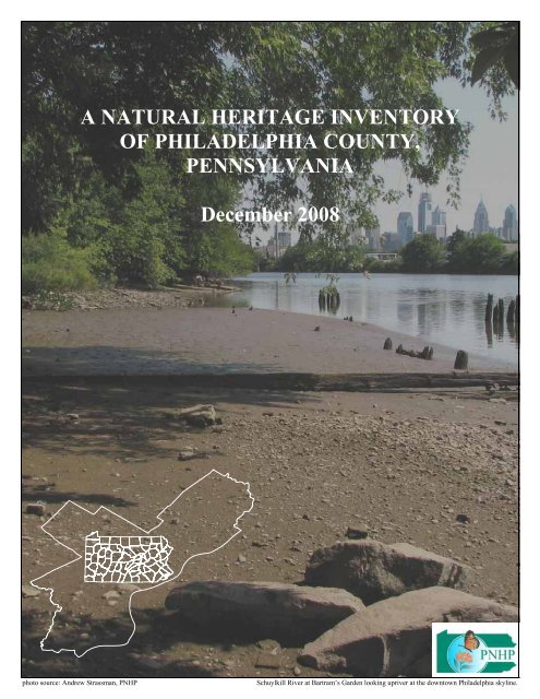
A NATURAL HERITAGE INVENTORYOF PHILADELPHIA COUNTY,PENNSYLVANIADecember <strong>2008</strong>photo source: Andrew Strassman, PNHPSchuylkill River at Bartram’s Garden looking upriver at the downtown <strong>Philadelphia</strong> skyline.
A NATURAL HERITAGE INVENTORYOF PHILADELPHIA COUNTY, PENNSYLVANIADecember <strong>2008</strong>Submitted to:City of <strong>Philadelphia</strong>Prepared by:Pennsylvania <strong>Natural</strong> <strong>Heritage</strong> ProgramWestern Pennsylvania ConservancyMiddletown Office208 Airport DriveMiddletown, Pennsylvania 17057Copies of this document may be view at:City of <strong>Philadelphia</strong>orfrom the web in electronic format at:http://www.naturalheritage.state.pa.us/CNAI_Download.aspxThis project was funded through a grant from the William Penn Foundation.The Pennsylvania <strong>Natural</strong> <strong>Heritage</strong> Program (PNHP) is a partnership between the Western Pennsylvania Conservancy (WPC), thePennsylvania Department of Conservation and <strong>Natural</strong> Resources (DCNR), the Pennsylvania Game Commission (PGC), and thePennsylvania Fish and Boat Commission (PFBC). PNHP is a member of NatureServe, which coordinates natural heritage efforts throughan international network of member programs—known as natural heritage programs or conservation data centers—operating in all 50 U.S.states, Canada, Latin America and the Caribbean.
PREFACEThe <strong>Philadelphia</strong> <strong>County</strong> <strong>Natural</strong> <strong>Heritage</strong> <strong>Inventory</strong>is a document compiled and written by thePennsylvania <strong>Natural</strong> <strong>Heritage</strong> Program (PNHP) ofthe Western Pennsylvania Conservancy (WPC). Itcontains information on the general locations of rare,threatened, and endangered species, of the highestquality natural areas in the county, and area in needof restoration to native habitat. It is not an inventoryof all open space and is based on the best availableinformation. It is intended as a conservation tooland should in no way be treated or used as a fieldguide.Accompanying each site description are generalmanagement and restoration recommendations thatwould help to ensure the protection and continuedexistence of these natural communities, rare plants,and animals and enhance the quality of existinggreenspace and open space. The recommendationsare based on the biological needs of these elements(communities and species) and the efforts necessaryto maintain the health of the natural system ingeneral. The recommendations are strictly those ofthe Western Pennsylvania Conservancy and do notnecessarily reflect the policies of the state or thepolicies of the City of <strong>Philadelphia</strong>, for which thereport was prepared.Managed areas such as federal, state, city lands,private preserves, and conservation easements arealso provided on the maps where that informationwas available to us. This information is useful indetermining where gaps occur in the protection ofland with locally significant habitats, naturalcommunities, and rare species. The mappedboundaries are approximate and our list of managedareas may be incomplete, as new sites are alwaysbeing added.Implementation of the recommendations is up to thediscretion of the landowners. However, cooperativeefforts to protect the highest quality natural featuresthrough the development of site-specificmanagement plans are greatly encouraged.Landowners working on the management of, or siteplans for, specific areas described in this documentare encouraged to contact the Pennsylvania <strong>Natural</strong><strong>Heritage</strong> Program for further information.Although an attempt was made through meetings,research, and informal communications to locate thesites most important to the conservation ofbiodiversity within the county, it is likely that somethings were missed. Anyone with information onsites that may have been overlooked or the locationof species of concern should contact the responsibleagency (see Executive Summary page ix).The results presented in this report represent a snapshot in time, highlighting the sensitive natural areaswithin <strong>Philadelphia</strong> and areas with a high potential for ecological restoration. The sites in the <strong>Philadelphia</strong><strong>County</strong> <strong>Natural</strong> <strong>Heritage</strong> <strong>Inventory</strong> have been identified to help guide wise land use and county planning.The <strong>Philadelphia</strong> <strong>County</strong> <strong>Natural</strong> <strong>Heritage</strong> <strong>Inventory</strong> is a planning tool, but is not meant to be used as asubstitute for environmental review, since information is constantly being updated as natural resources areboth destroyed and discovered. Applicants for building permits and Planning Commissions should conductfree, online, environmental reviews to inform them of project-specific potential conflicts with sensitivenatural resources. Environmental reviews can be conducted via a link on the Pennsylvania <strong>Natural</strong><strong>Heritage</strong> Program’s website, at http://www.naturalheritage.state.pa.us/. If conflicts are noted during theenvironmental review process, the applicant is informed of the steps to take to minimize negative effects oniii
ACKNOWLEDGEMENTSThis project was funded by a grant from the WilliamPenn Foundation. Additional in-kind support wasprovided by the Western Pennsylvania Conservancyand the City of <strong>Philadelphia</strong>. Thanks to everyonewho provided financial and administrative supportfor the inventory. Without your help, this studywould not have been possible.The species information utilized in the inventorycame from many sources as well as our own fieldsurveys. We wish to acknowledge all of those whocarried out botanical and zoological survey workover the years. Without their contributions, thissurvey would have been far less complete.The report benefited from the help of localnaturalists, conservationists, and institutions whogave generously of their time. Thanks to all the helpand support given by:Academy of <strong>Natural</strong> Sciences, Phila. – Rich HorwitzTim Block – Morris Arboretum, BotanistDelaware River City Corporation – Sarah ThorpeFairmount Park Commission – Tom Witmer, Sarah LowJohn Heinz NWR – Gary Stolz, Brendalee PhillipsPartnership for the Delaware Estuary – Danielle Kreeger<strong>Philadelphia</strong> Industrial Development Corporation<strong>Philadelphia</strong> Water Department – Glen Abrams, LanceButler, Jason Cruz, Debby PajerowskiAnn Rhoads – Morris Arboretum, BotanistKeith Russell – Pennsylvania Audubon Society, Phila.Area CoordinatorSchuylkill Center for Environmental EducationSchuylkill River Development CorporationStephanie Seymour – Seasonal Field EcologistUS Army Corps of Engineers – <strong>Philadelphia</strong> DistrictMany thanks to everyone who participated in theTechnical Advisory Committee, including many ofthe <strong>Philadelphia</strong> GreenPlan Management Group, byreviewing the draft <strong>Natural</strong> <strong>Heritage</strong> <strong>Inventory</strong>Report:Robert Allen – Fairmount Park CommissionJoan Blaustein – Phila. FPC Director of Environment,Stewardship, & EducationWilliam Bradley – Phila. Division of TechnologySantiago Burgos – Phila. Commerce DepartmentDavid Burke – DEP, Watershed ManagerLance Butler – Phila. Office of WatershedsJason Cruz – Phila. Office of WatershedsMark Focht – Fairmount Park CommissionEva Gladstein – Phila. Commerce DepartmentDiane Kripas – DCNR, Recreation and Conservation,GreenwaysAlex MacDonald – DCNR, Recreation and Conservation,GreenwaysBarbara McCabe – Phila. Recreation DepartmentHoward Neukrug – Phila. Office of WatershedsAnn Rhoads – Morris Arboretum, BotanistsKeith Russell – PA Audubon Society, Phila. AreaCoordinatorFlavia Rutkosky – US FWS, Regional BiologistDiane Schrauth – William Penn FoundationGary Stolz – John Heinz National Wildlife RefugeCarolyn Wallis – DCNR, Recreation and ConservationTom Witmer – Fairmount Park CommissionAlan Urek – Phila. City Planning CommissionFinally, we especially wish to thank the manylandowners that granted us permission to conductinventories on their lands; they are too numerous tolist. The task of inventorying the natural heritage of<strong>Philadelphia</strong> <strong>County</strong> would have been far moredifficult without this tremendous pool of informationgathered by many people over many years.Sincerely,Andrew StrassmanPennsylvania <strong>Natural</strong> <strong>Heritage</strong> ProgramThis reference may be cited as:Pennsylvania <strong>Natural</strong> <strong>Heritage</strong> Program. <strong>2008</strong>. A <strong>Natural</strong> <strong>Heritage</strong> <strong>Inventory</strong> of <strong>Philadelphia</strong> <strong>County</strong>. WesternPennsylvania Conservancy. Middletown, PA.iv
NORRISTOWNLANSDOWNE222210129121311GERMANTOWNFigure 1. Map of sites in <strong>Philadelphia</strong> <strong>County</strong> by township and USGS Quadrangle.CAMDENHATBOROFRANKFORD876556411LANGHORNE2BEVERLYThis map displays boththe <strong>Natural</strong> <strong>Heritage</strong> <strong>Inventory</strong>Significance Rank and ConservationPriority Rank of each site: SignificanceRank is conveyed by the fill color of thesite and Conservation Priority Rank isconveyed by the outline color of the site. Theranking system is explained in the results section.StreamsUSGS QuadranglesConservation Priority Rank311Figure 1. <strong>Philadelphia</strong> <strong>Natural</strong><strong>Heritage</strong> <strong>Inventory</strong> <strong>Heritage</strong>Significance and ConservationPriority.SiteSite Name#1 Poquessing Creek Greenway2 Poquessing Creek Uplands& Benjamin Rush State Park3 Byberry Creek Upland Forest4 Northeast <strong>Philadelphia</strong> Airport5 Pennypack Park6 Delaware River Shoreline7 Frankford Creek8 Tacony Creek Park9 Wissahickon Valley10 Schuylkill River Uplands11 Fairmount Park12 Tidal Schuylkill River Corridor13 Schuylkill River Oil Lands - North14 Schuylkill River Oil Lands - South15 Franklin Delano Roosevelt Park16 <strong>Philadelphia</strong> Navy Yard17 Army Corps Yard18 Mingo Creek Tidal Area19 Fort Mifflin Shoreline20 Eastwick Property21 John Heinz National Wildlife Refuge& Little Tinicum Island22 Cobbs Creek Park and GreenwayBRISTOL2121BRIDGEPORT19201819171415PHILADELPHIAWOODBURY= 1 / 4 square mile160 acres16ImmediateNear-term<strong>Natural</strong> <strong>Heritage</strong> <strong>Inventory</strong> Significance RankExceptionalHighEnhancementOpportunisticNotableLocalNone0 1.5 3 6 9 12MilesvMOUNT HOLLY
Site #Table 1.Alphabetical Site Index Numbered Roughly Northeast to Southwest.Site NameUSGSQuadrangle(s)ConservationPriority*<strong>Natural</strong><strong>Heritage</strong>Significance*Page #17 Army Corps Yard <strong>Philadelphia</strong> Opportunistic Notable 903 Byberry Creek Upland ForestHatboro,FrankfordNear-term Local 11622Cobbs Creek Park and Lansdowne,Greenway<strong>Philadelphia</strong>Enhancement Notable 67Beverly, Camden,6 Delaware River Shoreline Frankford, Immediate Notable 133<strong>Philadelphia</strong>,20 Eastwick PropertyLansdowne,<strong>Philadelphia</strong>Immediate Notable 8211 Fairmount ParkGermantown,<strong>Philadelphia</strong>Enhancement Notable 6819 Fort Mifflin ShorelineBridgeport,<strong>Philadelphia</strong>, Near-term High 86Woodbury7 Frankford CreekCamden,FrankfordEnhancement Local 12815 Franklin Delano Roosevelt Park <strong>Philadelphia</strong> Enhancement Notable 6921John Heinz National WildlifeBridgeport,Refuge &LansdowneLittle Tinicum IslandImmediate Exceptional 7618 Mingo Creek Tidal Area <strong>Philadelphia</strong> Immediate Notable 944 Northeast <strong>Philadelphia</strong> AirportBeverly,FrankfordOpportunistic Local 1245 Pennypack Park Frankford Enhancement Notable 6916 <strong>Philadelphia</strong> Navy Yard <strong>Philadelphia</strong> Near-term High 981 Poquessing Creek GreenwayBeverly,Frankford, Immediate Local 70Langhorne,2Poquessing Creek Uplands Beverly,& Benjamin Rush State Park FrankfordImmediate Local 12013Schuylkill River Oil Lands -North<strong>Philadelphia</strong> Opportunistic None 10214Schuylkill River Oil Lands -South<strong>Philadelphia</strong> Opportunistic None 10210 Schuylkill River UplandsGermantown,NorristownNear-term Notable 1128 Tacony Creek Park Frankford Enhancement Local 7212 Tidal Schuylkill River Corridor <strong>Philadelphia</strong> Immediate Notable 1079 Wissahickon Valley Germantown Enhancement Notable 72Table 1. Alphabetical Site Index Numbered Roughly Northeast to Southwest.*For an explanation of ranking see method section page 47vii
viii
EXECUTIVE SUMMARYIntroductionEXECUTIVE SUMMARYAlthough urban landscapes have drastically alteredtheir natural settings, nature and natural processesabound within even highly developed urban areas.Within <strong>Philadelphia</strong> these processes are exemplifiedby the bald eagles nesting downtown, the millions ofAmerican shad migrating through the Delaware andSchuylkill Rivers each spring northward to theirbreeding habitat, and the white-tailed deer browsingshrubs in people’s backyards. These events, ratherthan accidents or rare occurrences, are an active partof a functioning landscape where the cityscape andthe wildlands not only meet, but integrate.With actions to reduce pollution and betterstewardship of natural resources, these interactionswill occur within the city on a more frequent basis,though there are actions that can be taken toencourage them to occur in a regular and sustainablemanner and in a pattern compatible with urban life.Through changes in how <strong>Philadelphia</strong> and itsresidents perceive development, open space, andgreenspace the cycle of re-development within thecity can produce areas that meet not only the needfor a revitalized cityscape, but the need forintegrated wildlands too. GreenPlan <strong>Philadelphia</strong>(available at www.greenplanphiladelphia.com),through a series of targets and recommendations,will provide the city with the framework to makesome of these changes and to help accomplish someof the recommendations provided in this document.History<strong>Philadelphia</strong> occupies land that has hosted Europeansettlements since the early 1600’s, and NativeAmerican tribes long before then. Starting withsmall farmsteads along the tidal marshes of theDelaware River, Pennsylvania came into existencewith William Penn’s charter in 1681. Shortlyafterwards, William Penn instructed the formation ofthe town of <strong>Philadelphia</strong> with these orders to hiscommissioners:"Let every house be placed, if the personpleases, in the middle of its plat, as to thebreadthway of it, so that there may be ground oneach side for gardens or orchards, or fields, thatit may be a greene country towne, which willnever be burnt & always wholesome."William Penn's Instructions to hisCommissioners, September 30 th , 1681This vision was short lived as the reality ofeconomic and social needs superseded Penn’s ideaof an agrarian utopia. By the time BenjaminFranklin arrived in <strong>Philadelphia</strong> in 1723, a mere 42years after Penn’s instructions, the town was alreadya bustling center of trade in the new world and oneof the largest cities in North America.During the past three centuries the natural landscapeof <strong>Philadelphia</strong> has been heavily modified by humanuse. Starting as a landscape of sweeping tidalmarshes along the Schuylkill and Delaware Riversthat marched up to the start of Penn’s Woods, earlycolonists transformed this into an agriculturallandscape of small farmsteads and woodlots. As<strong>Philadelphia</strong>’s population and economy grew,factories, warehouses, a port, and the infrastructureto support them (such as roads, dams, and houses)arouse around the point of Penn’s Landing and theagricultural fields (and forests) were pushed furtheraway. As the population grew and technologyprogressed, the marshes were filled and the riverswere walled in and straightened.Today little of this original natural landscaperemains within the borders of the City of<strong>Philadelphia</strong>. As incorporated in the 1854 Act ofConsolidation, the City of <strong>Philadelphia</strong> coversapproximately 170 square-miles. Within that area isapproximately 13 square-miles of parkland managedby the Fairmount Park System of which 7.5 squaremilesis managed as natural area. This park system,while one of the most extensive of any city in thenation, offers challenges to maintaining naturaldiversity in a highly-developed fully urban setting.OverviewAs part of the <strong>Philadelphia</strong> City PlanningCommission’s initiative, Imagine <strong>Philadelphia</strong>:Laying the Foundation, GreenPlan <strong>Philadelphia</strong>aims to assess the City’s needs to establishecologically sustainable infrastructure in respect tothe future vision <strong>Philadelphia</strong>’s residents have oftheir city. An important aspect of GreenPlanix
EXECUTIVE SUMMARY<strong>Philadelphia</strong> is an up-to-date inventory of theirexisting and potential ecological resources.Because of the degree of development within<strong>Philadelphia</strong>, the existing natural resources havebeen well documented. This includes recent workby the Fairmount Park Commission, the <strong>Philadelphia</strong>Water Department, and the Academy of <strong>Natural</strong>Sciences to survey the city’s parklands. In an effortnot to duplicate work already conducted, thePennsylvania <strong>Natural</strong> <strong>Heritage</strong> Program (PNHP)conducted surveys on public and private lands notincluded in the original Fairmount Park master planand on lands not currently managed as parks. Thisgenerally includes brownfields, lands owned byother city agencies or agents of the city, and privatelands where we secured access permission.Our survey efforts primarily focused on thediscovery of new populations of plants and animalsconsidered rare, threatened, or endangered within theCommonwealth. When these species were found wedocumented the occurrence and noted the conditionsthey were growing under. Often, we found nospecies of concern, but did create a description of thecurrent site conditions for use in site descriptionsand restoration recommendations sections in thefinal report.Overall, twenty-nine sites totaling approximately3,000 acres of land were identified in 2007; only themost promising areas were surveyed within the sites.For each of these sites we include a generaldescription of the current habitat, any rare speciesfound there, conservation recommendation for therare species present, and restorationrecommendations to increase the natural habitatvalue.MethodsSixty of sixty-seven county inventories have beencompleted in Pennsylvania to date. The <strong>Philadelphia</strong><strong>Natural</strong> <strong>Heritage</strong> <strong>Inventory</strong> followed similarmethodologies as previous inventories, which areconducted in the following stages:Information GatheringA review of various databases determined wherelocations for special concern species and importantnatural communities were known to exist in<strong>Philadelphia</strong>. Knowledgeable individuals wereconsulted concerning the occurrence of rare plantsand unique natural communities in the county.Geologic maps, United States Geological Survey(USGS) topographical maps, National Wetlands<strong>Inventory</strong> maps, recent aerial imagery, and otherpublished materials were also used to identify areasof potential ecological significance.Field WorkAreas identified as potential inventory sites werescheduled for ground surveys. After obtainingpermission from landowners, sites were examined toevaluate the condition and quality of the habitat andto classify the communities present. The flora, fauna,level of disturbance, approximate age of any naturalcommunity, and local threats were among the datarecorded for each site. Sites were not groundsurveyed in cases where permission to visit a site wasnot granted, when enough information was availablefrom other sources, or when time did not permit.Data AnalysisData obtained during the 2007 and <strong>2008</strong> fieldseasons was combined with prior existing data andsummarized. All sites with species or communitiesof statewide concern, as well as sites with a highrestoration potential will be mapped and described.The boundaries defining each site will be based onphysical and ecological factors, and specificationsfor species protection provided by governmentjurisdictional agencies.ResultsDuring the 2007 and <strong>2008</strong> field seasons PNHP staffand contracted experts conducted surveys around<strong>Philadelphia</strong> (Fig. 1, pg. v, Table 1, pg. vii). Overthis time approximately 52 person days of fieldworkwere conducted in <strong>Philadelphia</strong> at 20 distinctlocations. New occurrences of rare, threatened, andendangered species were found during these surveyswith these finds concentrated along the tidal areas ofthe Delaware and Schuylkill Rivers. Among thehigh points was the confirmation of a species knownonly from historic records; this species, Needham’sskimmer dragonfly (Libellula needhami), was foundalong the Delaware River shoreline.x
EXECUTIVE SUMMARYAdditionally, our surveys indicate that restorationefforts within the tidal area have a high potential forsuccess given the abundant local seed sources in theJohn Heinz National Wildlife Refuge and along theNew Jersey shoreline. This is evident through thetidal wetland restoration project at Pennypack on theDelaware Park where the wetland and uplandsupport several Pennsylvania species of concern.However, our surveys found that non-native invasivespecies may be the greatest threat to natural areaswithin <strong>Philadelphia</strong> and the greatest impediment tonatural-land restoration projects. These species havetaken over extensive areas of <strong>Philadelphia</strong> displacingthe native plants and the animals they support,decreasing the overall ecological (native) diversityand values.Other issues affecting the habitat value of several ofthe sites we visited are illegal dumping of garbage,construction materials, and abandoned cars, andATV use within the sites. These actions have causedmoderate to extensive damage at several sites andwill need to be mitigated through enforcement ofexisting ordinances.General Conservation Recommendations<strong>Philadelphia</strong> has a number of groups and institutionspursuing the protection and restoration of naturalareas within the city. The following are generalrecommendations for protecting the biological healthof the City of <strong>Philadelphia</strong>.1. Consider conservation initiatives and toolsfor natural areas on private land2. Orient management and restoration plans toaddress species of special concern andnatural communities as targets ofconservation (not simply open or multi-usespace) through the active maintenance ofexisting high quality natural area andrestoration of more degraded spaces3. Protect bodies of water with adequatenatural buffers4. Provide for buffers around natural areas5. Increase the connectivity of the city’s greenspace with surrounding landscapes6. Encourage and utilize existing grassrootsorganizations interested in preserving andrestoring the city’s natural areas7. Manage for control of known invasivespecies and early detection of new invasivespecies in key natural area8. Promote community education on theimportance of ecological health in urbanenvironments9. Incorporate <strong>Natural</strong> <strong>Heritage</strong> <strong>Inventory</strong>information into city planning effortsDiscussion and <strong>County</strong>-specificRecommendationsPlan for biodiversity and ecological health:Provisioning for the future health of ecologicalresources in <strong>Philadelphia</strong> will require action onmany fronts. Special consideration should be givento steward specific sites that host unique species andcommunities. Broadscale planning efforts shouldendeavor to create contiguity of natural habitats.Restoration efforts to alleviate water pollution andrestore ecological function to damaged landscapesand waterways should be undertaken with specialattention given to riparian and tidal habitatrestoration.Two problems needing special attention within<strong>Philadelphia</strong> are the prevalence of non-nativeinvasive species and white-tailed deer. Theseproblems are interrelated in that deer prefer to eatnative plants and thus promote the spread of nonnativeplant species. Without active, coordinated,and targeted control of deer and non-native plantspecies followed by restoration and maintenance ofreestablished native species the existing natural areaswithin the city will continue to deteriorate. Whiledaunting, this can be achieved by the use of deerfences and control programs and the encouragementand mobilization of private citizens and publicgroups. Facilitating “weed warriors” groups withinthe city and providing for the replanting of nativespecies in maintained areas will work towards thegoal of preserving the biological health of thelandscape.Wetland/Aquatic Communities: <strong>Philadelphia</strong>’saquatic systems have undergone substantialmodification over the past 300 years. Oncesupporting extensive lowland and floodplain forestsand 10 to 20 square-miles of tidal marsh, todaymany of the rivers are confined by armored banks,xi
EXECUTIVE SUMMARYhave extensively urbanized headwaters, and lessthan ¼ square-mile of tidal marsh remains within thecity proper. To restore water quality within the citythese issues need to be addressed through large-scaleplanning initiatives. This can occur throughreconnecting the 100-year floodplain to rivers andcreeks throughout the city, actively restoring thetidal marsh on the Delaware and Schuylkill Rivers,and initiating a concerted effort to reduce combinedsewage outflows and stormwater discharge.Stewardship or restoration of native forestcommunities in and beyond riparian buffers alongwaterways will greatly improve water quality andenhance the habitat value for various aquatic andsemi-aquatic species. Attending to the basicecological functions of streams and wetlands willincrease human welfare by ensuring the continuedavailability of quality water for human communities,enabling the restoration of healthy fisheries, andenhancing the quality of life for city residents.One suggested project to meet these goals would beestablishing a public greenway along the Delawareand Schuylkill Rivers that incorporates reconnectionof the floodplain and reestablishment of tidal marshas a component. This would create a green corridoralong the city’s shore in a flood-prone area and actas a connector between the existing parks along thePennypack, Wissahickon, and Frankford Creekswith potential connection to Poquessing Creek andeventually Neshaminy State Park.Forest Communities: In the forested landscapes,objectives for large-scale planning should includemaintaining and increasing contiguity andconnectivity of forested land. Contiguity isimportant for the enhanced habitat values; however,for many species, it is equally critical that naturalcorridors are maintained, which connect forests,wetlands, and waterways. For example, manyamphibians and dragonflies use an aquatic orwetland habitat in one phase of their life thenmigrate to an upland or forested habitat for theiradult life. Either habitat alone cannot be utilizedunless a corridor exists between them.In areas where these connections have been severed“reforestry” activities can help to restore contiguous,usable habitat. In conjunction with the reforestationof riparian areas within <strong>Philadelphia</strong> throughprojects such as Treevitalize, reconnection of uplandforests can be achieved. Projects to replant nativetrees along streets lacking tree cover and in areas ofunder- and unutilized land can quickly increase treecover within <strong>Philadelphia</strong>. Planting projects providenot only the benefits of reducing the urban “heatisland” effect, but act as natural habitat steppingstones through the urban environment.Evaluating proposed activity within sites: A veryimportant part of encouraging conservation of thesites identified within the <strong>Philadelphia</strong> <strong>Natural</strong><strong>Heritage</strong> <strong>Inventory</strong> is the careful review of proposedland use changes or development activities thatoverlap with or abut <strong>Natural</strong> <strong>Heritage</strong> Areas. This isespecially important when examining the large areasof open land along the Schuylkill and DelawareRivers. These flood-prone areas are affectivelywithin the river during times of flooding and shouldbe consider unfit for major building projects.Conversion of these areas, especially the portionswithin the 100-year floodplain, to greenspace shouldbe a priority as the redevelopment of <strong>Philadelphia</strong>’swaterfront is undertaken. The following overviewshould provide guidance in the review of theseprojects or activities.• Always contact the <strong>Philadelphia</strong> City PlanningCommission.The City Planning Commission should be aware ofall activities that may occur within <strong>Natural</strong> <strong>Heritage</strong>Areas in the city so that they may interact with theother necessary organizations or agencies to betterunderstand the implications of proposed activities.They can also provide guidance to the landowners,developers, or project managers as to possibleconflicts and courses of action.• Conduct free online preliminary environmentalreviewsApplicants for building permits should conduct free,online, environmental reviews to inform them ofproject-specific potential conflicts with sensitivenatural resources. Environmental reviews can beconducted by visiting the Pennsylvania <strong>Natural</strong><strong>Heritage</strong> Program’s website, athttp://www.naturalheritage.state.pa.us/. If conflictsxii
EXECUTIVE SUMMARYare noted during the environmental review process,the applicant is informed of the steps to take tominimize negative effects on the county’s sensitivenatural resources.Depending upon the resources contained within the<strong>Natural</strong> <strong>Heritage</strong> Area, the agencies/entitiesresponsible for the resource will then be contacted.The points of contact and arrangements for thatcontact will be determined on a case-by-case basisby the city and the Department of EnvironmentalProtection. In general, the responsibility forreviewing natural resources is partitioned amongagencies in the following manner:• U.S. Fish and Wildlife Service for all federallylisted plants and animals.• Pennsylvania Game Commission for all state andfederally listed terrestrial vertebrate animals.• Pennsylvania Fish and Boat Commission for allstate and federally listed reptiles, amphibians, andaquatic vertebrate and invertebrate animals.• Pennsylvania Bureau of Forestry for all state andfederally listed plants.• Pennsylvania Department of Conservation and<strong>Natural</strong> Resources for all natural communities,terrestrial invertebrates, and species not fallingunder the above jurisdictions.PNHP and agency biologists can provide moredetailed information with regard to the location ofnatural resources of concern in a project area whenthis information is available for public distribution,the needs of the particular resources in question, andthe potential impacts of the project on thoseresources.• Plan aheadIf a ground survey is necessary to determine whethersignificant natural resources are present in the areaof the project, the agency biologist reviewing theproject will recommend a survey be conducted.PNHP, through the Western PennsylvaniaConservancy, or other knowledgeable contractorscan be retained for this purpose. Early considerationof natural resource impacts is recommended to allowsufficient time for thorough evaluation. Given thatsome species are only observable or identifiableduring certain phases of their life cycle (i.e., theflowering season of a plant or the flight period of abutterfly), a survey may need to be scheduled for aparticular time of year.• Work to minimize environmental degradationIf the decision is made to move forward with aproject in a sensitive area, PNHP can work withmunicipal officials and project personnel during thedesign process to develop strategies for minimizingthe project’s ecological impact while meeting theproject’s objectives. The resource agencies in thestate may do likewise.Conclusion<strong>Philadelphia</strong>’s natural landscape is fragmented anddegraded by three centuries of urban development,but maintains aspects of the original pre-settlementhabitats. As the City of <strong>Philadelphia</strong> moves forwardwith urban infill plans and redevelopment ofabandoned industrial areas, greenspace and naturalareas should be a serious consideration. Significantand substantial opportunities exist for thefortification of rare species populations, therestoration of native habitat, and the reconnection ofisolated patches of existing native habitat to formcontiguous corridors of green space throughout thecity. These green spaces can help expand thealready impressive public park system into areasunderserved by these amenities to help make<strong>Philadelphia</strong> a more attractive place to live andwork. However, these opportunities are transient atbest and if they are not utilized now the vision ofWilliam Penn for his City of <strong>Philadelphia</strong> will fadefurther into the past. GreenPlan <strong>Philadelphia</strong> offersthe opportunity to establish a framework forecologically sustainable infrastructure developmentwith the <strong>Philadelphia</strong> <strong>Natural</strong> <strong>Heritage</strong> <strong>Inventory</strong>providing a roadmap to the areas of greatestecological potential.xiii
EXECUTIVE SUMMARYTable 2.The sites of significance for the protection of biological diversity in <strong>Philadelphia</strong> <strong>County</strong> categorized by naturalheritage significance rank. More in-depth information on each site including detailed site descriptions andmanagement recommendations where appropriate can be found in the text of the report following the maps foreach site. Quality ranks, legal status, and last observation dates for species of special concern and naturalcommunities are located in the table that precedes each map page. Appendix IV gives an explanation of the PA<strong>Heritage</strong> and Global vulnerability ranks. Note that “Species of Special Concern” denotes a species not named at therequest of the agency overseeing its protection.Site #Site NameUSGS Quadrangle(s)Exceptional Significance Sites21John Heinz National WildlifeRefuge & Little Tinicum IslandBridgeport, LansdowneHigh Significance Sites1916Fort Mifflin ShorelineBridgeport, <strong>Philadelphia</strong>, Woodbury<strong>Philadelphia</strong> Navy Yard<strong>Philadelphia</strong>Notable Significance Sites17226Army Corps Yard<strong>Philadelphia</strong>Cobbs Creek GreenwayLansdowne, <strong>Philadelphia</strong>Delaware River ShorelineBeverly, Camden, Frankford,<strong>Philadelphia</strong>DescriptionTable 2. Ranking of Sites of <strong>Natural</strong> <strong>Heritage</strong> <strong>Inventory</strong> Significance.The Tinicum Marsh system hosts a suite of species found only along the tidalDelaware River in Pennsylvania. These species are limited to the marsh and a fewnearby locations because this is the limit of tidal influence within theCommonwealth. These species break out into four general groups: plants withfifteen listed species; birds with nine listed species, herptiles with three listedspecies and two listed communities.Fort Mifflin and the surrounding shoreline remain biologically important becausethey maintain aspects of the original tidal marsh that composed the area. Thesetidally influenced areas dot the shoreline from the fort downriver to the mouth ofDarby Creek and include seven plant, two insect, and one bird species of concernalong with one community of concern. Additionally, the Delaware River adjacentto this site hosts extensive beds of floating aquatic vegetation.Large areas of the Navy Yard were reverting to natural cover opening them up tocolonization by grassland species with the lower, wetter areas supporting wetlandspecies. The site supports 72 native plant species with an additional 46 non-nativeplant species recorded at the site. Of these plant species five are listed as speciesof concern in the Commonwealth. An additional two bird species of concern arefound utilizing the Navy Yard.This site provides excellent hunting habitat for adult dragonflies and damselflieswith two species of concern noted at the site feeding on the extensive aggregationof insects over the ponds. One of the local peregrine falcons (Falco peregrinus)has also been observed feeding at this location. It seems likely that these speciesof concern are reproducing surrounding landscape and simply refueling andmaturing here.This site supports several different populations of a single species of concern,elephant's foot (Elephantopus carolinianus). This plant, typically found muchfurther south in the United States, is found in a few of the southern counties of theCommonwealth.This extensive site along the Delaware River shoreline is tidally influenced alongits length and has the ability to support tidal species of concern throughout the site.The species of concern noted within this site are only found in specific areas wheretidal habitat remains protected and in a few of the more naturally managed park.Pages7686989067133xiv
EXECUTIVE SUMMARYTable 2: continuedSite #Site NameUSGS Quadrangle(s)DescriptionPage(s)Notable Significance Sites cont.2011151851012Eastwick PropertyLansdowne, <strong>Philadelphia</strong>Fairmount ParkGermantown, <strong>Philadelphia</strong>Franklin Delano Roosevelt Park<strong>Philadelphia</strong>Mingo Creek Tidal Area<strong>Philadelphia</strong>Pennypack ParkFrankfordSchuylkill River UplandsGermantown, NorristownTidal Schuylkill River Corridor<strong>Philadelphia</strong>This property has reverted to a wild, if weedy, landscape that is supporting twoplant species of concern: field dodder (Cuscuta pentagona) and forked rush(Juncus dichotomus). These are both residents of disturbed areas and do well inthis environment and likely originated in the John Heinz National Wildlife Refuge,which the property abuts on both its south and west sides.This park once supported populations of species of concern, but the level ofmanagement and development within the park has reduced the amount of naturalhabitat to a very small area. While these areas have the potential to maintainpopulations of species of concern, only one is current known. Pied-billed grebes(Podilymbus podiceps) occasionally nest on the East Park Reservoir and fledgedyoung in 2007. This park offers a significant island of green for many nativewildlife species in the urban environment.This park, part of the Fairmount Park System, still maintains limited tidalconnectivity and some of the tidal species associated with it. Within the site aretwo plant species of concern associated with tidal areas: multiflowered mudplantain(Heteranthera multiflora) and Walter's barnyard-grass (Echinochloawalteri). Additionally, the park contains an extensive array of odonates supportedby the lagoons.This area, which has been only partially surveyed, contains habitat that supportsNeedham’s Skimmer (Libellula needhami), a species of dragonfly last recorded inthe Commonwealth in 1945 and found again at this site in 2007. The extensiveareas of wetland-like habitat on this site are the likely source of this occurrence.This park, built around a forested riparian corridor running from the DelawareRiver up Pennypack Creek into Montgomery <strong>County</strong>, supports nesting osprey(Pandion haliaetus) in its upper reaches and two wetland species towards its tidalmouth. The small, tidal wetland at the mouth of the creek was created as amitigation project and maintains two species of concern, the Halloween pennantdragonfly (Celithemis eponina) and the marsh wren (Cistothorus palustris).This large, amazingly intact patch of land offers upland forest, meadow, and highgradientfirst-order streams that support three plant species of concern and offerhabitat to many other species rare in the area. Found in the more open meadowlikeareas oblique milkvine (Matelea obliqua) and round-leaved thoroughwort(Eupatorium rotundifolium) are residents of early-successional habitat whilereflexed flatsedge (Cyperus refractus) is a species noted on this site only along thefloodplain of the Schuylkill River.Acting as a nesting and foraging area for a pair of Peregrine Falcons (Falcoperegrinus), the northern portion of this reach of the Schuylkill River is otherwisefully urbanized and not noted for any other species of concern. Furtherdownstream the tidal Schuylkill River helps support three plant species of concernat this site. Two, river bulrush (Schoenoplectus fluviatilis) and salt-marsh waterhemp(Amaranthus cannabinus), are known from a created wetland while theother, annual wild rice (Zizania aquatica), is known from the tidal mudflats foundalong the river banks. Because of safety concerns, a majority of this area has notbeen surveyed including the forest and wetland patches that have aerialphotography signatures comparable to areas known to harbor species of concern.For this reason we believe this site will be found to host species concern andwarrant a higher NHI significance ranking.8268699469112107xv
EXECUTIVE SUMMARYTable 2: continuedSite #Site NameUSGS Quadrangle(s)DescriptionPage(s)Notable Significance Sites cont.9Wissahickon ValleyGermantown, NorristownWhile this park is known for its forested streams and uplands, two of the species ofconcern noted within the park are plants generally found in open, earlysuccessionalhabitats. Within the Houston Meadows restoration site arepopulations of forked rush (Juncus dichotomus) and round-leaved thoroughwort(Eupatorium rotundifolium). Another species, autumn bluegrass (Poa autumnalis),is a plant of moist woods and is found within the park.72Locally Significant Sites3Byberry Creek Upland ForestFrankford, HatboroWhile no tracked species have yet been discovered within these woods, they offeran example of some of the forest that once covered this region. Dominated byAmerican beech (Fagus americana), red oak (Quercus rubra), and tulip poplar(Liriodendron tulipifera) this forest also supports 127 native species of plant alongwith numerous other insects, birds, and mammals.While this site currently offers little possibility of providing habitat for species ofconcern, if restored and managed it would offer a forested riparian corridor fromthe Delaware River through urban <strong>Philadelphia</strong>.Given the current management of this are as an active airport there is littlepotential for this site to host species of concern. However, the large grassy openareas within the site offer habitat known to support Lepidoptera species of concernwithin the city, which PNHP was not able to survey for given safety concerns.Currently, no species of concern are known from this site, but this is possibly dueto incomplete survey of the area. Acting as a natural forested riparian corridorfrom the tidal Delaware River north into both Bucks and Montgomery Countiesthis site offers the potential to host species of concern.This area of open upland meadow likely hosts plant species of concern that hassimply been missed. Additionally, the site hosts species that, while not trackedwithin the Commonwealth, are uncommon within <strong>Philadelphia</strong>.Tacony Park is not known to host any species of concern. Acting as an importantwildlife corridor up until the Frankford Creek site border, the wildlife value of thissite could be significantly improve with the completion of the corridor to theDelaware River.1167Frankford CreekCamden, Frankford1284Northeast <strong>Philadelphia</strong> AirportBeverly, Frankford1241Poquessing Creek GreenwayBeverly, Frankford, Langhorne702Poquessing Creek Uplands andBenjamin Rush State ParkBeverly, Frankford1208Tacony ParkFrankford72No <strong>Heritage</strong>-significance Sites1416Schuylkill River Oil Lands –North & South<strong>Philadelphia</strong>These sites are still actively used for the processing of petroleum products.Additionally, the area has experienced sustained industrial activity for over 150years and is highly disturbed and degraded with only a few small, highly isolatedareas maintaining any natural cover. For this reason these sites warrant no NHIsignificance rank.102xvi
EXECUTIVE SUMMARYTable 3: continuedSite #Site NameUSGS Quadrangle(s)DescriptionPagesNear-term Preservation Need3Byberry Creek Upland ForestFrankford, HatboroThis large patch of woods with connecting forest to the headwaters of PoquessingCreek is currently owned by the <strong>Philadelphia</strong> Industrial Development Corporation.As such it is not in immediate danger of development, but it is effective slated foreventual conversion to a more intensive land use. As one of the last large forestblocks not protected by public ownership in this area it is very important that thisproperty be protected as a natural area and not reduced to concrete and asphalt.Primarily composed of shoreline with direct tidal influence, this site is probablylittle threatened by development in the near term. Over the long term the site isthreatened by the continued expansion of the airport, degradation by the everincreasingwake size from shipping traffic, and the spraying of existing wetlandswith herbicides to prevent their continued expansion.Managed by the <strong>Philadelphia</strong> Industrial Development Corporation, the remains ofthe <strong>Philadelphia</strong> Navy Yard are slated for redevelopment. However, this processhas been slowed by the costs associated with the project. As redevelopment plansare created for the currently undeveloped areas it will be important to assess theenvironmental impacts of developing a site that host numerous species of concern,that used to be an island, and is almost entirely within the 100-year FEMAfloodplain.While a significant portion of this site is owned, managed, and protected by theSchuylkill Center for Environmental Education, other important parts of thisextensive block of open space remain unprotected from development.Additionally, the fate of the retired Roxborough Reservoir, an important areaacting as a wetland, remains undecided. Finally, this site acts as a significantgreenway along the Schuylkill River.11619Fort Mifflin ShorelineBridgeport, <strong>Philadelphia</strong>, Woodbury8616<strong>Philadelphia</strong> Navy Yard<strong>Philadelphia</strong>9810Schuylkill River UplandsGermantown, Norristown112Enhancement Opportunities22Cobbs Creek Park & GreenwayLansdowne, <strong>Philadelphia</strong>The Cobbs Creek Greenway offers amazing opportunities for the expansion andimprovement of natural habitat along its length from the county line to John HeinzNational Wildlife Refuge. There are already efforts to remove non-native invasivespecies and replant native vegetation along the creek’s length with project ongoingthroughout the site. An additional goal should be to reestablish Cobbs Creek as ahealthy, free-flowing waterway through the removal of fish passage barriers andthrough active stormwater runoff management.An important example of fully-integrated mixed land use in a highly urbanizedsetting, Fairmount Park is also one of the older parks in the nation. Because of theparks history it is important to work to maintain the health of the natural systemsfound within the site including several small watersheds completely contained bythe park. These small watersheds support scenic first order streams that have beennegatively affected by stormwater runoff, which is entirely within the purview ofpark management to control.This site abounds with enhancement opportunities. From stormwater runoffcontrol, to riparian habitat protection and restoration, to trash clean-up, to damremoval and full-scale channel reconstruction this reach of Frankford Creek haspossible projects to accommodate any budget or number of volunteers.6711Fairmount ParkGermantown, <strong>Philadelphia</strong>687Frankford CreekCamden, Frankford128xviii
EXECUTIVE SUMMARYTable 3: continuedSite #Site NameUSGS Quadrangle(s)DescriptionPagesEnhancement Opportunities cont.15Franklin Delano Roosevelt Park<strong>Philadelphia</strong>Containing huge swaths of grass, abandoned athletic fields, and an extensive areaof land dominated by non-native invasive plant species, this park should beexamined for opportunities to expand and restore freshwater intertidal wetland.Additionally, the lagoons in the park appear to be subject to combined seweroverflows (CSO) during rain events leading to their highly eutrophied andbiologically degraded states, though no known permitted CSOs exist on the site.Cessation of these inflows along with the removal of accumulated nutrient andincreased tidal exchange could lead to a significant increase in the ecologicalfunctionality of this parkPennypack Creek Park offers an extensive area of greenspace and functions as acontiguous natural corridor from the Delaware River through <strong>Philadelphia</strong> intoMontgomery <strong>County</strong>. Enhancement of this system is already underway throughthe replanting of the floodplain with native species and removal of fish passagebarriers along the main stem. Continuation of existing project with an expansioninto upland forest restoration will increase the natural habitat quality.Management of stormwater runoff and out-fall areas within this park are of specialconcern. This small creek is being used to drain an artificially expanded“watershed” composed of an overwhelming quantity of impermeable surface.Additionally, inputs from the numerous golf courses within the watershed need tobe examined and, if they are found to be adversely impacting water quality andstream health, addressed.This park contains the largest area of natural habitat within <strong>Philadelphia</strong> andsignificant efforts need to be made to ensure that it remains this way. Ongoingrestoration needs to be supported and expanded to include the full suite ofecosystems found within the park with the intention of indefinitely sustaining theparks environmental health. Additionally, free-flowing access from the mouth ofWissahickon Creek on the Schuylkill River upstream to the headwaters inMontgomery <strong>County</strong> should be a stated goal.695Pennypack ParkFrankford698Tacony Creek ParkFrankford729Wissahickon ValleyGermantown, Norristown72Opportunistic Acquisition1741314Army Corps Yard<strong>Philadelphia</strong>Northeast <strong>Philadelphia</strong> AirportBeverly, FrankfordSchuylkill River Oil Lands –North & South<strong>Philadelphia</strong>This site is still used by the Army Corps for maintenance of the Delaware Rivershipping channel. However, if the site were to become available for otherpurposes restoration to a freshwater tidal community should be examined.Still an active airport, this site offers an extensive area of mead and wetland-likehabitat with significant habitat improvement opportunities where they do notconflict with the maintenance of airport safety.This land is still actively used for the refining of oil. Given the over 150 years ofindustrial activity on the site its conversion to any other use may be costly, but ifalternative uses are proposed then conversion to greenspace must be considered.90124102xix
TABLE OF CONTENTSPREFACE ...........................................................................................................................................................................................iiiACKNOWLEDGEMENTS ............................................................................................................................................................... ivEXECUTIVE SUMMARY ................................................................................................................................................................ ixTABLE OF CONTENTS ................................................................................................................................................................. xxiINTRODUCTION ............................................................................................................................................................................... 1NATURAL HISTORY OVERVIEW OF PHILADELPHIA........................................................................................................... 3PHYSIOGRAPHY AND GEOLOGY...............................................................................................................................................................................3BEDROCK AND SOILS ...............................................................................................................................................................................................4WATERSHEDS ..........................................................................................................................................................................................................5NATURAL COMMUNITIES OF PHILADELPHIA....................................................................................................................... 7TERRESTRIAL COMMUNITIES..................................................................................................................................................................................7WETLAND COMMUNITIES......................................................................................................................................................................................10DISTURBANCES IN PHILADELPHIA......................................................................................................................................... 13DAMS .....................................................................................................................................................................................................................14INVASIVE SPECIES .................................................................................................................................................................................................15ECOLOGICAL REHABILITATION, RESTORATION, AND RE-CREATION IN PHILADELPHIA ................................. 21MAMMALS OF PHILADELPHIA ................................................................................................................................................. 23BIRDS OF PHILADELPHIA........................................................................................................................................................... 27REPTILES AND AMPHIBIANS OF PHILADELPHIA............................................................................................................... 33FISHERIES OF PHILADELPHIA.................................................................................................................................................. 38INSECTS OF PHILADELPHIA...................................................................................................................................................... 43BUTTERFLIES AND MOTHS ....................................................................................................................................................................................43DRAGONFLIES AND DAMSELFLIES.........................................................................................................................................................................44METHODS......................................................................................................................................................................................... 47PNHP DATA SYSTEM ............................................................................................................................................................................................47INFORMATION GATHERING ...................................................................................................................................................................................48MAP AND AIR PHOTO INTERPRETATION ...............................................................................................................................................................48FIELD WORK .........................................................................................................................................................................................................49DATA ANALYSIS.....................................................................................................................................................................................................49PECIES RANKING....................................................................................................................................................................................................51SITE MAPPING AND RANKING ...............................................................................................................................................................................51RESULTS........................................................................................................................................................................................... 53PRIORITIES FOR PROTECTION ...............................................................................................................................................................................53CONSERVATION PRIORITY AND SITE RANKING.....................................................................................................................................................53POTENTIAL GREENSPACE QUALITY RANKING......................................................................................................................................................53SITE DESCRIPTIONS ..................................................................................................................................................................... 57FAIRMOUNT PARK SYSTEM ...................................................................................................................................................................................58JOHN HEINZ NATIONAL WILDLIFE REFUGE – TINICUM MARSH ..........................................................................................................................74EASTWICK PROPERTY ...........................................................................................................................................................................................80FORT MIFFLIN SHORELINE ...................................................................................................................................................................................84U.S. ARMY CORPS OF ENGINEERS YARD ..............................................................................................................................................................88MINGO CREEK TIDAL AREA .................................................................................................................................................................................92PHILADELPHIA NAVY YARD ..................................................................................................................................................................................96SCHUYLKILL RIVER OIL LANDS – NORTH & SOUTH ..........................................................................................................................................100TIDAL SCHUYLKILL RIVER CORRIDOR ...............................................................................................................................................................104SCHUYLKILL RIVER UPLANDS.............................................................................................................................................................................110BYBERRY CREEK UPLAND FOREST .....................................................................................................................................................................114xxi
POQUESSING CREEK UPLANDS & BENJAMIN RUSH STATE PARK....................................................................................................................... 118NORTHEAST PHILADELPHIA AIRPORT ................................................................................................................................................................ 122FRANKFORD CREEK ............................................................................................................................................................................................ 126DELAWARE RIVER SHORE................................................................................................................................................................................... 130GENERAL CONSERVATION RECOMMENDATIONS AND CONCLUSION ..................................................................... 142GLOSSARY...................................................................................................................................................................................... 150REFERENCES AND LITERATURE CITED .............................................................................................................................. 154GIS DATA SOURCES..................................................................................................................................................................... 159APPENDICES .................................................................................................................................................................................. 161APPENDIX I: SITE SURVEY FORM....................................................................................................................................................................... 162APPENDIX II: COMMUNITY CLASSIFICATION...................................................................................................................................................... 163APPENDIX III: FEDERAL AND STATE STATUS, AND PNHP PROGRAM RANKS...................................................................................................... 166APPENDIX IV: PENNSYLVANIA ELEMENT OCCURRENCE QUALITY RANKS ......................................................................................................... 169APPENDIX V: PLANTS, ANIMALS AND NATURAL COMMUNITIES OF SPECIAL CONCERN IN PHILADELPHIA COUNTY............................................. 170APPENDIX VI: LEPIDOPTERA (BUTTERFLIES) COLLECTED DURING FIELD SURVEYS OR KNOWN FROM PHILADELPHIA COUNTY ............................. 171APPENDIX VII: ODONATES COLLECTED DURING PHILADELPHIA COUNTY FIELD SURVEYS OR OTHER COLLECTIONS ............................................. 173APPENDIX IIX: FACTS SHEETS FOR SPECIES AND COMMUNITIES OF SPECIAL CONCERN IN PHILADELPHIA COUNTY ............................................ 174TABLE OF TABLESTABLE 1. ALPHABETICAL SITE INDEX NUMBERED ROUGHLY NORTHEAST TO SOUTHWEST...................................viiTABLE 2. RANKING OF SITES OF NATURAL HERITAGE INVENTORY SIGNIFICANCE. .................................................xivTABLE 3. RANKING OF SITES OF CONSERVATION PRIORITY RANK. ..............................................................................xviiTABLE 4. PHILADELPHIA BEDROCK FORMATIONS. ................................................................................................................4TABLE 5. SIGNIFICANT INVASIVE PLANT SPECIES................................................................................................................16TABLE 6. SIGNIFICANT INVASIVE ANIMAL SPECIES.............................................................................................................17TABLE 7. PENNSYLVANIA NOXIOUS SPECIES LIST................................................................................................................19TABLE 8. FAIRMOUNT DAM FISH PASSAGE COUNT. .............................................................................................................41TABLE 9. STATE STATUS OF SPECIES OF SPECIAL CONCERN IN PHILADELPHIA COUNTY.......................................143TABLE OF FIGURESFIGURE 1. MAP OF SITES IN PHILADELPHIA COUNTY BY TOWNSHIP AND USGS QUADRANGLE. ..............................vFIGURE 2. PHYSIOGRAPHIC PROVINCES OF PHILADELPHIA AND SURROUNDING AREA. ............................................3FIGURE 3. ROCK TYPES OF PHILADELPHIA. ..............................................................................................................................4FIGURE 4. BEDROCK GEOLOGY OF PHILADELPHIA. ...............................................................................................................4FIGURE 5. WATERSHEDS OF PHILADELPHIA.............................................................................................................................5FIGURE 6. EXISTING AND HISTORIC STREAMS OF PHILADELPHIA. ....................................................................................5FIGURE 7. HISTORICAL ECOSYSTEMS OF PHILADELPHIA. ....................................................................................................7FIGURE 8. IMPORTANT BIRD AND MAMMAL AREAS IN AND AROUND PHILADELPHIA COUNTY. ...........................26FIGURE 9. POTENTIAL GREENSPACE QUALITY AND SURVEY PRIORITY IN PHILADELPHIA......................................55FIGURE 10: DISTRIBUTION OF RARE, THREATENED, AND ENDANGERED SPECIES BY MUNICIPALITY .................142xxii
INTRODUCTION<strong>Philadelphia</strong>, founded by William Penn in 1682, beganas a pastoral farming village with the vision ofreligious tolerance. The area supported villages of theSusquehannock people long before initial Europeansettlement in 1644 as part of the colony of NewSweden. Given its strategic position as a protectedport in the developing New World, <strong>Philadelphia</strong>quickly became an economic powerhouse ofproduction and trade. This trend continued throughthe centuries with the population growing from around6,000 in the 1720’s to over 2,000,000 by the 1950’s.However, from 1960 to the present, <strong>Philadelphia</strong>,along with almost every urban area in the UnitedStates, has experienced a significant decline in botheconomy and population. Over that time the city’spopulation has decreased by over 500,000 individuals,with the majority of these residents moving to thesuburbs around the city.One aspect that has greatly facilitated the movementof people out of the city is the ease of travel around thearea. In 1723 Benjamin Franklin traveled from<strong>Philadelphia</strong> to Boston in a journey that took twoweeks by sailing ship. Today, that same journey canbe accomplished in only a few hours using moderntransportation, joining together the NortheastCorridor’s 55,000,000 inhabitants. This same patternof travel ease exists between the city center and thesuburban areas with travel that would have taken twodays to a week accomplished in mere minutes today.This ease of travel has allowed <strong>Philadelphia</strong>’smetropolitan area to expand to over 5,800,000residents over 1,800 square miles.This level of population and development would bebeyond the imagination of William Penn. In hisoriginal idea for <strong>Philadelphia</strong> he envisioned a pastoraltown with a single house on each lot surrounded byorchards, pastures, and fields that sustained theresident, with each lot connected by treed lanes to thetown center. Economic demands and opportunitiesquickly superseded Penn’s vision and the pattern ofdevelopment quickly turned the pastoral landscapeinto that of a growing urban center. This developmentcontinued with the conversion of the forestedlandscape around the town into pastures and fieldsalong with the channelization and damming of thestreams and rivers to provide drinking water andpower mills. As the easily built-upon lands were usedup, more difficult or dangerous areas such asfloodplains, wetlands, and tidal marshes were utilized.The utilization of these spaces was primarilyaccomplished by infilling with material from othersites, such as dirt, rocks, or garbage, until it was stableenough to build upon. This has resulted in asignificant gain of dry land around the city at theexpense of the natural systems that the land supported.At the time of colonization, the <strong>Philadelphia</strong> areacontained between 10 and 20 square miles of tidalmarshland. Today, this area, primarily along theSchuylkill and Delaware Rivers, is utilized forindustrial purposes, public works, and the <strong>Philadelphia</strong>International Airport. This transformation hasseverely affected the aquatic systems that depended onthe tidal marsh for containing floodwaters, filteringwater, and providing habitat for hundreds of species ofbirds, mammals, fish, and herptiles along with anuntold number of plants, insects, and otherinvertebrates. What remains of this system is withinthe John Heinz National Wildlife Refuge, whichmaintains a 200-acre (
Other streams have been locked into undergroundpipes where they cease to function.A similar degradation of most other terrestrial systemsin the <strong>Philadelphia</strong> area has occurred over the lastthree centuries. The forests of the area were veryquickly removed to allow for agriculture, with thelumber used as building material and fuel. And whileno old-growth forest is known within <strong>Philadelphia</strong>,some trees may date from just after the first cutover,with an age in excess of 250 years. The “natural”meadows of the area were also quickly converted toagricultural practices. These environments were mostlikely the result of active management from NativeAmerican tribes burning them on a regular basis toprevent succession to a forested environment. A fewremnant grasslands remain in the city and plans arebeing made to actively manage them to restore theircharacteristic appearance and suite of species.The process of degradation of the natural systemsacross the county has been accelerated by theintroduction of a large variety of non-native invasivespecies. These species, native to other parts of thecontinent or world, were either introducedpurposefully or accidentally, often lack resident peststhat control them, and are not the preferred choice fornative herbivores or predators. This release fromnormal controls allows them to reproduce and spreadat amazingly high rates. The resulting domination ofthe landscape by non-native invasive species reducesoverall biodiversity and the habitat available to nativeplants and animals. This non-native domination isespecially apparent in tracts of unmanaged abandonedlands within the city that are completely dominated bynon-native invasive species.Today, however, the city is presented with unforeseenecological opportunities. The decrease in populationwithin the city, while causing significant economichardship, has made available significant areas of landalong both the Schuylkill and Delaware Rivers foreither redevelopment or retirement to parkland or evennative landscapes. This opportunity should not belooked at as an either/or choice. Redevelopment ofthese areas can be accomplished in an economicallyadvantageous and ecologically informed manner,resulting in benefits to the city, the public, thedeveloper, and the environment all at once. Locallyaccessible greenspace is well known to increaseproperty values, and by placing greenspace in areasthat will be the most difficult to develop, developmentcosts and impediment down-time can be reduced.Additionally, greenspaces and natural areas provideeconomic benefits to the community. Tree coverprovides shade, cooling the ground during the heat ofthe summer. This shade reduces the heat island effectcaused by city infrastructure and reduces the energyneeded to cool buildings and people. Plant respiration(especially from trees) cleans the air of pollution andgreenhouse gases, resulting in health benefits foreveryone. The reconnection and reforestation offloodplains can mitigate flooding events and theeconomic costs associated with them, while helping tocool streams and naturally stabilize river banks at thesame time.There are also many social benefits associated withincreased urban greenspace and natural areas.Community greenspace can act as a focal point forcommunity involvement and congregation.Greenspace allows for outdoor recreation andexercise, and greenways can act as transportationcorridors for walkers, joggers, and bikers.An especially important benefit of urban natural areasis the exposure of children to nature. Nature deficitdisorder is a growing area of concern among educatorsand results from children growing up without theopportunity to interact with nature and the outdoors.While the extent and consequences of nature deficitdisorder is still an area of active discussion, providingurban populations with nearby opportunities toexperience nature should be looked at as an importantrequirement for intellectual development and creativegrowth.These opportunities for urban re-greening will befleeting at best. The trend of urban population declineappears to be reversing as economic pressures andopportunities make urban living more and moreattractive. While a population and cultural renaissancein <strong>Philadelphia</strong> can happen on the existinginfrastructure, a green renaissance within <strong>Philadelphia</strong>will need the creation and restoration of new “greeninfrastructure” to provide a natural base to build upon.Questions regarding potential conflicts betweenproposed projects and species of concern mentionedin this report should be directed to an environmentalreview specialist at the Pennsylvania <strong>Natural</strong><strong>Heritage</strong> Program (PNHP) Office in Harrisburg(717) 772-0258.2
NATURAL HISTORY OVERVIEW OF PHILADELPHIAPhysiography and Geology<strong>Philadelphia</strong> lies within three distinct physiographicprovinces (Fig. 2). Different provinces generallysupport different suites of species because of thecharacteristics of the landscape. Thesecharacteristics are based upon the topography andgeologic structure and history of the landscape witha province containing a set of characteristicssignificantly different from the characteristics ofadjacent provinces.of the most productive non-irrigated farmland in theworld. The area around the Morris Arboretum onthe grounds of the University of Pennsylvaniaprovides good examples of what this area lookedlike prior to settlement.Piedmont UplandThe Piedmont Upland province is similar to thePiedmont Lowland in appearance, but very differentin origin. The landscape is still composed of rollinghills around wide valleys, but the hills are somewhattaller and steeper with the streams tending to wanderless in their valleys, such as the area aroundWissahickon Creek. The greatest difference comesin the geologic structure, which is primarily ametamorphic rock called schist that does not havethe absorptive properties or mineral content oflimestone karst. The lowlands of this area alsocontain deep soils that provide excellentopportunities for agriculture, though to a lesserdegree than the Piedmont Lowlands. Thisphysiographic province stretches from near theDelaware River in Bucks <strong>County</strong> to the Adams-YorkCounties line.Atlantic Coastal PlainPiedmont LowlandPhsyiographic ProvincePiedmont LowlandPiedmont UplandAtlantic Coastal PlainFigure 2. Physiographic provinces of <strong>Philadelphia</strong>and surrounding area.Lying on calcareous bedrock, the Piedmont Lowlandis a gently rolling country of low hills and widevalleys that is primarily centered in northernLancaster <strong>County</strong> with arms that extend out to Yorkand Montgomery Counties. The streams of theprovince meander through the broad valleys, but insome areas are completely subterranean because ofthe very porous bedrock (called karst formation).This province contains rich, deep soils that remainmoist throughout most of the year, making it someReferred to as the Lowland and Intermediate UplandSection of the Atlantic Coastal Plain Province, thisarea is characterized by two distinct areas: an upperflat terrace composed of sand and gravel derivedfrom weathered metamorphic rocks, and thefloodplain of the Delaware River, composed of deepalluvial sediments. The sand and gravel of this areaallow for quick drainage to the water table in areasthat are not covered with impermeable surfaces,though a large portion of this province has beendeveloped. This province is dissected by numerousshort, narrow, steep-walled stream valleys in theterrace area that widen out as they enter theDelaware River floodplain. Pennypack Creek is agood example of this, with a much narrower valleyupstream widening out as it approaches theDelaware River. A large portion of this province isnear or at sea level.3
used by the US Department of Agriculture verydifficult, but some general observations about theirstructure and function can be made.Bedrock and SoilsRock TypeIgneous RocksFigure 3. Rock types of <strong>Philadelphia</strong>.Metamorphic RocksErosional Sand and GravelAlluvial Deposits of Sand,Gravel, and SiltThe soils of <strong>Philadelphia</strong> are highly disturbed fromthe processes that cleared the land, and throughfarming, infill, excavation, and development. Thismakes characterizing them in the traditional mannerTable 4. <strong>Philadelphia</strong> bedrock formations.Formation DescriptionBryn MawrChickiesConestogaFelsic gneissGranitic gneissand graniteMafic gneissLedgerPensauken andBridgetonTrenton GravelUltramafic rocksWissahickonReddish-brown gravelly sand and some siltdeposits on high-level terrace of uncertain age.Thin, interbedded dark slate over a light-gray,hard quartz schist with a conglomerate at base.Light-gray, limestone with shale partings and aconglomerate base.Light, medium-grained gneiss with includedsedimentary rocks.Wissahickon Formation that has undergonegranitization.Dark, medium-grained gneiss with includedsedimentary rocks.Light-gray, locally mottled coarse dolomite withsiliceous parts.A dark-reddish-brown quartz sand with someareas of fine gravel and rare areas of clay or silt.Very gravelly sand with crossbedded sand andclay-silt areas ranging form gray to pale-reddishbrownin color and including areas of alluviumand swamp deposits deposited within the last12,000 years.Igneous rocks with a very low silica content.Generally contains a high concentration ofmagnesium and iron and often a greenish color.A rich mix of metamorphic rocks includingoligoclase-mica schist, hornblende gneiss, andaugen gneiss, with varying degrees of quartz andfeldspar depending on the amount of granitization.In <strong>Philadelphia</strong> the soils are very deep and welldrained as a result of the parent material they arederived from (Fig. 3). These soils are primarilycomposed of sand, silt, and gravel resulting from theweathering of very old Paleozoic and Precambrianmetamorphic rocks. This rock, originally laid downas sediments 438–1,600 million years ago, waschanged by heat and pressure to form variousmetamorphic rocks, which in turn weather relativelyeasily. These rocks can be further described by theminerals they are composed of, the specific processthat formed them, and their physical characteristics.For example, while the Chickies Formation andFelsic gneiss are both metamorphic rock, theirindividual descriptions reveal how different they are(Table 4 and Fig. 4).The area is influenced by the Delaware River and isin a different group. It is composed of sand andgravel laid down by periodic flooding over the last1.6 million years with additional silt and claydeposits where finer material was able to settle.These are termed alluvial deposits. The specificproperties of the mixture are what dictate whetherthe site is very well drained (primarily gravel) orchronically waterlogged (primarily clay).Bedrock GeologyMafic gneissFelsic gneissTrenton GravelUltramafic rocksLedger FormationChickies FormationBryn Mawr FormationConestoga FormationWissahickon FormationGranitic gneiss and granitePensauken and Bridgeton Form.Figure 4. Bedrock geology of <strong>Philadelphia</strong>.4
Sandy RunSANDY RUNsmall watersheds merging to become largerwatersheds.POQUESSING CREEKDarbySchuylkill RiverCobbsMill CreekIndian CreekCOBBS CREEKDARBY CREEKCreekSCHUYLKILL RIVERCreekDelawareSchuylkillRiverWISSAHICKON CREEKWassahickon CreekRiverTACONY CREEKFRANKFORD CREEKHistorically, a few areas in the area of these alluvialdeposits would have had a thick top-layer of organicmatter, sometimes referred to as peat. These areaswould have been most prominent in the tidal orcontinually wet areas where highly productivewetland or aquatic vegetation laid down materialfaster than it could decompose. The only placelikely to still contain this type of soil is within theJohn Heinz National Wildlife Refuge.TaconyCreekDELAWARE RIVERPENNYPACK CREEKFrankfordCreekPennypackCreekBridge RunWoodenCREEKStream NameWATERSHED NAMEStream OrderFirstSecondThirdFigure 5. Watersheds of <strong>Philadelphia</strong>.<strong>Philadelphia</strong> <strong>County</strong>SubwatershedsBYBERRYCreekByberryCreeksingPoquesDelaware RiverSixthSeventhIn <strong>Philadelphia</strong> the watersheds have experiencedvarious degrees of disturbance from moderate tovery severe. The Wissahickon Creek watershed andassociated streams remain relatively intact, with fewof the streams lost to development and a largeproportion of the watershed remaining in relativelynatural cover, though the system is constrained bynumerous dams and development around its edges.On the other hand, the Frankford Creek watershedhas had almost all its waterways completelyremoved from the landscape with most of thestreams confined to underground pipes covered byimpermeable surfaces and the original stream bed tothe Delaware River moved and transformed into astraight steel-armored channel.The process of damming, channelizing, armoring,and burying streams has been occurring since shortlyafter colonization and has significantly impacted theecological health of the streams in the area. Astream buried in a pipe loses most or all of itsecological function because of the lost sunlight,sediments, and air circulation among other things.Streams that are armored or channelized lose aWatershedsA watershed is defined by the local topography thatdictates which way water will flow to the lowestpoint in an area. The water moves through anetwork of drainage pathways, both undergroundand on the surface. Generally, these pathwaysconverge into streams and rivers, which becomeprogressively larger as the water moves downstream,eventually reaching an estuary, such as the DelawareBay, that is connected to a lake, sea, or ocean.Watersheds can be large, like that of the SchuylkillRiver, which covers 1,100 mi 2 , or small like that ofPoquessing Creek, which covers
significant amount of bank and bottom habitat,reducing their ecological and riparian value.Streams that are dammed have modified habitatsbecause of increased water temperatures andchanges in the way sediment moves and isdistributed in the river. Dams also act as barriers tofish migration.Together, these actions have greatly decreased thestream mileage in <strong>Philadelphia</strong>, severely impactingmany of the watersheds (Fig. 6, pg. 5). In someareas of the city an individual can be miles from thenearest above-ground stream even though they maybe directly above a stream that has been diverted toan underground pipe. This detachment from movingwater, in a city built because of and surrounded bymoving water, needs to be remedied to reconnect thecity’s residents to this critical aspect of theenvironment.photo source: PNHPLooking upstream (left) and downstream (right) on Indian Run, a tributary to Cobbs Creek. Photos taken at the Cobbs Creek Centerfor Environmental Education.6
Unaltered natural communities are scarce within theborders of <strong>Philadelphia</strong>. Since the founding of thecity, the landscape of southeastern Pennsylvania hasexperienced severe modification from bothintentional land use changes, such as the conversionof forest to farm to village, town, and urbanmegalopolis, and unintentional impacts, such as theintroduction of invasive species, removal of toppredators, pollution, and recently global climatechange. This does not mean that <strong>Philadelphia</strong> isdevoid of natural communities or lacks the potentialfor their reestablishment or re-creation.NATURAL COMMUNITIES OF PHILADELPHIAThis section short-lists natural communities thatwere likely common within the <strong>Philadelphia</strong> area400 years ago and have the potential to be restoredwithin existing natural areas or re-created anew (aprocess usually referred to as reclamation) in thecity. This list should be looked at as the mostgeneral of guides, since site-specific conditions willdictate the restoration or reclamation potential of anindividual site. Many community descriptions arereferenced from Terrestrial & Palustrine PlantCommunities of Pennsylvania, available at:http://www.naturalheritage.state.pa.us/fikebook.aspx.Terrestrial CommunitiesThe terrestrial landscapes of <strong>Philadelphia</strong> today arevastly different from the systems that were thereprior to colonization (Fig. 7). While the speciesremain similar, the place of these species in thelandscape and their stature has been greatlymodified. The pre-colonization forest was a mixedagedforest with trees ranging in size from inch-tallseedlings to centuries-old behemoths six or morefeet in diameter (Latham <strong>2008</strong>). This provided awide range of habitats that supported many speciesof plants and animals no longer found in thesoutheastern corner of the Commonwealth. Thevarious tree species were also found in predictablelocations on the landscape based on soil, aspect, andhydrology.While restoring the massive trees that dominated thelandscape can only be accomplished with time,restoring the species composition of the forest isalready ongoing. Active management by municipaland volunteer organizations is underway, with plans<strong>Philadelphia</strong>Historic EcosystemUpland forestFloodplain forestCoastal plain forestTidal marsh and mudflatTidal river0 1 2 4 6MilesFigure 7. Historical ecosystems of <strong>Philadelphia</strong>.to restore the terrestrial landscape through thereplanting of native species and the control andremoval of invasive non-native species. Throughrelatively simple and inexpensive actions a greatdeal of forest restoration can be accomplished. Thisreforestation will contribute to the greening, cooling,Upland forest above Karakung Golf Course with well-developedoverstory, midstory, shrub layer, and spring ephemeralherbaceous layer.photo source: PNHP7
and refreshing of <strong>Philadelphia</strong> along with increasingwater recharge and habitat availability.Restoring terrestrial communities will be relativelyinexpensive, but restoration efforts will need to bemanaged to prevent invasive species from takingover. Once forests become reestablished they shouldbecome self-maintaining and self-perpetuating withmonitoring and only the occasional removal ofinvasive species. Below are descriptions of foresttypes known in the area or believed to havehistorically occurred in the area that could berestored.Upland ForestThe upland forest communities of the <strong>Philadelphia</strong>area were and still are composed of a varied group ofspecies. The species present reflect the combinedinfluences of land use history, soil characteristics,and location within the greater landscape (Latham<strong>2008</strong>). Today, many upland sites are dominated bytuliptree (Liriodendron tulipifera). Over successivecycles of timber harvest and forest regrowth thisfast-growing, deer-resistant species with low timbervalue came to dominate the area. In general, uplandsites in <strong>Philadelphia</strong> should be dominated by a mixof oaks (Quercus spp.) and hickories (Carya spp.),with individual species suited to different soilmoistureregimes from the wettest to the driest sites,in a wide range of soil types. However, because ofheavy deer browsing and successive cycles of timberharvest these species are absent from many areas.Additionally, many upland sites are pervaded bynon-native invasive species that limit or prevent theregrowth of native tree species. Regeneration of theoak-hickory forest will take active management overa period of centuries, with replanting of trees fromlocal seed sources, active management of invasivespecies, and reduction of deer herd size belowcarrying capacity to allow for natural recruitmentand regrowth on the landscape.Historic coastal plain forest community speciesCommon Name Scientific NameAmerican beechFagus grandifoliaAmerican hollyIlex opacaFetter-bushLeucothoe racemosaSouthern red oak Quercus falcataSweetbay magnolia Magnolia virginianaSweet-gumLiquidambar styracifluaWhite oakQuercus albaWillow oakQuercus phellosHistoric oak-hickory forest community speciesCommon Name Scientific Name PositionScarlet oak Quercus coccinea Dry, poor soilsChestnut oak Quercus prinus Dry, thin soilsSassafras Sassafras albidum Dry and disturbed soilsPignut hickory Carya glabra Dry soilsAmerican chestnut Castanea dentata Dry to dry-mesic soilsShagbark hickory Carya ovata Dry to moist soilsSouthern red oak Quercus falcata Dry, sandy soilsHop-hornbeam Ostrya virginiana Dry-mesic, well-drainedAmerican beech Fagus grandifolia Dry to moist soilsMockernut hickory Carya tomentosa Moist well-drained soilsBlack oak Quercus velutina Well-drained, rich soilsNorthern red oak Quercus rubra Moist, rich soilsWhite oak Quercus alba Moist, rich soilsBitternut hickory Carya cordiformis Moist, rich soilsShellbark hickory Carya laciniosa Moist to wet, rich soilsWillow oak Quercus phellos Wet, rich soilsPin oak Quercus palustris Seasonally flooded soilsSwamp-white oak Quercus bicolor Wet, rich soilsCoastal Plain ForestThe Atlantic coastal plain in Pennsylvania is a striponly 1 to 5 miles wide along the lower 50 miles ofthe state’s Delaware River frontage. Nonetheless,the coastal plain forest type covered a significantportion of <strong>Philadelphia</strong>, supporting a suite of speciescommon further south, partly due to the sandy soilsand partly because of the warm coastal air that blowsup from the bay. This forest was dominated bysweet-gum and oaks intermixed with species suchAmerican beech. The understory included manybroadleaved evergreen small trees and shrubs suchas American holly and fetter-bush, giving thiscommunity a distinctive shiny-green lookthroughout the year.A well developed floodplain forest with buttressed trees, activeregeneration, and an extensive native shrub layer.photo source: PNHP8
Historic floodplain forest community speciesCommon Name Scientific Name PositionBlackgum Nyssa sylvatica Permanently wetRed maple Acer rubrum Permanently wetPin oak Quercus palustris BackwatersSwamp white oak Quercus bicolor BackwatersBlack walnut Juglans nigra IntermixedButternut Juglans cinerea IntermixedCommon hackberry Celtis occidentalis IntermixedEastern cottonwood Populus deltoides IntermixedBox-elder Acer negundo IntermixedGreen ashFraxinusYearly floodingpennsylvanicaAmerican elm Ulmus americana Yearly floodingSilver maple Acer saccharinum Yearly floodingSlippery elm Ulmus rubra Yearly floodingSycamore Platanus occidentalis Yearly floodingBlack willow Salix nigra River scoursRiver birch Betula nigra River scoursSmooth alder Alnus serrulata River scoursBox elder Acer negundo River edgeSmall depauperate areas of this forest type remain inand around <strong>Philadelphia</strong> and correspond with thesweet gum–oak coastal plain forest community type(Fike 1999). In areas where this forest type has beenrestored within the city it has done very well.Floodplain ForestExtensive developed areas of <strong>Philadelphia</strong> lie withinthe 100- and 500-year floodplains of the Schuylkilland Delaware Rivers and the floodplains of theirmany small tributaries. Historically, parts of theseareas would have been flooded on a yearly basisHistoric Atlantic white-cedar community speciesCommon Name Scientific NameAtlantic white-cedar Chamaecyparis thyoidesBayberryMyrica pensylvanicaBlack chokeberry Photinia melanocarpaBlackgumNyssa sylvaticaBog sedgeCarex atlanticaCinnamon fernOsmunda cinnamomeaCollins’s sedgeCarex collinsiiDangleberryGaylussacia frondosaFetter-bushLeucothoe racemosaHighbush blueberry Vaccinium corymbosumInkberryIlex glabraMarsh fernThelypteris palustrisPitch pinePinus rigidaPurple pitcher-plant Sarracenia purpureaRose pogoniaPogonia ophioglossoidesSphagnum mosses Sphagnum spp.Swamp azaleaRhododendron viscosumSweet pepperbush Clethra alnifoliaVirginia chain fern Woodwardia virginicaWinterberryIlex verticillatawith higher areas flooded on a correspondingly lessfrequent basis. The frequency and duration offlooding strongly influenced the tree species thatdominated the area. In the most frequently floodedareas, sycamore, silver maple, and American andslippery elm would dominate with easterncottonwood, common hackberry, black walnut,butternut, green ash, and box-elder interspersedamong them. More permanently wet areas, such asbackwaters and stranded oxbows, would havesupported swamp white oak, pin oak, and red maple.Areas where the river was actively scouring andrebuilding the bank would host fast-growing blackwillow, river birch, and smooth alder. Today verylittle floodplain forest remains along the Schuylkilland Delaware Rivers in <strong>Philadelphia</strong>; small corridorsremain along the smaller tributaries. These fewremaining floodplain forests are generally dominatedby non-native invasive species and are in need ofimmediate attention to prevent further degradation.Floodplain restoration efforts are underway in thecity, but they have met with mixed success. In areaswhere the plantings are tended and non-nativeinvasive species are removed at least semi-annually,planted native species have quickly becomereestablished. In areas where plantings are installedand left alone, there is moderate to complete failureof the plants through deer browsing and smotheringby invasive species.Atlantic White-cedar ForestIt is likely that areas of Atlantic white-cedar forestwere present in the <strong>Philadelphia</strong> area at the time ofcolonization (Smith 1886, Rhoads and Block 2005,Latham <strong>2008</strong>). These forests, still present along theAtlantic coast from Florida to Maine, are a uniquemix of evergreen and deciduous plant species thatlive in permanently saturated soils primarilycomposed of organic matter.These forests were likely harvested quickly aftercolonization due to the properties of Atlantic whitecedarwood. Rot and insect resistant, easy to work,and fragrant, the lumber of Atlantic white-cedar isstill prized for these qualities and used in a widerange of applications. An additional characteristicthat likely contributed to the demise of Atlanticwhite-cedar forests around <strong>Philadelphia</strong> is theirsusceptibility to fire and grazing. During thecolonization period uncontrolled fires were set tomaintain forest openings for livestock and after onlya few repeated burns with no reforestation the9
seedbed in any remnant Atlantic white-cedar forestwould have been exhausted, effectively extirpatingthe species from the Commonwealth (Latham <strong>2008</strong>).Restoration of this forest type and its associatedspecies poses a significant challenge, but the rewardswill be substantial. The soil type this species prefersis no longer accessible within <strong>Philadelphia</strong> and thereis no local seed source for the primary members ofthis natural community, though there are seedsources in surrounding states. These are notinsurmountable obstacles to a restoration project, butwill necessitate proper planning to allow anyrestoration project to progress.Grasslands, Meadows, and Old FieldsGrasslands and native meadows covered asubstantial proportion of the <strong>Philadelphia</strong> area priorto colonization. However, it is unlikely that thesewere self-maintaining systems. There is extensiveevidence that these meadows were managed byresident Native Americans who burned them on aperiodic basis to prevent their succession back toforest and provide foraging areas for game speciessuch as grouse, turkey, deer, and elk (Latham <strong>2008</strong>).These systems supported species generally commonto the extensive grasslands much further westdespite their diminutive size. Today there areseveral remnant native meadows within <strong>Philadelphia</strong>with restoration plans underway. Activemanagement that includes the removal of non-nativeinvasive species, replanting of lost native species,and control of woody species through periodicHistoric freshwater tidal wetland communityplant speciesCommon Name Scientific NameAnnual wild riceZizania aquaticaBeggar-ticksBidens spp.Broadleaf arrowhead Sagittaria latifoliaCrimsoneyed rosemallow Hibiscus moscheutosDotted smartweed Polygonum punctatumGreen arrow-arum Peltandra virginicaHalberdleaf tearthumb Polygonum arifoliumHemlock waterparsnip Sium suaveJewelweedImpatiens capensisPickerelweedPontederia cordataPrimrose-willowLudwigia peploidesRice cutgrassLeersia oryzoidesRiver bulrushSchoenoplectus fluviatilisSalt-marsh water-hemp Amaranthus cannabinusSpatterdockNuphar luteaburning or mechanical removal will need to be a partof these plans for them to succeed.Wetland CommunitiesHistorically, the <strong>Philadelphia</strong> area supportedwetlands unique to the state in both their speciesmakeup and their vastness. The combination of thelarge low-elevation outwash plain of the SchuylkillRiver and the tidal flow of the Atlantic Ocean up theDelaware River allowed the formation of a vast tidalmarsh that covered 15 to 20 square miles in southern<strong>Philadelphia</strong>. Around the edges of this marsh werelikely enclaves of Atlantic white-cedar swamp,which is still found up and down the mid-Atlanticcoast with the exception of Pennsylvania. Furtherinland along the river banks were backwaterwetlands in old oxbows and dry channels and on thephoto source: PNHPA very successful grassland restoration project at Pennypack on the Delaware Park that supports several species of concern.10
Historic spring seep community speciesCommon Name Scientific NameBristlystalked sedge Carex leptaleaCinnamon fernOsmunda cinnamomeaClearweedPilea pumilaGolden saxifrage Chrysosplenium americanumGoldenthreadCoptis trifoliaJewelweedImpatiens capensisNorthern long sedge Carex folliculataRough asterEurybia radulaSensitive fernOnoclea sensibilisSkunk cabbageSymplocarpus foetidusSlender mannagrass Glyceria melicariaSpicebushLindera benzoinSpinulose wood fern Dryopteris carthusianaSweet-scented bedstraw Galium triflorumWeak stellate sedge Carex seorsahill slopes were spring seeps and headwater streamwetlands.Today, with the exception of small patches of tidalmudflat, a smattering of ponds, and a few hiddenspring seeps, these systems have been removed fromthe landscape. The removal of these wetlands hashad a negative affect not only on the species thatdepended on these communities for their existence,but also on the regional economy. Wetlands work topurify water and facilitate ground-water recharge,they act as nurseries for many fish of economicimportance, and they create a buffer against floodsand tidal storm surges. The removal of thesesystems has shifted their formerly free ecologicalservices into higher water bills, more expensiveseafood, and increasingly damaging flooding.Restoring wetlands is likely to take longer and bemore expensive than restoring upland habitat, but itis vitally needed. Below are some communitiesknown or believed to have been in the <strong>Philadelphia</strong>area that have restoration potential.Freshwater Tidal Wetland<strong>Philadelphia</strong> once harbored an extensive area offreshwater tidal marsh. Covering between 10 and 20square miles (6,400–12,800 acres), this arearesembled a large flooded grassland full of wild riceinterspersed with emergent and floating aquaticvegetation. This area would have been an importantbreeding spot for many bird, mammal, fish, andinsect species as well as a critical stopover site formigratory waterfowl and shorebirds during thespring and fall. Smaller area of tidal marsh wouldhave been found all along the Delaware Rivershoreline and the Schuylkill River up to the FallLine (at Trenton on the Delaware and around theFairmount Water Works Dam on the Schuylkill).photo source: Andrew Strassman, PNHPToday, around ⅓ square-mile of tidal marsh remains.A remnant of Tinicum Marsh persists in the JohnHeinz National Wildlife Refuge, straddling the<strong>Philadelphia</strong>-Delaware <strong>County</strong> line. Even with itsgreatly reduced size it still acts as critical habitat formany species. Efforts are underway to restore partsof Tinicum Marsh and expand it as possible, butdevelopment pressure in the area has continued tonibble away at the edges and further degrade thesystem. There are also concerns for Tinicum Marshfrom the continued expansion of the <strong>Philadelphia</strong>International Airport. This pattern of development,nearly a complete concrete ring around the Refuge,is severely degrading the marsh through air andwater pollution and uncontrolled stormwater runoff.A remnant tidal marsh outside of Tinicum Marsh along theDelaware River shoreline with blooming annual wild-rice,pickerelweed, and salt-marsh water-hemp. Annual wild riceand salt-marsh water-hemp are species of concern.Other remnant tidal marshes still exist in and around<strong>Philadelphia</strong> <strong>County</strong> and may be used as referencesites for restoration or, with permission, seed banks.11
These sites can be found in Neshaminy State Park,Quaker Penn Park, Bristol Marsh at the mouth ofOtter Creek along the Delaware River, and along thePennsylvania side of Little Tinicum Island (Latham<strong>2008</strong>).One positive aspect is that tidal marsh restorationprojects in and around <strong>Philadelphia</strong> have beengenerally successful. This success providesevidence that freshwater tidal marsh restorationprojects in urban <strong>Philadelphia</strong> have a goodpossibility of success and should be pursued at everyopportunity.Spring SeepsThe spring seep community is common but almostalways is very small in size and vulnerable tochanges in local hydrology. Forming where groundwater seeps to the surface and creates permanentlysaturated soils, these micro-wetlands are importantlandscape features for water recharge. During thespring they can also function as vernal pools, whichare an essential component for reproduction inseveral species of reptiles and amphibians.The dominant vegetation in spring seeps is usuallyskunk cabbage intermixed with a diverse range ofherbs, ferns, sedges, and grasses. The exact mix ofspecies present in the seep is highly variable butpredictable, influenced by the pH and mineralcontent of the water feeding the seep.Thus, these systems are very sensitive todisturbances that change the chemical composition,pH, or rate of flow to water feeding the seep.During times of low water, spring seeps will dry outand the plants will go dormant or die back until thewater begins to flow again. However, springs canliterally be sucked dry by excessive waterwithdrawal from the aquifer or inadequate waterrecharge due to too much impermeable surface in thewatershed. If these seeps are left dry oversuccessive seasons, the plants in them willeventually die and the micro-wetland and itsecological function will be lost.photo source: PNHPA small, isolated spring seep in the Cobbs Creek watershed.Many hidden, relatively undisturbed and non-native invasive-freeexample of this community exist within the city.12
OverviewDISTURBANCES IN PHILADELPHIADisturbances, whether natural or man-made, haveplayed a key role in shaping many of the county’snatural communities and their associated species.The frequency and scale of these disturbances isformative in the appearance of natural communitiestoday.<strong>Natural</strong> disturbances such as fire and flooding canactually benefit certain natural communities andspecies. Periodic fires are needed to maintaingrassland openings, allow new growth of thecharacteristic species, and keep out othersuccessional species. Floodplain forests benefitfrom the periodic scouring and deposition ofsediments as streams overtop their banks. At thesame time, streamside wetland communities retainexcess water, thus reducing the scale of downstreamflooding.Another natural disturbance (exacerbated by humanmismanagement), over-browsing by deer can havedetrimental effects on natural communities andspecies (Rhoads and Klein 1993; Latham et al.2005). Excessive deer browse can remove theunderstory of some forests and halt regeneration ofnew growth of the canopy and understory bypreferential feeding. Deer feeding preferences canhave a direct effect on rare plants and severelydecrease essential habitat for other animal species.Current deer density in the Fairmount Park Systemis as high as 90 deer per mi 2 ; density of 8 to 10 deerper mi 2 will be needed to restore native vegetation(Fairmount Park Commission, pers. comm.).Historically, beavers occupied the streams in<strong>Philadelphia</strong>. Disturbances caused by beaver can beboth beneficial and detrimental to wetland habitatswithin the state. On one hand, thinning the canopyand flooding by beavers eventually creates openwetland meadows upon which many unique speciesrely. On the other hand, damming by beavers altershabitats to a degree that renders the sites no longersuitable for some species. For example, peatlandssupport an array of rare plants and animals, butflooding by beaver can degrade these communitiesuntil they no longer support the uniquely adaptedspecies. Beaver activity in the long term is criticalto the cyclic pattern of wetland disturbance, but inThis photograph, from Wissahickon Park, showcases the destructionpossible from an overpopulation of deer. While many people areattracted to the park-like atmosphere in this forest, there is verylimited habitat due to the absence of a mid-story or shrub layer andit is representative of a degraded ecosystem. Decreasing deerpopulation on lands could eventually allow this forest to recover, butthis particular stand may require hands-on management to restore.the short term, beaver activity can threaten theintegrity of now rare wetland habitats and jeopardizemany of the unique species that inhabit these naturalcommunities. This creates difficulty in assessinghow beavers should be managed. The long-termbenefit of habitat creation must be weighed againstthe potential short-term threat to the existing plantsand animals. In certain situations, beaver removal ispreferred and implementation of managementpractices with regard to beaver must be consideredon a case-by-case basis. In <strong>Philadelphia</strong> it may benecessary to consider how the absence of beavers isaffecting wetland succession across the landscape.Human and natural disturbances create differenthabitats in different scenarios, but humandisturbances often leave the most lasting effect onthe environment. Many human disturbances can bebeneficial to a specific suite of species that requirean early successional habitat. However, what isbeneficial to one species is often detrimental tomany other species. Many once common specieshave become rare because they are unable to adaptto disturbance of their small, specialized part of theenvironment. Consequently, many species havephoto source: PNHP13
photo source: Andrew Strassman, PNHPMillbourne Dam, a run-of-the-river dam, across Cobbs Creek in<strong>Philadelphia</strong>.declined due to human alteration of the landscape.Human disturbances are semi-permanent parts oflandscape, but decisions about the type, timing,location, and extent of future disturbances areimportant to the natural ecological diversity thatremains.From a historical perspective, human disturbance tothe natural communities of the county has beenoccurring for hundreds, if not thousands, of years.Because of Pennsylvania’s central location in theoriginal colonies and the abundant natural resourcespresent, the state was a hub of human settlement andsubsequently served as a “keystone” in thedeveloping economies of the emerging country.Housing the first European settlement in the state,<strong>Philadelphia</strong> may have one of the mosthuman-modified landscapes in the state.Additionally, because <strong>Philadelphia</strong> has beeninhabited for such an extended period it has beenextensively colonized by non-native species.In many cases, human disturbances have directlyaffected natural communities and animal and plantspecies of the area. In <strong>Philadelphia</strong>, developmenthas created biological “islands” where small naturalareas are surrounded by development. These islandscontain isolated populations of plant and animalspecies where gene flow between populations isinhibited. This loss of gene flow reduces the healthof the population as individuals within an isolatedgroup become more and more related.Additionally, the many wetlands of <strong>Philadelphia</strong>were intentionally flooded or drained, resulting inthe loss of biodiversity at a given site. In fact, inless than 25 years Pennsylvania lost 50% of itsnatural wetlands through draining and filling.Though increased efforts have been made to protectour remaining wetlands, these often rely on wetlandmitigation, where artificial wetlands are created toreplace those that are destroyed. From a biologicalstandpoint, mitigated wetlands are of a poorerquality than natural wetlands and do not provide thediversity of species and functioning food webs thatnatural wetlands can provide (Ashworth et al. 2006;Balcombe et al. 2005; Fennessy et al. <strong>2008</strong>; Hartzellet al. 2007; Snell-rood and Cristol 2003; Stanczakand Keiper 2004). It is important to protect existingwetlands first, even if they are degraded and resort tomitigation only as a last resort.Mining, industry, agriculture, development, roadbuilding, and other activities have contributed to thedegradation of water quality in most areas of<strong>Philadelphia</strong>. Protecting the quantity and quality ofsurface and groundwater resources from degradationcontributes to the future well-being of all plants andanimals including human communities. ThePennsylvania State-wide Surface Waters AssessmentProgram can provide information on specificpotential sources of water impairment within<strong>Philadelphia</strong>. Much information on the water andgeological resources of the county can be found onthe PA DEP eMap web page:http://www.emappa.dep.state.pa.us/emappa/viewer.htmDamsPennsylvania has thousands of dams on its rivers,streams, and creeks. Some of these dams currentlyserve important purposes, but many of these damsno longer serve their intended uses and have falleninto a state of disrepair. <strong>Philadelphia</strong>, being a veryold city, still has numerous dams. Theseunnecessary structures can be a liability to theirowners, as many run-of-the-river dams* createdangerous hydraulic conditions at their base, makingthem a threat to river users in the area. Due to thispublic safety threat, owners of existing run-of-theriverdams and permittees for the construction ofnew run-of-the-river dams are required to mark theareas above and below the dam to warn river users*At normal flow levels, run-of-the-river dams permit all flow enteringthe impoundment to pass over the spillway within the banks of theriver—see Act 91 of 1998 (P.L. 702, No. 91)14
of the dangerous conditions around the damstructure. This requirement went into effect onJanuary 1, 1999 through an amendment to the Fishand Boat Code known as Act 91 of 1998 (P.L. 702,No. 91). Failure to comply with the responsibilitiesof Act 91 can lead to a civil penalty between $500and $5,000 annually for each calendar year ofnoncompliance.Besides acting as liabilities and maintenanceheadaches, dams cause numerous environmentalimpacts including reduced water quality, thermalpollution, disrupted sediment transport processesthat increase sedimentation in impounded areas andincrease streambed and streambank erosion indownstream areas, altered flow regimes, and habitatdestruction and fragmentation. By removing theunused, unnecessary dams from waterways, naturalfree-flowing dynamics which support diverseecosystems, reduce localized flooding and erosion,improve water quality, and restore habitat and accessto upstream habitat for aquatic organisms can bere-established. To address the impacts to resourcesunder their management, the Pennsylvania Fish andBoat Commission has authority (PA Code Chapter57, Section 22) to request that dam owners install fishpassage structures on dams to benefit migratory orresident fish species.Pennsylvania currently leads the nation in damremoval. Numerous agencies, non-profitorganizations, and engineering firms haveexperience with dam removal in Pennsylvania. Formore information on dam safety, dam ownerrequirements, and dam removal, please contact theDepartment of Environmental Protection Division ofDam Safety, at 717-787-8568 or athttp://www.dep.state.pa.us/dep/deputate/watermgt/we/damprogram/main.htm.Invasive SpeciesThe introduction of non-native species intoPennsylvania began with the initial Europeansettlement in the 17th century (Thompson 2002) andcontinues today. Plants and animals have beendeliberately introduced for a variety of purposesincluding food sources, erosion control, landscaping,and game for hunting and fishing. Other specieshave been accidentally introduced as ‘stowaways’through increases in global trade and transportation.These introductions have had drastic effects onPennsylvania’s biodiversity over time. For example,over 37% of the plant species now found in theCommonwealth did not occur here during the firstperiod of European settlement (Thompson 2002).photo source: PNHPMile-a-minute (Polygonum perfoliatum) smothering nativevegetation.Invasive PlantsInvasive plants reproduce rapidly, spread quicklyover the landscape, and have few, if any, naturalcontrols such as herbivores and diseases to keepthem in check (Table 5, pg. 16). Invasive plantsshare a number of characteristics that allow them tospread rapidly and make them difficult to remove orcontrol:1) Spreading aggressively by runners or rhizomes;2) Producing large numbers of seeds that survive togerminate;3) Dispersing seeds away from the parent plantthrough various means such as wind, water,wildlife, and people.15
Invasive plants are capable of displacing nativeplants from natural communities, especially thosewith rare, vulnerable, or limited populations. Thisinitial impact is worsened by the tendency for nativewildlife to prefer native species over invasivespecies for food. In some cases, a switch to theinvasive plant food supply may affect the physiologyof the prey species. For example, many invasiveshrubs, such as nonnative bush honeysuckles(Lonicera spp.), provide fruits that native birds findattractive, yet these fruits do not provide thenutrition and high-fat content the birds need in theirdiets (Swearingen et al. 2002).Aggressive invasive plants can also transform adiverse small-scale ecosystem, such as a wetland ormeadow, into a monoculture of a single species,SpeciesBamboo (Bambusa spp.)Burning bush (Euonymus alatus)European alder (Alnus glutinosa)Garlic mustard (Alliaria petiolata),pachysandra (Pachysandraterminalis)Japanese and giant knotweed(Polygonum cuspidatum and P.sachalinense)Japanese honeysuckle (Lonicera japonica),Japanese hops (Humulus japonicus), Orientalbittersweet (Celastrus orbiculatus), porcelainberry (Ampelopsis brevipedunculata),English ivy (Hedera helix)Japanese stiltgrass (Microstegiumvimineum)Mile-a-minute (Polygonumperfoliatum)Multiflora rose (Rosa multiflora)Non-native bush honeysuckles(Lonicera tatarica, L. morrowii, L.maackii, and L. xylosteum)Non-native viburnums (Viburnumplicatum, V. sieboldii, V. dilatatum)Norway maple (Acer platanoides),sycamore maple (A. pseudoplatanus)Princess tree (Paulownia tomentosa)Privet (Ligustrum spp.)Purple loosestrife (Lythrumsalicaria)Tree-of-heaven (Ailanthus altissima)White mulberry (Morus alba), papermulberry (Broussonetia papyrifera)drastically reducing the overall plant richness of anarea and limiting its ecological value. The decreasein plant biodiversity can, in turn, impact themammals, birds, and insects in an area, as theinvasive plants do not provide the same food andcover value as the natural native plant species did(Swearingen et al., 2002).Table 5. Significant Invasive Plant Species.Control methods for these invasive species can rangefrom hand pulling to mechanical methods (e.g.,mowing) to herbicides. A variety of tools have beendeveloped for control of several of these species(e.g., the WeedWrench and the HoneysucklePopper). Control with herbicide should only beperformed by individuals with proper training andlicensing by the Pennsylvania Department ofAgriculture. When working in sensitive habitatsTable 5.Abridged list of significant invasive plant species found or with colonization potential in <strong>Philadelphia</strong> <strong>County</strong>.Description and ThreatThis very large grass spreads through runners and wind-blown seeds. It is highly invasiveand quickly forms large monocultures that offer little habitat to native species.A shrub that can form dense thickets that displace native woody and herbaceous plants.A highly invasive tree species that forms smothering thickets along rivers and in wetlandsThese increasingly common invasive herbs are spreading through natural areas throughout theregion. Garlic mustard is known to disrupt mycorrhizal relationships that trees depend on forgrowth and pachysandra forms large mats of vegetation that can prevent forest regeneration.These large fast-growing exotics displace natural vegetation, greatly alter naturalecosystems, and degrade riparian systems through <strong>Philadelphia</strong>. Typically found alongstream banks and other low-lying areas, as well as old home sites and waste areas.These species of vines cover and out-compete native vegetation as well as girdle trees bytwining up them. They are noted for devastating unmanaged tree and shrub planting bysmothering the plants and often form an impenetrable barrier along forest and stream edges.Additionally, Japanese hops and English ivy are noted for causing skin rashes.A fast-spreading grass that is typically found in cool, shaded areas. Out-competes nativevegetation and may have an effect on animal species that use streamside microhabitats.A vine that invades open and disturbed areas and scrambles over native vegetation,smothering them. This species is listed as a noxious weed in Pennsylvania.Widely planted shrub that invades many habitats; excludes most native shrubs and herbs.Found in a variety of environments from wetlands to uplands. These compete with nativeplants for moisture, nutrients, and pollinators. Fruits do not provide high-energy food formigrating birds.Shrubs or small trees that supplant native viburnum species. Commonly used inlandscaping, the berries of viburnums attract birds allowing quick and widespread invasion.Introduced and still sold as ornamental trees, they have spread throughout Pennsylvaniainvading many rich upland woodlands and are commonly found along roadsides.A fast growing tree commonly planted in landscaping. Competes with native forest species.A shrub that forms dense thickets in floodplains, forests, wetlands, and fields.An herbaceous wetland invasive that is present at scattered sites throughout the county. Onceestablished in a wetland this species is difficult to eradicate and will displace native species.Introduced to <strong>Philadelphia</strong> from China in the early 1800s, it is present throughout the state.This fast growing tree is a prolific seeder and can also proliferate through vegetative means.These two species, introduced from east Asia, are common invasive species along ripariancorridors and in disturbed lands where they form large monocultures.16
such as wetlands, a “wetland-safe” herbicide shouldbe used to avoid indirect effects on other organisms.It should be noted that several popular herbicideshave severe adverse affects on amphibians andreptiles and should not be used in or aroundwetlands under any circumstances. Also, differentinvasive species present on a site may require adifferent technique or suite of techniques foreffective control. Generally speaking, control effortsshould be concentrated before these species dispersetheir seed for the year. Specific control methods formany invasive species can be found at:http://www.invasive.org/eastern/. Other invasiveplants that pose fewer, but still significant, threats tonative flora and fauna have been observed in thecounty. For example, zebra grass or Chinesesilvergrass (Miscanthus sinensis), a widely plantedornamental grass, has been observed spreading alongroadsides into natural areas in <strong>Philadelphia</strong>.Invasive Animal SpeciesTable 6. Significant Invasive Animal Species.In addition to invasive plants, Pennsylvania is nowhome to several exotic species of animals includingTable 6.Abridged list of significant invasive animal species found or with colonization potential in <strong>Philadelphia</strong> <strong>County</strong>.SpeciesAsian clam (Corbicula fluminea)Red-eared slider (Trachemys scripta)Common carp (Cyprinus carpio)European starling (Sturnus vulgaris)Grass carp (Ctenopharyngodonidella)Gypsy moth (Lymantria dispar)Hemlock woolly adelgid (Adelgestsugae)House cat (Felis silvestris)House mouse (Mus musculus)House sparrow (Passer domesticus)Multicolored Asian ladybird beetle(Harmonia axyridis)Mute swan (Cygnus olor)Norway rat (Rattus norvegicus)Rock dove / European pigeon(Columba livia)Rusty crayfish (Orconectes rusticus)Flathead catfish (Pylodictis olivaris)Snakehead (Channa spp.)Zebra mussel (Dreissenapolymorpha)Description and ThreatFound in extremely high densities along major tributaries and rivers, this species is directlycompeting with native mussels for food and habitat.This species of turtle, native much further south in the United States, competes directly withnative turtles for basking and nesting sites.Introduced as a food fish, this species is now found anywhere with warm, slow-moving water.As a bottom feeder it greatly increases turbidity and mobilizes large amounts of sediment.Competing directly with native cavity-nesting birds, this species also cause severe crop damage.A voracious herbivore, this species was introduced to control weeds in eutrophied lakes.However, it now causes significant damage to native wetland vegetation that is important forreducing nutrients in water-bodies.Feeding preferentially on oak trees (Quercus spp.) and their relatives, this species will eatalmost any plant when forced and can cause severe environmental and economic damage.Often called simply HWA, this species is causing severe damage to eastern hemlock (Tsugacanadensis) killing up to 90% of infected trees, thus greatly modifying ecosystems.House cats, both domestic and feral, can individually kill several small animals each day.Summed among the great number of house cats out-of-doors this adds up to billions of smallamphibians, reptiles, birds, and mammals each year in the United States.Ubiquitous throughout the world, this species carries many diseases, competes directly withmany native species, and can cause significant damage to crops and structures.Generally found any place humans are, this species can cause crop damage, but mainlycompetes with small, native cavity nesting birds.Preying on native insects and invading houses each winter, this species was likely introducedin an attempt to control non-native aphids.While considered pretty by some, this European invader causes significant damage to wetlandvegetation that it “grubs” out during feeding. Additionally, it is fiercely competitive and willexclude all other native waterfowl from its nesting territory to the point of killing intruders.Generally a pest of human infrastructure, the Norway rat is also found around rivers and other watersystems. Known as a carrier for many diseases, this species is a threat anywhere it occurs.Generally found around human structures, this species can cause crop damage, is a knowncarrier for several serious human diseases, and causes a general mess where it nests and roosts.Found in many of our streams, this recent invader is displacing native crayfish, reducing fishpopulations by feeding on young fish, and generally disrupting aquatic systems.Native to the Mississippi watershed, this species was introduced to the Delaware Riverwatershed for sport fishing. An efficient and voracious predator, flathead catfish are knownto reach over 100 lbs allowing them to prey upon almost any native species of fish.Prized as a food species in Asia, this species was recently introduced to the East Coast andhas quickly taken root. It is currently found in several ponds in the <strong>Philadelphia</strong> area.Introduced from dumped ballast water, this species must be watched for given its disastrouseffects on ecosystems and economies.17
mammals, birds, fish, and reptiles along with a suiteof invertebrates, fungi, and bacteria (Table 6, pg.17). These species can directly threaten populationsof native animals through direct competition orpredation. Other invasive exotic animals can alterhabitats and ecosystems by changing plant cover ordiversity. Some of these invasive animals, such asthe Norway rat (Rattus norvegicus), are all toocommon pests of our homes and developed areas.Chestnut blight (Cryphonectria parasitica), afungus, was probably introduced to North Americafrom infected nursery stock from China in the 1890s.First detected in New York City in 1904, it has allbut wiped out the American chestnut (Castaneadentata) from Maine to Alabama to the MississippiRiver. American chestnut once comprised onefourthto one-half of eastern U.S. forests, and wasprized as a food for humans, livestock, and wildlifeand for its beautiful and durable wood. Today, onlystump sprouts from killed trees remain and thecanopy composition has been filled by the chestnut’sassociate species of oaks and hickories.Hemlock woolly adelgid infestation along a hemlock branch.birds and mammals, some exclusively. Severalcontrol options are currently being tested, but thesehave met with very limited success. This specieswas originally found in Japan and China and wasintroduced accidentally to North America around1924 (McClure 2001). It is currently distributedfrom Maine to Georgia and can be found in most ofthe counties in Pennsylvania (PA DCNR 2007).photo source: Connecticut Agricultural ExperimentStation Archivephoto source: M. C. Barnharthttp://unionid.missouristate.edu/Another introduced tree-killing species is thehemlock woolly adelgid (Adelges tsugae). This is asmall aphid-like insect that feeds on the leaves ofeastern hemlock trees (Tsuga canadensis).Infestations of the woolly adelgid appear as whitishfluffy clumps of feeding adults and eggs along theunderside of the branch tips of the hemlock.Hemlock decline and mortality typically occurswithin four to ten years of initial infestation. Theadelgid can cause up to 90% mortality in easternhemlocks, which are important for shading troutstreams, and provide habitat for about 90 species ofFatmucket (Lampsilis siliquoidea) covered in zebra mussels(Dreissena polymorpha)The gypsy moth (Lymantria dispar L.) has causedextensive defoliation of forests in the northeast.This European moth was intentionally introduced tothe U.S. in 1869 as part of a failed commercial silkproduction venture. Its main impact is that itdefoliates trees, concentrating on oak species, butopportunistically eating almost any type of plant.This defoliation can result in a reduction in thegrowth rate and eventual death of afflicted trees.The European starling (Sturnus vulgaris) is an exoticbird species established to North America in the late1890s and it has since spread throughout the US. Inaddition to competing with native bird species forfood and space, large flocks of this species destroyfields of crops. The house sparrow (Passerdomesticus) was introduced to several places in theUnited States in the late 1800’s and has sincebecome ubiquitous with human settlement. Inaddition to causing crop damage, house sparrowswill kill native adult cavity nesting birds and theiryoung and smash unattended eggs. The housesparrow is partially responsible for a decline ofeastern bluebirds (Sialia sialis) in the United States.Several invasive animal species are spreadingthroughout the streams, rivers, and lakes ofPennsylvania, but in many cases the impact of these18
species remains unknown. The zebra mussel(Dreissena polymorpha) was accidentally introducedto the Great Lakes in the 1980’s and has beenspreading in Pennsylvania’s waters. This musselposes a great threat to industry, recreation, andnative fish and mussel species and should becontrolled wherever it occurs. Another non-nativebivalve, the Asian clam (Corbicula fluminea), hasspread throughout most of Pennsylvania’swaterways including the Schuylkill, Delaware andtheir tributaries. Of greatest concern to biodiversityis the capacity of the clam to alter the ecology ofaquatic systems, making it less hospitable to thenative assemblage of freshwater mussels, fish,invertebrates, and plants. Another aquatic speciesfound in the county, the rusty crayfish (Orconectesrusticus), has been transplanted from its native rangein the Midwestern United States to many ofPennsylvania’s watersheds in the form of livefishing bait even though it is prohibited fromtransport by the state. Potentially, rusty crayfish canreproduce in large numbers and reduce lake andstream vegetation, depriving native fish and theirprey of cover and food. Their size and aggressivenature keep many fish species from feeding on them.Rusty crayfish may also reduce native crayfish,freshwater mussels, and reptile and amphibianpopulations by out-competing them for food andhabitat or by preying directly on young individuals.An additional threat in urban areas is large flocks ofresident Canada goose (Branta canadensis). Theseflocks have lost the incentive to migrate due tohuman modification to the environment that havesuppressed the number of predators, create openwater year round, and provide a constant supply offood. These large flocks can do significant damageto native vegetation (both aquatic and terrestrial) andcontribute to nutrient loading of lake, rivers, andlawns. Large resident populations of waterfowl mayalso become repositories for pathogens, which theycontinually reintroduce into the environment.Table 7. Pennsylvania Noxious Species List.Overall Invasive RecommendationsThe prevalence of invasive species within<strong>Philadelphia</strong> presents a significant hurdle to thereestablishment of native plants and animals.Additionally, new invasive species continue to beintroduced, further degrading natural habitat anddisplacing native species. This continuousdisturbance from invasive species mandates theirTable 7.Noxious Species List for Pennsylvania. Possession,propagation, transport, barter, and/or sale of thesespecies is prohibited in Pennsylvania.Common Name Scientific NamePlantsBull or spear thistle Cirsium vulgareCanadian thistleCirsium arvenseGiant hogweedHeracleum mantegazzianumGoatsrueGalega officinalisJimsonweedDatura stramoniumJohnson grassSorghum halepenseKudzu-vinePueraria lobataMarijuanaCannabis sativaMile-a-minutePolygonum perfoliatumMultiflora roseRosa multifloraMusk or nodding thistle Carduus nutansPurple loosestrife Lythrum salicariaShattercaneSorghum bicolorFishBighead carpHypophtalmichtys nobilisBlack carpMylopharyngodon piceusEuropean ruddScardinius erythrophthalmusRound gobyNeogobius melanostomusRuffeGymnocephalus cernuusSilver carpHypophtalmichtys molitrixSnakeheadChanna spp.Tubenose gobyProterothinus marmoratusInvertebratesQuagga musselDreissena bugensisRusty crayfishOrconectes rusticusZebra musselDreissena polymorphaactive management for any native vegetationrestoration plan to be successful.<strong>Philadelphia</strong> has many areas managed for nativevegetation, but these sites are threatened by invasivespecies. Successful control of invasive species is atime-, labor-, and resource-intensive process, but it isalso necessary for native areas to survive.Prevention or control during the early stages of aninfestation is the best strategy. In areas whereinvasive plants are well established, multiple controlstrategies and follow-up treatments may benecessary. After the infestation has been eliminated,regular “maintenance” of the site to prevent a newinfestation may also be needed. Specific treatmentdepends on the target species' biologicalcharacteristics and population size. Invasive plantscan be controlled using biological, mechanical, orchemical methods.19
The following are presented as ways to deal withinvasive species in the region:• <strong>Natural</strong> <strong>Heritage</strong> sites in this report can serve asuseful high conservation value “focus areas” forthe control of invasive species.species. An excellent resource for information onPennsylvania’s native horticulture-friendly plantscan be found at:http://www.dcnr.state.pa.us/forestry/wildplant/native.aspx.• Many education resources exist regardinginvasive exotic species. Regional groups suchas the Mid-Atlantic Exotic Pest Plant Council(http://www.ma-eppc.org/) can help withfunding opportunities and educational outreachon invasive species.• Weed warrior programs can be used to educatethe public on the identity and consequences ofinvasive species and involve them in theremoval of invasive species. Urban WeedWarrior programs have been initiated in largecities around the world as partnerships betweenprivate non-profit organization, citygovernments, and the people.• Pennsylvania has a Noxious Weed law thatprevents the propagation, sale, or transport ofseveral weed species within the Commonwealth(http://www.agriculture.state.pa.us/agriculture/lib/agriculture/plantindustryfiles/NoxiousWeedLawSummary.pdf). Most of the 13 species that arecurrently listed are agricultural weeds that rarelythreaten natural areas; however several areinvasive in non-agricultural settings. ThePennsylvania Fish and Boat Commissionmaintains a list of aquatic nuisance species thatare prohibited from possession, sale, barter, ordistribution within the Commonwealth(http://www.fish.state.pa.us/ais.htm). This listincludes the zebra mussel and the rusty crayfishamong others. See table 7 (pg. 19) for thecomplete list of prohibited species.After intensive removal of invasive species,restoration of natural habitats through replantingwith native species is often needed. Nurseries,landscape architects, and horticultural professionalscan assist with native plant restoration. Completeeradication of invasive non-native plants from a sitemay not be completely achieved, but it is possible toreduce infestations within native plant communitiesto a level which can be routinely maintained.Control of invasive plants is critical to the long-termprotection of Pennsylvania's natural areas and rare20
ECOLOGICAL REHABILITATION, RESTORATION, AND RE-CREATION IN PHILADELPHIAOverviewAs the benefits of a healthy natural environment hasbecome increasingly apparent, information onecological restoration and re-creation has becomemore available and accessible. This ease ofinformation access has promoted the growth oforganizations and business devoted to ecologicalrestoration that can be hired to create and implementrestoration plans.However, restoration plans need to be realistic intheir scope and expectations. Every site is unique.The site’s surface geology and ecologic history,position in the landscape, land use history,surrounding land use, and a myriad of other factorswill dictate not only the ecologic potential of thesite, but the economic cost of restoring or re-creatinga natural community on it. In general, it is easierand cheaper to maintain high-quality existing naturalareas than it is to restore degraded system, much lessre-create ecological systems anew. For restorationefforts to be successful, a suite of factors affectingthe site needs to be considered. While assessingevery aspect that affects a site is daunting, theexpanding body of restoration resources availablecan assist in this task.Tenets of Ecological Restoration- Do no harmThe first thing to consider is whether restorationis necessary or possible. If the existingecological system is functioning and providingenvironmental value, this needs to be weighedagainst the impact restoration will have to thatsystem and the organisms currently using it.- Have clearly outlined and realistic goals, methods,means, and benchmarks of successSimply planting native species and expectingthem to thrive and maintain themselves in analready modified system is a path to failure, justas attempting a system-wide environmental recreationon a shoe-string budget is. Theproject’s restoration goals, the methods andmeans needed to achieve these goals, and thebenchmarks to determine whether you havesucceeded or failed need to be laid out in amanner that accounts for the resources andexpertise allocated to the project before workbegins.- Use ecologically appropriate native species fromlocal seed sourcesThe species and ecosystems that can survive ona site will be dictated by site conditions, but aspecies survival is related to the local geneticsand species adaptations. A single species will beadapted to different climates and site conditionsacross its range. This means that while a speciesfrom a local seed source can thrive on a site, thesame species from a different part of the rangemay fail or even act as an invasive.- Approach from the standpoint of long-termmanagement and stewardshipA successful restoration may take years todecades to accomplish, with active managementrequired throughout the establishment period. Afailure to plan for the long-term monitoring andmanagement of a restoration site will invite itsregression to the pre-restoration condition.Additionally, without long-term monitoringthere is no way to assess whether the projectsucceeded or not and insight to better restorationmethods will be lost.Planning Aspects- Objectives, goals, and timelineOutlining a project’s minimum objectives,ultimate goals, and expected timeline will needto be the first step in any restoration project.These will determine the projects cost, dictatethe methods necessary to meet objectives, andinform the choice of what to monitor to assessprogress towards the projects goals.- BudgetRestoration projects can be very expensivedepending on site size, the level of site21
preparation needed before restoration can begin,the species and number of individuals required,the labor for planting and maintaining the site,and management needed during siteestablishment. It is important to secure theneeded funding before the project commences toincrease the likelihood of the project succeeding,or reduce the scale and scope of the project to fitwith the available budget.- Management methods and contingency plansEcosystems are dynamic and can respond torestoration activities in unpredictable manners.Having pre-defined methods for landmanagement can direct these responses, butongoing monitoring of the site will be necessaryto determine whether the effort is creating theexpected outcome. It is important to havecontingency plans ready if restoration goals arenot being met within the project timeframe orbudget.- Site assessmentThe degree of detail necessary in a site workupwill depend on the site’s history and the type ofrestoration planned. A restoration involvingonly the removal of invasive species maynecessitate little more than a list of the speciesneeding to be removed or protected duringremoval activities. As the complexity of therestoration project increases so will the detail,breadth, and cost of the information needed.assemblages healthy. These connections need toallow for the safe movement of not only animals, butalso plants, fungus, insects, and the entire suite ofspecies present within the system.In the absence of these connections, isolatedecosystems tend to lose species over time. As aspecies is lost the function it provides to theecosystem is also lost. If enough of an ecosystem’sspecies and their functions are lost the ecosystemcan collapse.With the goal of ecological restoration being torestore ecosystem function to a self-sustaining level,creating and maintaining these connections becomesa necessary and vital part of any planning effort.ConclusionEcological rehabilitation, restoration, and re-creationwill be necessary aspects of the re-greening of<strong>Philadelphia</strong>. For them to succeed over the longtermthey must be undertaken in a concise andpreplanned manner. A lack of planning, monitoring,and managing these projects with a long-termoutlook invites their failure and the loss of the timeand resources invested into them.- Long-term management strategyEcological systems tend to resist change even ifthat change is attempting to restore the system toa prior, more ecologically healthy state. Toassess whether the ecological path of a systemhas been sufficiently changed to meet restorationgoals, long-term monitoring will be needed.Setting up a long-term monitoring andmanagement structure can help protect theinvestment made in the restoration project.Integration of restoration projects into the largerlandscapeAn ecosystem cannot survive in isolation.Connections to and through other ecosystems areneeded to keep these complex and dynamic22
MAMMALS OF PHILADELPHIA<strong>Philadelphia</strong> <strong>County</strong> lies within the PiedmontUpland Section of the Piedmont Province as well asalong the Atlantic Coastal Plain Province. Becauseof the level of development in the area, many of themammal species generally common throughout themore forested and rural portions of the state areeither extremely rare or nonexistent. With morethan 80% of the county comprising either urban orhighly developed suburban environment, there arenot many opportunities for the public to observe thestate’s mammals except by visiting institutions suchas the <strong>Philadelphia</strong> Academy of <strong>Natural</strong> Sciences orby hiking through the parks and preserves that dotthe landscape.It is interesting to note that, in some ways, the state’sstudies of mammals began in <strong>Philadelphia</strong> with themany scientists and naturalists that frequented the<strong>Philadelphia</strong> Academy of <strong>Natural</strong> Sciences andconducted many of their mammal studies in andaround the area. One of the earliest texts in theAmericas describing the mammalian fauna of theregion surrounding <strong>Philadelphia</strong>, “The Mammals ofPennsylvania and New Jersey”, was written bySamuel N. Rhoads in 1903 and published in<strong>Philadelphia</strong>. The first line of the text is a testamentto the importance of wildlife to this day: “Job, theancient divine and naturalist, asks, ‘who teacheth usmore than the beasts of the earth or maketh us wiserthan the fowls of the heavens?’” Species thatexisted around <strong>Philadelphia</strong> prior to and during theearly mammalian studies, such as the eastern cougar,grey wolf, harp and harbor seals, and several whaleGrey squirrels (Sciurus carolinensis)and dolphin species, are either gone from the stateentirely or are extremely rare in the waters along theDelaware Estuary. Other species such as elk haveseen their populations grow throughoutPennsylvania, but remain absent within the county.This being said, there are still opportunities for thepatient hiker or biker to become aware of the manyspecies of mammal still occurring in <strong>Philadelphia</strong><strong>County</strong>.The mammals of <strong>Philadelphia</strong> fall into three distinctcategories: those species that are common within theurban environment, those species that occur withinthe parks and other undeveloped areas, and thoseoccurring in the marshes and wetlands along thecoastal plain and within the Delaware Estuary.photo source: Tanya Dewey, Animal Diversity Webphoto source: Orkin, Inc.The first category contains many of the species thathumans could likely live without, including theNorway rat (Rattus norvegicus) and house mouse(Mus musculus), two species not native to the NorthAmerican continent, and feral cats and dogs, which,when they begin to revert to their historically wildnature, may become dangerous to people and nativewildlife. Several other species, such as the graysquirrel (Sciurus carolinensis) and chipmunk(Tamias striatus), have become well establishedwithin urban environments where tree-linedlandscapes provide the habitat necessary for theirsuccess.Norway rat (Rattus norvegicus)23
photo source: Dick Cooper, Northeast Research Unit USFSWhite-footed mouse (Peromyscus leucopus)The Norway rat is a species that is commonlyassociated with diseases such as bubonic plague, ratbite fever, typhus, and even rabies, and has proved tobe a challenge in terms of control. The housemouse, a very common species that is best describedas a “nuisance,” can be found throughout urbanareas as well as in rural areas around farms andoutbuildings. Both of these species, however, arevery beneficial to the scientific community for manydifferent research purposes ranging from medical tobehavioral.Feral cats and dogs pose problems because of theirdanger to humans as well as their destructive impacton native wildlife, since cats and dogs are carnivoresand effective predators of native mammals, birds,reptiles, and amphibians. While they can serve asrodent control in a very limited manner (such as inagricultural settings), they can carry diseasesdangerous to humans and other wildlife and havebeen the documented cause for native speciesextinctions.alike as they go about their daily routines even inhighly developed and “unnatural” environments.Additionally, squirrels and chipmunks serve asimportant seed dispersers and as a food source formany birds of prey.The second group of mammals occurring in<strong>Philadelphia</strong> <strong>County</strong> is those that are common in thevarious parks and open lands and include speciesthat are widespread throughout Pennsylvania and arealso generalists in their use of habitats. Many ofthese species are quite unremarkable in that theypossess abilities that ensure their survival in a widerange of habitat types and are well representedthroughout both the county and the state. Thesespecies include the northern short-tailed shrew(Blarina brevicauda) and several other shrew andmole species, white-footed mouse (Peromyscusleucopus) and several other rodent species, as well asnorthern raccoons (Procyon lotor), skunks (Mephitismephitis), and opossums (Didelphis virginiana).Open land in the form of meadows and grasslandsare habitat types commonly found in the parks of thecounty. The most well known mammal occurring inthese open lands is the meadow vole (Microtuspennsylvanicus). The runways formed by thismedium-sized rodent can be seen under densevegetation during the summer months and under theicy crust forming on snow during the winter months.Meadow voles are very successful at dispersing andcan be found using gardens, hedgerows, and culvertsin housing developments. Several other species ofmammal are common in parks and include theeastern cottontail rabbit (Sylvilagus floridanus) andgroundhog or woodchuck (Marmota monax). It iseven possible to see red foxes (Vulpes vulpes)Squirrels and chipmunks, denizens of many habitatsthroughout Pennsylvania, are likely the most visiblemammal species in the urban environs. These twospecies are common in the neighborhoods of<strong>Philadelphia</strong> and are found nesting and travelingthrough the backyards, trees, and power lines andfound digging in the many gardens of the city.Squirrels can, however, become a nuisance whenthey begin to chew through insulation of electricalwires or buildings or get into homes and set up nestsin attics. Chipmunks can be a problem for gardenersas they burrow into the soil and eat bulbs and plants.Species such as the gray squirrel, however, serve aseducators of wildlife to urban children and adultsRed bat (Lasiurus borealis)photo source: Charlie Eichelberger, PNHP24
hunting along the river and within the woodlands ofthe city’s parks.photo source: Roger Barbour© www.discoverlife.orgBats are somewhat more common within the countythan most people would expect, with bats most oftenencountered during summer evenings along thestreams and open bodies of water in the county,especially foraging over the Schuylkill River and thevarious forested creeks in the parks. The silverhairedbat (Lasionycteris noctivagans), a rarelyencountered bat species in Pennsylvania, was firstcaptured within <strong>Philadelphia</strong> <strong>County</strong> and nearbyBerks <strong>County</strong> during the early part of the lastcentury. It is unknown whether it still frequents thearea, although it has been found to be a resident ofother regions of the state. During the winter monthsmost bat species, such as the little brown bat (Myotislucifugus) and eastern pipistrelle (Pipistrellussubflavus), disappear into caves and mines commonwithin the central and southwestern portions ofPennsylvania and surrounding states. Bats from<strong>Philadelphia</strong> <strong>County</strong> may overwinter in Bucks<strong>County</strong> at the Durham Mine, returning when theweather permits foraging on the many insectsavailable throughout the parks and along thewatercourses. Several species such as the hoary bat(Lasiurus cinereus) and red bat (Lasiurus borealis),which have been found nearby in the Valley Forgearea, do not overwinter in the state at all: theymigrate further south to states like the North andSouth Carolina and Florida and are thought to spendtheir winter months in hibernation under deeppatches of leaves and forest floor litter. Althoughthe bat fauna of <strong>Philadelphia</strong> <strong>County</strong> may not be asdiverse as that found in other portions of the state,bats can still be seen foraging at streetlights and overthe waters in the county and sometimes form largeMarsh rice rat (Oryzomys palustris)Raccoons (Procyon lotor) and skunks (Mephitis mephitis) haveadapted easily to human-modified environments.colonies in buildings such as found at the JohnJames Audubon Center at Mill Grove.The third category of mammals includes wetlandspecies and marine mammals, all of which arebelieved to be either extremely rare or havedisappeared altogether from the county.There are several records for porpoises and evensmall whales occurring in the Delaware Estuary.These records are from the early to mid-1900’s andare very infrequent. It is likely that pollution of theestuary has caused these marine species to avoid thearea although they are still somewhat common inNew Jersey along the Atlantic coastline and in theharbors of New York City.Another species that could possibly occur along themarshes and wetlands of <strong>Philadelphia</strong> <strong>County</strong> is themarsh rice rat (Oryzomys palustris), although itremains unknown whether any <strong>Philadelphia</strong> recordsexist for this species. The rice rat is a native ofNorth America and differs from Norway rat in boththe habitat in which it occurs as well as its size andpelage (fur) characteristics. It is generally smallerthan the Norway rat and has softer, more colorful furand a more mouse-like face. It has been found inNew Jersey but, if it ever occurred in Pennsylvania,may now be extirpated.A species that occurs along the marshes is themuskrat (Ondatra zibethicus). This rodent burrowsin stream banks and in areas above the waterlinewhere streams flow into the estuary, feeding on thevarious wetland plants including the cattailsphoto source: Wikimedia Commons25
common to marsh. It is quite likely that asmarshland was either reclaimed for development ordrained during the previous century and its habitatbecame restricted, it came into contact with themarsh rice rat and out-competed it for the remaininghabitat. In other areas where muskrat populationshave increased along marshes, the rice rat hasbecome less common. Recently, northern river otter(Lontra canadensis) have been photographed usingthe fish ladder at the Fairmount Dam confirmingtheir presence in the City’s waterways.Habitat availability and food resources are extremelyimportant factors in the success of mammals asreproductive females and dispersing individualsrequire consistent and substantial amounts of both inorder to bear young, nurse, and travel betweennesting and foraging areas or find new nest sites.Within <strong>Philadelphia</strong> <strong>County</strong>, a lack of contiguoushabitat has created population “islands” that may notbe able to disperse over the landscape and may be injeopardy of disappearing in thefuture. Development of land,splitting of habitats by uncrossablebarriers such as majorhighways, drainage of wetlandareas, and environmentaldegradation have all served toconfine many mammal speciesto small, localized populations.These populations may lack theability to survive any majorchange in food resources,availability of nesting habitat, orincreased predation. Thesepopulations may be doomed towhat is termed “localizedextinction.” If enough of thesepopulations disappear from thelandscape, these species’existence in <strong>Philadelphia</strong> <strong>County</strong>may be in jeopardy. Efforts toconserve valuable open spaceand parklands in the county, aswell as planning that createspossible dispersal corridorsbetween existing greenspace,should be undertaken.Important Mammal AreasOne Important Mammal Area(IMA) has been designated in26<strong>Philadelphia</strong> <strong>County</strong>. The John Heinz NationalWildlife Refuge is listed as an area important to theconservation and protection of the states mammalpopulations under the IMA program developed bythe Pennsylvania Biological Survey. The area isnoted as supporting northern river otter use onoccasion and being the last potential location for themarsh rice rat in the Commonwealth.ConservationConservation of this IMA should be focused onimproving the water quality of the area. Continuedcontrol of non-native invasive species on the refugewill be needed to maintain the habitat, along withrestoration of native vegetation in the managedareas. Management of the local deer herd, nonmigratoryCanada goose, and carp populations willbe needed to maintain and restore the vegetation inthe respective habitats.<strong>Philadelphia</strong> Important Birdand Mammal AreasJohn Heinz NWR IMA CoreJohn Heinz NWR IBA CoreFairmount Park Complex & BenjaminRush State Park IBAExisting Public LandsProposed Connecting CorridorsFigure 8. Important Bird Areas and Important Mammal Areas in andaround <strong>Philadelphia</strong> <strong>County</strong>.
Pennsylvania is an important state for breeding,migrating, and wintering birds (Brauning 1992).<strong>Philadelphia</strong> <strong>County</strong>, with its proximity to TinicumMarsh, the Delaware Bay, and the confluence of theDelaware and Schuylkill Rivers, presents a widerange of habitats for birds. The habitat types includethe remnant tidal marsh of Tinicum, upland woodsand grasslands, riparian corridors and expansiveriverine areas, and the urban environment. Severalof these important habitats are being negativelyaffected by land use choices both within and beyondthe city. The protection and responsiblemanagement of these ecosystems is necessary for themaintenance of healthy bird populations.BIRDS OF PHILADELPHIAAdditionally, because of <strong>Philadelphia</strong>’s proximity tomany important migratory areas, it serves as a majorresting stop for migratory birds traveling along theAtlantic Flyway. It is not uncommon for severalhundred different species of birds to pass through the<strong>Philadelphia</strong> area over the course of the year.Urban SpeciesThe urban landscape that covers much of the<strong>Philadelphia</strong> area offers habitat for many commonbird species. These are species that can not onlyfind habitat for feeding, nesting, and hiding in anurban setting, but can also adapt to the pressures ofcontinued close encounters with humans. In denselypopulated areas the species that are able to adapt tothese conditions are limited. In more suburban areasor neighborhoods with greater tree cover this list canrapidly increase as more habitat niches becomeavailable.Common Native Urban Bird Species of PennsylvaniaAmerican CrowCorvus brachyrhynchosAmerican Robin Turdus migratoriusCommon Grackle Quiscalus quisculaHouse FinchCarpodacus mexicanusMourning DoveZenaida macrouraCommon Suburban Bird Species of PennsylvaniaAmerican Goldfinch Carduelis tristisCarolina Chickadee Poecile carolinensisBaltimore Oriole Icterus galbulaNorthern Cardinal Cardinalis cardinalisNorthern Mockingbird Mimus polyglottosSong SparrowMelospiza melodiaPeregrine Falcon (Falco peregrinus)The urban environment has even become as a refugefor rare species in some instances. The PeregrineFalcon (Falco peregrinus) nearly went extinct due tothe effects of DDT and other organochlorinepesticides. These chemicals cause the bird eggshellsto become so thin that the nesting parent wouldcrack the eggs at the slightest bump and kill thechick inside. This eggshell thinning affected manyspecies and nearly drove some to extinction andextirpated others from much of their range.However, the Peregrine Falcon, historically nestingon steep rock cliffs, readily took to nesting on top oftall buildings in urban areas. This allowed resourceconservation specialists easy access to the nests, (viathe elevator!) where they collected the eggs,carefully hatched them in a controlled environment,and then returned the chicks to the parents withoutthe parents ever knowing. Today the affects of DDThave subsided enough that Peregrine Falcons arephoto source: Joe Kosack/PGC Photo27
now able to raise their chicks without humanassistance and may be seen chasing the Pigeonsaround City Hall in downtown <strong>Philadelphia</strong> on anyaverage summer day.Forest Species and Edge HabitatLarge contiguous tracts of forests, necessary forforest interior species, are declining in most regions.This is true in <strong>Philadelphia</strong> where even the largeforested blocks within the Fairmount Park Systemare bisected by roads, paths, and trails.Fragmentation and smaller interior area negativelyaffects the nesting success of forest interior birdspecies (Whitcomb et al. 1981). Increased forestedges exposes nesting birds to greater dangers suchas brood parasitism and nest predation (Robinson1994). For example, interior birds nesting nearedges are more often parasitized by Brown-headedCowbirds (Molothrus ater), which lay their eggs inother bird nests where they are raised at the residentbird’s expense.Common Edge Species in Southeastern PennsylvaniaBlue-gray Gnatcatcher Polioptila caeruleaEastern BluebirdSialia sialisEastern TowheePipilo erythrophthalmusGray CatbirdDumetella carolinensisOrchard OrioleIcterus spuriusPrairie WarblerDendroica discolorRed-tailed HawkButeo jamaicensisYellow-breasted Chat Icteria virensCommon Forest Species in Southeastern PennsylvaniaCooper’s HawkAccipiter cooperiiDowny Woodpecker Picoides pubescensEastern PhoebeSayornis phoebeGreat-horned OwlBubo virginianusRed-eyed VireoVireo olivaceusWhite-breasted nuthatch Sitta carolinensisCommon Grassland Species in <strong>Philadelphia</strong>American KestrelFalco sparveriusCommon Yellowthroat Geothlypis trichasEastern Meadowlark Sturnella magnaField SparrowSpizella pusillaGrasshopper Sparrow Ammodramus savannarumKilldeerCharadrius vociferousSavannah SparrowPasserculus sandwichensisswallowsHirundinidaeHowever, several bird species are specially adaptedto the forest edge and “old field” habitat types andare found within <strong>Philadelphia</strong>. Good examples ofthis habitat type can be found in and aroundBenjamin Rush State Park. This successionalhabitat is generally short lived and acts as suitablehabitat for these species for only 10 to 30 years.After that, the vegetation age and structure becomestoo forest-like and these species move away.Eastern Meadowlark (Sturnella magna)Additionally, this habitat type is very susceptible toinvasion by non-native plant species that decreasethe value for nesting birds. Maintaining this habitattype through periodic management and control ofinvasive plant species can help preserve thesespecies within the <strong>Philadelphia</strong> area.Grassland BirdsGrasslands and open fields create a unique habitatfor a variety of bird species. Historically, grasslandswere not a dominant part of the northeastern UnitedStates landscape, but were present and extensive insome areas. <strong>Philadelphia</strong> would have had extensivegrassland-like areas within the tidal marshes foundin the area. Although more grassland has beencreated in this historically forested state, a largenumber of grassland birds appear to be decliningthroughout the eastern US as documented in theAmerican Breeding Bird Survey (BBS). Mostgrassland birds, including common species, show adecline of around 40 to 60 percent (Sauer et al.2000). Their decline has resulted from increasinglyintensive agricultural practices, habitatfragmentation, increased pesticide and herbicideapplication, natural fire suppression, and humandevelopment of the landscape.Within <strong>Philadelphia</strong> several meadows are maintainedby the Fairmount Park Commission and these canserve as grassland bird habitat. Additionally, both ofthe airports within <strong>Philadelphia</strong> can offer grasslandbird habitat in areas where there is not direct conflictwith plane operation.photo source: Ron Austing28
photo source: Ron AustingSora (Porzana carolina)Marsh, Wetland, and Riparian Dependent BirdsWetlands and riparian zones are an imperiled habitatacross the commonwealth and the nation (Myers etal. 2000). From 1956-1979, 38% of Pennsylvania’swetlands with emergent vegetation were drained,filled, or succumbed to succession (Tiner 1990). Ofthe 1,900 species of breeding birds in NorthAmerica, 138 require wetlands to survive.Wetlands are transitional lands between terrestrialand aquatic systems and have high species diversityand exceptional environmental value. Saturation bywater determines the soil development, which in turninfluences the type of plants and animals using thathabitat. Wetlands range in size from very smallvernal pools to massive complexes; the associatedplants and animals are just as varied. Commonwetland birds include waterfowl, shorebirds, herons,rails, bitterns, swallows, and sparrows to name afew. Many wetland-dependent birds are of specialconcern to the Pennsylvania <strong>Natural</strong> <strong>Heritage</strong>Program (PNHP) because of habitat loss across theirrange. Many of these birds are also secretive,cryptic, and hard to flush, making marshes difficultareas to survey. These species are also very habitatspecific and unknown from other habitats.Wetlands and riparian zones also provide breedingand foraging habitat for various raptors and wadingbirds. Raptors, such as the Osprey and Bald Eagle,prefer nesting on top of tall trees with a good viewof the surrounding land. Wading birds, such asherons and egrets, prefer clumps of dead treessurrounded by water for their rookeries. Treesaround wetlands often provide the nesting habitatthese species require with all of these species oftenfound around rivers and wetlands at the same time.Species, such as the Double-crested Cormorant(Phalacrocorax auritus), are very common aroundthe City and are regularly seen on the buoys in therivers.Conservation and management programs for marshbirds are critical to sustaining healthy populations ofbreeding birds as well as general ecosystemviability. Immediate needs include the preservationof emergent wetlands that provide nesting, feeding,and wintering habitats. Primary management needsinclude the protection of wetlands from draining andfilling, pollution, siltation, and invasion by exoticplant species.<strong>Philadelphia</strong> abuts the largest tidal marsh remainingin Pennsylvania. Tinicum Marsh, residing within theJohn Heinz National Wildlife Refuge, containsaround 200 acres of remnant tidal wetland.Originally covering between 10 and 20 square miles(6,400-12,800 acres), this wetland has been severelymodified by human activity through diking,dredging, and filling. Despite these activities thewetland still supports populations of severalPennsylvania rare, threatened, and endangeredspecies. In addition, Tinicum Marsh is a feeding andnesting location for many wetland and uplandspecies and a migratory stopover point for hundredsof thousands of birds each spring and fall.Open-water Dependent BirdsSeveral species generally found over the open watersof the Delaware Bay and Atlantic Ocean wander toCommon Wetland Bird Species in <strong>Philadelphia</strong>Great Blue Heron Ardea herodiasGreat EgretArdea albaGreen HeronButorides virescensMallardAnas platyrhynchosRed-winged Blackbird Agelaius phoeniceusSwamp SparrowMelospiza georgianaWetland bird species of special concern in PAAmerican BitternBotaurus lentiginosusAmerican CootFulica americanaBald EagleHaliaeetus leucocephalusCommon Moorhen Gallinula chloropusKing RailRallus elegansLeast BitternIxobrychus exilisMarsh WrenCistothorus palustrisOspreyPandion haliaetusSedge WrenCistothorus platensisSoraPorzana carolinaVirginia RailRallus limicola29
photo source: Andrew Strassman, PNHPGreat Black-backed Gull (Larus marinus)the shoreline of <strong>Philadelphia</strong> on a regular basis.These species, sometimes termed pelagic species,generally do not nest in the area, but are in search ofareas to feed, rest, and mature before they return totheir nesting grounds or the open ocean. Specieslike the Great Black-backed Gull (Larus marinus)are uncommon residents of the area, while specieslike the Iceland Gull (Larus glaucoides) appearrarely, but regularly, during the deep of winter.Others, like Leach's Storm-petrel (Oceanodromaleucorhoa), visit the area on occasion as they travelup and down the coast in search of food.The needs of all of these species are similar. Theyneed safe places to roost either on shore or on openwater and quality water to feed in. Pollution in theform of chemicals (oil, industrial effluent,agricultural runoff, etc.) garbage (plastic bags, tires,foam cups, golf balls, etc.), sewage, and noise andlight pollution all have a direct negative effect onthese species. These environmental degradationsreduce the benefit birds receive from staying aroundthe City and forces them to other location.Migratory Birds in <strong>Philadelphia</strong> <strong>County</strong>The City of <strong>Philadelphia</strong> is located within theAtlantic Flyway, which stretches from the shores ofGreenland south along the Atlantic seaboard ofNorth America to the tip of Florida. This flywayopens the area up to Arctic species in the winter,tropical species in the summer, and a wide range ofboreal, temperate, and coastal species duringmigration. Additionally, the city’s location withinthe landscape helps to funnel birds through the area;spring migrants follow the shoreline of DelawareBay to the city while fall migrants follow the rivercourseof the Delaware back south. This density anddiversity of migratory birds makes <strong>Philadelphia</strong> apreeminent city for birding. It also increases theimportance of maintaining adequate habitat withinthe city to give migratory birds the opportunity torest and “refuel”.Because migratory birds have not adapted as quicklyas humans have modified the landscape around<strong>Philadelphia</strong>, it is not uncommon to see migratorybirds from a diverse suite of ecosystems gathered inthe available natural habitat within the area. Theparks of the Fairmount system and John Heinz NWRare well known as regional birding hotspots, but it isnot uncommon to see a diverse group of migratorybirds in small neighborhood parks or even alongtree-lined streets. Furthermore, <strong>Philadelphia</strong>regularly sees unfamiliar birds in Center City duringthe migratory season along with numerous injuredand dead birds around the taller buildings.This concentration of birds makes the protection andpreservation of a matrix of natural areas within thecity vital for migratory birds. Areas such asBenjamin Rush State Park regularly host largeaggregations of birds during migration. Thesenatural areas, as higher-quality habitat, attract birdsaway from otherwise sub-standard or dangerousareas. In the absence of this habitat these individualswould be forced to use whatever habitat is available,whether it is suitable, such as a neighborhood park,or disastrous, such as a roadway.Fall migrants at Benjamin Rush State ParkChipping Sparrow Spizella passerinaDark-eyed JuncoJunco hyemalisEastern Meadowlark Sturnella magnaField SparrowSpizella pusillaHorned LarkEremophila alpestrisLincoln's Sparrow Melospiza lincolniiMarsh WrenCistothorus palustrisSavannah Sparrow Passerculus sandwichensisSong SparrowMelospiza melodiaSwamp SparrowMelospiza georgianaTree SparrowSpizella arboreaVesper SparrowPooecetes gramineusWhite-crowned Sparrow Zonotrichia leucophrysWhite-throated Sparrow Zonotrichia albicollis30
Important Bird Areas in <strong>Philadelphia</strong> <strong>County</strong>In an effort to conserve the Commonwealth’savifauna, the Pennsylvania chapter of the NationalAudubon Society, along with the PennsylvaniaOrnithological Technical Committee of thePennsylvania Biological Survey, has identified 85areas within the state that it considers to be a part ofa global network of places recognized for theiroutstanding value to bird conservation. TermedImportant Bird Areas, or IBAs, two of these areasoccur within <strong>Philadelphia</strong>. <strong>Philadelphia</strong>’s IBAshighlight what is considered to be critical birdhabitat for both common and rare birds. Moreinformation about the IBA Program can be found atAudubon PA’s website (http://pa.audubon.org/).<strong>Philadelphia</strong>’s IBAs are the John Heinz NWR atTinicum and Mud Island, and the Fairmount ParkComplex & Benjamin Rush State (Fig. 8, pg. 26).The IBAs extend beyond <strong>Philadelphia</strong>’s border;therefore, features described below pertain to theentire IBA and are not necessarily confined to thecounty.John Heinz NWR at Tinicum and Mud IslandThis IBA is composed of the John Heinz NWR(Tinicum Marsh), Little Tinicum Island, and theconnecting waters and surrounding land. This areais a critically important wildlife oasis in urbanizedsouthern <strong>Philadelphia</strong>. Its neighbors include the<strong>Philadelphia</strong> International Airport, several majorthoroughfares, and extensive urban development andinfrastructure.This IBA is a critical migratory stopover for birdsusing the Atlantic Flyway in spring and fall. It alsosupports breeding for many state threatened andendangered species during the summer, as well asmany neotropical migrants that are of increasingconservation concern.Tinicum Marsh is the largest freshwater tidal marshremaining in the Commonwealth, and it is only avestige of the marsh that once covered the site. Thissmall remnant now comprises approximately 80% ofthe state’s coastal wetland habitat.This area satisfies the following IBA criteria:• Hosts thousands of migratory waterfowl and tensof thousands of migratory shorebirds during thespring and fall migration.• Supports breeding populations of several statespecies of concern including American andLeast Bittern, various rails, and Marsh Wrens.• Provides foraging habitat for severalPennsylvania species of concern including BaldEagle, Osprey, Peregrine Falcon, Great BlueHeron, and Great Egret.Conservationphoto source: PNHPConservation of this IBA should be focused onmitigating the water quality of inflow from DarbyCreek and contamination from the Lower DarbyCreek Superfund Site. Continued control of nonnativeinvasive species on the refuge will be neededto maintain the habitat, along with restoration ofnative vegetation in the managed areas.Management of the local deer herd, non-migratoryCanada Goose, and carp populations will be neededto maintain and restore the vegetation in therespective habitats.Migratory Swainson’s Thrush (Catharus ustulatus) in PennypackPark31
Fairmount Park Complex & Benjamin RushState ParkThis IBA is composed of the Fairmount Park Systemin <strong>Philadelphia</strong> (9,200 acres) and several otherpublic and privately owned lands in <strong>Philadelphia</strong> andMontgomery Counties. These include BenjaminRush State Park, Lorimer Park, Fort WashingtonState Park, and the Wissahickon WaterfowlPreserve.This area satisfies the following IBA criteria:• Hosts over 200 species of birds known to occurwithin the Fairmount Park IBA each year. Ofthese 80-100 are breeding species, while 90-100are wintering species.• Comprises the last remaining large forest blocksin the area. Some of these forests are among theoldest and largest remaining in the heavilypopulated greater <strong>Philadelphia</strong> region, whichalso includes Bucks, Delaware and MontgomeryCounties.• This IBA hosts extensive research on the effectof urbanization on bird populations and severallong-term monitoring projects, and offersinnumerable opportunities for community birdwatchingand education.ConservationThis site is recognized as an IBA primarily becauseit attracts an unexpectedly large diversity andconcentration of birds, especially during migration.While this recognition is based in part on the factthat large numbers of migratory birds naturally occurin <strong>Philadelphia</strong>, the fact remains that if the IBA’slands are not managed properly they will eventuallybecome less beneficial to the many birds that dependon them. There are currently a number of issues thatcould reduce the IBA’s value to birds that need to beaddressed, including park management goals,continued development, and the loss of nativediversity through invasive species colonization.32
REPTILES AND AMPHIBIANS OF PHILADELPHIAPennsylvania’s mixed landscapes create a greatdiversity of habitats for a wide range of reptiles andamphibians. Known as the herpetofauna, thediversity of reptiles and amphibians in theCommonwealth is quite unique, a testament to thevaried habitats within Penn’s Woods. Today,Pennsylvania is home to 72 native herptile species,including those common in the glaciated regions ofthe Canadian Shield, many of the southern speciesfrom the lower regions of the Appalachians, severalassociated with western prairies, and a few speciesassociated with the coastal plain, the ecoregion inwhich <strong>Philadelphia</strong> <strong>County</strong> is primarilyencompassed.photo source: Charlie Eichelberger, PNHPAt one time, <strong>Philadelphia</strong> <strong>County</strong> likely supportedmore than 45 species of reptiles and amphibians. Asone of the oldest metropolitan centers in the UnitedStates, the county has succumbed to a large amountof habitat degradation, destruction, andfragmentation due to the conversion of land toagriculture, followed by urban and suburbandevelopment. As <strong>Philadelphia</strong> <strong>County</strong> wasdeveloped, the extensive marshes were drained andfilled, destroying much of the habitat for a numberspecies that thrived in the coastal plain.Pennsylvania contains only a modest amount of thecoastal plain ecoregion; the majority ofPennsylvania’s has been developed. As a result,some species inhabiting the coastal plain areconsidered rare, and habitat destruction hasdramatically decreased the overall diversity ofreptile and amphibian species.Ironically, <strong>Philadelphia</strong>’s contribution to the field ofherpetology has been remarkable over the years. Asthe birthplace of the new world natural sciences,<strong>Philadelphia</strong> was home to a number of famousstudents of herpetology, including Edward Cope andHenry Fowler.A small number of forested tracts remain in<strong>Philadelphia</strong> <strong>County</strong>, particularly in the FairmountPark systems. Cobbs Creek, Wissahickon, Tacony,and Pennypack Parks, as well as Benjamin RushState Park, follow the most natural drainages in thecounty, and consequently host much of theherpetological diversity in the county. These areas,while small when compared to other portions of theGreen frog (Lithobates clamitans)state, provide the most contiguous habitat for<strong>Philadelphia</strong> <strong>County</strong>’s herptiles.<strong>Philadelphia</strong> <strong>County</strong> is home to a number ofcommon, generalist species, such as the easterngarter snake (Thamnophis sirtalis), the bullfrog andgreen frog (Lithobates catesbeianus and L.clamitans), and the painted and snapping turtles(Chrysemys picta and Chelydra serpentina). Thesespecies occur in many different habitats, existthroughout the entire state, and are the mostcommonly encountered reptiles and amphibians inthe Commonwealth. Along with these commonspecies, <strong>Philadelphia</strong> <strong>County</strong> is home to several lesscommon species of herptiles. Many of these specieshave restricted ranges or are considered specialists,Long-tailed salamander (Eurycea longicauda)photo source: Charlie Eichelberger, PNHP33
photo source: Charlie Eichelberger, PNHPmeaning that their life histories have more specifichabitat requirements.SalamandersSpring peeper (Pseudacris crucifer)The terrestrial woodland salamanders depend oncanopied forests with adequate amounts of leaf litter.Despite their small size, these salamanders arevoracious predators of forest floor invertebrates.Their role in limiting the numbers of leafdecomposinginvertebrates has been shown to besignificant in maintaining a rich layer of organicmatter on the forest floor, often an indicator of foresthealth. The red-backed salamander (Plethodoncinereus) is the most common woodland salamanderspecies in <strong>Philadelphia</strong> <strong>County</strong>’s forests.The numerous waterways and streams of<strong>Philadelphia</strong> <strong>County</strong> provide habitat for the brooksalamanders, including the northern duskysalamander (Desmognathus fuscus), the northerntwo-lined salamander (Eurycea bislineata) and thelong-tailed salamander (E. longicauda). Thenorthern red salamander (Pseudotriton ruber) is aninfrequent but persistent resident along the highqualitydrainages of the county. All of thestreamside salamanders require high water quality.Amphibians as a whole are particularly sensitive topollution. Consequently, pollutants can bedetrimental to the amphibians inhabiting affectedstreams.Temporary wetlands are critical to a group ofamphibians that rely on the wet/dry annual cycle thatprevents the local establishment of fish populations.Historically, temporary wetlands were found in<strong>Philadelphia</strong> <strong>County</strong> and were known to supportspotted salamanders (Ambystoma maculatum) andmarbled salamanders (Ambystoma opacum).Suitable shallow, temporary wetlands used by thesespecies for breeding are rare in the county, andtherefore <strong>Philadelphia</strong> may no longer support thesespecies of salamanders.Frogs and ToadsThe American toad (Anaxyrus americanus), springpeeper (Pseudacris crucifer), and grey tree frog(Hyla versicolor) are regular visitors to manydifferent types of wetlands, where they breed andforage. Shallow wetlands, or shallow margins todeeper wetlands with emergent vegetation, areimportant for these species for cover, food, and fordevelopment of eggs and young.The Fowler’s toad (Anaxyrus fowleri) is generallyless common than the related American toad, andprefers the sandier soils frequently found in thecoastal plain. The pickerel frog (Lithobatespalustris) requires heavily vegetated streams andcreeks and can still be found along <strong>Philadelphia</strong><strong>County</strong>’s waterways.The New Jersey chorus frog (Pseudacris kalmi) canbe found in herbaceous marshes, riparianbackwaters, and ephemeral wetlands where there isplenty of cover among the grasses and sedges. Thisspecies has declined precipitously in the past fewdecades because of habitat loss. This species iscurrently listed as an endangered species inPennsylvania.The southern leopard frog (Lithobatessphenocephalus) can be found breeding in shallowopen pools. Known for its characteristic call,Stinkpot turtle (Sternotherus odoratus)photo source: Charlie Eichelberger, PNHP34
photo source: Charlie Eichelberger, PNHPsounding like muffled laughing, this species is listedas endangered in Pennsylvania. Though they arecertainly rare, little is known about the status of thepopulations of these species in the state, anddedicated searches should be conducted to establishwhere the species and habitat for the species stillexist.TurtlesNorthern brown snake (Storeria dekayi)The stinkpot turtle (Sternotherus odoratus) inhabitsmost moderate to large wetlands, though it isinfrequently encountered because of its secretivenature. Though commonly known from theDelaware River drainage, the map turtle (Graptemysgeographica) was just recently located in<strong>Philadelphia</strong> <strong>County</strong>. The semi-aquatic wood turtle(Glyptemys insculpta) relies on wooded creeks andrivers, and while it can be locally common in areas,the species is becoming increasingly rare across itsrange. The eastern box turtle (Terrapene carolina)is an easily recognized species still found in pocketsof woodlands in <strong>Philadelphia</strong>. While this species isstill considered common, with a lifespan that mayreach beyond a century, many biologists believe thatbox turtle populations have been in a steady declinedue to road mortality and predation on nests andjuveniles. Turtle nests are laid in suitable substrateswith sun exposure, frequently along waterways.These sites are used by many nesting females andare easily targeted by overpopulations of raccoons,skunks, and opossums, which can thrive in urbanareas. There is growing concern for many ofPennsylvania’s turtles because numerouspopulations are nearly devoid of juvenile turtles,indicating that there is little successful reproductionoccurring.One of Pennsylvania’s rarest turtles is found in<strong>Philadelphia</strong> <strong>County</strong>. The red-bellied turtle(Pseudemys rubriventris) is listed as a Pennsylvaniathreatened species. The restricted range of thisspecies is confined to the southeastern counties ofPennsylvania. One of the concerns for this species isthe introduction of the invasive sliders (Trachemysscripta). Sliders are native to the southeastern US,and are now widely distributed outside of theirnative range, a result of pet owners releasing theirturtles (a practice that is illegal in theCommonwealth). There is concern that the slidersmay be displacing the red-bellied turtle. Red-belliedturtles are also known to travel considerabledistances from their aquatic habitats in order to laytheir eggs. As these females move across land insearch of suitable nesting habitats, they face anonslaught of threats, including predation, collection,and road mortality.The eastern mud turtle (Kinosternon subrubrum), avery secretive species, still exists in <strong>Philadelphia</strong><strong>County</strong>. Small pockets of habitat in the county mayprovide refugia for small colonies of these turtles,and dedicated search efforts should be conducted toestablish the remaining distribution of this turtle inthe Commonwealth.The eastern spiny softshell (Apalone spinifera) isnative to the Ohio River drainage; however, apopulation was established in New Jersey decadesago and has been spreading steadily ever since.More recently, spiny softshells have been showingup in the Delaware River drainage, and if the specieshas not been seen in <strong>Philadelphia</strong> <strong>County</strong> yet, it willlikely show up soon.Northern black racer (Coluber constrictor)photo source: Charlie Eichelberger, PNHP35
Lizards and SnakesThe northern fence lizard (Sceloporus undulatus)and the five-lined skink (Plestiodon fasciatus) wereonce known from <strong>Philadelphia</strong> <strong>County</strong>. Thesespecies occur in relatively small, isolatedpopulations in dry habitats with an abundance ofcover objects and basking areas, and are particularlysusceptible to localized extinction because of theirpopulations’ small sizes and isolation from otherlizard populations. These two species have likelybeen lost from <strong>Philadelphia</strong> <strong>County</strong>.Interestingly, <strong>Philadelphia</strong> was once home to areproducing population of the exotic Italian walllizard (Podarcis sicula), a species native to theMediterranean. These lizards were thought to havebeen an accidental release by a pet owner thatbecame established along a railroad right of way.The wall lizards were known from the location for anumber of years, and while they have not beenofficially documented from this area for a manyyears, rumors persist that the species may still existin the county. This species is of increasing concernas other established populations along the east coastare rapidly spreading.Pennsylvania Fish and Boat CommissionRegulationsIn Pennsylvania, the Fish and Boat Commissionhas jurisdiction over the reptiles and amphibians.Recently, regulations concerning the herptiles werereviewed and there have been considerable changeswith how this group is managed. The regulationsnow include a list of “no-take” species that arethought to be declining. More information on theamphibian and reptile regulations can be found onthe Fish and Boat Commission’s website athttp://www.fish.state.pa.us/regs_nongame.htm.Pennsylvania Herpetological AtlasThe Pennsylvania Herpetological Atlas, begun in1997, serves to fill some of the gaps in ourknowledge of herptile distributions in the state.The atlas is a volunteer based project and citizensare encouraged to submit records for species ofconservation concern to the atlas. Submissionsmay be made online athttp://webspace.ship.edu/tjmare/herp.htmThe northern black racer (Coluber constrictor),despite being one of the larger snakes in theCommonwealth, can still be found within theborders of <strong>Philadelphia</strong> <strong>County</strong>. These largepredators feast on small mammals including miceand rats, and as their name suggests, they are quicklyable to flee from danger. For this reason, blackracers can survive in urban areas if enough cover isavailable. The brilliantly patterned eastern milksnake (Lampropeltis triangulum) can be found in avariety of habitats and though it is common, thisspecies is rather secretive and is rarely seen. A morefrequently observed snake, the northern water snake(Nerodia sipedon) is a widespread resident of<strong>Philadelphia</strong> <strong>County</strong>. This species hunts along openwaterways, searching for amphibians and small fish.The northern brown snake (Storeria dekayi), a smalland secretive snake, is a common resident of<strong>Philadelphia</strong> <strong>County</strong> and can be found beneath rocksand decaying wood and bark. Unlike most snakespecies, which do not tolerate urban environmentswell, the brown snake can actually thrive in vacantlots in urban settings. Worm snakes (Carphophisamoenus) and smooth earth snakes (Virginiavaleriae) are exclusively fossorial, meaning that theyspend their lives underground. Little is known aboutthese species in the state, and although their rangesinclude <strong>Philadelphia</strong> <strong>County</strong>, they have not beenrecorded from the county yet. More survey workneeds to be conducted to update the status of wormsnakes and to determine if the smooth earth snakestill exists in Pennsylvania.Northern fence lizard (Sceloporus undulatus)photo source: John Kunsman, PNHP36
Historically known from <strong>Philadelphia</strong> <strong>County</strong> is thenorthern copperhead (Agkistrodon contortrix), theonly venomous snake species known to haveinhabited the county. This species was persecuteddue to its venomous nature and although it maydeliver a serious bite if threatened, the danger thisspecies poses has been drastically exaggerated.Many residents still believe they see copperheads in<strong>Philadelphia</strong>, but are most likely misidentifying thecommon, harmless, northern water snakeAlthough relatively little habitat exists within<strong>Philadelphia</strong> <strong>County</strong>, it remains a significant spot inthe state for the Commonwealth’s reptiles andamphibians due to its unique geographic location.The forested tracts, though small, and numerouswaterways and wetlands provide critical habitat forreptiles and amphibians, both common and rare. Ofutmost importance to the conservation of thecounty’s herpetofauna is the protection of theremaining forests, streams, marshes, and wetmeadows. Several species should be considered apriority for conservation in <strong>Philadelphia</strong> <strong>County</strong>,including the New Jersey chorus frog, the southernleopard frog, the red-bellied turtle, and the easternmud turtle.The information presented in this section came outof the examination of the range maps forPennsylvania herptile species and examination ofrecords found in museums, databases, and variousmonographs. While this information is been basedon decades of scientific research and inventories, thesecretive nature of herptiles make them difficult tosurvey for. Therefore, there could be other herptilespecies that occur in the county that have not yetbeen recorded.37
FISHERIES OF PHILADELPHIARivers have provided humans with places to gatherand live for thousands of years since the birthplaceof civilization between the shores of the Euphratesand Tigris Rivers. Rivers provide fresh water, food,and easy travel, and in the past were used to takeaway waste and garbage. These services wereespecially useful in <strong>Philadelphia</strong> where theSchuylkill and Delaware Rivers provided easyaccess to the fisheries of the tidal Delaware Bay andthe annual migration of fishes to New York andcentral Pennsylvania.The Delaware River holds a unique distinction ofbeing one of North America’s great rivers without adam on the main channel, allowing for the continuedpassage of fish and a free-flowing river ecosystem.In past years, however, the fisheries in and around<strong>Philadelphia</strong> were degraded by humanmismanagement. Channelization and damming ofheadwater streams, modification to the original riverchannels through dredging and filling, increasedsediment loads and alteration to flow rates andpatterns, and the removal of tidal marsh habitat havecombined to put the future of this resource injeopardy.In recent years an effort has been made to redressthese impacts on rivers and restore the native andmigratory fish communities. The installation ofsewage treatment plants and prohibition of dumpingof waste into rivers, creation of fish “ladders”around dams, and the restoration of riparian andmarshland habitat have moderated water pollutionand reopened migratory passages.Migratory SpeciesOne of the largest remaining migrations ofanadromous fish along the east coast of the UnitedStates passes almost unnoticed along the shoreline of<strong>Philadelphia</strong> every year. Every spring, generallyfrom April to June, tens of thousands of shad,herring, and alewife, all members of the Culpeidaefamily, migrate from the Atlantic Ocean up theDelaware River to spawning grounds in the vastnetwork of headwater tributaries.Since humans first settled in the Delaware Basin,this migration has signaled the return of spring foodShad fishing around 1905and represents an important cultural event. Duringthis migration, the shores were lined with fishermenworking to bring in nets that were bursting withshad. In the late 1800’s, the peak of the shad take,estimates of the catch along the Delaware Riverreach four million fish, weighing a total of 16million pounds. By the early 1900’s the catch wasdeclining quickly because of the decline inreproduction from damming headwater spawninggrounds and severe pollution; 1916 saw the last onemillionpound catch. Shortly thereafter, the fisherycollapsed catastrophically and has not yet recovered.Though today’s migration is just a reflection of thevast number of fish that once moved up theDelaware River each spring, it is showing signs of aslow recovery.Efforts to reduce the level of pollution in theDelaware River Drainage have reopened thismigratory pathway and an intensive stockingprogram is working to restore the population to aself-sustaining and growing level. Work still needsto be done on restoring access to headwaterspawning habitat through the removal of dams or theinstallation of fish ladders where removal is not anoption. Additionally, continued restoration ofriparian forests and wetlands in the watershed iscritical to the continued improvement of waterquality.One species of migratory fish often forgotten, but ofboth ecological and economic importance, is theAmerican eel (Anguilla rostrata). This species,photo source: Lib. of Congress.38
found on both sides of the Atlantic Ocean, is one ofonly two catadromous species known in NorthAmerica; the other, Agonostomus monticola, isbelieved to also be catadromous (Orr <strong>2008</strong>).American eels begin life as eggs laid in the vastSargasso Sea, elvers (young eels) embark on a longmigration back towards the freshwater estuaries ofthe coast. This process, potentially lasting years, iscompleted by only a small fraction of the elvers.Once the elvers have made it to the freshwatermouths of the North American coast most remain inthe brackish waters of the lower estuaries, but somemove much further inland. Because they have theunique ability to crawl up and over stream barriers,such as waterfalls and dams, eels can move upstreaminto even the smallest, most isolated tributaries. Theeels reach maturity after 3–40 years (depending onsex and habitat quality) at a length of 3 to 5 feet. Atthis point the large “silver eels” begin the process ofmigration back to the Sargasso Sea where they willbreed and die.Unfortunately, every year numerous adult eels arekilled at hydroelectric dams during their seawardmigration; the adult are too large to pass through theturbines without fatal injury. This mortality,combined with habitat loss and fishing pressure, hasgreatly reduced the population of the American eel.In 2007 the US Fish and Wildlife Service consideredgranting the species a federally endangered status.However, it concluded that the listing is notwarranted at this time, despite current declines in thepopulation.Large striped bass (Morone saxatilis) caught and released by the<strong>Philadelphia</strong> Water DepartmentHistorically, American eels were considered asignificant part of the fishery along the DelawareRiver and its tributaries. Eel weirs, v-shaped rockstructures used to channel eels into collectingbaskets, were once a common sight throughout thearea. However, over the past century the eel fisheryhas also collapsed, potentially due to parasiteintroduced by fish-farming operations. Today, theAmerican eel is relatively common in the DelawareRiver basin and appears to have a stronghold in thewatershed compared to other coastal riverwatersheds in the region. The Delaware River andits tributaries may be supporting a large proportionof the global population of eels.Resident SpeciesBecause of its location between the Atlantic Oceanand Delaware Bay and the headwaters of theSchuylkill and Delaware Rivers, <strong>Philadelphia</strong>exhibits a wealth of resident fish species. Today, 80species are known to inhabit the rivers, streams, andcreeks of the Delaware River watershed, though 12of these species were probably not present in thewatershed 300 years ago.photo source: <strong>Philadelphia</strong> Water Departmentphoto source: PNHPJuvenile American eel (Anguilla rostrata) found along theDelaware River shoreline in <strong>Philadelphia</strong>Of particular importance are the species of game fishfound in the area, including smallmouth bass(Micropterus dolomieui), striped bass (Moronesaxatilis), and several different native and introducedcatfish (Family Ictaluridae). Found in variedhabitats from backwaters to deep river bottomsthroughout <strong>Philadelphia</strong>’s watersheds, these species39
offer an important source of recreation andeconomic opportunity.Of lesser direct economic importance, thoughsignificantly greater ecological importance, are thedozens of species of minnow, darter, and sunfish thatcompose the remainder of the native fishes in theDelaware River watershed. These species aregenerally not sought out by anglers because of theirsmall size, but provide a vital food source for thelarger game fish inhabiting this region.Of the fishes found in the Delaware watershed inPennsylvania, 11 are listed as endangered orthreatened species, or are candidates for listing. Thedecline leading to the listing of these species isprimarily related to habitat loss, but some specieshave also been harmed by past overfishing. Speciessuch as the shortnose and Atlantic sturgeons(Acipenser brevirostrum and A. oxyrhynchus) havebeen directly impacted by reduced water quality,decreased spawning habitat, and overharvesting fortheir roe (eggs that were sold as caviar).humans transport or stock non-native species. Theimpacts can be devastating on aquatic ecosystems.Invasive species may thrive in their new locations,displacing or preying on native species, or alteringnative species’ habitats.This pattern of invasive species altering theecosystem has occurred in the Delaware Riverwatershed where species like the flathead catfish,native to the Ohio River basin in WesternPennsylvania, have been introduced. Predation onnative catfish and other species has altered the fishcommunity in the watershed. Others species such asthe zebra mussel (Dreissena polymorpha) stand todo significant economic harm in addition to theecological disturbance they will cause by coveringboat hulls, pipelines, drinking water inlets, and allother surfaces in the river system.Some species, such as the common carp (Cyprinuscarpio) and the snakehead (Channa spp.), have beenintentionally introduced into the watershed as foodand sport fish. The common carp already doesThe decline of resident species, both common andrare, is an indication of watershed-wide problemsresulting from the reduced health of the entireecosystem. State and federal agencies are workingto maintain some populations of rare species andrestore others. Restoring fish communities of theDelaware River basin to a state of thrivingpopulations of native fish species is a goal for whichwatershed managers should aim. Unfortunately,some invasive species are gaining footholds in thewatershed.Aquatic Invasive SpeciesThe Port of <strong>Philadelphia</strong> has been a vital gatewayinto the country for both goods and people sincecolonization. A less savory aspect of this gateway isthat ports are a significant source of invasive speciesintroductions. To date, dozens of invasive aquaticspecies have been introduced into the DelawareRiver watershed.Aquatic invasives species include species not onlyfrom far away locations, such as the Asiatic clam(Corbicula fluminea), but also species from other,sometimes adjacent watersheds, such as the flatheadcatfish (Pylodictis olivaris). Watershed dividesseparate aquatic fauna, and adjacent watershedsoften have distinct species compositions untilLarge flathead catfish (Pylodictis olivaris) captured by the<strong>Philadelphia</strong> Water Department. This non-native species is highlypredacious.photo source: <strong>Philadelphia</strong> Water Department40
Table 8.Species of fishes and count of number of fish thatpassed through the Fairmount Dam, <strong>Philadelphia</strong>,in 2006. The data were provided by the<strong>Philadelphia</strong> Water Department.Common Name Scientific Name # PassedAmerican eel Anguilla rostrata 34American shad Alosa sapidissima 345Bluegill sunfish Lepomis macrochirus 276Brown trout Salmo trutta 5Bullhead catfish Ameiurus spp. 2Channel catfish Ictalurus punctatus 3,421Common carp Cyprinus carpio 2,215Flathead catfish Pylodictis olivaris 466Gizzard shad Dorosoma cepedianum 2,899Grass carp Ctenopharyngodon idella 1Hickory shad Alosa mediocris 9Hybrid striped bass Morone saxatilis x M. chrysops 48Hybrid trout hybrid trout 40Largemouth bass Micropterus salmoides 42Pumpkinseed sunfish Lepomis gibbosus 1Quillback Carpiodes cyprinus 2,631Rainbow trout Oncorhynchus mykiss 16Redbreast sunfish Lepomis auritus 4River herring Alosa aestivalis or pseudoharengus 7Smallmouth bass Micropterus dolomieui 1,225Striped bass Morone saxatilis 61Unknown sunfish Lepomis species 2Walleye Sander vitreus 84White catfish Ameiurus catus 6White perch Morone americana 112White sucker Catostomus commersoni 2,887Unknown 11TOTAL 16,850significant damage throughout North America byrooting around on the bottom of water bodies,destroying vegetation, and mobilizing large amountsof sediment. The snakehead is a voracious predatorthat has the amazing ability to “walk” on land. Thisgives it the ability to move between ponds and evenwatersheds, opening up large areas to its potentialinvasion.Table 8. Fairmount Dam Fish Passage Count.Watershed Conservation and RestorationBecause of <strong>Philadelphia</strong>’s position in the Delawareand Schuylkill River watersheds, very little of thewatershed is within its political boundaries (Fig. 5,pg. 5). This does not mean that the opportunities formeaningful watershed improvements within THE<strong>Philadelphia</strong> area limited. Within <strong>Philadelphia</strong> thereare extensive opportunities for the preservation andrestoration of shoreline habitat. Along the banks ofthe lower Schuylkill River shoreline, as outlined inseveral site descriptions (pgs. 107, 102, 94, 90), areextensive areas of shoreline that could be returned toa natural state. With restoration, the floodplain andthe river would be reconnected. This would allowfor the re-creation of highly-valuable ephemeral andtidal wetlands along the riparian corridor,contributing wildlife habitat and improving waterquality. Similarly, four sites along the DelawareRiver shoreline (pgs. 86, 90, 98, 133) offer anextensive opportunity to re-connect <strong>Philadelphia</strong>with the river through the restoration of naturalhabitat. Removal of hard-edged riprap and steelpiling along river banks and restoration of nativevegetation would greatly improve not only theecological value of riparian zones, but also theirappearance. Tree-lined river banks would make theriver fronts of <strong>Philadelphia</strong> more inviting locationsto visit.Beyond habitat restoration within the watershed,management of stormwater within the city is vital.Because the vast majority of land in the city isclosely associated with impermeable surfaces (roads,buildings, etc.), the water from rainstorms is notabsorbed into the ground, but runs off into streamsand sewers. Even small rains (
to reduce the number of combined sewer overflowsthrough infrastructure improvements are necessaryto improve water quality by preventing untreatedsewage from reaching waterways.As mentioned in the disturbances section on page14, dams also play a significant role in thedisturbance of the Delaware River watershed.Where dams are no longer wanted or pose a safetyrisk, their removal should be investigated. Whereremoval is not an option, the installation of a fishladder should be considered. In 1979 a fish passagestructure was installed on the Fairmount Dam whichnow allows thousands of fish, both resident andmigratory, to pass this otherwise insurmountablebarrier (Table 8, pg. 41).Protection and expansion of these emergent bedswill be a vital part of restoring the fish assemblagesthat once thrived in <strong>Philadelphia</strong>.The protection and restoration of riparian,floodplain, wetland, and aquatic habitats within andupstream of <strong>Philadelphia</strong> will be necessary for thefishery to return to its historic standards. Whilerestoration opportunities appear expensive, thesocial, economic, and environmental benefits fromhealthy rivers and fisheries in <strong>Philadelphia</strong> are welldocumented.Dredging, filling, and channel modification havealso caused significant damage to the aquatic habitataround <strong>Philadelphia</strong>. At the time of Europeancolonization, the Delaware River was much widerand shallower and had numerous islands (see pg.86). This habitat allowed the river to supportextensive areas of shallow, freshwater, tidal habitatthat is now only found in a very limited area around<strong>Philadelphia</strong>.Examples of what this shallow-water habitat waslike can still be found along the <strong>Philadelphia</strong>shoreline. These areas support beds of Americaneelgrass (Vallisneria americana) and other emergentaquatic plants that act a nurseries for young fish.They also provide habitat for mussels, aquaticinsects, and wetland and riverine species of birds.photo source: PNHPExtensive bed of American eelgrass (Vallisneria americana) along the Delaware River shoreline at the Fort Mifflin historical site42
Butterflies and MothsINSECTS OF PHILADELPHIAphoto source: Andrew Strassman, PNHPButterflies and moths are grouped together in thescientific order called Lepidoptera. Lepidopteracomes from the Greek words ‘lepido,’ which meansscale, and ‘ptera,’ which means wing. A butterfly ormoth has two forewings and two hindwings. Wheninspected closely with a hand lens, each wing willreveal thousands of neatly arranged scales ofdifferent colors, which form patterns on the wings.Lepidoptera are also characterized by a coiled,tubular mouthpart called the proboscis, which isused to drink nectar. Finally, Lepidoptera are agroup of insects that undergo completemetamorphosis in a life cycle that includes eggs,caterpillars, pupae, and adults.Life history and habitatsThe Lepidoptera cycle of life starts with an egg laidon a specific plant. The egg hatches and a tinycaterpillar (larva) emerges. The caterpillar feeds andgrows larger, and will shed its skin several times toallow for growth. After the caterpillar has grownthrough several molts, typically 4-6, it is ready topupate. The pupa emerges when a fully-growncaterpillar sheds its skin and exposes a protectiveshell. Inside this shell the transformation fromClouded sulphur (Colias philodice)Zabulon skipper (Poanes zabulon)caterpillar to adult takes place. After a period oftime that varies from species to species, the adultemerges with a plump abdomen and withered wingsand immediately begins pumping fluids from theabdomen into the wing veins until they are fullyexpanded. Then the fluids are withdrawn from thewing veins, the wings harden, and the moth orbutterfly takes off on its maiden flight.Butterflies and moths are closely related insects, andthey share many features. They have similar lifehistories and utilize a similar suite of habitats.Butterfly adults have thread-like antennae with asmall rounded club at the end. Moths can haveplumose (feather-like) or thread-like antennae, butthey will not have a small club at the end. Somemoths have very plump and fuzzy bodies, whilebutterflies tend to have sleeker and smoother bodies.Moths typically land and spread their wings openflat, while butterflies will often land and close theirwings together over their back, or at 45-degreeangles (the skippers). Moths are mostly active atnight and butterflies fly during the day, but there arealso many day-flying moths. Butterfly pupae have asmooth exterior called a chrysalis, while moth pupaeform a cocoon, which is typically wrapped in silkyfibers.Many Lepidoptera depend not only on a specifichabitat, but also a specific plant within that habitat.The larvae of many species will often use only asingle host plant. The Monarch (Danaus plexippus)uses only milkweed (Asclepias spp.) or closelyrelated plants. The Spicebush Swallowtailcaterpillar (Papilio troilus) prefers to feed onphoto source: PNHP43
spicebush (Lindera benzoin). The same type ofrelationship exists with many moths.Species diversity in PennsylvaniaIn North America north of the Mexican border, thereare an estimated 13,000 butterfly and moth species(Wagner 2005). Pennsylvania’s varied habitatssupport a large range of butterflies. Altogether, thestate has about 156 species of butterflies and theclosely related skippers, and probably a minimum of1,200 species of moths (Wright 2007; PNHP 2006).However, no state agency is directly responsible formanaging Lepidoptera, and scientists suspect thatthe populations of many species are declining. For alist of butterfly species known to occur in<strong>Philadelphia</strong> <strong>County</strong>, see Appendix VI (pg 171).Dragonflies and DamselfliesDamselflies and dragonflies are grouped together inthe scientific order called Odonata (or informally,the odonates). Odonata comes from the Greek word‘odon,’ which means ‘tooth’. Both adult and larval(immature) odonates possess mouthparts armed withserrated, tooth-like edges and grasping hooks thathelp them catch and eat their prey.Meadowhawk (Sympetrum sp.)Life history and habitatAdult odonates lay their eggs (oviposit) in or nearwater. There are two common methods ofoviposition. Some species lay their eggs inside thestems or leaves of living or dead plant material.Other species lay their eggs in the water, singly or ina mass. Odonate eggs develop at different ratesdepending on the species, but in generaldevelopment quickens as temperature increases(Brooks 2003). In temperate regions likePennsylvania, eggs develop over a period of severalweeks to several months.As larvae, odonates are found in a wide variety ofaquatic habitats such as seeps, seasonal pools,streams, rivers, ponds, lakes, and other wetlands.Within each habitat, larvae seek out favorablemicrohabitats with the right combination of waterflow, vegetation, substrate texture, etc. They feed onthe other insect larvae that share their aquatichabitat, such as mosquitoes, midges, gnats, and otherflies. During larval development, odonates undergo5-15 molts (Westfall and May 1996) over a period ofa few months for some species and up to severalyears for others. The number of molts depends uponthe species and also on environmental conditions.photo source: Andrew Strassman, PNHPphoto source: Andrew Strassman, PNHPEbony jewelwing (Calopteryx maculata)When a larva is fully developed, it undergoesmetamorphosis inside its larval skin. Then it crawlsout of the water for its final molt. This movement ofthe larva out of the aquatic habitat to shed its larvalskin is called emergence. Once properly positioned,the larval skin is shed one last time and a wingedadult emerges.Odonates emerge from the water, transforming fromcamouflaged stalkers into jeweled fighter planes.44
Adult odonates continue to feed on the communityof insects with whom they shared an underwater life.They also add to their diet additional insects theyencounter for the first time as adults, such asbutterflies.roadsides, in wooded glades, in open meadows, andin other upland and aquatic habitats. Some malesand females disperse long distances from their natalaquatic habitat to find new breeding areas, animportant process that strengthens populations bydiversifying the gene pool.photo source: PNHPA tidal wetland at Fort Mifflin, which supports a diverse groupof odonates and lepidopteron.Adult odonates are closely associated with the larvalhabitat during mating and subsequent oviposition,during which the eggs are laid in suitable habitat.However, it is important to recognize the additionalhabitat requirements of the adults. For example,some species have specific perching preferences,and will not use a habitat that lacks proper perches,even when suitable larval habitat is present (Westfalland May 1996). Feeding areas are also veryimportant for odonates. After the process ofmetamorphosis and emergence, a fresh adult hasvery little energy in reserve and must begin feedingas soon as possible. Young adult females inparticular avoid breeding areas for a period of timewhile they build up mass, mostly in the growth oftheir ovaries. Males and females can frequently befound feeding far away from breeding habitat, alongSpecies in PennsylvaniaIn North America, there are an estimated 350 speciesof dragonflies (Needham et al. 2000) and 161species of damselflies (Westfall and May 1996). InPennsylvania, 121 species of dragonflies and 55species of damselflies are currently known (PNHP2006). For a list of odonate species known to occurin <strong>Philadelphia</strong> <strong>County</strong> see Appendix VII (pg. 173).Conservation Recommendations for InsectsThe specific habitat requirements of many insectsare not well known. Protecting habitats wherespecies of special concern currently occur is a firststep towards ensuring their long-term survival.Alteration or destruction of habitat is the greatestthreat to populations of Odonata and Lepidopteraand other insects.There are a few important pieces of informationneeded when developing conservation andmanagement plans for Odonata and Lepidoptera thatare unique to these taxa:1) Research and define the specific habitatrequirements of each life stage of the species ofconcern.Most research on the habitats of Odonata andLepidoptera has focused on the larval habitat andfood plants. This makes sense because of the moresedentary nature of the larvae compared to the adultsand the subsequently tighter association of larvae tohabitat. The adults are also associated with thelarval habitat during mating and oviposition whenthe eggs must be placed in suitable habitat.However, it is important not to lose sight of theadditional habitat requirements of the adults such asperching/puddling and upland feeding areas.2) Acknowledge and maintain the balance that isnecessary between predators and their prey.Larval and adult odonates feed on the other insectsthat share their environment, such as mosquitoes,45
photo source: Andrew Strassman, PNHPSwarthy Skipper (Nastra lherminier) found on the meadowrestoration at Pennypack on the Delaware Parkmidges, gnats, and other flies. Odonates helpcontrol insect species that are considered pests.However, when housing developments encroachupon wetland habitats, municipalities andhomeowners often take pest control into their ownhands. The pesticides used to control mosquitoesand other nuisance insects have many negativeeffects on non-target species. Direct mortality of allinsect species occurs when broad-based killingagents are used. More specific killing agents areavailable that only harm black flies or mosquitoes,but indirectly these pesticides still affect predatorssuch as fish and insects, which experience a decreasein food availability when their formerly abundantprey items are eliminated. Additionally, theapplication of pesticides can increase pestpopulations in the long run by disrupting theintricate natural food webs in these wetland systems.Pesticides may eliminate odonates, which are slowerto rebound from die offs, causing a populationexplosion of the pest species in subsequent years.Indirect effects of pest control can also severelyreduce populations of butterflies and moths. Thesespecies are vulnerable to changes in the distributionand abundance of the food plants. Applications ofherbicides or vegetation removal (e.g., mowing)while the eggs or larvae are on the plants can causedeclines in Lepidoptera and interrupt stages of thelife cycle of these animals. In an effort to slow thespread of gypsy moth and to protect timberresources, various insecticides including leadarsenate, DDT, and carbaryl (Sevin), have beensprayed over the years. Presently, the biologicalinsecticide Bacillus thuringiensis (Bt) and the insectgrowth regulator diflubenzuron (Dimilin) areconsidered more environmentally safe than othersprays and are the primary means of gypsy mothcontrol. However, both chemicals affect species ofinsects beyond the target gypsy moth. The Btvariety used against gypsy moth (Bt kurstaki) istoxic primarily to caterpillars, or larvae ofLepidoptera. Species with 1 st and 2 nd instars at thetime of spraying and that feed on foliage are most atrisk. Butterflies seem to be particularly susceptibleto Bt, though there have not been studies to evaluatethe effect on all butterflies. In order to protect rareor small populations of non-target organisms, thesize of the spray blocks and the timing of sprayingfor gypsy moths can be adjusted on a site-by-sitebasis.3) Protect the species and habitats within a healthy,functioning ecosystem.Landscape-scale conservation of wetland, meadow,and forested habitats and the supporting uplandhabitat is needed for long term survival of healthyodonate and lepidoptera populations.46
METHODSMethods used in the <strong>Philadelphia</strong> <strong>Natural</strong> <strong>Heritage</strong><strong>Inventory</strong> followed PNHP procedures and thosedeveloped by natural heritage programs in Illinois(White 1978) and Indiana. The inventory proceedsin three stages: 1) information is gathered from thedatabase files, local experts, and map and air photointerpretation; 2) ground surveys are conducted; and3) data are analyzed, mapped, and reported.PNHP Data SystemThe Pennsylvania <strong>Natural</strong> <strong>Heritage</strong> Program (PNHP)was established in 1982 as a joint venture betweenthe PA Department of Environmental Resources,The Nature Conservancy (TNC), and the WesternPennsylvania Conservancy (WPC). Today thispartnership continues under the leadership of WPC,the Department of Conservation and <strong>Natural</strong>Resources (DCNR), the Pennsylvania GameCommission (PGC), and the Pennsylvania Fish andBoat Commission (PFBC). The database maintainedby the PNHP has become Pennsylvania’s chiefstorehouse of information on outstanding naturalhabitat types (natural communities) and sensitiveplant and animal species of special concern. Severalother noteworthy natural features are also stored inthe database, including the Department ofEnvironmental Protection (DEP)-designatedExceptional Value Streams (Shertzer 1992) andoutstanding geologic features (based onrecommendations from Geyer and Bolles 1979 and1987).The database includes known existing and historicdata on occurrences of species and communities ofspecial concern, gathered from publications,herbarium and museum specimens, and theknowledge of expert botanists, zoologists,ecologists, and naturalists. From this foundation,PNHP has focused its efforts on, and conductssystematic inventories for, the best occurrences ofthe priority species and natural communities.The database has recorded over 19,000 detailedoccurrences of species and communities of specialconcern as of July <strong>2008</strong>, largely the result of fieldsurveys. These are stored in computer and manualfiles and denoted on topographic maps andgeographic information system (GIS) files.Additional data are stored in extensive manual anddigital files set up for the over 230 naturalcommunity types, 600 animals, and 650 plantspecies currently tracked. These files are organizedby each of Pennsylvania’s 881 7½-minute USGStopographic quadrangle maps using GIS.In order to conduct an inventory of significant flora,fauna, and natural communities in a county,scientists from the PNHP first consult the databaseof rare plants, animals, and communities. They thenused a systematic inventory approach to identify theareas of highest natural integrity in the county. Thenatural community and sensitive species data are thebasis for judging the existing biological values ofsites within the county. Protecting the sites with thebest occurrences of the county’s naturalphoto source: PNHPThe database is a collection of data on occurrences of species and communities of special concern, drawing from herbarium andmuseum specimens, publications, and the knowledge of expert botanists, zoologists, ecologists, and naturalists.47
communities, and viable populations of sensitiveplant and animal species can help to ensure that afull range of biological diversity is preserved withthe county for the future.Information GatheringA list of natural features found in the county wasprepared from the database and supplemented withinformation volunteered by local individuals (seeSite Survey Forms in Appendix I, pg. 162) andorganizations familiar with <strong>Philadelphia</strong> <strong>County</strong>.PNHP staff solicited information about potentialnatural communities, plant species of specialconcern and important wildlife breeding areas fromknowledgeable individuals and local conservationgroups within the City in addition to informationfrom the Fairmount Park Commission and the<strong>Philadelphia</strong> Water Department. This informationwas used to schedule sites for field surveys.Map and Air Photo InterpretationPNHP ecologists familiarized themselves with theair photo characteristics of high quality naturalcommunities already documented (Appendix II, pg.162). Additional data from vegetation maps, soilsurvey maps, field survey records, and other sourceswere consulted to gain familiarity with <strong>Philadelphia</strong><strong>County</strong>’s natural systems. This information, alongwith references on physiography, geology, and soils,was used to interpret photos and designate probablevegetation types and potential locations forexemplary communities and rare species. In manyinstances, vegetation was classified at an ecosystemlevel, and it was therefore critical that an ecologist orperson with similar training interpret the maps andaerial photos.The natural area potential of all parcels of land wasassessed using aerial photographs. Areas continuinginto adjacent counties were examined in theirentirety. Topographic maps used during fieldsurveys were marked to indicate locations and typesof potential natural areas based on characteristicsobserved on the photos. For example, an unevencanopy with tall canopy trees could indicate an olderforest; a forest opening, combined with informationfrom geology and soils maps, could indicate aseepage swamp community with potential forseveral rare plant and animal species. Baselineinformation on sites appearing to have good qualitycommunities or potential for rare species wascompiled to help prioritize fieldwork.An additional level of analysis was conducted toassess the restoration potential of open spacethroughout the city. As airphotos were examined thegeneral cover type was noted along with the totalarea covered. These two characteristics were used togive each mapped parcel of undeveloped land aquality rank and help prioritize survey efforts.After an initial round of photo interpretation, fieldsurveys were conducted to evaluate the potentialnatural areas. Locations with minimally disturbednatural communities or with species of specialconcern were outlined on topographic quadranglemaps. The photo signatures (characteristic patterns,texture, tone of vegetation, and other features on thephoto source: PNHPUsing aerial photography, skilled PNHP staff is able to identify areas with characteristic signatures that potentially indicate areas withhigh biological significance. Aerial photography interpretation can give a quick overview of the condition of particular areas in thecounty and is a first stop for identifying areas that will be targeted for field surveys.48
photos) of these sites were then used as a guide forcontinued photo interpretation and future fieldsurveys. Photo signatures with poor quality sites ledto the elimination of further fieldwork on other siteswith similar signatures.Field WorkExperienced PNHP biologists and contractorsconducted numerous field surveys throughout<strong>Philadelphia</strong> <strong>County</strong> during 2007 and <strong>2008</strong>.Biologists evaluated the degree of naturalness ofhabitats (including assessment of percent of nativevs. non-native plant species, degree of humandisturbance, age of trees, etc.) and searched for plantand animal species of special concern. Workers alsocategorized the vegetation of each potential naturalarea visited. An evaluation of quality was made foreach potential natural community element, with carebeing taken to give reasons for the quality rank.Boundaries of the community types were redrawn, ifneeded, based on new field information.Community information recorded included thedominant, common, and other species, as well asdisturbances to the community. Field forms werecompleted for all occurrences of plant and animalspecies of special concern and natural communities,the quality of each population or community wasassessed, and locations were marked on USGStopographic quadrangle maps.Data AnalysisTo organize the natural features data and setconservation priorities, each natural community orspecies of concern (element) is ranked using factorsof rarity and threat on a state-wide (state elementranking) and range-wide (global element ranking)basis (see Appendix III, pg. 166). Each location of aspecies (an element occurrence) is ranked accordingto naturalness, its potential for future survival orrecovery, its extent or population size, and anythreats to it. An explanation of the five elementoccurrence quality ranks is given in Appendix IV(pg. 169). The element-ranking and elementoccurrence-ranking systems help PNHP personnel tosimultaneously gauge the singular importance ofeach occurrence of, for example, a freshwaterintertidal marsh community or oblique milkvineoccurrence in <strong>Philadelphia</strong> <strong>County</strong>, as well as thestatewide or world-wide importance of these naturalfeatures. Obviously, sites with a greater number ofhighly ranked elements merit more immediateattention than sites with a smaller number of lowerranked elements.Field data for natural communities (S3 and C-rank orbetter), and for all plant and animal species ofconcern found, were combined with existing data andsummarized on PNHP Element Occurrence Recordsfor mapping and computerization. Mapped locationsof natural features, including approximate watershedor subwatershed boundaries, were then created andadded electronically to PNHP’s GIS layer.Information on the needs of the rare species in thisreport has come from a variety of sources, includingfield guides and research publications. For reptilesand amphibians, the major sources are Hulse et al.(2001); for birds, Brauning (1992) and McWilliamsand Brauning (2000); for butterflies, Opler andKrizek (1984) and Opler and Malikul (1992) withSchweitzer (1981) provided much of the informationon rare moth and butterfly species in Pennsylvania;photo source: PNHPSmall mammal surveysInvertebrate surveys49
photo source: Andrew Strassman, PNHPExperienced PNHP staff conducts botanical surveys and habitat assessments for species of special concern, here along the tidalDelaware River shoreline. All sites are evaluated for their natural condition. Associated disturbances and threats are noted andrecommendations are made to minimize negative impacts.for mussels, Strayer and Jirka (1997) was theprimary source. A list of Plant and Animals ofSpecial Concern currently known in <strong>Philadelphia</strong><strong>County</strong> is provided in Appendix V (pg. 170).Landscape AnalysisFragmentation of the landscape by roads, utilitylines, development, and other human disturbancescan impact the surrounding landscape significantly.A road or utility line cut through a forested blockcleaves the large block into two smaller blocks andgreatly increases the amount of edge habitat withinthe forest. When a forest with a closed canopy isdisturbed by road building activities, the newlydisturbed soil and open canopy favor theestablishment of invasive species of plants andanimals. Many of these will out-compete anddisplace native species in this disturbed habitat.These smaller forest fragments will havesignificantly more edge habitat and less forestinterior than the original forest block. Furthermore,fragmentation of large forest blocks decreases theability of many species to migrate across manmadebarriers such as roads. Migration corridors, oncesevered, isolate populations of species one fromanother, limit the gene flow between populations,and create islands of suitable habitat surrounded byhuman activity.Much of the native biological diversity of an areacan be preserved by avoiding further fragmentationof large areas of natural habitat. Historically, edgehabitat was created to provide habitat for organisms,namely game species, which often thrive indisturbed areas. Today, we realize that byfragmenting forests we are eliminating habitats forthe forest interior species. Those species that utilizeedge habitats are typically considered generalists,capable of utilizing many different habitats and areusually not of immediate conservation concern.50
The larger blocks of undeveloped habitat within the<strong>County</strong> have been highlighted in an effort to drawattention to the significance of large blocks ofundeveloped land within the <strong>County</strong>. Besides beinghabitat suitable for many native species, large blocksin close proximity to each other become naturalcorridors for species movement within and throughthe county. In many cases, by highlighting thelarger blocks, the most natural landscape corridorsbecome evident and the areas in greatest need ofprotection from development can be quicklyperceived on the landscape. A review of this mapand the results are presented in figure 9 (pg. 55).Species RankingEach year biologists representing various taxonomicgroups of the Pennsylvania Biological Survey(PABS) meet to discuss and prioritize the mostimportant species for the protection of biodiversityin Pennsylvania. There are various BiologicalTechnical Committees for each of these groups:Bryophytes and Lichens, Vascular Plants, Fungi,Invertebrates (with subcommittees of aquatic,terrestrial, arachnid, and mollusc), Fishes, Herptiles,Birds, and Mammals. These meetings consist of areview and ranking of species of concern within thestate, in terms of the rarity and quality of the speciesor habitats of concern, potential threats, andprotection needs. The results of these meetingsprovide a baseline for evaluating the statewidesignificance of the species recognized in the <strong>Natural</strong><strong>Heritage</strong> <strong>Inventory</strong>.Site Mapping and RankingBoundaries defining each site were delineated basedupon PNHP observation of continuity of habitat,existing greenspace, and similar ecology. Includedwithin some of these sites are recommendationsbased on scientific literature and professionaljudgment for individual species or animalassemblages and may incorporate physical factors(e.g., slope, aspect, hydrology), ecological factors(e.g., species composition, disturbance regime), andinput provided by jurisdictional governmentagencies.Sites were then assigned two ranks to help prioritizeconservation efforts: a conservation priority rank anda natural heritage significance rank.For the conservation priority rank the PNHPconsidered aspects based on local characteristicsincluding habitat quality and restoration potential,connection to existing open space, and level ofexisting protection from conversion to a moreintense land use. Sites with high habitat quality orrestoration potential, close to existing open space,without existing protection from conversion rankhighest. This allows for a comparison of sites acrossthe county with the opportunity to quickly assess theareas most in need of immediate protection,preservation, and restoration.The four conservation priority ranks are:Immediate, Near-term, Enhancement, andOpportunistic. These ranks have been used toprioritize all identified sites and suggest the relativeattention that sites should receive for protection.Immediate: Sites that are of immediate importancefor the preservation of open space within thecounty. Sites in this category are generally larger,are important links for greenways and potentialdispersal corridors for species, abut existinggreenspace, and are lacking effective protectionfrom conversion to a more intensive land use.Property ownership may also be a component ofthis rank. Sites of immediate conservation priorityrank merit quick, strong, and complete protection.Near-term: Sites that are of near-term importancefor the future completion of a connected andintegrated network of open space in the county orregion. These sites are medium in size, areimportant links for greenways and potentialdispersal corridors for species, may abut existinggreenspace, and have varying levels of protectionfrom conversion to a more intensive land use.Property ownership may also be a component ofthis rank. Sites of near-term conservation priorityrank merit strong protection in the future.Enhancement: These are sites that are generallyextensive in size and are mostly protected fromconversion to more intensive land use, but havesubstantial impacts caused by past land usechoices and ongoing non-native species invasion.This offers the potential for extensive increases inbiological value through active management. Siteswith an enhancement conservation priority rankmerit study to determine the course of actionnecessary to protect or increase their existingbiological value.51
Opportunistic: Sites classified as opportunistic arecurrently used or retained for other purposes, butmay become available for retirement to open spaceor green space in the foreseeable future. If thesespaces become available for other uses they shouldbe examined for their open space and greenspacepotential. Integration of these areas into theexisting network of greenspace in the county couldgreatly enhance public access to open areas,facilitate species dispersal through the city, andincrease the amount of natural space available.For the natural heritage significance rank the PNHPconsiders several criteria when ranking NHI sites toensure that all sites, regardless of ecologicaldifferences, are evaluated systematically. Eachcriterion is considered independently and then all areexamined collectively to ensure that no one criterionreceives more emphasis than another. First, thecommonness/rareness of the species at a site, definedby the global and state ranks (G & S ranks AppendixIII, pg. 166), is considered in the site rankingprocess. Those sites which include rarer specieswith higher ranks (i.e. G3 or S1) are givenprecedence over sites with more common, lowerranked species (i.e. G5 or S3). Next, the number ofdifferent species occurring at a site is alsoconsidered in the ranking process. Sites withmultiple tracked species are considered to be higherconservation priorities than sites with fewer trackedspecies. The ecological characteristics of the speciesat each site are also considered in the rankingprocess. For example, species that have highlyspecialized habitat requirements and are not knownto readily disperse during periods of disturbance areunder greater ecological pressure than species thathave more general habitat requirements and have agreater capacity for dispersion. Finally, the siteranking process examines the landscape context ofeach site. For example, a site that is entirely isolateddue to fragmentation, with little chance ofrestoration of connectedness, is a lower conservationpriority than a site that remains connected to othersuitable patches of habitat. Site connectedness iscritical because the potential for connectedpopulations to remain viable is far greater than smallisolated populations.Exceptional: Sites that are of exceptionalimportance for the biological diversity andecological integrity of the county or region. Sitesin this category contain one or more occurrencesof state or national species of special concern or arare natural community type that are of a good sizeand extent and are in a relatively undisturbedcondition. Sites of exceptional natural heritagesignificance merit quick, strong, and completeprotection.High: Sites that are of high importance for thebiological diversity and ecological integrity of thecounty or region. These sites contain species ofspecial concern or natural communities that arehighly ranked, and because of their size or extent,relatively undisturbed setting, or a combination ofthese factors, rate as areas with high potential forprotecting ecological resources in the county.Sites of high natural heritage significance meritstrong protection in the future.Notable: Sites that are important for the biologicaldiversity and ecological integrity of the county orregion. Sites in this category contain occurrencesof species of special concern or naturalcommunities that are either of lower rank (G and Srank) or smaller size and extent than exceptional orhigh ranked areas, or are compromised in qualityby activity or disturbance. Sites of notable naturalheritage significance merit protection within thecontext of their quality and degree of disturbance.Local significance: Sites that have great potentialfor protecting biodiversity in the county but arenot, as yet, known to contain species of specialconcern or state significant natural communities.Often recognized because of their size,undisturbed character, or proximity to areas ofknown significance, these sites invite furthersurvey and investigation. In some cases, thesesites could be revealed as high or exceptional sites.The four natural heritage significance ranks are:Exceptional, High, Notable, and Localsignificance. These ranks have been used toprioritize all identified sites and suggest the relativeattention that sites should receive for protection.52
RESULTSPriorities for ProtectionTwenty-four <strong>Natural</strong> <strong>Heritage</strong> Sites were identified inthe <strong>Philadelphia</strong> <strong>County</strong> <strong>Natural</strong> <strong>Heritage</strong> <strong>Inventory</strong>.Detailed maps and description of each follows,organized northeast to southwest through the county;for convenience the parks under jurisdiction by theFairmount Park Commission are grouped. For eachsite, a map, summary table, and full report are provided.Site sections include:• A categorical designation of a site's conservationpriority and significance rank is listed after the sitename. Tables 2 and 3 (pgs. xiv and xvii, respectivly)have summaries of sites by significance category andby conservation priority. Definitions of thesignificance categories are outlined in Methods (pg.47).• Listed under each site name are any state-significantnatural communities and species of special concernthat have been documented within the area.o See Appendix II (pg. 162) for a list of <strong>Natural</strong>Communities recognized in Pennsylvania.o Some species perceived to be highly vulnerableto intentional disturbance are referred to as“species of special concern” rather than by theirspecies name, and no ranks are revealed.oThe PNHP rarity ranks and current legal statusare listed for each community and species(explained in Appendix III, pg. 166).• The text that follows each table discusses the naturalqualities of the site and includes descriptions,potential threats, and recommendations forconservation.Conservation Priority and Site RankingTable 2, presented in the Executive Summary,prioritizes sites with by conservation priority andsignificance ranks documented in <strong>Philadelphia</strong> <strong>County</strong>.This table ranks sites from the most important andthreatened to the least, with Exceptional/Immediaterepresenting the higher priority sites, High/Near-termrepresenting the medium priority sites, andNotable/Enhancement representing the lower prioritysites for the conservation of biodiversity andgreenspace in the county. Sites of Local significanceor Opportunistic priority sites at which species ofspecial concern or high-quality natural communitiescould not be documented during the survey period.These areas are not exemplary at the state level, but areconsidered to be important at the county level.Table 2 lists the site name, rank, and pertinentinformation about the site. A more detailed descriptionfor each site follows.Potential Greenspace Quality RankingIn an effort to facilitate and focus survey efforts PNHPconducted .an aerial photography analysis of thelandscape in and directly connected to <strong>Philadelphia</strong><strong>County</strong>. This survey revealed the remaining areas ofgreenspace in the county and by using associatedimagery and maps revealing other biologicallyimportant information PNHP was able to assign acursory rank to the largest parcels. Theses rank arepresented in figure 9 (pg. 55) with reference to theassociated natural heritage sites (fig 1, pg. v).Grouped into simple categories of high, medium, andlow quality, these ranks are PNHP’s opinion of thepotential for the parcel to maintain species of concern,provide meaningful environmental services, or offeropportunities to expand the existing greenspace withinand around the county. These ranked areas arepresented in every site map to help facilitatepreservation and restoration efforts by illuminating theareas with the greatest preservation need along withthose in need of the most restoration. A detailedanalysis of these areas is presented within each sitedescription.Areas given a high greenspace quality rank aregenerally large patches of natural habitat that offersignificant existing greenspace, the potential to increaseexisting adjacent habitat through restoration, or areacting as natural corridors for plant and animaldispersal. High-quality greenspace areas deserve themost attention in terms of ecological preservation andrestoration.Areas given a medium greenspace quality rank aregenerally large in size, but environmentally degraded orsmaller isolated patches of quality habitat. These sitesare often adjacent to or near high-quality greenspaceand can be converted into high-quality greenspacethrough connection to larger areas of adjacentgreenspace and ecological restoration projects.53
Areas given a low greenspace quality rank are ofvarious sizes and show various levels of connectivitywith the surrounding greenspace, but all are highlydegraded through current and past land use choices.These parcels are noted for their potential to act asconnectors between existing greenspace and as areaswhere green infrastructure could be installed.Overall, the largest areas of high-quality greenspacewithin the city are within the Fairmount Park System.These areas are protected from development, offer afull suite of environmental services needed to maintainthe environmental quality of the areas, and maintainsmall populations of species of special concern.Large areas of high-quality greenspace were foundoutside of the park system too. Centered along thelower Schuylkill River, the Delaware River on the eastside of the county, and along Poquessing Creek, theseareas are significantly more degraded, but provide thesame services as other high-quality areas found in thepark system. These areas are also all threatened byconversion to more intensive land use practices and arewill be lost to development in the near future withoutprotection.In the southwest corner of the county are severalextensive areas of potential greenspace of variousquality centered around the <strong>Philadelphia</strong> InternationalAirport. These areas were all historically tidalmarshland once connected together in a massivecomplex that covered 10 to 20 square miles. Todaythere is only a small remnant of this marsh remainingwithin the John Heinz National Wildlife Refuge. Theseareas need to be examined in light of their potentialrestoration to tidal marshlands.Several areas of the county are noted for their lack ofexisting greenspace or the potential to creategreenspace from large patches of open space. Theseareas should be reexamined as possible to assess howgreenspace can be incorporated into the existing urbanmatrix.54
222210NORRISTOWNLANSDOWNE1291213911GERMANTOWNHATBOROFRANKFORDFigure 9. Potential greenspace quality and survey priority in<strong>Philadelphia</strong>.8675 456CAMDEN31BEVERLYGreenspace Quality Rank21LANGHORNE11Figure 9. <strong>Philadelphia</strong><strong>Natural</strong> <strong>Heritage</strong> SiteGreenspace Quality Rank.SiteSite Name#1 Poquessing Creek Greenway2 Poquessing Creek Uplands& Benjamin Rush State Park3 Byberry Creek Upland Forest4 Northeast <strong>Philadelphia</strong> Airport5 Pennypack Park6 Delaware River Shoreline7 Frankford Creek8 Tacony Creek Park9 Wissahickon Valley10 Schuylkill River Uplands11 Fairmount Park12 Tidal Schuylkill River Corridor13 Schuylkill River Oil Lands - North14 Schuylkill River Oil Lands - South15 Franklin Delano Roosevelt Park16 <strong>Philadelphia</strong> Navy Yard17 Army Corps Yard18 Mingo Creek Tidal Area19 Fort Mifflin Shoreline20 Eastwick Property21 John Heinz National Wildlife Refuge& Little Tinicum Island22 Cobbs Creek Park and GreenwayBRISTOL212119BRIDGEPORT201819141715PHILADELPHIAWOODBURY16= 1 / 4 square mile160 acreshigh medium low<strong>Philadelphia</strong> NHI SitesUSGS QuadranglesStreams0 1.5 3 55 6 9 12MilesMOUNT HOLLY
SITE DESCRIPTIONS57
Fairmount Park SystemPNHP Rank 2Taxa 1 Global StateStateLegal Last Seen Quality 3Status 2NATURAL HERITAGE SITESCobbs Creek Park and GreenwayEnhancement Conservation Priority andNotable SignificanceEastern mudminnow (Umbra pygmaea) F G5 S3 CP - EElephant's foot (Elephantopus carolinianus) P G5 S1 PE 2002 BCFairmount ParkEnhancement Conservation Priority andNotable SignificancePied-billed grebe (Podilymbus podiceps) B G5 S3B, S4N CR 2007 EFranklin Delano Roosevelt ParkEnhancement Conservation Priority andNotable SignificanceHalloween pennant (Celithemis eponina) O G5 S2S3 N 2007 EMultiflowered mud-plantain (Heteranthera multiflora) P G4 S1 PE 1998 ESensitive species of concern 5 - - - - - -Walter's barnyard-grass (Echinochloa walteri) P G5 S1 PE 2007 BPennypack ParkEnhancement Conservation Priority andNotable SignificanceAnnual wild rice (Zizania aquatica) P G5 S3 PR <strong>2008</strong> EField dodder (Cuscuta pentagona) P G5 S3 TU <strong>2008</strong> EHalloween pennant (Celithemis eponina) O G5 S2S3 N 2007 EMarsh wren (Cistothorus palustris) B G5 S2S3B CR 2007 EMultiflowered mud-plantain (Heteranthera multiflora) P G4 S1 PE <strong>2008</strong> ABOsprey (Pandion haliaetus) B G5 S2B PT 2003 ERiver bulrush (Schoenoplectus fluviatilis) P G5 S3 PR <strong>2008</strong> ESalt-marsh water-hemp (Amaranthus cannabinus) P G5 S3 PR 2007 EShowy bur-marigold (Bidens laevis) P G5 S3 TU <strong>2008</strong> ESubulate arrowhead (Sagittaria subulata), P G4 S3 PR <strong>2008</strong> ESwamp beggar-ticks (Bidens bidentoides) P G3G4 S1 PE <strong>2008</strong> EPoquessing Creek GreenwayImmediate Conservation Priority and LocalSignificanceNone currently knownTacony Creek ParkEnhancement Conservation Priority and LocalSignificanceNone currently knownWissahickon ValleyEnhancement Conservation Priority andNotable SignificanceAutumn bluegrass (Poa autumnalis) P G5 S1 PE 1990 CDForked rush (Juncus dichotomus) P G5 S1 PE 1997 CDRound-leaved thoroughwort (Eupatorium rotundifolium) P G5 S3 UTF 1997 B1A = Amphibian; B = Bird; C = Community; F = Fish; L = Lepidopteran; O = Odonate; P = Plant; M = Mammal; R= Reptile, U = Unionid (Mussel)2Please refer to Appendix III (pg. 166) for an explanation of PNHP ranks and legal status3Please refer to Appendix IV (pg. 169) for an explanation of quality ranks4 This species is not named at the request of the agency overseeing its protection58
Cobbs Creek Park & Greenway<strong>Philadelphia</strong>, PaMAPMontgomery<strong>County</strong>City Ave.Cobbs Creek Parkand GreenwayCobbs Creek PkwyLansdowne Ave.Cobbs Creek Parkand GreenwayCobbs CreekDelaware<strong>County</strong>Darby Creek70 th StDelaware<strong>County</strong>Cobbs Creek PkwyIsland Ave<strong>Philadelphia</strong> NHI SitesFairmount Park LandsJohn Heinz NWRStream CenterlineFEMA Floodplains100-year 500-yearGreenspace Quality Rankhighlowmedium59Cobbs CreekJohnHeinzNWREastwickProperty= 1 Acre0 750 1,500 3,000 4,500 6,000Feet
City AveI-76Chamounix DrBellmont AveSchuylkill RiverReservoir DrFairmount ParkNorth ConcourseFairmount Park<strong>Philadelphia</strong>, Pa<strong>Philadelphia</strong> NHI SitesFairmount Park LandsStream CenterlineFEMA Floodplains100-year 500-yearGreenspace Quality Rankhigh60 lowmediumTidal SchuylkillRiver Corridor= 1 AcreI-760 650 1,300 2,600 3,900 5,200Feet
<strong>Philadelphia</strong> NHI SitesFairmount Park LandsStream CenterlineFEMA Floodplains100-year 500-yearGreenspace Quality RankhighlowmediumFranklin Delano Roosevelt Park<strong>Philadelphia</strong>, Pa26 th StPenrose AvePattison Ave.Schuylkill RiverOil Lands - SouthFDR ParkBroad StI-95= 1 Acre0 300 600 1,200 1,800 2,400Feet61
Northeast<strong>Philadelphia</strong>AirportWooden Bridge RunPoquessingCreekGreenwayFrankford AveDelaware RiverShorelineI-95DelawareRiverHolme AveRoosevelt Blvd0 750 1,500 3,000 4,500 6,000Feet62Pine RdPennypack Park<strong>Philadelphia</strong>, PaVerree RdMont.Co.PennypackParkPennypackParkState RdPennypack CreekSandy RunBranchRockledgePennypack CreekBustleton AveRhawn St= 1 Acre<strong>Philadelphia</strong> NHI SitesSurrounding CNHI SitesFairmount Park LandsStreamsFEMA Floodplains100-year 500-yearGreenspace Quality Rankhighlowmedium
Poquessing Creek Greenway<strong>Philadelphia</strong>, Pa<strong>Philadelphia</strong> NHI SitesSurrounding CNHI SitesFairmount Park LandsBenjamin Rush State ParkTidal WetlandsStreamsFEMA Floodplains100-year 500-yearGreenspace Quality RankhighlowmediumRoosevelt BlvdPoquessing CreekPoquessingCreekUplandsTownsend RdPoquessing CreekGreenwayBucks<strong>County</strong>Woodhaven RdWooden Bridge RunNortheast<strong>Philadelphia</strong>AirportByberry CreekPoquessing CreekPoquessing CreekGreenway63I-95Delaware RiverShorelineDelaware River= 1 Acre0 900 1,800 3,600 5,400 7,200Feet
Tacony Creek Park<strong>Philadelphia</strong>, PaMontgomery<strong>County</strong>Cheltenham AveGodfrey AveTacony CreekTaconyCreekParkRising Sun AveRoosevelt Blvd= 1 Acre0 500 1,000 2,000 3,000 4,000FeetWyoming Ave<strong>Philadelphia</strong> NHI SitesFairmount Park LandsStreamsFEMA Floodplains100-year 500-yearGreenspace Quality Rankhigh64 lowmediumFrankfordCreekFrankford Creek
Wissahickon Valley<strong>Philadelphia</strong>, PaWissahickonCreekLandscapeMontgomery<strong>County</strong>Bells Mill RdBells Mill RunLower SchuylkillLandscapeWissahickonValleyRidge Ave.SchuylkillRiverUplandsWises Mill RdCresheim CreekWissahickon CreekLowerSchuylkillLandscapeI-76Henry Ave.Montgomery<strong>County</strong>= 1 Acre0 800 1,600 3,200 4,800 6,400FeetWalnut Ln<strong>Philadelphia</strong> NHI SitesSurrounding CNHI SitesSchuylkill Center for Env. EducationFairmount Park LandsStreamsFEMA Floodplains100-yearGreenspace Quality Rankhigh65 low500-year mediumI-76School House Ln
FAIRMOUNT PARK SYSTEMFairmount Park System OverviewThe Fairmount Park Commission (FPC)was formed in 1867 by an Act of thePennsylvania Assembly to manage publicopen space within <strong>Philadelphia</strong>. In that actthe FPC was charged to "maintain [thePark] forever, as an open public place andpark, for the health and enjoyment of thecitizens [of <strong>Philadelphia</strong>], and thepreservation of the purity of the watersupply to the City of <strong>Philadelphia</strong>."However, the park system in <strong>Philadelphia</strong>dates back to the original Lemon Hillestate that was purchased in 1844 topreserve the quality of the city’s drinkingwater. This open space was quicklyutilized by the public as a ready escapefrom the urban landscape and was declaredFairmount Park on September 20, 1855.Over time the FPC acquired additionalplots through purchase and major landdonations and today manages approximately 13square-miles of parkland of which around 7.5square-miles is managed as natural area.Now surpassing 150 years of service and looking tothe future of the park system, the FPC authorized amajor inventory and evaluation of the parks naturalresources, which produced the 1999 Fairmount ParkSystem: <strong>Natural</strong> Lands Restoration Master Plan(http://www.ansp.org/research/pcer/projects/fairmont/index.php). This extensively detailed reportoutlines the natural resources of the park and, in aneffort not to duplicate existing work, PNHP did notconduct surveys that overlapped with this plan.Much of the park-specific information is adaptedfrom the master plan.PNHP did conduct surveys within the park system atspecific locations as requested by FPC and inadditional locations to supplement prior searches andupdate records on know locations of rare species.The FPC-selected locations were primarilyrestoration sites where restoration success wasgauged and reported to FPC in a separate document.Threats and DisturbancesThe single greatest threat to the health of the naturalareas of the Fairmount Park System is non-nativePoster of Fairmount Park during the United States Centennial, circa 1876, nineyears after the park’s dedication.invasive species (see invasives species section, pg.15). These species directly compete with the nativeplants and animals, reducing their ability to combatdiseases and reproduce. A concerted effort to reduceexisting outbreaks of non-native species and preventthe spread of new non-native invasive species isneeded.Additional on-going disturbances within the parksystem are erosion of streams from the impropermanagement of stormwater flows and unauthorizedtrails through natural areas. During rain events thesebare, unmanaged trails have the potential to mobilizelarge quantities of sediment directly into waterwaysand degrade stream quality.One continual threat to the park system is pollution.Whether it is an individual’s litter from lunch, illegaldumping of trash or building waste, smog fromtraffic, or large chemical spills into the waterways, itall has an effect on the health of the park. Especiallydamaging are chemical and oil spills upstream of thepark and along the tidal reach of the Delaware River;these are the disturbances most removed from thecontrol of the FPC.Conservation and Restoration RecommendationsThe key to preserving the natural areas within theFairmount Park System is to be proactive rather thanphoto source: Library of Congress66
FAIRMOUNT PARK SYSTEMreactive. Ideally, the natural areas that borderprivate lands should not end at a blue grass “wall oflawn”, but should integrate into the private lands.This introgression can be achieved by working withprivate landowners to educate them on how theiractions affect the health of the park. Similarly,instances in which practices on private property haveencroached on natural areas or park property, suchas lawn mowing and dumping of yard waste, need tobe redressed.Illegal dumping still occurs within park lands.Dumped material may be in the form of yard waste,household trash, or truckloads of junk. All instancesof illegal dumping need to be addressed, but notnecessarily in the same manner. Private landownerswho dump their yard waste in the park need to beeducated that just because the park is a natural areadoes not mean it is an appropriate or legal repositoryfor their grass clippings. Areas where trash is beingdumped need to be cleaned and posted, and if this isineffective, monitored for continued dumping.Within the park’s natural areas, non-native invasivespecies pose a significant threat to existing nativespecies and ongoing restoration efforts. It is veryimportant that non-native invasive species becontrolled in a systematic manner before, during,and after any restoration effort, and activelymanaged in any high-value natural area.Additionally, deer population levels within portionsof the park system are too high to allow naturalregeneration of native vegetation. In areas with highdeer populations a restoration project is likely tobecome a salad-bar for the deer if they are notexcluded or removed from the area.Stormwater management needs to be addressed toprotect the health of the creeks, streams, and riversof the park system in coordination with the<strong>Philadelphia</strong> Water Department, PennDOT, the USArmy Corps, and other managing agencies.Finally, it is critical to continue the proactiveprogram of public education on the economic, social,and environmental value of the park system. Thepublic must understand the value they receive fromthe parks and other natural areas in and around thecity even if they are not using them on a daily basis.photo source: Andrew Strassman, PNHPA large tuliptree (Liriodendron tulipifera) in Cobbs Creek Parkwith a diameter in excess of 7 feet.The Parks of the Fairmount Park SystemCobbs Creek Park and GreenwayThis is one of the younger and more ecologicallydisturbed parks within the Fairmount Park System.Running from north of the city line, Cobbs Creekjoins with Darby Creek shortly before enteringTinicum Marsh and finally the Delaware River. Thiswaterway forms a natural, if incomplete, greenwayfrom the Delaware River. Acquisition of the landfor this park began in 1904 and did not concludeuntil 1929.Disturbance of the landscape around Cobbs CreekPark is extensive, with a majority of the watershed(77%) being developed (ANSP, 1999). Thisdevelopment has severely affected the hydrology ofthe creek through very high storm flows and verylow base flows, resulting in low aquatic speciesdiversity. Additionally, the majority of the forestwithin the park is young and significantly disturbedby invasive species, but there are a few exceptions.67
FAIRMOUNT PARK SYSTEMAn important goal for the park should be thecompletion of the greenway all the way to the JohnHeinz National Wildlife Refuge. Linking this parkto the wildlife refuge would not only complete agreen link for wildlife through the otherwise urbanenvironment, but would also increase ease of accessto the wildlife refuge for the residents of the city.Additionally, this park supports one of only ahandful of populations of elephant's foot(Elephantopus carolinianus) found in theCommonwealth. This species, common muchfurther south in the US, is restricted to thesoutheastern corner of Pennsylvania, but is doingwell in the park.Karakung Golf Course WoodsThere are patches of woods within Cobbs CreekPark that have large mature trees that form a denseclosed canopy and support a diverse native flora.Karakung Woods is one of these with severaltuliptree (Liriodendron tulipifera) over five feet indiameter with one individual exceeding seven feet indiameter.Additionally, there is an impressive array of springflowers and native shrubs in the understoryindicating a relatively low amount of disturbanceover the past 100+ years.There is a significant emerging non-native invasivespecies problem at this site. A small patch ofjetbead (Rhodotypos scandens) was observed, andscattered areas of devil’s walkingstick (Aralia elata),bush honeysuckles (non-native Lonicera spp.), andprincess and pagoda tree (Paulownia tomentosa andStyphnolobium japonicum) were found.Additionally, Japanese honeysuckle (Lonicerajaponica) and Oriental bittersweet (Celastrusorbiculatus) form an impenetrable curtain around theborder of the woods.Within the woods are several areas where trash andwaste have been dumped in the past and wherestumps, grass clippings, flowerbed refuse, rottedtimbers, and broken concrete continue to bedeposited. It appears that the refuse from golfcourse maintenance has expanded along a trail asdumping spots have filled up. The areas of trashshould be cleaned up and deposits from golf courseA clump of Walter's barnyard-grass (Echinochloa walteri) at themain lagoon in FDR Park.maintenance should be stopped or limited to a setarea, with the remaining deposits removed.Fairmount ParkFairmount Park is one of the oldest parks in theUnited States. Within the park proper are numeroushistoric buildings, several important thoroughfaresincluding I-76, ponds and reservoirs, the SchuylkillRiver, pastoral parklands, and areas of relativelynatural vegetation. This combination gives the parka truly mixed-use environment and poses significantmanagement challenges while offering uniqueopportunities.Many of the highest quality natural areas within thepark are located within steep stream ravines thatempty directly into the Schuylkill River. Themajority of the small watersheds that comprise thesestreams are completely contained within the park,allowing for the mitigation of most of the factorsphoto source: PNHP68
FAIRMOUNT PARK SYSTEMaffecting the streams. The primary impact on manyof these streams is uncontrolled stormwater flowsfrom the significant amount of impermeable surfacefound within the park. Better management of thesestorm flows could increase the water quality in thesestreams, allowing for increases in the nativeorganisms they support. Additionally, the East ParkReservoir is an important migratory stop for birds andsupports breeding habitat for pied-billed grebes(Podilymbus podiceps), which fledged young in 2007.Franklin Delano Roosevelt (FDR) ParkOriginally part of the massive freshwater marshcomplex that covered the southern portion of thecity, the area that is now FDR Park and the<strong>Philadelphia</strong> Sports Complex was slowly ditchedand drained to increase the available dry land.Created as League Island Park around 1900, FDRPark obtained its present form during a majorredesign for the 1926 Sesquicentennial Expositionthat included the construction of the various pondsand JFK (then <strong>Philadelphia</strong> Municipal) Stadium.Hosting a swimming pool in Meadow Lake until1996, the ponds today are highly eutrophied(overloaded with nutrients) and sediment filled. Theponds do maintain a marginal tidal connection,allowing them to support several species of concern.Among these species of concern are one statesensitive species, one dragonfly species, and oneplant species. The sensitive species of concernutilizes the ponds for most of its life cycle anddepends on good water quality to survive. Thedragonfly, the Halloween Pennant (Celithemiseponina), is found in the less managed areas of theponds where there is abundant emergent aquaticvegetation for it to perch on and hunt from. Theplant, Walter's barnyard-grass (Echinochloa walteri),is a reminder that this area once had a significantlink to the tidal Delaware River. This species isalmost always found in areas with the regular changein water level associated with the tide and is onlyfound around the margins of the tidal basins in thepark.Through management of the nutrient inputs into theponds, careful dredging and potential expansion ofthe ponds, and a controlled increase in the tidalexchange in the ponds the habitat and water qualityin the park could be greatly increased and improved.Additionally, this would open up the possibility forthe restoration of a small portion of tidal marsh as aneducational exhibit within the park.photo source: Andrew Strassman, PNHPPennypack on the Delaware Park tidal marsh with inset HalloweenPennant (Celithemis eponina) Dragonfly.Pennypack ParkPennypack Park originated in 1910 when the need toprovide additional public open space was perceived.By 1916 a significant proportion of the 1,750 acrepark was in city ownership. Today the park supportssignificant areas of natural habitat intermixed withconventional parklands, playgrounds, and athleticfields.Pennypack Creek has tidal flow up to the FrankfordAvenue Bridge, where natural falls have slowederosion of the river. These falls were the impetus forearly development in the area as they acted as anatural dam for mills to draw water from. The firstmill on Pennypack Creek was constructed in 1687,with the creek supporting 30 mills by 1800 (ANSP1999). These mills grew in size and their effect onthe creek continued to increase with theadvancements of the Industrial Revolution. Further69
FAIRMOUNT PARK SYSTEMListed Plant Species found a Pennypack on theDelaware ParkAnnual wild riceZizania aquaticaField dodderCuscuta pentagonaMultiflowered mud-plantain Heteranthera multifloraRiver bulrushSchoenoplectus fluviatilisSalt-marsh water-hemp Amaranthus cannabinusShowy bur-marigold Bidens laevisSubulate arrowhead Sagittaria subulataSwamp beggar-ticks Bidens bidentoidesimpacts on the park were generally limited until afterWorld War II, when the upper watershed of the areawas developed. This greatly decreased the amountof permeable surfaces, causing an increase in stormflows and a decrease in base flows for the creek.Efforts to increase the amount of permeable surfacewithin the watershed, increase groundwaterinfiltration and recharge, and manage stormwaterflows could mitigate the damage done to the creekand restore some of the lost species and ecologicalfunctions.shorebirds. We noted several dozen feedingshorebirds during our survey, indicating that this siteis important to both local and migratory birds.Overall, this is an excellent site that should serve asan example of tidal restoration possibilities in<strong>Philadelphia</strong>.Poquessing Creek GreenwayPoquessing Creek Riparian CorridorThe Poquessing Creek Greenway was one of the lastareas in the city to have parklands protected.Dominated by agricultural lands until the 1950shousing boom, much of the land that is protectedtoday is what remains after development. As aresult, the majority of the parklands are thincorridors of green along the creek in an otherwisedeveloped landscape.Poquessing Creek has one of the smallest watershedsin the city, with its headwaters lying just over thePennypack on the Delaware Park WetlandMitigation SitePennypack on the Delaware Park is a mitigation site.This site, formerly a polluted industrial area, wasrestored to upland grassland and tidal marsh in 2005.Our surveys indicate that the restoration effort hasbeen successful in creating both a warm-seasongrassland and a functional tidal marsh. We werevery surprised at the level of plant diversity presentin the tidal marsh. During surveys eight plantspecies of concern were found along with theSwarthy Skipper (Nastra lherminier), a butterfly,and the Halloween Pennant (Celithemis eponina), adragonfly. It appears that the local seed bank iseither still intact or being replenished by TinicumMarsh and other marshes in the watershedsuggesting that tidal wetland restoration projectsaround <strong>Philadelphia</strong> could expect a significant levelof native plant recolonization. One issue of concernat the site was a significant number of non-nativeinvasive species including common reed(Phragmites australis), narrowleaf cattail (Typhaangustifolia), and European alder (Alnus glutinosa).These three species are introduced to North Americaand have the potential to take over and degrade wetsites very quickly. This would be especiallydetrimental to the rare plants found here and toanimals that utilize the open mudflats, such asPortion of Poquessing Creek with intact riparian forest and a welldevelopedforest structurephoto source: PNHP70
<strong>Philadelphia</strong> border in Montgomery and BuckCounties. The creek, from its headwaters to its tidalmouth on the Delaware River, is only 11 milesdraining a mere 25 square miles.FAIRMOUNT PARK SYSTEMThis small size should make for only small changesin stream flow during storms, but because of thelevel of development in the area and the poormanagement of runoff the stream is exceptionallyflashy. This has resulted in a highly disturbedhydrology in the stream causing incised banks, lowbase flow, and high storm flow.Additionally, significant areas within the floodplain,including several wetlands, have been heavilyimpacted by the illegal dumping and the use of allterrainvehicles (ATVs) and 4x4s.Nevertheless, there are several areas of note withinthe riparian corridor that contain large native trees,some of which are over 5 feet in diameter. Withinthe narrow forested floodplain are several areas withsmall natural rock walls and several small skunkcabbageseeps, each having the potential to supportunique species. These rock outcrops extend to thecreek in several places and act as natural dams insome spot.Threats and DisturbancesNon-native invasive species are thoroughlyestablished along the Poquessing Creek floodplain.Individual Oriental bittersweet (Celastrusorbiculatus) vines several inches in diameter andreaching to the tops of 100+ft trees, along with acresof impenetrable Japanese knotweed (Polygonumcuspidatum), were observed. Norway maple (Acerplatanoides), tree-of-heaven (Ailanthus altissima),and several other non-native invasive tree specieshave invaded the canopy. Japanese stilt-grass(Microstegium vimineum) has also invaded thefloodplain in many areas, forming a mat thickenough to suppress regeneration in some areas.Evidence of both historic and recent illegal dumpingis found throughout the riparian corridor. Theseareas are also often sources of invasive species whenlandscaping waste is dumped in natural areas.The damage to the floodplain from ATVs and 4x4salong Poquessing Creek has destroyed significantExtensive wetland and vegetation damage within the PoquessingCreek floodplain from unauthorized ATV and 4x4 use.areas of floodplain and the denuded areas are likelymobilizing sediment during storms.These storm flows are also affecting the health of thecreek and the floodplain. The bed of the creek hasbeen eroded downward as a result of the largeincrease in flow with even small rains that causewater levels to surge. As a result the banks are verysteep with little or no vegetation. Additionally,aquatic vegetation and macroinvertebrate diversityare severely reduced by these storm flows thatsimply flush organisms out of the river.Conservation and Restoration RecommendationsThe Poquessing Creek corridor is the leastcontiguous of the major parks within the FairmountPark System. Comprising several separate anddisjunct units, this park has a significant amount offragmentation. Nonetheless, it provides importantgreenspace and buffering of Poquessing Creek and isconnected to Benjamin Rush State Park. As such,this area should be looked to as an important area forcontinued acquisition and establishment ofeasements to protect open space and fortifyenvironmental quality, with the eventual goal ofcreating a contiguous greenway along <strong>Philadelphia</strong>’snorthern border.Picking one or another of the threats anddisturbances to the Poquessing Creek RiparianGreenway without addressing the whole suite ofissues will only be a stop-gap measure. To restoreand preserve this area, ATVs and 4x4s need to bephoto source: PNHP71
FAIRMOUNT PARK SYSTEMpermanently excluded from the area and theirdamage needs to be repaired, illegal dumping needsto be stopped with dumped materials removed,storm flows need to be mediated, invasive speciesneed to be controlled, and native plantings areneeded throughout the greenway.Together these actions can restore this small streamto a beautiful, functional system that provides notonly environmental benefit to the area, but acts as agreen gateway along the northern edge of the city.Tacony Creek ParkTacony Creek Park was formed in 1915 when theCity of <strong>Philadelphia</strong> approved an ordinance for thepurchase of the land (ANSP 1999). The TaconyCreek valley was primarily in agriculture as late asthe 1910’s and remained an open farm-likelandscape until the 1940’s. Consequently, the forestwithin the park is very young, with few mature treesand an underdeveloped forest structure.Tacony Creek is severely impacted by stormwaterflows from the surrounding developed area, with80% of the watershed in development (ANSP 1999).One stormwater outflow channel in Juniata Park(part of Tacony Park) drains approximately oneeighthof the city’s area. Additionally, numerousdams along the creek prevent the migration of fishup and down the stream, impair water quality, andrestrict sediment movement within the channel.Wissahickon ValleyWissahickon Park, much like Fairmount Park, wasoriginally created to secure clean drinking water forthe city, but it followed a much different path ofdevelopment. Purchase of the land that constitutesthe park began in 1867, with additional parcels beingacquired over the next 20 years (ANSP 1999).Today the park is composed primarily of naturalforested land and offers a picture of what theforested ravines and uplands of <strong>Philadelphia</strong> lookedlike 300 years ago.photo source: PNHPHouston Meadow restoration area in Wissahickon Park.This picture belies the history of the valley. The firstdam and mill were built at the mouth of theWissahickon in 1686. Over the subsequentcentury-and-a-half an additional 23 milldams werebuilt along Wissahickon Creek and its tributaries justwithin the city limits. The surrounding woods wereoften used as sources for raw materials and thecreeks were commonly used to get rid of waste, attimes flowing in brilliant colors from the dye-wastesdumped into it. These milldams, in some cases stillpresent, caused significant changes in the rivershydrology and ecology by changing temperaturesand flow patterns and limiting sediment movementand fish migration.With the creation of Wissahickon Park the last ofthese mills closed in 1884 and many of the damshave deteriorated and failed or been intentionallyremoved. There is resistance to removing theremaining dams because of historical value or thecost of moving imbedded infrastructure, butretention of the dams necessitates that they bemaintained to state standards at FPC’s expense (seeDams section in Disturbances chapter, pg. 14).The northern end of the site abuts the WissahickonCreek Landscape, as site called out in theMontgomery <strong>County</strong> <strong>Natural</strong> <strong>Heritage</strong> <strong>Inventory</strong>.This site, noted for inclusion of the Green Ribbon72
FAIRMOUNT PARK SYSTEMPreserve, maintains significant areas of floodplainforest along Wissahickon Creek. Additionally, FortWashington State Park contains a large patch ofinterior forest habitat.Houston Meadows Restoration SiteHouston Meadows represents a small reminder ofwhat most of the uplands in Wissahickon Parklooked like when the park was created. Usedextensively for logging, farming, grazing, andpasture lands, these areas contained extensivemeadows and fields. Today this area is extensivelyovergrown with shrubs and small trees and has asignificant invasive species problem.This meadow already supports two species ofconcern that are likely to benefit from expansion ofthe meadows. These plants, forked rush (Juncusdichotomus) and round-leaved thoroughwort(Eupatorium rotundifolium), are species of openmeadows that will die if they receive too muchshade.controlled fires in existing grassy areas, and activelyreplanting native species, a significant area aroundthe meadow is slated for restoration.Threats and DisturbancesThe primary threats to this site are succession towoody vegetation and invasion by non-native plantspecies. Smaller threats include unmanaged pathsthat are eroding the surrounding vegetation.Conservation and Restoration RecommendationsFPC is actively working to maintain and expand themeadow area through active management of thewoody species, removal of the non-native invasivespecies, and replanting of rare and lost plant species.These efforts, if continued over the long-term, standto greatly improve the quality of Houston Meadows,increasing the site’s viability into the future.Plans are underway to restore this area into a nativemeadow landscape. Through the process of cuttinglarger trees, removing invasive species, conductingphoto source: Andrew Strassman, PNHPSmall tributary to Wissahickon Creek with intact floodplain, but significant bank erosionfrom stormwater inflows.73
John Heinz National Wildlife Refuge – Tinicum MarshPNHP Rank 2Taxa 1 Global StateState Legal2 Last Seen Quality3StatusNATURAL HERITAGE SITESImmediate Conservation Priority andJohn Heinz (Tinicum) National wildlife RefugeExceptional SignificanceAmerican bittern (Botaurus lentiginosus) B G4 S1B PE 1989 EAnnual wild rice (Zizania aquatica) P G5 S3 PR 1991 AFreshwater intertidal marsh C G3G4 S1 N 1991 BGreat egret (Casmerodius albus) B G5 S1B PE 1984 ELeast bittern (Ixobrychus exilis) B G5 S1B PE 1991 A?Marsh wren (Cistothorus palustris) B G5 S2S3B CR 2004 ENorthern harrier (Circus cyaneus) B G5 S3B CA 1991 ERiver bulrush (Schoenoplectus fluviatilis) P G5 S3 PR 1991 ARound-leaved thoroughwort (Eupatorium rotundifolium) P G5 S3 UTF 1986 BSalt-marsh water-hemp (Amaranthus cannabinus) P G5 S3 PR 2007 CSensitive species of concern 2 - - - - - -Sensitive species of concern 3 - - - - - -Sensitive species of concern 4 - - - - - -Sensitive species of concern 5 - - - - - -Sensitive species of concern 6 - - - - - -Sensitive species of concern 7 - - - - - -Sensitive species of concern 8 - - - - - -Subulate arrowhead (Sagittaria subulata) P G4 S3 PR 1994 BCVirginia rail (Rallus limicola) B G5 S3B N 1991 EWalter's barnyard-grass (Echinochloa walteri) P G5 S1 PE 1986 BCWild senna (Senna marilandica) P G5 S1 PE 2007 BCWrights spike rush (Eleocharis obtusa var. peasei) P G5TNR S1 PE 1994 BLittle Tinicum IslandImmediate Conservation Priority andExceptional SignificanceAnnual wild rice (Zizania aquatica) P G5 S3 PR 2007 DBugleweed (Lycopus rubellus) P G5 S1 PE 2005 BCFreshwater intertidal mudflat C G3G4 S1 N 1991 BLittle-spike spike-rush (Eleocharis parvula) P G5 S1 PE 2005 BLong-lobed arrow-head (Sagittaria calycina var. spongiosa) P G5T4 S1 PE 2005 ABMultiflowered mud-plantain (Heteranthera multiflora) P G4 S1 PE 2007 ABRiver bulrush (Schoenoplectus fluviatilis) P G5 S3 PR 2005 ESalt-marsh water-hemp (Amaranthus cannabinus) P G5 S3 PR 2007 CSensitive species of concern 5 - - - - - -Shrubby camphor-weed (Pluchea odorata) P G5 S1 PE 1991 DSmith's bulrush (Schoenoplectus smithii) P G5? S1 PE 1991 BSubulate arrowhead (Sagittaria subulata) P G4 S3 PR 2005 BCWalter's barnyard-grass (Echinochloa walteri) P G5 S1 PE 1991 BWrights spike rush (Eleocharis obtusa var. peasei) P G5TNR S1 PE 2005 B1A = Amphibian; B = Bird; C = Community; F = Fish; L = Lepidopteran; O = Odonate; P = Plant; M = Mammal; R= Reptile, U = Unionid (Mussel)2Please refer to Appendix III (pg. 166) for an explanation of PNHP ranks and legal status3Please refer to Appendix IV (pg. 169) for an explanation of quality ranks4 This species is not named at the request of the agency overseeing its protection74
<strong>Philadelphia</strong> NHI SitesFairmount Park LandsMAPJohn Heinz NWRTidal WetlandsStream CenterlineFEMA FloodplainsGreenspaceQuality RankhighmediumJohn Heinz National Wildlife RefugeLittle Tinicum Island<strong>Philadelphia</strong>, PaCobbs CreekPark andGreenway84 th StHermesprota Creek100-year500-yearlowMuckinipattis CreekDarby CreekChester PikeEastwickPropertyDelaware<strong>County</strong>Bartram AveDarby CreekJohn Heinz NWR(Tinicum Marsh)I-95Fort Mifflin ShorelineWanamaker AveHog Island RdI-95Delaware RiverLeverington Ave.Little Tinicum Island= 1 Acre0 750 1,500 3,000 4,500 6,000Feet75 = 1 Acre0 1,200 2,400 4,800Feet
JOHN HEINZ NATIONAL WILDLIFE REFUGE (TINICUM MARSH & LITTLE TINICUM ISLAND)History of Tinicum MarshTinicum Marsh, part of the John Heinz NationalWildlife Refuge (NWR), is what remains of thevast freshwater tidal wetland that covered thesouthern portion of <strong>Philadelphia</strong> at the time ofcolonization. This marsh covered between 10 and20 square miles (6,400-12,800 acres) andsupported an untold diversity and density of plantsand animals. This large marsh was just part of anextensive marsh system that extended up theDelaware River from the Delaware Bay to wellpast <strong>Philadelphia</strong>.The marsh was left relatively undisturbed until theearly 1800’s when the city began to constructditches and levees throughout the marsh on the eastbank of the Schuylkill River. In the mid-1800’sthe city grid system of roads extended over thearea, with Broad Street extending south to LeagueIsland (then still an island) and by 1886 the areawas covered with farms, factories, rail lines, andshipyards. By the 1926 sesquicentennial celebrationin <strong>Philadelphia</strong>, League Island and the entire marsheast of the Schuylkill River were gone.<strong>Philadelphia</strong> <strong>County</strong>John Heinz NWR (Tinicum)Tidal Marsh and Wetland0 0.5 1 2 3 4MilesThe historic coverage of Tinicum Marsh based on a georectified map ofthe area from 1695. The location and size of John Heinz NWR is onlyapproximate and for explanatory purposes.The marsh on the west bank of the Schuylkill Riversurvived for a much longer period of time. Thoughextensively diked and levied during the 1800’s, itremained tidally influenced and marsh-like overmuch of the area. Major degradation of the areastarted with the construction of a massive shipyardon Hog Island during World War I. Abandonedduring the Great Depression, the island was boughtby the city from the federal government andexpanded the original <strong>Philadelphia</strong> MunicipalAirport, which reopened in 1940. Closed duringWorld War II, the airport reopened in 1945 for thebeginning of the jet age and quickly expanded overthe marsh. With major expansion projects at theairport every decade continuing to the present, muchof the wetland in this area is underneath the over 4-square mile airport.map source: Lib. of Congress., georectified by PNHPphoto source: Andrew Strassman, PNHPA portion of the tidal Darby Creek flowing down to TinicumMarshThe small remaining pieces of tidal marsh below theconfluence of Darby and Cobbs Creeks wereseverely threatened in 1969 with the plannedexpansion of Interstate 95 directly through the marshand the expansion of a landfill into the marsh.Through the coordinated efforts of a large number ofpeople this area was designated by the US Congressas the Tinicum National Environment Center in1972. This forced the redirection of I-95 and theclosure and capping of the landfill. In 1991 thecenter was rededicated in memory of Pennsylvania76
JOHN HEINZ NATIONAL WILDLIFE REFUGE (TINICUM MARSH & LITTLE TINICUM ISLAND)Senator John Heinz who had worked very hard tosee that the marsh was protected.Over the years the refuge has weathered manyinsults from leaking landfills, oil spills, pipelinebreaks, and invasive species, and yet it still survivesand supports a diverse range of rare and importantspecies.Today the refuge is undergoing active restoration tomanage invasive species, remove fill, restorewetland species, mitigate the effects of past chemicaland oil spills, and increase the availability of thespace for public use.History of Little Tinicum IslandManaged as part of the William Penn State Forest,Little Tinicum Island was acquired by the state in1982 because of the unique suite of species itsupports. This island is all that remains of anextensive chain of low, sandy marsh, surroundedislands that extended downriver from League Islandand included Mud Island (the location of FortMifflin), Little Mud, Redbank, Woodberry, andReed Islands in the Delaware River; Province,Carpenters, Boon’s, and Big Tinicum Islands alongthe shore; Little Tinicum Island and Chester Islandat the downstream end of the chain. For furtherdetail see the 1777 Fort Mifflin map on page 86.Geologically, these islands were transient,continually being built, eroded, and moved by theflow of the river. This process offered a widevariety of habitat for species as new sand and mudflats were exposed while others eroded away.Today, this process of erosion and rebuildingcontinues, though in a much diminished fashion.Historical air photos from 1937 show that LittleTinicum Island was excavated, probably for fill, andwas reduced to around 85 acres at high tide, dividedamong three separate islands. By 1971 much of theisland had been rebuilt by the river and was onceagain a single island the covered around 155 acreswith large areas of sparse vegetation. Today LittleTinicum Island covers approximately 130 acres athigh tide, but appears to be shrinking. Because ofexcavation for the shipping channel, patterns ofsediment erosion and deposition have changed, withthe river preferentially filling in the deep channelrather than the high island. Additionally, the largewakes of the ocean-going freighters that use theDelaware River channel are often in excess of sixfeettall and have caused significant erosion on theup- and downstream ends of the island, shortening itby over 800 feet since the 1971 photo.Rare SpeciesThe Tinicum Marsh system, both within the JohnHeinz NWR and on Little Tinicum Island, hosts asuite of species which in Pennsylvania are foundonly along the tidal Delaware River. These species,while common in healthy freshwater tidalecosystems, are limited to the marsh and a fewnearby locations because they are the limit of tidalinfluence within the Commonwealth.These species fall into three general groups: plants;birds, and herptiles.The wetland-dependent plants of concern are foundin different portions of the marsh depending on theirspecific habitat needs. Some, such as subulatearrowhead (Sagittaria subulata) and multi-floweredmud-plantain (Heteranthera multiflora), depend onregular exposure and inundation by the tide of themudflats they live on. A few species specialize onthe permanently water-saturated shoreline habitat,such as Smith's bulrush (Schoenoplectus smithii) andWalter's barnyard-grass (Echinochloa walteri).Others, like annual wild rice (Zizania aquatica), aremarsh obligate species that have managed tomaintain a foothold in the refuge.Edge of a portion of the tidal marshlands at John Heinz NWR.photo source: PNHP77
JOHN HEINZ NATIONAL WILDLIFE REFUGE (TINICUM MARSH & LITTLE TINICUM ISLAND)Among the rare bird species are three generalgroups. The first is the group that feeds along theinterface between water and vegetation like GreatEgret (Casmerodius albus). The second group,composed primarily of rails such as the Virginia Rail(Rallus limicola), utilize the flooded vegetation forforaging and nesting. A third group prefers the moregrassland-like structure of the marsh. Among thesespecies is the Marsh Wren (Cistothorus palustris).The marsh supports a wide range of reptiles andamphibians, two of which are species of specialconcern. These two species depend on the continuedcleanup and restoration of the marsh to survive.Additionally, they also require control of predators(such as skunks, opossums, and raccoons) aroundtheir breeding areas to increase the survival chancesof their young.All of these listed species depend in one way oranother on the two listed natural communities thatoccur on the refuge. These listed communities,freshwater intertidal marsh and freshwater intertidalmudflat, are only found in a very limited area of theCommonwealth along the Delaware River. Thisarea is also highly urbanized, making the remainingareas of these communities even rarer and moreimportant to preserve and maintain.Threats and DisturbancesThe entire site is highly affected by several differentdisturbances and is continually threatened by newones. A primary disturbance is the significant areasof non-native invasive plants that have invaded themarsh. Species such as common reed (Phragmitesaustralis) and purple loosestrife (Lythrum salicaria)do not provide the same type and quality of habitatas the native species they displace.Another disturbance is the significant change inflooding regime that has occurred through the dikingand impounding of portions of the marsh. Theseareas no long maintain the same pattern of tidalexchange they once did, and as a result cannotsupport tidal marsh species. In a similar manner, themassive increase in impermeable surface around therefuge has resulted in a significant increase instormwater runoff and a noticeable decrease in baseflow from Darby Creek and other groundwatersources. Both of these hydrologic changes havenegatively impacted the health of the marsh.Impounded wetland at John Heinz NWR providing foraginghabitat for numerous bird species including Great Egret (Ardeaalbus).A significant source of historic disturbance to themarsh was the draining and filling of large sectionsof habitat. Most of these areas are unrecoverable,but some have to be actively dealt with. One, the45-acre Folcroft Landfill, potentially contains toxicsubstances and is monitored for leakage.More recent disturbances have been the expansion ofInterstate 95 along the southern edge of the marsh.This, along with the continued expansion of the<strong>Philadelphia</strong> International Airport, has greatlydecreased air quality at the marsh and greatlyincreased noise pollution in this Important Bird Area(see pg. 27).Additionally, two oil spills have affect the marsh inrecent history. In the winter of 2000 a pipeline thattravels under the eastern end of the refuge ruptured,spilling 192,000 gallons of oil into the area. In 2004the oil tanker Athos I hit an abandoned anduncharted anchor, ruptured its hull, and spilled30,000 gallons of oil into the Delaware River.photo source: Andrew Strassman, PNHP78
JOHN HEINZ NATIONAL WILDLIFE REFUGE (TINICUM MARSH & LITTLE TINICUM ISLAND)photo source: Andrew Strassman, PNHPConservation and Restoration RecommendationsConservation and restoration goals at TinicumMarsh should be approached as either short-term orlong-term in scope. Short-term goals are achievableon the current refuge with a limited to moderatecommitment of resources, while long-term goals arepotential projects within and outside the refuge thatwill increase the health of the marsh system and itssustainability, but will require a much greatercommitment of resources.In the short-term, ongoing efforts to systematicallyremove invasive species from the refuge and replacethem with native tidal marsh species should becontinued and expanded. To facilitate this processan on-site grow-out station for native plants shouldbe investigated.Ongoing efforts to collect trash brought in by thetide and by storm events within the Darby andCobbs Creeks watershed should be continued andexpanded as possible. Trash collection eventsshould be looked at as excellent opportunities toinvolve the community in the care of the refuge.The continued promotion of the John Heinz NationalWildlife Refuge as an environmental educationcenter is also vital. Not only is it important for therefuge to maintain its place as a critical aspect inlocal curriculum, but promoting and pervading theunderstanding that Tinicum Marsh is a vital link inthe national chain of natural areas will strengthen itsplace in the community.Over the long-term, more ambitious and resourcedemanding goals should be examined. Primaryamong these is the reestablishment of tidal marshwithin as much of the refuge as is feasible. Thisrestoration process will mandate the removal of largeareas of fill and the extensive reworking of thehydrology of the sites along with the replanting ofnative tidal species and the management of nonnativeinvasive species. Additionally, adjoiningpieces of property should be examined for purchaseor easement with the intent to increase the naturalbuffer around the refuge.Over the long-term, the storm surges from DarbyCreek will need to be addressed. These flows resultfrom poorly managed stormwater in the highlydeveloped watershed and antiquated sewagemanagement infrastructure. To address these issueswill require systemic changes across the watershedthat address how development is permitted and howstormwater is managed.Monitoring the effect of climate-change induced sealevel rises on the marshsystem will be important indirecting the conservation ofthe marsh. With most of therefuge near, at, or below sealevel, even a small increase inthe mean water level stands toadversely affect the marsh andthe species the depend upon it.Assessing how sea levelchanges are progressing andhow they are affecting themarsh will help directconservation efforts.Tidal mudflats at Tinicum Marsh providing shorebird foraging habitat79
Eastwick PropertyNATURAL HERITAGE SITESPNHP Rank 2Taxa 1 Global StateStateLegal Last Seen Quality 3Status 2Eastwick PropertyImmediate Conservation Priority and NotableSignificanceField dodder (Cuscuta pentagona) P G5 S3 TU 2007 CDForked rush (Juncus dichotomus) P G5 S1 PE 2007 CD1A = Amphibian; B = Bird; C = Community; F = Fish; L = Lepidopteran; O = Odonate; P = Plant; M = Mammal; R= Reptile, U = Unionid (Mussel)2Please refer to Appendix III (pg. 166) for an explanation of PNHP ranks and legal status3Please refer to Appendix IV (pg. 169) for an explanation of quality ranks4 This species is not named at the request of the agency overseeing its protection80
MAPCobbs Creek Parkand GreenwayEastwick Property<strong>Philadelphia</strong>, PaMario Lanza BlvdLindbergh Ave.84 th StDarby CreekBartram Ave.Eastwick PropertyJohn Heinz NationalWildlife Refuge= 1 Acre0 300 600 1,200 1,800 2,400Feet<strong>Philadelphia</strong> NHI SitesFairmount Park LandsJohn Heinz NWRStream CenterlineFEMA 81 Floodplains100-year 500-yearGreenspace Quality Rankhighlowmedium
EASTWICK PROPERTYEastwick PropertyThe Eastwick Property, owned and maintained bythe <strong>Philadelphia</strong> Redevelopment Authority, is at firstglance not particularly interesting. Mainlyovergrown with non-native invasive species, this sitewas a planned housing development that ran intoissues because of its history.At the time <strong>Philadelphia</strong> was settled, this propertywas deep in Tinicum Marsh, which covered anestimated 10 and 20 square miles (6,400-12,800acres). Shortly after settlement, the area was dikedto restrict tidal flow to allow for agricultural use andthis is how it remained until the early 1900s.Around this time the area began to be filled withvarious materials resulting from <strong>Philadelphia</strong>’sgrowth including dirt, trash, and building remains.However, as a historic tidal marsh, the site has issueswith settling and stability. Beyond that, the entiresite is within either the FEMA 100-year or 500-yearfloodplain.These problems and various legal issues haveprevented the redevelopment of the EastwickProperty into an urban hardscape. With this hold onredevelopment, the site has reverted to a wild, ifweedy, landscape that is supporting two plantspecies of concern. These two species, field dodder(Cuscuta pentagona) and forked rush (Juncusdichotomus) are both residents of disturbed areasand do well in this environment. These specieslikely originated in the John Heinz National WildlifeRefuge, which the property abuts on both its southand west sides.Today very little of Tinicum Marsh is left(approximately 200 acres) and what remains iscontained within John Heinz National WildlifeRefuge. Because this site shares so much borderwith the Refuge it acts as a buffer against thecontinued development within the EastwickNeighborhood. Development of this site wouldremove the last buffer between developed areas andthe Refuge, further alter the already highly modifiedhydrology of the site, and remove any chance for thefuture expansion or remediation of historic TinicumMarsh.This habitat also acts as one of the last remaininglarge areas of unfragmented scrub or shrublandhabitat in <strong>Philadelphia</strong>. This habitat is important tobirds throughout the year with different speciesusing it at different times of the year. During thebreeding season it can host bird species common tograsslands and edge habitat; during migration it canhost most migratory passerines; during the winter iscan host species common to the tundra and steppehabitats.This allows the site to act as not only a buffer to anexceptionally important natural area, but to offerhabitat to a diverse suite of different birdsthroughout the year.Threats and DisturbancesThe greatest threat to this site is its conversion to adeveloped landscape. Beyond that the sites is almostcompletely dominated by invasive non-nativespecies. Additionally, the sites has numerous activeillegal dumping sites on it along with 100+ years offill and refuse, and some areas of gray infrastructurefrom the original development attempt.Conservation and Restoration RecommendationsThis site should be added to the John Heinz NationalWildlife Refuge as a buffer against furtherdevelopment. Because of the site’s lack of elevationabove sea-level and proximity to rivers it is entirelywithin the FEMA 100- and 500-year floodplains.The Eastwick Property looking south towards John Heinz NationalWildlife Refuge and Tinicum Marsh (behind the tree line.)photo source: PNHP82
EASTWICK PROPERTYrefuge thereby diminishing attempts to mitigate nonnativeinvasives speciesThis should not be seen to suggest that the site, in itscurrent state, is lacking ecological value. The bufferfrom development the site offers is extremelyimportant. Additionally, the safe-haven the siteprovides to birds is of incalculable value. If this sitewere lost to development these species might be leftwith no appropriate habitat within the city.This suggests that a restoration plan for the sitecould be very aggressive in scope and extent.Restoration of a mix of newly created tidal wetlandsintermixed with shrubland and meadow habitatwould allow for an extensive network of trails withvistas of both the wetland land within the refuge andthe skyline of downtown <strong>Philadelphia</strong>.photo source: PNHPA portion of the Eastwick Property showing its grassland-likecharacteristics with many late-summer and fall blooming plants.This suggests that development of the site may beprohibitively difficult and expensive, and beecologically damaging. A better and less expensiveoption could be the transformation of the site into alarge, green gateway to the refuge inviting enhanceduse by the public through biking and walking trailsconnecting the nearby Southeastern PennsylvaniaTransportation Authority (SEPTA) station on S. 84 thStreet to refuge facilities. This would allow forincreased access not only from <strong>Philadelphia</strong> proper,but open up access, via train connections, to the restof the East Coast and potentially spur localeconomic redevelopment.Ecologically, this area is almost a blank slate. Theplant species of concern found on the site are likely“common” throughout the adjacent wildlife refugeand the predominance of non-native invasive specieswithin the site may also be acting as a seed reservoir.This could cause the continual reinfection of the83
Fort Mifflin ShorelinePNHP Rank 2Taxa 1 Global StateStateLegal Last Seen Quality 3Status 2NATURAL HERITAGE SITESFort Mifflin ShorelineNear-term Conservation Priority and HighSignificanceBugleweed (Lycopus rubellus) P G5 S1 PE 2005 EEastern mudminnow (Umbra pygmaea) F G5 S3 CP 2001 BAnnual wild rice (Zizania aquatica) P G5 S3 PR 1982 DLittle-spike spike-rush (Eleocharis parvula) P G5 S1 PE 2005 ELong-lobed arrow-head (Sagittaria calycinavar. spongiosa)P G5T4 S1 PE 2005 EMultiflowered mud-plantain (Heterantheramultiflora)P G4 S1 PE 2005 ESalt-marsh water-hemp (Amaranthuscannabinus)P G5 S3 PR 2007 CSensitive species of concern 5 - - - - - -Shrubby camphor-weed (Pluchea odorata) P G5 S1 PE 2005 EVelvety panic-grass (Panicum scoparium) P G5 S1 PE 2004 EWrights spike rush (Eleocharis obtusa var.peasei)P G5TNR S1 PE 2005 D1A = Amphibian; B = Bird; C = Community; F = Fish; L = Lepidopteran; O = Odonate; P = Plant; M = Mammal; R= Reptile, U = Unionid (Mussel)2Please refer to Appendix III (pg. 166) for an explanation of PNHP ranks and legal status3Please refer to Appendix IV (pg. 169) for an explanation of quality ranks4 This species is not named at the request of the agency overseeing its protection84
MAPTinicum Island RdDelaware<strong>County</strong>Fort Mifflin RdIsland AveFort Mifflin ShorelineHog Island Rd.Delaware RiverFort Mifflin ShorelineDelaware<strong>County</strong>Hog Island Rd.Fort Mifflin Shoreline<strong>Philadelphia</strong>, PaDelaware RiverHog Island Rd.= 1 Acre850 500 1,000 2,000 3,000 4,000Feet<strong>Philadelphia</strong> NHI SitesFort Mifflin Historical SiteTidal WetlandsStreamsFEMA Floodplains100-year 500-yearGreenspace Quality Rankhighlowmedium
FORT MIFFLIN HISTORIC SITEFort Mifflin Historical SiteFort Mifflin originally sat on one of the islandsthat formed a chain along the Delaware Riverextending downstream past Tinicum Marsh.This fort, taken by the British during theRevolutionary War, was designed to protect the<strong>Philadelphia</strong> harbor and river traffic frominvading forces, but was not completed until afterthe war. Occupied as a military fort from 1771until 1952 when it was deeded to the City of<strong>Philadelphia</strong>, Fort Mifflin was the longestcontinually occupied fort in the United States.Fort Mifflin and the surrounding shorelineremain biologically important because theymaintain aspects of the original tidal marsh thatcomposed the area. Surrounding Fort Mifflin areremnants of the original moat. This moat stillmaintains tidal flow and supports tidal species ofconcern. The tidally-influenced wetlands thatdot the shoreline between the fort and the mouthof Darby Creek and Tinicum Marsh also supportspecies of concern. These wetlands have formedwhere bulkheads leak or have failed and aroundother inlets. The common feature among all theremaining tidal wetlands at this site seems to beprotection from the large, destructive wakeproduced by shipping traffic in the DelawareRiver.In addition to the wetlands are extensive aquaticbeds of American eelgrass (Vallisneriaamericana) along the shore. These beds seem tobe confined to a narrow portion of the river thatremains submerged by no more than four feet ofwater at low tide. These beds act as nurseries foryoung fish and provide habitat for many aquaticinsects along with freshwater mussels. Thesebeds are surprisingly intact given the severity ofboat wakes in this area and indicate that otherfactors may be allowing their recovery.Threats and DisturbancesAirport expansion is a primary threat within this site.While this land is primarily composed of wetlandsand floodplain, airport expansion has rarely beenstopped by these conditions.A 1777 map of the attack on Fort Mifflin by the British Navy, which resultedin the capture of the fort by British forces. The map clearly shows the chainof islands the existed along the Delaware River south of <strong>Philadelphia</strong> and theextensive area of tidal marshland.An additional threat could be the repair of thebulkheads along the shoreline in a manner thatinhibits existing tidal flow. This tidal flow supportsthe creation and maintenance of tidal wetlands alongthis stretch of river while the remaining bulkheadsprotect the wetlands from erosive freighter wakes.map source: Library of Congress.86
FORT MIFFLIN HISTORIC SITEextensive list of rare species found within this site,increasing the habitat available to these speciescould allow their populations to increase.photo source: Andrew Strassman, PNHPTidal wetland dominated by spatterdock (Nuphar lutea) alongthe Delaware River downstream from Fort Mifflin.The disturbances to this site are severe andextensive. As the historic map shows, a significantportion of this area was river channel that is nowcovered with fill. Additionally, with the exceptionof Little Tinicum Island, all of the islands on theabove map (pg. 86) are now part of the mainland orhave been excavated out of the river. Thismodification to the landscape has drastically alteredthe topology and ecology of the area, removing largeswaths of tidal marsh and estuary habitat whileseverely altering and constricting the flow of theriver.Habitat improvement can be accomplished throughseveral actions. The easiest would be removal andcontrol of invasive species. This would allow nativespecies the opportunity to expand their populationsand suppress future invasions of non-native species.More costly and difficult improvements could beaccomplished through increasing the extent of landopen to tidal flow and the rate at which the tide isexchanged. Beyond that would be the excavation offill from formerly tidal areas in an effort to restoretidal marsh. These efforts would increase theavailable habitat for the rare tidal wetland plantssupported in this area.Another disturbance at this site, common throughoutthe <strong>Philadelphia</strong> area, is the extensive colonizationby non-native invasive species. This is especiallyevident in the tidal area. In many of the marshesnon-native narrow-leaf cattail (Typha angustifolia)and common reed (Phragmites australis)predominate to the exclusion of almost all otherspecies.Conservation and Restoration RecommendationsProtection of the existing open space in this siteneeds to be a priority. Once open space is lost todevelopment it is effectively unrecoverable.Additionally, restoring existing degraded habitat isfar cheaper and easier than recreating habitat on aformerly developed site.Once protection of this area is secured, habitatimprovement should be a primary goal. Given theTidal backwaters form the remains of the moat that oncesurrounded Fort Mifflin. This area provides habitat for severalspecies of concern.map source: Andrew Strassman, PNHP87
U.S. Army Corps of Engineers YardNATURAL HERITAGE SITESPNHP Rank 2Taxa 1 Global StateStateLegal Last Seen Quality 3Status 2US Army Corps of Engineers YardOpportunistic Conservation Priority andNotable SignificanceBig bluet (Enallagma durum) O G5 S3 N 2007 EBugleweed (Lycopus rubellus) P G5 S1 PE 2005 EGreat egret (Casmerodius albus) B G5 S1B PE 1990 CHalloween pennant (Ardea (Celithemis)eponina)O G5 S2S3 N 2007 EPeregrine falcon (Falco peregrinus) B G4 S1B,S1N PE 2007 ESensitive species of concern 5 - - - - - -1A = Amphibian; B = Bird; C = Community; F = Fish; L = Lepidopteran; O = Odonate; P = Plant; M = Mammal; R= Reptile, U = Unionid (Mussel)2Please refer to Appendix III (pg. 166) for an explanation of PNHP ranks and legal status3Please refer to Appendix IV (pg. 169) for an explanation of quality ranks4 This species is not named at the request of the agency overseeing its protection88
Army Corps Yard<strong>Philadelphia</strong>, MAP PaSchuylkill RiverSchuylkill RiverOil Lands - SouthPenrose Ferry RdHog Island RdMingo CreekTidal AreaArmy CorpsYardI-95Fort Mifflin RdDelaware RiverFort MifflinShoreline<strong>Philadelphia</strong> NHI SitesFort Mifflin Historical Site= 1 AcreTidal WetlandsStreamsFEMA 89 FloodplainsGreenspace Quality Rankhighlow0 300 600 1,200 1,800 2,400Feet100-year500-yearmedium
UNITED STATES ARMY CORPS OF ENGINEERS YARDArmy Corps YardThis site is still actively used by the US Army Corpsof Engineers for the storage of dredging materialfrom maintenance of the shipping. The species ofconcern found on this site are able to utilize thehighly modified habitat this provides to theiradvantage as the surrounded landscape offers little inthe way of greenspace or open space. Additionally,the pools on site are neither natural nor tidal. Theyare the result of the impoundment of water from thedredging materials and rain water with the entire sitesurrounded by large, tall earthen walls.However, this site provides excellent hunting habitatfor adult dragonflies and damselflies with severalspecies of concern noted at the site feeding on theextensive aggregation of insects over the ponds. Itseems likely that these species of concern arereproducing in wetlands in the surroundinglandscape and simply refueling and maturing here.This is a vital aspect of odonate life-cycles with anextend period of feeding and growth proceedingreproduction. This growth often occurs at a differentlocation than reproduction.The same is true for the Peregrine Falcon (Falcoperegrinus) noted at this site. This species isregularly seen hunting the pigeons (Columba livia)and shorebirds that frequent this site. The falconsnest nearby and this site falls within their primaryhunting grounds.Additionally, the edge of the site along the tidalshoreline of the Delaware River supports bugleweed(Lycopus rubellus).Threats and DisturbancesThere are currently no threats to this site. It is highlydisturbed by the current use and continuation ofthese activities is unlikely to decrease the existinghabitat value.A future threat to this site would be conversion fromthe current use to a developed urban hardscape.Even though the site currently provided only limitedenvironmental services, it greatly surpasses theenvironmental service provided by urbandevelopment.Conservation and Restoration RecommendationsThis site, much like the Schuylkill River Oil Lands,is still being actively used for its intended purpose,the storage of dredging materials from themaintenance of the shipping channel. As such ourrecommendations are based on potential futureavailability of the site for uses other than storage ofdredged material.If this site becomes available for otheruses, conversion to green space or, ideally,a natural area should be examined. Thissite is part of the extensive tidal wetlandcomplex that once covered the DelawareRiver shoreline west of the SchuylkillRiver. Restoration to this site to a tidalwetland would greatly improve theenvironmental quality of the area.Additionally, it would greatly improve thevisual quality of an area currentlydominated by industrial uses.photo source: PNHPA view southeast over one of the spoil lagoons towards Interstate 95 and the GirardPoint Bridge.90
UNITED STATES ARMY CORPS OF ENGINEERS YARD91
Mingo Creek Tidal AreaNATURAL HERITAGE SITESPNHP Rank 2Taxa 1 Global StateStateLegal Last Seen Quality 3Status 2Immediate Conservation Priority and NotableMingo Creek Tidal AreaSignificanceNeedham’s skimmer (Libellula needhami) O G5 SH N 2007 E1A = Amphibian; B = Bird; C = Community; F = Fish; L = Lepidopteran; O = Odonate; P = Plant; M = Mammal; R= Reptile, U = Unionid (Mussel)2Please refer to Appendix III (pg. 166) for an explanation of PNHP ranks and legal status3Please refer to Appendix IV (pg. 169) for an explanation of quality ranks4 This species is not named at the request of the agency overseeing its protection92
MAPEssington AveTidal SchuylkillRiver CorridorMingo Creek Tidal Area<strong>Philadelphia</strong>, PaSchuylkill RiverOil Lands - SouthMingo CreekPenrose AveSchuylkill RiverIsland AveI-95Hog Island RdMingo CreekTidal AreaI-95<strong>Philadelphia</strong> NHI SitesEnterprise AveArmy CorpsYardFairmount Park LandsStreamsGreenspace Quality RankFEMA Floodplains100-year500-yearhighmediumlow93= 1 Acre0 300 600 1,200 1,800 2,400Feet
MINGO CREEK TIDAL AREAMingo Creek Tidal AreaThis site encompasses roughly 450 acres of landbeing used for a variety of purposes. Foremostwithin the site are the remains of Mingo Creek.Formerly a tidal creek, the outflow is now controlledand the resulting impoundment is used to managestormwater runoff.At the mouth of the outflow of Mingo Creek is asignificant area of tidal mudflat. This area lacks thenormal tidal mudflat plant species and offers asubstantial opportunity for restoration if outfall fromMingo Creek is moderated to prevent erosion.West of the end of the Mingo Creek impoundmentare two open areas that appear to maintain water fora significant portion of the year. These areas, whileunlikely to support any species of concern giventheir size, condition, and surrounding land use, offeropportunities for natural stormwater runoffmanagement.South of Mingo Creek is an extensive area ofwetland crossed by numerous ditches and dikes.This is potentially a remnant of the drained tidalmarsh that once covered the area. It was near thisarea that a dragonfly species not seen in theCommonwealth since 1945 was re-found.Needham’s skimmer (Libellula needhami) is aspecies common much further south along the USAtlantic coast. If this area is a remnant wetland itoffers restoration possibility for around 100 acres.Needham’s skimmer (Libellula needhami) found within this site.A final area of interest within this site is ItalianGardens. This area, just north of the Army CorpsYard, supported a community gardens until recentlywhen the gardeners we relocated to anothercommunity garden just west of Bartram’s Avenue atthe west end of the site.Threats and DisturbancesAt the south end of this site is an area with extensivedamage from unauthorized ATV and 4x4 truck use.This area, adjacent to the <strong>Philadelphia</strong> InternationalAirport, has also seen significant illegal dumping ofresidential and construction waste and abandonedburned cars. These activities have disturbed thelandscape to the point that intervention will beneeded to restore the area.Throughout this site non-native invasive plantspecies compose a significant proportion of thevegetative cover. Any restoration effort on this sitewill necessitate a significant investment in time andresources to control these species.photo source: Andrew Strassman, PNHPphoto source: PNHPLooking north at the Penrose Avenue Bridge within a portion ofthe Mingo Creek site’s remnant wetland.The greatest treat to this site would likely beexpansion of airport infrastructure over this area ofopen space. Building on this area would eliminateany environmental benefit being provided.Conservation and Restoration RecommendationsThe primary goal for this site needs to be securing itsprotection from development. Without designationas an area protected from development the94
investment of resources to protect and enhance theecological value of this site is unwarranted.Once protection is secured wetland restoration andenhancement should be a primary goal. This habitattype has a high ecological value, especially as thesize of the wetland increases. A 100-acre wetland,even one that is artificially managed, will providehabitat for numerous species of concern and offereducational opportunities otherwise unavailable tothe public.MINGO CREEK TIDAL AREAAlong with this restoration of wetlands, control ofnon-native species within the site should be animportant goal. Extensive “forests” of papermulberry (Broussonetia papyrifera) and tree-ofheaven(Ailanthus altissima) exist on the site. Whilethese species do provide shade and someenvironmental services, they provide little or nohabitat for native species. Replanting the invadedareas with native tree species appropriate to the siteand managing their establishment will not onlyincrease the environmental services rendered by thesite, but increase the amount of habitat available tonative species.Exclusion of ATVs and 4x4 trucks from this area isalso critical. These vehicles have created large areasdenuded of vegetation which induces significanterosion from both wind and rain, resulting with theseareas offering little habitat value. Additionally, thelandscape impacts of off road ATV and 4x4 truckuse discourages the investment of resources intoland restoration when there is a severe risk ofrestoration work being destroyed.Finally, illegal dumping on and around this siteneeds to be recognized and controlled through activeenforcement of existing statutes. Existing piles oftrash and burned cars need to be cleaned up andready access to the site blocked to prevent furtherabuse.Extensive area of illegal dumping and portion of the area severelydisturbed by unauthorized ATV and 4x4 activities. Portions ofthe elevated I-95 Interstate are seen in the background.photo source: PNHP95
<strong>Philadelphia</strong> Navy YardNATURAL HERITAGE SITESPNHP Rank 2Taxa 1 Global StateStateLegal Last Seen Quality 3Status 2<strong>Philadelphia</strong> Navy YardNear-term Conservation Priority and HighSignificanceBugleweed (Lycopus rubellus) P G5 S1 PE 2007 CDField dodder (Cuscuta pentagona) P G5 S3 TU 2007 CDForked rush (Juncus dichotomus) P G5 S1 PE 2007 COsprey (Pandion haliaetus) B G5 S2B PT 2003 ESensitive species of concern 1 - - - - - -Velvety panic-grass (Panicum scoparium) P G5 S1 PE 2007 BC1A = Amphibian; B = Bird; C = Community; F = Fish; L = Lepidopteran; O = Odonate; P = Plant; M = Mammal; R= Reptile, U = Unionid (Mussel)2Please refer to Appendix III (pg. 166) for an explanation of PNHP ranks and legal status3Please refer to Appendix IV (pg. 169) for an explanation of quality ranks4 This species is not named at the request of the agency overseeing its protection96
League Island Ave<strong>Philadelphia</strong> NHI SitesFairmount Park LandsMAPTidal WetlandsStreamsFEMA FloodplainsGreenspace Quality Rankhighlow<strong>Philadelphia</strong> Navy Yard<strong>Philadelphia</strong>, PaSchuylkill Expressway100-year500-yearmediumFDR ParkPattison AveBroad StI-95Patrol Rd<strong>Philadelphia</strong>Navy YardDelaware River97= 1 Acre0 455 910 1,820 2,730 3,640Feet
PHILADELPHIA NAVY YARD<strong>Philadelphia</strong> Navy YardLeague Island, a large island separated frommainland <strong>Philadelphia</strong> by a secondary channel of theDelaware River, is today the backbone of whatremains of the <strong>Philadelphia</strong> Navy Yard. This areasupported scattered shipbuilding from the 1700’sonward with ship demand, and the ships themselves,eventually outgrowing the existing shipyards. In1868 the federal government purchased LeagueIsland for $1.00 from the City of <strong>Philadelphia</strong>. Thisbrought the <strong>Philadelphia</strong> Navy Yard into existence.Until its closing in 1996, the <strong>Philadelphia</strong> NavyYard produced, repaired, and retrofitted ships,including the production of an amazing 53 shipsduring World War II among which were some of the45,000 ton-displacement Iowa-class battleships.Even before officially closing, large areas of theNavy Yard were reverting to natural cover. Thisopened up large areas to colonization by grasslandspecies with the lower, wetter areas supportingwetland species. Finally, below the wetlands on theeast side of the property is an abandoned dock thathas partially filled with sediment from the Schuylkilland Delaware Rivers. This area is being naturallycolonized by tidal wetland plants greatly increasingthe stability of the sediments and the ecologicalvalue of the site.Today the areas north and east of the remains ofMustin Field, a Navy airbase that once supportedseaplanes, supports several plant species of concern.In total 118 plant species were identified at the siteduring a single survey. Of these118 species, 46were not known in Pennsylvania at the time ofcolonization.This naturalization is especially visible in the returnof Bald Eagles (Haliaeetus leucocephalus) to thisSelected Navy Yard grasslandand wet meadow plant speciesBroom-sedgeAndropogon virginicusDotted smartweedPersicaria punctataFall witchgrassDigitaria cognatumField beadgrassPaspalum laeveGrass-leaved goldenrod Euthamia graminifoliaHyssopleaf thoroughwort Eupatorium hyssopifoliumPanic grassDichanthelium acuminatumPath rushJuncus tenuisSoft rushJuncus effususPNHP staff surveying the grassland species within the <strong>Philadelphia</strong>Navy Yard.site. Normally, the locations of Bald Eagle nests arenot publicly revealed, but the publicity surroundingthis individual location allows us to present furtherinformation. The nest was initially observed in 2007with great public fanfare. This attracted a largeamount of attention with people trying to discoverthe nest’s location. Bald Eagles are a species that isvery sensitive to direct nest disturbance. Eventually,the nest failed with the adults abandoning it. Thismay have been due to direct disturbance or, morelikely, the result of younger birds nesting in an areathey were unfamiliar with. A nest built by youngereagles often fails during its first year as the adultsacquire their parenting skills. As such, this pair renestedat the Navy Yard in <strong>2008</strong> and successfullyfledged one eaglet. This is probably the first wildbornBald Eagle in the city in well over 300 years.Threats and DisturbancesThe clearest threat to this site is development of theopen space. This would remove all the ecologicalvalue the site has accumulated since on-site shipconstruction stopped.Further disturbances include the historic diking andfilling of the extensive freshwater tidal marsh thatexisted on the site and the filling of the channel thatonce separated League Island from the mainland (seemap on pg. 86).A final disturbance, to both the sites and the twomajor rivers that adjoin it, is the bulkheads aroundthe site. These bulkheads constrict and constrain thephoto source: Ann Rhoads, Morris Arboretum98
natural flow and flood of the rivers preventing theirnatural daily and seasonal flooding.Conservation and Restoration RecommendationsConservation of this site must begin with theprotection of the existing open space fromdevelopment. If this area is developed its ecologicalvalue will be irreparably lost.Once this area is protected control of non-nativeinvasive plants and restoration of native speciesshould begin to help protect the species of concernon the site. The species are all residents of open,sparsely vegetated areas and do not do well in theshade of woody plantsFuture restoration of wetlands and tidal flow on thesite should be considered. This area could be usedto help mitigate stormwater flows while providing ahabitat type (wetland) that is of the utmostecological and educational value. This habitatwould provide nesting, hunting, and hiding locationsfor numerous species of concern in the area andgreatly improve the local habitat quality for the BaldEagle nest.PHILADELPHIA NAVY YARD99
Schuylkill River Oil Lands – North & SouthPNHP Rank 2Taxa 1 Global StateNATURAL HERITAGE SITESSchuylkill River Oil Lands – North and SouthNone currently knownStateLegal Last Seen Quality 3Status 2Opportunistic Conservation Priority and NoSignificance1A = Amphibian; B = Bird; C = Community; F = Fish; L = Lepidopteran; O = Odonate; P = Plant; M = Mammal; R= Reptile, U = Unionid (Mussel)2Please refer to Appendix III (pg. 166) for an explanation of PNHP ranks and legal status3Please refer to Appendix IV (pg. 169) for an explanation of quality ranks4 This species is not named at the request of the agency overseeing its protection100
MAPSchuylkill RiverOil Lands - NorthI-76Schuylkill RiverOil Lands<strong>Philadelphia</strong>, PaI-76Schuylkill RiverTidal SchuylkillRiver CorridorPassyunk AvePenrose AvePattison AveSchuylkill RiverOil Lands - South26 th StFDR ParkPenrose AveMingo CreekTidal AreaSchuylkill RiverI-95<strong>Philadelphia</strong> NHI SitesFairmount Park LandsTidal WetlandsStreamsGreenspace Quality RankFEMA Floodplains100-year500-yearhighmedium101 low= 1 Acre0 400 800 1,600 2,400 3,200Feet
SCHUYLKILL RIVER OIL LANDSSchuylkill River Oil LandsThese two sites present very interesting habitatrestoration opportunities, but only in the future.Both sites are part of the massive Sunoco OilRefinery complex that covers in excess of 1.5 squaremiles (960 acres) on the east bank of the SchuylkillRiver in <strong>Philadelphia</strong>. This complex, while stillactively receiving and processing oil, no longerutilizes the entire property.species that frequent tidal marshland along the tidalSchuylkill and Delaware Rivers.This presents the potential that portions of thecomplex will become available for other land uses inthe future. If land within these sites does becomeavailable the portions within the 100-year floodplainshould be considered for natural greenspace at thevery least. More ambitious plans could look torestore tidal and riparian connectivity to the areas.Threats and DisturbancesThis entire stretch of the Schuylkill River is highlydisturbed from the industrial complexes that haveexisted here for well over 150 years. The ecologicaldisturbance at these sites is complete with little to nopermanent vegetation, large areas of filledfloodplain, and bulkheads along the majority of theriver.Additionally, the industrial complexes that haveexisted here have jointly contributed to pollution ofthe landscape. The level, distribution, and toxicityof pollution on these sites are unassessed, but willlikely cause restrictions on future land use options,precluding significant and expensive remediation.Conservation and Restoration RecommendationsWithout a full understanding of site availability orconditions there is no call for conservation orrestoration on these sites. As this informationbecomes available plans should be created thataddress restoration needs.However, there is the potential for immediaterestoration along the shoreline. Several denudedmudflats exist along the east bank of the SchuylkillRiver in this reach and these could be replanted tonative tidal vegetation. This would reduce sedimentmobilization and increase the available habitat for102
SCHUYLKILL RIVER OIL LANDS103
Tidal Schuylkill River CorridorNATURAL HERITAGE SITESPNHP Rank 2Taxa 1 Global StateStateLegal Last Seen Quality 3Status 2Tidal Schuylkill River CorridorImmediate Conservation Priority and NotableSignificanceAnnual wild rice (Zizania aquatica) P G5 S3 PR 1984 X?Peregrine falcon (Falco peregrinus) B G4 S1 PE 2005 ERiver bulrush (Schoenoplectus fluviatilis) P G5 S3 PR 2007 BCSalt-marsh water-hemp (Amaranthuscannabinus)P G5 S3 PR 2007 B1A = Amphibian; B = Bird; C = Community; F = Fish; L = Lepidopteran; O = Odonate; P = Plant; M = Mammal; R= Reptile, U = Unionid (Mussel)2Please refer to Appendix III (pg. 166) for an explanation of PNHP ranks and legal status3Please refer to Appendix IV (pg. 169) for an explanation of quality ranks4 This species is not named at the request of the agency overseeing its protection104
Tidal SchuylkillRiverMAPCorridor - North<strong>Philadelphia</strong>, PaFairmountParkI-76I-67638 th StTidal SchuylkillRiver CorridorMarket StWalnut StSchuylkill RiverSouth St34 th StBridgeGrays Ferry AveTidal SchuylkillRiver CorridorI-76= 1 Acre0 405 810 1,620 2,430 3,240Feet<strong>Philadelphia</strong> NHI SitesFairmount Park LandsBartram's GardenTidal WetlandsStreamsFEMA 105 Floodplains100-year 500-yearGreenspace Quality Rankhighlowmedium
56 th StMAPTidal SchuylkillRiver Corridor - South<strong>Philadelphia</strong>, PaLindbergh Blvd.Schuylkill RiverOil Lands - North61 st StPassyunk AveTidal SchuylkillRiver CorridorSchuylkill River67 th StEssington AveSchuylkill RiverOil Lands - South= 1 Acre0 400 800 1,600 2,400 3,200Feet<strong>Philadelphia</strong> NHI SitesMingo CreekTidal AreaFairmount Park LandsBartram's GardenTidal WetlandsStreamsFEMA 106 Floodplains100-year 500-yearGreenspace Quality Rankhighlowmedium
SCHUYLKILL RIVER CORRIDORTidal Schuylkill River CorridorThe northern half of this site is composed of anarrow strip of undeveloped land that runs along theeast bank of the Schuylkill River from the south endof Fairmount Park to I-76. Currently, plans arebeing reviewed for a pedestrian and bike bridge overthe railroad tracks below Walnut Street since thetracks preclude safe access to the river. This willgreatly improve the safety of access to this site andthe river shoreline.South of this narrow strip are several large areas ofderelict or undeveloped land. These areas, whiledominated by non-native invasive plants, offersignificant areas of greenspace along the river shoreand include the DuPont Crescent shoreline and theNational Heat and Power property. The SchuylkillRiver Development Corporation is examining theseareas for redevelopment opportunities and iscurrently working on improvements in the area tofacilitate access.Bartram’s Garden, on the west bank of theSchuylkill River south of Grays Ferry Ave, lies atthe upstream end of an extensive strip of green,undeveloped land the continues south to theDelaware River. Managed as a farm by the QuakerJohn Bartram more than 250 years ago, Bartram’sGarden is dedicated to preserving the history of theBartram residence and farm and maintaining thegarden and natural habitat on the site. Situated on 45acres, the garden maintains a botanical collection ofboth native and non-native plants, a grasslandplanted with prairie species, and a tidal wetland.The site is open to the public and serves as aneducational destination for many children and as awell known local art gallery. The tidal wetland atBartram’s Garden also supports two plant species ofconcern that are often found on the Schuylkill andDelaware Rivers in areas with tidal flow.Downstream of Bartram’s Garden are several openareas that historically supported industrialcomplexes. These sites have been cleared ofbuildings and are being examined for redevelopmentopportunities. As redevelopment is examined theinclusion of an appropriate and functional riparianbuffer and publicly accessible greenspace should beconsidered.Below these old industrial sites, on and around thepoint of land called Point Breeze, is an extensivescrap yard. The total coverage of land just for usedcars in this area is approximately 90 acres. Thoughthe coverage of used cars has been decreasing overthe past several years, approximately 20 acres of carsare still within the 100-year floodplain.photo source: PNHPAlong the southern end of Point Breeze andextending down to the south end of the site is landstill actively used by the oil industry. Because ofsafety concerns PNHP scientists were not able tosecure permission to survey within these lands.Within these lands are extensive areas of wetlandand forest that are likely influenced by tidal flowsand seasonal floods. We assessed these sites usingaerial photos and believe they resemble habitatknown to support species of concern. Ifdevelopment is planned within these sites we highlyrecommend that the areas are first surveyed forspecies of concern and natural habitat.Open land along the DuPont Crescent shoreline on theSchuylkill River, part of the original DuPont chemical complex.107
This entire site is within the tidal reach of theDelaware River and it is not uncommon for the riverlevel to change by 5 feet within one tide cycle (twiceeach day). Throughout this site the Schuylkill Rivermaintains a tidal connection to the Atlantic Oceanvia the Delaware River and Delaware Bay. Thisconnection is facilitated by the fish ladder at theFairmount Dam; the ladder allows thousands of fishto pass this obstacle every year. However, a verysmall amount of tidal habitat has been noted alongthis site. This lack of tidal habitat is caused by thesteel and concrete bulkheads that confine the riverwithin this site. These concentrate the flow of theriver, precluding the formation of mudflats andpreventing the river from reaching potential riparianwetlands.This portion of the Schuylkill is the proposedlocation for the Schuylkill River Trail. This trailwill eventually connect Pottsville (Schuylkill<strong>County</strong>) to Fort Mifflin via a continual path alongthe river.SCHUYLKILL RIVER CORRIDORThreats and DisturbancesThis stretch of the Schuylkill River is highlydisturbed. As one of the first areas in theCommonwealth colonized by Europeans and theheart of <strong>Philadelphia</strong> industrial production for wellover a century, the land has little connection to itspre-colonial condition. In some areas thedevelopment along the banks has removed all signsof the original riparian wetlands and floodplainforests.Despite the proportion of the site is within the 100-year floodplain, the area has been significantly builtout. This indicates that the undeveloped naturalareas within the 100-year floodplain remainunprotected from future development. Also, theseareas are likely dominated by non-native invasiveplant and animal species that can colonize the highlydisturbed soils.Having a large number of scrap cars and oil industrytanks and infrastructure within the 100-yearfloodplain is also highly problematic. Duringflooding episodes the chance of an uncontrolledrelease of toxic substances is greatly increased bytheir presence. Furthermore, in flooded conditions itbecomes much more difficult and expensive tocontrol or mitigate pollution events.The created wetland at Bartram’s Garden showing a significantarea of wetland plants and the plant species of concern, saltmarshwater-hemp (Amaranthus cannabinus), in the foreground.Flooding events along the Schuylkill River are onlyexacerbated by the confinement of the river withinbulkheads, which has greatly altered the river’s flowpatterns. This confinement, along with inefficientlymanaged stormwater flows, causes the river to risemore quickly and higher than it would with intactfloodplains and a landscape that absorbs rainwater.While significant mudflats exist within this tidalstretch of river, they support little or no vegetationbecause of recurrent high flow conditions, historicand current pollution, and uncontrolled boat wakesthat continually remobilize sediments and washaway colonizing plants.Conservation and Restoration RecommendationsThis portion of the river offers the greatestopportunity within <strong>Philadelphia</strong> for a significantrestoration of natural river and floodplain habitat.There is already a significant area of undevelopedgreenspace from Passyunk Avenue (Point Breeze)photo source: PNHP108
SCHUYLKILL RIVER CORRIDORsouth to Penrose Avenue. It is very important thatthis stretch of greenspace be preserved fromdevelopment.Once the area is protected from development it canbe examined for restoration opportunities. Amongthese opportunities will be the control of non-nativeinvasive species and planting of appropriate nativespecies. Other opportunities may be the restorationof areas of floodplain through reducing the height ofor completely removing existing bulkheads. Withthe removal of the bulkheads the possibility ofexpanding the existing mudflats in the area can beexamined along with replanting to native tidalplants. Revegetation will facilitate their stabilizationand increase their environmental value by openingthem up to new suites of species.A final need in the southern portion is the removal,as possible, of scrap cars and oil industryinfrastructure from the active floodplain. Theseareas will eventually flood again as they have manytimes in the past and the continued storage of toxicsubstances within this area will only increase thefuture costs of site remediation.The characteristics of the northern portion of this sitemake full environmental restoration in this areaimpractical. The degree of disturbance to the naturalsystem, level of development in the surroundingarea, and available space simply prevent this.Ideally, planting this area with native trees commonto the river ecosystems of southeastern Pennsylvaniaand managing a park-like habitat will facilitate themovement of animals along this green corridor.Open space and greenspace protection and safepublic access across this site need to be priorities.Safe publicly accessible greenspace should be arequirement for redevelopment permits along theriver. Once open space and access are secured,removal of non-native trees and replanting of nativetrees that are adapted to the highly disturbed landwould be appropriate. These trees would increasethe environmental value of the area, help to alleviatethe urban heat-island effect, and greatly improve theaesthetic quality of the site.Continuation of the Schuylkill River Trail throughthis area will promote the ecological conservationand restoration goals for the site. By introducing thepublic to the potential and importance of naturalareas along the Schuylkill River through safe andeasy access, a greater awareness of the issues facingthe site will develop.photo source: Andrew Strassman, PNHPSchuylkill River, at Bartram’s Garden, looking upriver at thedowntown <strong>Philadelphia</strong> skyline.109
Schuylkill River UplandsNATURAL HERITAGE SITESSchuylkill River UplandsPNHP Rank 2Taxa 1 Global StateStateLegal Last Seen Quality 3Status 2Near-term Conservation Priority and NotableSignificanceOblique milkvine (Matelea obliqua) P G4? S1 PE <strong>2008</strong> EReflexed flatsedge (Cyperus refractus) P G5 S1 PE 1997 CRound-leaved thoroughwort (Eupatoriumrotundifolium)P G5 S3 UTF 1986 A1A = Amphibian; B = Bird; C = Community; F = Fish; L = Lepidopteran; O = Odonate; P = Plant; M = Mammal; R= Reptile, U = Unionid (Mussel)2Please refer to Appendix III (pg. 166) for an explanation of PNHP ranks and legal status3Please refer to Appendix IV (pg. 169) for an explanation of quality ranks4 This species is not named at the request of the agency overseeing its protection110
Schuylkill River Uplands<strong>Philadelphia</strong>, MAP PaBells Mill RdManor CreekWissahickon ValleyPort Royal Ave.Heigs' RunSmith's RunRidge Ave.Henry Ave.Montgomery<strong>County</strong>Shawmont Ave.Schuylkill RiverUplandsSchuylkill RiverI-76Umbria St.<strong>Philadelphia</strong> NHI SitesSurrounding CNHI SitesSchuylkill Center for Env. EducationFairmount Park LandsStreamsFEMA Floodplains100-yearGreenspace Quality Rankhigh111 low500-year medium= 1 Acre0 500 1,000 2,000 3,000 4,000Feet
SCHUYLKILL RIVER UPLANDSchuylkill River UplandsThe Schuylkill River Uplands is composed of a largetract of undeveloped forestland along the SchuylkillRiver’s east bank in the north part of the city.Primarily owned and managed by the SchuylkillCenter for Environmental Education (SCEE) withsome areas owned by the city, this site was primarilyused for agriculture until the 1960’s. This land usehistory has resulted in a generally young forest withlittle structure intermixed with open meadow areas.However, within this site are patches of much olderforest, potentially in excess of 250 years old. Theseolder forests are located along the steep streams thatfeed into the Schuylkill River. They contain manymuch larger and older trees, a well developed layerof duff (leaf litter) and course woody debris, and amuch more diverse species composition. Thesecharacteristics indicate that the forest has beenmoderately undisturbed for well over a century if notlonger.Within these small steep narrow creek valleys aremany skunk cabbage seeps and several small ponds.These small wetlands support numerous plants,insects, and amphibians that are dependent onwetlands and are otherwise not found in the area.Running along the west side of the site is a largepower line right-of-way that is maintained in anopen-meadow-like manner. This area offersimportant habitat for many grassland species of plantand bird. Additionally, it offers excellent habitat formany species of butterfly by providing habitat forboth caterpillar host plants and nectar plants foradults.A final point of interest within the site is theRoxborough Reservoir. This reservoir is at thehighest point in the city and once held water pumpedup from the now abandoned Shawmont Waterworks.Today the reservoir is no longer in use and hasbecome a mix of wetland, meadow, and woodlandhabitats.Within the site are three known occurrences of rareplants. Two are found in open meadow habitatswhere woody plants and trees are controlled on aregular basis. The first, oblique milkvine (Mateleaobliqua), is a trailing vine related to milkweeds thatis generally rare throughout its range and criticallyimperiled in the Commonwealth. An importantnectar species for many insects, oblique milkvine isalso a very beautiful plant. The second, roundleavedthoroughwort (Eupatorium rotundifolium), isalso dependent on open areas to survive, is found inopen patches throughout the site, and is also animportant nectar plant from many insects.photo source: Andrew Strassman, PNHPThe power line cut along the western edge of the site showing theopen, grassland-like habitat.Threats and DisturbancesThis site contains large areas where non-nativeinvasive species dominate the landscape. Amongthe most prominent invasives are several species oftree and shrub from Asia that are significantlysuppressing the regeneration of native species.Japanese stilt-grass (Microstegium vimineum) is alsoinvading many of the woodland sites and smotheringlarge areas of the forest floor.In the meadows and grasslands many of thenon-native species are irreversibly established, butmost are relatively free of woody species.112
SCHUYLKILL RIVER UPLANDThroughout the site there is evidence of extensiveregeneration suppression from deer browsing. Deerprefer to browse on native plants so areas that arelush green may be found to only support non-nativeinvasive plant species that the deer will not eat.A final threat to this area is continued developmentof the remaining open land not under protection andincreased use of the roads through the area bycommuters from Montgomery <strong>County</strong> resulting inincreased vehicle wildlife incidents.Conservation and Restoration RecommendationsThis area has undergone a significant transformationover the past three centuries and the landscape willneed help to be restored. Active management of thenon-native invasive species will be needed to allownative species the opportunity to develop. In areaswhere native species have been extirpated,replanting and management will be needed onceinvasive species have been controlled.Additionally, the deer population in this area willneed to be controlled. It has become apparent thatreducing deer populations to carrying capacity maynot be adequate to restart regeneration, and that itmay take decades of low deer populations withactive replanting for forested areas to recover fromdeer damage.Specific attention should be given to ensure thatproper management of stormwater runoff continues.The streams flowing through this area are highgradient and prone to erosion, but are generallyhealthy. Improper stormwater management couldquickly and irrecoverably degrade these streams.photo source: Andrew Strassman, PNHPOne of the small creeks running through the SCEE property with a well vegetated floodplain and ample riparian wetlands.113
Byberry Creek Upland ForestNATURAL HERITAGE SITESByberry Creek Upland ForestNone currently knownPNHP Rank 2Taxa 1 Global StateStateLegal Last Seen Quality 3Status 2Near-term Conservation Priority and LocalSignificance1A = Amphibian; B = Bird; C = Community; F = Fish; L = Lepidopteran; O = Odonate; P = Plant; M = Mammal; R= Reptile, U = Unionid (Mussel)2Please refer to Appendix III (pg. 166) for an explanation of PNHP ranks and legal status3Please refer to Appendix IV (pg. 169) for an explanation of quality ranks4 This species is not named at the request of the agency overseeing its protection114
MAPByberry Creek Upland Forest<strong>Philadelphia</strong>, PaMontgomery<strong>County</strong>Poquessing CreekProctor RdByberry RdAudubon AveRennard StBustleton AveByberry CreekUpland ForestPoquessingCreek UplandByberry Creek<strong>Philadelphia</strong> NHI SitesFairmount Park LandsStream CenterlineFEMA Floodplains100-year 500-yearGreenspace Quality Rankhigh115 lowmedium= 1 Acre0 350 700 1,400 2,100 2,800Feet
BYBERRY CREEK UPLAND FORESTByberry Creek Upland ForestThis site is composed of a 90-acre woodlandconnected to the headwaters of Poquessing Creek bya narrow strip of undeveloped land that leads intoMontgomery <strong>County</strong>. This site shows evidence ofextensive disturbance but maintains a good diversityof native species.Within the site are several distinct habitat typeincluding mature forest, forested wetland,regenerating forest, and a shrubby open area alongthe southeastern edge.The forested wetland is the headwater for a smallstream the flows into Walton Creek south ofRoosevelt Avenue. This area also contains a largestormwater outflow pipe originating somewhere tothe north. Interestingly, the wetland supports asmall patch of persimmon (Diospyros virginiana)trees.The forested areas show a mix of native and nonnativeinvasive species typical of the area.American beech (Fagus grandifolia), red oak(Quercus rubra), and tuliptree (Liriodendrontulipifera) dominate the overstory with northernarrow-wood (Viburnum recognitum), highbushblueberry (Vaccinium corymbosum), and spicebush(Lindera benzoin) composing the understory.The area of the forest undergoing regenerationcontained the most diverse ground cover. This areashows signs of a selective harvest of trees in the last10–15 years with the resulting regeneration beingcomposed of numerous native and non-nativespecies.Byberry Creek Upland Forest: selected forbsBlack-cohoshActaea racemosaHorse-balmCollinsonia canadensisWild sarsaparilla Aralia nudicaulisSpikenardAralia racemosaBroad beech fern Phegopteris hexagonopteraSessile-leaved bellwort Uvularia sessilifoliaPerfoliate bellwort Uvularia perfoliataByberry Creek Upland Forest: selected shrubsPinxter-flowerRhododendron periclymenoidesAmerican filbert Corylus americanaHighbush blueberry Vaccinium corymbosumSpicebushLindera benzoinA portion of the forest with American beech (Fagus grandifolia)intermixed with tuliptree (Liriodendron tulipifera).Threats and DisturbancesThis area is highly susceptible to parcelization anddevelopment. The surrounding land use is almostentirely a highly developed urban setting. This landuse choice has made this forest block a natural islandwithin a concrete and asphalt sea.The highly developed landscape has contributed tolarge amounts of uncontrolled stormwater runoff.Some of this runoff is directly piped into the woodsand headwaters of the small creek running throughthe woods. The large occasional flows from thisoutfall have contributed to the degradation of thewetland and the stream it feeds.Invasive species are also having a direct negativeimpact on the area. An extensive array of non-nativeinvasive plants is supplanting the native plants,decreasing their availability to the native animalsthat rely on them for food and habitat.Conservation and Restoration RecommendationsThe primary goal at this site should be its protectionfrom development. Without a guarantee that it issafe from development any restoration effort ismeaningless. In addition, the corridor between themain forest block and Poquessing Creek is vitallyimportant to preserve as a linking greenway betweenthe woods and the riparian corridor.Once the area is protected, an effort should be madeto mitigate the impacts caused by urban runoff intophoto source: PNHP116
the wetland by implementing various greeninfrastructure improvements. The outfallshould either be moved to a more suitablelocation or redesigned to cause less impact.Non-native invasive species within the site needto be controlled to increase the health of thesystem. Of the 177 plant species documented atthe site, 50 (28%) were not found in theCommonwealth at the time of colonization. Asthese species are controlled it is critical that theholes be revegetated with native speciesappropriate to the site, whether in the wetland,the riparian area, or the upland forest.BYBERRY CREEK UPLAND FORESTphoto source: PNHPThe large stormwater outflow culvert in Bayberry Creek Upland Forest. Theadjacent streambanks show the erosion effects of the surge in water levelsassociated even with small rainstorms.117
Poquessing Creek Uplands & Benjamin Rush State ParkPNHP Rank 2Taxa 1 Global StateNATURAL HERITAGE SITESPoquessing Creek Uplands & Benjamin Rush State ParkNone currently knownStateLegal Last Seen Quality 3Status 2Immediate Conservation Priority and LocalSignificance1A = Amphibian; B = Bird; C = Community; F = Fish; L = Lepidopteran; O = Odonate; P = Plant; M = Mammal; R= Reptile, U = Unionid (Mussel)2Please refer to Appendix III (pg. 166) for an explanation of PNHP ranks and legal status3Please refer to Appendix IV (pg. 169) for an explanation of quality ranks4 This species is not named at the request of the agency overseeing its protection118
MAPByberry CreekUpland ForestPoquessing Creek Uplands &Benjamin Rush State Park<strong>Philadelphia</strong>, PaPoquessing CreekPoquessing CreekGreenwaySouthhampton RdBurling AveRoosevelt BlvdByberry RdByberry CreekPoquessingCreek UplandsWoodhaven Rd<strong>Philadelphia</strong> NHI SitesSurrounding CNHI SitesBenjamin Rush State ParkFairmount Park LandsStreamsFEMA Floodplains100-year 500-yearGreenspace Quality RankhighlowmediumNortheast<strong>Philadelphia</strong>AirportByberry Creek119Poquessing CreekGreenway= 1 Acre0 800 1,600 3,200 4,800 6,400Feet
POQUESSING CREEK UPLANDPoquessing Creek Uplands & Benjamin RushState ParkComposed of open grassy areas and recreationalfields intermixed with a few forested ripariancorridors; this site represents a majority of theaccessible open space remaining in this part of thecity.At the center of this site is Benjamin Rush StatePark. Housed within the state park is the largestcommunity garden in the world. The gardencurrently covers around 10 acres and providesrecreation and sustenance to many people. Alsowithin the state park is a small area devoted to radiocontrolledmodel planes, which is managed throughmowing.This park hosts several large open fields primarilycomposed of non-native weedy species intermixedwith native grasses and forbs. These areas areknown to support grassland birds on occasion andthe usability of the fields for these bird species couldbe greatly increased by restoring the vegetation tonative meadow species.There are also scattered patches of woods around thepark and toward Poquessing Creek. These patchesare heavily invaded by non-native species and showevidence of recent and repeated disturbance.This pattern of significant levels of disturbance andhigh levels of non-native invasive species is evidentthroughout the site. No areas of mature forest werenoted, the open areas were generally weedy ormowed, and the small riparian areas were veryweedy and had significant amounts of refuse inthem.Threats and DisturbancesThe erosion of open space in this area continues withthe recent demolition of the old Pennsylvania StateHospital and complete clearing of the grounds. Thecurrent design proposals for this site show little to nopublic open space, no greenspace, extensive areas ofimpermeable surface with no on-site stormwaterremediation, and a very limited buffer betweendeveloped areas and Poquessing Creek.Most existing open areas within this site areextensively colonized by non-native invasive plantspecies, which seriously affect the general ecologicalhealth of this site. Additionally, deer populationsalong this portion of Poquessing Creek are veryhigh, with extensive evidence of deer browse onnative plants throughout the site and little or nonative plant regeneration noted.Within and directly south of Benjamin Rush StatePark is extensive damage caused by unauthorized4x4 and ATV use. Impacted habitats includesuplands, riparian forest, and even several wetlands.These denuded areas are promoting the spread ofnon-native invasive plants and causing significantsediment mobilization into Poquessing Creekbecause of the large areas of bare and highlydisturbed ground.A final disturbance within this area is runoff fromimpermeable surfaces. Poor management of rainwater from the large roofs and extensive parking lotsin the immediate area causes a drastic increase inrunoff during even small rainstorms. This isespecially evident in the small waterways and on thebanks above Poquessing Creek where deep gullieshave been eroded.photo source: PNHPA portion of the area managed as grassland at Benjamin RushState Park.Conservation and Restoration RecommendationsSecuring greenspace within the Poquessing CreekUplands should be a primary goal. Conversion ofthe open areas into impervious surfaces will furtherimpact the hydrology and health of PoquessingCreek and the small streams that feed it.120
POQUESSING CREEK UPLANDManagement of thestormwater flows within thewatershed will be needed toimprove the health of thecreek. This can beaccomplished by keepingundeveloped areasundeveloped and by theinstallation of “green”stormwater managementtechnology on existing grayinfrastructure. Thistechnology includes waterpermeablepaving systems,constructed “wetlands” toretain building and parkinglot runoff, water gardensimbedded within normallandscaping, and greenroofs, among many otheroptions.Access to the communitygarden should be maintainedand encouraged. This link to One of several large open fields within the Poquessing Creek uplands site displaying a wealth of falllocal food production is vitalflowers and an extensive area of early-successional habitatto public understanding of and appreciation for theultimate source of food and acts as an excellenteducational opportunity.photo source: PNHPAccess routes used by 4x4s and ATVs must bepermanently blocked. Unless these routes are closedwith violators facing meaningful consequences forcontinued trespassing, any restoration effort in thisarea is meaningless. Once these areas have beenrendered inaccessible to motor vehicles, restorationefforts can begin.Once opens pace has been secured it should berestored to native cover as possible. Within thegrassy areas, native species should be sown in asnon-native invasive species are removed andcontrolled. In riparian areas, native trees should beplanted to stabilize banks and provide shade toreduce water temperatures and increase the quantityand quality of the riparian habitat.121
Northeast <strong>Philadelphia</strong> AirportNATURAL HERITAGE SITESNortheast <strong>Philadelphia</strong> AirportNone currently knownPNHP Rank 2Taxa 1 Global StateStateLegal Last Seen Quality 3Status 2Opportunistic Conservation Priority andLocal Significance1A = Amphibian; B = Bird; C = Community; F = Fish; L = Lepidopteran; O = Odonate; P = Plant; M = Mammal; R= Reptile, U = Unionid (Mussel)2Please refer to Appendix III (pg. 166) for an explanation of PNHP ranks and legal status3Please refer to Appendix IV (pg. 169) for an explanation of quality ranks4 This species is not named at the request of the agency overseeing its protection122
Northeast <strong>Philadelphia</strong> Airport<strong>Philadelphia</strong>, PaMAPPoquessingCreek UplandRed Lion RdRoosevelt BlvdWalton RunWoodhaven RdByberry CreekPoquessingCreekGreenwayKnights RdPoquessing CreekNortheast <strong>Philadelphia</strong>AirportAcademy RdPoquessing CreekGreenwayWooden Bridge RunGrant AvePennypackParkByberry Creek= 1 Acre1230 750 1,500 3,000 4,500 6,000Feet<strong>Philadelphia</strong> NHI SitesSurrounding CNHI SitesFairmount Park LandsStreamsFEMA Floodplains100-year 500-yearGreenspace Quality Rankhighlowmedium
NORTHEAST PHILADELPHIA AIRPORTNortheast <strong>Philadelphia</strong> AirportThe Northeast <strong>Philadelphia</strong> Airport site represents asignificant area of open space in north-central<strong>Philadelphia</strong>. While the majority of the land,managed by the city’s Airport Administration, is notpublicly accessible, it can be managed in a mannerthat increases its ecological value and health andincreases the quantity and quality of ecologicalservices it provides to the area.Additionally, several significant open areas existoutside the city-owned area and these can bemanaged to increase the amount of publiclyavailable greenspace and create greenways betweenseveral widely separated green areas already inexistence.Many of the potential corridors in the site followsmall creeks and waterways. These waterways aredegraded by improperly managed stormwater runoff,trash from the surrounding development, and a lackof vegetation. Their restoration should be a priority.Threats and DisturbancesWhile this site is mainly secure as open space for thesafe operation of the airport, several smallerconnecting patches are unprotected. It is vital to theecological functioning of this site that these areas beprotected and maintained as open space.Conservation and Restoration RecommendationsFirst, the protection of open areas not alreadyprotected needs to be accomplished. These openspaces are needed to fulfill the ecological potentialof this site as a linkage between other existing areasof greenspace.Once these areas are protected, an effort needs to bemade to restore them to native vegetation. Toincrease the habitat quality for grassland passerinebirds, allow the grassed areas away from therunways to remain unmown until early fall. Ideally,these areas should only be mowed every 1 to 3 yearsin early spring to prevent woody species fromcolonizing and promote regeneration of the grasses.Additionally, increasing the length of time betweenmowings will reduce the monetary costs incurredthrough fuel, equipment maintenance, and laborexpenses.Cost-effective and ecologically based methods ofstormwater management are also needed throughoutthis site. Options include created wetlandimpoundments that can collect runoff and release itin a controlled manner, rain gardens to slow runoffand facilitate infiltration, and permeable pavingsystems to decrease runoff from paved surfaces.Along the creeks and waterways of the site, runofffrom parking lots, roads, and roofs remains aprimary concern. These larges swaths ofimpermeable surfaces deflect and concentrate runoffin unnatural and environmentally damaging waysduring heavy rains, which encourages erosion withinthe streams. The increased erosion allows nonnativeinvasive species greater colonizationopportunities. Along these waterways are areasalready dominated by non-native invasive species oflittle ecological benefit and their spread should notbe encouraged. Additionally, these high flowsregularly “flush” out aquatic species that havemanaged to colonize the streams, further decreasingthe biological value of the waterways and the entiresite.124
NORTHEAST PHILADELPHIA AIRPORT125
Frankford CreekNATURAL HERITAGE SITESFrankford CreekNone currently knownPNHP Rank 2Taxa 1 Global StateStateLegal Last Seen Quality 3Status 2Enhancement Conservation Priority and LocalSignificance1A = Amphibian; B = Bird; C = Community; F = Fish; L = Lepidopteran; O = Odonate; P = Plant; M = Mammal; R= Reptile, U = Unionid (Mussel)2Please refer to Appendix III (pg. 166) for an explanation of PNHP ranks and legal status3Please refer to Appendix IV (pg. 169) for an explanation of quality ranks4 This species is not named at the request of the agency overseeing its protection126
TaconyCreek ParkMAPFrankford Creek<strong>Philadelphia</strong>, PaFrankford CreekI-95Frankford Creek<strong>Philadelphia</strong> NHI SitesFairmount Park LandsStream CenterlineFEMA Floodplains100-year 500-yearGreenspace Quality Rankhigh127 lowmediumDelawareRiverShoreline= 1 Acre0 450 900 1,800 2,700 3,600Feet
FRANKFORD CREEKFrankford CreekThe Frankford Creek corridor offers the opportunityto reconnect the green of Tacony Park to the blue ofthe Delaware River shoreline. Traveling through ahighly developed area with little availablegreenspace, this channel offers a space to replanttrees and improve the visual and ecological value ofthe area.Along this entire corridor the landscape is highlydisturbed from development. Throughout the sitedevelopment occurs to the very edge of the creekwith the majority of the creek confined withinconcrete and steel walls. Additionally, a majorportion of the creek has a concrete lined bottom.This lining offers little or no opportunity for riparianhabitat, offers no chance of bottom habitat, andseverely impairs stream health.From Castor Avenue downstream to the mouth ofFrankford Creek there are two dam crossings actingas impermeable barriers to anadromous fishmigration, preventing tidal flow, and potentiallyexacerbating flooding.At Aramingo Avenue a major change occurs alongFrankford Creek. This is the approximate pointwhere the original channel ceases to exist.Historically, the natural channel would havecontinued along the approximate path of I-95 andjoined with the Delaware River through the deadendedinlet at Bridge Street. The current pathFrankford Creek takes to the Delaware River isentirely manmade and engineered to empty the creekas quickly as possible. This empting includes notonly water, but also aquatic organisms that havecolonized the stream.The undeveloped buffer along Frankford Creek, nonexistenton the upstream end of the site, growsprogressively wider as the site approaches theDelaware River. From the rail bridge downstream tothe creek mouth this potential greenspace offerssignificant opportunity for restoring riparian habitatin the floodplain.Threats and DisturbancesThere is very little damage left to do to this creekthat has not already been done. The original channelhas been destroyed, thefloodplain has been filled andconstrained with steel andconcrete, the bottom has beenturned into concrete insections, and portions havebeen dammed.photo source: PNHPLooking upstream near the mouth of Frankford Creek. Note the well developed riparian forest.Conservation andRestorationRecommendationsDespite the level ofdisturbance to Frankford Creekand the surrounding land thereremains the possibility ofrestoring a significant portionof the environmental functionthis area once possessed.A primary goal should be theestablishment and permanentprotection of a green andpublicly welcoming ripariancorridor between Tacony Parkand the Delaware River128
shoreline along Frankford Creek. The foundationfor a functioning riparian corridor already existsincreasing the possibility of completion in a shortperiod of time.The goal for this riparian corridor should be theeventual reconnection of river function with thefloodplain. This can only be accomplished throughrestoration of the river channel to a more naturalstate by reduction or removal of the current channelarmoring. Ideally, this floodplain would becomposed of native plant species to provide shade,cover, and food to the local environment.Key to restoration of health in this system is theremoval of the two dams within the site. Thesedams act as barriers to fish passage, closing off allupstream sections to migratory fish species such asAmerican shad (Alosa sapidissima) and white perch(Morone americana) among several others.FRANKFORD CREEK129
Delaware River ShoreNATURAL HERITAGE SITESPNHP Rank 2Taxa 1 Global StateStateLegal Last Seen Quality 3Status 2Delaware River ShorelineImmediate Conservation Priority and NotableSignificanceBeggar-ticks (Bidens laevis) P G5 S3 TU <strong>2008</strong> EBugleweed (Lycopus rubellus) P G5 S1 PE 1998 BCFreshwater intertidal marsh C G3G4 S1 N 1998 BGolden club (Orontium aquaticum) P G5 S4 WATCH 1993 CMultiflowered mud-plantain (Heterantheramultiflora)P G4 S1 PE 1998 BCOsprey (Pandion haliaetus) B G5 S2B PT 2003 ESlaty skimmer (Libellula incesta) O G5 S3S4 N 2007 ESubulate arrowhead (Sagittaria subulata) P G4 S3 PR 2007 ABSwamp beggar-ticks (Bidens bidentoides) P G3G4 S1 PE <strong>2008</strong> BCSwarthy skipper (Nastra lherminier) L G5 S3 N 2007 ESalt-marsh water-hemp (Amaranthuscannabinus)P G5 S3 PR 2007 C1A = Amphibian; B = Bird; C = Community; F = Fish; L = Lepidopteran; O = Odonate; P = Plant; M = Mammal; R= Reptile, U = Unionid (Mussel)2Please refer to Appendix III (pg. 166) for an explanation of PNHP ranks and legal status3Please refer to Appendix IV (pg. 169) for an explanation of quality ranks4 This species is not named at the request of the agency overseeing its protection130
Delaware River Shoreline - NorthMAP<strong>Philadelphia</strong>, PaPoquessing CreekGreenwayPoquessing CreekPennypack CreekPennypack ParkFrankford AveI-95Roosevelt AveCottman AveState StDelaware RiverDelaware RiverShorelineI-95131= 1 Acre0 1,000 2,000 4,000 6,000 8,000Feet<strong>Philadelphia</strong> NHI SitesSurrounding CNHI SitesFairmount Park LandsStreamsFEMA Floodplains100-year 500-yearGreenspace Quality Rankhighlowmedium
Betsy RossBridgeDelaware River Shoreline - South<strong>Philadelphia</strong>, PaI-95Frankford CreekFrankford CreekCastor Ave.Aramingo AveLehigh Ave.Delaware River ShorelineDelaware River<strong>Philadelphia</strong> NHI SitesI-95= 1 Acre1320 1,000 2,000 4,000 6,000 8,000FeetFort Mifflin Historical SiteTidal WetlandsStreamsFEMA Floodplains100-year 500-yearGreenspace Quality Rankhighlowmedium
DELAWARE RIVER SHOREphoto source: Rocky Gleason, PNHPDelaware River ShorelineMost of the area between the I-95 freeway and theDelaware River has been greatly modified from theextensive system of tidal marshes that used todominate the shoreline. Marshes were drained andfilled to provide additional land for the expansion of<strong>Philadelphia</strong> and its ports. Most of this area is stillwithin the floodplain of the river and is likely to besubject to future flooding from increasinglyunpredictable weather patterns. The Delaware Rivershoreline in <strong>Philadelphia</strong> currently supports a mix ofuses. Formerly, this area was a very active shippingand industrial hub of North America. While still animportant entryway for sea freight, much of theriverfront has seen considerable change in the pastfew decades. Many areas that had been associatedwith shipping and industry have been demolished,leaving various large and small patches of vacantground and their associated piers along theriverfront.Since much of the Delaware River shoreline in<strong>Philadelphia</strong> is currently transitioning from pastindustrial and shipping activity, the city is presentedwith an excellent opportunity to recreate acontinuous greenway corridor along this stretch ofthe river. This strip of land lends itself well to thereestablishment of a ribbon of native vegetation thatwill help provide habitat for native plants andanimals while filtering and trapping runoff from thecity before it enters the river. In addition, the linearcorridor can function as a portion of a publicgreenway along the length of the DelawareA view downriver along the Delaware River shoreline at theBenjamin Franklin Bridge.riverfront. Such a public amenity would greatlyimprove the quality of life for all residents andvisitors to the city. Future developments should beset back from the river shoreline to accommodate a100-meter wide vegetated riparian buffer betweenthe river’s edge and development activity. Theshoreline habitat can be improved by removingportions of the armored bulkheads and reconnectingthe river to a portion of its natural floodplain.Replanting the riparian area in native trees andshrubs would enhance its ecological value.The crumbling, paved footprints of past industrialactivity are giving way to expanses of earlysuccessional vegetation. Vegetation has begun tocolonize the unused piers and unpaved portions ofthe former industrial sites. Where the shorelinevegetation strip widens, it supports trees, shrubs,vines, and herbaceous vegetation between therubble-armored hardened shoreline and thecrumbling pavement of the former industrial sites.Along the periphery of the river, native species ofplants and animals compete with introduced speciesfor the limited space and resources available for theiruse. This disturbed strip of vegetation is frequentlydominated by invasive non-native trees such as treeof-heaven,princess tree, Norway maple, Siberianelm, white poplar, and white mulberry, but alsocontains native trees including sycamore, silvermaple, pin oak, black cherry, hackberry, red maple,honey locust, walnut, red oak, green ash, tulippoplar, black willow, slippery elm, and box elder.Invasive shrubs and vines frequently dominate theunderstory, including Japanese honeysuckle,porcelain berry, Asiatic bittersweet, multiflora rose,bush honeysuckles, common privet, barberry, papermulberry, and autumn olive.The abandoned wooden pilings, piers, and rampswithin the river help to diminish the impact on theriver shoreline of wave action from passing shipsand may help to encourage the formation of tidalmudflats along this portion of the river. Many of theformerly active piers have been neglected for longenough that trees, shrubs, and herbaceous vegetationhave colonized them. Between the vacant piers areareas of shallow water and deep mud that in somecases already support tidal mudflat vegetation.These small estuaries help support young fishpopulations, an essential ecological function ofshallow water habitats along the river.133
The following is an assessment of the riverfront, itscurrent ecological value, and its restoration potentialbeginning at the Benjamin Franklin Bridge andcontinuing upstream to the Bucks <strong>County</strong> line atPoquessing Creek. The current threats anddisturbances along with the conservationrecommendation are within each site description.Benjamin Franklin Bridge to Betsy Ross BridgeDELAWARE RIVER SHOREThe Delaware River shoreline between the BenjaminFranklin Bridge and the Betsy Ross Bridge containsmany currently vacant parcels and inactive piers.The crumbling remains of the extensive shippingand industrial infrastructure that used to dominatethis portion of the shoreline will ultimately beconverted to other uses. The potential to restoreecologically viable habitats along this stretch of theriver presents an excellent opportunity to alsoprovide a corridor of public access to the riverfront.Future long-range goals for this section of the rivershould be to enhance the native ecology of theriverfront as well as provide public access and parkspace for the community.The riverfront between Benjamin Franklin Bridgeand Ellen Street is currently one of the mostdeveloped portions of this stretch of the river. TheDelaware riverfront just north of the BenjaminFranklin Bridge contains recreational marinasassociated with Penn’s Landing and the FestivalPier. The northern half of the Festival Pier, at theend of Spring Garden Street, contains the remnantsof former industrial or shipping activity, with mostof the surface covered in crumbling pavement. Anarrow fringe of woody vegetation occurs along themargins of the pier. To the north of the Festival Pier(Delaware Avenue at Penn Street) is an unused pierflanked by two shallow inlets that have goodpotential for tidal mudflat restoration. Theseshallow areas already have thick accumulations ofsilt and mud, and could be replanted with native tidalsubmerged aquatic vegetation. The unused pier hasa thin perimeter of woody and herbaceous vegetationwhile the majority of the pier is bare ground.The newly constructed Waterfront Squarecondominium complex occurs just north of thisunused pier (Poplar Street at North Penn Street).This complex was built up to the river’s edge,eliminating the potential for restoration of riverinehabitat and excluding public access to the riverfront.The Delaware River shoreline at Penn Treaty ParkFuture development along the riverfront should beset back from the river’s edge to accommodate acorridor of native vegetation and public access aspart of a Delaware River Greenway for the city.Between Ellen Street and Shackamaxon Street is acurrently undeveloped parcel of land. This roughly22-acre privately owned parcel could provide asignificant increase in riverfront open space as anextension of Penn Treaty Park or as a continuation ofa riverfront greenway. The riverfront at this locationcontains the remnants of a shipyard. Several olderunused piers jut out into the river, forming shallowwater coves suitable for tidal mudflat restoration.The abandoned wooden pilings and ramps within theriver help to diminish the impact of wave action onthe river shoreline from passing ships and may helpto encourage the formation of tidal mudflats alongthis reach of the river. Trees, shrubs, andherbaceous vegetation have begun to colonize theunused piers and unpaved portions of the formerindustrial site.Between Shackamaxon Street and MarlboroughStreet are two city-owned active industrial buildingsadjacent to Penn Treaty Park. The narrow band ofwoody vegetation continues along the rivershoreline; the vegetation is dominated by invasivetrees and shrubs, but contains native elements aswell.Penn Treaty Park is a typical grassy parkdominated by manicured lawns with cultivated shadetrees and ornamental shrubs along asphalt walkingtrails leading to the river shoreline. The parkphoto source: PNHP134
DELAWARE RIVER SHOREphoto source: Rocky Gleason, PNHPprovides an outdoor opportunity for city residents,but offers little in the way of habitat for native plantsand animals. The small grove of large shade treessurrounding the statue of William Penn containsseveral native tree species such as ash, sycamore,and basswood, though others in the grove are nonnative.There is no active regeneration of treeseedlings as the area below the canopy is maintainedas a lawn. A very narrow strip of mostly herbaceousvegetation grows between the manicured lawn andthe jumble of large stone and rubble armor along theshoreline. This narrow strip supports very sparseshoreline vegetation that includes native and nonnativespecies competing for limited resources. Avery small packed-sand beach exists at the base ofthe shoreline armor and is currently devoid ofvegetation. Upstream from Penn Treaty Park alongthe Delaware River is the Delaware Station electricalgeneration plant (North Beach Street at East PalmerStreet), which was constructed to the river’s edgewith extensive concrete seawall buttressing. Thereis currently no ecological potential at this section ofthe river.Between Montgomery Avenue and AlleghenyAvenue north of the electrical generating plant is anextensive area of currently undeveloped riverfronttotaling over 200 acres. The southern portion of thisarea includes Riverside Industrial Park, while thenorthern portion includes the former shippingterminal at Port Richmond. This past industrial andshipping area spans from the Delaware ElectricalStation to the Tioga Marine Terminal. Most of thisarea is currently vacant, though there are piles ofcoal, sand, gravel, other construction materials and aThe mothballed Delaware Electrical Station.few “tank farms” as one approaches AlleghenyAvenue. This large post-industrial landscape hasbeen cleared of many of its former structures and raillines to leave a “blank-slate” landscape. The manyabandoned piers and ship berths provide anundulating edge to the river, with narrow covesalternating with tree-covered piers reaching into theriver. The piers are popular with fishermen, andboth the terrestrial and aquatic components of theriver’s edge provide habitat for plants and animals.Much of the area has begun to revert to woodyshrubs and trees, especially along the river’s edge.Large expanses of herbaceous vegetation dominatethe interior portions of the site. This area was notground surveyed due to inability to obtain landownerpermission, but it is likely that much of thevegetation is dominated by weedy introducedspecies with scattered early successional nativespecies characteristic of the region. This large postindustrialarea represents one of the bestopportunities for ecological restoration along theriverfront due to its size. Future developmentsshould be set back from the river shoreline toaccommodate a 100-meter-wide vegetated riparianbuffer and public greenway between the river’s edgeand development activity. In addition to theterrestrial opportunities, the coves have potential formudflat restoration. Alternatively, the armor-sidedpiers could be demolished to allow a more naturalshoreline to develop along the riverfront,reconnecting the river to a portion of its historicfloodplain. Biological surveys of this area arenecessary to determine its current plant compositionand restoration potential.Between Allegheny Avenue and the Betsy RossBridge, the Tioga Marine Terminal dominates theshoreline. Aerial photo interpretation indicates thatthe river shoreline is shallow in front of the MarineTerminal may support tidal mudflat vegetation.Inland from the Marine Terminal, between DelawareAvenue and I-95, there is another smaller ecologicalrestoration opportunity area. This area currentlysupports an active sewage disposal plant andscattered tank farms; much of this area contains thecrumbling remnants of past industrial activity. Afew of the now vacant lots are used as parking lotsand scrap yards. The crumbling paved surface isbeing colonized by early successional trees, shrubs,and herbs.135
DELAWARE RIVER SHOREphoto source: Google Maps (accessed: August 18, <strong>2008</strong>)Between Castor Avenue and Lewis Street is asewage treatment plant that includes over 50 acres ofoutflow treatment wetlands. These wetlands providevaluable habitat for migrating and residentwaterfowl and may support a wetland plantcomposition typical of coastal plain and tidalhabitats. No ground surveys of these wetlands wereconducted due to inability to obtain necessarypermission. These wetlands could become part of aneffort to restore the historic tidal marshes thatformerly existed at the confluence of FrankfordCreek and the Delaware River. Biological surveysof these wetlands are needed to assess theirecological quality and restoration need/potential.The banks of the tidally influenced Frankford Creekretain a 100- to 300-foot vegetated riparian bufferalong both of its banks from I-95 downstream to themouth of the creek. The riparian buffer along thecreek is hemmed in by a rail line on the west and theBetsy Ross Bridge ramp on the east. While thisportion of the creek has been channelized andmanually rerouted from its original course, the creekretains a natural character. Portions of this creekside buffer are currently used as a scrap yard, whichshould be moved to a location where scrap yardactivity would be less likely to impact the waterquality of the local waterway. Restoration effortscould focus on improving the quality of the riparianbuffer vegetation and reestablishing the former tidalmarsh system that historically occurred at theconfluence of Frankford Creek and the DelawareRiver.The remnants of the Tioga Marine TerminalBetsy Ross Bridge to Tacony-Palmyra BridgeThe mostly undeveloped Delaware River shorelinebetween the Betsy Ross Bridge and the Tacony-Palmyra Bridge provides an excellent opportunity torecreate a continuous greenway corridor along thisstretch of the river. While industry and shippingdominated the shoreline in the past, those activitiesno longer occur along much of the waterfront, inmost cases leaving only crumbling paved footprintsas outlines of past activity. Almost the entireriverfront to within approximately 100 meters of theriver’s edge between the Betsy Ross Bridge and theTacony-Palmyra Bridge is currently undevelopedand holds good potential for riparian corridorrestoration along the Delaware River. Futuredevelopments should be set back from the rivershoreline to allow for a 100-meter vegetated bufferbetween the river’s edge and development activity.This strip of land lends itself to the reestablishmentof a ribbon of native vegetation that will helpprovide habitat for native plants and animals whilefiltering and trapping runoff from the city before itenters the river. In addition, the linear corridor canfunction as a portion of a public greenway along thelength of the Delaware riverfront. The shorelinehabitat can be improved by removing the armoredbulkheads and reconnecting the river to a portion ofits natural floodplain. Replant the riparian area innative trees and shrubs to enhance its ecologicalvalue. An ongoing eradication and control effortwill be necessary to prevent invasive species ofplants from dominating the shoreline habitats.Industry remains active between Hedley andOrthodox Streets to the river shore, though thepotential for a greenway connection still exists.Much of the current industrial activity is set back atleast 200 feet from the river’s edge and couldaccommodate a habitat corridor and greenwayconnection.Between Orthodox and Buckius Streets is a 70+acre privately owned parcel of vacant land thatextends from Richmond Street to the riverfront.This area bears a few footprints of previousstructures, but for the most part is reverting toherbaceous and woody vegetation and appears fromthe air to already have begun to resemble a park.The vegetation is likely dominated by weedyintroduced plants and early successional nativespecies. A ground survey of this area was not136
DELAWARE RIVER SHOREthis low lying area, increasing the potential for tidalmarsh development.Almost the entire riverfront in Bridesburg Boroughbetween Orthodox Street and the original mouthof the Frankford Creek is currently undevelopedand holds good potential for riparian corridorrestoration along both the Delaware River andFrankford Creek. Most of the riverfront to withinapproximately 100 meters of the river’s edge iscurrently bare ground. Historically, a tidal marshoccurred where Frankford Creek enters the DelawareRiver. A good example of this habitat still occursdirectly across the river in New Jersey where thePennsauken Creek meets the Delaware River. Thearea of vacant land adjacent to the old mouth ofFrankford Creek could support a partial restorationof this tidal marsh habitat.photo source: PNHPParcel between Orthodox and Buckius Streetsconducted due to inability to obtain the necessarypermission. The riverfront at this location contains amix of rubble-armored seawall, dilapidated piers,and a few more natural looking habitats including anarrow sandy/gravel beach and a small but welldevelopedtidal marsh. The beach occurs along theriver where the shoreline lacks armoring adjacent totwo older piers. The tidal marsh occurs between oneof the older piers and a small private boat launch.This mudflat habitat appears to contain commonemergent aquatic vegetation like yellow pond-lilyand pickerel-weed, but may also support lesscommon tidal mudflat vegetation. Biologicalsurveys of this area are recommended to determineits current ecological value and restoration potential.Future development should be excluded from the100-year floodplain and set back from the river’sedge at least 100 meters to provide a corridor ofnative terrestrial vegetation and public access as acontinuation of a Delaware River greenway throughthe area. In addition, the small tidal marsh could beenhanced by removing obstructions to flooding inUpstream of the original mouth of FrankfordCreek is the Tacony Boat Launch, which ismaintained by the Pennsylvania Fish and BoatCommission. The immediate shoreline is dominatedby a narrow parking lot in front of a concrete seawallat the riverbank, which is interrupted by two smallpublic boat ramps. A larger public parking areaextends away from the river and occupies roughlyfive acres of potential open space along the river.Between the old mouth of Frankford Creek and thislarge parking area is an undeveloped area of about12 acres. There is currently little activity on thisundeveloped patch of ground; it has begun to revertto trees, shrubs, and other vegetation, and isbeginning to function as a riparian buffer and greenopen space. The paved boat launch parking areaalong the riverfront provides no buffer fromrainwater runoff and effectively funnels heated andcontaminated city street runoff directly into the river.Since a large parking area already exists near theriver, these shoreline parking areas should beremoved and planted in native vegetation. Removaland conversion of the parking areas along theriverfront could provide for a 100-meter-widevegetated riparian buffer between the old mouth ofFrankford Creek and Sanger Street, a distance ofabout a quarter mile.Between Sanger Street and Comly Street therecurrently exists an approximately three-acrevegetated parcel from the river’s edge to thepowerline right-of-way. This small stretch ofriverfront lacks the shoreline bulkhead armor typical137
DELAWARE RIVER SHOREof most of the river in this section. It instead has asmall beach or tidal mudflat and an adjacent forestedfloodplain. This vegetated area should bemaintained as open green space at least to thepowerline right-of-way. As future developmentactivities progress along the river’s edge and replaceexisting buildings, the river greenway should bewidened to a minimum of 100 meters from theriver’s edge.Between Comly Street and Devereaux Street thereis little undeveloped shoreline. The riverfrontappears to have a narrow beach-like shoreline infront of armored bulkheads, but industrial andcommercial buildings currently crowd the river’sedge, leaving only a very narrow strip undevelopedbetween the riverbank and the industrial buildings.The river is shallow where the buried WissinomingCreek enters the Delaware River, exposing a tidalmudflat remnant habitat extending in front of a smallprivate marina.Between Devereaux Street and the Tacony-Palmyra Bridge are two large open spaces. One isa cemetery; the other is owned by the city and istentatively to be developed as a city park known asLardner’s Point. The riverfront along this section ismostly bulkheaded or rubble armored, with someshallow water / mudflat habitats with aquaticvegetation between the bulkhead and the river at lowtide. The wide vegetated parcels are dominated byearly successional weedy native and non-nativespecies of plants in upland meadow and shrublandhabitats. An electric powerline parallels the riveralong a former railroad bed and should beconsidered the minimum setback for futuredevelopment activities along the riverfront.improve the quality of life for all residents andvisitors to the city.Between the Tacony-Palmyra Bridge and MageeAvenue is an undeveloped parcel of landencompassing roughly 23 acres. This parcelcontains the crumbling foundations of past industrialactivity and is currently being colonized by trees andshrubs. The river shoreline appears to lack theheavy bulkheads of other sections of the riverbank,giving an impression of a natural shoreline.For the next several blocks of riverfront betweenMagee Avenue and Disston Street, industrialbuildings, including an auto salvage yard, crowd theshoreline, leaving a very narrow strip of vegetationbetween industrial activity and the river’sbulkheaded shoreline.Between Disston Street and Princeton Avenue arethe remnants of past industrial activity on roughly 25acres. Concrete pads and the impressions ofbuilding foundations remain at the recently clearedsite. The Tacony Boat Launch, maintained by thePennsylvania Fish and Boat Commission, fronts aportion of the shoreline to allow public access to theriver. At the northern edge of the public boatlaunch, the buried remnant of Spewters Run drainsinto the Delaware River and forms a small mudflatdelta extending upstream to the private marina. Thepublic launch area is dominated by a paved parkingarea, a concrete boat ramp, and mowed lawn.Although public access for boaters is desirable, thelarge parking area crowds the shoreline, eliminatingTacony-Palmyra Bridge to Bucks <strong>County</strong> LineBetween the Tacony-Palmyra Bridge and the Bucks<strong>County</strong> line, there currently exist ampleopportunities to provide a continuous ripariancorridor along this entire stretch of the DelawareRiver shoreline. Most portions of the shoreline arecurrently undeveloped; any plans for futuredevelopment should include a wide riparian corridordominated by native vegetation along the river’sedge to provide natural habitat for plants andanimals as well as open space for public access tothe river. Such a public amenity would greatlyThe upland meadow at Lardner’s Point.photo source: PNHP138
the possibility of natural habitat along the riverbank.The parking area for the boat ramp should be movedoutside of the recommended 100-meter riparianbuffer zone, which at this site coincides with theFEMA 100-year floodplain. The existing bulkheadsshould be removed and the shoreline reshaped tomore closely resemble the natural river shoreline.DELAWARE RIVER SHOREThe St. Vincent’s Orphanage occupies most of thearea between Princeton Avenue and CottmanAvenue east of Milnor Street. Most of the propertyis composed of open lawn with a few scattered shadetrees. A narrow strip of trees line the river shoreline.A portion of the river shoreline is occupied by theQuaker City Yacht Club marina. The marina isflanked on both sides by tidal mudflat habitats, thenorthern one fairly large and supporting an extensivebed of aquatic vegetation that appears to bedominated by yellow pond-lily (Nuphar lutea). Thismudflat habitat occurs in a shoreline indentationcreated by the extended reach of the marina and theadjacent shoreline. These shoreline features likelyoffer the tidal mudflat some protection from theerosive action of wakes of passing ships. Futuresurvey efforts of the area should focus on this habitatfor tidal mudflat species of concern. Preservation ofthe hydrologic conditions would help to support thistidal mudflat habitat. Most of the private marinaproperty is within the 100-year floodplain along thissection of the river, while most of the buildings ofthe St. Vincent’s Orphanage are outside of thefloodplain. The current land cover on the orphanageproperty is suitable for the continuation of a publicgreenway along the river. However, additionalrestoration plantings of trees and shrubs within 100-meters of the shoreline would help provide habitatfor native plants and animals.Between Cottman Avenue and Rhawn Street arenearly 100 acres of currently undeveloped riverfrontthat bear the imprints of past industrial and shippingactivity. The shoreline here is armored withbulkheads, elevated shipping piers, and berths.Future development plans should provide for a 100-meter setback from the river’s edge to accommodatea riverfront greenway. In addition, removal of thebulkheads and easing of the shoreline will help torestore more natural conditions along the riverbank,including the potential restoration of intermittenttidal marsh habitats. The areas between piers arebeginning to exhibit tidal mudflat characteristics.These bits of habitat could be enhanced byThe Delaware River shoreline at the Tacony-Palmyra Bridgereestablishing appropriate aquatic vegetation such aseelgrass (Vallisneria americana), yellow pond lily(Nuphar lutea), and pickerel-weed (Pontederiacordata). Reestablishment of native trees and shrubsalong the riparian greenway will be needed.Most of the riverfront between Rhawn Street andPennypack Street is part of Pennypack Park. Muchof the park is composed of lawn and dedicated toathletic fields, but the park also provides a variety ofnatural and restored habitats along this stretch of theriverfront. Of primary importance are the freshwatertidal marsh habitats. A freshwater tidal habitat areaat the end of Rhawn Street includes a wide, shallowwatermudflat dominated by yellow water-lily andpickerel-weed that flanks both sides of an elevatedconcrete pier. Populations of two plant species ofconcern, salt-marsh water-hemp (Amaranthuscannabinus) and annual wild rice (Zizania aquatica),were documented within this freshwater tidal marshhabitat. The limited protection offered by the pierlikely helps to insulate the mudflat habitat from theerosive action of the wakes of passing ships. Manyof the park improvements complement the potentialfor habitat restoration along this section of the river.The park infrastructure, parking lots, and buildingsare situated well away from the river shoreline.Many of the former bulkheads from this area havebeen removed and the shoreline softened to moreclosely resemble natural conditions along theriverbank. Shade trees have been planted within the100-meter-wide riparian area along the river’s edge;these plantings help provide a minimum of habitatphoto source: PNHP139
DELAWARE RIVER SHOREalong this portion of the greenway. The habitatvalue along the riverfront can be improved bycreating occasional breaks in the riverbank to allowintermittent flooding that will encourage theestablishment of freshwater tidal marsh habitat. Theriverfront park is increasingly less cultivated as itnears the mouth of Pennypack Creek. Thisrestoration project is described within the“Pennypack on the Delaware Park WetlandMitigation Site” section of the Fairmont ParkSystem site description.Between the mouth of Pennypack Creek andArendell Avenue, the riverfront is dominated by the<strong>Philadelphia</strong> Police and Fire Academy, the BaxterWater Treatment Plant, and Pleasant Hill Park. Atthe river’s edge adjacent to the Police and FireAcademy facilities is a roughly 25-acre, flat,undeveloped parcel that appears to have beenelevated above the floodplain by past fill activity. Anarrow strip of trees separates this open elevatedarea from an extensive tidal mudflat that hasdeveloped at the mouth of Pennypack Creek andextends upriver for about 600 meters. The portion ofthe riverbank occupied by the water treatment planthas approximately 70 acres of covered reservoirs anda large settling pond separated from the river by anarrow dike. The tidal mudflat supports beds ofaquatic vegetation that appear to be dominated byyellow pond-lily and pickerel-weed. This habitatshould be the focus of future field surveys forfreshwater tidal marsh species such as annual wildrice and salt marsh water-hemp, which occur insimilar habitats nearby. Creating intermittent breaksin the elevated riverbank to allow periodic floodingof upland greenspace will encourage tidal marshformation and enhance the wildlife value of thisarea.Pleasant Hill Park contains several small pondsringed by a mixture of native and introducedvegetation with scattered trees and shrubs. Sweetgum trees (Liquidambar styraciflua) occurfrequently here with both mature and sapling treespresent, indicating that they are reproducingnaturally. This species is a common component ofthe coastal plain flora and is an appropriate selectionfor restoration plantings along the riverfront. Thepark infrastructure, especially the parking area,crowds the riverfront. While the boat launch bynecessity needs to be at the river’s edge, additionalimpervious surfaces such as parking lots should belocated outside of the 100-meter riparian buffer, withthe buffer area restored to more natural habitats.photos source: Andrew Strassman, PNHPA narrow portion of Pleasant Hill Park extendsbetween Linden Avenue and Arendell Avenue andincludes a thin strip of grass and trees betweenDelaware Avenue and the seawall along the river.The adjacent pier and boat launch formerly hostedthe Columbia Yacht Club marina. A shallow-watermud and gravel bar exists at the base of the seawalland currently supports sparse aquatic vegetation.This area was one of our greatest disappointments ofthis season’s fieldwork. Surveys in the 1980s founda large, functional, and extensive freshwater tidalmarsh at this site. We visited this site twice over the2007 field season and found no indication of anyremnant marsh species, including the four species ofconcern formerly found here: annual wild rice(Zizania aquatica), subulate arrowhead (Sagittariasubulata), salt-marsh water-hemp (Amaranthuscannabinus), and swamp beggar-tick (Bidensbidentoides). The only wetland plant we found atColumbia Yacht Club site with inset American eel yellow eel.140
DELAWARE RIVER SHOREresidential development. There is currently a highdegree of open space associated with each residenceor cluster of residences. Large scattered shade treesand lawns flank the elevated seawall, with most ofthe residences set back 100-300 feet from the river’sedge. This current land use can support an importantcomponent of the riverfront greenway along most ofthis section of the Delaware. Additional plantings ofnative trees and shrubs would help enhance theecological value of this section of the riverfront.Future development plans for the area should includeprovisions for a 100-meter riparian buffer along theriver’s shoreline.photo source: PNHPSalt-marsh water-hemp at Pennypack on the Delawarethe site is spatterdock (Nuphar lutea), a veryresilient species. We have no direct indication as tothe cause of the collapse of this system, but severalpossible scenarios exist: the presence of large flocksof resident, non-migratory Canada Geese may havegrazed the marsh out of existence; erosive wakesfrom either the nearby boat ramp or large oceangoingfreighters may have eroded the site; or naturalevents, such as severe flooding or winter ice-scour,could have destroyed the site. Regardless of thecause, the site has been severely altered in somemanner and this warrants further investigation. Onepositive sign was a substantial population of elversand yellow eels (immature American Eels) under therocks at the site. Their presence indicates that thesite is still playing an important ecological role evenif it is not as significant as it once was. This sitewould make an excellent restoration project if thecause of the system’s collapse can be determinedand the necessary measures to prevent a secondcollapse can be undertaken.From Arendell Avenue north to the<strong>Philadelphia</strong>/Bucks <strong>County</strong> line at PoquessingCreek the riverfront is bordered primarily byA substantial tidal mudflat has developed wherePoquessing Creek enters the Delaware River andalong the steep banks of Poquessing Creek at theGlen Ford (Glen Foerd) Mansion property. Most ofthe mudflat shoal currently lacks aquatic vegetationexcept at the banks of Poquessing Creek at GlenFord, where the mudflat is dominated by pickerelweedand yellow water-lily. This mudflat habitatalso supports two tidal marsh plant species ofconcern: salt-marsh water-hemp and subulatearrowhead. These populations were found in thetidally flooded zone of the creek in muddy substrate.They should persist as long as the current hydrologicconditions continue to encourage tidal mudflatdevelopment. The erosive action of boat wakes mayhave a consequential impact on this fragile habitat.The current land use at the Glen Ford Mansionproperty provides adequate habitat and riparianbuffer for both the Poquessing Creek and theDelaware River shoreline.Subulate arrowhead (Sagittaria subulata) at the mouth of PoquessingCreek..photo source: PNHP141
GENERAL CONSERVATION RECOMMENDATIONS AND CONCLUSIONThrough the work required to complete this <strong>Natural</strong><strong>Heritage</strong> <strong>Inventory</strong> (NHI), ecologists, botanists, andzoologists have explored many of the natural areas of<strong>Philadelphia</strong> <strong>County</strong>. Although many field hourswere spent surveying the natural areas of the city, thiswork should not be considered a comprehensiveinventory of all its biological resources. Additionalexplorations of the area will very likely yieldadditional populations of the species of concern listedin the report, as well species previously unknown tothe county.This work represents a continuation of a long historyof efforts to inventory the biodiversity present withinthe county. Some of the earliest survey work in thisarea was completed by botanists and other naturalistsduring the late 18th century. These early explorersdocumented many species in the area that are nolonger present within the city.How does <strong>Philadelphia</strong> <strong>County</strong> contribute to theknown biodiversity in Pennsylvania?<strong>Philadelphia</strong> has 316 records of species that aretracked within the Commonwealth, but only 76 ofthose records have been documented as still presentwithin the county. A majority of these species arefound within Tinicum Marsh and the tidal reach ofLower Left MapCount of the Species ofConcern by Municipality01 - 1011 - 2021 - 5051 - 100> 100Top MapDensity of Species of Concernper square mile by <strong>County</strong>0.0 - 0.150.16 - 0.300.31 - 0.450.46 - 0.600.61 - 1.0> 1.0Figure 10: Distribution of rare, threatened, and endangered species by municipality, with darker colorsindicating more occurrences of these species. <strong>Philadelphia</strong> neighborhoods are delineated in the lower leftmap to approximate local municipality boundaries. (PNHP Data <strong>2008</strong>).142
the Schuylkill and Delaware Rivers. Municipalbreakdowns of this data are presented in Figure 10(pg. 142).Although <strong>Philadelphia</strong> <strong>County</strong> has one of the mostdeveloped waterfronts in the state, it contains anumber of species that are confined to the tidalreaches of the Delaware River. Many of thesespecies, such as subulate arrowhead (Sagittariasubulata) and multiflowered mud-plantain(Heteranthera multiflora), are only found in tidalmudflats.A breakdown of the rare, threatened, and endangeredspecies found in <strong>Philadelphia</strong> by their official statelegal status is presented in Table 9. Additionally, onespecies in the county is currently protected throughthe US Endangered Species Act.Land Use Planning in <strong>Philadelphia</strong>Plan for biodiversity and ecological healthProviding for the future health of ecological resourcesin <strong>Philadelphia</strong> will require action on many fronts.Special consideration should be given to stewardspecific sites that host unique species andcommunities. Broadscale planning efforts shouldendeavor to create contiguity of natural habitatsthrough the preservation of existing open space andthe creation of new greenspace. Restoration efforts toalleviate water pollution and restore ecologicalfunction to damaged landscapes and waterwaysshould be undertaken, with special attention given toriparian and tidal habitat restoration.One problem needing special attention within<strong>Philadelphia</strong> is the prevalence of non-native invasivespecies. Without active, coordinated, and targetedremoval of these species followed by restoration andmaintenance of native species, the existing naturalareas within the city will continue to deteriorate.While daunting, this process can be achieved by theencouragement and mobilization of private citizensand public groups. Facilitating “weed warriors”groups within the city, such as the volunteercoordination program run by the Fairmount ParkCommission, and providing for the replanting ofnative species in maintained areas will move the citytoward the goal of preserving the biological health ofthe landscape.Table 9. State status of species of specialconcern in <strong>Philadelphia</strong> <strong>County</strong>.State Status# of individualoccurrencesPA Endangered (PE) 50PA Threatened (PT) 4PA Rare (PR) 18Candidate Species (CP/CR/CA/WATCH) 13Tentatively Undetermined (TU/UTF) 8Undetermined Legal Status (N) 13Refer to Appendix III (pg. 166) for a description of the state status.Wetland/Aquatic Communities<strong>Philadelphia</strong>’s aquatic systems have undergonesubstantial modification over the past 300 years.Once supporting extensive lowland and floodplainforests and 10 to 20 square miles of tidal marsh,today many of the rivers are confined by armoredbanks and less than one-third square mile of tidalmarsh remains within the city proper. To restorewater quality within the city these issues need to beaddressed through large-scale planning initiatives.This can occur through reconnecting the 100-yearfloodplain to rivers and creeks throughout the city,actively restoring the tidal marsh on the Delaware andSchuylkill Rivers, and initiating a concerted effort toreduce combined sewage outflows and stormwaterdischarges throughout these watersheds.Stewardship or restoration of native forestcommunities in and beyond riparian buffers alongwaterways will greatly improve water quality andenhance the habitat value for various aquatic andsemi-aquatic species. Restoring the basic ecologicalfunctions of streams and wetlands will increasehuman welfare by ensuring the continued availabilityof quality water for human communities, enabling therestoration of healthy fisheries, and enhancing thequality of life for city residents.One suggested project to meet these goals would beestablishing a public greenway along the Delawareand Schuylkill Rivers that incorporates reconnectionof the rivers to their floodplain and reestablishment oftidal marsh as components. This would create agreen corridor along the city’s shore in a flood-pronearea and act as a connector between the existing parksalong the Pennypack, Wissahickon, and FrankfordCreeks, with potential connection to PoquessingCreek and eventually Neshaminy State Park.143
Forest CommunitiesIn the forested landscapes, objectives for large-scaleplanning should include maintaining and increasingcontiguity and connectivity of forested lands.Contiguity is important for the enhanced habitatvalues; however, for many species, it is equallycritical that natural corridors, which connect forests,wetlands, and waterways, are maintained. Forexample, many amphibians and dragonflies use anaquatic or wetland habitat in one phase of their life,then migrate to an upland or forested habitat for theiradult life. Either habitat alone cannot be utilizedunless a corridor exists between them.In areas where these connections have been severed,reforestation can help to restore contiguous, usablehabitat. In conjunction with the reforestation ofriparian areas within <strong>Philadelphia</strong> through projectssuch as Treevitalize, reconnection of upland forestscan be achieved. Projects to replant native treesalong streets lacking tree cover and in areas of underandunutilized land can quickly increase tree coverwithin <strong>Philadelphia</strong>. These planting projects providenot only the benefit of reducing the urban “heatisland” effect, but act as stepping stones of naturalhabitat through the urban environment.Evaluate proposed activity within and adjacent tositesA very important part of encouraging conservation ofthe sites identified within the <strong>Philadelphia</strong> <strong>Natural</strong><strong>Heritage</strong> <strong>Inventory</strong> is the careful review of proposedland use changes or development activities thatoverlap with or abut greenspace and open space.Such review is especially important when examiningthe large areas of open land along the Schuylkill andDelaware Rivers. These flood-prone areas areeffectively within the river during times of floodingand should be consider unfit for major buildingprojects. Conversion of these areas, especially theportions within the 100-year floodplain, togreenspace should be a priority as the redevelopmentof <strong>Philadelphia</strong>’s waterfront is undertaken. Thefollowing overview should provide guidance in thereview of these projects or activities.• Always contact the <strong>Philadelphia</strong> City PlanningCommission.The City Planning Commission should be aware ofall activities that may occur within greenspace andopen space in the city so that they can interact withthe other necessary organizations or agencies to betterunderstand the implications of proposed activities.The commission can also provide guidance to thelandowners, developers, or project managers as topossible conflicts and courses of action.• Conduct free online preliminary environmentalreviews.Applicants for building permits should conduct freeonline environmental reviews to inform them ofproject-specific potential conflicts with sensitivenatural resources. Environmental reviews can beconducted by visiting the Pennsylvania <strong>Natural</strong><strong>Heritage</strong> Program’s website, athttp://www.naturalheritage.state.pa.us/. If conflictsare noted during the environmental review process,the applicant is informed of the steps to take tominimize negative effects on the county’s sensitivenatural resources.Depending upon the resources contained within the<strong>Natural</strong> <strong>Heritage</strong> Area, the agencies/entitiesresponsible for the resource will then be contacted.The points of contact and contact arrangements aredetermined on a case-by-case basis by the city andthe Department of Environmental Protection. Ingeneral, the responsibility for reviewing naturalresources is partitioned among agencies in thefollowing manner:• U.S. Fish and Wildlife Service for all federallylisted plants and animals.• Pennsylvania Game Commission for all state andfederally listed terrestrial vertebrate animals.• Pennsylvania Fish and Boat Commission for allstate and federally listed reptiles, amphibians, andaquatic vertebrate and invertebrate animals.• Pennsylvania Bureau of Forestry for all state andfederally listed plants.• Pennsylvania Department of Conservation and<strong>Natural</strong> Resources for all natural communities,terrestrial invertebrates, and species not fallingunder the above jurisdictions.PNHP and agency biologists can provide moredetailed information with regard to the location ofnatural resources of concern in a project area whenthis information is available for public distribution,the needs of the particular resources in question, andthe potential impacts of the project on thoseresources.144
• Plan ahead.If a ground survey is necessary to determine whethersignificant natural resources are present in the area ofthe project, the agency biologist reviewing the projectwill recommend a survey be conducted. Biologistswith the Western Pennsylvania Conservancy officesof PNHP or other knowledgeable contractors can beretained for this purpose. Early consideration ofnatural resource impacts is recommended to allowsufficient time for thorough evaluation. Given thatsome species are only observable or identifiableduring certain phases of their life cycle (i.e., theflowering season of a plant or the flight period of abutterfly), a survey may need to be scheduled for aparticular time of year.• Work to minimize environmental degradation.If the decision is made to move forward with aproject in a sensitive area, PNHP can work withmunicipal officials and project personnel during thedesign process to develop strategies for minimizingthe project’s ecological impact while meeting theproject’s objectives. The resource agencies in thestate may do likewise.Submit Additional DataAs the state repository for biodiversity data, thePennsylvania <strong>Natural</strong> <strong>Heritage</strong> Program (PNHP)appreciates all potential data regarding rare,threatened, and endangered species. Species wecurrently track are listed on our website at:http://www.naturalheritage.state.pa.us/A form is presented in Appendix I (pg. 162) for thepublic to submit their sightings of rare species toPNHP.The data presented in this report represent a snapshotof the species and ecological conditions present in thecounty. <strong>Natural</strong> systems are constantly changing dueto variations in climate as well as impacts fromhuman disturbance. Lack of access to some sites ofinterest prevented surveys that may have yieldedadditional information about the natural resources inthe county. Therefore, this report focuses on thecurrent conditions of the county. We hope that thisreport can be used as a working document and serveas a guide for conservation of known species ofconcern and the habitats and open space ofimportance, while also functioning as a guide toidentify important natural resources previouslyundocumented in the county.PNHP can provide the county with formal updates tothe data within this report at regular intervals(typically five years). Additionally, we can provide aseries of additional biodiversity and conservationplanning services to supplement the results of thisinventory. Please contact PNHP for additionalinformation regarding these services.A Final Note on Species of ConcernThe rare and endangered species highlighted in thisreport are some of the several hundred species inPennsylvania that are threatened with extirpation orextinction. There are many strong reasons forprotecting a species from extinction. The first is thatif a species is allowed to go extinct, its ecosystemwill have lost a significant element. The second isthat endangered species may be indicative of fragileecosystems that may have become degraded;protection of these species may help maintain thequality of the ecosystem. Additionally, degradedecosystems may be indicators of negative influenceson the system that could directly affect humans too(e.g., the pesticide DDT).Another reason for protecting rare species is for theirvalue as unique genetic resources, with immeasurablescientific and potential economic importance. Everyspecies has the potential to provide significantinformation for future use in genetic research andmedical practices.Beyond these practical considerations, perhaps themost compelling reasons for stewardship are theaesthetic and ethical consideration; there is beautyand recreational value inherent in healthy, speciesrichecosystems.The protection of rare and endangered speciesdepends on several factors, including increasingscientific knowledge and concerted efforts bygovernment agencies, private organizations, andindividuals, as well as promoting awareness of thespecies through public education. The followingsection outlines general recommendations that arebeginning steps to protect the species outlined in thisreport.One of the main roles of this document is to integrateconservation information into the planning process.145
This document, by showing the sites in the countywith the most biological value, endeavors to alertplanners, the public, and politicians to the stepsnecessary to secure the city’s green future.Existing protected sites help form the green backboneof the area. Currently unprotected sites within thecounty, once protected, will help secure theconnections between existing open space to create atruly integrated and accessible system capable ofproviding recreation, economic opportunity, andecological value concurrently.General RecommendationsThe following are general recommendations forprotection of sites within a county adapted for thelevel of urbanization within <strong>Philadelphia</strong>.Approaches to protecting a site are wide ranging, andfactors such as land ownership, time constraints, andavailable tools and resources should be consideredwhen prioritizing protection of these sites.Prioritization works best when incorporated into along-term, large-scale plan; however, opportunitiesmay arise that do not conform to a plan and thedecision on how to manage or protect a <strong>Natural</strong><strong>Heritage</strong> Area may be made on a site-by-site basis.Keep in mind that personnel in our program or stafffrom state natural resource agencies are available todiscuss more specific options as needed.1. Consider conservation initiatives and toolsfor natural areas on private land.Conservation easements protect land while leaving itin private ownership. An easement is a legalagreement between a landowner and a conservationor government agency that permanently limits aproperty’s use in order to protect its conservationvalues. It can be tailored to the needs of bothlandowner and easement holder and will not beextinguished with new ownership. Tax incentivesmay apply to easements donated for conservationpurposes.Lease and management agreements also allow thelandowner to retain ownership and temporarily ensureprotection of land. There are no tax incentives forthese conservation methods. A lease to a land trust orgovernment agency can protect land temporarily andensure that its conservation values will be maintained.This can be a first step to help a landowner decide ifthey want to pursue more permanent protectionmethods. Management agreements requirelandowner and lessee to work together to develop aplan for managing resources such as plant or animalhabitat.Land acquisition by a conservation organization canbe at fair market value, as a bargain sale in which asale is negotiated for a purchase price below fairmarket value, or through donation with tax benefitsthat reduce or eliminate the disparity. Sites that canserve more than one purpose such as wildlife habitat,flood and sediment control, water supply, recreation,and environmental education are ideal.Fee simple acquisition is when a buyer purchasesland outright and has maximum control over the useand management of the property and its resources.This conservation measure is appropriate when theproperty’s resources are highly sensitive andprotection cannot be guaranteed using otherconservation approaches.Unrestricted donations of land are welcomed by landtrusts. The donation of land entitles the donor to acharitable deduction for the full market value, as wellas a release from the responsibility of managing theland. If the land is donated because of itsconservation value, the land will be permanentlyprotected.Local zoning ordinances are among of the bestknownregulatory tools available to municipalities.Examples of zoning ordinances a municipality canadopt include; overlay districts where the boundary istied to a specific resource or interest such asriverfront protection and floodplain management, andzoning to protect stream corridors and other drainageareas using buffer zones.2. Orient management and restoration plans toaddress species of special concern and naturalcommunities as targets of conservation (not simplyopen or multi-use space) through the activemaintenance of existing high-quality natural areaand restoration of more degraded spaces.Many of the already protected sites (primarily withinthe city’s park system) are in need of additionalmanagement to ensure the continued existence of theassociated natural elements. Incorporating sitespecificrecommendations into existing managementplans and preparing new plans for newly recognizedresources will help protect the biological value of146
sites. Recommendations may include removal ofexotic plant species; leaving the area alone to matureand recover from previous disturbance; creatingnatural areas within existing parks; and limitingrecreational land use practices in areas. For example,some species simply require continued availability ofa natural community to survive, while others needactive management of the environment such ascanopy thinning, mowing, or burning to maintaintheir required habitat.Existing parks and conservation lands provideimportant habitat for plants and animals at both thecounty level and on a regional scale. For example,John Heinz National Wildlife Refuge serves as anesting and wintering area for birds and as a stopoverarea during migration. Adjoining landowners shouldbe educated about the importance of their land as itrelates to habitat value, especially for species ofspecial concern, and agreements should be workedout to minimize activities that may threaten nativeflora and fauna such as mowing grass to the edge of anatural area.3. Protect bodies of water with adequatenatural buffers.Protection of waterways and wetlands is vital forensuring the health of human communities andnatural ecosystems, especially those that protectbiodiversity, supply drinking water, and are attractiverecreational resources. Many rare species, uniquenatural communities, and locally significant habitatsoccur in wetlands and water bodies and are directlydependent on natural hydrological patterns and waterquality for their continued existence. This isespecially true in <strong>Philadelphia</strong> with the many tidalwetland-dependentspecies found in the area.Aquatic ecosystem processes also provide clean watersupplies for human communities and do so atsignificant cost savings in comparison to watertreatment facilities. Hence, protection of high qualitywatersheds is a primary way to ensure the viability ofnatural habitats and water quality. Scrutinizedevelopment proposals for their impact on entirewatersheds, not just the immediate project area.Cooperative efforts in land use planning amongmunicipal, county, state, and federal agencies,developers, and residents can lessen the impact ofdevelopment on watersheds.4. Provide for buffers around natural areas.Development plans should provide for natural buffersbetween disturbances and sites identified in the<strong>Philadelphia</strong> <strong>Natural</strong> <strong>Heritage</strong> <strong>Inventory</strong>.Disturbances may include construction of new roads,road-improvement projects, utility corridorexpansion, and fragmentation of the few existinglarge pieces of undeveloped land. Stormwater runofffrom such activities results in the transport ofnutrients and sediments into aquatic ecosystems whilealso causing alteration to the flow regime (Trombulakand Frissell 2000). <strong>County</strong> officials shouldencourage landowners to maintain vegetated bufferswithin riparian zones. Vegetated buffers (preferablyof plant species native to Pennsylvania) help reduceerosion and sedimentation and provide shade thatcools the water. This benefits aquatic animal life,provides habitat for other wildlife species, and createsa diversity of habitats along the creek or stream.Staff the PNHP or natural resources agencies canprovide further guidance regarding bufferconsiderations appropriate for various kinds ofnatural resources within <strong>Philadelphia</strong>.5. Increase the connectivity of the city’s greenspace with surrounding landscapes through openspace conservation.Encourage redevelopment in sites that already haveexisting infrastructure on them and not on sitescurrently functioning as greenspace or open space.The redevelopment of underdeveloped areas forresidential, commercial, and industrial projectspresents one way to encourage economic regrowthwhile allowing ecologically valuable areas to remainundisturbed. By compressing redevelopment intounderdeveloped areas with existing infrastructure(roads, power, sewer, etc…), large pieces of openspace can remain intact without impeding neededeconomic redevelopment. Additionally, networks ofgreenspace should be preserved or created to linkexisting greenspace into an interconnected and easilyaccessible network.Care should be taken to ensure that protected naturalareas do not become "islands" surrounded bydevelopment. In these situations, the isolation of thesite reduces its value for wildlife. Careful planningcan maintain natural environments and the plants andanimals associated with them. A balance betweenredevelopment and the conservation of natural andscenic resources can be achieved by guiding147
development away from the existing and potentialopen space.6. Encourage and utilize existing grassrootsorganizations interested in preserving and restoringthe city’s natural areas.City agencies can do much of the work necessary toplan for the protection and management of naturalareas identified in this report. However, grassrootsorganizations are needed to assist with obtainingfunding, identifying landowners who wish to protecttheir land, and providing information abouteasements, land acquisition, and management andstewardship of protected sites. Increasingly, localwatershed organizations and land trusts are takingproactive steps to accomplish conservation at thelocal and neighborhood level. When activitiesthreaten to impact ecologically important features andopen space, the responsible agency should becontacted. If the needed governmental resources donot exists, private groups such as conservancies, landtrusts, and watershed associations should be soughtfor ecological consultation and specific protectionrecommendations.7. Manage for control of known invasivespecies and early detection of new invasive speciesin key natural area.Invasive species threaten native diversity bydominating habitat used by native species anddisrupting the integrity of the ecosystems theyoccupy. Management of invasive species dependsupon the extent of establishment of the species.Because of the length of time since settlement, theamazing cultural diversity within <strong>Philadelphia</strong>, and itsplace as a center of trade it also hosts an unfortunatedegree of colonization by non-native invasivespecies. Small infestations may be easily controlledor eliminated, but more well established populationsmight present difficult management challenges.Below is a list of sources for invasive speciesinformation.• The Mid-Atlantic Exotic Plant Pest Council(MA-EPPC) is a non-profit organization (501(c)3)dedicated to addressing the problem of invasiveexotic plants and their threat to the Mid-Atlanticregion's economy, environment, and human health byproviding leadership; representing the mid-Atlanticregion at national meetings and conferences;monitoring and disseminating research on impactsand controls; facilitating information developmentand exchange; and coordinating on-the-groundremoval and training. A membership brochure isavailable as a PDF file at http://www.ma-eppc.org .• Several excellent Web sites exist to provideinformation about invasive exotic species. Thefollowing sources provide individual species profilesfor the most troublesome invaders, with informationsuch as the species’ country of origin, ecologicalimpact, geographic distribution, as well as anevaluation of possible control techniques.• The Nature Conservancy’s Weeds on the Web athttp://tncweeds.ucdavis.edu/• The Virginia <strong>Natural</strong> <strong>Heritage</strong> Program’sinvasive plant page athttp://www.dcr.state.va.us/dnh/invinfo.htm• The Missouri Department of Conservation’sMissouri Vegetation Management Manual athttp://www.conservation.state.mo.us/nathis/exotic/vegman/• U.S. Department of the Interior, National ParkService invasive species monitoring resources athttp://science.nature.nps.gov/im/monitor/invasives.htm• The following site is a national invasivespecies information clearinghouse listing numerousother resources on a variety of related topics:http://www.invasivespecies.gov/8. Promote community education on theimportance of ecological health in urbanenvironments.If community members are not aware of the benefitsthey derive from local greenspace and natural areas, itis unlikely they will support its continued existence.An understanding of the value of urban ecologicalhealth will help motive community involvement inthe protection and enhancement of localenvironmental resources. Local environmentaleducation programs are essential for fostering andmaintaining this understanding and should to bepromoted and sustained over the long-term.9. Incorporate <strong>Natural</strong> <strong>Heritage</strong> <strong>Inventory</strong>information into city planning efforts.Through internal planning, decision-making related toland use development, and participation in regionalplanning initiatives, counties and municipalities couldprofoundly shape the land and landscapes ofPennsylvania. Information in <strong>Natural</strong> <strong>Heritage</strong>Inventories can be readily included in comprehensive148
plans, greenway and open space plans, parks andrecreation plans, and regional planning initiatives.DCNR-funded greenway and open space plans,<strong>Heritage</strong> Region plans, and River Conservation Plansare good examples of planning efforts that reachbeyond county boundaries and that can facilitate thepreservation of greenspace and open space within thecounty.Conclusion<strong>Philadelphia</strong>’s natural landscape is fragmented anddegraded by three centuries of urban development,but maintains aspects of the original pre-settlementhabitats. As the City of <strong>Philadelphia</strong> moves forwardwith urban infill plans and redevelopment ofabandoned industrial areas, greenspace and naturalareas must be a serious consideration. Significantand substantial opportunities exist for the fortificationof rare species populations, the restoration of nativehabitat, and the reconnection of isolated patches ofexisting native habitat to form contiguous corridors ofgreenspace throughout the city. These greenspacescan help expand the already impressive FairmountPark System into areas underserved by theseamenities to help make <strong>Philadelphia</strong> a more attractiveand ecologically sustainable place to live and work.However, these opportunities are transient at best andif they are not utilized now the vision of WilliamPenn for his City of <strong>Philadelphia</strong> will fade furtherinto the past. Through the improvement of existinghabitat and restoration of degraded areas,<strong>Philadelphia</strong> can contribute to the larger ecologicalpicture of southeastern Pennsylvania and by doing soinspire an appreciation of the natural world in moreof its residents as Penn intended.149
GLOSSARYAbandoned Mine Drainage (AMD) – drainage flowing from or caused by surface mining, deep mining, or coal refuse piles that are typicallyhighly acidic or basic with elevated levels of dissolved metals (DEP).Acidophilic – a plant that requires or prefers acidic soil conditions.Alluvium – material such as sand, silt, or clay that is deposited on land by streams.Ambystomatid Salamander – a group of salamanders belonging to the family Ambystomatidae. This group is commonly referred to as the“mole salamanders”, referring to their secretive, subterranean habits. Pennsylvania’s Ambystomatid salamanders are considered vernalpool obligate species, meaning they require the seasonal hydrologic fluctuations of vernal pools to reproduce.Anadromous – fish that live in saltwater, but migrate to freshwater habitats to reproduce.Anthropogenic – human caused.ATV – all-terrain vehicle.Base flow – the portion of water in a creek, stream, or river resulting from groundwater inputs and not surface runoff..Bedrock – he solid rock that underlies loose material, such as soil, sand, clay, or gravel.Bt (Bacillus thuringiensis) – an insecticide produced by the fermentation of a bacterium (Bt), used to control many caterpillar-type pests (e.g.,gypsy moth).Calcareous – composed of, containing, or characteristic of calcium carbonate, calcium, or limestone; chalky.Canopy – the layer formed by the tallest vegetation.Carrying capacity – the number of individuals from a single species that a given area of land can naturally sustain for an indefinite timeperiod.Catadromous – fish that live in freshwater, but migrate to saltwater habitat to reproduce.Circumneutral – pH between 5.5 and 7.Co-dominant – where several species together comprise the dominant layer (see "dominant" below).Community – an assemblage of plant or animal populations sharing a common environment and interacting with each other and the physicalenvironment.Core Habitat – areas intended to identify the essential habitat of the species of concern or natural community that can absorb very littleactivity or disturbance without substantial impact to the natural features.DBH – the diameter of a tree at 4.5 feet above the ground (breast height).DCNR – Pennsylvania Department of Conservation and <strong>Natural</strong> Resources.Deciduous – refers to woody plants that lose their leaves seasonally.DEP – Pennsylvania Department of Environmental Protection.Dimilin – a commercially produced, restricted-use insecticide containing diflubenzuron as the active ingredient. Diflubenzuron, which hasbeen used as a method to control gypsy moth, interferes with chitin production during the early stages of certain insects (DCNR,Division of Pest Management).Dominant – the species (usually plant) exerting the greatest influence on a given community either by numerical dominance or influence onmicroclimate, soils and other species.Ecosystem – an ecological community together with its environment, functioning as a unit.Element – all-inclusive term for species of special concern and exemplary natural communities.150
EPT richness – the total number of mayflies (Ephemeroptera), stoneflies (Plecoptera) and caddisflies (Trichoptera) orders in a given sample.Exceptional Value Waters (EV) – DEP designation for a stream or watershed which constitutes an outstanding national, state, regional orlocal resource, such as waters of national, state or county parks or forests; or waters which are used as a source of unfiltered potablewater supply, or waters of wildlife refuges or State Game Lands, and other waters of substantial recreational or ecological significance.For more detailed information about EV stream designations, the reader is referred to the Special Protection Waters ImplementationHandbook (Shertzer 1992).Exotic – non-native; used to describe plant or animal species that were introduced by humans; examples include Japanese honeysuckle, purpleloosestrife and grass carp; exotics present a problem because they may out-compete native species.Extant – currently in existence.Extirpation – removal of a species from part of its natural range; also referred to as “localized extinction”.Fen – open-canopy peatland that has developed under the influence of basic-rich waters.Floodplain – low-lying land generally along streams or rivers that receives periodic flooding.Forb – non-grass herbaceous plant such as goldenrod.Georectification – the process of adding coordinates (such as latitude and longitude) to a map to define its location in space.Graminoid – grass or grass-like plant such as a sedge or a rush.Gray infrastructure –the built areas (buildings, roads, parking lots, etc.) that may contribute to run-off and the heat island effect.Green infrastructure – the undeveloped areas (forest, grass, streams, wetlands, etc.) that help mitigate and reduce run-off and the heat islandeffect while providing habitat.Ground cover – low shrubs, herbs, and mosses that are found at or close to the ground surface.Heat island –Herptile – a reptile or amphibian.Herpetofauna – the group of reptiles and amphibians found in a particular region.Hibernacula – a location where animals hibernate.Hibernation – the period of winter inactivity during which time normal physiological processes are reduced and a significant decrease in bodytemperature occurs. In Pennsylvania, true hibernation is shown by woodchucks, jumping mice, and bats.High-Quality Coldwater Fisheries (HQ-CWF) – DEP designation (PA Code, Chapter 93) for a stream or watershed that has excellent qualitywaters and environmental or other features that require special water quality protection.Hydrology – water system of an area including both surface water and ground water.Igneous – formed by solidification from a molten state. Used of rocks.Invasive species – plants or animals that tend to spread and alter the overall makeup and character of sites. These invasions are either due tothe introduction of an exotic species, or due to natural succession. The introduction of invasive species can often cause the breakdown ofthe natural community.Lepidoptera – moths and butterflies.Listed species – species that is monitored and considered to be of concern by PNHP.Littoral – the area where water meets land, the shoreline.Lacustrine – any species living in or process involving lakes.Matrix – the form of land use or habitat that surrounds a focal patch of habitat.151
Mesic – moist, not saturated.Minerotrophic – groundwater fed; influenced by water that has been in contact with bedrock or soil, and is richer in mineral content thanrainwater.Native – describes species that occurred in Pennsylvania or in the area in which they are found prior to European settlement; not introducedby human activities.<strong>Natural</strong> <strong>Heritage</strong> Site – as used in this study, a site with either an exemplary natural community or species of special concern; not to beconfused with the State Forest <strong>Natural</strong> Areas which are specific management units designated by DCNR Bureau of Forestry.Neo-tropical – referring to the tropical locations in the new world; Mexico, Caribbean Islands, and Central and parts of Northern SouthAmerica.Non-point – refers to diffuse sources of pollution such as stormwater runoff contaminated with oil or pesticides.Obligate species – able to exist or survive only in a particular environment or by assuming a particular role.Odonate – dragonflies or damselflies.Oligotrophic – poor to extremely poor in nutrients; typically describes dilute waters with low base metal ion concentrations.Palustrine – describes wetlands; areas intermediate between aquatic and terrestrial habitats, supporting predominately hydrophytic vegetation,where conditions are at least periodically wet enough during the growing season to produce anaerobic soil conditions and therebyinfluence plant growth.Peat – partially decomposed remains of plant material in which at least some of the plant parts are still distinguishable.PNHP – the Pennsylvania <strong>Natural</strong> <strong>Heritage</strong> Program.POSCIP – Plant of Special Concern in Pennsylvania.Prescribed burning – burning under controlled conditions; needed to maintain communities such as limestone glades and pitch pine barrens.Respiration – the process that allows organisms of exchanging gases.Riparian – that habitat or area next to a stream that is generally within the floodplain.Rookery – the breeding ground of certain birds or animals, such as herons, penguins and seals.Right-of-way (R-O-W) – strip of land occupied or intended to be occupied by a street, crosswalk, railroad, electric transmission line, oil orgas pipeline, water main, sanitary or storm sewer line, or other special use.Sedge – grass-like herbaceous plant of the family Cyperaceae, especially members of the genus Carex.Seeps – where water flows from the ground in a diffuse pattern and saturates the soil; lush herbaceous vegetation often grows in these wetareas.Shrub – a perennial, woody plant that differs from a tree in its short stature (less than five meters in height) and typically multi-growth form.Soil association – a group of soils that are geographically associated in a characteristic repeating pattern and defined and delineated as a singleunit.Soil series – groups of soils that have vertical profiles that are almost the same, that is, with horizons (layers) that are similar in composition,thickness, and arrangement.Stream gradient – the average percent change in elevation of a stream bed over a given reach.Stream reach – referring to a specific stretch of a stream, creek, or river; i.e. the reach of the Schuylkill River between the Walnut Streetbridge and the Gray’s Ferry Avenue bridgeSubcanopy – in a forest community, the tops and branches of the small trees and tall shrubs that form a distinct layer beneath the high treecanopy and above the shrub layer (if present).Swamp – a wooded wetland, intermittently or permanently flooded.152
Succession – natural process of vegetation change through time; over time, the plant species of a site will change in composition and structureas light and soil conditions change (e.g., a field that is left alone may, over time, be taken over by shrubs, then small trees and eventuallya woodland).Supporting <strong>Natural</strong> Landscape – identifies areas surrounding or adjacent to Core Habitat that are not considered the primary habitat of thespecies of concern or natural community, but may serve as secondary habitat. These areas provide support by maintaining vitalecological processes as well as isolation from potential environmental degradation. Supporting <strong>Natural</strong> Landscape areas may be able toaccommodate some types of activities without detriment to natural resources of concern. Each should be considered on a site by site andspecies by species basis.Talus – slope formed of loose rock and gravel that accumulates at the base of mountains or cliffs.Taxa richness – the total number of taxa counted within a site, community of system.TNC – The Nature Conservancy.Understory – layer of shrubs and small trees between the herbaceous layer and the canopy.Upland – sites with well-drained dry to mesic soils.Wetlands – areas intermediate between aquatic and terrestrial habitats; characterized by a predominance of hydrophytes, where conditions areat least periodically wet enough, during the growing season, to produce anaerobic soil conditions and thereby influence plant growth.WPC – the Western Pennsylvania Conservancy.Vernal – occurring in the spring.Xeric – extremely dry or droughty.153
REFERENCES AND LITERATURE CITEDA map of the improved part of the Province of Pennsilvania in America : begun by Wil. Penn, Proprietary & Governour thereof anno 1681 / byTho. Holme, Survey'r Gen'l ; F. Lamb sculp. Map. London : Sold by Rob. Greene at the Rose & Crowne in Budg. Row and by IohnThornton at the Platt in the Minories, [1705?]. Map Collections 1500-2005. American Memory. Lib. of Congress. 24 July, <strong>2008</strong> . Accessed: November 19, <strong>2008</strong>.A survey of the city of <strong>Philadelphia</strong> and its environs shewing the several works constructed by His Majesty's troops, under the command of SirWilliam Howe, since their possession of that city 26th. September 1777, comprehending likewise the attacks against Fort Mifflin on MudIsland, and until it's reduction, 16th November 1777. Surveyed & drawn by P. Nicole. Map. 1777. Map Collection 1500-2005. AmericanMemory. Lib. of Congress. 24 July, <strong>2008</strong> < http://hdl.loc.gov/loc.gmd/g3824p.ar302200 >. Accessed: November 19, <strong>2008</strong>.Academy of <strong>Natural</strong> Sciences of <strong>Philadelphia</strong>, Patrick Center for Environmental Research and Biodiversity Group. 1999. Fairmount Park System:<strong>Natural</strong> Lands Restoration Master Plan. The Academy of <strong>Natural</strong> Sciences of <strong>Philadelphia</strong>, <strong>Philadelphia</strong>, PA.Angermeier, P.L., and I.J. Schlosser. 1995. Conserving aquatic biodiversity: Beyond species and populations. American Fisheries SocietySymposium 17: 402-414.Ashworth, S.M., Foster, B.L. and K. Kindscher. 2006. Relative Contributions of Adjacent Species Set and Environmental Conditions to PlantCommunity Richness and Composition in a Group of Created Wetlands. Wetlands 26(1): 193-204.Anonymous. 1985. A Preliminary <strong>Inventory</strong> of <strong>Natural</strong> Areas on the Hoosier National Forest. Indiana Dept. of <strong>Natural</strong> Resources, Indianapolis,Indiana. Unpublished Report. 197 pp.Balcombe, C.K. et al. 2005. A Comparison of Plant Communities in Mitigation and Reference Wetlands in the Mid-Appalachians. Wetlands25(1): 130-142.Benson, A. B. (ed.). 1937. The America of 1750; Peter Kalm's Travels in North America; the English Version of 1770, Revised from the OriginalSwedish and Edited by Adolph B. Benson. Wilson-Erickson, Inc., New York. 797 pp.Berg, T.M., J.H. Barnes, W.D. Sevon, V.W. Skema, J.P. Wilshusen, and D.S. Yannacci. 1989. Physiographic Map of Pennsylvania. Map #13.PA Dept. Environ. Resources, Bureau of Topo. and Geol. Survey, Harrisburg, PA.Berg, T.M., W.E. Edwards, A.R. Geyer, A.D. Glover, D.M. Hoskins, D.B. Maclachlan, S.I. Root, W.D. Savon and A.A. Socolow. 1980. GeologicMap of Pennsylvania. PA Dept. Environ. Resources, Bureau of Topo. and Geol. Survey, Harrisburg, PA.Blaustein, A. R., D. B. Wake, and W. P. Sousa. 1994. Amphibian declines: judging stability, persistence, and susceptibility of populations to localand global extinctions. Conservation Biology 8:60-71.Braun, E.L. 1950. Deciduous Forests of Eastern North America. The Free Press, MacMillan Publ. Co., New York. 596 pp.Brauning, D.W. (ed.). 1992. Atlas of Breeding Birds in Pennsylvania Univ. of Pittsburgh Press, Pittsburgh, PA. 484 pp.Brooks, S.. 2003. Dragonflies. The <strong>Natural</strong> History Museum, London.Covell, C.V. 1984. A Field Guide to the Moths. Houghton Mifflin Co., Boston. 496 pp.Crossley, G.J. 1999. A Guide to Critical Bird Habitat in Pennsylvania. Pennsylvania Important Bird Areas. Pennsylvania Audubon Society,Harrisburg, PA. 219 pp.Cuff, D.J., W.J. Young, E.K. Muller, W. Zelinsk, R.F. Abler, (eds.). 1989. The Atlas of Pennsylvania. Temple Univ. Press, <strong>Philadelphia</strong>, PA.288 pp.DeGraaf, R.M. and D.D. Rudis. 1981. Forest Habitat for Reptiles and Amphibians of the Northeast. U.S. Dept. of Agric., Forest Service,Northeastern Forest Experimentation Station. 239 pp.Department of Conservation and <strong>Natural</strong> Resources. Hemlock woolly adelgid web site.http//www.dcnr.state.pa.us/forestry/woollyadelgid/index.htm.Department of Conservation and <strong>Natural</strong> Resources. Invasive Plants in Pennsylvania. Commonwealth of Pennsylvania.Department of Conservation and <strong>Natural</strong> Resources. Landscaping with Native Plants in Pennsylvania. Commonwealth of Pennsylvania.154
Department of Conservation and <strong>Natural</strong> Resources. 1982. Geologic map of Pennsylvania. DCNR, Bureau of Topographic and Geologic Survey,Map 7.Department of Environmental Protection. 1999. Commonwealth of Pennsylvania, Pennsylvania Code, Title 25. Environmental Resources,Chapter 93. Water Quality Standards. Bureau of Water Quality Management.Dodd, C.K. 2001. North American Box Turtles, a <strong>Natural</strong> History. University of Oklahoma Press, Norman, OK. 231 pp.Doutt, J.K., C.A. Heppenstall, J.E. Guilday. 1977. Mammals of Pennsylvania. The Pennsylvania Game Commission, Carnegie Institute,Pittsburgh.Dunkle, S.W. 2000. Dragonflies Through Binoculars. Oxford University Press, New York, New York. 266 pp.Fennessy, M.S., Rokosch, A. and J.J. Mack. <strong>2008</strong>. Patterns of Plant Decomposition and Nutrient Cycling in <strong>Natural</strong> and Created Wetlands.Wetlands 28(2): 300-310.Fernald, M.L. 1970. Gray's Manual of Botany. D. Van Nostrand Co., New York. 1632 pp.Fike, J. 1999. Terrestrial & Palustrine Plant Communities of Pennsylvania. PA Dept. of Conservation and <strong>Natural</strong> Resources, The NatureConservancy, Western PA Conservancy. 87 pp.Flora of North America Editorial Committee, eds. 1993+. Flora of North America North of Mexico. 12+ vols. New York and Oxford. Vol. 1,1993; vol. 2, 1993; vol. 3, 1997; vol. 4, 2003; vol. 5, 2005; vol. 19, 2006; vol. 20, 2006; vol. 21, 2006; vol. 22, 2000; vol. 23, 2002; vol. 25,2003; vol. 26, 2002.Forman, R. T., and L. E. Alexander. 1998. Roads and their major ecological effects. Annual Review of Ecology and Systematics 29: 207-231.Geyer, A.R. and W.H. Bolles. 1979. Outstanding Scenic Geological Features of Pennsylvania. Environ. Geol. Rept. 7, PA Dept. Environ.Resour. Bur. Topo. Surv. 508 pp.Geyer, A.R. and W.H. Bolles. 1987. Outstanding Scenic Geological Features of Pennsylvania, Vol. 2. Environ. Geol. Rept. 7, PA Dept. Environ.Resour. Bur. Topo. Surv. 270 pp.Glassberg, J. 1993. Butterflies Through Binoculars. Oxford University Press, New York, New York. 160pp. plus color plates.Gleason, H.A. 1952. The New Britton and Brown Illustrated Flora of the Northeastern United States and Adjacent Canada. Hafner Press, NewYork. 3 volumes.Gleason, H.A. and A. Cronquist. 1991. Manual of Vascular Plants of Northeastern United States and Canada, 2nd Edition. The New YorkBotanical Garden, Bronx, New York. 910 pp.Greenberg, C. H., S. H. Crownover, and D. R. Gordon. 1997. Roadside soils: a corridor for invasion of xeric scrub by nonindigenous plants.<strong>Natural</strong> Areas Journal 17(2): 99-109Goodrich, L. J., M. Brittingham, J. A. Bishop, and P. Barber. 2003. Wildlife habitat in Pennsylvania: past, present, and future. PennsylvaniaDepartment of Conservation and <strong>Natural</strong> Resources. Harrisburg, PA. Available online: http://www.dcnr.state.pa.us/wlhabitat/, June 25,2007.Hakenkamp, C.C., Ribblett, S.G., and M.A. Palmer. 2001. The impact on an introduced bivalve (Corbicula fluminea) on the benthos of a sandystream. Freshwater Biology 46:491-501Harlow, W. H. 1957. Trees of the Eastern and Central United States and Canada. Dover Publications, Inc., New York. 288 pp.Harshberger, J. W. 1904. A phyto-geographic sketch of extreme southeastern Pennsylvania. Bulletin of the Torrey Botanical Club 31: 125-159.Hartzell, D., Bidwell, J.R., and C.A. Davis. 2007. A Comparison of <strong>Natural</strong> and Created Depressional Wetlands in Central Oklahoma usingMetrics from Indices of Biological Integrity. Wetlands 27(4): 794-805.Hitchcock, A. S. 1950. Manual of the Grasses of the United States. 2nd ed. United States Government Printing Office, Washington.Holmgren, N.H. 1998. The Illustrated Companion to Gleason and Cronquist’s Manual. The New York Botanical Garden, Bronx, New York. 937pp.Hulse, A.C., C.J. McCoy, and E.J. Censky. 2001. Amphibians and Reptiles of Pennsylvania and the Northeast. Cornell University Press, Ithaca,NY. 419 pp.155
Kenney, L.P. and M.R. Burne. 2000. A Field Guide to Vernal Pools. Massachusetts Division of Fisheries & Wildlife, <strong>Natural</strong> <strong>Heritage</strong> &Endangered Species Program, Westborough, Massachusetts. 73 pp.Latham, R. <strong>2008</strong>. Information sources for reconstructing the vegetation of <strong>Philadelphia</strong>, lower Bucks, and Delaware Counties, Pennsylvania,around the time of European settlement. Unpublished report for Pennsylvania <strong>Natural</strong> <strong>Heritage</strong> Program, Western Pennsylvania Conservancy,Middletown. 74 pp.Latham, R.L., J. Beyea, M. Benner, C.A. Dunn, M.A. Fajvan, R.R. Freed, M. Grund, S.B. Horsley, A.F. Rhoads, and B.P. Shissler. 2005.Managing White-tailed Deer from an Ecosystem Perspective: Pennsylvania Case Study. Report by the Deer Management Forum forPennsylvania Audubon and Pennsylvania Habitat Alliance, Harrisburg. The report is available on Audubon Pennsylvania’s website athttp://pa.audubon.org/deer_report.html. Accessed: November 19, <strong>2008</strong>.Loos, G. and P. Kerlinger. 1994. Road mortality of Saw-whet and Screech Owls in southern New Jersey. Journal of Raptor Research 27: 210-213.Lynch, J. F., and D. F. Whigham. 1984. Effects of forest fragmentation on breeding bird communities in Maryland, USA. BiologicalConservation 28: 287-324.Matlack, G. R. 1993. Microenvironment variation within and among forest edge sites in the eastern United States. Biological Conservation 66:185-194.McWilliams, G.M. and Brauning, D.W. 2000. The Birds of Pennsylvania. Cornell University Press, Ithaca, NY. 479pp.Merritt, J.F. 1987. Guide to the Mammals of Pennsylvania. University of Pittsburgh Press for the Carnegie Museum of <strong>Natural</strong> History. 408 pp.Murcia, C. 1995. Edge effects in fragmented forests: implications for conservation. Trends in Ecology & Evolution 10: 58-62.Myer, G.H. 1989. Geology. pp 12-17 in D.J. Cuff, W.J. Young, E.K. Muller, W. Zelinsk, R.F. Abler, (eds.), The Atlas of Pennsylvania. TempleUniv. Press, <strong>Philadelphia</strong>, PA. 288 pp.Myers, W., J. Bishop, R. Brooks, T. O’Connell, D. Argent, G. Storm, J. Stauffer, and R. Carline. 2000. The Pennsylvania Gap Analysis ProjectFinal Report. The Pennsylvania State University and U.S. Geological Survey, University Park, PA. 142 p.NatureServe. <strong>2008</strong>. NatureServe Explorer: An online encyclopedia of life [web application]. Version 7.0. NatureServe, Arlington, Virginia.Available at http://www.natureserve.org/explorer. Accessed: November 19, <strong>2008</strong>.Nedeau, E., Smith, A.K., Stone, J. 2005. Freshwater mussels of the Pacific Northwest. U.S. Fish and Wildlife Service publication.http://www.xerces.org/wp-content/uploads/<strong>2008</strong>/11/pacific_northwest_mussel_guide.pdf. Accessed: November 19, <strong>2008</strong>.Needham, J. G., M. J. Westfall Jr., and M. L. May. 2000. Dragonflies of North America. Scientific Publishers, Gainesville, FL.Newcomb, L. 1977. Newcomb’s Wildflower Guide. Little, Brown, & Company, Toronto, Canada. 490 pp.Nikula, B., J.L. Loose, and M.R.Burne.2003. A Field Guide to Dragonflies and Damselflies of Massachusetts. Massachusetts Division ofFisheries & Wildlife, Westborough, MA.Opler, P.A. and G.O. Krizek. 1984. Butterflies East of the Great Plains. The Johns Hopkins Univ. Press, Baltimore, MD. 294 pp.Opler, P.A. and V. Malikul. 1992. A Field Guide to Eastern Butterflies. The Peterson Field Guide Series, Houghton-Tioga Co., Boston, MA. 396pp.Orr, James. “North America's only catadromous species?” Email conversation with Drs. James Orr and Duane Stevenson, ichthyologists atNOAA’s Alaska Fisheries Science Center. November 3, <strong>2008</strong>.Oxley, D. J., M. B. Fenton, and G. R. Carmody. 1974. The effects of roads of populations of small mammals. Journal of Applied Ecology 11: 51-59.Palone, R. S. and A. H. Todd (eds.). 1997. Chesapeake Bay Riparian handbook: a guide for establishing and maintaining riparian forest buffers.USDA Forest Service. NA-TP-02-97. Radnor, PA.Pashley, D.N., C.J. Beardmore, J.A. Fitzgerald, R.P. Ford, W.C. Hunter, M.S. Morrison, and K.V. Rosenberg. 2000. Partners in Flight:Conservation of the landbirds of the United States. American Bird Conservancy, The Plains, VA.Pennsylvania Geological Survey and Pittsburgh Geological Survey. 1999. The Geology of Pennsylvania. Charles H. Shultz (ed.). BoyerPrinting, Lebanon, PA. 888 pp.156
Pennsylvania <strong>Natural</strong> <strong>Heritage</strong> Program (PNHP). 2006. Odonate species list. Unpublished.Peterson, R.T. 1980. Eastern Birds. Peterson Field Guides. Houghton Tioga Company, New York, New York. 384 pp.Peterson, R.T. and McKenny. 1968. Wildflowers of Northeastern and Northcentral North America. Peterson Field Guides. Houghton TiogaCompany, New York, New York. 420 pp.Podniesinski, G. and J. Wagner. 2002. Classification, Assessment, and Protection of Forested Floodplain Wetlands of the Susquehanna Drainage.Report to the US EPA and the PA DCNR Bureau of Forestry, Forestry Advisory Services. 160 pp.Rhoads, A.F and T.A. Block. 2007. The Plants of Pennsylvania, an Illustrated Manual; Second Edition. University of Pennsylvania Press,<strong>Philadelphia</strong>, PA. 1042 pp.Rhoads, A.F. and T.A. Block. 2005. Trees of Pennsylvania: A Complete Reference. University of Pennsylvania Press, <strong>Philadelphia</strong>.Rhoads, A.F. and W.M. Klein, Jr. 1993. The Vascular Flora of Pennsylvania: Annotated Checklist and Atlas. American Philosophical Society,<strong>Philadelphia</strong>, PA. 636 pp.Robbins, C. S. 1980. Effects of forest fragmentation on breeding bird populations in the piedmont of the Mid-Atlantic Region. Atlantic <strong>Natural</strong>ist33: 31-36.Robinson, S.K. 1994. Nesting success of forest songbirds in northwestern Illinois. Final Report, Project W-115-R-3. Illinois <strong>Natural</strong> HistorySurvey, Center of Wildlife Ecology, Urbana.Sauer, J. R., J. E. Hines, G. Gough, I. Thomas, B. G. Peterjohn. 2000. The North American Breeding Bird Survey results and analysis. Version98.1. Patuxent Wildl. Res. Center, Laurel, MD.Schmidt, W. 1998. Plant dispersal by motor cars. Vegetatio 80: 147-152.Seiler, A. 2001. Ecological effects of roads: a review. Introductory Research Essay No. 9, Swedish University of Agricultural Sciences, Upsala,Sweden.Semlitsch, R. D. 1998. Biological Delineation of Terrestrial Buffer Zones for Pond-breeding Salamanders. Conservation Biology 12(5): 1113-1119.Semlitsch, R. D. 2000. Size Does Matter: The Value of Small Isolated Wetlands. The National Wetlands Newsletter, January-February: 5-6, 13.Washington, DC.Semlitsch, R. D. and Bodie, J. R. 1998. Are Small, Isolated Wetlands Expendable? Conservation Biology 12(5): 1129-1133.Semlitsch, R. D. and Bodie, J. R. 1998. Biological Criteria for Buffer Zones around Wetlands and Riparian Habitats for Amphibians and Reptiles.Conservation Biology 17(5): 1219-1228.Serrao, J. 2000. The Reptiles and Amphibians of the Poconos and Northeastern Pennsylvania. 48pp.Sevan, W.D. 2000. Physiographic provinces of Pennsylvania. DCNR, Bureau of Topographic and Geologic Survey, Map 13.Shaffer, L.L. 1991. Pennsylvania Amphibians & Reptiles. The Pennsylvania Fish & Boat Commission, Harrisburg, PA. 161 pp.Shertzer, R.H., ed. 1992. Special Protection Waters Implementation Handbook. PA. Dept. Environ Resources, Harrisburg, PA.Smith, Aubrey H. 1886. Proceedings of the Academy of <strong>Natural</strong> Sciences of <strong>Philadelphia</strong> 38: 253-254.Snell-rood, E.C. and D.A. Cristol. 2003. Avian Communities of Created and <strong>Natural</strong> Wetlands: Bottomland Forests in Virginia. The Condor 105:303-315.Stanczak, M. and J.B. Keiper. 2004. Benthic Invertebrates in Adjacent Created and <strong>Natural</strong> Wetlands in Northeastern Ohio, USA. Wetlands24(1): 212-218.Strausbaugh, P.D. and E.L. Core. 1964. Flora of West Virginia, 2nd Edition. Seneca Books, Morgantown, West Virginia. 1079 pp.Strayer, D.L. and K.J. Jirka. 1997. The Pearly Mussels of New York State. The New York State Education Dept., Albany, NY. 113 pp andplates.157
Swearingen, J., K. Reshetiloff, B. Slattery, and S. Zwicker. 2002. Plant Invaders of Mid-Atlantic <strong>Natural</strong> Areas. National Park Service and U.S.Fish & Wildlife Service, Washington, D.C. 82 pp.Thompson, S.A., editor. 2002. Biodiversity in Pennsylvania: Snapshot 2002. Pennsylvania Biodiversity Partnership, Pittsburgh, Pennsylvania. 60pp.Tiner, R.W., Jr. 1987. Mid-Atlantic wetlands: a disappearing natural treasure. U.S. Fish and Wildlife Service and U.S. Environmental ProtectionAgency. Washington, D.C.Tiner, R.W. 1990. Use of high-altitude aerial photography for inventorying forested wetlands in the United States. Forest Ecology andManagement 33/34: 593-604.The Nature Conservancy. 1988. <strong>Natural</strong> <strong>Heritage</strong> Operations Manual. The Nature Conservancy, Arlington, VA.The Nature Conservancy. 1999. The National Land Cover Dataset Metadata. The Nature Conservancy Eastern Region, Boston MA.Trombulak, S. C., and C. A. Frissell. 2000. Review of the ecological effects of roads on terrestrial and aquatic communities. ConservationBiology 14: 18-30.U.S. Census Bureau (http://quickfacts.census.gov/qfd/states/42000.html) accessed: November 19, <strong>2008</strong>United States Department of Agriculture, Soil Conservation Service. 1981. Soil Survey of Bucks and <strong>Philadelphia</strong> Counties, Pennsylvania. 177pp plus figures.Upper St. Clair Township, Department of Deer Management. 2005. Deer Management Updates. Available online:http://www.twpusc.org/admin/deer/updates.htm. Accessed: November 19, <strong>2008</strong>.Walsh, M., J. Deeds, and B. Nightingale. 2007. Classifying Lotic Systems for Conservation. Project methods and Results of the PennsylvaniaAquatic Community Classification Project. Pennsylvania <strong>Natural</strong> <strong>Heritage</strong> Program.Walsh, M., J. Deeds, and B. Nightingale. 2007. User’s Manual and Data Guide to the Pennsylvania Aquatic Community Classification Project.Pennsylvania <strong>Natural</strong> <strong>Heritage</strong> Program.Wagner, D. 2005. Caterpillars of Eastern North America - A Guide to Identification and <strong>Natural</strong> History. Princeton University Press, Princeton,NJ.Watkins, R. Z., J. Chen, J. Pickens, and K. D. Brosofske. 2003. Effects of forest roads on understory plants in a managed hardwood landscape.Conservation Biology 17: 411-419.Wenger, S. 1999. A review of the Scientific Literature on Riparian Buffer Width, Extent, and Vegetation. Institute of Ecology, University ofGeorgia. Athens, Georgia.Westfall, M. J. and M. L. May. 1996. Damselflies of North America. Scientific Publishers, Gainesville, FL.Whitcomb, R. F., C. S. Robbins, J. F. Lynch, B. L. Whitcomb, M. K. Klimkiewicz, and D. Bystrak. 1981. Effects of forest fragmentation onavifauna of the eastern deciduous forest. Pp. 125–205 in Forest island dynamics in man-dominated landscapes (R. L. Burgess and D. L.Sharpe, Eds.). Springer-Verlag, New York.White, J. 1978. Illinois <strong>Natural</strong> Areas <strong>Inventory</strong> Technical Report. Volume I: Survey Methods and Results. Illinois <strong>Natural</strong> Areas <strong>Inventory</strong>,Urbana, Illinois. 426 pp.Williams, C. E. 1995a. Effects of power line corridors on forest ecosystem integrity. Pages 76-86 in S. K. Majumdar, E. W. Miller, and F. J.Brenner, editors. Environmental Contaminants, Ecosystems, and Human Health. Pennsylvania Academy of Science, Easton, PA.Wood, G.S. 2004. The Americanization of Benjamin Franklin. The Penguin Press, New York.Wright, D. 2007. Atlas of Pennsylvania Butterflies, 6th edition. Unpublished document.Yahner, R. H. 1995. Eastern deciduous forest: ecology and wildlife conservation. University of Minnesota Press, Minneapolis, Minn. 220 p.158
GIS DATA SOURCESNote: Many diverse data sources were used in the creation of this report. Every attempt was made to ensure theaccuracy of the data. The Pennsylvania <strong>Natural</strong> <strong>Heritage</strong> Program should not be held liable for any mapping errorsresultant from use of these public data sources.Bedrock geologic units of Pennsylvania, scale 1:250,000. Digital datasets prepared by C.E. Miles, T.G. Whitfield, from published 1980 stategeologic map. 2001. Pennsylvania Bureau of Topographic and Geologic Survey, DCNR. Available online:http://www.dcnr.state.pa.us/topogeo/gismaps/digital.aspx. Accessed: November 20, <strong>2008</strong>.Bishop, Joseph A. 1998. Managed Lands in Pennsylvania. Pennsylvania GAP Analysis Project, Environmental Resources Research Institute.Bishop, Joseph A. 2003. Important Bird Areas core polygon boundaries.Bishop, Joseph A. 2004. Pennsylvania Important Mammal Areas Project.Ecological regions of North America, Level III. 1997. North American Commission for Environmental Cooperation. Available online:http://www.epa.gov/wed/pages/ecoregions/na_eco.htm. Accessed: November 20, <strong>2008</strong>.ESRI Street Map USA. 2005.Federal Emergency Management Agency. 2005. Digital Flood Insurance Rate Map Database, Pennsylvania. Available online:http://www.pasda.psu.edu/.Local roadways in <strong>Philadelphia</strong> <strong>County</strong>, Pennsylvania. 2003. Pennsylvania Department of Transportation, Bureau of Planning and Research,Geographic Information Division.Morris Arboretum, University of Pennsylvania- Buck <strong>County</strong> <strong>Natural</strong> <strong>Heritage</strong> <strong>Inventory</strong> Sites- Montgomery <strong>County</strong> <strong>Natural</strong> <strong>Heritage</strong> <strong>Inventory</strong> SitesNational Land Cover Data Set for Pennsylvania; Albers Grid. Compiled from Landsat satellite TM imagery (circa 1992) with spatial resolution of30 m. USGS 1999.National Wetlands <strong>Inventory</strong> ArcInfo Coverages. U.S. Fish and Wildlife Service. Available online:http://www.fws.gov/wetlands/Data/DataDownload.html . Accessed: November 20, <strong>2008</strong>.NJ Department of Environmental Protection (NJDEP), Office of Information Resources Management (OIRM), Bureau of Geographic InformationSystems (BGIS). Available online: http://www.state.nj.us/dep/gis/. Accessed: November 20, <strong>2008</strong>.- New Jersey Contours- New Jersey State RiversNew Jersey Department of Transportation (NJDOT), Bureau of Transportation Data Development (BTDD), Trenton, NJ Available online:http://www.state.nj.us/dep/gis/. Accessed: November 20, <strong>2008</strong>.- New Jersey Roadway NetworkPennsylvania Bureau of Forestry. Pennsylvania Department of Conservation and <strong>Natural</strong> Resources (PA DCNR). <strong>Natural</strong> and Wild Areas.Pennsylvania Department of Transportation. 2005. PennDOT - Pennsylvania Municipality Boundaries. Bureau of Planning and Research,Cartographic Information Division. Pennsylvania Spatial Data Access (PASDA). Available online: http://www.pasda.psu.edu/.Pennsylvania Department of Transportation. 2006. PennDOT - Pennsylvania <strong>County</strong> Boundaries. Bureau of Planning and Research, CartographicInformation Division. Pennsylvania Spatial Data Access (PASDA). Available online: http://www.pasda.psu.edu/.Pennsylvania Minor Civil Divisions: PA Explorer CD-ROM Edition, Environmental Resources Research Institute, from the PennsylvaniaDepartment of Transportation’s civil divisions data set 1996.Pennsylvania <strong>Natural</strong> Diversity <strong>Inventory</strong> (PNDI) Spatial Database. Pennsylvania <strong>Natural</strong> <strong>Heritage</strong> Program, <strong>2008</strong>.Pennsylvania-Small Watershed, Environmental Resources Research Institute, Pennsylvania Department of Environmental Protection, 5/3/1997.159
Pennsylvania Spatial Data Access. Digital Orthophoto MrSID mosaic (NAPP, II 1993-1995). Available online: http://www.pasda.psu.edu/.Accessed: November 20, <strong>2008</strong>.<strong>Philadelphia</strong> City Planning Commission (PCPC) Department – GIS Division. <strong>2008</strong>.- Fairmount Park System Boundaries- <strong>Philadelphia</strong> Aerial Photography, Areas 1 – 9, 2004- <strong>Philadelphia</strong> Building Outlines, 2007<strong>Philadelphia</strong> Water Department- Historic Streams- Tidal WetlandsSevon, W.D. 2000. Physiographic provinces of Pennsylvania (Color), 4th edition, scale 1:2,000,000, 8.5” X 11”. Harrisburg: PA DCNR, Bureauof Topographic and Geologic Survey. GIS version, Pennsylvania’s Physiographic Regions: PA Explorer CD-ROM Edition, EnvironmentalResources Research Institute, 1996.State maintained roadway centerlines of Pennsylvania, 2003. Pennsylvania Department of Transportation, Bureau of Planning and Research,Geographic Information Division.Streams of Fulton <strong>County</strong>. PA Explorer CD-ROM Edition, Environmental Resources Research Institute, 1996.USGS 1:24,000 Topographic quadrangles. Pennsylvania Spatial Data Access (PASDA), downloaded 2003. Available online:http://www.pasda.psu.edu/. Accessed: November 20, <strong>2008</strong>.USGS National Hydrography Dataset (NHD). Downloaded 2005. Available online: http://nhd.usgs.gov/index.html. Accessed: November 20,<strong>2008</strong>.Warner, Eric D. 2000. Pennsylvania Landcover. Penn State University (PSU). Available online: http://www.pasda.psu.edu/.160
APPENDICES161
APPENDIX I: Site Survey FormPLANT & ANIMAL SPECIES OF SPECIAL CONCERN REPORT(PLEASE INCLUDE A MAP)SPECIES NAME: SURVEYOR(S):(Please include your address & phone #)DATE OF VISIT:USGS QUADRANGLE:SITE NAME AND DIRECTIONS TO SITE:TIME SPENT AT SITE:GPS Coordinates:Latitude:____________________________________Longitude:___________________________________DATUM (e.g. NAD27, NAD83)_________________OWNER INFORMATION: • Public Land: give tract name:________________________________________________• Private Land: Please fill out landowner info below.NOTE: We cannot accept data collected on private land if you did not have permission!Landowner Name:Address:Phone Number:City / State / Zip code:• Landowner aware of the species of special concern? YES____ NO____• Landowner aware that data are submitted to PA <strong>Natural</strong> Diversity <strong>Inventory</strong>? YES____ NO____• Landowners are welcome to call the PNDI office in Harrisburg at (717) 772-0258 for more information.• IF A SPECIMEN WAS COLLECTED: Please ask for the landowner’s signature for permission to save the specimenin a museum: Landowner Signature:____________________________________________Date:__________________• Where is the specimen being held:_________________________________________________________________HABITAT DESCRIPTION: Give a general description of the site. You might include other plant/animal species at site,substrate/soils, topography, land use, weather, etc. If revisiting a site, indicate any obvious changes to the habitat.DISTURBANCES/THREATS: Include human and/or natural disturbances and threats to the species at this site.SPECIES DATA: Fill out as much of the following as you can - include anything else you feel is of importance.♣Give general description of what you saw (i.e.: found scat, heard song, animal crossing road, found plant in bog..)♣Count or estimate the number of plants / animals you observed & estimate the size of the area they occupy.♣Age and condition of individual(s) (i.e.: fresh adult butterfly; healthy mature plants - 50% flowering and with immature fruit...)♣Behavior (animals) (i.e.: nectaring insect, breeding birds, turtle basking...)♣If revisiting this site, compare the heath and size of the population to previous visits.♣Confidence level on Identification: ID Positive ID Somewhat Uncertain ID Unknown♣Voucher specimen or photo taken? (Please include if possible)♣Additional information:162
APPENDIX II: Community ClassificationCLASSIFICATION OF NATURAL COMMUNITIES IN PENNSYLVANIATerrestrial & Palustrine Plant Communities of Pennsylvania (Fike 1999) is the most current community classification system forPennsylvania’s palustrine and terrestrial plant communities. This report was developed by the Pennsylvania <strong>Natural</strong> <strong>Heritage</strong> Program toupdate and refine Smith’s 1991 report Classification of natural communities in Pennsylvania (draft), the first effort dedicated specifically tothe classification of natural communities in the state. Work is ongoing to improve the current classification system. Future editions maydefine new community types or alter currently defined types. Aquatic communities (lakes, streams, and rivers), communities wherevegetation is absent or not a definitive characteristic (caves, scree slopes), and communities resulting from extensive human disturbance (oldagricultural fields, manmade wetlands, etc.), are not addressed in this classification. Until more extensive work can be completed to definethese types of communities and incorporate them into a single statewide framework, the <strong>County</strong> <strong>Natural</strong> <strong>Heritage</strong> <strong>Inventory</strong> reports willprovisionally refer to features of ecological interest that fall outside the Fike 1999 system using categories described in Smith 1991.Community RanksAs with species that are of concern, ranks have been assigned to rate the rarity of each natural community type identified for Pennsylvania.Appendix III list criteria for global and state ranks. In most cases, the global extent of these communities has yet to be fully evaluated, and noglobal rarity rank has been assigned. Work is ongoing to refine these ranks and to further develop the ranking system to rate the relativequality of communities within a type.Community Name (Fike 1999)StateRank Community Name (Fike 1999)StateRankTERRESTRIAL FORESTSCONIFEROUS TERRESTRIAL FORESTS:Hemlock (white pine) forestS4CONIFER – BROADLEAF TERRESTRIAL FORESTSHemlock (white pine) - red oak - mixed hardwoodSerpentine pitch pine - oak forestS1 forestS4Serpentine Virginia pine - oak forest S2 Pitch pine - mixed oak forest S4Rich hemlock - mesic hardwoods forest S2S3 Hemlock (white pine) -northern hardwood forest S5Dry white pine (hemlock) - oak forest S4 Virginia pine - mixed hardwood forest S5Hemlock - tulip tree - birch forestS4BROADLEAF TERRESTRIAL FORESTSSweet gum - oak coastal plain forest S1 Black cherry - northern hardwood forest S4Mixed mesophytic forest S1S2 Sugar maple - basswood S4Blackgum ridgetop forest S3 Tuliptree- beech -maple forest S4Dry oak-mixed hardwood forest S3 Dry oak-heath forest S4S5Aspen/gray (paper) birch forest S3* Red maple (terrestrial) forest S5Northern hardwood forest S4 Red oak - mixed hardwood forest S5PALUSTRINE FORESTSCONIFEROUS PALUSTRINE FORESTSBlack spruce - tamarack peatland forest S3 Hemlock palustrine forest S3Red spruce palustrine forestS3CONIFER – BROADLEAF PALUSTRINE FORESTSRed spruce - mixed hardwood palustrine forest S3 Hemlock - mixed hardwood palustrine forest S3S4BROADLEAF PALUSTRINE FORESTSGreat Lakes Region lake plain palustrine forest S1 Red maple - black ash palustrine forest S2S3Red maple - magnolia coastal plain palustrine forest S1 Sycamore - (river birch) - box-elder floodplain forest S3Bottomland oak - hardwood palustrine forest S2 Silver maple floodplain forest S3Red maple - elm - willow floodplain swamp S2 Red maple - blackgum palustrine forest S3S4TERRESTRIAL WOODLANDSCONIFEROUS WOODLANDSPitch pine - rhodora - scrub oak woodland S1 Pitch pine - heath woodland S2Red spruce rocky summit S1 Pitch pine - scrub oak woodland S2S3CONIFER – BROADLEAF TERRESTRIAL WOODLANDSRed-cedar - mixed hardwood rich shale woodland S1S2 Pitch pine - mixed hardwood woodland S2S3Virginia pine - mixed hardwood shale woodland S2BROADLEAF – TERRESTRIAL WOODLANDSGreat Lakes Region bayberry - cottonwoodcommunity S1 Yellow oak - redbud woodland S2Great Lakes Region scarp woodland S1S2 Dry oak - heath woodland S3Birch (blackgum) rocky slope woodlandS2163
APPENDIX II: (continued)Community Name (Fike 1999)StateRank Community Name (Fike 1999)StateRankPALUSTRINE WOODLANDSCONIFEROUS PALUSTRINE WOODLANDSPitch pine - leatherleaf palustrine woodland S2 Red spruce palustrine woodland S2S3Black spruce - tamarack palustrine woodlandS2BROADLEAF PALUSTRINE WOODLANDSRed maple - highbush blueberry palustrine woodland S4 Red maple - sedge palustrine woodland S4Red maple - mixed shrub palustrine woodlandS4TERRESTRIAL SHRUBLANDSCONIFEROUS TERRESTRIAL SHRUBLANDSRed-cedar - pine serpentine shrubland S1 Red-cedar - prickly pear shale shrubland S2CONIFER – BROADLEAF TERRESTRIAL SHRUBLANDSRed-cedar - redbud shrublandS2BROADLEAF TERRESTRIAL SHRUBLANDSLow heath shrubland S1 Low heath - mountain ash shrubland S2Rhodora - mixed heath - scrub oak shrubland S1 Scrub oak shrubland S3PALUSTRINE SHRUBLANDSBROADLEAF PALUSTRINE SHRUBLANDSBuckthorn - sedge (Carex interior) - golden ragwortfen S1 Water-willow (Decodon verticillatus) shrub wetland S3Great Lakes Region scarp seep S1 Alder - Sphagnum wetland S4Great Lakes Region bayberry - mixed shrub S1 Black willow scrub/shrub wetland S4Poison sumac - red-cedar - bayberry fen S1 Buttonbush wetland S4Leatherleaf - bog rosemary peatland S2S3 River birch - sycamore floodplain scrub S4Leatherleaf -cranberry peatland S2S3 Highbush blueberry - meadow-sweet wetland S5Alder - ninebark wetland S3 Highbush blueberry - Sphagnum wetland S5Leatherleaf - sedge wetlandS3TERRESTRIAL HERBACEOUS OPENINGSGreat Lakes Region dry sand plain S1 Side-oats grama calcareous grassland S1Great Lakes Region sparsely vegetated beach S1 Calcareous opening/cliff S2Serpentine grassland S1 Little bluestem - Pennsylvania sedge opening S3S4Serpentine gravel forb communityS1HERBACEOUS WETLANDSPERSISTENT EMERGENT WETLANDSGreat Lakes Region palustrine sand plain S1 Sphagnum - beaked rush peatland S3Open sedge (Carex stricta, C. prairea, and C.lacustris) fen S1 Herbaceous vernal pool S3S4Serpentine seepage wetlandS1Golden saxifrage - Pennsylvania bitter-cress springrunS3S4Prairie sedge - spotted joe-pye-weed marsh S1S2 Tussock sedge marsh Herbaceous vernal pool S4Riverside ice scour communityS1S2Water-willow (Justicia americana)- smartweedriverbed communityS4Golden saxifrage - sedge rich seep S2 Skunk cabbage - golden saxifrage forest seep S4S5Many fruited sedge - bladderwort peatland S2 Bluejoint - reed canary grass marsh S5Big bluestem - Indian grass river grassland S3 Cattail marsh S5Bulrush marsh S3 Wet meadow S5*Mixed forb marshS3NON-PERSISTENT EMERGENT WETLANDSPickerel-weed - arrow-arum - arrowhead wetland S4 Spatterdock - water lily wetland S4COMMUNITY COMPLEXESAcidic Glacial Peatland Complex SNR Ridgetop acidic barrens complex SNRErie lakeshore beach – dune – sand plain complex SNR River bed – bank– floodplain complex SNRGreat Lakes Region scarp complex SNR Serpentine barrens complex SNRMesic till barrens complexSNR164
APPENDIX II: (continued)Community Name (Smith 1991)StateRank Community Name (Smith 1991)StateRankSUBTERRANEAN COMMUNITIESTalus cave community S2S4 Solution cave terrestrial community S3Solution cave aquatic community S3 Tectonic cave community S3S4DISTURBED COMMUNITIESBare soil SNR Meadow/pastureland SNRConifer plantation SNR Successional field SNRCultivated land SNR Young miscellaneous forest SNRESTUARINE COMMUNITIES:Deepwater subtidal community S1 Freshwater intertidal mudflat S1Freshwater intertidal marsh S1 Shallow-water subtidal community S1RIVERINE COMMUNITIES:High-gradient brownwater creek SNR Medium-gradient clearwater creek S3High-gradient clearwater river SNR High-gradient clearwater creek S3Medium-gradient clearwater river SNR Low-gradient clearwater creek S3S4Spring community S1S2 Waterfall and plungepool S3S4Spring run community S1S2 High-gradient ephemeral /intermittent creek S5Low-gradient brownwater creek S2S3 Low-gradient ephemeral/intermittent creek S5Low-gradient clearwater river S2S3 Medium-gradient ephemeral/intermittent creek S5Medium-gradient brownwater creekS3LACUSTRINE COMMUNITIES:Stable natural pool SNR Ephemeral/fluctuating natural pool S3Ephemeral/fluctuating limestone sinkhole S1 Artificial lake ---Calcareous glacial lake S1 Artificial pond ---Nonglacial lake S2 Artificial pool ---<strong>Natural</strong> pond* = Communities that are not trackedS2S3165
APPENDIX III: Federal and State Status, and PNHP Program RanksFEDERAL STATUSU.S. FISH AND WILDLIFE SERVICE CATEGORIES OF ENDANGEREDAND THREATENED PLANTS AND ANIMALSThe following definitions are extracted from the September 27, 1985 U.S. Fish and Wildlife Service notice in the Federal Register:LE -LT -PE -PT -C1 -C2 -C3 -N -Listed Endangered - Taxa in danger of extinction throughout all or a significant portion of their ranges.Listed Threatened - Taxa that are likely to become endangered within the foreseeable future through all or a significant portion of theirranges.Proposed Endangered - Taxa proposed to be formally listed as endangered.Proposed Threatened - Taxa proposed to be formally listed as threatened.Taxa for which the Service currently has on file substantial information on biological vulnerability and threat(s) to support theappropriateness of proposing to list them as endangered or threatened species.Taxa for which information now in possession of the Service indicates that proposing to list them as endangered or threatened species ispossibly appropriate, but for which substantial data on biological vulnerability and threats are not currently known or on file to supportthe immediate preparation of rules.Taxa that are no longer being considered for listing as threatened or endangered species. Such taxa are further coded to indicate threecategories, depending on the reason(s) for removal from consideration.3A--Taxa for which the Service has persuasive evidence of extinction.3B--Names that, on the basis of current taxonomic understanding, usually as represented in published revisions and monographs, do notrepresent taxa meeting the Act's definition of "species".3C--Taxa that have proven to be more abundant or widespread than was previously believed and/or those that are not subject to anyidentifiable threat.Taxa not currently listed by the U.S. Fish and Wildlife ServiceSTATE STATUS-NATIVE PLANT SPECIESLegislative Authority: Title 25, Chapter 82, Conservation of Native Wild Plants, amended June 18, 1993, Pennsylvania Department ofEnvironmental Resources.PE -PT -PR -PX -PV -TU -WATCHN -Pennsylvania Endangered - Plant species which are in danger of extinction throughout most or all of their natural range within thisCommonwealth, if critical habitat is not maintained or if the species is greatly exploited by man. This classification shall alsoinclude any populations of plant species that have been classified as Pennsylvania Extirpated, but which subsequently are found toexist in this Commonwealth.Pennsylvania Threatened - Plant species which may become endangered throughout most or all of their natural range within thisCommonwealth, if critical habitat is not maintained to prevent further decline in this Commonwealth, or if the species is greatlyexploited by man.Pennsylvania Rare - Plant species which are uncommon within this Commonwealth. All species of native wild plants classified asDisjunct, Endemic, Limit of Range, and Restricted are included within the Pennsylvania Rare classification.Pennsylvania Extirpated - Plant species believed by the Department to be extinct within this Commonwealth. These plant speciesmay or may not be in existence outside this Commonwealth. If plant species classified as Pennsylvania Extirpated are found to exist,the species automatically will be considered to be classified as Pennsylvania Endangered.Pennsylvania Vulnerable - Plant species which are in danger of population decline within Pennsylvania because of their beauty, economicvalue, use as a cultivar, or other factors which indicate that persons may seek to remove these species from their native habitats.Tentatively Undetermined - Plant species which are believed to be in danger of population decline, but which cannot presently beincluded within another classification due to taxonomic uncertainties, limited evidence within historical records, or insufficient data.Watch Listed- Plant species that do not have an official PABS/DCNR rarity status, but which are tracked on an unofficial basisbecause of the possibility of being assigned a rarity status in the future, or for other conservation-related reasons.None - Plant species which are believed to be endangered, rare, or threatened, but which are being considered by the requiredregulatory review processes for future listing166
APPENDIX III (continued)STATE STATUS-ANIMALSThe following state statuses are used by the Pennsylvania Game Commission for (1990, Title 34, Chapter 133 pertaining to wild birds andmammals) and by the Pennsylvania Fish and Boat Commission (1991, Title 30, Chapter 75 pertaining to fish, amphibians, reptiles, and aquaticorganisms):PE - Pennsylvania EndangeredGame Commission - Species in imminent danger of extinction or extirpation throughout their range in Pennsylvania if the deleterious factorsaffecting them continue to operate. These are: 1) species whose numbers have already been reduced to a critically low level or whose habitat hasbeen so drastically reduced or degraded that immediate action is required to prevent their extirpation from the Commonwealth; or 2) species whoseextreme rarity or peripherality places them in potential danger of precipitous declines or sudden extirpation throughout their range in Pennsylvania;or 3) species that have been classified as "Pennsylvania Extirpated", but which are subsequently found to exist in Pennsylvania as long as the aboveconditions 1 or 2 are met; or 4) species determined to be "Endangered" pursuant to the Endangered Species Act of 1973, Public law 93-205 (87 Stat.884), as amended.Fish and Boat Commission - Endangered Species are all species and subspecies: (1) declared by the Secretary of the United States Department of theInterior to be threatened with extinction and appear on the Endangered Species List or the Native Endangered Species list published in the FederalRegister; or, (2) declared by the Executive Director (PaFC) to be threatened with extinction and appear on the Pennsylvania Endangered SpeciesList published in the Pennsylvania Bulletin.PT - Pennsylvania ThreatenedGame Commission - Species that may become endangered within the foreseeable future throughout their range in Pennsylvania unless the causalfactors affecting the organism are abated. These are: 1) species whose populations within the Commonwealth are decreasing or have been heavilydepleted by adverse factors and while not actually endangered, are still in critical condition; or 2) species whose populations may be relativelyabundant in the Commonwealth but are under severe threat from serious adverse factors that have been identified and documented; or 3) specieswhose populations are rare or peripheral and in possible danger of severe decline throughout their range in Pennsylvania; or 4) species determined tobe "Threatened" pursuant to the Endangered Species Act of 1973, Public law 93-205 (87-Stat. 884), as amended, that are not listed as "PennsylvaniaEndangered".Fish and Boat Commission - Threatened Species are all species and subspecies: (1) declared by the Secretary of the United States Department of theInterior to be in such small numbers throughout their range that they may become endangered if their environment worsens and appear on aThreatened Species List published in the Federal Register; or, (2) have been declared by the Executive Director (PaFC) to be in such small numbersthroughout their range that they may become endangered if their environment worsens and appear on the Pennsylvania Threatened Species Listpublished in the Pennsylvania Bulletin.PNHP GLOBAL ELEMENT RANKSG1 =G2 =G3 =Critically imperiled globally because of extreme rarity (5 or fewer occurrences or very few remaining individuals or acres) or because ofsome factor(s) making it especially vulnerable to extinction.Imperiled globally because of rarity (6 to 20 occurrences or few remaining individuals or acres) or because of some factor(s) making itvery vulnerable to extinction throughout its range.Either very rare and local throughout its range or found locally (even abundantly at some of its locations) in a restricted range or becauseof other factors making it vulnerable to extinction throughout its range; in terms of occurrences, in the range of 21 to 100.G4 =G5 =GH =GU =GX =PNHP GLOBAL ELEMENT RANKS (continued)Apparently secure globally, though it may be quite rare in parts of its range, especially at the periphery.Demonstrably secure globally, though it may be quite rare in parts of its range, especially at the periphery.Of historical occurrence throughout its range, i.e., formerly part of the established biota, with the expectation that it may be rediscovered(e.g., Bachman's Warbler).Possibly in peril range wide but status uncertain; need more information.Believed to be extinct throughout its range (e.g., Passenger Pigeon) with virtually no likelihood that it will be rediscovered.GNR = Global rank has yet to be assessed. A GNR rank indicates neither commonness nor167
APPENDIX III (continued)PNHP STATE ELEMENT RANKSS1 =S2 =S3 =S4 =S5 =SA =SE =SH =SN =SR =SRF =SU =SX =DL =Critically imperiled in state because of extreme rarity (5 or fewer occurrences or very few remaining individuals or acres) or because ofsome factor(s) making it especially vulnerable to extirpation from the state.Imperiled in state because of rarity (6 to 20 occurrences or few remaining individuals or acres) or because of some factor(s) making it veryvulnerable to extirpation from the state.Rare or uncommon in state (on the order of 21 to 100 occurrences).Apparently secure in state, with many occurrences.Demonstrably secure in state and essentially ineradicable under present conditions.Accidental in state, including species which only sporadically breed in the state.An exotic established in state; may be native elsewhere in North America (e.g., house finch).Of historical occurrence in the state with the expectation that it may be rediscovered.Regularly occurring, usually migratory and typically non-breeding species for which no significant or effective habitat conservationmeasures can be taken in the state.Reported from the state, but without persuasive documentation which would provide a basis for either accepting or rejecting (e.g.,misidentified specimen) the report.Reported falsely (in error) from the state but this error persisting in the literature.Possibly in peril in state but status uncertain; need more information.Apparently extirpated from the state.Recently removed from the list of species of concern.168
APPENDIX IV: Pennsylvania Element Occurrence Quality RanksQualityRank*ExplanationA Excellent occurrence: all A-rank occurrences of an element merit quick, strong protection. An A-rank community is nearly undisturbed byhumans or has nearly recovered from early human disturbance; further distinguished by being an extensive, well-buffered occurrence. AnA-rank population of a sensitive species is large in area and number of individuals, stable, if not growing, shows good reproduction, andexists in natural habitat.B Good occurrence: protection of the occurrence is important to the survival of the element in Pennsylvania, especially if very few or no A-rank occurrences exist. A B-rank community is still recovering from early disturbance or recent light disturbance, or is nearly undisturbedbut is less than A-rank because of significantly smaller size, poorer buffer, etc. A B-rank population of a sensitive species is at least stable,in a minimally disturbed habitat, and of moderate size and number.C Fair occurrence: protection of the occurrence helps conserve the diversity of a region's or <strong>County</strong>'s biota and is important to statewideconservation if no higher-ranked occurrences exist. A C-rank community is in an early stage of recovery from disturbance, or its structureand composition have been altered such that the original vegetation of the site will never rejuvenate, yet with management and time partialrestoration of the community is possible. A C-rank population of a sensitive species is in a clearly disturbed habitat, small in size and/ornumber, and possibly declining.D Small occurrence: protection of the occurrence may be worthwhile for historical reasons or only if no higher ranked occurrences exist. AD-rank community is severely disturbed, its structure and composition been greatly altered, and recovery to original conditions, despitemanagement and time, essentially will not take place. A D-rank population of a sensitive species is very small with a high likelihood ofdying out or being destroyed, and exists in a highly disturbed and vulnerable habitat.E Verified as extant, but has not been given a rank: additional information is needed before an appropriate quality rank can be assigned to anoccurrence of a sensitive species.F Failed to find: while know from the site, the last survey failed to find sufficient evidence to verify the element still occurred at the site, butdid not conclude that the site could no longer sustain a population of the sensitive species.X Presumed extirpated: while a sensitive species was documented on the site in the past, the site has been degraded beyond the point where itcan sustain the species. An X-rank is generally used when the habitat necessary to maintain a population of a sensitive species has beendestroyed or degraded to the point of being unsuitable for the species.____________________________________________________________________________* Intermediate ranks may also be assigned.169
APPENDIX V: Plants, Animals and <strong>Natural</strong> Communities of Special Concern in <strong>Philadelphia</strong> <strong>County</strong>PlantsScientific Name Common Name Scientific Name Common NameAmaranthus cannabinus Salt-marsh water-hemp Lycopus rubellus BugleweedBidens bidentoides Swamp beggar-ticks Matelea obliqua Oblique milkvineBidens laevis Beggar-ticks Orontium aquaticum Golden clubCuscuta pentagona Field dodder Panicum scoparium Velvety panic-grassCyperus refractus Reflexed flatsedge Pluchea odorata Shrubby camphor-weedEchinochloa walteri Walter's barnyard-grass Poa autumnalis Autumn bluegrassEleocharis obtusa var. peasei Wrights spike rush Sagittaria calycina var. spongiosa Long-lobed arrow-headEleocharis parvula Little-spike spike-rush Sagittaria subulata Subulate arrowheadElephantopus carolinianus Elephant's foot Schoenoplectus fluviatilis River bulrushEupatorium rotundifolium Round-leaved thoroughwort Schoenoplectus smithii Smith's bulrushHeteranthera multiflora Multiflowered mud-plantain Senna marilandica Wild sennaJuncus dichotomus Forked rush Zizania aquatica Annual wild riceAnimalsScientific Name Common Name Scientific Name Common NameBirdsAsio flammeus Short-eared owl * Ixobrychus exilis Least bitternArdea (Casmerodius) albus Great egret Nycticorax nycticorax Black-crowned night-heron *Botaurus lentiginosus American bittern Pandion haliaetus OspreyCircus cyaneus Northern harrier Podilymbus podiceps Pied-billed grebeCistothorus palustris Marsh wren Rallus elegans King rail *Falco peregrinus Peregrine falcon Rallus limicola Virginia railHaliaeetus leucocephalus Bald eagle * Tyto alba Barn owl *Amphibians and ReptilesPseudemys rubriventris Redbelly turtle * Kinosternon subrubrum subrubrum Eastern mud turtle *Lithobates sphenocephalus Southern leopard frog * FishUmbra pygmaeaEastern mudminnowInvertebratesCelithemis eponina Halloween pennant Libellula needhami Needham’s skimmerEnallagma durum Big bluet Nastra lherminier Swarthy skipperLibellula incestaSlaty skimmer* Denotes sensitive species of concern<strong>Natural</strong> Communities and Geologic FeaturesFreshwater intertidal marsh170
APPENDIX VI: Lepidoptera (Butterflies) collected during field surveys or known from <strong>Philadelphia</strong><strong>County</strong>Scientific NameCommon NameGlobalRankStateRank Scientific Name Common NameGlobalRankG5StateRankS5Abaeis nicippe Sleepy Orange G5 SNA Erynnis baptisiae Wild IndigoDuskywingAchalarus lyciades Hoary Edge G5 S4 Erynnis brizo Sleepy Duskywing G5 S4Aglais milberti Milbert'sG5 S4 Erynnis horatius Horace's Duskywing G5 S4TortoiseshellAgraulis vanillae Gulf Fritillary G5 SNA Erynnis icelus Dreamy Duskywing G5 S4Amblyscirtes vialis Common Roadside G5 S2 Erynnis juvenalis Juvenal's Duskywing G5 S5SkipperAnatrytone logan Delaware Skipper G5 S4 Erynnis lucilius ColumbineG4 S1DuskywingAncyloxypha numitor Least Skipper G5 S5 Erynnis martialis Mottled Duskywing G3G4 SHAnthocharis midea Falcate Orangetip G4G5 S3 Erynnis zarucco Zarucco Duskywing G5 SNAAsterocampa celtis Hackberry Emperor G5 S4 Euphydryas Baltimore G4 S3phaetonAsterocampa clyton Tawny Emperor G5 S4 Euphyes bimacula Two-spotted Skipper G4 S2Atalopedes campestris Sachem G5 SNA EuphyesBlack Dash G4 S3conspicuusAtrytonopsis hianna Dusted Skipper G4G5 S2 Euphyes vestris Dun Skipper G5 S5Battus philenor Pipevine Swallowtail G5 S3 Euptoieta claudia Variegated Fritillary G5 SNABoloria bellona Meadow Fritillary G5 S5 Eurytides Zebra Swallowtail G5 S3marcellusBoloria selene - parent Silver-bordered G5 S3 FenisecaHarvester G4 S3speciesFritillarytarquiniusCallophrys augustinus Brown Elfin G5 S3 Hesperia metea Cobweb Skipper G4G5 S2Callophrys henrici Henry's Elfin G5 S3 Hesperia sassacus Indian Skipper G5 S3Callophrys irus Frosted Elfin G3 S2 Hylephila phyleus Fiery Skipper G5 SNACallophrys niphon Eastern Pine Elfin G5 S4 Junonia coenia Common Buckeye G5 SNACalycopis cecrops Red-bandedG5 S4 Lerema accius Clouded Skipper G5 SNAHairstreakCelastrina ladon Spring Azure G5 S5 Libytheana American Snout G5 SNAcarinentaCelastrina neglecta Summer Azure G5 S5 LimenitisViceroy G5 S5archippusCelastrinaAppalachian Azure G4 S3 Limenitis arthemis White Admiral / RedspottedG5 S5neglectamajorPurpleCercyonis pegala Common Wood G5 S5 Limenitis arthemis White Admiral G5 S5NympharthemisChlosyne nycteis Silvery Checkerspot G5 S3S4 Limenitis arthemis Red-Spotted Purple G5 S5astyanaxColias eurytheme Orange Sulphur G5 S5 Lycaena hyllus Bronze Copper G5 S3Colias philodice Clouded Sulphur G5 S5 Lycaena phlaeas American Copper G5 S5Cupido comyntas Eastern Tailed Blue G5 S5 Megisto cymela Little Wood Satyr G5 S5Danaus gilippus Queen G5 SNA Nastra lherminier Swarthy Skipper G5 S3Danaus plexippus Monarch G5 S5B Nymphalis antiopa Mourning Cloak G5 S5Enodia anthedon Northern Pearly Eye G5 S4 Nymphalis ComptonG5 S3vaualbum jalbum TortoiseshellEpargyreus clarus Silver-spottedSkipperG5 S5 Panoquina ocola Ocola Skipper G5 SNA171
APPENDIX VI: Lepidoptera (Butterflies) collected during field surveys or known from <strong>Philadelphia</strong><strong>County</strong> (continued)Scientific NameCommon NameGlobalRankStateRank Scientific Name Common NameGlobalRankG5StateRankSNAPanoquina panoquin Salt Marsh Skipper G5 SH Pyrgus communis Common CheckeredSkipperPapilio cresphontes Giant Swallowtail G5 S2 Pyrisitia lisa Little Yellow G5 SNAPapilio glaucus Eastern Tiger G5 S5 SatyriumAcadian Hairstreak G5 S3SwallowtailacadicumPapilio palamedes PalamedesG5 SNA Satyrium calanus Banded Hairstreak G5 S5SwallowtailPapilio polyxenes Black Swallowtail G5 S5 SatyriumHickory Hairstreak G4 S4caryaevorusPapilio troilus SpicebushG5 S5 SatyriumEdwards' Hairstreak G4 S3SwallowtailedwardsiiParrhasius m-album White M Hairstreak G5 S4 Satyrium favonius Northern Hairstreak G4 S3Phoebis sennae Cloudless Sulphur G5 SNA Satyrium liparops Striped Hairstreak G5 S4Pholisora catullus Common Sootywing G5 S4 Satyrium titus Coral Hairstreak G5 S3Phyciodes batesii - Tawny Crescent G4 SX Satyrodes Appalachian Brown G4 S4parent speciesappalachiaPhyciodes tharos Pearl Crescent G5 S5 Satyrodes eurydice Eyed Brown G4 S3Pieris rapae Cabbage White G5 SNA Speyeria aphrodite Aphrodite Fritillary G5 S4Poanes hobomok Hobomok Skipper G5 S5 Speyeria cybele Great Spangled G5 S5FritillaryPoanes massasoit Mulberry Wing G4 S2 Speyeria idalia Regal Fritillary G3 S1Poanes viatorBroad-winged G5 S4 Strymon melinus Gray Hairstreak G5 S5SkipperPoanes zabulon Zabulon Skipper G5 S5 Thorybes bathyllus Southern Cloudywing G5 S4Polites mystic Long Dash G5 S4 Thorybes confusis ConfusedG4 SNACloudywingPolites origenes Crossline Skipper G5 S4 Thorybes pylades Northern Cloudywing G5 S4Polites peckius Peck's Skipper G5 S5 Thymelicus lineola European Skipper G5 SNAPolites themistocles Tawny-edged G5 S5 Urbanus proteus Long-tailed Skipper G5 SNASkipperPolites vibex Whirlabout G5 SNA Vanessa atalanta Red Admiral G5 SNAPolygonia comma Comma G5 S5 Vanessa cardui Painted Lady G5 SNAPolygoniaQuestion Mark G5 S5 VanessaAmerican Lady G5 SNAinterrogationisvirginiensisPolygonia progne Gray Comma G5 S3 Wallengrenia Northern Broken G5 S4egeremetDashPompeius verna Little Glassywing G5 S5 Zerene cesonia Southern Dogface G5 SNAPontia protodice Checkered White G4 SNA172
APPENDIX VII: Odonates collected during <strong>Philadelphia</strong> <strong>County</strong> field surveys or other collectionsScientific NameCommon NameGlobalRankStateRankScientific NameCommon NameGlobalRankStateRankAeshna umbrosa Shadow darner G5 S5 Hetaerina titia Smoky rubyspot G5 S2umbrosaAmphiagrion saucium Eastern red damsel G5 S4 Ischnura hastata Citrine forktail G5 S5Anax junius Common green darner G5 S5 Ischnura posita Fragile forktail G5 S5Archilestes grandis Great spreadwing G5 S4 Ischnura ramburii Rambur's forktail G5 S1Argia apicalis Blue-fronted dancer G5 S4 Ischnura verticalis Eastern forktail G5 S5Argia fumipennis Violet darner G5 S5 Lestes rectangularis Slender spreadwing G5 S5violaceaArgia moesta Powdered dancer G5 S5 Lestes vigilax Swamp spreadwing G5 S5Argia translata Dusky dancer G5 S4 Leucorrhinia intacta Dot-tailed whiteface G5 S5Boyeria vinosa Fawn darner G5 S5 Libellula cyanea Spangled skimmer G5 S4S5Calopteryx dimidiata Sparkling jewelwing G5 SH Libellula incesta Slaty skimmer G5 S3S4Calopteryx maculata Ebony jewelwing G5 S5 Libellula luctuosa Widow skimmer G5 S5Celithemis elisa Calico pennant G5 S5 LibellulaCommon whitetail G5 S5(Plathemis) lydiaCelithemis eponina Halloween pennant G5 S2S3 Libellula needhami Needham's skimmer G5 SHDidymops transversa Stream cruiser G5 S5 Libellula pulchella Twelve-spotted G5 S5skimmerDromogomphus Black-shouldered G5 S5 LibellulaPainted skimmer G5 S4S5spinosusspinylegsemifasciataEnallagma aspersum Azure bluet G5 S3S4 Libellula vibrans Great Blue skimmer G5 S2NEnallagma civile Familiar bluet G5 S5 MacromiaIllinois river cruiser G5 S5illinoiensisEnallagma durum Big bluet G5 S3 MacromiaRoyal river cruiser G5 SNAtaeniolataEnallagma exsulans Stream bluet G5 S5 Nannothemis bella Elfin skimmer G4 S1EnallagmaSkimming bluet G5 S5 Pachydiplax Blue dasher G5 S5geminatumlongipennisEnallagma signatum Orange bluet G5 S5 Pantala flavescens Wandering glider G5 S5Epiaeschna heros Swamp darner G5 S4 Pantala hymenaea Spot-winged glider G5 S4S5Epitheca cynosura Common baskettail G5 S5 Perithemis tenera Eastern amberwings G5 S5Epitheca princeps Prince baskettail G5 S5 Somatochlora Clamp-tipped G5 S5tenebrosaemeraldErythemis simplicicollis Eastern pondhawk G5 S5 Stylurus plagiatus Russet-tipped clubtail G5 S1Erythrodiplax Seaside dragonlet G5 S1 Stylurus spiniceps Arrow clubtail G5 S4S5bereniceGomphaeschna Taper-tailed darner G4 SH Sympetrum Blue-facedG5 S1antilopeambiguummeadowhawkGomphaeschna Harlequin darner G5 S2 Sympertrum White-faced G5 S3furcillataobtrusummeadowhawkGomphus exilis Lancet clubtail G5 S5 Sympetrum Ruby meadowhawk G5 S5rubicundulumGomphus lividus Ashy clubtail G5 S5 Sympetrum Band-winged G5 S3S4semicinctum meadowhawkGomphus vastus Cobra clubtail G5 S3S4 Sympetrum vicinum Yellow-legged G5 S5meadowhawkHagenius brevistylus Dragonhunter G5 S5 Tramea carolina Carolina saddlebags G5 S4S5Hetaerina americana American rubyspot G5 S5 Tramea lacerata Black saddlebags G5 S5173
APPENDIX IIX: Facts Sheets for Species and Communities of Special Concernin <strong>Philadelphia</strong> <strong>County</strong>174
Short-eared Owl (Asio flammeus)Pennsylvania Endangered Bird SpeciesState Rank: S1B (critically imperiled breeding), S3N (vulnerable non-breeding) Global Rank: G5 (secure)IdentificationThe short-eared owl received its name from its lack of "ear" tufts. It is aboutthe size of a crow, 13 to 17 inches high, and has a 38- to 44-inch wingspan.Their color varies from light to dark brown with darker patches on theundersides of their wings, and large buff-color patches on the upper sidesbeing distinctive. Short-eared owls are grassland birds that nest on the openground, sometimes in lose colonies. The nest is a slight depression, which islined with grass and feathers and is often invisible within the matrix ofgrassland plants. Unlike most other owls, the short-eared is active at dusk,dawn and – at times – even in mid-day; therefore, they are seen more oftenthan many other owl species.North American State/Province Conservation StatusMap by NatureServe (July, <strong>2008</strong>)Short-eared Owl (Asio flammeus) chick in nestphoto source: Rita Hawrot, PNHPState/ProvinceStatus RanksPennsylvania <strong>Natural</strong> <strong>Heritage</strong> Program Data: August, <strong>2008</strong>RangeShort-eared Owls occur in grasslands in many part of the world includingNorth and South America, Eurasia, and even isolated islands such as Icelandand Hawaii. They both breed and winter in the Commonwealth allowingthem to be found in the state year-round.Current Records (1980 onward)Historic Records (pre-1980)HabitatThis owl is found in grasslands and shrublands. Generally preferring large to expansive areas of contiguous habitat during thebreeding season, Short-eared Owls can be found in a wider range of habitats during the winter. They are commonly observed duringthe winter in fallow farm fields and similar habitat.Management PracticesSuitable nesting habitat for the Short-eared Owl is extremely limited in Pennsylvania, and intensive agricultural practices make manypotential habitats unsuitable. Most substantial areas of open lands are farmlands and, therefore, subject to repeated disturbance.Accordingly, the welfare of grassland nesting birds is threatened. This may be why the only known nests ofhttp://www.dcnr.state.pa.us/wrcf/define1.aspxshort-eared owls are found in extensive, low-disturbance open lands, e.g. reclaimedstrip mines and wildlife refuges. Future management should include the creation and maintenance of large, herbaceous preservessuitable for all grassland nesters. Primary management of these areas must assure minimal disturbance during nesting and preventiondevelopment or succession to an unusable habitat.References:• McWilliams, G.M. and Brauning, D.W. 2000. The Birds of Pennsylvania. Cornell University Press, Ithaca, NY. 479pp.• NatureServe. <strong>2008</strong>. NatureServe Explorer: An online encyclopedia of life [web application]. Version 7.0. NatureServe,Arlington, Virginia. Available at http://www.natureserve.org/explorer.• Wiggins, D. A., D. W. Holt and S. M. Leasure. 2006. Short-eared Owl (Asio flammeus), The Birds of North America Online(A. Poole, Ed.). Ithaca: Cornell Lab of Ornithology; Retrieved from the Birds of North America Online:http://bna.birds.cornell.edu/bna/species/062175
Great Egret (Ardea alba)Pennsylvania Endangered Bird SpeciesState Rank: S1B (Critically Imperiled, Breeding) Global Rank: G5 (Secure)IdentificationThe Great Egret (Ardea alba, formerly Casmerodius albus) is a largebrilliant white heron slightly smaller than a Great Blue Heron(Ardea herodias) standing about 3 feet (1m) tall with a 4.5-foot(1.4m) wingspan. This species is easily told from Pennsylvania’sother white herons by its large size and the combination of a yellowbill with black legs.Hunted to near extinction for the feather trade in the early 1900’s,the persecution of this species is a primary reason for the foundingof the Audubon Society and the creation of Pelican Island NationalWildlife Refuge, the nation’s first National Wildlife Refuge. Sinceits protection the Great Egret has been slowly reclaiming its formerrange including numerous colonies in the Commonwealth. Today,the main threats faced by the Great Egret are wetland habitat loss,water pollution, and disturbance of nesting colonies.A Great Egret (Ardea alba) stalking prey.photo source: C. Singletary, Cornell Lab of OrnithologyNorth American State/Province Conservation StatusMap by NatureServe (July, <strong>2008</strong>)Pennsylvania <strong>Natural</strong> <strong>Heritage</strong> Program Data: August, <strong>2008</strong>State/ProvinceStatus RanksCurrent Records (1980 onward)Historic Records (pre-1980)RangeThe majority of this species population if found south of Pennsylvania in large wetland and estuary complexes with the Mid-Atlantic portionof the population mainly concentrated along the coastline and the major connected rivers including the Delaware and Susquehanna.HabitatThis egret is typically found feeding in shallow rivers, streams, ponds, lakes and marshes. Nests are found in adjacent trees or shrubbygrowth, preferable on islands or in trees surrounded by standing water. The birds usually nest in colonies that may include other colonialnesting species.Conservation StatusColonial nesting birds are vulnerable to disturbance and direct persecution. Additionally, nesting colonies are susceptible to invasion bypredatory animals, which can result in the abandonment of the site. All known nesting colonies should be closed to public intrusion andpreserved and buffered from developmental pressures. Additionally, the maintenance, preservation, and restoration of riparian buffersand the few remaining large wetland complexes is essential for this species continued survival.References• McCrimmon, Jr., Donald A., John C. Ogden and G. Thomas Bancroft. 2001. Great Egret (Ardea alba), The Birds of NorthAmerica Online (A. Poole, Ed.). Ithaca: Cornell Lab of Ornithology; Retrieved from the Birds of North America Online:http://bna.birds.cornell.edu/bna/species/570• McWilliams, G.M. and Brauning, D.W. 2000. The Birds of Pennsylvania. Cornell University Press, Ithaca, NY. 479pp.• NatureServe. <strong>2008</strong>. NatureServe Explorer: An online encyclopedia of life [web application]. Version 7.0. NatureServe,Arlington, Virginia. Available at http://www.natureserve.org/explorer.• Pennsylvania <strong>Natural</strong> <strong>Heritage</strong> Program. <strong>2008</strong>.176
American Bittern (Botaurus lentiginosus)Pennsylvania Endangered Bird SpeciesState Rank: S1B (Critically Imperiled, Breeding) Global Rank: G4 (Apparently Secure)IdentificationThis large, cryptically-colored heron is most often seen when flushed from marshes, butinstantly identified by its unique water-pump-like “oong-ka’ choonk” call. A large compactheron up to 34 inches tall and with a 50-inch wingspan, its streaked brown plumage, and blackmoustache-like cheek markings are diagnostic. When threatened, individuals stand upright withtheir bill pointing upward causing them to blend into the surrounding vegetation. At times theyeven sway from side to side, moving like the tall reeds and grasses surrounding it.Occasionally seen stalking along shorelines and marsh edges, American Bitterns prey onamphibians, fish, snakes, crayfish, insects, and even small mammals. Nesting singly rather thancolonially like many herons, this bittern defends a hunting territory around its nest. Generally,American Bitterns build platform nests of woven reeds and grasses above the water’s surface, butare know to occasionally nest in thick tall grassy uplands next to large wetlands.RangeAmerican Bitterns nest in large marsh complexes across the central and northern United States andsouthern Canada and are rarely found in smaller wetlands. Wintering across the southern UnitedStates and into Mexico and Central America, they are limited by the need for open water. Thisallows bitterns to stay in southwestern Pennsylvania year round, but generally they are mostcommonly seen the during spring and fall migrations.HabitatAmerican Bitterns require wetland habitats and prefer large, extensive wetlands complexescomposed of a mixture of different vegetation types and water depths.North American State/Province Conservation StatusMap by NatureServe (July, <strong>2008</strong>)American Bittern (Botauruslentiginosus) in a frozen defensivestance imitating vegetation.photo source: Mary Tremaine, Cornell Lab. of OrnithologyPennsylvania <strong>Natural</strong> <strong>Heritage</strong> Program Data: August, <strong>2008</strong>State/ProvinceStatus RanksCurrent Records (1980 onward)Historic Records (pre-1980)Conservation StatusThe continuing degradation and disappearance of the wetland habitats across the continent has resulted in American Bittern showingcontinent-wide population decreases since 1986. Additional concerns include the invasion of wetlands by non-native plant species,increased runoff from high-input agriculture, and incidental take during game-bird hunting. Measures necessary for the conservation ofthis species include the protection and restoration of large marsh complexes in both the breeding and wintering range of this species alongwith islands of suitable and sufficient wetland habitat along the species migratory route.References• Felbaum, Mitchell, et al. Endangered and Threatened Species of Pennsylvania. Harrisburg, PA: Wildlife ConservationResource Fund, 1995.• Gibbs, J. P., S. Melvin and F. A. Reid. 1992. American Bittern (Botaurus lentiginosus), The Birds of North America Online(A. Poole, Ed.). Ithaca: Cornell Lab of Ornithology; Retrieved from the Birds of North America Online:http://bna.birds.cornell.edu/bna/species/018• McWilliams, G.M. and Brauning, D.W. 2000. The Birds of Pennsylvania. Cornell University Press, Ithaca, NY. 479pp.• NatureServe. <strong>2008</strong>. NatureServe Explorer: An online encyclopedia of life [web application]. Version 7.0. NatureServe,Arlington, Virginia. Available at http://www.natureserve.org/explorer.• Pennsylvania <strong>Natural</strong> <strong>Heritage</strong> Program. <strong>2008</strong>.177
Northern Harrier (Circus cyaneus)Pennsylvania at Risk Bird SpeciesState Rank: S3B; S4N (Vulnerable, Breeding; Apparently Secure, Non-Breeding) Global Rank: G5 (Secure)IdentificationNorthern Harriers are medium-sized, long-winged, long-tailed hawkswith rounded wings that can appear pointed while gliding. This speciesis typically 16.5 inches long with a wingspan of 42 inches, with thefemales averaging a bit larger than the males. Field marks include awhite rump, short, dark, hooked beak, and flat face with an owl-likefacial disk. This species has the behavior of flying low over marshes andfields harrying the ground in a constant back and forth flight. The maleis pale gray above and even paler on the underside with a dark gray head,with dark tips on the flight feathers, and narrow dark bars on the tail.The female and juveniles are dark brown above, with buff underparts anddark streaks on their breast, belly, and under wing coverts, dark barringon the tail, and dark patch on inner wing created by dark secondaries andsecondary coverts.RangeThis species breeds widely across North America, but is limited to areaswith extensive grassland and marshland habitat.Adult male Northern Harrier (Circus cyaneus)photo source: Ron AustingHabitatNorthern Harriers use areas with extensive and interconnected wetland,marshland, and grassland habitat. open wetlands, including marshymeadows, wet lightly grazed pastures, old fields, freshwater and brackishmarshes, and dry uplands composed of open habitat. In Pennsylvania, thisspecies also uses reclaimed strip mines for nesting in some areas.Pennsylvania <strong>Natural</strong> <strong>Heritage</strong> Program Data: August, <strong>2008</strong>North American State/Province Conservation StatusMap by NatureServe (July, <strong>2008</strong>)Current Records (1980 onward)Historic Records (pre-1980)State/ProvinceStatus RanksConservation StatusNorthern Harriers declined slowly from 1966 to 1987throughout North America, including Pennsylvania. Loss ofwetlands and suitable field habitat are the primary causes ofthe widespread decline. Other reasons for decline mayinclude suburban development, reforestation of abandonedfields, the conversion of hay fields to row crops andincreasingly intense farming practices, and use oforganochlorine pesticides such as DDT. This species is listed as an endangered or threatened species in numerous states with theprotection of large, open wetland and grassland complexes across its range needed to secure the future for the Northern Harrier.References• Gough, G.A., Sauer, J.R., Iliff, M. Patuxent Bird Identification Infocenter. 1998. Version 97.1. Patuxent Wildlife ResearchCenter, Laurel, MD. http://www.mbr-pwrc.usgs.gov/Infocenter/infocenter.html• MacWhirter, R. Bruce and Keith L. Bildstein. 1996. Northern Harrier (Circus cyaneus), The Birds of North America Online(A. Poole, Ed.). Ithaca: Cornell Lab of Ornithology; Retrieved from the Birds of North America Online:http://bna.birds.cornell.edu/bna/species/210• McWilliams, G.M. and Brauning, D.W. 2000. The Birds of Pennsylvania. Cornell University Press, Ithaca, NY. 479pp.• NatureServe. <strong>2008</strong>. NatureServe Explorer: An online encyclopedia of life [web application]. Version 7.0. NatureServe,Arlington, Virginia. Available at http://www.natureserve.org/explorer.• Pennsylvania <strong>Natural</strong> <strong>Heritage</strong> Program. <strong>2008</strong>.178
Marsh Wren (Cistothorus palustris)Pennsylvania Candidate Rare Bird SpeciesState Rank: S2S3B (Imperiled/Vulnerable, Breeding) Global Rank: G5 (Secure)IdentificationA secretive little bird often confused with the Sedge Wren(Cistothorus platensis), Marsh Wrens are uncommon, but regularresidents of wetlands dominated by rank vegetation such as cattails(Typha spp.) and common reed (Phragmites australis). Often firstidentified by its distinctive, complex, and varied song, this wren iseasily identified when heard calling within a wetland. Some malesare recorded as having up to 200 unique songs that they use in vocalduels with neighboring males. Noted for the strong white eyebrow,rufous wings, and black-and-white stripped shoulder, this speciesrarely sits still long enough to be positively identified in one look asit scrambles through the vegetation.Marsh Wrens lead interesting family lives with one male defendinga territory that can contain several nesting females. Within thisterritory will be numerous “dummy” nests built by the male toexhibit his nest-building and territory defense skills. On average, amale will build six nests for every female nesting within histerritory.Singing Marsh Wren (Cistothorus palustris)Pennsylvania <strong>Natural</strong> <strong>Heritage</strong> Program Data: August, <strong>2008</strong>photo source: http://www.naturespicsonline.com/RangeThe Marsh Wren is found in two distinct populations that overlap along a linerunning through the Great Plains, but otherwise do not overlap during the breedingseason. They are found breeding in appropriate habitat along the coast lines of theAtlantic, Pacific, and Gulf of Mexico in North America north to Maine and BritishColumbia and south to approximately Mexico with a band colonizing the centralUS and southern Canada. Wintering in the southern US and Mexico, MarshWrens are also know to reside year-round in southeastern Pennsylvania.North American State/Province Conservation StatusMap by NatureServe (July, <strong>2008</strong>)Current Records (1980 onward)Historic Records (pre-1980)State/ProvinceStatus RanksHabitatA resident of marshland and wetlands with emergentvegetation, Marsh Wrens tend to build their nests overshallow water near the edge of the wetland. As the summerprogresses or during dry years, nests will be built further intothe marsh where it is less likely to dry out. Wintering habitatis generally similar to breeding habitat, but may extend intoupland grassy and low shrubby areas.Conservation StatusThis species, like all species dependent on large complexmarsh systems, is suffering from a severe reduction inavailable habitat, which has generally been drained to allow other land uses. Additionally, hydrology altering practices and the invasionof non-native species is also reducing existing habitat further endangering this species. Key conservation actions for this species are thepreservation of existing large marshes and the management of the marshes to preserve the quality of the habitat they provide.References• McWilliams, G.M. and Brauning, D.W. 2000. The Birds of Pennsylvania. Cornell University Press, Ithaca, NY. 479pp.• NatureServe. <strong>2008</strong>. NatureServe Explorer: An online encyclopedia of life [web application]. Version 7.0. NatureServe,Arlington, Virginia. Available at http://www.natureserve.org/explorer.• Pennsylvania <strong>Natural</strong> <strong>Heritage</strong> Program. <strong>2008</strong>.• Kroodsma, D.E., and J. Verner. 1997. Marsh Wren (Cistothorus palustris). In The Birds of North America, No. 308 (A.Poole and F Gill, eds.). The Academy of <strong>Natural</strong> Sciences, <strong>Philadelphia</strong>, PA, and The American Ornithologists’ Union,Washington, D.C.179Photo: Aura
Peregrine Falcon (Falco peregrinus)Pennsylvania Endangered Bird SpeciesState Rank: S1B;S1N (Critically Imperiled Breeding and Non-breeding) Global Rank: G4 (Apparently Secure)IdentificationA larger 15- to 22-inch falcon, adults have dark-bluish gray upperparts and wingscontrasted against a dark-barred buff breast. The head has a nearly black helmet-likeappearance against the buff cheeks. Like all falcons, the Peregrine has long pointedwings, rapid steady wing beats, and can fly exceptionally fast.Peregrine historically nested across the planet utilizing cliff-faces along rivers astheir preferred nesting location. However, by 1961 there were no Peregrines left inPennsylvania. Their decline and extirpation has been attributed to egg collecting,falconry and shooting, but chiefly to organochlorine pesticides such as DDT. Todaysome cliff nests are being recolonized, but Peregrine Falcons have adapted amazinglywell to the urban cliff-faces of skyscrapers and bridges enjoying the easy dining ofcity-dwelling Pigeons (Columba livia).North American State/Province Conservation StatusMap by NatureServe (July, <strong>2008</strong>)State/ProvinceStatus RanksRangePer its name, thePeregrine Falcon isfound almosteverywhere on theplanet wheresufficient prey andhabitat exist. Welladapted to thehumanenvironment, thisspecies in knowfrom most majorurban areas aroundPeregrine Falcon (Falco peregrinus)the globe with nests in some of the Commonwealth’s major citiesincluding <strong>Philadelphia</strong>, Pittsburgh, Reading, and at the Three MileIsland power plant.photo source: Joe Kosack, PA Game CommissionHabitatThe combination of a sufficient prey base and a safe nesting location seemto be the limitations to where this species can nest including riparian,grassland, forested, desert, tundra, and urban environments.Pennsylvania <strong>Natural</strong> <strong>Heritage</strong> Program Data: August, <strong>2008</strong>Conservation StatusThe plan to restore this species includes annual surveys for new nest sites;protection of known nest sites, including hazard reduction to increasesurvival of young peregrines; restoration of peregrines at suitable historicsites; and promotion of public support. A successful reintroductionprogram has released birds in Harrisburg, Reading, and Williamsport, PA.Current Records (1980 onward)Historic Records (pre-1980)References• McWilliams, G.M. and Brauning, D.W. 2000. The Birds of Pennsylvania. Cornell University Press, Ithaca, NY. 479pp.• NatureServe. <strong>2008</strong>. NatureServe Explorer: An online encyclopedia of life [web application]. Version 7.0. NatureServe,Arlington, Virginia. Available at http://www.natureserve.org/explorer.• Pennsylvania <strong>Natural</strong> <strong>Heritage</strong> Program. <strong>2008</strong>.• White, Clayton M., Nancy J. Clum, Tom J. Cade and W. Grainger Hunt. 2002. Peregrine Falcon (Falco peregrinus), TheBirds of North America Online (A. Poole, Ed.). Ithaca: Cornell Lab of Ornithology; Retrieved from the Birds of NorthAmerica Online: http://bna.birds.cornell.edu/bna/species/660180
Bald Eagle (Haliaeetus leucocephalus)Pennsylvania Threatened Bird SpeciesState Rank: S2B (imperiled, breeding) Global Rank: G5 (secure)IdentificationBald Eagles are large raptors with a body length up to 32 inches and a wingspan up to 80 inches. Male andfemale Bald Eagles are similar in plumage. The most notable features are a white head and upper neck,whiter tail, dark brown body, and a heavy yellow bill. Juveniles are dark brown overall, and graduallyacquire adult plumage over a period of four years. Juveniles have a dark bill and cere, dark brown bodyplumage, including head and tail, variable amounts of white on the undertail coverts, belly, and back.RangeBald Eagles have extensive breeding populations in Alaska, with major populations in the coastal regions.This species breeds throughout most of Canada, especially along coastal areas. In the continental UnitedStates, Bald Eagles breed extensively along the Atlantic Coast from Florida to the Maritime Provinces ofCanada. Also, this species breeds in the Great Lake States in Minnesota, Michigan, and Wisconsin, and inthe Pacific Northwest (California, Oregon, and Washington). Breeding populations occur along the GulfCoast in Louisiana and Texas. In Pennsylvania, Bald Eagle populations have been increasing, and cannow been found throughout Pennsylvania, with most sightings concentrated in the northwestern andsoutheastern corners of the state.North American State/Province Conservation StatusMap by NatureServe (July, <strong>2008</strong>)State/ProvinceStatus RanksAdult Bald Eagle (Haliaeetusleucocephalus)HabitatThis species is typically associated with forested areas adjacent tolarge bodies of water. Bald Eagles nest in trees, rarely on clifffaces, and ground nest in treeless areas. The majority of BaldEagle nesting areas are found in mature and old-growth forestswith some habitat edge, usually within 2 kilometer to water withsuitable foraging opportunities. The quality of foraging areas aredefined by diversity, abundance, and vulnerability of the preybase, structure of aquatic habitats, such as the presence of shallowwater, and the absence of human development and disturbance. InPennsylvania, this species nests on islands in major rivers and inforested areas and erected platforms along major rivers, reservoirs,large wetlands, lakes, ponds, and streams.Pennsylvania <strong>Natural</strong> <strong>Heritage</strong> Program Data: August, <strong>2008</strong>photo source: Ron AustingConservation StatusThis species is currently listed as a Threatened species at the state and federallevel. Bald Eagles breeding in Pennsylvania have made a major contribution tothe downgrading of this species from Endangered. In the 1970’s, Bald Eaglenesting pairs were at an all time low of two due to the effect of the insecticideDDT and pollution of major waterways. Since then, this species has made aCurrent Records (1980 onward) Historic Records (pre-1980)comeback, and recently, over 100 nests have been recorded across the state.Continued success of the breeding areas will depend on protection from humanpersecution and environmental contaminants. Other threats include water quality degradation, disturbance of nesting areas, and disease.If ecological conditions in Pennsylvania continue to improve, there is no reason why this species will not increase nesting populations toincrease assurance that Bald Eagles will be around for generations to come.References• Buehler, David A. 2000. Bald Eagle (Haliaeetus leucocephalus), The Birds of North America Online (A. Poole, Ed.). Ithaca:Cornell Lab of Ornithology; Retrieved from the Birds of North America Online: http://bna.birds.cornell.edu/bna/species/506• Gough, G.A., Sauer, J.R., Iliff, M. Patuxent Bird Identification Infocenter. 1998. Version 97.1 Patuxent Wildlife ResearchCenter, Laurel, MD. http://www.mbr-pwrc.usgs.gov/Infocenter/infocenter.html• McWilliams, G.M. and Brauning, D.W. 2000. The Birds of Pennsylvania. Cornell University Press, Ithaca, NY. 479pp.• NatureServe. <strong>2008</strong>. NatureServe Explorer: An online encyclopedia of life [web application]. Version 7.0. NatureServe,Arlington, Virginia. Available at http://www.natureserve.org/explorer.181
Least Bittern (Ixobrychus exilis)Pennsylvania Endangered Bird SpeciesState Rank: S1B (Critically Imperiled, Breeding) Global Rank: G5 (Secure)IdentificationThe Least Bittern (Ixobrychus exilis) is an inconspicuous 11 to 14 inches in length with awingspan of only 16 to 18 inches making it the smallest member of the heron family.The plumage of this species is evolved to blend in; its black and tan body, blackish-greencap and back, and white and brown streaked throat make the bird very difficult to pickout in wetlands. When disturbed, the least bittern is more likely to run than fly, and likeits relative, the American Bittern (Botaurus lentiginosus), it also has the habit of freezingwith its bill pointed straight up when alarmed allowing it to readily blend in with themarsh vegetation.Hunting where the marsh transitions from vegetation to open-water, this species is knowto build hunting platforms from the vegetation and is able to catch fast moving preyincluding small fish and dragonflies. The least bittern arrives in Pennsylvania in Apriland both parents help build a nest platform of reeds and grasses near open water. Four orfive pale blue or green eggs are laid in the 6-inch nest in mid or late May with hatching inslightly less than three weeks. Hatchlings leave the nest at two weeks and fledge in onlyfour to six weeks from hatching.North American State/Province Conservation StatusMap by NatureServe (July, <strong>2008</strong>)State/ProvinceStatus RanksHabitatLeast Bitterns thrive in dense extensive marshland environments containingcattails and reeds, along the coast and inland, where they feed primarily on smallfish, amphibians, and both aquatic and terrestrial insects. In exceptional habitatas many as 6 nests per acre (15 per hectare) have been documented.RangeThe Least Bitternnests in wetlandareas throughoutthe eastern UnitedStates and alongthe Pacific coastwith residentpopulationsLeast Bittern (Ixobrychus exilis)throughout Mexico and South America. This species wintersalong the Gulf of Mexico coast, and down through Mexico intoSouth America. A regular migrant through the state, itgenerally nests in the Commonwealth’s northwest andsoutheast corners, with possibly a few other central locations inthe larger marshes.Pennsylvania <strong>Natural</strong> <strong>Heritage</strong> Program Data: August, <strong>2008</strong>photo source: A. & E. Morris, VIREOConservation StatusNesting opportunities for this species in Pennsylvania are limited and decreasingas the wetland habitat it needs have been extensively drained or impounded.Areas where this species is known to nest must be protected. Surveys are beingconducted to determine where it does actually nest, and marshland habitats canbe managed to provide additional nesting habitat.Current Records (1980 onward)Historic Records (pre-1980)References• Gibbs, J. P., F. A. Reid and S. M. Melvin. 1992. Least Bittern (Ixobrychus exilis), The Birds of North America Online (A.Poole, Ed.). Ithaca: Cornell Lab of Ornithology; Retrieved from the Birds of North America Online:http://bna.birds.cornell.edu/bna/species/017• McWilliams, G.M. and Brauning, D.W. 2000. The Birds of Pennsylvania. Cornell University Press, Ithaca, NY. 479pp.• NatureServe. <strong>2008</strong>. NatureServe Explorer: An online encyclopedia of life [web application]. Version 7.0. NatureServe,Arlington, Virginia. Available at http://www.natureserve.org/explorer.• Pennsylvania <strong>Natural</strong> <strong>Heritage</strong> Program. <strong>2008</strong>.182
Black-crowned Night-heron (Nycticorax nycticorax)Pennsylvania Endangered Bird SpeciesState Rank: S2S3B (Imperiled/ Vulnerable, Breeding) Global Rank: G5 (Secure)IdentificationA common though secretive species, Black-crowned Night-herons(Nycticorax nycticorax) are becoming common resident in urban areas astheir populations once again increase. Experiencing significant populationdeclines in the 1960’s, this species and many others were adversely affectedby the use of DDT. Crepuscular to nocturnal, Black-crowned Night-heronsare most often seen along ponds and river near dusk. Very distinctive whenseen, adults are noted for their black back and crown, grey wings, and whitebreast they also have a blood-red eye and a thin white plume on their crown.Nesting in trees usually in groups and often with other heron species, somenesting colonies on islands have been noted to host several 1,000 pairs.During the day these colonies are home to the Black-crowned Night-heron,which leave at dusk to hunt for fish, crustaceans, amphibians, and even smallmammals, the parents return to the nest over the night to feed the young andreturn to roost at dawn.North American State/Province Conservation StatusMap by NatureServe (July, <strong>2008</strong>)State/ProvinceStatus Ranksphoto source: Andrew StrassmanPennsylvania <strong>Natural</strong> <strong>Heritage</strong> Program Data: August, <strong>2008</strong>Black-crowned Night-heron (Nycticorax nycticorax)RangeBreeding range extends across the continental US withpopulation density related to the presence of quality nesting andforaging habitat. Winter range includes is limited by thepresence of open water with birds noted in southeasternPennsylvania year round.Current Records (1980 onward)Historic Records (pre-1980)HabitatMostly associated with large wetland complexes, but also along large ripariansystems with adequate hunting locations. Nesting colonies generally found intrees on islands or otherwise protected from predation.Conservation StatusThe protection and expansion of large, healthy wetland complexes is importantfor this species survival. Additionally, as nesting colonies expand into urbanareas there is the potential for intentional disturbance by humans given the“noise and mess” associated with colonies.References• McWilliams, G.M. and Brauning, D.W. 2000. The Birds of Pennsylvania. Cornell University Press, Ithaca, NY.479pp.NatureServe. <strong>2008</strong>. NatureServe Explorer: An online encyclopedia of life [web application]. Version 7.0.NatureServe, Arlington, Virginia. Available at http://www.natureserve.org/explorer.• Pennsylvania <strong>Natural</strong> <strong>Heritage</strong> Program. <strong>2008</strong>.• Davis, W.E., Jr. 1993. Black-crowned Night-heron (Nycticorax nycticorax). In The Birds of North America, No. 74 (A.Poole and F. Gill, Eds.). <strong>Philadelphia</strong> Academy of <strong>Natural</strong> Sciences; Washington, D.C.: the American Ornithologists’ Union.183
Osprey (Pandion haliaetus)IdentificationThe Osprey is a distinctive bird of prey most often seenaround open water. With white underparts, a brown backand wings, and a white head with a small crest, Osprey areknow for their striking yellow eyes and brown eye stripe.Fish make up the vast majority of the Osprey’s diet withhunting Osprey commonly attached by gulls, crows, andeagles intent on stealing their catch.Like the Bald Eagle (Haliaeetus leucocephalus), the Ospreysuffered a significant population decline linked to the use oforganochlorine pesticides. These toxins bioaccumulated inthe environment with the Osprey, a top predator, ingestinglarge quantities of the chemical from the fish they ate. Thischemical interfered with the creation of the shell on theireggs causing the eggs to crack as the adults incubated them.Several generations of Osprey chicks were lost as a resultand Osprey populations began to plummet. With thecessation of DDT use in the US Osprey populations havebegun to recover.Pennsylvania <strong>Natural</strong> <strong>Heritage</strong> Program Data: August, <strong>2008</strong>Pennsylvania Threatened Bird SpeciesState Rank: S2B (Imperiled, Breeding) Global Rank: G5 (Secure)Young Osprey (Pandion haliaetus) on nestNorth American State/Province Conservation StatusMap by NatureServe (July, <strong>2008</strong>)photo source: Kirk Piehler, US Army Corps of EngineersState/ProvinceStatus RanksCurrent Records (1980 onward)Historic Records (pre-1980)RangeOspreys inhabit every continent but Antarctica, nesting intrees, snags, and ever-increasing man-made structures located near high quality fresh- or saltwater fishing grounds.HabitatNesting in both “wild” and highly urban environments, the habitat requirements for Osprey seeming to be quality fishing grounds near asuitable nesting platform.Conservation StatusOsprey populations can be supported by the construction of nesting platforms, protection of breeding and fishing habitat, and monitoringthe environment for possible sources of bioaccumulating toxins. Continued reduction and monitoring of pollutants including pesticidesand heavy metals will also be necessary, since top predators such as the Osprey are particularly vulnerable to these poisons. Reduction oforganochlorine pesticide use in the species’ South American range, where DDT is still commonly used, is a high priority.References• McWilliams, G.M. and Brauning, D.W. 2000. The Birds of Pennsylvania. Cornell University Press, Ithaca, NY. 479pp.• NatureServe. <strong>2008</strong>. NatureServe Explorer: An online encyclopedia of life [web application]. Version 7.0. NatureServe,Arlington, Virginia. Available at http://www.natureserve.org/explorer.• Pennsylvania <strong>Natural</strong> <strong>Heritage</strong> Program. <strong>2008</strong>.• Poole, Alan F., Rob O. Bierregaard and Mark S. Martell. 2002. Osprey (Pandion haliaetus), The Birds of North AmericaOnline (A. Poole, Ed.). Ithaca: Cornell Lab of Ornithology; Retrieved from the Birds of North America Online:http://bna.birds.cornell.edu/bna/species/683184
Pied-billed Grebe (Podilymbus podiceps)Pennsylvania Candidate Rare Bird SpeciesState Rank: S3B; S4N (vulnerable, breeding; apparently secure, non-breeding) Global Rank: G5 (secure)IdentificationThe Pied-billed Grebe is a small water bird, about 12-15 inches, witha blunt ivory-colored beak that bears a single distinctive dark stripein the mating season. Male and female adults are both drab brownwith white rumps and diagnostic black patches on the throat andforehead; the chicks are striped in sharp black and white. BecausePied-billed Grebes are secretive, especially during their breedingseason, their population size and distribution are not well known.RangePied-billed Grebes are year-round residents of the North Americansoutheast and west, as well as southern South America; andbreeding residents from the midwestern and eastern United Statesnorth into Canada.North American State/Province Conservation StatusMap by NatureServe (October, <strong>2008</strong>)Pied-billed Grebe (Podilymbus podiceps) on floating nestHabitatPied-billed Grebes inhabit wetlands near open water,including farm ponds, marshes, artificial lakes, andflooded quarries. They require thick vegetation of somesort – rushes, reeds, or cattails – to provide cover andanchorage for their floating nests.photo source: Dave Menke, digitalrepository.fws.govState/ProvinceStatus RanksPennsylvania <strong>Natural</strong> <strong>Heritage</strong> Program Data: August, <strong>2008</strong>Conservation StatusThe Pied-billed Grebe is most vulnerable to human alteration of itswetland habitats: draining, filling, or other interference withnatural hydrology. However, Ickes (in Brauning 1992) suggestsCurrent Records (1980 onward) Historic Records (pre-1980)that this danger may be offset by the grebe’s willingness to nest in artificial ponds. Recreational activities such as boatingand fishing may also disturb the birds. They can benefit most from preservation and restoration of wetland habitats andfrom control of disruptive human activities near its breeding grounds. Preserving wetlands larger than 10 hectares with ahealthy population of emergent and submerged vegetation is needed to assure the future of this species. Additionally,breeding grounds need to be protected from chemical pollution, siltation, and eutrophication. Maintenance of stable waterlevels in managed wetlands can also greatly improve the grebes’ reproductive success by reducing the chances of floodingnests.References• McWilliams, G.M. and Brauning, D.W. 2000. The Birds of Pennsylvania. Cornell University Press, Ithaca, NY. 479pp.• NatureServe. <strong>2008</strong>. NatureServe Explorer: An online encyclopedia of life [web application]. Version 7.0. NatureServe,Arlington, Virginia. Available at http://www.natureserve.org/explorer.• Smith, A. 2003. "Podilymbus podiceps." Animal Diversity Web [web application]. University of Michigan Museum ofZoology, Ann Arbor, Michigan. Available athttp://animaldiversity.ummz.umich.edu/site/accounts/information/Podilymbus_podiceps.html . Accessed October 24, <strong>2008</strong>.• U.S. Fish and Wildlife Service. 2005. Digital Library System: Gateway to Digital Media [web application]. USFWS, Washington, DC. Available athttp://www.images.fws.gov . Accessed 14 February 2005.185
King Rail (Rallus elegans)Pennsylvania Endangered Bird SpeciesState Rank: S1B (Critically Imperiled, Breeding) Global Rank: G4 (Apparently Secure)IdentificationThe King Rail (Rallus elegans) is so named because of its large sizeand bright coloration. Approximately chicken-sized, this species is abright rusty color with a brown-tipped yellow bill. With a wingspanof up to 25 inches (63cm), males of this species are larger thanfemales. Nesting on platforms built on hummocks, nests aregenerally built 12-inches above the water to prevent flooding duringrains. Wading in shallow water, King Rails feed on crustaceans,small fish, frogs, and insects.This species is extremely secretive and will generally run throughthe vegetation rather run than fly to escape detection. They arerarely seen, therefore, and are most often located by their loud calls,a resonant grunting bup-bup, bup, bup, bup, more rapid at the end.photo source: L. B. Wales, Cornell Lab of OrnithologyKing Rails, never common in Pennsylvania, have shown persistentpopulation declines in recent decades. This apparent decline isconsidered to be due primarily to the loss of wetland habitat.Pennsylvania <strong>Natural</strong> <strong>Heritage</strong> Program Data: August, <strong>2008</strong>King Rail (Rallus elegans) hunting for invertebratesNorth American State/Province Conservation StatusMap by NatureServe (July, <strong>2008</strong>)State/ProvinceStatus RanksCurrent Records (1980 onward)Historic Records (pre-1980)RangeFound year-round in the coastal marshes from Florida to Texas, northern population, including those in Pennsylvania, are migratory. Thenorthern extent of this species in near Canada in the Great Plains and southern New York along the Atlantic coast.HabitatThis rail lives in freshwater and brackish marshes and occasionally roadside ditches in eastern North America. It is a very rare breeder inthe few larger marshes remaining in Pennsylvania.Conservation StatusAs with many other endangered and threatened species, the King Rail needs wetlands in order to exist. Maintaining healthy, large,functional wetlands is the only way to maintain population of this species within the Commonwealth.References• McWilliams, G.M. and Brauning, D.W. 2000. The Birds of Pennsylvania. Cornell University Press, Ithaca, NY. 479pp.• NatureServe. <strong>2008</strong>. NatureServe Explorer: An online encyclopedia of life [web application]. Version 7.0. NatureServe,Arlington, Virginia. Available at http://www.natureserve.org/explorer.• Pennsylvania <strong>Natural</strong> <strong>Heritage</strong> Program. <strong>2008</strong>.• Poole, Alan F., L. R. Bevier, C. A. Marantz and Brooke Meanley. 2005. King Rail (Rallus elegans), The Birds of NorthAmerica Online (A. Poole, Ed.). Ithaca: Cornell Lab of Ornithology; Retrieved from the Birds of North America Online:http://bna.birds.cornell.edu/bna/species/003186
Virginia Rail (Rallus limicola)Pennsylvania Bird Species of ConcernState Rank: S3B (Vulnerable, Breeding) Global Rank: G5 (Secure)IdentificationA denizen of the cattail edges of large marsh complexes and smallisolated wetlands, the Virginia Rail (Rallus limicola) is probably the mostcommon rail species in the Commonwealth. Distinguished from similarspecies by the combination of smaller size (9-inches) and a long bill (1.5-inches), this species is a rusty brown with a grey cheek patch. The billand legs, a noticeable red to orange-brown, are also easily picked outamong the marsh vegetation.Migrating into Pennsylvania as wetlands re-green in the spring, nestingbegins in May with the chicks hatching in June and fledging in July. Fallmigration may begin as early as mid-August and generally most birdshave left by mid-October, but individuals have been recorded in marshesuntil freezes force them south.North American State/Province Conservation StatusMap by NatureServe (July, <strong>2008</strong>)photo source: Denis KaniaState/ProvinceStatus RanksVirginia Rail (Rallus limicola)RangeFound breeding in suitable habitat throughout northern NorthAmerica with wintering grounds composed by wetlandsalong the Gulf Coast and into Mexico.Pennsylvania <strong>Natural</strong> <strong>Heritage</strong> Program Data: August, <strong>2008</strong>HabitatPrefers early-successional marshlands with little standing-dead vegetation toimpede movement and foraging. Nests in similar habitat over water in awoven nest concealed by marsh vegetation. Utilizes mudflats and shallowwater (
Barn Owl (Tyto alba)Pennsylvania Candidate Rare Bird SpeciesState Rank: S3B; S3N (Vulnerable, Breeding and Non-breeding), Global Rank: G5 (secure)IdentificationThe Barn Owl (Tyto alba) is a member of the family Tytonidae, theonly representative of that family occurring in the United States.Barn Owls are on average 14 inches long with a wingspan of 44inches. It is a large, nocturnal, and predatory bird with a largerounded head. It has pale facial disks with a dark frame. Thisspecies has tawny and gray upperparts with small black and whitespots, and white underparts with scattered dark spots. The two sexesare similar to each other. The Barn Owl is easily distinguished fromother owls by its face pattern. Flight patterns are similar to Longearedand Short-eared Owls but lacks dark wrist marks.RangeBarn Owls have a nearly worldwide distribution, being absent fromonly the high latitudes. It is found throughout most of the UnitedStates and it frequents open areas with suitable nesting areas inPennsylvania.HabitatBarn Owls require open areas with cavities for nesting. Thesecavities can be natural tree cavities or human-made structures suchas church steeples, barns, abandoned buildings, or even nest boxes.This species needs a good population of small rodents, especiallymeadow voles (Microtus pennsylvanicus). In winter, Barn Owls willsometimes roost in dense conifer trees, even plantations.North American State/Province Conservation StatusMap by NatureServe (July, <strong>2008</strong>)photo source: Jim MaloneState/ProvinceStatus RanksBarn Owl (Tyto alba) owlets in nest box and adult perched in abarn.Pennsylvania <strong>Natural</strong> <strong>Heritage</strong> Program Data: August, <strong>2008</strong>Conservation/StatusBarn Owls were undoubtedly rare in Pennsylvania before the cutting of theprimeval forests. This species became common in the early 20 th century, withmany open farmlands containing optimum habitat for this species and their majorprey, meadow voles. Changing land use and agricultural practices have led to adecline in Barn Owl populations. Shifting from pasture to row crops and a loss ofnesting sites are the most serious problems for this species, which also result inlower meadow vole populations. This species, despite populations being secureglobally, should be monitored to ensure that the Barn Owl continues to be abreeder in Pennsylvania.Current Records (1980 onward)Historic Records (pre-1980)References• Austing, Ron. Wildlife Photography, Barn Owl. http://www.ronausting.com/barnowl.htm• Gough, G.A., Sauer, J.R., Iliff, M. Patuxent Bird Identification Infocenter. 1998. Version 97.1. Patuxent Wildlife ResearchCenter, Laurel, MD. http://www.mbr-pwrc.usgs.gov/Infocenter/infocenter.html• McWilliams, G.M. and Brauning, D.W. 2000. The Birds of Pennsylvania. Cornell University Press, Ithaca, NY. 479pp.188
Eastern Mud Turtle (Kinosternon subrubrum subrubrum)Pennsylvania Turtle Species of ConcernState Rank: S1 (Critically Imperiled) Global Rank: G5 (Secure)IdentificationThe Eastern Mud Turtle is one of North America’s smallest turtles,rarely exceeding 95mm (approximately 4”) in length. The unpatternedshell of the Eastern Mud Turtle may vary from light brown, to olive, tonearly black. The plastron, or undershell, is usually yellowish with hintsof brown. This is the only species in the Commonwealth that has twohinges on the plastron, which can be drawn upward to conceal its headand appendages from predators. The tail of the Eastern Mud Turtle isgreatly developed, especially in males, and is tipped by a sharp “nail”.The chin and neck of the species may be striped and stippled withyellow. The Eastern Mud Turtle may easily be confused with the muchmore common Eastern Musk Turtle, also known as the Stinkpot Turtle(Sternotherus odoratus). These species are most easily distinguishedfrom the size and shape of the plate-like scutes on the plastron.North American State/Province Conservation StatusMap by NatureServe (July, <strong>2008</strong>)State/ProvinceStatus RanksEastern Mud Turtle (Kinosternon subrubrum subrubrum)RangeEastern Mud Turtles are found along the Coastal regions ofNew York State, southward to Florida, along the Gulf Coaststates and north along the Mississippi River drainage toIllinois and Indiana. In Pennsylvania, the species is confinedto the coastal plain, and has been known from Delaware,Bucks, Montgomery, and <strong>Philadelphia</strong> Counties. Today, onlytwo extant populations are known from the Commonwealth.Years have gone between sightings of this species in the state,and it has never been common in Pennsylvania. The recent“rediscovery” of the Eastern Mud Turtle in the state has ledthe Pennsylvania Biological Survey to move the status from“historic” to “critically imperiled”.photo source: Charlie EichelbergerHabitatEastern Mud Turtles are primarily an aquatic species, though overlandtravel for males is quite common during the late spring. The aquatichabitats used by this turtle are mixed, from shallow ephemeral depressionsthat may only be wet for a few days following a rain event, or wetlandsover a meter (approximately 3’) deep. Eastern Mud Turtle wetlands aretypified by soft muddy bottoms, and abundant vegetation. Both fresh andbrackish waters may be inhabited by the Eastern Mud Turtle. Though theturtle may exist in high densities in certain parts of the range, it is largelysecretive, and usually only encountered if specifically searching for it.Conservation StatusUnfortunately, the Eastern Mud Turtles range in Pennsylvania overlaps those areas which have been drastically altered by development, andencroachment on the remaining habitat for this species continues. Pockets of habitat still exist in the Commonwealth on both private andpublic lands, and these remaining wetlands may be extensive enough to keep this rare turtle as a member of Pennsylvania’s herpetofauna.Due to its secretive nature, intensive surveys for this species are needed to adequately establish its status in the remaining patches of habitat.References• Hulse, A.C., C.J. McCoy and E.J. Censky. 2001. Amphibians and Reptiles of Pennsylvania and the Northeast. CornellUniversity Press, New York. 419pp.• Gibbs, J.P., A.R. Breisch, P.K. Ducey, G. Johnson, J.L. Behler, R.C. Bothner. 2007. The Amphibians and Reptiles of NewYork State: Identification, <strong>Natural</strong> History, and Conservation. Oxford University Press, New York. 422pp..• NatureServe Explorer: An online encyclopedia of life [web application]. 2002. Version 1.6. Arlington, Virginia. Website:www.natureserve.org/explorer.• Pennsylvania <strong>Natural</strong> <strong>Heritage</strong> Program. <strong>2008</strong>.Pennsylvania <strong>Natural</strong> <strong>Heritage</strong> Program Data: August, <strong>2008</strong>Current Records (1980 onward)Historic Records (pre-1980)189
Red-bellied Turtle (Pseudemys rubriventris)IdentificationThe Red-bellied Turtle (Pseudemys rubriventris) is one of Pennsylvania'slargest turtles. The carapace, or upper shell, is brown to black withreddish bars on some of the plate-like scutes. The plastron, or under shell,varies from pink to red and the head, neck and legs are covered with brightyellow lines in younger individuals. Markings may become less obviouswith age and some older turtles are almost completely black above withfew distinguishing characteristics. Confusing species are Painted Turtles(Chrysemys picta) and the introduced Red-eared Slider (Trachemysscripta). Painted Turtles can be distinguished by the light borders alongthe carapace seams and smaller size in adults. Red-eared Sliders aresimilar in size and coloration; however the presence of a red "ear patch"can sometimes be used to identify this species. Like the Red-belliedTurtle, Painted Turtles and Sliders may darken with age making it difficultto differentiate between the species.Pennsylvania <strong>Natural</strong> <strong>Heritage</strong> Program Data: August, <strong>2008</strong>Pennsylvania Threatened Turtle SpeciesState Rank: S2 (Imperiled) Global Rank: G5 (Secure)An adult Red-bellied Turtle (Pseudemys rubriventris) showingthe distinctive reddish bars on its scutes.RangeRed-bellied Turtles range from New York to North Carolina and has beenintroduced into some areas around the United States.photo source: Jay DrasherCurrent Records (1980 onward)Historic Records (pre-1980)HabitatThis aquatic species is primarily found in large water bodies including lakes,ponds, marshes, slow-moving rivers and creeks. Red-bellied Turtles preferdeeper water with sandy or muddy substrate and require aquatic vegetation. Thisspecies also depends on abundant basking sites and spend a great deal of timeperched on logs and downed trees. Nesting sites are in upland habitat and usuallywithin 100 meters of the water, though they have been known to nest up to 250mfrom water. Eggs are laid in sandy or loamy soil, in clutches of 10 to 12.Conservation StatusThe Red-bellied Turtle is listed as a threatened species in our state.Though we are on the edge of its range, many factors contribute to thethreatened status of this species in Pennsylvania. In the late 1800's, thisspecies was captured and sold as a food item in large metropolitanmarkets. The population in the east was significantly reduced throughcollection. Currently, threats to this species include loss of habitatthrough development, reductions in site and water quality, and threatsfrom exotic species. The range of the Red-eared Slider is expandingand the Red-bellied Turtle may have to compete with the exotic Sliderin some areas. Road mortality is an issue for females traveling awayfrom water to lay eggs. Also, nest predators such as raccoon, opossum,skunk and fox can significantly decrease nesting success of this species.More information is needed on the life history of this species and factorsaffecting populations in the state.North American State/Province Conservation StatusMap by NatureServe (October, <strong>2008</strong>)State/ProvinceStatus RanksReferences• Hulse, A.C., C.J. McCoy and E.J. Censky. 2001. Amphibians and Reptiles of Pennsylvania and the Northeast. CornellUniversity Press, New York. 419pp.• NatureServe. <strong>2008</strong>. NatureServe Explorer: An online encyclopedia of life [web application]. Version 7.0. NatureServe,Arlington, Virginia. Available at http://www.natureserve.org/explorer.• PA Department of Conservation and <strong>Natural</strong> Resources Website. Wild Resource Conservation Fund, Endangered andThreatened Species in Pennsylvania. Redbelly Turtle: www.dcnr.state.pa.us/wrcf/rbturt.htm.• Pennsylvania <strong>Natural</strong> <strong>Heritage</strong> Program. <strong>2008</strong>.190
Southern Leopard Frog (Lithobates sphenocephala)IdentificationThe Southern Leopard Frog is typically 50-80mm (2” to 3¼”) long, and has anarrow snout. The color of the Southern Leopard Frog is quite variable, withsome individuals being green, some dark brown, and every shade in between.The belly of the frog is white. A conspicuous white spot can be found in thecenter of the tympanum, or ear spot. Breeding calls of this species has beenlikened to the sound of muffled laughter, and this species is known to only callafter dark. The Southern Leopard Frog may be confused with the NorthernLeopard Frog (Lithobates pipiens) or the Pickerel Frog (Lithobates palustris).The Northern Leopard Frog has been found nearly statewide, but does nottolerate the brackish waters often inhabited by its southern cousin. Lackingthe Southern Leopard Frog’s tympanic white spot, the Northern Leopard Froghas suffered declines and is also considered a species of concern in theCommonwealth. The Pickerel Frog is a very common species, and whilespotted like the Leopard Frogs, the Pickerel Frog has squarish spots and ayellow tinge between the hind legs and on the lower portion of the belly. ThePickerel Frog can be found statewide, and is typicallyassociated with vegetated flowing streams and creeks.Pennsylvania <strong>Natural</strong> <strong>Heritage</strong> Program Data: August, <strong>2008</strong>Pennsylvania Endangered Frog SpeciesState Rank: S1 (Critically Imperiled) Global Rank: G5 (Secure)Southern Leopard Frog (Lithobates sphenocephala) withprominent white spot on the tympanum.North American State/Province Conservation StatusMap by NatureServe (July, <strong>2008</strong>)photo source: Tom DiezState/ProvinceStatus RanksCurrent Records (1980 onward)Historic Records (pre-1980)RangeThe Southern Leopard Frog’s range in the Commonwealth is limited to the southeastern corner. Outside of Pennsylvania this species’range extend from coastal New York south along the seaboard to Texas.HabitatSouthern Leopard Frogs frequent vegetated edges of shallow wetlands, along the Coastal Plain Province of Pennsylvania. The species isvery skittish, and will flee into water, or into thick vegetation at the slightest sign of alarm. Breeding typically occurs in April, withtadpoles transforming into froglets and becoming terrestrial in June. While the breeding wetlands are typically open habitats, outside ofthe breeding season, Southern Leopard Frogs are known to frequent shaded areas with large areas of grass, rush, and sedge cover. Adultsmay travel quite a ways from the breeding wetlands.Conservation StatusThe Southern Leopard Frog has always been rare in Pennsylvania. Limited Coastal Plain habitat exists in the state, and the remainingareas were habitat for these frogs exists are under continual developmental pressure. Populations of Southern Leopard Frogs havedeclined due to habitat destruction and many historic locations are now developed and will never be suitable for Southern Leopard Frogs.The apparent population decline, and the widespread destruction and modifications of habitat for these frogs has led the PennsylvaniaFish and Boat Commission to list the Southern Leopard Frog as an endangered species.References• Gibbs, J.P., A.R. Breisch, P.K. Ducey, G. Johnson, J.L. Behler, R.C. Bothner. 2007. The Amphibians and Reptiles of NewYork State: Identification, <strong>Natural</strong> History, and Conservation. Oxford University Press: New York. 422pp.• Hulse, A.C., C.J. McCoy and E.J. Censky. 2001. Amphibians and Reptiles of Pennsylvania and the Northeast. CornellUniversity Press, New York. 419pp.• NatureServe. <strong>2008</strong>. NatureServe Explorer: An online encyclopedia of life [web application]. Version 7.0. NatureServe,Arlington, Virginia. Available at http://www.natureserve.org/explorer.• Pennsylvania <strong>Natural</strong> <strong>Heritage</strong> Program. <strong>2008</strong>.191
Eastern Mudminnow (Umbra pygmaea)Pennsylvania Proposed Freshwater Fish Species of ConcernState Rank: S3 (Vulnerable) Global Rank: G5 (Secure)IdentificationThe eastern mudminnow is a small fish that grow up to 15 cm intotal length, but is generally much smaller. This small fish may beconfused with a darter (family Cyprinodontidae), but it is actually inthe same order as trout and salmon (Salmoniformes). It has cycloid(round) scales, one dorsal fin, small abdominal pelvic fins, and nofin spines. A black bar is present at the base of the tailfin. The backand sides have 10-14 dark brown stripes noticeable on the palerbody.Spawning in spring, the eastern mudminnow deposits adhesive eggssingly on aquatic plants or in a hollowed out nest in algae, which itguards. The eastern mudminnow is able to tolerate extremely low Eastern mudminnow (Umbra pygmaea) collected in thelevels of oxygen and hides by burrowing beneath debris. Feeding<strong>Philadelphia</strong> area.opportunistically, their diet is noted for containing insects,crustaceans, gastropods, and many other small aquatic fauna and they are noted for occasionally leaping from the water while feeding.photo source: Paul Overbeck, ANSPPennsylvania <strong>Natural</strong> <strong>Heritage</strong> Program Data: August, <strong>2008</strong>North American State/Province Conservation StatusMap by NatureServe (July, <strong>2008</strong>)State/ProvinceStatus RanksCurrent Records (1980 onward)Historic Records (pre-1980)RangeFound only within the lower Delaware River watershed in Pennsylvania, eastern mudminnows occur along the Atlantic and Gulf slopesfrom New York to Florida.HabitatFound in quiet, mud-bottomed, often heavily vegetated streams, sloughs, swamps, and ponds, eastern mudminnows prefer the margins oftheir habitat and areas over sand, mud, and debris where there is the potential to quickly burrow into the substrate and escape frompredators.Conservation StatusThe eastern mudminnow is common over most of its wide U.S. Atlantic slope range, but at the extremes of its range it is relativelyuncommon. In Pennsylvania the species is uncommon with it primary habitat, backwater wetland in the lower Delaware River watershed,highly degraded where they still exist.References• Cooper, Edwin L. Fishes of Pennsylvania and the Northeastern United States. The Pennsylvania StateUniversity Press andUniversity Park and London. 1983• NatureServe. <strong>2008</strong>. NatureServe Explorer: An online encyclopedia of life [web application]. Version 7.0. NatureServe,Arlington, Virginia. Available at http://www.natureserve.org/explorer.• Page, L.M. and B.M. Burr, 1991. A field guide to freshwater fishes of North America north of Mexico. Houghton MifflinCompany, Boston. 432 p.• Pennsylvania <strong>Natural</strong> <strong>Heritage</strong> Program. <strong>2008</strong>.192
Green Floater (Lasmigona subviridis)Freshwater Mussel Species of ConcernState Rank: S2 (imperiled), Global Rank: G3 (vulnerable)IdentificationThe green floater (Lasmigona subviridis) is a small mussel, usually less than 55mm in length. The shell is thin and the mussel has a subovate or trapezoidalshape. The color varies from a dull yellow to green with many dark green raysvisible, especially in young individuals. This species may be confused with thecreek heelsplitter (Lasmigona compressa) (NatureServe 2005; Strayer and Jirka1997). The creek heelsplitter is larger, thicker shelled, and less ovate. Also, thecreek heelsplitter has only been found in the Ohio River Drainage inPennsylvania while the green floater is also present in the Susquehanna andDelaware River Drainages.HabitatThe green floater is often found in small creeks and large rivers and sometimesGreen floater (Lasmigona subviridis)canals. This species is intolerant of strong currents and occurs in pools and othercalm water areas (NatureServe 2005, North Carolina Mussel Atlas, Strayer and Jirka 1997). Preferred substrate is gravel and sand inwater depths of one to four feet. This species is more likely to be found in hydrologically stable streams, not those prone to floodingand drying. Good water quality is also important for this mussel species (North Carolina Mussel Atlas).photo source: PNHPHost FishGlochidial (larval) hosts for the green floater are not known (NatureServe2005, Strayer and Jirka 1997).StatusFrom New York south to Georgia and west to Tennessee the green floater isfound. This species is not very common in Pennsylvania, but has beenfound in the Susquehanna, Delaware, and Ohio River Drainages(NatureServe 2005). The state status of the green floater is imperiled (S2),as it is not frequently encountered within its expected range(www.naturalheritage.state.pa.us/invertebrates.aspx). The small size of thisspecies may make it difficult to locate live animals during surveys. Shellsof dead green floaters tend to get buried in the surrounding habitat. Moreextensive surveys are necessary to determine the current status of thisspecies in Pennsylvania and the United States.Pennsylvania <strong>Natural</strong> <strong>Heritage</strong> Program Data: August, 2007Current Records (1980 onward)Historic Records (pre-1980)North American State/Province ConservationStatusMap by NatureServe (July, 2007)The green floater was listed as threatened in an assessment of theconservation status of the freshwater mussels of the United States by theAmerican Fisheries Society (Williams et al. 1993). The green floater hasbeen historically widespread in the Susquehanna River drainage in NewYork; however, populations have declined since the early 1990s, probablydue to pollution (Strayer and Jirka 1997). Decline in the abundance ofthis species in other places could be due to stream transport of theirpreferred habitat, as well as increases in pollutants. The introductions ofzebra mussels and Asian clams have also negatively impacted abundanceof this species in surveys. However, since this mussel species ishermaphroditic, small populations might survive slightly better than othermussel species in less than ideal conditions (NatureServe 2005).References• NatureServe Explorer: An online encyclopedia of life [web application]. 2005. Version 4.5. Arlington, VA. Website:www.natureserve.org/explorer .• North Carolina Mussel Atlas, Species Information and Status. Website: www.ncwildlife.org/pg07_WildlifeSpeciesCon/pg7b1a1_9.htm• Pennsylvania <strong>Natural</strong> <strong>Heritage</strong> Program. Biota of Concern In Pennsylvania (BOCIP) Lists. Website:www.naturalheritage.state.pa.us/invertebrates.aspx• Strayer, D.L. and K.J. Jirka. 1997. The Pearly Mussels of New York State. The New York State Education Dept., Albany, NY 113ppand plates.• Williams, J.D., M.L. Warren, K.S. Cummins, J.L. Harris, and R.J. Neves. 1993. Conservation Status of Freshwater Mussels. Fisheries18(9): 6-22.193
Halloween Pennant (Celithemis eponina)Pennsylvania Dragonfly Species of ConcernState Rank: S2S3 (Imperiled/Vulnerable) Global Rank: G5 (Secure)IdentificationOne of the most easily identified dragonflies in Pennsylvania, theHalloween pennant (Celithemis eponina) displays a combination of blackmarkings on otherwise orange-yellow wings, which distinguish it fromother similarly marked pennants (Celithemis spp.). A mid-sizeddragonfly, this species has a 2 to 3 inch wingspan and is around 1.5-inches long with a pale yellow to red body. A slower flyer then manyother dragonfly species, the Halloween pennant will often flutter andfloat in a manner reminiscent of a butterfly.RangeFound in a variety of wetlands across Pennsylvania, this species has anextensive range across the eastern United States and is know to fly yearroundin Florida.North American State/Province Conservation StatusMap by NatureServe (July, <strong>2008</strong>)State/ProvinceStatus Ranksphoto source: Andrew Strassman, PNHPA Halloween Pennant (Celithemis eponina) on a huntingperch.Pennsylvania <strong>Natural</strong> <strong>Heritage</strong> Program Data: August, 2007HabitatSomewhat a generalist, this species noted from many different types ofwetlands. Adults are known to frequent upland meadows and grasslandswhere they will pick the top of a tall plant or bush to use as a hunting perch.Conservation StatusLike many odonates (dragonflies and damselflies), this species utilizes verydifferent habitats throughout its life cycle. As a nymph this species requireshealthy aquatic system in which to hunt, grow, and find shelter fromCurrent Records (1980 onward)predators. As an adult this species needs a vegetated wetland shoreline withsafe connections to open meadows and grasslands in which it can hunt andmature before returning to the wetlands to lay eggs. If any of these habitats are missing, not connected, or very degraded, thespecies will be lost from the system.Historic Records (pre-1980)References• Dunkle, S. W. Dragonflies through Binoculars: A Field Guide to Dragonflies of North America. Oxford University Press;New York, 2000.• NatureServe. <strong>2008</strong>. NatureServe Explorer: An online encyclopedia of life [web application]. Version 7.0. NatureServe,Arlington, Virginia. Available at http://www.natureserve.org/explorer.• Nikula, B., Loose, J.L., and M.R. Burne. A Field Guide to the Dragonflies and Damselflies of Massachusetts. MassachusettsDivision of Fisheries and Wildlife; <strong>Natural</strong> <strong>Heritage</strong> & Endangered Species Program, 2003.• Pennsylvania <strong>Natural</strong> <strong>Heritage</strong> Program. <strong>2008</strong>.194
Big Bluet (Enallagma durum)IdentificationWhile all bluet damselflies are superficially similar inappearance, the big bluet (Enallagma durum) is relativelyeasily to distinguish from other bluets. One of the largestbluets in Pennsylvania at 1.3- to 1.7-inches the males of thisspecies also have arrow-shaped black markings along the top oftheir abdomen. Females, which may have either a green or bluebody, are distinguishable from other bluet females by theirlarge size, but positive identification can only be accomplishedby examining them under a microscope.RangeNoted along the coastline of the Gulf of Mexico through Floridaand northward to Maine.North American State/Province Conservation StatusMap by NatureServe (July, <strong>2008</strong>)State/ProvinceStatus RanksPennsylvania Damselfly Species of ConcernState Rank: S3 (Vulnerable) Global Rank: G5 (Secure)Adult male Big Bluet (Enallagma durum)HabitatThis species is noted from coastal and tidal waters oftenfavoring brackish wetlands. Also found near ponds andlarge, slow rivers near the shore, this species is notedfrom the lower Delaware and Susquehanna Rivers in theCommonwealth.photo source: R. A. Behrstock ©Pennsylvania <strong>Natural</strong> <strong>Heritage</strong> Program Data: August, <strong>2008</strong>Conservation StatusPreservation of this species in the Commonwealth will require theprotection and restoration of the few areas of remaining tidal marshalong the Delaware River. Additionally, shade-providing vegetationalong marsh and river edges appears to be important to maintainingpopulations of this species and will need to be restored in areas whereit has been removed.Current Records (1980 onward)Historic Records (pre-1980)References• Lam, E. Damselflies of the Northeast; A guide to the species of eastern Canada and the northeastern United States.Biodiversity Books; Forest Hill, NY, 2004.• NatureServe. <strong>2008</strong>. NatureServe Explorer: An online encyclopedia of life [web application]. Version 7.0. NatureServe,Arlington, Virginia. Available at http://www.natureserve.org/explorer.• Nikula, B., Loose, J.L., and M.R. Burne. A Field Guide to the Dragonflies and Damselflies of Massachusetts. MassachusettsDivision of Fisheries and Wildlife; <strong>Natural</strong> <strong>Heritage</strong> & Endangered Species Program, 2003.• Pennsylvania <strong>Natural</strong> <strong>Heritage</strong> Program. <strong>2008</strong>.195
Slaty Skimmer (Libellula incesta)IdentificationMature male slaty skimmers (Libellula incesta) have a uniquecoloration for dragonflies found in the Commonwealth. Theslaty skimmer is unique with dark red-brown eyes on a blackhead and an unmarked blue-black body. Females are similarto many other species and are best identified by a dark faceand dull brown body with cream-ivory marks on the sidesfrom the thorax extending back along the abdomen. Bothsexes have black stigmas (the colored wing cells at the tips ofthe wings) on otherwise clear wings with black veins. Thiscan further distinguishing them from species such as the greatblue skimmer and bar-winged skimmer (L. vibrans and L.axilena).North American State/Province Conservation StatusMap by NatureServe (July, <strong>2008</strong>)Pennsylvania Dragonfly Species of ConcernState Rank: S3 (Vulnerable) Global Rank: G5 (Secure)photo source: Andrew Strassman, PNHPSlaty Skimmer (Libellula incesta)State/ProvinceStatus RanksRangeWide-spread across the eastern United States and southernCanada south to the Gulf of Mexico and west to central Texasand Wisconsin.Pennsylvania <strong>Natural</strong> <strong>Heritage</strong> Program Data: August, <strong>2008</strong>HabitatPrefers wetlands and slow moving rivers with mucky bottoms.Often associated with forested wetland edges and even found inbogs in northeastern and northwestern Pennsylvania.Conservation StatusAs with all Odonata (dragonflies and damselflies) the protectionCurrent Records (1980 onward) Historic Records (pre-1980)of wetlands and the connected supporting uplands is mandatory for the survival of this species. Utilizing very differenthabitats throughout its life cycle, this species relies upon intact wetland habitat as a nymph, but after emerging as an adult itneeds adequate forested upland edge habitat where it can feed and mature before returning to the wetlands to reproduce.Removal of any portion of this habitat will result in the breaking of this species life cycle and its loss from the ecosystem.References• Dunkle, S. W. Dragonflies through Binoculars: A Field Guide to Dragonflies of North America. Oxford University Press;New York, 2000.• NatureServe. <strong>2008</strong>. NatureServe Explorer: An online encyclopedia of life [web application]. Version 7.0. NatureServe,Arlington, Virginia. Available at http://www.natureserve.org/explorer.• Nikula, B., Loose, J.L., and M.R. Burne. A Field Guide to the Dragonflies and Damselflies of Massachusetts. MassachusettsDivision of Fisheries and Wildlife; <strong>Natural</strong> <strong>Heritage</strong> & Endangered Species Program, 2003.• Pennsylvania <strong>Natural</strong> <strong>Heritage</strong> Program. <strong>2008</strong>.196
Needham’s Skimmer (Libellula needhami)Pennsylvania Dragonfly Species of ConcernState Rank: SH (Historic), proposed S1 (Critically Imperiled) Global Rank: G5 (Secure)IdentificationA coastal species common to the brackish backwaters andmarshes along the Atlantic and Gulf of Mexico coastline,Needham’s skimmer (Libellula needhami) has only recentlybeen re-documented in the Commonwealth after a 50-yearabsence. A beautiful dragonfly with a 2-inches long goldenredbody, this species is easily confused with several similarspecies. Two diagnostic characteristics are the brown vein onthe inner leading edge of the wings and brown tibia on hindlegs in contrast to the golden-winged skimmer (Libellulaauripennis) which has entirely orange-yellow wing veins andblack tibia on the hind legs. Both species are consideredcritically imperiled (S1) in Pennsylvania.RangeFound near coastal saltwater and brackish marshlands along theAtlantic and Gulf of Mexico shoreline from Texas north toMaine.Needham’s Skimmer (Libellula needhami)photo source: Andrew Strassman, PNHPNorth American State/Province Conservation StatusMap by NatureServe (July, <strong>2008</strong>)Pennsylvania <strong>Natural</strong> <strong>Heritage</strong> Program Data: August, <strong>2008</strong>State/ProvinceStatus RanksCurrent Records (1980 onward)Historic Records (pre-1980)HabitatBrackish marshlands, channels, backwaters, ponds, andeutrophied coastal farm ponds on occasion.Conservation StatusPreservation of this species in the Commonwealth will require the protection and restoration of the few areas of remainingtidal marsh along the Delaware River. Like many odonates (dragonflies and damselflies), this species requires very differenthabitats throughout its life cycle. If any of these habitats are missing, not connected, or very degraded, the species will belost from the system. As a nymph this species requires healthy aquatic system in which to hunt, grow, and find shelter frompredators.References• Dunkle, S. W. Dragonflies through Binoculars: A Field Guide to Dragonflies of North America. Oxford University Press;New York, 2000.• NatureServe. <strong>2008</strong>. NatureServe Explorer: An online encyclopedia of life [web application]. Version 7.0. NatureServe,Arlington, Virginia. Available at http://www.natureserve.org/explorer.• Nikula, B., Loose, J.L., and M.R. Burne. A Field Guide to the Dragonflies and Damselflies of Massachusetts. MassachusettsDivision of Fisheries and Wildlife; <strong>Natural</strong> <strong>Heritage</strong> & Endangered Species Program, 2003.• Pennsylvania <strong>Natural</strong> <strong>Heritage</strong> Program. <strong>2008</strong>.197
Swarthy Skipper (Nastra lherminier)IdentificationEasily identified by its utter plainness, the Swarthy Skipper(Nastra lherminier) is noted for its total lack of distinguishingmarks or coloration. The entire skipper is a dull brown aboveand below, but with obviously raised and lighter wing veins onclose examination. Like most skippers, this species is smalland easy to over look at only ¾-inch. Possessing another ofthe tendencies of skippers, this species rarely sits still for verylong even when feeding on nectar from flowers.Adult Swarthy Skippers can be seen in the Commonwealthwith two flights of adults during the summer.. The first broodflies in mid-summer with the second brood overwintering inthe duff as pupa to emerge as adults the next spring.North American State/Province Conservation StatusMap by NatureServe (July, <strong>2008</strong>)Pennsylvania Butterfly Species of ConcernState Rank: S3 (Vulnerable) Global Rank: G5 (Secure)Swarthy Skipper (Nastra lherminier) on a bull thistlephoto source: Andrew Strassman, PNHPState/ProvinceStatus RanksRangeFound across the eastern United States.Pennsylvania <strong>Natural</strong> <strong>Heritage</strong> Program Data: August, <strong>2008</strong>HabitatThe caterpillars of this species feed exclusively on little bluestemgrass (Schizachyrium scoparium). Little bluestem is a shadeintolerantbunch grass that needs dry open areas such as roadsides,old meadows, and grasslands. A lack or loss of little bluestemCurrent Records (1980 onward) Historic Records (pre-1980)precludes the continued presence of Swarthy Skippers in the ecosystem. Butterfly adults also require flowering plants fornectar food. The swarthy skipper appears to be a generalist that will nectar on most available flowers.Conservation StatusThis species requires a simple combination of its host plant, little bluestem (Schizachyrium scoparium) and access toflowering plants. Suitable habitat for this species is common throughout the Commonwealth. It is very likely that theSwarthy Skipper is more common than is currently known. Nonetheless, it is important to preserve and maintain the earlysuccessionalhabitat where this species occurs in order to assure its continued presence in the state.References• Glassburg, J Butterflies through Binoculars, The East; A field guide to the Butterflies of Eastern North America. OxfordUniversity Press; New York, 1999.• NatureServe. <strong>2008</strong>. NatureServe Explorer: An online encyclopedia of life [web application]. Version 7.0. NatureServe,Arlington, Virginia. Available at http://www.natureserve.org/explorer.• Pennsylvania <strong>Natural</strong> <strong>Heritage</strong> Program. <strong>2008</strong>.198
Salt-marsh Water-hemp (Amaranthus cannabinus)Pennsylvania Rare Plant SpeciesState Rank: S3 (Vulnerable) Global Rank: G5 (Secure)IdentificationSalt-marsh Water-hemp is a perennial herb with a hairless stemthat may grow up to 8 feet (2.5 meters) in height. The leaves arealternately arranged, lance-shaped, not toothed on the margin, upto 6 inches (15 cm) in length and 1.5 inches (4 cm) in width, witha well developed stalk at the base and pointed at the tip. Theflowers, appearing from July to September, lack petals and aregreenish in color, and are arranged in elongate spikes at the top ofthe stem. The male and female flowers occur on separate plants.The individual fruit is sac-like, to about 4 mm in length, andcontains a single seed.DistributionSalt-marsh Water-hemp has a distribution from Maine south alongthe coast into Florida and west into Louisiana. In Pennsylvania, ithas been documented in a few southeastern counties along theDelaware River.North American State/Province Conservation StatusMap by NatureServe (July, <strong>2008</strong>)Salt-marsh water-hemp (Amaranthus cannabinus)photo source: PNHPPennsylvania <strong>Natural</strong> <strong>Heritage</strong> Program Data: August, 2007State/ProvinceStatus RanksCurrent Records (1980 onward)Historic Records (pre-1980)HabitatSalt-marsh Water-hemp grows in intertidal marshes, mudflats, and river shores, where it is subjected to daily fluctuations inwater levels.State Status & ConservationThe PA Biological Survey (PABS) has assigned Salt-marsh Water-hemp a rarity status of Rare. The species has a verylimited state range and a specialized habitat, yet appears to be relatively successful in maintaining itself, and does notappear to be endangered or threatened with extirpation. The habitat of this species has threats from exotic species,dredging and filling, and water pollution.References• NatureServe. <strong>2008</strong>. NatureServe Explorer: An online encyclopedia of life [web application]. Version 7.0. NatureServe,Arlington, Virginia. Available at http://www.natureserve.org/explorer.• Pennsylvania <strong>Natural</strong> <strong>Heritage</strong> Program. <strong>2008</strong>.• Rhoads, A. F. and W. M. Klein, Jr. 1993. The Vascular Flora of Pennsylvania: Annotated Checklist and Atlas. AmericanPhilosophical Society, <strong>Philadelphia</strong>.• Rhoads, A. F. and T. A. Block. 2007. The Plants of Pennsylvania: An Illustrated Manual, Second Edition. University ofPennsylvania Press, <strong>Philadelphia</strong>.199
Eastern Baccharis (Baccharis halimifolia)Pennsylvania Rare Plant SpeciesState Rank: S3 (Vulnerable) Global Rank: G5 (Secure)IdentificationEastern Baccharis is a slender shrub growing to 6 feet (2 meters) or more inheight. The stems are hairless and angled. The leaves are alternately arranged,short-stalked, up to 2.5 inches (6 cm) in length and 1.5 inches (4 cm) in width,usually widest at or above the middle, coarsely toothed or less frequently nottoothed on the margin, thickish in texture, and typically somewhat greasy orresinous to the touch. The flowers, appearing in September and October, arewhitish and arranged in clusters at the top of the stem. Male and femaleflowers occur on separate plants, with the female plants being conspicuouswhen fruiting.North American State/Province Conservation StatusMap by NatureServe (July, <strong>2008</strong>)State/ProvinceStatus Ranksphoto source: PNHPEastern baccharis (Baccharis halimifolia) flowersDistributionEastern Baccharis has primarily a coastal range from southeastern Canada southinto Florida and west into Texas. In Pennsylvania, the species occurs at theedge of its range, and it has been documented historically in severalsoutheastern counties. It also sometimes occurs farther inland, particularlyalong major highways.Pennsylvania <strong>Natural</strong> <strong>Heritage</strong> Program Data: August, <strong>2008</strong>HabitatEastern Baccharis grows in natural coastal wetlands, but also thrives in certaintypes of drier disturbed ground, such as clearings, railroad grades, and alonghighways where there has been considerable road salt application.Current Records (1980 onward)Historic Records (pre-1980)State Status & ConservationThe PA Biological Survey (PABS) has assigned Eastern Baccharis a rarity status of Rare, in order to balance the relatively fewpopulations that have been documented and the small state range with the relative adaptability of the species in being able to colonizedisturbed habitats and thus not appearing to be endangered or threatened with extirpation. The conservation of the species inPennsylvania has concentrated on identifying populations that grow in more natural habitats as compared with those found in disturbedsites, with the natural habitats having threats from exotic species, dredging and filling, and water pollution.References• NatureServe. <strong>2008</strong>. NatureServe Explorer: An online encyclopedia of life [web application]. Version 7.0. NatureServe,Arlington, Virginia. Available at http://www.natureserve.org/explorer.• Pennsylvania <strong>Natural</strong> <strong>Heritage</strong> Program. <strong>2008</strong>.• Rhoads, A. F. and W. M. Klein, Jr. 1993. The Vascular Flora of Pennsylvania: Annotated Checklist and Atlas. AmericanPhilosophical Society, <strong>Philadelphia</strong>.• Rhoads, A. F. and T. A. Block. 2007. The Plants of Pennsylvania: An Illustrated Manual, Second Edition. University ofPennsylvania Press, <strong>Philadelphia</strong>.200
Swamp Beggar-ticks (Bidens bidentoides)Pennsylvania Endangered Plant SpeciesState Rank: S1 (Critically Imperiled) Global Rank: G3G4 (Vulnerable/Apparently Secure)IdentificationSwamp Beggar-ticks is an annual herb that can grow to 3 feet(1 meter) in height, but is often smaller. The leaves areoppositely arranged, lance-shaped, from 1.5 to 4 inches (4 to10 cm) in length and to 0.75 inch (2 cm) in width, pointed atthe tip, stalked at the base, and variably toothed on the margin.The flowers, appearing from August to October, have a yellowcentral disk and lack the conspicuous yellow ray flowersfound in other species of the genus Bidens. The smallindividual fruits, less than ½ inch (about 1 cm) in length, have2 slender barbed projections that aid in dispersal.North American State/Province Conservation StatusMap by NatureServe (July, <strong>2008</strong>)Blooming swamp beggar-ticks (Bidens bidentoides)photo source: Ann Rhoads, Morris ArboretumState/ProvinceStatus RanksPennsylvania <strong>Natural</strong> <strong>Heritage</strong> Program Data: August, <strong>2008</strong>DistributionSwamp Beggar-ticks has a relatively narrow range along the coastfrom New York south into Maryland. In Pennsylvania, it occursCurrent Records (1980 onward) Historic Records (pre-1980)on the edge of its range, and has been documented historically in a few southeastern counties along the Delaware River.HabitatSwamp Beggar-ticks grows in intertidal marshes, mudflats, and shores. The plants have a tendency to root on decayingwood, such as pieces of driftwood and old piers and boat docks.State Status & ConservationThe PA Biological Survey (PABS) has assigned Swamp Beggar-ticks a rarity status of Endangered, based on the limitedglobal and state range, the relatively few populations that have been confirmed, the small population sizes, and the veryspecialized habitat. The known populations have threats from exotic species, dredging and filling, and water pollution.References• NatureServe. <strong>2008</strong>. NatureServe Explorer: An online encyclopedia of life [web application]. Version 7.0. NatureServe,Arlington, Virginia. Available at http://www.natureserve.org/explorer.• Pennsylvania <strong>Natural</strong> <strong>Heritage</strong> Program. <strong>2008</strong>.• Rhoads, A. F. and W. M. Klein, Jr. 1993. The Vascular Flora of Pennsylvania: Annotated Checklist and Atlas. AmericanPhilosophical Society, <strong>Philadelphia</strong>.• Rhoads, A. F. and T. A. Block. 2007. The Plants of Pennsylvania: An Illustrated Manual, Second Edition. University ofPennsylvania Press, <strong>Philadelphia</strong>.201
Beggar-ticks (Bidens laevis)IdentificationBeggar-ticks is an annual or perennial herb with a hairless stemthat may grow to 3 feet (1 meter) in height. The leaves areoppositely arranged, without a obvious stalk at the base, linearto lance-shaped, from 1.5 to 6 inches (4 to 15 cm) in length andto 1.5 inches (4 cm) in width, hairless on both surfaces, andtoothed on the margin. The flowers, appearing from August toOctober, have conspicuous yellow ray flowers that are 0.5 to1.25 inches (1.5 to 3 cm) in length. The individual fruits haveslender barbed projections that aid in dispersal.North American State/Province Conservation StatusMap by NatureServe (July, <strong>2008</strong>)State/ProvinceStatus RanksPennsylvania Plant Species of ConcernState Rank: S3 (Vulnerable) Global Rank: G5 (Secure)Beggar-ticks (Bidens laevis) in bloomDistributionBeggar-ticks has a range throughout much of the easternand southern United States. In Pennsylvania, it has beendocumented historically in several southeastern andnorthwestern counties.photo source: Ann Rhoads, Morris ArboretumPennsylvania <strong>Natural</strong> <strong>Heritage</strong> Program Data: August, <strong>2008</strong>HabitatBeggar-ticks grows in marshes, swamps, and on shorelines.State Status & ConservationThe PA Biological Survey (PABS) has assigned Beggar-ticks a raritystatus of Undetermined until more field surveys are conducted inorder to determine the current state status and conservationrequirements of the species. The general habitat of this species hasthreats from exotic species and draining and filling.Current Records (1980 onward)Historic Records (pre-1980)References• NatureServe. <strong>2008</strong>. NatureServe Explorer: An online encyclopedia of life [web application]. Version 7.0. NatureServe, Arlington, Virginia. Available athttp://www.natureserve.org/explorer.• Pennsylvania <strong>Natural</strong> <strong>Heritage</strong> Program. <strong>2008</strong>.• Rhoads, A. F. and W. M. Klein, Jr. 1993. The Vascular Flora of Pennsylvania: Annotated Checklist and Atlas. American Philosophical Society, <strong>Philadelphia</strong>.• Rhoads, A. F. and T. A. Block. 2007. The Plants of Pennsylvania: An Illustrated Manual, Second Edition. University of Pennsylvania Press, <strong>Philadelphia</strong>.202
Field Dodder (Cuscuta pentagona)IdentificationField Dodder is an annual parasitic herbaceous vine, with thestems usually yellowish or orangish in color. The leaves arereduced to minute scales, which are scattered in an alternatearrangement along the stem. The flowers, appearing fromJune to September, are white and only 1 to 2 mm in length.The corolla lobes of individual flowers are about 1.0 mm inlength, 5-parted and pointed in outline, distinguishing thisspecies from numerous other species in the genus. The fruit isa many-seeded capsule.Pennsylvania <strong>Natural</strong> <strong>Heritage</strong> Program Data: August, <strong>2008</strong>Pennsylvania Plant Species of ConcernState Rank: S3 (Vulnerable) Global Rank: G5 (Secure)photo source: Ann Rhoads, Morris ArboretumOne of the dodders (Cuscuta sp.) one a host plant.North American State/Province Conservation StatusMap by NatureServe (July, <strong>2008</strong>)Current Records (1980 onward)Historic Records (pre-1980)DistributionField Dodder has a range throughout North America. InPennsylvania, it has been documented historically innumerous southern, especially southeastern, counties.State/ProvinceStatus RanksHabitatField Dodder grows in various types of open habitats,including old fields, clearings, thickets, and varioussorts of open ground.State Status & ConservationThe PA Biological Survey (PABS) has assigned Field Dodder a rarity status of Undetermined, which means that more fieldsurveys and analysis are required before a more permanent rarity status, if appropriate, can be designated.References• NatureServe. <strong>2008</strong>. NatureServe Explorer: An online encyclopedia of life [web application]. Version 7.0. NatureServe,Arlington, Virginia. Available at http://www.natureserve.org/explorer.• Pennsylvania <strong>Natural</strong> <strong>Heritage</strong> Program. <strong>2008</strong>.• Rhoads, A. F. and W. M. Klein, Jr. 1993. The Vascular Flora of Pennsylvania: Annotated Checklist and Atlas. AmericanPhilosophical Society, <strong>Philadelphia</strong>.• Rhoads, A. F. and T. A. Block. 2007. The Plants of Pennsylvania: An Illustrated Manual, Second Edition. University ofPennsylvania Press, <strong>Philadelphia</strong>.203
Reflexed Flatsedge (Cyperus refractus)Pennsylvania Endangered Plant SpeciesState Rank: S1 (Critically Imperiled) Global Rank: G5 (Secure)IdentificationReflexed flatsedge is a perennial herb with a triangular stem that grows from 1 to2½ feet (3-8 dm) tall. The leaves are linear, V-shaped or flat, hairless, and up to1/3 inch (8 mm) wide. The flowers, appearing from July to August, are grouped inloose, open spikes made up of 15 or more spikelets. Most of the spikelets extendhorizontally or upward in a bottlebrush-like appearance, which helps to distinguishthis species from similar species that have more downward-oriented spikelets. Thespikelets are up to about 1 inch (2.5 cm) long and covered by several overlappingscales, which enclosed the small (1/8 inch, or 3 mm) fruits.DistributionReflexed flatsedge has a range from southern Pennsylvania south and west intoFlorida and Texas. In Pennsylvania, this species reaches a northern border of itsknown range and has been documented historically in a few southeastern counties.North American State/Province Conservation StatusMap by NatureServe (July, <strong>2008</strong>)State/ProvinceStatus Ranksphoto source: PNHPReflexed flatsedge (Cyperus refractus) seed headPennsylvania <strong>Natural</strong> <strong>Heritage</strong> Program Data: August, <strong>2008</strong>HabitatReflexed flatsedge grows on sandy shorelines and scoured river islands in theSusquehanna River, and elsewhere in dry woods.State Status & ConservationThe PA Biological Survey (PABS) has assigned reflexed flatsedge a raritystatus of Endangered, based on the few populations that have been recentlydocumented and the very limited state range. The viability of the riverinepopulations of reflexed flatsedge and its habitat will require maintaining theCurrent Records (1980 onward)natural hydrology of the Susquehanna River, with its seasonal fluctuations inwater levels, as well as retaining the natural conditions of the shorelines andislands. In upland sites, given the preference of the species for relatively open habitats, active management – such as fire, mowing, orinvasive species removal – may be required to maintain the proper successional stage.Historic Records (pre-1980)References• NatureServe. <strong>2008</strong>. NatureServe Explorer: An online encyclopedia of life [web application]. Version 7.0. NatureServe,Arlington, Virginia. Available at http://www.natureserve.org/explorer.• Pennsylvania <strong>Natural</strong> <strong>Heritage</strong> Program. <strong>2008</strong>.• Rhoads, A. F. and W. M. Klein, Jr. 1993. The Vascular Flora of Pennsylvania: Annotated Checklist and Atlas. AmericanPhilosophical Society, <strong>Philadelphia</strong>.• Rhoads, A. F. and T. A. Block. 2007. The Plants of Pennsylvania: An Illustrated Manual, Second Edition. University ofPennsylvania Press, <strong>Philadelphia</strong>.204
Walter’s Barnyard-grass (Echinochloa walteri)Pennsylvania Endangered Plant SpeciesState Rank: S1 (Critically Imperiled) Global Rank: G5 (Secure)IdentificationWalter’s barnyard-grass is an annual herb that may grow to 6 feet (2 meters) inheight. The leaves are alternately arranged, lance-shaped, to about 1 foot (ca 30cm) in length and about 1 inch (ca 2.5 cm) in width, usually long-hairy on thesheath portion that encloses the stem, parallel-veined, and not toothed on themargin. The flowers, appearing from August to September, are individuallyonly a few millimeters in length and are aggregated in a branched cluster at thetop of the stem. The small scales at the base of each flower have elongateneedle-like projections, or awns, that give a bristly appearance to the floweringand fruiting clusters.North American State/Province Conservation StatusMap by NatureServe (July, <strong>2008</strong>)State/ProvinceStatus RanksDistributionWalter’s Barnyardgrasshas a rangethroughout theeastern half of NorthAmerica. InPennsylvania, it hasbeen documentedhistorically only in afew southeasterncounties.HabitatWalter’s Barnyard-grass grows in marshes, ditches and on shorelines, includingintertidal wetlands.Pennsylvania <strong>Natural</strong> <strong>Heritage</strong> Program Data: August, <strong>2008</strong>Current Records (1980 onward)Historic Records (pre-1980)State Status &ConservationThe PA Biological Survey(PABS) has assigned Walter’s barnyard-grass (Echinochloa walteri)Walter’s Barnyard-grass ararity status of Endangered, based on the relatively few populationsthat have been documented and the restricted state range. The speciesdoes appear to able to thrive in certain types of disturbed ground. Thegeneral habitat of this species has threats from exotic species, dredgingand filling, and water pollution.photo source: PNHPReferences• NatureServe. <strong>2008</strong>. NatureServe Explorer: An online encyclopedia of life [web application]. Version 7.0. NatureServe,Arlington, Virginia. Available at http://www.natureserve.org/explorer.• Pennsylvania <strong>Natural</strong> <strong>Heritage</strong> Program. <strong>2008</strong>.• Rhoads, A. F. and W. M. Klein, Jr. 1993. The Vascular Flora of Pennsylvania: Annotated Checklist and Atlas. AmericanPhilosophical Society, <strong>Philadelphia</strong>.• Rhoads, A. F. and T. A. Block. 2007. The Plants of Pennsylvania: An Illustrated Manual, Second Edition. University ofPennsylvania Press, <strong>Philadelphia</strong>.205
Little-spike Spike-rush (Eleocharis parvula)Pennsylvania Endangered Plant SpeciesState Rank: S1 (Critically Imperiled) Global Rank: G5 (Secure)IdentificationLittle-spike Spike-rush is a diminutive perennial herb typicallyonly a few inches in height. The leaves are reduced to scalesthat are located at the base of the stem, which is the mainphotosynthetic portion of the plant. The flowers, appearingfrom June to September, are microscopic in size and aregrouped together inside a scaly cluster at the top of the stem.The individual fruits are only about 1 millimeter in length andare 3-sided.Pennsylvania <strong>Natural</strong> <strong>Heritage</strong> Program Data: August, <strong>2008</strong>Current Records (1980 onward)Historic Records (pre-1980)HabitatLittle-spike Spike-rush grows in intertidal marshes,mudflats, and on shorelines. The intertidal populationsare subjected to daily cycles of exposure andinundation.A clump of little-spike spike-rush (Eleocharis parvula)DistributionLittle-spike Spike-rush has a range throughout North America. InPennsylvania, it has been documented historically in a fewsoutheastern counties and in Erie <strong>County</strong>.North American State/Province Conservation StatusMap by NatureServe (July, <strong>2008</strong>)photo source: Larry Allain @ USDA-NRCS PLANTS DatabaseState Status & ConservationThe PA Biological Survey (PABS) has assigned LittlespikeSpike-rush a rarity status of Endangered, basedon the limited number of populations that have beenconfirmed, the small population sizes, the limited staterange, and the specialized habitat. The knownpopulations have threats from exotic species, dredgingand filling, and water pollution.State/ProvinceStatus RanksReferences• NatureServe. <strong>2008</strong>. NatureServe Explorer: An online encyclopedia of life [web application]. Version 7.0. NatureServe,Arlington, Virginia. Available at http://www.natureserve.org/explorer.• Pennsylvania <strong>Natural</strong> <strong>Heritage</strong> Program. <strong>2008</strong>.• Rhoads, A. F. and W. M. Klein, Jr. 1993. The Vascular Flora of Pennsylvania: Annotated Checklist and Atlas. AmericanPhilosophical Society, <strong>Philadelphia</strong>.• Rhoads, A. F. and T. A. Block. 2007. The Plants of Pennsylvania: An Illustrated Manual, Second Edition. University ofPennsylvania Press, <strong>Philadelphia</strong>.206
Elephant’s Foot (Elephantopus carolinianus)Pennsylvania Endangered Plant SpeciesState Rank: S1 (Critically Imperiled) Global Rank: G5 (Secure)IdentificationElephant’s Foot is a perennial herb with a variably hairy stem that may growto 3 feet (1 meter) in height. The leaves are arranged alternately, broadlyelliptic in shape, shallowly toothed on the margin, more-or-less stalked at thebase, hairy at least below, and to 10 inches (25 cm) long. The small, whitishor purplish individual flowers are grouped in flower heads, each of which issubtended by several leaf-like bracts that give the plant one of its distinctivefeatures. The common name probably refers to the broad shape of the basalleaves in one of the species of the genus.North American State/Province Conservation StatusMap by NatureServe (July, <strong>2008</strong>)State/ProvinceStatus Ranksphoto source: R Harrison WiegandElephant’s foot (Elephantopus carolinianus)flowerDistributionElephant’s Foot has a range from Pennsylvania west into Kansas andsouth into Texas and Florida. In Pennsylvania, it represents a southerlyspecies and occurs at a northern border of its range, and has been foundin several southern counties.Pennsylvania <strong>Natural</strong> <strong>Heritage</strong> Program Data: August, <strong>2008</strong>HabitatElephant’s Foot grows in open woodlands, woodland borders, openingsand clearings, and serpentine barrens, frequently in somewhatdisturbed conditions.Current Records (1980 onward)Historic Records (pre-1980)State Status & ConservationThe PA Biological Survey (PABS) has currently assigned Elephant’s Foot a rarity status of Endangered, because of therelatively few occurrences that have been confirmed and the limited state range. Recent field work has suggested that thespecies may be more frequent than current records indicate, and a different rarity status may be justified. Somepopulations of elephant’s-foot are threatened by human-related habitat loss, natural succession, and invasive species.Since the species may occupy disturbed habitats, active management may be required to create the proper successionalstage and ecological conditions for the species to thrive. .References• NatureServe. <strong>2008</strong>. NatureServe Explorer: An online encyclopedia of life [web application]. Version 6.1. NatureServe,Arlington, Virginia. Available at http://www.natureserve.org/explorer.• Pennsylvania <strong>Natural</strong> <strong>Heritage</strong> Program. <strong>2008</strong>.• Rhoads, A. F. and W. M. Klein, Jr. 1993. The Vascular Flora of Pennsylvania: Annotated Checklist and Atlas. AmericanPhilosophical Society, <strong>Philadelphia</strong>.• Rhoads, A. F. and T. A. Block. 2007. The Plants of Pennsylvania: An Illustrated Manual, Second Edition. University ofPennsylvania Press, <strong>Philadelphia</strong>.207
Round-leaved thoroughwort (Eupatorium rotundifolium)Pennsylvania Plant Species of ConcernState Rank: S3 (Vulnerable) Global Rank: G5 (Secure)IdentificationRound-leaved Thoroughwort is a perennial herb with a hairy stem that may grow to4 feet (1.3 meters) in height. The leaves are oppositely arranged, egg-shaped toorbicular, more-or-less stalkless at the base, rounded at the tip, toothed on themargin, prominently veined, and hairy on both surfaces. The flowers, appearingfrom June to October, are white and are grouped in clusters at the top of the stem.DistributionRound-leaved Thoroughwort has a range from Maine south and west into Floridaand Texas. In Pennsylvania, it has been documented historically in numeroussouthern, particularly southeastern, counties.HabitatRound-leaved Thoroughwort grows in open woods and woods borders, clearings,thickets, old fields, and disturbed ground.North American State/Province Conservation StatusMap by NatureServe (July, <strong>2008</strong>)photo source: Ann Rhoads, Morris ArboretumState/ProvinceStatus RanksRound-leaved thoroughwort (Eupatoriumrotundifolium) in bloomPennsylvania <strong>Natural</strong> <strong>Heritage</strong> Program Data: August, <strong>2008</strong>State Status & ConservationThe PA Biological Survey (PABS) has assigned Round-leavedThoroughwort a rarity status of Undetermined, meaning that additionalCurrent Records (1980 onward)field surveys and analysis are required before a more permanent raritystatus, if appropriate, can be applied. The known populations havethreats from habitat loss, competition, and exotic species, and will generally require some sort of disturbance, such asmowing or fire, in order to maintain the proper successional stage for the species to thrive over the long term.Historic Records (pre-1980)References• NatureServe. <strong>2008</strong>. NatureServe Explorer: An online encyclopedia of life [web application]. Version 7.0. NatureServe,Arlington, Virginia. Available at http://www.natureserve.org/explorer.• Pennsylvania <strong>Natural</strong> <strong>Heritage</strong> Program. <strong>2008</strong>.• Rhoads, A. F. and W. M. Klein, Jr. 1993. The Vascular Flora of Pennsylvania: Annotated Checklist and Atlas. AmericanPhilosophical Society, <strong>Philadelphia</strong>.• Rhoads, A. F. and T. A. Block. 2007. The Plants of Pennsylvania: An Illustrated Manual, Second Edition. University ofPennsylvania Press, <strong>Philadelphia</strong>.208
Multiflowered Mud-plantain (Heteranthera multiflora)Pennsylvania Endangered Plant SpeciesState Rank: S1 (Critically Imperiled) Global Rank: G4 (Apparently Secure)IdentificationMultiflowered Mud-plantain is a creeping perennial herb withhairless stems. The leaves are alternately arranged, broadly heartshapedor kidney-shaped, untoothed on the margin, stalked at thebase, rounded or very blunt at the tip, hairless on both surfaces, andwith numerous curving veins on the fleshy blades. The flowers,appearing from July to October, are white to very pale purple andhave 6 lobe-like segments. The male portion of the flower, thestamen, has purplish hairs, which helps to distinguish this speciesfrom the more common species Heteranthera reniformis, which haswhitish hairs. The fruit is a many-seeded capsule.DistributionMultiflowered Mud-plantain has a range in central and coastal midAtlantic portions of North America. In Pennsylvania, the species hasbeen documented historically only in a few southeastern countiesalong the Delaware River.North American State/Province Conservation StatusMap by NatureServe (July, <strong>2008</strong>)State/ProvinceStatus Ranksphoto source: PNHPMultiflowered mud-plantain (Heteranthera multiflora)Pennsylvania <strong>Natural</strong> <strong>Heritage</strong> Program Data: August, <strong>2008</strong>HabitatMultiflowered Mud-plantain grows in intertidal marshes, mudflats, andshorelines along the lower Delaware River. The plants are subjected todaily cycles of exposure and inundation.State Status & ConservationThe PA Biological Survey (PABS) has assigned Multiflowered Mudplantaina rarity status of Endangered, based on the few populations thathave been documented, its restricted state range, and the very specializedhabitat. The known populations have threats from exotic species, dredgingand filling, and water pollution.Current Records (1980 onward)Historic Records (pre-1980)References• NatureServe. <strong>2008</strong>. NatureServe Explorer: An online encyclopedia of life [web application]. Version 7.0. NatureServe,Arlington, Virginia. Available at http://www.natureserve.org/explorer.• Pennsylvania <strong>Natural</strong> <strong>Heritage</strong> Program. <strong>2008</strong>.• Rhoads, A. F. and W. M. Klein, Jr. 1993. The Vascular Flora of Pennsylvania: Annotated Checklist and Atlas. AmericanPhilosophical Society, <strong>Philadelphia</strong>.• Rhoads, A. F. and T. A. Block. 2007. The Plants of Pennsylvania: An Illustrated Manual, Second Edition. University ofPennsylvania Press, <strong>Philadelphia</strong>.209
Forked Rush (Juncus dichotomus)Pennsylvania Endangered Plant SpeciesState Rank: S1 (Critically Imperiled) Global Rank: G5 (Secure)IdentificationForked Rush is a perennial herb with rounded, slender stems that may grow to 3 feet (1meter) in height, but is often much smaller. The leaves are elongate, about 1/16 inch (2mm) wide, rounded in cross section or channeled near the top, and usually much shorterthan the length of the stem. The flowers, appearing in late spring and summer, aregrouped in clusters at the top of the stem. Flowers have 6 pointed petals and sepals thataverage about 3/16 inch (5 mm) long. The petals and sepals remain around the fruit, abrownish, many-seeded capsule, as it ripens.DistributionForked Rush has a range mostly near the coastal from Maine south into Florida and westinto the southwestern states. In Pennsylvania, it has been documented historically in somesouthern, particularly southeastern, counties.North American State/Province Conservation StatusMap by NatureServe (July, <strong>2008</strong>)State/ProvinceStatus Ranksphoto source: John Kunsman, PNHPHabitatForked Rush grows in moist to damp old fields, marshes, openings, clearings,and ditches.Forked rush (Juncus dichotomus)Pennsylvania <strong>Natural</strong> <strong>Heritage</strong> Program Data: August, <strong>2008</strong>State Status & ConservationThe PA Biological Survey (PABS) has assigned Forked Rush a rarity statusof Endangered, based on the relatively few populations that have beenrecently confirmed and the generally small population sizes. The viabilityof populations of this species and its habitat may be enhanced by creatingbuffers around wetlands, controlling invasive species, and protecting thenatural hydrology around wetlands. Active management – such as fire,mowing, or invasive species removal – may be required to maintain theproper successional stage at sites where it grows.Current Records (1980 onward)Historic Records (pre-1980)References• NatureServe. <strong>2008</strong>. NatureServe Explorer: An online encyclopedia of life [web application]. Version 7.0. NatureServe,Arlington, Virginia. Available at http://www.natureserve.org/explorer.• Pennsylvania <strong>Natural</strong> <strong>Heritage</strong> Program. <strong>2008</strong>.• Rhoads, A. F. and W. M. Klein, Jr. 1993. The Vascular Flora of Pennsylvania: Annotated Checklist and Atlas. AmericanPhilosophical Society, <strong>Philadelphia</strong>.• Rhoads, A. F. and T. A. Block. 2007. The Plants of Pennsylvania: An Illustrated Manual, Second Edition. University ofPennsylvania Press, <strong>Philadelphia</strong>.210
Bugleweed (Lycopus rubellus)Pennsylvania Endangered Plant SpeciesState Rank: S1 (Critically Imperiled) Global Rank: G5 (Secure)IdentificationBugleweed is a perennial herb that may grow to 3 feet (1meter) in height. The stem may be hairy or hairless, and whenbroken lacks the mint-like aroma that is characteristic of mostmembers of the mint family. The leaves are oppositelyarranged, lance-shaped to elliptic, from 2 to 4 inches (5 -10cm) in length and ½ to 1 inch (1-3 cm) in width, stalked at thebase, pointed at the tip, and variably toothed on the margin.The flowers, appearing from July to September, are arrangedin dense clusters above the base of the leaf stalk. The sepallobes in this species are relatively long and pointed at the tip.Pennsylvania <strong>Natural</strong> <strong>Heritage</strong> Program Data: August, <strong>2008</strong>Clump of bugleweed (Lycopus rubellus) growing along theDelaware River shorelinephoto source: PNHPNorth American State/Province Conservation StatusMap by NatureServe (July, <strong>2008</strong>)Current Records (1980 onward)Historic Records (pre-1980)DistributionBugleweed has a range from southern New England toQuebec and south into Florida and Texas. InPennsylvania, the species has been documentedhistorically in several eastern counties, but particularlyalong the lower Delaware River.State/ProvinceStatus RanksHabitatBugleweed grows in intertidal marshes, mudflats, shorelines, and ditches.State Status & ConservationThe PA Biological Survey (PABS) has assigned Bugleweed a rarity status of Endangered, based on the relatively fewpopulations that have been documented and the limited state range. The populations have threats from exotics species,dredging and filling, and water pollution.References• NatureServe. <strong>2008</strong>. NatureServe Explorer: An online encyclopedia of life [web application]. Version 7.0. NatureServe, Arlington, Virginia. Available athttp://www.natureserve.org/explorer.• Pennsylvania <strong>Natural</strong> <strong>Heritage</strong> Program. <strong>2008</strong>.• Rhoads, A. F. and W. M. Klein, Jr. 1993. The Vascular Flora of Pennsylvania: Annotated Checklist and Atlas. AmericanPhilosophical Society, <strong>Philadelphia</strong>.• Rhoads, A. F. and T. A. Block. 2007. The Plants of Pennsylvania: An Illustrated Manual, Second Edition. University ofPennsylvania Press, <strong>Philadelphia</strong>.211
Oblique Milkvine (Matelea obliqua)Pennsylvania Endangered Plant SpeciesState Rank: S1 (Critically Imperiled) Global Rank: G4? (Apparently Secure?)IdentificationOblique milkvine is an herbaceous perennial vine that is amember of the milkweed family, so that a broken stem or leafstalk will reveal a milky sap. The stems are hairy and twining.The leaves are oppositely arranged, broadly oval in outlinewith heart-shaped bases, with a well-developed leaf stalk, andnot toothed on the margin. The flowers, appearing from Aprilto October, are purplish-brown and have 5 petals that areunited at their bases. The flowers are held on stalks in smallclusters from the leaf axils. The fruits are elongate pods to 3inches (ca 7 cm) in length, and have scattered wartyprojections on the outer surface. The individual seeds haveelongate hairs.DistributionOblique milkvine has a range from Pennsylvania south intoGeorgia and west into Missouri and Mississippi. InPennsylvania, it has been documented historically in numerouswidely-scattered, mostly southern counties.North American State/Province Conservation StatusMap by NatureServe (July, <strong>2008</strong>)Oblique milkvine (Matelea obliqua) flowersPennsylvania <strong>Natural</strong> <strong>Heritage</strong> Program Data: August, <strong>2008</strong>photo source: PNHPState/ProvinceStatus RanksCurrent Records (1980 onward)Historic Records (pre-1980)HabitatOblique milkvine grows in open woodlands, woodsborders, and thickets, particularly on limestone substrates.State Status & ConservationThe PA Biological Survey (PABS) has assigned oblique milkvine a rarity status of Endangered, based on the relatively fewpopulations that have been recently documented and the mostly small population sizes. The known populations have threatsfrom competition, habitat loss, and exotic species, and will generally require some sort of disturbance, such as mowing orfire, in order to maintain the proper successional stage for the species to thrive over the long term.References• NatureServe. <strong>2008</strong>. NatureServe Explorer: An online encyclopedia of life [web application]. Version 7.0. NatureServe,Arlington, Virginia. Available at http://www.natureserve.org/explorer.• Pennsylvania <strong>Natural</strong> <strong>Heritage</strong> Program. <strong>2008</strong>.• Rhoads, A. F. and W. M. Klein, Jr. 1993. The Vascular Flora of Pennsylvania: Annotated Checklist and Atlas.American Philosophical Society, <strong>Philadelphia</strong>.• Rhoads, A. F. and T. A. Block. 2007. The Plants of Pennsylvania: An Illustrated Manual, Second Edition. Universityof Pennsylvania Press, <strong>Philadelphia</strong>.212
Golden Club (Orontium aquaticum)IdentificationGolden club is a perennial herb that may grow upto 2 feet (about 2/3 meter) in height. This speciesbelongs to the same family as Jack-in-the-Pulpit.The leaves are lance-shaped to oblong to elliptic,dark green, lack teeth on the margin, up to 12inches (30 cm) in length, pointed at the tip andwith a well-developed stalk at the base. The leafsurface causes water to bead up and so the leavesalways appear dry. The individual flowers,appearing in April and May, are scattered on thegolden-yellow tip of a club-shaped flowering stem,which is white in color directly below the flowers.DistributionGolden Club has a range from New York andMassachusetts south and west into Florida andTexas. In Pennsylvania, the species has beendocumented historically throughout most of thestate.Pennsylvania <strong>Natural</strong> <strong>Heritage</strong> Program Data: August, <strong>2008</strong>Pennsylvania Watch Listed Plant SpeciesState Rank: S4 (Apparently Secure) Global Rank: G5 (Secure)Golden club in bloom (Orontium aquaticum)North American State/Province Conservation StatusMap by NatureServe (July, <strong>2008</strong>)photo source: Sally Ray, PNHPState/ProvinceStatus RanksCurrent Records (1980 onward)Historic Records (pre-1980)HabitatGolden Club grows in shallow water of lakes and ponds,oxbow floodplains, slow-moving streams, and swamps.State Status & ConservationThe PA Biological Survey (PABS) has assigned Golden Club to the Watch list, which indicates that the species appears tobe frequent enough and secure enough not to require an official rarity status, but deserves to be monitored because of itslocalized distribution and in order to detect possible negative trends in the status of the species. Some populations ofGolden Club are impacted by water pollution, excessive deer and waterfowl browsing, and exotic species.References• NatureServe. <strong>2008</strong>. NatureServe Explorer: An online encyclopedia of life [web application]. Version 7.0. NatureServe,Arlington, Virginia. Available at http://www.natureserve.org/explorer.• Pennsylvania <strong>Natural</strong> <strong>Heritage</strong> Program. <strong>2008</strong>.• Rhoads, A. F. and W. M. Klein, Jr. 1993. The Vascular Flora of Pennsylvania: Annotated Checklist and Atlas. AmericanPhilosophical Society, <strong>Philadelphia</strong>.• Rhoads, A. F. and T. A. Block. 2007. The Plants of Pennsylvania: An Illustrated Manual, Second Edition. University ofPennsylvania Press, <strong>Philadelphia</strong>.213
Velvety Panic-grass (Panicum scoparium)Pennsylvania Endangered Plant SpeciesState Rank: S1 (Critically Imperiled) Global Rank: G5 (Secure)IdentificationVelvety Panic-grass is a perennial herb that may grow up to 4 feet (1.3meters) in height. The stems are covered with short, soft, dense,spreading hairs that give the species its name. The portion of the stemjust below each node or joint usually has a ring that is sticky to the touch.The leaf blades are alternately arranged, lance-shaped, with parallelveins, not toothed on the margin, and covered with the same sort of hairsas the stem. The flowers, appearing from June to October, areindividually only a few millimeters in length and are arranged in clustersthat are found at the top of the stem and its branches. Of the manyspecies of panic-grass in the Pennsylvania, this one can be recognized bythe velvety hairs on the stems and leaves.North American State/Province Conservation StatusMap by NatureServe (July, <strong>2008</strong>)State/ProvinceStatus RanksDistributionVelvety Panic-grass has a range from Massachusetts south and west intoFlorida and Texas. In Pennsylvania, it represents a southerly species, andhas been documented in a few southeastern counties.HabitatVelvety Panic-grass grows in damp to seasonally wet clearings, abandonedfields, marshes, and disturbed ground.Velvety panic-grass (Panicum scoparium)Pennsylvania <strong>Natural</strong> <strong>Heritage</strong> Program Data: August, <strong>2008</strong>photo source: John RoemerState Status & ConservationThe PA Biological Survey (PABS) has assigned Velvety Panic-grass a raritystatus of Endangered, based on the limited number of populationsdocumented for the species and its small state range. Recent field surveyshave been successful in discovering more populations of the species, so thisrarity status may be amended to reflect a lesser degree conservationsignificance. Some of the known populations of Velvety Panic-grass havethreats from habitat loss, competition, and exotic species.Current Records (1980 onward)Historic Records (pre-1980)References• NatureServe. <strong>2008</strong>. NatureServe Explorer: An online encyclopedia of life [web application]. Version 7.0. NatureServe,Arlington, Virginia. Available at http://www.natureserve.org/explorer.• Pennsylvania <strong>Natural</strong> <strong>Heritage</strong> Program. <strong>2008</strong>.• Rhoads, A. F. and W. M. Klein, Jr. 1993. The Vascular Flora of Pennsylvania: Annotated Checklist and Atlas. AmericanPhilosophical Society, <strong>Philadelphia</strong>.• Rhoads, A. F. and T. A. Block. 2007. The Plants of Pennsylvania: An Illustrated Manual, Second Edition. University ofPennsylvania Press, <strong>Philadelphia</strong>.214
Shrubby Camphor-weed (Pluchea odorata)Pennsylvania Endangered Plant SpeciesState Rank: S1 (Critically Imperiled) Global Rank: G5 (Secure)IdentificationShrubby Camphor-weed is an annual herb with a more-or-less hairy stem thatmay reach 3 feet (1 meter) in height, but may be much smaller. As the nameimplies, the entire plant has a camphor-like aroma and is somewhat sticky orgreasy to the touch. The leaves are alternately arranged, lance-shaped to eggshaped,from 1.5 to 6 inches (4-15 cm) in length and ½ to 3 inches (1-7 cm) inwidth, stalkless or short-stalked at the base, pointed at the tip, often somewhathairy on both surfaces, and usually toothed on the margin. The flowers,appearing from August to October, are pinkish to purple and are grouped in acluster at the top of the stem.North American State/Province Conservation StatusMap by NatureServe (July, <strong>2008</strong>)State/ProvinceStatus Ranksphoto source: PNHPDistributionShrubby Camphor-weed has a wide range in northeastern and southern NorthAmerica, with the species being mostly coastal in the northeastern states. InPennsylvania, it has been documented historically in a few southeasterncounties.Shrubby camphor-weed (Pluchea odorata)Pennsylvania <strong>Natural</strong> <strong>Heritage</strong> Program Data: August, <strong>2008</strong>HabitatShrubby Camphor-weed grows in natural coastal wetlands, but may also befound in disturbed ground, such as damp clearings, openings, ditches, andalong roads.State Status & ConservationThe PA Biological Survey (PABS) has assigned Shrubby Camphor-weed aCurrent Records (1980 onward) Historic Records (pre-1980)rarity status of Endangered, but has concentrated on identifying locations wherethe species is occupying relatively natural habitats, and has given a lowerconservation priority to populations inhabiting disturbed sites. The more natural habitats have threats from exotic species, dredging andfilling, and water pollution.References• NatureServe. <strong>2008</strong>. NatureServe Explorer: An online encyclopedia of life [web application]. Version 7.0. NatureServe,Arlington, Virginia. Available at http://www.natureserve.org/explorer.• Pennsylvania <strong>Natural</strong> <strong>Heritage</strong> Program. <strong>2008</strong>.• Rhoads, A. F. and W. M. Klein, Jr. 1993. The Vascular Flora of Pennsylvania: Annotated Checklist and Atlas. AmericanPhilosophical Society, <strong>Philadelphia</strong>.• Rhoads, A. F. and T. A. Block. 2007. The Plants of Pennsylvania: An Illustrated Manual, Second Edition. University ofPennsylvania Press, <strong>Philadelphia</strong>.215
Autumn Bluegrass (Poa autumnalis)Pennsylvania Endangered Plant SpeciesState Rank: S1 (Critically Imperiled) Global Rank: G5 (Secure)IdentificationAutumn Bluegrass is a perennial herb with a slender hairlessstem that may grow to 2 feet (60 cm) in height. The leaves arealternately arranged, linear in shape, not toothed on themargin, parallel-veined, up to 6 inches (15 cm) in length and1/16 inch (2-3 mm) in width, and pointed at the tip. Theflowers, appearing in May and June, are individually only afew millimeters in length. They are grouped in an openbranched cluster at the top of the stem, with the main lowerbranches of the cluster tending to be arranged in pairs oroccurring singly along the stem. Despite the common name,this species flowers and fruits in spring.North American State/Province Conservation StatusMap by NatureServe (July, <strong>2008</strong>)Autumn bluegrass (Poa autumnalis) seed headphoto source: Ann Rhoads, Morris ArboretumPennsylvania <strong>Natural</strong> <strong>Heritage</strong> Program Data: August, <strong>2008</strong>State/ProvinceStatus RanksCurrent Records (1980 onward)Historic Records (pre-1980)DistributionAutumn Bluegrass has a range from New Jersey west into Michigan and south into Florida and Texas. In Pennsylvania, ithas been documented historically in several southeastern counties.HabitatAutumn Bluegrass grows in moist woods and on streambanks and slopes.State Status & ConservationThe PA Biological Survey (PABS) has assigned Autumn Bluegrass a rarity status of Endangered, based on the relatively fewpopulations that are documented and the small state range. Some populations are threatened by habitat loss and exoticspecies.References• NatureServe. <strong>2008</strong>. NatureServe Explorer: An online encyclopedia of life [web application]. Version 7.0. NatureServe,Arlington, Virginia. Available at http://www.natureserve.org/explorer.• Pennsylvania <strong>Natural</strong> <strong>Heritage</strong> Program. <strong>2008</strong>.• Rhoads, A. F. and W. M. Klein, Jr. 1993. The Vascular Flora of Pennsylvania: Annotated Checklist and Atlas. AmericanPhilosophical Society, <strong>Philadelphia</strong>.• Rhoads, A. F. and T. A. Block. 2007. The Plants of Pennsylvania: An Illustrated Manual, Second Edition. University ofPennsylvania Press, <strong>Philadelphia</strong>.216
Southern Red Oak (Quercus falcata)Pennsylvania Endangered Plant SpeciesState Rank: S1 (Critically Imperiled) Global Rank: G5 (Secure)IdentificationSouthern Red Oak is a deciduous tree that may grow to 80 feet (25meters) in height. The bark is gray and furrowed. The leaves arealternately arranged, broadly “U” shaped at the base, have denseclosely-pressed hairs on the undersurface, and with 3 to 7 bristletipped,usually tapering and pointed lobes that tend to have relativelyfew secondary lobes or teeth. The flowers, appearing from late Aprilto May, are unisexual, with female flowers occurring singly or inpairs and male flowers arranged in much more conspicuous clustersof long, drooping catkins. The fruit is an acorn averaging about 1/2inch (1.0-1.5 cm) in length, and is covered about ⅓ of its length by ascaly saucer-like cup.North American State/Province Conservation StatusMap by NatureServe (July, <strong>2008</strong>)State/ProvinceStatus Ranksphoto source: PNHPSouthern red oak (Quercus falcata)Pennsylvania <strong>Natural</strong> <strong>Heritage</strong> Program Data: August, <strong>2008</strong>DistributionSouthern Red Oak has a range from New York south and west intoTexas and Florida. In Pennsylvania, it represents a southerly speciesand has been documented historically in a few southeastern countiesHabitatSouthern Red Oak grows in dry to moist woods, thickets, serpentinebarrens, and on slopes.Current Records (1980 onward)Historic Records (pre-1980)State Status & ConservationThe PA Biological Survey (PABS) has assigned Southern Red Oak a rarity status of Endangered, based on the relativelyfew populations that have been documented and the small state range. The known populations are threatened by habitatloss, invasive species, and in some locations, excessive browsing by deer. Establishing buffers around fragmented forestedhabitat and removal of invasive species will help to maintain populations.References• NatureServe. <strong>2008</strong>. NatureServe Explorer: An online encyclopedia of life [web application]. Version 7.0. NatureServe,Arlington, Virginia. Available at http://www.natureserve.org/explorer.• Pennsylvania <strong>Natural</strong> <strong>Heritage</strong> Program. <strong>2008</strong>.• Rhoads, A. F. and W. M. Klein, Jr. 1993. The Vascular Flora of Pennsylvania: Annotated Checklist and Atlas. AmericanPhilosophical Society, <strong>Philadelphia</strong>.• Rhoads, A. F. and T. A. Block. 2007. The Plants of Pennsylvania: An Illustrated Manual, Second Edition. University ofPennsylvania Press, <strong>Philadelphia</strong>.217
Willow Oak (Quercus phellos)IdentificationWillow Oak is a deciduous tree that may grow to 80 feet(25 meters) in height. The bark is dark gray andfurrowed. The leaves are alternately arranged, lanceshaped,without the lateral teeth and lobes typical ofmost Pennsylvania species of oaks, 2 to 4 inches (5 to10 cm) long and 3/8 to ¾ inch (less than 2 cm) wide,bristle-tipped, and usually hairless on both surfaces atmaturity. The flowers, appearing from late April toMay, are unisexual, with female flowers occurringsingly or in pairs and male flowers arranged in muchmore conspicuous clusters of long, drooping catkins.The fruit is an acorn averaging about 3/8 inch (about 1cm) in length, and is covered about ¼ to ½ of its lengthby a scaly saucer-like cup.DistributionWillow Oak has a range from New York south and westinto Texas and Florida, and is primarily coastal in theeastern portion of its distribution. In Pennsylvania, itrepresents a southerly species and has been documentedhistorically in a few southeastern counties.North American State/Province Conservation StatusMap by NatureServe (July, <strong>2008</strong>)Pennsylvania Endangered Plant SpeciesState Rank: S2 (Imperiled) Global Rank: G5 (Secure)Willow oak (Quercus phellos)HabitatWillow Oak grows in damp to swampy woods, thickets, andbottomlands.photo source: PNHPPennsylvania <strong>Natural</strong> <strong>Heritage</strong> Program Data: August, <strong>2008</strong>State/ProvinceStatus RanksCurrent Records (1980 onward)Historic Records (pre-1980)State Status & ConservationThe PA Biological Survey (PABS) has assigned Willow Oak a rarity status of Endangered, based on the relatively few populationsthat have been documented and the limited state range. Some populations of Willow Oak are threatened by habitat loss, invasivespecies, and in some locations, excessive browsing by deer. Establishing buffers around fragmented forested habitat and removal ofinvasive species will help to maintain populations.References• NatureServe. <strong>2008</strong>. NatureServe Explorer: An online encyclopedia of life [web application]. Version 7.0. NatureServe,Arlington, Virginia. Available at http://www.natureserve.org/explorer.• Pennsylvania <strong>Natural</strong> <strong>Heritage</strong> Program. <strong>2008</strong>.• Rhoads, A. F. and W. M. Klein, Jr. 1993. The Vascular Flora of Pennsylvania: Annotated Checklist and Atlas. AmericanPhilosophical Society, <strong>Philadelphia</strong>.• Rhoads, A. F. and T. A. Block. 2007. The Plants of Pennsylvania: An Illustrated Manual, Second Edition. University ofPennsylvania Press, <strong>Philadelphia</strong>.218
Long-lobed Arrowhead (Sagittaria calycina var. spongiosa)Pennsylvania Endangered Plant SpeciesState Rank: S1 (Critically Imperiled) Global Rank: G5 (Secure)IdentificationLong-lobed Arrowhead is a small annual herb growing toabout 1 foot (30 cm) in height. The leaves have a relativelybroad spongy leaf stalk that expands slightly at the tip into aspatula-like or elliptic blade. The flowers, appearing fromJuly to September, have 3 white petals that are only a fewmillimeters in length. The flowers occur singly or up to a fewin a whorl, with the stalks somewhat broad and spongy likethe leaf stalks. The sepals of each flower are persistent andenclose the fruiting head, which consists of many small oneseeded,flattened fruits that are up to 2 millimeters in length.North American State/Province Conservation StatusMap by NatureServe (July, <strong>2008</strong>)State/ProvinceStatus RanksLong-lobed arrowhead (Sagittaria calycina var. spongiosa) in atidal marshphoto source: Ann Rhoads, Morris ArboretumPennsylvania <strong>Natural</strong> <strong>Heritage</strong> Program Data: August, <strong>2008</strong>DistributionLong-lobed Arrowhead has a range along the Atlantic coast frommaritime Canada south into North Carolina. In Pennsylvania, thisspecies has been documented in the southeastern counties, and alongLake Erie in Erie <strong>County</strong>Current Records (1980 onward)Historic Records (pre-1980)HabitatLong-lobed Arrowhead grows in intertidal marshes, mudflats, and shorelines. The intertidal populations are subjected todaily cycles of exposure and inundation.State Status & ConservationThe PA Biological Survey (PABS) has assigned Long-lobed Arrowhead a rarity status of Endangered, based on the limitednumber of populations that have been confirmed, the small population sizes, the limited state range, and the specializedhabitat. The known populations have threats from exotic species, dredging and filling, and water pollution.References• NatureServe. <strong>2008</strong>. NatureServe Explorer: An online encyclopedia of life [web application]. Version 7.0. NatureServe,Arlington, Virginia. Available at http://www.natureserve.org/explorer.• Pennsylvania <strong>Natural</strong> <strong>Heritage</strong> Program. <strong>2008</strong>.• Rhoads, A. F. and W. M. Klein, Jr. 1993. The Vascular Flora of Pennsylvania: Annotated Checklist and Atlas. AmericanPhilosophical Society, <strong>Philadelphia</strong>.• Rhoads, A. F. and T. A. Block. 2007. The Plants of Pennsylvania: An Illustrated Manual, Second Edition. University of Pennsylvania Press, <strong>Philadelphia</strong>.219
Subulate Arrowhead (Sagittaria subulata)Pennsylvania Rare Plant SpeciesState Rank: S3 (Vulnerable) Global Rank: G4 (Apparently Secure)IdentificationSubulate Arrowhead is a small perennial herb generally only a fewinches in height that forms small mats due to its horizontallyspreadingstems. The leaves are linear to strap-shaped, up to 3inches (7.5 cm) in length and 1/8 inch (4 mm) in width, somewhatspongy, and do not have an expanded leaf blade at the tip. Theflowers, appearing from June to September, have 3 white petals thatare only a few millimeters in length. The individual flowers aregrouped in a whorl-like cluster. The sepals of each flower arepersistent, and are spreading or bent down beneath the fruitingheads, which consist of a group of flattened, one-seeded fruits thatare 1 or 2 mm in length.DistributionSubulate Arrowhead has a range from Massachusetts south along thecoast into Florida and Alabama. In Pennsylvania, it has beendocumented recently only in a few southeastern counties along theDelaware River.Subulate arrowhead (Sagittaria subulata)photo source: Andrew Strassman, PNHPNorth American State/Province Conservation StatusMap by NatureServe (July, <strong>2008</strong>)Pennsylvania <strong>Natural</strong> <strong>Heritage</strong> Program Data: August, <strong>2008</strong>State/ProvinceStatus RanksCurrent Records (1980 onward)Historic Records (pre-1980)HabitatSubulate Arrowhead grows in intertidal marshes, mudflats, and river shores. The intertidal populations are subjected to daily cycles ofexposure and inundation.State Status & ConservationThe PA Biological Survey (PABS) has assigned Subulate Arrowhead a rarity status of Rare. The species appears to be successful enoughin maintaining its populations so as not to be endangered or threatened with extirpation, yet has a very limited range in the state and avery specialized habitat. The populations of Subulate Arrowhead have threats from exotic species, dredging and filling, and waterpollution.References• NatureServe. <strong>2008</strong>. NatureServe Explorer: An online encyclopedia of life [web application]. Version 7.0. NatureServe,Arlington, Virginia. Available at http://www.natureserve.org/explorer.• Pennsylvania <strong>Natural</strong> <strong>Heritage</strong> Program. <strong>2008</strong>.• Rhoads, A. F. and W. M. Klein, Jr. 1993. The Vascular Flora of Pennsylvania: Annotated Checklist and Atlas. AmericanPhilosophical Society, <strong>Philadelphia</strong>.• Rhoads, A. F. and T. A. Block. 2007. The Plants of Pennsylvania: An Illustrated Manual, Second Edition. University ofPennsylvania Press, <strong>Philadelphia</strong>.220
River Bulrush (Schoenoplectus fluviatilis)Pennsylvania Rare Plant SpeciesState Rank: S3 (Vulnerable) Global Rank: G5 (Secure)IdentificationRiver Bulrush is a perennial herb that forms colonies from underground stems.The triangular aerial stems are robust and may grow from 2½ to 6½ feet (0.7-2m) in height. The leaves are alternately arranged, grass-like, elongate, averagingabout 3/8 inch (1 cm) wide, and somewhat V-shaped in cross-section. Theflowers, appearing from June to August, are grouped in ½ to 1½ inch (1.5-4 cm)spikelets. The spikelets are grouped in a branching cluster at the top of the stemthat is subtended by several spreading, leaf-like bracts. The individual fruits areabout 3/16 inch (3.5-5 mm) long.DistributionRiver Bulrush has a very broad range, with the exception of the southeastern states,across North America. In Pennsylvania, it has been documented historically mostlyin the northwestern and southeastern counties.North American State/Province Conservation StatusMap by NatureServe (July, <strong>2008</strong>)State/ProvinceStatus Ranksphoto source: PNHPRiver bulrush (Schoenoplectus fluviatilis) seed headPennsylvania <strong>Natural</strong> <strong>Heritage</strong> Program Data: August, <strong>2008</strong>HabitatRiver Bulrush grows on the shorelines of rivers and streams, and also inmarshes and other wet places.State Status & ConservationThe PA Biological Survey (PABS) has assigned River Bulrush a rarity statusof Rare, since the species seems to be relatively successful at maintaining itspopulations and does not appear to be endangered or threatened withextirpation, yet has a localized distribution in the state. The viability of theriverine populations of river bulrush may be enhanced by maintaining the waterquality and natural hydrology of the streams, with their seasonal fluctuationsand scouring, as well as retaining natural conditions along the shoreline areas.Current Records (1980 onward) Historic Records (pre-1980)For non-riverine populations, establishing buffers and protecting the hydrology around wetlands are necessary. Invasive species representa threat to the habitat of river bulrush.References• NatureServe. <strong>2008</strong>. NatureServe Explorer: An online encyclopedia of life [web application]. Version 7.0. NatureServe,Arlington, Virginia. Available at http://www.natureserve.org/explorer.• Pennsylvania <strong>Natural</strong> <strong>Heritage</strong> Program. <strong>2008</strong>.• Rhoads, A. F. and W. M. Klein, Jr. 1993. The Vascular Flora of Pennsylvania: Annotated Checklist and Atlas. AmericanPhilosophical Society, <strong>Philadelphia</strong>.• Rhoads, A. F. and T. A. Block. 2007. The Plants of Pennsylvania: An Illustrated Manual, Second Edition. University ofPennsylvania Press, <strong>Philadelphia</strong>.221
Smith’s Bulrush (Schoenoplectus smithii)Pennsylvania Endangered Plant SpeciesState Rank: S3 (Vulnerable) Global Rank: G5 (Secure)IdentificationSmith’s Bulrush is an annual herb with a soft, three-sided stem that maygrow to 1.5 feet in height (0.5 meter), but is usually much smaller. Theleaves, which may be absent, are mostly clustered at the base of the stem,linear in shape, entire on the margin, and variable in length. The flowers,appearing from July to September, are individually only 1 to 2 mm length,being aggregated in stalkless clusters that are attached at a single point onthe middle to upper portion of the stem, and are overtopped by a slenderleaf-like bract. The individual fruits are black at maturity, about 2 mm inlength, and lack the subtending bristles found in Schoenoplectus purshianus,which is a more common, similar-looking species.North American State/Province Conservation StatusMap by NatureServe (July, <strong>2008</strong>)State/ProvinceStatus RanksDistributionSmith’s Bulrush has a range in northeastern North America and the GreatLakes states. In Pennsylvania, it has been documented historically inscattered locations, particularly in the southeastern counties along theDelaware River and in the northwestern counties.HabitatSmith’s Bulrush grows in intertidal marshes, mudflats, and on shorelines.The populations in intertidal marshes are subjected to daily cycles ofexposure and inundation.A clump of Smith’s bulrush (Schoenoplectus smithii)Pennsylvania <strong>Natural</strong> <strong>Heritage</strong> Program Data: August, <strong>2008</strong>photo source: Steve C. Garske, Robert W. Freckmann HerbariumState Status & ConservationThe PA Biological Survey (PABS) has assigned Smith’s Bulrush a raritystatus of Endangered, based on the relatively few populations that havebeen confirmed, the usually small population sizes, the limited state range,and the specialized habitat. The known populations have threats fromexotic species, dredging and filling, and water pollution.Current Records (1980 onward)Historic Records (pre-1980)References• NatureServe. <strong>2008</strong>. NatureServe Explorer: An online encyclopedia of life [web application]. Version 7.0. NatureServe,Arlington, Virginia. Available at http://www.natureserve.org/explorer.• Pennsylvania <strong>Natural</strong> <strong>Heritage</strong> Program. <strong>2008</strong>.• Rhoads, A. F. and W. M. Klein, Jr. 1993. The Vascular Flora of Pennsylvania: Annotated Checklist and Atlas. AmericanPhilosophical Society, <strong>Philadelphia</strong>.• Rhoads, A. F. and T. A. Block. 2007. The Plants of Pennsylvania: An Illustrated Manual, Second Edition. University of Pennsylvania Press, <strong>Philadelphia</strong>.222
Wild Senna (Senna marilandica)Pennsylvania Endangered Plant SpeciesState Rank: S1 (critically imperiled), Global Rank: G5 (secure)IdentificationWild Senna is an erect, bushy perennial herb that can grow up to 6 feet(about 2 meters) tall. The leaves are alternately arranged, have a domeshapedgland near the base of the leaf stalk, and are divided into 4 to 8 pairsof oblong to elliptic leaflets that are not toothed on the margin. The flowers,appearing in July and August, have 5 yellow petals that are about 0.5 inch(10 to 15 mm) in length, as well as 10 stamens that differ in size and shape.The fruit is a pea-like pod from 2.5 to 4 inches (6 to 10 cm) in length and isdivided into numerous rectangular segments that are distinctly wider thanlong. A similar but more common species, Senna hebecarpa, has fruitsegments that are about as wide as long.DistributionWild Senna has a wide range in eastern and central North America. InPennsylvania, the species has been documented historically from scatteredcounties mostly in southern half of the state.HabitatWild Senna grows in a variety of habitats, including clearings, woodsborders, road banks, open slopes, bottomlands, and thickets. It appears tohave an affinity for disturbed ground.North American State/Province Conservation StatusMap by NatureServe (November, <strong>2008</strong>)Blooming wild senna (Senna marilandica)photo source: Robert W. Freckmann Herbarium, UWSP Emmet J. JudziewiczState/ProvinceStatus RanksPennsylvania <strong>Natural</strong> <strong>Heritage</strong> Program Data: August, <strong>2008</strong>State Status & ConservationThe PA Biological Survey (PABS) has assigned Wild Senna aCurrent Records (1980 onward) Historic Records (pre-1980)rarity status of Endangered, based on the few populations that have been documented and the relatively small size of mostpopulations. The known populations have threats from competition, habitat loss, and exotic species, and will generallyrequire some sort of disturbance, such as mowing or fire, in order to maintain the proper successional stage for the speciesto thrive over the long term.References• NatureServe. <strong>2008</strong>. NatureServe Explorer: An online encyclopedia of life [web application]. Version 7.0. NatureServe,Arlington, Virginia. Available at http://www.natureserve.org/explorer.• Pennsylvania <strong>Natural</strong> <strong>Heritage</strong> Program. <strong>2008</strong>.• Rhoads, A. F. and W. M. Klein, Jr. 1993. The Vascular Flora of Pennsylvania: Annotated Checklist and Atlas. AmericanPhilosophical Society, <strong>Philadelphia</strong>.• Rhoads, A. F. and T. A. Block. 2007. The Plants of Pennsylvania: An Illustrated Manual, Second Edition. University ofPennsylvania Press, <strong>Philadelphia</strong>.223Photo: Aura
Pennsylvania <strong>Natural</strong> <strong>Heritage</strong> Program Data: August, <strong>2008</strong>Annual Wild Rice (Zizania aquatica)Pennsylvania Rare Plant SpeciesState Rank: S3 (Vulnerable) Global Rank: G5 (Secure)IdentificationAnnual Wild Rice has very tall, hairless stems that may grow to 9 feet (3meters) in height. The leaf blades are alternately arranged, linear to lanceshaped,pointed at the tip, not toothed on the margin, parallel-veined, andoften well over 1 foot (30 cm) in length and up to 2 inches (5 cm) in width.The flowers are grouped in a large branched cluster at the top of the stem,with the female flowers located on the ascending upper branches and themale flowers located on the spreading or drooping lower branches. Thesmall bracts subtending each female flower have an elongate bristle-likeprojection, or awn, up to 2.25 inches (6 cm) in length.North American State/Province Conservation StatusMap by NatureServe (July, <strong>2008</strong>)State/ProvinStatus RankDistributionAnnual Wild Ricehas a rangethroughout much ofNorth America,with part of thedistributionexpanded bydeliberateintroduction. InPennsylvania, it hasbeen documentedhistorically inseveralsoutheasterncounties, as well asthe counties of Erieand Huntingdon.HabitatAnnual wild rice (Zizania aquatica)Annual Wild Ricegrows in marshes, particularly intertidal marshes along theDelaware River in southeastern Pennsylvania, as well as onshorelines and in shallow water elsewhere.Current Records (1980 onward) Historic Records (pre-1980)State Status & ConservationThe PA Biological Survey (PABS) has assigned Annual WildRice a rarity status of Rare. The species appears to have an ample number of populations and to be adaptable enough so asnot to be endangered or threatened with extirpation, yet has a very localized distribution in the state. Some populations ofAnnual Wild Rice have threats from exotic species, dredging and filling, and water pollution.photo source: PNHPReferences• NatureServe. <strong>2008</strong>. NatureServe Explorer: An online encyclopedia of life [web application]. Version 7.0. NatureServe,Arlington, Virginia. Available at http://www.natureserve.org/explorer.• Pennsylvania <strong>Natural</strong> <strong>Heritage</strong> Program. <strong>2008</strong>.• Rhoads, A. F. and W. M. Klein, Jr. 1993. The Vascular Flora of Pennsylvania: Annotated Checklist and Atlas. AmericanPhilosophical Society, <strong>Philadelphia</strong>.• Rhoads, A. F. and T. A. Block. 2007. The Plants of Pennsylvania: An Illustrated Manual, Second Edition. University ofPennsylvania Press, <strong>Philadelphia</strong>.224