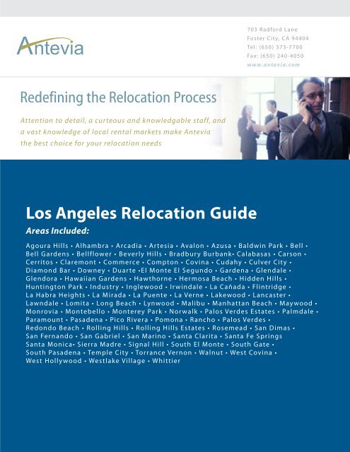
Los Angeles Relocation Guide - Antevia
Los Angeles Relocation Guide - Antevia
Los Angeles Relocation Guide - Antevia

Create successful ePaper yourself
Turn your PDF publications into a flip-book with our unique Google optimized e-Paper software.
Redefining the <strong>Relocation</strong> Process<br />
Attention to detail, a curteous and knowledgable staff, and<br />
a vast knowledge of local rental markets make <strong>Antevia</strong><br />
the best choice for your relocation needs<br />
<strong>Los</strong> <strong>Angeles</strong> <strong>Relocation</strong> <strong>Guide</strong><br />
Areas Included:<br />
703 Radford Lane<br />
Foster City, CA 94404<br />
Tel: (650) 373-7700<br />
Fax: (650) 240-4050<br />
www.antevia.com<br />
Agoura Hills • Alhambra • Arcadia • Artesia • Avalon • Azusa • Baldwin Park • Bell •<br />
Bell Gardens • Bellflower • Beverly Hills • Bradbury Burbank• Calabasas • Carson •<br />
Cerritos • Claremont • Commerce • Compton • Covina • Cudahy • Culver City •<br />
Diamond Bar • Downey • Duarte •El Monte El Segundo • Gardena • Glendale •<br />
Glendora • Hawaiian Gardens • Hawthorne • Hermosa Beach • Hidden Hills •<br />
Huntington Park • Industry • Inglewood • Irwindale • La Cañada • Flintridge •<br />
La Habra Heights • La Mirada • La Puente • La Verne • Lakewood • Lancaster •<br />
Lawndale • Lomita • Long Beach • Lynwood • Malibu • Manhattan Beach • Maywood •<br />
Monrovia • Montebello • Monterey Park • Norwalk • Palos Verdes Estates • Palmdale •<br />
Paramount • Pasadena • Pico Rivera • Pomona • Rancho • Palos Verdes •<br />
Redondo Beach • Rolling Hills • Rolling Hills Estates • Rosemead • San Dimas •<br />
San Fernando • San Gabriel • San Marino • Santa Clarita • Santa Fe Springs<br />
Santa Monica• Sierra Madre • Signal Hill • South El Monte • South Gate •<br />
South Pasadena • Temple City • Torrance Vernon • Walnut • West Covina •<br />
West Hollywood • Westlake Village • Whittier
Agoura Hills, California<br />
From Wikipedia, the free encyclopedia.<br />
Agoura Hills is a city (incorporated in 1982) in <strong>Los</strong> <strong>Angeles</strong> County, California, and has<br />
the ZIP code 91301. The population was 20,537 at the 2000 census. This bedroom<br />
community on the Ventura Freeway (U.S. Route 101) sits on the border between <strong>Los</strong><br />
<strong>Angeles</strong> and Ventura County. It is approximately 32 miles from the downtown <strong>Los</strong><br />
<strong>Angeles</strong> civic center.<br />
History<br />
The area was first settled by the Chumash Indians, and later by Spanish Franciscan<br />
missionaries. The community of Agoura was first known as Picture City. In order for the<br />
town to get its own post office, the residents were required to choose a one-word name,<br />
so in 1927 they chose a misspelling of the last name of Pierre Agoure, a local Basque<br />
rancher from the 1890s. Housing tracts quickly covered the land in the late 1960's. On 8<br />
December 1982, most of the city split off from the unincorporated town of Agoura and<br />
became the city of Agoura Hills.<br />
The historic Reyes Adobe Museum (c. 1820), from the Rancho Las Virgenes, owned by<br />
the <strong>Los</strong> <strong>Angeles</strong> County Parks and Recreation Department, is in Agoura Hills. [1] [2]<br />
Geography<br />
Agoura Hills is located at 34°9′12″N, 118°45′42″W (34.153365, -118.761805) GR1 .<br />
The city calls itself the "Gateway to the Santa Monica Mountains National Recreation<br />
Area". U.S. Route 101 passes from east to west through the city. Many residents of the<br />
[citation needed]<br />
city, however, refer to it as "A-Town" or "The Bubble".
The city is divided into three major zones: Old Agoura, a ranch community that formed<br />
the earliest part of the city; Agoura Hills, a predominately suburban area of single-family<br />
homes that forms the majority of the city; and Agoura South, an older commercial and<br />
residential district of the city, roughly defined as the region south of the 101 Freeway.<br />
There are a number of smaller districts in the city, including the Furniture District, the<br />
Lindero Corridor, and the Reyes Adobe Business District.<br />
Two of the main streets in Agoura Hills are Kanan Road and Thousand Oaks Boulevard,<br />
which run perpendicular to one another. Agoura Hills is home to a thriving café scene,<br />
centered around the corner of Thousand Oaks Blvd. and Kanan Road.<br />
According to the United States Census Bureau, the city has a total area of 21.2 km² (8.2<br />
mi²). 21.2 km² (8.2 mi²) of it is land and 0.1 km² (0.04 mi²) of it (0.37%) is water.<br />
Agoura Hills is in the fertile crescent of alt/rap-metal music giving rise to bands<br />
Hoobastank and Linkin Park (as well as Incubus in nearby Calabasas).<br />
Demographics<br />
As of the census GR2 of 2000, there were 20,537 people, 6,874 households, and 5,588<br />
families residing in the city. The population density was 969.4/km² (2,511.8/mi²). There<br />
were 6,993 housing units at an average density of 330.1/km² (855.3/mi²). The racial<br />
makeup of the city was 86.96% White, 1.32% Black or African American, 0.25% Native<br />
American, 6.50% Asian, 0.10% Pacific Islander, 2.09% from other races, and 2.78%<br />
from two or more races. 6.85% of the population were Hispanic or Latino of any race.
There were 6,874 households out of which 47.3% had children under the age of 18 living<br />
with them, 67.7% were married couples living together, 9.9% had a female householder<br />
with no husband present, and 18.7% were non-families. 13.8% of all households were<br />
made up of individuals and 3.0% had someone living alone who was 65 years of age or<br />
older. The average household size was 2.98 and the average family size was 3.30.<br />
In the city the population was spread out with 30.5% under the age of 18, 6.3% from 18<br />
to 24, 27.6% from 25 to 44, 29.4% from 45 to 64, and 6.2% who were 65 years of age or<br />
older. The median age was 38 years. For every 100 females there were 99.1 males. For<br />
every 100 females age 18 and over, there were 94.0 males.<br />
The median income for a household in the city was $87,008, and the median income for a<br />
family was $95,765. Males had a median income of $72,081 versus $42,656 for females.<br />
The per capita income for the city was $39,700. About 2.8% of families and 3.5% of the<br />
population were below the poverty line, including 3.8% of those under age 18 and 2.9%<br />
of those age 65 or over.<br />
Employment<br />
There are 14,899 people at least 16 years old, of which 10,645 are in the civilian labor<br />
force and 0 are in the Armed Forces. 360 are unemployed.<br />
Of 7,660 females that are at least 16 years old, 4,865 are in the civilian labor force and 0<br />
are in the Armed Forces. 4,715 are employed, and 150 are unemployed.<br />
Of 10,166 out of the 10,285 workers 16 years or older, 8,454 drive to work alone in a<br />
motor vehicle, 793 carpool, 90 use public transportation (including taxicabs), 76 walk,<br />
and 82 use other means of transportation to commute to work. 671 workers work at<br />
home.<br />
The mean time to commute to work (one-way) is 30.5 minutes.<br />
Of the 10,285 workers, 7,900 are privately employed, 1,124 are government workers,<br />
1,211 are self-employed, and 50 are unpaid family workers.<br />
Businesses<br />
• Line 6 - a manufacturer of digital modeling electric guitars, amplifiers and effects<br />
processors<br />
Education<br />
Las Virgenes Unified School District<br />
• Sumac Elementary School
• Willow Elementary School<br />
• Yerba Buena Elementary School<br />
• A.E. Wright Middle School<br />
• Lindero Canyon Middle School<br />
• Agoura High School<br />
Famous residents<br />
• Justin Berfield - actor (Malcolm in the Middle)<br />
• Rob Bourdon - Linkin Park<br />
• Brad Delson - Linkin Park<br />
• Heather Graham - actress<br />
• Jonathan Lipnicki - actor<br />
• Douglas Robb - Hoobastank<br />
• Mike Shinoda - Linkin Park<br />
• Erin Brockovich - inspiration for the film titled Erin Brockovich<br />
External links<br />
• Agoura Hills official website<br />
• Agoura Hills community History LA County library<br />
• Reyes Adobe Museum<br />
• Maps and aerial photos · Coordinates: 34.153365° -118.761805°<br />
o Street map from Google Maps or Yahoo! Maps<br />
o Topographic map from TopoZone<br />
o Aerial image or topographic map from TerraServer-USA<br />
o Satellite image from Google Maps or Windows Live Local<br />
Alhambra, California<br />
From Wikipedia, the free encyclopedia<br />
Alhambra is a city (incorporated on 11 July 1903) located in the western San Gabriel<br />
Valley region of <strong>Los</strong> <strong>Angeles</strong> County, California which is approx. 8 miles from the<br />
downtown <strong>Los</strong> <strong>Angeles</strong> civic center. As of the 2000 census, the city had a total<br />
population of 85,804. The city's Zip Codes are 91801 and 91803.
Geography<br />
Alhambra is located about 8 miles northeast of downtown <strong>Los</strong> <strong>Angeles</strong> at 34°4′55″N,<br />
118°8′6″W (34.081859, -118.135052) GR1 . It is bordered by South Pasadena on the<br />
northwest, San Marino on the north, San Gabriel on the east, Rosemead on the southeast,<br />
Monterey Park on the south, and the <strong>Los</strong> <strong>Angeles</strong> districts of Monterey Hills and El<br />
Sereno on the west. Major thoroughfares include Atlantic and Valley Boulevards,<br />
Mission Road, and Garfield Avenue. The San Bernardino Freeway (I-10) runs through<br />
the city's southern portions, and the Long Beach Freeway (I-710) has its northern<br />
terminus at Valley Boulevard in the far southwestern portions of the city.<br />
According to the United States Census Bureau, the city has a total area of 19.7 km² (7.6<br />
mi²), all of which is land.<br />
History<br />
Alhambra is named after Washington Irving's book Tales From The Alhambra, not after<br />
the Alhambra palace itself. [1] Alhambra was founded as a suburb of <strong>Los</strong> <strong>Angeles</strong> in<br />
1903. Its primarily Asian (Chinese and Korean) and white, Midwestern nature throughout<br />
the first 60 years of its history is reflected in the fact that even today, most Southern<br />
Californians pronounce the middle syllable of the city's name as a homophone with ham,<br />
the meat.<br />
From World War II onward, Alhambra and other cities in the western San Gabriel Valley<br />
saw a considerable influx of persons of Mexican ancestry, primarily in the form of<br />
upwardly mobile families moving up from less affluent Latino areas such as Boyle<br />
Heights and East <strong>Los</strong> <strong>Angeles</strong>. In the 1950s, numerous Italian-American families also<br />
settled in largely middle-class Alhambra, having left the working-class Lincoln Heights<br />
district in inner-city <strong>Los</strong> <strong>Angeles</strong>. Since the 1970s, white flight has led to a considerable<br />
decrease in the city's white population, and the remaining white residents are<br />
predominantly empty-nesters and retirees.<br />
Since the 1970s and 1980s, the city's proximity to Asian American-dominated Monterey<br />
Park has attracted many East Asian immigrants (initially from Taiwan and Vietnam, but<br />
now largely from Hong Kong and Mainland China). An active Chinese business district
has since developed on Valley Boulevard. The growing ethnic Chinese influence is also<br />
felt in the redevelopment of the city's Main Street area due north, although Main Street<br />
continues to cater to predominantly white American tastes. The Asian immigrants settling<br />
in Alhambra are usually considerably less affluent than those moving to places such as<br />
San Marino, Arcadia and Diamond Bar, with the result that Alhambra has developed<br />
some notoriety as a center of Asian-American gang activity, even though many gang<br />
members come from the neighboring towns of Rosemead and San Gabriel.<br />
Since the 1960s, Alhambra has suffered from traffic congestion as a result of South<br />
Pasadena's success in blocking the completion of the Long Beach Freeway; instead of<br />
continuing to the Foothill Freeway in Pasadena, as originally planned, the Long Beach<br />
Freeway instead terminates at Valley Boulevard in southwestern Alhambra, overloading<br />
many of the city's north-south thoroughfares. As South Pasadena is considerably<br />
wealthier and whiter than Alhambra, the impasse has led to significant friction between<br />
the two municipalities, including a notable incident in which South Pasadena high school<br />
students used caustic chemicals to etch their town's name into the front lawn of Alhambra<br />
High School.<br />
Education<br />
Alhambra is home to the University of Southern California's Health Sciences Alhambra<br />
campus, site of the university's Institute for Health Promotion and Disease Prevention<br />
Research (IPR) and USC's master's degree program in public health.<br />
Alhambra is served by Alhambra Unified School District, which includes Alhambra High<br />
School.<br />
Famous Natives/Residents<br />
Demographics<br />
• Jack Chick<br />
• Clive Cussler<br />
• James Jannard<br />
• Dorothy Emma<br />
Howell Rodham<br />
• Phil Spector<br />
• Cheryl Tiegs<br />
• Verne Winchell<br />
• Talmage V. Burke<br />
As of the census GR2 of 2000, there were 85,804 people, 29,111 households, and 20,668<br />
families residing in the city. The population density was 4,347.7/km² (11,257.3/mi²).
There were 30,069 housing units at an average density of 1,523.6/km² (3,945.0/mi²). The<br />
racial makeup of the city was 30.02% White, 1.67% Black or African American, 0.72%<br />
Native American, 47.22% Asian, 0.10% Pacific Islander, 16.25% from other races, and<br />
4.01% from two or more races. 35.49% of the population were Hispanic or Latino of any<br />
race.<br />
There were 29,111 households out of which 33.1% had children under the age of 18<br />
living with them, 48.3% were married couples living together, 16.4% had a female<br />
householder with no husband present, and 29.0% were non-families. 22.5% of all<br />
households were made up of individuals and 7.7% had someone living alone who was 65<br />
years of age or older. The average household size was 2.88 and the average family size<br />
was 3.41.<br />
In the city the population was spread out with 22.3% under the age of 18, 9.7% from 18<br />
to 24, 34.0% from 25 to 44, 20.7% from 45 to 64, and 13.2% who were 65 years of age or<br />
older. The median age was 35 years. For every 100 females there were 89.1 males. For<br />
every 100 females age 18 and over, there were 84.8 males.<br />
The median income for a household in the city was $39,213, and the median income for a<br />
family was $43,245. Males had a median income of $33,847 versus $29,122 for females.<br />
The per capita income for the city was $17,350. About 11.5% of families and 14.3% of<br />
the population were below the poverty line, including 18.2% of those under age 18 and<br />
10.6% of those age 65 or over.<br />
External links<br />
Alhambra's official website<br />
Maps and aerial photos · Coordinates: 34.081859° -118.135052°<br />
Street map from Google Maps or Yahoo! Maps<br />
Topographic map from TopoZone<br />
Aerial image or topographic map from TerraServer-USA<br />
Satellite image from Google Maps or Windows Live Local<br />
Schools in Alhambra<br />
Restaurants in Alhambra<br />
Alhambra Library<br />
Alhambra Chamber of Commerce
Arcadia, California<br />
From Wikipedia, the free encyclopedia<br />
Arcadia is a U.S. city in <strong>Los</strong> <strong>Angeles</strong> County, California that is located about 20 miles<br />
Northeast of downtown <strong>Los</strong> <strong>Angeles</strong> It is the site of the Santa Anita Park racetrack and<br />
home to the <strong>Los</strong> <strong>Angeles</strong> County Arboretum and Botanic Garden. As of the 2000 census,<br />
the city had a total population of 53,054.<br />
History<br />
Arcadia was originally inhabited by the Tongva ("Gabrielino") Indian tribe, who were<br />
forced into slavery by Spanish colonizers at the San Gabriel Mission (in present-day San<br />
Gabriel, California). The Gabrielinos were quickly wiped out through a combination of<br />
overwork and exposure to "Old World" diseases. During Mexican rule of California<br />
(1821-1848), a large area of land that included the present-day borders of Arcadia was<br />
sold to a Scottish immigrant, Hugo Reid. The land holding changed owners several times<br />
before being acquired by "Lucky" Baldwin, a real estate speculator and notorious<br />
womanizer who made millions off a silver mine in Virginia City, Nevada.<br />
"Lucky" Baldwin made Arcadia into what it is today, building a racetrack and arboretum.<br />
He lobbied fiercely to ensure that there would be a railroad stop at his ranch in Arcadia,<br />
which later proved crucial for local development. He also took steps to control flooding<br />
from the San Gabriel River and installed modern plumbing. When Baldwin was going<br />
through a personal financial crisis, he was forced to sell much of his Southern California<br />
land, retaining only Arcadia and establishing more or less the city's present-day<br />
boundaries.
Japanese Americans arrive at the Internment Camp at the Santa Anita Park racetrack.<br />
During World War II, Arcadia's Santa Anita Park racetrack was at one point the largest<br />
Japanese American assembly center in the United States. Internees often experienced<br />
appalling conditions at the racetrack, some for more than a year, before being moved to<br />
permanent "relocation" camps in Owens Valley, Utah, and Wyoming. Imprisoned solely<br />
because of their ethnicity, internees lived three families to a barrack (or horse-stable in<br />
some cases), took group showers, lacked private bathrooms, and lived under 24-hour<br />
armed surveillance. At the time, Arcadia's civic leaders were very vocal in their support<br />
of the internment policies of the Federal Government. (See: Japanese internment in the<br />
United States)<br />
Until a Supreme Court ruling in 1965, every property sale contract within the borders of<br />
Arcadia had to include a provision that the new owner could only sell the property to a<br />
white Protestant, though many non-Protestant families did, in fact, own homes and live in<br />
Arcadia long before that ruling.<br />
In October 1975, the Santa Anita Fashion Park was opened to the public on the corner of<br />
Baldwin Avenue and Huntington Drive. The center court featured a gigantic blue head by<br />
Roy Lichtenstein, later removed.
James Dobson, a previous Arcadia resident, founded the nonprofit Christian ministry<br />
Focus on the Family in the city in 1977. Its original office still stands on the south side of<br />
Foothill Blvd. Focus grew to larger quarters in the city, and in intervening years<br />
expanded to Monrovia for warehouse space before moving out of Arcadia completely in<br />
1990.<br />
In the late 1990s, Native American activists threatened to sue Arcadia High School over<br />
its use of the "Apache" mascot. The high school's use of Native American symbols,<br />
including an "Apache Joe" mascot, the Pow Wow school newspaper, the "Apache News"<br />
television program, the "Smoke Signals" news bulletin boards, the school's auxilary<br />
team's marching "Apache Princesses" and opposing football team fans' "Scalp the<br />
Apaches" signs were viewed by these Native American activists and many Arcadia<br />
community members as being offensive. The school consulted with Native American<br />
groups and made some concessions but refused to change the mascot. Some residents of<br />
Arcadia, who are former students at the school and have Native American ancestory, do<br />
not take offense to the school's use of these symbols.<br />
In August 2000, the 1912 mansion and 19 acre (77,000 m²) estate of Anoakia, the oldest<br />
remaining private property in the city, was bulldozed to clear space for 31 luxury homes,<br />
which would come to be derided by many as McMansions. The estate, which once<br />
belonged to the daughter of city founder Elias "Lucky" Baldwin, featured numerous oneof-a-kind<br />
architectural features and a structure whose facade was a replica of Thomas<br />
Jefferson's Monticello.<br />
Further reading: Pat McAdam and Sandy Snider: Arcadia: Where Ranch and City Meet.<br />
Published by "Friends of the Arcadia Public Library", 1981, ISBN 0-9606390-0-4.<br />
Online edition<br />
"Visions of Arcadia: A Centennial Anthology", 2003, ISBN 0-931995-01-9, edited and<br />
published by Gary Kovacic is a collection of 130 essays and over 90 historic photographs<br />
about life in Arcadia that was unveiled on August 5, 2003, the city’s 100th birthday.<br />
Arcadia in popular culture<br />
The famous Route 66, immortalized in song and literature, passes through Arcadia, where<br />
it is known as Huntington Drive. Running parallel to and about a mile south of the 210<br />
freeway, it cuts across the middle section of Arcadia.<br />
The city is mentioned by Jack Kerouac in his novel On The Road: Sal, the protagonist, is<br />
run out of town by a group of hostile teens when he stops for food at a local drive-in<br />
restaurant with a young Mexican woman. The vignette demonstrates the intolerance and<br />
racism prevalent in many places during 1950s America. The drive-in restaurant may be<br />
based on Carpenter's, located on Route 66 next to Santa Anita Racetrack.<br />
In a motel located in Arcadia across the street from Santa Anita Racetrack, author Hunter<br />
S. Thompson wrote much of his infamous novel, Fear and Loathing in Las Vegas in the
1970s. The 2003 true story film Seabiscuit was filmed and takes place at the Santa Anita<br />
race track.<br />
Notable residents<br />
Jet Li, actor and martial artist. However, he has since moved.<br />
DMX, actor and rapper<br />
Demographics<br />
Arcadia has experienced a tremendous demographic shift in recent years. A city that was<br />
almost uniformly white Protestant 30 years ago is now 45% Asian and is expected to<br />
have an Asian majority before the 2010 census. The transformation is linked to a rapid<br />
increase in wealth in Asian countries such as Taiwan, China, Korea and Hong Kong. This<br />
has led to the immigration of many Asians to countries like the United States. Arcadia<br />
offers excellent public schools, which are seen by many young upper-middle class Asian<br />
immigrant families as a ticket to a good college, and eventually desirable careers for their<br />
children in America. The large, established Asian immigrant community and the<br />
relatively high quality of life are also attractive. Since the early 1990s, a growing number<br />
of Taiwanese-oriented businesses have been appearing along and around Baldwin<br />
Avenue, due south of Huntington Drive, with a 99 Ranch Market, Arcadia Supermarket,<br />
and the especially popular Taiwan-based Din Tai Fung dumpling restaurant. Asian-<br />
American population growth has also been attributed to the exodus of established wealthy<br />
Taiwanese immigrants away from poorer Monterey Park, California to affluent Arcadia<br />
and neighboring San Marino and Temple City.<br />
As of the census GR2 of 2000, there were 53,054 people, 19,149 households, and 14,151<br />
families residing in the city. The population density was 1,865.6/km² (4,830.0/mi²). There<br />
were 19,970 housing units at an average density of 702.2/km² (1,818.1/mi²). The racial<br />
makeup of the city was 45.58% White, 1.13% Black or African American, 0.25% Native<br />
American, 45.41% Asian, 0.08% Pacific Islander, 4.16% from other races, and 3.39%<br />
from two or more races. 10.61% of the population were Hispanic or Latino of any race.<br />
There were 19,149 households out of which 35.2% had children under the age of 18<br />
living with them, 57.8% were married couples living together, 11.9% had a female<br />
householder with no husband present, and 26.1% were non-families. 22.3% of all<br />
households were made up of individuals and 9.6% had someone living alone who was 65<br />
years of age or older. The average household size was 2.74 and the average family size<br />
was 3.23.<br />
In the city the population was spread out with 23.3% under the age of 18, 7.5% from 18<br />
to 24, 27.2% from 25 to 44, 26.5% from 45 to 64, and 15.5% who were 65 years of age or<br />
older. The median age was 40 years. For every 100 females there were 88.7 males. For<br />
every 100 females age 18 and over, there were 84.6 males.
Economy<br />
The median income for a household in the city was $56,100, and the median income for a<br />
family was $66,657. Males had a median income of $50,594 versus $36,138 for females.<br />
The per capita income for the city was $28,400. About 6.7% of families and 7.9% of the<br />
population were below the poverty line, including 7.8% of those under age 18 and 6.1%<br />
of those age 65 or over.<br />
The Arcadia's economy is driven by wholesale trade, retail trade, manufacturing, health<br />
care and social assistance, arts, entertainment, and recreation. Revenue from the Santa<br />
Anita Racetrack supports Arcadia's independent library, school system and police force.<br />
The racetrack is also a major source of tax revenue for <strong>Los</strong> <strong>Angeles</strong> County.<br />
As of 2004, the City of Arcadia has an unemployment rate of 3.0%.<br />
The Westfield Shoppingtown Santa Anita (formerly the Santa Anita Fashion Park) is a<br />
major shopping center in the city.<br />
Government<br />
The city has a council-manager government with a five member city council (Gary<br />
Kovacic, John Wuo, Roger Chandler, Gail Marshall, and Mickey Segal), including the<br />
mayor (John Wuo).<br />
Public education<br />
The city operates its own school district, Arcadia Unified School District, outside of the<br />
LAUSD.<br />
The city has one major and prestigious high school Arcadia High School, three middle<br />
schools (First Avenue Middle, Richard Henry Dana Middle, and Foothills Middle), and<br />
six elementary schools (Baldwin Stocker, Camino Grove, Highland Oaks, Holly Avenue,<br />
Hugo Reid and Longley Way). Arcadia's history of racial discrimination is not included<br />
in the official curriculum of the Arcadia Unified School District.<br />
The city also operates its own Public Library separate from the County of <strong>Los</strong> <strong>Angeles</strong><br />
Public Library system.<br />
Hospital<br />
In the Arcadia Civic Center, Methodist Hospital, previously "Methodist Hospital of<br />
Southern California", sits on 22 acres of land. It has 284 beds in the facility. Methodist<br />
was the state's first community hospital to have a psychiatric unit. Plus, its nursery school<br />
was one of the first corporate daycares in the U.S. Several upgrades have been made to
the original facility. For instance, in 1998, the Berger Tower was completed and it holds<br />
169 additional beds. The hospital opened as Arcadia Methodist Hospital on May 27,<br />
1957, having moved from downtown <strong>Los</strong> <strong>Angeles</strong>.<br />
It was an Official Hospital of the 1984 Olympic Games.<br />
Geography<br />
Arcadia is located at 34°7′58″N, 118°2′11″W (34.132688, -118.036491) GR1 .<br />
According to the United States Census Bureau, the city has a total area of 28.8 km² (11.1<br />
mi²). 28.4 km² (11.0 mi²) of it is land and 0.3 km² (0.1 mi²) of it (1.08%) is water.<br />
External links<br />
Arcadia official website<br />
Official site of the arboretum<br />
Page about movies and television shows filmed at the <strong>Los</strong> <strong>Angeles</strong> State and County<br />
Arboretum<br />
Westfield Santa Anita<br />
Maps and aerial photos · Coordinates: 34.132688° -118.036491°<br />
Street map from Google Maps or Yahoo! Maps<br />
Topographic map from TopoZone<br />
Aerial image or topographic map from TerraServer-USA<br />
Satellite image from Google Maps or Windows Live Local<br />
Burbank, <strong>Los</strong> <strong>Angeles</strong> County, California<br />
From Wikipedia, the free encyclopedia
Burbank, California<br />
Seal of Burbank<br />
Founded May 1, 1887<br />
Incorporated July 8, 1911<br />
County<br />
Latitude<br />
Longitude<br />
Area<br />
- Total<br />
- Water<br />
Population<br />
- Total (2004 est.)<br />
- Density<br />
Climate<br />
- Avg. Temp<br />
- Avg. Rainfall<br />
- Avg. Humidity<br />
- Prevailing Wind<br />
General Information<br />
<strong>Los</strong> <strong>Angeles</strong> County,<br />
California<br />
34°10'49" N<br />
118°19'42" W<br />
45 km² (17.4 mi²)<br />
0.1 km² (0.04 mi²) 0.12%<br />
105,400<br />
5,800/mi²<br />
63 °F(17 °C)<br />
12.1 inches (307 mm)<br />
61%<br />
SW 2 to 4 mph (3 to 6<br />
km/h)<br />
Time zone Pacific: UTC-8<br />
Dialing Code +1 (Country code)
The city of Burbank is in the<br />
eastern corner of the San<br />
Fernando Valley, part of the<br />
Greater <strong>Los</strong> <strong>Angeles</strong> Area, in <strong>Los</strong><br />
<strong>Angeles</strong> County, California just<br />
north of the city of <strong>Los</strong> <strong>Angeles</strong>,<br />
USA.<br />
Billed as the "Media Capital of<br />
the World", many media and<br />
entertainment companies are<br />
headquartered or have significant<br />
production facilities in Burbank,<br />
including NBC, The Walt Disney<br />
Company and Warner Bros.<br />
City of Burbank Official Website<br />
The town has come a long way<br />
from the days when it was<br />
ironically referred to as "Beautiful Downtown Burbank" on Laugh-In and The Tonight<br />
Show Starring Johnny Carson.<br />
Commonly believed to be named for famous horticulturalist Luther Burbank, the city of<br />
Burbank is actually named for New Hampshire born dentist and entrepreneur David<br />
Burbank.<br />
The City of Burbank<br />
818 (Area Code)<br />
Postal code 91501-91526<br />
City Tree<br />
City Flower<br />
Mayor<br />
Vice Mayor<br />
City Council<br />
City Treasurer<br />
City Clerk<br />
City Manager<br />
City Attorney<br />
Crape Myrtle<br />
California Lilac<br />
(Ceanothus)<br />
City Officials<br />
Jef Vander Borght<br />
Todd Campbell<br />
David Golonski<br />
David Gordon<br />
Marsha Ramos<br />
Donna Anderson<br />
Margarita Campos<br />
Mary Alvord<br />
Dennis Barlow<br />
The town grew steadily, weathering the drought and depression that hit <strong>Los</strong> <strong>Angeles</strong> in<br />
the 1890s and in 20 years, the community now consisted of its own bank, newspaper,<br />
high school and a thriving business district with a hardware store, livery stable, dry goods<br />
store, general store, and a bicycle repair shop.<br />
The population would petition the State Legislature to incorporate and formally become a<br />
city on July 8, 1911, naming Thomas Story, a local businessman, as their first mayor.<br />
By 1916, 1,500 residents claimed Burbank as home. By 1930, as First National Studios,<br />
Andrew Jergens Company, The Lockheed Company, McNeill and Libby Canning<br />
Company, the Moreland Company, and Northrop Aircraft Corporation opened factories<br />
and studios there, the numbers had swelled to 16,662.<br />
The Federal government officially recognized Burbank's status in 1923 when the United<br />
States Postal Service reclassified the city from the rural village mail delivery<br />
classification to city postal delivery service.
In the meantime, the United States Department of Commerce recommended Burbank as<br />
the most favorable airport location in the <strong>Los</strong> <strong>Angeles</strong> area. Dedicated on Memorial Day<br />
Weekend (May 30 - June 1), 1930, the United Airport was the largest commercial airport<br />
in the <strong>Los</strong> <strong>Angeles</strong> area until it was eclipsed in 1946 by the <strong>Los</strong> <strong>Angeles</strong> Municipal<br />
Airport in Inglewood when that facility (the former Mines Field) commenced commercial<br />
operations.<br />
Burbank's airport has undergone a number of name changes since its opening day in<br />
1930. It remained United Airport until 1934, when it was renamed Union Air Terminal<br />
(1934-1940). Lockheed bought the airport in 1940 and renamed it the Lockheed Air<br />
Terminal, which it was known as until 1967, when its name changed again, to<br />
Hollywood-Burbank Airport. It remained Hollywood-Burbank Airport for over a decade,<br />
until 1978, when it was renamed Burbank-Glendale-Pasadena Airport (1978-2003).<br />
Most recently, in December of 2003, the facility was renamed Bob Hope Airport in honor<br />
of the famous comedian (see "Burbank Today" below).<br />
The growth of companies such as Lockheed and the burgeoning entertainment industry<br />
drew more and more people to the area as Burbank's population doubled again between<br />
1930 and 1940 to 34,337. But Burbank saw its greatest growth during World War II due<br />
to Lockheed's strong presence in the city, employing some 80,800 men and women to<br />
contribute to the war effort producing aircraft such as the Hudson, P-38 Lightning, PV-1<br />
Ventura and America's first jet fighter, the P-80 Shooting Star, arriving too late to<br />
participate in the war, but would see service in the Korean War, logging the world's first<br />
jet-to-jet aerial kill in history. Lockheed would go on to produce the super secret spy<br />
planes U2, SR-71 Blackbird and the F-117 Nighthawk at its Burbank-based "Skunk<br />
Works."<br />
Burbank companies were involved throughout the war, joining together on this P-38<br />
Disney and Warner (formerly First National Studio) contributed to the war effort by<br />
producing training films and morale films for the armed services and cartoons promoting<br />
the sale of war bonds. Disney artists designed more than 1000 unit mascot designs for<br />
units from every branch of the armed forces. Walt Disney had authorized that the creation<br />
of these insignias were to be designed for free and by the end of the war was estimated to<br />
have cost Disney over thirty thousand dollars.<br />
Burbank would also witness its first real civil strife as the culmination of a six month<br />
labor dispute between the Set Decorator's union and the studios resulted in the Battle of<br />
Burbank on October 5, 1945.
Burbank's growth did not slow as war production ceased and over 7,000 new residents<br />
created a postwar real estate boom and real estate values soared as housing tracts sprang<br />
up on formerly vacant land in the Magnolia Park area of Burbank between 1945 and<br />
1950.<br />
As America entered the atomic age, the city's industries thrived and as the world changed<br />
around it, Burbank continued to evolve to meet its demands ushering in the 21st century<br />
vastly different from the town's sheep-farm roots.<br />
Burbank today<br />
A predominantly upper-middle class community, Burbank is home to many employees of<br />
the motion picture and television studios located in and around the city.<br />
Entertainment has generally replaced the defense industry as the primary employer of its<br />
citizens, who are attracted by the relative safety and security offered by its own police<br />
and fire departments, highly rated schools and hospital. Other reasons cited are its smalltown<br />
feel while located only 10 minutes away by car to the hip clubs and restaurants of<br />
Hollywood.<br />
The Intersection of Olive and San Fernando in Burbank, CA<br />
The convenience of a local airport and proximity to major freeways is crucial in today's<br />
world, and Burbank is no exception.<br />
The former Burbank/Glendale/Pasadena Airport (which opened in 1930 as the United<br />
Airport) was renamed in December 2003 in honor of comedian Bob Hope, who lived in<br />
nearby Toluca Lake for many years. The airport services 4.9 million travelers per year on<br />
seven major carriers, with more than 70 flights daily.<br />
Burbank is easily accessible by and can easily access the Southern California freeways<br />
via the Golden State Freeway, which bisects the city from northwest to southeast, and the<br />
Ventura Freeway which connects Burbank to the U.S. Route 101 on the south and the<br />
nearby Foothill Freeway to the east.<br />
Those without cars can take advantage of the Metro which operates public transport<br />
throughout <strong>Los</strong> <strong>Angeles</strong> County, connecting her citizens to 18,500 stops on 189 bus lines<br />
including those in Burbank while commuters can easily access the Metrolink and Amtrak
for service south into Downtown and Union Station, west to Ventura and north to<br />
Palmdale and all points beyond.<br />
While at home, residents enjoy the <strong>Los</strong> <strong>Angeles</strong> Equestrian Center, the Starlight Bowl,<br />
fine restaurants, the city's Downtown Burbank Mall, a burgeoning "Burbank Village"<br />
shopping district, and many theatres, parks, and libraries. Visitors to Burbank are<br />
attracted to the Warner Bros. Studio VIP tour and close proximity to all other<br />
entertainments and attractions that <strong>Los</strong> <strong>Angeles</strong> offers.<br />
Recently, the murder of Burbank police officer Matthew Pavelka by a local gang known<br />
as the Vineland Boys sparked an intensive investigation in conjuction with several other<br />
cities and resulted in the arrest of a number of gangmembers and other citizens in and<br />
around Burbank. Among those arrested was Burbank city councilwoman Stacey Murphy,<br />
implicated in trading guns in exchange for drugs.<br />
Sister cities<br />
Burbank is also affiliated with the following sister cities :<br />
Geography<br />
• Gaborone,<br />
Botswana<br />
• Incheon, South<br />
Korea<br />
• Ota, Japan<br />
• Solna, Sweden<br />
Burbank is located at 34°10′49″N, 118°19′42″W (34.180170, -118.328341) GR1 .<br />
According to the United States Census Bureau, the city has a total area of 45.0 km² (17.4<br />
mi²). 44.9 km² (17.4 mi²) of it is land and 0.1 km² (0.04 mi²) of it (0.12%) is water.<br />
Looking west over Burbank with Olive Ave. crossing over the I-5 in the foreground
It is bordered by Glendale to the east, Toluca Lake on the west, and Griffith Park to the<br />
South. Hollywood is easily accessible from Burbank by driving down Barham Blvd. (past<br />
Warner Bros. Studios & Universal Studios) to Cahuenga Blvd., formerly known as the<br />
Cahuenga Pass.<br />
Demographics<br />
As of the census GR2 of 2000, there were 100,316 people, 41,608 households, and 24,382<br />
families residing in the city. The population density was 2,232.4/km² (5,782.4/mi²). There<br />
were 42,847 housing units at an average density of 953.5/km² (2,469.8/mi²). The racial<br />
makeup of the city was 72.18% White, 2.06% Black or African American, 0.55% Native<br />
American, 9.15% Asian, 0.14% Pacific Islander, 9.88% from other races, and 6.04%<br />
from two or more races. 24.87% of the population were Hispanic or Latino of any race.<br />
There were 41,608 households out of which 28.5% had children under the age of 18<br />
living with them, 42.8% were married couples living together, 11.5% had a female<br />
householder with no husband present, and 41.4% were non-families. 33.6% of all<br />
households were made up of individuals and 9.8% had someone living alone who was 65<br />
years of age or older. The average household size was 2.39 and the average family size<br />
was 3.14.<br />
In the city the population was spread out with 22.3% under the age of 18, 7.7% from 18<br />
to 24, 35.4% from 25 to 44, 21.8% from 45 to 64, and 12.8% who were 65 years of age or<br />
older. The median age was 36 years. For every 100 females there were 94.1 males. For<br />
every 100 females age 18 and over, there were 90.7 males.<br />
The median income for a household in the city was $47,467, and the median income for a<br />
family was $56,767. Males had a median income of $41,792 versus $35,273 for females.<br />
The per capita income for the city was $25,713. About 8.1% of families and 10.5% of the<br />
population were below the poverty line, including 13.3% of those under age 18 and 9.0%<br />
of those age 65 or over.<br />
The number of violent crimes recorded by the FBI in its 2004 Uniform Crime Reports<br />
was 262 of which there were 4 murders and homicides. The violent crime rate was<br />
approximately 2.5 per 1,000 people, well below the national average as reported by the<br />
U.S. Department of Justice in the Bureau of Justice Statistics.<br />
Economy
Looking east over Burbank from Universal Studios<br />
Much of Burbank's economy is based on the entertainment industry. Hollywood is<br />
considered a symbol of the glamorous entertainment industry, but much of the actual<br />
production takes place in Burbank. Many ancillary companies are also located there.<br />
Many companies have their headquarters in Burbank, including ABC, Arri, Cartoon<br />
Network, DIC Entertainment, Dick Clark Productions, NBC, Nickelodeon, The Walt<br />
Disney Company, Warner Bros., and Warner Music Group.<br />
Burbank is also conveniently located close to CBS Studio Center, DreamWorks, and<br />
Universal Studios in neighboring Studio City, Glendale, and Universal City, respectively.<br />
Capitol Records and Paramount are just south of Burbank in Hollywood proper.<br />
Local IATSE union offices for the Stagehands Local 33, Grips Local 80, Make-up and<br />
Hairstylist Local 706 and Set Painters Local 729 also make their home in Burbank with<br />
Teamsters Local 399, IBEW Local 40 and many other IATSE locals nearby.<br />
Education<br />
Burbank is home to several California Distinguished Schools including the confusingly<br />
named Luther Burbank Middle School (see history above). Both its public and private K-<br />
12 schools routinely score above state and national average test scores. A number of<br />
colleges are also located in Burbank including the Woodbury University with its<br />
renowned design program and several make up and beauty trade schools servicing the<br />
entertainment industry.<br />
Famous residents<br />
A number of famous people have lived in Burbank at one time or another, here's a partial<br />
list of some of people who have called Burbank home.<br />
• Wally Albright (1925-<br />
1999) actor. The<br />
Little Rascals
• Tim Burton (1958-)<br />
writer and director.<br />
Edward<br />
Scissorhands, The<br />
Nightmare Before<br />
Christmas<br />
• Rod Beck (1968-)<br />
Major League<br />
Baseball player. San<br />
Francisco Giants,<br />
Boston Red Sox<br />
• Dick Clark (1929-)<br />
TV personality.<br />
"America's oldest<br />
teenager". American<br />
Bandstand, New<br />
Year's Rockin' Eve<br />
• Debbe Dunning<br />
(1966-) actress.<br />
Home Improvement<br />
• Soleil Moon Frye<br />
(1976-) actress.<br />
Punky Brewster,<br />
Sabrina the Teenage<br />
Witch<br />
• Mark Harmon (1951-)<br />
actor. St. Elsewhere,<br />
Stealing Home<br />
• Ron Howard (1954-)<br />
actor and film<br />
director. A Beautiful<br />
Mind, The Da Vinci<br />
Code<br />
• Clint Howard (1958-)<br />
actor. Gentle Ben,<br />
Star Trek: Deep<br />
Space Nine<br />
• James J. Jeffries<br />
(1875-1953) "The<br />
Boilermaker" World<br />
Heavyweight Boxing<br />
Champion<br />
• Kelly Johnson (1910-<br />
1990) chief<br />
aeronautical engineer
at Lockheed's Skunk<br />
works<br />
• Patton Oswalt (1969-)<br />
comedian, actor and<br />
writer. Magnolia,<br />
MADtv<br />
• Sean Penn (1960-)<br />
actor, director,<br />
activist. Fast Times<br />
at Ridgemont High,<br />
Mystic River<br />
• Eve Plumb (1958-)<br />
actress. The Brady<br />
Bunch<br />
• Bonnie Raitt (1949-),<br />
singer/songwriter.<br />
Luck of the Draw,<br />
Longing in Their<br />
Hearts<br />
• Debbie Reynolds<br />
(1932-) actress, Miss<br />
Burbank 1948.<br />
Singin' in the Rain,<br />
The Unsinkable<br />
Molly Brown<br />
• Randy Rhoads (1956-<br />
1982) Lead guitarist<br />
and founding<br />
member of Quiet<br />
Riot (1976-1979)<br />
and lead guitarist for<br />
Ozzy Osbourne<br />
(1979-1982).<br />
• John Ritter (1948-<br />
2003) actor and<br />
comedian of TV's<br />
Three's Company<br />
and 8 Simple Rules<br />
• Doug Savant (1964-)<br />
actor. Melrose Place,<br />
Desperate<br />
Housewives<br />
• Adam Schiff (1960-)<br />
Democratic U.S.<br />
Congressman from
References<br />
California since<br />
2000.<br />
• Martin Scorsese<br />
(1942-) director.<br />
Taxi Driver, Raging<br />
Bull, Goodfellas<br />
• Wil Wheaton (1972-)<br />
actor and writer.<br />
Stand By Me, Star<br />
Trek: The Next<br />
Generation<br />
Brief History of Burbank, California (Burbank Chamber of Commerce, 1961)<br />
Of Men and Stars, A History of Lockheed Aircraft Corporation (Lockheed Aircraft<br />
Corporation, 1957-1958)<br />
Ranchos de <strong>Los</strong> Santos, The Story of Burbank (The Burbank Branch of the Security Trust<br />
and Savings Bank, 1927)<br />
The Story of Burbank from Her Eventful Pioneer Days (The Magnolia Park Chamber of<br />
Commerce, 1954)<br />
Your Burbank Home (Burbank Merchant’s Association, 1928)<br />
Maps<br />
Maps and aerial photos · Coordinates: 34.18017° -118.328341°<br />
Street map from Google Maps or Yahoo! Maps<br />
Topographic map from TopoZone<br />
Aerial image or topographic map from TerraServer-USA<br />
Satellite image from Google Maps or Windows Live Local<br />
Glendale, California
From Wikipedia, the free encyclopedia<br />
Glendale, California<br />
Seal<br />
Nickname: "The Jewel City"<br />
Location<br />
Location of Glendale within <strong>Los</strong> <strong>Angeles</strong> County and the State of<br />
California.<br />
Country<br />
State<br />
County<br />
Government<br />
United States<br />
California<br />
<strong>Los</strong> <strong>Angeles</strong><br />
City Council Ara Najarian<br />
Rafi Manoukian<br />
Dave Weaver (mayor)<br />
Frank Quintero<br />
Bob Yousefian
Geographical characteristics<br />
Area<br />
City 30.7 sq. miles / 79.4 km²<br />
Land 30.66 sq. miles / 79.3 km²<br />
Water 0.04 sq. miles / 0.1 km²<br />
Population<br />
City (2005) 207,007<br />
Density 2,456.1/km²<br />
Time zone<br />
Summer (DST)<br />
estimated<br />
PST (UTC-8)<br />
PDT (UTC-7)<br />
Website: http://www.ci.glendale.ca.us<br />
Glendale is a city in <strong>Los</strong> <strong>Angeles</strong> County, California, United States. It lies at the eastern<br />
end of the San Fernando Valley, is bisected by the Verdugo Mountains, and is an<br />
important suburb in the Greater <strong>Los</strong> <strong>Angeles</strong> Area. The city is bordered to the southwest<br />
by the Atwater Village district of <strong>Los</strong> <strong>Angeles</strong>; to the west by Burbank; to the northwest<br />
by the Tujunga district of <strong>Los</strong> <strong>Angeles</strong>; to the northeast by the city of La Cañada<br />
Flintridge and the unincorporated La Crescenta area; and to the east by Pasadena. The<br />
Golden State, Ventura, Glendale, and Foothill freeways run through the city.<br />
As of the 2000 census, the city population was 194,973. Since then, there have been<br />
estimates of 201,326 by the U.S. Census Bureau in 2004 and 207,007 by the California<br />
State government in 2005, making it the third largest city in <strong>Los</strong> <strong>Angeles</strong> County and the<br />
seventeenth largest city in the state of California.<br />
Forest Lawn Memorial Park Cemetery, located in Glendale, contains the remains of many<br />
celebrities and local residents. It is famous as the pioneer of a new style of cemetery.<br />
The U.S. headquarters of the Swiss foods multinational Nestlé are located here. Glendale<br />
is also home to the "southern campus" of DreamWorks SKG, the diversified<br />
entertainment company founded in 1994 by Steven Spielberg, Jeffrey Katzenberg and<br />
David Geffen.<br />
History<br />
The area was long inhabited by the Tongva people.
José María Verdugo, a corporal in the Spanish army from Baja California, received a<br />
grant of the Rancho San Rafael in 1798, an area he had been farming since 1784. In 1860<br />
His grandson Teodoro Verdugo built the Verdugo Adobe, which is the oldest building in<br />
Glendale. The property is the location of the Oak of Peace where early Californio leaders<br />
including Jesus Pico met in 1847 and decided to surrender to American General John C.<br />
Frémont.<br />
Verdugo's descendants sold the ranch in various parcels, some of which are included in<br />
present-day Atwater Village, Eagle Rock, and Highland Park neighborhoods of <strong>Los</strong><br />
<strong>Angeles</strong>.<br />
In 1884 residents gathered to form a town and chose the name "Glendale". Residents to<br />
the southwest formed "Tropico" in 1887. The Pacific Electric Railroad brought streetcar<br />
service in 1904.<br />
The City of Glendale was incorporated in 1906 and Tropico was annexed 12 years later.<br />
The most important civic booster of the era was Leslie C. Brand, who built in 1909 a<br />
grand estate El Miradero in a stunning blend of architectural styles. Brand built a private<br />
airstrip in 1919 and hosted "fly-in" parties. The grounds of El Miradero are now cityowned<br />
Brand Park and the mansion is the Brand Library. One of the city's main<br />
thoroughfares is Brand Boulevard.<br />
The city grew quickly. Its population rose from 13,756 in 1920 to 62,736 in 1930 before<br />
slowing down. The Forest Lawn Memorial Park opened in 1917. Pioneering<br />
endocrinologist and entrepreneur Dr. Henry R. Harrower opened his clinic in Glendale in<br />
1920, which for many years was the largest business in the city. The American Green<br />
Cross, an early conservation and tree preservation society, was formed in 1926 (it<br />
disbanded three years later and the current organization of that name is unrelated).
Grand Central Air Terminal, October 2005<br />
The "Grand Central Airport" was an important facility to the city and to the history of<br />
aviation. It provided the first paved runway west of the Rocky Mountains in 1923. In<br />
1928 it opened its terminal, making it the first official airport in Greater <strong>Los</strong> <strong>Angeles</strong>. For<br />
the next two decades it was the main airport in the county and references to "<strong>Los</strong> <strong>Angeles</strong><br />
Airport" from that era generally refer to the Grand Central Airport, not to <strong>Los</strong> <strong>Angeles</strong><br />
International Airport (LAX), which was known as Mines Field at the time (commercial<br />
airline operations at LAX did not begin until 1946).<br />
Jack Northrop built his first aircraft factory here in 1927, though it was soon moved to<br />
Burbank's "United Airport" (now Bob Hope Airport). The first regularly-scheduled<br />
airline service between Southern California and New York City was initiated on July 28,<br />
1929 by Transcontinental Air Transport, with owner Charles A. Lindbergh piloting the<br />
first flight. Among the passengers on the 48-hour trip were Mary Pickford and Douglas<br />
Fairbanks. Pioneering female aviator Laura Ingalls became the first woman to fly solo<br />
across in the country when she landed at Glendale in 1930. The first transcontinental<br />
flight by African American pilots, Albert Forsythe and Charles Anderson, was completed<br />
at Glendale in 1933. Howard Hughes built his innovative and record-setting "H-1 Racer"<br />
in a plant next to the airport in 1935. During World War II it became a P-38 base where<br />
the 319th Fighter Wing trained.<br />
After the war the airport eventually returned to private use but its runways were too short<br />
for jet planes and the airport was closed in 1959. The Grand Central Air Terminal<br />
building, with its control tower, was designed by Henry L. Gogerty. The building is<br />
currently owned by The Walt Disney Company, though the terminal and tower were<br />
made uninhabitable by the 1994 Northridge earthquake. The airport was the setting of<br />
several films, including Hughes' 1930 Hell's Angels, Shirley Temple's 1934 Bright Eyes,
and the musical Hollywood Hotel with Dick Powell. The city of Glendale is also part<br />
owner of the Bob Hope Airport (formerly "Burbank-Glendale-Pasadena Airport").<br />
The Bob's Big Boy chain of hamburger restaurants started in Glendale in 1936, and the<br />
Baskin-Robbins, "31 Flavors" chain of ice cream parlors started there in 1945.<br />
In 1964, Glendale was selected by George Lincoln Rockwell to be the West Coast<br />
headquarters of the American Nazi Party. Its offices, on Colorado Boulevard in the<br />
downtown section of the city, remained open until the early 1980s.<br />
The Glendale Public Library contains one of the largest collections of books on cats in<br />
the world, over 20,000 volumes. [1] It was donated to the library in the 1950s by the Jewel<br />
City Cat Fanciers Club, with the understanding that it would be made into a special<br />
collection and kept permanently for club members to use and enjoy. [2]<br />
The skyline of downtown Glendale.<br />
The city saw significant development in the 1970s. Completion of the Glendale Freeway<br />
(HWY 2) and the Ventura Freeway (HWY 134), redevelopment of Brand Boulevard,<br />
renovation of the 1925 Alex Theatre, and construction of the Glendale Galleria shopping<br />
mall, all contributed to the resurgence of the city.<br />
In 1994, Steven Spielberg, Jeffrey Katzenberg and David Geffen formed DreamWorks<br />
SKG, a diversified entertainment company. The company's "southern campus" is located<br />
in the city's Grand Central Business Park on a tract of land formerly occupied by a<br />
Sparkletts Water bottling facility.<br />
On January 26, 2005, 11 people were killed in a Metrolink train crash just south of<br />
downtown Glendale.<br />
Geography<br />
Glendale is located at 34°10′15″N, 118°15′0″W (34.170939, -118.250081) GR1 at the<br />
juncture of two large valleys, the San Fernando and the San Gabriel. According to the<br />
United States Census Bureau, the city has a total area of 79.4 km² (30.7 mi²). 79.4 km²<br />
(30.6 mi²) of it is land and 0.1 km² (0.04 mi²) of it (0.07%) is water. It is bordered to the<br />
north by the foothill communities of La Canada Flintridge, La Crescenta, and Tujunga; to
the south by the Atwater Village community incorporated by the city of <strong>Los</strong> <strong>Angeles</strong>; to<br />
the east by Pasadena and Eagle Rock (also incorporated within <strong>Los</strong> <strong>Angeles</strong>); and to the<br />
west by the city of Burbank.<br />
Demographics<br />
Foreign-born residents accounted for 54% of the population in 2000. Glendale has a<br />
distinctively ethnic flavor, with large Armenian, Iranian, Filipino and Arab populations,<br />
and many businesses catering to them. While it has descendants from many countries, it<br />
is most famous for its Armenian population. Census figures indicate that the ethnic<br />
heritage of city population is 40% Armenian, 20% Latino, 16% Asian, and roughly onethird<br />
Anglo. Glendale's Armenian population is abundant and the majority of Glendale's<br />
city council members (3 of 5) are of Armenian descent.<br />
As of the census GR2 of 2000, there were 194,973 people, 71,805 households, and 49,617<br />
families residing in the city. The population density was 2,456.1/km² (6,362.2/mi²). There<br />
were 73,713 housing units at an average density of 928.6/km² (2,405.3/mi²). The racial<br />
makeup of the city was 63.58% White, 1.27% Black or African American, 0.32% Native<br />
American, 16.12% Asian American, 0.08% Pacific Islander, 8.57% from other races, and<br />
10.06% from two or more races. 19.72% of the population were Hispanic or Latino of<br />
any race.<br />
There were 71,805 households out of which 32.9% had children under the age of 18<br />
living with them, 52.3% were married couples living together, 11.8% had a female<br />
householder with no husband present, and 30.9% were non-families. 25.7% of all<br />
households were made up of individuals and 8.7% had someone living alone who was 65<br />
years of age or older. The average household size was 2.68 and the average family size<br />
was 3.27.<br />
In the city the population was spread out with 22.4% under the age of 18, 8.4% from 18<br />
to 24, 32.2% from 25 to 44, 23.1% from 45 to 64, and 13.9% who were 65 years of age or<br />
older. The median age was 38 years. For every 100 females there were 91.3 males. For<br />
every 100 females age 18 and over, there were 88.0 males.<br />
The median income for a household in the city was $41,805, and the median income for a<br />
family was $47,633. Males had a median income of $39,709 versus $33,815 for females.<br />
The per capita income for the city was $22,227. About 13.6% of families and 15.5% of<br />
the population were below the poverty line, including 20.7% of those under age 18 and<br />
11.9% of those age 65 or over.<br />
Education<br />
The Glendale Unified School District operates schools in Glendale.<br />
Glendale is also home to Glendale Community College.
Community organizations<br />
The City of Glendale includes a variety of nonprofit organizations that enhance the<br />
quality of life in Glendale. Strong links between local residents, business owners, and<br />
government have created a network of organizations that provide support in the areas of<br />
education, employment, homeless services, after-school activities, and social services.<br />
Local organizations include:<br />
The Salvation Army Glendale<br />
Glendale Community Free Health Clinic<br />
PATH Achieve Glendale (Homeless Access Center & Shelter)<br />
Notable natives<br />
• Captain Beefheart,<br />
musician<br />
• Elvin Bishop,<br />
musician<br />
• Clara Bryant, actress<br />
• Jamie Denton, actor<br />
• Nicole Eggert, actress<br />
• Erika Eleniak, actress<br />
• Robert Englund, actor<br />
• Edward Furlong,<br />
actor<br />
• Daryl Gates, former<br />
LAPD police chief<br />
• Scott Gorham,<br />
musician<br />
• Joe Hahn, musician<br />
• Maren Jensen, actress<br />
• Daron Malakian,<br />
musician<br />
• Eva Mendes, actress<br />
• Dennis Muren,<br />
special effects artist<br />
• Paul Petersen, actor<br />
• Ron Underwood,<br />
director<br />
• Paul Walker, actor<br />
• John Wayne, actor
See also<br />
Glendale Community College<br />
Glendale High School<br />
List of cities in California<br />
External links<br />
Glendale official website<br />
Maps and aerial photos · Coordinates: 34.170939° -118.250081°<br />
Street map from Google Maps or Yahoo! Maps<br />
Topographic map from TopoZone<br />
Aerial image or topographic map from TerraServer-USA<br />
Satellite image from Google Maps or Windows Live Local<br />
Hermosa Beach, California<br />
• John Cho, actor<br />
• Joel Madden,<br />
musician<br />
From Wikipedia, the free encyclopedia<br />
Hermosa Beach is a city in <strong>Los</strong> <strong>Angeles</strong> County, California, United States. The<br />
population was 18,566 at the 2000 census.
The municipal pier in downtown Hermosa Beach.<br />
The city is located in the South Bay region of the greater <strong>Los</strong> <strong>Angeles</strong> area and is one of<br />
the three Beach Cities.<br />
History<br />
Hermosa Beach was incorporated in 1907.<br />
Geography<br />
Hermosa Beach<br />
Hermosa Beach is located at 33°51′59″N, 118°23′59″W (33.866314, -118.399681) GR1 .
According to the United States Census Bureau, the city has a total area of 15.3 km² (5.9<br />
mi²). 3.7 km² (1.4 mi²) of it is land and 11.6 km² (4.5 mi²) of it (75.80%) is water.<br />
The wide flat beach makes Hermosa Beach one of the most popular places to play beach<br />
volleyball, from professional to amateur.<br />
Demographics<br />
As of the census GR2 of 2000, there were 18,566 people, 9,476 households, and 3,553<br />
families residing in the city. The population density was 5,012.8/km² (12,982.4/mi²).<br />
There were 9,840 housing units at an average density of 2,656.8/km² (6,880.7/mi²). The<br />
racial makeup of the city was 89.58% White, 0.81% Black or African American, 0.40%<br />
Native American, 4.40% Asian, 0.22% Pacific Islander, 1.68% from other races, and<br />
2.91% from two or more races. 6.75% of the population were Hispanic or Latino of any<br />
race.<br />
There were 9,476 households out of which 14.1% had children under the age of 18 living<br />
with them, 30.6% were married couples living together, 4.5% had a female householder<br />
with no husband present, and 62.5% were non-families. 39.4% of all households were<br />
made up of individuals and 3.9% had someone living alone who was 65 years of age or<br />
older. The average household size was 1.95 and the average family size was 2.65.<br />
In the city the population was spread out with 12.0% under the age of 18, 6.1% from 18<br />
to 24, 55.0% from 25 to 44, 20.1% from 45 to 64, and 6.8% who were 65 years of age or<br />
older. The median age was 34 years. For every 100 females there were 112.9 males. For<br />
every 100 females age 18 and over, there were 113.8 males.<br />
The median income for a household in the city was $81,153, and the median income for a<br />
family was $104,645. Males had a median income of $67,407 versus $50,295 for<br />
females. The per capita income for the city was $54,244. About 1.7% of families and<br />
4.6% of the population were below the poverty line, including 3.1% of those under age<br />
18 and 3.0% of those age 65 or over.<br />
Trivia<br />
Segments of the television show The O.C. are actually filmed in Hermosa Beach, not<br />
Newport Beach. This was necessary because of union rules that make it expensive to film<br />
outside of <strong>Los</strong> <strong>Angeles</strong> County.<br />
Hermosa Beach is an important center for American beach volleyball competitions.<br />
In the Spanish language, the word "hermosa" is the feminine form of beautiful.<br />
In the late 1970's the band Black Flag emerged from Hermosa Beach, and played their<br />
first show in Redondo Beach.
The modern day punk band Pennywise grew up in Hermosa Beach and went to Mira<br />
Costa High School in Manhattan Beach and Redondo Union High School in Redondo<br />
Beach.<br />
Hermosa Beach has been the sister city of Loreto, Baja California Sur, since 1967.<br />
On May 9, 2006, a popular restaurant and nightclub in Hermosa Beach for 80 years,<br />
known as Baja Sharkeez, was destroyed by a fire. The building's facade was removed to<br />
get to the fire. It took firefighters from Manhattan Beach, Hermosa Beach, Redondo<br />
Beach, Torrance, El Segundo and <strong>Los</strong> <strong>Angeles</strong> County to fight the fire. Owner Ron<br />
Newman has vowed to rebuild Baja Sharkeez as soon as possible and to make it bigger<br />
and better.<br />
External links<br />
Hermosa Beach official website<br />
Maps and aerial photos · Coordinates: 33.866314° -118.399681°<br />
Street map from Google Maps or Yahoo! Maps<br />
Topographic map from TopoZone<br />
Aerial image or topographic map from TerraServer-USA<br />
Satellite image from Google Maps or Windows Live Local<br />
Lancaster, California<br />
Lancaster, California<br />
Seal<br />
Location
Location of Lancaster in California and <strong>Los</strong> <strong>Angeles</strong> County<br />
Coordinates 34°41′13″N, 118°09′15″W<br />
Country<br />
State<br />
County<br />
Government<br />
United States<br />
California<br />
<strong>Los</strong> <strong>Angeles</strong><br />
Incorporated November 22, 1977<br />
Mayor Henry W. Hearns<br />
Area<br />
Geographical characteristics<br />
City 243.9 km² (94.2 sq mi)<br />
Land 243.5 km² (94.0 sq mi)<br />
Water 0.5 km² (0.2 sq mi) 0.19%<br />
Population<br />
City (2000) 118,718<br />
Density 487.6/km² (1,263.0/sq mi)<br />
Time zone<br />
Summer (DST)<br />
U.S. Census, 2000<br />
PST (UTC-8)<br />
PDT (UTC-7)<br />
Website: www.cityoflancasterca.org<br />
Lancaster is a city located in the Antelope Valley in <strong>Los</strong> <strong>Angeles</strong> County, California,<br />
USA. As of the 2000 census, the city had a total population of 118,718. As of 2005, the<br />
California Finance Dept. estimates the population at 133,703.
Lancaster is the ninth-largest city in <strong>Los</strong> <strong>Angeles</strong> County and the third-fastest growing.<br />
Lancaster is located in the Palmdale / Lancaster Urbanized Area, bordering the northern<br />
edge of Palmdale. Lancaster is the second largest desert city in California after Palmdale.<br />
Lancaster, California is the largest city named Lancaster in the world, and it possibly<br />
named after Lancaster, Pennsylvania via Lancaster, England [1]. For a list of others, see<br />
Lancaster.<br />
Founded in 1876 along the route of the Southern Pacific Railroad (now merged into the<br />
Union Pacific Railroad), Lancaster was originally a commercial and social center<br />
primarily for Antelope Valley farmers. During World War II, the city was home to the<br />
Polaris Flight Academy at War Eagle Field, the only civilian school offering basic flight<br />
training for army cadets. After the war, Lancaster's population saw a noticeable increase<br />
due to its proximity to Edwards Air Force Base (formerly known as Muroc Army Air<br />
Field) and U.S. Air Force Plant 42. In the 1990s and 2000s, Lancaster has seen another<br />
housing boom as developers seek to build new housing in formerly undeveloped land<br />
across the southwest U.S.<br />
The Single-A Baseball Lancaster JetHawks of the California League call the city home.<br />
Like Palmdale, Lancaster is a contract city, in which the <strong>Los</strong> <strong>Angeles</strong> County Sheriff's<br />
Department provides law enforcement services. It is served by Lancaster station.<br />
Geography<br />
Lancaster is located at 34°41′13″N, 118°9′15″W (34.686980, -118.154062) GR1 .<br />
According to the United States Census Bureau, the city has a total area of 243.9 km²<br />
(94.2 mi²). 243.5 km² (94.0 mi²) of it is land and 0.5 km² (0.2 mi²) of it (0.19%) is water.<br />
Demographics<br />
As of the census GR2 of 2000, there were 118,718 people, 38,224 households, and 27,674<br />
families residing in the city. The population density was 487.6/km² (1,263.0/mi²). There<br />
were 41,745 housing units at an average density of 171.5/km² (444.1/mi²). The racial<br />
makeup of the city was 62.82% White, 16.01% African American, 1.02% Native<br />
American, 3.81% Asian, 0.23% Pacific Islander, 11.11% from other races, and 5.00%<br />
from two or more races. Hispanic or Latino of any race were 24.13% of the population.<br />
There were 38,224 households out of which 42.8% had children under the age of 18<br />
living with them, 49.4% were married couples living together, 17.0% had a female<br />
householder with no husband present, and 27.6% were non-families. 22.1% of all<br />
households were made up of individuals and 6.9% had someone living alone who was 65<br />
years of age or older. The average household size was 2.92 and the average family size<br />
was 3.41.
In the city the population was spread out with 32.3% under the age of 18, 9.5% from 18<br />
to 24, 31.3% from 25 to 44, 18.2% from 45 to 64, and 8.6% who were 65 years of age or<br />
older. The median age was 31 years. For every 100 females there were 103.1 males. For<br />
every 100 females age 18 and over, there were 101.9 males.<br />
The median income for a household in the city was $41,127, and the median income for a<br />
family was $48,276 (Based on Merrit Research. Males had a median income of $40,710<br />
versus $27,619 for females ( +/- $3,000 per year). The per capita income for the city was<br />
$16,935. About 13.8% of families and 16.4% of the population were below the poverty<br />
line, including 21.9% of those under age 18 and 7.9% of those age 65 or over.<br />
External links<br />
Lancaster official website<br />
Current Weather<br />
Lancaster Chamber of Commerce<br />
Maps and aerial photos · Coordinates: 34.68698° -118.154062°<br />
Street map from Google Maps or Yahoo! Maps<br />
Topographic map from TopoZone<br />
Aerial image or topographic map from TerraServer-USA<br />
Satellite image from Google Maps or Windows Live Local<br />
Long Beach, California<br />
Long Beach
Seal<br />
Location<br />
Location within <strong>Los</strong> <strong>Angeles</strong> County in the state of California<br />
Coordinates 33°48′15″N, 118°9′29″W<br />
Country<br />
State<br />
County<br />
Government<br />
United States<br />
California<br />
<strong>Los</strong> <strong>Angeles</strong> County<br />
Mayor Beverly O'Neill (D)<br />
Geographical characteristics<br />
Area<br />
City 170.6 km² (65.9 sq mi)<br />
Land 130.6 km² (40.0 sq mi)
Water 40.0 km² (15.4 sq mi)<br />
Elevation 0 m – ??? m (0 ft – ??? ft)<br />
Population<br />
City (2004) 476,564<br />
Density 3,533/km²<br />
Time zone<br />
Summer (DST)<br />
PST (UTC-8)<br />
PDT (UTC-7)<br />
Website: http://www.ci.long-beach.ca.us/<br />
Long Beach is a city located in southern <strong>Los</strong> <strong>Angeles</strong> County, California, on the Pacific<br />
coast. It borders Orange County on its southeast edge. It is about 20 miles (30 km) south<br />
of downtown <strong>Los</strong> <strong>Angeles</strong>.<br />
As of the 2000 census, the city population was 461,522. By 2006 its population is<br />
estimated to have increased to 490,166 [1]. It is the 34th-largest city in the nation, 5th in<br />
California and 2nd in <strong>Los</strong> <strong>Angeles</strong> County (after <strong>Los</strong> <strong>Angeles</strong>). Long Beach is also the<br />
largest U.S. city that is not a county seat.<br />
According to the 2000 US Census, Long Beach is the most ethnically diverse large city in<br />
the United States [2]. For example, Long Beach has the second-largest population of<br />
Cambodians outside of Asia (after Paris), and the area along Anaheim St. is sometimes<br />
called "Little Phnom Penh". There are also sizable populations of African-Americans,<br />
Mexicans, Salvadorians and other Central Americans, Filipino Americans, Vietnamese<br />
Americans and other Asians. There is a small population of Pacific Islander Americans in<br />
Long Beach and the surrounding communities, especially Samoan Americans. There is<br />
also a significant population of gays and lesbians, with many gay-owned businesses<br />
along Broadway, 2nd Street and 4th Street between Downtown Long Beach and Belmont<br />
Shore.<br />
Having an excellent harbor, it is one of the world's largest shipping ports and a yearround<br />
resort noted for its long, wide beaches and beautiful active marina. It has the<br />
largest municipally owned marina in the country with 3,400 slips. The city also has a<br />
large oil industry; oil (discovered in 1921) is found both underground and offshore.<br />
Manufactures include aircraft, automobile parts, electronic and audiovisual equipment,<br />
and home furnishings. It is also home to numerous regional, national, and world<br />
headquarters for major corporations such as Epson America, Molina Healthcare, Scan<br />
Health Care, and Polar Air Cargo. Long Beach grew with the development of hightechnology<br />
and aerospace industries in the area.<br />
The city draws 5.5 million visitors annually. The R.M.S. Queen Mary has been located in<br />
Long Beach since her retirement in 1967 and now serves as a hotel, convention center,<br />
and tourist attraction. The Aquarium of the Pacific, a world-class research facility, is a<br />
popular tourist destination.
Tourists are also drawn to Long Beach by the numerous annual events held in the city,<br />
which include music festivals, sports competitions, and cultural celebrations.<br />
The Long Beach Grand Prix, an annual Champ Car race, takes place on city streets near<br />
the Convention Center and is one of the largest Grand Prix events in the world. It is the<br />
largest street race in the United States with an estimated 300,000 people watching the<br />
event in person every year over three days.<br />
Long Beach is the location of the largest California State University, CSULB, and the<br />
headquarters of the California State University system. The city also has a Veterans<br />
Affairs hospital and is a major healthcare hub for the region.<br />
Signal Hill is an incorporated city surrounded entirely by Long Beach.<br />
History<br />
The area was originally occupied by the Tongva people who lived in a rancheria named<br />
Tibahangna. Along with other Tongva villages, it disappeared in the mid-1800s.<br />
The Rancho los Cerritos and Rancho <strong>Los</strong> Alamitos were divided from the larger Rancho<br />
<strong>Los</strong> Nietos, which had been granted by the King of Spain to a mulatto soldier, Manuel<br />
Nieto. The boundary between the two ranchos ran through the center of Signal Hill at a<br />
southwest to northeast diagonal.<br />
Rancho <strong>Los</strong> Cerritos was bought in 1843 by John Temple, a Yankee who had come to<br />
California in 1827. Soon after he built what is now known as the "<strong>Los</strong> Cerritos Ranch<br />
House," an adobe which still stands and is a National Historic Landmark. Temple created<br />
a thriving cattle ranch and prospered, becoming the wealthiest man in <strong>Los</strong> <strong>Angeles</strong><br />
County. Both Temple and his ranch house played important local roles in the Mexican<br />
American War.<br />
Meanwhile, on an island in the San Pedro Bay, Mormon pioneers made an abortive<br />
attempt to establish a colony (as part of Brigham Young's plan to establish a continuous<br />
chain of settlements from the Pacific to Salt Lake).<br />
In 1866 Temple sold Rancho <strong>Los</strong> Cerritos to the firm of Flint, Bixby & Co, which<br />
consisted of brothers Thomas and Benjamin Flint and their cousin Lewellyn Bixby, for<br />
$20,000. Later that year the company selected Lewellyn's brother Jotham Bixby, the<br />
"Father of Long Beach", to manage their southern ranch, and three years later Jotham<br />
bought into the property and would later form the Bixby Land Company. It was during<br />
this period that the Rancho <strong>Los</strong> Cerritos was converted to sheep ranching. In the 1870s as<br />
many as 30,000 sheep were kept at the ranch and sheared twice yearly to provide wool<br />
for trade. In 1880, Bixby sold 4,000 acres (16 km²) of the Rancho <strong>Los</strong> Cerritos to<br />
William E. Willmore, who subdivided it in hopes of creating a farm community,<br />
Willmore City. He failed and was bought out by the "Long Beach Land and Water<br />
Company." They changed the name of the community to "Long Beach", which was
incorporated as a city in 1888. When Bixby died in 1916 the remaining 3,500 acres<br />
(14 km²) of Rancho <strong>Los</strong> Cerritos was subdivided into the neighborhoods of Bixby Knolls,<br />
California Heights, North Long Beach and part of the city of Signal Hill.<br />
The town grew as a seaside resort (The Pike was one of the most famous beachside<br />
amusement parks on the West coast from 1910 until the 1960's) and then as an oil, Navy,<br />
and port town. The town was once referred to as "Iowa by the sea," due to a large influx<br />
of people from that state and other states in the Midwest. Huge picnics for each state<br />
were a popular annual event in Long Beach until the 1960s.<br />
The Long Beach earthquake of 1933 was a magnitude 6.3 earthquake that caused<br />
significant damage to the city and surrounding areas. Most of the damage occurred in<br />
unreinforced masonry buildings, especially schools. One hundred twenty people died in<br />
this earthquake.<br />
Long Beach used to have a sizable Japanese-American population mostly working in the<br />
fish canneries on Terminal Island and small truck farms in the area, but with<br />
intermarriage and other factors, it is now less than 1% of the population of Long Beach.<br />
There is still a Japanese Community Center and a Japanese Buddhist Church in Long<br />
Beach.<br />
The early silent film industry in Long Beach<br />
One of the places where the film industry started in Southern California was in Long<br />
Beach.<br />
Balboa Amusement Producing Company, also known as Balboa Studios, was located at<br />
Sixth Street and Alamitos Avenue, and they used 11 acres (45,000 m²) on Signal Hill for<br />
outdoor locations. Silent movie stars who lived in Long Beach included Fatty Arbuckle<br />
and Theda Bara. The 1917 film Cleopatra, starring Theda Bara, was filmed at the<br />
Dominguez Slough just west of Long Beach, and Moses parted the Red Sea for Cecil B.<br />
DeMille's 1923 black-and-white version of "The Ten Commandments" on the flat<br />
seashore of Seal Beach, southeast of Long Beach.<br />
The current film industry in Long Beach<br />
Because of its closeness to LA-area studios and the variety of locations, Long Beach is<br />
regularly used for movies, television shows, and advertisements. The city has filled in for<br />
locations across the nation and the globe. [3]<br />
Long Beach Polytechnic High School is just one of the popular filming locations in Long<br />
Beach. Another popular area for movies filmed in the city is the Virginia Country Club<br />
area. The upscale neighborhood is home to several National Historic Landmarks and is<br />
known for its diverse architectural styles ranging from a famous Greene & Greene<br />
designed American Bungalow home to modern homes designed by World-Renowned<br />
Architect Edward Killingsworth.
Shipping and transportation<br />
Aerial view of Long Beach, including Port of Long Beach<br />
Long Beach at night<br />
The Port of Long Beach is the second busiest seaport in the United States . The port<br />
serves shipping between the United States and the Pacific Rim. The combined operations<br />
of the Port of Long Beach and the Port of <strong>Los</strong> <strong>Angeles</strong> are the busiest in the USA.<br />
Rail shipping is provided by Union Pacific Railroad and BNSF Railway, which carry<br />
about half of the trans-shipments from the port. Long Beach has contributed to the<br />
Alameda Corridor project to increase the capacity of the rail lines, roads, and highways<br />
connecting the port to the <strong>Los</strong> <strong>Angeles</strong> rail hub. The project, completed in 2002, created a<br />
20 mile (32 km) long, 33 ft (10 m) deep trench in order to eliminate 200 grade crossings<br />
and cost about US$2.4 billion.<br />
Long Beach is the southern terminus for the <strong>Los</strong> <strong>Angeles</strong> Metro Blue Line light rail<br />
corridor. Blue Line trains run from Long Beach City Hall to Downtown <strong>Los</strong> <strong>Angeles</strong>.<br />
The Metro Rail Blue Line Maintenance Shops, are also located in Long Beach just south<br />
of the Del Amo Blue Line station.<br />
There is an Amtrak Thruway bus shuttle starting in San Pedro, with stops at the Queen<br />
Mary and downtown Long Beach, that then goes to Union Station in downtown <strong>Los</strong><br />
<strong>Angeles</strong>, and ends in Bakersfield. The Blue Line MetroRail connects downtown Long<br />
Beach to the Staples Center and downtown <strong>Los</strong> <strong>Angeles</strong> where it connects with<br />
Hollywood and Pasadena. There is also a Greyhound Lines terminal downtown.<br />
Public transportation in Long Beach is provided by Long Beach Transit. Besides the<br />
normal bus service, which charges a fare, Long Beach has free routes, the "Pine Avenue
Link" and Passport routes, which use mini-buses to shuttle passengers within the<br />
downtown area. The Passport "C" route between the downtown and the Queen Mary, and<br />
Passport "A" and "D" buses go East-West along Ocean Boulevard, linking the Catalina<br />
Landing in the west with Belmont Shore in the east. (The Passport "B" has been renamed<br />
the Pine Avenue Link.) A 90-cent fare is required when traveling east of Atlantic<br />
Avenue. Another free route, "Village Tour D'art" in the East Village, visits museums and<br />
other points of interest.<br />
Long Beach Transit also operates the 49-passenger AquaBus water taxi, which stops at<br />
the Aquarium of the Pacific, the Queen Mary, and four other stops; and the 75-passenger<br />
AquaLink water taxi, which travels between the Aquarium, the Queen Mary, and<br />
Alamitos Bay Landing next to the Long Beach Marina.<br />
There is also limited bus service to Orange County through Orange County<br />
Transportation Authority buses. Route 1, from Long Beach to San Clemente is the<br />
longest bus route in the OCTA system. Traveling along Pacific Coast Highway for most<br />
of the route, it takes 2-2.5 hrs to complete.<br />
Torrance Transit buses go from downtown Long Beach to the South Bay. The <strong>Los</strong><br />
<strong>Angeles</strong> Department of Transportation (LADOT) has bus service from downtown to San<br />
Pedro, and the <strong>Los</strong> <strong>Angeles</strong> County Metropolitan Transportation Authority (LACMTA)<br />
has two regional bus lines that serve downtown Long Beach.<br />
Long Beach Municipal Airport serves the Long Beach, South Bay and northern Orange<br />
County areas, but is relatively small, considering the area's population. It is the West<br />
Coast hub for JetBlue Airways. It is also the site of a major Boeing (formerly Douglas,<br />
then McDonnell Douglas) aircraft production facility, which is the city's largest<br />
employer.<br />
Several freeways run through Long Beach, connecting it with the greater <strong>Los</strong> <strong>Angeles</strong><br />
and Orange County areas. The San Diego (405) freeway roughly bisects the city and<br />
takes commuters northwest or southeast to the Golden State (5) freeway. The Long Beach<br />
(710) freeway runs north-south, starting at the southern end between the Port of Long<br />
Beach and downtown Long Beach, and terminating just past the intersection with San<br />
Bernardino (10) freeway on the border between El Sereno neighbor or <strong>Los</strong> <strong>Angeles</strong> and<br />
Alhambra. The eastern border of the city is traversed by the San Gabriel River (605)<br />
freeway, which joins the 405 at the Long Beach/<strong>Los</strong> Alamitos border. The Artesia<br />
Freeway California State Route 91 runs east-west near the northern border of Long<br />
Beach.<br />
California State Route 1 (more commonly known as Pacific Coast Highway or PCH) runs<br />
through Long Beach. Where it intersects with Lakewood Boulevard (California State<br />
Route 19) and <strong>Los</strong> Coyotes Diagonal is the "infamous" Long Beach Traffic Circle.
Long Beach has some bike paths along city streets, plus the Long Beach bicycle path<br />
along the ocean from Shoreline Village to Belmont Shore, plus there are bike paths along<br />
both the San Gabriel and <strong>Los</strong> <strong>Angeles</strong> rivers.<br />
Culture<br />
Bikinis and business suits mix along a beach that a world trade center overlooks.<br />
Standing next to elegant buildings where commerce takes place, is the Pacific Ocean.<br />
Period architecture, beach expanses, unique communities such as Naples with canals and<br />
gondolas, historic adobes, ethnic restaurants and a Bohemian feel provide an allure that<br />
makes Long Beach a world-class destination. The downtown region of the city has trendy<br />
shops, restaurants, an art district, and a picturesque skyline that can be viewed atop many<br />
of the towers that dot the downtown landscape. Long Beach offers many sandy beaches<br />
and coastline near downtown, Naples, Belmont Shore and Long Beach Peninsula that are<br />
enjoyed for their scenic beauty.<br />
Art<br />
The Long Beach Museum of Art is owned by the City of Long Beach, and operated by<br />
the Long Beach Museum of Art Foundation. Long Beach also features the Museum of<br />
Latin American Art, founded in 1996 by Dr. Robert Gumbiner. It is the only museum in<br />
the western United States that exclusively features Latin American art.<br />
The University Art Museum on the Long Beach State campus (founded in 1973) has a<br />
national reputation for its high-quality and innovative programs. [4] Long Beach State is<br />
also home to the largest publicly funded art school west of the Mississippi.<br />
In 1965, Long Beach State hosted the first International Sculpture Symposium to be held<br />
in the United States and the first at a college or university. Six sculptors from around the<br />
world and two from the United States created many of the monumental sculptures seen<br />
on the campus. There are now over 20 scuptures on the campus.<br />
The Southern California is known for its street art and the Long Beach area has many fine<br />
examples. Some of the murals were created in conjuction with the city's Mural and<br />
Cultural Arts Program, but many others were not. [5] [6]<br />
On the exterior of the Long Beach Sports Arena is one of environmental artist Wyland's<br />
Whaling Walls. At 116,000 square feet (11,000 m²), it is the world's largest mural<br />
(according to the Guinness Book of Records).<br />
Shops and galleries feature their monthly art openings and artists exhibit in street<br />
galleries on the Last Saturday [7] in the East Village Arts District, in downtown Long<br />
Beach.<br />
Music
The Long Beach Symphony Orchestra plays numerous classical and pop music concerts<br />
throughout the year. The symphony plays at the Terrace Theater in the Long Beach<br />
Convention and Entertainment Center. [8]<br />
KJAZZ 88.1 FM (KKJZ) broadcasts from California State University, Long Beach. The<br />
station features jazz and blues music exclusively and can also be listened to over the<br />
Internet. [9]<br />
Long Beach is the host to a number of long-running music festivals. They include the<br />
Bob Marley Reggae Festival (February), the Cajun & Zydeco Festival (May), the Aloha<br />
Concert Jam (Hawaiian music, June), the Long Beach Jazz Festival (August), the Long<br />
Beach Blues Festival (September, since 1980), and the Brazilian Street Carnaval<br />
(Brazilian music, September).<br />
The bands Sublime, the Long Beach Dub Allstars (formed by the members of Sublime<br />
after their lead singer Brad Nowell died of a heroin overdose) and Long Beach Shortbus<br />
(formed after the break-up of the Allstars) are from Long Beach.<br />
New-wave punk band Le Shok hailed from Long Beach.<br />
Rappers Snoop Dogg, Warren G and Zack de la Rocha were born and raised in Long<br />
Beach. The city is also home to the VIP Records store which has been featured in music<br />
videos by Snoop Dogg and other rap music artists. (The corner of "21 and Lewis" that<br />
Warren G mentions in "Regulate" is very close to VIP Records.)<br />
Melissa Etheridge got her start performing at Que Sera, a former lesbian bar in Long<br />
Beach.<br />
The Carpenters, a pop group from the 1960s and 1970s, consisted of musicians who were<br />
all students and Calfornia State University, Long Beach. The Richard and Karen<br />
Carpenter Performing Arts Center at CSULB is named in honor of these famous alums of<br />
the Music Department.<br />
The Long Beach Municipal Band, founded in 1909 is the longest running, municipally<br />
supported band in the country. In 2005, the band played 24 concerts in various parks<br />
around Long Beach. [10]<br />
The Long Beach Community Band, including the Shoreline Concert Band and the Blue<br />
Pacific Swing Band, is an all volunteer group of musicians that's been performing<br />
concerts in the Long Beach area since 1947. [11]<br />
The Vault 350, a music performance nightclub, is one of several bars and nightclubs<br />
located on Pine Avenue in Downtown Long Beach. The popular Blues Cafe is located<br />
nearby.<br />
Sports
Long Beach Grand Prix<br />
The Long Beach Grand Prix in April is the single largest event in Long Beach. It started<br />
in 1975 as a Formula 5000 race on the streets of downtown, and became a Formula One<br />
the following year. Since 1984 it has been a Champ Car event. During the same week as<br />
the Grand Prix, there are also Trans-Am, and Toyota Atlantic races, plus an Historic<br />
Grand Prix features pre-1990 cars, and the Toyota Pro/Celebrity race. The Toyota Celica<br />
was often used as race cars in the Pro/Celebrity Race from late 1970s to 2005, and<br />
replaced by Scion tC in 2006. The Celica All-trac Turbo was a Pace Car in the Grand<br />
Prix of Long Beach from 1988 to 1992.<br />
Baseball<br />
Long Beach Little League teams that included Sean Burroughs were back-to-back World<br />
Series Champions in 1992 & 1993. Other noted Long Beach ballplayers include Tony<br />
Gwynn and Bob Lemon.<br />
The Long Beach Armada of the independent Golden Baseball League plays at Blair<br />
Field. Ex-Major Leaguer Darrell Evans manages the team that features former major<br />
league players as well as rookies looking to reach the Majors for the first time.<br />
Blair Field (built in 1958) has hosting numerous American Legion baseball, Connie<br />
Mack baseball, high school, junior college, college, minor league baseball and major<br />
league spring training exhibition baseball games. It has also been host of six MTV Rock<br />
& Jock softball games, and has been the filming location for numerous film, TV and<br />
commercial productions. [12]<br />
Ice Hockey<br />
Long Beach is home to the Long Beach Ice Dogs (ECHL) hockey team. The Ice Dogs<br />
play their home games at the Long Beach Sports Arena.<br />
Basketball
The minor league basketball team nicknamed the Long Beach Jam play in the American<br />
Basketball Association (ABA). The team plays in the Pyramid (a pyramid-shaped gym)<br />
on the Long Beach State campus).<br />
The Southern California Summer Pro League is a showcase for current and prospective<br />
NBA basketball players, including recent draft picks, current NBA players working on<br />
their skills and conditioning, and international professionals hoping to become NBA<br />
players. The league plays in the Pyramid on the Long Beach State campus during July.<br />
[13]<br />
The Long Beach Pyramid<br />
Sailing<br />
Since its inception in August 1964, the Congressional Cup has grown into one of the<br />
major international sailing events. Now held in April, it is the only grade 1 match race<br />
regatta held in the United States. The one-on-one race format is the same as the America's<br />
Cup, and many of the winners of the Congressional Cup have gone on to win the<br />
America's Cup as well.<br />
The Leeway Sailing and Aquatics Center on Alamitos Bay in Belmont Shore is a youth<br />
sailing program founded in 1929. It is recognized as one of the premier municipal<br />
instructional sailing programs in the country. [14]<br />
Water skiing<br />
In July, there is the annual Catalina Ski Race, which starts from Long Beach Harbor and<br />
goes to Catalina Island and back to complete a 100 km (62 mile) circuit. This race has<br />
been held annually since 1948 and features skiers from around the world. [15]<br />
Golf<br />
Long Beach has five municipal golf courses, as well as the private Virginia Country Club<br />
in the Bixby Knolls area. Recreation Park, built in 1917, is one of the busiest golf courses<br />
in the United States. [16] [17]<br />
Olympics
During the two Olympic Games held in <strong>Los</strong> <strong>Angeles</strong>, Long Beach has hosted a number of<br />
the competitions, including rowing events in the Marine Stadium, sailing events off the<br />
coast of Long Beach, volleyball in the Long Beach Sports Arena, and archery at El<br />
Dorado Regional Park. For the 1984 Summer Olympics, Long Beach hosted yachting,<br />
volleyball, fencing and archery competitions. For the 1932 Summer Olympics, Long<br />
Beach hosted the rowing competition. The Belmont Plaza Pool has hosted U.S. Olympic<br />
swimming trials in 1968, 1976, and 2004.<br />
The USA Water Polo National Aquatic Center, where the men's and women's US<br />
Olympic water polo teams train, is located in nearby <strong>Los</strong> Alamitos.<br />
Famous Long Beach athletes<br />
Long Beach is the childhood home of tennis legend Billie Jean King and eight-time<br />
National League batting champion and longtime San Diego Padres outfielder Tony<br />
Gwynn.<br />
2004 Summer Olympics gold medal winning beach volleyball player Misty May-Treanor<br />
graduated from California State University, Long Beach (where she won a national<br />
championship and several other awards), and currently resides in Long Beach.<br />
Parks and recreation<br />
The Long Beach Department of Parks, Recreation and Marine received a Gold Medal<br />
award from the National Parks and Recreation Society in 2002, 2003, and 2004,<br />
recognizing the Department's "outstanding management practices and programs." The<br />
Department manages 92 parks covering over 3,100 acres (13 km²) throughout the city,<br />
including the 815 acre (3.3 km²) El Dorado Regional Park, which features fishing lakes,<br />
an archery range, youth campground, bike trails, and picnic areas. The Department also<br />
operates four public swimming pools, and four launch ramps for boaters to access the<br />
Pacific Ocean.<br />
The 102.5 acre El Dorado Nature Center is part of the larger El Dorado Regional Park.<br />
The center features lakes, a stream, and trails, with meadows and forested areas. [18]<br />
Rancho <strong>Los</strong> Alamitos is a 7.5 acre historical site owned by the City of Long Beach that is<br />
near Long Beach State. The site includes five agricultural buildings, including a working<br />
blacksmith’s shop, four acres of gardens, and a adobe ranch house dating from around<br />
1800. The Rancho is within a gated community, so you must pass through security gates<br />
to get to it. [19]<br />
Rancho <strong>Los</strong> Cerritos is a 4.7 acre historical site owned by Long Beach in the Bixby<br />
Knolls area near the Virginia Country Club. The adobe buildings date from the 1880s.<br />
The site also includes a California history research library. [20]
The Earl Burns Miller Japanese Garden is located on the campus of California State<br />
University, Long Beach.<br />
Multicultural events<br />
• Scottish Festival and<br />
Games (Queen<br />
Mary, Feb.) [21]<br />
• Annual Indian Pow<br />
Wow (CSULB,<br />
March)<br />
• Cambodian New Year<br />
Celebration (El<br />
Dorado Park, March<br />
or April)<br />
• the Kaleidoscope<br />
Festival (CSULB,<br />
April) [22]<br />
• Cinco de Mayo (at the<br />
Museum of Latin<br />
American Art, plus<br />
several celebrations<br />
in city parks, May 5)<br />
• Long Beach Pride<br />
Festival (May) [23]<br />
• Juneteenth Festival<br />
(Martin Luther King<br />
Park, mid-June)<br />
• Tafesilafa'i (Pacific<br />
Islander festival,<br />
Shoreline Village,<br />
July)<br />
• E Hula Mau (Hula<br />
and Chant<br />
competition, Terrace<br />
Theater, Labor Day<br />
weekend) [24]<br />
• Annual Grecian<br />
Festival (Greek<br />
Orthodox Church of<br />
Long Beach, Labor<br />
Day weekend)<br />
• Brazilian Street<br />
Carnaval (Sept.)<br />
[25].
Parades<br />
Christmas boat "parades" are a Southern California tradition, with at least one held every<br />
weekend night from December 1st till Christmas. The "Naples Island Christmas Parade"<br />
has been held since 1946, and passes through the canals of Naples and around Alamitos<br />
Bay past Belmont Shore. The "Parade of A Thousand Lights" is in the Shoreline Village<br />
area (near Downtown Long Beach and the HMS Queen Mary). [26] There is also a<br />
Christmas boat parade in the nearby Port of <strong>Los</strong> <strong>Angeles</strong>/San Pedro area, and another in<br />
the Huntington Harbor community of nearby Huntington Beach.<br />
The Long Beach Lesbian & Gay Pride Parade & Festival has been held in May or June<br />
since 1984. It is the second largest event in Long Beach, attracting over 125,000<br />
participants over the two day celebration. It is the third largest Gay Pride Parade in the<br />
United States. [27]<br />
Other parades in Long Beach include:<br />
Other cultural events<br />
• the Martin Luther<br />
King Parade (Jan.)<br />
• Cambodian New<br />
Years Parade (March<br />
or April)<br />
• Brazilian Street<br />
Carnaval (Sept.) [28]<br />
• Haute Dog<br />
Howl'oween Parade<br />
(Oct.) [29]<br />
• Long Beach Veterans<br />
Day Parade (Nov.)<br />
[30]<br />
• Belmont Shore<br />
Christmas Parade<br />
(Dec.) [31]<br />
• Daisy Avenue<br />
Christmas Tree Lane<br />
& Parade (Dec.)<br />
In October, Long Beach State hosts the CSULB Wide Screen Film Festival, at the<br />
Carpenter Performing Arts Center. The festival started in 1995 as a showcase for movies<br />
filmed in the widescreen format, but has since been transformed into an artist-inresidence<br />
event. A major film artist (such as former CSULB student Steven Spielberg)
screens and discusses their own work as well as the ten films that most influenced their<br />
cinematic vision. [32]<br />
Business<br />
The top commercial businesses in Long Beach, based upon the number of employees,<br />
are: Boeing, Verizon, Gulfstream Aerospace Corporation, and The Bragg Companies<br />
(crane and heavy transport sales). Several local hospitals are major employers, including:<br />
Long Beach Memorial Medical Center, Veterans Affairs Medical Center, St. Mary<br />
Medical Center, and Pacific Hospital of Long Beach. Major government and educational<br />
employers include: Long Beach Unified School District, City of Long Beach, California<br />
State University, Long Beach, Long Beach City College, United State Postal Service, and<br />
Long Beach Transit.<br />
• Douglas Aircraft<br />
Company (later<br />
McDonnell Aircraft<br />
Corporation and now<br />
part of Boeing) had<br />
plants at the Long<br />
Beach Airport where<br />
they built aircraft for<br />
World War II, and<br />
later built DC-8s,<br />
DC-9s, DC-10s, and<br />
MD-11s.<br />
• Boeing built the<br />
Boeing 717 until<br />
2006 and continues<br />
to build the C-17<br />
Globemaster III<br />
strategic airlifter in<br />
Long Beach. Even<br />
after greatly<br />
reducing the number<br />
of local employees in<br />
recent years, Boeing<br />
is still the largest<br />
employer in the city.<br />
• Polar Air Cargo, an<br />
international cargo<br />
airline, is based in<br />
Long Beach.<br />
• TABC, INC., a part of<br />
Toyota, makes a<br />
variety of car parts,
including truck beds,<br />
steering columns,<br />
and catalytic<br />
converters, in Long<br />
Beach.<br />
• Epson America, the<br />
U.S. affiliate of<br />
Japan-based Seiko<br />
Epson Corporation,<br />
is headquartered in<br />
Long Beach.<br />
• SCAN Health Plan, a<br />
non-profit "Medicare<br />
Advantage" HMO<br />
for seniors, is<br />
headquartered in<br />
Long Beach.<br />
• Parker Law Firm, the<br />
legal firm of the<br />
personal injury<br />
attorney Larry H.<br />
Parker (most noted<br />
for his series of<br />
television<br />
commercials), is<br />
headquartered in<br />
Long Beach.<br />
(Because of the<br />
backlash to his<br />
commercials, a law<br />
was passed in<br />
California making it<br />
illegal for law firms<br />
to quote lawsuit<br />
award amounts in<br />
their commercials.)<br />
• Molina Health Care,<br />
Inc., a Medicaid<br />
management<br />
healthcare program,<br />
is headquartered in<br />
Long Beach.<br />
• Jesse James' West<br />
Coast Choppers<br />
custom motorcycle<br />
shop is located in
Media<br />
Long Beach, and<br />
much of the Monster<br />
Garage cable TV<br />
show is filmed in<br />
Long Beach.<br />
The local daily newspaper is the Long Beach Press-Telegram, which is distributed<br />
throughout most of the Gateway Cities and South Bay areas of southwest <strong>Los</strong> <strong>Angeles</strong><br />
County. The Press-Telegram is part of the <strong>Los</strong> <strong>Angeles</strong> Newspaper Group, which has<br />
several newspapers in the Southern California area that share some resources and<br />
reporters.<br />
Long Beach also has two weekly community newspapers, the "Grunion Gazette" and<br />
"Downtown Gazette." Both highlight the city's cultural, educational and political goingson.<br />
The downtown edition features articles pertaining to the happenings in the East<br />
Village Arts District, Long Beach Convention Center, the Pike, Aquarium of the Pacific,<br />
etc.<br />
There is also an "on-line news agency", the LBReport (http://www.LBReport.com) that<br />
covers local stories in depth as they happen.<br />
Long Beach also gets distribution of the daily <strong>Los</strong> <strong>Angeles</strong> Times, Orange County<br />
Register, and La Opinión newspapers, plus the weekly <strong>Los</strong> <strong>Angeles</strong> Sentinel and free OC<br />
Weekly. Business news is covered by the biweekly Long Beach Business Journal.<br />
Long Beach is part of the <strong>Los</strong> <strong>Angeles</strong> DMA radio and television markets. Although a<br />
few radio stations have had studios in Long Beach over the years, including the 80's<br />
alternative music and later hard rock station KNAC, the only remaining radio station<br />
studio in Long Beach is the jazz and blues station KKJZ on the Cal State Long Beach<br />
campus.<br />
Education<br />
Public schools<br />
The primary school district that serves Long Beach is Long Beach Unified School<br />
District. It is the third largest school district in California. The district is noted for starting<br />
a trend to the return to school uniforms for public schools in the 1990s. It has also won<br />
several awards in recent years, including the 2003 Broad Prize for Urban Education, as<br />
the best urban school district in the US.<br />
Other school districts, including ABC Unified School District, serve small portions of<br />
Long Beach.
Private high schools<br />
Private non-high schools<br />
• Cambodian Christian<br />
School - K-12 -<br />
Baptist<br />
• First Baptist Church<br />
School (Long Beach,<br />
California) - PK-12 -<br />
Baptist [33]<br />
• Gethsemane Baptist<br />
Church School - PK-<br />
12 - Baptist<br />
• Pacific Christian<br />
School - K-12 -<br />
Baptist<br />
• Parkridge Private<br />
School K-12 -<br />
Private<br />
• Regency High School<br />
- 7-12 - Private<br />
• St. Anthony High<br />
School - 9-12 -<br />
Roman Catholic [34]<br />
• S W Longview<br />
Private School - K-<br />
12 - Private<br />
• Zinsmeyer Academy -<br />
6-12 - Private<br />
(ChildNet Youth and<br />
Family Services)<br />
[35]<br />
• Bethany Lutheran<br />
School - K-8 -<br />
Lutheran Church -<br />
Missouri Synod<br />
• Grace Christian<br />
Schools Long Beach<br />
- PK-6 - Brethren<br />
• Holy Innocents<br />
Elementary School -<br />
K-8 - Roman<br />
Catholic
• Light and Life<br />
Christian School - K-<br />
6 Methodist<br />
• Long Beach Adventist<br />
School - K-8 -<br />
Seventh-Day<br />
Adventist<br />
• <strong>Los</strong> Altos Grace<br />
Brethren School - K-<br />
6 - Brethren<br />
• Nazarene Christian<br />
School Of Long<br />
Beach - PK-8 -<br />
Christian<br />
• Oakwood Academy -<br />
K-6 - Christian nondenominational<br />
• Our Lady Of Refuge<br />
Elementary School -<br />
K-8 - Roman<br />
Catholic<br />
• St. Anthony<br />
Elementary School<br />
PK-8 - Roman<br />
Catholic<br />
• St. Athanasius<br />
Elementary School -<br />
K-8 - Roman<br />
Catholic<br />
• St Barnabas<br />
Elementary School -<br />
K-8 - Roman<br />
Catholic<br />
• St Cornelius<br />
Elementary School -<br />
K-8 - Roman<br />
Catholic<br />
• St Cyprian<br />
Elementary School -<br />
K-8 - Roman<br />
Catholic<br />
• St Joseph Elementary<br />
School - K-8 -<br />
Roman Catholic<br />
• St Lucy's School - K-<br />
8 - Roman Catholic
Colleges and universities<br />
Geography<br />
• St Maria Goretti<br />
Elementary School -<br />
K-8 - Roman<br />
Catholic<br />
• Westerly School of<br />
Long Beach - K-8 -<br />
Private [36]<br />
List of private<br />
schools in Long<br />
Beach<br />
• California State<br />
University, Long<br />
Beach (CSULB)<br />
• Long Beach City<br />
College (LBCC)<br />
Pacific Coast and<br />
Liberal Arts<br />
campuses<br />
• Brooks College, a<br />
private for-profit<br />
vocational school<br />
best known for its<br />
fashion design and<br />
fashion marketing<br />
programs.<br />
Long Beach is located at 33°47' North, 118°10' West, about 20 miles (30 km) south of<br />
downtown <strong>Los</strong> <strong>Angeles</strong>. According to the United States Census Bureau, the city has a<br />
total area of 170.6 km² (65.9 mi²). 130.6 km² (50.4 mi²) of it is land and 40.0 km² (15.4<br />
mi²) of it (23.42%) is water.<br />
Demographics<br />
As of the census GR2 of 2000, there were 461,522 people, 163,088 households, and 99,646<br />
families residing in the city. The population density was 3,532.8/km² (9,149.8/mi²). There<br />
were 171,632 housing units at an average density of 1,313.8/km² (3,402.6/mi²). The racial<br />
makeup of the city was 45.16% White, 14.87% African American, 0.84% Native
American, 12.05% Asian, 1.21% Pacific Islander, 20.61% from other races, and 5.27%<br />
from two or more races. Hispanic or Latino of any race were 35.77% of the population.<br />
According to the 2000 US Census, Long Beach is the most ethnically diverse large city in<br />
the United States [37]. Among its Asian population, Long Beach is home to a large<br />
Cambodian community, the second-largest Cambodian community outside of Asia (after<br />
Paris).<br />
There were 163,088 households out of which 35.0% had children under the age of 18<br />
living with them, 39.2% were married couples living together, 16.1% had a female<br />
householder with no husband present, and 38.9% were non-families. 29.6% of all<br />
households were made up of individuals and 7.4% had someone living alone who was 65<br />
years of age or older. The average household size was 2.77 and the average family size<br />
was 3.55.<br />
In the city the population was spread out with 29.2% under the age of 18, 10.9% from 18<br />
to 24, 32.9% from 25 to 44, 18.0% from 45 to 64, and 9.1% who were 65 years of age or<br />
older. The median age was 31 years. For every 100 females there were 96.6 males. For<br />
every 100 females age 18 and over, there were 93.5 males.<br />
The median income for a household in the city was $37,270, and the median income for a<br />
family was $40,002. Males had a median income of $36,807 versus $31,975 for females.<br />
The per capita income for the city was $19,040. About 19.3% of families and 22.8% of<br />
the population were below the poverty line, including 32.7% of those under age 18 and<br />
11.0% of those age 65 or over.<br />
Neighborhoods of Long Beach<br />
Long Beach is a mosaic of neighborhoods, with some of them well-defined, while others<br />
blend into nearby neighborhoods. The most desirable properties in Long Beach are in the<br />
Belmont Shore and Naples areas in southeast Long Beach near Alamitos Bay and the<br />
Pacific Ocean, the homes near the Virginia Country Club in Bixby Knolls and California<br />
Heights in west-central Long Beach, the area near El Dorado Park and Long Beach State<br />
on the east side of Long Beach and Lakewood Village (near Long Beach City College &<br />
Lakewood Country Club). The downtown area has experienced significant gentrification<br />
in recent years.<br />
Pine Avenue and the Linden Avenue area of the East Village in downtown Long Beach,<br />
as well as Broadway in Belmont Shore are known for their restaurants and nightlife. The<br />
4th Street Corridor is known for its funky shops, antique stores and vintage clothing<br />
stores. The Broadway Corridor between downtown and Belmont Shore has the greatest<br />
number of gay-owned and oriented establishments in Long Beach.<br />
• Alamitos Heights<br />
• Belmont Heights<br />
• Belmont Shore<br />
• Bixby Knolls
Two Eastsides?<br />
• Bixby Village<br />
• Bluff Park<br />
• Broadway Corridor<br />
• California Heights<br />
• Central Long Beach<br />
• College Park<br />
• Downtown Long<br />
Beach<br />
• East Village<br />
• Eastside<br />
• El Dorado Park<br />
• 4th Street Corridor<br />
• Lakewood Village<br />
• Little Phnom Penh<br />
(aka Anaheim<br />
Corridor)<br />
• Long Beach Marina<br />
• <strong>Los</strong> Altos<br />
• <strong>Los</strong> Cerritos<br />
• Naples<br />
• North Long Beach<br />
• Northside<br />
• Park Estates<br />
• Rose Park<br />
• Shoreline Village<br />
• Silverado Park<br />
• Stearns Park<br />
• Terminal Island<br />
• Traffic Circle<br />
• University Park<br />
Estates<br />
• Westside<br />
• Wrigley<br />
Neighborhood<br />
There are two very different "Eastsides" in Long Beach. The traditional Eastside is on the<br />
east side of the city. The boundaries are (roughly) Carson Blvd. (N), Interstate 605 (San<br />
Gabriel Freeway) (E), The Pacific Ocean (S), and Redondo ave (W). This is the location<br />
of the very large El Dorado Park and the Liberal Arts Campus of Long Beach City<br />
College.<br />
The second Eastside is an area on the east side of the <strong>Los</strong> <strong>Angeles</strong> River. Referred to as<br />
Central Long Beach by city officials, it is called the East-side by many of its residents<br />
and local gang members. This neighborhood was over 80% percent Black up until the
1980s, but with increased Hispanic and Cambodian immigration that number has dropped<br />
to somewhere between 25% and 30%. The area is associated with a number of Long<br />
Beach rap artists, such as Snoop Dogg's Eastsidaz. The boundaries for this second<br />
Eastside are (very roughly) Willow Ave. and then the Signal Hill city limits (N),<br />
Redondo ave (E), 7th street (S), and the <strong>Los</strong> <strong>Angeles</strong> River (W).<br />
Partial list of famous people born in Long Beach<br />
• James Blaylock:<br />
fantasy/science<br />
fiction author<br />
• Jeff Burroughs:<br />
baseball player, 1974<br />
American League<br />
MVP and Little<br />
League World Series<br />
Championship coach<br />
• Bobby Burgess: one<br />
the original<br />
Mouseketeers<br />
• Nicolas Cage: actor<br />
• Eva LaRue Callahan:<br />
soap opera actress<br />
• Percy Daggs III:<br />
UPN's Veronica<br />
Mars<br />
• William E.<br />
Dannemeyer: Orange<br />
County politician<br />
• Zack de la Rocha<br />
rapper/rocker<br />
• Bo Derek: actress<br />
• Daz Dillinger: rapper<br />
• Nate Dogg: rapper<br />
• Snoop Dogg: rapper<br />
• John Dykstra: 1978<br />
Visual Effects Oscar<br />
Winner (for Star<br />
Wars)<br />
• Floyd "Bud" Gaugh:<br />
drummer for bands<br />
Sublime, Long<br />
Beach Dub Allstars,<br />
and Eyes Adrift<br />
• Warren G.: rapper
• Dave Hansen: Major<br />
League Baseball<br />
player<br />
• Spike Jones:<br />
bandleader and<br />
comedian<br />
• Sally Kellerman:<br />
actress<br />
• Billie Jean King:<br />
tennis player<br />
• Jason Leffler:<br />
NASCAR driver<br />
• William Joseph<br />
Levada, current Pro-<br />
Prefect,<br />
Congregation for the<br />
Doctrine of the<br />
Faith, Roman<br />
Catholic Church<br />
• Dan Lungren:<br />
Republican politician<br />
• Willie McGinest:<br />
NFL Linebacker<br />
• Bradley "Brad"<br />
Nowell:founder and<br />
vocalist of the band<br />
Sublime<br />
• Michelle Phillips:<br />
singer and actress<br />
• Sheldon Rampton:<br />
editor of PR Watch<br />
• Tim Salmon: Major<br />
League Baseball<br />
player, 1993 Rookie<br />
of the Year<br />
• Tiffani-Amber<br />
Thiessen: actress<br />
• Eric Wilson: bassist<br />
of the bands<br />
Sublime, Long<br />
Beach Dub Allstars,<br />
Dubcat ,and Long<br />
Beach Shortbus<br />
• Anthony Zerbe: actor
Partial list of famous residents of Long Beach<br />
• Greta Andersen:<br />
Olympic swimming<br />
gold medalist, and<br />
long distance<br />
swimmer, originally<br />
from Denmark<br />
• Bad Azz: rapper<br />
• Fatty Arbuckle: actor<br />
• Richard Bach: author<br />
of Jonathan<br />
Livingston Seagull<br />
• Theda Bara: actress<br />
• Frank Black (aka<br />
Black Francis):<br />
leader of the Pixies<br />
rock group<br />
• Milton Bradley:<br />
baseball player<br />
(Long Beach<br />
Polytechnic High<br />
School)<br />
• Jan Burke: Mystery<br />
author, 2000 Edgar<br />
Award for Best<br />
Novel (for "Bones")<br />
• George Chakiris:<br />
Academy Awardwinning<br />
actor<br />
• Dorothy Buffum<br />
Chandler: <strong>Los</strong><br />
<strong>Angeles</strong><br />
philanthropist (wife<br />
of Norman Chandler,<br />
publisher of the <strong>Los</strong><br />
<strong>Angeles</strong> Times) and<br />
namesake for the<br />
Dorothy Chandler<br />
Pavilion.<br />
• Nat King Cole: singer<br />
and jazz piano player<br />
• Jonathan Davis: lead<br />
singer for KoЯn<br />
• Tray Deee: rapper
• George Deukmejian:<br />
Governor of<br />
California<br />
• Cameron Diaz:<br />
actress (Long Beach<br />
Poly High School)<br />
• Melissa Etheridge:<br />
rock singer<br />
• Bobby Grich: baseball<br />
player (Wilson High<br />
School)<br />
• Chris Gwynn:<br />
baseball player,<br />
(Long Beach<br />
Polytechnic High<br />
School)<br />
• Tony Gwynn:<br />
baseball player<br />
(Long Beach Poly<br />
High School)<br />
• John Lee Hooker:<br />
Blues singer<br />
• Marilyn Horne: opera<br />
singer (Long Beach<br />
Poly High School)<br />
• Thelma Houston:<br />
R&B singer<br />
• Jesse G. James: West<br />
Coast Choppers &<br />
Monster Garage,<br />
custom motorcycle<br />
and car builder<br />
• Long Gone John:<br />
entrepreneur, owner<br />
and CEO of<br />
Sympathy for the<br />
Record Industry<br />
• Paula Jones<br />
• DeForest Kelley: Star<br />
Trek actor<br />
• Vicki Lawrence:<br />
comedian<br />
• Bob Lemon: baseball<br />
player and baseball<br />
manager, Baseball
Hall of Fame<br />
inductee<br />
• Camryn Manheim:<br />
actress<br />
• Misty May:<br />
professional beach<br />
volleyball player<br />
• Mike McCready:<br />
Pearl Jam's guitarist<br />
• Robert Mitchum:<br />
actor<br />
• Bradley Nowell:<br />
singer songwriter of<br />
Sublime<br />
• Rodney Allen<br />
Rippy:actor<br />
• Elizabeth Short (aka<br />
"The Black Dahlia"):<br />
famous murder<br />
victim<br />
• Upton Sinclair: author<br />
• Dylan and Cole<br />
Sprouse: teen actors<br />
Suite Life Of Zack<br />
and Cody<br />
• Alan Stock:<br />
conservative KXNT<br />
Las Vegas radio talk<br />
show host<br />
• Chase Utley: baseball<br />
player (Long Beach<br />
Poly High School)<br />
• Carl Weathers:<br />
football player &<br />
actor (Long Beach<br />
Poly High School)<br />
• Wheely Willy:<br />
celebrity dog,<br />
featured in children's<br />
books, etc.<br />
• Warren G: rapper<br />
• Willie McGinest: 3<br />
Time Super Bowl<br />
Champion
Trivia<br />
Douglas "Wrong Way" Corrigan used to regularly fly out of Daugherty Field (which later<br />
became the Long Beach Airport). Before his infamous flight from Brooklyn, New York<br />
to Ireland in 1938, he had already flown a transcontinental flight from Long Beach to<br />
New York. He was supposed to be returning to Daugherty Field after authorities had<br />
refused his request to fly on to Ireland, but because of a claimed navigational error, he<br />
ended up in Ireland instead. He never publicly acknowledged having flown to Ireland<br />
intentionally.<br />
The first Miss Universe contest was held in Long Beach on 29 June 1952, as well as the<br />
1953-1959 Miss Universe contests. After the Miss Universe contest moved to Miami in<br />
1960, the first Miss International contest was held in Long Beach in 1960, and continued<br />
until 1968 when the contest moved to Japan. The Miss International contest was again<br />
held in Long Beach in 1971 before returning permanently to Japan.<br />
Long Beach's sister cities are (as of December 2005) [38]:<br />
See also<br />
• Bacolod,<br />
Philippines<br />
• Guadalajara,<br />
Mexico<br />
• Izmir, Turkey<br />
• Kolkata, India<br />
• Manta, Ecuador<br />
• Phnom Penh,<br />
Cambodia<br />
• Qingdao, China<br />
• Sochi, Russia<br />
• Valparaiso, Chile<br />
• Yokkaichi, Japan<br />
• Mayor of Long Beach<br />
• Lakewood Boulevard<br />
(California State<br />
Route 19)<br />
• Long Beach Iced Tea<br />
- a variation on the<br />
Long Island Iced Tea
External links<br />
General Long Beach<br />
Museums and culture<br />
Long Beach sports<br />
• Long Beach - for<br />
other places named<br />
Long Beach<br />
• Barrio Longo 13,<br />
street gang<br />
• City of Long Beach<br />
• Historical Society of<br />
Long Beach<br />
• Port of Long Beach<br />
• Aquarium of the<br />
Pacific<br />
• Long Beach Museum<br />
of Art<br />
• Museum of Latin<br />
American Art<br />
• Long Beach<br />
Symphony Orchestra<br />
• KJAZZ 88.1 FM<br />
• CSULB Widescreen<br />
Film Festival<br />
• California Repertory<br />
Company<br />
• Long Beach Lesbian<br />
& Gay Pride Parade<br />
& Festival<br />
• Grand Prix of Long<br />
Beach<br />
• Long Beach Aramada<br />
Baseball<br />
• Long Beach Ice Dogs<br />
• Long Beach<br />
Congressional Cup<br />
• Catalina Ski Race
Transportation<br />
News<br />
Maps<br />
Maps and aerial photos · Coordinates: 33.804133° -118.158028°<br />
Street map from Google Maps or Yahoo! Maps<br />
Topographic map from TopoZone<br />
Aerial image or topographic map from TerraServer-USA<br />
Satellite image from Google Maps or Windows Live Local<br />
Manhattan Beach, California<br />
• Long Beach Public<br />
Transit<br />
• <strong>Los</strong> <strong>Angeles</strong><br />
Metropolitan Transit<br />
Authority<br />
• Long Beach Press-<br />
Telegram<br />
• Long Beach Business<br />
Journal<br />
• Long Beach<br />
Report.com<br />
From Wikipedia, the free encyclopedia<br />
Manhattan Beach is a city located in southwestern <strong>Los</strong> <strong>Angeles</strong> County, California,<br />
USA. The population was 33,852 at the 2000 census. Of a rotating City Council of five<br />
members, Joyce Fahey is the current mayor.
The municipal pier in downtown Manhattan Beach.<br />
The city is on the Pacific Ocean coast, to the south of El Segundo, and to the north of<br />
Hermosa Beach. To the east are the cities of Lawndale and Redondo Beach. It is one of<br />
the three Beach Cities in the South Bay.<br />
History<br />
Early inhabitants and European discovery<br />
The first known inhabitants of present day Manhattan Beach were the Engnovangas<br />
rancheria indians. The indians survived off of corbina fish they hunted in the shallows,<br />
along with other species of surf fish. The Engnovangas often made the 3 mile trek south<br />
to the salt flats in present day Redondo Beach, CA to harvest the mineral. The old Salt<br />
Flat is now occupied by Southern California Edison, roughly located on Herondo Street<br />
and North Harbor Drive. The salty estuary was said to be only 150 yards from the ocean<br />
and the rough size of 120,000 square yards.<br />
In 1781, when El Pueblo de Nuestra Señora la Reina de los <strong>Angeles</strong> was established, a<br />
small, one-lane dirt road was cleared to connect the Salt Flat and <strong>Los</strong> <strong>Angeles</strong>. Aviation<br />
Boulevard now runs almost directly on top of the old Salt Flat road. Three years later, in<br />
1784, the Spanish government established "ranchos", or land parcels, all along the South<br />
Bay. The land grants did not convey titles to the land; rather they simply gave permission<br />
to migrant farmers to use the land as they wished. In 1822, the newly-established<br />
Mexican government sold the land to the highest bidder. Some of the Ranchos purchased<br />
by farmers were: Aguaje de la Centinela, La Ballona, La Tijera, and Sausal Redondo,<br />
which translates into "round clump of willows." (Note that many streets in the South Bay<br />
region are named after these ranchos.) In 1822, Rancho Sausal Redondo (present day
Manhattan Beach) was purchased by Antonio Ygnacio Avila, who mainly used the<br />
22,500 acres for sheep grazing.<br />
Early development<br />
In 1863 a Scottish immigrant, Sir Robert Burnett, purchased Rancho Sausal Redondo and<br />
Rancho Aguaje De Centinela from Avila's heirs for $33,000. Ten years later in 1873,<br />
Burnett decided to leave the California sunshine and head back for Scotland. He found<br />
Canadian Daniel Freeman to watch over the ranch and they agreed to a lease for the<br />
ranch. Freeman moved his wife and three children onto the ranch and started producing<br />
various crops. On May 4th, 1885 Freeman bought the ranch from Burnett for $140,000.<br />
Geography<br />
The large, sandy beach in Manhattan Beach, as seen facing south, with the pier and the<br />
Palos Verdes Peninsula in the background.<br />
Manhattan Beach is located at 33°53′20″N, 118°24′19″W (33.888980, -118.405357) GR1 .<br />
According to the United States Census Bureau, the city has a total area of 26.8 km² (10.4<br />
mi²). 10.2 km² (3.9 mi²) of it is land and 16.7 km² (6.4 mi²) of it (62.07%) is water.<br />
Manhattan Beach features 2.1 miles (3.4 km) of ocean frontage, 40 acres (162,000 m²) of<br />
recreational beach, and a total of 59 acres (239,000 m²) of parkland in 10 parks, 1<br />
municipal golf course, and 1 parkway, the Valley/Ardmore "Greenbelt" [1].
Residents divide the city into several distinct neighborhoods, including the Sand Section,<br />
Hill Section, Tree Section, El Porto, East Manhattan Beach, and Liberty Village,<br />
Manhattan Heights.<br />
Demographics<br />
As of the census GR2 of 2000, there were 33,852 people, 14,474 households, and 8,394<br />
families residing in the city. The population density was 3,325.8/km² (8,606.7/mi²). There<br />
were 15,034 housing units at an average density of 1,477.0/km² (3,822.3/mi²). The racial<br />
makeup of the city was 88.99% White, 0.61% African American, 0.21% Native<br />
American, 6.04% Asian, 0.12% Pacific Islander, 1.23% from other races, and 2.81%<br />
from two or more races. Hispanic or Latino of any race were 5.19% of the population.<br />
There were 14,474 households out of which 28.1% had children under the age of 18<br />
living with them, 49.8% were married couples living together, 5.8% had a female<br />
householder with no husband present, and 42.0% were non-families. 29.3% of all<br />
households were made up of individuals and 6.5% had someone living alone who was 65<br />
years of age or older. The average household size was 2.34 and the average family size<br />
was 2.98.<br />
In the city the population was spread out with 22.3% under the age of 18, 4.1% from 18<br />
to 24, 37.5% from 25 to 44, 25.7% from 45 to 64, and 10.4% who were 65 years of age or<br />
older. The median age was 38 years. For every 100 females there were 101.5 males. For<br />
every 100 females age 18 and over, there were 101.6 males.<br />
The median income for a household in the city was $100,750, and the median income for<br />
a family was $122,686. Males had a median income of $84,256 versus $54,142 for<br />
females. The per capita income for the city was $61,136. About 2.0% of families and<br />
3.2% of the population were below the poverty line, including 2.3% of those under age<br />
18 and 4.9% of those age 65 or over.<br />
In February 2006 Manhattan Beach had a median home price of $1,925,000 [2]. In its<br />
Best Places to Live 2005 feature, Money Magazine ranked Manhattan Beach the 4th most<br />
expensive town in America [3]. Additionally, in 2005 it ranked 2nd in California for the<br />
number of million-dollar homes sold [4]. Forbes has also ranked the local ZIP code<br />
90266 as the 29th highest ZIP code.<br />
The house in the movie Jerry Maguire is in Manhattan Beach.<br />
Education<br />
Public education in Manhattan Beach is provided by the Manhattan Beach Unified<br />
School District, which oversees 5 elementary schools, 1 middle school, and 1 high<br />
school.
The district as a whole received a score of 896 on the 2005 California Academic<br />
Performance Index, making it one of California's best performing districts. Each<br />
individual school also ranks at the top of its respective category [5]:<br />
Under policy of the Manhattan Beach Unified School District, residents who live in<br />
northern Redondo Beach may not attend schools within the MBUSD.<br />
See also: McMartin preschool trial<br />
Media<br />
In addition to the <strong>Los</strong> <strong>Angeles</strong> Times, Manhattan Beach is served by local daily the Daily<br />
Breeze and local weeklies the Beach Reporter and the Easy Reader.<br />
Trivia<br />
School 2005 API Score<br />
Grand View Elementary 934<br />
Meadows Avenue Elementary 940<br />
Pacific Elementary 969<br />
Pennekamp Elementary 952<br />
Robinson Elementary 960<br />
Manhattan Beach Middle 910<br />
Mira Costa High School 846<br />
• The name of present<br />
day Manhattan<br />
Beach was decided<br />
by a coin-flip in<br />
1902 between<br />
George Peck (who<br />
branded his property<br />
Manhattan after his<br />
hometown in New<br />
York) and John<br />
Merrell (who named<br />
his property Shore<br />
Acres)
Notable residents<br />
• Much of the sand on<br />
Waikiki Beach was<br />
purchased by<br />
developers from<br />
Hawaii in the late<br />
1920's, who<br />
negotiated a deal<br />
with the Kuhn<br />
Brothers<br />
Construction<br />
Company to ship the<br />
city's sand across the<br />
Pacific for over 10<br />
years. The only<br />
remaining sand that<br />
resembles Manhattan<br />
Beach's original<br />
landscape can be<br />
found at Sand Dune<br />
Park.<br />
• Home to the filming<br />
of the Fox Network<br />
series The O.C.<br />
• Film and real life<br />
location George Jung<br />
of Blow<br />
• Was home to the<br />
Metlox Pottery<br />
company, and now<br />
has a mall built on<br />
the old factory site<br />
dedicated to the<br />
pottery.<br />
• Cobi Jones: Star<br />
player of the LA<br />
Galaxy<br />
• Luke Walton of the<br />
<strong>Los</strong> <strong>Angeles</strong> Lakers.<br />
• Mike Cammalleri:<br />
Professional Hockey<br />
Player <strong>Los</strong> <strong>Angeles</strong><br />
Kings
• Brian Cook: Power<br />
forward for the <strong>Los</strong><br />
<strong>Angeles</strong> Lakers<br />
• Pavol Demitra:<br />
Forward for the <strong>Los</strong><br />
<strong>Angeles</strong> Kings<br />
• Landon Donovan:<br />
Professional soccer<br />
player for the <strong>Los</strong><br />
<strong>Angeles</strong> Galaxy,<br />
U.S. National Team<br />
forward<br />
• Jane Elliot: Actress,<br />
General Hospital and<br />
Days of Our Lives<br />
• Bill Engvall:<br />
Comedian with the<br />
Blue Collar Comedy<br />
group<br />
• Nomar Garciaparra:<br />
Shortstop for the <strong>Los</strong><br />
<strong>Angeles</strong> Dodgers<br />
• Tim Gleason:<br />
Professional Hockey<br />
Player <strong>Los</strong> <strong>Angeles</strong><br />
Kings<br />
• Devean George:<br />
Small forward for<br />
the <strong>Los</strong> <strong>Angeles</strong><br />
Lakers<br />
• Tony Gonzalez: Tight<br />
end for the Kansas<br />
City Chiefs<br />
• Mia Hamm: Soccer<br />
player<br />
• Jason Kendall:<br />
Catcher for the<br />
Oakland Athletics<br />
• Christopher Knight:<br />
Actor, The Brady<br />
Bunch, The Surreal<br />
Life, and My Fair<br />
Brady<br />
• Wally Kurth: Actor,<br />
General Hospital and<br />
Days of Our Lives
External links<br />
Manhattan Beach official website<br />
Downtown Manhattan Beach<br />
Maps and aerial photos · Coordinates: 33.88898° -118.405357°<br />
• Michelle Kwan:<br />
Champion figure<br />
skater<br />
• Jim Lovell:<br />
Commander, Apollo<br />
13 (former resident)<br />
• Slava Medvedenko:<br />
Professional<br />
basketball player<br />
• Mike Mignola:<br />
Creator of Hellboy<br />
• Michael Olowokandi:<br />
Athlete, Professional<br />
Basketball Player<br />
• Liz Phair:<br />
Singer/songwriter<br />
and guitarist<br />
• Zeljko Rebraca:<br />
Backup center for<br />
the <strong>Los</strong> <strong>Angeles</strong><br />
Clippers<br />
• Pat Sajak: TV<br />
personality<br />
• Maria Sharapova:<br />
Professional tennis<br />
player<br />
• Brian Shaw:<br />
Professional<br />
basketball player<br />
• Owen Wilson: Actor,<br />
Wedding<br />
Crashers,Behind<br />
Enemy Lines<br />
• Tiger Woods: Athlete,<br />
Professional Golfer,<br />
and part-time<br />
resident
Street map from Google Maps or Yahoo! Maps<br />
Topographic map from TopoZone<br />
Aerial image or topographic map from TerraServer-USA<br />
Satellite image from Google Maps or Windows Live Local<br />
Palmdale, California<br />
From<br />
Wikipe<br />
dia,<br />
the<br />
free<br />
encycl<br />
opedia<br />
Palmdale, the first community within<br />
the Antelope Valley to incorporate as a<br />
city (on August 24, 1962), is located in<br />
the northeast reaches of <strong>Los</strong> <strong>Angeles</strong><br />
County, California, United States,<br />
separated from <strong>Los</strong> <strong>Angeles</strong> by the San<br />
Gabriel Mountain range. As of the<br />
2000 US census, the city had a total<br />
population of 116,670. As of spring<br />
2005, the city proper has a total<br />
population estimate of 143,227,<br />
according to Palmdale municipal<br />
government sources. As of the 2005<br />
population estimate, the Palmdale /<br />
Lancaster, CA Urbanized Area (a US<br />
Census Bureau defined term) has a<br />
population of 480,238.<br />
Palmdale today<br />
Population<br />
Palmdale, California<br />
Palmdale City Logo, © 2004 Palmdale, CA<br />
-<br />
480,238<br />
Metropolitan City nickname:"Aerospace 143,227 (city Capital proper) of America"<br />
- Total (2005) 429.2/km²<br />
- Density<br />
Time zone Pacific: UTC-8<br />
Latitude<br />
Longitude<br />
County<br />
Area<br />
- Total<br />
- Water<br />
34°34'52' N<br />
118°6'2' W<br />
Mayor: James C. Ledford<br />
City flower: Lilac<br />
City tree: Joshua Tree<br />
City of Palmdale Official Website<br />
<strong>Los</strong> <strong>Angeles</strong> County,<br />
California<br />
272.2 km² (105.1 mi²)<br />
0.4 km² (0.1 mi²) 0.13%
Over the last 20 years this city has consistently been ranked in the top 10 fastest growing<br />
cities in the United States (based on percentage change). As of spring 2005 the<br />
population is estimated at 143,227, making Palmdale the sixth largest city in <strong>Los</strong> <strong>Angeles</strong><br />
County. For most of its existence it has had a small population; however it now is<br />
arguably the largest "desert city" (from an Angeleno viewpoint) in California. The city –<br />
with 105 square miles (272 km²) of land in its incorporated boundaries – is in the top 100<br />
largest cities in the United States in geographic area and as of 2005 ranks 150th in the<br />
U.S. in population. The city has worked hard to maintain its image and upgrade its<br />
infrastructure during its rapid growth. A first class medical campus is under construction<br />
(expected to open in 2007), which will include the region's largest emergency<br />
department, a helipad, medical office towers, and a senior housing complex. A new<br />
multi-modal Transportation center, serving local and commuter bus and train service<br />
opened in 2005. A voter initiated and approved bond funded major park and recreation<br />
expansions, including a 7,000 attendee capacity, earthen outdoor amphitheater, 2 new<br />
pools, recreation buildings and a water park. Downtown revitalization includes hundreds<br />
of new senior housing units, a new senior center, and expanded open space. A new<br />
Sheriff station is opening, and will accommodate aditional deputies, and 2 new Fire<br />
stations are being developed (one on the east side and one on the west side). In the movie<br />
Bubble Boy, Palmdale was depicted as a small strip of houses and a bus stop – a 1970s<br />
view of what entertainment industry Hollywood film moguls remember Palmdale as<br />
being. Famous people from Palmdale include rapper Afroman, famous for his song<br />
"Because I Got High." and the music group All 4 One, known for the hit songs I Swear, I<br />
Can Love You Like That, and She's Got Skillz.<br />
While Palmdale is still a part of <strong>Los</strong> <strong>Angeles</strong> County, the urbanized centers of Palmdale<br />
and <strong>Los</strong> <strong>Angeles</strong> are separated by the San Gabriel mountain range which spans about 40<br />
miles (60 km) wide. This mountain range forms the southern edge of the Antelope Valley<br />
portion of the Mojave Desert. Palmdale is one of the two principal cities of the Antelope<br />
Valley, and is the third largest populated city in the Mojave Desert, outstripped only by<br />
Las Vegas and Henderson, Nevada.<br />
This satellite image, looking toward the west, shows the Palmdale / Antelope Valley area<br />
in relation to <strong>Los</strong> <strong>Angeles</strong> with the San Gabriel Mountains separating them.<br />
History
Palmenthal, the first European settlement within the limits of Palmdale, was established<br />
as a village in 1886 by westward travelers from the American Midwest, mostly of<br />
German and Swiss descent. These travelers mistook the local Joshua Trees for Palm<br />
Trees and so called their settlement after them. The village was officially established<br />
upon the arrival of a post office on June 17, 1888.<br />
In the 1890s many families continued to migrate to Palmenthal and nearby Harold to<br />
grow grain and fruit. However, most of these settlers were unfamiliar with farming in a<br />
desert climate, so when the drought years occurred, most abandoned their settlement. By<br />
1899, only one family was left in the original village. The rest of the settlers, including<br />
the post office, moved closer to the Southern Pacific railroad tracks. This new<br />
community was renamed Palmdale and was located where the present day civic center is.<br />
A railroad station was built along the tracks there. This railroad was operated by Southern<br />
Pacific and traveled between <strong>Los</strong> <strong>Angeles</strong> and San Francisco. There was also the Wells<br />
Fargo stagecoach line that ran between San Francisco and New Orleans that stopped<br />
there as well. The only remaining pieces of evidence of the original settlements of<br />
Palmenthal and Harold are the old cemetery located on the northeast corner of Avenue S<br />
and 20th Street East, and the old schoolhouse now relocated to McAdam Park.<br />
As the population of Palmdale began to increase after relocation, water became scarce,<br />
until in 1914 when the California – <strong>Los</strong> <strong>Angeles</strong> Aqueduct system was completed.<br />
During the 1910s, crops of apples, pears, and alfalfa became plentiful.<br />
In 1915, Palmdale’s first newspaper, the Palmdale Post, was published. Today it is called<br />
The Antelope Valley Press.<br />
In 1921, the first major link between Palmdale and <strong>Los</strong> <strong>Angeles</strong> was completed, U.S.<br />
Highway 6, or Mint Canyon Road. Completion of this road caused the local agricultural<br />
industry to flourish and was the first major step towards defining the metropolis that<br />
exists today. Presently this road is known as Sierra Highway.<br />
In 1924, the Littlerock Dam and the Harold Reservoir, present day Lake Palmdale, were<br />
constructed to assist the agricultural industry and have enough water to serve the growing<br />
communities.<br />
Agriculture continued to be the foremost industry for Palmdale and its northern neighbor<br />
Lancaster until the outbreak of World War II. In 1933, the United States government<br />
established Muroc Air Base north of Lancaster in Kern County, now known as Edwards<br />
Air Force Base. They also bought Palmdale Airport in 1952 and established an aerospace<br />
development and testing facility called United States Air Force Plant 42. One year later,<br />
in 1953, Lockheed established a facility at the airport. After this point in time, the<br />
aerospace industry took over as the primary local source of employment, where it has<br />
remained ever since. Today the city is even referred to as the “Aerospace Capital of<br />
America” because of its rich heritage in being the home of many of the aircraft used in<br />
the United States military.
In 1956, Palmdale’s first high school was established, making it easier for youths to not<br />
have to travel to Antelope Valley High School in nearby Lancaster.<br />
In August 1962, the township of Palmdale officially became the city of Palmdale with the<br />
incorporation of 2 square miles (5 km²) of land around the present day civic center.<br />
In 1963, the Antelope Valley Freeway, or State Highway 14, was completed as a link<br />
between Palmdale and <strong>Los</strong> <strong>Angeles</strong>. The freeway at this time ran all the way to present<br />
day Technology Drive. It was at this time that talk about the future Palmdale<br />
Intercontinental Airport was seen as the way of the future. By 1965 the new city had<br />
annexed an additional 20 square miles (52 km²) of land and industry was thriving. Talk of<br />
the future commercial airport had many investors buying up large quantities of land.<br />
In 1970, the City of <strong>Los</strong> <strong>Angeles</strong> went forward with buying 17,500 acres (71 km²) of land<br />
east of the city for its proposed commercial airport. However, the United States Air Force<br />
desired to put a hold on the construction of this new facility until the existing airport<br />
reached its commercial capacity. So under a joint use agreement with the military, the<br />
<strong>Los</strong> <strong>Angeles</strong> Department of Airports, now called <strong>Los</strong> <strong>Angeles</strong> World Airports, built a<br />
9,000 square foot (800 m²) terminal on leased land that opened in 1971, creating present<br />
day Palmdale Regional Airport.<br />
By 1974, the Antelope Valley Freeway was completed all the way to Mojave. In 1977,<br />
Palmdale built its first municipal building, the Palmdale City Library. This was the same<br />
year that its northern neighbor Lancaster incorporated itself into a city. Since the 1920s,<br />
Lancaster had been the much larger and principal community of the Antelope Valley, as<br />
well as the rest of California's Mojave Desert, and Palmdale had always played second<br />
fiddle to it. The 1980s and 1990s were the decades that really started to define the two<br />
Antelope Valley cities. Affordable housing in the area caused a dramatic spike in the<br />
population. The city became a bedroom community for those employed in <strong>Los</strong> <strong>Angeles</strong>.<br />
Palmdale's population continued to approach Lancaster's. Throughout the eighties and<br />
even the nineties, Palmdale was the fastest growing city in California and second fastest<br />
growing city in the nation. In 1980, Palmdale's population was 12,177. By 1990, it had<br />
soared to 68,842. It was in 1990 that the Antelope Valley Mall opened at Rancho Vista<br />
Blvd. and 10th Street West, presently the busiest intersection in the entire Mojave Desert.<br />
In 1991, the Palmdale Auto Center complex opened. Throughout the 1990s and early<br />
2000s, central Palmdale has become the commercial center of the California High Desert.<br />
In 2000, the city's population was 116,670. In 2002, Palmdale's population finally<br />
eclipsed its northern neighbor Lancaster, with over 137,000 residents today. The city<br />
continues to look forward to quality managed growth in the future.<br />
Education<br />
K-12 Schools<br />
The City of Palmdale has 3 separate elementary school districts and 1 high school<br />
district:
• The Palmdale School<br />
District is one of the<br />
largest elementary<br />
school districts in the<br />
nation consisting of<br />
27 schools and over<br />
23,000 students. This<br />
school district covers<br />
the majority of the<br />
city’s Kindergarten<br />
through 8th grade<br />
students.<br />
• The Westside Union<br />
School District<br />
covers the schools on<br />
the far west-side of<br />
Palmdale and its<br />
western suburbs.<br />
This school district<br />
has over 7,500<br />
students and 11<br />
schools for K-8<br />
education.<br />
• The Keppel Union<br />
School District<br />
covers the schools on<br />
the far east-side of<br />
Palmdale and its<br />
eastern suburbs. This<br />
school district has 6<br />
schools and nearly<br />
3,000 students for K-<br />
8 education.<br />
• The Antelope Valley<br />
Union High School<br />
District covers all of<br />
the 9-12th grade<br />
education for the<br />
entire metropolitan<br />
area. It has 12<br />
schools with over<br />
21,000 students.
Colleges and universities<br />
• The public school<br />
system is below<br />
average and<br />
regularly fails to<br />
meet state and<br />
federal standards.<br />
• The Antelope Valley<br />
Community College<br />
District currently has<br />
a satellite campus in<br />
Palmdale with a<br />
student population of<br />
about 500. This<br />
temporary campus<br />
was set up until a<br />
permanent<br />
community college<br />
campus could be<br />
established within<br />
the city, which is<br />
being planned for the<br />
south within the<br />
foothills bordering<br />
the San Gabriel<br />
mountain range.<br />
Local residents have<br />
raised concerns<br />
about the project due<br />
to its proximity to<br />
the San Andreas<br />
fault. The district has<br />
one full service<br />
campus in nearby<br />
Lancaster with about<br />
20,000 students.<br />
• The California State<br />
University system<br />
also has a satellite<br />
campus from its<br />
Bakersfield facility<br />
in nearby Lancaster<br />
at the Antelope
Sites of interest<br />
Valley College main<br />
campus.<br />
• Chapman University<br />
has a satellite<br />
campus in Palmdale.<br />
• University of La<br />
Verne has a satellite<br />
campus in Palmdale.<br />
• University of Phoenix<br />
has a satellite<br />
campus in nearby<br />
Lancaster.<br />
• The AERO Institute is<br />
a unique facility in<br />
Palmdale at the Civic<br />
Center. It is operated<br />
by the National<br />
Aeronautics and<br />
Space<br />
Administration<br />
(NASA), and the<br />
California Space<br />
Grant Foundation.<br />
This specialized<br />
school offers<br />
graduate and<br />
undergraduate<br />
education in<br />
aerospace science,<br />
engineering, and<br />
technical skills.<br />
• Big Rock Creek<br />
Camp<br />
• Devil's Punchbowl a<br />
county protected<br />
natural hiking<br />
preserve along Big<br />
Rock Creek similar<br />
to a miniature Grand<br />
Canyon.<br />
• Mulligan Funcenter
• Hammack Activity<br />
Center and Roller<br />
Hockey Rink<br />
• Joshua Ranch Trail a<br />
natural preservation<br />
area.<br />
• Littlerock Dam and<br />
Recreation Area<br />
• <strong>Los</strong> <strong>Angeles</strong> County<br />
Raceway<br />
• Mountain High ski<br />
resort in nearby<br />
Wrightwood.<br />
• Palmdale<br />
Amphitheater is a<br />
7,000 seat theater<br />
hosting the “Starlight<br />
Concert Series” with<br />
world famous<br />
performers on<br />
evenings in the<br />
summer.<br />
• Palmdale Civic<br />
Center – (Poncitlan<br />
Square)<br />
• Palmdale Fall Festival<br />
is an annual festival<br />
said to be one of the<br />
best in California<br />
held every October<br />
at McAdam Park.<br />
• Palmdale Heritage<br />
Airpark and nextdoor<br />
Blackbird<br />
Airpark show off<br />
displays of various<br />
aircraft built or<br />
tested at Palmdale<br />
Air Force Plant 42.<br />
• Palmdale Playhouse<br />
and Art Gallery<br />
• Palmdale<br />
Schoolhouse at<br />
McAdam Park. The<br />
only remaining<br />
building of the
Law and government<br />
original village in the<br />
1800’s.<br />
• Rancho Vista Golf<br />
Course Palmdale’s<br />
only PGA class golf<br />
course.<br />
• Tippi Hedren’s<br />
Shambala Preserve<br />
Palmdale is a general law City governed under the council / manager form of local<br />
government. The mayor is elected every two years for a two-year term. Also every two<br />
years, two of the four council members are elected to serve four-year terms. Palmdale has<br />
no term limits for mayor. The current mayor James C. Ledford is serving his seventh<br />
term in office.<br />
The city also has an appointed Planning Commission divided into four separate districts.<br />
The Planning Commission was organized to help with the planning, zoning, and<br />
development of various city areas in different districts and to give the residents of those<br />
particular districts a greater voice in what is built on that land.<br />
The city provides a number of municipal services, including a Parks and Recreation<br />
Department, a Film Convention and Visitors Bureau, Aviation and Aerospace<br />
Commission, Public Library System, Senior Citizens Center, Cultural Center, and a<br />
Public Works Department.<br />
The city is policed by the <strong>Los</strong> <strong>Angeles</strong> County Sheriff's Department under a formal<br />
contract with the County of <strong>Los</strong> <strong>Angeles</strong> and has its municipal judicial system<br />
intertwined with the <strong>Los</strong> <strong>Angeles</strong> County Superior Court.<br />
The city also contracts with the <strong>Los</strong> <strong>Angeles</strong> County Fire Department for its fire and<br />
paramedic services through the Fire District.<br />
Utility services within the city are provided by several public and private agencies. Water<br />
service is primarily provided by Palmdale Water District (separate public agency) and LA<br />
County Waterworks (part of the County Public Works); sewer service is provided by the<br />
County Sanitation Districts of <strong>Los</strong> <strong>Angeles</strong> County (separate public agency); electrical<br />
service is provided by Southern California Edison; natural gas service is provided by<br />
Southern California Gas; cable television service is provided by Adelphia; telephone<br />
service is provided by SBC and Verizon; refuse pickup and disposal service is provided<br />
by Waste Management of the Antelope Valley under a franchise agreement with the city.<br />
Geography
Palmdale is located at 34°34′52″N, 118°06′02″W (34.581005, -118.100603). GR1 It has an<br />
elevation of 2,655 feet above sea level.<br />
According to the United States Census Bureau the city has a total area of 272.2 km²<br />
(105.1 mi²). 271.8 km² (105.0 mi²) of it is land and 0.4 km² (0.1 mi²) of it is water (the<br />
size of man-made Lake Palmdale, the most visible and scenic part of the municipal water<br />
supply system) . The total area is 0.13% water.<br />
Panoramic photo of Palmdale from the west, taken March 2000<br />
ZIP codes<br />
The city currently has a total of eight ZIP codes:<br />
• 93536 – Most of<br />
Quartz Hill (district<br />
and adjacent town).<br />
Shared with cities<br />
and towns of<br />
Lancaster (westside),<br />
Neenach, Del Sur,<br />
and Antelope Acres.<br />
• 93543 – Parts of Sun<br />
Village. Shared with<br />
town of Littlerock.<br />
• 93550 – Downtown<br />
Civic Center,<br />
Harold, Vincent-<br />
Grade, and Barrel<br />
Springs.<br />
• 93551 – Central City,<br />
Anaverde, Rancho<br />
Vista, City Ranch,<br />
Desert-View<br />
Highlands, Portal<br />
Ridge, Leona Valley<br />
(district and adjacent<br />
town), and parts of
Nearby Mojave Desert communities<br />
Other cities and towns in the Palmdale vicinity include:<br />
Quartz Hill (district).<br />
Some P.O. boxes.<br />
• 93552 – Pearland,<br />
parts of Palmdale<br />
East, and parts of<br />
Sun Village.<br />
• 93553 – Parts of Sun<br />
Village. Shared with<br />
town of<br />
Pearblossom. Some<br />
P.O. boxes.<br />
• 93590 – Palmdale<br />
Regional Airport,<br />
USAF Plant 42, and<br />
most of Palmdale's<br />
P.O. boxes.<br />
• 93591 – Lake <strong>Los</strong><br />
<strong>Angeles</strong> (district and<br />
adjacent town), parts<br />
of Palmdale East,<br />
and some P.O.<br />
boxes.<br />
• Acton<br />
• Adelanto<br />
• Agua Dulce<br />
• Antelope Acres<br />
• Apple Valley<br />
• Barstow<br />
• Boron<br />
• California City<br />
• Daggett<br />
• Del Sur<br />
• Elizabeth Lake<br />
• Helendale<br />
• Hesperia<br />
• Hinkley<br />
• Kramer Junction<br />
• Lake Hughes<br />
• Lake <strong>Los</strong> <strong>Angeles</strong><br />
• Lancaster<br />
• Lenwood
Neighborhoods and districts<br />
• Leona Valley<br />
• Littlerock<br />
• Llano<br />
• Mojave<br />
• Neenach<br />
• North Edwards<br />
• Oro Grande<br />
• Pearblossom<br />
• Phelan<br />
• Pinon Hills<br />
• Quartz Hill<br />
• Randsburg<br />
• Red Mountain<br />
• Ridgecrest<br />
• Rosamond<br />
• Tehachapi<br />
• Valyermo<br />
• Victorville<br />
• Yermo<br />
The city is unofficially divided up into 11 separate areas: Downtown or Old Town<br />
Palmdale (civic center), Trade & Commerce Center (the main shopping district),<br />
Desert-View Highlands (old county area), Anaverde (west end-formerly City Ranch),<br />
Rancho Vista, Ritter Ranch (far west end),Sun Village (far east end-part County),<br />
Harold (old settlement near Lake Palmdale-part County),Quartz Hill (northwest endpart<br />
County), Lake <strong>Los</strong> <strong>Angeles</strong> (farthest east end-part County), and Leona Valley<br />
(farthest west end-part County).<br />
Unlike nearby Santa Clarita or <strong>Los</strong> <strong>Angeles</strong>, the residents of Palmdale do not use the<br />
name of their particular areas to have their mail addressed to for the most part. This is<br />
mostly due to the very easily navigated local street system, which is almost completely<br />
alphabetized and numeric.<br />
Climate<br />
Palmdale is located in the high (altitude) desert. This means that summers are very hot<br />
and dry while winters are cold and windy. Palmdale has over 300 days of sunshine per<br />
year. The wind during winter and spring is a result of the temperature differential<br />
between Palmdale and Phoenix, Arizona. Phoenix maintains a relatively warmer<br />
temperature than Palmdale's. This causes the air over Palmdale to have a higher<br />
barometric pressure (thicker air) than the air over Phoenix (thinner air). As a result, the<br />
air over Palmdale rushes towards Phoenix, trying to balance out the air pressure. Since<br />
Phoenix rarely gets cold, the wind is steady during the winter and spring. The wind is so
eliable that wind turbines are used to generate electricity. During the summer and fall<br />
there is little wind since Palmdale and Phoenix are usually the same temperature.<br />
Winter – Relatively cold, wet, and windy. Temperatures have gone into the single-digits<br />
at times. The wind chill factor can be below zero. This is Palmdale's rainy season. On<br />
occasion, it will snow. Average day time highs are in the upper 50s to low 60s while<br />
being in the low to mid 30s overnight.<br />
Spring – Moderate temperatures. Still occasionally wet. Very windy. Transitional period<br />
from winter to summer temperatures is very short. Average daytime highs are in the<br />
upper 70s to low 80s while being in the upper 40s to low 50s overnight.<br />
Summer – Very hot with little or no precipitation. Temperatures frequently soar into<br />
triple-digits. However, the high desert where Palmdale is located allows for the<br />
temperatures to cool down at night, unlike the low desert cities of Palm Springs and<br />
Blythe. Average day time highs are in the upper 90s while droping into the mid to upper<br />
60s overnight.<br />
Fall – Moderate temperatures with little or no precipitation. Transitional period from<br />
summer to winter temperatures is very short. As a result, the deciduous trees in Palmdale<br />
will lose their leaves very rapidly, seemingly overnight, without a color change. Average<br />
day time highs are in the upper 70s and low 80s while being in the mid 40s to mid 50s<br />
overnight.<br />
Climate of Palmdale<br />
month : J F M A M J J A S O N D<br />
Temperature (in °F) 34 37 40 75 83 92 98 97 91 80 67 33<br />
Precipitation (in inches) 1.56 1.69 1.39 0.33 0.16 0.06 0.06 0.13 0.22 0.24 0.43 1.09<br />
• Annual Average High<br />
Temperatures: 98°F<br />
(summer) 59°F<br />
(winter)<br />
• Annual Average Low<br />
Temperatures 65°F<br />
(summer) 33°F<br />
(winter)<br />
• Highest Recorded<br />
Temperature: 113°F<br />
(1972)<br />
• Lowest Recorded<br />
Temperature: 6°F<br />
(1963)<br />
• Warmest Month: July
Economy<br />
• Coolest Month:<br />
December<br />
• Highest Precipitation:<br />
February<br />
• Annual Precipitation:<br />
7.36 inches<br />
The most important industry for Palmdale is the aerospace industry. However in recent<br />
times, other manufacturing companies have relocated to Palmdale seeking more<br />
affordable land, close proximity to Palmdale Airport, and special tax breaks.<br />
The special tax breaks granted for companies that relocate to Palmdale is due to the city<br />
having the Antelope Valley Enterprise Zone and the Palmdale Federal Foreign Trade<br />
Zone. These are special zoning areas within the city that are given various state and<br />
federal tax breaks and municipal grant incentives to relocate their business there. These<br />
zones were put in effect to help Palmdale and nearby Lancaster draw more jobs to the<br />
area so that they would be less dependent on the <strong>Los</strong> <strong>Angeles</strong> Basin area for employment,<br />
thus relieving pollution and traffic congestion, and stabilizing the local economy on<br />
several industries instead of just aerospace which is known for it’s “feast or famine”<br />
seasons.<br />
Palmdale refers to itself with the nickname the "aerospace capital of the United States",<br />
and has been the site of research, development, final assembly, flight testing and/or<br />
servicing/modifications of the Space Shuttle, X-15, B-2 Spirit & F-117 Nighthawk, F-35<br />
Joint Strike Fighter, SR-71 Blackbird, Lockheed L-1011 Tristar, and many other aircraft<br />
that have been used in the United States Air Force, NASA and air forces and airlines<br />
around the world. USAF Plant 42, where the aforementioned aerospace projects occurred<br />
/ occur is home to major operations of the following aerospace companies: Boeing,<br />
Lockheed Martin and its famed Skunk Works, Northrop Grumman, and BAE Systems.<br />
The Boeing building (formerly North American Rockwell) at Plant 42 / Palmdale<br />
Regional Airport is one of the largest buildings in the world. It was used in the Tom<br />
Hanks movie The Terminal to house the duplicate JFK terminal set since it was the only<br />
building in the Southland area large enough to house it.<br />
Major companies with a presence in Palmdale<br />
• Anderson Burrows<br />
• BAE Systems<br />
• Beazer Homes<br />
• Boeing<br />
• Delta Scientific<br />
• Empire Land<br />
• Forrest City<br />
Development
Media<br />
Newspapers<br />
Antelope Valley Press<br />
Daily News – Antelope Valley<br />
Radio stations<br />
• Grubb & Ellis<br />
• ICS Perely & Sons<br />
• Kaiser Permanente<br />
• Kauffman & Broad<br />
• Lockheed Martin<br />
• Murphy Switch<br />
Company<br />
• Northrop Grumman<br />
• Senior Systems<br />
Technology<br />
• SR Technics<br />
• Teledyne Ryan<br />
• Tie-Tech<br />
• Universal Health<br />
Services<br />
• United States Air<br />
Force<br />
• U.S. Pole<br />
• Wal-Mart<br />
• KAVL 610 AM<br />
Sports<br />
• KAVR 890 AM<br />
• KTPI 1340 AM<br />
Classic Country<br />
• KWJL 1380 AM<br />
News/Talk<br />
• KUTY 1470 AM<br />
News/Talk<br />
• KTLW 88.9 FM<br />
Religious/Christian<br />
• KZIQ 92.7 FM True<br />
Country<br />
• KLKX 93.5 FM<br />
Classic Rock
Television stations<br />
Transportation<br />
Area highways<br />
• KFXM 96.7 FM<br />
Oldies<br />
• KVVS 97.7 FM TOP<br />
40 (simulcast of <strong>Los</strong><br />
<strong>Angeles</strong> KIIS 102.7)<br />
• KKZQ 100.1 FM<br />
Alternative/Modern<br />
Rock<br />
• KTPI 103.1 FM<br />
Country<br />
• KOSS 105.5 FM<br />
Adult Contemporary<br />
• KGMX 106.3 FM<br />
Adult Contemporary<br />
• KAV 3<br />
Independent/News<br />
• KPDL 27 City's cable<br />
channel<br />
• KPAL 38 Home<br />
Shopping<br />
The Antelope Valley Freeway (SR-14) is the major North-South highway connecting<br />
Palmdale to <strong>Los</strong> <strong>Angeles</strong> and Reno, Nevada.<br />
State Highway 138 (SR-138) is the major east-west highway connecting Palmdale to the<br />
Inland Empire and Frazier Park.<br />
State Highway 18 (SR-18) heads eastward out of the Antelope Valley connecting it to<br />
Victorville and via I-15 the Barstow area. This road is commonly used as a route to Las<br />
Vegas, Nevada. Cash-strapped Caltrans, which to date has not yet upgraded CA 138<br />
between Palmdale and I-15 into an expressway, has had plans on the table for several<br />
years. Due to State funding constraints, this expressway will probably not be completed<br />
until 2020 at the earliest (planning, design and construction process takes 10-15 years).
Public transportation<br />
The Palmdale Transportation Center, recently completed in March 2005, is the central<br />
mass transit center for the Antelope Valley. It serves as the transit hub for the Antelope<br />
Valley Transit Authority, the city's public bus system, as well as an Amtrak, Greyhound<br />
Bus, and commuter rail Metrolink station. A monorail between Palmdale Airport and the<br />
center is planned when the new commercial air terminal is finished. The station is also<br />
designated a stop on the proposed California High Speed Rail System.<br />
Airport<br />
Palmdale's Airport, located upon Plant 42, is one of the largest in the world<br />
(geographically). Plant 42 has two runways, each over two miles in length. The Palmdale<br />
Regional Airport (PMD) has a commercial air terminal owned and operated by <strong>Los</strong><br />
<strong>Angeles</strong> World Airports (LAWA), a <strong>Los</strong> <strong>Angeles</strong> municipal department, although no<br />
commercial air service is currently provided. Originally acquired by LAWA in 1966 to be<br />
developed into "Palmdale Intercontinental Airport", intended to surpass the air traffic of<br />
LAX, LAWA has since over the decades not developed its Palmdale airport lands to<br />
these claims. Convincing airlines of the marketability of the airport has thus far been<br />
difficult, perhaps because of the airline industry's "hub and spoke" system which tends to<br />
shun new airports in an effort to improve airline profitability. Additionally, many San<br />
Fernando Valley LA residents believe Palmdale's airport is too far away for their tastes.<br />
In reality, considering automobile travel time on congested freeways and streets, as well<br />
as LAX passenger unloading/parking difficulties, Palmdale may offer the airline<br />
passenger a quicker ground transportation travel time from Sherman Oaks than the<br />
standard LAX airport car trip down the San Diego 405 freeway.<br />
The movie "The Terminal" was filmed at the Palmdale Regional Airport.<br />
Demographics<br />
As of the census GR2 of 2000, there were 116,670 people, 34,285 households, and 28,113<br />
families residing in the city. The population density was 429.2/km² (1,111.6/mi²). There<br />
were 37,096 housing units at an average density of 136.5/km² (353.4/mi²). The racial<br />
makeup of the city was 54.77% White, 14.50% African American, 1.03% Native<br />
American, 3.83% Asian, 0.19% Pacific Islander, 20.45% from other races, and 5.23%<br />
from two or more races. Hispanic or Latino of any race were 37.71% of the population.<br />
There were 34,285 households out of which 54.6% had children under the age of 18<br />
living with them, 59.8% were married couples living together, 16.2% had a female<br />
householder with no husband present, and 18.0% were non-families. 13.9% of all<br />
households were made up of individuals and 3.8% had someone living alone who was 65<br />
years of age or older. The average household size was 3.40 and the average family size<br />
was 3.72.
In the city the population was spread out with 38.0% under the age of 18, 8.5% from 18<br />
to 24, 31.1% from 25 to 44, 16.8% from 45 to 64, and 5.6% who were 65 years of age or<br />
older. The median age was 28 years. For every 100 females there were 96.6 males. For<br />
every 100 females age 18 and over, there were 92.4 males.<br />
The median income for a household in the city was $46,941, and the median income for a<br />
family was $49,293. Males had a median income of $42,190 versus $29,401 for females.<br />
The per capita income for the city was $16,384. About 12.9% of families and 15.8% of<br />
the population were below the poverty line, including 20.1% of those under age 18 and<br />
8.7% of those age 65 or over.<br />
Notable residents<br />
External links<br />
Maps and aerial photos · Coordinates: 34.581005° -118.100603°<br />
• Ron Hornaday and<br />
Lance Hooper,<br />
NASCAR drivers<br />
• On "Because I Got<br />
High," Afroman<br />
states that he is from<br />
east Palmdale. In the<br />
song, "Palmdale", he<br />
chronicles his life<br />
and experiences<br />
there, giving the city<br />
of Palmdale credit<br />
for his misspent<br />
adolescence. That's<br />
where his heartache<br />
began, Afroman<br />
soulfully sings.<br />
• City's official website<br />
• Palmdale Chamber of<br />
Commerce<br />
• Palmdale Regional<br />
Airport<br />
• Local History<br />
• Local Newspaper<br />
• Live View of City<br />
• Local Information
Street map from Google Maps or Yahoo! Maps<br />
Topographic map from TopoZone<br />
Aerial image or topographic map from TerraServer-USA<br />
Satellite image from Google Maps or Windows Live Local<br />
Pasadena, California<br />
Fro<br />
m<br />
Wiki<br />
pedi<br />
a,<br />
the<br />
free<br />
ency<br />
clop<br />
edia<br />
Pasadena is a city in <strong>Los</strong> <strong>Angeles</strong><br />
County, California, United States.<br />
As of the 2000 census, the city<br />
population was 133,936. Pasadena<br />
is the main population and cultural<br />
center of the San Gabriel Valley. It<br />
is the 8th largest city in <strong>Los</strong> <strong>Angeles</strong><br />
County and famous for hosting the<br />
annual Rose Bowl football game<br />
and Tournament of Roses Parade.<br />
Geography<br />
Pasadena is located at 34°9′22″N,<br />
118°7′55″W (34.156098, -<br />
118.131808) GR1 . The elevation is<br />
864 feet (263 meters) above sea<br />
level. The greater Pasadena area is<br />
bounded by the Raymond Fault line,<br />
Population<br />
- Total (2000)<br />
- Metropolitan<br />
- Density<br />
Time zone<br />
- Summer (DST)<br />
Pasadena, California<br />
City seal<br />
133,936<br />
17,545,623<br />
904.8/km²<br />
PST (UTC–8)<br />
PDT (UTC–7)<br />
Location 34°09′22″N, 118°7′55″W<br />
Mayor Bill Bogaard<br />
City Attorney Michele Beal Bagneri<br />
Location in the <strong>Los</strong> <strong>Angeles</strong> County and the State of<br />
City Clerk California Jane Rodriguez<br />
City Manager<br />
County<br />
Area<br />
<strong>Los</strong> Cynthia <strong>Angeles</strong> J. Kurtz County,<br />
City<br />
California<br />
website<br />
- Total<br />
60.0 km² (23.2 mi²)<br />
- Land<br />
59.8 km² (23.1 mi²)<br />
- Water<br />
0.2 km² (0.1 mi²)
the San Rafael Hills, and the San Gabriel Mountains.<br />
According to the United States Census Bureau, the city has a total area of 60.0 km² (23.2<br />
mi²). 59.8 km² (23.1 mi²) of it is land and 0.2 km² (0.1 mi²) of it (0.30%) is water.<br />
Pasadena is located 10 miles (16 kilometers) northeast of downtown <strong>Los</strong> <strong>Angeles</strong>. The<br />
city is bordered by ten communities—Glendale, South Pasadena, San Marino, Arcadia,<br />
Sierra Madre, La Cañada Flintridge, Eagle Rock, Garvanza and Altadena. The<br />
communities of Eagle Rock and Garvanza are incorporated within the city of <strong>Los</strong><br />
<strong>Angeles</strong> and Altadena is an unincorporated part of <strong>Los</strong> <strong>Angeles</strong> County. Despite its<br />
location well within the Greater <strong>Los</strong> <strong>Angeles</strong> metropolis, Pasadena is a largely selfcontained<br />
city with a broad economic base, noted cultural, scientific, and educational<br />
institutions, and shopping and dining establishments that attract customers from the<br />
regional area.<br />
Demographics<br />
As of the census GR2 of 2000, there were 133,936 people, 51,844 households, and 29,862<br />
families residing in the city. The population density was 2,238.7/km² (5,798.7/mi²). There<br />
were 54,132 housing units at an average density of 904.8/km² (2,343.6/mi²). The racial<br />
makeup of the city was 53.36% White, 14.42% African American, 0.71% Native<br />
American, 10.00% Asian, 0.10% Pacific Islander, 16.01% from other races, and 5.39%<br />
from two or more races. Hispanic or Latino of any race were 33.40% of the population.<br />
There were 51,844 households out of which 27.1% had children under the age of 18<br />
living with them, 41.2% were married couples living together, 12.1% had a female<br />
householder with no husband present, and 42.4% were non-families. 33.7% of all<br />
households were made up of individuals and 9.3% had someone living alone who was 65<br />
years of age or older. The average household size was 2.52 and the average family size<br />
was 3.30.<br />
In the city the population was spread out with 23.1% under the age of 18, 9.3% from 18<br />
to 24, 34.9% from 25 to 44, 20.6% from 45 to 64, and 12.1% who were 65 years of age or<br />
older. The median age was 34 years. For every 100 females there were 95.7 males. For<br />
every 100 females age 18 and over, there were 93.0 males.<br />
The median income for a household in the city was $46,012, and the median income for a<br />
family was $53,639. Males had a median income of $41,120 versus $36,435 for females.<br />
The per capita income for the city was $28,186. About 11.6% of families and 15.9% of<br />
the population were below the poverty line, including 21.3% of those under age 18 and<br />
10.5% of those age 65 or over.<br />
History
The original inhabitants of Pasadena and surrounding areas was the Native American<br />
Hahamog-na tribe, a branch of the Tongva (part of the Shoshone language group).<br />
Pasadena is a part of the original Spanish land grant named Rancho del Rincon de San<br />
Pascual, so named because it was deeded on Easter Sunday to Eulalia Perez de Guillén<br />
Mariné of the San Gabriel Mission. The Rancho comprised the lands of today's<br />
communities of Pasadena, Altadena and South Pasadena.<br />
Prior to the annexation of California in 1848, the last of the Spanish owners was Manuel<br />
Garfias who was allowed to retain title to the property after statehood in 1850. Garfias<br />
sold sections of the property to the first white settlers to come into the area, Dr. Benjamin<br />
Eaton, and Dr. S. Griffin. Much of the property was purchased by the honorable<br />
Benjamin Wilson who established his Lake Vineyard property near the vicinity. Wilson,<br />
known as Don Benito to the local Indians, was also owner of the Rancho Jurupa<br />
(Riverside, California) and went on to become the first Anglo mayor of <strong>Los</strong> <strong>Angeles</strong>. He<br />
is the grandfather of the famous WWII General George S. Patton and would have Mount<br />
Wilson, the metro-media transmission center of the greater <strong>Los</strong> <strong>Angeles</strong> area, named for<br />
him.<br />
In 1873 Wilson was visited by one Dr. Daniel M. Berry of Indiana who was looking for a<br />
place in the country that could offer better climate to his patient base, most of whom<br />
suffered from severe respiratory ailments. Berry was an asthmatic himself and claimed<br />
that he had his best three nights sleep at Rancho San Pascual. To keep the find a secret,<br />
Berry code-named the area "Muscat" after the grape that Wilson so popularly grew on the<br />
property. In order to raise funds to bring the company of people to San Pascual, Berry<br />
formed the Southern California Orange and Citrus Growers Association for which he sold<br />
stock. The newcomers were able to purchase a large portion of the property along the<br />
Arroyo Seco and on January 31, 1874 they incorporated the Indiana Colony. As a gesture<br />
of good will, Wilson threw in the 2,000 acres of thought-to-be-useless highland property<br />
part of which would become Altadena.<br />
Naming Pasadena<br />
The mail came to the Indiana Colony via <strong>Los</strong> <strong>Angeles</strong> so ear-marked. In an attempt to<br />
obtain their own Post Office, the Colony needed to change the name to something that the<br />
Postmaster General would consider more fitting. The town fathers put up three names to<br />
a vote. The first was Indianola. The second was Granada, to be in keeping with the areas<br />
Spanish heritage.<br />
The third was proposed by Dr. Thomas Elliott who had contacted an Indian missionary<br />
friend of his in Michigan who had worked with the Minnesota Chippewa Indians. He<br />
submitted four names for translation: "Crown of the Valley," "Key of the Valley,"<br />
"Valley of the Valley," and "Hill of the Valley." The names came back starting with<br />
"Weo-quan pa-sa-de-na," "Hat of the Valley" All the names ended in the "pa-sa-de-na (of<br />
the valley)" translation. The name was put to the vote, and due to its euphonious nature, it<br />
was accepted, thus: Pasadena. Pasadena was incorporated — the second incorporated<br />
municipality of Southern California next to <strong>Los</strong> <strong>Angeles</strong> — in March 1886.
The popularity of the region drew numbers from across country and Pasadena eventually<br />
became a key stop along the Atchison, Topeka and Santa Fe Railway, which led to an<br />
explosion in its growth. From the real estate boom of the 1880's until the Great<br />
Depression, as great tourists hotels were developed in the city, Pasadena became a winter<br />
resort for wealthy easterners. The first of the great hotels to be established in Pasadena<br />
was the Raymond (1886) which sat atop Bacon Hill, renamed Raymond Hill after<br />
construction. The original Mansard Victorian 200-room facility burned down on Easter<br />
Sunday morning of 1895 and was not rebuilt until 1903. It was lost during the Great<br />
Depression and torn down to make way for residential development. The Maryland Hotel<br />
existed from the early 1900's and was also lost during the Depression in 1934.<br />
Two hotel structures have survived to the present day. The Green Hotel and the Vista Del<br />
Arroyo.<br />
Hotel Green<br />
The Hotel Green started construction on South Raymond Avenue at Kansas Street in<br />
1887 by Mr. E.C. Webster who was unable to finish it. Colonel George Gill Green, a<br />
wealthy patent medicine distributor from New Jersey, finished the six-story edifice in<br />
1888. In 1898 he finished construction on a second grand edifice on the other side of<br />
Raymond and connected the two buildings, the first now called an annex, with a bridge<br />
and a tunnel. The magnate patrons and their families would arrive by train at the station<br />
adjacent the annex. They would proceed to the second floor where they were trammed<br />
across the newer section and go directly to their suites. The luggage was ferried across<br />
through the tunnel. In 1902 the hotel was extended to the P.G. Wooster building at the<br />
corner of Fair Oaks Avenue and Green Street. In 1924 the hotel became a private<br />
residence. The annex was razed to its first story and sold away as private property, today<br />
known as Stat's Floral Supply. In 1970 the two wings of the hotel were closed off to each<br />
other creating two separate buildings. The 1898 section remained the private residence<br />
now called the Castle Green. The 1902 portion was taken over by the government's HUD<br />
program for senior residents and mentally impaired, and is called the Green Hotel. In<br />
1929 Kansas Street was widened and renamed Green Street.<br />
Vista del Arroyo<br />
The Vista Del Arroyo Hotel on Grand Avenue, which the Navy commandeered for use as<br />
a hospital during World War II, now houses the United States Court of Appeals for the<br />
Ninth Circuit.<br />
Pasadena's role as a regional hub was cemented by numerous other events, among them<br />
the Tournament of Roses Parade which began in 1889, the construction and opening of<br />
the Colorado Street Bridge, also known as "Suicide Bridge" from the period of the Great<br />
Depression, the Arroyo Parkway, now Pasadena Freeway, opened as the first freeway in
Southern California in 1941, and the completion of the <strong>Los</strong> <strong>Angeles</strong> Metro Gold Line in<br />
2003.<br />
Culture<br />
Performing arts<br />
Pasadena City Hall in Pasadena, CA.<br />
The Pasadena Symphony, founded in 1928, offers several concerts a year at the Pasadena<br />
Civic Center and the Pasadena Pops plays at nearby Descanso Gardens. The Civic Center<br />
also holds a few traveling Broadway shows each year. The Pasadena Playhouse puts on<br />
seven shows a season, with each show running 6 to 8 weeks. The Furious Theatre<br />
Company is one of several small theatre companies in Pasadena. They currently use the<br />
upstairs theater adjacent to the Pasadena Playhouse. Boston Court Performing Arts<br />
Complex, which opened in 2003, is located near Lake and Colorado. Its resident theatre<br />
company, the award-winning Theatre at Boston Court presents four productions a year.<br />
[1] Zebulon Projects presents numerous music concerts each year, ranging from classical<br />
to jazz. The Friends of the Levitt organization puts on a free summer concert series in<br />
Memorial Park; the 2005 summer season marked its third year. The California<br />
Philharmonic [2] performs two series in Pasadena: Cal Phil at the Ambassador<br />
(Ambassador Auditorium) from November through to April and Cal Phil Music Martinis<br />
& the Maestro in the Romanesque Room at the Green Hotel, January to May. They also<br />
perform Cal Phil Festival on the Green at nearby <strong>Los</strong> <strong>Angeles</strong> County Arboretum &<br />
Botanic Garden in Arcadia from July to September and from July to August they have<br />
Cal Phil at Walt Disney Concert Hall in <strong>Los</strong> <strong>Angeles</strong>. Also, in conjunction with The Old<br />
Mill Foundation, they perform a summer chamber concert series Cal Phil at the Mill in<br />
San Marino.
Visual arts<br />
A number of artists of national repute, such as Alson S. Clark, Marion Wachtel and<br />
Ernest A. Batchelder, made Pasadena their home in the early twentieth century. The<br />
formation of the Pasadena Arts Institute and the Pasadena Society of Artists heralded the<br />
city's emergence as a regional center for the visual arts.<br />
The Norton Simon Museum contains over 2000 years of art from the Western world and<br />
Asia. The Pacific Asia Museum, with its tranquil garden in the center, features art from<br />
the many countries of Asia. The nearby Pasadena Museum of California Art hosts many<br />
temporary exhibits from Californian artists. The Gamble House, a National Historic<br />
Landmark, is a masterpiece of the Arts and Crafts Movement open for tours. The<br />
Huntington Library and its botanical garden are adjacent to Pasadena in the city of San<br />
Marino.<br />
Education<br />
The world-famous California Institute of Technology is located in the southern-central<br />
area of Pasadena, with Pasadena City College located just to the northeast. Fuller<br />
Theological Seminary , one of the largest multidenominational seminaries in the world, is<br />
located just east of downtown Pasadena. Pacific Oaks College is located right next to the<br />
Pasadena's National Historic Landmark - The Gamble House. The famous Art Center<br />
College of Design is on the hills overlooking the Rose Bowl, and the Jet Propulsion<br />
Laboratory (operated by Caltech) is located in nearby La Canada Flintridge.<br />
The Pasadena Unified School District is in charge of the city's 5 high-schools, 3 middle<br />
schools, and 24 elementary schools.[3] The school district has been plagued by declining<br />
enrollment in recent years, resulting in decreased funding. However, promise for the<br />
district has been shown because the AP, Honors, and GATE programs have been met<br />
with great success. More and more students have been enrolling at prestigious and<br />
acredited colleges over the years, including Caltech, Occidental, USC, The Claremont<br />
Colleges, the UC and Cal State systems of universities, as well as many out-of-state<br />
private and public institutions.<br />
Several private college preparatory schools are located in Pasadena, including:<br />
• Polytechnic School,<br />
first private nonprofit<br />
elementary<br />
school in California,<br />
founded 1907<br />
• Westridge School for<br />
Girls<br />
• Maranatha High<br />
School<br />
• La Salle High School
Shopping<br />
• The Waverly School<br />
• Mayfield Senior<br />
School<br />
Old Pasadena is a popular shopping and dining area for locals and tourists. Paseo<br />
Colorado is a more upscale mall designed to be a modern urban village, with apartments<br />
above the mall. An exclusive shopping district is located in the South Lake Avenue<br />
neighborhood.<br />
Sports<br />
The Rose Bowl stadium, a National Historic Landmark, is host of the oldest and most<br />
famous college football postseason bowl game every New Year's Day. It is the home<br />
field for the University of California, <strong>Los</strong> <strong>Angeles</strong> football team and has hosted five<br />
Super Bowls. Important soccer matches include the 1984 Summer Olympics, the men's<br />
final in the Football World Cup 1994, and the final in FIFA Women's World Cup 1999.<br />
For some time, <strong>Los</strong> <strong>Angeles</strong> has been seeking another National Football League team to<br />
replace the Raiders, which played in <strong>Los</strong> <strong>Angeles</strong> from 1982-1994. There is currently a<br />
petition underway to have this team play in the Rose Bowl and call Pasadena its home.<br />
However, there are also several other cities and stadiums vying for this enviable<br />
opportunity.<br />
Miscellaneous<br />
Tournament of Roses Parade<br />
Spectators gather before the 2004 Rose Parade.<br />
Pasadena is also home to the Tournament of Roses Parade, held each year on January 1<br />
(unless that day is a Sunday, in which case the event is held on January 2). The first<br />
parade was held in 1890 and was originally sponsored by the Valley Hunt Club, a
Pasadena social club. The impetus for holding the parade was, as stated by one of the<br />
members, Professor Charles F. Holder, "In New York, people are buried in snow. Here<br />
our flowers are blooming and our oranges are about to bear. Let's hold a festival to tell<br />
the world about our paradise."<br />
By 1895, the festivities had become larger than the Valley Hunt Club could manage, and<br />
the Tournament of Roses Association was then formed to take charge of the festival. In<br />
1902, it was decided that a football game would be added to the day's events. The game,<br />
now known as the Rose Bowl, would become the first post-season college football game<br />
ever. The first game was between Stanford University and the University of Michigan.<br />
After suffering a tremendous financial loss, the Tournament of Roses Association<br />
decided to hold Roman chariot races in lieu of football games. However, in 1916, football<br />
returned. When it became clear that the stands in Tournament Park were too small to<br />
facilitate the crowd, the Tournament's President, William Leishman, proposed that a<br />
stadium be built to house the game. The Rose Bowl was completed in 1923. The Rose<br />
Bowl has since been selling out to crowds since 1947. In 1998, the Rose Bowl celebrated<br />
its 52nd anniversary and became the longest running tradition of its kind.<br />
The Rose Parade, as it is familiarly known, still features elaborate floats. According to<br />
the organizers, "Every inch of every float must be covered with flowers or other natural<br />
materials, such as leaves, seeds or bark. Volunteer workers swarm over the floats in the<br />
days after Christmas, their hands and clothes covered with glue and petals. The most<br />
delicate flowers are placed in individual vials of water, which are set into the float one by<br />
one."<br />
The Rose Parade is satirized by the popular Doo Dah Parade, an annual November event<br />
in Pasadena.<br />
South Orange Grove Boulevard<br />
One of two primary, exclusive residential districts in Pasadena, South Orange Grove<br />
Boulevard has been a home for the rich and famous since the early 20th century. Because<br />
of a number of landmark mansions, the street earned the name "Millionaire's Row."<br />
However, by the early 21st Century many of these homes had been replaced by spacious,<br />
pricey condominiums.<br />
Of the residence dating back to the turn of the Century are:<br />
• Professor Thaddeus S.<br />
C. Lowe, who built a<br />
24,000 square foot<br />
home on South<br />
Orange Grove. The<br />
house rose to a sixth<br />
story solarium which<br />
became an
observatory since<br />
Lowe was such a<br />
patron of the<br />
astronomical<br />
sciences. Lowe came<br />
to Pasadena as a<br />
Civil War hero,<br />
inventor,<br />
entrepreneur, and<br />
scientist while<br />
holding several<br />
patents on gas<br />
operated equipment<br />
and artificial icemaking<br />
machines.<br />
He went on to<br />
establish the Mount<br />
Lowe Railway in<br />
Altadena into which<br />
he sank all his<br />
fortunes.<br />
• Adolphus Busch, who<br />
established the first<br />
of a series of Busch<br />
Gardens adjacent to<br />
Lowe's property.<br />
Busch was<br />
cofounder of the<br />
Anheuser-Busch<br />
Brewing Co., of<br />
fame. Busch died at<br />
his Pasadena home<br />
and his wife offered<br />
the property to the<br />
City of Pasadena as a<br />
park, which offer the<br />
City refused.<br />
• Henry Markham who<br />
lived adjacent to<br />
Busch and became<br />
the 18th Governor of<br />
the State of<br />
California (1891 -<br />
1895).<br />
• Prominent among the<br />
later historic
Parrots<br />
residences is the<br />
Wrigley Mansion,<br />
former home of<br />
chewing gum<br />
magnate William<br />
Wrigley Jr., which<br />
now serves as<br />
headquarters for the<br />
world-renowned<br />
Tournament of<br />
Roses Parade.<br />
• On the north end of<br />
the street lies the<br />
Gamble House, built<br />
by renowned Arts &<br />
Crafts movement<br />
architects Greene &<br />
Greene, but once<br />
home to David and<br />
Mary Gamble of<br />
Procter & Gamble<br />
fame. The annual<br />
Rose Parade on New<br />
Year's Day uses<br />
South Orange Grove<br />
Boulevard as a<br />
staging area for<br />
flower-covered<br />
floats, and it is where<br />
the parade begins.<br />
• The Norton Simon<br />
Museum sits at the<br />
intersection of<br />
Orange Grove and<br />
Colorado Boulevard.<br />
The intersection of<br />
Fair Oaks Avenue<br />
and Colorado<br />
Boulevard is the<br />
center of Old Town<br />
Pasadena.<br />
Pasadena has a population of wild parrots. The city's website identifies them as<br />
yellowhead amazon parrots, but according to the Parrot Project of <strong>Los</strong> <strong>Angeles</strong>, the
parrots fall into as many as five different groups. There is a cycle of regular public outcry<br />
about the noise and the sheer oddity of the birds' presence, but most Pasadena's seem to<br />
have come to accept the birds as part of the city's life. They can be seen year-round, but<br />
are especially noticeable in the winter. The birds are definitely gregarious, and the<br />
amount of disturbance their chatter creates is definitely related to the time of day they<br />
may choose to chatter.<br />
Theories and myths abound on how these parrots came to claim Pasadena and<br />
surrounding towns as their home. A heavily accepted story by long-time residents of the<br />
area is that they were part of the stock at Simpson's Nursery on East Colorado Blvd. in<br />
the Lamanda Park area. The nursery was burned down in 1969 and the parrots were<br />
thereby released to forage in the lush Pasadena area. It is also possible that some parrots<br />
moved northward from their normal in range in central and North Mexico as human<br />
habitation in the Pasadena area created artificial habitat in which the parrots could<br />
survive. Among their favorite foods are the berry kernels of the cedar trees which grow in<br />
great abundance around Pasadena.<br />
Parking<br />
Pasadena is notorious for parking ticket citations and has a very strict parking code. It<br />
does not allow overnight parking between 2am-6am on city streets, unless you pay for an<br />
overnight permit, or you must check-in your vehicle each night with the local Police<br />
department for an exemption. The city only allows for 20 exemptions per vehicle, per<br />
year.<br />
City Hall construction<br />
The City Hall building is currently under renovation to be seismically retrofitted. It was<br />
closed in July 2004 due to safety concerns and construction began in March 2005. The<br />
retrofit is expected to be completed in Summer 2007.[4]<br />
Notable Pasadenans<br />
See also: Category:Pasadenans.<br />
• Steve Albini, audio<br />
engineer and<br />
musician<br />
• Stacey Augmon,<br />
basketball player<br />
• Sophia Bush, actress<br />
• Octavia Butler,<br />
science fiction writer<br />
• Julia Child, television<br />
chef and personality
External links<br />
• Jeff Cirillo, baseball<br />
player<br />
• Michael Cooper,<br />
basketball player<br />
• Arthur Duncan,<br />
dancer<br />
• Amelia Earhart, pilot<br />
• Ryan Hollins,<br />
basketball player<br />
• Jack Parsons, rocket<br />
scientist and<br />
occultist<br />
• Drew Pinsky, medical<br />
doctor and radio talk<br />
show host<br />
• Bill Richardson,<br />
governor of New<br />
Mexico<br />
• Jackie Robinson,<br />
baseball player<br />
• David Lee Roth,<br />
rocker<br />
• Sirhan Sirhan,<br />
Palestinian, lived in<br />
Pasadena when he<br />
assasinated Robert F.<br />
Kennedy.<br />
• Eddie Van Halen,<br />
guitarist from Van<br />
Halen.<br />
• Jacques Vaughn,<br />
basketball player<br />
• Jaleel White, actor,<br />
producer, and writer<br />
• Pasadena city website<br />
• Pasadena Public<br />
Library<br />
• Pasadena Unified<br />
School District<br />
• The Pasadena Star<br />
News<br />
• Pasadena 89.3 KPCC<br />
Public Radio
Maps and aerial photos · Coordinates: 34.156098° -118.131808°<br />
Street map from Google Maps or Yahoo! Maps<br />
Topographic map from TopoZone<br />
Aerial image or topographic map from TerraServer-USA<br />
Satellite image from Google Maps or Windows Live Local<br />
• The Gamble House<br />
• Old Town Pasadena<br />
• Pasadena Doo Dah<br />
Parade<br />
• Rose Bowl Stadium<br />
• Pasadena Society of<br />
Artists<br />
• Pasadena and the<br />
Arroyo Culture<br />
• Tournament of Roses<br />
Parade, official site<br />
• Polytechnic School<br />
• Maranatha High<br />
School<br />
• Pacific Oaks College<br />
• Fuller Theological<br />
Seminary<br />
• Pasadena City<br />
College<br />
• California Institute of<br />
Technology<br />
• La Salle High School<br />
• Art Center College Of<br />
Design<br />
• Pasadena Playhouse<br />
• Furious Theatre<br />
Company<br />
• Boston Court Theater<br />
• Levitt Pavilion<br />
• Pasadena Visitors and<br />
Convention Bureau<br />
• Pasadena Restaurants<br />
• Pasadena USGS
Redondo Beach, California<br />
From Wikipedia, the free encyclopedia<br />
Redondo Beach is a city in <strong>Los</strong> <strong>Angeles</strong> County, California, United States. The<br />
population was 63,261 at the 2000 census. The city is located in the South Bay region of<br />
the greater <strong>Los</strong> <strong>Angeles</strong> area and is one of the three Beach Cities.<br />
The city's unusually shaped pier<br />
The city's primary attraction is its Municipal Pier, which is claimed to be one of the<br />
longest piers in North America. Its nicknames are the "Endless Pier" and "Horseshoe<br />
Pier" and is moderately popular with both tourists and fishermen. However, the pier's<br />
length is possible only because of its unusual shape (it does not go straight out to sea, but<br />
goes out diagonally and then returns back to shore). The Redondo Beach Pier started as a<br />
reinforced concrete structure in 1914, then was replaced in 1928 with a timber pier. In<br />
1988, the pier was severely battered by storms and later that year burned to the waterline<br />
(the fire was so large that a SigAlert was announced for the San Diego Freeway several<br />
miles away). The pier's modern reinforced concrete version was completed in 1996.
According to the local newspaper, the Daily Breeze, the pier area used to be heavily<br />
crowded with tourists and locals during the 1970s. It began to decline after the nearby<br />
Seaport Village project failed and went into bankruptcy in 1982, and went into free fall<br />
when the pier burned down in 1988. Subsequent attempts to resuscitate the area's former<br />
popularity have been hindered by the need to comply with California Coastal<br />
Conservancy regulations, and the concurrent success of redevelopment projects in the<br />
two other Beach Cities, Manhattan Beach and Hermosa Beach, and also in the nearby city<br />
of Torrance.<br />
The city's territory has an unusual shape because it controls a long block of land dividing<br />
the two other beach cities (Manhattan Beach and Hermosa Beach) from the inland city of<br />
Torrance. This is why Redondo Beach is the western terminus of the Metro Rail Green<br />
Line even though at first glance it appears on a map to be far from Interstate 105 (the<br />
Green Line's main route).<br />
Redondo beach's primary High school is the Redondo Union High School<br />
Lifestyle<br />
Redondo Beach is the focus of many who want to be in the sun and near the ocean.<br />
Although a vibrant community in its own right, much of the Redondo Beach lifestyle is a<br />
blend of the neighborhoods, activities and people of the three Beach Cities of Southern<br />
California's South Bay. Like its sister cities of Hermosa Beach and Manhattan Beach,<br />
Redondo's key lifestyle draw is the vast beach that links these three cities.<br />
Beach Lifestyle<br />
Evidence of the Southern California beach lifestyle abounds: athletic, tanned people<br />
enjoying the nearly 300 unbroken days a year of sunshine; bars, restaurants, shops and<br />
parks.<br />
A wide sand beach starts below the bluffs of Palos Verdes in the south and carries north<br />
to the Redondo Pier. A paved path, called The Strand runs from South Redondo north to<br />
Santa Monica. A typical day on this path will see thousands of people on foot, bicycle,<br />
skateboard, rollerblade, wheelchair and stroller enjoying the sun and surf. The continuous<br />
path is broken only by the massive and omnipresent Redondo Beach King Harbor Marina<br />
and Pier complex, where it veers away from water and onto dedicated lanes of surface<br />
streets for about a mile before again turning to the ocean in Hermosa Beach. Continuing<br />
north from Manhattan Beach, this path stretches well into Marina Del Rey and beyond<br />
with few breaks.<br />
Surfing is a key element of the South Bay lifestyle year-round; it is common to see locals<br />
catching waves on both Christmas and New Year's Day. Powerful winter storms in the<br />
Pacific ocean can turn typically placid and rolling South Bay waves into large and<br />
occasionally dangerous monsters...a natural draw for the local surfing population. Local<br />
wave heights in December 2005 were some of the largest on record and were reported to
top 15 to 20 feet in some instances; at least one surfer required resuscitation when he<br />
thrashed against the ocean bottom after trying a particularly large wave.<br />
Beach Volleyball is another important aspect of Redondo Beach's lifestyle. The wide and<br />
flat sand beaches provide the perfect venue for the sport and permanent poles and nets are<br />
placed and maintained by the city year-round. Professional tournaments managed by the<br />
AVP take place in neighboring Hermosa and Manhattan Beach. Redondo Beach is home<br />
to Gold Medalist Kerri Walsh and AVP Pro Casey Jennings.<br />
Neighborhoods<br />
Redondo Beach is often divided into two logical North/South areas with 190th Street as<br />
its boundary line. South Redondo plays host to the pier and marina/harbor complex and<br />
directly borders active Hermosa Beach; life on the ocean side of Pacific Coast Highway<br />
(PCH) can be frenetic with restaurants and boating activities keeping people active and<br />
engaged at all times. Inland of PCH is largely residential.<br />
Bordering North/South Redondo at the Marina is a massive power plant which has been<br />
the source of substantial political debate in the city over the last decade, largely centered<br />
over what to do with the land once the plant becomes inactive over the next 25 years.<br />
This power plant sports a 586ft. x 95ft. whale mural by world-famous artist Wyland titled<br />
"Gray Whale Migration".<br />
South Redondo is a bit more on the gentrified, quiet side; its wide streets, wide sand<br />
beaches and laid-back feel make it a prime destination for those seeking a "bike to the<br />
grocery store" community. Several close-knit neighborhoods exist; South Broadway<br />
hosts street parties in the summer where children play on jumping gyms and the local<br />
Fire Department judges the best dessert contest while kids climb their pumper truck.<br />
South Redondo is also known as the cleanest part of Redondo and is considered to be<br />
"higher-class" by many of its citizens. The homes in South Redondo cost considerably<br />
more than homes in North Redondo.<br />
North Redondo begins north of 190th Street. As a result of Redondo Beach's geography,<br />
North Redondo is primarily an inland experience as the beachfronts form most of<br />
Hermosa Beach and part of Manhattan Beach. While primarily residential, North<br />
Redondo contains some of the city's major industry and commercial space, including the<br />
inland aerospace and engineering firms that are part of Southern California's long space<br />
legacy. It is also home to the South Bay Galleria Shopping Center and a revitalized<br />
Artesia Boulevard. North Redondo is the home of the Redondo Beach Performing Arts<br />
Center, one of the South Bay's premier cultural facilities, and home to the Civic Light<br />
Opera of the South Bay Cities. North Redondo is home to nearly two-thirds of the<br />
children in Redondo Beach.<br />
Many original homes still stand in Redondo Beach neighborhoods, but these small Arts<br />
and Crafts style homes are quickly being bought, demolished and rebuilt to match the<br />
tastes of the modern, more affluent buyer that makes South Bay their home. Zoning
allows properties within two to three blocks of the beach to be developed as large two to<br />
three-unit luxury townhomes; inland areas are more likely to have single-family homes.<br />
There is a city-wide height limit of 32 ft. for new homes; unlike Manhattan Beach,<br />
Redondo allows rooftop living spaces and decks.<br />
Other Activities<br />
A revitalized downtown area affectionately termed "Riviera Village" (named so after the<br />
Hollywood Riviera, which is the area it is in) provides locals an opportunity to eat, shop<br />
and commune in a quiet atmosphere. Since 2004 several new or newly renovated<br />
restaurants have made a positive impact on local options for an on-the-town experience.<br />
Downtown also supports a number of independent boutiques and shops specializing in<br />
clothing and fashion, as well as at least three wine-tasting galleries. This downtown area<br />
is in South Redondo west of PCH between Avenue I and Palos Verde Blvd.<br />
The Marina, Harbor and Pier complexes are large, planned centers of activity that host<br />
restaurants, bars, smaller shops and an arcade. The pier is a common spot for anglers to<br />
cast for a local catch; many residents of inland <strong>Los</strong> <strong>Angeles</strong> drive to Redondo Beach to<br />
take advantage of the long and unique shape of this pier. The large, monolithic concrete<br />
structures that make up the pier and harbor area stand in stark contrast to the venerable<br />
cozy feel of the rest of the South Bay's neighborhood-style streetfront architecture; the<br />
city continues to consider options for the area as new entertainment and dining chooses to<br />
locate in other areas of the Beach Cities.<br />
Cost of Living<br />
The beach lifestyle comes at a price: according to public data from the LA Times, Real<br />
Estate prices increased almost 20% per year between 1999 and 2005. Properties within<br />
short walking distance of the ocean routinely sell for well over $1 Million USD. Those<br />
with direct, unhindered views routinely ask in excess of $2 Million. Money Magazine<br />
ranks communities in the area as some of the most expensive places to live in America.<br />
The average 3-bed 2-bath home costs about $850,000 in South Redondo as of 2006 and<br />
$750,000 in North Redondo.<br />
Geography<br />
Redondo Beach is located at 33°51′23″N, 118°22′37″W (33.856514, -118.377081) GR1 .<br />
According to the United States Census Bureau, the city has a total area of 16.7 km² (6.4<br />
mi²). 16.3 km² (6.3 mi²) of it is land and 0.4 km² (0.1 mi²) of it (2.18%) is water.<br />
Demographics<br />
As of the census GR2 of 2000, there were 63,261 people, 28,566 households, and 15,254<br />
families residing in the city. The population density was 3,889.4/km² (10,065.4/mi²).
There were 29,543 housing units at an average density of 1,816.3/km² (4,700.6/mi²). The<br />
racial makeup of the city was 78.62% White, 2.52% African American, 0.47% Native<br />
American, 9.10% Asian, 0.35% Pacific Islander, 4.37% from other races, and 4.58%<br />
from two or more races. Hispanic or Latino of any race were 13.47% of the population.<br />
There were 28,566 households out of which 23.3% had children under the age of 18<br />
living with them, 40.6% were married couples living together, 9.0% had a female<br />
householder with no husband present, and 46.6% were non-families. 33.1% of all<br />
households were made up of individuals and 5.9% had someone living alone who was 65<br />
years of age or older. The average household size was 2.21 and the average family size<br />
was 2.87.<br />
In the city the population was spread out with 18.8% under the age of 18, 6.1% from 18<br />
to 24, 43.1% from 25 to 44, 23.6% from 45 to 64, and 8.5% who were 65 years of age or<br />
older. The median age was 37 years. For every 100 females there were 101.5 males. For<br />
every 100 females age 18 and over, there were 99.8 males.<br />
The median income for a household in the city was $69,173, and the median income for a<br />
family was $80,543. Males had a median income of $56,796 versus $45,204 for females.<br />
The per capita income for the city was $38,305. About 4.0% of families and 5.9% of the<br />
population were below the poverty line, including 6.2% of those under age 18 and 6.1%<br />
of those age 65 or over.<br />
Trivia<br />
Redondo Beach is the subject of a particularly memorable Patti Smith song.<br />
Vince Neil of the rock band Motley Crue was involved in a drunk driving accident on<br />
Esplanade Ave. on December 1984, that killed Razzle (Nicholas Dingley), the drummer<br />
of Hanoi Rocks.<br />
The well-known hardcore punk band Black Flag is from Redondo Beach.<br />
Chuck Norris opened a Martial Arts studio in Redondo Beach before his career in acting.<br />
The popular television show The O.C. uses the beach and pier when shooting on location.<br />
Popular British singer Morrissey has a song entitled redondo beach.<br />
The well-known contemporary artist Allan McCollum grew up in Redondo Beach.<br />
Redondo Beach is mentioned in the song "Surfin' USA" by The Beach Boys.<br />
Redondo Beach is home of the fictional Bird of Paradise Motel in the film The Two<br />
Jakes.
Redondo Beach is the birthplace of Jack Black (actor)<br />
External links<br />
Maps and aerial photos · Coordinates: 33.856514° -118.377081°<br />
Street map from Google Maps or Yahoo! Maps<br />
Topographic map from TopoZone<br />
Aerial image or topographic map from TerraServer-USA<br />
Satellite image from Google Maps or Windows Live Local<br />
Santa Clarita, California<br />
Santa Clarita, California<br />
Santa Clarita as seen from the Santa Susana foothills.<br />
Seal<br />
Location
Location of Santa Clarita in California and <strong>Los</strong> <strong>Angeles</strong> County<br />
Coordinates 34°24′50″N, 118°30′23″W<br />
Country<br />
State<br />
County<br />
Incorporated 1987<br />
Government<br />
United States<br />
California<br />
<strong>Los</strong> <strong>Angeles</strong><br />
City Council Laurene Weste (mayor)<br />
Marsha McLean<br />
Frank Ferry<br />
Bob Kellar<br />
Cameron Smith<br />
Area<br />
Geographical characteristics<br />
City 123.9 km² (47.8 sq mi)<br />
Land 123.9 km² (47.8 sq mi)<br />
Water 0.1 km² (0.04 sq mi) 0.04%<br />
Population<br />
City (2000) 151,088<br />
Density 1,219.6/km² (3,159.1/sq mi)<br />
Time zone<br />
Summer (DST)<br />
U.S. Census, 2000<br />
PST (UTC-8)<br />
PDT (UTC-7)<br />
Website: www.santa-clarita.com
A typical stretch of Valencia Boulevard in the Valencia part of Santa Clarita. The bridge<br />
in the distance carries a paseo (a type of dedicated pedestrian pathway unique to<br />
Valencia) over the roadway.<br />
Santa Clarita is the fourth largest city in <strong>Los</strong> <strong>Angeles</strong> County, California, United States.<br />
As of the 2005 California Department of Finance estimate, the city population was<br />
167,954. It is located about 35 miles northwest of downtown <strong>Los</strong> <strong>Angeles</strong>, and occupies<br />
most of the Santa Clarita Valley. It is a notable example of a U.S. edge city or boomburb.<br />
The FBI rates it as the sixth safest city in the United States with at least 100,000<br />
inhabitants. (Nearby Simi Valley and Thousand Oaks, in Ventura County, traditionally<br />
alternate between the first and second spots on the list.)<br />
Santa Clarita was incorporated in 1987 as the union of several previously existing<br />
communities, including Saugus, Valencia, Canyon Country, Newhall, and portions of<br />
Castaic. Its principal boundaries are the Golden State and Antelope Valley freeways;<br />
their merger in Newhall Pass at the city's southernmost point gives Santa Clarita its<br />
distinctive triangular appearance on the map. Unlike many other hybrid cities' districts,<br />
communities in Santa Clarita retain a considerable degree of autonomy, to the extent that<br />
some of them--Valencia, most notably--are often mistaken for completely separate cities.<br />
Santa Clarita's most notable attractions are the Six Flags Magic Mountain amusement<br />
park on the western edge of the city, and the California Institute of the Arts (CalArts),<br />
located in Valencia.<br />
As the city is hemmed in by mountains on all sides (the Tehachapis on the north, the San<br />
Gabriels on the east, and the Santa Susanas on the south and west) and is primarily reliant<br />
on the automobile for transportation, it suffers from chronic smog. It is also prone to<br />
wildfires, as demonstrated by the destruction of large undeveloped areas around the city<br />
during blazes in 2003 and 2004.<br />
Geography<br />
Santa Clarita is located at 34°24′60″N, 118°30′23″W (34.416561, -118.506443) GR1 .<br />
According to the United States Census Bureau, the city has a total area of 123.9 km²<br />
(47.8 mi²). 123.9 km² (47.8 mi²) of it is land and 0.1 km² (0.04 mi²) of it (0.04%) is water.
Demographics<br />
As of the census GR2 of 2000, there were 151,088 people, 50,787 households, and 38,242<br />
families residing in the city. The population density was 1,219.6/km² (3,159.1/mi²). There<br />
were 52,442 housing units at an average density of 423.3/km² (1,096.5/mi²). The racial<br />
makeup of the city was 79.53% White, 2.07% African American, 0.59% Native<br />
American, 5.24% Asian, 0.15% Pacific Islander, 8.54% from other races, and 3.89%<br />
from two or more races. Hispanic or Latino of any race were 20.50% of the population.<br />
Even though it is still a predominantly middle-class white community, it has seen a<br />
substantial increase in residents of varying ethnicities. The growth in diversity in the city<br />
is not without problems. According to a <strong>Los</strong> <strong>Angeles</strong> Times report [1], racial crimes are<br />
increasing in the region. Most of the recent allegations pertain to the nearby Valencia<br />
High School.<br />
There were 50,787 households out of which 44.4% had children under the age of 18<br />
living with them, 61.0% were married couples living together, 9.8% had a female<br />
householder with no husband present, and 24.7% were non-families. 18.7% of all<br />
households were made up of individuals and 6.1% had someone living alone who was 65<br />
years of age or older. The average household size was 2.95 and the average family size<br />
was 3.38.<br />
In the city the population was spread out with 30.3% under the age of 18, 8.1% from 18<br />
to 24, 33.6% from 25 to 44, 20.8% from 45 to 64, and 7.1% who were 65 years of age or<br />
older. The median age was 33 years. For every 100 females there were 98.0 males. For<br />
every 100 females age 18 and over, there were 94.4 males.<br />
The median income for a household in the city was $66,717, and the median income for a<br />
family was $73,588. Males had a median income of $53,769 versus $36,835 for females.<br />
The per capita income for the city was $26,841. About 4.7% of families and 6.4% of the<br />
population were below the poverty line, including 6.7% of those under age 18 and 5.9%<br />
of those age 65 or over.<br />
Youth involvement<br />
Santa Clarita is also known for its extensive youth-involvement programs, including<br />
Visions in Progress (VIP), a youth advisory group to the City Council, the SCV Youth<br />
Project, which strives to increase teen involvement in the city, and the Volunteen<br />
program, which provides teens with the chance to perform community service in the city,<br />
such as the annual River Rally (a river cleanup project of the Santa Clara River). (VIP)<br />
seeks to better the communtity and also provide a safe and very exciting environment for<br />
the local teens and new residents. The Santa Clarita Valley Safe Rides program,<br />
established in 1986, is a Teen Volunteer group which helps to prevent drunk driving in<br />
teens.
Television and movie production<br />
Because of Santa Clarita's proximity to Hollywood countless TV shows and movies have<br />
been filmed in Santa Clarita. From 'Pump Up the Volume' that was filmed exclusively in<br />
Saugus, to popular TV shows '24' and 'CSI'.<br />
Problems<br />
There have been many recent issues regarding Mining interests who wish to create mines<br />
in the Santa Clarita and Unincorperated <strong>Los</strong> <strong>Angeles</strong> County areas. These are widely<br />
opposed by city politicians and residents. There is a disproportionate amount of teen<br />
drinking and drug abuse. Also, recent issues with Racism at Valencia High School and<br />
other high schools in the William S. Hart High School District have led to fights,<br />
lockdowns, and media involvement.<br />
School districts<br />
Colleges and universities<br />
External links<br />
• Castaic Union School<br />
District [1]<br />
• Newhall School<br />
District [2]<br />
• Saugus Union School<br />
District [3]<br />
• Sulphur Springs<br />
Elementary School<br />
District [4]<br />
• William S. Hart High<br />
School District [5]<br />
• California Institute of<br />
the Arts<br />
• The Master's College<br />
[6]<br />
• College of the<br />
Canyons [7]<br />
• Santa Clarita<br />
homepage<br />
• Santa Clarita Valley<br />
Resources Page
Maps and aerial photos · Coordinates: 34.416561° -118.506443°<br />
Street map from Google Maps or Yahoo! Maps<br />
Topographic map from TopoZone<br />
Aerial image or topographic map from TerraServer-USA<br />
Satellite image from Google Maps or Windows Live Local<br />
Santa Monica, California<br />
Santa Monica beach and pier<br />
Santa Monica Pier entrance<br />
From Wikipedia, the free encyclopedia<br />
• SCVTalk.com - Santa<br />
Clarita<br />
Neighborhood<br />
News/Community<br />
Journalism Site<br />
• AM-1220 KHTS -<br />
Santa Clarita's<br />
Hometown Radio<br />
Station
Santa Monica is a coastal city in western <strong>Los</strong> <strong>Angeles</strong> County, California, USA. It<br />
borders Santa Monica Bay (part of the Pacific Ocean) on the west, Pacific Palisades and<br />
Brentwood on the north, West <strong>Los</strong> <strong>Angeles</strong> and Mar Vista on the east, and Venice on the<br />
south. As of the late 2004 census, the city had a population of 96,500, although, an early<br />
2006 estimate has the city at 103,255 people. Santa Monica is named for Saint Monica of<br />
Hippo because it was first visited by Spaniards on her feast day. In the skateboard and<br />
surfing communities Santa Monica's Ocean Park neighborhood and adjacent parts of<br />
Venice are sometimes called Dogtown.<br />
Because of its agreeable weather, Santa Monica had become a famed resort town by the<br />
early 20th century. The city has experienced a boom since the late 1980s through the<br />
revitalization of its downtown core, significant job growth, and increased tourism.<br />
Santa Monica is known for its progressive politics, including policies that address the<br />
needs of renters, consumers, and the homeless. Residents of the city are among the<br />
largest contributors in the nation to Democratic Party candidates. The city was well<br />
known for its strict rent control ordinance, which had been enacted in 1978 and was<br />
partially overridden by state law in 1999. Santa Monica is sometimes called the<br />
"Homeless Capital of the West" due to the presence of the third largest homeless<br />
population in <strong>Los</strong> <strong>Angeles</strong> County (after Downtown <strong>Los</strong> <strong>Angeles</strong> and Hollywood), a<br />
large number of whom are teenaged runaways; satirist Harry Shearer calls it "The home<br />
of the homeless."<br />
History<br />
Santa Monica Beach, 1908.<br />
Main article: History of Santa Monica, California
Attractions and cultural resources<br />
Santa Monica Beach<br />
Santa Monica Civic Auditorium, designed by Welton Becket in 1958. Home of the<br />
Oscars award ceremony from 1961 to 1968.<br />
The Monica, on 2nd Street, remains a popular place to catch an artsy flick.<br />
The Santa Monica Looff Hippodrome (carousel) is a National Historic Landmark. It sits<br />
on the Santa Monica Pier, which was built in 1909. The La Monica Ballroom on the pier<br />
was once the largest ballroom in the US, and the source for many New Year's Eve<br />
national network broadcasts. The Santa Monica Civic Auditorium was an important<br />
music venue for several decades and hosted the Academy Awards in the 1960s.<br />
McCabe's Guitar Shop is still a leading acoustic performance space. Bergamot Station is<br />
a city-owned art gallery compound that includes the Santa Monica Museum of Art. The<br />
city is also home to the Santa Monica Heritage Museum.<br />
Its two hospitals are Saint Johns and the Santa Monica Medical Center. Its cemetery is<br />
Woodlawn Memorial.<br />
The oldest theater in the city is the 1912 Majestic, also known as the Mayfair Theatre,<br />
closed since the 1994 Northridge earthquake. The Aero Theater (now operated by the<br />
American Cinematheque) and Criterion Theater were built in the 1930s and still show<br />
movies. The Santa Monica Promenade alone supports more than two dozen movie<br />
screens.<br />
Palisades Park stretches out on the crumbling bluffs overlooking the Pacific and is a<br />
favorite walking area to view the ocean. It features a camera obscura. For 48 years local<br />
churches and the Police Association assembled a twelve-tableau story of Christmas in
Palisades Park. The sheds were open on the street side, protected by chain-link fencing.<br />
Inside were dioramas of the Holy Family made from store mannequins; critics argued<br />
that many of them did not resemble real people, were damaged, or were otherwise<br />
inappropriate. In 2001 the city decided to temporarily end the practice of allowing private<br />
groups to place displays in city parks, but in 2004 the Christmas displays returned.<br />
Santa Monica is known for having a large population of British and Irish expatriates,<br />
which accounts for the numerous pubs in the city. Some bars are as likely to show<br />
English Premiership games as they are American football games.<br />
Natives and tourists alike have enjoyed the Santa Monica Rugby Club since 1972. The<br />
club has been very successful since its conception, most recently winning back-to-back<br />
national championships in 2005 and 2006. Santa Monica defeated the Boston Irish<br />
Wolfhounds 57-19 in the Division 1 final, convincingly claiming its second consecutive<br />
American title on June 4th, 2006, in San Diego. They offer Men's, Women's and a<br />
thriving childrens programs.<br />
Every Fall the Santa Monica Chamber of Commerce hosts The Taste of Santa Monica on<br />
the Santa Monica Pier. Visitors can sample food and drink from Santa Monica<br />
restaurants.<br />
Education<br />
Founded in 1929 with an enrollment of 153, Santa Monica College (SMC, informally<br />
known as Pico Tech or Harvard-by-the-Sea), a junior college, now occupies 35 acres (14<br />
ha) and enrolls 30,000 students annually. The two-year college is the leading source of<br />
transfers to the University of California system. Rolling Stone magazine rated it among<br />
the top ten community colleges in the nation in 1998. Notable SMC alumni and dropouts<br />
include: James Dean, Dustin Hoffman, Rickie Lee Jones, Arnold Schwarzenegger, and<br />
former Microsoft chief technology officer Nathan Myhrvold. The college also serves as<br />
the location of the studios of 89.9 KCRW, a National Public Radio affiliate known for its<br />
eclectic music programming.<br />
The Santa Monica-Malibu Unified School District provides public education at the<br />
elementary and secondary levels. Private high schools in the city include the Crossroads<br />
School, New Roads School, Lighthouse Christian Academy and Saint Monica's Parochial<br />
School.<br />
Transportation<br />
The Santa Monica Freeway (Interstate 10) begins in the Santa Monica near the Pacific<br />
Ocean and heads east from there. The Santa Monica Freeway between Santa Monica and<br />
downtown <strong>Los</strong> <strong>Angeles</strong> has the distinction of being one of the busiest highways in all of<br />
North America. After traversing <strong>Los</strong> <strong>Angeles</strong> County, I-10 continues all the way across<br />
the USA, crossing seven more states, to the Atlantic Ocean at Jacksonville, Florida. At
the eastern edge of Santa Monica, there is a large road sign designating this route as the<br />
Christopher Columbus Transcontinental Highway, but it is doubtful that more of these<br />
signs have been erected by the states. California State Highway 1 (Lincoln<br />
Boulevard/Pacific Coast Highway) passes through Santa Monica on its way from the<br />
southern boundary of California to the northern boundary. California State Route 2<br />
(Santa Monica Boulevard) begins in Santa Monica and continues northeast across <strong>Los</strong><br />
<strong>Angeles</strong> County, crossing the San Gabriel Mountains as the <strong>Angeles</strong> Crest Highway.<br />
Santa Monica is also the western (Pacific) terminus of historic U.S. Route 66, a road from<br />
Chicago, Illinois, to <strong>Los</strong> <strong>Angeles</strong> County. Route 66 terminates at the Santa Monica Pier, a<br />
location that has served as the setting for numerous television shows, commercials and<br />
movies. Close to the eastern boundary of Santa Monica the very long Sepulveda<br />
Boulevard passes on its way from southmost <strong>Los</strong> <strong>Angeles</strong> County to the San Fernando<br />
Valley. Also close to the eastern boundary of Santa Monica lies Interstate-405, the San<br />
Diego Freeway, a major north-south route in <strong>Los</strong> <strong>Angeles</strong> County. To summarize, in spite<br />
of its relatively small land area, Santa Monica is a critical highway junction and terminus.<br />
Santa Monica is also the home for the Third Street Promenade, a major outdoor<br />
pedestrian oriented shopping district that stretches for four blocks between Wilshire Blvd.<br />
and Colorado Blvd.<br />
The City of Santa Monica runs its own award-winning bus service, the Big Blue Bus,<br />
which also serves much of <strong>Los</strong> <strong>Angeles</strong>'s Westside and UCLA. A Big Blue Bus was<br />
featured prominently in the motion picture Speed.<br />
The city is also served by the <strong>Los</strong> <strong>Angeles</strong> County Metropolitan Transportation<br />
Authority's bus lines. Metro also complements Big Blue service, as when Big Blue routes<br />
are not operational overnight, Metro buses make all Big Blue Bus stops, in addition to<br />
MTA stops. It currently has no rail service but Metro is working on bringing light rail to<br />
Santa Monica in the form of the Exposition Line. The Red Line subway is also in the<br />
midst of an extension to Santa Monica, dubbed "subway to the sea". In the past, Santa<br />
Monica had rail service operated by the Pacific Electric Railway, until it was dismantled<br />
in the 1960's.<br />
Santa Monica beach and pier
The city owns and operates a general aviation airport, Santa Monica Airport, which has<br />
been the site of several important aviation achievements. Passenger flights are available<br />
at <strong>Los</strong> <strong>Angeles</strong> International Airport just to the south of Santa Monica via Sepulveda<br />
Boulevard.<br />
Like all <strong>Los</strong> <strong>Angeles</strong> County cities, Santa Monica is dependent upon the Port of Long<br />
Beach and the Port of <strong>Los</strong> <strong>Angeles</strong> for international ship cargo. In the 1890s, Santa<br />
Monica was once in competition with Wilmington, Calif., and San Pedro for recognition<br />
as the "Port of <strong>Los</strong> <strong>Angeles</strong>" (see History of Santa Monica, California).<br />
Geography<br />
Santa Monica Bay coast with the Pier on the right. Note that the bluff is highest at the<br />
north end, here exaggerated by the perspective.<br />
Santa Monica is situated at 34°1'19" North, 118°28'53" West (34.022059, -<br />
118.481336) GR1 .<br />
The city rests on a mostly flat slope that angles down towards Ocean Ave and towards the<br />
south. Some beautiful high bluffs separate the city from the beaches.<br />
According to the United States Census Bureau, the city has an area of 41.2 km² (15.9<br />
mi²); 21.4 km² (8.3 mi²) of it is land. Its borders extend three nautical miles (5.6 km) out<br />
to sea, and so 19.8 km² (7.7 mi²) of it is water for a total area that is 48.08% water.<br />
Weather
Palm trees line Ocean Avenue<br />
Santa Monica enjoys an average of 325 days of sunshine a year. Because of its location,<br />
nestled on a vast open bay (Santa Monica Bay), morning fog and haze is a common<br />
phenomenon in May, June and early July (caused by ocean temperature variations and<br />
currents). Locals have a particular terminology for this phenomenon: the "May Gray" and<br />
the "June Gloom". Overcast skies are common for June mornings, but usually the strong<br />
sun burns the fog off by noon. Nonetheless, it will sometimes stay cloudy and cool all<br />
day during June, even as other parts of the <strong>Los</strong> <strong>Angeles</strong> area will enjoy sunny skies and<br />
warmer temperatures. At times, the sun shines east of 20th St while the beach area is<br />
overcast.<br />
As a general rule, the temperature is from 5 to 10 degrees Fahrenheit (3 to 5.5 degrees<br />
Celsius) cooler than it is inland. A typical spring day (Mid-April) is sunny, pleasant and<br />
about 68 °F (20 °C). In the summer, which stretches basically from May to late October,<br />
temperatures can reach to the mid-80's Fahrenheit (about 30 °C) at the beach. The<br />
average temperature for August is 71 °F (21 °C). September is the warmest month of the<br />
year in Santa Monica, with an average of 73 °F (22 °C). It is also in September that<br />
records tend to be broken. In early September 2004, temperatures of 92 °F to 98 °F (33<br />
°C to 37 °C) were recorded.<br />
In early November, it is about 68 °F (20 °C). In late January, temperatures are around 63<br />
°F (17 °C). It is winter, however, when the hot, dry winds of the Santa Anas are most<br />
common. In mid-December 2004, temperatures soared to 84 °F (28 °C) in Santa Monica,<br />
for a few straight days, with perfectly sunny skies.<br />
The rainy season is from late October through late March. Winter storms usually<br />
approach from the northwest and pass quickly through the Southland. There is very little<br />
rain during the rest of the year.<br />
Santa Monica usually enjoys a cool breeze blowing in from the ocean, keeping the air<br />
fresh and clean. Therefore, smog is less a problem for Santa Monica than elsewhere<br />
around <strong>Los</strong> <strong>Angeles</strong>. However, in the autumn months of September through November,<br />
the Santa Ana winds will sometimes blow from the East, bringing smoggy inland air to<br />
the beaches.
Demographics<br />
The seal of the City of Santa Monica.<br />
Santa Monica City Hall, designed by Donald Parkinson, with terrazo mosaics by Stanton<br />
MacDonald-Wright<br />
Population grew from 417 in 1880 to 84,084 in 2000. For population statistics by decade,<br />
see History of Santa Monica, California.<br />
As of the census GR2 of 2000, there are 84,084 people, 44,497 households, and 16,775<br />
families in the city. The population density is 3,930.4/km² (10,178.7/mi²). There are<br />
47,863 housing units at an average density of 2,237.3/km² (5,794.0/mi²). The racial<br />
makeup of the city is 78.29% White, 7.25% Asian, 3.78% African American, 0.47%<br />
Native American, 0.10% Pacific Islander, 5.97% from other races, and 4.13% from two<br />
or more races. 13.44% of the population are Hispanic or Latino of any race. There are<br />
44,497 households, out of which 15.8% have children under the age of 18, 27.5% are<br />
married couples living together, 7.5% have a female householder with no husband<br />
present, and 62.3% are non-families. 51.2% of all households are made up of individuals<br />
and 10.6% have someone living alone who is 65 years of age or older. The average<br />
household size is 1.83 and the average family size is 2.80.<br />
The population is diverse in age, with 14.6% under 18, 6.1% from 18 to 24, 40.1% from<br />
25 to 44, 24.8% from 45 to 64, and 14.4% 65 years or older. The median age is 39 years.<br />
For every 100 females there are 93.0 males. For every 100 females age 18 and over, there<br />
are 91.3 males.
The median income for a household in the city is $50,714, and the median income for a<br />
family is $75,989. Males have a median income of $55,689 versus $42,948 for females.<br />
The per capita income for the city is $42,874. 10.4% of the population and 5.4% of<br />
families are below the poverty line. Out of the total population, 9.9% of those under the<br />
age of 18 and 10.2% of those 65 and older are living below the poverty line.<br />
Notable people born in Santa Monica<br />
Downtown Santa Monica<br />
• Tony Alva,<br />
skateboarder, Z-<br />
Boys<br />
• Kenneth Anger, filmmaker,<br />
author<br />
• Sean Astin, filmactor,<br />
director, and<br />
producer<br />
• Jack Black, actor,<br />
musician<br />
• Elonka Dunin, gamedeveloper<br />
and writer<br />
• Dwight Evans, former<br />
Major League<br />
Baseball player<br />
• Ed Fallon, Iowa<br />
politician<br />
• Miguel Ferrer, actor<br />
• Bobbi Fiedler,<br />
congresswoman<br />
• Bonnie Franklin,<br />
actress
See also<br />
• Lynette Fromme,<br />
criminal<br />
• Sara Gilbert, actress<br />
• Anjelica Huston,<br />
actress<br />
• Tommy Kendall,<br />
NASCAR driver<br />
• Lorenzo Lamas, actor<br />
• Mark Loretta, MLB<br />
baseball player<br />
• Lorna Luft,<br />
entertainer<br />
• Tobey Maguire, actor<br />
• Teena Marie, singer,<br />
songwriter, producer<br />
• Chris Masters,<br />
professional wrestler<br />
• Sean Penn, actor<br />
• Robert Redford,<br />
motion picture actor,<br />
director, producer,<br />
businessman, model,<br />
and philanthropist<br />
• Randy Rhoads,<br />
guitarist<br />
• Christina Ricci,<br />
actress<br />
• Mike Scott, former<br />
MLB baseball player<br />
• Bobby Sherman,<br />
singer and actor<br />
• Amber Tamblyn,<br />
actress<br />
• Shirley Temple,<br />
diplomat and former<br />
film child actress<br />
• Robert Trujillo,<br />
bassist, Metallica<br />
• Suzanne Vega,<br />
songwriter and<br />
singer<br />
• Trifun Zivanovic,<br />
figure skater
Santa Monica Daily Press<br />
External links<br />
Wikimedia Commons has media related to:<br />
Santa Monica, California<br />
Maps and aerial photos · Coordinates: 34.01833° -118.49028°<br />
Street map from Google Maps or Yahoo! Maps<br />
Topographic map from TopoZone<br />
Aerial image or topographic map from TerraServer-USA<br />
Satellite image from Google Maps or Windows Live Local<br />
Torrance, California<br />
• City of Santa Monica<br />
• Santa Monica<br />
Chamber of<br />
Commerce<br />
• Santa Monica<br />
Observer<br />
• Santa Monica Mirror<br />
• Santa Monica Library<br />
Photo Archives<br />
• Santa Monica travel<br />
guide from<br />
Wikitravel<br />
From Wikipedia, the free encyclopedia
City of Torrance, California<br />
Seal<br />
Location<br />
Location of Torrance in the County of <strong>Los</strong> <strong>Angeles</strong><br />
Country<br />
State<br />
County<br />
Government<br />
Mayor Dan Walker<br />
Area<br />
United States<br />
California<br />
<strong>Los</strong> <strong>Angeles</strong> County, California<br />
Geographical characteristics<br />
City 20.5 mi² - 53.2 km²<br />
Land 20.5 mi² - 53.2 km²<br />
Water 0 km²<br />
Population<br />
City (2000) 137,946 (city proper)<br />
Density 6,715.7 mi² - 2,593.1/km²<br />
Time zone<br />
Summer (DST)<br />
PST ( UTC−8 )<br />
PDT ( UTC−7 )
Website: http://www.torrnet.com<br />
Torrance is a city located in southwestern <strong>Los</strong> <strong>Angeles</strong> County, California.<br />
The city is named after its founder, oilman Jared Sidney Torrance. As of the 2000 census,<br />
the city population was 137,946; a 2003 estimate puts the total population at 142,621 [1].<br />
Torrance is the 7th largest city in <strong>Los</strong> <strong>Angeles</strong> County.<br />
Geography<br />
Torrance is located at 33°50′5″N, 118°20′29″W (33.834815, -118.341330) GR1 .<br />
According to the United States Census Bureau, the city has a total area of 53.2 km² (20.5<br />
mi²), all land.<br />
Area attractions<br />
Typical roadside signage at Del Amo Fashion Center<br />
Del Amo Fashion Center, at three million square feet (300,000 m²), is one of the largest<br />
malls in the United States. Estimates vary between the second largest (after the Mall of<br />
America) and the fourth largest, depending on the measurements used. The current mall<br />
was created when Del Amo Center, built in 1958, merged with Del Amo Fashion Square,<br />
built in 1970. Once located on opposite sides of Carson Street, a gigantic expansion of<br />
the mall spanning Carson Street joined the two centers by 1982, making it the longest<br />
mall in the world at the time. Del Amo Fashion Center has been used as a location for<br />
several motion pictures, including Jackie Brown and Bad Santa. In 2005, the east end of<br />
the original mall north of Carson Street was demolished to make way for a new open-air<br />
shopping center, scheduled to open in summer of 2006.<br />
One of the country's few urban wetlands can be found in Torrance. Madrona Marsh is a<br />
nature preserve on undeveloped land once set aside for oil production.
Torrance Beach lies between Redondo Beach and Malaga Cove. The region shared by<br />
Torrance and Redondo Beaches are often called "Rat Beach" (short for "Right After<br />
[citation needed]<br />
Torrance").<br />
Torrance is well-known for its annual Armed Forces Parade on Armed Forces Day in<br />
mid-May every year down Torrance Boulevard. The parade features many military<br />
vehicles from the different branches of the Armed Forces. After the parade, the military<br />
vehicles are put on display at the parking lot of the Del Amo Fashion Center for two<br />
days.<br />
Torrance High School is not only one of the oldest high schools in California, its facade<br />
is familiar to television viewers as the setting for Beverly Hills 90210 and Buffy the<br />
Vampire Slayer and to moviegoers for its appearances in She's All That.<br />
South High School, near the southern border of Torrance, was used as a location for the<br />
1999 filming of the movie American Beauty.<br />
Commerce and industry<br />
Torrance is home to the U.S. headquarters of two of the three largest Japanese auto<br />
makers, Toyota Motor Sales, U.S.A. and American Honda Motor Company. Robinson<br />
Helicopters are designed and built in Torrance as are Garrett Systems turbochargers, used<br />
on automobile engines worldwide. California's aerospace industry began in Torrance and<br />
surrounding communities.<br />
Torrance is also home to the main bakery facility for King's Hawaiian, the dominant<br />
brand of Hawaiian bread in North America.<br />
As a major oil-producing region, Torrance was once dotted with thousands of oil wells<br />
and oil derricks. Though the oil wells are not as common as they once were, the<br />
ExxonMobil refinery in the north end of the city is responsible for much of Southern<br />
California's gasoline supply. In fact, much of Southern California's gasoline supply is<br />
refined within a few miles of Torrance. ARCO produces gasoline in Carson; Texaco has<br />
a refinery a bit further east in Wilmington; Unocal is in San Pedro while one of the oldest<br />
refineries in the state is the Chevron plant in El Segundo. Torrance was also an important<br />
hub and shop site of the Pacific Electric Railway.<br />
Torrance has a busy general aviation airport, originally named simply "Torrance Airport"<br />
and since renamed Zamperini Field after local track star, World War II hero and Torrance<br />
High graduate Louis Zamperini. In 1990 the airport had 243,324 take-offs and landings,<br />
down from the 1974 record of 428,000 operations. Airport noise abatement is a major<br />
local issue.<br />
Torrance is home to the corporate headquarters of Edelbrock, a leading manufacturer of<br />
automotive and motorcycle aftermarket products.
Livability<br />
Today, Torrance is considered to be a very desirable place to live in <strong>Los</strong> <strong>Angeles</strong> County,<br />
reflected in the ever-increasing property values and its proximity to the beach<br />
communities of Redondo Beach, Hermosa Beach, Manhattan Beach and the upscale<br />
coastal communities of the Palos Verdes Peninsula.<br />
Torrance is one of the few American cities that approaches the ideal balance between the<br />
three major types of zones. This explains its slogan: "A Balanced City, Industrial,<br />
Residential, Commercial." However, in recent years, major re-zoning of old industrial<br />
areas to residential has caused an enormous population growth and all the caveats that<br />
come with it, including heavy traffic congestion.<br />
Other livability factors:<br />
Education<br />
• Primary and<br />
secondary schools:<br />
The Torrance<br />
Unified School<br />
District [2]<br />
encompasses five<br />
high schools<br />
(Torrance High,<br />
North High, South<br />
High, West High,<br />
and Shery High) and<br />
their feeder schools,<br />
and the district's<br />
students consistently<br />
score well above<br />
average on<br />
standardized tests. A<br />
Roman Catholic high<br />
school (Bishop<br />
Montgomery High<br />
School) is also<br />
located within the<br />
city.<br />
• Colleges: Torrance is<br />
home to an excellent<br />
two-year community<br />
college, El Camino<br />
College.
Health Care<br />
• Other schools: The<br />
largest English as a<br />
Second Language<br />
school in California,<br />
Language Systems,<br />
has a branch in the<br />
city.<br />
[citation needed]<br />
• Libraries: The City of<br />
Torrance has one of<br />
the best library<br />
systems in <strong>Los</strong><br />
<strong>Angeles</strong> County,<br />
including the main<br />
Katy Geissert Civic<br />
Center Library and<br />
five branches [3].<br />
Two major hospitals are located within the city -- Torrance Memorial Medical Center and<br />
Little Company of Mary Hospital. A third hospital, <strong>Los</strong> <strong>Angeles</strong> County Harbor-UCLA<br />
Medical Center, lies just outside the city limits but also has a Torrance address<br />
Parks<br />
Torrance has 24 city parks; the focal point is 44-acre Wilson Park which has extensive<br />
picnic and sports facilities, including a modern gymnasium, skatepark, and roller-hockey<br />
rink. Wilson Park also hosts a Farmer's Market on Tuesdays and Saturdays, and is the site<br />
of the city's annual Fourth of July fireworks display.<br />
Sister cities<br />
In 1973, Torrance established a sister-city relationship with Kashiwa, Chiba (Japan), as<br />
part of the Sister Cities International program. Since then, citizens of Torrance have<br />
regularly engaged in cultural exchange with Kashiwa through the guidance of the<br />
Torrance Sister City Association, which facilitates a Japanese cultural festival, a yearly<br />
student exchange program, and contact between officials of the two cities.<br />
Demographics<br />
As of the census GR2 of 2000, there were 137,946 people, 54,542 households, and 36,270<br />
families residing in the city. The population density was 2,593.1/km² (6,715.7/mi²). There<br />
were 55,967 housing units at an average density of 1,052.0/km² (2,724.7/mi²). The racial<br />
makeup of the city was 59.16% White, 28.61% Asian, 4.72% from two or more races,
4.57% from other races, 2.19% Black or African American, 0.41% Native American and<br />
0.35% Pacific Islander. 12.79% of the population were Hispanic or Latino of any race.<br />
Because of the large Japanese industrial presence in Torrance, the city has one of the<br />
highest concentrations of Japanese expatriates and Japanese-Americans in the United<br />
States. Among <strong>Los</strong> <strong>Angeles</strong> citizens, Torrance is known for its large Asian-American<br />
population.<br />
There were 54,542 households out of which 31.1% had children under the age of 18<br />
living with them, 52.1% were married couples living together, 10.3% had a female<br />
householder with no husband present, and 33.5% were non-families. 27.5% of all<br />
households were made up of individuals and 9.1% had someone living alone who was 65<br />
years of age or older. The average household size was 2.51 and the average family size<br />
was 3.10.<br />
In the city the population was spread out with 23.0% under the age of 18, 6.8% from 18<br />
to 24, 32.4% from 25 to 44, 23.8% from 45 to 64, and 14.1% who were 65 years of age or<br />
older. The median age was 39 years. For every 100 females there were 94.7 males. For<br />
every 100 females age 18 and over, there were 91.5 males.<br />
The median income for a household in the city was $56,489, and the median income for a<br />
family was $67,098. Males had a median income of $51,472 versus $37,114 for females.<br />
The per capita income for the city was $28,144. About 4.5% of families and 6.4% of the<br />
population were below the poverty line, including 7.0% of those under age 18 and 6.8%<br />
of those age 65 or over.<br />
Notable residents<br />
• Larry Carlton -<br />
Guitarist<br />
• Bobby East -<br />
NASCAR driver<br />
• Parnelli Jones and P.J.<br />
Jones - Indy car<br />
drivers<br />
• Fred Kendall -<br />
Former MLB<br />
Catcher and manager<br />
• Jason Kendall -<br />
Oakland Athletics<br />
catcher<br />
• Michelle Kwan -<br />
Figure skater<br />
• Alyson & Amanda<br />
Michalka (Aly & AJ)<br />
- Singers & actresses
External links<br />
Maps and aerial photos · Coordinates: 33.834815° -118.34133°<br />
Street map from Google Maps or Yahoo! Maps<br />
Topographic map from TopoZone<br />
Aerial image or topographic map from TerraServer-USA<br />
Satellite image from Google Maps or Windows Live Local<br />
Local organizations and businesses<br />
Del Amo Fashion Center<br />
Friends of Madrona Marsh Preserve<br />
King's Hawaiian official website<br />
West Hollywood, California<br />
• Lisa Moretti - WWE's<br />
"Ivory"<br />
• George Nakano -<br />
California politician<br />
• Daryl Sabara & Evan<br />
Sabara - Actors (Spy<br />
Kids)<br />
• Quentin Tarantino -<br />
Filmmaker<br />
• City of Torrance<br />
official website<br />
• Torrance information<br />
page at City-<br />
Data.com<br />
From Wikipedia, the free encyclopedia
West Hollywood, California<br />
Location<br />
Location of <strong>Los</strong> <strong>Angeles</strong> County in California and West<br />
Hollywood withen <strong>Los</strong> <strong>Angeles</strong> County<br />
Country<br />
State<br />
County<br />
Incorporated 1984<br />
Government<br />
United States<br />
California<br />
<strong>Los</strong> <strong>Angeles</strong><br />
City Council John Heilman (mayor)<br />
Sal Guarriello<br />
Area<br />
John J. Duran<br />
Abbe Land<br />
Jeffrey Prang<br />
Geographical characteristics<br />
City 4.9 km² (1.9 sq mi)<br />
Land 4.9 km² (1.9 sq mi)<br />
Water 0.0 km² (0.0 sq mi) 0%<br />
Population<br />
City (2000) 35,716<br />
Density 7,335.1/km² (18,992.7/sq mi)<br />
Time zone<br />
Summer (DST)<br />
U.S. Census, 2000<br />
PST (UTC-8)<br />
PDT (UTC-7)
Website: www.weho.org<br />
West Hollywood's logo illustrates the city's borders.<br />
West Hollywood (abbreviated WeHo) is a city in <strong>Los</strong> <strong>Angeles</strong> County, California,<br />
bordered on the north by the Santa Monica Mountains, on the north and east by the<br />
Hollywood District of <strong>Los</strong> <strong>Angeles</strong>, on the west by the city of Beverly Hills and on south<br />
by the Fairfax District of <strong>Los</strong> <strong>Angeles</strong>. West Hollywood is the first city in the USA to<br />
enact a law banning cat declawing. Council member John Heilman is the city's longest<br />
serving council member and has served continuously since 1984 and is currently serving<br />
his sixth term as mayor. The position is mostly a ceremonial post that rotates on an<br />
annual basis among the council members.<br />
History<br />
For many years, the area that is now the City of West Hollywood was an unincorporated<br />
area in the midst of the City of <strong>Los</strong> <strong>Angeles</strong> that was under the jurisdiction of "the<br />
county." It was illegal to gamble in the city of <strong>Los</strong> <strong>Angeles</strong>, but legal in the county, and<br />
in the 1920s many nightclubs and casinos went in along the Sunset Strip in West<br />
Hollywood for this reason, specifically to avoid the heavy-handed policing of the LAPD,<br />
that had no jurisdiction in WeHo. Since the time the area is not part of the city of <strong>Los</strong><br />
<strong>Angeles</strong>, the <strong>Los</strong> <strong>Angeles</strong> County Sheriff's Department is in charge of policing it.<br />
Movie people were attracted to this less restricted "county" area and a number of<br />
architecturally fine apartment houses and apartment hotels were built. Movie fans<br />
throughout the world knew that Ciro's, the Mocambo, the Trocadero, the Garden of<br />
Allah, the Chateau Marmont, and movie stars could be seen on the Sunset Strip.<br />
Eventually, the area and its extravagant night spots lost favor with movie people. But the<br />
Strip and its restaurants, bars and clubs, continued to be an attraction for locals and outof-town<br />
tourists. In the late 1960s, the Strip was transformed again during the hippie<br />
movement. Young people from all over the country flocked to West Hollywood clubs<br />
such as the Whisky a Go Go and the Troubadour.<br />
In the 1960s, a club called Ciro's held the first gay dance nights on Sundays. Men<br />
dancing together was illegal in those days but as with the casinos and speakeasies that<br />
had gone before, the laws were not strictly enforced. This tolerance led to more gay clubs<br />
after Ciro's closed and the end of the anti-gay laws that prohibited dancing between two<br />
persons of the same gender in <strong>Los</strong> <strong>Angeles</strong> County. Those gay nights at Ciro's were
commonly called "Tea Dances" [or "T-Dances"]. Eventually Ciro's closed and the<br />
building is now the home of The Comedy Store.<br />
In the early 1970s, there was a large influx of Russian Jews from the Fairfax District and<br />
gays.<br />
In November 1984, voters passed a proposal on the ballot to incorporate and the area<br />
became the City of West Hollywood because of a threat that united all the tenants in the<br />
area. That uniting factor was rent control. The county was in the process of abolishing<br />
rent control in all unincorporated areas of <strong>Los</strong> <strong>Angeles</strong> County. That factor however<br />
galvanized the residents of the area to band together and form the city and impose rent<br />
control on all rental units built before 1979.<br />
Because of the large gay population and the large numbers of gay-oriented businesses,<br />
West Hollywood became prominently known as a gay village. The section of Santa<br />
Monica Boulevard from La Cienega Blvd to Robertson Blvd, known as "boys town," is<br />
among the most important gay neighborhoods in the world, with numerous well-known<br />
spots such as the nightclubs Rage and Mickys. West Hollywood was the first city in the<br />
country to have a majority-gay city council[1], and in 1985 it was the first city to have<br />
same gender domestic partnership registration for its residents, and same gender domestic<br />
partner benefits for its employees.<br />
West Hollywood has a distinctive street design scheme, with postmodern street signs<br />
featuring a blue map of the city. L.A. County Sheriffs Dept. vehicles that patrol West<br />
Hollywood feature the same map of the city, but in the rainbow colors of the gay<br />
community.<br />
Today it contains some of the most exclusive condominium complexes on the West Coast<br />
with "name" buildings such as Shorham Towers, Sierra Towers, and on the exclusive culde<br />
sac, Alta Loma Road, the popular buildings known as The Empire West and The Park<br />
Wellington.<br />
Alta Loma Road is also home to the exclusive hotel "The Sunset Marquis" with its<br />
famous 45 person Whisky Bar and a recording studio that has been the home to many<br />
hits. Alta Loma Road was one of the main locations for the film Perfect but it was also<br />
the home a tragedy. In the 1970s it was the street on which Sal Mineo lived and died.<br />
Geography<br />
West Hollywood is located at 34°5′16″N, 118°22′20″W (34.087909, -118.372160) GR1 .<br />
According to the United States Census Bureau, the city has a total area of 4.9 km² (1.9<br />
mi²), all land.<br />
Demographics
As of the census GR2 of 2000, there were 35,716 people, 23,120 households, and 5,202<br />
families residing in the city. The population density was 7,335.1/km² (18,992.7/mi²).<br />
There were 24,110 housing units at an average density of 4,951.6/km² (12,821.0/mi²).<br />
This makes it one of the most densely populated cities in the US and the world. The racial<br />
makeup of the city was 86.43% White, 3.78% Asian, 3.09% African American, 0.36%<br />
Native American, 0.11% Pacific Islander, 2.87% from other races, and 3.35% from two<br />
or more races. Hispanic or Latino of any race were 8.80% of the population.<br />
There were 23,120 households out of which 5.8% had children under the age of 18 living<br />
with them, 16.4% were married couples living together, 4.4% had a female householder<br />
with no husband present, and 77.5% were non-families. 60.5% of all households were<br />
made up of individuals and 12.0% had someone living alone who was 65 years of age or<br />
older. The average household size was 1.53 and the average family size was 2.50.<br />
In the city the population was spread out with 5.7% under the age of 18, 6.3% from 18 to<br />
24, 48.6% from 25 to 44, 22.3% from 45 to 64, and 17.0% who were 65 years of age or<br />
older. The median age was 39 years. For every 100 females there were 123.4 males. For<br />
every 100 females age 18 and over, there were 125.2 males.<br />
The median income for a household in the city was $38,914, and the median income for a<br />
family was $41,463. Males had a median income of $45,598 versus $35,750 for females.<br />
The per capita income for the city was $38,302. About 7.3% of families and 11.5% of the<br />
population were below the poverty line, including 10.0% of those under age 18 and<br />
10.5% of those age 65 or over.<br />
According to the city of West Hollywood's demographic profile, gleaned from the 2000<br />
Census, the 2000 Customer Satisfaction Survey, the 1998 Community Needs Assessment<br />
Survey, and the 1994 Community Needs Assessment Survey, gay or bisexual men<br />
account for 41% of the population. Of these, 60% are between the ages of 25-44, 27% are<br />
living with HIV/AIDS, and 8% are living with a same sex partner/spouse.<br />
Landmarks and interesting spots<br />
• Abbey Bar and<br />
Restaurant<br />
• Al & Ed's Autosound<br />
• Barney's Beanery<br />
• Beverly Center Mall<br />
• Chateau Marmont<br />
• Comedy Store<br />
• Dudley Do-Right's<br />
Emporium<br />
• Formosa Cafe<br />
• House of Blues<br />
• Hard Rock Cafe<br />
• Here Lounge
• Hyatt West<br />
Hollywood<br />
• Pacific Design Center<br />
• Plummer Park<br />
• The Roxy Theatre<br />
• Tail O' the Pup<br />
• Tower Records<br />
• Troubadour<br />
• Samuel Goldwyn<br />
Studios<br />
• The Schindler House<br />
by mid-century<br />
architect Rudolf<br />
Schindler<br />
• Sunset Strip<br />
• Whisky a Go Go<br />
• Whisky Bar<br />
• Viper Room<br />
West Hollywood is also home to Sunset Plaza, a European-style shopping area on Sunset.<br />
Though only 1/2 mile long, it boasts tenants that would otherwise be on Rodeo Drive.<br />
The western stretch of Melrose Avenue, between Fairfax Avenue and Doheny Drive, is<br />
notable for its interior design shops, restaurants and antique stores, and is more sedate as<br />
compared to the eastern Hollywood stretch between Fairfax Avenue and Highland<br />
Avenue. At the west end of Melrose, near the Pacific Design Center you'll find the most<br />
exclusive furniture and interior design shops in the world.<br />
The area around Fountain Ave, Harper Ave, and Havenhurst Dr contains a high<br />
concentration of landmark 1920s Spanish Revival and Art Deco apartment buildings by<br />
noted architects such as Leland Bryant. The historic district has been home to many<br />
celebrities and at one time the Sunset Tower was home to Frank Sinatra, Errol Flynn, the<br />
Gabor Sisters, John Wayne and Howard Hughes.<br />
The Robertson/West 3rd Street area is home to some of the hippest stores and cafes in<br />
<strong>Los</strong> <strong>Angeles</strong> and in recent times, is known as the place where the paparazzi rent parking<br />
spaces by the month and young up-and-coming under 30+ celebrities hang out when they<br />
"accidently" want to be seen (and then claim that they "need their privacy"). The Ivy is<br />
currently one of the most popular places that celebrites can hide in broad daylight.<br />
Another less auspicious locale is the 2nd floor cafe in the adjacent Cedars-Sinai Medical<br />
Center, where confidentiality rules are the norm.<br />
Events<br />
West Hollywood Halloween Carnaval
The West Hollywood Halloween Carnaval is an event that takes place anually on October<br />
31. The largest Halloween street party in the United States (spanning over one mile of<br />
Santa Monica Boulevard from La Cienega Boulevard on the East to Doheny and the<br />
Beverly Hills border on the West), the 2005 Carnaval was reported to have more than<br />
350,000 people in attendance, with some traveling from other countries specifically for<br />
this event.<br />
Christopher Street West ("CSW")<br />
CSW is a Gay Pride parade and festival that was first held in June of 1970 in Hollywood<br />
to commemorate the first anniversary of Stonewall riots in New York. After<br />
incorporation the event moved to West Hollywood and is typically held the second<br />
weekend in June so as not to conflict with the larger celebrations in San Francisco and<br />
New York, and with Father's Day (because many deputies request that day off and do not<br />
want to work overtime on that day).<br />
Frontrunners GLBT Pride Run is a 5k/10k run/walk held on the Sunday morning of<br />
GLBT Pride.<br />
West Hollywood Folklore<br />
Legend has it that when ZIP codes were being assigned in the 1960s, the ZIP code of the<br />
growing gay area of West Hollywood was designated 90069, out of sequence, because<br />
the person who was assigning the ZIP codes for <strong>Los</strong> <strong>Angeles</strong> County was a frequent<br />
customer of Ciro's on Sunday nights and thought the "69" code could be used to identify<br />
[citation needed]<br />
the area as tolerant of the gay community in the era before the Stonewall riots.<br />
External links<br />
Maps and aerial photos · Coordinates: 34.087909° -118.37216°<br />
Street map from Google Maps or Yahoo! Maps<br />
Topographic map from TopoZone<br />
• West Hollywood<br />
Official Website<br />
• West Hollywood<br />
Convention &<br />
Visitors Bureau<br />
• West Hollywood City<br />
Map & Data<br />
• Avenues of Art &<br />
Design Official<br />
Website
Aerial image or topographic map from TerraServer-USA<br />
Satellite image from Google Maps or Windows Live Local