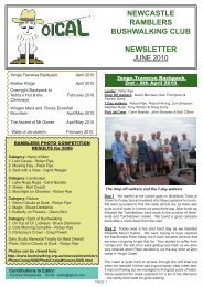
newcastle ramblers bushwalking club newsletter - Confederation of ...
newcastle ramblers bushwalking club newsletter - Confederation of ...
newcastle ramblers bushwalking club newsletter - Confederation of ...

You also want an ePaper? Increase the reach of your titles
YUMPU automatically turns print PDFs into web optimized ePapers that Google loves.
while the rest <strong>of</strong> the party more circumspectlyfollowed the rim down to the floor. We spent aninteresting morning exploring the diggings with itskilometres <strong>of</strong> water races, the breached holding dam,tonnes <strong>of</strong> mullock and other relics <strong>of</strong> the glory days <strong>of</strong>this area. David Morrison found an unusual retainingwall on the creek bank, made from flattenedkerosene tin punctured to allow for seepage.We returned to the track for a late morning tea, wherewe met a party <strong>of</strong> four who were on their way fromKiandra to Kosciuszko. They were on a mission andwere not inclined to take the time to fossick aroundas we had been doing. We then walked the shortdistance to the junction with the Four Mile Hill track.Sadly, Tim and John had to take the track straight toBroken Dam Hut, due to injury. The remainder <strong>of</strong> theparty packed a daypack and continued on toTabletop Mountain, an old volcano, circumnavigatingits base until the gradient became gentler. The routewas then straight up for a hundred metres…and wellworth every scrambly step. Magnificent panoramas tonorth and south, with clear views across Mt Jagungal,Round Mountain and the Main Range. ArthurRadford, Tony and David debated at length thelocation <strong>of</strong> Mt Kosciuszko’s obscure peak, eventuallypinpointing it to everyone’s satisfaction. After lunch,eaten sheltered from the icy wind, we traversed theflat summit to a second trig point, then followedintrepid Arthur down a slope on the northwest face.Once on the track again we returned to the junctionwith Four Mile Hill Track and a delightful walk alongthe ridge to Broken Dam Hut, where Tim and Johnhad a fire going and billy singing in the fireplace. Afterrefreshing ourselves, we strolled down to the brokendam, which was well worth a look. Some returned tothe hut, while others, urged on by Sylvia Tait,followed a water race from the dam out along a spur,around the point and back along the other side, forabout two kilometres or so. So well engineered wasit, that it was difficult to tell which way the waterwould have flowed.half way down the slope, the incredible SouthBloomfield holding dam knocked our socks <strong>of</strong>f, as didthe vertical shaft David discovered at 343212, havingcontoured eastward about a hundred metres from thedam at an altitude <strong>of</strong> 1500 metres. Resuming ouroriginal bearing, our descent led straight to animpressive sluicing scar in the hillside. We knew wewere close to the Elaine mine, but it proved elusiveeven as we reached the small creek junction onBloomfield Creek. Undaunted, David and Arthurdowned packs and took <strong>of</strong>f upstream. The hugemullock heap projecting into the bed <strong>of</strong> the creeksignalled success and led us up to the adit. We spenta happy hour crawling all over the area, followingcalls <strong>of</strong> “Look at this!” from all sides.Curiosity satisfied, we returned to our packs, climbedover the saddle south <strong>of</strong> spot height 1527 andheaded down to Four Mile Hut for lunch. An hour anda quarter <strong>of</strong> uphill (not too strenuous) found us backat Mt Selwyn car park. We drove back to Three MileDam to meet up with Denise again. It was half pastthree by then and we thought we had earned a littleindulgence, so we popped around to Cabramurra fora welcome, delicious hot chocolate. A beautifulevening, a delicious meal (thanks, Denise!) and agood night’s sleep followed. At first light onWednesday, we woke to a flurry <strong>of</strong> snow! That addeda little spice to the whole exercise.This whole walk is about 30 to 35 kilometres,depending on how much exploring you would like todo. I would grade it at 3 or 4, again depending onchoices, but is a very beautiful walk and has plenty tointerest all.- Lois SimpsonLares Valley Trek - PeruThe recent Ramblers trip to Peru included anopportunity for an excursion through the very scenicLares Valley. This is a relatively short 33km trek andwhile the distance is not great, it is demanding as it’sa high altitude trek that wends its way up and downthrough valleys and ascends to passes that exceed4500 metres. This is about twice the height <strong>of</strong>Australia’s Mt Kosciusko and at this altitude manypeople experience breathing problems due to the thinoxygen levels.Overnight the weather threatened, but it improved asTuesday morning progressed. We cut <strong>of</strong>f to the westup to the ridge <strong>of</strong> the Great Dividing Range. A cairnat the top <strong>of</strong> the spur at 340205 (approx.)seemed toconfirm our position and we headed north down thespur. Water races were becoming a bit ho-hum, butPage 2
Peter, David, Pauline, Arthur and Bob were collectedat dawn from their Cusco hostal by the trek leader,Santiago Mendosa, a charming Peruvian man whowas to entertain us with tales <strong>of</strong> the Incas and thenatural history <strong>of</strong> the area. We proceeded by road out<strong>of</strong> the cobbled streets <strong>of</strong> Cusco (3450m), through theawakening countryside and villages until the roadended in a clearing where there were a couple <strong>of</strong>Peruvian porters and four donkeys. Uh oh looks likethe ride is over. We handed over our duffle bags andshouldered our day packs and followed Santiago’scheery call ‘follow me guys’ along a stony track upthrough a pass to the valley ahead.Peruvian woman who was en route to the village farbelow; she begged some coca leaves for an energyboost to finish her journey. We arrived at thecampsite at Siquiscondor (4100m) a little too earlyand had to refrain from undermining the role <strong>of</strong> theporters by helping them set up camp.After a brief while Santiago took in our exertions andkindly saw the need for a pause to talk about thevirtues <strong>of</strong> a plant <strong>of</strong> medicinal importance. Thispattern repeated itself: we struggled for breath andhe found yet more plants or sites to talk about (hewas a very wise man). As we toiled up a long slopewe were overtaken by the porters and donkeys, nowladen with supplies and camping gear. We enteredthe river valley at Huacahuasi (3780m) and walkedon to a village where we sheltered from a sudden hailstorm while the cook prepared lunch. Onwards andupwards along narrow tracks, past villages andherdsmen with their flocks <strong>of</strong> llamas, throughmagnificent valleys, the villages falling away as thealtitude increased.We had a curious young village girl as an audience toour campsite and a gallery <strong>of</strong> inquisitive llamasobserving our every move. The food prepared byTomas the Cook was just delightful, but it was a pitythat the altitude robbed us <strong>of</strong> the appetite to dojusticehis three course meals. As darkness descended, thetemperature dropped rapidly. Dense mountain mistenveloped the campsite which made late nightnavigation to the toilet quite hazardous. (Pauline hasadded a navigation beacon to her packing list!)Day two saw us up at dawn and ready to go soonafter 7 am. Upwards, ever upwards through asuccession <strong>of</strong> passes with Santiago now extolling thevirtues <strong>of</strong> coca leaves as a source <strong>of</strong> energy andrespiratory assistance. Sceptical but desperate, I tookthe pr<strong>of</strong>fered roll <strong>of</strong> leaves and wedged them in theside <strong>of</strong> my mouth, rather like a dental cotton wad. Didit make a difference – who knows! … but there wascertain numbness …Huffing and puffing we made our way, 25 pantingsteps and a pause ‘to look at the scenery’, then onagain. At the rugged Pumawanka pass (4600m) wemade some little stone cairns to mark our triumphalpassage.But let me clarify this point. Not everyone wasaffected by the altitude and it was Pauline who put inthe star performance. She was the trek gazelle andstarred as the lead walker for the whole trek.The landscape was adorned with shrubs and grassesthat spun different hues <strong>of</strong> green while shafts <strong>of</strong>sunlight and patches <strong>of</strong> shadow cut across thehillsides. As darkness fell we met a wizened oldHigh in the snow topped mountains at the head <strong>of</strong>steep gullies were glistening glaciers and far below inthe valleys were marshes, streams, tarns, sky-bluelakes and some snow geese. We walked along acontour track to another pass at 4580m and thenfollowed a lengthy descent to a village deep in thevalley.Page 3
’Juanita’ - The Ice Maiden <strong>of</strong> Mt Ampato – PeruThe porters and the donkeys had made goodprogress and we lunched like inconsequential royaltyto the amusement <strong>of</strong> some local school kids. Wegave them pencils and school supplies which theyvalued keenly. After a lengthy afternoon walk aroundgrassy hillsides we reached the second campsite in avalley at Markaccocha (3400m) in the grounds <strong>of</strong> atrout farm, beside a coursing river. A vigorous butbrief storm roared out <strong>of</strong> the hills and we all held ontotent poles and guy ropes as the wind buffeted thecampsite.‘Juanita’ was a 14 year old beauty – <strong>of</strong> Royal Incablood – a ‘chosen one’, who from a young age lived acloistered life within the ‘House <strong>of</strong> the Virgins <strong>of</strong> theSun’. She dedicated her life to the service <strong>of</strong> herdeity. She would tend the sacred flame entrusted tothe House <strong>of</strong> the Virgins, spin and embroiderclothing, and prepare food for the Inca and nobles <strong>of</strong>the Inca bloodline. At a marriageable age she mighthave become a concubine <strong>of</strong> the Inca or the wife <strong>of</strong>one <strong>of</strong> the nobles.Unfortunately for ‘Juanita’ the mountains were angry– volcanoes were erupting and the earth shook withterrifying tremors. The Gods <strong>of</strong> the Mountains had tobe appeased.Day three, most <strong>of</strong> the distance behind us, so aneasy one we all thought, just down the road toOllantaytambo. But no, Santiago had a surprise forus! Just a short walk uphill, guys, to an interestingsite! Well the 350m climb to the ruins at Pumamarcawas well worth the effort and we spent some timethere as Santiago told us the fascinating story <strong>of</strong> theInca’s retreat from the Spanish to this ancientfortress.From there we walked along Inca terraces around thecontours <strong>of</strong> the valleys past villages, through thefarmlands and along the riversides. In the valley farbelow some workmen installing irrigation pipesgratefully relieved Santiago <strong>of</strong> more <strong>of</strong> his cocaleaves. From there it was a delightful knee-stretching,almost level walk beside the river to the cobbledstreets <strong>of</strong> Ollantaytambo (2890m), a rendez vous withthe others and lunch in a café in the town square.The Lares Valley is a spectacular trek. We werewelcomed by local people along the way but saw noother walkers on the route. It is said to be a greatalternative to the crowded and more commonlywalked Inca trail to Machu Picchu.- Peter Farley‘Juanita’ travelled over many days with a spectacularentourage <strong>of</strong> high priests and other dignitaries fromCusco, the capital <strong>of</strong> the Inca Empire, to the 6380mhigh volcano Mt Ampato. This important religiousceremony which linked the local elite, the nobility <strong>of</strong>Cusco, and Inca deities, involved all kinds <strong>of</strong> hardshipincluding exposure to the elements at high altitude.It was on top <strong>of</strong> this mountain, usually covered withsnow and ice, that she was sacrificed to the Gods.She drank a special drink <strong>of</strong> fermented corn withsedative affects before being struck over the right eyewith the ceremonial mace. Dressed in her cloths <strong>of</strong>the finest fabric and surrounded by preciousornaments <strong>of</strong> gold, silver and shell, and other objectsto assist her in her future life, she was placed in asitting foetal position, wrapped in woven alpaca wool,and covered with rocks to form a small tomb. TheGods were pleased.For over 500 years she remained covered with snowand ice until another period <strong>of</strong> volcanic activityexposed her location and caused her tomb tocollapse. She tumbled down the mountain side,destroying her elaborate head dress <strong>of</strong> macawplumage along the way. She was otherwiseundamaged.Page 4
Anthropologist Dr Johan Reinhard took advantage <strong>of</strong>the receding snow line caused by the nearby volcanicactivity and mounted an expedition in September1995 to look for Inca sacrificial sites. He scaled themountain to discover Juanita’s disturbed tomb andscattered funerary objects. Observing the path <strong>of</strong> arock rolled from the site he located Juanita’s frozenand still perfectly preserved body on the slope below.She was transported in her frozen state from herresting place to Arequipa for careful investigation tounderstand her cause <strong>of</strong> death and other aspects <strong>of</strong>the Inca way <strong>of</strong> sacrifice. Subsequent expeditions tothe mountain discovered, at lower elevations, similarrock tombs containing the bodies <strong>of</strong> other children. Allhad been sacrificed.‘Juanita’ now rest in a small museum in Arequipa, herbody still frozen within an elaborate display freezer.Her beautiful clothing and belongings are displayedwith her in nearby rooms <strong>of</strong> the museum.Our guided tour <strong>of</strong> this museum in October 2012provided a wonderful insight into the Inca culture andcivilization which flourished 100 years or soimmediately before the Spanish conquest <strong>of</strong> Peru in1532.We had a relaxing lunch break soaking up the viewsover the challenging landscape that lay ahead. At1.15pm we left our cars behind and walked down thesteep firetrail into the valley far below, then followedCrown Creek to our campsite (GR 303225), arrivingat 3.06pm.Camp was set up and a lovely fire wasbuilt not far from the clear waters <strong>of</strong> the creek, whichwe used to cook dinner. It was a beautiful campsitebut proved a rather chilly night. Bright and early wedecamped and climbed the short steep slope on tothe ridge leading us toward the NE end <strong>of</strong> Pantoneys.After a couple <strong>of</strong> ks <strong>of</strong> scrub bash we reached themore serious slope where Mel first showed hismountain goat pedigree. After a steepish climb wetook a break on a lovely knoll amongst Xanthorreabefore taking on the dreaded scree slope. Choosinga bright red section <strong>of</strong> cliff as our target we tried tokeep up with Mel as he forged on upward. A veryfavourable line had been chosen as we made it to thebase <strong>of</strong> the cliff line sooner than I had expected, frommy memory <strong>of</strong> last year's assault on The Crown.Another well earned break was taken with extra O2sucked in, before making our way along the underthe cliffs. We passed through an impressive whitesandstone cave complete with lyrebird nest perchedprecariously on a steeply sloping ledge. We foundour marker for the get up point, a lone pine on a rockplatform up to our right (GR 291245).From here itwas a steep but exhilarating climb up chimneys andgullies, along ledges, passing packs at times andusing rope for assistance on a couple <strong>of</strong> ocassionsbefore reaching the plateau. Lunch was enjoyed atthe top on the NE tip <strong>of</strong> the Crown, where we couldclearly see the entire route so far plus much more.‘Juanita’ rests in her beautiful garmentsin the Museo Santuaros Andinas <strong>of</strong> ArequipaFor more Inca tales and a touch <strong>of</strong> the macabre askme sometime about the Chauchilla Cemetery nearNasca.- Bob CliftonPantoneys Crown -28 th to 30 th August 2012G6/16km/900m Map: Ben BullenParticipants - Col McCluskey, John Hendricks,Philippa Hodgins, Bruce Derkenne and Mel MarriottEarly on a beautiful sunny Tuesday morning we setout to the Gardens <strong>of</strong> Stone Nat. Pk along the GoldenHwy and Bylong Valley Way. At Ben Bullen villagewe left the bitumen and followed trails 13k east toBaal Bone Gap (GR 292186), arriving at noon.Crown Creek campsite Mel, Philippa, John & ColThe panorama around the Capertee Valley Capertee,Nt Airly, Mt Genowlan towards Glen Davis and alongthespectacular escarpment that separates theCapertee from the Wolgan Valley was a sight tobehold on this beatiful day.Next we made use <strong>of</strong> ourreasonably early arrival, taking time to explore themyriad pagodas, birdlife and flora before us. Westopped for photos at the cairn on the highest point,approx. 1025m, before moving on to our campsitenear the south western end (GR 284237).Page 5
We found the favoured camp nicely shelteredbetween huge rock formations, arriving at 3.06pm.Camp was set up quickly while Bruce built us anotherlovely campfire. We explored some more and took afew pics then cooked and ate our dinner well beforedark with all intent on beating Big Dog to bed. Weagreed on an early departure and hit the hay earlyunder a near full moon.Thursday at 5.30am all wereup for spectacular sunrise breakfast at the cliff edge.We were packed and walking at 7am, quickly findingthe get down point at (GR 282236). We set aboutclimbing, crawling, sliding, passing & ropingourselves & our gear down a spectacular chimney onthe southern tip with a brisk westerly wind chilling ourbones. Adrenaline was pumping and fun was had aswe soon found ourselves at the base <strong>of</strong> the cliff line.We endured a steep and knee jarring walk down tothe saddle below with a clear view <strong>of</strong> our next target,Baal Bone Point.Morning tea was welcomed not farfrom Royce's favourite Kurrajong, before we set <strong>of</strong>ffor the long slug uphill again. Tracks were found andlost, old fences tripped over and laughter was sharedas we made our way up to the base <strong>of</strong> the uniqueand imposing Baal Bone Point. We got thererelatively early and decided to push on after a quickbreather. At GR 271221 we had another steep climbup through a gulley, crawling under fallen boulders,clawing our way up wash outs, shinnying alongledges and passing packs as we helped each otherup to the plateau just behind Baal Bone Point.After lunch we stayed close to the cliff edge wherepossible to reduce the amount <strong>of</strong> bush bashing, <strong>of</strong>tenwalking on the open rock ledge just a metre or s<strong>of</strong>rom the edge. This was easier and the views were"to die for" and soon we could see our cars far aheadat Baal Bone Gap.We passed over the highest point at 1047m thenstayed close to the cliff edge again with 1k to go. Justabove the gap we had to negotiate our way through aseries <strong>of</strong> delightful pagodas trying to find a gulley todrop down into the gap. Luckily we chose the rightspot at GR 289187, to start dropping down a watercourse. Over mossy spooned out rock ledges weproceeded to slide on our backsides, then scrubbash, then slide again alternately several more timesbefore emerging into a eucalypt shaded, grassy areanot 100m from our cars arrivng there at 3.06pm.(SPOOKY)Congratulations were exchanged over an ice coldbeer at the picnic table where we had lunch andenjoyed the views with fresh legs, two days earlier.After a quick relax, contacts were notified <strong>of</strong> our safearrival then we adjourned to Capertee Pub. Wedemolished huge works burgers by the glowing coalfire at the cosy old pub. Every local was cheerful andfriendly, the publican hospitable and the localtakeaway's burgers are highly recommended.Congrats to Brucie for his virgin backpack, a toughiebut a goodie.- Col McCluskeyConservation HolidaysKevin and I have enjoyed two trips with a nationwideorganization called Conservation VolunteersAustralia. (www.conservationvolunteers.com.au)Mel, Bruce, Philippa & John at cairn atop PantoneysThey have flora and fauna and landcare conservationactivities happening across Australia, in cities andrural areas. Kevin first became involved in Newcastleand then found out about their Naturewise Holidayswhich you can explore through the above website.We took a short break for photos and mandarins witha mere 4.5k scrub bash along the NE facing cliff lineback to the cars at the gap. Walking through varyingscrub, we enjoyed the blossoms and smells,somewhat protected from the howling westerly wecould clearly hear battering the cliff edge not far toour right. We soaked in the views over lunch in a niceclearing close to the cliff edge. Here we noticed whathad earlier appeared to be a smallish fire in the valleybelow now seemed large and was filling the broadvalley with smoke before the westerly pushed ittoward the natural funnel <strong>of</strong> the valley, where itcompressed into a thick stream towards Glen Davis.Page 6
Our first trip was to Mapoon on the Gulf <strong>of</strong>Carpentaria where we were involved in a 5-dayprogram monitoring the population <strong>of</strong> Olive Ridleyturtles. We were part <strong>of</strong> a group <strong>of</strong> 10 who went outeach morning for a few hours and then again at nightwith 2 aboriginal guides to the beach opposite ourcreek campsite.Our second trip was in July 2012 and again we did a5-day program in a group <strong>of</strong> 6 on the CoburgPeninsula in Arnhem Land. We stayed in staffquarters at a luxury eco resort on Seven Spirit Bay. Itwas a beautiful locationWe observed females turtles laying eggs and wereinvolved in counting hatchlings and the number <strong>of</strong>unhatched eggs. It was a very hands-on experienceand we thoroughly enjoyed it.Our accommodation was in basic but comfortabletents on raised platforms inside a well fenced areawhich was important as this is crocodile country.Our conservation work involved going out eachmorning for about 4 hours to collect marine debris ona nearby beach. Again, it is croc country so care hasto be taken anywhere near the water but that didn’tstop us excavating fishing nets from under the sandand old tree stumps. We also collected plasticbottles, thongs etc. In all, our haul was 250kgs over3 days!The meals were great (Turtle Soup? – ed) as was thecompany..Page 7
There were eleven <strong>of</strong> us (Bob, John Hendriks andson Will, John Thorn, Nick and his wife Mary,Pauline, Allen, Elisabeth, Arthur, and Frank – a greatgroup) leaving Newcastle early to have morning teain Gloucester at the Roadies Café. There was a fairbit <strong>of</strong> driving involved by the time two cars haddiverted via Rawdon Vale and up the Moppy CreekRoad to leave a vehicle at the bottom <strong>of</strong> the KholwhaRidge. The other two cars drove directly to Polblue towait for us.If you look at the holidays listed on the website youwill find the destinations and costs. You pay for yourown transport to the pick up destination and for youraccommodation and meals. However, these arefairly cheap by comparison with what regular touristsmight pay. So we paid for flights to Weipa andDarwin. We were picked up by the crew andtransported in 4WD vehicles to our work destination.In the case <strong>of</strong> Arnhem Land this was a full day trip bytroop carrier through parts <strong>of</strong> Kakadu and intoArnhem Land, then by boat to Seven Spirit Bay. Wefound the accommodation comfortable and the mealsgreat.We finally assembled at Polblue for lunch beforewalking the perimeter track <strong>of</strong> Polblue Swamp to pickup an access track leading south to the top <strong>of</strong> a ridgeand the Polblue Trail. It was very pleasant walking inmild cloudy conditions through open Snow Gumforest and grasslands. There was quite a lot <strong>of</strong>Scotch Boom about and also evidence that theNPWS were making some effort to keep it undercontrol.Mostly, we really enjoyed getting to destinations thatare “out <strong>of</strong> the way” and being involved in a “workingholiday” for a good cause – still plenty <strong>of</strong> time to relaxand enjoy the location and the company.Elisabeth, Nick, Mary, Pauline, John H, Will and JohnT on the way down the Kholwha Trail in open SnowGum forestWe walked on to join up with the main BarringtonTrail and soon after turned <strong>of</strong>f to set up camp at theLittle Murray. I have not been to this location forsome 20 years – what a beautiful spot to camp – wehad the organised camping ground to ourselves andcould spread out. The walk completed that afternoonhad been about 7 km – nice and easy.- Marise WilsonAlong the Kholwha Trail, Barrington Tops –22 nd /23 rd January 2013The previous days in January had been exceedinglyhot in Newcastle, and the planned walk on theBarrington Tops was intended to provide somerespite. Our walk on this occasion was to leave fromthe Polblue Camping Ground and descend by theKholwha Trail to the Barrington River in the valleysome 1000m below.John T had just finished telling us <strong>of</strong> his scaryexperience with a rampant stallion in the Snowy lastyear when from behind the trees emerged a couple <strong>of</strong>Brumbies, one with his eye right on John.We got a nice fire going later in the afternoon readyfor the preparation <strong>of</strong> our meals, and werecongratulating ourselves on willing the afternoonstorm to by-pass us. It did not work out that way andwe were soon in the middle <strong>of</strong> a spectacular four hourstorm with lightning and heavy rain squalls.Some sheltered and cooked beneath the smallshelter covering the camp site sign, whilst othersdisappeared into tents. The fire soon went out.Page 8
Wednesday was another beautiful day – clouded andnot too hot for the long walk downhill. The first 7 kmwas not really steep and traversed beautiful openwoodlands at first and then descended into somespectacular Antarctic Beech Forests. The trail was ingood condition having been graded within the last 12months.seen so many people at Dees corner and apparentlyit was the same at Mungo campground. With all therain the water level was quite high as well.A beautiful wild flower garden <strong>of</strong> yellow and whitePaper Daisies amongst the Antarctic BeechI had allowed about four hours to reach thefarmhouse, where we had left a vehicle. This wasbased on a very leisurely 12 km distance and the1000m descent. Well I can’t be accurate all the time –the walk was more like 16 km and there were three orfour stiff little 100m climbs over knolls along the way.Still we reached our destination by 1.30pm, havinglunched along the way at the private property gate.There were no organised activities over this weekhowever there was a lot <strong>of</strong> canoeing, walking andbike rides done.We were looking forward to fishing on the beach buton Tuesday the whole beach became covered withthick seaweed, which stayed around until the end <strong>of</strong>the week. It was very disappointing for the fishermen.- Robyn RyeThose not involved in the car shuffle were able tolaze on the farmhouse verandah enjoying thecompany <strong>of</strong> the owner, several cups <strong>of</strong> tea, and theserenity <strong>of</strong> this fairly remote location. Some <strong>of</strong> useven cooled <strong>of</strong>f in the Barrington River.It was a long return car shuffle back to Polblue (2.5hours) which meant we did not get back to Newcastleuntil about 7.30pm.It was another wonderful walk in the Barringtonthrough some lovely country we have not exploredbefore. The countryside around Gloucester andRawdon Vale was a picture with all the rainfall wehave received.Thanks to everyone for your good company withparticular thanks to those doing the driving.- Bob CliftonDees Corner Car Camp4 th to 10 th February 2013Over the week we had 12 campers on and <strong>of</strong>f withBob coming just for a day visit as well.We chose the week after school returned so that wewould have the place to ourselves. Unfortunately alot <strong>of</strong> other ‘retirees’ had the same idea! I have neverPage 9
darkness where we were able to turn <strong>of</strong>f our headtorches and marvel at a ceiling and walls covered inglow worms. It was like a moonless night, far fromcity lights lying in camp enjoying The Milky Way,though we were treading water in wetsuits withpacks.Next we had to negotiate ’The Squeeze’, asubterranean section with two passages, eachrequiring packs to be removed and passed thru. Thepassage to the right was tight for thin people, I chosethe passage to the left. We had to climb out <strong>of</strong> deepwater onto a boulder half a metre above water level,and crawl/squeeze up its steep sloping surface a fewmetres to a ledge above another pool. From here wetossed our packs in, then plunged in and swam to asmall sandy beach with daylight upon it, a further10metres away. This section was physically andmentally challenging, whilst also being very prettyand a ton <strong>of</strong> fun.Soon after we had a 13m abseil down through a holecreated by a large chock stone in the canyon. Weenjoyed this drop and found ourselves close to thejunction with Bungleboori Creek. Bungleboori isspectacular with sheer 30m walls either side, cloakedin green <strong>of</strong> moss and ferns. In light rain our exit pathrequired wading, swimming, stumbling andscrambling 500metres up spectacular Bungleboori Cklined with Water Gums (Tristiana laurina also knownas Kanooka), amass with small yellow flowers. At asharp bend we found the steep track out and a fivekilometre walk back to our cars. The rain steadily gotheavier and we arrived at our cars at 5pm and 15 o C.John, Lois & Peter, THANK YOU for organising atruly great day out.- Col McluskeyHole in the Wall Canyon & Bungleboori Creek19 th January 2013At 8 am Saturday John, Lois, Peter and I headed <strong>of</strong>ffor ‘Hole in the Wall’. Tony, Shaun, Rosemary &Carol joined us for the walk to the start <strong>of</strong> the canyon.This was a lovely cool morning after recordtemperatures on the previous day and we lookedforward to the beauty & exhilaration <strong>of</strong> a daycanyoning. We dropped into the cool and pretty creekand were surprised at the number <strong>of</strong> small fish in justabout every pool high above a series <strong>of</strong> waterfalls.The trip proved beautiful at every turn with severalabseils as we followed the small creek through ferns,mosses and lush forest.Peter, Col, John and LoisAfter one abseil 7m down a small waterfall with twolarge tree trunks wedged in it we had a swim intoPage 10