Leica Viva GNSS GS15 receiver Datasheet - Northern Survey Supply
Leica Viva GNSS GS15 receiver Datasheet - Northern Survey Supply
Leica Viva GNSS GS15 receiver Datasheet - Northern Survey Supply

Create successful ePaper yourself
Turn your PDF publications into a flip-book with our unique Google optimized e-Paper software.
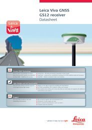
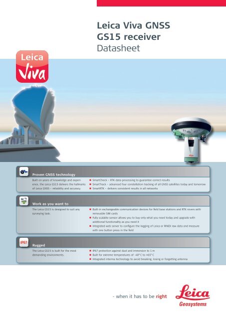
<strong>Leica</strong> <strong>Viva</strong> <strong>GNSS</strong><strong>GS15</strong> <strong>receiver</strong><strong>Datasheet</strong>Proven <strong>GNSS</strong> technologyBuilt on years of knowledge and experience,the <strong>Leica</strong> <strong>GS15</strong> delivers the hallmarksof <strong>Leica</strong> <strong>GNSS</strong> – reliability and accuracy.• n SmartCheck – RTK data-processing to guarantee correct results• n SmartTrack – advanced four constellation tracking of all <strong>GNSS</strong> satellites today and tomorrow• n SmartRTK – delivers consistent results in all networksWork as you want toThe <strong>Leica</strong> <strong>GS15</strong> is designed to suit anysurveying task.• n Built-in exchangeable communication devices for field base stations and RTK rovers withremovable SIM cards• n Fully scalable sensor allows you to buy only what you need today and upgrade withadditional functionality as you need it• n Integrated web server to configure the logging of <strong>Leica</strong> or RINEX raw data and measurewith one button press in the fieldRuggedThe <strong>Leica</strong> <strong>GS15</strong> is built for the mostdemanding environments.• n IP67 protection against dust and immersion to 1 m• n Built for extreme temperatures of -40° C to +65° C• n Integrated intenna technology to avoid breaking, losing or forgetting antenna
Technical Specifications<strong>Leica</strong> <strong>GS15</strong> <strong>GNSS</strong> <strong>receiver</strong><strong>Leica</strong> <strong>GS15</strong>Single Frequency<strong>Leica</strong> <strong>GS15</strong>Basic<strong>Leica</strong> <strong>GS15</strong>Limited<strong>Leica</strong> <strong>GS15</strong>Performance<strong>Leica</strong> <strong>GS15</strong>ProfessionalSupported <strong>GNSS</strong> SystemsGPS L2 ¢ • • • •GPS L5 ¢ ¢ ¢ ¢ •GLONASS ¢ ¢ ¢ ¢ •Galileo ¢ ¢ ¢ ¢ •RTK performanceDGPS / RTCM ¢ ¢ • • •RTK up to 5 km ¢ ¢ • • •RTK unlimited ¢ ¢ ¢ • •Network RTK ¢ ¢ ¢ • •<strong>Leica</strong> Lite RTK ¢ ¢ ¢ ¢ •Position update & data recording5 Hz positioning • ¢ • • •20 Hz positioning ¢ ¢ ¢ • •Raw data logging • ¢ • • •RINEX logging ¢ ¢ ¢ ¢ •NMEA out ¢ ¢ ¢ ¢ •Additional featuresRTK Reference Station functionality ¢ ¢ ¢ • •• = Standard¢ = Optional<strong>GNSS</strong> Performance <strong>GNSS</strong> technology <strong>Leica</strong> patented SmartTrack+ technology:• Advanced measurement engine• Jamming resistant measurements• High precision pulse aperture multipath correlator for pseudorange measurements• Excellent low elevation tracking• Very low noise <strong>GNSS</strong> carrier phase measurements with
<strong>Leica</strong> <strong>GS15</strong> <strong>GNSS</strong> <strong>receiver</strong>HardwareMemory & Data RecordingSDWeight & DimensionsWeight (<strong>GS15</strong>)WeightDimension (<strong>GS15</strong>) (diameter x height)Environmental specificationsTemperature, operatingTemperature, storageHumidityProof against: water, sand and dustVibrationDropsFunctional shockTopple overPower & Electrical<strong>Supply</strong> voltagePower consumptionInternal power supplyInternal power supply, operationtimeExternal power supplyCertificationsMemoryMemory mediumData capacityData recordingType of dataRecording rateCommunications Communication ports 1 x serial RS232 Lemo1 x USB / RS232 Lemo1 x UART serial & USB (for removable internal RTK devices)1 x Bluetooth ® port, Bluetooth ® v2.00+ EDR, class 2No. of simultaneous data links • Up to 3 data links can be attached and used simultaneously• 2 real-time output interfaces via independent ports, providing identical or different RTK/RTCM formatsBuilt In data linksRadio modems• Fully integrated, fully sealed receive / transmit radios• User exchangeable device• SATEL, Pacific Crest and others• 390 – 470 MHz bandwidth• Transmit power: 0.5 – 1.0 WUHF antenna options• Fully integrated UHF antenna• External UHF antenna connector (Type QN)3G GSM / UMTS(HSDPA) phonemodemCDMA phone modemGSM / UMTS / CDMA antennaoptionsExternal data linksRadio modemsGSM / UMTS / CDMA phone modemsLandline phone modemsCommunication protocolsReal-Time data formats for datatransmission and receptionReal-Time data formats accordingRTCM standard for data transmissionand receptionNMEA output1.34 kg3.30 kg standard RTK rover including slot RTK device, controller, batteries pole and bracket196 mm x 198 mm-40° C to +65° C, compliance with ISO9022-10-08, ISO9022-11-special,MIL STD 810F – 502.4-II, MIL STD 810F – 501.4-II-40° C to +80° C, compliance with ISO9022-10-08, ISO9022-11-special,MIL STD 810F – 502.4-II, MIL STD 810F – 501.4-II100%, compliance with ISO9022-13-06, ISO9022-12-04 and MIL STD 810F – 507.4-IIP67 according IEC60529 and MIL STD 810F – 506.4-I, MIL STD 810F – 510.4-I andMIL STD 810F – 512.4-IProtected against blowing rain and dustProtected against temporary submersion into water (max. depth 1 m)Withstands strong vibration during operating, compliance with ISO9022-36-08 andMIL STD 810F – 514.5-Cat.24Withstands 1.0 m drop onto hard surfaces40 g / 15 to 23 msec, compliance with MIL STD 810F – 516.5-INo loss of lock to satellite signal when used on a pole set-up and submitted to pole bumpsup to 150 mmWithstands topple over from a 2 m survey pole onto hard surfacesNominal 12 V DCRange 10.5 – 28 V DCTypically: 3.2 W, 270 mARecharge & removable LI-Ion battery, 2.6 Ah / 7.4 V, 2 batteries fit into <strong>receiver</strong>• 10.00 h receiving RTK data with standard radio 4• 9.00 h transmitting RTK data with standard radio 4• 7.50 h RTK via GSM/GPRS connection 4using 2 internal batteriesRechargeable external NiMh battery 9 Ah / 12 VCompliance to:FCC, CELocal approvals (as IC Canada, C-Tick Australia, Japan, China)Removable SD Card: 1 GB1 GB is typically sufficient for about GPS & GLONASS (8+4 satellites)280 days raw data logging at 15 s rateOnboard recording of:• <strong>Leica</strong> <strong>GNSS</strong> raw data• RINEX dataUp to 20 HzUser Interface Buttons • ON / OFF button• Function buttonButton functionalityFunction button:• Easy switch between Rover / Base mode• Easy “Here” positioning functionalityLed status indicatorBluetooth ® , position, RTK status, data logging, detailed power statusAdditional user interfaceAdditional web interface functionality provides full status indicator and configuration options• Fully integrated, fully sealed phone modem• User exchangeable device• User exchangeable SIM card• Tri-Band UMTS / HSDPA: 850 / 1900 / 2100 MHz• Quad-Band GSM / GPRS: 850 / 900 / 1800 / 1900 MHz• Fully integrated, fully sealed CDMA phone modem• User exchangeable device• Dual-Band CDMA 1XRTT (800 / 1900 MHz)• Integrated GSM / UMTS / CDMA antenna• External GSM / UMTS / CDMA antenna connector (Type QN)Support of any suitable UHF / VHF radioSupport of any suitable GSM / GPRS / UMTS / CDMA modemSupport of any suitable Landline phone modem<strong>Leica</strong> proprietary formats (<strong>Leica</strong>, <strong>Leica</strong> 4G)CMR, CMR+RTCM 2.1, RTCM 2.3, RTCM 3.0, RTCM 3.1NMEA 0183 V 2.20 and <strong>Leica</strong> proprietary
Whether you want to stake-out an object on a construction site or youneed accurate measurements of a tunnel or a bridge; whether youwant to determine the area of a parcel of land or need the position ofa power pole or to capture objects for as-built maps – you needreliable and precise data.<strong>Leica</strong> <strong>Viva</strong> combines a wide range of innovative products designed tomeet the daily challenges for all positioning tasks. The simple yetpowerful and versatile <strong>Leica</strong> <strong>Viva</strong> hardware and software innovationsare redefining state-of-the-art technology to deliver maximum performanceand productivity. <strong>Leica</strong> <strong>Viva</strong> gives you the inspiration to makeyour ambitious visions come true.When it has to be right.Illustrations, descriptions and technical data are not binding. All rights reserved.Printed in Switzerland – Copyright <strong>Leica</strong> Geosystems AG, Heerbrugg, Switzerland, 2009.774100en – II.11 – RDVTotal Quality Management –our commitment to totalcustomer satisfaction.The Bluetooth ® word mark andlogos are owned by BluetoothSIG, Inc. and any use of suchmarks by <strong>Leica</strong> Geosystems AG isunder license. Other trademarksand trade names are those oftheir respective owners.<strong>Leica</strong> <strong>Viva</strong>Overview brochure<strong>Leica</strong> <strong>Viva</strong> <strong>GNSS</strong>Product brochure<strong>Leica</strong> SmartWorx<strong>Viva</strong>Product brochure<strong>Leica</strong> <strong>Viva</strong> LGOProduct brochure<strong>Leica</strong> <strong>Viva</strong>SmartPoleProduct brochureSD is a trademark of the SD CardAssociation.<strong>Leica</strong> Geosystems AGHeerbrugg, Switzerlandwww.leica-geosystems.com