

Yarrabar Reserve Draft Plan of Management - Land
Yarrabar Reserve Draft Plan of Management - Land
Yarrabar Reserve Draft Plan of Management - Land

Create successful ePaper yourself
Turn your PDF publications into a flip-book with our unique Google optimized e-Paper software.
<strong>Yarrabar</strong> <strong>Reserve</strong><strong>Draft</strong> <strong>Plan</strong> <strong>of</strong> <strong>Management</strong>May 2009<strong>Yarrabar</strong> <strong>Reserve</strong> <strong>Draft</strong> <strong>Plan</strong> <strong>of</strong> <strong>Management</strong> May 2009
INVITATION TO COMMENTThe Crown <strong>Land</strong>s Act 1989 (CL Act) requires that a plan <strong>of</strong> management be prepared thatoutlines how an area will be managed. The procedures for the exhibition and adoption <strong>of</strong> plans <strong>of</strong>management are specified in sections 1 and 2 <strong>of</strong> the CL Act. These procedures are summarisedbriefly below.1. The draft plan will be placed on public exhibition (for a period <strong>of</strong> not less than 28 days) toallow for community representations and opportunity to comment on the plan. Any personmay comment on it. A public notice detailing where and when the draft plan will bedisplayed inviting submissions from interested members <strong>of</strong> the public will be published inthe local print media. During the exhibition period, the draft plan will be made available forinspection.2. Comments and submissions received on the plan will be reviewed by the <strong>Land</strong> & Property<strong>Management</strong> Authority.3. The plan, submissions and the recommendations <strong>of</strong> the <strong>Land</strong> & Property <strong>Management</strong>Authority on amendments that may be required as a result <strong>of</strong> public submissions will bereferred to the Minister for <strong>Land</strong>s.4. After considering the submissions and recommendations, the Minister may adopt theplan, or may defer the plan for further consideration.This draft plan <strong>of</strong> management for <strong>Yarrabar</strong> <strong>Reserve</strong> will be available for inspection for a period <strong>of</strong>28 days. Inspection is by prior appointment, by contacting:<strong>Land</strong> & Property <strong>Management</strong> Authority92 Kite St (PO Box 2146)Orange NSW 2800Telephone: 02 6391 4300The draft plan is also available on the <strong>Land</strong> & Property <strong>Management</strong> Authority website:www.lpma.nsw.gov.auMembers <strong>of</strong> the public, whether as individuals or as members <strong>of</strong> community interest groups, areinvited to comment on this draft plan <strong>of</strong> management. Submissions should be in writing, and asdetailed and specific as possible. However any comments, no matter how brief, are welcome.Comments should be forwarded to:Group Leader Property Services<strong>Land</strong> & Property <strong>Management</strong> AuthorityPO Box 2146Orange NSW 2800The closing date for comments on this draft plan is 31st December 2010.<strong>Yarrabar</strong> <strong>Reserve</strong> <strong>Draft</strong> <strong>Plan</strong> <strong>of</strong> <strong>Management</strong> May 2009
TABLE OF CONTENTSINVITATION TO COMMENT ........................................................................................... 2TABLE OF CONTENTS .................................................................................................. 31.0 INTRODUCTION ................................................................................................. 61.1 <strong>Land</strong> to which the <strong>Plan</strong> <strong>of</strong> <strong>Management</strong> Applies .............................................................................. 61.2 Objectives ........................................................................................................................................ 91.3 Managing Crown <strong>Land</strong> ................................................................................................................... 101.3.1 Crown <strong>Land</strong>s Act 1989 ................................................................................................................ 101.3.2 Requirements <strong>of</strong> a <strong>Plan</strong> <strong>of</strong> <strong>Management</strong> for a Crown <strong>Reserve</strong> ................................................... 102.0 RESERVE ASSESSMENT ................................................................................ 122.1 <strong>Reserve</strong> Location and Description ................................................................................................... 122.2 Background and History ................................................................................................................. 132.2.1 Purpose <strong>of</strong> Reservation .................................................................................................................... 132.2.2 Past <strong>Land</strong> Use History and Tenures ............................................................................................. 132.3 Surrounding <strong>Land</strong> Use and Regional Context.................................................................................. 142.4 Cultural Values ............................................................................................................................... 142.4.1 Aboriginal Heritage ..................................................................................................................... 142.4.2 European Heritage ...................................................................................................................... 152.5 Climate........................................................................................................................................... 162.6 <strong>Land</strong>form, Geology and Soils .......................................................................................................... 162.7 Vegetation ..................................................................................................................................... 172.8 Fauna ............................................................................................................................................. 192.9 Fire ................................................................................................................................................. 223.0 BASIS FOR MANAGEMENT ............................................................................ 23<strong>Yarrabar</strong> <strong>Reserve</strong> <strong>Draft</strong> <strong>Plan</strong> <strong>of</strong> <strong>Management</strong> May 2009
3.1 Current Impacts and Uses .............................................................................................................. 233.1.1 <strong>Reserve</strong> Access ............................................................................................................................ 233.1.2 Introduced Species ...................................................................................................................... 243.1.3 Firewood Collection .................................................................................................................... 243.1.4 Rubbish Dumping ........................................................................................................................ 253.1.5 Unauthorised Vehicle Use, Track Erosion ................................................................................... 253.1.6 Fire .............................................................................................................................................. 263.1.7 <strong>Management</strong> ............................................................................................................................... 264.0 MANAGEMENT ISSUES, STRATEGIES AND ACTIONS ................................. 274.1 Identification, Access and Recreation............................................................................................. 274.2 Introduced Species ......................................................................................................................... 284.3 Firewood Collection ....................................................................................................................... 294.4 Rubbish Dumping ........................................................................................................................... 294.5 Fire ................................................................................................................................................. 294.6 Potential <strong>Reserve</strong> Lessees .............................................................................................................. 294.6.1 Assessments <strong>of</strong> Development Proposals .................................................................................... 305.0 IMPLEMENTATION........................................................................................... 326.0 REFERENCES .................................................................................................. 357.0 APPENDIX ........................................................................................................ 36<strong>Yarrabar</strong> <strong>Reserve</strong> <strong>Draft</strong> <strong>Plan</strong> <strong>of</strong> <strong>Management</strong> May 2009
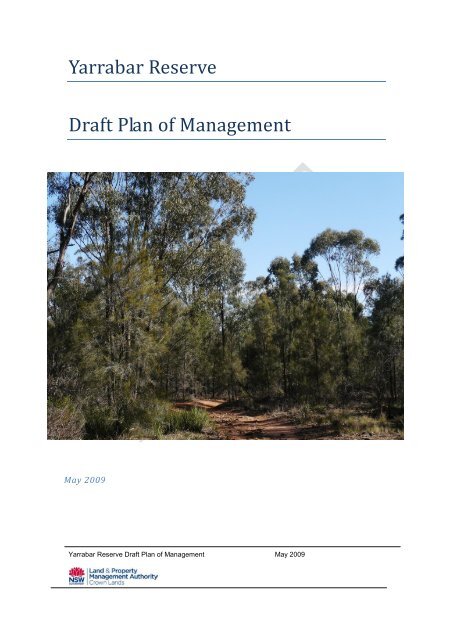
© Epacris Environmental Consultantswww.epacrisenviro.com.auPO Box 193, Katoomba, NSW 2780Tel. 4782 1177 info@epacrisenviro.com.auCover images:Photographs taken by Epacris Environmental unless otherwise noted.<strong>Yarrabar</strong> <strong>Reserve</strong> <strong>Draft</strong> <strong>Plan</strong> <strong>of</strong> <strong>Management</strong> May 2009
1.0 INTRODUCTION1.1 <strong>Land</strong> to which the <strong>Plan</strong> <strong>of</strong> <strong>Management</strong> Applies<strong>Yarrabar</strong> <strong>Reserve</strong> is comprised <strong>of</strong> 276 hectares located approximately 14 kilometressouth west <strong>of</strong> the regional city <strong>of</strong> Dubbo in the Central West Region <strong>of</strong> NSW. The<strong>Reserve</strong> fronts onto the Newell Highway.The reserve lies within the traditional lands <strong>of</strong> the Wiradjuri language group and islocated within the Brigalow Belt South Biogeographic Bioregion.<strong>Yarrabar</strong> <strong>Reserve</strong> is comprised <strong>of</strong> 3 separate land titles within one reserved area. Theseare listed below and shown in Map 2.Table 1: <strong>Land</strong> area within the <strong>Reserve</strong>Lot 104 7010 7011Deposited <strong>Plan</strong> 753233 1120882 1065056Parish Dubbo Dubbo WhylandraCounty Gordon Gordon Gordon<strong>Land</strong> District Dubbo Dubbo DubboLocal Government Area Dubbo CC Dubbo CC Dubbo CCTopographic Map Sheet Eulomogo 8633-N1:50 000Eulomogo 8633-N 1:50000Eulomogo 8633-N1:50 000<strong>Reserve</strong> Number 81726 39986 Part reserve 1986<strong>Reserve</strong> PurposeFuture PublicRequirements;Preservation <strong>of</strong>Fauna;Preservation <strong>of</strong>Native FloraCamping,Travelling StockTravelling Stock<strong>Management</strong>Department <strong>of</strong><strong>Land</strong>sLivestock Pest andHealth AuthorityLivestock Pest andHealth AuthorityApproximate Area 120 ha. 149 ha. 7 ha<strong>Yarrabar</strong> <strong>Reserve</strong> <strong>Draft</strong> <strong>Plan</strong> <strong>of</strong> <strong>Management</strong> May 2009
<strong>Yarrabar</strong> <strong>Reserve</strong> <strong>Draft</strong> <strong>Plan</strong> <strong>of</strong> <strong>Management</strong> May 2009
<strong>Yarrabar</strong> <strong>Reserve</strong> <strong>Draft</strong> <strong>Plan</strong> <strong>of</strong> <strong>Management</strong> May 2009Map 1
Map 2 Lots comprising <strong>Yarrabar</strong> <strong>Reserve</strong>1.2 ObjectivesThis plan <strong>of</strong> management provides policy recommendations for:short and long term management <strong>of</strong> <strong>Yarrabar</strong> <strong>Reserve</strong>;procedures for compliance with statutory instruments.The management objectives for the reserve are:to conserve and manage the reserve’s natural and conservation values;to identify potential additional uses which are consistent with sustainablemanagement <strong>of</strong> the reserve;<strong>Yarrabar</strong> <strong>Reserve</strong> <strong>Draft</strong> <strong>Plan</strong> <strong>of</strong> <strong>Management</strong> May 2009
to pursue further opportunities for more sustainable management <strong>of</strong> thereserve.1.3 Managing Crown <strong>Land</strong>1.3.1 Crown <strong>Land</strong>s Act 1989<strong>Yarrabar</strong> <strong>Reserve</strong> is classified as Crown land reserve and the Crown <strong>Land</strong>s Act 1989(CL Act) is the primary act applying to its management. The CL Act governs theplanning, management and use <strong>of</strong> Crown land, including reservation or dedication fora range <strong>of</strong> public purposes, and leasing and licensing.All reserved Crown land is subject to the general land management objectives andprovisions <strong>of</strong> the CL Act. The objectives and principles <strong>of</strong> Crown land managementare listed in section 11 <strong>of</strong> the CL Act, these principles are:that environmental protection principles be observed in relation to themanagement and administration <strong>of</strong> Crown land,that the natural resources <strong>of</strong> Crown land (including water, soil, flora, faunaand scenic quality) be conserved wherever possible,that public use and enjoyment <strong>of</strong> appropriate Crown land be encouraged,that, where appropriate, multiple use <strong>of</strong> Crown land be encouraged,that, where appropriate, Crown land should be used and managed in such away that both the land and its resources are sustained in perpetuity, andthat Crown land be occupied, used, sold, leased, licensed or otherwise dealtwith in the best interests <strong>of</strong> the State consistent with the above principles.In July 2005, the Crown <strong>Land</strong> Legislation Amendment Act 2005 was passed,introducing a comprehensive body <strong>of</strong> amendments to the CL Act. Theseamendments allow flexibility in the granting <strong>of</strong> leases, permits, easements or right <strong>of</strong>way provisions over a Crown reserve. Section 112 allows that a Crown reserve maybe used for a purpose that is additional to the purpose for which the land has beenreserved or dedicated if the additional purpose is authorised by a plan <strong>of</strong>management for the reserve.1.3.2 Requirements <strong>of</strong> a <strong>Plan</strong> <strong>of</strong> <strong>Management</strong> for a Crown <strong>Reserve</strong>This <strong>Plan</strong> <strong>of</strong> <strong>Management</strong> has been prepared according to the requirements <strong>of</strong> theCrown <strong>Land</strong>s Act 1989.Specific objectives <strong>of</strong> a <strong>Plan</strong> <strong>of</strong> <strong>Management</strong> for Crown <strong>Land</strong> are to:Identify the values <strong>of</strong> the reserve to the community.<strong>Yarrabar</strong> <strong>Reserve</strong> <strong>Draft</strong> <strong>Plan</strong> <strong>of</strong> <strong>Management</strong> May 2009
Identify potential opportunities for future development <strong>of</strong> the reserve based oncommunity priorities.Identify threats to the ecological quality <strong>of</strong> the bushland.Address issues, including leases and licences, the preferred mix <strong>of</strong>recreational facilities, conflict between users, weed invasion in bushland andthe recreational needs <strong>of</strong> residents.Prepare a concept plan showing practical future developments.Recommend performance measures by which the objectives <strong>of</strong> the plan shallbe achieved, and the manner in which those measures will be assessed.Prepare guidelines for the future management and maintenance <strong>of</strong> thereserve. (Trust Handbook)<strong>Yarrabar</strong> <strong>Reserve</strong> <strong>Draft</strong> <strong>Plan</strong> <strong>of</strong> <strong>Management</strong> May 2009
2.0 <strong>Reserve</strong> AssessmentSite investigations were carried out in September 2008 and included discussions withDepartment <strong>of</strong> <strong>Land</strong>s staff, a review <strong>of</strong> existing literature and aerial imagery.Orthophoto maps and topographic maps were also used to determine the physicalcharacter and context <strong>of</strong> the site.2.1 <strong>Reserve</strong> Location and Description<strong>Yarrabar</strong> <strong>Reserve</strong> represents an island <strong>of</strong> remnant bushland set within a primarilycleared rural landscape located approximately 14 kilometres south west <strong>of</strong> the largerural centre <strong>of</strong> Dubbo (Map 1).The reserve lies on the Sappa Bulga Range, however the topography is relatively flatwith altitude ranging from 300 to 339 masl. The area is comprised largely <strong>of</strong> remnantbushland with many areas carrying regrowth woodland after previous clearing. Veryfew old growth trees are located on the reserve, and these are a precious resource ina region that has been extensively cleared for agricultural purposes. The reserveshows evidence <strong>of</strong> past and recent clearing, with firewood collection apparently stilloccurring.The ephemeral <strong>Yarrabar</strong> Creek and a few <strong>of</strong> its tributaries are located on the reserve,<strong>Yarrabar</strong> Creek flows into Cumboogle Creek and then into the Macquarie River. Thearea is located within the Central West Catchment Area.The front (south-eastern) portion <strong>of</strong> the land (Lot 7010 DP 1120882 and Lot 7011 DP1065056) is Crown land managed by the Livestock Health and Pest Authority(previously Rural <strong>Land</strong>s Protection Board) as a Travelling Stock Route (TSR). Thispart <strong>of</strong> the reserve adjoins the roadside TSR’s along the Newell Highway. Thissection <strong>of</strong> TSR within <strong>Yarrabar</strong> <strong>Reserve</strong> is not currently regularly used for travellingstock. The rear (north-western) part <strong>of</strong> the reserve Lot 104 DP 753233 is Crown<strong>Reserve</strong> managed by the Department <strong>of</strong> <strong>Land</strong>s (Map 2).<strong>Yarrabar</strong> <strong>Reserve</strong> is a well-vegetated bushland reserve, with no formal infrastructureor facilities. The reserve is fenced along its entire boundary, with a few breaches onthe east and western boundaries. Old homestead ruins are still extant on the rear <strong>of</strong>the property and evidence <strong>of</strong> old mining/prospecting diggings are located on the frontportion <strong>of</strong> the reserve.<strong>Yarrabar</strong> <strong>Reserve</strong> <strong>Draft</strong> <strong>Plan</strong> <strong>of</strong> <strong>Management</strong> May 2009
2.2 Background and History2.2.1 Purpose <strong>of</strong> ReservationThe notified purposes <strong>of</strong> the reserve lots are as follows:Lot 104 (120ha) is reserved for the following:Future Public Requirements;Preservation <strong>of</strong> Fauna ;Preservation <strong>of</strong> Native Flora.Lot 7010 (149ha) is reserved for the following:Camping;Travelling Stock.Lot 7011 (7ha) is reserved for:Travelling Stock.Lots 7010 and Lot 7011 at the front <strong>of</strong> the reserve are managed as a Travelling StockRoute (TSR) by The Livestock Health and Pest Authority (formerly RLPB), Dubbo,however due to the density <strong>of</strong> vegetation on the reserve and its location on a majortransport corridor the land is no longer regularly used for the purposes <strong>of</strong> stockmovement. The Department <strong>of</strong> <strong>Land</strong>s manages Lot 104.2.2.2 Past <strong>Land</strong> Use History and TenuresA brief summary <strong>of</strong> the historical usage <strong>of</strong> the land is shown below:Special Lease 1931/10 Dubbo, granted 8 October 1931;Special Lease 1959/1 Dubbo, granted 19 January 1959;<strong>Reserve</strong>d from Sale for Future Public Requirements for the Preservation <strong>of</strong>Native Flora and Fauna, 19 January 1959;Permissive Occupancy 1987/10, commenced 1 September 1987;Permissive Occupancy 1987/10, terminated 8 November 1999.These leases were granted for rural use, and the reserve shows evidence, throughdense vegetation regrowth, <strong>of</strong> past clearing. Remains <strong>of</strong> foundations <strong>of</strong> buildings arestill present in the cleared portion <strong>of</strong> Lot 104, and several dams are present.There is some evidence, in the form <strong>of</strong> diggings, <strong>of</strong> past fossicking or mining activityon the reserve. It is unknown what minerals were sought, but both gold and copper<strong>Yarrabar</strong> <strong>Reserve</strong> <strong>Draft</strong> <strong>Plan</strong> <strong>of</strong> <strong>Management</strong> May 2009
were found in the district. The Brisbane Courier dated 7 July 1888 wrote “The DubboExpress states that a copper discovery has been made, which, if equal to thespecimens shown from other localities, will equal the Cobar in quantity and surpass itin quality. The discovery is within twenty miles <strong>of</strong> Dubbo, and six and a half milesfrom the railway line.”2.3 Surrounding <strong>Land</strong> Use and Regional Context<strong>Yarrabar</strong> <strong>Reserve</strong> is bordered by the Newell Highway to the south-east, and byprivate rural land on all other borders. Adjoining properties are comprised <strong>of</strong> bothsmall rural subdivision blocks and larger landholdings. The roadside travelling stockroute links this large remnant to other remnant vegetation along the highway andprovides a natural corridor for many fauna species.Dubbo is a major service centre which is located at the heart <strong>of</strong> NSW and is situatedat the junction <strong>of</strong> three major highways: the Newell; The Mitchell and the GoldenHighway. Dubbo’s population is in excess <strong>of</strong> 39,500 people, and the city services ageographic area the size <strong>of</strong> a third <strong>of</strong> NSW.Past and current land uses in the rural areas are predominantly grazing andcropping. Many <strong>of</strong> the larger rural land parcels in the area are now being subdividedinto smaller rural parcels, this has occurred on the land to the south-west <strong>of</strong> thereserve. The increase in neighbour numbers naturally also increases the pressureson the reserve lands, through increased recreational use and firewood collection.2.4 Cultural Values2.4.1 Aboriginal HeritageA data search <strong>of</strong> the Aboriginal Heritage Information <strong>Management</strong> System (AHIMS)and Historic Heritage Information <strong>Management</strong> System (HHIMS) databases from theDepartment <strong>of</strong> Environment and Climate Change revealed no recorded sites for thereserve. This is probably a direct result <strong>of</strong> the fact that no targeted surveys forAboriginal sites or historic sites have been carried out in the area.The area would undoubtedly have been used traditionally by Aboriginal people andwould have value for contemporary Aboriginal people. The reserve is within theterritory <strong>of</strong> the Wiradjuri language group. Some items that were possibly flakes andstone tools were observed on site, however these have not been verified.Investigations made by the Department <strong>of</strong> <strong>Land</strong>s indicate that Native Title has beenfound to have been validly extinguished.<strong>Yarrabar</strong> <strong>Reserve</strong> <strong>Draft</strong> <strong>Plan</strong> <strong>of</strong> <strong>Management</strong> May 2009
2.4.2 European HeritageLittle is known about the former European Heritage <strong>of</strong> the site. Maps show that theproperty on Lot 104 was called ‘Currawong’, this lease was terminated in 1999. The1909 to 1958 Parish <strong>of</strong> Whylandra map shows that on or adjacent to Lot 7011, was aschool called Yerrabah Public School (Figure 1). No information on this school wasable to be obtained.Current knowledge indicates that none <strong>of</strong> the building ruins on Lot 104 have anyheritage significance.Lot 104Lot 7010Lot 7011Figure 1.Old ‘Parish <strong>of</strong> Whylandra’ map showinglocation <strong>of</strong> Yerrabah Public School.<strong>Yarrabar</strong> <strong>Reserve</strong> <strong>Draft</strong> <strong>Plan</strong> <strong>of</strong> <strong>Management</strong> May 2009
2.5 ClimateThe Dubbo area experiences a temperate climate. Summers are warm to hot,generally ranging from 17 deg C (62.6F) to 33 deg C (91.4F), with some extremeevents exceeding 38 deg C (100.4F).During the winter months, the average daily temperature varies from 3 deg C (37.4F)to 17 deg C (62.6F), with some early morning frosts.Dubbo's location in the transition area between the Central Tablelands and theWestern Plains has the effect <strong>of</strong> providing even distribution <strong>of</strong> rainfall throughout theyear. Average annual rainfall recorded at Dubbo is 584.8mm (23 inches). Dubbo'swettest month is January with an average rainfall <strong>of</strong> 60.1mm (2.36 inches) occurringon average over six days. Evaporation in the Dubbo area exceeds the averagerainfall and averages approximately 1,880mm (74 inches) per year.Wind patterns are consistent over the whole year. The prevailing winds at Dubbo arefrom the southeast, south, southwest and west, which account for a combined 64.4per cent <strong>of</strong> the annual recorded wind direction.2.6 <strong>Land</strong>form, Geology and SoilsThe oldest rocks in the Dubbo region were formed during the initial stages <strong>of</strong>development <strong>of</strong> the Lachlan Fold Belt in the Ordovician Period about 450 millionyears ago.The bioregion’s bedrock comprises horizontally beddedJurassic and Triassic quartz sandstone and shale <strong>of</strong>the Gunnedah Basin and Hyandra Creek groups. Thedominant geology is Napperby Formation (Rp), whichcomprises siltstone, thinly interbedded with fine tomedium grained lithio-quartz sandstone and minorconglomerate. There may also be a small area <strong>of</strong>Peachvale Formation (Drp) comprised <strong>of</strong> rhyolitebreccia and rhyolite, as well as a very small area <strong>of</strong>Cainozoic units (ttx) comprising trachyte, syenite andminor phonolite (Meakin et al, 1999).The presence <strong>of</strong> rhyolite and syenite indicate a contactzone between the igneous and sedimentary rocklayers. This can be a sign <strong>of</strong> mineralisation and islikely to be the reason for the past evidence <strong>of</strong>fossicking on parts <strong>of</strong> the reserve. Soils are comprisedpredominantly <strong>of</strong> coarsely cracking grey and brownclays.Figure 2 Geology on <strong>Yarrabar</strong> Creek<strong>Yarrabar</strong> <strong>Reserve</strong> <strong>Draft</strong> <strong>Plan</strong> <strong>of</strong> <strong>Management</strong> May 2009
2.7 VegetationKeith (2004) describes the vegetation community present in this area as WesternSlopes Dry Sclerophyll Forest. However, no detailed vegetation mapping has beencarried out for this reserve. Dominant canopy species include White Cypress Pine(Callitris glaucophylla), Black Cypress Pine (Callitris endlicheri), TumbledownRedgum (Eucalyptus dealbata), Mugga Ironbark (E. sideroxylon), Narrow-leavedIronbark (E. crebra) and Yellow box (E. melliodora). Understorey species includeDillwynia sieberi, Calotis cuneifolia, Acacia buxifolia, Acacia lineata andLeptospermum sp. The indicative distribution <strong>of</strong> the major vegetation communities isshown on Map 3.Map 3. Indicative vegetation communitiesKeith (2004)<strong>Yarrabar</strong> <strong>Reserve</strong> <strong>Draft</strong> <strong>Plan</strong> <strong>of</strong> <strong>Management</strong> May 2009
Vegetation communities indicated on map:1. Dry sclerophyll forest, Callitris dominated2. Dry sclerophyll forest, Mugga Ironbark dominated3. Cleared landSeveral threatened plant species have been recorded within 10 km <strong>of</strong> the reserve,these are listed below. There is potential for some <strong>of</strong> these species to be found onthe reserve.Silk Swainson-peaPine Donkey OrchidThick-lipped Spider OrchidSwainsonia sericeaDiuris tricolourCaladenia tessellataPhilotheca ericifoliaRulingia procumbensIngram’s ZieriaZieria ingramiiSome areas within the reserve arecovered with extremely denseregrowth <strong>of</strong> Callitris, this is likely tohave been triggered by past clearing(Figure 3). Cypress Pine from thisarea was in high demand for use asflooring and weatherboards forconstruction in the 1950’s and 1960’s,due to its durability and attractivepatterns (Keith 2004). These thickstands <strong>of</strong> Cypress will thin with age,but in the meantime will tend tosuppress regeneration <strong>of</strong> understoreyspecies.Figure 3 Callitris regrowth in <strong>Yarrabar</strong> <strong>Reserve</strong>.<strong>Yarrabar</strong> <strong>Reserve</strong> is considered to be <strong>of</strong> high conservation value as the reserveadjoins a roadside TSR, and is therefore an integral component <strong>of</strong> the vegetatedroadside corridor. The native bushland is in excellent condition with minimal weedinvasion.<strong>Yarrabar</strong> <strong>Reserve</strong> <strong>Draft</strong> <strong>Plan</strong> <strong>of</strong> <strong>Management</strong> May 2009
2.8 FaunaThe reserve provides important habitat values within a largely cleared rurallandscape. Evidence <strong>of</strong> several macropod species was observed throughout thereserve.The reserve performs an extremely important role as a timbered island within anotherwise cleared and fragmented landscape. The role <strong>of</strong> these ‘islands’ is integral inthe survival and movement across the landscape for many fauna species, inparticular for bird species. Many bird species utilise the area, and it is consideredlikely that threatened bird species such as Regent Honeyeaters, Glossy BlackCockatoos and Swift Parrots could all utilise the reserve for foraging and nesting.Several nesting bird species were observed during the site visit (White-wingedchoughs and Galahs).Presently the reserve provides a fewlarge old habitat trees which are indemand as nest trees for severalspecies, in particular parrots andmicrobats. Galahs were observednesting in one <strong>of</strong> these old growthtrees. These old trees are under threatfrom firewood collectors.Birds observed during the site visit arelisted below.Figure 4 Old hollow habitat tree. Galahswere observed nesting in this tree.<strong>Yarrabar</strong> <strong>Reserve</strong> <strong>Draft</strong> <strong>Plan</strong> <strong>of</strong> <strong>Management</strong> May 2009
Common BronzewingGalahCockatielEastern RosellaKookaburraBuff-rumped ThornbillSpotted PardaloteNoisy FriarbirdYellow RobinRufous WhistlerBlack-faced Cuckoo-shrikeOlive-backed OrioleMagpieCurrawongAustralian RavenWhite-winged ChoughMagpie LarkApostle BirdPhaps chalcopteraEolophus roseicapillusNymphicus hollandicusPlatycercus eximiusDacelo novaeguineaeAcanthiza reguloidesPardolatus punctatusPhilemon corniculatusEopsaltria australisPachycephala rufiventrisCoracina novaehollandiaeOriolus sagittatusGymnorhina tibicenStrepera graculinaCorvus coronoidesCorcorax melanorhamphosGrallina cyanoleucaStruthidea cinereaAn Anabat bat call detector was set up and aimed over the front dam during the sitevisit. The following species were detected:Gould’s Wattled BatSmall Pied BatLittle Broad-nosed BatLittle Forest BatWhite-striped Freetailed BatChalinolobus gouldiiChalinolobus picatusScotorepens greyiiVespadelus vulturnusTadarida australis<strong>Yarrabar</strong> <strong>Reserve</strong> <strong>Draft</strong> <strong>Plan</strong> <strong>of</strong> <strong>Management</strong> May 2009
Of these species, the Small Pied Bat (Chalinolobus picatus) is classified asVulnerable (Threatened Species Conservation Act 1995). The dams on the reserveprovide a reliable water source for many species. Frogs were heard calling at bothdams, but were unable to be identified.Numerous threatened bird and bat species have been recorded within 10 km <strong>of</strong> thereserve. These are listed below.The connectivity value <strong>of</strong> the reserve is high, as it adjoins the travelling stock routealong the Newell Highway which represents a long ribbon <strong>of</strong> habitat for manykilometres, as well as providing linkages to other remnant vegetation areas. Theland surrounding the reserve is primarily cleared land for grazing or agriculture, andthe value <strong>of</strong> any timbered remnant blocks in the area is high.Speckled Warbler Chthonicola saggitatus VulnerableGlossy Black Cockatoo Calyptorhynchus lathami VulnerableDiamond Firetail Stagonopleura guttata VulnerableBrown Treecreeper Climacteris picumnus VulnerableBlack-chinned Honeyeater Melithreptus gularis VulnerableRegent Honeyeater Xanthomyza Phrygia EndangeredGilberts Whistler Pachycephala inornata VulnerableGrey-crowned BabblerPomatostomus temporalis VulnerableHooded Robin Melanodryas cucullate VulnerableSuperb Parrot Polytelis swainsonii VulnerableSwift Parrot Lathamus discolour EndangeredBarking Owl Ninox connivens VulnerableYellow-bellied Sheathtailed Bat Saccolaimus flaviventrisVulnerableLittle Pied Bat Chalinolobus picatus VulnerableEastern Long-eared Bat Nyctophilus timoriensis VulnerableGrey Headed Flying Fox Pteropus poliocephalus Vulnerable<strong>Yarrabar</strong> <strong>Reserve</strong> <strong>Draft</strong> <strong>Plan</strong> <strong>of</strong> <strong>Management</strong> May 2009
2.9 FireFire is a natural process in the Australian environment, and many native plants andanimals are generally adapted to occasional fire events. Too frequent fire eventshowever, have the ability to alter the vegetation communities within an area, andtherefore also impact upon the fauna species that live there.The fire history <strong>of</strong> the reserve is largely unknown, however it is considered that thearea would have been affected in the 1984 fire that burnt out 7800 hectares (RFSOrana Team, pers. comm.)All lots within <strong>Yarrabar</strong> <strong>Reserve</strong> are mapped as ‘High Bush Fire Prone Category’ byDubbo City Council. The new subdivisions bordering the reserve are likely toincrease the necessity for hazard reduction <strong>of</strong> the reserve to protect the neighbouringassets.The reserve is located in the Rural Fire Service’s Western Region, and the local fireteam is the Orana (Dubbo) District Rural Fire Team.<strong>Yarrabar</strong> <strong>Reserve</strong> <strong>Draft</strong> <strong>Plan</strong> <strong>of</strong> <strong>Management</strong> May 2009
3.0 Basis for <strong>Management</strong>Hartley3.1 Current Impacts and UsesThe <strong>Reserve</strong> is currently used for recreation by horse and trail bike riders, andpossibly by adjacent landholders for bushwalking.Fossicking or mining appears to have been carried out at some time in one portion <strong>of</strong>Lot 7010 in the form <strong>of</strong> diggings.3.1.1 <strong>Reserve</strong> AccessFormed legal access to <strong>Yarrabar</strong> <strong>Reserve</strong> is available via Morey Place (<strong>of</strong>f PanaiAvenue) and also from the Newell Highway via a roughly formed access track.Unformed Crown roads also adjoin the property from the north and north westhowever these Crown road corridors are heavily timbered, non trafficable andtherefore do not provide practicable public road access to the reserve.The front boundary <strong>of</strong> the reserve has recently been fenced, and a gate placed at thehighway entrance point. Public access through these routes presents no significantissues. Vandalism <strong>of</strong> signs, fences and gates has occurred in the past.Some rationalisation <strong>of</strong> the tracks within the reserve is recommended, with severelyeroded areas being rehabilitated and tracks that are already undergoing naturalregeneration closed <strong>of</strong>f. Formalisation <strong>of</strong> closed tracks should be carried out,through signs and barricades to assist in discouraging horse and trail bike riding.Figure 6 Front access from <strong>Yarrabar</strong> <strong>Reserve</strong> onto the Newell Highway.<strong>Yarrabar</strong> <strong>Reserve</strong> <strong>Draft</strong> <strong>Plan</strong> <strong>of</strong> <strong>Management</strong> May 2009
3.1.2 Introduced SpeciesWeedsVery few weed species were noted throughout the reserve, and those that wereobserved occur predominantly near rubbish and soil dumps. These isolatedinvasions could be readily controlled.Vertebrate Pest SpeciesPredation by cats, dogs and foxes may be considerable on mammals, lizards, frogsand birds. Rabbits graze on seedlings and regenerating shoots affecting nativevegetation cover leading to erosion, and also compete with native fauna forresources.Several vertebrate feral species are likely to be present within the reserve, most likelyfoxes, cats and adjacent landholder’s dogs. Very few predator scats were notedduring site visits. Rabbits are also likely to occur throughout the reserve.3.1.3 Firewood CollectionFigure 7. Tree cut down for future firewood supply.<strong>Yarrabar</strong> <strong>Reserve</strong> <strong>Draft</strong> <strong>Plan</strong> <strong>of</strong> <strong>Management</strong> May 2009
Firewood collection is a predominant threat to the vegetation <strong>of</strong> <strong>Yarrabar</strong> <strong>Reserve</strong>with many areas retaining old tree stumps and showing other impacts <strong>of</strong> long-termfirewood collection. Some <strong>of</strong> this evidence may be a result <strong>of</strong> the high demand forcypress pine in the 1950’s and 1960’s for floorboards and weatherboards. Live trees,especially eucalypts, are still being cut down to provide future firewood when thetimber is aged.It is likely that much <strong>of</strong> this firewood collection is occurring from the adjacentlandholders for household heating purposes. This history <strong>of</strong> timber and firewoodcollection has led to a dearth <strong>of</strong> old growth and/or dead trees with hollows, whichprovide essential habitat. Only a few dead standing trees remain in the reserve andthese are under immediate threat.3.1.4 Rubbish DumpingRubbish dumping is evident throughout the reserve, but primarily occurs on the frontportion <strong>of</strong> Lot 7010, due to its proximity and easy access from the highway. Theconstruction <strong>of</strong> a fence along the front boundary has been carried out which shouldassist in restricting the dumping <strong>of</strong> rubbish in the future.Figure 8 Dumped rubbish on reserveIn addition to domestic rubbish dumping, road refuse has also been dumped in thepast at the front <strong>of</strong> the block, and dead livestock have also been noted.3.1.5 Unauthorised Vehicle Use, Track ErosionThe reserve has unrestricted vehicle access to the majority <strong>of</strong> areas within thebushland. This has resulted in a network <strong>of</strong> vehicle tracks being established leadingto fragmentation <strong>of</strong> native vegetation as well as track degradation and erosion.Numerous unsealed tracks are present throughout the reserve, some <strong>of</strong> which areaccessible by 2WD vehicles, while others are deeply eroded and only trafficable by<strong>Yarrabar</strong> <strong>Reserve</strong> <strong>Draft</strong> <strong>Plan</strong> <strong>of</strong> <strong>Management</strong> May 2009
4WD vehicles. Some tracks are grown over with vegetation, but many are still usedby trail bikes which create deep ruts on the existing dirt tracks.A few <strong>of</strong> the tracks are showing signs <strong>of</strong> deep gullying from water flows andinappropriate vehicle use. Minor trackworks and stabilisation should remedy thisissue.3.1.6 FireThere are several areas <strong>of</strong> high density Callitris regrowth which are likely to be aresult <strong>of</strong> former clearing. This dense regrowth will thin out naturally over time. Thereare no built assets currently on the reserve, however the Rural Fire Service is likelyto require a hazard reduction burn at suitable intervals for the protection <strong>of</strong> adjacentproperty.Under the Rural Fires Act 1997, the Department <strong>of</strong> <strong>Land</strong>s is responsible formanaging fire on <strong>Yarrabar</strong> <strong>Reserve</strong>. Fire is an event that will occur from time to timein the reserve. The predominant aim <strong>of</strong> fire management is to protect the adjoiningproperties and to maintain the reserve’s natural values.The recommended fire regime for dry sclerophyll shrub/grass forest is that fire shouldnot occur within 15 years <strong>of</strong> a previous fire, and should be burnt within 50 years <strong>of</strong>any previous fire, although Callitris sp. tend to be sensitive to frequent fire regimes(NSW NPWS 2002).3.1.7 <strong>Management</strong>Although all three lots are owned by the Crown, the lots are managed by differentauthorities. Lot 104 is managed by the Department <strong>of</strong> <strong>Land</strong>s and Lots 7010 and7011 are managed by the Livestock Health and Pest Authority (formerly RLPB) as atravelling stock route.An Incentive <strong>Management</strong> Agreement with the Central West CMA has been enteredinto by the Livestock Health and Pest Authority (formerly RLPB). This agreement isaimed at managing remnant vegetation to conserve biodiversity, improve plantdiversity and wildlife habitat and to reduce exotic weed and pest animal impact.Funds have been provided through this agreement for fencing and regeneration onthe reserve. As a result <strong>of</strong> this agreement, the front highway boundary has beenfenced. This action should assist in restricting access to the site and reduce theamount <strong>of</strong> rubbish and refuse dumped within the reserve, and may also assist inrestricting firewood collectors. Fencing <strong>of</strong> the dams is aimed at excluding stock andwill assist in protecting the dam walls and surrounding vegetation from trampling.<strong>Yarrabar</strong> <strong>Reserve</strong> <strong>Draft</strong> <strong>Plan</strong> <strong>of</strong> <strong>Management</strong> May 2009
4.0 <strong>Management</strong> Issues, Strategies and Actions4.1 Identification, Access and RecreationCurrently there is no signage to identify the reserve or its purpose. It is likely thatmany people who use the reserve have no knowledge <strong>of</strong> its Crown <strong>Reserve</strong> statusnor what this means.Consideration should be given to establishing a Conservation Agreement through theDepartment <strong>of</strong> Environment and Climate Change (DECC) over at least a portion <strong>of</strong>the reserve. This will enhance the reserve’s conservation security now and into thefuture.Strategies and actionsInstall signs at the two public entry points to the reserve and on the highwayboundaries, to communicate the reserve’s name, managing agency andprotected status.Maintain current access roads.Review tracks and trails. Close some trails and allow them to rehabilitate(see Map 4 for recommended trail closures).Inform all neighbours and the local community <strong>of</strong> the reserve’s status and thatcertain activities are illegal (unauthorised vehicle access, timber collection).Retain public pedestrian access for low impact, nature-based recreation suchas bushwalking and birdwatching.Establish a Conservation Agreement over a portion <strong>of</strong> the reserve, forexample all <strong>of</strong> Lots 7010 and 7011, and part <strong>of</strong> Lot 104, to enhance theconservation security <strong>of</strong> the reserve.<strong>Yarrabar</strong> <strong>Reserve</strong> <strong>Draft</strong> <strong>Plan</strong> <strong>of</strong> <strong>Management</strong> May 2009
Map 4. Recommended track closures4.2 Introduced SpeciesFew introduced weed species occur on the reserve. This situation should bemaintained by carrying out spot checks for weed invasion twice yearly, and treatingthem immediately. Feral animal control should be carried out in conjunction withcurrent control programs throughout the district.Strategies and actionsTreat weed invasions as they occur throughout the reserve. Carry outinspections and treatment twice yearly.Carry out feral animal control in conjunction with programs run by theLivestock Health and Pest Authority (LHPA).<strong>Yarrabar</strong> <strong>Reserve</strong> <strong>Draft</strong> <strong>Plan</strong> <strong>of</strong> <strong>Management</strong> May 2009
4.3 Firewood CollectionFirewood collection is a significant and damaging issue for this reserve.Strategies and actionsCarry out spot checks (LHPA rangers) for illegal firewood poaching,especially in autumn.Place signage at all entry points to the reserve stating that firewood collectionis illegal within the reserve.4.4 Rubbish DumpingRubbish dumping occurs widely throughout the reserve.erected along the front boundary may improve this situation.Fencing that has beenStrategies and actionsMaintain fencing and ensure signage is installed and is visible stating thestatus <strong>of</strong> the reserve and activities that are illegal on the reserve.Register <strong>Yarrabar</strong> <strong>Reserve</strong> as a ‘Clean up Australia Day’ site, and involve thecommunity (especially reserve neighbours) in cleaning up the reserve andinstilling a sense <strong>of</strong> ‘ownership’ <strong>of</strong> the reserve.4.5 FireStrategies and actionsRLiaise with the Dubbo Branch <strong>of</strong> the Rural Fire Service to carry out prescribedburns as required within the reserve, and consistent with appropriate fireinterval thresholds.4.6 Potential <strong>Reserve</strong> LesseesThe Crown <strong>Land</strong> Legislation Amendment Act 2005 permits Crown <strong>Land</strong>s to beleased to third parties for appropriate use. In a reserve such as <strong>Yarrabar</strong>, any lesseemay provide an important role in establishing a ‘presence’ within the reserve andthereby discouraging inappropriate behaviour within the reserve. In the absence <strong>of</strong>any regular ranger patrols or similar, the presence <strong>of</strong> lessees will <strong>of</strong>fer the reservethe greatest protection from illegal activities. Obtaining a lessee is likely to be thesingle most effective way <strong>of</strong> protecting this reserve from further degradation.<strong>Yarrabar</strong> <strong>Reserve</strong> <strong>Draft</strong> <strong>Plan</strong> <strong>of</strong> <strong>Management</strong> May 2009
The notified purpose <strong>of</strong> the reserve is for ‘Future Public Requirement; Preservation <strong>of</strong>Fauna and Preservation <strong>of</strong> Native Flora’. In addition, the Incentive <strong>Management</strong>Agreement undertaken between the Department <strong>of</strong> <strong>Land</strong>s and the Central West CMAstates that the area is to be managed as a Conservation <strong>Reserve</strong> for the next 10years (until 2018) therefore any potential use <strong>of</strong> the reserve needs to be consideredcarefully so as to be compatible with this objective.Strategies and actionsSeek expressions <strong>of</strong> interest from potential lessees <strong>of</strong> the reserve (or partthere<strong>of</strong>) whose use will be compatible with the area’s status as a conservationreserve. Representatives from Department <strong>of</strong> <strong>Land</strong>s and the LivestockHealth and Pest Authority (LHPA) to assess and nominate any suitablepotential lessee.Ensure that the nominated lessee abides by items set out in 4.6.1 and anydevelopment requirements as determined by Dubbo City Council.4.6.1 Assessments <strong>of</strong> Development ProposalsThe <strong>Land</strong> and Property <strong>Management</strong> Authority is obliged to consider certain issueswhen deciding whether a particular land use or development is appropriate including:• The compatibility <strong>of</strong> the proposal with the notified purpose <strong>of</strong> the reserve;• The impact on the existing use <strong>of</strong> the reserve;• The compatibility with the vision and management objectives established forthe reserve;• The need for the proposal and whether it will promote and be ancillary to theuse and enjoyment <strong>of</strong> the reserve, as distinct from satisfying a requirementgenerated by an adjoining property or by an independent or collateralcommunity need;• The advantage and benefit that the development would bring to the normal<strong>Reserve</strong> user;• The management responsibility and public availability <strong>of</strong> the development toreserve users;• The need for a lease and its draft terms, conditions and rental that wouldapply.<strong>Yarrabar</strong> <strong>Reserve</strong> <strong>Draft</strong> <strong>Plan</strong> <strong>of</strong> <strong>Management</strong> May 2009
The Dubbo City Council’s Local Environment <strong>Plan</strong> has zoned this area Zone 1 (A)Dryland Agriculture Zone and (29) Wildlife Habitat. Any proposed use <strong>of</strong> the areawould be required to adhere to this zoning (see Appendix) and to go through therelevant planning processes with Dubbo City Council.<strong>Yarrabar</strong> <strong>Reserve</strong> <strong>Draft</strong> <strong>Plan</strong> <strong>of</strong> <strong>Management</strong> May 2009
5.0 ImplementationThe management actions specified in section 4.0 above will be implemented by theNSW <strong>Land</strong> and Property <strong>Management</strong> Authority, or any subsequent managingauthority, according to the resources available and the broad priorities indicated inTable 1.The <strong>Land</strong> and Property <strong>Management</strong> Authority will monitor and assess theimplementation <strong>of</strong> this plan according to the criteria shown in Table 1.Table 1. <strong>Management</strong> priorities and performance criteriaStrategy/Action Priority Performance Criteria4.1 Identification, Access and RecreationInstall signs at two public entry points tothe reserve, and at the highwayboundaries, communicating thereserve’s name, managing agency andprotected status.Maintain current access roads.Review tracks and trails. Close sometrails and allow them to rehabilitate.Inform all neighbours and the localcommunity <strong>of</strong> the reserve’s status andthat certain activities are illegal(unauthorised vehicle access, timbercollection, rubbish dumping).Retain public pedestrian access for lowimpact, nature-based recreation suchas bushwalking and birdwatching.Establish a Conservation Agreementover a portion <strong>of</strong> the reserve, forexample all <strong>of</strong> Lots 7010 and 7011, andpart <strong>of</strong> Lot 104, to enhance theconservation security <strong>of</strong> the reserve.4.2 Introduced SpeciesHighHighOngoingMediumHighOngoingHighOngoingMedium- Signs are installed andmaintained.- Roads and trails areeffectively maintained.- Unwanted trails arerehabilitated.- Human impacts and illegalactivity are reduced.- Neighbours & community areinvolved in reservemanagement.- Pedestrian access remainsunrestricted.- Conservation Agreement isestablished.<strong>Yarrabar</strong> <strong>Reserve</strong> <strong>Draft</strong> <strong>Plan</strong> <strong>of</strong> <strong>Management</strong> May 2009
Treat weed invasions as they occurthroughout the reserve. Carry outinspections and treatment twice yearly.Carry out feral animal control inconjunction with programs run by theLivestock Health and Pest Authority(LHPA).4.3 Firewood CollectionCarry out spot checks (LHPA rangers)for illegal firewood poaching, especiallyin autumn.Place signage at all entry points to thereserve stating that firewood collectionis illegal within the reserve.4.4 Rubbish DumpingMaintain fencing and ensure signage isinstalled and is visible stating the status<strong>of</strong> the reserve and the activities that areillegal on the reserve.Register <strong>Yarrabar</strong> <strong>Reserve</strong> as a ‘Cleanup Australia Day’ site, and involve thecommunity (especially reserveneighbours) in cleaning up the reserveand instilling a sense <strong>of</strong> ‘ownership’ <strong>of</strong>the reserve.HighOngoingHighOngoingHighOngoingHighMediumOngoing- Bi-annual weed inspectionsoccur.- No new weed speciesbecome established.- Occurrence <strong>of</strong> feral animals issteadily reduced.- No new feral animal speciesbecome established.- Impacts <strong>of</strong> firewood collectionare reduced.- Signs are installed andmaintained.- Fencing and signs aremaintained.- Incidence <strong>of</strong> rubbish dumpingis reduced.- <strong>Reserve</strong> is maintainedgenerally clear <strong>of</strong> rubbish.<strong>Yarrabar</strong> <strong>Reserve</strong> <strong>Draft</strong> <strong>Plan</strong> <strong>of</strong> <strong>Management</strong> May 2009
Strategy/Action Priority Performance Criteria4.5 FireLiaise with the Dubbo Branch <strong>of</strong> theRural Fire Service to carry outprescribed burns as required within thereserve, and consistent with appropriatefire interval thresholds.4.6 Potential LesseesSeek expressions <strong>of</strong> interest frompotential lessees <strong>of</strong> the reserve (or partthere<strong>of</strong>) whose use will be compatiblewith the area’s status as a conservationreserve. Representatives fromDepartment <strong>of</strong> <strong>Land</strong>s and the LivestockHealth and Pest Authority (LHPA) toassess and nominate any suitablepotential lessee.Ensure that the nominated lesseeabides by items set out in 4.6.1 and anydevelopment requirements asdetermined by Dubbo City Council.HighOngoingMediumMediumOngoing- Fire is effectively managedon the reserve.- Vegetation communities aremaintained within appropriatefire thresholds.- A suitable lessee is obtained.- Lessee complies with legalrequirements.<strong>Yarrabar</strong> <strong>Reserve</strong> <strong>Draft</strong> <strong>Plan</strong> <strong>of</strong> <strong>Management</strong> May 2009
6.0 ReferencesDepartment <strong>of</strong> <strong>Land</strong>s Trust Handbook 2005. www.lands.nsw.gov.auA guide to the Local Government Act and Crown <strong>Land</strong>s Act. DLWC SydneyDepartment <strong>of</strong> <strong>Land</strong>s.National Library <strong>of</strong> Australia (sourced 20/5/09) Historical mining newspaper report:webpage: http://ndpbeta.nla.gov.au/Department <strong>of</strong> Mineral Resources (1991) Geological Mapping Series Sheets,1:25,000.Sheet, 1st edition, Department <strong>of</strong> Mineral Resources.Keith, D (2004) Ocean Shores to Desert Dunes – The Native Vegetation <strong>of</strong> NewSouth Wales and the ACT. NSW National Parks and Wildlife Service.Meakin, N. S. and Morgan, E. J. (1999) Dubbo 1:250 000 Geological SheetExplanatory NotesMorgan, E. et al. (1999) Dubbo 1:250 000 Geological Sheet SI/55-4 Second EditionNSW, NPWS (2002) Flora Fire Response Database. Version 1.3a<strong>Yarrabar</strong> <strong>Reserve</strong> <strong>Draft</strong> <strong>Plan</strong> <strong>of</strong> <strong>Management</strong> May 2009
7.0 AppendixDubbo Local Environmental <strong>Plan</strong> 1997—Rural AreasDivision 2 Zone 1 (A) Dryland Agriculture Zone19 Primary development controls for Zone 1 (A)(1) Objectives <strong>of</strong> the zoneThe objectives <strong>of</strong> Zone 1 (A) are as follows:(a) to ensure the primary role <strong>of</strong> land within the zone is for carefully managed agriculturalpursuits (including agr<strong>of</strong>orestry) and that land within the zone is not used as an alternativelocation for residential accommodation,(b) to enhance the economic value <strong>of</strong> land within the zone for agriculture by promotingconsolidation and enlargement <strong>of</strong> holdings,(c) to protect that land from inefficiencies posed by excessive and non-productiveimprovements, reduction in holding size, and conflict between land uses,(d) to ensure the use <strong>of</strong> sustainable natural resource management principles and promotethe protection, enhancement and conservation <strong>of</strong> areas <strong>of</strong> significance for natureconservation, habitat <strong>of</strong> threatened species, populations and communities and areas <strong>of</strong>native vegetation,(e) to permit agriculturally-based land uses and other rural uses that complement theprimary role <strong>of</strong> the zone,(f) to reduce the need for improvements to the provision <strong>of</strong> services above those requiredto service the existing rural community,(g) to permit rural industries which do not have a significant adverse impact on existing orpotential agricultural production on adjoining land,(h) to ensure mineral resources are not sterilised by competing land uses.(2) Development without development consentDevelopment for the purpose <strong>of</strong> the following may be carried out on land within Zone 1 (A)without development consent:<strong>Yarrabar</strong> <strong>Reserve</strong> <strong>Draft</strong> <strong>Plan</strong> <strong>of</strong> <strong>Management</strong> May 2009
agriculture; biosolid waste applications; environmental conservation; home based child careestablishments; water treatment sludge applications.(3) Development only with development consentDevelopment for the purpose <strong>of</strong> the following may be carried out on land within Zone 1 (A)only with development consent:abattoirs; additional dwellings; aerodromes; animal cemeteries; animal establishments;aquaculture; artificial water bodies; bed and breakfast accommodation; boarding houses;bulk fuel stores; cabin or caravan sites; camp sites; car parks; cemeteries; child care centres;clubs; club houses; communications facilities; community centres; composting; correctionalcentres; cotton farming; crushing, grinding or separating works; dairies; depots; dwellinghouses; educational establishments; extractive industries; farmstay establishments; forestry;group homes; guest houses or hostels; helipads; home businesses; home industries; homeoccupations; intensive agriculture; intensive livestock keeping establishments; kennels;mining; plant nurseries; recreation areas; refreshment areas; roadside stalls (where notfronting the Newell or Mitchell Highway); rural industries; sawmills; stock and sale yards;tourist accommodation; tourist facilities; transfer stations; treated waste applications; turffarming; vehicle body repair workshops; veterinary hospitals; any other building, works,places or land uses that are not included in subclause (2) or (4).(4) Prohibited developmentDevelopment for the purpose <strong>of</strong> the following is prohibited on land within Zone 1 (A):assisted accommodation; brothels; bulky goods sales rooms or showrooms; businesspremises; car wrecking yards; community service centres; convenience service stations;corner stores; cultural centres; dry cleaners; dual occupancies; entertainment facilities;exhibition homes; funeral establishments; hospitals; hotels; industries; landfill sites;laundromats; light industries; machinery dealerships; major retail attractors; materialsrecycling depots; medical consulting rooms; medium density housing; motor andrecreational vehicle dealerships; <strong>of</strong>fensive or hazardous industries; <strong>of</strong>fice premises;passenger transport terminals; places <strong>of</strong> assembly; places <strong>of</strong> worship; public buildings;recreation facilities; restaurants; restricted premises; roadside stalls (where fronting theNewell or Mitchell Highway); road transport terminals; semi-detached housing; servicestations; shops; taverns; transport depots; vehicle repair stations; warehouses ordistribution centres; waste management facilities.29 Wildlife habitat(1) The environmental management objective <strong>of</strong> this plan for wildlife habitat (and theobjective <strong>of</strong> this clause) is to achieve a network <strong>of</strong> habitats able to support the flora andfauna native to land to which this plan applies.<strong>Yarrabar</strong> <strong>Reserve</strong> <strong>Draft</strong> <strong>Plan</strong> <strong>of</strong> <strong>Management</strong> May 2009
(2) This clause applies to land within Zone 1 (A) and identified on the zoning map asEnvironmentally Sensitive and as Habitat on the map entitled “Habitat”, dated January 1997.(3) A person must not, except with the consent <strong>of</strong> the Council, carry out any developmenton land to which this clause applies which involves the removal or destruction <strong>of</strong> nativevegetation.(4) This clause does not require consent for any such development if there is a requirementmade by or under an Act other than the Environmental <strong>Plan</strong>ning and Assessment Act 1979for the development to be licensed or approved by a public authority other than the Council.(5) Consent must not be granted for any such development unless the Council hasconsidered a wildlife habitat impact assessment that demonstrates how the development isconsistent with the objective <strong>of</strong> this clause. The wildlife impact habitat assessment mustaddress the following matters:(a) the potential impact <strong>of</strong> the proposed development on fauna habitat,(b) any mitigation measures proposed to be undertaken.<strong>Yarrabar</strong> <strong>Reserve</strong> <strong>Draft</strong> <strong>Plan</strong> <strong>of</strong> <strong>Management</strong> May 2009


