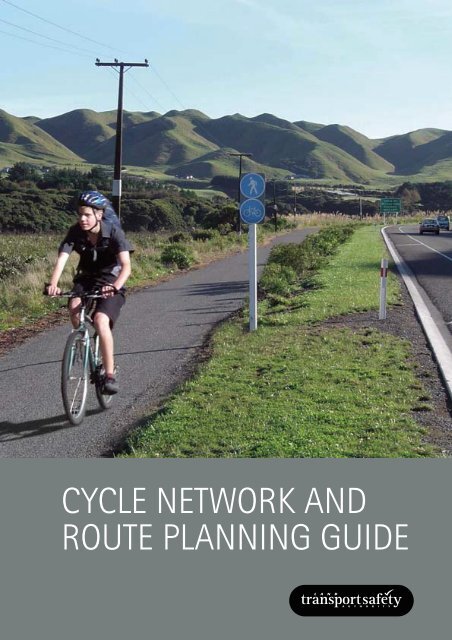
CYCLE NETWORK AND ROUTE PLANNING GUIDE
CYCLE NETWORK AND ROUTE PLANNING GUIDE
CYCLE NETWORK AND ROUTE PLANNING GUIDE

Create successful ePaper yourself
Turn your PDF publications into a flip-book with our unique Google optimized e-Paper software.
<strong>CYCLE</strong> <strong>NETWORK</strong> <strong>AND</strong><strong>ROUTE</strong> <strong>PLANNING</strong> <strong>GUIDE</strong>
<strong>CYCLE</strong> <strong>NETWORK</strong> <strong>AND</strong><strong>ROUTE</strong> <strong>PLANNING</strong> <strong>GUIDE</strong>This document is the property of the Land Transport Safety Authority, New Zealand.Reproduction in full or in part is permitted. Please acknowledge the LTSA.© Land Transport Safety Authority, New Zealand, 2004www.ltsa.govt.nzISBN 0-478-24172-01
ACKNOWLEDGEMENTSThe following consultants contributed to the project:Paul Ryan of Opus International Consultants, Hamilton, team leader, literature review and drafting.Roger Boulter, Transport Consultant, Hamilton, literature review and drafting.Kym Dorrestyn, Consultant, Adelaide, literature review and drafting.Soeren Underlien Jensen, Atkins Global Consultants, Denmark, peer review.STEERING GROUPTim Hughes (Project Manager) and Lyndon Hammond, L<strong>AND</strong> TRANSPORT SAFETY AUTHORITYGerard Burgess, TRANSFUND NEW ZEAL<strong>AND</strong>Ian Clark and David McGonigal, TRANSIT NEW ZEAL<strong>AND</strong>Michael Blyleven and Nick Bryan, ENVIRONMENT CANTERBURYMichael Ferigo, CHRISTCHURCH CITY COUNCILEsther Sassenburg, NORTH SHORE CITY COUNCILRachel Algar, MANUKAU CITY COUNCILGlen Koorey, CYCLING ADVOCATES <strong>NETWORK</strong>Michele Gyde, <strong>CYCLE</strong> SAFE CHRISTCHURCH (SCHOOL <strong>CYCLE</strong> EDUCATION)2
CONTENTSGlossary of terms 4Abbreviations 4INTRODUCTION1 Introduction 6THE <strong>PLANNING</strong> <strong>AND</strong>POLICY CONTEXT2 The planning and policy context 10THE PRINCIPLES OF <strong>CYCLE</strong><strong>NETWORK</strong> <strong>PLANNING</strong>3 Cyclists’ needs 144 Possible cycle route locations 245 Possible cycle network approaches 306 Possible cycle route components 34THE <strong>CYCLE</strong> <strong>NETWORK</strong><strong>PLANNING</strong> PROCESS7 Assessing cycle demand 488 Identifying cycle route options 569 Evaluating cycle route options 5810 The cycle network plan 6611 Prioritisation 6812 Implementation 7213 Monitoring 7614 Consultation 78APPENDICESAppendix 1: Cycling strategic plans 80Appendix 2: Scaling cycle counts 81Appendix 3: Sample questionnaire 84Appendix 4: Bibliography 863
GLOSSARY OF TERMSBUS LANEA bus lane that cyclists can also use.CONTRA-FLOW LANEA lane that permits cyclists to ride againsttraffic in a one-way street.<strong>CYCLE</strong>A vehicle with two or more wheels andpedals that is propelled mainly by themuscular effort of the rider. It includesbicycles, tricycles and power-assistedcycles with no more than 200 watts totalauxiliary power.<strong>CYCLE</strong> ADVISORY GROUPA group of stakeholder representatives thatadvises on improving cycling conditions.<strong>CYCLE</strong> FACILITYInfrastructure that is cycling-specific, suchas cycle lanes, paths and parking.<strong>CYCLE</strong> LANEA lane marked on a road with a cyclesymbol, which can only be usedby cyclists.<strong>CYCLE</strong> <strong>NETWORK</strong> PLANA map of the primary cycle route network(see definition below) and a schedule of thecycle infrastructure projects requiredto develop it.<strong>CYCLE</strong> PATHAn off-road path for cycles. It can be anexclusive cycle path, a shared-use path ora separated path (see definitions below).<strong>CYCLE</strong> PROVISIONThe provision of satisfactory conditions forcycling, whether or not there are specificcycle facilities.CYCLING PLANNER / CHAMPIONA road controlling authority employee whois responsible for the day-to-day planningand implementation of cycle provision inthe authority’s area.CYCLING POLICYA general course of action relating tocycling to be adopted by the governmentor an organisation.CYCLING SAFETY AUDITA formal process to identify factors thatcould either increase the risk of crashesinvolving cyclists, or increase the severityof cyclists’ injuries in a crash.CYCLING STRATEGIC PLANA document setting out cycling objectivesand the actions required to achieve themincluding a cycle network plan.DESIRE LINEA straight line between the origin anddestination of a potential cycle trip.EXCLUSIVE <strong>CYCLE</strong> PATHA path that can be used legally onlyby cyclists.GRADE SEPARATIONThe vertical separation of cyclists by abridge or underpass across a roadway,railway line etc. It contrasts with an atgradeintersection or level crossing.HOOK TURNA right turn a cyclist makes at trafficsignals, where they keep left whileproceeding straight through theintersection, wait at the far left side forthe lights to change, then cross withthe side road traffic.LEISURE CYCLINGCycling done just for the journey itself, notto get to an activity at the journey’s end.Sports and recreation cyclists and cycletourists do leisure cycling.LEVEL OF SERVICEThe quality measure of how well conditionsprovide for road users. For motor traffic itmainly assesses interruptions to free trafficflow. For cycling, other factors seem to bemore important such as perceived safety,comfort, and directness of route. Refer tosection 9.5PRIMARY <strong>CYCLE</strong> <strong>NETWORK</strong>The most used cycle facilities,designed mainly for trips across townand between suburbs.SEPARATED PATHA path where the section for cyclists’ useis separated from the section forpedestrians’ use.SHARED-USE PATHA path provided for use by both cyclistsand pedestrians.TRAFFIC CALMINGA combination of measures (mostlychanges to the road environment) aimedat altering driver behaviour (such as byreducing speed) and improving conditionsfor pedestrians, cyclists and residents.TRANSIT LANEA lane which can only be used by publicpassenger vehicles, motor cycles, cyclesand motor vehicles carrying a specifiedminimum number of passengers.UTILITY CYCLINGCycling done mainly to get to an activity atthe journey’s end, such as commuting tripsto work, education or shops.ABBREVIATIONSBCIBicycle compatibility indexCDS(Cycle design supplement). New Zealandsupplement to Austroads Guide to trafficengineering practice: Part 14: Bicycles.(Transit New Zealand, 2004)EECAEnergy Efficiency andConservation AuthorityLOSLevel of service (see glossary)LTCCPLong term council community plansLTSALand Transport Safety AuthorityRCARoad controlling authorityRLTCRegional land transport committeeRLTSRegional land transport strategySPARCSport and Recreation New Zealand4
CHAPTER 1 INTRODUCTION• Purpose• Scope• Guide outlineINTRODUCTIONWhat provisions should be made for cyclists, and where?This guide aims to promote a consistent approach to planning the provisionfor cycling in New Zealand.
1 INTRODUCTION1.1 Cyclenetwork planningCycle network planning is a process ofimproving community mobility by providinginterconnected routes and facilities basedon bicycle users’ needs (Bach and Diepens,2000). It aims to provide cyclists with safe,comfortable, direct routes from all originsto all destinations that:• link to form a network• retain existing cyclists• encourage more people to cycle.1.2 Cycleroute planningCycle route planning is the organisationof the most appropriate facilities andtreatments into a continuous path forcyclists that will take them safely andcomfortably for the greater part of theirjourney (Bach and Diepens, 2000). Facilitieswill differ depending on the environmentthrough which the route passes, anddifferent types of cyclists will needdifferent types of cycle route (Dorrestyn, 1996).Cycle route planning aims to provide cycleroutes that:• provide the highest level of service(LOS) for cyclists, including safety,convenience and comfort• provide operating space to cycle andother users• minimise conflicts with other users.(Cumming, Barber, Smithers, 1999; Jensen et al, 2000;Scottish Executive, 1999).1.3 PurposeThis guide aims to promote a consistent,world’s best practice approach to cyclenetwork and route planning throughoutNew Zealand. It sets out a process fordeciding what cycle provision, if any, isdesirable and where it is needed.The guide is intended to help peopleinvolved in cycle planning to developcycle networks that contribute to theoutcomes required by the New ZealandTransport Strategy and the nationalwalking and cycling strategy. It will alsohelp people preparing regional and localcycling strategies.1.4 Scope of guideThe guide covers all aspects of cyclenetwork and route planning, with a focuson the role and importance of cycleinfrastructure in cycling strategic plans,and on planning for cycling for transport.It expands on chapter 2 of the Guide totraffic engineering practice: Part 14: Bicycles(Austroads, 1999) and complements theNew Zealand supplement to that guide(CDS) (Transit New Zealand 2004).The cycle planning approaches andinterventions adopted will depend on thecircumstances at each location. With this inmind, the guide does not prescribe a singleapproach or intervention, but presentsa variety, along with their advantages,disadvantages and limitations and thecircumstances when each would be mostappropriate. It recognises that financial,technical and political factors may affectwhat can be achieved at any particularlocation or time.This is not an instruction manual, or aguide for cycling facility design, planninga mountain bike network or preparingcycling strategies. It is a best practiceguide to the process of cycle networkplanning, with tools that may help cycleplanners and communities. It does nothave the force of law.1.5 MethodologyThe project to develop this guide wasmanaged by the Land Transport SafetyAuthority (LTSA), as one of the Road Safetyto 2010 strategy projects. Consultantswere employed to develop the drafts. Astakeholder steering group (see page 2)guided its development and gave feedbackon the various drafts.The guide’s content was informed by areview of international literature on cyclenetwork and route planning. A separatereport on this is available on the LTSAwebsite at www.ltsa.govt.nz (Opus, 2003).A draft of the guide was released forpublic submissions before the New ZealandCycling Conference 2003.After the final draft was received from theconsultants an international expert peerreview was performed. The LTSA carried outsome final edits.1.6 Future revisionThe guide will be updated as cycle networkand route planning knowledge and practicedevelops. Priorities for research have beendeveloped. The LTSA has already starteda project on New Zealand-appropriatemethods for assessing the LOS providedfor cyclists, while assessing the latentdemand for cycling is another area thatneeds more work.1.7 Guide andprocess outlineFigure 1.1 (see opposite) provides anoutline of the guide’s three main sections:• The planning and policy context.• The principles of cycle network planning.• The cycle network planning process.1.8 Safer RoutesThe development of the Safer Routesprogramme is another LTSA Road Safety to2010 strategy project. Safer Routes appliesmany of the tools in this guide at a locationidentified by the community to be a highrisk for cyclists (and/or pedestrians). It thendevelops and implements an integratedpackage of engineering, enforcement andeducational interventions to address locallyidentified risk factors.The LTSA is currently trialling Safer Routesin a number of territorial local authorities,and developing guidelines for safe routesfacilitators. As part of the ongoing SaferRoutes programme LTSA can assist withthe funding of facilitators and provision ofexert advice. For more information on SaferRoutes contact your regional LTSA office.It is a best practice guide to the process ofcycle network planning, with tools that mayhelp cycle planners and communities.6
CONTEXTPRINCIPLESEstablish the planning and policy context (Ch.2)What is the environment for planning cycle networks?Cyclists’ needs (Ch.3)What are the different types of cyclist trips and for what skill levelare we designing?APPENDICESCycling strategic plans(Appendix 1)Possible locations for cycle routes (Ch.4)Where can cycle routes be developed?Possible cycle network approaches (Ch.5)What broad approach could be taken to cyclenetwork development?Possible cycle route components (Ch.6)What types of cycle provision or facility can be used to developa cycle route?PROCESSConsult oncycle networkdevelopment(Ch.14)Does the networkmeet the needs ofall stakeholders?Assess cycle demand (Ch.7)How many cyclists of what types now ride or wish toride and where?Identify possible cycle routes and provision (Ch.8)Which routes could be developed for cyclists and what types ofcycle provision do they need?Evaluate cycle route options (Ch.9)How good are existing and potential cycle routes?Develop the cycle network plan (Ch.10)What network is desired for cyclists?Prioritise cycle route implementation (Ch.11)Which cycle routes should be done first?Scaling cycle counts(Appendix 2)Sample questionnaire(Appendix 3)Bibliography(Appendix 4)Implement cycle network development (Ch.12)How should cycle routes be implemented?Monitor cycle network development (Ch.13)Is the cycle network achieving its aims?Figure 1.1: Outline of the guide and the cycle network and route planning process7
CHAPTER 2 THE <strong>PLANNING</strong> <strong>AND</strong>POLICY CONTEXT• Law, guidelines, strategies• National and regional transportstrategies• Local authority responsibilities• Cycling strategic plans — why,what, how?THE <strong>PLANNING</strong><strong>AND</strong> POLICY CONTEXTCycle network and route planning takes part withina legal, transport, social and administrative context— and can’t take place in isolation from it.Those planning for cycling need to understandtransport and the law affecting it, plus the variety ofgovernment roles, policies and strategies at national,regional and local levels.This section outlines this larger context, and thendiscusses cycling strategic plans — why we havethem, what they should contain, and how they fitwith the bigger picture. Cycle network and routeplanning is only one part, alongside others, ofpreparing a cycling strategic plan.
2 THE <strong>PLANNING</strong><strong>AND</strong> POLICY CONTEXT2.1 Cycling as transportAt its most essential, cycling is a means of transport, and in this respect is no differentfrom the car. In both cases, about three-quarters of trips are for utility (practical, day-today)purposes, and one-quarter for leisure (New Zealand Travel Survey, LTSA 2000), with significantvariations by location and ages of road users.Most journeys are short. About two-thirds of all vehicle trips are less than six km (LTSA, 2000),which is an easy cycle ride for most people. Cycling’s travel range can be extended by cyclecarriage on buses and trains, or secure parking at stations.Cycling can potentially take place from all origins to all destinations, and is not restricted toa small number of routes.2.2 Transport and the lawLaw includes not only Acts of Parliament, but also common law, which is understood andaccepted by everyone and defined by law court judgements.Common law includes everyone’s duty to care for their own safety and to avoid causing harmto others. For example, in a crash we need to establish not only who should have given way,but also whether those involved were trying to avoid danger to themselves and others.Under common law everyone has the right to travel unimpeded along all public roads, exceptwhere legal restrictions have been imposed (for example, prohibiting walkers and cyclists fromusing motorways). Road controlling authorities (RCAs) are obliged to safeguard this right forall lawful road users, including cyclists.Legislation includes Acts of Parliament, as well as Rules and Regulations made by people ororganisations to whom Parliament has delegated this power (for example, the Minister ofTransport for Land Transport Rules). The main laws relating to cycling are found in the TrafficRegulations, which are currently being converted to the Road user rule and the Traffic controldevices rule. In these rules, cyclists are regarded as drivers of vehicles and their obligations arein most respects the same as those of motor vehicle drivers. There are also relevant rules onthe use of land under the Resource Management Act 1991 in regional and district plans.2.2.1 Bylaw powersLocal authorities and road controlling authorities have power to enact bylaws for areas withintheir responsibility. Bylaws can cover activities on the road (for example one-way traffic andcontra-flow cycle movement, speed limits, parking, and restrictions on cyclists’ use of someroadways) and off the road (for example restrictions on cycling within parks and reserves).By 2010 New Zealand will have an affordable, integrated, safe,responsive and sustainable transport system.2.3 GuidelinesGuideline documents do not have force of law, but are recognised as best practice whenadopted by legally responsible bodies, such as RCAs or other government agencies.This publication is a guideline. The official New Zealand guide to road and path design isAustroads Guide to traffic engineering practice: Part 14: Bicycles (1999). Transit New Zealandhas prepared a cycle design supplement (CDS), which is the official guide to its application inNew Zealand. Also relevant is the New Zealand Manual of traffic signs and markings, Parts 1and 2 (Transit New Zealand/LTSA 1998 and 2004).2.4 National transport strategiesThe New Zealand Transport Strategy (2002) contains the government’s position on transport.Its overall vision is: By 2010 New Zealand will have an affordable, integrated, safe, responsiveand sustainable transport system.10
Broader objectives include:• creating an integrated mix oftransport modes• protecting and promoting public health• assisting safety and personal security• enhancing economic, social andenvironmental wellbeing• ensuring environmental sustainability• improving access and mobility, includingwalking and cycling.Promoting walking and cycling isrecognised as one of five priority areasbecause of its contribution to the strategy’svision and objectives. This priority isnow enshrined in the Land TransportManagement Act 2003, so TransfundNew Zealand now funds the promotionof walking and cycling in a separateoutput class.2.4.1 National walking andcycling strategyThe draft walking and cycling strategyGetting there — on foot, by cycle(October 2003, expected to be finalisedduring 2004) provides more details.It articulates a vision of: A New Zealandwhere people from all sectors of thecommunity choose to walk and cyclefor transport and enjoyment — helpingensure a healthier population, more livelyand connected communities, and a moreaffordable, integrated, safe, responsive andsustainable transport system.It sets out a wide range of actions thatwould make cycling a more attractivemode of travel. Priorities relevant to cycleplanning include:• expand our knowledge and skill baseto address walking and cycling• encourage planning, development anddesign that support walking and cycling• provide supportive environmentsfor walking and cycling in existingcommunities• improve networks for long-distancecycling• address crime and personal securityconcerns around walking and cycling• improve road safety for pedestriansand cyclists.The LTSA is preparing a Pedestrian andcyclist safety framework, which addressessafety issues.2.5 Regional landtransport strategiesEach regional council is required to developa regional land transport strategy (RLTS)with help from a regional land transportcommittee (RLTC). RLTCs are required bylaw to represent a range of road users, andsome now include cycling representatives.Although regional councils do not directlymanage the roads, all projects in theirregions must take RLTSs into account.RLTSs also carry weight in TransfundNew Zealand’s decisions on funding RCAprojects and packages.Some regional councils have supplementedtheir RLTS with a regional cycling strategy.A New Zealand where people from all sectors of thecommunity choose to walk and cycle for transport andenjoyment — helping ensure a healthier population,more lively and connected communities, and a moreaffordable, integrated, safe, responsive and sustainabletransport system.2.6 Road controllingauthoritiesRCAs have direct responsibility for theroad system. They usually own the roadsand public paths, and (often throughcontractors) construct, improve andmaintain them. RCAs have powers toregulate road users’ behaviour, for exampleby banning parking, creating one-waystreets and installing traffic signals.As well as being a local authority, everycity and district council is an RCA andTransit New Zealand is the RCA for statehighways. In some areas local authoritiesmanage state highways on TransitNew Zealand’s behalf (for example,Rotorua and Marlborough).2.7 Otherlocal councilresponsibilitiesLocal councils have other roles, besides thatof RCA, that affect transport and cycling.2.7.1 Resource ManagementAct 1991Under the Resource Management Act 1991,councils prepare district plans and regionalcouncils regional plans. Both types of planinclude rules regulating what may or maynot happen.2.7.2 Reserves Act 1977Under the Reserves Act 1977, local councilsare responsible for managing various typesof reserve land.Off-road cycle paths are often located onrecreation reserves. Councils may allowfor these in their relevant reservemanagement plans.2.7.3 Local GovernmentAct 2002The main Act governing local councils’activities is the Local Government Act 2002,which includes the power to declare apath a cycle track. Under the Act, councilsprepare and consult on annual plans settingout proposed spending during the comingyear, and long term council communityplans (LTCCPs) outlining spending overthe forthcoming 10 years. The publicsubmission processes of these plans maybe used to argue for spending on provisionfor cyclists.2.8 Integratedtransport planningIntegrated transport planning aimsto embrace a range of perspectivestraditionally covered separately, including:• a variety of forms of transport(for example car, bus/rail, cyclingand walking)• the relationships between transportand land use• the contribution transport makes toother economic, social, health andenvironmental objectives.This type of planning may becomemore significant in light of TransfundNew Zealand’s Allocation Process Review(2003/2004) which encourages integratedproposals. Cycling should be integrated intoall transport planning.2.9 OthergovernmentstrategiesActions to promote cycling are impliedunder other strategies as well, such asthose covering energy efficiency, urbandesign and form, preventive health andenvironmental protection. Non-transportagencies such as the Energy Efficiency andConservation Authority (EECA) and Sportand Recreation New Zealand (SPARC) havesometimes taken the lead in significantcycling promotion initiatives. These includeEECA’s support for school travel plans,projects and organisations, and SPARC’scycle-friendly employer schemes.11
educing cyclist injuries. This appears to berealistic as many cities in the world haveachieved it, for example York in the UnitedKingdom and Portland in the United States.Because traffic dangers deter cycling,improving cycle safety is an essential partof cycle promotion. There is evidence thathigher cycling numbers result in a lowercrash risk (Jacobsen, 2003).Mass cycle rides can be a significant encouragement element for a cycling strategy. (Photo: Roger Boulter)2.10 Cyclingstrategic plansCycling strategic plans need to addressengineering, education, enforcement andencouragement — the four Es (Geelong Bike PlanStudy Steering Committee, 1977). This guide focuseson planning for the engineering element ofcycling strategic plans.Appendix 1 provides guidelines on mattersrecommended for inclusion in cyclingstrategic plans. Funding is available fromTransfund New Zealand for their preparation.Typically, cycling strategic plans aim toincrease the number of cycle trips whileReducing traffic volumes and speeds maydo more to improve cyclist safety thanproviding cycling facilities, depending onthe circumstances (Institution of Highways andTransportation et al, 1996). Consequently, a cyclingstrategic plan needs the support of moregeneral traffic and transport strategies(Koorey, 2003).The quality of provision for cyclists willreflect the commitment to increasingcycling’s share of total journeys. Lowerquality facilities require more skill tonegotiate and may not attract new, lessconfident cyclists.2.11 DocumenthierarchyFigure 2.1 shows how cycling strategies atregional and local levels relate to some ofthe other policy and strategy documentsreferred to in this section.New ZealandTransport StrategyNational Walkingand Cycling StrategyRegional cycling strategyCycle designsupplementPedestrian andcyclist safetyframeworkCycle networkand routeplanning guideRegional Land Transport StrategyLocal cycling strategic plansImplementation of cycling strategic plans at a local levelFigure 2.1: Document hierarchy12
CHAPTER 3 CYCLISTS’ NEEDS• Cyclists’ skill levels trip types andrequirementsCHAPTER 4 POSSIBLE <strong>CYCLE</strong><strong>ROUTE</strong> LOCATIONS• Main roads, back streets, reserves,railways, public transportCHAPTER 5 POSSIBLE <strong>CYCLE</strong><strong>NETWORK</strong> APPROACHES• Roads or paths, dual networks,hierarchies, new and existing areasCHAPTER 6 POSSIBLE <strong>CYCLE</strong><strong>ROUTE</strong> COMPONENTS• Lanes, shoulders, bus/transit lanes,mixed traffic, paths, intersections.THEPRINCIPLES OF <strong>CYCLE</strong><strong>NETWORK</strong> <strong>PLANNING</strong>A network contains many types of facilities, andthe cyclists using it vary in age and cycling skills.Different cyclists have different needs and preferdifferent types of facilities. Before deciding whatprovision should be made for cyclists, it is necessaryto understand clearly what cyclists need.Should cycle facilities be provided on-road oroff-road? Should they be provided on urbanarterial roads, or should these roads be avoided?What provisions should be made for cycling inrural areas?This part of the guide describes and discussesalternative approaches to network planning andthe array of cycle facilities available.
3 CYCLISTS’ NEEDS3.1 IntroductionSatisfying cyclists’ needs and providing a high level of service (LOS) for cyclists are vital tomaximising cycling. These needs vary according to cyclists’ skill levels and their trip purposes.One type of cycle provision may not suit all cyclists using a particular part of the cycle network.This chapter discusses:• the purpose of cycling• cyclists’ skill levels• general route requirements• cyclists’ trip types and their preferredroute characteristics• complementary facilities.3.2 The purposeof cyclingCycling generally has two main purposes:• utility• leisure.Utility cycling involves making a journeyfor the main purpose of doing an activityat the journey’s end, such as work,education or shopping. Time is often animportant consideration.Leisure cycling is done for the journey itself.Leisure cyclists include sports trainingcyclists, recreation riders and cycle tourists.They also include children playing on theirbikes near their homes.3.3 Cyclists’skill levelsFor the purpose of planning, cyclists maybe grouped into three skill levels:• child/novice• basic competence• experienced.3.3.1 Child/noviceThese are children and beginner adults.Depending on their age, children haveserious knowledge, perceptual and cognitivelimitations in relation to roads (Crossing, 1987).They can be unpredictable, do not havea good appreciation of road hazards andare generally unfamiliar with road rules.However, children as young as eight do notpose as high a risk as adolescents as theyhave a reduced tendency for deliberate risktakingbehaviours.Cycling for recreation on rural road shoulder, Prestons Road, Christchurch, New Zealand. (Photo: Tim Hughes)Novice cyclist, Oriental Parade, Wellington, New Zealand. (Photo: Juliet Rama)14
These cyclists most commonly ride toschool and shops and for recreation neartheir homes. This local environment shouldbe safe for them. They cannot safely interactwith traffic apart from on traffic-calmedneighbourhood roads. They prefer fullseparation from other traffic if travellingalong busier roads and grade separation ortraffic signals for crossing them.Cycling strategic plans can aim to provideon-road training for novices who havereached about 10 years of age. A goodexample is the CycleSafe Team atChristchurch City Council.Similar training for novice adults isalso beneficial.Children receiving cycle training, Wellington, New Zealand. (Photo: Maria Cunningham)Intermediate school-aged cyclist, Christchurch, New Zealand. (Photo: Tim Hughes)3.3.2 Basic competenceCyclists can achieve basic competence atabout 10 years of age with appropriatetraining. Their utility trips generally extendfurther to intermediate and high schools.These cyclists can ride on quiet two-laneroads, manoeuvre past parked cars, andmerge across and turn right from beside thecentreline. They can cope with simple trafficsignals and single-lane roundabouts thatare well designed to slow through traffic.On busier roads they prefer cycle lanes andfacilities at junctions. They are not equippedto interact with faster traffic, multi-laneroads and multi-lane roundabouts. Theyusually lack the confidence to defend a lanein narrow situations.Cycling strategic plans should considerwhether it is practical to design all localfacilities so they are suitable for cyclistsof basic competence. If not, moreadvanced training from about age 13could be beneficial.3.3.3 ExperiencedThese cyclists have usually learnt by longexperience how best to interact assertivelywith traffic .They typically make longer commutingtrips, sports training rides and cycle touringjourneys. They do not require specific cyclefacilities, just enough room for faster/busiersituations. They will defend a lane wherethere is not enough room, judge the mergeacross faster multi-lane traffic, use multilaneroundabouts in most cases (thoughapprehensively), and will not usually divertto a cycle path.Experienced cyclist, Oriental Parade, Wellington, New Zealand. (Photo: Juliet Rama)15
3.4 General routerequirementsCyclists’ routes should provide:• safety• comfort• directness• coherence• attractiveness.3.4.1 SafetyCycle routes should be safe, providepersonal security, and limit conflict betweencyclists and others.Traffic speed and volume affect cyclists’safety. As these increase, it may bemore desirable to separate cyclists frommotorists. Safe provision at intersectionsis crucial.Public lighting and other features thatimprove personal safety are also crucial.Cyclists should always have available aconvenient route that provides a high levelof personal safety. Routes used at nightshould have lighting.Cyclists’ perceptions of safety areimportant. Appropriate infrastructurestandards and design will help cyclists feelmore secure.Safety — traffic slowed where cycle path crosses minor road — Nelson, New Zealand. (Photo: Tim Hughes)3.4.2 ComfortCycling routes should be smooth, non-slip,well maintained and free of debris, havegentle slopes, and be designed to avoidcomplicated manoeuvres.Rain and wind discourage cycling.Measures to reduce their effects and makecycling more enjoyable include:• considering walls, embankments orsuitable hedges next to paths, but beingaware of maintaining public surveillance• paying attention to exposed paths nearforeshores or ridges• providing shelter at critical destinations.(Bach, 1992).Comfort — path with good surface, some shielding from weather and no motor traffic, Christchurch,New Zealand. (Photo: Kym Dorrestyn)16
3.4.3 DirectnessCycle routes should be direct, based ondesire lines, and result in minimal delaysdoor to door. Parking facilities should be inconvenient locations.Indirect cycle routes or excessive delaysmay lead cyclists to choose more directroutes with greater risk. Some cyclists areunlikely to divert to safer routes greaterthan 10 percent extra in length (Hudson, 1982).Directness — Cycle bridge over major arterial road, Auckland, New Zealand. (Photo: David Croft)3.4.4 CoherenceCycle routes should be continuous andrecognisable, link all potential originsand destinations, and offer a consistentstandard of protection throughout.To be recognisable, cycling routes shoulduse consistent standards and design.Coherence — Separate cycle path becomes cycle lane to continue through signals, Delft, The Netherlands.(Photo: Tim Hughes)3.4.5 AttractivenessCycle routes should integrate with andcomplement their surroundings, enhancepublic security, look attractive andcontribute in a positive way to a pleasantcycling experience.Attractiveness — Shared roadway along canal, Delft, The Netherlands. (Photo: Tim Hughes)17
3.5 Cyclists’ trip types and requirementsFor the purposes of cycle planning, cyclist trip types can be grouped into:neighbourhood cyclingcommuter cyclingsports adultsrecreation cyclingtouring cycling.3.5.1 Neighbourhood cyclingMost neighbourhood cycling involves trips to local schools and shops, andchildren playing on their bikes. Cyclist provision should therefore be basedmostly around the needs of novices.Speeds are typically lower than 15 km/h. However, busy roads and short lengths of theprimary cycle network may still need to be crossed to get to local destinations, and manypotential destinations are along well trafficked arterial roads.The highest priority is ensuring a safe environment for children and novices in their localstreets and around shops and schools.These cyclists prefer:• the highest degree of safety• comfort and personal security• low traffic speeds and traffic volumes• a good separation from traffic when local destinations require them to travel busy roads• minimal gradients• facilities for crossing busy roads, such as traffic signals• secure parking at destinations• good lighting for evening trips• screening from weather and wind integrated with the surrounding landscape design.3.5.2 Commuter cyclingMost commuter trips are done by high school students or adults commutingto work and tertiary education. However, for the purpose of this guide theyinclude any longer-distance utility trip.For most of their length these trips are on arterial roads or other primary cycle routes.Regular commuters generally ride at speeds of 20 to 30 km/h. The New Zealand TravelSurvey 1997/98 (LTSA, 2000) indicates the median trip length for commuting cyclists is aboutfive km. Most will choose a faster route at the expense of higher perceived safety, comfortand attractiveness. They are the main users of the primary cycle network.It is important to note that designs based on ensuring the repeat business of current,more experienced commuters may not attract new users with less confidence. As far aspractical, across-town cycle facilities should cater for cyclists of basic competence, whilemaintaining the qualities valued by more experienced commuters.18
These cyclists prefer:• high-quality road surfaces• direct and coherent routes• minimal delays• facilities that give them their own space• intersections that minimise conflicts with other traffic• good lighting for evening trips• secure parking at or very close to destinations• facilities for changing clothes, lockers and showers.3.5.3 Sports adultsSports adults often travel at speeds higher than 30 km/h. They are confidentcyclists and prepared to claim their road space. They generally cycle over longdistances, mainly along urban arterial or rural roads, and may seek challengingterrain. They often travel in groups of two or more and like to ride two abreast.These cyclists prefer:• high-quality road surfaces• minimal delays• physically challenging routes and demanding gradients• generous road widths.3.5.4 Recreation cyclingRecreation cyclists ride mainly for leisure and place a high value on enjoyingthe experience. They are usually less constrained by time and vary widely inskill and experience.Popular recreation cycling destinations include routes along rivers, coasts and reserves,as well as attractive routes with low traffic volume and speed.These cyclists prefer:• comfort• good surfaces• minimal gradients• a high degree of safety and personal security• routes that are pleasant, attractive and interesting• screening from weather and wind• parking facilities where they dismount to use facilities or visit attractionson the journey.3.5.5 Touring cyclingTouring cyclists travel long distances carrying camping gear and provisions.They are often experienced and travel in pairs or groups.These cyclists prefer:• routes that are, or lead to, pleasant, attractive and interesting locations• generous roadside shoulders• high-quality road surfaces, although some may seek journeys on lightly traffickedback roads.• rest areas — water, toilets, shelter.19
3.6 Complementary facilities3.6.1 GeneralCycling planning needs to consider the whole journey. All cyclists need to store or parktheir bicycles securely. For other than short local trips, they may need to change clothes,have a shower and store items. For longer recreational journeys toilets, clean water andattractive resting places are important.Such facilities will often benefit people other than cyclists. For example, rest areas couldbenefit motorists and pedestrians, and changing areas, lockers and showers at a workplacecould benefit lunchtime joggers.3.6.2 Secure bicycle parkingAll journeys require secure parking at each end. Most people will not cycle if they cannotsecure their bicycle at their destination or public transport terminal (or take the bike withthem on public transport).The type of parking will depend on the need for security and convenience. The mostcommon is the ability to lock cycles to a cycle stand. Older cycle-parking stands thatsupport the bicycle by one wheel offer inadequate security and weather protection, andcan easily cause wheel damage.Choice of parking facilityThree types of cycle parking are recommended:• stands• enclosures• lockers.StandsStands are short-term parking devices that can be located in almost any position. Theyare suitable outside shops where there is a high degree of passive security. The frame andwheels of the cycle are locked to the rail.Cycle stands — Christchurch, New Zealand. (Photo: Neil Macbeth)20
EnclosuresEnclosures are a communal compound,generally at workplaces, where there maybe a large number of cyclists.As a longer-term parking option oftenlocated away from the public eye,enclosures should be protected from theweather and have a high degree of securityand an appropriate form of access control.Swipe cards are often used for access.Within the compound, stands are generallyinstalled to control internal parking andprovide additional security. It is sometimesappropriate to require users to sign acontract to ensure they understandtheir obligations.Hi-tech secure enclosure, Odense, Denmark. (Photo: Tim Hughes)Bike lockersBike lockers are for individual cycles andare used where the highest security levelis needed. They are mostly used for longtermparking.Lockers are sometimes provided at publictransport interchanges. As with enclosures,there are numerous access control choices,including coin-operated locks. Lockers canalso be used to store cycling equipmentsuch as helmets and other personal items.Bike lockers, Bielefeld City Council, Germany. (Photo: Tim Hughes)3.6.3 Other end-of-trip facilitiesSome situations require a convenientlylocated clothing change area.For example, cyclists travelling distancesmore than 5 to 10 km often wear cyclingclothes to cope with the build-up of bodyheat and perspiration and the need to movefreely while cycling (although whetherthey need to change depends on the trip’spurpose and the destination activity, forexample if it involves wearing formalclothing). In wet weather, cyclists travellingany distance may need protective clothing.Changing room with showers and lockers, Henry Deane building, Sydney, Australia. (Photo: Tim Hughes)Baggage lockers are also needed atworkplaces and transport interchanges, asmodern cycles have numerous detachableitems such as seats, lights and pannier bagsbut no lockable space in which to storethem. Cyclists also appreciate clothesdryingfacilities or places to hang wetclothes and towels to dry.Showers can also be important. It hasbeen determined that more than 80 percentof cyclists who commute to a centralbusiness district, and travel more than10 km, require shower facilities (Adelaide,Australia. Dorrestyn, 1995).21
3.6.4 Trip facilitiesRecreation and touring cyclists often undertake long trips and consequently havespecial requirements.Urban recreation cyclists using reserves and similar resting places need drink fountainsand toilets, typically at five km intervals.Touring cyclists need rest areas at about two-hour (30 to 40 km) intervals. These shouldinclude water supply points, shelter from the weather, tables and toilets. They also needaccess to shops for provisions, and to phones in emergencies. Such facilities will often beavailable in towns along routes.Good examples of remote rural rest areas include Kawatiri Junction between Nelson andWestport, and Lyell in the Buller Gorge. Rural townships are ideal locations for rest areas.Rest area with toilets, water and shelter, Waiau township, North Canterbury, New Zealand. (Photo: Tim Hughes)3.7 SummaryTable 3.1 summarises the relevance of cyclists’ needs to cycle planning. It is necessarilybroad and subjective, and individual cyclists will vary. Interpret the table with caution, anduse your own judgement.22
CYCLIST TYPE NEIGHBOURHOOD COMMUTING SPORTS RECREATION TOURINGCyclists’ possiblecycling objectivesTo shops, school, orriding near homeTo get to theirdestination efficientlyTo be physicallychallengedTo enjoy themselvesand get someexerciseTo see and enjoynew places andexperiences<strong>NETWORK</strong>/<strong>ROUTE</strong>REQUIREMENTSCRITERIASafetyPersonal security(good lighting etc)55555 5555 5555 55555 5555High degree of safety55555 555 5 55555 555Separated frombusier/faster urbantraffic55555 555 5 55555 55555Rural road shouldersor paths55555 555 5555 55555 55555ComfortScreening fromweather and wind555 5555 555 5High-quality ridingsurfaces55 55555 55555 555 555Directness Direct routes5555 55555 55 555Minimal delays555 55555 55555 5 55Coherence Continuity55555 55555 55555 555 55555Sign-posted;recognisable5 555 5555 55555 55555AttractivenessComplementaryfacilitiesPleasant andinteresting routesor destinationsPhysicallychallenging routesor gradesParking facilitieslocated neardestinations555 55 5555 55555 5555555555 5555555 55555 5 5555 55Security of bicycleparking5555 55555 55 55 55555Showers, baggagelockers5555 55Water, toilets,shelter, shops,phones5 5 5 55555 5555Legend: 5 minimal benefit,555 moderate benefit, 55555 most benefitTable 3.1: The relative importance of network or route criteria to different cyclist groups23
4 POSSIBLE <strong>CYCLE</strong><strong>ROUTE</strong> LOCATIONS4.1 IntroductionCycle networks are made up of interconnected routes and facilities. This chapter describespotential locations for cycle routes and discusses their advantages and disadvantages.ROADS• State highways• Urban arterial roads• Urban backstreets• Urban off-road pathsPATHS• Operating railways• Disused railways• Watercourses• Foreshores• Rural arterial roads(includes state highways)• Rural secondary roads4.2 State highways• Reserves and parks• Other locations• Public transportState highways are a special class of arterial road of national importance. They aremanaged by Transit New Zealand and include motorways, expressways, urban arterial roadsand rural highways.State highways form the main spine of the national road network. They are used by all roadusers, particularly heavy transport vehicles, and often carry high volumes of traffic.Urban and rural state highways are an important part of the cycle network. This makes itimportant that state highways have appropriate cycle provision that is integrated with thecycle provision on other roads. This requires co-ordination between Transit New Zealandand other RCAs. Transit New Zealand should be involved at an early stage in planning anynetworks that include state highways.Transit New Zealand prohibits cycling on motorways under the Transit New Zealand Act.However, it sometimes permits cycling in the motorway corridor, but off-road.Cycle path by north-western motorway, Auckland, New Zealand. (Photo: David Croft)24
4.3 Urban arterial roadsDescriptionArterial roads are the main roads in an area. Their main function is to provide forthrough-traffic rather than access to adjoining properties, but many importantdestinations are found along them.Minor arterial roads, with lower traffic volumes and speeds, are typically single laneeach way and can usually be adapted to provide for cyclists of basic competence bothbetween intersections (called mid-block) and at intersections.Major arterial roads are busier and faster, and typically have multiple lanes. They arenot appropriate for cyclists of basic competence unless they have more effectiveseparation and facilities to turn right, such as hook turns.Rifle Range Road, Hamilton, New Zealand. (Photo: Tim Hughes)AdvantagesArterial roads are generally well usedby cyclists and have several benefitsfor those experienced and comfortableenough in using them. They need to bemade as safe as possible.Most arterial roads are flatter thansurrounding local roads and have bettersurface conditions and maintenancestandards. They are coherent and direct,and intersections favour the major flowof traffic.Arterial roads often have safetyadvantages for competent cyclistsbecause of fewer side roads anddriveways and because majorintersections are controlled.DisadvantagesHigh traffic volumes and speeds makearterial roads unattractive for less confidentcyclists and those riding for pleasure.Cyclists are more exposed to traffic fumeson these roads, although tests have shownthey inhale less air pollution than caroccupants (Koorey 2004).Even where cycle lanes are provided, urbanarterial roads are unsuitable for children andnovices until they achieve basic competence.The main constraints to developing cycleroutes on arterial roads are insufficientspace at intersections, parking demands,and conflict with adjacent commercialactivities. The trade-offs may involvepolitically unpalatable decisions.RecommendationsArterial roads will be used by manycyclists and will need cycle provisionaimed as far as possible at cyclists withbasic competence.Alternative routes merely supplementthe arterial routes and rarely eliminatethe need for cycle provision onthe latter.Wherever possible, arterial roads shouldbe planned with cycle facilities from theoutset — or retrofitted to bring them upto best practice standard.4.4 Urban backstreetsDescriptionMany cyclists undertaking inter-suburban trips prefer quiet routes, especially if theyare not confident mixing with busy traffic. Local or collector road routes can providethis as long as they form a coherent pattern. Commuter cyclists will use them only ifthey are as convenient as the most direct route.AdvantagesGrid-based road systems, characteristic of older cities, lend themselves to backstreetcycle routes.Backstreets are more readily available than off-road paths and do not require extraland, unless there are missing links that obstruct direct routes.As destinations are served directly from these routes, they can enable cyclists to avoidparticularly daunting arterial roads. They can also offer a lower-stress and enjoyablecycling experience owing to the streetscape and other attractions, and can be quitesuitable as part of a leisure or tourist route.DisadvantagesTo attract significant numbers of cyclists, backstreet cycle routes need to be safer andmore convenient than the arterial road network, but this is rarely possible. Comparedwith arterial roads, these routes usually have more hazards from side roads, driveways,parked cars and give-way requirements at intersections with busier roads.Crash records on backstreet routes appear to be no better than those on arterial roads(United Kingdom Government, 1995).Backstreet route terminates into cycle only pathcrossing arterial road at signals, Cambridge,United Kingdom. (Photo: Tim Hughes)RecommendationsUse backstreet routes where they are saferand more convenient than the arterialsthey parallel.Use backstreet routes in dual networks togive a choice for those who prefer them.Pay careful attention to intersectionsbetween backstreets and arterial roads.Traffic signals may be necessary.Consider traffic calming these routes.Signpost them well.25
4.5 Urban off-road pathsDescriptionThese are paths totally separated from roads, usually through parks and reservesAdvantagesThe perceived safety of urban off-road paths is high owing to the absence of conflictswith motor vehicles, so they are attractive to less confident users and relatively safefor novice cyclists.Most cyclists prefer a traffic-free environment and will divert to enjoy one. Thesepaths also encourage new trips, particularly by recreational riders and neighbourhoodcyclists. They also benefit walkers, joggers, scooters, parents with prams,skateboarders, etc.DisadvantagesCyclists have poor perceptions of personal security on urban off-road paths,particularly at night and when there is little use. These paths must be well lit andneed to be clearly signposted, or only knowledgeable local cyclists will be able to findtheir way.Like backstreet routes, the key safety issue with urban off-road paths is how theyconnect to or cross roads. Traffic controls and traffic calming are likely to be required.Without a high design standard they can be less safe than the roads they parallel.Off-road cycle link, Guildford, NSW, Australia.(Photo: Tim Hughes)RecommendationsUrban off-road paths are especiallyrecommended where they providea direct, safe and personally securealternative to an intimidatingarterial road.Use them where they can provide qualityalternatives in dual networks(see section 5.4).Pay careful attention to intersectionsbetween paths and roads. Traffic signalsmay be necessary.Pay attention to design quality and theLOS to both cyclists and walkers.4.6 Ruralarterial roadsIn New Zealand’s rural areas, cyclists rarelyhave any alternative but to use the sameroad system as motorised traffic. Statehighways are often the only suitable routesbetween settlements.Because this traffic is fast, a high proportionof rural cyclist crashes involves deaths orserious injuries. Cyclists particularly benefitfrom a sealed road shoulder. Separate pathshave even greater safety benefits on ruralroads, so their feasibility should alwaysbe considered. Narrow rural bridges are aparticular hazard.4.7 Ruralsecondary roadsRural secondary roads can provide acoherent route and be an excellent cyclingalternative to more heavily trafficked ruralarterials or state highways.They can also offer a better cyclingexperience than major roads, particularlyfor touring cyclists.Even unsealed secondary rural roads maybe adequate, as in some cases cyclistsprefer them to adjacent sealed roads withheavy traffic.Path beside major rural highway, State Highway 1, north of Plimmerton, New Zealand. (Photo: Tim Hughes)Secondary rural road, Baden, Switzerland. (Photo: Kym Dorrestyn)26
4.8 Operating railwaysDescriptionSome very useful cycle routes can be developed beside operating railways.AdvantagesOperating railways are invariably directand relatively flat. They are also oftenaligned with central business districtsand may provide the shortest route fromoutlying suburbs to a business centre.DisadvantagesIt can be difficult to accommodatecyclists at tunnels, underpasses, bridgesand obstructions caused by electrical andother rail infrastructure.Public safety near railways is alsoa concern, and appropriate barriersare required.Rail-side environments are typicallyneglected and unattractive, withlandscaping needing upgradingCycle path beside main trunk railway, Fendalton, New Zealand. (Photo: Tim Hughes)4.9 Disused railwaysDescriptionDisused railways are mainly found in rural areas and provide important opportunitiesfor touring cyclists. The Otago Central Rail Trail is an example. Those in urban areas,such as the Nelson-Richmond Railway Reserve, can cater for everyday utility andrecreation trips by cyclists and pedestrians.In a worldwide trend over the past decade, old railway reservations have beensecured for recreation or tourism by cyclists and others. Developments like theserequire specialist expertise, and specific organisations (such as Sustrans in the UnitedKingdom and Rails to Trails in the United States of America and Australia) have oftenbeen established for this purpose.Ideally, rural routes provide a cycling experience lasting at least several days. Theirpotential is enhanced by accommodation at regular intervals, practical facilitiessuch as toilets, rest areas and water, servicing opportunities or arrangements, andtransport assistance at principal connection points.Some overseas examples have been highly successful, using public art andinterpreting the local history of the route. Some of these have attracted veryhigh numbers of cyclists and walkers.AdvantagesCycle routes on disused railway corridorsare usually relatively flat and direct.They have significant value as icons ofcycling, raising its profile among thegeneral non-cycling public.Rail trails in rural areas can have aneconomic benefit. They bring cycle touristsinto areas not frequented by motorisedtourists. Cycle tourists also take lessluggage and so spend more locally tomeet their needs. (Hillman and Grimshaw, 2000).DisadvantageTheir isolated nature means disusedrailways can only be one element in anurban or rural cycle route network.Otago Central Rail Trail, Otago New Zealand. (Photo: DOC Otago/Gilbert van Reenen)27
4.10 WatercoursesRoutes adjacent to watercourses are oftenpicturesque, relatively flat and thereforewell used as recreational cycling routes,particularly in urban areas.If they provide access to central businessdistricts, they are also popular commuterroutes. In this case, care should be takento avoid meandering, indirect paths. Theytend to also attract pedestrians, so conflictsbetween pedestrians and cyclists need tobe considered.Floating cycle path, Yarra, Melbourne, Australia. (Photo: Tim Hughes)4.11 ForeshoresPaths along the coastal foreshores of citiesand next to lakes and harbours are oftenpopular for leisure cycling and can offerunsurpassed riding experiences. Perth andMelbourne in Australia offer extensiveforeshore routes. However, establishingforeshore routes often generates significantcontroversy.Generally, foreshore paths are locatedto provide attractive views for cyclists.However, strong coastal winds may dictatesituating them behind dunes.Foreshore cycle path, Oriental Parade, Wellington, New Zealand. (Photo: Juliet Rama)4.12 Reservesand parksReserves and parks are popular cyclingenvironments.Ideally, these cycling routes need tobe several kilometres long to providea meaningful cycling experience.Alternatively, important links can beestablished through reserves and parks,which enhance the directness or coherenceof a backstreet cycle route.Shared path through Jellie Park, Christchurch, New Zealand. (Photo: Tim Hughes)28
4.13 Other locations• Undeveloped transport corridors• Dedicated bus lanes or corridors• Water and sewerage easements• Power line corridors• Conservation land tracks• Redundant road formations4.14 Public transportPublic transport extends cyclists’ travelrange. Buses, trains, ferries and planescould be considered part of the cycleroute network, and links to publictransport should be recognised in thecycle network plan.Bicycles parked at railway station, Cambridge, United Kingdom. (Photo: Tim Hughes)Links to public transport can be criticalto cyclists:• to ensure the viability of longer trips,especially for cycle tourists• in hilly terrain• where there are poor, hazardous or nonexistentroad options• where cycling is prohibited, for exampleat some road tunnels or bridges• as part of a leisure experience.The potential for multi-mode travelinvolving cycling is demonstrated inThe Netherlands, where 35 percent oftrain travellers cycle to the station(MTPW and WM, 1992).The viability of such links dependson appropriate:• cycle access at each end of the journey• cycle storage in transit• cycle parking at each end of a journeyif storage in transit is not possible, orwhere a key destination is adjacent toa transport interchange• transit or storage costs.Bicycle rack on light rail, Portland, United States of America. (Photo: Tim Hughes)29
5 POSSIBLE <strong>CYCLE</strong><strong>NETWORK</strong> APPROACHES5.1 IntroductionThis section describes five approaches to developing a cycleroute network:• every street• roads or paths• dual networks• hierarchy approach• needs approach.5.2 Every streetEvery street is a bicycle street (Geelong Bikeplan Study Steering Committee, 1977). Cyclists’ trip originsand destinations are as complex as those of car drivers, and they use all streets to accessactivities beside them. Whether or not such streets have specific cycling facilities, cyclists’needs must be considered. This principle applies to all approaches to network planning.If all streets and intersections provide quality cycling conditions, it is not necessaryto provide for primary cycle routes. In practice, roads are arranged in a hierarchy sothat longer-distance traffic is concentrated on higher-standard routes. This is done forefficiency and to manage traffic effects on the enjoyment of adjoining land and vice versa.This usually requires a similar arrangement of provision for cycling.Cycle lanes separated by interrupted kerb, Utrecht, The Netherlands. (Photo: Tim Hughes)5.3 Roads or pathsA fundamental issue in cycle planning isthe degree to which cycle facilities will besegregated from motor traffic. There areseveral kinds of separation, such as:• isolated paths• paths next to roads separated by kerbs,islands or nature strips• marked space on the roadway, such ascycle lanes and road shoulders• fully shared mixed road space.Section 6 discusses the detailed merits ofeach in more detail.While primary cycle networks may be basedon one type of facility, most cycle networkscontain a mixture of different facility types.5.3.1 Segregated networks ofcycle pathsIt is only practical to consider a fullysegregated primary cycle network whenplanning new suburbs and townships.The aim of such networks is to providepleasant, off-road cycle paths free ofconflict from motorised traffic that serveall areas. An outstanding example isHouten, a satellite town of Utrecht inThe Netherlands, where 16 neighbourhoods30
are accessed by car from a fastcircumferential ring road. Motor vehiclescan only travel between zones via the ringroad. Within neighbourhoods, cyclists andmotorists share the use of slow-speed (30km/h) streets. Neighbourhoods are joinedby a spine of cycle and walking paths thatprovide much shorter routes than for motortraffic. As a result, 44 percent of trips lessthan 7.5 km long are made by bicycle and23 percent by walking. Traffic crash risk ishalf that of comparable towns.Cycle path with right of way at intersection, Houten,The Netherlands. (Photo: Tim Hughes)Other examples of full segregation have notbeen so successful. Milton Keynes (UnitedKingdom) suffered from sub-standard pathdesign that has a poor safety record, andhas failed to achieve higher modal share bycycling (Franklin, 1999). Canberra’s system alsofailed to live up to the expected benefitswith only three percent of trips to workmade by bicycle. This is largely due to ahigh quality of provision for cars and a lackof directness and coherence in the cyclepath network for utility cycling. Canberra isnow retrofitting a primary cycle network tothe arterial roads.Cycle shelter near bus stop and underpass under ringroad, Houten, The Netherlands. (Photo: Tim Hughes)5.3.2 Road-based networksLand use in already-existing towns makesit impractical to develop an off-road pathnetwork, so cycle networks are basedaround the established network of (mostlyarterial) roads. There remains the issue ofwhether to provide a physically separatedpath beside the roadway.Places such as Sweden, and Copenhagenin Denmark, have made an expensivecommitment to redesigning arterial roadsto provide cycle paths on berms behindrelocated kerbs. More recently, and wherethere has not been enough funding to buildcycle paths, some European towns havetried cycle lanes as an interim measure andfound them successful.5.3.3 General considerationsMany factors influence whether roadsor paths will best suit cyclists’ needs.For example:• increased segregation from motortraffic is usually accompanied byincreased interference from pedestrians,pets, skateboarders, slower cyclists etc• one choice is not inherently safer thananother; both can be hazardous andboth require high-quality design toachieve safety — ‘the devil is in thedetail’. Paths tend to be safer betweenintersections as long as there is roomfor adequate design and minimalcrossing-driveway traffic• cycling through a junction on theroadway is generally safer than froma path. Junctions between paths andbusier roads generally require trafficcalming or signals• at junctions between paths and roads,New Zealand law requires cyclists onthe path to give way, which reducescyclist LOS• geometric design standards for roadsare often higher than for paths• it is incorrect to suggest that roads canonly satisfy commuters’ needs, or thatpaths cannot satisfy commuter cyclists’needs. Most leisure cycling takes placeon roads, and many commuters enjoywell located paths• a road is not necessarily lessexpensive to maintain but will oftenbenefit through existing pavementmanagement systems• it is usually easier and less expensiveto accommodate the needs ofcommuter cyclists on roads thanon separate paths• the freedom from traffic danger andfumes brings obvious benefits forrecreation cycling and novices(Dorrestyn, 1996a).• it is difficult to provide a coherentand direct path system that is asconvenient for commuters as thearterial road network• where origins and destinations areon the same side of an arterial road,a two-way cycle path means cyclistsdon’t have to cross the road twice to getthere. However, such two-way paths aregenerally not recommended.5.3.4 Relative advantagesSubject to appropriate design standardsbeing achieved, roads generally have thefollowing advantages over paths.They are:• direct• coherent• convenient• efficient• available everywhereand also:• have established intersection controls• serve well the needs of experiencedcyclists• have high levels of surveillance andtherefore personal security.Between intersections, isolated pathsgenerally have the following advantagesover roads. They have:• no motor traffic• slower speeds• low stress• an attractive environmentand also:• provide extra links that advantageall cyclists• serve well the needs ofnovice/child cyclists.Depending on the circumstances anddesign detail, there is usually no clearadvantage between roads and paths inrelation to:• safety• conflict with other users• expense• maintenance.31
5.4 Dual networksDescriptionDual networks provide two different types of cycle route network — for instance, onebased on urban arterial roads, the other comprising cycle paths or backstreets.Dual networks are sometimes provided within one road reserve. For example, a cyclepath may be appropriate where it provides a short link for primary school aged childrennear shops or a school, even though it is beside an arterial road with cycle lanes.A rural road may have a sealed shoulder suitable for experienced and sporting cyclists,but a path may also be provided for less experienced cyclists.Dual path and lane facility, North Parade, Christchurch, New Zealand. (Photo: Tim Hughes)AdvantagesSome cyclists value off-road andbackstreet options more than others.By providing choice, each can choosewhat suits them.Even experienced cyclists will valuemore pleasant alternatives as longas they are still direct. As a rule ofthumb, a 10 percent extra journey timehas been suggested as sometimesacceptable (Hudson, 1982).DisadvantagesWhere a dual network is provided withinone road reserve, motorists may not expectcyclists to be riding on the road as wellas on a path. This can compromise safety,especially when crossing driveways andside roads.Dual network provision also costs moreand may be seen politically as oversupply,especially if an element involves asignificant difficulty or cost (financial, or toother road users).RecommendationDual networks should be consideredwhere the extra cost is outweighed bythe benefits to cyclists.If only one network can be funded,the LOS provided by each option tothe different cyclist groups should beassessed. Consultation with cyclists overthe choice will be important.Having a path next to a roadway shouldnot automatically exclude cyclists fromusing the road instead. On-road bansshould only be instigated after assessingwhether the paths and roadway meetthe needs of all users in terms oftechnical standards. Other factorsto consider include:• the potential for delay and confusionat intersections and driveways• the adequacy of sight distances andshoulder or lane widths• the adequacy of the path conditionand width• the potential for conflict with otherpath users• the relative LOS for cyclists ofdifferent skills.5.5 Hierarchy approachDescriptionCycle routes are sometimes assigned to hierarchies based on trip length and user type.For example, cycle routes in regional or district networks may be classified as regional,inter-urban or tourist, while cycle routes in a large urban area may be classified asprincipal, collector or local.Principal routes are for longer-distance movement, are direct with minimal delays andmay even be separated from motor traffic to provide a ‘motorway’ LOS for cyclists.Collector routes distribute cycle traffic between the principal routes and local originsand destinations (Cumming, 1996).Some urban cycle route hierarchies aim to provide a designated cycle route within100 m of each home (such as in Delft, The Netherlands).AdvantagesHierarchies can be used to assignimplementation priorities (so that routeshigher in the hierarchy are implementedfirst) and can be linked to design standards(so that more important routes provide abetter LOS).DisadvantageA cycle route hierarchy will not work ifusing it involves significant detours.RecommendationConsider using cycle route hierarchiesfor setting target design standards,LOS and implementation priorities.32
5.6 Needs approachThis approach involves choosing the option that best provides for cyclists’ needs ineach situation.It aims to achieve the best results for cyclists and other stakeholders within the contextof all the prevailing opportunities and constraints. It may include any of the optionsor locations in this guide, as well as dual provision over some sections if it is neededand feasible.When deciding on facilities that best meet cyclist needs, it is important to remember thateach situation is different. Space limitations, cost and other constraints usually dictate onesolution over another.This guide recommends comparing the route options for each situation on their merits,and over the following pages provides processes and tools for developing, evaluatingand comparing these options. Note that facilities within an area should be consistent sothat users know what behaviour is expected of them, and so they can reliably predict thebehaviour of others.RecommendationAdopt the needs approach, but aim for consistent facility standards.5.7 General recommendations for new andexisting areasBelow are some suggestions for applying these approaches in various situations.5.7.1 New areasDesign neighbourhood streets for slow, mixed traffic.Ensure cycling and walking networks are more closely spaced and permeable than motortraffic networks; add traffic-free links to achieve this. Ideally provisions for cyclists shouldbe spaced less than 600 m apart.Position paths in parks and reserves so that they link homes to significant localdestinations such as schools and community facilities, and so that children and novicesdo not have to mix with faster or busier traffic.Use paths to link communities along and across the barriers of busy roads.Successful examples show a commitment to high-quality design, grade separation at mainobstacles such as major roads, and careful attention to connections to the road networkand across it.5.7.2 Existing areasExisting road hierarchies usually provide the basis for a primary cycle network.Use the cycle planning process to identify places where people already cycle, and lookfor new opportunities of all the types of facilities described in this guide.Develop options to improve the on-road provision and seek alternatives that willbypass obstacles or hazards or provide new, convenient links or alternatives for lesscompetent cyclists.Pay particular attention to intersections.Consider the network needs of neighbourhood cyclists in their local environments.Integrate with school travel planning initiatives and local area trafficmanagement planning.33
6 POSSIBLE <strong>CYCLE</strong><strong>ROUTE</strong> COMPONENTS6.1 IntroductionPlanning cycle routes involves considering the most appropriate facility for anyparticular situation. This chapter identifies the available facility types and theiradvantages and disadvantages.6.2 Provision requirementsThe New Zealand supplement to Austroads Guide to traffic engineering practice: Part 14:Bicycles (Transit New Zealand, 2004) (CDS) is the main design guidance tool for cyclist facilitieson roads and paths.Figure 6.1 is a guide to the desirable facilities in the road corridor for cyclists in relation totraffic volume and speed and is most useful when planning for new situations. In practice,constraints on space, presence of side roads and driveways, type of users and costswill also dictate the choice of facilities to retrofit to existing situations. These and otherconsiderations are discussed below.The flow chart in Figure 6-15 of the Cycle design supplement is a guide to choosing thedesirable path facilities for cyclists in different circumstances.6.3 Mid-block facilitiesCycle facilities that can be provided between intersections include:• kerbside cycle lanes• cycle lanes next to parking• contra-flow cycle lanes• wide kerbside lanes• sealed shoulders• bus-bike lanes• transit lanes• mixed traffic• paths.Cyclists do not always need special or dedicated facilities. They do need provisionsappropriate to their needs. For instance, wide kerbside lanes on arterial roads have similarbenefits for cyclists as bicycle lanes (Hunter, 1998). However, cyclists prefer marked cycle laneswherever possible.Depending on the circumstances, cyclists may find the following provision quite adequate,without dedicated facilities:• wide kerbside lanes• sealed shoulders• bus-cycle lanes• shared paths• slow, mixed traffic• lightly trafficked streets of adequate width• unsealed roads and paths• one-way streets where signs and markings permit two-way use by cyclists.However, it may be necessary to use special guide or route signs to ensure a cycle routethat includes such provision forms part of a coherent network.34
12,00011,000NOTE: THIS DIAGRAM IS TO BEAPPLIED TO URBAN ROADS <strong>AND</strong>IS NOT APPROPRIATE FORRURAL OR NON-URBAN ROADS10,000Volume of motor vehicles (vehicles/day)9,0008,0007,0006,0005,000COMBINATIONS OF LOWSPEEDS <strong>AND</strong> HIGH TRAFFICVOLUMES ARE VERY RARE.WHEN THESE CONDITIONSOCCUR, SEGREGATION MAYBE DESIRABLE IN ORDER TOMINIMISE CONFLICTS.<strong>CYCLE</strong> PATHS<strong>CYCLE</strong> LANESCycle pathsCycle lanes orsealed shoulders4,0003,000<strong>CYCLE</strong> PATHS WITHSEPARATING VERGEMixedtraffic2,0001,000MIXED TRAFFICSEALED SHOULDERS010 20 30 40 50 60 70 80 90 100Traffic speed (85th percentile, km/h)Figure 6.1: Preferred separation of bicycles and motor vehicles according to traffic speed and volume.This diagram is based on RTA NSW (2003) and Jensen et al (2000), also DELG (1999), Ove Arup and Partners (1997) and CROW 10 (1993).Figure 6.1: Notes1. In general, roads with higher traffic speed and traffic volumes are more difficult for cyclists to negotiate than roadswith lower speeds and volumes. The threshold for comfort and safety for cyclists is a function of both traffic speed andvolume, and varies by cyclist experience and trip purpose. Facilities based on this chart will have the broadest appeal.2. When school cyclists are numerous or the route is primarily used for recreation then path treatments may bepreferable to road treatments.3. Provision of a cycle path does not necessarily imply that an on-road solution would not also be useful, and vice-versa.Different kinds of cyclists have different needs. Family groups may prefer off-road cycle paths while racing or trainingcyclists, or commuters, tend to prefer cycle lanes or wide sealed shoulders.35
6.4 Kerbside cycle laneDescriptionThis is a cycle lane marked beside a kerb,exclusively for cyclist use. The markingscomprise an edge line and cycle symbolsat regular intervals.AdvantagesAll road users are likely to recognise thecycle lane and expect to find cyclists there.It provides a degree of separation betweenmotor traffic and cyclists.It highlights cyclists’ rights to the road.DisadvantagesThis facility restricts car parking.Unless swept regularly, debris from theadjacent traffic lanes will accumulatein the cycle lane.It may not provide enough protectionfor inexperienced cyclists.RecommendationsAs long as car parking issues can beresolved, kerbside cycle lanes are thefavoured facility for roads.Cycle lanes are preferred at thekerbside rather than adjacent to parkedcars, so that cyclists can avoid openingcar doors and pedestrians darting outfrom between parked cars.Kerbside cycle lanes should applypermanently. Temporary applications,such as during daily traffic peaks, donot offer enough provision for cyclistsoutside those periods.Kerbside cycle lane, East Coast Road, North Shore City, New Zealand. (Photo: Tim Hughes)6.5 Cycle lane next to parkingDescriptionCycle lanes comprising an edge line and regularly spaced cycle symbols can beprovided next to marked parallel parking.AdvantagesThis facility eliminates the need for parking restrictions and benefits other roadusers as it:• increases drivers’ ease of parking and entering and leaving parked vehicles• effectively reduces the road-crossing distance for pedestrians• improves the channelling of traffic, encouraging a more orderly and predictabletraffic flow.DisadvantagesA significant carriageway width is required.When parking demand is low, motor vehicles will occasionally travel in the lane.Some cyclists could still ride into an opening car door.Car parking manoeuvres could inconvenience cyclists, and potentially cause conflicts.Angle parking is not suitable next to a cycle lane unless there is extra clearance forparking manoeuvres.Debris swept from the adjacent traffic lanes accumulates in the cycle laneand requires sweeping. Traditional gutter sweeping misses this, so it needsspecial attention.RecommendationsIf the road is wide and parking restrictions are unlikely to be acceptable, a cycle lanenext to parking is likely to be an appropriate choice.Kerbs protruding the width of the parking bay should be constructed at intervals todiscourage vehicles travelling over unoccupied parking spaces.Cycle lane next to parking, Marshland Road,Christchurch, New Zealand. (Photo: Tim Hughes)Cycle lane outside angle parking, Greers Road,Christchurch, New Zealand. Note: clearance is barelysufficient. (Photo: Tim Hughes)36
6.6 Contra-flow cycle laneDescriptionContra-flow lanes allow cycling againstthe legal direction of travel in a one-waystreet. They have the same features astraditional cycle lanes and are located sothat cyclists ride in the normal positionon the left. (Cyclists pass motorists rightshoulder to right shoulder.)AdvantagesContra-flow lanes contribute to thenetwork’s directness and coherence byallowing cyclists to avoid diversionsalong indirect or less safe routes.See section 6.4 Kerbside cycle lane.Contra-flow cycle lane, Cambridge, United Kingdom. (Photo: Tim Hughes)DisadvantagesOther road users, including pedestrians,may not expect cyclists to travel in theopposite direction to other traffic.Contra-flow lanes generally precludeparking on the cyclist’s side of the road,though exceptions may be possible intraffic-calmed situations.RecommendationsContra-flow cycle lanes should be used in one-way streets where cyclists mightotherwise be forced to divert along indirect or less safe routes.Any new proposal for a contra-flow cycle lane should be well publicised.Intersection layouts must support this facility, particularly at start and end points andat side road intersections.Contra-flow lanes should have a:• contrasting surface• road markings or islands separating the opposing directions of flow.6.7 Wide kerbside laneDescriptionA wide kerbside lane is wide enough to allow cyclists and motor traffic to travelbeside each other with a reasonable degree of comfort. It can be used where thereis not enough road width for cycle lanes or as prescribed by CDS Figure 4-1. It is thepreferred on-road facility where part-time parking is required, such as in clearways.AdvantagesThis facility requires less space than thecombined width of a travel lane and acycle lane.It is easily implemented by re-markingthe position of a kerb lane line, subject towidth requirements.DisadvantagesWide kerbside lanes do not highlightcyclists’ legitimate presence on the road.Car parking restrictions are required.Motor traffic in the wider left lane maytravel faster.RecommendationsWide kerbside lanes should be consideredwhere no other facility is possible.The road surface next to the kerb side ofthe road must be of a high quality.Wide kerbside lane, Burwood Highway, Melbourne, Australia. (Photo: Tim Hughes)37
6.8 Sealed shoulderDescriptionA sealed shoulder comprises space and an appropriate surface for cycling outsidethe main carriageway, along the edge of an un-kerbed road. It is generally used inrural areas.AdvantageWidened shoulders benefit all road users.See section 6.4 Kerbside cycle lane.DisadvantagesSealed shoulders usually narrowat bridges, at passing lanes, and atintersections with turn lanes. Generally,motorists travel at high speeds alongroads with sealed shoulders, so cyclistsare at significant risk in these situations.Sealed shoulders are sometimes madeof lower-quality pavements, contrary tocyclists’ requirements.See section 6.4 Kerbside cycle lane.Sealed shoulder, Marshland Road, Christchurch, New Zealand. (Photo: Tim Hughes)RecommendationsSealed shoulders contribute to all roadusers’ safety. They are beneficial tocyclists, particularly along high-speedrural roads. They should be smooth,continuous and debris-free to encouragecyclists to use them.6.9 Bus lanesDescriptionA bus lane is a lane reserved for busesin which cyclists are allowed to travel.By law, bus lanes may be used bycyclists unless specifically excludedby a sign.AdvantagesBus lanes may be more easily justifiedthan either bus-only lanes or cyclelanes alone, as they benefit bothbuses and cyclists.Buses often use these lanesinfrequently during off-peak times,offering cyclists unobstructed accessfor the most part.Cyclists also benefit from anybus priority measures along a buslane route.DisadvantagesThe LOS is limited, as buses obstructcyclists by stopping regularly — andin narrow lanes cyclists can preventbuses passing.Lane widths where drivers are unsurewhether there is sufficient room topass, create the greatest cyclist stress.Bus-cycle lane (but note lost continuity through junction), Auckland, New Zealand. (Photo: David Croft)RecommendationsWide lanes should be used wherever possible so that buses can pass cyclists withinthe lane.Narrow lanes may be acceptable where there are no bus stops, bus speeds are low orbuses can pass cyclists by temporarily moving out of the lane.Avoid ambiguous lane widths that are neither wide nor narrow.38
6.10 Transit laneDescriptionA transit lane can only be used by public passenger vehicles, motor cycles, cycles andmotor vehicles carrying a specified minimum number of passengers. From a cyclingperspective, it is similar to a bus lane.RecommendationTransit lanes must be wide so that cyclists and motor traffic can travel in parallelwithin them.6.11 Mixed trafficDescriptionMost roads are mixed traffic roads, where no formal cycle facilities are provided andcyclists share the roads with other road users.There are two types of urban mixed traffic situations. These occur where:• traffic volumes are low, traffic conditions are straightforward, and there is enoughspace for motor vehicles to overtake cyclists• traffic is slowed to near cycle speeds, the road is narrow and cyclists and motorvehicles share the same space travelling in single file.Situations where drivers are unsure whether there is enough space to overtakeappear to create the greatest stress.AdvantageThere are few costs apart fromtraffic calming, which is also donefor other reasons.DisadvantageContinuity of route standards may becompromised where there are mixedtraffic conditions on a route that is partof the primary cycle network.RecommendationsCycle facilities may not berequired if the roads are in anappropriate condition.Ensure the continuity and integrityof cycle routes by using signage andcontinuing cycle lanes where mixedconditions are otherwise appropriate.Ensure the environment makes it clearwhere cyclists have room to travelbeside motor traffic or need to travelsingle file. Avoid ambiguous widthsand layouts.Mixed traffic on backstreet, Delft, The Netherlands. (Photo: Tim Hughes)39
6.12 Paths — generalThere are three main path types for cyclists:• exclusive cycle path• shared path• separated path.Each may be isolated from roads or rightnext to them. A ‘cycle path next to road’ isalso discussed on page 42.Cycling through Hagley Park, Christchurch, New Zealand. (Photo: Neil Macbeth)6.13 Exclusive cycle pathDescriptionAn exclusive cycle path can only be used legally by cyclists.AdvantagesOn exclusive cycle paths cyclists cangenerally proceed without delays causedby, or in conflict with, other path users.This facility can offer cyclists ahigher LOS.DisadvantageWalkers sometimes use exclusive cyclepaths when their own facilities arecomparatively poor.RecommendationsExclusive cycle paths are preferredwhere they are likely to be used by asignificant volume of commuter cyclists.Care is required to ensure pedestrianscan be well accommodated elsewhere.Exclusive cycle path, Southern Veloway, O’Halloran Hill, South Australia. (Photo: Kym Dorrestyn)40
6.14 Shared pathDescriptionA shared path is shared withpedestrians and possibly others (forexample horse riders).AdvantagesThis facility is useful to cyclists aswell as pedestrians, and thereforemaximises the benefit of the path tothe general community.It is beneficial to vulnerable cyclistswhere an existing footpath can beadapted or widened.Shared path, Wairere Drive, Hamilton, New Zealand. (Photo: Paul Ryan)DisadvantagesConflict between cyclists andpedestrians is common where, forinstance, there is a significant volumeof cyclists and pedestrians or a mixof recreational walkers andcommuting cyclists.The LOS for cyclists can be poor whereinterference by other path usersresults in slower speeds.See also 6.16 Cycle path next to road.RecommendationsShared paths are beneficial to a range of path users but need to be managedeffectively. They are appropriate where both cyclists and pedestrians need a path, buttheir numbers are modest.It is important that:• the path’s design is suitable for its use and demand• authorities adequately monitor users’ behaviour on the path.• the connections between path, road and driveways are carefully considered.6.15 Separated pathDescriptionThis is a path with separate sections for cyclists and pedestrians.AdvantagesSeparated paths may help to avoid theconflict between pedestrians and cycliststhat is common on shared paths.Cyclists can ride without the delayspossible on paths shared with walkers.DisadvantagesHigher cyclist speeds are possible,but having a cycle path close topedestrians means they can stray intothe cycling space.Separated paths are wider than otherpaths, so they cost more.Separated path with barrier rail, Bielefeld, Germany. (Photo: Tim Hughes)RecommendationsSeparated paths are appropriate if largenumbers of cyclists and pedestrians willuse them.There should be adequate separation(such as different path levels) betweencyclists and pedestrians.41
6.16 Cycle path next to roadDescriptionThis is a common facility in Europe,usually for one-way cycle traffic. Thepaths are generally paved in a differentcolour and texture from adjoiningsections of the berm, and may also beseparated by a low kerb.AdvantagesCycle paths next to roads can offer alow-stress environment that can beattractive to many cyclists.They can be particularly helpful for shortlengths, such as at squeeze points in theroad carriageway.One way cycle path next to road, Utrecht, The Netherlands. (Photo: Tim Hughes)DisadvantagesUnder New Zealand traffic law, cyclistson paths are required to give way to othertraffic when crossing side roads. Thisresults in delay for cyclists.Intersections are where cyclists are atthe highest risk. In Europe, paths onberms have been shown to be less safe atjunctions than if the cyclist was on theroadway. For this reason best Europeanpractice requires cycle tracks to returnto the roadway before intersections.At signals, special cycle phases can beintroduced for cycle paths, at the expenseof complexity and delay to all road users.The benefits of cycle paths alongsidea road between junctions can benegated by:• inadequate clearance for visibility atdriveways• frequent or busy driveways• inadequate clearance from openingdoors of parked vehicles• bus passengers boarding and alightingfrom the cycle path• pedestrians encroaching on the cyclepath when the footpath is congested,or while waiting to cross• garbage awaiting collectionobstructing the path.Where cyclists ride in both directionsalong paths, drivers using driveways andside roads may not expect cycle trafficfrom both directions. Best Europeanpractice outlaws two-way cycle pathsalongside roads with access fromdriveways and side roads.It is less convenient to turn right from acycle path next to a road. Cyclists haveto cross the whole traffic stream in onemanoeuvre, whereas from a cycle lanethey can first merge across to the centre.However, a right turn from a separate pathmay be safer.It is generally expensive to establish thisfacility, due to relocating kerblines.Conflict at bus stops, Copenhagen, Denmark.(Photo: Tim Hughes)Pedestrians obstruct cycle path while waiting tocross, Bielefeld, Germany. (Photo: Tim Hughes)RecommendationsBetween intersections, cycle paths nextto roads can provide attractive and safefacilities for a wide range of cyclists,provided there is adequate space andinterference from other users is minimal.Carefully consider safety and delay atintersections, where it is usually preferablefor the path to rejoin the roadway.Cycle path by Albany Highway, North Shore City, New Zealand. (Photo: Tim Hughes)42
6.17 Unpaved roads and pathsDescriptionUnpaved roads or paths can be acceptable to cyclists in some circumstances.AdvantagesThe initial cost of establishing anunsealed facility is relatively low.Unsealed facilities help in integratedcycling with environmentallysensitive locations.DisadvantagesUnsealed facilities can be hazardous,depending on gradient, crossfall andsurface media.They also require regular maintenance.Unpaved path, Ionia, Michigan, United States of America. (Photo: Dan Burden www.pedbikeimages.org)RecommendationsIn general, the surface must be wellcompacted and drained.The surface medium should be capableof self-repair.In steep terrain, erosion can beminimised and user safety maximisedby using devices such as hairpinswitchbacks for turns (InternationalMountain Bicycling Association, 2000).6.18 Suitability for cyclist typesMost facilities are likely to benefit cyclists, but how much will depend on the cyclingenvironment. Table 6.1 shows the relative benefits of the different facilities for cyclistswith different skills. It is necessarily broad and subjective, and individual cyclists will vary.Interpret the table with caution, and use your own judgement.<strong>CYCLE</strong> FACILITY OPTION CHILD/NOVICE BASIC COMPETENCE EXPERIENCEDKerbside cycle lane55 55555 55555Cycle lane next to parking5 5555 5555Contra-flow cycle lane5 5555 55555Wide kerb side lane55 555 5555Sealed shoulder55 55555 555555Bus lane5 55 5555Transit lane5 55 5555Slow mixed traffic555 5555 55555Paths55555 5555 555Legend: Benefit: 5 minimal benefit, 555 moderate benefit, 55555 most benefitTable 6.1: Suitability of cycle facility option for different cyclist categories43
6.19 Intersections6.19.1 GeneralWhen planning intersections for cyclist use,the goal is to accommodate cyclists safelywith a reasonable LOS, and at a reasonablecost, within the available constraints.6.19.2 Key principlesThe key planning principles relate tothe type of intersection control and theprovision of adequate space.The design should ensure that:• the intersection performs efficientlyfor cyclists under the traffic conditionsexpected throughout the planningperiod• it is as far as possible suitable forcyclists of basic competence• all normal manoeuvres are possible,particularly right turns (including theoption of hook turns)• the conflict area between throughcyclistsand left-turning traffic(especially heavy vehicles) is managed.Left-turn slip lanes can simplify thisby moving left-turning traffic conflictpoints away from the intersection andproviding space for hook turns• conflict points are easily identified• cyclists and drivers know where cyclistsare expected to be on the road• the intersection is consistent inalignment and standards with mid-blockfacilities on approach and departure.Helpful design information can be found inthe CDS, Vicroads (2001), Austroads (1999)and Transfund New Zealand (2003).6.19.3 RoundaboutsA higher proportion of cyclist injurieshappens at roundabouts than at any otherintersection type. Multi-lane roundaboutsare the main culprits and should be avoidedon cycle routes where possible.Small, single-lane roundabouts, that aredesigned to tame traffic speeds, have beenproven to reduce cycling injuries. Theseroundabouts slow traffic by using theshape of the islands to deflect traffic ontoa curved path, and by ensuring visibility toother traffic is not excessive. They requireno special provision for cyclists (Austroads,1999; Bach and Diepens, 2000).External perimeter paths shouldbe considered for large multi-laneroundabouts (Austroads, 1999; Bach and Diepens,2000), but will generally result in a poorLOS for cyclists owing to crossing delays.Grade separation or conversion to trafficsignals is strongly preferred overmulti-lane roundabouts.Cycle lane leading to advanced stop box, Colombo Street, Christchurch, New Zealand. (Photo: Neil Macbeth)Hook turn, trial markings, Merivale, Christchurch,New Zealand. (Photo: Andrew Macbeth)Slip lane treatment, Hamilton, New Zealand.(Photo: Tim Hughes)Cycle lane diverts to cycle path to negotiate multi-lane roundabout, Otaha Valley Road, Albany, New Zealand.(Photo: Tim Hughes)Grade separation at multi-lane roundabout, Wairere Drive, Hamilton, New Zealand. (Photo: Paul Ryan)44
6.20 StructuresA number of structures are used in association with cycle provision, such as bridges,underpasses and overpasses.This section outlines a number of grade separation options that aim to help cyclistscross railways and high-volume, high-speed roads that have significant risks and potentialfor delays.Railway cycle underpass and footpath, Utrecht, The Netherlands. (Photo: Tim Hughes)Bridges need to be much higher to clear trucks using a road, than underpasses carryingcyclists need to be down below a road. Cyclists also prefer to speed up going down a rampto an underpass, and use their momentum to travel up the ramp on the other side. Bridgeramps are generally higher requiring more effort to negotiate.However, bridges are generally less expensive, have no drainage requirements, have fewerlighting requirements and offer advantages in personal security and vandalism.Site topography may favour either a bridge or an underpass.Covered bridge over railway prevents objects being dropped and provides shelter, Cambridge,United Kingdom. (Photo Tim Hughes)Personal security is important. CROW (1993) provides numerous suggestions to enhancepersonal security at tunnels.Because structures are expensive, the needs of cyclists and others must be properlyidentified, particularly in relation to:• constructing a motorway• planning new residential areas• designing a structure.45
6.21 Traffic calmingTraffic calming devices can improvecycling conditions in local streets withmixed traffic conditions. A wide varietyof devices are used, so accommodatingcyclists will depend on the individualcharacteristics of the devices.For example, cyclist bypasses are generallyappropriate where there are:• single-lane devices• road narrowings• devices with abrupt changes in verticalalignment.Bypass facilities can often be constructedusing the original carriageway surface.Other measures that may beappropriate are:• path links at road closures• contra-flow lanes or path links atone-way devices.6.22 Restrictedtraffic areasPedestrian needs and comfort areparamount in pedestrian zones and publicplaces where traffic is restricted. In theseareas, the desirability of cycling (andany associated provisions) needs to bedetermined — bearing in mind that it isimportant to accommodate cyclists whosedesire lines pass through a pedestrian area.The common options are:• allowing cyclists and pedestrians tomix freely• providing designated paths for cycliststhrough the area• allowing a combined use with selectedmotor vehicles (for example, buses, taxisand service vehicles)• restricting cycling during certain periods• prohibiting cycling in certain places.The most appropriate approach will dependon the situation and the nature andbehaviour of both pedestrians and cyclists.Permitted cyclists are guests, and areexpected to travel at a speed and in a waythat is consistent with a walking space andto yield to pedestrians unless they havetheir own defined space.Priority should go to information signs andpublic relations campaigns for the peacefulcoexistence of pedestrians and cyclists,with minimal use of signs andline markings.Speed cushions with cycle lane bypass, Melbourne, Australia. (Photo: Tim Hughes)Cyclists walk through pedestrian precinct on riverside cycle way, Portland, Oregon, United States of America.(Photo: Tim Hughes)466.23 ComplementaryfacilitiesEnd-of-trip facilities (such as secureparking, lockers and showers) and tripfacilities such as shelter, water and toiletsare important infrastructure for cyclists.These are covered in section 3.6.
CHAPTER 7 ASSESSING<strong>CYCLE</strong> DEM<strong>AND</strong>CHAPTER 8 IDENTIFYING <strong>CYCLE</strong><strong>ROUTE</strong> OPTIONSCHAPTER 9 EVALUATING <strong>CYCLE</strong><strong>ROUTE</strong> OPTIONSCHAPTER 10 THE <strong>CYCLE</strong><strong>NETWORK</strong> PLANCHAPTER 11 PRIORITISATIONCHAPTER 12 IMPLEMENTATIONCHAPTER 13 MONITORINGCHAPTER 14 CONSULTATIONTHE<strong>CYCLE</strong> <strong>NETWORK</strong><strong>PLANNING</strong> PROCESS
7 ASSESSING <strong>CYCLE</strong> DEM<strong>AND</strong>ASSESS <strong>CYCLE</strong> DEM<strong>AND</strong>Map cycling trip origins and destinations.Map land use using district planning data.Assess their importance as cycling trip generators.Map desire lines.Map existing cycle routes and the numbers of cyclists using them.Map cycle crashes.Map existing cycle facilities.Count and map cycle traffic and parked cycles.Consult and/or survey cycle users.Assess trip purposes and types of cyclists.Identify infrastructure barriers, using discrepancies between desired and actual use.Assess, map and quantify latent demand: what additional cycling could be expected with better conditions and promotion?7.1 IntroductionTo know what to provide for cyclists, and where, it is important to have good information— such as how many people cycle or wish to cycle, where they wish to ride, for what purposethey ride, and how competent they are to handle a variety of conditions.To help build this picture, this chapter describes cyclists’ trip origins and destinations,methods for identifying the routes cyclists take, and the types and numbers of cyclists whouse them or who may use them in the future.7.2 Cyclists’ origins and destinationsCyclists may wish to cycle everywhere. Particular origins and destinations include:• residential areas• tourist accommodation• education establishments• areas with large employment• shopping areas• leisure and entertainment facilities• public facilities• public transport interchanges• historic and tourist sites.By mapping these locations, trip desire lines can then be plotted, permitting a qualitativeassessment of where cycle demand is likely to be significant. Methods for identifyingorigins and destinations are outlined below. They may be supplemented by questionnaires.7.2.1 City/district planning informationDescriptionDistrict planning documents map the existing land use and the hierarchy of roads. They also contain information about land usezones and growth areas, major residential subdivisions or commercial or community developments. They are a most useful sourceof primary data about likely origins and destinations of cyclist trips. A higher concentration of cyclists can be expected near popularcycling destinations.AdvantagesThis information is readily availableand helps identify cyclists’ origins anddestinations.DisadvantageThis method provides no informationabout numbers of cyclists or the routesthey use.RecommendationIdentify where cycle traffic could beexpected by plotting cyclists’ significanttrip origins and destinations on a map,alongside any existing cycle facilities andthe road hierarchy.48
7.2.2 Census dataDescriptionThe five-yearly Census includes questionsabout the mode of travel to work onCensus Day and the locations of therespondent’s residence and workplace.This data can identify the number anddistribution of residents and employeesin various age brackets and those whocycled to work on Census Day.AdvantagesThis data provides reliable numbers. It can be used to plot graphically the significance ofareas as origins and destinations for cyclists’ trips to work and by connecting them, thedesire lines for commuting to work.Plotting family size or population density in school-age or the 30 to 45 age bracketmay allow a comparison of the likely uptake of cycling in different parts of cities. Largerfamilies and these age groups are likely to yield more cyclists.DisadvantagesThere are disadvantages in time and cost. It duplicates some of the qualitativeinformation available from land use which may sometimes be sufficient for the purpose.Census data does not reveal cyclists’ route choices.The Census trip-to-work data is a snapshot of one day. It is affected by weather and anyother factors peculiar to that day and provides no data about cycling trips that are nottrips to work.RecommendationIf using this method, be aware of its limitations.7.2.3 School cycle trafficDescriptionSchool cycle traffic is localised andlikely to be a significant proportion ofthe total cycling in many areas. If not, apoor cycling environment is likely to besuppressing use.Questionnaires and counting parkedcycles are commonly used to assess cycledemand at schools.By obtaining the number of studentsattending school on a survey day, thepercentage of students cycling to schoolcan be calculated.AdvantageA school represents a concentrationof cycle users who are relatively easyto survey.DisadvantagesSurveying school cycle traffic:• requires school approval• has a time and cost factor, especiallywhen questionnaires are used• is limited as some areas have fewchildren cycling to school.RecommendationsDuring network planning, countparked cycles to quantify existing schoolcycle demand.During route planning, use questionnairesto identify detailed information on routechoice and problem areas. Where possible,incorporate this survey into a Safer Routesto School programme.Plot of locations where school children have had a cycle crash (black spots) or feel unsafe (green spots).Source: Christchurch City Council, New Zealand.49
7.2.4 Visitor numbersDescriptionThis method uses the total number of visitors to particular locations, attractions orfacilities to indicate their likely significance as cyclist destinations.AdvantageAs long as the information is readilyavailable, this is a quick method forprioritising sites for more detailedinvestigation, such as counting cycletraffic or parked cycles.DisadvantageThere are disadvantages in time and cost ifthe information is not readily available.RecommendationUse this method where the informationis readily available.7.2.5 Counting parked bicyclesCounting the number of bicycles parked at particular locations on a typical day canhelp determine the significance of those places as cyclist destinations.AdvantageCounts of parked cycles are particularly useful for places with defined cycleparking places such as schools. They are quick and simple to perform.RecommendationDevelop a program for counting parkedbicycles at key destinations.7.2.6 Travel surveysDescriptionInformation on cycle demand can be gleaned from surveys conducted for transportplanning and modelling, or from LTSA travel surveys.AdvantageThe New Zealand Travel Survey 1997/98(LTSA, 2000), available on the LTSA website(www.ltsa.govt.nz), identifies the generalcharacteristics of cycle trips and thepeople who cycle.DisadvantageThe LTSA travel survey is a national survey,so the results do not necessarily reflect thecharacteristics of an individual study area.It does not identify routes.RecommendationsUse any available information from localtransport planning or modelling surveys;otherwise use the LTSA travel survey data.7.3 Desire lines and barriersThe cycle demand information gathered should be reviewed and the major trip originsand destinations plotted on a map, followed by the major desire lines linking originsand destinations.Such maps permit barriers to cyclists travelling along these desire lines to be identified.Barriers could include waterways, motorways, railways, large industrial estates andsections of road that cyclists perceive as hazardous. The latter might include heavilytrafficked roads that have to be crossed or travelled along, multi-lane roundabouts,or sections of busy roads with no dedicated space for cyclists.50
7.4 Use of routes by cyclists7.4.1 Road hierarchy methodDescriptionDistrict plans usually include maps of the road hierarchy in their areas (typically arterial, collector and local roads).A first assumption could be that the number of cyclists wishing to use a particular link in the road network will be in directproportion to those using motor traffic on that link. So highly trafficked roads could be expected to carry relatively high volumes ofcycle traffic, given appropriate cycling conditions.AdvantageThis method gives the simplest andquickest indication of potential cycledemand across the whole area.DisadvantagesCyclists may avoid sections of arterialroads that they perceive as hazardous orunpleasant for cycling, or may take a shortcut not available to motor traffic.Cycling conditions may be perceived as sodangerous or unpleasant that people eithercease cycling or don’t take it up in the firstplace. This suppressed or latent demandfor cycling might be realised if cyclingconditions were improved.RecommendationsThis method is a good way to beginassessing cycle demand. Other cycledemand assessment methods should beused to refine further the understandingof cycle travel patterns in an area.7.4.2 Cycle crash dataDescriptionCycle crash data for a long period of time can indicate those routes that cyclists have difficulty negotiating safely.Useful crash data can be obtained from the LTSA, ambulance services and RCAs’ databases of locally reported crashes.AdvantageThis data is readily available and is also needed for evaluating cycle route options.DisadvantagesLTSA data generally excludes crashesthat do not involve a motor vehicle, andoff-road crashes.Ambulance data has good locationinformation but is biased towards themore serious injuries.This method will be poor at identifying:• sections of the road network that carrysignificant numbers of cyclists and arerelatively safe for cyclists• off-road routes (ambulance data isuseful here).Also, cyclists may avoid hazardous sectionsof an otherwise desirable cycle route.Crash plot showing LTSA data (black dots) and ambulance data (blue dots)(Source: Christchurch City Council)RecommendationsUse this method, but be aware of itslimitations.Start with LTSA data. For a morecomplete picture, supplement this withambulance and RCA data, but removeany duplicate data from the combineddatabase to avoid double counting.51
7.4.3 Existing cycle facilitiesDescriptionThis method involves plotting on a map the location of any existing cycle facilities.This may indicate where cycle demand is, or has been considered, significant.AdvantageThis information has more than oneuse, as it is part of the base inventoryrequired before cycle route optionsare evaluated.DisadvantageThe existence of cycle facilities does notalways indicate significant cycle traffic, asthey may be poorly sited or isolated.RecommendationUse this method as it providesinformation needed for other purposes,including cycling promotion.7.4.4 Cycle countsManual cycle countsIn this method, people at cycling sites record the numbers of cyclists, their traveldirection, and possibly whether each cyclist is a primary school pupil, secondary schoolstudent or adult.At busy sites cyclists should be counted separately rather than as part of a generaltraffic count, as they are easily overlooked. Counting is usually done during the morningor afternoon peak, but counts undertaken at other times can also be scaled up(see Appendix 2).The methods already mentioned will indicate where to start counting.Automated cycle countsAutomatic mechanical counters can be used to count bicycles, even in conjunction withcounting other traffic (Transfund, 2002).Installing continuous automated counters on key routes provides control data formonitoring cycle use on the network. This can also be used for scaling short-term,seasonally affected or weather-affected counts and for calculating modal split.Bicycle detectors at traffic signals can also be used to regularly monitor the number andtime pattern of cycle use. Beware of false counting of cars driving in adjacent lanes orstraying into the cycle lane.AdvantageCycle traffic counts provide hard,conclusive evidence of existingcycle demand.DisadvantageThe method only has time and costdisadvantages.RecommendationEach local authority should carry out anannual programme of cycle counts tomonitor cycle use trends and provide datato support funding applications.In addition to counting cycles usingsections of routes soon to be investigatedor designed in detail, it is recommendedthat some strategic counts be repeatedannually. This could include countingcycles crossing a cordon around thecentral business district and or other keycyclist destinations, as well as on someoutlying arterial routes.Detector loops on railway cycle path, Christchurch, New Zealand. (Photo: Axel Wilke)52
7.4.5 Consultation with cycle usersDescriptionThis method involves consulting local bicycle users on popular cycle routes with whichthey are familiar in the areas where they cycle.AdvantagesBicycle users usually have excellent localknowledge of the routes they use andtheir associated problems. This can alsobe an excellent way of identifying leisurecycle routes.DisadvantagesIndividual cyclists, unless they cycle manydifferent routes, can talk accurately onlyabout the number of routes with whichthey are familiar. It is necessary to speak toa representative group of cyclists coveringall areas.Experienced cyclists may not be able torepresent less confident, new cyclists’needs and desires.RecommendationUse this method. If there is no bicycleusers’ group, convene one for thepurpose of ongoing liaison duringcycle planning and implementation.7.5 QuestionnairesDescriptionQuestionnaires help to identify:• the types of cyclist• origins and destinations• routes travelled• hazard locations• crash or incident locations• alternative routes cyclists would useif hazards or barriers were removed• reasons why people do not cycle, theinfrastructure or other measures thatwould induce them to cycle, and theroutes they would take.Questionnaire distributionmethods include:• newspapers• cycle shops, libraries or places thatcyclists visit often• the internet: survey forms can becopied from the internet and postedto the surveyor, or the survey could becompleted and submitted online• placing questionnaires onparked bicycles• roadside interviews• handing out questionnaires to cyclistson popular cycle routes• in classrooms for school surveys, andat tertiary institutions and workplaces.Survey results may also be available fromworkplace and school travel plan projects.Surveys of non-cyclists are betterincorporated in a survey on a widerrange of issues, such as an annualcitizens’ satisfaction survey, becausenon-cyclists may have little or nointerest in responding to a survey solelyabout cycling.Appendix 3 has an example of a typicalquestionnaire.AdvantagesThe route and hazard information is usually plotted on a map of the study area and canbe used to identify route, or site-specific, improvements.Information about the type of cyclist is needed to identify the most appropriate type offacility for any route in the network.DisadvantagesIssues associated with questionnaires are:• margins of error with various sample sizes• questionnaire distribution• encouraging responses, for example by providing prizes• obtaining responses from a cross-section of cyclists or the general population• processing the gathered information efficiently• response bias• cost and time.The questionnaire has to be developed, distributed, collected, collated andinterpreted. A Christchurch City Council questionnaire asking for current routes,routes avoided and other information about cyclists resulted in about 800 responses;each took about an hour to map and collate (Transfund, 2003, p.20).RecommendationsThis method is recommended wherethe above methods do not providesufficient information. If questionnaireshave not been used for network planning,they should still be considered forroute planning.Developing and using a questionnaire arenot simple exercises; it may be wise to seekspecialist advice to ensure cost-effectiveand useful results.53
7.6 Which methods to use ?7.6.1 Existing cycle useStart identifying existing cycle demand with a focus on the arterial road network. Thefollowing methods (described in detail above) can then be used in combination to form aclearer picture of the popularity of routes cyclists are likely to take:• LTSA cycle crash data• city/district planning and Census information• existing cycle facilities• consultation with cycle users• visitor numbers at important cyclist destinations• counting cycles parked at schools.Then undertake a programme of cycle counts at strategic locations to confirm the actualcycle travel patterns.It may be difficult to identify accurately an adult’s cycling skill level simply by observingthem. It may be necessary to either conduct a brief, kerb-side interview or use aquestionnaire.7.6.2 Identify users and trip purposeMethods for identifying user type and trip purpose include:• consultation• travel surveys• manual counts• counting parked cycles at key destinations• census data• questionnaires.7.7 Estimating latent demandLatent demand describes potential new cycle trips that are currently suppressed, but thatwould be made if cycling conditions were improved.Latent demand can be assessed in relation to specific route improvements or to thewhole network, assuming it is fully developed and that complementary cycle promotionactivities are undertaken.A wide range of methods have been proposed for forecasting cyclist travel demand.These methods have not been assessed for use in New Zealand. Some are quite complex.They are described in:• Traffic flow models allowing for pedestrians and cyclists (Taylor and Damen, 2001)• Guidebook on methods to estimate non-motorized travel (FHWA, 1999)• Forecasting demand for bicycle facilities (Katz, 2001).AdvantageTaylor and Damen concluded thatthere are a number of useful tools forassessing the demand for proposedbicycle facilities.DisadvantagesThere are time and cost disadvantages.RecommendationWhile these methods require furtherresearch for application in New Zealand,the simpler methods may be useful untilthis research can be done.7.8 Data presentationGeographical information systems (GIS) are well suited to data presentation. By presentingcollected data as layers on common maps, many aspects can be considered together and acomplete picture of cycle demand and obstacles developed. Sufficient work should be doneto obtain a clear picture of where people wish to cycle, where they currently cycle andwhere the key network barriers to more cycling exist. The aim is to have usage informationthat is useful for project evaluation and prioritising improvements in cycle provision.54
Note: Each spot represents a bicycle collision.Thickness of buffered line varies in proportionto the number of bicyclists surveyedADELAIDE CITY STRATEGIC BIKE PLANCITY OF ADELAIDECOMPARISON OF BI<strong>CYCLE</strong> <strong>ROUTE</strong>S &BI<strong>CYCLE</strong> COLLISION DATAFIGURE 8-3Figure 7.1: Cycle crash data assessment55
8 IDENTIFYING <strong>CYCLE</strong><strong>ROUTE</strong> OPTIONSIDENTIFY EXISTING <strong>AND</strong> POTENTIAL <strong>CYCLE</strong> <strong>ROUTE</strong> OPTIONSIdentify opportunities for upgrading existing routes, or for new or alternative routes, and add them to the map of existing routes.Identify the alternative facilities that could be provided on each route to satisfy the needs of the cyclists who would use them.8.1 IntroductionThis chapter describes a process for identifying alternative ways to satisfy the needs of thedifferent types of cyclists who will use the route.8.2 Identifying opportunitiesThis involves considering the:• maps produced in the cycle demand assessment (chapter 7)• needs of cyclists who will be using each route (chapter 3)• possible locations for cycle routes (chapter 4)• possible approaches to developing a network (chapter 5)• cycle route components (chapter 6)• five-point hierarchy (chapter 8)• factors listed in Table 8.1.From this assessment, opportunities for upgrading existing routes or developingnew routes can be identified. All should provide cyclists with an appropriate LOSand be feasible.TRAFFIC ENVIRONMENT INFRASTRUCTURE CONTROLS/OTHER• Traffic speeds and volumes• Traffic composition,especially % ofheavy vehicles• Other road/path users’demands and requirements• Collision history• Route/road cross-sectionmeasurements• Topographic and landuse information• Parking controls• Access and parkingdemand characteristics• Intersection layout details• Key infrastructure details• Local traffic calmingmeasures• Drainage and utility services• Public lighting• Property driveway positions• Traffic management controlsand operational details, forexample traffic signals• Planning regulations• Local initiatives anddevelopments• Local technicalrequirements• Applicable routedesign guidelines• Land ownership• Land owner requirementsTable 8.1: Factors to consider during route option assessments8.3 Five-point hierarchyThe five-point hierarchy of measures to help cyclists (IHT et al, 1996) is considered in this order:• Reduce traffic volumes.• Reduce traffic speeds.• Adapt intersections.• Re-allocate road space.• Provide on-road cycle lanes and off-road cycle paths.These measures can be applied to the road and path system as a whole and toindividual routes.Cycle lanes and cycle paths, often the most commonly suggested measures, should only beconsidered after the issues higher in the list.56
8.4 Finding space on existing roadsSee section 6.2Facility choices often need to be accommodated within available space along any route.Bicycle Victoria (1996) details techniques to obtain space on existing roads.Rearranging space• Adjust carriageway lane positions or widths.• Upgrade service roads for cyclist use.• Seal road shoulders.Trading space• Indent car parking.• Widen road at the verge (as long as this will not result in higher speeds).• Restrict car parking to one side of a road, resulting in an asymmetric road layout.• Widen the road at the median.• Remove a traffic lane if there is excess road capacity.• Close the road.If a desired facility cannot be accommodated on the road, an off-road route may be aviable alternative if it:• is more direct• has a high standard of geometric design, construction and maintenance• has a similar travel distance to the road route.8.5 Opportunities lostIn addition to identifying new cycle routes, it is important to protect existing cyclecorridors. Some existing reserves that are surplus to recreation space requirements havebeen sold off for general urban development purposes, despite the existence of longstandingcycle routes.It is important that formal planning documents such as district plans and/or reservemanagement plans recognise all routes that are well used or have significant potential forcycling. This will ensure future development proposals accommodate cycle routes ratherthan obstruct them.It is also interesting to note that property developers have funded some cycle routeimprovements, where existing routes were recognised in district plans or reservemanagement plans.8.6 Key infrastructure opportunitiesTable 8.2 lists some key infrastructure or features that can be central to developing cycleroutes. These features are often so strategically important that entire routes are plannedaround or heavily influenced by their existence.GRADE SEPARATED FACILITIES <strong>ROUTE</strong> OPPORTUNITIES TRANSPORT INTERCHANGES• Road tunnel• Pedestrian overpass• Pedestrian underpass• Road bridge, to which a cycle platformcould be attached• Viaduct• Traffic signals• Service road• Lane• Railway station• Ferry service• Airport• Park-and-ride station/publictransport interchangeTable 8.2: Key infrastructure that influences cycle route development opportunities.8.7 Opportunities identifiedThis assessment should have identified opportunities for upgrading existing routes ordeveloping new routes. All options identified should provide cyclists with an appropriateLOS and must be feasible and provide value for money.57
9 EVALUATING <strong>CYCLE</strong><strong>ROUTE</strong> OPTIONSEVALUATE <strong>CYCLE</strong> <strong>ROUTE</strong> OPTIONSEvaluate, compare and contrast the options for satisfying the needs of the various cyclist types and trip purposes likely on each cycle route.Select the preferred option(s) for each route.9.1 IntroductionA perennial problem in cycle route network planning is the reliance on bright ideas and petprojects that may not have been critically evaluated for usefulness and value for money.This chapter describes how to evaluate routes or facilities identified in accordance withchapter 8 using the following assessment methods:• needs assessment• audits• cycle review• level of service assessments.9.2 Needs assessmentDescriptionThis is an assessment against the criteria in chapter 3 in relation to each cyclisttype and the route characteristics they need.To permit a comparison, a summary for each option could be prepared in astandard format — and from this a conclusion or recommendation determined.This summary can be reported on a single page in a similar format to Table 3.1as a table indicating how the proposal will suit each cyclist type.AdvantagesThis assessment provides an opportunityto consider all overarching issues,including intangible matters such asattractiveness and comfort.DisadvantageThis is a qualitative assessment.RecommendationsAlways perform a needs assessment. No other assessment satisfactorilyconsiders the full range of cyclists’ needs.Include the outcome of other assessments, for example the LOS, in a needsassessment report.58
9.3 AuditsDescriptionAudits are a formal process for identifying deficiencies in provision for cyclists. Theycan be applied to existing facilities or new proposals and can be applied during allproject phases, from concept to post-construction audit. They can also be applied to aspecific facility, a route or a network.Four different types of audit affect cycling.A cycle audit aims to identify all matters that affect how well a situation meets theneeds of cyclists, such as in Guidelines for cycle audit and cycle review (IHT et al, 1998).A road safety audit is a well established and respected process aimed at identifyingdeficiencies that will affect the safety of all road users. The best practice guide is theAustroads Guide to road safety audit.A cycling safety audit concentrates on cycle safety issues. It typically interpretssafety broadly, as most other matters affect safety in some way. It was developedbecause traditional road safety audits frequently overlooked cycling issues. Refer toCycling by design (Scottish Executive, 1999) and Guide to traffic engineering practice: Part 14:Bicycles (Austroads,1999).A vulnerable road user audit combines a cycle audit with the needs of pedestrians,including disability access issues. It was developed in Oxfordshire County Councilbecause cycle audits on their own were difficult to justify; cycle use is a smallproportion of United Kingdom traffic (two percent). By contrast walking, cycling andmobility-impaired users together account for about 30 percent of urban traffic deaths,so clearly deserve more careful attention. The United Kingdom Transport ResearchLaboratory is developing this concept further.AdvantagesAudits take a systematic approach toidentifying safety and other problemsand help to prevent inappropriate designsbeing constructed.DisadvantagesThe quality of audit results under thismethod depends on the cycling experienceand knowledge of the auditor(s).While audits identify the deficiencies of anoption, they do not distinguish betweenoptions or rate them.RecommendationsUse cycle audits routinely in projectdevelopment. Ensure that the auditprocess includes all the features of a cycleaudit, whether as a stand-alone processor as part of a wider audit process.Use a cycle audit to identify deficiencieson existing roads and paths.Don’t use a cycle audit as a tool toevaluate and compare options.9.4 Cycle reviewDescriptionGuidelines for cycle audit and cycle review (IHT et al, 1998) is an audit process for anexisting road situation, combining professional engineering and user perceptionsof quality. It reviews how well existing facilities meet cyclist needs and providesa thorough process for identifying improvements. It includes data collection, LOSassessment and deficiency analysis.Among other purposes, a cycle review seeks to:• systematically assess cycling conditions• highlight the greatest problems for cyclists• enable LOS to be assessed quantitatively• identify feasible measures for improvement• provide a framework to help with choosing the preferred option.Cycle review is applied at different levels and in its complete form represents acomprehensive process that can be applied to routes intended to form part of a cycleroute network.Guidelines for Cycle Audit and Cycle ReviewAdvantagesThe value of this model lies in its partiallyholistic assessment methods. As wellas considering the nature of a facility itassesses route directness and coherency,and the need to influence surroundingconditions such as the traffic speedenvironment. Importantly, accessibilityand safety issues are key considerationsin this model.DisadvantagesThe credibility of the package depends onthe judgement of the experts that preparedit. Further research is desirable to confirmhow well it reflects cyclists’ needs andperceptions.The overall package is a little cumbersome,even though the individual reviews arestraightforward.RecommendationIndividual road authorities should considerimplementing a cycle review model.59
60Figure 9.1 Bicycling — levels of quality
9.5 Level of service (LOS) assessmentsLOS is a traffic engineering term that describes traffic quality. It is traditionally appliedto motor traffic, where it is primarily concerned with delays and interruptions to traffic.However, when applied to cycling other aspects seem to be more important. To distinguishit from traditional LOS measurements it is sometimes also referred to as ‘level of stress’,‘level of quality’, ‘bicycle compatibility’ and ‘cyclability’.Cycling LOS assessment is based on a significant volume of empirical research on cyclists’views and reactions to specific road environments, conducted mostly over the past 10years. United States research is reported in Sorton and Walsh (1994), Epperson (1994),and Landis et al (1997) and (2003). United Kingdom research is described in Guthrie et al(2001). Further US research is being conducted into multi-modal LOS assessment.This approach has limitations but is helpful in comparing routes and options. Its mostdesirable aspect is that it is an independent and objective measure.Several cycling LOS methods have been published. The bicycle compatibility index (BCI)(FHWA, 1998), Cycle review level of service (IHT et al, 1998) and Multi-modal level of serviceassessment, handbook (Florida DOT, 2002) describe methods worth further investigation.The levels of quality developed by Walkable Communities Inc (see Figure 9.1 opposite)provide a visual guide to service levels for different facility types.Note that different assessment methods will not produce identical results.Table 9.1 lists an alternative service level description used in a cycle review LOS assessment.LOS SCORE TYPICAL TRAFFICCHARACTERISTICSA 81 — 100 Little or no motor traffic; lowspeeds; good passing width;no significant conflicts; goodriding surface; lit; goodsocial safetyB 61 — 80 Light/moderate traffic flows;good/adequate passingwidth; few conflicts; goodriding surfaceLIKELY ROAD/PATHTYPEHigh-quality cycle path; wellsurfaced minor rural road;30 km/h limit urban roadMinor road; well surfaced butunlit cycle pathC 41 — 60 Moderate traffic flows;85th percentile speedsaround 50 km/h; adequatepassing width; some conflicts(not major)D 21 — 40 Busy traffic, HCV/buses;speeds around 70 km/hMinor road/local distributorUrban single carriageway;poor-quality cycle pathE 1 — 20 Heavy traffic flows; speeds>70 km/h; HCVDual carriageway speed limit70 km/h or higher; largeroundaboutsF
9.5.1 Bicycle compatibility index (BCI)AdvantagesThe BCI measure is flexible and simpleto use and can be used to distinguishbetween conditions on roads duringdifferent periods.As Table 9.2 (see opposite)demonstrates, a minimum of data isrequired to determine a BCI/LOS resultfor an entire route. The data is readilysourced in most instances.DisadvantagesBCI does not account for:• low traffic volume environmentswhere cyclists readily integrate withother traffic• significant intersections• strategic considerations such as routedirectness, coherence and purpose• paths. A similar US-developed processis available for paths, but it is not knownwhether the two methods may not becompatible for comparing path androad options.RecommendationsThe BCI method is most usefulwhen comparing mid-block routeoptions at an early stage, andwhen a quick and simple methodis desirable.9.5.2 Cycle review LOSAdvantagesThis is more comprehensive than the BCImethod. Among other factors, it givesbasic consideration to intersections androute directness, and includes paths.DisadvantagesA significant volume of data is required.It can be time consuming to compareseveral quite different route options.RecommendationsThis comprehensive method (IHT et al, 1998) can be used to examine existing infrastructureand to compare different route options provided concept proposals for routes arereasonably well defined.It should be used at a level appropriate for each route.Straightforward situations with obvious choices will not gain much benefit from the fulldepth of the process, but will nevertheless benefit from analysis based on its concepts.It can be used to assign an overall LOS score for a route proposal.9.5.3 Florida bicycle LOSThis method is the most widely used approach in the USA. It assesses bicycle LOS onlinks and straight through intersections as part of a multi-modal assessment of LOS.It is based on the research by Landis. The method includes a computer program tosimplify the calculations. Refer to Florida DOT (2002).9.6 Which method?Further researchFurther investigation into theappropriateness of the above methodsfor application in New Zealand isrequired and will be undertaken.Local authorities are invited to contactthe LTSA with a view to participatingand/or leading trial projects.Practitioners are encouraged to assessother methods where appropriateand available.RecommendationsUse a mix of the methods outlined above.A needs assessment is always important. In general, many of the issues associated withdeveloping a cycle route are qualitative, and only this type of assessment will considerall the overarching issues.For a quantitative assessment, the cycle review LOS method appears to be themost useful.Individual RCAs are encouraged to consider implementing a cycle audit and cyclereview style of process, and to work with the LTSA to develop a New Zealandrecommended process.A review of crash records (see section 7.3.2) is also worthwhile when assessing existingconditions.Two aspects stand out as being important in any cycling assessment:• Does the facility meet the users’ needs?• ‘The choice of routes in urban areas is largely determined by the extent to whichjunction features can be resolved where the cycle route meets or crosses moreheavily trafficked roads’ (Ove Arup and Partners, 1997).62
LOCATIONSouth Terrace— Greenhill RoadGreenhill Road— Fisher RoadFisher Street —Cross RoadCross Road— Grange RoadOverall routeGEOMETRIC& ROADSIDEDATALength (km) 0.62 1.87 0.86 1.19 4.54No. of lanes(one direction)2 2 2 2Kerb lanewidth (m)3 3.4 3.4 3Bicycle lanewidth (m)1.5 1.5 1.5 1.5Paved shoulderwidth (m)0 0 0 0TRAFFICOPERATIONSDATAResidentialdevelopment(y/n)Speed limit(km/h)85th percentilespeed (km/h)y n n n60 60 60 6060 50 60 60Traffic flow(AADT)28,000 28,000 28,000 31,000Large truck %(HCV)0.50 0.50 0.50 0.50Left turn % 0.00 0.09 0.05 0.05PARKINGDATAParking lane(y/n)y n n nOccupancy (%) 50Time limit(minutes)120RESULTS BCI 4.74 3.78 4.00 4.43 4.12Level of service E D D E DBicyclecompatibilitylevelVery low Moderately low Moderately low Very low Moderately lowTable 9.2: Example of BCI calculation63
9.7 Evaluate the whole routeRoutes should be assessed in their entirety wherever possible. However, it is not uncommonfor the project scope to be limited for financial or other reasons.For example, a route may extend through more than one local authority’s area ordepend on access to land under the control of another authority. In cases like this, anyinsurmountable issues with another authority may limit the route’s feasibility.If the project scope means a route cannot be considered in its entirety, it is importantto conduct a less rigorous review beyond the area of detailed assessment. This will helpdetermine any likely physical, financial and political influences that could render a projectunfeasible in the future.9.8 Financial considerationsAny evaluation of cycle facilities must include considering the financial commitmentrequired to implement them. Any measures must be both viable and represent value formoney. Economic evaluations should use the procedures for cycling projects in TransfundNew Zealand’s Project evaluation manual.9.9 Other assessmentsProposals should also be assessed for their effects on the environment, including effectson other road users, authorities or property owners.9.10 ConsultationConsultation with cyclists is an important part of assessing the impact of a proposal onexisting or potential users.The ways cyclists’ views are obtained are less important than that they are obtained.Unsolicited complaints (or praise), such as letters to the RCA, are an importance source offeedback on existing routes.A local cycling advocacy group (see section 14.5) can be included in the process. In a morestructured way, cyclists could be asked to rate elements of a route for safety and LOS.9.11 Route option selectionCycle route option evaluation concludes with the selection of the preferred option(s) foreach route.A plan can be produced of the proposal ready for further planning and consultation — seeFigure 9.2 for an example.64
Figure 9.2: Cycle route planSource: Dorrestyn & Co Pty Ltd65
10 THE <strong>CYCLE</strong> <strong>NETWORK</strong> PLANPREPARE <strong>CYCLE</strong> <strong>NETWORK</strong> MAP <strong>AND</strong> PROJECT SCHEDULEMap the primary cycle route network and any area-wide treatments.Schedule the infrastructure projects.10.1 The cycle network planOnce cycle route options have been evaluated, the cycle network plan is prepared.This should include:• a map of the primary cycle route network• a schedule of the cycle infrastructure projects required to develop it.10.2 Cycle network mapWhile only some routes are identified and signed as forming the primary cycle routenetwork, all roads and paths usable by cyclists are part of the total cycle network.In addition to showing the primary cycle route network, cycle network maps shouldindicate any areas, such as town centres or schools, where area-wide treatments suchas traffic management or 30 or 40 km/h zones are to be implemented. In somecircumstances, such as in traffic-calmed areas or fully controlled grid networks, it couldbe preferable to make every road as cycle-friendly as possible and not to try to directcyclists to particular routes.10.3 Project scheduleThe schedule should describe the works to be implemented and their estimated cost. Costscan be estimated initially using unit rates per kilometre for different types of facilities.10.4 Network development costIt is useful to have a rough-order cost for implementing the entire primary cycleroute network.This figure can be used to calculate the realistic annual expenditure required to completethe network in a reasonable timeframe, or the realistic timeframe to complete networkdevelopment given the allocated funding. Without this information, a cycling strategicplan can stagnate with no clear council support for funding, and no likely timeframefor completion.However, the cost of cycle network development may appear so high that it fails to getthe necessary support. An alternative approach is to identify a limited network to beimplemented over 10 years based on achievable funding.The network development planning process, timelines and budget setting will need todovetail with other planning processes such as asset management plans, annual plansand LTCCPs.10.5 Sample mapsFigure 10.1 (see opposite) is from a detailed cycle network map for a city and shows:• relevant land use — schools, reserves and retail centres• graded cycle routes — highly trafficked, intermediate and recreational• existing and proposed paths• locations for intersection treatment and existing and proposed gradeseparated crossings.66
Figure 10.1: Cycle route network planSource: City of Tea Tree Gully Bicycle Route Network (Dorrestyn & Co Pty Ltd, 1998)67
11 PRIORITISATIONPRIORITISE <strong>CYCLE</strong> <strong>ROUTE</strong> DEVELOPMENTPrepare a programme of projects for detailed investigation, design and implementation.11.1 IntroductionPrioritising cycle route network implementation is more anart than a science.This chapter discusses possible criteria for the order in whichthe network will be developed:• LOS/cycle review.• Existing usage numbers.• Crash records.• Blockage removal.• Demonstrable achievement.• Area consolidation.• Quality demonstration projects.11.2 Level of service/cycle reviewDescriptionPriority could be assigned to treating sections of routes that have the worst LOS, or toprojects which provide the most LOS improvement.See section 9.5.AdvantagesSee section 9.5.DisadvantagesSee section 9.5.The approach does not take demand orcost into account, although this couldbe overcome, for example, by assessingthe cost per LOS improvement pernumber of cyclists who will benefit.68
11.3 Usage numbersDescriptionThis approach assigns priorities to existing routes with the most cyclists, which canbe based on counts at peak times.AdvantagesIt is sound business practice to retainexisting customers before seeking toattract new ones. Observing cyclists’preferred routes tends to be a soundermeasure of their attractiveness thantheoretical models.DisadvantagesThis approach does not consider:• demand suppressed by the trafficdangers, physical difficulties or personalsafety concerns that most affect moretimid cyclists• route elements that do not yet exist,such as a path or bridge yet to beconstructed.11.4 Crash recordsDescriptionThis method assigns priorities according to the crash cost savings that can be achieved.AdvantagesCrash data and costs are readily available(see section 7.3.2) and will give someindication of potential dangers.DisadvantagesCyclist crash data suffers from someinadequacies. See section 7.3.2.Cycle usage levels, suppressed demandand the nature of hazards must also beconsidered, as a low-crash cost couldreflect low usage, serious hazards deterringcycle use or a high level of cyclist safety.11.5 BlockageremovalDescriptionPriority is assigned to projects whereremoving a blockage would achieve thegreatest increase in cyclist numbers orother cyclist benefits.Blockages could be due to road ortraffic danger (such as a pinch pointor large roundabout), physical factors(such as access to a destination acrossan unbridged gully), or personal safetyconcerns (such as a secluded path orunderpass).Bridging a river, Millennium Bridge, York, United Kingdom. (Photo: Tim Hughes)AdvantageThis approach is particularly useful inrelatively cycle-friendly situations wherethere is established demand on bothsides of a blockage.DisadvantageIt can be difficult to predict cycleusage increases that would result fromremoving individual blockages.69
11.6 Easiest or cheapest firstDescriptionThe easiest or cheapest elements in a programme are given priority.AdvantagesA simple achievement measure, such asthe total length of a cycle route meetinga certain LOS, gives an impression ofachievement. This is useful when the valueof a cycle route programme is questioned.DisadvantagesThe easiest or cheapest elements are notalways the most needed. The importanceof the different elements also needs to beconsidered.There is a risk that such a short-termapproach will lead to lower-qualityoutcomes in the longer term.11.7 Quality demonstration projectsDescriptionPriority is given to flagship projects that showcase attractive, high-quality facilities thatothers will want to emulate in their own communities.AdvantageThis can build community support forproviding quality facilities of which theycan be proud.DisadvantageIt may be expensive and use up allthe budget.11.8 Area consolidationDescriptionThis gives priority to spreading cycle provision across a substantial area. Once aconsistently high cyclist LOS has been consolidated in one discrete area, provision isspread to another.AdvantagesConsolidation may increase cycling and bea more clearly demonstrable achievement.If the whole area has achieved asatisfactory standard, cycling promotioncan take place without undue concernsabout an unsafe environment for cycling.DisadvantageA focus on a single area over severalyears may lead to charges of inequitabletreatment in relation to areas that do notenjoy this investment.11.9 RecommendationsSeveral criteria should be used together.The cycle review or LOS criteria could usefully be combined with cycling usage dataand cross-compared with crash data and project costs. Together, these may indicate aprogramme focus on a particular geographical area, bringing forward other lower-rankedprojects and removing identified blockages. This treatment could then be repeated for thenext highest-ranked area, and so on.This approach should not, however, neglect the value of some demonstrable achievementthrough implementing easy or cheap network elements or some quality flagship projects.Similarly, a focus on a particular area should not neglect particularly strong needsidentified elsewhere.During implementation, it may be useful to advance a lower-ranked cycling project andcombine it with the timing of a mainstream project. See section 12.2.1.70
12 IMPLEMENTATIONIMPLEMENT <strong>CYCLE</strong> <strong>NETWORK</strong> DEVELOPMENTAllocate funding for detailed investigation, design and construction/implementation.Detailed investigation and design of individual cycle projects.Audit of individual cycle projects.Physical works.Maintenance.12.1 IntroductionThis section discusses implementing an agreed plan to improve cycle infrastructure in an area.12.2 IntegrationCycle network planning needs to be integratedwith mainstream transportation planningand policy. If not, conflicting policies andinfrastructure provision can undermine itspotential to achieve its objectives — forexample, measures that increase the volumeand speed of traffic with which cyclists haveto mix.Providing for cyclists’ needs should be theresponsibility of all departments or divisionsof a local authority or road controllingauthority, whether or not they have a cyclingofficer or unit.This is because their decisions and activitieshave the potential to either help or hinder thesatisfaction of cyclists’ needs. The task is toobig to be the sole responsibility of one personor small specialist unit.OPPORTUNITIES FOR IMPROVING PROVISIONS FOR CYCLISTSRoad marking after resealing.Carriageway adjustments with kerb and channel replacement.Shoulder widening as part of edge-break repairs or drainage improvements.Railway, motorway and pipeline corridors.Conservation land.Using strategic properties that come up for sale for off-road facilities.Co-ordinating with projects carried out by adjacent local authorities and Transit New Zealand.Arterial road traffic management — parking restrictions and crossing facilities.Safety improvement works and intersection changes.Traffic signal upgrades — cycle-friendly detectors, signals and phasing, and lane arrangements.Bus priority schemes — bus-bike lanes, head start signals.Bridge replacement or widening.Local area traffic management schemes, including contra-flow lanes.Safer Routes to Schools projects and school travel plans.Improvements for pedestrians, such as barrier removal, crossings and footpath widening— include wider, shared paths.Urban renewal projects.Parks and reserves redevelopments.Other developments by the local authority and others.Table 12.1: Opportunities for improvingprovisions for cyclistsSource: Fundamentals of planning anddesign for cycling: Course notes: Version 01(Transfund, New Zealand, 2003, p.55)Riverfront and waterfront developments.New subdivisions, including paths and links.New commercial developments or redevelopments.72
12.2.1 Infrastructure projectsEach local authority has forward workprogrammes identifying the infrastructureworks to be implemented in the planningperiod, including road, path and bridgeconstruction and maintenance(see Table 12.1).A plan showing these infrastructure worksshould be superimposed on the cyclenetwork plan to identify where the twosets of works overlap. Any desirable cyclistfacilities should be incorporated in themainstream infrastructure works ratherthan being retrofitted at greater expenseand possibly to a lesser standard later.Also, cycle facilities can be provided aspart of other infrastructure works (ormaintenance) rather than being funded bya local council’s dedicated cycle facilitiesfund. This means the fund can be madeto go further and the primary cycle routenetwork can be achieved sooner.Individual opportunities to incorporatecycling works with other programmedworks are likely to be scattered aroundthe network, which means fragmentedfacilities until the inter-linking portionsare completed. This is unavoidable andacceptable as long as suitable transitionsare designed. However, it is desirable toimplement whole routes wherever possibleas incomplete cycle facilities are likely toresult in significant cyclist dissatisfaction.Refer to section 13.4 for more informationon monitoring programme implementation.12.2.2 District plansInclude maps of the primary cycle routenetwork in district plans, together withappropriate objectives, policies andrules relating to avoiding, remedying ormitigating the adverse effects of otheractivities on cycling, in a similar way toprovisions for arterial roads. Mitigationmeasures could include, for example,off-street car parking provision to allowfor cycle lanes, and private contributionstowards implementing an adjacent sectionof the network.12.3 Implementationprogrammes12.3.1 Long-term programmeThe long-term implementation programme,which needs to be flexible, should recordeach project’s name, location, estimates ofconstruction cost and professional fees,and proposed year of implementation.The professional fees for investigation anddesign can be significant compared withother roading projects.For the purpose of integration, the cyclenetwork implementation programmeshould have the same planning period asthe local authority’s LTCCP.Separate plans showing each stage of thework should be prepared. Such plans helpidentify and avoid any gaps in the network.12.3.2 Short-term programmeA more precise one- to five-year cyclenetwork implementation programmeshould be prepared, based on the longertermprogramme. This programme canfeed into the local authority’s annualplanning process.12.4 Cycle networkand programmereviewAt least every five years, the entire cyclenetwork and implementation programmeshould be reassessed to confirm itscurrency. Factors to consider include:• has the cycle network developmentprogressed as planned?• have cyclist desire lines or cycle routeusage changed?• has cyclist safety improved?• have there been significant changesto the district transport infrastructureor major land-use developments thatrequire changes to the network plan?• have cycle network and route designand planning practice changed?• has the way that cycle projects areevaluated and funded changed?• are there opportunities to completegaps in the network that should begiven a higher priority?12.5 Detailedinvestigationand designThis step involves assessing individualcycling infrastructure projects in moredetail than at the network planning stage,which may have been undertaken someyears previously.It may be appropriate to confirm that theplanned option is still the most appropriate.Refer to the earlier sections of this guidefor details of these assessments.12.6 AuditThe audit tools discussed in section9.3 can be applied at scheme conceptstage, to detailed design plans, and afterconstruction.12.6.1 Design auditBefore the detailed investigation anddesign are complete, plans should beaudited to identify any design deficienciesand to ensure that opportunities to improvecycling conditions are properly considered.73
12.6.2 Post-construction inspectionWhen a cycle facility is complete, andpreferably before it is opened for use, itshould be inspected using a bicycle. Theinspection aims to identify any deficienciesthat could compromise cyclists’ safety.Any remedial works considered necessaryshould be carried out as soon as possibleand preferably before the facility is openedfor use.12.7 PersonnelresourcesIt is essential that all personnel, includingpoliticians, responsible for planning,implementing and promoting cyclingfacilities are available, appropriatelytrained and skilled and aware of thelatest technical guidance and relevantresearch findings. There also needs to be awider understanding of cycling policy, itsobjectives and benefits. Specialist trainingshould be undertaken where necessary(McClintock, 2002, pp32-33).12.7.1 Cycling plannersMany projects in different administrationsand organisations can affect cycling, andplanning and implementing a cycle networkinvolves a significant amount of work.For this reason, each RCA should havesomeone with overall responsibility forpreparing and implementing its cyclingstrategic plan. Where large urban areas areinvolved this position should be full-time,and may need the support of other full-timestaff dedicated to this function.Those responsible for co-ordinating cycleprovision need to have a high profile withintheir organisations and be supported bysenior management.12.7.2 Cycling advocatesCycling advocates, who often form groupsto further their collective interests, canmake a significant contribution at moststages of the cycle network planning andimplementation process. If there is nogroup in an area, the local authority couldhelp establish one. However, it must beindependent to remain effective.Details of the consultation required at eachstep in the planning process are discussedin the relevant sections of this guide.12.7.3 Cycling advisory groupsIt is recommended that each local authorityconvene a cycling advisory group.12.7.4 ConsultantsThere are consultants who specialise incycle planning and cycle infrastructuredesign. Before engaging a consultant,check they have the specialist skills andexperience relevant to the tasks required.Experience in general roading or transportplanning and design is not sufficient onits own.12.8 Maintenance‘To achieve adequate maintenance thereneed to be clear performance standards,and adequate staffing and revenue fundingcovering the maintenance of both onandoff-road cycle routes with referenceto surface quality, signing, markings andcutting back intrusive vegetation. Regularinspection is vital as well as clear andwell-publicised mechanisms for reportingdefects’ (McClintock, 2002 p.30).In York, United Kingdom, cycle-mountedmaintenance rangers, each towing a trailerof tools, have been appointed to helpimprove cycle facility maintenance(Harrison, 2002, p.151).In Odense, Denmark, four cyclists areequipped with cellphone cameras, withwhich they photograph defects, to sendto the roads and parks maintenanceofficer with a text message descriptionand location. They get paid for eachaccepted message.Inspections and any necessary maintenanceshould be carried out after storms andduring and after road works or propertydevelopment that could result in detritus onthe cycle route.12.9 Funding forinfrastructureLong-term investment in cycleinfrastructure and promotion is neededto induce a significant modal shift(Harrison, 2002, p.153).RCAs fund cycling projects. Such fundingmust be provided for in LTCCPs and annualplans. Cycling projects that meet a transportneed and satisfy the relevant criteria areeligible for a subsidy from TransfundNew Zealand. Refer to Transfund’sProgramme and funding manual and Projectevaluation manual for details ofthe criteria.Community groups, community trustfunds and tourism interests are potentialalternative sources of labour or fundingfor recreational cycling routes.Construction of cycle parking facilitiesalso qualifies for a Transfund New Zealandsubsidy.12.10 Funding forother initiativesThe central government responsibility forfunding of non-infrastructure initiativesis not well defined. Activities that meetthe requirements of Transfund NZ’s traveldemand management category may besubsidised by Transfund NZ. School roadsafety education funding is being reviewed.Discuss your cycle safety educationproposals with the nearest LTSAregional manager.12.11 Timeframesand levels of fundingIt takes time to develop a well connectedcycle network, and the annual expenditurewill determine the rate at which thishappens. It is unrealistic to expect asignificant increase in cycle use beforesignificant portions of the network arecomplete, not least because the cyclenetwork is just one aspect of the overallprovision cyclists require.However, in the longer term, cities overseashave been able to improve cycle safetyand increase cycling’s modal share.Consistent and continuing effort eventuallyachieves results.12.12 Quality ofcycle provisionDesign standards are often compromisedbecause of space and finance constraints,resulting in substandard facilities that cansometimes put cyclists more at risk than ifno provision were made at all.Cycle paths are often not safe, convenient,attractive or direct. More attention needsto be given to the quality of initial design,construction and maintenance. Attentionto detail is very important. Cyclists mayavoid an otherwise adequate cycle routebecause of one particularly hazardous orinconvenient obstacle.12.13 PublicisingfacilitiesCycling facilities need to be publicised andcycling promoted to maximise cycle use.These activities can include:• media releases to announce completeroutes or facilities• providing a cycle network map showingcycle routes, cycle-friendly routes andcycle parking facilities• providing network signage to indicaterecommended cyclist routes.Network signageHaving route and destination signage forcyclists is important in promoting facilities.Initially it will be necessary to plan signagefor parts of the network that are complete.Once erected, the signs should be recordedand managed using a signs inventory andasset management system.Signage of cycle routes is eligible for aTransfund New Zealand subsidy.74
13 MONITORING13.1 IntroductionThis section describes the monitoring required, particularly once the implementation of thecycle network plan has started.13.2 Features tomonitorThe following features should be monitoredand included in an annual or biennial reporton cycle network development:Physical works programmes.Cycle use and modal share.Cycle crashes.Satisfaction levels regarding cycle facilities.Cycle facilities’ condition.Cycle network implementation.LOS improvements.13.3 PragmaticapproachFor efficiency purposes, monitoring andsurveys of cycling should be integratedwith similar local authority or RCA activitieswhere possible.13.4 Physical worksprogrammesAs discussed in section 12.2.1, physicalworks programmes should be monitoredto identify opportunities to includeprovisions for implementing sections of thecycle network, or for otherwise satisfyingcyclists’ needs.Planned general or reactive maintenanceworks (including storm damage repair)should be monitored on a monthly, oras appropriate, basis. Meanwhile, theinfrastructure and maintenance worksprogramme of Transit New Zealand andadjacent local authorities should bemonitored at least annually.13.5 Cycle useThe number of cyclists using keysections of the network should becounted annually to:• detect any changes in cycle usethat may affect cycle networkimplementation priorities• collect data to support fundingapplications.Installing continuous automated counterson key routes provides some control datafor monitoring cycle use on the network.This can also be used for scaling short-termor seasonally affected counts andfor calculating modal split.Individual locations do not need to becounted every year. A rolling five-yearprogramme of cycle counts will beadequate for monitoring and designpurposes.Cyclists’ trip patterns are important clues tothe effectiveness of cycle network planning.If these differ significantly from thoseenvisaged by network planners, it mayindicate the need for a change of approach.13.6 Cycle crashesCycle crash data should be monitoredannually in order to detect:• any new or growing hazards thatmay require urgent attention, or anadjustment to the cycle networkimplementation priorities• any problems associated with recentlycompleted cycle facilities• whether cyclists’ safety is increasing ordecreasing.13.7 SatisfactionlevelsA sample of all road users (includingpedestrians) should be surveyed annuallyor biennially in order to identify the degreeof satisfaction or dissatisfaction withprovisions for cyclists in the study area.This survey is probably best included in alocal authority’s residents’ survey, if it hasone. A more specific survey of cyclists isalso desirable.13.8 Cycle facilities’conditionThe condition of existing cycle facilitiesshould be monitored and any necessarymaintenance programmed and carried out.A system for cyclists to report hazardscould be implemented, for example byfreepost reply cards, email, the internetor phone hotlines.Some European towns pay cyclistadvocacy groups to conduct regularcondition surveys.76
13.9 Cycle networkimplementationIt is important for cycle network planningand maintenance purposes to maintainan up-to-date plan and schedule ofthe sections of the cycle network thathave been implemented. From these,the percentage of the ultimate networkcompleted can be calculated and comparedwith the planned progress, and reportedwhere appropriate.13.10 Level of serviceThe LOS of critical sections of the network(see section 9.5) can be monitoredperiodically to determine whether cyclingconditions have deteriorated to an extentthat upgrading should be given a higherpriority.13.11 BenchmarkingSeveral towns in Europe participatein benchmarking surveys to assessthe adequacy of RCA policies and theperformance of their networks in relationto the network attributes listed in Table 3.1.These can be used to monitor progressin improving cycling conditions, and tocompare network performance with othercomparable centres that have taken part.Bicycle Policy Audit (BYPAD), is offered byspecialist consultants throughout Europe.This process involves questionnairescompleted by politicians, municipal officialsand cyclists’ representatives. The auditorthen facilitates the development of qualityaims and measures for the future on thebasis of the assessment results. Moreinformation is available at www.bypad.orgThe Dutch Cyclists Union (Fietsersbond)also conducts benchmarking surveyscalled the Cycle Balance for the DutchGovernment. This involves surveying cyclistrepresentatives and the local authority’sofficers. An instrumented bicycle isused to ride a sample of routes betweenrandomly selected homes and commoncyclist destinations. These are comparedwith car travel for the same trip. Citiesare rated on their directness, delays tocyclists, road surface quality, noise levels,competitiveness with the car, bicyclemodal share (for trips under 7.5 kms),bicycle injury rates, cyclist satisfaction anddocumented cycling policies. The projectis described in Borgman (1993). The scoretable of 125 Dutch towns can be viewedon www.fietsbalans.nl (Dutch language).13.12 Plan reviewThe monitoring results should be assessedat least every three years and the cyclenetwork plan and programme adjusted asappropriate. Whether the plan is yieldingvalue for money should also be assessed.Cycle balance diagram for Veelendaal, The Netherlands.77
14 CONSULTATION14.1 IntroductionThis section describes the consultation that is appropriate at all stages of the planning process.7814.2 Why consult?Consultation underlies governance ina democratic society, and the LocalGovernment Act 2002 emphasises apartnership with the community ineverything local government does.Also, most politicians and officials donot rely on cycling as everyday transport.This means they have no recent personalcycling experience on which to assessproposed cycling measures. In addition,consultation is a way of accessing cyclists’extensive local cycling knowledge andexperiences and identifying their, andpotential cyclists’, attitudes.14.3 What isconsultation?Consultation may mean informing thecommunity, or being informed by it, orboth. It may range from informing thepublic and asking for their consent tothe public owning the strategyformulation process and contributingtheir own perspectives.Consultation is distinct from survey work orinformation gathering, which are controlledby cycle planners and essentially focuson factual data. Consultation, by contrast,seeks to give others a voice and to focus onviews and perspectives contributed to thecycle planning process.14.4 Who to consultCycle planning expertise frequently restswith a small group of specialists andcycling advocates. Strong dialogue isrequired with cycling advocacy groupsand specialists to ensure this expertiseis incorporated and to test the technicalaspects of cycle planning. Cyclingadvocates will need to be informed bytechnical perspectives.Because cyclists’ needs vary, a range ofcyclist types will need to be consulted.Confident and less confident cyclists, thosecycling longer distances (often at higherspeeds), local commuters, school cyclistsand those cycling for sport or leisure,should all be included.Other transport stakeholder groups andthe wider community will also need tobe consulted on cycling-related proposals.These will include representatives of cardrivers, truck operators, public transportoperators and users, and pedestrians.A balance will be frequently needed toensure each group’s needs are appropriatelymet without unreasonably disregardingthose of others.14.5 Whento consultConsultation is required throughout thecycle planning process (see Table 14.1).It is important to consult when proposalsare still at a formative stage. Althoughconsultation is often seen as an extraexpense, it is usually repaid many timesover in avoiding inappropriate designand sometimes the need to retrofit later.14.6 How to consultThe requirement to consult is moreimportant than the precise way in whichconsultation takes place. The following aresome avenues that have been found useful.They are not exclusive, often needing to beused in combination:• Cycling working parties or advisorygroups, usually comprising technicaland professional staff from a range ofofficial stakeholders (for example, localauthority and Transit New Zealand,LTSA, New Zealand Police, and theregional council) along with cyclistrepresentatives.• Public workshops, open forums orfocus groups.• Formalised submission processes (forexample on annual plans or LTCCPs).• Public notices, letter-drops of proposals,and internet-based information andresponse opportunities.• Cycle audit and cycle review processes(see section 9.4).• One-on-one meetings with individualstakeholders as required, on specificsubject matter.• Cycling planners or championsemployed by the RCA, whether fulltime,part-time or incidental to anotherrole, who can act as brokers betweentheir employers and local advocates.Strong support to this role is importantbecause otherwise impossible pressuresmay be generated by unrealisticexpectations (especially if, as often isthe case, the person is at a relativelyjunior position within the organisation).Professional ethical issues need tobe recognised and this role needs tosupplement, not replace, support forcycling across the wider organisation.
14.7 Whatto consult onThe full range of road and transportproposals affects cyclists, not just cyclingfacilities. Care must be taken to avoidcycling facilities being rendered of limiteduse, or even dangerous (for example,a cycle path emerging where motoristswill not be expecting it on a busy road).Formalised cycle audit processes are helpfulin relation to specific projects, and avenuessuch as those outlined above can be usedfor a sample of projects. General lessonslearned can be incorporated in widercycle planning.14.8 Resourcesfor consultationCycling advocates generally contributeto the consultation process in their owntime. This is appropriate in their roleas customers, but there is a case forsupporting them with public resourcesif they provide specialist expertise thatcontributes to the public benefit.Direct payment for consultation creates aprecedent that may be best avoided, exceptin cases where clearly a form of expertconsultancy service is being providedthrough formal contractual arrangements.However, RCAs often support cyclingadvocacy groups through small grants, inkind, or for specific services (such as a rideoverof routes to test maintenance from acyclist’s perspective).In Europe, some RCAs pay cycling advocategroups for auditing projects, conditionsurveys and benchmarking performance.WHEN? WHO? WHAT ABOUT?Annually Local and neighbouring RCAs Forward programmes for infrastructureworks to identify opportunities toincorporate provisions for cyclists inthose worksDetailed investigation of individualcycle projectsDetailed design of individual cycle projectsExisting and potential cycle route usersOther road users including pedestriansOwners and occupiers of adjoiningpropertiesOther affected stakeholdersExisting and potential cycle route usersOther road users, including pedestriansOwners and occupiers of adjoiningpropertiesOther affected stakeholdersOrigins, destinations and routesTrip purpose and user typesHazard locationRoute and facility preferencesHazard locationEffects of proposalsRoute and facility preferencesEffects of proposalsTable 14.1: Consultation that cycle planners should undertake during the implementation phase79
APPENDIX 1CYCLING STRATEGIC PLANSThis appendix describes the elements that should be included in a cycling strategic plan(note other terms may be used such as bike plan and cycling strategy).A1.1 Policy contextAn outline of the relevant broader policiesand strategies, which often contain thejustification for preparing the cyclingstrategic plan (see chapter 2).A1.2 Authorship and participationA local authority or regional council usuallyauthors a cycling strategy. However, otherappropriate agencies should be closelyinvolved and agree to any content that theyare responsible for implementing. Otheragencies include Transit New Zealand, localcouncils (regional/city/district), the LTSA,Transfund New Zealand and theNew Zealand Police. Local cyclingadvocacy group(s), other road user groups,employers and cycle retailers will also needto be consulted.A1.3 Cycling policy objectivesBrief statements setting out, in generalterms, what is intended to be achieved.A1.4 TargetsTargets against which achievement ismeasured could include:• cycle use and modal share• cyclist injuries and hospitalisations• satisfaction levels regarding cyclefacilities• cycle facilities’ condition• cycle network implementation• LOS improvements• the proportion of school pupils trainedto basic competence each year.A1.5 ActionsThese will include both engineering andnon-engineering actions. They will tend tobe in generalised terms within the cyclingstrategic plans, and where necessarysupplemented by other documentsspecifying the requirements. Typicalelements include:• cycle route network planning andimplementation (the subject ofthis guide)• educating cyclists in road rules, bicyclemaintenance, safety precautions andpractical skills in relation to other traffic• educating motorists and pedestrians onthe cyclists’ needs and likely behaviour• educating cyclists and pedestrians onsafe path sharing• enforcing correct and appropriatebehaviour by motorists and cyclists• measures to overcome perceivednegative aspects of cycling• measures that integrate cycling withtravel behaviour change programmes• crash reduction studies focusing oncycle crash patterns• measures to integrate cycling withpublic transport, such as secure parkingat stations and cycle carriage on buses• a cycle parking strategy andimplementation programme (coveringdifferent types of parking demand)• recommended actions by non-RCAagencies (for example, Police, regionalcouncil, schools, employers), sometimeswith funding assistance• an outline of the sources and rolesof funding for implementation of thecycling strategic plan• incorporating the network and anyassociated rules into the district plan• a programme of signs for cyclingfacilities.A1.6 Cycling dataThe data needed to plan and implementthe cycling strategic plan, including cyclingusage and crash data.A1.7 Liaison channelsAn outline of the formal channels andprocesses (for example, cycling advisorygroup) by which politicians, officials (bothwithin the RCA and between it and othergovernmental bodies) and cycling advocacygroups are consulted and involved inprogressing the cycling strategic plan.A1.8 Cycling engineering standardsAn endorsement of Austroads’ Guide totraffic engineering practice: Part 14: Bicyclesas amended by the New Zealand Cyclingdesign supplement, with allowance forlocal variations.A1.9 Cycle route networkprioritisation criteriaA statement of how priorities are setfor implementing cycling infrastructureprojects.A1.10 Cycle network planA map of the proposed network.The timeframe and proposed investment bywhich the entire cycle route network will beimplemented. This should include a generalstaged programme and description of thegeographical areas and particular needs orproblems that will be tackled.A1.11 Short-term cycling routenetwork implementation programmeA description of projects and detailedcostings for the next three years of thecycle route network implementationprogramme. Costings should preferably bebased on the outcome of formal projectfeasibility studies. On first adoption of acycling strategic plan, the outcomes ofsuch studies may not be available; inthis case these elements should beincorporated in the cycling strategic planat its first review.A1.12 Review periodThe term after which the cycling strategicplan will be reviewed. This will often bethree years, but should align with thereview periods and timings of otherrelevant RCA documents (such as LTCCPs).A1.13 Monitoring indicatorsProgress towards targets as measured byappropriate indicators should be includedin an annual report. For a discussionon these see sections 13.5—13.10. Inaddition to these measures, the reach andeffectiveness of cycling promotions andthe number of school students that passthe basic competence road test followingschool cycle education could be monitored.A1.14 For more informationA generic cycle strategic plan is availablefrom the Environment Canterbury websitewww.ecan.govt.nz .A discussion of the range of policiesneeded to support cycling is provided inKoorey, 2003.80
APPENDIX 2SCALING <strong>CYCLE</strong> COUNTSIntroductionThe number of cyclists using a facility varies by time of day, day of the week and week of theyear. Based on some Christchurch cycle counts described below, the variation over an averageweekday is shown in Figure A2.1. The variation in weekly flows across one year is shown inFigure A2.2. The purpose of this appendix is to recommend a procedure for estimating theaverage annual daily flow of cyclists (cycling AADT) from cycle counts conducted at one time.It is not normally practical to count cyclists over a whole year. A formula for scaling up shortperiodcycle counts is described below.Scaling factorsThe scale factors in Tables A2.1 to A2.3 are based on year-round continuous cycle counts from 13 cycle loops around Christchurch. If anadequate set of continuous count data is available for the local area concerned it should be used instead. (A programme for collectingand updating such data for each area is recommended elsewhere in this guide.) The scale factors account for the time of day (H), day ofthe week (D), and week of the year (W). The week factor varies with school holidays and season. The pattern was found to vary dependingon the presence of cyclists riding to and from school. The presence of school cyclists is shown by a peak after 3 pm (see Figure A2.1)that is absent from work commuting. The amount of school cycling at the site also affects the extent of the drop in cycling during schoolholidays. For this reason there are two sets of factors in the tables to provide for situations with and without school cycle traffic.Figure A2.1 Weekdaydaily cycling count profilecorresponding to H-weekdayfor all sites in Table A2.1.Figure A2.2 Profile of weeklycycling counts correspondingto W-all in Table A2.3.81
Calculation equationThe following equation yields the best estimate of a cycling AADT:AADT Cyc= Count* 1 * 1 * WH D 7where Count = result of count periodH = scale factor for time of dayD = scale factor for day of weekW = scale factor for week of yearIf cycle count data for more than one day is available, then the calculation should becarried out for each day, and the results averaged.Worked exampleSuppose two counts (of 90 and 165 minutes respectively) have been undertaken onweekdays in May. The site is used by both school children and commuters. The count dataand the coefficients to be used are shown in the table below, as well as the AADT estimatesresulting from the two counts.AM COUNTPM COUNTTIME 7.30 to 9.00 3.00 to 5.45CYCLISTS 125 127DATE 29-May-03 30-May-03DAY Thursday FridayH 25.5% 30.6%D 16.8% 15.2%W 0.98 0.98AADT ESTIMATE 410 382Averaging the estimates yields a cycling AADT of 396.RecommendationsWe recommend using the above equation for approximating the cycling AADT. As cyclingvolumes fluctuate from day to day depending on the weather, this method should beused with caution, and ideally the estimate should be achieved based on the average ofthe results of several counts. Individual counts should be for periods of no less than 60minutes. Counts should be of cyclists in both directions and cover at least the morningpeak period, the after school hour and the evening commuter peak. Counts during warmermonths and school terms will provide the most reliable estimates. Also take note of tertiarycalendars when planning counts. It is not appropriate to scale up counts from Christmas/New Year holidays.Use the Christchurch data in the absence of better local information, but take into accountany demonstrable local factors. While the data has limitations, being from a limitednumber of sites in Christchurch only, it is now possible for the first time to scale up cyclecount data with some confidence.AcknowledgementThe method was developed by Axel Wilke of Christchurch City Council, building on workby Aaron Roozenburg (Beca Christchurch) in preparing data and undertaking some of theanalysis. A fuller description of how the method was derived is available for Axel Wilke atChristchurch City Council. As more data is collected and the figures are refined, updatedtables will be published.82
ALL SITESCOMMUTER SITESPERIODSTARTINGPERIODENDINGH WEEKDAYMON TO FRIH WEEKENDSAT & SUNH WEEKDAYMON TO FRIH WEEKENDSAT & SUN0:00 7:30 4.8% 5.3% 7.8% 12.7%7:30 7:45 2.0% 0.5% 1.9% 0.5%7:45 8:00 3.1% 0.6% 2.5% 0.5%8:00 8:15 3.0% 0.5% 2.5% 0.5%8:15 8:30 4.9% 0.7% 2.6% 0.5%8:30 8:45 7.8% 1.1% 3.1% 1.0%8:45 9:00 4.7% 1.2% 2.0% 1.0%9:00 10:00 5.1% 5.2% 4.9% 4.2%10:00 11:00 3.1% 7.5% 3.4% 6.0%11:00 12:00 3.1% 8.3% 3.8% 6.8%12:00 13:00 3.5% 8.5% 4.6% 8.2%13:00 14:00 3.5% 8.5% 4.5% 8.0%14:00 14:15 0.9% 2.7% 1.1% 1.6%14:15 14:30 1.0% 2.2% 1.2% 1.7%14:30 14:45 1.6% 2.4% 1.4% 1.8%14:45 15:00 1.5% 2.4% 1.4% 1.7%15:00 15:15 1.5% 2.8% 2.0% 1.7%15:15 15:30 1.9% 2.7% 1.8% 2.0%15:30 15:45 4.7% 2.8% 1.9% 2.0%15:45 16:00 3.3% 2.9% 1.9% 2.3%16:00 16:15 2.2% 2.5% 2.2% 2.2%16:15 16:30 2.2% 2.7% 2.2% 2.1%16:30 16:45 2.2% 2.8% 2.5% 2.0%16:45 17:00 2.3% 2.7% 2.9% 2.0%17:00 17:15 3.1% 2.2% 3.8% 1.9%17:15 17:30 3.5% 1.8% 4.3% 1.6%17:30 17:45 3.7% 1.8% 4.6% 1.7%17:45 18:00 2.8% 1.4% 4.0% 1.4%18:00 19:00 5.7% 4.5% 7.4% 5.9%19:00 20:00 2.7% 2.8% 3.2% 3.9%20:00 0:00 4.6% 6.0% 6.4% 10.4%Table A2.1 Typical daily cycling profile.DAY D ALL % D COMMUTE %SECONDARYSCHOOL PERIODW ALL(FACTOR)W COMMUTE(FACTOR)MONDAY 17.1% 16.1%TUESDAY 16.4% 16.6%WEDNESDAY 16.5% 16.7%THURSDAY 16.8% 17.0%FRIDAY 15.2% 16.3%SATURDAY 9.0% 9.9%SUNDAY 9.0% 7.4%Table A2.2 Weekday usage percentages.SUMMER HOLIDAYS 1.13 1.02TERM 1 0.78 0.84APRIL HOLIDAYS 1.17 0.97TERM 2 0.98 1.04JULY HOLIDAYS 1.74 1.40TERM 3 1.22 1.19SEPT/OCT HOLIDAYS 1.42 1.24TERM 4 0.91 0.93Table A2.3 Period adjustment factors.83
84APPENDIX 3SAMPLE QUESTIONNAIRE
Source: Kindly made available by Kym Dorrestyn, Dorrestyn & Co Pty Ltd.85
APPENDIX 4BIBLIOGRAPHYAustroads (1999) Guide to trafficengineering practice: Part 14: Bicycles,Austroads, Sydney, Australia.Bach, B and Diepens, J (2000) Internationalhandbook for user-group based bikewaydesign, Technical University of Delft, Delft,The Netherlands.Bach, B and Pressman, N (1992) CyclePlanning and the Northern Climate. InThe bicycle: Global perspectives,Proceedings of the Conference VeloMondiale, Montreal, Canada.Bicycle Victoria (1996) It can be done— a bicycle network on arterial roads,Melbourne, Australia.Borgman, F (2003) The cycle balance:benchmarking local cycling conditions,Chapter 40 in Tolley R (ed) Sustainingsustainable transport: planning for walkingand cycling in western cities, WoodheadPublishing Ltd, Cambridge, United Kingdom.Boulter, R (2000) New Zealand CyclingStrategy Foundation Project: Interimposition statement. Available fromRoger Boulter.Centre for Research and ContractStandardization in Civil and TrafficEngineering (CROW) (1993) Sign up for thebike: Design manual for a cycle-friendlyinfrastructure, CROW, Ede, The Netherlands.Crossing, H (1987) The child cyclist, StateBicycle Committee of New South Wales,Traffic Authority of New South Wales,Australia.Cumming, A (1996) Prioritising theimplementation of Melbourne’s principalbicycle network. In Proceedings of VeloAustralis International Bicycle Conference,pp 579—584, Fremantle, Australia.Cumming, Barber, Smithers (1999) Planningand implementing on-road bicyclenetworks. In Proceedings of VelozityAustralian Cycling Conference 1999,Adelaide, Australia.DELG (1999) Provision of cycle facilities— National manual for urban areas,Department of the Environment and LocalGovernment, Dublin, Ireland.Dorrestyn and Co (1995) Adelaide CityStrategic Bike Plan, Adelaide City Council,Adelaide, Australia.Dorrestyn, K (1996a) Metropolitan AdelaideBicycle Network. In Proceedings of VeloAustralis International Bicycle Conference,pp 585—594, Fremantle, Australia.Dorrestyn, K (1996b) Planning for bicyclesin central business districts, ITE RegionalConference: Transport and Livable Cities,May 1996, Melbourne, Australia.Epperson, B (1994) Evaluating suitability ofroadways for bicycle use: Toward a cyclinglevel of service standard. In TransportationResearch Record 1438, pp 9—16,Transportation Research Board, WashingtonDC, United States of America.Faghri, A and Egyhaziova, E (2001)Development of a computer simulationmodel of mixed motor vehicle andbicycle traffic on urban road network. InTransportation Research Record 1674, pp86—93. Transportation Research Board,Washington DC, United States of America.FGSV (1995) Empfehlungen fürRadverkehrsanlagen (Guidelinesfor Bicycle Traffic Installations),Forschungsgesellschaft für Strassen— und Verkehrswesen, FGSV Verlag GmbH,Cologne, Germany.FHWA (1999) Guidebook on methods toestimate non-motorized travel, FHWA-RD-98-165, Federal Highway Administration,United States of America. Available in2 parts plus summary plus workshopsummary from www.bicyclinginfo.org/rd/planning.htm#guideFHWA (1998) The bicycle compatibilityindex: a level of service concept (2 parts)final report and implementation manual,FHWA-RD-00-095, Federal HighwayAdministration and National HighwayTraffic Safety Administration, United Statesof America.Florida DOT (2002) Multi-modal levelof service assessment, handbook andsoftware. Available from www.dot.state.fl.us/planning/systems/sm/los/los_sw2.htmFranklin, J (1997) Cyclecraft: skilled cyclingtechniques for adults, The Stationery Office,London, United Kingdom.Franklin, J (1999) Two decades of theredway cycle paths in Milton Keynes.In Traffic Engineering and Control,July/August 1999.Geelong Bikeplan Study Steering Committee(1977) Geelong Bikeplan, Geelong RegionalCommission, Victoria, Australia.Godefrooij, T (1992) Criteria for segregationand Integration of different modesof transport. In The Bicycle: Globalperspectives, Proceedings of the ConferenceVelo Mondiale, Montreal, Canada.86
Guthrie, N; Davies, DG and Gardner, G (2001)Cyclists’ assessment of road and trafficconditions: the development of a cyclabilityindex. TRL Report 490, Transport ResearchLaboratory, United Kingdom.Harrison, J (2002) Planning for morecycling: the York experience bucks thetrend. In Planning for cycling: Principles,practice and solutions for urban planners,pp 143—154, Woodhead Publishing Ltd,Cambridge, United Kingdom.Hillman, M and Grimshaw, J (2000) Jointkeynote presentation. In Proceedings ofthe New Zealand Cycling Symposium 2000‘Making cycling viable’, EECA, PalmerstonNorth, New Zealand.Hudson, M (1982) Bicycle planning: Policyand practice, The Architectural Press Ltd,London, United Kingdom.Hunter, W (1998) Bicycle compatibleroadways. A study of bicycle lanes versuswide curb lanes. Highway Safety ResearchCenter, University of North Carolina,United States of America.Institution of Highways and Transportation,Cyclists’ Touring Club, Bicycle Association,and Department of Transport (1996) Cyclefriendly infrastructure: Guidelines forplanning and design, Cyclists’ Touring Club,Godalming, United Kingdom.Institution of Highways and Transportation;Department of the Environment, Transportand the Regions; Scottish Office; Departmentof the Environment for Northern Ireland;Welsh Office (IHT et al) (1998) Guidelinesfor cycle audit and cycle review, PTRCEducation and Research Services Ltd,London, United Kingdom.International Mountain Bicycling Association(2000) Trail building basics, Boulder,Colorado, United States of America.Jacobsen, P L (2003) Safety in numbers:More walkers and bicyclists, safer walkingand bicycling. In Injury prevention 9,pp 205—209.Jensen, S and Nielsen, M (1996) Cyclecrossings — safety impacts at signalisedjunctions, Report 51, Vejdirektoratet,Denmark.Jensen, S et al (2000) Collection of cycleconcepts, Retrieved 14 June 2003, fromwww.cities-for-cyclists.org/dokumenter/cyccon.pdfKatz, R (2001) Forecasting demand forbicycle facilities, Austroads Report No.AP-R194/01, Sydney, Australia. Available atwww.abc.dotars.gov.au/418_AP_R194_1.pdfKoorey, G (2004) Every breath you take,Chainlinks Feb — Mar 2004, pp 38—40,New Zealand, from www.can.org.nz/research/Koorey, G (2003) Why a cycling strategyon its own will not increase cycling.New Zealand Cycling Conference2003, from www.can.org.nz , technicalpresentation papers.Landis, B W; Vattikuti, V R; Brannick, MT (1997) Real-time human perceptions:Toward a bicycle level of service,Transportation Research Record1578, Transportation Research Board,Washington, DC, United States of America.Landis, B W; Vattikuti, V R; Ottenberg, R M;Petritsch, T A; Guttenplan, M; Crider, L B(2003) Intersection level of service for thebicycle through movement, TransportationResearch Record 1828, TransportationResearch Board, Washington, DC, UnitedStates of America.Land Transport Safety Authority (2000)New Zealand Travel Survey 1997/98.Land Transport Authority, Wellington,New Zealand. Retrieved 8 September 2003from www.ltsa.govt.nz/research/travelsurvey/documents/Contents.pdfLester, N (1991) in McClintock, H The bicycleand city traffic, Belhaven Press, London,United Kingdom.Litman, T; Blair, R; Demopoulos, B et al(2003) Pedestrian and bicycle planning:A guide to best practice, Victoria TransportPolicy Institute, Victoria, Canada.McClintock, H and Cleary, J (1996) Cyclefacilities and cyclists’ safety: Experiencefrom Greater Nottingham and lessons forfuture cycling provision. In Transport Policy,3, 1—2, 01/04, pp 67—77.McClintock, H (2002) The development ofUK cycling policy. In Planning for cycling:Principles, practice and solutions for urbanplanners, pp 17—35, Woodhead PublishingLtd, Cambridge, United Kingdom.McInerney, R (1998) Ranking proceduresfor bicycle projects. In Proceedings of 19thARRB Transport Research Conference,Sydney, Australia.Ministry of Transport (2003) Getting there —on foot, by cycle. Draft walking and cyclingstrategy, Wellington, New Zealand.MTPW and WM (1992) Bicycles first.Structured scheme for traffic and transport,Information Department, Ministry ofTransport, Public Works and WaterManagement, The Netherlands.New Zealand Government (2002)New Zealand Transport Strategy.www.beehive.govt.nz\nztsOpus International Consultants Ltd (Opus)(2003) Cycle network and route planning:Literature review, Land Transport SafetyAuthority, Christchurch, New Zealand.Ove Arup and Partners (1997) The nationalcycle network: Guidelines and practicaldetails. Issue 2. Sustrans, Bristol,United Kingdom.Roads and Traffic Authority, NSW (RTA NSW)(2003) NSW bicycle guidelines, Roads andTraffic Authority NSW, Sydney, Australia.Scottish Executive (1999) Cycling bydesign — a consultation paper — December1999, The Stationery Office, London,United Kingdom.Sorton, A and Walsh, T (1994) Bicyclestress level as a tool to evaluate urbanand suburban bicycle compatibility,Transportation Research Record 1438,Transportation Research Board, WashingtonDC, United States of America.Sykes, R and Driscoll, T W (1996) Creatingbicycle transportation networks: Aguidebook, Minnesota Department ofTransportation, St Paul, Minnesota, UnitedStates of America.Taylor, S and Damen, P (2001) Traffic flowmodels allowing for pedestrians andcyclists, Austroads Publication No. AP-R193/01, Austroads, Sydney, Australia.Transfund New Zealand (2002) Evaluation ofautomatic bicycle counters in New Zealand,Transfund New Zealand Research Report230, Transfund New Zealand, Wellington,New Zealand.Transfund New Zealand (2003) Fundamentalsof planning and design for cycling: Coursenotes: Version 01, June 2003, TransfundNew Zealand, Wellington, New Zealand.Transfund New Zealand (1996 and updates)Programme and funding manual, TransfundNew Zealand, Wellington, New Zealand.Transfund New Zealand (1997) Projectevaluation manual, Transfund New Zealand,Wellington, New Zealand.Transit New Zealand (2004) New Zealandsupplement to Austroads Guide to trafficengineering practice: Part 14: Bicycles,Transit New Zealand, Wellington,New Zealand.Transit New Zealand (2002) Code of practicefor temporary traffic management, SP/M/010 — Issue 2, Transit New Zealand,Wellington, New Zealand.Transit New Zealand/Land TransportSafety Authority (Edition 4, 1998 withamendments) Manual of traffic signsand markings: Part 1: Traffic signs, TransitNew Zealand and Land Safety Authority,Wellington, New Zealand.Transit New Zealand/Land Transport SafetyAuthority (Edition 3, 2004) Manual of trafficsigns and markings: Part 2: Road markings,Transit New Zealand and Land TransportSafety Authority, Wellington, New Zealand.87
Trevelyan, P (1993) Cycling in pedestrianareas: Traffic advisory leaflet, TransportResearch Laboratory, United Kingdom.United Kingdom Government Department forTransport (1995) Cycle routes, Departmentfor Transport, United Kingdom.United Kingdom Government (1963) Traffic intowns, HMSO, United Kingdom.Vicroads (2001) Providing for cyclists atsignalised intersections, Vicroads CycleNotes, No.8, Victoria, Australia.Walkable Communities Inc Bicycling— levels of quality. Retrieved 17 September2003 from www.walkable.org/images/1_LOQBicycling.jpgWood, K (1999) Bicycle crashes inNew Zealand, Lincoln University,Christchurch, New Zealand.88