CalCOFI Reports, Vol. 11, 1967 - California Cooperative Oceanic ...
CalCOFI Reports, Vol. 11, 1967 - California Cooperative Oceanic ...
CalCOFI Reports, Vol. 11, 1967 - California Cooperative Oceanic ...

You also want an ePaper? Increase the reach of your titles
YUMPU automatically turns print PDFs into web optimized ePapers that Google loves.
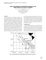
REPORTS VOLUME XI, 1 JULY 1963 TO 30 JUNE 1966 171for 93.50 has a very small range and poor correlation,Q.17%0 and 0.33.The temperature curve for station 127.40, off southernBaja <strong>California</strong>, has a 50-percent greater rangethan that for station 93.50, and a 50-percent greaterstandard error of estimate. These effects cancel toproduce the identical correlation coefficient. The rangeof the salinity curve and its standard error of estimateare each greater by a factor of two than those forstation 87.50; thus it also has the same correlationcoefficient. At station 127.40 the seasonal temperatureminimum is in late April and the seasonal salinityminimum in May. This aspect indicates an influenceby some seasonal variation in circulation.Station regression curves fall into regional patterns.Meaningful pattern variations occur perpendicular tothe coast. Figure 14 gives station regression curvessuperimposed upon one another for easy visual comparison.For each graph, four or five stations werechosen that constituted a line section across the currentand perpendicular to the coast. The locations ofthe line sections are shown as dashed lines in Figure2. The jog in section I which includes stations fromlines 67 and 70 was made to show typical stationcurves from stations that are well sampled. The distancebetween neighboring stations is given to providethe correct perspective of offshore temperature andsalinity gradients. A time scale that is common to thetemperature and salinity curves allows visual comparisonof the variation of these characteristics.As its temperature and salinity curves show, station67.50 of section I is in an upwelling region. Station67.55, 20 miles farther offshore, is similar to theoffshore regime during the initial part of the upwellingseason, but by midsummer the temperature curveresponds to the effects of upwelling. The form of thecorresponding salinity curve is also intermediate betweenthose for the offshore and upwelling regimes.Station 80.51, section <strong>11</strong>, near Point Conception doesnot maintain its low temperature as long as upwellingstations farther north. The slightly higher temperatureat 80.51 than offshore in December and Januarymay be caused by the winter countercurrent sometimesfound along the coast.The offshore temperature gradient along section I<strong>11</strong>increases after the minimum temperature is reachedand is largest at the time of the maximum temperature.Thus, the temperature gradient, but not thevalue of temperature, may indicate continued upwellingthrough September. Initial upwelling (station107.32) brings high-salinity water to the surface. Thesalinity minimum follows the maximum by 4 or 5months and coincides with the large temperaturegradient. The salinity distribution charts for 10 meters(following text) for August through December revealisolated low-salinity water in the upwelling regionalong the northern Baja <strong>California</strong> coast. This lowsalinitywater which replaces the isolated high-salinitywater of May and June has its source in the salinityminimumlayer of the thermocline. The salinity mini-mum was described by Reid, Roden, and Wyae(1958) and was the subject of a paper by Reid,Worrall, and Coughran (1964). These authors ascribedthe minimum to freer horizontal mixing of the surfacewaters than of the thermocline water ; the higher salinitiesof the west mix laterally into the surface waterof the <strong>California</strong> Current more readily than into thethermocline layer. A study of data of <strong>CalCOFI</strong> hydrographicstations reveals that the salinity miflimumwhich approximately corresponds to the 300 cl/tonthermosteric anomaly lo surface extends to the coastin the latter half of the year. The higher salinity waterupwelled in spring comes from a denser source. Thus,as the temperature gradients indicate, the upwellingmay persist from spring through fall. Upwellingbrings high-salinity water to the surface layers inspring and low-salinity water in fall. Though the offshoretemperature gradient is maintained in this periodthe temperature goes from its seasonal minimumto its maximum.Offshore, along section <strong>11</strong>1, the salinity changeshave phasing opposite to that of the nearshore regimein response to advection changes. In the intermediateregion the opposing effects cancel and here no variationof salinity is found. This region has especiallylow correlation coefficient and range (Figures 9 and10).In surface distribution charts, station 123.37, sectionIV, appears to be the dominant upwelling stationalong a section of coast where the scope of upwellingis limited. The largest offshore temperature gradientoccurs in late June, 2 months after the minimum temperature.Along station line 133, section V, the offshoregradient is largest at the time of the temperatureminimum and an onshore gradient occurs atthe maximum. Along both station lines the salinitjrminimum nearly coincides with the temperature minimumas in the offshore regions farther north. At thistime an onshore salinity gradient is evident, perhapsproduced by upwelling. Beginning in September, thefour salinity curves of station line 123 fall into twogroups, probably the result of a cyclonic eddy centeredbetween stations 123.42 and 123.50 and thecountercurrent.DISTRIBUTIONS OF MONTHLY MEANTEMPERATURECharts of mean temperature for each month wereconstructed from the curves of seasonal variation bydigitizing the regression curves at midmonths (chartsfollow text). Smoothing of the contours was performedin the manner that gave greater emphasis tovalues at those stations which had relatively morefrequent sampling (Figure 2). The stations offshoreand south of Cab0 San Lazaro were sampled infrequentlyduring some seasons. In such situations,where the regression curve can only provide a tenuous10 Montgomery and W-ooster (1954). Approximately equivalent tothe 24.97ot surface.