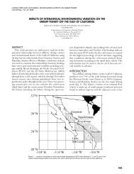
CalCOFI Reports, Vol. 11, 1967 - California Cooperative Oceanic ...
CalCOFI Reports, Vol. 11, 1967 - California Cooperative Oceanic ...
CalCOFI Reports, Vol. 11, 1967 - California Cooperative Oceanic ...

You also want an ePaper? Increase the reach of your titles
YUMPU automatically turns print PDFs into web optimized ePapers that Google loves.
166 CALIFORNIA COOPERATIVE OCEANIC FISHERIES INVESTIGATIONSREGRESSION CURVE EXTREMESThe extremes of the station regression curves andtheir months of occurrence are shown in contouredcharts (Figures <strong>11</strong> and 12). The seasonal temperatureminimum occurs in March over most of theoceans in the northern hemisphere temperate zone.The seasonal maximum occurs in September. Thetiming of the variation is altered near the coast inthe <strong>CalCOFI</strong> area. In regions of upwelling and regionsinfluenced by upwelled waters the minimumoccurs late, usually in April and May. Off southernBaja <strong>California</strong> the late temperature minimum extendsbeyond the offshore influence of the coastalupwelling. In this latter region the anomaly in phasingof the temperature variation appears to resultfrom seasonal variation in advection. A region offsouthern <strong>California</strong> has an early temperature minimum.The scale and location of this region offerevidence that the phase lead is caused by the patternof the local currents. The seasonal temperature maximumoccurs earliest (August) in a limited area offsouthern <strong>California</strong>. The coastal upwelling region ofcentral <strong>California</strong> experiences its maximum temperatureas late as the end of November. The maximumis slightly late at a few prominent upwelling stationsalong the Baja <strong>California</strong> coast.Because the seasonal variation of salinity is considerablyless regular than that of the temperature(at some stations the variation is not significant)the distribution of extreme dates is not as definitiveas those for temperature. A general pattern is evident,however. Where the seasonal variation is significantseaward of the upwelling regions the salinityminimum is in spring and the maximum in fall. Thistiming agrees with the seasonal variation of advectionand its probable effect on the distribution of meansalinity. In the upwelling regions along central <strong>California</strong>the maximum salinity is in summer, shortlyafter the minimum temperature is attained. The minimumsalinity usually occurs in winter. The salinityextreme in the upwelling region along northern Baja<strong>California</strong> occurs earlier than for the region farthernorth. The salinity maximum along southern Baja<strong>California</strong> occurs in fall along with the countercurrent.STATION REGRESSION CURVESThe complete data records and station regressioncurves for five representative stations are plotted inFigure 13. The dashed lines are drawn at plus andminus one standard error of estimate of the characteristicfrom the regression curve.Station 70.52 is in the upwelling region, 6 milesfrom the shore and immediately south of MontereyBay.9 At this station the correlation coefficients areOThe data plotted for station 70.52 were actually obtained atthree stations, 70.51, 70.52, and 70.63 with an interval of 4miles between 70.52 and the others. With one exception notwo stations were occupied during the same cruise. The shwtdistance between the stations was considered to be of minorconsequence as compared to the month-to-month changes Oftemperature and salinity in the locale d the stations. Therefore,the data were combined as if observed at one statlon.Data were similarly combined at several other coastal<strong>CalCOFI</strong> stations.low and standard errors of estimate are large. Dataare scarce for the winter months, The dispersion ofthe salinity values is particularly large at the beginningof the upwelling season, April and May. Theupwelling season along northern and central <strong>California</strong>is characterized by the low temperatures in springand summer with accompanying high salinities. Sometimesthe temperature and salinity anomalies show aninverse relation. In particular, the highest and lowestsalinities for April have as their corresponding temperatureobservations the lowest and highest Apriltemperatures, respectively.Station 70.70 is 80 miles farther offshore. The temperaturevariation has a greater correlation coefficient,and a lesser standard error of estimate than at thenearshore station. The salinity record shows a poorercorrelation and greater standard error of estimate.The offshore salinity variation is very different; itsminimum is in spring. The very large positive temperatureanomaly and negative salinity anomaly wereobserved in June 1958. The observations of this anomalouswater show that its extent was limited (Cal-COFI Atlas No. l).These two stations show the large standard errorof estimate relative to the moderate ranges in seasonalvariation that typifles the surface water in the Cal-COFI area north of the latitude of Point Conception.The regression analysis of salinity is of marginalsignificance. The F-ratio test indicates that the regressioncurves of these example stations provide abetter estimate of the salinity than the mean, althoughthe regression curves of some neighboringstations are not significant. Stumph 's test (calculatedfor neighboring stations but not for these particularstations) indicates that the salinity variation withineach year may differ considerably from the meanregression curve.Nonsignificant results from a regression analysismay be a direct result of a low sampling frequency.The stations off central <strong>California</strong> have moderate topoor sampling frequency and an uneven distributionof data within each year.The regression curve and record of temperature forstation 93.50 and similarly of salinity for station 87.50also appear in Figure 13. Both stations are off southern<strong>California</strong>. The standard errors of estimate of theregression curves are small. The range of the salinitycurve is moderate, having the same value as thespread of one standard error of estimate above andbelow the curve. Thus the correlation is moderate. Thesaliniby curve is similar to that for the upwellingstation, 70.52. Station 87.50 is just north of San NicolasIsland and over the submarine ridge of which SanNicolas is a part. The depth at this station is 73meters. The corresponding temperature curve is similarto that of station 93.50 but has a lesser range andpoorer correlation, 3.2" C and 0.67, respectively.The late temperature minimum shown in the curvefor 93.50 also appears in a few neighboring stations,all of which are downstream of the cold upwelledwater added to the <strong>California</strong> Current at Point Conceptionand north. The corresponding salinity curve