Hawley Meadows and Blackwater Park Suitable Alternative Natural ...
Hawley Meadows and Blackwater Park Suitable Alternative Natural ...
Hawley Meadows and Blackwater Park Suitable Alternative Natural ...

Create successful ePaper yourself
Turn your PDF publications into a flip-book with our unique Google optimized e-Paper software.
CONTENTS1 INTRODUCTION ........................................................................................... 22 CURRENT RESOURCE................................................................................ 33 POTENTIAL CAPACITY.............................................................................. 104 SANG CRITERIA ASSESSMENT ............................................................... 125 PROPOSALS .............................................................................................. 156 COSTS ........................................................................................................ 177 ADMINISTRATION...................................................................................... 171
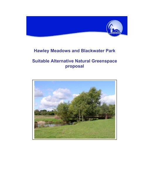
2.3.3 Management plans for both sites have been reviewed together to createa unified approach to delivering a single SANG. These plans have been agreedby <strong>Natural</strong> Engl<strong>and</strong> but are in draft form <strong>and</strong> need formally adopting by themanaging authority.2.4 Physical characteristics2.4.1 The River <strong>Blackwater</strong> flows through the site from south to north <strong>and</strong> isjoined by the Cove Brook on its left bank. Two small ditches join the site from thewest, three larger ditches including the outlet from Camberley sewage works joinfrom the east.2.4.2 The construction of the railway <strong>and</strong> roads, the latter including riverdiversion <strong>and</strong> extensive topsoil removal <strong>and</strong> surface lowering in <strong>Hawley</strong><strong>Meadows</strong> to increase capacity of the floodplain, destroyed much of the sites’historic l<strong>and</strong>scape, soils <strong>and</strong> habitats. This included extensive diversion of theriver damaging the riparian environment. Today the topography is mainly flat butin places it rises slightly to the west.2.4.3 Much of the site is in the active (100 year) floodplain <strong>and</strong> parts flood inmost winters, this occurs most often on the northern part of the meadow that waslowered to take flood water. Flooding usually occurs between the months ofSeptember <strong>and</strong> March, the site has not been known to flood in summer.2.5 L<strong>and</strong>scape <strong>and</strong> wildlife2.5.1 <strong>Blackwater</strong> <strong>Park</strong> was previously a gas works <strong>and</strong> railway siding. It wasrestored in the 1970’s to a parkl<strong>and</strong> l<strong>and</strong>scape of grassl<strong>and</strong>, scattered trees <strong>and</strong>woodl<strong>and</strong>, <strong>and</strong> contains a woodl<strong>and</strong> pond. The grassl<strong>and</strong> areas are mostlyregularly mown for amenity use.2.5.2 At a similar date l<strong>and</strong>scaping following road construction <strong>and</strong> surfacelowering of <strong>Hawley</strong> <strong>Meadows</strong> introduced many trees to the site mainly planted asscreening belts on the periphery.2.5.3 Recent management work has concentrated on restoring the typicalfloodplain meadow l<strong>and</strong>scape <strong>and</strong> habitats by sowing wildflowers, plantinghedges, river improvements <strong>and</strong> use of cattle for summer grazing. Many fenceserected to protect planted tree belts have been removed to extend the grassl<strong>and</strong>.Remaining fences divide the site into two roughly equal parts <strong>and</strong> allow control ofanimals so that grazing only takes place on one half of the site at any one time.2.5.4 The lowering of the floodplain destroyed the wildlife value of thegrassl<strong>and</strong> but in sowing of native floodplain species has partially restored floralinterest.2.5.5 Remnants of the historic floodplain grassl<strong>and</strong>s remain in situ. These areclassed as Local Wildlife Sites (termed SINC in Hampshire SNCI in Surrey) fortheir unimproved neutral grassl<strong>and</strong> flora <strong>and</strong> fauna. On these older grassl<strong>and</strong>sthe site supports a range of grassl<strong>and</strong> species with a population of the regionalrarity Great Burnet, including its only known Surrey site. These areas correspondto the UK BAP habitat Lowl<strong>and</strong> <strong>Meadows</strong>.4
2.5.6 In winter the wet areas attract bird species including Snipe <strong>and</strong> LittleEgret. In summer Reed Buntings (a BAP species) are known to breed. OtherBAP species recorded on site include Grass Snake, Noctule <strong>and</strong> Pipistrelle bats,<strong>and</strong> Stag Beetle. The woodl<strong>and</strong>, grassl<strong>and</strong>s <strong>and</strong> scrub areas can support manycommon species, butterflies <strong>and</strong> dragonflies being prominent in summer, with avariety of birds breeding <strong>and</strong> wintering on site.2.5.7 The wildlife on site is of intrinsic value for the role of SANG as it addscolour, movement <strong>and</strong> interest for the user. Increasing visitor use may causesome disturbance. However most of wildlife on site will not be detrimentallyaffected by increased visitor pressure if correct management is applied. Theproposed work programme includes items for visitor management <strong>and</strong> monitoringof wildlife to assess the effectiveness of these measures.2.6 Infrastructure2.6.1 The site has three vehicle access points. A bridge that once served thegas works at <strong>Blackwater</strong> <strong>Park</strong> provides an entrance from the Admiralty Wayindustrial estate but is visually not appealing. An area of parking within theindustrial estate is theoretically reserved for site visitors but is not defined,unattractive <strong>and</strong> often occupied by lorries.2.6.2 A car park with capacity for c.20 cars is accessed from the A331 onto thewestern edge of <strong>Hawley</strong> <strong>Meadows</strong>. A recently constructed pedestrian footbridgegives good access from the car park to the main body of the site. This car parkhas a height barrier <strong>and</strong> a lockable gate.2.6.3 The long distance <strong>Blackwater</strong> Valley Path, a definitive footpath, followsthe river mainly on its west bank <strong>and</strong> links pedestrian entrances at thesouthernmost <strong>and</strong> northernmost points of the site. The route of this through<strong>Blackwater</strong> <strong>Park</strong> is surfaced but the path in <strong>Hawley</strong> <strong>Meadows</strong> <strong>and</strong> a short circularroute around the <strong>Blackwater</strong> <strong>Park</strong> pond are unsurfaced.2.6.4 The <strong>Hawley</strong> <strong>Meadows</strong> car park has a good entrance sign with aninterpretation panel <strong>and</strong> notice board within the car park. Signage elsewhere islow key <strong>and</strong> poor quality.2.6.5 Two river bridges within <strong>Hawley</strong> <strong>Meadows</strong> are fairly new <strong>and</strong> providedramped access suitable for pedestrians, wheel chair <strong>and</strong> cycle users. An olderconcrete bridge over Cove Brook also allows vehicle use.2.6.6 Access for management into <strong>and</strong> within the site is restricted by just two ofthe five river bridges being suitable for vehicles. Three fords give alternative rivercrossings but are usable by tractors only. A vehicle access point off the M3/A331roundabout gives access to the southern part of the site but is not suitable forvisitor use.2.6.7 A picnic bench at <strong>Blackwater</strong> <strong>Park</strong> has recently been removed due to theamount of litter left around it.2.6.8 Fencing <strong>and</strong> gates around the <strong>Meadows</strong> are ageing with the gates notthat easy to use.2.6.9 A cattle h<strong>and</strong>ling pen is located close to the <strong>Hawley</strong> <strong>Meadows</strong> car park.5
Map 1. Site Location in Relation to the Thames Basin Heaths SPA6
Map 2. Sites 5km Catchment7
Map 3. Current Features map8
2.7 CURRENT VISITOR USE2.8 Visitor survey2.8.1 A visitor survey was carried out in March 2009 by Footprint Ecologyusing a st<strong>and</strong>ard methodology agreed by <strong>Natural</strong> Engl<strong>and</strong> to assess potentialSANGs.2.8.2 Surveying took place at the three main entrances, on a week day <strong>and</strong>weekend day at each for a total of eight hours between 7am <strong>and</strong> 6pm. A total of70 groups comprising 108 people <strong>and</strong> 70 dogs were recorded entering the site.2.8.3 Approximately twice as many people visited at weekends as on aweekday <strong>and</strong> it was estimated that over a full weekday there would have been 42people <strong>and</strong> 102 on a weekend day. This is equivalent to 414 visitors per week butit was thought numbers would be less in winter <strong>and</strong> more in summer.2.8.4 The survey found approximately half of the visitors used the <strong>Hawley</strong>Meadow car park (51 of the 108) with ¾ of this number visiting on weekends <strong>and</strong>¼ on a weekday. The northern entrance at <strong>Blackwater</strong> <strong>Park</strong> had nearly as muchuse, again with weekend days receiving more visitors then week days. Thesouthern entrance had much less use than the other two.2.8.5 The survey interviewed 55 of the 64 groups using the site. These foundthat visitors living within the 5km catchment did indeed comprise the majority ofvisitors, this catchment includes the settlements of Farnborough, Frimley,<strong>Blackwater</strong>, <strong>Hawley</strong>, Camberley <strong>and</strong> Owlsmoor.2.8.6 The interview also revealed dog walking was the most common reasonfor visiting (44%) with, in descending popularity, walking, fishing, cycling <strong>and</strong>exercise given as a reason by more than one person. Most people thought thesite became busier in summer than in winter.2.8.7 When on site most visitors stuck to the signed (but unsurfaced)<strong>Blackwater</strong> Valley Path.2.8.8 Visitors were asked what improvements to the site would increase theirfrequency of visit, <strong>and</strong> for other comments. When taken together answers show17 people thought litter was problem, 11 muddy paths, eight lack of dog wastebins, four had concerns over other users <strong>and</strong> two visited less often in summerdue to presence of cattle.2.8.9 Two of the 55 interviewees said they were likely to visit less often if thesite became busier, a low percentage, suggesting the site is under used.2.9 Visitor Counters2.9.1 An automatic visitor counter has been installed on the pedestrianentrance at the <strong>Hawley</strong> <strong>Meadows</strong> car park since March 2008, as part of a seriesin the <strong>Blackwater</strong> Valley. The counter uses a pressure pad to register everyperson passing in hourly segments with data transmitted to a web site for easymonitoring. This technology is advanced but still developing, when working itgives detailed data <strong>and</strong> 24 hour coverage data, but it has suffered due towaterlogging in times of flood <strong>and</strong> so not given the constant coverage hoped for.Unfortunately it was not operational during March 2009 during the visitor survey.9
2.9.2 During April <strong>and</strong> May 2008 an average of 145 visitors entered the sitefrom the car park per week, if half the site visitors use this entrance as the visitorsurvey found, an estimated 290 visitors used the whole site each week.2.9.3 During September <strong>and</strong> October 2008 an average of 137 visitors weekentered the site from the car park, an estimate of 274 visits to the whole site perweek.2.9.4 During the April <strong>and</strong> May 2009 weekly visits through the car parkaveraged 190 giving an estimate of 380 visits to the whole site.2.10 Assessment of current use2.10.1 Data from other automatic counters in the <strong>Blackwater</strong> Valley support thevisitor survey assumption <strong>and</strong> views of those interviewed that numbers are lessin winter <strong>and</strong> greater in summer. Visitor numbers peak in May to August <strong>and</strong> areleast in November to February. Average figures for both March <strong>and</strong> Octobershow that in these months average weekly visitors are about 8% of annual total<strong>and</strong> so are very close to the annual average.2.10.2 The data loggers figures for spring <strong>and</strong> autumn 2008 are consistent -both at around 280 visits per week. The data logger figure for April <strong>and</strong> May 2009is much higher at 380 weekly visits but this is closer to the March 2009 surveyestimate of use at 414 visits per week.2.10.3 The data logger figure is likely to be more accurate as it is taken over alonger time <strong>and</strong> allows for periods of low use for bad weather or alternativeattractions. However observations by site staff suggest the site is graduallybecoming better used since the new bridges <strong>and</strong> signage were installed.2.10.4 Therefore a figure of about 400 visits per week may be taken as an upperfigure for average weekly use across the whole year, equating to 20,800 visitsper annum.3 POTENTIAL CAPACITY3.1 The Delivery Framework seeks a minimum st<strong>and</strong>ard of 8 hectares for each1,000 person population increase that should be allocated to SANG(equivalent to 0.008ha per person). There is currently no data on numbersof visits to countryside sites per head of population.3.2 In the absence of an agreed method other SANG assessments have used avariety of ways of gauging remaining capacity (often referred to asdiscounting in TBH papers). In some districts e.g. Guildford <strong>and</strong> Waverley arough estimate of use has been used to give a figure of 25% or 50%capacity remaining.3.3 In Bracknell Forest frequency of visits by users was calculated frominterviews to give an average of 168 visits p.a. by each user <strong>and</strong> soenabling a calculation of remaining capacity for each site. The survey ofsites found 65-90% of users were dog owners who need to exercise theirdog on a daily basis but just 11% of population own dogs. Therefore thesample is highly biased towards frequent users compared to infrequent10
users <strong>and</strong> takes no account of residents who do not visit countryside sitesat all. Thus the figure of 168,000 visits per thous<strong>and</strong> population is likely tobe a large overestimate.3.4 Surveys by Hampshire CC found about 45% of residents use countrysidesites or rights of way, but frequency of use was not surveyed. Whenfrequency of use calculated by Bracknell Forest is applied this suggests afigure of 75,000 visits per thous<strong>and</strong> population, but this still does not allowfor the Bracknell survey being biased to high frequency users.3.5 A study by English Heritage suggested 62% of people visited countrysidesites 8-9 times per year (equivalent to 5,300 visits per thous<strong>and</strong> population)however what type of sites were included in this is unclear.3.6 The national GB Leisure Day Visit survey found the average person made4.3 day visits per fortnight (equal to 112 day visits per year) of which inEngl<strong>and</strong> 25% (= 28 visits) were to the countryside. Just 58% of these wereoutdoor countryside activities giving a figure of 16 visits per personundertaking outdoor activities. In relation to SANG the figure translates to16,000 visits per annum per thous<strong>and</strong> population. However caution isneeded, it is possible interviewees did not correlate short local trips such asexercising a dog with leisure day trips, nor did the countryside categorycatch use of urban parks, nor did it include people under 16. A HampshireCC survey showed that 28% of countryside users were from the “up to 16year old” age group, adjusting the figure to take account of this factor aloneincreases it to 21 visits per person. It is therefore reasonable to suggest afigure of c.25,000.3.7 The above survey information suggests annual visits per thous<strong>and</strong>population fall in the range 25,000-75,000 visits. On this basis, the DeliveryFramework st<strong>and</strong>ard of 8ha per 1,000 persons is catering for somewherebetween 3,125 <strong>and</strong> 9,375 visits per hectare/annum.3.8 Surveys by Bracknell Forest BC of use of a number of other countrysidesites in the <strong>Blackwater</strong> Valley found Shepherd <strong>Meadows</strong> received 2,300visits per ha/annum <strong>and</strong> Horseshoe Lake received 2,800 visits perha/annum <strong>and</strong> were considered by users not to be crowded <strong>and</strong> have sparecapacity. They were both accepted as SANGs. S<strong>and</strong>hurst Memorial <strong>Park</strong> onthe other h<strong>and</strong> received 5,300 visits per ha/annum <strong>and</strong> was perceived as atcapacity by users <strong>and</strong> was ruled out as a SANG on this basis.3.9 A capacity figure of 5,000 visits per ha/annum is consistent both with thetheoretical calculation range <strong>and</strong> surveys of users at other sites; in theabsence of better data this figure can be used to calculate capacity.Compared to the Delivery Framework this indicates 40,000 visits perthous<strong>and</strong> population or 40 visits per person per year.3.10 When applied to the combined site area of 31.5ha for <strong>Hawley</strong> <strong>Meadows</strong>/<strong>Blackwater</strong> <strong>Park</strong> the Delivery Framework st<strong>and</strong>ard of 0.008ha per personindicates it can cater for 3,937 people. At 40 visits per person, current useof 20,800 annual visits would be generated by 520 people, remainingcapacity is thus 3,417 people for the whole site. (Apportioned by area theremaining capacity of <strong>Hawley</strong> <strong>Meadows</strong> is 2,983 people, <strong>Blackwater</strong> <strong>Park</strong>434 people).11
3.11 Monitoring is proposed that would both give accurate figures for a currentannual use <strong>and</strong> users perception of when the site had reached capacity <strong>and</strong>figure for remaining capacity can be revised in light of the findings, howeverit is clear the site has significant remaining capacity.4 SANG CRITERIA ASSESSMENT4.1 <strong>Natural</strong> Engl<strong>and</strong> (NE) have specified the characteristics needed by SANGs.The ones relevant to sites over 20ha are summarised in Table 1: theydescribe three categories, ‘essential’ to be required by all SANGs,‘important’ to be included in the suite of SANGs in any one area whilst eachSANG should have at least one of the ‘desirable’ features.4.2 Although NE state the list is for guidance <strong>and</strong> not a tick box exercise Table1 clearly shows <strong>Hawley</strong> <strong>Meadows</strong> fulfils or could fulfil all the ‘essential’ <strong>and</strong>‘important’ features of a SANG given sufficient resource to implementidentified management.12
Table 1. SANG requirementsEssential Features Presence/Current state ProposalsAdequate car parking Present two car parks c. 20 <strong>and</strong> 5capacityBoth can have appearance <strong>and</strong> capacityimprovedCircular walks of c 2.5km1.6km walk possible but walkers wouldhave to find own route. Link to <strong>Blackwater</strong>A number of circular routes up to 3km canbe laid out <strong>and</strong> signed, site leafletValley path extends possible routes offsiteCar parks easily accessible <strong>and</strong> well <strong>Hawley</strong> <strong>Meadows</strong> car park is well signed, Improved signage to <strong>Blackwater</strong> <strong>Park</strong> carsignedAppropriate access points for target usergroupsSafe pedestrian route from nearest carparkCircular walks starting <strong>and</strong> finishing at carparkPerceived by users to be safe, some openwalking areas<strong>Blackwater</strong> <strong>Park</strong> not soPresent but limitedPresentWalkers would have to find own routeMainly open but some concernsexpressed by current users over otherusers <strong>and</strong> litterPaths get very muddy in winter due tofloodplain locationparkImproved pedestrian access to residentialareas in north, <strong>and</strong> southRoutes can be laid out <strong>and</strong> signed, siteleafletRegular ranger presence on site willresolvePaths well maintained but mostlyunsurfacedSelective surfacing <strong>and</strong> drainage on mainpathsSemi natural greenspace character Present Improve naturalistic l<strong>and</strong>scape characterVariety of habitatsPresent, river, meadow, woodl<strong>and</strong>, scrub, Wetter areas including ponds <strong>and</strong> ditchespondscould be created to increase varietyUnrestricted access, space for dogs to Access unrestricted but cattle graze on Maintain at least one cattle free area at allexercisemeadows in summer, rotated to keep half times <strong>and</strong> improve signageFree from unpleasant intrusionsarea cattle free at any one timeMain road <strong>and</strong> railway may be regardedas intrusive by someMaintain peripheral l<strong>and</strong>scaping belts13
Preferable features Presence/Current state ProposalsClear signposting & advertising <strong>Hawley</strong> <strong>Meadows</strong> car park well signed Improve signage on north <strong>and</strong> southpedestrian access pointsPromoted by leaflet or websitesSite on <strong>Blackwater</strong> Valley Countryside<strong>and</strong> Surrey Heath BC web sitesSite leaflet <strong>and</strong> event to publiciseDesirable features Presence/Current state ProposalsSafe to let dogs off lead between car park<strong>and</strong> SANGPresentDog proof fencing to roadside will improvesafety for uncontrolled dogsGently undulating topographyPresent – just about - site mainly flat soeasy accessInterpretation panels at access points At <strong>Hawley</strong> <strong>Meadows</strong> car parkCould be improved at all entrancesshowing site layout <strong>and</strong> routesOpen country character with areas ofdense trees, scattered scrub or openwaterPresent, large field compartments giveopen character, river provides waterfeature, some blocks of plantationMaintain habitats with l<strong>and</strong>scape <strong>and</strong>views in mindFocal pointwoodl<strong>and</strong>River <strong>and</strong> ponds act as focal points,southern bridge gives view point to highground west of siteHabitat features can be added, internalviews considered during tree <strong>and</strong>woodl<strong>and</strong> management14
5 PROPOSALS5.1 A work programme has been drawn up to enable the site to act as a SANG<strong>and</strong> achieve its capacity. These proposals have been detailed in themanagement plans being drawn up for each site <strong>and</strong> are summarised inAppendix 1, <strong>and</strong> Map 4 The programme includes specific measures toimprove the attractiveness of the site to visitors <strong>and</strong> are in accordance withthe <strong>Natural</strong> Engl<strong>and</strong> SANG criteria. Central to the proposals are the creationof new signed footpaths to create a variety of circular walks up to 3km inlength5.2 The work programme also includes measures to limit or offset damage tothe wildlife of the site due to increased visitor pressure, by providing <strong>and</strong>maintaining varied habitats both for their own sake <strong>and</strong> to improveattractiveness of the site to visitors.5.3 Some non-physical work is included that is essential, including promotion ofthe site so it fulfils its role of SPA mitigation <strong>and</strong> assessing the success ofthe work programme via visitor <strong>and</strong> biodiversity monitoring.5.4 The work programme also includes elements to protect the capacity <strong>and</strong>function of the floodplain that may be affected by other proposals e.g. raisedpath construction.5.5 The phasing of work <strong>and</strong> the increased visitor capacity provided by eachproject is given in the individual site management plans.15
Map 4. Proposals16
6 COSTS6.1 Costs of bringing the site up to a st<strong>and</strong>ard to be used as a SANG, <strong>and</strong>maintaining this use for perpetuity are detailed in Appendix 1. The figuresare separated into one off set up costs, capital asset purchase withprogrammed replacement, <strong>and</strong> annual maintenance.6.2 The l<strong>and</strong> value foregone by dedicating it to SANG use has been calculatedfor the two sites independently by taking into account current market values<strong>and</strong> current usage. For <strong>Hawley</strong> <strong>Meadows</strong> this value is £500,000 <strong>and</strong> for<strong>Blackwater</strong> <strong>Park</strong> £70,000.6.3 An allowance has been made to cover the cost of financial advice <strong>and</strong>administration of funds.6.4 These costs have been used to calculate the cash flow required to covercosts of managing the site in perpetuity, which for the purpose of thecalculation has been taken as 80 years. The calculation has taken accountof predicted take up rates, inflation <strong>and</strong> interest based on historic trends.6.5 The tariff for use of <strong>Hawley</strong> <strong>Meadows</strong> <strong>and</strong> <strong>Blackwater</strong> <strong>Park</strong> as a SANG is£2,600 per person. This averages out at £6,250 per dwelling at 2.4 personoccupancy. However, the SANG tariff will be charges on a proportionalbasis by house size using a notional occupancy rate as set out below.DwellingOccupancyTariff @£2600 perperson1 bedroom 1.40 36402 bedroom 1.85 48103 bedroom 2.50 65004 bedroom 2.85 74105+ bedroom 3.70 96206.6 The tariff for use of <strong>Hawley</strong> <strong>Meadows</strong> <strong>and</strong> <strong>Blackwater</strong> <strong>Park</strong> as SANG doesnot include the figure agreed by the JSPB for access wardening <strong>and</strong>monitoring of the SPA itself. Individual planning authorities will be able todecide for themselves how to incorporate the per person tariff into their ownavoidance plans.7 ADMINISTRATION7.1 As the site of the proposed SANG falls within the area of three planningauthorities (Rushmoor Borough, Hart District <strong>and</strong> Surrey Heath Borough)<strong>and</strong> has three owners this creates complications in administering the SANG.A Memor<strong>and</strong>um Of Agreement is currently being prepared to cover thepoints below.7.2 The local authorities require certainty of capacity they have available inorder to prepare their own Thames Basin Heaths mitigation strategies.Available capacity of the SANG of 3,417 persons will be shared out equallybetween the three district planning authorities. This provides mitigation for17
1,139 persons for each authority. (This equivalent to c. 475 dwellings ataverage occupancy of 2.4 persons per dwelling). An authority will be atliberty to pass on some or all of its allocation to another authority if itwishes.7.3 Surrey Heath BC Ranger Service will continue to manage <strong>Blackwater</strong> <strong>Park</strong><strong>and</strong> BVCP continue to manage <strong>Hawley</strong> <strong>Meadows</strong>. Co-ordinatedmanagement plans are being prepared for approval by <strong>Natural</strong> Engl<strong>and</strong> toensure the combined site is effective as a single SANG.7.4 Individual planning authorities will remain responsible for allocating placeswithin their agreed share to named developments, <strong>and</strong> collecting developercontributions.7.5 Surrey Heath Borough Council as both a l<strong>and</strong>owner/manager of <strong>Blackwater</strong><strong>Park</strong> <strong>and</strong> a planning authority, wish to retain contributions that relate to thisarea <strong>and</strong> its capacity of 434 persons. They will have an allocation of 705persons at <strong>Hawley</strong> <strong>Meadows</strong>.7.6 A dedicated fund will be set up by Hampshire CC to receive developercontributions from Rushmoor BC, Hart DC <strong>and</strong> Surrey Heath BC.Hampshire will transfer that portion of the monies to <strong>Blackwater</strong> <strong>and</strong> <strong>Hawley</strong>Town Council which relate to the value of the Town Council owned l<strong>and</strong> inthe SANG.7.7 An annual monitoring report will be prepared detailing monies received <strong>and</strong>spent, <strong>and</strong> work undertaken to meet SANG requirements, so that allinterested parties are kept informed of the management <strong>and</strong> use of the siteas a SANG.7.8 The local planning authorities who use the SANG will be required to reportto <strong>Natural</strong> Engl<strong>and</strong> monthly on capacity of new development in their areaallocated to the SANG.18
APPENDIX 1. Work Programme Costs-Planning & set up costs Unit cost (£) Quantity Quantity Total Quantity Cost (£)HMBPHydrological study 5,000 1 1 5,000Design of path <strong>and</strong> flood mitigation scheme 5,000 1 1 5,000Construction of raised footpath in wettest area 30,000 1 1 30,000Flood mitigation scheme including ground lowering & ditches 55,000 1 1 55,000Grassl<strong>and</strong> enhancement 1,000/ha 10 10 10,000Tree clearance for new paths in woodl<strong>and</strong>s 10,000 1 1 10,000Total set up costs 115,000Capital Asset costs Unit cost (£) Quantity Quantity Total Initial Replacement Annual costsHM BP Quantity Costs (£) periodAccessNew footbridge over ditch <strong>Hawley</strong> meadows 20,000 1 1 20,000 20 1,000Improve bridge over Cove Brook 20,000 1 1 20,000 20 1,000Replace <strong>Hawley</strong> Car park bridge 1 50,000 1 1 0 20 2,500Surfacing of riverside footpath 50 lm 2,200 2,200 110,000 10 11,000Lay out of new unsurfaced routes 10 lm 1,750 250 2,000 20,000 10 2,000Car park surface <strong>and</strong> entrance5,000 1 1 2 10,000 10 1,000improvementsFurnitureGates 500 5 5 2,500 10 250Seating 250 6 6 1,500 10 150Signage & interpretation panels 1,500 per panel 3 2 5 7,500 6 1,250Fencing for dog <strong>and</strong> cattle control 10 lm 2,000 2,000 20,000 10 2,000Waymarking 50 15 5 20 1,000 5 200Litter/Dog waste bins 600 2 1 3 1,800 5 360Improvements to entrances including off site1,000 1 2 3 3,000 5 600signageOtherPurchase of mower 12,000 1 1 12,000 5 2,400Automatic visitor counters 1,000 1 1 2 2,000 5 400Site leaflet 3.000 1 3,000 5 600Total capital asset costs 234,300 26,71019
Maintenance costs Unit cost(£) QuantityHMQuantityBPQuantity Programme Annualcosts (£)Bridge inspection & maintenance 1000 3 3 Bi annual 1,500Path Maintenance 2 /lm 3,800 1,000 4,800 lm Annual 9,600Hay cut 1,50 /ha 8 8ha Annual 1,200Tree inspection & management500 4 1 5 Every 5500for safety & biodiversityyearSpecialised contractor &1,000 1 Annual 1,000equipment hireLitter/ dog waste bins servicing 500 p.a. 2 1 3 Annual 1,500Visitor survey 3,000 1 Every 5600yearsMaintenance of automatic100 2 1 3 Annual 300counters 2Biodiversity monitoring 2,000 1 Bi annual 1,000Wardening salary & on costs of 40,000 p.a. 0.5 0.1 0.6 Annual 24,000½ rangerTransport costs for ranger8,000 p.a. 0.5 0.1 0.6 Annual 4,800(vehicle & fuel)Maintenance contingency 1 Annual 2,000Total annual costs ofmaintenance48,000Notes1. Bridge into site from <strong>Hawley</strong> <strong>Meadows</strong> car park is already in place but there is no duty on Hampshire CC to maintain hence itis included as maintenance <strong>and</strong> replacement cost only.2. One automatic counter already in place in <strong>Hawley</strong> <strong>Meadows</strong> but no duty to maintain hence installation costs for one butmaintenance costs for two.20