Download PDF - AUVAC
Download PDF - AUVAC
Download PDF - AUVAC

Create successful ePaper yourself
Turn your PDF publications into a flip-book with our unique Google optimized e-Paper software.
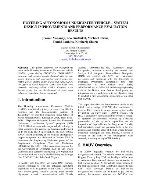
HOVERING AUTONOMOUS UNDERWATER VEHICLE – SYSTEMDESIGN IMPROVEMENTS AND PERFORMANCE EVALUATIONRESULTSJerome Vaganay, Leo Gurfinkel, Michael Elkins,Daniel Jankins, Kimberly ShurnBluefin Robotics Corporation237 Putnam AvenueCambridge, MA 02139(617) 715-7000vaganay@bluefinrobotics.comAbstract. This paper describes the modificationsmade to the Hovering Autonomous Underwater Vehicle(HAUV) system during PMS-EOD’s “EOD HULS”program, and presents results obtained with the newsystem design in hull and harbor search tasks. TheHAUV project started under and is still supported bythe Office of Naval Research (ONR). The R&D workcurrently underway within ONR’s Confined AreaSearch group for the development of short termenhanced capabilities is also presented.1. IntroductionThe Hovering Autonomous Underwater Vehicle(HAUV) was initially jointly developed by BluefinRobotics and the Massachusetts Institute ofTechnology for ship hull inspection under Office ofNaval Research (ONR) funding. In 2008, under PMS-EOD’s “Explosive Ordnance Disposal Hull UnmannedUnderwater Localization System” program (EODHULS), Bluefin conducted a major vehicle redesign inorder to improve the system’s performance and bring itup to the EOD HULS specification. The EOD HULSHAUV system consisting of two vehicles and topside /support equipment was delivered in October 2008. Itunderwent the Engineering Evaluation phase of theRequirement Compliance Test and Evaluation(RCT&E) of the EOD HULS acquisition program bythe Government in December 2008 in San DiegoCalifornia. It is currently undergoing User OperationalEvaluation with the Navy’s Mobile Diving and SalvageUnit 2 (MDSU-2) in Little Creek Virginia.In parallel with this effort and under ONR funding,Bluefin continues to look into enhanced short-termcapabilities with its partners within ONR’s ConfinedArea Search group. Specific activity areas includehigh-speed acoustic communications with FloridaAtlantic University-SeaTech, Automatic TargetRecognition, real-time mosaicing and control withSeeByte Ltd, integrated Feature-Based Navigation(FBN) and control with MIT, and video-basednavigation and mosaicing with the University ofMichigan. Preliminary capabilities have beendemonstrated in these various areas duringAUVFest’07 and AUVFest’08, and during engineeringtrials in the Boston area. Further development andintegration work is underway with the objective beingto conduct a fully autonomous inspection of an entirehull in 2011.This paper describes the improvements made to theinitial vehicle design (HAUV1) that transitioned itfrom an R&D vehicle to an operational system usableby mobile US Navy units (HAUV2 system). TheHAUV principle of operation and the system’s conceptof operation are described, followed by a detailedpresentation of the system’s capabilities for theinspection of ship hulls and berthing areas. For shiphull inspection, results are presented both in the noncomplexand complex areas of the hull where differentinspection techniques are used. Finally, a section isdevoted to the status of the development workcurrently underway through ONR funding.2. HAUV OverviewThe HAUV typically operates by hull-relativenavigation and control. The vehicle points an actuatedDoppler Velocity Log (DVL) at the ship’s hull in orderto maintain a fixed standoff distance and determine itshull-relative position. As the vehicle moves relative tothe hull, an actuated sonar (DIDSON) images the hullwith 100% coverage. Details on hull-relativenavigation and control can be found in [1]. On thesurface, the operator monitors the DIDSON data
transmitted in real-time over a fiber optic tether.Although the vehicle operates autonomously most ofthe time, the operator has the ability to stop the vehiclenear a contact detected in the real-time DIDSON datastream. Under manual control, some degrees offreedom such as the standoff distance are stillautomatically controlled by the vehicle. The operatorcan move the vehicle side to side and up and down, callthe contact, and resume the autonomous search.For complex areas such as a ship’s running gear, theDVL is pointed at the seafloor. The DIDSON, pointedat the hull, can be used to image or profile the hull. Inthe latter case, the sonar profiles are combined with thevehicle’s navigation data to provide a 3Drepresentation of the hull. During dives under therunning gear, the operator can also take manual controlof the vehicle to take a closer look at suspiciousfeatures.forward, the sonar field of view is limited in length bythe hull curvature. Additionally, protuberances such asbilge keels can completely obstruct the field of view.Further details are provided in [5]. To remedy thesetwo issues, it was decided to mount the DIDSON in thevehicle so that it points along the length of the hull bylooking to one side of the vehicle. This required a morecomplex mechanism to control the sonar’s orientationrelative to the vehicle, but provided substantialimprovement in coverage rate. Figure 3 shows one ofthe two HAUV2-class vehicles (called “HULS1” and“HULS2”) delivered to PMS-EOD in October 2008.These hull inspection capabilities have been extendedto the inspection of berthing areas (seafloor under thehull, and piers and pilings). The system can providehigh resolution images of the seafloor and detailedprofiles of pilings or other underwater structures.During post-mission analysis, the DIDSON data can bereviewed and mosaiced with enhanced resolution usingsoftware developed by AcousticView. A full Post-Mission Analysis tool is currently under developmentat Bluefin under ONR support (see section 6).Figure 1: “HAUV1A” (HAUV1-class vehicle)3. HAUV DesignImprovementsThe first HAUV, called “HAUV1A” and shown inFigure 1, was deployed for the first time in November2004. To support developments by other partnerswithin ONR’s Complex Area Search Group, a secondvehicle, called “HAUV1B”, was built and went to seafor the first time in May 2007 (Figure 2). HAUV1B isfunctionally identical to HAUV1A but has morehydrodynamicfoam and a smaller chassis.These vehicles participated in several demonstrationsincluding HULSFest’06, Harbor Protection Trials’06,AUVFest’07 and ’08, and the EOD HULSdemonstration. For further details on the resultsobtained during these demonstrations, the reader isreferred to [1][2][3][4].During these demonstrations, limitations with theHAUV1 design were revealed, with the main issuebeing related to the way the sonar is pointed at the hull.With the DIDSON actuated in pitch and lookingFigure 2: “HAUV1B” (HAUV1-class vehicle)It can be seen how the DIDSON now looks to thestarboard side of the vehicle with two rotationaldegrees of freedom (one tied to the DVL pitch angle,and the other one used to control the sonar’s grazingangle).This more complex sonar rotary table now allows the
vehicle to image sections of the hull that werephysically impossible to image with the HAUV1design. For instance, Figure 4 shows an AcousticViewmosaic of a World War II destroyer’s hull between thewater surface and the bilge keel located about 2 metersbelow the water surface. Further details on theDIDSON rotary table are provided in [5].EOD HULS specification. The most stringentrequirement that drove many of the improvements wasthat of being able to operate from a small rubber boatwithout a power source. This requirement hadhardware and software implications that are presentedin the next section.4. HAUV2 System Concept ofOperationAn HAUV2-class vehicle is made up of the followingcomponents: vehicle chassis, main electronics housing,junction box, battery, four 100 mm diameter thrusters,two 70 mm diameter thrusters, Doppler Velocity Log,DIDSON, two actuators, vehicle power switch,GPS/strobe/WiFi antennas (optional), relocationtransponder, flotation foam, removable data storagemodule, and lead weights. Although the vehicle isfitted with a fiber optic tether, it operates primarilyautonomously. Operator control is used to position thevehicle on the surface at the start of a dive or to take acloser look at a contact detected during autonomoussearch. Power is provided by an onboard Bluefinpressure-tolerant 1.5 kWh Lithium polymer battery.Figure 3: “HULS1” (HAUV2-class vehicle)The vehicle can be launched and recovered by twopeople over the side of a rubber boat, as shown inFigure 5.Figure 4: Hull between water surface and bilge keelThe HAUV2 design includes further modificationsmade to the HAUV1 design:- Reduction of the number of thrusters from eight tosix- Larger horizontal thrusters- High-power thruster board- Rotary actuator redesign for smaller size andweight reduction- Drop and play Bluefin battery- Integration of a removable data storage module- Overall weight reductionIn addition to vehicle design changes, system-levelimprovements have been made to comply with theFigure 5: HAUV launched over the side of a smallrubber boat4.1. Principle of Operation4.1.1 DVL Locked on a HullThe HAUV was initially designed to inspect ship hullsby pointing the DVL at the hull at all times so as tocontrol the standoff distance and the vehicle’s bearing,
and measure the position relative to the hull (hullrelativedead reckoning). This mode of operation is stillused when surveying large hulls. The vehicle typicallymoves up and down the hull (“vertically”) starting nearthe bow and making its way along the hull towards thestern. While executing this lawnmower pattern, thesonar “paints” the hull with 100% coverage. Figure 6shows the shape of a hull reconstructed in 3D from thenavigation data collected during the survey. Each colorrepresents the point of contact of one of the four DVLbeams on the hull.4.1.2 DVL Lock on the SeafloorInspection of complex areas such as the ship’s runninggear does not allow the DVL to maintain a solid lockon the hull due to the many protuberances in that area.In these areas, the DVL is pointed straight down andthe vehicle navigates relative to the seafloor. TheDIDSON is pointed up 15 degrees in imaging mode orstraight up in profiling mode. Switching from imagingto profiling is done in a few minutes by adding aconcentrator lens in front of the DIDSON. This lensreduces the vertical aperture from 14 to 1 degree,thereby creating a beam pattern consisting of 96 beamscovering a 30 deg by 1 deg spread. When pointing theDIDSON straight at the surrounding environment,profiles or scans are obtained that can be “stacked” inspace using the vehicle’s navigation data in order toreconstruct the environment in 3D.The DVL is also locked on the seafloor wheninspecting the bottom of a barge or the seafloor under ahull, or when searching pilings.Figure 6: Hull reconstructed from vehiclenavigation dataFigure 7 shows the vehicle’s trajectory in 2D hullcoordinates for the dive shown in Figure 6. The watersurface is near the top of the figure and the inboard sideis the curved bottom of the figure. The white areashows the estimated sonar coverage derived by analysisof the DIDSON field of view illumination. This displayis generated in real-time and in post-processing whenreplaying the DIDSON file. Note that the small gaps inthe white area are due to the fact that the field of viewanalysis tends to under-estimate the actual DIDSONfield of view.4.2. Operation from a SmallRubber BoatThe HAUV2 system was designed for operations by alimited crew from a small boat such as a Rubber HullInflatable Boat (RHIB) or a Combat Rubber RaidingCraft (CRRC). As shown in Figure 8, the crew consistsof three people: the coxswain, the tether handler, andthe operator.Figure 7: Sonar coverage and vehicle trajectoryFigure 6 and Figure 7 show how the vehicle goesfurther under the hull as the hull widens amidships.The vehicle autonomously determines when to stop aslice down the hull towards the inboard side by sensingthe inboard side’s hull curvature with the DVL. Thehorizontal extent of Figure 6 is about 145 m and thevertical extent is 30 m at the widest point of the hull.Figure 8: Operations from a small rubber boat
Power to the fiber optic tether reel and the tablet PC, aswell as Ethernet communications, are provided by theyellow deck box that can be seen in Figure 8.Coordination is needed between the three crewmembers to ensure that the vehicle has enough tetherslack and to prevent the tether from being severed bythe boat’s propeller; this has not proved to be adifficulty in operations.4.3. Operator InterfaceThe operator uses a dual-touch tablet PC (touch andstylus) running Bluefin’s Dashboard software toperform every operational step: vehicle dry checkout,in-water check out, mission planning, missionmonitoring, operator control, sonar data viewing,contact calling, post-dive checkout. Dashboard is theoperator interface used by Bluefin vehicles.Dashboard’s appearance is customized by selecting thevehicle class when starting the software. The HAUVDashboard includes features that are specific to thisvehicle, which is rather different from Bluefin’storpedo-shaped AUVs (BF21, BF12, and BF9).As shown in Figure 9 (captured during an actual dive),the Dashboard display is divided into three sections.The left pane is used to monitor the vehicle during adive. Position and attitude information, as well asvehicle status are displayed there. The lower-right paneshows the real-time DIDSON data. The operator hascontrol of selected sonar settings through controlslocated at the top of the image (field of viewdimensions, gain, ping rate, etc.) The upper right paneis a planar representation of the hull. The vehicle’sposition in hull coordinates is shown as a solid red line.The sonar coverage is shown by the white area, whichbuilds up as the vehicle covers more and more of thehull.Figure 9: HAUV’s operator interface: DashboardAdditional windows can be opened by clicking onbuttons or shortcut icons in the menu bar. Dependingon the mission type being executed and the phase ofthe dive, additional buttons also appear in the sonarpane. For instance, at the start of a dive, buttonsallowing the operator to steer the vehicle on the surfacetowards the hull will appear, and then disappear assoon as control is released to the vehicle.4.4. Mission PlanningMission planning can be performed on-site using asimple planning wizard. There is no need to plantracklines or to know the shape of the hull. Only basicinformation is needed, such as the ship’s draft, the sideof the hull the vehicle is going to survey, the localwater depth, etc. After answering a few simplequestions, the mission plan is generated and uploadedto the vehicle when starting the dive. Figure 10 showsan example of questions asked to the operator prior torunning a survey on a hull. After answering these fewquestions, the vehicle is capable of running a dive suchas the one shown in Figure 6.Figure 10: HAUV Mission Planning Wizard4.5. Contact CallingWhen calling contacts, the operator first clicks on theDIDSON image in Dashboard at the location of thecontact. This creates a sonar snapshot that is savedafter the operator is prompted and enters informationrelative to the contact using a graphical user interface(e.g. contact type, confidence level). Navigationinformation relative to the contact is automaticallyadded to a text file when the contact is recorded.Contacts can be called on-the-fly when the vehicle isrunning autonomously. Alternatively, the vehicle canbe put under manual control to allow the operator totake a longer and closer look at a contact. The operatorcan move the vehicle side to side or up and down,change the sonar grazing angle, and zoom in bychanging the sonar field-of-view dimensions. Aftercalling the contact (or not), control is released back tothe vehicle, which will go back to where it left off andthen resume the search.
4.6. Post-Mission AnalysisDuring post-mission analysis, the operator can reviewthe DIDSON data and call contacts again (if needed)using the same interface.The DIDSON data collected during the dives can bepost-processed using a mosaicing software tooldeveloped by AcousticView. This software runs on apowerful Post-Mission Analysis computer also used asa data repository. Examples of mosaics created usingthe mosaicing software are shown throughout thispaper.Another task that can be performed during postmissionanalysis is the 3D reconstruction of theenvironment from DIDSON profiling data and vehiclenavigation data. Although 3D reconstruction can bedone in degraded mode in real-time using a dot moderepresentation, a volume reconstruction requires a morepowerful computer and is performed during postprocessing.The 3D rendering software was developedby ScienceGL, Inc. in collaboration with SoundMetrics Corp.. Examples of 3D reconstruction usingScienceGL’s software are shown further down in thispaper.Figure 11: Single-frame raw DIDSON image of twotests targets on a large hullA contact map was created from the contacts called inreal-time during the hull search shown in Figure 7.This map is shown in Figure 12. Red circles and yellowsquares are associated with two different types oftargets that had been placed on the hull. Green starsrepresent regular hull features such as intakes, sea chest,zincs, etc.5. HAUV2 SystemCapabilities5.1. Non-Complex AreasThe Non-Complex Area of a hull is defined as followsin the EOD HULS specification: “The Non-ComplexHull Area makes up the majority of the ship’sunderwater surface area. This includes the bottom andside portions of the hull forward of the running gearand aft of the bow dome. For most Navy ships thisincludes a relatively flat bottom with a non-distinctkeel, extending outward to a relatively sharp transitionto the nearly vertical sides of the ship”. Non-ComplexAreas also include the seafloor under a hull that theHAUV is also capable of inspecting.5.1.1 Hull SearchDuring a hull search, a 5 meter DIDSON field of viewis typically used, which allows a 4 meter track-linespacing to be used in order to ensure overlap for 100%coverage. The DIDSON provides high-quality imagesthat allow test targets to be easily detected andclassified (Figure 11). The display of sonar data at 5frames per second makes images even clearer than thesingle-frame snapshot shown here.Figure 12: Contact map created from contactscalled in real-timeCoverage rates between 45 and 50 m 2 /min have beenestimated by Bluefin on large hulls.The hull search applied to large hulls (Figure 6 andFigure 7) can also be applied to smaller hulls. Forinstance, Figure 13 and Figure 14 show the same typesof plots obtained on a much smaller hull. During thissearch the vehicle was able to collect DIDSON dataover the propeller area (Figure 15). The data was thenmosaiced using the mosaicing software (Figure 16).Figure 17 shows the zinc anodes and the propeller on alarge hull observed during a hull search with the DVLlocked on the hull. Four zinc anodes are visible, as wellas the bolts used to attached them to the hull.
Figure 13: Small hull searchFigure 17: zinc anodes and propeller on a large hull5.1.2 Seafloor SearchFigure 14: Sonar coverage and vehicle trajectoryduring small hull searchDuring a seafloor search, the DVL is pointed at theseafloor. The vehicle maintains a fixed altitude over theseafloor and points the sonar down at a 15 degreegrazing angle. Figure 18 shows an example of seafloorsurvey. The colored dots correspond to the intersectionof the DVL beams with the seafloor and the blue solidline corresponds to the vehicle’s trajectory. When thetrajectory is straight, the vehicle was runningautonomously. When it is irregular, the vehicle wasunder operator control for investigation of a seafloorfeature detected in the real-time DIDSON stream. Thevehicle was running at 1.5 m altitude and about 6meters depth.The DIDSON provides acoustic images of excellentquality that can be further improved using themosaicing software. Examples of seafloor mosaics withnear-video quality are shown in Figure 19, Figure 20,and Figure 21.Figure 15: Single-frame raw DIDSON image ofpropeller and rudder on a small hullFigure 18: Seafloor survey exampleFigure 16: Mosaic of propeller and rudder on asmall hull
Figure 19: Seafloor mosaic showing a plank, alobster trap and other debrisFigure 20: Seafloor mosaic showing rocks that felloff a nearby seawallFigure 21: Seafloor mosaic showing various debrisand a net on the right side5.2. Complex AreasThe Complex Areas of a hull are defined as follows inthe EOD HULS specification: “Complex Areas arethose areas of the ship’s hull which contain complexstructures and appendages, voids, complex curvatures,rapid changes in geometry, and difficult-to reachplaces”. These areas include the ship’s running gear,additional structures and appendages such as bilgekeels, sonar heads, narrow keel extensions, bulbousbows, small-radius curved areas, hull openings andvoids, inboard side of the ship, and adjacent piers andpilings.Figure 22: Single-frame raw DIDSON image of apropellerFigure 23: Running gear mosaic5.2.1 Running GearDuring running gear surveys, the DVL is locked on theseafloor and the sonar pointed straight up at therunning gear in profiling mode, or 15 degrees abovehorizontal in imaging mode. The vehicle runs alawnmower pattern under the hull.Imaging ModeFigure 22 shows a raw DIDSON image collectedduring a running gear survey under a hull.On a different hull, Figure 23 shows a mosaic of thetwo propeller shafts and propellers, the keel, and therudder. Figure 24 shows a mosaic created from a passunder one of the propellers.Figure 24: Mosaic of a propeller and propeller shaftProfiling ModeProfiling under the running gear of a ship can be usedinstead of or in addition to imaging. DIDSON profilessuch as shown in Figure 25 can be “stacked” in 3Dusing the vehicle’s position and attitude at the time theprofiles were capture to reconstruct the shape of thestructure being scanned. This approach provides 3Dmodels of the environment as shown in Figure 26 andFigure 27. A degraded mode (dot mode) can be usedfor real-time visualization of the DIDSON profiles.This capability provides the operator with a situational
awareness that is otherwise difficult to achieve whenlooking at sonar profiles. For more accuraterepresentation (volume mode), the data is postprocessedwith ScienceGL’s 3D rendering software.Surveys under a ship’s running gear in profiling modecan also be conducted under the bow. Figure 28 showsthe bow of a World War II submarine reconstructed in3D from DIDSON profiles.Figure 28: 3D rendering of a WWII submarine’sbow5.2.2 PilingsFigure 25: Single-frame raw DIDSON profilesnapshot showing the hull and a propeller shaft(bio-fouled)During piling surveys, the DVL is locked on theseafloor and the DIDSON (fitted with the concentratorlens) is pointed horizontally at the pilings. The vehiclemoves up and down (vertically) and progresses parallelto the piling (horizontally) at the top and bottom of thevertical segments (Figure 29).Figure 29: Seafloor and vehicle trajectory during apiling surveyFigure 26: Running gear 3D reconstruction (landingship)Figure 27: Running gear 3D reconstruction (missileCorvette)The DIDSON pings at a high rate and acquires profilesof the environment such as shown in Figure 30. Theseprofiles are processed with the vehicle’s navigationinformation embedded in the sonar frame header by the3D rendering software to provide a 3D reconstructionof the environment (Figure 31). It is possible tomanipulate the 3D model within the softwareapplication (rotate, zoom, hide, change processingparameters, etc.). Figure 31 shows a section of pilingsthat is 25 meters long and 4 meters high, with threerows of piles captured in a single dive.
Figure 33: Vehicle trajectory around the cylindricalstructureFigure 30: Single-frame raw DIDSON profile offour pilesFigure 31: 3D rendering of piles under a pier fromDIDSON profiling and vehicle navigation dataA large cylindrical structure, about 15 meters indiameter and shown in Figure 32, was also profiledusing the DIDSON. The HAUV went up and down thestructure and turned around it at the top and bottom ofthe vertical passes, while maintaining a constantstandoff distance (under operator control). Figure 33shows the vehicle’s trajectory as it moved around thestructure and the seafloor sensed by the DVL. The datacollected during the dive was then post-processed usingthe 3D rendering software leading to the results shownin Figure 34.Figure 34: 3D rendering of a cylindrical structurefrom DIDSON profiling and vehicle navigation dataThe vehicle was then run with the DVL locked on thestructure, as if it were a hull. The vehicle went up anddown the structure, automatically moving around it at afixed standoff distance of 1 meter at the top and bottomof the vertical slices. Due to the structure’s curvature,the DIDSON field of view (looking to the starboardside of the vehicle was limited to about 2 meters inlength). Passes down the structure were then mosaicedto produce the images shown in Figure 35.Figure 32: Cylindrical structure profiled by theDIDSONFigure 35: Mosaics of two passes down thecylindrical structure
6. Research andDevelopment Work underONRThe Office of Naval Research, under the direction ofDr. Thomas F. Swean, is funding partners in theComplex Area Search (CAS) group for thedevelopment of capabilities aimed at performing a fullyautonomous un-tethered search of an entire hull in2011. The CAS group includes the following partners:- Florida Atlantic University (FAU) SeaTech Campusfor high-speed acoustic communications,- Massachusetts Institute of Technology (MIT) forFeature-Based Navigation (FBN) and control,- SeeByte Ltd for Automatic Target Recognition,mosaicing, 3D environment reconstruction, andcontrol,- University of Michigan for video-based featurebasednavigation and mosaicing,- Bluefin Robotics Corp. for integration of capabilitiesdeveloped within the CAS group in the HAUV,hardware / software integration and testing, vehiclesoftware (framework, autonomy, drivers, etc), postmissionanalysis tool development, operationalsupport for engineering trials and demonstrations.6.1. ResultsEngineering trials in the Boston area anddemonstrations such as AUVFest’07 and ’08 have beenused to test capabilities under development. The FAUhigh-speed acoustic modem has been integrated inHAUV1A and a camera / light system provided byUniversity of Michigan has been integrated inHAUV1B (Figure 36).Figure 36: Hardware integration in HAUV1 insupport of CAS research and developmentMany preliminary results were obtained by the CASpartners on the HAUV during AUVFest’08:- HAUV1A was fitted with the HERMES acousticmodem source designed by FAU and EdgeTech.Two receiver units were used: the HERMES topsideunit and an ORE High-speed Acoustic Gateway buoy.Compressed DIDSON images were transmitted at arate of 4 images per second with a data rate of 45000bits per second. A total of 3910 messages werereceived (35.6 million data bits) in one hour with lowbit error rate [6].- MIT implemented a feature extractor designed for aspecific type of target placed on the USS Saratoga’shull. The algorithm was able to very reliably detectnew targets with a low false alarm rate and toestablish correspondence with previous detections.The real-time feature-based navigation algorithmcreated the target map while simultaneouslyestimating the vehicle’s trajectory [7].- SeeByte demonstrated their ability to build real-timemosaics of the DIDSON data received over the fiberoptic tether (hull data and seafloor data). They alsoran their Automatic Target Recognition (ATR)algorithms on the real-time DIDSON data and wereable to automatically detect test targets that had beenplaced on the hull [8].- Over 1,300 underwater images of the USSSaratoga’s hull were collected by the HAUV fittedwith the video camera and light system designed bythe University of Michigan. The dive consisted ofseven 30 m legs of a lawnmower-pattern survey,each spaced 0.5 m apart in depth. Camera constraintswere fused with navigation data in an extendedinformation filter framework to provide boundederrorprecision navigation along the hull. Thecamera-based Feature-Based Navigation algorithmwas able to "close-the-loop" and register itself toearlier imagery from the first leg of the survey -thereby resetting any incurred DVL navigation errorduring the data dropout period.[9].In May 2009, engineering trials focused on ATR,acoustic communications, and mosaicing wereconducted by FAU, SeeByte, and Bluefin in BostonHarbor. During these trials, the HAUV surveyed a flatbottomhull on which targets had been mounted andtransmitted the DIDSON data in real-time to thetopside over the fiber optic tether. The sonar data wereprocessed in real-time by SeeByte’s ATR algorithm.ATR calls were sent back down to the vehicle over thefiber optic tether for acoustic transmission back to thesurface. The full-resolution single-frame DIDSONimages sent by the acoustic modem were thendisplayed on FAU’s laptop. This setup was anintermediate configuration used to test the ATR andacoustic modem before running the ATR onboard thevehicle directly. During these same trials, video dataacquisition dives were carried out with HAUV1B fittedwith University of Michigan’s new camera and lightsystem
6.2. On-going WorkMIT’s work under ONR will use the DIDSON as bothan imaging and bathymetry sonar to improve HAUVautonomous navigation. In imaging mode, each newlycollected image is matched with previous images tocontinuously build an estimate of the vehicle’s posehistory. In bathymetry mode, sections of range data arecompared with an a priori sonar scan of the ship hull,to localize the vehicle. On non-complex sections of thehull (which can be approximated locally as flatsurfaces), the imaging mode is expected to yield goodperformance, but in surveying complex structures suchas the running gear, bathymetry sonar should allowimproved localization and motion planning. Specificgoals in motion planning are to achieve 100% sensorcoverage of all structures and to concurrently optimizedynamic stability of the vehicle.FAU’s role will consist of acoustically transmittingATR and mosaic images from the HAUV equippedwith an on-board SeeByte processing unit. TheHermes acoustic modem will use both high bit-rateuplink and command-and-control downlink, so that thedata transmission can be performed independentlyfrom the fiber optic tether. In addition, FAU willtransmit compressed or uncompressed images acquiredin complex sections by the HAUV.SeeByte will be working on control and sensor analysismodules for the new profiling sonars available for thehull inspection problem (DIDSON sonar with profilinglens and Blueview MB2250). Example control tasksthat will be developed include a propeller shafttracking algorithm and a module which will allow theHAUV to inspect harbor pier pilings while maintaininga constant offset. Within the sensor analysis area,SeeByte will be developing real-time 3D ATR and reconstructionmodels.University of Michigan’s work during AUVFest’08demonstrated visual FBN over relatively flat, benignsections of the hull. Work is currently underway toextend that result to real-time large-area FBN incomplex geometry regions (such as screws andrudders). Additionally, advanced FBN capabilities inthe area of perception-driven control (PDC) are beingdeveloped. PDC will enable a vehicle to respond to theenvironment by autonomously selecting alternativesearch patterns based upon perceived featuredistributions in the environment. By coupling FBN intothe trajectory planning and control, the HAUV canmore intelligently adapt its survey and map buildingstrategy so as to only return to feature-rich areas of thehull when it accrues too much pose uncertainty. Thegoal of this work is to intelligently couple the vehicletrajectory into the FBN pose estimation process so thata specified upper bound on pose error is neverexceeded at any given point in time.Bluefin is currently developing a Post MissionAnalysis software tool. This tool will incorporatedevelopments from all of our partners. It will provideautomatic vehicle data archiving, generate missionreports, display the real-time data and results (e.g.contact calls), allow the user to replay selected divesfor detailed investigation of the sonar data, provide aninteractive means to navigate through the vehicle andsonar data, generate mosaics and super-resolution sonarvideo, run Automatic Target Recognition (ATR)algorithms, perform 3D reconstruction on sonarprofiling data, and re-navigate sonar files using featurebasednavigation. Additional work to be done atBluefin includes the development of new behaviors forinspection of the hull complex areas, integration andtesting of other sonars, core vehicle software upgradesand additions, integration of CAS capabilities in thevehicle, and operational support for testing anddemonstrations.7. ConclusionThe HAUV started as an R&D project funded by ONR.The system has been improved over the years and isnow being evaluated by the US Navy for potentialprocurement. The system has shown its ability toprovide excellent imagery thanks to the platform’sstability and the quality of its sonar (DIDSON).Research and development work is underway underONR funding to further improve the system andintegrate short-term capabilities such as AutomaticTarget Recognition, real-time mosaicing, high-speedacoustic communications, and feature-based navigation.The objective is to inspect an entire hull fullyautonomously in FY 2011.AcknowledgmentsThe authors would like to express their gratitude toDr. Thomas Swean at ONR and Mr. Robert Simmonsat PMS-EOD for their support to the HAUV projectover the years.References[1] ‘Ship Hull Inspection by Hull-Relative Navigationand Control’ – J. Vaganay, M.L. Elkins, F.S. Hover,R.S. Damus, S. Desset, J.P. Morash, V.C. Polidoro –IEEE/MTS Oceans’05, Washington D.C., USA, Sept.19-23, 2005.
[2] ‘Performance of the HAUV Ship Hull InspectionSystem Prototype during HULSFest 2006’ - J. Vaganay,F. Hover, M. Elkins, and D. Esposito – 7 th InternationalSymposium on Technology and the Mine Problem,Naval Post Graduate School, Monterey CA, May 2-5,2006[3] ‘Ship Hull Inspection with the HAUV: US Navy andNATO Demonstrations Results’ - J. Vaganay, M.Elkins, D. Esposito, W. O’Halloran, F. Hover, M.Kokko – IEEE/MTS Oceans’06, Boston MA, USA,Sept. 18-21, 2006.[4] ‘Hovering Autonomous Underwater Vehicle forShip Hull Inspection : Demonstration Results’ – J.Vaganay, S. Willcox, M. Elkins, D. Esposito, W.O’Halloran, F. Hover, M. Kokko – Undersea DefenseTechnology Pacific (UDT Pacific ’06), San Diego CA,USA, Dec. 6-8, 2006.[5] ‘HAUV System Performance Enhancement for Useby EOD Units’ - J. Vaganay, L. Gurfinkel, D. Jankins,K. Robinson, T. Stefanov-Wagner, S. Summit – 8 thInternational Symposium on Technology and the MineProblem, Naval Post Graduate School, Monterey CA,6-8 May, 2008[6] ‘HERMES – A High Bit-Rate Underwater AcousticModem Operating at High-Frequencies for Ports andShallow Water Applications’ - P.P.J. Beaujean, E.A.Carlson, Marine Technology Soc. Journal, Vol. 43, no.2, 2009, pp. 21-32.[7] ’Stability and Robustness Analysis Tools for MarineRobot Localization and Mapping Applications’ - B.Englot, Master's Thesis, Massachusetts Institute ofTechnology, 2009.[8] ‘Automatic Ship Hull Inspection - The Detection ofmine-like targets in sonar data using multi-cad fusionand tracking technologies’ - P.Y. Mignotte, S. Reed, A.Cormack, and Y. Petillot, in Proceedings of Instituteof Acoustics International Conference on the Detectionand Classification of Underwater Targets, Sept. 2007,Heriot-Watt University, Scotland.[9] ‘Pose-graph Visual (SLAM) with Geometric ModelSelection for Autonomous Underwater Ship HullInspection’ - A. Kim and R. Eustice - IROS 2009, Saint.Louis, MO, USA, Oct. 11-15, 2009

![Sonardyne Wideband Sub-Mini 6 [8270, 8271].pdf - AUVAC](https://img.yumpu.com/44408971/1/190x245/sonardyne-wideband-sub-mini-6-8270-8271pdf-auvac.jpg?quality=85)