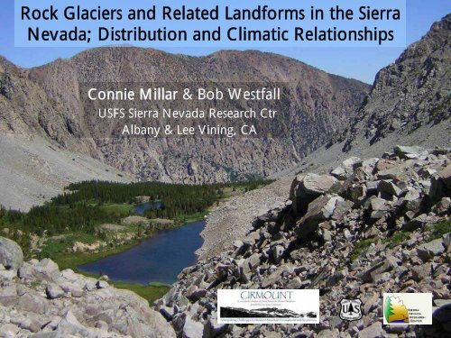
Rock Glaciers and Related Landforms in the Sierra Nevada ...
Rock Glaciers and Related Landforms in the Sierra Nevada ...
Rock Glaciers and Related Landforms in the Sierra Nevada ...

You also want an ePaper? Increase the reach of your titles
YUMPU automatically turns print PDFs into web optimized ePapers that Google loves.
2. Valley Wall <strong>Rock</strong> <strong>Glaciers</strong> (RGV)Francis Cr CynMean Elev: 3243mShape: 12% L61% W27% EMean size: 3 haSlope AspectE Fk <strong>Rock</strong> Creek
3. Boulder Streams (BSC)Helen LkMean Elev: 3317mShape: 39% L7% W54% EMean size: 5 haSlope AspectKuna Crest
5. Patterned Ground RIFsNets & StripesToquima Range, NVMean Elev: 3273mShape: 33% L20% W47% EMean size: 1.1 haSlope AspectSorted CirclesSilver P<strong>in</strong>e Lk, Mt Dunderberg
Relict (LIA/Pleistocene) RIFs are also common;Warren CrestThese appear to lackpersistent ice25% of mapped featuresDana Cliffs
RIF Climate Model<strong>in</strong>g:1. Imported RIF locations <strong>in</strong>to GIS2. Intersected with 30 arcsec 1970-2000 PRISM data (Daly et al. 1994)3. Downscaled to RIF locations us<strong>in</strong>g regression approach (Hamman & Wang 2005)
Canonical Plot for <strong>the</strong> First TwoVectors from Discrim<strong>in</strong>ant Analysis6 RIF Classes <strong>and</strong> 10 PRISM ClimateVariablesLetters <strong>in</strong>dicate mean of <strong>the</strong>distribution for each classClasses:A = Scree Boulder StreamsB = Flow<strong>in</strong>g Boulder StreamsC = Solifluction FieldsD = Cirque <strong>Rock</strong> <strong>Glaciers</strong>E = Valley <strong>Rock</strong> <strong>Glaciers</strong>F = Patterned Ground
Comparisons of Pleistocene (P)vs Holocene (H) TemperaturesEleven Watersheds with Paired Pleistocene <strong>and</strong> Holocene RIFs (N = 53)Two Approaches:- Elevation Difference x Std Lapse Rate (-6.5C/km)- Direct PRISM Estimates by ElevationPleistocene – Dana CliffsHolocene – Kuna Crest
GLACIERS IN A WARMING WORLDIce glaciers worldwide have been melt<strong>in</strong>g dur<strong>in</strong>g <strong>the</strong> past 120 yearsDecreases <strong>in</strong> AreaDana Glacier, >65%,Basagic 2008Russell 1883 2008Decreases <strong>in</strong> MassS Fk Glacier, WA;-25%Founta<strong>in</strong> 2004
<strong>Rock</strong> glaciers & RIFs, however, resist melt<strong>in</strong>g<strong>and</strong> lag <strong>in</strong> response to warm<strong>in</strong>g…<strong>Rock</strong> debris <strong>in</strong>sulatesembedded ice aga<strong>in</strong>stsolar radiation
Pleistocene <strong>Rock</strong> <strong>Glaciers</strong> Overrode Tioga Mora<strong>in</strong>esLag <strong>in</strong> Ablation dur<strong>in</strong>g Warm<strong>in</strong>g ClimatesLee V<strong>in</strong><strong>in</strong>g CynRGRGTioga lateral mora<strong>in</strong>e
RIFs are sources of persistent waterStreams run through <strong>the</strong> dry season* Embedded ice is source of water* <strong>Rock</strong> mantle reduces evaporation* Unique air circulation supercools rock matrixWe <strong>in</strong>stall data-loggers <strong>in</strong>outlet streams & underadjacent rocks (air)Kuna Lk, Kuna Crest
RIF outlet streams freeze but don’t dryiButton RecordsOutlet streams freeze°CSnow coversSnow melts
RIF streams & spr<strong>in</strong>gs were still runn<strong>in</strong>gas of late Sept 2007 (extreme dry year)Dana Fk, TuolumneBSCWhereas many non-RIF streams & spr<strong>in</strong>gsdried up
Water chemistry of RIF outlet streamsdiffers from o<strong>the</strong>r <strong>Sierra</strong>n watersDave Clow (USGS)
<strong>Rock</strong> glaciers discharge water differentthan ice glaciersWater seeps ra<strong>the</strong>r than rushes downcanyon& persists through autumn,even <strong>in</strong> dry yearsWarren ForkLundy Cyn
RIF canyons often lack central, <strong>in</strong>cisedstreams typical of ice-glacial canyonsPleistocene RGC, Mt DunderbergParker CynPleistocene RGC, Gibbs CynLee V<strong>in</strong><strong>in</strong>g Cyn
RIFs provide unique wetl<strong>and</strong> alp<strong>in</strong>e habitats…<strong>in</strong>creas<strong>in</strong>gly rare & important as climates warmParker RGC; Pleistocene relictGibbs BSC; Holocene active
RIF Wetl<strong>and</strong> Areas (means)Age Class n RG Wetl<strong>and</strong>Area (ha) Area (ha)------------ ----- -- -------- ---------Pleistocene RGC 12 100 252Modern RGC 11 10 20RGV 8 2 5BSC 9 16 10Wetl<strong>and</strong> onDunderberg RGCDunderberg Pleistocene RGC,below RG snout
Plant Species DiversityRIF Wetl<strong>and</strong> Willow & Sedge Communities<strong>Rock</strong> glacier wetl<strong>and</strong>s harbor rare species <strong>in</strong> o<strong>the</strong>rwisexeric alp<strong>in</strong>e locations; <strong>the</strong>se wetl<strong>and</strong>s will persist underwarm<strong>in</strong>g climates <strong>and</strong> serve as important plant refugia
Plant Species Diversity - <strong>Rock</strong> Glacier SurfacesBarney <strong>Rock</strong> Glacier Study - Duck Pass, Mammoth CrestpatchWe assessed plant species diversity &cover on all (60) plant patches
Biogeographic Aff<strong>in</strong>ities of Plants on BRG PatchesSoil patches on rock glacier surfaces provide cooler than expected habitats; <strong>the</strong>seextend <strong>the</strong> range of higher elevation taxa downward. Patches also provide“rescue” habitat for lower elevation species stressed by warm<strong>in</strong>g climates.1. Higher Elevation Taxa: 14 spp (47%)E.g., Erigeron pygmaeus, Eriogonum <strong>in</strong>canum,Primula suffrutescens2. Lower Elevation, Cool/Mesic Taxa: 3 spp (10%)E.g., Cirsium scariosum,Pellea breweri3. Cosmopolitan Mounta<strong>in</strong> Taxa : 18 spp (60%)E.g., Leptodactylon pungens, Ericameria suffruticosa60 Plant Patches7.9% of BRG1.3% Plant Cover
RIFs provide unique animal habitats1. Beavers* Beavers are exotic <strong>in</strong> <strong>the</strong> Eastern <strong>Sierra</strong> -widely <strong>in</strong>troduced but m<strong>in</strong>imally established;* Beavers established <strong>in</strong> canyons where conditionssupport dam-build<strong>in</strong>g = low volume streams, widely distributed spr<strong>in</strong>gs;* Beavers established <strong>in</strong> RG Cyns; Beavers fur<strong>the</strong>r enhance water retention.Dunderberg Pleistocene RGCLundy Pleistocene RGC
2. American PikaUse rock-glacier surfaces abundantlyAbundant around plant patches - Barney RGPhoto: J BishopAbundant near RG snouts
Pika appear to benefit from RIF <strong>in</strong>ternal coldair-circulation,cool micro-climates,Photo: J. Page…<strong>and</strong> associatedwetl<strong>and</strong> vegetationGibbs Cyn
Summary• <strong>Rock</strong> glaciers & related <strong>Rock</strong>-Ice Features are widely distributed<strong>in</strong> high <strong>Sierra</strong>n canyons, especially east of <strong>the</strong> crest• RIFs store <strong>and</strong> discharge water persistently <strong>and</strong> lag <strong>in</strong>response to warm<strong>in</strong>g• RIFs distribute waterbroadly across <strong>the</strong>l<strong>and</strong>scapeMt Snowden <strong>Rock</strong> Glacier
Summary, cont’d• RIFs support persistent wetl<strong>and</strong> habitats o<strong>the</strong>rwise rare <strong>in</strong><strong>Sierra</strong>n alp<strong>in</strong>e regions & high plant species diversitiesSherw<strong>in</strong> Crest RGs• RIFs provide cold microclimates<strong>and</strong> habitat for wide range ofplant species on soil “isl<strong>and</strong>s”• RIFs support important habitatfor wetl<strong>and</strong> <strong>and</strong> cool-dependentanimals, <strong>in</strong>clud<strong>in</strong>g abundantrefugial habitat for pikaPhoto: A. Shcherb<strong>in</strong>aphew