Ulaanbaatar CCCI Overview (May 2010) (PDF 6.7MB)
Ulaanbaatar CCCI Overview (May 2010) (PDF 6.7MB)
Ulaanbaatar CCCI Overview (May 2010) (PDF 6.7MB)

Create successful ePaper yourself
Turn your PDF publications into a flip-book with our unique Google optimized e-Paper software.
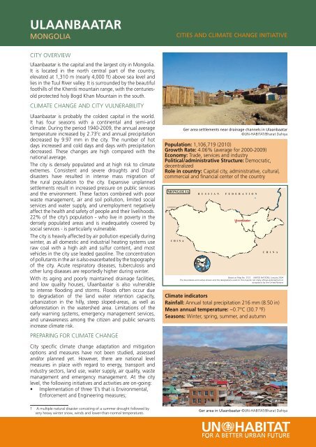
ULAANBAATARMONGOLIACITIES AND CLIMATE CHANGE INITIATIVECITY OVERVIEW<strong>Ulaanbaatar</strong> is the capital and the largest city in Mongolia.It is located in the north central part of the country,elevated at 1,310 m (nearly 4,000 ft) above sea level andlies in the Tuul River valley. It is surrounded by the beautifulfoothills of the Khentii mountain range, with the centuriesoldprotected holy Bogd Khan Mountain in the south.CLIMATE CHANGE AND CITY VULNERABILITY<strong>Ulaanbaatar</strong> is probably the coldest capital in the world.It has four seasons with a continental and semi-aridclimate. During the period 1940-2009, the annual averagetemperature increased by 2.73 0 c and annual precipitationdecreased by 9.97 mm in the city. The number of hotdays increased and cold days and days with precipitationdecreased. These changes are high compared with thenational average.The city is densely populated and at high risk to climateextremes. Consistent and severe droughts and Dzud 1disasters have resulted in intense mass migration ofthe rural population to the city. Expansive unplannedsettlements result in increased pressure on public servicesand the environment. These factors combined with poorwaste management, air and soil pollution, limited socialservices and water supply, and unemployment negativelyaffect the health and safety of people and their livelihoods.22% of the city’s population - who live in poverty in thedensely populated areas and is inadequately covered bysocial services - is particularly vulnerable.The city is heavily affected by air pollution especially duringwinter, as all domestic and industrial heating systems useraw coal with a high ash and sulfur content, and mostvehicles in the city use leaded gasoline. The concentrationof pollutants in the air is also exacerbated by the topographyof the city. Acute respiratory diseases, tuberculosis andother lung diseases are reportedly higher during winter.With its aging and poorly maintained drainage facilities,and low quality houses, <strong>Ulaanbaatar</strong> is also vulnerableto intense flooding and storms. Floods often occur dueto degradation of the land water retention capacity,urbanization in the hilly, steep sloped-areas, as well asdeforestation in the watershed area. Limitations of theearly warning systems, emergency management services,and unawareness among the citizen and public servantsincrease climate risk.PREPARING FOR CLIMATE CHANGEMONGOLIAKAZAKHSTANC H I N AGer area settlements near drainage channels in <strong>Ulaanbaatar</strong>©UN-HABITAT/Bharat DahiyaPopulation: 1,106,719 (<strong>2010</strong>)Growth Rate: 4.06% (average for 2000-2009)Economy: Trade, services and industryPolitical/administrative Structure: Democratic,decentralizedRole in country: Capital city, administrative, cultural,commercial and financial center of the countryR U S S I A NMONGOLIAF E D E R A T I O Ne<strong>Ulaanbaatar</strong>C H I N ABased on Map No. 3721 UNITED NATIONS, January 2004The boundaries and names shown and the designations used on this map do not imply official endorsement oracceptance by the United NationsClimate indicatorsRainfall: Annual total precipitation 216 mm (8.50 in)Mean annual temperature: −0.7°C (30.7 °F)Seasons: Winter, spring, summer, and autumn°City specific climate change adaptation and mitigationoptions and measures have not been studied, assessedand/or planned yet. However, there are national levelmeasures in place with regard to energy, transport andindustry sectors, land use, water supply, air quality, wastemanagement and emergency management. At the citylevel, the following initiatives and activities are on-going:• Implementation of three ‘E’s that is Environmental,Enforcement and Engineering measures;1 A multiple natural disaster consisting of a summer drought followed byvery heavy winter snow, winds and lower-than-normal temperatures.Ger area in <strong>Ulaanbaatar</strong> ©UN-HABITAT/Bharat Dahiya
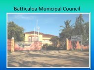
• Community-led and participatory developments inGer 2 areas;• Renovation of the management system and Public-Private Partnership;• Introduction of local cluster sub-systems as analternative solution with decentralization of heatingand sewerage utilities and services.Mongolia has recently joined UN-HABITAT’s Cities andClimate Change Initiative. The national scoping study andcity level vulnerability assessment is the first effort towardsspecific planning for climate change adaptation andmitigation in the city.Recently a national team of 14 members from localgovernment, research and engineering organizations,NGOs and community representatives was establishedand has started its work with participatory impact andvulnerability studies on pilot sites of Ger area.KEY ACTIVITIES PLANNED• Learn from good practices and pilot methodologies,methods and tools for climate change risk study andassessments;View of Ger area in <strong>Ulaanbaatar</strong> ©UN-HABITAT/Bharat Dahiya• Conduct national scoping study and city vulnerabilityassessment, identify stakeholders, prioritise tasks,plan activities and develop project proposals towardsclimate change adaptation and mitigation;• Build and strengthen institutional capacity andnetworking of stakeholders;• Implement a green growth strategy with technologytransfer, effective collaboration and partnership ofstakeholders and good governance;• Develop knowledge products that will enhancesharing of insights from national and city assessmentsand advocate for action in policy reform, planningand implementation of city responses, andcommunity-based initiatives;• Build and advocate for awareness on ClimateChange among the general public, particularly in Gerareas, and all stakeholders through the media andcommunity activities; and• Develop and implement a system for sustainablemanagement of long term collaborative activities ofnational and local stakeholders and encourage activenetworking with international partners.2 Informal settlementUN-HABITAT’S CITIES AND CLIMATE CHANGE INITIATIVEUN-HABITAT launched the Sustainable Urban DevelopmentNetwork (SUD-Net), an innovative network of globalpartners, promoting inter-disciplinary approaches tosustainable urban development.The Cities and Climate Change Initiative (<strong>CCCI</strong>) is theflagship programme of SUD-Net. The initiative aims tostrengthen the climate change response of cities and localgovernments. Cities are key drivers of climate changedue to their high energy consumption, land use, wastegeneration and other activities that result in the releaseof the vast majority of greenhouse gases. At the sametime, it is cities, and in particular the urban poor, in thedeveloping world, that are most vulnerable to and havethe least resilience against, for example, storms, floods,and droughts. Cities need to respond to Climate Changeby cutting their greenhouse gas emissions (mitigation).The negative impact of climate change seems howeverunavoidable and for most cities in developing countriesadaptation to the risks is a must.The Cities and Climate Change initiative brings togetherlocal and national governments, academia, NGOs andinternational organizations with the aim to alert cities tothe action they can take and by strengthening capacities ofcities and their partners to respond to Climate Change. Thekey components of the Cities and Climate Change initiativeare:• Advocacy, policy dialogue and policy change• Tool development and tool application• Piloting climate change mitigation and adaptationmeasuresKnowledge management and dissemination, through,amongst others, the UN-HABITAT partner universities andthe partnership with UN-HABITAT’s Local GovernmentTraining Institutes Network.The following cities are currently participating in <strong>CCCI</strong>. InAfrica - Bobo Dioulasso, Burkina Faso; Kampala, Uganda;Kigali, Rwanda; Mombasa, Kenya; Maputo, Mozambique;Saint Louis, Senegal and Walvis Bay, Namibia. In Asia andthe Pacific - Apia, Samoa; Batticaloa and Negombo, SriLanka; Lami, Fiji; Port Moresby, Papua New Guinea; PortVila, Vanuatu; Semarang, Indonesia; Sorsogon, Philippines;Thanh Hoa, Viet Nam and <strong>Ulaanbaatar</strong>, Mongolia.In Latin America - Esmeraldas, Ecuador.<strong>May</strong>, <strong>2010</strong>For more information, contact:UN-HABITAT Global DivisionUrban Environmental Planning BranchP.O. Box 30030, 00100 Nairobi, KenyaTel: +254 20 7625404 • Fax: +254 20 7623715Email: uepb@unhabitat.org • www.unhabitat.org/sudnetUN- HABITAT Fukuoka, Regional Office for Asia and the PacificACROS 8F, 1-1-1 Tenjin, Chuo-ku, Fukuoka 810-0001, JapanTel: (81 92) 724 7121 • Fax: (81 92) 724 7124www.fukuoka.unhabitat.orgUN- HABITAT project office in Mongolia:701/F MAX Tower, <strong>Ulaanbaatar</strong>, Mongolia • Tel: (976) 11 322711Manager: Sh. Enkhtsetseg • E-mail: enkhee_sh@yahoo.comUN- HABITAT <strong>CCCI</strong> Mongolia team:Coordinator: Dr. Oyun Ravsal • Tel: (976) 11 323230E-mail: oyun@e-map.mnA boy fetching drinking water in<strong>Ulaanbaatar</strong> ©UN-HABITAT/Bharat DahiyaDesign, Layout and Printing: United Nations Office at Nairobi (UNON) Publishing Services Section, ISO 14001:2004-certified