

Soils of the Bay of Exploits Area, Newfoundland - Agriculture and ...
Soils of the Bay of Exploits Area, Newfoundland - Agriculture and ...
Soils of the Bay of Exploits Area, Newfoundland - Agriculture and ...

You also want an ePaper? Increase the reach of your titles
YUMPU automatically turns print PDFs into web optimized ePapers that Google loves.
<strong>Soils</strong> <strong>of</strong> <strong>the</strong> <strong>Bay</strong> <strong>of</strong> <strong>Exploits</strong> <strong>Area</strong>,<strong>Newfoundl<strong>and</strong></strong>Report No . 16 <strong>Newfoundl<strong>and</strong></strong> Soil SurveyGOVERNMENT OFNEWFOUNDLAND AND LABRADORDepartment <strong>of</strong> Forestry <strong>and</strong> <strong>Agriculture</strong>Soil <strong>and</strong> L<strong>and</strong> Management Division
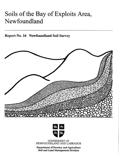
<strong>Soils</strong> <strong>of</strong> <strong>the</strong><strong>Bay</strong> <strong>of</strong> <strong>Exploits</strong> <strong>Area</strong>,<strong>Newfoundl<strong>and</strong></strong>Report No . 16 (Interim)<strong>Newfoundl<strong>and</strong></strong> Soil SurveyJ .W. van de HulstSoil <strong>and</strong> L<strong>and</strong> Management DivisionDepartment <strong>of</strong> Rural, Agricultural <strong>and</strong> Nor<strong>the</strong>rn DevelopmentSt . John's, <strong>Newfoundl<strong>and</strong></strong><strong>Agriculture</strong> BranchDepartment <strong>of</strong> Forestry <strong>and</strong> <strong>Agriculture</strong>1993
Copies <strong>of</strong> this publication are available from :Soil <strong>and</strong> L<strong>and</strong> Management DivisionDepartment <strong>of</strong> Forest Resources <strong>and</strong> AgrifoodsProvincial <strong>Agriculture</strong> BuildingP.O . Box 8700Brookfield RoadSt . John's, <strong>Newfoundl<strong>and</strong></strong>AlB 4J6
CONTENTSPAGEACKNOWLEDGMENT . . . . . . . . . . . . . . . . . . . . . . . . . . . . . . . . . . . . . . . . . . . . . . . . . . . viiSUMMARY . . . . . . . . . . . . . . . . . . . . . . . . . . . . . . . . . . . . . . . . . . . . . . . . . . . . . . . . . . . . . viiiINTRODUCTION . . . . . . . . . . . . . . . . . . . . . . . . . . . . . . . . . . . . . . . . . . . . . . . . . . . . . . . . 1PART ONEGENERAL DESCRIPTION OF THE AREA . . . . . . . . . . . . . . . . . . . . . . . . . . . . . . . . . . . . .Location <strong>and</strong> extent . . . . . . . . . . . . . . . . . . . . . . . . . . . . . . . . . . . . . . . . . . . . . . . . . . . 3History <strong>and</strong> development . . . . . . . . . . . . . . . . . . . . . . . . . . . . . . . . . . . . . . . . . . . . . . . . 3Climate . . . . . . . . . . . . . . . . . . . . . . . . . . . . . . . . . . . . . . . . . . . . . . . . . . . . . . . . . . . . 5Topography <strong>and</strong> drainage . . . . . . . . . . . . . . . . . . . . . . . . . . . . . . . . . . . . . . . . . . . . . . 6Geology <strong>and</strong> parent materials <strong>of</strong><strong>the</strong> soils . . . . . . . . . . . . . . . . . . . . . . . . . . . . . . . . . . 6Vegetation <strong>and</strong> l<strong>and</strong> use . . . . . . . . . . . . . . . . . . . . . . . . . . . . . . . . . . . . . . . . . . . .. . .SOIL DEVELOPMENT, CLASSIFICATION AND MAPPING . . . . . . . . . . . . . . . . . . . . 1Soil formation . . . . . . . . . . . . . . . . . . . . . . . . . . . . . . . . . . . . . . . . . . . . . . . . . . . . . : . 15Soil development <strong>and</strong> classification . . . . . . . . . . . . . . . . . . . . . . . . . . . . . . . . . . . . . . 15Mapping procedure . . . . . . . . . . . . . . . . . . . . . . . . . . . . . . . . . . . . . . . . . . . . . . . . . . . .-17DESCRIPTION OF THE MAP UNITS . . . . . . . . . . . . . . . . . . . . . . . . . . . . . . . . . . . . . ,. .Alderburn map unit . . . . . . . . . . . . . . . . . . . . . . . . . . . . . . . . . . . . . . . . . . . . . . . . . . . 24Alderburn-Burnt Arm map unit . . . . . . . . . . . . . . . . . . . . . . . . . . . . . . . . . . . . . . . . . 25Alderburn-Nor<strong>the</strong>rn Arm map unit . . . . . . . . . . . . . . . . . . . . . . . . . . . . . . . . . . . . . . . . 27Barry's Pond-Bulley's Cove map unit . . . . . . . . . . . . . . . . . . . . . . . . . . . . . . . . . . . . . . 28Brown's Arm Brook map unit . . . . . . . . . . . . . . . . . . . . . . . . . . . . . . . . . . . . . . . . . . . : 30Burnt Arm map unit . . . . . . . . . . . . . . . . . . . . . . . . . . . . . . . . . . . . . . . . . . . . . . . . .. . . . '31Burnt Arm-Mill Pond map unit . . . . . . . . . . . . . . . . . . . . . . . . . . . . . . . . . . . . . . . . . . *33Burnt Arm-Norris Arm map unit . . . . . . . . . . . . . . . . . . . . . . . . . . . . . . . . . . . . . . . . 34Coopers Pond map unit . . . . . . . . . . . . . . . . . . . . . . . . . . . . . . . . . . . . . . . . . . . . . . . . . 36Coopers Pond-Michael's Harbour map unit . . . . . . . . . . . . . . . . . . . . . . . . . . . . . . . . . 37Dead Wolf Pond map unit . . . . . . . . . . . . . . . . . . . . . . . . . . . . . . . . . . . . . . . . . . . . . . . . . 38Dogberry Brook-Michael's Harbour map unit . . . . . . . . . . . . . . . . . . . . . . . . . . . . ... . 40
CONTENTS PAGE(Cont'd1..Evan's Point-Lower S<strong>and</strong>y Point map unit . . . . . . . . . . . . . . . . . . . . . . . . . . . . . . . . . 41G<strong>and</strong>er-Wing Pond map unit . . . . . . . . . . . . . . . . . . . . . . . . . . . . . . . . . . . . . . . . . . . 43High Point map unit . . . . . . . . . . . . . . . . . . . . . . . . . . . . . . . . . . . . . . . . . . . . . . . . . . 44'Jéssé Cove map unit . . . . . . . . . . . . . . . . . . . . . . . . . . . . . . . . . . . . . . . . . . . . . . . . . . 45Kite Cove map unit . . . . . . . . . . . . . . . . . . . . . . . . . . . . . . . . . . . . . . . . . . . . . . . . . . . 47Michael's Harbour map unit . . . . . . . . . . . . . . . . . . . . . . . . . . . . . . . . . . . . . . . . . . . . 48Michael's Harbour-Muddy Hole Brook map unit . . . . . . . . . . . . . . . . . . . . . . . . . . . . 49Mill_ Pond map unit . . . . . . . . . . . . . . . . . . . . . . . . . . . . . . . . . . . . . . . . . . . . . . . . . . . 50Mill Pond-Dogberry Brook map unit . . . . . . . . . . . . . . . . . . . . . . . . . . . . . . . . . . . . . 52Milord Arm map unit . . . . . . . . . . . . . . . . . . . . . . . . . . . . . . . . . . . . . . . . . . . . . . . . . 54Milord Arm Brook map unit . . . . . . . . . . . . . . . . . . . . . . . . . . . . . . . . . . . . . . . . . . . . 55Mint Pond map unit . . . . . . . . . . . . . . . . . . . . . . . . . . . . . . . . . . . . . . . . . . . . . . . . . . 56Muddy Hole Brook-Milord Arm map unit . . . . . . . . . . . . . . . . . . . . . . . . . . . . . . . . . 60Norris Arm map unit . . . . . . . . . . . . . . . . . . . . . . . . . . . . . . . . . . . . . . . . . . . . . . . . . . 61Norris Arm-Alderburn map unit . . . . . . . . . . . . . . . . . . . . . . . . . . . . . . . . . . . . . . . . . 62Norris Arm-Dogberry Brook map unit . . . . . . . . . . . . . . . . . . . . . . . . . . . . . . . . . . . . 64Norris Arm-High Point map unit . . . . . . . . . . . . . . . . . . . . . . . . . . . . . . . . . . . . . . . . 66Nor<strong>the</strong>rn Arm-Alderburn non-stony phase map unit . . . . . . . . . . . . . . . . . . . . . . . . . 67Peters Arm map unit . . . . . . . . . . . . . . . . . . . . . . . . . . . . . . . . . . . . . . . . . . . . . . . . . . 69Peters Aran-Milord Arm map unit . . . . . . . . . . . . . . . . . . . . . . . . . . . . . . . . . . . . . . . . 71'Peters Pond map unit . . . . . . . . . . . . . . . . . . . . . . . . . . . . . . . . . . . . . . . . . . . . . . . . . 72Phillips Head map unit . . . . . . . . . . . . . . . . . . . . . . . . . . . . . . . . . . . . . . . . . . . . . . . . 73Pitts Pond map ùnit . . . . . . . . . . . . . . . . . . . . . . . . . . . . . . . . . . . . . . . . . . . . . . . . . . . 75Point Leamington-South West Arm map unit . . . . . . . . . . . . . . . . . . . . . . . . . . . . . . 76Porters Cove map unit . . . . . . . . . . . . . . . . . . . . . . . . . . . . . . . . . . . . . . . . . . . . . . . . . 78Red Cliff Pond map unit . . . . . . . . . . . . . . . . . . . . . . . . . . . . . . . . . . . . . . . . . . . . . . . 79SharronsPond map unit . . . . . . . . . . . . . . . . . . . . . . . . . . . . . . . . . . . . . . . . . . . . . . . 80Turtle Creek-New <strong>Bay</strong> River map unit . . . . . . . . . . . . . . . . . . . . . . . . . . . . . . . . . . . . 81Whetstone Hill map unit . . . . . . . . . . . . . . . . . . . . . . . . . . . . . . . . . . . . . . . . . . . . . . . 83Wiseman Head map unit . . . . . . . . . . . . . . . . . . . . . . . . . . . . . . . . . . . . . . . . . . . . . . . 84Wiseman Head-Barry's Pond map unit . . . . . . . . . . . . . . . . . . . . . . . . . . . . . . . . . . . . 85 .`Wiseman Head-Coopers Pond map unit . . . . . . . . . . . . . . . . . . . . . . . . . . . . . . . . . . . 87Wiseman Head-Michael's Harbour map unit . . . . . . . . . . . . . . . . . . . . . . . . . . . . . . . 89. Wiseman Head-Turtle Creek map unit . . . . . . . . . . . . . . . . . . . . . . . . . . . . . . . . . . . . 90PART TWO. INTERPRETATION OF MAP UNITS FOR VARIOUS USES . . . . . . . . . . . . . . . . . . . . . 91Suitability ratings system <strong>of</strong>mineral soil map units for farml<strong>and</strong>,woodl<strong>and</strong>, recreation <strong>and</strong> source <strong>of</strong>material . . . . . . . . . . . . . . . . . . . . . . . . . . . 91Use <strong>of</strong> <strong>the</strong> soil suitability tables . . . . . . . . . . . . . . . . . . . . . . . . . . . . . . . . . . . . . . . . 92Limitations <strong>of</strong><strong>the</strong> soil suitability interpretations . . . . . . . . . . . . . . . . . . . . . . . . . . . 93
.-iu-CONTENTS (Conta)PAGE.... .Soil suitability for farml<strong>and</strong> . . . . . . . . . . . . . . . . . . . . . . . . . . . . . . . . . . . . . . . . . . . 93Soil suitability for septic tank absorption fields . . . . . . . . . . . . . . . . . . . . . . . . . . . . 94Soil suitability for manure <strong>and</strong> food processing wasteapplication . . . . . . . . . . . . . . . . . . . . . . . . . . . . . . . . . . . . . . . . . . . . . . . . . . . 115Soil suitability for area-type sanitary l<strong>and</strong>fill . . . . . . . . . . . . . . . . . . . . . . . . . . . . . . . 119Soil suitability for tent <strong>and</strong> trailer parks <strong>and</strong> picnic .areas . . . . . . . . . . . . . . . . . . . . . . . . . . . . . . . . . . . . . . . . . . . . . . . . . . . . . . . . . . 121Soil suitability as a source for topsoil . . . . . . . . . . . . . . . . . . . . . . . . . . . . . . . . . . . 127Soil suitability for woodl<strong>and</strong> uses . . . . . . . . . . . . . . . . . . . . . . . . . . . . . . . . . . . . . ..Access road construction . . . . . . . . . . . . . . . . . . . . . . . . . . . . . . . . . . . . . . . . . . . . . 134Equipment use . . . . . . . . . . . . . . . . . . . . . . . . . . . . . . . . . . . . . . . . . . . . . . . . . . . . . 134Soil susceptibility to windthrow hazard . . . . . . . . . . . . . . . . . . . . . . . . . . . . . . . . ... . 139Soil susceptibility to erosion <strong>and</strong> frost action . . . . . . . . . . . . . . . . . . . . . . . . . . . . .. . . 141Soil susceptibility to erosion . . . . . . . . . . . . . . . . . . . . . . . . . . . . . . . . . . . . . . . . . . 141Soil susceptibility to frost action . . . . . . . . . . . . . . . . . . . . . . . . . . . . . . . . . . . . . . . 148Soil suitability rating system <strong>of</strong> organic soil map units foragriculture <strong>and</strong> mining . . . . . . . . . . . . . . . . . . . . . . . . . . . . . . . . . . . . . . . . . . . . 155 .Development difficulty <strong>of</strong>organic soils . . . . . . . . . . . . . . . . . . . . . . . . . . . . . . . . . . 155Soil suitability <strong>of</strong>organic soils for agriculture,horticultural peat <strong>and</strong> fuel peat . . . . . . . . . . . . . . . . . . . . . . . . . . . . . . . . . . . : . . :1.56PART THREESOIL PROFILES - DESCRIPTIONS AND ANALYSES . . . . . . . . . . . . . . . . . . . . . . . . . . 163...Explanation <strong>of</strong> terms used in <strong>the</strong> description <strong>of</strong> ;soil pr<strong>of</strong>iles . . . . . . . . . . . . . . . . . . . . . . . . . . . . . . . . . . . . . . . . . . . . . . . . .. . . . .163 .Explanation <strong>of</strong> <strong>the</strong> chemical <strong>and</strong> physical soil analyses . . . . . . . . . . . . . . . . . . . . = . 164 .Soil pr<strong>of</strong>iles - Alderburn . . . . . . . . . . . . . . . . . . . . . . . . . . . . . . . . . . . . . . . . . . . . .. : 170Barry's Pond . . . . . . . . . . . . . . . . . . . . . . . . . . . . . . . . . . . . . . . . . . . 173Brown's Arm Brook . . . . . . . . . . . . . . . . . . . . . . . . . . . . . . . . . . . . . 176Bulley's Cove . . . . . . . . . . . . . . . . . . . . . . . . . . . . . . . . . . . . . . . . . . 178Burnt Arm . . . . . . . . . . . . . . . . . . . . . . . . . . . . . . . . . . . . . .,180Coopers Pond . . . . . . . . . . . . . . . . . . . . . . . . . . . . . . . . . . . . . . . . . . .183Dead Wolf Pond . . . . . . . . . . . . . . . . . . . . . . . . . . . . . . . . . . . . . . . . . . 186'Dogberry Brook . . . . . . . . . . . . . . . . . . . . . . . . . . . . . . . . . . . . . . 188G<strong>and</strong>er . . . . . . . . . . . . . . . . . . . . . . . . . . . . . . . . . . . . . . . . . . . . . . : . 191Gills Point . . . . . . . . . . . . . . . . . . . . . . . . . . . . . . . . . . .. . . . . . . . . 194High Point . . . . . . . . . . . . . . . . . . . . . . . . . . . . . . . . . . . . . . . . . . . . . . . 197Lower S<strong>and</strong>y Point . . . . . . . . . . . . . . . . . . . . . . . . . . . . . . . . . . . . ... . 200Michael's Harbour . . . . . . . . . . . . . . . . . . . . . . . . . . . . . . . . . . . . . . : 202 " . .Mill Pond . . . . . . . . . . . . . . . . . . . . . . . . . . . . . . . . . . . . . . . . . . . . . . 2U3Milord Arm . . . . . . . . . . . . . . . . . . . . . . . . . . . . . . . . . . . . . . . . . . . 206
-iv-CONTENTS (Conta)PAGE.Milord Arm Brook . . . . . . . . . . . . . . . . . . . . . . . . . . . . . . . . . . . . . . 209Mint Pond . . . . . . . . . . . . . . . . . . . . . . . . . . . . . . . . . . . . . . . . . . . . 212Muddy Hole Brook . . . . . . . . . . . . . . . . . . . . . . . . . . . . . . . . . . . . . 213New <strong>Bay</strong> River . . . . . . . . . . . . . . . . . . . . . . . . . . . . . . . . . . . . . . . . . 215Norris Arm . . . . . . . . . . . . . . . . . . . . . . . . . . . . . . . . . . . . . . . . . . . . 218Nor<strong>the</strong>rn Arm . . . . . . . . . . . . . . . . . . . . . . . . . . . . . . . . . . . . . . . . . . 221Peters Arm . . . . . . . . . . . . . . . . . . . . . . . . . . . . . . . . . . . . . . . . . . . . 224Peters Pond . . . . . . . . . . . . . . . . . . . . . . . . . . . . . . . . . . . . . . . . . . . . 227Phillips Head . . . . . . . . . . . . . . . . . . . . . . . . . . . . . . . . . . . . . . . . . . 229Pitt's Pond . . . . . . . . . . . . . . . . . . . . . . . . . . . . . . . . . . . . . . . . . . . . 231Point Leamington . . . . . . . . . . . . . . . . . . . . . . . . . . . . . . . . . . . . . . . 234Porters Cove . . . . . . . . . . . . . . . . . . . . . . . . . . . . . . . . . . . . . . . . . . . 237Purbeck . . . . . . . . . . . . . . . . . . . . . . . . . . . . . . . . . . . . . . . . . . . . . . 240Red CliffPond . . . . . . . . . . . . . . . . . . . . . . . . . . . . . . . . . . . . . . . . . 243SharronsPond . . . . . . . . . . . . . . . . . . . . . . . . . . . . . . . . . . . . . . . . . 244Wing Pond . . . . . . . . . . . . . . . . . . . . . . . . . . . . . . . . . . . . . . . . . . . . 245Wiseman Head . . . . . . . . . . . . . . . . . . . . . . . . . . . . . . . . . . . . . . . . . 248APPENDIXAdditional soil pr<strong>of</strong>ile descriptions <strong>and</strong> analyses for selected soils . . . . . . . . . . . . . 253REFERENCES . . . . . . . . . . . . . . . . . . . . . . . . . . . . . . . . . . . . . . . . . . . . . . . . . . . . . 292COMMON AND BOTANICAL NAMES OF TREES, SHRUBS AND PLANTS . . . . . . 295-LIST OF TABLES.1. - Average daily temperatures, total precipitation <strong>and</strong> snowfall forBotwood <strong>and</strong> Rattling Brook- Norris Arm . . . . . . . . . . . . . . . . . . . . . . . . . . . . 7Average dates <strong>of</strong> frost <strong>and</strong> number <strong>of</strong>frost-free days . . . . . . . . . . . . . . . . . . . . . . . 8Degree-days above 50C for Botwood <strong>and</strong> RattlingBrook-Norris Arm . . . . . . . . . . . . . . . . . . . . . . . . . . . . . . . . . . . . . . . . . . . . . 8_Classification <strong>of</strong><strong>the</strong> soils <strong>of</strong><strong>the</strong> <strong>Bay</strong> <strong>of</strong> <strong>Exploits</strong> <strong>Area</strong> . . . . . . . . . . . . . . . . . . . . . . 18<strong>Area</strong>s <strong>of</strong> <strong>the</strong> map units <strong>and</strong> percentages <strong>of</strong><strong>the</strong> total l<strong>and</strong> area . . . . . . . . . . . . . . . . . 21Degrees <strong>of</strong> soil suitability for forage crops . . . . . . . . . . . . . . . . . . . . . . . . . . . . . . . 95Suitability <strong>of</strong>map units for forage crops . . . . . . . . . . . . . . . . . . . . . . . . . . . . . . . . . . . 96Degrees <strong>of</strong> soil suitability for potatoes . . . . . . . . . . . . . . . . . . . . . . . . . . . . . . . . . . . . 98. Suitability <strong>of</strong>map units for potatoes . . . . . . . . . . . . . . . . . . . . . . . . . . . . . . . . . . . . 99Degrees <strong>of</strong> soil suitability for cole crops . . . . . . . . . . . . . . . . . . . . . . . . . . . . . . . . . 101. .. Suitability <strong>of</strong> map units for cole crops . . . . . . . . . . . . . . . . . . . . . . . . . . . . . . . . . . . 102Degrees <strong>of</strong> soil suitability for carrots <strong>and</strong> parsnip . . . . . . . . . . . . . . . . . . . . . . . . . . 104Suitability <strong>of</strong>map units for carrots <strong>and</strong> parsnip . . . . . . . . . . . . . . . . . . . . . . . . . . . . 105
LIST OF FIGURES1 ., . Outline map <strong>of</strong> <strong>Newfoundl<strong>and</strong></strong> <strong>and</strong> map <strong>of</strong><strong>the</strong> Botwood areashowing <strong>the</strong> location <strong>of</strong><strong>the</strong> <strong>Bay</strong> <strong>of</strong> <strong>Exploits</strong> survey area . . . . . . . . . . . . . . . . . . 22 . Topography <strong>and</strong> drainage <strong>of</strong><strong>the</strong> <strong>Bay</strong> <strong>of</strong> <strong>Exploits</strong> survey area . . . . . . . . . . . . . . . . . 93 . Bedrock geology <strong>of</strong><strong>the</strong> <strong>Bay</strong> <strong>of</strong> <strong>Exploits</strong> area . . . . . . . . . . . . . . . . . . . . . . . . . . . . . . 114 . Glacial striae <strong>and</strong> moraine topography in north-eastern<strong>Newfoundl<strong>and</strong></strong> (after Lundgvist,1965 <strong>and</strong> Jenness,1960) . . . . . . . . . . . . . . . . . 135 . Vegetation <strong>and</strong> l<strong>and</strong> use <strong>of</strong><strong>the</strong> <strong>Bay</strong> <strong>of</strong> <strong>Exploits</strong> survey area . . . . . . . . . . . . . . . . . . 166 . Geographical locations <strong>of</strong> cross-sections, depicting soil-l<strong>and</strong>scaperelationships <strong>of</strong>map units . . . . . . . . . . . . . . . . . . . . . . . . . . . . . . . . . . . . . . . . . 237 . Soil pr<strong>of</strong>ile <strong>of</strong>an Orthic Humo-Ferric Podzol, Alderburn soil . . . . . . . . . . . . . . . . 578 . Soil pr<strong>of</strong>ile <strong>of</strong> a Gleyed Humo-Ferric Podzol,Burnt Arm soil . . . . . . . . . . . . . . . . . . . . . . . . . . . . . . . . . . . . . . . . . . . . . . . . . 579 . Soil pr<strong>of</strong>ile <strong>of</strong> an Orthic Humo-Ferric Podzol, Peters Arm soil . . . . . . . . . . . . . . . 5710 . Vegetation <strong>of</strong>a sedge-slope fen, Mint Pond map unit . . . . . . . . . . . . . . . . . . . . . . . 5811 . Soil pr<strong>of</strong>ile <strong>of</strong> an Orthic Humo-Ferric Podzol, Nor<strong>the</strong>rn Arm soil . . . . . . . . . . . . . 5812. . . Erosion potential <strong>of</strong> soils . . . . . . . . . . . . . . . . . . . . . . . . . . . . . . . . . . . . . . . . . . . . . 14313 . A diagram showing <strong>the</strong> ranges in percentages <strong>of</strong> s<strong>and</strong>, silt <strong>and</strong> clayin <strong>the</strong> soil textural classes . . . . . . . . . . . . . . . . . . . . . . . . . . . . . . . . . . . . . . . . . 164
ACKNOWLEDGMENTThis survey was jointly funded by <strong>the</strong> Government <strong>of</strong> Canada, Department <strong>of</strong> Regional,economic Expansion <strong>and</strong> <strong>the</strong> Government <strong>of</strong> <strong>Newfoundl<strong>and</strong></strong> <strong>and</strong> Labrador, Department <strong>of</strong> Rural,Agricultural <strong>and</strong> Nor<strong>the</strong>rn Development.The field work was carried out by <strong>the</strong> author, with <strong>the</strong> assistance <strong>of</strong> J . Whalen <strong>and</strong>R. St. Croix .The author wishes to express his appreciation to <strong>the</strong> soil survey staff <strong>of</strong> <strong>the</strong> Soil <strong>and</strong> L<strong>and</strong>Management Division, Department <strong>of</strong>Rural, Agricultural <strong>and</strong>Nor<strong>the</strong>nDevelopmentfor support<strong>and</strong>useful discussions, <strong>and</strong>, in particular, to R . Ricketts for reviewing part <strong>of</strong> <strong>the</strong> manuscript.Thanks go to <strong>the</strong> following persons <strong>of</strong><strong>the</strong> Soil <strong>and</strong> L<strong>and</strong> Management Division, Department<strong>of</strong> Rural, Agricultural <strong>and</strong> Nor<strong>the</strong>rn Development : Ms . D. Blackmore, who typed <strong>the</strong> manuscript ;A. Webber <strong>and</strong> B . Fardy for drafting <strong>the</strong> manuscript, soil map <strong>and</strong> report figures ; R. Pound whoperformed laboratory analyses on many <strong>of</strong> <strong>the</strong> organic soil samples .The author is indebted to <strong>the</strong> following persons <strong>of</strong> <strong>the</strong> L<strong>and</strong> Resource Research Institute,<strong>Agriculture</strong> Canada : D . Kroetsch for reviewing <strong>and</strong> editing <strong>of</strong> <strong>the</strong> report; B . Edwards <strong>and</strong> hiscartography staff for producing <strong>the</strong> final soil map ; B . Sheldrick <strong>and</strong> his staff for performinglaboratory analyses on <strong>the</strong> soil samples .
SUMMARYThe <strong>Bay</strong> <strong>of</strong><strong>Exploits</strong> soil survey area covers <strong>the</strong> l<strong>and</strong> on ei<strong>the</strong>r side <strong>of</strong><strong>the</strong> lower part <strong>of</strong><strong>the</strong> <strong>Bay</strong><strong>of</strong><strong>Exploits</strong> . The total l<strong>and</strong> area <strong>of</strong><strong>the</strong> survey area is approximately 19,000 ha.The area was first occupied by <strong>the</strong> Beothuck Indians . By <strong>the</strong> late 1800's, <strong>the</strong> area was settledby white settlers who established several fishing communities, exploiting <strong>the</strong> salmon, herring <strong>and</strong>seal fisheries <strong>and</strong> <strong>the</strong> excellent timber st<strong>and</strong>s found in <strong>the</strong> area . However, significant growth <strong>of</strong> <strong>the</strong>communities did not occur until logging <strong>and</strong> papermaking got underway with <strong>the</strong> establishment <strong>of</strong><strong>the</strong> Anglo-<strong>Newfoundl<strong>and</strong></strong> Development Company in 1905 .The climate <strong>of</strong> <strong>the</strong> area is strongly influenced by <strong>the</strong> ocean . The cold Labrador current has ayear round cooling effect, resulting in a short (3 to 4 months), cool growing season <strong>and</strong> a highlyvariable daily microclimate . Average monthly temperatures during <strong>the</strong> growing season range from120 to 17 .50C . The mean annual precipitation is about 1000 to 1100 mm, with a total precipitation <strong>of</strong>approximately 200 to 330 mm during <strong>the</strong> growing season.The topography <strong>of</strong><strong>the</strong> study area is fairly rugged . Elevations on <strong>the</strong> east side <strong>of</strong><strong>the</strong> estuary aregenerally below 90 m, while elevations <strong>of</strong> <strong>the</strong> l<strong>and</strong> on <strong>the</strong> west side <strong>of</strong> <strong>the</strong> estuary are generallybelow 120m . Differences in resistance <strong>of</strong><strong>the</strong> tightly folded, heterogeneous bedrock stratato erosion<strong>and</strong> glaciation resulted in protruding, steep sided hills, ridged <strong>and</strong> hummocky topography <strong>and</strong> ar<strong>and</strong>om drainage pattern .Most <strong>of</strong> <strong>the</strong> survey area is under forest cover <strong>and</strong> only minor tracts <strong>of</strong>l<strong>and</strong> along <strong>the</strong> coast areused for agriculture <strong>and</strong> residential areas . The most common trees are balsam fir <strong>and</strong> black spruce,with occasional tamarack <strong>and</strong> white birch . Mountain alder is common, while speckled alder is foundon wet sites <strong>and</strong> along brooks .During <strong>the</strong> Pleistocene era <strong>the</strong> area was glaciated by an ice sheet. Melting <strong>of</strong> this ice sheet lefta relatively sorted ground moraine, consisting <strong>of</strong> materials largely <strong>of</strong> local origin <strong>and</strong> occurring asa thin veneer over bedrock . Few small end moraines, drift ridges, eskers, kames <strong>and</strong> large patches<strong>of</strong>glacial outwash occur throughout <strong>the</strong> area. On <strong>the</strong> basis <strong>of</strong><strong>the</strong> lithology, three different tills havebeen identified in <strong>the</strong> ground moraine . Tills that have been derived predominantly from reddishs<strong>and</strong>stone with varying amounts <strong>of</strong>granites, shale, slate <strong>and</strong> pyroclastic rocks are moderately coarsetextured <strong>and</strong> usually very stony . The major soils developed on <strong>the</strong>se tills are : <strong>the</strong> deep, well drainedAlderburn soils, <strong>the</strong> imperfectly drained Burnt Arm soils, <strong>the</strong> shallow <strong>and</strong> imperfectly drainedCoopers Pond soils, <strong>the</strong> Dogberry Brook soils consisting <strong>of</strong> up to 60 cm <strong>of</strong> peat over till, <strong>and</strong>Nor<strong>the</strong>rn Arm soils which are under- lain by washed till or outwash s<strong>and</strong>s <strong>and</strong> gravel . <strong>Soils</strong> whichhave developed in tills derived from shale, slate, siltstone, mudstone <strong>and</strong>, pyroclastic rocks aregenerally medium textured <strong>and</strong> slightly to moderately stony . The most common soils developed on<strong>the</strong>se tills are <strong>the</strong> deep, moderately drained G<strong>and</strong>er, imperfectly drained Wing Pond soils <strong>and</strong> <strong>the</strong>very shallow, moderately well drained Barry's Pond soils . Tills, predominantly derived frommedium grained granites, granodiorites, diorites <strong>and</strong> pyroclastic rocks, are generally moderatelycoarse textured <strong>and</strong> very stony . The dominant soil developed in this till is <strong>the</strong> Brown's Arm soil .The well drained Peters Arm <strong>and</strong> <strong>the</strong> imperfectly drained Milord Arm soils are generally moderately
coarse to coarse textured stratified soils developed on glaci<strong>of</strong>luvial or outwash deposits . The majorsoils developed on organic deposits are <strong>the</strong> DeadwolfPond soils occurring on domed <strong>and</strong> horizontalbogs, <strong>and</strong> Mint Pond <strong>and</strong> Michael's Harbour soils occurring on fens .The Alderburn, Nor<strong>the</strong>rn Arm, G<strong>and</strong>er <strong>and</strong> Peters Ann soils are generally suitable for a range<strong>of</strong> field <strong>and</strong> horticultural crops, while <strong>the</strong> Burnt Arm, Coopers Pond, <strong>and</strong> Milord Ann soils are bestsuited for pasture <strong>and</strong> forage, toge<strong>the</strong>r with a number <strong>of</strong>minor occurring soils such as Brown's AnnBrook, Milord Arm Brook, Norris Arm, Peters Pond <strong>and</strong> Philips Head soils . Of <strong>the</strong> organic soils,<strong>the</strong> Dead Wolf Pond soils show some potential for peatl<strong>and</strong> agriculture . The accompanying mapshows <strong>the</strong> distribution <strong>of</strong> <strong>the</strong> soils rated as suitable for field crop <strong>and</strong> vegetable production <strong>and</strong> forforage production . A total <strong>of</strong>approximately 4000 ha is suitable for a range <strong>of</strong> field <strong>and</strong> horticulturalcrops <strong>and</strong> a total <strong>of</strong> approximately 900 ha is best suited for pasture <strong>and</strong> forage only .
INTRODUCTIONThe soil survey report <strong>of</strong><strong>the</strong> <strong>Bay</strong> <strong>of</strong><strong>Exploits</strong> <strong>Area</strong> is <strong>the</strong> second in a series <strong>of</strong>semi-detailed soilsurveys which were undertaken to provide information on <strong>the</strong> type, extent <strong>and</strong> distribution <strong>of</strong><strong>the</strong> soilresources in regions designated as potential agricultural development areas . This survey wasjointlyfunded by <strong>the</strong> Government <strong>of</strong> Canada, Department <strong>of</strong> Regional Economic Expansion <strong>and</strong> <strong>the</strong>Government <strong>of</strong> <strong>Newfoundl<strong>and</strong></strong> <strong>and</strong> Labrador, Department <strong>of</strong> Rural, Agricultural <strong>and</strong> Nor<strong>the</strong>rnDevelopment .The field work was started in <strong>the</strong> summer <strong>of</strong>1980 <strong>and</strong> completed during <strong>the</strong> summer <strong>of</strong> 1982 .Soil correlation <strong>and</strong> spot checking were carried out during <strong>the</strong> field seasons <strong>of</strong> 1983 <strong>and</strong> 1984 . Thesoils <strong>and</strong> <strong>the</strong> map units have been correlated with those <strong>of</strong> <strong>the</strong> Comfort Cove Peninsula soil surveyreport (Report No. 15) .This report is divided into three parts . The first part <strong>of</strong><strong>the</strong> report gives a general description<strong>of</strong><strong>the</strong> area, deals with soil development, classification <strong>and</strong> mapping methods, <strong>and</strong> describes <strong>the</strong> soilresources <strong>of</strong> <strong>the</strong> area. The second part <strong>of</strong> <strong>the</strong> report deals with <strong>the</strong> interpretation <strong>of</strong> soils <strong>and</strong> mapunits for various uses, suchas farml<strong>and</strong>, woodl<strong>and</strong>, recreation <strong>and</strong> source <strong>of</strong>materials . The third part<strong>of</strong><strong>the</strong> report contains detailed soil descriptions <strong>and</strong> chemical <strong>and</strong> physical analytical data.
Figure 1. Outline map <strong>of</strong> <strong>Newfoundl<strong>and</strong></strong> <strong>and</strong> map <strong>of</strong><strong>the</strong> Botwood area showing <strong>the</strong> location<strong>of</strong> <strong>the</strong> <strong>Bay</strong> <strong>of</strong> <strong>Exploits</strong> survey area .
PART ONEGENERAL DESCRIPTION OF THE AREALocation <strong>and</strong> extentThe <strong>Bay</strong> <strong>of</strong><strong>Exploits</strong> soil survey area encompasses about 19000 ha <strong>of</strong>l<strong>and</strong> on<strong>the</strong> nor<strong>the</strong>ast coast<strong>of</strong> <strong>the</strong> isl<strong>and</strong> <strong>of</strong><strong>Newfoundl<strong>and</strong></strong> (Fig . 1) . It covers <strong>the</strong> l<strong>and</strong> on ei<strong>the</strong>r side <strong>of</strong><strong>the</strong> lower part <strong>of</strong> <strong>the</strong> <strong>Bay</strong><strong>of</strong> <strong>Exploits</strong>, with <strong>the</strong> Nor<strong>the</strong>rn Arm Brook <strong>and</strong> <strong>the</strong> Norris Arm as boundaries on <strong>the</strong> south, <strong>the</strong> New<strong>Bay</strong> River on <strong>the</strong> west, Point Leamington <strong>and</strong> Milord Arm on <strong>the</strong> north <strong>and</strong> east . It lies roughlybetween latitude 49005' <strong>and</strong> 49021'N <strong>and</strong> longitude 55010' <strong>and</strong> 55030'W. Communities within <strong>the</strong>survey area are Brown's Arm, Porterville, Laurenceton <strong>and</strong> Alderburn (Norris Arm North P.O.) on<strong>the</strong> east side <strong>of</strong> <strong>the</strong> <strong>Bay</strong> <strong>of</strong> <strong>Exploits</strong> <strong>and</strong> Nor<strong>the</strong>rn Arm, Phillips Head <strong>and</strong> Point Leamington on <strong>the</strong>west side <strong>of</strong> <strong>the</strong> <strong>Bay</strong> <strong>of</strong> <strong>Exploits</strong> . The nearest towns are Botwood <strong>and</strong> Lewisporte .History <strong>and</strong> developmentThe <strong>Bay</strong> <strong>of</strong><strong>Exploits</strong> area has traditionally been considered to have been <strong>the</strong> summer domicile<strong>of</strong><strong>the</strong> Beothuk Indians, who were attracted by <strong>the</strong> salmon fishing . One <strong>of</strong><strong>the</strong> earliest references toEuropean habitation in <strong>the</strong> <strong>Bay</strong> <strong>of</strong> <strong>Exploits</strong> dates from 1790, when a John Peyton had a salmonfishery just south <strong>of</strong>Botwood . Little mention is made <strong>of</strong><strong>the</strong> area until 1845 when a total population<strong>of</strong> 38 was reported living on <strong>the</strong> <strong>Exploits</strong> River, probably in <strong>the</strong> vicinity <strong>of</strong> Peyton's original wharf(Decks Awash, 1981) . By <strong>the</strong> late 1800's, several fishing communities had been established in <strong>the</strong>area, exploiting <strong>the</strong> salmon, herring <strong>and</strong> seal fisheries . The excellent timber st<strong>and</strong>s attractedsawmillers <strong>and</strong> ship builders, <strong>and</strong> saw mills <strong>and</strong> boat building yards were established in Botwood,Nor<strong>the</strong>rn Arm, Phillips Head <strong>and</strong> Point Leamington. However, significant growth <strong>of</strong> <strong>the</strong>communities did not occur until logging <strong>and</strong> paper making got underway with <strong>the</strong> establishment <strong>of</strong><strong>the</strong> Anglo-<strong>Newfoundl<strong>and</strong></strong> Development Company (A.N.D .) in 1905 . Employment for local menbecame available in <strong>the</strong> woods camps, in <strong>the</strong> paper mill in Gr<strong>and</strong> Falls <strong>and</strong> on <strong>the</strong> transportationsystem .The two larger population centers associated with <strong>the</strong> study area are Lewisporte <strong>and</strong> Botwood .Both towns owe much <strong>of</strong> <strong>the</strong>ir development to <strong>the</strong> transportation system . Lewisporte grew out <strong>of</strong>a small settlement at Burnt <strong>Bay</strong> . Settlers from <strong>the</strong> isl<strong>and</strong>s <strong>of</strong> Twillingate, Fogo <strong>and</strong> New World inNotre Dame bay, attracted by <strong>the</strong> good forest st<strong>and</strong>s, used this area as <strong>the</strong>ir winter domicile . About<strong>the</strong> year 1870, <strong>the</strong> first permanent, all year settlers established <strong>the</strong>mselves in Burnt <strong>Bay</strong> at <strong>the</strong> site <strong>of</strong>what is now Lewisporte . Large scale woods operations in <strong>the</strong> nearby interior provided winteremployment, good soil was available for agriculture, <strong>and</strong> an adequate harbour was available for <strong>the</strong>fishing fleet . However, significant growth did not occur until 1898, when a railway branch line wasbuilt from Notre Dame <strong>Bay</strong> junction to Lewisporte . From that date <strong>the</strong> community developed intoa distribution, shipping <strong>and</strong> supply center supplying <strong>the</strong> outport communities in<strong>the</strong> Notre Dame <strong>Bay</strong><strong>and</strong> Labrador (Sim,1952) . Botwood, or Ships Cove as it was called at that time was settled by fourfamilies by 1880 . By 1890, <strong>the</strong> community, <strong>the</strong>n renamed Botwoodville, became one <strong>of</strong><strong>Newfoundl<strong>and</strong></strong>'s principal sawmill centres . With <strong>the</strong> arrival <strong>of</strong> <strong>the</strong> Anglo-<strong>Newfoundl<strong>and</strong></strong>
Development Company, who built <strong>the</strong> paper mill in Gr<strong>and</strong> Falls in 1909, Botwood became <strong>the</strong>principal export base <strong>and</strong> shipping center for <strong>the</strong> paper manufactured in <strong>the</strong> Gr<strong>and</strong> Falls mill(Smallwood,1981) .A number <strong>of</strong> fishing-lumbering communities became established in <strong>the</strong> study area . Nor<strong>the</strong>rnArm, one <strong>of</strong><strong>the</strong> oldest communities in <strong>the</strong> area, had a population <strong>of</strong>220 in 1891 . It had <strong>the</strong> largest<strong>of</strong> a series <strong>of</strong>boat building yards established in <strong>the</strong> <strong>Bay</strong> by John Purchase from Engl<strong>and</strong>. However,this business suffered after 1905 when a forest fire consumed much <strong>of</strong> <strong>the</strong> good boat buildingmaterial . By 1921, two saw mills were producing <strong>and</strong> approximately 60 ha were under cultivation(Decks Awash, 1981) . Phillips Head became settled in <strong>the</strong> 1880's . By 1921 sawmilling <strong>and</strong> schoonerbuilding,started by John Purchase <strong>of</strong> Engl<strong>and</strong>, were <strong>the</strong> major occupation <strong>of</strong><strong>the</strong> local men (DecksAwash, 1981) . Point Leamington was settled in <strong>the</strong> 1880's, as were most o<strong>the</strong>r communities in <strong>the</strong>region . In 1890, <strong>the</strong> Nova Scotia lumber <strong>and</strong> sawmill pioneer, George Leamington Philips, came to<strong>the</strong> community <strong>of</strong>South West Arm, as it was called at thattime, to establish a water turbine sawmill .The community continued to run a number<strong>of</strong>locally owned sawmills that shippedpine by schooner .In 1907 <strong>the</strong> <strong>Newfoundl<strong>and</strong></strong> Pine <strong>and</strong> Pulp Co . established a steam-generated mill that operated until<strong>the</strong> timber st<strong>and</strong>s were destroyed by a forest fire in 1919 . By 1921, three sawmills were in operation<strong>and</strong> approximately 20 ha <strong>of</strong> l<strong>and</strong> were under cultivation . The principal employment in <strong>the</strong> towncontinues to remain in <strong>the</strong> lumber industry . A hog <strong>and</strong> poultry farm has been established since 1965,<strong>and</strong> small areas produce vegetables for local consumption. Brown's Arm, although it was known asan excellent salmon <strong>and</strong> lobster fishing location in <strong>the</strong> late 1800s, was not settled until <strong>the</strong> early1900's. Initial settlement was based on <strong>the</strong> inshore fisheries <strong>and</strong> a lobster factory was operationalbetween 1901 <strong>and</strong> 1911 . With<strong>the</strong> proximity <strong>of</strong>excellent st<strong>and</strong>s <strong>of</strong>timber <strong>and</strong> <strong>the</strong> new lumbering-boomcommunities nearby, lumbering increasingly became <strong>the</strong> major employment . In 1930 Brown's Arm-Porterville was <strong>the</strong> site <strong>of</strong> one <strong>of</strong><strong>the</strong> Governments farml<strong>and</strong> development schemes . New settlerscame from Lamaline.on <strong>the</strong> Burin Peninsula following <strong>the</strong> great tidal wave <strong>of</strong>1929 . These settlerswere given five acres <strong>of</strong> l<strong>and</strong> <strong>and</strong> an additional fifteen in reserve . The war <strong>and</strong> <strong>the</strong> lumber industryenticed settlers away from agriculture <strong>and</strong> today <strong>the</strong> original lot layout resembles a subdivision withjust a few scattered gardens . However, agriculture has continued in <strong>the</strong> community <strong>of</strong> Porterville,just west <strong>of</strong>Brown's Arm, withapproximately 50 hectares, mostly under vegetable production . Morerecently, l<strong>and</strong> has been cleared for agriculture east <strong>of</strong> Brown's Arm along <strong>the</strong> road to Lewisporte .The communities <strong>of</strong> Laurenceton <strong>and</strong> Burnt Arm were first settled in <strong>the</strong> 1850's by fishermen fromSeldom, Fogo, Change Isl<strong>and</strong> <strong>and</strong> Port de Grave ; who were attracted by <strong>the</strong> salmon <strong>and</strong> herringfisheries . By <strong>the</strong> early 1900's, newlogging enterprises attracted more people <strong>and</strong> <strong>the</strong> logging industrybecame <strong>the</strong> dominant employment. The population started to decline after 1921 when full timeemployment in <strong>the</strong> large lumbering centres <strong>of</strong>Lewisporte, Botwood, <strong>and</strong> Gr<strong>and</strong> Falls drew workers<strong>and</strong> families away from <strong>the</strong> small communities . However, in <strong>the</strong> early 1940's people were stillinvolved in logging <strong>and</strong> four saw mills existed in Laurenceton . By 1960 <strong>the</strong> community <strong>of</strong> BurntArm was ab<strong>and</strong>oned when <strong>the</strong> last two households moved under <strong>the</strong> Fisheries HouseholdResettlement Program.Besides some inshore cod <strong>and</strong> lobster fisheries, some logging <strong>and</strong> piivate saw milling <strong>and</strong>limited agriculture, most <strong>of</strong><strong>the</strong> present work force commutes to <strong>the</strong> towns <strong>of</strong>Botwood, Lewisporte<strong>and</strong> Gr<strong>and</strong> Falls for employment . Traditionally agriculture was limited to subsistence farming,scattered along <strong>the</strong> coast. Presently a number <strong>of</strong> agricultural enterprises are concentrated aroundBrown's Arm <strong>and</strong> around Point Leamington .
ClimateThe climate <strong>of</strong><strong>Newfoundl<strong>and</strong></strong> is classified as moderately cold Cryoboreal with perhumid <strong>and</strong>subaquic moisture regimes . This classification indicates a climate that has cool annual <strong>and</strong> summertemperatures with a growing season <strong>of</strong> less than 220 days (mean daily temperature <strong>of</strong> 5oC or more)<strong>and</strong> between 1110 <strong>and</strong> 1250 growing degree days with base temperature <strong>of</strong> 5oC . <strong>Soils</strong> are moist allyear, <strong>and</strong> are saturated for short to moderately long periods . The <strong>Bay</strong> <strong>of</strong> <strong>Exploits</strong> <strong>Area</strong> lies within<strong>the</strong> Central <strong>Newfoundl<strong>and</strong></strong> Pedoclimatic Zone as defined by Heringa (unpublished, 1984) . Thispedoclimatic zone has a growing season <strong>of</strong>about 150 days <strong>and</strong> more than 1200 degree-days above5oC. There are 50 to 70 days with a maximum temperature <strong>of</strong> more than 200C. The mean annualprecipitation is less than 1100 mm, <strong>and</strong> <strong>the</strong> mean annual potential evaporation is around 350 mm . Nosignificant water deficits occur during <strong>the</strong> growing season . The ocean is <strong>the</strong> largest single factor thatinfluences <strong>the</strong> climate <strong>of</strong> <strong>the</strong> <strong>Bay</strong> <strong>of</strong> <strong>Exploits</strong> area, by providing a moderating effect by reducingextremes in seasonal temperatures . The cold Labrador current, which carries sea ice towards <strong>the</strong>nor<strong>the</strong>ast <strong>and</strong> east coast, has a year round cooling effect on <strong>the</strong> climate, resulting in a short, coolgrowing season <strong>and</strong> a highly variable daily microclimate . Icebergs can <strong>of</strong>ten be seen lying <strong>of</strong>f <strong>the</strong>coast during much <strong>of</strong><strong>the</strong> summer. Table 1 shows <strong>the</strong> monthly mean temperatures, total precipitation<strong>and</strong> snowfall for <strong>the</strong> Botwood <strong>and</strong> <strong>the</strong> Rattling Brook-Norris Arm meteorological stations . The datafor <strong>the</strong> Botwood station are adjusted normals based on data collected during <strong>the</strong> years 1934 to 1950<strong>and</strong> 1972 to 1980 ; <strong>the</strong> normals for <strong>the</strong> Rattling Brook-Norris Arm station are based on data collectedbetween 1956 <strong>and</strong> 1980 . Very little difference exists in <strong>the</strong> mean daily temperatures <strong>and</strong> precipitationdata for <strong>the</strong> two stations . The Rattling Brook, Norris Arm station generally shows slightly highertemperatures <strong>and</strong> slightly more precipitation . Frost data show an average frost-free period from lateMay or early June to sometime in September (Table 2) resulting in a 3 to 4 months growing season .This is somewhat less than what is indicated for <strong>the</strong> Central <strong>Newfoundl<strong>and</strong></strong> Pedoclimatic Zone .Average daily temperatures during <strong>the</strong> growing season range from 12 .00C to 17 .70C with dailyminimum temperatures <strong>of</strong>around 70C <strong>and</strong> daily maximum temperatures <strong>of</strong>around 230C . Duration<strong>of</strong><strong>the</strong> growing season <strong>and</strong> temperatures during <strong>the</strong> growing season are adequate for most root <strong>and</strong>cole crops . A measure <strong>of</strong><strong>the</strong> effectiveness <strong>of</strong>temperature conditions during <strong>the</strong> growing season forplant growth are <strong>the</strong> growing degree-days, which measures <strong>the</strong> amount <strong>of</strong>growth producing heat aplant receives . Growing degree-days are calculated by accumulating <strong>the</strong> values obtained whensubtracting <strong>the</strong> base minimum temperature, below which a plant will not develop, from <strong>the</strong> me<strong>and</strong>aily temperature . Growing degree-days for <strong>the</strong> Botwood <strong>and</strong> <strong>the</strong> Rattling Brook- Norris Armstations for<strong>the</strong> growing season (June 1-September 30) have beencalculated to be approximately 1150days <strong>and</strong> 1200 days respectively (Table 3), for a base temperature <strong>of</strong> 5oC, which is <strong>the</strong> temperatureat which microbial activity <strong>and</strong> <strong>the</strong>refore plant growth begins .Mean annual precipitation for <strong>the</strong> Botwood <strong>and</strong> Rattling Brook-Norris Arm stations is around1000 to 1100mm. Approximately 20 to 30% <strong>of</strong><strong>the</strong> total precipitation falls during <strong>the</strong> growing season(200 to 330 mm) . The number <strong>of</strong> days <strong>of</strong> measurable precipitation indicates that <strong>the</strong> monthlydistribution <strong>of</strong> precipitation during <strong>the</strong> growing season is very uniform. Precipitation increases inautumn <strong>and</strong> early winter. Snowfall occurs from <strong>the</strong> latter part <strong>of</strong> October until early May <strong>and</strong> isheaviest from January to March.Mean annual evapotranspiration is estimated to be between 350 to 400 mm (<strong>Agriculture</strong>Canada, 1976) . Withan annual precipitation<strong>of</strong>approximately 1000 to 1100 mm, this results in awater
surplus <strong>of</strong>about 600 to 750 mm, which is available for soil water storage <strong>and</strong> surface run<strong>of</strong>f. Thewind is an important factor affecting precipitation, temperature <strong>and</strong> evapotranspiration. Overl<strong>and</strong>winds generally provide relatively dry, warm conditions, while moisture-laden onshore winds resultin cooler temperatures <strong>and</strong> more precipitation . Average monthly windspeeds are estimated to rangefrom 20 km/h in May to about 30 km/h in November . Prevailing wind direction is from <strong>the</strong>southwest .Topography <strong>and</strong> drainageRelief<strong>and</strong> drainage are shown in Figure 2 . The study area lies in <strong>the</strong> Notre Dame <strong>Bay</strong> Basinphysiographic region (Twenh<strong>of</strong>el <strong>and</strong> MacClintock,1940) <strong>and</strong> borders <strong>the</strong> upper part <strong>of</strong><strong>the</strong> <strong>Exploits</strong>River estuary .The topography is fairly rugged . The elevations on <strong>the</strong> east side <strong>of</strong> <strong>the</strong> estuary are generallybelow 90 m, while elevations <strong>of</strong><strong>the</strong> l<strong>and</strong> on <strong>the</strong> west side <strong>of</strong><strong>the</strong> estuary are generally below 120 m,<strong>and</strong> although occasionally as high as 250 m above mean sea level many <strong>of</strong> <strong>the</strong> hills are small withsteep sides, resulting in a hummocky topography . Along <strong>the</strong> coast <strong>of</strong> <strong>the</strong> estuary <strong>the</strong> l<strong>and</strong>formbecomes ridged. Bogs <strong>and</strong> fens are widespread throughout <strong>the</strong> area . The ruggedness <strong>of</strong><strong>the</strong> area isa result <strong>of</strong> glaciation which occurred during late pleistocene time <strong>and</strong> differential erosion <strong>of</strong>tightlyfolded heterogeneous strata .Drainage <strong>of</strong><strong>the</strong> area is unsystematic <strong>and</strong> in a youthful stage <strong>of</strong>development . It consists <strong>of</strong> asystem <strong>of</strong>streams <strong>and</strong> lakes or ponds whose general trend reflects <strong>the</strong> nor<strong>the</strong>asterly structural trends<strong>of</strong><strong>the</strong> underlying bedrock. The two largest streams in <strong>the</strong> area are <strong>the</strong> nor<strong>the</strong>ast flowing New <strong>Bay</strong>River <strong>and</strong> <strong>the</strong> easterly trending Nor<strong>the</strong>rn Arm Brook . These also form <strong>the</strong> westerly <strong>and</strong> sou<strong>the</strong>rlyboundary respectively, for <strong>the</strong> survey area east <strong>of</strong><strong>the</strong> <strong>Exploits</strong> River estuary . Smaller streams suchas <strong>the</strong> Dogbeny Brook, Charles Brook, Two Mile Brook <strong>and</strong> Brown's Arm Brook <strong>of</strong>ten consist <strong>of</strong>a string <strong>of</strong> interconnected small lakes <strong>and</strong> ponds . Numerous, peat-infilled drainage channels occur,which contain intermittent streams. These serve as <strong>the</strong> tertirary drainage system .Geology <strong>and</strong> parent materials <strong>of</strong> <strong>the</strong> soilsThe study area is part <strong>of</strong>an areathat can be considered to be essentially an Ordovician-Ilurianvolcanic isl<strong>and</strong> complex built upon Cambro- Ordovician oceanic crust <strong>and</strong> intruded by a variety <strong>of</strong>igneous rocks ranging in age from Ordovician to Jurassic (Dean, 1977) . Faulting is widespread, with<strong>the</strong> major faults striking nor<strong>the</strong>ast . One major fault (Fig . 3) constitutes <strong>the</strong> Nor<strong>the</strong>rn Arm Brookvalley <strong>and</strong> continues through Brown's Arm <strong>and</strong> Lewisporte . Ordovician rocks belonging to <strong>the</strong><strong>Exploits</strong> group, New <strong>Bay</strong> formation, Shoal Arm formation <strong>and</strong> Penny's Brook formation lie to <strong>the</strong>north <strong>and</strong> west <strong>of</strong> this fault, while Silurian rocks belonging to <strong>the</strong> Wig Warn formation <strong>and</strong>Lawrenceton formation lie to <strong>the</strong>-south <strong>and</strong>-east <strong>of</strong>this fault .
Table 1 . Average daily temperatures, total precipitation <strong>and</strong> snowfall for Botwood <strong>and</strong> Rattling Brook-Norris ArmTemperature, °C Total Precipitation, mm Snowfall, cmRattling Brook Rattling Brook Rattling BrookMonths Botwood Norris Arm Botwood Norris Arm Botwood Norris ArmJanuary -6 .2 -6 .7 95 .7 108.5 67 .7 73 .5February -6 .9 -7 .4 91 .3 89.0 70 .0 70 .2March -3 .2 -3 .1 94 .1 116.8 55 .7 69.6April 1 .5 1 .8 77 .8 79.8 32 .3 36 .5May 6.8 7.2 61 .9 75 .3 3.0 5.6June 12 .3 13 .0 71 .9 82.8 0.1 0.2July 17 .1 17 .7 61 .9 74.0 0.0 0.0August 16.2 16 .6 88 .3 98 .8 0.0 0.0September 11 .9 12 .0 68 .8 75.9 0.0 0.0October 6.5 6.8 98 .5 106.6 3.9 5.5November 2.4 2.5 86 .7 107.5 18 .9 21 .8December -3.6 -3 .5 88 .4 109.0 53 .8 61 .5Year 4.6 4.7 984.7 1124 .0 305.2 344.4Source : Canadian Temperature <strong>and</strong> Precipitation Normals,1951-1980 ; Atmospheric Environment Service, Dept. <strong>of</strong> <strong>the</strong> Environment .
Table 2 .Average dates <strong>of</strong> frost <strong>and</strong> number <strong>of</strong> frost-free daysFrost-free PeriodStation Average Dates Average No. <strong>of</strong> Days Longest No. <strong>of</strong> Days Shortest No . <strong>of</strong> DaysBotwood (9 years) May 31 - September 27 118 138 62Rattling Brook - NorrisArm 12 earsJune 3 - September 6 94 117 47Table 3 .Degree-days, above 5°C For Botwood <strong>and</strong> Rattling Brook-Norris ArmNumber <strong>of</strong> Growing Degree-DaysMonths Botwood Rattling Brook - Norris ArmJanuary 0.1 0.3February 0.1 0.4March 1 .3 2.7April 8.7 10 .2May 81 .1 90 .0June 221 .5 242.2July 375 .6 394.5August 346.3 359.0September 205 .8 209.4October 70 .8 79.1November 22.9 24 .8December 2.9 4.4Year 1,337.3 1,417.0
WnwWWANW50met.,ONV77RSIQN SCAU~ =CRFLIEVATIONS3 0 2r, 1 10 050 1100 metres~Y+1 41100 50 0 1D0 200 300 Y~eeiFigure 2 .Topography <strong>and</strong> drainage <strong>of</strong> <strong>the</strong> <strong>Bay</strong> <strong>of</strong> <strong>Exploits</strong> survey area.
- 1 0-North <strong>of</strong> <strong>the</strong> Nor<strong>the</strong>rn Arm fault, rocks belonging to <strong>the</strong> New <strong>Bay</strong> formation are <strong>the</strong> mostdominant . They occur roughly east <strong>of</strong>an are leading from Point Leamington through Mill Pond toPhillips Head <strong>and</strong> <strong>the</strong>y consist <strong>of</strong>buff wea<strong>the</strong>ring-graded s<strong>and</strong>stones <strong>and</strong> conglomeratic turbidites,dark grey silty shale, thinly bedded <strong>and</strong> laminated red <strong>and</strong> green agrillite <strong>and</strong> tuff, tufaceouss<strong>and</strong>stone, greywacke <strong>and</strong> conglomerate . These also occur north <strong>of</strong> a line through Brown's Arm toLewisporte . East <strong>of</strong> <strong>the</strong> are through Point Leamington, Mill Pond <strong>and</strong> Phillips Head, PointLeamington greywacke <strong>of</strong> <strong>the</strong> <strong>Exploits</strong> group, consisting <strong>of</strong> medium grey to black, thinly beddedgreywacke <strong>and</strong> silty argillite ; rocks <strong>of</strong><strong>the</strong> Shoal Arm Formation consisting <strong>of</strong>red to green <strong>and</strong> blackdiert, black carbonaceous argillite <strong>and</strong> argillaceous siltstone, with minor siliceous tuff; <strong>and</strong> rocks <strong>of</strong><strong>the</strong> Penny's Brook Formation, consisting <strong>of</strong>red <strong>and</strong> green thin bedded tuff, green thick bedded lapillituff, tufaceous s<strong>and</strong>stone, greywacke, argillite <strong>and</strong> chert are found in succession .Rocks belonging to <strong>the</strong> Botwood group are most common south <strong>and</strong> east <strong>of</strong><strong>the</strong> Nor<strong>the</strong>rn ArmBrook fault. The Wigwam formation, consisting <strong>of</strong> red, brown <strong>and</strong> green, <strong>and</strong> green micaceouss<strong>and</strong>stone, siltstone <strong>and</strong> quartzite, occurs south east <strong>of</strong> Burnt Arm <strong>and</strong> on <strong>the</strong> Burnt Arm peninsula.They also occur along <strong>the</strong> Nor<strong>the</strong>rn Arm fault between Brown's Arm <strong>and</strong> Lewisporte . TheLawrenceton formation, consisting <strong>of</strong> coarse acidic to intermediate agglomerate, crystal <strong>and</strong> lithictuff, <strong>and</strong> purple, red, green <strong>and</strong> black amygdaloidal lava is mainly found north <strong>and</strong> east <strong>of</strong> BurntArm. Rocks <strong>of</strong><strong>the</strong> Devonian age <strong>and</strong> consisting <strong>of</strong>light grey to light greenish grey, medium graineddiorite, quartzdiorite, granodiorite <strong>and</strong> gabbro can be found at lesser or greater depth immediatelynorth <strong>of</strong> <strong>the</strong> Nor<strong>the</strong>rn Arm Brook <strong>and</strong> west <strong>of</strong>Phillips Head.During <strong>the</strong> Pleistocene era <strong>the</strong> area was glaciated from <strong>the</strong> south by an ice sheet whichpresumably had its centre in <strong>the</strong> interior <strong>of</strong><strong>the</strong> isl<strong>and</strong>. Melting <strong>of</strong> this late Pleistocene ice sheet lefta semi-circle <strong>of</strong> glacial deposits around <strong>the</strong> coast <strong>of</strong>eastern <strong>Newfoundl<strong>and</strong></strong>, marking <strong>the</strong> maximumposition <strong>of</strong><strong>the</strong> ice front with a series <strong>of</strong>discontinuous end moraines (Figure 4), thus creating an innerdrift zone <strong>and</strong> an outer drift zone (Jennes,1960) . This line is fairly distinct east <strong>of</strong> <strong>the</strong> NorthwestG<strong>and</strong>er River but becomes diffuse <strong>and</strong> nearly impossible to trace west <strong>of</strong> G<strong>and</strong>er Lake. This isprobably due to <strong>the</strong> influence <strong>of</strong> a second minor centre <strong>of</strong>outflow located near <strong>the</strong> upper reaches <strong>of</strong><strong>the</strong> Northwest G<strong>and</strong>er River. The soil survey area lies entirely in <strong>the</strong> outer drift zone . Most <strong>of</strong> <strong>the</strong>glacial deposits in <strong>the</strong> outer drift zone are <strong>the</strong> products <strong>of</strong> advancing ice . They consist mostly <strong>of</strong>relatively sorted ground moraine, largely <strong>of</strong> local origin, but include a few small end moraines, driftridges, esters, kames, kame terraces, <strong>and</strong> large patches <strong>of</strong>glacial outwash trending seaward from <strong>the</strong>margin <strong>of</strong><strong>the</strong> inner drift zone . Most <strong>of</strong><strong>the</strong> outwash deposits terminate as elevated deltas at <strong>the</strong> coast .The eskers, kames, kame terraces <strong>and</strong> outwash deposits are younger than <strong>the</strong> ground <strong>and</strong> endmoraines .The ground moraine is <strong>the</strong> principal glacial material in <strong>the</strong> survey area . It is generally a thinveneer over bedrock <strong>and</strong> <strong>of</strong>local origin. On <strong>the</strong> basis <strong>of</strong><strong>the</strong> lithology, three different tills have beenidentified in <strong>the</strong> ground moraine . Tills that have been derived predominantly from s<strong>and</strong>stone withvarying amounts <strong>of</strong> granites, shale, slate <strong>and</strong> pyroclastic rocks are grouped under <strong>the</strong> Alderburn soilassociation <strong>and</strong> originate from <strong>the</strong> Wigwam, Pennys Brook <strong>and</strong> New <strong>Bay</strong> bedrock formation . <strong>Soils</strong>which belong to <strong>the</strong> G<strong>and</strong>er Soil association have developed on till material derived from shale,slate, siltstone, mudstone <strong>and</strong> pyroclastic rocks which have <strong>the</strong>ir origin in <strong>the</strong> Point Leamington
00f0point Leamington Greywacke-Mediumgreylo b1aCk,thinly bedded greVwacke<strong>and</strong> silty ai-gillite .slumped .0000000000OOU00Pennys Brook Formation - Red <strong>and</strong>green thinly BeJJeJ tuHlapillitufl,tufiace0us >anestOnz, grzywaoke,argillrtc <strong>and</strong> chart .light greyto light greenish grey,medium grahee diorite, quartz dioritegranodi0dte <strong>and</strong> gabbro .U4 OOG`V6io0^JOc O\ -~ O 000 (000000O 00000 000 S ,,0C 00000 0000 \,f~00000000000001000000000000!0 000~ aOaOOGO oo 000cac >0%O 0 00. 0O C00 000,1>, o00000000 0 ,00000000000000-.00.0 0`000000000000 .0 OG0000000000000o00o0a0oCOOOOOOOOOGGC' OV',. . .00000000000 O:~O0 OO00 O 00 O0 0 0 0000a 0000 00v10000,0000,^GOGC 00~ d\"'".000(QLLL^ O0000000c ~0 >OOG'a00010000000000 '000000000000000000 0 "" 000OOOO000OGOGGGC 0',00000000000000 OG 000" GGG00000000 0000 00
- 1 2-greywackes, <strong>the</strong> Shoal Arm Formation <strong>and</strong> <strong>the</strong> Lawrenceton Formation . <strong>Soils</strong> belonging to <strong>the</strong> New<strong>Bay</strong> soil association have developed from till derived predominantly from medium grained granites,granodiorites, diorites <strong>and</strong> pyroclastic rocks such as those found in <strong>the</strong> Devonian rock formationsoccurring immediately north <strong>of</strong> <strong>the</strong> Nor<strong>the</strong>rn Arm Fault . Most <strong>of</strong> <strong>the</strong> till has not been transportedfar, although granitic boulders are <strong>of</strong>ten found up to 2 kilometers away from granitic rock outcrops .Zones <strong>of</strong> rock knobs, crag-<strong>and</strong>-tail hills <strong>and</strong> patches <strong>of</strong> thin till are prevalent in most <strong>of</strong> <strong>the</strong> surveyarea, while areas with thicker streamlined till, plastered on both up-<strong>and</strong>-down ice flanks <strong>of</strong>bedrockoutcrops, exist . On valley sides <strong>the</strong> till <strong>and</strong> interspersed bedrock knobs are <strong>of</strong>ten deeply dissected<strong>and</strong> channelled by former streams <strong>of</strong> glacial melt water. Wider valleys are occupied by fields <strong>of</strong>hummocky or ridged disintegration moraine . These valleys <strong>of</strong>ten have more exposed bedrock <strong>and</strong>thinner till cover, while <strong>the</strong> bedrock outcrops are flanked by deeper till cover (Hornbrook et . al .,1975) .A large outwash deposit is situated in <strong>the</strong> Nor<strong>the</strong>rn Arm Brook valley. This outwash depositis one <strong>of</strong> many that radiate from <strong>the</strong> margin <strong>of</strong><strong>the</strong> inner drift zone outward across parts <strong>of</strong> <strong>the</strong> outerdrift zone . These coastward trending river valleys terminate as ice-contact deltas at <strong>the</strong> coast. TheNor<strong>the</strong>rn Arm Brook deltaic deposit differs from o<strong>the</strong>r contemporaneous deltaic deposits in that itis believed to have been deposited in salt water, ra<strong>the</strong>r than in a large, freshwater, ice-blocked lake,as indicated by <strong>the</strong> presence <strong>of</strong> marine fossils which were found approximately 5 km east <strong>of</strong>NorrisArm (MacClintock <strong>and</strong> Twenh<strong>of</strong>el 1940) . Marine shells have been reported in clay deposits at depthalong <strong>the</strong> <strong>Exploits</strong> River at Bishop's Falls, (Coleman, 1926) which Jenness (1960) surmised to bedelta bottom-set clays . Clays have been reported to be at greater depth underlying <strong>the</strong> s<strong>and</strong> <strong>and</strong>gravel deposits at Brown's Ann (personal communications) while <strong>the</strong> author found evidence <strong>of</strong>claydeposits along <strong>the</strong> Nor<strong>the</strong>rn Arm Brook <strong>and</strong> in <strong>the</strong> upper reaches <strong>of</strong>Norris Arm .O<strong>the</strong>r prominent glaci<strong>of</strong>luvial deposits occur at Laurenceton <strong>and</strong> Brown's Arm . These couldbe regarded as remnants <strong>of</strong> a high deltaic deposit, <strong>and</strong> are thought to be part <strong>of</strong> a system <strong>of</strong>glaci<strong>of</strong>luvial terraces trending in a nor<strong>the</strong>asterly direction from Botwood through Laurenceton,Brown's Arm, Lewisporte <strong>and</strong> as far as Port Albert. Eskers, usually too small to be recognized,occur in <strong>the</strong> survey area . One has been mapped just south <strong>of</strong> Rowsell's Lake . Sou<strong>the</strong>ast <strong>of</strong> MillPond a relatively large outwash deposit occurs, which could be regarded as <strong>the</strong> remnants <strong>of</strong> aprobable kame terrace, since heavily eroded <strong>and</strong> dissected. Along <strong>the</strong> coast, marine sediments,usually overlain by glaci<strong>of</strong>luvial deposits, are dominant . Here, marine sediments cling to <strong>the</strong> rockslopes <strong>and</strong> in lower reaches <strong>of</strong> coastal valleys such as <strong>the</strong> South West Arm near Point Leamington,tongues <strong>of</strong>emerged estuarion <strong>and</strong> glaciomarine sediment, consisting <strong>of</strong>s<strong>and</strong>s <strong>and</strong> gravels over stonyfine textured sediments, are found . Inl<strong>and</strong>, <strong>the</strong>se marine sediments intertongue <strong>and</strong> are overlappedby small glacial fans <strong>and</strong> post glacial alluvial deposits (Hornbrook et . al ., 1975) .
StriaeItriat,with unknownirec ion0 Drumlinoid l<strong>and</strong>scape"..Ridged ablation moraineSul)?SseO line <strong>of</strong>Figure 4. Glacial striae <strong>and</strong> moraine topography in nor<strong>the</strong>astern <strong>Newfoundl<strong>and</strong></strong> (afterLundquist,1965 <strong>and</strong> Jennes,1960.)
- 14-Vegetation <strong>and</strong> l<strong>and</strong> useMost <strong>of</strong><strong>the</strong> <strong>Bay</strong> <strong>of</strong><strong>Exploits</strong> soil survey area is under forest cover, <strong>and</strong> only minor tracts <strong>of</strong>l<strong>and</strong> along <strong>the</strong> coast are used for agriculture <strong>and</strong> residential areas . The forests <strong>of</strong> <strong>the</strong> area areincluded in <strong>the</strong> Gr<strong>and</strong> Falls section <strong>of</strong><strong>the</strong> Boreal Forest Region according to Rowe (1972), while <strong>the</strong>coastal zone within <strong>the</strong> study area is more likely to conform with <strong>the</strong> Nor<strong>the</strong>rn Peninsula section(B29) <strong>of</strong> <strong>the</strong> Boreal Forest Region . . The vegetation types that occur in <strong>the</strong> study area have beendescribed in some detail by Damman (unpublished, 1975) as typical for <strong>the</strong> north central district <strong>of</strong><strong>the</strong> Central <strong>Newfoundl<strong>and</strong></strong> Ecoregion. In general Damman describes <strong>the</strong> vegetation as consistingdominantly <strong>of</strong> black spruce (Picea mariana) <strong>and</strong> balsam fir (ANes balsamea) . The Hylocomiumbalsamfir forest type is <strong>the</strong> predominant forest type in undisturbed areas. Due to higher summermaximum temperatures, lower rainfall <strong>and</strong> prolonged dry spells as compared to o<strong>the</strong>r eco-districts,forest fire frequency is high. Fire- succession black spruce-moss forests consisting <strong>of</strong>black spruce(Picea mariana) <strong>and</strong> white birch (Betulapapyrifera) cover large areas . The coastal areas have beendescribed by Damman as being part <strong>of</strong> his North Shore Ecoregion, which is basically similar to <strong>the</strong>previously described Central <strong>Newfoundl<strong>and</strong></strong> Ecoregion, but which differs in some respects :trembling aspen (Populus tremuloides) is not found in this ecoregion <strong>and</strong> mountain alder (Alnuscrispa) is <strong>the</strong> common or dominant species in <strong>the</strong> alder swamps . Speckled alder (Alnus rugosa) arefound on wet sites along brooks, but are generally poorly developed . The Hylocomium <strong>and</strong>Pleurozium-balsam fir forests are dominant south <strong>and</strong> west <strong>of</strong> Phillips Head <strong>and</strong> south <strong>of</strong> Brown'sArm (Fig . 5) while <strong>the</strong> black spruce-moss forests are dominant north <strong>and</strong> west <strong>of</strong>Phillips Head <strong>and</strong>north east <strong>of</strong>Brown's Arm. Most <strong>of</strong> <strong>the</strong> forest st<strong>and</strong>s can be considered as productive, consisting<strong>of</strong> mature st<strong>and</strong>s with more than 25% crown density <strong>and</strong> tree heights <strong>of</strong> more than 6 .5 m .Unproductive st<strong>and</strong>s occur mostly in black spruce st<strong>and</strong>s north <strong>of</strong>Rowsell's Lake <strong>and</strong> west <strong>of</strong>Burnt_. .Arm on <strong>the</strong> Burnt Arm peninsula.The Hylocomium-, <strong>and</strong> Pleurozium-balsam fir forests consist <strong>of</strong>dense balsam fir forests withscattered black spruce <strong>and</strong> white birch. The Pleurozium-balsam f r forest is characterized by <strong>the</strong>dominance <strong>of</strong> Pleurozium schreberi in <strong>the</strong> moss layer. This forest type generally occurs on welldrained soils without seepage . Most <strong>of</strong> <strong>the</strong> balsam fir forests in <strong>the</strong> survey area belong to <strong>the</strong>Hylocomium-balsam fir forest type. This type has a moss layer dominated by Hylocomiumsplendens . This forest type occurs mainly on seepage slopes in areas with a rugged topography . Theblack spruce-moss forests usually originate after fire . They consist <strong>of</strong> a black spruce st<strong>and</strong> withscattered balsam fir <strong>and</strong> white birch <strong>and</strong> occupy sites which, under undisturbed conditions, areoccupied by <strong>the</strong> balsam fir- white birch forests . Pleurozium schreberi is <strong>the</strong> most abundant mossin this forest type . This forest type occurs on a wide variety <strong>of</strong> soil conditions . The black spruceforests on shallow soils over bedrock are usually not a fire type . These st<strong>and</strong>s generally consist <strong>of</strong>poorly developed black spruce with very little balsam fir . The black spruce originates mainly fromlayers . Small st<strong>and</strong>s dominated by white birch occur throughout <strong>the</strong> soil survey area. These arethought to be a fire succession <strong>of</strong><strong>the</strong> Hylocomium-balsam fir forest type .Many areas throughout <strong>the</strong> survey study have little forest cover due to logging, fire or insectdamage .
- 1 5-SOIL DEVELOPMENT, CLASSIFICATION AND MAPPINGSoil FormationSoil formation is a function <strong>of</strong> climate, vegetation, topography <strong>and</strong> drainage acting on <strong>the</strong>parent material over a period <strong>of</strong>time . These factors have been discussed previously but <strong>the</strong>ir effecton soil formation will be briefly outlined in <strong>the</strong> following paragraphs .Climate <strong>and</strong> microorganisms act on rock <strong>and</strong> <strong>the</strong> parent material derived from rock to producesoils . Moisture <strong>and</strong> temperature are <strong>the</strong> two main factors that influence chemical, <strong>and</strong> to a minorextent physical, reactions involved in soil formation . The chemical reactions are more rapid athigher temperatures, <strong>and</strong> <strong>the</strong>y depend on <strong>the</strong> availability <strong>of</strong>moisture to bring elements into solution .Frost churning <strong>and</strong> frost heaving are brought about when moisture forms ice lenses at lowtemperatures . The amount <strong>of</strong>precipitation determines <strong>the</strong> rate at which <strong>the</strong> products <strong>of</strong>wea<strong>the</strong>ring,including plant nutrients <strong>and</strong> organic materials, are leached out <strong>of</strong> <strong>the</strong> upper part <strong>of</strong> <strong>the</strong> soil .The cool <strong>and</strong> humid climate <strong>of</strong><strong>Newfoundl<strong>and</strong></strong> favours rapid leaching, but slow replacementby wea<strong>the</strong>ring . It is also responsible for <strong>the</strong> accumulation <strong>of</strong> soil organic matter, which is slow todecompose at <strong>the</strong> low temperatures prevailing for much <strong>of</strong> <strong>the</strong> year. The latter is enhanced by <strong>the</strong>dominance <strong>of</strong> coniferous forest, which produces organic litter that is not readily digested bymicroorganisms <strong>and</strong> consequently slow to decompose . The result is a relatively thick layer <strong>of</strong>unincorporated, slightly to moderately decomposed, organic material . Rainwater filtering throughthis layer is rendered acidic, which is even more efficient in leaching out nutrients . Topographyaffects drainage, which in turn affects <strong>the</strong> oxygen status <strong>of</strong> <strong>the</strong> soil . Water tends to run down <strong>the</strong>slopes <strong>and</strong> is collected in depressional areas or on concave slopes . Depending on <strong>the</strong> permeability<strong>of</strong> <strong>the</strong> soil, depth <strong>of</strong> ground water <strong>and</strong> depth <strong>of</strong> bedrock or o<strong>the</strong>r impermeable layers, excess watermay lead to ei<strong>the</strong>r intense leaching or reducing conditions in <strong>the</strong> soil . The latter results insolubilization <strong>and</strong> consequently translocation <strong>of</strong>iron <strong>and</strong> manganese compounds as evident in rustycolored mottles . Excess water also induces <strong>the</strong> growth <strong>of</strong>hydrophytic vegetation . Accumulation<strong>of</strong> dead hydrophytic vegetation under wet conditions results in <strong>the</strong> build up <strong>of</strong>organic soils .Texture <strong>of</strong><strong>the</strong> soil <strong>and</strong> mineralogy are determined to a large extent by <strong>the</strong> parent material <strong>and</strong><strong>the</strong> kind <strong>of</strong> rock from which it is derived. The parent material, <strong>the</strong>refore, partly determines internaldrainage conditions, stone <strong>and</strong> cobble content, color <strong>and</strong> soil fertility .Rate <strong>of</strong>wea<strong>the</strong>ring depends largely on <strong>the</strong> resistance <strong>of</strong>minerals which are dominant in <strong>the</strong>parent rock. Given time, even <strong>the</strong> most resistant minerals are broken down <strong>and</strong> <strong>the</strong> soils becomefiner textured <strong>and</strong> reach greater depths .Soil development <strong>and</strong> classificationA visual indication <strong>of</strong> soil forming processes is <strong>the</strong> development <strong>of</strong>parallel layers or horizons,which can be observed in a vertical section <strong>of</strong> <strong>the</strong> soil which is commonly called a soil pr<strong>of</strong>ile . Thehorizons are <strong>the</strong> result <strong>of</strong> leaching, accumulations or translocations brought about by soil formingprocesses as <strong>the</strong>y act upon <strong>the</strong> parent materials . Horizons <strong>and</strong> layers commonly found in a soil
aoa~~a0100 , 00._ .i~.'° " . .300000~ J~~V~?0000O'000079t000. 3000000 ;000000"D0,o0.:?-,00000'000 0000000'00" 00 . '0000000 OOOOOOOCJ i`\0 Agricultural L<strong>and</strong>® Fon".stCover-Black Sp.-® F.-tCover-Balsam FirOrganicLittle forest cover die to logging, fire <strong>and</strong> insect damagePonds-16-0001-Figure 5 . Vegetation <strong>and</strong> l<strong>and</strong> use <strong>of</strong><strong>the</strong> Say <strong>of</strong><strong>Exploits</strong> survey area .
- 1 7-soil forming processes as <strong>the</strong>y act upon <strong>the</strong> parent materials . Horizons <strong>and</strong> layers commonly foundin a soil pr<strong>of</strong>ile are organic layers designated as O or L, F <strong>and</strong> H, <strong>and</strong> master mineral horizonsdesignated A, B, C <strong>and</strong> R. Each <strong>of</strong> <strong>the</strong>se horizons may have subhorizons with differentcharacteristics . These are denoted by an appropriate subscript added on to <strong>the</strong> master horizondesignation . L, F <strong>and</strong> H horizons are organic layers formed from forest litter. The organic matteris not incorporated in <strong>the</strong> underlying mineral soil . The organic matter is rawin L, partly decomposedin F <strong>and</strong> decomposed in H . These horizons generally occur under forest vegetation. TheA horizonis <strong>the</strong> mineral surface horizon . It is dark colored due to accumulation or incorporation <strong>of</strong> organicmatter such as occurs when <strong>the</strong> soil is cultivated (Ah), or it is light colored when clay, iron <strong>and</strong>humus have been leached out (Ae) . The lower part <strong>of</strong> <strong>the</strong> soil in which substances removed from<strong>the</strong> Ae horizon have accumulated is called <strong>the</strong> B horizon . It may be enriched by iron (Bf), by iron<strong>and</strong> organic matter (Bhf), or it is altered to give a change in color or structure (Bm) . If<strong>the</strong> Bfor Bhfis cemented by iron <strong>and</strong> organic matter (Bfc or Bhfc) <strong>the</strong> horizon is called "ortstein" horizon . Theunderlying, unwea<strong>the</strong>red parent material is designated as C horizon . This horizon is relativelyunaffected by soil forming processes, except for gleying (Cg) or cementation (Cc). A substratum<strong>of</strong> unconsolidated bedrock is commonly designated as R.It is <strong>the</strong> sequence <strong>and</strong> <strong>the</strong> presence or absence <strong>of</strong> <strong>the</strong>se horizons that reflects certain soilconditions <strong>and</strong> which are used to separate soils into soil map units. Sets <strong>of</strong>pr<strong>of</strong>iles with a commoncharacteristic horizon or set <strong>of</strong> horizons are grouped into great groups <strong>and</strong> subgroups according to<strong>the</strong> Canadian System <strong>of</strong> Soil Classification (1978), as out- lined in Table 4 .Mapping ProcedureDifferences in parent material, texture, depth to bedrock <strong>and</strong> drainage were used to separate<strong>the</strong> soils. Map units containing a dominant soil or a set <strong>of</strong>associated soils were determined throughaerial photo interpretation <strong>and</strong> <strong>the</strong> examination <strong>of</strong> soil pr<strong>of</strong>iles, which were spaced at irregularintervals depending on <strong>the</strong> topography <strong>and</strong> accessibility <strong>of</strong><strong>the</strong> area . A total <strong>of</strong> 1163 pr<strong>of</strong>iles wereexamined, within walking distance from roads, in pits dug in forested areas <strong>and</strong> fields <strong>and</strong> inroadside exposures <strong>and</strong> gravel pits . An additional 203 pr<strong>of</strong>iles were examined in locations visitedby helicopter . Due to poor accessibility, density <strong>of</strong> examined pr<strong>of</strong>iles is low in <strong>the</strong> eastern part <strong>of</strong><strong>the</strong> survey area . Map units were plotted on aerial photographs at a scale <strong>of</strong> 1 :12500 . Differencesin slope, stoniness <strong>and</strong> amount <strong>of</strong> rock outcrops were recorded in order to delineate soil phaseswithin <strong>the</strong> map units . Note was taken <strong>of</strong><strong>the</strong> vegetation, agricultural practices, <strong>and</strong> <strong>the</strong> suitability <strong>of</strong><strong>the</strong> soils for various uses . Atotal <strong>of</strong>67 soil pr<strong>of</strong>iles were described in detail <strong>and</strong> samples were takenfor physical <strong>and</strong> chemical analyses .
Table 4.Classification <strong>of</strong> <strong>the</strong> <strong>Soils</strong> <strong>of</strong> <strong>the</strong> <strong>Bay</strong> <strong>of</strong> <strong>Exploits</strong> <strong>Area</strong>ORDERGREAT GROUP SUBGROUP SOILPodzolic <strong>Soils</strong> .The well to imperfectly drainedsoils <strong>of</strong> this order have Podzolic Bhorizons in which <strong>the</strong> dominantaccumulation product is amorphousmaterial composed mainly <strong>of</strong>hurnified organic matter, combinedin varying degrees with AI <strong>and</strong> Fe .These soils mainly occur underconiferous <strong>and</strong> mixed forestvegetation but <strong>the</strong>y may occurunder heath <strong>and</strong> shrub vegetation.Ferro-Humic Podzol .<strong>Soils</strong> that have a brownish Bhorizon, at least 10 cm thick, thatcontains 5% or more organic C<strong>and</strong> 0.6% or more pyrophosphateextractable Fe + Al (0.4% fors<strong>and</strong>s) .Humo-Ferric Podzol .<strong>Soils</strong> that have a brownish Bhorizon with less organic matterthan <strong>the</strong> B horizon <strong>of</strong> Ferro-Humic Podzols. They lack Bh orBhf horizons at least 10 cm thick.The Bf horizon contains 0.5 - 5%organic C <strong>and</strong> 0.6% or morepyrophosphate extractable Fe + AI(0.4% for s<strong>and</strong>s).Orthic Ferro-Humic Podzol .Pr<strong>of</strong>ile type: LFH, Ae, Bhf,Bf, BC, CGleyed Ferro-Humic Podzol .Pr<strong>of</strong>ile type: LFH, Aegj,Bhfsi, BCg, CgOrthic Huma-Ferric Podzol .Pr<strong>of</strong>ile type : LFH, Ac, .If,BC, CGleyed Humo-Ferric Podzol.Pr<strong>of</strong>ile type : LFH, Aegj, Bfei ,BCg, CgBang's Pond, Pitts PondBrown's .Arm BrookAlderburn, Coopers Pond,Crow Cliff, Evans Point,G<strong>and</strong>er, High Point, KiteCove, Milord Amt Brook,New <strong>Bay</strong> River, Nor<strong>the</strong>rnAmt, Peters Arm, PetersPond, Turtle Creek.Burnt Amt, Gills Point, MillPond, Milord Arm, NorrisArm, Phillips Head, PointLeamington, Porters Cove,Wing Pond .Gleysolic soils .<strong>Soils</strong> that have features indicative <strong>of</strong>periodic or prolonged saturationwith water <strong>and</strong> reducing conditions.They have within 50 cm <strong>of</strong> <strong>the</strong>mineral surface ei<strong>the</strong>r matrix colors<strong>of</strong>low chroma or distinct toprominent mottles <strong>of</strong> high chromesGleysol.<strong>Soils</strong> that do not have welldeveloped mineral - organicsurface horizons .Orthic Gleysol .Pr<strong>of</strong>ile type : LFH or O,Bg,CgRego Gleysol. .Pr<strong>of</strong>ile type : LFH or O,SHome Pond, Melvins Point,South WestAmtBulleys Cove, DogberryBrook, Muddy Hole Brook,Two Mile BrookBrunisolic <strong>Soils</strong>.<strong>Soils</strong> that have sufficientdevelopment to exclude <strong>the</strong>m from<strong>the</strong> Regosolic order, but lack <strong>the</strong>degree or kind <strong>of</strong> horizondevelopment specified for soils <strong>of</strong>o<strong>the</strong>r orders. The order includessoils with Ae horizons <strong>and</strong> weeklyexpressed B horizons <strong>of</strong>accumulation, such as a Bfjhorizon, a Bf horizon less than 10cm thick, or a Bm horizon which isdifferent from <strong>the</strong> overlying Aehorizon <strong>and</strong> <strong>the</strong> underlying parentmaterial. The B horizon is at least 5cm thick.Dystric Brunisol .These are acid Brunisolic soilsthat lack a well developed mineral-organic surface horizon. Theyoccur widely usually on parentmaterials <strong>of</strong>low base status <strong>and</strong>typically under forest vegetation.Gleyed Eluviated .Dystric Brunisol .Pr<strong>of</strong>ile Type : LFH,Ae or Aej,Bmgj or Bfiei, Cgj or CgPhillips Head, PurbeckRegosolic <strong>Soils</strong> .<strong>Soils</strong> that have a horizondevelopment too weak to meet <strong>the</strong>requirements <strong>of</strong>any o<strong>the</strong>r order.Regosol .<strong>Soils</strong> that do not have a mineral -organic surface horizon at least 10cm thick. They may have buriedmineral - organic layers, but no Bhorizon at least 5 cm thick.Orthic Regosol.Pr<strong>of</strong>ile Type : CLithic Phases <strong>of</strong> subgroups :<strong>the</strong>se soils have <strong>the</strong> generalcharacteristics <strong>of</strong> <strong>the</strong> abovesubgroups but also have alithic contact within 1 m <strong>of</strong><strong>the</strong> mineral surface.Lower S<strong>and</strong>y Point
- 1 9-Table 4.Classification <strong>of</strong> <strong>the</strong> <strong>Soils</strong> <strong>of</strong> <strong>the</strong> <strong>Bay</strong> <strong>of</strong> <strong>Exploits</strong> <strong>Area</strong> (Continued)ORDERGREAT GROUPSUB GROUPSOILOrganic <strong>Soils</strong> .<strong>Soils</strong> composed largely <strong>of</strong> organicmaterials containing 17% or moreorganic C (30% organic matter) byweight <strong>and</strong> meet <strong>the</strong> following depthspecifications :Fibrosol .<strong>Soils</strong> composed largely <strong>of</strong>relatively undercomposed (fabric)organic material. The middle tier(40-120 cm) is dominantly fabric.Ifa ferric or lithic contact occur;between 40-120 cm both middle<strong>and</strong> surface tier are dominantlyfabric.Typic Fibrisol .Pr<strong>of</strong>ile type : Of orOm, OfTerric Mesic Fibrisol .Pr<strong>of</strong>ile type: Of, (orOm), Of,()in . ÇTerric Humic Fibrisol .Pr<strong>of</strong>ile type : Of (or Ont), Of,Oh CDeadwolf PondMint PondSharrons Pond1 . at least 60 cm if <strong>the</strong> surfacelayer is undercomposed (fabric)material .2. at least 40 cm if <strong>the</strong> surfacelayer is moderately decomposed(mesic) or well decomposed(humic) material.3 . at least 10 cm ifa lithic contactoccurs within 40 cm <strong>of</strong> <strong>the</strong>surfaceMesisol .<strong>Soils</strong> composed dominantly <strong>of</strong>organic material in anintermediate stage <strong>of</strong>decomposition (mesic) . Themiddle tier (40-120 cm) is mesic.Ifa terric or lithic contact occursbetween 40-120 cm both middle<strong>and</strong> surface tier are dominantlymesic.Typic Mesisol .Red CliffPondPr<strong>of</strong>ile type : Of or Om, OarTerric Mesisol.Turtle Creek PondPr<strong>of</strong>ile type : Om (or Of),Orn,Fabric Mesisol .Michael's HarbourPr<strong>of</strong>ile type : OZ Om (or Oh), Red CliffPond0---m Of OmHumisol.<strong>Soils</strong> composed dominantly <strong>of</strong>organic material in <strong>the</strong> mostadvanced stage <strong>of</strong> decomposition(humic). These soils have adominantly humic middle tier ormiddle <strong>and</strong> surface tier if a ferricor lithic contact occurs between40-120 cam.Folisol .<strong>Soils</strong> composed <strong>of</strong>a LFH horizongreater than 40 cm deep ; orgreater than 10 cm deep if directlyoverlying a lithic contact orfragmental material ; or more thantwice <strong>the</strong> thickness <strong>of</strong> <strong>the</strong>underlying mineral layer if <strong>the</strong>mineral layer is less than 20 cmthick .Typic Humisol .Pr<strong>of</strong>ile type : Om or Oh,OhTerric Humisol .Pr<strong>of</strong>ile type: Om (or Oh),Oh CMesic Humisol .Pr<strong>of</strong>ile type : Ont (or Oh),Oh 0___n OhTypic Hemic Folisol .Pr<strong>of</strong>ile type : (L), F, H, (M,R)Jesse CoveJessse CoveMichael's HarbourMichael's HarbourWiseman Head
- 20-DESCRIPTION OF THE MAP UNITSThis section presents a general description <strong>of</strong>each map unit . Each description indicates where<strong>the</strong> map unit occurs in <strong>the</strong> area, its position in <strong>the</strong> l<strong>and</strong>scape, <strong>and</strong> a description <strong>of</strong> <strong>the</strong> parent material,topography, drainage <strong>and</strong> vegetation. Range <strong>of</strong> characteristics <strong>of</strong> soil pr<strong>of</strong>iles is discussed, <strong>and</strong>associated soils occurring in <strong>the</strong> map units are mentioned. Representative pr<strong>of</strong>iles for most <strong>of</strong> <strong>the</strong>map units have been described <strong>and</strong> sampled. Pr<strong>of</strong>ile descriptions <strong>and</strong> <strong>the</strong>ir analytical data arepresented in Part III <strong>of</strong> <strong>the</strong> report toge<strong>the</strong>r with an explanation <strong>of</strong> terms used in <strong>the</strong> pr<strong>of</strong>iledescriptions <strong>and</strong> an explanation <strong>of</strong>chemical <strong>and</strong> physical data . Additional pr<strong>of</strong>ile descriptions usedin <strong>the</strong> report are presented in <strong>the</strong> appendix. The map units are named after <strong>the</strong> most dominant soilwhich occurs in <strong>the</strong> map unit. Iftwo contrasting soils occur in a map unit <strong>and</strong> both soils dominateover any o<strong>the</strong>r soil, <strong>the</strong> map unit carries both names . Table 5 gives <strong>the</strong> areal extent <strong>of</strong>each map unitin hectares .Most <strong>of</strong> <strong>the</strong> map units have been illustrated by a series <strong>of</strong> cross-sections, depicting soill<strong>and</strong>scaperelationships . These cross-sections can be found on <strong>the</strong> maps. Figure 6 shows <strong>the</strong>geographical location <strong>of</strong><strong>the</strong> cross-sections on <strong>the</strong> map .
Table 5 .MAP UNIT-21-<strong>Area</strong>s <strong>of</strong> map units <strong>and</strong> percentages <strong>of</strong> <strong>the</strong> total l<strong>and</strong> areaHECTARESPERCENTAGE OFSURVEYAlderburn 1,216 6 .4Alderburn - Burnt Arm 282 1 .5Alderburn - Nor<strong>the</strong>rn Arm 292 1 .5Barry's Pond - Bulley's Cove 310 1 .6Brown's Arm Brook 103 0 .5Burnt Arm 893 4 .7Burnt Arm - Mill Pond 56 0 .3Burnt Arm - Norris Arm 412 2 .2Coopers Pond 939 4 .9Coopers Pond - Michael's Harbour 100 0 .5Dead Wolf Pond 785 4 .1Dogberry Brook - Michael's Harbour 1,140 6 .0G<strong>and</strong>er - Wing Pond 114 0 .7High Point 323 1 .7Jesse Cove 41 0 .2Kite Cove 40 0 .2Lower S<strong>and</strong>y Point - Evans Point 28 0 .1Michael's Harbour 1,051 5 .5Michael's Harbour - Muddy Hole Brook 78 0 .4Mill Pond 198 1 .0Mill Pond - Dogberry Brook 556 2 .9Milord Arm 93 0 .5Milord Arm Brook 43 0 .3Mint Pond 760 4 .0Muddy Hole Brook - Milord Arm 349 1 .8Norris Arm 592 3 .2
-22-Table 5 .<strong>Area</strong>s <strong>of</strong> map units <strong>and</strong> percentages <strong>of</strong> <strong>the</strong> total l<strong>and</strong> areaMAP UNITHECTARESPERCENTAGE OFSURVEYNorris Arm - Alderburn 737 3 .9Norris Arm - Dogberry Brook 730 3 .8Norris Arm - High Point 99 0 .5Nor<strong>the</strong>rn Arm - Alderburn 357 1 .9Peters Arm 865 4 .6Peters Arm - Milord Arm 125 0 .8Peters Pond 380 2 .0Phillips Head 342 1 .8Pitts Pond 256 1.3Point Leamington - South West Arm 113 0 .6II ~ Porters Cove 56 0.3Red Cliff Pond 150 0 .8Sharrons Pond 89 0 .5Turtle Creek - New <strong>Bay</strong> River 160 0.8IIIWhetstone Hill 83 0.4'I Wiseman Hill 769 4.0, Wiseman Head - Barry's Pond 719 3 .8l' Wiseman Head - Coopers Pond 822 4 .3Wiseman Head - Michael's Harbour 567 3.0Wiseman Head - Turtle Creek 132 0 .7Water Bodies 616 3 .3Pits <strong>and</strong> Quarries . 35 0 .2Total <strong>Area</strong> 18,996
Figure 6 . Geographical locations <strong>of</strong> cross-sections, depicting soil-l<strong>and</strong>scape relationships <strong>of</strong>map units .
- 24-ALDERBURN MAP UNIT (1216 ha)LocationAlderburn soils have been recognized in practically every part <strong>of</strong><strong>the</strong> survey area . Large tracts<strong>of</strong> <strong>the</strong>se soils are situated west <strong>and</strong> northwest <strong>of</strong>Phillips Head, between Brown's Arm <strong>and</strong> MilordArm, <strong>and</strong> north <strong>of</strong>Norris Arm North .Parent MaterialThe soils are developed from deep, coarse textured glacial till derived predominantly fromreddish s<strong>and</strong>stone, intermixed with various amounts <strong>of</strong>material derived from granites, shale, slate<strong>and</strong> volcanic rocks . Occurrence <strong>and</strong> amounts <strong>of</strong> stones <strong>and</strong> cobbles in <strong>the</strong>se soils variesconsiderably, even over short distances .TopographyAlderburn soils occur on gently undulating to undulating terrain.0 .5 to 5% . Occasionally, small rock outcrops occur.With slopes ranging fromDrainageSurface <strong>and</strong> internal drainage <strong>of</strong><strong>the</strong>se soils is generally good, as <strong>the</strong> soils are deep <strong>and</strong> friable .Moderately well to imperfectly drained soils occur in localized depressions, on lower slopes, <strong>and</strong> inareas with compacted till within 50 cm <strong>of</strong><strong>the</strong> surface .Vegetation/L<strong>and</strong> UseThe original forest type on Alderburn soils is Pleurozium-balsam fir. Large areas <strong>of</strong> this foresttype still exist in <strong>the</strong> survey area. Most <strong>of</strong> <strong>the</strong> Alderburn soils support Pleurozium-black spruceforest which is a succession <strong>of</strong> <strong>the</strong> Pleurozium-balsam fir type after logging . This forest typeconsists <strong>of</strong> a mixture <strong>of</strong> black spruce, balsam fir <strong>and</strong> occasional white birch with a 12leuroziumground cover . Hvlocomium ground cover dominates on<strong>the</strong> wetter sites . Approximately 300 ha havebeen logged in recent years. These areas have usually been invaded by dwarfshrubs such as chokecherry, dogberry, blueberry, kalmia species <strong>and</strong> speckled alder.Soil classificationOrthic Humo-Ferric Podzol .Range in characteristicsThickness <strong>of</strong> <strong>the</strong> organic surface horizon ranges from 5 to 20 cm, with an average thickness<strong>of</strong>10 cm (Fig . 7) . Beneath this is a thin (2 to 10 cm) grayish Ae horizon, <strong>of</strong>ten with a distinct reddishtinge . Solum depth generally is around 35 cm but may range from 20 cm to more than 60 cm . Thedeeper soils <strong>of</strong>ten have better structure <strong>and</strong> fewer stones <strong>and</strong> cobbles in <strong>the</strong> pr<strong>of</strong>ile . Solum texture
Associated soils- 25-varies from gravelly coarse s<strong>and</strong>y loam to gravelly silt loam, with gravelly s<strong>and</strong>y loam being <strong>the</strong>most common texture . Textures <strong>of</strong><strong>the</strong> Ae <strong>and</strong> Bfl horizons are usually finer, ranging from gravellyfine s<strong>and</strong>y loam to gravelly silt loam, than <strong>the</strong> texture <strong>of</strong> <strong>the</strong> underlying Bfl horizon . Occasionallya darker colored Bhf horizon overlies <strong>the</strong> Bf horizon . This Bhf horizon is usually less than 10 cmthick. Alderburn soils vary greatly in stoniness over short distances . In some areas, <strong>the</strong> soil pr<strong>of</strong>ilesare nearly stone-free with most <strong>of</strong> <strong>the</strong> stones present on <strong>the</strong> surface only . <strong>Area</strong>s with a highoccurrence <strong>of</strong> <strong>the</strong>se nearly stone-free soils have been mapped as Alderburn - non-stony phase .However, patches with exceedingly stony pr<strong>of</strong>iles also occurin<strong>the</strong>se areas, especially onlower slopepositions <strong>and</strong> in wetter areas.Imperfectly drained Burnt Arm soils <strong>and</strong> poorly drained Norris Arm soils are associated with<strong>the</strong> Alderburn soils, being members <strong>of</strong> <strong>the</strong> same catena. Burnt Arm soils are usually found onmiddle <strong>and</strong> lower slope positions with lateral water movement occurring within 50 cm <strong>of</strong><strong>the</strong> surface .These soils usually have faint to distinct mottles within 30 to 50 cm <strong>of</strong><strong>the</strong> surface . Norris Arm soilsare gray throughout <strong>the</strong> pr<strong>of</strong>ile. These soils can be found in depressional areas <strong>and</strong> on lower slopepositions where water collects from surrounding areas . Small patches <strong>of</strong> organic soils are usuallypresent . Properties for <strong>the</strong>se soils have been described in more detail in <strong>the</strong>ir respective map unitdescriptions .ALDERBURN-BURNT ARM MAP UNIT (282 HA)LocationThis complex map unit contains both well drained <strong>and</strong> imperfectly drained members <strong>of</strong> <strong>the</strong>Alderburn soil catena. It occurs west <strong>of</strong>Nor<strong>the</strong>rn Arm <strong>and</strong> also southwest <strong>of</strong> Milord Arm .Parent MaterialThese soils have developed in deep (more than 100 cm) coarse textured till which is derivedpredominantly from reddish s<strong>and</strong>stone <strong>and</strong> varying amounts <strong>of</strong> granites, shale, slate <strong>and</strong> volcanicrocks . The proportion <strong>of</strong>stones <strong>and</strong> cobbles in <strong>the</strong> pr<strong>of</strong>ile, as well as on <strong>the</strong> surface, is usually high.Flagstones <strong>of</strong>ten occur immediately under <strong>the</strong> surface, especially in <strong>the</strong> Burnt Arm soils.TopographyThe Alderburn-Burnt Arm complex map unit occurs onundulating <strong>and</strong> hummocky terrain withgentle slopes (6-9%).DrainageThe Alderburn soils are well drained. They generally occur on <strong>the</strong> upper slope positions <strong>and</strong>tops <strong>of</strong>hummocks . The Burnt Arm soils are imperfectly drained. These soils occupy <strong>the</strong> middle <strong>and</strong>
lower slope positions where seepage water accumulates <strong>and</strong> <strong>the</strong> watertable is perched on a slightlycemented <strong>and</strong> compacted subsoil .VegetationBalsam fir forests dominate in this complex map unit. These forests usually have white birch<strong>and</strong> black spruce as constant subdominant species . Pleurozium moss is <strong>the</strong> characteristic groundcover on <strong>the</strong> well drained Alderburn soils, while hylocomium moss is <strong>the</strong> dominant species on <strong>the</strong>moist Blunt Arm soils .Soil classificationThe Alderburn soils are classified as Orthic Humo-Ferric Podzol <strong>and</strong> <strong>the</strong> Burnt Arm soils areclassified as Gleyed Humo-Ferric Podzol .Range in characteristicsThe map unit generally contains 50% to 60% Alderburn soils . These soils have an organicsurface thickness which ranges from 5 to 20 cm, with an average thickness <strong>of</strong> 10 cm. Underneath,is a thin (2 to 8 cm) grayish Ae horizon, <strong>of</strong>ten with a distinct reddish tinge. Solum thickness rangesfrom 20 cm to sometimes more than 60 cm. Occasionally a darker colored, thin (less than 10 cm)humus-rid Bhfhorizon overlies <strong>the</strong> Bfhorizon . Burnt Arm occupy generally 40% to 50% <strong>of</strong><strong>the</strong> mapunit . These soils differ from <strong>the</strong> Alderburn soils in that <strong>the</strong>y have faint to distinctly mottled Bhorizons . The mottling usually becomes more prominent just above <strong>the</strong> compact <strong>and</strong> slightlycemented subsoil which occurs at a depth ranging from 30 to 60 cm below <strong>the</strong> surface . Textures <strong>of</strong><strong>the</strong> solum for both <strong>the</strong> Alderburn <strong>and</strong> <strong>the</strong> Burnt Arm soils vary from gravelly coarse s<strong>and</strong>y loam togravelly silt loam, with finer textures occurring in <strong>the</strong> Ae <strong>and</strong> upper B horizon . Stoniness variesgreatly, even over short distances . The wetter Burnt Arm soils usually have more stones in <strong>the</strong>pr<strong>of</strong>ile <strong>and</strong> on <strong>the</strong> surface . Granitic boulders occur occasionally throughout <strong>the</strong> map unit.Associated soilsNorris Arm soils occur on <strong>the</strong> lower slopes <strong>and</strong> in depressions <strong>and</strong> on middle slope positions<strong>of</strong> long slopes . These soils are <strong>the</strong> poorly drained member <strong>of</strong> <strong>the</strong> Alderburn catena. They arecharacterized by mottled Ae horizons, underneath a relatively thick (15-20 cm) organic surface layerconsisting <strong>of</strong>sphagnum <strong>and</strong> fea<strong>the</strong>r mosses . Properties <strong>of</strong><strong>the</strong>Norris Arm soil are described in moredetail in <strong>the</strong> Norris Arm map unit description . The underlying B horizons are dull colored withdistinct to prominent mottles . In very poorly drained areas, such as swales <strong>and</strong> eroded gullies, soilswith a thick (10-60 cm) slightly decomposed moss layer are found . However, <strong>the</strong>se soils only occurto a minor extent.
LocationParent MaterialTopographyDrainage- 27-ALDERBURN-NORTHERN ARM MAP UNIT (292 ha)This complex map unit occurs north <strong>of</strong> Nor<strong>the</strong>rn Arm Brook.These soils have developed in coarse textured till which is derived predominantly from reddishs<strong>and</strong>stone <strong>and</strong> varying amounts <strong>of</strong>granites, shale, slate <strong>and</strong> volcanic rocks . The Nor<strong>the</strong>rn Arm soilsare underlain by coarse textured, poorly sorted <strong>and</strong> <strong>of</strong>ten compacted outwash material <strong>of</strong>_mixedorigin at depths ranging from 20 to 50 cm .It occupies an extensive kame terrace, with a till overburden <strong>of</strong>varying thickness . The surface<strong>of</strong><strong>the</strong> kame terrace is dissected by numerous smaller <strong>and</strong> larger erosion gullies, which contain smallbrooks flowing downhill in a sou<strong>the</strong>asterly direction . These gullies give <strong>the</strong> terrace a ridgedappearance .The soils are well drained due to <strong>the</strong> pervious nature <strong>of</strong> <strong>the</strong> material . Moderately well toimperfectly drained soils occur in depressional areas <strong>and</strong> areas where <strong>the</strong> underlying s<strong>and</strong>s <strong>and</strong>gravels restrict internal drainage due to a large increase in porosity .VegetationOriginally balsam fir <strong>and</strong> balsam fir-black spruce was <strong>the</strong> dominant forest cover. However,logging <strong>and</strong> a forest fire in <strong>the</strong> summer <strong>of</strong> 1979 have destroyed most <strong>of</strong><strong>the</strong> forest cover <strong>of</strong> <strong>the</strong> area,<strong>and</strong> most <strong>of</strong><strong>the</strong> map unit supports a shrub vegetation consisting <strong>of</strong>speckled alder, choke cherry <strong>and</strong>ericaceous shrubs .Soil classificationBoth soils are classified as Orthic Humo-Ferric Podzol .Range in characteristicsThe Alderburn soils occupy 50% to 60% <strong>of</strong>this complex map unit. These soils have developedin a more than 100 cm thick till overburden over gravelly <strong>and</strong> s<strong>and</strong>y outwash material . Thickness<strong>of</strong><strong>the</strong> organic surface horizon ranges from 5 to 20 cm when under vegetation . This surface layer hasalmost disappeared on <strong>the</strong> burnt over areas . Underneath <strong>the</strong> surface horizon is a thin grayish Aehorizon with a reddish tinge, overlying a reddish Bfhorizon . Solum depth is usually about 35 cm .Solum texture varies from gravelly coarse s<strong>and</strong>y loam to silt loam ; textures <strong>of</strong><strong>the</strong> Ae <strong>and</strong> upper Bfhorizon are usually finer than <strong>the</strong> textures <strong>of</strong><strong>the</strong> lower horizons .
- 28-Nor<strong>the</strong>rn Arm occupy 40% to 50% <strong>of</strong><strong>the</strong> map unit . These soils have developed in a 20 to 50cm thick till overburden over s<strong>and</strong>y <strong>and</strong> gravelly, <strong>of</strong>ten somewhat compacted outwash material . Soildevelopment <strong>and</strong> textures <strong>of</strong> <strong>the</strong> upper 20 to 50 cm is similar to that <strong>of</strong> <strong>the</strong> Alderburn soils. Thetextures <strong>of</strong><strong>the</strong> underlying outwash material ranges from s<strong>and</strong>s <strong>and</strong> gravels to gravelly loamy coarses<strong>and</strong>s . Differentiation between <strong>the</strong> two soils <strong>of</strong>ten is difficult where differences between tills <strong>and</strong>poorly sorted outwash material are unclear . Stone <strong>and</strong> cobble content for both soils are generallymoderate to high. Patches with extremely high concentrations <strong>of</strong> stones, cobbles <strong>and</strong> sometimesboulders occur throughout <strong>the</strong> map unit .Associated soilsImperfectly drained Burnt Arm <strong>and</strong> Mill Pond soils occur on lower slope positions withseepage, while <strong>the</strong> poorly drained Norris Arm <strong>and</strong> Melvins Point soils occur in depressional areaswhere water collects from <strong>the</strong> surrounding higher terrain. Melvins Point soils usually have relativelythick (10 to 20 cm) organic surface horizons consisting <strong>of</strong>mosses <strong>and</strong> sedges, overlying a thick (15to 20 cm), tight grayish, mottled Ae horizon . The underlying B horizons are usually dull coloredwith distinct mottles . The subsoil is gravelly loamy coarse s<strong>and</strong> or s<strong>and</strong>, dark gray in color <strong>and</strong> hasprominent reddish brown mottles . They <strong>of</strong>ten have high amounts <strong>of</strong> cobbles <strong>and</strong> s<strong>and</strong>stoneflagstones . Properties <strong>of</strong> <strong>the</strong> Burnt Arm, Mill Pond <strong>and</strong> Norris Arm soils are described in <strong>the</strong>sections for <strong>the</strong>ir map unit descriptions .BARRY'S POND-BULLEYS COVE MAP UNIT (310 ha)LocationThe Barry's Pond-Bulley's Cove map unit occurs nor<strong>the</strong>ast <strong>of</strong>Point Leamington <strong>and</strong> in an areabetween Brown's Arm <strong>and</strong> Laurenceton.Parent MaterialThese soils have developed in very shallow, medium to moderately coarse textured till veneersover bedrock . The till has been derived predominantly from shale, slate, s<strong>and</strong>stone <strong>and</strong> siltstone .They usually contain a large amount <strong>of</strong>slaty fragments . The underlying bedrock is <strong>of</strong>tenfragmented .Stones <strong>and</strong> cobbles on <strong>the</strong> surface <strong>and</strong> in <strong>the</strong> pr<strong>of</strong>ile are numerous .TopographyThis complex map unit occupies hummocky <strong>and</strong> ridged terrain . The topography <strong>of</strong> <strong>the</strong> l<strong>and</strong>is entirely controlled by <strong>the</strong> topography <strong>of</strong><strong>the</strong> underlying bedrock, which may be ra<strong>the</strong>r smooth <strong>and</strong>"planed <strong>of</strong>f' in <strong>the</strong> case <strong>of</strong> shales <strong>and</strong> slates, or rugged when more resistant rock is present. Slopesrange from 2% to as much as 30% . Bare rock is exposed in many places, <strong>and</strong> bedrock covered withmosses <strong>and</strong> o<strong>the</strong>r organic material occurs frequently . These rock outcrops are usually <strong>of</strong> a moreresistent nature, although shaly <strong>and</strong> slaty bedrock may be exposed along tops <strong>of</strong> ridges where <strong>the</strong>folded bedrock exposes more resistant strata.
- 29-DrainageThe drainage <strong>of</strong> this map unit varies widely . The Barry's Pond soils are moderately welldrained . They occupy <strong>the</strong> tops <strong>of</strong> hummocks, ridge crests <strong>and</strong> upper slopes . Internal drainage <strong>of</strong><strong>the</strong>se soils is hampered by <strong>the</strong> closeness <strong>of</strong><strong>the</strong> bedrock to <strong>the</strong> surface . However external drainageis good due to <strong>the</strong>ir position in <strong>the</strong> l<strong>and</strong>scape . Bulley's Cove soils are very poorly drained . Thesesoils occupy depressions <strong>and</strong> swales in between <strong>the</strong> hummocks <strong>and</strong> ridges as well as lower slopes .Water from <strong>the</strong> surrounding, higher areas collects in <strong>the</strong>se positions, becomes stagnant <strong>and</strong> induces<strong>the</strong> formation <strong>of</strong>peat. Imperfectly drained conditions occur onmiddle slope positions <strong>of</strong>steep slopes<strong>and</strong> on upper slope positions <strong>of</strong>long gentle slopes . Lower slope positions <strong>of</strong>hummocky terrain <strong>and</strong>middle slope positions <strong>of</strong> long, uniform slopes are <strong>of</strong>ten poorly drained with seepage over <strong>the</strong>bedrock .VegetationPleurozium -balsam fir forest is <strong>the</strong> dominant vegetation type in this map unit . It occurs in areaswhere hummocky topography prevents seepage water from playing an important role resulting inrelatively nutrient poor soil conditions <strong>and</strong> also where rooting is restricted due to <strong>the</strong> shallow nature<strong>of</strong> <strong>the</strong> soil. The Pleurozium -balsam fir forest is generally unproductive . Black spruce <strong>and</strong> whitebirch are common occurrences . Black spruce shrub, larch <strong>and</strong> black spruce-alder swamps arecommon on <strong>the</strong> poorly <strong>and</strong> very poorly drained sites. Sphagnum mosses <strong>and</strong> sedges occur on <strong>the</strong>shallow <strong>and</strong> moderately deep slope fens.Soil classificationThe Barry's Pond soils are classified as Orthic Ferro-Humic Podzol, shallow lithic phase <strong>and</strong><strong>the</strong> Bulley's Cove soils are classified as Rego Gleysol, shallow lithic phase .Range in characteristicsSolum thickness, which is equal to <strong>the</strong> depth to bedrock, varies from 20 to 50 cm for both <strong>the</strong>Barry's Pond <strong>and</strong> Bulley's Cove soils . Barry's Pond soils occupy 50% to 60% <strong>of</strong> <strong>the</strong> map unit.Thickness <strong>of</strong> <strong>the</strong> organic surface layer is usually about 15 cm but may range from 3 cm to 20 cm .Thickness <strong>of</strong> <strong>the</strong> underlying leached Ae horizon varies widely, <strong>and</strong> is <strong>of</strong>ten absent . Averagethickness <strong>of</strong> <strong>the</strong> Ae horizon, if present, is about 5 cm, with a range <strong>of</strong> 0 cm to 10 crn, Solumthickness or depth to bedrock is usually about 40 cm. Its textures ranges from gravelly fine s<strong>and</strong>yloam to very gravelly clay. The average particle size is fine loamy . Occasionally a darker coloredBhf-horizon occurs within <strong>the</strong> solum . These soils <strong>of</strong>ten have faint mottling immediately above <strong>the</strong>bedrock . Bulley's Cove occupy 40% to 50% <strong>of</strong> <strong>the</strong> map unit . They usually have thick (more than15 cm) organic horizons, consisting <strong>of</strong>moderately, decomposed Hvlocomium <strong>and</strong> sphagnum mosses .Underneath is a gray solum, with or without reddish brown mottles . Mottling is usually absent, dueto <strong>the</strong> permanent waterlogged condition <strong>of</strong><strong>the</strong> soil . Textures are similar to those <strong>of</strong><strong>the</strong> Barry's Pondsoils . These soils are usually very stony, with angular rock fragments . Bleached flagstones <strong>of</strong>tenoccur immediately below <strong>the</strong> organic surface layer, forming a continuous stone pavement .
- 30-Associated soilsThe Crow Cliff soils, which is <strong>the</strong> imperfectly drained catena member, occupies middle slopepositions <strong>of</strong>steep slopes <strong>and</strong> upper slope positions <strong>of</strong> long gentle slopes. They are characterized bya relatively thick (10-20 cm) organic surface horizon overlying a thin, <strong>of</strong>ten discontinuous, grayishleached Ae-horizon . Below <strong>the</strong> Ae-horizon, <strong>of</strong>ten a humus rich, dark brown Bhf horizon occurs .Mottling or evidence <strong>of</strong>reduced conditions, such as dark gray to gray colors usually starts between10 to 20 cm below <strong>the</strong> surface . Textures in solum vary from loam to clay loam, with highproportions <strong>of</strong>shaly <strong>and</strong> slate rock fragments . Michael's Harbour <strong>and</strong> Mint Pond soils occur in slopefens <strong>and</strong>, depressions with peat deposits which are more than 40 cm thick . Their properties aredescribed in <strong>the</strong> sections for <strong>the</strong> Michael's Harbour map unit <strong>and</strong> <strong>the</strong> Mint Pond map unit.BROWN'S ARM BROOK MAP UNIT (103 ha)LocationThe Brown's Arm Brook map unit occurs in Brown's Arm, occupying <strong>the</strong> flood plain <strong>of</strong> <strong>the</strong>Brown's Arm Brook, <strong>and</strong> it occurs on a small glaciomarine terrace on <strong>the</strong> north side <strong>of</strong> Wiseman'sHead, located along <strong>the</strong> coast southwest <strong>of</strong> Brown's Arm.Parent MaterialThey have developed in a 20 to 50 cm thick moderately coarse to coarsetextured, glaci<strong>of</strong>luvialoverburden over medium textured glaciomarine material <strong>of</strong> mixed origin . The material <strong>of</strong> <strong>the</strong>glaci<strong>of</strong>luvial overburden is derived predominantly from reddish s<strong>and</strong>stone <strong>and</strong> minor amounts <strong>of</strong>granites, shale, slate <strong>and</strong> volcanic rocks .TopographyThe map unit occupies a low lying marine delta, where <strong>the</strong> Brown's Arm Brook terminates intoBrown's Arm . This l<strong>and</strong>form is level with moderate to strong mounding (mounds 30 to 100 cm high<strong>and</strong> 1 to 9 m apart) . Southwest <strong>of</strong>Brown's Arm this map unit occurs on a glaciomarine terrace whichinclines towards <strong>the</strong> coast . The slope ranges from 2% to 5% .DrainageThe soils <strong>of</strong><strong>the</strong> Brown's Arm Brook map unit are poorly drained. The low lying marine deltaserves as a drainage channel for water from upl<strong>and</strong>s. This area has high water table . Theglaciomarine terrace southwest <strong>of</strong>Brown's Armhas seepage water from upl<strong>and</strong> flowing over <strong>the</strong> lesspermeable loamy subsoil .VegetationBlack spruce shrub, speckled alder <strong>and</strong> scattered larch <strong>and</strong> stunted balsam fir form <strong>the</strong>vegetation <strong>of</strong><strong>the</strong> deltaic deposits <strong>of</strong>Brown's Arm . The better drained areas support a good st<strong>and</strong> <strong>of</strong>
lack spruce <strong>and</strong> small plots have been cleared for grazing in <strong>the</strong>se areas . The glaciomarine terrace,where seepage occurs good st<strong>and</strong>s <strong>of</strong> balsam fir <strong>and</strong> white birch with trembling aspen up to 20 mhigh occur . Mountain maple is common throughout this area.Soil classificationGleyed Ferro-Humic Podzol .Range in characteristicsAlthough <strong>the</strong>se soils occur on two entirely different l<strong>and</strong> forms, <strong>the</strong>ir soil properties have beenconsidered similar enough to include <strong>the</strong>m in one map unit. The organic surface horizon generallyconsists <strong>of</strong> a 10 to 20 cm thick layer <strong>of</strong>moderately to strongly decomposed mosses or woody peatmaterial . The underlying solum is usually dark in color <strong>and</strong> has ei<strong>the</strong>r mottles or has reduced graycolors . The solum is usually well stratified with a wide range <strong>of</strong> textures, s<strong>and</strong>s <strong>and</strong> gravels to siltloams . The subsoil is usually loamy in texture <strong>and</strong> reduced due to permanent water loggedconditions. These soils are very stony .Associated soilsThe imperfectly drained Purbeck soils occur throughout <strong>the</strong> area on mounds <strong>and</strong> ridges, whichare <strong>the</strong> areas that have been cleared for grazing. These soils are different from <strong>the</strong> Brown's ArmBrook soils in that <strong>the</strong>y have a 10 to 15 cm thick mineral-organic layer with relatively highproportions <strong>of</strong>organic matter . Mottling is <strong>of</strong>ten absent in <strong>the</strong> upper part <strong>of</strong><strong>the</strong> solum, but dull colorsindicate wet conditions . Under forest cover, <strong>the</strong>se soils have a relatively thick (10-15 cm) organicsurface horizon overlying a relatively thin (5-10 cm) brownish gray, leached Ae horizon. Theunderlying B, BC <strong>and</strong> C horizons are mottled. Textures <strong>of</strong><strong>the</strong>se soils range from s<strong>and</strong>s <strong>and</strong> gravelsto gravelly silt loams .BURNT ARM MAP UNIT (893 ha)LocationBurnt Arm soils can be found throughout <strong>the</strong> survey area. Large concentrations <strong>of</strong><strong>the</strong>se soilsoccur along <strong>the</strong> upper part <strong>of</strong><strong>the</strong> New <strong>Bay</strong> River <strong>and</strong> west <strong>of</strong>Nor<strong>the</strong>rn Arm.Parent MaterialThe soils are developed on similar parent material as that <strong>of</strong><strong>the</strong> Alderburn soils . Deep, coarsetextured glacial till, derived predominantly fromreddish s<strong>and</strong>stone, intermixed with various amounts<strong>of</strong> material derived from granites, shale, slate <strong>and</strong> various amounts <strong>of</strong> volcanic rocks.
TopographyBurnt Arm soils occur on <strong>the</strong> subdued slopes <strong>and</strong> hilltops <strong>of</strong>undulating <strong>and</strong> hummocky terrain .Slopes range from 2% to 5% .DrainageThese soils are imperfectly drained, with a moderate amount <strong>of</strong> lateral water movement.water table is perched on a slightly cemented <strong>and</strong> compacted subsoil .TheVegetationThe Hylocomium -balsam fir forest type is common on <strong>the</strong> Burnt Arm soils. It occurs whereseepage water has enriched <strong>the</strong> nutrient supply . These forest are <strong>of</strong>ten less productive in upper slopepositions, while highly productive st<strong>and</strong>s occuron lower slopes. Black spruce predominate after fire .White birch, maple <strong>and</strong> o<strong>the</strong>r deciduous trees usually dominate logged areas.Soil classificationGleyed Humo-Ferric Podzol.Range in characteristicsThe Burnt Arm soils are characterized by a relatively thin (5-10\cm) grayish leached layer witha distinct reddish tinge, which underlies <strong>the</strong> organic surface layer (Fig . 8) . Underneath this Aehorizon faint to distinctly mottled B horizons occur. Mottling usually becomes more prominent justabove <strong>the</strong> compact <strong>and</strong> slightly cemented C horizon . Solum thickness ranges from 30 to 60 cm .Textures range from gravelly fine s<strong>and</strong>y loam to loam in <strong>the</strong> Ae <strong>and</strong> upper B horizons to gravellys<strong>and</strong>y loam to coarse s<strong>and</strong>y loam in <strong>the</strong> lower B <strong>and</strong> BC horizons . Structure <strong>of</strong> <strong>the</strong>se soils isgenerally good above <strong>the</strong> C horizon . These soils generally are very stony both in <strong>the</strong> pr<strong>of</strong>ile <strong>and</strong> on<strong>the</strong> surface, with s<strong>and</strong>stone flagstones <strong>of</strong>ten occurring immediately under <strong>the</strong> surface . Occasionallylarge granitic bounders occur in this map unit.Associated soilsSmall areas <strong>of</strong>Norris Arm <strong>and</strong> Alderburn soils may occur within <strong>the</strong> Burnt Arm map unit. Thepoorly drained Norris Arm soils are found in depressional areas at <strong>the</strong> foot <strong>of</strong> <strong>the</strong> slopes or inconcave slope positions . Alderburn soils can be found in better drained upper slope positions <strong>and</strong>on hilltops . Properties <strong>of</strong><strong>the</strong> Norris Arm <strong>and</strong> Alderburn soils are described in <strong>the</strong>ir respective mapunit descriptions .
Location- 3 3-BURNT ARM-MILL POND MAP UNIT (56 ha)The Burnt Arm-Mill Pond map unit occurs in <strong>the</strong> gullies <strong>and</strong> small valleys that dissect <strong>the</strong>kame deposit north <strong>of</strong><strong>the</strong> Nor<strong>the</strong>rn Arm Brook .Parent MaterialBoth soils are developed in coarse textured till, derivedpredominantly from reddish s<strong>and</strong>stone,intermixed with various amounts <strong>of</strong>material derived from granites, shale, slate <strong>and</strong> volcanic rocks .The Mill Pond soils have a substrate at 20 to 50 cm deep <strong>of</strong>s<strong>and</strong>s <strong>and</strong> gravels which are thought tobe <strong>of</strong> glaci<strong>of</strong>luvial or washed till origin, with <strong>the</strong> same lithology as <strong>the</strong> till overburden .TopographyThese soils occur on <strong>the</strong> very strong to steep slopes <strong>of</strong>narrow gullies or small erosion valleys,that usually have a brook or stream at <strong>the</strong> bottom. The slopes <strong>of</strong>valley sides range from 30 to 45%<strong>and</strong> are sometimes steeper.DrainageThe soils are generally imperfectly drained . Water from <strong>the</strong> surrounding areas will movelaterally through <strong>the</strong> soil or over <strong>the</strong> soil surface as run<strong>of</strong>ftowards <strong>the</strong> brooks. Due to <strong>the</strong> steepness<strong>of</strong> <strong>the</strong> slopes water will not collect on <strong>the</strong> slopes, consequently <strong>the</strong>se soils are influenced by movingwater, ra<strong>the</strong>r than stagnant water.VegetationForest vegetation <strong>of</strong> this map unit consists generally <strong>of</strong>balsam fir or black spruce . The balsamfir forests are usually mature st<strong>and</strong>s, due to seepage <strong>of</strong> nutrient-rich water through <strong>the</strong> soils.Scattered white birch <strong>and</strong> black spruce occur in this forest type . Hylocomium moss forms <strong>the</strong>dominant ground cover. More or less pure black spruce forests on <strong>the</strong>se soils are most likely a firesuccession <strong>of</strong> <strong>the</strong> balsam fir forest . Logging <strong>and</strong> a forest fire in <strong>the</strong> summer <strong>of</strong> 1979 has destroyed<strong>the</strong> vegetation <strong>of</strong>a part <strong>of</strong>this map unit . Shrub vegetation such as speckled alder, choke cherry <strong>and</strong>ericaceous shrubs has moved in . Blueberry is abundant on <strong>the</strong> recently burned over areas .Soil classificationBoth soils are classified as Orthic Humo-Ferric Podzol <strong>and</strong> Gleyed Humo-Ferric Podzol.Range in characteristicsThe Burnt Arm soils occupy 60 to 70% <strong>of</strong><strong>the</strong> map unit. They are characterized by a relativelythick (5 to 10 cm) grayish leached layer with a distinct reddish tinge, which underlies <strong>the</strong> organicsurface layer. Underneath <strong>the</strong> leached layer mottled B horizons occur . Textures range from gravelly
s<strong>and</strong>y loam to gravelly loamy s<strong>and</strong> . The Mill Pond soils occupy 30 to 40% <strong>of</strong><strong>the</strong> map unit . Thethickness <strong>of</strong> <strong>the</strong> till overburden <strong>of</strong> <strong>the</strong> Mill Pond soils ranges from 20 to 50 cm . Major soildevelopment occurs in this layer, <strong>and</strong> is similar to <strong>the</strong> soil development <strong>of</strong> <strong>the</strong> Burnt Arm soils .Texture <strong>of</strong><strong>the</strong> till overburden ranges from gravelly s<strong>and</strong>y loam to gravelly loamy s<strong>and</strong> . The texture<strong>of</strong> <strong>the</strong> subsoil varies considerably even over short distances, ranging from gravelly s<strong>and</strong>y loam tos<strong>and</strong>s <strong>and</strong> gravels. Differentiating <strong>the</strong> two soils <strong>of</strong>ten becomes difficult when <strong>the</strong> texture <strong>of</strong> <strong>the</strong>underlying glaci<strong>of</strong>luvial material or washed till becomes finer. Cobbles <strong>and</strong> red s<strong>and</strong>stone flagstones,are abundant in <strong>the</strong>se soils .Associated soilsNorris Arm <strong>and</strong> Melvins Point soils occur at <strong>the</strong> toe <strong>of</strong> <strong>the</strong> valley sides <strong>and</strong> in <strong>the</strong> valleybottom, where water collects from surrounding areas <strong>and</strong> upper slope position . The Melvins Pointsoils usually have thick (10-20 cm) organic surface horizons consisting <strong>of</strong> mosses <strong>and</strong> sedges,overlying a thick (15-20 cm), dull colored, mottled B horizon. Underneath is a reduced dark gray Chorizon consisting <strong>of</strong>s<strong>and</strong>s <strong>and</strong> gravels, <strong>of</strong>ten with prominent reddish brown mottles . Well drainedAlderburn <strong>and</strong> Nor<strong>the</strong>rn Arm soils occur on <strong>the</strong> upper parts <strong>of</strong> <strong>the</strong> valley sides . Properties <strong>of</strong> <strong>the</strong>Norris Arm, Alderburn <strong>and</strong> Nor<strong>the</strong>rn Arm soils are described in <strong>the</strong>ir respective map unitsdescriptions .BURNT ARM-NORRIS ARM MAP UNIT (412 ha)LocationThe Burnt Arm-Norris Arm complex map unit occurs largely sou<strong>the</strong>ast <strong>of</strong> Point Leamington.Small areas with <strong>the</strong>se soils can be found west <strong>of</strong>Norris Arm North <strong>and</strong> east <strong>of</strong> Brown's Arm.Parent MaterialThese soils have developed from deep, coarse textured glacial till derived predominantly fromreddish s<strong>and</strong>stone, intermixed with various amounts <strong>of</strong> material derived from granites, shale, slate<strong>and</strong> volcanic rocks . These soils usually have a high proportion <strong>of</strong> cobbles <strong>and</strong> stones .TopographyThis map unit occupies slightly hummocky <strong>and</strong> undulating terrain with long subdued slopesranging from 2 to 5% . The imperfectly drained Burnt Arm soils occupy <strong>the</strong> upper <strong>and</strong> middle slopepositions, while <strong>the</strong> poorly drained Norris Arm soils are found on lower slope positions <strong>and</strong> indepressions between hummocks .DrainageThe Burnt Arm soils are imperfectly drained . Ground water moves slowly down <strong>the</strong> slope overa slightly cemented <strong>and</strong> compacted subsoil . Norris Arm soils, which are predominantly found on
- 3 5-lower slope positions <strong>and</strong> in depressions, are poorly drained . These soils are in a receiving positionfor ground water <strong>and</strong> surface run<strong>of</strong>f coming down <strong>the</strong> slopes .VegetationThe Hvlocomium-balsam fir forest type is <strong>the</strong> original forest type on <strong>the</strong> Burnt Arm soils .However, this forest type occurs on this map unit only in a small area west <strong>of</strong> Norris Arm North .More <strong>of</strong>ten, this forest type has been replaced by a black spruce forest after logging or fire . Whitebirch <strong>and</strong> balsam fir areconstant but subdominant species in this forest type . The Sphagnum-kalmiablackspruce forest is <strong>the</strong> dominant forest type on <strong>the</strong> Norris Arm soils . This forest type typicallyoccurs on soils with stagnation <strong>of</strong>nutrient-poor water <strong>and</strong> on wet sites with considerable seasonalchanges in water level . About one third <strong>of</strong><strong>the</strong> map unit has been logged in recent years . These areashave been invaded by white birch, maples <strong>and</strong> o<strong>the</strong>r deciduous trees .Soil classificationBoth soils are classified as Gleyed Humo-Ferric Podzol .Range in characteristicsThe imperfectly drained Burnt Arm soils occupy about 50% to 60% <strong>of</strong><strong>the</strong> map unit, with <strong>the</strong>remaining being mapped as Norris Arm soils . The Burnt Arm soils have a 5 to 10 cm thick, organicsurface horizons consisting mainly <strong>of</strong> mosses <strong>and</strong> forest litter. Underneath this organic surfacehorizon is a relatively thick (10-15 cm) leached Ae horizon . Mottling usually start in <strong>the</strong> underlyingB horizons, becoming more prominentjust above <strong>the</strong> compacted <strong>and</strong> slightly cemented subsoil . TheNorris Arm soils usually have organic surface horizons which are thicker than those <strong>of</strong> <strong>the</strong> BurntArm soils . A 5 to 10 cm thick, <strong>of</strong>ten distinctly mottled leached Ae-horizon overlies one or moremottled, dull reddish brown to almost dark grey B horizons . The B horizons merge into a mottledBC- horizon overlying a compact <strong>and</strong> slightly cemented C horizon with fine, prominent, bright redmottles . Wetter sites may lack mottling in <strong>the</strong> BC <strong>and</strong> C horizons due to permanent water loggedconditions . Solum texture for both soils range from gravelly coarse s<strong>and</strong>y loam to s<strong>and</strong>y loam in <strong>the</strong>lower B <strong>and</strong> BC horizons. Textures <strong>of</strong> <strong>the</strong> Ae <strong>and</strong> upper B horizon are usually finer, ranging fromfine s<strong>and</strong>y loam to silt loam. These soils are usually very to exceedingly stony with many s<strong>and</strong>stone<strong>and</strong> granitic stones <strong>and</strong> cobbles concentrated in <strong>the</strong> upper 50 cm <strong>of</strong> <strong>the</strong> pr<strong>of</strong>ile . Bleached flaggys<strong>and</strong>stones <strong>of</strong>ten lie horizontally beneath <strong>the</strong> organic surface layer <strong>of</strong> <strong>the</strong> Norris Arm soils .Associated soilsWell drained Alderburn soils occur within this map unit on upper slope positions <strong>and</strong> on hilltops . Properties <strong>of</strong><strong>the</strong> Alderburn soil are described in <strong>the</strong> section <strong>of</strong> <strong>the</strong> Alderburn map unit . TwoMile Brook soils are found on very wet sites in <strong>the</strong> l<strong>and</strong>scape . These have a thick (20-60\cm),slightly decomposed sphagnum moss layer overlying a grayish colored, gleyed subsoil . These soilsare usually exceedingly stony . They support avegetation consisting <strong>of</strong>black spruce shrub <strong>and</strong> alder .Properties <strong>of</strong> <strong>the</strong> Two Mile Brook soils are described in more detail as an associated soil in <strong>the</strong>section for <strong>the</strong> Dogberry Brook-Michael's Harbour map unit .
- 36-COOPERS POND MAP UNIT (939 ha)LocationCoopers Pond soils occur predominantly in an area trending nor<strong>the</strong>ast-southwest betweenPhillips Head <strong>and</strong> Rowsell Lake . They also occur north <strong>and</strong> east <strong>of</strong>Mill Pond .Parent MaterialThese soils have developed in 50 to 100 cm deep, moderately stony, gravelly <strong>and</strong> channery,coarse textured till, derived from reddish s<strong>and</strong>stone, shale, slate, volcanic rocks <strong>and</strong> some granites,overlying bedrock.TopographyThe topography <strong>of</strong> <strong>the</strong> Coopers Pond soils is largely controlled by <strong>the</strong> underlying bedrock.These soils occupy hummocky <strong>and</strong> inclined terrain with slopes ranging from 2 to 9% . Rockoutcropsare common within <strong>the</strong> map unit .DrainageThese soils are generally moderately well to imperfectly drained, with bedrock impeding lowsolum drainage.VegetationForest type <strong>of</strong><strong>the</strong> Coopers Pond soil is generally <strong>the</strong> black spruce-moss forest . Balsam fir <strong>and</strong>white birch are common. The trees are usually mature <strong>and</strong> logging has occurred throughout <strong>the</strong>seareas .Soil classificationOrthic Humo-Ferric Podzol, shallow lithic phase .Range in characteristicsThe upper part <strong>of</strong> <strong>the</strong> solum resembles that <strong>of</strong><strong>the</strong> Alderburn soil . Thickness <strong>of</strong> <strong>the</strong> organicsurface horizon varies widely ; beneath this is a relatively thin grayish leached Ae horizon with adistinct reddish tinge . Solum depth ranges from 50 to 70 cm depending on <strong>the</strong> depth <strong>of</strong> <strong>the</strong>underlying bedrock. Solum texture is avery stony, gravelly <strong>and</strong> channery . s<strong>and</strong>y loam, except for <strong>the</strong>Ae <strong>and</strong> upper B horizons, which <strong>of</strong>ten have finer textures . The lower B horizon grades into an <strong>of</strong>tencompacted BC horizon which overlies <strong>the</strong> bedrock . These soils usually contain much micathroughout <strong>the</strong> pr<strong>of</strong>ile. Surface stoniness is generally high for <strong>the</strong>se soils .
- 3 7-Associated soilsWhetstone Hill soils occur in wetter positions in <strong>the</strong> l<strong>and</strong>scape, such as depressions <strong>and</strong> lowerslopes where seepage water, running over <strong>the</strong> bedrock or compact BC horizons, collects . The veryshallow lithic Peters Pond soils are <strong>of</strong>ten found on upper slope positions <strong>and</strong> on tops <strong>of</strong>hummocks.Rock outcrops are usually in <strong>the</strong> vicinity <strong>of</strong><strong>the</strong>se Peters Pond soils . Properties <strong>of</strong><strong>the</strong> Whetstone Hill_ <strong>and</strong> Peters Pond soils are described in <strong>the</strong>ir respective map unit descriptions .COOPERS POND - MICHAEL'S HARBOUR MAP UNIT (100 ha)LocationThis map unit occurs south <strong>of</strong> Brown' Arm.Brown's Arm Brook.It occupies <strong>the</strong> west side <strong>of</strong> <strong>the</strong> valley <strong>of</strong> <strong>the</strong>Parent MaterialCoopers Pond soils have developed in 50 to 100 cm thick glacial till veneer over hummockybedrock. These tills are coarse textured with moderate amounts <strong>of</strong> stones, gravel <strong>and</strong> channerymaterial <strong>and</strong> are derived predominantly from reddish s<strong>and</strong>stone, shale, slate, pyroclastic <strong>and</strong> graniticrocks . The Michael's Harbour soils have developed from <strong>the</strong> growth <strong>and</strong> decomposition <strong>of</strong> sedges,grasses, mosses, woody material <strong>and</strong> o<strong>the</strong>r hydrophytic vegetation .TopographyThe topography <strong>of</strong> this map unit is controlled by <strong>the</strong> topography <strong>of</strong> <strong>the</strong> underlying bedrock .The Coopers Pond soils occupy hummocky, ridged <strong>and</strong> inclined terrain, while <strong>the</strong> Michael's Harboursoils occur on slope fens that have developed in depressions <strong>and</strong> gentle slopes in between <strong>the</strong>hummocks <strong>and</strong> ridges . Volcanic bedrock outcrops are common throughout <strong>the</strong> area .DrainageThe Coopers Pond soils are moderately well to imperfectly drained, with seepage occurringover <strong>the</strong> bedrock. The organic Michael's Harbour soils are very poorly drained . Water table is ator near <strong>the</strong> surface for most <strong>of</strong> <strong>the</strong> year .VegetationThe black spruce-moss forest is <strong>the</strong> dominant vegetation type <strong>of</strong> he Coopers Pond soils .Balsam fir <strong>and</strong> white birch are common occurrences in this forest type . Dogberry can be found inmore open st<strong>and</strong>s . Vegetation <strong>of</strong> <strong>the</strong> Michael's Harbour soils consist dominantly <strong>of</strong> sedges,reedgrasses <strong>and</strong> mosses . Zones <strong>of</strong>shrub vegetation consisting <strong>of</strong>speckled alder, black spruce shrub<strong>and</strong> ericaceous species such as bog laurel <strong>and</strong> sheep laurel occur where mineral soil is close to <strong>the</strong>surface .
- 38-Soil classificationThe Coopers Pond soils are classified as Orthic Humo-Ferric Podzol, shallow lithic phase .Michael's Harbour soils are classified as Terric Fibric Humisol .TheRange in characteristicsCoopers Pond soils occupy approximately 60 to 70% <strong>of</strong> <strong>the</strong> map unit. Solum depth <strong>of</strong> <strong>the</strong>Coopers Pond soils range from 50 to 100 cm, depending on <strong>the</strong> depth <strong>of</strong> <strong>the</strong> underlying bedrock.Texture <strong>of</strong><strong>the</strong> lower solum is usually gravelly fine s<strong>and</strong>y loam, with high amounts <strong>of</strong>stones, cobbles<strong>and</strong> channery rock fragments . Textures <strong>of</strong><strong>the</strong> upper solum <strong>and</strong> Ae horizon are <strong>of</strong>ten finer. Theymay range from loam to silt loam . The Ae horizon is generally thin (less than 5 cm) . Thickness <strong>of</strong><strong>the</strong> overlying organic surface horizon varies considerably even over short distances. The lower Bfhorizon grades into a compacted BC horizon which overlies <strong>the</strong> bedrock. These soils generallycontain much mica throughout <strong>the</strong> pr<strong>of</strong>ile . Surface stoniness is relatively high (3 to 15% surfacecoverage) . Michael's Harbour soils occupy approximately 30 to 40% <strong>of</strong><strong>the</strong> map unit . They consist<strong>of</strong> a 40 to 100 cm thick layer <strong>of</strong> peat material . A thin surface layer <strong>of</strong> slightly decomposed, fibroussphagnum <strong>and</strong> sedge peat overlies <strong>the</strong> strongly to very strongly decomposed sedge <strong>and</strong> woody peatmaterial . A thin (10-30 cm) mineral layer over bedrock <strong>of</strong>ten forms a substratum <strong>of</strong><strong>the</strong> peat deposit .Associated soilsThe poorly drained Whetstone Hill soils occur on lower slopes with stagnating ground wateror slowly moving seepage water over <strong>the</strong> bedrock or compacted BC-horizon. Very poorly drainedDogberry Brook soils occur in depressions <strong>and</strong> in bog <strong>and</strong> fen borders . These soils have a thin (lessthan 40 cm) peat layer consisting <strong>of</strong> moderately to strongly decomposed sedge, grass, moss <strong>and</strong>woody peat over <strong>the</strong> shallow, <strong>of</strong>ten extremely cobbly <strong>and</strong> gravelly till . Vegetation on <strong>the</strong>se soilsusually consists <strong>of</strong> dense speckled alder or black spruce shrub <strong>and</strong> ericaceous shrub such as boglaurel, sheep laurel <strong>and</strong> lea<strong>the</strong>rleaf. Very shallow lithic Peters Pond soils occur on <strong>the</strong> upper slopes<strong>of</strong> hummocks <strong>and</strong> on <strong>the</strong> tops <strong>of</strong> hummocks. Rock outcrops usually occur in <strong>the</strong> vicinity <strong>of</strong> <strong>the</strong>Peters Pond soils . Properties <strong>of</strong> <strong>the</strong> Whetstone Hill, Dogberry Brook <strong>and</strong> Peters Pond soils aredescribed in <strong>the</strong>ir respective map unit descriptions .DEAD WOLF POND MAP UNIT (785 ha)LocationThe Dead Wolf Pond map unit has been identified on approximately 30 bogs, scatteredthroughout <strong>the</strong> entire map area. The largest deposits occur north <strong>of</strong>Norris Aun, along <strong>the</strong> New <strong>Bay</strong>River, near Mill Pond <strong>and</strong> along <strong>the</strong> Nor<strong>the</strong>rn Arm Brook .Parent MaterialThe Dead Wolf Pond soils have developed from <strong>the</strong> decomposition <strong>of</strong> sphagnum mosses,which grow on poorly <strong>and</strong> very poorly drained sites which are isolated from mineral-influenced
- 39-ground water .present.Small amounts <strong>of</strong>material from ericaceous shrubs <strong>and</strong> from spruce <strong>and</strong> larch may beTopographyThe map unit occurs mainly on domed bogs . These bogs have surfaces <strong>of</strong> which at least a parthas grown higher than <strong>the</strong> surrounding area. They <strong>of</strong>ten have characteristic pond development,which are grouped in concentric circles around <strong>the</strong> highest part <strong>of</strong><strong>the</strong> bog . The longest axis <strong>of</strong><strong>the</strong>seponds is normally perpendicular to <strong>the</strong> slope . Slopes usually range from 2% to 5% .DrainageThe soils <strong>of</strong>this map unit are generally poorly to imperfectly drained. Depth <strong>of</strong><strong>the</strong> water tablevaries from 10 to 30 cm below <strong>the</strong> surface, but may be deeper in late summer .VegetationThe dominant vegetation <strong>of</strong>this map unit consists <strong>of</strong>sphagnum mosses . Ericaceous shrub suchas bog laurel, sheep laurel <strong>and</strong> Labrador tea can be found on <strong>the</strong> drier sites . Single larch <strong>and</strong> blackspruce shrub occur . A domed bog, located along <strong>the</strong> Nor<strong>the</strong>rn Arm Brook <strong>and</strong> just west <strong>of</strong> <strong>the</strong>community <strong>of</strong> Nor<strong>the</strong>rn Arm has been developed for agriculture .Soil classificationTypic Fibrisol .Range in characteristicsDepth <strong>of</strong><strong>the</strong> peatmaterial generally varies from 250to 450 cm, <strong>and</strong> is occasionally deeperthan600 cm. A 10 to 20 cm thick surface layer consists <strong>of</strong> undecomposed sphagnum mosses. Theunderlying material is generally very weakly to weakly decomposed, fibrous, sphagnum peat whichranges in color from light yellowish brown to dark reddish brown <strong>and</strong> is loose <strong>and</strong> spongy inconsistence, with <strong>the</strong> entire sphagnum plant readily identifiable. The bottom layer, which ranges inthickness from 20 cm to more than 100 cm, consists <strong>of</strong>moderately to strongly decomposed sphagnumor sedge peat . A layer <strong>of</strong> water (hydric layer) <strong>of</strong>ten occurs above <strong>the</strong> sedge peat. Texture <strong>of</strong> <strong>the</strong>substrate varies from gravelly loamy s<strong>and</strong> to gravelly silt loam .Associated soilsMint Pond soils <strong>and</strong>Michael's Harbour soils <strong>of</strong>ten occur along <strong>the</strong> periphery <strong>of</strong><strong>the</strong> bogs . Theirproperties are described in <strong>the</strong> sections for <strong>the</strong> Mint Pond <strong>and</strong> Michael's Harbour map units .
DOGBERRY BROOK-MICHAEL'S HARBOUR MAP UNIT (1140 ha)LocationThis map unit is found throughout <strong>the</strong> entire survey area, with <strong>the</strong> largest concentration <strong>of</strong>thiscombination <strong>of</strong>soils occurring on <strong>the</strong> north half<strong>of</strong><strong>the</strong> western map sheet .Parent MaterialThese soils have developed from <strong>the</strong> growth <strong>and</strong> decomposition <strong>of</strong> mosses, sedges, grasses,.shrubs <strong>and</strong> o<strong>the</strong>r hydrophytic vegetation . The subsoil is a coarse textured, sometimes rewashed till,derived predominantly from reddish s<strong>and</strong>stone, with varying amounts <strong>of</strong> granites, shale, slate <strong>and</strong>pyroclastic rocks .TopographyThe Dogberry Brook-Michael's Harbour mapunit occurs dominantly indepressional areas suchas glacial meltwater spillways, intermittent drainage courses <strong>and</strong> stream channels . These l<strong>and</strong>formsare generally level to very gently sloping . Slope fens <strong>and</strong> stream fens are scattered throughout thismap unit .Drainage- 40-Access with this map unit generally serve as collection basins for run<strong>of</strong>ffrom <strong>the</strong> surroundingupl<strong>and</strong> areas . Hence soils are very poorly drained with much stagnating water . Water tablesfluctuate seasonally but are at or near <strong>the</strong> surface for most <strong>of</strong><strong>the</strong> year. Seepage may occur on gentleslopes . Small intermittent streams or brooks occur frequently in this map unit . Pools are commonon <strong>the</strong> fens <strong>and</strong> bogs .VegetationThe dominant vegetation is <strong>the</strong> sphagnum-kalmia-black spruce forest. This forest type consists<strong>of</strong>open black spruce st<strong>and</strong>s with scattered larch <strong>and</strong> stunted balsam fir trees . Sphagnum mosses aredominant in<strong>the</strong> groundcover, while ericaceous shrubs suchas bog laurel, sheep laurel <strong>and</strong> lea<strong>the</strong>rleafare dominant in <strong>the</strong> understory . The open slope fens <strong>and</strong> stream fens support a vegetation consisting<strong>of</strong> sedges <strong>and</strong> sphagnum mosses with scattered larch, juniper or black spruce shrub.Soil classificationThe Dogberry Brook soils are classified as Rego Gleysol-peaty phase .soils are classified as Terric Fibric Mesisol .The Michael's HarbourRange in characteristicsDepth <strong>of</strong>peat material generally ranges from approximately 10 to 100 cm, while deeper peatdeposits occur in some bogs <strong>and</strong> slope fens . The peat material is usually moderately to strongly
decomposed sedge moss, grass <strong>and</strong> woody fen peat . The substratum consists <strong>of</strong><strong>of</strong>ten very stony <strong>and</strong>cobbly, gravelly s<strong>and</strong>y loam . Bedrock may occurwithin 100 cm <strong>of</strong><strong>the</strong> upper boundary <strong>of</strong><strong>the</strong> mineralsoil . Approximately 50% <strong>of</strong><strong>the</strong> map unit has been mapped as Dogberry Brook soils. The thickness<strong>of</strong><strong>the</strong> peat material for <strong>the</strong>se soils ranges from 10 to 40 cm. Often <strong>the</strong> upper part <strong>of</strong><strong>the</strong> peat materialconsists <strong>of</strong> undecomposed to weakly decomposed sphagnum mosses <strong>and</strong> sedges, while <strong>the</strong>underlying material is moderately to strongly decomposed . At <strong>the</strong> interface <strong>of</strong><strong>the</strong> organic material<strong>and</strong> mineral substratum, athin very greasy, organic layer may occur. The gravelly <strong>and</strong> cobbly loamys<strong>and</strong> subsoil has a brownish gray to gray color. Mottles are usually absent as <strong>the</strong>se soils are waterlogged for most <strong>of</strong><strong>the</strong> year . Michael's Harbour soils have peat deposits that range in thickness from40 to 100 cm. A thin surface layer <strong>of</strong>slightly decomposed fibrous sphagnum <strong>and</strong> sedge peat overlies<strong>the</strong> strongly to very strongly decomposed sedge grass, moss <strong>and</strong> woody peat . Moderatelydecomposed sedge <strong>and</strong> sphagnum peat occurs in open slope fens <strong>and</strong> stream fens .Associated soils- 41-Two Mile Brook soils occur extensively in this map unit. These soils have an organic layer<strong>of</strong> weakly decomposed sedge <strong>and</strong> sphagnum peat that ranges in thickness from 10 to 60 cm. They<strong>of</strong>ten occupy slightly better drained positions in <strong>the</strong> map unit as well as <strong>the</strong> more oligotrophic sites .The upper part <strong>of</strong> <strong>the</strong> pr<strong>of</strong>ile usually consists <strong>of</strong> undecomposed sphagnum <strong>and</strong> sedge peat, lightbrown to dark brown in color . Underneath is a reddish brown weakly to moderately decomposedlayer <strong>of</strong> sphagnum mosses, sedges <strong>and</strong> <strong>of</strong>ten woody material . Immediately above <strong>the</strong> mineral soil,a layer <strong>of</strong>black, greasy, highly decomposed woody peat occurs . This layer may be very thin (lessthan 2 cm) or thick (more than 20 cm) . The underlying mineral material is usually dark grayishbrown to gray in color due to its reduced condition. Texture <strong>of</strong><strong>the</strong> material may range from loamys<strong>and</strong> to silt loam . Mint Pond <strong>and</strong> Red CliffPond organic soils occur where <strong>the</strong> organic deposits aredeeper (more than 40 cm <strong>and</strong> more than 160 cm respectively) . Their properties are described in <strong>the</strong>sections for <strong>the</strong> Mint Pond <strong>and</strong> Red CliffPond map units .EVANS POINT-LOWER SANDY POINT MAP UNIT (28 ha)LocationThe Lower S<strong>and</strong>y Point-Evans Point map unit occurs in a small area along <strong>the</strong> coast <strong>of</strong> <strong>the</strong>Nor<strong>the</strong>rn Arm.Parent MaterialThese soils have developed on s<strong>and</strong>y, gravelly <strong>and</strong> cobbly fluviomarine <strong>and</strong> marine deposits<strong>of</strong>mixed origin, which are <strong>of</strong>ten underlain by loam to clay loam deposits .TopographyThe map unit occupies a small coastal plain or closed-<strong>of</strong>f estuary, bars <strong>and</strong> a spit beach . Slopesrange from level to gently sloping . The map unit includes swampy areas, beach ridges <strong>and</strong> anarrowstrip or dike <strong>of</strong> s<strong>and</strong>y clay to silty clay which follows <strong>the</strong> coast line .
- 42-DrainageThe drainage <strong>of</strong>this map unit varies from rapidly drained to very poorly drained. The coarsetextured spit beach <strong>and</strong> bars along <strong>the</strong> shore are well to rapidly drained with good internal drainage,while <strong>the</strong> area behind <strong>the</strong>se bars <strong>and</strong> beaches is usually poorly to very poorly drained with peatdevelopment <strong>and</strong> sometimes more than 50 cm <strong>of</strong> water above <strong>the</strong> surface .VegetationThe dominant vegetation type on this map unit is <strong>the</strong> wet alder swamp, consisting <strong>of</strong> dense,vigorous alder shrub layer with stunted black spruce . Alder-black spruce swamps occur whereseepage water is present. These consist <strong>of</strong>black spruce with an open layer <strong>of</strong>poorly growing alder.The good to rapidly drained beach deposits support grassl<strong>and</strong> .Soil classificationThe Evans Point soils are classified as Orthic Gleysol-peaty phase.soils are classified as Orthic Regosol <strong>and</strong> Orthic Humo-Ferric Podzol.The Lower S<strong>and</strong>y PointRange in characteristicsThe very poorly drained Evans Point soils occupy 60% to 70% <strong>of</strong> <strong>the</strong> map unit. This soil ischaracterized by a less than 40 cm thick layer <strong>of</strong> slightly to moderately decomposed sedge <strong>and</strong>woody peat overlying generally medium to coarse s<strong>and</strong>s <strong>and</strong> gravels . <strong>Soils</strong> with a very toexceedingly stony <strong>and</strong> gravelly loamy s<strong>and</strong> to s<strong>and</strong>y loam texture in <strong>the</strong> subsoil occur. The latteroccur as low ridges in an o<strong>the</strong>rwise level area . In between <strong>the</strong> ridges, swampy areas occur with 50to 100 cm <strong>of</strong>st<strong>and</strong>ing water over very to exceedingly stony loamy s<strong>and</strong> to s<strong>and</strong>y loam material. Thewell to rapidly drained Lower S<strong>and</strong>y Point soils general consist <strong>of</strong> a thin (5-10 cm) dark brownmineral organic surface horizon which grades into a very thin <strong>and</strong> <strong>of</strong>ten discontinuous gray to darkgray leached Ae horizon. This horizon merges into s<strong>and</strong>y or gravelly C horizons . A very darkgrayish-brown to black, organic rich, B horizon sometimes occurs immediately under <strong>the</strong> grayishleached Ae horizon . The C horizons are <strong>of</strong>ten slightly cemented . The Lower S<strong>and</strong>y Point soils arevery stony, containing rounded, beach stones <strong>and</strong> cobbles .Associated soils<strong>Soils</strong> developed in s<strong>and</strong>y clay to silty clay material occur . These have a thin (10-15 cm) organicmineral surface layer over a massive bluish-gray colored subsoil. Mint Pond soils occur where peatdevelopment is deeper than 40 cm . Their properties are described in <strong>the</strong> section for <strong>the</strong> Mint Pondmap unit .
GANDER-WING POND MAP UNIT (114 ha)LocationThis complex map unit consists <strong>of</strong><strong>the</strong> well drained <strong>and</strong> <strong>the</strong> imperfectly drained members <strong>of</strong><strong>the</strong> G<strong>and</strong>er catena. It occupies an area approximately 5 km southwest <strong>of</strong> Brown's Arm <strong>and</strong> an areaimmediately east <strong>of</strong> Point Leamington .Parent MaterialThese soils have developed in deep medium textured till, derived predominantly from shale,slate, siltstone, mudstone <strong>and</strong> volcanic rocks . Shaly <strong>and</strong> slaty rock fragments are <strong>of</strong>ten abundantthroughout <strong>the</strong> pr<strong>of</strong>ile. In <strong>the</strong> wetter soils <strong>the</strong> flaggy stones tend to accumulate immediately below<strong>the</strong> organic surface horizon <strong>and</strong> sometimes form a continuous stone pavement in <strong>the</strong> upper part <strong>of</strong><strong>the</strong> pr<strong>of</strong>ile . Boulders are common.TopographyThe l<strong>and</strong>form <strong>of</strong> <strong>the</strong> G<strong>and</strong>er-Wing Pond map unit, located southwest <strong>of</strong> Brown's Arm ishummocky to ridged, with slopes ranging from 2% to 9% . The well drained G<strong>and</strong>er soils occupy<strong>the</strong> knolls, ridge crests <strong>and</strong> steep slopes while <strong>the</strong> imperfectly drained Wing Pond soils occur inmiddle slope positions <strong>and</strong> some lower slope positions. East <strong>of</strong>PointLeamington, <strong>the</strong>se soils occupya morainal incline between steep rockl<strong>and</strong> <strong>and</strong> <strong>the</strong> shore . The imperfectly drained Wing Pond soilsassociated with poorly drained Home Pond soils, occur on <strong>the</strong> upper slopes where topography ishummocky <strong>and</strong> ridged . The lower uniform gentle slopes closer to <strong>the</strong> shore are occupied bymoderately well to well drained G<strong>and</strong>er soils .Drainage- 43-The drainage <strong>of</strong> this map unit ranges widely. It is moderately well to well drained for <strong>the</strong>G<strong>and</strong>er soils, imperfectly drained for <strong>the</strong> Wing Pond soils <strong>and</strong> poorly drained for <strong>the</strong> Home Pondsoils . Drainage largely depends on <strong>the</strong> topography, although <strong>the</strong> finer textures <strong>and</strong> occurrence <strong>of</strong>compacted <strong>and</strong> slightly cemented subsoils are important factors . Seepage is usually limited .VegetationThe black spruce-balsam fir forest is <strong>the</strong> dominant vegetation <strong>of</strong>this map unit. Balsam fir <strong>and</strong>choke cherry are a common occurrence . Pleurozium moss ground cover is prevalent on <strong>the</strong> drierG<strong>and</strong>er soils, while hvlocomium moss <strong>and</strong> ericaceous species occur on <strong>the</strong> wetter Wing Pond soils .Speckled alder <strong>and</strong> black spruce shrub, in <strong>the</strong> form <strong>of</strong>wet alder <strong>and</strong> alder-black spruce swamps arecommon occurrences on <strong>the</strong> Home Pond soils .Soil classificationThe G<strong>and</strong>er soils are classified as Orthic Humo-Ferric Podzol <strong>and</strong> <strong>the</strong> Wing Pond soils areclassified as Gleyed Humo-Ferric Podzol.
Range in characteristicsAbout 50% <strong>of</strong> this map unit consists <strong>of</strong><strong>the</strong> moderately well <strong>and</strong> well drained G<strong>and</strong>er soils . Theremainder <strong>of</strong><strong>the</strong> map unit consists mostly <strong>of</strong><strong>the</strong> imperfectly drained Wing Pond soils . The G<strong>and</strong>ersoils are characterized by a relatively thin (5 cm <strong>and</strong> less) organic surface horizon over a 2 to 10 cmthick leached Ae horizon, which immediately overlies a strong brown to yellowish red Bfhorizon .The BC <strong>and</strong> <strong>the</strong> C horizons are usually friable . However, <strong>the</strong> upper part <strong>of</strong><strong>the</strong> C horizon may becompacted <strong>and</strong> slightly cemented . Textures for <strong>the</strong> G<strong>and</strong>er soils range from silt loam to loam . TheAe horizon usually has a silt loam texture, while BC <strong>and</strong> C horizons sometimes are fine s<strong>and</strong>y loamin texture. The imperfectly drained Wing Pond soils have a relatively thick organic surface layerwhich varies from 20 to 30 cm . Underneath is a very thin Ae horizon which is <strong>of</strong>ten absent. Ayellowish brown to reddish brown Bfhorizon grades into grayish brown Bf<strong>and</strong> BC horizons withfaintto distinct mottles . The underlying C horizon is <strong>of</strong>ten compact <strong>and</strong> slightly cemented . Texturesrange from gravelly s<strong>and</strong>y loam to very gravelly silt loam, with <strong>the</strong> finer textures occurring in <strong>the</strong>thin leached Ae horizon <strong>and</strong> <strong>of</strong>ten in <strong>the</strong> top part <strong>of</strong> <strong>the</strong> C horizon .Associated soilsThe Home Pond soil, which represent <strong>the</strong> poorly drained catena member, occurs frequentlywithin <strong>the</strong> map unit . It generally occupies lower slope positions <strong>and</strong> depressions in betweenhummocks <strong>and</strong> ridges. They possess a relatively thick (5-10 cm) organic surface layer, overlyingmottled light gray B <strong>and</strong> BC horizons . Stones are very <strong>of</strong>ten found in <strong>the</strong> surface only . The lowerhorizons are usually nearly stone-free. Textures are loams <strong>and</strong> silt loarns, with fine texturesincreasing towards <strong>the</strong> surface . These soils are classified as Orthic Gleysols .HIGH POINT MAP UNIT (323 ha)LocationHigh Point soils occur in patches along <strong>the</strong> coast from Milord Arm to Gills Point near NorrisArm North, <strong>and</strong> along <strong>the</strong> coast from Phillips Head to Nor<strong>the</strong>rn Arm .Parent MaterialThe soils have developed from deep glaci<strong>of</strong>luvial s<strong>and</strong>s <strong>and</strong> gravels, derived predominantlyfrom reddish s<strong>and</strong>stone <strong>and</strong> minor amounts <strong>of</strong>granites <strong>and</strong> volcanic rocks. Layers <strong>of</strong>finer texturedmaterial may occur in <strong>the</strong> pr<strong>of</strong>ile .TopographyThese soils occur dominantly on undulating coastal terraces . These terraces <strong>of</strong>ten have lowerstrata <strong>of</strong> marine origin though <strong>the</strong> predominant mode <strong>of</strong> deposition is thought to be from glacialoutwash. The surface form <strong>of</strong> <strong>the</strong>se deposits is gently undulating to level . They are sometimesdissected by streams flowing from upl<strong>and</strong> positions. Similar soils have been recognized on two
glacial outwash deposits south <strong>of</strong>Phillips Head <strong>and</strong> south <strong>of</strong>Nor<strong>the</strong>rn Arm, <strong>and</strong> on a small esker <strong>of</strong>Peters River.Drainage- 45-These soils are generally well to rapidly drained, with good internal drainage .coastal terraces ponding may occur in depressions .On <strong>the</strong> flatVegetationThe Pleurozium -balsam fir forest is <strong>the</strong> dominant forest type for this map unit . It ischaracterized by a dense balsam fir forest with scattered white birch <strong>and</strong> black spruce . The mossspecies Pleurozium schreberi is dominant in <strong>the</strong> moss layer. These forests are usually poorlydeveloped <strong>and</strong> are typical for dry soils where seepage is absent.Soil classificationOrthic Humo-Ferric Podzol .Range in characteristicsOrganic surface horizons <strong>of</strong><strong>the</strong> High Point soils are generally relatively thin (5 to 10 cm). Theyhave a thin (1 to 5 cm), <strong>of</strong>ten discontinuous Ae horizon overlying a thick (15 to 30 cm) B horizon .Textures <strong>of</strong> <strong>the</strong> Ae <strong>and</strong> B horizons are usually loamy s<strong>and</strong> . These horizons grade into sometimesweakly cemented s<strong>and</strong>y <strong>and</strong> gravelly, BC <strong>and</strong> C horizons . Massive ortstein layers may occur, butmore <strong>of</strong>ten <strong>the</strong> soils are friable to loose . Soil development is usually deep (60 to 100 cm) . Surfacestoniness <strong>of</strong> <strong>the</strong>se soils varies considerably <strong>and</strong> may range from slightly stony to exceedingly stony .Associated soilsThe imperfectly to poorly drained Porters Cove soils <strong>and</strong> <strong>the</strong> very poorly drained Muddy HoleBrook soils occur on level to depressional areas whereponding occurs. The Muddy Hole Brook soilshave a 10 to 40 cm thick organic surface layer consisting <strong>of</strong> moderately to strongly decomposedsedge, grass, moss <strong>and</strong> woody peat overlying a permanently waterlogged dark gray, coarse texturedmineral subsoil . Properties for <strong>the</strong> Muddy Hole Brook soils are described in more detail in <strong>the</strong>section for <strong>the</strong> Muddy Hole Brook-Milord Arm complex map unit . Properties for <strong>the</strong> Porters Covesoils are described in <strong>the</strong> section for <strong>the</strong> Porters Cove map unit .JESSE COVE MAP UNIT (41 ha)LocationJesse Cove soils occur nor<strong>the</strong>ast <strong>of</strong>Burnt Arm <strong>and</strong> west <strong>of</strong>Nor<strong>the</strong>rn Arm, on <strong>the</strong> lower parts<strong>of</strong> extremely steep slopes where drainage water accumulates .
- 46-Parent MaterialThe soils have developed from <strong>the</strong> growth <strong>and</strong> decomposition <strong>of</strong>mosses, <strong>and</strong> forest litter suchas needles, twigs, leaves <strong>and</strong> wood fragments which have been derived from a dense forest growthon very poorly drained sites, influenced by relatively nutrient-rich ground water.TopographyThe map unit occurs predominantly on <strong>the</strong> lower parts <strong>of</strong>slopes, with slopes ranging from 2%to more than 45% . It also occurs on level to nearly level depressional areas under dense forestgrowth .DrainageThe map unit is generally poorly drained with nutrient-rich seepage water flowing close to <strong>the</strong>surface . Often, open water occurs as small shallow pools in depressions formed by <strong>the</strong> extremelyhummocky forest floor.VegetationVegetation<strong>of</strong>thismap unit consists predominantly <strong>of</strong>ablack spruce forest with speckled alder,white birch <strong>and</strong> mountain maple . Bog laurel <strong>and</strong> lea<strong>the</strong>r leaf form <strong>the</strong> most common dwarf shrubvegetation. The ground cover consists <strong>of</strong> sphagnum mosses <strong>and</strong> sedges . Typical fen vegetationconsisting <strong>of</strong> grasses <strong>and</strong> sedges occur in open, wetter areas .Soil classificationTypic <strong>and</strong> Terric Humisol .Range in characteristicsDepth<strong>of</strong><strong>the</strong> peat material ranges between 40 <strong>and</strong> 100 cm <strong>and</strong> occasionally deeper . The surfacelayer consists <strong>of</strong> relatively dry moderately to strongly decomposed mosses <strong>and</strong> forest litter.Underneath, a strongly to very strongly decomposed, very dark grayish brown to black colored,greasy woody peat is found, containing many large roots, branches <strong>and</strong> <strong>of</strong>ten tree trunks . Thesubstrate is ei<strong>the</strong>r glaci<strong>of</strong>luvial material or bedrock rubble .Associated soilsMichael's Harbour, soils occur within <strong>the</strong> map unit in wetter areas under a typical fenvegetation. Muddy hole Brook soils are found where <strong>the</strong> organic material isless than 40 cm thick.These soils are described in <strong>the</strong> description for <strong>the</strong> Michael's Harbour-Muddy Hole Brook map unit.
- 47-KITE COVE MAP UNIT (40 ha)LocationParent MaterialThese soils have developed in a 20 to 100 cm thick loamy s<strong>and</strong> to s<strong>and</strong>y <strong>and</strong> gravelly veneer<strong>of</strong>glaci<strong>of</strong>luvial origin over bedrock . The material is derived predominantly from reddish s<strong>and</strong>stone<strong>and</strong> minor amounts <strong>of</strong>granites <strong>and</strong> volcanic rocks .TopographyThe l<strong>and</strong>form consists <strong>of</strong> a slightly hummocky veneer over hummocky <strong>and</strong> ridged bedrock.Slopes range from 2% to 5% . Low lying, relatively flat areas occur closer to <strong>the</strong> shore. Bedrockoutcrops are common in this map unit.DrainageKite Cove soils are found dominantly along <strong>the</strong> east shore <strong>of</strong> Kite Cove near Laurenceton .The soils <strong>of</strong>this map unit are dominantly moderately well drained . Closeness <strong>of</strong><strong>the</strong> bedrockto <strong>the</strong> surface impedes <strong>the</strong> downward movement <strong>of</strong> water, resulting in seepage . Lower slopepositions, depressions <strong>and</strong> flat areas occur frequently . These areas usually are poorly to very poorlydrained with watertable levels at or near <strong>the</strong> surface.Vegetation/l<strong>and</strong> useMost <strong>of</strong> <strong>the</strong> map unit is occupied by a residential area belonging to <strong>the</strong> community <strong>of</strong>Laurenceton . Grassl<strong>and</strong> is <strong>the</strong> main vegetation. The nor<strong>the</strong>rn part <strong>of</strong><strong>the</strong> map unit supports a goodst<strong>and</strong> <strong>of</strong> balsam fir. However, most <strong>of</strong> this has been logged . Wet alder swamps <strong>and</strong> some fenvegetation occurs on <strong>the</strong> very poorly drained sites .Soil classificationOrthic Humo-Ferric Podzol, very shallow lithic phase <strong>and</strong> shallow lithic phase .Range in characteristicsThickness <strong>of</strong><strong>the</strong> soil ranges from 20 to 100 cm, but usually is between 20 <strong>and</strong> 50 cm . Texturesare generally gravelly loamy s<strong>and</strong>s, s<strong>and</strong>s <strong>and</strong> gravels. However, gravelly s<strong>and</strong>y loams occurfrequently, especially in areas that are under cultivation . Bedrock rubble <strong>and</strong> angular gravels are<strong>of</strong>ten found immediately above <strong>the</strong> bedrock on upper slope positions . These areas are generally veryto exceedingly stony on <strong>the</strong> surface . Due to cultivation, <strong>the</strong> pr<strong>of</strong>iles are generally disturbed . A thick(15-30 cm) mineral-organic surface horizon overlies <strong>the</strong> reddish brown Bf horizon <strong>of</strong> varyingthickness, which grades into a gravelly <strong>and</strong> rubbly BC horizon <strong>and</strong> sometimes a C horizon overbedrock . A very thin grayish leached Ae horizon may be present in <strong>the</strong> deeper soils.
- 48-Associated soilsThe Muddy Hole Brook <strong>and</strong> Mint Pond soils occur in <strong>the</strong> very poorly drained depressions <strong>and</strong>flat areas . Their properties are described in <strong>the</strong> section for <strong>the</strong> Muddy Hole Brook-Milord Armcomplex map unit <strong>and</strong> <strong>the</strong> Mint Pond map unit.MICHAEL'S HARBOUR MAP UNIT (1051 ha)Locationarea.The Michael's Harbour map unit has been identified in many places throughout <strong>the</strong> entire mapParent MaterialThese soils are developed from <strong>the</strong> growth <strong>and</strong> decomposition <strong>of</strong> sedges, grasses, mosses,woody material <strong>and</strong> o<strong>the</strong>r hydrophytic vegetation .TopographyThe map unit occurs mainly on horizontal <strong>and</strong> slope fens which have developed in shallowdepressions in meltwater channels <strong>and</strong> along intermittent drainage channels. Slopes range from 0%to 25% .DrainageThe soils <strong>of</strong> this map unit are generally very poorly drained with water table at <strong>the</strong> surface <strong>and</strong>,during spring run<strong>of</strong>f <strong>and</strong> after heavy rainfall, <strong>of</strong>ten above <strong>the</strong> surface .VegetationThe dominant vegetation consists <strong>of</strong>sedges, grasses <strong>and</strong> rushes for <strong>the</strong> open fen types, whilefens which receive more nutrient-rich water, <strong>of</strong>ten support a more varied vegetation with blackspruce, speckled alder, willow, swamp birch, maple <strong>and</strong> ericaceous shrub such as bog laurel, sheeplaurel <strong>and</strong> lea<strong>the</strong>rleaf in <strong>the</strong> tree <strong>and</strong> shrub layer <strong>and</strong> sedges, grass <strong>and</strong> rushes with mosses in <strong>the</strong>ground cover.Soil classificationTerric Fibric <strong>and</strong> Terric Mesic Humisol ;Humisol .Shallow Typic, Shallow Fibric <strong>and</strong> Shallow Mesic
- 49-Range in characteristicsDepth <strong>of</strong><strong>the</strong> peat material generally ranges between 40 <strong>and</strong> 100 cm. The surface layers consists<strong>of</strong> almost undecomposed to slightly decomposed sphagnum <strong>and</strong> sedge peat or matted sedge peat.Underneath is strongly to very strongly decomposed very dark grayish brown to almost blackcolored, slightly greasy, sedge, grass, moss <strong>and</strong> woody peat. The substrate consists <strong>of</strong> s<strong>and</strong>y loamto silt loam or bedrock .Associated soilsMint Pond soils occur where <strong>the</strong> peat material is less decomposed . Peaty phase OrthicGleysols <strong>and</strong> Rego Gleysols such as Dogberry Brook, Bulley's Cove <strong>and</strong> Muddy Hole Brook soilsoccur where <strong>the</strong> peat material is less than 40 cm thick . These soils are described in <strong>the</strong> sections for<strong>the</strong> Mint Pond, Dogberry Brook-Michael's Harbour, Barry's Pond-Bulley's Cove <strong>and</strong> Muddy HoleBrook-Milord Arm map units respectively . Bedrock outcrops with or without thin till veneer canbe found within <strong>the</strong> map unit.MICHAEL'S HARBOUR-MUDDY HOLE BROOK MAP UNIT (78 ha)LocationThe Michael's Harbour-Muddy Hole Brook map unit occurs at <strong>the</strong> head <strong>of</strong>Burnt Arm .Parent MaterialsThe Michael's Harbour soils have developed from <strong>the</strong> growth <strong>and</strong> decomposition <strong>of</strong> sedges,grasses, mosses, woody material <strong>and</strong> o<strong>the</strong>r hydrophytic vegetation. The Muddy Hole Brook soilshave developed from deep stratified glaci<strong>of</strong>luvial s<strong>and</strong>s <strong>and</strong> gravels derived predominantly fromreddish s<strong>and</strong>stone <strong>and</strong> minor amounts <strong>of</strong> granites . They have an organic surface horizon developedfrom similar material as that <strong>of</strong>which <strong>the</strong> Michael's Harbour soils have been developed from.TopographyThe Michael's Harbour-Muddy Hole Brook map unit consists <strong>of</strong> an organic veneer over aneroded glaci<strong>of</strong>luvial outwash plane . The l<strong>and</strong>form is hummocky to undulating with slopes ranging0.5% to 2.5% .DrainageThe map unit is dominantly very poorly drained, with <strong>the</strong> watertable at or near <strong>the</strong> surface .Ponding occurs in <strong>the</strong> extensive depressions <strong>and</strong> flat areas between <strong>the</strong> hummocks . Seepage occurson slopes <strong>of</strong> hummocks . The water table is perched on top <strong>of</strong><strong>the</strong> mineral soil.
- 50-VegetationVegetation consists predominantly <strong>of</strong>black spruce shrub, with speckled alder, willow, swampbirch, maple <strong>and</strong> ericaceous shrub such as bog laurel, lea<strong>the</strong>rleaf, sheep laurel <strong>and</strong> Labrador tea. Theground cover usually consists <strong>of</strong> sedges, grasses, rushes <strong>and</strong> mosses . Small hummocks <strong>of</strong> mineralsoil, or areas with <strong>the</strong> mineral soil close to <strong>the</strong> surface, support a better growth <strong>of</strong> black spruce <strong>and</strong>white birch .Soil classificationThe Michael's Harbour soils are classified as Terric Humisol. The Muddy Hole Brook soils areclassified as Rego Gleysol, peaty phase .Range in characteristicsDepth <strong>of</strong> <strong>the</strong> peat material ranges between 40 cm <strong>and</strong> 120 cm for <strong>the</strong> Michael's Harbour soils<strong>and</strong> between 10 <strong>and</strong> 40 cm for <strong>the</strong> Muddy Hole Brook soils . The Michael's Harbour soils occupy50% to 60% <strong>of</strong><strong>the</strong> map unit. Their surface layerconsists <strong>of</strong>very weakly decomposed, matted sedge,grass <strong>and</strong> moss peat. Underneath is strongly to very strongly decomposed very dark grayish brownto almost black colored, slightly greasy sedge, grass, moss <strong>and</strong> woody peat. The substrate consists<strong>of</strong> s<strong>and</strong>s <strong>and</strong> gravels . The Muddy Hole Brook soils are different from <strong>the</strong> Michael's Harbour soilsin <strong>the</strong> thickness <strong>of</strong> <strong>the</strong> peat material . The underlying mineral soil is gray in color <strong>and</strong> consists <strong>of</strong>stratified s<strong>and</strong>s <strong>and</strong> gravels . Few or no stones or cobbles occur in this mineral substrate . Usuallya very dark brown to almost black colored layer <strong>of</strong> 10, to 15 cm thickness occurs immediately under<strong>the</strong> organic overburden . This mineral horizon has a high content <strong>of</strong>organic matter, which has beenleached from <strong>the</strong> overlying organic horizon .Associated soilsPorters Cove soils occur throughout <strong>the</strong> map unit as small hummocks <strong>of</strong>mineral soil . MintPond soils occupy areas where <strong>the</strong> organic material is less well decomposed <strong>and</strong> consists <strong>of</strong>weaklyto moderately decomposed, matted sedge, grass <strong>and</strong> sphagnum peat . These soils are described in<strong>the</strong>ir respective map unit descriptions .MILL POND MAP UNIT (198 ha)LocationMill Pond soils occur dominantly east <strong>of</strong>Mill pond.<strong>of</strong><strong>the</strong> Nor<strong>the</strong>rn Arm catena.They are<strong>the</strong> imperfectly drained members
- 5 1-Parent MaterialThese soils have developed in a shallow (20-50 cm) s<strong>and</strong>y loam till overburden, overlyings<strong>and</strong>s <strong>and</strong> gravels <strong>of</strong> glaci<strong>of</strong>luvial or washed till origin, derived predominantly from reddishs<strong>and</strong>stone <strong>and</strong> minor amounts <strong>of</strong> granites, shale, slate <strong>and</strong> pyroclastic rocks .TopographyMill Pond soils occur on <strong>the</strong> subdued slopes <strong>of</strong> undulating <strong>and</strong> rolling terrain.between 2 <strong>and</strong> 9% .Slopes rangeDrainageThe Mill Pond soils are imperfectly drained. The underlying s<strong>and</strong>s <strong>and</strong> gravels act as animpermeable layer due to <strong>the</strong> large increase in porosity . The finer textured soil overlying <strong>the</strong> s<strong>and</strong>s<strong>and</strong> gravels must become nearly saturated before water will move down through <strong>the</strong> larger pores <strong>of</strong><strong>the</strong> subsoil .VegetationThe black spruce-moss forest is <strong>the</strong>prevalent foresttype on <strong>the</strong>se soils. Occasionally immaturebalsam fir forests occur on <strong>the</strong>se soils . The black spruce st<strong>and</strong>s are usually mature <strong>and</strong> some smallscale logging has occurred.Soil classificationOrthic Humo-Ferric Podzol or Gleyed Humo-Ferric podzol .Range in characteristicsThickness <strong>of</strong><strong>the</strong> till overburden ranges from 20 to 50 cm . Major soil development takes placein this layer. Beneath a 5 to 10 cm thick organic surface layer is a relatively thin grayish leached Aehorizon. Faint mottling may occur in <strong>the</strong> Ae horizon, but is usually absent . The B horizon rangesin thickness from 10 to 45 cm depending on <strong>the</strong> thickness <strong>of</strong><strong>the</strong> overburden. The underlying s<strong>and</strong>s<strong>and</strong> gravels usually have less soil development. Texture <strong>of</strong><strong>the</strong> till overburden is a gravelly s<strong>and</strong>yloam. Texture <strong>of</strong><strong>the</strong> subsoil varies considerably even over short distances, ranging from gravellys<strong>and</strong>y loam to gravels . Faint to distinct mottling occurs invariably immediately above <strong>the</strong> coarsetextured subsoil . The Mill Pond soils are very stony <strong>and</strong> cobbly, with s<strong>and</strong>stone flagstones <strong>of</strong>tenoccurring immediately under <strong>the</strong> organic surface horizon.Associated soilsThe well drainedNor<strong>the</strong>rn Arm soils occur in more elevated positions in <strong>the</strong> l<strong>and</strong>scape . Thesesoils are usually less stony than <strong>the</strong>ir imperfectly (Mill Pond) <strong>and</strong> poorly drained (Melvins Point)catena members . The poorly drained soils, Melvins point, are characterized by <strong>the</strong>ir organic surface
- 52-horizons, dull colors <strong>and</strong> high amount <strong>of</strong> cobbles <strong>and</strong> s<strong>and</strong>stone flagstones in <strong>the</strong> till overburden .Properties <strong>of</strong> <strong>the</strong> Nor<strong>the</strong>rn Arm soils are described in <strong>the</strong> section for <strong>the</strong> Nor<strong>the</strong>rn Arm-Alderburnmap unit . The Melvins Point soil is described in more detail as an associated soil in <strong>the</strong> section for<strong>the</strong> Alderburn-Nor<strong>the</strong>rn Arm map unit .MILL POND-DOGBERRY BROOK MAP UNIT (556 ha)LocationThis map unit occurs only in a large tract north <strong>of</strong>Norris Arm.<strong>the</strong> area which slopes down from <strong>the</strong> plateau towards <strong>the</strong> coast.It occupies <strong>the</strong> upper part <strong>of</strong>Parent MaterialThe Mill Pond soils have developed in a shallow (20-50 cm) s<strong>and</strong>y loam till overburden,overlying washed till oroutwash s<strong>and</strong>s <strong>and</strong>gravels . Thesematerials are derived predominantly fromreddish s<strong>and</strong>stone <strong>and</strong> minor amounts <strong>of</strong> granites, shale, slate <strong>and</strong> pyroclastic rocks . The DogberryBrook soils have a surface layer <strong>of</strong>matted <strong>and</strong> fibrous, weakly decomposed sedge, grass <strong>and</strong> mosspeat over a 10 to 40 cm thick layer <strong>of</strong> moderately to strongly decomposed sedge, grass, moss <strong>and</strong>woody peat overlying gravelly loamy s<strong>and</strong>s, s<strong>and</strong>s <strong>and</strong> gravels derived from reddish s<strong>and</strong>stone, withgranites, shale, slate <strong>and</strong> volcanic rocks .TopographyThe Mill Pond-Dogberry Brook map unit occupies hummocky terrain which inclines towards<strong>the</strong> south <strong>and</strong> <strong>the</strong> west . Slopes are generally between 6% <strong>and</strong> 9%.DrainageThese soils are influenced by a slow movement <strong>of</strong> seepage water down <strong>the</strong> long irregularslopes . Ponding occurs where <strong>the</strong> movement <strong>of</strong> water is impeded due to irregularities in <strong>the</strong> slopesuch as hummocks <strong>and</strong> ridges . Also, <strong>the</strong> s<strong>and</strong>y <strong>and</strong> gravelly subsoil act as an impermeable layerdueto <strong>the</strong> large increase in porosity . Consequently <strong>the</strong>se soils are imperfectly (Mill Pond soils) to verypoorly (Dogberry Brook soils) drained .VegetationThis map unit supports a Balsam fir-white birch forest vegetation with a ground coverdominated by Hylocomium mosses . This forest type consists <strong>of</strong> a dense balsam fir forest withscattered white birch throughout <strong>the</strong> st<strong>and</strong> . Black spruce occurs occasionally . It occurs mainly on<strong>the</strong> imperfectly drained Mill Pond soils where seepage occurs . The soil surface is usually veryirregular with a thick moss carpet covering old logs <strong>and</strong> stumps . The very poorly drained DogberryBrook soils are occupied by black spruce shrub <strong>and</strong> occasionally a dense alder vegetation .
- 5 3-Soil classificationThe Mill Pond soils are classified as Orthic Humo-Ferric Podzol or Gleyed Humo-FerricPodzol . The Dogberry Brook soils are classified as Rego Gleysol-peaty phase .Range in characteristicsThe Mill Pond soils occupy 50% to 60% <strong>of</strong> <strong>the</strong> map unit. Major soil development has takenplace in <strong>the</strong> s<strong>and</strong>y loam till overburden . Beneath <strong>the</strong> thick moss carpet is a 5 to 10 cm thick organicsurface horizon consisting <strong>of</strong>forest litter <strong>and</strong> moderately decomposed mosses . The grayish leachedAe horizon, ranging in thickness from 2 to 5 cm, may have faint mottling . The underlying Bhorizons range in thickness from 10 to 45 cm depending on <strong>the</strong> thickness <strong>of</strong><strong>the</strong> overburden. Colors<strong>of</strong> <strong>the</strong> B horizons are usually yellowish brown to dark yellowish brown <strong>and</strong> mottling in <strong>the</strong>sehorizons is <strong>of</strong>ten difficult to distinguish . Textures range from coarse s<strong>and</strong>y loam to loam, with <strong>the</strong>finer textures occurring in <strong>the</strong> Ae <strong>and</strong> upper Bf horizon. Textures <strong>of</strong><strong>the</strong> subsoil vary greatly fromplace to place, even over short distances . They may range from very coarse gravel to gravelly loamycoarse s<strong>and</strong>. Faint to distinct mottling occurs invariably in <strong>the</strong> upper part or immediately above <strong>the</strong>coarse textured subsoil . These soils are generally very stony, with s<strong>and</strong>stone flagstones <strong>and</strong> graniticcobbles occurring in <strong>the</strong> upper part <strong>of</strong> <strong>the</strong> pr<strong>of</strong>ile . Dogberry Brook soils occupy 40 to 50% <strong>of</strong> <strong>the</strong>map unit. These soils have a 10 to 40 cm thick organic surface layer, consisting <strong>of</strong> moderately tostrongly decomposed sedge, moss, grass <strong>and</strong> woody peat, which overlies a brownish gray to graycolored, very gravelly <strong>and</strong> cobbly, loamy s<strong>and</strong> subsoil. Mottles usually do not occur in <strong>the</strong>se subsoilsas <strong>the</strong>y are waterlogged for most <strong>of</strong> <strong>the</strong> year .Associated soilsThe poorly drained Melvins Point soils occur extensively within <strong>the</strong> map unit . They usuallyoccur on lower slope positions <strong>and</strong> on <strong>the</strong> borders <strong>of</strong><strong>the</strong> shallow fens <strong>and</strong> marshes, where <strong>the</strong>y gradeinto <strong>the</strong> Dogberry Brook soils . These soils are characterized by thick organic surface horizonsoverlying thick (15-20 cm) mottled grayish Ae horizons . The underlying B horizons are usually dullcolored with distinct mottles . The gravelly <strong>and</strong> s<strong>and</strong>y subsoil is <strong>of</strong>ten dark gray colored <strong>and</strong> hasprominent, reddish brown mottles . Well drained Nor<strong>the</strong>rn Arm soils can be found occasionally onupper slopes <strong>and</strong> tops <strong>of</strong>hummocks . These soils are described in <strong>the</strong> section for <strong>the</strong> Nor<strong>the</strong>rn Arm-Alderbum map unit . Two Mile Brook soils, which are characterized by a 10 to 60 cm thick organiclayer <strong>of</strong> weakly decomposed sphagnum <strong>and</strong> sedge peat, are found on shallow fens with sphagnum,sedge <strong>and</strong> ericaceous shrub vegetation. The properties <strong>of</strong><strong>the</strong> Two Mile Brook soil are described inmore detail as an associated soil in <strong>the</strong> section for<strong>the</strong> Dogberry Brook-Michael's Harbour map unit.Michael's Harbour <strong>and</strong> Mint Pond soils, occupying slope fens, occur frequently throughout <strong>the</strong> mapunit . Their properties are described in <strong>the</strong> sections for Michael's Harbour <strong>and</strong> Mint Pond map units .
- 54-MILORD ARM MAP UNIT (93 ha)LocationMilord Arm soils are found in scattered locations in <strong>the</strong> Brown's Arm area <strong>and</strong> on <strong>the</strong> BurntArm peninsula.Parent MaterialThe Milord Arm soils have developed from deep, stratified glaci<strong>of</strong>luvial s<strong>and</strong>s <strong>and</strong> gravels,derived predominantly from reddish s<strong>and</strong>stone <strong>and</strong> minor amounts <strong>of</strong> granites . These soils containmoderate amounts <strong>of</strong>rounded stones <strong>and</strong> cobbles .TopographyThis map unit occupies usually level to depressional areas . On<strong>the</strong> Burnt Arm peninsula <strong>the</strong>sesoils occur on a highly dissected <strong>and</strong> eroded part <strong>of</strong> a glaci<strong>of</strong>luvial terrace with slopes ranging from6% t0 9%.DrainageDrainage <strong>of</strong><strong>the</strong> Milord Arm soil is dominantly imperfect . However, poorly drained areas occurextensively within <strong>the</strong> map unit . On <strong>the</strong> level to depressional areas, <strong>the</strong>se soils are wet, due toponding. On slopes, seepage occurs over slightly cemented <strong>and</strong> compacted subsoils .Vegetation/l<strong>and</strong> useMost <strong>of</strong><strong>the</strong> map unit occurs in <strong>the</strong> communities <strong>of</strong>Brown's Arm <strong>and</strong> Laurenceton . The areaon <strong>the</strong> Burnt Arm peninsula supports a Hvlocomium- balsam fir type forest on <strong>the</strong> slopes wherenutrient rich seepage water occurs . Black spruce shrub <strong>and</strong> white birch occur on <strong>the</strong> poorly drainedareas .Soil classificationGleyed Humo-Ferric Podzol .Range .ia characteristicsDrainage <strong>of</strong> <strong>the</strong> map unit ranges from imperfect to poor, with <strong>the</strong> imperfectly drained sitesbeing dominant . The organic surface horizons are relatively thick (10-20 cm) . Underneath is aleached Ae horizon which varies considerably in thickness (1-20 cm), <strong>and</strong> which may or may nothave mottles, depending on <strong>the</strong> drainage . The texture <strong>of</strong><strong>the</strong> Ae horizon ranges from s<strong>and</strong>y loam toloam. The underlying B horizons are usually gravelly s<strong>and</strong>y loam in texture, but gravelly loamys<strong>and</strong>s <strong>and</strong> gravelly s<strong>and</strong>s occur . They have distinct to prominent mottles . The B <strong>and</strong> BC horizons
- 55-grade into mottled <strong>and</strong> stratified s<strong>and</strong>y <strong>and</strong> gravelly parent materials .slight to moderate.Surface stoniness ranges fromAssociated soilsThe poorly drained Gills Point soils occur extensively throughout <strong>the</strong> map unit. These soilsresemble <strong>the</strong> Milord Arm soils, except for slightly darker matrix colors, <strong>and</strong> mottling which startsimmediately under <strong>the</strong> surface . Muddy Hole Brook soils occur in areas with watertables at or near<strong>the</strong> surface . They are characterized by a 10-40 cm thick layer <strong>of</strong>moderately decomposed sedge peatover a darkish gray subsoil . Properties <strong>of</strong><strong>the</strong> Muddy Hole Brook are described in more detail in <strong>the</strong>section for <strong>the</strong> Muddy Hole Brook-Milord Arm map unit.MILORD ARM BROOK MAP UNIT (43 ha)LocationMilord Arm Brook soils occur mainly along <strong>the</strong> west shore <strong>of</strong> Milord Arm .Parent MaterialThey have developed in a 20 to 50 cm thick, moderately coarse to coarse textured, glaci<strong>of</strong>luvialoverburden over medium textured glaciomarine material . The material <strong>of</strong> <strong>the</strong> glaci<strong>of</strong>luvialoverburden is derived predominantly from reddish s<strong>and</strong>stone <strong>and</strong> minor amounts <strong>of</strong> granites.TopographyL<strong>and</strong> form <strong>of</strong>thismap unit is a gently sloping glaci<strong>of</strong>luvial veneer over a marineterrace .boulders (60-100 cm in diameter) occur .SmallDrainageThe Milord Arm Brook map unit is dominantly well drained, although poorly drained areasoccur in depressions <strong>and</strong> at <strong>the</strong> foot <strong>of</strong> <strong>the</strong> slope where seepage water collects .Vegetation/l<strong>and</strong> useApproximately 50% <strong>of</strong> this map unit has been cleared <strong>and</strong> small garden plots have beenestablished . The forest vegetation consists <strong>of</strong> black spruce <strong>and</strong> balsam fir with white birch,trembling aspen <strong>and</strong> alder as common occurrences .Soil classificationOrthic Humo-Ferric Podzol .
- 56-Range in characteristicsA relatively thin (5-10 cm) organic surface horizon overlies a 5 to 10 cm thick grayish leachedAe horizon. When under cultivation, a 20 to 30 cm thick plow layer (Ap) occurs . Textures <strong>of</strong> <strong>the</strong>Ae <strong>and</strong> Ap horizons are generally s<strong>and</strong>y loam or loam . The underlying B horizons usually havegravelly s<strong>and</strong>y loam textures . These grade into loamy <strong>and</strong> silty loam BC <strong>and</strong> C horizons . Thesubsoils <strong>of</strong>ten show signs <strong>of</strong>stratification . Surface stoniness is generally very to exceedingly stony .Associated soilsThe imperfectly to poorly drained Brown's Arm Brook soils occur in depressions <strong>and</strong> on <strong>the</strong>lower slope . Their properties are described in <strong>the</strong> section for <strong>the</strong> Brown's Arm Brook map unit.MINT POND MAP UNIT (760 ha)LocationThe Mint Pond map unit occurs on slope fens in over 60 different locations throughout <strong>the</strong> maparea. Their size is generally less than 10 ha <strong>and</strong> seldom more than 20 ha .Parent MaterialMint Pond soils are developed from <strong>the</strong> growth <strong>and</strong> decomposition <strong>of</strong> sedges spp. with somegrasses <strong>and</strong> sphagnum mosses, on very poorly drained sites which are influenced by relativelynutrient-rich ground waters .
ju 7 ."onmy Ferric PodzuL AJ&rb tare suU.Figure 8 . Soil Pr<strong>of</strong>ile <strong>of</strong> a Cicyed * ij .s-.,-ii u,',-«-i ie , icHumo-ferric Pudzol, Burnt Arm soilHunt -Ferric Podzol, Peters runt soil
- 59-TopographyThey occur mainly on horizontal fens developed in shallow depressions, on sloping fens whichhave developed on gentle slopes with enough moisture for <strong>the</strong> development <strong>of</strong> peat <strong>and</strong> on streamfens, developed along intermittent drainage channels . Slopes range from 0.5% to 2.5% .DrainageThe soils are poorly to very poorly drained. The water table is usually at or near <strong>the</strong> surface .Many mud ponds ; locally called "flashets", occur. These may be r<strong>and</strong>omly distributed on horizontalfens or occur in rows with <strong>the</strong>ir longest axis perpendicular to <strong>the</strong> slope on sloping fens .VegetationThe vegetation <strong>of</strong> this map unit is dominated by sedges <strong>and</strong> grasses with minor amounts <strong>of</strong>rushes <strong>and</strong> reeds . Sphagnum mosses <strong>of</strong>ten occur as small hummocks . Scattered stunted blackspruce, larch, junipers <strong>and</strong> ericaceous shrub such as bog laurel, sheep laurel <strong>and</strong> lea<strong>the</strong>rleaf arealmost always present (Fig. 9) .Soil classificationTerric Fibrisol, Terric Mesic Fibrisol <strong>and</strong> Terric Mesisol .Range in characteristicsDepth <strong>of</strong> <strong>the</strong> peat material ranges from 60 to 160 cm . A 10 to 30 cm thick very weakly tooccasionally moderately decomposed matted, sphagnum <strong>and</strong> sedge peat overlies a generallymoderately decomposed <strong>and</strong> matted sedge peat. The sedge leave <strong>and</strong> Erio hp orum plant remains arereadily identifiable . The peat contains large amounts <strong>of</strong> very fine roots <strong>of</strong> sedge plants <strong>and</strong>Eriophorum plants . Decomposition <strong>of</strong><strong>the</strong> peat material generally increases with depth. The bottomlayer, which ranges in thickness from 15 to more than 30 cm, is usually moderately to stronglydecomposed . The texture <strong>of</strong><strong>the</strong> substrate varies from gravelly loamy s<strong>and</strong> to very gravelly <strong>and</strong> <strong>of</strong>tenexceedingly stony silt loam .Associated soilsPeaty phase Orthic Gleysols <strong>and</strong> Rego Gleysols such as <strong>the</strong> Dogberry Brook, Bulley's Cove <strong>and</strong>Muddy Hole Brook soils occur where <strong>the</strong> peat material is less than 40 cm thick . Red CliffPond soilsare <strong>of</strong>ten found in <strong>the</strong> center <strong>of</strong> horizontal fens where <strong>the</strong> depth <strong>of</strong> <strong>the</strong> peat is more than 160 cm .Michael's Harbour soils occur extensively within <strong>the</strong> Mint Pond map unit, especially along <strong>the</strong> edge<strong>of</strong> <strong>the</strong> fens . The properties <strong>of</strong> <strong>the</strong>se associated soils are described in <strong>the</strong>ir respective single <strong>and</strong>complex map unit descriptions .
MUDDY HOLE BROOK-MILORD ARM MAP UNIT (349 ha)LocationThis complex map unit occurs on <strong>the</strong> east side <strong>of</strong> <strong>the</strong> Burnt Arm peninsula, <strong>and</strong> along <strong>the</strong>nor<strong>the</strong>rn shore <strong>of</strong>Norris Arm .Parent MaterialThe soils <strong>of</strong> this map unit have developed from deep stratified glaci<strong>of</strong>luvial s<strong>and</strong>s <strong>and</strong> gravelsderived predominantly from reddish s<strong>and</strong>stone <strong>and</strong> minor amounts <strong>of</strong> granites . They containmoderate amounts <strong>of</strong> rounded stones <strong>and</strong> cobbles . The Muddy Hole Brook soils have an organicsurface horizon derived predominantly from <strong>the</strong> growth <strong>and</strong> decomposition <strong>of</strong>mosses, sedges, o<strong>the</strong>rhydrophytic vegetation <strong>and</strong> heath plants .Topography- 60-The Muddy Hole Brook-Milord Arm map unit occupies eroded glaci<strong>of</strong>luvial terraces <strong>and</strong>outwash plains . L<strong>and</strong>form is hummocky with slopes ranging from 0.5% to 9% .DrainageThe map unit is imperfectly to very poorly drained . Ponding <strong>of</strong>water from upl<strong>and</strong> areas occursin <strong>the</strong> extensive depressions <strong>and</strong> flat areas in between <strong>the</strong> hummocks. Seepage occurs on slopes <strong>of</strong>hummocks over a slightly cemented <strong>and</strong> compacted subsoil .VegetationForest types on <strong>the</strong> sites, that have not developed into fens, are <strong>the</strong> black spruce forests on <strong>the</strong>Milord Arm soils <strong>and</strong> <strong>the</strong> alder-black spruce swamps on <strong>the</strong> Muddy Hole Brook soils. The first typeconsists <strong>of</strong> an open st<strong>and</strong> <strong>of</strong> black spruce with stunted balsam fir trees <strong>and</strong> scattered larch . TheAlder-Black spruce swamp consists <strong>of</strong>black spruce with scattered larch <strong>and</strong> a single stunted balsamfir in <strong>the</strong> tree layer <strong>and</strong> an open shrub layer <strong>of</strong> poorly growing alder .Soil classificationThe Muddy Hole Brook soils are classified as Rego-Gleysol peaty phase <strong>and</strong> <strong>the</strong> Milord Armsoils are classified as Gleyed Humo-Ferric Podzol .Range in characteristicsMuddy Hole Brook soils occupy 50% to 60% <strong>of</strong><strong>the</strong> map unit. These soils are <strong>the</strong> very poorlydrained members <strong>of</strong>this map unit . They are characterized by a thick (10-40 cm) layer <strong>of</strong>moderatelyto strongly decomposed sedge, moss <strong>and</strong> woody peat, overlying a reduced gray colored subsoil .Mottling in <strong>the</strong> subsoil is <strong>of</strong>ten absent due to <strong>the</strong> permanent waterlogged condition . Texture <strong>of</strong><strong>the</strong>
Associated soils- 6 1-subsoil ranges from gravelly loamy s<strong>and</strong>s to s<strong>and</strong>s <strong>and</strong> gravels . Often a dark brown to almost blackcolored Bhg horizon, 10 to 15 cm thick exists immediately underneath <strong>the</strong> peat layers . This mineralhorizon has a high content <strong>of</strong> organic matter which has been leached in from <strong>the</strong> overlying organichorizon . A relatively thin (10-15 cm) layer <strong>of</strong> weakly decomposed mosses, grasses <strong>and</strong> sedges mayform <strong>the</strong> uppermost organic layer . The imperfectly drained Milord Arm soils occur on middle <strong>and</strong>upper slope positions <strong>of</strong> <strong>the</strong> hummocks . These soils have a relatively thick (10-20 cm) organicsurface horizon, overlying a leached grayish Ae horizon which varies considerably in thickness . Thetexture <strong>of</strong> this horizon may range from s<strong>and</strong>y loamto loam . The underlying distinctly to prominentlymottled B horizons usually have gravelly s<strong>and</strong>y loam textures, but gravelly loamy s<strong>and</strong>s <strong>and</strong> s<strong>and</strong>soccur. These horizons grade into mottled <strong>and</strong> stratified s<strong>and</strong>y <strong>and</strong> gravelly parent materials . TheMilord Arm soils are generally very stony on <strong>the</strong> surface .The poorly drained Gills Point soils occur extensively throughout <strong>the</strong> map unit on middleslopes <strong>of</strong>hummocks, <strong>and</strong> on<strong>the</strong> flat areas where buildup <strong>of</strong>organic material is not extensive . Thesesoils resemble <strong>the</strong> Milord Arm soils, except for slightly darker matrix colors <strong>and</strong> mottling whichstarts immediately under <strong>the</strong> surface. The poorly drained Porters Cove soils occur where gravellyloamy s<strong>and</strong>, s<strong>and</strong>y <strong>and</strong> gravelly solum textures occur. Well drained High Point soils occur scatteredthroughout <strong>the</strong> map unit, occupying well drained sites <strong>of</strong> <strong>the</strong> l<strong>and</strong>scape with usually s<strong>and</strong>y <strong>and</strong>gravelly solum textures . The Porters Cove <strong>and</strong> High Point soils are described in <strong>the</strong> sections <strong>of</strong><strong>the</strong>Porters Cove <strong>and</strong> High Point map unit respectively .NORRIS ARM MAP UNIT (592 ha)LocationNorris Arm soils are found throughout <strong>the</strong> survey area where <strong>the</strong>y occur in association withAlderburn <strong>and</strong> Burnt Arm soils. Large concentrations <strong>of</strong><strong>the</strong>se soils occur north <strong>of</strong>Norris Arm <strong>and</strong>west <strong>of</strong>Phillips Head.Parent MaterialThe soils are developed in deep, coarse textured glacial till, derived predominantly fromreddish s<strong>and</strong>stone, intermixed with various amounts <strong>of</strong>material derived from granites, shale, slate<strong>and</strong> volcanic rocks .TopographyNorris Arm soils occupy middle <strong>and</strong> lower slope positions <strong>of</strong> undulating terrain with long,uniform or concave slopes <strong>and</strong> hummocky areas with relatively low hummocks with long slope .
- 62-DrainageThese soils are poorly drained with stagnating or very slowly moving water near <strong>the</strong> surfacefor most <strong>of</strong> <strong>the</strong> year . Usually <strong>the</strong> ground water is perched on a slightly cemented <strong>and</strong> compactedsubsoil .VegetationThe sphagnum-kalmia-black spruce forest is <strong>the</strong> dominant forest type on <strong>the</strong> Norris Arm soils .These forests are unproductive . Occasional st<strong>and</strong>s <strong>of</strong>balsam fir occur on somewhat drier sites withmore pronounced seepage water . Black spruce shrub <strong>and</strong> Alder-black spruce forests occupydepressional areas on gentle slopes, <strong>and</strong> bog borders where seepage water is present.Soil classificationGleyed Humo-Ferric Podzol .Range in characteristicsThe Norris Arm soils are characterized by a relatively thick (10-20 cm) organic surface layer,which consists dominantly <strong>of</strong> sphagnum <strong>and</strong> fea<strong>the</strong>r mosses <strong>and</strong> herbaceous fragments . Underneathis a dark grayish to brown leached layer, with a high organic matter content <strong>and</strong> which may havedistinct to prominent reddish brown mottles . This Ae horizon is underlain by one or more mottled,dull reddish brown to almost dark gray B horizons . Occasionally a thin humus rich layer occursdirectly beneath <strong>the</strong> leached Ae horizon . But more <strong>of</strong>ten this layer is absent . The B horizons mergeinto a mottled BC horizon, <strong>the</strong>n into a compact, slightly cemented C horizon with fine, prominent,bright red mottles . Solum thickness ranges from 50 to 70 cm . Texture <strong>of</strong> <strong>the</strong> solum ranges fromgravelly s<strong>and</strong>y loam to gravelly silt loam . These soils are moderately to very stony .Associated soilsAlderburn<strong>and</strong> BurntAnn soils occur within <strong>the</strong> Norris Arm map unit . Alderbum soils occupy<strong>the</strong> well drained hill tops <strong>and</strong> tops <strong>of</strong>hummocks. The imperfectly drained Burnt Arm soils are <strong>of</strong>tenfound in upper slope positions. Peaty phase Dogbeny Brook soils occur in depressions where alder<strong>and</strong> alder-black spruce swampshave formed . These associated soils are described in <strong>the</strong>ir respectivesingle <strong>and</strong> complex map unit descriptions .NORRIS ARM-ALDERBURN MAP UNIT (737 ha)LocationThis map unit occurs in an area between Nor<strong>the</strong>rn Arm Brook <strong>and</strong> Rowsell's Lake <strong>and</strong> north<strong>of</strong>Rowsell's Lake along <strong>the</strong> New <strong>Bay</strong> River . It also occurs nor<strong>the</strong>ast <strong>of</strong>Gills Point, which is locatedon <strong>the</strong> coastjust northwest <strong>of</strong>Norris Arm North.
- 63-Parent MaterialThese soils have developed in deep (more than 100 cm) coarse textured till derivedpredominantly from reddish s<strong>and</strong>stone <strong>and</strong> varying amounts <strong>of</strong> granites, shale, slate <strong>and</strong> volcanicrocks . The proportion <strong>of</strong> stones <strong>and</strong> cobbles in <strong>the</strong> pr<strong>of</strong>ile as well as on <strong>the</strong> surface is usually high,although some <strong>of</strong> <strong>the</strong> well drained sites may have relatively few stones <strong>and</strong> cobbles .TopographyThe Norris Arm-Alderburn complex map unit occurs on hummocky terrain with slopes rangingfrom 2 to 9% . The hummocks are usually small with short <strong>and</strong> relatively steep slopes . The areasin between <strong>the</strong> hummocks are <strong>of</strong>ten wide with long gentle slopes .DrainageTheNorris Arm soils are poorly drained. They occur in<strong>the</strong> depressions in betweenhummocks,where seepage water <strong>and</strong> surface run<strong>of</strong>ffrom <strong>the</strong> surrounding area collects, <strong>and</strong> where <strong>the</strong> laterallymoving water table is perched on top <strong>of</strong><strong>the</strong> compacted subsoil . The Alderburn soilsare well drained . These soils occupy <strong>the</strong> upper slopes <strong>and</strong> tops <strong>of</strong>hummocks . The Alderbum soilsthat occupy <strong>the</strong> tops <strong>of</strong><strong>the</strong> hummocks are <strong>of</strong>ten friable <strong>and</strong> deep with good internal drainage .VegetationHylocomium-balsam fir forests are dominant in this map unit . They occur on <strong>the</strong> long gentleslopes where relatively rich ground water moves laterally over <strong>the</strong> compacted <strong>and</strong> slightly cementedsubsoil . The tops <strong>of</strong><strong>the</strong> hummocks are occupied by <strong>the</strong> Pleurozium-balsam fir forest type. Bothforest types are <strong>the</strong> original forests for <strong>the</strong>se areas . The trees are usually mature to overmature . Athick moss carpet covers old logs <strong>and</strong> stumps making <strong>the</strong> forest floor very irregular. Black spruce<strong>and</strong> white birch are common occurrences . Wetter sites, where ground water stagnates, support poorst<strong>and</strong>s <strong>of</strong> black spruce <strong>and</strong> black spruce shrub . A small amount <strong>of</strong> logging has occurred in <strong>the</strong>seareas. Vegetation <strong>of</strong> this map unit located nor<strong>the</strong>ast <strong>of</strong> Norris Arm North consists dominantly <strong>of</strong>black spruce <strong>and</strong> white birch, with extensive areas destroyed by insects .Soil classificationThe Norris Arm soils are classified as Gleyed Humo-Ferric Podzol <strong>and</strong> <strong>the</strong> Alderburn soils areclassified as Orthic Humo-Ferric Podzol.Range in characteristicsThe poorly drained Norris Arm soils occupy 50 to 70% <strong>of</strong> <strong>the</strong> map unit . These soils have arelatively thick (10-20 cm) organic surface layer, consisting <strong>of</strong> mosses overlying a grayish leachedAe horizon with distinct to prominent mottles . Underneath occur one or more mottled, dull reddishbrown to brownish gray colored B horizons, over a compacted <strong>and</strong> slightly cemented subsoil . Thissubsoil, which usually occurs at a depth <strong>of</strong> 30 to 50 cm below <strong>the</strong> surface, <strong>of</strong>ten has fine prominentmottles in <strong>the</strong> upper part. Textures range from gravelly silt loam to very gravelly s<strong>and</strong>y loam, with
<strong>the</strong> finer textures in <strong>the</strong> Ae <strong>and</strong> upper B horizons . Gravel content increases with depth. These soilsare <strong>of</strong>ten excessively stony in <strong>the</strong> pr<strong>of</strong>ile, with bleached s<strong>and</strong>stone flagstones lying horizontallyimmediately under <strong>the</strong> organic surface layer . The well drained Alderburn soils occupyapproximately 30 to 50% <strong>of</strong> <strong>the</strong> map unit . They usually have an organic surface layer <strong>of</strong> about 10cm thick, overlying a thin (2 to 5 cm) grayish leached Ae horizon with a distinct reddish tinge .Textures <strong>of</strong><strong>the</strong> Ae horizon <strong>and</strong> upper B horizon range from gravelly fine s<strong>and</strong>y loam to sometimessilt loam. Solum thickness is generally 30 to 50 cm . Solum texture is usually gravelly s<strong>and</strong>y loambut may vary from gravelly coarse s<strong>and</strong>y loam to silt loam . Gravel, cobble <strong>and</strong> stone content <strong>of</strong><strong>the</strong>sesoils may vary considerably over short distances, but is usually very high. Granitic <strong>and</strong> reddishs<strong>and</strong>stone boulders are common throughout <strong>the</strong> area.Associated soils- 64-The imperfectly drained Burnt Arm soils occupy some upper <strong>and</strong> middle slope positions .These soils are characterized by a relatively thick grayish leached Ae horizon which usually lacksmottles . The underlying B horizons are dull reddish brown colored with faint to distinct mottles .Vegetation on <strong>the</strong>se soils is usually similar to that found on <strong>the</strong> Norris Arm soils . Two Mile Brook<strong>and</strong> Dogberry Brook soils occur in depressions <strong>and</strong> in gullies where a thick (20 to 60 cm) layer <strong>of</strong>peat has formed. These soils are very poorly drained, with water table levels at or near <strong>the</strong> surfaceduring most <strong>of</strong> <strong>the</strong> year. Properties <strong>of</strong> <strong>the</strong> Two Mile Brook <strong>and</strong> <strong>the</strong> Dogberry Brook soils aredescribed in <strong>the</strong> section for <strong>the</strong> Dogberry Brook- Michael's Harbour map unit .NORRIS ARM-DOGBERRY BROOK (730 ha)LocationThe Norris Arm-Dogberry Brook complex map unit occupies areas north <strong>of</strong>Norris Arm, east<strong>of</strong> Mill Pond <strong>and</strong> between Phillips Head <strong>and</strong> New <strong>Bay</strong> River .Parent MaterialThey have developed in deep (more than 100 cm) coarse textured till derived predominantlyfrom reddish s<strong>and</strong>stone <strong>and</strong> varying amounts <strong>of</strong>granites, shale, slate <strong>and</strong> volcanic rocks . These soilsare usually very to exceedingly stony .TopographyThis map unit occupies hummocky <strong>and</strong> sloping terrain withlow, small hummocks interspersedby many depressions, swales, gullies <strong>and</strong> melt water channels . Slopes range from 2% to 5% withmany nearly level areas in between <strong>the</strong> hummocks .Drainage<strong>Soils</strong> <strong>of</strong><strong>the</strong> Norris Arm-Dogberry Brook map unit are poorly to very poorly drained. Seepagewater is present on most <strong>of</strong> <strong>the</strong> gentle slopes, while stagnating water occurs in <strong>the</strong> depressions,
- 65-gullies <strong>and</strong> channels .areas .These areas generally serve as collection basins for <strong>the</strong> surrounding upl<strong>and</strong>VegetationBalsam fir forests are dominant on <strong>the</strong> complex map unit. The composition <strong>of</strong> <strong>the</strong> tree layer<strong>of</strong><strong>the</strong>se forests varies greatly. Balsam fir with scattered white birch <strong>and</strong> black spruce constitute <strong>the</strong>undisturbed st<strong>and</strong>s . Black spruce is abundant <strong>and</strong> after disturbance it may become <strong>the</strong> dominant treespecies . Sometimes exceptionally well developed larch occur. The forest floor is usually veryirregular with many small hollows <strong>and</strong> hummocks . The hollows have st<strong>and</strong>ing water for most <strong>of</strong><strong>the</strong>year. Muck development is especially evident in <strong>the</strong>se hollows . Lower lying, very wet areas withthick, moderately to highly decomposed organic surface horizons, <strong>of</strong>ten support alder-black spruceswamps, consisting <strong>of</strong> poorly growing black spruce with an open shrub layer <strong>of</strong> speckled alder,scattered larch <strong>and</strong> single stunted balsam fir. More nutrient-rich areas with relatively thick, highlydecomposed organic surface horizons are occupied by alder thickets with scattered balsam fir trees.The speckled alder always forms a dense <strong>and</strong> vigorous shrub layer .Soil classificationThe Norris Arm soils are classified as Gleyed Humo-Ferric Podzol <strong>and</strong> <strong>the</strong> Dogberry Brooksoils are classified as Rego Gleysol, peaty phase .Range in characteristics60% to 70% <strong>of</strong> this complex map unit is occupied by <strong>the</strong> poorly drained Norris Arm soils .These soils are characterized by a relatively thick (10- 20 cm) organic surface layer consisting <strong>of</strong>mosses <strong>and</strong> moderately well decomposed forest litter, overlying a grayish leached Ae horizon withdistinct to prominent mottles . Often, a thin, black, greasy mineral-organic layer can be foundimmediately underneath <strong>the</strong> organic surface layer . Mottled, dull reddish brown to brownish graycolored B horizons overlie <strong>the</strong> compacted <strong>and</strong> slightly cemented subsoil . Fine, prominent mottles<strong>of</strong>ten occur in <strong>the</strong> upper part <strong>of</strong>this subsoil . Textures <strong>of</strong><strong>the</strong> Ae <strong>and</strong> upper B horizons range fromfine s<strong>and</strong>y loam to silt loam . The lower B <strong>and</strong> BC horizons as well as <strong>the</strong> subsoil usually have agravelly to very gravelly s<strong>and</strong>y loam texture, but may range from gravelly coarse s<strong>and</strong>y loam to siltloam . Gravel content usually increases with depth. Stone <strong>and</strong> cobble content <strong>of</strong> <strong>the</strong>se soils is veryhigh, with bleached s<strong>and</strong>stone flagstones lyinghorizontally under <strong>the</strong> organic surface layer. The verypoorly drained Dogberry Brook soils occupy 30 to 40% <strong>of</strong> this map unit . These soils have a 10 to40 cm thick organic surface layer consisting <strong>of</strong>moderately to highly decomposed sedge, moss, grass<strong>and</strong> woody peat, overlying a brownish gray to gray colored very gravelly <strong>and</strong> very to exceedinglystony <strong>and</strong> cobbly s<strong>and</strong>y loam mineral subsoil; small prominent mottles may occur in <strong>the</strong> upper part<strong>of</strong> this horizon . Often <strong>the</strong> upper 10 cm <strong>of</strong><strong>the</strong> subsoil has a finer texture, ranging from loam to siltloam . This subsoil grades into a compact subsoil which tends to be impermeable to <strong>the</strong> downwardmovement <strong>of</strong>water.
- 66-Associated soilsTwo Mile Brook soils occur extensively within this map unit. They <strong>of</strong>ten occur on bog borders<strong>and</strong> in alder swamps . These soils are characterized by a thick (less than 60 cm) slightly tomoderately decomposed peat layer consisting <strong>of</strong> sphagnum mosses, sedges <strong>and</strong> minor amounts <strong>of</strong>woody peat . The upper 10 to 20 cm usually contains weakly decomposed sphagnum mosses <strong>and</strong>sedges . At <strong>the</strong> interface <strong>of</strong> <strong>the</strong> mineral <strong>and</strong> organic layer, usually -highly decomposed woody peatoccurs . The subsoil is a dark grayish brown, very stony <strong>and</strong> cobbly, gravelly s<strong>and</strong>y loam . Michael'sHarbour <strong>and</strong> Mint Pond organic soils are found in <strong>the</strong> many small slope fens that occur in this mapunit. Their properties are described in <strong>the</strong> sections for Michael's Harbour <strong>and</strong> Mint Pond map units .NORRIS ARM-HIGH POINT MAP UNIT (99 ha)LocationThe Norris Arm-High Point map unit occurs along <strong>the</strong> north shore <strong>of</strong> Norris Arm, east <strong>of</strong>Melvins Point .Parent MaterialNorris Arm soils have developed in deep, coarse textured glacial till. High Point soils havedeveloped from glaci<strong>of</strong>luvial s<strong>and</strong>s <strong>and</strong> gravels . Both soils have been derived predominantly fromreddish s<strong>and</strong>stone <strong>and</strong> varying amounts <strong>of</strong> granites, shale, slate <strong>and</strong> volcanic rocks .TopographyNorris Arm soils occupy hummocky moraine with very gentle slopes (2-5% slopes), <strong>the</strong> HighPoint soils are found on remnants <strong>of</strong> glaci<strong>of</strong>luvial terraces which occur along brooks that flow from<strong>the</strong> upl<strong>and</strong> plain to <strong>the</strong> north . Red s<strong>and</strong>stone rock outcrops occur in <strong>the</strong> area.DrainageThe Norris Arm soils occupy approximately 60 to 70% <strong>of</strong> <strong>the</strong> map unit . They are poorlydrained with stagnating or slowly moving seepage water near <strong>the</strong> surface for most <strong>of</strong><strong>the</strong> year. Theground water is perched on a compacted <strong>and</strong> slightly cemented subsoil . These soils occurdominantly on <strong>the</strong> long <strong>and</strong> gentle slopes <strong>and</strong> in depressions . The High Point soils occupyapproximately 30 to 40% <strong>of</strong> <strong>the</strong> map unit. They are well to rapidly drained due to <strong>the</strong> permeablenature <strong>of</strong> <strong>the</strong>ir coarse textures <strong>and</strong> due to <strong>the</strong>ir elevated position in <strong>the</strong> l<strong>and</strong>scape .VegetationThe black spruce forests are dominant on <strong>the</strong> Norris Arm soils . Balsam fir <strong>and</strong> white birch areusually present, with white birch becoming more frequent towards <strong>the</strong> coast. Alder swamps <strong>and</strong>black spruce shrub occur in very poorly drained depressions with stagnating, nutrient-poor water.
The High Point soils generally support immature st<strong>and</strong>s <strong>of</strong>balsam fir with apleurozium moss groundcover.Soil classification- 67-The Norris Arm soils are classified as Orthic Gleysol or Gleyed Humo- Ferric Podzol .High Point soils are classified as Orthic Humo-Ferric Podzol .TheRange in characteristicsThe Norris Arm soils have a relatively thick (15-20 cm) organic surface layer, consisting <strong>of</strong>sphagnum <strong>and</strong> fea<strong>the</strong>r mosses . Underneath, a brown to dark gray, leached <strong>and</strong> mottled Ae horizonmay or may not be present . The underlying B horizons are usually brown to grayish brown . Thesehorizons don't always qualify as Bfhorizons . The B horizons merge into a mottled BC horizon, <strong>the</strong>ninto a compact <strong>and</strong> slightly cemented C horizon . - Textures <strong>of</strong> <strong>the</strong> solum are gravelly medium tocoarse s<strong>and</strong>y loam but may range from gravelly s<strong>and</strong>y loam to silt loam . However, <strong>the</strong> Ae, ifpresent,<strong>and</strong> <strong>the</strong> upper B horizons <strong>of</strong>ten have textures ranging from very fine s<strong>and</strong>y loam to silt loam . TheHigh Point soils have a 5 to 10 cm thick organic surface horizon overlying a very thin (less than 5cm) light grayish leached Ae horizon . The underlying B <strong>and</strong> BC horizons are usually dark brownto brown in color. Their textures range from fine gravel to gravelly loamy s<strong>and</strong>s, with <strong>the</strong> finertextures occurring in <strong>the</strong> upper B horizons . Textures for <strong>the</strong> Ae horizon may range from gravellyloamy coarse s<strong>and</strong>s to gravelly coarse s<strong>and</strong>y loam . Solum thickness is <strong>of</strong>tenmore than 75 cm . Stone<strong>and</strong> cobble content <strong>of</strong> <strong>the</strong>se soils is generally very high, with bleached s<strong>and</strong>stone flagstones lyinghorizontally immediately under <strong>the</strong> surface <strong>of</strong><strong>the</strong> Norris Arm soils .Associated soilsAlong <strong>the</strong> coast marine influenced soils occur . These soils consist <strong>of</strong> light gray colored, finegravelly loamy s<strong>and</strong> . They are generally deep . Large subrounded stones occur in <strong>the</strong> pr<strong>of</strong>ile . Thesesoils are usually moderately well to well drained. Dogberry Brook soils occur in very poorly draineddepressions, where a thick organic surface layer has formed consisting <strong>of</strong> sedge, moss, grass <strong>and</strong>woody peat . These soils are described in more detail in <strong>the</strong> section for <strong>the</strong> Dogberry Brook-Michael's Harbour map unit . Burnt Arm <strong>and</strong>Alderburn soils occurto a minor extent on upper slopepositions <strong>and</strong> on tops <strong>of</strong>hummocks . Theirproperties are described in <strong>the</strong> sections for<strong>the</strong> Burnt Armmap unit <strong>and</strong> Alderburn map unit respectively.NORTHERN ARM-ALDERBURN NON-STONY PHASE MAP UNIT (357 ha)LocationThis map unit occurs dominantly in an areanorth <strong>of</strong>Nor<strong>the</strong>rn Arm Brook <strong>and</strong>to a lesser extentin an area east <strong>of</strong>Mill Pond.
- 68-Parent MaterialThese soils have developed in coarse textured till, derived predominantly from reddishs<strong>and</strong>stone <strong>and</strong> varying amounts <strong>of</strong>granites, shale, slate <strong>and</strong> volcanic rocks . TheNor<strong>the</strong>rn Arm soilsare underlain by coarse textured, poorly sorted <strong>and</strong> <strong>of</strong>ten compacted outwash material <strong>of</strong> mixedorigin at depths ranging from 20 to 50 cm.TopographyThis combination <strong>of</strong> soils is dominantly found on inclines that form <strong>the</strong> upper slopes <strong>of</strong> anextensive kame terrace with a till overburden <strong>of</strong> various thickness . These slopes have a sou<strong>the</strong>rlyto southwesterly aspect <strong>and</strong> range from 6% to more than 30% .DrainageThe Nor<strong>the</strong>rn Arm <strong>and</strong> Alderburn soils are moderately well to well drained due to <strong>the</strong> perviousnature <strong>of</strong><strong>the</strong> material . Imperfectly drained areas occur where <strong>the</strong> underlying s<strong>and</strong>s <strong>and</strong> gravels actas an impermeable layer, due to a large increase in porosity .VegetationForest vegetation occurring onthis map unit is dominantly black spruce with scattered balsamfir <strong>and</strong> white birch . However, more or less pure st<strong>and</strong>s <strong>of</strong>usually immature balsam fir are commonoccurrences. Most likely, <strong>the</strong>se forests originated after fire . Logging has taken place in most <strong>of</strong><strong>the</strong>area occupied by <strong>the</strong> Nor<strong>the</strong>rn Arm-Alderbum map unit in recent years, <strong>and</strong> a forest fire in <strong>the</strong>summer <strong>of</strong>1979 has destroyed <strong>the</strong> vegetation <strong>of</strong>a large part <strong>of</strong> this map unit . Consequently most <strong>of</strong><strong>the</strong> unit supports a vegetation <strong>of</strong>shrubs such as speckled alder, choke cherry <strong>and</strong> ericaceous shrubs .Blueberry is abundant on <strong>the</strong> recently burnt-over areas .Soil classificationThe Nor<strong>the</strong>rn Arm <strong>and</strong> <strong>the</strong> Alderburn soils are both classified as Orthic Humo-Ferric Podzol .Range in characteristicsThe Nor<strong>the</strong>rn Arm soils occupy 50% to 60% <strong>of</strong> this complex map unit. These soils havedeveloped in a 20 to 50 cm thick till overburden, over somewhat compacted gravelly <strong>and</strong> s<strong>and</strong>ywashed till or glacio-fluvial material. They have a 10 to 20 cm thick organic surface layer whenunder vegetation . This surface layer has almost disappeared on <strong>the</strong> burnt over areas . Underneathis a very thin, usually less than 5 cm, leached Ae horizon with a distinct reddish tinge . Totalthickness <strong>of</strong><strong>the</strong> underlying Bf <strong>and</strong> BC horizons range from 20 to 50 cm (Fig. 10) . Textures <strong>of</strong> <strong>the</strong>Ae <strong>and</strong> upper Bfhorizons are usually finer than that <strong>of</strong><strong>the</strong> lower Bf <strong>and</strong> BC horizons . They range-from fine s<strong>and</strong>y loam to loam, while textures for <strong>the</strong> lower solum are gravelly <strong>and</strong> very gravellys<strong>and</strong>y loams . The glaci<strong>of</strong>luvial or washed till subsoils range from s<strong>and</strong>s <strong>and</strong> gravels to gravellyloamy coarse s<strong>and</strong>s. The Alderburn soils have developed in a thicker till overburden . They aredifferent from <strong>the</strong> Norris Arm soils in <strong>the</strong> texture <strong>of</strong><strong>the</strong> C horizon, which usually is gravelly s<strong>and</strong>y
loam . Differentiating <strong>the</strong>two soils <strong>of</strong>ten is difficult where distinction between tills <strong>and</strong>poorly sortedfluvial materials or washed tills is unclear - for instance, when loamy coarse s<strong>and</strong> subsoils are foundwith a high amount <strong>of</strong>subrounded gravel . Stone <strong>and</strong> cobble content <strong>of</strong><strong>the</strong> pr<strong>of</strong>ile is generally slightfor both soils with stones occurring mainly on <strong>the</strong> surface . However, patches with very stony soilsoccur throughout <strong>the</strong> map unit .Associated soils- 69-Imperfectly drained Burnt Arm soils <strong>and</strong> Mill Pond soils occur on lower slope positions whereseepage water occurs. Norris Arm <strong>and</strong> Melvins Point soils occur in <strong>the</strong> poorly drained depressionalareas, where watercollects from <strong>the</strong> surrounding areas . Melvins Point soils usually have thick (10-20cm) organic surface horizons consisting <strong>of</strong> mosses, overlying a thick (15-20 cm), light grayish,mottled Ae horizon. The underlying B horizons are usually dull colored with distinct mottles . Thesubsoil has a gravelly loamy coarse s<strong>and</strong> to s<strong>and</strong>y texture, is usually dark gray <strong>and</strong> has prominentreddish brown mottles . Properties <strong>of</strong> Burnt Arm, Mill Pond <strong>and</strong> Norris Arm soils are described in<strong>the</strong> sections for <strong>the</strong>ir map unit descriptions .PETERS ARM MAP UNIT (865 ha)LocationPeters Arm soils occur extensively in <strong>the</strong> Brown's Arm <strong>Area</strong>, on <strong>the</strong> Burnt Arm Peninsula <strong>and</strong>along <strong>the</strong> shore between Burnt Arm <strong>and</strong> Norris Arm North .Parent MaterialThe soils have developed in deep, stratified glaci<strong>of</strong>luvial s<strong>and</strong>s <strong>and</strong> gravels, derivedpredominantly from reddish s<strong>and</strong>stone <strong>and</strong> minor amounts <strong>of</strong>granites . They.are usually moderatelystony <strong>and</strong> cobbly . Stones tend to be small .TopographyThe Peters Arm soils occur dominantly on glaci<strong>of</strong>luvial <strong>and</strong> coastal terraces, where depositionby glacial outwash predominates over marine deposition . These terraces are <strong>of</strong>ten dissected <strong>and</strong>eroded, resulting in a hummocky l<strong>and</strong>form . Their elevation is generally not more than 15 m abovesea level . Fluvial ridges occur at higher elevations (60 - 75 m above sea level) in Brown's Arm <strong>and</strong>Burnt Arm. Their tops are flat, indicating that <strong>the</strong>se ridges may be remnants <strong>of</strong> a previous terrace,which can be traced from Peters Pond through <strong>the</strong> Kings Ridge in Botwood <strong>and</strong> <strong>the</strong> ridges in BurntArm <strong>and</strong> Brown's Arm. These ridges are flat topped in most locations, but can be dissected orpeaked where erosion <strong>and</strong> slump from both sides has occurred . The sides <strong>of</strong> <strong>the</strong>se deposits aregenerally very steep with slopes ranging from 45% to more than 100%.
- 70-DrainageDrainage <strong>of</strong> <strong>the</strong> Peters Arm soils is moderately good to good. Due to <strong>the</strong> s<strong>and</strong>y loam texture<strong>of</strong> <strong>the</strong> solum, <strong>the</strong>y generally have sufficient water holding capacity for plant growth . The coastalterraces are <strong>of</strong>ten in a receiving position for water coming from upl<strong>and</strong> areas . Poor drainage <strong>of</strong>tenoccurs when this run<strong>of</strong>f ponds on <strong>the</strong> flat terraces .Vegetation/l<strong>and</strong> useThe dominant forest types occurring in this map unit are <strong>the</strong> kalmia- black spruce <strong>and</strong> blackspruce-moss forests. The kalmia-black spruce forests consist <strong>of</strong> open black spruce st<strong>and</strong>s withbalsam fir as <strong>the</strong> subdominant species. Ericaceous shrub such as sheep laurel <strong>and</strong> blueberry, toge<strong>the</strong>rwith pleurozium mosses, form <strong>the</strong> ground cover. The black spruce - moss forests are characterizedby a dense ground cover <strong>of</strong> pleurozium moss <strong>and</strong> good st<strong>and</strong>s <strong>of</strong> black spruce . These forests aregenerally a succession to Pleurozium-balsam fir forests after fire . White birch st<strong>and</strong>s, <strong>and</strong> poorlydeveloped black spruce st<strong>and</strong>s occur in scattered locations . Traditionally, <strong>the</strong>se soils have beenfavoured for agriculture, because <strong>of</strong><strong>the</strong>ir relatively low stone content, <strong>the</strong>ir flatness <strong>and</strong> <strong>the</strong> ease withwhich <strong>the</strong>y can be cultivated. The majority <strong>of</strong> <strong>the</strong> agricultural activity within <strong>the</strong> study area takesplace on this map unit. Vegetables, such as potatoes, turnip, cabbage <strong>and</strong> carrots, are being grownin Brown's Arm, Portersville <strong>and</strong> Laurenceton . The majority <strong>of</strong><strong>the</strong> cleared l<strong>and</strong> is used as pasture<strong>and</strong> hayl<strong>and</strong>.Soil classificationOrthic Humo-Ferric Podzol .Range in characteristicsPeters Arm soils are characterized by a gravelly loamy s<strong>and</strong> to s<strong>and</strong>y loam texture <strong>of</strong><strong>the</strong> solum<strong>and</strong> a stratified s<strong>and</strong>y <strong>and</strong> gravelly subsoil (Fig . 11) . Texture <strong>of</strong><strong>the</strong> grayish leached Ae horizon is<strong>of</strong>ten loamy . Its thickness varies widely, from 1 to as much as 15 cm. Thickness <strong>of</strong> <strong>the</strong> underlyingB horizons generally ranges from 15 to 30 cm . These horizons grade into usually massive BC <strong>and</strong>C horizons which are <strong>of</strong>ten weakly cemented by silica. Stone content <strong>of</strong> <strong>the</strong>se soils is usuallymoderate <strong>and</strong> <strong>the</strong> stones tend to be small (less than 15 cm in diameter) .Associated soilsGills Point <strong>and</strong> Muddy Hole Brook soils occur when run<strong>of</strong>f from upl<strong>and</strong> areas ponds on <strong>the</strong>flat terraces . Gills Point soils are characterized by a relatively thick (10-20 cm) organic surfacehorizon consisting dominantly <strong>of</strong>mosses, which overlies a grayto pale brown pehorizonwhich maybe mottled . The underlying B horizons have distinct to prominent rust colored mottles . The MuddyHole Brook soils have a thick (10-40 cm) layer <strong>of</strong> moderately decomposed to highly decomposedsedge, moss <strong>and</strong> woody peat, overlying a grayish subsoil . Mottling is usually absent in <strong>the</strong>se soilsas <strong>the</strong>y are saturated with water for most <strong>of</strong> <strong>the</strong> year . Muddy Hole Brook <strong>and</strong> Gills Point soils aredescribed in more detail in <strong>the</strong> section for <strong>the</strong> Muddy Hole Brook-Milord Arm map unit . Well to
- 71-rapidly drained High Point soils occur in areas where <strong>the</strong> solum texture is coarser than s<strong>and</strong>y loam.Properties <strong>of</strong> <strong>the</strong> High Point soils are described in <strong>the</strong> section for <strong>the</strong> High Point map unit .PETERS ARM - MILORD ARM MAP UNIT (125 ha)LocationThis map unit occurs west <strong>of</strong> Milord Arm, on <strong>the</strong> sou<strong>the</strong>rn part <strong>of</strong> <strong>the</strong> Burnt Arm peninsula,<strong>and</strong> in Nor<strong>the</strong>rn Arm .Parent MaterialThese soils have developed from deep, stratified glaci<strong>of</strong>luvial s<strong>and</strong>s <strong>and</strong> gravels, derivedpredominantly from reddish s<strong>and</strong>stone <strong>and</strong> minor amounts <strong>of</strong>granites . They are moderately stony<strong>and</strong> cobbly .TopographyThe map unit occupies eroded <strong>and</strong> dissected glaci<strong>of</strong>luvial <strong>and</strong> coastal terraces where glacialoutwash deposits predominate over marine deposits . They are usually level to gently sloping, withslopes ranging from 0.5% to 2 .5% . At Norris Arm <strong>the</strong> unit is part <strong>of</strong> <strong>the</strong> river terrace <strong>and</strong> deltaicdeposit <strong>of</strong><strong>the</strong> Nor<strong>the</strong>rn Arm Brook .DrainageDrainage ranges from moderately well for<strong>the</strong> Peters Arm soils to imperfect for <strong>the</strong> Milord Armsoils . Poorly drained areas occur within this map unit quite frequently, especially in depressions <strong>and</strong>lower slope positions . These areas are occupied by <strong>the</strong> Gills Point soils . The imperfectly <strong>and</strong> poorlydrained soils have water moving laterally over a somewhat cemented subsoil, when <strong>the</strong>y occur onslopes .VegetationForest types on <strong>the</strong>se map units are mostly kalmia-black spruce forests on <strong>the</strong> drier sites <strong>and</strong>sphagnum-kalmia-black spruce forests on <strong>the</strong> wetter sites having stagnating ground water . Theseforest types consist <strong>of</strong> open black spruce st<strong>and</strong>s with balsam fir being present in almost all st<strong>and</strong>s .The balsam fir is usually stunted when on <strong>the</strong> wetter sites, where it occurs in combination with larch .Alder-black spruce swamps occur on poorly drained sites with seepage water . They consist <strong>of</strong>blackspruce with an open shrub layer <strong>of</strong>poorly growing alder. Scattered larch <strong>and</strong>_single stunted balsamfir occur .Soil classificationThe Peters Arm soils are classified as Orthic Humo-Ferric Podzol <strong>and</strong> <strong>the</strong> Milord Arm soilsare classified as Gleyed Humo-Ferric Podzol .
Range in characteristicsPeters Arm soils occupy 60 to 70% <strong>of</strong> <strong>the</strong> map unit. They have a 5 to 10 cm thick organicsurface horizon, overlying a grayish leached Ae horizon <strong>of</strong> varying thickness <strong>and</strong> varying textures .The underlying Bfhorizon ranges in texture from gravelly loamy s<strong>and</strong> to very gravelly s<strong>and</strong>y loam .This horizon grades into coarser textured massive BC <strong>and</strong> C horizons which are <strong>of</strong>ten slightlycemented by silica. Stone content <strong>of</strong><strong>the</strong>se soils is usually moderate . The Milord Arm soils occupyapproximately 30 to 405 <strong>of</strong><strong>the</strong> map unit while <strong>the</strong> Gills Point soils occupy <strong>the</strong> remaining 10% <strong>of</strong><strong>the</strong>map unit . The Milord Arm soils differ from <strong>the</strong> Peters Arm soils in that <strong>the</strong>y have relatively thick(10-20 cm) organic surface horizons <strong>and</strong> yellowish brown mottling which starts at about 20 cm below<strong>the</strong> surface. The poorly drained Gills Point soils resemble <strong>the</strong> Milord Arm soils, except for slightlydarker matrix colors <strong>and</strong> mottling which starts immediately under <strong>the</strong> surface .Associated soilsMuddy Hole Brook soils occur in areas with ponding . They have a thick (10-40 cm) layer <strong>of</strong>moderately to highly decomposed sedge, moss <strong>and</strong> woody peat, overlying a dark grayish subsoil .The Muddy Hole Brook soils are described in more detail in <strong>the</strong> section for <strong>the</strong> Muddy Hole BrookMilord Arm map unit . Good to rapidly drained High Point soils, <strong>and</strong> imperfectly to poorly drainedPorters Cove soils occur where solum textures are coarser than s<strong>and</strong>y loam to loamy s<strong>and</strong> . Theirproperties are described under <strong>the</strong> sections for <strong>the</strong> High Point map unit <strong>and</strong> <strong>the</strong> Porters Cove mapunit respectively .PETERS POND MAP UNIT (380 ha)LocationPeters Pond soils are mainly found west <strong>of</strong> Phillips Head <strong>and</strong> east <strong>of</strong> Mill Pond . The PetersPond map unit usually occurs in similar areas where <strong>the</strong> Coopers Pond map unit has been mapped .Parent MaterialPeters Pond soils have developed from very shallow (20-50 cm) till veneers over bedrock. Thecoarse textured till has been derived predominantly from reddish s<strong>and</strong>stone <strong>and</strong> varying amounts <strong>of</strong>granites, shales, slates <strong>and</strong> volcanic rocks . These soils are exceedingly channery <strong>and</strong> stony, with ahigh proportion <strong>of</strong> flagstones . They usually contain much mica throughout <strong>the</strong> pr<strong>of</strong>ile .TopographyThe topography <strong>of</strong> <strong>the</strong> Peters Pond soils is that <strong>of</strong> <strong>the</strong> underlying bedrock-hummocky withrelatively short <strong>and</strong> steep slopes ranging from 10 to 30% . South <strong>of</strong> Milord Arm <strong>the</strong>se soils areassociated with a crag-<strong>and</strong>-tail deposit.
- 73-DrainagePeters Pond soils are moderately well to imperfectly drained, with ground water movinglaterally over <strong>the</strong> bedrock .VegetationVegetation <strong>of</strong><strong>the</strong> Peters Pond map unit is very similar to that <strong>of</strong> <strong>the</strong> Coopers Pond map unit,which is <strong>the</strong> black spruce-moss forest type . Balsam fir <strong>and</strong> white birch are common occurrences .Large areas have been logged <strong>and</strong> invasion <strong>of</strong><strong>the</strong>se areas by dwarf shrubs slows down regeneration<strong>of</strong><strong>the</strong> forest.Soil classificationOrthic Humo-Ferric Podzol, very shallow lithic phase .Range in characteristicsSolum thickness, which coincides with <strong>the</strong> depth to bedrock, ranges from 20 to 50 cm.Thickness <strong>of</strong><strong>the</strong> organic surface horizon is usually about 5 cm . The underlying leached Ae horizonranges in thickness from 5 to 10 cm . Texture <strong>of</strong><strong>the</strong> Ae horizon is gravelly fine s<strong>and</strong>y loam . Beneaththis are one or two Bf horizons with textures ranging from very channery s<strong>and</strong>y loam to verychannery coarse s<strong>and</strong>y loam. Proportion <strong>of</strong> channery coarse fragments increases with depth . Thelower B horizon or BC horizon usually has much fragmented bedrock . Faint mottling occursimmediately above <strong>the</strong> bedrock <strong>and</strong> may be observed throughout <strong>the</strong> pr<strong>of</strong>ile for <strong>the</strong> wetter sites .Associated soilsPhillips Head soils occur in wetter positions in <strong>the</strong> l<strong>and</strong>scape, such as depressions <strong>and</strong> lowerslopes where seepage water, running over <strong>the</strong> bedrock, collects . Coopers Pond soils are found onsome middle slope positions were <strong>the</strong> till is deeper. Whetstone Hill soils occur in wetterdepressions, <strong>and</strong> on lower slopes with a more than 50 cm deep till overburden . Properties <strong>of</strong><strong>the</strong>seassociated soils are described in <strong>the</strong>ir respective map unit descriptions .PHILLIPS HEAD MAP UNIT (342 ha)LocationThe Phillips Head map unit occurs predominantly west <strong>and</strong> south west <strong>of</strong>Phillips Head, withits main concentration along <strong>the</strong> coast between Phillips Head <strong>and</strong> Nor<strong>the</strong>rn Arm .
- 74-Parent MaterialThe Phillips Head soils have developed in similar material as <strong>the</strong> Peters Pond soils ; veryshallow (20-50 cm), coarse textured till veneer, derived predominantly from reddish s<strong>and</strong>stone <strong>and</strong>varying amounts <strong>of</strong> granites, shale, slate <strong>and</strong> volcanic rocks.TopographyThe topography <strong>of</strong> <strong>the</strong> Phillips Head soils is strongly controlled by <strong>the</strong> underlying bedrock .Along <strong>the</strong> coast, southwest <strong>of</strong> Phillips Head, <strong>the</strong>y occur on moderate to strongly sloping terrain (10-30%) which slopes towards <strong>the</strong> coast . In more inl<strong>and</strong> positions <strong>the</strong>se soils occur on middle <strong>and</strong>lower slopes <strong>of</strong>hummocky terrain .DrainageThese soils are generally in a receiving position for seepage water <strong>and</strong> surface run<strong>of</strong>f movingdown <strong>the</strong> slope . Due to <strong>the</strong>ir shallow nature <strong>and</strong> <strong>the</strong>ir position in <strong>the</strong> l<strong>and</strong>scape, <strong>the</strong>y are poorlydrained .VegetationThe black spruce-balsam fir-white birch forest is dominant on <strong>the</strong>se soils . Despite <strong>the</strong>irshallowness <strong>and</strong> wetness, <strong>the</strong>se soils <strong>of</strong>ten support productive st<strong>and</strong>s, a result <strong>of</strong> nutrient rich waterseeping from upper slopes . Sphagnum mosses form <strong>the</strong> ground cover <strong>of</strong>this forest type .Soil classificationGleyed Humo-Ferric Podzol or Gleyed Dystric Brunisol, very shallow lithic phase.Range in characteristicsSolum thickness ranges from 20 to 50 cm depending on <strong>the</strong> depth to bedrock . Thickness <strong>of</strong><strong>the</strong> organic surface horizon is usually around 10 cm . Underneath <strong>the</strong> organic surface horizon is arelatively thick (10-20 cm) leached Ae horizon with distinct mottling . Texture <strong>of</strong> this horizon isusually finer than that <strong>of</strong> <strong>the</strong> underlying B horizons, <strong>and</strong> may range from fine s<strong>and</strong>y loam to siltloam . B horizons are usually dull reddish brown to grayish brown. Faint mottling may be present.Often <strong>the</strong>se horizons are saturated with water for such long periods that mottling may not beapparent. Textures <strong>of</strong><strong>the</strong> solum range from very channery s<strong>and</strong>y loam to very channery coarse s<strong>and</strong>yloam. Proportions <strong>of</strong> channery coarse fragments increase with depth. These soils <strong>of</strong>ten contain avery high amount <strong>of</strong> cobbles <strong>and</strong> flagstones throughout <strong>the</strong> pr<strong>of</strong>ile, with fragmented bedrockoccurring immediately above <strong>the</strong> bedrock .Associated soilsPeters Pond soils occur in drier positions in <strong>the</strong> l<strong>and</strong>scape, such as tops <strong>of</strong> hummocks, upperslope positions <strong>and</strong> crests <strong>of</strong>ridges . Whetstone Hill soils occur in areas where <strong>the</strong> till overburden
- 75-is more than 50 cm deep . Dogberry Brook soils are found when shallow sedge, moss <strong>and</strong> woodypeat has formed in depressions where seepage water <strong>and</strong> surface water stagnates or moves veryslowly . Properties <strong>of</strong> <strong>the</strong>se soils are described in <strong>the</strong>ir respective single <strong>and</strong> complex map unitdescriptions .PITTS POND MAP UNIT (256 ha)LocationThis map unit occurs nor<strong>the</strong>ast <strong>of</strong> Point Leamington <strong>and</strong> south <strong>and</strong> east <strong>of</strong>Mill Pond .Parent materialThe Pitts Pond soils have developed in deep well stratified, glaci<strong>of</strong>luvial s<strong>and</strong>s <strong>and</strong> gravels <strong>of</strong>mixed lithologic origin .TopographyThe position <strong>and</strong> morphology <strong>of</strong> <strong>the</strong> deposits, occupied by <strong>the</strong> Pitts Pond map unit, indicatesthat <strong>the</strong>y may be remnants <strong>of</strong> a kame terrace . They border a major valley train <strong>and</strong> could have beenformed between a large valley glacier <strong>and</strong> <strong>the</strong> valley wall . These remnants <strong>of</strong> a kame terrace areeroded <strong>and</strong> dissected, resulting in a hummocky <strong>and</strong> undulating topography with slopes ranging from0.5% to 5%.DrainageThe soils <strong>of</strong>this map unit are generally well drained. Their coarse textured nature gives <strong>the</strong>mgood internal drainage but leaves <strong>the</strong>m susceptible to drought .Vegetation/l<strong>and</strong> useThe major foresttypes on this map unit are kalmia-black spruce <strong>and</strong> black spruce-moss forests.These forest types consist <strong>of</strong>an open black spruce st<strong>and</strong> with balsam fir as subdominant tree species .The kalmia-black spruce forests have a ground cover <strong>of</strong> dwarf shrubs, dominated by kalmiaangustifolia . The black spruce-moss forests have a thick moss layer as ground cover withPleurozium schreberi as <strong>the</strong> most abundant moss . Logging has occurred throughout this map unit.Nor<strong>the</strong>ast <strong>of</strong> Point Leamington areas have been cleared for agriculture . These soils, although lowin fertility <strong>and</strong> susceptible to drought, are easy to manage <strong>and</strong> sustain moderate yields in years <strong>of</strong>normal rainfall . -Soil classificationOrthic Humo-Ferric Podzol or Orthic Ferro-Humic Podzol .
- 76-Range in characteristicsThe surface horizons <strong>of</strong> Pitts Pond soils <strong>of</strong>ten show little evidence <strong>of</strong> stratification <strong>and</strong> havefiner textures compared to <strong>the</strong>ir parent materials, which are coarse textured <strong>and</strong> highly stratified .Upper horizons <strong>of</strong>ten resemble till in fabric, content <strong>of</strong> angular stones <strong>and</strong> uniformity . Pitts Pondsoils have organic surface horizons <strong>of</strong>varying thickness, depending on <strong>the</strong> vegetation <strong>and</strong> forest typeoccurring on <strong>the</strong> soil. The underlying leached Ae horizon is usually thin (2-5 cm), <strong>and</strong> has a loamtexture . The Bf horizons are <strong>of</strong>ten slightly cemented <strong>and</strong> extend 30 to more than 50 cm deep .Textures <strong>of</strong><strong>the</strong> B horizons range from s<strong>and</strong>y loam to s<strong>and</strong>, depending upon <strong>the</strong> stratification <strong>of</strong><strong>the</strong>deposit . The Bfhorizons grade into an <strong>of</strong>ten slightly cemented BC horizon <strong>and</strong> <strong>the</strong>n into a stratifiedC horizon. However, <strong>the</strong> BC horizon may be absent . These soils are generally very cobbly but <strong>the</strong>ydo not contain high proportions <strong>of</strong> stones (rock fragments larger than 15 cm in diameter) .Associated soilsImperfectly drained Point Leamington soils occur on lower slopes . Their properties aredescribed in <strong>the</strong> section for <strong>the</strong> Point Leamington map unit. Poorly drained soils occur indepressions <strong>and</strong> on flat areas where water from upl<strong>and</strong> areas stagnates . These soils have thickorganic surface horizons (10-30 cm) overlying a dull gray, mottled, leached Ae horizon . The Bhorizons are also dull in color <strong>and</strong> <strong>of</strong>ten contain more organic matter than <strong>the</strong> Pitts Pond soils .POINT LEAMINGTON-SOUTH WEST ARM MAP UNIT (113 ha)LocationThe Point Leamington-South West Arm map unit occurs along <strong>the</strong> east shore <strong>of</strong> South WestArm <strong>and</strong> in a small area south <strong>of</strong> Mill Pond.Parent MaterialThey have developed in deep, well stratified,lfhologic origin.glaci<strong>of</strong>luvial s<strong>and</strong>s <strong>and</strong> gravels <strong>of</strong> mixedTopographyThis map unit occupies a coastal terrace where deposition by glacial outwash predominatesover marine deposition. It also occurs on remnants <strong>of</strong> a kame terrace in <strong>the</strong> New <strong>Bay</strong> River valley .The terraces are generally eroded, resulting in a hummocky to undulating topography with slopesranging from 0.5% to 5% . Shale rock outcrops are common in this map unit east <strong>of</strong> PointLeamington .
- 77-DrainageThe soils <strong>of</strong> <strong>the</strong> Point Leamington-South West Arm map unit are generally imperfectly topoorly drained . Well drained soils occur mainly on upper slope positions <strong>and</strong> tops <strong>of</strong>hummocks .Seepage is generally absent <strong>and</strong> water table levels experience considerable seasonal changes .VegetationDominant forest types <strong>of</strong>this map unit are <strong>the</strong> sphagnum-kalmia-black spruce forests <strong>and</strong> <strong>the</strong>alder-black spruce swamps . The first type occurs on imperfectly to poorly drained sites withstagnation <strong>of</strong>nutrient-poor water <strong>and</strong> considerable seasonal changes in water level . It consists <strong>of</strong> anopen st<strong>and</strong> <strong>of</strong> black spruce with scattered larch <strong>and</strong> stunted balsam fir <strong>and</strong> a ground cover <strong>of</strong> dwarfshrubs, dominated by kalmia angustifolia . The moss layer consists <strong>of</strong> mostly sphagnum mosses .The alder-black spruce swamps occur in areas bordering upl<strong>and</strong>s where seepage water contributesto <strong>the</strong> nutrient content <strong>of</strong><strong>the</strong> soil water. They differ from <strong>the</strong> sphagnum-kalmia-black spruce forestin that <strong>the</strong>y have an open shrub layer <strong>of</strong> poorly growing alder . Wet alder swamps occur as poorly<strong>and</strong> very poorly drained sites. They consist <strong>of</strong> dense <strong>and</strong> vigorous speckled alder shrub withscattered balsam fir, black spruce, red maple <strong>and</strong> balsam poplar . Logging has occurred in this mapunit <strong>and</strong> small plots have been cleared <strong>and</strong> are used as pastures <strong>and</strong> hayl<strong>and</strong>.Soil classificationThe Point Leamington soils are classified as Gleyed Humo-Ferric Podzol <strong>and</strong> <strong>the</strong> South Westarm soils are classified as Orthic Gleysol .Range in characteristicsThe imperfectly drained Point Leamington soils occupy approximately 60% to 70% <strong>of</strong><strong>the</strong> mapunit consisting <strong>of</strong>sphagnum moss <strong>and</strong> sedges . These soils have a thick (10-30 cm) organic surfacehorizon overlying a very thin dull gray, <strong>of</strong>ten slightly mottled leached Ae horizon, which may beabsent. The B horizons are dull in color <strong>and</strong> are <strong>of</strong>ten relatively high in organic matter. These gradeinto mottled BC <strong>and</strong> C horizons. The upper 30 to 50 cm are usually finer textured than <strong>the</strong>underlying, stratified parent material <strong>and</strong> <strong>of</strong>ten resemble till in fabric, uniformity <strong>and</strong> content <strong>of</strong>angular stones . Textures <strong>of</strong><strong>the</strong>se horizons are usually very gravelly s<strong>and</strong>y loam to loam. Textures<strong>of</strong><strong>the</strong> subsoil vary considerably due to <strong>the</strong> stratified nature <strong>of</strong><strong>the</strong> deposit, <strong>and</strong> may range from s<strong>and</strong>s<strong>and</strong> gravels to very gravelly loam . The poorly drained South West Arm soils resemble <strong>the</strong> PointLeamington soils closely, except for amore prominent mottling in <strong>the</strong> Ae horizon. Stone <strong>and</strong> cobblecontent <strong>of</strong> <strong>the</strong> pr<strong>of</strong>ile as well as surface stoniness for <strong>the</strong> Point Leamington-South West Arm mapunit vary considerably even over short distances <strong>and</strong> range from slightly stony to exceedingly stony .Associated soilsVery poorly drained soils occur throughout <strong>the</strong> map unit in depressions <strong>and</strong> lower slopepositions . These soils have a 10 to 60 cm thick, usually highly decomposed woody fen peat layerover a dark brown to dark grayish, reduced mineral subsoil . Texture <strong>of</strong><strong>the</strong> subsoil may range froms<strong>and</strong>s <strong>and</strong> gravels to loam, but more <strong>of</strong>ten is a loamy coarse s<strong>and</strong>. Water tables <strong>of</strong> <strong>the</strong>se soils are
-7s<strong>of</strong>tenat or near <strong>the</strong> surface but may be as deep as 50 cm below <strong>the</strong> surface during prolonged dryperiods. Well drained Pitts Pond soils occur on better drained sites, such as tops <strong>of</strong> hummock <strong>and</strong>upper slope positions . Their properties are described in <strong>the</strong> section for <strong>the</strong> Pitts Pond map unit.PORTERS COVE MAP UNIT (56 ha)LocationThe Porters Cove soils are <strong>the</strong> poorly drained member <strong>of</strong> <strong>the</strong> High Point catena . They occurbehind <strong>the</strong> residential area <strong>of</strong>Nor<strong>the</strong>rn Arm <strong>and</strong> on <strong>the</strong> river terraces along Nor<strong>the</strong>rn Arm Brook.Parent MaterialThe soils have developed from deep glaci<strong>of</strong>luvial s<strong>and</strong>s <strong>and</strong> gravels, derived predominantlyfrom reddish s<strong>and</strong>stone <strong>and</strong> minor amounts <strong>of</strong> granites <strong>and</strong> volcanic rocks .TopographyThe Porters Cove map unit occurs on glaci<strong>of</strong>luvial or fluvial, level, river terraces <strong>and</strong> on <strong>the</strong>eroded <strong>and</strong> dissected glacio-fluvial delta <strong>of</strong> <strong>the</strong> Nor<strong>the</strong>rn Arm Brook . L<strong>and</strong> form <strong>of</strong> this delta ishummocky with slopes ranging from 2% to 5% .DrainageThese soils are generally poorly to imperfectly drained due to ponding <strong>of</strong>water flowing fromupl<strong>and</strong> areas .VegetationImmature st<strong>and</strong>s <strong>of</strong> balsam fir <strong>and</strong> open st<strong>and</strong>s <strong>of</strong> black spruce shrub occur on this map unit .Some small st<strong>and</strong>s <strong>of</strong> overmature black spruce can be found on <strong>the</strong> imperfectly drained sites . Parts<strong>of</strong> <strong>the</strong> map unit have been cleared previously, however, much <strong>of</strong> this has been invaded by aldershrub .Soil classificationGleyed Humo-Ferric Podzol .Range in characteristicsOrganic surface horizon is generally relatively thick (10-30 cm) . Underneath is a 10 to 20 cmthick, grayish brown to pale brown Ae horizon which may or may not have mottles, overlyingmottled Bf horizons . When cultivated, a 10 to 20 cm thick dark brown to brown mineral-organicsurface horizon overlies an <strong>of</strong>ten relatively thin (less than 10 cm) pale brown Ae horizon . Textures<strong>of</strong><strong>the</strong> B horizons vary considerably from gravelly coarse s<strong>and</strong>s to gravelly s<strong>and</strong>y clay loams . The
- 79-B horizons grade into coarse textured, grayish, reduced BC <strong>and</strong> C horizons . Mottling is <strong>of</strong>ten absentin this subsoil because <strong>of</strong><strong>the</strong> permanent waterlogged condition . Surface stoniness ranges from veryto exceedingly stony .Associated soilsVery poorly drained Muddy Hole Brook <strong>and</strong> well drained High Point soils occur within <strong>the</strong>Porters Cove map unit . The Muddy Hole Brook soils occupy depressions where water tables are ator near <strong>the</strong> surface . They have a 10 to 40 cm thick organic surface layer consisting <strong>of</strong>moderately tohighly decomposed sedge, moss <strong>and</strong> woody peat, overlying a dark grayish permanently waterlogged,coarse textured mineral subsoil . The well drained HighPoint soils occupy <strong>the</strong> tops <strong>of</strong><strong>the</strong> hummocks<strong>and</strong> ridges . Properties for <strong>the</strong> Muddy Hole Brook <strong>and</strong> High Point soils are described in <strong>the</strong> sectionsfor <strong>the</strong> Muddy Hole Brook-Milord Arm <strong>and</strong> High Point map units.RED CLIFF POND MAP UNIT (150 ha)LocationThe Red CliffPond map unit has been identified in approximately 20 locations throughout <strong>the</strong>map area. This map unit occurs on fens which are usually between 5 <strong>and</strong> 15 ha large .Parent MaterialThe soils <strong>of</strong>this map unit are developed from <strong>the</strong> growth <strong>and</strong> decomposition <strong>of</strong> sedges withsome grasses (Eriophorum spp . <strong>and</strong> sphagnum mosses, on very poorly drained sites which areinfluenced by relatively nutrient-rich ground waters) .TopographyThey occur predominantly on slope fens which have developed in depressions .from 0.5% to 2.5% <strong>and</strong> occasionally up to 5%.Slopes rangeDrainageThe map unit is poorly to very poorly drained with water tables at or near <strong>the</strong> surface.water, locally called "flashets" occur .OpenVegetationThe vegetation consists predominantly <strong>of</strong> sedges, grasses (Eriophorum spp) <strong>and</strong> sphagnummosses which occur on small hummocks . Scattered larch <strong>and</strong> juniper are usually present .Soil classificationTypic Mesisol <strong>and</strong> Fibric Mesisol .
- 80-Range in characteristicsThese soils resemble <strong>the</strong> Mint Pond soils except for <strong>the</strong> depth <strong>of</strong><strong>the</strong>peat material which rangesbetween 160 <strong>and</strong> 300 cm, occasionally even deeper . A 10 to 30 cm thick surface layer <strong>of</strong>very weaklyto weakly decomposed sphagnum <strong>and</strong> sedge peat overlies weakly to moderately to stronglydecomposed <strong>and</strong> matted sedge peat . Sedge leaves <strong>and</strong> Eriophorum plant remains are readilyidentifiable <strong>and</strong> <strong>the</strong> peat material contains a large amount <strong>of</strong>very fine sedge <strong>and</strong> Eriophorum roots .Decomposition <strong>of</strong> <strong>the</strong> peat material generally increases with depth . The texture <strong>of</strong> <strong>the</strong> substrateranges from very gravelly loamy s<strong>and</strong> to gravelly silt loam <strong>and</strong> is <strong>of</strong>ten very to exceedingly stony <strong>and</strong>cobbly . Occasionally, fractured bedrock forms <strong>the</strong> substrate .Associated soilsMint Pond soils are <strong>of</strong>ten found within <strong>the</strong> Red Cliff Pond map unit . They occur where <strong>the</strong>depth to <strong>the</strong> mineral substrate is less than 160 cm. Mint Pond soils are described in <strong>the</strong> section for<strong>the</strong> Mint Pond map unit .SHARRONS POND MAP UNIT (89 ha)LocationThis map unit has been identified in only two places ; on <strong>the</strong> Burnt Arm peninsula <strong>and</strong> just east<strong>of</strong>Nor<strong>the</strong>rn Arm.Parent MaterialThe soils <strong>of</strong> Sharrons Pond map unit are developed from <strong>the</strong> growth <strong>and</strong> decomposition <strong>of</strong>mainly sphagnum mosses, with small amounts <strong>of</strong>material from ericaceous shrub, spruce <strong>and</strong> larch.They have developed on poorly <strong>and</strong> very poorly drained sites with nutrient-poor ground water .TopographyThe map unit occurs on horizontal to slightly domed bogs. They have no pond development .Slopes ranges from 0% to 25% .DrainageThey are poorly to imperfectly drained, with water table levels ranging from 10 to 30 cm below<strong>the</strong> surface .VegetationThe vegetation <strong>of</strong>this map unit consists <strong>of</strong> a ground cover <strong>of</strong> sphagnum mosses with somesedges <strong>and</strong> a dense ericaceous shrub layer consisting <strong>of</strong>bog laurel <strong>and</strong> sheep laurel . Stunted blackspruce is always present.
- 8 1-Soil classificationTerric Fibrisol, Terric Humic Fibrisol.Range in characteristicsThickness <strong>of</strong> <strong>the</strong> peat deposit ranges from 60 to 160 cm. A 10 to 20 cm thick surface layerconsisting <strong>of</strong>almost undecomposed, sphagnum mossesoverlies very weakly to weakly decomposedfibrous sphagnum peat . Often a layer <strong>of</strong>moderately to strongly decomposed sphagnum <strong>and</strong> sedgepeat overlies <strong>the</strong> mineral substrate . The substrate consists <strong>of</strong>glaci<strong>of</strong>luvial gravelly loamy s<strong>and</strong>s <strong>and</strong>s<strong>and</strong>s .Associated soilsMuddy Hole Brook soils occur where <strong>the</strong> peat material is less than 60 cm thick . These soilsconsist <strong>of</strong>a moderately decomposed layer <strong>of</strong> sphagnum <strong>and</strong> sedge peat overlying a grayish, reducedloamy s<strong>and</strong> to s<strong>and</strong>y substrate . Mint Pond soils occur where <strong>the</strong> peat material is more decomposed .Their properties are described in <strong>the</strong> sections for <strong>the</strong> Muddy Hole Brook-Milord Arm <strong>and</strong> Mint Pondmap units .TURTLE CREEK - NEW BAY RIVER MAP UNIT (160 ha)LocationThis map unit occurs east <strong>of</strong> Brown's Arm <strong>and</strong> nor<strong>the</strong>ast <strong>and</strong> east <strong>of</strong> Rowsell's Lake. It is acomplex map unit consisting <strong>of</strong><strong>the</strong> very shallow lithic Turtle Creek soils <strong>and</strong> <strong>the</strong> shallow lithic New<strong>Bay</strong> River soils . The Turtle Creek soils occupy 60% <strong>of</strong> this map unit, <strong>the</strong> New <strong>Bay</strong> River soilsoccupy <strong>the</strong> remainder .Parent MaterialThese soils have developed in shallow to moderately deep, coarse textured till derivedpredominantly from medium grained granites, granodiorites, diorites, volcanic rocks <strong>and</strong> varyingamounts <strong>of</strong> reddish s<strong>and</strong>stone . They are usually very to extremely stony in <strong>the</strong> pr<strong>of</strong>ile as well as on<strong>the</strong> surface, with many granitic boulders .TopographyL<strong>and</strong>forms <strong>of</strong> this map unit consist <strong>of</strong> till veneers over hummocky <strong>and</strong> ridged bedrock withgentle to extreme slopes . Bedrock outcrops are abundant. Hummocks <strong>and</strong> ridges are irregularlydistributed, with many shallow peat deposits in between granitic, volcanic <strong>and</strong> dioritic bedrockoutcrops with or without a thick moss cover .
- 82-DrainageDrainage is dominantly moderately well for both soils, with occasional seepage occurring over<strong>the</strong> bedrock. These soils occur on <strong>the</strong> tops <strong>and</strong> sides <strong>of</strong><strong>the</strong> hummocks <strong>and</strong> ridges. Poorly <strong>and</strong> verypoorly drained conditions prevail on <strong>the</strong> lower slopes <strong>and</strong> in <strong>the</strong> depressions between hummocks <strong>and</strong>ridges .VegetationOpen st<strong>and</strong>s <strong>of</strong> black spruce with poorly developed balsam fir constitute <strong>the</strong> dominantvegetation <strong>of</strong><strong>the</strong> map unit . White birch <strong>and</strong> larch are common occurrences with<strong>the</strong> larch occupying<strong>the</strong> poorly drained lower slope position . Ericaceous species such as Labrador tea, bog laurel, sheeplaurel <strong>and</strong> lea<strong>the</strong>r leaf dominate <strong>the</strong> shrub layer .Soil classificationThe Turtle Creek soils are classified as Orthic Humo-Ferric Podzol, very shallow lithic phase .The New <strong>Bay</strong> River soils are classified as Orthic Humo-Ferric Podzol, shallow lithic phase .Range in characteristicsDepth to bedrock ranges from 20 to 50 cm for <strong>the</strong> Turtle Creek soils <strong>and</strong> from 50 to 100 cm for<strong>the</strong> New <strong>Bay</strong> River soils . Thickness <strong>of</strong> <strong>the</strong> organic surface horizon varies from 5 to 20 cm . Thetexture <strong>of</strong><strong>the</strong> solum varies from loamy s<strong>and</strong>s to s<strong>and</strong>y loam, with high amounts <strong>of</strong> angular gravel .The texture <strong>of</strong> <strong>the</strong> grayish, leached Ae horizon is usually finer . Often a layer <strong>of</strong> bedrock rubbleoverlies <strong>the</strong> bedrock . Mottling occurs immediately above <strong>the</strong> bedrock or bedrock rubble . Thesesoils <strong>of</strong>ten contain a high proportion <strong>of</strong>material derived from reddish s<strong>and</strong>stone, <strong>and</strong> distinction <strong>of</strong><strong>the</strong>se soils from Peters Pond <strong>and</strong> Coopers Pond soils can be difficult.Associated soilsExtremely shallow lithic soils <strong>and</strong> moss overbedrock occur ontop <strong>of</strong><strong>the</strong> hummocks <strong>and</strong>ridges<strong>and</strong> on upper slopes . The extremely shallow lithic soils have a 10 to 20 cm gravelly loamy s<strong>and</strong> tilllayer over <strong>the</strong> bedrock . Their organic surface horizon consists <strong>of</strong> mosses <strong>and</strong> forest litter . Thesesoils are usually well drained. Poorly drained soils occur on lower slope positions <strong>and</strong> depressions .These soils are characterized by thick (20-30 cm) organic surface horizons consisting <strong>of</strong>dominantlysphagnum mosses, overlying dark gray to very dark gray colored very gravelly <strong>and</strong> very toexceedingly stony s<strong>and</strong>y loam . Textures <strong>of</strong> <strong>the</strong> underlying parent material, if present, vary fromgravelly loamy s<strong>and</strong>s to angular gravels .
- 83-WHETSTONE HILL MAP UNIT (83 ha)LocationThe Whetstone Hill map unit occurs in three locations :<strong>of</strong> Phillips Head <strong>and</strong> east <strong>of</strong> Rowsell's Lake .east <strong>of</strong> South West Arm, southwestParent MaterialThese soils have developed in 50 to 100 cm deep, moderately stony, gravelly <strong>and</strong> channery,coarse textured till, derived from reddish s<strong>and</strong>stone, shale, slate, volcanic rock <strong>and</strong> some granites,overlying bedrock .TopographyThe topography <strong>of</strong><strong>the</strong> Whetstone Hill mapunit is largely controlled by <strong>the</strong> underlying bedrock .The soils occupy hummocky terrain with slopes ranging from 2 to 9% . Rock outcrops are commonwithin <strong>the</strong> map unit .DrainageThe Whetstone Hill map unit is poorly drained with <strong>the</strong> bedrock or a slightly cemented <strong>and</strong>compacted subsoil impeding downward movement <strong>of</strong> water. These soils have stagnating or veryslowly moving water near <strong>the</strong> surface for most <strong>of</strong><strong>the</strong> year.VegetationThe dominant forest type <strong>of</strong> this map unit is <strong>the</strong> sphagnum-kalmia-black spruce forest,consisting <strong>of</strong> black spruce with balsam fir <strong>and</strong> <strong>of</strong>ten white birch <strong>and</strong> larch . Pure st<strong>and</strong>s <strong>of</strong> balsamfir occur on somewhat drier sites, with more pronounced seepage . Black spruce shrub <strong>and</strong> alderblack spruce forests occupy depressional areas on gentle slopes, <strong>and</strong> bog borders where seepagewater is present.Soil classificationGleyed Humo-Ferric Podzol, shallow lithic phase .Range in characteristicsWhetstone Hill soils have a relatively thin (10-15 cm) organic surface horizon, compared to <strong>the</strong>poorly drained, deeper Norris Arm soils <strong>of</strong> <strong>the</strong> same soil association . These overlie relatively thin(5-10 cm) grayish leached Ae horizons with distinct to prominent reddish mottles . This Ae horizonis <strong>of</strong>ten discontinuous <strong>and</strong> broken up by <strong>the</strong> red s<strong>and</strong>stone flagstones which are abundantimmediately below <strong>the</strong> surface, <strong>and</strong> <strong>of</strong>ten continue in layers down into <strong>the</strong> Bf<strong>and</strong> BC horizons . Bf<strong>and</strong> BC horizons are usually dull colored with distinct to prominent reddish <strong>and</strong> grayish mottles <strong>and</strong>streaks . They merge into <strong>the</strong> C horizon which is <strong>of</strong>ten slightly compacted <strong>and</strong> cemented <strong>and</strong> which
Associated soils- 84-has high amounts <strong>of</strong>rock fragments from <strong>the</strong> underlying bedrock rubble . These soils are describedin <strong>the</strong>ir respective map unit descriptions . These soils are very stony with red s<strong>and</strong>stone flagstones<strong>and</strong> granitic cobbles <strong>and</strong> stones in <strong>the</strong> upper part <strong>of</strong> <strong>the</strong> pr<strong>of</strong>ile <strong>and</strong> bedrock rubble lower in <strong>the</strong>pr<strong>of</strong>ile .Coopers Pond soils occur in dryer positions in <strong>the</strong> l<strong>and</strong>scape such as middle <strong>and</strong> upper slopes<strong>of</strong> hummocks. The very shallow lithic Peters Pond <strong>and</strong> Phillips Head soils occur where bedrock iscloser to <strong>the</strong> surface . These soils are described in <strong>the</strong>ir respective map unit descriptions . Rockoutcrops occur in <strong>the</strong> Whetstone Hill map unit.WISEMAN HEAD MAP UNIT (769 ha)LocationThe Wiseman Head map unit occurs throughout <strong>the</strong> mapping area, where areas <strong>of</strong> ridged <strong>and</strong>hummocky bedrock occur at <strong>the</strong> surface .Parent MaterialThe soils <strong>of</strong> <strong>the</strong> map unit have developed from 10 cm or more organic material derived fromforest litter <strong>and</strong> mosses over <strong>the</strong> bedrock .TopographyThese soils occur on ridged, hummocky <strong>and</strong> steeply sloping bedrock outcrops with very steepto extreme slopes ranging from 45 to more than 100% .DrainageThe soils are generally moderately well to well drained on <strong>the</strong> crests <strong>and</strong> upper slopes <strong>and</strong>imperfectly to poorly drained on <strong>the</strong> middle <strong>and</strong> lower slopes <strong>of</strong> <strong>the</strong> ridges <strong>and</strong> hummocks .VegetationNatural vegetation consists <strong>of</strong> stunted black spruce with very little balsam fir <strong>and</strong> a thickfea<strong>the</strong>r moss ground cover . On <strong>the</strong> sides <strong>of</strong> <strong>the</strong> slopes, where a thin layer <strong>of</strong> glacial till hasaccumulated <strong>and</strong> nutrient rich seepage water occurs over <strong>the</strong> bedrock, <strong>the</strong> more productive balsamfir- black spruce forests have developed. On <strong>the</strong> more poorly drained lower slopes, larch <strong>and</strong> sheeplaurel are found .Due to <strong>the</strong> shallow nature <strong>of</strong><strong>the</strong> soil, rooting depth is severely restricted . Tree roots generallyfollow shallow infilled pockets <strong>and</strong> crevasses in <strong>the</strong> bedrock <strong>and</strong> are <strong>of</strong>ten partially exposed .
- 85-Soil classificationHemic Folisol or Orthic Regosol, extremely shallow lithic phase .Range in characteristicsThe Wiseman Head soils consist <strong>of</strong> a 10 to 20 cm thick layer <strong>of</strong> weakly to moderatelydecomposed forest litter <strong>and</strong> mosses over bedrock. A thin layer, less than 20 cm thick, <strong>of</strong> mineralsoil <strong>of</strong>ten occurs between <strong>the</strong> bedrock <strong>and</strong> <strong>the</strong> organic material (Fig . 12) . The texture <strong>of</strong>this materialmay range from silt loam to coarse s<strong>and</strong>, depending on <strong>the</strong> lithology <strong>of</strong> <strong>the</strong> underlying bedrock .These soils are generally very to exceedingly stony.Associated soils<strong>Soils</strong> consisting <strong>of</strong> a very thin (10-20 cm) veneer <strong>of</strong> till over bedrock occur in <strong>the</strong> WisemanHead map unit . On lower slope positions where drainage is poor, a thin layer <strong>of</strong> organic materialderived from sphagnum mosses <strong>and</strong> fea<strong>the</strong>r mosses occur, overlying less than 20 cm grayish till overbedrock . Exposed bedrock is common throughout <strong>the</strong> map unit .WISEMAN HEAD-BARRY'S POND MAP UNIT (7 ha)LocationThis map unit is a complex <strong>of</strong>rock outcrops <strong>and</strong> very shallow soils . It occurs in an area whichstretches from Brown's Arm to Laurenceton . Rock outcrops occupy approximately 60 to 70% <strong>of</strong><strong>the</strong>map unit, 20 to 30% <strong>of</strong> <strong>the</strong> map unit consists <strong>of</strong> <strong>the</strong> very shallow Barry's Pond soils <strong>and</strong> <strong>the</strong>remainder consists <strong>of</strong> <strong>the</strong> poorly drained Crow Cliff soils .Parent Material<strong>Soils</strong> occurring in this map unit have developed in a less than 50\cm, medium to moderatelycoarse textured, thick till veneer over bedrock. This till veneer has been derived from shale, slate,s<strong>and</strong>stone <strong>and</strong> siltstone . These soils usually contain a high proportion <strong>of</strong> slaty <strong>and</strong> shale fragments .The underlying bedrock is <strong>of</strong>ten fragmented. They have high amounts <strong>of</strong> stones, cobbles <strong>and</strong>boulders . The Rock outcrops are usually covered with organic material derived predominantly frommosses with minor amounts <strong>of</strong> forest litter such as needles, leaves, twigs <strong>and</strong> branches .TopographyThe map unit occupies terrain that is dominated by rock ridges with steep <strong>and</strong> very steepslopes . Shallow <strong>and</strong> deep, poorly <strong>and</strong> very poorly drained organic soils occur in between <strong>the</strong> ridges<strong>and</strong> hummocks.
- 86-DrainageDrainage <strong>of</strong> <strong>the</strong> map unit ranges from well to very poor depending on <strong>the</strong> position in <strong>the</strong>l<strong>and</strong>scape . <strong>Soils</strong> occurring on top <strong>of</strong> ridges <strong>and</strong> hummocks, <strong>and</strong> on upper slopes are generallymoderately well drained . Those occurring on lower slopes <strong>and</strong> in <strong>the</strong> depressions in betweenhummocks <strong>and</strong> ridges are usually poorly to very poorly drained .VegetationPleurozium <strong>and</strong> Hylocomium - balsam fir forests are <strong>the</strong> dominant forest types on this mapunit . They occupy well to imperfectly drained sites with shallow <strong>and</strong> very shallow soils, whererooting is restricted. These forest types consists <strong>of</strong> dense, poorly growing, balsam fir forests withscattered white birch <strong>and</strong> black spruce . Abundance <strong>of</strong> Pleurozium <strong>and</strong> Hvlocomium is greatlyinfluenced by soil drainage, st<strong>and</strong> density <strong>and</strong> air humidity. The growth <strong>of</strong>dense young st<strong>and</strong>s has<strong>of</strong>ten stagnated. Tops <strong>of</strong>hummocks <strong>and</strong> crests <strong>of</strong>ridges, have a sparse growth <strong>of</strong>black spruce shrubgrowing in a moss layer which is dominated by Reindeer lichen Cladonia ran iferina) . The blackspruce originates mainly from layers . The shallow organic deposits support black spruce swamps,alder-black spruce swamps <strong>and</strong> alder swamps . They consist <strong>of</strong>well to poorly growing black spruce<strong>and</strong> speckled alder shrub with scatted larch <strong>and</strong> single stunted balsam fir .Soil classificationWiseman Head soils are classified as Hemic Folisols or Orthic Regosols, extremely lithicphase . The Barry's Pond soils are classified as Orthic Humo-Ferric <strong>and</strong> Orthic Ferro-Humic, veryshallow lithic phase .Range in characteristicsRock outcrop with athick cover <strong>of</strong>mosses <strong>and</strong> raw humus <strong>and</strong> <strong>the</strong> Wiseman Head soils occupy60 to 70% <strong>of</strong><strong>the</strong> map unit. The moderately well drained Barry's Pond soils <strong>and</strong> <strong>the</strong> imperfectly topoorly drained Crow Cliff soils occur mainly on middle <strong>and</strong> lower slope positions where soil depthsrange from 20 to 50 cm . These soils cover approximately 30 to 40% <strong>of</strong> <strong>the</strong> map unit . WisemanHead soils occupy sites with a soil depth <strong>of</strong> less than 20 cm. Barry's Pond soils have a 5 to 10 cmthick organic surface layer overlying a relatively thin (less than 10 cm) grayish leached Ae horizonwith a fine loamy texture. The underlying B horizon may range in texture from gravelly loam togravelly clay loam<strong>and</strong> sometimes clay . Occasionally a dark colored, organic matter richBhfhorizonoccurs below <strong>the</strong> Ae horizon . Faint mottling <strong>of</strong>ten occurs immediately above <strong>the</strong> bedrock . Thesesoils have high proportions <strong>of</strong> shaly <strong>and</strong> slaty rock fragments . Crow Cliffsoils resemble <strong>the</strong> Barry'sPond soils, except for somewhat duller colors <strong>and</strong> mottling which start between 10 to 20 cm below<strong>the</strong> surface . The Wiseman Head soils have a solum thickness <strong>of</strong>less than 20 çm. They usually havea 10 to 15 cm thick organic surface horizon, consisting <strong>of</strong>weakly to moderately decomposed mosses<strong>and</strong> forest litter, overlying very gravelly <strong>and</strong> slaty or shaly loam to silt loam, which is usuallymottled . Soil development <strong>of</strong><strong>the</strong>se soils is usually restricted due to <strong>the</strong>ir shallowness .
- 87-Associated soilsBulley's Cove <strong>and</strong> Mint Pond soils occur in <strong>the</strong> depressions in between rock ridges <strong>and</strong>hummocks, where peat has formed . Bulley's Cove soils consist <strong>of</strong> a 20 to 40 cm thick layer <strong>of</strong>moderately decomposed mosses over a thin veneer <strong>of</strong> gravelly loam to silt loam or over bedrock .This veneer is usually reduced-gray colored . Mottling is normally absent, due to <strong>the</strong> permanentwaterlogged condition <strong>of</strong><strong>the</strong> soil . Properties <strong>of</strong><strong>the</strong> Bulley's Cove soil are described in more detailin <strong>the</strong> section for<strong>the</strong> Barry's Pond-Bulley's Cove map unit . MintPond soils occupy areas where peatdevelopment is deeper than 40 cm . Their properties are described in <strong>the</strong> section for <strong>the</strong> Mint Pondmap unit.WISEMAN HEAD-COOPERS POND MAP UNIT (822 ha)LocationThis complex map unit consists mainly <strong>of</strong>rock outcrop l<strong>and</strong> interspersed with shallow <strong>and</strong> veryshallow soils . It occurs predominantly in an area which forms a large triangle between Phillip'sHead, Nor<strong>the</strong>rn Arm <strong>and</strong> Rowsell Lake .Parent MaterialThe soils that occur in this map unit have developed in a less than 100 cm thick moderatelystony, gravelly <strong>and</strong> channery, coarse textured till, derived from reddish s<strong>and</strong>stone <strong>and</strong> varyingamounts <strong>of</strong> shaly, slaty, volcanic <strong>and</strong> granitic rock, which overlies bedrock . Rock outcrops areusually covered with organic material derived from mosses, with minor amounts <strong>of</strong>needles, leaves,twigs <strong>and</strong> branches .TopographyThe map unit occupies hummocky <strong>and</strong> ridged rockl<strong>and</strong> with gentle to very strong slopes .Shallow <strong>and</strong> very shallow soils occur dominantly on <strong>the</strong> gentle to moderate slopes . Organic depositshave formed in <strong>the</strong> depressions in between <strong>the</strong> hummocks <strong>and</strong> ridges .DrainageDrainage <strong>of</strong> <strong>the</strong> map unit ranges from good to very poor depending on <strong>the</strong> position in <strong>the</strong>l<strong>and</strong>scape . <strong>Soils</strong> on top <strong>of</strong><strong>the</strong> ridges <strong>and</strong> hummocks are generally well drained . <strong>Soils</strong> occurring onlower slopes <strong>and</strong> in depressions in between <strong>the</strong> hummocks <strong>and</strong> ridges are poorly <strong>and</strong> very poorlydrained . Seepage occurs over <strong>the</strong> bedrock on <strong>the</strong> slopes .VegetationThe dominant forest type on this map unit is <strong>the</strong> black spruce-moss forest. It consists <strong>of</strong>a wellstocked black spruce st<strong>and</strong> with white birch <strong>and</strong> scattered balsam fir, with a thick moss layer,dominated by Pleurozium or Hylocomium, <strong>the</strong> abundance <strong>of</strong> which is influenced by soil drainage,
st<strong>and</strong> density <strong>and</strong> air humidity . This forest type occurs under a wide variety <strong>of</strong> soil conditions .Upper <strong>and</strong> middle slopes support black spruce forests on <strong>the</strong> shallow <strong>and</strong> very shallow soils withseepage over bedrock . Tops <strong>of</strong> rock ridges <strong>and</strong> hummocks support a black spruce st<strong>and</strong> whichoriginates mainly from layers . The soil consists <strong>of</strong> a thick layer <strong>of</strong>raw humus overlying <strong>the</strong> bedrockwhich is sometimes covered with a thin layer (less than 20 cm) <strong>of</strong>till . Black spruce swamps, alderblackspruceswamps <strong>and</strong> alder swamps occupy <strong>the</strong> shallowto deep organic deposits in between rockoutcrops <strong>and</strong> hummocks . These forest types consist <strong>of</strong> well to poorly growing black spruce with ashrub layer <strong>of</strong> speckled alder <strong>and</strong> with scattered larch <strong>and</strong> single stunted balsam fir.Soil classificationWiseman Head soils are classified as Hemic Folisols or Orthic Regosols, extremely lithicphase . The Coopers Pond soils are classified as Orthic Humo-Ferric Podzol, shallow lithic phase.Range in characteristicsThe Coopers Pond soils occupy 30 to 40% <strong>of</strong><strong>the</strong> map unit . They usually have a relatively thin,grayish leached Ae horizonwith a distinct reddish tinge overlying very stony, gravelly <strong>and</strong> channerys<strong>and</strong>y loam B horizons . The Ae <strong>and</strong> upper B horizon <strong>of</strong>ten have finer textures, ranging from siltloam to very fine s<strong>and</strong>y loam . The lower B horizon grades into a somewhat compacted BC horizonwhich overlies <strong>the</strong> bedrock. These soils usually contain much mica throughout <strong>the</strong> pr<strong>of</strong>ile . Solumdepth <strong>of</strong><strong>the</strong> Coopers Pond soils usually ranges from 50 cm to 70 cm . Peters Pond soils occur wheredepth to bedrock ranges from 20 to 50 cm. These soils occur extensively in association with <strong>the</strong>Coopers Pond soils . Their soil characteristics are much <strong>the</strong> same as those for <strong>the</strong> Coopers Pondsoils, except for a higher content <strong>of</strong>channery coarse fragments . The lower B horizon or BC horizonusually contains much fragmented bedrock . Faint mottling occurs immediately above <strong>the</strong> bedrock .The Coopers Pond soils <strong>and</strong> Peters Pond soils are generally very to extremely stony <strong>and</strong> cobbly, <strong>of</strong>tenwith red s<strong>and</strong>stone flagstones lying horizontally underneath <strong>the</strong> organic surface layer .Associated soils- 88-Red s<strong>and</strong>stone <strong>and</strong> volcanic bedrock outcrop with a thick cover <strong>of</strong> weakly to moderatelydecomposed mosses <strong>and</strong> forest litter occupy 60% to 70% <strong>of</strong><strong>the</strong> map unit . These are identified as<strong>the</strong> Wiseman Head soils . They usually occur on strong to steep slopes, with stones <strong>and</strong> boulders .The poorly drained Whetstone Hill <strong>and</strong> Phillips Head soils occur extensively in middle <strong>and</strong>lower slope positions, where seepage water occurs on top <strong>of</strong><strong>the</strong> bedrock or compacted BC horizon .These soils have an organic surface layer which is usually around 10 cm thick, overlying a relativelythick (10-20 cm) leached Ae horizon with distinct mottling . Textures <strong>of</strong>this horizon range from fines<strong>and</strong>y loam to silt loam . The underlying B horizons are usually dull colored with faint mottling .Often <strong>the</strong> mottling is absent due to prolonged reduced conditions . Solum depths ranges from 50 to100 cm for <strong>the</strong> Whetstone Hill soils <strong>and</strong> from 20 to 50 cm for <strong>the</strong> Phillips Head soils . These soilshave very to exceedingly high stone contents, <strong>of</strong>ten with bleached s<strong>and</strong>stone flagstones lyingimmediately under <strong>the</strong> organic surface layer. Properties <strong>of</strong> <strong>the</strong> Phillips Head <strong>and</strong> Whetstone Hillsoils are described inmore detail in <strong>the</strong> sections for <strong>the</strong>ir respective map unit descriptions . Two MileBrook, Dogberry Brook <strong>and</strong> Mint Pond soils occur in depressions in between <strong>the</strong> hummocks <strong>and</strong>
- 89-ridges . Two Mile Brook soils consist <strong>of</strong> a less than 60 cm thick layer <strong>of</strong> slightly decomposed peatderived predominantly from sphagnum mosses <strong>and</strong> sedges . The Dogberry Brook soils have a lessthan 40 cm thick peat layer consisting <strong>of</strong> moderately to well decomposed sedge, moss, grass <strong>and</strong>woody peat . Underneath <strong>the</strong> peat layer, both soils have a thin, reduced gray colored, till veneer over<strong>the</strong> bedrock. Sometimes a very dark brownto almost black B horizon, high in organic matter, occursimmediately below <strong>the</strong> peat overburden . Properties <strong>of</strong> <strong>the</strong> Two Mile Brook <strong>and</strong> Dogberry Brooksoils are described in more detail in <strong>the</strong> section for <strong>the</strong> Dogberry Brook-Michael's Harbour map unit .Mint Pond soils occur where peat development is deeper. Their properties are described in <strong>the</strong>section for <strong>the</strong> Mint Pond map unit.WISEMAN HEAD-MICHAEL'S HARBOUR MAP UNIT (567 ha)LocationThe Wiseman Head-Michael's Harbour map unit occurs in several locations around Burnt Arm<strong>and</strong> north <strong>of</strong>Nor<strong>the</strong>rn Arm .Parent MaterialWiseman Head soils have developed in a thick (more than 20 cm) layer <strong>of</strong> forest litter <strong>and</strong>mosses over bedrock . Michael's Harbour soils have developed in a more than 40 cm thick layer <strong>of</strong>hydrophytic vegetation such as sedges, grasses <strong>and</strong> mosses.TopographyThe Wiseman Head-Michael's Harbour map unit is dominated by bedrock ridges <strong>and</strong> dykeswith very strong slopes . The Wiseman Head soils occur on <strong>the</strong> middle <strong>and</strong> lower slopes <strong>of</strong><strong>the</strong> rockridges . Michael's Harbour soils occur in <strong>the</strong> bowl <strong>and</strong> sloping fens found in <strong>the</strong> depressions inbetween <strong>the</strong> ridges.DrainageWiseman Head soils are generally moderately well to well drained due to <strong>the</strong>ir position on <strong>the</strong>slopes. The organic Michael's Harbour soils are very poorly drained with water table levels at ornear <strong>the</strong> surface .VegetationThe vegetation on <strong>the</strong>se soils is dominated by ericaceous shrub such as bog laurel, sheep laurel,lea<strong>the</strong>rleaf <strong>and</strong> Labrador tea <strong>and</strong> by stunted black spruce trees or shrub . Fen vegetation such assedges <strong>and</strong> grasses, toge<strong>the</strong>r with ericaceous shrubs <strong>and</strong> larch dominate <strong>the</strong> vegetation <strong>of</strong> <strong>the</strong> fens.Reindeer lichen cover most <strong>of</strong> <strong>the</strong> crests <strong>of</strong><strong>the</strong> rock ridges .
- 90-Soil classificationWiseman Head soils are classified as Hemic Folisols <strong>and</strong> Orthic Regosols, extremely shallow.Michael's Harbour soils are classified as Typic <strong>and</strong> Fibric Humisols .Range in characteristicsThe Wiseman Head soils occupy approximately 50 to 60% <strong>of</strong> <strong>the</strong> map unit. They consist <strong>of</strong>a 10 to 20 cm thick layer <strong>of</strong>weakly to moderately decomposed forest litter <strong>and</strong> mosses over bedrock.A thin layer <strong>of</strong> mineral soil, less than 20 cm thick, <strong>of</strong>ten occurs immediately below <strong>the</strong> organicmaterial . These soils are generally very stony with many boulders. The Michael's Harbour soilsoccupy approximately 40 to 50% <strong>of</strong><strong>the</strong> map unit . Thickness <strong>of</strong> <strong>the</strong> Michael's Harbour soils rangesfrom 40 to more than 120 cm . The surface layers usually consists <strong>of</strong>weakly decomposed sphagnum<strong>and</strong> sedge peat or matted sedge peat . Underneath is a strongly to very strongly decomposed blackcolored, slightly greasy sedge <strong>and</strong> woody peat over <strong>the</strong> bedrock .Associated soilsBare rock <strong>and</strong> rock covered with Reindeer lichen <strong>and</strong> fea<strong>the</strong>r mosses, as well as soils consisting<strong>of</strong>a 10 to 50 cm thick veneer <strong>of</strong> glacial till occur within <strong>the</strong> map unit.WISEMAN HEAD-TURTLE CREEK MAP UNIT (132 ha)LocationThis complex map unit occurs north <strong>and</strong> west <strong>of</strong> Rowsell's Lake.Parent MaterialWiseman Head soils have developed from forest litter <strong>and</strong> mosses over bedrock . Turtle Creeksoils have developed from a thin veneer (20-50 cm) <strong>of</strong> till derived predominantly from mediumgrained granites, granodiorites, diorites <strong>and</strong> volcanic rocks <strong>and</strong> various amounts <strong>of</strong> reddishs<strong>and</strong>stone.TopographyThis map unit occupies areas where hummocky bedrock outcrops with strong slopes aredominant . Slopes range from 15% to 30%.DrainageThe Wiseman Head-Turtle Creek map unit is generally moderately well to well drained .Wetter areas occur in depressions between rock outcrops, where run<strong>of</strong>f water accumulates <strong>and</strong> onlower slopes .
- 91-VegetationThe vegetation consists <strong>of</strong>black spruce with very little balsam fu . The black spruce originatesmainly from layering . In areas where a thin layer <strong>of</strong> till exists, <strong>of</strong>ten <strong>the</strong> more productive blackspruce-balsam fir forests have developed . Tamarack <strong>and</strong> ericaceous shrub exist on <strong>the</strong> more poorlydrained sites . White birch occurs scattered throughout <strong>the</strong> area.Soil classificationWiseman Head soils are classified as Hemic Folisols <strong>and</strong> Orthic Regosols, extremely shallowlithic phase . Turtle Creek soils are classified as very shallow lithic Orthic Humo-Ferric Podzols,very shallow lithic phase .Range in characteristicsThe Wiseman Head soils consist <strong>of</strong>a 10 to 20 cm thick layer <strong>of</strong> forest litter <strong>and</strong> mosses overbedrock. A thin layer <strong>of</strong>mineral soil, less than 20 cm thick <strong>of</strong>ten occurs between <strong>the</strong> organic surfacelayer <strong>and</strong> <strong>the</strong> bedrock . This layer usually consists <strong>of</strong> very coarse s<strong>and</strong> derived mainly from <strong>the</strong>granitic <strong>and</strong> granodioritic bedrock underneath . These soils occupy approximately 60% <strong>of</strong><strong>the</strong> mapunit. The Turtle Creek soils occupy approximately 60% <strong>of</strong> <strong>the</strong> map unit. These soils have a 20 to50 cm thick layer <strong>of</strong> till between <strong>the</strong> organic surface horizon <strong>and</strong> <strong>the</strong> bedrock. Thickness <strong>of</strong> <strong>the</strong>organic surface horizon varies from 5 to 20 cm. The texture <strong>of</strong><strong>the</strong> underlying soil is generally verygravelly loamy s<strong>and</strong> to s<strong>and</strong>y loam. The gravel is angular in shape. A layer <strong>of</strong>bedrock rubble <strong>of</strong>tenoverlies <strong>the</strong> bedrock. Mottling occurs immediately above <strong>the</strong> bedrock or bedrock rubble . Thesesoils <strong>of</strong>ten contain high proportions <strong>of</strong> material derived from reddish s<strong>and</strong>stone <strong>and</strong> distinction <strong>of</strong><strong>the</strong>se soils from Peters Pond soils can be difficult. The Turtle Creek soils occupy approximately40% <strong>of</strong><strong>the</strong> map unit . They are generally very stony <strong>and</strong> bouldery . Rock outcrops occupy 25 to 50%<strong>of</strong><strong>the</strong> area covered by Turtle Creek soils .Associated soilsShalloworganic soils such as Michael's Harbour soils <strong>and</strong> Mint Pond soils occur in depressionsbetween <strong>the</strong> hummocks where surface run<strong>of</strong>f water <strong>and</strong> seepage water collects . Michael's Harbour<strong>and</strong> Mint Pond soils are described in <strong>the</strong>ir respective map unit descriptions .PART TWOINTERPRETATION OF MAP UNITS FOR VARIOUS USESSuitability rating system <strong>of</strong> mineral soil map units for farml<strong>and</strong>, woodl<strong>and</strong>, recreation <strong>and</strong>source <strong>of</strong> materialThe map units are rated according to <strong>the</strong>ir degree <strong>of</strong> suitability for various uses, by evaluatingsoil properties that influence <strong>the</strong> various uses . Four degrees <strong>of</strong> soil suitability are used :
- 92-Good - The map unit is suitable for a particular use . The soils <strong>of</strong><strong>the</strong> map unit are relativelyfree <strong>of</strong>problems or limitations, or, if<strong>the</strong>y exist, <strong>the</strong>y can be easily overcome .Fair - The map unit is marginally suitable for a particular use . The soils <strong>of</strong> <strong>the</strong> map unithave problems or limitations which can be overcome with good management <strong>and</strong>careful design . Input costs should be carefully assessed.Poor - The map unit is poorly suited for a particular use . The soils <strong>of</strong> <strong>the</strong> map unit haveproblems or limitations which are severe enough to make use questionable, because<strong>of</strong>costs <strong>of</strong> overcoming <strong>the</strong>m or <strong>of</strong>continuing problems expected with such use .Unsuitable - The map unit is unsuitable for a particular use . The soils <strong>of</strong> thë map unit haveproblems or limitations which are so severe, that <strong>the</strong> input required to utilize <strong>the</strong> soilis too great to justify <strong>the</strong> effort under existing conditions.The map units containing mineral soils have been rated as to <strong>the</strong>ir suitability for <strong>the</strong> followinguses : production <strong>of</strong>forage crops, production <strong>of</strong>vegetables (potatoes, cole crops, carrot <strong>and</strong> parsnip,turnip <strong>and</strong> rutabagas), septic tank systems, manure <strong>and</strong> waste application, areatype sanitary l<strong>and</strong>fill,recreation (tent <strong>and</strong> trailer parks <strong>and</strong> picnic areas), source material for topsoil <strong>and</strong> woodl<strong>and</strong> uses(access roads <strong>and</strong> equipment use). In addition, soil susceptibility to windthrow, erosion <strong>and</strong> frostaction have been estimated for each map unit. Map units made up <strong>of</strong> organic soils have been ratedas to <strong>the</strong>ir suitability for agriculture (vegetable production <strong>and</strong> forage crop production), horticulturalpeat (peat moss) <strong>and</strong> fuel peat.The suitability ratings are based only on soil <strong>and</strong> l<strong>and</strong>scape characteristics . The ratings indicate<strong>the</strong> suitability <strong>of</strong><strong>the</strong> soils <strong>and</strong> l<strong>and</strong>scape <strong>of</strong><strong>the</strong> map units for various uses . Size <strong>and</strong> shape <strong>of</strong><strong>the</strong> mapunit delineations, as <strong>the</strong>y occur on <strong>the</strong> map, are not taken into consideration . Socio-economicfactors, such as availability <strong>of</strong>markets, development opportunities <strong>and</strong> recreation potential, are notconsidered .These interpretations make it possible to select from <strong>the</strong> soils map those areas that are bestsuited for each <strong>of</strong> <strong>the</strong> above uses . Allowance must be made for o<strong>the</strong>r soils that are included in <strong>the</strong>map unit. These soils can be identified from <strong>the</strong> descriptions <strong>of</strong> "associated soils" in <strong>the</strong> map unitdescriptions in Part One <strong>of</strong> <strong>the</strong> report.Use <strong>of</strong> <strong>the</strong> soil suitability tablesThe degree <strong>of</strong> suitability (good, fair, poor or unsuitable) is determined by <strong>the</strong> most restrictiveor severe rating assigned to any <strong>of</strong> <strong>the</strong> listed soil properties. The severity <strong>of</strong> <strong>the</strong> restriction <strong>of</strong>individual soil properties can have an accumulative effect, which can downgrade <strong>the</strong> degree <strong>of</strong>suitability <strong>of</strong>a map unit . This depends on <strong>the</strong> severity <strong>of</strong><strong>the</strong> combined effects <strong>of</strong>several restrictivesoil properties . The decision to downgrade <strong>the</strong> degree <strong>of</strong> suitability <strong>of</strong>a map unit is arbitrary <strong>and</strong> leftup to <strong>the</strong> discretion <strong>of</strong><strong>the</strong> interpreter .
- 93-Limitations <strong>of</strong> <strong>the</strong> soil suitability interpretationsOne cannot assume that each <strong>of</strong><strong>the</strong> major soil properties influencing use has an equal effect .However, <strong>the</strong> degree to which a soil property influences a particular use has not been taken intoaccount .Many <strong>of</strong><strong>the</strong> major soil properties, used to determine <strong>the</strong> degree <strong>of</strong> suitability <strong>of</strong> a map unit,have been described in literature from outside <strong>the</strong> isl<strong>and</strong> <strong>of</strong><strong>Newfoundl<strong>and</strong></strong>, as influencing certainuses .The class limits for <strong>the</strong> degree <strong>of</strong>suitability <strong>of</strong>individual soil properties are arbitrary <strong>and</strong> needto be tested under <strong>Newfoundl<strong>and</strong></strong> conditions. The interpretations <strong>of</strong><strong>the</strong> soil suitability <strong>of</strong>map unitsshould be viewed as a guide, however, factors not considered in <strong>the</strong> suitability interpretations maychange <strong>the</strong> suitability <strong>of</strong> a certain area for a particular use .Climate is one <strong>of</strong> <strong>the</strong> most important factors affecting suitability ratings for crop production .Although it is understood that micro- climatic differences exist in <strong>the</strong> survey area, due to lack <strong>of</strong>information, this has not been taken into account.The good to poor rating <strong>of</strong> <strong>the</strong> map units may reflect <strong>the</strong> best <strong>and</strong> <strong>the</strong> poorest soil within <strong>the</strong>surveyed area . Comparing suitability ratings <strong>of</strong> map units <strong>of</strong>o<strong>the</strong>r survey areas may not always bevalid.Soil suitability for farml<strong>and</strong>Soil interpretations for farml<strong>and</strong> have been divided into forage crops <strong>and</strong> vegetable crops . Noratings were established for pasture l<strong>and</strong>s. The soil suitability criteria for forage crops in Table 6 arebased on <strong>the</strong> "Soil Capability Classification for <strong>Agriculture</strong>", The CanadaL<strong>and</strong> Inventory Report No.2,1965 ; Queen's Printer, Ottawa. The soil properties used in <strong>the</strong> ratings are based on limitationsrecognized at <strong>the</strong> subclass level, <strong>and</strong> range limits are set accordingly . Table 7 indicates <strong>the</strong> suitability<strong>of</strong> <strong>the</strong> map units for forage crops .Because <strong>of</strong> <strong>the</strong> variability in soil requirements <strong>of</strong> vegetable crops, suitability ratings forindividual vegetable crops are included. Only <strong>the</strong> more common vegetable crops, grown on <strong>the</strong>isl<strong>and</strong> <strong>of</strong><strong>Newfoundl<strong>and</strong></strong>, are considered . Tables 8,10,12 <strong>and</strong> 14 give <strong>the</strong> soil suitability criteria forpotatoes, cole crops, carrots <strong>and</strong> parsnip, <strong>and</strong> turnips <strong>and</strong> rutabagas respectively . The soil suitabilitycriteria for <strong>the</strong>se crops are based on <strong>the</strong> "soil limitations for vegetable crops" as used in "<strong>Soils</strong> <strong>of</strong><strong>the</strong>Rogersville-Richibucto Region <strong>of</strong>New Brunswick, Report No . 9,1983 ; Min. Supply <strong>and</strong> Services,Canada" <strong>and</strong> "Climate <strong>and</strong> soil requirements for economically important crops in Canada, Min.Supply <strong>and</strong> Services, Canada ."The soil suitability ratings for farml<strong>and</strong> deal with <strong>the</strong> soils ability to produce forage <strong>and</strong>vegetable crops on a viable commercial basis, using mechanization . Home gardening <strong>and</strong> smallscale market gardening is a different matter. These gardens are relatively small in size, receive moreintensive soil manipulation, use more manual labour <strong>and</strong> most important, are not governed by <strong>the</strong>"produce or else" aspect <strong>of</strong><strong>the</strong> business . Although <strong>the</strong> interpretations for forage <strong>and</strong> vegetable crops
- 94-can be used as a guide to locate soil units most suitable for home gardens <strong>and</strong> small market gardens,relatively suitable plots can usually be established within <strong>the</strong> boundaries <strong>of</strong> <strong>the</strong> poorer grade mapunits .Tables 9,11,13 <strong>and</strong> 15 show <strong>the</strong> soil suitability ratings with an indication <strong>of</strong><strong>the</strong> major limitingfactor <strong>of</strong> each map unit (mineral soils) for potatoes, cole crops, carrot <strong>and</strong> parsnip, <strong>and</strong> turnip <strong>and</strong>rutabagas respectively . Table 16 is a summary table <strong>of</strong> soil suitability for farml<strong>and</strong> development.Soil suitability for septic tank absorption fieldsSeptic tank absorption fields are subsurface systems <strong>of</strong> tile or perforated pipe that distributeeffluent from a septic tank into <strong>the</strong> natural soil. A septic tank absorption field that is badly designed<strong>and</strong> located, can lead to considerable nuisance <strong>and</strong> expense, <strong>and</strong> may seriously endanger health. Inparticular <strong>the</strong> installation must be so planned <strong>and</strong> built that surface <strong>and</strong> ground water supplies do notbecome contaminated <strong>and</strong> that effluent does not pond on <strong>the</strong> surface . The depth <strong>of</strong> <strong>the</strong> tile line isgenerally about 50 to 60 cm . Only <strong>the</strong> soil between 50 cm <strong>and</strong> 150 cm is considered in making <strong>the</strong>ratings . Major soil properties affecting <strong>the</strong> movement <strong>of</strong> effluent from a septic tank are <strong>the</strong>permeability <strong>of</strong><strong>the</strong> soil between 50 cm <strong>and</strong> 150 cm (inferred from texture <strong>and</strong> structure) <strong>and</strong> slope .O<strong>the</strong>r soil properties, such as depth to bedrock, depth to seasonal high ground water table, depth toimpervious layer, drainage, seepage <strong>and</strong> stoniness are related to <strong>the</strong> construction <strong>and</strong> maintenanceor <strong>the</strong> prevention <strong>of</strong> contamination <strong>of</strong>water supplies .' The criteria for soil suitability for septic tankabsorption fields in Table 17 are based on criteria used in <strong>the</strong> "Guide for Interpreting EngineeringUses <strong>of</strong> <strong>Soils</strong>, USDA Soil Conservation Service, 1971" <strong>and</strong> criteria established by "Wall, G.J . <strong>and</strong>L.R . Webber (1970) . Table 18 indicates <strong>the</strong> soil suitability ratings given to each map unit with anindication <strong>of</strong><strong>the</strong> major limiting factor .
- 95-Table 6 .Degrees <strong>of</strong> soil suitability for forage cropsMajor soil propertiesDegree <strong>of</strong> Suitabilityinfluencing uses Good Fair PoorDepth to compact orcemented layergreater than 50 cm 20-50 cm less than 20 cmTransmissibility greater than 0.5 cm/h 0.1-0.5 cm/h less than 0 .1 cm/hAvailable moisturenot affected bydroughtinessdrought occurs insome yearsdrought occursalmost every yearDrainagewell <strong>and</strong> moderatelywell drainedimperfectlydrainedpoorly drainedSurface rock fragments :stonesS0, S l, S2 S3 S4Depth to bedrock more than 100 cm 50-100 cm 20-50 cmTo-z . era h % slope 0-9% 9-15% more than 15%A fourth degree <strong>of</strong> soil suitability for forage crops is defined as unsuitable : Bedrock less than20 cm below <strong>the</strong> surface, slopes greater than 45%, excessively stony (SS), very poorly drained soils .
-96-Ma UnitTable 7.Suitability <strong>of</strong> map units for forage cropsSuitability rating <strong>and</strong> limiting factor(!)Alderburn good to fair (fair if stoniness is S3)Alderburn-Burnt Armfair - stoninessAlderburn-Nor<strong>the</strong>rn Arm fair - stoniness (poor if slope is more than 15%)Barry's Pond-Bulley's Cove fair (50-60%) - depth to bedrock <strong>and</strong> topography ;unsuitable (40-50%) - permanently wetBrown's Arm BrookBurnt ArmBurnt Arm-Mill Pondfair to poor - drainage (poor if poorly drained)fair - drainage, stoninesspoor - slopeBurnt Arm-Norris Arm fair (50-60%) - drainage <strong>and</strong> stoniness ; poor (40-50%) -drainageCoopers Pondfair - drainage, stoninessCoopers Pond - Michael's Harbour fair (60-70%) - drainage <strong>and</strong> stoniness ; unsuitable (30-40%) - permanently wetDogberry Brook - Michael'sHarbourunsuitable - permanently wetEvans Point - Lower S<strong>and</strong>y Point fair (60-70%) - drought hazard ; unsuitable (30-40%) -drainageG<strong>and</strong>er - Wing Pond good (50%) (fair if stoniness is S3) ; fair (50%) -drainageHigh Pointfair - droughtiness <strong>and</strong> stoninessKite Covefair - depth to bedrock <strong>and</strong> droughtinessMill Pond fair - drainage (poor if stoniness is S4)Mill Pond - Dogberry Brook fair (50-60%) - drainage (poor if stoniness is S4) ;unsuitable (40-50%) - permanently wetMilord Armfair - drainage, stoninessMilord Arm Brook fair - stoniness (poor if stoniness is S4)Muddy Hole Brook - Milord Arm unsuitable (50-60%) - permanently wet ; fair (40-50%) -drainage, stoninessNorris Armpoor - drainage
-97-Ma UnitSuitability rating <strong>and</strong> limiting factor sNorris Arm - Alderburn poor (50-70%) - drainage ; fair (30-50%) - stoninessNorris Arm - Dogberry Brook poor (60-70%) - drainage ; unsuitable (30-40%) -permanently wetNorris Arm - High Point poor (60-70%) - drainage ; fair (30-40%) - stoninessNor<strong>the</strong>rn Arm - Alderburn good to fair (fair if stoniness is S3) ; (poor if slope ismore than 15%)Peters ArmPeters Arm - Milord ArmPeters PondPhillips HeadPitts PondPoint Leamington - South WestArmPorters CoveTurtle Creek - New <strong>Bay</strong> RiverWhetstone HillWiseman HeadWiseman Head - Barry's PondWiseman Head - Coopers PondWiseman Head - Michael'sHarbourWiseman Head - Turtle Creekgoodgoodfair - drainage, stoninesspoor - drainage, stoniness, slopegoodfair (60-70%) <strong>and</strong> poor (30-40%) - drainagefair to poor - drainageunsuitable - slopepoor - drainageunsuitable - too shallow, too steep, too stony <strong>and</strong> rockyunsuitable - too steep, too shallow, too stony <strong>and</strong> rockyunsuitable - too steep, too shallow, too stony <strong>and</strong> rockyunsuitable - too shallow, too steep, too stony <strong>and</strong> rocky,too wet .unsuitable - too shallow, too steep, too stony <strong>and</strong> roc
-98-Table 8 .Degrees <strong>of</strong> soil suitability for potatoesDegree <strong>of</strong> SuitabilityMajor soil propertiesinfluencing uses Good Fair PoorDepth to compact orcemented layergreater than 50 cm 30-50 cm less than 30 cmTransmissibility greater than 0 .5 cm/h 0.1-0 .5 cm/h less than 0.1 cm/hSolum texture loam, s<strong>and</strong>y loam loamy s<strong>and</strong>, s<strong>and</strong> o<strong>the</strong>rAvailable moisturenot affected bydroughtinessdrought occurs insome yearsdrought occursalmost every yearDrainagewell <strong>and</strong> moderatelywell drainedimperfectlydrainedpoorly drainedSurface rock fragments :cobblesstonesless than 3%S0, Sl3-15%S2more than 15%S3Depth to bedrock more than 100 cm 50-100 cm 20-50 cmTopography % sloe 0-5% 5-9% 9-15%A fourth degree <strong>of</strong> soil suitability for potatoes is defined as unsuitable : Bedrock less than 20cm below <strong>the</strong> surface, slopes greater than 15%, exceedingly stony (S4), very poorly drained soils .
-99-Table 9 .Suitability <strong>of</strong> map units for potatoesMa Unit F Suitability rating <strong>and</strong> limiting factors sAlderburnAlderburn - Burnt Armgood to fair (fair if more than 3% cobbles <strong>and</strong> stoninessis S3)fair - drainage, stones <strong>and</strong> cobbles <strong>and</strong> topographyAlderburn - Nor<strong>the</strong>rn Arm fair - stoniness (poor if slope is more than 9%)Barry's Pond - Bulley's Cove poor (50-60%) - depth to bedrock, stoniness ; unsuitable(40-50%) - permanently wetBrown's Arm BrookBurnt ArmBurnt Arm - Mill Pondpoor - drainage, stones <strong>and</strong> cobblesfair - drainage, stones <strong>and</strong> cobblesunsuitable - slopeBurnt Arm - Norris Arm fair (50-60%) - drainage, stones <strong>and</strong> cobbles; poor (40-50%) - drainage, stones <strong>and</strong> cobblesCoopers Pondfair - depth to bedrock, stoniness, drainageCoopers Pond - Michael's Harbour fair (60-70%) - depth to bedrock, stoniness, drainage ;unsuitable (30-40%) - permanently wetDogberry Brook - Michael'sHarbourEvans Point - Lower S<strong>and</strong>y Pointunsuitable - permanently wetunsuitable - drainage, textureG<strong>and</strong>er - Wing Pond good (50%) (fair if slope is more than 5%) ; fair (50%) -drainage, slopeHigh PointKite CoveMill Pondfair to poor - cobblinesspoor - depth to bedrockfair to poor - drainage (poor ifmore than 15% cobbles)Mill Pond - Dogberry Brook fair to poor - (50-60%) - drainage, cobbliness ;unsuitable (40-50%) - permanently wetMilord ArmMilord Arm Brookpoor - cobblinesspoor - cobbliness, stoninessMuddy Hole Brook - Milord Arm unsuitable (50-60%) - permanently wet ; poor (50%) -cobbliness, stoninessNorris Armpoor - drainage, cobbliness
Ma Unit Suitability rating <strong>and</strong> limiting factors sNorris Arm - Alderburn poor (50-70%) - drainage, cobbliness ; fair (30-50%) -stoniness, cobblinessNorris Arm - Dogberry BrookNorris Arm - High PointNorris Arm - AlderburnPeters ArmPeters Arm - Milord ArmPeters PondPhillips HeadPitts PondPoint Leamington - South WestArmPorters CoveTurtle Creek - New <strong>Bay</strong> RiverWhetstone HillWiseman HeadWiseman Head - Barry's PondWiseman Head - Cooper's PondWiseman Head - Michael'sHarbourWiseman Head - Turtle Creekpoor (60-70%) - drainage, cobbliness ; unsuitable40%) - permanently wetpoor - drainage, stoniness, cobblinesspoor to unsuitable - stoniness, cobbliness, slope(unsuitable if slope is more than 15%)fair to poor - cobblinessfair to poor - cobbliness, drainagepoor - depth to bedrock, cobbliness, topographypoor - depth to bedrock, drainage, topographyfair to poor - texture, stoniness, cobblinessfair (60-70%) ; poor (30-40%) - drainagefair to poor - drainage, stoninessunsuitable - slopeunsuitable - too shallow, too steep-100-(30-unsuitable - too shallow, too steep, too stony <strong>and</strong> rockyunsuitable - too shallow, too steep, too stony <strong>and</strong> rockyunsuitable - too shallow, too steep, too stony <strong>and</strong> rockyunsuitable - too shallow, too steep, too stony <strong>and</strong>too wetrocky,unsuitable - too shallow, too steep, too stony <strong>and</strong> roc
Table 10 .Degrees <strong>of</strong> soil suitability for cole crops (cabbage, cauliflower, broccoli,brussel sprout)Major soil propertiesDegree <strong>of</strong> suitabilityinfluencing uses Good Fair PoorDepth to compact or greater than 50 cm 20-50 cm less than 20 cmcemented layerTransmissibility greater than 0 .5 cm/h 0.1-0 .5 cm/h less than 0 .1 cm/hAvailable moisture not affected by drought occurs in drought occursdroughtiness some years almost every yearDrainage well <strong>and</strong> moderately rapidly <strong>and</strong> poorly drainedwell drainedimperfectlydrainedSurface rock fragments :cobbles less than 15% 15%-50% more than 50%stones S0, S1 S2, S3 S4Depth to bedrock more than 100 cm 50-100 cm 20-50 cmTopography % sloe 0-5% 5-9% 9-15%A fourth degree <strong>of</strong> soil suitability for cole crops is defined as unsuitable : Bedrock less than20 cm below <strong>the</strong> surface, slopes greater than 15%, exceedingly stony (S5), very poorly drained .
-102-Ma UnitTable 11 .Suitability <strong>of</strong> map units for cole cropsF77;itability rating <strong>and</strong> limiting factorsAlderburn good to fair (fair if stoniness is S2, S3)Alderburn - Burnt Armfair - drainage, stoniness, slopeAlderburn - Nor<strong>the</strong>rn Arm fair - stoniness, slope (poor if slope is more than 9%)Barry's Pond - Bulley's Cove poor (50-60%) - depth to bedrock, stoniness ; unsuitable(40-50%) - permanently wetBrown's Arm BrookBurnt Armfair to poor - drainage, cobblinessfair - drainageBurnt Arm - Mill Pondpoor - slopeBurnt Arm - Norris Arm fair (50-60%) - drainage ; poor (40-50%) - drainageCoopers Pondfair - depth to bedrock, drainageCoopers Pond - Michael's Harbour fair (60-70%) - depth to bedrock, drainage ; unsuitable(30-40%) - permanently wetDogberry Brook - Michael'sHarbourunsuitable - permanently wetEvans Point - Lower S<strong>and</strong>y Pointunsuitable - drainage, textureG<strong>and</strong>er - Wing Pond good (50%) ; fair (50%) - drainageHigh PointKite CoveMill .Pondgood to fair (fair-when s<strong>and</strong>s <strong>and</strong> gravels)fair - depth to bedrockfair to poor - drainage, stoninessMill Pond - Dogberry Brook fair to poor - (50%-60%) - drainage, stoniness ;unsuitable (40-50%) - permanently wetMilord ArmMilord Arm Brookfair to poor - drainage, stoniness, (poor if more than50% cobbles)fair - stoniness, cobbliness, topographyMuddy Hole Brook - Milord Arm unsuitable (50-60%) - permanently wet fair to poor (40-50%) - drainage, stoniness, cobblinessNorris Armpoor - drainageNorris Arm - Alderburn poor (50-70%) - drainage ; fair (30-50%) - stoniness
l'-103-Ma UnitNoms Arm - DogbenY BrookSuitability rating <strong>and</strong> limiting factor spoor (60-70%) - drainage; ewnsuitable (30-40%)-permanently wetNorris Arm - High Point poor (60-70%) - drainage ; fair (30-40%) - cobbliness,stoninessNor<strong>the</strong>rn Arm - Alderburn fair (50-60%) - stoniness, cobbliness ; good (40-50%)Peters ArmPeters Arm - Milord ArmPeters PondPhillips HeadPitts Pondfair - cobblinessfair - cobbliness, drainagepoor - depth to bedrock, topographypoor - depth to bedrock, drainage, topographyfair - stoniness <strong>and</strong> cobblinessPoint Leamington - South WestArmfair (60-70%) ;poor (30-40%) - drainagePorters CoveTurtle Creek - New <strong>Bay</strong> RiverWhetstone HillWiseman HeadWiseman Head - Barry's PondWiseman Head - Coopers PondWiseman Head - Michael'sHarbourWiseman Head - Turtle Creekfair to poor - drainageunsuitable - slopepoor - drainageunsuitable - too shallow, too steep, too stony <strong>and</strong>too wetunsuitable - too shallow, too steep, too stony <strong>and</strong>too wetunsuitable - too shallow, too steep, too stony <strong>and</strong>too wetunsuitable - too shallow, too steep, too stony <strong>and</strong>too wetunsuitable - too shallow, too steep, too stony <strong>and</strong>too wetrocky,rocky,rocky,rocky,rocky,
-104-Table 12 .Degrees <strong>of</strong> soil suitability for carrots <strong>and</strong> parsnipDegree <strong>of</strong> suitabilityMajor soil propertiesinfluencing uses Good T Fair PoorDepth to compact or greater than 50 cm 30-50 cm less than 30 cmcemented layerTransmissibility greater than 0.5 cm/h 0.1-0 .5 cm/h less than 0 .1 cm/hSolum texturecarrots loamy s<strong>and</strong>, loam, s<strong>and</strong>s o<strong>the</strong>rs<strong>and</strong>y loamparsnip s<strong>and</strong>y loam, loam loamy s<strong>and</strong>, s<strong>and</strong> o<strong>the</strong>rAvailable moisture not affected by drought occurs in drought occursdroughtiness some years almost every yearDrainage well <strong>and</strong> moderately rapidly <strong>and</strong> poorly drainedwell drainedimperfectlydrainedSurface rock fragments :cobbles less than 3% 3-15% 15-30%stones S0, S1 S2 S3Gravel content <strong>of</strong> upper 30 less than 20% by 20-50% by more than 50% bycm volume volume volumeDepth to bedrock more than 100 cm 50-100 cm 20-50 cmTo ta wa h % sloe 0-5% 5-9% 9-15%A fourth degree <strong>of</strong> soil suitability for carrots <strong>and</strong> parsnip is defined as unsuitable : Bedrock lessthan 20 cm below <strong>the</strong> surface, slopes greater than 15%, exceedingly stony (S5), very poorly drained .
-105-Table 13.Suitability <strong>of</strong> map units for carrots <strong>and</strong> parsnipMa Unit F Suitability rating <strong>and</strong> limiting factor(s)AlderburnAlderbum - Burnt Armfair to poor - gravel, cobbles <strong>and</strong> stones (poor ifstoniness is S3)poor - stoninessAlderburn - Nor<strong>the</strong>rn Armpoor - stoninessBarry's Pond - Bulley's Cove poor (50-60%) - soil depth, stones, gravel ; unsuitable(40-50%) - permanently wetBrown's Arm BrookBurnt ArmBurnt Arm - Mill PondBurnt Arm - Norris ArmCoopers Pondpoor - drainage, stoniness, cobblinesspoor - stoninessunsuitable - slopepoor - stoniness, drainagepoor - stoninessCoopers Pond - Michael's Harbour poor (60-70%) - stoniness; unsuitable (30-40%) -permanently wetDogberry Brook - Michael's HarbourEvans Point - Lower S<strong>and</strong>y PointG<strong>and</strong>er - Wing PondHigh PointKite CoveMill Pondunsuitable - permanently wetunsuitable - drainage, texturegood to fair (50%) (fair if stoniness is S2 <strong>and</strong> slopemore than 5%) ; fair to poor (50%) - drainage,stoninessfair - texture, stones, cobbles, gravelpoor - depth to bedrockfair to poor - drainage, stones, cobbles <strong>and</strong> gravelMill Pond - Dogberry Brook poor - (50-60%) - stoniness, cobbliness ; unsuitable(40-50%) - permanently wetMilord ArmMilord Arm Brookpoor to unsuitable - stones, cobbles <strong>and</strong> gravelpoor - stones, cobbles <strong>and</strong> gravelMuddy Hole Brook - Milord Arm poor to unsuitable - drainage, stones, cobbles <strong>and</strong>gravelNorris Armpoor - drainage, stoniness, cobbliness
-106-Ma UnitSuitability rating <strong>and</strong> limiting factor sNorris Arm - Alderburn poor (50-70%) - drainage, stoniness, cobbliness ; fairto poor (30-50%) - stoniness, cobblinessNorris Arm - Dogberry Brook poor (60-70%) - drainage, stoniness, cobbliness ;unsuitable (30-40%) - permanently wetNorris Arm - High Point poor (60-70%) - drainage, stoniness, cobbliness ; fair(30-40%) - texture, stones, cobbles, gravelNor<strong>the</strong>rn Arm - Alderburn poor (50-60%) - stoniness, cobbliness ; good (40-50%)Peters Armpoor - cobbliness, gravel contentPeters Arm - Milord Armpoor - cobbliness, gravel contentPeters Pondpoor - depth to bedrock, stones, cobbles <strong>and</strong> gravelPhillips Headpoor - depth to bedrock, drainagePitts Pondpoor - stoniness <strong>and</strong> cobblinessPoint Leamington - South West Arm fair (60-70%) ; poor (30-40%) - drainagePorter's CoveTurtle Creek - New <strong>Bay</strong> RiverWhetstone HillWiseman HeadWiseman Head - Barry's PondWiseman Head - Coopers PondWiseman Head - Michael's HarbourWiseman Head - Turtle Creekfair to poor - drainageunsuitable - slopepoor - drainageunsuitable - too shallow, too steep, too stony <strong>and</strong>rocky, too wetunsuitable - too shallow, too steep, too stony <strong>and</strong>rocky, too wetunsuitable - too shallow, too steep, too stony <strong>and</strong>rocky, too wetunsuitable - too shallow, too steep, too stony <strong>and</strong>rocky, too wetunsuitable - too shallow, too steep, too stony <strong>and</strong>roc ; too wet
-107-Table 14 .Degrees <strong>of</strong> soil suitability for turnips <strong>and</strong> rutabagasDegree <strong>of</strong> suitabilityMajor soil propertiesinfluencing uses Good 7 Fair PoorDepth to compact orcemented layergreater than 50 cm 30-50 cm less than 30 cmTransmissibility greater than 0 .5 cm/h 0.1-0 .5 cm/h less than 0 .1 cm/hSolum texture loam, clay loam s<strong>and</strong>y loamloamy s<strong>and</strong>o<strong>the</strong>rAvailable moisturenot affected bydroughtinessdrought occurs insome yearsdrought occursalmost every yearDrainagewell <strong>and</strong> moderatelywell drainedrapidly <strong>and</strong>imperfectly drainedpoorly drainedSurface rock fragments :cobblesstonesless than 3%S0, S 13-15%S215-30%S3Depth to bedrock more than 100 cm 50-100 cm 20-50 cmTopography (% sloe 0-5% 5-9% 9-15%A fourth degree <strong>of</strong>soil suitability for turnips <strong>and</strong> rutabagas is defined as unsuitable :less than 20 cm below <strong>the</strong> surface, slopes greater than 15%, exceedingly stony (S4) .Bedrock
-108-Table 15.Ma UnitSuitability <strong>of</strong> map units for turnips <strong>and</strong> rutabagasSuitability rating <strong>and</strong> limiting factor(sAlderburn fair to poor - texture (poor if stoniness is S3)Alderburn - Burnt Armpoor - stoninessAlderburn - Nor<strong>the</strong>rn Arm ' poor - stoninessBarry's Pond - Bulley's Cove poor (50-60%) - soil depth, drainage ; unsuitable (40-50%) - permanently wetBrown's Arm BrookBurnt ArmBurnt Arm - Mill PondBurnt Arm - Norris Armpoor - drainage, stoniness, cobblinesspoor - stoninessunsuitable - slopepoor - stoniness, drainageCoopers Pondpoor - stoninessCoopers Pond - Michael's Harbour poor (60-70%) . - stoniness ; unsuitable (30-40%) -permanently wetDogberry Brook - Michael'sHarbourEvans Point - Lower S<strong>and</strong>y PointG<strong>and</strong>er - Wing PondHigh Pointunsuitable - permanently wetunsuitable - drainage, texturegood to fair (50%) (fair if stoniness is S2 <strong>and</strong> slopemore than 5%) ; fair to poor (50%) - drainage, stoninessfair - texture, stones, cobblinessKite Covepoor - depth to bedrockMill Pond fair to poor - texture ; drainage, stoninessMill Pond - Dogberry Brook poor - (50-60%) - stoniness, cobbliness ; unsuitable (40-50%) - permanently wetMilord ArmMilord Arm Brookpoor - stoniness, cobblinesspoor - stoniness, cobblinessMuddy Hole Brook - Milord Arm unsuitable (50-60%) - permanently wet ; poor (40-50%)-stoniness, cobblinessNorris Armpoor - drainage, stoniness, cobbliness
-109-Ma UnitSuitability rating <strong>and</strong> limiting factor(s)Norris Arm - Alderburn poor (50-70%) - drainage, stoniness, cobbliness ; fair topoor (30-50%) - stoniness, cobblinessNorris Arm - Dogberry Brook poor (60-70%) - drainage, stoniness, cobbliness ;unsuitable (30-40%) - permanently wetNor<strong>the</strong>rn Arm - High Point poor (60-70%) - drainage, stoniness, cobbliness ; fair(30-40%) - texture, stoniness, cobblinessNor<strong>the</strong>rn Arm - Alderburn poor (50-60%) - stoniness, cobbliness; good to fair (40-50%) - texture, stoniness, cobbliness11Peters ArmPeters Arm - Milord ArmPeters PondPhillips HeadPitts PondPoint Leamington - South WestArmPorters CoveTurtle Creek - New <strong>Bay</strong> RiverWhetstone HillWiseman HeadWiseman Head - Barry's PondWiseman Head - Coopers PondWiseman Head - Michael'sHarbourWiseman Head - Turtle Creek -fair to poor - texture, stoniness, cobblinessfair to poor - texture, drainage, stoniness, cobblinesspoor - depth to bedrock, stoniness, cobblinesspoor - depth to bedrock, drainagefair to poor - texture, drainage, stoniness, cobblinessfair to poor - texture, stoniness, cobblinessfair to poor - texture, drainage, cobblinessunsuitable - slopepoor - drainage, stoniness, cobblinessunsuitable - too shallow, too steep, too stony <strong>and</strong> rocky,too wetunsuitable - too shallow, too steep, too stony <strong>and</strong> rocky,too wetunsuitable - too shallow, too steep, too stony <strong>and</strong> rocky,too wetunsuitable - too shallow, too steep, too stony <strong>and</strong> rocky,too wetunsuitable - too shallow, too steep, too stony <strong>and</strong> rocky,too wet
Table 16.Summary table <strong>of</strong> soil suitability for farml<strong>and</strong> developmentMa Unit Forage PotatoesColeCropsCarrots<strong>and</strong>ParsnipTurnips<strong>and</strong>RutabagasAlderburn G-F G-F G-F F-P F-PAlderburn - Burnt Arm F F F P PAlderburn - Nor<strong>the</strong>rn Arm F F F P PBarry's Pond - Bulley'sCoveF SU F SU FV F SU FVBrown's Arm Brook F-P P F-P P PBurnt Arm F F F P PBurnt Arm - Mill Pond P U P U UBurnt Arm - Norris Arm F 6P4 F 6P4 F 6P4 P PCoopers Pond F F F P PCoopers Pond - Michael'sHarbourDogberry Brook -Michael's HarbourEvan's Point - LowerS<strong>and</strong>y PointF 6U4 F 6U4 F 6U4 p6U4 p6U4U U U U UF7U 3 U U U UG<strong>and</strong>er - Wing Pong GSF S GY GY GY GYHigh Point F F-P G-F F FKite Cove F P F P PMill Pond F F-P F-P F-P F-PMill Pond - DogberryBrookF SUS FSUS F SUSpsUsMilord Arm F P F-P P-U PMilord Arm Brook F P F P PMuddy Hole Brook -Milord ArmpsUsUSFS Usp s U'F' USPS UspsNorris Arm P P P P P
Ma Unit Fora e PotatoesColeCropsCarrots<strong>and</strong>ParsnipTurnips<strong>and</strong>RutabagasNorris Arm - Alderburn P'F 3 P'F 3 P'F3 P PNorris Arm - DogberryBrookP'U3 P'U3 P'U3 P'U 3 P'U3Norris Arm - High Point PSF3 P P'F3 P'F3 P'F3Nor<strong>the</strong>rn Arm - Alderburn G-F P-U F6G4 F 6G4 P 6 F 4Peters Arm G F-P F P PPeters Arm - Milord Arm G F-P F P F-PPeters Pond F P P P PPhillips Head F P P P PPitts Pond G F-P F P F-PPoint Leamington - SouthWest ArmF'P3 F'P3 F'P 3 P F-PPorters Cove F-P F-P F-P F-P F-PTurtle Creek - New <strong>Bay</strong>RiverU U U U UWhetstone Hill P U P P PWiseman Head U U U U UWiseman Head - Barry'sPondWiseman Head - CoopersPondWiseman Head -Michael's HarbourWiseman Head - TurtleCreekU U U U UU U U U UU U U U UU U U U UExplanation : G = good ; F = fair ; P = poor ; U = unsuitable ; G-F = good to fair ; GSFS= 50% good <strong>and</strong>50% fair .
Table 17 .Degrees <strong>of</strong> soil suitability for septic tank absorption fieldsDegree <strong>of</strong> suitabilityMajor soil propertiesinfluencing uses Good T Fair PoorDepth to bedrock greater than 150 cm 150-100 cm 100-50 cmDepth to seasonal highground water tablemore than 150 cm 150-100 cm 100-50 cmDepth to impervious layer more than 150 cm 150-100 cm 100-50 cmDrainagewell <strong>and</strong> moderatelywell drainedimperfectly drainedpoorly drainedSeepage absent absent presentTexturesilt loam, loams<strong>and</strong>y loam, loamys<strong>and</strong>, fine s<strong>and</strong>scoarse s<strong>and</strong>s,gravels, siltsvery course s<strong>and</strong>s,very fine s<strong>and</strong>s,gravels, silts, clayStructure granular, porous weak structure structurelessSlope less than 9% 9-15% 15-30%Surface stoniness S0, S1, S2 S3 S4, S5A fourth degree <strong>of</strong> soil suitability for septic tank absorption fields is defined as unsuitable :Bedrock less than 50 cm below <strong>the</strong> surface, less than 50 cm to seasonal high ground water table<strong>and</strong>/or impervious layer, very poor drained soils, slopes greater than 30% .
ITable 18.Suitability <strong>of</strong> map units for septic tank absorption fieldsMa unitSuitability rating <strong>and</strong> limiting factor(s)Alderburn fair seasonal high water tableAlderburn - Burnt ArmAlderburn - Nor<strong>the</strong>rn ArmBarry's Pond - Bulley's CoveBrown's Arm BrookBurnt ArmBurnt Arm - Mill PondBurnt Arm - Norris ArmCoopers Pondfair to poor - seasonal water tablefair - seasonal high water tableunsuitable - depth to bedrockpoor - seasonal high water tablepoor - seasonal high water tablepoor to unsuitable - seasonal high water table, slopepoor - seasonal high water table, seepagepoor - depth to bedrockCoopers Pond - Michael's Harbour poor (60-70%) - depth to bedrock; unsuitable (30-40%) - organic soilDogberry Brook - Michael's HarbourEvans Point - Lower S<strong>and</strong>y PointG<strong>and</strong>er - Wing PondHigh PointKite CoveMill Pondunsuitable - organic soilsunsuitable - drainagefair to poor - seasonal high water tablefair - seasonal high water table, structureunsuitable - depth to bedrockpoor - seasonal high water tableMill Pond - Dogberry Brook poor - (50-60%) - seasonal high water table ;unsuitable (40-50%) - permanently wetMilord ArmMilord Arm Brookpoor - seasonal high water tablefair - seasonal high water tableMuddy Hole Brook - Milord Arm unsuitable (50-60%) - permanently wet; poor (40-50%) - seasonal high water tableNorris ArmNorris Arm - Alderburnunsuitable - seasonal high water tableunsuitable (50-70%) <strong>and</strong> fair (30-50%) seasonal highwater table
Ma unitNorris Arm - Dogberry BrookSuitability rating <strong>and</strong> limiting factor sunsuitable - seasonal high water table <strong>and</strong> permanentwetNorris Arm - High Point unsuitable (60-70%) - seasonal high water table ; fair(30-40%) - seasonal high water table, structureNor<strong>the</strong>rn Arm - Alderburngood to fair (fair is seasonal high water table iswithin 150 cm)Peters Armfair - seasonal high water table, structurePeters Arm - Milord Arm fair (60-70%) - seasonal high water table, structure ;poor (30-40%) - seasonal high water tablePeters PondPhillips HeadPitts PondPoint Leamington - South West ArmPorters CoveTurtle Creek - New <strong>Bay</strong> Riverunsuitable - depth to bedrockunsuitable - depth to bedrockfair - structurefair to poor - drainage, seasonal high water tablepoor - seasonal high water tableunsuitable - slopeWhetstone Hill - poor - depth to bedrock, drainageWiseman HeadWiseman Head - Barry's PondWiseman Head - Coopers PondWiseman Head - Michael's HarbourWiseman Head - Turtle Creekunsuitable - too shallow, too wet, too stony <strong>and</strong> rockyunsuitable - too shallow, too wet, too stony <strong>and</strong> rockyunsuitable - too shallow, too wet, too stony <strong>and</strong> rockyunsuitable - too shallow, too wet, too stony <strong>and</strong> rockyunsuitable - too shallow, too wet, too stony <strong>and</strong> rocky
Soil suitability for manure <strong>and</strong> food processing waste applicationManure is excrement <strong>of</strong> livestock <strong>and</strong> poultry . The consistency <strong>of</strong>manure changes in storageor treatment, <strong>and</strong> it depends upon bedding used <strong>and</strong> upon whe<strong>the</strong>r <strong>the</strong> manure is diluted or allow todry . Food processing wastes consists <strong>of</strong> fish <strong>of</strong>fal or <strong>the</strong> peelings, leaves <strong>and</strong> soil particles <strong>of</strong>vegetables removed in food preparation .Manure <strong>and</strong> food processing wastes have variable nitrogen content . The material is ei<strong>the</strong>rsolid, slurry or liquid . Application rates are governed by <strong>the</strong> nitrogen content. High nitrogencontents will limit <strong>the</strong> application rates. Proper application rates for various nitrogen levels are notconsidered in <strong>the</strong> soil suitability ratings . Toxic or o<strong>the</strong>rwise dangerous wastes are outside <strong>the</strong>meaning <strong>of</strong> manure <strong>and</strong> food processing wastes as used here .The soil suitability rating is based on utilizing <strong>the</strong> nutrients in <strong>the</strong> waste for crop production .Application can be by tank wagon for liquid wastes or by surface or subsurface application <strong>of</strong> solid<strong>and</strong> slurry wastes .The soil properties considered in Table 19 reflect soil absorption, contamination hazard tosurface water <strong>and</strong> ground water supplies, <strong>and</strong> susceptibility to water erosion . Criteria used toestablish <strong>the</strong> degree <strong>of</strong> suitability for manure <strong>and</strong> food processing waste application are based oncriteria used in <strong>the</strong> "National <strong>Soils</strong> H<strong>and</strong>book, USDA, Soil Conservation Service 1983"! Soilproperties that affect absorption are solum texture, depth to a seasonal high water table, depth tobedrock or an impervious layer. Drainage, seepage, depth to seasonal high ground water table <strong>and</strong>slope are soil properties that affect <strong>the</strong> contamination hazard <strong>of</strong> water supplies . Slope <strong>and</strong> erosionfactors indicate <strong>the</strong> susceptibility to water erosion. Surface stoniness, slope <strong>and</strong> depth to seasonalhigh water table can interfere with application <strong>of</strong><strong>the</strong> waste. Table 20 lists <strong>the</strong> soil suitability ratingsfor each map unit <strong>and</strong> indicates <strong>the</strong> major limiting factor
Table 19 .Degrees <strong>of</strong> soil suitability for manure <strong>and</strong> food processing waste applicationDegree <strong>of</strong> suitabilityMajor soil propertiesinfluencing uses Good Fair PoorDepth to bedrock greater than 100 cm 50-100 cm 20-50 cmDepth to seasonal highground water tablemore than 100 cm 50-100 cm 20-50 cmDepth to impervious layer more than 100 cm 50-100 cm 20-50 cmDrainagewell <strong>and</strong> moderatelywell drainedimperfectly drainedpoorly drainedSeepage absent absent presentTextures<strong>and</strong>y loam, loamsilt loam, s<strong>and</strong>yclay, loamsilty clay loam, clayloam, s<strong>and</strong>y clay,loamy s<strong>and</strong>silty clay, claygravel, s<strong>and</strong>organic soilsSlope less than 9% 9-15% 15-30%Surface stoniness S0, S1, S2 S3 S4, S5Erosion factor (k x %sloe <strong>of</strong> surface layerless than 3 3-7I-greater than 7A fourth degree <strong>of</strong> soil suitability for is defined as unsuitable : Depth to bedrock less than 20cm below <strong>the</strong> surface, less than 20 cm to seasonal high water table <strong>and</strong>/or impervious layer, slopesgreater than 30% .
Table 20.Suitability <strong>of</strong> map units for manure <strong>and</strong> food processing waste applicationMa UnitSuitability rating <strong>and</strong> limiting factor(s)Alderbum good to fair (fair if stoniness if S3)Alderbum - Burnt ArmAlderburn - Nor<strong>the</strong>rn Armgood (50-60%), poor (40-50%) - seepagegood (50-60%), fair to poor (40-50%) - textureBarry's Pond - Bulley's Cove poor (50-60%) - depth to bedrock ; unsuitable (40-50%) - permanently wetBrown's Arm BrookBurnt ArmBurnt Arm - Mill PondBurnt Arm - Norris ArmCoopers Pondpoor - depth to seasonal high water tablefair to poor - depth to seasonal high water tablepoor to unsuitable - slopefair (50-60%) <strong>and</strong> poor (40-50%) - depth to seasonalhigh water tablepoor - seepageCoopers Pond - Michael's Harbour poor (60-70%) - seepage; unsuitable (30-40%) -permanently wetDogberry Brook - Michael's Harbourunsuitable - permanently wetEvans Point - Lower`S<strong>and</strong>y Point unsuitable (60-70%) - drainage; poor (30-40%) -textureG<strong>and</strong>er - Wing PondHigh PointKite CoveMill Pondgood (50%) ; poor (50%) - seepagefair to poor - texturepoor - depth to bedrockpoor - depth to seasonal high water tableMill Pond - Dogberry Brook poor - (50-60%) - depth to seasonal high water table ;unsuitable (40-50%) - permanently wetMilord ArmMilord Arm Brookpoor - seepagefair - depth to seasonal high water tableMuddy Hole Brook - Milord Arm unsuitable (50-60%) - permanently wet; poor (40-50%) - seepageNorris Armunsuitable - depth to seasonal high water table
Ma UnitNorris Arm - AlderburnNorris Arm - Dogberry BrookNorris Arm - High PointSuitability rating <strong>and</strong> limiting factor sunsuitable (50-70%) - depth to seasonal high watertable ; good (30-50%)unsuitable - permanently wetunsuitable (60-70%) - depth to seasonal high watertable ; fair (30-40%) - textureNor<strong>the</strong>rn Arm - AlderburnPeters Armgoodgood to fair (fair if texture is loamy s<strong>and</strong>)Peters Arm - Milord Arm good to fair (60-70%) (fair iftexture is loamy s<strong>and</strong>) ;poor (30-40%) - seepagePeters PondPhillips HeadPitts PondPoint Leamington - South West ArmPorters CoveTurtle Creek - New <strong>Bay</strong> RiverWhetstone HillWiseman HeadWiseman Head - Barry's PondWiseman Head - Coopers PondWiseman Head - Michael's HarbourWiseman Head - Turtle Creekpoor - seepageunsuitable - depth to seasonal high water tablegood to fair - texturefair to poor - drainage, depth to seasonal high watertablepoor - depth to seasonal high water tableunsuitable - slopepoor - drainageunsuitable - too shallow, too wet, too stony <strong>and</strong> rockyunsuitable - too shallow, too wet, too stony <strong>and</strong> rockyunsuitable - too shallow, too wet, too stony <strong>and</strong> rockyunsuitable - too shallow, too wet, too stony <strong>and</strong> rockyunsuitable - too shallow, too wet, too stony <strong>and</strong> roc
Soil suitability for area-type sanitary l<strong>and</strong>fill<strong>Area</strong> type sanitary l<strong>and</strong>fill is a method <strong>of</strong> solid waste disposal . Successive layers <strong>of</strong>refuse arespread out on <strong>the</strong> surface <strong>of</strong><strong>the</strong> soil, compacted <strong>and</strong> covered with a thin layer <strong>of</strong> soil . A final cover<strong>of</strong> about 50 cm soil is placed over <strong>the</strong> completed l<strong>and</strong> fill .The soil suitability rating is based on soil properties that influence trafficability <strong>and</strong> <strong>the</strong> risk<strong>of</strong> pollution <strong>of</strong> <strong>the</strong> ground water. Thorough evaluation <strong>of</strong><strong>the</strong> hydrology <strong>of</strong><strong>the</strong> site is essential . Itmay be possible to install barriers (berms) . A seasonal high water table may be controlled by aperimeter drain .The soil properties considered in Table 21, which reflect <strong>the</strong> contamination hazard <strong>of</strong> groundwater supplies are depth to high ground water table, depth to bedrock or impervious layer, seepage<strong>and</strong> transmissibility . Soil properties influencing trafficability are slope <strong>and</strong> surface stoniness .Criteria used to establish <strong>the</strong> degree <strong>of</strong>suitability for area-type sanitary l<strong>and</strong> fill are based on criteriaused in <strong>the</strong> "National <strong>Soils</strong> H<strong>and</strong>book, USDA, Soil Conservation Service, 1983", <strong>and</strong> in "<strong>Soils</strong> <strong>of</strong><strong>the</strong>Rogersville-Richibucto Region <strong>of</strong>New Brunswick, Report No . 9,1983 ; Min. Supply <strong>and</strong> Services,Canada" .Table 22 lists <strong>the</strong> soil suitability ratings for each map unit <strong>and</strong> indicates <strong>the</strong> major limitingfactor .Table 21 .Degrees <strong>of</strong> soil suitability for area-type sanitary l<strong>and</strong>fillMajor soil propertiesDegree <strong>of</strong> suitabilityinfluencing uses Good Fair PoorDepth to bedrock greater than 150 cm 100-150 cm 50-100 cmDepth to seasonal highground water tableapparentperchedmore than 150 cmmore than 100 cm100-150 cm100-50 cmless than 100 cmless than 50 cmDepth to impervious layer more than 150 cm 100-150 cm less than 100 cm.Seepage absent absent presentTransmissibility less than 5 cm/hr less than 5 cm/hr more than 5 cm/hrSlope 0-9% 9-15% 15-30%11 Surface stoniness S0, Sl, S2, S3 S4 S5A fourth degree <strong>of</strong> soil suitability for area-type l<strong>and</strong> fill is defined:50 cm, transmissibility more than 25 cm, slope greater than 30% .Depth to bedrock less than
-120-Table 22 .Suitability <strong>of</strong> map units for area-type sanitary l<strong>and</strong> fillMa Unit 71- Suitability rating <strong>and</strong> limiting factor(s)AlderburnAlderburn - Burnt ArmAlderburn - Nor<strong>the</strong>rn Armfair - high water tablefair (50-60%), poor (40-50%) - high water tablefair - high water tableBarry's Pond - Bulley's Cove poor (50-60%) - seepage; unsuitable (40-50%) -organic soilsBrown's Arm BrookBurnt ArmBurnt Arm - Mill PondBurnt Arm - Norris ArmCoopers Pondpoor - high water tablepoor - high water table, seepagepoor to unsuitable - slope, high water tablepoor - high water table, seepagepoor - high water table, seepageCoopers Pond - Michael's Harbour poor (60-70%) - high water table, seepage ; unsuitable(30-40%) - organic soilDogberry Brook - Michael's HarbourEvans Point - Lower S<strong>and</strong>y PointG<strong>and</strong>er - Wing PondHigh PointKite CoveMill PondMill Pond - Dogberry BrookMilord ArmMilord Arm BrookMuddy Hole Brook - Milord ArmNorris ArmNorris Arm - AlderburnNorris Arm - Dogberry Brookunsuitable - organic soilunsuitable - drainage, transmissibilityfair (50%) <strong>and</strong> poor (50%) - high water table, seepagegoodunsuitable - depth to bedrockpoor - high water tablepoor (50-60%) <strong>and</strong> unsuitable (40-50%) - high watertablepoor - high water tablefair - high water table, stoninessunsuitable (50-60%) <strong>and</strong> poor (40-50%) - high watertablepoor - high water tablepoor (50-70%) <strong>and</strong> fair (30-50%) high water tablepoor (60-70%) <strong>and</strong> unsuitable (30-40%) - high watertable
Map UnitSuitability rating <strong>and</strong> limiting factor(s)Noms Arm - High Point poor (60-70%) - high water table ; good (30-40%)Nor<strong>the</strong>rn Arm - AlderburnPeters Armgoodfair - high water tablePeters Arm - Milord Arm fair (60-70%) <strong>and</strong> poor (30-40%) -seepagehigh water table ;Peters PondPhillips HeadPitts PondPoint Leamington - South West ArmPorters CoveTurtle Creek - New <strong>Bay</strong> RiverWhetstone HillWiseman HeadWiseman Head - Barry's PondWiseman Head - Coopers PondWiseman Head - Michael's Harbourunsuitable - depth to bedrockunsuitable - depth to bedrockgoodpoor - high water tablegoodunsuitable - slopepoor - high water tableunsuitable - too shallow, too steep, too rocky, too wetunsuitable - too shallow, too steep, too rocky <strong>and</strong> wetunsuitable - too shallow, too steep, too rocky <strong>and</strong> wetunsuitable - too shallow, too steep, too rocky <strong>and</strong> wetWiseman Head - Turtle Creek unsuitable - too shallow, too steep, too roc <strong>and</strong> wetSoil suitability for tent <strong>and</strong> trailer parks <strong>and</strong> picnic areasThe soils <strong>of</strong> <strong>the</strong> map units are rated according to <strong>the</strong>ir suitability for camp areas <strong>and</strong> park-typeroadside stops under intensive use . Location <strong>and</strong> accessibility <strong>of</strong> <strong>the</strong> area, scenic quality, sewagedisposal, water supply, access to public service lines, <strong>the</strong> ability <strong>of</strong><strong>the</strong> soil to support vegetation <strong>and</strong>possible hazards to fragile plant communities are not considered in <strong>the</strong> ratings ; however, <strong>the</strong>sefeatures are important in evaluating a site . <strong>Soils</strong> subject to flooding are limited for recreational usedepending on <strong>the</strong> duration <strong>of</strong> flooding <strong>and</strong> <strong>the</strong> season when it occurs . On-site assessment <strong>of</strong> <strong>the</strong>duration <strong>and</strong> frequency <strong>of</strong> flooding is essential in evaluating a site .Camp <strong>and</strong> picnic areas are subject to heavy foot traffic . Vehicular traffic is assumed to beconfined to access roads <strong>and</strong> parking lots . Because construction is limited to shaping <strong>and</strong> leveling<strong>of</strong> areas for tents <strong>and</strong> trailers <strong>and</strong> stabilizing roads <strong>and</strong> parking areas, <strong>the</strong> soil properties <strong>of</strong> greatestconcern are those that interfere directly with <strong>the</strong> intended use, <strong>and</strong> those that affect maintenance .Drainage related to depth to water table during <strong>the</strong> period <strong>of</strong>use, transmissibility <strong>of</strong><strong>the</strong> soil to water
-122-related to absorbing rainfall, slope, surface rock fragments (gravel, cobbles, <strong>and</strong> stones) <strong>and</strong> depth tobedrock are soil properties that affect <strong>the</strong> development <strong>and</strong> use <strong>of</strong> camp <strong>and</strong> picnic sites .Transmissibility <strong>of</strong> <strong>the</strong> soil to water, available moisture for adequate vegetation growth <strong>and</strong> surfacetexture related to trafficability are soil properties that affect <strong>the</strong> maintenance <strong>of</strong>camp <strong>and</strong> picnic sites .The criteria for <strong>the</strong>se soil properties, as <strong>the</strong>y appear in Table 23 are based on criteria used in "Rose,R.D ., et al . Use <strong>of</strong> soils in <strong>the</strong> fourteen-county Appalachia region <strong>of</strong> New York State", "National<strong>Soils</strong> H<strong>and</strong>book, USDA, Soil Conservation Service 1983" <strong>and</strong> "Holl<strong>and</strong>, W.D. <strong>and</strong> G.M. Coen. 1976,<strong>Soils</strong> <strong>of</strong> Waterton Lakes National Park, Alberta" . Tables 24A <strong>and</strong> B summarize <strong>the</strong> soil suitabilityfor tent <strong>and</strong> trailer parks <strong>and</strong> picnic areas for each map unit respectively <strong>and</strong> indicate <strong>the</strong> majorlimitations .Table 23 .Degrees <strong>of</strong> soil suitability for tent <strong>and</strong> trailer parks <strong>and</strong> picnic areasMajor soil propertiesDegree <strong>of</strong> suitabilityinfluencing uses Good Fair PoorDrainage (depth to water rapidly, well <strong>and</strong> imperfectly drained poorly drainedtable during use) moderately well (water table (water table lessdrained (water table between 0.75 <strong>and</strong> than 0 .5 m)deeper than 0.75 mm) 0 .5 mm)Transmissibility greater than 1 .0 cm/hr 1 .0 cm/hr-0 .1 cm/hr less than 0 .1 cm/hrSlope - tent <strong>and</strong> trailer 0.5% 5-9% 9-15%park picnic area 0-9% 9-15% 15-30%Depth to bedrock or greater than 0 .5 m 0.2-0 .5 m less than 0 .2 mcemented layerAvailable moisture not affected by drought occurs in drought occursdroughtiness some years almost all yearsSurface texture s<strong>and</strong>y loam, loam silt clay loam, s<strong>and</strong>y s<strong>and</strong>y clay, siltyloam clay, loamy s<strong>and</strong>, clay, clay, loosestable s<strong>and</strong>s<strong>and</strong>Surface rock fragments :gravel <strong>and</strong> cobbles less than 20% 20-50% greater than 50%Stones S0, Sl, S2 S3 S4A fourth degree <strong>of</strong> soil suitability for tent <strong>and</strong> trailer parks <strong>and</strong> picnic areas is defined asunsuitable : permanently wet areas, slopes greater than 15% for tent <strong>and</strong> trailer parks <strong>and</strong> more than30% for picnic areas, excessively stony (S5) .
-123-Table 24A.Suitability <strong>of</strong> map units for tent <strong>and</strong> trailer parksMa UnitSuitability rating <strong>and</strong> limiting factor(s)Alderburn good to fair (fair if stoniness is S3)Alderburn - Burnt ArmAlderburn - Nor<strong>the</strong>rn Armfair - drainage, stoniness, slopefair - stones, cobbles, gravel, slope (poor or unsuitableif slope is more than 9%)Barry's Pond - Bulley's Cove fair (50-60%) - depth to bedrock, stones, slope ;unsuitable (40-50%) - wet l<strong>and</strong>Brown's Arm BrookBurnt ArmBurnt Arm - Mill PondBurnt Arm - Norris ArmCoopers Pondfair to poor - drainagefair - drainage, stones, cobbles <strong>and</strong> gravelunsuitable - slopefair (50-60%), poor (40-50%) - drainage, stones,cobbles <strong>and</strong> gravelfair - stones, cobbles, gravel, slopeCoopers Pond - Michael's Harbour fair (60-70%) - stones, cobbles, gravel, slope ;unsuitable (30-40%) - wet l<strong>and</strong>sDogberry Brook - Michael's Harbourunsuitable - wet l<strong>and</strong>Evans Point - Lower S<strong>and</strong>y Point fair (60-70%) - surface texture ; unsuitable (30-40%) -permanently wetG<strong>and</strong>er - Wing PondHigh PointKite CoveMill Pondgood to fair - stones, cobbles, gravel, slope, drainagefair - cobbles, gravelfair - depth to bedrock, surface texturefair - drainage, stones, cobbles, gravel, slopeMill Pond - Dogberry Brook fair (50-60%) - drainage, stones, cobbles, gravel ;unsuitable (40-50%) - wet l<strong>and</strong>Milord ArmMilord Arm Brookfair - drainage, stones, cobbles, gravel, slopefair - stônes, cobbles, gravel, slopeMuddy Hole Brook - Milord Arm unsuitable (50-60%) - wet l<strong>and</strong> ; fair (40-50%) -stones, cobbles, gravel, slopeNorris Armpoor - drainage
Ma Unit-124-Suitability rating <strong>and</strong> limiting factor(s)Norris Arm - Alderburn poor (50%-70%) - drainage ; fair (30-50%) - stones,cobbles, gravel, slopeNorris Ann - Dogberry BrookNorris Arm - High PointNor<strong>the</strong>rn Arm - AlderburnPeters ArmPeters Ann - Milord ArmPeters Pondpoor (60-70%) - drainage ; unsuitable (30-40%) - wetl<strong>and</strong>poor (60-70%) - drainage ; fair (30-40%) - cobbles,gravelfair - stones, cobbles, gravel, slopefair - cobbles, gravel, texturefair - drainage ; cobbles, gravel, texturefair to poor - depth to bedrock, stones, cobbles,gravel, slope (poor if slope is more than 9%)Phillips Head poor - drainage ; slopePitts PondPoint Leamington - South West AnnPorters CoveTurtle Creek - New <strong>Bay</strong> RiverWhetstone HillWiseman HeadWiseman Head - Barry's PondWiseman Head - Coopers PondWiseman Head - Michael's HarbourWiseman Head - Turtle Creekfair - cobbles, gravel, texturefair (60-70%), poor (30-40%) - drainagefair to poor - drainageunsuitable - slopepoor - drainageunsuitable - slope, depth to bedrock, wet l<strong>and</strong>sunsuitable - slope, depth to bedrock, wet l<strong>and</strong>sunsuitable - slope, depth to bedrock, wet l<strong>and</strong>sunsuitable - slope, depth to bedrock, wet l<strong>and</strong>sunsuitable - sloe, depth to bedrock, wet l<strong>and</strong>s
-125-Table 24B . Suitability <strong>of</strong> map units for picnic areasMa UnitSuitability rating <strong>and</strong> limiting factor sAlderburn good to fair (fair is stoniness is S3)Alderburn - Burnt ArmAlderburn - Nor<strong>the</strong>rn Armfair - drainage, stoninessfair - stones, cobbles, gravel (poor or unsuitable ifslope is more than 9%)Barry's Pond - Bulley's Cove fair (50-60%) - depth to bedrock, stones ; unsuitable(40-50%) - wet l<strong>and</strong>Brown's Arm BrookBurnt ArmBurnt Arm - Mill PondBurnt Arm - Norris ArmCoopers Pondfair to poor - drainagefair - drainage, stones, cobbles, <strong>and</strong> gravelpoor to unsuitable - slopefair (50-60%), poor (40-50%) - drainage, stones,cobbles <strong>and</strong> gravelfair - stones, cobbles, gravelCoopers Pond - Michael's Harbour fair (60-70%) - stones, cobbles, gravel ; unsuitable(30-40%) - wet l<strong>and</strong>sDogberry Brook - Michael's Harbourunsuitable - wet l<strong>and</strong>sEvans Point - Lower S<strong>and</strong>y Point fair (60-70%) - surface texture ; unsuitable (30-40%) -permanently wetG<strong>and</strong>er - Wing PondHigh PointKite CoveMill Pondgood to fair - stones, cobbles, gravel, drainagefair - cobbles, gravelfair - depth to bedrock, surface texturefair - drainage, stones, cobbles, gravelMill Pond - Dogberry Brook fair (50-60%) - drainage, stones, cobbles, gravel ;unsuitable (40-50%) - wet l<strong>and</strong>Milord ArmMilord Arm Brookfair - drainage, stones, cobbles, gravelfair - stones, cobbles, gravelMuddy Hole Brook - Milord Arm unsuitable (50-60%) - wet l<strong>and</strong>; fair (40-50%) -stones, cobbles, gravelNorris Armpoor - drainage
Ma Unit-126-Suitability rating <strong>and</strong> limiting factor sNorris Arm - Alderburn poor (50-70%) - drainage ; fair (30-50%) - stones,cobbles, gravelNorris Arm - Dogberry Brook poor (60-70%) - drainage ; unsuitable (30-40%) - wetl<strong>and</strong>Norris Arm - High PointNor<strong>the</strong>rn Arm - AlderburnPeters ArmPeters Arm - Milord Arm,Peters Pondpoor (60-70%) - drainage; fair (30-40%) - cobbles,gravelfair - stones, cobbles, gravel, slopefair - cobbles, gravel, texturefair - drainage; cobbles, gravel, texturefair to poor - depth to bedrock, stones, cobbles,gravel, slope (poor if slope is more than 15%)Phillips Head poor - drainage ; slopePitts PondPoint Leamington - South West ArmPorters CoveTurtle Creek - New <strong>Bay</strong> RiverWhetstone HillWiseman HeadWiseman Head - Barry's PondWiseman Head - Coopers PondWiseman Head : Michael's HarbourWiseman Head - Turtle Creekfair - cobbles, gravel, texturefair (60-70%), poor (30-40%) - drainagefair to poor - drainageunsuitable - slopepoor - drainageunsuitable - slope, depth to bedrock, wet l<strong>and</strong>sunsuitable - slope, depth to bedrock, wet l<strong>and</strong>sunsuitable - slope, depth to bedrock, wet l<strong>and</strong>sunsuitable - slope, depth to bedrock, wet l<strong>and</strong>sunsuitable - slope, depth to bedrock, wet l<strong>and</strong>s
- 127-Soil suitability as a source for topsoilThe suitability <strong>of</strong>a soil for use as topsoil relates to its use to cover an area so as to improve soilconditions for establishment <strong>and</strong> maintenance <strong>of</strong>lawns, gardens, road banks, <strong>and</strong> o<strong>the</strong>r l<strong>and</strong>scapedsites .It is assumed that only <strong>the</strong> upper 40 to 60 cm (A <strong>and</strong> B horizons) are used as topsoil . It is alsoassumed that due to <strong>the</strong> low organic matter content <strong>of</strong> most <strong>of</strong> <strong>the</strong> soils on <strong>the</strong> isl<strong>and</strong> <strong>of</strong><strong>Newfoundl<strong>and</strong></strong>, some kind <strong>of</strong>soil conditioner (peat or mulch) will be used as a mix with <strong>the</strong> topsoil .The soil suitability rating is based on soil properties that influence <strong>the</strong> ease <strong>of</strong> excavation,loading <strong>and</strong> spreading, <strong>and</strong> <strong>the</strong> quality <strong>of</strong><strong>the</strong> material . The soil properties considered in Table 25,which reflect <strong>the</strong> ease <strong>of</strong> excavation, are <strong>the</strong> thickness <strong>of</strong> <strong>the</strong> material, surface rock fragments(cobbles <strong>and</strong> stones), slope <strong>and</strong> drainage . Properties that influence <strong>the</strong> quality <strong>of</strong><strong>the</strong> material are <strong>the</strong>moist consistence, texture, <strong>and</strong> gravel content .The criteria used to establish <strong>the</strong> degree <strong>of</strong>suitability <strong>of</strong> soils as used for topsoil are based oncriteria used in <strong>the</strong> "National <strong>Soils</strong> H<strong>and</strong>book, USDA, Soil Conservation Service, 1983", <strong>and</strong> in"<strong>Soils</strong> <strong>of</strong> <strong>the</strong> Rogersville-Richibucto Region <strong>of</strong> New Brunswick, Report No . 9,1983, Min . Supply<strong>and</strong> Services, Canada" .Table 26 lists <strong>the</strong> soil suitability ratings for each map unit <strong>and</strong> indicates <strong>the</strong> major limitingfactor .Table 27 summarizes <strong>the</strong> soil suitability <strong>of</strong> <strong>the</strong> map units for waste disposal (septic tankabsorption fields, manure <strong>and</strong> food processing waste application, area-type sanitary l<strong>and</strong>fill),recreation (camping, trailer- park <strong>and</strong> picnic area) <strong>and</strong> source <strong>of</strong> topsoil .
- 128-Table 25 .Degrees <strong>of</strong> soil suitability as a source for topsoilDegree <strong>of</strong> suitabilityMajor soil propertiesinfluencing uses Good T Fair PoorMoist consistence very friable, friable loose, firm very firmTexture s<strong>and</strong>y loam, loam clay loam, silty clay s<strong>and</strong>, loamy s<strong>and</strong>silt loamloamThickness <strong>of</strong>material greater than 40 cm 40-20 cm 20-10 cm(generally A <strong>and</strong>/or Bhorizons)Gravel content less than 20% by 20-50% by volume 50-80% by volumevolumeSurface rock fragmentscobbles less than 3% 3-15% 15-30%stones S0, S1, S2 S3 S4Slope 0-5% 5-9% 9-15%Drainage better than poorly better than very very poorlydrained poorly drained drainedA fourth degree <strong>of</strong> soil suitability for topsoil is defined : less than 10 cm material, greater than80% gravel 2-75 mm, more than 30% soil surface covered by cobbles (75-25 cm) ; excessively stonysurface (S5) ; slopes greater than 15%.
-129-Table 26.Ma UnitSuitability <strong>of</strong> map units as a source for topsoilSuitability rating <strong>and</strong> limiting factorsAlderburnAlderburn - Burnt Armfair - stone, cobble <strong>and</strong> gravel contentfair - stone, cobble <strong>and</strong> gravel contentAlderburn - Nor<strong>the</strong>rn Arm fair - (50-60%) - stone, cobble, gravel content; poor(40-50%) - textureBarry's Pond - Bulley's Cove fair (50-60%) - stone <strong>and</strong> gravel content ; unsuitable(40-50%) - wet l<strong>and</strong>Brown's Arm BrookBurnt ArmBurnt Arm - Mill PondBurnt Arm - Norris ArmCoopers PondCoopers Pond - Michael's HarbourDogberry Brook - Michael's HarbourEvans Point - Lower S<strong>and</strong>y Pointfair to poor - stone, cobble <strong>and</strong> gravel contentfair - stone, cobble <strong>and</strong> gravel contentfair (60-70%) - stone, cobble <strong>and</strong> gravel content;poor (30-40%) - texture, stone <strong>and</strong> cobble contentfair - stone, cobble <strong>and</strong> gravel contentfair - stone, cobble <strong>and</strong> gravel contentfair (60-70%) - stone, cobble <strong>and</strong> gravel content;unsuitable (30-40%) - wet l<strong>and</strong>sunsuitable - wet l<strong>and</strong>unsuitable - texture, floodingG<strong>and</strong>er - Wing Pond good to fair (fair if stoniness is S3)High PointKite CoveMill Pondpoor - texturepoor - depth to bedrock, texturepoor - texture, stone <strong>and</strong> cobble contentMill Pond - Dogberry Brook poor (50-60%) - texture, stone <strong>and</strong> cobble content ;unsuitable (40-50%) - wet l<strong>and</strong>Milord ArmMilord Arm BrookMuddy Hole Brook - Milord ArmNorris ArmNorris Arm - Alderburnunsuitable - cobble contentpoor - stone, cobble <strong>and</strong> gravel contentunsuitable - drainage, cobble contentfair to poor - stone, cobble <strong>and</strong> gravel contentfair - stone, cobble <strong>and</strong> gravel content
-130-Ma Unit Suitabili rating <strong>and</strong> limiting factor(s)Norris Arm - Dogberry Brookpoor (60-70%) - stone, cobble <strong>and</strong> gravel content;unsuitable*(30-40%),- .wet l<strong>and</strong> .,_Norris Arm - High Pointfair (60-70%) - stone, cobble <strong>and</strong> gravel content;poor (30-40%) - textureNor<strong>the</strong>rn Arm - Alderburn poor (50-60%) - texture ; fair (40-50%) - gravelcontentPeters ArmPeters Arm - Milord Armunsuitable - gravel <strong>and</strong> cobble contentunsuitable - gravel <strong>and</strong> cobble contentPeters PondPhillips HeadPitts PondPoint Leamington - South West ArmPorters CoveTurtle Creek - New <strong>Bay</strong> RiverWhetstone HillWiseman HeadWiseman Head - Barry's PondWiseman Head - Coopers PondWiseman Head - Michael's HarbourWiseman Head - Turtle Creekpoor - depth to bedrockpoor - depth to bedrockpoor - texturepoor - gravel, cobble <strong>and</strong> stone contentpoor - gravel, cobble <strong>and</strong> stone contentunsuitable - slopefair - gravel, cobble <strong>and</strong> stone contentunsuitable - too shallow, too stony, too steepunsuitable - too shallow, too stony, too steepunsuitable - too shallow, too stony, too steepunsuitable - too shallow, too stony, too steepunsuitable - too shallow, too stony, too ste
Table 27.Summary table <strong>of</strong> soil suitability for waste disposal, recreation <strong>and</strong> source <strong>of</strong> topsoilMa UnitSeptic tankabsorption fieldsManure <strong>and</strong>food processingwasteapplication<strong>Area</strong>-typesanitary l<strong>and</strong>fillTent <strong>and</strong>trailer parks,picnic areasSource fortopsoilAlderburn F G-F F G-F FAlderburn - Burnt Arm F 6P4 G 6 P 4 F 6P4 F FAlderburn - Nor<strong>the</strong>rn Arm F G6F4 F F F6P4Barry's Pond - Bulley's Cove U P 6 U 4 P 6 U 4 F 6U4 FBrown's Arm Brook P P P F-P F-PBurnt Arm P F-P P F FBurnt Arm - Mill Pond P-U P-U P-U U F 6P4Burnt Arm - Norris Arm P F 6P4 P F 6P4 FCoopers Pond P P P F FCoopers Pond - Michael's Harbour p6U4 p6U4Dogberry Brook - Michael's Harbour U U U U UEvans Point - Lower S<strong>and</strong>y Point U U'P3 U F7U 3 UG<strong>and</strong>er - Wing Pond F s p s Gsps Fsps G-F G-FHigh Point F F-P G F PKite Cove U P U F PMill Pond P P P F PMill Pond - Dogberry Brookp6U4p6U4P6U4F6U4F6U4P 6 U 4 F6U4 P6U4
Ma UnitSeptic tankabsorption fields-132-Manure <strong>and</strong>food processingwasteay, lication<strong>Area</strong>-typesanitary l<strong>and</strong>fillTent <strong>and</strong>trailer parks,picnic areasSource fortopsoilMilord Ann P P P F UMilord Ann Brook F F F F PMuddy Hole Brook - Milord Ann UPSUSPS UsPs USFS UNorris Ann U U P P F-PNorris Ann - Alderburn U7F3 U7G3 F7F3 P'F3 FNorris Arm - Dogberry Brook U U P'U3 P'U3 F'P 3Norris Ann - High Point U7F3 U'F3 P'G3 P'F3 F'P3Nor<strong>the</strong>rn Ann - Aldérburn G-F G G F P6F4Peters Ann F G-F F F UPeters Ann - Milord AnnFSPSF'P'FSPS F UPeters Pond U P U F-P PPhillips Head U U U P PPitts Pond F G-F G F PPoint Leamington- South West Ann F-P F-P P F'P3 PPorters Cove P P G F-P FTurtle Creek - New <strong>Bay</strong> River U U U U UWhetstone Hill P P P P FWiseman Head U U U U U
-133-Ma UnitSeptic tankabsorption fieldsManure <strong>and</strong>food processingwasteapplication<strong>Area</strong>-typesanitary l<strong>and</strong>fillTent <strong>and</strong>trailer parks,picnic areasSource fortopsoilWiseman Head - Barry's Pond U U U U UWiseman Head - Cooper's Pond U U U U UWiseman Head - Michael's Harbour U U U U UWiseman Head - Turtle Creek U U U U U
-134-Soil suitability for woodl<strong>and</strong> usesThe soil suitability interpretations as presented here are related to woodl<strong>and</strong>management . <strong>Soils</strong>uitability ratings are provided for construction <strong>of</strong>access roads <strong>and</strong> equipment use . In addition, soilsusceptibility ratings are provided for windthrow hazard . Soil suitability interpretation for forestryhas not been included as this information is available through <strong>the</strong> Department <strong>of</strong> Forest Resources<strong>and</strong> L<strong>and</strong>s <strong>of</strong> <strong>the</strong> Province <strong>of</strong><strong>Newfoundl<strong>and</strong></strong> <strong>and</strong> Labrador .Access road constructionRoad construction is a major part <strong>of</strong> all woodl<strong>and</strong>s operations. Roads are required to provideaccess to <strong>the</strong> work area. They are usually constructed <strong>of</strong>on-site material with little or no hauling <strong>of</strong>fill . Ignoring soil properties may lead to increased costs <strong>of</strong> construction <strong>and</strong> maintenance . Byidentifying areas with less desirable soil properties, access roads can be planned to take advantage<strong>of</strong>more suitable routes, or <strong>the</strong>y can be built <strong>and</strong> used during <strong>the</strong> time <strong>of</strong><strong>the</strong> year when soil conditionsare more favourable. The criteria to rate soils according to <strong>the</strong>ir suitability for access roadconstructions in Table 28 are based on criteria used in "Wang, C . <strong>and</strong>H.W . Rees,1983 . <strong>Soils</strong> <strong>of</strong> <strong>the</strong>Rogersville-Richibucto Region <strong>of</strong> New Brunswick" . Table 29 rates <strong>the</strong> map units according tosuitability for access road construction <strong>and</strong> indicates <strong>the</strong> major limitations .Equipment useSoil suitability for equipment use ratings indicate <strong>the</strong> degree to which topographic conditionssuch as slope <strong>and</strong> soil characteristics (drainage, texture <strong>and</strong> stoniness) affect <strong>the</strong> use <strong>of</strong>rubber-tiredskidders used in woodl<strong>and</strong> operations, based on both degree <strong>of</strong>difficulty <strong>of</strong>machine operation <strong>and</strong>potential soil damage . The criteria used to rate soil suitability for equipment use, as outlined inTable 30 are based on criteria used in "Wang, C . <strong>and</strong> H.W. Rees,1983 . <strong>Soils</strong> <strong>of</strong><strong>the</strong> Rogersville-Richibucto Region <strong>of</strong>New Brunswick" . Table 31 indicates <strong>the</strong> suitability <strong>of</strong>soils for equipment usefor each map unit.Table 28.Major soil propertiesinfluencing usesDegrees <strong>of</strong> soil suitability for construction <strong>of</strong> access roadsDegree <strong>of</strong> suitabilityGood Fair PoorMaterial according to GW, GP, GM, GC CL (PI less than 15) CL (PI greaterUnified Classification SW, SP, SM, SC than 15) ML, CH,System MH .Drainage rapidly, well <strong>and</strong> imperfectly drained poorly <strong>and</strong> verymoderately wellpoorly draineddrainedSlope 0-5% 5-15% 15% or greaterStoniness Sl, S2, S3 S4 S5
- 13 5-A fourth degree <strong>of</strong> soil suitability for construction <strong>of</strong> access roads is defined as unsuitable :Organic soils or slopes greater than 20% .1 . Unified Classification System is a textural soil classification system used by engineers . In thissystem all material up to 7 .5 cm in diameter is classified . S<strong>and</strong>y <strong>and</strong> gravelly soils are classifiedaccording to particle size, clayey <strong>and</strong> silty soils are classified based on <strong>the</strong>ir liquid limit (SoilConservation Service, U.S.D.A. 1970) . Table 48 in Part Three <strong>of</strong> <strong>the</strong> report gives <strong>the</strong> sieveanalyses used to arrive at <strong>the</strong> Unified Classification System for selected soil pr<strong>of</strong>iles .Table 29.Suitability <strong>of</strong> map units for construction <strong>of</strong> access roadsMa UnitSuitability rating <strong>and</strong> limiting factor(s)AlderburnAlderburn - Burnt Armgoodfair - slope, drainageAlderburn - Nor<strong>the</strong>rn Arm good to poor (poor ifslope is greater than 15%)Barry's Pond - Bulley's CoveBrown's Arm BrookBurnt ArmBurnt Arm - Mill PondBurnt Arm - Norris ArmCoopers PondCoopers Pond - Michael's HarbourDogberry Brook - Michael's Harbourgood to poor (50-60%) (poor is slope is greater than15%) ; unsuitable (40-50%) - wet l<strong>and</strong>good to fair (fair if imperfectly drained)fair - drainagefair - drainage, stoniness, slopefair to poor - particle size distribution, drainagefair to poor - particle size distribution, slopefair to poor (60-70%) - particle size distribution,slope ; unsuitable (30-40%) - wet l<strong>and</strong>sunsuitable - wet l<strong>and</strong>sEvans Point - Lower S<strong>and</strong>y Point good (60-70%) ; unsuitable (30-40%) - wet l<strong>and</strong>G<strong>and</strong>er - Wing PondHigh PointKite CoveMill Pondpoor - particle size distributiongoodgoodgood to fair - stoniness, slopeMill Pond - Dogberry Brook fair (50-60%) - slope ; unsuitable (40-50%) - wet l<strong>and</strong>Milord ArmMilord Arm Brookfair - slopefair - slope
-136-Map UnitSuitability rating <strong>and</strong> limiting factors)Muddy Hole Brook - Milord Arm unsuitable (50-60%) - wetl<strong>and</strong>; fair (40-50%) -drainageNorris Armpoor - drainageNorris Arm - Alderburn poor (50-70%) - drainage; good (30-50%)Norris Arm - Dogberry Brookpoor (60-70%) - drainage; unsuitable (30-40%) - wetl<strong>and</strong>Norris Arm - High Point poor (60-70%) - drainage ; good (30-40%)Nor<strong>the</strong>rn Arm - Alderburnfair to poor - particle size distribution (poor if slopeis greater than 15%)Peters ArmgoodPeters Arm - Milord Arm good (60-70%) ; fair (30-40%) - drainagePeters Pond good to poor (poor if slope is greater than 15%)Phillips HeadPitts PondPoint Leamington - South West ArmPorters CoveTurtle Creek - New <strong>Bay</strong> RiverWhetstone HillWiseman HeadWiseman Head - Barry's PondWiseman Head - Coopers PondWiseman Head - Michael's HarbourWiseman Head - Turtle Creekpoor - drainage, slopegoodfair (60-70%), poor (30-40%) - drainagefair to poor - drainageunsuitable - slopepoor - drainageunsuitable - slope, wet l<strong>and</strong>sunsuitable - slope, wet l<strong>and</strong>sunsuitable - slope, wet l<strong>and</strong>sunsuitable - slope, wet l<strong>and</strong>sunsuitable - sloe, wet l<strong>and</strong>s
-137-Table 30 .Degrees <strong>of</strong> soil suitability for forestry equipment useMajor soil propertiesinfluencing usesDegree <strong>of</strong> suitabilityGood T Fair PoorSoil drainage classless than 35% rapidly, well, poorly drained very poorlysilt <strong>and</strong> clay moderately well, <strong>and</strong> drainedimperfectly drained35-70% silt <strong>and</strong> clay well, moderately imperfectly drained very poorlywell drained <strong>and</strong> poorly drained drainedmore than 70% silt <strong>and</strong> well, moderately imperfectly drained poorly <strong>and</strong> veryclay well drained poorly drainedSlope 0-9% 9-15% more than 15%Stoniness Sl, S2, S3 S4 S5Table 31.Ma UnitSuitability <strong>of</strong> map units for forestry equipment useSuitability rating <strong>and</strong> limiting factor sAlderburnAlderburn - Burnt Armgoodgood (50-60%), fair (40-50%) - drainageAlderburn - Nor<strong>the</strong>rn Arm good to poor (poor if slope is greater than 15%)Barry's Pond - Bulley's CoveBrown's Arm BrookBurnt ArmBurnt Arm - Mill PondBurnt Arm - Norris ArmCoopers PondCoopers Pond - Michael's HarbourDogberry Brook - Michael's Harbourgood to poor (50-60%) (poor if slope is more than15%) ; unsuitable (40-50%) - wet l<strong>and</strong>fair - drainagefair - drainagepoor - slopefair - drainagegood to fair (fair if drainage is imperfect)good to fair (60-70%) (fair is drainage is imperfect);unsuitable (30-40%) - wet l<strong>and</strong>sunsuitable - wet l<strong>and</strong>sEvans Point - Lower S<strong>and</strong>y Point good (60-70%) ; unsuitable (30-40%) - wet l<strong>and</strong>
-138-Ma UnitG<strong>and</strong>er - Wing PondHigh PointKite CoveMill PondSuitability rating <strong>and</strong> limiting factor sgood (50%), fair (50%) - drainagegoodgoodfair - drainage, stoninessMill Pond - Dogberry Brook fair (50-60%) - drainage, stoniness ; unsuitable (40-50%) - wet l<strong>and</strong>sMilord Armfair - drainageMilord Arm Brook good to fair (fair if stoniness is S4)Muddy Hole Brook - Milord Arm unsuitable (50-60%) - wetl<strong>and</strong> ; fair (40-50%) -drainage11Norris Armfair - drainageNorris Arm - Alderbum fair (50-70%) - drainage ; good (30-50%)Norris Arm - Dogberry Brookpoor (60-70%) - drainage; unsuitable (30-40%) - wetl<strong>and</strong>Norris Arm - High Point fair (60-70%) - drainage; good (30-40%)Nor<strong>the</strong>rn Arm - Alderburn fair to poor (poor is slope is more than 15%)Peters ArmgoodPeters Arm - Milord Arm good (60-70%) ; fair (30-40%) - drainagePeters PondPhillips HeadPitts Pondfair to poor - drainage, slope (poor if slope is morethan 15%)fair to poor - drainagegoodPoint Leamington - South West ArmPorters CoveTurtle Creek - New <strong>Bay</strong> RiverWhetstone HillWiseman HeadWiseman Head - Barry's Pondfair - drainagegood to fair - drainagepoor - slopefair - drainagepoor - slopepoor - slope
- 139-Map UnitWiseman Head - Coopers PondWiseman Head - Michael's HarbourWiseman Head - Turtle CreekSuitability rating <strong>and</strong> limiting factors)poor - slopepoor - slopepoor - slopeSoil susceptibility to windthrow hazardThe roots <strong>of</strong> a tree support <strong>the</strong> above ground portion <strong>of</strong> <strong>the</strong> tree . If <strong>the</strong> rooting system isinsufficiently developed, due to restricting soil properties, <strong>the</strong> tree may become uprooted whenthattree becomes openly exposed to <strong>the</strong> elements, such as along edges <strong>of</strong>right-<strong>of</strong>-ways or clearings . Thesuitability <strong>of</strong> a soil for root growth is related to depth <strong>of</strong> suitable mineral soil, soil aeration, ease <strong>of</strong>root penetration <strong>and</strong>, to a minor extent, available moisture <strong>and</strong> nutrients . Restricting layers, such asortstein layers, compacted till <strong>and</strong> bedrock, restrict <strong>the</strong> depth <strong>of</strong> suitable mineral soil <strong>and</strong> make rootpenetration difficult . Soil drainage affects <strong>the</strong> rooting depth by reducing aeration . It also affects <strong>the</strong>mechanical strength <strong>of</strong><strong>the</strong> soil . Stoniness reduces <strong>the</strong> space available for proper root growth . Thesecriteria, as <strong>the</strong>y appear in Table 32 are based on criteria used in "Wang, C . <strong>and</strong> H.W . Rees,1983 .<strong>Soils</strong> <strong>of</strong> <strong>the</strong> Rogersville- Richibucto Region <strong>of</strong> New Brunswick" . Table 33 lists <strong>the</strong> potentialwindthrow hazard <strong>of</strong> soils for each map unit .Table 32 .Degrees <strong>of</strong> soil suitability to windthrowWindthrow susceptibility classesLow Moderate L HighDepth to bedrock more than 50 cm 20-50 cm less than 20 cmDepth to restrictinglayermore than 50 cm 20-50 cm less than 20 cmSoil drainagerapidly, well,moderately well, <strong>and</strong>imperfectly drainedpoorly drainedvery poorly drainedStoniness S1, S2, S3 S4 S5
- 140-Table 33 .Soil susceptibility <strong>of</strong> map units to windthrowMap Unit I Suitability rating <strong>and</strong> limiting factor(s)Alderburn I lowAlderburn - Burnt Arm I lowAlderburn - Nor<strong>the</strong>rn Arm I lowBarry's .Pond - Bulley's Cove low (50-60%) ; high (40-50%) - drainageBrown's Ann BrookBurnt ArmBurnt Arm - Mill PondBurnt.Arm - Norris ArmCoopers PondCoopers Pond - Michael's HarbourDogberry Brook - Michael's HarbourEvans Point - Lower S<strong>and</strong>y PointG<strong>and</strong>er -Wing Pondlow to moderate - drainagelowlow to moderate - stoninesslow to moderate - drainagelowlow (60-70%), high (30-40%) - drainagehigh - drainagelow (60-70%); high (30-40%)lowHigh Point. 'i lowKite Cove I moderate - depth to bedrockMill Pond I low to moderate - stoninessMill Pond - Dogberry Brooklow to moderate (50-60%) - stoniness ; high (40-50%)- drainageMilord ArmMilord Arm BrookMuddy Hole Brook - Milord Armlowlow to moderate - stoninesshigh (50-60%) - drainage ; low (40-50%)Norris Arm I moderate - drainageNorris Arm - Alderburn moderate (50-70%) - drainage ; low (30-50%)Norris. Arm - Dogberry Brook moderate (60-70%) <strong>and</strong> high (30-40%) - drainageNorris.-Ann - High Point moderate (60-70%) - drainage ; low (30-40%)Nor<strong>the</strong>rn Arm - Alderburn I low
Ma UnitSuitability rating <strong>and</strong> limiting factor sPeters ArmPeters Arm Milord ArmPeters PondPhillips HeadPitts Pondlowlowmoderate - depth to bedrockmoderate - depth to bedrocklowPoint Leamington - South West Arm low (60-70%) ; moderate (30-40%) - drainagePorters Covelow to moderate - drainageTurtle Creek - New <strong>Bay</strong> River moderate (60%) - drainage ; low (40%)Whetstone HillWiseman Headmoderate - drainagehigh - depth to bedrockWiseman Head - Barry's Pond high (60-70%) - depth to bedrock; low (30-40%)Wiseman Head - Coopers Pond high (60-70%) - depth to bedrock ; low (30-40%)Wiseman Head - Michael's Harbourhigh - depth to bedrock <strong>and</strong> drainageWiseman Head - Turtle Creek high (60%) - depth to bedrock; moderate (40%) -drainageSoil susceptibility to erosion <strong>and</strong> frost actionSoil erosion <strong>and</strong> frost action are hazards to which soils in <strong>Newfoundl<strong>and</strong></strong> are susceptible due to<strong>the</strong> relatively high precipitation, cold climate <strong>and</strong> lack <strong>of</strong> adequate snow cover during <strong>the</strong> wintermonths . Both soil erosion <strong>and</strong> frost action have damaging effects to <strong>the</strong> soil <strong>and</strong> to crops orstructures in <strong>the</strong> soil . Although soil erosion <strong>and</strong> frost action hazards have not been directly takeninto account in rating soils for various uses, <strong>the</strong>y should be included in <strong>the</strong> decision-making process .Soil susceptibility to erosionSoil erosion can be defined as <strong>the</strong> process <strong>of</strong> detachment, entrainment <strong>and</strong> transport <strong>of</strong> soilparticles caused by <strong>the</strong> forces <strong>of</strong> nature, such as wind <strong>and</strong> water . or precipitation. Due to <strong>the</strong> highprecipitation in <strong>Newfoundl<strong>and</strong></strong> (1000-1500 mm/yr), <strong>and</strong> <strong>the</strong> relatively steep slopes which are beingcleared ei<strong>the</strong>r for farming or in <strong>the</strong> course <strong>of</strong> woodl<strong>and</strong> operations, erosion by water is <strong>the</strong> mostsignificant . Many <strong>of</strong><strong>the</strong> soils on <strong>the</strong> isl<strong>and</strong> <strong>of</strong><strong>Newfoundl<strong>and</strong></strong> are low in organic matter, have a weakstructure, a compact subsoil or cemented layer which prevents infiltration <strong>and</strong> <strong>the</strong>y are subject to afreeze-thaw cycle in <strong>the</strong> spring, where soil may thaw out on <strong>the</strong> surface while remaining frozenbelow. This makes <strong>the</strong>m particularly susceptible to erosion by water . Soil erosion, besides <strong>the</strong> loss
- 142-<strong>of</strong> adequate depth <strong>of</strong> topsoil <strong>and</strong> <strong>the</strong> loss <strong>of</strong> plant nutrients <strong>and</strong> fertilizers resulting in crop yieldreduction, causes pollution <strong>of</strong> streams <strong>and</strong> ponds, <strong>the</strong>reby threatening fish habitats .Table 34 gives <strong>the</strong> estimated K-factors for <strong>the</strong> upper horizons <strong>of</strong> selected soil pr<strong>of</strong>iles . The K-factors or soil erodibility factors have been computed using <strong>the</strong> soil erodibility nomograph aspresented by Wischmeier et . al . 1971 . The K-factors have been fur<strong>the</strong>r adjusted for rock fragments,to reflect <strong>the</strong> degree <strong>of</strong> protection afforded by <strong>the</strong>se fragments, as outlined in <strong>the</strong> "National <strong>Soils</strong>H<strong>and</strong>book, USDA - Soil Conservation Service, 1983" . Actual soil erosion is a factor <strong>of</strong> <strong>the</strong>erodibility <strong>of</strong><strong>the</strong> soil as well as slope gradient, slope length, rainfall index <strong>and</strong> l<strong>and</strong> use or croppingindex.Figure 13 is used to determine whe<strong>the</strong>r a high or low erosion potential exists, using <strong>the</strong> K-factors<strong>of</strong>Table 34 <strong>and</strong> slope gradients . Erosion potential is determined for different rooting or soil depths .The figure assumes an average slope length <strong>of</strong> 30 m, <strong>and</strong> <strong>the</strong> rainfall erosion index, adjusted forwinter conditions has been determined for G<strong>and</strong>er as 1260 by Wall, G .J ., et . al ., 1983 . The curveshave been calculated for a maximum allowable annual soil loss <strong>of</strong>2 tons/ha for soils less than 20 cmdeep, 4 tons/ha for soils 20 to 50 cm deep, <strong>and</strong> 6 tons/ha for soils more than 50 cm deep (National<strong>Soils</strong> H<strong>and</strong>book, USDA, 1983) under a continuouspotato cultivation with rows running up <strong>and</strong> down<strong>the</strong> slope . Soil depth in this context refers to depth <strong>of</strong> rooting zone . Table 35 lists <strong>the</strong> soil erosionpotential for <strong>the</strong> map units.
- 143-SLOPE1 2 3 4 5 6 7 8 9 10 11 12 13 14 15 16 17 18 19 20Y0.010.020.030.040.050.060.070.080.090.100.110.120.130.140.150.160.170.180.190.200.210.220.230.240.25LOW EROSIONPOTENTIALHIGH EROSIONPOTENTIALNOTE: ' hop depth to bedrock. compacted tiw orcemented layercurvesarebasedon 3omaverage slops length, R -1260 .Low erosion potential g<strong>the</strong> intersect <strong>of</strong> <strong>the</strong> K"facor<strong>and</strong> <strong>the</strong> % slops falls to <strong>the</strong> left <strong>of</strong> <strong>the</strong> curve for <strong>the</strong> appropriatesoudepth.High erosion potential H <strong>the</strong> intersect <strong>of</strong> <strong>the</strong> K-factor <strong>and</strong> <strong>the</strong> % scope falls to <strong>the</strong> right <strong>of</strong> <strong>the</strong> cume for <strong>the</strong> appropriatesoil depth.Figure 12.Erosion potential <strong>of</strong> soils
Table 34 .-144-K-factors <strong>and</strong> slope gradients for selected soil pr<strong>of</strong>ilesSoil Name Depth % Sloe K- FactorAlderburn (80-0042) 0-5 2-5 .045-12 .0312-22 .0522-34 .04Alderburn (80-0044) 0-6 2-5 .066-18 .0318-28 .0628+ .07Alderburn (80-0045) 2-16 .5-2 .0316-36 .04Alderburn (80-0058) 4-16 6-9 .0816-27 .1627-38 .11Àlderburn, ns (80-0061) 0-5 2-5 .115-20 .1220-42 .06Alderburn (80-0065) 0-8 2-5 .248-14 .1314-21 .1621-40 .18Alderburn (80-0067) 0-30 10-15 .0530-44 .05Alderburn (80-0068) 0-7 .5-2 .307-21 .1621-34 .21Alderburn (80-0070) 0-7 6-9 .107-24 .0524-39 .06Alderburn (80-0074) 7-21 16-30 .0621-36 .10Barry's Pond (80-0054) 0-12 6-9 .01(taxadjunct) 12-32 .01Brown's Arm Brook* 0-26 0- .5 .28(84-0002) 26+ .36
I-145-Soil Name Depth % Slope I K- FactorBulleY's Cove (80-0052) 0-35 16-30 .02.01Burnt Arm (80-0073) 0-9 10-15 .169-26 .0526-45 .04Coopers Pond (80-0051) 0-4 12 .154-32 .17G<strong>and</strong>er (80-0055) 0-10 6-9 .39(taxadjunct) 10-22 .2022-31 .30Gills Point (80-0059) 4-18 .5-2 .044-18 .07High Point (80-0062) 0-5 .5-2 .115-29 .0329-50 .02High Point (80-0064) 1-25 .5-5 .0125-40 .01Mill Pond (84-005) 2-19 0- .5 .0519-36 .05Milord Arm (80-0043) 0-12 2-5 .1112-20 .0820-45 .10Milord Arm Brook (80-0041) 0-20 .5-2 .0420-33 .02Milord Arm Brook (80-0046) 0-12 2-5 .06(taxadjunct) 12-27 .0327-42 .03Milord Arm Brook (80-0066) 0-9 6-9 .509-33 .16Muddy Hole Brook* (80-0003) 0-30 0 .42Norris Arm (84-001) 0-5 0- .5 .165-30 .10
i- 146-Soil Name Depth % Sloe K- FactorNor<strong>the</strong>rn Arm (80-0063) 0-7 16-30 .177-24 .0724-33 .03Nor<strong>the</strong>rn Arm (80-0069) 2-10 16-30 .0810-24 .1214-23 .1023-45 .05Peters Arm (80-0050) 0-7 10-15 .017-15 .0115-25 .0925-37 .04Peters Arm 80-0056 9-17 0- .5 .0217-40 .01Peters Arm (80-0057) 0-7 .5-2 .077-22 .0222-30 .03Peters Pond (80-0072) 0-5 6-9 .045-15 .0215+ .01Phillips Head (80-0071) 0-16 .5-2 .0616-31 .07Point Leamington* (84-0004) 0-20 .5-2 .0220-32 .01Porters Cove (80-0049) 0-16 .5-2 .0716-37 .06Wiseman Head (80-0053) 0-11 2-5 .04* K-factors calculated for subsoils underlying peat surface horizons .
-147-Table 35.Ma unitSoil susceptibility <strong>of</strong> map units to erosionSoil susceptibility ratingAlderburnAlderburn - Burnt ArmlowlowAlderburn - Nor<strong>the</strong>rn Arm low to high (high if slope is more than 10%)Barry's Pond - Bulley's Cove low to high (high if slope is more than 15%)Brown's Arm BrookBurnt ArmBurnt Arm - Mill PondBurnt Arm - Norris ArmlowlowhighlowCoopers Pond low to high (high if slope is more than 5%)Coopers Pond - Michael's Harbour high (60-70%), low (30-40%)Dogberry Brook - Michael's HarbourEvans Point - Lower S<strong>and</strong>y PointG<strong>and</strong>er - Wing PondHigh PointlowlowhighlowKite Cove ---Mill PondMill Pond - Dogberry BrookMilord ArmMilord Arm BrookMuddy Hole Brook - Milord ArmNorris ArmNorris Arm - AlderburnlowlowlowlowlowlowlowNorris Arm - Dogberry Brook low -Norris Arm - High PointlowNor<strong>the</strong>rn Arm - Alderburn low to high (high if slope is more than 10%)Peters Arm low to high (high if slope is more than 30%)
- 148-F- Ma unit Soil susceptibility ratingPeters Arm - Milord ArmlowPeters PondhighPhillips HeadPitts PondPoint Leamington - South West ArmPorters CoveTurtle Creek - New <strong>Bay</strong> RiverWhetstone HillWiseman HeadWiseman Head - Barry's PondhighlowlowlowlowlowhighhighWiseman Head - Coopers Pond high .Wiseman Head - Michael's Harbour high (50-60%), low (40-50%)Wiseman Head - Turtle CreekhighSoil susceptibility to frost actionFrost action is <strong>the</strong> upward or lateral movement <strong>of</strong> soil by <strong>the</strong> formation <strong>of</strong> segregated ice lenses(frost heave) <strong>and</strong> <strong>the</strong> subsequent loss <strong>of</strong>soil strength upon thawing . The upward movement <strong>of</strong>soilor frost heave can be particular damaging to pavements, concrete foundation slabs or shallowfootings, which can crack or tip . Thawing causes collapse <strong>of</strong><strong>the</strong> surface <strong>and</strong> produces free waterwhich cannot drain through <strong>the</strong> still frozen soil underneath, resulting in a reduction <strong>of</strong> <strong>the</strong> strength<strong>of</strong> <strong>the</strong> soil . Exposed back slopes <strong>and</strong> side slopes <strong>of</strong> cuts <strong>and</strong> fills in frost-susceptible soils have atendency to slough during thawing . Frost heave may cause injury to crops during cold wea<strong>the</strong>r . Treeseedlings <strong>and</strong> young clover plants are sometimes raised out <strong>of</strong> <strong>the</strong> soil by frost heave or <strong>the</strong>ir rootsystems are broken.Temperatures below OOC, free soil water besides capillary water in voids <strong>and</strong> absorbed water onparticles, <strong>and</strong> soils where <strong>the</strong> pores or voids are fine enough to hold quantities <strong>of</strong>water under tensionbut coarse enough to transmit water to <strong>the</strong> freezing front, are needed for <strong>the</strong> formation <strong>of</strong> segregatedice lenses . Ice crystals form in <strong>the</strong> larger pores first since capillary water <strong>and</strong> water absorbed on soilparticles freezes at lower temperatures . This super-cooled water is strongly attracted to <strong>the</strong> icecrystal, moves toward it, <strong>and</strong> freezes on contact . The resulting ice lens continues to grow in width<strong>and</strong> thickness until all available water that can be transported by capillarity has been added to <strong>the</strong> icelens . Table 36 states <strong>the</strong> criteria used to rate soils according to <strong>the</strong>ir susceptibility to frost action .Drainage indicates <strong>the</strong> amount <strong>of</strong>free water present in <strong>the</strong> soil ; <strong>the</strong> family particle size classes givean indication <strong>of</strong> <strong>the</strong> pore sizes <strong>and</strong> distribution available for <strong>the</strong> formation <strong>of</strong> ice lenses . Table 37
- 149-rates <strong>the</strong> soils for each map unit according to <strong>the</strong>ir susceptibility to frost action . The followingclasses are used : low - soils are rarely susceptible to <strong>the</strong> formation <strong>of</strong>ice lenses ; moderate - soils aresusceptible to <strong>the</strong> formation <strong>of</strong> ice lenses, resulting in frost heave <strong>and</strong> subsequent loss <strong>of</strong> soilstrength ; high - soils are highly susceptible to <strong>the</strong> formation <strong>of</strong>ice lenses, resulting in frost heave <strong>and</strong>subsequent loss <strong>of</strong> soil strength (National <strong>Soils</strong> H<strong>and</strong>book, Soil Conservation Service, USDA) .Table 38 summarizes <strong>the</strong> suitability <strong>of</strong>map units for woodl<strong>and</strong> uses (access road construction,forestry equipment use), <strong>and</strong> susceptibility <strong>of</strong>map units to windthrow, erosion <strong>and</strong> frost action.Table 36 .Degrees <strong>of</strong> soil susceptibility to frost actionDrainageFrost action classesLow ~ Moderate ~ High JVery poorly <strong>and</strong> Fragmental S<strong>and</strong>y Coarse loamypoorly drained S<strong>and</strong>y-skeletal Fine-loamyCourse-siltyFine-siltyLoamy-skeletalClayey <strong>and</strong>clayey skeletalImperfectly drained Fragmental Coarse-loamy Coarse-siltyS<strong>and</strong>y Fine-loamy Fine-siltyS<strong>and</strong>y skeletal Loamy-skeletalClayey <strong>and</strong>clayey skeletalModerately well <strong>and</strong> Fragmental Coarse-loamywell drained S<strong>and</strong>y Fine-loamyS<strong>and</strong>y-skeletal Coarse-siltyClayeyFine-siltyClayey-skeletal Loamy-skeletal
_150-Table 37 .Soil susceptibility <strong>of</strong> map units to frost actionMa unit T Soil susceptibility ratingAlderburnAlderburn - Burnt ArmmoderatemoderateAlderbum - Nor<strong>the</strong>rn ArmmoderateBarry's Pond - Bulley's Cove moderate (50-60%) ; not rated (40-50%) -organicsoilBrown's Arm BrookBurnt ArmBurnt Arm - Mill Pondmoderate to highmoderatemoderateBurnt Arm - Norris Arm moderate (50-60%); high (40-50%)Coopers PondmoderateCoopers Pond - Michael's Harbour moderate (60-70%) ; not rated (30-40%) - organicsoilDogberry Brook - Michael's Harbour high (50%) ; not rated (50%) - organic soilEvans Point - Lower S<strong>and</strong>y PointG<strong>and</strong>er - Wing PondHigh PointKite CovelowmoderatelowlowMill PondmoderateMill Pond - Dogberry Brook moderate (50-60%) ; high (40-50%)Milord ArmmoderateMilord Arm BrookmoderateMuddy Hole Brook - Milord Arm not rated (50-60%) - organic ; moderate (40-50%)Norris ArmhighNorris Arm - Àlderburn high (50-70%) ; moderate (30-50%)Norris Arm - Dogberry BrookhighNorris Arm - High Point high (60-70%); low (30-40%)Nor<strong>the</strong>rn Arm - Alderbummoderate
Ma unitSoil susceptibility ratingPeters ArmlowPeters Arm - Milord Arm low (60-70%) ; moderate (30-40%)Peters PondPhillips HeadPitts PondmoderatehighlowPoint Leamington - South West Arm low (60-70%) ; moderate (30-40%)Porters Covelow to moderateTurtle Creek - New <strong>Bay</strong> River high (60%) ; moderate (40%)Whetstone HillWiseman Headlownot rated - organic soilWiseman Head - Barry's Pond not rated (60-70%) - organic soil ; moderate (30-40%)Wiseman Head - Coopers Pond not rated (60-70%) - organic soil ; moderate (30-40%)Wiseman Head - Michael's Harbournot rated - organic soilWiseman Head - Turtle Creek not rated 60% - organic soil ; high 40%
Table 38 .-152-Summary table <strong>of</strong> soil suitability for woodl<strong>and</strong> uses <strong>and</strong> soil susceptibility to windthrow, erosion <strong>and</strong> frost actionAccess roadconstructionForestryequipment useSusceptibilityto windthrowSusceptibilityto erosionSusceptibility t<strong>of</strong>rost actionAlderburn G G L L MAlderburn - Burnt Arm F G 6F4 L L MAlderburn - Nor<strong>the</strong>rn Arm G-P G-P L L-H MBarry's Pond - Bulley's Cove (G-P) 6U4 (G-P) 6 U 4 L 6 H 4 L-H M6 n/r4Brown's Arm Brook G-F F L-M L M-HBurnt Arm F F L L MBurnt Arm - Mill Pond F P L-M H MBurnt Arm - Norris Arm F-P F L-M L M6H 4Coopers Pond F-P G-F L L-H MCoopers Pond - Michael's Harbour (F-P) 6 U 4 (F-P) 6 U 4 L 6H4 H 6L4 M6 n/r4Dogberry Brook - Michael's Harbour U U H L H5 n/r5Evan's Point - Lower S<strong>and</strong>y Point G7U3 G 7U3 L7U3 L LG<strong>and</strong>er - Wing Pond P G 5 F 5 L H MHigh Point G G L L LKite Cove G G M L LMill Pond G-F F L-M L MMill Pond - Dogberry Brook G6U4 F6U4 L 6 M 4 L M 6 H 4Milord Arm F F L L M
Access roadconstruction-153-Forestrye q _ ' -pment useSusceptibilityto windtbrowSusceptibilityto erosionSusceptibility t<strong>of</strong>rost actionMilord Arm Brook F G-F L-M L MMuddy Hole Brook - Milord Arm UTS USF5 H5LS L n/rs MSNorris Arm P F M L HNorris Arm - Alderburn P'G3 ' F7G3 M7H3 L H7M3Norris Arm - Dogberry Brook P'U3 F'U3 M 7H3 L HNorris Arm - High Point P'G3 F7G3 M7L 3 L H7L3Nor<strong>the</strong>rn Arm - Alderburn F-P G-P L L-H MPeters Ann G G L L-H LPeters Arm - Milord Arm G SFS GSF5 L L L SMSPeters Pond G-F F-P M H MPhillips Head P F-P M H HPitts Pond G G L L LPoint Leamington-South West Ann F 7P3 F L7M3 L L 7M3Porters Cove F-P G-F L-M L L-MTurtle Creek - New <strong>Bay</strong> River U P MSL5 L H SMSWhetstone Hill P F M L LWiseman Head U P H H. n/rWiseman Head - Barry's Pond U P H7L4 H n/r7 M3Wiseman Head - Coopers Pond U P H7L 3 H n/r7 M 3
Access roadconstruction-154-Forestryequipment useSusceptibilityto windthrowSusceptibilityto erosionSusceptibility t<strong>of</strong>rost actionWiseman Head - Michael's Harbour U P H H60 n/rWisemanHead - Turtle Creek U P H6M° H n/r6 H4
Soil suitability rating system <strong>of</strong> organic soil map units for agriculture <strong>and</strong> miningThe organic soil map units are rated according to <strong>the</strong>ir degree <strong>of</strong> suitability for agriculture(vegetable production <strong>and</strong> forage crop production), horticultural peat (peat moss) mining <strong>and</strong> fuelpeat mining . Little is known about <strong>the</strong> soil requirements <strong>of</strong> organic soils for various crops .Therefore, no attempt is made to rate soils <strong>of</strong>organic soil map units according to <strong>the</strong>ir suitability forsingle crops . Instead a general rating <strong>of</strong> suitability for agriculture is presented.Development difficulty <strong>of</strong> organic soils- 155-Development difficulty ratings recognize that soils <strong>of</strong> different organic soil map units may havesimilar suitability for a particular use, but may have different reclamation requirements . The ratingsare based on evaluation <strong>of</strong> <strong>the</strong> organic soil map units in <strong>the</strong>ir natural state, <strong>and</strong> express <strong>the</strong> amount<strong>of</strong> effort required to reclaim <strong>the</strong> organic soil map units for agriculture or mining . Three relativedegrees <strong>of</strong> development difficulty are recognized .Minor development difficulty - Minor reclamation is required to prepare a map unit foruse as agricultural l<strong>and</strong> or for mining . Apart from installation <strong>of</strong> surface or subsurfacedrainage, major reclamation activities include installation <strong>of</strong>peripheral ditches <strong>and</strong> rotocutting<strong>the</strong> surface layer .Moderate development difficulty, reclamation warranted - Moderate reclamation isrequired to prepare a map unit which is rated good or fair as to <strong>the</strong> degree <strong>of</strong> suitabilityfor agriculture or mining . Apart from installation <strong>of</strong>surface or subsurface drainage <strong>and</strong>roto-cutting <strong>the</strong> surface, major reclamation activities include clearing <strong>of</strong>brush <strong>and</strong> trees,levelling rough surface, removing woody material such as tree stumps <strong>and</strong> largebranches, construction <strong>of</strong> water-control works <strong>and</strong> infilling <strong>of</strong> ponds.Major development difficulty, reclamation seldom warranted - Major reclamation isseldom warranted because <strong>the</strong> cost <strong>of</strong>overcoming certain limitations is too great or <strong>the</strong>yconstitute some continuing limitation that reduces <strong>the</strong> suitability for a particular use .Certain soil properties that affect <strong>the</strong> suitability <strong>of</strong> organic soils for agriculture or mining alsoaffect<strong>the</strong> degree <strong>of</strong>development difficulty . However, <strong>the</strong> relative importance <strong>of</strong><strong>the</strong>se soil propertiesmay have to be adjusted when development difficulty is rated. Features <strong>of</strong>organic soils <strong>and</strong> <strong>the</strong>irl<strong>and</strong>form characteristics, important to rating <strong>the</strong> degree <strong>of</strong>development difficulty are listed in Table39 . These include : vegetative cover which indicates <strong>the</strong> amount <strong>of</strong> l<strong>and</strong>clearing necessary, excesswater <strong>and</strong> inundation hazard, indicating special drainage <strong>and</strong> water control works requirements,surface roughness which dictates <strong>the</strong> amount <strong>of</strong> l<strong>and</strong> levelling required, percentage open waterspecifies <strong>the</strong> amount <strong>of</strong>pools to be filled in, percentage coarse wood fragments indicates <strong>the</strong> amount<strong>of</strong> tree stumps <strong>and</strong> branches to be removed . Depth <strong>of</strong> deposit gives an indication <strong>of</strong><strong>the</strong> life span <strong>of</strong><strong>the</strong> deposit <strong>and</strong> thickness after settlement . It also indicates special water- control requirements .Water movement in <strong>the</strong> organic material can be considered independent <strong>of</strong> <strong>the</strong> more or lessimpermeable substrata if <strong>the</strong> deposit is more than 120 cm thick after drainage . Criteria for <strong>the</strong>l<strong>and</strong>form <strong>and</strong> soil characteristics as <strong>the</strong>y appear in Table 39 are based on criteria presented in Mills,G .F . et al . (1977), which were adapted for Eastern Canadian conditions using "Parent, L.E . (1981) .
- 156-Organic l<strong>and</strong>forms for each map unit are rated according to <strong>the</strong> degree <strong>of</strong> development difficulty inTable 40, regardless <strong>of</strong> <strong>the</strong>ir suitability for agriculture or mining .Soil suitability <strong>of</strong> organic soils for agriculture, horticultural peat <strong>and</strong> fuel peatThe organic soil map units are rated according to <strong>the</strong>ir degree <strong>of</strong> suitability for agriculture,horticultural peat <strong>and</strong> fuel peat . On <strong>the</strong> isl<strong>and</strong> <strong>of</strong><strong>Newfoundl<strong>and</strong></strong>, organic soils have been used mainlyas pastures <strong>and</strong> only a limited number <strong>of</strong> attempts are being made to utilize organic soils forvegetableproduction . Since little is known about crop requirements on organic soils, no attempt hasbeen made to rate organic soil map units according to <strong>the</strong>ir suitability for single crops. Horticulturalpeat or peat moss has been mined on <strong>the</strong> isl<strong>and</strong> <strong>of</strong><strong>Newfoundl<strong>and</strong></strong> for quite some time, usually assmall scale operations satisfying local dem<strong>and</strong>s . Mining organic soils for fuel peat has only startedrecently on a large scale. However, much interest has been shown in peat as an alternative source<strong>of</strong>energy . A peatl<strong>and</strong> inventory covering <strong>the</strong> study area was completed in 1980 by <strong>the</strong> Department<strong>of</strong>Forest Resources <strong>and</strong> L<strong>and</strong>s, Province <strong>of</strong><strong>Newfoundl<strong>and</strong></strong> <strong>and</strong> Labrador (Dept . <strong>of</strong>Forest Resources<strong>and</strong> L<strong>and</strong>s, Province <strong>of</strong> <strong>Newfoundl<strong>and</strong></strong> <strong>and</strong> Labrador, 1980 . Peatl<strong>and</strong> Inventory, Eastern<strong>Newfoundl<strong>and</strong></strong>) . Tables 41, 43 <strong>and</strong> 45 list <strong>the</strong> ranges in soil properties for <strong>the</strong> suitability ratings <strong>of</strong>organic soils for agriculture, for horticultural peat mining <strong>and</strong> for fuel peat mining respectively . Thesoil properties used to rate <strong>the</strong> organic soils for <strong>the</strong> various uses are : depth <strong>of</strong> deposit if underlainby till or bedrock or if underlain by s<strong>and</strong>, clay or marl, origin <strong>of</strong> <strong>the</strong> peat material <strong>and</strong> degree <strong>of</strong>decomposition.Depth <strong>of</strong>deposit . After drainage, organic soils are subject to subsidence, caused by shrinkagethat result from drying, compaction, oxidation <strong>and</strong> erosion. The effect <strong>of</strong> each <strong>of</strong> <strong>the</strong>se on <strong>the</strong> rate<strong>of</strong> subsidence increases with increased as <strong>the</strong> depth <strong>of</strong><strong>the</strong> water table level increases . Maintaining<strong>the</strong> water table at levels that are best for crop production (60 cm for vegetable production <strong>and</strong> 30 cmfor pasture) or for horticultural or fuel peat mining is less difficult if<strong>the</strong> water regime <strong>of</strong><strong>the</strong> organicdeposit is independent from <strong>the</strong> water regime <strong>of</strong> <strong>the</strong> surrounding area <strong>and</strong> not restricted byunderlying impermeable or less permeable layers . Water movement in <strong>the</strong> organic deposit can beconsidered independently <strong>of</strong><strong>the</strong>se underlying impermeable or less permeable layers if<strong>the</strong> thickness<strong>of</strong> <strong>the</strong> deposit, after drainage, is 120 to 160 cm .The underlying materials affect <strong>the</strong> suitability <strong>of</strong><strong>the</strong> deposit for subsurface drainage. Tile mustgenerally be laid at 100 cm depth . A s<strong>and</strong> substrate presents a drainage problem if<strong>the</strong> tile is laid in<strong>the</strong> s<strong>and</strong>. The s<strong>and</strong> due to its much larger pores compared to pores in <strong>the</strong> organic material createsan "impervious layer due to increased porosity" <strong>and</strong> continuous flow <strong>of</strong>water is possible only undersaturated conditions . Tile laid in a clay or marl substrate creates a drainage problem due to <strong>the</strong>impervious nature <strong>of</strong> <strong>the</strong> material .An important aspect <strong>of</strong><strong>the</strong> thickness <strong>of</strong><strong>the</strong> depôsit is related to <strong>the</strong> life span <strong>of</strong><strong>the</strong> soil . Miningfor horticultural peat or fuel peat will deplete <strong>the</strong> deposit eventually, leaving a substrate behindwhich may not be suitable for crop production or forestry . Organic deposits, when used foragriculture, even with <strong>the</strong> best water control, will eventually disappear <strong>and</strong> <strong>the</strong> l<strong>and</strong> base will be lostfrom production.
- 157-Origin <strong>of</strong>peat material . Peat owes its origin to <strong>the</strong> growth <strong>and</strong> decomposition <strong>of</strong>mosses, sedges,ericaceous shrubs <strong>and</strong> o<strong>the</strong>r hydrophytic vegetation . The kind <strong>of</strong> vegetation <strong>and</strong> consequently <strong>the</strong>kind <strong>of</strong>peat material depends largely on <strong>the</strong> acidity <strong>and</strong> <strong>the</strong> nutrient status <strong>of</strong><strong>the</strong> deposit . Bog peatstend to be very acidic <strong>and</strong> low in nitrogen, whereas fen peats are less acidic <strong>and</strong> relatively rich innitrogen . Sphagnum mosses prefer <strong>the</strong> high acidity <strong>and</strong> low nutrient status <strong>of</strong> bogs, while sedges,grasses <strong>and</strong> ericaceous shrub are more commonly found on <strong>the</strong> somewhat less acidic <strong>and</strong> morenutrient rich fens . The presence <strong>of</strong>coarse wood fragments found in peats derived from vegetationwith large amounts <strong>of</strong>conifers <strong>and</strong>birch will clog agricultural implements, drainage equipment, peatmoss shredders <strong>and</strong> equipment used in fuel peat mining. Rhizomes <strong>of</strong>cotton grass are very slowlydecomposed . Its tough fibers form a matted peat material which has a low hydraulic conductivity<strong>and</strong> is hard to work . Alder peat <strong>and</strong> peat <strong>of</strong> ericaceous shrub have no coarse fragments <strong>and</strong> aresuitable for agriculture if <strong>the</strong>y are sufficiently decomposed <strong>and</strong> have good hydraulic conductivity .Sphagnum peat, when slightly decomposed has a high hydraulic conductivity which is favourablefor <strong>Newfoundl<strong>and</strong></strong> conditions . Sphagnum peat also forms <strong>the</strong> prime material for horticultural peat .Peat derived from sedges <strong>and</strong> reed grasses, when slightly decomposed, has lower hydraulicconductivities than sphagnum peat, <strong>and</strong> has a relatively rapid rate <strong>of</strong> decomposition . Welldecomposed peat derived from sedges, reed grasses, alder <strong>and</strong> ericaceous shrub is suitable as fuelpeat, but <strong>of</strong>ten leaves high ash contents after burning .Degree <strong>of</strong> decomposition . The degree <strong>of</strong> decomposition <strong>of</strong> <strong>the</strong> organic material affectspermeability, capillary rise <strong>of</strong> water <strong>and</strong> rate <strong>of</strong> subsidence . Undecomposed peat materials havehigher hydraulic conductivity rates than decomposed peat materials . Capillary rise <strong>of</strong>water in <strong>the</strong>pr<strong>of</strong>ile improves with increaseddegree <strong>of</strong>decomposition. Subsidence, which to a large extent is dueto decomposition <strong>of</strong><strong>the</strong> peat material, will consequently be higher in undecomposed peat materials .The very nature <strong>of</strong><strong>the</strong> peatmoss material requires it to be fibric . Slightly decomposed sphagnummosses with von Post scale rating <strong>of</strong> 2 <strong>and</strong> 3 <strong>and</strong> slightly decomposed reed grass <strong>and</strong> sedge grasswith von Post scale rating <strong>of</strong> 4 are considered to be suitable as material for horticultural peat (SeeTable 43) . Similarly, fuel peat requires a well decomposed organic material with high BTU <strong>and</strong> lowash content. Sphagnum peats with von Post scale rating <strong>of</strong>4 or more <strong>and</strong> sedge <strong>and</strong> reed grass peatwith von Post scale rating <strong>of</strong> 6 or more are considered suitable as material for fuel peat (See Table45) .Water control . Water control can be considered <strong>the</strong> most important factor effecting suitability<strong>of</strong> peat material for crop production. Slightly decomposed sphagnum peats have <strong>the</strong> highesthydraulic conductivity rates . They are, in a high rainfall climate such as on <strong>the</strong> isl<strong>and</strong> <strong>of</strong><strong>Newfoundl<strong>and</strong></strong>, best suited to agriculture . The exception is peat derived from Sphagnum. cuspidatumwhich is very leafy <strong>and</strong> has low permeability (Parent 1981) . Slight decomposed sedge <strong>and</strong> reedgrasses are <strong>of</strong>ten too matted <strong>and</strong> have low vertical hydraulic conductivity . Peat material derivedfrom sedge <strong>and</strong> reed grass is <strong>the</strong>refore better suited to agriculture when at an intermediary stage <strong>of</strong>decomposition (von Post scale rating 4 to 7) . The degree <strong>of</strong> decomposition <strong>of</strong><strong>the</strong> rooting zone isprobably <strong>of</strong> less importance than that <strong>of</strong> <strong>the</strong> lower pr<strong>of</strong>ile. The surface 40 cm, because it will bedrained, cultivated, aerated <strong>and</strong> fertilized, will experience active microbial degradation <strong>and</strong> as aresult will become decomposed more rapidly . The degree <strong>of</strong> decomposition for agricultural soils isassessed for <strong>the</strong> peat material between 40 <strong>and</strong> 120 cm below <strong>the</strong> surface .
I- 15 8-Tables 42, 44 <strong>and</strong> 46 show <strong>the</strong> soil suitability ratings, using <strong>the</strong> above criteria, for each organicsoil map unit, for agriculture, horticultural peat mining, <strong>and</strong> fuel peat mining . The major limitingfactor is indicated for each rating . Table 47 is a summary table <strong>of</strong> soil suitability <strong>of</strong> organic soils foragriculture, horticultural peat <strong>and</strong> fuel peat mining .Table 39 .Degrees <strong>of</strong> development difficulty <strong>of</strong> organic soilsDegree <strong>of</strong> development difficultyModerate : -- - -Major :Major physical feature reclamation reclamationaffecting development Minor warranted seldom warrantedVegetative cover light : grasses, moderate : brush, heavy : many largesedges, reeds small trees trees, heavy shrubExcess water No underground Underground seepageseepage <strong>and</strong> <strong>and</strong> surface run<strong>of</strong>f --surface run<strong>of</strong>f from surroundingfrom surrounding areasareasInundation hazard none slight severeSurface roughness none hummocks <strong>and</strong> holes <strong>and</strong> moundsmounds (30-60 cm (60 cm micromicro relief)relief)open water 10% 10-30% 30%coarse wood 1% 1-5% 5%fragmentsDepth <strong>of</strong> deposit ifunderlain by :till or bedrock 160 cm 120-160 cm 120 cms<strong>and</strong>, clay or marl 120 cm 80-120 cm 80 cm
- 15 9-Table 40 .Development difficulty <strong>of</strong> organic soil map unitsMa unit Development difficulty rating <strong>and</strong> limitin factor sDead Wolf PondJesse CoveMichael's HarbourMint PondRed Cliff PondSharrons Pondminormajor - vegetation, coarse wood fragments, soil depthmajor - soil depth, coarse wood fragmentsmoderate to major - soil depthmoderate - underground seepage, surface roughnessmoderate - soil depthTable 41.Degrees <strong>of</strong> soil suitability for agriculture for organic soilsDegree <strong>of</strong> suitabilityMajor soil propertiesinfluencing uses Good Fair F- PoorDepth <strong>of</strong> peat material ifunderlain by :till or bedrock more than 160 cm 120-160 cm 80-120 cms<strong>and</strong>, clay or marl more than 120 cm 80-120 cm 40-80 cmOrigin <strong>of</strong>peat material slightly decomposed reed grass, sedges, decomposedsphagnum, reed alder sphagnum,grass, aldercottongrassDegree <strong>of</strong> decomposition fibric for sphagnum, mesic for humic(40-120 cm) mesic for reed grass sphagnum, fibric<strong>and</strong> sedgesfor reed grass <strong>and</strong>sedges .A fourth degree <strong>of</strong> soil suitability foragriculture for organic soils is defined as unsuitable : Depth<strong>of</strong>peat material less than 80 cm when underlain by till or bedrock or less than 40 cm when underlainby s<strong>and</strong>, clay or marl .
-160-Table 42 .Ma unitDead Wolf PondJesse CoveMichael's HarbourMint PondRed CliffPondSharrons PondSuitability <strong>of</strong> organic soil map units for agriculturegoodSuitability rating <strong>and</strong> limiting factor(s)poor to unsuitable - soil depth, degree <strong>of</strong> decompositionunsuitable - soil depthfair to poor - soil depth, origin <strong>of</strong> peat material, degree <strong>of</strong>decompositiongoodfair - soil depthTable 43.Degrees <strong>of</strong> soil suitability for horticultural peat for organic soilsIIMajor soilDegree <strong>of</strong> suitabilitypropertiesinfluencin uses Good Fair UnsuitableDepth to deposit ifunderlain by :till or bedrock 120 cm 80-120 cm 80 cms<strong>and</strong>, clay or marl 120 cm 80-120 cm 80 cmOrigin <strong>of</strong>peat slightly decomposed slightly decomposedmaterial sphaghnum, cotton decomposed, reed sphagnum,grass grass <strong>and</strong> sedge decomposed reed grassgrass<strong>and</strong> sedge grass, alderDegree <strong>of</strong> fibric (H2-3) fibric (H4) mesic <strong>and</strong> humicdecomposition(HS-7)(entire t' depth)
ITable 44.Suitability <strong>of</strong> organic soil map units for horticultural peatMa unit T Suitabili rating <strong>and</strong> limiting factor(s)Dead Wolf PondJesse CoveMichael's HarbourMint PondRed Cliff PondSharrons Pondgoodunsuitable - degree <strong>of</strong> decomposition, soil depthunsuitable - depth <strong>of</strong> depositunsuitable - degree <strong>of</strong> decompositionfair - origin or peat, degree <strong>of</strong> decompositionfair - degree <strong>of</strong> decompositionTable 45 .Degrees <strong>of</strong> soil suitability for fuel peat for organic soilsMajor soil propertiesDegree <strong>of</strong> suitabilityinfluencing uses Good Fair UnsuitableDepth <strong>of</strong> deposit ifunderlain by :till or bedrock 120 cm 80-120 cm 80 cms<strong>and</strong>, clay or marl 120 cm 80-120 cm 80 cmOrigin <strong>of</strong> peat material decomposed slightly cottongrasssphagnum,decomposed,decomposed reed grass sphagnum peat<strong>and</strong> sedge grass (if low sedge grassin ash <strong>and</strong> friable)Degree <strong>of</strong> humic, mesic (H6) mesic (H5), fibric (H1-3)decompositionfibric (H4)entire depth)
-162-Table 46.Ma unitDead Wolf PondJesse CoveMichael's HarbourMint PondRed CliffPondSharrons PondSuitability <strong>of</strong> organic soil map units for fuel peatSuitability rating <strong>and</strong> limiting factorWunsuitable - degree <strong>of</strong> decompositionunsuitable - origin <strong>of</strong> peat materialunsuitable - depth <strong>of</strong> depositfair - degree <strong>of</strong> decompositionfair - degree <strong>of</strong>decompositionfair - degree <strong>of</strong> decompositionTable 47 .Ma unitSummary table <strong>of</strong>suitability <strong>of</strong> organic soil map units for agriculture <strong>and</strong>mining<strong>Agriculture</strong>Horticultural peatmmin Fuel eat miningDead Wolf Pond good good unsuitableJesse Cove poor to unsuitable unsuitable unsuitableMichael's Harbour unsuitable unsuitable unsuitableMint Pond fair to poor unsuitable fairRed Cliff Pond good fair fairSharrons Pond fair fair fair
-163-PART THREESOIL PROFILES - DESCRIPTIONS AND ANALYSESExplanation <strong>of</strong> terms used in <strong>the</strong> description <strong>of</strong> soil pr<strong>of</strong>ilesImportant characteristics <strong>of</strong> <strong>the</strong> horizons are color, texture, structure, consistence, rootdistribution <strong>and</strong> porosity . Color is an easily determined feature for soil identification . Colors in soilhorizons are usually good indications <strong>of</strong>organic matter content, drainage, iron content <strong>and</strong> leachingeffects . Poor drainage is usually indicated by grayish, brownish <strong>and</strong> reddish mottling .Soil texture refers to <strong>the</strong> proportions <strong>of</strong>s<strong>and</strong>, silt <strong>and</strong> clay <strong>of</strong>which <strong>the</strong> soil material less than 2mm in diameter is composed. When coarser (i .e . >2 mm), soil particles constitute 20 to 50% or morethan 50% <strong>of</strong> <strong>the</strong> soil volume, <strong>the</strong> terms gravelly <strong>and</strong> very gravelly are used respectively . Figure 14shows <strong>the</strong> soil textural classes expressed as percentages <strong>of</strong> s<strong>and</strong>, silt <strong>and</strong> clay .Soil structure <strong>and</strong> porosity are <strong>the</strong> most important characteristic <strong>of</strong> <strong>the</strong> soil pr<strong>of</strong>ile influencingplant growth, drainage <strong>and</strong> susceptibility to degradation <strong>and</strong> erosion . The form, size <strong>and</strong> durability<strong>of</strong> <strong>the</strong> soil aggregates <strong>and</strong> <strong>the</strong> abundance <strong>and</strong> size <strong>of</strong>pores determine aeration, moisture- holdingcapacity, <strong>and</strong> distribution <strong>of</strong> plant roots within <strong>the</strong> soil . A soil horizon may have blocky, platy, orgranular structure, or it may be structureless, that is, non-aggregated .Soil consistence is related to texture <strong>and</strong> refers to <strong>the</strong> attractive forces between soil particles .Depending on texture <strong>and</strong> moisture conditions, soils may be loose, hard or very hard when dry ;loose, friable or firm when moist ; nonsticky or sticky whenwet; nonplastic or plastic when saturated.<strong>Soils</strong> may be cemented when cementing agents such as silica <strong>and</strong> iron in combination with organicmatter are present . Soil consistence indicates <strong>the</strong> ease with which a soil can be worked. A heavytextured soil generally becomes sticky when wet . In this state it is hard to work with machinery .Additional features <strong>of</strong> <strong>the</strong> horizons are distinctness <strong>and</strong> form <strong>of</strong> <strong>the</strong> lower horizon boundary ;abundance, size, <strong>and</strong> distribution <strong>of</strong> roots; <strong>and</strong> <strong>the</strong> size, form, <strong>and</strong> abundance <strong>of</strong> coarse fragmentssuch as gravel, cobbles <strong>and</strong> stones .Organic soil horizons are characterized by <strong>the</strong> stage <strong>of</strong> decomposition <strong>of</strong> <strong>the</strong> material . . Thedecomposition <strong>of</strong><strong>the</strong> organic material is determined by observing <strong>the</strong> ease with whichplant remainscan be distinguished, <strong>the</strong> nature <strong>of</strong> <strong>the</strong> fibers, <strong>the</strong> form <strong>the</strong> samples takes, <strong>the</strong> color <strong>of</strong> <strong>the</strong> waterexpressed <strong>and</strong> <strong>the</strong> proportion <strong>of</strong><strong>the</strong> original sample thatremains in <strong>the</strong> h<strong>and</strong> after squeezing a sample .within <strong>the</strong> closed h<strong>and</strong> . Ten classes are defined in <strong>the</strong> "von Post" scale <strong>of</strong> decomposition. Class 1to 4 range from undecomposed to weakly decomposed <strong>and</strong> are generally called fibric, class 5 <strong>and</strong>6 are moderately <strong>and</strong> strongly decomposed respectively <strong>and</strong> are called mesic,class 7 to 10 range fromstrongly decomposed to completely decomposed which are generally indicated as being humic .
- 164-0looFigure-'I 3 . . A diagram showing <strong>the</strong> ranges in percentages <strong>of</strong>s<strong>and</strong>, silt <strong>and</strong> clay in <strong>the</strong> textural classes.Explanation <strong>of</strong> <strong>the</strong> chemical <strong>and</strong> physical soil analysesFoil most <strong>of</strong> <strong>the</strong> soil pr<strong>of</strong>iles described in this section, chemical <strong>and</strong> physical analyses arepresented .Physical<strong>and</strong> chemical analyses give quantitative expression to constituents <strong>and</strong> properties<strong>of</strong><strong>the</strong>soil ândto <strong>the</strong> nutrient status <strong>of</strong><strong>the</strong> soil . The analyses also aid in <strong>the</strong> classification <strong>of</strong><strong>the</strong> soils. according to <strong>the</strong> Canadian System <strong>of</strong>Soil Classification . This report contains over 1750 soil analyses<strong>and</strong> particle size distribution determinations . Most soil analyses were performed by <strong>the</strong> ServiceLaboratory <strong>of</strong> <strong>the</strong> L<strong>and</strong> Resource Research Institute <strong>of</strong><strong>Agriculture</strong> Canada, Ottawa <strong>and</strong> a number<strong>of</strong> soil analyses were performed in <strong>the</strong> soils laboratory <strong>of</strong><strong>the</strong> <strong>Newfoundl<strong>and</strong></strong> Forest Research Center.Consequently, slight differences in methods <strong>of</strong> analyses will exist.Soil-reactionThe reaction <strong>of</strong> soils is usually expressed as pH, which is determined in a 0 .01M CaCl2 solutionor in water. The pH measurements in water are usually slightly higher than those measured . i nCaC12 . '. The pH measurements range from a low <strong>of</strong> 3 .4 in an Ae horizon to a high <strong>of</strong> 5 .5 in â .subsurface horizon . In general pH increases with depth, due to greater leaching in <strong>the</strong> surfacehorizons .. .Most agricultural crops grow best within <strong>the</strong> pH range 5 .8 to 6 .1, indicating that <strong>the</strong> soils<strong>of</strong> <strong>the</strong>-<strong>Bay</strong> <strong>of</strong> <strong>Exploits</strong> area are generally too acid <strong>and</strong> need amendment through addition <strong>of</strong>limestone . For organic soils, <strong>the</strong> pH is determined on moist soil, using 0.015 M CaCl2 <strong>and</strong> rangesfrom about 3 .0 to 4 .0 . Bogs usually have <strong>the</strong> most acidic peat. Fen peats generally have a pH greaterthan 4 .2 . .
- 165-Total carbonTotal carbon in soils refers to <strong>the</strong> total <strong>of</strong> organic carbon <strong>and</strong> inorganic carbon in <strong>the</strong> form <strong>of</strong>carbonate minerals . However, in humid regions, such as <strong>Newfoundl<strong>and</strong></strong>, where <strong>the</strong> pr<strong>of</strong>ile is subjectto leaching, total carbon exists predominantly or entirely as organic carbon .Organic matter content <strong>of</strong>a soil is related to organic carbon content by a factor <strong>of</strong> 1.724 (OrganicMatter = °lo Org . C x 1.724) . Organic Matter consists <strong>of</strong> organic materials in various stages <strong>of</strong>decomposition . The well decomposed, colloidal organic material forms with <strong>the</strong> clay <strong>the</strong> colloidalcomplex, <strong>the</strong> site for most <strong>of</strong> <strong>the</strong> chemical reactivity in <strong>the</strong> soil . Organic matter is also <strong>the</strong> :site formicrobial activity in <strong>the</strong> soil . Organic matter is usually highest in <strong>the</strong> B horizon or <strong>the</strong> horizon <strong>of</strong>illuviation, <strong>and</strong> lowest in <strong>the</strong> C horizon or parent material . In general <strong>the</strong> organic matter contentsin <strong>the</strong> soils <strong>of</strong> <strong>the</strong> <strong>Bay</strong> <strong>of</strong><strong>Exploits</strong> area can be considered as relatively low .Total nitrogen <strong>and</strong> C/N ratioThe nitrogen in soils depends on organic matter content, its rate <strong>of</strong> decomposition by microbialactivity, <strong>and</strong> <strong>the</strong> conversion <strong>of</strong> nitrogen into soluble forms that are used or lost from <strong>the</strong> soil . Theuse <strong>of</strong>nitrogen depends on microbial activity, which in turn depends on <strong>the</strong> organic matter content.Thus <strong>the</strong> nitrogen content <strong>of</strong> a soil is directly related to <strong>the</strong> organic carbon content <strong>of</strong> <strong>the</strong> soil <strong>and</strong>total nitrogen status <strong>of</strong><strong>the</strong> soil . Therefore, <strong>the</strong> carbon-to-nitrogen ratio is <strong>of</strong>ten used to express <strong>the</strong>relationship between <strong>the</strong> nitrogen status <strong>and</strong> <strong>the</strong> organic matter content in <strong>the</strong> soil . C/N ratiosbetween 10 <strong>and</strong> 15 for mineral surface horizons usually indicate a relative stable condition. Thepercentage <strong>of</strong> total nitrogen being removed equals <strong>the</strong> percentage <strong>of</strong> total carbon being lost. Ratios<strong>of</strong> 15 to 30 indicate that <strong>the</strong> microbial activity is above normal <strong>and</strong> <strong>the</strong> organic matter content <strong>of</strong><strong>the</strong> .soil is undergoing reduction . Ratios <strong>of</strong> more than 30 indicate a relatively large supply <strong>of</strong>.organicmatter, intense microbial activity <strong>and</strong> rapid reduction <strong>of</strong><strong>the</strong> organic matter content . Ratios below10 indicate low organic matter contents <strong>and</strong> little microbial activity . These ratios are normally foundonly in subsoils . For <strong>the</strong> soils <strong>of</strong><strong>the</strong> survey area, C/N ratios for most <strong>of</strong><strong>the</strong> A <strong>and</strong> B horizons rangefrom 10 to 25, indicating stable conditions to an annual increase in organic matter from vegetation.Fororganic surface horizons <strong>and</strong> peat material <strong>the</strong> situation is different . Organic soils gerierally havea high carbon- nitrogen ratio .Available phosphorusPhosphorus in soils occurs as organic phosphates <strong>and</strong> rockphosphates . Phosphate is very slowlysoluble, especially under acid conditions, <strong>and</strong> only a small proportion <strong>of</strong> it is in a form which isavailable to plants . However, unlike o<strong>the</strong>r plant nutrients, almost no phosphate is leached out <strong>of</strong><strong>the</strong>soil . With <strong>the</strong> possible exception <strong>of</strong> nitrogen, phosphorus is <strong>the</strong> most important element for plantgrowth . It regulates processes in <strong>the</strong> plant such as flowering <strong>and</strong> fruiting, seed formation; crop'maturation <strong>and</strong> root development . The availability <strong>of</strong>phosphorus to plants isdetermined by <strong>the</strong> pH.For most soils, <strong>the</strong> availability <strong>of</strong> phosphorus to plants is maximum at a pH <strong>of</strong> around 6 . Forvegetable production <strong>the</strong> optimal available phosphorus content is considered to be in <strong>the</strong> range <strong>of</strong>---5.0, to 75 ppm . Available phosphorus contents in <strong>the</strong> <strong>Bay</strong> <strong>of</strong><strong>Exploits</strong> area range between 20 <strong>and</strong> 30ppm for most <strong>of</strong><strong>the</strong> cultivated soils, <strong>and</strong> well below 20 ppm for soils under forest vegetation . Highphosphate levels are found in organic surface horizons .
- 166-Lime .requirement indicates <strong>the</strong> amount <strong>of</strong> limestone with 60% immediately available CaC03,that is needed to raise <strong>the</strong> soil pH to 6 .5 to a 15 cm depth . Lime requirement does not only take into-account<strong>the</strong> soil acidity due to Hydrogen-ion concentration, but also takes into account <strong>the</strong> exchange~aeidity.,due to <strong>the</strong> Aluminum-ion concentration in <strong>the</strong> soil solution .Iron, aluminum <strong>and</strong> manganese- Iron <strong>and</strong> aluminum are extracted using three different methods : extraction by <strong>the</strong> sodiumpyrophosphate, ammonium oxalate <strong>and</strong> <strong>the</strong> dithionite citrate methods . It is thought that <strong>the</strong>dithionite citrate extracts most <strong>of</strong><strong>the</strong> crystalline <strong>and</strong> amorphous iron (Fe)-oxides <strong>and</strong> hydroxides aswell as iron (Fe)-salts <strong>and</strong> iron (Fe)-organic complexes, while <strong>the</strong> iron extracted with ammoniumoxalate. cipsely parallels <strong>the</strong> amorphous iron content . Ammonium oxalate is considered to extractmost <strong>of</strong><strong>the</strong> amorphous forms <strong>of</strong>aluminum (Al) in <strong>the</strong> soil. Sodium phyrophosphate only extracts<strong>the</strong> iron <strong>and</strong> aluminum that are associated with organic matter.Pyrophosphate-, oxalate- <strong>and</strong> dithionite- extractable iron <strong>and</strong> aluminum values are useful in .studies <strong>of</strong> soil genesis <strong>and</strong> classification. The oxalate values, especially, give an indication <strong>of</strong><strong>the</strong>degree <strong>of</strong> . accumulation <strong>of</strong> amorphous products <strong>of</strong> recent wea<strong>the</strong>ring in soils that vary, widely intexturd; 'Olour, soil reaction, organic matter content <strong>and</strong> total iron oxides content . Thephyrophosphate extractable iron <strong>and</strong> aluminum is used to confirm <strong>the</strong> presence <strong>of</strong> podzolic Bhorizons in order to classify <strong>the</strong> soils according to <strong>the</strong> Canadian System <strong>of</strong> Soil Classification . .(Canada Soil Survey Committee 1978) . A podzolic B horizon must have an extractable Fe + Al .value <strong>of</strong>0.6% or more for textures finer than s<strong>and</strong>, <strong>and</strong> 0.4% or more for s<strong>and</strong>s . Dithionite citrateis thought to extract <strong>the</strong> manganese- compounds in <strong>the</strong> soil that is not retained in <strong>the</strong> silicate crystallattice. . Manganese generally follows <strong>the</strong> same trend as iron under oxidation <strong>and</strong> reduction . Bothiron <strong>and</strong> manganese become soluble underreduced conditions <strong>and</strong> relocation <strong>of</strong><strong>the</strong>se soluble forms .may occur, Iron <strong>and</strong>manganese <strong>of</strong>ten segregate into concretions in <strong>the</strong> upper horizons <strong>of</strong>soils whereoxidation-reduction conditions alternate, which is at <strong>the</strong> contact <strong>of</strong> <strong>the</strong> A <strong>and</strong> B horizons .Cation exchange capacity <strong>and</strong> exchangeable cationsThe cation exchange capacity (CEC) is a measure <strong>of</strong> <strong>the</strong> storage capacity <strong>of</strong> <strong>the</strong> colloidalcomplex for exchangeable cations or, simpler, how much nutrient <strong>the</strong> soil can hold in storage for_ plantgrowth. The cation exchange capacity <strong>of</strong>a soil varies with pH. Therefore, <strong>the</strong> cation exchangecapacity has been measured at <strong>the</strong> pH <strong>of</strong> <strong>the</strong> soil (CEC Perm .) . Besides being pH dependent, <strong>the</strong>cation exchange capacity values increase with clay content <strong>and</strong> organic matter content .Consequently <strong>the</strong> coarser textured soils <strong>and</strong> <strong>the</strong> horizons low in organic matter have <strong>the</strong> lowestexchange capacity . Many <strong>of</strong><strong>the</strong> B horizons have moderately high to high cation exchange capacityvalues, while <strong>the</strong> overlying, leached out, Ae horizons <strong>and</strong> <strong>the</strong> underlying parent materials have lowvalues: - Calcium <strong>and</strong> aluminum are generally <strong>the</strong> dominant exchangeable bases. Potassium <strong>and</strong>magnesium are present in smaller amounts . A low cation exchange capacity within <strong>the</strong> top 30 cm. <strong>of</strong><strong>the</strong> soil indicates a low nutrient status <strong>and</strong> <strong>the</strong> soil fertility will have to be supplemented to avoidreduced crop yields .
- 167-Gravel content <strong>and</strong> particle size distributionCoarse fragments <strong>of</strong>2mm or greater in diameter are referred to as gravel, cobbles or stones . Soiltexture is determined by <strong>the</strong> proportion <strong>of</strong>particles <strong>of</strong>different size grades over <strong>the</strong> soil particles lessthan 2 mm effective spherical diameter. Three basic size grades or fractions are used : clay (less than0.002 mm effective spherical diameter), silt (0.002 - 0.05 mm) <strong>and</strong> s<strong>and</strong> (0.05 - 2 mm) . The s<strong>and</strong>fraction has been subdivided into five fractions : very coarse s<strong>and</strong> (1- 2 mm), coarse s<strong>and</strong> (0 .5 -1mm), s<strong>and</strong> (0.25 - 0.5 mm), fine s<strong>and</strong> (0.1- 0.25 mm) <strong>and</strong> very fine s<strong>and</strong> (0.05 - 0 .1 mm) . Figure 14shows <strong>the</strong> soil textural names, given to various combinations <strong>of</strong> <strong>the</strong> three basic fractions .Engineering particle size classes are approximated using sieve analyses <strong>of</strong>particles greater than2 mm effective spherical diameter, <strong>and</strong> <strong>the</strong> percentages very fine s<strong>and</strong> (0.05 - 0 .1 mm), silt (0.002 -0.05 mm) <strong>and</strong> clay (less than 0.0002 mm) are calculated over <strong>the</strong> total sample weight. Sieveanalyses, percentages very fine s<strong>and</strong>, silt <strong>and</strong> clay are presented in Table 48, toge<strong>the</strong>r, with <strong>the</strong>approximated percentages passing No . 4 <strong>and</strong> No . 200 sieves . Fromthis <strong>the</strong> Unified Engineering SoilClassification is determined for selected soil pr<strong>of</strong>iles .Pyrophosphate-soluble organic matterThe pyrophosphate-soluble organic matter index for organic soils is a measure <strong>of</strong><strong>the</strong> degree <strong>of</strong>humification <strong>of</strong> <strong>the</strong> organic material . A pyrophosphate index <strong>of</strong>less than 40 is generally expectedfor undecomposed to weakly decomposed organic material; between 40 <strong>and</strong> 60 for moderately tostrongly decomposed organic material ; more than 60 for very strongly to completely decomposedorganic material (Schintzer <strong>and</strong> Desjardins,1965) .Ash contentAsh content for organic soils, expressed as <strong>the</strong> percentage <strong>of</strong> ash over <strong>the</strong> original weight givesan indication <strong>of</strong><strong>the</strong> degree <strong>of</strong>humification or <strong>the</strong> organic material . The more humified <strong>the</strong> organicmaterial is, <strong>the</strong> higher <strong>the</strong> ash content is . It also gives an indication <strong>of</strong><strong>the</strong> suitability <strong>of</strong> <strong>the</strong> organicmaterial for fuel peat . Ash content <strong>of</strong> fuel peat should be as low as possible <strong>and</strong> preferably around2.5%. - .Methods <strong>of</strong> soil analysesThe following methods were used to analyse <strong>the</strong> soil samples :pH Soil pH was determined in a 1 :2 soil to 0.01M CaCl2 ratio with 10gram <strong>of</strong>2 mm material <strong>and</strong> in a 1 :1 soil to water ratio with 20 gram<strong>of</strong> 2 mm material . The readings were taken at <strong>the</strong> -end .ôf .30,minutes. (Methods 3 .11 <strong>and</strong> 3 .13) . _Total CarbonThe percentage total carbon by weight was determined using aLECO induction furnace equipped with purifying train, <strong>and</strong>carbondeterminator . (Method 3 .611 .) After 1984, total carbonwasdetermined using <strong>the</strong> C-N Analyser.
Organic CarbonThe organic carbon was determined for a number <strong>of</strong> samples by- loss on ignition (Method 3 .81) . Total carbon was calculated from .this by dividing by a factor <strong>of</strong> 1 .7 .. Total Nitrogen The semi-micro Kjeldahl method, Not <strong>and</strong> No5 not included.(Method 3.621 .) After 1984, total nitrogen was determinéd using. . . . . <strong>the</strong> C-N Analyser. .Extractable Iron Three extraction procedures were used . Extraction by sodium<strong>and</strong> Aluminumpyrophosphate (Method 3 .53), <strong>the</strong> dithionite- citrate-bicarbonatemethod (Method 3 .51) <strong>and</strong> <strong>the</strong> acid ammonium oxalate method(Method 3.52).Extractable Manganese The acid ammonium oxalate method was used (Method 3 .52) .Cation Exchange Exchangeable cations were extracted using NaC 1 ..Capacity <strong>and</strong>Amounts <strong>of</strong> Ca, Mg, K <strong>and</strong> Al were measured using an AtomicExchangeable Cations Absorption Spectrophotometer (Model 1200 Varian Techtron)(Method 3 .31) . Cation exchange capacity (Permanent charge) is<strong>the</strong> sum <strong>of</strong><strong>the</strong> cations measured."vailable-PhôsphorusLime requirements' Pyrophosphate SolubleOrganic Matter Indexfor Organic <strong>Soils</strong>Extractable K. Ca <strong>and</strong>Mg f~or, ;anic soils- 168-Phosphorus extracted by 0.03 N NH4F + 0.025 M HC 1 . .Phosphorus extracted is measured using an auto-analyser (Method4.45).Lime requirement was determined using <strong>the</strong> buffer method .(Method 4.71) . Lime requirements are expressed in quantities <strong>of</strong> ;limestone in tons required to raise <strong>the</strong> soil pH to 6 .5 to a 15 cmdepth .Particle size distribution is determined using <strong>the</strong> pipet method onless than 2 mm material with pretreatments to remove carbonates,organic matter <strong>and</strong> soluble salts (Method 2.11) . Particle sizedistribution for some <strong>of</strong> <strong>the</strong> analyses was determined using <strong>the</strong>Hydrometer method on less than 2 mm material (Method 2 .12) .Sieve analysis <strong>of</strong>particles coarser than 2mm for selected pr<strong>of</strong>ilesused <strong>the</strong> following sieves : 2, 4, 8,16 <strong>and</strong> 31 .5 mm .Determination <strong>of</strong> <strong>the</strong> amount <strong>of</strong> organic matter in solution withSodium pyrophosphate using a spectrophotometer (Method,3 .615) . _The cations are extracted with ammonium acetate (NH4 Ac) .Amounts <strong>of</strong> K, Ca, <strong>and</strong> Mg were measured using an AtomicAbsorption Spectrophotometer (Model IL 951) (Method 4 .51).
- 169-Extractable P for P is extracted with a "strong" Bray extract (0.05 N NH4F + O.1Norganic soils HCl) . Amounts <strong>of</strong> P are measured using an Auto-Analyzer.(Method 4.46 .)Organic C for Using a muffle furnace at 4200C for 1 .5 hours . The result is <strong>the</strong>organic soils Loss on Ignition which provides an estimate <strong>of</strong> organic matter .This has been converted into organic carbon content (Method3 .81) .pH for organic soilsSoil pH was determined using 4 ml <strong>of</strong> 0.015 M CaC1 2 with '/2teaspoon <strong>of</strong> moist with U2 teaspoon <strong>of</strong> moist peat sample . Thereading was taken at <strong>the</strong> end <strong>of</strong> 15 minutes using a portable pHmeter (Method 3 .12) .Fiber content forRubbed <strong>and</strong> unrubbed fiber content was determined with <strong>the</strong>organic soils syringe method . The sample volume is measured in <strong>the</strong> modifiedsyringe, <strong>the</strong>n washed on a 100 mesh sieve <strong>and</strong> . <strong>the</strong> remainingmaterial is measured again using <strong>the</strong> syringe to arrive at percent(%) unrubbed fiber content . Rubbed fiber content uses <strong>the</strong> sameprocedure, however, <strong>the</strong> material is lightly rubbed between <strong>the</strong>fingers when washed on <strong>the</strong> 100 mesh sieve (Method 2.72).Method numbers between brackets refer to methods in "Manual on Soil Sampling <strong>and</strong> Methods<strong>of</strong>Analysis", McKeague, J.A . Ed ., 1976, LRRI .
- 170-SOIL PROFILE : Alderbum (07-80-0044-1-12)LOCATION : NTS Map : 2E6Mil. Grid : 21 UXE 3590 5825ELEVATION :45 m above MSLSOIL SITE :Parent Material : Coarse loamy <strong>and</strong> coarse silty ; extremely to strongly acidic ;morainal till, s<strong>and</strong>stone lithology .L<strong>and</strong>form :Slope:Morainal, cobbly <strong>and</strong> bouldery, inclined.Simple slope <strong>of</strong>class 3 (2-5%), facing north; site at middleslope position ; severely mounded microtopography ; slopelength 400 m .Soil Moisture Moderately well drained ; medium transmissibility ; moderate<strong>and</strong> Drainage : surface run<strong>of</strong>f; seepage present.Depth to Bedrock: More than 100 cm .Stoniness <strong>and</strong> Very stony, moderately rocky .Rockiness :Present L<strong>and</strong> Use : Unproductive woodl<strong>and</strong> .VEGETATION : Picea manana , Abies balsamea ; Populus tremuloides ;Pleurozium spp .SOIL CLASSIFICATION :Orthic Humo-Ferric Podzol, coarse loamy, mixed non- claymineralogy, acid, cold, perhumid moisture regime .
LF14 to 0 cm; slightly <strong>and</strong> moderately decomposed organic material derived predominantlyfrom needles, small twigs <strong>and</strong> o<strong>the</strong>r wood fragments ; plentiful, medium roots ; wavyabrupt horizon boundary .Ae 0 to 6 cm ; gray brown 910YR 512, matrix moist) gravelly loam ; weak, medium,subangular blocky structure ; sticky, friable, slightly hard, plastic consistence ; plentiful,medium roots ; many, fine <strong>and</strong> medium, r<strong>and</strong>om, inped <strong>and</strong> exped pores ; 50% by volumegravelly coarse fragments ; wavy, abrupt horizon boundary.Bfl 6 to 18 cm ; brown to dark brown (7.5YR 414, matrix moist) very gravelly coarse s<strong>and</strong>yloam ; weak, medium to coarse, subangular blocky structure ; slightly sticky, friable,slightly hard, slightly plastic consistence ; few, fine roots; many, fine, r<strong>and</strong>om, inped <strong>and</strong>exped pores ; 60% by volume gravelly coarse fragments ; wavy, clear horizon boundary.Bfl 18 to 28 cm ; dark yellowish brown (IOYR 414, matrix moist) gravelly coarse s<strong>and</strong>y loam ;weak medium to coarse subangular blocky structure; slightly sticky, friable, slightlyhard, nonplastic consistence ; few, fine roots ; many, fine, r<strong>and</strong>om inped <strong>and</strong> exped pores ;30% by volume gravelly coarse fragments ; wavy, clear horizon boundary.BC 28 cm plus ; dark yellowish brown (IOYR 414, matrix moist) gravelly fine s<strong>and</strong>y loam ;weak, medium to coarse subangular blocky structure; slightly sticky, very friable, s<strong>of</strong>t,slightly plastic consistence ; many, very fine <strong>and</strong> fine, r<strong>and</strong>om inped pores ; 50% byvolume gravelly coarse fragments .
- 172-Alderburn : Orthic Humo-Ferric Podzol .HorizonDepth,cmpH1 :2CaC 1C N C-N0 /o0 /o ratioP"mSodiumPyrophosphateFeo /oAmmoniumOxalateDithioniteCitrateAl Fe Al Fe Al0 /o0 /o 0/o 0 /o01 LF 14-0 __ -_ -_ __ __ _- _- __ _-2 Ae 0-6 3 .7 2.4 0 .1 24 4 .2 0 .3 0.1 0 .3 0 .1 0 .7 0 .1 tr 113 Bfl 6-18 4 .3 3 .5 0 .2 18 7 .7 0 .5 1 .0 0.6 1 .5 1 .4 1 .1 tr 16Mn0LimeReg .100kg/ha15 cm4 Bf2 18-28 4 .6 1 .9 0 .1 19 8 .5 0 .1 0 .5 0 .2 1 .5 0 .7 0 .6 tr 14r 5 1 BC I 28+ I 4 .5 I 1 .2 0 .1 12 + 0 .1 0 .3 0 .2 . 1 .0 . 0 .7 0 .5 tr 1 11 ~iExchangeable Cationsmeq/100 gCa M~?, K AlCECPermmeq/100 .Particle Size DistributionTotal % s<strong>and</strong>/particle size in mm .Total Pyroph.Gravel S<strong>and</strong>Silt Clay Sol .0 0 /o /0 2-1 1- .5 .5-.25 .25_ .1 .1_.OSo 0 /o /o O.M .Ash0 /o0 /o2 1 .25 0.91 0.08 0.89 3.13 64 41 .1 8 .8 6 .0 3 .6 8.4 14 .2 44 .3 14.7 - - - -3 0.67 0.46 0.09 1 .22 2 .44 75 57 .7 19 .8 11 .7 5.9 9 .3 11 .1 28.4 13.9 - - - -4 0.39 0.30 0.07 tr 0.76 48 56 .5 10.6 12 .1 6.6 12.8 14.6 32 .1 11 .3 - - - -5 0.46 0.36 0.08 0.42 1 .32 56 54 .2 5.8 7 .7 6 .3 15 .2 19 .3 13 .4 13.4 - - - -
SOIL PROFILE : Barry's Pond (07-81-0015-1-07)LOCATION : NTS Map : 2E3Mil . Grid : 21 UXE 1849 5530ELEVATION : Between 90 <strong>and</strong> 105 m above MSL .SOIL SITE :- 173-Parent Material :Skeletal <strong>and</strong> fme loamy ; extremely to strongly acidic; morainaltill ; shale lithology .L<strong>and</strong>form : Morainal, rubbly, hummocky .Slope : 5% slope, facing south ; site at middle slope position ; moderatelymounded microtopography ; slope length 100 m.Soil Moisture Moderately well drained; medium transmissability ; moderate<strong>and</strong> Drainage : surface run<strong>of</strong>f, seepage present .Depth to Bedrock: 50 cm .Stoniness <strong>and</strong> Very stony, moderately rocky .Rockiness :Present L<strong>and</strong> Use :Logged over.Vegetation : Prunus vir iniana , Alnus rugosa , Kalmia spp, Pleurozium spp .SOIL CLASSIFICATION :Orthic Ferro-Humic Podzol, very shallow lithic phase, loamyskeletal, mixed nonclay mineralogy ; acid, cold, perhumidmoisture regime .
- 174 -LF 4 to 0 cm ; range 3 to 5 cm ; slightly <strong>and</strong> moderately decomposed organic materialpredominantly derived from needles, leaves, fea<strong>the</strong>rmosses <strong>and</strong> wood fragments ;abundant, very fine <strong>and</strong> fine vertical roots ; wavy, abrupt horizon boundary .Ae 0 to 3 cm, range I to 4 cm ; gray (5YR 5/1, matrix moist), pale brown (IOYR 6/3, matrixdry), gravelly silty clay loam; weak, fine to medium, subangular blocky structure ; sticky,very friable, hard, plastic consistence ; plentiful, very fine <strong>and</strong> fine roots ; common,medium, r<strong>and</strong>om pores ; 30% by volume slaty coarse fragments; wavy, abrupt horizonboundary .Bhf 3 to 12 cm ; range 7 to 10 cm ; dark reddish brown to dark red (2.5YR 3.5/6, matrix moist),brownish yellow (IOYR 6/6, matrix dry), very gravelly clay ; very weak to weak, fine tomedium, subangular blocky structure; weak to moderate, fine to medium granularsecondary structure; sticky, friable, slightly hard, plastic consistence ; plentiful, very fine<strong>and</strong> fine roots ; common, fine <strong>and</strong> medium r<strong>and</strong>om pores; 50% by volume slaty coarsefragments ; irregular, clear horizon boundary .Bf 12 to 36 cm; range 20 to 30 cm; yellowish red (SYR 5/6, matrix moist), brownish yellow(l0YR 6/8, matrix dry), very gravelly clay ; very weak to weak, fine, subangular blockystructure ; weak, fine to medium granular secondary structure; sticky, firm, slightly hard,plastic consistence ; few, very fine <strong>and</strong> fine roots ; common, fine <strong>and</strong> medium, r<strong>and</strong>ompores ; 70% by volume slaty, coarse fragments; irregular, clear horizon boundary .BC 36 cm plus ; dark brown to brown (7.SYR 4/4, matrix moist), yellow (IOYR 7/6, matrixdry), very gravelly s<strong>and</strong>y clay loam ; very weak, very fine granular structure ; slightlysticky, friable, s<strong>of</strong>t, slightly plastic consistence ; very few, very fine roots ; 60% by volumeslaty <strong>and</strong> stony coarse fragments.
- 175-Barry's Pond : Orthic Ferro-Humic Podzol .pHSodiumPyrophosphateHorizonDepth,cm1 LF 4-01 :1H,O1 :2CaCIC%N%C-NratioP" "m2 Ae 0-3 - _- -_ __ __ __ __ _-3 Bhf 3-12 4.9 4 .1 7.4 0.1 74 tr 0 .4 0.64 Bf 12-36 5.4 4.9 3.6 0.1 36 tr 0 .3 0 .65 BC 36+ 5 .3 4 .9 3 .5 0.1 35 tr -- --FeAlExchangeable Cationg.CaWK AlCECrmmeq.l Gravel1100g .1 %Particle Size DistributionS<strong>and</strong>%Silt%Clay%BulkDensity2 55 17 50 33 -3 tr 0.12 0.06 9.91 10.09 72 26 30 44 --4 tr 0.12 0.17 1 .56 1 .84 84 36 24 405 tr 0.07 0.11 0.53 0.75 80 62 18 20
- 176-SOIL PROFILE : Brown's Arm Brook (07-84-0002-1-12)LOCATION : NTS Map : 2E6Mil . Grid : 21 UXE 3380 5710ELEVATION :Less than 15 m above MSLSOIL SITE:Parent Material : Fine silty ; extremely to strongly acidic marine ; mixed lithology.L<strong>and</strong>form : Marine, loamy, level .Slope: Simple slope <strong>of</strong> class 1(0 - 0.5%).Soil Moisture<strong>and</strong> Drainage :Depth to Bedrock : More than 100 cm .Stoniness <strong>and</strong>Rockiness :Very poorly drained, low transmissiblity, slow surface run<strong>of</strong>f,seepage present.Non-stony, non-rocky.Present L<strong>and</strong> Use : Stream swamp .Vegetation: Alnus rugos_, Carex spp, Juncus spp .SOIL CLASSIFICATION :Gleyed Ferro-Humic Podzol, peaty phase, fine silty, mixed nonclaymineralogy, cold, perhumid moisture regime .Om 20 to 0 cm ; black (l0YR 2/1, wet) strongly decomposed woody peat intermixed withminor silty clay loam, abundant, fme, medium <strong>and</strong> coarse roots ; smooth, abrupt horizonboundary .Bhfg 0 to 26 cm ; very dark gray (10YR 3/1, natural wet), gravelly loam ; very weak, medium tocoarse, subangular blocky structure ; very weak, fme to medium granular secondarystructure ; slightly sticky, very friable, s<strong>of</strong>t, non-plastic consistence ; plentiful, fine roots ;highly porous horizon; less than 10% by volume gravelly rock fragments ; smooth, abrupt,horizon boundary .IICg 26 cm plus ; gray (10YR 6/1, matrix moist) silty clay loam ; many, medium, prominent,yellowish brown (l0YR 6/6) mottles ; massive structure ; sticky, very firm, hard, plasticconsistence ; slightly porous horizon ; less than 10% by volume gravelly rock fragments .
- 177-Brown's Arm Brook: Gleyed Ferro-Humic Podzol .HorizonDepthcmpH1 :2CaCIC%N%C-NRatioPé)mSodiumPyrophosphateFe%A1%AmmoniumOxalateFe%A1%DithioniteCitrateFe%A1 .%Mn%Lime Req .100 kg/ha15 cm1 Om 20-0 4 .5 21 .2 1.4 15 31 .8 0.36 1 .16 -- -- -- -- -- -2 Bhfg 0-26 4 .8 8.4 0.5 17 12 .3 0.31 1 .63 -- -- -- -- -- -3 IIC 26+ 5 .2 0 .4 tr - 1 .5 0.07 0.04 -- -- -- -- -- --Exchangeable Cationsmeq/100 gJ[Ca~ffl- K AlCECParticle Size DistributionPermTotalmeq/ Gravel S<strong>and</strong>% s<strong>and</strong>/particle size inmm .Silt. . .100g % % 2-1 1- .5 .5- .25 .25- .1 .1-.05 %Total Fibre ContentClay% Unrubbed Rubbed1 30 .0 5.43 0.42 2.00 37.85 0 3 .9 -- -- -- -- -- 67 .6 28 .5 64 102 9.30 2.02 0 .13 0.48 11 .93 6 32 .4 2 .7 3 .5 3 .0 9 .5 13 .7 49 .4 18 .2 -- --3 5 .45 2.36 0 .11 0.00 7.92 4 5 .8 -- -- -- -- - 61 .3 33 .0 -- --
- 178-SOIL PROFILE : Bulley's Cove (07-80-0052-1-12)LOCATION : NTS Map : 2E3Mil Grid : 21 UXE 3065 5400ELEVATION :Between 45 <strong>and</strong> 60 m above MSLSOIL SITE :Parent Material : Skeletal <strong>and</strong> coarse loamy ;--extremely to strongly acidic ; morainal(till); Igneous coârseacid lith616gy .L<strong>and</strong>form : Morainal, rubbly, veneer .Slope : Complex slope <strong>of</strong> class 6 (16-30%), facing southwest ; site at crestposition .Soil Moisture Very poorly drained; medium transmissibility ; moderate surface<strong>and</strong> Drainage : run<strong>of</strong>f; seepage present.Depth to Bedrock: 35 cm .Stoniness <strong>and</strong> Exceedingly stony ; very rocky .Rockiness :Present L<strong>and</strong> Use :Productive woodl<strong>and</strong>.Vegetation : Abies balsamea. Picea mariana, Betula panvrifera .SOIL CLASSIFICATION :Rego Gleysol, very shallow lithic, loamy skeletal, mixed non-claymineralogy, shallow lithic, acid, cold, perhumid moisture regime.Of18 to 0 cm; slightly to moderately decomposed organic material consisting <strong>of</strong>fea<strong>the</strong>rmoss(60%) <strong>and</strong> s<strong>of</strong>t to slightly hard wood fragments (40%) 2 to 3 cm in size; abundant,medium <strong>and</strong> coarse, horizontal roots ; wavy abrupt horizon boundary .Cg 0 to 35 cm ; gray (5YR 511, matrix moist) gravelly fine s<strong>and</strong>y loam ; very weak to weak,medium to coarse, granular structure ; very weak to weak, fine, granular secondarystructure ; non-sticky, very friable, slightly hard, non-plastic consistence ; abundant,medium <strong>and</strong> coarse, horizontal roots ; 40% by volume angular coarse fragments ;irregular, clear horizon boundary .R35 cm plus ; igneous, coarse acid bedrock.
- 179-Bulley's Cove : Rego Gleysol .Sodium Ammonium DithionitePyrophosphate Oxalate Citrate Lime Req .p HDepth, 1 :2 C N C-N P Fe Al Fe Al Fe Al Mn 100 kg/haHorizon cm CaCI % % ratio è m % % % % % % % 15 cm1 Of 18-0 3 .5 53 .1 1 .2 44 144 .0 tr tr tr tr tr tr tr --2 0-35 3.9 l 2 .5 ` 0 .1 I 25 3 .5 I tr I tr I 0 .1 I tr I 0 .3 tr I tr 8Exchangeable Cationsmeq/100 gCaK TAIParticle Size DistributionCECPyrophPerm Total % s<strong>and</strong>/particle size in nun. Total Sol .meq/ Gravel S<strong>and</strong>Clay O.M . Ash100 . % % 2-1 1- .5 .5-.25 1 .25- .1 1 .1- .05 silt1 12.15 2.02 0.06 - 14.23 -- -- -- -- -- -- -- -- -]- 5 .6 6 .62 1 .00 0.26 0.04 -- 9.14 45 51 .9 12 .7 10 .4 6 .5 11 .3 11 .0 41 .5 6.6 -- --
- 180-SOIL PROFILE : Burnt Arm (07-80-0073-1-12)LOCATION : NTS Map : 2E3Mil . Grid : 21 UXE 1540 4730ELEVATION : 125 m above MSL .SOIL SITE :Parent Material : Skeletal <strong>and</strong> coarse loamy ; extremely to strongly acidic ; morainaltill ; s<strong>and</strong>stone lithology .L<strong>and</strong>form : Morainal, blocky, hummocky .Slope : Simple slope <strong>of</strong> class 5 (10-15%), . facing sou<strong>the</strong>ast; site at middleslope position .Soil Moisture Imperfectly drained, medium transmissibility ; moderate surface<strong>and</strong> Drainage :run<strong>of</strong>f; seepage present.Depth to Bedrock : More than 100 cm .Stoniness <strong>and</strong> Very stony ; non-rocky.Rockiness:Present L<strong>and</strong> Use : Unproductive woodl<strong>and</strong> .Vegetation : Picea mariana; Betula pauvrifera ; Populus tiemuloides ; Prunusvir ig niana; kalmia spp.SOIL CLASSIFICATION :Gleyed Humo-Ferric Podzol, loamy skeletal, mixed non- claymineralogy ; acid, cold, perhumid moisture regime.
LF 10 to 0 cm ; slightly to moderately decomposed organic material predominantly derivedfrom mosses, needles, leaves, herbaceous fragments <strong>and</strong> wood fragments ; abundant,medium <strong>and</strong> coarse roots ; wavy, abrupt horizon boundary .Ae 0 to 9 cm ; dark grayish brown (IOYR 4/2, matrix moist), fine s<strong>and</strong>y loam ; weak, mediumto coarse, subangular blocky structure ; weak, fine, subangular blocky secondarystructure; slightly sticky, friable, slightly hard, non-plastic consistence ; abundant,medium <strong>and</strong> coarse roots ; 10% by volume gravelly coarse fragments ; wavy, abrupthorizon boundary .Bf 9 to 26 cm ; dark reddish brown (5YR 3/2, matrix moist) gravelly fine s<strong>and</strong>y loam ; weak,medium to coarse, subangularblocky structure ; weak, fine, subangularblocky secondarystructure ; sticky, friable, hard, non-plastic consistence ; plentiful, medium roots ; very few,medium pores ; 30% by volume gravelly coarse fragments ; wavy, abrupt horizonboundary.Bfgjl 26 to 45 cm ; reddish brown (SYR 4/4, matrix moist) gravelly coarse s<strong>and</strong>y loam ; few,coarse, distinct, yellowish brown mottles ; weak, fine to medium, subangular blockystructure ; very weak, fine, granular secondary structure ; non-sticky, very friable, s<strong>of</strong>t,non- plastic consistence ; few, fine roots ; few, medium <strong>and</strong> coarse pores ; 30% by volumegravelly coarse fragments; wavy, abrupt horizon boundary.Bfg2 45 to 55 cm plus ; reddish brown (5YR 4/3, matrix moist) gravelly coarse s<strong>and</strong>y loam ;common, fine, faint, yellowish red mottles ; fine to medium, subangularblocky structure ;very weak, fine, granular secondary structure ; non-sticky, very friable, s<strong>of</strong>t, non-plasticconsistence ; 40% by volume gravelly coarse fragments .
- 182-Burnt Arm : Gleyed Humo-Ferric Podzol .HorizonDepth,cmpH1 :2CaCIC%N%C-N.ratioPmSodiumPyrophosphateFe%Al%AmmoniumOxalateFe%AI%DithioniteCitrateFe%Al%Mn%Lime Req .100 kg/ha15 cm1 LF 10-0 -- -- -- -- -- -- -- -- -- -- -- ,-- --2 Ac 0-9 3 .4 2 .4 0 .1 24 1 .8 0 .3 0 .1 0.4 0 .1 0 .9 0 .1 tr 153 Bf 9-26 4.1 4 .8 0 .2 24 2 .7 1 .1 0 .8 1 .4 0 .8 2 .2 0.7 tr 174 Bfgj l 26-45 4 .5 3 .1 0 .2 16 2 .7 0 .3 1 .0 0 .3 0.6 0.6 0.4 tr 115 Bf j2 45-55 4.6 1 .3 0 .1 13 -- 0.2 0 .4 0 .3 0.8 0.6 0.5 tr 10Particle Size DistributionExchangeable Cationmeq/100 g CEC Total % s<strong>and</strong>/particle size in mm. Total Pyroph.Ca M K AlPermme /100 .Gravel%S<strong>and</strong>% 2-1 1- .5 .5-.25 .25- .1 .1-.05Silt%Clay%Sol .O.M .1 -- -- -- -- -- -- -- -- -- -- -- -- -- --Ash2 0.88 0.41 0.06 1 .50 2.85 21 56 .2 7 .5 7 .5 5 .4 15 .1 20 .6 30 .4 13 .5 -- --3 1 .23 0.27 0 .19 2.25 3 .94 52 59 .4 10 .8 10 .3 6 .6 13 .9 17 .7 27 .0 13 .6 -- -4 0.43 0.06 0.07 0.70 1 .26 50 56 .5 13 .1 11 .8 6.9 10 .1 14 .7 33 .0 10 .4 -- --5 0.98 0.16 0.06 0.56 1 .76 60 72 .5 28 .2 15 .9 7 .9 9 .4 11 .1 19 .0 8 .4 -- --
- 183-SOIL PROFILE : Coopers Pond (07-80-0051-1-12)LOCATION : NTS Map : 2E3Mil . Grid : 21 UXE 31715500ELEVATION :Between 30 <strong>and</strong> 45 m above MSLSOIL SITE :Parent Material : Skeletal <strong>and</strong> coarse loamy ; extremely to strongly acidic ; morainal(till) ; s<strong>and</strong>stone lithology .L<strong>and</strong>form : Morainal, cobbly <strong>and</strong> bouldery .Slope : Simple slope <strong>of</strong> 12%, facing sou<strong>the</strong>ast, site at middle slopeposition .Soil Moisture<strong>and</strong> Drainage :Moderately well drained; slow surface run<strong>of</strong>f; seepage present.Depth to Bedrock : Between 50 <strong>and</strong> 100 cm .Stoniness <strong>and</strong> Very stony, moderately rocky .Rockiness :Present L<strong>and</strong> Use : Productive woodl<strong>and</strong> .Vegetation : Picea mariana, Abies balsamea, Betula papyrifera, Sorbusamericana, Poa spp .SOIL CLASSIFICATION :Orthic Humo-Ferric Podzol, shallow lithic phase, loamy skeletal,mixed non-clay mineralogy, acid, cold, perhumid moisture regime .
- 184-FH6 to 0 cm; moderately to highly decomposed organic material predominantly derivedfrom needles <strong>and</strong> leaves with 20% s<strong>of</strong>t wood fragments, approximately 1 cm in size ;irregular, abrupt horizon boundary .0 to 4 cm ; brown (lOYR 5/3, matrix moist) gravelly loam ; weak, very coarse, angularblocky structure; weak, medium, subangular blocky secondary structure ; non-sticky,friable, extremely hard, non- plastic consistence ; plentiful, fine <strong>and</strong> medium, r<strong>and</strong>ominped roots ; common, fine, r<strong>and</strong>om pores ; 20% by volume gravelly coarse fragments ;irregular clear horizon boundary .Bfl 4 to 32 cm; dark brown (7.5YR 3/4, matrix moist) gravelly silt loam; very weak,medium, subangular blocky structure ; very weak, fine, subangular blocky secondarystructure ; slightly sticky, very friable, slightly hard, non-plastic consistence ; plentiful,fine <strong>and</strong> medium, r<strong>and</strong>om, inped roots ; many, very fine <strong>and</strong> fine, r<strong>and</strong>om pores ; 20% byvolume gravelly coarse fragments ; wavy, gradual horizon boundary .Bfl32 to 46 cm; dark brown to brown (7.SYR 4/4), gravelly fine s<strong>and</strong>y loam; very weak,medium, subangular blocky structure; very weak, fine to medium platy secondarystructure ; non-sticky, very friable, slightly hard, non-plastic consistence; few, very fine<strong>and</strong> fine, r<strong>and</strong>om exped roots ; common, very fine <strong>and</strong> fine, r<strong>and</strong>om exped pores; 30% byvolume gravelly coarse fragments ; wavy, clear horizon boundary .BC 46 cm plus ; dark brown to brown (IOYR 4/3), gravelly fine s<strong>and</strong>y loam; slightlycompacted ; moderate, medium to coarse subangular blocky structure ; very weak,medium to coarse, angular blocky secondary structure ; non-sticky, very friable, slightlyhard, non- plastic consistence ; very few, very fine, r<strong>and</strong>om, exped roots ; few, very finehorizontal pores ; 40% by volume gravelly coarse fragments .
- 185-Coopers Pond : Orthic Humo-Ferric Podzol .HorizonDepth,cmpH1 :2CaclC%N%C-NratioPe~RimSodiumPyrophosphateFe%Al%AmmoniumOxalateFe%AI%DithioniteCitrate1 FH 6-0 4 .0 5.2 2 .1 2 .5 8.0 tr tr tr tr 0 .1 tr tr -Fe%Al%Mn%Lime Req .100 kg/ha15 cm2 Ae 0-4 4 .2 0.7 tr - 5.0 0 .1 tr 0 .1 tr 0 .5 0 .1 tr 153 Bfl 4-32 4 .1 4.4 0 .2 22 7.7 0 .6 1.0 0 .6 1 .2 2 .3 1 .2 tr 174 Bf2 32-46 4 .4 2 .1 0 .1 21 -- 0 .4 0.7 0 .5 0.9 1.2 0 .7 tr 95 BC 46+ 4 .9 1 .1 trj -- -- 0 .1 0 .3 0 .2 0 .8 -L0.8 0.4 tr 5Particle Size DistributionExchangeable Cationmeq/100 g CEC Total % s<strong>and</strong>/particle size in mm .Perm Gravel S<strong>and</strong>SiltCa M K A1 me /100 . % % 2-1 1- .5 .5-.25 .25- .1 .1- .05 %Total Pyroph.Clay Sol .% O.M. %1 18.75 5 .23 0.18 0 .0 24 .16 -- -- -- -- -- -- -- -- - 7 .9 9 .152 2.74 0.42 ' 0.05 0 .0 3 .21 38 43 .7 13 .2 6 .8 3 .6 6 .0 14 .0 47 .5 8 .8 -- -3 f 0 .91 0 .23 0.07 1.95 3.16 34 37 .4 7 .6 5 .3 3 .1 6 .7 14 .6 54 .5 8 .2 -- --4 1 .50 0.19 0.04 0 .0 10 .69 41 45 .3 8 .9 6 .6 4 .2 8 .3 17 .3 48 .0 6 .6 -- --5 1 .49 0.20 0.04 0 .0 6 .21 48 55 .9 14 .3 9 .5 5 .3 9 .7 17 .1 38 .9 5 .2 -- -Ash
- 186-SOIL PROFILE : Dead Wolf Pond (07-81-0010-1-07)LOCATION : NTS Map : 2E3Mil . Grid . : 21 UXE 3049 4410ELEVATION : 60 m above MSL .SOIL SITE :Parent Material : Organic material predominantly derived from sphagnum mosses .Wetl<strong>and</strong> Classification : Moss, domed bog, 2-5% slope .<strong>Area</strong> <strong>of</strong> Wetl<strong>and</strong> : 2 ha .Soil Moisture<strong>and</strong> Drainage :Water Table :Poorly drained.Apparent water table 10 to 30 cm below surface.Depth <strong>of</strong>Peat : 450 cm .Vegetation : Sphag spp, Kalmia lifoli Kalmia an ustifolia , Ledumgroenl<strong>and</strong>icum, Picea mariana (1-3 m high, 5-10 cm D.B.H .),Cladoma, spp .SOIL CLASSIFICATION : Typic Fibrisol, sphagnic, dysic, cold aquic .
Ofl 0 to 15 cm ; light yellowish brown (IOYR 614, dry), undecomposed sphagnum peat ; vonPost scale <strong>of</strong> humification 1 .Oft 15 to 60 cm ; dark brown (IOYR 3/3, dry), very weakly decomposed fibrous sphagnumpeat ; von Post scale <strong>of</strong>humification 3 .00 60 to 380 cm ; dark yellowish brown (IOYR 3/4, dry), weakly decomposed fibroussphagnum peat ; von Post scale <strong>of</strong>humification 4 .Om 380 to 450 cm ; very dark brown (IOYR 212, dry), moderately decomposed fibroussphagnum peat ; von Post scale <strong>of</strong> humification 5 .Cg 450 cm plus ; gravelly silt loam .Dead Wolf Pond : Typic Fibrisol .- 187-H orizonFiber content, % Ph Extractable (ppm)Depth,.015M Ccm unrubbed rubbed CaCI % P Ca IM-- KI Ofi 0-15 -- -- -- -- -- -- --2 Oft 15-60 80 76 3 .2 45 209 .0 268 .0 19 .13 Of3 60-380 88 70 3 .2 35 170 .2 164 .6 7 .34 Om 380-450 56 34 3 .9 30 1773 .6 169 .7 2 .8
SOIL PROFILE : Dogberry Brook (07-80-0060-1-12)LOCATION : NTS Map : 2E3Mil . Grid . : 21 UXE 2500 4255ELEVATION : Between 30 <strong>and</strong> 45 m above MSL .SOIL SITE :Parent Material l : Extremely to strongly acidic ; organic ; sphagnum peat .Parent Material 2 : Coarse loamy ; extremely to strongly acidic ; morainal (till) ;s<strong>and</strong>stone lithology .L<strong>and</strong>form : Morainal, mesic <strong>and</strong> loamy, inclined .Slope :Simple slope <strong>of</strong>class 3 (2 to 5%), facing west; site at middle slopeposition ; slope length 400 m .Soil Moisture Very poorly drained, seepage present .<strong>and</strong> Drainage :Depth to Bedrock : More than 100 cm .Stoniness <strong>and</strong>Rockiness :Moderately stony, non-rocky.Present L<strong>and</strong> Use : Unproductive woodl<strong>and</strong> .Vegetation : Alnus rueosa, Kalmia spp, spha spp.SOIL CLASSIFICATION : Rego Gleysol, peaty phase, coarse loamy, mixed non- claymineralogy, acid, cold, perhumic moisture regime .
- 189 -Ofl 0 to 16 cm ; dark brown, slightly decomposed sphagnum <strong>and</strong> carex peat ; abundant,medium <strong>and</strong> coarse roots ; smooth, clear horizon boundary .02 16 to 24 cm ; dark reddish brown, slightly to moderately decomposed sphagnum <strong>and</strong>woody peat; abundant fine <strong>and</strong> medium roots; smooth, clear horizon boundary .Oh 24 to 40 cm ; black highly decomposed woody peat; plentiful fine roots ; smooth, abrupthorizon boundary .cg 40 to 60 cm plus ; dark grayish brown (IOYR 4/2, natural wet/reduced) gravelly coarses<strong>and</strong>y loamy; weak, fine, subangular blocky structure ; weak, fine, granular secondarystructure ; slightly sticky, friable, hard, non-plastic consistence ; 20% by volume gravellycoarse fragments .
i-190-Dogberry Brook : Rego Gleysol .HorizonDepth,mpH1 :2CaCIC%N%C-NratioPi,mSodiumPyrophosphateFe%AI%AmmoniumOxalateFe%Al%DithioniteCitrateFe%Al%Mn%Lime Req .100 kg/ha15 cm1 Ofl 0-16 3.6 47.2 1 .3 36 -- tr tr tr tr tr tr tr --2 Oft 16-24 4 .1 50 .0 1 .2 42 -- tr tr tr tr tr 0.1 tr --3 Oh 24-40 5 .4 32 .4 1 .1 30 39 tr 0 .2 0 .2 0 .3 0 .2 0 .3 tr --4 C~ 40-60+ 5 .2 0.4 I tr -- I -- I 0 .1 I 0 .1 1 0 .1 1 0 .1 0 .6 0 .2 , tr ' --Exchangeable Cationmeq/100 gCa M~ K AlParticle Size DistributionCECTotal % s<strong>and</strong>/particle size in mm.Total Pyroph.Perm Gravel S<strong>and</strong>Silt Clay Sol .me /100 . % % 2-1 1-.5 .5-.25 .25- .1 .1-.05 % % O.M .1 12.30 2.74 0.98 0 .0 16.02 7 .1 3 .32 36.90 13 .69 : 0.58 0 .0 51 .17 -- -- -- -- -- -- -- -- -- 17 .4 5 .43 8.28 23 .04 0.52 0 .0 31 .84 -- -- -- -- -- -- -- -- -- 81 .0 20 .914 1 .41 0.36 0.06 0 .0 1 .83 31 65 .7 16 .6 13 .2 8 .7 13 .4 14.3 25 .9 8 .4 -- --Ash
SOIL PROFILE : G<strong>and</strong>er (07-81-0013-1-07)LOCATION : NTS Map : 2E3Mil . Grid. : 21 UXE 1160 4576ELEVATION :125 m above MSL.SOIL SITE :Parent Material : Skeletal <strong>and</strong> fine loamy ; extremely to strongly acidic ; morainal(till) ; s<strong>and</strong>stone lithology.L<strong>and</strong>form : Morainal, cobbly, undulating .Slope : Complex slope <strong>of</strong> class 3 (2-5%), facing sou<strong>the</strong>ast; site at upperslopeposition; moderately moundedmicrotopography ; slope length100 m.Soil Moisture Well drained, medium transmissibility ; slow surface run<strong>of</strong>f,<strong>and</strong> Drainage :seepage absent.Depth to Bedrock: More than 100 cm .Stoniness <strong>and</strong> very stony; non-rocky .Rockiness :Present L<strong>and</strong> Use :Logged over.Vegetation : Prunus virginiana ; Alnus rugosa , Pleurozium spp .SOIL CLASSIFICATION :Orthic Humo-Ferric Podzol, loamy skeletal mixed non- claymineralogy, acid, cold, perhumid moisture regime.
- 192 -LF 5 to 0 cm ; dark brown (7.5YR 3/2, moist) slightly decomposed organic materialcontaining fea<strong>the</strong>rmoss (50%) <strong>and</strong> slightly hard wood fragments (50%) 0 .5 cm in size,plentiful, medium <strong>and</strong> coarse roots; smooth, abrupt horizon boundary .Ae0 to 8 cm; brown (7.5YR 5/2, matrix moist), pinkish gray (7.5YR 7/2, matrix dry), siltloam ; weak to moderate medium to coarse, subangular blocky structure ; weak, fine tomedium subangular blocky secondary structure ; slightly sticky, friable <strong>and</strong> firm, slightlyhard, plastic consistence ; plentiful, medium <strong>and</strong> coarse roots ; many medium, r<strong>and</strong>om,inped pores ; 10% by volume gravelly coarse fragments ; wavy, abrupt horizon boundary .Bfl 8 to 32 cm ; strong brown (7.5YR 4/6, matrix moist), reddish yellow (7.5YR 7/6, matrixdry) silt loam ; weak, coarse, subangular blocky structure ; weak, fine to medium,subangular blocky secondary structure ; slightly sticky, friable, slightly hard, slightlyplastic consistence ; plentiful, fine <strong>and</strong> medium roots ; many, fine, r<strong>and</strong>om, inped pores;10% by volume gravelly coarse fragments; wavy, clear horizon boundary .Bfl 32 to 45 cm ; dark brown to brown (7.5YR 4/4, matrix moist), pink (7.5YR 7/4, matrixdry) loam ; weak, medium to coarse, subangular blocky structure; weak, fine, subangularblocky secondary structure; slightly sticky, friable, slightly hard, slightly plasticconsistence ; very few, fine roots; many, fine <strong>and</strong> medium, r<strong>and</strong>om, inped pores ; 10% byvolume gravelly coarse fragments; wavy, clear horizon boundary .BC 45 to 60 cm plus ; dark brown to brown (7.5YR 4/4, matrix moist), light yellowish brown(IOYR 6/4, matrix dry) gravelly loam ; weak, medium to coarse subangular blockystructure ; weak to moderate, coarse, granular secondary structure; slightly sticky, friable,s<strong>of</strong>t, slightly plastic consistence ; very few, very fine roots; common, fine, r<strong>and</strong>om, inpedpores ; 40% by volume gravelly coarse fragments .
G<strong>and</strong>er : Orthic Humo-Ferric Podzol .pHSodiumPyrophosphateHorizonDepth,cm1 :1H 201 :2CaCIC0 /oNo loC-NratioPmFe0 /oAl0 /o1 Lf 5-02 Ae 0-8 4 .1 3 .5 0 .7 0 .2 4 tr -- -3 Bfl 8-32 5 .3 5 .0 4.2 0 .2 21 tr 0 .4 0 .74 Bf2 32-45 5 .1 4 .7 4 .5 0 .1 45 tr 0.4 1 .05 BC 45-60 5 .0 4 .5 1 .2 0 .1 12 tr -- --Exchangeable Cationmeq./100 g.Particle Size DistributionCa M K AlCEC Permme /100 .Gravel%S<strong>and</strong>%Silt%Clay%BulkDensity2 tr 0.30 0.22 8.22 8.75 28 35 45 20 --3 tr 0.03 0.11 0 .22 0.37 31 44 36 20 0 .94 tr 0.03 0.10 0.62 0.76 39 47 34 19 1 .05 tr 0.03 0.10 1 .02 1 .15 64 47 34 19 --
SOIL PROFILE : Gills Point (07-80-0059-1-12)LOCATION : NTS Map : 2E3Mil . Grid . : 21 UXE 2440 4630ELEVATION : Less than 15 m above MSL .SOIL SITE :- 194-Parent Material : Skeletal <strong>and</strong> coarse loamy ; extremely to strongly acidic ;glaci<strong>of</strong>luvial; s<strong>and</strong>stone lithology .L<strong>and</strong>form :Glaci<strong>of</strong>luvial, loamy, inclined.Slope : Simple slope <strong>of</strong> class 2 (0.5-2%), facing west ; site at middle slopeposition.Soil Moisture Poorly drained ; medium transmissability; slow surface run<strong>of</strong>f;<strong>and</strong> Drainage : seepage present .Depth to Bedrock : More than 100 cm .Stoniness <strong>and</strong> Moderately stony, slightly rocky .Rockiness :Present L<strong>and</strong> Use: Productive woodl<strong>and</strong> .Vegetation :SOIL CLASSIFICATION :Picea marianaGleyed Humo-Ferric Podzol, loamy skeletal, mixed non- claymineralogy, acid, cold, perhumid moisture regime .
- 195-LF 20 to 0 cm ; slightly to moderately decomposed organic material predominantly derivedfrom needles, sphagnum mosses, herbaceous fragments <strong>and</strong> wood fragments; abundant,medium <strong>and</strong> coarse roots ; wavy, abrupt horizon boundary .Ae 0 to 4 cm ; pale brown (l0YR 6/3, matrix moist), gravelly s<strong>and</strong>y loam ; moderate, medium,subangular blocky structure ; moderate, fine, granular secondary structure ; sticky, friable,slightly hard, non-plastic consistence ; abundant, medium roots ; 30% by volume gravellycoarse fragments ; wavy, abrupt horizon boundary .Bfgj 4 to 18 cm ; dark yellowish brown (IOYR 4/4, matrix moist) gravelly coarse s<strong>and</strong>y loam ;many, coarse, distinct, yellowish red (5YR 5/6) mottles; moderate, medium to coarse,subangular blocky structure; moderate, fine, subangular blocky secondary structure ;sticky, friable, slightly hard, non-plastic consistence ; few, fine roots ; many, medium <strong>and</strong>coarse, r<strong>and</strong>om, exped pores ; 30% by volume gravelly coarse fragments ; wavy, clearhorizon boundary .BCgj 18 to 34 cm; brown (IOYR 5/3, matrix moist), gravelly, coarse s<strong>and</strong>y loam ; common,medium, distinct, brownish yellow (lOYR 6/8) mottles ; weak, medium to coarse,subangular blocky structure ; weak, fine, subangular blocky secondary structure; slightlysticky, very friable, slightly hard, non-plastic consistence ; very few, very fine roots ;common, fine <strong>and</strong> medium, exped pores ; 30% by volume gravelly coarse fragments;wavy, abrupt horizon boundary .Cgj 34 to 50 cm plus ; very dark grayish brown (IOYR 3/2, matrix moist), gravelly coarses<strong>and</strong>y loam ; few, medium, distinct, yellowish red (5YR 5/8) mottles; very weak, fine tomedium granular structure ; slightly sticky ; friable, slightly hard, non-plastic consistence ;40% by volume gravelly coarse fragments .
- 196-Gills Point :Gleyed Humo-Ferric Podzol.HorizonDepth,cm1 , LF 20-02 Ae 0-4pH1 :2CaCIC%N%C-NratioPmSodiumPyrophosphateFe%Al%AmmoniumOxalateFe%Al%DithioniteCitrateFe%Al%Mn%Lime Req .100 kg/ha15 cm3 Bfgj 4-18 3 .6 2 .8 0 .1 28 6 .2 0.6 tr 0.9 0.1 1 .3 0.1 tr 174 BCgj 18-34 4 .0 0 .7 tr -- 5 .5 0 .3 tr 1 .0 0 .1 0 .1 0 .1 tr 85 34-50 4 .3 0 .7 tr -- -- 0 .1 tr 0 .1 tr tr 0 .1 tr 5Particle Size DistributionExchangeable Cationme4/100 g CEC Total % s<strong>and</strong>/particle size inmm . Total Pyroph .Perm Gravel S<strong>and</strong>Silt Clay Sol .Ca M~v; K Al me /100 . % % 2-1 1-.5 .5-.25 .25- .1 .1-.05 % % O.M .Ash23 1 .21 0 .76 0.06 14.70 16 .73 51 60 .5 25 .3 17 .8 4.4 5 .4 7 .5 25 .1 14.4 -- --4 0.76 0.29 0.04 0.00 1 .09 46 70 .9 34 .6 19.4 4 .4 5 .5 6 .9 12 .2 16 .9 -- --5 1.49 0.46 0.06 5.28 7.29 50 78 .5 19 .3 21 .2 9 .6 15 .6 12 .8 13 .2 8 .3 ' -- --
- 197-SOIL PROFILE : High Point (07-80-0062-1-12)LOCATION : NTS Map : 2E3Mil . Grid. : 21 UXE 2550 3920ELEVATION : Less than 15 m above MSL .SOIL SITE :Parent Material : Skeletal <strong>and</strong> s<strong>and</strong>y ; extremely to strongly acidic, glaci<strong>of</strong>luvial ;s<strong>and</strong>stone lithology .L<strong>and</strong>form : glaci<strong>of</strong>luvial, s<strong>and</strong>y, hummocky .Slope : Complex slope <strong>of</strong> class 2 (0.5-2%), facing south .Soil MoistureModerately well drained, medium transmissibility, slow surface<strong>and</strong> Drainage : run<strong>of</strong>f, water table at 70 cm .Depth to Bedrock : More than 100 cm .Stoniness <strong>and</strong>Rockiness :Very stony, non-rocky.Present L<strong>and</strong> Use : Unproductive woodl<strong>and</strong> (logged over) .Vegetation : Prunus pensvlvanica, Betule papyriferg, Alnus rugosa; PopulustremuloidesSOIL CLASSIFICATION : Orthic Humo-Ferric Podzol, s<strong>and</strong>y skeletal, mixed non- claymineralogy, acid, cold, perhumid moisture regime .
LF 9 to 0 cm ; slightly to moderately decomposed organic material predominantly derivedfrom needles, leaves, fea<strong>the</strong>rmoss <strong>and</strong> wood fragments ; abundant, medium <strong>and</strong> coarseroots ; smooth, abrupt horizon boundary .Ae 0 to 5 cm, range 2 to 10 cm ; gray to light gray (IOYR 6/l, matrix moist), gravelly coarses<strong>and</strong>y loam; moderate, medium, subangular blocky structure ; moderate, medium,granular secondary structure ; non-sticky, very friable, s<strong>of</strong>t, non-plastic consistence ;abundant, medium <strong>and</strong>coarse roots; 30% by volume gravelly coarse fragments; irregular,abrupt horizon boundary .Bf- 198-5 to 29 cm, strong brown (7.5YR 4/6, matrix moist) gravelly loamy coarse s<strong>and</strong>; weak,medium, subangularblocky structure ; weak, medium, granular, secondary structure ; nonsticky,very friable, s<strong>of</strong>t, non-plastic consistence ; abundant, medium roots ; 40% byvolume gravelly coarse fragments ; irregular, diffuse horizon boundary .Bfj 29 to 50 cm ; dark brown to brown (7.5YR 4/4, matrix moist), very gravelly loamy coarses<strong>and</strong>; weak, medium, subangular blocky structure ; weak, medium, granular, secondarystructure; non-sticky, very friable, s<strong>of</strong>t, non-plastic consistence ; abundant, mediumroots ;50% by volume gravelly <strong>and</strong> flaggy coarse fragments ; smooth, gradual horizon boundary .BC 50 to 67 cm; dark yellowish brown (IOYR 4/4, matrix moist), very gravelly coarse s<strong>and</strong> ;moderate, coarse, subangular blocky structure ; moderate, medium, subangular blockysecondary structure; non-sticky, very friable, s<strong>of</strong>t, non-plastic consistence ; plentiful, fine<strong>and</strong> medium roots ; 60% by volume gravelly, flaggy <strong>and</strong> stony coarse fragments ; smooth,abrupt horizon boundary .C 67 to 80 cm plus ; very dark grayish brown (IOYR 3/2, matrix moist), very gravelly coarses<strong>and</strong> ; single grain structure ; non-sticky, loose, non-plastic consistence; very few, veryfine roots ; 60% by volume gravelly, flaggy <strong>and</strong> . stony coarse fragments .
- 199-High Point: Orthic Humo-Ferric Podzol .HorizonDepth,cmpH1 :2CaCIC%N%C-NratioPi~.-imSodiumPyrophosphateFe%Al%AmmoniumOxalateFe%A1%DithioniteCitrate1 LF 9-0 __ -_ __ __ __ _- __ __ -_ -- -_ __ _-Fe%A1%Mn%Lime Req .100 kg/ha15 cm2 Ae 0-5 3 .4 0 .8 0 .1 8 11 .5 0 .2 tr 0 .3 0 .1 0.4 0 .1 tr 143 Bf 5-29 4.3 1 .2 0 .1 12 19 .5 0 .2 0 .3 0.6 0.6 1 .3 0 .5 tr 154 Bfj 29-50 4 .6 1 .6 0 .1 16 24 .2 0 .1 0 .2 0 .7 0 .7 1 .4 0 .7 tr 75 BC 50-67 4.8 0 .4 tr -- -- tr 0 .2 0.4 0 .6 0 .7 0.3 tr 86 C 67-80 5.0 0 .6 tr -- -- tr 0 .2 0 .2 0 .6 0 .5 0 .3 tr 5Particle Size DistributionExchangeable Cationmeq/100 g CEC Total0 /o s<strong>and</strong>/particle size m mm. Total PyroPh .Perm Gravel S<strong>and</strong>Silt Clay Sol .Ca In-- I K Al me /100 . °/°°/0 2-1 1- .5 1-----T.25- .5-.25.1 .1-.OS °o% °o% O.M .Ash2 0.84 0.48 0.13 18 .9 22.28 44 53 .8 15 .7 16 .7 4.0 6.9 10 .4 35 .1 11 .1 -- --3 0.98 0.35 0.24 15 .0 16.57 57 82 .1 40 .7 28 .7 4.3 4.3 4.1 9.3 8 .6 -- --4 0.86 0.35 0.12 5.0 6.33 66 86 .4 34 .1 32 .4 9.0 6.0 4.9 7.3 6.3 -- --5 0.80 0.29 0.10 0.0 1 .19 54 91 .8 21 .3 37 .5 23 .0 6.3 3.7 8.2 tr -- --6 0.48 0.18 0.11 0.0 0.77 55 96 .0 16 .5 40 .1 31 .2 7 .0 1 .1 tr 4.1
-200-SOIL PROFILE : Lower S<strong>and</strong>y Point (07-84-0007-1-12)LOCATION : NTS Map : 2E3Mil. Grid . : 21 UXE 5200 2390ELEVATION : Less than 15 m above MSL .SOIL SITE :Parent Material : Fragmental; extremely to strongly acidic ; marine ; mixed lithology .L<strong>and</strong>form: Marine, gravel, s<strong>and</strong>spit .Slope : Simple slope <strong>of</strong> class 1(0-0.5%) level .Soil Moisture<strong>and</strong> Drainage :Rapidly drained, high transmissibility, slow surface run<strong>of</strong>f, seepageabsent.Depth to Bedrock : More than 100 cm .Stoniness <strong>and</strong> Slightly stony, non-rocky .Rockiness :Present L<strong>and</strong> Use : Natural grazing .Vegetation : Poa spp .SOIL CLASSIFICATION :Orthic Humic Regosol, fragmental, mixed non-clay mineralogy,acid, cold, perhumid moisture regime .Ah 0 to 7 cm ; black (l0YR 2/1, matrix moist) gravelly coarse s<strong>and</strong>y loam ; weak, fine granularstructure ; non-sticky, very friable, s<strong>of</strong>t, non-plastic consistence ; abundant, very fine <strong>and</strong>fine vertical roots ; highly porous horizon; 30% by volume gravelly coarse fragments ;wavy abrupt horizon boundary .Cl 7 to 12 cm ; very dark grayish brown (lOYR 3/2, matrix moist) s<strong>and</strong>s, gravels <strong>and</strong> cobbles;abundant, very fine <strong>and</strong> fine, r<strong>and</strong>om roots ; highly porous horizon ; irregular, clearhorizon boundary .C2 12 to 30 cm plus ; very dark grayish brown (10YR 3/2, matrix moist) s<strong>and</strong>s, gravels <strong>and</strong>cobbles; highly porous horizon .
- 20 1-Lower S<strong>and</strong>y Point : Orthic Humic Regosol .HorizonDepth,cmpH1 :2CaCIC%N%C-NratioPXoimSodiumPyrophosphateFe%A1%AmmoniumOxalateDithioniteCitrateFe A1 Fe Al% % % 0/01 Ah 0-7 4 .2 8 .7 0 .8 10.9 45 .6 0.32 0.14 -- -- -- -- -- --2 Cl 7-12 __ -_ _- __ _- _- __3 C2 12-30+ -_ _- -- _- _- __ -- -_ -_ -_ -_ -- -_Mn%Lime Req .100 kg/ha15 cmParticle Size DistributionExchangeable Cationmeq/100 g CEC Total % s<strong>and</strong>/particle size in mm . Total Pyroph.Perm Gravel S<strong>and</strong>Silt Clay Sol .Ca ]M-- [ K Al me /100 . % % 2-1 1- .5 .5- .25 .25- .1 .1-.05 % % O.M . %1 5.70 3 .11 0 .58 0.78 10.17 46 78 .2 22 .0 33 .8 12 .6 6 .1 3 .7 12 .2 9 .6 -- -2 __ _- __ -- _ 98 __ __ -- _- -_ _- _- _-__ 98Ash%
- 202-SOIL PROFILE : Michael's Harbour (07-81-0007-1-07)LOCATION : NTS Map : 2E3Mil. Grid . : 21 UXE 2890 5212ELEVATION : 60 m above MSL .SOI L SITE :Parent Material :Wetl<strong>and</strong> Classification :<strong>Area</strong> <strong>of</strong> Wetl<strong>and</strong> :Organic material, predominantly derived from sphagnum mosses,grasses, sedges <strong>and</strong> wood fragments .Tall shrub, slope fen, 1% slope.Approximately 1 ha.Soil Moisture<strong>and</strong> Drainage :Very poorly drained.Water Table Apparent water table, 0 to 20 cm below surface .Depth <strong>of</strong> Peat: 70 cm .Vegetation : Carex spp, sphagnum spp, Sci us spp, Kalmia olp ifolia, Kalmiaangustifolia, Ledum groenl<strong>and</strong>icum, Alnus ru osa, Larix laricinaSOIL CLASSIFICATION :Fibric Humisol, sphagnic, ecic, cold aquic, shallow.Ofl 0 to 10 cm; yellowish brown (10YR 5/4, dry), almost undecomposed sphagnum <strong>and</strong> sedgepeat ; von Post scale <strong>of</strong> humification 2 .Oft 10 to 30 cm ; dark brown to brown (10YR 4/3, dry), very weakly decomposed, matted,sedge peat ; von Post scale <strong>of</strong> humification 3 .Oh 30 to 70 cm ; very dark grayish brown (10YR 3/2, dry) strongly to very stronglydecomposed woody peat ; von Post scale <strong>of</strong> humification 7 to 8 .R 70 cm plus ; bedrock.Michael's Harbour: Fibric Humisol .HorizonFiber content, % Ph _ Extractable (ppm)Depth,.015 M Ccm unrubbed .1 rubbed CaC12 % P Ca K1 On 0-10 -- -- -- 35 353 .9 115 .7 133 .72 Of2 10-30 80 58 4 .1 45 1012 .9 241 .6 40 .03 Oh 30-70 34 6 4 .9 90 2700.0 369 .7 13 .5 II 'I
- 203-SOIL PROFLLE : Mill Pond (07-84-0005-1-12)LOCATION : NTS Map : 2E6Mil Grid. : 21 UXE 1725 6125ELEVATION : 30 to 45 m above MSL .SOIL SITE :Parent Material 1 : Skeletal <strong>and</strong> coarse loamy ; extremely to strongly acidic ; morainal(till) ; siltstone <strong>and</strong> s<strong>and</strong>stone lithology .Parent Material 2 : Stratified <strong>and</strong> s<strong>and</strong>y skeletal ; extremely to strongly acidic ;glaci<strong>of</strong>luvial ; coarse basic, siltstone <strong>and</strong> s<strong>and</strong>stone lithology .L<strong>and</strong>form : Morainal, loamy <strong>and</strong> gravelly, level .Slope : Simple slope <strong>of</strong> class 1(0-05%) ; level .Soil Moisture Imperfectly drained ; medium transmissibility ; slow surface run<strong>of</strong>f;<strong>and</strong> Drainage :seepage absent.Depth to Bedrock : More than 100 cm .Stoniness <strong>and</strong>Rockiness :Present L<strong>and</strong> Use :Very stony, moderately rocky.Logged over.Vegetation: Kalmia ang~usti jzolia , Prunus pensylvanica , Rubus idaeus ,Vacinium angustifolium .SOIL CLASSIFICATION :Gleyed Humo-Ferric Podzol, loamy skeletal, mixed non-claymineralogy, acid, cold, perhumid moisture regime .
- 204-FH 8 to 0 cm ; black (lOYR 2/1, matrix moist), moderately to well decomposed organicmaterial derived predominantly from mosses, needles, small twigs <strong>and</strong> o<strong>the</strong>r woodfragments ; abundant, medium <strong>and</strong> coarse roots ; irregular, abrupt horizon boundary .Ae 0 to 2 cm ; light brownish gray (IOYR 6/2, matrix moist), fine s<strong>and</strong>y loam; weak, fine,subangular blocky structure; weak, very fine to fine, granular secondary structure, nonsticky,friable, s<strong>of</strong>t, non- plastic consistence ; abundant, medium <strong>and</strong> coarse roots ; highlyporous horizon; less than 10% angular gravelly coarse fragments ; irregular, abrupthorizon boundary.Bfl 2 to 19 cm ; dark yellowish brown (IOYR 4/4, matrix moist) gravelly fine s<strong>and</strong>y loam ;weak fine to medium granular structure ; non- sticky, very friable, s<strong>of</strong>t, non-plasticconsistence ; abundant, fine <strong>and</strong> medium roots ; highly porous horizon; 30% by volumeangular gravelly <strong>and</strong> angular cobbly coarse fragments ; irregular gradual horizonboundary .Bfl 19 to 36 cm; yellowish brown (IOYR 5/4, matrix moist) very gravelly fine s<strong>and</strong>y loam ;weak, fine to medium, granular structure; non- sticky, very friable, s<strong>of</strong>t, non-plasticconsistence ; plentiful, fine <strong>and</strong> medium roots ; highly porous horizon; 50% by volumeangular gravelly <strong>and</strong> angular cobbly coarse fragments ; irregular, gradual horizonboundary .BC36 to 54 cm; brown (lOYR 5/3, matrix moist) gravelly coarse s<strong>and</strong>y loam; weak tomoderate, coarse, subangular blocky structure ; weak to moderate, fine to mediumsubangular blocky secondary structure ; non-sticky, friable, s<strong>of</strong>t, non-plastic consistence ;few, fineroots; moderately porous horizon ; 30% by volume angulargravelly <strong>and</strong> angularcobbly coarse fragments ; wavy, clear horizon boundary .IICg 54 cm plus ; brown to dark brown (IOYR 5/3, matrix moist) gravelly s<strong>and</strong>y loam ; many,fine, distinct, yellowish brown (IOYR 5/8) mottles ; very weak, medium to coarse,subangular blocky structure ; very weak, fine, granular secondary structure ; non-sticky,very friable, s<strong>of</strong>t, non-plastic consistence ; very few, very fine <strong>and</strong> fine roots ; moderatelyporous horizon; 40% by volume gravelly <strong>and</strong> cobbly coarse fragments .
- 205-Mill Pond : Gleyed Humo-Ferric Podzol .HorizonDepth,cmpH1 :2CaCIC%N%C-NratioPe pomSodiumPyrophosphateT Fe Al% %AmmoniumOxalateFe%AlosaDithioniteCitrateFe A1 Mn% % osa1 FH 8-0 _-2 Ac 0-23 Bfl 2-19 4 .8 1 .9 0.1 19 0.0 0.14 0.40 -- -- -- -- -- --Lime Req .100 kg/ha15 cm4 Bf2 19-36 4 .5 1 .7 0.1 17 0 .8 0.29 0.42 -- -- -- -- -- --5 BC 36-54 4 .6 1 .5 0 .1 15 1 .9 0.13 0.44 -- -- -- -- --6 IIC 54+ 4 .8 0.7 tr -- 7 .5 0.06 0.24 -- -- -- -- -- --iParticle Size DistributionExchangeable Cationmeq/100 g CEC Total % s<strong>and</strong>/particle size in mm . Total Pyroph .Perm Gravel S<strong>and</strong>Silt Clay Sol .Ca K Al me /100 . % % 2-1 1- .5 .5- .25 .25- .1 .1- .05 % % O.M .1 __ __ __ __ -_ __ _- __ __ _- _- __23 0.18 0.06 0 .08 0.19 0 .51 47 61 .1 11 .2 10 .2 7 .2 15 .7 16.9 23 .4 15 .5 -- --4 0.17 0.06 0.12 0.72 1 .07 73 55 .0 12 .8 10.6 5 .3 13 .1 13 .2 33 .3 11 .7 -- --5 0.18 0.05 0 .08 0 .25 0.56 49 64 .8 15 .1 10.9 7 .2 14 .7 16.9 29 .9 5 .4 -- --6 0.26 0.06 0.06 0.08 0.46 59 63 .4 11 .5 11 .3 8 .0 16 .4 16.3 31 .7 4 .9 -- --Ash
- 206-SOIL PROFILE : Milord Arm (07-80-0043-1-12)LOCATION : NTS Map : 2E/6Mil . Grid . : 21 UXE 3580 5886ELEVATION : 15 m above MSL .SOIL SITE :Parent Material : Coarse loamy <strong>and</strong> coarse silty; extremely to strongly acidic ;glaci<strong>of</strong>luvial ; s<strong>and</strong>stone lithology .L<strong>and</strong>form : Fluvial ; gravelly <strong>and</strong> s<strong>and</strong>y; hummocky.Slope: Simple slope <strong>of</strong>class 3 (2-5%), facing nor<strong>the</strong>ast ; site at lower slopeposition.Soil Moisture Imperfectly drained ; medium transmissibility; slow surface run<strong>of</strong>f;<strong>and</strong> Drainage : seepage absent .Depth to Bedrock:More than 100 cm.Stoniness <strong>and</strong> Very stony, non-rocky .Rockiness :Present L<strong>and</strong> Use : Productive woodl<strong>and</strong> .Vegetation :Picea marianaSOIL CLASSIFICATION : Gleyed Humo-Ferric Podzol, coarse loamy, mixed non- claymineralogy, acid, cold, perhumid moisture regime .
- 207 -LF 18 to 0 cm ; slightly <strong>and</strong> moderately decomposed organic material, predominantly derivedfrom needles, small twigs <strong>and</strong> o<strong>the</strong>r wood fragments ; abrupt, smooth horizon boundary .Ae 0 to 12 cm ; light brownish gray (lOYR 6/2, matrix moist) ; fine s<strong>and</strong>y loam ; moderate tostrong, medium, subangular blocky structure ; sticky, friable, slightly hard, non-plasticconsistence; plentiful, fine <strong>and</strong> medium roots ; common, medium <strong>and</strong> coarse, r<strong>and</strong>om,inped pores; 10 to 20% by volume gravelly coarse fragments ; wavy, abrupt horizonboundary .Bf 12 to 20 cm ; dark yellowish brown (IOYR'/4, matrix moist), coarse s<strong>and</strong>y loam; weak tomoderate, medium, subangular blocky structure; non-sticky, friable, s<strong>of</strong>t, non-plasticconsistence ; common, fine <strong>and</strong> medium roots ; common, fine <strong>and</strong> medium horizontalpores ; 10 to 20% gravelly coarse fragments ; wavy, gradual horizon boundary.Bfjgjl 20 to 45 cm; dark yellowish brown (IOYR 3/4, matrix moist), gravelly fine s<strong>and</strong>y loam;common, medium, distinct, yellowish brown (IOYR 5/8) mottles ; moderate, fine tomedium, subangular blocky structure ; slightly sticky, very friable, s<strong>of</strong>t, non-plasticconsistence ; few, fine roots ; 20 to 30% by volume gravelly coarse fragments ; wavy,gradual, horizon boundary .Bfj gj2 45 cm plus ; dark yellowish brown (l0YR 4/4, matrix moist), gravelly coarse s<strong>and</strong>y loam;common, fine <strong>and</strong> medium, distinct, yellowishbrown (IOYR 5/8) mottles ; moderate, fine,subangular blocky structure ; slightly sticky, very friable, s<strong>of</strong>t, non-plastic consistence;40% by volume gravelly coarse fragments .
- 208-Milord Arm : Gleyed Humo-Ferric Podzol .HorizonDepthcm1 LF 18-0pH1 :2CaCIC%N%C-NratioPi -eim îSodiumPyrophosphateFe%Al%AmmoniumOxalateFe%Al%DithioniteCitrateFe%Al%Mn%Lime Req .100 kg/ha15 cm2 Ac 0-12 3 .5 1 .5 tr 3 .5 0.2 0 .1 0 .2 0 .1 0 .4 0 .1 tr l l3 Bf 12-20 4 .1 3 .3 0 .1 33 5 .0 0 .2 1 .1 0.2 1 .0 0 .6 0 .4 tr 124 Bfjgj 1 20-45 4.6 1 .4 tr 4 .2 0 .1 0 .4 0 .2 1 .8 0 .4 0 .4 tr 125 Bf '2 45+ 4.4 1 .3 tr 0 .1 0.3 0 .2 1 .0 0 .5 0 .4 tr 12Exchangeable Cationme9 /100 gCa . K AlParticle Size DistributionCEC Total o/o s<strong>and</strong>/Particle size in mm .Total PyroPh .Perm Gravel S<strong>and</strong>Silt Clay Sol .me /100 . % % 2-1 1- .5 .5-.25 .25- .1 .1- .05 % % O.M .Ash2 0.37 0.46 0.05 1 .22 2.10 31 53 .0 10 .9 8 .6 5 .8 12 .1 15 .5 32 .2 14 .8 -- --3 0.18 0.06 0 .05 0.64 0 .93 32 62 .5 13 .7 12 .5 8 .4 14 .3 13 .6 24 .3 13 .2 -- --4 0.37 0.27 0.05 tr 0.69 39 59 .9 9 .2 10 .3 7 .2 15 .1 18 .1 29 .8 10 .9 --5 0 .33 0 .25 0.05 0.61 1 .24 53 63 .4 13 .2 13 .9 8 .1 13 .8 14 .4 25 .4 11 .2 -- --
-209-SOIL PROFILE : Milord Arm Brook (07-80-0066-1-12)LOCATION : NTS Map : 2E3Mil . Grid. : 21 UXE 1740 4800ELEVATION : 75 m above MSL .SOIL SITES :Parent Material : Coarse loamy ; extremely to strongly acidic; glaci<strong>of</strong>luvial ;s<strong>and</strong>stone lithology .L<strong>and</strong>form : Glaci<strong>of</strong>luvial; s<strong>and</strong>y ; hummocky .Slope : Complex slope <strong>of</strong>class 4 (6-9%), facing south ; site at lower slopeposition.Soil Moisture Well drained ; medium transmissibility ; moderate surface run<strong>of</strong>f;<strong>and</strong> Drainage : seepage absent .Depth to Bedrock :More than 100 cm.Stoniness <strong>and</strong> Slightly stony, non-rocky .Rockiness :Present L<strong>and</strong> Use : Productive woodl<strong>and</strong> .Vegetation : Picea mariana, Betula papyrifera, Alnus rugosa, Pleurozium spp .SOIL CLASSIFICATION : Orthic Humo-Ferric Podzol, coarse loamy mixed non- clay ; acid,cold, perhumid moisture regime .
- 21 0-LF 7 to 0 cm, range 7 to 8 cm ; slightly to moderately decomposed organic material derivedpredominantly from needles, leaves, fea<strong>the</strong>rmoss <strong>and</strong> wood fragments ; abundant,medium, oblique roots ; smooth abrupt, horizon boundary .Ae 0 to 9 cm, range 6 to 12 cm ; light brownish gray (IOYR 6/2, matrix moist), white (IOYR811, matrix dry) loam ; weak to moderate, medium, subangular blocky structure ; moderate,fine to medium, granular secondary structure ; slightly sticky, very friable, s<strong>of</strong>t, nonplastic consistence ; plentiful, medium, oblique roots; many, medium pores; irregular,abrupt horizon boundary.Bf 9 to 33, range 23 to 27 cm ; strong brown (7 .5YR 4/6, matrix moist), light yellowishbrown (IOYR 6/4, matrix dry), gravelly, very fine s<strong>and</strong>y loam; weak, medium, subangularblocky structure; weak, very fine to fme, granular secondary structure ; slightly sticky,very friable, s<strong>of</strong>t, non-plastic consistence ; few, medium, oblique roots ; highly poroushorizon with many, fine <strong>and</strong> medium pores ; 30% by volume gravelly coarse fragments ;wavy, clear, horizon boundary.BCl 33 to 47 cm, range 14 to 15 cm ; brown to dark brown (7.5YR 4/4, matrix moist), palebrown (IOYR 6/3, matrix dry), gravelly, fine s<strong>and</strong>y loam; moderate to strong, medium,angular blocky structure ; slightly sticky, friable, slightly hard, non-plastic consistence ;very few, fine, horizontal roots; common, medium <strong>and</strong> coarse pores; 30% by volumegravelly coarse fragments ; wavy, gradual horizon boundary .BC2 47 to 77 cm, range 28 to 33 cm ; dark yellowish brown (IOYR 4/4, matrix moist), palebrown (IOYR 6/3, matrix dry), gravelly, very fme s<strong>and</strong>y loam ; moderate to strong,medium to coarse, angular blocky structure ; non-sticky friable, slightly hard, non-plasticconsistence ; many, very fine, pores ; 20% by volume gravelly coarse fragments ; wavy,clear, horizon boundary .C77 cmplus; dark yellowish brown (IOYR 4/4, matrix moist), darkyellowish brown (IOYR6/4, matrix dry), gravelly loam ; moderate to strong, medium to coarse, angular blockystructure ; non-sticky, firm, hard, non-plastic consistency; very few, very fine pores ; 20%by volume coarse fragments.
Milord Arm Brook : Orthic Humo-Ferric Podzol .HorizonDepth,cmpH1 :2CaCIC%1 LF 7-0 __ -_N%C-NratioPmSodiumPyrophosphateFe%Al%AmmoniumOxalateFe%AI%DithioniteCitrate2 Ae 0-9 3 .6 0.4 tr -- 4 .8 0 .1 tr 0 .2 tr 0 .3 tr tr 6Fe%Al%Mn%Lime Req .100 kg/ha15 cm3 Bf 9-33 4 .5 1 .6 tr -- 15 .5 0 .3 0 .5 0 .5 1 .1 0 .9 0 .7 tr 124 BC1 33-47 4 .5 0 .2 tr -- -- tr 0 .1 0 .2 0 .2 0 .6 0 .2 tr 45 BC2 47-77 4 .7 0 .2 tr -- -- tr 0 .1 0 .1 0 .2 0 .3 0 .1 tr 4.1 6 1 C 77+ 4 .3 0 .1 tr -- -- tr tr 0 .2 0 .1 0 .8 0 .1 tr 7IParticle Size DistributionExchangeable Cationmeq/100 g CEC Total % s<strong>and</strong>/particle size in mm. Total Pyroph.Perm Gravel S<strong>and</strong>Silt Clay Sol .Ca M.- I K Al me l100 . % % 2-1 1- .5 .5-.25 .2 5- .1 .1- .OS % % O.M . °l°AshIli2 0.15 0.10 . 0.05 0.72 1 .02 0 46 .4 2 .9 2 .2 2 .3 12 .9 26 .1 45 .4 8 .2 -- --3 0.22 0.14 0.09 0.89 1 .34 51 59 .0 4 .7 5 .9 5 .0 15 .9 27 .5 32 .4 8 .6 -- --4 0 .37 0.19 0.08 0.50 1 .14 45 54 .6 6 .5 6 .3 5 .1 14 .6 22.1 33 .3 12 .1 -- --5 0.20 0 .11 0.05 tr 0.36 29 69 .0 3 .5 3 .2 3 .0 21 .1 38 .2 26 .2 4 .9 -- --6 0 .35 0.34 0.10 0.64 1 .43 27 50 .4 6 .5 6 .0 4 .2 13 .2 20 .5 37 .9 11 .7 -- --
- 21 2-SOIL PROFILE : Mint Pond (07-81-0008-1-07)LOCATION : NTS Map : 2E6Mil . Grid. : 21 UXE 3575 5860ELEVATION :Between 15 <strong>and</strong> 30 m above MSLSOIL SITE :Parent Material : Organic material predominantly derived from sedges <strong>and</strong> grasses .Wetl<strong>and</strong> Classification : Sedge, slope fen ; 0.5-2 .5 slope .<strong>Area</strong> <strong>of</strong> Wetl<strong>and</strong> :Soil Moisture<strong>and</strong> Drainage :Water Table :8 ha.Very poorly drained.Apparent water table 0 to 10 cm below <strong>the</strong> surface.Depth <strong>of</strong> Peat : 120 cm .Vegetation: Carex spp, Eriophorum spp, Sphagnum spp, Kalmia olifoliLarix laricina (1-1 .5 m high, 3-5 cm D.B.H .)SOIL CLASSIFICATION : Terric Mesisol, fennic, euic, cold peraquic, coarse loamy,moderately deep .Of0 to 15 cm, dark brown (10YR 3/3, dry), very weakly decomposed, matted, sedge peat;von Post scale <strong>of</strong>humification 3 .Oml 15 to 70 cm ; brown (10 YR 5/3, dry), moderately decomposed, matted, sedge peat ; vonPost scale <strong>of</strong>humification 4 to 5 .Om2 70 to 120 cm; brown (10YR 5/3, dry), moderately decomposed, matted, sedge peat; vonPost scale <strong>of</strong>humification 5 .Cg 120 cm plus ; gravelly silt loam.Mint Pond: Terric Mesisol .HorizonFiber content, % Ph Extractable (ppm)Depth,.015M Ccm unrubbed rubbed CaC12 % P Ca 'FM- K1 Of 0-15 80 52 5 .3 62 1218 .5 242 .1 11 .22 Oml 15-70 88 36 4 .6 55 890 .5 169 .1 5 .63 Om2 70-120 60 36 4 .7 70 856 .2 141 .6 3 .9
Parent Material : Skeletal <strong>and</strong> s<strong>and</strong>y; extremely to strongly acidic; glaci<strong>of</strong>luvial ;s<strong>and</strong>stone lithology .L<strong>and</strong>form : Low shrub, horizontal fen .Slope : level (0%)-213-SOIL PROFILE : Muddy Hole Brook (07-84-0003-1-12)LOCATION : NTS Map : 2E3Mil . Grid . : 21 UXE 1740 4750ELEVATION : Between 15 <strong>and</strong> 30 m above MSL .SOIL SITE :Soil MoistureVery poorly drained ; low transmissibility ; ponding, seepage absent;<strong>and</strong> Drainage : apparent water table at 3 cm .Depth to Bedrock :More than 100 cm.Stoniness <strong>and</strong> Non-stony, non-rocky .Rockiness :Present L<strong>and</strong> Use : Fen .Vegetation : Poa spp ., Sphagnum spp ., Eriophorum chamissonis , Potentillafructosa; Alnus rugosa ; Picea mariana ; Larix laricina.SOIL CLASSIFICATION :Rego Gleysol, peaty phase, s<strong>and</strong>y, mixed non-clay mineralogy,acid, cold, perhumid moisture regime .Of 27 to 11 cm ; very dark gray (10YR 3/l, wet) weakly decomposed organic materialconsisting <strong>of</strong> sphagnum mosses <strong>and</strong> cotton grass ; abundant, medium <strong>and</strong> coarse roots;smooth, abrupt horizon boundary .Oh11 to 0 em; black (10YR 2/1, wet) strongly decomposed organic material consisting <strong>of</strong>sphagnum mosses, cotton grass, sedges <strong>and</strong> s<strong>of</strong>t <strong>and</strong> slightly hard wood fragments ;abundant, medium <strong>and</strong> coarse roots ; smooth, abrupt horizon boundary .Cgj 0 cm plus ; brown to dark brown (l0YR 4/3, natural wet) loamy fine s<strong>and</strong> ; massivestructure ; 10% by volume gravelly coarse fragments .
- 21 4-Muddy Hole Brook: Rego Gleysol .Sodium Ammonium DithionitePyrophosphate Oxalate CitratepHLime Req .Depth, 1 :2 C N C-N P Fe A1 Fe A1 Fe A1 Mn 100 kg/haHorizon cm CaCI % % ratio o us.m % % % % % % % 15 cm1 Of 27-11 __ __ __ _- _- -_ _- __ __ _--2 Oh 11-0 -_ -_ _- _- __ __ -_ __ __ -_ __ __ --13 C ' 0-30+ 4 .6 -- ,0 .6 0.01 59 - 0.04 0.19 -- -- -- -- -- -- :1Particle Size DistributionExchangeable Cationmeq/100 g CEC Total % s<strong>and</strong>/particle size in mm . Total fiber contentPerm Gravel S<strong>and</strong>Silt ClayCa K ] Al me /100 % % 2-1 1- .5 .5-.25 .25- .1 .1-.05 = % % Unrubbed Rubbed100 402 __ __ __ __ __ __ __ _- 56 43 1 .03 0.08 0 .05 0 .11 1 .27 9 78 .8 1 .2 2 .2 2 .2 31 .0 42 .2 16 .9 4.3 -- --
-215-SOIL PROFILE : New <strong>Bay</strong> River (07-81-0023-1-12)LOCATION : NTS Map : 2E3Mil . Grid . : 21 UXE 1180 5080ELEVATION :105 m above MSLSOIL SITE :Parent Material : Coarse loamy ; extremely to strongly acidic ; morainal (till) ;coarse acid lithology .L<strong>and</strong>form : Morainal ; loamy ; hummocky.Slope : Complex slope <strong>of</strong>class 5 (10-15%)Soil MoistureModerately well drained; medium transmissibility ; slow surface<strong>and</strong> Drainage : run<strong>of</strong>f; seepage absent.Depth to Bedrock: 50 to 100 cm .Stoniness <strong>and</strong>Rockiness :Present L<strong>and</strong> Use :Moderately stony, very rocky.Logged over.Vegetation : Prunus vir iniana, Alnus rugosa, Kalmia spp, Pleurozium spp .SOIL CLASSIFICATION :Orthic Humo-Ferric Podzol, coarse loamy, mixed non- claymineralogy ; acid, cold, perhumid moisture regime .
- 216 -LF 8 to 0 cm ; slightly <strong>and</strong> moderately decomposed organic material, predominantly derived fromneedles, fea<strong>the</strong>rmoss, herbaceous fragments <strong>and</strong> wood fragments; abundant, fine <strong>and</strong>mediumroots ; wavy abrupt horizon boundary .Ae 0 to 5 cm ; light brownish gray (IOYR 6/2, matrix moist), pinkish gray (IOYR 7/2, matrix dry),silt loam; moderate to strong, medium to coarse, subangular blocky structure ; moderate tostrong, fine to medium, angular blocky secondary structure ; slightly sticky, friable, slightlyhard, slightly plastic consistence ; few, fine <strong>and</strong> medium pores; many, very fine <strong>and</strong> fine,inped pores ; 10% by volume gravelly coarse fragments; broken, abrupt horizon boundary .Bhf5 to 22 cm; yellowish red (5YR 5/6, matrix moist), reddish yellow (IOYR 6/8, matrix dry),loam; strong, very coarse, subangular blocky structure ; moderate to strong, medium tocoarse, subangular blocky secondary structure ; slightly, friable, slightly hard, non- plasticconsistence ; few, fine <strong>and</strong> medium roots ; many fine <strong>and</strong> medium, r<strong>and</strong>om, inped pores ; 10to 20% by volume gravelly coarse fragments ; wavy, abrupt horizon boundary .Bf 22 to 37 cm ; dark yellowish brown (IOYR 4/4, matrix moist), brownish yellow (IOYR 6/6,matrix dry), s<strong>and</strong>y loam ; moderate to strong, coarse, subangular blocky structure ; moderateto strong, fine to medium subangular blocky secondary structure ; slightly sticky, friable, s<strong>of</strong>t,non-plastic consistence ; very few, fine roots; many, fine <strong>and</strong> medium, r<strong>and</strong>om, inped pores ;10 to 20% by volume gravelly coarse fragments; wavy, clear horizon boundary .BC 37 to 60 cm plus; dark gray brown (IOYR 4/2, matrix moist) ; very pale brown (IOYR 7/4,matrix dry), gravelly s<strong>and</strong>y loam ; moderate, coarse, subangular blocky structure ; moderate,fine, subangular blocky secondary structure ; slightly sticky, friable, s<strong>of</strong>t, non- plasticconsistence; many, fine <strong>and</strong> medium, r<strong>and</strong>om, inped pores ; 20% by volume gravelly coarsefragments .
New <strong>Bay</strong> River : Orthic Humo-Ferric Podzol .-217-pHSodiumPyrophosphateHorizonDepth,cm1 :1H O1 :2CaCIC%N%C-NratioPKm,FeAl1 LF 8-02 Ae 0-53 Bhf 5-22 5 .2 4 .5 7 .4 0 .1 74 tr 0 .5 0 .94 Bf 22-37 5 .4 5.0 3 .0 tr -- tr 0.1 0 .65 BC 37-60+ 5 .4 4.9 1 .9 tr -- tr -- --Exchangeable Cationmeq./100 g .Ca I K AlCEC Permme ./100 .Particle Size DistributionGravel S<strong>and</strong> Silt Clay BulkDensi2 -- -- -- -- -- 25 33 46 21 --3 tr 0.05 0.10 1 .43 1 .58 33 50 35 15 --4 tr 0.02 0.06 0.40 0.49 25 60 30 10 --5 tr- 0.06 0.49 0.58 35 60 31 9 --
- 21 8-SOIL PROFILE :Norris ArmLOCATION : NTS Map : 2E6Mil . Grid. : 21 UXE 3490 5690ELEVATION : 80 m above MSL .SOIL SITE :Parent Material : Coarse loamy ; extremely to strongly acidic ; morainal (till) ;s<strong>and</strong>stone lithology .L<strong>and</strong>form : Morainal ; loamy <strong>and</strong> blocky ; levelSlope : Simple slope <strong>of</strong> class 1(0-0.55) .Soil Moisture Poorly drained medium transmissibility, slow surface run<strong>of</strong>f,<strong>and</strong> Drainage :seepage present.Depth to Bedrock:More than 100 cm.Stoniness <strong>and</strong> Exceedingly stony, non-rocky .Rockiness :Present L<strong>and</strong> Use :Unproductive woodl<strong>and</strong>.Vegetation : Picea mariana, Sorbus americana , Betula panvrifera , Alnus ru osa,kalmia spp, s hagnum spp .SOIL CLASSIFICATION :Gleyed Humo-Ferric Podzol, coarse loamy, mixed non- claymineralogy, acid, cold, perhumid moisture regime .
- 219 -FH 10 to 0 cm, range 5 to 25 cm ; dark reddish brown (5YR 3/3, dry) moderately decomposedorganic material, predominantly derived from mosses <strong>and</strong> herbaceous fragments; abundantfine <strong>and</strong> medium roots ; wavy, abrupt horizon boundary .Ahe 0 to 5 cm ; dark brown (7.5YR 3/4, matrix moist), silt loam; weak, medium, subangularblocky structure ; weak, medium granular secondary structure ; non-sticky, very friable, s<strong>of</strong>t,non-plastic consistence ; plentiful, fine <strong>and</strong> medium roots; highly porous horizon with morethan 5% medium <strong>and</strong> coarse pores ; 10% by volume gravelly rock fragments ; wavy, abrupthorizon boundary .Bfgj 5 to 30 cm ; dark yellowish brown (IOYR4/4, natural wet), gravelly silt loam ; many, medium,distinct, strong brown(7.5YR 5/8) mottles; weak, coarse, subangularblocky structure ; weak,fine to medium, subangular blocky secondary structure ; slightly sticky, very friable, slightlyhard consistence ; abundant, medium <strong>and</strong> fine roots; highly porous horizon with more than5% medium <strong>and</strong> coarse pores; 30% by volume gravelly rock fragments ; wavy, clear horizonboundary .BCgj 30 to 46 cm ; brown (IOYR 5/3, natural wet) gravelly silt loam; many, fine <strong>and</strong> medium, faint,brownish yellow (IOYR 6/8) mottles ; weak, coarse, subangular blocky structure ; very weak,fine to medium, subangular blocky secondary structure; non-sticky, very friable, slightlyhard, non-plastic consistence ; few, very fine roots; highly porous horizon with more than 5%medium <strong>and</strong> coarse pores ; many, fine, spherical, dark yellowish brown (IOYR 3/4) ironmanganeseconcretions throughout <strong>the</strong> matrix ; 25% by volume gravelly rock fragments ;wavy, clear horizon boundary .BCg 46 cm plus; grayish brown (2.5Y 5/2, matrix moist) gravelly s<strong>and</strong>y loam ; many, coarse,prominent, brownish yellow (IOYR 6/8) mottles ; weak, coarse, subangular blocky structure ;very weak, fine to medium, subangular blocky secondary structure ; non-sticky, friable,slightly hard, non-plastic consistence ; slightly porous horizon with less than 2% fine <strong>and</strong>medium pores ; 20% by volume gravelly rock fragments .
- 220-Noms Arm : Gleyed Humo-Ferric Podzol .SodiumPyrophosphateAmmoniumOxalateDithioniteCitrateHorizonDepth,cm .pH1 :2CaCC%N%C-NratioPmFe%A1%Fe%AI%Fe%A1%Mn%Lime Req.100 kg/ha15 cm)1 FH 10-0 3 .2 41 .8 0 .7 59 .7 26.5 0 .01 0.062 Ahe 0-5 4 .1 5 .4 0 .3 18 .0 0 .0 1 .18 1.623 Bfgj 5-30 4 .4 1 .6 0 .1 , 16.0 0 .0 0.29 0.514 Bcgj 30-46 4 .5 1 .0 0 .1 10.0 1 .9 0.16 0.33 -- -- -- -- -- --5 Bc 46-65 4 .7 0.6 0 .1 6 .0 8 .6 0.06 0.25 -- -- -- -- -- --Particle Size DistributionExchangeable Cationsmeq/100 g . CEC Total % s<strong>and</strong>/particle size in mm . Total Pyroph.Ca ~ K ~ A~Perm Gravel S<strong>and</strong>Silt Clay Sol. O.M . Ashmeq/100 g. ~ 0 /o I 0 /0 2 _ 1 1- .5 .5_.25 .25 _ .1 .1 _.OS 0 /o I0 /o I0 /o ~0 /o1 34.80 11 .84 0 .83 2.00 49 .47 -- -- -- -- -- -- -- -- -- -- -2 0.86 0 .24 0:14 2.98 4.22 21 39 .1 4 .8 4.3 3 .7 9 .7 16 .6 53 .1 7 .8 -- -3 0.26 0.08 0.05 1.17 1 .56 47 37 .5 4 .8 5 .0 3 .8 9 .4 14 .6 52 .9 9 .6 -- -450 .370 290.080.070.060.050.580.221 .090 .63352942.564 .67 .013 .18 .010 .35 .36 .912 .914 .59.419 .750 .631 .86 .93 .6--__-_ :1I
- 22 1-SOIL PROFILE : Nor<strong>the</strong>rn Arm (07-80-0063-1-12)LOCATION : NTS Map : 2E3Mil . Grid . : 22 UXE 2570 4047ELEVATION :60 m above MSLSOIL SITE :Parent Material 1 : Skeletal <strong>and</strong> s<strong>and</strong>y ; extremely to strongly acidic ; morainal (till) ;s<strong>and</strong>stone lithology.Parent Material 2 : Fragmental ; extremely to strongly acidic ; glaci<strong>of</strong>luvial ; mixedlithology .L<strong>and</strong>form : Morainal ; gravelly ; hummocky <strong>and</strong> inclined .Slope : Simple slope <strong>of</strong>class 6 (16-30%), facing south ; site at toe position .Soil Moisture Moderately well drained ; medium transmissibility ; slow surface<strong>and</strong> Drainage : run<strong>of</strong>f; seepage absent .Depth to Bedrock :Stoniness <strong>and</strong>Rockiness :Present L<strong>and</strong> Use :More than 100 cm.Very stony, non-rocky.Productive woodl<strong>and</strong>.Vegetation : Abies balsamea, Betula pApyrifera, Cornus canadensis , HypnumhylocomiumSOIL CLASSIFICATION : Orthic Humo-Ferric Podzol, s<strong>and</strong>y skeletal, mixed non-claymineralogy, acid, cold, perhumid moisture regime .
- 222 -LF 20 to 0 cm ; slightly to moderately decomposed organic material predominantly derived fromneedles, leaves, fea<strong>the</strong>rmoss, harbaceous fragments <strong>and</strong> wood fragments; abundant, medium<strong>and</strong> coarse roots ; wavy, abrupt horizon boundary .Ae 0 to 7 cm; gray (lOYR 5/1, matrix moist) gravelly loam ; moderate, medium to coarse,subangular blocky structure; moderate, fine, subangular blocky secondary structure; sticky,friable, slightly hard,- slightly plastic consistence ; abundant, medium <strong>and</strong> coarse roots;common, fine <strong>and</strong> medium pores ; 30% by volume gravelly <strong>and</strong> stony coarse fragments ;irregular abrupt horizon boundary .Bf 7 to 24 cm; stony brown (7.5YR 4/6, matrix moist), gravelly fine s<strong>and</strong>y loam ; moderate,mediumto coarse, subangular blocky structure ; moderate, fine, subangular blocky secondarystructure ; non-sticky, very friable, s<strong>of</strong>t, non-plastic consistence ; plentiful, fine <strong>and</strong> mediumroots; 40% by volume gravelly <strong>and</strong> cobbly coarse fragments; irregular, clear horizonboundary .BC 24 to 33 cm ; brown to dark brown (7.5YR 4/4, matrix moist), gravelly, coarse s<strong>and</strong>y loam ;moderate to weak, medium, subangular blocky structure ; fine, granular, secondary structure ;non-sticky, very friable, s<strong>of</strong>t, non-plastic consistence ; few, fine roots ; 40% by volumeangular gravelly coarse fragments; wavy clear horizon boundary .11C 33 to 45 cm plus ; very coarse gravel ; structureless .
- 223-Nor<strong>the</strong>rn Arm : Orthic Humo-Ferric Podzol .HorizonDepth,cmpH1 :2CaCIC%N%C-NratioPmSodiumPyrophosphateFe%A1%AmmoniumOxalateFe%A1%Fe%DithioniteCitrateA1%Mn%Lime Req .100 kg/ha15 cm1 Lf 20-02 Ae 0-7 3 .5 0 .9 tr - 5 .5 0 .2 tr 0 .2 0 .1 0 .3 0 .1 0.0 123 Bf 7-24 4 .6 2 .8 0 .1 28 1 .3 0 .2 0 .5 0 .2 2 .7 1 .5 0 .9 tr 144 BC 24-33 5 .0 1 .3 tr -- 5 .2 tr 0 .2 0.3 1 .6 0 .7 0 .4 tr 815 IIC 33-35 4 .9 0 .5 0 .1 5 -- tr 0 .1 0 .2 0 .9 0 .5 0 .2 tr 5Particle Size DistributionExchangeable Canonsmeq/100 g. GEC Total % s<strong>and</strong>/particle size in mm. Total Pyroph .Perm Gravel S<strong>and</strong>Silt Clay Sol.O.M. AshCa K Al me /100 . % % 2-1 1- .5 .5- .25 .25-.1 .1- .05 %2 0 .83 0.43 0.08 17.24 18.58 35 46 .8 2 .6 4 .0 4 .7 13 .8 21 .7 43 .3 9.9i3 0.78 0.26 0.09 6.39 7.52 47 59 .1 12 .0 7 .9 0.2 16 .9 22 .2 33 .0 7 .9 -- --40.80 0.29 0.090.001 .184875 .119 .814 .18 .916 .715 .617 .77 .1----5 00 .8100.060.001 .1383--------------------
- 224-SOIL PROFILE : Peters Arm (07-80-0056-1-12)LOCATION : NTS Map : 2E3Mil . Grid . : 21 UXE 2410 5190ELEVATION :Less than 15 m above MSL.SOIL SITE :Parent Material 1 : Skeletal <strong>and</strong> coarse loamy ; extremely to strongly acidic ;glaci<strong>of</strong>luvial ; s<strong>and</strong>stone lithology.Parent Material 2 :Skeletal <strong>and</strong> s<strong>and</strong>y, extremely to strongly acidic, glaci<strong>of</strong>luvial,s<strong>and</strong>stone lithology.Parent Material 3 : Skeletal <strong>and</strong> coarse loamy, extremely to strongly acidic,glaci<strong>of</strong>luvial, s<strong>and</strong>stone lithology.L<strong>and</strong>form : Glaci<strong>of</strong>luvial, cobbly, level .Slope : simple slope <strong>of</strong>class 1(0-0.5%)Soil Moisture Well drained; medium transmissibility ; moderate surface run<strong>of</strong>f;<strong>and</strong> Drainage :seepage absent.Depth to Bedrock :More than 100 cm.Stoniness <strong>and</strong> Very stony, non-rocky .Rockiness :Present L<strong>and</strong> Use :Productive woodl<strong>and</strong>.Vegetation : Abies balsamea, Picea mariana, Betula panvrifera .SOIL CLASSIFICATION : Orthic Humo-Ferric Podzol, loamy skeletal, mixed non- claymineralogy, acid, cold, perhumid moisture regime .
- 225-Ah 0 to 9 cm ; very dark grayish brown (IOYR 3/2, matrix moist), very gravelly s<strong>and</strong>y loam ;weak, fine, granular structure ; plentiful, fine <strong>and</strong> medium roots ; 80% by volume gravellycoarse fragments ; smooth, abrupt horizon boundary.9 to 17 cm ; pale brown (IOYR 6/3, matrix moist), very gravelly loam ; very weak, very fine,granular structure; slightly sticky, friable, slightly hard, slightly plastic consistence ;plentiful,fine <strong>and</strong> medium roots; 80% by volume gravelly coarse fragments ; wavy, abrupt horizonboundary .BfIIBC17 to 46 cm; strong brown (7.5YR 4/6, matrix moist), very gravelly coarse s<strong>and</strong>y loam; weakto moderate, fine, granular structure ; single grain secondary structure ; non-sticky, veryfriable, s<strong>of</strong>t, non-plastic consistence ; few, fine roots ; 80% by volume gravelly coarsefragments; wavy gradual horizon boundary.46 to 54 cm ; dark brown to brown(IOYR 4/3, matrix moist), very gravelly coarse s<strong>and</strong>, singlegrain structure ; non-sticky, loose, non-plastic consistence ; very few, fme roots ; 80% byvolume gravelly coarse fragments ; wavy, gradual horizon boundary .IIIC 54 cmplus ; dark yellowish brown (IOYR 3/4,matrix moist), very gravelly coarse s<strong>and</strong>y loam ;slightly compact ; single grain structure; non-sticky, loose, non-plastic consistence ; 80% byvolume gravelly coarse fragments.
- 226-Peters Arm:Orthic Humo-Ferric Podzol.HorizonDepth,cmpH1 :2CaCIC%N%C-NratioPmSodiumPyrophosphateFe%A1%AmmoniumOxalateFe%A1%DithioniteCitrate1 Ah 0-9 __ _- __ __ __ __ __ __ __ __ __ __ --Fe%A1%Mn%Lime Req .100 kg/hal5 cm2 Ae 9-17 3 .7 2 .0 0 .1 20 23.4 0 .4 0 .1 0 .6 0 .1 1 .5 0 .1 tr 15i3 Bf 7-46 4 .2 4 .0 0.2 20 52 .0 0 .8 0 .8 1 .6 1 .4 3 .8 1 .2 tr 16 III4 IIBC 46-54 4 .7 1 .0 tr -- -- 0 .1 0 .2 0 .4 0 .7 1 .5 0 .5 tr 35 IIIC 54+ 4.8 0 .5 tr -- -- tr 0 .1 0.3 0 .4 1 .3 0 .3 tr 2Particle Size DistributionExchangeable Cationsmeq/100 g . CEC Total % s<strong>and</strong>/particle size inmm .Perm Gravel S<strong>and</strong>Ca K Al me /100 . % % 2-1 1- .5 .5- .25 .25- .1 .1- .05SiltTotalClayPyroph.Sol. O.M .Ash2 1 .30 10.59 0 .07 0.94 2.90 84 45 .2 18 .1 6 .5 3 .2 7 .3 10 .1 41 .4 13 .3 -- --3 0 .81 0.34 0.09 1.08 2 .32 87 69 .4 59 .7 4 .4 1 .0 1 .6 2 .7 17 .4 13 .2 -- --4 0 .51 0.33 -0.07 0.00 0 .91 86 88 .5 75 .2 8 .2 1 .2 1 .8 2 .1 7 .63 .8 -- --5 0.59 0.35 0.07 000 1 .01 83 51.0 44 .7 1 5 .3 I 0 .4 I 0 .3 I 0.3 147 .4 1 1 .6 --
SOIL PROFILE : Peters Pond (07-80-0072-1-12)LOCATION: NTS Maps : 2E3Mil . Grid : 21 UXE 1850 5240ELEVATION : 90 m above MSL .SOIL SITE:Parent Material : Skeletal <strong>and</strong> coarse loamy ; extremely to strongly acidic ; morainal(till); s<strong>and</strong>stone lithology .L<strong>and</strong>form : Morainal ; cobbly <strong>and</strong> blocky ; hummocky .Slope : Complex slope <strong>of</strong> class 4 (6-9%)Soil Moisture Moderately well drained ; medium transmissibility ; slow surface<strong>and</strong> Drainage: run<strong>of</strong>f; seepage absent .Depth to Bedrock : 20 to 50 cm .- 227-Stoniness <strong>and</strong> Exceedingly stony, moderately rocky .Rockiness :Present L<strong>and</strong> Use :Vegetation :SOIL CLASSIFICATON :Logged over.Prunus vig r inana, Alnus rugosa, kalmia spp, Pleurozium spp.Orthic Humo-Ferric Podzol, very shallow lithic, loamy skeletal,mixednon-clay mineralogy, acid, cold, perhumid moisture regime .LF 6 to 0 cm ; moderately decomposed organic material consisting <strong>of</strong>needles (60%) <strong>and</strong> s<strong>of</strong>t <strong>and</strong>slightly hard wood fragments (40%) 0 .5 cm in size ; abundant, fine <strong>and</strong> medium roots ; clear,abrupt horizon boundary .Ae 0 to 5 cm; grayish brown (lOYR 5/2, matrix moist) ; gravelly fine s<strong>and</strong>y loam; moderate,coarse, subangular blocky structure ; moderate, medium, subangular blocky secondarystructure; non- sticky, friable, hard, non-plastic consistence ; plentiful, fine <strong>and</strong> mediumvertical roots ; common, fine <strong>and</strong> medium, r<strong>and</strong>om pores ; 40% by volume channery coarsefragments; broken, clear, horizon boundary.Bfl 5 to 15 cm ; reddish brown (5YR 4/3, matrix moist), very gravelly coarse s<strong>and</strong>y loam; weak,medium to coarse, subangularblocky structure ; weak, medium to coarse, granular seconstructure ; non-sticky, very friable, s<strong>of</strong>t, non-plastic consistence ; abundant fine <strong>and</strong> medium,horizontal roots ; common, fine, r<strong>and</strong>om pores; 50 to 60% by volume, channery, coarsefragments; wavy, diffuse horizon boundary .Bfl 15 cm plus ; reddish brown (5YR 4/4, matrix moist) very gravelly, coarse s<strong>and</strong>y loam ; weak,medium to coarse, subangularblocky structure; weak, medium to coarse, granular secondarystructure ; non-sticky, very friable, s<strong>of</strong>t, non-plastic consistence ; common fine, r<strong>and</strong>om pores ;80% by volume channery coarse fragments.
- 228-Peters Pond . Orthic Humo-Ferric Podzol .Sodium Ammonium DithionitePyrophosphate Oxalate CitratePH Lime Req .Depth, 1 :2 C N C-N P Fe Al Fe Al Fe Al Mn 100 kg/haHorizon cm CaCI /o /o ratio m /o /o /° /o /o /° /0 15 cm1 LF 6-0 3 .6 41 .9 0 .3 140 112 .8 0 .1 0 .1 0.1 0 .1 0 .2 0 .1 0 .1 --2 Ae 0-6 3 .4 1 .3 0.1 13 3 .9 0.2 0 .1 0.3 0 .1 0.9 0 .1 tr 12L 101550 .3I r 0 .6 0.9 1 .2 2 .9 1 .1 0.1 l53 Bfl 5-15 . 4 .5 1 .7 0.2 9 8 .2 0.6 1 .0 1 .1 2 .5 3 .2 1 .5 0.1 154 M 15+ 4.6 3 .1 0 .2 16Particle Size DistributionExchangeable Cationsmeq/100 g. CEC Total % s<strong>and</strong>/particle size in mm.Perm Gravel S<strong>and</strong>meq/100 8. % % 2-1 1- .5 .5- .25 .25- .1 .1- .05C Ca I Mg I K ' A1 +siltTotalClayPyroph.Sol . O.M. Ash1 13 .2 4.69 1 .43 0.00 19.32 -- -- -- -- -- -- -- -- -- 4 .9 12 .22 0 .23 0 .31 0.05 0.70 1 .29 53 51 .6 8 .1 4 .8 3 .8 14 .3 20 .6 36 .7 11 .8 -- --3 0.74 0.27 0.12 0.83 1.96 71 54 .2 15 .7 9 .6 5 .7 10 .4 13 .3 32 .9 12 .9 -- --14 1 13- 0.21 0.14 10.14 I 2.20 I 93 ' 55 .9 27.0 19 .1 3 .8 7 .5 ' 8 .5 24.8 19.3 --
- 229-SOIL PROFILE : Phillips Head (07-80-0071-1-12)LOCATION : NTS Map : 2E3Mil . Grid. : 21 UXE 1945 5090ELEVATION: Between 140 <strong>and</strong> 155 m above MSL .SOIL SITE :Parent Material : Coarse loamy; extremely to strongly acidic ; morainal (till) ;s<strong>and</strong>stone lithology .L<strong>and</strong>form: Morainal ; blocky; hummocky .Slope : Complex slope <strong>of</strong> class 2 (0.5-2%)Soil Moisture Poorlydrained ; medium transmissibility; very slow surface run<strong>of</strong>f;<strong>and</strong> Drainage : seepage present .Depth to Bedrock :31 cmStoniness <strong>and</strong> Very stony, moderately rocky .Rockiness :Present L<strong>and</strong> Use :Logged over.Vegetation : Alnus ruQosa, kalmia spp, sphagnum spp .SOIL CLASSIFICATION :Gleyed Eluviated Dystric Brunisol, very shallow lithic, coarseloamy, mixed non-clay mineralogy, acid, cold, perhumid moistureregime .LF 10 to 0 cm ; slightly decomposed organic material consisting <strong>of</strong>needles (30%), fea<strong>the</strong>rmoss(40%) <strong>and</strong> s<strong>of</strong>t <strong>and</strong> hard wood fragments (30%) 0 .5 cm in size ; plentiful, fine <strong>and</strong> mediumroots ; smooth, abrupt horizon boundary.Aegj 0 to 16 cm ; light brownish gray to pale brown (l0YR 6/2 .5, matrix moist) silt loam ; many,medium, distinct (5YR 5/8) mottles ; weak, coarse, angular blocky structure ; weak, fine,subangular blocky secondary structure ; slightly sticky, friable, slightly hard, non- plasticconsistence ; abundant, fine roots ; few, very fine <strong>and</strong> fine pores ; 10% by volume gravellycoarse fragments ; smooth, clear horizon boundary .Bm 16 to .31 cm; strong brown . . (7.5YR 4/6, . .matrix moist) fine s<strong>and</strong>y loam ; weak, coarsesubangularblocky structure; weak, fine, subangularblocky secondary structure ; non-sticky,very friable, s<strong>of</strong>t, non-plastic consistence ; very few, very fine, horizontal roots ; common,very fine <strong>and</strong> fine pores ; 10% by volume gravelly coarse fragments .R 31 cm plus; bedrock .
- 230-Phillips Head : Gleyed Eluviated Dystric Brunisol .Sodium Ammonium DithionitePyrophosphate Oxalate CitratepHLime Req.Depth, 1 :2 C N C-N P Fe A1 Fe A1 Fe A1 Mn 100 kg/haHorizon cm CaCI % % ratio :gym % % % % % % % 15 cm1 LF 10-0 3 .6 51 .2 1 .2 43 127 .2 tr 0 .2 0 .1 0.2 0.1 0.2 tr --2 Aegj 0-16 . 3 .4 1 .6 tr -- 3 .9 0.1 0.1 0 .2 0 .1 0.2 0.1 tr 103 Bm 16-31 4 .2 1 .7 tr -- 9 .0 0.1 0.3 0.3 0.3 0 .4 0.3 tr 8Particle Size DistributionExchangeable Cationsmeq/100 g . CEC Total % s<strong>and</strong>/particle size in mm. Total Pyroph .Perm Gravel S<strong>and</strong> Silt Clay Sol . O.M . AshCa =I]K A1 me /100 . % % 2-1 1- .5 .5- .25 .25- .1 .1- .051 10.80 9.52 2 :06 6.00 28.38 -- -- -- -- -- -- -- -- -- 5 .1 10 .42 0 .45 0 .33 0 .07 1 .83 _2.68 25 29 .0 2 .5 1 .3 1 .4 6.6 17 .2 59 .4 j 11 .6 -- --3 0 .11 0.02 0.04 0.44 0.61 21 69.7 7 .8 6.6 6.0 21 .5 27 .7 23 .2 7 .1 -- --li~
- 23 1-SOIL PROFILE : Pitt' s Pond (07-81-0027-1-07)LOCATION : NTS Map : 2E6Mil . Grid . : 21 UXE 1745 6026ELEVATION :Between 45 <strong>and</strong> 60 m above MSLSOIL SITE :Parent Material : Skeletal <strong>and</strong> s<strong>and</strong>y ; extremely to strongly acidic ; glaci<strong>of</strong>luvial ;mixed lithology .L<strong>and</strong>form : glaci<strong>of</strong>luvial ; cobbly <strong>and</strong> gravelly ; inclined.Slope : Simple slope <strong>of</strong> class 5 (10-15%) ; site at upper slope position .Soil Moisture Well drained ; high transmissibility ; slow surface run<strong>of</strong>f; seepage<strong>and</strong> Drainage : absent .Depth to Bedrock: More than 100 cm .Stoniness <strong>and</strong> Very stony, non-rocky .Rockiness :Present L<strong>and</strong> Use :Logged over.Vegetation :SOIL CLASSIFICATION : Orthic Ferro-Humic Podzol, s<strong>and</strong>y skeletal, mixed non- claymineralogy, acid, cold, perhumid moisture regime .
- 232-LF12 to 0 cm; slightly to moderately decomposed organic material predominantly derived fromneedles, fea<strong>the</strong>rmoss, herbaceous fragments <strong>and</strong> wood fragments ; abundant, coarse roots ;wavy, abrupt horizon boundary .Ae 0 to 3 cm, range 2 to 10 cm ; grayish brown (IOYR 5/2, matrix moist), light gray (IOYR 7/1;matrix dry), very gravelly loam; weak to moderate, medium, subangular blocky structure ;moderate, fine, subangular blocky secondary structure ; slightly sticky, friable, s<strong>of</strong>t, slightlyplastic consistence ; abundant, medium <strong>and</strong> coarse roots ; highly porous horizon with manymedium <strong>and</strong> coarse r<strong>and</strong>om pores; 70% by volume gravelly rock fragments ; irregular, abrupthorizon boundary.Bhf 3 to 37 cm, range 32 to 39 cm ; yellowish red (5YR 4 .5/6, matrix moist), brownish yellow(IOYR 6/6, matrix dry), very gravelly s<strong>and</strong>y loam ; weak to moderate, coarse, subangular,blocky structure ; weak to moderate, medium subangularblocky secondary structure ; slightlysticky, fnm, slightly hard, slightly plastic consistence ; plentiful, medium roots ; moderatelyporous horizon with many, very fine, r<strong>and</strong>om pores ; 50% by volume gravelly <strong>and</strong> cobblycoarse fragments; wavy, abrupt horizon boundary .Bf 37 to 59 cm; dark brown to brown (7.5YR 4/2, matrix moist), very pale brown (IOYR 7/4,matrix dry), very gravelly s<strong>and</strong>; massive structure; non-sticky, firm, slightly hard, non-plasticconsistence ; weakly cemented by iron; few, fine roots ; moderately porous horizon withcommon, medium <strong>and</strong> coarse r<strong>and</strong>om pores ; 60% by volume gravelly <strong>and</strong> cobbly coarsefragments ; wavy, abrupt horizon boundary .IIC 59 to 72 cm ; dark grayish brown (2.5Y 4/2, matrix moist), light gray (IOYR 7/1, matrix dry)very gravelly loamy s<strong>and</strong> ; massive structure ; non-sticky, firm, hard, non-plastic consistence ;weakly cemented by iron ; moderately porous horizon with common, medium <strong>and</strong> coarse,r<strong>and</strong>om pores ; 80% by volume gravelly <strong>and</strong> cobbly coarse fragments ; wavy, clear horizonboundary .IIIC 72 to 105 cm ; cobbles <strong>and</strong> coarse gravel ; wavy, clear horizon boundary.IVC 105 cm plus ; very dark grayish brown (2.5Y 3/2, matrix moist), light gray (IOYR 7/1, matrixdry) very gravelly s<strong>and</strong> ; single grain structure ; non-sticky, loose, non-plastic consistence ;80% by volume gravelly <strong>and</strong> cobbly coarse fragments .
- 233-Pitt's Pond : Orthic Ferro-Humic Podzol .pHSodiumPyrophosphateHorizonDepth,cm1 :1H,O1 :2CaClC%N%C-NratioP. .mFe0/0Al0/01 LF 12-0 -_ __ __ __ __ __ __ --2 Ae 0-3 5.4 4.7 6 .5 0 .1 65 tr 0 .6 . 1 .23 Bhf 3-37 5.8 5 .0 1 .3 tr -- tr 0 .1 0 .64 Bf 37-59 5 .7 4 .9 1 .1 tr -- tr 0 .0 0 .25 IIC 59-72 -- __ __ __--6 IIIC 72-1057 IVC 105+ _-Exchangeable Cationmeq./1.00 g .Particle Size DistributionCa MZK AlCEC Perm.me ./100 g .Gravel%S<strong>and</strong>%Silt%Clay%BulkDensity2 0.34 0.02 0.20 0.70 1 .23 85 34 42 24 --3 0.16 0.07 0.10 0.40 0.72 72 70 18 12 --4 0.06 0.04 0 .10 0.20 0.42 55 90 5 5 --5 -- -- -- -- -- 91 78 15 7 --6 95 --7 88 90 5 5 __
SOIL PROFILE : Point Leamington (07-84-0004-1-12)LOCATION : NTS Map : 2E6Mil . Grid . : 21 UXE 171649ELEVATION : 50 m .SOIL SITE :- 234-Parent Material 1 : Stratified <strong>and</strong> s<strong>and</strong>y skeletal ; extremely to strongly acidic ;glaci<strong>of</strong>luvial ; mixed lithology .Parent Material 2 : Stratified <strong>and</strong> loamy skeletal; extremely to strongly acidic ;glaci<strong>of</strong>luvial; mixed lithology .L<strong>and</strong>form : Glaci<strong>of</strong>luvial ; cobbly <strong>and</strong> gravelly ; inclined.Slope:Simple slope <strong>of</strong> class 2 (0.5-2%) facing west; site at upper slopeposition.Soil Moisture Imperfectly drained ; high transmissibility ; slow surface run<strong>of</strong>f;<strong>and</strong> Drainage : seepage absent .Depth to Bedrock : More than 100 cm .Stoniness <strong>and</strong> Moderately stony, non-rocky .Rockiness :Present L<strong>and</strong> Use : Old field complex .Vegetation : Poa spp, Alnus rugosa, carex spp .SOIL CLASSIFICATION : Gleyed Humo-Ferric Podzol, s<strong>and</strong>y skeletal, mixed non-claymineralogy, acid, cold, perhumid moisture regime.
- 23 5-Of28 to 18 cm ; black (7.5YR 2/0, moist) weakly to moderately decomposed sphagnum <strong>and</strong>sedge peat ; abundant, medium <strong>and</strong> coarse, vertical roots ; wavy, abrupt horizon boundary .Om 18 to 0 cm ; black (5YR 2 .5/1, moist) strongly decomposed sphagnum <strong>and</strong> sedge peat;abundant, medium, vertical roots ; wavy, abrupt horizon boundary .Bhf 0 to 20 cm ; very dark grayish brown (10YR 3/2, matrix moist), very gravelly loam; veryweak, very fine to fine granular structure ; non- sticky, very friable, s<strong>of</strong>t, non-plasticconsistence; abundant, fine <strong>and</strong> medium, r<strong>and</strong>om exped roots ; highly porous horizon ; 80%by volume gravelly coarse fragments ; wavy, clear horizon boundary .Bfl 20 to 32 cm ; dark brown (10YR 3/3, matrix moist), very gravelly loamy coarse s<strong>and</strong>; veryweak, very fine to fine, granular structure ; non-sticky, very friable, s<strong>of</strong>t, non-plasticconsistence ; few, fine <strong>and</strong> medium, r<strong>and</strong>om, exped roots ; highly porous horizon ; 70% byvolume gravelly coarse fragments; wavy, clear horizon boundary .Bfl 32 to 60 cm; grayishbrown (2.5Y 5/2, matrix moist), very gravelly loamy coarse s<strong>and</strong> ; weak,fine to medium, granular structure ; non-sticky, very friable, s<strong>of</strong>t, non-plastic consistence ;very few, fine, r<strong>and</strong>om, exped roots; highly porous horizon ; 50% by volume gravelly <strong>and</strong>cobbly coarse fragments ; wavy, abrupt horizon boundary.IIBCg 60 cm plus ; grayish brownto dark grayish brown (2.5Y 4.5/2, matrix moist), gravelly coarses<strong>and</strong>y loam ; common, medium, prominent, yellowish brown (10YR 5/6) mottles ; moderate,medium, pseudo-platy structure ; weak to moderate, fine, subangular blocky, secondarystructure; non-sticky, firm, slightly hard, non-plastic consistence ; slightly porous horizon;25% by volume gravelly <strong>and</strong> cobbly coarse fragments .
- 23 6-Point Leamington :Gleyed Humo-Ferric Podzol.',HorizonDepth,cmpH1 :2CaCIC%N%C-NratioPmSodiumPyrophosphateFe%A1%AmmoniumOxalateFe%A1%DithioniteCitrateFe%A1%Mn%Lime Req.100 kg/ha15 cm1 Of 28-182 Om 18-03 Bfh 0-20 5 .7 5 .3 0.3 17 .7 1 .9 1 .01 0.34 -- -- -- -- -- --4 Bfl 20-32 5 .4 3 .4 0.3 11 .3 5 .2 0.63 0.35 -- -- -- -- -- --5 Bf2 32-60 5 .0 2 .0 0 .2 10 .0 6.7 0.51 0.39 -- -- -- -- -- --6 IIBC 60+ 4 .8 0.6 tr -- 7.9 0.09 0 .11 -- -- -- -- -- --Exchangeable Cationsmeq/100 g .Ca M K A1CECPermme /100 .Gravel%Particle Size Distribution% s<strong>and</strong>/particle size in mm.TotalS<strong>and</strong>% 2-1 1- .5 .5- .25 .25- .1 .1- .05Silt%TotalClay%Fiber contentPyroph.Sol. O.M.%I _- _- __ -- _- -- -- _- __ _- __ -_ __ - 100 402 100 283 16.34 2.07 0.11 0.00 18.52 92 47 .9 24 .0 8 .6 3 .2 5 .6 6 .4 45 .3 6 .8 -- --4 7.50 0.94 0.09 0.00 8 .53 85 77 .7 51 .9 16 .7 2 .5 3 .1 3 .5 4 .1 18 .2 -- --5 3.78 0.0 0.08 0.00 4.46 67 79 .8 40.9 25 .6 3 .5 4 .3 5 .5 13 .5 6.7 --1 .71 0 .18 0.07 0.08 2.04 41 63 .4 12 .4 15 .9 8 .2 10 .0 17 .0 30 .7 6.0 , -- --Ash
- 237-SOIL PROFILE : Porters Cove (07-80-0049-1-12)LOCATION : NTS Map: 2136Mil . Grid . : 21 UXE 3290 5760ELEVATION : Less than 15 m above MSL .SOIL SITE :Parent Material 1 : Stratified <strong>and</strong> loamy skeletal ; extremely to strongly acidic ;glaci<strong>of</strong>luvial ; s<strong>and</strong>stone lithology .Parent Material 2 : Stratified <strong>and</strong> s<strong>and</strong>y skeletal ; extremely to strongly acidic ;glaci<strong>of</strong>luvial ; s<strong>and</strong>stone lithology .L<strong>and</strong>form : Glaci<strong>of</strong>luvial ; gravelly; level.Slope : Simple slope <strong>of</strong> class 2 (0.5-2%) .Soil Moisture Imperfectly drained; medium transmissibility ; slow surface run<strong>of</strong>f;<strong>and</strong> Drainage :seepage absent.Depth to Bedrock : More than 100 cm .Stoniness <strong>and</strong> Moderately stony, non-rocky .Rockiness :Present L<strong>and</strong> Use: Ab<strong>and</strong>oned farml<strong>and</strong> .Vegetation :SOIL CLASSIFICATION :Poa spp, Alnus rugosaGleyed Humo-Ferric Podzol, fine loamy overs<strong>and</strong>y skeletal, mixednon-clay mineralogy, acid, cold, perhumid moisture regime .
- 238-Ah 0 to 16 cm ; dark brown to brown (7.5YR 4/4, matrix moist), gravelly coarse s<strong>and</strong>y loam ;moderate, medium, subangular blocky structure ; moderate, medium, granular, secondarystructure; non-sticky, very friable, s<strong>of</strong>t, slightly plastic consistence ; plentiful, medium roots ;30% by volume gravelly coarse fragments ; smooth, abrupt horizon boundary.Ae 16 to 19 cm ; very pale brown (IOYR 7/3, matrix moist), gravelly s<strong>and</strong>y loam ; weak, medium,subangularblocky structure ; weak, medium, granularsecondary structure ; plentiful, mediumroots; broken, abrupt horizon boundary .Bfgj 19 to 37 cm ; strong brown (7.5YR 5/8, matrix moist), gravelly s<strong>and</strong>y clay loam ; many,medium <strong>and</strong> coarse, distinct, yellowish red (5YR 5/8) mottles; weak to moderate, fme tomedium subangular blocky structure ; weak, fine to medium, granular secondary structure;slightly sticky, friable, slightly hard, slightly plastic consistence; plentiful, medium roots;30% by volume gravelly coarse fragments ; smooth, clear horizon boundary .IIBfgj 37 to 48 cm ; strong brown (7.5YR 5/6, matrix moist) very gravelly coarse s<strong>and</strong>; common,fine, distinct, yellowish red (5YR 5/6) mottles ; single grain structure ; non-sticky, loose, nonplasticconsistence ; plentiful, medium roots ; common, fine, horizontal pores ; 60% by volumegravelly coarse fragments ; smooth abrupt horizon boundary .IICg 48 cm plus ; gray (5YR 5/1, matrix moist) gravelly coarse s<strong>and</strong>, single grain structure ; nonsticky,loose non-plastic consistence ; 40% by volume gravelly coarse fragments .
- 239-Porters Cove : Gleyed Humo-Ferric Podzol .HorizonDepth,cmpg1 :2CaCIC%N%C-NratioPmSodiumPyrophosphateFe%A1%AmmoniumOxalateFe%Al%DithioniteCitrate1 Ah 0-16 4 .0 3 .7 0 .2 19 11 .8 0.5 0 .4 0 .6 0 .7 2 .0 0.6 tr 172 Ae 16-193 Bfgj 19-37 4 .3 3 .7 0 .1 37 3 .5 0 .5 1 .0 0 .7 2 .5 2 .5 1 .4 tr 174 ilBfgj 37-48 4 .7 1 .3 tr -- -- 0 .1 0 .3 0 .4 1 .4 0 .1 0 .65 IIC 48+ 5 .0 0 . .5 tr -- -- tr 0 .2 0 .2 0 .6 0 .6 0 .3 ---l tr 5Fe%Al%Mn%Lime Req .100 kg/ha15 cmtr 11iParticle Size DistributionExchangeable Cationsmeq/100 g . % s<strong>and</strong>/particle size inmm .Ca M K AlCECPermme 1100 .Gravel%TotalS<strong>and</strong>% 2-1 1-.5 .5- .25 .25- .1 .1- .OSSilt%Fiber contentPyroph .Total0 % 0 /oClay Sol . O.M .1 0 .71 0.20 0.09 0.95 1.95 50 64 .4 20 .3 19 .6 9.1 7 .3 8 .1 23 .3 12 .3 -- --2Ash0 /o3 0.54 0.27 0.06 0.86 1 .73 46 70.7 19 .8 25 .8 13 .6 5 .0 6.4 tr 30.3 -- --4 0.46 0.30 0.06 -- 0.82 70 98 .2 37 .5 37 .5 16.4 4 .4 2 .4 tr 4 .1 -- --5- 0.48 0.29 0.07 -- 0.84 54 92 .1 21.6J36.6 24.2 7 .7 2 .0 4 .3 3 .5 -- --
- 240-SOIL PROFILE : Purbeck (07-84-0006-1-12)LOCATION : NTS Map : 2E3Mil . Grid. : 21 UXE 176 467ELEVATION : Less than 15 m above MSL .SOIL SITE :Parent Material : Fine loamy ; extremely to strongly acidic ; marine ; indifferentiatedlithology .L<strong>and</strong>form : Marine ; loamy ; level .Slope: Simple slope <strong>of</strong>class 1(0-0 .5) ; level .Soil Moisture Imperfectly drained ; lowtransmissibility ; moderate surfacerun<strong>of</strong>f;<strong>and</strong> Drainage : seepage absent .Depth to Bedrock :Stoniness <strong>and</strong>Rockiness :Present L<strong>and</strong> Use :More than 100 cm.Slightly stony, non-rocky.Productive woodl<strong>and</strong>.Vegetation: Picea marinn Abies balsamea, Acer rubrum, Chamaedaphnecalyculata, kalmia gng~ustifolia, Hvvum spp .SOIL CLASSIFICATION :Gleyed Eluviated Dystric Brunisol, fine loamy, mixed non-claymineralogy, acid, cold, perhumid moisture regime .
- 241 -LF 10 to 0 cm ; very dark brown (IOYR 2/2, moist), slightly <strong>and</strong> moderately decomposed organicmaterial, predominantly derived from needles, small twigs <strong>and</strong> o<strong>the</strong>r wood fragments,abundant, medium <strong>and</strong> coarse, horizontal roots ; smooth, abrupt, horizon boundary .Ae 0 to 7 cm ; light brownish gray (IOYR 6/2, matrix moist), gravelly silt loam ; weak tomoderate, medium, platy structure; weak to moderate, fine to medium subangular blockysecondary structure ; sticky friable, slightly hard, slightly plastic consistence ; plentiful,medium, horizontal roots ; moderately porous horizon; 20% by volume gravelly coarsefragments ; smooth, abrupt horizon boundary .Bmgj 7 to 23 cm ; brown (IOYR 5/3, matrix moist) silt loam ; many, fine, faint, dark yellowishbrown (IOYR 3/4) mottles ; weak to moderate, medium, angular blocky structure ; weak tomoderate, very fine to fine angular blocky secondary structure ; sticky, firm, hard, slightlyplastic consistence ; very few, fine, horizontal roots ; moderately porous horizon; 10% byvolume gravelly coarse fragments ; wavy, clear horizon boundary .BCgj 23 to 41 cm ; brown to dark brown (IOYR 4.5/3, matrix moist) silt loam ; many, fine, faint,dark yellowish brown(IOYR 3/4) mottles ; weak, medium, subangularblocky structure ; weak,very fineto fine, subangular blocky secondary structure ; sticky, friable, slightly hard, slightlyplastic consistence ; slightly porous horizon; less than 10% by volume gravelly coarsefragments ; wavy, clear horizon boundary .Cg 41 cm plus ; grayish brown (IOYR 5/2, matrix moist) silt loam ; many, fine, prominent, strongbrown (7.5YR 4/6) mottles ; massive structure; slightly porous horizon ; 10% by volumegravelly coarse fragments.
- 242-Purbeck : Gleyed Eluviated Dystric Brunisol .HorizonDepth,cm1 Lf 10-0pg1 :2CaciC%N%C-NratioPmSodiumPyrophosphateFe%A1%AmmoniumOxalateFe%A1osaDithioniteCitrate2 Ae 0-7 . 3 .4 2 .3 tr -- 7 .5 0 .04 0 .11 -- -- -- -- -- --3 Bmgj 7-23 4 .0 1 .2 tr -- 24 .3 0.14 0.26 -- -- -- -- -- --4 BCgj 23-41 4 .1 0.9 tr -- 61 .3 0.15 0.29 -- -- -- -- -- --5 C 41+' 4 .4 j 0 .2 tr -- 9 .4 0.15 0.05 -- -- -- -- -- --Fe%A1%Mn%Lime Req.100 kg/ha15 cmParticle Size DistributionExchangeable Cationsmeq/100 g. % s<strong>and</strong>/particle size inmm .Fiber contentCaTM K AlCECPermme /100 .Gravel%TotalS<strong>and</strong>% 2-1 1- .5 .5- .25 .25- .1 .1- .05SiltTotalClayPyroph .Sol . O.M . Ash2 0.44 0.29 0:05 4.75 5.53 35 22 .2 1 .7 1 .6 1 .2 6 .2 11 .5 64 .9 12 .9 -- --3 0.44 0.21 , 0.12 2 .45 3.22 20 22 .0 2.6 3 .2 2 .3 4 .7 9 .1 61 .7 16.3 -- --4 0.59 0.25 0 .12 1 .33 2.29 17 25 .7 3 .4 3 .6 2 .2 4.5 12 .1 59.4 15 .0 -- --5 2.98 1.48 0 .11 0.19 4.76 20 19.2 1 .9 1 .9 1 .5 3 .7 10 .2 61 .8 19 .0 -- --
i-243-SOIL PROFILE : Red CliffPond (07-81-0005-1-07)LOCATION : NTS Map : 2E3Mil Grid. : 21 UXE 3120 5480ELEVATION :Between 30 <strong>and</strong> 45 m above MSLSOIL SITE :Parent Material : Organic material predominantly derived from sedge .Wetl<strong>and</strong> Classification : Sedge, slope fen, 0.5-2 .5% slope .<strong>Area</strong> <strong>of</strong> Wetl<strong>and</strong> :<strong>Area</strong> <strong>of</strong> Open Water:12 ha.0 .5 ha.Soil Moisture Poorly drained .<strong>and</strong> Drainage :Water Table : Apparent water table 0 to 10 cm below <strong>the</strong> surface .Depth <strong>of</strong> Peat : 280 cm . .Vegetation : Carex spp, Eriophorum spp, S12ha num spp, Larix3uniperus spp .laricina,SOIL CLASSIFICATION : Typic Mesisol, mesic, euic, cold aquic .Oral 0 to 15 cm; dark brown (10YR 3/3, dry), weakly decomposed sphagnum <strong>and</strong> sedge peat ; vonPost scale <strong>of</strong> decomposition 4 .Om2 15 to 220 cm ; dark brown (10YR 3/3, dry), moderately decomposed, matted, sedge peat; vonPost scale <strong>of</strong> decomposition 4 .Om3 220 to 280 cm ; very dark grayish brown (10YR 3/2, dry) moderately decomposed, mattedsedge peat; von Post scale <strong>of</strong>decomposition 5 .Cg 280 cm plus ; gravelly silt loam .Red CliffPond : Typic Mesisol .HorizonFiber content, % Ph Extractable (ppm)Depth,.015M Ccm unrubbed rubbed CaCl2 % P Ca K1 Omi 0-15 64 38 5 .3 45 2528 .1 267.4 37 .12 Om2 15-220 60 32 4 .8 35 1449 .4 118 .0 3 .93 Om3 220-280 58 34 4 .7 35 2528 .1 233 .73 .4
-244-SOIL PROFILE: Sharrons Pond (07-81-0009-1-07)LOCATION : NTS Map : 2E3Mil . Grid . : 21 UXE 2456 5110ELEVATION :Between 15 <strong>and</strong> 30 m above MSL.SOIL SITE :Parent Material :Organic material predominantly derived from sphagnum mosses.Wetl<strong>and</strong> Classification : Domed bog, low shrub, 2 to 5% slope .<strong>Area</strong> <strong>of</strong> Wetl<strong>and</strong>:Soil Moisture<strong>and</strong> Drainage :5 ha.Poorly drained.Water Table : Apparent water table 10 to 30 cm below surface .Depth <strong>of</strong>Peat :Vegetation :140 cm.Sphan-urn spp, Carex spp, Kahniapol ifolia, Kalmia angustifolia,Ledum groenl<strong>and</strong>icum , Piceamariana (0 .5 mhigh, 1-3 cmD.B .H.),Cladonia spp, Rubus chamaemorus, Sarracenia DgMurea.SOIL CLASSIFICATION : Terric Humic Fibrisol, sphagnic, dysic, cold peraquic, s<strong>and</strong>yskeletal,moderately deep .Ofl0 to 20 cm, yellowish brown (l0YR 5/4, dry), almost undecomposed, fibrous, sphagnumpeat ; von Post scale <strong>of</strong>humification 2.Of2 20 to 60 cm; yellowish brown (l0YR 5/4, dry), very weakly decomposed, fibrous, sphagnumpeat; von Post scale <strong>of</strong> humification 3 .Of3 60 to 100 cm ; yellowish brown (l0YR 5/4, dry), weakly decomposed, sphagnum peat ; vonPost scale <strong>of</strong>humification 4 .Oh 100 to 140 cm; very dark brown (10YR 2/2, dry), strongly decomposed, slightly sticky,sphagnum <strong>and</strong> sedge peat; von Post scale <strong>of</strong>humification 7 .Cg 140 cm plus ; gravelly loamy s<strong>and</strong>.
- 245-Sharrons Pond : Terric Humic Fibrisol .HorizonFiber content, % Ph Extractable (ppm).015MCaCl2Depth,cm unrubbed rubbedC0/o P Ca rK1 Ofl 0-20 94 80 3 .2 35 125 .8 64.6 8 .42 Of2 20-60 78 70 3 .0 33 46 .6 61 .2 2 .83 Of3 60-100 84 76 3 .2 35 108 .4 125 .3 5 .64 Oh 100-140 36 4 3 .4 30 272 .5 148 .9 5 .6SOIL PROFILE : Wing Pond (07-81-0028-1-07)LOCATION : NTS Map : 2E6Mil. Grid . : 21 UXE 1700 6460ELEVATION : 30 m above MSL .SOIL SITE :Parent Material : Skeletal <strong>and</strong> coarse loamy ; extremely to strongly acidic ; morainal(till) ; mixed lithology .L<strong>and</strong>form : Morainal ; rubbly ; level .Slope : 1% simple slope ; level microtopography .Soil Moisture Imperfectly drained ; medium transmissibility ; moderate surface<strong>and</strong> Drainage : run<strong>of</strong>f; seepage present .Depth to Bedrock : More than 100 cm .Stoniness <strong>and</strong> Slightly stony, non-rocky .Rockiness :Present L<strong>and</strong> Use : Unproductive woodl<strong>and</strong> .Vegetation : Picea Manana, Abies balsamea, Betula pap~rifera; Populusbalsamifera, Populus tremuloides . Sorbus americana .SOIL CLASSIFICATION :Gleyed Humo-Ferric Podzol, loamy skeletal, mixed non- claymineralogy ; acid, cold, perhumid moisture regime .
- 246-LF 23 to 0 cm, range 17 to 28 cm ; slightly to moderately decomposed organic materialpredominantly derived from fea<strong>the</strong>rmoss, needles, leaves, herbaceous fragments <strong>and</strong> woodfragments ; abundant, medium <strong>and</strong> coarse roots ; wavy, abrupt horizon boundary .Bf 0 to 18 cm, range 16 to 20 cm ; dark yellowish brown (IOYR 4/4, matrix moist), yellowishbrown (IOYR 5/6, matrix dry), gravelly loam ; very weak to weak, medium to coarse,subangular blocky structure ; very weak, fine to medium, subangular blocky secondarystructure; slightly sticky, friable, slightly hard, slightly plastic consistence ; plentiful, mediumroots; highly porous horizon with common, medium <strong>and</strong> coarse r<strong>and</strong>om pores ; 40% byvolume gravelly coarse fragments; wavy, clear horizon boundary .Bfjgj18 to 34 cm, range 16 to 18 cm; dark grayish brown (IOYR 4/2, matrix moist), brown (IOYR5/3, matrix dry), gravelly s<strong>and</strong>y loam ; few, fine, faint mottles ; very weak to weak, mediumto coarse, subangular blocky structure; very weak, fine, subangular secondary structure ;slightly sticky, very friable, slightly hard, non- plastic consistence; few, fine roots ; highlyporous horizon with many, medium, r<strong>and</strong>om pores ; 30% by volume gravelly coarsefragments ; wavy, abrupt horizon boundary.BCgj 34 to 50 cm plus ; grayish brown (IOYR 5/2, matrix moist), light gray (IOYR 7/2, matrix dry)very gravelly silt loam ; many, medium, distinct mottles, weak to moderate, coarse,subangular blocky structure; weak medium, subangular blocky secondary structure ; sticky,friable, very hard, plastic consistence ; very few, very fine roots; slightly porous horizon, withfew, very fine, horizontal pores.
- 247-Wing Pond : Gleyed Humo-Ferric Podzol .pHSodiumPyrophosphateHorizonDepth,cm1 :1H,O1 :2CaCIC%N%C-NratioPyV#m1 LF 23-0 __ __ __ __ __ __ -_ --2 Bf 0-18 5.9 5 .3 3 .2 0.07 46 tr 0 .7 0 .33 Bfjgi 18-34 6 .1 5 .4 1 .3 0.03 43 tr 0.2 0 .34 BC' 34-50 6 .7 5 .5 1 .0 0.01 100 tr -- --FeAlExchangeable Cationmeq./100 g .Particle Size DistributionCa Mg K AlCEC Permme ./100 .Gravel%S<strong>and</strong>%Silt%Clay%BulkDensity2 4.40 0.71 0.09 0.19 5.39 58 58 21 21 --3 2.98 0.26 0.10 0.18 3.52 43 66 20 14 --4 4.60 0.57 0.14 0.18 4.95 10 27 59 14 --
-248-SOIL PROFILE : Wiseman Head (07-80-0053-1-12)LOCATION : NTS Map : 2E3Mil . Grid : 21 UXE 2900 5270ELEVATION : 60 m above MSL .SOIL SITE :Parent Material :Organic material predominantly derived from fea<strong>the</strong>rmosses <strong>and</strong>forest litter.L<strong>and</strong>form :Organic veneer over bedrock.Slope : Complex slope <strong>of</strong>class 3 (2-5%), facing sou<strong>the</strong>ast ; site at middleslope position .Soil Moisture Moderately well drained; medium transmissibility ; slow surface<strong>and</strong> Drainage: run<strong>of</strong>f; seepage present .Depth to Bedrock: 11 cm .Stoniness <strong>and</strong> Exceedingly stony, very rocky .Rockiness :Present L<strong>and</strong> Use :Unproductive woodl<strong>and</strong>.Vegetation : Abies balsamea, Picea mariana, Betula panvrifera, Sorbusamericana.SOIL CLASSIFICATION :Hemic Folisol, silvic, dysic, cold, perhurnid.LF 12 to 0 cm ; weakly to moderately decomposed organic material consisting <strong>of</strong>fea<strong>the</strong>rmosses(70%), herbaceous fragments (10%), s<strong>of</strong>t wood fragments 2 to 3 cm in size <strong>and</strong> hard woodfragments up to 10 cm in size (20%) ; abundant fine, medium <strong>and</strong> coarse r<strong>and</strong>om roots ;smooth, abrupt horizon boundary .Cgj 0 to 9 cm ; reddish gray (5YR 5/2, matrix moist) gravelly silt loam; few, fine, faint (5YR 5/3)mottles ; weakto moderate, mediumto coarse, granular structure ; weakto moderate, very fineto fine, granular secondary structure ; slightly sticky, very friable, slightly hard <strong>and</strong> hard,slightly plastic consistence ; plentiful very fine r<strong>and</strong>om, inped roots; common, fine <strong>and</strong>medium, r<strong>and</strong>om pores ; 50% by volume angular gravelly, coarse fragments ; irregular, clearhorizon boundary . -R 9 cm plus ; igneous, coarse acid bedrock .
- 249-Wiseman Head : Hemic Folisol .Sodium Ammonium DithionitePyrophosphate Oxalate CitratepgLime Req.Depth, 1 :2 C N C-N P Fe Al Fe AI Fe Al Mn 100 kg/haHorizon cm CaCI % % ratio m % % % % % % % 15 cm1 LF 12-0 3 .8 41 .9 1 .4 30 101 .4 tr 0 .1 0 .1 tr 0.2 0.1 0.1 --2 0-9 3 .6 2 .0 0 .1 20 12 .9 0 .1 lx 0 .1 0.1 0 .2 tr tr 14'Particle Size DistributionExchangeable Cationsmeq/100 g . CEC Total % s<strong>and</strong>/particle size in mm. TotalPerm Gravel S<strong>and</strong>Silt ClayCa K Al me /100 . % % 2-1 1-.5 .5- .25 .25-.1 1701i % %Pyroph .Sol .O.M .%Ash1 21.00 5.21 0.16 -- 26.37 -- -- -- -- -- -- -- -- -- 7.9 15 .02 0.60 0.33 0.04 0.50 2.48 59 35 .8 4.3 4 .8 4 .4 9 .9 12 .5 51 .2 13 .0 -- -
-250-Table 48 . Engineering particle size classes for selected soil pr<strong>of</strong>iles .Sieve Analysesv.f.UnifiS<strong>and</strong>Depth ed % Pass % Pass % Clay % Silt (0.05-0111 Soil Name cm Class . No. 4 No . 200 2 u 2-5 u mm 2-4 mm 4-8 mm 8-16 mm 16-31 .5 mm 31 .5 mmAlderburn 34+ SM 78 18 7 .7 4.6 11 .1 19 11 5 2 4(80-0042)Alderburn 38-53 SM 56 29 6 .7 19 .4 6 .4 16 13 18 11 2(80-0058)Alderburn 42-60 GM 46 18 3 .3 11 .4 6 .1 7 10 12 15 18(80-0061)Alderburn 21-40 SM 77 21 4 .0 12 .3 8 .8 31 13 7 5 --(80-0065)Alderburn 52=70 SM 53 12 2.5 5 .3 8 .6 14 24 18 4 --(80-0067)Alderburn 34+ SM 76 32 4 .3 19 .4 17 .2 8 6 6 6 6(80-0068)Alderburn 41+ SM 65 -- 4 .9 14 .7 -- 16 8 8 8 11(81-0018)Brown's Arm Bk . 36+ GM 42 48 13 33 3 .4 20 13 8 3 4(80-0048)Burnt Arm 45-55 GM 51 13 3 .3 7 .4 4 .3 12 14 20 13 2(80-0073)Dogberry Brook 45-60 SM 80 29 5 .8 18.0 10 .0 11 9 7 3 --Gills Point 34-50 SM 61 14 4 .2 6 .6 6 .4 10 11 11 8 9(80-0059)High Point 50-67 SP 56 5 0.0 3 .8 1 .7 9 11 10 194(80-0062)76-80 SP 54 2 1 .8 0 .0 0 .4 9 10 9 13 14I
-251 -Sieve Analysesv .f.UnifiS<strong>and</strong>Depth ed % Pass % Pass % Clay % Silt (0.05-01 % % %Soil Name cm Class . No . 4 No . 200 2 u 2-5 u mm 2-4 mm 4-8 nun 8-16mm 16-31 .5 mm 31 .5 mmHigh Point 40-60 SP 62 2 1 .8 0 .0 1 .0 29 19 11 7 0(80-0064)Milord Arm 45+ SM 63 21 5 .2 12 .0 6 .8 16 11 8 8 11(80-0043)Milord Arm Bk. 45+ SM 52 23 5 .4 15 .2 4 .0 20 14 17 10 7(80-0041)Milord Arm Bk. 42-75 SM 82 27 3 .5 18 .8 27 .4 10 10 5 3 -(80-0066)Nor<strong>the</strong>rn Arm 33-35 GP 26 -- -- -- -- 8 4 5 8 57(80-0063)Peters Arm 47+ SM 53 9 2.3 5 .0 2 .5 11 11 12 15 9(80-0050)Pitt's Pond 59-72 GW 28 - 1 .4 3 .0 - 7 7 7 4 54(81-0027)105+ SW 70 - 2.2 2 .2 - 24 16 8 4 2
APPENDIXAdditional Soil Pr<strong>of</strong>ile Descriptions<strong>and</strong>Analyses for Selected <strong>Soils</strong>
-255-SOIL NAME : Alderburn (07-80-0042-1-12)Classification : Orthic Humo-Ferric Podzol Parent Material <strong>and</strong> L<strong>and</strong>form : Fine loamy <strong>and</strong> cobbly morainal till ;s<strong>and</strong>stone lithology ; hummockyNTS Map : 2E/6 Mil . Grid: 21 UXE 3670 5745Slope: Complex slope <strong>of</strong> 2-5%, facing north ; site at middle slope positionElevation : Between 45 <strong>and</strong> 60 m above MSLDrainage : Well drained; medium transmissibilityPresent L<strong>and</strong> Use : Cleared l<strong>and</strong>Stoniness/Rockiness : Exceedingly stony, slightly rockyVegetation : --PROFILE DESCRIPTIONStructureDepth Color ConsistenceHorizon cm moist Texture Grade Size Kind moist Mottles RootsLF 15-0 -- needles (60%V), woodfragments (10% V), loamyaggregates (30% V)Ae 0-5 gray brown gravelly fine very weak medium subangular very friable -- abundant,(IOYR 5/2) s<strong>and</strong>y loam to coarse blocky mediumBf 5-12 dark yellowish gravelly fine weak medium subangular very friable -- plentiful,brown s<strong>and</strong>y loam blocky fine(IOYR 3/4)Bm 12-22 str6ng brown gravelly fine weak medium subangular very friable -- plentiful,(7.5 YR 4/6) s<strong>and</strong>y loam to coarse blocky fineBC 22-23 yellowish brown gravelly fine very weak medium subangular very friable -- few, very(1OYR 5/4) s<strong>and</strong>y loam to coarse blocky fineC 34+ dark brown to gravelly fine weak coarse subangular friable -- --brown s<strong>and</strong>y loam blockyl OYR 4/3
- 256-Alderburn (07-80-0042-1-12)HorizonDepth,cmpH1 :2CaCIC%N% .C-Nratio, PlmSodiumPyrophosphateFe%Al%AmmoniumOxalateFe%Al%DithioniteCitrateFe%Al%Mn%Lime Req.100 kg/ha15 cm1 LF 15-0 3 .6 26 .7 0 .8 33 79 .8 0 .3 0 .2 0 .3 0 .2 0.6 0 .2 tr --2 Ae 0-5 , 3 .5 0.8 0 .1 8 8 .5 0 .2 0 .1 0.2 0.1 0.5 0.1 tr 93 Bf 5-12. 4 .2 3 .2 0 .2 16 7 .8 0 .5 0 .7 0 .7 1 .8 2 .0 1 .0 tr 174 Bm 12-22 4 .8 1 .5 0 .1 5 7 .2 tr 0.3 0 .2 1.6 0 .6 0.5 tr 115 BC 22-34 5 .2 0 .5 tr -- 6 .2 tr 0.1 0 .2 1 .2 0 .5 0.3 tr . 76 C 34+, 5 .9 0 .2 tr -- -- tr 0 .1 0 .1 0 .6 0 .4 0.2 tr 3r CaExchangeable Cationsmeq/100 .Mg CEC Total.Perm GravelK Al me /100 . %Particle Size Distribution ' .s<strong>and</strong>/Particle size inmm . Total 'PYroPh .Silt Clay Sol . O.M .% %'S<strong>and</strong>% 2-1 1-.5 .5- .25 .25- .1 .1-.US1 7.50 4.96 0.64 0.00 13.10 -- -- -- -- -- -- -- -- -- 15 .5 46 .22 0.33 2.09 0:06 1.00 3.48 43 55 .3 6 .3 5 .7 5 .3 16 .7 21 .3 34 .5 10 .2 -- --3 0.40 0.30 0.12 1.33 2.15 34 59 .9 9 .8 8 .3 6 .6 16 .0 19 .3 25.6 14 .5 -- --4 0.34 0.26 0:08 0.00 0.68 30 61 .7 11 .3 9 .7 6 .9 15 .4 18 .4 27 .9 . 10 .4 -- --5 0 .31 0.23 0.08 0.00 0.62 41 64.7 9 .2 9.8 7 .3 17 .8 20 .6 28 .2 7.1 -- --6 0 .31 0 .23 0 .07 0.00 0 .61 42 69 .7 9 .8 12 .3 10 .0 18 .7 18 .8 11 .4 18 .9 -- --Ash
Classification : Orthic Humo-Ferric Podzol Parent Material <strong>and</strong> L<strong>and</strong>form : Skeletal <strong>and</strong> coarse loamy morainal till ;s<strong>and</strong>stone lithologyNTS Map : 2E3 Mil. Grid : 21 UXE 790 5480Slope : Simple slope <strong>of</strong> 2-5%, facing north; site at Crest positionElevation : Between 100 <strong>and</strong> 125 m above MSLDrainage : Well drained ; medium transmissibilityPresent L<strong>and</strong> Use : Unproductive woodl<strong>and</strong>Vegetation :Picea mariana, Abies balsamea,Ponulus tremuloides , Pleurozium spp .- 257-SOIL NAME : Alderburn (07-80-0065-1-12)Stoniness/Rockiness :Slightly stony, non-rockyPROFILE DESCRIPTIONStructureDepth Color ConsistenceHorizon cm moist Texture Grade Size Kind moist Mottles RootsLF 8-0 -- needles, fea<strong>the</strong>rmoss, abundant,herbaceous fragments, woodmedium <strong>and</strong>fragmentscoarseAe 0-8 dark grayish brown gravelly loam weak coarse <strong>and</strong> subangular very friable -- abundant,(10 YR 4/2) very coarse blocky medium <strong>and</strong>coarseBf 8-14 dark yellowish gravelly loam very weak fine to subangular very friable -- abundant,brown medium blocky medium(1 OYR 4/6)Bm 14-21 , strong brown gravelly fine very weak fine to subangular very friable -- common, fine(7 .5 YR 4/6) s<strong>and</strong>y loam medium blocky <strong>and</strong> mediumBC 21-40+ brown to dark brown gravelly fine very weak fine subangular very friable -- few, fine rootsI OYR 4/3 s<strong>and</strong> loam block
-258-SOIL NAME : Alderburn (07-80-0045-1-12)Classification : Orthic Humo-Ferric Podzol Parent Material <strong>and</strong> L<strong>and</strong>form : Coarse loamy, bouldery <strong>and</strong> cobblymorainal till ; s<strong>and</strong>stone lithology ; levelNTS Map : 2E/6 Mil . Grid : 21 UXE 3496 5715Slope : Simple slope <strong>of</strong> 0.5-2%Elevation: Between 60 <strong>and</strong> 70 m above MSLDrainage : Well drained ; medium transmissibilityPresent L<strong>and</strong> Use : Productive woodl<strong>and</strong>Stoniness/Rockiness : Exceedingly stony, non-rockyVegetation : Betula payyrifera, Abies balsameaPROFILE DESCRIPTIONStructureDepth Color ConsistenceHorizon cm moist Texture Grade Size Kind moist Mottles RootsLF 18-0 -- leaves, needles, twigs, wood abundant,fragmentsmediumAe 0-2 gray brown gravelly fine very weak medium subangular -- abundant,(IOYR 5/2) s<strong>and</strong>y loam blocky mediumBfl 2-16 strong brown gravelly fine very weak medium to subangular -- plentiful,(7.5 YR 4/6) s<strong>and</strong>y loam coarse blocky mediumBf2 16-36 brown to dark brown gravelly fine very weak medium to subangular friable -- plentiful, fine(7 :5 YR 4/4) s<strong>and</strong>y loam coarse blockyBC 36+ yellowish brown gravelly fine very weak coarse subangular very friable -- few, finelOYR 5/4 s<strong>and</strong> loam block
- 259-Alderburn (07-80-0045-1-12)HorizonDepth,cmpH1 :2CaCIC%N%C-NratioPmSodiumPyrophosphateFe%A1%AmmoniumOxalateFe%A1%DithioniteCitrateFe%Al%Mn%Lime Req .100 kg/hal5 cm1 LF 18-02 Ae 0-23 Bfl 2-16 4 .2 4 .5 0.2 23 5 .1 0 .7 0.9 0 .9 2 .3 2 .4 1 .4 tr 174 Bf2 16-36 4 .2 1 .9 0.1 19 5 .0 0 .2 0.4 0 .5 1 .4 1 .3 0 .9 tr 145 BC 36+ 4 .6 0 .9 0.1 9 -- tr 0.2 0 .3 1 .3 0.7 0 .3 tr 6Particle Size DistributionExchangeable Cationsmeq/100 g . CEC Total % s<strong>and</strong>/particle size in mm. Total Pyroph .Perm Gravel S<strong>and</strong>Silt Clay Sol. O.M ..Ca ]M-- K AI me /100 . % % 2-1 1- .5 .5- .25 .25- .1 .1- .05Ash23 0.56 0.36 0 .08 1 .75 2 .75 46 54 .2 5 .8 7 .7 6 .3 15 .2 19 .3 32 .4 13 .4 -- --4 0.32 0 .25 '0.06 0.56 1 .19 27 54 .2 7 .5 7 .8 5 .6 14 .6 18 .6 33 .2 12 .7 -- --1510.22 I 0.20 0.05 1 tr I 0.47 I 39 I 55 .7 1 7 .4 1 8 .1 1 6 .7 1 14 .7 L 18 .8 1 34 .0 1 10 .3 -- I __
Classification : Orthic Humo-Ferric Podzol Parent Material <strong>and</strong> L<strong>and</strong>form : Skeletal <strong>and</strong> coarse loamy morainal till,s<strong>and</strong>stone lithology; hummockyNTS Map : 2E3 Mil. Grid : 21 UXE 2547 4670Slope : Complex slope <strong>of</strong> 6-9%, facing west; site at upper slope positionElevation: 30 m above MSLDrainage : Well drained ; medium transmissibilityPresent L<strong>and</strong> Use : Unproductive woodl<strong>and</strong>Vegetation :Abies balsamea, Picea mariana,Betula panyfera-260-SOIL NAME : Alderburn (07-80-0058-1-12)Stoniness/Rockiness :Moderately stony, moderately rockyPROFILE DESCRIPTIONStructureDepth Color ConsistenceHorizon cm moist Texture Grade Size Kind moist Mottles RootsLH 10-0 -- needles (40%), fea<strong>the</strong>rmoss abundant,(40%), s<strong>of</strong>t wood fragments medium <strong>and</strong>(20%) coarseAe 0-4 brown gravelly massive -- - -- abundant,(7 .5 YR 5/4) s<strong>and</strong>y loam medium <strong>and</strong>coarseBfl 4-16 strong brown gravelly fine massive -- -- friable -- plentiful,(7.5 YR 4/6) s<strong>and</strong>y loam medium <strong>and</strong>coarseBf2 16-27 dark yellowish brown gravelly very fine very weak medium subangular friable -- few, medium(IOYR 4/4) s<strong>and</strong>y loam blocky130 27-38 yellowish brown gravelly loam very weak coarse subangular friable -- few, medium(I0YR 5/4)blockyBC 38-53 light olive brown gravelly loam weak coarse subangular very firm - very few, finel0YR 4/3 s<strong>and</strong> loam block
- 261-Alderbum (07-80-0058-1-12)HorizonDepth,cmpH1 :2CaCIC%N%C-NratioPmSodiumPyrophosphateFe%A1%AmmoniumOxalateFe%A1%DithioniteCitrate1 LFH 10-0 4 .1 25 .6 1 .0 26 24 .0 0 .4 0 .3 0 .4 0.3 0 .8 0 .3 tr --2 Ae 0-43 Bfl 4-16 4 .3 3 .5 0 .2 18 3 .5 0 .4 0 .6 0 .8 1 .5 2 .2 1 .2 tr 174 Bf2 16-27 4 .6 1 .6 0 .1 16 5 .7 0 .2 0 .4 0 .4 1 .3 0 .8 0 .6 tr 115 Bf3 27-38 4 .4 1 .6 tr -- -- 0 .2 0 .4 0 .3 1 .1 0 .7 0 .5 tr 146 BC 38-53+ 4 .4 0 .5 tr -- -- tr 0 .1 0 .1 0 .2 0 .6 0 .2 tr 7Fe%A1%Mn%Lime Req .100 kg/ha15 cmParticle Size DistributionExchangeable Cationsmeq/100 g. CEC Total % s<strong>and</strong>/particle size in mm. Total Pyroph.Penn Gravel S<strong>and</strong>Silt Clay Sol . O.M . AshCa M K Al me /100 . % % 2-1 1- .5 .5- .25 .25-.1 .1- .051 21 .75 3.77 1.43 0.00 26.95 -- -- -- -- -- -- -- -- - 10.2 42 .223 1 .21 0.29 0.12 11 .90 13.52 43 70.4 9 .6 12 .2 9.2 21 .8 17 .5 23 .9 5 .7 -- --4 0.88 0.22 -0.08 5.84 7.02 32 66.7 3 .4 4 .6 4 .6 27 .4 25 .3 30 .2 3 .1 -- --5 0.74 0.23 0.08 8.90 10.18 59 40.5 3 .0 3 .0 3 .0 13 .0 18 .4 48 .8 10 .7 -- --6 1.10 0.59 0.0$ 7.22 8.98 60 34 .6 3 .8 3 .8 3 .8 7 .9 16 .1 48 .5 16.9 -- --
- 262-SOIL NAME : Alderbum - non-stony (07-80-0061-1-12)Classification : Orthic Ferro-Humic Podzol Parent Material <strong>and</strong> L<strong>and</strong>form : Skeletal <strong>and</strong> coarse loamy morainal till ;s<strong>and</strong>stone lithology ; inclinedNTS Map : 2E6 Mil . Grid : 21 UXE 2650 4398Slope : Simple slope <strong>of</strong> 2-5%, facing west ; site at lower slope positionElevation : 75 m above MSLDrainage : Moderately well drained; medium transmissibility; seepagePresent L<strong>and</strong> Use : Unproductive woodl<strong>and</strong>Stoniness/Rockiness : Moderately stony, non-rockyVegetation: Picea mariana, Abies balsamea,Betula pauvrifera, Prunus vir ig n,~ianaPROFILE DESCRIPTIONStructureDepth Color ConsistenceHorizon / (cm) l (most) 1 Texture 1 Grade t Size t Kind t moist Mottles RootsLF 14-0 -- needles, leaves, fea<strong>the</strong>rmoss, -- - -- -- abundant,wood fragmentsmedium <strong>and</strong>coarseAe 0-5 dark gray gravelly loam very weak medium subangular friable - abundant,(IOYR 4/1) blocky medium <strong>and</strong>coarseBhf 5-20 dark yellowish brown gravelly s<strong>and</strong>y loam weak medium to subangular friable -- plentiful,(IOYR 4/6) coarse blocky mediumBfl 20-42 yellowish brown very gravelly very weak medium to subangular very friable -- few, fine(I0YR 5/6) fine s<strong>and</strong>y loam coarse blockyBf2 42-60 dark brown to brown gravelly coarse very weak medium subangular friable --IOYR 5/4 s<strong>and</strong> loam block --
- 263-Alderburn (07-80-0061-1-12)HorizonDepth,cmPH1 :2CaCIC%N%C-NratioPmSodiumPyrophosphateFe%A1%AmmoniumOxalateFe%A1%DithioniteCitrate1 LF 14-0 -- -- -- -- -- -- -- -- -- -- -- -- --2 Ae 0-5 3 .4 2 .5 0.1 25 4 .8 0 .6 0 .2 0 .5 0.2 1.0 0 .2 tr 153 Bhf 5-20 4 .2 6 .5 0.3 22 3.9 1 .0 1 .5 1 .1 3 .1 2 .8 2 .1 tr 174 Bfl 20-42 4 .5 3 .0 0.1 30 3.9 0 .4 0 .8 0 .6 1 .7 1 .6 1 .2 tr 165 Bf2 42-60 4 .8 2 .9 0.1 29 -- 0 .4 0 .8 0 .7 2 .1 1 .2 0 .9 tr 17Fe%A1%Mn%Lime Req .100 kg/ha15 cmParticle Size DistributionExchangeable Cationsmeq/100 g . CEC Total % s<strong>and</strong>/particle size in mm. Total Pyroph .Perm Gravel S<strong>and</strong>Silt Clay Sol . O.M . AshCa K A1 me /100 . % % 2-1 1- .5 .5- .25 .25- .1 .1- .051 -- -- -- -- -- -- -- -- --- -- -- -- -- -- -- --2 0 .81 0.47 0.07 14 .5 15.92 43 46.9 4 .8 4 .5 4 .3 13 .6 19 .7 39 .6 13 .5 -- --3 0 .71 0.24 0.10 27 .2 28.25 40 51 .8 8 .6 7 .4 5 .7 12 .9 17 .2 37 .4 10.8 -- --4 0.86 0.19 0.14 4.44 5.63 75 55 .8 12 .9 9 .2 6 .1 12 .2 15 .5 34 .6 9 .5 -- --5 1 .14 0 .31 0.08 6.39 7.92 63 61 .3 14 .5 10 .1 6 .6 14 .0 16 .1 29 .9 8 .8 - --
- 264-SOIL NAME :Alderburn (taxadjunct(07-80-0067-1-12)Classification : Orthic Humo-Ferric Podzol Parent Material <strong>and</strong> L<strong>and</strong>form : Skeletal <strong>and</strong> s<strong>and</strong>y morainal till ; s<strong>and</strong>stone<strong>and</strong> shale lithology ; inclinedNTS Map : 2E3 Mil . Grid : 21 UXE 1810 4830Slope : Simple slope <strong>of</strong> 10-15%, facing sou<strong>the</strong>ast ; site at middle slope positionElevation : 45 m above MSLDrainage : Well drained ; medium transmissibilityPresent L<strong>and</strong> Use : Ab<strong>and</strong>oned farml<strong>and</strong>Stoniness/Rockiness : Slightly stony, slightly rockyVegetation : Picea mariana, PWulustremuloides, Betula papyrifera,Alnus rueosa, Poa spp .PROFILE DESCRIPTIONStructureDepth Color ConsistenceHorizon cm moist Texture Grade Size Kind moist Mottles RootsAh 0-30 dark brown gravelly coarse, s<strong>and</strong>y loam very weak very fine to granular very friable - abundant,(IOYR 3/3) fine medium <strong>and</strong> fineBf 30-44 dark reddish brown very gravelly very weak fine to granular very friable -- few, fine(5YR 3.4) coarse s<strong>and</strong>y medium'loamBfcj 44-52 dark yellowish brown very gravelly very weak fine to granular very firm -- very few, very(IOYR 3/4) loamy coarse medium fine <strong>and</strong> fines<strong>and</strong>BCcj 52-70 very dark grayish very gravelly very weak fine to granular very firm -- --brown loamy coarse mediumlOYR 3/2s<strong>and</strong>
- 265-Alderburn (07-80-0067-1-12)HorizonDepth,cmPH1 :2CaCIC%N%C-NratioPmSodiumPyrophosphateFe%A1%AmmoniumOxalateFe%A1%DithioniteCitrate1 Ah 0-30- 4.4 5 .3 0.3 18 5 .5 0.7 0 .4 1 .3 0 .7 2 .6 0 .8 tr 152 Bf 30-44 4 .3 4 .5 0.2 23 -- 1 .5 1 .0 2 .5 1 .4 3 .8 1 .5 tr 153 Bfcj 44-52 4 .7 2 .3 0.1 23 -- 0.5 0 .6 0 .9 0 .9 1 .1 0 .7 tr 1014 BCc' 52-70+ 4 .9 0 .7 tr -- -- 0 .1 0 .2 0 .3 0 .5 0 .5 0 .4 tr 5Fe%A1MnLime Req .100 kg/ha15 cmParticle Size DistributionExchangeable Cationsmeq/100 g . CEC Total % s<strong>and</strong>/particle size in mm . Total Pyroph .Penn Gravel S<strong>and</strong>Silt Clay Sol . O.M . AshCa M ; K Al me /100 . % % 2-1 1- .5 ] .5- .25 .25- .1 .1- .05 %1 3.85 0.41 0.11 1 .17 5.54 74 58 .5 21 .2 9.1 4.8 11 .3 12 .0 26 .3 15 .2 -- --2 3.05 0.38 0 .04 1 .61 5 .08 79 68 .2 20 .3 8 .5 5 .0 14 .0 20 .4 23 .7 8 .1 -- --3 3.30 0.33 0.09 0.56 4 .28 68 83 .8 31 .0 11 .9 5 .4 14 .8 20 .8 9.Q 7 .2 -- --4 1 .38 0.22 0.06 tr 1.66 61 80 .2 22 .4 12 .6 7 .4 16.1 21 .7 13 .5 6 .3 -- --
- 266-SOIL NAME : Alderburn (07-80-0068-1-12)Classification : Orthic Humo-Ferric Podzol Parent Material <strong>and</strong> L<strong>and</strong>form : Coarse loamy, morainal till ; s<strong>and</strong>stonelithology ; levelNTS Map : 2E3 Mil . Grid : 21 UXE 1940 5060Slope: Simple slope <strong>of</strong> 0.5-2%Elevation : 160 m above MSLDrainage : Well drained ; medium transmissibilityPresent L<strong>and</strong> Use : Logged overStoniness/Rockiness : Moderately stony, non-rockyVegetation : Prunus vir iana, Alnus ru osa,kalmia spp .PROFILE DESCRIPTIONStructureDepth Color ConsistenceHorizon cm moist Texture Grade Size Kind moist Mottles RootsLF 6-0 - needles (70%), fea<strong>the</strong>rmoss(20%), wood fragments (10%)Ae 0-7 light brownish gray very fine very weak coarse <strong>and</strong> subangular friable - plentiful, fine(IOYR 6/2) s<strong>and</strong>y loam very coarse blocky <strong>and</strong> mediumBf 7-21 dark brown loam very weak coarse angular very friable -- plentiful, fine(7.5YR 3/4) blocky <strong>and</strong> mediumBf 21-34 strong brown fine s<strong>and</strong>y very weak coarse subangular very friable -- plentiful, fine7.5YR 4/6) loam block_BC 34+ ] reddish browngravelly fine very weak coarse platy very friable -- few, fine5YR 4/4 s<strong>and</strong> loam
- 267-Alderbum (07-80-0068-1-12)HorizonDepth,cmpH1 :2CaCIC%N%C-NratioPmSodiumPyrophosphateFe%Al%AmmoniumOxalateFe%Al%DithioniteCitrate1 LF 6-0 3 .2 53 .4 1 .0 53 14 .0 tr tr tr tr 0 .1 0 .1 tr --2 Ae 0-7 3 .6 0 .7 tr -- 3 .9 tr tr tr tr 0 .2 0 .1 tr 63 Bf 7-21 4 .1 3 .4 3 .1 1 4 .2 0.8 1 .0 1 .5 1 .4 2 .0 1 .2 tr 174 BFj 21-34 4 .5 1 .3 0 .1 13 9.0 0.1 0.4 0 .4 1 .2 0.5 0.5 tr 105 BC 34+ 4 .6 0 .4 tr -- -- tr 0 .2 0 .1 0 .5 0 .3 0.1 tr 5Fe%Al%Mn%Lime Req.100 kg/ha15 cmParticle Size DistributionExchangeable Cationsmeq/100 g . CEC Total % s<strong>and</strong>/particle size inmm.Perm Gravel S<strong>and</strong>Ca M K A1 me /100 . % % 2-1 1- .5 .5- .25 .25- .1 .1- .05SiltTotal Pyroph .Clay Sol . O.M .1 0 .09 0.32 0.25 0.00 0.66 -- -- -- -- -- -- -- -- -- 7 .4 86 .72 1.34 0.15 0.05 1 .28 2.82 15 54 .2 1 .4 1 .8 2 .6 17 .9 30.6 40.8 5 .0 --3 0 .14 0.17 0.10 2.47 2.88 21 47 .2 5 .0 4 .3 3 .5 13 .0 21 .3 43 .9 8 .9 -- --4 0 .18 0.10 0.07 0.72 1.07 26 60 .9 71 .7 7 .6 5 .0 15 .4 25 .1 32 .3 6 .8 -- --5 0.14 0 .11 0.07 0.53 0.85 33 65 .0 9 .0 8 .0 5 .6 17 .0 25 .4 28 .7 6 .3 -- --Ash
-268-SOIL NAME : Alderburn (07-80-0070-1-12?Classification : Orthic Humo-Ferric Podzol Parent Material <strong>and</strong> L<strong>and</strong>form : Coarse loamy, stony morainal till ;s<strong>and</strong>stone lithology ; inclinedNTS Map : 2E3 Mil . Grid : 21 UXE 1400 4530Slope : Simple slope <strong>of</strong>6-9%, facing south; site at upper slope positionElevation : Between 45 <strong>and</strong> 60 m above MSLDrainage : Well drained ; medium transmissibilityPresent L<strong>and</strong> Use :Stoniness/Rockiness : Exceedingly stony, non-rockyVegetation :PROFILE DESCRIPTIONIStructureDepth Color ConsistenceHorizon cm moist Texture Grade Size Kind moist Mottles RootsLF 15-0 -- needles, fea<strong>the</strong>rmoss, wood abundant,fragmentsmediumAe 0-7 grayish brown very fine very weak medium subangular friable -- plentiful, fine(IOYR 5/2) s<strong>and</strong>y loam blockyBf 7-24 dark yellowish brown gravelly very fine very weak medium to subangular very friable -- few, fine(IOYR 4/6) s<strong>and</strong>y loam coarse blockyBfj 24-39 strong brown gravelly fine weak medium to subangular friable -- very few, fine .(7.5 YR 5/6) s<strong>and</strong>y loam coarse blockyBC 39-46 brown gravelly fine weak medium to subangular friable -- --I0YR 5/3 s<strong>and</strong> loam coarse block
- 269-Alderburn (07-80-0070-1-12)HorizonDepth,cmpg1 :2CaCIC%N%C-NratioPmSodiumPyrophosphateFe%AI%AmmoniumOxalateFe%A1%DithioniteCitrateFe%AI%Mn%Lime Req.100 kg/hal5 cm1 LF 15-02 Ae 0-7 3 .5 1 .1 tr -- 4 .2 , 0 .2 tr 0.2 tr 0 .4 0 .1 tr 93 Bf 7-24 4 .1 2 .1 0 .1 21 5 .2 0 .6 0 .7 0.1 0.9 1 .5 0 .8 tr 134 BFj 24-39 4 .6 1 .2 0 .1 12 4 .2 0 .1 0 .4 0 .2 1 .0 0.8 0 .7 tr 125 BC 39-46 4 .4 0 .6 tr -- -- tr 0 .2 0 .2 0.5 0 .3 0 .1 tr 7Particle Size DistributionExchangeable Cationsmeq/100 g . CEC Total % s<strong>and</strong>/particle size in mm. Total Pyroph.Perm Gravel S<strong>and</strong>Silt Clay Sol . O.M.Ca = K Al me /100 . % % 2-1 1- .5 .5- .25 .25-.1 .1- .05Ash2 0.21 0 .21 0 .05 1 .06 1 .53 26 53 .9 3 .2 4 .4 5 .1 16 .5 24 .7 38 .4 7 .63 0.16 0.19 0.08 1 .67 2.10 36 69 .0 7 .5 8 .5 8 .2 19 .6 25 .2 24.1 6 .94 0.18 0 .13 0.07 0.44 0.82 35 70 .2 7 .1 8 .4 8 .8 21 .9 23 .9 23 .6 6 .25 0.16 0 .11 0 .05 0.44 0.81 32 68 .2 6.7 9 .6 8 .8 21 .2 21 .9 24 .7 7 .1
- 270-SOILNAME : Alderburn (taxad unct) (07-80-0074-1-12)Classification : Orthic Ferro-Humic Podzol Parent Material <strong>and</strong> L<strong>and</strong>form : Skeletal <strong>and</strong> coarse loamy, cobbly <strong>and</strong>- blocky morainal till ; s<strong>and</strong>stone lithology;NTS Map : 2E3 Mil . Grid: 21 UXE 1372 4697 hummockyElevation : Between 135 <strong>and</strong> 155 m above MSL Slope : Complex slope <strong>of</strong> 16-30%, facing northwest ; site at lower slopepositionPresent L<strong>and</strong> Use : Logged overDrainage : Well drained; medium transmissibilityVegetation: Prunus vir Alnus rugosa,Poa spp . Pleurozium gìniana,spp . Stoniness/Rockiness : Very stony, non-rockyPROFILE DESCRIPTIONStructureDepth Color ConsistenceHorizon cm moist Texture Grade Size Kind moist Mottles RootsLF 10-0 -- - needles, herbaceous fragments, abundant,wood fragmentsmedium <strong>and</strong>coarseAe 0-7 grayish brown gravelly very fine very weak fine to subangular very friable - abundant,(IOYR 5/2) s<strong>and</strong>y loam medium blocky medium <strong>and</strong>coarseBf 7-21 dark reddish brown gravelly loam very weak medium to subangular very friable -- plentiful,(SYR 3/3) coarse blocky medium <strong>and</strong>coarseBfj 21-36 strong brown gravelly fine very, weak fine granular very friable - plentiful,(7.5YR 4/6) s<strong>and</strong>y loam mediumBC 36-48 dark brown to brown very gravelly very weak very fine subangular very friable -- --(7.SYR 4/4) fine s<strong>and</strong>y blockyloam
- 271-Alderburn (07-80-0074-1-12)HorizonDepth,cmpH1 :2CaCIC%N%C-NratioPmSodiumPyrophosphateFe%A1%AmmoniumOxalateFe%Al%DithioniteCitrateFe%A1%Mn%Lime Req.100 kg/ha15 cm1 LF 10-02 Ae 0-7 __ __ __ _- __ __ __ __ __ __ __ __ --3 Bf 7-21 4 .2 8 .8 0 .4 22 2 .7 1 .1 2 .4 1 .5 3 .5 2 .9 3 .3 tr 174 BFj 21-36 4 .6 1 .8 0 .1 18 5 .2 0.2 0 .5 0 .3 1 .4 0.6 0 .8 tr 145 BC 36-48 4 .6 0 .9 tr -- -- 0.1 0 .3 0.2 1 .0 0.6 0 .4 tr 11Particle Size DistributionExchangeable Cationsmeq/100 g. CEC Total % s<strong>and</strong>/particle size in nun . Total Pyroph .Perm Gravel S<strong>and</strong>Silt Clay Sol.O.M . AshCalm-- K Al me /100 . % % 2-1 1- .5 .5- .25 .25- .1 .1-.052 __3 0.75 0.25 0.17 3 .14 4 .31 46 45 .2 11 .2 8 .0 4.2 8 .4 13 .4 40.1 14 .7 -- --4 0.32 0 .21 0.07 0.67 1 .27 42 55 .9 9 .5 9 .1 6.0 13 .2 18 .3 36.0 8 .1 -- --5 0.30 0 .11 0.0612d 1 .00 98 52 .9 8 .2 7 .5 5 .8 13 .5 17 .9 38 .6 8 .5 -- --
- 272-SOIL NAME: Alderburn (taxadjuncl) (07-81-0018-1-07)Classification : Orthic Ferro-Humic Podzol Parent Material <strong>and</strong> L<strong>and</strong>form : Skeletal <strong>and</strong> coarse loamy, morainal till ;s<strong>and</strong>stone lithology ; levelNTS Map : 2E3 Mil. Grid : 21 UXE 1790 5278Slope : Simple slope <strong>of</strong> 0.5%, facing west ; site at upper slope positionElevation : Between 75 <strong>and</strong> 90 m above MSLDrainage : Well drained ; medium transmissibilityPresent L<strong>and</strong> Use : Logged overStoniness/Rockiness : Slightly stony, non-rockyVegetation : Prunus virgiana , Alnus Mg sa,kalmia spp, Pleurozium spp .PROFILE DESCRIPTIONStructureDepth Color ConsistenceHorizon (cm) (moist) Texture Grade Size Kind / (moist) Mottles Roots JLF 7-0 - needles, leaves, fea<strong>the</strong>rmoss, plentiful, finewood fragments<strong>and</strong> mediumAe 0-6 light brownish gray loam weak fine to subangular very friable - plentiful, fine(IOYR 6/2) medium blocky <strong>and</strong> mediumBhfj 6-17 yellowish red s<strong>and</strong>y loam very weak fine to subangular very friable -- few, fine <strong>and</strong>(5YR 4.5/4) medium blocky mediumBC1 17-41 yellowish brown gravelly very weak coarse subangular friable -- very few, fine(IOYR 5/4) s<strong>and</strong>y loam blockyBC2 41+ dark yellowish brown gravelly weak medium to pseudo friable - very few, fine(IOYR 4/4) s<strong>and</strong>y loam coarse angularblock
- 273-Alderburn (07-81-0018-1-07)pHSodiumPyrophosphateHorizonDepth,cm IH1 :1O1 :2CaClC%N%C-NratioPmFeAl1 LF 7-0 __ _- __ __ __2 Ae 0-6 4 .1 3 .3 0 .8 0 .1 8 tr -- --3 Bhfj 6-17 5 .0 4 .6 8 .8 0 .2 44 tr tr 0 .44 BC1 17-41 5 .5 5 .1 2 .0 tr -- tr tr 0 .35 BC2 41+ 5 .7 5 .1 0 .9 tr -- tr -- --Exchangeable Cation meq./100 g .Ca M K A1Permmeq ./ Gravel100 . [ %Particle Size DistributionS<strong>and</strong>%Silt%Clay%BulkDensity2 tr 0.19 0.10 3.81 4.10 24 40 45 15 --3 0.06 0.06 0.10 1 .02 1 .24 31 55 29 16 0 .94 0.03 0.02 0.08 0.18 0.30 42 55 35 10 1 .55 0.03 0.02 0.06 0.19 0.29 51 j 30 30 10 1 .8
- 274-SOIL NAME : Barry's Pond Taxa junct (07-80-0054-1-12)Classification : Orthic Ferro-Humic Podzol Parent Material <strong>and</strong> L<strong>and</strong>form : Skeletal <strong>and</strong> coarse loamy, blocky <strong>and</strong>cobbly morainal till veneer ; igneous,NTS Map : 2E3 Mil . Grid : 21 UXE 2910 5245 coarse acid lithology; hummockyElevation : Between 45 <strong>and</strong> 60 m above MSL Slope : Complex slope <strong>of</strong> 6-9%Present L<strong>and</strong> Use : Unproductive woodl<strong>and</strong> Drainage : Moderately well drained ; medium transmissibility ; seepageVegetation: Abies balsamea, Picea mariana, Stoniness/Rockiness : Exceedingly stony, very rockyPrunus vir ing- iana PROFILE DESCRIPTIONStructureDepth Color Consistence[Horizon ~ (cm) ~ (moist) ~ Texture ~ Grade ~ Size I Kind I (moist) 1 Mottles I Roots ILF 13-0 -- needles (60%), fea<strong>the</strong>rmoss abundant,30%), wood fragments (10%) medium <strong>and</strong> fineAe 0-12 gray very gravelly very weak medium to granular very friable -- plentiful, fine(IOYR 5/1) coarse s<strong>and</strong>y loam coarsel3hf 12-32 reddish brown very gravelly very weak fine to granular very friable -- few, very fine(5YR 4/4) coarse s<strong>and</strong>y loam medium <strong>and</strong> fineR 32+ igneous, coarse acid bedrock<strong>and</strong> bedrock rubble T
- 275-Barry's Pond (07-80-0054-1-12)HorizonDepth,cmpH1 :2CaCIC%N%C-NratioPmSodiumPyrophosphateFe%AI%AmmoniumOxalateFe%Al%DithioniteCitrate1 LF 13-0 3 .3 51 .8 1 .0 52 111 .0 tr tr tr tr 0 .1 tr tr --2 Ae 0-12 3 .3 3 .3 0.1 33 12 .9 0 .3 tr 0 .3 0.1 1 .0 0 .1 tr 173 Bhf 12-32 4 .1 7 .2 0.3 34 . 31 .9 . 1 .1 I 1 .7 I 2 .7 I 3 .7 I 7 .2 I 2 .6 0 .1 I 12Fe%Al%Mn%Lime Req .100 kg/ha15 cmParticle Size DistributionExchangeable Cationsmeq/100 g . CEC Total % s<strong>and</strong>/particle size in mm.Ca M K AlPerm Gravel S<strong>and</strong>me /100 . % % 2-1 1-.5 .5-.25 .25- .1 .1- .05SiltTotalClayPyroph.Sol. O.M .1 6.90 3.00 0.15 -- 10 .05 -- -- -- -- -- -- -- -- -- 3 .6 4 .82 0 .25 0.50 0.09 0 .95 1 .79 94 66 .9 29 .2 13 .6 5 .9 9 .2 9 .0 22 .3 10.8 -- --3 0 .19 0.24 0.07 1 .36 1 .86 91 64.0 37 .6 13.0 4 .5 4 .9 4 .0 19 .5 16.5 -- --Ash
- 276-SOIL NAME : G<strong>and</strong>er (Taxadjunct) (07-80-0055-1-12)Classification : Orthic Humo-Ferric Podzol Parent Material <strong>and</strong> L<strong>and</strong>form : Coarse loamy morainal till veneer ;mixed lithology; hummockyNTS Map : 2E3 Mil . Grid : 21 UXE 2927 5180Slope : Complex slope <strong>of</strong> 6-9%Elevation : 60 m above MSLDrainage : Moderately well drained ; medium transmissibility; seepagePresent L<strong>and</strong> Use : Unproductive woodl<strong>and</strong>Stoniness/Rockiness : Slightly stony, non-rockyVegetation : Picea mariana, Prunus virginiang,Abies balsamea, Betula panyriferaPROFILE DESCRIPTIONStructureDepth Color ConsistenceHorizon cm moist Texture Grade Size Kind moist Mottles Roots, LF 4-0 -- needles (60%), fea<strong>the</strong>rmoss (30%),s<strong>of</strong>t wood fragments (30%)Ae 0-10 gray gravelly silt very weak coarse <strong>and</strong> angular friable --- plentiful, fine(IOYR 5/1) loam very coarse blocky <strong>and</strong> mediumBf 10-22 strong brown gravelly loam weak medium to subangular very friable -- plentiful, fine(7 .5 YR 4/6) coarse blocky <strong>and</strong> mediumBC 22-31 yellowish brown gravelly fine very weak coarse <strong>and</strong> subangular friable -- few, fine <strong>and</strong>(IOYR 5/8) s<strong>and</strong>y loam very coarse blocky mediumC 31+ yellowish brown gravelly fine very weak coarse <strong>and</strong> subangular friable - few, very finelOYR 5/4 s<strong>and</strong> loam very coarse block <strong>and</strong> fine
- 277-G<strong>and</strong>er (07-80-0055-1-12)HorizonDepth,cmpg1 :2CaCIC%N%C-NratioPmSodiumPyrophosphateFe%Al%AmmoniumOxalateFe%Al%DithioniteCitrate1 LF 4-0 3 .6 38.1 1 .0 38 70 .8 0 .2 0 .2 0 .2 0 .1 0.5 0 .1 tr --2 Ae 0.10 3 .5 0 .3 tr -- 5 .8 0 .1 tr 0 .1 tr 0 .2 tr tr 83 Bf 10-22 4 .3 2 .5 tr -- 7 .8 0 .4 0 .5 0 .7 2 .0 2 .3 0 .1 tr 164 BC 22-31 4 .8 0 .4 0.1 4 5 .1 tr 0 .1 0 .3 1 .0 0 .8 0 .3 tr 55 C 31+ 4 .8 0 .3 tr -- -- tr__] 0 .1 0 .4 0 .7 0 .2 tr 4Fe%Al%Mn°/oLime Req.100 kg/ha15 cmParticle Size DistributionExchangeable Cationsmeq/100 g . CEC Total % s<strong>and</strong>/particle size in mm. Total Pyroph.Penn Gravel S<strong>and</strong>Silt Clay Sol . O.M.Ca M K A1 me /100 . % % 2-1 1- .5 .5- .25 .25- .1 .1- .051 12.00 3 .31 0.09 0.00 15 .40 -- -- -- -- -- -- -- -- - 8 .6 27 .02 0.17 0 .13 0-04 0.72 1 .06 30 39 .5 5 .1 3 .4 2 .8 9 .4 18 .8 53 .8 6.6 -- --3 0.22 0.16 0.07 0 .64 1 .09 27 43 .4 9 .8 7 .3 4 .3 8 .2 13 .8 48 .0 8 .6 -- --4 0.28 0.16 0.06 0.00 0.50 27 49 .7 14 .3 8 .5 5 .5 9 .3 12 .0 45 .6 4 .7 -- --5 0.26 0.19 0.07 0.00 0.52 29 52 .8 11 .5 10 .1 6 .1 11 .5 13 .7 43 .9 3 .3 -- --Ash
Classification : Orthic Humo-Ferric Podzol Parent Material <strong>and</strong> L<strong>and</strong>form : Skeletal <strong>and</strong> s<strong>and</strong>y glaci<strong>of</strong>luvial ;s<strong>and</strong>stone lithology ; hummockyNTS Map : 2E3 Mil . Grid: 21 UXE 1670 4610Slope : Complex slope <strong>of</strong> 0.5-5%, facing south ; site at lower slope positionElevation : Less than 15 m above MSLDrainage : Moderately well drained ; high transmissibilityPresent L<strong>and</strong> Use : Productive woodl<strong>and</strong>Vegetation :Picea mariana, Betula Papyrifera, Alnusrugosa, Abies balsamea, Pleurozium spp .- 278-SOIL NAME : Hi Point (07-80-0064-1-12)Stoniness/Rockiness :Slightly stony, non-rockyPROFILE DESCRIPTIONStructureDepth Color ConsistenceHorizon cm moist Texture Grade Size Kind moist Mottles RootsLF 9-0 -- needles, leaves, fea<strong>the</strong>rmoss,herbaceous fragments, woodfragmentsAe 0-1 pinkish gray gravelly loamy amorphous - single loose -- plentiful,(7.5 YR 6/2) coarse s<strong>and</strong> grain medium <strong>and</strong>coarseBf 0-25 reddish brown gravelly loamy amorphous - single loose -- few, very fine(5YR 4/4) coarse s<strong>and</strong> grainBCI 25-40 dark brown to gravelly coarse amorphous -- single loose -- very few, finebrown s<strong>and</strong> grain(7.5YR 4/4)BC2 40-60 dark brown gravelly coarse amorphous -- single loose - --7.5 YR 3/4 s<strong>and</strong> gain
High Point (07-80-0064-1-12)- 279-Sodium Ammonium DithionitepHPyrophosphate Oxalate CitrateLime Req .Depth, 1 :2 C N C-N P Fe A1 Fe Al Fe A1 Mn 100 kg/haHorizon cm CaCI % % ratio m % % % % % % 0 % 15 cmII 'i1 LF 9-02 Ae 0-13 Bf 1-25, 4 .5 2 .3 0 .1 23 11 .0 0 .2 0 .4 0 .8 1 .1 1 .9 0 .9 0.2 9I 4 BC1 25-40 4 .7 0 .8 tr -- 20 .0 0 .1 0 .2 0.4 0.7 0 .7 0 .4 tr 6i~ 5 BC2 40-60 4 .7 0 .9 tr -- -- 0 .1 0 .2 0.4 0 .6 0 .8 0 .4 tr 7,Particle Size DistributionExchangeable Cationsmeq/100 g. CEC Total % s<strong>and</strong>/particle size inmm. Total Pyroph .Perm Gravel S<strong>and</strong>Silt Clay Sol . O.M . AshCa M!~ K Al me /100 . % % 2-1 1- .5 .5- .25 .25-.1 .1- .05 °lo % °lo1 __ __ __ __ __ __ __ __ __ __ __ ____ __ ._ __ _- __ __ __ __ __ __ __ __ __ __ __3 0.68 0 .18 0.07 tr 0.83 57 87 .3 49 .0 32 .3 3 .2 1 .6 1 .2 0.8 11 .8 -- -4 0.32 0.26 0.07 tr 0.65 61 92 .1 53 .5 34.8 1 .9 1 .1 0 .8 tr 8 .8 -- --5 0.76 0 .22 0 .07 tr 1.05 67 94 .6 57 .8 34 .2 1 .6 0 .6 0 .4 tr 5 .4 -- --
- 280-SOIL NAME : Milord Arm Brook (07-80-0041-1-12 )Classification : Orthic Humo-Ferric Podzol Parent Material <strong>and</strong> L<strong>and</strong>form : Skeletal <strong>and</strong> coarse loamy glaci<strong>of</strong>luvial ;mixed lithologyNTS Map : 2E6 Mil . Grid : 21 UXE 3717 5860Slope : Simple slope <strong>of</strong> 0.5-2%, facing sou<strong>the</strong>ast ; site at middle slopeElevation : Less than 15 m above MSL positionPresent L<strong>and</strong> Use : Cropl<strong>and</strong> Drainage : Moderately well drained; medium transmissibility; seepageVegetation : - Stoniness/Rockiness : Slightly stony, non-rocky
- 28 1-Milord Arm Brook (07-80-0041-1-12)HorizonDepth,cmpH1 :2CaCIC%N%C-NratioPmSodiumPyrophosphateFe%A1%AmmoniumOxalateFe%A1%DithioniteCitrate1 Ap 0-20 4 .4 4 .1 0.2 21 52 .0 1 .0 0 .6 1 .2 0.7 2 .3 0 .8 tr 162 Ape 20-33 __ _- __ -_ _- __ __ __ _- __ __ __ --3 Bf 23-33 4 .2 3 .1 0.2 16 11 .5 0 .7 0 .8 0.9 0.9 1 .8 0.9 tr 174 BC 33-45 4 .2 0 .7 0 .1 7 -- 0 .1 0 .3 0 .2 0.4 0.4 0 .2 tr 85 C 45+ 4 .5 0 .4 tr -- -- 0 .1 0 .2 0 .2 0 .3 0 .5 0 .2 tr 7Fe%A1%Mn%Lime Req.100 kg/ha15 cmParticle Size DistributionExchangeable Cationsmeq/100 g . CEC Total % s<strong>and</strong>/particle size in nun.Perm Gravel S<strong>and</strong>Ca M t~, K Al me /100 . % % 2-1 1- .5 .5- .25 .1- .05]alit%Total Pyroph .Clay Sol.O.M . Ash% % %1 2 .94 1 .20 0.16 1.06 5.36 82 49 .2 18 .8 7 .4 3 .3 8 .5 11 .3 38 .1 12 .7 -- --23 0 .98 0.44 0.08 1 .58 3.08 80 55 .5 23 .8 9.0 3 .9 8 .3 10.5 34 .6 9 .8 -- --4 0.46 0.23 0.06 0.64 1.29 59 47 .2 9 .2 7.3 4 .6 10 .4 15 .7 43 .1 9 .7 -- --5 0 .83 0.38 0.08 0.58 1 .87 68 35 .8 5 .1 5 .8 4 .2 8 .2 12 .5 47 .4 16 .7 -- --
- 282-SOIL NAME : Milord Arm Brook (variant) (07-80-0046-1-12)Classification : Orthic Ferro-Humic Podzol Parent Material <strong>and</strong> L<strong>and</strong>form : Skeletal <strong>and</strong> coarse loamy glaci<strong>of</strong>luvial ;over skeletal <strong>and</strong> clay marine ; s<strong>and</strong>stoneNTS Map : 2E6 Mil . Grid : 21 UXE 3480 5745 lithology ; hummockyElevation : Between 45 <strong>and</strong> 60 m above MSL Slope : Complex slope <strong>of</strong> 2-5%, facing northwest; site at upper slopeposition, slope length 125 mPresent L<strong>and</strong> Use : Productive woodl<strong>and</strong>Drainage : Well drained ; medium transmissibilityVegetation : Picea mârianaStoniness/Rockiness : Exceedingly stony, slightly rockyPROFILE DESCRIPTIONStructureDepth Color ConsistenceHorizon cm moist Texture Grade Size Kind moist Mottles RootsLF 15-0 - needles, small twigs, wood abundant,fragmentscoarseBhf 0-12 dark brown silt loam moderate medium to subangular friable -- plentiful,(IOYR 3/3) coarse blocky coarseBfl 12-27 dark brown gravelly loam weak medium subangular friable -- plentiful,(16YR 3.3) blocky mediumBfZ 27-42 brown gravelly loam weak medium subangular friable -- few, fine(16YR 5/3)blockyIIBC 42+ gray brown gravelly moderate medium to subangular very friable - --(lOYR 5/2) s<strong>and</strong>y clay coarse blocky
- 283-Milord Arm Brook (07-80-0046-1-12)HorizonDepth,cmpg1 :2CaCIC%N%C-NratioPmSodiumPyrophosphateFe%A1%AmmoniumOxalateFe%Al%DithioniteCitrateFe%A1%Mn%Lime Req.100 kg/ha15 cm1 LF 15-02 Bhf 0-12 5 .7 7 .4 0.5 19 11 .0 1 .2 1 .2 1 .6 1 .9 2 .5 1 .6 0 .5 83 Bfl 12-27 5 .6 4 .3 0.3 14 11 .6 1 .1 1 .1 1 .2 1 .4 2 .1 1 .3 0 .3 74 Bf2 27-42 5 .2 1 .3 0 .1 13 -- 0 .3 0 .3 0.4 0.5 0.9 0 .4 tr 55 IIBC 42+ 5 .2 1 .0 0.1 10 -- 0 .2 0 .2 0.2 0 .3 0.6 0 .3 tr 2Particle Size DistributionExchangeable Cationsmeq/100 g. CEC Total % s<strong>and</strong>/particle size inmm.Perm Gravel S<strong>and</strong>Ca M,a, K Al me /100 . % % 2-1 1- .5 .5- .25 .25- .1 .1- .05SiltTotalClayPyroph.Sol . O.M .Ash2 12.50 3.42 0.27 0.00 16.19 6 26.9 0.8 1 .0 1 .0 6 .1 18 .0 60.3 12 .8 -- --3 12 .93 1 .55 0.16 0.00 14.64 63 37 .0 7 .4 5 .8 3 .9 8 .3 11 .6 45 .2 17 .8 -- --4 4.29 0.78 0.11 0.00 5.18 60 50 .4 13 .6 10 .0 5 .9 9 .6 11 .3 34 .7 14 .9 -- --5 3.80 0 .73 0.10 0.00 4.63 56 54 .0 11 .0 10 .3 6 .9 12 .3 13 .6 9 .6 36 .4 -- --
I- 284-SOIL NAME : Nor<strong>the</strong>rn Arm (07-80-0069-1-12)Classification : Orthic Humo-Ferric Podzol Parent Material <strong>and</strong> L<strong>and</strong>form : Skeletal <strong>and</strong> coarse loamy, blocky <strong>and</strong>cobbly morainal till over skeletal <strong>and</strong>NTS Map : 2E6 Mil. Grid : 21 UXE 1210 4370 s<strong>and</strong>y, glaci<strong>of</strong>luvial; s<strong>and</strong>stone lithologyElevation : Between 1,5 <strong>and</strong> 30 m above MSL Slope : Simple slope <strong>of</strong> 16-30%, facing northwest ; site at middle slopepositionPresent L<strong>and</strong> Use : Logged overDrainage : Well drainedVegetation : Kalmia snp, Prunus vir ing-iana,Po ulus tremuloides Stoniness/Rockiness : Slightly stony, non-rockyPROFILE DESCRIPTIONStructureDepth Color ConsistenceHorizon cm moist Texture Grade Size Kind moist Mottles RootsLF 7-0 - needles, leaves, fea<strong>the</strong>nnoss, abundant,herbaceous fragments, wood fragmentscoarseAe 0-2 - loam very weak medium subangular friable abundant,blockycoarseBf 2-10 dark yellowish gravelly fine very weak medium to subangular friable abundant,brown s<strong>and</strong>y loam coarse blocky fine(IOYR 3/6)Aeb 10-14 brown gravelly fine very weak medium to subangular friable abundant,(IOYR 5/3) s<strong>and</strong>y loam coarse blocky fineBC 14-23 yellowish brown gravelly coarse weak medium to subangular very friable plentiful,(IOYR 5/8) s<strong>and</strong>y loam coarse blocky fineIIBC 23-45 yellowish brown gravelly loamy amorphous -- single grain very friable -- few, fineIOYR 5/6coarse s<strong>and</strong>
- 285-Nor<strong>the</strong>rn Arm (07-80-0069-1-12)HorizonDepth,cmPH1 :2CaCIC%N%C-NratioPmSodiumPyrophosphateFe%A1%AmmoniumOxalateFe%A1%DithioniteCitrateFe%A1%Mn%Lime Req .100 kg/ha15 cm1 LF 7-0 .2 Ae 0-23 Bf 2-10 4 .2 3 .8 0.1 38 18 .8 0 .4 0.8 0 .8 1 .9 1 .8 1 .1 tr 174 Aeb 10-14 4 .3 1 .2 tr -- 13 .2 0 .1 0 .3 0 .2 0 .5 0 .6 0 .3 tr 115 BC 14-23 4 .8 1 .2 tr -- 4 .2 tr 0 .3 0 .5 2 .1 1 .8 0 .9 tr 146 IIBC 23-45+ 5 .1 0 .2 tr -- -- tr 0 .1 0 .3 0.7 0.4 0 .2 tr 5Particle Size DistributionExchangeable Cationsmeq/100 g . CEC Total % s<strong>and</strong>/particle size inmm . Total Pyroph.Perm Gravel S<strong>and</strong>Silt Clay Sol . O.M. AshCa K A1 me 1100 . % % 2-1 1- .5 .5- .25 .25- .1 .1- .U523 0.23 0.16 0.10 2.30 2 .79 38 64 .3 11 .5 9 .0 6 .1 18 .5 19 .2 26 .0 9 .7 -- --4 0.19 0 .11 '0-08 1 .64 2.02 34 60 .1 8 .4 8 .6 6 .3 17 .1 19 .6 31 .0 8 .9 -- --5 0.32 0.14 0.06 tr 0.52 44 54 .1 14 .4 10 .9 5 .1 11 .6 12 .1 39 .4 6.5 -- --6 0.28 0 .18 0.06 tr 0.62 65 87 .4 14 .3 20 .4 12 .5 21 .7 18 .4 6 .7 5 .9 -- --
- 286-SOIL NAME : Peters Ann (07-80-0050-1-12)Classification : Orthic Humo-Ferric Podzol Parent Material <strong>and</strong> L<strong>and</strong>form : Skeletal <strong>and</strong> s<strong>and</strong>y, cobbly glaci<strong>of</strong>luvial ;s<strong>and</strong>stone lithology ; terracedNTS Map : 2E3 Mil . Grid: 21 UXE 3260 5650Slope : Simple slope <strong>of</strong> 10-15%, facing south ; site at upper slope positionElevation : 60 m above MSLDrainage : Moderately well drained ; medium transmissibility ; seepagePresent L<strong>and</strong> Use : Ab<strong>and</strong>oned farml<strong>and</strong>Stoniness/Rockiness : Moderately stony, non-rockyVegetation: Poa spp, Pleurozium spp, Alnus regosaBetula papyrifera, Picea marianaPROFILE DESCRIPTIONStructureDepth Color ConsistenceHorizon cm moist Texture Grade size Kind moist Mottles RootsAM 0-7 dark gray brown gravelly coarse very weak to fine to granular very friable -- abundant,(IOYR 4/2) s<strong>and</strong>y loam weak medium medium <strong>and</strong>coarseAh2 7-15 strong brown gravelly loam very weak to coarse subangular friable -- abundant,(7.5YR 4/6) weak blocky fine <strong>and</strong>mediumAe 15-25 grayish brown gravelly coarse very weak medium to subangular very friable -- plentiful,(IOYR 5/2) s<strong>and</strong>y loam coarse blocky fine <strong>and</strong>mediumBft 25-37 strong brown gravelly coarse very weak medium to subangular very friable - plentiful,(7 .5 YR 4/6) s<strong>and</strong>y loam coarse blocky very fine<strong>and</strong> fineBf2 37-54 brown to dark brown very gravelly amorphous - massive very friable -- plentiful,(7 .5 YR 4/4) loamy coarse very fines<strong>and</strong><strong>and</strong> fineBfc 54+ pale brown very gravelly loamy moderate fine to granular strongly -- --l0YR 6/3 coarse loam medium cemented
- 287-Peters Arm (07-80-0050-1-12)HorizonDepth,cmpH1 :2CaCIC%N%C-NratioPmSodiumPyrophosphateFe%A1%AmmoniumOxalateFe%A1%DithioniteCitrate1 Ahl 0-7 3 .9 4 .6 0 .4 12 2 .8 0 .6 0 .3 0 .4 0 .2 1 .2 0 .4 tr 152 Ah2 7-15 3 .8 3 .1 0 .2 16 15 .0 0 .5 0 .3 0 .5 0 .3 1 .2 0 .3 tr 153 Ae 15-25 3 .4 0 .4 0 .1 4 10 .2 0 .2 tr 0 .2 0 .1 0 .5 0 .1 tr 104 Bfl 25-37 4 .0 2 .7 0 .1 27 26 .2 0 .4 0 .5 0 .7 1 .0 2 .5 0 .8 tr 105 Bf2 37-54 4 .4 1 .6 0 .1 16 0 .1 0 .3 0 .3 1 .2 1 .5 0 .6 tr 116 Bfc 54+ 4 .7 1 .4 0 .1 14 0 .1 0 .3 0 .2 1 .2 1 .0 0 .5 tr 6Fe%A1%Mn%Lime Req .100 kg/ha15 cmParticle Size DistributionExchangeable Cationsmeq/100 g. CEC Total % s<strong>and</strong>/particle size in mm. Total Pyroph .Ca K A1Permme /100 .Gravel%S<strong>and</strong>% 2-1 1- .5 .5- .25 .25- .1 .1- .05Silt%Clay%Sol . O.M .°lo1 1.79 0.40 0 .13 0.47 2.79 -- 63 .7 16 .4 21 .7 6 .8 9.6 9 .2 24 .5 11 .8 25- .2 82.82 1.75 0.44 0.10 1 .56 3.85 52 44 .4 9.4 15 .2 5 .3 7 .4 7 .1 47 .4 8 .2 -- --3 0.78 0.36 0.07 1 .14 2.35 32 59 .9 10 .0 17 .7 7 .5 12 .0 12 .7 30 .6 9 .5 -- --4 0.46 0 .25 10.06 1 .22 1 .99 36 69 .9 19 .4 28 .7 8 .3 7 .3 6 .2 17 .7 12 .4 -- --5 0.41 0.30 0.07 0.00 0.78 67 78 .7 23 .1 38 .2 8 .7 5 .9 2 .8 13 .4 7 .9 --61-0.75 0 .33 0.07 0.00 1 .15 60 85 .5 29 .3 32 .2 8 .7 9 .2 6 .1 8 .7 5 .8 -- --Ash
- 288-SOIL NAME : Peters Arm (07-80-0057-1-12)Classification : Orthic Humo-Ferric Podzol Parent Material <strong>and</strong> L<strong>and</strong>form : Skeletal <strong>and</strong> s<strong>and</strong>y, cobbly <strong>and</strong> blockyglaci<strong>of</strong>luvial ; s<strong>and</strong>stone lithology ; inclinedNTS Map : 2E3 Mil. Grid : 21 UXE 2608 4810Slope : Simple slope <strong>of</strong> 0.5-2%Elevation: Less than 15 m above MSLDrainage : Well drained ; medium transmissibility ; seepagePresent L<strong>and</strong> Use : Unproductive woodl<strong>and</strong>Stoniness/Rockiness : Very stony, moderately rockyVegetation : Abies balsamea, Picea marianaPROFILE DESCRIPTIONStructureDepth Color ConsistenceHorizon ~ (cm) ~ (moist) ~ Texture ~ Grade ~ Size ~ Kind / (most) ~ Mottles ~ RootsLF 10-0 -- needles, fea<strong>the</strong>rmoss, herbaceous abundant,fragments, wood fragmentsmedium<strong>and</strong> coarseAe 0-7 grayish brown gravelly loam weak fine granular very friable -- abundant,(IOYR 5 .2)medium<strong>and</strong> coarseBf 7-22 dark brown very gravelly coarse weak fine to subangular very friable -- few, fine(7.5YR 3/4) s<strong>and</strong>y loam medium blockyBC 22-30 dark brown to gravelly loamy weak medium subangular very friable -- few, finebrown coarse s<strong>and</strong> blocky(7.5YR 4/4)C 30-35+ reddish brown very gravelly amorphous -- single loose - --2.5YR 4/4 coarse s<strong>and</strong> rain
- 289-Peters Arm (07-80-0057-1-12)HorizonDepth,cmpH1 :2CaCIC%N%C-NratioPmSodiumPyrophosphateFe%A1%AmmoniumOxalateFe%A1%DithioniteCitrate1 LF 10-0 __ _- -_ __ -_ __ _- __ __ --2 Ae 0-7 3.6 0.8 tr -- -- 0 .3 tr 0 .7 0 .1 0.9 0.1 tr --3 Bf 7-22 4 .3 3 .8 0 .2 19 5 .1 0 .7 0.7 1 .9 2 .3 4 .3 1 .6 tr 164 BC 22-30 4.8 0.7 tr -- 12 .5 tr 0.3 0 .4 0 .7 1 .0 0.4 tr 95 C 30-35 4.8 0.7 tr -- -- tr 0.2 0 .3 0.5 0.6 0.3 tr 7Fe%A1%Mn°/0Lime Req .100 kg/ha15 cmParticle Size DistributionExchangeable Cationsmeq/100 g . CEC Total % s<strong>and</strong>/particle size inmm . Total Pyroph .Perm Gravel S<strong>and</strong>Silt Clay Sol . O.M .Ca = K A1 me /100 . % % 2-1 1-.5-r .5- .25 .25- .1 .1- .OS °%o % %Ash%2 1.18 0.49 0.06 1 .42 3 .15 65 49 .2 17 .5 8 .0 3 .9 8 .0 11 .8 41 .6 9 .2 -- --3 0.99 0.30 0.06 11 .12 12.47 78 60 .6 36 .1 11 .3 3 .5 3 .8 5 .9 26 .8 12 .6 -- --4 0.43 0 .19 0 .05 0.00 9 .63 65 83 .6 48 .1 18 .7 5 .5 6 .5 4 .7 12 .0 4 .4 -- --5 0.33 0.17 10 .05 0.00 7.87 65 87 .7 29 .9 19 .3 14 .5 17 .7 6.3 9 .2 3.0 -- --
- 290-SOIL NAME : Purbeck (07-80-0048-1 -12)Classification : Orthic Humo-Ferric Podzol Parent Material <strong>and</strong> L<strong>and</strong>form : Skeletal <strong>and</strong> fine loamy, blocky marine ;indifferentiated lithology ; levelNTS Map: 2E6 Mil . Grid : 21 UXE 3380 5716Slope : Simple slope <strong>of</strong> 0-0.5% .Elevation : Less than 15 m above MSLDrainage : Imperfectly drained; medium transmissibilityPresent L<strong>and</strong> Use : Productive woodl<strong>and</strong>Stoniness/Rockiness : Very stony, non-rockyVegetation : Picea marianaPROFILE DESCRIPTIONStructureDepth, ColorConsistenceHorizon cm moist Texture Grade Size Kind moist Mottles RootsAh 0-10 black silt loam amorphous -- massive very friable -- plentiful,(10YR 2/1)mediumAe 10-12 light yellowish silt loam moderate medium subangular friable -- plentiful,brown blocky medium(I0YR 6/4)Bf 12-30 yellowish brown silt loam moderate medium to subangular friable -- plentiful,(I0YR 3/4) coarse blocky fine <strong>and</strong>mediumBfj 30-46 brown gravelly weak to fine to subangular friable -- few, fine(16YR 5/3) silt loam moderate medium blockyBC 46+ grayish brown gravelly weak to fine to subangular friable - --IOYR 5/2 silt loam moderate medium block
- 29 1-Purbeck (07-80-0048-1-12)HorizonDepth,cmpH1 :2CaCIC%N%C-NratioPmSodiumPyrophosphateFe%Al%AmmoniumOxalateFe%Al%DithioniteCitrate1 Ah 0-10 5 .6 15 .7 0.9 18 25 .5 0 .8 1 .3 1 .0 1 .6 1 .6 1 .4 0 .4 --2 Ae 10-12 __ -_ __ __ __ __ __ __ __ _- __ __ --3 Bf 12-30 4 .0 2 .5 0 .1 25 4 .2 0.6 0 .3 0 .5 0 .3 1 .1 0 .4 0 .1 154 1 Bfj 30-46 4 .0 0 .8 tr -- 8 .0 0 .2 0 .2 0 .3 0 .3 0 .7 0 .2 tr 11j 5 BC 46+ 4 .5 0 .4 tr -- -- 0 .1 tr 0 .2 0 .1 0 .8 0 . 1 tr 6Fe%A1%Mn%Lime Req.100 kg/ha15 cmParticle Size DistributionExchangeable Cationsmeq/100 g . CEC Total % s<strong>and</strong>/particle size inmm . Total Pyroph.Perm Gravel S<strong>and</strong>Silt Clay Sol . O.M . AshCja~K ~ A1 me /100 . % % 2-1 1- .5 .5-.25 .25- .11 14.80 2.52 0.20 -- 17 .52 -- 35 .7 2 .0 3 .6 4 .4 11 .1 14 .6 51 .2 13 .1 49 .5 64 .423 1 .11 0 .31 0.08 0 .97 2.47 27 22 .0 6 .4 4 .2 2 .0 3 .3 6.0 56 .1 21 .9 -- --4 0.50 0.27 .0.08 0.89 1 .74 50 14 .7 1 .2 2 .0 1 .4 2 .3 7 .7 63 .3 22 .0 -- --5 2.98 1 .86 0 .11 0.00 4.95 47 12 .4 1 .3 1 .6 1 .3 1 .8 6 .4 62 .8 24.8 -- --
- 292-REFERENCES<strong>Agriculture</strong> Canada. 1976 . Agroclimatic Atlas-Canada. Agrometeorology Research <strong>and</strong> ServiceSection, Chemistry <strong>and</strong> Biology Research Institute, Research Branch, <strong>Agriculture</strong> Canada,Ottawa, Ontario .Canada Soil Survey Committee, Subcommittee on Soil Classification . 1978 . The Canadian system<strong>of</strong> soil classification . Agric . Can.Pub1.1646 . Supply <strong>and</strong> Services Canada, Ont . 164 pp .Coleman, A.P. 1926 . The Pleistocene <strong>of</strong><strong>Newfoundl<strong>and</strong></strong> . Jour . Geology 34:193-223 .Damman, A.W.H . 1975 . Unpublished manuscript. Major characteristics <strong>of</strong> <strong>the</strong> ecoregions <strong>of</strong><strong>Newfoundl<strong>and</strong></strong> . 16 pp .Dean, P.L . 1977 . A report on <strong>the</strong> geology <strong>and</strong> metallogeny <strong>of</strong> <strong>the</strong> Notre Dame <strong>Bay</strong> <strong>Area</strong>.<strong>Newfoundl<strong>and</strong></strong> Department <strong>of</strong>Mines <strong>and</strong> Energy, Report 77-10 . 17 pp.Decks Awash 1981 . Botwood <strong>and</strong> out <strong>the</strong> bay . Vol. 10, No . 5, Publ . Extension Services M.U.N .Dube, P.A. 1981 . Climate <strong>and</strong> soil requirements for economically important crops in Canada.Editors : E. Small, J . Dumanski, J . Lendvay- Zwickl, Research Branch, Agric . Canada.Dyke, A .S . 1972 . A geomorphological map <strong>and</strong> description <strong>of</strong> an emerged pleistocene delta,Eastport peninsula, <strong>Newfoundl<strong>and</strong></strong> . Maritime Sediments 8 :68-72 .Forest Resources <strong>and</strong> L<strong>and</strong>s, Province <strong>of</strong> <strong>Newfoundl<strong>and</strong></strong> <strong>and</strong> Labrador, Dept . <strong>of</strong>, 1980 . Peatl<strong>and</strong>inventory, Eastern <strong>Newfoundl<strong>and</strong></strong> (prepared by Northl<strong>and</strong> Associates Ltd .) .Geological Survey <strong>of</strong> Canada. 1969 . Botwood, Sheet 2E/3 . Geophysics paper 4472 .Geological Survey <strong>of</strong> Canada . 1969 . Point Leamington, Sheet 2E/6 Geophysics paper 4461.Holl<strong>and</strong>, W.D ., Coen,G.M.,1976 . <strong>Soils</strong> <strong>of</strong>Waterton LakesNational Park, Alberta. Alberta Institute<strong>of</strong> Pedology, Information Report, NOR-X-65 .Hornbrook, E.H.W. ; Davenport, P.H . ; Grant, D.R. 1975 . Regional <strong>and</strong> detailed geochemicalexploration studies in glaciated terrain in <strong>Newfoundl<strong>and</strong></strong> . <strong>Newfoundl<strong>and</strong></strong> <strong>and</strong> LabradorDepartment <strong>of</strong> Mines <strong>and</strong> Energy, Mineral Development Division, Report 75-2 .Jennes, S.E. 1960 . Late Pleistocene glaciation <strong>of</strong>eastern <strong>Newfoundl<strong>and</strong></strong>. Bull . Geol . *Soc . Amer.71:161-180 .L<strong>and</strong>s Directorate, Environment Canada. 1965 . Soil capability classification for agriculture . TheCanada L<strong>and</strong> Inventory Report, No . 2 ; Queen's Printer Ottawa.Lundqvist, J . 1965 . Glacial geology in nor<strong>the</strong>astern <strong>Newfoundl<strong>and</strong></strong> . Geol . Foren . Stockh . Forh.87:285-306.
- 293 -MacClintock, P . ; Twenh<strong>of</strong>el, W.H.1940 . Wisconsin glaciation <strong>of</strong><strong>Newfoundl<strong>and</strong></strong> . Geol . Soc . Amer.Bull . 51:1729-1756 .Manning, F .D . 1973 . Winter snowfall averages <strong>and</strong> extremes at synoptic observing station .Environment Canada, Atmospheric Environment, Report CLI-1-73 .McKeague, J.A . ed. 1981 . Manual on soil sampling <strong>and</strong> method <strong>of</strong> analysis . Can . Soc . Soil Sci .Mills, G.F . ; Hopkins, L .A. ; Smith, R.E . 1977 . Organic soils <strong>of</strong> <strong>the</strong> Roseau River watershed inManitoba; Canada Department <strong>of</strong><strong>Agriculture</strong> Monograph No . 17 .Parent, L.E . 1981 . Guidelines for peatl<strong>and</strong> management in eastern Canada . Tech . Bull . 15, ResearchStation, Saint-Jean, Quebec, <strong>Agriculture</strong> Canada.Rose, R.D . et a1,1969 . Use <strong>of</strong> soils in <strong>the</strong> fourteen-county Appalachia region <strong>of</strong> New York State .Agronomy Mineu 69-5 . Dept . <strong>of</strong>Agronomy, Cornell University .Rowe, J.S.,1972 . Forest regions <strong>of</strong>Canada . Environment Canada, Can. For. Service, Publ . No . 1300 .Schnitzer, M . ; Desjardins, J.G.1965 . Carboxyl <strong>and</strong> Phenolic Hydroxyl groups in some organic soils<strong>and</strong> <strong>the</strong>ir relation to <strong>the</strong> degree <strong>of</strong>humification . Can. J. Soil Sci . Vol . 45 :257-264 .Sim, V.W.1952 . A comparison <strong>of</strong><strong>the</strong> site <strong>and</strong> function <strong>of</strong> four towns in nor<strong>the</strong>ast <strong>Newfoundl<strong>and</strong></strong> .Smallwood, J.R., chief ed . 1981 . Encyclopedia <strong>of</strong> <strong>Newfoundl<strong>and</strong></strong> <strong>and</strong> Labrador, Volume I.<strong>Newfoundl<strong>and</strong></strong> Book Publishers (1967) Ltd.Twenh<strong>of</strong>el, W.H . ; MacClintock, P.1940 . Surface <strong>of</strong><strong>Newfoundl<strong>and</strong></strong>. Bull . Geol . Soc . Amer . 51 :1665-1728 .United States Department <strong>of</strong> <strong>Agriculture</strong>, Soil Conservation Service, 1971 . Guide for interpretingengineering uses <strong>of</strong> soils. United States Government Printing Office, Washington, D.C . 77PP-United States Department <strong>of</strong> <strong>Agriculture</strong>, Soil Conservation Service, 1983 . National <strong>Soils</strong>H<strong>and</strong>book. United States Department <strong>of</strong> <strong>Agriculture</strong>, Washington, D.C .Van de Hulst, J.W. 1985 . <strong>Soils</strong> <strong>of</strong><strong>the</strong> Comfort Cove Peninsula, <strong>Newfoundl<strong>and</strong></strong> . Soil Survey Report15 (Interim) . 220 pp.Wall, G.J . ; Webber, L.R.1970. Canadian Journal <strong>of</strong> Public Health ; 61:47-53 .Wall, G.J. ; Dickinson, W.T. ; Greuel, J.1983 . Rainfall erosion indices for Canada east <strong>of</strong><strong>the</strong> RockyMountains . Can . J. Soil Sci . 63 :Wang, C . ; Rees, H.W. 1983 . <strong>Soils</strong> <strong>of</strong><strong>the</strong> Rogersville-Richibucto region <strong>of</strong>New Brunswick, ReportNo . 9 . <strong>Agriculture</strong> Canada. Min. Supply <strong>and</strong> Services, Canada . 239 pp .
- 294 -Wischmeier,W.H . ; Johnson, C.B . ; Cross, B .V . 1971 . A soil erodibility nomograph for farml<strong>and</strong> <strong>and</strong>construction sites . J. Soil <strong>and</strong> Water Conservation . 26:189-193 .
-295-COMMON AND BOTANICAL NAMES OF PLANTSCommon NamesLatin Namesalder, mountainAlnus cris a (Ait .) Purshalder, speckled Alnus Mgosa (Du Roi) k . Spring .ash, American mountainSorbus americana Marsh.aspen, tremblingPonus tremuloides Michx.bake appleRubus chamaemorusbirch, swamp Betula pumila L . var .birch, white Betula panyrifera Marsh .blueberry Vaccinium ang-ustifolium Ait .Bulrush, tufted Scirpus cespitosus L . var. callosus Bigel .Bunchberry Cornus canadensis L .cherry, choke Prunus virginiana L .cherry, pinPrunus pensvlvanica L .f.Cinquefoil, shrubby Potentilla fruiticosa L .fir, balsam Abies balsamea, L . Mill .grass, russet cotton- Eriophorum chamissonis C.A. Meygrass, wood-Scimus atrocinctus Fern.grasses Poa spp .juniper, common Juniperus communis L . var deppressa PurshLabrador-tea Ledum Uoel<strong>and</strong>icum Oedr .laurel, bog kalmia p olifolia Wang .laurel, sheep kalmia anaustifolia L .lea<strong>the</strong>rleafChameadanhne cal,, cyulata (l .) Moenchmaple, mountain Acer , spicatum Lam . -maple, red Acer rubrum L .moss, club Lycopodium spp .moss, fea<strong>the</strong>rmoss reindeerHypnum hylocomiumCladonia spp.
-296-COMMON AND BOTANICAL NAMES OF PLANTSCommon NamesLatin Namesmoss, sphagnum Sphagnum spp .moss, Schreber'smoss, steppitcher plantPleurozium schreberiHylocomium splendensSarracenia purpureapoplar, balsam Populus balsamifera L.raspberry Rubus idaeus L .rush Juncus spp .sedge Carex spp .spruce, blackPicea mariana (Mill .) BSPtamarack Larix lancina (Du Roi) K. Kochwillowsalix s


