Exemplar Lesson
Exemplar Lesson
Exemplar Lesson
Create successful ePaper yourself
Turn your PDF publications into a flip-book with our unique Google optimized e-Paper software.
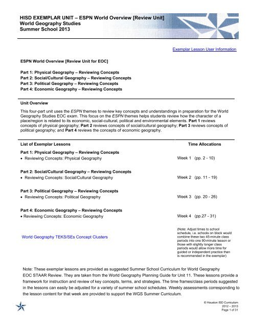
HISD EXEMPLAR UNIT – ESPN World Overview [Review Unit]World Geography StudiesSummer School 2013<strong>Exemplar</strong> <strong>Lesson</strong> User InformationESPN World Overview [Review Unit for EOC]Part 1: Physical Geography – Reviewing ConceptsPart 2: Social/Cultural Geography – Reviewing ConceptsPart 3: Political Geography – Reviewing ConceptsPart 4: Economic Geography – Reviewing ConceptsUnit OverviewThis four-part unit uses the ESPN themes to review key concepts and understandings in preparation for the WorldGeography Studies EOC exam. This focus on the ESPN themes helps students review how the character of aplace/region is related to its economic, social-cultural, political and environmental elements. Part 1 reviewsconcepts of physical geography; Part 2 reviews concepts of social/cultural geography; Part 3 reviews concepts ofpolitical geography; and Part 4 reviews the concepts of economic geography.List of <strong>Exemplar</strong> <strong>Lesson</strong>sTime AllocationsPart 1: Physical Geography – Reviewing Concepts• Reviewing Concepts: Physical Geography Week 1 (pp. 2 - 10)Part 2: Social/Cultural Geography – Reviewing Concepts• Reviewing Concepts: Social/Cultural Geography Week 2 (pp. 11 - 19)Part 3: Political Geography – Reviewing Concepts• Reviewing Concepts: Political Geography Week 3 (pp. 20 - 26)Part 4: Economic Geography – Reviewing Concepts• Reviewing Concepts: Economic Geography Week 4 (pp.27 - 31)(Note: Adjust times to schoolschedule, i.e. schools on block wouldcombine these two 45-minute classperiods into one 90-minute lesson orthose with slightly longer classperiods would allow more time forguided or independent practice thanis recommended in the exemplar)© Houston ISD Curriculum2012 – 2013Page 1 of 31
HISD EXEMPLAR LESSONSWorld Geography StudiesWeek 1: Reviewing Concepts: Physical GeographyUnit 11: ESPN World Overview [Review Unit], Part 1: Physical Geography – Reviewing ConceptsMASTERY FOCUS (PL-2, PL-3, I-1, I-6)<strong>Exemplar</strong> <strong>Lesson</strong> User InformationEssential Understandings/Guiding QuestionsGraphic representations of information and data [maps, graphs, charts…] often express relationships andpatterns in the physical and human geography of a place/region.1. How can maps help understand and represent geographic information?2. What are important physical features on the Earth’s surface in each major geographic region?3. What forces have shaped the Earth’s landforms, water bodies, climate and plant life (vegetation)?4. What are definitions for atmosphere, lithosphere, hydrosphere, and biosphere? What are examplesof physical processes that occur in each of these spheres?Texas Essential Knowledge and Skills/Student Expectations (TEKS/SEs)RWGS.2A Describe the human and physical characteristics of the same regions at different periods of time toevaluate relationships between past events and current conditions.RWGS.3B Describe the physical processes that affect the environments of regions, including weather, tectonicforces, erosion, and soil-building processes.RWGS.4A Explain how elevation, latitude, wind systems, ocean currents, position on a continent, and mountainbarriers influence temperature, precipitation, and distribution of climate regions.RWGS.5A Analyze how the character of a place is related to its political, economic, social, and cultural elements.RWGS.6B Explain the processes that have caused changes in settlement patterns, including urbanization,transportation, access to and availability of resources, and economic activities.RWGS.7B Explain how political, economic, social, and environmental push and pull factors and physical geographyaffect the routes and flows of human migration.RWGS.7C Describe trends in world population growth and distribution.RWGS.8A Compare ways that humans depend on, adapt to, and modify the physical environment, including theinfluences of culture and technology.RWGS.8B Describe the interaction between humans and the physical environment and analyze the consequencesof extreme weather and other natural disasters such as El Niño, floods, tsunamis, and volcanoes.RWGS.9A Identify physical and/or human factors such as climate, vegetation, language, trade networks, politicalunits, river systems and religion that constitute a region.SWGS.10D Compare global trade patterns over time and examine the implications of globalization, includingoutsourcing and free trade zones.SWGS.16D Compare life in a variety of urban and rural areas in the world to evaluate political, economic, socialand environmental changesWGS.21B Locate places of contemporary geopolitical significance on a map.WGS.21C Create and interpret different types of maps to answer geographic questions, infer relationships, andanalyze change.WGS.22A Design/draw and interpret appropriate graphics such as maps, diagrams, tables, and graphs tocommunicate geographic features, distributions, and relationships.WGS.22B Generate summaries, generalizations, and thesis statements supported by evidence.WGS.22C Use geographic terminology correctly. - English Language Proficiency Standards (ELPS) - Literacy Leads the Way Best Practices - Aligned to Upcoming State Readiness Standard- State Process Standard R - State Readiness Standard S - State Supporting Standard T - TAKS Tested Objective (only 11 th grade)© Houston ISD Curriculum2012 – 2013Page 2 of 31
HISD EXEMPLAR LESSONSWorld Geography StudiesWeek 1: Reviewing Concepts: Physical GeographyUnit 11: ESPN World Overview [Review Unit], Part 1: Physical Geography – Reviewing Concepts English Language Proficiency Standards (ELPS)• ELPS C.1c Use strategic learning techniques such asconcept mapping, drawing, memorizing, comparing,contrasting, and reviewing to acquire basic and gradelevelvocabulary.• ELPS C.2g Understand the general meaning, mainpoints, and important details of spoken language insituations in which topics, language, and contexts arefamiliar.• ELPS C.3h Narrate, describe, and explain withincreasing specificity and detail as more English isacquired.• ELPS C.4g Demonstrate comprehension ofincreasingly complex English by participating inshared reading, retelling or summarizing material,responding to questions, and taking notescommensurate with content area needs.College and Career Readiness Standards (CCRS)• CCRS 1.1A Use the tools and concepts of geographyappropriately and accurately.• CCRS 1.2A Analyze the interaction between humancommunities and the environment.• CCRS 1.3A Analyze how physical and culturalprocesses have shaped human communities overtime.• CCRS 1.4A Evaluate the causes and effects ofhuman migration patterns over time.• CCRS 1.5A Analyze how various cultural regionshave changed over time.• CCRS 1.6A Analyze the relationship betweengeography and the development of humancommunitiesVocabulary• region• environment• migration• resource useSee the Student Outline: Environment for additional important terms.• physical factors• settlement patternsAssessment Connections• The completed WGS Learning Targets Self Assessment provides a formative assessment.• The results of the Environment Concepts Quiz and the completed work on the Student Self Assessment ReviewGuide provide possible summative assessment connections.• The group work related to regional physical geography provides additional formative assessment data.• The completed Review Puzzle Physical provides an additional formative assessment.• The completed Physical Geography Map page of the World Geography Review provides another formativeassessment.• STAAR Sample Item #s 1, 6, 7, 8, and 10 provide STAAR assessment items related to physical geographyDIFFERENTIATION (I-3)Scaffold:This lesson reviews the concepts and specific content for physical geography which we referto as the N of the ESPN acronym [Economic, Social/Cultural, Political, and eNvironmental].This ESPN acronym has been part of the curriculum all year [and throughout the MiddleSchool Curriculum]. Ensure students are familiar with the term environment and understandthe characteristics of the ESPN categorization schema.The Student Outline: Environment provides additional scaffolding of critical content.Other helpful acronyms for understanding the concept of environment are LACEMOPS[regarding factors affecting weather and climate] and TODALSIG/DOGTAILS which helpsstudents focus on map elements to support map interpretation.For students who need reading assistance Adobe.pdf documents can be read aloud usingthe Adobe Reader 10 download. Go to the View menu and choose Read Aloud option [Shift+ Control + Y]. Students can then click on a section of the document to be read aloud. - English Language Proficiency Standards (ELPS) - Literacy Leads the Way Best Practices - Aligned to Upcoming State Readiness Standard- State Process Standard R - State Readiness Standard S - State Supporting Standard T - TAKS Tested Objective (only 11 th grade)© Houston ISD Curriculum2012 – 2013Page 3 of 31
HISD EXEMPLAR LESSONSWorld Geography Studies<strong>Lesson</strong> 1: Reviewing Concepts: Physical Geography (Four 45-min. class periods)Unit 11: ESPN World Overview [Review Unit], Part 1: Physical Geography – Reviewing ConceptsAccelerate:The Nations Online website has wonderful interactive, clickable maps as well as news,currency exchange, and other country specific information.A website called LizardPoint Map Quizzes has map quizzes online that might be funenrichment for students although specific country location will not be tested on the WorldGeography STAAR.Have students both create and/or interpret physical maps found in MapMaker InteractiveWorld Geography General Review and the Review Puzzle Physical can serve asacceleration or general review for STAAR.The AP Human Geography/World Geography Studies Crosswalk provides comparisons ofthese two courses.Group:Grouping for this lesson includes individual work, pairs, and cooperative groups.LESSON CYCLE (I-1, I-2, I-3, I-4, I-5, I-6, I-8)Understanding Maps and Regions (Class Period 1)1 Have students use the WGS Learning Targets Self Assessment formto self-evaluate their level of knowledge regarding the Student-friendlyObjectives for this lesson.Engage and Connect: (10 min.)1. Distribute the Student Outline: Environment.2. Refer students to the section on page 1 of the outline that definestypes of regions: formal, perceptual, and functional.3. Display the PowerPoint Types of Regions to review and discussthe regional vocabulary terms and illustrations of types of regionsChecks for UnderstandingStudent-friendly Objectives• I can define and distinguish typesof regions.• I can use maps to understand,interpret and represent geographicinformation.Pose questions to random studentsbased on the illustrations from thePowerPoint to check forunderstanding of the types of regions.2 Introduce New Learning (15 min.)1. Remind students of the acronym TODALSIG/DOGTAILS whichhelps the student remember key elements necessary to interpretmaps. Consider distributing pages 1 – 2 of the Map Elements<strong>Lesson</strong> to remind students of the parts of the acronym. [Thisoffers support for all students but particularly ELL or studentsenrolled in Special Education.]2. Display the PowerPoint Exploring Africa Through Maps to reviewthe types of maps [physical, political, special purpose] and theimportance of the TODALSIG acronym used to interpret mapsRandomly call on students to correctlyidentify parts of the TODALSIGacronym.Allow students to answer questionsposed in the PowerPoint. - English Language Proficiency Standards (ELPS) - Literacy Leads the Way Best Practices - Aligned to Upcoming State Readiness Standard- State Process Standard R - State Readiness Standard S - State Supporting Standard T - TAKS Tested Objective (only 11 th grade)© Houston ISD Curriculum2012 – 2013Page 4 of 31
HISD EXEMPLAR LESSONSWorld Geography StudiesWeek 1: Reviewing Concepts: Physical GeographyUnit 11: ESPN World Overview [Review Unit], Part 1: Physical Geography – Reviewing Concepts3 Independent Practice (10 min.)1. Select multiple [approximately 6 – 8] map pages from the WGSDo Nows 1, 2, and 3 and randomly distribute these to students tointerpret using appropriate parts of the TODALSIG acronym.2. Allow 2 minutes for each student to interpret the map theyreceived, answering the question posed on the page.3. Have students partner with another student to discuss theinterpretation of the map they received – allowing one minute foreach partner to share.4. Have students recombine with another partner with a differentmap and repeat the sharing process.5. Complete a final pairing of students and repeat the sharingprocess for a third time.Answer questions raised by individualstudents as they work with theassigned map.Circulate around the room andobserve student conversations,pausing to clarify as necessary.4 Close the <strong>Lesson</strong> and Assess Mastery (10 min.)1. Display copies of each of the maps used for the independentpractice and call on student volunteers to discuss theirinterpretation, pointing out the critical parts of the TODALSIGacronym that helped them focus on the correct interpretation. [6 –8 minutes]2. Have students complete the evidence column of the WGSLearning Targets Self Assessment by answering the followingquestion:• What is one example of a formal region and what do anythree of the letters in the TODALSIG acronym stand for?Monitor student presentations,clarifying any misunderstandings.Collect the student responses as anexit-ticket. If time permits, circulateand check student responses in theirnotebooks rather than collecting theresponses.Physical Processes (Class Period 2)1 Have students use the WGS Learning Targets Self Assessment formto self-evaluate their level of knowledge regarding the Student-friendlyObjectives for this lesson.Engage and Connect: (5 min.)1. Distribute the Spheres of the Earth handout.2. Help students remember the spheres with a simple acronym:Lithosphere – L for land; Atmosphere – A for air; Hydrosphere –hydro means water; and Biosphere – bio for plants and animals,like biology.3. Discuss the physical processes at work in each sphere.4. Note: Students may complete page 2 for homework if desired.Checks for UnderstandingStudent-friendly ObjectiveI can describe the forces that haveshaped the Earth’s landforms, water,climate, and plant life.Have students indicate theirunderstanding of the objective using afist (no knowledge) to 4 finger (know alot) scale.Note: Page 2 of the Student Outline:Environment provides quick review ofphysical processes at work in the fourspheres.2 Introduce New Learning (15 min.)1. Clarify the difference in vocabulary terms weather, climate, andprecipitation. Point out that just because we have three belowfreezing days of weather in Houston in February, it does not meanthat our climate is generally below freezing in winter.2. Use the LACEMOPS handout to discuss and clarify studentunderstanding of factors that affect weather and climate.As checks for understanding, posequestions such as:1. Which climate rules account forHouston’s hot/warm and humidclimate?2. Why does Houston have a warmer - English Language Proficiency Standards (ELPS) - Literacy Leads the Way Best Practices - Aligned to Upcoming State Readiness Standard- State Process Standard R - State Readiness Standard S - State Supporting Standard T - TAKS Tested Objective (only 11 th grade)© Houston ISD Curriculum2012 – 2013Page 5 of 31
HISD EXEMPLAR LESSONSWorld Geography StudiesWeek 1: Reviewing Concepts: Physical GeographyUnit 11: ESPN World Overview [Review Unit], Part 1: Physical Geography – Reviewing Concepts3. If possible access an online climate map such as MapMakerInteractive [or display the World Climate Map] to illustrate anddiscuss how climate rules [see #2 above] apply to a particularphysical location using climate maps and physical maps.4. Provide an example of a climate rule statement such as:• Much of the region of South America has tropicalrainforest climate because of the climate rule of latitude[low latitudes make places warmer] and precipitation[heavy rainfall].climate in winter than Dallas?3. Why do we often experienceviolent storms in Houston?4. Far west Texas has mountainsand is far from a coastline. How isthe climate of that region differentthan the climate in Houston?3 Independent Practice (15 min.)1. Divide students into regional groups [see Textbook RegionalGroups in the Resource Section]. Have each group accessclimate maps and regional physical maps or use the handoutWorld Climate Map and physical maps to have students interpretthe map(s) for the assigned region to determine which climaterules apply to create the various climate patterns in that region.2. Have students create at least four statements applying climaterules.3. Provide the following sentence starters to prompt student thinking:• Much of this region has _____ [type of climate zone]because of the climate rule of _______Circulate among the regional groupsanswering questions or promptingthinking as needed.4 Close the <strong>Lesson</strong> and Assess Mastery (10 min.)1. Project a climate map and have a spokesperson for each regionalgroup point out the assigned region and share two statements thegroup created to explain climate in that region.2. Have students write one statement in the evidence column of theWGS Learning Targets Self Assessment for the student-friendlyobjective for this class period.Monitor student responses and correctany misunderstandings.Collect or check student responsesfrom the evidence column to assessunderstanding.Physical Features (Class Period 3)1 Have students use the WGS Learning Targets Self Assessment formto self-evaluate their level of knowledge regarding the Student-friendlyObjectives for this lesson.Engage and Connect: (5 min.)1. Have students brainstorm examples of the types of land andwater forms that characterize physical features of the earth.2. List these as students share ideas such as mountain, island,peninsula, coastline, river, ocean, lake, gulf, and so on.Checks for UnderstandingStudent-friendly ObjectiveI can identify important physicalfeatures of the Earth and theirlocation.The brainstorming strategy provides aformative assessment of the level ofstudent knowledge on the concept ofphysical features.2 Introduce New Learning (10 min.)1. Point out to students that the physical characteristics of a placehave a direct effect on the human characteristics.2. Remind students that settlement patterns and economic activityare often directly linked to the physical features of a region/place.For instance, settlement usually begins on coastlines or nearbodies of fresh water [rivers, lakes] and then progresses to morechallenging landscapes such as mountains or deserts.Answers to the questions posedprovide a check for understandingrelated to the relationship betweenphysical features and settlementpatterns. - English Language Proficiency Standards (ELPS) - Literacy Leads the Way Best Practices - Aligned to Upcoming State Readiness Standard- State Process Standard R - State Readiness Standard S - State Supporting Standard T - TAKS Tested Objective (only 11 th grade)© Houston ISD Curriculum2012 – 2013Page 6 of 31
HISD EXEMPLAR LESSONSWorld Geography StudiesWeek 1: Reviewing Concepts: Physical GeographyUnit 11: ESPN World Overview [Review Unit], Part 1: Physical Geography – Reviewing Concepts3. Discuss the difference between sources of fresh water and saltwater and why each is important to humans.4. Pose and discuss questions such as:• How do mountains in an area affect settlement patterns andeconomic activity?• How might an area be affected if it was landlocked [no accessto oceans or large bodies of water]?• What are the benefits and difficulties of island nations?• How do large desert areas affect settlement patterns andeconomic activities?Have students turn to a partner todiscuss answers to the questionsposed and then randomly call onindividual students to share theirthinking.3 Cooperative Grouping - Physical Features (15 min.)1. Distribute the World Physical Map from the World GeographyGeneral Review.2. Divide students into seven regional groups to review PhysicalFeatures using a combination of the Student Outline:Environment, reference pages for the assigned region from thetext. [Groups can use the Table of Contents to locate the PhysicalGeography section for the assigned region] and the WorldPhysical Map from the World Geography General Review.3. Have groups paste/tape one copy of the World Physical Map tochart paper and highlight their assigned region on that map.4. Have each group summarize the key physical features of theregion, naming the feature, describing the location by sketchingand labeling that feature on the map, and the stating at least oneimpact that feature has on the region. Consider having the groupmembers assume different roles and divide the group task basedon the assigned roles.Monitor group work to ensure thatstudents are displaying the correctinformation for their assigned region.3 Close the <strong>Lesson</strong> and Assess Mastery (15 min.)1. Ask each group to display their regional summary and stand bytheir chart/poster.2. Have group members circulate around the room clockwise[Gallery Walk] and view each region’s physical features. As eachgroup views the regional work, have them add important featuresto their own individual copies of the World Map to keep with theirreview notes.Observe student presentations andnote taking.As an exit ticket have students nametwo regions on an index card or halfsheetof paper and list four majorphysical features for that region. [Thiscould also be written on the LearningTarget Self-Assessment form]Human/Environment Interaction (Class Period 4)Checks for Understanding1 Have students use the WGS Learning Targets Self Assessment formto self-evaluate their level of knowledge regarding the Student-friendlyObjectives for this lesson.Engage and Connect: (5 min.)1. Review the definitions of adapt to [change to work with anenvironment] and modify [change the environment]. - English Language Proficiency Standards (ELPS) - Literacy Leads the Way Best Practices - Aligned to Upcoming State Readiness Standard- State Process Standard R - State Readiness Standard S - State Supporting Standard T - TAKS Tested Objective (only 11 th grade)Student-friendly ObjectiveI can determine how people adapt totheir physical environment and whyand how they modify thatenvironment.Based on the student examples,ensure that students have a clearunderstanding of the differences© Houston ISD Curriculum2012 – 2013Page 7 of 31
HISD EXEMPLAR LESSONSWorld Geography StudiesWeek 1: Reviewing Concepts: Physical Geography (Four 45-min. class periods)Unit 11: ESPN World Overview [Review Unit], Part 1: Physical Geography – Reviewing Concepts2. Have students turn to a partner and list three ways people inHouston have adapted to our environment and three ways wehave modified the environment.3. Call on pairs to share their ideas.4. Pose and discuss the question: Do modifications of theenvironment always have positive consequences? Why or whynot?between adapting to one’senvironment and modifying theenvironment. Clarify anymisconceptions.2 Introduce New Learning (10 min.)1. To help students differentiate between adaptation to one’senvironment and modification of one’s environment, selectpictures from the text [or local examples] and ask students tocategorize the adaptations/modifications illustrated in the visual.2. Providing a sentence frame helps students identify theseadaptations and modifications. For instance:• People in _____ have adapted to their physical environmentby ______; they have modified their environment by ______to reduce the impact of _______ physical processes on theirlives.Student responses using the sentenceframe to pictures from the text providea formative assessment of studentunderstanding of the concepts ofadapt and modify.3 Guided and Independent Practice (20 min. total)Guided Practice (10 min.)1. Distribute the Modification Analysis Model and share the followingscenario using a Think Aloud strategy. Use the model to discusshow countries in SW Asia/Middle East modified their environment:• Modification for Analysis: Accessing Petroleum Resources• One example of how the process from adapting to one’senvironment to modifying the environment depended on theuse of available technology is in Saudi Arabia (or other SWAsian oil rich nations).• Need: For centuries people in the region adapted to desert lifewithout access to valuable oil resources below the surfacethat could transform the physical [and economic] landscape.• Twentieth century technology made it possible to modify thephysical environment to harness the petroleum resources andthen to use that money to build infrastructure within thecountry.• Positive Consequences: petroleum and natural gas becamemajor economic resources for the region; increased politicaland economic power world-wide.• Negative Consequences: other nations became dependent onMideast oil; OPEC became a monopoly of sorts…• Long-term effects: influence on other world nations anddecisions; too much dependence on petroleum• Need for regulation: questions of how to control petroleumresources and how to monitor distribution.• So what? The discovery of and access to the vast oil/naturalgas reserves in this region gives nations of this regionsignificant political and economic importance; for instance, theUnited States depends on imports from OPEC nations andhas been politically involved in the region for decades.Answers to the questions from theanalyzing modification model willserve as check for understandingregarding the concepts of modificationto the environment.Ask students if they can think of otherexamples of technology becomingavailable to increase modification ofone’s environmentCall on a student to repeat thedirections for the writing to monitorunderstanding.Monitor student individual work andanswer any questions students mayhave. - English Language Proficiency Standards (ELPS) - Literacy Leads the Way Best Practices - Aligned to Upcoming State Readiness Standard- State Process Standard R - State Readiness Standard S - State Supporting Standard T - TAKS Tested Objective (only 11 th grade)© Houston ISD Curriculum2012 – 2013Page 8 of 31
HISD EXEMPLAR LESSONSWorld Geography StudiesWeek 1: Reviewing Concepts: Physical GeographyUnit 11: ESPN World Overview [Review Unit], Part 1: Physical Geography – Reviewing Concepts2. Remind students that the degree to which any modification of thephysical environment can take place is determined by the amountof available technology.• Before the invention of air conditioning, people in Texas mighthave wanted to be cooler but were limited in their options tofans or cooler clothing and generally had to adapt rather thanmodify.Independent Practice (10 min.)1. Have students, working independently or with a partner, use theModification Analysis Model to evaluate and write about amodification of the environment in Houston: building freeways,making the bayou deeper, building MetroRail, building newsubdivisions, expanding freeways to fourteen lanes, etc.4 Close the <strong>Lesson</strong> and Assess Mastery (10 min.)1. Have students choose a partner and share the modificationanalysis model with the partner.2. Call on volunteers to share with the class as time permits.Collect student analysis models asone form of assessment.Note: The results of the EnvironmentConcepts Quiz and the completedwork on the Student Self AssessmentReview Guide provide opportunitiesfor student self-assessment as well assummative assessment. Theseresources can be used as take homework or in class as time permits.RESOURCES (I-6, I-10)Adopted Instructional MaterialsTextbook – Regional Groups• Canada and the United States -Regional Atlas and data file WGtext pp. 102 – 115; otherinformation in WG text pp. 116 –189• Latin America – Regional Atlasand data file WG text pp. 190 –199; other information in WGtext pp. 200-261• Europe - Regional Atlas anddata file WG text pp. 262-271;other information in WG text pp.272-335• Russia and the CIS – RegionalAtlas and data file WG text pp.336-343; other information inWG text pp. 344-401Supporting ResourcesStudent Outline: EnvironmentWGS Learning Targets SelfAssessmentWorld Geography ReviewPowerPoint Types of RegionsMap Elements <strong>Lesson</strong>PowerPoint Exploring AfricaThrough MapsWGS Do Nows 1, 2, and 3Spheres of the EarthOnline ResourcesNations Online website haswonderful interactive, clickable mapsas well as news, currency exchange,and other country specificinformation.A website called LizardPoint MapQuizzes has map quizzes online thatmight be fun enrichment for studentsalthough specific country locationwill not be tested on the WorldGeography STAAR.MapMaker Interactive - English Language Proficiency Standards (ELPS) - Literacy Leads the Way Best Practices - Aligned to Upcoming State Readiness Standard- State Process Standard R - State Readiness Standard S - State Supporting Standard T - TAKS Tested Objective (only 11 th grade)© Houston ISD Curriculum2012 – 2013Page 9 of 31
HISD EXEMPLAR LESSONSWorld Geography StudiesWeek 1: Reviewing Concepts: Physical GeographyUnit 11: ESPN World Overview [Review Unit], Part 1: Physical Geography – Reviewing ConceptsAdopted Instructional MaterialsTextbook – Regional Groups• Africa - Regional Atlas and datafile WG text pp. 402-413; otherinformation in WG text pp. 414-477• Southwest Asia - Regional Atlasand data file WG text pp. 478-487; other information in WGtext pp. 486-541• South Asia - Regional Atlas anddata file WG text pp. 542-549;other information in WG text pp.550-609• East Asia - Regional Atlas anddata file WG text pp. 610-617other information in WG text pp.618-677• SE Asia, Australia, NewZealand, and Oceania -Regional Atlas and data file WGtext pp. 678-687; otherinformation in WG text pp. 688-739Supporting ResourcesLACEMOPSWorld Climate MapModification Analysis ModelEnvironment Concepts QuizStudent Self Assessment ReviewGuideReview Puzzle PhysicalSTAAR Sample ItemsAP Human Geography/WorldGeography Studies CrosswalkNote: This exemplar lesson is designed to support HISD teachers in using the HISD Curriculum Unit Planning Guides toplan daily lessons that meet the criteria outlined in the HISD Instructional Practice Rubric. The document is notintended as a template that teachers are expected to complete for their lesson planning on a daily basis. Teacherteams might consider using the exemplar lesson to support collaboration in lesson planning. - English Language Proficiency Standards (ELPS) - Literacy Leads the Way Best Practices - Aligned to Upcoming State Readiness Standard- State Process Standard R - State Readiness Standard S - State Supporting Standard T - TAKS Tested Objective (only 11 th grade)© Houston ISD Curriculum2012 – 2013Page 10 of 31
HISD EXEMPLAR LESSONSWorld Geography StudiesWeek 2: Reviewing Concepts: Social/Cultural GeographyUnit 11: ESPN World Overview [Review Unit], Part 2: Social/Cultural Geography – Reviewing ConceptsMASTERY FOCUS (PL-2, PL-3, I-1, I-6)<strong>Exemplar</strong> <strong>Lesson</strong> User InformationEssential Understandings/Guiding QuestionsCulture refers to the way of life of a group of people and all knowledge is culturally constructed.1. How is each of us a product of our culture?2. What beliefs and traditions are held by the world’s great religions?3. How do worldwide cultural regions compare to one another?4. Is the world’s population growing too fast?5. How does the spatial diffusion of ideas products and traits lead to change?6. What is the impact of cultural divergence and convergence in the past, present and in the future?Texas Essential Knowledge and Skills/Student Expectations (TEKS/SEs)RWGS.1A Analyze the effects of physical and human geographic patterns and processes on the past and describetheir impact on the present, including significant physical features and environmental conditions that influencedmigration patterns and shaped the distribution of culture groups today.RWGS.1B Trace the spatial diffusion of phenomena such as the Columbian Exchange or the diffusion of Americanpopular culture and describe the effects on regions of contact.RWGS.5A Analyze how the character of a place is related to its political, economic, social, and cultural elements.RWGS.16B Describe elements of culture, including language, religion, beliefs and customs, institutions andtechnologiesSWGS.16D Compare life in a variety of urban and rural areas in the world to evaluate political, economic, socialand environmental changesRWGS.17A Describe and compare patterns of culture such as language, religion, land use, education, andcustoms that make specific regions of the world distinctive.S WGS.17B Describe major world religions including animism, Buddhism, Christianity, Hinduism, Islam, Judaism,and Sikhism and their spatial distribution.S WGS.18D Evaluate the spread of cultural traits to find examples of cultural convergence and divergence such asthe spread of democratic ideas, U.S.-based fast-food franchises, the English language, technology, or global sports.SWGS.17D Evaluate the experiences and contributions of diverse groups to multicultural societies.RWGS.18A Analyze cultural changes in specific regions caused by migration, war, trade, innovations, anddiffusion.WGS.21B Locate places of contemporary geopolitical significance on a map.WGS.22A Design/draw and interpret appropriate graphics such as maps, diagrams, tables, and graphs tocommunicate geographic features, distributions, and relationships.WGS.22B Generate summaries, generalizations, and thesis statements supported by evidence.WGS.22C Use geographic terminology correctly. English Language Proficiency Standards (ELPS)• ELPS C.1c Use strategic learning techniques suchas concept mapping, drawing, memorizing,comparing, contrasting, and reviewing to acquirebasic and grade-level vocabulary.• ELPS C.4g Demonstrate comprehension ofincreasingly complex English by participating inshared reading, retelling or summarizing material,responding to questions, and taking notescommensurate with content area needs. - English Language Proficiency Standards (ELPS) - Literacy Leads the Way Best Practices - Aligned to Upcoming State Readiness Standard- State Process Standard R - State Readiness Standard S - State Supporting Standard T - TAKS Tested Objective (only 11 th grade)© Houston ISD Curriculum2012 – 2013Page 11 of 31
HISD EXEMPLAR LESSONSWorld Geography StudiesWeek 2: Reviewing Concepts: Social/Cultural GeographyUnit 11: ESPN World Overview [Review Unit], Part 2: Social/Cultural Geography – Reviewing ConceptsCollege and Career Readiness Standards (CCRS)• CCRS 1.2B Identify andevaluate sources and patterns ofchange and continuity acrosstime and place.• CCRS 1.1E Identify differentsocial groups (e.g., clubs,religious organizations) andexamine how they form and howand why they sustainthemselves.Vocabulary• CCRS 1.3E Analyze how socialinstitutions (e.g., marriage,family, churches, schools)function and meet the needs ofsociety.• CCRS 1.4E Identify andevaluate the sources andconsequences of social conflict.• CCRS 2.1A Define a“multicultural society” andconsider both the positive andnegative qualities ofmulticulturalism.• CCRS 2.2A Evaluate theexperiences and contributions ofdiverse groups to multiculturalsocieties.• culture• diffusion• demography• migration• push/pull factors• cultural divergence/convergenceSee the Student Outline: Social/Cultural and Student Outline: Change for additional important terms.Assessment Connections• The completed WGS Learning Targets Self Assessment provides a formative assessment.• The results of the Social Cultural Concepts Quiz and the completed Student Self Assessment Review Guideprovide possible summative assessment connections.• The completed handouts Exploring Religion and Exploring Culture, and student-generated two-column notes onregional cultural patterns provide additional assessment connections.• The completed handouts Review Puzzle Culture and the Review Puzzle Human Geography provide additionalformative assessments.• The completed World Religions Map page of the World Geography Review provides another formativeassessment.• STAAR Sample Item #s 9, 10, 11, 12, and 13DIFFERENTIATION (I-3)Scaffold:This lesson reviews the concepts and specific content for social/cultural geography which werefer to as the S part of the ESPN acronym [Economic, Social/Cultural, Political, andeNvironmental]. This ESPN acronym has been part of the curriculum all year. Ensurestudents are familiar with the term social/cultural and understand the characteristics of theESPN categorization schema.The Student Outline: Social/Cultural and Student Outline: Change provide additionalscaffolding of critical content.For students who need reading assistance Adobe.pdf documents can be read aloud usingthe Adobe Reader 10 download. Go to the View menu and choose Read Aloud option [Shift+ Control + Y]. Students can then click on a section of the document to be read aloud.Accelerate:World Geography General Review and the Review Puzzle Social/Cultural can serve asacceleration or general review for STAAR.The handout Exploring Culture provides a model for students to combine their review of thephysical environment and determine how environment affects culture by exploring the impactof physical geography on a specific country/region.The AP Human Geography/World Geography Studies Crosswalk provides comparisons ofthese two courses. - English Language Proficiency Standards (ELPS) - Literacy Leads the Way Best Practices - Aligned to Upcoming State Readiness Standard- State Process Standard R - State Readiness Standard S - State Supporting Standard T - TAKS Tested Objective (only 11 th grade)© Houston ISD Curriculum2012 – 2013Page 12 of 31
HISD EXEMPLAR LESSONSWorld Geography StudiesWeek 2: Reviewing Concepts: Social/Cultural GeographyUnit 11: ESPN World Overview [Review Unit], Part 2: Social/Cultural Geography – Reviewing ConceptsGroup:Grouping for this lesson includes individual work, pairs, and cooperative group work.LESSON CYCLE (I-1, I-2, I-3, I-4, I-5, I-6, I-8)Elements of Culture (Class Period 1)1 Have students use the WGS Learning Targets Self Assessment formto self-evaluate their level of knowledge regarding the Student-friendlyObjectives for this lesson.Engage and Connect: (5 min.)1. Distribute the Student Outline: Social/Cultural to use as the basisfor class review and discussion about key topics during classperiods 1 and 2.2. Distribute The ABCs of Culture.3. Have students think about their own culture and choose fivetopics from the list in the handout to discuss with a partner.4. Pair students and give each student two minutes to describeelements of their culture to their partner, based on the five topicsthey chosen.Checks for UnderstandingStudent-friendly Objectives• I can analyze how language,religion, beliefs and customs,institutions and technologies areelements that help describeculture.• I can describe and comparepatterns of culture such aslanguage, religion, land use,education, and customs that makespecific regions of the worlddistinctive.Observe student pair/share work toensure that all students share.Note: Access the Teacher Outline:Social/Cultural for additionalinformation about the topics in thislesson.2 Introduce New Learning (5 min.)1. Refer students to the ABCs of Culture handout and ask studentsto respond orally to the following prompts:• Which elements of culture surprise you?• Which elements need clarification?• Which elements interest you most?2. Point out to students that one way the world is categorized is bycultural region [a type of perceptual region] which refers to areasthat have similar cultural characteristics – language, religion,political systems, customs, and so on.3. Remind students that the physical geography of a region canaffect the culture. Pose questions such as:• Why might the culture of Sub-Saharan Africa developdifferently than that of North Africa? [Answer: the barrierprovided by the Sahara created a lack of diffusion betweenNorth Africa and areas south of the Sahara; North Africa hadgreater connections with Europe due to the Mediterranean.]• Why has the sub-continent of South Asia [India, Pakistan, andBangladesh] developed a different culture than the areas ofEast Asia and Southeast Asia? [Answer: The HimalayanMountains provide significant physical separation.]Respond to students as clarification isneeded.Student responses to questionsindicate degree of understanding. - English Language Proficiency Standards (ELPS) - Literacy Leads the Way Best Practices - Aligned to Upcoming State Readiness Standard- State Process Standard R - State Readiness Standard S - State Supporting Standard T - TAKS Tested Objective (only 11 th grade)© Houston ISD Curriculum2012 – 2013Page 13 of 31
HISD EXEMPLAR LESSONSWorld Geography StudiesWeek 2: Reviewing Concepts: Social/Cultural GeographyUnit 11: ESPN World Overview [Review Unit], Part 2: Social/Cultural Geography – Reviewing Concepts• Why is Andean South America culturally different from Braziland the pampas regions of South America? [Answer: TheAndes Mountains create a physical barrier; settlementpatterns between the Portuguese in Brazil and the Spanishinfluence in the western part of South America also createddifferences.]• Why did the culture of the Southern United States developdifferently than that of the Northern United States? [Answer:physical features of the original colonies created a differentpattern of development between the agricultural south and theindustrial north.]4. Additionally, urban culture differs from rural culture. For instance,Houston and people here have more in common culturally withpeople in other large cities in the United State or even foreigncountries than they do with Texans living in rural west Texas or inthe Piney Woods of East Texas. Pose questions such as:• Why might urban cultures around the world be similar?• How do explain the idea that rural culture in India is reallymore similar to rural cultures in other regions than it is tourban cultures in the same country?3 Independent Practice (15 min.)1. Divide students into regional groups to review Elements andExpressions of Culture using a combination of the StudentOutline: Social/Cultural, the ABCs of Culture and pages,particularly visuals, for the assigned region from the text. [Groupscan use the Table of Contents to locate the appropriate pages forthe assigned region].2. Have each person in the group create a concept websummarizing key cultural elements and characteristics of theregion including language, religion(s), customs, traditions,sports/leisure activities, traditional foods, and so on.Ask a student to repeat thesedirections to clarify studentunderstanding.4 Close the <strong>Lesson</strong> and Assess Mastery (20 min.)Two-Column Notes1. Have a spokesperson from each group locate the region on aclassroom map, whiteboard, or overhead/Elmo and then give fiveimportant facts about culture in that region.2. Have students take notes detailing the cultural facts about eachregion using a two-column note format with the name of theregion on the smaller side of the notes and the culturalcharacteristics on the larger side. [This could be completed on theback of the page with the regional concept map.]3. Have students summarize the cultural similarities and differencesof regions by writing a response to the following summary frame:• The regions of _________are culturally similar because theyboth/all have ____; The regions of __________ are culturallydifferent because ______.4. Have students share their thinking with a partner and thenrecombine with another partner to share again.Monitor student presentations,clarifying information as necessary.Remind students to take notes usingtheir own paper.Collect student notes and summaryframes as a formative assessment.Note: The handout Exploring Cultureprovides a model for students tocombine their review of the physicalenvironment and determine howenvironment affects culture. - English Language Proficiency Standards (ELPS) - Literacy Leads the Way Best Practices - Aligned to Upcoming State Readiness Standard- State Process Standard R - State Readiness Standard S - State Supporting Standard T - TAKS Tested Objective (only 11 th grade)© Houston ISD Curriculum2012 – 2013Page 14 of 31
HISD EXEMPLAR LESSONSWorld Geography StudiesWeek 2: Reviewing Concepts: Social/Cultural GeographyUnit 11: ESPN World Overview [Review Unit], Part 2: Social/Cultural Geography – Reviewing ConceptsWorld Religions (Class Period 2)1 Have students use the WGS Learning Targets Self Assessment formto self-evaluate their level of knowledge regarding the Student-friendlyObjectives for this lesson.Engage and Connect: (5 min.)Display slides 1, 2, and 3 from the PowerPoint World Religions toreview the major religions and the spread of those religions.Checks for UnderstandingStudent-friendly ObjectivesI can describe the beliefs andtraditions of animism, Buddhism,Christianity, Hinduism, Islam,Judaism, and Sikhism as major worldreligions and trace how they havespread [spatial distribution].2 Introduce New Learning (10 min.)1. Continue to display the remaining slides from the PowerPoint toreview the beliefs and traditions of each of the major religions.2. Students can add notes to the religion section of the StudentOutline: Social/Cultural or page 5 of the World GeographyReview.3. Note: The PowerPoint World Religions Teacher Notes provides ascript for the PowerPoint. Consider distributing these teachernotes to students that may need help with note-taking.The World Geography Review, referstudents to page 5 of that documentwhich provides a summary of worldreligions.3 Guided and Independent Practice (20 min. total)Guided Practice (15 min.)1. Form seven groups representing the seven major religions andhave the students in each group complete the handout ExploringReligion for the assigned religion.2. Ask each group to name the religion they explored and describethe region(s) where that religion is dominant.Independent Practice (5 min.)1. Have each student complete a Quick Write [three minutes ofwriting] to the following prompt based on the religion theyexplored.______ is the major religion in _____ region(s). This religioninfluences the culture of the region through beliefs, practices, andcelebrations such as ____________.4 Close the <strong>Lesson</strong> and Assess Mastery (10 min.)1. Have students form two lines facing one another [or use an inneroutercircle formation].2. Call out the name of one of the major religions - animism,Buddhism, Christianity, Hinduism, Islam, Judaism, or Sikhism –and have the students in line one state beliefs, traditions, orlocations of that religion for 30 seconds.3. Then ask students in line two to add any information they can [15seconds].4. Next mention the name of another major religion, and havestudents in line two begin, with additional information fromstudents in line one.5. Alternate back and forth between the two lines until all of themajor religions have been discussed.Monitor student group work.Remind students that in a quick writethey should try to keep theirpencils/pens moving. If they cannotthink of something to write, simplycontinue to repeat what they alreadywrote until a new idea comes to them.Collect student writing as a formativeassessment.Listen for student responses andadjust instruction to clarifymisunderstandings.Note: The World Religions Map pageof the World Geography Review canserve as a follow-up assignment forhomework or student self-assessment. - English Language Proficiency Standards (ELPS) - Literacy Leads the Way Best Practices - Aligned to Upcoming State Readiness Standard- State Process Standard R - State Readiness Standard S - State Supporting Standard T - TAKS Tested Objective (only 11 th grade)© Houston ISD Curriculum2012 – 2013Page 15 of 31
HISD EXEMPLAR LESSONSWorld Geography StudiesWeek 2: Reviewing Concepts: Social/Cultural GeographyUnit 11: ESPN World Overview [Review Unit], Part 2: Social/Cultural Geography – Reviewing ConceptsDemography/Migration (Class Period 3)1 Have students use the WGS Learning Targets Self Assessment formto self-evaluate their level of knowledge regarding the Student-friendlyObjectives for this lesson.Engage and Connect: (5 min.)1. Distribute the Student Outline: Change to use [in addition to theStudent Outline Social/Cultural] as the basis for class review anddiscussion about key topics during class periods 3 and 4.2. Display Population Distribution: The World at Night.3. Ask students to think of three statements that describe trends andpatterns they observe from the visual.4. Have each student turn to a partner and share their observations.5. Randomly call on pairs to share one statement, listening to othersso that they do not repeat something another pair has stated.Checks for UnderstandingStudent-friendly Objectives• I can explain factors that influencewhere people settle.• I can evaluate the impact of worldpopulation growth trends.• I can explain reasons why[push/pull factors] people migrateto different areas and factors thatinfluence the routes of migration.There are no “correct” answers forthese observations unless they cannotbe supported by the visual. Considerprompting students to explain theirthinking by pointing out variouspatterns on the visual projection.Note: Access the Teacher Outline:Change for additional informationabout the topics in this lesson.2 Introduce New Learning (20 min.)1. Refer students to the parts of the Student Outline Social Culturaland Student Outline Change that address migration, push-pullfactors, and demography. Encourage the students to add notes tothese sections as the class discusses these concepts.2. Define the term demography: the study of human populations,including their size, growth, density, and distribution, and statisticsregarding birth, marriage, disease, and death.3. Display the PowerPoint Population Growth and discuss the rapidpopulation growth in recent history.4. Define migration: the movement of people from one area toanother. Point out that the terms immigration and emigration arerelated to the general term migration – immigration means tomove IN to another area and the term emigration means to EXITor move out of a place.5. Discuss the concept of push/pull factors that drive migration.People move because the have to move – push factors; orbecause they want to move – pull factors.6. Have students brainstorm possible push and pull factors thatrelate to migration.7. Pose the question: How does physical geography affect theroutes and flows of migration? Possible answers include:mountain ranges limit migration routes except through mountainpasses; large bodies of water limit migration unless there isaccess to water transportation; plains and flat land encouragemigration; and so on.Monitor that students are highlightingor adding notes to the StudentOutlines.Use student observations of thegrowth trends in world population fromthe PowerPoint to monitorunderstanding of the growth trends.Use student examples as a check forunderstanding of the concept ofpush/pull factors. Those might includepush factors: wars, drought, lack ofjobs, persecution, or pull factors: newjobs, reunite family members, newhouse, and so on. - English Language Proficiency Standards (ELPS) - Literacy Leads the Way Best Practices - Aligned to Upcoming State Readiness Standard- State Process Standard R - State Readiness Standard S - State Supporting Standard T - TAKS Tested Objective (only 11 th grade)© Houston ISD Curriculum2012 – 2013Page 16 of 31
HISD EXEMPLAR LESSONSWorld Geography StudiesWeek 2: Reviewing Concepts: Social/Cultural GeographyUnit 11: ESPN World Overview [Review Unit], Part 2: Social/Cultural Geography – Reviewing Concepts3 Independent Practice (15 min.)1. Divide students into groups and distribute pages 1 and 2 of the2012 Population Data Sheet from the Population ReferenceBureau and Three Levels of Questions: Stems and Starters.2. Have each group pose at least one question from each level ofquestioning based on the data from the Population Data Sheet.3. Have groups trade questions with another group to answer thequestions posed. If time permits, have groups trade again.Monitor student questions and groupanswers.4 Close the <strong>Lesson</strong> and Assess Mastery (5 min.)As an exit-ticket, have students write and answer one Level Twoquestion posed by their group.Collect student questions and answersto provide a formative assessment.Consider having students write theirquestions and answers on theirLearning Target Self-Assessmentsheet. Consider collecting this sheetonce a week to monitor studentunderstanding over a period of time.Cultural Diffusion (Class Period 4)1 Have students use the WGS Learning Targets Self Assessment formto self-evaluate their level of knowledge regarding the Student-friendlyObjectives for this lesson.Engage and Connect: (5 min.)1. Refer students to page 2 of the Student Outline Change to reviewthe terms diffusion, divergence, and convergence.2 Introduce New Learning (10 min.)1. Using examples from the standard, have students evaluate theextent to which each of these examples [and other examples] hasled to either convergence or divergence within and among worldregions.• For example, the universal acceptance of the Englishlanguage throughout the world is one example of culturalconvergence that contributes to a global cultural trait.• The emerging popularity of soccer is another example ofcultural convergence as countries around the world follow andplay this increasingly global sport [i.e., Houston Dynamo].• Often physical barriers contribute to cultural divergence.Ancient Greek city-states developed widely divergentcultures; the vast area formerly known as the Soviet Unionhad within its boundaries examples of widely divergentcultural patterns that have since emerged as independentnations within the Commonwealth of Independent Soviets; ormany American Indian groups developed widely divergentcultural traits.• In the 21 st century, available technologies [like the Internet]are contributing to more global cultural convergence.Checks for UnderstandingStudent-friendly Objectives• I can evaluate the spread ofdemocratic ideas, U.S.-based fastfoodfranchises, the Englishlanguage, technology, or globalsports are examples of culturalconvergence and divergence• I can analyze how culturaldiffusion of ideas and productshas created change.Consider giving the example andposing the question: Is thisconvergence or divergence?Have student indicate with a thumbsup for convergence or thumbs downfor divergence. - English Language Proficiency Standards (ELPS) - Literacy Leads the Way Best Practices - Aligned to Upcoming State Readiness Standard- State Process Standard R - State Readiness Standard S - State Supporting Standard T - TAKS Tested Objective (only 11 th grade)© Houston ISD Curriculum2012 – 2013Page 17 of 31
HISD EXEMPLAR LESSONSWorld Geography StudiesWeek 2: Reviewing Concepts: Social/Cultural GeographyUnit 11: ESPN World Overview [Review Unit], Part 2: Social/Cultural Geography – Reviewing Concepts2. Remind students of other examples of cultural convergenceincluding the Columbian Exchange of goods, technologies, andideas as a result of the explorations of Columbus in the Americasor the spread of American pop culture [TV shows, movies, music]to other areas of the world.3. Emphasize how diffusion brings about change over time.3 Independent Practice (10 min.)Have students complete a verbal/visual vocabulary definition forcultural diffusion, cultural convergence, and cultural divergence usingthe model below:Monitor student work, answeringquestions as necessary.Term:Symbol or sketch:Definition in your own words:Two real-world examples:4 Close the <strong>Lesson</strong> and Assess Mastery (20 min.)1. Use a Combined Voices strategy to summarize student work.2. Divide students into groups of four and assign each group one ofthe terms: cultural diffusion, cultural convergence, or culturaldivergence.3. Have each group combine their voices to create a symbol ordrawing illustrating the term on chart paper. The combinedillustration must use at least one part of each individual’s work.Then have the group combine and add their real-world examplesof the term assigned to the display. [10 minutes or less]4. Post student work, grouping by term, and have a spokespersonfor each group explain the group illustration.5. Discuss the similarities and differences noted by comparing thegroup work and encourage students to add real-world examplesto their own work based on the presentations.Clarify student misunderstandings.Randomly choose one of the termsand have students give one exampleof that term in the evidence column ofthe WGS Learning Target Self-Assessment as an exit-ticket.Note: The Social Cultural ConceptsQuiz and Student Self AssessmentReview Guide can serve as asummative assessment ofunderstanding related to the review ofSocial Cultural concepts.RESOURCES (I-6, I-10)Supporting ResourcesStudent Outline: Social/CulturalStudent Outline: ChangeWGS Learning Targets Self AssessmentExploring ReligionExploring CultureWorld Geography ReviewThe ABCs of CultureOnline ResourcesCulture: A Geographic PerspectiveCultural ChangeThe Columbian ExchangeThe Columbian ExchangeBBC World ReligionsUnited Religions Initiative World ReligionsTeacher Outline: Social/CulturalElements of Culture - English Language Proficiency Standards (ELPS) - Literacy Leads the Way Best Practices - Aligned to Upcoming State Readiness Standard- State Process Standard R - State Readiness Standard S - State Supporting Standard T - TAKS Tested Objective (only 11 th grade)© Houston ISD Curriculum2012 – 2013Page 18 of 31
HISD EXEMPLAR LESSONSWorld Geography StudiesWeek 2: Reviewing Concepts: Social/Cultural GeographyUnit 11: ESPN World Overview [Review Unit], Part 2: Social/Cultural Geography – Reviewing ConceptsSupporting ResourcesPowerPoint World ReligionsOnline ResourcesThe Journey of Mankind: Peopling of the WorldPowerPoint World Religions Teacher NotesPopulation Distribution: The World at NightTeacher Outline: ChangePowerPoint Population Growth2012 Population Data SheetThree Levels of Questions: Stems and StartersSocial Cultural Concepts QuizStudent Self Assessment Review GuideReview Puzzle CultureReview Puzzle Human GeographySTAAR Sample ItemsAP Human Geography/World Geography StudiesCrosswalkNote: This exemplar lesson is designed to support HISD teachers in using the HISD Curriculum Unit Planning Guides toplan daily lessons that meet the criteria outlined in the HISD Instructional Practice Rubric. The document is notintended as a template that teachers are expected to complete for their lesson planning on a daily basis. Teacherteams might consider using the exemplar lesson to support collaboration in lesson planning. - English Language Proficiency Standards (ELPS) - Literacy Leads the Way Best Practices - Aligned to Upcoming State Readiness Standard- State Process Standard R - State Readiness Standard S - State Supporting Standard T - TAKS Tested Objective (only 11 th grade)© Houston ISD Curriculum2012 – 2013Page 19 of 31
HISD EXEMPLAR LESSONSWorld Geography StudiesWeek 3: Reviewing Concepts: Political GeographyUnit 11: ESPN World Overview [Review Unit], Part 3: Political Geography – Reviewing ConceptsMASTERY FOCUS (PL-2, PL-3, I-1, I-6)<strong>Exemplar</strong> <strong>Lesson</strong> User InformationEssential Understandings/Guiding Questions• Political [government] systems allow people to live and work together by establishing rules and laws,however, these systems often change over time.1. Why do people have government systems and how do people decide how to divide [allocate]power in a political system?2. Which types of political systems/governments can be categorized as rule by one, rule by a few, orrule by many? How does each of these system groups function differently in relationship to theconcept of power?• Physical features and human processes lead to the formation of boundaries and other politicaldivisions.1. How do physical and human processes lead to the formation of political boundaries and otherpolitical divisions?2. How is land divided into cities, states or countries by man-made and natural borders?• The process of creating and drawing political boundaries [creating countries] can lead to conflict asnations fight to exert and maintain control over territory.1. Why are nations so protective of their borders?2. To what extent are current issues/conflicts rooted in the past as the result of historical events ordecisions?3. How are voting patterns and political boundaries related to the distribution of power in the world?• In what ways do physical and human factors influence control of territory and resources, createconflict/war, and impact international political relations?1. How do physical and human factors affect the decisions made by countries or regions in how theyrun their government?2. How can physical and human factors create issues of conflict/war and controlling resources?• Groups/countries often develop economic and/or political unity for collective benefit.1. How can the concept of economic, social, and/or political union be beneficial to a group?2. Why would groups/countries band together? Is the outcome of such unions always beneficial?Texas Essential Knowledge and Skills/Student Expectations (TEKS/SEs)RWGS.1A Analyze the effects of physical and human geographic patterns and processes on the past and describetheir impact on the present, including significant physical features and environmental conditions that influencedmigration patterns and shaped the distribution of culture groups today.RWGS.2A Describe the human and physical characteristics of the same regions at different periods of time toevaluate relationships between past events and current conditions.RWGS.5A Analyze how the character of a place is related to its political, economic, social, and cultural elements.RWGS.14C Analyze the human and physical factors that influence the power to control territory and resources,create conflict/war, and impact international political relations of sovereign nations such as China, the United States,Japan, and Russia and organized nation groups such as the United Nations (UN) and the European Union (EU).SWGS.16D Compare life in a variety of urban and rural areas in the world to evaluate political, economic, socialand environmental changesWGS.21B Locate places of contemporary geopolitical significance on a map.WGS.22A Design/draw and interpret appropriate graphics such as maps, diagrams, tables, and graphs tocommunicate geographic features, distributions, and relationships.WGS.22B Generate summaries, generalizations, and thesis statements supported by evidence.WGS.22C Use geographic terminology correctly. - English Language Proficiency Standards (ELPS) - Literacy Leads the Way Best Practices - Aligned to Upcoming State Readiness Standard- State Process Standard R - State Readiness Standard S - State Supporting Standard T - TAKS Tested Objective (only 11 th grade)© Houston ISD Curriculum2012 – 2013Page 20 of 31
HISD EXEMPLAR LESSONSWorld Geography StudiesWeek 3: Reviewing Concepts: Political Geography (Four 45-min. class periods)Unit 11: ESPN World Overview [Review Unit], Part 3: Political Geography – Reviewing Concepts English Language Proficiency Standards (ELPS)• ELPS C.1c Use strategic learning techniques such asconcept mapping, drawing, memorizing, comparing,contrasting, and reviewing to acquire basic and gradelevelvocabulary;• ELPS C.2g Understand the general meaning, mainpoints, and important details of spoken language insituations in which topics, language, and contexts arefamiliar• ELPS C.3h Narrate, describe, and explain withincreasing specificity and detail as more English isacquired;• ELPS C.4g Demonstrate comprehension ofincreasingly complex English by participating inshared reading, retelling or summarizing material,responding to questions, and taking notescommensurate with content area needs;College and Career Readiness Standards (CCRS)• CCRS 1.1C Evaluate different governmentalsystems and functions.• CCRS 1.2C Evaluate changes in the functions andstructures of government across time.• CCRS 1.3C Explain and analyze the importance ofcivic engagement.• CCRS 1.4E Identify and evaluate the sources andconsequences of social conflict.• CCRS 1.2F Analyze ethical issues in historical,cultural, and social contexts.• CCRS 2.1B Explain and evaluate the concepts ofrace, ethnicity, and nationalism.• CCRS 3.1A Distinguish spatial patterns of humancommunities that exist between or withincontemporary political boundaries.Vocabulary• monarchy• democracy• republic• totalitarianism• dictatorship• theocracySee the Student Outline: Political for additional important terms.• nation• boundary• international relationsAssessment Connections• The completed WGS Learning Targets Self Assessment provides a formative assessment.• Results of the Political Concepts Quiz and the completed Student Self Assessment Review Guide providepossible summative assessment connections.• The completed handout Exploring Government and student-generated two-column notes on regional politicalpatterns provide additional assessment connections.• The completed Review Puzzle History and Government provides an additional formative assessment.• The completed Political Geography Map page of the World Geography Review provides another formativeassessment.• STAAR Sample Item #s 2, 3, 4, and 5DIFFERENTIATION (I-3)Scaffold:This lesson reviews the concepts and specific content for political geography which we referto as the P aspect of the ESPN acronym [Economic, Social/Cultural, Political, andeNvironmental]. This ESPN acronym has been part of the curriculum all year. Ensurestudents are familiar with the term environment and understand the characteristics of theESPN categorization schema.The Student Outline: Political provides additional scaffolding of critical content.For students who need reading assistance Adobe.pdf documents can be read aloud usingthe Adobe Reader 10 download. Go to the View menu and choose Read Aloud option [Shift+ Control + Y]. Students can then click on a section of the document to be read aloud. - English Language Proficiency Standards (ELPS) - Literacy Leads the Way Best Practices - Aligned to Upcoming State Readiness Standard- State Process Standard R - State Readiness Standard S - State Supporting Standard T - TAKS Tested Objective (only 11 th grade)© Houston ISD Curriculum2012 – 2013Page 21 of 31
HISD EXEMPLAR LESSONSWorld Geography StudiesWeek 3: Reviewing Concepts: Political GeographyUnit 11: ESPN World Overview [Review Unit], Part 3: Political Geography – Reviewing ConceptsAccelerate:The Types of Government from the CIA Factbook, CIA Factbook of World Countries andRegions and CIA Factbook: World Leaders provide excellent sources of additionalinformation on all countries of the world and can serve as sources of enrichment or generalinformation.World Geography General Review and the Review Puzzle History and Government canserve as acceleration or general review for STAAR.The AP Human Geography/World Geography Studies Crosswalk provides comparisons ofthese two courses.Group:Grouping for this lesson includes individual work, work in pairs, and cooperative groups.LESSON CYCLE (I-1, I-2, I-3, I-4, I-5, I-6, I-8)Nations (Class Period 1)1 Have students use the WGS Learning Targets Self Assessment formto self-evaluate their level of knowledge regarding the Student-friendlyObjectives for this lesson.Engage and Connect: (10 min.)1. Distribute the Student Outline: Political to use as the basis forclass review and discussion about key political geography topics.2. Refer students to the Political Geography map from the WorldGeography Review handout.3. Have students work with a partner to classify the nations listed onthe map by region using the regional designations from thecourse: United States and Canada; Latin America [Mexico,Central South America]; Europe, Russia/CIS; Africa; SW Asia[Middle East]; South Asia; East Asia; and SE Asia/Australia/NewZealand/Oceania.Checks for UnderstandingStudent-friendly Objectives• I can explain the concepts ofnation and country.• I can locate major countries in theworld.Note: Access the Teacher Outline:Political for additional information.2 Guided and Independent Practice (30 min. total)Guided Practice (20 min.)1. Display a world map and locate each of the nations listed on thePolitical Geography map from the World Geography Review.2. Review the region for each country by asking students to namethe region in which each country is located.3. Have students label the locations of these countries on theirindividual maps. Consider having the students number thecountries and then code the map using numbers rather than tryingto write the country names on the maps. Note: This strategyfocuses on spatial recognition of approximate location…notspecific location using an outline map.Independent Practice (5 min.)1. Divide students into regional groups [and have students remain inthese same groups throughout the four class periods for thislesson].Correct any regional misconceptionsas students name the regionallocations and have students correcttheir maps as necessary.Monitor student work to determine ifthey are labeling the correct locations.Point out to students that these arerepresentative countries within eachregion.Check the work of each group tomonitor student lists. - English Language Proficiency Standards (ELPS) - Literacy Leads the Way Best Practices - Aligned to Upcoming State Readiness Standard- State Process Standard R - State Readiness Standard S - State Supporting Standard T - TAKS Tested Objective (only 11 th grade)© Houston ISD Curriculum2012 – 2013Page 22 of 31
HISD EXEMPLAR LESSONSWorld Geography StudiesWeek 3: Reviewing Concepts: Political GeographyUnit 11: ESPN World Overview [Review Unit], Part 3: Political Geography – Reviewing Concepts2. Distribute Comparing Regional Governments for use throughoutthe class periods in this lesson.3. Have students list the countries designated on the PoliticalGeography maps that are in the assigned region in the spaceprovided on the handout. Have them reference the text to addnames of any additional countries that they believe are significantto the region.4 Close the <strong>Lesson</strong> and Assess Mastery (10 min.)Display a blank Political Geography map and randomly call onstudents to locate a particular country on the blank map and name theregion in which that country is located.Correct any student misconceptionsabout location or region.Boundaries (Class Period 2)1 Have students use the WGS Learning Targets Self Assessment formto self-evaluate their level of knowledge regarding the Student-friendlyObjectives for this lesson.Engage and Connect: (10 min.)1. Display a world political map from the text or an online source.2. Use the United States as an example of the difference betweenborders/boundaries of nations that are formed by natural features[rivers, mountains, oceans, etc.] or human factors [wheresomeone with power drew a boundary on a map and protectedthat boundary based on the power of the nation-state or mutualagreement].3. Have students work with a partner to determine three examples ofnations with boundaries determined by physical features andthree examples of nations with boundaries determined by humanfactors.4. Call on pairs to come to the map and point out one example ofeach type of boundary by citing specific nations. Challengestudents not to repeat nations cited by other pairs of students.Checks for UnderstandingStudent-friendly ObjectivesI can analyze factors that determinethe location of boundaries betweencountries.Monitor student examples and correctmisunderstandings.2 Introduce New Learning (10 min.)1. Refer students to page 2 of the Student Outline Political anddiscuss the examples of countries with natural boundaries andthose with human drawn boundaries.2. Discuss how the formation of boundaries by human factors couldlead to conflict between nations.3 Independent Practice (20 min.)1. Have students form into their assigned regional groups and referto the section of the Comparing Governments on ControllingTerritory and Resources.2. Have the groups determine whether the boundaries of thespecified countries within the region are formed based on physicalfactors, human factors, or a combination of the two. Studentsshould refer to both political and physical [or physical/political]maps of the assigned region to determine these boundaries. Theycan record this information on the back of the handout.Circulate and monitor student groupwork, answering questions orredirecting groups as necessary. - English Language Proficiency Standards (ELPS) - Literacy Leads the Way Best Practices - Aligned to Upcoming State Readiness Standard- State Process Standard R - State Readiness Standard S - State Supporting Standard T - TAKS Tested Objective (only 11 th grade)© Houston ISD Curriculum2012 – 2013Page 23 of 31
HISD EXEMPLAR LESSONSWorld Geography StudiesWeek 3: Reviewing Concepts: Political GeographyUnit 11: ESPN World Overview [Review Unit], Part 3: Political Geography – Reviewing Concepts3. Have the students complete the two questions in the sectionbased on their analysis of political boundaries in the region. Theymay need to also refer to a product or resource map in order tocompletely answer the questions posed.4 Close the <strong>Lesson</strong> and Assess Mastery (5 min.)1. Have students partner with a student from another regional groupand share the information from the assigned region aboutControlling Territory and Resources with their partner.2. Have students recombine with a different partner from anotherregion and share again.Collect student work and check as aformative assessment. Return thishandout for use in class period 3.Types of Government (Class Period 3)1 Have students use the WGS Learning Targets Self Assessment formto self-evaluate their level of knowledge regarding the Student-friendlyObjectives for this lesson.Engage and Connect: (5 min.)1. Refer students to page one of Student Outline: Political.2. Address each form of government and have students indicatewhether that type of government is limited [by rule of law] orunlimited [by decision of the government leader] by a thumbs upsignal for limited and a thumbs down signal for unlimited.Checks for UnderstandingStudent-friendly ObjectivesI can define types of government andcompare how forms of governmentdiffer in their approach to the rules oflaw.Monitor the signals for evidence ofstudent understanding of thedefinitions of limited and unlimitedgovernments.2 Introduce New Learning (5 min.)1. Review each type of government listed in the Student Outline:Political to discuss the source of power in that government:citizens, hereditary leader, military leader, or religious leader.3 Guided Practice (30 min.)1. Have regional groups reconvene and distribute two copies of thehandout Exploring Government to each group. Have the groupschoose two countries within the region and complete the handoutbased on the government of those two countries.Two-Column Notes2. Allow time for a spokesperson from each group to locate thecountries on a classroom map, whiteboard, or overhead/Elmo andthen describe the type/types of government(s) in that region anddiscuss the rights/lack of rights given to citizens within the region.3. As each group reports, students can take notes using a twocolumn note format with the name of the region on the left-side[small] and representative types of government within that regionon the right-side [large].Collect each group’s ExploringGovernment graphic organizer toserve as a formative assessment.Monitor student note taking.4 Close the <strong>Lesson</strong> and Assess Mastery (5 min.)Have student use their notes to define two types of government andname one specific country example from each of the forms ofgovernment they chose.Students can complete this formativeassessment on an exit-ticket or theWGS Learning Targets SelfAssessment. - English Language Proficiency Standards (ELPS) - Literacy Leads the Way Best Practices - Aligned to Upcoming State Readiness Standard- State Process Standard R - State Readiness Standard S - State Supporting Standard T - TAKS Tested Objective (only 11 th grade)© Houston ISD Curriculum2012 – 2013Page 24 of 31
HISD EXEMPLAR LESSONSWorld Geography StudiesWeek 3: Reviewing Concepts: Political GeographyUnit 11: ESPN World Overview [Review Unit], Part 3: Political Geography – Reviewing ConceptsPolitical Interaction (Class Period 4)1 Have students use the WGS Learning Targets Self Assessment formto self-evaluate their level of knowledge regarding the Student-friendlyObjectives for this lesson.Engage and Connect: (10 min.)1. Remind students that as nations interact they either cooperatewith one another or are in conflict with one another.2. Have students work with a partner to brainstorm three examplesof ways nations cooperate with one another and three examplesof ways nations are in conflict – being as specific as possible.3. Call on student pairs to share one example of conflict and oneexample of cooperation.4. List student examples on the board/whiteboard, overhead, orElmo.Checks for UnderstandingStudent-friendly ObjectivesI can describe examples of conflictand cooperation that characterize hownations interact with each other.Monitor the student generated lists ofexamples of conflict and cooperation.2 Introduce New Learning (10 min.)1. Refer students to the section on conflict in the Student Outline:Change and the section on International Relations in the StudentOutline: Political.2. Discuss each section asking students to add notes to thehandouts as needed.Monitor student understanding ofexamples of international relations ofconflict and cooperation.3 Independent Practice (15 min.)Reconvene the assigned regional groups and have each groupanswer the questions in the Create Conflict/War and the InternationalRelations sections of the Comparing Governments handout.Call on a student to repeat thedirections for the entire class.Circulate around the room to monitorstudent group work and clarifyquestions.4 Close the <strong>Lesson</strong> and Assess Mastery (10 min.)1. Have students partner with a student from another regional groupand share the information for the assigned region regarding theCreate Conflict/War and the International Relations sections of thegraphic organizer with their partner.2. Have students recombine with a different partner from anotherregion and share again.3. Call on a designated spokesperson from each regional group todescribe at least one way countries within the assigned regioneither cooperates with or is in conflict with one or more othernations/regions. [This can also be used as a prompt for an exitticketor to complete the evidence column of the Learning TargetSelf-Assessment.]Collect the completed ComparingGovernments handout to serve as aformative assessment on ReviewingPolitical Concepts.The Review Puzzle History andGovernment can serve as accelerationor general review for STAAR.Results of the formative assessmentPolitical Concepts Quiz and thecompleted Student Self AssessmentReview Guide provide oneassessment connection. - English Language Proficiency Standards (ELPS) - Literacy Leads the Way Best Practices - Aligned to Upcoming State Readiness Standard- State Process Standard R - State Readiness Standard S - State Supporting Standard T - TAKS Tested Objective (only 11 th grade)© Houston ISD Curriculum2012 – 2013Page 25 of 31
HISD EXEMPLAR LESSONSWorld Geography StudiesWeek 3: Reviewing Concepts: Political GeographyUnit 11: ESPN World Overview [Review Unit], Part 3: Political Geography – Reviewing ConceptsRESOURCES (I-6, I-10)Adopted Instructional MaterialsWorld Geography, McDougal Littell,2003 [WG]Student groups can use the Table ofContents, Atlas, and Country Data toaccess appropriate regionalinformationSupporting ResourcesWGS Learning Targets SelfAssessmentExploring GovernmentWorld Geography ReviewStudent Outline: PoliticalOnline ResourcesTypes of Government from the CIAFactbookCIA Factbook of World Countriesand RegionsCIA Factbook: World LeadersTeacher Outline: PoliticalComparing Regional GovernmentsStudent Outline: ChangeReview Puzzle History andGovernmentPolitical Concepts QuizStudent Self Assessment ReviewGuideSTAAR Sample ItemsAP Human Geography/WorldGeography Studies CrosswalkNote: This exemplar lesson is designed to support HISD teachers in using the HISD Curriculum Unit Planning Guides toplan daily lessons that meet the criteria outlined in the HISD Instructional Practice Rubric. The document is notintended as a template that teachers are expected to complete for their lesson planning on a daily basis. Teacherteams might consider using the exemplar lesson to support collaboration in lesson planning. - English Language Proficiency Standards (ELPS) - Literacy Leads the Way Best Practices - Aligned to Upcoming State Readiness Standard- State Process Standard R - State Readiness Standard S - State Supporting Standard T - TAKS Tested Objective (only 11 th grade)© Houston ISD Curriculum2012 – 2013Page 26 of 31
HISD EXEMPLAR LESSONSWorld Geography StudiesWeek 4: Reviewing Concepts: Economic GeographyUnit 11: ESPN World Overview [Review Unit], Part 4: Economic Geography – Reviewing ConceptsMASTERY FOCUS (PL-2, PL-3, I-1, I-6)<strong>Exemplar</strong> <strong>Lesson</strong> User InformationEssential Understandings/Guiding Questions• Economic systems allow people to organize the production and distribution of goods and services.1. How do societies meet their economic needs?2. In what ways are the economic systems similar and different?• Resource distribution and key economic indicators often serve to reflect standard of living and helppredict quality of life in a given region.1. How does a country’s level of development impact the people living there?2. Why does resource distribution have an impact on standard of living and quality of life? How hasthe relationship between these factors changed in the 20th and 21st centuries?3. What are key economic indicators and how do these indicators help determine standard of livingand quality of life in a given region? How are these statistics different for developed anddeveloping nations? Cite specific examples to support your thinking.• Globalization is accelerating and creating both positive and negative ESPN effects.1. How does one explain the relationship between resources and the location of economic activities?2. Can trade have both positive and negative outcomes? Explain your thinking with supportingevidence.3. What are examples of ESPN as a result of increased globalization?Texas Essential Knowledge and Skills/Student Expectations (TEKS/SEs)RWGS.5A Analyze how the character of a place is related to its political, economic, social, and cultural elements.RWGS.10C Compare the ways people satisfy their basic needs through the production of goods and services suchas subsistence agriculture versus commercial agriculture or cottage industries versus commercial industries.RWGS.11C Assesses how changes in climate, resources, and infrastructure (technology, transportation, andcommunication) affect the location and patterns of economic activities.RWGS.12A Analyze how the creation, distribution, and management of key natural resources affects the locationand patterns of movement of products, money, and people.RWGS.19A Evaluate the significance of major technological innovations in the areas of transportation and energythat have been used to modify the physical environment.RWGS.19C Examine the environmental, economic, and social impacts of advances in technology on agricultureand natural resources.SWGS.16D Compare life in a variety of urban and rural areas in the world to evaluate political, economic, socialand environmental changes.WGS.21B Locate places of contemporary geopolitical significance on a map.WGS.22A Design/draw and interpret appropriate graphics such as maps, diagrams, tables, and graphs tocommunicate geographic features, distributions, and relationships.WGS.22B Generate summaries, generalizations, and thesis statements supported by evidence.WGS.22C Use geographic terminology correctly. English Language Proficiency Standards (ELPS)• ELPS C.1c Use strategic learning techniques such asconcept mapping, drawing, memorizing, comparing,contrasting, and reviewing to acquire basic and grade-• ELPS C.3h Narrate, describe, and explain withincreasing specificity and detail as more English isacquired. - English Language Proficiency Standards (ELPS) - Literacy Leads the Way Best Practices - Aligned to Upcoming State Readiness Standard- State Process Standard R - State Readiness Standard S - State Supporting Standard T - TAKS Tested Objective (only 11 th grade)© Houston ISD Curriculum2012 – 2013Page 27 of 31
HISD EXEMPLAR LESSONSWorld Geography StudiesWeek 4: Reviewing Concepts: Economic GeographyUnit 11: ESPN World Overview [Review Unit], Part 4: Economic Geography – Reviewing Conceptslevel vocabulary.• ELPS C.2g Understand the general meaning, mainpoints, and important details of spoken language insituations in which topics, language, and contexts arefamiliar.• ELPS C.4g Demonstrate comprehension ofincreasingly complex English by participating inshared reading, retelling or summarizing material,responding to questions, and taking notescommensurate with content area level needs.College and Career Readiness Standards (CCRS)• CCRS 1.1D Identify and evaluate the strengths andweaknesses of different economic systems.• CCRS 1.2D Analyze the basic functions andstructures of international economics.• CCRS 2.6B Analyze how individual and groupidentities are established and change over time.• CCRS 3.2A Connect regional or local developmentsto global ones.• CCRS 3.3A Analyze how and why diversecommunities interact and become dependent oneach other.Vocabulary• economic systems• scarcity• goods and services• Highly developed country [HDC]• Newly industrialized country [NIC]• Less developed country [LDC]See the Student Outline: Economic for additional important terms.• economic development indicators• globalizationAssessment Connections• The completed WGS Learning Targets Self Assessment provides a formative assessment.• The Economic Concepts Quiz and the completed Student Self Assessment Review Guide provide possiblesummative assessment connections.• The completed handout Exploring Quality of Life and student-generated discussion regarding trends on thespectrum analysis related to quality of life in various world regions provides additional assessment connections.• The completed Review Puzzle Economics and STS provides an additional formative assessment.• The completed Economic Geography Map page of the World Geography Review provides another formativeassessment.• STAAR Sample Item #s 14, 15, 16, and 17DIFFERENTIATION (I-3)Scaffold: This lesson reviews the concepts and specific content for economic geography which werefer to as the E aspect of the ESPN acronym [Economic, Social/Cultural, Political, andeNvironmental]. This ESPN acronym has been part of the curriculum all year. Ensurestudents are familiar with the term environment and understand the characteristics of theESPN categorization schema.The Student Outline: Economic provides additional scaffolding of critical content.For students who need reading assistance Adobe.pdf documents can be read aloud usingthe Adobe Reader 10 download. Go to the View menu and choose Read Aloud option [Shift+ Control + Y]. Students can then click on a section of the document to be read aloud.Accelerate:The Nations Online website has wonderful interactive, clickable maps as well as news,currency exchange, and other country specific information.World Geography General Review and the Review Puzzle Economics and STS can serve asacceleration or general review for STAAR.AP Human Geography/World Geography Studies CrosswalkGroup:Grouping for this lesson includes individual reflection and work individually and in groups. - English Language Proficiency Standards (ELPS) - Literacy Leads the Way Best Practices - Aligned to Upcoming State Readiness Standard- State Process Standard R - State Readiness Standard S - State Supporting Standard T - TAKS Tested Objective (only 11 th grade)© Houston ISD Curriculum2012 – 2013Page 28 of 31
HISD EXEMPLAR LESSONSWorld Geography StudiesWeek 4: Reviewing Concepts: Economic GeographyUnit 11: ESPN World Overview [Review Unit], Part 4: Economic Geography – Reviewing ConceptsLESSON CYCLE (I-1, I-2, I-3, I-4, I-5, I-6, I-8)Economic Systems/Globalization (Class Period 1)1 Have students use the WGS Learning Targets Self Assessment formto self-evaluate their level of knowledge regarding the Student-friendlyObjectives for this lesson.Engage and Connect: (10 min.)1. Distribute the handout Basic Economic Questions.2. Have students read the description of each type of economicsystem and try to generate one example or more of countries withthis type of economic system.3. Have students turn to a partner and share examples.4. Call on pairs to share examples with the whole class.Checks for UnderstandingStudent-friendly Objectives• I can analyze how societies meettheir economic needs.• I can compare ways economicsystems are similar and different.• I can recognize changes occurringin the world due to globalization.Monitor the student responses andclarify or adjust instruction asnecessary.2 Introduce New Learning (10 min.)1. Distribute the Student Outline: Economic and discuss theinformation from page one regarding economic systems.2. Use the student examples of specific countries from the Engageand Connect section to highlight these [and other examples fromthe outline] on a world map.Note: No individual nation has a traditional economy; however,segments of regions/countries often function at fairly traditionallevels, even within capitalist, command, and mixed-marketeconomies.3. Have students observe the map and state patterns observed.Provide a sentence frame such as the following:• One pattern I observe is that many countries with ______economic system are located in _____ region(s).• ________ seems to be the only country in ______region with_____ economic system.• ____ and ____ have similar economic systems and arerelated geographically because of ______.Monitor student responses, using thesentence frames as prompts whennecessary.3 Independent Practice (15 min.)1. Have individual students respond to the following prompt:__________ is the most effective economic system because_______. [Two minute quick write]2. Ask each student to draw a sketch that represents what theyconsider to be the benefits of the economic system they wroteabout.3. Group students in groups of three or four based on how theyresponded to the writing prompt.4. Use the Combined Voices strategy to share student thinking.Instruct each group to create a drawing of the economic systemObserve students to ensure that theywrite consistently for the two minutes.Observe as students complete theirsketch. Remind students that they donot have to be expert artists to sketch.Monitor student work. - English Language Proficiency Standards (ELPS) - Literacy Leads the Way Best Practices - Aligned to Upcoming State Readiness Standard- State Process Standard R - State Readiness Standard S - State Supporting Standard T - TAKS Tested Objective (only 11 th grade)© Houston ISD Curriculum2012 – 2013Page 29 of 31
HISD EXEMPLAR LESSONSWorld Geography StudiesWeek 4: Reviewing Concepts: Economic GeographyUnit 11: ESPN World Overview [Review Unit], Part 4: Economic Geography – Reviewing Conceptsthey represent by combining at least one part of each person’ssketch into a combined sketch that illustrates the benefits of thesystem they chose.4 Close the <strong>Lesson</strong> and Assess Mastery (10 min.)1. Have groups post and describe their Combined Voices drawing. Collect the individual student writingsand sketches as a formativeassessment of understanding ofeconomic systems.Economic Development (Class Period 2)1 Have students use the WGS Learning Targets Self Assessment formto self-evaluate their level of knowledge regarding the Student-friendlyObjectives for this lesson.Engage and Connect: (5 min.)1. Refer students to page two of the Student Outline: Economic anddiscuss the four levels of economic activity: primary, secondary,tertiary, and quaternary. [These and economic systems are alsodefined on page 6 of the World Geography Review.]2. Discuss how each of these levels of economic activity isdependent on differing levels of resources and technology.2 Introduce New Learning (10 min.)1. Refer students to page 4 of the World Geography Review andreview the vocabulary terms that relate to indicators of economicdevelopment.2. Discuss how the indicators help determine whether a country is ahighly developed country [HDC], newly industrialized country[NIC], or less developed country [LDC]. [In the PopulationReference Bureau 2012 World Data Sheet HDC = highlydeveloped; NIC = less developed; and LDC = least developed.]Checks for UnderstandingStudent-friendly Objectives• I can explain how economicactivities differ depending onavailable resources andtechnology.• I can interpret data to determine acountry’s level ofdevelopment.[HDC, NIC, andLDC]• I can analyze how a country’slevel of development impacts thepeople living there.As you discuss each term, conduct apre-assessment strategy usingthumbs up for already understand it,thumbs sideways for sort ofunderstand it, and thumbs down fordon’t know it at all.3 Independent Practice (20 min.)1. Make several copies of the 2012 World Data Sheet [preferablyone per every two students] available for student reference.2. Distribute the Exploring Quality of Life handout and assign eachstudent one of the countries listed on the data table on page 11 ofthe World Geography Review.3. Refer students to data on page 11 of the World GeographyReview and/or the 2012 World Data Sheet. [The data in theReview is based on 2010 statistics, so the data in the 2012 WorldData Sheet will be slightly different.]4. Have students complete the handout based on the assignedcountry.Monitor student work and answer anyquestions posed.4 Close the <strong>Lesson</strong> and Assess Mastery (10 min.)1. Create a spectrum within the classroom from Highly DevelopedCountry [HDC] on one side of the room, Newly IndustrializedCountry [NIC] in the center, and Less Developed Country [LDC]on the opposite side of the room. Ask students to line up on theEnsure that students have correctlyclassified the country data todetermine HDCs, NICs, and LDCs. - English Language Proficiency Standards (ELPS) - Literacy Leads the Way Best Practices - Aligned to Upcoming State Readiness Standard- State Process Standard R - State Readiness Standard S - State Supporting Standard T - TAKS Tested Objective (only 11 th grade)© Houston ISD Curriculum2012 – 2013Page 30 of 31
HISD EXEMPLAR LESSONSWorld Geography StudiesWeek 4: Reviewing Concepts: Economic GeographyUnit 11: ESPN World Overview [Review Unit], Part 4: Economic Geography – Reviewing Conceptsspectrum based on the quality of life in the country theyresearched.2. Have students on similar points of the spectrum discuss thesimilarities and differences they observe based on the countries intheir part of the spectrum.3. Discuss any trends or generalizations they can form about levelsof development and quality of life in various world regions.Summary frames that might be helpful include:• Most countries in the HDC/NIC/LDC (pick one) category arelocated in ______ region(s).• ____ region mostly has ____ [HDC/NIC/LDC] countries.Collect the individual Exploring Qualityof Life handouts to review studentwork.Review Puzzle Economics and STScan serve as acceleration or generalreview for STAAR.RESOURCES (I-6, I-10)Adopted Instructional MaterialsWorld Geography, McDougalLittell, 2003 [WG]WG text pp. 91-97WG text Glossary pp. R17WG text Regional Data FilesU.S./Canada p. 108Latin America p 190Europe p. 268Russia/CIS p 342Africa p 408 SWAsia p 484South Asia p 548East Asia p 616SE Asia, Australia, Oceania p 684Supporting ResourcesStudent Outline: EconomicWGS Learning Targets SelfAssessmentExploring Quality of LifeWorld Geography ReviewBasic Economic Questions2012 World Data SheetReview Puzzle Economics andSTSEconomic Concepts QuizStudent Self Assessment ReviewGuideOnline ResourcesPopulation Reference BureauAP Human Geography/WorldGeography Studies CrosswalkNote: This exemplar lesson is designed to support HISD teachers in using the HISD Curriculum Unit Planning Guides toplan daily lessons that meet the criteria outlined in the HISD Instructional Practice Rubric. The document is notintended as a template that teachers are expected to complete for their lesson planning on a daily basis. Teacherteams might consider using the exemplar lesson to support collaboration in lesson planning. - English Language Proficiency Standards (ELPS) - Literacy Leads the Way Best Practices - Aligned to Upcoming State Readiness Standard- State Process Standard R - State Readiness Standard S - State Supporting Standard T - TAKS Tested Objective (only 11 th grade)© Houston ISD Curriculum2012 – 2013Page 31 of 31


