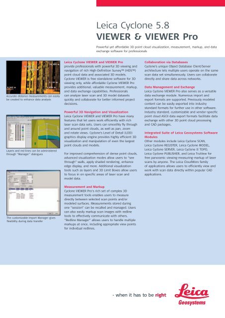
Leica Cyclone 5.8 VIEWER & VIEWER Pro
Leica Cyclone 5.8 VIEWER & VIEWER Pro
Leica Cyclone 5.8 VIEWER & VIEWER Pro

You also want an ePaper? Increase the reach of your titles
YUMPU automatically turns print PDFs into web optimized ePapers that Google loves.
<strong>Leica</strong> <strong>Cyclone</strong> <strong>5.8</strong><strong>VIEWER</strong> & <strong>VIEWER</strong> <strong>Pro</strong>Powerful yet affordable 3D point cloud visualization, measurement, markup, and dataexchange software for professionalsAccurate distance measurements can easilybe created to enhance data analysisLayers and red lines can be administeredthrough “Manager” dialogues<strong>Leica</strong> <strong>Cyclone</strong> <strong>VIEWER</strong> and <strong>VIEWER</strong> <strong>Pro</strong>provide professionals with powerful 3D viewing andnavigation of rich High-Definition Survey (HDS)point cloud data and associated 3D models.<strong>Cyclone</strong> <strong>VIEWER</strong> is free standalone software for 3Dviewing only, while affordable <strong>Cyclone</strong> <strong>VIEWER</strong> <strong>Pro</strong>provides additional, valuable measurement, markup,and data exchange capabilities. <strong>Pro</strong>fessionalscan analyze laser scan and 3D model datasetsquickly and collaborate for better informed projectdecisions.Powerful 3D Navigation and Visualization<strong>Leica</strong> <strong>Cyclone</strong> <strong>VIEWER</strong> and <strong>VIEWER</strong> <strong>Pro</strong> have manyfeatures that let users work efficiently with richlaser scan data sets. Users can smoothly fly throughand around point clouds, as well as pan, zoomand rotate views. <strong>Cyclone</strong>'s Level of Detail (LOD)graphics display engine provides highly efficient 3Dvisualization and manipulation of even the largestpoint clouds and models.For improved comprehension of dense point clouds,advanced visualization modes allow users to “seethrough” walls, apply shaded rendering, enhanceedge display, and more. Additional visualizationtools such as layers and 3D Limit Boxes allow usersto focus in on specific areas of laser scan andmodel data.Collaboration via Databases<strong>Cyclone</strong>'s unique Object Database Client/Serverarchitecture lets multiple users operate on the samescan data set simultaneously. Users can collaboratedirectly and share data across networks.Data Management and Exchange<strong>Leica</strong> <strong>Cyclone</strong> <strong>VIEWER</strong> <strong>Pro</strong> also serves as a versatiledata exchange module. Numerous import andexport formats are supported. Previously modeledcontent can be easily exported into industrystandard formats for further use in other software.Industry standard, customizable and vendor-specificpoint cloud ASCII data export formats facilitate dataexchange with other 3D point cloud processingand CAD packages.Integrated Suite of <strong>Leica</strong> Geosystems SoftwareModulesOther modules include <strong>Leica</strong> <strong>Cyclone</strong> SCAN,<strong>Leica</strong> <strong>Cyclone</strong> REGISTER, <strong>Leica</strong> <strong>Cyclone</strong> MODEL,<strong>Leica</strong> <strong>Cyclone</strong> SERVER, <strong>Leica</strong> <strong>Cyclone</strong> II TOPO,<strong>Leica</strong> <strong>Cyclone</strong> PUBLISHER, and <strong>Leica</strong> TruView forfree panoramic viewing-measuring-markup of laserscans by anyone. The <strong>Leica</strong> CloudWorx familyof applications allows users to efficiently view andwork with scan data directly within popular CADapplications.The customizable Import Manager givesflexibility during data transferMeasurement and Markup<strong>Cyclone</strong> <strong>VIEWER</strong> <strong>Pro</strong>’s rich set of complex 3Dmeasurement tools enables users to measuredirectly between selected scan points and/ormodeled surfaces. Measurements stored duringone “session” can be recalled and managed. Userscan also easily markup scan images with redlinetools to effectively communicate with others.“Redline Manager” allows users to handle multiplemarkups at once, including appropriate view pointsfor individual redlines.
<strong>Leica</strong> <strong>Cyclone</strong> <strong>5.8</strong><strong>VIEWER</strong> & <strong>VIEWER</strong> <strong>Pro</strong>FeaturesLarge Point Cloud and Model SupportVisualizationNavigation3D Limit Box Manager for spatial navigation- set Limit Box by fence 1Interactive visualization of large models anddata setsEfficient loadingOptional resampling of unified point cloud data set- User-specified average spacing (removesredundant points in overlap area)<strong>Cyclone</strong> Object Database Client/Server technology- Efficient data managementRenderingLevel of Detail (LOD) graphics“Single pick” point cloud density controlIntelligent memory managementShaded lighting effectsEnviornmental lightingMeasurement 1Customizable Measurement Manager- Save measurements- Δ X, Δ Y, Δ Z distances3D Linear Measurements- Point-To-Point- Point-To-Centerline- Point-To-Unbounded-Surface- Center-To-Center- Geometric Object Volume- Cut/fill volume- Surface area- Elevation- Angle and back angle measurementsMarkup and redlining 1Create redlinesRedline Manager3D redliningCreate and manage object annotationVisualizationView point clouds with:- Intensity mapping- True color- Elevation-based color mapping- One sided mode (front or back)- Silhouette mode (enhanced edges)Map external photo to point cloudData Import 1ASCII (XYZ, SVY, PTS, PTX, TXT, customized format)Zoller+Fröhlich ZFS, ZFCRiegl .3DDCOE (<strong>Cyclone</strong> Object Exchange)AutoCAD, MicroStation via <strong>Cyclone</strong> COE Data- transfer plug-in (free)BMP, JPEGCGP<strong>Leica</strong> System 1200Data Export 1Seamless two-way data integration with AutoCADand MicroStation enabled by:- <strong>Leica</strong>’s neutral file format, COE (<strong>Cyclone</strong> ObjectExchange)- <strong>Cyclone</strong> COE Data Transfer plug-ins (free)ASCII / DXF / COE (<strong>Cyclone</strong> Object Exchange)- AutoCAD, MicroStation via <strong>Cyclone</strong> COE Data- Transfer plug-in (free)BMP TIFF JPEGLandXML for civil applicationsSDNF and PCF export for pipes<strong>Leica</strong> System 1200<strong>Cyclone</strong> II TOPO- *.cwf- *.pciRectified, dimensionally correct orthophotosTrial LicensingAutomatic one-time 5 day trial license periodBenefitsFast, Accurate, Comprehensive,Reality-Based As-built DataEfficient information extraction toolsSupports Wide Range of Plant, Civil,Architectural ApplicationsAccurate 3D as-built modelsEngineering planningAs-is condition assessment for range ofapplications including retrofit and revampprojectsVerify Designs with Detailed Point CloudDataFacilitates adjustments to proposed retrofitdesigns for clash-free installationSupports construction monitoringEasy to Learn and Easy to UseIntegrated into existing work processesCustomizable interface, toolbars and keyboardshortcutsWorkgroup SupportFlexible licensing and enterprise usage options.Licensing options include node-locked, floating,or <strong>Leica</strong> EnterpriseElite subscription licensing.Database sharing via <strong>Cyclone</strong>-SERVER or viaTerminal Server access.System RequirementsMicrosoft Vista* (32 or 64), or MicrosoftWindows XP (SP1 or higher) (32 or 64), orWindows 2000 (SP3 or higher with up to datesecurity patches)2.0 GHz Pentium ® 4 or higher/Pentium ® M <strong>Pro</strong>cessor 1.7 GHz or higher512 MB RAM (1GB or more recommended)SVGA or OpenGL accelerated graphics cardEthernet network card, for licensing* Some systems may not support Vista's Desktop Windows Manager (DWM) with<strong>Cyclone</strong> and must be operated in Windows Classic mode.1 Only available with <strong>Cyclone</strong> <strong>VIEWER</strong> <strong>Pro</strong> licenseWindows is a registered trademark of Microsoft Corporation. Other trademarks and tradenames are those of their respective owners.Illustrations, descriptions and technical specifications are not binding and may change.Printed in Switzerland – Copyright <strong>Leica</strong> Geosystems AG, Heerbrugg, Switzerland, 2008.763960en – I.08 – RDV<strong>Leica</strong> Geosystems AGHeerbrugg, Switzerlandwww.leica-geosystems.com/hds