The Rimba Raya Biodiversity Reserve REDD Project
The Rimba Raya Biodiversity Reserve REDD Project
The Rimba Raya Biodiversity Reserve REDD Project

Create successful ePaper yourself
Turn your PDF publications into a flip-book with our unique Google optimized e-Paper software.
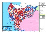
G1.2. Types and Condition of <strong>Project</strong> Area Vegetation<strong>The</strong> types and condition of vegetation within the project area.General description<strong>The</strong> <strong>Project</strong> Area is adjacent to Tanjung Puting National Park andshares most of the vegetation types occurring there, but indifferent relative proportions. An extremely rich variety ofnatural wet and dry land vegetation types are represented, oftenforming a fine-‐scale complex mosaic. From southern coastalareas to the low Pleistocene terraces of the north, these naturalvegetation types include: mangrove and tidal/brackish waterswamps near the coast line; marshy, grass-‐dominated wetlands;riparian and freshwater swamp forest associated with theSeruyan River and its many tributaries; peat swamp forestdeveloping on peatlands of various depths (up to and greaterthan 5 meters deep), kerangas (heath) vegetation of variousforms (tall to stunted) on sandy soils; and lowland mixeddipterocarp forest on mineral soils (Susilo 1997; MacKinnon et al.1996; OFI 2008; Stanley & Salim 2008; Bolick 2010).Vegetation diversity is enriched by a wide range of anthropogenicdisturbance, including: logging, burning, peat drainage, andnatural vegetation conversion to agriculture. <strong>The</strong>se influenceshave produced a mosaic of disturbance types overlaying naturalvegetation types, including: alang-‐alang grasslands, activelymanaged agricultural areas associated with settlements, post-‐fireshrubland and secondary forest, and regenerating logged forest.Major vegetation classesPrior to field surveys in the <strong>Project</strong> Area, Stanley & Salim 2008described and mapped broad vegetation types in <strong>Rimba</strong> <strong>Raya</strong>based on a review of existing data and analysis of recent satelliteimagery. Six broad vegetation classes were identified: (i) mixedfreshwater swamp, (ii) peat swamp forest, (iii) lowlanddipterocarp forest, (iv) kerangas forest, (v) marshy swamps, and(vi) anthropogenic disturbance types:i. Mixed freshwater swamp. Freshwater swamp is anecological and functionally important vegetation type on Borneo,with a natural variety of structural and compositional forms thatco-‐vary with local terrain features, proximity to rivers, frequencyand duration of flooding, and soil type. Freshwater swamp formsoccur throughout Tanjung Puting, and in the <strong>Project</strong> Area withlimited distribution adjacent to major rivers and their tributaries.Freshwater swamp is said to have been the natural vegetationcover of approximately 7% of Kalimantan (MacKinnon & Artha,cited in MacKinnon et al. 1996), although the vast majority of thisswamp type has been converted to wetland rice cultivation. It istherefore considered an extremely endangered ecosystem bymost conservation organizations (e.g., Wikramanayake et al.2002).Freshwater swamps develop where periodic flooding causeswater logging on soils. Soils are much less acidic than peatswamps (with which freshwater swamps may occur in closeassociation), and they are among the most nutrient-‐rich topicalsoils due to frequent deposition of silt and organic matter.Forests tend to be very productive in terms of tree growth, litterfall, and leaf and fruit production, with high natural rates ofdisturbance and canopy turnover due to frequent tree falls andgap formation. Where inundation is frequent but temporary,freshwater swamps can have tall stature (c. 35 m) and standingbiomass; where inundation is frequent and prolonged, forestscan be stunted and dominated by only a few tree species.13