Admiralty Raster Chart Service ARCS The Safest ... - Thomas Gunn
Admiralty Raster Chart Service ARCS The Safest ... - Thomas Gunn
Admiralty Raster Chart Service ARCS The Safest ... - Thomas Gunn
- No tags were found...

You also want an ePaper? Increase the reach of your titles
YUMPU automatically turns print PDFs into web optimized ePapers that Google loves.
C HARTSAND PUBLICATIONS<strong>Admiralty</strong> <strong>Raster</strong> <strong>Chart</strong> <strong>Service</strong>Electronic <strong>Chart</strong>s You Can Trust
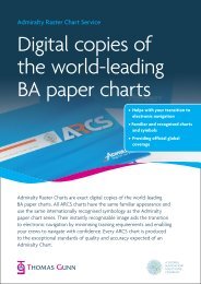
<strong>Admiralty</strong> <strong>Raster</strong><strong>Chart</strong> <strong>Service</strong><strong>ARCS</strong><strong>The</strong> <strong>Safest</strong> Route to NavigationWorld’s Number OneProduced by the United Kingdom Hydrographic Office (UKHO), <strong>ARCS</strong> is theworld’s leading electronic raster chart service. <strong>ARCS</strong> complements the British<strong>Admiralty</strong> (BA) paper chart series to provide first-class electronic navigation thatgreatly improves safety.<strong>ARCS</strong> <strong>Chart</strong>s are exact digital copies of the world-leading BA paper charts. All <strong>ARCS</strong>charts have the same familiar appearance and use the same internationallyrecognised symbology as the <strong>Admiralty</strong> paper chart series. <strong>The</strong>ir instantlyrecognizable image aids the transition to electronic navigation by minimisingtraining requirements and enabling your crews to navigate with confidence.■ Image and data identical to<strong>Admiralty</strong> paper chart■ Internationally recognised symbolsand abbreviations■ Easy progression from traditionalchart table to ECS / ECDIS■ Highest resolution image foroptimum screen displayEvery <strong>ARCS</strong> chart is produced to the <strong>Admiralty</strong>’s exceptional standards of qualityand accuracy. <strong>ARCS</strong> chart and paper chart information is fully interchangeableensuring maximum navigational benefit and total confidence at all times.Electronic <strong>Chart</strong>s You Can Trust
Global CoverageOver 3000 <strong>ARCS</strong> charts provide official, global coverage of the world’s commercial shipping routes,with extensive coverage of main ports and harbours at a wide range of scales.Maximum Flexibility<strong>ARCS</strong> Regional Folio Coverage<strong>ARCS</strong> Navigator comes complete with a comprehensive weeklyupdate service and is available on annual subscription. Coverageis licensed on a chart by chart basis to give you maximumflexibility. You only access, and pay for, the charts you require.Instant access to additional charts can be quickly and easilyobtained in emergency situations via phone, fax or e-mail.<strong>ARCS</strong> charts are also available in regional and world folios togive you greater coverage at substantial cost savings.Latest <strong>Chart</strong> Updates Applied in Seconds<strong>ARCS</strong> Navigator service includes a fully automated updateservice. <strong>The</strong> <strong>ARCS</strong> Update CD-ROMs are issued weekly tomatch the publication of the latest Notices to Mariners andare applied electronically to the charts to keep <strong>ARCS</strong> chartsfully up to date for safety critical information without delay.Updates include all New Editions and Replacement <strong>Chart</strong>s andboth Temporary and Preliminary Notices. This easy to follow<strong>ARCS</strong> update procedure ensures your vessel’s entire <strong>ARCS</strong>chart folio can be corrected in just a few seconds.■ Cumulative weekly updates –you need only use the latest update CD■ Fully in-line with <strong>Admiralty</strong> Notices to Mariners■ Includes New Editions and Replacement <strong>Chart</strong>s■ Includes Temporary and Preliminary Notices■ New UKHO on-line updating options■ Email and Broadcast Electronic Courier Update services
Proven Benefits<strong>ARCS</strong> high quality digital image and full geographical referencing ensure superior chartdisplay and maximum benefits in both real-time navigation and passage planning.Safer Navigation<strong>ARCS</strong> charts can be fully integrated with Geographic Positioning Systems (GPS).Vessel position, course and speed can be automatically plotted and updated asfrequently as once a minute to give far greater positional accuracy than withtraditional methods of navigation. User-defined overlays of danger areas,waypoints, notes, offset and check bearings can also be manually input and storedfor all relevant charts.<strong>ARCS</strong> real-time vessel positioning and overlay facilities provide considerablereal-time navigational benefits and greatly reduce the risk of grounding.Improved Situational AwarenessRadar targets can be superimposed over <strong>ARCS</strong> charts to show actual distance anddirection to other vessels and obstructions, providing an instant overview of yourcurrent situation. When used in conjunction with radar to provide collisionavoidance indicators and alarms, <strong>ARCS</strong> significantly improves safety of navigation,and is particularly important in busy or confined waters.Time SavingRoutes can be quickly and efficiently planned in advance and stored for future, repeatuse. Passage plans can be easily adjusted at any time. Bearing and Distance betweenwaypoints are automatically calculated. Planned routes are automatically appliedacross all chart scales to substantially reduce time spent at the planning stage.Electronic <strong>Chart</strong>s You Can Trust
Traditional Techniques<strong>ARCS</strong> also enables the use of traditional techniques such asdead reckoning (DR) to verify GPS signal or in the event ofGPS unavailability."<strong>ARCS</strong> improves decision making when it comesto manoeuvering - particularly in confined waterswith dense traffic."Maersk Senior Master, Captain Henrik Solmer."P&O Nedlloyd has been using <strong>ARCS</strong> charts since their conception. <strong>The</strong> benefits incoastal navigation, port approaches and the subsequent improvements in safety havebeen tremendous."P & O Nedloyd Fleet Marine Manager, Steven Bligh.Large Choice of Electronic <strong>Chart</strong> SystemsDesigned exclusively for commercial shipping, <strong>ARCS</strong> Navigator charts are fullycompatible with a wide choice of Electronic <strong>Chart</strong> Systems (ECS) and Electronic<strong>Chart</strong> Display & Information Systems (ECDIS) including:This flexibility allows you to choose the system that meets your requirements andyour budget. Please refer to the UKHO web site for a complete listing.
Using <strong>ARCS</strong>To use <strong>ARCS</strong> charts you will need the following:■ A <strong>Chart</strong> Display System (ECS, ECDIS or IBS), or■ Computer hardware (PC or Apple Mac) and Navigational software(supplied by one of many <strong>ARCS</strong> compatible software manufacturers)Further Information<strong>ARCS</strong> Navigator is available through an extensive, worldwide network of <strong>Admiralty</strong>Distributors. Further information including prices, coverage and contact details fordistributors and compatible software manufacturers can be found inside the backpocket of this brochureFor additional information please contact the UKHO Help Desk on:Telephone: +44 (0) 1823 723366Fax: +44 (0) 1823 323753E-Mail: helpdesk@ukho.gov.ukor visit the UKHO website at www.ukho.gov.ukPlease see your relevant flag state authority forfurther information regarding regulationsgoverning the dual use of <strong>ARCS</strong> andENC in ECDIS.Electronic <strong>Chart</strong>s You Can Trust
Premier Supplier of <strong>Chart</strong>s and PublicationsInternationally recognised as one of the world’s leading suppliers of nauticalcharts and publications, the UK Hydrographic Office provides official coverageof the world’s commercial shipping routes and performs an essential rolein supporting the safety of life at sea.Complete Navigational PackageAn ever-expanding range of digital products and services complements theUKHO’s comprehensive portfolio of over 3300 traditional navigational chartsand 220 supporting nautical publications. British <strong>Admiralty</strong> paper and digitalproducts are both maintained to exactly the same levels of accuracy toprovide a fully consistent, coherent package that cannot be equalled.For more information about <strong>Admiralty</strong> products, visit our websitewww.ukho.gov.uk<strong>The</strong> United Kingdom Hydrographic Office, <strong>Admiralty</strong> Way, Taunton,Somerset, TA1 2DN, United Kingdom40307Tel: +44 (0) 1823 723366 Fax: +44 (0) 1823 323753