

ICA News 38, June 2002 - International Cartographic Association
ICA News 38, June 2002 - International Cartographic Association
ICA News 38, June 2002 - International Cartographic Association

You also want an ePaper? Increase the reach of your titles
YUMPU automatically turns print PDFs into web optimized ePapers that Google loves.
<strong>ICA</strong> <strong>News</strong><br />
Nouvelles de I’ACI<br />
Number <strong>38</strong>, <strong>June</strong> <strong>2002</strong> Numéro <strong>38</strong>, Juin <strong>2002</strong> http://www.icaci.org
<strong>ICA</strong> Executive Committee<br />
<strong>ICA</strong> Executive<br />
Committee<br />
Bengt Rystedt<br />
President<br />
National Land Survey<br />
SE-801 82 Gavle, Sweden<br />
University of Gavle<br />
SE-801 76 Gavle, Sweden<br />
Bengt.rystedt@lm.se<br />
Ferjan Ormeling<br />
Secretary-General<br />
Faculty of Geographical Sciences<br />
Utrecht University<br />
P.O.Box 80115<br />
3508 TC Utrecht<br />
The Netherlands<br />
f.ormeling@geog.uu.nl<br />
Kirsi Virrantaus<br />
Vice-president<br />
Helsinki University of Technology<br />
Department of Surveying<br />
P.O.Box 1200<br />
FIN-02015 HUT<br />
Finland<br />
Kirsi.Virrantaus@hut.fi<br />
Milan Konecny<br />
Vice-president<br />
Department of Geography<br />
Faculty of Science, Masaryk University<br />
Kotlarska 2<br />
611 37 Brno<br />
Czech Republic<br />
Knonecny@ics.muni.cz<br />
Li Li<br />
Vice-president<br />
National Geomatics Center of China<br />
State Bureau of Surveying and Mapping<br />
1 Baishengcun Zi Zhu Yuan<br />
Beijing<br />
P.R.China<br />
Ngcclili@public3.bta.net.cn<br />
Elri Liebenberg<br />
Vice-president<br />
University of South Africa<br />
Department of Geography and<br />
Environmental Studies<br />
P.O.Box 392<br />
Pretoria 0003<br />
South Africa<br />
Elri@worldonline.co.za<br />
Robert McMaster<br />
Vice-president<br />
Department of Geography<br />
University of Minnesota<br />
414 Social Sciences Building<br />
267-19th Avenue South<br />
Mineapolis, MN 55455<br />
United States<br />
Mcmaster@atlas.socsci.umn.edu<br />
Takashi Morita<br />
Vice-president<br />
Department of Civil Engineering<br />
Hosei University<br />
3-7-2 Kajinocho, Koganei-shi<br />
184-8485 Tokyo Japan<br />
Morita@k.hosei.ac.jp<br />
Alberta Auringer Wood<br />
Vice-president<br />
Memorial University of Newfoundland<br />
St.John's, Newfoundland<br />
Canada A1B 3Y1<br />
Awood@morgan.ucs.mun.ca<br />
Michael Wood<br />
Past-president<br />
Department of Geography<br />
University of Aberdeen<br />
Elphinstone Rd,<br />
Aberdeen AB24 3UF, Scotland<br />
United Kingdom<br />
m.wood@abdn.ac.uk<br />
<strong>ICA</strong> Commission Chairs<br />
Jacqueline M. Anderson<br />
Cartography and Children<br />
JAHFH10@vax2.concordia.ca<br />
Roger Anson<br />
Publications<br />
rwanson@brookes.ac.uk<br />
Eva K.-Blum<br />
Gender and Cartography<br />
ekblum@kgf.ar.wroc.pl<br />
Christopher Board<br />
History of Cartography<br />
c.board@lse.ac.uk<br />
Tim Davis<br />
Census Cartography<br />
davitim@statcan.ca<br />
Ron Furness<br />
Marine Cartography<br />
rfurness@ozemail.com.au<br />
Lorenz Hurni<br />
Mountain Cartography<br />
hurni@karto.baug.ethz.ch<br />
Serge Le Blanc<br />
Mapping from Satellite Imagery<br />
serge.le_blanc@netcourrier.com<br />
Alan MacEachren<br />
Visualisation and Virtual Environments<br />
alan@geog.psu.edu<br />
Harold Moellering<br />
Spatial Data Standards<br />
geohal+@osu.edu<br />
Ammatzia Peled<br />
WG Incremental Updating and Versioning<br />
a.peled@geo.haifa.ac.il<br />
Michael Peterson<br />
Maps and the Internet<br />
geolib@cwis.unomaha.edu<br />
Kira Shingareva<br />
Planetary Cartography<br />
Kira.shingareva@mtu-net.ru<br />
Sjef van der Steen<br />
Map Production<br />
Steen@itc.nl<br />
Dr A.F.Tatham<br />
Maps and Graphics for Blind and Visually<br />
Impaired People<br />
A.Tatham@RGS.org<br />
Vladimir Tikunov<br />
Education and Training<br />
tikunov@geogr.msu.su<br />
Timothy Trainor<br />
National and Regional Atlases<br />
ttrainor@census.gov<br />
Robert Weibel<br />
Generalisation<br />
weibel@geo.unizh.ch<br />
Alexander Wolodtschenko<br />
Theoretical Cartography<br />
wolod@karst8.geo.tu-dresden.de<br />
Please send contributions to:<br />
A/Prof Graciela Metternicht, Editor,<br />
<strong>ICA</strong> <strong>News</strong><br />
Department of Spatial Sciences<br />
Curtin University of Technology<br />
GPO Box U 1987, Perth 6845<br />
Western Australia<br />
Email: graciela@vesta.curtin.edu.au<br />
Fax: +61-8-9266 2703<br />
Ftp: alpha.cage.curtin.edu.au<br />
Login and pwd:<br />
engftp Directory: /graciela/<strong>ICA</strong>/incoming<br />
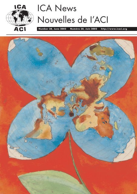
Cover: ‘ Flower World’, by József Bodor<br />
(11 years) from Hungary. One of winners of the<br />
1999 Barbara Petchenik Children's Global<br />
Map Competition, <strong>International</strong> <strong>Cartographic</strong><br />
Conference, Ottawa.<br />
<strong>ICA</strong> NEWS <strong>June</strong> <strong>2002</strong>
Editorial<br />
This issue of the <strong>News</strong>letter pays<br />
homage to one of the greatest<br />
cartographers of the 1900s,<br />
Ferdinand Ormeling. Sadly, he passed<br />
away on the 1st May <strong>2002</strong>, leaving such<br />
a large number of achievements and<br />
contributions to the world of Cartography<br />
and Geography, that it has been difficult<br />
to find an eager colleague prepared to<br />
describe his fruitful life within the short<br />
time available before the publication of<br />
this issue. Special thanks for this to<br />
Michael Wood who accepted the challenge<br />
of summarizing Ferdinand’s hyperactive<br />
life for us.<br />
The large number of topics to report on<br />
the 20th ICC held in Beijing impeded the<br />
inclusion of the accounts of post-conference<br />
trips enjoyed by some of our colleagues in<br />
the December issue. Therefore, in this<br />
<strong>News</strong>letter Lorenz Hurni share with us the<br />
fantastic Xian to Tibet excursion, and<br />
Ferjan Ormeling reports on a visit to the<br />
Aerophotogrammetry and Remote Sensing<br />
Bureau of China Coal in Xian.<br />
The Local Organising Committee of<br />
the ICC 2003 provides information on<br />
deadlines for the call for papers and<br />
themes of the Durban Conference.<br />
Colleagues are advised to regularly check<br />
the Conference’s website at<br />
www.icc2003.gov.za for the latest news.<br />
As usual, several <strong>ICA</strong> Commissions<br />
report on their activities and the<br />
organisation of workshops. Our ‘Special<br />
Feature’ section includes an article on the<br />
presentation of old maps on the Internet,<br />
a notice on the completion of the Basic<br />
Cartography Series, and summaries of<br />
the papers presented by the recipients of<br />
the 20th ICC Beijing Travel Awards.<br />
As you know, a limited number of <strong>ICA</strong><br />
Travel scholarships are granted to young<br />
cartographers of developing countries for<br />
assistance and presentation of work at the<br />
<strong>International</strong> <strong>Cartographic</strong> Conferences of<br />
the <strong>ICA</strong>. So we like to share with you<br />
their research work.<br />
I hope you enjoy the contents of this<br />
issue and look forward to receiving your<br />
contributions for the next <strong>News</strong>letter.<br />
Graciela Metternicht<br />
Editor<br />
<strong>ICA</strong> NEWS <strong>June</strong> <strong>2002</strong><br />
Obituary<br />
In Memoriam Ferdinand Jan<br />
Ormeling (1912-<strong>2002</strong>)<br />
A very special man, one of the great<br />
geographers and cartographers of our time -<br />
known to many as ‘Mr <strong>ICA</strong>’ - died on 1<br />
May <strong>2002</strong>. Not a moment of his often<br />
hyperactive life was wasted as he expanded<br />
his knowledge of the World and its people.<br />
This genuinely charismatic man shared<br />
himself constantly through teaching,<br />
organisation and leadership, influencing<br />
others and helping change things for the<br />
better. His powerful intellect and special<br />
capacity for building bridges of friendship<br />
were in evidence throughout his life.<br />
Born on 12 April 1912, his early<br />
childhood was spent in Amsterdam and in<br />
nearby Hilversum, where he experienced<br />
some of the difficulties, if not the damage,<br />
associated with WW1. After completing<br />
elementary studies at Hilversum High<br />
School he attended the State University of<br />
Utrecht to read geography and history and<br />
went on to teach at grammar schools in<br />
Hilversum and The Hague. The Netherlands<br />
were invaded early in WW2 and this<br />
painful occupation continued until<br />
liberation in 1945. As a member of the<br />
Dutch Army, and true to his own character,<br />
Ormeling refused to succumb and joined<br />
the underground movement.<br />
The War also affected the Netherlands’<br />
Indonesian colonies where the Pacific<br />
conflicts had profound effect. In 1945, at<br />
the end of the Japanese occupation,<br />
Ormeling was sent, as part of an<br />
expeditionary force, to restore order to that<br />
troubled land. During the ensuing war-filled<br />
years, as a geographer/cartographer he was<br />
transferred from field activities to become<br />
part of the new Geographical Institute<br />
(formed in 1947 as part of the former<br />
government mapping organisation) in the<br />
capital, Batavia (Jakarta). Here he was<br />
involved in many important cartographic<br />
and geographical projects. With<br />
independence in 1949 most of the Dutch<br />
returned to Europe, but not Ormeling. The<br />
fact that he was asked, by those who had<br />
previously been foes, to remain and<br />
continue his work (in office and field), is<br />
convincing evidence of his special<br />
F.J.Ormeling Sen.<br />
Dispatches<br />
intellectual and personal qualities. Full<br />
recognition of this came in 1950 when he<br />
was appointed (at the young age of 37) as<br />
Head of the Institute, with almost 50<br />
employees. The work evolved to include not<br />
only small-scale mapping and increasingly<br />
important geographical surveys of the<br />
country but also the education and training<br />
of the staff of the Indonesian Topographic<br />
Service.<br />
During the years that followed he<br />
developed his knowledge of the country, in<br />
particular the Island of Timor (almost twice<br />
the size of the Netherlands) which became a<br />
focus of research into ethnic and socioeconomic<br />
factors. His pioneering study,<br />
‘The Timor Problem, a Geographical<br />
Interpretataion of an underdeveloped<br />
island’, not only gained him a Doctorate of<br />
Social Sciences from the University of<br />
Indonesia, but, on publication, it became a<br />
best-seller.<br />
By the end of his 20-year Indonesian<br />
sojourn in 1955 he had demonstrated<br />
unequivocally his intellectual abilities in<br />
geography and mapping, his facility for<br />
organisation and leadership and his capacity<br />
for work. He had also developed a deep<br />
understanding of the people of developing<br />
countries and their problems.<br />
His return home, at the age of only 43,<br />
was to herald a new phase in his life.<br />
Having joined J.B.Wolters of Groningen,<br />
his major work would lie within<br />
cartography, especially the modernisation of<br />
their main atlas products.<br />
(Cont. over page)<br />
1<br />
Dispatches
Dispatches<br />
Dispatches<br />
Until 1963 he was fully employed by the<br />
company but continued thereafter as an<br />
expert consultant. He not only edited nine<br />
editions of the Grote Bosatlas and six<br />
editions of the Kleene Bosatlas but oversaw<br />
major changes in level of collaboration<br />
between users (teachers) and producers, in<br />
map style, content and design, as well as in<br />
improvements in effectiveness and economy<br />
of production. However, in parallel with<br />
these outstanding achievements he would<br />
also begin to develop (in his ‘spare time’!)<br />
his facility to motivate colleagues and<br />
stimulate links within geography and<br />
mapping, at home and abroad. The first<br />
result was a new <strong>Cartographic</strong> Section in the<br />
Royal Netherlands Geographical Society<br />
(which he chaired until 1968) and he also<br />
helped consolidate the many cartographic<br />
groups within the Netherlands into The<br />
Dutch <strong>Cartographic</strong> Society in 1975. He<br />
became the first President (1967-71) of the<br />
new enlarged Royal Netherlands<br />
Geographical Society (now incorporating<br />
many small geographical associations).<br />
Between 1967 and 1984 he was a major<br />
representative of both the Netherlands and<br />
the <strong>ICA</strong> on the UN Group of Experts on<br />
Geographical Names and chaired the<br />
Working Group on Education and Training<br />
in Toponymy.<br />
Although his atlas consultancy work<br />
continued after departure from Wolters,<br />
he was appointed in 1964 as Professor of<br />
Economic Geography at the University of<br />
Amsterdam and established a Research<br />
Institute in the subject. In 1971 he was<br />
appointed Professor at ITC following the<br />
Institute’s transfer from Delft to Enschede.<br />
There he established and became Head of<br />
the new Department of Cartography.<br />
He had already noted the demise of<br />
traditional cartography with the rise of the<br />
quantitative revolution in Geography in the<br />
1960s and ensured that the new ITC<br />
department was fully equipped with the<br />
latest computer facilities.<br />
During his early years with Wolters,<br />
Ormeling (with Cornelius Koeman) led key<br />
discussions about the proposed<br />
establishment of the <strong>ICA</strong>, which eventually<br />
took place in Bern in 1959. He was a firm<br />
supporter of its founding principles which<br />
emerged during the first five years under<br />
2<br />
Eduard Imhof’s presidency, and<br />
enthusiastically accepted election to the<br />
position of Secretary/Treasurer at the<br />
London/Edinburgh Conference and General<br />
Assembly (1964). The next technical<br />
conference took place three years later in<br />
Amsterdam under his directorship and is<br />
believed to have established a new informal<br />
and friendly family atmosphere which would<br />
become commonplace at future events. His<br />
pro-active and energetic 12-year support of<br />
Presidents Thackwell, Salitchtchev and<br />
Robinson is now legendary, supported most<br />
generously by ITC. He was elected<br />
President in Moscow (1976) and proceeded<br />
through two strong terms, ably supported by<br />
Olof Hedbom as Secretary/Treasurer, ending<br />
in Perth, Australia in 1984. At his final<br />
Conference/General Assembly in Morelia he<br />
presented his personal record of <strong>ICA</strong><br />
entitled ‘<strong>ICA</strong> 1959-1984: The First Twentyfive<br />
Years of the <strong>International</strong> <strong>Cartographic</strong><br />
<strong>Association</strong>’. His own 20-year period as a<br />
senior office-holder saw the introduction of<br />
many significant changes, relating to<br />
Commissions, Working Groups, statutes, etc.<br />
A special example was the establishment of<br />
a medal for <strong>ICA</strong>’s highest distinction in<br />
recognition of the Swedish initiator of the<br />
<strong>ICA</strong>, Carl Mannerfelt. His personal<br />
experience of working for <strong>ICA</strong> was also<br />
memorable, punctuated by such as travel<br />
mishaps, a near fatal car crash in West<br />
Africa and a scary encounter (accompanied<br />
by John Bartholomew) in the bullring at the<br />
Madrid Conference of 1974!<br />
Not surprisingly Ormeling has a long<br />
and distinguished list of publications<br />
extending from his Doctoral Thesis. It<br />
includes papers, books and atlases and<br />
echoes the many changes which have taken<br />
place during these turbulent years of<br />
cartography in the second half of the<br />
twentieth century. His retirement years were<br />
only slightly less busy than before as he<br />
continued to research, publish and accept<br />
speaking engagements.<br />
His own lifetime of achievement has<br />
been awarded on many occasions, examples<br />
being Honorary Membership of the Dutch<br />
<strong>Cartographic</strong> Society, Membre d’Honneur<br />
de la Societé de Géographie de France,<br />
Honorary Fellowships of the Australian<br />
Institute of Cartographers, The Hungarian<br />
Academy of Sciences, The Polish<br />
Geographical Society, and the ITC itself,<br />
The British <strong>Cartographic</strong> Society Medal<br />
and, in 1987, the Carl Mannerfelt Medal.<br />
In 1978 he was appointed ‘Knight of the<br />
Order of the Netherlands Lion’ by the<br />
Queen of the Netherlands.<br />
Although he missed the first <strong>ICA</strong><br />
General Assembly in Paris, 1961 through<br />
work, he attended every other Technical<br />
Conference and General Assembly between<br />
1962 and 1987, and continued as a regular<br />
visitor at <strong>ICA</strong> after his official<br />
responsibilities came to an end. He was,<br />
sadly, unable to attend the ICC 2001 in<br />
Beijing, China, but love and respect<br />
radiated from the international audience at<br />
the opening ceremony when he sent his<br />
video greeting.<br />
His passing has undoubtedly left a<br />
painful gulf in the lives of many, especially<br />
his dear wife, Rini (often described as the<br />
‘Queen of <strong>ICA</strong>’ for her own outstanding<br />
support for him and our <strong>Association</strong>), and<br />
the children Piet, Hein, Ferjan, Ina, and<br />
Erik, Sonja and Roger. Apart from his great<br />
circle of <strong>ICA</strong> friends the other special<br />
people who will always treasure his<br />
memory are his students in the Netherlands<br />
and across the World. However our friend<br />
and colleague Fer Ormeling has left much<br />
more than a memory. This was a truly<br />
charismatic man, described by friends as ‘a<br />
demanding organiser’, ‘a fascinating<br />
speaker and entertainer’, and ‘a talented<br />
linguist… with a good sense of humour’.<br />
This writer will always remember the<br />
warmth of his company, his ever-present<br />
smile and the twinkle in his eye. A<br />
fundamental law of physics states that<br />
energy cannot be destroyed, only changed<br />
in form. The energy released by Ferdinand J.<br />
Ormeling during his dynamic life of<br />
creativity, guidance and leadership, is thus<br />
still active within people and organisations<br />
throughout the world today. His was a life<br />
that truly made a difference.<br />
M. Wood<br />
Acknowledgements: Hedbom, O, Bohme, R,<br />
1989, ‘Ferdinand J Ormeling: a Biography’, in<br />
‘Cartography, Past, Present and Future’, Rhind,<br />
D W, and Taylor, D R F, Eds. Elsevier, 1989.<br />
<strong>ICA</strong> NEWS <strong>June</strong> <strong>2002</strong>
21st <strong>International</strong><br />
<strong>Cartographic</strong><br />
Conference and 12th<br />
General Assembly of<br />
the <strong>ICA</strong> in Durban,<br />
South Africa<br />
The 21st ICC and 12th General Assembly<br />
of the <strong>ICA</strong> will take place in Durban, South<br />
Africa from 10-16 August 2003. The venue<br />
will be the world-class Durban <strong>International</strong><br />
Convention Centre which is situated near<br />
Durban’s central business district, minutes<br />
from hotels and beaches and 15 minutes from<br />
the Durban <strong>International</strong> Airport.<br />
Conference Themes<br />
The overall theme is <strong>Cartographic</strong><br />
Renaissance which should be explored under<br />
the following broad sub-themes:<br />
1. Challenges and solutions of geographical<br />
data capturing for developing countries.<br />
2. Spatial data sharing for a developing<br />
world.<br />
3. Spatial data standards and spatial data<br />
infrastructures.<br />
4. Map production, including new national<br />
mapping initiatives<br />
5. Management of spatial data – Spatial data<br />
warehousing and large databases.<br />
6. Organizational and policy issues for<br />
sustainable development.<br />
7. Spatial information and the Law.<br />
8. Visualization and visual environments,<br />
animation, virtual reality and cartography.<br />
9. National and Regional Atlases<br />
10. Applied cartography and GIS in<br />
development programmes and projects –<br />
showing development spatially.<br />
11. Geo-informatics and global problems,<br />
including management of disasters and<br />
risks.<br />
12. Geo-informatics in natural and human<br />
resource applications.<br />
13. Mapping of special environments,<br />
including marine cartography, mountain<br />
cartography, planetary cartography.<br />
14. Geo-informatics and tourism.<br />
15. Geo-informatics and the challenged,<br />
including maps and graphics for Blind and<br />
Visually-Impaired People.<br />
16. Education and training, particularly needs<br />
and resources of developing communities.<br />
<strong>ICA</strong> NEWS <strong>June</strong> <strong>2002</strong><br />
17. Theoretical cartography.<br />
18. Map generalization.<br />
19. Handling time and space in cartography.<br />
20. Research and development, new mapping<br />
systems and products.<br />
21. Mapping from satellite imagery.<br />
22. Maps and the Internet, location-based<br />
services, mobile mapping and other new<br />
technologies and navigation systems<br />
particularly for the developing world.<br />
23. History of cartography.<br />
24. Cartography and children.<br />
25. Gender and cartography.<br />
26. Census cartography.<br />
27. Papers are also welcome on other topics<br />
of international interest to cartographers<br />
and the GI-community, such as Spatial<br />
Decision Support Systems,<br />
Photogrammetry, Remote Sensing and<br />
Image Analysis.<br />
Call for Papers<br />
The LOC (Local Organising Committee)<br />
invites abstracts for papers in the technical<br />
programme. Send an abstract, In English, of<br />
300-500 words in length, indicating the<br />
theme(s) to which it is addressed, as an<br />
attached MS Word or Word Perfect file. Use<br />
A4 size paper (21 x 29.7cm) with 4cm top<br />
and bottom margins, 3 cm side margins.<br />
Centre the title in bold capital letters as the<br />
first item, followed by a vertical space and<br />
then the name(s) of the authors. Type the<br />
affiliation and address (type as it should<br />
appear on a mail envelope) immediately<br />
below each author’s name. Immediately below<br />
the last line, authors are encouraged (but not<br />
required to) to include a fax number and/or email<br />
address. After skipping two lines, the<br />
body of the abstract should be typed with<br />
single line spacing and no indentation of<br />
paragraphs.<br />
Important Dates<br />
31 October <strong>2002</strong>: The LOC must receive all<br />
abstracts<br />
31 January 2003: Potential participants will<br />
be notified by whether their paper for either a<br />
verbal or a poster presentation has been<br />
accepted.<br />
30 April 2003: The full paper to be published<br />
in the conference proceedings must be<br />
received by. Only papers received by this date<br />
will be included in the conference<br />
proceedings.<br />
21st ICC<br />
Abstracts should be mailed to the following<br />
address:<br />
Prof H L Zietsman<br />
ICC2003<br />
Department of Geography and<br />
Environmental Studies<br />
University of Stellenbosch<br />
Private Bag X1<br />
MATIELAND 7602<br />
South Africa<br />
Fax: +27 21 808-2405<br />
Tel: +27 12 808-3102/3218<br />
E-mail: icc@maties.sun.ac.za<br />
Website: icc2003.gov.za<br />
Local Organising Committee<br />
The members of the LOC responsible for the<br />
various portfolios are as follows:<br />
Chair: Derek Clarke<br />
(dclarke@sli.wcape.gov.za)<br />
Vice Chair and African Involvement:<br />
Lindisizwe Magi<br />
(LMMAGI@pan.uzulu.ac.za)<br />
Treasurer: Ken Lester (klester@iafrica.com)<br />
Technical programme: Larry Zietsman<br />
(hlz@maties.sun.ac.za)<br />
Workshops: Antony Cooper<br />
(acooper@csir.co.za)<br />
Commercial Exhibition: Chris Carter<br />
(carter@mhp.co.za)<br />
<strong>Cartographic</strong> Exhibition: Magda Roos<br />
(mroos@geoscience.org.za)<br />
Marketing and PR: Ray Wilkinson<br />
(rayw@struik.co.za)<br />
Registration: Henrich du Plessis<br />
(hduplessis@sli.wcape.gov.za)<br />
Conference facilities: Mark van den Bergh<br />
(markvdb@mhp.co.za)<br />
Social Events, Accompanying Persons:<br />
Mariana (mfrench@sli.wcape.gov.za)<br />
Contact details<br />
For any information or to have your name<br />
added to the mailing list for ICC2003:<br />
Postal address:<br />
ICC 2001<br />
Private Bag X10<br />
MOWBRAY 7705<br />
South Africa<br />
Fax:+27 21 689-1351<br />
E-mail: ICC2003@dla.gov.za<br />
Website: http:// www.icc2003.gov.za<br />
Elri Liebenberg<br />
Vice President: <strong>ICA</strong><br />
3<br />
21st ICC
ICC Report<br />
ICC 2001 Post-conference<br />
ICC 2001 postconference<br />
excursion<br />
to Xian and Tibet<br />
From Beijing to Xian<br />
After the 20th ICC in Beijing, 42<br />
cartographers went on an excursion to Xian<br />
and Tibet. After a two-hour flight from<br />
Beijing, the group arrived at the old<br />
emperor’s city of Xian in the province of<br />
Shaanxi. Xian with its 5 million inhabitants<br />
has an entirely preserved, historic city wall<br />
around the city centre with a total length of<br />
approximately 15 km length, dating from<br />
1370. The highlight of every visit to Xian is<br />
the excavation site of the famous Terracotta<br />
soldiers. They were found by chance in 1975<br />
while digging a fountain. The 6000, originally<br />
painted, life-size soldiers belonged to the<br />
grave of emperor Qin Shihuang (approx. 200<br />
BC). However, some years later the grave was<br />
looted. All figures were destroyed and only<br />
sedimented pieces are left. Since 1975 the<br />
figures are being restored and set up again in<br />
the original configuration. The grave field<br />
measures approximately 200 x 600 m and is<br />
covered by three enormous halls.<br />
Visit of the Shaanxi Bureau of<br />
Surveying and Mapping in<br />
Xian<br />
This mapping agency is the largest of its<br />
kind in China. In the province of Shaanxi, the<br />
bureau is responsible for all works in the<br />
areas of geodesy/GPS, cartography, cadastre,<br />
photogrammetry. It employs about 2000<br />
persons, with 140 senior and 400 junior<br />
engineers in 8 departments. For 20 years the<br />
office produces maps and atlases. There are<br />
several international co-operations, for<br />
instance with the USGS, and other institutions<br />
in France and Japan. 50 employees obtained a<br />
degree from a western engineering school.<br />
The enterprise disposes of very modern<br />
equipment. The GPS technology is used to a<br />
large extent. The office established a road<br />
data base in the scale of 1:50 000. It was also<br />
involved in the restitution of the height of Mt.<br />
Everest, in numerous engineering surveying<br />
projects, in geodetic reference measurements<br />
and in agricultural, forestry and cadastral<br />
applications. Presently, a province-wide GIS<br />
based on 6000 map sheets 1:10 000 is built<br />
up. Flooding areas of the yellow river are also<br />
covered, including possibilities for animated<br />
visualisation. In the geomatics department,<br />
the compilation of road data by GPS for the<br />
whole of China is currently being done.<br />
4<br />
Within two years, 320 000 km of roads were<br />
compiled. In the photogrammetry department,<br />
400 persons (90% women) are occupied with<br />
the stereo-compilation and control of<br />
photogrammetric data for later use in GIS.<br />
They work in two shifts in large, wellequipped<br />
halls. Mostly, current software<br />
packages like ArcView, Microstation and<br />
Photoshop are used. Images with a scale of<br />
1:10000 are scanned using the Vexcel<br />
Scanner. Mosaics of 400 pictures are<br />
assembled and corrected with Photoshop.<br />
Whenever possible, fully automatic digital<br />
stereo-compilation of contour lines is used.<br />
The results are manually corrected on screen<br />
in stereo mode. Data is stored in a brand-new<br />
"Geonetwork-Centre" consisting of several<br />
SUN servers. Guests and workers must carry<br />
dust protection clothes and shoes in that area!<br />
The office is accommodated in a very modern<br />
and fully air-conditioned building. The whole<br />
campus covers about 1 km2 and comprises<br />
also an own school, a kindergarten, a<br />
restaurant, staff accommodations and a<br />
hospital.<br />
From Xian to Lhasa<br />
After a stopover at Xining (province of<br />
Qinghai, 2000 m above sea level) the group<br />
flew directly to Tibet, crossing the enormous<br />
Lake of Qinghai and the plateau of Qinghai<br />
and north-eastern Tibet with the numerous<br />
salt lakes. The landing at Gonggar airport was<br />
quite adventurous, one believes to land<br />
directly in the enormous flood plain of the<br />
river Tsangpo (Brahmaputra). The trip to<br />
Lhasa, the capital of Tibet, lasted<br />
approximately 1_ hours by bus. On the way,<br />
we crossed the Tsangpo river on the first<br />
bridge built in Tibet.<br />
The first impression of Lhasa was that of<br />
a modern city. The western and northern parts<br />
of the city consist of relatively new, but rather<br />
ugly buildings, many of them have military<br />
purposes. The Potala palace majestically<br />
overlooks the city – an overwhelming view!<br />
In accordance with Tibetan custom, every<br />
group member was greeted with the<br />
obligatory ribbons of luck when arriving in<br />
the hotel. The first day was mainly dedicated<br />
to the acclimatisation, since Lhasa is situated<br />
at 3750 m above sea level. The height caused<br />
pains like headache, nausea, swindle, high<br />
pulse, etc. to almost all participants. On the<br />
second day we could visit the Potala, the<br />
former winter palace and seat of the Dalai<br />
Lama. Today, the angled and somber palace is<br />
a state museum visited by many tourists, but<br />
still supervised by monks. The tall Buddha<br />
figures, the different shrines with the bones of<br />
late Dalai Lamas and other relics, threedimensional<br />
Mandalas and the residence of<br />
the Dalai Lamas in the upper floors are very<br />
impressive. From the roof, which is covered<br />
with golden shrines, one enjoys a phenomenal<br />
view of Lhasa with its 200 000 inhabitants as<br />
well as on the valley of the Kyichu river.<br />
The Jokhang in the old town of Lhasa is<br />
the most important sanctuary in Tibetan<br />
Buddhism. It is surrounded by the Barkhor<br />
valley. The pilgrims encircle it clockwise, the<br />
most sporting of them even measure the way<br />
with their own body length! Again, the temple<br />
contains beautiful Buddha statues and shrines.<br />
Thousands of lamps produce a special<br />
spiritual atmosphere in the building. Yak<br />
butter serves as fuel for the lamps, it is<br />
evaporated and covers all walls, the ceiling,<br />
the floors and the furniture! The old town of<br />
Lhasa has become much smaller during the<br />
last years due to extensive demolitions.<br />
However, in recent years, some historic<br />
buildings were renovated with foreign<br />
support. The same applies to some of the<br />
thousands of monasteries destroyed during<br />
the cultural revolution. They are now rebuilt<br />
with government aid. A big problem in the<br />
old town of Lhasa is the waste water disposal.<br />
Only rudimental sewerage seems to exist,<br />
with obvious hygienic effects.<br />
Along the Tsangpo to Shigatse<br />
The next day we travelled to Shigatse, the<br />
second largest city of Tibet, and 300 km away<br />
from Lhasa. In small buses we drove along<br />
the Tsangpo westward on bumpy road and<br />
through wild gorges. We could observe<br />
natives crossing the river in a traditional boat<br />
made of yak's skin. After the ravine, the<br />
valley widens and it is again characterised by<br />
a large flooding plain and numerous grain and<br />
rape fields. The soil erosion seems to be a big<br />
problem in Tibet. On some of the slopes, even<br />
small deserts can be seen. Like Lhasa,<br />
Shigatse is divided in a new Chinese part and<br />
in a Tibetan old town. Shigatse is dominated<br />
by Tashilunpo monastery, the seat of the<br />
Panchen Lama, the second most important<br />
Lama in Tibet. The monastery is considered a<br />
"state model monastery". However, some<br />
cheerful novices were very eager to play with<br />
our secular digital cameras! On the return trip<br />
to Lhasa, a short excursion on a adventurous<br />
mountain road up to the 4700 m high pass<br />
Kampa Lha was undertaken. We enjoyed the<br />
thousands of prayer flags on the pass and the<br />
<strong>ICA</strong> NEWS <strong>June</strong> <strong>2002</strong>
view on the beautiful Yamdrok lake. For some<br />
years, this natural reservoir is now used for<br />
hydroelectric power production. Some group<br />
members had also the opportunity to sit on the<br />
back of a real, stubborn yak!<br />
Visit of the Tibetan Bureau of<br />
Surveying and Mapping in<br />
Lhasa<br />
On the last day in Lhasa, the group was<br />
offered the opportunity to visit the "Tibetan<br />
Bureau of Surveying and Mapping". With<br />
only 50 employees (4 senior and 8 junior<br />
engineers), it is the smallest of its kind in<br />
China. Fifty percent of the staff members are<br />
Tibetans. It seemed, that most of the<br />
employees are working in geodesy and only a<br />
handful in cartography. The systematic<br />
mapping of Tibet started only after 1959.<br />
Before, there was no mapping office in Tibet.<br />
In 1975, the extensive mapping of Tibet in the<br />
scale of 1:100 000 was concluded. We sighted<br />
some of these maps, they are kept in a<br />
reduced colour scale (mainly black and blue).<br />
For some areas, also maps in the scales 1:50<br />
000, 1:25 000 and 1:10 000 were compiled.<br />
The bureau exists only since 1976. According<br />
to director Ci Ren Tu Deng, the Chinese<br />
government has invested large amounts of<br />
money in mapping of Tibet, because geodata<br />
are important for the economic development<br />
of the country. Particularly, the office is<br />
supported within the framework of the project<br />
"development of the western regions". It is<br />
also regularly assisted by other Chinese<br />
province mapping agencies. Nevertheless, the<br />
office is too small to cover all needs of the<br />
"autonomous region" which has about the<br />
same surface as France. However, digital map<br />
production methods were introduced recently,<br />
but only two engineers are responsible for this<br />
work. The visit of the facilities was rather<br />
disappointing: The building in the "Beijing<br />
Central Road" in Lhasa is furnished rather<br />
spartanically and looks partly crumbling. The<br />
cartography department could not be visited at<br />
all. It seems that large parts of the map<br />
production are carried out either by other<br />
province mapping agencies or companies.<br />
However, staff members showed us a GPS<br />
reference station, installed by the German<br />
mapping agency in the framework of the<br />
international IGS network. All measured data<br />
are daily transferred to Germany. The office<br />
sells some of its products like town maps and<br />
small scale district maps in scales around<br />
1:300 000. The topographic map series are not<br />
for sale, unfortunately. On behalf of the<br />
<strong>ICA</strong> NEWS <strong>June</strong> <strong>2002</strong><br />
Museum of Ethnology at Zurich and <strong>ICA</strong>,<br />
Lorenz Hurni of ETH Zurich presented two<br />
copies of the historic town plans of Lhasa to<br />
the director. The maps were compiled in 1947<br />
by Peter Aufschnaiter and Heinrich Harrer<br />
("Seven Years in Tibet"). One of the maps<br />
even contains the names of all former property<br />
owners of the historic city center of Lhasa,<br />
written in beautiful Tibetan letters. As the<br />
director assured us overjoyedly, both copies<br />
will get a suitable place in the library of the<br />
office.<br />
Farewell from Tibet<br />
After the tour to the mapping office, most<br />
participants visited the Norbulingka, the<br />
summer palace of the Dalai Lama, and the<br />
monasteries Drepung and Sera near Lhasa.<br />
Some Swiss participants preferred to visit<br />
Ganden monastery, situated approximately 45<br />
km east of Lhasa at 4300 m above sea level.<br />
Before 1959, Ganden was the largest<br />
monastery of Tibet with approx. 3000 monks.<br />
During the cultural revolution it was entirely<br />
destroyed. Rebuilding of the monastery begun<br />
only in the 80’s. According to the<br />
The marvellous Potala Palace in Lhasa.<br />
ICC 2001 Post-conference<br />
government, approx. 15 Mil. US$ were<br />
invested in reconstruction. To cover the roofs<br />
of the shrines, 48 kg of gold were applied!<br />
\Today, approximately one third of the<br />
buildings is reconstructed. The monastery<br />
with its 300 monks lies beautifully in a saddle<br />
and it is a real oasis of peace and spirituality.<br />
The flight back to Beijing led over the<br />
Gongga Shan mountains (7556 m) in western<br />
Sichuan, an area where Eduard Imhof carried<br />
out extensive route mapping during the<br />
thirties. Unfortunately, the place was covered<br />
by monsoon clouds. Our short journey to<br />
Tibet offered unique cultural and regional<br />
impressions, and some participant will<br />
probably return to this land of dreams.<br />
A photo gallery of the excursion can be<br />
found on the web-site of the <strong>ICA</strong> Commission<br />
on Mountain Cartography:<br />
http://www.karto.ethz.ch/ica-cmc<br />
Lorenz Hurni<br />
Swiss Federal Institute of Technology (ETH)<br />
Zurich, Switzerland<br />
Chairman of the <strong>ICA</strong> Commission on<br />
Mountain Cartography<br />
5<br />
ICC Report
ICC Report<br />
ICC 2001 Post-conference<br />
Visit to ARSC, Xian,<br />
China<br />
Bengt Rystedt and Ferjan Ormeling<br />
visited ARSC (Aerophotogrammetry &<br />
Remote Sensing Bureau of China Coal, one<br />
of the main sponsors of the 20TH<br />
<strong>International</strong> <strong>Cartographic</strong> Conference in<br />
Beijing, on August 16, 2001. Although<br />
traditional cartographic publishing tasks, like<br />
the intricate production of complex national<br />
atlases, have been perfected here, apart from<br />
map publishing and printing the company has<br />
heavily invested in new technology. It has<br />
impressive scanning and on-screen digitizing<br />
facilities, for the transformation of paper into<br />
digital maps (we saw map series from several<br />
European countries transformed) and is also<br />
producing national atlases and other complex<br />
atlas types on CD-ROM. On the photo, the<br />
delegation from the <strong>ICA</strong> Executive<br />
Committee is welcomed by ARSC president<br />
Prof.Hu Shui Shi and his colleagues.<br />
Ferjan Ormeling<br />
Secretary General <strong>ICA</strong><br />
ICC 2001 post conference excursion group to Xian and Tibet.<br />
6<br />
From left to right: Cai Weijt, Ly YaJun, Mrs Rystedt, Bengt Rystedt, Prof Hu Shui Shi,<br />
president ARSC, Ferjan Ormeling, Mrs Ormeling, Zhang Wen Ruo and Li Jianbo<br />
View of one of the computer halls at<br />
Shaanxi Bureau of Surveying and<br />
Mapping.<br />
Lorenz Hurni (centre) presents the historic map of<br />
Lhasa to director Ci Ren Tu Deng of the Tîbetan<br />
Bureau of Surveying and Mapping (left).<br />
<strong>ICA</strong> NEWS <strong>June</strong> <strong>2002</strong>
Maps and the Internet<br />
The <strong>ICA</strong> Commission on Maps and the<br />
Internet announces a meeting and workshop<br />
preceding the 4th annual "Web.Mapping"<br />
Symposium in Karlsruhe, Germany. The<br />
Workshop is sponsored by the Commission,<br />
and the Karlsruhe University of Applied<br />
Sciences.<br />
The workshop will focus on a variety of<br />
issues related to the distribution of maps<br />
through the Internet. Working papers should<br />
address the terms of reference of the<br />
commission:<br />
1) Examine methods of promoting effective<br />
Internet mapping techniques, including<br />
methods of map distribution and Internet<br />
map design.<br />
2) Examine Internet map usage and project<br />
future areas of growth.<br />
3) Examine web map user issues to better<br />
serve user needs.<br />
4) Examine the use of metadata to improve<br />
user access to maps.<br />
5) Promote instruction on Internet mapping<br />
and the diffusion of the technology.<br />
In conjunction with the working papers the<br />
workshop will also feature live demonstrations.<br />
About Pre-Conference Event<br />
Prior to the meeting in Karlsruhe, a related<br />
conference on location-based information<br />
services and mobile GIS will be taking place<br />
in Bremen, Germany, from September 17 to<br />
September 19, <strong>2002</strong>. The scheduling allows<br />
the participation in this meeting prior to the<br />
<strong>ICA</strong> meeting. If a significant interest exists, a<br />
group trip from Bremen to Karlsruhe could be<br />
organized, including a cruise on the Rhine<br />
river. Contact Georg Gartner at<br />
gartner@tuwien.ac.at for more details.<br />
About Karlsruhe University of<br />
Applied Sciences and<br />
Web.Mapping Symposium<br />
Situated in the heart of Karlsruhe, the<br />
University of Applied Sciences offers and<br />
established program in Cartography and<br />
Geomatics. Since 1999 the Department of<br />
Cartography & Geomatics has organized an<br />
annual symposium entitled Web.Mapping,<br />
which has rapidly become a major place for<br />
experts and interested participants to meet and<br />
get updated information on major trends on<br />
maps and the Internet. Participants and<br />
speakers come from different countries. There<br />
will be an own international, English speaking<br />
<strong>ICA</strong> NEWS <strong>June</strong> <strong>2002</strong><br />
session at the beginning of the conference.<br />
The program is usually accompanied by stateof-the-art,<br />
"hands-on" workshops. The joint<br />
usage of facilities and the scheduling of the<br />
events should encourage <strong>ICA</strong> Commission<br />
participants and Web.Mapping participants to<br />
"cross-over" and visit both meetings.<br />
For those interested in all<br />
events:<br />
A trip for all events could be organized as<br />
such: Fly in via Frankfurt to Bremen, attend<br />
the pre-meeting conference on Location-Based<br />
Services, have a weekend off for visiting some<br />
regions of Germany. The nearby French region<br />
of Alsace (Elsass) with the city of Strassbourg,<br />
home of the European Parliament, might be<br />
also of interest. Nearby majorairports include<br />
Frankfurt, Stuttgart, Strassbourg and Basel.<br />
The cost of the train between Frankfurt and<br />
Bremen is about US $90 and takes 21 / 2 hours.<br />
A train trip between Frankfurt and Karlsruhe<br />
takes one hour and costs about US $30.<br />
Cost<br />
A small workshop participation fee will be<br />
charged by the organizers in Karlsruhe. EURO<br />
50 for attendees, EURO 20 for presenters.<br />
(1 Euro = US $0.88). Resulting Publication<br />
Working papers will appear in a joint<br />
publication with the Web.Mapping<br />
Symposium. A well-known publisher in<br />
Germany, Herbert Wichmann Verlag, has<br />
offered to publish the combined proceedings.<br />
Michael Paterson<br />
Chair, <strong>ICA</strong> Commission on Maps and the<br />
Internet<br />
Marine Cartography<br />
Planning is well under way for the next<br />
CoastGIS’03 Symposium which will be held<br />
mid-2003 in Genoa, Italy. Dates will shortly<br />
be confirmed and will be published when<br />
available together with a first call for papers<br />
on www.coastgis.org.<br />
The Commission was active at the ICC in<br />
Beijing. During that Conference, President<br />
Bengt Rystedt and Secretary-General/<br />
Treasurer Ferjan Ormeling, with Commission<br />
Chair, Ron Furness, met the President of the<br />
Directing Committee of the <strong>International</strong><br />
Hydrographic Bureau, rear Admiral Giuseppi<br />
Angrisano, with IHB Professional Assistant<br />
for Cartography, Michele Huet. At the meeting<br />
it was decided that, through this Commission,<br />
<strong>ICA</strong> would join the IHO/FIG Accreditation<br />
Board for Hydrographic Surveying. The Board<br />
Commissions’ Reports<br />
is now the FIG/IHO/<strong>ICA</strong> Accreditation Board<br />
for Hydrographic Surveying and Nautical<br />
Cartography. Ron Furness, as Commission<br />
Chair, has been joined on the Board by<br />
Associate Professor Lysandros Tsoulos from<br />
Athens, Greece.<br />
The newly constituted Board is charged<br />
additionally with introducing and accrediting<br />
an internationally recognised course for<br />
nautical cartographers. The first draft was<br />
prepared by Captain Hugo Gorziglia of Chile<br />
and comments have been received from<br />
members of the Board. The full Board meets<br />
in <strong>June</strong> at the University of New Hampshire,<br />
US where it is expected the course will be<br />
ratified and subsequently promulgated. I, with<br />
Professor Tsoulos, will attend the Board’s<br />
meeting.<br />
I wish to acknowledge here the support to<br />
<strong>ICA</strong> – IHO relations afforded by the President<br />
of the IHB Directing Committee, Rear<br />
Admiral Angrisano, who retires from that<br />
position on 1 September next.<br />
Ron Furness<br />
Chair, <strong>ICA</strong> Commission on Marine<br />
Cartography<br />
Theoretical Cartography<br />
<strong>Cartographic</strong> Workshop in Kiev<br />
Within the framework of the annual<br />
German-Ukrainian Conference in Kiev<br />
National University of Aviation (from the 25 -<br />
28 May <strong>2002</strong>), a Workshop "Cartography,<br />
Education, Production" has been held. Host of<br />
the Workshop was the "Cartographiya"<br />
Scientific and Production Enterprise Kiev<br />
(Director R.I.Sossa). The cartographic meeting<br />
was initiated by A. Wolodtschenko (the<br />
Dresden University of Technology) and D.F.<br />
Baisa (the Kiev Institute of Management and<br />
Information Technologies).<br />
The agenda of the one-day meeting on the<br />
26th of May <strong>2002</strong> included 3 papers, 5<br />
reports, and discussions. Cartography at the<br />
universities and colleges; cartosemiotics at the<br />
schools and universities; public and private<br />
cartographic education; computarized<br />
technologies in cartography; Ukrainian<br />
<strong>Cartographic</strong> Society have been discussed at<br />
the workshop among other subjects. The next<br />
Workshop is planed at the Dresden University<br />
of Technology in 2003.<br />
Alexander Wolodtschenko<br />
Chair, <strong>ICA</strong> Commission on Theoretical<br />
Cartography<br />
7<br />
Reports
Reports<br />
Commissions’ Reports<br />
Workshop speakers from left to right: A.Wolodtschenko, M.O.Tryuhan, V.M.Katyushchenko, R.I.Sossa, L.K.Kachurenko, D.F.Baisa,<br />
V.D.Kosianchuk, V.O.Shevchenko.<br />
History of Cartography<br />
Symposium and Exhibition:<br />
The History of Cartography of Africa<br />
Monday 4 to Wednesday 6 August 2003<br />
To be held at The National Library of South<br />
Africa, Cape Town in association with the Cape<br />
Archives Repository, Roeland Street, Cape<br />
Town. It is planned to hold four sessions of<br />
papers in NLSA, the final afternoon being a<br />
general discussion. On 6th August we plan an<br />
optional excursion to Stellenbosch and Paarl<br />
which will include a visit to a wine-producing<br />
estate and lunch. The exhibition of maps will<br />
emphasise the cartography of Southern Africa<br />
up to about 1920 and will rely on map<br />
collections from major libraries in the city. If<br />
there is sufficient demand it may be possible to<br />
arrange visits to some of these on 6 August for<br />
those who do not wish to go on the excursion.<br />
The National Library is situated at the<br />
northern end of the Gardens of the Dutch East<br />
India Company near the Anglican Cathedral and<br />
the Houses of Parliament. There is a good hotel<br />
within easy walking distance across the Gardens<br />
where the daily price of rooms for the period in<br />
8<br />
question ranges from R330 (£22) for a single<br />
room to R610 (£41) for a triple room facing<br />
Table Mountain and the City. Prices are<br />
approximate and will depend on the exchange<br />
value of the South African Rand, which has<br />
recently been rather volatile.<br />
The symposium is open to all who are<br />
interested in the history of mapping Africa and<br />
is particularly aimed at those who wish to see<br />
something of the cultural heritage of South<br />
Africa before travelling to the main <strong>ICA</strong><br />
conference in Durban which starts officially on<br />
10 August 2003.<br />
Call for papers<br />
Abstracts of proposed Symposium papers<br />
should be submitted be e-mail to either<br />
Professor Liebenberg (ri@worldonline.co.za),<br />
or Dr Christopher Board (c.board@lse.ac.uk),<br />
or by post to 36, Wakefield Gardens, London<br />
SE19 2NR to arrive no later than 30 October<br />
<strong>2002</strong>. Abstracts should be in English and from<br />
300 to 500 words in length. Authors will be<br />
notified if their abstract has been accepted by<br />
31 December <strong>2002</strong>. Potential authors should<br />
also be aware that the History of Cartography<br />
is one of the Durban conference themes. It is<br />
hoped to publish the Symposium proceedings<br />
and a catalogue of the map exhibition.<br />
Cost<br />
There will be a registration fee entitling<br />
participants to attend the Symposium and<br />
Exhibition, its proceedings, exhibition catalogue<br />
and all refreshments and lunch on 4 and 5<br />
August. This is expected to be between £50 ($73,<br />
R750) and £60 ($87, R900). A charge for the<br />
excursion on 6 August will be payable<br />
separately. Overnight accommodation should be<br />
arranged individually with the hotel<br />
management. To help us to organise a group<br />
booking please reply to Prof. Liebenberg or Dr<br />
Board by e-mail no later than 31 July <strong>2002</strong>, if<br />
you wish to attend.<br />
This first circular will be posted on the <strong>ICA</strong><br />
and Commission web sites and will updated<br />
when further information becomes available. It<br />
will be sent to computer listings relevant to the<br />
history of cartography.<br />
Chris Board (Chair, <strong>ICA</strong> Commission on<br />
History of Cartography) and Elri Liebenberg<br />
(<strong>ICA</strong> Vice-President)<br />
<strong>ICA</strong> NEWS <strong>June</strong> <strong>2002</strong>
Map Production<br />
Compendium of <strong>Cartographic</strong><br />
Techniques<br />
A Compendium of <strong>Cartographic</strong><br />
Techniques is being prepared by Jarl Rolighed<br />
Larsen and Sjef van der Steen. The<br />
commission is yet to decide whether it will be<br />
published as a book, or softcopy (Cdrom<br />
and/or Website).<br />
Flow charting by Sjef van der Steen<br />
Although the information has been<br />
available for some time, I really doubt whether<br />
it makes sense to go with the kind of<br />
symbology. Over the past years other concepts<br />
have been developed, and new symbology has<br />
been established in the topic of Work Flow<br />
Management (WFM). The establishment of<br />
WFM is worldwide. Therefore, a discussion<br />
on this issue is to be proposed the<br />
Commission's annual meeting.<br />
Production management by Erkki<br />
Sakari Harju/Neil Grant/ Pablo<br />
Gran Lopez<br />
Signs from Finland give the impression<br />
that there is good progress. Explanation will<br />
be given at the meeting.<br />
CMP Website by Sverre Iversen and<br />
Sjef van der Steen<br />
The Website has been active for some<br />
years. Sverre looks for information and news<br />
and implements them on request. However,<br />
not enough contributions by other members<br />
are received.<br />
New Channels for publications by<br />
Josep Colomer/Miroslav<br />
Miksovsky/Antti Jakobsson<br />
There was confusion on the objectives of<br />
this project. The preliminary idea was to look<br />
for other than standard means for publication of<br />
topics, belonging to the Commission’s tasks.<br />
Discussions are suggested to find new ways of<br />
publication of relevant issues, and to compare<br />
quality and economics in the various publication<br />
ways dealing with technology and management<br />
in production of mapping products.<br />
Seminars/workshops by Sjef van<br />
der Steen.<br />
This project is running as a continuous<br />
activity. The latest was a pre-conference<br />
seminar in Cuba. In 4 days participants had to<br />
think of the set up of a Topographic<br />
Information System that eventually also has to<br />
print maps on a 1:25000 scale. A very<br />
motivated group of mainly Cuban participants<br />
<strong>ICA</strong> NEWS <strong>June</strong> <strong>2002</strong><br />
succeeded to analyse, discuss, decide and to<br />
execute a preliminary pilot project to be<br />
further discussed and developed in GeoCuba,<br />
the local NMA. A new seminar will take place<br />
just before <strong>ICA</strong> Congress in Durban, South<br />
Africa, 10-16 August 2003, somewhere in<br />
South Africa.<br />
New name for the CMP<br />
As you might remember there was<br />
discussion on the orientation of CMP for the<br />
years to come. In order to distinct CMP from<br />
other commissions and in order to create<br />
ground for future existence a proposed move<br />
towards management was suggested.<br />
After informal talks with Michel<br />
Peterson’s Commission on Maps and the<br />
Internet I suggest to continue the way we are<br />
moving already, as seen in project 3 of CMP.<br />
We definitively have to change the name in<br />
order to avoid confusion from the outside<br />
world, but from within <strong>ICA</strong>, as well.<br />
Different names could be suggested and I<br />
propose to discuss the new titles:<br />
Commission on:<br />
- Mapping processes and their management<br />
- <strong>Cartographic</strong> map production management<br />
- The management of mapping processes<br />
- The management of geoinformation<br />
processes<br />
- Processes in cartography and management<br />
- Map production management<br />
Chairman 2003-2007<br />
CMP has to decide on a candidate<br />
chairman for the period 2003-2007. The<br />
Commission has to nominate for the Executive<br />
Committee and the General Assembly should<br />
formally decide.<br />
Annual meeting<br />
The Commission's annual meeting will be<br />
held at ETH in Zurich, Switzerland, on Thursday<br />
20 and Friday 21 <strong>June</strong> 2003. See you then!<br />
Sjef van der Steen<br />
Chair, <strong>ICA</strong> Commission on Map Production<br />
Participants engaged in discussions during<br />
the seminar's breaks.<br />
Cartography and<br />
Children<br />
The Cartography and Children<br />
Commission held several meetings during the<br />
<strong>ICA</strong> conference in Beijing in August 2001.<br />
Recently, Peter van der Krogt, University of<br />
Utrecht, prepared web pages for the 2001<br />
competition which may be found at<br />
http://www.icaci.org/children2001/.<br />
The Commission is responsible for most<br />
of the organizational aspects of the Barbara<br />
Petchenik Children's Map Competition and a<br />
new theme has been chosen for the 2003<br />
competition which is "Making a better world<br />
for children" which has also been approved by<br />
the <strong>ICA</strong> Executive. In addition, there will be<br />
up to 10 prizes at the competition of $50 each.<br />
This year the Commission is meeting in<br />
Brazil. There are two back to back events, a<br />
CCC meeting focusing on "The themes,<br />
methods and results of the lines of research of<br />
the <strong>International</strong> Commission on Cartography<br />
and Children" in Diamantina, August 4-7<br />
(morning), which is followed by participation<br />
in an international meeting in Rio de Janeiro,<br />
August 7 (evening)-10, the First Ibero-<br />
American Symposium on Cartography and<br />
Children, where the theme is "Research and<br />
Perspective in Cartography for Students." See<br />
the Commission web page for additional<br />
information:<br />
http://artsandscience.concordia.ca/icaccc/index.html.<br />
The current terms of reference<br />
for this commission are:<br />
1. To maintain and build upon the<br />
commission's existing international<br />
database of people working or with<br />
interests in mapping and children so that<br />
this inventory can be made available on<br />
the World Wide Web, in digital or paper<br />
format (product : web publication)<br />
2. To enlarge the commission's select<br />
bibliography on topics related to mapping<br />
and children and the various technologies<br />
appropriate to generating cartographic<br />
images and solving spatial problems<br />
(product : web publication).<br />
3. To organize regional workshops or<br />
conferences to promote the sharing of<br />
national and regional perspectives,<br />
9<br />
Reports
Special Features<br />
Special Features<br />
experiences, teaching philosopies, and<br />
technologies, all in order to enhance the<br />
abilities of children and teachers as<br />
makers and users of maps, to solve a<br />
variety of spatial problems of concern to<br />
children. Summaries of these events can<br />
be disseminated through various <strong>ICA</strong><br />
publications and on the commission's<br />
web site (product : workshops, oral<br />
papers, printed papers).<br />
4. To develop closer links with other<br />
international bodies concerned with<br />
children. These would include the IGU<br />
Commission on Geographic Education,<br />
UNESCO, and UNICEF (product :<br />
report).<br />
5. To assist the Executive of the <strong>ICA</strong> in the<br />
preparation of guidelines, and the<br />
organisation of the Barbara Petchenik<br />
Children's Map Competition (product :<br />
report).<br />
Alberta Auringer Wood<br />
<strong>ICA</strong> Vice-President<br />
CMP Seminar held at GeoCuba, the local<br />
National Mapping Organisation.<br />
10<br />
Presentation of old<br />
maps on the Internet<br />
There are a lot of old maps in many<br />
Dutch archives. Often, the problem of these<br />
sources is the poor quality of the parchment<br />
or paper. Restoration of the maps is<br />
necessary to save them for the near future<br />
(Hesselink-Duursma, 1995). For example,<br />
the oldest cadastral maps of the Netherlands<br />
(1832) are manuscripts drawn on low quality<br />
paper. However, there are facsimiles of many<br />
old maps. The disadvantage of facsimiles is<br />
that they are quite expensive and therefore<br />
not accessible for everybody.<br />
Scanning old maps<br />
The last years more and more archive<br />
material is scanned. Scanning is very<br />
important, especially for manuscripts<br />
because these are unique sources. When a<br />
map is scanned it can be made accessible in<br />
different ways. One way is to publish them<br />
on CD-rom’s. Some Dutch regional archives<br />
did that for some maps, with technical<br />
support of Tensing-SKS. A demo of the<br />
maps of the Regional Archive of<br />
Bommelerwaard is shown on the website of<br />
Tensing-SKS (URL 1). Some disadvantages<br />
of CD-rom’s are the restricted accessibility<br />
and the capacity of the disc. A better way is<br />
to publicize old maps on the Internet.<br />
Cataloguing on the Internet<br />
With a publication on the Internet, the<br />
old maps are accessible to a wider audience.<br />
Actually, the user of the old maps will<br />
make some demands upon the scanned<br />
maps. These demands will depend on the<br />
way in which the maps will be used. Two<br />
types of users can be distinguished. The first<br />
type is the "explorer". Explorers use the<br />
Internet to get an impression of the map<br />
collection in a certain archive. In this case,<br />
the user needs a rough image and a<br />
description of the source on the Internet.<br />
The second type, the "practitioner", will use<br />
the maps on the Internet for research. The<br />
scanning resolution has to be of high<br />
quality, so that little details won’t be lost.<br />
For example, it is very important that texts<br />
on maps are readable.<br />
In the Netherlands a national scanning<br />
program is started for the cadastral maps of<br />
1832. This program will finally lead to a<br />
publication on the Internet. Because the<br />
large amount of maps, the Internet site will<br />
rather serve the first group of users<br />
(explorers) than the second group<br />
(practitioners).<br />
Already on the Internet<br />
Today several Internet sites about<br />
historical cartography can be found. In the<br />
Netherlands a growing number of archives<br />
catalogue their collection (or parts of their<br />
collection) on the Internet. Another group<br />
that present map collections on the Internet<br />
are antiquarians. Since the end of 2000<br />
historical-cartographic Internet sites are<br />
discussed in ‘@ la Carte’, an item in the<br />
Dutch journal Caert-Thresoor (Heere &<br />
Storms, 2000-<strong>2002</strong>) (URL 2).<br />
One of the most beautiful sites of old<br />
map collections is the site of the American<br />
Library of Congress (URL 3). It is possible<br />
to zoom in to a very detailed level without<br />
losing sharpness. The Dutch national library,<br />
the Koninklijke Bibliotheek, shows two<br />
atlases on the Internet (URL 4). Both<br />
libraries use the same technique. This is a<br />
special compression technique, based on<br />
wavelet-technology: Multi Resolution<br />
Seamless Image Database (MrSID). This<br />
software integrates different resolutions of a<br />
digital image in one file (KB, <strong>2002</strong>).<br />
Another Dutch example is the Beeldbank<br />
Noord-Holland (URL 5). Different archives<br />
in the province of Noord-Holland are<br />
working together and present their image<br />
material (including many old hand-drawn<br />
maps) on an Internet site. In this case, only<br />
small images are shown on the site. So, from<br />
a users point of view, this site is an example<br />
of a site for explorers.<br />
Applications with old maps<br />
Old maps on the Internet are always<br />
static view-only maps. It is always a scan or<br />
a photo of an existing analogue map (Kraak,<br />
2001). In a digital environment such as the<br />
Internet it is possible to take a step further<br />
with old maps. Different tools can be added<br />
to a static map to make it interactive.<br />
<strong>ICA</strong> NEWS <strong>June</strong> <strong>2002</strong>
A specific application for the Internet is<br />
the clickable map. A lot of information about<br />
the map like background texts, photos,<br />
drawings, other maps and URL’s can be<br />
linked to the old map or a specific location on<br />
the map. This information appears on the<br />
screen by clicking at the map.<br />
A second application (more GIS based) is<br />
the geo-coding of a digital old map.<br />
Eventually with rubber sheeting techniques,<br />
the old map can be linked to a modern map.<br />
After that accuracy analyses, like the circle<br />
method (Mekenkamp & Koop, 1986), can be<br />
made.<br />
A third application is to make overlays.<br />
After the geo-coding process different<br />
maps of the same region can be compared. In<br />
a GIS environment each map can be added in<br />
a different layer. By making a transparent<br />
layer of a modern topographic map a<br />
comparison between different maps is<br />
possible.<br />
Conclusion<br />
Old maps are very fragile in many cases.<br />
Because the material is often unique and the<br />
information value is high, it is very important<br />
to save these sources for the future. This can<br />
be done with the release of facsimiles. The<br />
last years, however, there is a trend to scan<br />
the old maps. To reach as most people as<br />
possible, the digital files can be catalogued<br />
the best on the Internet. Another possibility is<br />
to put the maps on cd-rom’s. Various archives<br />
and libraries have put, parts of, their map<br />
collections on the Internet already. One of the<br />
most beautiful examples in this case is the<br />
site of the Library of Congress, the national<br />
library of the United States. They use MrSID<br />
software, which seems to be the most<br />
advanced technology for this purpose.<br />
Scanning of old maps gives the possibility for<br />
(Internet) applications with old maps. A<br />
possible application is to link background<br />
information at locations on the old map, by<br />
making it a clickable map. Geo-coding of old<br />
maps can also be done, which gives also the<br />
possibility to make accuracy analyses. Geocoding<br />
gives also good facilities to make<br />
overlays between the old map and other<br />
maps. These applications give new challenges<br />
to the discipline of historical cartography1 .<br />
<strong>ICA</strong> NEWS <strong>June</strong> <strong>2002</strong><br />
Bibliography<br />
Heere, E. & M. Storms (2000-<strong>2002</strong>), @ la<br />
Carte, Caert-Thresoor 19, nr. 4, pp. 117,<br />
Caert-Thresoor 20, nr 1-4, pp. 21, 49, 69, 105,<br />
Caert-Thresoor 21, pp. 26.<br />
Hesselink-Duursma, C.W. (1995),<br />
Manuscriptkaarten. Geodesia, 1995-3, pp.<br />
143-147.<br />
KB (<strong>2002</strong>), Atlas Van der Hagen en Atlas<br />
Beudeker; het digitaliseren van de atlassen.<br />
[geciteerd 26 maart <strong>2002</strong>].<br />
.<br />
Kraak, M.J. (2001), Settings and needs for web<br />
cartography. In: Kraak, M.J. & A. Brown (ed.),<br />
Web cartography; developments and prospects.<br />
London & New York: Taylor & Francis.<br />
Mekenkamp, P.G.M. & O. Koop (1986),<br />
Nauwkeurigheids-analyse van oude kaarten<br />
met behulp van de computer. Caert-Thresoor<br />
5, nr. 3, pp.45-52.<br />
URL’s<br />
URL 1: Tensing-SKS<br />
<br />
URL 2: Caert-Thresoor / @ la Carte<br />
<br />
URL 3: Library of Congress<br />
<br />
URL 4: Koninklijke Bibliotheek<br />
<br />
URL 5: Beeldbank Noord-Holland<br />
<br />
Martijn Storms (Junior Docent-Researcher of<br />
Geographical Sciences Utrecht University)<br />
Editors' note: This is a summary of an article<br />
in the Dutch cartographic journal<br />
‘Kartografisch Tijdschrift’ (<strong>2002</strong>, vol.<br />
XXVIII, no. 3). 1 One interesting application<br />
of GIS to historical cartography can be seen at<br />
www.davidrumsey.com. Map and history<br />
enthusiasts can access maps from the 18th,<br />
19th, and 20th centuries and combine them<br />
with digital remote sensing images (aerial<br />
photographs, satellite images). The Web site<br />
represents a cross section of the David<br />
Rumsey Historical Map Collection, featuring<br />
more than 6,500 high resolution digital<br />
images from one of the largest private map<br />
collections in the United States.<br />
Special Features<br />
Travel Awards of the<br />
20th ICC, Beijing<br />
A limited number of travel scholarships to<br />
the <strong>International</strong> <strong>Cartographic</strong> Conferences of<br />
the <strong>ICA</strong> are made to young cartographers who<br />
are nationals from developing countries. The<br />
Travel award recipients for the ICC Beijing<br />
2001 were: Cecilia Maria Oka (Brazil),<br />
Richard Olomo (Nigeria), Felicia<br />
Olunfaunmilayo Akinyemi (Nigeria) and Sun<br />
Xuejuan (Canada) were the recipients of the<br />
<strong>ICA</strong> Travel awards for the past <strong>International</strong><br />
<strong>Cartographic</strong> Conference. A summary of their<br />
papers is presented hereafter.<br />
The production and use of<br />
tactile maps in Sao<br />
Paulo,Brazil<br />
An overview and perspectives<br />
By Cecilia Maria Oka<br />
The paper discusses the current<br />
production, use and distribution of the tactile<br />
maps in the state of São Paulo, Brazil.<br />
Production methods, their implications, and<br />
the importance of the work to prepare students<br />
and teachers to use these materials are<br />
discussed as well. The current method of<br />
production started with the research of<br />
Professor Regina Araujo de Almeida<br />
(Vasconcellos) of University of São Paulo, in<br />
1989. Before that, maps were only prepared by<br />
teachers and institutions that supported<br />
visually impaired students. The authors<br />
participated on this research making and<br />
testing the materials, giving workshops etc.<br />
Since then, the work developed at<br />
LEMADI and the materials produced can be<br />
considered like reference in the area of the<br />
tactile mapping in all country. At present, there<br />
is a pile of tactile graphics that can be<br />
consulted at LEMADI. Since 1994, CAP has<br />
been producing the tactile maps and<br />
distributing them to the 62 public schools<br />
where there are blind students in the state of<br />
São Paulo.<br />
Basically, the tactile maps have been<br />
produced using two main methods, and copied<br />
in the Thermo-form machine. In the first<br />
method maps are made with several materials<br />
to stand for point and line symbols and areal<br />
patterns such as different kinds of papers,<br />
sands, clothes, threads, buttons and others. The<br />
second method displays maps in aluminium<br />
foils, with several tools to label and emboss<br />
11<br />
Special Features
Special Features<br />
Special Features<br />
the symbols. Afterwards, copies are made in<br />
a Brazilian plastic or in other materials that<br />
have been tested to make them more lasting.<br />
From 1994 to <strong>June</strong> 2000, the Pedagogic<br />
Support Centre for visually impaired people<br />
(CAP) made more than 5,735 copies of tactile<br />
graphics.<br />
In 1999, the authors started to produce<br />
audio tactile maps with a new software<br />
developed by Professor Don Parkes<br />
(University of Newcastle, Australia) for the<br />
Atlas of Americas. The software is pioneer<br />
for allowing sighted as well visually<br />
impaired people to make audio-tactile<br />
graphics. Besides that, it represents a great<br />
advantage because it adds resonant<br />
information to the tactile graphics.<br />
The authors have realized in their work<br />
with blind students the necessity to get them<br />
ready to read and interpret tactile maps and<br />
this work may be done at the initial grades of<br />
the school. In addition to that, to prepare the<br />
teachers of Geography and specialized<br />
teachers to work with this kind of material is<br />
essential. Many of these teachers think that<br />
the tactile graphics aren’t useful for the blind<br />
students and this fact obstructs the access to<br />
this material by these students.<br />
For that reason in the past, LEMADI<br />
offered courses and workshops about tactile<br />
graphics and since 1994, CAP has been<br />
offering workshops to specialized teachers of<br />
all the São Paulo State. Finally, the purpose<br />
for the future is to make plans for using<br />
Mobility, something unheard-of in Brazil,<br />
and to offer workshops to students and<br />
teachers in the area. The authors are studying<br />
and discussing these uses in an international<br />
research group sponsored by PAIGH (the<br />
Panamerican Institute of Geography and<br />
History).<br />
Editors' note: Modified from the abstract.<br />
The full version is included in the<br />
Proceedings of the 20th ICC, Bejing,<br />
China,volume 5, pp. 2924-2931<br />
Carla Cristina Reinaldo de SENA is the<br />
paper's co-author. Cecilia works at CAP –<br />
Pedagogical Support Center for Visually<br />
Impaired People, State Department of<br />
Education of São Paulo, Brazil (e-mail:<br />
cap.sp.see@ig.com.br). Carla is at LEMADI<br />
– Laboratory of Geography Education and<br />
Teaching Material USP – University of São<br />
Paulo, Brazil (lemadidg@edu.usp.br).<br />
12<br />
The impact of human<br />
factors on the retrieval<br />
of information presented<br />
with cultural symbols on<br />
Nigerian Topographical<br />
maps<br />
By Richard Olomo<br />
The study examines the effect of human<br />
factors on the retrieval of information<br />
presented with cultural symbols on Nigerian<br />
topographical maps. The more that can be<br />
learnt about the requirements of map users<br />
and how they detect, recognize and interpret<br />
the symbols in maps, the greater will be the<br />
opportunity for improving the efficiency of<br />
the communication process, to the mutual<br />
benefits of both participants. Wood (1972)<br />
observed that several human factors<br />
influence the amount of information<br />
received in a cartographic communicating<br />
system, these are natural ability, skill,<br />
experience, age, education, interests,<br />
motivation etc. Balogun (1978) identified<br />
experience in map interpretation age and<br />
education, cultural background,<br />
imagination, interest, temperament as<br />
human factors that affect retrieved<br />
cartographic information.<br />
Experience in map interpretation and<br />
education in map reading also affects the<br />
amount and quality of information retrieved<br />
from the map (Wood, 1972; Olson, 1975;<br />
Balogun, 1982; and Clarke, 1989). There is<br />
a strong correlation between experience and<br />
frequency of map use on the retrieval of<br />
information as the research findings<br />
indicated. Thus, the more frequent the map<br />
user (recipient) makes use of the map, the<br />
more accurate the recipient will be in<br />
obtaining information from the map,<br />
including map reading/interpretation tasks.<br />
According to Wood (1972), there is little<br />
doubt that those who have been trained<br />
specifically to use maps, perform<br />
considerably better than even the general<br />
user of above average intelligence and<br />
experience. Olson (1975) also supported<br />
this view by stating that both reader training<br />
and improved map design can be used to<br />
increase the communicative effectiveness of<br />
maps.<br />
The result of the research findings also<br />
supported the view of Wood (1972) and<br />
Olson (1975), that education in map reading<br />
has positive impact on the reader’s<br />
performance in map reading and<br />
interpretation tasks. From the study, the<br />
influence of the map user level of education,<br />
experience, age, interest, etc, is seen to be<br />
one of the stumbling blocks (obstacles) to<br />
effective communication. As a result of the<br />
variation among people in the above factors<br />
considered, the information obtained from a<br />
map also varies. Thus a consideration of<br />
these factors by the cartographer is essential<br />
when maps are designed.<br />
References:<br />
Balogun, O.Y.,1978. <strong>Cartographic</strong><br />
Information Transferal: A new look at<br />
Communication in <strong>Cartographic</strong>,<br />
Proceedings of the 3rd Australian<br />
<strong>Cartographic</strong> Conference, pp. 64 – 84.<br />
Balogun, O.Y.,1982. Communicating<br />
through statistical Maps, <strong>International</strong><br />
Year. Book of Cartography Vol. XX1.<br />
Clarke, 1989. An experimental<br />
investigation of the communicative<br />
efficiency of point symbols on tourist<br />
maps, The <strong>Cartographic</strong> Journal, Vol. 26,<br />
<strong>June</strong>, pp.105 –110.<br />
Olson, J. 1975. Experience and<br />
improvement of <strong>Cartographic</strong><br />
Communication, The <strong>Cartographic</strong><br />
Journal, Vol. 12 , No.2, pp. 94 – 108.<br />
Wood, M., 1972. Human Factors in<br />
<strong>Cartographic</strong> Communication, The<br />
<strong>Cartographic</strong> Journal, Vol. 19, No.2,<br />
pp.123 – 132.<br />
Editor's note: Extract from the full version<br />
included in the Proceedings of the 20th<br />
ICC, Beijing, China,volume 1, pp. 151-163<br />
Dr Richard Olomo is at the Department<br />
of Geography and Regional Planning,<br />
Faculty of Environmental Studies, Ambrose<br />
Alli University, P.M.B. 14, Ekpoma,Edo state,<br />
Nigeria.<br />
<strong>ICA</strong> NEWS <strong>June</strong> <strong>2002</strong>
Balancing Tourism and<br />
Conservation in the<br />
Tianmu Shan Biosphere<br />
Reserve, China<br />
Xuejuan Sun<br />
This paper explores the use of a GISbased<br />
land allocation model, combined<br />
with Multiple Criteria Analysis, as a tool<br />
to assist with the effective management<br />
of land resources in the Tianmu Shan<br />
Biosphere Reserve in Zhejiang Province,<br />
China. UNESCO granted Tianmu Shan its<br />
Biosphere Reserve designation in 1996,<br />
largely in recognition of its unique and<br />
rare plant and animal species, especially<br />
the ancient stands of Ginkgo biloba and<br />
Chinese cedar. In addition, the temples of<br />
Tianmu Shan reflect its long cultural and<br />
religious heritage. The same beautiful<br />
and fragile landscape that merits such<br />
protected status also attracts an ever<br />
increasing tourist population, especially<br />
during the summer months. Thus, like<br />
most reserves, Tianmu Shan is faced with<br />
the challenge of carefully managing and<br />
monitoring land use activities to ensure a<br />
balance between on-going economic uses,<br />
based on the development of tourism<br />
resources, and conservation of the natural<br />
environment.<br />
The aim of the land allocation model<br />
is to identify the optimum use for each<br />
parcel of land in the reserve, based on its<br />
suitability to meet the primary land use<br />
activities, and to ensure adequate land<br />
area is set aside to meet the demands of<br />
each use. Three kinds of land uses will be<br />
studied in the reserve: land for<br />
conservation, land for tourism<br />
development and land for agriculture<br />
activities. The factors contributing to the<br />
suitability of land for each purpose were<br />
identified based on The Management<br />
Plan of the Tianmu Shan Biosphere<br />
Reserve, and field study in summer 2000.<br />
For example, areas highly ranked for<br />
conservation may have a dense presence<br />
of rare species, steep slopes where human<br />
disturbance would inevitably create<br />
erosional problems, and be situated near<br />
to the core zone. Similarly, factors<br />
contributing to the other two land uses<br />
are identified.<br />
<strong>ICA</strong> NEWS <strong>June</strong> <strong>2002</strong><br />
Digital maps were then prepared for<br />
each factor using the IDRISI GIS<br />
program. The factor maps were<br />
standardized to a common scale of<br />
measurement, and combined to produce<br />
suitability maps for each land use. With<br />
these suitability maps as input, IDRISI's<br />
multi-objective land allocation (MOLA)<br />
model was used to create the final map<br />
depicting the optimal land uses<br />
throughout the reserve. Such a model<br />
provides a flexible tool for land managers<br />
since variables in the model can easily be<br />
adjusted to accommodate changing<br />
priorities or to compare different<br />
scenarios.<br />
Editor's note: extract from the 20th ICC<br />
Proceedings, volume 1, pp. 451-457.<br />
Janet E. Mersey is the paper's coauthor.<br />
Both authors are affiliated to the<br />
University of Guelph, Canada.<br />
Geographic Targeting<br />
for poverty alleviation<br />
in Nigeria:<br />
A Geographic Information<br />
System (GIS) approach<br />
By Felicia Olufunmilayo Akinyemi<br />
The scourge of poverty and its<br />
resultant negative impact on Nigeria’s<br />
economic development has been notably<br />
great. The economic recession<br />
experienced since the 1980s did wipe out<br />
the economic gains of the post-colonial<br />
oil boom era of the early 1970s. The<br />
government has had to contend with low<br />
or negative economic growth, tight fiscal<br />
constraints, and external debt burden.<br />
This situation has led to the increased use<br />
of targeting mechanisms in transferring<br />
benefits to the poor. While the<br />
importance of geographic targeting (GT)<br />
in tackling poverty is well known in<br />
literature, the employment of GIS as a<br />
tool for effective and efficient GT is<br />
relatively unknown. Thus its great<br />
potential in relating non-spatial data to its<br />
corresponding location on ground and its<br />
superb analytical mapping prowess<br />
remains widely unutilised. In this pilot<br />
study, digital cadastral maps form the<br />
spatial database and socio-economic,<br />
demographic data of the populace in the<br />
Special Features<br />
selected region form the attribute (nonspatial)<br />
database in the Geographic<br />
information system for geographic<br />
targeting (GTGIS). The focus of the<br />
GTGIS project is two dimensional in<br />
nature. It is concerned with utilizing GIS<br />
for poverty assessment on the one hand<br />
and utilizing GIS for geographic targeting<br />
on the other hand. This paper is more<br />
concerned with the latter, that is,<br />
attempting to demonstrate the utilization<br />
of GIS in simulating geographically<br />
targeted poverty alleviation programmes<br />
at household and neighbourhood levels<br />
within the city of Ibadan (a World<br />
Bank/UNDP, UNCHS (Habitat)<br />
"Sustainable Urban Management<br />
Programme" case study). The GTGIS<br />
project is aimed at making the use of GIS<br />
standard for geographic targeting.<br />
Geographic targeting analysis and<br />
mapping using GIS enabled the<br />
vulnerability of each household and<br />
neighborhood to poverty to be related to<br />
their actual locations in space. It not only<br />
targeted the poor, but in a situation where<br />
a planner’s budget can only run a poverty<br />
alleviation programme in few households<br />
or neighbourhoods, transfers to the poor<br />
can be according to their ranking under a<br />
given poverty measure. Moreover,<br />
mapping helped us to discover several<br />
causal relationships between socioeconomic<br />
variables, which tend to<br />
engender poverty in households. Had the<br />
results been left only in tabular,<br />
spreadsheet form or aggregated as charts<br />
or graphs, such relationships may be<br />
hidden. Mapping helps to identify the<br />
patterning of poverty as it occurs in each<br />
sample area. This reveals that there is a<br />
spatial dimension to poverty and its<br />
alleviation.<br />
Editor's note: Extract from the full paper<br />
version included in the Proceedings of<br />
the 20th ICC, Beijing, China, volume 2,<br />
pp. 1259-1270.<br />
Felicia is at the Department of<br />
Geography, Faculty of Social Sciences,<br />
Obafemi Awolowo University, Ile-Ife,<br />
Osun State, Nigeria.<br />
E-mail: fakinyem@oauife.edu.ng<br />
13<br />
Special Features
Special Features<br />
Forthcoming Conferences and Workshops<br />
Renewal Basic<br />
Cartography series<br />
completed<br />
With the publication by Butterworth-<br />
Heinemann, in December 2001, of Basic<br />
Cartography volume 2, 2nd edition, the<br />
renewal of this fundamental <strong>ICA</strong> manual<br />
series on the cartographic discipline now<br />
has been completed. The project was<br />
initiated by Cor Koeman, then professor<br />
of Cartography in Utrecht University, in<br />
1968, and the first edition of the series<br />
was edited by Koeman (vol 1, 1984) and<br />
by Anson (vol 2, 1988). Koeman chaired<br />
the <strong>ICA</strong> Commission on Education from<br />
1968-1980.<br />
In view of the rapid changes in the<br />
field the Commission on Education and<br />
Training, chaired 1987-1999 by Ferjan<br />
Ormeling, decided to produce a new<br />
edition of the series, which was edited by<br />
Roger Anson and Ferjan Ormeling; in<br />
1991 an exercise companion to the first<br />
series came out: Basic Cartography:<br />
Exercise Manual (Elsevier Applied<br />
Science Publishers). In 1993 a second<br />
edition of volume 1 was published by the<br />
same publisher. It then transferred the<br />
series to another Elsevier-Reed subsidiary,<br />
Butterworth-Heinemann. In 1996 Basic<br />
Cartography volume 3 came out and now,<br />
ten years after the first start of the new<br />
editions, volume 2 has been renewed.<br />
This completes the updating work and<br />
the series now describes the state of the<br />
art in Cartography.<br />
Over the years a number of wellknown<br />
specialists and experts have<br />
contributed: Roger Anson, Hartmut Asche,<br />
M.J.Balodis, Olayinka Balogun, Rolf<br />
Böhme, Kurt Brassel, Christian Herrmann,<br />
Andreas Illert, John R.Jensen, Naftali<br />
Kadmon, Kei Kanazawa, Jon Kimerling,<br />
Cor Koeman, Olev Koop, Edgar Lehmann,<br />
Derek Maling, Gerald McGrath, Karl-Heiz<br />
Meine (Koeman’s successor as chair of<br />
the Commission), Rudi Ogrissek, Ferjan<br />
Ormeling, Christer Palm, Bernard<br />
Rouleau, Ernst Spiess, Sjef van der Steen,<br />
Hans van der Waal, Robert Weibel, and<br />
Paul M.Young. Sometimes these authors<br />
were assisted by whole teams of<br />
colleagues, such was the case with Kei<br />
Kanazawa in Japan and Bernard Rouleau<br />
in France.<br />
14<br />
A much wider circle participated in the<br />
production of the Exercise Manual:<br />
educational establishments like the<br />
cartographic departments of Eötvös Lorand<br />
Institute in Budapest, Hungary, the ITC in<br />
Enschede, Netherlands, ETH in<br />
Switzerland, Utrecht University in the<br />
Netherlands, University of Victoria,<br />
Canada, cartographic firms like Freytag-<br />
Berndt und Artaria in Vienna, the Survey of<br />
Israel,the Nationaal Geografisch Instituut<br />
in Belgium, IGN in France, the Bundesamt<br />
für Eich- und Vermessungswesen in<br />
Austria, the Bundesamt für Kartographie<br />
und Geodäsie in Germany, and<br />
cartographic societies like the Japan<br />
Cartographers <strong>Association</strong>, the Comité<br />
Français de Cartographie, Deutsche<br />
Gesellschaft für Kartographie and the<br />
Swedish <strong>Cartographic</strong> Society.<br />
A multi-author endeavour such as this<br />
one inevitably suffers from delays,<br />
especially so when more than ten different<br />
authors sometimes were contributing to a<br />
volume. It happened for instance that<br />
Naftali Kadmon had to rewrite his chapter<br />
on automation five times, as because of<br />
publication delays the contents did no<br />
longer reflect the actual situation. Another<br />
disaster that impeded rapid progress were<br />
the fire at the computer centre of Karlsruhe<br />
Technical University, through which all the<br />
drawings by Asche and Herrmann were<br />
lost, and consequently had to be<br />
produced again.<br />
We are happy that at the dawn of this<br />
new millennium the <strong>ICA</strong> has this series of<br />
manuals to base its further educational<br />
endeavours on, such as the webcourse the<br />
Commission on Education and training is<br />
planning for 2003.<br />
Roger Anson and Ferjan Ormeling<br />
Third <strong>International</strong><br />
Workshop on Incremental<br />
Updating and Versioning of<br />
Spatial Data Bases<br />
14-15 October, <strong>2002</strong>, Frankfurt A.M.,<br />
Germany.<br />
The event will be hosted by<br />
EuroGeographic R&D Forum; <strong>ICA</strong> WG<br />
on Incremental Updating and Versioning<br />
of Spatial Data Bases, and ISPRS IC WG<br />
II/IV.<br />
Further details:<br />
Ammatzia Peled (peled@rjb-3d.com or<br />
peled@geo.haifa.ac.il)<br />
The 39th Annual Symposium<br />
and Map Curator's<br />
Workshop<br />
Thursday 12 September to Saturday 14<br />
September <strong>2002</strong> at the University of<br />
Portsmouth, Portsmouth, England.<br />
BCS members will receive a brochure<br />
and booking form in the post in May.<br />
For any specific queries please contact:<br />
David Fairbairn, BCS Programme<br />
Committee Chairman,<br />
Dept. of Geomatics,<br />
University of Newcastle upon Tyne,<br />
Newcastle upon Tyne NE1 7RU, UK.<br />
Tel +44 (0)191 222 6353<br />
Fax +44 (0)191 222 8691<br />
e-mail Dave.Fairbairn@ncl.ac.uk<br />
British <strong>Cartographic</strong> Society web site is<br />
at http://www.cartography.org.uk/<br />
Latest symposium news on<br />
http://www.cartography.org.uk/Pages/Lat<br />
est/Sympos.html<br />
<strong>June</strong><br />
10-12. Geospatial World <strong>2002</strong>; Atlanta;<br />
Intergraph; Arlen Reimnitz on +1- 256-<br />
730-2510; fax: +1-256-730-2080;<br />
www.intergraph.com/geospatialworld<br />
24-28. IGARSS <strong>International</strong><br />
Geoscience and Remote Sensing<br />
Symposium Conference; Toronto,<br />
Canada; Jeannie Boyes,<br />
www.igarss02.ca/index.html<br />
<strong>ICA</strong> NEWS <strong>June</strong> <strong>2002</strong>
July<br />
1-5. Addis Ababa, Ethiopia. United<br />
Nations Regional Workshop on the Use<br />
of Space Technology for Disaster<br />
Management for Africa. Contact: David<br />
Stevens, Program Committee Co-Chair,<br />
e-mail: david.stevens@unvienna.org,<br />
Web:<br />
http://www.oosa.unvienna.org/SAP/stdm<br />
5-7. San Diego. Second Annual ESRI<br />
Education User Conference (EdUC).<br />
Contact: ESRI Inc., <strong>38</strong>0 New York St.,<br />
Redlands, CA 92373-8100 [ 909-793-<br />
2853, fax: 909-793-5953, e-mail:<br />
educ<strong>2002</strong>@esri.com, Web:<br />
http://www.esri.com/educ ]<br />
8-12. 26th National Surveying<br />
Conference of the Institute of<br />
Engineering and Mining Surveyors<br />
Australia; Darwin; IEMS (Aust) SA and<br />
NT; Narelle Perriman on +61-3- 6248-<br />
7979.<br />
8-12. 22nd Annual ESRI <strong>International</strong><br />
User Conference; San Diego; ESRI Inc;<br />
enquiries uc<strong>2002</strong>@esri.com ph: +1-909-<br />
793-2853, ext. 1-1363;<br />
www.esri.com/event/uc<br />
9-12. Shaping Grounds - Institute of<br />
Australian Geographers Conference;<br />
Canberra; IAG; Chris Tabart<br />
iag<strong>2002</strong>@anu.edu.au<br />
10-12. Accuracy <strong>2002</strong> - 5th <strong>International</strong><br />
Symposium on Spatial Accuracy<br />
Assessment in Natural Resources and<br />
Environmental Sciences; Melbourne;<br />
Conference Organiser on +61-3-9<strong>38</strong>0-<br />
1429; fax: +61-3-9<strong>38</strong>0-2722.<br />
14-17. Australian Map Circle <strong>2002</strong><br />
Conference - Mapping New Frontiers;<br />
Cairns Qld; Geography School, James<br />
Cook University; Dr Peter Griggs on<br />
+61-7-4042-1540; fax: +61-7-4042-1284;<br />
www.australianmapcircle.org.au<br />
August<br />
7-9. Map Asia <strong>2002</strong>; Bangkok; Map<br />
Asia <strong>2002</strong> Secretariat on +91-120-450-<br />
2180/81; +91-120-450-0060 or email<br />
Nihar@GISdev.net or nitinkt@ait.ac.th.<br />
19-21. Melbourne, Australia. Geospatial<br />
Information & Technology <strong>Association</strong><br />
(GITA) Australia/New Zealand Seventh<br />
<strong>ICA</strong> NEWS <strong>June</strong> <strong>2002</strong><br />
Annual Conference and Exhibition.<br />
Contact: GITA Australia/New Zealand;<br />
e-mail: info@gita.org.au, Web:<br />
http://www.gita.org.au<br />
September<br />
2-6. 11ARSPC - Remote Sensing and<br />
Photogrammetry Conference; Brisbane;<br />
ACTS; enquiries<br />
11ARSPC@ausconservices.com.au<br />
ph: +61-2-6257-3299; fax: +61-2-6257-<br />
3256; www.geosp.uq.edu.au/11arspc/<br />
3-6. 13th Conference of European<br />
Mapcurator's Group<br />
Helsinki University Library, Finland<br />
Contact: Jan Smits, Koninklijke<br />
Bibliotheek, National Library of The<br />
Netherlands<br />
Email: jan.smits@kb.nl<br />
2-5. 7th UN Conference on<br />
Standardization of Geographic Names<br />
Berlin, Germany<br />
Contact: Dr. Laaribi, ph: +1-212-963-<br />
4996<br />
2-11. World Summit on Sustainable<br />
Development<br />
Johannesburg, South Africa, Email:<br />
<strong>2002</strong>participation@un.org<br />
Website: www.johannesburgsummit.org<br />
16-19. GSDI 6 Conference; Budapest;<br />
Global Spatial Data Infrastructure<br />
Secretariat; enquiries ph: +1-703-648-<br />
4119;<br />
fax: +1-703-648-5755.<br />
17-19. GIS <strong>2002</strong> and AGI Conference<br />
London, UK. Contact: jilonkvist@cmpeurope.com<br />
October<br />
14-18. Abuja, Nigeria. Fourth<br />
<strong>International</strong> African <strong>Association</strong> of<br />
Remote Sensing of the Environment<br />
(AARSE) Conference. Contact: Tsehaie<br />
Woldai, Secretary General, AARSE (email:<br />
secretariat@aarse.org, Web:<br />
http://www.aarse.org)<br />
16-18. Frankfurt, Germany. INTERGEO<br />
<strong>2002</strong>. Contact: D. Morlock, Customer<br />
Consultant, HINTE GmbH, Griesbachstr.<br />
10, D-76185 Karlsruhe, e-mail: dmorlock<br />
@hinte-messe.de, Web:<br />
http://www.intergeo.de<br />
For Your Diary<br />
21-25. VII <strong>International</strong> Congress on<br />
Earth Sciences<br />
Santiago, Chile.<br />
Contact: Col.J.E.G.Palacios,<br />
patias@topo.auth.gr, Web:<br />
http://www.igm.cl<br />
26-30. Chicago. Urban and Regional<br />
Information Systems <strong>Association</strong><br />
(URISA) 40th Annual Conference and<br />
Exposition. Contact: URISA, 1460<br />
Renaissance Drive, Suite 305, Park<br />
Ridge, IL 60068, e-mail: info@urisa.org,<br />
Web: http://www.urisa.org<br />
30. XXII INCA (Indian National<br />
<strong>Cartographic</strong> <strong>Association</strong>) <strong>International</strong><br />
Congress<br />
Convergence of Information, Imagery<br />
and Maps<br />
Ahmedabad, India. Contact: Dr. P.K.<br />
Srivastava, Chairman, Local Organising<br />
Committee, Website:<br />
www.geocities.com/incacongress<strong>2002</strong><br />
November<br />
8-15. Denver. The 15th Pecora Memorial<br />
Remote Sensing Symposium. Contact:<br />
Temperance Battee, e-mail:<br />
tbattee@asprs.org, Web:<br />
http://www.asprs.org /Pecora-ISPRS-<br />
<strong>2002</strong><br />
25-30. e-future: into the mainstream;<br />
AURISA/ISA Joint <strong>2002</strong> Conference<br />
(bringing together AURISA <strong>2002</strong> and 3rd<br />
Trans Tasman Surveyors Conferences);<br />
Adelaide; Hartley Management; Louise<br />
Carnell at Hartley Management ph: +61-<br />
8-8363-4399; fax: +61- 8-8363-4577.<br />
25-29. Asian Conference on Remote<br />
Sensing (ACRS), Nepal.<br />
Email: shmurai@nifty.com; Website:<br />
www.acrskathmandu.gov.np<br />
December<br />
3-6. Hyderabad, India. <strong>International</strong><br />
Society for Photogrammetry and Remote<br />
Sensing Technical Commission VII<br />
<strong>International</strong> Symposium on Resource &<br />
Environmental Monitoring. Contact: R.<br />
Nagaraja, Organizing Secretary, ISPRS<br />
TC-VII Symposium, e-mail:<br />
nagaraja_r@nrsa.gov.in, Web:<br />
http://www.commission7.isprs.org<br />
15<br />
For Your Diary
Tail Pieces<br />
For Your Diary<br />
LIBER and IFLA<br />
The LIBER (Ligue des Bibliothèques<br />
Europeènnes de Recherche) Groupe des<br />
Cartothécaires has a web site of<br />
http://www.kb.nl/infolev/liber/intro.htm. Jan<br />
Smits (jan.smits@kb.nl), Royal Library, The<br />
Netherlands is the President of the group.<br />
The 13th LIBER conference will be held<br />
September 3-7, <strong>2002</strong>, in Helsinki, Finland<br />
(Chairman Finnish Organizing Committee:<br />
Pirkko Korttinen,<br />
pirkko.korttinen@helsinki.fi). The theme is:<br />
"Strategies for Survival: collections, data,<br />
institutions." Registration or paper<br />
presentation requests to be sent before 1<br />
April <strong>2002</strong> to: Mr. Chris Fleet, Map Library,<br />
National Library of Scotland, 33 Salisbury<br />
Place, Edinburgh EH9 1SL, United<br />
Kingdom; E-mail: c.fleet@nls.uk. A form<br />
and additional information is available on<br />
the web page,<br />
http://www.kb.nl/infolev/liber/13th.htm.<br />
The IFLA (<strong>International</strong> Federation of<br />
Library <strong>Association</strong>s) Section of Geography<br />
and Map Libraries is chaired by David C.<br />
McQuillan, davidmcq@sc.edu, University of<br />
South Carolina, Columbia, SC. Their 68th<br />
conference and council meetings will be<br />
August 18th - 24th, <strong>2002</strong> in Glasgow,<br />
Scotland, with the theme of "Libraries for<br />
Life: Democracy, Diversity, Delivery."<br />
There isn’t a detailed program on their web<br />
page yet, but eventually it may be found at<br />
http://www.ifla.org/VII/s6/sgml.htm for the<br />
Section and at<br />
http://www.ifla.org/IV/ifla68/prog02.htm for<br />
the main IFLA information. Proposals for<br />
papers should go to the section chair.<br />
Melissa Lamont and Alice Hudson have<br />
been working on the program with Melissa<br />
serving as Secretary of the Section. There<br />
will be a number of paper sessions, field<br />
trips to Glasgow and Edinburgh libraries,<br />
and "legendary" IFLA Receptions. Contact<br />
Melissa at mlamont@whoi.edu for<br />
additional information. The 2003 IFLA<br />
meeting will be in Berlin.<br />
Alberta Auringer Wood<br />
<strong>ICA</strong> Vice-President<br />
16<br />
New Fellow of the Royal<br />
Society <strong>2002</strong><br />
On the 13th May <strong>2002</strong> the Royal Society<br />
announced the election of 42 new Fellows<br />
and 6 Foreign Members from the fields of<br />
science, engineering and technology.<br />
Professor David William Rhind CBE,<br />
Vice-Chancellor, City University London was<br />
amongst the Society's New Fellows.<br />
Professor Rhind's distinction as the leading<br />
UK scholar and a pioneer in the computer<br />
handling and analysis of cartographic and<br />
geographic information was recognised by<br />
his appointment as the Director General of<br />
the Ordnance Survey (OS). At OS he<br />
oversaw the completion of digital coverage<br />
of Great Britain, the first country to be so<br />
covered, promoted its application in many<br />
fields and strengthened OS's role in research<br />
and development. Accordingly and in view of<br />
the wide impact on science and technology,<br />
Rhind was elected a General Candidate.<br />
<strong>ICA</strong> Commission on<br />
Mapping from Satellite<br />
Imagery<br />
Serge Le Blanc, Chair of the <strong>ICA</strong><br />
Commission on Mapping from Satellite<br />
Imagery was appointed member of the<br />
advisory committee of the Indian National<br />
<strong>Cartographic</strong> <strong>Association</strong> (INCA) annual<br />
conference on 'Convergence of Imagery,<br />
Information and Maps' to be held in<br />
Ahmedabad, India, from the 30th October to<br />
1st November <strong>2002</strong>.<br />
CONTENTS<br />
Contributions<br />
Please send contributions to:<br />
Graciela Metternicht, Editor <strong>ICA</strong> <strong>News</strong><br />
School of Spatial Sciences<br />
Curtin University of Technology<br />
GPO Box U 1987, Perth 6845<br />
Western Australia<br />
© Published by the <strong>International</strong> <strong>Cartographic</strong> <strong>Association</strong>.<br />
President: Bengt Rystedt, National Land Survey, Sweden.<br />
Secretary General: Ferjan Ormeling, Faculty of Geographical Sciences, Utrecht University, The Netherlands.<br />
Editor: Graciela Metternicht, Department of Spatial Sciences, Curtin University of Technology, Perth, Australia.<br />
21st ICC Durban 3<br />
Basic Cartography Series 14<br />
Cartography and Children 9<br />
Editorial 1<br />
Forthcoming Conferences and 14<br />
Workshops<br />
History of Cartography 8<br />
ICC 2001 Post Conference Trip 4<br />
ICC 2001 Travel Awards 11<br />
LIBER and IFLA 16<br />
Map Production 9<br />
Mapping from Satellite Imagery 16<br />
Maps and the Internet 7<br />
Marine Cartography 7<br />
New Fellow Royal Society <strong>2002</strong> 16<br />
Obituary 1<br />
Presentation of old maps on the 10<br />
Internet<br />
Theoretical Cartography 7<br />
Email: graciela@vesta.curtin.edu.au<br />
Fax: +61-8-9266 2703<br />
Ftp: alpha.cage.curtin.edu.au<br />
Login and pwd: anonymous<br />
Directory: /graciela/<strong>ICA</strong>/incoming<br />
<strong>ICA</strong> NEWS <strong>June</strong> 2001
The following<br />
Organizations support the<br />
<strong>International</strong> <strong>Cartographic</strong><br />
<strong>Association</strong>:<br />
Centro Argentino de Cartografia<br />
ph +54 1 576 5545<br />
fax +54 1 502 6799<br />
Av. Cabildo <strong>38</strong>1<br />
1426 BUENOS AIRES<br />
ARGENTINE<br />
Institut Cartografic de Catalunya<br />
ph +34 93 425 29 00<br />
fx +34 93 426 74 42<br />
Parc de Montjuic<br />
E - 080<strong>38</strong> BARCELONA<br />
SPAIN<br />
United States Geological Survey<br />
ph +1 703 648 4639<br />
fax +1 703 648 5542<br />
National Mapping Division<br />
519 National Center<br />
PRESTON Virginia 22092<br />
USA<br />
Institut Géographique National<br />
ph +33 1 43 98 82 95<br />
fx +33 1 43 98 84 00<br />
136 bis rue de Grenelle<br />
75700 PARIS 07 SP<br />
FRANCE<br />
Naval Hydrographic Office<br />
P.O. Box 75<br />
DEHRA DUN - 248001<br />
INDIA<br />
Geographical Survey Institute<br />
ph +81 298 64 1111<br />
fax +81 298 64 1804<br />
Kitasato 1<br />
Tsukuba-shi<br />
IBARAKI-KEN 305<br />
JAPAN<br />
<strong>ICA</strong> NEWS <strong>June</strong> <strong>2002</strong><br />
Heritage Manuscripts &<br />
Documents Center<br />
ph +965 532 900<br />
fax +965 532 0902<br />
P.O. Box 3904<br />
Safat<br />
13040 KUWAIT<br />
KUWAIT<br />
ITC<br />
ph +31 53 487 44 44<br />
fax +31 53 487 44 00<br />
Hengelosestraat 99<br />
P.O. Box 6<br />
7500 AA ENSCHEDE<br />
THE NETHERLANDS<br />
Elsevier Science Ltd<br />
ph +44 1865 843327<br />
fax +44 1865 843960<br />
Earth & Environmental Sciences<br />
The Boulevard - Langford Lane -<br />
Kidlington<br />
OXFORD OX5 1GB<br />
UNITED KINGDOM<br />
Moscow State University for<br />
Geodesy and Cartography<br />
ph +7 095 261 3152<br />
fax +7 095 267 4681<br />
4 Gorokhovsky by-street<br />
MOSCOW 103064<br />
RUSSIAN FEDERATION<br />
Chamber of Surveying Engineers<br />
of the Union of Chambers of<br />
Turkish Engineers and Architects<br />
(UCTEA-CSE)<br />
ITU Insaat Fakultesi<br />
Kartografiya Anabilim Dali<br />
80626 Maslak, Istanbul<br />
TURKEY<br />
The <strong>International</strong> <strong>Cartographic</strong><br />
<strong>Association</strong> welcomes new affiliate<br />
members.<br />
For further information contact: The<br />
<strong>ICA</strong> Secretary General: Ferjan<br />
Ormeling, Faculty of Geographical<br />
Sciences, Utrecht University, P.O.Box<br />
80115, 3508 TC Utrecht, The<br />
Netherlands. Email:<br />
f.ormeling@geog.uu.nl<br />
26343-06-<strong>2002</strong>
The following organizations support the<br />
<strong>International</strong> <strong>Cartographic</strong> <strong>Association</strong>:<br />
Intergraph:www.intergraph.com Barco Graphics:www.barco.com<br />
Aero-Sensing RadarsystemsGmbh:www.aerosensing.de Tokyo Inshokan Printing Co:www.inshokan.co.jp<br />
j


