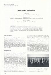
Instruments and Methods Geophysical imaging of alpine rock glaciers
Instruments and Methods Geophysical imaging of alpine rock glaciers
Instruments and Methods Geophysical imaging of alpine rock glaciers

You also want an ePaper? Increase the reach of your titles
YUMPU automatically turns print PDFs into web optimized ePapers that Google loves.
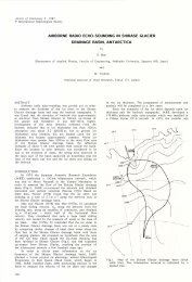
Maurer <strong>and</strong> Hauck: <strong>Instruments</strong> <strong>and</strong> methods 119<br />
seismic <strong>and</strong> georadar data should be recorded along<br />
common pr<strong>of</strong>iles.<br />
4. Based on the knowledge acquired as a result <strong>of</strong> steps 1–<br />
3, one or more boreholes should be drilled to groundtruth<br />
<strong>and</strong>/or calibrate the geophysical tomograms.<br />
5. Considering the high costs <strong>of</strong> drilling, it is almost always<br />
worthwhile to record cross-hole <strong>and</strong>/or borehole-tosurface<br />
datasets. Choice <strong>of</strong> the data type (i.e. diffusive<br />
electromagnetic, geoelectric, seismic or georadar) depends<br />
on the problem.<br />
6. In areas <strong>of</strong> particular interest (identified from the results<br />
<strong>of</strong> applying steps 1–5), small-scale 3-D georadar experiments<br />
may be performed.<br />
ACKNOWLEDGEMENTS<br />
This project would not have been feasible without the<br />
involvement <strong>of</strong> many people. We thank M. Musil, L. Arenson,<br />
S. Springman, D. Vonder Mühll, C. Kneisel, C. Baerlocher,<br />
M. Sperl, A. Seward, S. Metzger, H. Horstmeyer, T. Richter<br />
<strong>and</strong> the numerous field helpers for all their contributions.<br />
Financial support was provided by ETH Zürich (grant<br />
No. 0-20535), the EC project PACE <strong>and</strong> Academia Engadina.<br />
We thank A. Green for discussions <strong>and</strong> his thorough inhouse<br />
review <strong>of</strong> the manuscript, which improved the quality<br />
<strong>of</strong> the paper substantially. Finally we acknowledge the<br />
helpful comments <strong>of</strong> reviewer B. Kulessa <strong>and</strong> an anonymous<br />
reviewer.<br />
REFERENCES<br />
Arcone, S.A., D.E. Lawson, A.J. Delaney, J.C. Strasser <strong>and</strong><br />
J.D. Strasser. 1998. Ground-penetrating radar reflection pr<strong>of</strong>iling<br />
<strong>of</strong> groundwater <strong>and</strong> bed<strong>rock</strong> in an area <strong>of</strong> discontinuous<br />
permafrost. Geophysics, 63(5), 1573–1584.<br />
Arenson, L., M. Hoelzle <strong>and</strong> S. Springman. 2002. Borehole<br />
deformation measurements <strong>and</strong> internal structure <strong>of</strong> some <strong>rock</strong><br />
<strong>glaciers</strong> in Switzerl<strong>and</strong>. Permafrost Periglac. Process, 13(2),<br />
117–135.<br />
Berthling, I., B. Etzelmüller, M. Wa˚le <strong>and</strong> J.L. Sollid. 2003. Use <strong>of</strong><br />
Ground Penetration Radar (GPR) soundings for investigating<br />
internal structures in <strong>rock</strong> <strong>glaciers</strong>. Examples from Prins Karls<br />
Forl<strong>and</strong>, Svalbard. Z. Geomorphol., Supplementb<strong>and</strong> 132,<br />
103–121.<br />
Beylich, A.A. <strong>and</strong> 6 others. 2003. Assessment <strong>of</strong> chemical<br />
denudation rates using hydrological measurements, water<br />
chemistry analysis <strong>and</strong> electromagnetic geophysical data.<br />
Permafrost Periglac. Process, 14(4), 387–397.<br />
Bucki, A.K., K.A. Echelmeyer <strong>and</strong> S. MacInnes. 2004. The thickness<br />
<strong>and</strong> internal structure <strong>of</strong> Fireweed <strong>rock</strong> glacier, Alaska,<br />
USA as determined by geophysical methods. J. Glaciol.,<br />
50(168), 67–75.<br />
Davies, M.C.R., O. Hamza <strong>and</strong> C. Harris. 2001. The effect <strong>of</strong> rise in<br />
mean annual air temperature on the stability <strong>of</strong> <strong>rock</strong> slopes<br />
containing ice-filled discontinuities. Permafrost Periglac. Process,<br />
12(1), 137–144.<br />
Fischer, L., A. Kääb, C. Huggel <strong>and</strong> J. Nötzli. 2005. Geology, glacier<br />
changes, permafrost <strong>and</strong> related slope instabilities in a highmountain<br />
<strong>rock</strong> face: Monte Rosa east face, Italian Alps.<br />
Geophys. Res. Abstr., 7, 00518.<br />
Gogineni, S., T. Chuah, C. Allen, K. Jezek <strong>and</strong> R.K. Moore. 1998.<br />
An improved coherent radar depth sounder. J. Glaciol., 44(148),<br />
659–669.<br />
Grasmueck, M., R. Weger <strong>and</strong> H. Horstmeyer. 2004. Threedimensional<br />
ground-penetrating radar <strong>imaging</strong> <strong>of</strong> sedimentary<br />
structures, fractures, <strong>and</strong> archaeological features at submeter<br />
resolution. Geology, 32(11), 933–936.<br />
Gross, R., A. Green, H. Horstmeyer, K. Holliger <strong>and</strong> J. Baldwin.<br />
2003. 3-D georadar images <strong>of</strong> an active fault: efficient data<br />
acquisition, processing <strong>and</strong> interpretation strategies. Subsurf.<br />
Sens. Technol. Appl., 4(1), 19–40.<br />
Gross, R., A.G. Green, H. Horstmeyer <strong>and</strong> J.H. Begg. 2004.<br />
Location <strong>and</strong> geometry <strong>of</strong> the Wellington Fault (New Zeal<strong>and</strong>)<br />
defined by detailed three-dimensional georadar data.<br />
J. Geophys. Res., 109(B5), B05401. (10.1029/2003JB002615.)<br />
Gruber, S., M. Hoelzle <strong>and</strong> W. Haeberli. 2004. Permafrost thaw <strong>and</strong><br />
destabilization <strong>of</strong> Alpine <strong>rock</strong> walls in the hot summer <strong>of</strong> 2003.<br />
Geophys. Res. Lett., 31(13), L13504. (10.1029/2004GL020051.)<br />
Haeberli, W. 1992. Construction, environmental problems <strong>and</strong><br />
natural hazards in periglacial mountain belts. Permafrost<br />
Periglac. Process., 3(2), 111–124.<br />
Harris, C. <strong>and</strong> 9 others. 2003. Warming permafrost in European<br />
mountains. Global Planet. Change, 39(3–4), 215–225.<br />
Hauck, C. <strong>and</strong> D. Vonder Mühll. 2003. Using DC resistivity<br />
tomography to detect <strong>and</strong> characterise mountain permafrost.<br />
Geophys. Prospect., 51(4), 273–284.<br />
Hauck, C., M. Guglielmin, K. Isaksen <strong>and</strong> D. Vonder Mühll. 2001.<br />
Applicability <strong>of</strong> frequency domain <strong>and</strong> time-domain electromagnetic<br />
methods. Permafrost Periglac. Process, 12(1), 39–52.<br />
Hauck, C., K. Isaksen, D.S. Vonder Mühll <strong>and</strong> J.L. Sollid. 2004.<br />
<strong>Geophysical</strong> surveys designed to delineate the altitudinal limit<br />
<strong>of</strong> mountain permafrost: an example from Jotunheimen, Norway.<br />
Permafrost Periglac. Process, 15(3), 191–205.<br />
Heggem, E.S.F., H. Juliussen <strong>and</strong> B. Etzelmüller. 2005. Mountain<br />
permafrost in Central-Eastern Norway. Nor. Geogr, Tidsskr.<br />
59(2), 94–108.<br />
Heincke, B., A.G. Green, J. van der Kruk <strong>and</strong> H. Horstmeyer. 2005.<br />
Acquisition <strong>and</strong> processing strategies for 3D georadar surveying<br />
a region characterized by rugged topography. Geophysics, 70(6),<br />
K53–K61.<br />
Hoekstra, P. 1978. Electromagnetic methods for mapping shallow<br />
permafrost. Geophysics, 43(4), 782–787.<br />
Interpex Limited. 1990. TEMIX user’s manual. Golden, CO,<br />
Interpex Limited.<br />
Isaksen, K., R.S. Ödega˚rd, T. Eiken <strong>and</strong> J.L. Sollid. 2000. Composition,<br />
flow <strong>and</strong> development <strong>of</strong> two tongue-shaped <strong>rock</strong><br />
<strong>glaciers</strong> in the permafrost <strong>of</strong> Svalbard. Permafrost Periglac.<br />
Process, 11 (3), 241–257.<br />
Ishikawa, M., T. Watanabe <strong>and</strong> N. Nakamura. 2001. Genetic<br />
difference <strong>of</strong> <strong>rock</strong> <strong>glaciers</strong> <strong>and</strong> the discontinuous mountain<br />
permafrost zone in Kanchanjunga Himal, Eastern Nepal.<br />
Permafrost Periglac. Process, 12(3), 243–253.<br />
Kääb, A. <strong>and</strong> M. Vollmer. 2000. Surface geometry, thickness<br />
changes <strong>and</strong> flow fields on permafrost streams: automatic<br />
extraction by digital image analysis. Permafrost Periglac.<br />
Process, 11(4), 315–326.<br />
Kääb, A. <strong>and</strong> M. Weber. 2004. Development <strong>of</strong> transverse ridges on<br />
<strong>rock</strong> <strong>glaciers</strong>: field measurements <strong>and</strong> laboratory experiments.<br />
Permafr. Periglac. Proc., 15, 379–391.<br />
Kneisel, C. 2004. New insights into mountain permafrost occurrence<br />
<strong>and</strong> characteristics in glacier forefields at high altitude<br />
through the application <strong>of</strong> 2D resistivity <strong>imaging</strong>. Permafrost<br />
Periglac. Process, 15(3), 221–227.<br />
Kneisel, C., C. Hauck <strong>and</strong> D.S. Vonder Mühll. 2000. Permafrost<br />
below the timberline confirmed <strong>and</strong> characterized by geoelectrical<br />
resistivity measurements, Bever Valley, eastern Swiss Alps.<br />
Permafrost Periglac. Process, 11, 295–304.<br />
Lanz, E., H.R. Maurer, A.G. Green <strong>and</strong> J. Ansorge. 1998. Refraction<br />
tomography over a buried waste disposal site. Geophysics,<br />
63(4), 1414–1433.<br />
Lehmann, F. <strong>and</strong> A.G. Green. 1999. Semi-automated georadar<br />
acquisition in three dimensions. Geophysics, 64, 719–731.<br />
Lehmann, F. <strong>and</strong> A.G. Green. 2000. Topographic migration <strong>of</strong><br />
georadar data: implications for acquisition <strong>and</strong> processing.<br />
Geophysics, 65(3), 836–848.