- Page 1 and 2:
ANGUS LOCAL PLANREVIEWFINALISED PLA
- Page 3 and 4:
PREFACEThe Finalised Angus Local Pl
- Page 5 and 6:
CONTENTSPagePART 1: INTRODUCTION AN
- Page 8 and 9:
Local Plan AreaThe National Context
- Page 10 and 11:
FORMAT OF THE PLAN1.7 The Local Pla
- Page 12 and 13:
Area of Angus withinthe Cairngorms
- Page 14 and 15:
1.21 In Carnoustie and Barry the Lo
- Page 16 and 17:
1.31 The accessibility of sites by
- Page 18 and 19:
ENVIRONMENTAL PROTECTION1.39 Effect
- Page 20 and 21:
Schedule 1 : Development Guidelines
- Page 22 and 23:
BUILDING SUSTAINABLE COMMUNITIES2.1
- Page 24 and 25:
Area of Angus withinthe Cairngorms
- Page 26 and 27:
Table 2.1 : Housing Land Allowances
- Page 28 and 29:
Figure 2.2 : Rural Settlement Units
- Page 30 and 31:
2.19 It should be noted that becaus
- Page 32 and 33:
Affordable Housing2.21 The supply o
- Page 34 and 35:
Area will be applied to the overall
- Page 36 and 37:
Policy SC10 : Sites for Gypsies/Tra
- Page 38 and 39:
2.39 Access to suitable employment
- Page 40 and 41:
Policy SC14 : Industrial And Busine
- Page 42 and 43:
• are in keeping with the scale a
- Page 44 and 45:
Policy SC20 : Support For Town Cent
- Page 46 and 47:
• ensure provision of dedicated p
- Page 48 and 49:
SPORT AND RECREATION2.72 The pursui
- Page 50 and 51:
space is considered unnecessary due
- Page 52 and 53:
Community Service ProvisionCOMMUNIT
- Page 54 and 55:
TRANSPORT AND COMMUNICATIONS2.91 Ac
- Page 56 and 57:
Proposal SC37 : Walking and Cycling
- Page 58 and 59:
Policy SC40 : Upgrade of A92/A930An
- Page 60 and 61:
Telecommunications2.111 Modern tele
- Page 62 and 63:
ENVIRONMENT AND RESOURCES3.1 The en
- Page 64 and 65:
Figure 3.1 - Natural Heritage Desig
- Page 66 and 67:
Policy ER4 : Wider Natural Heritage
- Page 68 and 69:
3.13 Where appropriate, development
- Page 70 and 71:
Commercial Forestry3.17 Commercial
- Page 72 and 73:
Figure 3.3 : Heritage DesignationsA
- Page 74 and 75:
3.27 Where demolition is approved i
- Page 76 and 77:
Policy ER15 : Development Affecting
- Page 78 and 79:
3.39 Within the mediaeval burghs of
- Page 80 and 81:
3.43 The Water Environment and Wate
- Page 82 and 83:
Policy ER23 : Surface Water Disposa
- Page 84 and 85:
Policy ER26 : Flood Risk - Consulta
- Page 86 and 87:
• no other suitable alternative s
- Page 88 and 89:
Minerals3.65 Mineral deposits are f
- Page 90 and 91:
ENERGY3.68 Angus Council supports t
- Page 92 and 93:
Figure 3.4 : Wind Energy Developmen
- Page 94 and 95:
3.79 Hills, dip slopes and large ar
- Page 96 and 97:
3.83 As part of the Government’s
- Page 98 and 99:
Non-Municipal Solid Waste3.89 The c
- Page 100 and 101:
SEQUENTIAL APPROACH FOR MINERAL EXT
- Page 102 and 103:
CONTAMINATED LAND3.96 There are a n
- Page 104 and 105:
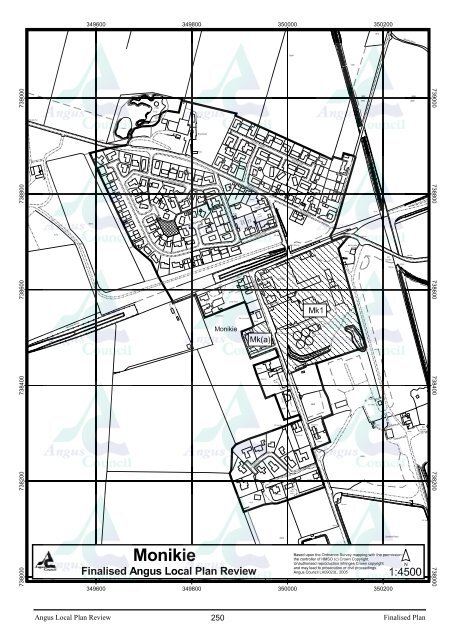
TOWNS & VILLAGESTarfsideArea of Ang
- Page 106 and 107:
Angus Local Plan Review100Finalised
- Page 108 and 109:
1. Arbroath is the largest town in
- Page 110 and 111:
A1 : Housing - Montrose Road15 ha o
- Page 112 and 113:
proposals should respect the scale,
- Page 114 and 115:
projects, which will retain and enh
- Page 116 and 117:
and setting of the area.A19 : Hospi
- Page 118 and 119:
HousingExisting sitesAllocated site
- Page 120 and 121:
BRECHIN1. The ‘Cathedral City’
- Page 122 and 123:
permission granted July 2004 to con
- Page 124 and 125:
located on the main approach to Bre
- Page 126 and 127:
For reference purposes only. No fur
- Page 128 and 129:
CARNOUSTIE and BARRY1. Carnoustie i
- Page 130 and 131:
Access should be taken from Barry R
- Page 132 and 133:
C11 : Sports Ground, Shanwell Road2
- Page 134 and 135:
Angus Local Plan Review128Finalised
- Page 136 and 137:
FORFAR1. Forfar is a traditional ma
- Page 138 and 139:
SITES PREVIOUSLY IDENTIFIED BY THE
- Page 140 and 141:
OPPORTUNITY SITES10. There are a nu
- Page 142 and 143:
F14 : Primary School - Whitehills N
- Page 144 and 145:
32725293731334113156895731741022481
- Page 146 and 147:
KIRRIEMUIR1. Kirriemuir is a gatewa
- Page 148 and 149:
Proposals should be in accordance w
- Page 150 and 151:
Angus Local Plan Review144Finalised
- Page 152 and 153:
Kirriemuir settlementstatementTopic
- Page 154 and 155:
MONIFIETH1. Monifieth is situated e
- Page 156 and 157:
The town centre is in need of upgra
- Page 158 and 159:
Angus Local Plan Review152Finalised
- Page 160 and 161:
MONTROSE including Ferryden & Hills
- Page 162 and 163:
9. The site at Brechin Road is iden
- Page 164 and 165:
employment land at Broomfield Indus
- Page 166 and 167:
Angus Local Plan Review160Finalised
- Page 168 and 169:
der'sDevelopment inexisting built-u
- Page 170 and 171:
TOWNS & VILLAGESTarfsideArea of Ang
- Page 172 and 173:
75040075030075020075010075000033170
- Page 174 and 175:
42247166521744600744500744400744300
- Page 176 and 177:
In addition and as part of communit
- Page 178 and 179:
32738600738550738500738450738400738
- Page 180 and 181:
74530074520074510074500074490074480
- Page 182 and 183:
TrackLB9148756678491011121812214924
- Page 184 and 185:
NorthviewPathPath (um)43 2157 60122
- Page 186 and 187:
74820074810074800074790074780035160
- Page 188 and 189:
75880075875075870075865075860075855
- Page 190 and 191:
75480075470075460075450075440032850
- Page 192 and 193:
65736400736300736200736100736000346
- Page 194 and 195:
55507459007458007457007456007455007
- Page 196 and 197:
13675985075980075975075970075965075
- Page 198 and 199:
24276480076470076460076450076440076
- Page 200 and 201:
73840073835073830073825073820073815
- Page 202 and 203:
Tank3513007490007489007488007487007
- Page 204 and 205:
31DWTrack3124335000 335100 335200 3
- Page 206 and 207: 3135a735c83127332523819363421b21a11
- Page 208 and 209: HOUSINGEXISTING SITES6. The existin
- Page 210 and 211: s7618006777617007616007615003482003
- Page 212 and 213: Track764600764500764400764300764200
- Page 214 and 215: Drain61061820159248LB83119714159751
- Page 216 and 217: Fk1 : Housing - Millgate 3Approxima
- Page 218 and 219: 2171279Playground235412A 9281774690
- Page 220 and 221: HOUSINGEXISTING SITES5. Sites with
- Page 222 and 223: 12750900750800750700750600750500750
- Page 224 and 225: 2191203Track123630211437381 to 8101
- Page 226 and 227: 22216A 92A 92433925BM 30.03m2749700
- Page 228 and 229: Ik1 : Housing - Land to rear of Lun
- Page 230 and 231: 11282495637135827646749600749400749
- Page 232 and 233: NEW ALLOCATIONS6. Table 2 summarise
- Page 234 and 235: 74430074420074410074400074390074380
- Page 236 and 237: 75595075590075585075580075575075570
- Page 238 and 239: 333800333700333600755200Reservoir(c
- Page 240 and 241: of764550764500764450764400764350764
- Page 242 and 243: Track162131261031111429227318Pav191
- Page 244 and 245: HOUSINGNEW ALLOCATIONS4. Table 1 su
- Page 246 and 247: 9.3mIssuesAll Weather PitchSiloEast
- Page 248 and 249: 31231915177131712121161824151262130
- Page 250 and 251: 417116Drain175250075240075230000307
- Page 252 and 253: 71753400753300753200753100753000339
- Page 254 and 255: 75930075920075910075900075890075880
- Page 258 and 259: 227374005873730073720073710046.1m1:
- Page 260 and 261: 15559961267364007363007362007361007
- Page 262 and 263: 73780073770073760073750073740034240
- Page 264 and 265: 76410076400076390076380076370076360
- Page 266 and 267: 75650075640075630075620075610034750
- Page 268 and 269: 73605073600073595073590073585073580
- Page 270 and 271: 8064112412FBs1118225315626274892579
- Page 272 and 273: 76600076595076590076585076580076575
- Page 274 and 275: 74905074900074895074890074885074880
- Page 276 and 277: 111a124ROADLB15SMPostBaldragon43714
- Page 278 and 279: 20181437585007584007583007582007581
- Page 280 and 281: 76460076450076440076430076420035410
- Page 282 and 283: 44a1394a413353324911092384846424056
- Page 284 and 285: 3134CR13CR4123162155176432187753000
- Page 286 and 287: 64.3mSmiddy FarmhouseTrack8734 GP82
- Page 288: Development boundarySafeguard areas
- Page 291 and 292: PART 5: Implementation, Monitoring
- Page 293 and 294: Introduction5.1 This local plan pro
- Page 295 and 296: acceptable and will form one of the
- Page 297 and 298: Review5.15 The Finalised Angus Loca
- Page 299 and 300: PART 6: AppendicesPage1. Developmen
- Page 301 and 302: APPENDIX 1 - DEVELOPMENTS REQUIRING
- Page 303 and 304: Appendix 2 : Housing Land Supply in
- Page 305 and 306: Sites with Planning Permission at J
- Page 307 and 308:
Appendix 3L1 : Letham Unadopted Roa
- Page 309 and 310:
Poilcy L1 LETHAM - UNADOPTED ROADS
- Page 311 and 312:
Finalised AngusLocal Plan ReviewSec
- Page 313 and 314:
APPENDIX 5Profile of AngusAREA (ha)
- Page 315:
Gross Earnings 2003(New Earnings Su