Draft Environmental Impact Report - East Bay Municipal Utility District
Draft Environmental Impact Report - East Bay Municipal Utility District
Draft Environmental Impact Report - East Bay Municipal Utility District
- No tags were found...

You also want an ePaper? Increase the reach of your titles
YUMPU automatically turns print PDFs into web optimized ePapers that Google loves.
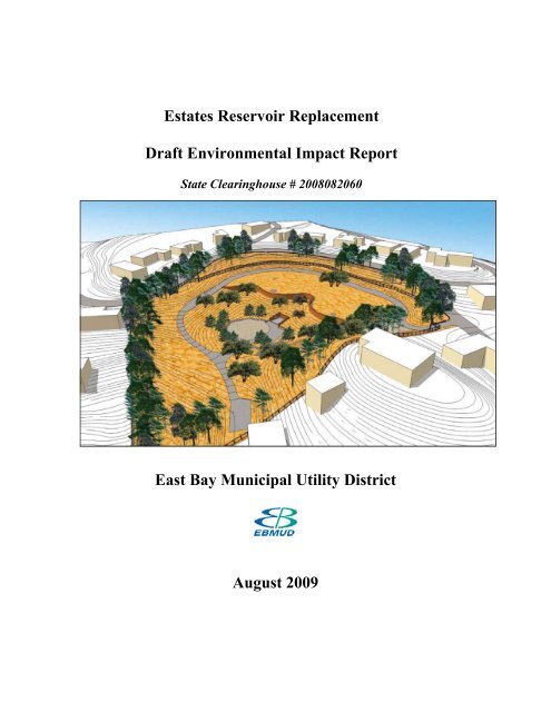
Estates Reservoir Replacement<strong>Draft</strong> <strong>Environmental</strong> <strong>Impact</strong> <strong>Report</strong>State Clearinghouse # 2008082060<strong>East</strong> <strong>Bay</strong> <strong>Municipal</strong> <strong>Utility</strong> <strong>District</strong>August 2009
Estates Reservoir Replacement<strong>Draft</strong> <strong>Environmental</strong> <strong>Impact</strong> <strong>Report</strong>State Clearinghouse # 2008082060Prepared by<strong>East</strong> <strong>Bay</strong> <strong>Municipal</strong> <strong>Utility</strong> <strong>District</strong>August 2009
TABLE OF CONTENTSEstates Reservoir Replacement <strong>Draft</strong> EIRA. Acronyms and Abbreviations ............................................................................. A-1S. Summary................................................................................................................S-1S.1 Introduction....................................................................................................S-1S.2 Background....................................................................................................S-1S.3 Project Description.........................................................................................S-3S.4 Summary of <strong>Impact</strong>s......................................................................................S-5S.5 Analysis of Project and Design Alternatives ...............................................S-25S.6 Issues Raised During Outreach/Notice of Preparation ScopingReview Period..............................................................................................S-26S.7 Resources Not Evaluated Further in the <strong>Environmental</strong> <strong>Impact</strong> <strong>Report</strong>......S-26S.8 Organization of <strong>Environmental</strong> <strong>Impact</strong> <strong>Report</strong>............................................S-271. Introduction........................................................................................................... 1-11.1 Purpose of the <strong>Environmental</strong> <strong>Impact</strong> <strong>Report</strong>................................................ 1-11.2 California <strong>Environmental</strong> Quality Act <strong>Environmental</strong> <strong>Impact</strong><strong>Report</strong> Process ............................................................................................... 1-12. Project Description ............................................................................................... 2-12.1 Overview........................................................................................................ 2-12.2 Project Need and Objectives ......................................................................... 2-12.3 Project Location............................................................................................. 2-72.4. Project Characteristics ................................................................................... 2-72.5 Project Schedule and Cost ........................................................................... 2-152.6 Approvals or Authorizations Required for This Project.............................. 2-153. <strong>Environmental</strong> Setting, <strong>Impact</strong>s And Mitigation Measures ............................. 3-13.1 Introduction................................................................................................. 3-1.13.2 Visual Quality ............................................................................................. 3-2.13.3 Geology, Soils, and Seismicity .................................................................. 3-3.13.4 Biological Resources ................................................................................. 3-4.13.5 Cultural Resources ..................................................................................... 3-5.13.6 Transportation and Circulation ................................................................. 3-6.13.7 Air Quality .................................................................................................. 3-7.13.8 Greenhouse Gases....................................................................................... 3-8.13.9 Noise and Vibration ................................................................................... 3-9.14. Project Alternatives .............................................................................................. 4-14.1 Introduction and Approach ............................................................................ 4-14.2 Project Alternatives........................................................................................ 4-34.3 Alternatives of the Proposed Project.............................................................. 4-74.4 No Project Alternative ................................................................................. 4-11sb09_001.doc i 7/22/2009
Estates Reservoir Replacement <strong>Draft</strong> <strong>Environmental</strong> <strong>Impact</strong> <strong>Report</strong>Table of Contents4.5 Comparison of Selected Alternatives and Identification of the<strong>Environmental</strong>ly Proposed Project .............................................................. 4-125. Cumulative <strong>Impact</strong>s, Growth Inducement and Other Topics Requiredby CEQA................................................................................................................ 5-15.1 Cumulative <strong>Impact</strong>s ....................................................................................... 5-15.2 Cumulative <strong>Impact</strong>s and Mitigation Measures ............................................. 5-65.3 Growth Inducement Potential and Secondary Effects of Growth................ 5-105.4 Other Topics Required by CEQA................................................................ 5-116. <strong>Report</strong> Preparers .................................................................................................. 6-16.1 Lead Agency .................................................................................................. 6-16.2 EIR Consultants ............................................................................................. 6-1APPENDICESA. Public InvolvementB. Initial StudyC. Notice of Preparation of an <strong>Environmental</strong> <strong>Impact</strong> <strong>Report</strong>LIST OF FIGURESS-1 Estates Reservoir Replacement Vicinity/Location Map......................................S-2S-2 Estates Reservoir Proposed Site Plan and Cross-Sections...................................S-42-1 <strong>East</strong> <strong>Bay</strong> <strong>Municipal</strong> <strong>Utility</strong> <strong>District</strong> Service Area................................................ 2-22-2 Existing Water Treatment Plant Service Area..................................................... 2-42-3 Elevated Views of the Landscape Plan.............................................................. 2-103.2-1 Estates Reservoir Replacement Project Regional Landscape Context ............. 3-2.23.2-2 Estates Reservoir Site - Existing Site Characteristics and Features ................. 3-2.43.2-3 Plan and Profile View of the Existing Site Facilities, Conditions andFeatures, Residences Adjacent to the Site ........................................................ 3-2.63.2-4 Estates Reservoir - Primary Concerns .............................................................. 3-2.73.3-1 Geologic Map of the Estates Reservoir Area.................................................... 3-3.33.3-2 Map of Regional Seismic Sources .................................................................... 3-3.73.6-1 Project Site Vicinity and Analysis Locations ................................................... 3-6.53.6-2 Existing Daily Roadway Volumes.................................................................... 3-6.63.6-3 Existing Conditions - Peak Hour Traffic Volumes, Lane Configurations,and Traffic Controls.......................................................................................... 3-6.83.6-4 Project Trip Distribution................................................................................. 3-6.143.6-5 Recommended Truck Routing Plan................................................................ 3-6.163.9-1 Estates Reservoir Site Noise Measurement Locations...................................... 3-9.73.9-2a Noise Levels at LT1 - November 1-2, 2007 ..................................................... 3-9.93.9-2b Noise Levels at LT1 - November 2-3, 2007 ..................................................... 3-9.9sb09_001.doc ii 7/22/2009
Estates Reservoir Replacement <strong>Draft</strong> <strong>Environmental</strong> <strong>Impact</strong> <strong>Report</strong>Table of Contents3.9-3a Noise Levels at LT1 - November 3-4, 2007 ................................................... 3-9.103.9-3b Noise Levels at LT1 - November 4-5, 2007 ................................................... 3-9.104-1 Estates Reservoir Concept Design Categories/Options ....................................... 4-85-1 Projects with the Potential for Cumulative <strong>Impact</strong>s ............................................ 5-5LIST OF TABLESS-1 Summary of <strong>Impact</strong>s and Mitigation Measures...................................................S-52-1 Construction Activities Associated With Estates Reservoir.............................. 2-122-2 Estates Reservoir Demolition Quantity Estimates............................................. 2-132-3 Discretionary Permits Potentially Required....................................................... 2-153.3-1 Main Earthquake Sources in the Region........................................................... 3-3.83.3-2 Selected Attenuation Relationships .................................................................. 3-3.83.3-3 Calculated Horizontal Peak Ground Acceleration............................................ 3-3.93.3-4 Modified Mercalli Intensity Scale .................................................................. 3-3.103.4-1 Plants Observed at Estates Reservoir, Piedmont, California ............................ 3-4.23.6-1 Signalized Intersection Level of Service Criteria.................................................... 3-6.23.6-2 Unsignalized Intersection Level of Service Criteria ........................................... 3-6.23.6-3 Existing Daily Traffic Volumes........................................................................ 3-6.43.6-4 Existing Intersection Operations....................................................................... 3-6.73.6-5 Estates Reservoir - Construction Schedule and Trip Generation Estimates ... 3-6.123.6-6 Montclair Pumping Plant Upgrade - Construction Schedule and TripGeneration Estimates ...................................................................................... 3-6.133.6-7 Existing Daily Traffic Volumes Plus Construction Traffic ............................ 3-6.153.6-8 Existing Plus Construction Traffic Intersection Operations ........................... 3-6.173.7-1 Estimated Maximum Fuel Consumption for Project ........................................ 3-7.13.7-2 State and Federal Ambient Air Quality Standards............................................ 3-7.73.7-3 Ambient Air Quality Summary for San Francisco 2002-07, Maximums......... 3-7.83.7-4 PM 10 and PM 2.5 Standard Violation Days for San Francisco 2002-07 ............. 3-7.93.7-5 BAAQMD CEQA Thresholds of Significance............................................... 3-7.113.7-6 Estimated On-site and Off-site Total Criteria & GHG* Emissions -Controlled ....................................................................................................... 3-7.133.7-7 Estimated Demolition Phase Criteria Maximum <strong>Impact</strong>s - Controlled.......... 3-7.133.7-8 Estimated Construction Phase Criteria Maximum <strong>Impact</strong>s - Controlled........ 3-7.143.7-9 Diesel Particulate Matter Screening Health Risk Assessment........................ 3-7.143.7-10 Estimated Fugitive Dust Emissions from Demolition .................................... 3-7.173.7-11 Estimated Fugitive Dust Emissions from Construction.................................. 3-7.173.8-1 Estimated Maximum Fuel Consumption for Project ........................................ 3-8.23.8-2 Standard Composition of Dry Air..................................................................... 3-8.33.8-3 100-Year Global Warming Potentials of Greenhouse Gases............................ 3-8.73.8-4 100-Year Global Warming Potentials of Ozone Depleters............................... 3-8.73.8-5 Estimated On-site Greenhouse Gases Emissions............................................ 3-8.133.8-6 Estimated Off-site Greenhouse Gases Emissions........................................... 3-8.143.8-7 Estimated On-site and Off-site Total Greenhouse Gases Emissions.............. 3-8.14sb09_001.doc iii 7/22/2009
Estates Reservoir Replacement <strong>Draft</strong> <strong>Environmental</strong> <strong>Impact</strong> <strong>Report</strong>Table of Contents3.8-8 Estimated Water and Power Conservation ..................................................... 3-8.163.8-9 Estimated Annual Greenhouse Gases Reductions from Conservation........... 3-8.163.9-1 Definition of Acoustical Terms Used in this <strong>Report</strong> ........................................ 3-9.23.9-2 Typical Noise Levels in the Environment ........................................................ 3-9.33.9-3 Applicable Ordinance Time Limits and Noise Standards................................. 3-9.53.9-4 Noise and Land Use Compatibility Guidelines, City of Oakland..................... 3-9.53.9-5 Construction Equipment 50-Foot Noise Emission Limits.............................. 3-9.143.9-6 Demolition and Construction Noise Level Projections .................................. 3-9.154-1 Evaluation of Alternatives to the Project............................................................. 4-44-2 Alternatives of the Project ................................................................................. 4-105-1 Projects with the Potential for Cumulative <strong>Impact</strong>s ............................................ 5-4sb09_001.doc iv 7/22/2009
ACRONYMS AND ABBREVIATIONSABABAGAPCDAQMDARBASTASTMBAAQMDBARTBMPsCAAQSCal-EPACaltransCAPCAPCOACARBCCRCCWCCDFGCDMGCDSMCEQACESACFCsCFRCGSCH 4CIWMBCNDDBCNELCNPSCOCO 2Assembly BillAssociation of <strong>Bay</strong> Area GovernmentsAir Pollution Control <strong>District</strong>Air Quality Management <strong>District</strong>Air Resources Boardabove-ground storage tankAmerican Society for Testing and Materials<strong>Bay</strong> Area Air Quality Management <strong>District</strong><strong>Bay</strong> Area Rapid Transitbest management practicesCalifornia Ambient Air Quality StandardsCalifornia <strong>Environmental</strong> Protection AgencyCalifornia Department of TransportationClean Air PlanCalifornia Air Pollution Control Officers AssociationCalifornia Air Resources BoardCalifornia Code of RegulationsContra Costa Water CompanyCalifornia Department of Fish and GameCalifornia Division of Mines and Geologycement-deep-soil-mixingCalifornia <strong>Environmental</strong> Quality ActCalifornia Endangered Species ActchlorofluorocarbonsCode of Federal RegulationsCalifornia Geological SurveymethaneCalifornia Integrated Waste Management BoardCalifornia Natural Diversity DatabaseCommunity Noise Equivalent LevelCalifornia Native Plant Societycarbon monoxidecarbon dioxidesb09_001.doc A-1 7/22/2009
Estates Reservoir Replacement <strong>Draft</strong> <strong>Environmental</strong> <strong>Impact</strong> <strong>Report</strong>Acronyms and AbbreviationsCorps United States Army Corps of EngineersCORTESE Cortese Hazardous Waste and Substances Sites ListCRHR California Register of Historical ResourcesdBdecibeldBA a-weighted noise levels in decibelsDHS Department of Health ServicesDPM diesel particulate matterDSOD Division of Safety of DamsDTSC Department of Toxic Substances ControlEBMUD <strong>East</strong> <strong>Bay</strong> <strong>Municipal</strong> <strong>Utility</strong> <strong>District</strong>EBRPD <strong>East</strong> <strong>Bay</strong> Regional Park <strong>District</strong>EDR <strong>Environmental</strong> Data ResourcesEIR<strong>Environmental</strong> <strong>Impact</strong> <strong>Report</strong>EPSemission performance standardESU Evolutionarily Significant UnitFEMA Federal Emergency Management AgencyFESA Federal Endangered Species ActFINDS Facility Index SystemggravityGISGeographic Information SystemGHG greenhouse gasesGWP global warming potentialH 2 Owater or water vaporHCFCs hydrochlorofluorocarbonsHFCs hydorfluorocarbonsHighway 13 Warren Freewayin/sec inches per secondI-580 Interstate 580I-680 Interstate 680IPCC Intergovernmental Panel on Climate ChangeLdnday-night noise levelLeqsteady-state energy levelLOS level of serviceMmagnitudesb09_001.doc A-2 7/22/2009
Estates Reservoir Replacement <strong>Draft</strong> <strong>Environmental</strong> <strong>Impact</strong> <strong>Report</strong>Acronyms and AbbreviationsMCEMCLsmgMGmgal/yrmgdMMMmaxmphMRZsmslMTCMwN 2 ONAAQSNAHCNMFSNMVOCNO2NOPNOxNPDESNRCSO3OAPOPROSHAPGAPG&EPM 10PM 2.5ppmppmvppmwmaximum credible earthquakeMaximum Contaminant Levelsmilligrammillion gallonsmillion gallons of water annuallymillion gallons per dayModified Mercallimaximum moment magnitudemiles per hourMineral Resource Zonesmean sea levelMetropolitan Transportation Commissionmoment magnitudenitrous oxideNational Ambient Air Quality StandardsNative American Heritage CommissionNational Marine Fisheries Servicenonmethane volatile organic compoundsnitrogen dioxideNotice of Preparationnitrogen oxidesNational Pollutant Discharge Elimination SystemNatural Resources Conservation ServiceozoneOzone Attainment PlanCalifornia Office of Planning and ResearchOccupational Safety and Health Administrationpeak ground accelerationPacific Gas and Electric Companyparticulate matter 10 microns in diameter or lessparticulate matter 2.5 microns in diameter or lessparts per millionparts per million by volumeparts per million by weightsb09_001.doc A-3 7/22/2009
Estates Reservoir Replacement <strong>Draft</strong> <strong>Environmental</strong> <strong>Impact</strong> <strong>Report</strong>Acronyms and AbbreviationsPPVPRCPUCRCRARHAAROGRWQCBSF 6SMARASO2SRSVPSWPPPSWRCBUCMPUCBMVZUNFCCCUSCUSDAUSEPAUSFWSUSGSUSTVOCsWTPpeak particle velocityPublic Resources CodePublic Utilities CommissionResource Conservation and Recovery ActRoyston Hanamoto, Alley and Abeyreactive organic gasesRegional Water Quality Control Boardsulfur hexafluorideSurface Mining and Reclamation Actsulfur dioxideState RouteSociety of Vertebrate PaleontologyStormwater Pollution Prevention PlanState Water Resources Control BoardUniversity of California Museum of PaleontologyUniversity of California, Berkeley, Museum of Vertebrate ZoologyUnited Nations Framework Convention on Climate ChangeUnited States CodeUnited States Department of AgricultureUnited States <strong>Environmental</strong> Protection AgencyUnited States Fish and Wildlife ServiceUnited States Geological Surveyunderground storage tankvolatile organic compoundwater treatment plantsb09_001.doc A-4 7/22/2009
SUMMARYS.1 IntroductionThis <strong>Draft</strong> <strong>Environmental</strong> <strong>Impact</strong> <strong>Report</strong> (EIR) assesses the potential impacts of the EstatesReservoir Replacement Project (the Project) proposed by the <strong>East</strong> <strong>Bay</strong> <strong>Municipal</strong> <strong>Utility</strong><strong>District</strong> (EBMUD). Figure S-1 identifies the Project location, as well as nearby cities andmajor roadways in the Project vicinity, and shows the disposition of the three reservoirs in theDingee Pressure Zone. The Piedmont Reservoir is presently out of service and the DingeeReservoir will be removed from service once the Project is constructed and in service.This document has been prepared in accordance with the California <strong>Environmental</strong>Quality Act (CEQA) statutes and guidelines. EBMUD is the lead agency for this CEQAprocess. Written comments about the Project or EIR should be directed to:Gwen Alie, Associate Planner<strong>East</strong> <strong>Bay</strong> <strong>Municipal</strong> <strong>Utility</strong> <strong>District</strong>375 Eleventh Street (Mail Slot 701)Oakland, CA 94607-4240galie@ebmud.comS.2 BackgroundEstates Reservoir is located on a 6.7-acre parcel of land on the south side ofEstates Drive, at 6317 Estates Drive, in the City of Oakland. The site is situated westof Highway 13, south of Moraga Road and north of Park Avenue. Estates Reservoir isone of two open-cut reservoirs in the Dingee Pressure Zone; Dingee Reservoir is theother reservoir also located on the South side of Highway 13, approximately 500 feetto the north of Estates Reservoir, on Bullard Drive. Both the Estates and DingeeReservoirs are currently in service. The Montclair Pumping Plant is located at theEstates Reservoir site. Figure S-1 also shows the location of all three facilities.The proposed Estates Reservoir Replacement Project will improve water quality andincrease system reliability and operating efficiency by removing excess, inefficientstorage and aging facilities requiring major rehabilitation or replacement in the DingeePressure Zone. The Project will also address seismic issues related to the Estatesreservoir embankment in response to a 2004 letter request by the California Divisionof Safety of Dams (DSOD) for seismic study and remediation of the Estates Dam.Based on consultant seismic studies, EBMUD determined that there was a potential forcrest deformation and settlement and that redesign of the facility was required. In theinterim, the Estates Reservoir is currently operating at a reduced capacity of about 13.4million gallon (MG) compared to its original capacity of 17.6 MG. In addition, theexisting roof structure does not meet current seismic requirements.sb09_001.doc S-1 7/22/2009
Estates Reservoir Replacement <strong>Draft</strong> <strong>Environmental</strong> <strong>Impact</strong> <strong>Report</strong>SummarySource: EBMUDEstates Reservoir Replacement Vicinity/Location MapFigure S-1sb09_001.doc S-2 7/22/2009
Estates Reservoir Improvements <strong>Draft</strong> <strong>Environmental</strong> <strong>Impact</strong> <strong>Report</strong>SummaryS.3 Project DescriptionThe Project involves the demolition of the entire existing open-cut Estates Reservoirfollowed by the construction of two 3.3-MG buried concrete tanks with landscaping andassociated appurtenances. Figure S-2 depicts the proposed site plan and cross-sectionsfor the existing and proposed replacement facilities at the Estates Reservoir site.Improvements at the Montclair Pumping Plant, located on the same site, include anupgrade of existing pumps and motors including the instrumentation, motor controlcenters, transformers and related appurtenances. No changes to the footprint or plantstructure are proposed.Demolition of the Estates Reservoir would entail removing the fountains, roof andsupporting timbers, concrete planter and concrete reservoir basin lining, and reducing theheight of the earth dam embankment. Some of the structural concrete and soil removedfrom the embankment will be recycled and incorporated into the proposed grading andlandscape plan. The bulk of the existing roofing material, plywood sheathing, and timberframing system cannot be reused on-site.The design of the two partially buried replacement 3.3-MG concrete tanks has beenintegrated into and is an integral element of the replacement landscape site design. Theinterior tank site (basin) will be landscaped with a mixture of native grasses, shrubs andtrees. An improved (looped) pedestrian path will be added in response to residents’concerns about pedestrian and traffic safety. Existing bushes along the perimeter will bethinned while the lower braches of existing trees will be pruned to address fire preventionand security concerns; this pruning will also open public views into the site. The existingvehicular access point to the site from Estates Drive will be maintained. New interiorparking for EBMUD vehicles and equipment will be provided in two areas which will bescreened to the extent feasible.In response to EBMUD’s Vulnerability Assessment Program- Security Upgrades, theexisting chain-link security fence along the site perimeter will be replaced at the existinglocation. The fence height will increase from six to eight feet, and the mesh size willchange from two inches to one inch. The new security fence will also be black-vinylcoated.sb09_001.doc S-3 7/22/2009
Estates Reservoir Replacement <strong>Draft</strong> <strong>Environmental</strong> <strong>Impact</strong> <strong>Report</strong>SummarySource : RHHA 2009Estates Reservoir Proposed Site Plan and Cross-SectionsFigure S-2sb09_001.doc S-4 7/22/2009
Estates Reservoir Replacement <strong>Draft</strong> <strong>Environmental</strong> <strong>Impact</strong> <strong>Report</strong>SummaryS.4 Summary of <strong>Impact</strong>sTable S-1 below is a summary of all significant impacts and required mitigation and less than significant impacts (including impactsidentified as “not significant” or “no impact” in the analysis in Chapter 3) where mitigation is not required. For all significantimpacts, the significance after mitigation is determined.TABLE S-1Estates Reservoir Replacement ProjectSummary Of <strong>Impact</strong>s And Mitigation MeasuresENVIRONMENTALIMPACT MITIGATION MEASURESSIGNIFICANCEAFTERMITIGATIONVISUAL QUALITY<strong>Impact</strong> 3.2-1: Projectconstruction could generatevisual impacts experienced inthe short-term from nearbyareas during construction.Measure 3.2-1: EBMUD will require the contractor to ensure that the construction site is clean bystoring building materials and equipment within the proposed staging areas in the reservoir bowl, orin areas removed from public view, and by frequent removal of construction debris that is not to bereused on-site. Construction phasing shall be organized to minimize equipment storage on-site.EBMUD will also use interpretive materials to explain the need for the Project, in attractive andsimple graphic displays. Signage locations could include, but would not be limited to, areas near theEstates Reservoir entry, along Estates Drive and the residentially developed segments of the truckroute.Less than Significant.<strong>Impact</strong> 3.2-2: Projectconstruction could alter thesite’s appearance and long-termvisual effects.Measure 3.2-2: A landscape plan for the Estates Reservoir Replacement Project will be prepared during theDesign Phase that will be consistent with the 2008 RHAA Concept Design Process andRecommendations <strong>Report</strong> (updated 2009), and ensure that areas disturbed by construction arere-graded and planted to result in landforms that are compatible with existing site topographyand landscaping, as well as the neighborhood setting. Annual vegetation/tree pruning, consistent with City of Oakland Fire Department FireAbatement Regulations, will continue to be implemented.Less than Significant.sb09_001.doc S-5 7/22/2009
Estates Reservoir Replacement <strong>Draft</strong> <strong>Environmental</strong> <strong>Impact</strong> <strong>Report</strong>SummaryENVIRONMENTALIMPACT MITIGATION MEASURES EBMUD will coordinate with neighborhood representatives regarding the placement of newplantings to effect screening., and this input will be incorporated into the Final Landscape Plan. The contractor shall be required to warrant landscape plantings for one year after projectcompletion. EBMUD will ensure that the contractor restores graded, disturbed areas to a natural-appearinglandform. Site improvements will include aesthetic/architectural treatment where facilities are locatednear to, or are visible from, public trails and residences, namely:- Creating a new drainage feature with rocks and stones, around the reservoir valve pit at thebase of the excavated basin.- Improving the existing trail on EBMUD property, along Estates Drive.- Constructing a low, rustic, wooden fence along Estates Drive.- Constructing a parking area for EBMUD equipment and staff vehicles in the valve pit area.- Replacing the existing six foot high, two-inch web, perimeter chain-link security fencing,with an eight-foot high, one-inch web chain link fence in the same location. The new fencewill be the same color as the existing fence, black.SIGNIFICANCEAFTERMITIGATION<strong>Impact</strong> 3.2-3: Effects on ascenic vista.Mitigation Measure: Not Required: The Project site is not within a defined scenic vista. Existingperimeter vegetation along Estates Drive allows only filtered views into the site from adjacentresidences. Mature trees on the dam downslope block distant views of the <strong>Bay</strong>. Project demolitionand construction will occur within the bowl of the existing reservoir and will not create or openscenic vistas. Reduction of the dam embankment by 25 feet will open views to the lower site butmature trees along the embankment slope (towards Woods Drive) will continue to block/filter distantviews of the <strong>Bay</strong>.sb09_001.doc S-6 7/22/2009
Estates Reservoir Replacement <strong>Draft</strong> <strong>Environmental</strong> <strong>Impact</strong> <strong>Report</strong>SummaryENVIRONMENTALIMPACT MITIGATION MEASURES<strong>Impact</strong> 3.2-4: Projectconstruction could affect viewsfrom the surrounding area,including public roadways, publictrails and open space andresidential areas.SIGNIFICANCEAFTERMITIGATIONMeasure 3.2-4: Implement Measures 3.3-2, as detailed above. Less than Significant.<strong>Impact</strong> 3.2-5: Projectconstruction could generate newsources of light and glare.Measure 3.2-5: EBMUD will ensure that stationary lighting used during nighttime construction (ifrequired) is of limited duration and shielded and directed downward or oriented such that little or nolight is directly visible from Estates Drive. No permanent nighttime lights will be constructed onthe site.Less than Significant.GEOLOGY, SOILS AND SEISMICITY<strong>Impact</strong> 3.3-1: New slopesassociated with reservoirconstruction may be potentiallyunstable.Measure 3.3-1: During the design phase, EBMUD will perform geotechnical evaluations and ifrequired, conduct site specific geotechnical investigation/exploration/testing to reduce or eliminatepotential slope hazards. Design and construction specifications will incorporate therecommendations from the geotechnical evaluation for any slope stabilization, which may includesome of the following measures, although this list is not exclusive: Appropriate slope inclination Slope terracing Fill compaction Soil reinforcement Surface and subsurface drainage facilities Retaining walls Buttresses Erosion control measures- Sub drain system- Soil nails or anchorsLess than Significant.sb09_001.doc S-7 7/22/2009
Estates Reservoir Replacement <strong>Draft</strong> <strong>Environmental</strong> <strong>Impact</strong> <strong>Report</strong>SummaryENVIRONMENTALIMPACT MITIGATION MEASURES<strong>Impact</strong> 3.3-2: Facility damage orservice interruptions resulting fromstrong ground shaking.Measure 3.3-2: During the design phase, EBMUD will perform a geotechnical evaluation and, ifrequired, conduct site specific geotechnical investigations and evaluations to identify the potentialfor secondary ground failure hazards (i.e., seismically-induced settlement). The geotechnicalevaluation will provide recommendations for applicable settlement mitigation measures to beincorporated in the design and construction specifications for the replacement reservoirs.SIGNIFICANCEAFTERMITIGATIONLess than Significant.<strong>Impact</strong> 3.3-3: Facility damageresulting from settlement or upliftcaused by compressible soils.Measure 3.3-3a: The tank structures will be supported by 1) select engineered fill founded onbedrock after removal of the soils above the bedrock or 2) cast-in-place concrete pier foundationsobtaining vertical support from the bedrock without removing the overlying soils. These measureswill reduce the potential settlement to within the acceptable limits.Less than Significant.<strong>Impact</strong> 3.3-4: Exposure of soilsto erosion after removal of theconcrete lining within theexisting reservoir basin.Measure 3.3-3b: EBMUD will include in the contract specifications that any fill will be selected,placed, compacted, and inspected in accordance with plans and specifications prepared by a licensedprofessional engineer.Measure 3.3-4: Grading for the reservoir construction will be performed in compliance with theStormwater Pollution Prevention Plan to control/manage soil erosion and run-off. During gradingconstruction, sprinkling will be performed regularly to control dust at the site. Measures forwinterization, including hydro-mulching, straw bale installation, and/or other measures will beperformed to minimize soil erosion during the rainy seasons.Less than Significant.<strong>Impact</strong> 3.3-5: Stockpiledmaterials from import orexcavation of the existing damcould cause localized instabilityof slopes.BIOLOGICAL RESOURCES<strong>Impact</strong> 3.4-1: Loss of, ordamage to protected trees.Measure 3.3-5: Due to limited construction working space at the site, stockpiling of imported orlocally excavated materials will be minimized. In general, the imported materials will be placeddirectly at the intended fill areas and the locally excavated materials not proposed for reuse on-sitewill be off hauled shortly after excavation.Measure 3. 4-1: No trees are scheduled to be removed from the site, but inadvertent damage mayoccur during construction. EBMUD will develop and implement a five-year tree monitoringprogram for any protected trees lost or damaged by project construction. Appropriate performancestandards may include, but are not limited to a not less than 75 percent survival rate of replacementtree plantings and a requirement that trees be able to be self-sustaining at the end of five years.Less than Significant.Less than Significant.sb09_001.doc S-8 7/22/2009
Estates Reservoir Replacement <strong>Draft</strong> <strong>Environmental</strong> <strong>Impact</strong> <strong>Report</strong>SummaryENVIRONMENTALIMPACT MITIGATION MEASURES<strong>Impact</strong> 3.4-2: Disturbances tonesting raptors or special statusnesting birds.Measure 3.4-2: EBMUD will avoid disturbing active nests of special-status nesting birds byperforming preconstruction surveys and creating no-disturbance buffers. If construction activities(i.e., ground clearing and grading, including removal of trees or shrubs) are scheduled to occurduring the non-breeding season (September 1 through January 31), no mitigation is required.SIGNIFICANCEAFTERMITIGATIONLess than Significant.If construction activities are scheduled to occur during the breeding season (February 1 throughAugust 31), EBMUD will implement the following measures to avoid potential adverse effects onnesting raptors and other special-status birds:EBMUD will retain a qualified wildlife biologist to conduct preconstruction surveys of all potentialnesting habitat within 500 feet of construction activities where access is available.If active nests are found during preconstruction surveys, EBMUD will create a no-disturbancebuffer (acceptable in size to the California Department of Fish and Game, CDFG) around activeraptor nests and nests of other special-status birds during the breeding season, or until it isdetermined that all young have fledged. The size of these buffer zones and types of constructionactivities restricted in these areas will be based on existing noise and human disturbance levels atthe Estates Reservoir Project site. Nests initiated during construction are presumed to be unaffectedby the activities occurring, and no buffer would be necessary.<strong>Impact</strong> 3.4-3: Loss or damageto special – status plants andsensitive natural communities.If preconstruction surveys indicate that nests are inactive or potential habitat is unoccupied duringthe construction period, no further mitigation is required. Trees and shrubs within the constructionfootprint that have been determined to be unoccupied by special-status birds or that are locatedoutside the no-disturbance buffer for active nests may be removed.Mitigation Measure: None Required: The Estates Reservoir site is within a large-scale, wellestablished residential neighborhood and has been maintained as a manicured landscape for severaldecades. Ornamental vegetation on the site and in the surrounding neighborhood has decreased (ifnot eliminated) the value of on-site vegetation for native wildlife habitat. The Estates ReservoirProject will therefore not have a significant adverse impact on biological resources, or to specialstatus/sensitive plants and communities. Because of the extensive grass, shrub and tree plantingproposed as part of the Project, the Project will, in fact, increase the potential for habitat for nativespecies with the planting of native coast live oak, California Sycamore and California buckeye.This impact is considered beneficial and no further discussion is offered nor are mitigation measuresrequired.sb09_001.doc S-9 7/22/2009
Estates Reservoir Replacement <strong>Draft</strong> <strong>Environmental</strong> <strong>Impact</strong> <strong>Report</strong>SummaryENVIRONMENTALIMPACT MITIGATION MEASURES<strong>Impact</strong> 3.4-4: Loss of orimpact to wetlands.Mitigation Measure: None Required: The Estates Reservoir site has no jurisdictional wetlands asdefined by Section 401 and 404 of the Clean Water Act and Sections 1600-1606 of the CaliforniaFish and Game Code. No construction activities for the Estates Reservoir Replacement Projectwould occur at or near (within 100 feet) of streams, wetlands or riparian habitat. Therefore therewill be no impacts from Project construction on features potentially subject to Section 401 and 404of the Clean Water Act, and Sections 1600-1616 of the California Fish and Game Code.SIGNIFICANCEAFTERMITIGATIONCULTURAL RESOURCES<strong>Impact</strong> 3.5-1: Substantialadverse change to the historicsignificance of the EstatesReservoir roof. Demolition ofthe Estates Reservoir roofwould permanently eliminate ahistoric resource recommendedas eligible for listing on theCalifornia Register of HistoricResources.Measure 3.5-1: EBMUD will prepare a Historic American Building Survey/Historic AmericanEngineering Record style documentation of the Estates Reservoir roof designed by Robert Royston.The level of documentation will be similar to that described in Historic American Building Surveydocumentation level II, which includes at a minimum, measured drawings such as as-builts ororiginal design plans, historic photographs, if available, current large-format photographs ofsignificant architectural design features, and a written history and description. The documentationwill be submitted to the Oakland Heritage Alliance, the Oakland Historical Archives and the UCBerkeley Historical Archives. The intent is to reduce the adverse effect associated with a loss ofhistorical information; it will not prevent the physical loss of the resource, and a significant andunavoidable residual impact will remain.Significant andUnavoidable (AfterMitigation)<strong>Impact</strong> 3.5-2: Substantialadverse changes to thesignificance of currentlyunknown historical orprehistoric resources, includingunique archeological resources.Measure 3.5-2: If deposits of prehistoric or historic archeological materials are encountered duringProject activities, all work within 25 feet of the discovery will be stopped and a qualifiedarcheologist meeting federal criteria under 36 CFR 61 will be contacted to assess the deposit(s) andmake recommendations.Deposits of prehistoric or historic archeological materials should be avoided by Project activities. Ifthe deposits cannot be avoided, they will be evaluated for their potential historic significance. If thedeposits are recommended to be non-significant, avoidance is not necessary. If the deposits aredetermined to be potentially significant, they will be avoided. If avoidance is not feasible, Projectimpacts will be mitigated in accordance with the recommendations of the evaluating archaeologistand CEQA Guidelines §15126.4 (b)(3)(C), which require development and implementation of a datarecovery plan that would include recommendations for the treatment of the discoveredarchaeological materials. The data recovery plan will be submitted to EBMUD for review andapproval. Upon approval and completion of the data recovery program, Project construction activitywithin the area of the find may resume, and the archaeologist will prepare a report documenting theLess than Significantsb09_001.doc S-10 7/22/2009
Estates Reservoir Replacement <strong>Draft</strong> <strong>Environmental</strong> <strong>Impact</strong> <strong>Report</strong>SummaryENVIRONMENTALIMPACT MITIGATION MEASURESmethods and findings. The report will be submitted to EBMUD. Once the report is reviewed andapproved by EBMUD, a copy of the report will be submitted to the Northwest Information Center.SIGNIFICANCEAFTERMITIGATION<strong>Impact</strong> 3.5-3: Damage topreviously unidentified humanremains.Measure 3.5-3: Section 7050.5(b) of the California Health and Safety Code will beimplemented in the event that human remains, or possible human remains, are located duringproject related construction excavation. In the event of discovery or recognition of anyhuman remains in any location other than a dedicated cemetery, there shall be no furtherdisturbance of the site or any nearby area suspected to overlie adjacent remains until theCounty Coroner has investigated the circumstances, manner and cause of death inaccordance with Chapter 10 of the Government Code and determined that the remains arenot subject to the provisions of Section 27492 of the Government Code, and therecommendations concerning treatment and disposition of the remains have beencommunicated to the person responsible for the excavation, per Section 5097.98 of thePublic Resources Code. If the remains are recognized as of Native American origin, theCounty Corner shall contact the Native American Heritage Commission within 24 hours, toprovide guidance as to ultimate disposition.Less than SignificantTRAFFIC AND CIRCULATION<strong>Impact</strong> 3.6-1: The constructionphase of the proposed Projectwould generate short-termvehicle trips by trucks andconstruction workers and wouldrepresent an increased trafficload on the roadwayssurrounding the Project site.Measure 3.6-1: EBMUD contract specifications shall require preparation and implementation of aTraffic Management Plan, and collaboration with the City of Oakland and California HighwayPatrol, as appropriate. The Plan will include the following elements: The work hours for each phase of project construction, the process for notifying residents ofconstruction activity, and the means for people to report construction-related problems. A haul route, based on the route shown on Figure 3.6-5 that shall be provided to all trucksserving the site during the construction period. Should the recommended one-way truck accessroute not be implemented and trucks routed to Estates Drive south of the Project site, there issufficient capacity on Estates Drive south of the Project site to accommodate additional trafficvolumes associated with the peak construction period. However, a flagger would be required atthe Estates Drive/Park Boulevard intersection to direct traffic though that intersection, with analternative routing plan. Flaggers at the Project site entrance and at the curve on Estates Drive immediately west of theProject site to improve traffic safety during regular construction hours.Less than Significantsb09_001.doc S-11 7/22/2009
Estates Reservoir Replacement <strong>Draft</strong> <strong>Environmental</strong> <strong>Impact</strong> <strong>Report</strong>SummaryENVIRONMENTALIMPACT MITIGATION MEASURES Flaggers at the Moraga Avenue/Estates Drive intersection during regular construction hours. A peak-period flagger (7:00 a.m. to 9:00 a.m., and 4:00 p.m. to 6:00 p.m.) at the La SalleAvenue/Moraga Avenue/ Mountain Boulevard intersection. Control and monitoring of construction vehicle movements through the enforcement of standardconstruction specifications by EBMUD on-site inspectors. Signage on Estates Drive and La Salle Avenue warning motorists of the construction workahead. Unimpeded through access to the Montclair Pumping Plant site at all times during reservoirconstruction. The Traffic Management Plan shall be enforced by EBMUD construction inspectors.SIGNIFICANCEAFTERMITIGATION<strong>Impact</strong> 3.6-1a: The addition oftraffic during the constructionphase of the Project wouldexacerbate an existingdeficiency on La Salle Avenue,west of Trafalgar Place. Basedon the CEQA significancecriteria, this is considered asignificant impact. Even withmitigation, this impact wouldremain significant.Measure 3.6-1a: Implement Mitigation Measure 3.6-1. as noted above. Significant andUnavoidable, withMitigation<strong>Impact</strong> 3.6-1b: The addition oftraffic during the constructionphase of the Project wouldexacerbate an existingdeficiency at the SR 13/MoragaAvenue/Estates Driveintersection.Measure 3.6-1b: Implement Mitigation Measure 3.6-1. as noted above. Less than SignificantConstruction traffic would alsoincrease traffic on Estates Drivein locations where the roadwayis not wide enough to supportsb09_001.doc S-12 7/22/2009
Estates Reservoir Replacement <strong>Draft</strong> <strong>Environmental</strong> <strong>Impact</strong> <strong>Report</strong>SummaryENVIRONMENTALIMPACT MITIGATION MEASUREStwo-way travel, potentiallycreating a traffic hazard. Aninadequate turning radius at theLa Salle Avenue/MoragaAvenue intersection does notallow conflict free (fromopposing vehicles) truckturning movements.Construction related trafficcould create potential conflictsbetween transit buses,pedestrians, and bicyclists.Based on the significancecriteria, these impacts areconsidered significant.SIGNIFICANCEAFTERMITIGATION<strong>Impact</strong> 3.6-2: Projectconstruction would generate ademand for parking spaces toaccommodate worker vehicles.The impact is significant butcan be mitigated to less thansignificant.<strong>Impact</strong> 3.6-3: Projectconstruction would causeincreased wear-and-tear onroadways used by constructionvehicles to access the Projectsite.AIR QUALITY<strong>Impact</strong> 3.7-1: The Projectwould not conflict with orMeasure 3.6-2: EBMUD shall provide designated on-site parking areas to accommodate all Projectrelatedparking demand. In the earlier construction phases when there may not be sufficient spaceon-site to accommodate all parking demand, EBMUD’s contractor will secure private off-siteparking and provide shuttles to bring workers to and from the Project site.Measure 3.6-3: EBMUD contract documents will require that road conditions shall be documentedfor all routes that would be used by construction vehicles both before and after Project construction.Mitigation Measure: None Required: General estimated basin-wide construction-relatedemissions are included in the BAAQMD emission inventory (which, in part, forms the basis for theLess than SignificantLess than Significantsb09_001.doc S-13 7/22/2009
Estates Reservoir Replacement <strong>Draft</strong> <strong>Environmental</strong> <strong>Impact</strong> <strong>Report</strong>SummaryENVIRONMENTALIMPACT MITIGATION MEASURESobstruct any air quality plans ofthe BAAQMD, specifically, theBAAQMD Clean Air Plan andOzone Attainment Plan(BAAQMD 2000).air quality plans cited above) and are not expected to prevent attainment or maintenance of theozone, particulate matter, and carbon monoxide standards within the <strong>Bay</strong> Area. Therefore,construction impacts related to air quality plans for these pollutants from the proposed Projectwould be less than significant and no mitigation would be required, since they are presentlyestimated and accounted for in the emission inventory.SIGNIFICANCEAFTERMITIGATION<strong>Impact</strong> 3.7-2: The Projectwould have the potential tocontribute to the alreadyexisting violation of air qualitystandards in the Project vicinityfor PM10 and PM2.5, primarilythrough fugitive dust emissionsof PM10 during demolition andconstruction, and from PM10and PM2.5 emissions fromdiesel-powered constructionequipment.Measure 3.7-2a: The following diesel control measures will be incorporated by EBMUD intocontract specifications: To minimize potential diesel odor impacts on nearby receptors (pursuant to BAAQMDRegulation 1, Rule 301, Nuisance), construction equipment will be properly tuned. A scheduleof tune-ups will be developed and performed for all equipment operating within the Projectarea, particularly for haul and delivery trucks. A log of required tune-ups will be maintainedand a copy of the log will be submitted to EBMUD for review every 2,000 service hours. Fixed temporary sources of air emissions (such as portable pumps, compressors, generators,etc.) will be electrically powered unless the contractor submits documentation and receivesapproval from EBMUD that the use of such equipment is not practical, feasible, or available(generally contingent upon power line proximity, capacity, and accessibility). California ultralowsulfur diesel fuel with maximum sulfur content of 15 ppm by weight, or an approvedalternative fuel, will be used for on-site fixed equipment not using line power. If sufficientpower line capacity is available and practical to use, EBMUD will endeavor to rent if (via thecontractor) an electrically-powered concrete crusher in lieu of a diesel powered unit. This willeliminate emissions associated with combustion of approximately 1,800 gallons of diesel fuel. To minimize diesel emission impacts, construction contracts will require off-road compressionignition equipment operators to reduce unnecessary idling with a two (2) minute time limit. On-road and off-road material hauling vehicles will shut off engines while queuing for loadingand unloading for time periods longer that two (2) minutes. Off-road diesel equipment will be fitted with verified diesel emission control systems (e.g.,diesel oxidation catalysts) to the extent reasonably and economically feasible. Utilize alternative fuel equipment (i.e., compressed or liquefied natural gas, biodiesel, electric)to the extent reasonably and economically feasible.Measure 3.7-2b: To control emissions of particulate matter, the Project shall implement the followingfugitive dust and particulate matter emissions control measures suggested by the BAAQMD CEQAGuidelines as applicable (BAAQMD 1999).Less than Significant.sb09_001.doc S-14 7/22/2009
Estates Reservoir Replacement <strong>Draft</strong> <strong>Environmental</strong> <strong>Impact</strong> <strong>Report</strong>SummaryENVIRONMENTALIMPACT MITIGATION MEASURESBasic Dust Control Measures:SIGNIFICANCEAFTERMITIGATIONThe following controls will be implemented at all construction sites: Water and/coarse rock all active construction areas as necessary and indicated by soil and airconditions. Cover all trucks hauling soil, sand, and other loose materials or require all trucks to maintain atleast two feet of freeboard. Pave or apply (non-toxic) soil stabilizers on all unpaved access roads, parking areas and stagingareas at construction sites. Sweep daily (with water sweepers) all paved access roads, parking areas and staging areas atconstruction sites. Sweep streets daily (with water sweepers) if visible soil material is carried onto adjacent publicstreets. Suspend excavation and grading activity when sustained winds make reasonable dust controldifficult to implement, e.g., for winds over 25 miles per hour. Limit the area subject to excavation, grading, and other construction activity at any one time, asfeasible.Particulate Matter Emissions Control Measures: In addition, the Project shall implement the following measures to reduce particulate matteremissions from diesel exhaust: Grid power shall be used instead of diesel generators where it is feasible to connect to gridpower (generally contingent upon power line proximity, capacity, and accessibility); The Project specifications shall include 13 CCR Sections 2480 and 2485, which limit the idlingof all diesel-fueled commercial vehicles (weighing over 10,000 pounds, both California- ornon-California-based trucks) to 30 seconds at a school or 5 minutes at any location. In addition,the use of diesel auxiliary power systems and main engines shall be limited to 5 minutes whenwithin 100 feet of homes or schools while the driver is resting; The Project specifications shall include 17 CCR Section 93115, Airborne Toxic ControlMeasure for Stationary Compression Ignition Engines, which specifies fuel and fuel additiverequirements; emission standards for operation of any stationary, diesel-fueled, compressionignitionengines; and operation restrictions within 500 feet of school grounds when school is insession;sb09_001.doc S-15 7/22/2009
Estates Reservoir Replacement <strong>Draft</strong> <strong>Environmental</strong> <strong>Impact</strong> <strong>Report</strong>SummaryENVIRONMENTALIMPACT MITIGATION MEASURES A schedule of low-emissions tune-ups shall be developed and such tune-ups shall be performedon all equipment, particularly for haul and delivery trucks; and Low-sulfur ( 15 ppmw S) fuels shall be used in all stationary and mobile equipment.SIGNIFICANCEAFTERMITIGATION<strong>Impact</strong> 3.7-3: The proposedProject would result in anincremental contribution to acumulative effect for severalcriteria pollutants for which theSan Francisco <strong>Bay</strong> region is innon-attainment under anapplicable federal or stateambient air quality standard.Because these control measures will be implemented, fugitive dust and particulate matter emissionsare reduced substantially, and the impact is less than significant.Mitigation Measure: None Required: As detailed in <strong>Impact</strong> 3.7-1, the San Francisco <strong>Bay</strong> Area AirBasin is in non-attainment of State and Federal ozone, PM10, and PM2.5 standards for severaldifferent averaging times. As detailed in <strong>Impact</strong> 3.7-2, the on-site operation of heavy equipmentduring demolition and construction would generate combustion emissions and fugitive dustemissions, resulting in a short-term incremental impact. Off-site vehicle emissions (trucks andworker vehicles) would also contribute to a short-term incremental impact in the San Francisco <strong>Bay</strong>Area Air Basin.These incremental impacts were determined to be less than significant because EBMUD shallimplement the applicable fugitive dust and particulate matter emissions control measures containedin the BAAQMD CEQA Guidelines (BAAQMD 1999) and listed under <strong>Impact</strong> 3.7-2. The use ofnewer, less polluting Tier 1, 2, and 3 engines in the majority of construction equipment used on siteis a measure for reducing combustion emissions of NOX, ROC, CO, PM10, and PM2.5. Although nota mitigation measure per se, California ultra-low sulfur diesel fuel with a maximum sulfur contentof 15 ppm by weight will be used in all diesel-powered equipment which minimizes sulfur dioxideand particulate emissions. The results of the screening analysis for criteria pollutants presentedpreviously show that no exceedence of ambient air quality standards in the Project vicinity wouldresult solely from Project activities. Thus, combustion emissions are less than significant.These small incremental impacts are not cumulatively considerable because EBMUD would complywith specific requirements in the BAAQMD’s approved air quality plans for attainment of ozoneand particulate matter. In short, these regional plans address the existing and cumulative impactproblems.<strong>Impact</strong> 3.7-4: The proposedProject would not exposesensitive receptors tosubstantial pollutantsMitigation Measure: None Required: The Project site is located in a hillside residential area.Residential uses surrounding the Project site consist of single-family dwellings on Estates Drive,Bullard Drive, Wood Drive, Wood Court, McAndrew Drive, Moyer Place, LaSalle Avenue, BrunsCourt, Harbord Drive, Johnston Drive, and other streets in the neighborhood. It is not knownwhether some residences in the immediate vicinity (i.e., 1,000 feet or 305 meters) of the Project sitesb09_001.doc S-16 7/22/2009
Estates Reservoir Replacement <strong>Draft</strong> <strong>Environmental</strong> <strong>Impact</strong> <strong>Report</strong>SummaryENVIRONMENTALIMPACT MITIGATION MEASURESconcentrations. might house potentially sensitive persons, but it is probable based on the demographics of personscommenting at public meetings held on Project alternatives.SIGNIFICANCEAFTERMITIGATIONThere would be no emissions from long-term storage tank operations to affect sensitive receptors,and minimal emissions from landscape and facilities maintenance. However, as discussed under<strong>Impact</strong> 3.7-2, demolition and construction activities would cause short-term emissions of NOX,ROC, CO, SO2, PM10, and PM2.5 from diesel-powered equipment and earthmoving (grounddisturbance).The results of the screening analysis contained in the analysis for criteria pollutants show that noexceedence of ambient air quality standards in the Project vicinity would result solely from Projectactivities. Notwithstanding Project-generated impacts, maximum background levels of particulatematter (PM10, PM2.5) already exceed state or federal standards as applicable in the Project vicinity.Diesel particulate matter (DPM) contain substances that are suspected carcinogens, along withpulmonary irritants and hazardous compounds which may affect sensitive receptors such as youngchildren, senior citizens, or those susceptible to respiratory disease. Where construction activityoccurs in proximity to long-term sensitive receptors, there could be a potential for unhealthfulexposure of those receptors to diesel exhaust, including residential receptors. The results of thescreening risk assessment contained in <strong>Impact</strong> 3.7-2, analyses show that the probability ofcontracting cancer from diesel particulate matter, for the Maximally Exposed Individual is about 7.5x 10 -7 , which is less than the 10 in one million (1 x 10 -5 ) BAAQMD CEQA threshold and thus notsignificant.Construction emissions are transient and temporary in nature, and BAAQMD control measureswould be implemented as described previously. <strong>Impact</strong>s on sensitive receptors are anticipated to beless than significant, and no further mitigation would be required.<strong>Impact</strong> 3.7-5: The proposedProject would not createobjectionable odors affecting asubstantial number of people.Mitigation Measure: None Required: California ultra-low sulfur diesel fuel, with a maximumsulfur content of 15 ppm by weight, will be used in all diesel-powered equipment which minimizesemissions of sulfurous gases (sulfur dioxide, hydrogen sulfide, carbon disulfide, and carbonylsulfide). Therefore, no objectionable odors are anticipated from demolition or constructionactivities or normal operation of the Project. The proposed Project would have no significantimpact, and no mitigation would be required.sb09_001.doc S-17 7/22/2009
Estates Reservoir Replacement <strong>Draft</strong> <strong>Environmental</strong> <strong>Impact</strong> <strong>Report</strong>SummaryENVIRONMENTALIMPACT MITIGATION MEASURESSIGNIFICANCEAFTERMITIGATIONGREENHOUSE GAS<strong>Impact</strong> 3.8-1: The concern iswhether the Estates ReservoirReplacement Project, primarilythrough construction relatedemissions, individually wouldimpede the state’s ability tomeet its 2020 greenhouse gasemission reduction goal.Mitigation Measure 3.8-1: Since the half-life of carbon dioxide is approximately 100 years(USEPA 2008), the effects of greenhouse gases affect global climate change over a relatively longtime frame. Thus, the 716 metric tonnes of carbon dioxide equivalents emitted by Projectdemolition and construction activities would remain in the atmosphere for years. Therefore,mitigation measures are recommended to further minimize the potential for any long-term effects ofconstruction emissions on global climate change.EBMUD and its contractors shall implement the following measures to reduce greenhouse gasemissions from fuel combustion:Less than Significant On road and off-road vehicle tire pressures shall be maintained to manufacturer specifications.Tires shall be checked and re-inflated at regular intervals. Construction equipment engines shall be maintained to manufacturer’s specifications. Demolition debris shall be recycled for reuse to the extent feasible (excluding wood treated withpreservatives).Implementation of Mitigation Measure 3.8-1, in addition to diesel exhaust control measures asdescribed under Air Quality <strong>Impact</strong> 3.7-2 (Air Quality Section 3.7) would reduce and sequestergreenhouse gas emissions. Additionally, given that other development projects would be required toimplement mitigation measures for significant impacts under CEQA, the overall cumulativegreenhouse gas impacts would be further reduced.<strong>Impact</strong> 3.8-2: TheProject’s greenhouse gasemissions reduction fromProject operations over the longterm would not contribute to acumulatively considerableimpact to climate change.Mitigation Measure: None Required: Cumulative impacts are those that result from theincremental impacts of an action added to other past, present, and reasonably foreseeable futureactions. Cumulative impacts can result from individually minor but collectively significant actionstaking place over a period of time.The only source of direct emissions during Project operation would be associated with periodicinspections and maintenance activities and largely associated with motor vehicles used to transportmaintenance workers. These are relatively infrequent events that would not cause long termpermanent effects on global climate. Since inspections and maintenance activities are currentlyperformed on the existing reservoir and pumping plant, there would be a negligible change in theseemissions, hence, no new impact. (If the storage tanks and facilities require less maintenance thansb09_001.doc S-18 7/22/2009
Estates Reservoir Replacement <strong>Draft</strong> <strong>Environmental</strong> <strong>Impact</strong> <strong>Report</strong>SummaryENVIRONMENTALIMPACT MITIGATION MEASURESthe existing reservoir, these emissions may actually decrease.)SIGNIFICANCEAFTERMITIGATIONPermanently eliminating water use by the fountains and reducing reservoir evaporation will alsobenefit the environment, saving water and electricity used to pump it. The reservoir surface areawill be reduced from 2.2 to 0.6 acres, for a net reduction of 1.6 acres. For a one inch per monthevaporation rate, this will save about 1.6 acre-feet or 0.52 million gallons of water annually.Fountain water losses of about 0.4 million gallons per year will also be eliminated. The newlandscape plan will ensure that grasses are mowed up to two times per year.The completed Project would reduce water losses at the reservoir and fountains and, hence, reducethe amount of electric power required to deliver water to the tanks. EBMUD has estimated thereduction of losses for the reservoir replacement at about 0.92 million gallons annually. Reducedelectric power demands for water delivery would reduce indirect greenhouse gas emissions by about1.32 tons per year CO2 equivalents over the long term.The Estates Reservoir Replacement Project would also result in less than significant impacts onglobal climate. According to the City of Oakland’s October-November 2008 Major Project List(incorporated by reference), there are no large scale projects planned for the Project area.However, infill and redevelopment projects may occur in the future in the City of Oakland. Whenviewed in combination with other reasonably foreseeable projects, implementation of the Projectwould result in cumulatively less than significant impacts on global climate for the followingreasons: The demolition and construction phases of the Project are temporary sources of emissions only,lasting less than two (2) years; There would be no quantifiable long-term contribution of greenhouse gases from ongoingpost-construction operations; Water and power conservation would indirectly reduce emissions of greenhouse gases over thelong term. Although these reductions would be relatively small, they would nevertheless reducecumulative impacts on global climate.sb09_001.doc S-19 7/22/2009
Estates Reservoir Replacement <strong>Draft</strong> <strong>Environmental</strong> <strong>Impact</strong> <strong>Report</strong>SummaryENVIRONMENTALIMPACT MITIGATION MEASURESSIGNIFICANCEAFTERMITIGATIONNOISE AND VIBRATIONConstruction <strong>Impact</strong>s<strong>Impact</strong> 3.9-1: Construction ofthe Estates ReservoirReplacement Project couldgenerate intermittent andtemporary noise above existingambient levelsMeasure 3.9-1a: Construction at the Estates Reservoir site will be restricted to the hours ofoperation consistent with the City of Oakland’s Noise Ordinance (listed in Table 3.9-3) as feasible,except during critical water service outages or other emergencies and special situations. Twentyfourhour temporary pumping (at a maximum 85 dBA) would be required during upgrade of theMontclair Pumping Plant, for a period of three to six months, depending on the final work plan. Noise-generating activities greater than 90 dBA (impact construction) shall be limited tobetween 8:00 a.m. and 4:00 p.m., Monday through Friday, and shall be limited in duration to themaximum extent feasible. Any construction activity proposed for special activities outside of the standard hours of7:00 a.m. to 7:00 p.m. (Monday through Friday) must be approved by EBMUD.Significant andUnavoidable, WithMitigation.Measure 3.9-1b: Measures that would be implemented to reduce noise levels during constructioninclude, but are not limited to, the following: Truck operations (haul trucks and concrete delivery trucks) will be limited to the daytime hourslisted in the Project Description (7:00 a.m.-7:00 p.m.). Best available noise control techniques (including mufflers, intake silencers, ducts, engineenclosures, and acoustically attenuating shields or shrouds) will be used for all equipment andtrucks, as necessary. If feasible, the noisiest phases of construction (such as concrete breaking or concrete grinding)shall be time limited and not extended over several months. Stationary noise sources will be located as far from sensitive receptors as possible. If they mustbe located near receptors, adequate muffling (with enclosures) will be used. Enclosure openingor venting will face away from sensitive receptors. Enclosures will be designed by a registeredengineer regularly involved in noise control analysis and design. Material stockpiles as well as maintenance/equipment staging and parking areas (all on–site)will be located as far as practicable from residential receptors. An EBMUD contact person will be designated for responding to construction-related issues,including noise. The phone number of the liaison will be conspicuously posted at constructionareas, on all advanced notifications, and on the EBMUD project website. This person will takesteps to resolve complaints, including coordinating periodic noise monitoring, if necessary.sb09_001.doc S-20 7/22/2009
Estates Reservoir Replacement <strong>Draft</strong> <strong>Environmental</strong> <strong>Impact</strong> <strong>Report</strong>SummaryENVIRONMENTALIMPACT MITIGATION MEASURESSIGNIFICANCEAFTERMITIGATIONMeasure 3.9-1c: EBMUD will make a reasonable effort to limit operation of impact constructionequipment during the hours of 8:00 a.m. - 4:00 p.m. by implementing the following measures fornoise generating activities that may be greater than 90-dBA, including hoe rams, concreterecycling (concrete breakup, pulverizing, rear separation, crushing) and concrete pumping: If impact equipment (e.g., jack hammers, pavement breakers, and rock drills) is used duringproject construction, hydraulically or electric-powered equipment will be used whereverfeasible to avoid the noise associated with compressed-air exhaust from pneumaticallypowered tools. However, where use of pneumatically powered tools is unavoidable, anexhaust muffler on the compressed-air exhaust will be used (a muffler can lower noise levelsfrom the exhaust by up to about 10 dB). External jackets on the tools themselves will be used,where feasible, which could achieve a reduction of 5 dB. Quieter procedures, such as drillingrather than impact equipment, will be used whenever feasible. Erect temporary noise barriers or noise control blankets around the construction site,particularly along on sites adjacent to residential buildings. Utilize noise control blankets around the major noise sources to reduce noise emission fromthe site. Evaluate the feasibility of noise control at the receivers by temporarily improving the noisereduction capability of adjacent buildings by the use of sound blankets for example. Monitor the effectiveness of noise attenuation measures by taking noise measurements. Limit the noisiest phases of construction to 10 working days at a time, where feasible. Notify neighbors/occupants within 300 feet of project construction at least thirty days inadvance of extreme noise generating activities about the estimated duration of the activity.<strong>Impact</strong> 3.9-2: Construction ofthe Estates ReservoirReplacement Project couldincrease noise levels alongtruck haul routes.Mitigation Measure 3.9-2: The estimated maximum hourly noise levels would not exceed the 70-dBA speech interference criterion. Therefore short-term noise increases due to project related truckswould be less than significant. Implementation of Mitigation Measure 3.9-1.b (above) would alsoensure that truck traffic noise would be less than significant.Less than Significantsb09_001.doc S-21 7/22/2009
Estates Reservoir Replacement <strong>Draft</strong> <strong>Environmental</strong> <strong>Impact</strong> <strong>Report</strong>SummaryENVIRONMENTALIMPACT MITIGATION MEASURES<strong>Impact</strong> 3.9-3: Construction ofthe Estates ReservoirReplacement Project couldcause vibration that coulddisturb local residents and causecosmetic damage to buildingsand structures.Measure 3.9-3: To prevent cosmetic or structural damage to adjacent or nearby structures, EBMUDwill incorporate into contract specifications restrictions on construction whereby surface vibrationwill be limited to no more than 0.5 in/sec PPV, measured at the nearest residential or other sensitivestructure. Implementation of Mitigation Measure 3.9-1c (above) will also ensure that impacts arereduced to a less than significant level.SIGNIFICANCEAFTERMITIGATIONLess than SignificantOperational <strong>Impact</strong>s<strong>Impact</strong> 3.9-4: Noise increasesduring facility operations.Mitigation Measure: None Required: Long-term operation of the replacement EstatesReservoirs and refurbished Montclair Pumping Plant will not result in noise increases, over thelevels currently experienced for the existing facilities. In fact, burying the replacement tanksand replacing old pumps and electrical equipment with new equipment is expected to reduceoperating noise levels below what is currently experienced. (There is no record of complaintsassociated with operational noise at the Estates Reservoir site). Any replacement pipelinewould be located underground and would not generate noise. Therefore, no further discussionof operational noise associated with pipelines, the replacement reservoirs or the refurbishedpumping plant is provided.CUMULATIVE IMPACTSVisual <strong>Impact</strong> C-1:Cumulative short and long-termvisual impactsNo other known projects are proposed in the immediate area or vicinity during the Estates Reservoirconstruction period. EBMUD will develop detailed scheduling and phasing guidelines to minimizeshort-term visual impacts to the surrounding area during construction of the Estates ReservoirReplacement and Montclair Pumping Plant Upgrade. In addition, the site is screened from manysurrounding vantage points by intervening topography and mature vegetation. Consequently, thelikelihood of any cumulative adverse visual impact on local viewsheds during construction is low.Less than SignificantGeology <strong>Impact</strong> C-2:Cumulative geologic andseismic hazardsBiological Resources<strong>Impact</strong> C-3: Cumulative lossof habitat for special-statuswildlife and plantsSince none of the projects shown in Table 5-1 are located within the area of potential impact, therewould be no cumulative geologic or seismic impacts.As noted in Table 5.1, the Projects listed in proximity to the Project site are infrastructureimprovement projects, located on already developed sites or in urban areas. Therefore, the proposedProject would not contribute to cumulative impacts to biological resources.Less than SignificantLess than Significantsb09_001.doc S-22 7/22/2009
Estates Reservoir Replacement <strong>Draft</strong> <strong>Environmental</strong> <strong>Impact</strong> <strong>Report</strong>SummaryENVIRONMENTALIMPACT MITIGATION MEASURESCultural Resources<strong>Impact</strong> C-4: Cumulativeincrease in cultural resourceimpactsAs described in Chapter 3, the Project would permanently eliminate a historic resourcerecommended for CRHR listing, and would have a significant and unavoidable impact to culturalresources even after mitigation (recording and documenting the roof and features). Therefore theProject would contribute to cumulative cultural resources impacts for the City of Oaklandspecifically, and for Alameda County and the State of California, secondarily.SIGNIFICANCEAFTERMITIGATIONLess than SignificantTraffic and Circulation<strong>Impact</strong> C-5: Cumulative trafficand roadway disruptions.There are a number of approved and pending projects in the City of Oakland, as detailed on the Cityof Oakland’s October-November 2008 project list that could potentially increase traffic in the studyarea. Traffic from those projects in combination with traffic from the proposed Project could resultin cumulative traffic impacts.Less than SignificantPrior to construction, EBMUD will coordinate with the appropriate departments of the surroundingjurisdictions and with other utility districts and agencies regarding the timing of constructionprojects that would occur near the Estates Reservoir site. Such coordination would help to minimizemultiple traffic and circulation disruption in the same areas. EBMUD would also submit plansrelated to, and comply with the requirements of, encroachment permits with local jurisdictions (ifrequired) which would provide further opportunities to coordinate multiple projects. Specificmeasures to mitigate significant impacts would be determined as part of the interagencycoordination. Upon completion of the Project, traffic generated by site construction activity wouldreturn to current levels; thus the cumulative traffic impact is less than significant. Similarly, whileexcavation activities for the Project could generate perceptible vibration levels, implementation ofmitigation measures (3.9-3) would reduce those impacts to a less than significant level. The distantlocation of other projects and uncertain construction timing also suggests that the potential forcumulative vibration impacts would be remote to non-existent.sb09_001.doc S-23 7/22/2009
Estates Reservoir Replacement <strong>Draft</strong> <strong>Environmental</strong> <strong>Impact</strong> <strong>Report</strong>SummaryENVIRONMENTALIMPACT MITIGATION MEASURESAir Quality <strong>Impact</strong>C-6: Cumulative constructionemissionsAs discussed in Section 3.7, the Project would not impede the State’s ability to meet its 2020greenhouse gas emissions goal. Implementation of specific measures to reduce GHG from fuelcombustion, in addition to diesel exhaust control measures (Air Quality) would reduce and sequesterGHG associated with vehicles and equipment use. On-going maintenance activities would remainthe same, and permanently eliminating water use by the fountains would also save water andelectricity used to operate the fountain pumps. For these reasons, the Project would result in lessthan significant cumulative impacts on global climate change.SIGNIFICANCEAFTERMITIGATIONLess than SignificantNoise and Vibration <strong>Impact</strong>C-7: Cumulative constructionnoise impactsAs noted in Table 5.1, the distant location of other projects and uncertain timing of constructionsuggests that the potential for cumulative noise impacts would be remote to non-existent. EBMUDwill coordinate with the appropriate departments of the surrounding jurisdictions and with otherutility districts and agencies regarding the timing of construction projects that would occur near theEstates Reservoir site. With early and on-going coordination, EBMUD would avoid conflicts withother projects to the extent possible, and the Project’s contribution to cumulative construction noiseand vibration impacts, as mitigated, would not be considered significant.Less than Significantsb09_001.doc S-24 7/22/2009
Estates Reservoir Replacement <strong>Draft</strong> <strong>Environmental</strong> <strong>Impact</strong> <strong>Report</strong>SummaryS.5 Analysis of Project and Design AlternativesSeveral project alternatives were developed and evaluated based on the ability to reduceseismic hazard, improve water quality, and improve operational reliability, flexibility andredundancy, as well as to reduce costs. Screening of alternatives also included projectconstruction considerations such as site access, project staging, and construction scheduleas well as the potential to generate impacts to key environmental factors analyzed in thisEIR. A detailed analysis of the Project Alternatives is contained in Chapter 4 of this EIR.The alternatives considered in this EIR include: Reservoir rehabilitation and replacement alternatives at the Dingee, Estates and/orPiedmont Reservoir sites; i.e., Alternatives to the Project. Concept design alternatives for replacement storage at the Estates Reservoir site;i.e., Alternatives of the Project. No Project Alternative.Project AlternativesAlternatives to the Project include the Pressure Zone Planning Program Alternative, theoriginal project outlined in the Central Oakland Hills Cascade Pressure Zone PlanningProgram (construction of smaller tanks at the Piedmont and Estates Reservoir sites).Alternative 1, is Rehabilitation of the existing Estates and Dingee open-cut reservoirs.Alternative 2, the Proposed Project, includes construction of two replacement tanks atEstates Reservoir. Alternative 3 is construction of replacement tanks at DingeeReservoir. Alternative 4 is construction of replacement tanks at Dingee, Estates andPiedmont reservoir sites. A No Project Alternative was also analyzed.Alternative 2 was selected as the preferred project because it will resolve the problem ofexcess storage in the Dingee Pressure Zone, meet operational needs at a competitive cost(by consolidating storage at one site), and resolve seismic concerns by removing theEstates Dam embankment. The other project alternatives were eliminated based on theinability to meet the Project’s basic objectives and further reduce the potential forenvironmental impacts; they also involve construction at multiple sites and for a longerduration.Alternatives of the ProjectFive concept design options were developed, reflecting three concept categories orthemes, i.e., preservation, adaptive reuse and complete alternation. Selection criteriainclude construction cost and logistics, disposal or reuse of existing materials, fountainmaintenance and water consumption, seismic stability, import/export traffic impacts, andvisual impacts or enhancement to the surrounding community. Based on public input, thepreservation or reuse of site architecture, including fountain structures, was determined tobe costly and less attractive.sb09_001.doc S-25 7/22/2009
Estates Reservoir Replacement <strong>Draft</strong> <strong>Environmental</strong> <strong>Impact</strong> <strong>Report</strong>SummaryThe selected design option (Option 4) involves a complete alteration of the site, includingremoval of the existing reservoir roof and supporting structure. This design is the mostcost efficient and aesthetically pleasing as the replacement tanks will be covered with soiland planted with natural grasses while the west-facing walls will be incorporated into acurved landscape wall. Option 4 also minimizes traffic and truck trips, provides naturalviews from Estates Drive, improves distant views towards the San Francisco <strong>Bay</strong>, andimproves site safety and walking trails.S.6 Issues Raised During Public Outreach/Notice ofPreparation Scoping Review PeriodEBMUD has conducted five community meetings to date, to discuss the Project and tosolicit public input. Appendix A of this <strong>Draft</strong> EIR presents a description of publicoutreach efforts to date. These meetings provided direction for the scope of effects to beconsidered in the EIR.A variety of issues and concerns have been raised in response to the communityoutreach process, including issues related to public safety and fire protection, noise,historic/cultural resources, visual resources, traffic and circulation, and air quality.These issues were considered during preparation of the <strong>Draft</strong> EIR, and constitute thecore analysis. A comprehensive list of community questions and EBMUD responsesraised at each of the five public outreach meetings conducted by EBMUD betweenSeptember 2007 and June 2008 is contained in the Concept Design Process andRecommendations <strong>Report</strong> for Estates Reservoir prepared by Royston HanamotoAlley and Abey (RHAA), 2008 (updated 2009).The initial step in the EIR process was to issue a Notice of Preparation (NOP) for theProject. The NOP was published on August 13, 2008 and the 30-day review/commentperiod expired on September 15, 2008. An agency meeting for the Project was held atEBMUD Administration Center and Business Office in Oakland on August 27, 2008.The purpose of the meeting was to present the Project to interested parties and resource,trustee and local agencies, and to solicit input as to the scope and content of the EIR.No comments were submitted by close of the NOP period. The NOP is attached asAppendix B.S.7 Resources Not Evaluated Further in the EIRPursuant to Section 15128 and 15083 (a) of the CEQA Guidelines, this EIR shall analyzeonly those effects identified as potentially significant in the Initial Study prepared for thisProject. These effects include: Aesthetics; Biological Resources; Cultural Resources;Noise; Air Quality; Geology/Soils, and Transportation/Traffic.Effects found to not be significant and excluded from this EIR include: Hazard/Hazardous Materials; Public Services; Utilities/Service Systems; Agricultural Resources;Recreation; Population/Housing; and Land Use/Planning.sb09_001.doc S-26 7/22/2009
Estates Reservoir Replacement <strong>Draft</strong> <strong>Environmental</strong> <strong>Impact</strong> <strong>Report</strong>SummaryThe Initial Study prepared for this Project is included in this EIR as Appendix C.S.8 Organization of EIRThis <strong>Draft</strong> EIR has been organized into the following chapters:1. Introduction. This chapter discusses the CEQA process and the purpose of the EIR.2. Project Description. This chapter provides an overview of the Estates ReservoirReplacement Project, describes the need for and objectives of the Project, and describesin detail the proposed project design, construction, and operating characteristics.3. <strong>Environmental</strong> Setting, <strong>Impact</strong>s, and Mitigation Measures. This chapter presentsa description of the physical and regulatory setting of the Estates ReservoirReplacement Project, describes impacts that could result from implementation of theProject, and identifies measures to mitigate those impacts. This chapter is dividedinto environmental issue areas consistent with the Initial Study (Appendix B) but alsoaddresses greenhouse gases/climate change. In order of occurrence, the resourcesections addressed include: Visual Quality Geology, Soils and Seismicity Biological Resources Cultural Resources Transportation/Traffic Air Quality Greenhouse Gases/Climate Change Noise and Vibration4. Analysis of Alternatives. This chapter presents an overview of the alternativesdevelopment and evaluation process including Alternatives to the Project andAlternatives of the Project.5. Cumulative <strong>Impact</strong>s, Growth Inducement and Other Topics Required by CEQA.This chapter identifies and describes other EBMUD projects, as well as projectsproposed by other entities, that could contribute to significant cumulative impacts; italso indicates the potential for implementation of the Estates Reservoir ReplacementProject, in combination with other projects in the vicinity, to contribute to significantcumulative impacts. This chapter also discusses the impact that the Estates ReservoirReplacement Project could have on growth inducement, population and housing.6. <strong>Report</strong> Preparers. This chapter identifies those involved in preparing this<strong>Draft</strong> EIR.sb09_001.doc S-27 7/22/2009
Chapter 1Introduction1.1 Purpose of the EIR<strong>East</strong> <strong>Bay</strong> <strong>Municipal</strong> <strong>Utility</strong> <strong>District</strong> (EBMUD), as the lead agency, has prepared this<strong>Draft</strong> <strong>Environmental</strong> <strong>Impact</strong> <strong>Report</strong> (EIR) for the Estates Reservoir Replacement Projectin compliance with California <strong>Environmental</strong> Protection Agency (CEQA) Statutes 1 andthe CEQA Guidelines 2 . The EIR is a public document for use by governmental agenciesin identifying and evaluating the potential environmental consequences of a project,recommending mitigation measures to lessen or eliminate adverse impacts, andexamining feasible alternatives to the Project. The impact analyses in this report arebased on a variety of sources; references for these sources are listed at the end of eachtechnical section. The information contained in this EIR and public comments on thecontent of this EIR will be reviewed and considered by EBMUD Board of Directors priorto the ultimate decision to approve, disapprove, or modify the proposed Project.1.2 CEQA EIR Process1.2.1 Public Scoping/Notice of Preparation (NOP)EBMUD has conducted five community meetings to date, to discuss the Project and tosolicit public input. Appendix A of this <strong>Draft</strong> EIR presents a description of publicoutreach efforts to date. These meetings provided direction for the development ofalternatives and the scope of effects to be considered in the EIR.A variety of issues and concerns have been raised in response to the community outreachprocess, including public safety and fire protection, noise, historic/cultural resources,visual resources; traffic and circulation, and air quality. These issues were consideredduring preparation of the <strong>Draft</strong> EIR, and constitute the core analysis. A comprehensivelist of community questions and EBMUD responses raised at each of the five publicoutreach meetings conducted by EBMUD between September 2007 and June 2008 iscontained in the Concept Design Process and Recommendations <strong>Report</strong> for EstatesReservoir prepared by Royston Hanamoto Alley and Abey (RHAA), 2008 (updated2009).In accordance with Sections 15063 and 15082 of the CEQA Guidelines, EBMUDprepared an NOP for this EIR. The NOP provided a general description of the proposedProject, a review of the proposed project location, and a preliminary list of potentialenvironmental impacts. The NOP was published on August 13, 2008 and the required12Public Resources Code 21000-21177.California Code of Regulations, Title 14, Division 6, Chapter 3, Sections 15000-15387.sb09_001.doc 1-1 7/22/2009
Estates Reservoir Replacement <strong>Draft</strong> <strong>Environmental</strong> <strong>Impact</strong> <strong>Report</strong>Introduction30-day review/comment period expired on September 15, 2008. An agency meeting forthe Project was held at EBMUD Administration Center and Business Office in Oaklandon August 27, 2008. The purpose of the meeting was to present the Project to interestedparties and resource, trustee and local agencies, and to solicit input as to the scope andcontent of this document. No comments were submitted by close of the NOP period.The NOP is attached as Appendix B.1.2.2 Resources Not Further Evaluated in This EIRSection 15128 of the CEQA Guidelines addresses Effects Not Found To Be Significant."An EIR shall contain a statement indicating the reasons that various possible significanteffects were found not to be significant and were therefore not discussed in detail inthe EIR. Such statement may be contained in an attached copy of an initial study."Section 15083 Early Public Consultation“(a) Scoping has been helpful to agencies in identifying the range of actions, alternatives,mitigation measures, and significant effects to be analyzed in depth in an EIR and ineliminating from detailed study issues found not to be important.”Pursuant to Section 15128 and 15083 (a) of the CEQA Guidelines, this EIR shall analyzeonly those effects identified as potentially significant in the Initial Study prepared for thisProject. These effects include: Aesthetics; Biological Resources; Cultural Resources;Noise; Air Quality; Geology/Soils and Transportation/Traffic. In addition, to meet staterequirements to consider greenhouse gas contributions to potential climate change, ananalysis of the Project’s greenhouses gas emissions and potential to contribute to globalwarming is included in this EIR.Effects found to not be significant and excluded from this EIR include, Hazard/Hazardous Materials; Public Services; Utilities/Service Systems; Agricultural Resources;Recreation; Population/Housing; and Land Use/Planning.The Initial Study prepared for this Project is included in this EIR as Appendix C.1.2.3 <strong>Draft</strong> EIRThis <strong>Draft</strong> EIR will be made available to local, state, and federal agencies and tointerested organizations and individuals who may want to review and comment on thereport. Notice of the Availability of this <strong>Draft</strong> EIR will also be sent directly to everyagency, person, or organization that commented on the NOP (none) or requested to beinformed of project activities during the five public outreach meetings.The publication of the <strong>Draft</strong> EIR typically marks the beginning of a mandatory 45-daypublic review period. However, EBMUD will be providing a 60-day review period.sb09_001.doc 1-2 7/22/2009
Estates Reservoir Replacement <strong>Draft</strong> <strong>Environmental</strong> <strong>Impact</strong> <strong>Report</strong>IntroductionDuring the 60-day review period, written comments should be mailed or handdelivered to:Gwen Alie, Associate Planner<strong>East</strong> <strong>Bay</strong> <strong>Municipal</strong> <strong>Utility</strong> <strong>District</strong>375 Eleventh Street (Mail Slot 701)Oakland, CA 94607-4240galie@ebmud.com1.2.4 Final EIRWritten and oral comments received on this <strong>Draft</strong> EIR will be addressed in a Response toComments document that together with this <strong>Draft</strong> EIR, will constitute the Final EIR. TheResponse to Comments document will also stipulate any changes to the <strong>Draft</strong> EIRresulting from public and agency input.The EBMUD Board of Directors will consider certification of the Final EIR at a regularlyscheduled Board meeting in December 2009 or January 2010, adopting findingsconcerning its feasibility and environmental merits based on the contents of this EIR andthe administrative record. Upon certification, EBMUD may proceed with projectapproval actions, including design and construction of the Project.CEQA requires that the lead agency neither approve nor implement a project withoutdetermining whether the project’s significant environmental effects have been reduced toa less than significant level, essentially "eliminating, avoiding, or substantially lessening"the expected impacts. If the lead agency approves the project with any residualsignificant adverse impacts that cannot be mitigated to a less than significant level, theagency must state the reasons for its action in writing. This Statement of OverridingConsiderations must be included in the record of project approval.1.2.5 Mitigation Monitoring and <strong>Report</strong>ingState law requires lead agencies to adopt a Mitigation Monitoring and <strong>Report</strong>ing Program(MMRP) for those changes to the project that have been adopted or made a condition ofproject approval in order to mitigate or avoid significant effects on the environment. TheCEQA Guidelines do not require that the specific reporting or monitoring program beincluded in the EIR. However, throughout this EIR, proposed mitigation measures havebeen clearly identified and presented in language that will facilitate establishment of amonitoring program. Furthermore, comments received during the public review periodon the mitigation measures and their implementation will also be considered for inclusionin the MMRP. All adopted measures will be included in a mitigation monitoring andreporting program for EBMUD to verify compliance through the project Design,Construction and Maintenance phases.sb09_001.doc 1-3 7/22/2009
Chapter 2Project Description2.1 OverviewThe Estates Reservoir Replacement Project is part of a planned system of improvementslocated in <strong>East</strong> <strong>Bay</strong> <strong>Municipal</strong> <strong>Utility</strong> <strong>District</strong>'s (EBMUD) Oakland Hills service area (southof Highway 24 north of the Oakland/San Leandro border). The Project is designed toimprove water quality and increase system reliability and operating efficiency by removingexcess, inefficient storage and aging facilities requiring major rehabilitation or replacement.Reducing the amount of distribution storage in the Dingee Pressure Zone (currently servedby both Estates and Dingee Reservoirs) will also improve the water quality in the higherelevation pressure zones supplied from the Dingee Pressure Zone.The Project includes the replacement of the existing terraced Estates reservoir roof (includingone planter and two fountains), and the removal of an embankment dam and open-cut, belowgrade reservoir. In its place, EBMUD will construct two buried concrete tanks incorporatedinto a comprehensive landscape plan. A conceptual landscape plan was developed withcommunity input and addresses the visual/aesthetic impacts associated with proposed changesto the site. The Dingee Reservoir will be decommissioned once the replacement Estates tanksare in-service.Construction activities involve the demolition of the existing open-cut reservoir followed by theconstruction of two cylindrical 3.3-million gallon (MG) buried concrete tanks with landscapingand associated appurtenances. A comprehensive landscape plan with varied plants, anarchitecturally detailed landscape wall, and contouring of the site will be implemented to create anew and pleasing aesthetic environment. In response to EBMUD’s Vulnerability AssessmentProgram-Security Upgrades, the existing chain-link security fence along the site perimeter will bereplaced, at the same location. The fence height will increase from six to eight feet, and the meshsize will change from two to one inch. The fence color will remain the same (black).The Project also includes an upgrade to the electrical and mechanical facilities at the adjacentMontclair Pumping Plant, located below the reservoir embankment. No changes to thepumping plant structure are proposed.2.2 Project Need and Objectives2.2.1 Project BackgroundService Area. EBMUD’s water distribution system overall provides water service to20 incorporated cities and 15 unincorporated areas in Alameda and Contra CostaCounties (Figure 2-1, <strong>East</strong> <strong>Bay</strong> <strong>Municipal</strong> <strong>Utility</strong> <strong>District</strong> Service Area).sb09_001.doc 2-1 7/22/2009
Estates Reservoir Replacement <strong>Draft</strong> <strong>Environmental</strong> <strong>Impact</strong> <strong>Report</strong>Project DescriptionSource: EBMUD 2008<strong>East</strong> <strong>Bay</strong> <strong>Municipal</strong> <strong>Utility</strong> <strong>District</strong> Service AreaFigure 2-1sb09_001.doc 2-2 7/22/2009
Estates Reservoir Replacement <strong>Draft</strong> <strong>Environmental</strong> <strong>Impact</strong> <strong>Report</strong>Project DescriptionWater SupplyEBMUD’s primary water source is the Mokelumne River. The Mokelumne Riverwatershed is on the west slope of the Sierra Nevada and is generally contained withinnational forest or other undeveloped lands. Mokelumne River water is stored at thePardee and Camanche Reservoirs, about 90 miles east of the Oakland Area. (3) Waterfrom Pardee Reservoir is conveyed to EBMUD’s service area and terminal storage viathe three Mokelumne Aqueducts. The three Mokelumne Aqueducts, constructedbetween 1925 and 1963, begin at the Pardee Tunnel (in Campo Seco) and terminateabout 90 miles to the west, at the Lafayette Aqueducts in Walnut Creek.Water TreatmentEBMUD operates six water treatment plants (WTP), four of which supply the West ofHills area serving more than 800,000 people. Figure 2-2 depicts the service areaboundaries for the WTPs based on summer demand conditions:Orinda WTP (1935) serves the West of Hills service area (4) and the EstatesReservoir Project area via the Claremont Tunnel, and to the <strong>East</strong> of Hills servicearea via the Los Altos Pumping Plant.Sobrante WTP (1965) serves the northern part of the service area (Pinole, Hercules,Richmond, El Sobrante, Rodeo, and Crockett).Upper San Leandro WTP (1927) serves the southern part of the service area (southOakland, San Leandro, and Castro Valley).San Pablo WTP (1921) is not used on a regular basis, and supports outages, repairs,and upgrades of other facilities, when they are taken out of service for inspection.Walnut Creek WTP (1967) serves almost all EBMUD customers in the southcentralContra Costa County area (Walnut Creek/San Ramon Valley area).Lafayette WTP (1953) serves the central part of EBMUD service area, includingLafayette, Moraga, and parts of Orinda and Walnut Creek.3 Camanche Reservoir stores water for irrigation and stream-flow regulation, providing flood control and water to meetthe needs of downstream water rights holders]4 Walnut Creek WTP and Lafayette WTP supply water to the eastern portion of EBMUD service area onlysb09_001.doc 2-3 7/22/2009
Estates Reservoir Replacement <strong>Draft</strong> <strong>Environmental</strong> <strong>Impact</strong> <strong>Report</strong>Project DescriptionNote: Represents summer demand conditions.Source: EBMUD 2008Water DistributionExisting Water Treatment Plant Service AreaFigure 2-2In addition to water supply and treatment facilities, there are over 4,000 miles of potable(treated water) distribution and transmission pipes, 16 tunnels, 175 potable water reservoirs,130 pumping plants, and numerous other facilities that together provide water service toEBMUD’s customers.Estates Reservoir, shown in the vicinity/location map in Figure S-1, was originallyconstructed in 1903 and raised to its present height and lined with concrete in 1938. Thereservoir was formed by excavating a basin (i.e., open-cut) at the head of a small ravineinto the existing bedrock and constructing an earth fill dam at the west side. A roof wasinstalled in 1968 to help maintain the quality of the treated water, and in anticipation ofsb09_001.doc 2-4 7/22/2009
Estates Reservoir Replacement <strong>Draft</strong> <strong>Environmental</strong> <strong>Impact</strong> <strong>Report</strong>Project Descriptionmore stringent water quality regulations. The roof system is supported by concretecolumns and timber framing. Architectural elements were incorporated into the roof builtin the 1960s including terraces, two large water fountains and one planter box. Watersupply to the fountains was turned off in June 2008 in response to EBMUD's May 2008Board Resolution declaring a water shortage emergency and adopting the 2008 to 2009Drought Water Management Program.Estates Reservoir is one of more than 20 EBMUD open cut reservoirs, most of whichfall under the regulatory jurisdiction of the State Division of Safety of Dams (DSOD).EBMUD regularly inspects these facilities in coordination with DSOD staff to monitor,and if necessary, correct issues that could potentially impact the integrity of the reservoirembankments. Identified maintenance repairs are given a high priority.Dingee Reservoir, also shown in Figure S-1, was originally constructed in 1894 and wasmodified twice, once for the construction of a new roof and lining (1931), and again forthe construction a new curb which now parallels Estates Drive (1939). The dam iscomposed of fill, and cut into existing bed-rock material, but is not under the jurisdictionof DSOD. No other major improvements have been performed since 1939. DingeeReservoir is located about a tenth of a mile from Estates Reservoir on Bullard Drive.Dam Safety ProgramEBMUD owns and manages 31 dams as part of its water system. EBMUD's reservoirdams were built from the late 1800s to the late 1960s. EBMUD engineers inspect eachdam monthly. The larger dams under jurisdiction of the DSOD are also inspectedannually by the State of California. EBMUD periodically conducts an extensive seismicstudy of its dams.EBMUD is in the process of evaluating each of these reservoirs and replacing them withtanks as appropriate. Resizing is needed to meet water quality requirements and to moreefficiently manage the EBMUD water distribution system. In addition, tanks can bebuilt to remain serviceable after an earthquake with greater reliability with reducedmaintenance costs, and provide better water quality. As a result of the reservoir resizingprogram, the number of dams owned and managed by EBMUD will decrease in futureyears.Estates Reservoir is one of the facilities being replaced through this program, for thereasons cited above.2.2.2 Project Purpose and ObjectivesDingee Pressure Zone improvements are being addressed as part of a broader OaklandHills Pressure Zone Improvements Study aimed at improving water quality and systemreliability by removing excess/inefficient storage and rehabilitating or replacing agingfacilities. Principal storage in the Dingee Pressure Zone is currently contained in Dingeesb09_001.doc 2-5 7/22/2009
Estates Reservoir Replacement <strong>Draft</strong> <strong>Environmental</strong> <strong>Impact</strong> <strong>Report</strong>Project Descriptionand Estates Reservoirs with a service elevation (pressure zone) between 500 feet and675 feet. The northern portion of the Piedmont Pressure Zone is also supplied via theDingee Pressure Zone through the existing Piedmont Regulator, located at the PiedmontReservoir site, off Blair Avenue.The proposed improvements address long-standing water quality and seismic safetyissues. Water age is a significant concern with reservoirs that have storage capacities inexcess of their service area peak water demand. Shorter storage time and higher reservoirturnover rates reduce the need for high disinfectant concentrations in the drinking water.The majority of the large, open cut reservoirs are planned to be downsized to smallercapacity tanks for this reason.Water quality in the Dingee Pressure Zone is sub-optimal due to the large storage volumeversus low water demands which results in water aging and disinfectant dissipation. Thiswater quality issue is exacerbated in the pressure zones located above Dingee PressureZone as a result of continued water aging. Removal of excess water storage withinDingee Pressure Zone by downsizing the reservoirs will significantly improve waterquality within and above the Dingee Pressure Zone.The Estates Reservoir embankment does not meet DSOD's recommended seismicrequirements. To address this, the 17.6-MG Estates Reservoir is currently operating at areduced capacity of about 13.4-MG. Dingee Reservoir is not under DSOD jurisdictionbut is seismically inadequate, and would need new roofing and lining improvements ifmaintained. The existing roof structures of both Estates and Dingee Reservoirs do notmeet current seismic standards.Dingee Reservoir, a 4.2-MG open-cut reservoir bound by Estates and Bullard Drives inOakland, was recently studied with regard to both static and seismic performance as partof EBMUD’s ongoing dam safety program. The seismic safety analysis shows that thedam at Dingee will perform satisfactorily when subjected to ground shaking from themaximum credible earthquake magnitude 7.25 on the Hayward Fault. The results alsoindicate about two feet of slope deformation and less than one foot of crest settlement,as well as satisfactory performance of the upstream slope of the dam in case of rapidreservoir drainage. There are no known fault traces at the site. No improvements areproposed for the Dingee Reservoir, and it will be placed out of service once thereplacement Estates Reservoirs are constructed and in-service.The objectives of the Estates Reservoir Replacement Project are summarized as follows:Resolve distribution system issues including poor water quality due to excessvolume in the Estates and Dingee ReservoirsReplace inefficient storage in the pressure zone with optimal sites from a hydraulicand cost perspectiveReplace aging distribution facilities (storage and pumping) in the pressure zoneAddress seismic deficiencies at the dam foundationsb09_001.doc 2-6 7/22/2009
Estates Reservoir Replacement <strong>Draft</strong> <strong>Environmental</strong> <strong>Impact</strong> <strong>Report</strong>Project DescriptionMaintain an acceptable and pleasing aesthetic site environment comparable to thenotable existing roof architecture2.3 Project LocationEstates Reservoir is located on a 6.7 acre parcel of land on the south side of 6317Estates Drive (between Moraga Road and Park Boulevard) in the City of Oakland.The reservoir is situated on the western slope of a ridge west of Highway 13. Thereare approximately twelve home sites that overlook the reservoir site. Existing bushesalong with pine, redwood, and eucalyptus trees line the Estates Drive frontage toshield views of the reservoir roof from many neighborhood homes. Rows of redwoodtrees, located on the downstream embankment, line the western portion of theproperty. The Montclair Pumping Plant is located on the same parcel as the reservoir,but at the base of the vehicle access road on the south or downstream side of thereservoir embankment. Figure S-1 also shows the location of Estates Reservoir,Montclair Pumping Plant and the nearby Dingee Reservoir as well as the major travelroutes and proximity to the Warren Freeway (State Highway 13).2.4 Project CharacteristicsThe Estates Reservoir Replacement Project includes the replacement of the existingopen-cut storage at the Estates Reservoir site and an upgrade to the adjacent MontclairPumping Plant. The Estates Reservoir Replacement Project will 1) improve water qualityby downsizing and consolidating the amount of storage in the Dingee Pressure Zone, and2) enhance system flexibility by improving operational flexibility and redundancy. Thepumps, motors and electrical system at the Montclair Pumping Plant date back to the1940s and 1950s, and need to be replaced with more energy efficient units of the samecapacity.The Project involves the demolition of the existing open-cut reservoir structure followedby the construction of two circular 3.3-MG buried concrete tanks with landscaping andassociated appurtenances. Figure S-2 (page S-4) shows the proposed site plan for EstatesReservoir, and corresponding profiles and cross-sections. Each tank has an insidediameter of about 138 feet with a bottom elevation of 738 feet and overflow elevation of770 feet. The access road will extend across the lowered dam embankment down to anew valve pit structure which serves both tanks. Subject to DSOD approval, the existingembankment will be breached with drainage piping to prevent water ponding in theexisting basin. Improvements at the Montclair Pumping Plant include upgrades of theexisting pumps, motors and related appurtenances which will occur within the existingstructure. No additional pumping plant capacity is required at this facility. During theplant upgrade, temporary exterior pumps will likely be required to maintain systemoperations.Demolition of the existing fountains and roof structure will include removal of thesupporting timbers, concrete planter, concrete reservoir basin lining, and a portion of thesb09_001.doc 2-7 7/22/2009
Estates Reservoir Replacement <strong>Draft</strong> <strong>Environmental</strong> <strong>Impact</strong> <strong>Report</strong>Project Descriptionreservoir embankment. Most of the structural concrete will be recycled and incorporatedinto the proposed landscape plan, while soil removed from the embankment will beincorporated into the proposed grading/landscape plan. The bulk of the existing roofingmaterial, plywood sheathing, and timber framing system cannot be reused on-site.The replacement tanks will be mostly buried as an integral part of the overall landscapedesign. The site will be landscaped with a mixture of native grasses, shrubs, and trees asshown in the elevated views of the landscape plans shown in Figure 2-3. An improved(looped) pedestrian path will be added. Existing bushes along the perimeter will also bethinned while the lower branches of existing trees will be pruned (an on-going effort) toaddress fire prevention and security concerns, and to expand public views into and acrossthe site. The existing vehicular access point to the site from Estates Drive will bemaintained. New interior parking for EBMUD vehicles and equipment will be providedin two areas which will be screened to the extent feasible. In response to EBMUD’sVulnerability Assessment Program-Security Upgrades, the existing chain-link securityfence along the site perimeter will be replaced, at the existing location. The fence heightwill increase from six to eight feet, and the mesh size will change from two to one inch.The fence color will remain the same (black).During construction at the Estates Reservoir site, water service to the Dingee PressureZone will be provided by the existing Dingee Pumping Plant located about two miles tothe north near Chabot Park and the existing Dingee Reservoir located nearby on EstatesDrive. Upon completion of the Estates Reservoir Replacement Project, the DingeeReservoir will be drained and permanently placed out of service. No improvements areplanned for Dingee Reservoir.EBMUD considered alternative facility arrangements involving various reservoirs,regulators and pumping plants. The proposed Project addresses seismic concerns withthe embankment, meets EBMUD’s operational needs at a reasonable cost, and alsoprovides visual mitigation related to removing the roof structure and features built in the1960s. Key components of the proposed Project include: Removing the 2.8-acre reservoir roof and timbers, and dismantling thetwo fountains and concrete planter. Removing the 4-inch reinforced concrete reservoir liner which encases the existingreservoir basin. Reducing the height of the earthen embankment by approximately 25 feet in orderto provide a portion of the fill required for the proposed landscape plan. Recycling demolition materials, particularly the concrete floor liner and concretesupport columns, as fill other than structural backfill. Disposing of roof timber, roofing material, plywood sheathing, and timber framingsystem at an approved disposal site. Constructing two 3.3-MG concrete tanks; these reservoirs will be mostly buriedwith the south-west facing wall of the tank incorporated into an architecturallandscape wall. Burying and backfilling the tanks with recycled demolitionmaterials will also reduce the amount of fill imported to the site.sb09_001.doc 2-8 7/22/2009
Estates Reservoir Replacement <strong>Draft</strong> <strong>Environmental</strong> <strong>Impact</strong> <strong>Report</strong>Project DescriptionLandscaping the reservoir basin, with a mixture of native grasses, shrubs and trees,to create a low-maintenance park-like setting; the tops of the reservoirs will beplanted with grass to ensure consistency with the overall landscape/visual design.Improving an existing path along the Estates Drive frontage for pedestrian use.Replacing the existing security fence around the site perimeter.Improving interior parking facilities for EBMUD vehicles.Upgrading the existing pumps and motors at the Montclair Pumping Plant includingthe instrumentation, motor control centers, transformers and related appurtenanceslocated within the existing plant.Replacing the existing chain-link security fence along the site perimeter, at theexisting location. The fence height will increase from six to eight feet, and themesh size will change from two to one inch. The fence color will remain the same(black).2.4.1 Design Characteristics and Potential for RecyclingThe site plan for the proposed Project incorporates the cylindrical pre-stressed-concretetanks into the landscape by covering the structures with soil and planting grasses over thetop to blend in with the overall theme. About 22,000 cubic yards of the estimated 28,000cubic yards of fill needed to implement the grading plan will be available on-site bylowering the existing embankment about 25 feet; 4,500 cubic yards will be imported bytrucks. Recycling the structural concrete on-site could potentially offset or reduce theamount of import fill (an estimated 1,600 cubic yards available in the 120,000 square feetof 4-inch concrete lining, 300 cubic yards in the pre-stressed concrete columns and 500cubic yards in the fountain and planter structures), to approximately 2,100 cubic yards.Demolition of the existing roof structure may also provide the opportunity for recyclingof some materials such as the metal pipe and roof flashing, while the roofing materialsinclude gravel, waterproof membrane, plywood and Douglas fir framing and supportstructure. The waterproof membrane and asphalt impregnated rock may be difficult toremove from the treated plywood sheathing, and thus may not be recyclable. Some of thegravel may be recycled for drainage.The plywood sheathing and all Douglas fir framing members (glu-lam beams, girders andjoists) are treated with pentachlorophenol, a wood preservative. As a waste product, thetreated wood is subject to Regulations for the Management of Treated Wood Wasteissued by the California Department of Toxic Substances Control, and must go to adesignated treated wood waste landfill such as Keller Canyon where it would be treatedas Special Waste. The regulations state that treated wood waste may only be reused at itsoriginal site and in the same manner as its original use. There are approximately463,000-board feet of treated lumber and 150,000-square feet of plywood in the reservoirroof which will require handling, on-site storage, transportation and disposal inaccordance with the regulations. Due to State regulations, there appears to be little, ifany, potential for reuse of the treated wood on site.sb09_001.doc 2-9 7/22/2009
Estates Reservoir Replacement <strong>Draft</strong> <strong>Environmental</strong> <strong>Impact</strong> <strong>Report</strong>Project DescriptionElevated Views of the Landscape PlanFigure 2-3sb09_001.doc 2-10 7/22/2009
Estates Reservoir Replacement <strong>Draft</strong> <strong>Environmental</strong> <strong>Impact</strong> <strong>Report</strong>Project DescriptionThe roof framing of the reservoir is primarily supported on pre-stressed reinforcedconcrete columns, approximately 12 inch by 12 inch square and 6 feet to 37 feet inlength. The concrete columns may be reused where feasible, and recycled by removingthem from their bases, breaking up the concrete, extracting the rebar for recycling andreusing the concrete rubble for landfill on site. The roof at the reservoir perimeter issupported on wood framed walls with plywood wall sheathing. This wood used is alsopressure treated and requires the same handling and disposal as the roof. The existingmetal louvers and access doors located in the reservoir side wall may be recycled as scrapmetal or salvaged for reuse; metal roof flashing could also be recycled. The 4-inch thickconcrete lining along the bottom and sides of the existing reservoir will be recycled as fillmaterial; any steel or rebar would be hauled off-site and recycled.The existing fountain and planter structures are made of reinforced concrete andpre-cast concrete elements supported on 14- and 16-inch square concrete columns.These structures may be broken up and recycled on-site, similar to the concreteliner and columns. Miscellaneous materials on site include low rock and concretewalls at the reservoir’s perimeter, asphalt paving, and concrete vault and overflowstructures. Asphalt can also be ground and recycled on or off site. Plumbing,fencing, electrical and mechanical materials can also be recycled or reused off-site.2.4.2 Construction CharacteristicsSchedule, Work Hours, and StagingTable 2.1 lists project construction activities and estimated durations for the EstatesReservoir replacement work. Listed activities are generally sequential, with someoverlapping activities. For example, construction of the valve pit and piping wouldprobably be installed in conjunction with construction of the reservoir walls. The overallproject duration for the reservoir Project is estimated to be approximately two years.Delays related to weather, protection of sensitive resources, material delivery, unforeseenunderground conditions or other factors could add additional timeThe Montclair Pumping Plant Upgrade will take from three to six months to complete,and the schedule is presently undetermined. Activities associated with the pumping plantupgrade include: mobilization, installation of new switchgear, electrical control panel andmotor control center, and sequential removal and replacement of pumps 1-3, with finaltesting. Temporary, exterior pumps will be required during the Upgrade. On-sitepipeline may also be replaced.Table 2.2 identifies material quantities used in estimating truck trips and durationsrelated to demolition of the existing Estates Reservoir structure. Consistent with theOakland Noise Ordinance, construction would occur between 7:00 a.m. and 7:00 p.m.,five days a week (Mondays through Fridays), with after hours or weekend constructionactivity limited to unplanned/unexpected occurrences or critical shutdowns approved byEBMUD staff. Construction personnel would arrive on-site and depart approximatelysb09_001.doc 2-11 7/22/2009
Estates Reservoir Replacement <strong>Draft</strong> <strong>Environmental</strong> <strong>Impact</strong> <strong>Report</strong>Project Descriptionhalf-hour prior to or after regular construction times. The existing site would serve asthe construction staging/parking area for reservoir and pumping plant project elements.Construction staging for the reservoir replacement will primarily occur within the opencut reservoir bowl. Montclair Pumping Plant will remain in-service during the entirereservoir construction phase, therefore EBMUD personnel will need 24-hour access tothe plant for operational and maintenance purposes.TABLE 2.1Construction Activities Associated With Estates ReservoirEstimated DurationActivity(in weeks)Demolition of Estates ReservoirMobilization 1Drain Reservoir 4Remove Gravel Roof 6Remove Paneling 1Remove Joists 1Remove Girders 3Remove Columns 3Remove Lining 6Subtotal for Demolition Phase 25Construction of New Tanks and LandscapingReservoir Foundations and Floor 12Reservoir Walls 12Reservoir Roof 9Valve Pit and Piping, Tank Wrapping 7Field Testing and Startup 6Backfilling 4Site Restoration 4Landscaping 8Complete Civil Work/Pave 4Demobilization 2Subtotal for New Construction Phase 68Total Construction Duration93 weeks(approximately 1.8 years)Source: EBMUD 2009sb09_001.doc 2-12 7/22/2009
Estates Reservoir Replacement <strong>Draft</strong> <strong>Environmental</strong> <strong>Impact</strong> <strong>Report</strong>Project DescriptionTABLE 2.2Estates Reservoir Demolition Quantity Estimates (Cubic Yards)Reservoir Structure/ElementEstimatedVolumeConcreteComponentsOtherMaterialsRoofing and Gravel 375 - 375Paneling 350 - 350Roof Joists, Douglas Fir 175 - 175Roof Girders, Douglas Fir 300 - 300Pre-stressed Concrete Columns 300 300 -Lining, 4-inch Concrete 1,600 1,600 -Roof Fountains and Planter,500 500 -ConcreteTotal 3,600 2,400 1,200Source: EBMUD 2008Demolition at the Estates Reservoir would entail a series of steps utilizing laborers,portable pumps (for draining), generators, bull dozers, cranes, hoe rams, water trucks,haul trucks, air compressors, chain saws, concrete crushing and steel cutting equipmentand hand tools.Installation of the new tanks at Estates Reservoir would require the following tasks andequipment:Reservoir foundation and floor slabs – crane drill for concrete piers and rebar,concrete trucks, tractor dozerReservoir walls – crane, concrete/shotcrete trucks, concrete pump, and steel cablepre-stressing machineReservoir roofing – crane, concrete trucks, concrete pumpValve pit piping – crane, back-hoe, concrete trucks, concrete pumpBackfilling – bulldozer, compactor, scraper, haul trucksSite restoration, re-vegetation, and planting – haul truck, backhoeComplete civil work – haul truck, backhoe, tractor/dozerDemobilization – haul truck, backhoeTruck traffic to and from the site would be limited to the hours of 7:00 a.m. to 7:00 p.m.,Monday through Friday, consistent with construction hours listed in the Oakland NoiseOrdinance. Construction traffic to the site would vary by type of activity andconstruction phase. Peak truck traffic is associated with concrete deliveries for the flooror roof slab, as each pour is a one day operation. The same truck traffic peak isanticipated during the process of importing fill to complete the grading plan. During thedemolition phase, total truck haul trips away from the site are expected to be less thanone-half that estimated for the construction phase, but involves an equal or slightergreater amount of worker vehicle traffic than that estimated for the construction phase.sb09_001.doc 2-13 7/22/2009
Estates Reservoir Replacement <strong>Draft</strong> <strong>Environmental</strong> <strong>Impact</strong> <strong>Report</strong>Project DescriptionAdditional traffic generation information is detailed in Section 3.6 and Table 3.6-5 ofthis EIR.Construction ActivitiesConstruction activities would also require the use of on-site power and water sources,temporary light poles, storage of petroleum products in above ground tanks (for examplehydraulic fluids and lubricants); pumps, hoses and temporary pipelines to deliver water tothe construction area; and water tank trucks, dust control operations and other equipmentand activities (construction trailers) required to support the construction process.Excavation at shallow depths (less than about 15 feet) is expected to be accomplished usingstandard earthmoving equipment; depths greater than 15 feet may require the use of jackhammers, hoe rams or drilling equipment. Some equipment will be on-site for specifiedperiods (e.g., dozers, hoe-rams and concrete breaking/crushing equipment while otherequipment such as backhoes, loaders, and maintenance vehicles would be present during allconstruction phases. During the pumping plant upgrade, temporary, outdoor pumps willlikely be utilized, until pump replacement is completed.Fencing and Work Area DelineationThe existing permanent six-foot perimeter chain link security fence will be replaced witha taller fence of similar material and color, in same location. Temporary security fencingwithin the site may be required during construction to delineate work areas, but will beremoved when construction is completed. An on-site construction office trailer(s) will belocated near the Estates Drive entrance, inside the existing gate.Staging and Stockpiling ActivitiesDuring the course of construction, the contractor will be required to store and stageequipment and materials (concrete forms, scaffolding, etc.) and demolition debris on-site.Stockpiles would typically be less than 40 feet in height from the bottom of the existingbasin (i.e., no taller than the existing roof structure) and would be managed using erosionand dust controls to minimize dispersal of dust.Deliveries of construction equipment, cement, drainage rock, reinforcing steel and concretewould occur throughout construction, however, the majority of the concrete deliveries arerequired for construction of the two tanks and the concrete landscape wall. Fueling andmaintenance of construction equipment would occur daily, as required, and within theapproved work hours.2.4.3 Operating CharacteristicsInstrumentation is provided to remotely operate and monitor the pumping plant and reservoirsystem. However the site and facilities would continue to be routinely inspected byEBMUD’s Operations and Maintenance staff, EBMUD contractors and Pacific Gas andElectric Company (PG&E), and used periodically for job-site reporting by field personnelsb09_001.doc 2-14 7/22/2009
Estates Reservoir Replacement <strong>Draft</strong> <strong>Environmental</strong> <strong>Impact</strong> <strong>Report</strong>Project Descriptionworking in the area. Long-term site maintenance involves controlling the growth of annualgrasses, keeping the site clean and free of debris, and trimming shrubbery and trees tomaintain clear views around and through the site for both fire prevention and public safety.The Oakland Fire Department (Fire Abatement Unit) inspects the site annually and hasestablished specific vegetation maintenance requirements which EBMUD incorporates intoand utilizes in its site maintenance program.2.5 Project Schedule and CostThe EBMUD Board of Directors will consider certification of this <strong>Environmental</strong> <strong>Impact</strong> <strong>Report</strong>(EIR) and approval of the Project at a regularly scheduled meeting in December 2009 or January2010. Reservoir construction would begin as early as 2011 and be completed in 2013, based ona design/bid/award process starting in 2010. The schedule for upgrade of the Montclair PumpingPlant is 2013-2014, but construction may be deferred due to budgetary priorities.The planning-level project cost is estimated at $15 Million for the Estates ReservoirReplacement Project and about $1.4 Million for the Montclair Pumping Plant Upgrade. Thisestimate includes design, construction, construction management, inspection and outage costs.2.6 Approvals or Authorizations Required for This ProjectTable 2.3 presents a preliminary list of the agencies and entities, in addition to EBMUD,that would use this EIR in their consideration of specific permits and other discretionaryapprovals that may apply to the Project. This EIR is intended to provide those agencieswith information to support their decision-making processes. The table also lists thetypes of activities that would be subject to these requirements.AgencyTABLE 2.3Discretionary Permits Potentially RequiredPermits andAuthorizations RequiredActivities Subject to RegulationsRegional Water Quality ControlBoard (San Francisco <strong>Bay</strong>)California Air Resources BoardDivision of Safety of DamsCalifornia Department of Fishand Game and U.S. Fish andWildlife ServiceSource: EBMUD 2009Storm Water Pollution Prevention PermitRegistration of portable engines not usedfor motor vehicles.Review and approval of plans formodifying the dam embankment, loweringthe embankment height, and draining theexisting reservoir.Determine size of buffer zones for nestingraptors or special species birds, ifconstruction occurs during the February 1-August 31 breeding season.Required for construction on sites ofone acre or more.Portable engines above 50 HP (e.g., aircompressors and generators) arerequired to have a current registrationwith CARB.The Estates Reservoir andEmbankment is currently under DSODjurisdiction.Coordinate preconstruction surveys fornesting raptors or special species birds,in conjunction with qualified wildlifebiologist.sb09_001.doc 2-15 7/22/2009
Estates Reservoir Replacement <strong>Draft</strong> <strong>Environmental</strong> <strong>Impact</strong> <strong>Report</strong>Project DescriptionNo encroachment permits are required for the Project since all construction will occur onEBMUD owned property. Furthermore, pursuant to Section 53091 of the CaliforniaGovernment Planning Code, EBMUD is also exempt from zoning and buildingordinances of a city or county, for the location or construction of facilities for theproduction, generation, storage or transmission of water. The Estates ReservoirReplacement Project meets the criteria for this exemption.ReferencesDepartment of Toxic Substances Control, CAL-EPA, January 2008 Fact Sheet,Requirements for Generators of Treated Wood Waste. California GovernmentCode, 53091sb09_001.doc 2-16 7/22/2009
Chapter 3<strong>Environmental</strong> Setting, <strong>Impact</strong>s and MitigationMeasures3.1 Introduction3.1.1. Organization of Chapter 3Chapter 3 is organized by environmental discipline, as follows: 3.2 Visual Quality 3.3 Geology, Soils, and Seismicity 3.4 Biological Resources 3.5 Cultural Resources 3.6 Traffic and Circulation 3.7 Air Quality 3.8 Greenhouse Gas 3.9 Noise and VibrationEach section of Chapter 3 provides the following, based on requirements of the California<strong>Environmental</strong> Quality Act (CEQA).Approach to AnalysisThis subsection describes the general approach to analyzing a given environmental topicand cross-references related issues addressed elsewhere in this <strong>Environmental</strong> <strong>Impact</strong><strong>Report</strong> (EIR).Setting/Regulatory FrameworkThis subsection presents a description of the existing physical environmental conditionsin the vicinity of the Project and pertinent regulations including local and regional plans.Significance CriteriaRefer to the discussion presented in Section 3.1.3.<strong>Impact</strong>s and Mitigation MeasuresRefer to the discussions presented in Sections 3.1.3 and 3.1.4.sb09_001.doc 3-1.1 7/22/2009
Estates Reservoir Replacement <strong>Draft</strong> <strong>Environmental</strong> <strong>Impact</strong> <strong>Report</strong><strong>Environmental</strong> Setting, <strong>Impact</strong>s, and Mitigation Measures3.1.2. Resources Not Evaluated Further in The EIRSection 15128 of the CEQA Guidelines addresses Effects Not Found To Be Significant.“An EIR shall contain a statement indicating the reasons that various possible significanteffects were found not to be significant and were therefore not discussed in detail in theEIR. Such statement may be contained in an attached copy of an Initial Study”,Section 15083 Early Public Consultation"(a) Scoping has been helpful to agencies in identifying the range of actions,alternatives, mitigation measures, and significant effects to be analyzed in depth in anEIR and in eliminating from detailed study issues found not to be important."Pursuant to Section 15128 and 15083 (a) of the CEQA Guidelines, this EIR shall analyzeonly those effects identified as potentially significant in the Initial Study prepared for thisProject. These effects include: Aesthetics; Biological Resources; Cultural Resources;Noise; Air Quality; Geology/Soils; and Transportation/Traffic. In addition, to meet staterequirements to consider greenhouse gas contributions to potential climate change, ananalysis of the Project’s greenhouses gas emissions and potential to contribute to globalwarming is also included in this EIR.Effects found not to be significant and excluded from this EIR include: Hazard/Hazardous Materials; Public Services; Utilities/Service Systems; Agricultural Resources;Recreation; Population/Housing; and Land Use/Planning.The Initial Study prepared for the Project is attached as Appendix B.3.1.3 <strong>Impact</strong> SignificanceIn Chapter 3, the environmental impacts of the proposed Project are identified andclassified as either significant or less than significant. Section 15382 of the CEQAGuidelines defines a significant impact as “a substantial, or potentially substantial,adverse change in any of the physical conditions within the area affected by the project.”For each category of physical conditions evaluated in this EIR, criteria for significancehave been developed, using the CEQA Guidelines, city and county standards andpolicies, or the “significance thresholds” of federal, state, regional, or local agencies.<strong>Impact</strong>s classified as significant meet the criteria for significance developed for eachcategory of physical conditions. <strong>Impact</strong>s that are not significant (because they do notmeet the significance criteria) are identified as less than significant (and/or beneficial).These less than significant impacts include conditions where there is no measurablephysical change in the environment, i.e., no impact. <strong>Impact</strong>s were determined bycomparing the environmental effects of constructing and operating the Estates ReservoirReplacement Project with existing environmental conditions. Each impact is numbered,sb09_001.doc 3-1.2 7/22/2009
Estates Reservoir Replacement <strong>Draft</strong> <strong>Environmental</strong> <strong>Impact</strong> <strong>Report</strong><strong>Environmental</strong> Setting, <strong>Impact</strong>s, and Mitigation Measuresand mitigation measures identified for that impact are assigned the same number.Chapter 5 addresses cumulative impacts associated with the proposed Project.3.1.4 Mitigation MeasuresCEQA Guidelines Section 15126.4(a) (1) states that an EIR "shall describe feasiblemeasures, which could minimize significant adverse impacts..." Section 15126.4(a) (3)also states that "mitigation measures are not required for effects, which are not found tobe significant." In this EIR, mitigation measures are identified (where feasible) for all ofthe significant impacts and for some of the impacts labeled as less than significant, andthe residual effect after mitigation is noted. In general, mitigation measures proposedreduce potential impacts to a less than significant Level After Mitigation, but for threeresource issues, impacts remain Significant and Unavoidable, Even With Mitigation. Allmitigation measures noted are proposed as part of the Project, including the optionalmeasures proposed for impacts considered to be less than significant or beneficial.Mitigation measures will be incorporated into contract specifications to be implementedby contractors (or <strong>East</strong> <strong>Bay</strong> <strong>Municipal</strong> <strong>Utility</strong> <strong>District</strong> (EBMUD) employees), andmonitored by EBMUD construction inspectors and EBMUD staff. The MitigationMonitoring and <strong>Report</strong>ing Program prepared for the Project identifies the responsibleparties through each project phase, from Design and Construction to Operations andMaintenance.sb09_001.doc 3-1.3 7/22/2009
Estates Reservoir Replacement <strong>Draft</strong> <strong>Environmental</strong> <strong>Impact</strong> <strong>Report</strong>Visual Quality3.2 Visual Quality3.2.1 Approach to AnalysisThis section addresses the aesthetic and visual quality impacts associated withconstruction and operation of the proposed Estates Reservoir Replacement Project. Itincludes a description of visual conditions in the Project area and an evaluation ofpotential effects on visual resources and public view corridors. Presumed views fromprivate viewpoints are also discussed, based on existing visual conditions at the Projectsite and surroundings. This visual assessment focuses on the Estates Reservoirreplacement which entails major site disturbance and structural change, since nostructural change is proposed for the Montclair Pumping Plant or site.For purposes of this analysis, visual or aesthetic resources are generally defined as thenatural and built landscape features that can be seen. The overall visual character of agiven area results from the combination of natural landscape features, includinglandform, water, and vegetation patterns, as well as the presence of built features such asbuildings, roads, and other structures.The EIR impact analysis considers view obstruction, negative aesthetic effects, and lightand glare effects. As part of the analysis, a set of computer-generated visual simulationshave been produced to illustrate conceptual “before” and “after” visual conditions as seenfrom key public vantage points. The visual simulations provide a clear depiction of thelocation, scale, and general appearance of proposed Project changes. Digitizedphotographs and computer modeling and rendering techniques were used to prepare thesimulation images. The simulations are based on conceptual project drawings andtechnical data developed by EBMUD and its architectural consultant Royston Hanamoto,Alley and Abey (RHAA), in 2008 (updated 2009).The visual assessment is based on field observations of the Project site and surroundingsin addition to a review of topographic maps, project drawings, and technical data, aerialand ground-level photographs of the Project area, and computer-generated visualsimulations from representative viewing locations.3.2.2 SettingRegional SettingThe Estates and Dingee Reservoir sites are located in the Oakland Hills. Figure 3.2-1shows the regional landscape context for the Estates Reservoir Replacement Project.sb09_001.doc 3-2.1 7/22/2009
Estates Reservoir Replacement <strong>Draft</strong> <strong>Environmental</strong> <strong>Impact</strong> <strong>Report</strong>Visual QualitySource: EBMUD 2008Estates Reservoir Replacement Project Regional Landscape ContextFigure 3.2-1The area’s visual setting contains visual resources representative of California’snorthern Coast Range mountains and inland valley landscapes. Natural features includerolling grass covered hillsides, steep rugged hills and narrow ravines; broad valleys andprominent ridges, meandering tree lined creeks and drainages, and oak woodlands.sb09_001.doc 3-2.2 7/22/2009
Estates Reservoir Replacement <strong>Draft</strong> <strong>Environmental</strong> <strong>Impact</strong> <strong>Report</strong>Visual QualityWithin this setting, peaks, open ridgelines and wooded hillsides are prominentlandscape features that provide a visual backdrop for the region’s urban and suburbandevelopment pattern.The primary topographic feature is the Berkeley-Oakland Hills, which roughly parallelthe San Francisco shoreline, rising to elevations of over 1,500 feet.Several major roadway corridors traverse the Project area. Interstate I-580 parallels theOakland Hills. Highway 24, a scenic corridor, passes from Oakland through a tunnel inthe Berkeley Hills and connects with I-680 in the urbanized valley. Highway 13 (WarrenFreeway segment) runs in a north to south direction from Highway 24 along the sparselydeveloped lower Oakland foothills to the densely developed “flatlands”, and connectswith I-580.Project Area SettingVisual Character and Quality - Estates Reservoir occupies a partially wooded 6.7 acresite, off Estates Drive with access off Highway 13 via the Moraga Road freeway exit.Figure 3.2-2 shows the existing site characteristics and features for the Estates Reservoirsite.Originally constructed in 1903 and enlarged in 1934 and 1938-39, the Estates Reservoirsite includes a 2.5-acre terraced roof of built-up tar and gravel including two fountainsand a planter. Vehicle access to the site is from Estates Drive. As of June 2008, bothfountains were permanently removed from service and the planter cleared of vegetationbecause of the drought and to increase EBMUD's water conservation efforts. Eliminatingwater supply to the fountains is consistent with the May 2008 Board Resolution declaringa water shortage emergency and adopting the 2008-2009 Drought Management Program.In addition the EBMUD's 2020 and proposed 2040 Water Supply Management Programs,also identify the need for aggressive water conservation polices, goals, and objectives toachieve the water supply necessary to meet forecast demands.The perimeter of the reservoir is bordered by a 12-15-foot wide interior access road. Alandscaped strip of approximately 50 feet exists between the interior access road andEstates Drive for more than half of the facility perimeter. The landscaped strip consistsmostly of ornamental shrubs and planted trees with a few native trees mixed in. Thedownstream face of the existing reservoir embankment slopes towards Wood Drive.The site is set within a residentially developed community and is surrounded byresidences including some at higher elevations, providing views into the site.Figure 3.2-3 depicts a plan and profile view of the existing site facilities, conditions andfeatures, and identifies residences adjacent to the site.sb09_001.doc 3-2.3 7/22/2009
Estates Reservoir Replacement <strong>Draft</strong> <strong>Environmental</strong> <strong>Impact</strong> <strong>Report</strong>Visual QualitySource; EBMUD 2008Estates Reservoir Site - Existing Site Characteristics and FeaturesFigure 3.2-2Project Viewshed and Public View CorridorsExisting - Due to the presence of mature tree cover along the site perimeter andembankment downslope of the reservoir, views of the Estates Reservoir site from EstatesDrive and residents’ homes are partial and filtered. Pedestrians utilizing the informalfootpath along the Project fence line have more direct, eye-level views into the site.Figure 3.2-3 also presents photographic views of the site as seen from adjacentresidences and depicts the viewpoint locations. Existing views of the site from residencessurrounding and overlooking the site are filtered and partial; the visual focus is the tarand gravel reservoir roof with two large (now dry) fountains and empty planter, which isessentially a “hardscape” view, surrounded by mature trees and shrubs.Proposed - Based on a design assessment conducted by RHAA in 2008 (updated2009), eight primary views were identified and analyzed to determine which designconcepts would best address Project impacts on site aesthetics and the community’ssb09_001.doc 3-2.4 7/22/2009
Estates Reservoir Replacement <strong>Draft</strong> <strong>Environmental</strong> <strong>Impact</strong> <strong>Report</strong>Visual Qualityconcerns. Primary concerns are graphically represented in Figure 3.2-4. Throughanalysis of the Project site, goals and objectives, and with community input from aseries of public meetings (detailed in the RHAA Estates Concept Design ProcessRecommendations <strong>Report</strong>, 2008 [updated 2009], and in Appendix A, PublicOutreach), five design alternatives were developed.The preferred design selected for the Project (Figure 2-3) includes:Demolition of the existing open cut reservoir, roof and structures.Construction of two smaller buried tanks in the existing basin, with backfillfrom the concrete reservoir lining debris and the earthen embankment.Construction of a textured retaining wall to provide a visually interestingtransition from the grass planted reservoir roof tops to the floor of theexcavated bowl. This wall will provide a distinctive, new architecturalelement to the site.Construction of a new valve pit at the base of the existing basin.A comprehensive landscape plan for all areas disturbed by construction (theexcavated bowl and cut area around the new road to the Montclair PumpingPlant below the reservoir), consisting primarily of native grasses and shrubs,and a few trees.Construction of a low wooden fence along the Estates Drive site perimeter.The proposed design will integrate the new construction within the existing site, tocreate a visually continuous and harmonious landscape, in a park-like setting.Proposed views of the site will be a visual improvement, and the overall aestheticimpact is considered beneficial and therefore a less than significant impact. However,because of the community concerns expressed about this Project, more detaileddiscussions and analysis according to defined CEQA significance criteria arepresented in Section 3.2.3, <strong>Impact</strong>s and Mitigation Measures.sb09_001.doc 3-2.5 7/22/2009
Estates Reservoir Replacement <strong>Draft</strong> <strong>Environmental</strong> <strong>Impact</strong> <strong>Report</strong>Visual QualitySource RHAA 2009Plan and Profile View of the Existing Site Facilities, Conditions and Features, Residences Adjacent to the SiteFigure 3.2-3sb09_001.doc 3-2.6 7/22/2009
Estates Reservoir Replacement <strong>Draft</strong> <strong>Environmental</strong> <strong>Impact</strong> <strong>Report</strong>Visual QualitySource: EBMUD 2008Estates Reservoir - Primary ConcernsFigure 3.2-43.2.3 <strong>Impact</strong>s and Mitigation MeasuresSignificance CriteriaFor the purposes of this EIR and consistent with Appendix G of the CEQA Guidelines,the Project would have a significant impact if it would:Have a substantial, adverse effect on a scenic vista;Substantially damage scenic resources, including but not limited to trees, rockoutcroppings, and historic buildings within a state scenic highway;Substantially degrade the existing visual character or quality of the site and itssurroundings; orCreate a new source of substantial light or glare that would adversely affect day ornighttime views in the area.The significance determination is based on several evaluation criteria, including theextent of Project visibility from sensitive viewing areas such as designated scenic routes,sb09_001.doc 3-2.7 7/22/2009
Estates Reservoir Replacement <strong>Draft</strong> <strong>Environmental</strong> <strong>Impact</strong> <strong>Report</strong>Visual Qualitypublic open space, or residential areas; the degree to which the various Project elementswould contrast with or be integrated into the existing landscape; the extent of change inthe landscape’s composition and character; and the number and sensitivity of viewers.<strong>Impact</strong>s and Mitigation Measures<strong>Impact</strong> 3.2-1: Short-term visual effects experienced from nearby areas duringProject construction.Construction activities associated with the reservoir replacement would require earthwork,stockpiling of material, and the use of heavy equipment. Earthwork could periodicallycreate dust. The construction period is projected to last a maximum of two years.Construction would be limited to the general area of the existing basin and access roadwayswithin the Project site. The degree to which construction activities within the excavatedreservoir bowl would be noticeable would vary, depending on the view currentlyexperienced by residents, pedestrians and drivers along Estates Drive. Downward viewsinto the site (from adjacent residences) would be filtered by existing vegetation, driversalong Estates Drive would have fleeting images, and pedestrians would have limited, eyelevelviews across and into the bowl. Most views would be partial and obstructed.Because the Montclair Pumping Plant is located to the rear of the reservoir, and on adownslope screened from Estates Drive, views of equipment and vehicles duringinstallation of replacement facilities over a maximum four month period would be even lessdiscernable. Although <strong>Impact</strong> 3.2-1 is considered less than significant, EBMUD proposesto implement Measure 3.2 -1 to further screen construction activities from off-site viewsand ensure that the construction site is maintained in an orderly manner, and tocommunicate the project need to area residents.Measure 3.2-1: EBMUD will require the contractor to ensure that the constructionsite is clean by storing building materials and equipment within the proposedstaging areas in the reservoir bowl, or in areas removed from public view, and bypromptly removing construction debris that is not to be reused on-site.Construction phasing shall be organized to minimize equipment storage on-site.EBMUD will also use interpretive materials to explain the need for the Project, inattractive and simple graphic displays. Signage locations could include, but wouldnot be limited to, areas near the Estates Reservoir entry, along Estates Drive and theresidentially developed segments of the truck route.Significance after Mitigation: Less than Significant.<strong>Impact</strong> 3.2-2: Alteration of the site’s appearance and long-term visual effects.The changes proposed as part of the reservoir replacement would constitute a majoralteration in the appearance of the Project site at project completion, a significant impact.The specific modifications proposed and the resulting changes in site appearance aredescribed below, with references to proposed site layout drawings.sb09_001.doc 3-2.8 7/22/2009
Estates Reservoir Replacement <strong>Draft</strong> <strong>Environmental</strong> <strong>Impact</strong> <strong>Report</strong>Visual QualityRemoval of the tar and gravel reservoir roof, fountains and concrete planter andreplacement of the existing open cut reservoir with two smaller buried tanks within thelandscaped bowl would noticeably alter existing visual conditions, by changing a“hardscape” view of the tar and gravel roof for a comprehensively planted landscape areathat is integrated with existing mature vegetation on the site (a “softscape” view).Proposed landscaping of the entire bowl and new tank roofs with grasses and nativeshrubs would create visual continuity within the new reservoir site and the existinglandscaped setting. The textured, curved retaining wall alongside the tank walls willcreate a striking new architectural feature that will establish new site aesthetics whileechoing the curved design elements of the demolished (Royston designed) roof. Overall,the change from the existing “hard” surface to the completely landscaped bowl willcreate a more harmonious, natural setting that significantly improves site aesthetics andvisual quality.The new design also returns the site to its original open-space landscape characterwhich existed before the site was dammed as an open reservoir and then roofed.Ultimately, the new Project and landscape plan will provide an improved view for themajority of people that drive or walk around the site perimeter, whereas the existingfountain/planter structure is viewed primarily by a limited number of people lookingdown into the site.Reducing the dam embankment by 25 feet and reconstructing the road from the reservoirsite to the Montclair Pumping Plant will entail removal of shrubs and groundcover, butno mature trees will be removed. Areas disturbed by construction of the new access roadwill be replanted with native shrubs and grasses, similar to the treatment proposed for thereservoir site. Existing perimeter landscaping along Estates Drive and downslope of thedam embankment between the Montclair Pumping Plant and Woods Drive would bepreserved.Regarding the existing perimeter chain-link fence, the six foot high fence with two inchblack webbing will be replaced with an eight foot high fence with one inch webbing.The replacement fence alters but does not significantly reduce visibility into the site orcompromise site aesthetics. However, it will improve site security consistent withEBMUD’s Vulnerability Assessment Program and stated community concerns.The conceptual landscape plan proposed as part of the Project includes a recommendedpalette of drought tolerant grasses, shrubs and trees. The landscape design scheme willbe refined during the final design phase, but will remain generally consistent with thelandscape plan presented in this EIR and in the 2008 RHAA report (updated 2009).Overall, the landscape plan will improve site aesthetics, provide screening of thereplacement reservoirs, and integrate the new facilities with existing landscaping, as wellas provide a measure of erosion control for the significantly re-graded bowl. To ensuresb09_001.doc 3-2.9 7/22/2009
Estates Reservoir Replacement <strong>Draft</strong> <strong>Environmental</strong> <strong>Impact</strong> <strong>Report</strong>Visual Qualitythat the Project is implemented and maintained as proposed, and that public input isincorporated into the landscape plan, the following measures are listed.Measure 3.2-2:A Landscape Plan for the Estates Reservoir Replacement Project will be preparedduring the Design Phase that will be consistent with the RHAA Concept DesignProcess and Recommendations <strong>Report</strong> 2008 (updated 2009), and ensure that areasdisturbed by construction are re-graded and planted to result in landforms that arecompatible with existing site topography and landscaping, as well as theneighborhood setting.EBMUD will coordinate with neighborhood representatives regarding theplacement of new plantings to effect screening, and this input will beincorporated into the Final Landscape Plan.The contractor shall be required to warrant landscape plantings for one yearafter project completion.Annual vegetation/tree pruning, consistent with City of Oakland FireDepartment Fire Abatement Regulations, will continue to be implemented.EBMUD will ensure that the contractor restores graded, disturbed areas to anatural-appearing landform.Site improvements will include aesthetic/architectural treatment where facilitiesare located near to, or are visible from, public trails and residences, namely:- Creating a new drainage feature with rocks and stones, around the reservoirvalve pit at the base of the excavated basin.- Improving the existing trail on EBMUD property, along Estates Drive.- Constructing a low, rustic, wooden fence along Estates Drive.- Constructing a parking area for EBMUD equipment and staff vehicles in thevalve pit.- Replacing the existing six foot high perimeter chain link fence with two inchblack webbing with an eight-foot high fence with one-inch webbing, in thesame color (black) and at the same location.Significance after Mitigation: Less than Significant.<strong>Impact</strong> 3.2-3: Effects on a scenic vista.The Project site is not within a defined scenic vista. Existing perimeter vegetation alongEstates Drive allows only filtered views into the site from adjacent residences. Mature treeson the dam downslope block distant views of the <strong>Bay</strong>. Project demolition and constructionwill occur within the bowl of the existing reservoir and will not create or open scenic vistas.Reduction of the dam embankment by 25 feet will open views to the lower site but maturetrees along the embankment slope (towards Woods Drive) will continue to block/filterdistant views of the <strong>Bay</strong>. The overall impact to scenic vistas is not considered significant.Mitigation Measure: None Required.sb09_001.doc 3-2.10 7/22/2009
Estates Reservoir Replacement <strong>Draft</strong> <strong>Environmental</strong> <strong>Impact</strong> <strong>Report</strong>Visual Quality<strong>Impact</strong> 3.2-4: Effects on views from the surrounding area, including publicroadways, public trails, and open space and residential areas.As previously described, construction of the replacement tanks at Estates Reservoir sitewould result in a significant transformation of the visual character and site aesthetics, forpedestrians, adjacent residents, and drivers along Estates Drive. No such changes areassociated with the pumping plant improvements because no structural changes areproposed to the plant.As part of the aesthetic impact evaluation for the proposed Project, visual simulationswere produced using computer modeling and rendering techniques. As presented inFigure 2-3 the simulations illustrate the appearance of the proposed Project changes asseen from representative public viewing locations along Estates Drive. The top and sideimages are visual simulations depicting the proposed Project and the bottom images(Views 1-3) are photographic views showing the existing visual condition. Four basinviews (into the excavated bowl) are also depicted. The evaluation of potential visualimpacts associated with the proposed Project is based, in part, on a comparison of imagesportrayed in the simulations, on the proposed design and landscaping, and on anassessment of the degree of visual change that the Project would establish.All simulations of the site show views of an expansive park-like setting, with groundsurfaces planted with grasses and framed by existing trees. Views into the basin show anew drainage feature with rocks and a paved surface that contains the reservoir valve pit,and the curved retaining wall is clearly defined. The replacement eight foot high blackchain link fence is also represented. Native trees will be planted in the bowl, at random,to avoid a formal, linear pattern that does not reflect a natural landscape.As illustrated in the simulations, Project related visual changes would not substantiallyaffect existing views from the surrounding residential area because existing perimetervegetation along Estates Drive, which provides site screening will remain unchanged.Views into the site would continue to be partial/filtered and as landscaping within thebowl becomes established and matures, new plant material would create visual interestand also provide screening. Over time, the proposed landscaping would integrate thenew tanks, valve pit and re-contoured embankment slope within the overall sitelandscape. Therefore the visual impact is considered less than significant.Measure 3.2-4: Implement Measure 3.2-2, as detailed above.Significance after Mitigation: Less than Significant.<strong>Impact</strong> 3.2-5: New sources of light and glare associated with the reservoirconstruction.Project Construction - Nighttime construction beyond the normal construction workhours is not proposed but under unspecified or yet unknown conditions (emergencies)sb09_001.doc 3-2.11 7/22/2009
Estates Reservoir Replacement <strong>Draft</strong> <strong>Environmental</strong> <strong>Impact</strong> <strong>Report</strong>Visual Qualitynighttime construction may be warranted. If warranted, the purpose and hours ofnighttime construction would be defined and adjacent residents notified in advance, iffeasible or if nighttime construction is of more than 24 hours duration. Night lighting,including the installation of temporary light poles, would need to be installed but wouldbe removed when project construction is complete. Nighttime construction would affectviews from adjacent residences and could be visible from residences along Estates Drive.However, given the level of existing screening provided by perimeter and interveningvegetation bordering and within the Project site, and the fact that any such constructionwould occur within the reservoir area, it is expected that nighttime lighting effects onroadway and residents’ views would be partial, intermittent and brief in duration. Withimplementation of Measure 3.2-5, these short-term visual effects would be less thansignificant.Project Operations - The proposed Project does not include installation of permanent newexterior lighting and therefore would not result in nighttime lighting effects. The Projectwould not introduce reflective surfaces, such as glass or metal, that have the potential toreflect light. Therefore, the proposed Project would not result in permanent new sourcesof potential light and glare, and there is no significant impact.Measure 3.2-5: To the extent possible, EBMUD will ensure that stationary lightingused during nighttime construction (if required) is of limited duration and shieldedand directed downward or oriented such that little or no light is directly visible fromEstates Drive. No permanent nighttime lights will be constructed on the site.Significance after Mitigation: Less than Significant.ReferencesRoyston Hanamoto Alley and Abey, Landscape Architects and Planners. EstatesReservoir Concept Design Process and Recommendations, prepared for <strong>East</strong> <strong>Bay</strong><strong>Municipal</strong> <strong>Utility</strong> <strong>District</strong>. 2008, (updated 2009).sb09_001.doc 3-2.12 7/22/2009
Estates Reservoir Replacement <strong>Draft</strong> <strong>Environmental</strong> <strong>Impact</strong> <strong>Report</strong>Geology, Soils and Seismicity3.3 Geology, Soils and Seismicity3.3.1 Approach to AnalysisThis section evaluates whether construction and operation of the proposed EstatesReservoir Replacement Project would result in potential adverse impacts related to localgeology, existing soil conditions, or seismicity. The analysis is based, in part, on reviewof various geologic maps and reports (note references at end of section) and otherliterature.3.3.2 Setting/Regulatory FrameworkRegulatory JurisdictionSince 1929, the State of California has supervised the construction and operation of damsto prevent failure and to safeguard life and property. The California Division of Safety ofDam (DSOD) supervises the construction, enlargement, alteration, repair, maintenance,operation, and removal of dams and reservoirs. DSOD has jurisdiction over all dams inthe state that are not federally owned, that are 25 feet or higher, and that have a storagecapacity of 50 acre-feet of water or greater, with the exclusion of the dams that are 6 feetor less in height (regardless of storage) and the dams with a storage capacity of 15 acrefeetor less (regardless of height). DSOD conducts annual inspections of dams under itsjurisdiction and periodically requires that they are evaluated with respect to safety andseismic stability (Wahler Associates 1980; Fraser and Howard, 2002; URS, 2006).DSOD also mandates corrective measures, if required, to ensure the safe operation of thefacility. Based on the URS 2006 report, the estimated crest vertical settlement for theHayward Fault maximum credible earthquake is between 3-4 feet. This crest settlementis not judged to provide an adequate margin against potential overtopping of theembankment if the reservoir was full during the earthquake.DSOD has regulatory jurisdiction over the existing Estates Dam. As a requirement forthe continued operation of the Estates Dam, EBMUD submits an annual instrumentationperformance report to DSOD for review and approval. In 2006, EBMUD proposed toDSOD that the elevation of the Estates Reservoir would be lowered seven feet below theEstates Dam crest, to increase safety from excessive settlement of the crest. In early2007, DSOD accepted EBMUD’s proposal as an interim measure, with the understandingthat EBMUD would continue to aggressively pursue a schedule for permanentremediation. EBMUD subsequently notified DSOD that the Estates Dam would beremoved from service by 2013, and would continue to operate seven feet below the damcrest in the interim. DSOD accepted this proposal. The Estates Dam will be removedfrom the regulatory oversight and jurisdiction of DSOD, once the existing EstatesReservoir is demolished and storage is converted to two smaller replacement tanks.sb09_001.doc 3-3.1 7/22/2009
Estates Reservoir Replacement <strong>Draft</strong> <strong>Environmental</strong> <strong>Impact</strong> <strong>Report</strong>Geology, Soils and SeismicityRegional GeologyEstates Reservoir and Dam are located within the seismically active San Francisco <strong>Bay</strong>region between the Pacific plate on the west and the Sierra Nevada-Central Valley(“Sierran”) microplate on the east. Geodetic data demonstrate that net motion betweenthe two plates is obliquely convergent. The oblique motion of the Sierran microplaterelative to the strike of the San Andreas and Hayward faults results in a small componentof net convergence normal to these structures, which is accommodated by both strike-slipand thrust faulting in the eastern San Francisco <strong>Bay</strong> area.The Estates Reservoir site is situated in a narrow ravine near the western edge of the <strong>East</strong><strong>Bay</strong> Hills. The <strong>East</strong> <strong>Bay</strong> Hills region is within the central Coast Range geomorphicprovince of California and is bounded by the Hayward fault on the west and the NorthernCalaveras fault on the east.Site GeologyThe site geology in the vicinity of the Project site and dam is illustrated in Figure 3.3-1.The rock at the dam site and surrounding the reservoir appears to be blueschist-faciesmetagraywacke of the Franciscan Complex. The Franciscan bedrock units in the vicinityof the dam site include a blueschist-facies metamorphic unit, Alcatraz Terrane, Mélangeincluding Marin Headlands Terrane rocks, Novato Quarry Terrane, and undifferentiatedmélange.The Hayward Fault is located about 1,400 feet northeast of Estates Dam and is the onlyfault with demonstrated Holocene activity that has been mapped near the reservoir ordam (Lienkaemper, 1992). The Hayward Fault in this area strikes subparallel to theWarren Freeway (State Highway 13) and is located slightly east of the freeway. Thisfault marks the contact between Franciscan Complex bedrock units to the west and CoastRange ophiolite, Great Valley Group with minor Franciscan Complex rocks to the east.Several different Franciscan Complex rock units crop out west of the Hayward fault andthe strikes of their bedding, as well as the strikes of the bounding contacts, are slightlymore westerly (by about 15 to 20 degrees) than that of the Hayward fault. This bedrockstructural grain and resultant erosional contrasts may have influenced the general shapeof the hills in this area because the ridge crests trends have a similar orientation. TheFranciscan rock units west of the Hayward fault, including those in the vicinity of theEstates Dam and Reservoir, have a northeasterly dip.Fault RuptureThere is no evidence of Holocene activity in possible minor faults or shears in theFranciscan rock units at the Estates Reservoir site, either as independent faults or asstructures that exhibit co-seismic movement with earthquakes on the Hayward Fault(Lienkaemper, 1992). Therefore, no fault study trenching has been performed at the site.Accordingly, the potential for fault rupture at the dam site is judged to be very small.sb09_001.doc 3-3.2 7/22/2009
Estates Reservoir Replacement <strong>Draft</strong> <strong>Environmental</strong> <strong>Impact</strong> <strong>Report</strong>Geology, Soils and SeismicitySource: EBMUD 2008Geologic Map of the Estates Reservoir AreaFigure 3.3-1sb09_001.doc 3-3.3 7/22/2009
Estates Reservoir Replacement <strong>Draft</strong> <strong>Environmental</strong> <strong>Impact</strong> <strong>Report</strong>Geology, Soils and SeismicityGeologic HazardsLandslides and Slope Failure - Slope failures, commonly referred to as landslides, includemany phenomena that involve the downslope displacement and movement of material, eithertriggered by static (i.e., gravity) or dynamic (i.e., earthquake) forces. A slope failure is amass of rock, soil, and debris displaced downslope by sliding, flowing, or falling. Exposedrock slopes undergo rockfalls, rockslides, or rock avalanches, while soil slopes experienceshallow soil slides, rapid debris flows, and deepseated, rotational slides. Landslides mayoccur on slopes of 15 percent or less; however, the probability is greater on steeper slopesthat exhibit old landslide features such as scarps, slanted vegetation, and transverse ridges.Landslide-susceptible areas are characterized by steep slopes and downslope creep of surfacematerials. Debris flows consist of a loose mass of rocks and other granular material that, ifsaturated and present on a steep slope, can move downslope. The rate of rock and soilmovement can vary from a slow creep over many years to a sudden mass movement.Landslides occur throughout the State of California, but the density of incidents increases inzones of active faulting. There is no mapped landslide at the Estates Reservoir site.Mineral ResourcesThe California Geological Survey (CGS) has classified lands within the San Francisco<strong>Bay</strong> region into four Mineral Resource Zones (MRZs). The classification of MRZs isbased on guidelines adopted by the California State Mining and Geology Board, asmandated by the Surface Mining and Reclamation Act of 1975. MRZ-1 zones are areaswhere adequate information indicates that no significant mineral deposits are present, orwhere it is judged that little likelihood for their presence exists. MRZ-2 zones, are areaswhere adequate information indicates significant mineral resources are present, or whereit is judged that a high likelihood for their presence exists. MRZ-3 zones are consideredto have potential mineral deposits, but their significance cannot be evaluated fromavailable data. MRZ-4 zones are areas where available information is inadequate forassignment to any other MRZs category. No MRZs were identified on the Project site.According to the City of Oakland General Plan, Open Space and Recreation ElementTechnical Appendices, 1993, although quarrying for volcanic rocks was oncecommonplace throughout the Oakland Hills, and has historically been used forconstruction and development, today there are no remaining quarries in the City andcurrent City policy prohibits quarrying unless compelling evidence can be presentedindicating that the benefits will outweigh the environmental costs.SoilsDam Embankment - Foundation SoilsThe depth of foundation excavation and level of preparation prior to placement of theembankment is unknown but thought to be limited. The foundation soils generallysb09_001.doc 3-3.4 7/22/2009
Estates Reservoir Replacement <strong>Draft</strong> <strong>Environmental</strong> <strong>Impact</strong> <strong>Report</strong>Geology, Soils and Seismicityconsisted of stiff to very stiff sandy clay, silty clay and clay with sand. Medium to stiffdark-colored sandy and silty clay with organics was encountered in a few borings,possibly indicative of an original surface layer that was incompletely removed duringoriginal construction. Overall, the data do not indicate the presence of a continuous layerof organic-rich, dark-colored, potentially weak native foundation soil beneath the dam.The shear strength properties of the foundation soils are similar to those of the overlying1903 fill material. The foundation soil is also judged to be not susceptible toliquefaction.Dam Embankment - Material/SoilsThe main body of the embankment was placed in 1903 with material excavated from theupstream basin and compacted by horse-drawn equipment. Additional embankment fillwas placed along the downstream slope between 1938 and 1939 to raise the dam. Thisfill was placed with a bulldozer and compacted with a sheepsfoot roller. Thus, theembankment consists of two main zones: fill of 1903 and fill of 1938-39. The foundationconsists of colluvium and residual soils underlain by bedrock.Embankment Conditions1903 and 1938-39 Fill - The 1903 fill consists primarily of clayey sands and sandy clays,with gravel. The color of the material varies from yellowish brown and gray to bluishgray and dark gray. With sufficiently high fines contents, the 1903 fill is judged notsusceptible to liquefaction.During the 1938-1939 construction, a wet “boggy” area near the downstream toe, whichwas caused by spring(s), was excavated and drained, and backfilled with new fillmaterial. Tile drains were placed in the trenches to reach the seepage sources.The 1903 and 1938-39 fill materials are similar in appearance, and were described as“basically indistinguishable” in early investigations. However, a recent investigation(URS, 2006) shows that the 1938-39 fill is significantly stronger than the 1903 fill. Thestronger fill was likely due to the use of modern soil compaction equipment for the fillconstruction.Because the 1938-39 fill has similar index properties to those of the 1903 fill, the1938-39 fill is also judged to be not susceptible to liquefaction.Proposed Tank Foundation ConditionsThe bedrock at the proposed tank foundation and in the surrounding area appears to beprimarily metagraywacke of the Franciscan Complex. The bedrock at the proposed tankfoundation is overlain by up to nine feet of residuals, colluvium, fill, and existingreservoir concrete lining (EBMUD Drawings 4394-G-2.2, -2.3, and -2.4). Downholesb09_001.doc 3-3.5 7/22/2009
Estates Reservoir Replacement <strong>Draft</strong> <strong>Environmental</strong> <strong>Impact</strong> <strong>Report</strong>Geology, Soils and Seismicityseismic surveys in the dam area indicate that the shear wave velocity of the materials nearthe bedrock surface is about 1,500 feet per second. The shear wave velocity of thematerials increases rapidly with depth such that a representative average of the velocitiesbeneath the dam is at least 2,000 feet per second.Groundwater ConditionsThe groundwater level in the dam used for stability analysis was estimated based on thepiezometric data corresponding to a reservoir filled to the spillway elevation of 770 feet.The groundwater level is at approximately Elevation 746 beneath the dam crest. Fromthe dam crest, the groundwater level follows a gentle downward gradient to aboutElevation 675 feet at the downstream toe of the dam. The presence of groundwater at ahillside like the Estates Reservoir site is common and the groundwater level may besubject to large seasonal fluctuations. There are natural springs in the area that contributeto the groundwater regime at the site.SeismicitySeismic SourcesThe Hayward-Rodgers Creek fault is located about 0.3 kilometers northeast of theEstates Reservoir site. This fault was the source of an estimated magnitude (M)6.8 earthquake on October 21, 1868. The San Andreas fault, located about29 kilometers west of the dam, was the source of the 1906 Great San Franciscoearthquake. Other active faults within 50 kilometers of the dam that are considered aspotential sources of future large earthquakes include the Mount Diablo Thrust,Concord-Green Valley, North Calaveras, San Gregorio-Seal Cove, and Greenvillefaults. The locations of the main potential seismic sources in the region are shownin Figure 3.3-2.The maximum magnitudes for each identified seismic source were estimatedbased on the potential rupture length and seismogenic depth, using an empiricalrelationship that relates earthquake magnitude and rupture area as proposed by Wellsand Coppersmith (1994). Site-to-source distances were measured from the dam site tothe main trace of each fault. The estimated maximum earthquake magnitudes and siteto-sourcedistances for each of the main faults in the region are listed in Table 3.3-1.Because of its magnitude and site-to-source distance, the Hayward-Rodgers Creek fault islikely to generate the strongest ground motions at the dam site. The estimated maximummagnitude for this fault is moment magnitude (Mw) 7¼. The San Andreas fault, located about29 kilometers west of dam, is capable of generating long duration shaking due to its largemaximum magnitude (Mw 8.0). All other intermediate faults have estimated maximummagnitudes lower than the Hayward-Rodgers Creek fault.sb09_001.doc 3-3.6 7/22/2009
Estates Reservoir Replacement <strong>Draft</strong> <strong>Environmental</strong> <strong>Impact</strong> <strong>Report</strong>Geology, Soils and SeismicitySource: EBMUD 2008Map of Regional Seismic SourcesFigure 3.3-2sb09_001.doc 3-3.7 7/22/2009
Estates Reservoir Replacement <strong>Draft</strong> <strong>Environmental</strong> <strong>Impact</strong> <strong>Report</strong>Geology, Soils and SeismicityTABLE 3.3-1Main Earthquake Sources in the RegionMilesNote: (1) Defined in accordance with DSOD guidelines.Attenuation RelationshipsAttenuation relationships refer to the relationship between earthquake magnitude, locationand distance from a project site. Table 3.3-2 lists the three selected relationships alongwith their magnitude and distance definitions and limits of applicability (Abrahamson andSilva 1997; Sadigh et al, 1007; Boore et al, 1997). The site conditions assumed for eachrelationship are also listed in the table. Use of the relationship by Boore et al (1997) for theSan Andreas fault maximum credible earthquake (MCE) required slight extrapolationbeyond the limits of applicability. The selected attenuation relationships were weightedequally for developing the design ground motions. The calculated horizontal peak groundaccelerations at 84th percentile are summarized in Table 3.3-3.TABLE 3.3-2Selected Attenuation RelationshipsNote: 1 = Moment magnitude.2 = Closest distance to rupture surface.3 = Closest horizontal distance to vertical project of rupture surface.4 = Not stated by authors of the relationship; assumed applicable up to M w 8+, and to the site-to-sourcedistances, based on range of data used for its development.sb09_001.doc 3-3.8 7/22/2009
Estates Reservoir Replacement <strong>Draft</strong> <strong>Environmental</strong> <strong>Impact</strong> <strong>Report</strong>Geology, Soils and SeismicityTABLE 3.3-3Calculated Horizontal Peak Ground AccelerationCalculated 84th-% Horizontal Peak GroundAcceleration, gMCE M W Distance, km AS97 SD97 BR97 MeanHayward-Rodgers Creek 7 1/4 0.3 1.25 1.10 0.83 1.06San Andreas 8.0 29 0.33 0.37 0.34 0.35Mt. Diablo Thrust 6 3/4 17 0.34 0.35 0.26 0.32Concord-Green Valley 6 3/4 22 0.26 0.27 0.21 0.25Northern Calaveras 7 19 0.32 0.34 0.27 0.31Greenville 7 36 0.17 0.17 0.17 0.17San Gregorio-Seal Cove 7 1/2 36 0.22 0.23 0.22 0.22Note: AS97= Abrahamson and Silva (1997). SD97 = Sadigh et al.(19997). BR 97 = Boore et al (1997).Seismic HazardsPrimary HazardsSurface Fault Rupture - Seismically induced ground rupture is defined as the physicaldisplacement of surface deposits in response to an earthquake’s seismic waves. Themagnitude and nature of fault rupture can vary for different faults or even along differentstrands of the same fault. Ground rupture is considered more likely along active faults,which are referenced in Table 3.3-1.The Estates Reservoir site is not within an Alquist-Priolo Earthquake Fault Zone, asmapped and designated through the Alquist Priolo Earthquake Fault Zoning Act, and nomapped active faults are known to pass through the immediate Project site (Lienkaemper,1992). Therefore the risk of ground rupture at the Estates site is considered low.Groundshaking - Earthquakes in the <strong>Bay</strong> Area could produce strong groundshaking in theProject region. Groundshaking intensity is partly related to the size of an earthquake, thedistance to the site, and the response of the geologic materials that underlie a site. As arule, the greater the earthquake magnitude and the closer the fault rupture to a site, thegreater the intensity of groundshaking. Violent groundshaking is generally expected atand near the epicenter of a large earthquake; however, different types of geologicmaterials respond differently to earthquake waves. For instance, deep unconsolidatedmaterials can amplify earthquake waves and cause longer periods of groundshaking.While the magnitude is a measure of the energy released in an earthquake, intensity is ameasure of the observed groundshaking effects at a particular location. The ModifiedMercalli (MM) scale is commonly used to measure earthquake intensity due togroundshaking. Table 3.3-4 presents a description of the MM scale. The MM values forintensity range from I (earthquake not felt) to XII (damage nearly total). MM intensitiessb09_001.doc 3-3.9 7/22/2009
Estates Reservoir Replacement <strong>Draft</strong> <strong>Environmental</strong> <strong>Impact</strong> <strong>Report</strong>Geology, Soils and Seismicityranging from IV to X can cause moderate to significant structural damage, although thedamage will not be uniform. Some structures experience substantially more damage thanothers. The age, material, type, method of construction, size, and shape of a structureaffect its performance in an earthquake.TABLE 3.3-4Modified Mercalli Intensity ScaleIntensity, G-Value, Intensity Description and Average Peak Acceleration (% G)I Not felt except by a very few persons under especially favorable circumstances. < 0. 17II Felt only by a few persons at rest, especially on upper floors on buildings. Delicately 0.17–1.4suspended objects may swingIII Felt noticeably indoors, especially on upper floors of buildings, but many people 0.17–1.4do not recognize it as an earthquake. Standing motor cars may rock slightly, vibrationsimilar to a passing truck.IV During the day felt indoors by many, outdoors by few. At night, some awakened. 1.4–3.9Dishes, windows, doors disturbed; walls make cracking sound. Sensation like heavytruck striking building. Standing motor cars rocked noticeably.V Felt by nearly everyone, many awakened. Some dishes and windows broken; a few 3.9–9.2instances of cracked plaster; unstable objects overturned. Disturbances of trees,poles may be noticed. Pendulum clocks may stop.VI Felt by all, many frightened and run outdoors. Some heavy furniture moved; and fallen 9.2–18plaster or damaged chimneys. Damage slight.VII Everybody runs outdoors. Damage negligible in buildings of good design and18–34construction; slight to moderate in well-built ordinary structures; considerable inpoorly built or badly designed structures; some chimneys broken. Noticed by personsdrivingVIII Damage slight in specially designed structures; considerable in ordinary substantial 34–65buildings, with partial collapse; great in poorly built structures. Panel walls thrown outof frame structures. Fall of chimneys, factory stacks, columns, monuments, walls.Heavy furniture overturned. Sand and mud ejected in small amounts. Changes in wellwater. Persons driving motor cars disturbed.IX Damage considerable in specially designed structures; well-designed frame structures 65–124thrown out of plumb; great in substantial buildings, with partial collapse. Buildingsshifted off foundations. Ground cracked. Underground pipes broken.X Some well-built wooden structures destroyed; most masonry and frame structures > 124destroyed with foundations; ground badly cracked. Rails bent. Landslides considerablefrom riverbanks and steep slopes. Shifted sand and mud. Water splashed over banks.XI Few, if any, masonry structures remain standing. Bridges destroyed. Broad fissures in > 124ground. Underground pipelines completely out of service. Earth slumps and land slipsin soft ground. Rails bent greatly.XII Damage total. Practically all works of construction are damaged greatly or destroyed.Waves seen on ground surface. Lines of sight and level are distorted. Objects arethrown upward into the air.> 1.24Note: One G (gravitational acceleration) = 980 centimeters per second squared = a rate of increasein speed equivalent to a car traveling 328 feet from rest in 4.5 seconds. SOURCE: ABAG,2003; CGS, 2003.sb09_001.doc 3-3.10 7/22/2009
Estates Reservoir Replacement <strong>Draft</strong> <strong>Environmental</strong> <strong>Impact</strong> <strong>Report</strong>Geology, Soils and SeismicityAs a comparison, the 1906 San Francisco earthquake, with an M 7.9 on the San AndreasFault, produced shaking intensities modeled to range from moderate (MM VI) to strong(MM VII) within the Project area. The 1989 Loma Prieta earthquake, with an M 7.1 nearthe San Andreas Fault, produced light (MM V) to moderate (MM VI) shaking intensities(AGS, Inc., 2005).Ground motion during an earthquake can also be described using the motion parametersof acceleration, velocity, and duration of shaking. A common measure of groundmotion is the peak ground acceleration (PGA). The PGA for a given component ofmotion is the largest value of horizontal acceleration obtained from a seismograph.PGA is expressed as the percentage of the acceleration due to gravity (g), which isapproximately 980 centimeters per second squared. For comparison purposes, themaximum peak acceleration value recorded during the Loma Prieta earthquake was inthe vicinity of the epicenter, near Santa Cruz, at 0.64 g. The lowest recorded value was0.06 g in the bedrock on Yerba Buena Island. The highest value measured in theContra Costa County area was 0.13 g (California Division of Mines and Geology[CDMG], 1990). However, an earthquake on the nearby Hayward Fault would likelyproduce far more severe groundshaking in the Project area than was observed duringthe Loma Prieta earthquake. As Table 3.3-3 shows, calculations indicate that the PGAcould reach as high as 1.06 g in the Project region (AGS, Inc., 2005). 5Secondary HazardsSecondary earthquake hazards in the Project region include earthquake-inducedlandslides, settlement, and liquefaction. Strong ground motions that occur duringearthquakes are capable of inducing landslides and related forms of ground failure.Settlement is the gradual downward movement of an engineered structure (such as abuilding) due to the compaction of unconsolidated material below the foundation.Settlement accelerated by earthquakes can result in vertical or horizontal separations ofstructures or portions of one structure; cracked foundations, roads, sidewalks, and walls;and, in severe situations, building collapse and bending or breaking of undergroundutility lines. Soil liquefaction (a phenomenon in which soils lose strength) can result inground failure. The soils most susceptible to liquefaction are clean, loose, uniformlygraded, saturated, fine-grained soils that occur close to the ground surface, usually atdepths of less than 50 feet. In general, upland areas have a low liquefaction potential,except where significant alluvium is present in creek bottoms or swales.Earthquake motions can induce significant horizontal and vertical dynamic stresses inslopes that can trigger failure. Earthquake-induced landslides can occur in areas with5PGA values were calculated using a deterministic seismic hazard assessment approach. First, the faultsnear a site are identified and assessed for activity. Then, for each seismic source, an earthquake scenarioconsisting of the maximum magnitude a fault is capable of generating at the closest distance to the site isused to determine the ground motion estimate.)sb09_001.doc 3-3.11 7/22/2009
Estates Reservoir Replacement <strong>Draft</strong> <strong>Environmental</strong> <strong>Impact</strong> <strong>Report</strong>Geology, Soils and Seismicitysteep slopes that are susceptible to strong ground motion during an earthquake. The1989 Loma Prieta earthquake triggered thousands of landslides over an epicentral areaof 770 square miles. The Oakland-Berkeley Hills could experience some earthquakeinducedrockfalls, slumps, and debris flows during an event on the Hayward Fault orother active <strong>Bay</strong> Area fault capable of generating strong ground motion. There is nomapped or known active landslide in the Project area; therefore the likelihood ofexperiencing a secondary earthquake hazard at the Estates site is very low.3.3.3 <strong>Impact</strong>s and Mitigation MeasuresSignificance CriteriaIn accordance with Appendix G of the CEQA Guidelines, a geologic or seismic impact isconsidered significant if it would:Expose people or structures to potential substantial adverse effects, including therisk of loss, injury, or death involving:- Rupture of a known earthquake fault, as delineated on the most recent Alquist-Priolo Earthquake Fault Zoning Map issued by the State Geologist for the areaor based on other substantial evidence of a known fault- Strong seismic ground shaking- Seismic-related ground failure, including liquefaction- LandslidesResult in substantial soil erosion or the loss of topsoil;Be located on a geologic unit or soil that is unstable or that would become unstableas a result of the Project, and potentially result in on-site or off-site landslide, lateralspreading, subsidence (i.e., settlement), liquefaction, or collapse;Be located on expansive soil, as defined in Table 18-1 -B of the Uniform BuildingCode (1994), creating substantial risks to life or property;Have soils incapable of adequately supporting the use of septic tanks or alternativewastewater disposal systems where sewers are not available for the disposal ofwastewater;Result in the loss of availability of a known mineral resource that would be of valueto the region and the residents of the state; orResult in the loss of availability of a locally important mineral resource recoverysite delineated on a local General Plan, Specific Plan, or other land use plan.Based on the geologic environment in the Project area, the proposed Project would not beimpacted by fault rupture, ground shaking, liquefaction, expansive soil, wastewaterdisposal, or mineral resources. No impact discussion is provided for these topics for thefollowing reasons:Fault Rupture - The faults most susceptible to earthquake rupture are active faults,which are faults that have experienced surface displacement within the last 11,000years. There is no known active fault crossing the Project site. The nearest activesb09_001.doc 3-3.12 7/22/2009
Estates Reservoir Replacement <strong>Draft</strong> <strong>Environmental</strong> <strong>Impact</strong> <strong>Report</strong>Geology, Soils and Seismicityfault (Hayward-Rodgers Creek) is approximately 900 feet to the east of the site,based on maps produced (Figure 3.3-1). Therefore, the potential for fault ruptureto affect the proposed Project is very low.Ground Shaking - One purpose of the Project is to eliminate any seismic instability ofthe existing dam. Therefore, the Project itself would significantly reduce the potentialfor injury and damage from ground shaking and is considered a beneficial impact.Liquefaction - Existing materials beneath the dam and the reservoir basin are notsusceptible to liquefaction (URS, 2006).Expansive Soil - The new concrete tanks will either be supported by pier foundationsor engineering fill embedded in bedrock. Any expansive soil at the site would notaffect the structural performance or cause potential risk to life or property.Wastewater Disposal - None of the Project elements require the use of septic orother alternative disposal wastewater systems; therefore, no impact associated withthis hazard would result.Mineral Resources - None of the Project elements would alter, destroy, or limitaccess to any existing mineral resources.<strong>Impact</strong>s and Mitigation Measures<strong>Impact</strong> 3.3-1: New slopes associated with reservoir construction may be potentiallyunstable.The proposed Project will entail excavation of the existing ground and dam embankmentand will create temporary cut slopes and new fill slopes around the tanks. Withoutadequate design, the new slopes may be unstable, a significant impact.Measure 3.3-1: During the design phase, EBMUD will perform a geotechnicalevaluation and, if required, conduct site-specific geotechnical investigations to reduce oreliminate potential slope hazards. Design and construction specifications will incorporatethe recommendations from the geotechnical evaluation for any slope stabilization, whichmay include some of the following measures, although this list is not exclusive:Appropriate slope inclinationSlope terracingFill compactionSoil reinforcementSurface and subsurface drainage facilitiesRetaining wallsButtressesErosion control measures- Soil nails or anchors- Sub drain systemSignificance after Mitigation: Less than Significant.sb09_001.doc 3-3.13 7/22/2009
Estates Reservoir Replacement <strong>Draft</strong> <strong>Environmental</strong> <strong>Impact</strong> <strong>Report</strong>Geology, Soils and Seismicity<strong>Impact</strong> 3.3-2: Facility damage or service interruptions resulting from strongground shaking.Ground shaking can be a serious hazard to structures and the associated infrastructure if notadequately designed and constructed. This Project would likely experience at least onemajor earthquake (greater than M 6.7) sometime during its operational lifetime (UnitedStates Geological Survey [USGS}, 2003). The degree of hazard depends on the geologicconditions of the site, construction approaches and quality. The intensity of the groundshaking depends on the size of the causative fault, the distance to the epicenter, themagnitude of the earthquake, and the duration of the shaking.The 1989 Loma Prieta earthquake reportedly caused more than 60 water pipeline breaksin Santa Cruz, the nearest urbanized area to the epicenter (CDMG, 1990). After thequake, EBMUD initiated a seismic evaluation program to identify seismic safetyconcerns of the water system and develop facility improvements. As a result of theseismic evaluation program, EBMUD has reduced the overall vulnerability of the watersystem to earthquakes. Current building codes and construction practices can largelyreduce damage from an earthquake. Any potential interruption of service would likely betemporary in nature. With implementation of the measure identified below, thissignificant impact would be reduced to a less than significant level.Measure 3.3-2: During the design phase, EBMUD will perform a geotechnicalevaluation and, if required, conduct site-specific geotechnical investigationsinvestigation and evaluations to identify the potential for secondary ground failurehazards (i.e., seismically-induced settlement). The geotechnical evaluation willprovide recommendations for applicable settlement mitigation measures to beincorporated in the design and construction specifications for the replacement tanks.Significance after Mitigation: Less than Significant.<strong>Impact</strong> 3.3-3: Facility damage resulting from settlement or uplift caused bycompressible soils.The reservoir basin is generally underlain by colluvial, residual and/or fill soils that arenot competent to support the proposed tank structures. The tank structures may undergounacceptable settlement and damage if they rely solely on these soils for foundationsupport, a significant impact.Measure 3.3-3a: The tank structures will be supported by 1) select engineered fillfounded on bedrock after removal of the soils above the bedrock or 2) cast-in-placeconcrete pier foundations obtaining vertical support from the bedrock. Thesemeasures will reduce the potential settlement to within the acceptable limits.sb09_001.doc 3-3.14 7/22/2009
Estates Reservoir Replacement <strong>Draft</strong> <strong>Environmental</strong> <strong>Impact</strong> <strong>Report</strong>Geology, Soils and SeismicityMeasure 3.3-3b: EBMUD will include in the contract specifications that any fillwill be selected, placed, compacted, and inspected in accordance with plans andspecifications prepared by a licensed professional engineer.Significance after Mitigation: Less than Significant.<strong>Impact</strong> 3.3-4: Exposure of soils to erosion after removal of the concrete liningwithin the existing reservoir basin.Colluvial, residual and/or fill soils in the reservoir basin directly under the concrete liningmay be subject to surface water erosion after the lining is removed, a significant impact.Measure 3.3-4: Grading for the reservoir construction will be performed incompliance with the Stormwater Pollution Prevention Plan to control/manage soilerosion and run-off. During grading construction, sprinkling will be performedregularly to control dust at the site. Measures for winterization, including hydromulching,straw bale installation, and/or other measures will be performed to minimizesoil erosion during the rainy seasons.Significance after Mitigation: Less than Significant.<strong>Impact</strong> 3.3-5: Stockpiled materials from excavation of the existing dam or importcould cause localized instability of slopes.Excessive accumulation of stockpiled materials on hillsides or slopes may be vulnerableto failure, or may cause sliding of the native ground if the stockpiling is not properlydesigned or adequately placed, a significant impact.Measure 3.3-5: Due to the limited construction working space at the site,stockpiling of imported or locally excavated materials will be minimized. Ingeneral, imported materials will be placed directly at the intended fill areas andexcavated materials from the site not proposed for reuse on-site will be off hauledshortly after excavation.Significance after Mitigation: Less than Significant.sb09_001.doc 3-3.15 7/22/2009
Estates Reservoir Replacement <strong>Draft</strong> <strong>Environmental</strong> <strong>Impact</strong> <strong>Report</strong>Geology, Soils and SeismicityReferencesAbrahamson, N.A. and Silva, W.J. (1997). Empirical Response Spectral AttenuationRelations for Sallow Custal Earthquakes, Seismological Research Letters, v. 68,p. 94-127.AGS. Inc., Geotechnical <strong>Impact</strong> Assessment, San Pablo Dam Rehabilitation Project,January 2005.Boore, D.M., Joyner, W.B., and Fumal, T.E. (1997). Equations for estimating horizontalresponse spectra and peak acceleration from western North Americanearthquakes: A summary of recent work, Seismological Research Letters, v. 68, p.128-153.Fraser, W.A. and Howard, J.K. (2002), Guidelines for Use of the Consequence-HazardMatrix and Selection of Ground Motion Parameters, The Resources Agency,Department of Water Resources, Division of Safety of Dams.Lienkaemper, J.J. (1992) Map of recently active traces of the Hayward fault, Alamedaand Contra Costa Counties, California,” USGS Miscellaneous Field Studies MapMF-2196.Sadigh, K., Chang, C.Y., Egan, J.A., Makdisi, F., and Youngs, R.R. (1997). Attenuationrelationships for shallow crustal earthquakes based on California strong motiondata, Seismological Research Letters, v. 68, p. 180-189.URS (2006) Dynamic Stability Analysis of Estates Dam, report prepared for EBMUD,November.Wahler Associates (1980), Seismic ReEvaluation of Estates Reservoir Dam, reportprepared for EBMUD, June.sb09_001.doc 3-3.16 7/22/2009
3.4 Biological Resources3.4.1 Approach to AnalysisEstates Reservoir Replacement <strong>Draft</strong> <strong>Environmental</strong> <strong>Impact</strong> <strong>Report</strong>Biological ResourcesThis section describes the existing biological resources at or around the Project site andpotential impacts to these resources from the Project. Sources of information used toprepare this report include: reconnaissance-level and focused biological field surveys, aquery of the California Department of Fish and Game (CDFG) California NaturalDiversity Database (CNDDB) and biological literature (see the references cited at the endof this section).3.4.2 Setting/Regulatory FrameworkThe 6.7 acre Estates Reservoir site is located at 6317 Estates Drive in Oakland nearHighway 13. The reservoir site is set within a residential community and is completelyencircled by homes. The reservoir site consists of a covered earthen reservoir and a smallpumping plant on the downhill side. The perimeter of the reservoir is bordered by a 20-footwide access road. A landscaped strip of approximately 50 feet is present between the accessroad and Estates Drive, which surrounds more than half of the facility perimeter. Thelandscaped strip consists mostly of ornamental shrubs and a mix of trees including nativespecies. Trees and shrubs are pruned annually in response to the City of Oakland FireDepartment’s Fire Abatement Program. Additional pruning may be required duringconstruction to establish or maintain a defined staging area. Approximately 55 percent ofthe total site area is covered with vegetation, as shown in Figure 3.2-2.The proposed Project is comprised of two 3.3-million gallon (MG) tanks that will beconstructed entirely within the boundaries of the current reservoir structure (open-cutbowl). The tanks will be buried so that they will be at a lower height than the currentcovered reservoir. Most Project impacts will be limited to the footprint of the existingreservoir structure. Grading will be required on the landscaped slope on the south side ofthe reservoir, between the current reservoir access road and the maintenance road to thepump house below. Material cut from this area will be used as fill around the new tanks.A detailed description of the proposed Project is contained in Chapter 2 of this EIR (ProjectDescription).Field Survey of Site BiologyOn August 5, 2008, Bert Mulchaey, <strong>East</strong> <strong>Bay</strong> <strong>Municipal</strong> <strong>Utility</strong> <strong>District</strong> (EBMUD) Fisheriesand Wildlife Biologist II, and Thomas Newcomb, EBMUD Fisheries Aide, participated in afield survey to examine the proposed Estates Reservoir rebuild. An additional site survey wasperformed by Bert Mulchaey on August 19, 2008. Botanist Dianne Lake surveyed the site onAugust 21, 2008 and produced a comprehensive list of plants observed (Table 3.4-1).Wildlife Biologist/Raptor Specialist Gary Beeman surveyed the site for raptor nests onAugust 29, 2008. Surveys included identification of species present, and an evaluation ofpotential presence of special status species habitat within the Project site.sb09_001.doc 3-4.1 7/22/2009
Estates Reservoir Replacement <strong>Draft</strong> <strong>Environmental</strong> <strong>Impact</strong> <strong>Report</strong>Biological ResourcesTABLE 3.4-1Plants Observed at Estates Reservoir, Piedmont, CaliforniaAugust 21, 2008Species Common Name Species Common NameAcacia sp. Acacia Lactuca saligna Willow lettuceAnagallis arvensis Scarlet pimpernel Lactuca serriola Prickly lettuceBaccharis pilularis Coyote brush Lactuca virosa Wild lettuceBromus diandrus Ripgut brome Medicago polymorpha BurcloverBromus hordeaceus Soft chess Picris echioides Bristly ox-tongueBromus madritensis ssp. Spanish brome Pittosporum sp. PittosporummadritensisCedrus atlantica Atlas cedar Pinus ponderosa Pacific ponderosa pineCirsium vulgare Bull thistle Prunus spp. Plum/cherryCotoneaster sp. Cotoneaster Pyracantha sp. FirethornCupressus spp Cypress Quercus agrifolia Coast live oakGastridium ventricosum Nit grass Rubus discolor Himalayan blackberryHedera helix English ivy Rubus ursinus California blackberryHeteromeles arbutifolia Toyon Sequoia sempervirens Coast redwoodHordeum murinum ssp. Farmer’s foxtail Sonchus oleraceus Sow thistleleporinumJuniperus sp. Juniper Torilis arvensis Hedge parsleyKickxsia elatine Fluellin Vicia sativa ssp. nigra Common vetchAlso present were 3 ornamental species not identifiable at the time of the surveySpecial-Status SpeciesThis section describes the federal and state regulations, policies, and codes that affordcertain species this status and protection.Federal Endangered Species ActUnder the Federal Endangered Species Act (FESA), the Secretary of the Interior and theSecretary of Commerce jointly have the authority to list a species as threatened orendangered (16 United States Code [USC] 1533[c]). Pursuant to the requirements ofFESA, a federal agency reviewing a proposed project within its jurisdiction mustdetermine whether any federally listed threatened or endangered species may be presentin the project area and determine whether the proposed project will have a potentiallysignificant impact on such species. In addition, the agency is required to determinewhether the project is likely to jeopardize the continued existence of any speciesproposed to be listed under FESA or result in the destruction or adverse modification ofcritical habitat proposed to be designated for such species (16 USC 1536[3], [4]).Project-related impacts to these species or their habitats would be considered significantin this EIR. The United States Fish and Wildlife Service (USFWS) also publishes a listof candidate species. Species on this list receive special attention from federal agenciesduring environmental review, although they are not protected otherwise under FESA.sb09_001.doc 3-4.2 7/22/2009
Estates Reservoir Replacement <strong>Draft</strong> <strong>Environmental</strong> <strong>Impact</strong> <strong>Report</strong>Biological ResourcesThe candidate species are taxa for which the USFWS has sufficient biologicalinformation to support a proposal to list as endangered or threatened. Project impacts tosuch species would be considered significant in this EIR.California Endangered Species ActUnder the California Endangered Species Act (CESA), the CDFG has theresponsibility for maintaining a list of threatened species and endangered species (CDFGSection 2070). The CDFG also maintains a list of candidate species, which are speciesthat the CDFG has formally noticed as under review for addition to the threatened orendangered species lists. The CDFG also maintains lists of species of special concernthat serve as watch lists. Pursuant to the requirements of CESA, an agency reviewing aproposed project within its jurisdiction must determine whether any state-listedendangered or threatened species may be present in the project area and determinewhether the proposed project will have a potentially significant impact on such species.In addition, the CDFG encourages informal consultation on any proposed project thatmay affect a candidate species. Project-related impacts to species on the CESAendangered list and threatened list would be considered significant in this EIR. <strong>Impact</strong>sto species of concern would be considered significant under certain circumstances.CEQA Guidelines Section 15380Although threatened and endangered species are protected by specific federal and statestatutes, CEQA Guidelines Section 15380(b) provides that a species not listed on thefederal or state list of protected species may be considered rare or endangered if thespecies can be shown to meet certain specified criteria. These criteria have been modeledafter the definition in FESA and the section of the CDFG Code dealing with rare orendangered plants or animals. This section was included in the CEQA Guidelinesprimarily to deal with a situation in which a project may have a significant effect on aspecies that has not yet been listed by either the USFWS or CDFG. Thus, CEQAprovides the ability to protect a species from potential project impacts until the respectivegovernment agencies have an opportunity to designate the species as protected, ifwarranted.CEQA also calls for the protection of other locally or regionally significant resources,including natural communities. Although natural communities do not at present havelegal protection, CEQA calls for an assessment of whether any such resources would beaffected, and requires a finding of significance if there would be substantial losses.Natural communities listed in the CNDD as “high priority for inventory” are consideredby CDFG to be significant resources and fall under the CEQA Guidelines for addressingimpacts. Local planning documents such as General Plans often identify these resourcesas well.sb09_001.doc 3-4.3 7/22/2009
Estates Reservoir Replacement <strong>Draft</strong> <strong>Environmental</strong> <strong>Impact</strong> <strong>Report</strong>Biological ResourcesOther Statutes, Codes, and Policies Affording Limited Species ProtectionMigratory Bird Treaty Act/CDFG Code - The Migratory Bird Treaty Act (16 USC, Section703, Supp. I, 1989) prohibits killing, possessing, or trading in migratory birds, except inaccordance with regulations prescribed by the Secretary of the Interior. This actencompasses whole birds, parts of birds, and bird nests and eggs. Birds of prey areprotected in California under the CDFG Code (Section 3503.5, 1992). Section 3503.5 statesthat it is “unlawful to take, possess, or destroy any birds in the order Falconiformes orStrigiformes (birds of prey) or to take, possess, or destroy the nest or eggs of any such birdexcept as otherwise provided by this code or any regulation adopted pursuant thereto.”Construction disturbance during the breeding season could result in the incidental loss offertile eggs or nestlings, or otherwise lead to nest abandonment. Disturbance that causesnest abandonment and/or loss of reproductive effort is considered “taking” by the CDFG.Any loss of fertile eggs, nesting raptors, or any activities resulting in nest abandonmentwould constitute a significant impact. Non-raptor native birds receive similar protectionunder CDFG Code Section 3503. Project impacts to these species would not be consideredsignificant unless the species are known to, or have a high potential to, nest in the EstatesReservoir Project area or rely on it for primary foraging.Plants - The legal framework and authority for the state’s program to conserve plants arewoven from various legislative sources, including CESA, the California Native PlantProtection Act (Fish and Game Code Sections 1900–1913), the CEQA Guidelines, andthe Natural Communities Conservation Planning Act.The Native Plant Protection Act of 1977 (Fish and Game Code Sections 1900 et seq.) givesthe CDFG authority to designate state endangered, threatened, and rare plants and providesspecific protection measures for identified populations. Sensitive plant and wildlife speciesthat are not currently listed but would qualify for listing are afforded protection underCEQA. CEQA Guidelines Section 15065 (“Mandatory Findings of Significance”) requiresthat a reduction in numbers of a rare or endangered species be considered a significanteffect. CEQA Guidelines Section 15380 (“Rare or Endangered Species”) provides for theassessment of unlisted species as rare or endangered under CEQA if the species can beshown to meet the criteria for listing. The California Native Plant Society (CNPS)maintains a list of special-status plant species based on collected scientific information.Designation of these species by the CNPS has no legal status or protection under federal orstate endangered species legislation. CNPS designations are defined as follows: List 1A(plants presumed extinct); List 1B (plants rare, threatened, or endangered in California andelsewhere); List 2 (plants rare, threatened, or endangered in California, but more numerouselsewhere); List 3 (plants about which more information is needed – a review list); andList 4 (plants of limited distribution – a watch list). In general, plants appearing on CNPSList 1A, 1B, or 2 meet the criteria of Section 15380 of the CEQA Guidelines; thus,substantial adverse effects to these species would be considered significant in this EIR.sb09_001.doc 3-4.4 7/22/2009
Estates Reservoir Replacement <strong>Draft</strong> <strong>Environmental</strong> <strong>Impact</strong> <strong>Report</strong>Biological ResourcesWetlandsUnited States Army Corps of Engineers (Corps) - Wetlands and other waters (e.g., rivers,streams, and natural ponds) are a subset of “waters of the United States.” 6 and receiveprotection under Section 404 of the Clean Water Act. The Corps has primary federalresponsibility for administering regulations that concern waters of the United States. Inthis regard, the Corps acts under two statutory authorities: the Rivers and Harbors Act(Sections 9 and 10), which governs specified activities in “navigable waters,” 7 and theClean Water Act (Section 404), which governs specified activities in waters of the UnitedStates., including wetlands. The United States <strong>Environmental</strong> Protection Agency(USEPA) has the ultimate authority for designating dredge and fill material disposal sitesand can veto the Corps issuance of a permit to fill jurisdictional waters of the UnitedStates. The Corps requires a permit if a project proposes placement of structures withinnavigable waters and/or alteration of waters of the United States. 8Regional Water Quality Control Board (RWQCB) - The RWQCB regulates waters of thestate under the Porter-Cologne Water Quality Control Act. Under Section 401 of theClean Water Act, the RWQCB has review authority of Section 404 permits. TheRWQCB has a policy of no-net-loss of wetlands and typically requires mitigation forimpacts to wetlands before it will issue a water quality certification. Dredging, filling, orexcavation of isolated waters constitutes a discharge of waste to waters of the state, andprospective dischargers are required to submit a report of waste discharge to the RWQCBand comply with other requirements of the Porter-Cologne Water Quality Control Act.CDFG under Sections 1600–1616 of the CDFG Code, the CDFG regulates activities thatsubstantially divert, obstruct the natural flow of, or substantially change rivers, streams,6 The term “waters of the United States,” as defined in Code of Federal Regulations (33 CFR 328.3[a]; 40CFR 230.3[s]), includes: (1) all waters that are currently used, were used in the past, or may be susceptible touse in interstate or foreign commerce, including all waters that are subject to the ebb and flow of the tide; (2)all interstate waters, including interstate wetlands; (3) all other waters, such as intrastate lakes, rivers, streams(including intermittent streams), mud flats, sand flats, wetlands, sloughs, prairie potholes, wet meadows, playalakes, or natural ponds, the use, degradation, or destruction of which could affect interstate or foreigncommerce, including any such waters that are or could be used by interstate or foreign travelers forrecreational or other purposes; or from which fish or shellfish are or could be taken and sold in interstate orforeign commerce; or which are used or could be used for industrial purposes by industries in interstatecommerce; (4) all impoundments of waters otherwise defined as waters of the U.S. under the definition; (5)tributaries of waters identified in numbers (1) through (4); (6) territorial seas; and (7) wetlands adjacent towaters (other than waters that are themselves wetlands) identified in numbers (1) through (6).7 Navigable waters are defined as those waters that are subject to the ebb and flow of the tide or that arepresently used, have been used in the past, or may be susceptible for use to transport interstate or foreigncommerce.8 Based on a Supreme Court ruling concerning the Clean Water Act jurisdiction over isolated waters(January 9, 2001), nonnavigable, isolated, intrastate waters, based solely on the use of such waters bymigratory birds, are no longer defined as waters of the U.S. Jurisdiction over nonnavigable, isolated, intrastatewaters may be possible if their use, degradation, or destruction could affect other waters of the U.S., orinterstate or foreign commerce. Jurisdiction over such other waters is analyzed on a case-by-case basis.Impoundments of waters, tributaries of waters, and wetlands adjacent to waters is also analyzed on a case-bycasebasis.sb09_001.doc 3-4.5 7/22/2009
Estates Reservoir Replacement <strong>Draft</strong> <strong>Environmental</strong> <strong>Impact</strong> <strong>Report</strong>Biological Resourcesand lakes. The jurisdictional limits of the CDFG are defined in Section 1602 of theCalifornia Fish and Game Code as the bed, channel, or bank of any river, stream, or lake.The CDFG regulates activities that would result in the deposit or disposal of debris,waste, or other materials into any river, stream, or lake and requires a StreambedAlteration Agreement for such activities. For purposes of determining significance inthis EIR, impacts to the resource areas subject to the jurisdiction of CDFG would beconsidered significant.Oak Woodlands Conservation ActCalifornia Senate Bill 1334, the Oak Woodlands Conservation Act, became law onJanuary 1, 2005 and was added to the CEQA statutes as Section 21083.4. This new law,applicable to counties but not to cities or other public agencies, protects oak woodlandsthat are not protected under the State Forest Practice Act. This statute requires that acounty determine whether or not a project would result in a significant impact on oakwoodlands; if the project would result in a significant impact on oak woodlands, thecounty must implement one or more of the following mitigation measures:Conserve oak woodlands through the use of conservation easements.Plant an appropriate number of trees, including maintenance of plantings andreplacement of failed plantings.Contribute funds to the Oak Woodlands Conservation Fund for the purpose ofpurchasing oak woodlands conservation easements.Implement other mitigation measures developed by Alameda County.Alameda County has developed additional measures for trees in the County rightof-wayknown as the County’s “Tree Ordinance”, as defined in the County Code(Regulation of Trees in County Right-of-Way, Ordinance number: 0-2004-23,Title 12, Chapter 12.11).Local Tree OrdinancesPursuant to California Government Code Section 53091, EBMUD, as a local agency andutility district serving a broad regional area, is not subject to building and land use zoningordinances (such as tree ordinances) for projects involving facilities for the production,generation, storage or transmission of water. However, it is the practice of EBMUD towork with host jurisdictions and neighboring communities during project planning and toconform to local environmental protection policies to the extent possible. The treeordinance of the City of Oakland is addressed in section 3.4-4, below.Plant Communities and Wildlife Habitats at Estates Reservoir SiteThe Project site has no natural plant communities as defined by A Manual of CaliforniaVegetation (Sawyer and Keeler-Wolf, 1995). Nearly all shrubs and trees on the site wereplanted to create a visual barrier to mitigate the visual impact of the covered reservoir onthe surrounding community. The site is actively landscaped and surrounded bysb09_001.doc 3-4.6 7/22/2009
Estates Reservoir Replacement <strong>Draft</strong> <strong>Environmental</strong> <strong>Impact</strong> <strong>Report</strong>Biological Resourcesresidential housing, making it unlikely that native plants would be present. No rare plantspecies were observed during surveys. The entire property has been landscaped withornamentals and exotic and native tree species with Coast live oak (Quercus agrifolia)sparsely distributed on the site. The site is dominated by Cotoneaster (Cotoneaster sp.),Cypress (Cupressus spp.), Firethorn (Pyracantha sp.) and Juniper (Juniperus sp.).The dominance of introduced plant species on the site provides poor habitat for sensitivewildlife species. Estates Reservoir is completely surrounded by residential developmentand is not a significant corridor for wildlife.Aquatic HabitatsThere is no aquatic habitat in the Project area.Special-Status Species AssessmentFor the purpose of this EIR, special status species include plant and wildlife species listedas rare, threatened or endangered under the federal and state endangered species acts,candidate species, state and federal species of concern, and plants on the CNPS lists forCEQA consideration (List 1A, 1B, or 2).The site was surveyed for sensitive species on August 5 and 19, 2008. The description ofthe wildlife species potentially occurring within the Project location is based onobservation of individuals and/or species sign, analysis of the CNDDB, and discussionwith area biologists. Species or species sign observed at the site include only black-taileddeer (Odocoileus hemionus). No species listed as threatened, endangered, species ofspecial concern by the CDFG, or sensitive species by the CNPS were observed.Queries of the CNDDB indicate that three special status species have been recordedwithin one mile of the Estates Reservoir Project area. These are: fragrant fritillary(Fritillaria liliacea) silver-haired bat (Lasionycteris noctivagans), and <strong>Bay</strong> checkerspotbutterfly (Euphydryas editha bayensis). There is a one-mile buffer for point records forthese species in the CNDDB. Habitat on the Project site is not suitable for these speciesand they are not likely present. The <strong>Bay</strong> checkerspot butterfly is listed as extirpated inthe area and the host plant for this species is not present on the site or nearby.Trees on site have the potential to provide nesting habitat for birds from February throughJuly. No bird nests were observed on site during sensitive species surveys or the raptorsurvey conducted by Gary Beeman.There are no approved habitat conservation plans in the Project vicinity. Therefore, nofurther discussion of this topic is provided.sb09_001.doc 3-4.7 7/22/2009
Estates Reservoir Replacement <strong>Draft</strong> <strong>Environmental</strong> <strong>Impact</strong> <strong>Report</strong>Biological Resources3.4.4 <strong>Impact</strong>s and Mitigation MeasuresSignificance CriteriaFor the purposes of this EIR and consistent with Appendix G of the CEQA Guidelines, aproject is considered to have a significant impact if it would result in:Substantial adverse effects to any species identified as a threatened, endangered,candidate, sensitive, or special-status species in local or regional plans, policies,regulations or by lists of species of concern from the CDFG, USFWS, or as definedby Section 15380 of the CEQA Guidelines;Substantial adverse effects to habitat (including habitats for rare and endangeredspecies, as defined by Fish and Game Code 903) or other sensitive naturalcommunity identified in local or regional plans, policies, regulations, or by listscompiled by the CDFG or USFWS;Substantial adverse effects to federally protected wetlands (including but notlimited to marshes and riparian areas), as defined by Section 404 of the CleanWater Act, or riparian and marsh areas under the jurisdiction of the CDFG, asdefined by Fish and Game Codes 1601–1603;Substantial interference with movement of any native resident or migratory fish orwildlife species or with established migration or dispersal corridors;Removal or damage to trees considered protected; orConflicts with any applicable habitat conservation plan.Local Plans and PoliciesAs discussed above, it is the practice of EBMUD to work with host jurisdictions andneighboring communities during project planning and to conform to local environmentalprotection policies to the extent possible. For the purpose of this EIR, tree ordinancepolicies of the City of Oakland that define protected trees, including heritage trees, arealso used as guidelines for determining significance criteria.<strong>Impact</strong>s and Mitigation Measures<strong>Impact</strong> 3.4-1: Loss of or damage to protected trees.Title 12, Chapter 12.36 of the City of Oakland <strong>Municipal</strong> code identifies protected trees,including coast live oaks measuring four inches in diameter at standard height; any othertree measuring nine inches at standard height or greater, except eucalyptus and Montereypine trees; and an area of more than five Monterey pine trees per acre, measuring at leastnine inches in diameter at breast height. The removal of five or fewer Monterey pinesper acre is not regulated by the Oakland ordinance.No protected trees that are subject to the City of Oakland’s tree ordinance will beremoved for this Project. One small oak (3 inches in diameter at breast height) on thesb09_001.doc 3-4.8 7/22/2009
Estates Reservoir Replacement <strong>Draft</strong> <strong>Environmental</strong> <strong>Impact</strong> <strong>Report</strong>Biological Resourcessouth slope of the reservoir may be removed for grading work, as a result of lowering theheight of the dam embankment. This tree will be replaced on at least a 3:1 basis. TheProject landscape plan outlined in the RHAA Estates Reservoir Concept Design Processand Recommendations <strong>Report</strong> 2008 (updated 2009) will incorporate native trees such asCoast live oak, California buckeye (Aesculus californica) and California sycamore(Platanus racemosa) in numbers sufficient to compensate for the removal of this one tree,and the impact is less than significant. The landscape plan also includes extensive use ofnative shrubs and grasses.Measure 3. 4-1: EBMUD will develop and implement a five-year treemonitoring program. Appropriate performance standards may include, but arenot limited to a not less than 75 percent survival rate of replacement treeplantings and a requirement that trees be able to be self-sustaining at the end offive years.Significance after Mitigation: Less than Significant.<strong>Impact</strong> 3.4-2: Disturbances to nesting raptors or special status nesting birds.<strong>Impact</strong>s to raptors and other nesting birds will be limited, if any. All large, maturetrees on site will remain and only a few small trees will be removed when the height ofthe dam embankment is reduced. The removal of several trees and shrubs on the southslope behind the reservoir has the potential to result in direct mortality of native birds(and nests) which are protected during nesting under the California Fish and GameCode. In addition, human disturbances and construction noise during the breedingseason (including clearing, grading, trimming, and removal of trees, shrubs, and othernesting habitat for pipelines, bore-and-jack pits, and project facilities) could cause nestabandonment and death of young at active nests around the perimeter of the Projectarea.These impacts could be significant. Implementation of Measure 3.4-2 would reducethese impacts to raptors and special-status bird species to a less than significant level.Measure 3.4-2:EBMUD will avoid disturbing active nests of special-status nesting birds byperforming preconstruction surveys and creating no-disturbance buffers. Ifconstruction activities (i.e., ground clearing and grading, including removal oftrees or shrubs) are scheduled to occur during the nonbreeding season(September 1 through January 31), no mitigation is required.If construction activities are scheduled to occur during the breeding season(February 1 through August 31), EBMUD will implement the followingmeasures to avoid potential adverse effects on nesting raptors and otherspecial-status birds.sb09_001.doc 3-4.9 7/22/2009
Estates Reservoir Replacement <strong>Draft</strong> <strong>Environmental</strong> <strong>Impact</strong> <strong>Report</strong>Biological ResourcesEBMUD will retain a qualified wildlife biologist to conduct preconstructionsurveys of all potential nesting habitat within 500 feet of constructionactivities where access is available.If active nests are found during preconstruction surveys, EBMUD will create ano-disturbance buffer (acceptable in size to the CDFG) around active raptornests and nests of other special-status birds during the breeding season, or untilit is determined that all young have fledged. The size of these buffer zones andtypes of construction activities restricted in these areas will be based on existingnoise and human disturbance levels at the Estates Reservoir Project site. Nestsinitiated during construction are presumed to be unaffected by the activitiesoccurring , and no buffer would be necessary.If preconstruction surveys indicate that nests are inactive or potential habitat isunoccupied during the construction period, no further mitigation is required.Trees and shrubs within the construction footprint that have been determinedto be unoccupied by special-status birds or that are located outside the nodisturbancebuffer for active nests may be removed.Significance after Mitigation: Less than Significant.<strong>Impact</strong> 3.4-3: Loss or damage to special–status plants and sensitive naturalcommunitiesThe Estates Reservoir site is within a large-scale, well established residentialneighborhood and has been maintained as a manicured landscape for several decades.Ornamental vegetation on the site and in the surrounding neighborhood has decreased (ifnot eliminated) the value of on-site vegetation for native wildlife habitat. The EstatesReservoir Project will therefore not have a significant adverse impact on biologicalresources, or to special status/sensitive plants and communities. Because of the extensivegrass, shrub and tree planting proposed as part of the Project, the Project will, in fact,increase the potential for habitat for native species with the planting of native coast liveoak, California Sycamore and California buckeye. This impact is considered beneficialand no further discussion is offered nor are mitigation measures required.Mitigation Measure: None Required.<strong>Impact</strong> 3.4-4: Loss of or impact to wetlands.The Estates Reservoir site has no jurisdictional wetlands as defined by Section 401and 404 of the Clean Water Act, and Sections 1600-1616 of the California Fish andGame Code. No construction activities for the Estates Reservoir ReplacementProject would occur at or near (within 100 feet) of streams, wetlands, or riparianhabitat. Therefore, there would be no impacts from Project construction on featuressb09_001.doc 3-4.10 7/22/2009
Estates Reservoir Replacement <strong>Draft</strong> <strong>Environmental</strong> <strong>Impact</strong> <strong>Report</strong>Biological Resourcespotentially subject to Section 401 and 404 of the Clean Water Act and Sections1600–1616 of the California Fish and Game Code.Mitigation Measure: None Required.ReferencesCalifornia Native Plant Society. 2007. Inventory of Rare and Endangered Plants ofCalifornia (seventh edition). California Native Plant Society, Sacramento.Lake, Dianne 2008a. Botanical survey for Estates Reservoir rebuild. Email report toRoger HartwellNatural Diversity Data Base. 1998-2006. California Department of Fish and Game.Natural Heritage Division. Sacramento, CA. August 4, 2008.Sawyer, J.O. and T. Keeler-Wolf. 1995 A Manual of California Vegetation. CaliforniaNative Plant Society.sb09_001.doc 3-4.11 7/22/2009
3.5 Cultural Resources3.5.1 Approach to AnalysisEstates Reservoir Replacement <strong>Draft</strong> <strong>Environmental</strong> <strong>Impact</strong> <strong>Report</strong>Cultural ResourcesThe assessment of project impacts on historical resources under CEQA (CEQAGuidelines, Section 15064.5) is a two-step process: (1) determine whether theproject site contains a historical resource as defined in CEQA. 9 If the site is foundto contain a historical resource, then (2) determine whether the project would causea substantial adverse change to the resource. The setting section below describesthe existing properties in the vicinity of Estates Reservoir and assesses whether theproperties are historical resources for the purposes of CEQA. The impactdiscussion that follows reviews the criteria for significant impacts on historicalresources. The historical resources analysis included a literature review and fieldreconnaissance by qualified cultural resource personnel.3.5.2 Setting/Regulatory FrameworkThis section includes information on the prehistoric and historic development withinthe Project area and identifies existing recorded historic resources. An analysis wasperformed to determine whether properties in the Project area can be consideredhistorical resources for the purposes of CEQA. 10 National, state, and local historicpreservation listings and surveys are summarized in this section. For additionalinformation, please refer to the Cultural Resources Assessment Technical <strong>Report</strong>.Prehistoric SettingCultural chronologies developed for Central California have gone through severalpermutations (See for example Beardsley, 1948, 1954; Bennyhoff and Hughes, 1987;Fredrickson, 1973, 1974; Heizer and Fenenga, 1939; Lillard and Purves, 1936;Lillard et al., 1939; Milliken and Bennyhoff, 1993; Ragir, 1972; Schenck and Dawson,1929). Most recently, Milliken et al. (2007:99-123) developed what they term a“hybrid system” for the San Francisco <strong>Bay</strong> Area, combining an Early-Middle-LatePeriod temporal sequence with a pattern-aspect-phase cultural sequence.9 “Historical resources” includes, but is not limited to, any object, building, structure, site, area, place,record, or manuscript that is historically or archaeologically significant, or is significant in the architectural,engineering, scientific, economic, agricultural, educational, social, political, military, or cultural annals ofCalifornia (CEQA Guidelines 15064.5). For the purposes of this section, the term “historical resources” issynonymous with “cultural resources.”10 See CEQA Guidelines Section 21084.1.sb09_001.doc 3-5.1 7/22/2009
Estates Reservoir Replacement <strong>Draft</strong> <strong>Environmental</strong> <strong>Impact</strong> <strong>Report</strong>Cultural ResourcesMilliken et al.’s (2007) San Francisco <strong>Bay</strong> Area Cultural Sequence includes: Early Holocene (Lower Archaic) from 8000 to 3500 B.C. Early Period (Middle Archaic) from 3500 to 500 B.C. Lower Middle Period (Initial Upper Archaic) from 500 B.C. to A.D. 430. Upper Middle Period (Late Upper Archaic) from A.D. 430 to 1050. Initial Late Period (Lower Emergent) from A.D. 1050 to 1550. Terminal Late Period, post-A.D. 1550.No archaeological evidence dating to pre-8000 B.C. has been located in the <strong>Bay</strong> Area.Milliken et al. (2007:99-123) posit that this dearth of archaeological material may berelated to subsequent environmental changes that submerged sites, buried sites beneathalluvial deposits, or destroyed sites through stream erosion. A brief summary of theapproach presented by Milliken et al. follows.A “generalized mobile forager” pattern marked by the use of milling slabs andhandstones and the manufacture of large, wide-stemmed and leaf-shaped projectile pointsemerged around the periphery of the <strong>Bay</strong> Area during the Early Holocene Period (8000 to3500 B.C.). Beginning around 3500 B.C., evidence of sedentism, interpreted to signify aregional symbolic integration of peoples, and increased regional trade emerged. ThisEarly Period lasted until circa 500 B.C. (Milliken et al., 2007:114, 115).Milliken et al. identify “a major disruption in symbolic integration systems” circa 500 B.C.,marking the beginning of the Lower Middle Period (500 B.C. to A.D. 430). Bead HorizonM1, dating from 200 B.C. to A.D. 430, is described by Milliken et al. as marking a‘cultural climax’ within the San Francisco <strong>Bay</strong> Area (Milliken et al., 2007:115).The Upper Middle Period (A.D. 430 to 1050) is marked by the collapse of the Olivellasaucer bead trade in central California, abandonment of many Bead Horizon M1 sites, anincrease in the occurrence of sea otter bones in those sites that were not abandoned, andthe spread of the extended burial mortuary pattern characteristic of the Meganos complexinto the interior <strong>East</strong> <strong>Bay</strong>. Bead Horizons M2 (A.D. 430 to 600), M3 (A.D. 600 to 800),and M4 (A.D. 800 to 1050) were identified within this period (Milliken et al., 2007:116).The Initial Late Period, dating from A.D. 1050 to 1550, is characterized by increasedmanufacture of status objects. In lowland central California during this period,Fredrickson (1973 and 1994) noted evidence for increased sedentism, the developmentof ceremonial integration, and status ascription. The beginning of the Late Period,(circa A.D. 1000) is marked by the Middle/Late Transition bead horizon. The TerminalLate Period began circa A.D. 1550 and continued until European settlement of the area.sb09_001.doc 3-5.2 7/22/2009
Estates Reservoir Replacement <strong>Draft</strong> <strong>Environmental</strong> <strong>Impact</strong> <strong>Report</strong>Cultural ResourcesEthnographic SettingThis section provides a brief summary of the ethnography of the Project vicinity and isintended to provide a general background only. More extensive reviews of Ohloneethnography are presented in Bocek (1986), Cambra et al. (1996), Kroeber (1970),Levy (1978), Milliken (1995), and Shoup et al. (1995).The Project area lies within the region occupied by the Ohlone or Costanoan group ofNative Americans at the time of historic contact with Europeans (Kroeber, 1970:462-473).Although the term Costanoan is derived from the Spanish word Costaños, or “coast people,”its application as a means of identifying this population is based in linguistics. TheCostanoans spoke a language now considered one of the major subdivisions of the Miwok-Costanoan, which belonged to the Utian family within the Penutian language stock (Shipley,1978:82-84). Modern descendants of the Costanoan prefer to be known as Ohlone. Thename Ohlone is derived from the Oljon group, which occupied the San Gregorio watershedin San Mateo County (Bocek, 1986:8). The two terms (Costanoan and Ohlone) are usedinterchangeably in much of the ethnographic literature.Each language group was subdivided into smaller village complexes or tribal groups.These tribal groups were independent political entities, each occupying specific territoriesdefined by physiographic features. Each group controlled access to the natural resourcesof its territory, which also included one or more permanent villages and numeroussmaller campsites used as needed during a seasonal round of resource exploitation.Chochenyo or <strong>East</strong> <strong>Bay</strong> Costanoan was the language spoken by the estimated2,000 people who occupied the “east shore of San Francisco <strong>Bay</strong> between Richmond andMission San Jose, and probably also in the Livermore Valley” (Levy, 1978:485).Extended families lived in domed structures thatched with tule, grass, wild alfalfa, orferns (Levy, 1978:492). Semisubterranean sweathouses were built into pits excavated instream banks and covered with a structure against the bank. The tule raft, propelled bydouble-bladed paddles, was used to navigate across San Francisco <strong>Bay</strong> (Kroeber,1970:468).Mussels were an important staple in the Ohlone diet, as were acorns of the coast live oak,valley oak, tanbark oak, and California black oak. Seeds and berries, roots and grasses,and the meat of deer, elk, grizzly, rabbit, and squirrel formed the Ohlone diet. Carefulmanagement of the land through controlled burning served to ensure a plentiful, reliablesource of all these foods (Levy, 1978:491).The Ohlone usually cremated a corpse immediately upon death but, if there were norelatives to gather wood for the funeral pyre, interment occurred. Mortuary goodscomprised most of the personal belongings of the deceased (Levy, 1978:490).sb09_001.doc 3-5.3 7/22/2009
Estates Reservoir Replacement <strong>Draft</strong> <strong>Environmental</strong> <strong>Impact</strong> <strong>Report</strong>Cultural ResourcesThe arrival of the Spanish in 1775 led to a rapid and major reduction in native Californiapopulations. Diseases, declining birth rates, and the effects of the mission system served tolargely eradicate the aboriginal life ways. Brought into the missions, the surviving Ohlone,along with the Esselen, Yokuts, and Miwok, were transformed from hunters and gatherersinto agricultural laborers (Levy, 1978; Shoup et al., 1995). Following secularization of themission system in the 1830s, numerous ranchos were established in the 1840s. Generally,the few Indians who remained were then forced, by necessity, to work on the ranchos.In the 1990s, some Ohlone groups (e.g., the Muwekma, Amah, and Esselen further south)submitted petitions for federal recognition (Esselen Nation, 2007; Muwekma Ohlone Tribe,2007). Many Ohlone are active in preserving and reviving elements of their traditionalculture and are active participants in the monitoring and excavation of archaeological sites.Historic SettingThe availability of water was central to the growth of <strong>Bay</strong> Area industry and clean drinkingwater was a priority for the communities that were established throughout the region. In1866, Oakland residents began the first concerted attempt to develop a community watersupply. Previously, wells and rainwater collected in cisterns had supplied the water for thecommunity, although there had been talk of implementing a municipal system as early as1854. Increased population and concerns regarding the salubrity of available water, spurredthe push for a reliable water supply. The Contra Costa Water Company (CCWC), organizedin 1866 by Anthony Chabot, Remi Chabot and Henry Pierce, was the first company tosuccessfully provide an adequate water supply to Oakland. Over the next few years,construction began on a series of dams and reservoirs surrounding Oakland, and pipes werelaid through the streets of Oakland. In 1872, the council began developing a plan formunicipal ownership of the water supply, however the plan failed and ownership remainedfirmly in the hands of private companies (Hinkel and McCann, 1939:623-631).The CCWC was the largest supplier of water in the Oakland area in the final years of the19th century (Noble, 1999:3). When William J. Dingee, a real estate developer whoowned acreage in the Montclair-Piedmont area, approached the CCWC about developinghis property, however, they were unable to meet his needs (Noble, 1999:8-9). Dingeethen took it upon himself to drill for water, and quickly became the CCWC’s biggestcompetitor. Dingee piped his water from Moraga Peak to a reservoir in Piedmont andsoon incorporated his operation as the Oakland Water Company (Noble, 1999:9). Thecompetition between the CCWC and the Oakland Water Company became heated andsoon newspapers reported that both companies were working to disrupt the others’supply. A rate war ensued. At the turn-of the-century, after a protracted battle, the twocompanies merged (Noble, 1999:10-11). The new company was known as the CCWC,but had William J. Dingee at the helm. The Estates Reservoir, initially known asPiedmont No. 1 Reservoir, was constructed in 1903 soon after the merger. To create thereservoir, a basin at the head of a small ravine was excavated into the existing bedrockand an earth fill dam was constructed at the west side (EBMUD, 2007a:3).sb09_001.doc 3-5.4 7/22/2009
Estates Reservoir Replacement <strong>Draft</strong> <strong>Environmental</strong> <strong>Impact</strong> <strong>Report</strong>Cultural ResourcesThe new CCWC, headed by Dingee, lasted only until 1906, when the Peoples WaterCompany was created (Noble, 1999:11). The Peoples Water Company took in CCWC,the Richmond Water Company, and some smaller concerns. The Peoples WaterCompany immediately faced a challenge as the demand for water increased substantiallyin the early years of the 20th century. In November 1916, after struggling for ten years,the <strong>East</strong> <strong>Bay</strong> Water Company was incorporated “to bail out the sinking corporate ship ofPeoples Water” (Noble, 1999:16). Like the private companies before it, <strong>East</strong> <strong>Bay</strong> WaterCompany inherited an uphill battle. Not only was demand from household consumersincreasing, but World War I significantly increased the need for water in industrialapplications (Noble, 1999:17).By 1919, the Piedmont No. 1 Reservoir (Estates Reservoir), along with nine othersthroughout the <strong>East</strong> <strong>Bay</strong>, was being operated by the <strong>East</strong> <strong>Bay</strong> Water Company as either afiltration or a sterilization plant (Oakland Tribune, 1919:9). While the <strong>East</strong> <strong>Bay</strong> WaterCompany did its best to satisfy its customers, public opinion had shifted in favor ofpublic ownership of utilities. In 1921, the legislature began the process of shifting fromprivate to public control of water management and distribution and approved a bill thatprovided for the creation of a municipal utility district. That district, EBMUD, wasapproved by voters on May 8, 1923 (Noble, 1999:21).Improvements to the Oakland water supply system were undertaken in 1934 to supportthe growing demand for water. New, greater capacity lines replaced old, worn out mains,and storage works, pumping units and other structures were repaired (Hinkel andMcCann, 1939:658). In 1937, an increase in residential building, particularly within theOakland Hills area, and concomitant population increase, prompted the construction ofadditional storage tanks, and enlargement of pumping plants to distribute the water tohigher elevations (Hinkel and McCann, 1939:671).The Piedmont No. 1 Reservoir basin was enlarged and renovated between 1938 and 1939(EBMUD, 2008a). On March 30, 1939, the Oakland Tribune reported that:Reconstruction of Piedmont No. 1 Reservoir [Estates Reservoir] has been underway for several months and will be completed about May 1. The dam is beingraised seven feet, a new parapet wall is being built, and the entire reservoir has beengiven a lining of concrete. With Dingee Reservoir, which is on the same level, itserves 18,000 customers.A new 20-inch pipeline was also expected to be laid in the near future to replace anold pipe between Moraga Road and Estates Reservoir (Oakland Tribune, 1939:14B).According to EBMUD (2008b), the dam crest was raised approximately 9 feet,increasing the elevation from 765 feet above mean sea level to 774 feet above mean sealevel. An engineering drawing for this reconstruction work shows that, in addition to thework reported in the Oakland Tribune, an oil macadam pathway along with a rubblemasonry wall was constructed leading down to a structure described as the MontclairBooster Plant. A rubble masonry drain extended down the hill to a stilling basin near thesb09_001.doc 3-5.5 7/22/2009
Estates Reservoir Replacement <strong>Draft</strong> <strong>Environmental</strong> <strong>Impact</strong> <strong>Report</strong>Cultural Resourcesbase of the hill. A culvert was also constructed at this time (EBMUD, 1938).Distributing reservoirs, or balancing reservoirs, constructed by the <strong>East</strong> <strong>Bay</strong> WaterCompany were typically lined with concrete and enclosed by wooden covers (Hinkel andMcCann, 1939:642).The Montclair Pumping Plant (referred to as the Montclair Booster Plant on the 1938plan) was constructed downhill from the reservoir circa 1936 (EBMUD, 1936, 2008a).Seismic modification of the plant was conducted between 1997 and 1998, and includedbuilding alterations and replacement of the motor controls and instrumentation(EBMUD, 2008a). Situated downhill from the pumping plant, a valve and meter pit forthe 20-inch outlet pipe leading to a 20-inch distribution main in Wood Drive was likelyconstructed around the same time as the Montclair Pumping Plant (EBMUD, 2007b:6,2008b).In the 1950s, EBMUD began to construct covered reservoirs for their treated water. 11However, most of their existing facilities were open-cut reservoirs of various sizeslocated in growing residential districts. EBMUD began to implement the retrofitting ofits existing open-cut storage facilities in the early 1960s (EBMUD, 2008, pers. comm.).This was in response to a growing trend for covered reservoirs to protect the drinkingsupply and provide for more regulated storage of treated water. These facilityimprovements also corresponded to a new design-minded era at EBMUD. Recognizingthat much of its infrastructure was now part of urban and suburban residential areas,EBMUD adopted a “good neighbor” approach towards its facility design and its dealingswith surrounding communities (Nobel, 1999:130). Initial collaborations with designersand design professionals (including Robert Royston) proved so successful withneighboring communities, that EBMUD adopted a more creative approach to the designand retrofit of its reservoirs and facilities.At Estates Reservoir, Robert Royston and his firm, Royston, Hanamoto, Mayes & Beck,were hired by EBMUD to make the utilitarian roof coverings visually appealing to theupslope residents who would look down upon the construction from above. He used aseries of shallow terraces in his reservoir roof designs that created subtle shadows on therelatively flat form of the roof. The terraces were each flowing along their inside edges,had asymmetrical forms and graduated degrees of texture refinement. At Estates, theterraces went down towards a central low plain. Juxtaposed to this were three large,although varying, square platforms that were raised above the terraced field. Twoplatforms housed large water fountains. A third contained a planter with trees. Thefountains and planter were constructed as self-supporting elements within the largerengineered roof platform. The roof itself was built with Glu-lam beams set betweenconcrete columns. The fountains and planter were set on concrete columns within thebeam matrix. Construction of the roof was completed in 1968. Beyond periodic repairsto the roof and fountain mechanisms, and alterations in the plants within the planter bed,11 The following portion of the Historic Setting was prepared by Garavaglia Architecture, Inc. (refer toAppendix A of the Cultural Resources Assessment Technical <strong>Report</strong> for Garavaglia Architecture, Inc.’sfull Historic Resources Evaluation report).sb09_001.doc 3-5.6 7/22/2009
Estates Reservoir Replacement <strong>Draft</strong> <strong>Environmental</strong> <strong>Impact</strong> <strong>Report</strong>Cultural Resourcesfew alterations have been made to the reservoir roof since its construction. A re-roofingproject was also completed in 2000. The fountains, while still functional, have beenturned off as of 2008, as part of EBMUD’s ongoing water conservation program. As partof a revised long-term system-wide water management strategy and the threat of drought,there are no plans to restore water service to the fountains in the foreseeable future.Robert Norman Royston, commonly cited as one of the nation’s most distinguishedLandscape Architects, helped establish and define California Modernism in the postWorld War II period. In 1958, Royston joined with Asa Hanamoto and David R. Mayesto form Royston, Hanamoto & Mayes. After a series of personnel changes, the companybecame RHAA. Though Royston retired from active practice in 1998, the name remainsthe same today (Maclay, 2008).Though his early work was primarily residential, Royston may be best known for hismore public commissions, including the Standard Oil Rod & Gun Club in PointRichmond, California, public plazas such as St. Mary’s and Portsmouth Squares inSan Francisco, and suburban parks of varying scale like Bowden, Rinconada and MitchellParks in Palo Alto and Central Park in Santa Clara. It is these parks, designed primarilybetween 1945 and 1965 that helped to forge new directions in American park design.According to a recent study of Royston’s suburban park design, his work was informedby a design theory comprised of a set of principles that formed early and were refinedthroughout the course of his career. In both his teaching and professional design work,Royston sought what he called the “timeless principles of design,” and identified thesenot as strict design guidelines, but rather as a point of departure (Rainey and Miller,2006:55). Royston believed that landscape architecture should engage all the senses,especially sight, and many of his parks were designed to offer diverse spatial experiencesand sequential views. Royston also valued an interdisciplinary approach to design andwelcomed citizen participation in the design process (Rainey and Miller, 2006:55-71).In 2000, Royston was named a distinguished alumnus of University of CaliforniaBerkeley’s College of <strong>Environmental</strong> Design. Over the years, the various iterations ofRoyston’s firm have earned more than 70 design awards including American Institute ofArchitects awards for the T. Jack Foster home in Orinda, California (1953) and HillsdaleHigh School in San Mateo (1956). His firm has also received American Society ofLandscape Architects merit awards for Quarry Theater at University of CaliforniaSanta Cruz and Sunriver, a 5,500-acre planned community in Oregon. In 1975, hereceived the Award of Honor in Landscape Architecture from the City of San FranciscoArt Commission and in 1978, the American Institute of Architects Medal. In 1973, hereceived the American Society of Landscape Architects Medal, the highest award grantedby the professional organization. Royston also received a Northern California Chapter ofAmerican Society of Landscape Architects Award for Outstanding Contributions to theStature of the Profession. Royston passed away at his Mill Valley home onSeptember 19, 2008. He was 90 years old (Maclay, 2008).sb09_001.doc 3-5.7 7/22/2009
Estates Reservoir Replacement <strong>Draft</strong> <strong>Environmental</strong> <strong>Impact</strong> <strong>Report</strong>Cultural ResourcesMethodsThe effort to identify historical resources in the Project area included a records search andreview of existing documents and reference materials, Native American consultation, anda field survey.Staff at the California Historical Resources Information System, Northwest InformationCenter at Sonoma State University conducted a records search of the Project vicinity onAugust 12, 2008 (File No. 08-0079). The records search involved a review of recordsand maps on file at the Northwest Information Center, and information on previousarchaeological studies and recorded sites within a quarter-mile radius of the Project areawas provided. Relevant pages from the Office of Historic Preservation HistoricProperties Directory were reviewed as well as listings on the California Inventory ofHistorical Resources in the vicinity of the Project area. The appropriate sections of the1878 Thompson & West Historical Atlas Map of Alameda County, the 1897 (reprinted1907) and 1915 (reprinted 1939) USGS Concord Quadrangles, and the 1943 U.S. ArmyCorps of Engineers Tactical Map, Concord Quadrangle, Grid Zone “G” were alsoreviewed. The 1859 and 1871 Rancho San Antioch (V. & D. Peralta) Plat Maps, and the1883 GLO Plat Map for Township 1 South, Range 3 West were also examined.On July 21, 2008, the Native American Heritage Commission was contacted (by letter) torequest information on known Native American sacred lands within the Project area andto request a listing of individuals or groups with a cultural affiliation to the Project area.There was no response from the Native American Heritage Commission, therefore theletter was resent on October 7, 2008. The Native American Heritage Commissionresponded by letter on October 27, 2008. The letter stated that a search of the sacred landfile had failed to indicate the presence of Native American cultural resources in theimmediate Project area. A list of Native American contacts was included in the response.On October 28, 2008, WSA sent letters to the following seven contacts identified by theNative American Heritage Commission, requesting comment on this Project: Jakki Kehl;Rosemary Cambra, Chairperson, Muwekma Ohlone Indian Tribe of the San Francisco<strong>Bay</strong> Area; Andrew Galvan, the Ohlone Indian Tribe; Katherine Erolinda Perez; RamonaGaribay, Representative, Trina Marine Ruano Family; Irene Zwierlein, Chairperson,Amah/Mutsun Tribal Band; and Ann Marie Sayers, Chairperson, Indian Canyon MutsunBand of Costanoan. No responses were received by November 19, 2008. Follow-upphone calls were made on November 19, 2008 and December 2, 2008. Irene Zwierleinsaid that she had no comments, while Andrew Galvan said he had no comments but askedto be contacted if prehistoric artifacts were encountered. No other comments werereceived. Ms. Cambra was not contacted as her phone was disconnected and no othertelephone numbers were available for her.A field survey was undertaken by WSA archaeologist, Aimee Arrigoni, and a site visitwas conducted by Garavaglia Architecture, on August 28, 2008. The Project area hasbeen heavily disturbed through construction of the reservoir, earthen dam and associatedinfrastructure. Landscaping has been undertaken, primarily around the perimeter of thesb09_001.doc 3-5.8 7/22/2009
Estates Reservoir Replacement <strong>Draft</strong> <strong>Environmental</strong> <strong>Impact</strong> <strong>Report</strong>Cultural Resourcesparcel. Ms. Arrigoni recorded the historic structures on the parcel (referred to as the‘Estates Reservoir site’ and consisting of the concrete-lined basin, earthen dam, theMontclair Pumping Plant, the valve and meter pit, the stilling basin and culvert, therubble retaining wall, and the pathways). Garavaglia Architecture, Inc., recorded the roofstructure designed by Robert Royston.ResultsThe records search revealed that two cultural resource studies have been undertaken thatinclude the Project area (Chavez, 1985; Mayfield, 1978). However, both studies areregional overviews and did not include field reconnaissance. One additional study, thatdid involve an archaeological survey, has been conducted within one-quarter-mile of theProject area (Chavez and Hupman, 2000).There are no previously recorded archaeological sites within the record search area.Three historic buildings have been recorded within one-quarter-mile of the Project area,although none are located within the Project area (Oakland Cultural Heritage, 1994a,1994b, 1994c). An additional seven historic buildings located within one-quarter-mile ofthe Project area are listed in the Office of Historic Preservation Historic PropertiesDirectory, but none are within the Project area (Office of Historic Preservation # 106064,106105. 106106, 106267, 092992, 106298, 106397).In 1986, the Estates Reservoir roof structure designed by Robert Royston was rated “*C3Potential Designated Historic Property, Post 1945,” in the Oakland Cultural HeritageReconnaissance Survey. The asterisk indicates that the property was less than 45 yearsold at the time of rating with a contingency rating of “C”. The “C” indicates that theproperty is of “Secondary Importance,” as a superior or visually important example, andthe “3” indicates that the property is not within a historic district.Circa 2007, the Estates Reservoir fountains, planter and surface planes were nominatedfor designation as a City of Oakland historic landmark (Parish 2007). The CulturalLandscape Foundation supported this designation, and stated that, in early 2008, they had“recognized the Estates Drive Reservoir as a nationally significant historic designedlandscape in the Foundation’s Landslide feature.” The Cultural Landscape Foundationstated that they thought that Royston’s design may be eligible for the National Register ofHistoric Places (Birnbaum 2008).On January 14, 2008, the Estates Reservoir fountains, planters and covers werepreliminarily determined by the Landmarks Preservation Advisory Board, City ofOakland, to be eligible for City of Oakland historic landmark designation, and theproperty was given a preliminary evaluation rating of “B,” denoting “Major Importance”(Pavlinec 2008). Later in 2008, the Estates Reservoir roof structure was included in theCultural Landscape Foundation’s Landslide list, which is “a yearly designation ofsignificant landscapes at risk of being lost” (The Cultural Landscape Foundation 2008).However, the Cultural Landscape Foundation’s website states that the reservoir design issb09_001.doc 3-5.9 7/22/2009
Estates Reservoir Replacement <strong>Draft</strong> <strong>Environmental</strong> <strong>Impact</strong> <strong>Report</strong>Cultural Resources“not considered one of the most important examples of Royston’s work” (The CulturalLandscape Foundation 2007).No prehistoric cultural material was observed during the field survey. Considering theextent of disturbance to the site, and the steepness of the hill upon which the Project areais situated, there is very low potential for intact prehistoric deposits. The Project area hasbeen heavily disturbed through construction of the reservoir, earthen dam and associatedinfrastructure. Landscaping has been undertaken, primarily around the perimeter of theparcel. The reservoir is currently in use, and the concrete-lined basin contained water atthe time of survey.The Estates Reservoir site, consisting of the concrete-lined basin, earthen dam, theMontclair Pumping Plant, the valve and meter pit, the stilling basin and culvert, therubble retaining wall, and the pathways, is recommended as not eligible for listing in theCalifornia Register of Historical Resources (CRHR), and is not considered a culturalresource for CEQA purposes. The Estates Reservoir, constructed in 1903, is related tothe continued development of an adequate water supply for the Oakland area. As thedevelopment of a safe and reliable water supply was essential to the growth andprosperity of the City of Oakland and its neighborhood communities, the EstatesReservoir is associated with events that have made a significant contribution to the broadpatterns of Oakland’s history (Criterion 1). The Estates Reservoir site is also associatedwith William J. Dingee, a person important to the San Francisco <strong>Bay</strong> Area’s history(Criterion 2). However, subsequent modifications have affected the integrity of the 1903design, and the current state of the property is not reflective of this period. Themodifications to the reservoir, including the installation of a concrete lining and of theroof structure, the raising of the earthen dam, construction of pathways and retainingwalls, and construction of the Montclair Pumping Plant, have been undertaken as part ofnormal maintenance and necessary upgrades to the system, and occurred in conjunctionwith maintenance and upgrades at other reservoir and pumping plant sites in the Oaklandarea. These modifications and upgrades have affected the integrity of the EstatesReservoir site as it relates to this early period, and the site now lacks integrity of design,materials, workmanship and feeling.The reservoir was originally constructed as an open-cut reservoir, although the cut itselfis no longer visible, and lined with concrete in 1938-1939. Distribution reservoirsconstructed by the <strong>East</strong> <strong>Bay</strong> Water Company, which had control of the reservoir in theearly 1900s, were typically lined with concrete, and while EBMUD had been created bythis time, the 1930s modifications may be reflective of this type of construction. Thecomponents of the site appear to have been constructed in a style and using constructiontechniques consistent with that used at other reservoir and pumping plant sites in theSan Francisco <strong>East</strong> <strong>Bay</strong> region. However, subsequent modifications and upgrades,primarily the installation of the roof structure, have affected the integrity of the 1930sdesign of the reservoir. The site does not represent the work of an important creativeindividual, or possess high artistic values (Criterion 3). The site is unlikely to yieldinformation important in history (Criterion 4).sb09_001.doc 3-5.10 7/22/2009
Estates Reservoir Replacement <strong>Draft</strong> <strong>Environmental</strong> <strong>Impact</strong> <strong>Report</strong>Cultural ResourcesGaravaglia Architecture, Inc., evaluated the Estates Reservoir roof. The EstatesReservoir roof, designed by Robert Royston, is recommended eligible for listing in theCRHR at the local level under Criteria 1 and 3, and is considered a cultural resource forCEQA purposes. The Estates Reservoir roof structure is very clearly a part of thepervasive mid-century movement toward streamlined, modern minimalist designs.California was the center of development for post-war modern design trends. Roystonand his contemporary landscape architects and architects formed their bases largely in the<strong>Bay</strong> Area. A high concentration of their work can be found throughout the localenvironment even though their influence was worldwide. Estates Reservoir is one of ahandful of Royston’s designs in the <strong>East</strong> <strong>Bay</strong>. Within Oakland, it is one of the onlypublic modern landscapes. As such, it is one of the only connections that Oakland has toRobert Royston and the popular design trends in public spaces during the post- WorldWar II period. The Estates Reservoir is a prime example of how projects as mundane aspublic utility reservoirs were transformed into art by the locally available design talent(Criterion 1).Royston was largely influenced by the topography and environment of the <strong>Bay</strong> Area,having grown up in rural Santa Clara County. The climate and how it offeredopportunities for year-round interaction with nature became fundamental parts of hisdesign language. Over time, as his popularity and reputation became more widespread,he exported these cherished California lifestyle facets to the rest of the world. He helpedto solidify the modern California lifestyle in the popular psyche. This “California” stylecame to be an interpretation of popular European modernist design philosophies (formfollows function, etc.) to fit a more relaxed, environmentally aware, design conscioussociety. Sleek lines, simplified forms, emphasis on horizontal planes and the interplay ofopposing elements (rough versus smooth, horizontal versus vertical, manufactured versusnatural, etc.) were all design techniques that Royston and his contemporaries used tocreate their commissions. Estates Reservoir, although small in comparison to Royston’sother public projects, employs many of these signature, mid-century modern designelements (Criterion 3).The Estates Reservoir roof maintains high to very high integrity of location, setting,materials, workmanship, feeling and association, and moderate integrity of design.Due to the high level of public interest in the Estates Reservoir roof, GaravagliaArchitecture, Inc., prepared evaluations of the roof’s eligibility for inclusion in theNational Register of Historic Places and the Local Register of Historic Places.The Estates Reservoir roof is recommended as not eligible for listing in the NationalRegister of Historic Places. The Estates Reservoir roof uses several design strategiesand philosophies – emphasis on horizontal planes juxtaposed with strong vertical focalpoints, use of a variety of natural and manmade textures – that helped to define midcenturymodern landscape design. However, none are used here in an unexpected orinnovative manner and while the design is emblematic of national trends in popularsb09_001.doc 3-5.11 7/22/2009
Estates Reservoir Replacement <strong>Draft</strong> <strong>Environmental</strong> <strong>Impact</strong> <strong>Report</strong>Cultural Resourcestastes, it does not appear to have influenced further adaptations or development of themovement (Criterion A).Robert Royston was a highly influential and well-respected 20th century landscapearchitect and artist. Unlike most architects, and certainly most landscape architects, hisworks were recognized as culturally and historically significant within his own lifetime.A large body of his work survives today, including both private and public commissions.When considered within his larger body of work, many examples remain that showcasehis signature style of flowing forms and strong contrasting visual elements on multipleplanes. Estates Reservoir is one example but it is not the best representation of Roystonstyle within the body of his remaining work (Criterion B).Royston designs are accessible. They are meant for people to be in and interact withinthe spaces that are created. This is most evident in his public commissions. EstatesReservoir is one of Royston’s smallest and least publicly accessible public commissions.Its size and restricted access greatly limit how the public is allowed to interact with thelandscape. It is a single space as opposed to the series of spaces in his larger designs. Itis a visual subject rather than a physical object. It utilizes several of Royston’s signatureelements, but on a smaller and more subdued scale than his other public commissions.Estates Reservoir is an example of a refined, well-developed design vocabulary. It is not,however, the only remaining example of Royston’s polished design capabilities, nor is itthe best and most representative work in Royston’s long career (Criterion C).The Estates Reservoir Roof has previously been determined as potentially eligible as aCity of Oakland Landmark with an evaluation rating of B. Because GaravagliaArchitecture, Inc., recommends Estates Reservoir roof to be eligible for listing on theCRHR, it would automatically be considered eligible for listing as a City of OaklandHeritage Property. Therefore, Garavaglia Architecture, Inc., concurs with the previouslocal eligibility determination.Regulatory FrameworkCalifornia <strong>Environmental</strong> Quality ActCEQA requires that public or private projects financed or approved by public agenciesmust assess the effects of the project on historical resources. CEQA also applies toeffects on archaeological sites, which may be included among “historical resources” asdefined by Guidelines Section 15064.5, subdivision (a), or may be subject to theprovisions of Public Resources Code Section 21083.2, which governs review of “uniquearchaeological resources.” Historical resources may generally include buildings, sites,structures, objects, or districts, each of which may have historical, architectural,archaeological, cultural, or scientific significance.sb09_001.doc 3-5.12 7/22/2009
Estates Reservoir Replacement <strong>Draft</strong> <strong>Environmental</strong> <strong>Impact</strong> <strong>Report</strong>Cultural ResourcesUnder CEQA, “historical resources” include the following:1. A resource listed in, or determined to be eligible by the State Historical ResourcesCommission, for listing in the CRHR (Public Resources Code, Section 5024.1, Title14 CCR, Section 4850 et seq.).2. A resource included in a local register of historical resources, as defined inSection 5020.1(k) of the Public Resources Code or identified as significant in anhistorical resource survey meeting the requirements of Section 5024.1(g) of thePublic Resources Code, shall be presumed to be historically or culturallysignificant. Public agencies must treat any such resource as significant unless thepreponderance of evidence demonstrates that it is not historically or culturallysignificant.3. Any object, building, structure, site, area, place, record, or manuscript which a leadagency determines to be historically significant or significant in the architectural,engineering, scientific, economic, agricultural, educational, social, political,military, or cultural annals of California may be considered to be an historicalresource, provided the lead agency’s determination is supported by substantialevidence in light of the whole record. Generally, a resource shall be considered bythe lead agency to be “historically significant” if the resource meets the criteria forlisting on the CRHR (Public Resources Code, Section 5024.1, Title 14 CCR,Section 4852), including the following:a) Is associated with events that have made a significant contribution to the broadpatterns of California’s history and cultural heritage, 12b) Is associated with the lives of persons important in our past, 13c) Embodies the distinctive characteristics of a type, period, region, or method ofconstruction, or represents the work of an important creative individual, orpossesses high artistic values, 14 ord) Has yielded, or may be likely to yield, information important in prehistory orhistory. 15The criteria for listing historical resources in the California Register are consistent withthose developed by the National Park Service for listing historical resources in theNational Register, but have been modified for state use in order to include a range ofhistorical resources, which better reflect the history of California (Public ResourcesCode, Section 5024.1, Title 14 CCR, Section 4852).1. The fact that a resource is not listed in, or determined to be eligible for listing in theCRHR, not included in a local register of historical resources (pursuant to Section12 Criterion 113 Criterion 214 Criterion 315 Criterion 4sb09_001.doc 3-5.13 7/22/2009
Estates Reservoir Replacement <strong>Draft</strong> <strong>Environmental</strong> <strong>Impact</strong> <strong>Report</strong>Cultural Resources5020.1(k) of the Public Resources Code), or identified in an historical resourcessurvey (meeting the criteria in Section 5024.1(g) of the Public Resources Code)does not preclude a lead agency from determining that the resource may be anhistorical resource as defined in Public Resources Code sections 5020.1(j) or5024.1.The Public Resources Code, Section 5024.1, Title 14 CCR, Section 4852 provides specialconsiderations for determining eligibility for listing in the California Register, including:1. Historical resources achieving significance within the past fifty (50) years. In orderto understand the historic importance of a resource, sufficient time must havepassed to obtain a scholarly perspective on the events or individuals associated withthe resource. A resource less than fifty (50) years old may be considered for listingin the California Register if it can be demonstrated that sufficient time has passed tounderstand its historical importance.In order to meet one or more of the criteria listed above, a cultural resource must possessintegrity to qualify for listing in the CRHR. Integrity is generally evaluated withreference to qualities including location, design, materials, workmanship, setting, feeling,and association. A potentially eligible site must retain the integrity of the values thatwould make it significant. Typically, integrity is indicated by evidence of thepreservation of the contextual association of artifacts, ecofacts, and features within thearchaeological matrix (Criterion 4) or the retention of the features that maintaincontextual association with historical developments or personages that render themsignificant (Criteria 1, 2, or 3). Evidence of the preservation of this context is typicallydetermined by stratigraphic analysis and analysis of diagnostic artifacts and othertemporal data (e.g., obsidian hydration, radiocarbon assay) to ascertain depositionalintegrity or by the level of preservation of historic and architectural features that associatea property with significant events, personages, or styles.Integrity refers both to the authenticity of a property’s historic identity, as shown by thesurvival of physical characteristics that existed during its historic period and to the abilityof the property to convey its significance. This is often not an all-or-nothing scenario(determinations can be subjective); however, the final judgment must be based on therelationship between a property’s features and its significance.Section 15064.5 of the CEQA Guidelines indicates a project may have a significantenvironmental effect if it causes "substantial adverse change" in the significance of an"historical resource" or a "unique archaeological resource" as defined or referenced inCEQA Guidelines Section 15064.5[b, c] (revised October 26, 1998). Such changesinclude "physical demolition, destruction, relocation, or alteration of the resource or itsimmediate surroundings such that the significance of an historical resource would bematerially impaired" (CEQA Guidelines 1998 Section 15064.5 [b]).Archaeological resources that do not meet the criteria for “historical resources” definedabove, may meet the definition of “unique archaeological resources” as defined insb09_001.doc 3-5.14 7/22/2009
Estates Reservoir Replacement <strong>Draft</strong> <strong>Environmental</strong> <strong>Impact</strong> <strong>Report</strong>Cultural ResourcesSection 21083.2 of the Public Resources Code. If an archaeological resource is neither aunique archaeological nor a historical resource, the effects of the project on thoseresources will not be considered a significant effect on the environment. It is sufficientthat the resource and the effects on it be noted in the EIR, but the resource need not beconsidered further in the CEQA process. CEQA requires that if a project results in aneffect that may cause a substantial adverse change in the significance of an historicalresource, or would cause significant effects on a unique archaeological resource, thenalternative plans or mitigation measures must be considered. Therefore, prior toassessing effects or developing mitigation measures, the significance of historicalresources must first be determined. The steps that are normally taken in a historicalresources investigation for CEQA compliance are as follows:1. Identify potential historical resources.2. Evaluate the eligibility of historical resources.3. Evaluate the effects of the project on eligible historical resources.Historic Preservation Element of the Oakland General Plan (1994)In 1994, the City of Oakland adopted the Historic Preservation Element as a componentof its General Plan (formerly the Oakland Comprehensive Plan). The General Plan is theCity’s primary policy document for land use and related subjects and the basis for all ofthe City’s regulations and programs concerning the physical environment. Within thecontext of the General Plan, the Historic Preservation Element sets forth goals,objectives, policies, and actions that encourage preservation and enhancement ofOakland’s older buildings, districts, and other physical environmental features that havespecial historic, cultural, educational, architectural, or aesthetic interest or value. Theelement is based on two broad goals:Goal 1: To use historic preservation to foster economic vitality and quality of life inOakland by:Stressing the positive community attributes expressed by well-maintained olderproperties;Maintaining and enhancing throughout the City the historic character, distinctcharm, and special sense of place provided by older properties;Establishing and retaining positive continuity with the past thereby promoting pride,a sense of stability and progress, and positive feelings for the future;Stabilizing neighborhoods, enhancing property values, conserving housing stock,increasing public and private economic and financial benefits, and promoting touristtrade and interest through preservation and quality maintenance of significant olderproperties;Preserving and encouraging a city of varied architectural styles and environmentalcharacter reflecting the distinct phases of Oakland’s cultural, social, ethnic,economic, political, and architectural history; andsb09_001.doc 3-5.15 7/22/2009
Estates Reservoir Replacement <strong>Draft</strong> <strong>Environmental</strong> <strong>Impact</strong> <strong>Report</strong>Cultural ResourcesEnriching the quality of human life in its educational, spiritual, social, and culturaldimensions through continued exposure to tangible reminders of the past.Goal 2: To preserve, protect, enhance, perpetuate, use and prevent the unnecessarydestruction or impairment of properties or physical features of special character or specialhistoric, cultural, educational, architectural or aesthetic interest or value. Such propertiesor physical features include buildings, building components, structures, objects, districts,sites, natural features related to human presence, and activities taking place on or withinsuch properties or physical features.These goals are inclusive and ambitious and seek to maximize the city’s exposure tohistoric preservation benefits. Within these goals are five objectives and related policies:Objective 1: To adopt an objective, consistent, well-documented and widely acceptedmethod for identifying which properties warrant, or may warrant, preservation effort andfor determining the relative importance of each of these properties so that preservationefforts may be appropriately gauged.Policy 1.3: The City will designate significant older properties which definitivelywarrant preservation as Landmarks, Preservation <strong>District</strong>s or Heritage Properties. Thedesignations will be based on a combination of Historical and Architectural InventorRatings, National Register of Historical Places criteria, and special criteria for Landmarksand Preservation <strong>District</strong> eligibility. Landmarks, properties which contribute orpotentially contribute to a Preservation <strong>District</strong>, and Heritage Properties will be called“Designated Historic Properties.”Objective 2: To develop a system of preservation incentives and regulations forspecially designated significant older properties which (i) enhances economic feasibilityfor preservation; (ii) provides a predictable and appropriate level of protection, based oneach property’s importance; (iii) reasonably balances preservation with other concerns;and (iv) operates efficiently, avoiding unnecessary regulatory procedures and reviewperiods.Policy 2.2: Landmarks and Preservation will be classified according to importance, withthree classes of Landmarks and two classes of Preservation <strong>District</strong>s. Properties eligiblefor each of these classifications will be as follows:Class 1 Landmarks: Properties rated “A” under the Landmarks PreservationAdvisory Board’s “Guidelines for Determination of Landmark Eligibility” (the“Guidelines”) and which are on or appear eligible for the National Register ofHistoric Places.Class 2 Landmarks: Properties rated “B” under the Guidelines and which are on orappear eligible for the National Register of Historic Places; and properties rated“A” under the Guidelines and which are not on and do not appear eligible for theNational Register of Historic Places.sb09_001.doc 3-5.16 7/22/2009
Estates Reservoir Replacement <strong>Draft</strong> <strong>Environmental</strong> <strong>Impact</strong> <strong>Report</strong>Cultural ResourcesClass 3 Landmarks: Properties rated “B” under the Guidelines and which are noton and do not appear eligible for the National Register of Historic Places.Class 1 Preservation <strong>District</strong>s: All Areas of Primary Importance identified by theIntensive Survey plus other areas, which meet the “Guidelines for Determination ofPreservation <strong>District</strong> Eligibility.”Class 2 Preservation <strong>District</strong>s: All Areas of Secondary Importance identified by theIntensive Survey plus other areas, which meet the “Guidelines for Determinationfor Preservation <strong>District</strong> Eligibility.”The methodology of the Intensive Survey will be used to determine whether propertiesappear eligible for the National Register of Historic Places.Objective 3: To establish administrative procedures and criteria to promote preservationof significant older properties as a routine part of City-sponsored or assisted projects,programs, and regulatory activities.Policy 3.1: Avoid or minimize adverse historic preservation impacts related to discretionaryCity actions. The City will make all reasonable efforts to avoid or minimize adverse effectson the Character-Defining Elements of existing or Potential Designated Historic Propertieswhich could result from private or public projects requiring discretionary City actions.Policy 3.6: To the extent consistent with other Oakland General Plan provisions, Citysponsoredor assisted projects involving an existing or Potential Designated HistoricProperty, except small-scale projects, will:Be selected and designed to avoid or minimize adverse effects on these properties andto promote their preservation and enhancement;Incorporate preservation efforts based in part on the importance of each property; andBe considered to have no adverse effects on these properties if they conform withthe Secretary of the Interior’s Standards for the Treatment of Historic Properties.The City will encourage applicants for City-assisted projects to submit proposalsconsistent with this policy.Policy 3.8: For purposes of environmental review under the CEQA, the followingproperties will constitute the City of Oakland’s Local Register of Historical Resources:All Designated Historic Properties, andThose Potential Designated Historic Properties that have an existing rating of “A”or “B” or are located within an Area of Primary Importance.Until complete implementation of Action 2.1.2 (Redesignation), the Local Register ofHistorical Places will also include the following designated properties: OaklandLandmarks, S-7 Preservation Combining Zones properties, and Preservation Study Listproperties.sb09_001.doc 3-5.17 7/22/2009
Estates Reservoir Replacement <strong>Draft</strong> <strong>Environmental</strong> <strong>Impact</strong> <strong>Report</strong>Cultural ResourcesObjective 4: To develop databases identifying existing and potential archeological sitesand adopt procedures for protecting significant archeological resources.Policy 4.1: To protect significant archeological resources, the City will take specialmeasures for discretionary projects involving ground disturbances located inarcheologically sensitive areas.Objective 5: To provide and encourage informational and educational programs toenhance public and City staff appreciation of older properties and increase the level oftechnical knowledge.Oakland Planning CodeThe Oakland Planning Code sets forth procedures regarding the preservation of sites andareas of special character or special historical, architectural, or aesthetic interest or value,such as officially designated city landmarks and buildings included within locallydesignated Historic <strong>District</strong>s. The Planning Code created the Landmarks PreservationAdvisory Board to advise the Planning Commission in regulation, recognition, inventory,evaluation, and consultation concerning historic properties. Subdivision (p) of thePlanning Code defines the purpose of this planning section:To prevent the unnecessary destruction or impairment of structures, other physicalfeatures, and areas of special character or special historical, cultural, educational,architectural, aesthetic, or environmental interest or value and to achieve the followingpurposes:The protection, enhancement, perpetuation, and use of structures, other physicalfeatures, sites, and areas that are reminders of past eras, events, and personsimportant in local, state or national history, or which provide significant examplesof architectural styles of the past or are landmarks in the history of architecture, orwhich are unique and irreplaceable assets to the City and its neighborhoods, orwhich provide for this and future generations examples of the physical surroundingsin which past generations lived.The development and maintenance of appropriate settings and environment for suchstructures, and other physical features, on such sites, and in such areas.The enhancement of property values, the stabilization of neighborhoods and areasof the City, the increase of economic and financial benefits to the City and itsinhabitants, and the promotion of tourist trade and interest.The preservation and encouragement of a city of varied architectural styles,reflecting the distinct phases of its cultural, social, economic, political, andarchitectural history.The enrichment of human life in its educational and cultural dimensions in order toserve spiritual as well as material needs, by fostering knowledge of the livingheritage of the past.sb09_001.doc 3-5.18 7/22/2009
Estates Reservoir Replacement <strong>Draft</strong> <strong>Environmental</strong> <strong>Impact</strong> <strong>Report</strong>Cultural ResourcesThe Oakland Zoning Regulations generally apply to all properties within the city ofOakland. However, EBMUD is exempt from local agency zoning regulations forspecified projects, pursuant to Section 53091 of the State Planning Code. The EstatesReservoir Replacement Project qualifies for the referenced exemption.The Oakland Planning Code also defines designated landmarks:In any zone, the City Council may designate as a landmark any facility, portionthereof, or group of facilities which has special character, interest, or value of any ofthe types referred to in subdivision (p) of Section 2002. The designating ordinance foreach landmark shall include a description of the characteristics of the landmark whichjustify its designation and a clear description of the particular features that should bepreserved.Properties in the Project AreaThe Estates Reservoir roof, designed by Robert Royston, was evaluated by GaravagliaArchitecture, Inc., and is recommended eligible for listing in the CRHR at the local levelunder Criteria 1 and 3, and is considered a cultural resource for CEQA purposes.The Estates Reservoir roof has previously been determined as potentially eligible as aCity of Oakland Landmark with an evaluation rating of B. Garavaglia Architecture, Inc.,concurs with the previous local eligibility determination.3.5.3 <strong>Impact</strong>s and Mitigation MeasuresSignificance CriteriaIn accordance with criteria presented in Appendix G of the CEQA Guidelines, the projectwould be considered to have a significant impact on cultural resources if it would resultin any of the following:A substantial adverse change in the significance of a historical resource that iseither listed or eligible for listing in the National Register of Historic Places, theCRHR, or a local register of historical resources;A substantial adverse change in the significance of a unique archaeologicalresource;Disturbance or destruction of a unique paleontological resource or site or a uniquegeologic feature; orDisturbance of any human remains, including those interred outside or formalcemeteries.CEQA provides that a project may cause a significant environmental effect where theproject could result in a substantial adverse change in the significance of a historicalsb09_001.doc 3-5.19 7/22/2009
Estates Reservoir Replacement <strong>Draft</strong> <strong>Environmental</strong> <strong>Impact</strong> <strong>Report</strong>Cultural Resourcesresource (Public Resources Code, Section 21084.1). CEQA Guidelines Section 15064.5defines a “substantial adverse change” in the significance of a historical resource to meanphysical demolition, destruction, relocation, or alteration of the resource or its immediatesurroundings such that the significance of a historical resource would be “materiallyimpaired” (CEQA Guidelines, Section 15064.5(b)(1).CEQA Guidelines Section 15064.5(b)(2) defines “materially impaired” for purposes ofthe definition of “substantial adverse change” as follows:The significance of a historical resource is materially impaired when a project:A) Demolishes or materially alters in an adverse manner those physical characteristicsof an historical resource that convey its historical significance and that justify itsinclusion in, or eligibility for, inclusion in the CRHR; orB) Demolishes or materially alters in an adverse manner those physical characteristicsthat account for its inclusion in a local register of historical resources pursuant toSection 5020.1(k) of the Public Resources Code or its identification in an historicalresources survey meeting the requirements of Section 5024.1(g) of the PublicResources Code, unless the public agency reviewing the effects of the projectestablishes by a preponderance of evidence that the resource is not historically orculturally significant; orC) Demolishes or materially alters in an adverse manner those physical characteristicsof a historical resource that convey its historical significance and that justify itseligibility for inclusion in the CRHR as determined by a lead agency for purposesof CEQA.In accordance with CEQA Guidelines Section 15064.5(b)(3), a project that follows theSecretary of the Interior’s Standards for the Treatment of Historic Properties withGuidelines for Preserving, Rehabilitating, Restoring, and Reconstructing HistoricBuildings or Standards for Rehabilitation and Guidelines for Rehabilitating HistoricBuildings is considered to have mitigated impacts to historical resources to a less thansignificant level.Historical resources are usually 50 years old or older and must meet one or more of thecriteria for listing in the CRHR, in addition to maintaining a sufficient level of physicalintegrity (CEQA Guidelines Section 15064.5[a][3]). Since the Estates Reservoir roofwas constructed in 1968, as of 2009, it is approximately 41 years old.According to the CEQA Guidelines, a project would create a significant impact onarchaeological resources if it causes a substantial adverse change in the resource’ssignificance or if it disturbs any human remains, including interments outside formalcemeteries. Significant impacts are those that diminish the integrity, research potential orother characteristics that make a resource significant or important. Significant impacts onarchaeological sites listed or eligible for listing on the National Register of HistoricPlaces or CRHR require mitigation.sb09_001.doc 3-5.20 7/22/2009
Estates Reservoir Replacement <strong>Draft</strong> <strong>Environmental</strong> <strong>Impact</strong> <strong>Report</strong>Cultural ResourcesAs the Estates Reservoir roof is recommended eligible for listing in the CRHR, and isslated for demolition as part of the Estates Reservoir Replacement Project, the Projectwill have a significant impact on this cultural resource.<strong>Impact</strong>s and Mitigation Measures<strong>Impact</strong> 3.5-1: Substantial adverse change to the significance of the Estates Reservoir roof.The Estates Reservoir roof structure is recommended as eligible for listing on the CRHRby Garavaglia Architecture, Inc., under Criteria 1 and 3. EBMUD proposes to demolishthe roof structure as part of the Estates Reservoir Replacement Project. The proposedProject would, therefore, have a substantial adverse change in the significance of thisresource, as defined in CEQA Guidelines, §15064.5(b). With implementation ofMitigation Measure 3.5-1, the Project’s adverse effect on this resource would bereduced, but not to a level that would be less than significant. Implementation ofMitigation Measure 3.5-1 will reduce an aspect of the adverse effect (the loss ofhistorical information), however, it will not prevent the physical loss of the resource,and there will remain a residual impact that is significant and unavoidable.Measure 3.5-1: A Historic American Building Survey/Historic AmericanEngineering Record style documentation of the Estates Reservoir roof designed byRobert Royston will be prepared. The level of documentation will be similar to thatdescribed in Historic American Building Survey documentation level II, whichincludes at a minimum measured drawings such as as-builts or original designplans, historic photographs, if available, and current large-format photographs ofsignificant architectural design features, and a written history and description. Thedocumentation will be submitted to the Oakland Heritage Alliance, the OaklandHistorical Archives and the UC Berkeley Historical Archives. The intent is toreduce the adverse effect associated with loss of historical information; it will notprevent the physical loss of the resource and a significant and unavoidable impactwill occur.Significance after Mitigation: Significant and Unavoidable.<strong>Impact</strong> 3.5-2: Substantial adverse changes to the significance of currently unknownhistorical or prehistorical resources, including unique archaeological resources.Although the likelihood of encountering intact archaeological deposits is consideredextremely low, there is the possibility that archaeological material may be located duringconstruction activities. Site preparation, grading, and construction activities couldadversely impact previously undiscovered archeological resources. Implementation ofthe following mitigation measure would reduce potentially significant impacts toundiscovered archeological resources to a less than significant level.sb09_001.doc 3-5.21 7/22/2009
Estates Reservoir Replacement <strong>Draft</strong> <strong>Environmental</strong> <strong>Impact</strong> <strong>Report</strong>Cultural ResourcesMeasure 3.5-2: If deposits of prehistoric or historic archeological materials areencountered during Project activities, all work within 25 feet of the discovery willbe stopped and a qualified archeologist meeting federal criteria under 36 CFR 61will be contacted to assess the deposit(s) and make recommendations.While deposits of prehistoric or historic archeological materials should be avoidedby Project activities, if the deposits cannot be avoided, they will be evaluated fortheir potential historic significance. If the deposits are recommended to be nonsignificant,avoidance is not necessary. If the deposits are determined to bepotentially significant, they will be avoided. If avoidance is not feasible, Projectimpacts will be mitigated in accordance with the recommendations of the evaluatingarchaeologist and CEQA Guidelines §15126.4 (b)(3)(C), which requiredevelopment and implementation of a data recovery plan that would includerecommendations for the treatment of the discovered archaeological materials. Thedata recovery plan will be submitted to EBMUD for review and approval. Uponapproval and completion of the data recovery program, Project construction activitywithin the area of the find may resume, and the archaeologist will prepare a reportdocumenting the methods and findings. The report will be submitted to EBMUD.Once the report is reviewed and approved by EBMUD, a copy of the report will besubmitted to the Northwest Information Center.Significance after Mitigation: Less than Significant.<strong>Impact</strong> 3.5-3: Damage to previously unidentified human remains.Ground disturbing activities associated with site preparation, grading, and constructionactivities could disturb human remains, including those interred outside of formalcemeteries. The potential to uncover Native American human remains exists in locationsthroughout California. Although not anticipated, human remains may be identifiedduring site-preparation and grading activities, resulting in a significant impact to NativeAmerican cultural resources. Implementation of the following mitigation measure wouldreduce potential adverse impacts to human remains to a less than significant level.Measure 3.5-3: Section 7050.5(b) of the California Health and Safety code will beimplemented in the event that human remains, or possible human remains, arelocated during Project-related construction excavation. Section 7050.5(b) states:In the event of discovery or recognition of any human remains in any location otherthan a dedicated cemetery, there shall be no further excavation or disturbance of thesite or any nearby area reasonably suspected to overlie adjacent remains until thecoroner of the county in which the human remains are discovered has determined,in accordance with Chapter 10 (commencing with Section 27460) of Part 3 ofDivision 2 of Title 3 of the Government Code, that the remains are not subject tothe provisions of Section 27492 of the Government Code or any other relatedsb09_001.doc 3-5.22 7/22/2009
Estates Reservoir Replacement <strong>Draft</strong> <strong>Environmental</strong> <strong>Impact</strong> <strong>Report</strong>Cultural Resourcesprovisions of law concerning investigation of the circumstances, manner and causeof death, and the recommendations concerning treatment and disposition of thehuman remains have been made to the person responsible for the excavation, or tohis or her authorized representative, in the manner provided in Section 5097.98 ofthe Public Resources Code.The County Coroner, upon recognizing the remains as being of Native Americanorigin, is responsible to contact the Native American Heritage Commission within24 hours. The Commission has various powers and duties, including theappointment of a Most Likely Descendant to the Project. The Most LikelyDescendant, or in lieu of the Most Likely Descendant, the Native AmericanHeritage Commission, has the responsibility to provide guidance as to the ultimatedisposition of any Native American remains.Significance after Mitigation: Less than Significant.ReferencesBeardsley, R. K. 1948. Cultural Sequences in Central California Archaeology. AmericanAntiquity 14(1):1–29.Beardsley, R. K. 1954. Temporal and Arial relationships in Central CaliforniaArchaeology. <strong>Report</strong>s of the University of California Archaeological Survey.University of California Archaeological Survey, Dept. of Anthropology,University of California, Berkeley.Bennyhoff, J.A., and R.E. Hughes. 1987. Shell Bead Ornament Exchange NetworksBetween California and the Western Great Basin. Anthropological Papers of theAmerican Museum of Natural History 64 (2):79–175. American Museum ofNatural History, Washington, D.C.Birnbaum, Charles. 2008. Letter to Katy Foulkes, Board of Director, Ward 3, <strong>East</strong> <strong>Bay</strong><strong>Municipal</strong> <strong>Utility</strong> <strong>District</strong>. On file at <strong>East</strong> <strong>Bay</strong> <strong>Municipal</strong> <strong>Utility</strong> <strong>District</strong>,Oakland, CA.Bocek, B. 1986. Hunter-Gatherer Ecology and Settlement Mobility along SanFrancisquito Creek. Doctoral dissertation, Stanford University, Stanford, CA.Cambra, R.M., A. Leventhal, L. Jones, J. Hammett, L. Field, N. Sanchez, and R. Jurmain.1996. Archaeological Investigations at Kaphan Umux (Three Wolves) Site,CA-SCL-732: A Middle Period Prehistoric Cemetery on Coyote Creek inSouthern San Jose, Santa Clara County, California. On file at Caltrans <strong>District</strong> 4Offices, Oakland, CA.Chavez, D. 1985. Cultural Resources Evaluation for the <strong>East</strong> <strong>Bay</strong> <strong>Municipal</strong> <strong>Utility</strong><strong>District</strong> Infiltration/Inflow Project (P.O. 951 1143 E A) (S-7903). On file at theNorthwest Information Center, Sonoma State University, Rohnert Park, CA.sb09_001.doc 3-5.23 7/22/2009
Estates Reservoir Replacement <strong>Draft</strong> <strong>Environmental</strong> <strong>Impact</strong> <strong>Report</strong>Cultural ResourcesChavez, D. and J. Hupman. 2000. Archaeological Resources Investigations for the Cityof Piedmont, <strong>East</strong> <strong>Bay</strong> Infiltration/Inflow Correction Program, Piedmont,California (S-22815). On file at the Northwest Information Center, Sonoma StateUniversity, Rohnert Park, CA.Cultural Landscape Foundation, The. 2008. Endangered Marvels of ModernismRecognized on Foundation’s 2008 ‘Landslide’ List. On file at <strong>East</strong> <strong>Bay</strong><strong>Municipal</strong> <strong>Utility</strong> <strong>District</strong>, Oakland, CA.<strong>East</strong> <strong>Bay</strong> <strong>Municipal</strong> <strong>Utility</strong> <strong>District</strong> (EBMUD). 1936. Building and Foundation forMontclair Pumping Plant. Drawing No. 635-G. On file at <strong>East</strong> <strong>Bay</strong> <strong>Municipal</strong><strong>Utility</strong> <strong>District</strong>, Oakland, CA.<strong>East</strong> <strong>Bay</strong> <strong>Municipal</strong> <strong>Utility</strong> <strong>District</strong> (EBMUD). 1938. Piedmont Reservoir No. 1 (EstatesReservoir STR 732) General Plan of Reservoir and Dam. Engineering Drawing No.175-R. On file at <strong>East</strong> <strong>Bay</strong> <strong>Municipal</strong> <strong>Utility</strong> <strong>District</strong>, Oakland, CA.<strong>East</strong> <strong>Bay</strong> <strong>Municipal</strong> <strong>Utility</strong> <strong>District</strong> (EBMUD). 2007a. <strong>Draft</strong> Facilities Improvement Planfor Piedmont and Dingee Pressure Zone Improvements. Prepared by <strong>East</strong> <strong>Bay</strong><strong>Municipal</strong> <strong>Utility</strong> <strong>District</strong>, Oakland, CA.<strong>East</strong> <strong>Bay</strong> <strong>Municipal</strong> <strong>Utility</strong> <strong>District</strong> (EBMUD). 2007b. Initial Study/Negative Declaration,Water Distribution Facilities Dingee Pressure Zone Improvements Project. Preparedby <strong>East</strong> <strong>Bay</strong> <strong>Municipal</strong> <strong>Utility</strong> <strong>District</strong>, Oakland, CA.<strong>East</strong> <strong>Bay</strong> <strong>Municipal</strong> <strong>Utility</strong> <strong>District</strong> (EBMUD). 2008a. Estates Reservoir ReplacementProject EIR Information, State Clearinghouse # 2008082060. Prepared by <strong>East</strong> <strong>Bay</strong><strong>Municipal</strong> <strong>Utility</strong> <strong>District</strong>. Received by William Self Associates, August 25, 2008.<strong>East</strong> <strong>Bay</strong> <strong>Municipal</strong> <strong>Utility</strong> <strong>District</strong> (EBMUD). 2008b. Response to 7-21 Data Requestfrom William Self Associates, Consultants in Archaeology and HistoricPreservation. Prepared by <strong>East</strong> <strong>Bay</strong> <strong>Municipal</strong> <strong>Utility</strong> <strong>District</strong>. Received by WilliamSelf Associates, August 12, 2008.Esselen Nation. 2007. The Ohlone/Costanoan Esselen Nation Today.. Accessed November 2007.Fredrickson, D.A. 1973. Early Cultures of the North Coast Ranges, California. Doctoraldissertation, Department of Anthropology, University of California, Davis.Fredrickson, D.A. 1974. Cultural Diversity in Early Central California: A View from theNorth Coast Ranges. The Journal of California Anthropology 1(1):41-53.Fredrickson, D.A. 1994. Archaeological Taxonomy in Central California Reconsidered.In Toward a New Taxonomic Framework for Central California Archaeology.Essays by James A Bennyhoff and David A. Fredrickson, R.E. Hughes, editor,pp.93-104. Contributions of the University of California Archaeology ResearchFacility 52. University of California, Berkeley.Heizer, R,F., and F. Fenenga. 1939. Archaeological Horizons in Central California.American Anthropologist 41:378–399.sb09_001.doc 3-5.24 7/22/2009
Estates Reservoir Replacement <strong>Draft</strong> <strong>Environmental</strong> <strong>Impact</strong> <strong>Report</strong>Cultural ResourcesHinkel, E.J., and W.E. McCann. 1939. Oakland 1852-1938, Some Phases of the Social,Political and Economic Historic of Oakland, California. The Oakland PublicLibrary, Oakland, CA.Kroeber, A.L. 1970. Handbook of the Indians of California. The Filmer Brothers Press,Taylor & Taylor, San Francisco, CA.Levy, R. 1978. Costanoan. In Handbook of North American Indians, Vol. 8, California,R.F. Heizer, editor, pp. 485-495. Smithsonian Institution, Washington, D.C.Lillard, J.B., R.F. Heizer and F. Fenenga. 1939. An Introduction to the Archaeology ofCentral California. Sacramento Junior College Department of AnthropologyBulletin 2. Sacramento, CA.Lillard, J.B., and W.K. Purves. 1936. The Archaeology of the Deer Creek-Cosumnesarea, Sacramento Co., California. Sacramento Junior College, Department ofAnthropology Bulletin 1. Sacramento, CA.Maclay, Kathleen. 2008. Professor and Landscape Architect Robert Royston Dies. UCBerkeley Press, 24 September, 2008.Mayfield, D.W. 1978. Ecology of the Pre-Spanish San Francisco <strong>Bay</strong> Area (S-9583). Onfile at the Northwest Information Center, Sonoma State University, Rohnert Park,CA.Milliken, R. 1995. A Time of Little Choice: The Disintegration of Tribal Culture in theSan Francisco <strong>Bay</strong> Area 1769-1810. Ballena Press Anthropological Papers No.43, Menlo Park, CA.Milliken, R., and J.A. Bennyhoff. 1993. Temporal Changes in Beads as Prehistoric GraveGoods. In There Grows a Green Tree: Papers in Honor of David A. Fredrickson,G. White, P. Mikkelsen, W.R. Hildebrandt, and M.E. Basgall, editors, pp. 381-395. Center for Archaeological Research at Davis, Publication 11. University ofCalifornia, Davis.Milliken, R., R.T. Fitzgerald, M.G. Hylkema, R. Groza, T. Origer, D.G. Bieling, A.Leventhal, R.S. Wiberg, A. Gottsfield, D. Gillette, V. Bellifemine, E. Strother, R.Cartier and D.A. Fredrickson. 2007. Punctuated Culture Change in the SanFrancisco <strong>Bay</strong> Area. In California Prehistory: Colonization, Culture, andComplexity, T.L. Jones and K.A. Klar, editors, pp. 99-123. Altamira Press,Lanham, MD.Muwekma Ohlone Tribe. 2007. The Muwekma Ohlone Tribe: A Brief History and theRecognition Process. AccessedNovember 29, 2007.Noble, J.W. 1999. Its Name Was M.U.D. A Story of Water. Originally published in 1970.<strong>East</strong> <strong>Bay</strong> <strong>Municipal</strong> <strong>Utility</strong> <strong>District</strong>, Oakland, CA.Oakland Cultural Heritage. 1994a. Department of Parks and Recreation Primary Record forP-01-000847. On file at the Northwest Information Center, Sonoma StateUniversity, Rohnert Park, CA.sb09_001.doc 3-5.25 7/22/2009
Estates Reservoir Replacement <strong>Draft</strong> <strong>Environmental</strong> <strong>Impact</strong> <strong>Report</strong>Cultural ResourcesOakland Cultural Heritage. 1994b. Department of Parks and Recreation Primary Record forP-01-000848. On file at the Northwest Information Center, Sonoma StateUniversity, Rohnert Park, CA.Oakland Cultural Heritage. 1994c. Department of Parks and Recreation Primary Record forP-01-000849. On file at the Northwest Information Center, Sonoma StateUniversity, Rohnert Park, CA.Oakland Tribune. 1919. How Much of This Water Did You Use? Advertisement for the<strong>East</strong> <strong>Bay</strong> Water Co. Oakland Tribune, July 17:9.Oakland Tribune. 1939. Crews Working on Reservoir. Oakland Tribune, March 30:14B.Parish, Neal. 2007. Letter to Lynelle Lewis, Office of the Secretary, <strong>East</strong> <strong>Bay</strong> <strong>Municipal</strong><strong>Utility</strong> <strong>District</strong>. On file at <strong>East</strong> <strong>Bay</strong> <strong>Municipal</strong> <strong>Utility</strong> <strong>District</strong>, Oakland, CA.Pavlinec, Joann. 2008. Landmarks Preservation Advisory Board Staff <strong>Report</strong> RegardingEstates Drive Reservoir. Prepared by Joann Pavlinec, submitted by DanLindheim, January 14.Ragir, S. 1972. The Early Horizon in Central California Prehistory. Contributions of theUniversity of California Archaeological Research Facility 15, University ofCalifornia, Berkeley.Rainey, Rueben M. and J.C. Miller. 2006. Modern Public Gardens: Robert Royston andthe Suburban Park. William Stout Publishers, San Francisco, CA.Schenck, W. E., and E.J. Dawson. 1929. Archaeology of the Northern San Joaquin Valley.University of California Publications in American Archaeology and Ethnology25(4):289-413. University of California, Berkeley.Shipley, W.F. 1978. Native Languages of California. In Handbook of North AmericanIndians, Vol. 8, California, R.F. Heizer, editor, pp. 80-90. SmithsonianInstitution, Washington, D.C.Shoup, L., R.T. Milliken and A.K. Brown. 1995. Inigo of Rancho Posolmi: The Life andTimes of a Mission Indian and His Land. On file at Woodward Clyde, 500 12thStreet, Oakland, CA.sb09_001.doc 3-5.26 7/22/2009
3.6 Traffic and Circulation3.6.1 Approach to AnalysisEstates Reservoir Replacement <strong>Draft</strong> <strong>Environmental</strong> <strong>Impact</strong> <strong>Report</strong>Traffic and CirculationThis section of the Estates Reservoir Replacement Project EIR is based on the Traffic andCirculation Technical <strong>Report</strong> (Fehr & Peers 2009).The evaluation of potential traffic and circulation impacts was based on the followinginformation:Field reconnaissance of the Project site and surrounding roadway network,including intersection control, lane configurations, roadway widths, on-streetparking, sight distance, pedestrian and bicycle facilities, and transit routes.Traffic volume counts for local roadways and intersections on a typical weekday(Tuesday – Thursday).Estimated Project -generated daily and peak-hour trips for each construction phase.Analysis MethodsThe operations of roadway facilities are described with the term “level of service” (LOS).LOS is a qualitative description of traffic flow based on factors such as speed, traveltime, delay, and freedom to maneuver. Six levels of service are defined ranging fromLOS A (i.e., best operating conditions) to LOS F (worst operating conditions). LOS Ecorresponds to operations “at capacity.” When volumes exceed capacity, stop-and-goconditions result and operations are designated as LOS F. The City of Oakland strives tomaintain LOS D, although LOS E is permitted at intersections within the downtown area.Different criteria and methods were used to assess operating conditions for the varioustypes of facilities analyzed in this study, including signalized and unsignalizedintersections, and roadway segments. The LOS criteria and methods for each of thesefacilities are described in the following sections.Signalized IntersectionsTraffic conditions at signalized intersections were evaluated using the method fromChapter 16 of the Transportation Research Board’s 2000 Highway Capacity Manual.This operations analysis method uses various intersection characteristics (such as trafficvolumes, lane geometry, and signal phasing) to estimate the average control delayexperienced by motorists traveling through an intersection. Control delay incorporatesdelay associated with deceleration, acceleration, stopping, and moving up in the queue.Table 3.6-1 summarizes the relationship between average delay per vehicle and LOS forsignalized intersections. The analysis software Traffix version 7.9 was used to calculatesignalized intersection LOS.sb09_001.doc 3-6.1 7/22/2009
Estates Reservoir Replacement <strong>Draft</strong> <strong>Environmental</strong> <strong>Impact</strong> <strong>Report</strong>Traffic and CirculationTABLE 3.6-1Signalized Intersection Level of Service CriteriaLevelof ServiceDescriptionOperations with very low delay occurring with favorableAprogression and/or short cycle lengths.Operations with low delay occurring with good progression and/orBshort cycle lengths.Operations with average delays resulting from fair progressionC and/or longer cycle lengths. Individual cycle failures begin toappear.Operations with longer delays due to a combination of unfavorableprogression, long cycle lengths, and/or high volume-to-capacityDratios. Many vehicles stop and individual cycle failures arenoticeable.Operations with long delays indicating poor progression, long cycleE lengths, and high volume-to-capacity ratios. Individual cyclefailures are frequent occurrences.Operations with delays unacceptable to most drivers occurring dueFto over saturation, poor progression, or very long cycle lengths.Source: Highway Capacity Manual (Transportation Research Board, 2000).Average ControlDelay per Vehicle(Seconds)< 10.0> 10.0 to 20.0> 20.0 to 35.0> 35.0 to 55.0> 55.0 to 80.0> 80.0Unsignalized IntersectionsTraffic conditions at unsignalized intersections were evaluated using the method fromChapter 17 of the 2000 Highway Capacity Manual. With this method, operations are definedby the average control delay per vehicle (measured in seconds) for each movement that mustyield the right-of-way. For all-way stop-controlled intersections, the average control delay iscalculated for the intersection as a whole. This incorporates delay associated withdeceleration, acceleration, stopping and moving up in the queue. At two-way or side streetcontrolledintersections, the control delay (and LOS) is calculated for each controlledmovement, the left-turn movement from the major street, and the entire intersection. Forcontrolled approaches composed of a single lane, the control delay is computed as the averageof all movements in that lane. The delays for the entire intersection and for the movement orapproach with the highest delay are reported. Table 3.6-2 summarizes the relationshipbetween delay and LOS for unsignalized intersections.TABLE 3.6-2Unsignalized Intersection Level of Service CriteriaLevel of ServiceDescriptionAverage Control Delayper Vehicle (Seconds)A Little or no delays < 10.0B Short traffic delays > 10.0 to 15.0C Average traffic delays > 15.0 to 25.0D Long traffic delays > 25.0 to 35.0E Very long traffic delays > 35.0 to 50.0F Extreme traffic delays with intersection capacity exceeded >50.0Source: Highway Capacity Manual (Transportation Research Board, 2000).sb09_001.doc 3-6.2 7/22/2009
Estates Reservoir Replacement <strong>Draft</strong> <strong>Environmental</strong> <strong>Impact</strong> <strong>Report</strong>Traffic and CirculationRoadway SegmentsOperations of the roadway segments were evaluated by comparing roadway segmentvolumes to their theoretical capacities. The definition of the traffic capacity of a localresidential street is subjective and depends upon many factors such as housing set-backs,street width, presence of on-street parking, location (downtown, suburban, rural), and theconnectivity of adjacent streets. Even two-lane local residential streets are physicallycapable of carrying volumes in excess of 7,000 vehicles per day, where the constraint oncapacity is typically the traffic control at each intersection (i.e., stop signs or signal).Based on guidance from the Institute of Transportation Engineers publicationTransportation and Land Development, 2002 (Table 13-6), the daily capacity of theroadway segments surrounding the Project site is 3,000 vehicles per day where two-waytravel occurs, and 1,500 where the roadway narrows and two-way travel is constrained.3.6.2 Setting/Regulatory FrameworkExisting Traffic Circulation NetworkFigure 3.6-1 shows the circulation network in the vicinity of the Project site.Regional RoadwaysState Route 13 (SR13) is a four-lane, north-south freeway that connects State Route 24(SR 24) and Interstate 580 (I-580) in the City of Oakland. SR 13 is a designated truckroute between Interstates 80 (I-80) and I-580, with a maximum truck length of 40 feetfrom kingpin to rear axle and 65 feet overall.Local RoadwaysMoraga Avenue is an east-west road that connects Pleasant Valley Avenue and SR 13. It isa two-lane road west of SR 13 and a four-lane road under SR 13. <strong>East</strong> of SR 13, MoragaAvenue turns south and meets Mountain Boulevard at La Salle Avenue. Adjacent landuses are residential west of SR 13, with a retail center east of SR 13. On-street parking isprovided on both sides of Moraga Avenue between Thornhill Avenue and Park Boulevard.A Class III bike route (bicyclists share the road with vehicles) is designated on MoragaAvenue east of SR 13, continuing south along Mountain Boulevard.Mountain Boulevard is a north-south arterial that runs parallel to SR 13, connecting theLincoln Avenue, Park Boulevard, Moraga Avenue, and Broadway Terrace interchangeson SR 13. Along most of its length, it is a two-lane road with residential land uses oneither side. Near La Salle Avenue, Mountain Boulevard is four lanes, with a Class IIIbike route and surrounding retail uses. There is one school on Mountain Boulevard(Montclair Elementary at 1757 Mountain Boulevard), but it is not located along therecommended truck route.sb09_001.doc 3-6.3 7/22/2009
Estates Reservoir Replacement <strong>Draft</strong> <strong>Environmental</strong> <strong>Impact</strong> <strong>Report</strong>Traffic and CirculationEstates Drive is a two-lane north-south residential street that carries traffic betweenMoraga Avenue and Park Boulevard. Although the roadway provides for two-way travel,some portions of the roadway do not provide standard width travel lanes. The roadway is30 feet wide south of Moraga Avenue, narrows to about 18 feet south of McAndrewDrive, and widens to 24 feet next to the Estates Reservoir entrance. Where the roadwaynarrows to less than 20 feet, it is difficult to provide for two way travel. On-streetparking exists on most sections of Estates Drive near the Project site.Park Boulevard is a four-lane east-west road that carries traffic between SR 13 and I-580.There are two schools along Park Boulevard between Estates Drive and SR 13 (CorpusChristi at 1 Estates Drive, and Zion Lutheran at 5201 Park Boulevard), with residentialuses to the west of Estates Drive. No on-street parking is provided on Park Boulevardbetween Estates Drive and SR 13.La Salle Avenue is a two-lane east-west residential street that connects the east and westsides of SR 13. On-street parking is prohibited on the north side of La Salle Avenuebetween SR 13 and Estates Avenue between the hours of 7:00 a.m. and 7:00 p.m.Traffic VolumesAutomatic machine traffic counts were conducted over a 48-hour period on clear dayswith area schools in normal session on residential streets near the Estates Reservoir. Theaverage daily traffic volumes on these roadways are summarized below in Table 3.6-3and on Figure 3.6-2. Estates Drive, Dawes Street, Bullard Street and Trafalgar Placeexperience traffic volumes well below the daily capacity of 3,000 vehicles per day. Theshort segment of La Salle Avenue, between of Estates Drive and Moraga Boulevardcarries over 4,000 vehicles per day. However, traffic dissipates past the La Salle Avenue/Liggett Drive intersection, as vehicles filter through the neighborhood.Table 3.6-3Existing Daily Traffic VolumesAverageLocationDaily Traffic 1AMRoadwayPeak Hour 2A. Estates Drive South of Moraga Avenue 1,410 122 131B. Estates Drive North of Bullard Drive 430 36 47C. Estates Drive North of La Salle Avenue 630 55 66D. Estates Drive South of Dawes Street 1,120 139 90E. Estates Drive North of Hampton Road 1,150 144 85F. Dawes Street South of Estates Drive 220 33 19G. Bullard Drive South of Estates Drive 220 25 33H. La Salle Avenue West of Trafalgar Place 4,390 394 393I. Trafalgar Place South of La Salle Avenue 780 90 84Source: Fehr & Peers 2009, based on counts taken by Auto-Census.Notes: 1 Average of daily two-way traffic.2 Maximum hourly volume between the hours of 7 a.m. and 9 a.m.3 Maximum hourly volume between the hours of 4 a.m. and 6 p.m.PMPeak Hour 3sb09_001.doc 3-6.4 7/22/2009
Estates Reservoir Replacement <strong>Draft</strong> <strong>Environmental</strong> <strong>Impact</strong> <strong>Report</strong>Traffic and CirculationSource Fehr & Peers, 2009Project Site Vicinity and Analysis LocationsFigure 3.6-1sb09_001.doc 3-6.5 7/22/2009
Estates Reservoir Replacement <strong>Draft</strong> <strong>Environmental</strong> <strong>Impact</strong> <strong>Report</strong>Traffic and CirculationSource Fehr & Peers, 2009Existing Daily Roadway VolumesFigure 3.6-2sb09_001.doc 3-6.6 7/22/2009
Estates Reservoir Replacement <strong>Draft</strong> <strong>Environmental</strong> <strong>Impact</strong> <strong>Report</strong>Traffic and CirculationPeak period traffic counts were conducted between 7:00 a.m. and 9:00 a.m. and 4:00 p.m.and 6:00 p.m. on a clear day with area schools in normal session at the followingintersections:SR 13/Moraga Avenue/Thornhill Road (signalized)Moraga Avenue/Estates Drive (unsignalized)SR 13 Northbound Ramps/Mountain Boulevard (unsignalized)Park Boulevard/Mountain Boulevard (signalized)SR 13 Southbound Ramps/Park Boulevard(signalized)Park Boulevard/Estate Drive (unsignalized)La Salle Avenue/Moraga Avenue (signalized)The intersection locations were shown previously on Figure 3.6-1. For eachintersection, the single hour with the highest traffic volumes during the two countperiods was identified. The peak-hour volumes are presented on Figure 3.6-3. The peakhourdata is used as the basis for intersection operations analysis. Existing intersectionlane configurations and traffic control are also shown on Figure 3.6-3. Traffic countworksheets are provided in the Traffic and Circulation Technical <strong>Report</strong> (Fehr &Peers 2009).Existing peak-hour intersection operations are summarized in Table 3.6-4, correspondingto the same intersection designations labeled in Figure 3.6-3. Analysis methods arediscussed in Section 3.6.1. Many of the study intersections currently operate poorly,characterized by long delays. Three of the signalized intersections in the study areaoperate at LOS E or F during the morning peak hour.TABLE 3.6-4Existing Intersection OperationsIntersection Control Peak Hour Delay LOSAM 101FSR 13/Moraga Avenue/Thornhill RoadSignalPM 47DMoraga Avenue/Estates Drive Side-Street Stop 1 AM 3 (SB 130) A (F)PM 2 (SB 40) A (E)SR 13 Northbound Ramps/MountainBoulevard 2 Side-Street Stop 1 AM 131 ( EB 692) F (F)PM 63 (EB 208) F (F)AM 103FPark Boulevard/Mountain BoulevardSignalPMSR 13 Southbound Ramps/Park Boulevard SignalAMPMPark Boulevard/Estates Drive Side-Street Stop 1 AMMoraga Avenue/La Salle AvenueSignalPMAMPM48763513 (SB 134)2 (SB 22)2123DEDB (F)A (C)CCSource: Fehr & Peers 2009Notes 1 For side-street-stop intersections, average delay is listed first followed by the delay for the worst approach.2 A traffic signal has been constructed and activated.sb09_001.doc 3-6.7 7/22/2009
Estates Reservoir Replacement <strong>Draft</strong> <strong>Environmental</strong> <strong>Impact</strong> <strong>Report</strong>Traffic and CirculationSource: Fehr & Peers, 2009Existing Conditions - Peak Hour Traffic Volumes, Lane Configurations, andTraffic ControlsFigure 3.6-3The unsignalized Moraga Avenue/Estates Drive (Intersection 2) and Park Boulevard/Estates Drive (Intersection 6) intersections operate at an overall acceptable service levelduring both the morning and evening peak hours. However, vehicles turning fromEstates Drive to either Moraga Avenue or Park Boulevard experience deficient conditionswith high delays during the morning peak hour.sb09_001.doc 3-6.8 7/22/2009
Estates Reservoir Replacement <strong>Draft</strong> <strong>Environmental</strong> <strong>Impact</strong> <strong>Report</strong>Traffic and CirculationThe recently signalized SR 13 Northbound Ramps/Mountain Boulevard (intersection 3) nowoperates at acceptable levels of service. Level of service worksheets are provided in thetechnical report (Fehr & Peers 2009).Existing Transit ServiceThe Project site is served by Alameda-Contra Costa Transit bus Lines CB, 59, 59A, 305,360, 18, and V, with stops on Moraga Avenue. Lines V and CB provide service to theTransbay Terminal in San Francisco, Line 18 provides service to downtown Oakland andthe Berkeley <strong>Bay</strong> Area Rapid Transit (BART) Station via Park Boulevard, Line 59provides service to downtown Oakland and the 12th Street BART station, and Lines 305and 360 provide local service to the residential areas east of SR 13. Line 41 providesservice along Hampton Road, through the residential neighborhood southwest of theProject site.Existing Pedestrian/Bicycle CirculationPedestrian facilities include sidewalks, crosswalks, and pedestrian signals. Sidewalks aregenerally not provided within the neighborhood surrounding the Estates Reservoir, althoughsidewalks are provided on portions of Moraga Avenue on the east side of SR 13. A pedestrianbridge over SR 13 and Moraga Avenue connects the Estates neighborhood, at Bruns Court, tothe Montclair Recreation Center Park on the east side of Moraga Avenue. Sidewalks areprovided on portions of La Salle Avenue, on the approach to the SR 13 overcrossing, wheresidewalks are provided on both sides of the street, connecting to the sidewalk network onMoraga Avenue.An informal walking trail is provided along a portion of the Estates Reservoir frontage,although the trail is not paved and is on EBMUD property. As part of the Project, the trailaround the site would be improved, and a low wooden fence separating the roadway andpath would be constructed, providing a benefit to the community. Four entries to the trailsystem are proposed at locations that maximize sight distance to the roadway network, asthere are no sidewalks in the study area and pedestrians share the roadway with vehicles.Bicycle facilities include: Bike paths (Class I) – Paved trails that are separated from roadways. Bike lanes (Class II) – Lanes on roadways designated for use by bicycles throughstriping, pavement legends, and signs. Bike routes (Class III) – Designated roadways for bicycle use by signs only; may ormay not include additional pavement width for cyclists.Portions of Moraga Avenue and Mountain Boulevard in the study area are designatedClass III bicycle route on the east side of SR 13.sb09_001.doc 3-6.9 7/22/2009
Estates Reservoir Replacement <strong>Draft</strong> <strong>Environmental</strong> <strong>Impact</strong> <strong>Report</strong>Traffic and Circulation3.6.3 <strong>Impact</strong>s and Mitigations MeasuresSignificance CriteriaBased on the CEQA Guidelines, a significant impact to traffic and circulation wouldoccur if the Project would:Cause an increase in traffic which is substantial in relation to the existing trafficload and capacity of the street system.Exceed, either individually or cumulatively, a level of service standard establishedby the local county congestion management agency (LOS D in the study area).Substantially increase hazards due to a design feature.Result in inadequate emergency access.Result in inadequate parking capacity.Conflict with adopted policies, plans, or programs supporting alternativetransportation.EBMUD is exempt from local government and building ordinances for projects related tothe production, generation, storage and transmission of water pursuant to Section 53091of the State Planning, Zoning and Development Laws. This exemption applies to theproposed Project. However, EBMUD is nevertheless responsive to local governmentordinances where feasible.The duration of Project impacts are limited to the construction period, as trip generationcharacteristics after construction would be similar to those before construction.Therefore, the mitigation measures below are designed to reduce the impact of theshort-term effects of construction traffic.<strong>Impact</strong>s and Mitigation Measures<strong>Impact</strong> 3.6-1: The construction phase of the proposed Project would generate shorttermvehicle trips by trucks and construction workers and would represent anincreased traffic load on the roadways surrounding the Project site.Trip Generation - Project trips would be generated during the construction phase astrucks and workers travel to and from the site. Separate estimates were generated for thereservoir replacement and pumping plant upgrade project elements.Reservoir Replacement - EBMUD has identified a preliminary construction schedule andthe number of trucks and workers anticipated for each phase. The estimates were basedon the amount of material at the site that would require removal and disposal, and theimport of new material.sb09_001.doc 3-6.10 7/22/2009
Estates Reservoir Replacement <strong>Draft</strong> <strong>Environmental</strong> <strong>Impact</strong> <strong>Report</strong>Traffic and CirculationThe following assumptions were used in the development of the trip generation estimatesby phase:Less than 3,000 cubic yards of material would be hauled from the site.6,000 cubic yards of fill material would be hauled to the site (4,100 cubic yards ifmost of the concrete is recycled).Concrete lining of existing reservoir would be crushed and re-used on site.Single box trucks with a capacity of 10 cubic yards would be used to and areassumed to have an effective capacity of 5 to 7 cubic yards.1,100 cubic yards of concrete is recycled on site.Based on the anticipated construction schedule summarized in Table 3.6-5, the expectedmaximum number of daily trips would be 150 truck trips and 50 on-site worker trips for atotal of 200. The expected maximum number of peak hour trips would be 22 truck tripsand 17 worker trips for a total of 39. Peak traffic rates related to the demolition andconstruction phases do not extend over the entire duration of each phase. For example,peak traffic conditions associated with concrete deliveries for the floor, roof and wallpours for each tank are each separate one-day events spaced several weeks apart.Each concrete pour for a tank floor or roof would be completed in one day; a tank wallsection (representing about 1/7 of the tank perimeter) would also be poured in a singleday, and spaced about 14 days apart under ideal conditions. Peak traffic rates related tohauling of demolition debris and the importation of fill for site grading and landscapingwould span but a few weeks within the overall duration identified.The traffic generation characteristics for the Project were also determined for a “typical”or average day. This represents the level of activity that the area would experience on aday-to-day basis. The proposed Project is expected to generate 44 daily truck trips and30 daily worker trips for a total of 74 daily trips. The expected peak hour trips would be7 truck trips and 10 worker trips for a total of 17 hourly trips.Trucks behave differently than passenger vehicles as they take longer to accelerate,decelerate, and negotiate turns. Therefore, they also affect intersection and roadwayoperations differently.Montclair Pumping Plant UpgradeConstruction associated with upgrade of the pumping plant would occur once the reservoirreplacement is completed. The construction schedule for the pumping plant upgrade isestimated to be 20 weeks, as summarized in Table 3.6-6. The expected maximum numberof daily trips would be 3 truck trips and 4 on-site worker tips, for a total of 7 vehicle trips(installation of new motors and pumps and equipment testing). The expected maximumnumber of peak hour trips would be 2 truck trips and 2 worker trips. Vehicle and workertrips generated by the pumping plant upgrade would have little noticeable impact on trafficand circulation of the existing street system.sb09_001.doc 3-6.11 7/22/2009
Estates Reservoir Replacement <strong>Draft</strong> <strong>Environmental</strong> <strong>Impact</strong> <strong>Report</strong>Traffic and CirculationTABLE 3.6-5Estates ReservoirConstruction Schedule and Trip Generation Estimates(Includes trips to and from the site)Daily Trips Hourly 1 TripsConstruction Phase Duration (weeks) Trucks 2 Workers Trucks 2&3 Workers 3Mobilization 1 8 4 2 1DemolitionDrain Reservoir 4 0 4 0 1Remove GravelRoofing6 4 46 1 15Remove Paneling 1 26 46 4 15Remove Joists 1 8 46 2 15Remove Girders 3 6 48 1 16Remove Columns 3 6 46 1 15Remove Lining 6 16 42 3 14InstallationReservoir Foundationand Floor Slabs12 120 46 18 15Reservoir Walls 12 30 36 5 12Reservoir Roofing 9 150 50 22 17Valve PitPiping/Valving7 16 16 3 5Field Testing &Startup6 2 16 1 5Backfilling & Grading 4 8 8 2 3Site Restoration 4 16 16 3 5Landscaping 8 58 16 9 5Complete Civil Work 4 8 8 2 3Demobilization 2 8 8 2 3Source: EBMUD, Fehr & PeersNotes: 1. Hourly trips refer to the number of trips expected to occur during the morning and evening peak hours.2. Hourly truck trip estimates assume truck trips occur equally across a 7-hour workday, and rounded up to thenearest trip.3. Hourly worker trip estimates assume one third of daily workers arrive during the peak hour.sb09_001.doc 3-6.12 7/22/2009
Estates Reservoir Replacement <strong>Draft</strong> <strong>Environmental</strong> <strong>Impact</strong> <strong>Report</strong>Traffic and CirculationTABLE 3.6-6Montclair Pumping Plant UpgradeConstruction Schedule and Trip Generation Estimates(Includes trips to and from the site)DurationDaily TripsHourly 1 TripsConstruction Phase(weeks) Trucks 2 Workers 3 Trucks 2 Workers 3Mobilization 1 1 2 1 1Retrofit Motors & ElectricalInstall new MCC, Switchgear, ControlPanel4 2 2 1 1Retrofit Motors & ElectricalRemove Pump & Motor #1 1 2 3 1 1Modify and Adapt Pump Mount #1 1 2 3 1 1Install New Pump & Motor #1 & Test 2 3 4 1 2Remove Pump & Motor #2 1 2 3 1 1Modify and Adapt Pump Mount #2 1 2 3 1 1Install New Pump & Motor #2 & Test 2 3 4 1 2Remove Pump & Motor #3 1 2 3 1 1Modify and Adapt Pump Mount #3 1 2 3 1 1Install New Pump & Motor #3 & Test 2 3 4 1 2Final Testing & Acceptance 1 2 2 1 1Demobilization 2 1 2 1 1Source: EBMUD, Fehr & PeersNotes: 1. Hourly trips refer to the number of trips expected to occur during the morning and evening peak hours.2. Hourly truck trip estimates assume truck trips occur equally across a 7-hour workday, and rounded up toethe nearest trip3. Hourly worker trip estimates assume one-third of daily workers arrive during the peak hour.Trip DistributionThe Project would generate two types of trips - construction worker trips and truck trips.This section describes the distribution pattern of each.Construction Worker Trip DistributionIt is expected that approximately 80 percent of site worker trips would generally accessthe site from SR 13, with 10 percent of trips from Moraga Avenue west and 10 percentfrom Park Boulevard west. Of the trips to/from SR 13, about one-third are expected fromthe north while the remaining two-thirds are expected from the south, as depicted onFigure 3.6-4. Worker trips from SR 13 to the north would access the Project site via theMoraga Avenue Interchange, and travel on Estates Drive to the Project site. Half of tripsfrom SR 13 to the south were also assumed to access the Project site via the MoragaAvenue Interchange, with the other half using the Park Boulevard interchange. Thoseusing the Park Boulevard interchange would travel on La Salle Avenue and Estates Driveto the Project site. Trips from Park Avenue, west of the study area, would probably filterthrough the neighborhood on Estates Drive from south of the site. While constructionworkers would be encouraged to remain on the main travel routes, some may deviate andtravel on minor residential streets, such as Dawes Street, as these streets provide a moredirect route to the site.sb09_001.doc 3-6.13 7/22/2009
Estates Reservoir Replacement <strong>Draft</strong> <strong>Environmental</strong> <strong>Impact</strong> <strong>Report</strong>Traffic and CirculationSource: Fehr & Peers 2009Project Trip DistributionFigure 3.6-4Truck Trip DistributionRoutes to/from the site and the regional roadway network were reviewed in the developmentof a preliminary truck routing plan. Factors considered included the narrow width of Estatessb09_001.doc 3-6.14 7/22/2009
Estates Reservoir Replacement <strong>Draft</strong> <strong>Environmental</strong> <strong>Impact</strong> <strong>Report</strong>Traffic and CirculationDrive near the Project site, roadway geometry, circulation efficiency, dispersing impacts toresidents and sensitive receptors (schools, recreation areas), and most importantly, truck,vehicle and pedestrian safety. It was assumed that all truck trips would use SR 13 to accessthe site. The recommended truck route plan, shown on Figure 3.6-5 considered thetopography, roadway width, intersection operations and traffic control, and number ofdriveways along the route.The plan shows inbound truck traffic using Moraga Avenue/ Mountain Road to La SalleAvenue, where a SR 13 overcrossing is provided. A traffic signal at the Moraga Avenue/La Salle Avenue intersection would allow trucks to make left-turn movements, although aflagger is needed at the intersection during peak periods (7:00 a.m. - 9:00 a.m. and 4:00 p.m.- 6:00 p.m.), due to the tight tuning radius from Moraga Avenue to La Salle Avenue. Thisflagger would also help left-turning trucks negotiate gaps in southbound traffic. Truckswould then enter the site from the south, turning left into the reservoir site. A flagger wouldbe present at the Project driveway during construction hours.Outbound trucks would be directed to exit the site towards Estate Drive north, and travelon Estates Drive to Moraga Avenue, where they would turn right to access SR 13. As theside-street movement from Estates Drive to Moraga Avenue operates deficiently duringthe morning and evening peak hours, a flagger would be needed at that intersectionduring peak periods (7:00 a.m. - 9:00 a.m. and 4:00 p.m. - 6:00 p.m.).Maximum and average daily volumes on local streets with the above trip generation andtrip distribution assumptions are summarized below in Table 3.6-7. All streets wouldcontinue to operate below their theoretical daily capacity, except for La Salle Avenue,west of Trafalgar Place. The addition of Project traffic to this roadway segment wouldexacerbate an existing deficient condition, resulting in a near-term significant impact,based on the CEQA significance criteria. Estates Drive north of Bullard Drive wouldexperience a traffic increase of about 53 percent on peak days of hauling, while theincrease on a typical (or average day) would be 18 percent.RoadwayTABLE 3.6-7Existing Daily Traffic Volumes Plus Construction TrafficLocationExistingDailyTrafficMaximumAdded DailyTrafficTotalMaximumDaily TrafficAverageAdded DailyTrafficTotalAverageDaily TrafficTheoreticalDailyCapacityA. Estates Drive South of Moraga Avenue 1,411 227 1,638 79 1,490 3,000B. Estates Drive North of Bullard Drive 430 227 657 79 509 1,500C. Estates Drive North of La Salle Avenue 625 200 825 62 687 3,000D. Estates Drive South of Dawes Street 1,117 6 1,123 4 1,121 3,000E. Estates Drive North of Park Boulevard 1,151 6 1,157 4 1,155 3,000F. Dawes Street South of Estates Drive 224 6 230 4 228 1,500G. Bullard Drive South of Estates Drive 217 6 223 4 221 1,500H. La Salle Avenue West of Trafalgar Place 4,393 195 4,588 59 4,452 3,000I. Trafalgar Place South of La Salle Avenue 775 6 781 4 779 3,000Source: Fehr & Peers 2009; Transportation and Land Development, ITE, 2002.Note: Daily capacities taken from Table 13-6 of the Institute of Transportation Engineers) Transportation and Land Development, 2002.sb09_001.doc 3-6.15 7/22/2009
Estates Reservoir Replacement <strong>Draft</strong> <strong>Environmental</strong> <strong>Impact</strong> <strong>Report</strong>Traffic and CirculationSource: Fehr & Peers 2009Recommended Truck Routing PlanFigure 3.6-5sb09_001.doc 3-6.16 7/22/2009
Estates Reservoir Replacement <strong>Draft</strong> <strong>Environmental</strong> <strong>Impact</strong> <strong>Report</strong>Traffic and CirculationPeak-hour intersection operations with maximum and average construction trafficvolumes assigned to the roadway network are summarized in Table 3.6-8. Theintersection operations below consider the passenger-car equivalent trips generatedduring the construction period.As shown in Table 3.6-8, Project construction traffic is not expected to significantlydegrade signalized intersection operations from an acceptable level to an unacceptablelevel. The added Project traffic at locations projected to operate at LOS E does notdegrade the intersection operations by four or more seconds. At locations operating atLOS F, the Project does not add two or more seconds of delay. Thus, the added Projecttraffic is considered to have a less than significant impact to signalized intersectionoperations considering the CEQA Guidelines Appendix G significance criteria and theCity of Oakland significance criteria.The unsignalized Moraga Avenue/Estates Drive intersection would not satisfy Caltranspeak hour signal warrants, although the proposed Project would add more than ten peakhour trips to the intersection. Although the impact at this location is less than significant,the use of a flagger at this intersection to provide manual traffic control for constructionrelated traffic exiting Estates Drive would mitigate the short-term temporary impact atthis intersection.RoadwaySR 13/Moraga Avenue/Thornhill RoadSR 13/Moraga Avenue/Estates DriveSR 13/MountainBoulevardPark Boulevard/Mountain BoulevardPark Boulevard/ TrafalgarPlace/ MonterreyBoulevardPark Boulevard/EstatesDriveMoraga Avenue/La SalleAvenueSource:Notes:TABLE 3.6-8Existing Plus Construction Traffic Intersection OperationsControlSignalSide-StreetStop 1Side-StreetStop/Signal 2SignalSignalSide-StreetStopExistingPlus AverageConstruction ActivityExistingPlus MaximumConstruction ActivityPeak ExistingHour Delay LOS Delay LOS Delay LOSAMPMAMPMAMPMAMPMAMPMAMPM101473 (SB 130)2 (SB 40)131 (EB 692)63 (EB 208)10348763513 (SB 134)2 (SB 22)FDA (F)A (E)F (F)F (F)FDEDB (F)A (C)101473 (SB 140)2 (SB 66)232210348763513 (SB 135)2 (SB 22)FDA (F)A (F)CCFDEDB (F)A (C)101473 (SB 161)3 (SB 76)232310348763513 (SB 136)2 (SB 22)AM 21 C 21 C 21SignalPM 23 C 23 C 23Fehr & Peers 2009, based on counts taken by Auto-Census1 For side-street-stop intersections, average delay is listed first followed by the delay for the worst approach.2 The signal at this intersection has been activated.FDA (F)A (F)CCFDEDA (F)A (C)CCsb09_001.doc 3-6.17 7/22/2009
Estates Reservoir Replacement <strong>Draft</strong> <strong>Environmental</strong> <strong>Impact</strong> <strong>Report</strong>Traffic and CirculationTraffic signal warrants are satisfied at the Park Boulevard/Estates Drive prior to theaddition of Project traffic. However, the recommended haul routes do not include thisintersection; and fewer than ten additional trips are expected to travel through thisintersection during either the morning or evening peak hour as a result of this Project.Therefore, the impact to this intersection would be less than significant and no mitigationis required for this location. Level of service worksheets are provided in the technicalreport (Fehr & Peers, 2009).Construction traffic would also temporarily reduce the traffic speed on Estates Drive andLa Salle Avenue as trucks would travel more slowly through the area. Additionally,transit riders could potentially be delayed when buses along the proposed haul routestravel behind construction vehicles.The narrow width of the reservoir access driveway would require flaggers to control twowaytraffic flow of trucks entering and exiting the site. Inbound trucks should be givenpriority over outbound trucks to minimize truck queuing on local streets. Flaggers arealso recommended to control traffic flow at the sharp curve on Estates Drive just west ofthe reservoir (see Figure 3.6-5), where the roadway narrows to 18 feet and sight distanceis reduced to approximately 80 feet.The recommended truck haul routes are shown on Figure 3.6-5, and would not pass bysensitive land uses such as schools or hospitals, although the route along Moraga Avenuenorth of La Salle Avenue would pass by the Montclair Recreation Area and retail uses onMoraga Avenue and Mountain Avenue. There is a pedestrian overcrossing from theEstates neighborhood over SR 13 and Moraga Avenue, which minimizes at-gradepedestrian crossings on Moraga Avenue, therefore pedestrian-truck conflicts are expectedto be limited during the construction period.When Project construction is completed, the Project site’s trip generation would revert toexisting levels, and therefore no long-term impacts are expected.In summary, there are two significant impacts that would result from trips generated bythe proposed Project in the short term:<strong>Impact</strong> 3.6-1a: The addition of traffic during the construction phase of the Project wouldexacerbate an existing deficiency on La Salle Avenue, west of Trafalgar Place. Based onthe CEQA significance criteria, this is considered a significant impact.<strong>Impact</strong> 3.6-1b: The addition of traffic during the construction phase of the Projectwould exacerbate an existing deficiency at the SR 13/Moraga Avenue/Estates Driveintersection. Construction traffic would also increase traffic on Estates Drive in locationswhere the roadway is not wide enough to support two-way travel, potentially creating atraffic hazard. An inadequate turning radius at the La Salle Avenue/Moraga Avenueintersection does not allow for conflict free (from opposing vehicles) truck turningmovements. Construction related traffic could create potential conflicts between transitsb09_001.doc 3-6.18 7/22/2009
Estates Reservoir Replacement <strong>Draft</strong> <strong>Environmental</strong> <strong>Impact</strong> <strong>Report</strong>Traffic and Circulationbuses, pedestrians, and bicyclists. Based on the significance criteria, these impacts areconsidered significant.Mitigation Measure 3.6-1: EBMUD contract specifications shall requirepreparation and implementation of a Traffic Management Plan, and collaborationwith the City and California Highway Patrol, as appropriate. The Plan shall includethe following elements:The work hours for each phase of Project construction, the process for notifyingresidents of construction activity, and the means for people to reportconstruction-related problems.A haul route, based on the route shown on Figure 3.6-5 that shall be provided toall trucks serving the site during the construction period. Should therecommended one-way truck access route not be implemented and trucks routedto Estates Drive south of the Project site, sufficient capacity would exist onEstates Drive south of the Project site to accommodate additional traffic volumesassociated with the peak construction period. However, a flagger would berequired at the Estates Drive/Park Boulevard intersection to direct traffic thoughthat intersection with an alternative routing plan.Flaggers at the site entrance and at the curve on Estates Drive immediately westof the Project site to improve traffic safety during regular construction hours.Flaggers at the Moraga Avenue/Estates Drive intersection during regularconstruction hours.A peak-period flagger (7:00 a.m. - 9:00 a.m. and 4:00 p.m. - 6:00 p.m.) at theLa Salle Avenue/Moraga Avenue intersection.Control and monitoring of construction vehicle movements through theenforcement of construction specifications by EBMUD on-site inspectors.Signage on Estates Drive and La Salle Avenue warning motorists of theconstruction work ahead.Unimpeded through access to the Montclair Pumping Plant site at all timesduring reservoir construction.The Traffic Management Plan shall be enforced by EBMUD constructioninspectors.Significance after Mitigation: <strong>Impact</strong> 3.6-1a Significant and Unavoidable.<strong>Impact</strong> 3.6-1b Less than Significant.<strong>Impact</strong> 3.6-2: Construction of the proposed Project would generate a demand forparking to accommodate worker vehicles.Approximately eight worker vehicles could park on Estates Drive on the dirt shoulderadjacent to the Project site. This level of on-site parking supply is not expected to be ableto accommodate the projected worker parking demand during the majority of constructionphases should parking not be provided on the interior of the site. Limited on-streetparking is provided in the vicinity of the Project site and construction vehicles should notsb09_001.doc 3-6.19 7/22/2009
Estates Reservoir Replacement <strong>Draft</strong> <strong>Environmental</strong> <strong>Impact</strong> <strong>Report</strong>Traffic and Circulationbe parked on the neighborhood streets for extended periods of time. This impact isconsidered significant but can be mitigated to less than significant.Mitigation Measure 3.6-2: EBMUD shall provide designated on-site parking areas toaccommodate all Project-related parking demand. In the earlier construction phaseswhen there may not be sufficient space on-site to accommodate all parking demand,EBMUD contract specifications will require the contractor to secure private off-siteparking and provide shuttles to bring workers to and from the Project site.Significance after Mitigation: Less than Significant.<strong>Impact</strong> 3.6-3: Project construction would cause increased wear-and-tear onroadways used by construction vehicles to access the Project site.Large trucks would be used to haul material to and from the Project site. Althougharterials such as Moraga Avenue and Mountain Avenue are designed to withstandsubstantial truck volumes, minor residential roads such as La Salle Avenue and EstatesDrive are not. These roadways would likely experience increased wear-and-tear as aresult of Project construction.The residential roadways around the Project site are not designed to accommodate highvolumes of heavy vehicles and the addition of construction traffic could degrade roadwayconditions in the immediate study area. This impact is considered significant but can bemitigated to less than significant.Mitigation Measure 3.6-3: EBMUD contract documents will require that roadconditions shall be documented for all routes that would be used by constructionvehicles both before and after Project construction.Significance after Mitigation: Less than Significant.ReferencesAlameda-Contra Costa Transit <strong>District</strong> Bus System Map, available online athttp://www.actransit.org/Caltrans, Truck Networks on California State Highways, available online athttp://www.dot.ca.gov/hq/traffops/trucks/truckmap/truckmap-d04.pdfCaltrans, Truck Route List, available online athttp://www.dot.ca.gov/hq/traffops/trucks/truckmap/truck-route-list.xlsCity of Oakland, CEQA Thresholds/Criteria of Significance Guidelines, (July 15, 2008)http://www.oaklandnet.com/government/ceda/revised/AttachH.pdfsb09_001.doc 3-6.20 7/22/2009
Estates Reservoir Replacement <strong>Draft</strong> <strong>Environmental</strong> <strong>Impact</strong> <strong>Report</strong>Traffic and CirculationCity of Oakland. 2008. Major Projects List (spreadsheet provided by <strong>East</strong> <strong>Bay</strong> <strong>Municipal</strong><strong>Utility</strong> <strong>District</strong>). October-November.Fehr & Peers. 2009. Traffic and Circulation Technical <strong>Report</strong>. Prepared for <strong>East</strong> <strong>Bay</strong><strong>Municipal</strong> <strong>Utility</strong> <strong>District</strong>. January 23.Institute of Transportation Engineers, Transportation and Land Development, 2002.Table 13-6.Transportation Research Board, Highway Capacity Manual, 2000.sb09_001.doc 3-6.21 7/22/2009
Estates Reservoir Replacement <strong>Draft</strong> <strong>Environmental</strong> <strong>Impact</strong> <strong>Report</strong>Air Quality3.7 Air Quality3.7.1 Approach to AnalysisThis air quality impact analysis considers construction and operational impactsassociated with the Estates Reservoir Replacement Project, including the reservoirreplacement and pumping plant upgrade elements. Construction emissions areevaluated in accordance with <strong>Bay</strong> Area Air Quality Management <strong>District</strong> (BAAQMD)CEQA guidelines. Operational emissions are discussed qualitatively.Construction Project emissions fall into three general categories: 1) on-site use ofdiesel-powered construction equipment, 2) on-site controlled (mitigated) fugitive dustgeneration from demolition and earthmoving activities, and 3) off-site vehicle trafficcomprising Project -related trucking and Project worker commuting. The analysis ofthe Project’s air quality impacts is based on equipment specifications and conservativeplanning estimates for the demolition and construction phases of the Project. Theseare included in the Air Quality Technical <strong>Report</strong> (ENTRIX 2009).On-site Combustion EmissionsTable 3.7-1 shows estimated maximum fuel consumption for the Project based onequipment specifications and planning estimates for the demolition and constructionphases provided by EBMUD. Actual fuel consumption will likely be less, withcorrespondingly lower emissions. California ultra-low sulfur diesel fuel with amaximum sulfur content of 15 parts per million (ppm) by weight will be used in alldiesel-powered equipment to minimize sulfur dioxide and particulate emissions.TABLE 3.7-1Estimated Maximum Fuel Consumption for ProjectProject ActivityHourlygal/hrDailygal/dayProjectgallonsDemolition Phase 90 530 15,000Construction Phase 110 580 55,000Project Total 70,000Source: EBMUD 2009Notes BSFC = (7,000 BTU/BHP-hr) / (137,030 BTU/gal) = 0.051 gal/BHP-hrAP-42 Table 3.3-1On-site Fugitive Dust EmissionsFor land disturbance, fugitive dust (particulate matter 10 microns in diameter orless [PM 10 ]) was estimated as 51 pounds per acre-day unmitigated as specified in theBAAQMD CEQA Guidelines (BAAQMD 1999), Section 3.3; AP-42 Chapter 13.2.3sb09_001.doc 3-7.1 7/22/2009
Estates Reservoir Replacement <strong>Draft</strong> <strong>Environmental</strong> <strong>Impact</strong> <strong>Report</strong>Air Quality“Heavy Construction Operations;” and AP-42 Chapter 13.2.2 “Unpaved Roads,”Figure 13.2.2-2 (USEPA 2006). For the BAAQMD control measures listed in Section3.7.4 below, an equivalent soil to moisture ratio of 5:1 was assumed for all feasiblemeasures, which reduces fugitive dust emissions by 95 percent from uncontrolledlevels.For demolition of the roof structure, fugitive dust (as PM 10 ) was estimated as0.00042 pound per cubic foot of building volume unmitigated as specified in theBAAQMD CEQA Guidelines (BAAQMD 1999) Section 3.3 and AP-42Chapter 13.2.3 “Heavy Construction Operations”, where control for structuredemolition is wet suppression, which is estimated to reduce dust emissions byabout 75 percent for a nominal (average) moisture ratio.EBMUD estimates that the reservoir roof area is about 109,000 square feet (2.5 acres)while the floor area of the existing basin is about 120,000 square feet (2.75 acres).The existing paved perimeter access road is about 1,300 feet in length, covering anarea of about 0.5 acres. These areas were used to determine fugitive dust emissionsusing the BAAQMD protocol.Off-site Vehicle EmissionsA relatively small source of emissions compared to on-site equipment, off-site vehicleemissions comprise heavy-duty truck emissions and emissions from worker commutetrips in light-duty vehicles. Commuter trip estimates developed by EBMUD wereused as the basis using the emissions estimation methodology given in the BAAQMDCEQA Guidelines Section 3.4, Tables 9, 10 and 11. Similarly, heavy-duty truck tripestimates developed by EBMUD were translated into emissions utilizing CaliforniaAir Resource Board's (CARB) EMFAC 2007 computer program (i.e., determination ofemission factors).Dispersion ModelingFor on-site emissions, USEPA’s SCREEN Version 96043 was used to model theGaussian dispersion of emissions to obtain ambient impacts. For combustionemissions from construction equipment, a single equivalent point source (stack) wasmodeled to yield maximum potential downwind impact from the construction site,which is highly conservative and thus tends to overestimate impacts. Fugitive dustemissions were modeled as an equilateral area source with zero release height, whichis also conservative and thus tends to overestimate impacts. For screening dispersionmodeling, the annual average wind speed of 3.9 meters per second (NOAA 2008) wasassumed for neutral Stability Class D. Detailed calculation and modeling templatesare included in the Air Quality Technical <strong>Report</strong> (ENTRIX 2009).sb09_001.doc 3-7.2 7/22/2009
3.7.2 Setting/Regulatory FrameworkMeteorologyEstates Reservoir Replacement <strong>Draft</strong> <strong>Environmental</strong> <strong>Impact</strong> <strong>Report</strong>Air QualityTemperatures in the Oakland area average about 60 degrees Fahrenheit annually, withsummer highs in the mid-70s and winter lows in the mid-40s. Precipitation averagesabout 20 inches per year throughout much of the <strong>Bay</strong> Area, although annualprecipitation varies markedly from year to year. Winds in the Oakland area aretypically out of the west, west-northwest, and northwest (about 50 percent of the time).All other wind directions occur no more than 7 percent of the time, individually, andcalm conditions occur during 16 percent of annual observations. Annual average windspeeds in the central <strong>Bay</strong> Area are 8.7 miles per hour (mph) or 3.9 meters per second(NOAA 2008).During the day, localized emissions are funneled in a southeastward direction. Atnight, emissions are less readily ventilated and travel in more random directions.During the daytime, there is usually little potential for large-scale stagnation, withwinds traveling at an average speed of about 8 to 9 mph. However, winds at night areless than 2 to 3 mph, about one-third of the time. Local radiation temperatureinversions (where the ground is cooler than the air) may combine with these lightwinds to create localized air stagnation during the night near localized emissionsources (e.g., freeways) (BAAQMD 2008b).Criteria Air PollutantsA criteria or regulated air pollutant is any air pollutant for which ambient air qualitystandards have been set by the USEPA or the CARB. Primary air quality standards areestablished to protect human (public) health. Secondary air quality standards aredesigned to protect public welfare from effects such as diminished production andquality of agricultural crops, reduced visibility, degraded soils, materials andinfrastructure damage, and damaged vegetation. Criteria pollutants include ozone (O 3 ),nitrogen dioxide (NO 2 ), carbon monoxide (CO), sulfur dioxide (SO 2 ), respirableparticulate matter (PM 10 ), and fine particulate matter (PM 2.5 ). The six most prevalentcriteria pollutants and their potential health effects are described below:OzoneOzone (O 3 ) is a pungent, colorless, toxic gas and is the major air pollutant of concernin California. O 3 is formed in the atmosphere by a series of complex chemicalreactions and transformations in the presence of sunlight. Nitrogen oxides (NO x ) andreactive organic compounds (ROC) 16 are the principal constituents in these reactions.Nitrogen oxide NO x and ROC emissions are predominantly attributed to mobilesources (on-road motor vehicles and other mobile sources) in the <strong>Bay</strong> Area(CARB 2007). Ozone can chemically burn and cause narrowing of airways, forcing16 Also referred to as reactive organic gases or volatile organic compounds.sb09_001.doc 3-7.3 7/22/2009
Estates Reservoir Replacement <strong>Draft</strong> <strong>Environmental</strong> <strong>Impact</strong> <strong>Report</strong>Air Qualitythe lungs and heart to work harder to provide oxygen to the body. A powerful oxidant,ozone is capable of destroying organic matter, including human lung and airway tissue(VCAPCD 2003).Nitrogen DioxideNitrogen dioxide (NO 2 ) is a reddish brown gas with an odor similar to that of bleach.It is formed in the atmosphere primarily by the rapid reaction of the colorless gas nitricoxide with atmospheric oxygen. Nitrogen dioxide participates in the photochemicalreactions that result in ozone. The greatest source of nitric oxide, and subsequentlynitrogen dioxide, is the high-temperature combustion of fossil fuels such as in motorvehicle engines and power plant boilers. Nitrogen dioxide can irritate and damage thelungs, cause bronchitis and pneumonia, and lower resistance to respiratory infectionssuch as influenza (VCAPCD 2003).Carbon MonoxideCarbon monoxide (CO) is a common colorless, odorless, highly toxic gas. The majorsource of carbon monoxide in urban areas is incomplete combustion of carboncontainingfuels (primarily gasoline, diesel fuel, and natural gas). Nearly 90 percentof the carbon monoxide emitted in the <strong>Bay</strong> Area in 2006 was contributed by motorvehicles and other mobile sources (CARB 2007). Carbon monoxide diminishes theability of blood to carry oxygen to the brain, heart, and other vital organs. Effects fromcarbon monoxide exposure include headaches, nausea, and death (VCAPCD 2003).Sulfur DioxideSulfur dioxide (SO 2 ) is a colorless gas with a sharp, irritating odor. Most of the sulfurdioxide emitted into the atmosphere is from burning sulfur-containing fossil fuels bymobile sources such as marine vessels and farm equipment, and stationary fuelcombustion. Sulfur dioxide irritates the mucous membranes of the eyes and nose, andmay also affect the mouth, trachea, and lungs (VCAPCD 2003).Respirable Particulate Matter, 10 Micron (PM 10 )PM 10 consists of particulate matter, fine dusts and aerosols, 10 microns or smaller indiameter. The primary sources of PM 10 include dust from paved and unpaved roadsand construction and demolition operations. Diesel Particulate Matter (DPM) isconsidered a toxic air contaminant in California; once in the lungs, the toxicsubstances can be adsorbed into the bloodstream and carried throughout the body.PM 10 particles contribute to aggravation of asthma, premature death, increased numberof asthma attacks, bronchitis, reduced lung function, respiratory disease, aggravationof respiratory and cardiovascular disease, alteration of lung tissue and structure,changes in respiratory defense mechanisms, and cancer (VCAPCD 2003).sb09_001.doc 3-7.4 7/22/2009
Fine Particulate Matter, 2.5 Micron (PM 2.5 )Estates Reservoir Replacement <strong>Draft</strong> <strong>Environmental</strong> <strong>Impact</strong> <strong>Report</strong>Air QualityPM 2.5 is a mixture of particulate matter fine dusts and aerosols 2.5 microns or smallerin aerodynamic diameter. In the <strong>Bay</strong> Area, PM 2.5 particles are emitted primarily fromarea sources such as road dust, residential fuel combustion, and farming (CARB2007). PM 2.5 can enter the deepest portions of the lungs where gas exchange occursbetween the air and the blood stream. These are the most dangerous particles becausethe lungs have no efficient mechanisms for removing them. This increases the risks oflong-term disease, including chronic respiratory disease, cancer, and increased andpremature death. Other effects include increased respiratory stress and disease,decreased lung function, alterations in lung tissue and structure, and alterations inrespiratory tract defense mechanisms (VCAPCD 2003).Air Quality RegulationsThe ambient air quality standards are intended to protect the public health and welfareand specify the concentration of pollutants (with an adequate margin of safety) towhich the public may be exposed without adverse health effects. The standards aredesigned to protect those segments of the public most susceptible to respiratorydistress in particular, children, elderly, and acutely ill and chronically ill persons,especially those with cardio-respiratory diseases such as asthma and bronchitis.Sensitive receptors (land uses) indicate locations where such individuals are typicallyfound, namely schools, daycare centers, hospitals, convalescent homes, residences ofsensitive persons, and parks with active recreational uses, such as youth sports.Healthy adults can tolerate occasional exposure to air pollution levels somewhat abovethe ambient air quality standards before adverse health effects are observed.Air districts in California are required to monitor air pollutant levels to assure that theNational Ambient Air Quality Standards (NAAQS) and California Ambient AirQuality Standards (CAAQS) are met and, in the event that they are not, to developstrategies to meet these standards. Depending on whether the standards are met orexceeded, the local air basin is classified as being in “attainment” or “nonattainment.”The air pollutants of most concern in the <strong>Bay</strong> Area are ozone and particulate matter.Federal StandardsThe Clean Air Act of 1970 (CAA, amended 1977 and 1990, USC 7401 et seq.)requires that regional planning and air pollution control agencies prepare a regional airquality plan to outline the measures by which both stationary and mobile sources ofpollutants can be controlled in order to achieve all standards by the deadlines specifiedin the act. For the San Francisco <strong>Bay</strong> Area Air Basin, the Association of <strong>Bay</strong> AreaGovernments (ABAG), the Metropolitan Transportation Commission, and BAAQMDjointly prepare the <strong>Bay</strong> Area Air Quality Plan. The plan must contain controlstrategies that demonstrate attainment with the NAAQS by the deadlines established inthe Federal Clean Air Act.sb09_001.doc 3-7.5 7/22/2009
Estates Reservoir Replacement <strong>Draft</strong> <strong>Environmental</strong> <strong>Impact</strong> <strong>Report</strong>Air QualityThe San Francisco <strong>Bay</strong> Area Air Basin is in NAAQS attainment except for 9-hourozone, 24-hour PM 10 , and 24-hour PM 2.5 , as shown in Table 3.7-1. In general, the<strong>Bay</strong> Area experiences low concentrations of most pollutants when compared to federalstandards, except for ozone and particulate matter, for which standards are exceededperiodically.State StandardsIn 1988, the state legislature passed the California Clean Air Act (California Health andSafety Code Section 39600 et seq.), which, like its federal counterpart, called fordesignations of areas as attainment or nonattainment, based on state rather than federalstandards. As shown in Table 3.7-2, CAAQS tend to be at least as protective asNAAQS and often more stringent. The San Francisco <strong>Bay</strong> Area Air Basin is in CAAQSattainment except as listed in Table 3.7-2. In general, the <strong>Bay</strong> Area experiences lowconcentrations of most pollutants when compared to state standards, except for ozoneand particulate matter, for which standards are exceeded periodically. However,localized concentrations of carbon monoxide, also known as carbon monoxide“hotspots” may occur at heavily traveled roadways, particularly at intersections or otherlocations where the traffic is congested and vehicles idle for prolonged periods. Carbonmonoxide concentrations exceeding the existing standard may occur at intersections thatoperate at a LOS D or worse. Similar to the federal Clean Air Act, the California CleanAir Act also classifies areas according to pollution levels. Under the California CleanAir Act, the <strong>Bay</strong> Area is a “Serious” ozone nonattainment area and a state PM 10 andPM 2.5 nonattainment area.The California Air Resources Board (CARB) is the state agency responsible forregulating air quality. CARB responsibilities include establishing CAAQS, emissionsstandards, and regulations for mobile emissions sources (e.g., autos, trucks, etc.) aswell as overseeing the efforts of countywide and multicounty air pollution controldistricts, which have primary responsibility over stationary sources. The emissionstandards most relevant to the proposed Project are those related to automobiles, lightandmedium-duty trucks, and California heavy-duty truck and construction equipmentengines. CARB also regulates vehicle fuels with the intent to reduce emissions.The BAAQMD is the regional agency responsible for air quality regulation within theSan Francisco <strong>Bay</strong> Area Air Basin. The BAAQMD regulates air quality through itsplanning and review activities. The BAAQMD has permit authority over most typesof stationary emission sources and can require stationary sources to obtain permits; itcan also impose emission limits, set fuel or material specifications, or establishoperational limits to reduce air emissions. The BAAQMD regulates new or expandingstationary sources of toxic air contaminants.For state air quality planning purposes, the <strong>Bay</strong> Area is classified by the CaliforniaClean Air Act as a nonattainment area for ozone. The “Serious” classification triggersthe requirement that the <strong>Bay</strong> Area update the Clean Air Plan (CAP) to reflect progressin meeting the air quality standards and to incorporate new information regarding thesb09_001.doc 3-7.6 7/22/2009
Estates Reservoir Replacement <strong>Draft</strong> <strong>Environmental</strong> <strong>Impact</strong> <strong>Report</strong>Air Qualityfeasibility of control measures and new emission inventory data. The <strong>Bay</strong> Area’srecord of progress in implementing previous measures must also be reviewed. OnJanuary 4, 2006, the BAAQMD adopted the 2005 Ozone Strategy as the latest triennialupdate to the <strong>Bay</strong> Area strategy to achieve the state's 1-hour ozone standard.TABLE 3.7-2State and Federal Ambient Air Quality StandardsCalifornia StandardsFederal StandardsPollutantAveragingTime ppmv µg/m 3 AttainmentStatus ppmv µg/m 3 AttainmentStatusOzone (O 3 )1-hour 0.09 177 Nonattainment -- -- --8-hour 0.07 137 Nonattainment 0.075 147 NonattainmentNitrogen Dioxide 1-hour 0.18 338 Attainment -- -- --(NO 2 ) Annual 0.03 56 Attainment 0.053 100 Attainment1-hour 0.25 655 Attainment -- -- --3-hourSulfur Dioxide (SO 2 ) (secondary)-- -- -- 0.50 1,309 Attainment24-hour 0.04 105 Attainment 0.14 367 AttainmentAnnual -- -- -- 0.03 79 Attainment1-hour 20 22,898 Attainment 35 40,071 AttainmentCarbon Monoxide 8-hour 9 10,304 Attainment 9 10,304 Attainment(CO)Lake Tahoe(8-hr)6 6,869 Attainment -- -- --Particulates (as 24-hour -- 50 Nonattainment -- 150 UnclassifiedPM 10 ) Annual -- 20 Nonattainment -- -- --Particulates (as 24-hour -- -- -- -- 35 UnclassifiedPM 2.5 ) Annual -- 12 Attainment -- 15 AttainmentLead (Pb)30-day -- 1.5 Attainment -- -- --90-day -- -- -- -- 1.5 AttainmentSulfates (as SO 4 ) 24-hour -- 25 Attainment none none --Hydrogen Sulfide(H 2 S)1-hour 0.03 42 Unclassified none none --Vinyl Chloride(C 2 H 3 Cl)24-hour 0.01 26 Attainment none none --Visibility ReducingParticles8-hourExtinction coefficient of0.23 per km; visibility of10 miles or more (0.07 to30 miles or more for LakeTahoe) due to particleswhen relative humidity isless than 70%.Unclassified none none --Source: California Air Resources Board, June 2008 (CARB 2008a)Notes: Standard Temperature = 25 deg CStandard Molar Volume = 24.465 liter/g-moleFor gases, µg/m 3 calculated from ppmv based on molecular weight and standard conditionsppmv = parts per million by volumeµg/m 3 = micrograms per cubic metersb09_001.doc 3-7.7 7/22/2009
Estates Reservoir Replacement <strong>Draft</strong> <strong>Environmental</strong> <strong>Impact</strong> <strong>Report</strong>Air QualityAmbient Air QualityThe BAAQMD operates a five-zone regional air monitoring network comprising30 monitoring stations that collectively measure the ambient concentrations of sixcriteria air pollutants: Ozone (O 3 ) Nitrogen Dioxide (NO 2 ) Sulfur Dioxide (SO 2 ) Carbon Monoxide (CO) Respirable Particulates (PM 10 ) Fine Particulates (PM 2.5 )For this assessment, data from the San Francisco monitoring station is used as historicand representative of the Coast and Central <strong>Bay</strong> Zone, which includes the Oaklandarea. Existing and probable future air quality in the Project area can generally beinferred from ambient air quality measurements taken at this site. Table 3.7-3 is asix-year summary of monitoring data (2002–2007) obtained by the San Franciscostation. An Oakland site was opened on November 1, 2007, and a Berkeley site wasopened on December 13, 2007. Since there is only a brief period of data available forthese sites in 2007, summary reporting will not begin until 2008. (BAAQMD 2008a)TABLE 3.7-3Ambient Air Quality Summary for San Francisco 2002-07, MaximumsPollutant Period Units 2007 2006 2005 2004 2003 2002Ozone (O 3 )1-hour max ppmv 0.060 0.053 0.058 0.090 0.090 0.0508-hour max ppmv 0.049 0.046 0.054 0.060 0.060 0.0503-year avg ppmv 0.045 0.045 0.048 0.047 0.048 0.044Nitrogen Dioxide (NO 2 ) 1-hour max ppmv 0.069 0.107 0.066 0.060 0.070 0.080Annual avg ppmv 0.016 0.016 0.016 0.017 0.018 0.019Sulfur Dioxide (SO 2 ) 24-hour max ppmv 0.006 0.006 0.007 0.008 0.007 0.006Annual avg ppmv 0.002 0.001 0.001 0.001 0.002 0.002Carbon Monoxide (CO) 1-hour max ppmv 2.5 2.7 2.5 2.9 3.6 3.58-hour max ppmv 1.6 2.1 2.1 2.2 2.8 2.6Particulates (as PM 10 ) 24-hour max ug/m 3 70.0 61.0 46.0 52.0 52.0 74.0Annual avg ug/m 3 21.9 22.9 20.1 22.5 22.7 24.7Particulates (as PM 2.5 ) 24-hour max ug/m 3 45.2 54.3 43.6 46.0 42.0 70.0Annual avg ug/m 3 8.7 9.7 9.5 9.9 10.1 13.1Source: BAAQMD 2008aNotes ppmv = parts per million by volumeµg/m 3 = micrograms per cubic metersb09_001.doc 3-7.8 7/22/2009
Estates Reservoir Replacement <strong>Draft</strong> <strong>Environmental</strong> <strong>Impact</strong> <strong>Report</strong>Air QualityDuring the period 2002–2007, there were no daily violations of state or federalambient air quality standards for ozone, nitrogen dioxide, sulfur dioxide, or carbonmonoxide recorded at the San Francisco station (BAAQMD 2008a), however, therewere exceedences of PM 10 and PM 2.5 standards. Table 3.7-4 shows the incidence ofdaily violations of ambient PM 10 and PM 2.5 standards for the period.TABLE 3.7-4PM 10 and PM 2.5 Standard Violation Days for San Francisco 2002-07Pollutant Standard Total 2007 2006 2005 2004 2003 2002Particulates (as PM 10 ) Federal 0 0 0 0 0 0 0California 9 2 3 0 1 1 2Particulates (as PM 2.5 ) Federal 12 5 3 0 0 0 4California 0 0 0 0 0 0 0Source: BAAQMD 2008aSource Specific RegulationsNon-road Engine StandardsCARB regulates mobile sources of air pollution in the State of California. In 1992,CARB approved Tier 1 standards exclusively for off-road diesel engines above175 horsepower. USEPA regulates emission standards for new farm and constructionengines operating at less than 175 horsepower. Tier 2 and Tier 3 standards wereadopted in 2000 and selectively apply to the full range of diesel off-road engine powercategories. Tier 2 standards were originally intended to be equivalent in stringency tothe 1991 on-road heavy-duty diesel engine standards and are based on the emissioncontrol technologies used by those engines. They were scheduled to be completelyphased-in by 2006. Tier 3 standards further reduce emissions of nitrogen oxides,reactive organic compounds, and diesel particulate matter and are scheduled to becompletely phased-in by 2008. Both Tier 2 and Tier 3 standards include durabilityrequirements to ensure compliance with the standards throughout the useful life of theengine.Portable Equipment Registration Program (PERP)The statewide PERP establishes a uniform program to regulate portable engines andportable engine-driven equipment units. Once registered in PERP, engines andequipment units may operate throughout the State of California without the need toobtain individual permits from local air districts. Owners or operators of portableengines and certain types of equipment can register their units under the PERP in orderto operate their equipment anywhere in the state.sb09_001.doc 3-7.9 7/22/2009
Estates Reservoir Replacement <strong>Draft</strong> <strong>Environmental</strong> <strong>Impact</strong> <strong>Report</strong>Air QualityAir Toxics Control MeasuresOn July 26, 2007, CARB adopted a regulation to reduce diesel particulate matter andnitrogen oxide emissions from in use (existing) off-road heavy-duty diesel vehicles inCalifornia. Such vehicles are used in construction, mining, and industrial operations.The Air Toxics Control Measures regulation supplements existing tiered emissionstandards for non-road diesel engines in California.Senate Bill 656Senate Bill 656 is a planning requirement that calls for a plan and strategy for reducingPM 2.5 and PM 10 . This bill requires CARB to identify, develop, and adopt a list ofcontrol measures to reduce the emissions of PM 2.5 and PM 10 from new and existingstationary, mobile, and area sources. The BAAQMD has developed particulate mattercontrol measures and submitted a plan to CARB that includes a list of measures toreduce particulate matter. Under the plan, the BAAQMD is required to continue toassess PM 2.5 and PM 10 emissions and their impacts. For construction emissions offugitive PM 10 , BAAQMD had adopted a number of feasible control measures that canbe reasonably implemented to significantly reduce fugitive PM 10 emissions fromconstruction. BAAQMD’s approach to CEQA analyses of construction impacts is toemphasize implementation of effective and comprehensive control measures ratherthan detailed quantification of emissions.Nuisance (Odors)The BAAQMD and CEQA Guidelines require an assessment of the potential for aproposed Project to cause a public nuisance by subjecting surrounding land uses(receptors) to objectionable odors. BAAQMD Regulation 1, Rule 301 states that “Noperson shall discharge from any source whatsoever such quantities of air contaminantsor other material which cause injury, detriment, nuisance or annoyance to anyconsiderable number of persons or the public; or which endangers the comfort, repose,health or safety of any such persons or the public, or which causes, or has a naturaltendency to cause, injury or damage to business or property” (BAAQMD 2006).Toxic Air ContaminantsA project with the potential to expose sensitive receptors (including residential areas)or the general public to substantial levels of toxic air contaminants, as designated byCARB under 17 CCR Section 93001, listed in the BAAQMD 2003 Annual <strong>Report</strong>Appendix A: Toxic Air Contaminants (BAAQMD 2003), would be deemed to have asignificant impact. This includes projects that would locate receptors near existingsources of toxic air contaminants, as well as projects that would place sources of toxicair contaminants near existing receptors.sb09_001.doc 3-7.10 7/22/2009
3.7.3 <strong>Impact</strong>s and Mitigation MeasuresSignificance CriteriaEstates Reservoir Replacement <strong>Draft</strong> <strong>Environmental</strong> <strong>Impact</strong> <strong>Report</strong>Air QualityThe significance criteria for this analysis of the Estates Reservoir Replacement Projectwere developed from criteria presented in the CEQA Guidelines Appendix G. Theproposed Project would result in a significant impact on air quality if it would:Conflict with or obstruct implementation of the applicable air quality plan;Violate any air quality standard or contribute substantially to an existing orprojected air quality violation;Result in a cumulatively considerable net increase of any criteria pollutant forwhich the Project region is in non-attainment under an applicable federal or stateambient air quality standard (including releasing emissions which exceedquantitative thresholds for ozone precursors);Expose sensitive receptors to substantial pollutant concentrations; orCreate objectionable odors affecting a substantial number of people.Pursuant to nonattainment status, the BAAQMD CEQA significance criteria for ozoneprecursors (NOX and ROC) and PM 10 emitted from Project operations are shown inTable 3.7-5. For CO emissions, significance is defined as causing a violation of thestate standard for CO of 9 ppm averaged over 8 hours or 20 ppm for 1 hour(BAAQMD 1999).TABLE 3.7-5BAAQMD CEQA Thresholds of SignificanceTotal ProjectSignificance Criteria tons/yr lb/dayOxides of Nitrogen (as NO 2 ) 15 80Hydrocarbons (ROC as CH 4 ) 15 80Particulates (as PM 10 ) 15 80Source: BAAQMD CEQA Guidelines, Table 3 (BAAQMD 1999)Since the San Francisco <strong>Bay</strong> Area Air Basin is designated as nonattainment for PM 10 ,large construction projects have the potential to locally increase PM 10 concentrationsfrom fugitive dust emissions and thus slow or impede efforts to attain state and federalPM 10 standards. For construction project fugitive dust impacts, BAAQMD policy is toevaluate significance based on a consideration of the control measures to beimplemented (BAAQMD 1999). If appropriate mitigation measures are implementedto control fugitive dust PM 10 emissions, construction-related air quality impacts onlocal PM 10 levels would be deemed less than significant.sb09_001.doc 3-7.11 7/22/2009
Estates Reservoir Replacement <strong>Draft</strong> <strong>Environmental</strong> <strong>Impact</strong> <strong>Report</strong>Air Quality<strong>Impact</strong>s and Mitigation MeasuresThe air quality impact analysis considers construction impacts associated with theproposed Project. Construction emissions are evaluated in accordance with the <strong>Bay</strong>Area Air Quality Management <strong>District</strong> CEQA Guidelines (BAAQMD 1999). Minimaloperational emissions would be associated with the proposed Estates ReservoirReplacement Project storage tanks and landscaped areas; therefore, no operationalimpact analysis is required. Ongoing maintenance of Project facilities and landscapingat the site would be at levels similar to existing conditions.<strong>Impact</strong> 3.7-1: The Project would not conflict with or obstruct any air qualityplans of the BAAQMD, specifically, the BAAQMD Clean Air Plan and OzoneAttainment Plan (BAAQMD 2000).General estimated basin-wide construction-related emissions are included in theBAAQMD emission inventory (which, in part, forms the basis for the air quality planscited above) and are not expected to prevent attainment or maintenance of the ozone,particulate matter, and carbon monoxide standards within the <strong>Bay</strong> Area. Therefore,construction impacts related to air quality plans for these pollutants from the proposedProject would be less than significant, and no mitigation would be required, since theyare presently estimated and accounted for in the emission inventory.Mitigation Measure: None Required.<strong>Impact</strong> 3.7-2: The Project would have the potential to contribute to the alreadyexisting violation of air quality standards in the Project vicinity for PM 10 andPM 2.5, primarily through fugitive dust emissions of PM 10 during demolition andconstruction, and from PM 10 and PM 2.5 emissions from diesel-poweredconstruction equipment.As shown in Table 3.7-5, the significance criteria in the BAAQMD CEQA Guidelinesfor Project operations are 80 pounds per day oxides of nitrogen, hydrocarbons, and/orparticulate matter as PM 10 or 15 tons per year nitrogen, hydrocarbons, and/or PM 10(BAAQMD 1999). There would be temporary and transient construction emissions.Therefore, a preliminary screening impact analysis has been performed based on theplanned implementation of the proposed Project. Estimated controlled 17 on-siteemissions from demolition and construction activities are summarized in Table 3.7-6.Detailed calculation and modeling templates are in the Air Quality Technical <strong>Report</strong>(ENTRIX 2009), and are based on conservative assumptions for equipment usage.17 “Controlled” means implementation of BAAQMD required emissions control measures.sb09_001.doc 3-7.12 7/22/2009
Estates Reservoir Replacement <strong>Draft</strong> <strong>Environmental</strong> <strong>Impact</strong> <strong>Report</strong>Air QualityTable 3.7-6Estimated On-site and Off-site Total Criteria & GHG* Emissions - ControlledDemolitionPhaseConstructionPhaseTotal ProjectProject Emissions tons lbs/day tons lbs/day tons lbs/dayOxides of Nitrogen (as NO 2 ) 2.1 151 7.7 164 9.8 164Hydrocarbons (ROC as CH 4 ) 0.2 16 0.8 18 1.1 18Carbon Monoxide (CO) 1.3 92 4.6 97 5.8 97Particulates (as PM 10 ) 0.1 10 0.5 10 0.6 10Sulfur Dioxide (SO 2 ) 0.00 0.14 0.01 0.13 0.01 0.14Diesel Particulate Matter (DPM) 0.1 9.3 0.5 10.2 0.6 10.2Fugitive Dust (as PM 10 ) 0.5 9.4 1.3 8.3 1.8 9.4Note: Greenhouse gas emissions are assessed for impacts in Section 3.8 of the EIRSince daily emissions of NO X are over the BAAQMD level of significance, and PM 10and PM 2.5 are in nonattainment, screening dispersion modeling was performed todetermine whether state or federal ambient air quality standards would be exceededsolely due to Project activities against historic maximum background levels. Thescreening air quality impacts are shown in Table 3.7-7 and Table 3.7-8, wheredemolition has the highest mitigated fugitive dust emission rate while construction hasthe highest mitigated NO X and diesel particulate matter emission rate. A screeningrisk evaluation for diesel particulate matter for the longer construction period is shownin Table 3.7-9.TABLE 3.7-7Estimated Demolition Phase Criteria Maximum <strong>Impact</strong>s - Controlled(Demolition Phase)BackgroundTotalAveraging ModeledCalifornia Standard Federal StandardCriteria Pollutant Period µg/m 3 µg/m 3 µg/m 3 µg/m 3 status µg/m 3 statusNitrogen Dioxide 1-hour max 11.5 201 212 338 Under --- Under(NO 2 ) Annual avg 0.3 36 36 56 Under 100 Under1-hour max 0.1 52 52 655 Under --- UnderSulfur Dioxide (SO 2 )3-hour 0.1 47 47 --- Under 1309 Under24-hour 0.0 21 21 105 Under 367 UnderAnnual avg 0.0 6 6 --- Under 79 Under1-hour max 48.6 4,120 4,169 22,898 Under 40,071 UnderCarbon Monoxide (CO)8-hour 34.1 3,205 3,239 10,304 Under 10,304 UnderParticulates (as PM 10 )24-hour 0.60 74.0 74.6 50 Exceed 150 UnderAnnual avg 0.11 24.7 24.8 20 Exceed --- UnderParticulates (as PM 2.5 )24-hour 0.59 70.0 70.6 --- Under 35 ExceedAnnual avg 0.11 13.1 13.2 12 Exceed 15 Under24-hour 5.06 74.0 79.1 50 Exceed 150 UnderFugitive Dust (as PM 10 ) Annual avg 0.95 24.7 25.7 20 Exceed --- UnderSource: Background reference is San Francisco 2002-07Notes: µg/m3 = micrograms per cubic meterCombustion emissions maximum impact at 225 m (738 ft), point or volume sourceFugitive dust maximum impact at 85 m (279 ft), area sourcesb09_001.doc 3-7.13 7/22/2009
Estates Reservoir Replacement <strong>Draft</strong> <strong>Environmental</strong> <strong>Impact</strong> <strong>Report</strong>Air QualityTABLE 3.7-8Estimated Construction Phase Criteria Maximum <strong>Impact</strong>s - Controlled(Construction Phase)BackgroundTotalAveraging ModeledCalifornia Standard Federal StandardCriteria Pollutant Period µg/m 3 µg/m 3 µg/m 3 µg/m 3 status µg/m 3 statusNitrogen Dioxide 1-hour max 10.7 201 212211 338 Under --- Under(NO 2 )Annual avg 0.7 36 37 56 Under 100 UnderSulfur Dioxide (SO 2 ) 1-hour max 0.1 52 52 655 Under --- Under3-hour 0.1 47 47 --- Under 1309 Under24-hour 0.0 21 21 105 Under 367 UnderAnnual avg 0.0 6 6 --- Under 79 UnderCarbon Monoxide 1-hour max 45.2 4,120 4,165 22,898 Under 40,071 Under(CO)8-hour 31.7 3,205 3,237 10,304 Under 10,304 UnderParticulates (as PM 10 ) 24-hour 0.56 74.0 74.6 50 Exceed 150 UnderAnnual avg 0.32 24.7 25.0 20 Exceed --- UnderParticulates (as PM 2.5 ) 24-hour 0.55 70.0 70.6 --- Under 35 ExceedAnnual avg 0.32 13.1 13.4 12 Exceed 15 UnderFugitive Dust (as PM 10 ) 24-hour 5.06 74.0 79.1 50 Exceed 150 UnderAnnual avg 2.95 24.7 27.6 20 Exceed --- UnderSource: Background reference is San Francisco 2002-07Notes: µg/m3 = micrograms per cubic meterCombustion emissions maximum impact at 256 m (840 ft), point or volume sourceFugitive dust maximum impact at 85 m (279 ft), area sourcePollutantTABLE 3.7-9Diesel Particulate Matter Screening Health Risk AssessmentAnnualµg/m 3URV(µg/m 3 )ActivitydaysAnnual MEICorrectionCancerRiskDiesel Particulate Matter (DPM) 0.32 3.00E-04 310 0.0121 1.2E-06Source: California <strong>Environmental</strong> Protection Agency, Office of <strong>Environmental</strong> Health Hazard Assessment, 2005Notes: µg/m3 = micrograms per cubic meterURV = Unit Reference ValueThe results of the screening analysis for criteria pollutants show that noexceedence of ambient air quality standards in the Project vicinity would resultsolely from Project activities, a less than significant impact. NotwithstandingProject-generated impacts, maximum background levels of particulate matter(PM 10 , PM 2.5 ) already exceed state or federal standards as applicable in theProject vicinity. Therefore, the Project would incrementally contribute to theseexisting exceedences. The BAAQMD has developed emission control measuresfor construction emissions that, when implemented, reduce the impacts to lessthan significant. Also, the results of the screening risk assessment show that theprobability of contracting cancer from diesel particulate matter, for the Maximallysb09_001.doc 3-7.14 7/22/2009
Estates Reservoir Replacement <strong>Draft</strong> <strong>Environmental</strong> <strong>Impact</strong> <strong>Report</strong>Air QualityExposed Individual during the construction phase is about 1.2 x 10 -6 , which is lessthan the 10 in 1 million (10 -5 ) BAAQMD CEQA threshold.Mitigation Measure: None Required.Measure 3.7-2a: The following diesel control measures will be incorporated byEBMUD into contract specifications:To minimize potential diesel odor impacts on nearby receptors (pursuantto BAAQMD Regulation 1, Rule 301, Nuisance), construction equipmentwill be properly tuned. A schedule of tune-ups will be developed andperformed for all equipment operating within the Project area, particularlyfor haul and delivery trucks. A log of required tune-ups will bemaintained and a copy of the log will be submitted to EBMUD for reviewevery 2,000 service hours.Fixed temporary sources of air emissions (such as portable pumps,compressors, generators, etc.) will be electrically powered unless thecontractor submits documentation and receives approval from EBMUDthat the use of such equipment is not practical, feasible, or available(generally contingent upon power line proximity, capacity, andaccessibility). California ultra-low sulfur diesel fuel with a maximumsulfur content of 15 ppm by weight, or an approved alternative fuel, willbe used for on-site fixed equipment not using line power. If sufficientpower line capacity is available, EBMUD will endeavor to rent (via thecontractor) an electrically-powered concrete crusher in lieu of a dieselpowered unit. This will eliminate emissions associated with combustionof approximately 1,800 gallons of diesel fuel.To minimize diesel emission impacts, construction contracts will requireoff-road compression ignition equipment operators to reduce unnecessaryidling with a two (2) minute time limit.On-road and off-road material hauling vehicles will shut off engines whilequeuing for loading and unloading for time periods longer that two (2)minutes.Off-road diesel equipment will be fitted with verified diesel emissioncontrol systems (e.g., diesel oxidation catalysts) to the extent reasonablyand economically feasible.Utilize alternative fuel equipment (i.e., compressed or liquefied naturalgas, biodiesel, electric) to the extent reasonably and economically feasible.Significance after Mitigation: Less than Significant.sb09_001.doc 3-7.15 7/22/2009
Estates Reservoir Replacement <strong>Draft</strong> <strong>Environmental</strong> <strong>Impact</strong> <strong>Report</strong>Air QualityMeasure 3.7-2b: Construction emissions of fugitive PM 10 can vary greatlydepending on the level of activity, the specific operations taking place, theequipment being operated, local soils, weather conditions, and other factors.Despite this variability in emissions, experience has shown that there are anumber of feasible control measures that can be reasonably implemented tosignificantly reduce fugitive PM 10 emissions from construction. To controlemissions of particulate matter, including dust from concrete crushing, theProject shall implement the following fugitive dust and particulate matteremissions control measures suggested by the BAAQMD CEQA Guidelines asapplicable (BAAQMD 1999). The estimated effectiveness of these controlmeasures is quantified in Tables 3.7-10 and 3.7-11.Basic Dust Control Measures. The following controls will be implemented at allconstruction sites:Water and/or coarse rock all active construction areas as necessary andindicated by soil and air conditions;Cover all trucks hauling soil, sand, and other loose materials or require alltrucks to maintain at least two feet of freeboard;Pave or apply (non-toxic) soil stabilizers on all unpaved access roads,parking areas and staging areas at construction sites;Sweep daily (with water sweepers) all paved access roads, parking areasand staging areas at construction sites;Sweep streets daily (with water sweepers) if visible soil material is carriedonto adjacent public streets.Suspend excavation and grading activity when sustained winds makereasonable dust control difficult to implement, e.g., for winds over 25 milesper hour.Limit the area subject to excavation, grading, and other construction activityat any one time, as feasible.Particulate Matter Emissions Control Measures. In addition, the Project shallimplement the following measures to reduce particulate matter emissions fromdiesel exhaust:Grid power shall be used instead of diesel generators where it is feasible toconnect to grid power (generally contingent upon power line proximity,capacity, and accessibility);The Project specifications shall include 13 CCR Sections 2480 and2485, which limit the idling of all diesel-fueled commercial vehicles(weighing over 10,000 pounds, both California- or non-Californiabasedtrucks) to 30 seconds at a school or 5 minutes at any location. Inaddition, the use of diesel auxiliary power systems and main enginesshall be limited to 5 minutes when within 100 feet of homes or schoolswhile the driver is resting;sb09_001.doc 3-7.16 7/22/2009
Estates Reservoir Replacement <strong>Draft</strong> <strong>Environmental</strong> <strong>Impact</strong> <strong>Report</strong>Air QualityThe Project specifications shall include 17 CCR Section 93115, AirborneToxic Control Measure for Stationary Compression Ignition Engines, whichspecifies fuel and fuel additive requirements; emission standards foroperation of any stationary, diesel-fueled, compression-ignition engines; andoperation restrictions within 500 feet of school grounds when school is insession;A schedule of low-emissions tune-ups shall be developed and such tuneupsshall be performed on all equipment, particularly for haul and deliverytrucks; andLow-sulfur ( 15 ppmw S) fuels shall be used in all stationary and mobileequipment.TABLE 3.7-10Estimated Fugitive Dust Emissions from DemolitionArea Schedule Control Uncontrolled ControlledDemolition PhaseAcres Days Percent lbs/day lbs/yr lbs/day lbs/yrReservoir Area 2.25 100 95% 140 14,050 7.0 702Access Road 0.50 125 95% 26 3,188 1.3 159Building Demolition (cu ft vol) 1,090,000 100 75% 5 458 1.1 114Totals 171 17,695 9.4 976Source: BAAQMD Ref: AP-42 Chapter 13.2.3 “Heavy Construction Operations”Fugitive dust (as PM 10 ) 0.00042 lb/cu ft of building volume unmitigated, BAAQMD CEQA Guidelines, Section 3.3Fugitive dust (as PM 10 ) 51 lb/acre-day unmitigated, BAAQMD CEQA Guidelines, Section 3.3Mitigation Ref. AP-42 Chapter 13.2.3 “Heavy Construction Operations,” Table 13.2.3-2 Wet suppressionMitigation Ref: AP-42 Chapter 13.2.2 “Unpaved Roads,” Figure 13.2.2-2Note: Soil moisture ratio = 5 (for all feasible mitigation measures)TABLE 3.7-11Estimated Fugitive Dust Emissions from ConstructionArea Schedule Control Uncontrolled ControlledConstruction Phase Acres Days Percent lbs/day lbs/yr lbs/day lbs/yrReservoir Area 2.25 310 95% 140 43,554 7.0 2,178Access Road 0.50 340 95% 26 8,670 1.3 434Totals 166 52,224 8.3 2,611Source: BAAQMD Ref: AP-42 Chapter 13.2.3 “Heavy Construction Operations”Fugitive dust (as PM 10 ) 0.00042 lb/cu ft of building volume unmitigated, BAAQMD CEQA Guidelines, Section 3.3Fugitive dust (as PM 10 ) 51 lb/acre-day unmitigated, BAAQMD CEQA Guidelines, Section 3.3Mitigation Ref. AP-42 Chapter 13.2.3 “Heavy Construction Operations,” Table 13.2.3-2 Wet suppressionMitigation Ref: AP-42 Chapter 13.2.2 “Unpaved Roads,” Figure 13.2.2-2Note: Soil moisture ratio = 5 (for all feasible mitigation measures)Because these control measures will be implemented, fugitive dust and particulatematter emissions are reduced substantially, and the impact is less than significant.Significance after Mitigation: Less than Significant.sb09_001.doc 3-7.17 7/22/2009
Estates Reservoir Replacement <strong>Draft</strong> <strong>Environmental</strong> <strong>Impact</strong> <strong>Report</strong>Air Quality<strong>Impact</strong> 3.7-3: The proposed Project would result in an incremental contributionto a cumulative effect for several criteria pollutants for which the San Francisco<strong>Bay</strong> region is in nonattainment under an applicable federal or state ambient airquality standard.As detailed in this discussion for <strong>Impact</strong> 3.7-1, the San Francisco <strong>Bay</strong> Area Air Basinis in nonattainment of state and federal ozone, PM 10 , and PM 2.5 standards for severaldifferent averaging times. As detailed in this discussion for <strong>Impact</strong> 3.7-2, the on-siteoperation of heavy equipment during demolition and construction would generatecombustion emissions and fugitive dust emissions, resulting in a short-termincremental impact. Off-site vehicle emissions (trucks and worker vehicles) wouldalso contribute to a short-term incremental impact in the San Francisco <strong>Bay</strong> Area AirBasin.These incremental impacts were determined to be less than significant becauseEBMUD shall implement the applicable fugitive dust and particulate matter emissionscontrol measures contained in the BAAQMD CEQA Guidelines (BAAQMD 1999)and listed under <strong>Impact</strong> 3.7-2. The use of newer, less polluting Tier 1, 2, and 3engines in the majority of construction equipment used on-site is a measure forreducing combustion emissions of NOX, ROC, CO, PM 10 , and PM 2.5 . Although not amitigation measure per se, California ultra-low sulfur diesel fuel with a maximumsulfur content of 15 ppm by weight will be used in all diesel-powered equipmentwhich minimizes sulfur dioxide and particulate emissions. The results of the screeninganalysis for criteria pollutants presented previously show that no exceedence ofambient air quality standards in the Project vicinity would result solely from Projectactivities.These small incremental impacts are not cumulatively considerable because EBMUDwould comply with specific requirements in the BAAQMD’s approved air qualityplans for attainment of ozone and particulate matter. In short, these regional plansaddress the existing and cumulative impact problems.Significance after Mitigation: Less than Significant.<strong>Impact</strong> 3.7-4: The proposed Project would not expose sensitive receptors tosubstantial pollutant concentrations.The Project site is located in a hillside residential area. Residential uses surrounding theProject site consist of single-family dwellings on Estates Drive, Bullard Drive, WoodDrive, Wood Court, McAndrew Drive, Moyer Place, LaSalle Avenue, Bruns Court,Harbord Drive, Johnston Drive, and other streets in the neighborhood. It is not knownwhether some residences in the immediate vicinity (i.e., 1,000 feet or 305 meters) of theProject site might house potentially sensitive persons, but it is probable based on thedemographics of persons commenting at public meetings held on Project alternatives.sb09_001.doc 3-7.18 7/22/2009
Estates Reservoir Replacement <strong>Draft</strong> <strong>Environmental</strong> <strong>Impact</strong> <strong>Report</strong>Air QualityThere would be no emissions from long-term storage tank operations to affectsensitive receptors, and minimal emissions from landscape and facilities maintenance.However, as discussed under <strong>Impact</strong> 3.7-2, demolition and construction activitieswould cause short-term emissions of NOX, ROC, CO, SO 2 , PM 10 , and PM 2.5 fromdiesel-powered equipment and earthmoving (ground disturbance). The results of thescreening analysis contained in the analysis for criteria pollutants show that noexceedence of ambient air quality standards in the Project vicinity would result solelyfrom Project activities. Notwithstanding Project-generated impacts, maximumbackground levels of particulate matter (PM 10 , PM 2.5 ) already exceed state or federalstandards as applicable in the Project vicinity.Diesel particulate matter (DPM) contain substances that are suspected carcinogens,along with pulmonary irritants and hazardous compounds which may affect sensitivereceptors such as young children, senior citizens, or those susceptible to respiratorydisease. Where construction activity occurs in proximity to long-term sensitivereceptors, there could be a potential for unhealthful exposure of those receptors todiesel exhaust, including residential receptors. The results of the screening riskassessment contained in <strong>Impact</strong> 3.7-2, analyses show that the probability ofcontracting cancer from diesel particulate matter, for the Maximally ExposedIndividual during the construction phase is about 1.2 x 10 -6 , which is less than the 10in one million (1 x 10 -5 ) BAAQMD CEQA threshold and thus not significant.Construction emissions are transient and temporary in nature, and BAAQMD controlmeasures would be implemented as described previously. <strong>Impact</strong>s on sensitive receptorsare anticipated to be less than significant, and no further mitigation would be required.Significance after Mitigation: Less than Significant.<strong>Impact</strong> 3.7-5: The proposed Project would not create objectionable odorsaffecting a substantial number of people.California ultra-low sulfur diesel fuel with a maximum sulfur content of 15 ppm byweight will be used in all diesel-powered equipment which minimizes emissions ofsulfurous gases (sulfur dioxide, hydrogen sulfide, carbon disulfide, and carbonylsulfide). Therefore, no objectionable odors are anticipated from demolition orconstruction activities or normal operation of the Project. The proposed Project wouldhave no significant impact, and no mitigation would be required.Mitigation Measure: None Required.sb09_001.doc 3-7.19 7/22/2009
Estates Reservoir Replacement <strong>Draft</strong> <strong>Environmental</strong> <strong>Impact</strong> <strong>Report</strong>Air QualityReferences<strong>Bay</strong> Area Air Quality Management <strong>District</strong> (BAAQMD). 1999. BAAQMD CEQAGuidelines for Assessing the Air Quality <strong>Impact</strong>s of Projects and Plans.Available online at http://www.baaqmd.gov/pln/ceqa/ceqa_guide.pdf<strong>Bay</strong> Area Air Quality Management <strong>District</strong> (BAAQMD). 2000. <strong>Bay</strong> Area 2000 CleanAir Plan and Triennial Assessment. Available online athttp://www.baaqmd.gov/pln/plans/index.htm<strong>Bay</strong> Area Air Quality Management <strong>District</strong> (BAAQMD). 2003. Annual <strong>Report</strong>Appendix A: Toxic Air Contaminants. Available online athttp://www.baaqmd.gov/pmt/air_toxics/annual_reports/2003/appndxa1_03.pdf<strong>Bay</strong> Area Air Quality Management <strong>District</strong> (BAAQMD). 2006a. Regulation 1,General Provisions & Definitions. Available online athttp://www.baaqmd.gov/dst/regulations/rg0100.pdf<strong>Bay</strong> Area Air Quality Management <strong>District</strong> (BAAQMD). 2006b. Regulation 2,Permits, Rule 1, General Requirements. Available online athttp://www.baaqmd.gov/dst/regulations/rg0201.pdf<strong>Bay</strong> Area Air Quality Management <strong>District</strong> (BAAQMD). 2008a. Annual <strong>Bay</strong> Area AirQuality Summaries. Available online athttp://www.baaqmd.gov/pio/aq_summaries/index.htm<strong>Bay</strong> Area Air Quality Management <strong>District</strong> (BAAQMD). 2008b. Climate,Physiography, and Air Pollution Potential – <strong>Bay</strong> Area and Its Subregions.Available online at http://www.baaqmd.gov/dst/papers/bay_area_climate.pdfCalifornia Air Resources Board (CARB). 2007. 2006 Estimated Annual AverageEmissions, San Francisco <strong>Bay</strong> Area Air Basin. Available online athttp://www.arb.ca.gov/app/emsinv/emseic1_query.php?F_DIV=-4&F_YR=2006&F_SEASON=A&SP=2007&F_AREA=AB&F_AB=SF&F_DD=YENTRIX, Inc. Air Quality Technical <strong>Report</strong>. Estates Reservoir Improvement Project.Prepared for EBMUD, 2009. <strong>East</strong> <strong>Bay</strong> <strong>Municipal</strong> <strong>Utility</strong> <strong>District</strong> (EBMUD).Email communication from Harvey Hanoian to Susan Hootkins, March 16,2009.National Oceanic and Atmospheric Administration (NOAA). 2008. Average WindSpeed Data. Available online athttp://lwf.ncdc.noaa.gov/oa/climate/online/ccd/avgwind.htmlU.S. <strong>Environmental</strong> Protection Agency (USEPA). 2006. Compilation of Air PollutionEmission Factors (AP-42), Fifth Edition (1995-2006). Available online athttp://www.epa.gov/ttn/chief/ap42/Ventura County Air Pollution Control <strong>District</strong> (VCAPCD). 2003. Ventura County AirQuality Assessment Guidelines. Available online athttp://www.vcapcd.org/pubs/Planning/VCAQGuidelines.pdfsb09_001.doc 3-7.20 7/22/2009
3.8 Greenhouse Gases3.8-1 Approach to AnalysisEstates Reservoir Replacement <strong>Draft</strong> <strong>Environmental</strong> <strong>Impact</strong> <strong>Report</strong>Greenhouse GasesThis section of the Estates Reservoir Replacement <strong>Draft</strong> EIR is based on the GreenhouseGases and Climate Change Technical <strong>Report</strong> (ENTRIX 2009).The climate change impact analysis considers maximum construction impacts associatedwith the proposed Project. Construction emissions are evaluated in accordance with TheClimate Registry General <strong>Report</strong>ing Protocol, Version 1.1 (TCR 2008). There would beno new or increased operations emissions associated with the proposed Project; therefore,no operational impact analysis is required. Ongoing maintenance of facilities andlandscaping at the site would be at levels similar to existing conditions.State law defines greenhouse gases (GHG) to include the following: carbon dioxide(CO 2 ), methane (CH 4 ), nitrous oxide (N 2 O), hydrofluorocarbons (HFCs),perfluorocarbons, and sulfur hexafluoride (Health and Safety Code, Section 38505(g).)The most common GHG that results from human activity is carbon dioxide, followed bymethane and nitrous oxide. (OPR 2008)Project construction GHG emissions fall into three general categories: 1) direct on-siteuse of diesel-powered construction equipment (including generators), 2) direct off-sitevehicle traffic comprising Project -related trucking and Project worker commuting, and 3)on-site use of electric power provided by the grid (i.e., indirect emissions from mixedelectric power generation). Construction-related emissions are generally short-term induration, but may still contribute to global climate change.Long-term increases or reductions in use of electric power cause corresponding changesin fuel based electric power generation (i.e., coal, natural gas, biomass/waste) withproportional increases or decreases of indirect GHG emissions from these sources. UsingThe Climate Registry General <strong>Report</strong>ing Protocol, Version 1.1, Chapter 14, these GHGemissions were estimated as part of the assessment. (TCR 2008)The analysis of the Project’s global climate impacts is based on equipment specificationsand planning estimates for the demolition and construction phases. These specificationsand estimates are listed in the Greenhouse Gases and Climate Change Technical <strong>Report</strong>(ENTRIX 2009).On-site Equipment EmissionsTable 3.8-1 shows estimated maximum fuel consumption for the Project based onequipment specifications and planning estimates for the demolition and constructionphases provided by EBMUD, assuming a diesel default heat rate of 7,000 BTU/BHP -hour and a higher heating value of 19,300 BTU/pound or 137,030 BTU/gallon(AP-42, Table 3.3-1) (USEPA 2006). Actual fuel consumption would likely be less, withsb09_001.doc 3-8.1 7/22/2009
Estates Reservoir Replacement <strong>Draft</strong> <strong>Environmental</strong> <strong>Impact</strong> <strong>Report</strong>Greenhouse Gasescorrespondingly lower emissions. Fuel consumption is the basis for determining dieselexhaust emissions in this section as well as Section 3.7, Air Quality.Off-site Vehicle EmissionsA relatively small source of GHG emissions compared to on-site equipment, off-sitevehicle emissions comprise worker commute trips in light-duty vehicles (passenger carsand light trucks) to and from the Project site, and heavy-duty truck emissions generallyassociated with hauling away debris and transporting materials and equipment to the site.Commuter trip estimates developed by EBMUD were used as the basis, using theemissions estimation methodology given in the BAAQMD CEQA Guidelines Section 3.4,Table 9. Similarly, heavy-duty truck trip estimates developed by EBMUD were translatedinto emissions utilizing CARB’s EMFAC 2007 computer program (i.e., determination ofemission factors), along with light-duty gasoline vehicles. GHG from vehicle use wereestimated following the protocol given in Table A-99, Annex 3 of the Inventory of U.S.Greenhouse Gas Emissions and Sinks: 1990-2006. (EPA 2008)TABLE 3.8-1Estimated Maximum Fuel Consumption for ProjectProject ActivityHourlygal/hrDailygal/dayProjectgallonsDemolition Phase 90 530 15,000Construction Phase 110 580 55,000Project Total 70,000Sources: BSFC = (7,000 BTU/BHP-hr) / (137,030 BTU/gal) = 0.051 gal/BHP-hrAP-42 Table 3.3-1 EBMUD 20093.8.2 Setting/Regulatory FrameworkThe environmental setting for GHG emissions and climate change is larger than theimmediate Project area. The sections below describe the context for climate change asbeing the Earth and the properties of GHGs to affect global climate change.Overview of Climate ChangeUnder the United Nations Framework Convention on Climate Change (UNFCCC), thedefinition of climate change is “a change of climate which is attributed directly orindirectly to human activity that alters the composition of the global atmosphere andwhich is in addition to natural climate variability observed over comparable time periods”(USEPA 2008).sb09_001.doc 3-8.2 7/22/2009
Properties of the Earth’s AtmosphereEstates Reservoir Replacement <strong>Draft</strong> <strong>Environmental</strong> <strong>Impact</strong> <strong>Report</strong>Greenhouse GasesTable 3.8-2 shows the typical composition of dry standard air (UIG 2008, USEPA 2008).The apparent molecular weight of dry standard air is 28.966 (Jennings 1970, du Pont1971).TABLE 3.8-2Standard Composition of Dry AirPrincipal GasChemicalSymbolMWg/moleConcentrationppmvMolefractionFractionpercentMWg/moleNitrogen N 2 28.014 780,805.00 0.78080500 78.080500 21.873471Oxygen O 2 31.998 209,450.00 0.20945000 20.945000 6.701981Argon Ar 39.948 9,340.00 0.00934000 0.934000 0.373114Carbon Dioxide CO 2 44.009 377.76 0.00037776 0.037776 0.016625Neon Ne 20.183 18.21 0.00001821 0.001821 0.000368Helium He 4.003 5.24 0.00000524 0.000524 0.000021Methane CH 4 16.043 1.75 0.00000175 0.000175 0.000028Krypton Kr 83.800 1.14 0.00000114 0.000114 0.000096Hydrogen H 2 2.016 0.50 0.00000050 0.000050 0.000001Nitrous Oxide N 2 O 44.013 0.31 0.00000031 0.000031 0.000014Xenon Xe 31.300 0.09 0.00000009 0.000009 0.000003Totals 1,000,000.00 1.00000000 100.000000 28.966Source: Universal Industrial Gases, Inc., http://www.uigi.com/air.html, 2008.USEPA 2008Condensed Laboratory Handbook, E.I. du Pont de Nemours & Co., Inc., Wilmington, DE, 1971<strong>Environmental</strong> Engineering – Analysis and Practice, B. H. Jennings, International Textbook Company, 1970Notes: MW = molecular weight, g/moleppmv = parts per million by volume (10-6)Carbon dioxide varies with uptake by removal mechanisms, 365 (IPCC) to 380 ppmv (UIG)Properties of Greenhouse GasesAs shown in Table 3.8-2, over 99 percent of the Earth’s atmosphere consists of nitrogenand oxygen. However, neither plays a significant role in enhancing the greenhouse effectbecause both are essentially transparent to terrestrial radiation. The greenhouse effect isprimarily a function of the concentration of water vapor, carbon dioxide, and other tracegases in the atmosphere that absorb the terrestrial radiation leaving the surface of the Earth(USEPA 2008). Changes in the atmospheric concentrations of these greenhouse gases canalter the balance of energy transfers between the atmosphere, space, land, and the oceans.A gauge of these changes is called radiative forcing, which is a simple measure of changesin the energy available to the Earth-atmosphere system (USEPA 2008).A brief description of each GHG, its sources, and its role in the atmosphere is givenbelow. The following section then explains the concept of Global Warming Potential(GWP), which are assigned to individual gases as a measure of their relative averageglobal radiative forcing effect.sb09_001.doc 3-8.3 7/22/2009
Estates Reservoir Replacement <strong>Draft</strong> <strong>Environmental</strong> <strong>Impact</strong> <strong>Report</strong>Greenhouse GasesWater Vapor (H 2 O) - The most abundant and dominant greenhouse gas in theatmosphere is water vapor. Water vapor is neither long-lived nor well mixed in theatmosphere, varying spatially from 0 to 2 percent (USEPA 2008). In addition,atmospheric water can exist in several physical states including gaseous, liquid, and solid.Human activities are not believed to directly affect the average global concentration ofwater vapor; however, the radiative forcing produced by the increased concentrations ofother GHG may indirectly affect the hydrologic cycle. A warmer atmosphere has anincreased water holding capacity; yet, increased concentrations of water vapor affects theformation of clouds, which can both absorb and reflect solar and terrestrial radiation.Carbon Dioxide (CO 2 ) - In nature, carbon is cycled between various atmospheric,oceanic, land biotic, marine biotic, and mineral reservoirs. Atmospheric CO 2 is part ofthis global carbon cycle. Carbon dioxide concentrations in the atmosphere increasedfrom 278 parts per million by volume (ppmv) in pre-industrial times to 365 ppmv in1998, a 31 percent increase (USEPA 2008). The Intergovernmental Panel on ClimateChange (IPCC), notes that “this concentration has not been exceeded during the past420,000 years, and likely not during the past 20 million years. The rate of increase overthe past century is unprecedented, at least during the past 20,000 years.” The IPCCdefinitively states that “the present atmospheric CO 2 increase is caused by anthropogenicemissions of CO 2 ” (USEPA 2008).Methane (CH 4 ) - Methane is primarily produced through anaerobic decomposition oforganic matter in biological systems. Agricultural processes such as wetland ricecultivation, enteric fermentation in animals, and the decomposition of animal wastes emitmethane, as does the decomposition of municipal solid wastes. Methane is also emittedduring the production and distribution of natural gas and petroleum, and is released as aby-product of coal mining and incomplete fossil fuel combustion. Atmosphericconcentrations of methane have increased by about 150 percent since pre-industrial times,although the rate of increase has been declining. The IPCC has estimated that slightlymore than half of the current methane flux to the atmosphere is anthropogenic fromhuman activities such as agriculture, fossil fuel use and waste disposal (USEPA 2008).Nitrous Oxide (N 2 O) - Anthropogenic sources of N 2 O emissions include agriculturalsoils, especially the use of synthetic and manure fertilizers; fossil fuel combustion,especially from mobile combustion; adipic (nylon) and nitric acid production; wastewatertreatment and waste combustion; and biomass burning. The atmospheric concentration ofN 2 O has increased by 16 percent since 1750, from a pre-industrial value of about 270 ppbto 314 ppb in 1998, a concentration that has not been exceeded during the last thousandyears (USEPA 2008).Ozone (O 3 ) - Ozone is present in both the upper stratosphere, where it shields the Earthfrom harmful levels of ultraviolet radiation, and at lower concentrations in thetroposphere, where it is the main component of anthropogenic photochemical “smog.”During the last two decades, emissions of anthropogenic chlorine and brominecontaininghalocarbons, such as chlorofluorocarbons (CFCs), have depletedstratospheric ozone concentrations. This loss of ozone in the stratosphere has resultedsb09_001.doc 3-8.4 7/22/2009
Estates Reservoir Replacement <strong>Draft</strong> <strong>Environmental</strong> <strong>Impact</strong> <strong>Report</strong>Greenhouse Gasesin negative radiative forcing. The depletion of stratospheric ozone and its radiativeforcing was expected to reach a maximum in about 2000 before starting to recover,with detection of such recovery not expected to occur much before 2010. The pastincrease in tropospheric ozone, which is also a GHG, is estimated to provide the thirdlargest increase in direct radiative forcing since the pre-industrial era, behind CO 2 andCH 4 . (USEPA 2008)Halocarbons, Perfluorocarbons, and Sulfur Hexafluoride (SF 6 ) - Halocarbons are, forthe most part, man-made chemicals that have both direct and indirect radiative forcingeffects. Halocarbons that contain chlorine—CFCs, hydrochlorofluorocarbons (HCFCs),methyl chloroform, and carbon tetrachloride—and bromine—halons, methyl bromide,and hydrobromofluorocarbons (HBFCs)—result in stratospheric ozone depletion.Although CFCs and HCFCs include potent global warming gases, their net radiativeforcing effect on the atmosphere is reduced because they cause stratospheric ozonedepletion, which is itself an important GHG in addition to shielding the Earth fromharmful levels of ultraviolet radiation. (USEPA 2008)Carbon Monoxide (CO) - Carbon monoxide has an indirect radiative forcing effect byelevating concentrations of methane and tropospheric ozone. Carbon monoxide iscreated when carbon containing fuels are burned incompletely. (USEPA 2008)Nitrogen Oxides (NO x ) - The primary climate change effects of nitrogen oxides (i.e., NOand NO 2 ) are indirect and result from their role in promoting the formation of ozone inthe troposphere and, to a lesser degree, lower stratosphere, where it has positive radiativeforcing effects. Nitrogen oxides are created from lightning, soil microbial activity,biomass burning – both natural and anthropogenic fires – fuel combustion, and, in thestratosphere, from the photo-degradation of N 2 O). (USEPA 2008)Nonmethane Volatile Organic Compounds (NMVOC) - Nonmethane volatile organiccompounds (also referred to as VOC) include compounds such as ethane (C 2 H 4 ), propane(C 3 H 8 ), butane (C 4 H 10 ), and pentane (C 5 H 12 ). These compounds participate, along withNO X , in the formation of tropospheric ozone and other photochemical oxidants.NMVOCs are emitted primarily from transportation and industrial processes, as well asbiomass burning and non-industrial consumption of organic solvents. (USEPA 2008)Aerosols - Aerosols are extremely small particles or liquid droplets found in theatmosphere. They can be produced by natural events such as dust storms and volcanicactivity, or by anthropogenic processes such as fuel combustion and biomass burning.Aerosols are removed from the atmosphere relatively rapidly by precipitation. (USEPA2008)Various categories of aerosols exist, including naturally produced aerosols such as soildust, sea salt, and anthropogenically manufactured aerosols such as industrial dust andcarbonaceous aerosols from transportation, coal combustion, cement manufacturing,waste incineration, and biomass burning. The net effect of aerosols is believed toproduce a negative radiative forcing effect.sb09_001.doc 3-8.5 7/22/2009
Estates Reservoir Replacement <strong>Draft</strong> <strong>Environmental</strong> <strong>Impact</strong> <strong>Report</strong>Greenhouse GasesCurrent research suggests that another constituent of aerosols, elemental carbon, mayhave a positive radiative forcing. The primary anthropogenic emission sources ofelemental carbon include diesel exhaust, coal combustion, and biomass burning.Global Warming Potential - GWP is intended as a quantified measure of the globallyaveraged relative radiative forcing impacts of a particular GHG. It is defined as thecumulative radiative forcing both direct and indirect effects integrated over a period of timefrom the emission of a unit mass of gas relative to some reference gas (USEPA 2008).Carbon dioxide (CO 2 ) is the reference gas.The GWP values shown in Table 3.8-3 and Table 3.8-4 allow comparisons of theimpacts of emissions and reductions of different gases.Greenhouse gases with relatively long atmospheric lifetimes (e.g., CO 2 , CH 4 , N 2 O, HFCs,PFCs, and SF 6 ) tend to be evenly distributed throughout the atmosphere; and,consequently, global average concentrations can be determined. However, it is difficultto quantify global radiative forcing impacts for the short-lived gases such as water vapor,carbon monoxide, tropospheric ozone, other ambient air pollutants and troposphericaerosols. GWP values are generally not attributed to these gases that are short-lived andspatially inhomogeneous in the atmosphere. (USEPA 2008)Regulatory BackgroundGlobal Warming Solutions Act (AB 32)The Global Warming Solutions Act of 2006 (AB 32) codifies California’s goal ofreducing statewide emissions of greenhouse gases to 1990 levels by 2020. This reductionwill be accomplished through an enforceable statewide cap on global warming emissionsthat will be phased in starting in 2012 to achieve maximum technologically feasible andcost-effective GHG emission reductions. In order to effectively implement the cap, AB32 directs the Air Resources Board (ARB) to develop appropriate regulations andestablish a mandatory reporting system to track and monitor global warming emissionslevels.While AB 32 does not amend CEQA to require new analytic processes to account for theenvironmental impacts of GHG emissions from project subject to CEQA, it doesacknowledge that such emissions cause significant adverse impacts to the environment.sb09_001.doc 3-8.6 7/22/2009
Greenhouse GasEstates Reservoir Replacement <strong>Draft</strong> <strong>Environmental</strong> <strong>Impact</strong> <strong>Report</strong>Greenhouse GasesTABLE 3.8-3100-Year Global Warming Potentials ofGreenhouse GasesLifetimeYearsGWP100-YearCarbon Dioxide (CO 2 ) 50-200 1Methane (CH 4 ) 9-15 21Nitrous Oxide (N 2 O) 120 310HFC-23 264 11,700HFC-125 33 2,800HFC-134a 15 1,300HFC-143a 48 3,800HFC-152a 2 140HFC-227ea 37 2,900HFC-236fa 209 6,300HFC-4310mee 17 1,300Fluoromethane (CF 4 ) 50,000 6,500Fluoroethane (C 2 F 6 ) 10,000 9,200Fluorobutane (C 4 F 10 ) 2,600 7,000Fluorohexane (C 6 F 14 ) 3,200 7,400Sulfur Hexafluoride (SF 6 ) 3,200 23,900Source: USEPA 2008TABLE 3.8-4100-Year Global Warming Potentials ofOzone DepletersDirectNet EffectOzone Depleter100-Year min maxCFC-11 4,600 (600) 3,600CFC-12 10,600 7,300 9,900CFC-113 6,000 2,200 5,200HCFC-22 1,700 1,400 1,700HCFC-123 120 20 100HCFC-124 620 480 590HCFC-141b 700 (5) 570HCFC-142b 2,400 1,900 2,300Trichloromethane (CHCl 3 ) 140 (560) 0Carbon Tetrachloride (CCl 4 ) 1,800 (3,900) 660Methyl Bromide (CH 3 Br) 5 (2,600) (500)Halon-1211 1,300 (24,000) (3,600)Halon-1301 6,900 (76,000) (9,300)Source: USEPA 2008sb09_001.doc 3-8.7 7/22/2009
Estates Reservoir Replacement <strong>Draft</strong> <strong>Environmental</strong> <strong>Impact</strong> <strong>Report</strong>Greenhouse GasesAt present, no enforceable rules or regulations have been promulgated by the ARB orother state agency which defines a significant source of GHG emissions. In addition,there are no applicable facility-specific emission limitations or caps for GHG emissions,either statewide or at the local Air Pollution Control <strong>District</strong> (APCD) or Air QualityManagement <strong>District</strong> (AQMD) level. Thus, there is no present state or local regulatory orguidance mechanism for determining whether a project advances or hinders California’sgreenhouse gas reduction goals, and no standards of significance for GHG impacts havebeen established under CEQA. (CAPCOA 2008)Senate Bill 1368 - California Senate Bill 1368 (SB 1368) adds sections 8340 and 8341 tothe Public Utilities Code (effective January 1, 2007) with the intent “to prevent long-terminvestments in power plants with GHG emissions in excess of those produced by acombined-cycle natural gas power plant” with the aim of “reducing emissions ofgreenhouse gases from the state's electricity consumption, not just the state's electricityproduction.” The bill provides a mechanism for reducing the GHG emissions ofelectricity providers, both in-state and out-of-state, thereby assisting the Air ResourceBoard in meeting its mandate under AB 32, the Global Warming Solutions Act of 2006.SB 1368 prohibits California utilities (i.e., load serving entities, LSE) from entering intolong-term (5 years or longer) power contracts with generators unless base load generation(i.e., 60 percent annual capacity factor or greater) complies with stringent GHG emissionstandards. In 2007 the California Public Utilities Commission (PUC) established anoutput-based emission performance standard (EPS) for investor-owned utilities’ baseload generation. The EPS requires that base load generation GHG emission rates in unitsof pounds per net megawatt-hour (lb/net MW-hr CO 2 equivalent) cannot exceed that of anew base load combined-cycle natural gas-fired plant. The 2007 interim EPS is 1,100lb/net MW-hr of CO2 (PUC Decision No. 07-01-039).Senate Bill 97 - California Senate Bill 97 (SB 97) directs the Office of Planning andResearch (OPR) to prepare, develop, and transmit to the Resources Agency CEQAguidelines for the feasible mitigation of GHG emissions or their effects by July 1, 2009.The Resources Agency is required to certify or adopt those guidelines by January 1,2010. This bill also protects, for a short time, certain projects funded by the HighwaySafety, Traffic Reduction, Air Quality and Port Security Bond Act of 2006, or theDisaster Preparedness and Flood Protection Bond Act of 2006 (Proposition 1B or 1E)from claims of inadequate analysis of greenhouse gas as a legitimate cause of action.This latter provision will be repealed on January 1, 2010.Executive Order S-3-05 - On June 1, 2005, Governor Arnold Schwarzenegger signedExecutive Order S-3-05 (Order) which established GHG emission reduction targets: by2010, reduce GHG emissions to 2000 levels; by 2020, reduce GHG emissions to 1990levels; by 2050, reduce GHG emissions to 80 percent below 1990 levels.sb09_001.doc 3-8.8 7/22/2009
3.8.3 <strong>Impact</strong>s and Mitigation MeasuresSignificance CriteriaEstates Reservoir Replacement <strong>Draft</strong> <strong>Environmental</strong> <strong>Impact</strong> <strong>Report</strong>Greenhouse GasesCEQA requires public agencies to identify the potentially significant effects on theenvironment of projects they intend to carry out or approve, and to mitigate significanteffects whenever it is feasible to do so. While AB 32 does not amend CEQA to requirenew analytic processes to account for the environmental impacts of GHG emissions fromprojects subject to CEQA, it does acknowledge that such emissions cause significantadverse impacts to the environment. (OPR 2008)Although Appendix G of the CEQA Guidelines provides a checklist of suggested issuesthat should be addressed in an EIR, neither the CEQA statutes (Public Resources Code21000–21177) nor the CEQA Guidelines, (California Code of Regulations, Title 14,Division 6, Chapter 3, Sections 15000–15387) prescribe thresholds of significance orparticular methodologies for performing an impact analysis. This is left to lead agencyjudgment and discretion, based upon factual data and guidance from regulatory agenciesand other sources where available and applicable. A threshold of significance isessentially a regulatory standard or set of criteria that represent the level at which a leadagency finds a particular environmental effect of a project to be significant. Compliancewith a given threshold means the effect normally will be considered less than significant.The OPR has encouraged, but not required, public agencies to adopt thresholds ofsignificance for environmental impacts. Even in the absence of clearly definedthresholds for GHG emissions, the CEQA statute requires that GHG emissions fromprojects must be disclosed and mitigated to the extent feasible whenever the lead agencydetermines that the Project contributes to a significant, cumulative climate changeimpact. (OPR 2008)The California Air Pollution Control Officers Association (CAPCOA) published its whitepaper CEQA and Climate Change in January 2008. The white paper proposes three basicoptions that APCDs, AQMDs, and other lead agencies can pursue when contemplatingthe issues of CEQA thresholds for greenhouse gas emissions. The three proposed optionsare:1. No significance threshold for GHG emissions;2. GHG emissions threshold set at zero; or3. GHG threshold set at a nonzero level.These three options are presented and described in Section 3.2 of the Greenhouse Gasesand Climate Change Technical <strong>Report</strong> (ENTRIX 2009). A tiered approach with aquantitative threshold based on market capture was selected for the Estates ReservoirReplacement Project Analysis.sb09_001.doc 3-8.9 7/22/2009
Estates Reservoir Replacement <strong>Draft</strong> <strong>Environmental</strong> <strong>Impact</strong> <strong>Report</strong>Greenhouse GasesTiered Approach with Quantitative Threshold Based on Market CaptureThe goal of a tiered threshold is to maximize reduction predictability while minimizingadministrative burden and costs. This would be accomplished by prescribing feasiblemitigation measures based on project size and type, and reserving the detailed review ofan EIR for those projects of greater size and complexity. This approach may requireinclusion in a General Plan or adoption of specific rules or ordinances in order to fullyand effectively implement it. (CAPCOA 2008)A tiered CEQA significance threshold could establish different levels at which todetermine if a project would have a significant impact. The tiers could be establishedbased on the gross GHG emission estimates for a project or could be based on thephysical size and characteristics of the Project. This approach would then prescribe a setof GHG mitigation strategies that would have to be incorporated into the Project in orderfor the Project to be considered less than significant. The framework for a tieredthreshold would include (CAPCOA 2008):Disclosure of GHG emissions for all projects;Support for city/county/regional GHG emissions reduction planning;Creation and use of a “green list” to promote the construction of projects that havedesirable GHG emission characteristics;A list of mitigation measures;A decision tree approach to tiering; andQuantitative or qualitative thresholds.CEQA guidance that allows multiple methodologies to demonstrate GHGsignificance will facilitate the determination of significance for a broad range ofprojects/plans that would otherwise be difficult to address with a single noncompoundmethodology. Results of analysis would yield one of three results(CAPCOA 2008):- Tier 1 Projects - A net reduction of GHG emissions (Less than Significant or No<strong>Impact</strong>)- Tier 2 Projects - A net increase of GHG emissions but mitigated to zero(Significant but Mitigable)- Tier 3 Projects - Mitigation is infeasible due to the cost or lack of availableoffsets to reduce net emissions to zero (Significant and Unavoidable)A single quantitative threshold was developed in order to ensure capture of 90 percent ormore of likely future discretionary developments. The objective was to set the emissionthreshold low enough to capture a substantial fraction of future residential andnonresidential development that will be constructed to accommodate future statewidepopulation and job growth, while setting the emission threshold high enough to excludesmall development projects that will contribute a relatively small fraction of thecumulative statewide GHG emissions (CAPCOA 2008):sb09_001.doc 3-8.10 7/22/2009
Estates Reservoir Replacement <strong>Draft</strong> <strong>Environmental</strong> <strong>Impact</strong> <strong>Report</strong>Greenhouse Gases The GHG emissions associated with 50 single-family residential units and 30,000square feet of office were estimated and were found to be 900 metric tonnes and800 metric tonnes, respectively. Given the variance on individual projects, a singlethreshold of 900 metric tonnes was selected for residential and office projects. A 900 metric tonnes threshold was also selected for non-office commercial projectsand industrial projects to provide equivalency for different projects in othereconomic sectors. The industrial sector is less amenable to a unit-based approach given the diversityof projects within this sector. One option would be to adopt a quantitative GHGemissions threshold (900 metric tonnes) for industrial projects equivalent to that forthe residential/commercial thresholds described above. Industrial emissions canresult from both stationary and mobile sources.CARB estimates that their suggested reporting threshold for stationary sources of 25,000metric tonnes accounts for more than 90 percent of the industrial sector GHG emissions.If the CARB rationale holds, then a 900 metric tonnes threshold would likely capture atleast 90 percent (and likely more) of new industrial and manufacturing sources.(CAPCOA 2008)Alameda County Climate Change Leadership Strategy ResolutionThe Estates Reservoir Replacement Project site is located in Alameda County. OnJune 6, 2006 the Alameda County Board of Supervisors unanimously adopted aresolution establishing a County Climate Change Leadership Strategy. This resolutioncommits the County to reduce its contribution of climate-changing gases such as carbondioxide. In adopting this resolution, the County encourages other local governmentsthroughout the county to take on the challenge of global warming. Key elements of thestrategy include:Conduct a GHG emissions inventory and forecast;Establish County GHG emissions reduction targets;Develop an implementation plan to meet the County GHG reduction targets;Implement the plan;Monitor and review progress;Require a collaborative cross-agency approach to develop and implement plans toachieve greenhouse gas reduction targets and to prepare for future effects of globalwarming;Provide administrative oversight for the effort and establish the cross-agencySustainability Executive Committee a cross-agency Climate Action Team;Require that agencies and associated entities should actively participate in meetingGHG reduction targets;Require that global warming mitigation and adaptation strategies will be integratedinto key County planning processes, budgeting, and training when possible orappropriate;Require that the County of Alameda share urgent concerns and key learnings withbusinesses, the public, and other government agencies (e.g., EBMUD); andsb09_001.doc 3-8.11 7/22/2009
Estates Reservoir Replacement <strong>Draft</strong> <strong>Environmental</strong> <strong>Impact</strong> <strong>Report</strong>Greenhouse GasesEncourage other local governments (e.g., City of Oakland) throughout the UnitedStates to adopt a similar resolution.While the resolution does not establish standards of significance, it seeks the cooperationof other government agencies, e.g., EBMUD and the City of Oakland, to participate inthe effort to minimize and reduce emissions of GHG. Thus, the Project is subject to theoverall goals of the resolution.Direct GHG emissions generally result from on-site and off-site combustion of fossilfuels (e.g., gasoline, diesel, and natural gas). Indirect GHG emissions are from off-sitesources such as gas-fired power plants generating electricity used to operate pumps andlights. The only source of direct GHG emissions during Estates Reservoir Projectoperation would be associated with periodic inspections and maintenance activities.These emissions would come from motor vehicles used to transport maintenance workersand gas-powered landscape equipment. Such vehicle trips and landscape maintenancewould be relatively infrequent events that would not, by themselves, because long-termpermanent effects on global climate. Since inspections and maintenance activities arecurrently performed on the existing reservoir and the site, there would be a negligiblechange in these emissions; hence, no new impact. Moreover, if the new tanks require lessmaintenance than the existing reservoir, these emissions would actually decrease.Therefore, the impact assessment focuses on GHG emissions that would occur as a resultof Project demolition and construction activities and the potential long-term energyconservation benefit of reduced water losses.<strong>Impact</strong>s on global climate that could result from implementation of the proposed Projectare described in the following paragraphs. <strong>Impact</strong>s under CEQA may be direct orindirect.Direct impacts are primary effects that result from Project construction or operation of aparticular feature of the proposed Project (such as demolition of the roof and lining andearthmoving for landscaping), and occur as a direct result of the proposed Project at thesame time and place as the proposed Project.Indirect impacts are those that result indirectly as a secondary effect, such as GHGemissions associated with on-site energy use or off-site truck emissions resulting fromtransporting demolition debris that cannot be recycled on site. Indirect impacts can occurat another time and place from the Project. While the Project occurs at Estates Reservoir,the potential indirect impacts are felt in the Project vicinity.<strong>Impact</strong>s may be short-term or temporary in nature, such as criteria pollutant emissionsresulting from diesel fuel combustion, or may be long-term due to Project activities thatwould endure for an extended period, such as a permanent stationary source of emissions(which the proposed Project is not).At present, there are no officially promulgated CEQA significance thresholds for GHGemissions in the state or county (CAPCOA 2008). However, CAPCOA has proposedsb09_001.doc 3-8.12 7/22/2009
Estates Reservoir Replacement <strong>Draft</strong> <strong>Environmental</strong> <strong>Impact</strong> <strong>Report</strong>Greenhouse Gasesseveral different means of assessing significance, as summarized in Section 3.13.3.2. Ofthese, Threshold 2 – Quantitative Threshold Based on Market Capture is the mostconveniently quantitative for various types of projects:900 metric tonnes for residential and office projects; and900 metric tonnes for non-office commercial projects and industrial projects.CAPCOA believes that the proposed 900 metric tonnes significance threshold wouldprovide equivalency for different projects in various economic sectors. Since thisthreshold is proposed, not promulgated, there can be no actual conclusion about whethergreenhouse gas impacts from the Project are quantitatively significant, nor can the needfor, or extent of, actual GHG mitigation measures be addressed.<strong>Impact</strong>s and Mitigation Measures<strong>Impact</strong> 3.8-1: The concern is whether the Estates Reservoir Replacement Project,primarily through construction related emissions, individually would impede thestate’s ability to meet its 2020 greenhouse gas emission reduction goal.The proposed Project would contribute to climate change primarily through the on-siteuse of diesel powered construction equipment and off-site vehicle traffic. Demolitionand subsequent construction activities would be temporary and would be completed inabout two years. The combustion of diesel fuel in off-road construction equipment andon-road vehicles would emit GHG consisting mainly of carbon dioxide, along with smallamounts of methane and nitrous oxide. Table 3.8-5, Table 3.8-6, and Table 3.8-7 showestimated GHG emissions for the Project based on USEPA and EMFAC emission factorsfor diesel and gasoline fuel internal combustion. See the technical report (ENTRIX2009) for calculations of GHG emissions.TABLE 3.8-5Estimated On-site Greenhouse Gas EmissionsDemolition PhaseConstruction PhaseTotal Project Emissions short tons metric tonnes short tons metric tonnesCarbon Dioxide (GHG - CO 2 ) 169 153 622 564Methane (GHG – CH 4 ) 0.010 0.009 0.036 0.033Nitrous Oxide (GHG - N 2 O) 0.005 0.004 0.017 0.015Carbon Dioxide Equiv. (CO 2 eq) 170 155 628 569Sources Compilation of Air Pollution Emission Factors (AP-42), Fifth Edition, USEPA, 1995Inventory of U.S. Greenhouse Gas Emissions and Sinks: 1990-2006, 2008sb09_001.doc 3-8.13 7/22/2009
Estates Reservoir Replacement <strong>Draft</strong> <strong>Environmental</strong> <strong>Impact</strong> <strong>Report</strong>Greenhouse GasesTABLE 3.8-6Estimated Off-site Greenhouse Gas EmissionsDemolition PhaseConstruction PhaseTotal Project Emissions short tons metric tonnes short tons metric tonnesCarbon Dioxide (GHG - CO 2 ) 4 4 20 18Methane (GHG - CH 4 ) 0.0001 0.0001 0.0001 0.0001Nitrous Oxide (GHG - N 2 O) 0.00004 0.00003 0.0001 0.0001Carbon Dioxide Equiv. (CO 2 eq) 4 4 20 18Sources: EMFAC 2007Inventory of U.S. Greenhouse Gas Emissions and Sinks: 1990-2006, 2008TABLE 3.8-7Estimated On-site and Off-site Total Greenhouse Gas EmissionsDemolition Phase Construction Phase Total ProjectProject Emissions s. tons m. tonnes s. tons m. tonnes s. tons m. tonnesCarbon Dioxide (GHG - CO 2 ) 173 157 642 582 815 739Methane (GHG – CH 4 ) 0.010 0.009 0.036 0.033 0.046 0.042Nitrous Oxide (GHG - N 2 O) 0.005 0.004 0.017 0.015 0.021 0.019Carbon Dioxide Equiv. (CO 2 eq) 175 158 647 587 822 746Sources: Compilation of Air Pollution Emission Factors (AP-42), Fifth Edition, USEPA, 1995EMFAC 2007Inventory of U.S. Greenhouse Gas Emissions and Sinks: 1990-2006, 2008As shown in Table 3.8-7 the entire Project would cause to be emitted approximately 746metric tonnes of carbon dioxide equivalents. This is below the CAPCOA recommended(proposed) threshold of 900 metric tonnes and would be less than significant.For the proposed Project, on site crushing of demolition concrete debris would result inGHG emissions of approximately 40,000 pounds carbon dioxide, one pound nitrousoxide, and two pounds methane from a diesel-powered portable crushing machine. Thealternative, hauling concrete debris off-site to a landfill and importing replacement filldirt using diesel-powered heavy-duty trucks, would cause approximately the sameamount of GHG emissions. Therefore, from a climate change perspective, there wouldlikely be no advantage to either the proposed on site crushing or the alternative.The generation of direct on-site and direct off-site greenhouse gas emissions fromequipment and vehicle operation would permanently terminate following completion ofconstruction. The Project would not individually impede the state’s ability to meet its2020 GHG emission reduction goal. Thus, the Project’s contribution to the state’s abilityto meet its 2020 GHG emission reduction goal would be less than significant. Mitigationis not required, and the measures below are optional.sb09_001.doc 3-8.14 7/22/2009
Estates Reservoir Replacement <strong>Draft</strong> <strong>Environmental</strong> <strong>Impact</strong> <strong>Report</strong>Greenhouse GasesMitigation Measure 3.8-1: Since the half-life of carbon dioxide is approximately100 years (USEPA 2008), the effects of GHG affect global climate change over arelatively long time frame. Thus, the 746 metric tonnes of carbon dioxideequivalents emitted by Project demolition and construction activities would remainin the atmosphere for years. Therefore, mitigation measures are recommended tofurther minimize the potential for any long-term effects of construction emissionson global climate change.EBMUD and its contractors shall implement the following measures to reduceGHG emissions from fuel combustion:On-road and off-road vehicle tire pressures shall be maintained to manufacturerspecifications. Tires shall be checked and reinflated at regular intervals.Construction equipment engines shall be maintained to manufacturer’sspecifications.Demolition debris shall be recycled for reuse to the extent feasible (excludingwood treated with preservatives).Implementation of Mitigation Measure 3.8-1, in addition to diesel exhaust controlmeasures as described under Air Quality <strong>Impact</strong> 3.7-2 (Air Quality Section 3.7), wouldreduce and sequester greenhouse gas emissions. Additionally, given that otherdevelopment projects would be required to implement mitigation measures for significantimpacts under CEQA, the overall cumulative GHG impacts would be further reduced.<strong>Impact</strong> 3.8-2: The proposed Project’s greenhouse gas emissions reduction fromProject operations over the long term would not contribute to a cumulativelyconsiderable impact to climate change.Cumulative impacts are those that result from the incremental impacts of an action addedto other past, present, and reasonably foreseeable future actions. Cumulative impacts canresult from individually minor but collectively significant actions taking place over aperiod of time.The only source of direct emissions during Project operation would be associated withperiodic inspections and maintenance activities and largely associated with motorvehicles used to transport maintenance workers. These are relatively infrequent eventsthat would not cause long term permanent effects on global climate. Since inspectionsand maintenance activities are currently performed on the existing reservoir and pumpingplant, there would be a negligible change in these emissions, hence, no new impact. (Ifthe storage tanks and facilities require less maintenance than the existing reservoir, theseemissions may actually decrease.)Permanently eliminating water use by the fountains and reducing reservoir evaporationwould also benefit the environment, saving water and electricity used to pump it. Thesb09_001.doc 3-8.15 7/22/2009
Estates Reservoir Replacement <strong>Draft</strong> <strong>Environmental</strong> <strong>Impact</strong> <strong>Report</strong>Greenhouse Gaseswetted surface area of the reservoir would be reduced 72 percent from 109,000 squarefeet (2.5 acres) to 30,800 square feet (0.7 acres), for a net reduction of 1.8 acres. For atypical 3/4 to 1 inch per month evaporation rate, this would save about 1.5 acre-feetor 0.49 million gallons of water annually. Fountain water losses of about 0.4 milliongallons per year (mg/yr) would also be eliminated. The new landscape plan wouldensure that grasses are mowed up to two times per year.The completed Project would reduce water losses at the reservoir and fountains and,hence, reduce the amount of electric power required to deliver water to the tanks.EBMUD has estimated the reduction of losses for the reservoir replacement at about890,000 gallons per year (0.89 mgal/yr). Resultant reductions in electric powerconsumption and indirect greenhouse gas emissions are shown in Table 3.8-8 andTable 3.8-9.TABLE 3.8-8Estimated Water and Power ConservationIndirect Electric Power Fountain Reservoir UnitsWater Losses 0.40 0.49 mgal/yrWater Losses 1.23 1.50 af/yrOutdoor Water Use, Northern CA 1170 1170 kw-hr/afWater Delivery Power Consumption 1436 1759 kw-hr/yrWater Delivery Power Consumption 1.44 1.76 mw-hr/yrSources:ACWA Comments on Chapter 8 – Water SectorETAAC <strong>Draft</strong> Final <strong>Report</strong>, February 11, 2008ApplicationandPurposeFountain WaterLossesTABLE 3.8-9Estimated Annual Greenhouse Gas Reductions from ConservationPowerConsumptionMW-hr/yrCarbonDioxidetonnes/yrMethanetonnes/yrNitrous Oxidetonnes/yrCO2Equivalentstonnes/yr1.44 0.57 0.00002 0.00001 0.57Reservoir EvaporationLoss1.76 0.71 0.00003 0.00001 0.71Totals 3.20 1.28 0.00005 0.00002 1.28Source: The Climate Registry General <strong>Report</strong>ing Protocol, Version 1.1, Chapter 14, May 2008As shown in Table 3.8-9, reduced electric power demands for water delivery wouldreduce indirect greenhouse gas emissions by about 1.28 tons per year CO 2 equivalentsover the long term (life of the Project).The Estates Reservoir Replacement Project would result in less than significant impactson global climate. According to the City of Oakland’s October-November 2008 MajorProject List (incorporated by reference), there are no large scale projects planned for theProject area. However, infill and redevelopment projects may occur in the future in thesb09_001.doc 3-8.16 7/22/2009
Estates Reservoir Replacement <strong>Draft</strong> <strong>Environmental</strong> <strong>Impact</strong> <strong>Report</strong>Greenhouse GasesCity of Oakland. When viewed in combination with other reasonably foreseeableprojects, implementation of the Project would result in cumulatively less than significantimpacts on global climate for the following reasons:The demolition and construction phases of the Project are temporary sources ofemissions only, lasting less than two (2) years.There would be no quantifiable long-term contribution of greenhouse gases fromongoing post-construction operations.Water and power conservation would indirectly reduce emissions of greenhousegases over the long term. Although these reductions would be relatively small, theywould nevertheless reduce cumulative impacts on global climate.ReferencesAlameda County Board of Supervisors. June 2006. Resolution of the Board ofSupervisors of the County of Alameda Establishing County Climate ChangeLeadership Strategy. Available online athttp://www.acgov.org/gsa/Alameda%20County%20Climate%20Change%20Resolution%206-6-06.docAssociation of California Water Agencies (ACWA). February 2008. ACWA Commentson Chapter 8 (Water Sector) of ETAAC <strong>Draft</strong> Final <strong>Report</strong> – Recommendationsof the Economic and Technology Advancement Advisory Committee (ETAAC).Available online at http://www.acwa.comCalifornia Air Pollution Control Officers Association (CAPCOA). 2008. CEQA andClimate Change. January. Available online at http://www.capcoa.org.City of Oakland. 2008. Major Projects List (spreadsheet provided by <strong>East</strong> <strong>Bay</strong> <strong>Municipal</strong><strong>Utility</strong> <strong>District</strong>). October–November.E.I. du Pont du Nemours & Co. 1971. Condensed Laboratory Handbook.ENTRIX, Inc. Greenhouse Gases and Climate Change Technical <strong>Report</strong>. EstatesReservoir Improvement Project. Prepared for EBMUD, 2009.<strong>East</strong> <strong>Bay</strong> <strong>Municipal</strong> <strong>Utility</strong> <strong>District</strong> (EBMUD). Email communication from HarveyHanoian to Susan Hootkins, March 16, 2009.Jennings, B.H. 1970. <strong>Environmental</strong> Engineering – Analysis and Practice. InternationalTextbook Company.Office of Planning and Research. June 2008. CEQA and Climate Change: AddressingClimate Change through CEQA Review. Available online athttp://opr.ca.gov/index.php?a=ceqa/index.htmlThe Climate Registry. May 2008. The Climate Registry General <strong>Report</strong>ing Protocol,Version 1.1, Chapter 14. Available online at http://theclimateregistry.orgsb09_001.doc 3-8.17 7/22/2009
Estates Reservoir Replacement <strong>Draft</strong> <strong>Environmental</strong> <strong>Impact</strong> <strong>Report</strong>Greenhouse GasesU.S. <strong>Environmental</strong> Protection Agency (USEPA). 2006. Compilation of Air PollutionEmission Factors (AP-42), Fifth Edition (1995-2006). Available online athttp://www.epa.gov/ttn/chief/ap42/U.S. <strong>Environmental</strong> Protection Agency (USEPA). 2008. Inventory of U.S. GreenhouseGas Emissions and Sinks: 1990-2006. Available online athttp://epa.gov/climatechange/emissions/usinventoryreport.htmlUniversal Industrial Gases, Inc (UIG). 2008. Air: Its Composition and Properties.Available online at http://www.uigi.com/air.htmlsb09_001.doc 3-8.18 7/22/2009
3.9 Noise and Vibration3.9.1 Approach to AnalysisEstates Reservoir Replacement <strong>Draft</strong> <strong>Environmental</strong> <strong>Impact</strong> <strong>Report</strong>Noise and VibrationThis analysis uses two approaches to evaluate temporary construction-phase noiseimpacts associated with the Estates Reservoir Replacement Project. To evaluate shorttermeffects of noise peaks, typical construction equipment noise levels were used toestimate corresponding noise levels at the nearest residences. These estimates were thencompared against a speech interference criterion. When construction activities wouldoccur at varying levels 24 hours per day and seven days per week, the analysis alsoevaluates the consistency of construction-related noise with the daytime and nighttimenoise ordinance limits and compares them to the speech interference criterion. Noisemeasurements were taken in various neighborhoods in order to characterize ambientnoise. Measurements were also taken at two existing EBMUD pump stations tocharacterize the representative noise generation potential of such facilities. The termsdefined below are used throughout this section.Noise DescriptorsdB, dBA - Sound is characterized by various parameters that describe the rate ofoscillation of sound waves, the distance between successive troughs or crests, the speedof propagation, and the pressure level or energy content of a given sound. The soundpressure level has become the most common descriptor used to characterize the loudnessof an ambient sound. The decibel (dB) scale is used to quantify sound intensity. Becausesound can vary in intensity by over one million times within the range of human hearing,a logarithmic loudness scale is used to keep sound intensity numbers at a convenient andmanageable level. Since the human ear is not equally sensitive to all sound frequencieswithin the entire spectrum, human response is factored into sound descriptions in aprocess called “A-weighting,” expressed as “dBA.” The dBA, or A-weighted decibel,refers to a scale of noise measurement that approximates the range of sensitivity of thehuman ear to sounds of different frequencies. On this scale, the normal range of humanhearing extends from about 0 dBA to about 140 dBA. A 10-dBA increase in the level ofa continuous noise represents a perceived doubling of loudness. The noise levelspresented herein are expressed in terms of dBA, unless otherwise indicated. Table 3.9-1shows the Definition of Acoustical Terms used in this report, and Table 3.9-2 showssome representative noise sources and their corresponding noise levels in dBA.sb09_001.doc 3-9.1 7/22/2009
Estates Reservoir Replacement <strong>Draft</strong> <strong>Environmental</strong> <strong>Impact</strong> <strong>Report</strong>Noise and VibrationTABLE 3.9-1Definition of Acoustical Terms Used in this <strong>Report</strong>Decibel, DbTermSound Pressure LevelFrequency, HzA-Weighted Sound Level,dBAEquivalent Noise Level, LeqL max , L minL 01 , L 10 , L 50 , L 90Day/Night Noise Level, L dnor DNLAmbient Noise LevelIntrusiveDefinitionsA unit describing, the amplitude of sound, equal to 20 times the logarithm tothe base 10 of the ratio of the pressure of the sound measured to thereference pressure. The reference pressure for air is 20.Sound pressure is the sound force per unit area, usually expressed in microPascals (or 20 micro Newtons per square meter), where 1 Pascal is thepressure resulting from a force of 1 Newton exerted over an area of 1 squaremeter. The sound pressure level is expressed in decibels as 20 times thelogarithm to the base 10 of the ratio between the pressures exerted by thesound to a reference sound pressure (e.g., 20 micro Pascals). Sound pressurelevel is the quantity that is directly measured by a sound level meter.The number of complete pressure fluctuations per second above and belowatmospheric pressure. Normal human hearing is between 20 Hz and 20,000Hz. Infrasonic sound are below 20 Hz and Ultrasonic sounds are above20,000 Hz.The sound pressure level in decibels as measured on a sound level meterusing the A-weighting filter network. The A-weighting filter de-emphasizesthe very low and very high frequency components of the sound in a mannersimilar to the frequency response of the human ear and correlates well withsubjective reactions to noise.The average A-weighted noise level during the measurement period.The maximum and minimum A-weighted noise level during themeasurement period.The A-weighted noise levels that are exceeded 1%, 10%, 50%, and 90% ofthe time during the measurement period.The average A-weighted noise level during a 24-hour day, obtained afteraddition of 10 decibels to levels measured in the night between 10:00 pmand 7:00 am.The composite of noise from all sources near and far. The normal or existinglevel of environmental noise at a given location.That noise which intrudes over and above the existing ambient noise at agiven location. The relative intrusiveness of a sound depends upon itsamplitude, duration, frequency, and time of occurrence and tonal orinformational content as well as the prevailing ambient noise level.sb09_001.doc 3-9.2 7/22/2009
Estates Reservoir Replacement <strong>Draft</strong> <strong>Environmental</strong> <strong>Impact</strong> <strong>Report</strong>Noise and VibrationTABLE 3.9-2Typical Noise Levels in the EnvironmentCommon Outdoor Noise Source Noise Level Common Indoor Noise Source120 dBAJet fly-over at 300 metersRock concert110 dBAPile driver at 20 metersLarge truck pass by at 15 meters100 dBA90 dBANight club with live music80 dBA Noisy restaurantGarbage disposal at 1 meterGas lawn mower at 30 meters 70 dBA Vacuum cleaner at 3 metersCommercial/Urban area daytimeSuburban expressway at 90 metersSuburban daytimeUrban area nighttimeSuburban nighttime60 dBA50 dBA40 dBANormal speech at 1 meterActive office environmentQuiet office environmentQuiet rural areas 30 dBA LibraryQuiet bedroom at nightWilderness area20 dBAMost quiet remote areas 10 dBA Quiet recording studioThreshold of human hearing 0 dBA Threshold of human hearingsb09_001.doc 3-9.3 7/22/2009
Estates Reservoir Replacement <strong>Draft</strong> <strong>Environmental</strong> <strong>Impact</strong> <strong>Report</strong>Noise and VibrationLeq, CNEL, Ldn - Time variations in noise exposure are typically expressed in terms ofa steady-state energy level (called Leq) that represents the acoustical energy of a givenmeasurement. Leq (24) is the steady-state energy level measured over a 24-hour period.L10 is the noise level that is exceeded 10 percent of the measurement period. Lmaxrefers to peak noise levels. Because community receptors are more sensitive to unwantednoise intrusion during the evening and at night, state law requires that, for planningpurposes, an artificial dBA increment be added to “quiet time” noise levels to form a 24-hour noise descriptor called the Community Noise Equivalent Level (CNEL). CNELadds a 5-dBA “penalty” during the evening hours (7:00 p.m. to 10:00 p.m.) and a 10-dBApenalty during the night hours (10:00 p.m. to 7:00 a.m.). Another 24-hour noisedescriptor, called the day-night noise level (Ldn), is similar to CNEL. While both add a10-dBA penalty to all nighttime noise events between 10:00 p.m. and 7:00 a.m., Ldn doesnot add the evening 5-dBA penalty. In practice, Ldn and CNEL usually differ by lessthan 1 dBA at any given location for transportation noise sources.Vibration - Vibrations caused by construction activities can be interpreted as energytransmitted in waves through the soil mass. These energy waves generally dissipate withdistance from the vibration source (e.g., pile driving or sheet-pile driving). Since energyis lost during the transfer of energy from one particle to another, vibration that is distantfrom a source is usually less perceptible than vibration closer to the source. However,actual human and structure response to different vibration levels is influenced by acombination of factors, including soil type, distance between source and receptor,duration, and the number of perceived events. If great enough, the energy transmittedthrough the ground as vibration can result in structural damage. To assess the potentialfor structural damage associated with vibration, the vibratory ground motion in thevicinity of the affected structure is measured in terms of peak particle velocity (PPV) inthe vertical and horizontal directions (vector sum), typically in units of inches per second(in/sec). A freight train passing at 100 feet can cause vibrations of 0.1 inch per secondPPV, while a strong earthquake can produce vibration in the range of 10 in/sec PPV.3.9.2 Setting/Regulatory FrameworkRegulatory FrameworkLocal noise issues are addressed by assessing consistency with applicable noise ordinancestandards or general plan guidelines (if there is no noise ordinance). Noise ordinancesregulate such sources as mechanical equipment and amplified sounds as well as prescribehours of heavy equipment operation. Pursuant to 53091 of the State Planning, Zoning andDevelopment Laws, EBMUD is exempt from local government zoning and buildingordinances as they relate to the location or construction of facilities for the production,generation, storage or transmission of water. Although ordinances do not strictly apply toEBMUD projects, it is the practice of EBMUD to work with host jurisdictions andneighboring communities during project planning and to conform to local environmentalprotection policies to the extent possible. For this Project, noise regulations and standardsof the City of Oakland, would be applicable. City of Oakland Noise Ordinance standardssb09_001.doc 3-9.4 7/22/2009
Estates Reservoir Replacement <strong>Draft</strong> <strong>Environmental</strong> <strong>Impact</strong> <strong>Report</strong>Noise and Vibrationthat are relevant to the construction of the Estates Reservoir facilities are incorporated intothe significance criteria and summarized in Table 3.9-3 and 3.9-4.TABLE 3.9-3Applicable Ordinance Time Limits and Noise StandardsConstruction Time LimitsJurisdiction Weekdays Saturdays Sundays & HolidaysCity of Oakland 7 a.m. to 7 p.m. with 80 dBAlimit for 10 days9 a.m. to 8 p.m. with 65 dBAlimit for 10 days9 a.m. to 8 p.m. with 65 dBA limit for 10 daysNote: Noise Limits- Section 17.120.050 of the Oakland Planning Code stipulates that the noise level between 7:00 a.m. and10:00 p.m. at the property line of any legal residential activity, school, child care, health care or nursing home, public openspace, and similarly sensitive land use must not exceed 60 dBA more than 20 minutes in any hour, 65 dBA more than 10minutes in any hour, 70 dBA more than 5 minutes in any hour, 75 dBA more than 1 minute in any hour, and 80 dBA for anyperiod of time. These limits are reduced by 15 dBA between 10:00 p.m. and 7:00 a.m. These standards result in a convertedLeq noise limit equivalent of 68 dBA between 7:00 a.m. and 10:00 p.m. and 53 dBA between 10:00 p.m. and 7:00 a.m.TABLE 3.9-4Noise and Land Use Compatibility Guidelines, City Of Oaklandsb09_001.doc 3-9.5 7/22/2009
Estates Reservoir Replacement <strong>Draft</strong> <strong>Environmental</strong> <strong>Impact</strong> <strong>Report</strong>Noise and VibrationProject SettingEstates Reservoir and Montclair Pumping Plant are both located in the Oakland Hillswest of Highway 13 south of Moraga Avenue and northwest of Park Boulevard,on a 6.7-acre parcel of land. The Project site is located in a residentially developedarea, and about a dozen residences overlook the reservoir. A detailed descriptionof the Project elements, phases and construction activities are contained in Chapter 2of this EIR.Existing Noise Environment and Sensitive ReceptorsHuman response to noise varies from individual to individual and depends on theambient environment in which the noise is perceived. The same noise that would behighly intrusive to a sleeping person or in a quiet park might be barely perceptible atan athletic event or in the middle of a freeway at rush hour. Effects of noise atvarious levels can include interference with sleep, concentration, andcommunication; physiological and psychological stress; and hearing loss. Giventhese effects, some land uses are considered more sensitive to ambient noise levelsthan others. In general, residences and schools are among the uses considered to bethe most sensitive to noise.Noise measurements were taken in various neighborhoods surrounding the EstatesReservoir in order to characterize ambient noise (November 1-5, 2007). Measurementswere also taken near the Montclair Pumping Plant to characterize the representativenoise generation potential (February 6, 2008).Estates Reservoir - Estates Reservoir site and Noise Measurement Locationsare shown on Figure 3.9-1. Estates Reservoir is located south of theintersection of Estates Drive and Bullard Drive in the Montclair <strong>District</strong> ofOakland. Single-family residences are located along Estates Drive generallynorth of the reservoir site. Residences are also located to the south of the sitebetween LaSalle Avenue and Wood Court. The noise environment in theneighborhoods surrounding the reservoir would be characterized as a quietsuburban area.A noise measurement was made at the reservoir fence on EBMUD propertyacross from 6212 Estates Drive. This location was selected as representativeof the area based on field observations (residences are located at varyingdistances from the active construction area, from about one to several hundredfeet). Measurements began during the afternoon of Thursday, November 1,2007 and concluded during the afternoon of Monday, November 5, 2007.Daytime weather conditions were generally warm, with light to moderatewinds. Approximately 0.01 inch of precipitation was recorded on November 2,2007.sb09_001.doc 3-9.6 7/22/2009
Estates Reservoir Replacement <strong>Draft</strong> <strong>Environmental</strong> <strong>Impact</strong> <strong>Report</strong>Noise and VibrationSource: EBMUD 2008Estates Reservoir Site Noise Measurement LocationsFigure 3.9-1sb09_001.doc 3-9.7 7/22/2009
Estates Reservoir Replacement <strong>Draft</strong> <strong>Environmental</strong> <strong>Impact</strong> <strong>Report</strong>Noise and VibrationData were collected and analyzed in 1-hour intervals over the duration of the noisesurvey. The data for Estates Reservoir are shown on Figures 3.9-2a, 3.9-2b, 3.9-3aand 3.9-3b. During each hour noise levels are analyzed utilizing the statisticaldescriptors set forth in the Oakland Noise Ordinance. In addition, the hourly L eqand the maximum and minimum noise levels are presented for each hour. The chartalso shows the calculated day/night average noise level (L dn ) measured for each 24-hour period which ranged from 46 dBA L dn to 53 dBA L dn . The average for thefour-day period was 49-50 dBA L dn . Noise sources affecting the environment thatwere noted during an attended short-term measurement on the afternoon ofMonday, November 5, 2007 included cars that generated maximum noise levels of47-49 dBA, an aircraft overflight that generated a maximum noise level of 59 dBAand audible construction noise from residential construction occurring across thereservoir from the measurement location. The reservoir fountains were notoperating during the noise survey.Montclair Pumping Plant – The Montclair Pumping Plant is located near thesouthwest corner of the Estates Reservoir. Noise measurements of pumping plantequipment were made on February 6, 2008. Weather conditions werecool/overcast, with zero to very light winds. The pumps are located inside thepump station building. PG&E transformers are located outside. Sound levels weremeasured near the property corner, about 10 feet from the western façade of thepump station building. The measured ambient noise level, including the soundfrom the PG&E substation, was 55 dBA prior to operating the pumps. At the pumpstartup, sound levels incrementally increased momentarily by about 2 dBA to57 dBA, and then quickly dropped down to 55 to 56 dBA at the monitoringlocation. At the property line of the nearest residence, located about 35 feet fromthe pump station building, the sound level was 50 dBA. The operating pumps werebarely detectable and made no measurable contribution to the overall sound level inthe area. Noise levels were also monitored inside the pump station building. Theinterior noise level briefly reached 98 dBA L max during startup but typically rangedfrom 84 to 87 dBA during operation. The building effectively controls pump noise.sb09_001.doc 3-9.8 7/22/2009
Estates Reservoir Replacement <strong>Draft</strong> <strong>Environmental</strong> <strong>Impact</strong> <strong>Report</strong>Noise and VibrationNoise Levels at LT1Across from 6212 Estates Overlooking Estates Reservoir at Reservoir FenceNovember 1-2, 20079080Noise Level (dBA)70605040Leq(hr)L(2)L(8)L(17)L(33)LminLmax302014:00 16:00 18:00 20:00 22:00 0:00 2:00 4:00 6:00 8:00 10:00 12:00Hour BeginningNoise Levels at LT1 November 1-2, 2007Figure 3.9-2a90Noise Levels at LT1Across from 6212 Estates Overlooking Estates Reservoir at Reservoir FenceNovember 2-3, 200780Noise Level (dBA)70605040Leq(hr)L(2)L(8)L(17)L(33)LminLmax30Ldn = 48 dBA2014:00 16:00 18:00 20:00 22:00 0:00 2:00 4:00 6:00 8:00 10:00 12:00Hour BeginningNoise Levels at LT1 - November 2-3, 2007Figure 3.9-2bsb09_001.doc 3-9.9 7/22/2009
Estates Reservoir Replacement <strong>Draft</strong> <strong>Environmental</strong> <strong>Impact</strong> <strong>Report</strong>Noise and Vibration90Noise Levels at LT1Across from 6212 Estates Overlooking Estates Reservoir at Reservoir FenceNovember 3-4, 200780Noise Level (dBA)70605040Leq(hr)L(2)L(8)L(17)L(33)LminLmax30Ldn = 46 dBA2014:00 16:00 18:00 20:00 22:00 0:00 2:00 4:00 6:00 8:00 10:00 12:00Hour BeginningNoise Levels at LT1 - November 3-4, 2007Figure 3.9-3a90Noise Levels at LT1Across from 6212 Estates Overlooking Estates Reservoir at Reservoir FenceNovember 4-5, 200780Noise Level (dBA)70605040Leq(hr)L(2)L(8)L(17)L(33)LminLmax30Ldn = 48 dBA2014:00 16:00 18:00 20:00 22:00 0:00 2:00 4:00 6:00 8:00 10:00 12:00Hour BeginningNoise Levels at LT1 - November 4-5, 2007Figure 3.9-3bsb09_001.doc 3-9.10 7/22/2009
3.9.3 <strong>Impact</strong>s and Mitigation MeasuresSignificance CriteriaEstates Reservoir Replacement <strong>Draft</strong> <strong>Environmental</strong> <strong>Impact</strong> <strong>Report</strong>Noise and VibrationFor the purposes of the EIR and consistent with Appendix G of the CEQA Guidelines, aproject is considered to have a significant impact if it would substantially increase theambient noise levels for adjoining areas. This analysis uses the following criteria todefine the significance of a predicted increase in noise levels:Speech Interference - Speech interference is an indicator of impact on typical daytimeand evening activities. A speech interference criterion, in the context of impactduration and time of day, was used to identify “substantial” increases in noise fromtemporary construction activities. Noise peaks generated by construction equipmentcould result in speech interference in adjacent buildings if the noise level in the interiorof the building exceeds 45 to 60 dBA 18 .A typical building can reduce noise levels by 25 dBA with the windows closed (U.S.EPA, 1974). This noise reduction could be maintained only on a temporary basis insome cases, since it assumes windows must remain closed at all times. Since a typicalbuilding can reduce noise levels by 25 dBA (with closed windows), an exterior noiselevel of 70 dBA at receptors, would maintain an acceptable interior noise environmentof 45 dBA. It should be noted that such noise levels would be sporadic rather thancontinuous in nature, because different types of construction equipment would be usedthroughout the construction process.For outdoor recreation uses there would be no building attenuation (i.e., noise reduction)benefits. Normal speech at a distance of a few feet generates about 65 dBA. In quietoutdoor environments (noise levels of 45 to 50 dBA), normal speech can occur atdistances up to approximately 16 feet (U.S. EPA, 1974). If background noise levelsexceed 60 dBA, speech interference can occur at distances greater than 7 to 10 feet.Therefore, the speech interference criterion applied to recreationists is 60 dBA (Leq).Local Noise Ordinances - Project-related noise increases and proposed constructionhours were compared to the noise level and construction time limits contained in theCity of Oakland noise ordinance, for consistency. The City’s standards require a noiselimit equivalent of 68-dBA between 7:00 a.m.-10:00 p.m. and 53-dBA between10:00 p.m. and 7:00 a.m.Nighttime construction is not planned, but could occur on an emergency basis. Basedon available sleep criteria data, an interior nighttime level of 35 dBA is considered18 For indoor noise environments, the highest noise level that permits relaxed conversation with 100percent intelligibility throughout the room is 45 dBA. Speech interference is considered to becomeintolerable when normal conversation is precluded at 3 feet, which occurs when background noise levelsexceed 60 dBA. For outdoor environments, the highest noise level that permits normal conversation at 3feet with 95 percent sentence intelligibility is 66 dBA (U.S. EPA, 1974).sb09_001.doc 3-9.11 7/22/2009
Estates Reservoir Replacement <strong>Draft</strong> <strong>Environmental</strong> <strong>Impact</strong> <strong>Report</strong>Noise and Vibrationacceptable (U.S. EPA, 1974). The exterior shell of a house can reduce exterior noiselevels by 25 dBA with the windows closed and 15 dBA with the windows open. Dueto the long-term nature of project construction, it is expected that affected residentswould have their windows open at times during warm weather periods for ventilation.Therefore, exterior noise levels of 50 dBA (windows open) or 60 dBA (windowsclosed) would maintain an acceptable interior noise environment of 35 dBA. Localordinance limits of 53 dBA (Leq) would allow windows to be open partially during thenight.The Oakland Noise Ordinance lists noise controls for various construction activities, andnotes that the inclusion of these controls is assumed to reduce noise impacts from projectconstruction to less than significant levels. In general, the mitigation measures utilized forthis Project will utilize the majority if not all of the City of Oakland’s Noise ControlMeasures.<strong>Impact</strong>s and Mitigation MeasuresConstruction <strong>Impact</strong>s - This section evaluates noise levels that would be expected fromthe demolition of Estates Reservoir; the installation of two new replacement tanks; andthe rehabilitation work inside the Montclair Pumping Plant. As previously stated,construction will be limited to daytime hours, between 7:00 a.m. to 7:00 p.m. consistentwith the City of Oakland’s Noise Ordinance. After hours or weekend construction is notanticipated except for unplanned/unexpected occurrences or critical shutdowns approvedby EBMUD.<strong>Impact</strong> 3.9-1: Construction of the Estates Reservoir Replacement Project couldgenerate intermittent and temporary noise above existing ambient levels.Construction activities associated with demolition and construction of the EstatesReservoir Replacement Project would result in temporary noise increases to residentsalong Estates Drive, adjacent to the reservoir site and within the surrounding community.Construction noise levels would fluctuate at any given receptor depending on the type ofwork, construction phasing, equipment type/duration of use, distance between the noisesource and receptor, and the presence or absence of barriers between the noise source andreceptor. Residences around the Estates site are located as close as 100 feet fromproposed reservoir demolition and tank construction area. Construction-related noiseincreases would occur intermittently and periodically over a two year period.Demolition activities at Estates Reservoir site would require a series of steps utilizing thefollowing equipment:Drain reservoir – 5-horsepower portable pump and tank truck.Remove gravel roofing – laborers with hand tools and haul truck.Remove paneling – laborers with hand tools and haul truck.Remove joists – laborers with hand tools, chain saws, and crane.sb09_001.doc 3-9.12 7/22/2009
Estates Reservoir Replacement <strong>Draft</strong> <strong>Environmental</strong> <strong>Impact</strong> <strong>Report</strong>Noise and VibrationRemove girders – laborers with hand tools, chain saws, and crane.Remove columns – laborers with hand tools, chain saws, and crane and hoe ram.Remove lining – laborers with hand tools, and crane, hoe ram, haul trucks, aircompressors, concrete recycler (the heavy equipment could also be used in theearlier steps).Installation of the new tanks at Estates Reservoir would require the following tasks andequipment:Tank foundation and floor slabs – crane, drill rig, front and leader, concretepumper and concrete trucks.Tank walls – crane, concrete trucks, concrete pump, and pre-stressingmachine.Tank roofing – crane, concrete trucks, concrete pump, pre-stressing machine.Valve pit piping – crane, concrete trucks, concrete pump, pre-stressingmachine.Backfilling – bulldozer, compactor, scraper.Site restoration – haul truck, backhoe.Complete civil work – haul truck, backhoe.Demobilization – haul truck, backhoe.Typical construction equipment noise emission levels at 50 feet, assuming standardcontrols such as proper mufflers, are shown in Table 3.9-5. Based on EBMUD staffexperience with other projects, and utilizing the data in Table 3.9-5, worst case dailyaverage noise levels can be estimated for each phase during demolition and construction.The corresponding noise level projections are summarized in Table 3.9-6. Theprojections are made by logarithmically summing the noise contributions from operatingequipment during each activity at 50 feet and then determining the distance sufficient toreduce the level to 65-dBA.Residences are located at varying distances from the active construction areas, fromabout 100 feet to several hundred feet from the perimeter of the reservoir constructionarea, to within 50 feet of the Montclair Pumping Plant. In general, noise levels drop offat the rate of about 6-dBA with each doubling of distance from the activity center dueto attenuation between a site and receptors. Buildings located between a noise sourceand receptors can also act as noise barriers wherever they interrupt direct lines-of-sight,helping to reduce noise levels at receptors. Residences located directly across from orimmediately adjacent to the Estates Reservoir (along Estates Drive) will experience themost noise increase from construction, since there is no structural barrier between thesehomes and the reservoir site. Residences located beyond Estates Drive or withininterior neighborhoods will have structural buffers and will thus experience less noisefrom construction activities.sb09_001.doc 3-9.13 7/22/2009
Estates Reservoir Replacement <strong>Draft</strong> <strong>Environmental</strong> <strong>Impact</strong> <strong>Report</strong>Noise and VibrationTABLE 3.9-5Construction Equipment 50-Foot Noise Emission LimitsEquipment Category Lmax Level (dBA) 1,2 <strong>Impact</strong>/ContinuousArc WelderAuger Drill RigBackhoeBar BenderBoring Jack Power UnitChain SawCompressor 3Compressor (other)Concrete MixerConcrete PumpConcrete SawConcrete VibratorCraneDozerExcavatorFront End LoaderGeneratorGenerator (25 KVA or less)GradallGraderGrinder SawHorizontal Boring Hydro JackHydra Break Ram<strong>Impact</strong> Pile DriverInsitu Soil Sampling RigJackhammerMounted <strong>Impact</strong> Hammer (hoe ram)PaverPneumatic ToolsPumpsRock DrillScraperSlurry Trenching MachineSoil Mix Drill RigStreet SweeperTractorTruck (dump, delivery)Vacuum Excavator Truck (vac-truck)Vibratory CompactorVibratory Pile DriverAll other equipment with engines larger than 5 HPNotes: 173858080808570808582908085858580827085858580901058485908585778585828080848485809585ContinuousContinuousContinuousContinuousContinuousContinuousContinuousContinuousContinuousContinuousContinuousContinuousContinuousContinuousContinuousContinuousContinuousContinuousContinuousContinuousContinuousContinuous<strong>Impact</strong><strong>Impact</strong>Continuous<strong>Impact</strong><strong>Impact</strong>ContinuousContinuousContinuousContinuousContinuousContinuousContinuousContinuousContinuousContinuousContinuousContinuousContinuousContinuousMeasured at 50 feet from the construction equipment, with a “slow” (1 sec.) time constant.2 Noise limits apply to total noise emitted from equipment and associated componentsoperating at full power while engaged in its intended operation.3. Portable Air Compressor rated at 75 cfm or greater and that operates at greater than 50 psi.sb09_001.doc 3-9.14 7/22/2009
Estates Reservoir Replacement <strong>Draft</strong> <strong>Environmental</strong> <strong>Impact</strong> <strong>Report</strong>Noise and VibrationTABLE 3.9-6Demolition and Construction Noise Level ProjectionsActivityDemolitionMobilizationDrain ReservoirRemove Gravel RoofingRemove PanelingRemove JoistsRemove GirdersRemove ColumnsRemove LiningDurationweeks14611336Noise Level at 50Feet(dBA L eq )*77757588889393Distance to65 dBA,(feet)*20015015070070013001300Tank InstallationReservoir Foundation & Floor SlabsReservoir WallsReservoir RoofingValve Pit Piping/Tank WrappingField Testing and StartupBackfillingSite RestorationLandscapingComplete Civil Work/PaveDemobilization12129764484288898988*80808080*700800800700*300300300300*Notes: A noise level of 85-dBA at 50 feet for the concrete recycling operation was basedon data from a previous project and included in the “remove lining” activity (ref.Illingworth & Rodkin, Inc.)* Noise level less than 65 dBA Leq @ 50 feetTypical hourly average demolition and construction-generated noise levels are about80 to 89- dBA measured at a distance of 50 feet from the equipment/work area duringbusy construction periods (e.g., earth moving equipment, impact tools, etc.). Thehighest maximum noise levels generated by Project construction would typically rangefrom about 90 to 93- dBA at a distance of 50 feet from the noise source.For the Pumping Plant Upgrade, replacement of interior pumps would require use oftemporary, exterior pumps, operating around the clock for a period of three to six monthsmaximum, depending on the final work plan. Exterior pump noise is typically in the 85-dBA range, which would exceed the City of Oakland’s nighttime ordinance limit of 53-dBA, a significant impact.sb09_001.doc 3-9.15 7/22/2009
Estates Reservoir Replacement <strong>Draft</strong> <strong>Environmental</strong> <strong>Impact</strong> <strong>Report</strong>Noise and VibrationThere would be variations in noise levels on a day-to-day basis depending on the specificactivities occurring at the site. Noise levels generated by the construction of the Projectwould exceed Oakland’s Noise Ordinance standards (which are not applicable to EBMUD)and the ambient noise environment at nearby sensitive land uses, a significant impact.Construction noise would exceed the 70-dBA speech interference criterion when heavyequipment is operated within 100 to 500 feet of residential/sensitive receptors (distancedepends on the type of equipment operated). Implementation of noise controls (Measure3.9-1b) would reduce construction noise levels to below the 70-dBA speech interferencecriterion, except for impact equipment. <strong>Impact</strong> equipment-related noise will be reducedto below the 70-dBA speech interference criterion by implementing additional noisecontrol measures including erecting a temporary sound barrier between the impactequipment and affected residential receptors (Measure 3.9-1c) or using noise blankets,thereby reducing any potential construction noise impacts to a less than significant level.Proposed reservoir construction hours (7:00 a.m. to 7:00 p.m.) would be consistent with thosespecified by the City of Oakland Noise Ordinance for weekdays. Operation of temporarypumps during the Montclair Pumping Plant Upgrade beyond the 7:00 a.m. to 7:00 p.m. timeframe would require additional noise controls to be consistent with the City’s ordinance limitsof 53-dBA (Measure 3.9-1b and 1c).The construction impacts identified for the Estates Reservoir construction have beendeveloped to allow a general assessment of the nature and magnitude of potential constructionimpacts. The final construction scheduling could result in overlapping impacts due tosimultaneous construction of more than one project segment and/or the operation of multiplepieces of equipment. Overlapping noise impacts would be primarily limited to impacts alonghaul routes, where overlapping construction schedules for two or more construction segmentswith a common haul route could result in further noise increases. Overlapping traffic impactsalong haul-routes are discussed under <strong>Impact</strong> 3.6-2 (Traffic and Circulation section of theEIR), and in Chapter 5, Cumulative <strong>Impact</strong>s.Measure 3.9-1a: Construction at the Estates Reservoir site will be restricted to theweekday hours of operation consistent with the City of Oakland’s Noise Ordinance(as listed in Table 3.9-3), except during critical water service outages or otheremergencies and special situations.Noise-generating activities greater than 90 dBA shall be limited to between8:00 a.m. and 4:00 p.m., Monday through Friday, and shall be limited in duration asshown on Table 3.9-6. Removal of the reservoir lining and columns is expected totake up to 9 weeks, maximum, but may be of shorter duration if tasks overlap.Any construction activity proposed for special activities outside of the standardconstruction hours of 7:00 a.m. to 7:00 p.m. (Monday through Friday) must beapproved by EBMUD.sb09_001.doc 3-9.16 7/22/2009
Estates Reservoir Replacement <strong>Draft</strong> <strong>Environmental</strong> <strong>Impact</strong> <strong>Report</strong>Noise and VibrationMeasure 3.9-1b: Measures that would be implemented to reduce noise levelsduring construction include, but are not limited to the following:Truck operations (haul trucks and concrete delivery trucks) will be limited tothe daytime hours listed in the Project Description (7:00 a.m. - 7:00 p.m.).Best available noise control techniques (including mufflers, intake silencers,ducts, engine enclosures, and acoustically attenuating shields or shrouds) willbe used for all equipment and trucks, as necessary.The noisiest phases of construction (such as concrete breaking or concretegrinding) shall be time limited and not extended over several months.Stationary noise sources will be located as far from sensitive receptors aspossible. If they must be located near receptors, adequate muffling (withenclosures) will be used. Enclosure opening or venting will face away fromsensitive receptors. Enclosures will be designed by a registered engineerregularly involved in noise control analysis and design.Material stockpiles as well as maintenance/equipment staging and parking areas(all on site) will be located as far as practicable from residential receptors.An EBMUD contact person will be designated for responding to constructionrelatedissues, including noise. The phone number of the liaison will beconspicuously posted at construction areas, on all advanced notifications, andon the EBMUD Project website. This person will take steps to resolvecomplaints, including coordinating periodic noise monitoring, if necessary.Measure 3.9-1c: EBMUD will make a reasonable effort to limit operation of impactconstruction equipment during the hours of 8:00 a.m. - 4:00 p.m. by implementing thefollowing measures for noise generating activities that may be greater than 90-dBA,including hoe-rams, concrete recycling, concrete break-up, pulverizing, rebarseparation, crushing) and concrete pumping:.If impact equipment (e.g., jack hammers, pavement breakers, and rock drills)is used during Project construction, hydraulically or electric-poweredequipment will be used wherever feasible to avoid the noise associated withcompressed-air exhaust from pneumatically powered tools. However, whereuse of pneumatically powered tools is unavoidable, an exhaust muffler on thecompressed-air exhaust will be used (a muffler can lower noise levels fromthe exhaust by up to about 10 dB). External jackets on the tools themselveswill be used, where feasible, which could achieve a reduction of 5 dB.Quieter procedures, such as drilling rather than impact equipment, will beused whenever feasible.Erect temporary noise barriers or noise control blankets around theconstruction site, particularly along on sites adjacent to residential buildings.Utilize noise control blankets or barriers where feasible to reduce noiseemission from the site.Evaluate the feasibility of noise control at the receivers by temporarilyimproving the noise reduction capability of adjacent buildings by the use ofsound blankets for example.sb09_001.doc 3-9.17 7/22/2009
Estates Reservoir Replacement <strong>Draft</strong> <strong>Environmental</strong> <strong>Impact</strong> <strong>Report</strong>Noise and VibrationLimit the noisiest phases of construction to 10 working days at a time, wherefeasible.Notify neighbors/occupants within 300 feet of Project construction at leastthirty days in advance of extreme noise generating activities about theestimated duration of the activity.The effectiveness of noise attenuation measures shall be monitored by taking noisemeasurements during noise intensive activities of 90 dBA or greater over a nine weekperiod. However, it should be noted that although the goal is to limit construction noiseto the minimal feasible duration and to reduce noise levels to minimize disturbance tosensitive receptors (adjacent residents), mitigated construction noise could still causeoccasional, intermittent or periodic disturbance at the closest residential receptors. Inrecognition of this possibility and based on the significance criteria, construction noiseimpacts are therefore considered significant and unavoidable, even with mitigation.Significance after Mitigation: Significant and Unavoidable.<strong>Impact</strong> 3.9-2: Construction of the Estates Reservoir Replacement Project couldincrease noise levels along truck haul routes.Truck noise levels depend on vehicle speed, load, terrain, and other factors. The effects ofconstruction-related truck traffic would depend on the level of background noise alreadyoccurring at a particular receptor site. In quiet noise environments (Leq averaging 50 dBA),one truck per hour would be noticeable, even though such a low volume would notmeasurably increase noise levels. In slightly noisier environments (Leq averaging 60 dBA),the threshold level is higher, and it would take 10 trucks per hour to noticeably increase thenoise exposure. In moderately noisy environments (Leq averaging 70 dBA), a noiseincrease would be perceptible with the addition of 100 trucks per hour. In quietenvironments or during quieter times of the day, truck noise is mainly a single-eventdisturbance; although the hourly average associated with short, single events is not veryhigh, individual noise peaks of up to 91 dBA at 50 feet can occur during a single truckpassage. In noisy environments or during less noise-sensitive hours, truck noise isperceived as a part of the total noise environment rather than as an individual disturbance.Throughout the demolition and construction periods, there would be worker vehicle tripsand either haul trucks or materials trucks accessing the Estates Reservoir site. Haul routesinclude local residential streets (with quiet noise environments) to arterials with moderatelynoisy environments, and regional freeways. Truck volumes would vary from day to day,and the maximum number of daily truck trips would reach 120 to 150 materials trucksduring the reservoir construction period at Estates Reservoir (refer to Table 3.6-5, Trafficand Circulation section of the EIR).The combination of truck trips and/or vehicle trips is calculated to generate an hourlyaverage noise level of up to 62 dBA L eq along the access roadways. A review of theexisting ambient noise level data indicates ambient noise levels typically in the range of 45to 50 dBA L eq during the daytime periods when construction-related traffic would besb09_001.doc 3-9.18 7/22/2009
Estates Reservoir Replacement <strong>Draft</strong> <strong>Environmental</strong> <strong>Impact</strong> <strong>Report</strong>Noise and Vibrationaccessing the local streets. Construction traffic could, therefore, result in up to a 17 dBAincrease in hourly average noise levels. This would be a substantial increase in noiseduring the approximately 29 weeks when a large number of daily heavy truck trips isanticipated, and would be noticeable to some residents. However, the estimated maximumhourly truck noise levels would not exceed the 70-dBA speech interference criterion.Therefore, short-term maximum noise increases due to Project related trucks would be lessthan significant. Consistent with the Oakland Noise Ordinance, the hours for haulingmaterials and for deliveries would be the same as the general construction hours, limited to7:00 a.m. to 7:00 p.m., Monday through Friday, which would further reduce the potentialfor significant impact. Night and evening truck trips would not normally occur (onlyduring service outages, and emergencies and special situations); thus, there would be littleor no contribution of truck noise to the Community Noise Equivalent Level (CNEL) duringthe more sensitive evening and nighttime hours. Implementation of Mitigation Measure3.9-1.b would also ensure that truck traffic noise would be less than significant.Significance after Mitigation: Less than Significant.<strong>Impact</strong> 3.9-3: Construction of the Estates Reservoir Replacement Project couldcause vibration that could disturb local residents and cause cosmetic damage tobuildings and structures.Vibrations of 0.012 in/sec Peak Particle Velocities (PPV) can cause residential annoyance(similar to vibrations from a heavy truck passing at 100 feet) (Wilson, Ihrig & Associates,2003). Monitoring data for a tunnel/pipeline project in San Francisco indicate thatvibration was below the level of annoyance for most residents when vibration levels weremaintained at 0.1 in/sec PPV or less (i.e., no complaints were received) (ESA, 1997).While very low vibration levels (0.01 in/sec PPV) can cause annoyance, higher vibrationlevels can cause structural damage. The U.S. Bureau of Mines uses a criterion of 2.0in/sec PPV to avoid any structural damage to buildings (Wilson, Ihrig & Associates,2003). In general, cosmetic damage to residential buildings can occur at PPVs over 0.5in/sec, while structural damage to residential buildings can occur at PPVs over 2.0 in/sec(Wilson, Ihrig & Associates, 2003).Measurements collected during various construction activities (including pavementbreaking, vibratory sheetpile driving, sheetpile driving by an excavator shovel, vibratorysoil compaction, and earth excavation) at an unrelated project were found to producevibration levels ranging between 0.03 to 0.38 in/sec PPV at 30 to 35 feet (ESA, 1997).Excavation activities associated with demolition of the existing reservoir concrete linerand concrete columns could generate perceptible vibration levels. Sheetpile driving toconstruct the buried replacement tanks is another potential source of vibration. Vibrationpotential from sheetpile driving as well as other construction activities would depend onsoil type and proximity to residential receptors. Implementation of the performance PPVrequired in Measure 3.9-3 would preclude cosmetic or structural damage to nearbyresidential or other sensitive structures. However, it is possible that vibration would besb09_001.doc 3-9.19 7/22/2009
Estates Reservoir Replacement <strong>Draft</strong> <strong>Environmental</strong> <strong>Impact</strong> <strong>Report</strong>Noise and Vibrationperceptible and could temporarily annoy the closest residential receptors during Projectconstruction.Measure 3.9-3: To prevent cosmetic or structural damage to adjacent or nearbystructures, EBMUD will incorporate into contract specifications restrictions onconstruction whereby surface vibration will be limited to no more than 0.5 in/secPPV, measured at the nearest residential or other sensitive structure.Significance after Mitigation: Less than Significant.Operational <strong>Impact</strong>s<strong>Impact</strong> 3.9-4: Noise increases during facility operations.Long-term operation of the Replacement Estates Reservoirs and refurbished MontclairPumping Plant will not result in noise increases, over the levels currently experienced forthe existing facilities. In fact, burying the replacement tanks and replacing old pumpsand electrical equipment with new equipment is expected to reduce operating noise levelsbelow what is currently experienced. There is no record of complaints associated withoperational noise at the Estates Reservoir site. Replacement pipeline would be locatedunderground and would not generate noise. Therefore, no further discussion ofoperational noise associated with pipelines, the replacement reservoirs or the refurbishedpumping plant is provided.Mitigation Measure: None Required.ReferencesCity of Oakland Noise Ordinance, Oakland Planning Code sections 17.120.050, and8.18, 1996.U.S. <strong>Environmental</strong> Protection Agency, Information on Levels of <strong>Environmental</strong> NoiseRequisite to Protect Public Health and Welfare with an Adequate Margin of Safety((Condensed Version), Washington D.C. (EPA/ONOC 550/9-74-004), 1974.Illingworth & Rodkin, Inc. 2007 (updated 2009).Wilson, Ihrig & Associates, Based on Measurement Data and Field Observations FromVarious Locations in California, EBMUD Claremont Corridor SeismicImprovements Project: Construction Vibration <strong>Impact</strong> Analysis, <strong>Draft</strong> Technical<strong>Report</strong>, 2003, as cited in the EBMUD Water Treatment and TransmissionImprovement Program <strong>Draft</strong> EIR, June 2006.<strong>Environmental</strong> Sciences Associates, San Francisco Recycle Water Master Plan andGroundwater Master Plan, Final EIR, August 1997, as cited in the EBMUD WaterTreatment and Transmission Improvement Program <strong>Draft</strong> EIR, June 2006.sb09_001.doc 3-9.20 7/22/2009
Chapter 4Analysis of Alternatives4.1 Introduction and ApproachThis chapter summarizes the alternatives analysis and screening process, describes andanalyzes the No Project Alternative, compares the environmental impacts of the EstatesReservoir Replacement Alternatives, and identifies the environmentally superioralternative.4.1.1 CEQA Requirements for Alternatives AnalysisThe California <strong>Environmental</strong> Quality Act (CEQA) Guidelines require <strong>Environmental</strong><strong>Impact</strong> <strong>Report</strong>s (EIR) to describe and evaluate a reasonable range of alternatives to aproject, or to the location of a project, which could feasibly attain most of the basicproject objectives and avoid or substantially lessen significant project impacts. TheCEQA Guidelines, Section 15126.6, set forth the following criteria for alternatives:Identifying Alternatives. The range of alternatives is limited to those that wouldavoid or substantially lessen any of the significant effects of the Project, arefeasible, and would attain most of the basic objectives of the Project. Factors thatmay be considered when addressing the feasibility of an alternative include sitesuitability, availability of infrastructure, general plan consistency, other plans orregulatory limitations, jurisdictional boundaries, economic viability, and whetherthe proponent can reasonably acquire, control, or otherwise have access to analternative site. An EIR need not consider an alternative whose impact cannot bereasonably ascertained and whose implementation is remote and speculative. Thespecific alternative of “no project” must also be evaluated along with its impact.Range of Alternatives. An EIR need not consider every conceivable alternative, butmust consider a reasonable range of alternatives that will foster informed decisionmakingand public participation. The “rule of reason” governs the selection andconsideration of EIR alternatives, requiring that an EIR set forth only thosealternatives necessary to permit a reasoned choice. The lead agency (EBMUD) isresponsible for selecting a range of project alternatives for examination and mustpublicly disclose its reasons for selecting those alternatives.Evaluation of Alternatives. EIRs are required to include sufficient informationabout each alternative to allow meaningful evaluation, analysis, and comparisonwith the Project. Matrices may be used to display the major characteristics of eachalternative and environmental effects of each alternative. If an alternative wouldcause one or more significant effects not caused by the Project as proposed, thesb09_001.doc 4-1 7/23/2009
Estates Reservoir Replacement <strong>Draft</strong> <strong>Environmental</strong> <strong>Impact</strong> <strong>Report</strong>Analysis of Alternativessignificant effects of the alternative must be discussed but in less detail than thesignificant effects of the Project.In general there are two approaches that may be reviewed in an EIR.Alternatives to the Project that are other projects entirely, or other approaches toachieving the Project objectives rather than the project or modified project.Alternatives of the Project that include modified project components, such asalternative project sites or modified facilities, layout, size and scale.This alternatives analysis evaluates both types of alternatives in order to develop areasonable range of alternatives for evaluation in this EIR.The objectives of this Project are defined in Chapter 2.4.1.2 Approach to Alternatives AnalysesThe alternatives analysis and screening phase consisted of a systematic process thatexamined the overall project objectives and identified a range of alternatives for reviewprior to selection of a specific project for detailed analysis in the EIR.The Estates Reservoir Replacement Project is the result of a five-year planning effort thatincluded consideration of numerous variations of projects schemes and alternativesduring the development stage. Sources of alternatives considered included backgroundreports prepared for improvements to the Dingee Pressure Zone (i.e., the 2005 PressureZone Planning Program [PZPP]), comments made during the 2007 and 2008 publicmeetings, the July 2009 Facilities Improvement Plan for the Central Oakland HillsCascade (Piedmont and Dingee Pressure Zone Improvements) and the 2008 (updated2009) Concept Design Process and Recommendation <strong>Report</strong> for Estates Reservoir, byRoyston Hanamoto Alley & Abey (RHAA). Variations of project schemes were reducedto several reasonable alternatives consistent with the requirements of CEQA.4.1.3 Alternatives Considered in this EIRThe alternatives identified during the alternatives analysis phase are discussed in thisEIR, consistent with the requirements of CEQA. These alternatives, although they mayreduce some impacts associated with the Project, were eliminated from furtherconsideration because they were determined to result in greater overall environmentalimpacts or to be infeasible based on project objectives, cost, and design and/orconstruction considerations. The alternatives considered in this EIR include:Reservoir rehabilitation and replacement alternatives at the Dingee, Estates and/orPiedmont Reservoir sites; i.e., Alternatives to the Project.Concept design alternatives for replacement storage at the Estates Reservoir site;i.e., Alternatives of the Project.No Project Alternative.sb09_001.doc 4-2 7/23/2009
Estates Reservoir Replacement <strong>Draft</strong> <strong>Environmental</strong> <strong>Impact</strong> <strong>Report</strong>Analysis of AlternativesSection 4.2 describes the Project alternatives and related environmental assessment whileSection 4.3 describes and assesses the alternatives of the Project (also referred to asconcept design alternatives) for replacement storage at the Estates Reservoir site.Section 4.4 describes the No Project Alternative and Section 4.5 compares thealternatives and identifies the environmentally preferred alternative.4.2 Project AlternativesDescriptionProject requirements used to evaluate alternatives include the ability to reduce seismichazard, improve water quality, and improve operational reliability, flexibility andredundancy, as well as to reduce costs. Hydraulic modeling was performed to verifyexisting conditions and to evaluate alternative system changes involving variousreservoirs, regulators and pumping plants, as well as outage configurations. Hydraulicmodeling scenario/results are detailed in the referenced Facilities Improvement Plan.Screening of alternatives also include Project construction consideration such as siteaccess, Project staging, construction schedule and other related efforts required to beimplemented for a given alternative.Projects were further screened against the potential to generate impacts to keyenvironmental factors as analyzed in this EIR, i.e., Visual Quality, Geology Soils andSeismicity, Biological Resources, Cultural Resources Transportation/Traffic, Air QualityGreenhouse Gases, and Noise and Vibration.An alternatives analysis matrix was developed to determine which facility upgradeswould optimize the use of existing facilities and property owned by EBMUD in the mostcost-effective manner. The alternatives matrix, shown in Table 4.1, compares theselected alternative (i.e., the proposed Project) against the other alternatives to theProject. The No Project Alternative is listed in Table 4.1, but evaluated in Section 4.4below.sb09_001.doc 4-3 7/23/2009
Estates Reservoir Replacement <strong>Draft</strong> <strong>Environmental</strong> <strong>Impact</strong> <strong>Report</strong>Analysis of AlternativesTABLE 4-1Estates Reservoir Replacement ProjectEvaluation of Alternatives to the ProjectPZPP 1 Alternative 1 2 Alternative 2 3Proposed ProjectAlternative 3 4 Alternative 4 5 No ProjectProject RequirementsSeismic Hazard Reduction Good Adequate Good Good Good PoorWater Quality Improvements Good Poor Good Good Good PoorOperational Reliability, Flexibilityand Redundancy Improved Adequate Improved Improved Improved PoorEliminates future DSODProject Cost, $ (in Millions) $22 M $18M $15M $19M $25MProject ConstructionSite Access Good Good Good Poor Good --Construction Time Frame 3-4 years 2-3 years 2 years 3 years 5 yearsPipeline -- -- -- required -- --Construct New Pumping Plant -- -- -- required -- --Potential <strong>Impact</strong>sVisual QualityEstates Reservoir Site LTSM LTSM LTSM -- LTSM --Dingee Reservoir Site -- LTSM -- LTSM LTSM --Piedmont Reservoir Site LTSM -- -- -- LTSM --GeologyEstates Reservoir Site LTSM LTSM LTSM -- LTSM --Dingee Reservoir Site -- LTSM -- LTSM LTSM --Piedmont Reservoir Site LTSM -- -- -- LTSM --Biological ResourcesEstates Reservoir Site LTSM PSI LTSM -- LTSM --Dingee Reservoir Site -- LTSM -- PSI LTSM --Piedmont Reservoir Site LTSM -- -- -- LTSM --sb09_001.doc 4-4 7/23/2009
Estates Reservoir Replacement <strong>Draft</strong> <strong>Environmental</strong> <strong>Impact</strong> <strong>Report</strong>Analysis of AlternativesTABLE 4-1(Continued)Estates Reservoir Replacement ProjectEvaluation of Alternatives to the ProjectPZPP 1 Alternative 1 2 Alternative 2 3Proposed ProjectAlternative 3 4 Alternative 4 5 No ProjectCultural ResourcesEstates Reservoir Site SUM SUM SUM -- SUM --Dingee Reservoir Site -- LTSM -- LTSM LTSM --Piedmont Reservoir Site PSI -- -- -- PSI --Traffic CirculationEstates Reservoir Site SUM SUM SUM -- SUM --Dingee Reservoir Site -- SUM -- SUM SUM --Piedmont Reservoir Site SUM -- -- -- SUM --Air Quality, Greenhouse GasesEstates Reservoir Site LTSM LTSM LTSM -- LTSM --Dingee Reservoir Site -- LTSM -- LTSM LTSM --Piedmont Reservoir Site LTSM -- -- -- LTSM --Noise and VibrationEstates Reservoir Site SUM SUM SUM -- SUM --Dingee Reservoir Site -- SUM -- SUM SUM --Piedmont Reservoir Site SUM -- -- -- SUM --Alternatives Eliminated, see section Section 4.2 Section 4.2 Section 4.2 & 4.5 Section 4.2 Section 4.4Notes: 1. Alternative PZPP: Install two tanks at Estates Reservoir, Demolish Dingee, Install one tank at Piedmont Reservoir, Demolish Redwood Reservoirand install two regulators2. Alternative 1: Rehabilitate Estates and Dingee Reservoir, regulate to Piedmont Pressure Zone and keep Redwood Reservoir3. Alternative 2: Install two tanks at Estates, regulate to Piedmont Pressure Zone, keep Redwood Reservoir4. Alternative 3: Install two tanks at Dingee, regulate to Piedmont Pressure Zone, keep Redwood Reservoir; Montclair Pumping Plant and dischargemoved to Estates Reservoir site5. Alternative 4: Install tanks at 1.75MG Dingee, 1.75MG Estates, and 5MG Piedmont, Demolish Redwood Reservoir, and install Redwood regulatorLegend: LTSM Less than Significant with MitigationPSI Potentially Significant <strong>Impact</strong>SUM Significant/Unavoidable with Mitigation-- Less than Significant or No <strong>Impact</strong>sb09_001.doc 4-5 7/23/2009
Estates Reservoir Replacement <strong>Draft</strong> <strong>Environmental</strong> <strong>Impact</strong> <strong>Report</strong>Analysis of AlternativesPressure Zone Planning Program (PZPP)This alternative is not recommended because it entails the demolition and construction ofnew facilities at multiple sites, i.e. the Piedmont and Estates Reservoir sites. Thisalternative will generate a longer construction schedule as well as a greater impact to keyenvironmental factors compared to the proposed Project due to construction work at tworeservoir sites.Alternative 1 - Rehabilitate Estates and Dingee ReservoirsRehabilitating Estates and Dingee reservoir is not recommended because it does not meetthe Project requirement of reducing excess pressure zone storage and does notpermanently resolve dam embankment concerns of the Division of Safety of Dams(DSOD) for the Estates Reservoir site. This alternative will also generate a longerconstruction schedule and greater environmental impact compared to the proposedProject due to construction on the embankments at both reservoir sites.Alternative 2 (Proposed Project) - Two new tanks at Estates ReservoirConstruction of two replacement water storage tanks at the Estates Reservoir site (theproposed Project) was ultimately selected as the preferred Project because it wouldresolve the problem of excess storage in the Dingee Pressure Zone, meet operationalneeds at a competitive cost, and resolve seismic concerns raised by the DSOD byremoving the Estates Dam permanently from DSOD jurisdiction.Alternative 3 - Two new tanks at Dingee ReservoirConstruction of replacement reservoirs at the Dingee Reservoir site would generategreater impacts as identified for the Estates Reservoir (excluding Cultural Resources) anda longer construction period resulting from limited space for construction staging andstockpiling activities. Dingee is a 2 acre site versus the 6.9 acre Estates Reservoir site.Over 42,000 cubic yards of excavated material would have to be disposed off site and30,000 cubic yards of this material returned for backfill purposes. Approximately 16,000truck round trips would be required for the combined off-hauling and importing of theexcavated material. Additional environmental impacts would include construction(noise, air quality and traffic) impacts associated with installing 2,000 feet of pipeline inresidential streets. Finally, EBMUD would incur a potential risk of damaging adjacentresidential homes and landscaping trees due to required excavation abutting to the Northand east side property line. One 42-inch diameter Redwood tree located seven feet fromthe east-side property line would likely be damaged during construction.sb09_001.doc 4-6 7/23/2009
Estates Reservoir Replacement <strong>Draft</strong> <strong>Environmental</strong> <strong>Impact</strong> <strong>Report</strong>Analysis of AlternativesAlternative 4 - New tanks at Dingee, Estates, and Piedmont Reservoir sitesThis alternative is not recommended because it entails the demolition and construction ofnew facilities at three sites, i.e., the Dingee, Estates and Piedmont Reservoir sites. As aresult, this alternative will generate the longest construction duration and greatestenvironmental impacts compared to the proposed Project.<strong>Environmental</strong> AssessmentPotential impacts associated with the Proposed Project (including the demolition of theexisting Estates Reservoir and roof/features and construction of the replacement buriedtanks) are similar to but less than that for the other project alternatives with regard totraffic and circulation, noise, air quality, greenhouse gases (GHG), visual quality, andseismicity, with one exception. Demolition of the Estates roof and features constitutes apermanent loss of facilities which constitutes a Significant and Unavoidable impact toCultural Resources (even with mitigation). The other project alternatives also involveconstruction at more than one site and for a longer duration. All of the other projectalternatives were eliminated from consideration based on the inability to meet theProject’s basic objectives and further reduce the potential for environmental impacts.4.3 Alternatives of the Proposed ProjectDescriptionCommunity input from a series of public meetings, resulted in the development of fiveconcept design alternatives for the replacement Project at the Estates Reservoir site.Details of the process are contained in the Estates Reservoir Final Concept DesignProcess and Recommendations <strong>Report</strong>, 2008 (updated 2009), prepared by Royston,Hanamoto, Alley and Abey (RHAA) and summarized in Appendix A, PublicInvolvement. The five concept design alternatives were modeled around three generaldesign categories (or themes), also shown in graphically in Figure 4-1.A. Preservation - To sustain the existing form, integrity, and materials of the existingsite and features. The form remains the same, retaining its distinctive materials,features, spaces and spatial relationships. There was one alternative in thepreservation category (i.e., Option 1).Option 1 preserves the existing roof and fountain structures with the new tanksbeing constructed beneath; seismic upgrades would be required for both the roofand fountain structures. This option does not address the water quality and excessstorage problems in the Dingee Pressure Zone, or the issue of aging infrastructure.sb09_001.doc 4-7 7/23/2009
Estates Reservoir Replacement <strong>Draft</strong> <strong>Environmental</strong> <strong>Impact</strong> <strong>Report</strong>Analysis of AlternativesSource: EBMUD 2008Estates Reservoir Concept Design Categories/OptionsFigure 4-1sb09_001.doc 4-8 7/23/2009
Estates Reservoir Replacement <strong>Draft</strong> <strong>Environmental</strong> <strong>Impact</strong> <strong>Report</strong>Analysis of AlternativesB. Adaptive Reuse – The Project site will be altered and portions of the existingvisible structure may be preserved or retained with some change to its distinctivematerials, features, spaces and spatial relationships. There were two alternatives inthe adaptive reuse category (i.e., Options 2 and 3):Option 2 removes the roof structure entirely. However, the form of the existingroof is copied with retaining walls surrounding the inside of the reservoir basin.Both fountain structures are preserved, with the new tanks partially buried in thenorthwest and southeast corners.Option 3 removes the roof structure entirely and preserves the large fountainstructure. The new tanks are significantly buried in the northwest and southeastcorners of the basin.C. Complete Alteration – The Site will be completely redesigned with significantportions altered both physically and visually. There were two alternatives in thecomplete alteration category (i.e., Options 4 and 5):Option 4 removes the roof structure entirely. The new tanks are located on theeastern end of the basin. They are entirely buried with the exception of the curvedwest-facing architectural wall. Both fountain structures are removed.Option 5 removes the roof structure entirely. The new tanks are located on theeastern end of the basin. They are entirely buried with the exception of their westfacingwalls, which are covered by a low architectural landscape wall. Other wallsare configured to the natural contours of the landscape and offset to form a terracedlandscape. Both fountain structures are removed.<strong>Environmental</strong> AssessmentTable 4.2 presents a more detailed assessment of the Project construction and potentialenvironmental impacts for the three basic concept design categories. Options 5 and 2 arenot listed specifically in Table 4.2, however the environmental impacts and costs relatedto Option 5 are similar to those for Option 4 (the preferred option), while those forOption 3 are similar to those presented for Option 2.Options 1, 2 and 3 are more costly, but preserve or reuse some of the site architecture,including fountain structures. The fountains however, would remain dry in order to beconsistent with EBMUD's drought management and water conservation practiceseliminating water features. The neighborhood in general was not interested in the idea ofpreserving the fountains if the water was turned off. Options 4 and 5 completely alter thesite, incorporating the new buried water tanks into a natural landscape design. Based onpublic input and specific selection criteria, Option 4 was selected as the preferred plangiven its more natural-looking and aesthetically pleasing design.sb09_001.doc 4-9 7/23/2009
Estates Reservoir Replacement <strong>Draft</strong> <strong>Environmental</strong> <strong>Impact</strong> <strong>Report</strong>Analysis of AlternativesTABLE 4.2Estates Reservoir ReplacementAlternatives of the ProjectComplete Alteration Category Option 4Proposed Project (1,4)(Similar <strong>Impact</strong>s for Option 5)Schedule and Cost Two new buried tanks at EstatesPreservation Category Option 1 (2, 4) Adaptive Reuse Category Option 2 (3,4)Preserve Estates roof andfountains with new tanks underneath(Similar <strong>Impact</strong>s for Option 3)Remove Estates roof structure and preserve oneor more fountains with two new tanks underneathConstruction Schedule 2 years, demolition and replacement 3 years, associated with retrofit construction 3 years, associated with retrofit constructionProject Cost $15 Million $21 Million $16 MillionPotential <strong>Environmental</strong> <strong>Impact</strong>sVisual Quality Less Than Significant - With Mitigation Less Than Significant - With Mitigation Less Than Significant - With MitigationGeology, Soils, Seismicity Less Than Significant - With Mitigation Less Than Significant - With Mitigation Less Than Significant - With MitigationBiological Resources Less Than Significant - With Mitigation Less Than Significant - With Mitigation Less Than Significant - With MitigationCultural Resources Significant/Unavoidable -With Mitigation Less Than Significant Significant/Unavoidable -With MitigationTraffic and Circulation Significant/Unavoidable -With Mitigation Significant/Unavoidable -With Mitigation Significant/Unavoidable -With MitigationAir Quality Less Than Significant - With Mitigation Less Than Significant - With Mitigation Less Than Significant - With MitigationGreenhouse Gases andClimate ChangeLess Than Significant - With Mitigation Less Than Significant - With Mitigation Less Than Significant - With MitigationNoise and Vibration Significant/Unavoidable -With Mitigation Less Than Significant - With Mitigation Significant/Unavoidable -With MitigationNotes: 1. Option 4 (Complete Alteration) described in the 2008 RHAA Concept Design <strong>Report</strong> (updated 2009)t; also the preferred landscape plan and alternative.2. Option 1 (Preservation) described in the 2008 RHAA Concept Design <strong>Report</strong> (updated 2009).3. Option 2 (Adaptive Re-Use) described in the 2008 RHAA Concept Design <strong>Report</strong> (updated 2009).4. Dingee Reservoir will be removed from service once the replacement Estates Reservoirs are constructed and in service.sb09_001.doc 4-10 7/23/2009
Estates Reservoir Replacement <strong>Draft</strong> <strong>Environmental</strong> <strong>Impact</strong> <strong>Report</strong>Analyses of AlternativesCriteria for selection of the preferred alternative included: project cost and logistics,potential for recycle/reuse on-site, seismic stability, reduced truck/traffic and visualenhancement. Option 4 is the preferred alternative in this EIR as it minimizes construction,operating and visual impacts, and is also the most cost efficient with the shortestconstruction duration. Option 4 requires the least amount of imported fill, also minimizingtraffic, air quality, greenhouses gases, and noise impacts. Views of the tanks from EstatesDrive are all but eliminated by incorporating the buried tank design into the overalllandscape plan. The process of lowering the existing embankment to provide on-site fillalso opens up distant views towards the San Francisco <strong>Bay</strong> and removes Estates Dam fromDSOD jurisdiction. Walking paths along Estates Drives will also be improved.4.4 No Project AlternativeDescriptionUnder the No Project Alternative, the proposed Project would not be implemented. None ofthe proposed facility improvements described in Chapter 2, Project Description, wouldoccur. The storage and operational improvements needed in the Dingee and PiedmontPressure Zones (noted in Chapter 2 and restated below) would not be constructed, and thedam would continue to violate DSOD requirements. This alternative would therefore notmeet the Project purpose.<strong>Environmental</strong> AssessmentIf the Estates Reservoir Replacement Project were not implemented, none of the needs forthe Project would be achieved, and none of the benefits associated with the Project wouldoccur. The Estates Reservoir Replacement Project responds to a variety of needs,summarized as follows and detailed in Section 2.2 of Chapter 2:Resolve distribution system issues including poor water quality due to excess volumein the Estates and Dingee Reservoirs.Replace inefficient storage in the pressure zone with optimal sites from a hydraulicand cost perspective.Replace aging distribution facilities (storage and pumping) in the pressure zone.Address seismic deficiencies at the dam foundation, identified as a result of a reviewof Estates Dam, requested by DSOD.Maintain an acceptable aesthetic site environment given the existing roof architecture.EBMUD is obligated to comply with water quality regulations and permit conditions, and tomanage its distribution system facilities for optimal efficiency and cost effectiveness, withthe ultimate goal of providing adequate water service to its customers. Consequently, if theEstates Reservoir Replacement Project were not implemented, EBMUD would have toimplement other strategies to address these issues (where other strategies exist). Suchstrategies could include implementing some of the alternatives listed in this chapter, whichwere considered and rejected.sb09_001.doc 4-11 7/23/2009
Estates Reservoir Replacement <strong>Draft</strong> <strong>Environmental</strong> <strong>Impact</strong> <strong>Report</strong>Analysis of AlternativesIn the meantime, EBMUD would continue to operate the system as it does today. Thecurrent excess storage problem in the Dingee Pressure Zone (Estates and Dingee Reservoirs)would remain unresolved. Maintaining oversized facilities also diverts resources away frominvestment in other, necessary system wide improvements. Aging systems becomeincreasingly inefficient and costly to operate and maintain, and could eventually pose safetyhazards and impact water quality. The DSOD request for improvements to resolve damfoundation issues would be costly without guaranteeing permanent resolution ofseismic/regulatory issues. DSOD would retain regulatory responsibility for the dam and byextension, the reservoir, and that oversight would in turn entail unspecified futureexpenditures to ensure on-going compliance.4.5. Comparison of Selected Alternatives and Identification ofthe <strong>Environmental</strong>ly Preferred ProjectCEQA requires that an EIR identify an environmentally preferred alternative (Guidelines 15126.6(e) (2).The analysis presented in Chapter 3 of the EIR indicates that most of the impacts associated withthe proposed Project (Alternative 2) are construction related and can be mitigated to a less thansignificant level. Exceptions include cultural resource impacts related to demolition of the EstatesReservoir roof and roof features, short-term construction-related noise impacts at the Project site,and short-term off-site traffic impacts on LaSalle Avenue, west of Trafalgar. Even withmitigation, these impacts would remain significant and unavoidable.Alternative 2 is the preferred alternative, minimizing construction costs, and in turn, constructionduration and related impacts, relative to the other alternatives. The preferred Project alsooptimizes the potential to reuse existing materials on site, thus minimizing impacts on traffic, airquality and greenhouse gas emissions.In the near term, the No Project Alternative would avoid the construction related impactsassociated with the proposed Project. However, the No Project Alternative would not address anyof the Project needs or objectives as stated in Chapter 2 of this EIR or noted above which includeenvironmental impacts to water quality and public safety from seismic hazards.The proposed Project (Alternative 2) is the environmentally superior, feasible alternativesince it involves construction at only one and not two or three reservoir sites. Also, theproposed Project would have a lower potential for impacts to traffic and circulation, airquality, GHG, noise, visual, geotechnical, and biological resources with one exception.Demolition of the Estates roof and features constitutes a permanent loss of facilities whichconstitutes a Significant and Unavoidable impact to Cultural Resources (even withmitigation).sb09_001.doc 4-12 7/23/2009
Estates Reservoir Replacement <strong>Draft</strong> <strong>Environmental</strong> <strong>Impact</strong> <strong>Report</strong>Analyses of AlternativesReferencesEBMUD, July 2009, Facilities Improvement Plan for the Dingee and Piedmont PressureZone Improvements.EBMUD- June 2005, Pressure Zone Planning Study for Central Oakland Hills CascadePressure Zones.Royston, Hanamoto, Alley and Abey, 2008 (updated 2009) - Estates Reservoir ConceptDesign Process and Recommendationssb09_001.doc 4-13 7/23/2009
CHAPTER 5Cumulative <strong>Impact</strong>s, Growth Inducement andOther Topics Required by CEQA5.1 Cumulative <strong>Impact</strong>s5.1.1 Approach to AnalysisA cumulative impact is caused by implementation of the proposed Estates ReservoirReplacement Project (Project) evaluated in an <strong>Environmental</strong> <strong>Impact</strong> <strong>Report</strong> (EIR)together with other projects with related environmental effects. The purpose of thisanalysis is to disclose the potential for significant cumulative impacts resulting from theProject in combination with other projects or conditions, and to indicate the severity ofthe impacts and their likelihood of occurrence.The California <strong>Environmental</strong> Quality Act (CEQA) Guidelines (Section 15130) requirethat EIRs discuss the cumulative impacts of a project when the Project’s incrementaleffect is “cumulatively considerable,” meaning that the Project’s incremental effects areconsiderable when viewed in connection with the effects of past, current, and probablefuture projects. The discussion of cumulative impacts should include:Either 1) a list of past, present, and probable future projects producing related orcumulative impacts; or 2) a summary of projections contained in an adopted generalplan or similar document, or in an adopted or certified environmental document,which described or evaluated conditions contributing to a cumulative impactA discussion of the geographic scope of the area affected by the cumulative effectA summary of expected environmental effects to be produced by these projectsReasonable, feasible options for mitigating or avoiding the Project’s contribution toany significant cumulative effectsThis cumulative impact analysis uses a list of probable future projects under the purviewof various agencies with jurisdiction in the Project area, including other <strong>East</strong> <strong>Bay</strong><strong>Municipal</strong> <strong>Utility</strong> <strong>District</strong> (EBMUD) projects. The analysis does not address cumulativeimpacts for resource issues not analyzed for the Project, i.e., for issues not found to bepotentially significant and therefore excluded from analysis in the EIR. Issues excludedinclude: Land-Use/Planning; Hazard/Hazardous Materials; Public Services;Utilities/Service Systems; Agricultural Resources; Recreation; Population and Housing.sb09_001.doc 5-1 7/22/2009
Estates Reservoir Replacement <strong>Draft</strong> <strong>Environmental</strong> <strong>Impact</strong> <strong>Report</strong>Cumulative <strong>Impact</strong>s, Growth Inducement and Other Topics Required by CEQA5.1.2 Projects with Potentially Related or Cumulative EffectsThis evaluation considers cumulative impacts associated with construction andoperation of the proposed Project based on the geographic scope of the affectedenvironmental resource and the proposed Project schedule. The cumulativeanalysis considers the impacts of the Project described in Chapter 3 incombination with potential environmental effects of other projects proposed forthe Project area.The project sponsors contacted for this chapter include service districts (PG&E), localjurisdictions (Cities of Oakland and Piedmont), responsible and other agencies(California Department of Transportation [Caltrans] and Alameda-Contra Costa [AC]Transit). Proposed EBMUD projects are also considered. Projects were generallyidentified by the planning, community development, and public works/engineeringdepartments of these agencies, as well as through information posted on websites.Projects with a potential for cumulative impact within the proposed construction timeframe are assumed to be those within a one to three mile radius of the Estates Reservoirsite. The complete list of projects provided by jurisdiction and agencies is available forreference upon request.The City of Oakland provided a table of 96 proposed projects, of which 29 areprojects for which a pre-application hearing has been held and 67 are projects thathave been approved. A list of 65 completed projects was also provided. Using aone, two and three mile radius to determine potential cumulative significancerelative to geographic proximity, only two proposed projects are in close proximityto the reservoir site and therefore have a potential for cumulative impact relative totraffic and circulation (travel time, access and haul routes to/from the reservoir site).The City subsequently indicated that one of those projects was indefinitely deferreddue to a lack of financing.The City of Piedmont mentioned three potential projects that were being considered ofwhich two are planning studies, but noted that there is no established schedule orfunding to implement any project. No detail was provided for these projects.Caltrans provided a list of six potential projects. Four are projects that will bedispersed throughout Alameda County with no specific locations provided. Addition ofa fourth bore to the Caldecott Tunnel North side, and storm drain improvements alongthe Warren Freeway (SR-13) between Redwood Road to Carson Street, would bewithin the three mile radius.A review of AC Transit’s website showed dispersed small scale improvement projects inOakland and Alameda County along major arterials in the flatland/downtown area. Noneare within the three miles radius of the Estates reservoir site.sb09_001.doc 5-2 7/22/2009
Estates Reservoir Replacement <strong>Draft</strong> <strong>Environmental</strong> <strong>Impact</strong> <strong>Report</strong>Cumulative <strong>Impact</strong>s, Growth Inducements and Other Topics Required by CEQAThe EBMUD Capital Improvements Program (lists 75 projects scheduled forconstruction in the 2011-2029 time frame. Eleven fall within the three mile radius ofthe Project site, the defined area of potential impact.Table 5-1 lists projects within the three mile radius of the Estates Reservoir site,and Figure 5-1 shows their approximate location. Projects included in the tableand figure include; 11 EBMUD projects, 2 Caltrans projects and 1 City ofOakland project. Projects are described in terms of location, description, status,and construction schedule (where known). In general, for future projects,construction schedules are broadly estimated and subject to change; therefore, thecumulative analysis is based on the conservative assumption that constructionactivities could occur within a three-year window of the proposed project’sconstruction schedule. Given the existing local, statewide and national economicrecession and financial crisis, there is even greater uncertainty about constructionschedules for all projects listed.It is important to note that for a group of projects to generate cumulative impacts, theymust be spatially and temporally proximate. Only one of the fourteen projects identifiedin Table 5.1 is located within a one mile radius of the Estates Reservoir site (upgrade ofthe Montclair Pumping Plant, located on the Estates Reservoir site). Eight projects arelocated within a two mile radius of the Project site and five projects are located within athree mile radius.Prior to construction of the Project, EBMUD will develop detailed scheduling guidelinesfor planned and proposed EBMUD activities in the vicinity of the Project site, tominimize disruption near the reservoir site. EBMUD will also coordinate with theappropriate departments of local jurisdictions in Oakland and Piedmont and with otherutility districts and agencies regarding the timing of other construction projects thatwould occur near the Project site. Such coordination would help to minimize multipleconstruction disruptions to the same area, at the same time.sb09_001.doc 5-3 7/22/2009
Estates Reservoir Replacement <strong>Draft</strong> <strong>Environmental</strong> <strong>Impact</strong> <strong>Report</strong>Cumulative <strong>Impact</strong>s, Growth Inducement and Other Topics Required by CEQATABLE 5-1Projects with the Potential for Cumulative <strong>Impact</strong>s(Estates Reservoir Replacement – Construction Schedule, 2011-2013)Number Agency Project Name Project Description/Location1 CALTRANS Warren Freeway StormWater Mitigation2 CALTRANS Caldecott TunnelFourth BoreWarren Freeway, from Redwood Roadto Carson StreetRepair 5.0-5.5 miles of drainsAdd a fourth bore to the CaldecottTunnel on Highway 24, North side3 City of Oakland Head Royce School 4314 Lincoln AvenueMaster Plan Development.4 EBMUD 39 th Ave, PressureZone Improvements5 EBMUD Joaquin Miller PumpingPlant6 EBMUD Pinehaven PressureZone Improvements(PZI)4290 MaybelleReservoir and Pumping PlantImprovements3213 Burdeck DrivePumping Plant Improvements6039 Grizzly Peak BoulevardDecommission Reservoir and PumpingPlant7 EBMUD Redwood Reservoir 4392 Terrabella WayDecommission Reservoir8 EBMUD Round Top PumpingPlantSelby Regional parkDecommission Pumping Plant9 EBMUD Swainland Reservoir 6275 Fairlane DriveDecommission Reservoir10 EBMUD Claremont Center Golden Gate Ave at Chabot RoadAqueduct Repair11 EBMUD Gwin Pumping Plant 6 Strathmoor DriveRehabilitate Pumping Plant12 EBMUD Montclair PumpingPlant13 EBMUD Redwood PumpingPlant6317 Estates DriveRehabilitate Pumping Plant3851 39th AvenueRehabilitate Pumping PlantProjectSchedule/StatusSource2011-2013 CALTRANS -8/20082011-2013 CALTRANS -2008CompletedOaklandPlanningDepartment -10/20082011-2013 EBMUD –12/20082015 EBMUD -12/20082015-2016 EBMUD -12/20082015 EBMUD –12/20082015 EBMUD -12/20082013-2014 EBMUD -12/20082011-2014 EBMUD -12/20082014-2015 EBMUD -12/20082013-2014 EBMUD -12/20082014-2017 EBMUD -12/200814 EBMUD Dingee Pumping PlantDischarge PipelineFrom Claremont Center along GoldenGate to Broadway segment (EstatesReservoir end-point).Replace Pipeline2011-2013 EBMUD -4/2009sb09_001.doc 5-4 7/22/2009
Estates Reservoir Replacement <strong>Draft</strong> <strong>Environmental</strong> <strong>Impact</strong> <strong>Report</strong>Cumulative <strong>Impact</strong>s, Growth Inducements and Other Topics Required by CEQASource: EBMUD 2008Projects with the Potential for Cumulative <strong>Impact</strong>sFigure 5-1sb09_001.doc 5-5 7/22/2009
Estates Reservoir Replacement <strong>Draft</strong> <strong>Environmental</strong> <strong>Impact</strong> <strong>Report</strong>Cumulative <strong>Impact</strong>s, Growth Inducement and Other Topics Required by CEQA5.2 Cumulative <strong>Impact</strong>s and Mitigation MeasuresAs shown in Table 5.1 and Figure 5-1, a total of fourteen projects have been identifiedwithin a one, two and three mile radius of the Estates Reservoir site, with the potential tocontribute to cumulative impacts. Seven are projects identified south of the Project siteand seven are projects north of the Project site.As noted before, the timing of many of the Project s listed is uncertain, and given thecurrent financial crisis being experienced locally, statewide and nationally, deferral ofconstruction schedules is likely.Cumulative impacts are discussed below by resource area. Due to the generalized levelof information on the Project s listed in Table 5.1 (and the lack of response from otherutilities) discussions are qualitative in nature. A discussion of the secondary effects ofgrowth potentially induced by the Project, are included later in this Chapter.Visual<strong>Impact</strong> C-1: Cumulative short- and long-term visual impacts.The geographic scope of this impact area is the general vicinity of the Estates Reservoirsite and the viewsheds for adjacent/nearby residents.As described in Chapter 3, mitigation measures would be employed to reduce short- andlong-term visual effects of the reservoir improvement project to an less than significantlevel, through managing construction debris on site to maintain a clean, clear area andinstalling a cohesive, low maintenance landscape plan that creates an open-space, parklikesetting in conjunction with interesting architectural detail in walls, drainage features,perimeter fencing and parking areas. No significant visual impacts are associated withthe pumping plant upgrade since all work is proposed within the existing structure.As noted in Figure 5.1, no other projects are known to be proposed in the immediate areaor vicinity during the Estates Reservoir construction period. EBMUD will developdetailed scheduling and phasing guidelines to minimize short-term visual impacts to thesurrounding area during construction of the Estates Reservoir Replacement and MontclairPumping Pump Upgrade.In addition, the reservoir site is screened from many surrounding vantage points byintervening topography and mature vegetation. Consequently, the likelihood of anycumulative adverse visual effects on local viewsheds during construction would be low.sb09_001.doc 5-6 7/22/2009
Estates Reservoir Replacement <strong>Draft</strong> <strong>Environmental</strong> <strong>Impact</strong> <strong>Report</strong>Cumulative <strong>Impact</strong>s, Growth Inducements and Other Topics Required by CEQAGeology<strong>Impact</strong> C-2: Cumulative geologic and seismic hazards.The geographic scope of this impact area is the immediate embankment and soils withinthe reservoir site because none of the other listed projects is in close enough proximity tothe Project site to generate additional hazards to people and structures in the Project Area.As described in Chapter 3, the proposed Project could create areas with unstable slopes,expose soils to erosion and loss of topsoil during construction activities, and causesubsidence of native soils underneath stockpiled materials. However, these impacts areshort-term and would be mitigated to a less-than significant level with theimplementation of identified measures.Since none of the Projects shown in Table 5-1 are located within the area of potentialimpact, there would be no significant cumulative geologic or seismic impacts.Biological Resources<strong>Impact</strong> C-3: Cumulative loss of habitat for special-status wildlife and plants.The geographic scope of this resource area is the Estates Reservoir site.Two potentially significant short-term impacts to biological resources have beenidentified for this Project: loss of or damage to protected trees and disturbances to nestingraptors or special status nesting birds. Proposed mitigation measures described inChapter 3 would reduce these impacts to a less than significant level. Disturbed areaswould be revegetated and disturbances to nesting species will be avoided or buffered.As noted in Table 5.1, the project s listed in proximity to the Project site areinfrastructure improvement projects, located on already developed sites or in urban areas.Therefore, the proposed Project would not contribute to significant cumulative impacts tobiological resources.Cultural Resources<strong>Impact</strong> C-4: Cumulative increase in cultural resources impacts.The geographic scope of this resource area is the Estates Reservoir site, and the City ofOakland, with secondary reference to Alameda County and the State of California.As described in Chapter 3, the Project would permanently eliminate a historic resourcerecommended for California Register of Historical Resources (CRHR) listing, and wouldhave a significant, unavoidable and long-term impact to cultural resources even aftermitigation (recording and documenting the roof and features). Therefore the Projectsb09_001.doc 5-7 7/22/2009
Estates Reservoir Replacement <strong>Draft</strong> <strong>Environmental</strong> <strong>Impact</strong> <strong>Report</strong>Cumulative <strong>Impact</strong>s, Growth Inducement and Other Topics Required by CEQAwould contribute to cumulative cultural resources impacts for the City of Oaklandspecifically, and for Alameda County and the State of California, secondarily.The potential for impacts to prehistoric or archeological resources or to unearth humanremains exists and is mitigated to a less than significant level by applying standardcontingency procedures. Consequently, the Project’s incremental impact here is notcumulatively significant.Traffic and Circulation<strong>Impact</strong> C-5: Cumulative traffic and roadway disruptions.The geographic scope of potential cumulative traffic impacts includes access routes toarea freeways, and arterial and collector roadways used for haul routes and constructionequipment/vehicle access to the Estates Reservoir site. All of the Project s listed inTable 5.1 could affect traffic and circulation on States Routes 24 and 13, andInterstate 580.As described in Chapter 3, the proposed Project would result in short-term increases in:vehicle trips by trucks and construction workers, traffic on area-wide roads, traffichazards at specific points along Estates Drive, a demand for parking spaces forconstruction employees, and wear-and-tear on designated haul routes. More critically,the Project would also exacerbate existing deficiencies at the Moraga/SR 13/EstatesDrive and La Salle/Moraga Avenue/Mountain Boulevard intersections. While mosttraffic and circulation Project impacts would be reduced to a less than significant levelwith implementation of proposed mitigation measures, impacts to the La Salle/MoragaAvenue/Mountain Boulevard intersection would remain significant even with mitigationsince that intersection is presently at LOS F.As shown in Figure 5.1, the potential for potential cumulative traffic impacts as a resultof known projects is remote to non-existent since, with the exception of the MontclairPumping Plant Upgrade, which is part of the proposed Project, as known projects are notlocated in proximity of the site. However, there could be a significant cumulative effectassociated with the projects listed in Table 5.1 for State Routes 24 and 13, and Interstate580.Prior to construction, EBMUD would coordinate with the appropriate departments of thesurrounding jurisdictions and with other utility districts and agencies regarding the timingof construction projects that would occur near the Estates Reservoir site. Suchcoordination would help to minimize multiple disruptions in the same areas. EBMUDwould also submit plans related to, and comply with the requirements of, encroachmentpermits with local jurisdictions, which would provide further opportunities to coordinatemultiple projects. Specific measures to mitigate significant impacts would be determinedas part of the interagency coordination. Upon completion of the Project, traffic generatedby site construction activity would return to current levels, and the cumulative trafficimpact is considered less than significant.sb09_001.doc 5-8 7/22/2009
Estates Reservoir Replacement <strong>Draft</strong> <strong>Environmental</strong> <strong>Impact</strong> <strong>Report</strong>Cumulative <strong>Impact</strong>s, Growth Inducements and Other Topics Required by CEQAAir Quality<strong>Impact</strong> C-6: Cumulative construction emissions.The geographic scope of this resource area is the San Francisco <strong>Bay</strong> Area Air Basin. TheProject would result in temporary increases in criteria air pollutant emissions duringconstruction as well as potential exposure of sensitive receptors to diesel engine exhaustemissions from construction equipment and haul trucks. However, implementation ofmitigation measures, as developed by the <strong>Bay</strong> Area Air Quality Management <strong>District</strong> andthe California Air Resources Board, would mitigate the Project’s contribution to regionalair quality impacts. Therefore, the Project’s contribution to cumulative air qualityimpacts would be negligible.Other projects listed in Table 5-1 also have the potential to result in the same types of airquality impacts as the Estates Reservoir Project, with the extent of impact depending onindividual project characteristics. However, all planned and proposed projects in theregion are subject to BAAQMD regulations and the Clean Air Plan guidelines.Therefore, assuming implementation of appropriate mitigation measures for all projectsin the region, cumulative air quality impacts would be less than significant.Greenhouse Gases (GHG)The geographic scope of this resource area is the San Francisco <strong>Bay</strong> Area Air Basin andthe Earth.As discussed in Chapter 3, the Project would not impede the State’s ability to meet its2020 greenhouse gas emissions goal. Implementation of specific measures to reduceGHG from fuel combustion, in addition to diesel exhaust control measures (Air Quality)would reduce and sequester GHG associated with vehicle and equipment use. On goingmaintenance activities would remain the same, and permanently eliminating water use bythe fountains would also save water and electricity used to operate the fountain pumps.For these reasons, the Project would result in less than significant cumulative impacts onglobal climate change.Noise and Vibration<strong>Impact</strong> C-7: Cumulative construction noise and vibration impacts.The geographic scope of this impact area is the extent of sensitive receptors within a fewhundred feet of the Project’s staging areas/construction site.The Project would result in intermittent and temporary noise above existing ambientnoise levels due to construction activities in the Project vicinity. With implementation ofmitigation measures, outlined in Chapter 3, the Project’s short-term noise impacts wouldbe less than significant, although possibly still periodically and intermittently noticeablesb09_001.doc 5-9 7/22/2009
Estates Reservoir Replacement <strong>Draft</strong> <strong>Environmental</strong> <strong>Impact</strong> <strong>Report</strong>Cumulative <strong>Impact</strong>s, Growth Inducement and Other Topics Required by CEQAat the closest noise-sensitive receptors across Estates Drive, and adjacent to the reservoirsite. While there is a remote potential for the proposed Project to contribute toconstruction noise levels generated by the cumulative projects listed in Table 5-1, thedistant location of projects and uncertain construction timing suggests that the potentialfor cumulative noise impacts would be remote to non-existent.As previously described, EBMUD will coordinate with the appropriate departments ofthe neighboring jurisdictions and with other utility districts and agencies regarding theschedule and timing of construction projects that would occur near the Estates Reservoirsite. With early and ongoing coordination, EBMUD would avoid conflicts with otherprojects to the extent possible, and the Project’s contribution to cumulative constructionnoise impacts, as mitigated, would not be considered significant.Similarly, while excavation activities for the Project could generate perceptible vibrationlevels, implementation of mitigation measures (3.9-3) would reduce those impacts to aless than significant level. The distant location of other projects and uncertainconstruction timing suggests that the potential for cumulative vibration impacts would beremote to non-existent.5.3 Growth Inducement Potential and Secondary Effectsof GrowthThe CEQA Guidelines require that an EIR evaluate the growth-inducing impacts of aproposed action. A growth inducing impact is defined as follows:"The ways in which the proposed project could foster economic or populationgrowth, or the construction of additional housing, either directly or indirectly, inthe surrounding environment. Included in this are [public works] projects whichwould remove obstacles to population growth.... It must not be assumed thatgrowth in any area is necessarily beneficial, detrimental, or of little significance tothe environment." (Section 15126.2(d.)The environmental effects of a proposed project’s induced growth are secondary orindirect impacts. Secondary effects of growth can result in significant increased demandon community and public service infrastructure; increased traffic and noise; degradationof air and water quality; and conversion of agricultural land to urban uses.Growth-inducing effects can result from projects that remove obstacles to populationgrowth. Increases in population can tax existing community service facilities, requiringconstruction of new facilities that could cause significant environmental effects. TheCEQA Guidelines require analysis of the characteristics of projects that may encourageor facilitate other activities that could in turn significantly affect the environment, eitherindividually or cumulatively. The CEQA Guidelines also encourage analysis of housingimpacts, including displacement of substantial numbers of existing housing or people,necessitating the construction of replacement housing elsewhere.sb09_001.doc 5-10 7/22/2009
Estates Reservoir Replacement <strong>Draft</strong> <strong>Environmental</strong> <strong>Impact</strong> <strong>Report</strong>Cumulative <strong>Impact</strong>s, Growth Inducements and Other Topics Required by CEQABased on the CEQA definition above, assessing the growth-inducement potential of theEstates Reservoir Replacement Project involves answering the question: Willconstruction and/or operation of planned improvements remove an obstacle to growthand thus directly or indirectly support more economic or population growth or residentialconstruction?The purpose of the Estates Reservoir Replacement Project is to improve water quality bydownsizing storage volume and restoring operational flexibility and redundancy in theDingee Pressure Zone, including eliminating storage at the Dingee Reservoir andreducing the total storage complement at the Estates Reservoir by more than 50 percentof its existing capacity. Proposed improvements will also address seismic issues relatedto the reservoir embankment in response to a 2004 letter request by the Division of Safetyof Dams (DSOD) for seismic study and remediation of the Estates Dam.Implementation of the proposed Project would allow EBMUD to continue to providequality water service to existing customers in the Dingee Pressure Zone and to eliminatepotential seismic hazards associated with the existing reservoir. This Project's purposeand the implementation of the proposed Project have no potential to directly or indirectlyfoster population growth or to result in the construction of additional housing.The Project would contribute to local economic growth from construction expendituresfor labor and materials. Construction contracts will go to bid in 2010, and it is expectedthat firms that bid will rely on a construction labor force already present within commutedistance to the site. Additional housing will not be constructed in the Project vicinity forthe maximum 50 on-site workers. These workers may purchase goods and serviceslocally; however, nearby retail services are provided at the Montclair Village withinproximity of the site.5.4 Other Topics Required by CEQA5.4.1 Population and HousingConstruction activities would occur on EBMUD property, and no housing exists on theProject site. The proposed replacement of Estates Reservoir would continue to serve thesame existing customers within the Dingee Pressure Zone. Since the proposed Projectwould not induce any population growth, displace substantial numbers of existinghousing, or displace substantial numbers of people, there would be no impact topopulation and housing.5.4.2 Significant Irreversible <strong>Environmental</strong> ChangesSection 15126.2(c) of the CEQA Guidelines states the following:Uses of nonrenewable resources during the initial and continued phases of theProject may be irreversible since a large commitment of such resources makessb09_001.doc 5-11 7/22/2009
Estates Reservoir Replacement <strong>Draft</strong> <strong>Environmental</strong> <strong>Impact</strong> <strong>Report</strong>Cumulative <strong>Impact</strong>s, Growth Inducement and Other Topics Required by CEQAremoval or nonuse thereafter unlikely. Primary impacts and, particularly, secondaryimpacts (such as highway improvement which provides access to a previouslyinaccessible area) generally commit future generations to similar uses. Also,irreversible damage can result from environmental accidents associated with theProject. Irretrievable commitments of resources should be evaluated to assure thatsuch current consumption is justified.Construction of the Project facilities would result in an irretrievable and irreversiblecommitment of natural resources through the direct consumption of fossil fuels and useof materials. That commitment of resources would substantially end when thereplacement reservoirs are constructed. Implementation of the Project would not alterland uses, nor commit future generations to undesirable uses.sb09_001.doc 5-12 7/22/2009
CHAPTER 6<strong>Report</strong> Preparers6.1 Lead Agency<strong>East</strong> <strong>Bay</strong> <strong>Municipal</strong> <strong>Utility</strong> <strong>District</strong>375 Eleventh Street (Mail Slot 701)Oakland, CA. 94607-4240This document was prepared under the direction of:Xavier J. Irias, Director, Engineering and Construction DepartmentWilliam R. Kirkpatrick, Manager, Water Distribution Planning DivisionHarvey P. Hanoian, Senior Engineering Planner, Water Distribution Planning DivisionTimothy Fuette, Associate Engineer, Water Distribution Planning DivisionGwendolyn A. Alie, Associate Planner, Water Distribution Planning DivisionSue Baker, Administrative Secretary II, Water Distribution Planning DivisionSupport Work UnitsElizabeth Bialek, Manager, Engineering Support ServicesDar Chen, Associate Geotechnical Engineer, Materials Engineering DivisionAtta Yiadom, Senior Geotechnical Engineer, Materials Engineering DivisionMary Orr, Graphic Design Supervisor, <strong>Draft</strong>ing DivisionTodd Salerno, Senior Graphic Designer, <strong>Draft</strong>ing DivisionLeroy Wiens, Graphic Designer II, <strong>Draft</strong>ing DivisionRichard Sykes, Manager, Natural Resources DepartmentRoger Hartwell, Supervising, Fisheries/Wildlife Biologist, Fisheries & Wildlife Services DivisionBert Mulchaey, Fisheries/Wildlife Biologist II, Fisheries & Wildlife Services Division6.2 EIR ConsultantsENTRIX Inc., <strong>Environmental</strong> and NaturalResource Management Consultants2300 Clayton Road, Suite 200Concord, CA. 94520Fehr and Peers Transportation ConsultantsOne Walnut Creek Center100 Pringle Avenue, Suite 600Walnut Creek, CA 94596sb09_001.doc 6-1 7/22/2009
Estates Reservoir Replacement <strong>Draft</strong> <strong>Environmental</strong> <strong>Impact</strong> <strong>Report</strong><strong>Report</strong> PreparersIllingworth and Rodkin505 Petaluma Boulevard SouthPetaluma, CA 94952Royston, Hanamoto Alley and AbeyLandscape Architects and Planners225 Miller AvenueMill Valley, CA 94941William Self AssociatesP.O. Box 219261d Avenida de OrindaOrinda, CA 94563sb09_001.doc 6-2 7/22/2009
APPENDIX APublic InvolvementPublic Review under CEQAPublic involvement is an essential feature of the California <strong>Environmental</strong> Quality Act(CEQA) process. The CEQA environmental review process has greatly expanded theopportunities for interested citizens to participate in project planning and governmentdecision-making. CEQA encourages public involvement as early as possible in theProject planning phase. The <strong>Environmental</strong> <strong>Impact</strong> <strong>Report</strong> (EIR) is a well-establishedtool to inform and influence the outcome of a broad variety of projects, including theproposed EBMUD Estates Reservoir Replacement Project. EBMUD’s outreach effortsfor the Project, described below, exceed CEQA requirements.Public Involvement for the ProjectEBMUD has provided and will continue to provide opportunities for the public toparticipate in the CEQA process through meetings, public notices on and public review ofthe <strong>Draft</strong> EIR, additional public meetings, and preparation of the Final EIR. A summaryof the public involvement process to date is provided below.EBMUD held a total of five community meetings in Oakland to involve the public in theEstates Reservoir Replacement Project, prior to initiating preparation of the EIR.Community meeting dates and locations were:1. September 19, 2007 Estates Reservoir site, 6317 Estates Drive2. October 17, 2007 Montclair Elementary School, 1757 Mountain Boulevard.3. March 13, 2008 Montera Junior High School, 555 Ascot Drive.4. May 8, 2008 Montera Junior High School, 555 Ascot Drive.5. June 25, 2008 Joaquin Miller Community Center, 3594 Sanborn Drive.The two meetings in 2007 presented the replacement storage alternatives beingconsidered, and solicited community input regarding the proposal in general. EBMUDthen scheduled additional meetings led by RHAA aimed at soliciting design and otherinput from the community, developing and presenting design alternatives for discussionand further refinement, and finally presenting the selected concept design alternative.The process of developing the concept design is documented in the Estates ReservoirConcept Design Process and Recommendations <strong>Report</strong>, 2008 (updated 2009), availablefor reference on EBMUD’s web site (www.ebmud.com) or at EBMUD offices. EBMUDalso posted an information page for the Estates Reservoir Replacement Project on itswebsite.sb09_001.doc A-1 7/22/2009
Estates Reservoir Replacement <strong>Draft</strong> <strong>Environmental</strong> <strong>Impact</strong> <strong>Report</strong>Appendix AEIR ProcessEBMUD held an agency informational meeting for the Notice of Preparation for theEstates Reservoir Replacement EIR at the EBMUD Administration Center and BusinessOffice in Oakland on August 27, 2008.Once the <strong>Draft</strong> EIR is completed, and in conjunction with circulating the Notices ofAvailability and <strong>Draft</strong> EIRs to agencies, community residents and interested parties, the<strong>Draft</strong> EIR will be posted on EBMUD’s website, to optimize opportunities for publicreview.EBMUD has attempted in good faith to involve the public in reviewing and commentingon the proposed Project. At each stage of the environmental review process, EBMUDhas invited (and continues to invite) the public to provide input. EBMUD welcomes andencourages comments concerning the Project and respects the input that members of thecommunity have to offer.sb09_001.doc A-2 7/22/2009
APPENDIX BNotice of PreparationAUGUST 2008
APPENDIX CInitial StudyInitial StudyDingee Pressure Zone Improvement ProjectEstates Reservoir Replacement ProjectWater Distribution Facilities2008 (Revised 2009)
Dingee Pressure Zone Improvement Project - Estates Reservoir Replacement ProjectWater Distribution Facilities - Initial StudyTABLE OF CONTENTS1. Summary1.1 Introduction....................................................................................................................11.2 Project Overview ...........................................................................................................11.3 Project Summary............................................................................................................11.4 Project Objective............................................................................................................22. Project Characteristics2.1 Regional Setting.............................................................................................................32.2 Site Locations.................................................................................................................32.3 <strong>Environmental</strong> Settings..................................................................................................32.4 Description of Existing Facilities...................................................................................33. Project Description3.1 Estates Reservoir ...........................................................................................................53.2 Montclair Pumping Plant ..............................................................................................53.3 Dingee Reservoir ..........................................................................................................54. <strong>Environmental</strong> Checklist......................................................................................................6List of Figures1. Central Oakland Hills Cascade Project/Dingee Pressure Zone Improvements ....................362. Site Location of Estates and Dingee Reservoirs...................................................................373. Proposed Improvements at Estates Reservoir.......................................................................384. Proposed Improvements at Dingee Reservoir.......................................................................395. <strong>Environmental</strong> Settings at Estates Reservoir ........................................................................406. <strong>Environmental</strong> Settings at Dingee Reservoir........................................................................41sb09-003.doci
Dingee Pressure Zone Improvement Project - Estates Reservoir Replacement ProjectWater Distribution Facilities - Initial Study1. Summary1.1 IntroductionSection 15603 of the Guidelines for Implementation of the California <strong>Environmental</strong>Quality Act (CEQA) requires a Lead Agency to conduct an Initial Study to determine ifa project may have significant environmental effects. The purposes of an Initial Studyare: a) to provide the Lead Agency with information to use as the basis for determiningthe appropriate CEQA documentation; b) to enable the Lead Agency to modify a projectand/or incorporate measures; and c) to assist in the preparation of an <strong>Environmental</strong><strong>Impact</strong> <strong>Report</strong> (EIR), if required, by focusing the scope of potential impacts to beaddressed (CEQA Guidelines Sections 15163 (c)).This Initial Study provides a preliminary assessment of the environmental effectsassociated with the planning, design and construction of water storage and pumpingplant storage in <strong>East</strong> <strong>Bay</strong> <strong>Municipal</strong> <strong>Utility</strong> <strong>District</strong>'s (EBMUD) the Dingee PressureZone that serves the Oakland/Piedmont area.1.2 Project OverviewDingee Pressure Zone has distribution system issues that are being addressed as part ofthe greater Central Oakland Hills Cascade (COHC) Pressure Zone Improvement projectdesigned to improve water quality and increase system reliability (and operatingefficiency) by removing excess or inefficient storage and aging facilities requiring majorrehabilitation or replacement. Figure 1 identifies the 15 pressure zones in the cascadeand also the proposed Estates and Dingee Reservoir Projects documented herein, locatedin the northern portion of the cascade, just east of Piedmont. Figure 2 shows the closeproximity of the Dingee and Estates Reservoir sites, both located in Oakland.1.3 Project SummaryThe Dingee Pressure Zone Improvements are discussed below.Estates Reservoir – Demolish and remove the existing open-cut reservoir roof and lining system andinstall two new 3.3-million gallon (MG) tanks within the existing basin. Install or refurbish the existing drain line and connect it into the existing sitedrainage system. See Figure 3. Upgrade existing equipment within the existing Montclair Pumping Plant, at theEstates Reservoir siteDingee Reservoir – Drain the reservoir and remove from service, once improvements at EstatesReservoir have been completed. See Figure 4.sb09_003.doc 1 12/10/08
Dingee Pressure Zone Improvement Project - Estates Reservoir Replacement ProjectWater Distribution Facilities - Initial Study1.4 Project PurposePrincipal storage in the Dingee Pressure Zone is contained in Dingee and EstatesReservoirs with a service elevation between 500 feet and 675 feet; both reservoirs arelocated in the City of Oakland.The proposed improvements addresses water quality, system reliability and seismicsafety issues(dam embankments) with a cost effective solution that responds to andenhances site aesthetics.Poor water quality occurs in the Dingee Pressure Zone due to the large storage volumeversus low water demands which results in water aging combined with the disinfectantdissipating. This poor water quality is also experienced in the 11 pressure zones locatedabove Dingee Pressure Zone as a result of continued water aging. Removal of excesswater storage within Dingee Pressure Zone by downsizing the reservoirs willimprove water quality within and above the Dingee Pressure Zone.Estates Reservoir embankment does not meet the State of California Division of Safetyof Dams' (DSOD) recommended seismic requirements. As a result, the 17.6-MGEstates Reservoir is operating at a reduced capacity of about 13.4 MG. DingeeReservoir is not under DSOD jurisdiction but will require a new roof and liningimprovements in several years. In addition, the existing roof structures of Estates andDingee Reservoirs do not meet current seismic standards.sb09_003.doc 2 12/10/08
Dingee Pressure Zone Improvement Project - Estates Reservoir Replacement ProjectWater Distribution Facilities - Initial Study2. Project Characteristics2.1 Regional SettingDingee and Estates Reservoirs are both located in Oakland Hills west of Highway 13and south of Moraga Avenue and northwest of Park Boulevard. The reservoirs arelocated within one-quarter of a mile from each other and can be accessed fromHighway 13 via the Moraga Avenue or Park Boulevard exits (see Figure 2). The sitescan also be accessed from the west via Oakland Avenue (Oakland Avenue to HighlandWay to Blair Avenue). The Hayward Fault zone lies approximately 1,000 feet to theeast of Estates Reservoir and approximately 2,500 feet to the <strong>East</strong> of Dingee Reservoir.2.2 Site LocationEstates Reservoir and the Montclair Pumping Plant are located at 6317 Estates Drive inOakland. Dingee Reservoir is located at the intersection of Estates Drive and BullardDrive, in Oakland.2.3 <strong>Environmental</strong> SettingsEstates Reservoir is located on a 6.7 acre parcel of land, Figure 5. The reservoir itselfis situated on the western slope of the Oakland Hills west of Highway 13. The view tothe southwest overlooks the San Francisco <strong>Bay</strong>. The eastern portion of the ridgelinerises approximately 40 feet above the reservoirs. About a dozen residences overlook orsee the top of the reservoir. Numerous pine trees, eucalyptus trees, and shrubbery lineEstates Drive, thus shielding the reservoir roof from the adjacent neighbors. Redwoodtrees creating a park-like setting are located beneath the reservoir embankment which islocated on the western portion of the property.The Montclair Pumping Plant is located on the Estates dam embankment (Figure 5).Dingee Reservoir is located on a 2.1 acre parcel of land, Figure 6. The reservoir issituated atop a shallow sloped plateau along the western slope of Oakland Hills west ofHighway 13. The view to the west overlooks the San Francisco <strong>Bay</strong>. The north easterlyportion of the ridgeline rises approximately 60 feet above the reservoirs. About10 residences overlook the setting of the reservoir. Pine trees, coastal live oaks, deodarcedars, and shrubbery are interspersed along the property boundary.2.4 Description of Existing FacilityEstates Reservoir - The reservoir was originally constructed in 1903 and raised to itspresent height in 1938. The reservoir was formed by excavating a basin at the head of asmall ravine into the existing bedrock and constructing an earth fill dam at the west side.A concrete liner and roof was installed in 1968. The roof system is supported bysb09_003.doc 3 12/10/08
Dingee Pressure Zone Improvement Project - Estates Reservoir Replacement ProjectWater Distribution Facilities - Initial Studyconcrete columns and timber frames. Architectural elements were incorporated into theroof that includes terraces, two large water fountains and one planter box.Montclair Pumping Plant – The 5.4 million gallons per day capacity pumping plantwas originally constructed in 1936, and upgraded in 1998 as part of EBMUD’s SeismicImprovement Program. The Plant is located about 180 feet from the Wood Drivepedestrian gate entrance and 540 feet from the vehicle entrance on Estates Drive.Dingee Reservoir - The reservoir was originally constructed in 1894 and was modifiedtwice, once for the construction of a new roof and lining (1931), and again for theconstruction a new curb which now parallels Estates Drive (1939). The dam consists offill, and cut into existing bed-rock material. No other major improvements have beenperformed since 1939.sb09_003.doc 4 12/10/08
Dingee Pressure Zone Improvement Project - Estates Reservoir Replacement ProjectWater Distribution Facilities - Initial Study3. Project Description3.1 Estates ReservoirThe existing Estates Reservoir roof and lining system will be demolished. Existingstructural elements such as the pre-cast concrete columns, floor panels and glulamgirders will be recycled where feasible, and incorporated into the grading and landscapeplan for the site and replacement tanks.The proposed replacement project consists of two partially buried concrete tanks. Thetanks will be designed to be the same size (two at 3.3 MG each) for symmetry,expeditious design and construction, and operational purposes. Overflow and bottomelevation of both tanks will be 770 feet and 738 feet, respectively, to maintain the samelevel of service within the Dingee Pressure Zone. Each tank will be 138 feet indiameter and approximately 35 feet in height. Tanks will be located on the eastern endof the reservoir basin, set into the slope, and will be entirely buried with the exceptionof the west facing walls which will be covered by a serpentine architectural wall. Theexisting Estates Dam embankment will be lowered by approximately 25 feet, andexcavated materials will be used to backfill the tanks. A vault area with valve pit and asmall parking area with turnaround for maintenance vehicles and equipment will alsobe located in the basin.An integrated landscape plan for the site includes planting the tank top and upper basinslopes with a mixture of native grasses and wildflowers, with the bottom of the basinplanted with native trees and grasses. The proposed design layout minimizes andimproves views of the replacement tanks and site from Estates Drive by replacing anexisting “hardscape” view of terraced tar and gravel roofs with a comprehensive,“open-space” vegetation plan, with a distinctive architectural element (wall).Design duration will last one year and commence in early 2010. Construction durationwill last approximately 2 years and commence in 2012.3.2 Montclair Pumping PlantImprovements at the Montclair Pumping Plant include upgrades of the existing pumps,motors and related appurtenances located within the structure. No additional pumpingplant capacity is required.3.3 Dingee ReservoirThe existing Dingee Reservoir will be drained and removed from service onceimprovements at the Estates Reservoir site have been completed.sb09_003.doc 5 12/10/08
Dingee Pressure Zone Improvement Project - Estates Reservoir Replacement ProjectWater Distribution Facilities - Initial StudyENVIRONMENTAL CHECKLIST FORM1. Project Title: Estates Reservoir Replacement2. Lead Agency Name and Address: <strong>East</strong> <strong>Bay</strong> <strong>Municipal</strong> <strong>Utility</strong> <strong>District</strong>Water Distribution Planning Division -MS 701375 11 th StreetOakland, CA 946073. Contact Person: Gwendolyn A. Alie, Associate Planner4. Project Location:4.1. Estates Reservoir is located at 6317 Estates Drive, Oakland4.2. Dingee Reservoir is located at the intersection of Estates Drive and Bullard Drive, Oakland5. Project Sponsor’s Name and Address: <strong>East</strong> <strong>Bay</strong> <strong>Municipal</strong> <strong>Utility</strong> <strong>District</strong>Water Distribution Planning Division -MS 701375 11 th StreetOakland, CA 946076. General Plan Designation:Estates ReservoirDingee Reservoir7. Zoning:Estates Reservoir:Dingee Reservoir:Hillside ResidentialHillside ResidentialR-30 (single family residential)R-30 (single family residential)8. Description of Project (Describe the whole action involved, including, but not limited to later phasesof the project, and any secondary, support, or off-site features necessary for its implementation.Attach additional sheets if necessary.)Refer to Section 1.2 Project Overview and 1.3 Project Summary, page 19. Surrounding land uses and setting (briefly describe project’s surroundings):Estates Reservoir: R-30 (single family residential)Dingee Reservoir: R-30 (single family residential)10. Other public agencies whose approval is required (e.g., permits, financing approval, or participationagreement):1. Regional Water Quality Control Board: Storm Water Pollution Prevention Permit2. Division of Safety of Dams: review and approval of plans for modifying the Estates Dam3. California Air Resources Board: registration of portable engines, air compressors and generatorssb09_003.doc 6 12/10/08
Dingee Pressure Zone Improvement Project - Estates Reservoir Replacement ProjectWater Distribution Facilities - Initial StudyENVIRONMENTAL FACTORS POTENTIALLY AFFECTED:The environmental factors checked below would be potentially affected by this project, involving at leastone impact that is a “Potentially Significant <strong>Impact</strong>” as indicated by the checklist on the following pages. Aesthetics Agriculture Resources Air Quality Biological Resources Cultural Resources Geology/SoilsHazards/HazardousMaterialsHydrology/WaterQualityLand Use/Planning Mineral Resources Noise Population/Housing Public Services Recreation Transportation/TrafficUtilities/ServiceSystemsDETERMINATION:On the basis of this initial evaluation:Mandatory Findings ofSignificanceI find that the proposed project COULD NOT have a significant effect on the environment,and a NEGATIVE DECLARATION will be prepared.I find that although the proposed project could have a significant effect on the environment,there will not be a significant effect in this case because revisions in the project have beenmade by or agreed to by the applicant. A MITIGATED NEGATIVE DECLARATION willbe prepared.I find that the proposed project MAY have a significant effect on the environment, and anENVIRONMENTAL IMPACT REPORT is required.I find that the proposed project MAY have a “potentially significant impact” or “potentiallysignificant unless mitigated” on the environment, but at least one effect 1) has beenadequately analyzed in an earlier document pursuant to applicable legal standards, and 2) hasbeen addressed by mitigation measures based on the earlier analysis as described on attachedsheets. An ENVIRONMENTAL IMPACT REPORT is required, but it must analyze only theeffects that remain to be addressed.I find that although the proposed project could have a significant effect on the environmentbecause all potentially significant effects (a) have been analyzed adequately in an earlier<strong>Environmental</strong> <strong>Impact</strong> <strong>Report</strong> pursuant to applicable standards, and (b) have been avoided ormitigated pursuant to that earlier <strong>Environmental</strong> <strong>Impact</strong> <strong>Report</strong>, including revisions ormitigation measures that are imposed upon the proposed project, nothing further is required._______________________________________Signature_______________________________________Printed Name_________________________Date__________________________Forsb09_003.doc 7 12/10/08
Dingee Pressure Zone Improvement Project - Estates Reservoir Replacement ProjectWater Distribution Facilities - Initial StudyEVALUATION OF ENVIRONMENTAL IMPACTS:1. A brief explanation is required for all answers except “No <strong>Impact</strong>” answers that are adequatelysupported by the information sources a lead agency cites in the parentheses following each question. A“No <strong>Impact</strong>” answer is adequately supported if the referenced information sources show that the impactsimply does not apply to projects like the one involved (e.g., the project falls outside a fault rupturezone). A “No <strong>Impact</strong>” answer should be explained where it is based on project-specific factors as wellas general standards (e.g., the project will not expose sensitive receptors to pollutants, based on aproject-specific screening analysis).2. All answers must take account of the whole action involved, including off-site as well as on-site,cumulative as well as project-level, indirect as well as direct, and construction as well as operationalimpacts.3. “Potentially Significant <strong>Impact</strong>” is appropriate if there is substantial evidence that an effect may besignificant. If there are one or more “Potentially Significant <strong>Impact</strong>” entries when the determination ismade, an EIR is required.4. “Negative Declaration: Less Than Significant With Mitigation Incorporated” applies where theincorporation of mitigation measures has reduced an effect from “Potentially Significant <strong>Impact</strong>” to a“Less Significant <strong>Impact</strong>.” The lead agency must describe the mitigation measures, and briefly explainhow they reduce the effect to a less than significant level (mitigation measures from Section XVII,“Earlier Analyses,” may be cross-referenced).5. Earlier analyses may be used where, pursuant to the tiering, program EIR, or other CEQA process, aneffect has been adequately analyzed in an earlier EIR or negative declaration. Section 15063 (c) (3) (D).Earlier analyses are discussed in Section XVII at the end of the checklist.6. Lead agencies are encouraged to incorporate into the checklist references to information sources forpotential impacts (e.g., general plans, zoning ordinances). Reference to a previously prepared or outsidedocument should, where appropriate, include a reference to the page or pages where the statement issubstantiated.7. Supporting Information Sources: A source list should be attached, and other sources used or individualscontacted should be cited in the discussion.8. This is only a suggested form, and lead agencies are free to use different ones.9. The analysis of each issue should identify:a) the significance criteria or threshold used to evaluate each question; andb) the mitigation measure identified, if any, to reduce the impact to less than significancesb09_003.doc 8 12/10/08
Dingee Pressure Zone Improvement Project - Estates Reservoir Replacement ProjectWater Distribution Facilities - Initial StudyENVIRONMENTAL CHECKLIST FORMPotentiallySignificant<strong>Impact</strong>Issues (and Supporting Information Sources):Less ThanSignificant WithMitigationIncorporatedLess ThanSignificant<strong>Impact</strong>No<strong>Impact</strong>I. AESTHETICS/VISUALQUALITYWould the project:a) Have a substantial adverseeffect on a scenic vista?b) Damage scenic resources,including, but not limited to,trees, rock outcropping, andhistoric buildings within astate scenic highway?c) Substantially degrade theexisting visual character orquality of the site and itssurroundings?d) Create a new source ofsubstantial light or glarewhich would adverselyaffect day or nighttime viewsin the area? a) The project sites are not within a designated scenic vista.b) The project sites are not located within a state scenic highway and no impacts to trees, rock outcrops orhistoric buildings would result from the project.c) At Estates Reservoir, there will be a change to visual character due to the removal of the existing 2.5 acrereservoir roof, fountains and planter, and construction of two new buried tanks with a total roof surface area of0.6 acres. The views from the streets and surrounding residences into the site will be improved since the entirereservoir bowl and buried tanks will be landscaped with grasses and native shrubs, to provide continuity withexisting site landscaping. At Dingee Reservoir, there will be no change to visual character because no physicalimprovements are proposed to the site. Dingee Reservoir will be drained and placed out of service onceEstates Reservoir improvements are completed and the new Estates tanks are in service.d) No permanent external lighting will be installed as part of this project.Detailed analysis of potential impacts associated with Aesthetics/Visual Quality is contained in the Project <strong>Draft</strong> EIR.sb09_003.doc 9 12/10/08
Dingee Pressure Zone Improvement Project - Estates Reservoir Replacement ProjectWater Distribution Facilities - Initial StudyENVIRONMENTAL IMPACT CHECKLISTPotentiallySignificant<strong>Impact</strong>Issues (and Supporting Information Sources):II.AGRICULTURE RESOURCES.In determining whether impactsto agricultural resources aresignificant environmental effects,lead agencies may refer to theCalifornia Agricultural LandEvaluation and Site AssessmentModel prepared by the CaliforniaDept. of Conservation as anoptional model to use inassessing impacts on agricultureand farmland. Would the project:Less ThanSignificant WithMitigationIncorporatedLess ThanSignificant<strong>Impact</strong>No<strong>Impact</strong> a) Convert Prime Farmland,Unique Farmland, orFarmland of StatewideImportance (Farmland) tonon-agricultural use?(The Farmland Mapping andMonitoring Program in theCalifornia ResourcesAgency, Dept. ofConservation, maintainsdetailed maps of these andother categories offarmland.)b) Conflict with existing zoning for agricultural use, or aWilliamson Act contract?c) Involve other changes in the existing environment which,due to their location ornature, could individually orcumulatively result in loss ofFarmland, to nonagriculturaluse?a) The project site is not designated as Prime Farmland, Unique Farmland, or Farmland of Statewide Importance.It is located within an urban area surrounded by residential uses.b) The project site is not currently zoned for agricultural use nor is it under a Williamson Act contract foragricultural preservation. Therefore there is no potential for significant impact, therefore additional analysis(and/or mitigation measures) is not required in the project <strong>Draft</strong> EIR.c) See a) above.sb09_003.doc 10 12/10/08
Dingee Pressure Zone Improvement Project - Estates Reservoir Replacement ProjectWater Distribution Facilities - Initial StudyENVIRONMENTAL IMPACT CHECKLISTPotentiallySignificant<strong>Impact</strong>Issues (and Supporting Information Sources):III.AIR QUALITY.Where available, the significancecriteria established by theapplicable air qualitymanagement or air pollutioncontrol district may be reliedupon to make the followingdeterminations. Would theproject:a) Conflict with or obstructimplementation of theapplicable Air QualityAttainment Plan orCongestion ManagementPlan?b) Violate any stationary sourceair quality standard orcontribute to an existing orprojected air qualityviolation?c) Result in a net increase ofany criteria pollutant forwhich the project region isnon-attainment under anapplicable federal or stateambient air quality standard(including releasingemissions which exceedquantitative thresholds forozone precursors)?d) Expose sensitive receptors tosubstantial pollutantconcentrations?Less ThanSignificant WithMitigationIncorporatedLess ThanSignificant<strong>Impact</strong>No<strong>Impact</strong> e) Create objectionable odorsaffecting a substantialnumber of people?a) The project would not conflict with the implementation of an air quality plan. Potential impacts are associatedwith the demolition and replacement tank construction activity. General estimated basin-wide construction-sb09_003.doc 11 12/10/08
Dingee Pressure Zone Improvement Project - Estates Reservoir Replacement ProjectWater Distribution Facilities - Initial Studyrelated emissions are included in the BAAQMD emission inventory (which, in part, forms the basis for the CleanAir and Ozone Attainment plans) and are not expected to prevent attainment or maintenance of the ozone,particulate matter, and carbon monoxide standards within the <strong>Bay</strong> Area..b) Potential criteria air pollutants that could be generated during construction include particulate (dust) related to,earth movement, demolition and debris, and to a lesser extent, carbon monoxide, hydrocarbons, nitrogen oxidesand sulfur dioxides associated with combustion emissions from construction equipment and trucks. Short-termconstruction related impacts will be mitigated with dust and emission control measures, including the partial listbelow. These mitigation measures will reduce potential impacts to a Less than Significant level. Detailedanalysis is presented in the Project <strong>Draft</strong> EIR. Mitigation measures which will be included in the constructionspecifications for the project, include: Sprinkling water or using crushed granite on exposed soil on the construction site to prevent airborne dustfrom leaving the site Covering or daily spraying of stockpile areas Dust producing material shall be covered while being hauled Washing the wheels of hauling trucks when exiting project sites (to prevent tracking excessive dirt onnearby roadways) Construction equipment shall not idle in place for more than one-half hourc) The Project could result in a net increase of any criteria pollutant for which the project region is non-attainmentunder an applicable federal or state ambient air quality standard (including releasing emissions which exceedquantitative thresholds for ozone precursors). Notwithstanding Project generated impacts, maximum backgroundlevels of particulate matter (PM10, PM2.5) already exceed state or federal standards as applicable in the Projectvicinity. Therefore, the Project would incrementally contribute to these existing exceedences. The BAAQMDhas developed emission control measures for construction emissions that, when implemented by EBMUD,reduce the impacts to less than significant. Detailed analysis and mitigation measures are included in the Project<strong>Draft</strong> EIR.d) See discussion for b) above.e) Demolition of construction debris on-site has the potential to generate minor odors. To minimize potential dieselodor impacts on nearby receptors (pursuant to BAAQMD Regulation 1, Rule 301, Nuisance), constructionequipment will be properly tuned, and this requirement will be included in the <strong>Draft</strong> EIR mitigation measures.Operation of the new tanks will not generate long-term objectionable odors.sb09_003.doc 12 12/10/08
Dingee Pressure Zone Improvement Project - Estates Reservoir Replacement ProjectWater Distribution Facilities - Initial StudyENVIRONMENTAL IMPACT CHECKLISTPotentiallySignificant<strong>Impact</strong>Less ThanSignificant WithMitigationIncorporatedLess ThanSignificant<strong>Impact</strong>No<strong>Impact</strong>Issues (and Supporting Information Sources):IV.BIOLOGICAL RESOURCES.Would the project:a) Have a substantial adverseimpact, either directly orthrough habitatmodifications on any speciesidentified as a candidate,sensitive, or special statusspecies in local or regionalplans, policies, or regulationsor by the California Dept. ofFish & Game or U.S. Fish &Wildlife Service?b) Have a substantial adverseimpact on any riparianhabitat or other sensitivenatural community identifiedin local or regional plans,policies, regulations or bythe California Dept. of Fish& Game or U.S. Fish &Wildlife Service?c) Adversely impact federallyprotected wetlands(including, but not limitedto, marsh, vernal pool,coastal, etc.) eitherindividually or incombination with the knownor probable impacts of otheractivities through directremoval, filling,hydrological interruption, orother means?d) Interfere substantially withthe movement of anyresident or migratory fish orwildlife species or withestablished resident or sb09_003.doc 13 12/10/08
Dingee Pressure Zone Improvement Project - Estates Reservoir Replacement ProjectWater Distribution Facilities - Initial Studymigratory wildlife corridors,or impede the use of wildlifenursery sites?e) Conflict with any localpolicies or ordinancesprotecting biologicalresources, such as a treepreservation policy orordinance?f) Conflict with the provisionsof an adopted HabitatConservation Plan, NaturalConservation CommunityPlan, or other approvedlocal, regional, or statehabitat conservation plan?PotentiallySignificant<strong>Impact</strong>Less ThanSignificant WithMitigationIncorporatedLess ThanSignificant<strong>Impact</strong>No<strong>Impact</strong> a) EBMUD biologists conducted site surveys on August 5, 19, 21 and 29, 2008 and determined that the project sitedoes not contain habitat for species identified as a candidate, sensitive or special status plant or animal, thereforethere is no impact.b & c) The project site is not located in the vicinity of a riparian habitat or other sensitive natural community and noimpacts would result. The site has no jurisdictional wetlands as defined by Section 401 and 404 of the CleanWater Act and Sections 1600-1616 of the California Fish and Game Code.d) The project site is fenced and surrounded by residential land uses; therefore, it does not serve as a wildlifedispersal or migration corridor.e) The project does not conflict with any local ordinances protecting biological resources. The existing site ispredominantly developed with the reservoir, pumping plant, and access roads. Limited vegetation would beremoved during project demolition and construction; most of the existing trees on the site perimeter would bepreserved. Proposed project landscaping will consist of native grasses, ornamental shrubs with native trees,which will augment and complement existing site vegetation. <strong>Impact</strong> analysis and mitigation measures areincluded in the Project <strong>Draft</strong> EIR.f) There is no Habitat Conservation Plan or other similar approve plan affecting the site.sb09_003.doc 14 12/10/08
Dingee Pressure Zone Improvement Project - Estates Reservoir Replacement ProjectWater Distribution Facilities - Initial StudyENVIRONMENTAL IMPACT CHECKLISTPotentiallySignificant<strong>Impact</strong>Issues (and Supporting Information Sources):V. CULTURAL RESOURCES.Would the project:Less ThanSignificant WithMitigationIncorporatedLess ThanSignificant<strong>Impact</strong>No<strong>Impact</strong> a) Cause a substantial adversechange in the significance ofa historical resource asdefined in section 15064.5b) Cause a substantial adverse change in the significance ofa unique archaeologicalresource as defined insection 15064.5c) Directly or indirectly destroy a unique paleontologicalresource or site or uniquegeologic feature?d) Disturb any human remains, including those interredoutside of formalcemeteries?a) EBMUD proposes to demolish the roof structure as part of the Estates Reservoir Replacement Project. Neitherthe Estates or Dingee Reservoir sites are listed at present on the Federal or California Register of Historic Places(CRHR). The Estates Reservoir roof structure is recommended as eligible for listing on the CRHR byGaravaglia Architecture, Inc., under Criteria 1 and 3. The proposed Project would therefore have a substantialadverse change in the significance of this resource, as defined in CEQA Guidelines, §15064.5(b). Furthermore,the City of Oakland’s Landmark Preservation Advisory Board (LAPB) has initiated a process for designating theEstates Reservoir site as an Oakland historic landmark. As of January 14, 2008, the LAPB has determined thatthe Estates fountains, planter and surface planes of Estates Reservoir roof are eligible for Oakland Landmarkdesignation and has adopted the LPAB Evaluation Sheet for Landmark Eligibility with a rating of “B”. Detailedanalyses, impacts and mitigation measures are contained in the Project <strong>Draft</strong> EIR.b-d) The two project sites are located on developed land that has been subject to extensive prior excavation anddisturbance. All project work will occur in areas that have been previously disturbed. It is unlikely that uniquearcheological, paleontology resources or human remains exist at these three sites. However, if remains orarcheological features are uncovered during demolition or construction at Estates Reservoir site, the standardprotocol will be followed to preserve and protect such features. Generally this will consist of stopping work untilsuch time as a qualified archeologist can determine significance. Mitigation measures to address this potentialare included in the Project D raft EIR.sb09_003.doc 15 12/10/08
Dingee Pressure Zone Improvement Project - Estates Reservoir Replacement ProjectWater Distribution Facilities - Initial StudyENVIRONMENTAL IMPACT CHECKLISTPotentiallySignificant<strong>Impact</strong>Less ThanSignificant WithMitigationIncorporatedLess ThanSignificant<strong>Impact</strong>No<strong>Impact</strong>Issues (and Supporting Information Sources):VI.GEOLOGY AND SOILS.Would the project:a) Expose people or structures topotential substantial adverseeffects, including the risk of loss,injury, or death involving:i) Rupture of a knownearthquake fault, asdelineated on the mostrecent Alquist-PrioloEarthquake Fault ZoningMap issued by the StateGeologist for the area orbased on other substantialevidence of a known fault?ii) Strong seismic groundshaking?iii) Seismic-related groundfailure, includingliquefaction?iv) Landslides)b) Would the project result insubstantial soil erosion or theloss of topsoil?c) Is the project located on strata orsoil that is unstable, or thatwould become unstable as aresult of the project, andpotentially result in on- or offsitelandslide, lateral spreading,subsidence, liquefaction orcollapse?d) Is the project located onexpansive soil creatingsubstantial risks to life orproperty? e) Where sewers are not available sb09_003.doc 16 12/10/08
Dingee Pressure Zone Improvement Project - Estates Reservoir Replacement ProjectWater Distribution Facilities - Initial StudyPotentiallySignificant<strong>Impact</strong>Less ThanSignificant WithMitigationIncorporatedLess ThanSignificant<strong>Impact</strong>No<strong>Impact</strong>for the disposal of wastewater, isthe soil capable of supporting theuse of septic tanks or alternativewastewater disposal systems?a) (i to iv). The two project sites are located in a highly active seismic area. Both reservoir sites are locatedwithin one-half mile of the Hayward Fault. The San Andreas Fault is located approximately 20 miles to theWest and the Calaveras Fault is 15 miles to the <strong>East</strong>. All existing roof structures and reservoir embankment willlikely suffer heavy damage if a major earthquake event occurs. By implementing this project, new facilitieswill be built to current industry standards that will enable the facility to better withstand damage resulting fromany such seismic event. Detailed analyses, including impacts and mitigation measures are contained in theProject <strong>Draft</strong> EIR.b) The project will not produce substantial erosion or loss of topsoil. Approximately 25 feet of the existingembankment at Estates Reservoir will be demolished and reused at the site for backfilling the two new buriedtanks. However, this material is not highly erodible; if any erosion does occur it will be contained within theexisting basin. Detailed analyses, including impacts and mitigation measures are contained in the Project <strong>Draft</strong>EIR.c) The existing embankments at Dingee and Estates reservoirs are subject to potential lateral spreading, subsidenceand localized liquefaction resulting from a nearby major earthquake on the Hayward or San Andreas Fault. Theproposed project will dewater the existing Estates reservoir and reduce the height of the Estates embankment byapproximately 25 feet . Once the replacement Estates tanks are constructed and in service, the Dingee Reservoirwill be drained and placed out of service, thereby eliminating the need to remediate the Dingee embankment.Detailed analyses, including impacts and mitigation measures are contained in the Project <strong>Draft</strong> EIR.d) The shrink-swell potential of soils at the Estates reservoir site is low and does not pose substantial risks to lifeor property.e) <strong>Municipal</strong> sewers currently serve the reservoir sites. <strong>Impact</strong>s from septic systems do not apply to this project.sb09_003.doc 17 12/10/08
Dingee Pressure Zone Improvement Project - Estates Reservoir Replacement ProjectWater Distribution Facilities - Initial StudyENVIRONMENTAL IMPACT CHECKLISTPotentiallySignificant<strong>Impact</strong>Issues (and Supporting Information Sources):Less ThanSignificant WithMitigationIncorporatedLess ThanSignificant<strong>Impact</strong>No<strong>Impact</strong>VII. HAZARDS ANDHAZARDOUS MATERIALS.Would the project:a) Create a significant hazard tothe public or theenvironment through theroutine transport, use, ordisposal of hazardousmaterials?b) Create a significant hazard tothe public or theenvironment throughreasonably foreseeable upsetand accident conditionsinvolving the likely releaseof hazardous materials intothe environment?c) Reasonably be anticipated toemit hazardous emissions orhandle hazardous or acutelyhazardous materials,substances, or waste withinone-quarter mile of anexisting or proposed school?d) Is the project located on asite which is included on alist of hazardous materialssites complied pursuant toGovernment Code Section65962.5 and as a result,would it create a significanthazard to the public or theenvironment?e) For a project located withinan airport land use plan or,where such a plan has notbeen adopted, within twomiles of a public airport orpublic use airport, would the sb09_003.doc 18 12/10/08
Dingee Pressure Zone Improvement Project - Estates Reservoir Replacement ProjectWater Distribution Facilities - Initial Studyproject result in a safetyhazard for people residing orworking in the project area?f) For a project within thevicinity of a private airstrip,would the project result in asafety hazard for peopleresiding or working in theproject area?g) Impair implementation of orphysically interfere with anadopted emergency responseplan or emergencyevacuation plan?h) Expose people or structuresto the risk of loss, injury ordeath involving wildlandfires, including wherewildlands are adjacent tourbanized areas or whereresidences are intermixedwith wildlands?PotentiallySignificant<strong>Impact</strong>Less ThanSignificant WithMitigationIncorporatedLess ThanSignificant<strong>Impact</strong>No<strong>Impact</strong> a) The existing Estates Reservoir roof structure contains wood preservatives including pentachlorophenol. State andFederal Regulations limit reuse of pentachloraphenol treated lumber to the site of origin and for “similar uses”.The proposed landscape plan for Estates Reservoir does not include re-use of any petachloraphenol treated woodfor ancillary landscape features, but there may be potential reuse for temporary forming, bracing and shoringapplications during construction. Any wood not appropriately reused on site will be handled, transported anddisposed of at an appropriate waste disposal site (Keller Canyon). No unregulated hazardous substances will beused or present when new project components are in service.The potential for silicosis exposure (related to demolition, concrete recycling and construction activities) isconsidered less than significant because dust and particulate matter controls utilized by the contractor andrequired as part of the contract specifications (see Air Quality section of the EIR) will ensure that levels of silicaand other particulate materials are not harmful either to workers at the site or sensitive receptors (residents) invicinity of the site. All construction activities would occur in accordance with applicable federal and staterequirements relative to health and safety, including CAL-OSHA requirements.Therefore there is no significant hazard/impact to the public or the environment through the routine transport,use, or disposal of hazardous materials and no further analysis or mitigation measures are proposed in the Project<strong>Draft</strong> EIR.b) Routine maintenance of distribution facilities entails dechlorination of potable water from reservoirs prior torelease into the sewer or storm water system. For reservoir outages, sediment from tanks is containerized anddisposed of in compliance with state and federal regulations. Therefore there is no significant impact to thepublic or the environment significant hazard to the public or the environment through reasonably foreseeableupset and accident conditions involving the likely release of hazardous materials into the environment, and nofurther analysis or mitigation measures are proposed.sb09_003.doc 19 12/10/08
Dingee Pressure Zone Improvement Project - Estates Reservoir Replacement ProjectWater Distribution Facilities - Initial Studyc) There is no existing or proposed school within one-quarter mile of any project site. The project does not involveor generate hazardous waste (see responses to a. and b. above).d) Pursuant to Government Code Section 65962.5, neither project site is listed on a hazardous materials site list.e) Neither project site is located within an airport land-use plan, or within two miles of a public airport, public useairport or private airstrip.f) See response for e. above.g) The project would not affect the implementation of any emergency response or evacuation plan.h) The proposed project would be not expose people to risk of loss, injury or death involving wildland fires.EBMUD maintains site landscaping in compliance with the Oakland Fire Department Fire AbatementRegulations.sb09_003.doc 20 12/10/08
Dingee Pressure Zone Improvement Project - Estates Reservoir Replacement ProjectWater Distribution Facilities - Initial StudyENVIRONMENTAL IMPACT CHECKLISTPotentiallySignificant<strong>Impact</strong>Issues (and Supporting Information Sources):VIII. HYDROLOGY AND WATERQUALITY.Would the project:a) Violate Regional WaterQuality Control Board waterquality standards or wastedischarge requirements?b) Substantially depletegroundwater supplies orinterfere substantially withgroundwater recharge suchthat there would be a netdeficit in aquifer volume or alowering of the localgroundwater table level (i.e.,the production rate of preexistingnearby wells woulddrop to a level which wouldnot support existing landuses or planned uses forwhich permits have beengranted?c) Substantially after theexisting drainage pattern ofthe site area, includingthrough the alteration of thecourse of a stream or river,in a manner which wouldresult in substantial erosionor siltation on- or off-site?d) Substantially alter theexisting drainage pattern ofthe site or area, includingthrough the alteration of thecourse of a stream or river,or substantially increase therate or amount of surfacerunoff in a manner whichwould result in flooding onoroff-site?Less ThanSignificant WithMitigationIncorporatedLess ThanSignificant<strong>Impact</strong>No<strong>Impact</strong> sb09_003.doc 21 12/10/08
Dingee Pressure Zone Improvement Project - Estates Reservoir Replacement ProjectWater Distribution Facilities - Initial Studye) Create or contribute runoffwater which would exceedthe capacity of existing orplanned stormwater drainagesystems to control?f) Otherwise substantiallydegrade water quality?g) Place housing within a 100-year flood plain, as mappedon a federal Flood HazardBoundary or Flood InsuranceRate Map or other floodhazard delineation map?h) Place within a 100-yearflood plain structures whichwould impede or redirectflood flows?i) Expose people or structuresto a significant risk of loss,injury or death involvingflooding, including floodingas a result of the failure of alevee or dam?j) Inundation by seiche,PotentiallySignificant<strong>Impact</strong>Less ThanSignificant WithMitigationIncorporatedLess ThanSignificant<strong>Impact</strong>No<strong>Impact</strong> tsunami, or mudflow?a) The EBMUD water distribution system/facilities are designed, constructed, operated and maintained to conformto state and federal requirements for water treatment and discharge, thus no impacts to water treatment anddischarge are anticipated and no further analysis and/or mitigation measures are proposed.b) The project would not deplete groundwater supplies or recharge, because the permeable site surface willincrease, with a commensurate increase in infiltration (from precipitation), groundwater and recharge. Nodrinking water wells are located in the vicinity of the project site and thus no impacts to groundwater areanticipated and no further analysis and/or mitigation measures are proposed.c) Natural drainage features at the project site will not be altered, but an increase in percolation and water collectionat the proposed valve pit (in the reservoir bowl) is anticipated once the concrete reservoir lining is removed. Anyincreased water will easily percolate through the soil downstream into the existing culverted creek. Drainagepatterns may be temporarily disrupted during construction. No impacts to the existing drainage system areanticipated and no further analysis and/or mitigation measures are proposed.d) Existing drainage patterns will be utilized (c., above).e&f) The project will not increase storm water run-off. New and modified drainage located within the reservoir basinwill tie into the existing storm drainage located at both sites, thus the project will not substantially degradeexisting groundwater water quality, and thus no impacts to storm water are anticipated, and no further analysisand/or mitigation measures are proposed.g&j) The project sites are not located within a 100-year flood plain. The project would eliminate the potential forflooding as a result of the failure of a dam.sb09_003.doc 22 12/10/08
Dingee Pressure Zone Improvement Project - Estates Reservoir Replacement ProjectWater Distribution Facilities - Initial StudyENVIRONMENTAL IMPACT CHECKLISTPotentiallySignificant<strong>Impact</strong>Issues (and Supporting Information Sources):IX.LAND USE AND PLANNING.Would the project:Less ThanSignificant WithMitigationIncorporatedLess ThanSignificant<strong>Impact</strong>No<strong>Impact</strong> a) Physically divide anestablished community?b) Conflict with any applicableland use plan, policy, or regulation of an agency withjurisdiction over the project(including, but not limited tothe general plan, specificplan, local coastal program,or zoning ordinance) adoptedfor the purpose of avoidingor mitigating anenvironmental effect?c) Conflict with any applicablehabitat conservation plan or natural communitiesconservation plan?a) The project site is already developed with a reservoir, and the proposed Project is a replacement of the same usebut with smaller tanks; thus the project is an established land-use within an established residential community.There will be no change of land–use, and the project will not physically divide an established community.Therefore there is no impact to Land-Use/Planning and no further analysis and/or mitigation measures areproposed in the Project <strong>Draft</strong> EIR.b) EBMUD is not subject to the building and zoning ordinances of local jurisdiction for projects involving thestorage of water (refer to section 53091 of California State Planning, Development, and Zoning Regulations).However, it is EBMUD’s practice to be consistent with the regulations of all local jurisdictions to the extentfeasible, where such actions would not compromise EBMUD’s public purpose or responsibilities.c) Refer to item f) in the Biological Resources section, page 14.sb09_003.doc 23 12/10/08
Dingee Pressure Zone Improvement Project - Estates Reservoir Replacement ProjectWater Distribution Facilities - Initial StudyENVIRONMENTAL IMPACT CHECKLISTPotentiallySignificant<strong>Impact</strong>Issues (and Supporting Information Sources):X. MINERAL RESOURCES.Would the project:Less ThanSignificant WithMitigationIncorporatedLess ThanSignificant<strong>Impact</strong>No<strong>Impact</strong> a) Result in the loss ofavailability of a knownmineral resource classifiedMRZ-2 by the StateGeologist that would be ofvalue to the region and theresidents of the state?b) Result in the loss of availability of a locallyimportant mineral resourcerecovery site delineated on alocal general plan, specificplan or other land use plan?a & b).Demolition of the existing reservoir and construction of new facilities will occur on previously disturbed areasand will not expose or disturb valuable or locally important mineral resources. Furthermore, existingurban/residential conditions at the Project site and within the vicinity limit the potential for any quarrying ormining activity at the site. According to the City of Oakland General Plan, Open Space and Recreation ElementTechnical Appendices, 1993, although quarrying for volcanic rocks was once commonplace throughout theOakland Hills, and has historically been used for construction and development, today there are no remainingquarries in the City and current city policy prohibits quarrying unless compelling evidence can be presentedindicating that the benefits will outweigh the environmental costs. For the reasons stated herein (a&b) there willbe no impacts to Mineral Resources and no further analysis and/or mitigation measures are proposed in theProject <strong>Draft</strong> EIR.sb09_003.doc 24 12/10/08
Dingee Pressure Zone Improvement Project - Estates Reservoir Replacement ProjectWater Distribution Facilities - Initial StudyENVIRONMENTAL IMPACT CHECKLISTPotentiallySignificant<strong>Impact</strong>Issues (and Supporting Information Sources):Less ThanSignificant WithMitigationIncorporatedLess ThanSignificant<strong>Impact</strong>No<strong>Impact</strong>XI.NOISE.Would the project result in:a) Exposure of persons to orgeneration of noise levels inexcess of standardsestablished in the localgeneral plan or noiseordinance, or applicablestandards of other agencies?b) Exposure of persons to orgeneration of excessiveground borne vibration orground borne noise levels?c) A substantial permanentincrease in ambient noiselevels in the project vicinityabove levels existing withoutthe project?d) A substantial temporary orperiodic increase in ambientnoise levels in the projectvicinity above levels existingwithout the project?e) For a project located withinan airport land use plan or,where such a plan has notbeen adopted, within twomiles of a public airport orpublic use airport, would theproject expose peopleresiding or working in theproject area to excessivenoise levels? sb09_003.doc 25 12/10/08
Dingee Pressure Zone Improvement Project - Estates Reservoir Replacement ProjectWater Distribution Facilities - Initial StudyPotentiallySignificant<strong>Impact</strong>Less ThanSignificant WithMitigationIncorporatedLess ThanSignificant<strong>Impact</strong>f) For a project within thevicinity of a private airstrip,would the project exposepeople residing or workingin the project area toexcessive noise levels?a,b,c&d) Normal operation of the reservoirs would not generate noise that exceeds ambient noise levels.No<strong>Impact</strong> Although EBMUD is not subject to local jurisdiction zoning ordinances for projects involving the storage ofwater (refer to section 53091 of California State Planning, Development, and Zoning Regulations), EBMUDstrives to be consistent with local noise ordinances during construction, where feasible and not contrary to itspublic purpose and responsibilities.Construction activities associated with the project will elevate noise levels for short/intermittent intervals duringthe construction period which is anticipated to extend from 18 to 24 months. For example, trucks are anticipatedto arrive every ½ hour for concrete pours on the new tanks. Back-up alarms on the trucks generate noise levelsof approximately 75 dBA-weighted decibels at 200 feet away. Elevated noise level is dependent on the numberand pieces of equipment to be used and the intensity of the activities, and will vary over the construction period.In recognition of the residential neighborhood setting, EBMUD will limit construction activities to the hours of7:00 AM to 7:00 PM weekdays. Weekend and overtime work requires prior approval of EBMUD and is limitedin practice to critical construction segments or unforeseen emergencies. Residents will be notified in advance ofany weekend or overtime work deemed essential.Construction related truck-trips would increase noise along haul routes to the sites, but this would only besignificant for the segments within existing residential communities. These trips should occur during work hoursand during the workweek; therefore this impact is considered less than significant because of its short-termnature.The project would not involve pile driving. However, removal of the concrete reservoir liner and processing ofconstruction debris into loose materials for on-site reuse may create temporary increases in noise levels andgenerate ground level vibration. The benefit to processing and re-using construction material on-site would befewer truck trips and truck traffic to the site, than if the demolition debrisPotentially significant impacts associated with construction activities are fully explored in the Project <strong>Draft</strong> EIR,and mitigation measures are proposed to reduce impacts.e&f) Neither the Estates or Dingee project sites is located within an airport land use plan, or is within two miles of apublic airport or a private airstrip.sb09_003.doc 26 12/10/08
Dingee Pressure Zone Improvement Project - Estates Reservoir Replacement ProjectWater Distribution Facilities - Initial StudyENVIRONMENTAL IMPACT CHECKLISTPotentiallySignificant<strong>Impact</strong>Issues (and Supporting Information Sources):Less ThanSignificant WithMitigationIncorporatedLess ThanSignificant<strong>Impact</strong>No<strong>Impact</strong>XII. POPULATION ANDHOUSING.Would the project:a) Induce substantial populationgrowth in an area, eitherdirectly (for example, byproposing new homes andbusinesses) or indirectly (forexample, through extensionof roads or otherinfrastructure)?b) Displace substantial numbersof existing housing,necessitating theconstruction of replacementhousing elsewhere?c) Displace substantial numbersof people, necessitating theconstruction of replacementhousing elsewhere? a) The project will not induce population growth by making additional water supply available for newdevelopment. The project refurbishes and replaces existing facilities to improve water quality and reliability ofthe existing water distribution system that currently serves customers in the City of Piedmont and Oakland. Onlyplanned growth, approved and permitted by these two cities will be served by these improved facilities.b) No housing presently exists at the project site; therefore, the proposed project would not displace housing.c) The project would not displace people or housing from the site and no relocation would be required.For the reasons stated above (a&b), there are no impacts to Population and Housing and no further analysis and/ormitigation measures are identified in the Project <strong>Draft</strong> EIR.sb09_003.doc 27 12/10/08
Dingee Pressure Zone Improvement Project - Estates Reservoir Replacement ProjectWater Distribution Facilities - Initial StudyENVIRONMENTAL IMPACT CHECKLISTPotentiallySignificant<strong>Impact</strong>Issues (and Supporting Information Sources):Less ThanSignificant WithMitigationIncorporatedLess ThanSignificant<strong>Impact</strong>No<strong>Impact</strong>XIII. PUBLIC SERVICES.a) Would the project result insubstantial adverse physicalimpacts associated with theprovision of new or physicallyaltered governmental facilities,need for new or physicallyaltered governmental facilities,the construction of which couldcause significant environmentalimpacts, in order to maintainacceptable service ratios,response times or otherperformance objectives for anyof the public services:Fire protection? Police protection? Schools? Parks? Other public facilities? a) The project replaces existing water distribution facilities only. The project will not generate additional need forfire protection, police protection, schools, parks, and other public facilities because it does not induce populationand employment growth. Workers at the site are likely to commute from the existing labor supply in Oaklandand adjacent communities; they would not stimulate demand for new housing in the area. For the reasons statedherein, no impacts to Public Services are associated with the Project and no further analysis and/or mitigationmeasures is undertaken in the Project <strong>Draft</strong> EIR.sb09_003.doc 28 12/10/08
Dingee Pressure Zone Improvement Project - Estates Reservoir Replacement ProjectWater Distribution Facilities - Initial StudyENVIRONMENTAL IMPACT CHECKLISTPotentiallySignificant<strong>Impact</strong>Issues (and Supporting Information Sources):XIV. RECREATION.a) Would the project increasethe use of existingneighborhood and regionalparks or other recreationalfacilities such thatsubstantial physicaldeterioration of the facilitywould occur or beaccelerated?b) Does the project includerecreational facilities orrequire the construction orexpansion of recreationalfacilities which might havean adverse physical effect onthe environment?Less ThanSignificant WithMitigationIncorporatedLess ThanSignificant<strong>Impact</strong>No<strong>Impact</strong> a) The project will not generate or attract additional population, as would be associated with residential,commercial or industrial uses; therefore it would not affect demand for recreational facilities.b) There are no existing or proposed recreational facilities within the vicinity of this site. The proposed landscapeplan includes a jogging trail, but joggers and hikers presently use the site without the improved trail. Residentshave indicated that they want to continue to use the site for hiking and jogging.For the reasons stated above (a&b), no impacts to Public Services are associated with the Project and no further analysisand/or mitigation measures is undertaken in the Project <strong>Draft</strong> EIR.sb09_003.doc 29 12/10/08
Dingee Pressure Zone Improvement Project - Estates Reservoir Replacement ProjectWater Distribution Facilities - Initial StudyENVIRONMENTAL IMPACT CHECKLISTPotentiallySignificant<strong>Impact</strong>Less ThanSignificant WithMitigationIncorporatedLess ThanSignificant<strong>Impact</strong>No<strong>Impact</strong>Issues (and Supporting Information Sources):XV. TRANSPORTATION/TRAFFICWould the project:a) Cause an increase in trafficwhich is substantial inrelation to the existing trafficload and capacity of thestreet system (i.e., result in asubstantial increase in eitherthe number of vehicle trips,the volume to capacity ratioon roads, or congestion atintersections)??b) Exceed, either individuallyor cumulatively, a level ofservice standard establishedby the county congestionmanagement agency fordesignated roads orhighways?c) Result in a change in airtraffic patterns, includingeither an increase in trafficlevels or a change in locationthat results in substantialsafety risks?d) Substantially increasehazards to a design feature(e.g., sharp curves ordangerous intersections) orincompatible uses (e.g., farmequipment)?e) Result in inadequateemergency access?f) Result in inadequate parkingcapacity?g) Conflict with adoptedpolicies supportingalternative transportation sb09_003.doc 30 12/10/08
Dingee Pressure Zone Improvement Project - Estates Reservoir Replacement ProjectWater Distribution Facilities - Initial StudyPotentiallySignificant<strong>Impact</strong>Less ThanSignificant WithMitigationIncorporatedLess ThanSignificant<strong>Impact</strong>No<strong>Impact</strong>(e.g., bus turnouts, bicycleracks)?a) The project would generate vehicle trips during project construction, temporarily contributing to increased trafficon local roadways. Truck trips would be associated with hauling materials, debris and equipment to and fromthe site. Construction employees would also contribute to vehicle trips. All streets would continue to operatebelow their theoretical daily capacity, except for La Salle Avenue, west of Trafalgar Place. The addition ofProject traffic to this roadway segment would exacerbate an existing deficient condition, resulting in a near-termsignificant impact.Vehicles traveling to the site from Hwy 13 will be using either the Park Boulevard or Moraga Avenue exits.After construction and during on-going project operations, vehicle trips would be few and infrequent, occurringonly for routine maintenance activities.b) Project construction traffic is not expected to significantly degrade signalized intersection operations fromexisting levels of service (refer to a. above, for the exception).c) The project would not affect air traffic and no impacts related to air traffic or safety would result.d) The project would not result in any permanent changes to existing traffic design features, but traffic hazardsrelated to truck traffic negotiating sharp curves along Estates Drive could be exacerbated during construction.Contract specifications would require implementation of a traffic safety plan (including flaggers) during theconstruction period.e) The project would not impact emergency access because contract specifications will require the contractor tomaintain roadway access at all times.f) Parking needs generated by the construction of the project will be accommodated on EBMUD property andpotentially adjacent to EBMUD property along Estates Drive. On-going/routine construction and maintenance offacilities after construction would not generate the need for off-site parking, as the project design includes ampleon-site parking.g) Post construction, and during normal operations, the project would generate fewer than five vehicle trips per dayper site. Therefore it would not affect policies supporting alternative transportation.Potential impacts associated with Traffic and Circulation are fully explored in the Project <strong>Draft</strong> EIR, and mitigationmeasures are proposed to reduce impacts.sb09_003.doc 31 12/10/08
Dingee Pressure Zone Improvement Project - Estates Reservoir Replacement ProjectWater Distribution Facilities - Initial StudyENVIRONMENTAL IMPACT CHECKLISTPotentiallySignificant<strong>Impact</strong>Issues (and Supporting Information Sources):Less ThanSignificant WithMitigationIncorporatedLess ThanSignificant<strong>Impact</strong>No<strong>Impact</strong>XVI. UTILITIES AND SERVICESYSTEMS.Would the project:a) Exceed wastewater treatmentrequirements of theapplicable Regional WaterQuality Control Board?b) Require or result in theconstruction of new water orwastewater treatmentfacilities or expansion ofexisting facilities, theconstruction of which couldcause significantenvironmental effects?c) Require or result in theconstruction of new stormwater drainage facilities orexpansion of existingfacilities, the construction ofwhich could causesignificant environmentaleffects?d) Are sufficient water suppliesavailable to serve the projectfrom existing entitlementsand resources, or are new orexpanded entitlementsneeded?e) Has the wastewatertreatment provider whichserves or may serve theproject determined that it hasadequate capacity to servethe project’s projecteddemand in addition to theprovider’s existingcommitments? sb09_003.doc 32 12/10/08
Dingee Pressure Zone Improvement Project - Estates Reservoir Replacement ProjectWater Distribution Facilities - Initial StudyPotentiallySignificant<strong>Impact</strong>Less ThanSignificant WithMitigationIncorporatedLess ThanSignificant<strong>Impact</strong>No<strong>Impact</strong> f) Is the project served by alandfill with sufficientpermitted capacity toaccommodate the project’ssolid waste disposal needs?g) Comply with federal, state, and local statures andregulations related to solidwaste.a, b, c& e) The project does not include any wastewater facilities.d) The project would not result in the need for new additional water supply.f & g) Solid waste generated in the form of construction debris that cannot be reused at the project site wouldbe disposed of at appropriate receiving locations identified by the contractor in response to standardEBMUD construction specification regarding material off-haul and disposal. On site recycling ofconcrete and some wood lumber will reduce the amount of construction debris off-hauled from the site.Since EBMUD is reusing as much of the construction debris as feasible and legally permitted, solidwaste generation would be a less than significant construction related impact of the project.For the reasons stated above (a-g), no impacts to Utilities and Service Systems are associated with the Project and nofurther analysis and/or mitigation measures is undertaken in the Project <strong>Draft</strong> EIR.sb09_003.doc 33 12/10/08
Dingee Pressure Zone Improvement Project - Estates Reservoir Replacement ProjectWater Distribution Facilities - Initial StudyENVIRONMENTAL IMPACT CHECKLISTPotentiallySignificant<strong>Impact</strong>Issues (and Supporting Information Sources):Less ThanSignificant WithMitigationIncorporatedLess ThanSignificant<strong>Impact</strong>No<strong>Impact</strong>XVII. MANDATORY FINDINGSOF SIGNIFICANCE.a) Does the project have thepotential to degrade thequality of theenvironment, substantiallyreduce the habitat of a fishor wildlife species, cause afish or wildlife populationto drop below selfsustaininglevels, threatento eliminate a plant oranimal community, reducethe number or restrict therange of a rare orendangered plant oranimal or eliminateimportant examples of themajor periods ofCalifornia history orprehistory?b) Does the project haveimpacts that areindividually limited, butcumulativelyconsiderable?(“Cumulativelyconsiderable” means thatthe incremental effects ofa project are considerablewhen viewed inconnection with the effectsof past projects, the effectsof other current projects,and the effects of probablefuture projects)?c) Does the project haveenvironmental effectswhich will causesubstantial adverse effects sb09_003.doc 34 12/10/08
Dingee Pressure Zone Improvement Project - Estates Reservoir Replacement ProjectWater Distribution Facilities - Initial Studyon human beings, eitherdirectly or indirectly?PotentiallySignificant<strong>Impact</strong>Less ThanSignificant WithMitigationIncorporatedLess ThanSignificant<strong>Impact</strong>No<strong>Impact</strong>a) The project includes the downsizing in size and capacity of water storage facilities. The project will notsignificantly or adversely impact a sensitive environmental resource. However, it will permanently remove apotentially historic/cultural resource, namely the Estates Reservoir roof, fountains and planters.b) With the exception of Cultural Resources, all project related impacts are considered short-term and constructionrelated. Only three of the potential environmental impacts of the project are significant after mitigation, namelyTransportation/Traffic, Cultural Resources and Noise/Vibration. <strong>Impact</strong>s to Visual Quality, Air Quality,Greenhouse Gases/Climate Change; Geology, Soils and Seismicity and Biological Resources are less thansignificant with mitigation. Regarding cumulative impacts, only twelve projects have been identified within aone to three mile radius of the Project site. Due to the generalized level of information available for the projectsidentified, no cumulative significant impacts are projected, except for Cultural Resources, which would have acumulative impact within the City of Oakland and State.c) The project would not result in substantial adverse effects on human beings or their environment, either directlyor indirectly.sb09_003.doc 35 12/10/08
FIGURESDingee Pressure Zone Improvement Project - Estates Reservoir Replacement ProjectWater Distribution Facilities - Initial Study
Dingee Pressure Zone Improvement Project - Estates Reservoir Replacement ProjectWater Distribution Facilities - Initial StudyFigure 1Central Oakland Hills Cascade ProjectDingee Pressure Zone Improvementssb09_003.doc 36 12/10/08
Dingee Pressure Zone Improvement Project - Estates Reservoir Replacement ProjectWater Distribution Facilities - Initial StudyFigure 2Site Location of Estates and Dingee Reservoirssb09_003.doc 37 12/10/08
Dingee Pressure Zone Improvement Project - Estates Reservoir Replacement ProjectWater Distribution Facilities - Initial StudyFigure 3Proposed Improvements at Estates Reservoirsb09_003.doc 38 12/10/08
Dingee Pressure Zone Improvement Project - Estates Reservoir Replacement ProjectWater Distribution Facilities - Initial StudyFigure 4Proposed Improvements at Dingee Reservoirsb09_003.doc 39 12/10/08
Dingee Pressure Zone Improvement Project - Estates Reservoir Replacement ProjectWater Distribution Facilities - Initial StudyFigure 5<strong>Environmental</strong> Setting at Estates Reservoirsb09_003.doc 40 12/10/08
Dingee Pressure Zone Improvement Project - Estates Reservoir Replacement ProjectWater Distribution Facilities - Initial StudyFigure 6<strong>Environmental</strong> Setting at Dingee Reservoirsb09_003.doc 41 12/10/08