GUDING-SAIlING Q' >,)~WATER SKI-tNG' ~,~COfIlIbine 3 exc,j'ing sports in T ' ~_"me.." holidoy in 'hO~glorious surroundings of0..011', lObAY. utoJl equip·~"' all Pfoyided i"c1udes two...... _. _SiNt", gliders, Sailing dinghies,.. ~-----==--Sp••dbailts & Skis .nd ~---~Berm."don S!oop !tc•• Quolified"'::il'e:'.....~::i:?::; '-;...-:;;ii1~Ii!IIii.1r,... InShycho", Llce",ed 2 ".' _ ......hotel, Minicoach transport. hperlJilnd b.~in.n.rsweJcome.From 25 gn. (FULLY ,INCLUSIVE)Brochur. hom:AIR WESTWARD17,. Victoria Str••t, '~9nton, DevonA paragraph headed "Conclusions" inthis section begins:"For most operations. a nominalsafety height margin of 2,000 ft. may bejudged sufficient to ensure safety offlight. If, however. there are reasons toexpect strong mountain wave effects, e.g.from the available forecasts or in-flightreports, from the appearance o'f cloudsor from the pilot's previous experienceof the route, the best insurance againstencountering severe rotor zone turbulenceor sustained down-draughts is anadequate height margin above any highground on the route."ApPENDIX.-A ten-page Appendix followsthe four pages of general information.This goes into details and givesmuch of the information to be foundin Mr. C. E. Wallington's "Meteorologyfor Glider Pilots", so there is no needto repeat it here. The disastrous galewhich damaged more than half Sheffield'shouses on <strong>16</strong>th <strong>Feb</strong>ruary, 1962, isattributed to the fact that, below thelevel of maximum wave amplitude, thehorizontal winds are strongest in thewave troughs and weakest in the crests.How best to escape from a sustaineddowncurrent is again discussed: "Thechoice between seeking an upcurrent afew miles towards, or away from. thehigh ground upwind depends upon thecircumstances. If the aircraft is alreadyso near to the high ground that thedowncurrent is obviously descending thelee slope itself-as distinct from a leewave further downstream-no rising airis likely tl) be found unless the ridge iscrossed. In such circumstances it is normallywiser to look for rising air furtherdownstream, subject to there being asufficient height margin available in thatdirection." Also, "where no attempt is26made to counteract height changes, the~ircraft's height variations when flyingInto wind are out of phase with anyairstream waves, so that the aircraft isliable to be at its lowest height whenactually over the highest ground."The points. already made about autopilots,rotors, wind deviations, icing, andaltimeter errors af>e further elaborated,and then we come to the pamphlet'smost novel feature-a method of calculatingsafety heights for a v'ariety ofterrains and of flying tracks in relationto the terrain.First, to get the safety height over anisolated hill, you take the height of thecrest above the foot of the slope (h),multiply by the wind speed at flight level(V) and divide by the aircraft's groundspeed (G). The result, h x V IG, is theamount of height you could lose (orgain) when flying directly up or downwind over the hill. (The foot of the ridgeis the lowest ground within 5 miles inBritain or within 10 miles in Alpine-typeregions.)To allow for flying along a continuousdowncurrent parallel to a ridge. youmultiply by a factor K, which is theratio of the length of the ridge to thehorizontal distance between its crest andfoot. This makes the formula Kh xV IG. (It is applied if your course iswithin 30° of the line of the ridge andthe wind direction is within 30· of theperpendicular to the ridge.)Then, jf there is wave motion as well,the upward or downward flow may beeven steeper than the hill slope, so youadd another 50 per cent, giving finally:1.5 x Kh x 'V IGTo save time in applying this formula,you can prepare your maps beforehandby drawing lines (isopleths) of equal Kh,using K = I for isolated peaks. But youare recommended to draw your isopleths10 miles further out, to allow for winddeviations upsetting your navigation.It is emphasised that all these safetyheights are not merely to be measuredfrom the tops of the hills or mountains;they are to be adde
of the Sheffield gale. The other is ageneralised drawing of two mountainwaves, one occupying the position of thenormal upward and downward slope currentsand the other containing a rollcloud and rotor, while both containlenticular clouds and the mountain topis immersed in a cloud cap; an aeroplaneis also shown, about to come togrief.Comment.-There is a world of di'fIer·ence between this circular, which saysvirtually all that needs to be said, anda circular on the same subject put outin 1953, which was, if anything, worsethan useless, because it nQt only gavethe vaguest information about waves, butkept harping on "turbulence" so that thereader would think he was quite safe aslong as he flew in smooth air.How does the present circular standup to certain important questions?First of all, there is that menace, the"safety height" fiend, who is still withus in large numbers. "All I ask," he says,"is to be told how high I must fly soas to avoid all these currents and things."On seeing a document like this, he skimsGUDE AHEAD WITH Athrough it in search of t~e expressi~n"safety height", and, havlOg found It,looks for an accompanying figure expressedin height units, makes a mentalnote of it, relaxes and says: "That's allI want to know; now I needn't botherwith all that tedious stuff Iloout whatgoes on lower down."How will he fare with this circul'ar?In para. 6 a rule for .avoiding rotors isgiven, but it involves a calculation foreach specific case, though a figure isgiven for one such case. In para. 10 anactual figur.e of 2,000 ft "for most operations"is given, and he might accept thisif he doesn't read on. However, the complicatedsafety-height calculation in theAppendix should shake him out of hiscomplacency.But the only certain way of scotchingthe "safety-height fiend" is to point outthat he can never climb above the "influence"of mountains on airflow, even ifhe goes up to 80,000 ft. The circulargives this figure in one place, at the endof para. 2.2 of the Appendix, stating:"There is evidence that waves eJ!;tend toa height of 80,000 ft. in some circumstancesin winter." It is true that the"BLANIK"THE HIGH PERFORMANCE TWO-SEATlRA.R.P., approved for aerobatics and cloud flyingAnodised metal construction, duplicated instrumentsFlap and air brakes, retractable undercarriageUpholstered interior£2..072. delivered U,K. duty paidSole Agent..PetereIiff ()rd Aviat ion Ltd. OXFORD AIRPORTKIDUNGTONCab/os: CLIFFAIR OXFORD T~/~phon..: KIDLlNGTON 426227
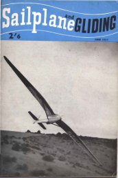
- Page 1 and 2: SA LP A&GLIDIGFebruary - March 1965
- Page 3 and 4: SAILPLANE& GLIDINGOFFICIAL ORGAN OF
- Page 5 and 6: 1965 WORLD G,LIDINGCHAMPIONSHIPSHE
- Page 7 and 8: FRED SLINGSBY'S RETIREMENTANY are t
- Page 9 and 10: D-34(o)D·36Polyt 3Kria7
- Page 11 and 12: dead into sun, and the haze made VI
- Page 13 and 14: its normal position lies very near
- Page 15 and 16: well that you should understand how
- Page 17 and 18: TESTING A SOVIET DISCOPLANEBy V. IV
- Page 19 and 20: cursed. The designer looked despond
- Page 21 and 22: SECOND NEW ZEALAND CHAMPIONSHIPSHOO
- Page 23 and 24: •Official rest day.three pilots a
- Page 25 and 26: 1965 COURSES AT LASHAMHE 196'5 cour
- Page 27: LEE WAVE uGEN" FOR AEROPLANE PILOTS
- Page 31 and 32: IT wasn't just having to get used t
- Page 33 and 34: change, my man," I sa.id grandly, a
- Page 35 and 36: outes. It's all a snare and a delus
- Page 37 and 38: electrical horizons 'have complete
- Page 39 and 40: Finally, the turn-and-slip indicato
- Page 41 and 42: 1964 KRONFELD ART EXHIBITION AND196
- Page 43 and 44: Loi61U ;nOrder Pi/or Points 1964 Or
- Page 45 and 46: RHODESIA'S FIRST 500 KILOMETERSBy E
- Page 47 and 48: 2-3~ en154.2'-'5-0 IDID6 0 en~c7
- Page 49 and 50: JIy30-40506"0 70 8"0 9"0I I I I, eq
- Page 51 and 52: BRITISH GLIDING ASSOCIATION NEWSCHI
- Page 53 and 54: wings ar~ lewel. If you can do this
- Page 55 and 56: T" T I G" I. 1.111 Y 11 74'0THEKRON
- Page 57 and 58: as the squall struck us, about half
- Page 59 and 60: about 3,000 feet, at which altitude
- Page 61 and 62: TRUE FLIGHT-A FABLEBy M. BIRDOOKING
- Page 63 and 64: iBOOK REVIEW•Great Flights and Ai
- Page 65 and 66: will go on into the foreseeable fut
- Page 67 and 68: I feel that the home-made winch wil
- Page 69 and 70: FOR SALE (contd.)T.3IB, C. of A. fr
- Page 71 and 72: BLACKPOOL AND FYLDEP"e.~enratioll o
- Page 73 and 74: which we had from the Shaw Slingsby
- Page 75 and 76: able piece ef Club equipment was bu
- Page 77 and 78: And still he wasn't satisfied, this
- Page 79 and 80:
As usual, Lasham continues to opera
- Page 81 and 82:
to his usual standard. The surprise
- Page 83 and 84:
Margate before setting off in Sky.)
- Page 85 and 86:
CHEVIOTS (Acklington)SINCE our last
- Page 87 and 88:
a gliding record. He made his first
- Page 89 and 90:
The Boomerang.from a light-weight a
- Page 91 and 92:
The Club's order for a Ka-6 waschan
- Page 93 and 94:
Lindner, of Teek, with 2,434.2. - A
- Page 95 and 96:
A Gliding Holiday io Kentwith the K