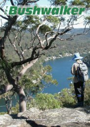
Volume 35 Issue 2 Autumn 2010 - Confederation of Bushwalking ...
Volume 35 Issue 2 Autumn 2010 - Confederation of Bushwalking ...
Volume 35 Issue 2 Autumn 2010 - Confederation of Bushwalking ...

Create successful ePaper yourself
Turn your PDF publications into a flip-book with our unique Google optimized e-Paper software.
Photo: Bob Cox,Watagan WanderersThe thin bit on Vengeance Peninsular, Blue BreaksContributions <strong>of</strong> interesting, especially typical and spectacular bushwalking photos are sought.you don’t want the same photographers all the time, do you?Photo: Bob Cox,Watagan WanderersSwimming pool above Klondalilla Falls,Queensland Great Walks
The NSW Government is working onnew legislation to cut the "red tape" thatcurrently protects our national parks anda range <strong>of</strong> consultant reports to facilitatepark development are in preparation.Only your opposition can stopinappropriate national park development.Join the working group opposing nationalpark development. Contactkeith@colongwilderness.org.auThe Sydney Morning Herald on April15 had this article ‘Chrome dome in redfrock shock by Elizabeth Farrelly. (I thinkshe is referring to Peter Garret in thetitle.)... Not until a fortnight ago, whenGarrett launched the tourism master planfor Kakadu.The name says it all. Without wishingto harp, I feel obliged to point out theterm master plan, like master bedroom,implies a dominance relationship, with adoer, and a do-ee. Here, naturally,Kakadu is the do-ee.In 53 pages the word developmentappears 67 times, even across the StoneCountry wilderness, and almost half thepark is now designated developable arealike amoebic dysentery across this remotecomplete, potentially, with helipads todeliver your pizza warm and yourprosecco cold.Then, just last weekend, Garrettlaunched another master plan, one <strong>of</strong> 15in the pipeline, this time for Kosciuszkoand the Australian Alps, or Kossie and theAussies, as theyll soon be known by theglobal audience <strong>of</strong> high yield experienceseekers to whom Brand Australia isaddressed.The Australian Alps national landscapestrategy would be amusing if itwerent so tacky. Replete with randomwordage - authenticity, respect, integrity,honesty, freedom, sensitive … free spirit,larrikin, old, wise, craggy, strong,mystical, powerful, gentle, care for theenvironment - it reads like the butcherspaper gleanings from SWOT Analysis 101,or the stimulus from the Third GradersGuide to Haiku. Except even in thirdgrade theyd get their nouns and adjectivessorted.They would also be warned <strong>of</strong>f jargonas the camo <strong>of</strong> sloppy minds. For here inKosciuszko-to-be, there are no villages orhamlets, just destinational clusters andservice hubs. Local culture appears asstrong Aboriginal product and nationalparks themselves as brand-related marketreadyproduct <strong>of</strong>fering signature natureimmersion experience.Not that experience is recommended.Notes the strategy, international visitorsare drawn to the horseriding iconology …they dont … want to sit in a saddle. Itsnot about getting on the horse but gettinginto the lifestyle and the idea <strong>of</strong> it all. So,uh, maybe a virtual reality game wouldsuffice, save on the greenhouse gases?Tourism isnt even Garretts bag. Theonly reason hes launching these things isthe recent and unholy alliance betweennational parks and the tourism lobby.National parks are no longer conservationwildernesses or biodiversity reservoirs orrefuges but pr<strong>of</strong>it centres. National parksmust pay their way.Its the same at state level. A 2008report-to-government by John ONeill castnational parks as state-owned tourismassets and criticised the authoritiesuncommercial attitude.Is this hot air, or for real? On a recentwalk in the area my wife and I camedown from Mt Townsend to Lake Albinaand then continued along the Main Rangeto Mt Twynam. As we descended ahelicopter landed at Lake Albina at theend nearest Mt Kosciusko. The fourpassengers spent a lot <strong>of</strong> time (an hour ormore) wandering around that end <strong>of</strong> thelake. What they were inspecting I do notknow. The first two photos show this.We headed <strong>of</strong>f towards CarruthersPeak. While on the ridge above Club Lakethe helicopter buzzed over us at analtitude <strong>of</strong> between 50 & 100 m,inspecting us. Thenext photo showsthis, and hisregistration marks.Then thehelicopter swoopeddown and landed atClub Lake. Thepassenger(s) walkedaround, and one <strong>of</strong>them wentswimming in ClubLake. You can see atrail <strong>of</strong> turbidity inthe lake leading tothe bank where heis getting dressed.We continued onover CarruthersPeak. After a whilethe helicopter took<strong>of</strong>f from Club Lakeand swept down theSnowy River valleytowards HedleyTarn. It descendedbelow the hillsidethere, out <strong>of</strong> oursight. While wecould not see itWalk Safely—Walk with a Clubland, I did hear the engine fade away asthough it had been stopped. Some timelater we heard the engine again as it roseand headed down the valley pastGuthega.Iam appalled at the thought <strong>of</strong>helicopters flying around this area atsuch low altitudes, way below the 500 mnormally allowed. We were buzzed in amanner reminding me <strong>of</strong> an Americangun-ship. Landing passengers at theglacial lakes seems a travesty <strong>of</strong> theconcept <strong>of</strong> our Alpine National Parks. Isuspect they were interested developersinspecting possible delights for tourism,and possible sites for standing camps.My mind seethes with outrage. tThe Bushwalker | 5
Walk Safely—Walk with a ClubMichael Keats, The Bush ClubTarpeian Rock, Photo Ian ThorpeThe western edge <strong>of</strong> the Gardens <strong>of</strong>Stone National Park does not seemto enjoy the bushwalker patronagethat it deserves. While it looks remote forSydney-based walkers to access, thereality is that in less than 3 hours you canhave parked the car and be walking insome <strong>of</strong> the most spectacular country inthe Greater Blue Mountains NationalPark. I led a group <strong>of</strong> seven keen walkerson a ‘tasting trip’ to this area on 16thFebruary this year. We had a fantastictime as recorded below.First <strong>of</strong> all, where is Rowans Hole? The‘Hole’ is located about 3 km due east <strong>of</strong>Ben Bullen and is accessed via the M<strong>of</strong>fittTrail. It is also the headwaters <strong>of</strong> CocoCreek, a major tributary <strong>of</strong> CaperteeRiver. Why is it called a ‘Hole’? To find acredible answer we need to go back intime to the late 19th century when JosephEdmund Carne, Government Geologist <strong>of</strong>the day, was busy mapping much <strong>of</strong> thiscountry as part <strong>of</strong> his work in identifyingthe economic potential <strong>of</strong> the ‘WesternCoalfields’. The term ‘hole’ was usuallyreserved for a collapsed volcanic neck,and initially Carne thought that the overdeepenedarea at the head <strong>of</strong> Coco Creekwas <strong>of</strong> volcanic origin. It is not. Howeverthe nomenclature has remained.The walls <strong>of</strong> ‘Rowans Hole’ aresurrounded on three sides by cliffs up to100 m high that include the TarpeianRock and the M<strong>of</strong>fitt Pagodas. The twonorthern ends <strong>of</strong> the cliffs that arepenetrated by Coco Creek appear toenclose the ‘hole’, reinforcing thedramatic effect.Come now with me on our journey. Itwas one <strong>of</strong> those absolutely perfect latesummer walking days, 14 C, the countrygreen and freshly washed after days <strong>of</strong>rain with air clarity that occurs about 3times a year. The walk as designed is intwo discrete sections. Section 1 is a shortbut dramatic walk into the M<strong>of</strong>fittPagodas(1). The vehicles were parked atGR 244 209 on a bend on the M<strong>of</strong>fitt FireTrail.A long abandoned road leads generallysoutheast along the crest <strong>of</strong> a gentlyundulating ridge in open eucalypt forest.After less than ten minutes several largerocks appeared directly in front <strong>of</strong> us. Theaim was to reach the very southern end <strong>of</strong>the ridge, so it was with discipline that weresisted the temptation to go directly to6 | The Bushwalkerthe edge. The trade <strong>of</strong>f would come later -stupendous views.The end <strong>of</strong> the ridge is a maze <strong>of</strong>complex, interlinked pagodas withcompound slots and drops and ramps. Aswe climbed to our first viewing lookoutwe were gob-smacked by the view. It isunique. The catchment <strong>of</strong> Coco Creekstretches before you for severalkilometres. Pantoneys Crown is on theright with the escarpments <strong>of</strong> MountsGenowlan and Airly on the left. Theperfect cone <strong>of</strong> the Tayan Peak is firmly inthe centre. The symmetrical knob <strong>of</strong>Cottage Rock on Mount McLean is clearlyseen. On the far horizon Mount NeverNever, Nullo Mountain and MountCorricudgy and all their satellites are inperfect alignment.Closer and directly north-east is BaalBone Point and the Tarpeian Rock. A turn<strong>of</strong> the head to the northwest andBlackmans Crown comes into view.Panning south is Gardiners Hill andbehind it Platform Rock. Rowans Hole layas a green carpet some 200 m below - allthis from our first vantage point.Everywhere on this crest the pagodascrowd one another. The slots areconvoluted and exciting. We clamberedup and over and in and out in this vastnatural playground until we reached thefurther most pagoda <strong>of</strong> the pagodacomplex. Here at GR 249 203 is the fullcyclorama <strong>of</strong> visual delectation. Inaddition to our earlier vision we nowhad the full 360-degree view. A memberused the occasion and the perfectweather conditions to film the full circleview.At 1000 am we located a pleasantspot for morning tea on the western side<strong>of</strong> the pagodas. Several members weredelayed photographing an abandonedLyrebird nest hidden in one <strong>of</strong> theelevated cave recesses. During morningtea several other members went onadditional sorties <strong>of</strong> exploration. It isthat kind <strong>of</strong> country - it was hard to sitstill.After morning tea it was time toexplore an interesting isolated rockyknob to the north, GR 249 206. A short200 m walk coupled with a 2 m ascentand we had an uninterrupted view north<strong>of</strong> the Capertee Valley, includingBlackmans Crown, Pearsons Lookout,Mount Airly, Airly Gap, Mount Genowlanand all the other magic mountainseastwards until they were hidden byPantoneys Crown. Such a surfeit <strong>of</strong> goodthings.Minutes later we were back in thevehicles and negotiating the deeply ruttedsection <strong>of</strong> the M<strong>of</strong>fitt Trail (about 1.5 km)to the turn<strong>of</strong>f to Rowans Hole, GR 250192. Here began the more serious part <strong>of</strong>the walk. After checking water supplieswe set <strong>of</strong>f down a recently upgradedproperty access road. The cuttings aredeep and show a good cross section <strong>of</strong>strata including a coal seam (about 50 cmthick) and split boulders complete withfossilised ripple marks that record whenthe tide went out on a sandy strandhundreds <strong>of</strong> millions <strong>of</strong> years ago. Greatviews <strong>of</strong> our earlier location on thePagoda Maze were photographed,showing just how high and isolated thePagodaSMaze is.everal minutes later we entered theprivate property known as RowansHole. I was hoping that the owner wouldbe present so I could make myself knownPagodas, pagodas
and explain our mission. (It is easy toavoid entering the property at all.) Thatwas not to be. Although there is a fairlynew prefabricated building it was lockedup. There were no livestock apart fromkangaroos and the place had the feel <strong>of</strong>being used as a lifestyle retreat on a veryoccasional basis. The residual stock-yardsand other equipment looked old andunserviceable.A very old track led away from thehouse, crossing and recrossing theboundary to the east. It soon disappeared,but the open forest was easy to negotiateand rapid progress was made. We crossedan unmarked creek at GR 265 196 andheaded north, climbing steadily all thetime to GR 266 199. Here we picked upan animal pad that at times had themakings <strong>of</strong> a walking track. From thispoint the rate <strong>of</strong> climb accelerated, 120 mbeing gained in the next 300 m. The nowvery well defined track hugged the base <strong>of</strong>the cliffs. The open forest providedfabulous views <strong>of</strong> the cleft-ridden pagodacliffs to the immediate north – there is alot <strong>of</strong> exploring to do in this country.A saddle dividing the Jews Creekwatershed from the Coco Creek watershedis where the track takes a 180-degreeturn. The views to the north andnorthwest were just superb. Stephen hadpushed on fast to get to this point, andwas busy with his sketching pad when wearrived. Equally fleet <strong>of</strong> foot, Dave Dashhad gone <strong>of</strong>f on a mission to findTarpeian Rock.A fascinating riddle immediatelybefore us was part <strong>of</strong> a very old fence. Itwas a serious fence indeed, being nearly 2m high and having 8 strands <strong>of</strong> wireincluding 3 <strong>of</strong> barbed wire, with thelowest three strands close to the groundand only 100 mm apart. It appeared to bedesigned to straddle the saddle althoughwe did not bother to follow it. A check <strong>of</strong>the first edition Ben Bullen topographicmap provides no answers. All shownsurveyed portions are well to the west.After a compelling photo session wewent into climbing mode once more andheaded to the top <strong>of</strong> what we initiallybelieved was the Tarpeian Rock. You see,the first edition <strong>of</strong> the Ben Bullentopographic sheet shows the spot asTarpeian Rock but the second edition hasit relocated 400 m further south. Whilethe name may have been in contentionthe position and the view were never inquestion.It is glorious spot presenting a doublehead. The back head has a caveoverhang while the front head is amassive, suspended rock platform withgreat views including the fabulouscomplex <strong>of</strong> pagodas that I had beenpreviously advised were ‘M<strong>of</strong>fitt Pagodas’.That is incorrect: they are unnamed and Iam suggesting that this complex <strong>of</strong>pagodas be called the Pagoda Maze.Walk Safely—Walk with a ClubYet more pagodasWhich <strong>of</strong> the two platforms to choosefor lunch? The party was almost equallydivided so I suggested we resume in 40minutes giving everyone time to enjoyboth spots. After consulting the first andsecond edition maps and seeing thedifficulty in determining the correctFrom Sydney to HERE iin lless than 6 hoursHike the North Island’s Great Walks, NZ!Fly Fly Sydney - ‐ Rotorua direct.Meet your guide at at the theairport, drive to to our our cosyalpine lodge in in the the heart <strong>of</strong> <strong>of</strong>Tongariro National Park.Settle in in with a a glass <strong>of</strong> <strong>of</strong> NZ NZwine while being briefed on ontomorrow’s hike - ‐ one <strong>of</strong> <strong>of</strong> the theworld’s best day walks.Multi-day Guided Hiking AdventuresOur lodge is perfect for groups!Tongariro Alpine CrossingMt Ruapehu Crater LakeLake Waikaremoana Rainforestwww.WalkingLegends.co.nzE: info@walkinglegends.co.nzP: +64 21 545 068The Bushwalker | 7
Walk Safely—Walk with a Clublocation for the Tarpeian Rock, Idetermined to call this rock at GR 268199 the Palatine Rock, after the PalatineHill that adjoins the Capitoline Hill inancient Rome, The Tarpeian Rock waslocated on the Capitoline Hill. It is asuitably appropriate and consistentclassical name for a very magic spot.Leaving was hard but we had lots moreto explore. We followed the crest <strong>of</strong> theridge headed southeast to GR 271 197. Itwas here on looking back that we realisedthat the real Tarpeian Rock was back afew metres and further west. At 1310 westood on the true Tarpeian Rock(2) andgazed at the Pagoda Maze. The Mazemakes an awesome sight and just begs tobe explored. Dave advised that, based onexperience, once you enter the this mazeyou need a minimum <strong>of</strong> 2 hours to getout, plus the necessary patience andstrength to climb up and down manytimes to verify whether the way you aretravelling will work. Before leavingTarpeian Rock we noted some very deepand dark clefts within the Pagoda Mazeand we also could hear but not seerushing water.Very shortly we would have to make adecision as to whether to enter thePagoda Maze complex or merely skirtaround the edges. I did have with me acopy <strong>of</strong> an orienteering map, scale1:10,000 with 5 m contours that wouldhelp if we ‘went in’. Ian was all for goingin deep and after consultation we decidedto give it a go.It was real adventure land stuff. Thereare pagodas on pagodas and a criss-cross<strong>of</strong> slots and runnels and points andcaves and overhangs. Keeping eachother in sight was a major exerciseand auditing that we were all togethertook time. The most complex sectionis close to the northern cliff edge. Lots<strong>of</strong> testing preceded each moveforward with some <strong>of</strong> the partyclimbing high for a view and sometesting long slots for ways down. A lot<strong>of</strong> these exploratory adventures simplyendedAin unscaleable drop-<strong>of</strong>fs.fter about 20 minutes in the 'deeppart' it was clear that a lot morethan two hours would be necessary toreally find a way through. Regrettablywe had to abandon a full-onexploration, and ultimately headedout along a north south trending ridgetowards the M<strong>of</strong>fitt Trail. Even doingthis was exciting and we enjoyed a lot<strong>of</strong> very special experiences. Planning abase camp and really spending timecould be very rewarding to exploreand map the pagodas and a way <strong>of</strong>route. Very detailed aerial photoswould be a useful aid.For the record we entered thepagodas at GR 271 193 at 1340 andexited them onto the open spurat1425 at GR 269 190: a distance <strong>of</strong>maybe 800 m in 45 minutes. At 1446 weemerged onto the fire trail at GR 266 181.A brisk walk along the road had us backat the vehicles at 1515. t1 The M<strong>of</strong>fitt Pagodas were named after JoyceGrace (28/11/1930 – 31/07/1999) and VernBusby (20/03/1924 –15/09/2001) M<strong>of</strong>fitt whoOK mighty leader, how do we get out <strong>of</strong> here?were environmentalists associated withprotection <strong>of</strong> the Gardens <strong>of</strong> Stone NationalPark. The name was proposed by the NP&WSin January 2007 and has been adopted by theNSW Geographic Names Board.2 As determined by the NSW GeographicNames Board8 | The Bushwalker
Book ReviewWalk Safely—Walk with a ClubThe Upper Grose Valley - Bushwalkers BusinessMichael Keats & Brian FoxISBN 978 064 647 319 2There are Guide Books, andthere are massive tomes. 'TheUpper Grose Valley -Bushwalkers Business' definitelyfalls into the latter class, at 570+ A5pages, in full colour. It includesdetailed maps and descriptions <strong>of</strong> 59walks all around the Upper GroseValley - even a few which I haven't(yet) done. each walk has accessdetails and a route map based on aproper topo map with contours. Inaddition the book has the origin <strong>of</strong>every place name, the Europeanhistory <strong>of</strong> the valley and many <strong>of</strong> thepeople involved since it was firstdiscovered, comprehensive notes onflora and fauna, climate, fires andfloods and much more. Six years <strong>of</strong>research went into this book: it isvery comprehensive.At A5 size it could go in yourpack, but I suggest it might be muchbetter if you photo-copied the pagesfor the walk you want to do. Itwould be a pity to damage the bookafter all, and you would sure save alot <strong>of</strong> weight!I have to admit some bias in thisreview, as I spent many monthshelping Michael and Brian with thebook, doing my usual edit andtypeset thing for them. Never mind:it is complete (and indexed too).The price is $45.00 per copy pluspostage and packing. In the Sydneymetro area P&P is $9.00 per copy;elsewhere in NSW it is $10.00 percopy. Copies can also be purchasedfrom the address below withoutpostage (or probably byarrangement from either author onone <strong>of</strong> their walks with The BushClub).Orders and payment by chequeor money order to:Keats Holdings Pty Ltd33 Livingstone AvenuePymble, NSW 2073orfrom Brian Fox Tel 6332 2590.<strong>Volume</strong> <strong>35</strong>, <strong>Issue</strong> 2, <strong>Autumn</strong> <strong>2010</strong>The Bushwalker | 9
Walk Safely—Walk with a ClubMountainsandMolehillsorHow the Bluies preparedme for EverestRichard PattisonEverest jetstreamOn 19 May 2009 I achieved mylifelong dream - I stood on top <strong>of</strong>the world and became only the 49th Aussie to do so. How did I get there?An apprenticeship in our very own BlueMountains became the stepping stone tomy personal achievement.At first, this may sound bizarre. Whatpossible skills can the bush give you thatprepare you for weeks <strong>of</strong> sub-zerotemperatures, fixed ropes and icy snowslopes? How can our hot and dusty treelinedBluies even remotely compare withthe barren landscape and deprivation inthe high Himalayas? The answer issimple; it’s all in the mind.A bushwalker or climber must possessmany important skills, includingfootwork, balance, navigation, fitness andEverest top campstrength. These must be honed foroptimum performance, safety and tomaximise enjoyment. One skill <strong>of</strong>tentaken for granted or overlooked intraining schedules however, is the mind.How well do you know your boundaries?How do you cope with fear in difficultsituations such as steep terrain, gettinglost, or racing the gathering dusk back tothe car on a new route? How is yourmental toughness?My experiences in the Blue Mountainshave greatly developed my mental10 | The Bushwalkertoughness. They’ve pushed my boundariesin so many ways and allowed me tounderstand my comfort levels - all <strong>of</strong> thisto the point where I could descend fromthe summit <strong>of</strong> Everest alone, with littleconcern or anxiety. I’ve actually been farmore out <strong>of</strong> my comfort zone in the BlueBreaks and Budawangs than on Everest!What is all this mental toughness talk?Mental toughness is all about controllingyour fear and anxiety, being able to staycalm and as in-control as possible whenthings around you aren’t going as plannedand when you’re close to your ‘edge’. Notnecessarily at the limit <strong>of</strong> your climbingability or climbing a run-out line, butdealing with certain situations withoutpanicking.Many bushwalks occur socially andrelatively close to roads. As such,there’s a low level <strong>of</strong> fear in aday’s walk. Things can go wrong,but with a low probability. Butwhat about embarking on a moreadventurous and ambitiousjourney? A week through theuntracked Wollemi wilderness?What if you undertake the walksolo? The fear levels rise, thesolitude and silence heighten yoursenses. There are so many morethings that can go wrong:snakebites, falls, broken limbs,sprains, getting lost,running out <strong>of</strong> water orfood. Being solo meansyou have no supportnetwork (EPIRB aside);you need to deal withproblems and anxietyalone. You constantlyquestion your owndecisions, and only have yourselfto blame and only you tocomfort your own concerns.It’s important to know yourboundaries. From goingbushwalking to the RuinedCastle in a merry group to a soloattack on the Three Peaks is abig leap: it’s a leap I wasn’tready for at first. I turned backon my first two attempts, findingan obscure reason both timesrequiring a retreat. A higherlevel <strong>of</strong> flow in Cox’s river, then the lack<strong>of</strong> drinking water in my pack seemed ajustifiable reason to fail. But the realreason was my fear, my fear <strong>of</strong> theunknown and whether I was equal to thetask. I turned back then, and I’ve turnedback on various routes at various pointssince then. I just couldn’t settle thedemons in my own mind. But each failureadds more determination to return andsucceed in that challenge next time, andeach successful completion <strong>of</strong> a new routeand new challenge is empowering andpushes your boundaries further as yougain trust in yourself for what you candeal with. It’s amazing, suddenly you seeyourself with new eyes as you complete aonce-terrifying proposition with ease,clearly demonstrating your progress. Yourplans become more adventurous, and dotson the middle <strong>of</strong> the map with interestingnames become realistic not futuristic.Trips like Possibility Point, Sluice BoxFalls and Colo river paddling become theweekend norm and traverses <strong>of</strong> theBroken Rock Range are a standard Easterprogramme. I was in awe <strong>of</strong> bushwalkersundertaking these trips 5 years ago; now Iam one <strong>of</strong> those bushwalkers.I climbed Everest by the south colroute, the route pioneered by the Britishand Swiss in the 1950s which culminatedwith the first ascent <strong>of</strong> the mountain byOn oxygen on Geneva Spur
Walk Safely—Walk with a ClubSir Edmund Hillary and Sherpa TensingNorgay in 1953. It amazes me that manstood on the moon only 16 years later: itwas almost easier to reach the moon thanthe ro<strong>of</strong> <strong>of</strong> the world!My expedition took 2 months in total:the long duration provides thenecessary acclimatisation required due tothe lack <strong>of</strong> oxygen. The summit <strong>of</strong> Everesthas just 29% <strong>of</strong> the oxygen compared tohere at sea-level. If someone wastransported from sea-level to 30,000ftthey would become unconscious inminutes and die soon after. But spendingtime at altitude, gradually gaining moreheight, your body has time to adjust tothe lack <strong>of</strong> oxygen by creating more redblood cells. In effect you can carry moreoxygen. There is also a physiologicalchange in the way your body deals withoxygen. It is possible to climb Everestwithout the use <strong>of</strong> supplement oxygenfrom bottles, but only a small percentage<strong>of</strong> humans are strong enough or capable<strong>of</strong> this. Doing so increases the level <strong>of</strong> riskto attract a high altitude illness such afluid in the lungs (HAPE), swelling <strong>of</strong> thebrain (HACE), extreme fatigue or poordecision making.Even with supplemental oxygen, onsummit day you still need between 8 – 10full breaths just to make the next moveforward. Progress is painfully slow, andsimple scrambling is a major effort inclumpy boots and big puffy down-suits.The climbing has an added element inthat you can’t see your feet because <strong>of</strong> theoxygen mask. For safety, sherpas fromdifferent teams join forces to fix ropes tothe mountain in the most exposed anddifficult areas, althoughlooking at the anchorsused I wouldn’t trustmany to hold a fall.I joined aninternational team <strong>of</strong> 6climbers and 2 climbingsherpas, the cheapestexpedition on themountain. Over the 2months you become aclose-knit group, relyingon each other for socialand moral support. Thesherpas were incredible,carrying our oxygenbottles and tents to highercamps, yet we stillstruggled with 16 kgpacks in the rarefiedatmosphere. The moreexpensive expeditionshave 2 climbing sherpasfor each westerner, and carpets in theirbase camp tents!It was special to follow in the footsteps<strong>of</strong> Sir Ed Hillary. I was in awe <strong>of</strong> theireffort and bravery in their exploration,their summit attempts were so ‘out there’.I could hardly imagine their feelings asthey pushed the limit <strong>of</strong> humanunderstanding and endeavour along thesouth east ridge with 10,000 ft droppingaway on either side. No-one had everbeen there, everything was unknown,they might as well have been on themoon, and the nearest support for rescuewas at least a week away down in thewestern cwm. Their exploration andcourage inspires me, it inspires me to seekout and visit remote areas myself here inOn the summit <strong>of</strong> Everestthe Greater Blue Mountains - maybe oneday I’ll discover my own Wollemi Pine orEagle’s Landing.So there I am, on Everest at 8,848 mabove sea level, the cloud and snowmoved in without warning, reducingvisibility to about 20 m. I drew on all <strong>of</strong>my bushwalking experience in the remoteareas <strong>of</strong> the Blue Mountains to face theincreasing anxiety <strong>of</strong> my predicament. Notonce on my descent to our high camp atthe south col, or the subsequent two-daydescent to base camp, did I feel scared orout-<strong>of</strong>-control. The Blue Mountains havebeen my test-ground, and in my toughestexam yet, in the death zone <strong>of</strong> Everest, Ipassed. tThe Bushwalker | 11
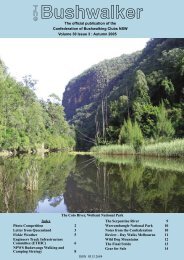
Walk Safely—Walk with a ClubRob JungDeua National Park with approximate present boundary in red overlaid onoriginal gazetted 1980 boundary in heavy black. The base map is Nick Fisher’sfrom the National Parks Journal, April-May 1979. Newer adjacent nationalparks are indicated in blue.The Coondella Fire Trail follows part<strong>of</strong> the watershed <strong>of</strong> Diamond Ck.Inland from Moruya on the NSW southcoast, lie the rugged escarpmentforests and ridges <strong>of</strong> Deua NationalPark. Its wonderful country, the kind thatMyles Dunphy thought compared inquality with his beloved Kowmung, on hiswalk through there enroute from Nowrato Harrietville in 1920.Later Dunphy proposed a reserve forthe area - "the Moruya Ranges and UpperDeua Primitive Area", but it was not untilmuch later that a National Park wasgazetted - Deua National Park in 1980.Initially the Park area was 803 km2, butthat was drawn up after protractednegotiations with the previous landmanager, Forestry. Important though thiswas, the Park boundaries were expedientmore than logical, and did not includeimportant headwaters <strong>of</strong> streamcatchments, such as the upper Deua Riverand upper Diamond Ck. It was only afteryears <strong>of</strong> protracted argument, includingthrough the Regional Forest Agreement,that these areas finally were mergedwithin the National Park. For Diamond Ckthis happened in 1994 and the upperDeua in 2003.The upper Deua River and upperDiamond Ck have sections <strong>of</strong> rainforest,featuring in particular Pinkwood oreastern leatherwood (Eucryphia moorei).Some areas <strong>of</strong> former freehold land, suchas the Bendethera caves area, have alsobeen purchased, although the extent <strong>of</strong>12 | The Bushwalker <strong>Volume</strong> <strong>35</strong>, <strong>Issue</strong> 2, <strong>Autumn</strong> <strong>2010</strong>
Walk Safely—Walk with a ClubStreamside - Diamond CkLower Diamond CkSigns <strong>of</strong> recent high flowin Coondella Ckthese acquired inholding areas, is not asextensive as suggested by the recentSouth Coast Forestry Map. The Park'sarea is now 1220 km2.The wild nature <strong>of</strong> Deua is recognisedthrough its two declared wilderness areas:Burra-Oulla in the NE, which includesDiamond and Burra Cks; and Woila-Deuain the SW. The latter features thatintriguing peak Mother Woila, as well asthe upper Deua River. Many excellent<strong>Volume</strong> <strong>35</strong>, <strong>Issue</strong> 2, <strong>Autumn</strong> <strong>2010</strong>walks <strong>of</strong> 2 days or longer duration, arepossible within these boundaries.In the early 1990's I walked quiteextensively in the part <strong>of</strong> the Parkaccessible from Moruya, in particular theUpper Deua River, Georges and DiamondCks. Recently I revisited the area on aweekend walk to Diamond and CoondellaCks. This was in mid March <strong>2010</strong>, about 3weeks after very heavy rain - Moruya'srainfall for February was 420 mm.We followed these Creeks, using theCoondella Fire Trail and its <strong>of</strong>fshoot (GR612 171) to access Diamond Ck. The oldtrack leading into the upper part <strong>of</strong>Diamond Ck from the Bendethera / LtSugarloaf road (GR 598 133) which I hadused previously, is no longer very obvious.Although this upper part is where themost <strong>of</strong> the rainforest is, it is the lowersection which contains all the majorwaterfalls and with the recent rain theywereTwell worth coming to see.raversing the creek was a slowprocess, but we found bypassing all <strong>of</strong>the drops a straightforward matter.Finding places to camp was not so simple- suitable places were scarce and theywere only small and rough. We campednear the junction <strong>of</strong> Coondella andDiamond Cks. The most pleasant campsiteon our walk route was near the areamarked as freehold land on thetopographic map. This was not marked(incorrectly) on the South Coast Forestrymap. One surprising feature <strong>of</strong> the walk tome, was how little signs <strong>of</strong> visitation therewere now, apart from the campsite onDiamond Ck at the end <strong>of</strong> the CoondellaFire Trail branch track (GR 598 170).Our weekend was pleasantly cool, buton a warmer day the many plunge poolswould make swimming tempting. It wasobvious the stream flow had recently beenso much higher; the stream sidevegetation was flattened with many treelimbspiled up. It would have been a placeto avoid during the storms! The tripturned out to be a mycologists delight -with Cmany different types <strong>of</strong> fungi visible.oondella Creek was different. Its rockswere granitic, rather thansedimentary and its course was rathermore gentle. Nevertheless it stillcontained rough sections to traverse. Itwas also a bigger creek with greater flow.We left it via the ridge at the junction <strong>of</strong>its first major tributary (GR 574 185).This NE facing ridge was a good one,typically consisting <strong>of</strong> tall open forestswith little scrub. One half km furtherupstream at the next major junction, isreputedly another good exit ridge.The grid references refer to theBendethera 1:25,000 map with the 1966grids. The South Coast Forest Map(1:150,000) shows land tenure, bushcamping and picnic areas and is a usefulroad map for access. Wild Places (PPrineas and H Gold, 1983) remains auseful useful reference on the DeuaWilderness area. Further informationabout Deua can be found in the NSWWilderness Red Index. tA Diamond Ck waterfallForest adjacent to Coondella CkOpen forest on the exit ridgeThe Bushwalker | 13
Walk Safely—Walk with a ClubMuriel’s accidentWe welcome the progress made fromDraft 1 to Draft 2 <strong>of</strong> the AASdocuments. Specifically the <strong>Confederation</strong>welcomes the inclusion <strong>of</strong> theIndependent Participant definition, andthe explicit statement in the Introductionthat the NSW AAS does not apply toIndependent Participants. We are verypleased to see the replacement <strong>of</strong>Leadership Qualifications with LeadershipPathways which provides forOrganisational Accreditation and PeerRecognition <strong>of</strong> Leader skills. It is still the<strong>Confederation</strong>’s view as stated in Draft 1comments that there should be a cleardistinction between Commercial and Non-Commercial Operators throughout theguidelines and that the guidelines shouldnot apply to Not For Pr<strong>of</strong>it Organisations.We are <strong>of</strong> the view that it is the role <strong>of</strong> the<strong>Confederation</strong> as peak body <strong>of</strong><strong>Bushwalking</strong> Clubs in NSW to provideguidelines to clubs on operational issuesand risk management. This is consistentwith our view, as expressed in Draft 1comments, that it is the role <strong>of</strong> theVolunteer Peak Bodies <strong>of</strong> each AdventureActivity to write activity guidelines onbehalf <strong>of</strong> Non-Commercial organisations.These peak body guidelines wouldprovide for all Participants.Clearly the Adventure ActivityStandards issue is an ongoing saga. I havecollected and paraphrased some bits andpieces here for your edification (oramusement). The responsibility foranything taken out <strong>of</strong> context is mine.Individual walkersSmall walking groupsLarge walking groups1 to 7 day walksGuided and self guidedwalksIn house shuttle serviceSelf or fully cateredAdventure Activity StandardsPart 2Roger CaffinPlease note that I do support the idea thatcommercial service providers and those<strong>of</strong>fering to look after children should haveto have some qualifications.First we have the opening pages <strong>of</strong> theNSW AAS document where terms aredefined, with some comment. Then welook at other parts <strong>of</strong> the document.Adventure ActivityAn outdoor pursuit requiring a widevariety <strong>of</strong> skills and equipment to engagein activities that have inherent risks anduncontrolled hazards, usually in a naturalenvironment.Comment: an incredibly vague and allencompassingdefinition. I could make acase for bush football being included here.For that matter, having a picnic at yourlocal park could qualify.LeaderPerson upon who dependentparticipants rely upon for the provision <strong>of</strong>adventure activities. Two types <strong>of</strong>leadership are applied to adventureactivities.Adventure Activity LeaderIs a person who * Applies technicalskills and knowledge to conduct (withoutdirect supervision) an Adventure Activityfor dependent participants. * Provides areasonable level <strong>of</strong> guidance orinstruction to Dependent Participants toenable supervised participation in anAdventure Activity.Supervising LeaderIs a person who * Provides areasonable level <strong>of</strong> supervision forDependent Participants during AdventureActivities * Exercise a Duty <strong>of</strong> Care forDependent Participants * Initiate anappropriate emergency response asrequiredDependent ParticipantsA person who depends upon the leaderfor supervision, guidance or instruction tosupport supervised participation in anadventure activity.and BIMBIPARKDo the whole walk from 1 central pointor just drop in.Independent ParticipantsA person who possesses the skills andknowledge to participate in an adventureactivity without dependence on a leader.A person who acknowledges the inherentrisk and assumes responsibility for theirown safety and welfare.Comment: Fortunately the NSW AAS isnow starting to recognise the idea thatclub members are not 'dependentparticipants', but free individuals whoaccept full responsibility for their ownactions.IntroductionThe New South Wales AdventureActivity Standards (NSW AAS) providesguidelines for organisations and leaders inthe planning and provision <strong>of</strong> AdventureActivities for dependent participants inNSW.Comment: <strong>Bushwalking</strong> clubs do not'plan and provide Adventure Activities'within the meaning <strong>of</strong> this. We arevolunteers going bushwalking withfriends.* The NSW AAS apply to DependentParticipants engaged in adventureactivities in NSW. * The NSW AAS do notapply to Independent participation inadventure activities.Comment: This is where we have tomake damn sure that the wording doesnot get changed to remove thisdistinction.1.1 Activity Description<strong>Bushwalking</strong> is the activity <strong>of</strong> walkingin the natural environment that mayinclude walks for pleasure, challenge,experience and/or educational outcomes.Comment: This seems pretty fair.However, it is my contention that thisdefinition <strong>of</strong> bushwalking is in directconflict with the common meaning <strong>of</strong> theterm 'adventure'. We are not out for'adventure'. In this context, note that eventhe AAS recognises that some walking isdone in an urban environment, andadmits that the AAS would not normallyapply. Such a fine distinction!Extended comments by EditorOn page 8 <strong>of</strong> the document there are aseries <strong>of</strong> bullet points. Nowhere is it made5 day walking packageIncludes: 5 nights accommodation,5 shuttles, Linen, Self catered, Selfguided, Standard cabin, <strong>of</strong>f peak.Cost twin share:$395.00 p/p ($780.00 total)Cost triple share:$290.00 p/p ($870.00 total)www.bimbipark.com.au - ph (03) 5237 924614 | The Bushwalker <strong>Volume</strong> <strong>35</strong>, <strong>Issue</strong> 2, <strong>Autumn</strong> <strong>2010</strong>
Walk Safely—Walk with a Clubclear what these points mean or how theyare to be interpreted. The same applies t<strong>of</strong>ollowing sections. Further, many (most)<strong>of</strong> these points are ridiculous. I will giveexamples from this first page:1: Accurate, up-to-date maps, chartsand guidebooks are available for theintended route and area <strong>of</strong> operationsComment: Oh yeah? Much <strong>of</strong> ourwalking is done with old unreliable mapsand no guidebooks. We went through SWTassie with a sketch map taken from aTasmanian club magazine.2: Walking tracks are <strong>of</strong> suitableconstruction and/or condition to cater for...Comment: Huh? Much <strong>of</strong> our walkingis done OFF track. Now what?3: Leaders have recent localknowledge or have appropriatelyresearched the intended areaComment: Many <strong>of</strong> our walks are intounknown areas precisely because we havenever been there before, and becausethere is very little published informationavailable. Is this to be all killed?4: The method and style <strong>of</strong> routefinding and navigation is appropriate tothe intendedComment: A totally pointless statement- how else do you navigate? Follow theMcDonalds wrappers?5: Identify significant “CatchingFeatures” along the intended routeComment: Definition <strong>of</strong> ‘catching’?Does this mean pointy dead sticks orlawyer vines? Or is this simply a normalpart <strong>of</strong> competent bushwalker navigation?6: Overnight or Multi-day <strong>Bushwalking</strong>Activities – overnight supervision,sleeping arrangements and personalhygiene systems allow for mixed gendergroups and/or participants under 18Comment: I’m still trying to work outwhat this means. Just who is meant tosupervise me overnight? Are thesupervisors meant to be awake all nightsupervising?7: Overnight or Multi-day <strong>Bushwalking</strong>Activities - Determine the suitability <strong>of</strong>natural water sources in the area anddevise an appropriate water collectionand/or supply strategyComment: Beforehand???? When wehave never been there before? What astupid and valueless comment. Butwonderful bureaucracy.8: Assess the hazards at specificcampsites and activity areasComment: Oh, Drop Bears and AASbureaucrats, definitely. Mumble....Now this is what I managed to getfrom the very first one <strong>of</strong> these sections. Itwould be boring and futile to prolong myonslaught into the stupidity and inanity <strong>of</strong>this document right through everysection. My point here is that thisdocument is in many ways a farce. I hatethink what a QC would do with it.Fortunately, some sanity is creeping in.Further on in the document it discussesforms <strong>of</strong> accreditation. I suspect some<strong>Confederation</strong> influence may be showingup here, and will cover that in a moment.Examples <strong>of</strong> how leader recognitionpathways may be applied* a club or community group mayconsider Peer Recognition andVerification an appropriate means <strong>of</strong>recognising leaders within their contextand expectationsKey factors <strong>of</strong> peer recognition andverification process may include but isnot limited to* Recognises the skills <strong>of</strong> the leaderusing an informal process * Assessment is<strong>of</strong>ten informal and conducted in-situduring participation * Is based on theexperience and judgement <strong>of</strong> the peerwho is recognising the leader * Isbenchmarked against organisationalcontext, expectations and other relatedexperienceThe <strong>Confederation</strong> has ben involved infighting this insanity <strong>of</strong>f, as recentMinutes <strong>of</strong> correspondence show:‘We welcome the progress made fromDraft 1 to Draft 2 <strong>of</strong> the AAS documents.Specifically the <strong>Confederation</strong> welcomesthe inclusion <strong>of</strong> the IndependentParticipant definition, and the explicitstatement in the Introduction that theNSW AAS does not apply to IndependentParticipants. We are very pleased to seethe replacement <strong>of</strong> LeadershipQualifications with Leadership Pathwayswhich provides for OrganisationalAccreditation and Peer Recognition <strong>of</strong>Leader skills. It is still the <strong>Confederation</strong>’sview as stated in Draft 1 comments thatthere should be a clear distinctionbetween Commercial and Non-Commercial Operators throughout theguidelines and that the guidelines shouldnot apply to Not For Pr<strong>of</strong>it Organisations.We are <strong>of</strong> the view that it is the role <strong>of</strong>the <strong>Confederation</strong> as peak body <strong>of</strong><strong>Bushwalking</strong> Clubs in NSW to provideguidelines to clubs on operational issuesand risk management. This is consistentwith our view, as expressed in Draft 1comments, that it is the role <strong>of</strong> theVolunteer Peak Bodies <strong>of</strong> each AdventureActivity to write activity guidelines onbehalf <strong>of</strong> Non-Commercial organisations.These peak body guidelines wouldprovide for all Participants.’Contrast this with the expected targetfor the AAS:An adventure activity leader* Applies technical skills andknowledge to conduct an AdventureActivity for dependent participantswithout direct supervision. * Provides areasonable level <strong>of</strong> guidance orinstruction to Dependent Participants toenable supervised participation in anAdventure Activity.Comment: Somehow, this seems utterlydisconnected from how a typical Club tripis run. It's relevance to us?I could go on for pages, but perhapsthat is enough for now? Hopefully our<strong>Confederation</strong> will keep us out <strong>of</strong> theclaws <strong>of</strong> the bureaucracy. You need toemphasise this to your club delegates! tLetter to the editorOn NomenclatureJim SmithWentworth FallsColin Gibson's research on the naminghistory <strong>of</strong> the Venus Beacon Tor isimpressive (The Bushwalker, Spring2009). However, the big unansweredquestion <strong>of</strong> his article is why are therenames like Boorong Crags, Kolonga Wallsand Moogan Gully in this section <strong>of</strong> themap and hundreds <strong>of</strong> other Aboriginalnames from many different parts <strong>of</strong>Australia on maps <strong>of</strong> the Blue Mountains?How long do we have to live with thenomenclatural fantasies <strong>of</strong> MylesDunphy?I recently discovered where Dunphygot his names from. In the early 1900sthere was an anthropological magazine<strong>Volume</strong> <strong>35</strong>, <strong>Issue</strong> 2, <strong>Autumn</strong> <strong>2010</strong>called Science <strong>of</strong> Man. The editors <strong>of</strong> thismagazine invited readers from all overAustralia to send in Aboriginal placenames from their area. They also sent aform to police stations throughoutAustralia asking them to write out lists <strong>of</strong>local Aboriginal place names. Sometimesthese lists were published, as submitted,in the magazine. However, <strong>of</strong>ten theeditors would literally cut and paste theplace names sent in to create alphabeticallists. In many cases these lists failed togive the area or Aboriginal language thatthe words came from. Some publisherscreated booklets <strong>of</strong> selections from theselists so that people could use them fornaming their houses and boats etc.Dunphy did not use these popularbooklets but went directly to issues <strong>of</strong> theScience <strong>of</strong> Man. Like the editors <strong>of</strong> themagazine, Dunphy did not care muchabout what part <strong>of</strong> Australia the wordsoriginally came from. When he was fillingin the apparently "blank" spaces on hismaps, Dunphy would select words that heliked the sound <strong>of</strong> and whose alleged"meaning" seemed, to him, appropriate tothe topography. That is why we haveAboriginal place names from languagesused in other States on our BlueMountains maps.In some cases, Dunphy would combinewords from two different languages tocreate his double barrelled names. Recentlinguistic studies have discovered manyhundreds <strong>of</strong> authentic Aboriginal words inthe languages <strong>of</strong> the Gundungurra andDharug people who lived in the BlueMountains. Surely it would be morerespectful to Aboriginal people to usethese truly local words rather than thetranslocated words <strong>of</strong> Myles Dunphy.The Bushwalker | 15