Taunton Transit Oriented Development - Roger Williams University
Taunton Transit Oriented Development - Roger Williams University
Taunton Transit Oriented Development - Roger Williams University

You also want an ePaper? Increase the reach of your titles
YUMPU automatically turns print PDFs into web optimized ePapers that Google loves.
<strong>Taunton</strong> <strong>Transit</strong> <strong>Oriented</strong> <strong>Development</strong>School of Architecture, Art & Historic PreservationCommunity Partnerships InitiativeInstructor: Edgar Adams
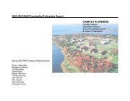
<strong>Taunton</strong> <strong>Transit</strong> <strong>Oriented</strong> <strong>Development</strong>Table of ContentsPreface:Acknowledgements 2Fall 2006 RWU <strong>Taunton</strong> TOD Studio 2Introduction: Hub and SpokesThe Fall River/New Bedford CommuterRail Extension 3What is <strong>Transit</strong> <strong>Oriented</strong> <strong>Development</strong>? 4The 2006 RWU <strong>Taunton</strong> TOD Studio:Project Definition: Beyond Park & Ride 6Existing Models:East Coast / West Coast 6New England 8<strong>Taunton</strong>: A Historical Survey 8GATRA Site: Oak StreetExisting Conditions / Site Analysis 10GATRA Site: Key Issues 11Design Proposals:Jessica Harwood 14Milan Ivesic 16Dustin Lombardi 18Jennifer Sneed 22MBTA Site: Dean / Arlington StreetsConclusionExisting Conditions / Site Analysis 24MBTA Site: Key Issues 24Individual Project Descriptions 25Findings 26Design Proposals:Keith Carlson 27Michael Cimorelli 30Cheryl Downie 34Alejandro Korda 36Erica Meilhede & Valerie Morin 38Bibliography / Links 41Appendix A: Precedent StudiesIndividual Project Descriptions 11Findings 12Cover: The Round, Beaverton Oregon photo: Edgar Adams1
<strong>Taunton</strong> <strong>Transit</strong> <strong>Oriented</strong> <strong>Development</strong>TOD offers people a variety of options to the predominant singleuse, single income, single mode of transport pattern found inmost suburban communities. It supports a more diverse housingstock and vibrant mixed-use communities that cater to the needsof people at both ends of the age and income scales. By reducingthe need for a second car, TOD also dramatically increases theamount of income available for housing, expanding the range ofaffordable housing options in a constrained market that is forcingmany low wage workers and talented young people to leave thestate.Fig. 1 Ebenezer Howard's 1898 Garden City DiagramFig. 2 Peter Calthorpe's 1993 TOD Diagram5
<strong>Taunton</strong> <strong>Transit</strong> <strong>Oriented</strong> <strong>Development</strong>The 2006 RWU <strong>Taunton</strong> TOD StudioProject Definition: Beyond Park & RideWe have used the MBTA's planned New Bedford / Fall RiverCommuter Rail Extension as the basis for the exploration offocused research and design proposals that will help raise ourawareness of the potential implications of this extension for thecommunities it will serve. The MBTA's endorsement of TODand the State's TOD Infrastructure and Housing Support Programshow a substantial commitment at the state level; however, it isequally important to get local communities and decision makerson board. We should also not underestimate the challenges forplanners, architects (and architecture students) not accustomed toworking at the intersection of infrastructure, architecture andcommunity.At the local level, many of the communities along the proposedrail extension are rightly concerned about the impact of thisregional initiative. There have already been very real impactsfrom changing commuting patterns. Growth pressures alreadyexist and more growth is inevitable. The question is, how do wegrow in a way the takes advantage of our investment in existingcommunities and protects valuable open space? How do we planin a way that channels growth to those areas that are bestequipped to handle new development or that can supportsustained revitalization efforts and brown field developmentopportunities?Existing ModelsNew York, Boston, Chicago and Philadelphia were among thefirst American cities to use rail travel to manage the tremendousgrowth that followed the industrial revolution. Philadelphia'sMain Line Communities, Chicago's Riverside, New York'sForest Hills Gardens and Boston's Brookline were all earlysuburban adaptations of Ebenezer Howard's Garden City conceptto an emerging suburban landscape. These pre-automotivecommunities formed naturally around the rail or streetcar servicethat linked them to the heart of the city; however Howard'svision was of a regional scale and not a metropolitan one. Hedetested the sprawling urban agglomerations that had formed inresponse to the Industrial Revolution and proposed a regionalvision of semi-autonomous cities linked by rail infrastructure andbound by green space. By also placing a central park at the corehe sought to merge the benefits of town and country living. TheGarden City ideal, and the New Towns and Green Belt Towns itinspired, could not contend with the relatively abundant supplyof land and the predominance of the automobile in this country.Edge Cities and suburban sprawl, fed by an addiction to theliberating power of the automobile and an enormous investmentin highway infrastructure, soon displaced more hierarchicalpatterns of development based on rail infrastructure. As jobshave moved out from the core, this has placed new barriers toentry into the job market for the urban poor and those withlimited independent mobility.East Coast / West CoastContinued growth pressure, congestion and pollution concernshave led California to adopt an aggressive program in support of<strong>Transit</strong> <strong>Oriented</strong> <strong>Development</strong>. The scale, integrated design andplanning of many recent West Coast examples is exemplary.Many make excellent use of new light rail technology tomaximize pedestrian orientation, the integration of multiple uses,density and total design. Examples of heavy rail along thePeninsula Corridor (Caltrain) Line connecting San Francisco toSan Jose (by way of San Mateo and Paolo Alto) also show thesensitive integration of multiplex cinemas, structured parking,and new shopping, office and housing typologies within the6
<strong>Taunton</strong> <strong>Transit</strong> <strong>Oriented</strong> <strong>Development</strong>point of the Great River" 7 . The town was incorporated under thename of <strong>Taunton</strong> and the river also took its name from that sameEnglish town in Somerset. The convergence of other smallerrivers and streams with the <strong>Taunton</strong> River would provide theearly settlers with ample sites for mills and forges that drew theirbog iron from the nearby swamps. The proliferation of ironworks during the 17 th and 18 th century would establish <strong>Taunton</strong>as a center for metal-related industries and soon establish it asthe "Silver City" and the home of noted whitesmiths Reed &Barton.engines 9 . The <strong>Taunton</strong> Locomotive Manufacturing Co. wasfounded adjacent to the Mason Machine works in 1846 and alsomade locomotives and cars until 1899. During the Civil War,production shifted to the manufacture of rifles, equipment andclothing to support the war effort. After William Mason's deaththe locomotive works declined and in the 1920's the cotton millsbegan to move south, initiating a slow decline of manufacturingin <strong>Taunton</strong> 10 . Changes in manufacturing and new investments inhighway infrastructure (routes 24 & 495) by-passed the core of<strong>Taunton</strong> and its many older industrial sites. The end ofcommuter rail service to Boston in the 1950's signaled achallenging new era for the city. <strong>Taunton</strong> is currently home to agrowing number of high tech concerns. The long anticipatedreturn of commuter rail service to <strong>Taunton</strong> would provide amuch-needed boost to this trend and aid in recruitment of newbiotech concerns.Fig. 6 Mason Locomotive WorksSource: "The Fairlie Locomotive" - Abbott p81This early experience with metalworking would be put to gooduse with the arrival of the Industrial Revolution. <strong>Taunton</strong> soonbecame a center for the manufacture of products from shovels tostoves. William Mason arrived in 1835 to work for a firm thatmanufactured textile machinery and in 1842 Mason, who hadalready patented his most noteworthy invention of the "selfactingmule", took over the concern 8 . By 1845 he had turned itinto one of the largest plants for the manufacture of machinery inthe country. In 1852 he began making locomotives and by thetime of his death in 1883 he had manufactured some 7007 http://www.oldcolonyhistoricalsociety.org8 http://americanhistory.si.edu/archives/d8045.htmFig. 7 <strong>Taunton</strong>, 18759 Ibid.10 Winter, <strong>Taunton</strong> Architecture9
<strong>Taunton</strong> <strong>Transit</strong> <strong>Oriented</strong> <strong>Development</strong>GATRA Site: Oak StreetThe map of 1850 also shows how intimately it was linked to thefabric of the city as an extension of Main Street and its uniquelinkage of the town Green and the Church Green. The decline ofmanufacturing and the destruction of the Machine Works in ahorrendous fire made the site a prime redevelopment site and inthe 1960's it was cleared. Ultimately the Station and LocomotiveCompany would be replaced by a struggling automobile orientedshopping mall that ignores its relationship to the Town Greenand to Main Street. The seldom-used freight line, which wasonce a vital connection for the city, now serves as an addedbarrier to the isolated bus terminal on Oak Street. While this siteis viewed primarily as a means of exploring the potential <strong>Transit</strong><strong>Oriented</strong> <strong>Development</strong> in relation to the bus terminal, thepotential (however remote) for linking bus and rail transit on thesame site remains a tantalizing prospect.Fig. 8 <strong>Taunton</strong> 1850Source: Old Colony Historical SocietyThe site of the current GATRA/Bloom Bus Terminal is a criticalintermodal link and a key strategic site for the city of <strong>Taunton</strong>.Westminster Street used to function as an extension of MainStreet linking the <strong>Taunton</strong> Green to a smaller green space andfountain in front of the <strong>Taunton</strong> Station. To the southWestminster widened to meet Church Street, which connected toMarket Street and the Providence Turnpike (Rt. 44). The site waslocation of the Mason Machine Works and the <strong>Taunton</strong>Locomotive Company. Trains along this line connected <strong>Taunton</strong>to a vast the rail network that linked all of Southern NewEngland to New York and Boston - a network ultimatelycontrolled by the New York, New Haven and Hartford RailroadCo..Figure 9. Current condition with site area indicated10
<strong>Taunton</strong> <strong>Transit</strong> <strong>Oriented</strong> <strong>Development</strong>MBTA Site: Dean/Arlington Streetsearly settlements along the banks of the <strong>Taunton</strong> River. Tuckedbehind these homes there is also a nursing home. A short walk,along the river, to the west brings you to the Church Green andMain Street. As the land rises to the north we find a granary thatstill makes regular use of the rail and a lumberyard. To the east,on the other side of Longmeadow, are some apartmentcomplexes. A portion of the site on the East side ofLongmeadow was originally included in our site area, but hassince been developed (the construction road is apparent in theaerial photo).Intertwined with these assorted buildings and remnants of<strong>Taunton</strong>'s industrial past are wetlands and water features thatallude to the presence of the steam that skirts the former rubberfactory, reemerges on the other side of Arlington Street andflows into the river. These water features were adjusted when therail was constructed and were further altered to accommodate theindustrial development that followed. The recreational fields onthe site are currently a valued resource for the city; however theconstrained nature of the site and the value of the land fordevelopment once the rail is reintroduced may allow this use tobe phased out and accommodated elsewhere.MBTA Site: Key IssuesFig. 10 Proposed TOD site and MBTA Station AreaSource: SRPEDDWhere Arlington Street meets Dean Street (Rt. 44), there are aVictorian rail station that has been converted to office space, thedilapidated remains of a New Jersey Rubber Company factoryand two prized ball fields. Along the southern edge of the site, onDean Street are many older homes that relate to some of theThis site is considered an important opportunity to develop aneighborhood based TOD solution for this primarily residentialarea. Retail and mixed-use development would serve local needs,while regional commuters would be accommodated at theproposed <strong>Taunton</strong> East Station with its ample parking and accessfrom Rt. 24. The Dean Street site's proximity to the ChurchGreen, as well as the potential for a shuttle connection to the busterminal, would allow this site to link Main Street to theproposed commuter rail service. Due to the constraints on thesite, several schemes propose using the platform to link the area24
<strong>Taunton</strong> <strong>Transit</strong> <strong>Oriented</strong> <strong>Development</strong>north of the pond to the southern portion occupied by the formerrubber factory and converted rail station. There is easy accessfrom Arlington Street; however access from Longmeadow isseen as critical due to the existing signalized intersection andbridge connection to Rt. 140 south of the <strong>Taunton</strong> Green. A busconnection was assumed to link the GATRA terminal and MainStreet by way of the Arlington Street.Individual Project DescriptionsKeith CarlsonThe proposed MBTA site in <strong>Taunton</strong> provides an opportunity fora truly unique form of <strong>Transit</strong> <strong>Oriented</strong> <strong>Development</strong>. Myintention is to provide a link to the rail and also exploit thenatural features of the site to create a communal and recreationalfocus for residents and commuters alike. My proposal utilizes thenatural features of the site to organize development along asweeping landscape that bridges the northern and southern endsof the site. The existing pond is utilized as a celebrated waterelement along with winding trails and views across the site.Tothe south, the curve of the landscape culminates in a public plazafocusing on the train station with coffee shops, restaurants andoutdoor seating. The primary street linking both sides of the siteis lined with retail storefronts, topped with housing and smalloffices. Lower density housing wraps around the central park tothe northern end of the site where there is apartment stylehousing as well as a daycare and community center. The overallenvironment created provides a unique blend of transit orienteddevelopment with the natural features of the site.Michael CimorelliThe current condition of the MBTA site suggested a sinuous lineof exfoliating masses physically stretching across a north / southaxis of the rail line while visually connecting the user throughframed perspectives along the east / west axis. The form of thewetlands and the artificial condition of the rail line initiated theconceptual notion of two arms: one reaching out and acceptingusers from the south end and one arm reaching out and grabbingusers from the north end of the site while interlocking at a centralnode. The central node was positioned in accordance with thequarter mile walking radius for the site’s inhabitants andfunctions as a gravitational pull where each “arm” progressivelybecomes more public approaching the belly of the site where therail platform is located.The articulation of the individual masses within each “arm” wasalso responsive to the power and dynamics of the rail line. Themajority of the masses are double loaded corridors as anexpressive yellow line that acts as the circulation through thebuilding while visually linking the individual masses as a wholeto the site. Two other shifts occur within the building massesthat respond to desired views as well as concealed parkingspaces beneath the buildings themselves.Cheryl DownieMy design for the <strong>Taunton</strong> MBTA site seeks to integrate <strong>Transit</strong><strong>Oriented</strong> <strong>Development</strong> with the surrounding area by improvingcirculation and enhancing the natural features of the site. Acentralized plaza created adjacent to the station platform allowsfor three access points. The mixed-use plaza has offices andhousing above retail activity. The primary access to the plaza isvia an east / west boulevard with a drop-off point and pedestriangrade crossing. The townhouses on the northern side of theboulevard are at ground level, while the southern townhouses areraised to allow for parking on the ground level. Retail along thestreet hides the parking. A bus and car drop-off is located on thewestern side of the tracks, where short-term parking is provided.A third access point is to the north, near a community building25
<strong>Taunton</strong> <strong>Transit</strong> <strong>Oriented</strong> <strong>Development</strong>which contains a daycare and youth center. Parking is providedfor commuters, and residents in the new apartment buildings.The existing dead-end streets in this area are reconnected andsingle-family homes are added. To the south, duplex homes areadded and a phased relocation of the ball fields allows for thecreation of a major public park surrounding the pond.Alejandro KordaThis scheme focuses on a centralized commons and plaza space.This area is framed by offices and retail stores at the lower level,and restaurants with coffee shops on the upper level that provideviews to the green space below. The bus and rail platforms are indirect connection with this plaza space and the commuterparking lot. Connecting to this central area are bars of housingthat sit on a raised "carpet" of green that enables the ground levelto become an extensive parking area. The design also embracesthe natural features of the site as part of the composition. Trafficconditions are dissipated by a circular drive that connects intothe city grid. Moving towards the perimeter of the circle, singlefamilyhousing is introduced to bring harmony, privacy and aconnection with the surrounding residential areas.Erica Meilhede & Valerie MorinThe Primary focus of this proposal is to provide the area with avibrant and livable community. The location of the site withinthe suburban fabric lends itself to the creation of a node to theSouthwest - near the existing train station. At the center of thenode lies the train platform surrounded by a pedestrian plaza.The plaza is supported by local businesses- including smallshops, a restaurant and a café as well as housing on the upperlevels. An illuminated clock tower acts as an anchor to the siteand the surrounding fabric. In order to create a pedestrianfriendly environment and reduce the dependency on automobiletransportation, parking and the primary traffic flow are kept tothe periphery of the plaza. Designated drop-offs allow easyaccess for buses and cars without interfering with the notion ofthis pedestrian node. Commuter parking is located in a structuredparking garage concealed by commercial space and multifamilyhousing. The parking garage can be accessed by a mainboulevard or a secondary road connecting the site toLongmeadow Street. The two access points to the east of thetracks will relieve traffic congestion along Route 44/Dean Streetduring peak commuting hours.Environmental constraints also played a vital role in theorganization of the master plan. The wetlands defined theplacement of major roads and buildings. The pond in the centerof the site will be revitalized, providing a focus for a communitycenter and pedestrian / bike paths linking the northern andsouthern portions of the site. The community requested that thetwo existing baseball fields be incorporated into the design. Thefields remain in the same general location, but have been rotatedto better utilize the surrounding areas. The density of the area ishighest at the nodal point while the scale as it approaches theexisting fabric - thereby creating a coherent connection betweenold and new.FindingsThe MBTA park & ride proposal included 600 parking spaces onthe site of the former rubber factory. By reducing the allottedcommuter parking to 300 spaces, developing both sides of thetracks and expanding the study area to include the nursing hometo the south and the granary and lumberyard to the north it waspossible to accommodate between 200 and 300 residential unitsand varying degrees of office and retail space in a mixed useenvironment. These numbers may need to be adjusted once a fullstudy is made to identify and locate the existing wetlands. Anyfuture development strategy would also have to take into accountthe level of remediation required for the factory site.26
BibliographyTODCalthorpe, Peter; The Next American Metropolis: Ecology, Community, and the American Dream. New York: PrincetonArchitectural Press,1993Calthorpe, Peter & William Fulton; The Regional City. Washington, D.C.: Island Press, 2001Cervero, Robert; The <strong>Transit</strong> Metropolis. Washington, D.C.: Island Press, 1998Cervero, Robert; <strong>Transit</strong> Villages in the 21 st Century. New York: McGraw-Hill, 1999Dittmar, Hank & Gloria Ohland; The New <strong>Transit</strong> Town. Washington, D.C.: Island Press, December 2003.Fader, Steven; Density by Design, Urban Land Institute, Washington, D.C., ULI Publications, 2001Federal <strong>Transit</strong> Administration; "Summary Analysis of <strong>Transit</strong> Supportive Land Use for New Starts Projects", WashingtonD.C. July 2002Girling, Cynthia & Ronald Kellet; Skinny Streets & Green Neighborhoods: Design for Environment and Community.Washington, D.C.: Island Press, 2005Kelbaugh, Douglas; The Pedestrian Pocketbook: A New Suburban Design Strategy. New York: Princeton Architectural Press,1989.Levine, Jonathan; Zoned Out: Regulation, Markets and Choices in Transportation and Metropolitan Land-Use. Washington,D.C.: Resources for the Future, 2006Transportation Research Board; "<strong>Transit</strong>-<strong>Oriented</strong> <strong>Development</strong> and Joint <strong>Development</strong> in the United States", ResearchResults; Digest No. 52, <strong>Transit</strong> Cooperative Research Program, Washington D.C. October 2002Urban Land Institute; Developing Around <strong>Transit</strong>: Strategies and Solutions That Work. Washington,D.C.: Urban Land Institute, 2004Urban Land Institute; Higher Density <strong>Development</strong>: Myth and Fact. The National Multi-Housing Council, Sierra Club andAmerican Institute of Architects, ULI Publications, Washington, D.C. 2005http://www.mbta.com/projects_underway/tod.asphttp://www.todadvocate.com/http://transitorienteddevelopment.dot.ca.gov/http://www.reconnectingamerica.org/html/TOD/41
<strong>Taunton</strong>Lozier, John William; <strong>Taunton</strong> & Mason: Cotton Machinery and Locomotive Manufacturing in <strong>Taunton</strong> Massachusetts 1811-1861Winters, Terry; <strong>Taunton</strong> Architecture: A Reflection of the City's HistoryAbbot, Roland; The Fairlie LocomotiveOld Colony Historical Society: http://www.oldcolonyhistoricalsociety.org/Archive of Images of Mason Locomotives: http://www.ironhorse129.com/Prototype/MasonBogie/Mason_Bogie.htmWilliam Mason Papers, Smithsonian Archives: http://americanhistory.si.edu/archives/d8045.htm42