Watershed Assessment Fact sheet - Rutgers Cooperative Extension ...
Watershed Assessment Fact sheet - Rutgers Cooperative Extension ...
Watershed Assessment Fact sheet - Rutgers Cooperative Extension ...
Create successful ePaper yourself
Turn your PDF publications into a flip-book with our unique Google optimized e-Paper software.
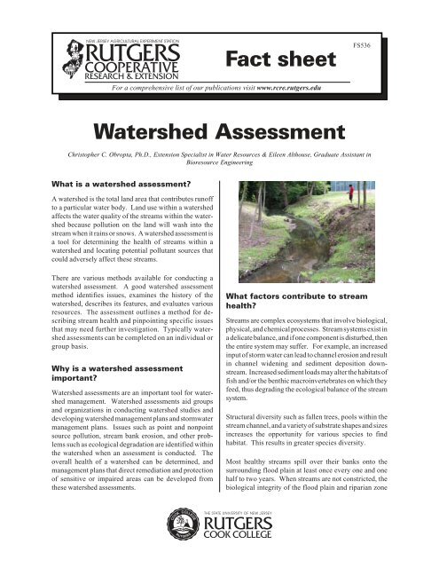
<strong>Fact</strong> <strong>sheet</strong>FS536For a comprehensive list of our publications visit www.rcre.rutgers.edu<strong>Watershed</strong> <strong>Assessment</strong>Christopher C. Obropta, Ph.D., <strong>Extension</strong> Specialist in Water Resources & Eileen Althouse, Graduate Assistant inBioresource EngineeringWhat is a watershed assessment?A watershed is the total land area that contributes runoffto a particular water body. Land use within a watershedaffects the water quality of the streams within the watershedbecause pollution on the land will wash into thestream when it rains or snows. A watershed assessment isa tool for determining the health of streams within awatershed and locating potential pollutant sources thatcould adversely affect these streams.There are various methods available for conducting awatershed assessment. A good watershed assessmentmethod identifies issues, examines the history of thewatershed, describes its features, and evaluates variousresources. The assessment outlines a method for describingstream health and pinpointing specific issuesthat may need further investigation. Typically watershedassessments can be completed on an individual orgroup basis.Why is a watershed assessmentimportant?<strong>Watershed</strong> assessments are an important tool for watershedmanagement. <strong>Watershed</strong> assessments aid groupsand organizations in conducting watershed studies anddeveloping watershed management plans and stormwatermanagement plans. Issues such as point and nonpointsource pollution, stream bank erosion, and other problemssuch as ecological degradation are identified withinthe watershed when an assessment is conducted. Theoverall health of a watershed can be determined, andmanagement plans that direct remediation and protectionof sensitive or impaired areas can be developed fromthese watershed assessments.What factors contribute to streamhealth?Streams are complex ecosystems that involve biological,physical, and chemical processes. Stream systems exist ina delicate balance, and if one component is disturbed, thenthe entire system may suffer. For example, an increasedinput of storm water can lead to channel erosion and resultin channel widening and sediment deposition downstream.Increased sediment loads may alter the habitats offish and/or the benthic macroinvertebrates on which theyfeed, thus degrading the ecological balance of the streamsystem.Structural diversity such as fallen trees, pools within thestream channel, and a variety of substrate shapes and sizesincreases the opportunity for various species to findhabitat. This results in greater species diversity.Most healthy streams spill over their banks onto thesurrounding flood plain at least once every one and onehalf to two years. When streams are not constricted, thebiological integrity of the flood plain and riparian zone
are maintained, and the erosive force of an increasedvolume of water on the channel is decreased.Chemical pollution is also a major contributor to poorstream health. Pollutants such as nitrogen and phosphorusfound in fertilizers, acids, pesticides, animal waste,salts, and metals can be toxic to stream life.All of these factors are essential in maintaining a healthy,diverse, and stable stream system. <strong>Watershed</strong> assessmenttools have been developed to evaluate these particularelements to better understand the overall health of thesystem.simple measurements, and making note of any changessince prior evaluations. Given the importance ofstormwater regulations, volunteers are typically asked tolocate and record information about any stormwater outfallpipes they may encounter.Stormwater outfall pipe.Who can conduct a watershedassessment?Most watershed assessment methods can utilize communityvolunteers, thereby promoting stewardship within thewatershed and reducing costs. The volunteers are usuallyrecruited to do field work by watershed organizations.Community volunteers are valuable because they arefamiliar with the setting of the area and may be able tonotice minor changes in a stream that may go unnoticed bysomeone not as familiar with the area.Sources of nonpoint sourcepollution such as road saltbuildup near this stormwatergrate can be identified in awatershed assessment.How is a watershed assessment toolused?<strong>Watershed</strong> assessments are usually conducted as a part ofthe watershed or stormwater management planning process.<strong>Assessment</strong> methods can be successfully applied bytrained volunteers. Volunteers are trained through classroomand field sessions that emphasize the scoring ofchannel features such as stream bank stability and waterappearance. Typically, classroom sessions include anoverview of the assessment protocol, outline how tocomplete data <strong>sheet</strong>s, and explain how the data can beused. A field training session is typically conducted afterthe classroom session. For the field training session,volunteers are taken to a stream and work through theevaluation process, completing the evaluation forms. Theassessments involve walking along in the streams, rankingconditions, taking pictures of the stream reaches,pointing out any extenuating circumstances, makingWhat are some common assessmenttechniques?There are a number of different watershed assessmentmethods. Some of the more common watershed assessmentmethods, such as the U.S. Department ofAgriculture's (USDA) Stream Visual <strong>Assessment</strong> Protocoland Save Our Streams, are outlined below.USDA’s Stream Visual <strong>Assessment</strong> ProtocolA very useful assessment tool is the Stream Visual <strong>Assessment</strong>Protocol (SVAP) developed by the USDA'sNatural Resource Conservation Service. The protocolwas developed to aid farmers in the evaluation of theirown lands and to help them become more aware of thetypes of issues that they might encounter. The methodpromotes communication between the landowner and theconservationist during the assessment process and relieson the understanding that the landowners know their landthe best. The protocol provides an assessment basedprimarily on physical conditions within the watershed andserves as a useful first approximation of stream condition.Stream reaches are assessed individually when usingSVAP. A length of a stream reach is defined as approximately12 times the active channel width and is representativeof the stream in the area. The reach is identified,drawn, and photographed, and then each parameter isscored on a scale of 1 to 10 (1 being the worst). The scorescan be incorporated into a Geographic Information System(GIS), and then statistics can be performed on thescores. Parameters include both physical and biologicalattributes of the stream: channel condition hydrologic alterations riparian zones bank stability2
water appearance nutrient enrichment barriers to fish movement instream fish cover pools macroinvertebrates canopy cover manure presence salinity riffle embeddednessThese categories are very user-friendly because they relyon visual characteristics. An evaluator can actually seecloudy water, erosion on a stream bank, or how much ofthe stream bank is covered by plants, which makes it easyto learn and use. Some of the categories are optional, suchas macroinvertebrates, manure, and salinity. Parameterssuch as channel condition, hydrologic alterations, andbank stability give clues as to how the stream may havechanged over time due to land use or erosion.Unstable banks may indicate large volumes of stormwaterflows, while past straightening of the stream may alterhow it flows. Nonpoint source pollution may appear asnutrient enrichment or show up as a change in the waterappearance. Fish may be affected by the sediment buildup that causes riffle embeddedness, the lack of pools, orsparse canopy cover over the stream. Once scores areassigned, an overall average for the reach is calculated.An overall score less than 6 is considered poor, 6.1–7.4 isfair, 7.5–8.9 is good and any score greater than 9.0 isexcellent. The overall score is useful in prioritizingreaches for remediation.(Natural Resources Conservation Service (NRCS). NWCC TechnicalNote 99-1, Stream Visual <strong>Assessment</strong> Protocol, December 1998.)Save Our StreamsThe straight channel of thisstream shows evidence of pastalterations. The right bankshows signs of erosion. Thereis adequate canopy cover. Featuressuch as these are scoredindependently using SVAP.Save Our Streams (SOS) is a national watershed educationand outreach program directed by the Izaak WaltonLeague. SOS conducts water quality evaluations basedon benthic macroinvertebrate counts and indicators suchas surface water appearance, stream bed stability, algaecolor, etc. The evaluation identifies three groups ofmacroinvertebrates based on their sensitivity to pollution.The three groups are: pollution sensitive, somewhat pollutiontolerant, and pollution tolerant. The SOS methodinvolves collecting a sample of macroinvertebrates fromthe stream, identifying the organisms, and rating the waterquality. Water quality ratings of excellent, good, fair, andpoor are based on the tolerance levels of the organismsfound and the diversity of organisms in the sample. Astream with excellent water quality should support organismsfrom all three pollution tolerance groups. The SOSassessment method is used for biological monitoring bythe <strong>Watershed</strong> Ambassadors who carry out assessmentsfor the New Jersey Department of Environmental Protection(NJDEP) <strong>Watershed</strong> Program.(Save our Streams found at www.iwla.org/sos/.)Rapid Stream <strong>Assessment</strong> Technique (RSAT)Various watershed assessment techniques have beenstreamlined into the Rapid Stream <strong>Assessment</strong> Technique(RSAT). RSAT was developed for the MarylandPeidmont region, but it may be useful when both channelconditions and macroinvertebrates are to be evaluated.RSAT involves six general evaluation categories. channel stability channel scouring/sediment deposition physical instream habitat water quality riparian habitat conditions biological indicators (macroinvertebrates)RSAT is applicable when a broad survey of the characteristicsof the watershed is desired.(Rapid Stream <strong>Assessment</strong> Technique found at The Center for <strong>Watershed</strong>Protection, www.stormwatercenter.net/.)Stony Brook-Millstone StreamWatch ProgramThe Stony Brook-Millstone <strong>Watershed</strong> Associationlaunched a StreamWatch Program to monitor water qualitywithin its watershed. The program relies on volunteersto continually assess watershed features. Volunteers inthe StreamWatch Program can participate on three differentaction teams: Chemical Action Teams (CATs), BiologicalAction Teams (BATs), and River Action Teams(RATs). Training for a particular team involves a half daytraining session. CATs learn to collect chemical waterquality data across the watershed: temperature, phosphates,nitrates, pH, turbidity, and dissolved oxygen. Theresults of the water sampling are analyzed and reported toall municipalities in the watershed and to other interestedparties. BATs are trained with a protocol based on EPARapid Bioassessment II. They test for the presence of3
enthic macroinvertebrates within a stream and basewater quality ratings on the abundance and sensitivities ofthese organisms to pollutants. Healthy streams support anabundance of a wide variety of macroinvertebrates in arelatively small sample of water. A reduction in themacroinvertebrate population may indicate pollution.RATs visually assess the streams in a fashion similar to thephysical features scored in the SVAP method. Volunteersare responsible for two mile stretches of stream. The RATsprogram is designed to document the appearance of waterwaysand stream corridors during every season and alsoduring different flow conditions.(Stony Brook-Millstone <strong>Watershed</strong> Association,http://www.thewatershed.org/water_monitoring.php)Delaware Riverkeeper Network MonitoringThe Delaware Riverkeeper Network has a well establishedmonitoring program that utilizes several watershedassessment techniques. Volunteer monitors perform biweeklychemical water quality tests, survey for sedimentpollution, and participate in macroinvertebrate surveys atmonitoring locations in the watershed. Volunteers fill outwater chemistry, macroinvertebrate, and restoration surveydata<strong>sheet</strong>s while conducting their assessments. Datasuch as turbidity, pH, dissolved oxygen content, size andtype of sediment on the stream bottom, depth, and amountof phosphorous and nitrogen are recorded during a waterchemical survey. Macroinvertebrate surveys indicate theabundance and the species of organisms encountered.Restoration surveys record the types of plants in the area,the condition of the plant community, and extent oferosion, and also score parameters such as restorationbuffer width, trees and shrubs, herbaceous vegetation,biodiversity, exotic invasive vegetation, and condition ofbioengineering techniques present on a scale of 1–10.The Delaware Riverkeeper Network also offers theConsortium for Scientific Assistance to <strong>Watershed</strong>s (C-SAW) to help groups set up their own volunteer monitoringprograms that utilize watershed assessment techniques.(Delaware Riverkeeper Network,www.delawareriverkeeper.org/Monitoring/monitoring.htm.)EPA Rapid Bioassessment Protocol andHabitat <strong>Assessment</strong>The U.S. Environmental Protection Agency (EPA) hasdeveloped Rapid Bioassessment Protocols (RBPs),which compare habitat features, water quality, and biologicalmeasures with reference conditions. With theHabitat <strong>Assessment</strong>, scores from 1–20 are assigned tofeatures of the streams. The physical condition of thestream is described and then habitat characteristics suchas bank stability and vegetative protection are scored.When using this watershed assessment technique, plant,algae, fish, and macroinvertebrate data are also recorded.The RBPs and Habitat <strong>Assessment</strong>s are most useful insituations where there are resources available to conductbiological surveys.(USEPA Rapid Bioasessment Protocol and Habitat <strong>Assessment</strong>s,www.epa.gov/owow/monitoring/rbp/download.html.)Where are assessment methods used?<strong>Watershed</strong> assessments are currently underway throughoutthe state of New Jersey. The <strong>Rutgers</strong> <strong>Cooperative</strong>Research & <strong>Extension</strong> Water Resources Program is usingSVAP to evaluate streams in their various watershedmanagement projects including the Tenakill Brook, TroyBrook, Robinsons Branch, and the Pompeston Creek.SVAP has also been used in a GIS analysis of <strong>Watershed</strong>Management Area 3 of New Jersey which includesPassaic, Bergen, Morris, and Sussex counties to study theeffects of land use, soils, and impervious surface onassessment scores.How can you get involved?Many local watershed organizations look for volunteersto help collect data about the areas they are trying toprotect or remediate. Look in the local newspaper orsearch the internet to find out about these organizationsand their meeting times. Information about the NJDEPStream Monitoring Network can be found atwww.state.nj.us/dep/watershedmgt/.Photos courtesy of Katie Buckley©2007 <strong>Rutgers</strong>, The State University of New Jersey.Revised: June 2007RUTGERS COOPERATIVE EXTENSIONN.J. AGRICULTURAL EXPERIMENT STATIONRUTGERS, THE STATE UNIVERSITY OF NEW JERSEYNEW BRUNSWICKCooperating Agencies: <strong>Rutgers</strong>, the State University of New Jersey, U.S. Department of Agriculture, and County Boards of Chosen Freeholders. <strong>Rutgers</strong> <strong>Cooperative</strong> <strong>Extension</strong>,a unit of the <strong>Rutgers</strong> New Jesey Agricultural Experiment Station, is an equal opportunity program provider and employer.


