Manly Lagoon Dredging Project - Manly Council - NSW Government
Manly Lagoon Dredging Project - Manly Council - NSW Government
Manly Lagoon Dredging Project - Manly Council - NSW Government
- No tags were found...

Create successful ePaper yourself
Turn your PDF publications into a flip-book with our unique Google optimized e-Paper software.
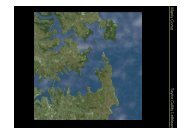
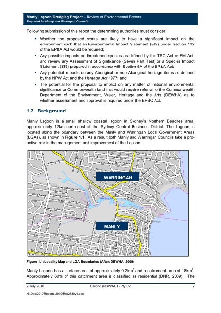
<strong>Manly</strong> <strong>Lagoon</strong> <strong>Dredging</strong> <strong>Project</strong> – Review of Environmental FactorsPrepared for <strong>Manly</strong> and Warringah <strong>Council</strong>sFollowing submission of this report the determining authorities must consider: Whether the proposed works are likely to have a significant impact on theenvironment such that an Environmental Impact Statement (EIS) under Section 112of the EP&A Act would be required; Any possible impacts on threatened species as defined by the TSC Act or FM Act,and review any Assessment of Significance (Seven Part Test) or a Species ImpactStatement (SIS) prepared in accordance with Section 5A of the EP&A Act; Any potential impacts on any Aboriginal or non-Aboriginal heritage items as definedby the NPW Act and the Heritage Act 1977; and The potential for the proposal to impact on any matter of national environmentalsignificance or Commonwealth land that would require referral to the CommonwealthDepartment of the Environment, Water, Heritage and the Arts (DEWHA) as towhether assessment and approval is required under the EPBC Act.1.2 Background<strong>Manly</strong> <strong>Lagoon</strong> is a small shallow coastal lagoon in Sydney’s Northern Beaches area,approximately 12km north-east of the Sydney Central Business District. The <strong>Lagoon</strong> islocated along the boundary between the <strong>Manly</strong> and Warringah Local <strong>Government</strong> Areas(LGAs), as shown in Figure 1.1. As a result both <strong>Manly</strong> and Warringah <strong>Council</strong>s take a proactiverole in the management and improvement of the <strong>Lagoon</strong>.WARRINGAHMANLYFigure 1.1: Locality Map and LGA Boundaries (After: DEWHA, 2009)<strong>Manly</strong> <strong>Lagoon</strong> has a surface area of approximately 0.2km 2 and a catchment area of 18km 2 .Approximately 60% of this catchment area is classified as residential (DNR, 2009). The2 July 2010 Cardno (<strong>NSW</strong>/ACT) Pty Ltd 2H:\Doc\2010\Reports.2010\Rep2580v4.doc