Manly Lagoon Dredging Project - Manly Council - NSW Government
Manly Lagoon Dredging Project - Manly Council - NSW Government
Manly Lagoon Dredging Project - Manly Council - NSW Government
- No tags were found...

Create successful ePaper yourself
Turn your PDF publications into a flip-book with our unique Google optimized e-Paper software.
<strong>Manly</strong> <strong>Lagoon</strong> <strong>Dredging</strong> <strong>Project</strong>Review of Environmental FactorsFINALLJ2818/Rep2580V4Prepared for <strong>Manly</strong> and Warringah <strong>Council</strong>s2 July 2010
<strong>Manly</strong> <strong>Lagoon</strong> <strong>Dredging</strong> <strong>Project</strong> – Review of Environmental FactorsPrepared for <strong>Manly</strong> and Warringah <strong>Council</strong>sCardno (<strong>NSW</strong>/ACT) Pty LtdABN 95 001 145 035Level 3 910 Pacific HighwayGordon <strong>NSW</strong> 2072AustraliaTelephone: 02 9496 7700Facsimile: 02 9499 3033International: +61 2 9496 7700sydney@cardno.com.auwww.cardno.com.auDocument ControlVersion Status Date Author Reviewer1 PreliminaryDraft16 October20092 Final Draft 27 November20093 Final 9 February20104 RevisedFinal2 July 2010 Sarah Fitzsimons/ PeggyO’DonnellSarah Fitzsimons SKF Kester Boardman /Louise CollierSarah Fitzsimons SKF Kester Boardman /Louise CollierSarah Fitzsimons SKF Kester Boardman /Louise CollierSKF /PODKester BoardmanIKB / LCCIKB / LCCIKB / LCCIKBCover Photo: Source: <strong>NSW</strong> Department of Environment and Climate Change (Coastal and FloodplainsPrograms)"© 2010 Cardno (<strong>NSW</strong>/ACT) Pty Ltd All Rights Reserved. Copyright in the whole and every part of thisdocument belongs to Cardno (<strong>NSW</strong>/ACT) Pty Ltd and may not be used, sold, transferred, copied or reproducedin whole or in part in any manner or form or in or on any media to any person without the prior written consent ofCardno (<strong>NSW</strong>/ACT) Pty Ltd.”2 July 2010 Cardno (<strong>NSW</strong>/ACT) Pty Ltd iH:\Doc\2010\Reports.2010\Rep2580v4.doc
<strong>Manly</strong> <strong>Lagoon</strong> <strong>Dredging</strong> <strong>Project</strong> – Review of Environmental FactorsPrepared for <strong>Manly</strong> and Warringah <strong>Council</strong>sDeclarationThis Review of Environmental Factors provides a true and fair review of the proposedactivity in relation to its likely effects on the environment in accordance with Section 111 ofthe Environmental Planning and Assessment Act 1979. It addresses to the fullest extentpossible all matters affecting or likely to affect the environment as a result of the proposedactivity.Prepared by: Kester BoardmanSigned: Date: 2 July 2010Designation: Manager Environment and Sustainability (B.Sc. MIEMA)I have examined this Review of Environmental Factors and the declaration and accept theReview of Environmental Factors on behalf of the Land and Property Management Authority.Name (print)…………………….Signed:..........................................Date:..............................................Designation:..................................I have examined this Review of Environmental Factors and the declaration and accept theReview of Environmental Factors on behalf of <strong>Manly</strong> <strong>Council</strong>.Name (print)…………………….Signed:..........................................Date:..............................................Designation:..................................I have examined this Review of Environmental Factors and the declaration and accept theReview of Environmental Factors on behalf of Warringah <strong>Council</strong>.Name (print)…………………….Signed:..........................................Date:..............................................Designation:..................................2 July 2010 Cardno (<strong>NSW</strong>/ACT) Pty Ltd iiH:\Doc\2010\Reports.2010\Rep2580v4.doc
<strong>Manly</strong> <strong>Lagoon</strong> <strong>Dredging</strong> <strong>Project</strong> – Review of Environmental FactorsPrepared for <strong>Manly</strong> and Warringah <strong>Council</strong>sExecutive SummaryThis Review of Environmental Factors (REF) has been prepared to assess the impacts ofdredging the section of <strong>Manly</strong> <strong>Lagoon</strong> between the footbridge at Nolan Reserve and the endof Riverview Parade, and dewatering the dredge sediments using equipment sited at NolanReserve.The dredging methodology proposed uses an innovative dewatering technique, which isperceived to offer a number of environmental and operational advantages when compared toother options considered. In particular, the method, which involves treatment with a polymerand dewatering using geotextile bags, offers the following benefits:A reduction in the volume of material which requires movement away from the<strong>Lagoon</strong>;Potentially allowing the dredge spoil to be beneficially reused at other locations(subject to physical and chemical material testing), rather than being sent to landfill;Avoidance of, or reduction in landfill charges, which would otherwise be significantand reduce the viability of the project from an economic perspective.In consultation with <strong>Manly</strong> <strong>Council</strong>, the Land and Property Management Authority and theDepartment of Environment, Climate Change and Water, a dredging trial has beenundertaken (Appendix C) which successfully demonstrated the capability of the technologyto effectively dewater sediment from the lagoon. During the trial, water and sedimentsamples were collected and analysed to inform both the process design and this REF.In developing the REF, a wide range of potential impacts of the project have beenconsidered. These include impacts on:Topography, Geology and soils (including acid sulfate soils);Climate and Air Quality;Water Quality and Hydrology;Biodiversity (Flora and Fauna);Heritage (Aboriginal and Non-Aboriginal);Noise and Vibration;Traffic and Access;Utilities and Services;Visual Amenity and Aesthetics;Hazards and Waste;Socio-Economic Factors;Cumulative Environmental Impacts.Of these, the greatest direct risk is to water quality, with associated direct and indirect risksto biodiversity in the lagoon. In recognition of this, a number of specialist studies have beenundertaken with the objectives of quantifying current conditions in the lagoon, evaluating themagnitude of expected impact, and identifying mitigation measures which should beemployed to minimise or mitigate the level of expected impact. These studies are included2 July 2010 Cardno (<strong>NSW</strong>/ACT) Pty Ltd iiiH:\Doc\2010\Reports.2010\Rep2580v4.doc
<strong>Manly</strong> <strong>Lagoon</strong> <strong>Dredging</strong> <strong>Project</strong> – Review of Environmental FactorsPrepared for <strong>Manly</strong> and Warringah <strong>Council</strong>sas appendices to this REF, and include a water quality study, benthic fauna survey, andseagrass survey.Based upon the findings of the specialist reports, it can be concluded that provided themitigation measures contained in this REF are followed, the proposed dredging anddewatering activities are not expected to have any significant negative impact on waterquality, flora or fauna within the lagoon. Similarly, discussion within this REF shows thatprovided mitigation measures are implemented as described, no significant negativeenvironmental impact is expected to occur.Extensive consultation has been carried out with relevant agency stakeholders during thepreparation of this REF which was preceded by community consultation in the originalformulation of the project. All key stakeholder concerns have been considered in themitigation measures contained within this REF. No issues were raised during theconsultation that were incompatible with the project.<strong>Manly</strong> and Warringah <strong>Council</strong>s will develop a Community Consultation Plan as a means toinform the community of the project and provide ongoing information to the public for theduration of the project.This REF has been produced in accordance with the requirements of sections 5A and 111 ofthe EP&A Act, and concludes that there are no significant environmental impacts, nor anysignificant effects on any threatened species, populations or ecological communities, andthat as such, a Species Impact Statement (SIS) and / or an Environmental Impact Statement(EIS) will not be required for the project.It is considered that the processes and mitigation measures described in this reportrepresent an appropriate scope of works to dredge the subject section of the lagoon whilstminimising the risk to the environment. It is therefore recommended that dredging proceedsin accordance with the mitigation measures described in this REF.2 July 2010 Cardno (<strong>NSW</strong>/ACT) Pty Ltd ivH:\Doc\2010\Reports.2010\Rep2580v4.doc
<strong>Manly</strong> <strong>Lagoon</strong> <strong>Dredging</strong> <strong>Project</strong> – Review of Environmental FactorsPrepared for <strong>Manly</strong> and Warringah <strong>Council</strong>sTable of ContentsExecutive Summary ............................................................................................................................. iiiGlossary and Abbreviations ............................................................................................................... ix1 Introduction ................................................................................................................................... 11.1 Purpose of the Report ............................................................................................................. 11.2 Background ............................................................................................................................. 21.3 Assessment Methodology ....................................................................................................... 52 The Proposal.................................................................................................................................. 72.1 Need for the Proposed Works ................................................................................................. 72.2 Previous and Ongoing Rehabilitation Works .......................................................................... 72.3 Objectives of the Proposed Works .......................................................................................... 82.4 Description of the Existing Environment ................................................................................. 82.5 Proposal Description ............................................................................................................... 92.5.1 Methodology for Proposed Works ................................................................................. 112.5.2 Proposal Timing ............................................................................................................ 132.5.3 Geotextile Products for Dewatering .............................................................................. 132.6 Calibration Period .................................................................................................................. 143 Specialist Studies, Stakeholder Consultation and Trials ....................................................... 163.1 Specialist Studies .................................................................................................................. 163.2 Stakeholder Consultation ...................................................................................................... 183.3 Trial <strong>Dredging</strong> ........................................................................................................................ 243.3.1 Testing of Treated and Untreated Sediments and ASS ................................................ 253.3.2 Testing of Runoff Water ................................................................................................ 263.3.3 Trial <strong>Dredging</strong> Results ................................................................................................... 264 Statutory and Planning Framework .......................................................................................... 294.1 State Environmental Planning Policies ................................................................................. 294.2 Pollution Control Legislation .................................................................................................. 314.3 Terrestrial Ecology Legislation .............................................................................................. 324.4 Aquatic Ecology Legislation .................................................................................................. 334.5 Water Legislation .................................................................................................................. 344.6 Heritage Legislation .............................................................................................................. 344.7 Geology and Soil Legislation ................................................................................................. 354.8 Waste and Hazards Legislation ............................................................................................ 354.9 Regional Environmental Plans (REPs) ................................................................................. 364.10 Local Environmental Plans (LEPs) ....................................................................................... 364.11 Summary of Permits, Approvals and Licences ..................................................................... 375 Environmental Assessment ....................................................................................................... 405.1 Topography, Geology and Soils ............................................................................................ 415.2 Climate and Air Quality ......................................................................................................... 515.3 Water Quality and Hydrology ................................................................................................ 575.3.1 Measurement of Turbidity ............................................................................................. 692 July 2010 Cardno (<strong>NSW</strong>/ACT) Pty Ltd vH:\Doc\2010\Reports.2010\Rep2580v4.doc
<strong>Manly</strong> <strong>Lagoon</strong> <strong>Dredging</strong> <strong>Project</strong> – Review of Environmental FactorsPrepared for <strong>Manly</strong> and Warringah <strong>Council</strong>s5.4 Biodiversity ............................................................................................................................ 705.4.1 Flora .............................................................................................................................. 715.4.2 Fauna ............................................................................................................................ 795.5 Heritage ................................................................................................................................. 975.5.1 Aboriginal Heritage ........................................................................................................ 975.5.2 Non-Aboriginal Heritage ................................................................................................ 995.6 Noise and Vibration ............................................................................................................. 1015.7 Traffic and Access ............................................................................................................... 1055.8 Utilities and Services ........................................................................................................... 1085.9 Visual Amenity and Aesthetics ............................................................................................ 1095.10 Hazards and Waste ............................................................................................................. 1115.11 Socio-Economic Factors ..................................................................................................... 1145.12 Cumulative Environmental Impacts .................................................................................... 1146 Environmental Management .................................................................................................... 1156.1 Summary of Mitigation Measures........................................................................................ 1156.2 Environmental Management Plans ..................................................................................... 1226.3 Contractor Control ............................................................................................................... 1226.4 Licensing and Approvals ..................................................................................................... 1237 Conclusions ............................................................................................................................... 1247.1 Summary of Consideration of Environmental Factors ........................................................ 1247.2 Conclusion ........................................................................................................................... 1278 Qualifications............................................................................................................................. 1289 References ................................................................................................................................. 129List of TablesTable 3.1: Summary of Issues Raised and Responses of Consultation ............................................... 19Table 3.2: Summary of Responses to Second Round of Consultation ................................................ 24Table 4.1: Summary of Requirements for Approvals, Licences and Permits ....................................... 37Table 5.1: Soil Landscapes for Proposed Works Area (After: Chapman and Murphy, 1989) .............. 41Table 5.2: Textural Properties of Sediment Samples from Vibrocores from within <strong>Manly</strong> <strong>Lagoon</strong> (After:PBP, 2002) ............................................................................................................................................ 43Table 5.3: Contaminants Present at the Former Landfill Site Adjacent to <strong>Manly</strong> <strong>Lagoon</strong> (After: EPA,2004) ..................................................................................................................................................... 45Table 5.4: Mean Values for Water Quality Parameters Throughout <strong>Manly</strong> <strong>Lagoon</strong> 1994-2002 (After:PBP, 2003a*) ........................................................................................................................................ 58Table 5.5: 1% AEP Flood Levels in <strong>Manly</strong> <strong>Lagoon</strong> (After: PBP, 2003a) .............................................. 62Table 5.6: Potential Threatened Flora at <strong>Manly</strong> <strong>Lagoon</strong> (Sources: NPWS Wildlife Atlas; BioNet; EPBCDatabase) .............................................................................................................................................. 73Table 5.7: Fish and Mobile Invertebrates (Prawns and Crabs) Caught in <strong>Manly</strong> <strong>Lagoon</strong> by TheEcology Lab^ ......................................................................................................................................... 80Table 5.8: Bird Species Recorded at <strong>Manly</strong> <strong>Lagoon</strong> by Warringah <strong>Council</strong> on 4 January 2010 (After:Warringah <strong>Council</strong>, 2010) ..................................................................................................................... 822 July 2010 Cardno (<strong>NSW</strong>/ACT) Pty Ltd viH:\Doc\2010\Reports.2010\Rep2580v4.doc
<strong>Manly</strong> <strong>Lagoon</strong> <strong>Dredging</strong> <strong>Project</strong> – Review of Environmental FactorsPrepared for <strong>Manly</strong> and Warringah <strong>Council</strong>sTable 5.9: Potential Threatened Fauna at <strong>Manly</strong> <strong>Lagoon</strong> (Sources: NPWS Wildlife Atlas; BioNet;EPBC Database) ................................................................................................................................... 83Table 5.10: Potential Migratory Species Listed as Matters of NES at <strong>Manly</strong> <strong>Lagoon</strong> (Source: EPBCDatabase) .............................................................................................................................................. 89Table 5.11: Potential Listed Marine Species under the EPBC Act at <strong>Manly</strong> <strong>Lagoon</strong> (Source: EPBCDatabase) .............................................................................................................................................. 90Table 5.12: Items of Heritage Proximal to the Proposed Works (Sources: DECC, 2009b; DoP, 2009c).............................................................................................................................................................. 99Table 5.13: Examples of Types of Vibration (After: DEC, 2006) ........................................................ 103Table 5.14: Acceptable Vibration Dose Values for Intermittent Vibration during the Daytime (7am-10pm) (After: DEC, 2006) ................................................................................................................... 103Table 5.15: Major <strong>Project</strong>s in the <strong>Manly</strong> and Warringah LGAs (Source: DoP, 2009b) ....................... 114Table 6.1: Summary of Environmental Mitigation Measures for the Proposed Works ....................... 115Table 7.1: Summary of Consideration of Environmental Factors (Commonwealth Legislation) ........ 124Table 7.2: Summary of Consideration of Environmental Factors (State Legislation) ......................... 125List of FiguresFigure 1.1: Locality Map and LGA Boundaries (After: DEWHA, 2009)................................................... 2Figure 1.2: Locality Plan (After: Patterson Britton and Partners, 2003b) ................................................ 4Figure 2.1: Location / Extent of Proposed <strong>Dredging</strong> Works (Sources: <strong>Manly</strong> <strong>Council</strong> GIS & GoogleMaps) .................................................................................................................................................... 10Figure 2.2: Examples of Geotextile Tubes Dewatering Sediments (Left / Right Panel Sources: Geo-Synthetics, 2009 / US Fabrics, 2009) ................................................................................................... 14Figure 5.1: Acid Sulfate Soils Risk Map for Proposed Works Site (After: Natural Resource Atlas, 2009).............................................................................................................................................................. 44Figure 5.2: EPA Contaminated Land Site – Former Landfill, Adjacent to <strong>Manly</strong> <strong>Lagoon</strong> (After: <strong>Manly</strong><strong>Council</strong> GIS) .......................................................................................................................................... 46Figure 5.3: Wind Roses (9am) for Sydney (Observatory Hill), Site Number 066062 (Source: BoM,2009) ..................................................................................................................................................... 52Figure 5.4: Wind Roses (3pm) for Sydney (Observatory Hill), Site Number 066062 (Source: BoM,2009) ..................................................................................................................................................... 53Figure 5.5: Indicative Top Sources of Air Pollution for the <strong>Manly</strong> LGA (Source: DEWHA, 2008) ........ 54Figure 5.6: Indicative Top Sources of Air Pollution for the Warringah LGA (Source: DEWHA, 2008) . 54Figure 5.7: Water Quality Sampling Sites for the Period 1994 to 2002 (After: PBP, 2003b) ................ 60Figure 5.8: Peak Flood Levels and Velocities for 1% AEP Flood in <strong>Manly</strong> <strong>Lagoon</strong> (After: PBP, 2003b).............................................................................................................................................................. 63Figure 5.9: Aerial Photograph Showing the Distribution of the Seagrass Zostera capricorni in <strong>Manly</strong><strong>Lagoon</strong>, 17 July 2009. ........................................................................................................................... 71Figure 5.10: Locations of Endangered Ecological Communities at <strong>Manly</strong> <strong>Lagoon</strong> [Note: Map has notbeen updated to reflect extents of current field survey] (Source: Warringah <strong>Council</strong>, 2010) ............... 75Figure 5.11: Nesting Sites of Little Pied Cormorant Colonies at <strong>Manly</strong> <strong>Lagoon</strong>, 12 November 2009 .. 87Figure 5.12: Existing Road Network Surrounding the Proposed Works (Source: Google Maps) ...... 1052 July 2010 Cardno (<strong>NSW</strong>/ACT) Pty Ltd viiH:\Doc\2010\Reports.2010\Rep2580v4.doc
<strong>Manly</strong> <strong>Lagoon</strong> <strong>Dredging</strong> <strong>Project</strong> – Review of Environmental FactorsPrepared for <strong>Manly</strong> and Warringah <strong>Council</strong>sAppendicesAppendix AAppendix BAppendix CAppendix DAppendix EAppendix FAppendix GAppendix HAppendix IAppendix JAppendix KAppendix LAppendix MAppendix NAppendix OSite PhotologStakeholder Consultation ResponsesTrial <strong>Dredging</strong> ReportEPA Notice for Contaminated SiteAcid Sulfate Soils Management PlanBenthic Fauna Survey ReportSeagrass Survey ReportWater Quality Monitoring ProgramULTIMER 7757 Product Information and Correspondence<strong>Dredging</strong> PlansTechnical SpecificationProtected Bird Nesting SitesCompound Location on Nolan ReserveFlora and Fauna Assessment – Seven Part TestsDECCW Correspondence RE: Contaminant Mass Removal2 July 2010 Cardno (<strong>NSW</strong>/ACT) Pty Ltd viiiH:\Doc\2010\Reports.2010\Rep2580v4.doc
<strong>Manly</strong> <strong>Lagoon</strong> <strong>Dredging</strong> <strong>Project</strong> – Review of Environmental FactorsPrepared for <strong>Manly</strong> and Warringah <strong>Council</strong>sGlossary and AbbreviationsAEPAHDAHIMSALSANZECCASSASSMACASSMPCCOCEMPd 50DECCDECCWDEWHADLWCDNRDODoCDoLDoPDPIDWEEIAEILEISAnnual Exceedance Probability – a large flood with a 1%chance of occurring in each and every yearAustralian Height DatumAboriginal Heritage Information Management SystemAustralian Laboratory ServicesAustralian and New Zealand Environment andConservation <strong>Council</strong>Acid Sulfate SoilsAcid Sulfate Soils Management Advisory CommitteeAcid Sulfate Soils Management PlanChemical Control Order. An order in force under Sections22 or 23 of the Environmentally Hazardous ChemicalsAct 1985Construction Environmental Management PlanMedium grain sizeDepartment of Environment and Climate Change (nowDECCW)Department of Environment, Climate Change and Water(formerly DECC)Department of the Environment, Water, Heritage and theArtsDepartment of Land and Water Conservation (nowDECCW)Department of Natural Resources (now DECCW)Dissolved OxygenDepartment of CommerceDepartment of Lands (now LPMA)Department of PlanningDepartment of Primary Industries (now DII)Department of Water & Energy (now DECCW and I&I<strong>NSW</strong>)Environmental Impact AssessmentEcological Investigation LevelEnvironmental Impact Statement2 July 2010 Cardno (<strong>NSW</strong>/ACT) Pty Ltd ixH:\Doc\2010\Reports.2010\Rep2580v4.doc
<strong>Manly</strong> <strong>Lagoon</strong> <strong>Dredging</strong> <strong>Project</strong> – Review of Environmental FactorsPrepared for <strong>Manly</strong> and Warringah <strong>Council</strong>sEMPEnvironmental Management PlanEP&A Act Environmental Planning and Assessment Act 1979EP&A RegulationEPAEPBC ActESCPGMRHILsI&I <strong>NSW</strong>LEPLGALPMAMajor <strong>Project</strong>s SEPPMHLMLALCML ICMS 2004MLCCCMPNEnvironmental Planning and Assessment Regulation2000Environment Protection Authority (within DECCW)Environment Protection and Biodiversity ConservationAct 1999Erosion and Sediment Control PlanGreater Metropolitan RegionHealth Investigation LevelsIndustry and Investment <strong>NSW</strong> (including parts of theformer DPI and DWE)Local Environmental PlanLocal <strong>Government</strong> AreaLand and Property Management Authority (formerly DoL)State Environmental Planning Policy (Major <strong>Project</strong>s)2005<strong>Manly</strong> Hydraulics LaboratoryMetropolitan Local Aboriginal Land <strong>Council</strong><strong>Manly</strong> <strong>Lagoon</strong> Integrated Catchment ManagementStrategy 2004<strong>Manly</strong> <strong>Lagoon</strong> Catchments Coordinating CommitteeMost Probable NumberNAGD National Assessment Guidelines for <strong>Dredging</strong> 2009NATANEPCNEPMNational Association of Testing AuthoritiesNational Environment Protection <strong>Council</strong>National Environment Protection (Assessment of SiteContamination) Measure 1999; health and ecologicalbasedguidelines for soil and groundwater qualityNPW Act National Parks and Wildlife Act 1974NPWSNRA<strong>NSW</strong>National Parks and Wildlife ServiceNational Registration Authority for Agriculture andVeterinary ChemicalsNew South WalesNV Act Native Vegetation Act 20032 July 2010 Cardno (<strong>NSW</strong>/ACT) Pty Ltd xH:\Doc\2010\Reports.2010\Rep2580v4.doc
<strong>Manly</strong> <strong>Lagoon</strong> <strong>Dredging</strong> <strong>Project</strong> – Review of Environmental FactorsPrepared for <strong>Manly</strong> and Warringah <strong>Council</strong>sPAHPASSPCBPolynuclear Aromatic Hydrocarbon or PolycyclicAromatic HydrocarbonPotential Acid Sulfate SoilsPolychlorinated BiphenylPoEO Act Protection of Environment Operations Act 1997ppmpptPSDSREFREPRNESEPPSEPP 14SEPP 26SEPP 35SEPP 44SEPP 71SEPP (Infrastructure)SISTCLPTNTOCTPTPHParts per millionParts per trillionProduct Safety Data SheetReview of Environmental FactorsRegional Environmental PlanRegister of the National EstateState Environmental Planning PolicyState Environmental Planning Policy No. 14 – CoastalWetlandsState Environmental Planning Policy No. 26 – LittoralRainforestsState Environmental Planning Policy No. 35 –Maintenance <strong>Dredging</strong> of Tidal Waters (now repealedand replaced by SEPP (Infrastructure))State Environmental Planning Policy No. 44 – KoalaHabitat ProtectionState Environmental Planning Policy No. 71 – CoastalProtectionState Environmental Planning Policy (Infrastructure)2007Species Impact StatementToxicity Characteristic Leaching ProcedureTotal NitrogenTotal Organic CarbonTotal PhosphorusTotal Petroleum HydrocarbonsTSC Act Threatened Species Conservation Act 1995TSSVENMTotal Suspended SolidsVirgin Excavated Natural MaterialWARR Act Waste Avoidance and Resource Recovery Act 20012 July 2010 Cardno (<strong>NSW</strong>/ACT) Pty Ltd xiH:\Doc\2010\Reports.2010\Rep2580v4.doc
<strong>Manly</strong> <strong>Lagoon</strong> <strong>Dredging</strong> <strong>Project</strong> – Review of Environmental FactorsPrepared for <strong>Manly</strong> and Warringah <strong>Council</strong>s1 Introduction<strong>Manly</strong> and Warringah <strong>Council</strong>s propose to dredge a portion of <strong>Manly</strong> <strong>Lagoon</strong> by removingaccumulated sediment within the lagoon between the footbridge at Nolan Reserve and theend of Riverview Parade. The area to be dredged comprises part of Crown reserve R56146under the Crown Lands Act, 1995 and the supporting land-based operations will beundertaken on Lot 1 DP60640 (a portion of Nolan Reserve) and Lot 2762 DP952038 (also aportion of Nolan Reserve). The removed sediment will be dosed (to aid clarification) anddewatered in geotextile bags. The dewatered sediment, referred to as dredge spoil, will beanalysed and, providing its chemical and physical composition is suitable, will be beneficiallyreused. If the material is not suitable for reuse, it will be sent to an appropriate landfill. Theproposed dredging works are described in detail in Section 2.1.1 Purpose of the ReportCardno has been engaged by <strong>Manly</strong> <strong>Council</strong> to prepare this Review of EnvironmentalFactors (REF). The purpose of this REF is to describe the dredging process, to assess anddocument the likely impacts of the dredging process on the environment, and to detailprotective measures to minimise any impacts on the environment.This REF considers the potential environmental impacts of the proposed dredging anddewatering activities. Consideration of land application or disposal of the treated dredgespoil is outside the scope of this REF.For the purpose of the proposed works, <strong>Manly</strong> <strong>Council</strong> is the proponent and also thedetermining authority, in conjunction with the Land and Property Management Authority(LPMA; formerly the Department of Lands (DoL)) and Warringah <strong>Council</strong>, under Part 5 of theEnvironmental Planning and Assessment Act 1979 (EP&A Act).Under Part 5 of the EP&A Act there is a duty for determining authorities to consider theenvironmental impacts of proposed activities. The proposal and its associated environmentalimpacts have been assessed in the context of: Clause 228 of the Environmental Planning and Assessment Regulation 2000 (EP&ARegulation); The Threatened Species Conservation Act 1995 (TSC Act); The Fisheries Management Act 1994; The National Parks and Wildlife Act 1974 (NPW Act); The Heritage Act 1977; The Environment Protection and Biodiversity Conservation Act 1999 (EPBC Act); and The State Environmental Planning Policy (Infrastructure) 2007.In doing so, this REF aids in fulfilling the requirements of Section 111 of the EP&A Act; thatthe determining authorities, in this case LPMA and <strong>Manly</strong> and Warringah <strong>Council</strong>s, take intoaccount to the fullest extent possible, all matters that may potentially affect the environmentby reason of the proposed activity.2 July 2010 Cardno (<strong>NSW</strong>/ACT) Pty Ltd 1H:\Doc\2010\Reports.2010\Rep2580v4.doc
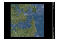
<strong>Manly</strong> <strong>Lagoon</strong> <strong>Dredging</strong> <strong>Project</strong> – Review of Environmental FactorsPrepared for <strong>Manly</strong> and Warringah <strong>Council</strong>sFollowing submission of this report the determining authorities must consider: Whether the proposed works are likely to have a significant impact on theenvironment such that an Environmental Impact Statement (EIS) under Section 112of the EP&A Act would be required; Any possible impacts on threatened species as defined by the TSC Act or FM Act,and review any Assessment of Significance (Seven Part Test) or a Species ImpactStatement (SIS) prepared in accordance with Section 5A of the EP&A Act; Any potential impacts on any Aboriginal or non-Aboriginal heritage items as definedby the NPW Act and the Heritage Act 1977; and The potential for the proposal to impact on any matter of national environmentalsignificance or Commonwealth land that would require referral to the CommonwealthDepartment of the Environment, Water, Heritage and the Arts (DEWHA) as towhether assessment and approval is required under the EPBC Act.1.2 Background<strong>Manly</strong> <strong>Lagoon</strong> is a small shallow coastal lagoon in Sydney’s Northern Beaches area,approximately 12km north-east of the Sydney Central Business District. The <strong>Lagoon</strong> islocated along the boundary between the <strong>Manly</strong> and Warringah Local <strong>Government</strong> Areas(LGAs), as shown in Figure 1.1. As a result both <strong>Manly</strong> and Warringah <strong>Council</strong>s take a proactiverole in the management and improvement of the <strong>Lagoon</strong>.WARRINGAHMANLYFigure 1.1: Locality Map and LGA Boundaries (After: DEWHA, 2009)<strong>Manly</strong> <strong>Lagoon</strong> has a surface area of approximately 0.2km 2 and a catchment area of 18km 2 .Approximately 60% of this catchment area is classified as residential (DNR, 2009). The2 July 2010 Cardno (<strong>NSW</strong>/ACT) Pty Ltd 2H:\Doc\2010\Reports.2010\Rep2580v4.doc
<strong>Manly</strong> <strong>Lagoon</strong> <strong>Dredging</strong> <strong>Project</strong> – Review of Environmental FactorsPrepared for <strong>Manly</strong> and Warringah <strong>Council</strong>smajority of the <strong>Lagoon</strong> foreshore is public and private open space and includes parklands,reserves, and <strong>Manly</strong> and Warringah Golf Courses, as indicated on Figure 1.2.The catchment is drained by three major freshwater creeks that flow into <strong>Manly</strong> <strong>Lagoon</strong>,including Burnt Bridge Creek, <strong>Manly</strong> Creek and Brookvale Creek (Figure 1.2). Flows within<strong>Manly</strong> Creek are subject to influence of the <strong>Manly</strong> dam, which is located approximately1.5km to the west of the lagoon. A large number of stormwater drains in the catchment alsoflow into the <strong>Lagoon</strong>, and can have an impact on water quality and flow.The ocean entrance of the <strong>Lagoon</strong> is situated at the northern end of Queenscliff Beach andis an intermittently/mechanically opened, untrained entrance (DNR, 2009). A 3.3m wide by1.8m high box culvert located at the entrance conveys low flows to the ocean and allowslagoon and ocean waters to exchange with each tidal cycle. During times of flooding,bulldozers excavate a flood overflow channel across the beach berm to open the channel tothe ocean and convey flood flows (PBP, 2003a).<strong>Manly</strong> <strong>Lagoon</strong> is considered one of the most polluted waterways on the east coast ofAustralia, with swimming, boating and fishing activities currently not recommended due topolluted water and sediment (<strong>Manly</strong> <strong>Council</strong>, 2009). Poor water and sediment quality in the<strong>Lagoon</strong> is mainly due to local pollution sources including urban stormwater runoff, sewageoverflows, former tip site leachate and illegal discharge and dumping of industrial and tradewaste (<strong>Manly</strong> <strong>Council</strong>, 2009).2 July 2010 Cardno (<strong>NSW</strong>/ACT) Pty Ltd 3H:\Doc\2010\Reports.2010\Rep2580v4.doc
<strong>Manly</strong> <strong>Lagoon</strong> <strong>Dredging</strong> <strong>Project</strong> – Review of Environmental FactorsPrepared for <strong>Manly</strong> and Warringah <strong>Council</strong>sFigure 1.2: Locality Plan (After: Patterson Britton and Partners, 2003b)2 July 2010 Cardno (<strong>NSW</strong>/ACT) Pty Ltd 4H:\Doc\2010\Reports.2010\Rep2580v4.doc
<strong>Manly</strong> <strong>Lagoon</strong> <strong>Dredging</strong> <strong>Project</strong> – Review of Environmental FactorsPrepared for <strong>Manly</strong> and Warringah <strong>Council</strong>s1.3 Assessment MethodologyThe method of preparation of this document is as follows:Discussions were held with <strong>Manly</strong> and Warringah <strong>Council</strong>s and the DoL (now LPMA)at the inception of the project in May 2009. Ongoing discussions have taken placefollowing this initial meeting.Cardno representatives undertook an initial site inspection on 19 May 2009 to make avisual assessment of the <strong>Lagoon</strong> and foreshore areas and the proposed dredgingareas (see Site Photolog in Appendix A).Stakeholder consultation was undertaken via formal correspondence (two letters; thefirst dated 28 May 2009, followed by an update regarding proposed dewatering of thedredge spoil on 24 September 2009) with the following agencies:oooooooooDepartment of Environment and Climate Change (DECC) (now DECCW);Department of Lands (DoL) (now LPMA);Department of Planning (DoP);Department of Primary Industries (DPI) (now I&I <strong>NSW</strong>);Department of Water and Energy (DWE) (abolished on 27 July 2009; thewater responsibilities of the former DWE are now managed by DECCW);Metropolitan Local Aboriginal Land <strong>Council</strong> (MLALC);Roads and Traffic Authority (RTA);Sydney Metropolitan Catchment Management Authority (CMA); andWarringah <strong>Council</strong>.Consultation is discussed further in Section 3 and relevant correspondence can befound in Appendix B. As <strong>Project</strong> Manager for the dredging project, <strong>Manly</strong> <strong>Council</strong>has been consulted extensively during the course of preparation of this document.A search was conducted of the following databases to identify any potential issues:oooooooooooDEWHA Australian Heritage Database;<strong>NSW</strong> Heritage <strong>Council</strong>’s State Heritage Register;<strong>NSW</strong> Maritime Heritage Database;DECCW Aboriginal Heritage Information Management System (AHIMS);National Native Title Tribunal;DECCW NPWS Atlas of <strong>NSW</strong> Wildlife;DEWHA EPBC Act Database;DII (Fisheries) Database;<strong>NSW</strong> <strong>Government</strong> BioNet Database;DECCW Critical Habitat Register; andDEWHA National Pollutant Inventory (NPI). An appropriate background and literature search, including an Internet search wasconducted, to identify and address relevant environmental issues pertaining to theproposal area. A number of specialist studies were undertaken concurrently with preparation of thisREF. These include:2 July 2010 Cardno (<strong>NSW</strong>/ACT) Pty Ltd 5H:\Doc\2010\Reports.2010\Rep2580v4.doc
<strong>Manly</strong> <strong>Lagoon</strong> <strong>Dredging</strong> <strong>Project</strong> – Review of Environmental FactorsPrepared for <strong>Manly</strong> and Warringah <strong>Council</strong>soooBenthic fauna survey: Mapping and assessment (not including fish) wasundertaken by Cardno Ecology Lab (2009b) in July 2009 in <strong>Manly</strong> <strong>Lagoon</strong>. Asecond, post dredging, benthic fauna survey is scheduled for the Julyfollowing dredging in order to determine the effects of the dredging on benthicfauna (Section 3.1, Section 5.4.2 and Appendix F);Seagrass survey and bank condition assessment: Mapping andassessment was undertaken by Cardno Ecology Lab (2009a) in July 2009,primarily to determine the location of seagrass in <strong>Manly</strong> <strong>Lagoon</strong> and assessthe lagoon bank conditions. A second, post dredging, seagrass survey hasbeen recommended for July 2010 in order to determine the effects of thedredging on seagrass within the <strong>Lagoon</strong> (Section 3.1, Section 5.4.1 andAppendix G); andWater quality monitoring: An extensive water quality monitoring program for<strong>Manly</strong> <strong>Lagoon</strong>, which was agreed in advance by DECCW and I&I <strong>NSW</strong>, hasbeen implemented by Cardno Ecology Lab (2010). Background (baseline)water quality data was collected in the period July to September 2009, withfurther collection of data proposed during dredging and following completionof dredging, in order to determine the effects of the proposed operations onlagoon water quality (Section 3.1, Section 5.3. and Appendix H).A trial of the proposed sediment handling and dewatering process was conducted on22 July 2009, using the polymer Magnafloc, to determine the effectiveness of theproposed dewatering methods on lagoon sediments, and to determine resulting waterand dredge spoil quality. A second dredging trial was conducted on 21 August 2009,using the water-based liquid polymer ULTIMER 7757 (Section 3.3).2 July 2010 Cardno (<strong>NSW</strong>/ACT) Pty Ltd 6H:\Doc\2010\Reports.2010\Rep2580v4.doc
<strong>Manly</strong> <strong>Lagoon</strong> <strong>Dredging</strong> <strong>Project</strong> – Review of Environmental FactorsPrepared for <strong>Manly</strong> and Warringah <strong>Council</strong>s2 The Proposal2.1 Need for the Proposed WorksThe proposed program of sediment removal is part of the ongoing management of <strong>Manly</strong><strong>Lagoon</strong> Estuary, and is consistent with the <strong>Manly</strong> <strong>Lagoon</strong> Estuary Management Plan (<strong>Manly</strong><strong>Council</strong> and Warringah <strong>Council</strong>, 1998).Water quality is the fundamental environmental issue associated with <strong>Manly</strong> <strong>Lagoon</strong>. The<strong>Lagoon</strong> is currently not suitable for primary contact recreation activities such as swimming orsecondary contact recreation activities such as fishing, boating and wading. Pollutionwarning signs are currently posted around the lagoon’s foreshores to warn the community ofthe risk (see photos in Appendix A).Poor water and sediment quality in the <strong>Lagoon</strong> is believed to be mainly due to local pollutionsources including urban stormwater runoff, sewage overflows, former tip site leachate, andillegal discharge and dumping of industrial and trade waste (<strong>Manly</strong> <strong>Council</strong>, 2009). It isintended that dredging of the lagoon will remove some of the contamination from the lagoonand improve water and sediment quality (Table 5.4).The rehabilitation of <strong>Manly</strong> <strong>Lagoon</strong> is endorsed by <strong>Manly</strong> and Warringah <strong>Council</strong>s, includingthe <strong>Manly</strong> <strong>Lagoon</strong> Catchment Coordinating Committee (MLCCC), which oversees theimplementation of the <strong>Manly</strong> <strong>Lagoon</strong> Integrated Catchment Management Strategy 2004 (MLICMS 2004).2.2 Previous and Ongoing Rehabilitation WorksRehabilitation works for <strong>Manly</strong> <strong>Lagoon</strong> have been ongoing for a number of years followingpreparation of the <strong>Manly</strong> <strong>Lagoon</strong> Estuary Management Study (PBP, 1995) and adoption ofthe <strong>Manly</strong> <strong>Lagoon</strong> Estuary Management Plan (<strong>Manly</strong> <strong>Council</strong> and Warringah <strong>Council</strong>, 1998).Significant works completed to date have included: The extension to the low flow pipes; Rehabilitation works within Brookvale Creek and Burnt Bridge Creek; <strong>Dredging</strong> at the entrance; and, Significant investigations in support of further rehabilitation works.The low flow pipes were originally constructed in 1916 by the then Public Works Departmentas a flood mitigation measure. They comprise twin concrete encased 1.8m diameterconcrete pipes. These low flow pipes previously terminated near the landward end ofQueenscliff Rock Pool and were prone to blockage by beach sand introduced into the pipesby wave action. This regular blockage became a concern due to the resulting adverseimpacts on water quality (in the absence of tidal flushing) and flooding (PBP, 2003a).Extension works to the low flow pipes at the entrance to the <strong>Lagoon</strong> were undertakenbetween May and October 1999. The low flow pipes were extended by means of a2 July 2010 Cardno (<strong>NSW</strong>/ACT) Pty Ltd 7H:\Doc\2010\Reports.2010\Rep2580v4.doc
<strong>Manly</strong> <strong>Lagoon</strong> <strong>Dredging</strong> <strong>Project</strong> – Review of Environmental FactorsPrepared for <strong>Manly</strong> and Warringah <strong>Council</strong>sreinforced concrete box culvert 3.3m wide by 1.8m high by 50m length, terminating justbeyond the seaward end of the Queenscliff Rock Pool. The low flow pipes have remainedunblocked since completion of the extension works and now allow lagoon and ocean waterexchange during each tidal cycle without interruption.2.3 Objectives of the Proposed WorksThe proposed dredging of <strong>Manly</strong> <strong>Lagoon</strong> has the following objectives which will provide bothsocio-economic and environmental benefits: Improve water quality in the <strong>Lagoon</strong> through increased tidal circulation, mixing andexchange; Improve amenity value of <strong>Manly</strong> <strong>Lagoon</strong>; Maintain an open water channel within <strong>Manly</strong> <strong>Lagoon</strong>; Progress rehabilitation of <strong>Manly</strong> <strong>Lagoon</strong> in accordance with ongoing management ofthe <strong>Manly</strong> <strong>Lagoon</strong> Estuary; Achieve a net reduction in the mass of pollutants within the lagoon.2.4 Description of the Existing Environment<strong>Manly</strong> <strong>Lagoon</strong> defines the boundary between the <strong>Manly</strong> LGA in the south and the WarringahLGA in the north. The majority of the lagoon foreshore is public and private open space.Open space on the foreshore within the <strong>Manly</strong> LGA, as shown on Figure 1.2, includes: <strong>Lagoon</strong> Park; Keirle Park (<strong>Council</strong> owned and Crown land); and <strong>Manly</strong> Golf Course (Private open space).Open space on the foreshore within the Warringah LGA, as shown on Figure 1.2, includes: Aitken Reserve; Hinkler Park (Crown land under management of <strong>Council</strong>); Nolan Reserve (Mostly <strong>Council</strong> owned); Passmore Reserve (Mostly <strong>Council</strong> owned); and Warringah Golf Course (Mostly <strong>Council</strong> owned, privately managed public openspace).District Park comprises Warringah Golf Course, and Nolan and Passmore Reservesadjacent to the lagoon. It also includes Miller and David Thomas Reserves which are locatedoutside the study area, west of Condamine Street, as shown on Figure 1.2. <strong>Manly</strong> Creekand Brookvale Creek flow through District Park.Land on the bed of <strong>Manly</strong> <strong>Lagoon</strong> is Crown land, managed under the Crown Lands Act1989, and hence is under the control of LPMA (formerly DoL).Historically, a great deal of land-filling and reclamation of wetlands around the <strong>Lagoon</strong> hastaken place. <strong>Manly</strong> Golf Course, <strong>Lagoon</strong> Park, Hinkler Park, Warringah Golf Course, NolanReserve and Keirle Park are all areas that were historically reclaimed and filled, mostly with2 July 2010 Cardno (<strong>NSW</strong>/ACT) Pty Ltd 8H:\Doc\2010\Reports.2010\Rep2580v4.doc
<strong>Manly</strong> <strong>Lagoon</strong> <strong>Dredging</strong> <strong>Project</strong> – Review of Environmental FactorsPrepared for <strong>Manly</strong> and Warringah <strong>Council</strong>ssediment from the <strong>Lagoon</strong> (PBP, 2003a). It is hoped that the dredge spoil from the proposedworks will be beneficially reused on open space and reserves after dosing and dewatering,Suitability for reuse will be determined by physical/chemical testing. If material is found to beunsuitable, it will be disposed of appropriately to landfill.Historically, the eastern section of <strong>Lagoon</strong> Park was used as a rubbish tip in the 1920s. Thecurrent T.S. Condamine site located at the end of Addiscombe Road, shown in Figure 1.2,was also used as a rubbish tip in the 1950s and 1960s (PBP, 2003a). Due to their proximityto the waterway, leachate from these former tip sites contributes to poor water quality in<strong>Manly</strong> <strong>Lagoon</strong> (<strong>Manly</strong> <strong>Council</strong>, 2009). The open space located at the end of AddiscombeRoad is owned by the <strong>NSW</strong> Department of Housing.The three major freshwater creeks that drain the catchment area and flow into <strong>Manly</strong><strong>Lagoon</strong>, as indicated on Figure 1.2, include: Burnt Bridge Creek; <strong>Manly</strong> Creek; and Brookvale Creek.Land use within the catchment is classified as 58% residential, 35% open space and 7%industrial (DNR, 2009). Most of the residential areas consist of medium density detacheddwellings. As discussed in Section 2.1, primary and secondary contact recreational usesincluding swimming, boating and fishing activities are currently not recommended due topolluted water and sediment (<strong>Manly</strong> <strong>Council</strong>, 2009). Specific land use zonings of thesurrounding area are discussed in Section 4.10.2.5 Proposal DescriptionThe proposed works involve dredging a portion of <strong>Manly</strong> <strong>Lagoon</strong>; from the footbridge atNolan Reserve to the end of Riverview Parade. The location of the dredging area is shown inFigure 2.1. Overall the proposed works will involve the removal of up to 6,400m 3 ofaccumulated sediment which will deepen the <strong>Lagoon</strong> to levels recorded in 1992 (based onsurvey data collected for the <strong>Manly</strong> <strong>Lagoon</strong> Flood Study (MHL, 1992). Thus the dredging willremove sediment that has accumulated over approximately a 17 year period (1992-2009).It should be noted that the 1992 levels have been selected as a target dredge depth sincethey represent the oldest accurate survey levels available. In returning to these levels, weexpect that only sediment accumulated through natural processes since 1992 will beremoved from the lagoon. <strong>Dredging</strong> to deeper depths than this is undesirable due to theadded risk of dredging older and previously undisturbed sediments. In particular, there is arisk that if earlier or deeper sediments are disturbed, historic contaminants may be mobilisedor significant heritage items may be disturbed.2 July 2010 Cardno (<strong>NSW</strong>/ACT) Pty Ltd 9H:\Doc\2010\Reports.2010\Rep2580v4.doc
<strong>Manly</strong> <strong>Lagoon</strong> <strong>Dredging</strong> <strong>Project</strong> – Review of Environmental FactorsPrepared for <strong>Manly</strong> and Warringah <strong>Council</strong>sFigure 2.1: Location / Extent of Proposed <strong>Dredging</strong> Works (Sources: <strong>Manly</strong> <strong>Council</strong> GIS & Google Maps)2 July 2010 Cardno (<strong>NSW</strong>/ACT) Pty Ltd 10H:\Doc\2010\Reports.2010\Rep2580v4.doc
<strong>Manly</strong> <strong>Lagoon</strong> <strong>Dredging</strong> <strong>Project</strong> – Review of Environmental FactorsPrepared for <strong>Manly</strong> and Warringah <strong>Council</strong>sIn the initial consultation letters (Appendix B) and the associated replies and the trialdredging report (Cardno Ecology Lab, 2009c, Appendix C), the dredging is referred to asbeing at two sites (Site 1 and 2). For the purposes of this REF, the sites have beenamalgamated and are referred to as the ‘dredge area’.The proposed dredging works within <strong>Manly</strong> <strong>Lagoon</strong> extend from the footbridge at NolanReserve downstream to the end of Riverview Parade, as shown in Figure 2.1. It is intendedthat all removed sediment will be treated, tested, and depending on the final chemical andphysical composition, beneficially reused. The actual locations at which material will bereused is currently being considered and evaluated in a parallel process. It should be notedthat due to the nature of the material (potentially containing acid sulfate soils and otherwaste) and the method with which it will be processed (via dosing and dewatering), thematerial cannot be classified as Virgin Excavated Natural Material (VENM), as defined bythe PoEO Act. This will affect where the material can be reused, however this beneficialreuse is not assessed in this REF. If testing determines that the material is not suitable forreuse it will be disposed of appropriately to landfill.Calculations and dredging plans (Appendix J) show that 97% of material to be removed willbe from the upper 1m of the lagoon bed with the remaining 3% being from the 1 to 1.2mdepth range.2.5.1 Methodology for Proposed WorksThe proposed methodology for the removal and treatment of <strong>Manly</strong> <strong>Lagoon</strong> sediments isdiscussed below: Primary silt curtains will be installed approximately 25m upstream and downstream ofthe area where dredging works are taking place to prevent the movement of anydisturbed silt outside the area. Following discussion with I&I <strong>NSW</strong>, it has been agreedthat these will be across the full profile of the lagoon and will remain in place untildredging works have been completed and TSS levels in the area have fallen below50 mg/L. A secondary silt curtain will be installed downstream of the proposed worksto provide protection in the event of a failure in the primary silt curtain. Large items such as plastic bottles, cans, and shopping trolleys will be removed fromthe lagoon bed. These items will be moved to skips on the lagoon bank and recycledwhere practical or disposed of appropriately. Sediment will be removed from the lagoon using a diesel-powered cutter suctiondredger (which is noted as the preferred method of dredging by I&I <strong>NSW</strong> (Fisheries))(Section 3.2). An initial ‘calibration period’ of dredging, demonstrating satisfactoryoperation of all equipment and mitigation measures must be satisfactorily completedbefore full scale dredging is instigated (Section 2.6); The dredger will be mobile within the lagoon, and will bring sediment from the lagoonbed to the surface through a flexible pipe, connected to the suction head. <strong>Dredging</strong> isexpected to take around 30 days. To minimise turbidity within the lagoon, no cuttingactivity will be undertaken without the suction head being operative.2 July 2010 Cardno (<strong>NSW</strong>/ACT) Pty Ltd 11H:\Doc\2010\Reports.2010\Rep2580v4.doc
<strong>Manly</strong> <strong>Lagoon</strong> <strong>Dredging</strong> <strong>Project</strong> – Review of Environmental FactorsPrepared for <strong>Manly</strong> and Warringah <strong>Council</strong>s <strong>Dredging</strong> plans, indicating areas and depths to be dredged with <strong>Manly</strong> <strong>Lagoon</strong> viacross-section profiles are contained in Appendix J. The dredging operation will require a shore-based site presence with a plan area ofapproximately 4,500m 2 to 5,000m 2 where the equipment, site compound, portabletoilets and removed sediment will be stored in geotextile bags prior to its reuse ordisposal. This area will be fenced, and located within Nolan Reserve. The proposedsite compound location will be near the netball courts in the upper portion of dredgingworks. The proposed location is indicated on the Site Plan in Appendix M. The dredged material will be dosed with the polymer ULTIMER 7757 (Appendix I) ata rate within the range 25ppm to 100ppm and pumped into large geotextile bags(geobags). This concentration range is considered to be an appropriate rate foreffective sediment control and is safe for mixing with lime and dredged material, asdiscussed in Section 5.3. Trials of the polymer have demonstrated that use of thispolymer effectively aids the dewatering of the sediment (Cardno Ecology Lab,2009c). The geobags will be stored in bunded areas on the lagoon banks within NolanReserve, along the northern bank of the lagoon, for a period of approximately fourweeks to allow the maximum possible dewatering to occur. The proposed sitecompound location for bunded geobag storage on Nolan Reserve is shown on theSite Plan in Appendix M. The liquid component of the dredged material will drain from the geobags into thebunded area, from where, subject to water quality testing results, it will be dischargedin a controlled manner to <strong>Manly</strong> <strong>Lagoon</strong>. All chemicals, including lime and the polymer, will be stored in a secure bunded areaon site. Consideration will be given to suitable material for storage containers(Appendix I details suitable and unsuitable construction material with regards to thestorage of ULTIMER 7757), ability to withstand potential impacts of flooding (Section5.3), vandalism and accidental spills (Section 5.10). These issues and mitigationmeasures will be addressed in the various management plans to be prepared by thecontractor. It is intended that provided the criteria for turbidity and pH defined in Section 5.3 aremet, overburden water will be returned to the lagoon (following testing). Return ofwater to the lagoon must be in a controlled manner which minimises the risk ofincreasing turbidity in the water and bank erosion. Once dewatering of the sediment is complete, chemical analysis of representativesamples of the sediment will be undertaken to determine whether the material issuitable for reuse. The potential reuse of the material is being managed andassessed by a separate process. If not suitable, the material will be disposed of tolandfill. Previous investigations and sampling studies have identified some of the sediment in<strong>Manly</strong> <strong>Lagoon</strong> to have the potential for acid sulfate generation (Section 3.1). Thedredged material will be dosed with agricultural lime according to the requirements of2 July 2010 Cardno (<strong>NSW</strong>/ACT) Pty Ltd 12H:\Doc\2010\Reports.2010\Rep2580v4.doc
<strong>Manly</strong> <strong>Lagoon</strong> <strong>Dredging</strong> <strong>Project</strong> – Review of Environmental FactorsPrepared for <strong>Manly</strong> and Warringah <strong>Council</strong>san Acid Sulfate Soils Management Plan (ASSMP). An ASSMP has been prepared toensure that these risks are appropriately managed and is contained in Appendix E. Any disturbed vegetation along the bank will be restored at the completion ofdredging activities to its existing condition to the satisfaction of <strong>Manly</strong> and Warringah<strong>Council</strong>s. The dredger, and any other powered equipment will be diesel driven, and is expectedto require refuelling approximately once per week. Diesel will be supplied in a selfbunded road tank, and during refuelling inflatable booms will be placed around thedredger to contain any accidental spillage. Access for plant associated with dredging activities will be via a temporary haulageaccess from either Kentwell Road or Pittwater Road through Nolan Reserve to thelagoon bank. Any damage to kerbs or grassed areas will be reinstated followingcompletion of the project.2.5.2 Proposal TimingThe proposed dredging works are expected to commence in the third quarter of 2010. Theduration of dredging works will be approximately 30 days. The geobags will need be storedon site, along the foreshore of <strong>Manly</strong> <strong>Lagoon</strong> (Appendix M), for approximately four weeks tocomplete the dewatering process. Hence overall dredging works, sediment dewatering andremoval of dewatered dredge spoil off-site are expected to take approximately eight weeks.2.5.3 Geotextile Products for DewateringHigh strength permeable geotextile products (referred to as geobags in this report) will beused to dewater the dredged sediments. Figure 2.2 shows example photographs ofgeotextile tubes (or geobags) used for dewatering. Geobags can be provided in almost anyshape and size. The general process of dewatering with geobags, will be as follows:1. Filling: The dredged sediment (in slurry form) will be pumped into the geobagcontainers after being dosed in line with a polymer and lime at a prescribed rate. Thepolymer will facilitate the dewatering process by aiding in binding the solids togetherand separating the water. The lime will mitigate any risk posed by Potential AcidSulfate Soils (PASS).2. Dewatering: Generally, over 99% of solids are captured, and relatively clearoverburden or runoff water will drain from the geobag. Overburden water will becaptured in the bunded area so testing can determine an appropriate means ofdisposal.3. Consolidation: The solids remain in the bag while the water is draining from the bag.Because sediment pore water is being expelled, a reduction in volume of the solidsgenerally occurs. This volume reduction is dependent on the nature of the sedimentand how long the material is left to dewater and consolidate in the geobags. At theend of the process the dewatered dredge spoil material can be removed and landappliedif the material is of a suitable physical and chemical composition for reuse. Ifunsuitable, the dredge spoil will be disposed of to landfill. The geobag container canbe disposed of at a landfill site or reused, for example as matting for landscapingworks.2 July 2010 Cardno (<strong>NSW</strong>/ACT) Pty Ltd 13H:\Doc\2010\Reports.2010\Rep2580v4.doc
<strong>Manly</strong> <strong>Lagoon</strong> <strong>Dredging</strong> <strong>Project</strong> – Review of Environmental FactorsPrepared for <strong>Manly</strong> and Warringah <strong>Council</strong>sFigure 2.2: Examples of Geotextile Tubes Dewatering Sediments (Left / Right Panel Sources: Geo-Synthetics, 2009 / US Fabrics, 2009)The first flush of overburden water from the geobag is generally higher in suspended solids(TSS) than second flush runoff water. This is because as dewatering is initiating, the largerparticles of slurry material lodge within the geotextile pores, reducing the size of theopenings. This process, which is how the products are designed to function, slows the rateof dewatering, but also reduces the amount of TSS in the overburden water. Generallygeotextile products for dewatering have pores of approximately 0.5 microns (TenCate,2007).A polymer dosing system would be required on site to add the polymer in line to the dredgedsediment slurry, prior to pumping the material into the geobags. A small diesel generatorwould be required to operate this dosing system. The dredging trials described in Section3.3 indicate that the most suitable polymer for use at the <strong>Manly</strong> lagoon is ULTIMER 7757.2.6 Calibration PeriodFull scale dredging will be preceded by a controlled ‘calibration period’, during whichdredging will be undertaken for short periods in which all impacts are carefully observed.Before full dredging can proceed, the contractor must demonstrate to the satisfaction of<strong>Manly</strong> <strong>Council</strong> that the process is operating as designed, that all mitigation measures areworking as intended, and that the resulting water and treated sediment quality is asexpected. As a minimum, the contractor will be required to demonstrate:All dredging, pumping, dosing and containment infrastructure is functioning asintended, and is free from leaks;The treated dredge spoil is free from residual acid sulfate risk (via independentchemical analysis);The chemical composition of the extracted sediment and water from the lagoon (inorder to support calculations of the efficiency of the process);The composition of the treated dredge spoil to facilitate planning for re-use ordisposal of the material (via independent chemical analysis);2 July 2010 Cardno (<strong>NSW</strong>/ACT) Pty Ltd 14H:\Doc\2010\Reports.2010\Rep2580v4.doc
<strong>Manly</strong> <strong>Lagoon</strong> <strong>Dredging</strong> <strong>Project</strong> – Review of Environmental FactorsPrepared for <strong>Manly</strong> and Warringah <strong>Council</strong>sThe overburden water produced is of suitable quality for discharge to the lagoon, orby other permitted means (via independent chemical analysis);The silt curtains are securely in place; andThat levels of noise and odour are acceptable (by subjective assessment of the sitesuperintendent).The purpose of the calibration period is to conclusively demonstrate that the process iscapable of operating as intended. Following this demonstration, dredging will continue to beclosely monitored, however monitoring of several quality parameters including water qualitywill be undertaken using field measurement rather than laboratory analysis in order toprovide instantaneous feedback on the process operation.2 July 2010 Cardno (<strong>NSW</strong>/ACT) Pty Ltd 15H:\Doc\2010\Reports.2010\Rep2580v4.doc
<strong>Manly</strong> <strong>Lagoon</strong> <strong>Dredging</strong> <strong>Project</strong> – Review of Environmental FactorsPrepared for <strong>Manly</strong> and Warringah <strong>Council</strong>s3 Specialist Studies, Stakeholder Consultation and Trials3.1 Specialist StudiesA number of specialist studies have either been referred to or commissioned to support thedevelopment of this REF. The purpose of the specialist reports has been to evaluate in detailspecific aspects or impacts of the project, and to identify mitigation measures required toprevent or reduce negative impact to acceptable levels. In general, reports which have beencommissioned relate specifically to those environmental risks which are perceived to begreatest, and focus primarily on water quality, and the associated risks to flora and fauna.It can be concluded from the specialist reports that provided the mitigation measuresidentified in Sections 5 and 6, are fully implemented, the proposed dredging and dewateringcan be carried out in a manner which is not expected to give rise to any significant or longterm negative environmental impacts.The following specialist studies have been considered in the preparation of this REF.Acid Sulfate Soils (ASS) AssessmentInformation on ASS within <strong>Manly</strong> <strong>Lagoon</strong> is contained in the following specialist studies: <strong>Manly</strong> <strong>Lagoon</strong> Rehabilitation Works, Site 1, Site 2 and Site 3 Vibrocoring and PushCore Sediment Sampling Exercise, involving sediment sampling undertaken by PBP(2002); Draft <strong>Manly</strong> <strong>Lagoon</strong> Rehabilitation Works, Sediment Removal from Sites 1 and 2,Statement of Environmental Effects, involving further reporting of sediment samplingundertaken by PBP (2003a); and Results of Trial <strong>Dredging</strong> 2 – <strong>Manly</strong> <strong>Lagoon</strong> <strong>Dredging</strong> <strong>Project</strong>, involving sediment andwater quality sampling undertaken by Cardno Ecology Lab (2009c) for this REF(contained in Appendix C).These studies indicate the presence of PASS and ASS within <strong>Manly</strong> <strong>Lagoon</strong>. The resultsand implications of these studies are discussed in Section 5.1.Benthic FaunaInformation on benthic fauna within <strong>Manly</strong> <strong>Lagoon</strong> is contained in the following specialiststudies: <strong>Manly</strong> <strong>Lagoon</strong> Water Quality – Benthos Report Before <strong>Dredging</strong> undertaken byCardno Ecology Lab (2009b) (contained in Appendix F).This recent study (undertaken in July 2009) indicates that limited benthic fauna exists in thearea where proposed dredging works are to take place. The results of this study arediscussed further in Section 5.4.2.2 July 2010 Cardno (<strong>NSW</strong>/ACT) Pty Ltd 16H:\Doc\2010\Reports.2010\Rep2580v4.doc
<strong>Manly</strong> <strong>Lagoon</strong> <strong>Dredging</strong> <strong>Project</strong> – Review of Environmental FactorsPrepared for <strong>Manly</strong> and Warringah <strong>Council</strong>sBathymetric SurveysInformation on water depths in <strong>Manly</strong> <strong>Lagoon</strong>, from the footbridge at Nolan Reservedownstream to Queenscliff Bridge, is contained in the following specialist studies: Hydrographic survey produced by Cheng (1985), as presented in PBP (2003a); <strong>Manly</strong> <strong>Lagoon</strong> Flood Study conducted by MHL (1992); and Detailed hydrographic survey (Reference 56317) by <strong>NSW</strong> Department of Commerce(DoC) in May 2009.These surveys are discussed in Sections 2.5.1 and 5.3.Flood StudiesInformation on flood depths in and around <strong>Manly</strong> <strong>Lagoon</strong> is contained in the followingspecialist studies: <strong>Manly</strong> <strong>Lagoon</strong> Flood Study undertaken by <strong>Manly</strong> Hydraulics Laboratory (MHL)(1992); and <strong>Manly</strong> <strong>Lagoon</strong> Proposed Rehabilitation Works Flood Modelling (MHL, 2003), which isa letter to Patterson Britton & Partners detailing updates to the 1992 <strong>Manly</strong> <strong>Lagoon</strong>Flood Model by MHL, incorporating Patterson Britton & Partners more recent surveydata.The results of these studies are discussed further in Section 5.3.Geochemical Assessment of SedimentInformation on sediment composition and chemistry within <strong>Manly</strong> <strong>Lagoon</strong> is contained in thefollowing specialist studies: <strong>Manly</strong> <strong>Lagoon</strong> Rehabilitation Works, Site 1, Site 2 and Site 3 Vibrocoring and PushCore Sediment Sampling Exercise, involving sediment sampling undertaken by PBP(2002); Draft <strong>Manly</strong> <strong>Lagoon</strong> Rehabilitation Works, Sediment Removal from Sites 1 and 2,Statement of Environmental Effects, involving sediment sampling undertaken by PBP(2003a); and Results of Trial <strong>Dredging</strong> 2 – <strong>Manly</strong> <strong>Lagoon</strong> <strong>Dredging</strong> <strong>Project</strong>, involving treated anduntreated sediment sampling undertaken by Cardno Ecology Lab (2009c) for thisREF (contained in Appendix C).The results of these studies are discussed in Section 5.1.Seagrass SurveysInformation on seagrass within <strong>Manly</strong> <strong>Lagoon</strong> is contained in the following specialist studies: <strong>Manly</strong> <strong>Lagoon</strong> <strong>Dredging</strong> <strong>Project</strong> – Seagrass Mapping and Bank Condition 2009undertaken by Cardno Ecology Lab (2009a) (contained in Appendix G); and2 July 2010 Cardno (<strong>NSW</strong>/ACT) Pty Ltd 17H:\Doc\2010\Reports.2010\Rep2580v4.doc
<strong>Manly</strong> <strong>Lagoon</strong> <strong>Dredging</strong> <strong>Project</strong> – Review of Environmental FactorsPrepared for <strong>Manly</strong> and Warringah <strong>Council</strong>s UTS Freshwater Ecology Report 2003: Community Guided Research Focusing onthe <strong>Manly</strong> <strong>Lagoon</strong> Catchment undertaken by UTS (2004).The recent study (undertaken in July 2009) indicates that no seagrass beds exist in the areawhere proposed dredging works are to take place. The results of this study are discussedfurther in Section 5.4.1.Trial <strong>Dredging</strong> MethodologyAssessment of the proposed dredging methodology for <strong>Manly</strong> <strong>Lagoon</strong> is contained in thefollowing specialist studies: Results of Trial <strong>Dredging</strong> 2 – <strong>Manly</strong> <strong>Lagoon</strong> <strong>Dredging</strong> <strong>Project</strong> undertaken by CardnoEcology Lab (2009c) for this REF (contained in Appendix C).This study indicates that the proposed dredging methodology, using the polymer ULTIMER7757, is suitable and feasible. The results and implications of this study are discussed inSection 3.3.Water QualityInformation on water quality within <strong>Manly</strong> <strong>Lagoon</strong> is contained in the following specialiststudies: Draft <strong>Manly</strong> <strong>Lagoon</strong> Rehabilitation Works, Sediment Removal from Sites 1 and 2,Statement of Environmental Effects, involving further reporting of sediment samplingundertaken by PBP (2003a); and <strong>Manly</strong> <strong>Lagoon</strong> <strong>Dredging</strong> <strong>Project</strong> – Water Quality Monitoring Program, ProgressReport 1 – Before <strong>Dredging</strong> undertaken by Cardno Ecology Lab (2010) andcontained in Appendix H.The results of these studies are discussed further in Section 5.3.3.2 Stakeholder ConsultationExtensive stakeholder consultation, including formal communication, meetings and informaldialogue has been carried out in support of the REF. None of the consultee responses haveidentified any significant barriers to the project, however, a number of the mitigationmeasures proposed in Sections 5 and 6 have been directly developed to manage issuesidentified during the consultation process.The following agencies and groups were consulted regarding the proposal: Department of Environment and Climate Change (DECC) (now Department ofEnvironment, Climate Change and Water (DECCW)); Department of Lands (DoL) (now Land and Property Management Authority (LPMA)); Department of Planning (DoP); Department of Primary Industries (DPI) (now I&I <strong>NSW</strong>);2 July 2010 Cardno (<strong>NSW</strong>/ACT) Pty Ltd 18H:\Doc\2010\Reports.2010\Rep2580v4.doc
<strong>Manly</strong> <strong>Lagoon</strong> <strong>Dredging</strong> <strong>Project</strong> – Review of Environmental FactorsPrepared for <strong>Manly</strong> and Warringah <strong>Council</strong>s Department of Water and Energy (DWE) (now DECCW for Water and I&I <strong>NSW</strong> forEnergy); Metropolitan Local Aboriginal Land <strong>Council</strong> (MLALC); Roads and Traffic Authority (RTA); Sydney Metropolitan Catchment Management Authority (CMA); and Warringah <strong>Council</strong>.The agencies were notified via post on 28 May 2009 and asked to provide comments on theproposals (dredging and dredge spoil disposal methods) as they stood at that time. Thevarious issues raised are outlined Table 3.1. A copy of the stakeholder responses receivedis provided in Appendix B.Table 3.1: Summary of Issues Raised and Responses of ConsultationStakeholderDECC (nowDECCW)Issues Raised/CommentsThe project is not considered to be a “scheduled activity” and doesnot require an Environmental Protection Licence under theProtection of the Environment Operations Act 1997 (PoEO Act).DECC (now DECCW) will be the appropriate regulatory authority to<strong>Manly</strong> <strong>Council</strong> and may wish to monitor works as they areundertaken.DECC (now DECCW) considers the following issues regarding theproposal will have potential environmental impacts that could breachsections of the PoEO Act:2 July 2010 Cardno (<strong>NSW</strong>/ACT) Pty Ltd 19H:\Doc\2010\Reports.2010\Rep2580v4.docProposed method of dredging and water quality:oooooUsing an amphibious dredger will cause high disturbanceto the water column and highly turbid water in the worksarea;The silt curtains should not be raised until the totalsuspended solids (TSS) in the works area is less than50mg/litre to prevent fine silt water pollution downstream;A water quality monitoring program needs to be in placeduring the proposed dredging works to determine thetime at which silt curtains can be raised to preventpollution of waters;The water quality monitoring program should monitorTSS, a suite of metals and nutrients and the presence ofpesticides and hydrocarbons;Results of TCLP testing are required for the waterdrained from the dredged material to determine whetherthis water is contaminated and if so it cannot be allowedto return to the lagoon.Other environmental issues:oA comprehensive Environmental Management Plan(EMP) should be prepared to address the followingissues:Addressedin REFSection 4.2NotedSection 2.5.1and Section5.3For Summaryof EMPs seeSection 6.2• Noise and vibration impacts; Section 5.6• Contamination; Section 5.1• Water management; Section 5.3• Waste management; Section 5.10
<strong>Manly</strong> <strong>Lagoon</strong> <strong>Dredging</strong> <strong>Project</strong> – Review of Environmental FactorsPrepared for <strong>Manly</strong> and Warringah <strong>Council</strong>sStakeholderDoL (nowLPMA)Issues Raised/CommentsStatus of land:oAddressedin REF• Air quality; Section 5.2• Aboriginal cultural heritage; Section 5.5.1• Flora and fauna (with regards to TSC Act andFisheries Management Act 1994);• Migratory bird protection under CAMBA andJAMBA treaties;Section 5.3.1Section 5.3.1• Potential climate change issues; and Section 5.2• Community consultation. Section 5.6The area of bed lagoon to be dredged involvessubmerged Crown Land comprising part of CrownReserve R56146; Licence No LI 361677 applies to thisland;o The downstream section of Site 1 (approximately 200m,and to the ocean outlet) has the municipal boundarybetween <strong>Manly</strong> and Warringah LGAs at the centre line ofthe <strong>Lagoon</strong>, however the upstream section of Site 1(approximately 400m) is wholly within Warringah LGA;oooooOther than the <strong>Lagoon</strong> bed, the only other Crown landSite 1 will involve is Crown Reserve R100226, for accessto the western side of Site 1 between Campbell Paradeand Addiscombe Road, managed by the AddiscombeRoad Reserve Trust, through <strong>Manly</strong> <strong>Council</strong>, for PublicRecreation;The Burnt Bridge Creek section of Site 2 is wholly within<strong>Manly</strong> LGA and some Crown land waterway areas of theCreek are within <strong>Manly</strong> Golf Club land (part of Lot 1DP137168). No other Crown land is adjoining Site 2;<strong>Dredging</strong> in Burnt Bridge Creek will need approval from<strong>Manly</strong> Golf Club as well as other parties (note that onlysome portions of work require approval by <strong>Manly</strong> GolfCourse and that the proposed works do not extend tothese areas as per Attachment A to the DoL letter);The bed of the lagoon (but not land generally adjacent to<strong>Manly</strong> Golf Course) is subject of Aboriginal Land ClaimNo 6964 by the Metropolitan Land <strong>Council</strong>; andDoL (now LPMA) indicated a Native Title Claim existsover the general area but that this needs to beconfirmed.Legislative and other requirements:oooThe proposed works require consent according to theWarringah LEP 2000 (Part 4 under the EP&A Act) giventhat acid sulfate soils may be involved;All works (within the lagoon portion of works) withinCrown land are to be carried out in accordance withLicence No LI 361677;This REF is to be approved by the Minister for Lands(DoL) (now LPMA);NotedNotedNotedNotedN/A – Therewill be nodredging inBurnt BridgeCreek.Section 5.5.1Section 5.5.1Section 4.10NotedSection 1.12 July 2010 Cardno (<strong>NSW</strong>/ACT) Pty Ltd 20H:\Doc\2010\Reports.2010\Rep2580v4.doc
<strong>Manly</strong> <strong>Lagoon</strong> <strong>Dredging</strong> <strong>Project</strong> – Review of Environmental FactorsPrepared for <strong>Manly</strong> and Warringah <strong>Council</strong>sStakeholderDoPIssues Raised/CommentsoooWorks within Burnt Bridge Creek are also to be approvedby <strong>Manly</strong> Golf Club and other required parties (note thatonly some portions of work require approval by <strong>Manly</strong>Golf Course and that the proposed works do not extendto these areas as per Attachment A to the DoL letter);The REF needs to clarify responsibilities and licensingrequirements, particularly if on-site dosing of sedimentand dewatering occurs; andA Part 7 Permit under the Fisheries Management Act1994 will be required. (Subsequent discussion with I&I<strong>NSW</strong> indicates that this permit is not required).In accordance with Clause 73 of the Environmental Planning andAssessment Regulation 2000, the REF should address the followingissues:Permits:Impacts on the heritage significance of <strong>Manly</strong> <strong>Lagoon</strong>,including natural areas and places of Aboriginal, historic orarchaeological significance. Also wider heritage impacts inthe area surrounding the lagoon;Search the State Heritage Inventory (Heritage <strong>Council</strong>),which lists some items protected under the Heritage Act1977 and other statutory instruments;Consult lists maintained by National Trust of Australia(<strong>NSW</strong>), Environment Protection and Biodiversity Act 1999and local <strong>Council</strong>s (<strong>Manly</strong> and Warringah) to identify items ofheritage significance in the area;Non-Aboriginal heritage items i.e. buildings, relics, trees, etcin the area should be identified by field survey in accordancewith guidelines in the <strong>NSW</strong> Heritage Manual, by a qualifiedpractitioner/ consultant with historic sites experience;If the proposal is likely to impact on Aboriginal heritageadequate community consultation should take place; andIf disturbance to a site with known or potential archaeologicalrelics is proposed an excavation permit must be obtainedfrom the Heritage <strong>Council</strong> according to the Heritage Act1977. If any unexpected archaeological relics are uncoveredduring the course of work excavation should cease and anexcavation permit or an exception notification endorsementobtained.Under Section 219 and 200 of the Fisheries ManagementAct 1994 a permit is required to block fish passage and fordredging work, respectively, carried out by or on behalf of alocal government authority unless the works have beenauthorised under the Crown Lands Act 1989 or by a relevantpublic authority (not a local government authority). As LPMA(a relevant public authority) is authorising the works, thesepermits are not required from I&I <strong>NSW</strong>; however LPMA isrequired to consult with I&I <strong>NSW</strong> (Fisheries) and obtain theconcurrence of the department.Addressedin REFN/ASection 4and Section6.3Section 4.4and Section6.3Section 5.5Section 5.5.2Section 7.1and Section5.5.2Notapplicable tothe nature ofthe proposedworksSection 5.5.1Section 4.6and Section5.5Section 4.5and Section4.112 July 2010 Cardno (<strong>NSW</strong>/ACT) Pty Ltd 21H:\Doc\2010\Reports.2010\Rep2580v4.doc
<strong>Manly</strong> <strong>Lagoon</strong> <strong>Dredging</strong> <strong>Project</strong> – Review of Environmental FactorsPrepared for <strong>Manly</strong> and Warringah <strong>Council</strong>sStakeholderDPI(Fisheries)(now I&I<strong>NSW</strong>)Issues Raised/CommentsMatters to be Addressed:Maps and plans of the study area must be provided, withlocation of affected areas, location of aquatic and riparianvegetation in the area and a description of these habitats;Description of dredging activities must be provided in full,noting that DPI prefers cutter suction dredging to most othermethods;Sediments to be extracted should be tested for contaminantsprior to any works;Environmental safeguards to be used during and after worksmust be described, noting that silt curtains should beinspected daily and maintained;The BioNet database is a resource which may assist indesktop review of aquatic fauna and habitat assessment;It may be determined from the desktop review that a detailedaquatic survey may be required. As advantage of detailedsurveys (before and after dredging) is that they provide anopportunity for <strong>Council</strong> to monitor the effectiveness of theproposal with respect to changes in fish andmacroinvertebrate assemblages, water and sedimentchemistry and other environmental indicators; andList threatened species, endangered populations andendangered ecological communities likely to occur in thestudy area, and describing migratory fish migration patterns.Assessment of Likely ImpactsIndicate the location, nature and extent of habitat removal ormodification which may result from the proposal, and discussthe potential impacts;Describe the species whose migratory or general patterns ofmovement could be affected in the event that the proposalrepresents a barrier to fish passage; andDescribe and discuss any other potential impacts of theproposal on fish or their habitat.Ameliorative MeasuresConsider how the proposal has been or may be modified andmanaged to conserve fisheries habitat on the subject siteand in the study area; andAny proposed pre-construction monitoring plans or on-goingmonitoring of the effectiveness of the mitigation measuresmust be outlined in detail.In the event of a request for concurrence with the Director-General ofI&I <strong>NSW</strong> please ensure that one hard copy is forwarded to I&I <strong>NSW</strong>’spostal address and that one electronic copy is forwarded to MarcelGreen’s email address (marcel.green@dpi.nsw.gov.au) in order forthe request to be processed.Addressedin REFFigure 2.1(study area),Section5.3.1, andFigure 5.9(seagrass)Section 2.5.1Section 3.3andAppendix CSection 6.1Section 5.3.1Section 5.3.1andAppendix FSection 5.3.1Section 5.3.1Section 5.4.2Section 5.3.1Section 5.3.1Section 5.3.1andAppendicesF, G and HSection 4.112 July 2010 Cardno (<strong>NSW</strong>/ACT) Pty Ltd 22H:\Doc\2010\Reports.2010\Rep2580v4.doc
<strong>Manly</strong> <strong>Lagoon</strong> <strong>Dredging</strong> <strong>Project</strong> – Review of Environmental FactorsPrepared for <strong>Manly</strong> and Warringah <strong>Council</strong>sNo initial response to the consultation was received from the Metropolitan Local AboriginalLand <strong>Council</strong>; however follow up phone calls and correspondence was undertaken inAugust/September 2009 regarding Aboriginal Land Claim and Native Title issues within<strong>Manly</strong> <strong>Lagoon</strong> (Section 5.5.1).No formal response to the consultation was received from Warringah <strong>Council</strong>. However, as aproject partner, Warringah <strong>Council</strong> have dedicated significant resources to the project.Specific input from Warringah <strong>Council</strong> has included: Identifying flooding related impacts (considered in Section 5.3); Input into the licensing and approvals process; Consideration of how to minimise environmental impact through appropriate projectdesign; and Undertaking flora and fauna surveys and completing Seven Part Test assessmentsfor identified threatened species which may potentially occur in the works area.No response to the consultation was received from DWE (now DECCW), the RTA or theCMA.At the time of the consultation described above, the proposed disposal method of the dredgespoil was disposal at a suitable landfill site, and for insitu drainage from floating barges to the<strong>Lagoon</strong>. Following this initial consultation, the proposal was changed to allow for dewatering,and rather than assuming disposal of the dredge spoil to landfill, allow for potential beneficialreuse of the material. However, if the treated material is not suitable for reuse, then disposalto landfill will take place as the contingency measure.Trial dredging, dewatering and testing (Section 3.3) of a limited amount of sedimentoccurred in July and August 2009. The results indicated that reuse was feasible and that theoverburden water could be returned to the <strong>Lagoon</strong> without identifiable environmental harm.In light of these changes, and the positive results from the dredging trials, Cardno advisedthe stakeholders of the changes and the associated practical implications on 24 September2009. Table 3.2 identifies additional comments received from the LPMA, and where theseare addressed in the REF.I&I <strong>NSW</strong>, LPMA, <strong>Manly</strong> <strong>Council</strong> and Cardno met on 14 October 2009 to discuss some of thepractical implications of the changes to the proposal, including, at the request of I&I <strong>NSW</strong>,the criteria for defining first and second flush water. The meeting, and further discussion on15 October 2009 satisfactorily resolved the outstanding issues.All stakeholders, with the exception of the RTA and Warringah <strong>Council</strong>, were formerlycontacted by telephone on 9 October 2009. All consultees noted the update to the scope ofthe dredging project, however only LPMA provided formal further comments forconsideration in the REF as detailed in Table 3.2.The communication teams in both <strong>Manly</strong> and Warringah <strong>Council</strong>s will develop a strategy fora Community Consultation Plan, as a means to inform the community of the project andprovide ongoing information to the public for the duration of the project.2 July 2010 Cardno (<strong>NSW</strong>/ACT) Pty Ltd 23H:\Doc\2010\Reports.2010\Rep2580v4.doc
<strong>Manly</strong> <strong>Lagoon</strong> <strong>Dredging</strong> <strong>Project</strong> – Review of Environmental FactorsPrepared for <strong>Manly</strong> and Warringah <strong>Council</strong>sTable 3.2: Summary of Responses to Second Round of ConsultationStakeholderLPMAIssues Raised/CommentsHave at least one full-scale trial before the proposedsequence of dredging and dosing begins to confirm trialresults with actual scale project.Location of the proposed bunded area on Nolan Reservemust be shown precisely. Are there level differences whichwould affect the bunded area?oAny damage to the vegetated banks of Nolan Reservealong <strong>Manly</strong> <strong>Lagoon</strong> should be kept to a minimum.LPMA will seek advice from I&I <strong>NSW</strong> regarding elevatedlevels of some metals, enterococci and nutrients in theoverburden or runoff water, exceeding both relevantguideline values and background levels of lagoon water.Residual metal levels exceeding ANZECC guidelines forchromium, copper, lead and zinc in the second flush ofrunoff water would best be addressed by some mitigationmeasures.While surface sediments may likely present a “worst case”scenario for contaminants, it is possible that deepersediments in <strong>Manly</strong> <strong>Lagoon</strong> could contain contaminatedstrata, depending on what chemical matter entered <strong>Manly</strong><strong>Lagoon</strong> at intervals over time e.g. spills, DDT herbicide useetc in years past.Deeper sediments may contain yet unknown local orpatches of variants and it may be presumptive to take it thatall overburden or runoff water will be similar to <strong>Lagoon</strong>water.Addressedin REFSections2.5.1 and 5.3Appendix MNotedSection 5.3Sections 3.3and 5.3 andAppendix CSections 3.1and 5.1 andAppendix J3.3 Trial <strong>Dredging</strong>Two preliminary dredging trials were undertaken at <strong>Manly</strong> <strong>Lagoon</strong> to assess performance ofthe proposed dredging methods and different polymers during dewatering. During the trialsthe composition and quality of the sediment and extracted water (runoff) was assessed todetermine whether the proposal to apply the dredge spoil to open space and reserves wasfeasible, and whether runoff water could be returned to the lagoon. Both trials wereundertaken in accordance with the mitigation measures described in <strong>Manly</strong> <strong>Lagoon</strong> <strong>Dredging</strong>Trial – Review of Environmental Factors (Cardno, 2009). This document was approved by<strong>Manly</strong> <strong>Council</strong> and LPMA prior to commencement of the trials.Both dredging trials were undertaken at the downstream end of the proposed dredging area,near the end of Riverview Parade. This trial site was selected as previous sediment analysisshowed it to contain very high acid sulfate potential in the surface sediments (PBP, 2002).Observations at the lagoon also indicated that due to the regular feeding of ducks at thislocation, the levels of fine, surface organic material, which are closely associated withcontaminants such as metals, nutrients and bacteria were expected to be higher at thislocation than elsewhere in the lagoon. Consequently, this site was considered to berepresentative of the ‘worst case conditions’ likely to be encountered.2 July 2010 Cardno (<strong>NSW</strong>/ACT) Pty Ltd 24H:\Doc\2010\Reports.2010\Rep2580v4.doc
<strong>Manly</strong> <strong>Lagoon</strong> <strong>Dredging</strong> <strong>Project</strong> – Review of Environmental FactorsPrepared for <strong>Manly</strong> and Warringah <strong>Council</strong>sA backhoe was used to collect the sediment samples and small-scale geotextile bags weretested during the dewatering process. Silt curtains were established within the lagoonaround the sampling site to contain disturbed sediments during the trial dredging operations(Cardno Ecology Lab, 2009c).Full details of the trial dredging methodology can be found in the trial dredging report,Results of Trial <strong>Dredging</strong> 2 – <strong>Manly</strong> <strong>Lagoon</strong> <strong>Dredging</strong> <strong>Project</strong>, by Cardno Ecology Lab(2009c), contained in Appendix C.The details of the polymers tested during the two dredging trials are as follows (CardnoEcology Lab, 2009c): Trial <strong>Dredging</strong> 1 (22 July 2009)o Polymer: Several products were bench tested, with Magnafloc x 135flocculant, an oil-based anionic liquid, selected for further testing during thetrial. Trial <strong>Dredging</strong> 2 (21 August 2009)oPolymer: ULTIMER 7757 (Nalco) flocculant, a water-based anionic liquid, at25ppm.It was concluded that the polymer ULTIMER 7757 (Nalco) was the more suitable flocculantand hence the flocculant is proposed for use during the <strong>Manly</strong> <strong>Lagoon</strong> <strong>Dredging</strong> <strong>Project</strong>(Cardno Ecology Lab, 2009c). Product information (Nalco, 2006) and toxicity data (Nalco,2009) for ULTIMER 7757 are contained in Appendix I. Appendix I also containscorrespondence with Nalco confirming that there are no health and safety or environmentalissues associated with using the ULTIMER 7757 product as indicated in this proposal.3.3.1 Testing of Treated and Untreated Sediments and ASSThe treated and untreated sediment samples were analysed for the following parameters, aslisted in Cardno Ecology Lab (2009c): Moisture content; Total Metals, including Arsenic (As), Cadmium (Cd), Chromium (Cr), Copper (Cu),Lead (Pb), Nickel (Ni), Selenium (Se), Zinc (Zn) and Mercury (Hg); Total Cyanide, Fluoride, Total Organic Carbon (TOC), Styrene and Naphthalene; Phenolic Compounds; BTEX; Total Petroleum Hydrocarbons (TPHs), including TPH (C6 – C36); Pesticides, including organophosphorous and organochlorine pesticides; Polychlorinated Biphenyls (PCBs); Polynuclear Aromatic Hydrocarbons (PAHs); and Enterococci.A comprehensive suite of ASS testing was also conducted on the soil samples.All samples were dispatched to Australian Laboratory Services (ALS) laboratories foranalysis, which is National Association of Testing Authorities (NATA) accredited for all2 July 2010 Cardno (<strong>NSW</strong>/ACT) Pty Ltd 25H:\Doc\2010\Reports.2010\Rep2580v4.doc
<strong>Manly</strong> <strong>Lagoon</strong> <strong>Dredging</strong> <strong>Project</strong> – Review of Environmental FactorsPrepared for <strong>Manly</strong> and Warringah <strong>Council</strong>sanalyses requested, with the exception of enterococci tests in soil. These tests were doneusing the ASTM D6503-99 Standard Test Method for Enterococci in Water Using Enterolert,and all controls passed the appropriate quality control tests (Cardno Ecology Lab, 2009c).3.3.2 Testing of Runoff WaterTwo samples of the runoff water resulting from dewatering of the sediment and a ‘reference’lagoon water sample were analysed for the following parameters, as listed in CardnoEcology Lab (2009c): Physical Parameters, including Total Dissolved Solids, Total Suspended Solids(TSS) and pH; Total Metals, including Arsenic (As), Cadmium (Cd), Chromium (Cr), Copper (Cu),Lead (Pb), Nickel (Ni), Zinc (Zn) and Mercury (Hg); Nutrients, including Total Nitrogen (TN), Total Phosphorus (TP) and other nitrogenspecies; Pesticides, including organochlorine and organophosphorous pesticides; Phenolic Compounds; PAHs; BTEX; TPHs, including TPH (C6 – C36); and Enterococci.A single ‘reference’ water sample was collected prior to any disturbance from the backhoe,from within the silt curtains to provide a sample showing levels of the various parameterslisted above prior to disturbance (Cardno Ecology Lab, 2009c).The first runoff water sample (‘first flush’) was collected during initial filtration through thegeotextile bag. The second runoff water sample (‘second flush’) was collected towards theend of the filtration processes and hence represents the runoff once the dewatering processhas stabilised (Cardno Ecology Lab, 2009c). All water samples were also dispatched to ALSlaboratories.3.3.3 Trial <strong>Dredging</strong> ResultsComprehensive results of water and sediment/ASS testing can be found in Tables 1 and 2respectively in the full Cardno Ecology Lab (2009c) report (Appendix C).The results from Trial <strong>Dredging</strong> 2, using polymer ULTIMER 7757 at 25ppm, indicated thefollowing (Cardno Ecology Lab, 2009c):SedimentsAll metal species in untreated and treated samples were below their respectiveNAGD (1999) levels (i.e., unlikely to cause biological effects), and below investigationlevels for use in recreational open space;Fluoride was reduced in treated sediments compared to untreated sediments;2 July 2010 Cardno (<strong>NSW</strong>/ACT) Pty Ltd 26H:\Doc\2010\Reports.2010\Rep2580v4.doc
<strong>Manly</strong> <strong>Lagoon</strong> <strong>Dredging</strong> <strong>Project</strong> – Review of Environmental FactorsPrepared for <strong>Manly</strong> and Warringah <strong>Council</strong>sCyanide, styrene, naphthalene, phenolic compounds, benzene, toluene and relatedcompounds could not be detected in either treated or untreated sediments;Organochlorine and orthophosphate pesticides and PCBs could not be detected ineither treated or untreated sediments; andTPHs were detected at very low levels, which were, in total an order of magnitudebelow the guideline for use on open spaces.Acid Sulfate SoilsSediments have the potential to produce acid run off and would require a liming rateof 10 kg per tonne dry weight to neutralise acidity. It should be noted that this is alower rate than reported by Patterson Britton and Partners (Appendix E).Runoff WaterSecond flush water showed a 22% decrease in suspended solids compared to firstflush water, indicating that the geobag and ULTIMER 7757 polymer functioned asintended;Suspended solid levels of 171 mg/L in the overburden water were significantly higherthan those in the undisturbed water column, and appropriate mitigation measures,including discharge in a controlled manner within the area of the silt curtains areincluded in Section 5.3. Data on the effects of suspended sediments on estuarinefish suggest that levels greater than 600 mg/L may cause fish mortality (Wilber andClark 2001), and hence 171 mg/L of suspended solids in the overburden water isunlikely to negatively impact on estuarine fish species;The concentrations of metals did not differ significantly in the first flush compared tosecond flush samples, but were higher compared to the reference sample for allmetals (Appendix C). This indicates that sediments were significant sources of allmetals except copper, which was present in both water and sediments. Residualmetal levels exceeded ANZECC (2000) guidelines for chromium, copper, lead andzinc. However, this was also the case for some of the results obtained during waterquality monitoring in July to September 2009 at various locations within the lagoon(see Appendix H);Concentrations of Ammonia, Nitrite and Nitrate (NOx), TN and TP were similar toresults obtained during water quality monitoring in July to September 2009 at variouslocations within the lagoon (see Appendix H), however levels exceeded ANZECC(2000) guidelines for protection of aquatic ecosystems for slightly disturbedecosystems. Comparison to the reference sample indicates that sediments were asignificant source of nutrients for most nutrient parameters;Organochlorine and organophosphorous pesticides, phenols, PAHs and BTEXcompounds were not detected in either first flush or second flush water;Second flush water had 29% lower levels of enterococci bacteria compared to firstflush water, indicating that the flocculant acted to reduce enterococci that weresuspended in the dredge slurry. However, residual bacterial counts exceededguidelines for both primary and secondary contact. Results for enterococci levels in2 July 2010 Cardno (<strong>NSW</strong>/ACT) Pty Ltd 27H:\Doc\2010\Reports.2010\Rep2580v4.doc
<strong>Manly</strong> <strong>Lagoon</strong> <strong>Dredging</strong> <strong>Project</strong> – Review of Environmental FactorsPrepared for <strong>Manly</strong> and Warringah <strong>Council</strong>swater samples collected on 30 July 2009, as part of the water quality monitoringprogram (Cardno Ecology Lab, 2010; Appendix H) indicated a large range in values(61 to 2433 CFU/100mL), with the higher values being upstream of the trial location;Interpretation of the PBP (2007) report, and practical experience whilst working in thelagoon suggests that the amount of fine material with which metals, nutrients andbacteria (i.e. enterococci) are associated is likely to be greatest in the uppersediment layers such as those removed during the dredging trial, while the actualdredging program will remove sandier sediments to a depth of up to 1.2m. Hence theresults of the dredging trial are likely to show higher concentrations of the parametersassociated with the fine materials than we expect to be encountered during the actualdredging program; andResidual flocculant in dredge spoil is characterised as having low potential humanhazard. It is not classified as hazardous or carcinogenic, nor are any of its ingredients(Nalco, 2009).In summary, the Trial <strong>Dredging</strong> 2 report concluded that the treated dredge spoil from the trialwas chemically suitable for application to land and that the overburden water collected fromthe geobags during dewatering would not cause any identifiable environmental harm ifreturned to <strong>Manly</strong> <strong>Lagoon</strong> in a controlled manner. The trial concluded that the dredgedsediments from the lagoon will require dosing with lime to neutralise acid sulfate potential(Cardno Ecology Lab, 2009c). There are other parameters that were not tested, includingsalinity and the presence of gross pollutants, which may affect the suitability of the treateddredge spoil for land application.2 July 2010 Cardno (<strong>NSW</strong>/ACT) Pty Ltd 28H:\Doc\2010\Reports.2010\Rep2580v4.doc
<strong>Manly</strong> <strong>Lagoon</strong> <strong>Dredging</strong> <strong>Project</strong> – Review of Environmental FactorsPrepared for <strong>Manly</strong> and Warringah <strong>Council</strong>s4 Statutory and Planning FrameworkThis REF has been prepared in accordance with <strong>NSW</strong> Environmental Planning andAssessment legislation, namely the Environmental Planning and Assessment Act 1979(EP&A Act). Under Part 5 of the EP&A Act (Section 111) there is a duty for determiningauthorities to consider the environmental impact of proposed activities. The specific aspectsof these environmental considerations are detailed in Clause 228 of the EnvironmentalPlanning and Assessment Regulation 2000 (EP&A Regulation). Section 5 of this REFidentifies each environmental factor and demonstrates that the requirements of Clause 228have been adequately addressed in this REF.The proposed dredging works do not constitute ‘designated development’ as defined inSchedule 3 (Clause 19 – Extractive Industries) of the EP&A Regulation, as the dredgingworks will be undertaken in accordance with various plans of management for the <strong>Manly</strong><strong>Lagoon</strong> area, as outlined below.The <strong>Manly</strong> <strong>Lagoon</strong> Estuary Management Plan (<strong>Manly</strong> and Warringah <strong>Council</strong>s, 1998)followed on from the 1995 <strong>Manly</strong> <strong>Lagoon</strong> Estuary Management Study (PBP) and used therecommendations contained in this study as a basis for management strategies.The <strong>Manly</strong> <strong>Lagoon</strong> Floodplain Management Plan (DLWC, 1997) followed on from the <strong>Manly</strong><strong>Lagoon</strong> Flood Study (MHL, 1992) and <strong>Manly</strong> <strong>Lagoon</strong> Floodplain Management Study (DLWC,1996).One of the strategies contained in these plans of management which will be supported bythe proposed works is ‘a program of dredging at selected sites to address water qualityissues’.Specific recommendations of the <strong>Manly</strong> <strong>Lagoon</strong> Estuary Management Study (PBP, 1995)have also been incorporated in the District Park Plan of Management (Warringah <strong>Council</strong>,2002), for example:Enhancement of the side bay upstream of the footbridge linking Passmore and NolanReserve; andRemoval of silt and sediment downstream of the footbridge adjacent to Nolan andPassmore Reserves.In meeting the requirements of the EP&A Act this REF has been informed by and considersthe environmental assessment procedures that are required to be undertaken in accordancewith the range of environmental planning instruments and various pieces of environmentallegislation. These are described below.4.1 State Environmental Planning PoliciesThere are two State Environment Planning Policies (SEPPs) that are applicable to theproposed dredging works.2 July 2010 Cardno (<strong>NSW</strong>/ACT) Pty Ltd 29H:\Doc\2010\Reports.2010\Rep2580v4.doc
<strong>Manly</strong> <strong>Lagoon</strong> <strong>Dredging</strong> <strong>Project</strong> – Review of Environmental FactorsPrepared for <strong>Manly</strong> and Warringah <strong>Council</strong>sIt is important to note that the proposed works do not affect land or development regulatedby State Environmental Planning Policy No. 14 – Coastal Wetlands (SEPP 14), StateEnvironmental Planning Policy No. 26 – Littoral Rainforests (SEPP 26), State EnvironmentalPlanning Policy No. 44 – Koala Habitat Protection (SEPP 44) or State EnvironmentalPlanning Policy (Major <strong>Project</strong>s) 2005.State Environmental Planning Policy (Infrastructure) 2007State Environmental Planning Policy (Infrastructure) 2007 (SEPP (Infrastructure)) aims tofacilitate the effective delivery of infrastructure across <strong>NSW</strong> by providing greater regulatorycertainty and efficiency with regards to infrastructure projects and consent conditions, andalso allowing greater flexibility in the location of services and infrastructure. It is noted thatthe preliminary note to this SEPP states that ‘Nothing in this policy (except Clause 9) affectsany requirements under another Act to obtain an approval, licence or permit for orconcurrence to any development of a kind specified in Part 3. Examples of such Actsimposing such requirements include the Fisheries Management Act, 1994, Forestry Act1916, Heritage Act 1977, Mine Subsidence Compensation Act 1961, Mining Act 1992,National Parks and Wildlife Act 1974, Protection of the Environment Operations Act 1997,Roads Act 1993, Rural Fires Act 1997 and Water Management Act 2000’.State Environmental Planning Policy No. 35 – Maintenance <strong>Dredging</strong> of Tidal Waterways(SEPP 35), which previously applied to the proposed <strong>Manly</strong> <strong>Lagoon</strong> <strong>Dredging</strong>, was repealedby Schedule 4 to SEPP (Infrastructure) with effect from 1 January 2008.Section 128(b) of SEPP (Infrastructure) states that instream management or dredging torehabilitate aquatic habitat or to maintain or restore environmental flows or tidal flows forecological purposes is included in the definition of waterway or foreshore managementactivities. Section 129(1) states that development for the purpose of waterway or foreshoremanagement activities may be carried out by or on behalf of a public authority withoutconsent on any land. Therefore the proposal for dredging and dewatering on Nolan Reservecan be assessed under Part 5 of the EP&A Act and development consent under Part 4 of theEP&A Act for the proposed works is not required.Part 2 of the SEPP (Infrastructure) contains provisions for public authorities to consult withlocal councils and other public authorities prior to the commencement of certain types ofdevelopment. SEPP (Infrastructure) details the consultation and environmental assessmentcategories required for infrastructure developments. The consultation associated with theproposed works is discussed in Section 3.2 and the environmental assessment undertakenis discussed in Section 5.State Environmental Planning Policy No. 71 – Coastal ProtectionState Environmental Planning Policy No. 71 – Coastal Protection (SEPP 71) aims to ensuredevelopment assists in protecting, preserving and managing the coast of <strong>NSW</strong>. This Policyrequires certain development applications to carry out development in ‘sensitive coastallocations’ to be referred to the Director-General of the Department of Planning (DoP) forcomment. <strong>Manly</strong> <strong>Lagoon</strong> is listed as a sensitive coastal location under Schedule 1.2 July 2010 Cardno (<strong>NSW</strong>/ACT) Pty Ltd 30H:\Doc\2010\Reports.2010\Rep2580v4.doc
<strong>Manly</strong> <strong>Lagoon</strong> <strong>Dredging</strong> <strong>Project</strong> – Review of Environmental FactorsPrepared for <strong>Manly</strong> and Warringah <strong>Council</strong>sSEPP 71 applies to the area declared as the <strong>NSW</strong> Coastal Zone under the CoastalProtection Act 1979, defined by Coastal Zone Maps for the Greater Metropolitan Region(GMR). This SEPP applies as the proposed works site as the foreshore immediatelysurrounding the lagoon is part of the Coastal Protection Zone, according to GMR Map 15(DoP, 2009a).Although this SEPP is enacted, the determination under Part 5 of the EP&A Act 1979 willnot need to be referred to the Director General of the Department of Planning. However, thedetermination authorities will need to consider all matters listed in Clause 8 of the SEPPwhen determining the matter.4.2 Pollution Control LegislationThe Protection of Environment Operations Act 1997 (PoEO Act) is administered by DECCWand ultimately aims to protect, enhance and restore the quality of the environment in <strong>NSW</strong>,to reduce risk to human health and promote mechanisms that minimise environmentaldegradation through a strong set of provisions and offences.A POEO licence is required from DECCW if any of the activities associated with theproposed works are determined to be a ‘scheduled activity’ under Schedule 1 of the Act.Water-based extractive activities are listed under Schedule 1 of the Act, meaning theextraction of extractive materials, either for sale or re-use, by means of dredging or othersuch water-based methods. If the <strong>Manly</strong> <strong>Lagoon</strong> dredging works were to involve theextraction of more than 30,000m 3 per year of material, then a licence from the EPA (withinDECCW) will be required under the PoEO Act 1997. As the proposed works do not involvethe extraction of over 30,000m 3 of material, regardless of the end use of the dredge spoiland whether it used/sold by the contractor carrying out the dredging works, a licence is notrequired.Resource recovery, including recovery of general waste, is listed under Schedule 1 (Clause34 – Resource Recovery) of the Act, meaning the receiving of waste (other than hazardouswaste, restricted solid waste, liquid waste or special waste) from off site and its processing,otherwise than for the recovery of energy. As the <strong>Manly</strong> <strong>Lagoon</strong> dredging works will involveresource recovery (via dosing and dewatering of lagoon sediments) on site, as opposed toreceiving waste from various different off site locations, a licence from the EPA would not berequired under the PoEO Act.Initial consultation with DECC (now DECCW) in May 2009 also indicated that the proposeddredging works do not constitute a ‘scheduled activity’ and do not require an EnvironmentalProtection Licence under the PoEO Act (Section 3.2). This was confirmed in writing byDECCW following a meeting between DECCW, Cardno and <strong>Manly</strong> <strong>Council</strong> which took placeon 17 November 2009.The Pesticides Control Act 1999 states that pesticides must be registered by the NationalRegistration Authority for Agriculture and Veterinary Chemicals (NRA). The NRA thereforeregulates the sale of pesticides, whilst the EPA (DECCW) enforces proper use of pesticidesafter the point of sale to minimise the impacts on health, the environment and trade. Permitsfor “off label” use may be obtained under the existing legislation, however Penalty and2 July 2010 Cardno (<strong>NSW</strong>/ACT) Pty Ltd 31H:\Doc\2010\Reports.2010\Rep2580v4.doc
<strong>Manly</strong> <strong>Lagoon</strong> <strong>Dredging</strong> <strong>Project</strong> – Review of Environmental FactorsPrepared for <strong>Manly</strong> and Warringah <strong>Council</strong>sClean-up notices will be issued for the improper use and/or management of pesticides. Nopesticides will be used during the proposed works; therefore this Act is not consideredrelevant to the proposed works.The Environmentally Hazardous Chemicals Act 1985 governs the use and disposal ofpotentially hazardous chemicals and waste material, where an ‘environmentally hazardouschemical’ means a chemical (other than a declared chemical waste) which is the subject of achemical control order (CCO). Any use and/or removal of hazardous chemicals and materialdefined under this Act requires licensing and must be appropriately declared. There are onlyfive CCOs currently in place in <strong>NSW</strong>. No environmentally hazardous chemicals or chemicalwaste will be used or disposed of during the proposed works; therefore this Act is notconsidered relevant to the proposed works.Overall the proposed works will involve returning bed levels to 1992 levels. This is expectedto result in the removal of around 6,400m 3 of accumulated sediment from <strong>Manly</strong> <strong>Lagoon</strong>.These works therefore do not fall within the description of any ‘scheduled activity’ under thePoEO Act, hence a licence from the EPA is not required. However, liability for pollutionevents is not waived just because a licence is not required and pollution mitigation measures(e.g. for water quality and sediment and erosion control) must be implemented to mitigateimpacts.4.3 Terrestrial Ecology LegislationThe Environment Protection and Biodiversity Conservation Act 1999 (EPBC Act) is a pieceof Commonwealth legislation requiring that approval is obtained from the Minister for anyenvironmentally significant actions on Commonwealth Land, or actions that are likely to havea significant impact on nationally threatened species and ecological communities, Ramsarwetlands and other nationally significant issues. This REF considers these environmentallysignificant issues in relation to the proposed site in Section 5.3.1. It has been determinedthat there would be no significant impact as a result of the proposed works and a referral tothe Department of the Environment, Water, Heritage and the Arts (DEWHA) is not required.The Environmental Planning and Assessment Act 1979 (EP&A Act) requires that the impactthat any proposed activity may have upon threatened species, populations or ecologicalcommunities and their habitats must be assessed. A Flora and Fauna Assessment, involvingSeven Part Tests, was conducted by Warringah <strong>Council</strong> for threatened species eitheridentified at the works site during a terrestrial field survey conducted on 4 January 2010 orconsidered likely to occur at the site (Warringah <strong>Council</strong>, 2010; Appendix N). Lists ofthreatened species, populations and ecological communities are contained in Schedules 1and 2 of the Threatened Species Conservation Act 1995 (TSC Act). These matters areassessed in Section 5.3.1 of this REF.The objectives of the National Parks and Wildlife Act 1974 (NPW Act) involve conservationof nature, including the conservation of habitat, ecosystems, ecosystem processes andbiological diversity. Land reserved under the Act as National Park, State Conservations Areaand Nature Reserve are cared for, controlled and managed by DECCW. Schedule 13 of theAct contains a list of protected native plants. The proposed works are not located on land2 July 2010 Cardno (<strong>NSW</strong>/ACT) Pty Ltd 32H:\Doc\2010\Reports.2010\Rep2580v4.doc
<strong>Manly</strong> <strong>Lagoon</strong> <strong>Dredging</strong> <strong>Project</strong> – Review of Environmental FactorsPrepared for <strong>Manly</strong> and Warringah <strong>Council</strong>sreserved under the NPW Act, however efforts should still be made to minimise harm tonative vegetation and wildlife during the proposed works.The Noxious Weeds Act 1993 was implemented to regulate the impacts and spread ofweeds within <strong>NSW</strong>. The Act governs the control, classification and removal of weedsdeclared as noxious weeds. Land which is privately occupied requires implementation ofappropriate noxious weed controls under Part 4 of the Noxious Weeds Act 1993. Penaltiesapply if the occupier fails to comply. It is not anticipated that the restrictions of the NoxiousWeeds Act 1993 would be triggered by the proposed works.The Native Vegetation Act 2003 (NV Act) has been reviewed and is not considered relevantto the project. As the project is being carried out under Part 5 of the EP&A Act, Section 25(h) of the NV Act exempts the project from having to comply with the NV Act provided that itcomplies with the Part 5 requirements of the EP&A Act and any conditions of approval.4.4 Aquatic Ecology LegislationThe Fisheries Management Act 1994, administered by the Industry and Investment <strong>NSW</strong>(I&I <strong>NSW</strong>) (formerly DPI) applies to any works within aquatic habitats. As the dredging worksare taking place within <strong>Manly</strong> <strong>Lagoon</strong>, a Part 7 Permit may be required from I&I <strong>NSW</strong>(Fisheries) under the Fisheries Management Act 1994. This was also noted in consultationwith the DoL (now LMPA) (Section 3.2). Part 7A of the Fisheries Management Act 1994deals with threatened species conservation.Sections of the Fisheries Management Act 1994 of relevance to this proposal include :Section 199 – a public authority (in this case the LPMA) must seek the concurrenceof I&I <strong>NSW</strong> before it authorises the carrying out of dredging or reclamation work;Section 200 – permit for local councils to carry out works of dredging or reclamation;Section 205 – permit to harm (cut, remove, damage, destroy, shade etc) marinevegetation (mangroves, seagrasses or any other marine vegetation declared by theregulations);Section 219 – permit to obstruct the free passage of fish (including setting a net,netting or other material across or within a waterway); andSection 220ZW – licence to harm threatened species, population or ecologicalcommunity or damage habitat.However, under Section 200 (2) (b) of the Fisheries Management Act 1994, dredging orreclamation works authorised by a relevant public authority (other than a local governmentauthority) are permitted to be carried out without a Section 200 Permit. Hence, as the LPMA,a public authority, is authorising the dredging works, a Section 200 Permit is not requiredfrom I&I <strong>NSW</strong> (Fisheries). This was confirmed by correspondence with DPI (Fisheries) (nowI&I <strong>NSW</strong>) (Section 3.2).The recent <strong>Manly</strong> <strong>Lagoon</strong> seagrass survey (Appendix G) undertaken by Cardno EcologyLab (2009a) showed that no seagrass is present in the area proposed to be dredged.2 July 2010 Cardno (<strong>NSW</strong>/ACT) Pty Ltd 33H:\Doc\2010\Reports.2010\Rep2580v4.doc
<strong>Manly</strong> <strong>Lagoon</strong> <strong>Dredging</strong> <strong>Project</strong> – Review of Environmental FactorsPrepared for <strong>Manly</strong> and Warringah <strong>Council</strong>sConsequently, a Section 205 Permit from I&I <strong>NSW</strong> (Fisheries) will not be required as noareas of seagrass are to be removed during dredging operations.The proposed works will involve employment of silt curtains across or within <strong>Manly</strong> lagoon;however a Section 219 Permit will not be required. Correspondence with DPI (Fisheries)(now I&I <strong>NSW</strong>) confirmed that, as LPMA is the approval body for the <strong>Manly</strong> <strong>Lagoon</strong> dredgingworks, a Section 219 Permit to obstruct the free passage of fish will not be required.However, I&I <strong>NSW</strong> (Fisheries) confirmed that LPMA will be required to consult with I&I <strong>NSW</strong>(Fisheries) and obtain the concurrence of I&I <strong>NSW</strong> (Fisheries) (Section 3.2).It is considered that a Section 220ZW licence to harm threatened species will not berequired for the works, as the fish surveys described in Section 5.4.2 have not recorded anythreatened fish species in <strong>Manly</strong> <strong>Lagoon</strong>.4.5 Water LegislationThe Water Management Act 2000 replaces the repealed Rivers and ForeshoresImprovement Act 1948, and regulates construction activities in close proximity to waterways.Principles set out in the Act generally aim to preserve and/or restore water sources,floodplains, and water dependant ecosystems (including groundwater and wetlands). TheAct also encompasses the protection of habitats, animals and plants which benefit fromwater or are potentially affected by managed activities.A Controlled Activity Approval is commonly required from the Office of Water within theDepartment of Environment, Climate Change and Water (DECCW) for any controlledactivities (including the removal of material by way of extraction) being carried out in, on orunder waterfront land (which includes land up to 40m inland from the mean high water markof the estuary). The proposed dredging operations are to be carried out on waterfront landwithin <strong>Manly</strong> <strong>Lagoon</strong>. However, Clause 39A (1) of the Water Management (General)Regulation 2004 provides for all public authorities (other than Landcom) and local councils tobe exempt from Section 91E (1) of the Water Management Act 2000. Therefore, as theworks will be authorised by the LPMA, a public authority, and undertaken by two localcouncils (<strong>Manly</strong> and Warringah <strong>Council</strong>s) a Controlled Activity Approval under this Act is notrequired.4.6 Heritage LegislationHeritage within <strong>NSW</strong> can be generally described under two categories: Aboriginal heritageand non-Aboriginal heritage. The Heritage Act 1977 applies to deposits, objects or materialevidence within <strong>NSW</strong> which is 50 years old or more and relates to non-Aboriginal settlement.Under the Heritage Act 1977, it is an offence to harm relics protected by Interim HeritageOrders, the State Heritage Register or environmental planning instruments. Furthermore, theremoval of a relic requires an excavation permit from the <strong>NSW</strong> Heritage <strong>Council</strong>.The National Parks and Wildlife Act 1974 (NPW Act), administered by DECCW, is theprimary legislation for the protection of Aboriginal cultural heritage in <strong>NSW</strong>. Part 6 of theNPW Act provides specific protection for Aboriginal objects and places. A Section 87 Permitand subsequently a Section 90 Consent to Destroy under the NPW Act issued by the2 July 2010 Cardno (<strong>NSW</strong>/ACT) Pty Ltd 34H:\Doc\2010\Reports.2010\Rep2580v4.doc
<strong>Manly</strong> <strong>Lagoon</strong> <strong>Dredging</strong> <strong>Project</strong> – Review of Environmental FactorsPrepared for <strong>Manly</strong> and Warringah <strong>Council</strong>sDirector General of DECCW should be obtained if impacts on Aboriginal objects and placesare anticipated.It is the proponent’s duty to examine relevant heritage registers for the sites in the releasearea for potential European or Aboriginal heritage values. This REF includes suchexamination of registers, which is further discussed in Section 5.5.4.7 Geology and Soil LegislationThe Soil Conservation Act 1938 is associated with the preservation of soils and prevention oferosion within a parcel of land. The appointment of a conservation commissioner is primarilyto control and protect proclaimed works, notified catchment areas, rivers, lakes, dams,creeks, lagoons and marshes from the effects of soil erosion, land degradation, siltation andsedimentation. Notice may be issued if the commissioner is of the opinion that the landholder has done or is likely to do something that will ultimately lead to land degradation.The Contaminated Land Management Act 1997 outlines the assessment criteria andmanagement of contaminated land which poses significant risk to human health or theenvironment. Under the Act, a person or persons (or a public authority) will be heldresponsible as an outcome of land contamination. DECCW is responsible for declaring theland as ‘Contaminated’ and will give notice to end the declaration, once satisfied that theland poses no further risk.As discussed in Section 5.1, a search of DECCWs Contaminated Land Record on 15 July2009 for <strong>Manly</strong> and Warringah LGAs identified the following contaminated site relevant tothe proposed works, within <strong>Manly</strong> LGA:Addiscombe Road, <strong>Manly</strong> Vale – Former Landfill.As this contaminated site is located on the foreshore, immediately adjacent to a section of<strong>Manly</strong> <strong>Lagoon</strong> that is to be dredged, the Contaminated Land Management Act 1997 isrelevant to the proposed works.4.8 Waste and Hazards LegislationThe Waste Avoidance and Resource Recovery Act 2001 (WARR Act) repeals and replacesthe Waste Minimisation and Management Act 1995. The responsibilities of land occupiersare clearly defined with regards to waste production, waste management and naturalresource usage. The Act makes reference to ‘waste strategies’ including minimisation anddisposal along with efficient use and disposal of natural resources.In accordance with the WARR Act, resource management options regarding the dredgedmaterial from <strong>Manly</strong> <strong>Lagoon</strong> have been considered against the Resource ManagementHierarchy. As a result, resource recovery (including reuse via land application of the dredgespoil) is proposed depending on the suitability of the resultant dredge spoil, as it is a higherorder option than disposal of waste to landfill. In order to beneficially reuse the treateddredge spoil a Resource Recovery Exemption (Land Application) must be obtained from2 July 2010 Cardno (<strong>NSW</strong>/ACT) Pty Ltd 35H:\Doc\2010\Reports.2010\Rep2580v4.doc
<strong>Manly</strong> <strong>Lagoon</strong> <strong>Dredging</strong> <strong>Project</strong> – Review of Environmental FactorsPrepared for <strong>Manly</strong> and Warringah <strong>Council</strong>sDECCW. An application for this Exemption is being prepared in a parallel process. If thedredge spoil is not suitable for reuse, the waste will be disposal of to an appropriate landfill.4.9 Regional Environmental Plans (REPs)No Regional Environmental Plans (REPs) that are relevant to <strong>Manly</strong> <strong>Lagoon</strong> and theproposed activities have been identified.4.10 Local Environmental Plans (LEPs)<strong>Manly</strong> LEP 1988<strong>Manly</strong> <strong>Lagoon</strong> is unzoned under the <strong>Manly</strong> Local Environmental Plan (LEP) 1988. Theobjectives of the <strong>Manly</strong> LEPs in relation to environmental management, particularly withregard to acid sulfate soils, are:To preserve and enhance the amenity of defined environmentally sensitive areas,public places and areas visible from public places or from navigable waters aroundthe Municipality;To provide environmental planning controls that will result in the management of anydisturbance to acid sulfate soils so as to minimise impacts on natural waterbodiesand wetlands and on fishing, urban and infrastructure activities;To require development consent for works that would disturb soils or groundwaterlevels in localities identified as having acid sulfate soils; andTo require special assessment of certain development on land identified as beingsubject to risks associated with the disturbance of acid sulfate soils.The proposed dredging works aim to enhance the overall amenity of the lagoon and itssurrounding open spaces. Hence the works support the objectives of the LEP.On the Acid Sulfate Soil Planning Map in the <strong>Manly</strong> LEP 1988, <strong>Manly</strong> <strong>Lagoon</strong> is identified asa Class 1 area; hence any works to be carried out in this area require consent from <strong>Manly</strong><strong>Council</strong> under Part 5 of the EP&A Act 1979. This requirement will be met as <strong>Manly</strong> <strong>Council</strong> isa determining authority for the proposal.Warringah LEP 2000 and Draft LEP 2009Warringah <strong>Council</strong> is currently in the process of developing a new LEP. The new draft LEPand associated documents were placed on public exhibition for the purpose of the EP&A Actfrom 12 October 2009 until 30 December 2009. This draft Warringah LEP 2009 has beenreviewed and <strong>Manly</strong> <strong>Lagoon</strong> and its surrounding reserves are zoned RE1 – PublicRecreation under this new LEP. The general objectives of this land zone are to enable theland to be used for public open space or recreational purposes and to protect and enhancethe natural environment for recreational purposes. As the proposed works aim to ultimatelyprotect and enhance the natural waterway of <strong>Manly</strong> <strong>Lagoon</strong>, the works are consistent withthe objective of this land zone. Environmental protection works in this land use zone are alsopermitted without development consent.2 July 2010 Cardno (<strong>NSW</strong>/ACT) Pty Ltd 36H:\Doc\2010\Reports.2010\Rep2580v4.doc
<strong>Manly</strong> <strong>Lagoon</strong> <strong>Dredging</strong> <strong>Project</strong> – Review of Environmental FactorsPrepared for <strong>Manly</strong> and Warringah <strong>Council</strong>s<strong>Manly</strong> <strong>Lagoon</strong> is unzoned under the current Warringah LEP 2000. The Warringah LEP 2000also identifies <strong>Manly</strong> <strong>Lagoon</strong> as a Class 1 area on its Acid Sulfate Soil Hazard Map; henceany works to be carried out in this area require consent under Part 5 of the EP&A Act 1979from Warringah <strong>Council</strong>. The dredging works also require consent from Warringah <strong>Council</strong>as dredging works are likely to involve earthworks over 200mm below in depth and/or anarea greater than 200m 2 ; hence do not meet criteria for exempt development in theWarringah LEP 2000. These consent requirements will be met as Warringah <strong>Council</strong> is oneof the determining authorities for the proposal.Warringah LEP 2000 states that consent must not be granted to proposed works identified inany Acid Sulfate Soils class that disturb more than one tonne of soil or that are likely to lowerthe watertable, unless the consent authority has considered an Acid Sulfate SoilsManagement Plan (ASSMP) prepared in accordance with the Acid Sulfate Soils Manual(ASSMAC, 1998). As the proposed works require the removal of more than one tonne ofsediment, an ASSMP is required. An ASSMP has been prepared and is presented inAppendix E.4.11 Summary of Permits, Approvals and LicencesA list of the full range of requirements for approvals, licenses and permits associated withthe identified legislation relevant to the proposed dredging of <strong>Manly</strong> <strong>Lagoon</strong> is provided inTable 4.1. As the proposal does not require consent under Part 4 of the EP&A Act by virtueof the provisions under SEPP (Infrastructure), it is therefore subject to environmental impactassessment under Part 5 of the EP&A Act.Table 4.1: Summary of Requirements for Approvals, Licences and PermitsLegislation /RequirementAuthorityRelevance to theProposalApproval / Licence / OtherRequirementsContaminatedLandManagement Act1997DECCWRelevant to anycontaminated land, whichpresents ‘a significant risk ofharm’.Report to DECCW ifcontaminated land isidentified. Addiscombe Road,Former Landfill site is currentlyidentified with an EPA Notice(Section 5.1 and AppendixD).No approval/licence required,but need to be aware whendesigning and undertakingdredging activities.EnvironmentalPlanning andAssessment Act1979 (EP&A Act)DoP/<strong>Council</strong>sApproval from DoP isrequired to encourageproper management ofnatural and artificialresources, and promotingthe environment and theeconomic and social welfareof the community.No consent under Part 4required. Determination underPart 5 required by LPMA, and<strong>Manly</strong> and Warringah<strong>Council</strong>s.2 July 2010 Cardno (<strong>NSW</strong>/ACT) Pty Ltd 37H:\Doc\2010\Reports.2010\Rep2580v4.doc
<strong>Manly</strong> <strong>Lagoon</strong> <strong>Dredging</strong> <strong>Project</strong> – Review of Environmental FactorsPrepared for <strong>Manly</strong> and Warringah <strong>Council</strong>sLegislation /RequirementAuthorityRelevance to theProposalApproval / Licence / OtherRequirementsEnvironmentProtection andBiodiversityConservation Act1999 (EPBC Act)FisheriesManagement Act1994Heritage Act 1977National Parksand Wildlife Act1974 (NPW Act)Native VegetationAct 2003Noxious WeedsAct 1993Pesticides Act1999CommonwealthI&I <strong>NSW</strong>(Fisheries)<strong>NSW</strong> HeritageOfficeDECCWDECCWI&I <strong>NSW</strong>(Agriculture) /<strong>Council</strong>DECCW2 July 2010 Cardno (<strong>NSW</strong>/ACT) Pty Ltd 38H:\Doc\2010\Reports.2010\Rep2580v4.docApproval from DEWHA isrequired if any significantimpacts are expected onitems of nationalenvironmental significanceor Commonwealth Land.Section 199 – A publicauthority (in this case theLPMA) must seek theconcurrence of I&I <strong>NSW</strong>before it authorises thecarrying out of dredgingwork.Section 200 – Relates to thecarrying out of dredgingworks.Section 205 – Relates toworks that harm marinevegetation (i.e. seagrass).Section 219 – Relates to theerection of any obstaclesthat (i.e. nets) that obstructthe free passage of fish.Section 220ZW – Related toharm of threatened species,populations or ecologicalcommunities.Relates to non-Aboriginalhistoric artefacts and/orsites (older than 50 years) iffound.Relates to disturbance ordestruction of anyAboriginal objects or places.Relates to removal of anyidentified threatenedspecies.Relates to the loss of anynative vegetation as a resultof the proposed works.Relates to the removal anddisposal of noxious weeds.Relates to pesticides, ifused during the works.No approvals or licencesrequired.Concurrence is required fromI&I <strong>NSW</strong> before authorisationto dredge is given.A Section 200 Permit will notbe required to carry out thedredging works as the workswill be authorised by LPMA.A Section 205 Permit will notbe required as no areas ofseagrass are to be removed(Cardno Ecology Lab, 2009a).A Section 219 Permit will notbe required to erect siltcurtains within <strong>Manly</strong> <strong>Lagoon</strong>,as the LPMA will be theapproval body. Howeverconcurrence from I&I <strong>NSW</strong>(Fisheries) will be required.A Section 220ZW Permit willnot be required as nothreatened species will beharmed.No permit or consent isrequired from the <strong>NSW</strong>Heritage Office as there are noidentified non-Aboriginalhistoric artefacts in proximityto the proposed works.Should any Aboriginal objectbe detected during the works aSection 90 Consent to destroy,deface or damage anAboriginal object or placewould need to be obtained ifthe object cannot be avoided.As the proposed works arebeing assessed and complywith the requirements of Part 5of the EP&A Act, no approvalsare required.No permits or approvalrequired but the proponent isresponsible for removal andproper disposal.No pesticides are proposed tobe used, hence norequirements.
<strong>Manly</strong> <strong>Lagoon</strong> <strong>Dredging</strong> <strong>Project</strong> – Review of Environmental FactorsPrepared for <strong>Manly</strong> and Warringah <strong>Council</strong>sLegislation /RequirementAuthorityRelevance to theProposalApproval / Licence / OtherRequirementsProtection of theEnvironmentOperations Act1997 (PoEO Act)DECCWRelates to noise, air andwater pollution and wastemanagement for scheduledactivities or activities thatmay cause water pollution.No approvals or licencesrequired, as confirmed inconsultation with DECC (nowDECCW) (Section 3.2).Soil ConservationAct 1938DECCWRelates to the alteration ofland that may lead toincreased erosion hazardand follow-on effects withincatchment water bodies.No approvals or licensesrequired. Commissioner mayissue notices if works areconsidered to inducesignificant erosion effects.Erosion control practices areto be maintained inaccordance with the Act.ThreatenedSpeciesConservation Act1995 (TSC Act)DECCWProhibits harming ordamaging any threatenedspecies, populations,communities and/or theirhabitat.No licence is expected to berequired for the proposedworks.Waste Avoidanceand ResourceRecovery Act2001 (WARR Act)DECCWThe proposal would useresources and generatewaste, and as such needsto consider the ResourceManagement Hierarchy inthe Act.No approval/licence isrequired for the dredgingworks. However, a ResourceRecovery Exemption (LandApplication) is required fromDECCW to allow beneficialreuse of dredge spoil on land,if testing shows the material tobe suitable for reuse.WaterManagement Act2000DWERelates to controlledactivities (including theremoval of material by wayof extraction) being carriedout in, on or underwaterfront land (whichincludes land up to 40minland from the mean highwater mark of the estuary).Relates to water extractionfrom waterways (i.e. for dustsuppression).A Controlled Activity Approvalis not required as theproposed works taking placeon waterfront land will beauthorised by LPMA.No water will be extractedfrom <strong>Manly</strong> <strong>Lagoon</strong> or othernearby waterbodies for dustsuppression. Hence anAccess Licence to extractwater from a specified watersource is not required.<strong>Manly</strong> LocalEnvironmentalPlan 1988<strong>Manly</strong> <strong>Council</strong>Consent under Part 5 of theEP&A Act 1979 is requiredfrom <strong>Manly</strong> <strong>Council</strong> prior tocommencement of thedredging and dewateringworks.<strong>Manly</strong> <strong>Council</strong> are one of thedetermining authorities for thisproject. By signing this REF,<strong>Manly</strong> <strong>Council</strong> are indicatingtheir consent for the project toproceed.Warringah LocalEnvironmentalPlan 2000, andWarringah draftLocalEnvironmentalPlan 2009Warringah<strong>Council</strong>Consent is required underPart 5 of the EP&A Act1979 from Warringah<strong>Council</strong> prior tocommencement of thedredging and dewateringworks.Warringah <strong>Council</strong> are one ofthe determining authorities forthis project. By signing thisREF, Warringah <strong>Council</strong> areindicating their consent for theproject to proceed.2 July 2010 Cardno (<strong>NSW</strong>/ACT) Pty Ltd 39H:\Doc\2010\Reports.2010\Rep2580v4.doc
<strong>Manly</strong> <strong>Lagoon</strong> <strong>Dredging</strong> <strong>Project</strong> – Review of Environmental FactorsPrepared for <strong>Manly</strong> and Warringah <strong>Council</strong>s5 Environmental AssessmentAn Environmental Impact Assessment (EIA) has been undertaken in order to identify theenvironmental constraints and potential environmental impacts associated with the proposeddredging works at <strong>Manly</strong> <strong>Lagoon</strong>, as described in Section 2.5. The EIA also provides sitespecificsafeguards to ameliorate the identified potential impacts during dredging anddewatering. The potential beneficial application of the treated dredge spoil to land, orpotential disposal to landfill, has not been assessed in this REF.The EIA utilises the background database (desktop) searches, previous ecologicalassessments, specialist studies conducted for this proposal and the professional experienceof the project team.The section is divided into headings describing the environmental aspect to be assessed.Environmental aspects considered in this section include:Topography, Geology and Soils;Climate and Air quality;Water Quality and Hydrology;Biodiversity (Flora and Fauna);Heritage (Aboriginal and Non-Aboriginal);Noise and Vibration;Traffic and Access;Visual Amenity and Aesthetics;Hazards and Waste;Socio-Economic Factors; andCumulative Environmental Impacts.2 July 2010 Cardno (<strong>NSW</strong>/ACT) Pty Ltd 40H:\Doc\2010\Reports.2010\Rep2580v4.doc
<strong>Manly</strong> <strong>Lagoon</strong> <strong>Dredging</strong> <strong>Project</strong> – Review of Environmental FactorsPrepared for <strong>Manly</strong> and Warringah <strong>Council</strong>s5.1 Topography, Geology and SoilsExisting Environment<strong>Manly</strong> <strong>Lagoon</strong> is an intermittently/mechanically opened, untrained estuary that is located atthe northern end of the <strong>Manly</strong> Beach embayment (consisting of sections of the beach knownas Queenscliff, North Steyne and South Steyne). Unlike most intermittently open and closedlakes or lagoons (ICOLLs), low flow pipes near the entrance to the lagoon permanentlyconvey low flows to the ocean and allow tidal exchange when the entrance is closed. Afterthe entrance opens, it gradually infills with marine sand from the <strong>Manly</strong> Beach coastalcompartment deposited by tidal and wave action. During times of flooding bulldozersexcavate a flood overflow channel across the beach berm to open the channel to the oceanand convey flood flows.Fluvial sediments are conveyed from the catchment and are either deposited in the <strong>Lagoon</strong>and its tributaries in quiescent areas, or are conveyed to the sea (via the low flow pipes orvia the entrance when it is open). Land development in the catchment has been identified asa particular source of sediments, particularly prior to the implementation of erosion andsediment controls. Other sources of fluvial sediments are from bank and bed erosion in thetributaries.The bed level of the <strong>Lagoon</strong> in the dredge area (at the deepest point in the cross section) iscurrently of the order of -0.8m AHD (at the upstream limit of the dredge area) to -1.5m AHD(at the downstream limit of the dredge area). The land surrounding the dredge area lies atapproximately 1.5m AHD and below and is generally flat. Ground levels adjacent to theproposed dredging area at Nolan and Passmore Reserves are in the range 1.1m to 1.5mAHD and 1.2m to 1.4m AHD respectively, while ground levels at <strong>Manly</strong> Golf Course are inthe range 1.1m to 1.5m AHD (PBP, 2003a).The geology of the area as illustrated on the Sydney 1:100,000 Soil Landscape Series Sheet9130 (Chapman and Murphy, 1989) shows that the soil type surrounding the proposeddredge area are primarily Warriewood (wa), with some Lambert (la) soil landscape. Theopen space sites directly surrounding the <strong>Lagoon</strong>, where dewatering of the dredge spoil willtake place, consist of Warriewood (wa), Lambert (la) and Newport (np) soil landscapes. Thesoils and limitations associated with these landscapes are listed in Table 5.1.Table 5.1: Soil Landscapes for Proposed Works Area (After: Chapman and Murphy, 1989)SoilLandscapeWarriewoodLandscape Soils LimitationsGenerally located inswales, depressions andinfilled lagoons onQuaternary sands.Level to gently undulatingtopography with localrelief to
<strong>Manly</strong> <strong>Lagoon</strong> <strong>Dredging</strong> <strong>Project</strong> – Review of Environmental FactorsPrepared for <strong>Manly</strong> and Warringah <strong>Council</strong>sSoilLandscapeNewportLandscape Soils Limitationshills on HawkesburySandstone.Undulating to rollingtopography with localrelief 20-120m andslopes
<strong>Manly</strong> <strong>Lagoon</strong> <strong>Dredging</strong> <strong>Project</strong> – Review of Environmental FactorsPrepared for <strong>Manly</strong> and Warringah <strong>Council</strong>sof 125-500 microns) and well sorted (PBP, 2002). Surface samples from Burnt Bridge Creek(near its confluence with the <strong>Lagoon</strong>) comprised clean medium grained sands (PBP, 2003a).Table 5.2: Textural Properties of Sediment Samples from Vibrocores from within <strong>Manly</strong> <strong>Lagoon</strong> (After:PBP, 2002)Core Name andSample Depth*Description of Core Location % Gravel % Sand % Mud1/9 200-1000^ Nolan Reserve Trash rack 0.0 45.6 54.41/9 1550-2500 Nolan Reserve Trash rack 0.0 87.3 12.71/10 0-490^ End of Campbell Parade 0.0 100.0 0.01/10 490-1500^ End of Campbell Parade 0.0 34.1 65.91/11 0-700^ Adjacent to <strong>Manly</strong> Vale Bowling Club 0.0 65.8 34.22/5 200-600^ End of Riverview Parade 0.0 71.3 28.72/5 600-1350 † End of Riverview Parade 0.0 93.9 6.12/5 1350-2150 End of Riverview Parade 0.0 91.2 8.82/7 400-1100^ Upstream of Riverview Parade 0.0 65.3 34.72/7 1100-2000 Upstream of Riverview Parade 0.0 71.3 28.72/7 2000-2500 Upstream of Riverview Parade 0.0 93.1 6.9AVERAGE % BY WEIGHT OF ALL CORES 0.0 74.4 25.6AVERAGE % BY WEIGHT OF SELECTED CORES^ 0.0 63.7 36.6* The sample depth is expressed as the depth increment (mm), measured from the top of the core, over whichthe sample was taken.^ These cores samples are the ‘selected cores’ used for the second average calculation and can be consideredindicative of material that is to be dredged i.e. generally from the 0 to 1200mm depth range.† This core sample was not included in the ‘selected cores’ as it is not considered to be indicative of material tobe dredged, since dredging profiles in Appendix J show that approximately 500mm of material is to be removedat this location.It should be noted that calculations and dredging plans (Appendix J) show 97% of materialto be removed will be from the upper 1m of accumulated sediment, with the remaining 3%being from the 1-1.2m depth range.Acid Sulfate Soils (ASS)Potential acid sulfate soils (PASS) are naturally occurring soils containing iron sulfides(pyrite). They become ASS when they are dried, and the pyrite is exposed to air. In air, pyriteis oxidised, resulting in production of sulfuric acid (DECC, 2009a).An Acid Sulfate Soils Risk Map was generated using the <strong>NSW</strong> <strong>Government</strong>’s NaturalResource Atlas on 20 July 2009. According to this map, shown in Figure 5.1, there is a highprobability of occurrence of acid sulfate soils within <strong>Manly</strong> <strong>Lagoon</strong>. The map is supported byanalysis of samples collected in 2001, which identified collected sediments as having an acidsulfate generation potential (PBP, 2002).2 July 2010 Cardno (<strong>NSW</strong>/ACT) Pty Ltd 43H:\Doc\2010\Reports.2010\Rep2580v4.doc
<strong>Manly</strong> <strong>Lagoon</strong> <strong>Dredging</strong> <strong>Project</strong> – Review of Environmental FactorsPrepared for <strong>Manly</strong> and Warringah <strong>Council</strong>sKey:Proposed <strong>Dredging</strong> AreasFigure 5.1: Acid Sulfate Soils Risk Map for Proposed Works Site (After: Natural Resource Atlas, 2009)The sediment sampling undertaken by PBP in 2001 indicated the following results withregards to the proposed dredging areas within the <strong>Lagoon</strong> (PBP, 2002):Sediment found at the downstream end of Burnt Bridge Creek (near the confluencewith the <strong>Lagoon</strong>) poses a low acid sulfate soil risk;Sediment found in the upper portion of dredging works within the <strong>Lagoon</strong> poses a lowto very high acid sulfate soil risk; andSediment found at the lower portion of dredging works within the <strong>Lagoon</strong> poses a lowto very high acid sulfate soil risk.The proposed dredging works will be undertaken in an area identified as Class 1 AcidSulfate Soils according to <strong>Manly</strong> and Warringah’s Acid Sulfate Soil Maps contained in<strong>Council</strong>’s respective LEP’s (1988 and 2000, respectively). The relevant provisions of theLEPs apply to any works to be undertaken in Class 1 areas.Contaminated LandsA search of the DECCW Contaminated Land Record on 15 July 2009 for the <strong>Manly</strong> andWarringah LGAs identified four contaminated land sites; two within <strong>Manly</strong> LGA and twowithin Warringah LGA. The only Environment Protection Authority (EPA) declared2 July 2010 Cardno (<strong>NSW</strong>/ACT) Pty Ltd 44H:\Doc\2010\Reports.2010\Rep2580v4.doc
<strong>Manly</strong> <strong>Lagoon</strong> <strong>Dredging</strong> <strong>Project</strong> – Review of Environmental FactorsPrepared for <strong>Manly</strong> and Warringah <strong>Council</strong>scontaminated site (under the Contaminated Land Management Act, 1997) of relevance tothe proposed works is the following:Addiscombe Road, <strong>Manly</strong> Vale (<strong>Manly</strong> LGA) – Former Landfill.The location of this contaminated former landfill site adjacent to <strong>Manly</strong> <strong>Lagoon</strong> is shown inFigure 5.2. It is noted that the contaminated site does not encompass any sediments on thebed of the lagoon, and is confined to the land based site as indicated in Figure 5.2.Further details of the current Environment Protection Authority (EPA) Notice for thiscontaminated lands site are contained in Appendix D. The Former Landfill site has beendeclared by the EPA as a remediation site under Section 21 of the Contaminated LandManagement Act 1997.The EPA has found that the site is contaminated with the substances listed in Table 5.3, andanalysis of sediment and water samples by both PBP (2003a) and Cardno (2009c) hasfound elevated levels of some of these contaminants in the lagoon.Table 5.3: Contaminants Present at the Former Landfill Site Adjacent to <strong>Manly</strong> <strong>Lagoon</strong> (After: EPA, 2004)ContaminantsAsbestosPolycyclic AromaticHydrocarbons (PAHs)Benzo(a)pyreneLeadCadmiumCopperZincPresence on the SitePieces of asbestos sheeting and loose asbestos fibres are present in soil,including in surface layers.Significantly elevated levels are present in soil, including in surface layers, atconcentrations exceeding the relevant health-based criteria for open spaceuse.In groundwater at concentrations exceeding criteria for the protection ofaquatic ecosystemsSignificantly elevated levels are present in soil, including in surface layers, atconcentrations exceeding the relevant health based criteria for open spaceuse.Significantly elevated levels are present in soil, including in surface layers, atconcentrations exceeding the relevant health based criteria for open spaceuse.Elevated levels are present in soil, including in surface layers.Significantly elevated levels are present in groundwater.Significantly elevated levels are present in groundwater.2 July 2010 Cardno (<strong>NSW</strong>/ACT) Pty Ltd 45H:\Doc\2010\Reports.2010\Rep2580v4.doc
<strong>Manly</strong> <strong>Lagoon</strong> <strong>Dredging</strong> <strong>Project</strong> – Review of Environmental FactorsPrepared for <strong>Manly</strong> and Warringah <strong>Council</strong>sFigure 5.2: EPA Contaminated Land Site – Former Landfill, Adjacent to <strong>Manly</strong> <strong>Lagoon</strong> (After: <strong>Manly</strong><strong>Council</strong> GIS)Regarding how this EPA notice relates to other regulatory instruments (Section 4), thedeclaration does not affect the provisions of any relevant environmental planning2 July 2010 Cardno (<strong>NSW</strong>/ACT) Pty Ltd 46H:\Doc\2010\Reports.2010\Rep2580v4.doc
<strong>Manly</strong> <strong>Lagoon</strong> <strong>Dredging</strong> <strong>Project</strong> – Review of Environmental FactorsPrepared for <strong>Manly</strong> and Warringah <strong>Council</strong>sinstruments which apply to the land or provisions of any other environmental protectionlegislation administered by the EPA.It must be noted that there are limitations to the DECCW Contaminated Land Record andother areas may be contaminated that are not on the record. Landfill and other activities thatoccurred in the vicinity of <strong>Manly</strong> <strong>Lagoon</strong> over the past century, as described in Section 2.4,may have resulted in contamination of lands. As such, potential contamination sites may beuncovered during the dredging works. However, it is important to note that the design of thedredging has sought to remove only those sediments that have accumulated in the lagoonsince 1992 (Section 2.5). Nonetheless, the prospect of encountering contaminated landneeds to be considered, particularly as depending on its quality, treated dredge spoil may bereused on parks and open spaces.PBP (2003a) undertook investigations into the chemical contaminants within <strong>Manly</strong> <strong>Lagoon</strong>from the areas to be dredged; from the footbridge at Nolan Reserve to the end of RiverviewParade. <strong>Lagoon</strong> sediment samples obtained via vibrocoring in December 2001 wereanalysed for a range of heavy metals, cyanide, fluoride, phenols, polycyclic aromatichydrocarbons (PAH), petroleum hydrocarbons (TPH), monocyclic aromatic hydrocarbons(MAH), organochlorine pesticides (OC pesticides) and polychlorinated biphenyls (PCB). Thefull results of the chemical analysis can be found in PBP (2002).Within the upper portion of dredging works, PBP reported that levels of zinc, lead, mercuryand copper were generally higher in the surface sediment than at depth. Higher levels ofcontamination were also recorded in the mid portion of works, adjacent to T.S. Condaminecompared with the upper portion of works. Levels of zinc exceeded ANZECC ISQG-Lowguideline levels at several sampling sites and exceeded ANZECC ISQG-High guidelines atone sampling site, adjacent to T.S. Condamine (PBP, 2003a). Levels of lead and mercurygenerally exceeded ANZECC ISQG-Low levels throughout the upper and mid portion ofworks, lead exceeded ANZECC ISQG-High levels in the mid portion of works, and elevatedlevels of hydrocarbons were recorded in the mid portion of works, adjacent to T.S.Condamine. Other contaminants (pesticides cyanide, fluoride, phenols, hydrocarbons etc)were generally below ANZECC guidelines (PBP, 2003a).PBP (2003a) suggested that the higher concentrations of contaminants in the sediments inthe vicinity of T.S. Condamine may be associated with the former use of the adjacent land asa tip (the Contaminated Former Landfill Site at the end of Addiscombe Road). It is knownthat elevated levels of PAHs, copper and zinc are contained in the groundwater leaving thecontaminated site (Table 5.3).PBP (2003a) also reported and observed elevated levels of contaminants at or near thesurface within the lagoon at the end of Riverview Parade; the lower portion of works. Inparticular, levels of lead and zinc exceeded ANZECC ISQG-High levels while levels ofmercury and copper exceeded ISQG-Low levels (PBP, 2002). Levels of PAHs andBenzo(a)pyrene in the lower portion of works, at the end of Riverview Parade also generallyexceeded ANZECC ISGC-Low levels (PBP, 2002). These contaminants could have possiblyoriginated from the EPA Contaminated Land Site immediately upstream of this area, which isknown to contain PAHs in groundwater from the site and Benzo(a)pyrene in soil and surface2 July 2010 Cardno (<strong>NSW</strong>/ACT) Pty Ltd 47H:\Doc\2010\Reports.2010\Rep2580v4.doc
<strong>Manly</strong> <strong>Lagoon</strong> <strong>Dredging</strong> <strong>Project</strong> – Review of Environmental FactorsPrepared for <strong>Manly</strong> and Warringah <strong>Council</strong>ssediments. Other contaminants were generally below ANZECC guideline values or belowlaboratory detection limits at this location (PBP, 2003a).These results indicate that the areas adjacent to the former landfill site at the end ofAddiscombe Road, and the area used for trial dredging area at the end of Riverview Paradecan be considered to be representative of the most contaminated areas which will bedredged.SalinityA Salinity Hazard Map was generated using the <strong>NSW</strong> <strong>Government</strong>’s Natural Resource Atlason 20 July 2009. This map indicated no areas of salinity hazard in the location of theproposed works. Whilst the system is estuarine, salinity hazard is primarily associated withurban soil salinity that is normally confined to the western areas of the Sydney region.Impact AssessmentThe proposed works will facilitate the movement of sediment within the lagoon through thedisturbance of sediment associated with the dredging works. This may increase the turbidityof the waters and/or result in the deposition of sediment in adjacent areas (for example,either over seagrass beds downstream of the dredge area or benthic habitats). As dredgedsediments will not be stockpiled on the foreshore but rather will be confined to the geotextilebags, there is limited potential for the dredged sediment to be transported back into thewaterway via wind action and surface flows.During the dredging phase of the proposed works, potential acid sulfate soils may beencountered on the lagoon bed. If these sediments are removed from the lagoon andexposed to air without treatment they will become actual acid sulfate soils.Disturbance of the banks of <strong>Manly</strong> <strong>Lagoon</strong> by dredgers and machinery may result in erosionof those banks and increased turbidity within the waters of the lagoon. It is noted that theconsequences of any such bank erosion can be expected to be greatest when dredgingadjacent to the Former Landfill (EPA Contaminated Site) at the end of Addiscombe Roadwhere dredging works could potentially disturb contaminated land sediments at the site if thebank sediments become unstable. It is noted that the contaminated site does not encompassany sediments on the bed of the lagoon, and is contained to the land-based site as indicatedin Figure 5.2.Any change to the hydraulic gradient in the Addiscombe Road area as a result of dredginghas the potential to increase the rate of leaching from contaminated soils into the lagoon. Itis noted however, that no change in hydraulic gradient as a result of dredging is expected.Environmental impacts of potentially beneficially reusing the dredge spoil are not assessedin this REF.Mitigation MeasuresPrior to the commencement of works a Construction Environmental Management Plan(CEMP) would need to be prepared by the contractor. This must detail how the mitigation2 July 2010 Cardno (<strong>NSW</strong>/ACT) Pty Ltd 48H:\Doc\2010\Reports.2010\Rep2580v4.doc
<strong>Manly</strong> <strong>Lagoon</strong> <strong>Dredging</strong> <strong>Project</strong> – Review of Environmental FactorsPrepared for <strong>Manly</strong> and Warringah <strong>Council</strong>smeasures in this document and the requirements of the technical specification (Appendix K)will be met in full.Erosion and Sediment ControlAn Erosion and Sediment Control Plan would be prepared and implemented, in accordancewith Managing Urban Stormwater: Soils and Construction (4 th Edition) (DoH, 2004) for theworks. Appropriate use of erosion control devices and structures, such as bunding, sedimentfencing, diversion drains upstream of stockpiles and sediment traps will minimise anyimpacts of the proposed works. These mitigation measures will minimise erosion ofdisturbed terrestrial areas along the foreshore, prior to stabilisation via revegetation works.Mud and dirt will be removed from the wheels and bodies of heavy vehicles leaving the sitebefore they enter public roads or other sealed pavements using an appropriate device.In order to maintain bank stability and to prevent any slumping or undercutting, three controlmeasures will be in place during the dredging activities. These are:1. <strong>Dredging</strong> at all times to give a maximum slope on the lagoon bed of 2:1 (horizontal:vertical);2. Avoidance of dredging within 1m of the bank at all times;3. It is considered that adherence to the two measures above will prevent bank erosion,however as an additional control measure, there will be a site superintendent presenton site at all times when dredging is taking place. The site superintendent will havethe authority at any time to require additional safety margins to be applied.In-<strong>Lagoon</strong> Sediment ControlAs agreed in discussion with I&I <strong>NSW</strong>, primary silt curtains will be installed approximately25m upstream and downstream of the area where dredging works are taking place to ensurethat any disturbed sediment is contained within the works area. The silt curtains will beacross the full profile and full depth (at high tide) of the lagoon. In accordance with criteriaset down by the DECCW, the silt curtains will remain in place until dredging in the lagoonhas been completed and the total suspended solids (TSS) in the works area is shown to beless than 50mg/L. In addition to the primary silt curtains, a second downstream silt curtainwill be installed approximately 15m further downstream from the primary curtain to provideadditional protection in the unlikely event that the upstream or primary downstream siltcurtains fail. All silt curtains will be inspected on a daily basis.Acid Sulfate Soils ManagementIt is likely that sediment with a low to very high acid sulfate generation potential will beremoved from the lagoon during the proposed works. To manage this issue an ASSMP,which has been prepared in accordance with the Acid Sulfate Soils Manual (ASSMAC,1998), is included in Appendix E. This ASSMP should be followed by the contractor andincorporated into the CEMP. The Plan incorporates measures to test representative samplesof excavated sediments to determine appropriate liming rates. Measures are also2 July 2010 Cardno (<strong>NSW</strong>/ACT) Pty Ltd 49H:\Doc\2010\Reports.2010\Rep2580v4.doc
<strong>Manly</strong> <strong>Lagoon</strong> <strong>Dredging</strong> <strong>Project</strong> – Review of Environmental FactorsPrepared for <strong>Manly</strong> and Warringah <strong>Council</strong>sincorporated to test the treated dredge spoil prior to its potential reuse or disposal to landfill.Neutralisation will be achieved by dosing the dredged material with agricultural lime.Contaminated Lands ManagementPrecautions must be taken when dredging near the EPA Contaminated Site (Former Landfill)at the end of Addiscombe Road. When dredging adjacent to this known contaminated site nodisturbance of the bank will be permitted. Visual gross contamination testing, forcontamination identifiable by sight or smell will be undertaken during dredging, however noadditional sediment analysis for contaminants identified in Table 5.3 is proposed forsediments in the Addiscombe Road area during dredging. Treated dredge spoil from withinthe geobags will however be chemically tested in order to determine its suitability for reuse,or requirement for disposal at landfill.In order to limit any overburden pressure that may increase leaching of materials from theformer landfill site, the proposed dredging works will have no site presence at all on theformer landfill site. This will ensure no site vehicles or heavy plant or machinery utilise thissite.It should also be noted that since neither the water level in the lagoon, or surrounding waterlevels will be altered by the proposed dredging works, there will be no resultant change inthe hydraulic gradient in the Addiscombe Road area as a result of the works, andconsequently no change in the rate of leaching of contaminants from the former landfill isexpected.If contaminated materials are encountered during the proposed works the material will needto undergo chemical assessment in order to classify the type of waste, in accordance withDECC’s Waste Classification Guidelines (2009d). Once the waste is properly classified,appropriate management options for the material can then be considered, as required underthe PoEO Act and the associated regulations. DECCW (EPA) should be consulted regardingfurther guidance on managing specific waste types.2 July 2010 Cardno (<strong>NSW</strong>/ACT) Pty Ltd 50H:\Doc\2010\Reports.2010\Rep2580v4.doc
<strong>Manly</strong> <strong>Lagoon</strong> <strong>Dredging</strong> <strong>Project</strong> – Review of Environmental FactorsPrepared for <strong>Manly</strong> and Warringah <strong>Council</strong>s5.2 Climate and Air QualityExisting EnvironmentThe closest operating Bureau of Meteorology (BoM) weather station to the proposed workssite is the Sydney (Observatory Hill) weather station (Site Number: 066062), locatedapproximately 11km distant in a south-west direction. A search of the BoM Climate Statisticsfor Australian Locations (on 10 July 2009) revealed a range of statistics for the area, detailedbelow. Due to the proximity and the relatively consistent coastal location of the proposed siteand the Sydney (Observatory Hill) weather station, the climate statistics below can beconsidered representative of conditions at the proposed works site.Mean maximum temperatures range from 16.3°C in July to 25.9°C in January, whilst meanminimum temperatures range from 8.0°C in July to 18 .8°C in February. The wettest periodfor the area is between February and June, with the highest average monthly rainfallrecorded in June (130.6mm). The driest period of the year on average is between Augustand December, with the lowest average monthly rainfall recorded in September (69.4mm)(BoM, 2009).Wind data for the Sydney (Observatory Hill) weather station shows that average monthlywind speeds in the afternoon (3pm) are substantially higher than in the morning (9am).Average monthly afternoon wind speeds are particularly high (>17km/h) from August toJanuary. The highest average monthly wind speed in the morning is recorded in August(13.3km/h), and in the afternoon is recorded in December (19.5km/h) (BoM, 2009). Due tothe coastal location of <strong>Manly</strong> <strong>Lagoon</strong>, as opposed to the harbour location of the Sydney(Observatory Hill) weather station, wind speeds at the proposed works site may be slightlyhigher.Figures 5.3 and 5.4 give a guide to the varying degrees in wind direction and velocity in themorning and afternoon for each of the months of the year using data from the Sydney(Observatory Hill) weather station (Site Number: 066062), respectively. Winter winds aregenerally westerlies in the morning, remaining as westerlies or occasionally shifting tosoutherlies later in the day. In spring the prevailing morning winds are generally westerlies,changing to easterlies in the afternoon. In summer the prevailing morning winds aresoutherlies, changing to easterlies in the afternoon. Autumn winds are generally westerlies inthe morning, and predominantly easterlies in the afternoon (BoM, 2009). Wind direction isgenerally more variable in the summer and autumn months, and wind speeds are generallyhigher in the spring and summer, particularly in the afternoons, as discussed above.2 July 2010 Cardno (<strong>NSW</strong>/ACT) Pty Ltd 51H:\Doc\2010\Reports.2010\Rep2580v4.doc
<strong>Manly</strong> <strong>Lagoon</strong> <strong>Dredging</strong> <strong>Project</strong> – Review of Environmental FactorsPrepared for <strong>Manly</strong> and Warringah <strong>Council</strong>s9am January 9am February 9am March 9am April 9am May 9am June9am July 9am August 9am September 9am October 9am November 9am DecemberNB: An asterisk (*) indicates that calm is less than 0.5%Figure 5.3: Wind Roses (9am) for Sydney (Observatory Hill), Site Number 066062 (Source: BoM, 2009)2 July 2010 Cardno (<strong>NSW</strong>/ACT) Pty Ltd 52H:\Doc\2010\Reports.2010\Rep2580v4.doc
<strong>Manly</strong> <strong>Lagoon</strong> <strong>Dredging</strong> <strong>Project</strong> – Review of Environmental FactorsPrepared for <strong>Manly</strong> and Warringah <strong>Council</strong>s3pm January 3pm February 3pm March 3pm April 3pm May 3pm June3pm July 3pm August 3pm September 3pm October 3pm November 3pm DecemberNB: An asterisk (*) indicates that calm is less than 0.5%Figure 5.4: Wind Roses (3pm) for Sydney (Observatory Hill), Site Number 066062 (Source: BoM, 2009)2 July 2010 Cardno (<strong>NSW</strong>/ACT) Pty Ltd 53H:\Doc\2010\Reports.2010\Rep2580v4.doc
<strong>Manly</strong> <strong>Lagoon</strong> <strong>Dredging</strong> <strong>Project</strong> – Review of Environmental FactorsPrepared for <strong>Manly</strong> and Warringah <strong>Council</strong>sBoth the <strong>Manly</strong> and Warringah LGAs are mainly comprised of low density residential landand limited bushland. The suburbs surrounding <strong>Manly</strong> <strong>Lagoon</strong> are predominantly comprisedof low density residential areas with substantial areas of open spaces adjacent to the lagoon.Air quality within the general region (based on the closest monitoring station, located inLindfield) appears to be compliant with recommended levels, with daily and hourly maximafor air quality parameters generally being well below daily and hourly average NationalEnvironment Protection Measure (NEPM) standard levels (where specified) (DECC, 2007).Figures 5.5 and 5.6 show the indicative main sources of air pollution for the <strong>Manly</strong> andWarringah LGAs, respectively. Figures 5.5 and 5.6 indicate that all other sources (28.1%and 28.3%, respectively) and motor vehicles (21.2% and 25.2%, respectively) are the twoprimary contributors in the area (DEWHA, 2008).Figure 5.5: Indicative Top Sources of Air Pollution for the <strong>Manly</strong> LGA (Source: DEWHA, 2008)Figure 5.6: Indicative Top Sources of Air Pollution for the Warringah LGA (Source: DEWHA, 2008)It is important to note that odours (of a sulphurous nature) have been detected by casualobservation during site inspections. The source of the odour is indeterminate but could beassociated with normal estuarine processes (during low tide conditions), a sewer overflowfrom the reticulated sewerage system, a sewer overflow from public or private buildings orthe application of some types of fertiliser (e.g. manure, blood and bone etc).2 July 2010 Cardno (<strong>NSW</strong>/ACT) Pty Ltd 54H:\Doc\2010\Reports.2010\Rep2580v4.doc
<strong>Manly</strong> <strong>Lagoon</strong> <strong>Dredging</strong> <strong>Project</strong> – Review of Environmental FactorsPrepared for <strong>Manly</strong> and Warringah <strong>Council</strong>sImpact AssessmentThe proposed dredging and dewatering activities are not expected to significantly affect theclimate or air quality within the local area or the wider <strong>Manly</strong> and Warringah LGAs. However,there is some potential for a slight increase in local exhaust emissions from plant, equipmentand vehicles required during the dredging phase, and from the heavy vehicle movementsrequired for the subsequent removal of the treated dredge spoil from the site.Given the limited scope of the proposed works, these exhaust emissions would be restrictedto a localised area. The work site itself would be affected, as would the adjacent transportroutes between <strong>Manly</strong> <strong>Lagoon</strong> and the final destination of the material.As the dredging works will be handling sediment, minor dust emissions may be associatedwith the works. However, due to the saturated nature of the sediment in its initial dredgedstate and its subsequent confinement to geotextile bags, these dust emissions should beminimal. More substantial dust emissions from the proposed works could be associated withvehicle movement during the transfer of treated dredge spoil away from the site of treatment,in particular where vehicles are accessing the site via non-paved areas.Strong winds have the potential to transport dust into the wider area, and as such, there maybe a greater chance of increased dust pollution during afternoon periods, particularly in thespring and summer months. Due to the relatively small scale of the works, widespread dustpollution is not expected, however the increased potential for aeolian or wind-driventransport of dewatered sediment in the afternoons must be considered, particularly duringthe subsequent relocation of the treated dredge spoil.During dewatering activities there is a low to medium probability that odour issues may arisefrom the geotextile bags, as they will be exposed to sunlight during dewatering. There are noresidences immediately adjacent to the proposed bunded geobag storage areas, sodepending on the strength and direction of the prevailing winds during the dewateringprocess, potential odours emitted from sediment within the geotextile bags would primarilyaffect residents located further from this bunded storage area. For example, for averageafternoon wind conditions in March (easterlies), users of Warringah Golf Course andresidents to the west of Condamine Street may be affected by odour issues.Mitigation MeasuresAll plant, equipment and vehicles to be used during works should be regularly serviced andmaintained to minimise associated exhaust emissions.A Dust Management Plan should ensure that regular, scheduled visual inspections ofweather conditions and dust levels are conducted, particularly during the removal of treateddredge spoil away from the treatment location by road vehicles. Relocation of treated dredgespoil should cease during periods of strong winds and/or heavy rainfall and should ideallytake place in the morning when winds are less strong.2 July 2010 Cardno (<strong>NSW</strong>/ACT) Pty Ltd 55H:\Doc\2010\Reports.2010\Rep2580v4.doc
<strong>Manly</strong> <strong>Lagoon</strong> <strong>Dredging</strong> <strong>Project</strong> – Review of Environmental FactorsPrepared for <strong>Manly</strong> and Warringah <strong>Council</strong>sAny disturbed areas on the lagoon banks should be remediated at the earliest possibleopportunity to minimise loss of soils from exposed areas via erosion. Further issues relatingto erosion and sedimentation are referred to in Section 5.1 and Section 5.3.Care with treated dredge spoil material during transportation and relocation for reuse ordisposal is required to prevent unnecessary dust pollution (e.g. covering loose materialshould any of the geobags become damaged), and the requirements should be specified inthe Dust Management Plan.Since the organic content of the dredge spoil is expected to be low, the potential for odourgeneration is considered to be low to medium. The contractor is required to prepare anOdour Management Plan as a contingency measure in the event that odours are generated.This is expected to include a communication strategy with potentially affected residents, anda range of potential mitigation measures including odour neutralisation, enclosing thegeobags, or relocation of the geobags.It is noted that the addition of lime to mitigate PASS risks is also expected to reduce the riskof odour generation.Regular, subjective monitoring of odour will be undertaken by the site superintendent or anindependent external person. This will consist of daily checks at three local receptorlocations, with the results of all observations being maintained in a log.Prior to the commencement of works, a complaints telephone line dedicated to taking callsfrom the public will be established, and will be advertised to local residents and by the use ofsite signage. These provisions will be advertised to the public via means of the CommunityConsultation Plan, which will be prepared by <strong>Manly</strong> and Warringah <strong>Council</strong>s.Overall, it is considered unlikely that the proposed works would have a significantenvironmental impact upon air quality and climate when the mitigation measures outlined inthis section are implemented.2 July 2010 Cardno (<strong>NSW</strong>/ACT) Pty Ltd 56H:\Doc\2010\Reports.2010\Rep2580v4.doc
<strong>Manly</strong> <strong>Lagoon</strong> <strong>Dredging</strong> <strong>Project</strong> – Review of Environmental FactorsPrepared for <strong>Manly</strong> and Warringah <strong>Council</strong>s5.3 Water Quality and HydrologyExisting EnvironmentWater Quality<strong>Manly</strong> <strong>Lagoon</strong> is considered one of the most polluted waterways on the east coast ofAustralia, with swimming, boating and fishing activities currently not recommended due topolluted water and sediment (<strong>Manly</strong> <strong>Council</strong>, 2009). Poor water quality in the lagoon ismainly due to local pollution sources including urban stormwater runoff, sewage overflows,tip site leachate and illegal discharge and dumping of industrial and trade waste (<strong>Manly</strong><strong>Council</strong>, 2009).Detailed investigations into the water quality of <strong>Manly</strong> <strong>Lagoon</strong> were undertaken for the <strong>Manly</strong><strong>Lagoon</strong> Estuary Management Study (PBP, 1995) and the draft <strong>Manly</strong> <strong>Lagoon</strong> RehabilitationWorks, Sediment Removal from Sites 1 and 2, Statement of Environmental Effects (PBP,2003a). Water quality results for the period 1994 to 2002, as provided by PBP (2003a), aresummarised in Table 5.4. The location of the water quality sampling sites (ML1 to ML9) forthe historical period 1994 to 2002 are shown on Figure 5.7.2 July 2010 Cardno (<strong>NSW</strong>/ACT) Pty Ltd 57H:\Doc\2010\Reports.2010\Rep2580v4.doc
<strong>Manly</strong> <strong>Lagoon</strong> <strong>Dredging</strong> <strong>Project</strong> – Review of Environmental FactorsPrepared for <strong>Manly</strong> and Warringah <strong>Council</strong>sTable 5.4: Mean Values for Water Quality Parameters Throughout <strong>Manly</strong> <strong>Lagoon</strong> 1994-2002 (After: PBP, 2003a*)WaterQualityParametersTemp(DegC)ANZECC (2000) GuidelinesDefault Min-Max RangeDefaultTrigger values- EstuariesDefaultTrigger values- MarinePrimaryContactSecondaryContactSalinity(ppt)Water Quality Sampling SitesML1(BrookvaleCreek)ML2 (<strong>Manly</strong>Creek)ML3 (BurntBridge Creek)ML4 – surface(T.S.Condamine)ML4 – bottom(T.S.2 July 2010 Cardno (<strong>NSW</strong>/ACT) Pty Ltd 58H:\Doc\2010\Reports.2010\Rep2580v4.docDO(%Sat)pHTurbidity(NTU)15-35 0.5-10TSS(mg/L)^FaecalColiforms(cfu/100mL)Ammonia(µg-N/L)OxidisedNitrogen(µg-N/L)TN(µg-N/L)TP(µg-P/L)Chlorophylla(µg/L)80 - 7.0 -100 † 8.5 † 15 15 300 30 490 - 8.0 -100 † 8.4 † 20 25 120 25 11501000**17.33 0.52 53.16 6.89 14.62 6.76 403 129.36 277.9 966.56 81.84 1.916.85 0.11 61.27 7.05 8.47 3.59 191 66.22 128.1 587.16 40.61 2.7417.84 5.31 71.88 7.08 9.13 4.8 475 105.56 197.68 843.64 104.16 8.9419.76 12.54 68.36 7.26 13.35 7.35 371 123.48 137.34 937.3 107.57 11.9322.65 22.5 48.85 7.35 21.77 10.99 - 106.4 72.8 784.7 121.52 22.72
<strong>Manly</strong> <strong>Lagoon</strong> <strong>Dredging</strong> <strong>Project</strong> – Review of Environmental FactorsPrepared for <strong>Manly</strong> and Warringah <strong>Council</strong>sWaterQualityParametersTemp(DegC)Salinity(ppt)DO(%Sat)pHTurbidity(NTU)TSS(mg/L)^FaecalColiforms(cfu/100mL)Ammonia(µg-N/L)OxidisedNitrogen(µg-N/L)TN(µg-N/L)TP(µg-P/L)Chlorophylla(µg/L)Condamine)ML5 – surface(PittwaterRoad Bridge)ML5 – bottom(PittwaterRoad Bridge)ML6 (lagoonentrance)ML7(QueenscliffBeach)ML8(embaymentnear KeirlePark)ML9 (<strong>Lagoon</strong>Park)19.99 16.1 79.77 7.62 8.41 6.47 361 123.48 101.92 798.8 93 9.3722.08 27.7 63.82 7.81 6.5 7.34 - 103.32 28.56 549.8 101.06 13.8918.05 19.14 75.83 7.8 7.13 4.66 137 97.72 96.46 576.8 74.71 5.7218.57 32.28 97.14 8.15 3.81 3.49 27 54.74 37.24 292.2 38.13 2.4418.98 8.99 40.44 7.45 10.63 5.5 536 184.38 240.8 1136 165.85 4.618.34 17.13 74.45 7.69 7.11 4.84 112 85.82 100.66 615.4 105.09 8.18* PBP (2003a) sourced the mean level data from WRL’s Analysis of Historical Water Quality Data for Warringah <strong>Council</strong> (April 2002).^ Originally reported as mg/kg in PBP (2003a); this was assumed to be erroneous.† These values were not reported as ranges in PBP (2003a); this was updated to represent the lower and upper limits as reported in ANZECC (2000).** This value was reported as 300 by PBP (2003), and has been amended to the value shown by Cardno.2 July 2010 Cardno (<strong>NSW</strong>/ACT) Pty Ltd 59H:\Doc\2010\Reports.2010\Rep2580v4.doc
<strong>Manly</strong> <strong>Lagoon</strong> <strong>Dredging</strong> <strong>Project</strong> – Review of Environmental FactorsPrepared for <strong>Manly</strong> and Warringah <strong>Council</strong>sFigure 5.7: Water Quality Sampling Sites for the Period 1994 to 2002 (After: PBP, 2003b)2 July 2010 Cardno (<strong>NSW</strong>/ACT) Pty Ltd 60H:\Doc\2010\Reports.2010\Rep2580v4.doc
<strong>Manly</strong> <strong>Lagoon</strong> <strong>Dredging</strong> <strong>Project</strong> – Review of Environmental FactorsPrepared for <strong>Manly</strong> and Warringah <strong>Council</strong>sThe water quality data in Table 5.4 indicates the following with regards to historical meanvalues for water quality parameters within <strong>Manly</strong> <strong>Lagoon</strong> (PBP, 2003a): Mean Dissolved Oxygen (DO) levels were generally well below ANZECC (2000)Guidelines, with the exception of ML7;Mean pH levels were generally within ANZECC (2000) Guidelines at all sitesthroughout <strong>Manly</strong> <strong>Lagoon</strong>, although levels at site ML1 appear to be slightly lowerthan elsewhere. This is to be expected as the marine influence is limited at thislocation;Mean turbidity levels were generally within the ANZECC (2000) Guidelinesrecommended range except at sites ML1, ML4 and ML8 where elevated levels ofturbidity were observed;Mean TSS concentrations were above 5mg/L at sites ML1, ML4, ML5 and ML8; Mean Faecal Coliform concentrations were similar at all sites and were about 300cfu/100mL, which is approximately double the ANZECC (2000) default water qualityguideline for primary contact waters, but below the guideline for secondary contactrecreation. Mean Faecal Coliform levels were particularly high at site ML3 (BurntBridge Creek) and ML8 (embayment near Keirle Park);Mean nutrient (Oxidised Nitrogen, TN and TP) concentrations at all sites exceededthe ANZECC (2000) default trigger values for estuarine and marine waters; andMean Chlorophyll-a concentrations at most sites within <strong>Manly</strong> <strong>Lagoon</strong> were in excessof the ANZECC (2000) default water quality guidelines.Recent water quality monitoring within <strong>Manly</strong> <strong>Lagoon</strong> was undertaken by Cardno EcologyLaboratory in July, August and September 2009, comprising the pre-dredging component ofthe pre, during and post dredging Water Quality Monitoring Program for <strong>Manly</strong> <strong>Lagoon</strong> (fullreport contained in Appendix H). Water quality results obtained by Cardno Ecology Lab(2010), as with the historical water quality data, indicate poor water quality within <strong>Manly</strong><strong>Lagoon</strong>.The water quality for numerous physical and chemical probe parameters and waterchemistry parameters were outside the trigger values indicated in ANZECC (2000)guidelines for slightly disturbed south-east Australia estuaries (Cardno Ecology Lab, 2010;Appendix H).Three variables that were outside the ANZECC (2000) Guidelines trigger values by relativelysignificant amounts included Chlorophyll-a, DO and Enterococci (specifically in Campaign 1in July 2009 for Enterococci). Raised levels of Chlorophyll-a and Enterococci and low DOare all consistent indicators of high nutrient inputs, e.g. sewage and stormwater overflows(Cardno Ecology Lab, 2010). It should be noted that Enterococci levels did not exceed theANZECC secondary contact recreation guidelines (230 CFU/100mL) at any sampling sites inCampaign 2 (in August 2009). In fact, only one site out of six exceeded the ANZECC primarycontact guidelines (35 CFU/100mL) in Campaign 2.2 July 2010 Cardno (<strong>NSW</strong>/ACT) Pty Ltd 61H:\Doc\2010\Reports.2010\Rep2580v4.doc
<strong>Manly</strong> <strong>Lagoon</strong> <strong>Dredging</strong> <strong>Project</strong> – Review of Environmental FactorsPrepared for <strong>Manly</strong> and Warringah <strong>Council</strong>sWater Depths and BathymetryInformation on water depths in <strong>Manly</strong> <strong>Lagoon</strong> is available from the environmentalinvestigation undertaken by Cheng (1985), the Flood Study conducted by MHL (1992) andrecent detailed hydrographic survey by <strong>NSW</strong> Department of Commerce (DoC) in May 2009(shown in Appendix J). The information generally extends from Queenscliff Bridgeupstream to the footbridge at Nolan Reserve. Water depths are generally as follows (PBP,2003a):Upstream of Pittwater Road Bridge to T.S. Condamine, maximum water depths areapproximately 3m; andUpstream of T.S. Condamine to the footbridge at Nolan Reserve, water depths havebeen found to be very shallow, often less than 0.5m. There is a significant shoalexposed at normal lagoon water level near the end of Campbell Parade.Depths from the various sources are generally consistent, with the exception of the reachupstream of T.S. Condamine where the depths measured by MHL (1992) and DoC (2009)are shallower than those suggested by Cheng (1985). This is likely to be due to additionalsedimentation, as this reach has been identified by the <strong>Manly</strong> <strong>Lagoon</strong> CatchmentsCoordinating Committee as the worst area for siltation in the lagoon (PBP, 2003a).The dredging plans (Layout Plan) in Appendix J show the hydrographic survey conducted in2009 used to produce the dredging plans.FloodingFlooding in <strong>Manly</strong> <strong>Lagoon</strong> has in the past caused considerable loss of property and damageto homes in the area. Flooding is currently a significant issue around <strong>Manly</strong> <strong>Lagoon</strong> and itsforeshores. Approximately 34 commercial/industrial buildings, 4 public utility structures, and77 residential buildings around the <strong>Lagoon</strong> have floor levels below the 1% AnnualExceedance Probability (AEP) flood, meaning a large flood with a 1% chance of occurring ineach and every year (DLWC, 1997). Hence approximately 115 properties are affected by the1% AEP flood (PBP, 2003a). The average annual flood damage was estimated at $270,000with a potential damage bill of about $5.6 million in the 1% AEP flood (PDP, 2003a).A summary of 1% AEP flood levels in <strong>Manly</strong> <strong>Lagoon</strong> are shown in Table 5.5, with floodcontours (peak flood levels) and peak flood velocities indicated on Figure 5.8.Table 5.5: 1% AEP Flood Levels in <strong>Manly</strong> <strong>Lagoon</strong> (After: PBP, 2003a)Location*1% AEP Flood Level (m AHD)<strong>Manly</strong> Creek (mouth) 2.7Burnt Bridge Creek (Confluence with <strong>Lagoon</strong>) 2.7Pittwater Road 2.6Queenscliff Bridge 2.2Pacific Ocean 2.2* Location of flood contours indicated on Figure 5.8.2 July 2010 Cardno (<strong>NSW</strong>/ACT) Pty Ltd 62H:\Doc\2010\Reports.2010\Rep2580v4.doc
<strong>Manly</strong> <strong>Lagoon</strong> <strong>Dredging</strong> <strong>Project</strong> – Review of Environmental FactorsPrepared for <strong>Manly</strong> and Warringah <strong>Council</strong>sFigure 5.8: Peak Flood Levels and Velocities for 1% AEP Flood in <strong>Manly</strong> <strong>Lagoon</strong> (After: PBP, 2003b)2 July 2010 Cardno (<strong>NSW</strong>/ACT) Pty Ltd 63H:\Doc\2010\Reports.2010\Rep2580v4.doc
<strong>Manly</strong> <strong>Lagoon</strong> <strong>Dredging</strong> <strong>Project</strong> – Review of Environmental FactorsPrepared for <strong>Manly</strong> and Warringah <strong>Council</strong>sImpact AssessmentCalculation of the Net Benefit due to the Removal of Contaminants in the SedimentIn order to evaluate the potential water quality benefits of the proposed dredging,calculations were undertaken to consider the net mass or load of material and associatedcontaminants removed from the system. This involved consideration of the mass of materialremoved from the lagoon in the sediments as well as the mass of material returned to thelagoon in the overburden water. The methodology, assumptions and results are shown inAppendix O.The calculation results (Appendix O) show that there is an overall net positive benefitassociated with the proposed dredging with respect to the mass of pollutants removed fromthe system. In particular, the removal of metals (approximately 180 to 210 kg), hydrocarbons(approximately 515 to 590 kg) and nutrients (approximately 595 to 995 kg) is notable.Other Water Quality ImpactsDuring dredging activities the proposed works have the potential to reduce the water qualityof the lagoon over the short term by increasing suspended solids, mobilising sediment-bornecontaminants and facilitating sedimentation processes in the water column. Elevatedturbidity has the potential to harm plant life by decreasing available light, impact on fish byclogging gill structures, or clog respiratory and feeding structures in invertebrates. However,these impacts are expected to be short term and sediments suspended in the water profileare expected to settle on the lagoon bed. Suspended solid levels of 171mg/L were observedin second flush water during the dredging trial. Data on the effects of suspended sedimentson estuarine fish suggest that levels of greater than 600mg/L may be required to cause fishmortality (Wilber and Clark 2001), and hence a short-term level of 171mg/L of suspendedsolids is unlikely to negatively impact on estuarine fish species. In the long term, it isexpected that there will be an improvement in water quality within the lagoon.Disturbing the sediments in <strong>Manly</strong> <strong>Lagoon</strong> may also release nutrients bound up in thesediments into the water column, increasing their biological availability. Elevated nutrientlevels have the potential to promote plant and algal growth.By disturbing the sediment in <strong>Manly</strong> <strong>Lagoon</strong> there is also the potential for exposure ofcontaminated soils or acid sulfate soils. These issues are discussed in Section 5.1.Water quality within the lagoon could also be affected by accidental spills during theproposed works. There is the potential for fuel to be spilled whilst refuelling machinery andequipment on site. There is also the potential for the polymer ULTIMER 7757 or lime to bespilled during dosing of the geobags on site. This risk will need to be managed appropriately.In the long term the proposed works will impact positively on water quality within <strong>Manly</strong><strong>Lagoon</strong>. Removal of the sediment from the lagoon bed is expected to have long term waterquality benefits including:Reduction of levels of contaminants associated with the sediment (Appendix O);2 July 2010 Cardno (<strong>NSW</strong>/ACT) Pty Ltd 64H:\Doc\2010\Reports.2010\Rep2580v4.doc
<strong>Manly</strong> <strong>Lagoon</strong> <strong>Dredging</strong> <strong>Project</strong> – Review of Environmental FactorsPrepared for <strong>Manly</strong> and Warringah <strong>Council</strong>sImproving benthic habitat conditions as a result of an improved flushing regime.Water Depths and BathymetryThe aim of the dredging activities is to increase the depths of <strong>Manly</strong> <strong>Lagoon</strong> in the proposeddredging areas. According to the dredging plans (Appendix J), approximately 97% ofmaterial to be dredged will be removed from the 0 to 1m depth range, while only 3% ofmaterial to be dredged will be removed from the 1 to 1.2m depth range.The dredging activities will alter the bathymetry of <strong>Manly</strong> <strong>Lagoon</strong>, hence the proposal willimpact on lagoon hydrology in a positive manner in the long term by deepening certain areasof the lagoon and allowing greater tidal exchange and flushing to occur. The aim of thedredging works is to increase water depths by removing relatively recent sedimentation soas to re-establish the natural water depths. The design of the dredging works will avoid thecreation of isolated deep holes, which may potentially become anoxic.FloodingLarge rainfall and/or flood events during the works can lead to significant environmentalimpacts in a number of ways including:Exceeding the capacity of the sediment and erosion control measures;Washing loose sediment or stockpiled materials from the bank into downstreamwater bodies;Causing the silt curtains to fail if flow velocities within the lagoon are increasedsubstantially. This risk is greatest between February and June (Section 5.2);Destabilising the geobags from their position in Nolan Reserve; andMobilising potential contaminants from within the contractor’s compound.Overburden Water from Dewatering ActivitiesOverburden water from the dewatering process is proposed to be returned to the lagoon in acontrolled manner, providing testing proves it suitable. The water will be collected in bundedareas during dewatering.Results from the trial dredging (Cardno Ecology Lab, 2009c; Appendix C) indicate thatlevels of some metals, Enterococci and nutrients in the overburden water during dewateringexceed both ANZECC (2000) Guidelines values and background levels in the lagoon watersampled (Cardno Ecology Lab, 2009c). These parameters include chromium, copper, leadand zinc, ammonia as N, TP and Enterococci; however it should be noted that water qualitymonitoring by Cardno Ecology Lab (2010; Appendix H) in the lagoon in July and August2009 indicated that at that time copper and zinc exceeded ANZECC (2000) Guidelines inlagoon waters.It should also be noted that the trial dredging only removed finer surface sediments from thelagoon, which generally contain higher levels of heavy metals nutrients and microorganismsthan deeper sediments. As the <strong>Manly</strong> <strong>Lagoon</strong> <strong>Dredging</strong> <strong>Project</strong> would disturb a greatervolume of deeper sediments with a lower proportion of fine material, overburden water2 July 2010 Cardno (<strong>NSW</strong>/ACT) Pty Ltd 65H:\Doc\2010\Reports.2010\Rep2580v4.doc
<strong>Manly</strong> <strong>Lagoon</strong> <strong>Dredging</strong> <strong>Project</strong> – Review of Environmental FactorsPrepared for <strong>Manly</strong> and Warringah <strong>Council</strong>swould, on average, have water quality not significantly different than that already present inthe lagoon (Cardno Ecology Lab, 2009c).Mitigation MeasuresThe Erosion and Sediment Control Plan discussed in Section 5.1 will cover issues relatingto stormwater runoff, erosion and sedimentation during activities. Silt curtains will bedeployed during dredging works to mitigate against disturbed sediment migratingdownstream, as discussed in Section 5.1.A Water Quality Monitoring Program to assess the dredging works of <strong>Manly</strong> <strong>Lagoon</strong> hasalready been implemented by Cardno Ecology Lab. Background water quality data wascollected in the period July to September 2009, with further collection of data proposedduring dredging and following completion of dredging, in order to determine the effects of theproposed operations on lagoon water quality. A report on the programme to date can befound in Appendix H. A Water Management Plan should be prepared by the contractor,referencing the Water Quality Monitoring Program.The Water Quality Monitoring Program referred to above includes laboratory analysis ofcollected water samples for nutrients during dredging of the lagoon. Additional analysis willbe undertaken for the following parameters:Total Nitrogen (mg/L);NH3 Nitrogen (mg/L);NOx Nitrogen (mg/L);Total Phosphorus (mg/L);Enterococci sp. (MF); andChlorophyll a (µg/L).Should any significant increase in nutrient levels, or any visual evidence of increased algalgrowth be observed in the lagoon during dredging, dredging would cease until findings hadbeen reviewed, and management plans, work instructions and mitigation measures havebeen appropriately amended.Full scale dredging will be preceded by a controlled ‘calibration period’, during whichdredging will be undertaken for short periods in which all impacts are carefully observed.Before full dredging can proceed, the contractor must demonstrate that the process isoperating as designed, that all mitigation measures are working as intended, and that theresulting water and treated sediment quality is as expected (Section 2.6).It was noted during the dredging trial (Appendix C) that the efficacy of dewatering increasedover a short time period. This observation is attributed to the progressive reduction in theeffective pore size of the geobags as sediment accumulates within the bag. Based onobservations from the trial dredging (Section 3.3.3 and Appendix C), a reduction of 22% insuspended solids content from the first water to pass through the bag can be expected oncethe bag is partially filled. To provide maximum protection to the lagoon, no water will bedischarged to the lagoon until testing has demonstrated that:2 July 2010 Cardno (<strong>NSW</strong>/ACT) Pty Ltd 66H:\Doc\2010\Reports.2010\Rep2580v4.doc
<strong>Manly</strong> <strong>Lagoon</strong> <strong>Dredging</strong> <strong>Project</strong> – Review of Environmental FactorsPrepared for <strong>Manly</strong> and Warringah <strong>Council</strong>s• The suspended solids level in the water to be returned is at or below the equivalentof 50mg/L, noting that In the field, turbidity will be measured and used as a surrogatefor Suspended Solids as discussed in Section 5.3.1.• Field pH testing has shown pH is also within an acceptable range of 7.0 to 8.2 asdetailed in the ASSMP (Appendix E).To reflect the comments of LPMA shown in Table 3.2, additional mitigation measures tofurther reduce the level of metals in the overburden water are being considered during thetendering process, however at this stage no practical measures to further reduce levels ofchromium, copper, lead and zinc have been identified. It should be noted however, thatoverall the loads of these metals in the lagoon is reduced by the dewatering process, assome of the metals are bound to the dredge spoil (Appendix O).To prevent contamination of downstream water bodies due to fuel spills and polymer/limespills during dosing, all refuelling of machinery on site and dosing of the geobags will becarried out in defined, bunded areas. In the event of a significant spill on site in a nonbundedarea, a spill kit is to be deployed and the Superintendent and DECCWrepresentatives are to be notified immediately. If an accidental spill of ULTIMER7757 occurs,the clean up method employed must be in accordance with Section 6 (Accidental ReleaseMeasures) in the Product Safety Data Sheet (PSDS) in Appendix I. The PSDS prescribesthat spills must be soaked up using inert absorbent materials, not water, and alkalineabsorbent materials must not be used.All materials including fuel, oil, polymer and lime are to be securely stored within a bundedarea which prevents the possibility of release following vandalism.Geobags and other structures must be securely anchored at all times to withstand floodflows. In addition, the contractor will monitor weather forecasts, and in the event of heavyrainfall or flood warnings shall implement plans to ensure the site is secured and workceases.The 5 year ARI has been selected as the design basis for all measures associated withmitigating environmental risks due to flooding. The 5 year ARI is considered appropriate tothe short term duration of the proposed works, and is consistent with the design criteriabeing employed for the ongoing landscaping works at the adjacent <strong>Manly</strong> Golf Course.In relation to bunding and containment, the contractor will be required to ensure that:All bunds will be constructed such that the minimum crest height is at 2.3m AHD(shown by the <strong>Manly</strong> <strong>Lagoon</strong> Flood Study to correspond to the 5 year ARI (MHL,1992));All bunds must be sufficiently strong to withstand flood flows;The bunds will be adequate in terms of size and strength to hold the sediment andwater if the bags break;The area inside the bunds is of a sufficient size to hold the water and the geobags;The bunds can hold the water for long enough to wait for the results of any requiredlaboratory analysis to be returned from the laboratory;2 July 2010 Cardno (<strong>NSW</strong>/ACT) Pty Ltd 67H:\Doc\2010\Reports.2010\Rep2580v4.doc
<strong>Manly</strong> <strong>Lagoon</strong> <strong>Dredging</strong> <strong>Project</strong> – Review of Environmental FactorsPrepared for <strong>Manly</strong> and Warringah <strong>Council</strong>sIn order to ensure exposure of any enterococci in the bund water to sunlight, thebunds will be sited away from shade, and the depth of water within the bunds will bemaintained at a level which allows penetration of sunlight;The bags, and all associated infrastructure can withstand expected pH levels;The potential for spontaneous combustion in the bags has been fully considered;Any processes likely to be initiated while the sediment/water is in the bag that mayaffect the quality of the water or the sediment (for example, water becomingdeoxygenated prior to release back into the lagoon, etc) have been fully considered.In the event that any flood or spill event occurs which may lead to a deterioration in waterquality, the closure of Queenscliff beach (located downstream) will be considered as aprecautionary measure.Silt curtains shall be designed and selected to be able to withstand a 5 year ARI flood event,however the design should also consider any circumstances under which the silt curtainsmay need to be removed to allow passage of flood waters.The dredging plans in Appendix J have been developed to remove the volume of sedimentwhich has accumulated since the MHL (1992) survey. This ensures that the material to beremoved is comprised solely of sediments which have accumulated by natural processessince this date, and thereby significantly reduces the likelihood that sediment with anunexpected composition will be encountered.Wherever possible works should be scheduled during dry weather or when low flows areexpected within <strong>Manly</strong> <strong>Lagoon</strong>, as in-stream sediment and erosion controls are much easierto manage in these conditions.Overburden Water from Dewatering ActivitiesThe geobags should be sited within a structure which:Enables containment and testing of overburden water from the dewatering processuntil testing has confirmed that it is of acceptable quality for return to the lagoon;Provides for exposure of the water to sunlight in order to provide an opportunity fordie-off of Enterococci, noting that a 6.6 hour exposure to sunlight will reduceconcentrations in the water by 90% (Kay et al., 2005).Alternative methods of disposal are to be made available for any water that is deemed not ofsuitable quality for returning to the lagoon. Possible methods may include recirculationthrough the geobag to provide further treatment, disposal off-site, or disposal to SydneyWater Corporation’s (SWC) sewer system. In the event that discharge is made to the sewersystem, the flow rate to the sewer system is not to exceed the maximum peak and averagedaily discharge nominated by Sydney Water.The trial dredging demonstrated the polymer ULTIMER 7757 to be effective at 25ppm. Therange of allowable dosing rate of the polymer will be up to 100ppm. While it is expected thatthe lower end of the range will efficiently flocculate typical sediment slurries, a range hasbeen provided to accommodate sediments with greater mud content than present in the trial2 July 2010 Cardno (<strong>NSW</strong>/ACT) Pty Ltd 68H:\Doc\2010\Reports.2010\Rep2580v4.doc
<strong>Manly</strong> <strong>Lagoon</strong> <strong>Dredging</strong> <strong>Project</strong> – Review of Environmental FactorsPrepared for <strong>Manly</strong> and Warringah <strong>Council</strong>sdredging sample. The upper end (100ppm) of the flocculant range would be safe for aquaticbiota, because in a “worst case scenario” (assuming that the returned water would have aflocculant concentration of 100ppm), the concentration of flocculant in the receiving waterwould be at least an order of magnitude below critical doses to biota (Appendices C and I).Runoff water must be returned to the lagoon through a pipe (to minimise erosion associatedwith overland flow) and within the area of the silt curtains, and in a controlled manner tominimise the risk of increasing turbidity and/or erosion at the point of discharge.5.3.1 Measurement of TurbidityThe control of turbidity (or suspended solids) levels in the <strong>Lagoon</strong> is recognised as a keyenvironmental protection measure, and a rapid means of determining this is required toprovide management information in the field.It should be noted that turbidity and suspended solids are not the same measure. Turbidity isan expression of the optical property that causes light to be scattered and absorbed ratherthan transmitted with no change in direction or flux level through the sample. Correlation ofturbidity with the weight or particle number concentration of suspended matter is difficultbecause the size, shape and refractive index of the particles affect the light-scatteringproperties of the suspension (Eaton et al., 2005). For instance, using existing data, therelationship between field measured turbidity and NTU and laboratory derived values forTSS is not sufficiently strong to accurately predict TSS in mg/L from NTU measured using afield probe (R 2 = 0.2, p = 0.01, df=28).We consider however that a rapid indicator in the field is of high value as it providesinformation to the site management to enable decisions to be made supportingenvironmental protection, and given the presence of additional mitigation measures (e.g. siltcurtains) and the relatively small scale and short duration of the project the adoption of thesimple field test for turbidity using a field probe is appropriate without attempting to correlatethis back to suspended solids for every field measurement recorded.To enable a field probe measurement of turbidity (measured by a Yeokal 600 multiprobe orsimilar), to be used to determine whether or not water can be released into the lagoon, it isproposed to improve understanding of the relationship between Suspended Solids andTurbidity in the <strong>Lagoon</strong> by undertaking a regression analysis. This will be undertakenutilising 15 samples of water from the <strong>Lagoon</strong> in the three weeks prior to dredging, includingsamples of high and low turbidity, with samples being artificially agitated as required. Theanalysis is proposed at this time to provide data which is temporally and geographicallyrelevant to the dredging. The regression analysis will provide a value (in turbidity units)which will can be considered equivalent to 50mg/L, and this value will become the thresholdvalue above which water cannot be returned to the <strong>Lagoon</strong>.2 July 2010 Cardno (<strong>NSW</strong>/ACT) Pty Ltd 69H:\Doc\2010\Reports.2010\Rep2580v4.doc
<strong>Manly</strong> <strong>Lagoon</strong> <strong>Dredging</strong> <strong>Project</strong> – Review of Environmental FactorsPrepared for <strong>Manly</strong> and Warringah <strong>Council</strong>s5.4 Biodiversity<strong>Manly</strong> <strong>Lagoon</strong> and its surrounding open space have been heavily impacted by urbandevelopment. Historically, a great deal of land-filling and reclamation of wetlands around the<strong>Lagoon</strong> has taken place. By the 1940s most of the wetlands surrounding the lagoon hadbeen filled and drained (DNR, 2009).A desktop study was undertaken to establish the existing ecological conditions and identifythe presence of terrestrial and aquatic habitats and flora / fauna species of conservationsignificance at and surrounding the proposed works site. The study included a review ofavailable literature and searches of relevant databases. With respect to birds, this desktopstudy was then supplemented by a field survey conducted by Biodiversity Officers ofWarringah <strong>Council</strong> on 4 January 2010. The assessment report prepared by Warringah<strong>Council</strong> (2010) is contained in Appendix N.Databases searched as part of the desktop study included:BioNet Database;DECCW (NPWS) Critical Habitat Register;DECCW (NPWS) Wildlife Atlas;DECCW Threatened Species Listings;DEWHA (Commonwealth) EPBC Act Database; andI&I <strong>NSW</strong> Weeds - Noxious Weed Declarations.It is important to note that these databases are only indicative records of flora and faunaspecies and are not the result of a systematic flora and fauna survey.DECCW’s Critical Habitat Register was searched on 9 July 2009. A critical habitatdeclaration has been issued under the Threatened Species Conservation Regulation 2002for the Little Penguin population in Sydney’s North Harbour. This ‘critical habitat’ covers twoareas in Little <strong>Manly</strong> Cove and Spring Cove. As this critical habitat area is approximately2.5km distant from the proposed works and in Sydney Harbour (not in the <strong>Manly</strong> <strong>Lagoon</strong>catchment) the works will not impact on this critical habitat.A search of the Commonwealth EPBC Act Database on 9 July 2009 incorporated an area of6 square kilometres around the proposed site. Matters of national environmental significanceidentified within the area were as follows: Threatened Species: 31 Migratory Species: 33.Other matters protected by the EPBC Act identified within the area were as follows: Commonwealth Lands: 2 Places on the Register of National Estate: 3 Listed Marine Species: 48 Whales and Other Cetaceans: 122 July 2010 Cardno (<strong>NSW</strong>/ACT) Pty Ltd 70H:\Doc\2010\Reports.2010\Rep2580v4.doc
<strong>Manly</strong> <strong>Lagoon</strong> <strong>Dredging</strong> <strong>Project</strong> – Review of Environmental FactorsPrepared for <strong>Manly</strong> and Warringah <strong>Council</strong>sThese matters are further discussed in Section 5.4.1, Section 5.4.2 and Section 5.5.2 (forheritage).5.4.1 FloraExisting EnvironmentSeagrassA recent seagrass survey undertaken by Cardno Ecology Lab in July 2009, commissionedfor this REF, indicated that no seagrass beds were present at the proposed dredginglocations. Only one seagrass species, Zostera capricorni, was found within the <strong>Lagoon</strong>, withthe nearest seagrass observed occurring approximately 500m downstream of the works.The distribution of the seagrass was from just downstream of the Pittwater Road Bridge tojust upstream of the Queenscliff Bridge, around the perimeter of the lagoon (Figure 5.9).The report also concluded that seagrasses appeared to be in relatively healthy conditiondespite the presence of epiphytic algal growth on leaves which is indicative of high nutrientlevels in lagoon water, and that no seagrass was observed below 1m in depth. The fullreport is contained in Appendix G.Figure 5.9: Aerial Photograph Showing the Distribution of the Seagrass Zostera capricorni in <strong>Manly</strong><strong>Lagoon</strong>, 17 July 2009.Previous seagrass studies and mapping undertaken by The Ecology Lab (2004) in 2002 and2004 and UTS (2004) generally concur with these results, indicating only one seagrass2 July 2010 Cardno (<strong>NSW</strong>/ACT) Pty Ltd 71H:\Doc\2010\Reports.2010\Rep2580v4.doc
<strong>Manly</strong> <strong>Lagoon</strong> <strong>Dredging</strong> <strong>Project</strong> – Review of Environmental FactorsPrepared for <strong>Manly</strong> and Warringah <strong>Council</strong>sspecies (Zostera capricorni) occurring within <strong>Manly</strong> <strong>Lagoon</strong>, although a small increase in theextent of this species has been seen during the period 2004 – 2009. All Seagrass beds arelocated a minimum 500m downstream of proposed dredging works.Ecologically, seagrass beds are extremely important for the functioning of aquaticecosystems, as they provide an important habitat and source of food for many marineorganisms such as fish, crustaceans and molluscs (UTS, 2004). Seagrasses also improvewater quality by assisting in the removal of sediments and nutrients from the water bybaffling water currents, and prevent erosion by aiding in sediment stabilisation (<strong>NSW</strong>Fisheries, 1999).While fragments of the kelp Ecklonia radiata are often washed in to the mouth and lowerreaches of the lagoon, no other significant foliose macroalgae have been observed within<strong>Manly</strong> <strong>Lagoon</strong>. Aggregations of filamentous brown and green algae are often seen growingon submerged debris such as leaves, tree branches and snags, but the naturally highturbidity levels within the main body of the lagoon appear to have prevented thedevelopment of significant foliose macroalgal beds.Threatened FloraA search of the National Parks and Wildlife Service (NPWS) Wildlife Atlas was undertakenon 21 July 2009, covering an area of 10km 2 surrounding the site. The search revealed thepresence of 13 species of threatened flora known to inhabit or occur within the area (recordsextend back to 1980). A similar search of the BioNet Database also undertaken on 21 July2009 identified 22 known species within the 10km 2 region, based on the NPWS and RoyalBotanic Gardens databases. Most of the species identified are terrestrial species and manyhave not been observed at the site.The search of the EPBC Database (6km 2 ) returned four flora species listed under the EPBCAct likely to occur within the area, as indicated in Table 5.6.2 July 2010 Cardno (<strong>NSW</strong>/ACT) Pty Ltd 72H:\Doc\2010\Reports.2010\Rep2580v4.doc
<strong>Manly</strong> <strong>Lagoon</strong> <strong>Dredging</strong> <strong>Project</strong> – Review of Environmental FactorsPrepared for <strong>Manly</strong> and Warringah <strong>Council</strong>sTable 5.6: Potential Threatened Flora at <strong>Manly</strong> <strong>Lagoon</strong> (Sources: NPWS Wildlife Atlas; BioNet; EPBCDatabase)Scientific NameCommon Name2 July 2010 Cardno (<strong>NSW</strong>/ACT) Pty Ltd 73H:\Doc\2010\Reports.2010\Rep2580v4.docEPBCActTSCActRecordsSourceAcacia bynoeana Bynoe's Wattle E1 7 BioNetAcacia terminalisNPWS / BioNet /Sunshine Wattle E E1 155subsp. terminalisEPBCAllocasuarinaNielsen Park SheoakE1 9 BioNetportuensisAsterolasia buxifolia - E1 1 BioNetTessellated SpiderCaladenia tessellataVEPBCOrchidLord Howe IslandCarmichaelia exsulE1 1 BioNetBroomChamaesycepsammogetonCryptostylis hunterianaSand Spurge E1 1 NPWSLeafless TongueorchidVEPBCDendrobiummelaleucaphilumSpider orchid E1 1 BioNetDoryanthes palmeri Spear Lily V 2 BioNetEpacris purpurascensvar. purpurascens- V 1 NPWS / BioNetEucalyptus camfieldiiHeart-leavedStringybarkV 5 NPWS / BioNetEucalyptus nicholiiNarrow-leaved BlackPeppermintV 4 NPWS / BioNetGrevillea iaspiculaWee JasperGrevilleaE1 1 BioNetMacadamia tetraphyllaRough-leavedQueensland NutV 12 BioNetMicrotis angusiiAngus's OnionOrchidE1 1 NPWS / BioNetPersoonia hirsuta Hairy Geebung E1 12 NPWSPersoonia hirsutasubsp. hirsuta- E1 12 NPWSPimelea curviflora var.curviflora- V 12 NPWS / BioNetPimelea spicata Spiked Rice-flower E1 2 BioNetProstanthera askania Cut-leaf Mint-bush E1 1 BioNetProstanthera junonis Somersby Mintbush E1 2 NPWSProstanthera marifolia Seaforth Mintbush E4 14 NPWS / BioNetPultenaea parviflora - E1 1 BioNetSyzygium paniculatum Magenta Lilly Pilly V 16 BioNetTetratheca glandulosa Glandular Pink-bell V V 18NPWS / BioNet /EPBCZieria covenyi Coveny's Zieria E1 1 BioNetZieria granulata Illawarra Zieria E1 1 BioNetKEY: E1 / E2 = Endangered (TSC Act); E = Endangered (EPBC Act); E4 = Presumed Extinct (TSC Act); V =Vulnerable (TSC Act and EPBC Act).The species listed in Table 5.6 were mapped using the BioNet mapping tool (whereapplicable) and the only threatened flora species in proximity (within 1.5km) to the proposedworks site was Magenta Lilly Pilly (Syzygium paniculatum), according to the desktop study.
<strong>Manly</strong> <strong>Lagoon</strong> <strong>Dredging</strong> <strong>Project</strong> – Review of Environmental FactorsPrepared for <strong>Manly</strong> and Warringah <strong>Council</strong>sA terrestrial field survey, conducted by Warringah <strong>Council</strong> on 4 January 2010, wasundertaken to support this desktop study. The field survey indicated that the Magenta LillyPilly species was not present at the proposed works site. No plants listed under either theTSC Act or EPBC Act were identified within the proposed works area during the field survey(Warringah <strong>Council</strong>, 2010). For the full list of plant species recorded at the works site byWarringah <strong>Council</strong> during field survey see Appendix N.Endangered Ecological CommunitiesVegetation mapping produced by Warringah <strong>Council</strong> indicated the presence of twoEndangered Ecological Communities (EEC’s) along the banks of <strong>Manly</strong> <strong>Lagoon</strong>, in threedistinct sections. These identified EEC’s are Swamp Sclerophyll Forest on CoastalFloodplains and Swamp Oak Floodplain Forest. Both EEC’s are listed under Part 3(Endangered Ecological Communities) in Schedule 1 of the Threatened SpeciesConservation Act 1995 (TSC Act).A planning map provided by Warringah <strong>Council</strong>, showing the extent and distribution of thesetwo EEC’s, is provided in Figure 5.10 (and Appendix N). On this planning map, SR/N/3indicates Estuarine Reedland, which is part of the Swamp Sclerophyll Forest on CoastalFloodplains EEC, and EC/N/3 indicates Swamp Oak Forest, which is part of the Swamp OakFloodplain Forest EEC.Figure 5.10 indicates four areas of Swamp Sclerophyll Forest on Coastal Floodplains EECin the upper portion of works. Two of these areas are located north of the footbridge betweenNolan and Passmore Reserves, and lie outside the proposed dredging area. Two of theseareas are towards the northern end of the proposed dredging works with one area extendingapproximately 65m along the north bank of the lagoon, and the other extendingapproximately 50m along the south bank of the lagoon. Two out of four of these areas arewithin Nolans Reserve, and may therefore be in close proximity to the area to be utilised fordewatering of the dredged material and establishment of a contractors compound.Figure 5.10 also indicates one larger stretch of Swamp Oak Floodplain Forest EEC,extending approximately 180m along the south bank of the lagoon, near the end ofCampbell Parade. This is in the mid portion of the proposed dredging area.The locations of these EECs (Figure 5.10) were validated through field survey by Warringah<strong>Council</strong> (2010). Warringah <strong>Council</strong> (2010) also note in their Seven Part Test report inAppendix N that the EEC planning map has not been updated to reflect further occurrencesof EECs in the area. However, the additional areas where EECs were identified around thebanks of the <strong>Lagoon</strong> within the dredging works area were generally considered to containhighly modified assemblages of EECs and therefore are of lower conservation significance.It should also be noted that these sections of the <strong>Lagoon</strong> are considered highly disturbedenvironments.No saltmarsh communities have been identified in <strong>Manly</strong> <strong>Lagoon</strong>.2 July 2010 Cardno (<strong>NSW</strong>/ACT) Pty Ltd 74H:\Doc\2010\Reports.2010\Rep2580v4.doc
<strong>Manly</strong> <strong>Lagoon</strong> <strong>Dredging</strong> <strong>Project</strong> – Review of Environmental FactorsPrepared for <strong>Manly</strong> and Warringah <strong>Council</strong>sSR/N/3EC/N/3Figure 5.10: Locations of Endangered Ecological Communities at <strong>Manly</strong> <strong>Lagoon</strong> [Note: Map has not been updated to reflect extents of current field survey](Source: Warringah <strong>Council</strong>, 2010)2 July 2010 Cardno (<strong>NSW</strong>/ACT) Pty Ltd 75H:\Doc\2010\Reports.2010\Rep2580v4.doc
<strong>Manly</strong> <strong>Lagoon</strong> <strong>Dredging</strong> <strong>Project</strong> – Review of Environmental FactorsPrepared for <strong>Manly</strong> and Warringah <strong>Council</strong>sBank Vegetation and ConditionsIn addition to the seagrass survey Cardno Ecology Lab (2009a) also concurrently conductedan assessment of bank conditions in <strong>Manly</strong> <strong>Lagoon</strong>. They concluded that overall the bankswithin the study area are in a stable condition. The low degree of bank undercutting and/orslumping observed was possibly attributable to the dense bank side vegetation and thepresence of whole bank and toe reinforcement which would consolidate the bank materialand help prevent erosion.The southern bank from just upstream of Pittwater Road Bridge to the upstream extent of thestudy area including the stretch in Burnt Bridge Creek, appeared to be stable during the siteinvestigation in July 2009 (Cardno Ecology Lab 2009a). The dense but narrow riparianvegetation reported included Casuarinas (Casuarina sp.), Eucalypts (Eucalyptus sp.),Banksias (Banksia sp.) and Red coral trees (Erythrina sp.), all over 10m high, and severalgrasses and rushes including Phragmites sp. This vegetation appeared to consolidate thebank material, predominantly earth and pebble material with some sand content, preventingany substantial slumping or undercutting, with roots from numerous trees, bushes and otherriparian vegetation visible throughout this area.The northern bank, from the end of Riverview Parade to approximately 100m upstream,remains unmodified; the bank top is generally 0.5m in height with several trees presentalong the bank edge. Upstream of this section to the upstream extent of the study area, toereinforcement was present along the majority of the bank. This section also had numerouslarge Araucaria sp. trees over 10m high along the 1-2m high bank top (Cardno Ecology Lab,2009a). The full bank condition assessment report is contained in Appendix G.Impact AssessmentSeagrassSeagrass habitats are protected under the <strong>NSW</strong> Fisheries Management Act 1994, anddredging has the potential to impact on them, either directly by displacement or indirectly byreducing light availability due to increased turbidity during dredging works (Cardno EcologyLab, 2009a).All the identified seagrass beds within <strong>Manly</strong> <strong>Lagoon</strong> are located in the lower reaches, withthe nearest identified seagrass being approximately 500m downstream of the proposeddredging works; therefore no seagrasses will be removed. However, there is the potential forthe proposed works to indirectly affect these seagrass beds due to migration of disturbedsediment downstream causing sedimentation and turbidity, hence reducing light availability,and/or by the introduction of non-native species.Threatened FloraIt is considered unlikely that the proposed works will impact on any threatened or protectedterrestrial flora species listed under the TSC Act and/or the EPBC Act, especially consideringnone were recorded as present within the works area during the field survey (4 January2 July 2010 Cardno (<strong>NSW</strong>/ACT) Pty Ltd 76H:\Doc\2010\Reports.2010\Rep2580v4.doc
<strong>Manly</strong> <strong>Lagoon</strong> <strong>Dredging</strong> <strong>Project</strong> – Review of Environmental FactorsPrepared for <strong>Manly</strong> and Warringah <strong>Council</strong>s2010). The dredging works are also largely confined to within <strong>Manly</strong> <strong>Lagoon</strong> (aquatic habitat)and all land based activities will be occurring on cleared/highly modified land.Pest SpeciesThe proposed works have the potential to introduce and spread non-native marinevegetation in <strong>Manly</strong> <strong>Lagoon</strong> via translocation on silt curtains and dredging machinery(including excavators), which is identified in Schedule 6 of the Fisheries Management Act1994 as a key threatening process for native species. Of particular concern is the non-nativespecies Caulerpa (Caulerpa taxifolia), which is listed as a Class 1 noxious species in all<strong>NSW</strong> waters under the Fisheries Management Act 1994. Caulerpa taxifolia is a potentialthreat because it grows rapidly, and may out-compete and smother native flora such asseagrass. It also produces toxic substances that deter many herbivores from grazing upon it,reducing the potential for grazing to limit its extent and distribution. It can also survive out ofwater in moist conditions (e.g. silt curtains) for several days (I&I <strong>NSW</strong>, 2009).Endangered Ecological CommunitiesNo works / shore-based site presence will occur or be established along the south bank ofthe lagoon, where three of the five sections of EECs are located (Figure 5.10). Nodisturbance to bank vegetation due to the proposed works is anticipated in these areas, andthere is no significant foreseeable indirect impact on these areas of EEC.Nolan Reserve is the preferred location for the dewatering of dredge spoil and theestablishment of a contractor’s compound. Two sections of the Swamp Sclerophyll ForestEEC are located within Nolan Reserve and may potentially be indirectly impacted upon bythe shore-based activities.The proposed site compound (construction and dewatering zone) is indicated on the SitePlan in Appendix M. This location was selected from a range of proposed options, based onenvironmental and topographical considerations, and access to the <strong>Lagoon</strong>. Access pointsto the <strong>Lagoon</strong> for the dredging pipes may potentially require minimal clearing of vegetation;however adequate protection will be provided to preserve the EEC in the vicinity.Impacts on any EEC are considered unlikely, since no direct disturbance of any EEC will berequired by the works proposed due to the use of a floating barge platform during dredging,and the works proposed will be of a relatively short duration. The greatest risk to the EEC isconsidered to be physical damage from accidental vehicle strike during site establishment ordecommissioning, or from soil erosion in the event of uncontrolled discharge of water in thearea.The Seven Part Tests for the two EECs concluded that the proposal is not likely to result in asignificant impact on the local occurrence of Swamp Sclerophyll Forest on CoastalFloodplain or Swamp Oak Floodplain Forest (Warringah <strong>Council</strong>, 2010; Appendix N).2 July 2010 Cardno (<strong>NSW</strong>/ACT) Pty Ltd 77H:\Doc\2010\Reports.2010\Rep2580v4.doc
<strong>Manly</strong> <strong>Lagoon</strong> <strong>Dredging</strong> <strong>Project</strong> – Review of Environmental FactorsPrepared for <strong>Manly</strong> and Warringah <strong>Council</strong>sBank Vegetation and Conditions<strong>Dredging</strong> activities have the potential to destabilise banks and cause bank subsidence orerosion, if dredging works within the lagoon occur too close to unstable bank areas. If banksare undercut this could harm or destroy bank vegetation via destruction of root systems or bybank collapse into the waterway.Mitigation MeasuresA Flora and Fauna Management Plan should be prepared for the proposed works andincluded in the CEMP, containing mitigation measures to avoid harm to both aquatic andterrestrial flora. The Flora and Fauna Management Plan should include measures to protectexisting flora and fauna within the works area.SeagrassThe 2009 seagrass survey conducted by Cardno Ecology Lab (Appendix G) concluded thatno seagrass is present in the areas to be dredged, and hence no seagrass will be removedfrom the lagoon.During dredging operations primary silt curtains will be deployed across the full profile anddepth (at high tide) of the lagoon approximately 25m upstream and downstream of the areawhere dredging works are taking place. A secondary silt curtain will be deployedapproximately 15m further downstream from the primary curtain, as discussed in Section5.1. These silt curtains will ensure that any disturbed sediments mobilised into the watercolumn are contained within the works area. Hence migration of disturbed sediments ontodownstream seagrass beds will be minimised. Silt curtains should be inspected daily andmaintained to prevent the escape of suspended sediments, in accordance with consultationadvice from I&I <strong>NSW</strong> (Section 3.2). Silt curtains will not normally be removed until TSSlevels in the area have fallen to 50mg/L at the conclusion of the dredging works asprescribed by DECCW. Removal of the silt curtains, following a risk assessment may beconsidered in the event of heavy flooding.A post-dredging seagrass mapping and assessment survey has been proposed aftercompletion of dredging in order to identify if any changes to seagrass within the lagoon haveoccurred. (Cardno Ecology Lab, 2009a).Threatened FloraNo threatened fauna is known to be present in the vicinity of the works, however measureswill be implemented to prevent damage or injury to existing trees, plants and othervegetation proximal to the proposed works; in particular in geobag storage areas and alongmachinery and piping access routes. Prior to commencement of operations, appropriatefencing must be erected to provide a barrier between the works and existing vulnerablevegetation.2 July 2010 Cardno (<strong>NSW</strong>/ACT) Pty Ltd 78H:\Doc\2010\Reports.2010\Rep2580v4.doc
<strong>Manly</strong> <strong>Lagoon</strong> <strong>Dredging</strong> <strong>Project</strong> – Review of Environmental FactorsPrepared for <strong>Manly</strong> and Warringah <strong>Council</strong>sPest SpeciesIf Caulerpa taxifolia is encountered during the proposed works I&I <strong>NSW</strong> (Fisheries) wouldneed to be notified either by calling 4916 3877 and / or email by email toaquatic.pests@dpi.nsw.gov.au.<strong>Dredging</strong> machinery, silt curtains and other objects that may facilitate the spread of Caulerpataxifolia will be washed down with fresh water and inspected for Caulerpa taxifolia fragmentsbefore entering and leaving the site. Any fragments should be disposed of in a bin to preventcontamination of other waterways or other areas of <strong>Manly</strong> <strong>Lagoon</strong>. Further washing downand inspection of machinery will be required again before it is used for work within a differentestuary. All contractors will be made aware of these protocols and they will be recorded inthe CEMP.Endangered Ecological CommunitiesDamage or disturbance to bank vegetation in the vicinity of all identified EECs must beavoided during the proposed works. Care must also be taken during dredging works in theseareas to not undermine the bank, leading to bank instability and disruption to the rootsystems of these EECs. It should be noted that this mitigation measure will apply to the fulllength of the lagoon, regardless of whether or not an EEC is present.All contractors must be made aware of the presence and importance of the EECs, andwhere works are occurring in close proximity, fencing must be provided to segregate andprotect the EECs.Bank Vegetation and ConditionsIn order to maintain bank stability, dredging will be undertaken to give a maximum slope onthe lagoon bed of 2:1 (horizontal:vertical).It is anticipated that the use of a cutter suction dredge will minimise the areas on the lagoonbank which will be impacted since this method of dredging allows the material to beconveyed using a floating pipeline, rather than shore based machinery.5.4.2 FaunaExisting EnvironmentFish and Mobile MacroinvertebratesSeveral fish surveys have been undertaken in <strong>Manly</strong> <strong>Lagoon</strong>, the most recent in relation tothe recovery of fish and mobile macroinvertebrates (i.e. prawns, crabs) after a chemical spillin the lagoon in February 2001. Table 5.7 indicates the species caught in five surveys in<strong>Manly</strong> <strong>Lagoon</strong> carried out by Cardno Ecology Lab (previously The Ecology Lab) betweenJanuary 1993 and February 2002.2 July 2010 Cardno (<strong>NSW</strong>/ACT) Pty Ltd 79H:\Doc\2010\Reports.2010\Rep2580v4.doc
<strong>Manly</strong> <strong>Lagoon</strong> <strong>Dredging</strong> <strong>Project</strong> – Review of Environmental FactorsPrepared for <strong>Manly</strong> and Warringah <strong>Council</strong>sTable 5.7: Fish and Mobile Invertebrates (Prawns and Crabs) Caught in <strong>Manly</strong> <strong>Lagoon</strong> by The EcologyLab^Genus Species Common Name2 July 2010 Cardno (<strong>NSW</strong>/ACT) Pty Ltd 80H:\Doc\2010\Reports.2010\Rep2580v4.docJan93'Mar01'Month SampledFishAcanthaluteres sp. Leatherjacket* Acanthopagrus australis Yellowfin bream* Ambassis jacksoniensisPort Jacksonperchlet Ambassis marinanus Estuary perchlet Angiulla reinhardtii Long-finned eel* Arenigobius bifrenatus Bridled goby Arenigobius frenatus Half-bridled goby Arothron hispidus Stars and stripes toadfish Bathygobius krefftii Kreft's goby Centropogon australis Fortesque Favonigobius exquisites Exquisite goby Favonigobius tamarensis Tamar River goby Gambusia holbrooki Mosquito fish Gerres subfasciatus Silver biddy* Girella tricuspidata Luderick* Gobiopterus semivestita Transparent goby Herklotsicthys castelnaui Southern herring* Heteroclinus sp. Weed fish Hyperlophus vittatus Sandy sprat* Liza argentea Flat-tail mullet* Macquaria colonorum Estuary perch Monodactylus argenteus Silver batfish Mugil cephalus Sea mullet* Myxus elongatus Sand mullet* Pelates sexlineatus Eastern striped trumpeter Philypnodon grandiceps Flathead gudgeon Philypnodon sp.Dwarf flatheadgudgeon Platycephalus fuscus Dusky flathead* Pseudogobius olorum Swan River goby Pseudomugil signifer Pacific blue-eye Pseudorhombus arsius Large-tooth flounder* Pseudorhombus jenynsii Small-tooth flounder Redigobius macrostoma Large-mouth goby Rhabdosargus sarba Tarwhine* Scobinichthys granulatus Rough leatherjacket* Sillago ciliata Sand whiting* Synaptura nigra Black sole Terapon jarbua Crescent perch Tetractenos glaber Smooth toadfish Tetractenos hamiltoni Common toadfish CrustaceansScylla serrata Mud crab* (Family: Hymenosomatidae) Spider crab* May01'Oct01'Feb02'
<strong>Manly</strong> <strong>Lagoon</strong> <strong>Dredging</strong> <strong>Project</strong> – Review of Environmental FactorsPrepared for <strong>Manly</strong> and Warringah <strong>Council</strong>sMonth SampledGenus Species Common NameJan93'Mar01'May01'Oct01'Feb02'Penaeus plebejus Eastern king prawn* Metapeneaus bennettae Greasyback prawn* Metapeneaus macleayi School prawn* ^ Species recorded include those caught by gill net, beach seine and beam trawl and (*) indicates species ofcommercial or recreational importance.None of the species listed in Table 5.7 are listed under the FM Act 1994 or the EPBC Act1999. One introduced pest species, Gambusia holbrooki (Mosquito Fish) was caught.A total of 45 species of fish and crustaceans have been caught in <strong>Manly</strong> <strong>Lagoon</strong>, with amaximum of 34 species in October 2001. The list of species caught includes residents thatspend much of their life cycle within the lagoon (gobies, gudgeons), those that migrateregularly between the sea and freshwater (e.g. mullet) and those that migrate fromfreshwater to the sea as adults to spawn (e.g. eels, estuary perch). The species recordedare all typical of estuarine habitats in <strong>NSW</strong> and have distributions that range throughout<strong>NSW</strong> in appropriate habitats.An additional fish survey is being undertaken by Cardno Ecology Lab during June 2010, andthis will serve as a more recent baseline of abundance and diversity of fish representative ofwinter conditions before dredging. Subsequent surveys are scheduled for the post-dredgingperiod (assuming dredging is completed in the 2010 calendar year).Benthic FaunaA benthic fauna survey was undertaken by Cardno Ecology Lab (2009b; Appendix F) in July2009. Results indicated that the distribution of individual benthic fauna was highly variablewithin <strong>Manly</strong> <strong>Lagoon</strong>, with 89% of all individuals found in samples from the upper portion ofthe dredging works near Nolan Reserve. There were no benthic animals in 12 of the 24samples collected and all sites sampled had a low diversity of taxa. The dominant speciesfound were polychaete worms from the families Spionidae and Sabellidae, species typical ofestuaries and not listed as threatened or endangered. The most abundant species foundwas Orthoprionospio cirriformia, a member of the polychaete family Spionidae (CardnoEcology Lab, 2009b). An earlier survey (The Ecology Lab 2002) also found low benthicdiversity in a winter survey (May 2001), with 13 of the 32 samples collected containing nobenthic fauna. In that survey the dominant taxa was a snail in the family Batillaridae,indicating that patchy distribution, shifting species dominance and low overall abundance arelikely to be typical of benthic assemblages in <strong>Manly</strong> <strong>Lagoon</strong> in the winter. Overall, theavailable data indicate that benthic communities in the lagoon have deteriorated and arepotentially dysfunctional (Cardno Ecology Lab, 2010).BirdsA terrestrial field survey, conducted by Warringah <strong>Council</strong> on 4 January 2010, wasundertaken to support this desktop study. The field survey found the birds shown in Table5.8 to be present in the survey area. A number of the birds identified are listed as protected2 July 2010 Cardno (<strong>NSW</strong>/ACT) Pty Ltd 81H:\Doc\2010\Reports.2010\Rep2580v4.doc
<strong>Manly</strong> <strong>Lagoon</strong> <strong>Dredging</strong> <strong>Project</strong> – Review of Environmental FactorsPrepared for <strong>Manly</strong> and Warringah <strong>Council</strong>sunder the EPBC Act. (Warringah <strong>Council</strong>, 2010). Full details of the survey and findings canbe found in Appendix N. Since the works are to take place within the lagoon, there will beno direct impact on the potential nesting habitat of any of these birds.Table 5.8: Bird Species Recorded at <strong>Manly</strong> <strong>Lagoon</strong> by Warringah <strong>Council</strong> on 4 January 2010 (After:Warringah <strong>Council</strong>, 2010)Scientific Name Common Name Status^Gymnorhina tibicen Australian Magpie PThreskiornis molucca Australian White (Sacred) Ibis PChenonetta jubata Australian Wood duck PCoracina novaehollandiae Black-faced Cuckoo-shrike PGallirallus philippensis Buff banded rail PAnas castanea Chestnut teal POcyphaps lophotes Crested Pigeon PAnhinga melanogaster Darter PAnas sp. * Domestic duck UGallinula tenebrosa Dusky moorhen PArdea sp. Egret MPhalacrocorax carbo Great cormorant PCracticus torquatus Grey Butcher Bird PAnas gracilis Grey teal PPhalacrocorax sulcirostris Little black cormorant PPhalacrocorax melanoleucos Little pied cormorant PGrallina cyanoleuca Magpie-lark PVenellus miles Masked Lapwing PManorina melanocephala Noisy Miner PAnas superciliosa Pacific black duck PPelecanus conspicillatus Pelican PPorphyrio porphyrio Purple swamphen PLarus novaehollandiae Silver gull PGallinago hardwickii Latham’s Snipe MHirundo neoxena Welcome Swallow PEgretta (Ardea) novaehollandiae White-faced Heron PRhipidura leucophrys Willy Wag-tail P^ P = Protected and M = Migratory under the EPBC Act; U = Unprotected; * = Introduced.Threatened FaunaA search of the NPWS Wildlife Atlas was undertaken on 21 July 2009, covering an area of10km 2 surrounding the site. The database revealed the presence of 45 species ofthreatened fauna known to inhabit or occur within the area (records extend back to 1980). Asimilar search of the BioNet Database undertaken on 21 July 2009 returned 43 knownspecies within the 10km 2 region, based on the NPWS and <strong>NSW</strong> Fisheries databases.2 July 2010 Cardno (<strong>NSW</strong>/ACT) Pty Ltd 82H:\Doc\2010\Reports.2010\Rep2580v4.doc
<strong>Manly</strong> <strong>Lagoon</strong> <strong>Dredging</strong> <strong>Project</strong> – Review of Environmental FactorsPrepared for <strong>Manly</strong> and Warringah <strong>Council</strong>sThe search of the EPBC Database (6km 2 ) returned 27 fauna species listed under the EPBCAct which may occur (or the species habitat may occur) within the area. These species arealso indicated in Table 5.9.Table 5.9: Potential Threatened Fauna at <strong>Manly</strong> <strong>Lagoon</strong> (Sources: NPWS Wildlife Atlas; BioNet; EPBCDatabase)Scientific Name Common NameEPBC TSC FMAct Act ActRecords SourceAMPHIBIANSHeleioporus australiacusGiant BurrowingNPWS /V V 3FrogBioNet / EPBCLitoria aureaGreen and GoldenV E1 2NPWS /Pseudophryne australisBell FrogRed-crownedToadlet2 July 2010 Cardno (<strong>NSW</strong>/ACT) Pty Ltd 83H:\Doc\2010\Reports.2010\Rep2580v4.docV 24BioNet / EPBCNPWS /BioNetBIRDSBurhinus grallarius Bush Stone-curlew V 3NPWS /BioNetCalidris alba Sanderling V 1NPWS /BioNetCalidris tenuirostris Great Knot E1 3 NPWSCalyptorhynchus lathamiGlossy Black-NPWS /E1 1CockatooBioNetCharadrius leschenaultii Greater Sand-plover V 3 NPWSCharadrius mongolus Lesser Sand-plover V 1NPWS /BioNetDiomedea exulansWanderingNPWS /V 1AlbatrossBioNetDiomedea exulans AntipodeanantipodensisAlbatrossVEPBCDiomedea exulansgibsoniGibson's Albatross V EPBCEsacus neglectus Beach Stone-curlew V 1NPWS /BioNetEudyptula minorLittle Penguin in theNPWS /V 1<strong>Manly</strong> Point AreaBioNetGygis alba White Tern E1 2NPWS /BioNetHaematopus fuliginosus Sooty Oystercatcher V 1NPWS /BioNetHaematopus longirostris Pied Oystercatcher V 2NPWS /BioNetIxobrychus flavicollis Black Bittern V 2NPWS /BioNetLathamus discolor Swift Parrot E V 15NPWS /BioNet / EPBCMacronectes giganteusSouthern GiantNPWS /E V 5PetrelBioNet / EPBCMacronectes halliNorthern Giant-NPWS /V V 1PetrelBioNet / EPBCNinox strenua Powerful Owl E1 1NPWS /BioNetPandion haliaetus Osprey V 1NPWS /BioNetPhoebetria fusca Sooty Albatross E1 2NPWS /BioNet
<strong>Manly</strong> <strong>Lagoon</strong> <strong>Dredging</strong> <strong>Project</strong> – Review of Environmental FactorsPrepared for <strong>Manly</strong> and Warringah <strong>Council</strong>sScientific NamePterodroma neglectaneglecta2 July 2010 Cardno (<strong>NSW</strong>/ACT) Pty Ltd 84H:\Doc\2010\Reports.2010\Rep2580v4.docCommon NameKermadec Petrel(western)EPBCActVTSCActFMActPtilinopus magnificus Wompoo Fruit-Dove V 1Ptilinopus superbus Superb Fruit-Dove V 2Puffinus assimilis Little Shearwater V 1Puffinus carneipesRostratula australisFlesh-footedShearwaterAustralian PaintedSnipeVE1 3Records SourceEPBCNPWS /BioNetNPWS /BioNetNPWS /BioNetNPWS /BioNetEPBCSterna albifrons Little Tern V 6NPWS /BioNetSterna fuscata Sooty Tern V 4NPWS /BioNetThalassarche bulleri Buller's Albatross V EPBCThalassarche cauta Shy Albatross V E2 11 NPWS / EPBCThalassarche cautasalviniThalassarche cautasteadiThalassarchemelanophrisThalassarchemelanophris impavidaSalvin's Albatross V EPBCWhite-cappedAlbatrossBlack-browedAlbatrossVV 16EPBCNPWS /BioNetCampbell Albatross V EPBCTyto novaehollandiae Masked Owl V 1NPWS /BioNetFISHCarcharias taurus Grey Nurse Shark CE FE 3 BioNet / EPBCCarcharodon carcharias Great White Shark V FV BioNet/EPBCEpinephelus daemelii Black Cod FV 2 FM ActPristis zijsron Green Sawfish V E4 EPBC, FM ActPrototroctes maraena Australian Grayling FP FM ActRhincodon typus Whale Shark V EPBCParaplesiops bleekeri Bleekers Devil Fish FP FM ActEpinephelus coioides Estuary Cod FP FM ActAcentronura tentaculata Hairy PygmyPipehorseL FP EPBCFestucalex cinctus Girdled Pipefish L FP EPBCFilicampus tigris Tiger Pipefish L FP EPBCHeraldia nocturna Upside-down Pipefish L FP EPBCHippichthys penicillus Beady Pipefish, SteepnosedPipefishL FP EPBCHippocampus abdominalis Eastern PotbellySeahorse, NewZealandL FP EPBCPotbelly,Seahorse,Bigbelly SeahorseHippocampus whitei White's Seahorse,Crowned Seahorse, L FP EPBCSydney SeahorseHistiogamphelus briggsii Briggs' CrestedPipefish, Briggs'PipefishL FP EPBC
<strong>Manly</strong> <strong>Lagoon</strong> <strong>Dredging</strong> <strong>Project</strong> – Review of Environmental FactorsPrepared for <strong>Manly</strong> and Warringah <strong>Council</strong>sScientific Name Common NameEPBC TSC FMAct Act ActRecords SourceLissocampus runa Javelin Pipefish L FP EPBCMaroubra perserrata Sawtooth Pipefish L FP EPBCNotiocampus ruber Red Pipefish L FP EPBCPhyllopteryx taeniolatus Weedy Seadragon,Common SeadragonL FP EPBCSolegnathus spinosissimus Spiny Pipehorse,Australian SpinyL FP EPBCPipehorseSolenostomus cyanopterus Blue-finned GhostPipefish, Robust Ghost L FP EPBCPipefishSolenostomus paradoxus Harlequin GhostPipefish, Ornate Ghost L FP EPBCPipefishStigmatopora argus Spotted Pipefish L FP EPBCStigmatopora nigraWide-bodied Pipefish,Black PipefishL FP EPBCSyngnathoides biaculeatus Double-endedPipehorse, Alligator L FP EPBCPipefishTrachyrhamphusBend Stick Pipefish,bicoarctatusShort-tailed PipefishL FP EPBCUrocampus carinirostris Hairy Pipefish L FP EPBCMAMMALSArctocephalus pusillusNPWS /Australian Fur-seal V 4doriferusBioNetChalinolobus dwyeriLarge-eared PiedBatVEPBCDasyurus maculatus Spotted-tailed Quoll E V 2NPWS /BioNet / EPBCEubalaena australisSouthern RightE V 3NPWS /Isoodon obesulusobesulus2 July 2010 Cardno (<strong>NSW</strong>/ACT) Pty Ltd 85H:\Doc\2010\Reports.2010\Rep2580v4.docWhaleSouthern BrownBandicoot (eastern)E1 1Megaptera novaeangliae Humpback Whale V V 5Miniopterus schreibersiioceanensisMormopterusnorfolkensisPerameles nasutaEastern BentwingbatV 14Eastern Freetail-bat V 1Long-nosedBandicoot, NorthHeadE2 39 NPWSBioNet / EPBCNPWS /BioNetNPWS /BioNet / EPBCNPWS /BioNetNPWS /BioNetPhascolarctos cinereus Koala V 2NPWS /BioNetPhyseter macrocephalus Sperm Whale V 1NPWS /BioNetPotorous tridactylusLong-nosed Potoroo(SE mainland)VEPBCPteropus poliocephalusGrey-headed FlyingfoxBioNet / EPBCNPWS /V V 24REPTILESChelonia mydas Green Turtle V V 8NPWS /BioNet / EPBCDermochelys coriacea Leathery Turtle E V 1NPWS /BioNet / EPBCVaranus rosenbergi Rosenberg's V 11 NPWS /
<strong>Manly</strong> <strong>Lagoon</strong> <strong>Dredging</strong> <strong>Project</strong> – Review of Environmental FactorsPrepared for <strong>Manly</strong> and Warringah <strong>Council</strong>sScientific NameCommon NameGoannaEPBCActTSCActFMActRecords SourceBioNetKEY: E1 / E2 = Endangered (TSC Act); E = Endangered (EPBC Act); E4 = Presumed Extinct (TSC Act); CE =Critically Endangered (EPBC Act, Fisheries Management Act 1994); FV = Fish Vulnerable (FisheriesManagement Act 1994); FE = Fish Endangered (Fisheries Management Act 1994); FP = Fish Protected(Fisheries Management Act 1994); V = Vulnerable (TSC Act and EPBC Act).The species listed in Table 5.9 were mapped using the BioNet mapping tool (whereapplicable) and the following threatened fauna species were noted to be in proximity (within1.5km) to the proposed works site:Red-crowned Toadlet (Pseudophryne australis);Australian Fur-seal (Arctocephalus pusillus doriferus); andGrey-headed Flying-fox (Pteropus poliocephalus).The terrestrial field survey conducted by Warringah <strong>Council</strong> indicated that none of the abovethree species were present at the proposed works site. No terrestrial or avian fauna specieslisted as threatened under the TSC Act and/or EPBC Act were identified within the proposedworks area during the terrestrial field survey (Warringah <strong>Council</strong>, 2010). For the full list offauna species recorded at the works site by Warringah <strong>Council</strong> during the field survey seeAppendix N.Warringah <strong>Council</strong> also identified potential habitat at the works site for two threatenedspecies including the Glossy Black-Cockatoo (Calyptorhynchus lathami) and the BlackBittern (Ixobrychus flavicollis). However, the Seven Part Tests for these two speciesconcluded that the proposal is unlikely to result in a significant impact on local populations ofthreatened fauna as listed on the TSC Act (Warringah <strong>Council</strong>, 2010; Appendix N).Protected BirdsOn 29 October 2009 two colonies of Little Pied Cormorant (Phalacrocorax melanoleucos)were found to be nesting by environmental scientists from Warringah <strong>Council</strong> in twoCasuarinas on the edge of <strong>Manly</strong> <strong>Lagoon</strong>, and in the vicinity of the lower portion of dredgingworks. This species is listed as Protected under the National Parks and Wildlife Act 1974(NPW Act).These nesting sites were verified by a subsequent site visit by Cardno personnel on 12November 2009. Field observations, photos and maps are provided in Appendix L. Map 1from Appendix L showing the location of the two nesting sites is reproduced in Figure 5.11.2 July 2010 Cardno (<strong>NSW</strong>/ACT) Pty Ltd 86H:\Doc\2010\Reports.2010\Rep2580v4.doc
<strong>Manly</strong> <strong>Lagoon</strong> <strong>Dredging</strong> <strong>Project</strong> – Review of Environmental FactorsPrepared for <strong>Manly</strong> and Warringah <strong>Council</strong>sFigure 5.11: Nesting Sites of Little Pied Cormorant Colonies at <strong>Manly</strong> <strong>Lagoon</strong>, 12 November 2009One of the two colonies was at the eastern end of the end of Riverview Parade (Figure 5.11)and consisted of two Little Pied Cormorant nests, both with young in the nests. There werebetween four and six adult Little Pied Cormorants present at this colony. This nesting site isdirectly on the bank of the <strong>Lagoon</strong>, at the downstream extremity of the proposed dredgingworks, as shown in Figure 5.11. For full details of field observations at this site seeAppendix L.The second nesting location was behind 46 Riverview Parade, where one Little PiedCormorant was sitting on a nest. Warringah <strong>Council</strong> observed about eight adult Little Pied2 July 2010 Cardno (<strong>NSW</strong>/ACT) Pty Ltd 87H:\Doc\2010\Reports.2010\Rep2580v4.doc
<strong>Manly</strong> <strong>Lagoon</strong> <strong>Dredging</strong> <strong>Project</strong> – Review of Environmental FactorsPrepared for <strong>Manly</strong> and Warringah <strong>Council</strong>sCormorants present at this site; however no protected adult birds, other than the Little PiedCormorant sitting, were present during field observations on 12 November 2009. The nestwas also in a Casuarina, which extends out over the <strong>Lagoon</strong> (Figure 5.11). For full details offield observations at this site see Appendix L.Balodis and Guyatt (2003) conducted a waterbird survey of the <strong>Manly</strong> <strong>Lagoon</strong> catchment aspart of the UTS Freshwater Ecology Report 2003 (UTS, 2003), which indicated that the LittlePied Cormorant species was present in 2003 in <strong>Manly</strong> <strong>Lagoon</strong> and inhabited the <strong>Manly</strong><strong>Lagoon</strong> site with reasonable consistency. Balodis and Guyatt (2003) also note in theirwaterbird survey that some species appeared to have distinct territories or roosting spots atsome sites within the catchment, including the Little Pied Cormorant at <strong>Manly</strong> <strong>Lagoon</strong>.According to the Field Guide to Australian Birds (Morcombe, 2003) the Little Pied Cormorant(Phalacrocorax melanoleucos) typically breeds in colonies (usually not very large colonies)and their nests are typically in trees overhanging water bodies such as lakes and rivers.According to Australian Birds Their Nests and Eggs (Beruldsen, 2003) the nesting seasonfor Little Pied Cormorants usually takes place in Sydney in the spring and early summer i.e.September to December, with a breeding frequency of probably once each year.Little Pied Cormorants sit on their eggs for approximately 30 days before they hatch. Oncethe eggs hatch the chicks require feeding by their parents until they are ready to fly and feedthemselves at approximately seven weeks of age (Australian Museum, 2009).Migratory SpeciesThe search of the EPBC Database also identified 33 migratory species listed as matters ofnational environmental significance. These migratory species and their type of presence inthe area are listed in Table 5.10.2 July 2010 Cardno (<strong>NSW</strong>/ACT) Pty Ltd 88H:\Doc\2010\Reports.2010\Rep2580v4.doc
<strong>Manly</strong> <strong>Lagoon</strong> <strong>Dredging</strong> <strong>Project</strong> – Review of Environmental FactorsPrepared for <strong>Manly</strong> and Warringah <strong>Council</strong>sTable 5.10: Potential Migratory Species Listed as Matters of NES at <strong>Manly</strong> <strong>Lagoon</strong> (Source: EPBCDatabase)Scientific Name Common Name Type of Presence in AreaMigratory Terrestrial BirdsHaliaeetus leucogaster White-bellied Sea-EagleSpecies or species habitat likely tooccurHirundapus caudacutus White-throated Needletail Species or species habitat may occurMerops ornatus Rainbow Bee-eater Species or species habitat may occurMonarcha melanopsis Black-faced Monarch Breeding may occurMyiagra cyanoleuca Satin Flycatcher Breeding likely to occurRhipidura rufifrons Rufous Fantail Breeding may occurMigratory Wetland BirdsArdea alba Great Egret, White Egret Species or species habitat may occurArdea ibis Cattle Egret Species or species habitat may occurGallinago hardwickiiRostratula benghalensiss. lat.Latham's Snipe, JapaneseSnipePainted SnipeSpecies or species habitat may occurSpecies or species habitat may occurMigratory Marine BirdsApus pacificus Fork-tailed Swift Species or species habitat may occurArdea alba Great Egret, White Egret Species or species habitat may occurArdea ibis Cattle Egret Species or species habitat may occurDiomedea antipodensis Antipodean Albatross Species or species habitat may occurDiomedea gibsoni Gibson's Albatross Species or species habitat may occurMacronectes giganteus Southern Giant-Petrel Species or species habitat may occurMacronectes halli Northern Giant-Petrel Species or species habitat may occurSterna albifrons Little Tern Species or species habitat may occurThalassarche bulleri Buller's Albatross Species or species habitat may occurThalassarche cauta Shy Albatross, Tasmanian Shy(sensu stricto)AlbatrossSpecies or species habitat may occurThalassarche impavida Campbell Albatross Species or species habitat may occurThalassarche salvini Salvin's Albatross Species or species habitat may occurThalassarche steadi White-capped Albatross Species or species habitat may occurMigratory Marine SpeciesMammalsBalaenoptera edeni Bryde's Whale Species or species habitat may occurCaperea marginata Pygmy Right Whale Species or species habitat may occurEubalaena australisLagenorhynchusobscurusMegaptera novaeangliaeSouthern Right WhaleDusky DolphinHumpback WhaleSpecies or species habitat likely tooccurSpecies or species habitat may occurSpecies or species habitat known tooccurOrcinus orca Killer Whale, Orca Species or species habitat may occurReptilesChelonia mydas Green Turtle Species or species habitat may occurDermochelys coriaceaLeatherback Turtle, LeatheryTurtleSpecies or species habitat may occurSharksCarcharodon carcharias Great White Shark Species or species habitat may occurRhincodon typus Whale Shark Species or species habitat may occur2 July 2010 Cardno (<strong>NSW</strong>/ACT) Pty Ltd 89H:\Doc\2010\Reports.2010\Rep2580v4.doc
<strong>Manly</strong> <strong>Lagoon</strong> <strong>Dredging</strong> <strong>Project</strong> – Review of Environmental FactorsPrepared for <strong>Manly</strong> and Warringah <strong>Council</strong>sThe field survey by Warringah <strong>Council</strong> confirmed the presence of only two migratory birdspecies at the works site, including Latham’s Snipe (Gallinago hardwickii) and Egrets (Ardeasp.). Significant Impact Assessments were conducted on these species and it wasconcluded that the proposal is unlikely to result in a significant impact on any threatened ormigratory fauna as listed on the EPBC Act (Warringah <strong>Council</strong>, 2010; Appendix N).The search of the EPBC Database also identified 48 Listed Marine Species as other mattersprotected by the EPBC Act. These species and their type of presence in the area are listedin Table 5.11.Table 5.11: Potential Listed Marine Species under the EPBC Act at <strong>Manly</strong> <strong>Lagoon</strong> (Source: EPBCDatabase)Scientific Name Common Name Status Type of Presence in AreaBirdsApus pacificusArdea albaArdea ibisDiomedeaantipodensisFork-tailed Swift2 July 2010 Cardno (<strong>NSW</strong>/ACT) Pty Ltd 90H:\Doc\2010\Reports.2010\Rep2580v4.docGreat Egret, White EgretCattle EgretAntipodean AlbatrossListed -overfly marineareaListed -overfly marineareaListed -overfly marineareaListedDiomedea gibsoni Gibson's Albatross ListedGallinagohardwickiiHaliaeetusleucogasterHirundapuscaudacutusLathamus discolorMacronectesgiganteusLatham's Snipe, JapaneseSnipeWhite-bellied Sea-EagleWhite-throated NeedletailSwift ParrotSouthern Giant-PetrelListed -overfly marineareaListedListed -overfly marineareaListed -overfly marineareaListedMacronectes halli Northern Giant-Petrel ListedMerops ornatusMonarchamelanopsisMyiagracyanoleucaRhipidura rufifronsRainbow Bee-eaterBlack-faced MonarchSatin FlycatcherRufous FantailListed -overfly marineareaListed -overfly marineareaListed -overfly marineareaListed -overfly marineareaSpecies or species habitatmay occurSpecies or species habitatmay occurSpecies or species habitatmay occurSpecies or species habitatmay occurSpecies or species habitatmay occurSpecies or species habitatmay occurSpecies or species habitatlikely to occurSpecies or species habitatmay occurSpecies or species habitatmay occurSpecies or species habitatmay occurSpecies or species habitatmay occurSpecies or species habitatmay occurBreeding may occurBreeding likely to occurBreeding may occurRostratula Painted Snipe Listed - Species or species habitat
<strong>Manly</strong> <strong>Lagoon</strong> <strong>Dredging</strong> <strong>Project</strong> – Review of Environmental FactorsPrepared for <strong>Manly</strong> and Warringah <strong>Council</strong>sScientific Name Common Name Status Type of Presence in Areabenghalensis s. lat.overfly marine may occurareaSterna albifrons Little Tern ListedSpecies or species habitatmay occurThalassarcheSpecies or species habitatBuller's AlbatrossListedbullerimay occurThalassarcheShy Albatross, Tasmanian ShySpecies or species habitatcauta (sensuListedAlbatrossmay occurstricto)ThalassarcheSpecies or species habitatCampbell AlbatrossListedimpavidamay occurThalassarcheSalvin's AlbatrossListedSpecies or species habitatsalviniThalassarchesteadiArctocephalusforsteriArctocephaluspusillusAcentronuratentaculata2 July 2010 Cardno (<strong>NSW</strong>/ACT) Pty Ltd 91H:\Doc\2010\Reports.2010\Rep2580v4.docWhite-capped AlbatrossNew Zealand Fur-sealMammalsAustralian Fur-seal, Australo-African Fur-sealFishHairy Pygmy PipehorseListedListedListedListedFestucalex cinctus Girdled Pipefish ListedFilicampus tigris Tiger Pipefish ListedHeraldia nocturna Upside-down Pipefish ListedHippichthyspenicillusHippocampusabdominalisHippocampuswhiteiHistiogamphelusbriggsiiBeady Pipefish, Steep-nosedPipefishEastern Potbelly Seahorse,New Zealand Potbelly,Seahorse, Bigbelly SeahorseWhite's Seahorse, CrownedSeahorse, Sydney SeahorseBriggs' Crested Pipefish, Briggs'PipefishListedListedListedListedLissocampus runa Javelin Pipefish ListedMaroubraperserrataSawtooth PipefishListedNotiocampus ruber Red Pipefish ListedPhyllopteryxtaeniolatusSolegnathusspinosissimusSolenostomuscyanopterusSolenostomusparadoxusStigmatoporaargusStigmatopora nigraWeedy Seadragon, CommonSeadragonSpiny Pipehorse, AustralianSpiny PipehorseBlue-finned Ghost Pipefish,Robust Ghost PipefishHarlequin Ghost Pipefish,Ornate Ghost PipefishSpotted PipefishWide-bodied Pipefish, BlackPipefishListedListedListedListedListedListedmay occurSpecies or species habitatmay occurSpecies or species habitatmay occur (note 1)Species or species habitatmay occur (note 1)Species or species habitatmay occur (note 2)Species or species habitatmay occur (note 2)Species or species habitatmay occur (note 2)Species or species habitatmay occur (note 2)Species or species habitatmay occur (note 2)Species or species habitatmay occur (note 2)Species or species habitatmay occur (note 2)Species or species habitatmay occur (note 2)Species or species habitatmay occur (note 2)Species or species habitatmay occur (note 2)Species or species habitatmay occur (note 2)Species or species habitatmay occur (note 2)Species or species habitatmay occur (note 2)Species or species habitatmay occur (note 2)Species or species habitatmay occur (note 2)Species or species habitatmay occur (note 2)Species or species habitatmay occur (note 2)
<strong>Manly</strong> <strong>Lagoon</strong> <strong>Dredging</strong> <strong>Project</strong> – Review of Environmental FactorsPrepared for <strong>Manly</strong> and Warringah <strong>Council</strong>sScientific Name Common Name Status Type of Presence in AreaSyngnathoides Double-ended Pipehorse,Species or species habitatListedbiaculeatus Alligator Pipefishmay occur (note 2)Trachyrhamphus Bend Stick Pipefish, Short-tailedSpecies or species habitatListedbicoarctatus Pipefishmay occur (note 2)UrocampusSpecies or species habitatHairy PipefishListedcarinirostrismay occur (note 2)VanacampusSpecies or species habitatMother-of-pearl Pipefish Listedmargaritifermay occur (note 2)ReptilesSpecies or species habitatChelonia mydas Green Turtle ListedDermochelyscoriaceaLeatherback Turtle, LeatheryTurtleListedPelamis platurus Yellow-bellied Seasnake Listedmay occur (note 3)Species or species habitatmay occur (note 3)Species or species habitatmay occur (note 3)Notes on the database search results (Table 5.11), giving consideration to the results of fiveEcology Lab fish surveys between 1993 and 2002 and professional opinion are providedbelow:Note 1: Fur seals have never been observed in <strong>Manly</strong> <strong>Lagoon</strong> and are unlikely tooccur there as appropriate habitat is not present;Note 2: Syngnathiformes (pipefish, seahorses, seadragons and their allies) havehabitat requirements or associations including seagrass and or algae. Substantialalgal beds are absent in <strong>Manly</strong> <strong>Lagoon</strong> and no seahorses or their allies have beenfound in <strong>Manly</strong> <strong>Lagoon</strong>. The seagrass beds present are located downstream of theproposed dredging area and will be protected from increased turbidity levels by theuse of silt curtains. It is therefore concluded that the proposal is unlikely to impactany of the Syngnathiformes listed in the EPBC Act or Fisheries Management Act1994;Note 3: While potentially present in the ocean off <strong>Manly</strong>, turtles and sea snakes areunlikely to be present in <strong>Manly</strong> <strong>Lagoon</strong>, as it provides no habitat or insignificanthabitat required by these species. No Assessment of Significance is considerednecessary for these species.Impact AssessmentBenthic Fauna<strong>Dredging</strong> works will directly impact aquatic fauna living near or in the upper layers ofsediment (benthos) due to their removal with dredged sediments. While this represents asignificant impact on the benthos, newly exposed sediments are expected to recolonise afterdredging ceases, with new recruits migrating from undredged areas and via water-bornlarvae. The newly exposed sediments will be at a deeper depth than the existing benthiccommunities, but not sufficiently to affect the community structure of the post-dredgingassemblages. It is expected that dredging will reduce the contaminant load in the lagoonbed and that water quality will be improved as a result of dredging. These factors providethe circumstances under which the new benthic assemblages may develop greaterabundance and diversity than now occurs. Due to the low abundance of benthos in the2 July 2010 Cardno (<strong>NSW</strong>/ACT) Pty Ltd 92H:\Doc\2010\Reports.2010\Rep2580v4.doc
<strong>Manly</strong> <strong>Lagoon</strong> <strong>Dredging</strong> <strong>Project</strong> – Review of Environmental FactorsPrepared for <strong>Manly</strong> and Warringah <strong>Council</strong>slagoon and low flushing rate of the lagoon, full recovery of benthic communities is expectedto be slower than seen after dredging in open coastal habitats or well flushed lagoons.Benthos living in areas where sediments will not be removed may be indirectly affected byincreases in turbidity and settlement of suspended sediments from nearby upstreamdredging works (Cardno Ecology Lab, 2009b).FishThe silt curtains which will be employed during dredging operations will act as barriers thatwill temporarily prevent the passage of fish and other estuarine species in the lagoon.Barriers such as this are identified in Schedule 6 of the Fisheries Management Act 1994 as akey threatening process to fish species. This matter was discussed with I&I <strong>NSW</strong> and it wasagreed that owing to the nature of the site and the proposed dredging and dewateringmethods that the benefits of restricting the potential downstream movement of sedimentoutweighed any temporary loss of fish passage. The downstream silt curtain will be sitedupstream of the side bay at Keirle Park to ensure this side bay does not become isolatedfrom the lagoon system.Any fish within the silt curtains may be impacted by changes to water quality (e.g. increasedturbidity) as they will not be able to escape from the area. As a mitigation measure, fish inthe area to be isolated by silt curtains will be, as far as possible captured using nets andmoved downstream prior to commencement of dredging. During dredging operations,attempts will be made to remove and relocate downstream any fish observed within the siltcurtains.Threatened FaunaFollowing the assessments of threatened and protected species described in this section,and the completion of two Seven Part Tests, it has been concluded that no threatenedaquatic, migratory or terrestrial fauna species listed in Tables 5.9 and 5.10 are consideredlikely to be directly or significantly impacted upon by the proposed works.Protected BirdsPotential impacts on breeding birds, both protected and unprotected species, in the vicinityof the works area could be due to:Direct impacts on the nesting site;Indirect impacts on the wider habitat and the foraging grounds; and/orDisturbances of the birds resulting in abandonment of the breeding effort.<strong>Dredging</strong> works within <strong>Manly</strong> <strong>Lagoon</strong> will not have any direct impact on the specific notednesting sites of the protected species Phalacrocorax melanoleucos (Little Pied Cormorant),as shown in Figure 5.11, since all dredging activity will be undertaken within the lagoon froma floating dredge barge, and the nest areas are not located in the vicinity of any of the shorebased treatment activities.2 July 2010 Cardno (<strong>NSW</strong>/ACT) Pty Ltd 93H:\Doc\2010\Reports.2010\Rep2580v4.doc
<strong>Manly</strong> <strong>Lagoon</strong> <strong>Dredging</strong> <strong>Project</strong> – Review of Environmental FactorsPrepared for <strong>Manly</strong> and Warringah <strong>Council</strong>sIt is also considered that the proposed dredging activities will not have any significant impacton the wider habitat or foraging grounds of the protected bird species. This is because thebirds are highly mobile, and the dredge area in total will be limited to approximately an 800mlong stretch of <strong>Manly</strong> <strong>Lagoon</strong>, which in the context of the available foraging habitat in thearea is an insignificant area.Disturbance of protected bird colonies during breeding may however occur as a result ofdredging activities, with the principal impact expected to result from noise, and the relativelyclose proximity of people and equipment during dredging activities. However, it should benoted that during field observations (12 November 2009) relatively loud and continuousconstruction noise was present at the end of Riverview Parade due to earthworks andexcavations taking place on <strong>Manly</strong> Golf Course. These works were occurring on the bankopposite birds nesting at that time at the end of Riverview Parade, approximately 50mdistant, and the noise was significant. The birds in the colony, both breeding and nonbreeding,did not appear disturbed or agitated due to this noise and activity and feeding ofthe chicks was observed during field observations (refer to Appendix L for details).At a species level, if the identified colonies of protected Little Pied Cormorants at <strong>Manly</strong><strong>Lagoon</strong> failed to breed as a result of dredging, the overall impact would be insignificant sincethe species is well distributed, established and common through almost all of Australia,including <strong>NSW</strong> (Morcombe, 2003).It should be noted that the observed breeding activity is expected to be complete at the timethe works commence. Despite this, mitigation measures are required to protect anyprotected breeding birds present, since wherever possible the project aims to minimisenegative impacts, and the nesting birds are of interest at a local level.Mitigation MeasuresBenthic FaunaThe proposed dredging methodology includes the use of a cutter suction dredge, land baseddewatering, and silt curtains to restrict the spread of fine sediment particles that will besuspended during dredging works. These are important mitigation measures that will helpminimise impacts on benthic communities adjacent to and downstream of the dredgedareas, and is particularly important as tidal flushing in <strong>Manly</strong> <strong>Lagoon</strong> is insufficient to reduceturbidity from dredging (Cardno Ecology Lab, 2009b; Appendix F).A post dredging, benthic fauna survey is scheduled for the July following completion ofdredging in order to determine the effects of the dredging operations on benthic fauna.FishMethods should be included in the ESCP to minimise the impact of the silt curtains acting asbarriers to the free passage of fish and other aquatic species in the lagoon. In particular, thesilt curtains should be removed as soon as dredging works are complete and the TSS levelin the works area is less than 50mg/L (as indicated by a surrogate measure of turbidity2 July 2010 Cardno (<strong>NSW</strong>/ACT) Pty Ltd 94H:\Doc\2010\Reports.2010\Rep2580v4.doc
<strong>Manly</strong> <strong>Lagoon</strong> <strong>Dredging</strong> <strong>Project</strong> – Review of Environmental FactorsPrepared for <strong>Manly</strong> and Warringah <strong>Council</strong>s(Section 5.3.1). The Water Quality Monitoring Program to be implemented during dredgingworks will monitor TSS levels.Immediately prior to installation of the silt curtains, fish will be captured and removed fromthe area to be isolated. Towing the silt curtain into place using 2 boats at either bank, orother means of achieving this aim should be considered by the contractor.If, despite efforts to remove them, distressed fish are observed within the work area the onsiteenvironmental officer will make attempts to remove them and relocate them downstreamfrom the dredging activity. This activity would be recorded, including date and time ofincident, number and species of fish involved. Should ten or more distressed fish beobserved in a ten minute period, work will be stopped until the situation has been fullyevaluated, <strong>Council</strong> and I&I <strong>NSW</strong> have been notified, and mitigation measures and workmethod statements have been appropriately amended. In the event that any fish are founddead within the lagoon area, these will be promptly removed and held on ice. Offsite, anydead fish would be identified, counted and measured, with copies of records supplied to<strong>Manly</strong> and Warringah <strong>Council</strong>s and I& I <strong>NSW</strong>.Submerged rocks, logs and woody snags can provide important habitat for fish and othermarine species by providing shelter, substrate for food and breeding sites (<strong>NSW</strong> Fisheries,1999). If the works require the removal or relocation of snags (in particular fallen trees orlogs) I&I <strong>NSW</strong> (Fisheries) will need to be notified prior to removal and reinstatement orrelocation, as required under the Fish Habitat Protection Plan No. 1.Protected BirdsIn order to mitigate impacts on any identified protected breeding birds at <strong>Manly</strong> <strong>Lagoon</strong> anumber of mitigation measures are proposed as described below. There will be no directdisturbance of the habitat or trees in which viable nests have been established.Identified nests will be monitored during dredging works to determine the presence of anyeggs or chicks. Where these are found to be present, works will be scheduled such thatapproach to the nest sites is avoided as far as practical during these times.Considering the breeding, incubation and fledgling periods of the Little Pied Cormorant(Phalacrocorax melanoleucos), it is expected that the breeding activities identified inNovember 2009 at <strong>Manly</strong> <strong>Lagoon</strong> will be complete by the time the works commence.However, monitoring of the nesting sites, as mentioned above, would be needed to confirmthe nesting activities, i.e. the presence of any eggs or chicks, of these two colonies. Ifnesting activity is apparent closer to commencement of works then dredging activities shouldbe scheduled to avoid active nest sites as far as possible.All contractors will be made aware of the presence and location of any identified nestingbirds, and shall maintain the maximum practical distance from the nest sites whilst dredgingnearby sections of the lagoon.2 July 2010 Cardno (<strong>NSW</strong>/ACT) Pty Ltd 95H:\Doc\2010\Reports.2010\Rep2580v4.doc
<strong>Manly</strong> <strong>Lagoon</strong> <strong>Dredging</strong> <strong>Project</strong> – Review of Environmental FactorsPrepared for <strong>Manly</strong> and Warringah <strong>Council</strong>sWhere any agitation is observed in parent birds or chicks at nesting sites, or where it issuspected that the adult birds are reluctant to return to the nests, dredging in the area shallcease until the breeding is complete.In the unlikely event that the parent birds are seen to abandon chicks in the nest, DECCWshall be contacted to determine the feasibility of rescuing and caring for the chicks. Anyincidents regarding protected species shall also be referred to DECCW.Migratory SpeciesSound mufflers should be used on all plant and equipment used during dredging works,where possible, in order to reduce noise emitted during operations. This will aid in reducingimpacts on migratory bird species utilising the lagoon as a seasonal habitat and breedingarea.If any aquatic or terrestrial animals are accidentally injured during dredging operations, thelocal Wildlife Rescue Service (WIRES) should be contacted.2 July 2010 Cardno (<strong>NSW</strong>/ACT) Pty Ltd 96H:\Doc\2010\Reports.2010\Rep2580v4.doc
<strong>Manly</strong> <strong>Lagoon</strong> <strong>Dredging</strong> <strong>Project</strong> – Review of Environmental FactorsPrepared for <strong>Manly</strong> and Warringah <strong>Council</strong>s5.5 Heritage5.5.1 Aboriginal HeritageExisting EnvironmentInitial consultation with the Department of Lands (DoL) (now LPMA) indicated there wereAboriginal Land Claim issues in the area of proposed works. Specifically, DoL indicated thatthe bed of the lagoon, but not the land referenced in areas 1 to 5 as indicated on the figurecontained in the consultation response (Appendix B), is subject of Aboriginal Land ClaimNo. 6964 by the Metropolitan Land <strong>Council</strong>. DoL also indicated that there appeared to be aNative Title Claim over the general area but needed to be checked.The site of the proposed works falls into the Metropolitan Local Aboriginal Land <strong>Council</strong>(MLALC) area. Further consultation with MLALC (Allen Madden) in August/September 2009indicated that no Aboriginal Land Claim existed over the bed of the <strong>Lagoon</strong>. Aboriginal LandClaim No. 6964 pertains to Quarry Park, a site approximately 2km distant from <strong>Manly</strong><strong>Lagoon</strong>, and has not yet been granted. Consultation with MLALC also indicated no NativeTitle Claim exists at the site of <strong>Manly</strong> <strong>Lagoon</strong>. In light of the discussions with MLALC, it isconsidered that the proposed dredging works will not impact on any area of land which issubject to an Aboriginal land claim.Advice to LPMA’s predecessor, prior to issuing the Licence 361677 for the proposeddredging was that Native Title had not been extinguished over the waters, being the bed of<strong>Manly</strong> <strong>Lagoon</strong>. However advice at the time was that Section 24MB(1) of the Native Title Act1993 No 110 (Commonwealth) permitted dredging if the proposal could pass the freeholdtest i.e. ‘could the act be undertaken in the waters concerned if the native title holders heldordinary title to the land adjoining or the surrounding waters?’ Under provisions of the NativeTitel Act, the State may undertake dredging and grant a licence or lease without consent ofadjoining owners providing the owners riparian rights are not interfered with.It was considered that maintenance dredging is low impact and would not interfere with anynative riparian rights or have any adverse impact if the native title holders held adjoining landor surrounding waters. Hence the licence was issued.A search of the National Native Title Tribunal on 29 June 2009 also indicated that no knownIndigenous land use agreements for land on or immediately surrounding the proposed worksarea had been lodged.A search of the Aboriginal Heritage Information Management System (AHIMS) on 17 July2009 found that there were no Aboriginal objects or Aboriginal places recorded within thesearch area (approximately 2km 2 surrounding the proposed works site).The following qualifications apply to an AHIMS search:AHIMS only includes information on Aboriginal objects and Aboriginal places thathave been provided to DECC (now DECCW);2 July 2010 Cardno (<strong>NSW</strong>/ACT) Pty Ltd 97H:\Doc\2010\Reports.2010\Rep2580v4.doc
<strong>Manly</strong> <strong>Lagoon</strong> <strong>Dredging</strong> <strong>Project</strong> – Review of Environmental FactorsPrepared for <strong>Manly</strong> and Warringah <strong>Council</strong>sLarge areas of New South Wales have not been the subject of systematic survey orrecording of Aboriginal history. These areas may contain Aboriginal objects and otherheritage values which are not recorded on AHIMS;Recordings are provided from a variety of sources and may be variable in theiraccuracy. When an AHIMS search identifies Aboriginal objects in or near the area itis recommended that the exact location of the Aboriginal object be determined by relocationon the ground; andThe criteria used to search AHIMS are derived from the information provided byCardno to DECCW and DECCW assumes that this information is accurate.No Aboriginal objects were observed or located during any of the site visits made associatedwith the proposed works.Impact AssessmentIt is considered that the proposed dredging works will have no impacts on Aboriginal LandClaim or Native Title Claim matters in the area.As there were no Aboriginal objects or places recorded within the proposed works area andgiven that the area has been relatively altered since European settlement, it is highly unlikelythat the works will have any impact upon items of Aboriginal significance.The removal of sediment from the designated areas within <strong>Manly</strong> <strong>Lagoon</strong> will have very lowpotential to disturb any objects or places of Aboriginal significance, as the sand andsediment being removed is known to have been deposited relatively recently (i.e. since thebathymetric survey was undertaken for the Flood Study by MHL (1992)). There is potentialfor lagoon sediments to contain unidentified Aboriginal artefacts that may have been movedinto the proposed dredging areas by currents and flows within the lagoon. However, this isconsidered unlikely due to the highly disturbed nature of the site and surrounding areas.Mitigation MeasuresSediment removal from the lagoon will be limited to the sediments known to have beendeposited since previous bathymetric survey undertaken for the Flood Study (MHL, 1992).Since sediment accumulation has been associated with catchment flows and tidalmovements, it is unlikely that sediments have been accumulated which contain any heritageitems.The contractors and staff undertaking the works would be informed and made aware of theirresponsibilities in the event of the identification of any Aboriginal objects.If any Aboriginal objects and/or places are located during the dredging or sedimentrelocation phases, all works should cease in the immediate area. <strong>Council</strong>’s <strong>Project</strong> Managerand DECCW are to be contacted. If skeletal material is identified then <strong>NSW</strong> Police also needto be contacted.If potential Aboriginal objects are uncovered during the works, a Section 87 PreliminaryResearch Permit would need to be obtained from DECCW to determine the presence or2 July 2010 Cardno (<strong>NSW</strong>/ACT) Pty Ltd 98H:\Doc\2010\Reports.2010\Rep2580v4.doc
<strong>Manly</strong> <strong>Lagoon</strong> <strong>Dredging</strong> <strong>Project</strong> – Review of Environmental FactorsPrepared for <strong>Manly</strong> and Warringah <strong>Council</strong>sabsence of Aboriginal objects and subsequently a Section 90 Consent to Destroy wouldneed to be obtained from DECCW if objects were identified at the works site for which noalternative strategy could be found.Representatives from MLALC have expressed interest in visiting the site during dredgingoperations to observe the process and to examine samples of material dredged from thelagoon for Aboriginal artefacts. Consequently, their representative (Allen Madden) should bekept informed of the dates on which dredging operations will occur to provide MLALC withthe opportunity to attend.5.5.2 Non-Aboriginal HeritageExisting EnvironmentA desktop review of non-Aboriginal heritage was undertaken on 9 July 2009 to locate itemsof heritage that are located near the proposed works, and may be sensitive or adverselyaffected by such works. Two databases were searched, including the State HeritageRegister, which contains items listed by the Heritage <strong>Council</strong>, and State and Local<strong>Government</strong> agencies, and the Australian Heritage Database, which contains the WorldHeritage List, National Heritage List, Commonwealth Heritage List and Register of theNational Estate (RNE).The Australian Heritage Database search identified 59 heritage items within <strong>Manly</strong> andWarringah LGAs. However, only two of these items, as listed in Table 5.12, were located inproximity to the proposed works site. The State Heritage Register search identified 21heritage items within the suburbs of <strong>Manly</strong> Vale, North <strong>Manly</strong>, North Steyne and Queenscliff.However, only one item, as listed in Table 5.12, was proximal to the proposed works.Table 5.12: Items of Heritage Proximal to the Proposed Works (Sources: DECC, 2009b; DoP, 2009c)Item Name Location LGARegister of the National Estate – Registered (Australian Heritage Database)<strong>Manly</strong> Beach and Surrounds North Steyne <strong>Manly</strong>Queenscliff Rock Pool North Steyne WarringahLocal <strong>Government</strong> Listings (State Heritage Register)Street Trees Riverview Parade, North <strong>Manly</strong> WarringahQueenscliff Rock Pool is located at the northern end of Queenscliff Beach, adjacent to therock face forming the headland. The ocean entrance of <strong>Manly</strong> <strong>Lagoon</strong> is situated at thenorthern end of Queenscliff Beach, with the low flow pipes from the lagoon terminating justbeyond the seaward end of the Pool.Impact AssessmentThe proposed works in general are considered not to affect the heritage significance of anyheritage items in the area. The only item of significance to the proposed works is the StreetTrees on Riverview Parade. The listed Street Trees include 15 Canary Island Palms2 July 2010 Cardno (<strong>NSW</strong>/ACT) Pty Ltd 99H:\Doc\2010\Reports.2010\Rep2580v4.doc
<strong>Manly</strong> <strong>Lagoon</strong> <strong>Dredging</strong> <strong>Project</strong> – Review of Environmental FactorsPrepared for <strong>Manly</strong> and Warringah <strong>Council</strong>s(Phoenix canariensis) in total (including one in Lakeside Crescent) and one mature CabbageTree Palm (Livistona australis) likely planted in the 1930s.The secondary site access to <strong>Manly</strong> <strong>Lagoon</strong> via Riverview Parade may increase the numberof heavy vehicle movements and potential dust/exhaust pollution in this area may impact thestreet trees (heritage item) via an increase in airborne pollution. There is also the potentialfor passenger and utility vehicles accessing the site via Riverview Parade to damage thestreet trees via impact or collision.The two sites listed on the RNE (<strong>Manly</strong> Beach and Surrounds and Queenscliff Rock Pool)are proximal to the works site, but are not expected to be impacted upon by the proposedworks. Both of these heritage items could potentially be impacted upon by the proposedworks if mitigation measures such as the silt curtains fail. For example, during a significantlyhigh rainfall or flood event disturbed sediments may be carried downstream and out to theocean. However these events are considered unlikely. As the proposed works will improvethe water quality and ecological diversity of the lagoon it is anticipated that in the long termthe works will enhance the recreational and ecological values of <strong>Manly</strong> Beach andSurrounds.Mitigation MeasuresThe Street Trees on Riverview Parade will be identified to all staff contracted to undertakethe sediment removal and transport works so that any damage to these items is avoided. Ifdeemed necessary, appropriate protective fencing should be erected around the street treesin order to minimise the possibility of damage from machinery or heavy vehicles during theproposed works.The contractors and all staff undertaking the proposed works would need to be informed andmade aware of their responsibilities under the Heritage Act 1977 in the event of theidentification of a heritage item or relic.Should any item be encountered which is suspected to be a relic of heritage value, all worksthat may affect the item are to cease and the item is to be protected from damage ordisturbance. <strong>Manly</strong> and Warringah <strong>Council</strong>s should be notified immediately, and then anofficer from the <strong>NSW</strong> Heritage Office should be consulted on the course of action required.2 July 2010 Cardno (<strong>NSW</strong>/ACT) Pty Ltd 100H:\Doc\2010\Reports.2010\Rep2580v4.doc
<strong>Manly</strong> <strong>Lagoon</strong> <strong>Dredging</strong> <strong>Project</strong> – Review of Environmental FactorsPrepared for <strong>Manly</strong> and Warringah <strong>Council</strong>s5.6 Noise and VibrationExisting EnvironmentThe land surrounding the proposed works is predominately open space and low to mediumdensity residential areas, mainly comprised of single dwellings. Residences in closeproximity to the site are located primarily on Riverview Parade, in Warringah LGA, on theeastern foreshore of <strong>Manly</strong> <strong>Lagoon</strong>. <strong>Manly</strong> Golf Course is located on the south banks of the<strong>Lagoon</strong>, opposite the end of Riverview Parade. There are also residences located on thewestern side of Addiscombe Road, proximal to the proposed works in Burnt Bridge Creek(Figure 1.2).On the western bank of <strong>Manly</strong> <strong>Lagoon</strong> there is a light industrial area, adjacent to MackellarGirls High School, located at the end of Campbell Parade, and adjacent to the proposeddredge area. Passmore and Nolan Reserves are located on the upper western and uppereastern banks, respectively, adjacent to the proposed dredge area (Figure 1.2).The primary existing background noise and vibration source at the proposed site is fromheavy traffic travelling north and southbound along Condamine Street/Pittwater Road(Metroad 10), which is the largest arterial road in the area, comprising of six lanes (threelanes bound in each direction). Metroad 10, which is a State Road, is located to the west ofthe works site. Pittwater Road (prior to its connection to Metroad 10) is also a six lanearterial road servicing the area, located to the north-east of the proposed works site. Othernoteworthy background noise includes traffic on local roads, such as Riverview Parade,Campbell Parade and Addiscombe Road, and from the light industrial area on CampbellParade.Impact AssessmentFor the proposed dredging works, noise and vibration is anticipated to have a short termimpact on surrounding residential receptors in the vicinity. Once works are complete noiseand vibration levels will revert to existing levels.NoiseWhen assessing the impact of noise generated by the proposed works, consideration of thefollowing factors is required:Existing land uses and ambient noise levels;Noise source level, mode of operation and duration of operation;Location of noise receptors in relation to works and the presence of noise softeningmeasures (e.g. barriers in the form of buildings or variations in topography) betweenthe source and receptor; andSensitivity of the receiving environment.The closest noise receptors to the dredging operations are residences located on RiverviewParade. There are approximately 28 residences located along Riverview Parade, adjacent to2 July 2010 Cardno (<strong>NSW</strong>/ACT) Pty Ltd 101H:\Doc\2010\Reports.2010\Rep2580v4.doc
<strong>Manly</strong> <strong>Lagoon</strong> <strong>Dredging</strong> <strong>Project</strong> – Review of Environmental FactorsPrepared for <strong>Manly</strong> and Warringah <strong>Council</strong>sthe lagoon, and the occupants will be temporarily affected by noise from dredgingoperations.The DECC (2009c) Interim Construction Noise Guideline contains guidelines to minimise theimpacts of construction-related noise. The DEFRA (2005) Update on Noise Database forPrediction of Noise on Construction and Open Sites, referenced in DECC (2009c), containstypical A-weighted sound pressure levels, L Aeq , (where A-weighted means an adjustment hasbeen made to the sound level measurement to approximate the response of the human ear)at a 10m distance from the plant. Typical L Aeq values for construction equipment at 10mdistance, as set out in DEFRA (2005), that may be used during the proposed works include:Excavator 52-89 dB(A);Dump Truck 74-92 dB(A); andDiesel Generator 56-74 dB(A).No value is specifically reported for a cutter suction dredger, but it can be assumed therange would be similar to that of an excavator.The closest receptors to the highest noise impacts during dredging works are considered tobe properties located along Riverview Parade, directly adjacent to dredging works within<strong>Manly</strong> <strong>Lagoon</strong>. The closest properties are approximately 10m distance from the lagoonbanks. Hence, the received noise levels at these properties could be up to 89 dB(A) (L Aeq ) asa result of dredging operations within the lagoon.This is above the ‘highly noise affected’ L Aeq noise management level of 75 dB(A), as statedby the Interim Construction Noise Guideline (DECC, 2009c), for construction noise receivedat residences. The guideline states that there may be strong community reaction to noiseabove 75 dB(A).However, due to the progressive nature of the works (i.e. once dredging works are completein one location, the dredge will proceed downstream to the next location), no one residenceshould be highly noise affected for an extended period of time. However, this is dependenton the ultimate progression of dredging works. Mitigation measures should be used tofurther minimise the impacts.The increase in local heavy vehicle movements associated with removal of treated dredgespoil from the site will have noise and vibration impacts on the wider residential area.However these impacts are considered negligible when compared to existing road trafficnoise levels associated with Pittwater Road and Condamine Street.VibrationGuidelines for vibration are set out in Assessing Vibration: A Technical Guideline –Environmental Noise Management (DEC, 2006). When dealing with construction vibration,the effects on buildings can be divided into three broad categories:Those in which the occupants or users of the building are inconvenienced;Those in which the integrity of the building or the structure itself may be prejudiced;and2 July 2010 Cardno (<strong>NSW</strong>/ACT) Pty Ltd 102H:\Doc\2010\Reports.2010\Rep2580v4.doc
<strong>Manly</strong> <strong>Lagoon</strong> <strong>Dredging</strong> <strong>Project</strong> – Review of Environmental FactorsPrepared for <strong>Manly</strong> and Warringah <strong>Council</strong>sThose where the building contents may be affected.Individuals can detect building vibration values that are well below those that can cause anyrisk of damage to the building or its contents, i.e. the level of vibration that affects amenity islower than that associated with building damage (DEC, 2006).Vibration may be continuous (with magnitudes either remaining constant or varying overtime), impulsive (in shocks) or intermittent (with the magnitude of each event being eitherconstant or varying over time) (DEC, 2006). Examples of typical types of vibration and theirsources are shown in Table 5.13.Table 5.13: Examples of Types of Vibration (After: DEC, 2006)Continuous Vibration Impulsive Vibration Intermittent VibrationMachinery, steady roadtraffic, continuousconstruction activity(such as tunnel boringmachinery).2 July 2010 Cardno (<strong>NSW</strong>/ACT) Pty Ltd 103H:\Doc\2010\Reports.2010\Rep2580v4.docInfrequent activities that create upto 3 distinct vibration events in anassessment period, e.g.occasional dropping of heavyequipment, occasional loadingand unloading.Trains, nearby intermittentconstruction activity, passing heavyvehicles, forging machines, impactpile driving, jackhammers (more thanthree vibration events within anassessment period).Vibrations due to dredging operations at the proposed site and heavy vehicle movementsduring relocation of treated dredge spoil are considered to be intermittent. The relevantvibration criteria provided in DEC (2006) are listed in Table 5.14.Table 5.14: Acceptable Vibration Dose Values for Intermittent Vibration during the Daytime (7am-10pm)(After: DEC, 2006)LocationVibration Dose Values (m/s 1.75 )Preferred ValueMaximum ValueResidences 0.20 0.40Offices, schools, educational institutions and places ofworship0.40 0.80Due to the nature of the works occurring (dredging operations within the lagoon water body),it is not anticipated that operations would generate substantial vibration levels. At a distanceof 10m from the lagoon banks, the closest residences are not expected to experiencediscomfort due to vibrations during dredging operations.Mitigation MeasuresDuring dredging and sediment relocation operations measures to minimise impacts ofconstruction related noise as set out in the Interim Construction Noise Guideline (DECC,2009c) and other guiding documents (such as the RTA Environmental Noise ManagementManual, RTA, 2001) should be adhered to.It is recommended that a Noise and Vibration Management Plan be developed by thecontractor (as part of the CEMP) prior to commencement of the proposed works to addressissues associated with emitted noise and vibration. Mitigation measures within the planshould include:
<strong>Manly</strong> <strong>Lagoon</strong> <strong>Dredging</strong> <strong>Project</strong> – Review of Environmental FactorsPrepared for <strong>Manly</strong> and Warringah <strong>Council</strong>sLimit works to recommended standard hours i.e. during the day;Schedule noise and vibration generating works during less sensitive time periodswhere possible i.e. around times of high background noise;Use quieter work methods and equipment where possible, such as alternative lowernoise and vibration-generating plant and equipment, and ensure equipment hasquality mufflers installed;Maintain all equipment used on site;Noise shields and barriers for residences immediately adjacent to works;Consult with affected residents prior to commencement of works;Establish a register for noise and vibration complaints;If necessary, provide respite periods for affected residences; andConsult with affected schools to ensure noise and vibration-generating works are notscheduled to occur during examination periods.All feasible and reasonable measures should be undertaken to minimise construction noiseand vibration where possible. <strong>Manly</strong> and Warringah <strong>Council</strong>s should communicate withaffected residents, and Mackellar Girls High School, in the vicinity of the <strong>Lagoon</strong> prior tocommencement of works to clearly explain the duration, noise and vibration levels of theworks, and any respite periods that will be provided, as part of the Management Plan. Inparticular, dredging in the vicinity of the school during exam times should be avoided.Recommended standard hours for construction work, as reported by DECC (2009c), are: Monday to Friday 7am to 6pm; Saturday 8am to 1pm; and Sundays or Public Holidays No work.The complaints register should be made accessible to DECCW and the local community onrequest. All complaints should be documented and investigated. <strong>Manly</strong> and Warringah<strong>Council</strong>s should ensure that there are systems in place to respond to and resolve any issuesraised. Further monitoring and mitigation measures may be required following theinvestigation of a complaint.Prior to the commencement of works, a complaints telephone line dedicated to taking callsfrom the public will be established. This will be advertised to local residents and by the useof site signage. These provisions will be advertised to the public via means of theCommunity Consultation Plan, which will be prepared by <strong>Manly</strong> and Warringah <strong>Council</strong>s.In addition, regular, subjective monitoring of noise will be undertaken by the sitesuperintendent or an independent external person. This will consist of daily checks at threelocal receptor locations, with the results of all observations being maintained in a log. Wherehigh levels are observed, or complaints are received, quantitative monitoring should beintroduced.2 July 2010 Cardno (<strong>NSW</strong>/ACT) Pty Ltd 104H:\Doc\2010\Reports.2010\Rep2580v4.doc
<strong>Manly</strong> <strong>Lagoon</strong> <strong>Dredging</strong> <strong>Project</strong> – Review of Environmental FactorsPrepared for <strong>Manly</strong> and Warringah <strong>Council</strong>s5.7 Traffic and AccessExisting EnvironmentCondamine Street (Metroad 10) is the largest arterial road near the works, and ispredominantly a north-south route, serving the North Shore and <strong>Manly</strong>/Warringah/Pittwaterareas. Metroad 10 is located to the west of the works area. Pittwater Road (prior to itsconnection to Metroad 10) is located to the north-east of the works area. Both Metroad 10and Pittwater Road (in the vicinity of the works site) are comprised of six lanes (three lanesin each direction). These main roads will be used to access the works area. The existingroad network in the area surrounding the site is shown in Figure 5.12, also showing thoseroads immediately adjacent to the works, Riverview Parade, Addiscombe Road andCampbell Parade.Works AreaFigure 5.12: Existing Road Network Surrounding the Proposed Works (Source: Google Maps)Impact AssessmentTemporary access to the site for plant and equipment associated with dredging activities willbe facilitated via a temporary access route from either Kentwell Road (behind the bowlingclub on the western side of Nolan Reserve) or Pittwater Road, through Nolan Reserve to thelagoon bank. This temporary access road would comprise the main entry/egress and includecontinuous bunting, appropriate safety signage and pavement materials as required toensure a stable and trafficable surface.2 July 2010 Cardno (<strong>NSW</strong>/ACT) Pty Ltd 105H:\Doc\2010\Reports.2010\Rep2580v4.doc
<strong>Manly</strong> <strong>Lagoon</strong> <strong>Dredging</strong> <strong>Project</strong> – Review of Environmental FactorsPrepared for <strong>Manly</strong> and Warringah <strong>Council</strong>sA secondary site access route will be via Riverview Parade, to the end of Riverview Parade.Vehicles and plant accessing the site from this location will be limited to standard vehiclesonly (passenger and utility vehicles) and no deliveries or plant will be permitted in thislocation without approval from the site Superintendent (Appendix K).It is anticipated that heavy vehicle movements due to the dredging works will be largelyconfined to the project start-up stage and during decommissioning of the works. This willresult in a short-term impact on traffic volumes on local roads, but will be diluted on majorroads, such as Metroad 10.During the sediment relocation operations, there is likely to be a small increase in thevolume of heavy vehicles travelling along both local roads and major roads (i.e. Metroad 10)in order to gain site access and remove the treated dredge spoil from the site.The increase in heavy vehicles on smaller local roads will be the more perceptible impact forlocal residences. Although these impacts will only be temporary and will have no long-termeffects, traffic and access should be managed appropriately via a Construction TrafficManagement Plan.Given that a 10 tonne tipper truck is able to carry approximately 6m 3 of sand per trip (basedon similar clearance dredging operations at Narrabeen <strong>Lagoon</strong> in 2002), a total of 1067 truckmovements would be required to relocate the assumed 6,400m 3 of treated dredge spoil.Therefore a maximum of 22 laden truck movements would be required per day (excludingSundays) over an eight week period to remove the treated dredge spoil from the site (thistranslates to approximately one movement every thirty minutes during a ten hour workingday).There is the potential for erosion to occur within Nolan Reserve due to movement of plant,equipment and operations during the proposed works. Truck movements along a temporaryhaulage route through Nolan Reserve could also lead to erosion issues, and the removal ofsoil or sediment from the site via vehicle tyres.Mitigation MeasuresThe principal mitigation measure to be employed is the dewatering of the dredged materialremoved from the lagoon. Dewatering the material means that fewer vehicle movements willbe required since the volume of water which would otherwise be removed from site by roadwill be reduced.A Construction Traffic Management Plan should be prepared by the contractor as part of theCEMP to ensure impacts are minimised and that motorists are aware of any changed trafficconditions and the provision of appropriate alternative access routes if necessary. Signsshould be erected along any roads in the immediate area, warning motorists to be cautiousof construction traffic entering and leaving the works site, and alerting them to any changedtraffic conditions.All equipment and machinery at the works site will need to be contained by site fencing (inaccordance with the Technical Specification in Appendix K). If necessary the temporary2 July 2010 Cardno (<strong>NSW</strong>/ACT) Pty Ltd 106H:\Doc\2010\Reports.2010\Rep2580v4.doc
<strong>Manly</strong> <strong>Lagoon</strong> <strong>Dredging</strong> <strong>Project</strong> – Review of Environmental FactorsPrepared for <strong>Manly</strong> and Warringah <strong>Council</strong>shaulage route through Nolan Reserve, should be fenced for safety reasons. Erosion controlmeasures, such as rumble grids, must also be implemented at site access points (i.e. theexits to the works site) to dislodge mud and soil from the tyres of heavy vehicles andequipment (in accordance with the Technical Specification in Appendix K).Pedestrian and cyclist movements adjacent to work areas (i.e. Nolan Reserve) and <strong>Lagoon</strong>bank accesses should also be considered in the Construction Traffic Management Plan.Adequate signage will need to be placed on access routes through Nolan Reserve, advisingpedestrians and cyclists of the dredging works. Consideration should also be given to <strong>Manly</strong>and Warringah Golf Courses, given their proximity to the works, taking into account anyimpacts to patrons of these Clubs.The access points described above are used extensively by members of the public. If thecontractor proposes to undertake works that involve the movement of other than standardvehicles to these areas, then the contractor shall provide a suitably qualified traffic controller,to control the movement of pedestrians and other vehicles during the passage of eachtruck/plant movement.All vehicular barriers or gates that currently exist at the access points to the site or in thesurrounding Reserves shall be replaced and/or locked into position at the end of eachworking day.All roads and temporary access routes must be left clean at the end of every working day.Roads shall, where necessary, be swept with a vacuum sweeper to keep the roads safe andtrafficable. At the completion of works any temporary haulage roads must be removed andthe surface reinstated to its pre-existing condition.2 July 2010 Cardno (<strong>NSW</strong>/ACT) Pty Ltd 107H:\Doc\2010\Reports.2010\Rep2580v4.doc
<strong>Manly</strong> <strong>Lagoon</strong> <strong>Dredging</strong> <strong>Project</strong> – Review of Environmental FactorsPrepared for <strong>Manly</strong> and Warringah <strong>Council</strong>s5.8 Utilities and ServicesExisting EnvironmentA utility services search was undertaken through the ‘Dial Before You Dig’ service by Cardnoon 8 July 2009. Plans were provided to indicate the locations of the following servicesproximal to the works site:Sydney Water pipes;Energy Australia cables;Jemena Gas pipes; andTelstra cables.The ‘Dial Before You Dig’ plans will be provided to the contractor. The contractor will berequired to consider and accurately locate the utilities present when finalising dredgingplans.Correspondence with MHL also indicated the presence of a water level gauge, in the form ofa pressure transducer owned and operated by MHL within the lagoon (shown on the LayoutPlan in Appendix J).Impact AssessmentCare should be taken during dredging operations to avoid identified utilities, such as highpressure gas mains and the MHL pressure transducer, which are known to occur in theworks area (see photos in Appendix A). Appendix J shows the location of the pressuretransducer, and ‘Dial Before you Dig Plans’ are available to show the location of otherutilities.If the dredging profile avoids these utilities, then it is not anticipated that activities will affectany utilities or utility supply during or after completion of the works.Mitigation MeasuresA Utilities Management Plan which includes the accurate location of all utilities presentshould be prepared by the contractor for incorporation into the CEMP. All contractors andcontracted staff should observe this Management Plan to avoid damage or disruption to anyutilities during works.Prior to the commencement of any works, the contractor must investigate the nature andlocation of all services that might be encountered during the construction of the work andconsult with the relevant authorities with respect to these matters.2 July 2010 Cardno (<strong>NSW</strong>/ACT) Pty Ltd 108H:\Doc\2010\Reports.2010\Rep2580v4.doc
<strong>Manly</strong> <strong>Lagoon</strong> <strong>Dredging</strong> <strong>Project</strong> – Review of Environmental FactorsPrepared for <strong>Manly</strong> and Warringah <strong>Council</strong>s5.9 Visual Amenity and AestheticsExisting EnvironmentThe area surrounding the proposed works site can be classified as highly modified andhence not in its natural state. However, the lagoon banks in the area of the proposed worksdo consist of several parks and reserves, as outlined in Section 2.4 and indicated on Figure1.2, therefore the visual amenity of the lagoon for recreational users (i.e. of <strong>Manly</strong> andWarringah Golf Courses) and residences needs to be taken into account.Impact AssessmentAccording to the <strong>Manly</strong> <strong>Council</strong> LEP 1988 Zoning Map, the lagoon banks adjacent to theproposed works are not classified as Foreshore Scenic Protection areas. However theproposed works should still aim to minimise any detrimental impacts on the amenity of theforeshore in this location regardless, as the proposed dredging areas are highly visible to<strong>Manly</strong> Golf Course patrons, and residents of Riverview Parade and Addiscombe Road.The Warringah LEP 2000 Zoning Map 8 identifies that the area of Nolan and PassmoreReserves is zoned as Public Open Space, and also indicates the location of the heritageitem (street tress) on Riverview Parade. The <strong>Manly</strong> <strong>Lagoon</strong> Catchment Locality Statement,which is Appendix G of the Warringah LEP 2000, contains two locality statements relating tothe proposed works: Locality G2 – Riverview Parade and Locality G3 – <strong>Manly</strong> <strong>Lagoon</strong>Suburbs. These locality statements generally deal with the type of dwellings and facilities(i.e. shops and offices permitted in the area), however it should be noted that the works docomply with these statements as the proposed works will provide further flood storage areavia deepening of the waterway.It is expected that the proposed works will improve the visual amenity of the site andsurrounding landscape in the long term. However, in the short term the dredging andsediment dewatering operations would alter the visual amenity of the immediate locality. Thisimpact is short term and temporary and hence not considered to be significant. Adversevisual impacts will result from the presence of plant, heavy vehicles, dredgers, geobags andsite fencing required for the project. The geobag storage area in Nolan Reserve will beapproximately 4,500m 2 and must be fenced (in accordance with the Technical Specificationin Appendix K).The site compound will occupy a total maximum area of approximately 200m 2 and will belocated on the bank of the lagoon within Nolan Reserve. The location of the site compoundand dewatering zone on Nolan Reserve is shown in Appendix M.Mitigation MeasuresCare is to be exercised to minimise the visual impact of the proposed works whereverpossible. Any construction waste or rubbish resulting from the works should be removed offsiteon a regular basis. Following the completion of works, all machinery and unnecessarysignage and fencing should be removed from the site as soon as practicable.2 July 2010 Cardno (<strong>NSW</strong>/ACT) Pty Ltd 109H:\Doc\2010\Reports.2010\Rep2580v4.doc
<strong>Manly</strong> <strong>Lagoon</strong> <strong>Dredging</strong> <strong>Project</strong> – Review of Environmental FactorsPrepared for <strong>Manly</strong> and Warringah <strong>Council</strong>sFollowing completion of the works all areas which have been disturbed by the works,including Nolan Reserve and the lagoon banks, should be restored via revegetation withspecies native to the area as soon as practicable. Nolan Reserve and all access routesthrough the Reserve will need to be restored to their original condition and this will involvethe contractor undertaking a dilapidation survey prior to the commencement of works. It isnoted that the use of a cutter suction dredge which conveys material to shore via a floatingpipe is expected to inherently reduce the impact on vegetation by minimising therequirement for shore based mobile machinery.The contractor will not be permitted to stockpile or store equipment or material not requiredfor immediate use outside of the compound area to minimise the visual impacts of the works.Geobags used during dewatering should be a dark or neutral colour to minimise theirvisibility.Complete site fencing around the works area (in accordance with the Technical Specificationin Appendix K) must also be established and is an important mitigation measure that willprovide a visual barrier between the works area and the surrounding public areas for theduration of the works.2 July 2010 Cardno (<strong>NSW</strong>/ACT) Pty Ltd 110H:\Doc\2010\Reports.2010\Rep2580v4.doc
<strong>Manly</strong> <strong>Lagoon</strong> <strong>Dredging</strong> <strong>Project</strong> – Review of Environmental FactorsPrepared for <strong>Manly</strong> and Warringah <strong>Council</strong>s5.10 Hazards and WasteExisting EnvironmentHazards<strong>Manly</strong> <strong>Lagoon</strong> conveys both day to day and flood flows from its catchment to the ocean.There is the potential, although considered unlikely, that a major storm event will result in theflooding of <strong>Manly</strong> <strong>Lagoon</strong> and surrounding areas during the proposed works. The <strong>Lagoon</strong>catchment extends north-west and west, with key tributaries being Brookvale Creek, <strong>Manly</strong>Creek and Burnt Bridge Creek. The main portion of <strong>Manly</strong> <strong>Lagoon</strong> has only limited hydrauliccapacity and relatively regular flood events, such as a 5 year ARI flood event, can exceedthe banks of the <strong>Lagoon</strong> and inundate areas surrounding the <strong>Lagoon</strong> (MHL, 1992).The former landfill site located at T.S. Condamine, which has a current EPA notice as aremediation site (Appendix D), is known to contain contaminants such as cadmium, copper,lead, zinc and asbestos. Sediments in the lagoon have been shown to have a high acidsulfate soil potential.According to the Bushfire Prone Land Maps contained in the <strong>Manly</strong> and Warringah LEPs,<strong>Manly</strong> <strong>Lagoon</strong> and the surrounding areas are not classified as bushfire prone land. Due tothe grassed and vegetated nature of the majority of the <strong>Lagoon</strong> foreshore, although bushfirewill be unlikely during the proposed works, the potential for fire still needs to be considered.WasteIn the current proposal it is expected that there will be no substantial amounts of wastegenerated as a result of the activities, as it is anticipated that all treated dredge spoil will besuitable for beneficial reuse. However, if the chemical and physical composition is such thatthe dredge spoil is not deemed suitable for reuse, then the material will need to be disposedof safely to an appropriate landfill site.Large items removed from the lagoon prior to dredging (such as shopping trolleys) and thegeobag fabric will require recycling or disposal. Also there is the chance that unplannedwaste could be generated (i.e. unexpected materials found on the bed of the lagoon).Packaging for the polymer additive and lime will be recycled where possible, or disposed ofappropriately.Impact AssessmentHazardsThere are several potential hazards associated with the proposed works including:Flooding of <strong>Manly</strong> <strong>Lagoon</strong> and the surrounding low-lying lagoon banks could causesediment and erosion control measures such as the silt curtains to fail, as well asinundate or mobilise plant and equipment located in Nolan Reserve;Encountering and exposing contaminated sediments, particularly in the vicinity of theT.S. Condamine site, during dredging operations;2 July 2010 Cardno (<strong>NSW</strong>/ACT) Pty Ltd 111H:\Doc\2010\Reports.2010\Rep2580v4.doc
<strong>Manly</strong> <strong>Lagoon</strong> <strong>Dredging</strong> <strong>Project</strong> – Review of Environmental FactorsPrepared for <strong>Manly</strong> and Warringah <strong>Council</strong>sWasteEncountering and exposing acid sulfate soils during dredging operations;Bushfire occurring at the proposed site during operations;The movement of heavy vehicles and equipment, particularly around local streetsduring the sediment relocation operations, which will pose a potential hazard toconstruction workers, motorists, cyclists and pedestrians both on and off site; and Accidental spills on site of fuel, lime and/or polymer ULTIMER 7757.In the current proposal there will ultimately be minimal waste generated as a result of theactivities, as all dredge spoil will be dewatered to reduce the volume and wherever possibletreated dredge spoil will be beneficially reused, reducing the volume of material sent tolandfill. It should be noted that due to the nature of the material (potentially containing acidsulfate soils and other waste) and the method with which it will be processed (via dosing anddewatering), the material cannot be classified as VENM, as defined by the PoEO Act. Thiswill affect where the material can be reused, however, this beneficial reuse is not assessedin this REF. If the dredge spoil is determined to be unsuitable for reuse, then upto 6,400m 3of treated dredge spoil will require disposal of to an appropriate landfill site.Wherever possible, water extracted from the lagoon along with the sediment will ultimatelybe returned to the lagoon. If water quality does not allow this, offsite disposal of runoff waterfrom the dewatering process will be required.During the proposed works the following additional waste streams will be generated:The single use geotextile bags (geobags) used during the sediment dewateringprocess will need to be recycled or disposed of to landfill;Gross pollutants, shopping trolleys, etc extracted from the <strong>Lagoon</strong> sediments will bedisposed of to landfill; andIf contaminated sediments are encountered during the works this waste would alsoneed to be treated and disposed of appropriately to landfill.Mitigation MeasuresHazardsA Hazards Management Plan will be required prior to commencement of the proposedworks, and the Plan must be followed by all contractors. The following measures should beincluded to reduce the risk of hazards during the operations:Weather reports should be monitored daily to receive Severe Weather Warnings andSevere Thunderstorm Warnings from the Bureau of Meteorology issued for thegeneral catchment area to identify the potential for flash flood conditions;During periods of heavy rainfall dredging works should cease to avoid sedimentationissues downstream due to increased flows;If unanticipated contamination is encountered during the proposed works, worksshould cease. DECCW (EPA) would need to be contacted and the material wouldneed to be classified via chemical assessment according to DECC’s WasteClassification Guidelines (2009d) as discussed in Section 5.1. Once the waste2 July 2010 Cardno (<strong>NSW</strong>/ACT) Pty Ltd 112H:\Doc\2010\Reports.2010\Rep2580v4.doc
<strong>Manly</strong> <strong>Lagoon</strong> <strong>Dredging</strong> <strong>Project</strong> – Review of Environmental FactorsPrepared for <strong>Manly</strong> and Warringah <strong>Council</strong>smaterial is classified, appropriate management options need to be considered, asrequired under the PoEO Act and the associated regulations;All site workers should be made aware of hazards before they enter the site;The proposed works area and contractor’s compound will both be fenced off fromgeneral public access (in accordance with the Technical Specification in AppendixK);Adequate signage for motorists, cyclists and pedestrians should be erected aroundthe site to warn them of the works; andContinuing pedestrian access to the lagoon banks should be safely facilitated aroundthe works area.The Hazards Management Plan must also describe the clean up method to be employed inthe event of an accidental spill. The method for cleaning up accidental spills of ULTIMER7757 must be in accordance with Section 6 (Accidental Release Measures) of the ProductSafety Data Sheet (PSDS) in Appendix I. The polymer will not be stored on site or used insuch a way that would allow the concentration to reach a level which is toxic to fish orinvertebrates, as indicated in Section 12 of the PSDS (Appendix I).Due to the high potential for encountering acid sulfate soils within <strong>Manly</strong> <strong>Lagoon</strong> an ASSMPhas been developed (Appendix E), in accordance with the Acid Sulfate Soils Manual(ASSMAC, 1998). The Plan identifies the need for measures to ensure neutralisation of thedredge spoil prior to reuse or disposal, as discussed in Section 5.1. This will be achieved bydosing the dredge spoil with lime. This ASSMP must be followed by the selected contractorand the contractor must ensure their dredging methodology is compatible with and complieswith the standards set out in the ASSMP (Appendix E).An Incident Management Plan should also be prepared for the works and should define anddetail all stop work triggers as identified in this REF. <strong>Council</strong>’s site superintendent will havethe authority to stop or suspend works at any time, and this decision may be taken inresponse to a pre-determined stop work trigger as defined in the Incident Management Plan,at their discretion, or on the advice of any independent advisor.WasteA Waste Management Plan will be required prior to commencement of the proposed worksas part of the CEMP and must be followed by all contactors. This Plan should specifyalternative recycling and/or disposal methods for any material, including dredge spoil, whichcannot be reused.Any waste that is generated that cannot be reused, such as the geotextile bags (if theycontain unsuitable chemical residue), should be transported off site as soon as practicable toa suitable waste management or recycling facility. This will also aid in maintaining visualamenity (Section 5.9).To apply the treated dredge spoil to land, a Resource Recovery Exemption (LandApplication) must be submitted to and approved by DECCW. An application for thisExemption is being prepared in a parallel process. To be suitable for reuse the treated2 July 2010 Cardno (<strong>NSW</strong>/ACT) Pty Ltd 113H:\Doc\2010\Reports.2010\Rep2580v4.doc
<strong>Manly</strong> <strong>Lagoon</strong> <strong>Dredging</strong> <strong>Project</strong> – Review of Environmental FactorsPrepared for <strong>Manly</strong> and Warringah <strong>Council</strong>sdredge spoil must meet a range of criteria, which will be specified in the Resource RecoveryExemption (Land Application), and subject to the approval of DECCW. The criteria willgenerally include the following: Chemical and biological contaminants above specified threshold values, includingheavy metals and Enterococci. Threshold values will likely be based on HealthInvestigation Levels – Category E (for parks, recreational open space and playingfields, including secondary schools) (HILs E) in the National Environment Protection<strong>Council</strong> (NEPC) Guidelines (1999); Physical contaminants including gross pollutants such as plastics, glass, metal and/orasbestos; Salinity and pH outside acceptable ranges for land application; and Residual acid sulfate risk.5.11 Socio-Economic FactorsGiven the relatively small scale of the proposal, it is considered unlikely that the dredgingoperations will have any significant immediate impact on the socio-economic conditions ofthe local community.However, in the mid to long term, maintaining an open channel in the lagoon, and allowingmixing and exchange of water is expected to improve the visual amenity and water quality of<strong>Manly</strong> <strong>Lagoon</strong>.5.12 Cumulative Environmental ImpactsA search of the Department of Planning (DoP) Major <strong>Project</strong> Assessments on 3 August 2009found that there are currently four major projects planned in the <strong>Manly</strong> and Warringah LGAs.Of these major projects, only one has been determined (as at 3 August 2009). These majorprojects are listed in Table 5.15. None of the projects listed in Table 5.15 are proximal to theproposed works and hence will not impact the proposed works.Table 5.15: Major <strong>Project</strong>s in the <strong>Manly</strong> and Warringah LGAs (Source: DoP, 2009b)<strong>Project</strong>: Job Title Status LGAQuarantine Station: Quarantine Station, <strong>Manly</strong>: Modifications toPart 4 Div 5 approvalAustralian Institute of Police Management: Australian Institute ofPolice ManagementAustralian Institute of Police Management: State Significant SiteListing - Australian Institute of Police ManagementDGRs IssuedDetermination:Approved 20/03/2009Gazettal<strong>Manly</strong><strong>Manly</strong><strong>Manly</strong>Oxford Falls: Seniors Living development Preparing Response Warringah2 July 2010 Cardno (<strong>NSW</strong>/ACT) Pty Ltd 114H:\Doc\2010\Reports.2010\Rep2580v4.doc
<strong>Manly</strong> <strong>Lagoon</strong> <strong>Dredging</strong> <strong>Project</strong> – Review of Environmental FactorsPrepared for <strong>Manly</strong> and Warringah <strong>Council</strong>s6 Environmental Management6.1 Summary of Mitigation MeasuresEnvironmental mitigation measures relating to each of the aspects considered in this REFare summarised in Table 6.1. The Management Plans discussed in Table 6.1 are all to beincorporated into the overall Construction Environmental Management Plan (CEMP) whichshould be prepared for the proposed works by the contractor.Table 6.1: Summary of Environmental Mitigation Measures for the Proposed WorksParameter(s)Mitigation MeasuresTopography,Geology and SoilsClimate and AirQuality› A construction Environmental Management Plan (CEMP) must be preparedby the contractor detailing how the mitigation measures specified in thisdocument, and the requirements of the technical specification (Appendix K)will be met in full;› An Erosion and Sediment Control Plan (ESCP) needs to be prepared andimplemented in accordance with Managing Urban Stormwater – Soils andConstruction (DoH, 2004);› Mud and dirt must be removed from the wheels and bodies of heavyvehicles leaving the site;› Regular inspection of the site should be undertaken for the duration ofworks to ensure that the ESCP is implemented and maintained;› An Acid Sulfate Soils Management Plan (ASSMP) has been prepared byCardno for the contractor, in accordance with the Acid Sulfate Soils Manual(ASSMAC, 1998). This ASSMP is included in Appendix E;› In order to maintain bank stability, dredging will be undertaken to give amaximum slope on the lagoon bed of 2:1 (horizontal: vertical), and nodredging will take place within 1m of the bank. In addition, the sitesuperintendent may impose additional safety margins at their discretion;› When dredging adjacent to the former landfill site at T.S. Condamine nodisturbance of the banks will be permitted. Visual gross contaminationtesting, for contamination identifiable by sight or smell will be undertakenduring dredging;› If any contaminated sediments are encountered during the proposed works,<strong>Manly</strong> and Warringah <strong>Council</strong>s and DECCW should be notified, the wasteshould be classified according to the Waste Classification Guidelines(DECC, 2009d) and DECCW should be consulted regarding appropriatedisposal methods; and› Primary silt curtains will be implemented approximately 25m upstream anddownstream of the area where dredging works are taking place, across thefull profile and depth (at high tide) of the <strong>Lagoon</strong>, to prevent the movementof any disturbed silt outside the works area. In addition, a secondarydownstream ‘back-up’ silt curtain will be deployed approximately 15mdownstream of the primary curtain.› A Dust Management Plan should be prepared for the proposed works;› Dust pollution should be minimised. Treated dredge spoil must beadequately covered during transportation from the site to minimise dustpollution and relocation of the treated dredge spoil should cease duringperiods of strong winds;2 July 2010 Cardno (<strong>NSW</strong>/ACT) Pty Ltd 115H:\Doc\2010\Reports.2010\Rep2580v4.doc
<strong>Manly</strong> <strong>Lagoon</strong> <strong>Dredging</strong> <strong>Project</strong> – Review of Environmental FactorsPrepared for <strong>Manly</strong> and Warringah <strong>Council</strong>sParameter(s)Water Quality andHydrologyMitigation Measures› Any disturbed areas on the lagoon banks should be remediated at theearliest possible opportunity to minimise dust generation;› All heavy vehicles and machinery should be regularly maintained tominimise exhaust emissions;› An Odour Management Plan should be prepared for the proposed works,incorporating a communication strategy with potentially affected residentsand a range of mitigation measures as a contingency measure in the eventthat odour is generated during the dewatering process;› Regular, subjective monitoring of odour will be undertaken by the sitesuperintendent or an independent external person. This will consist of dailychecks at three local receptor locations, with the results of all observationsbeing maintained in a log.› Prior to the commencement of works, a complaints telephone line dedicatedto taking calls from the public will be established, and will be advertised tolocal residents and by the use of site signage.› The ESCP will mitigate any impacts associated with sedimentation ofdownstream water area within <strong>Manly</strong> <strong>Lagoon</strong> using silt curtains. Primary siltcurtains will be implemented approximately 25m upstream and downstreamof the area where dredging works are taking place, across the full profileand depth (at high tide) of the <strong>Lagoon</strong>, to prevent the movement of anydisturbed silt outside the works area. In addition, a secondary downstream‘back-up’ silt curtain will be deployed approximately 15m downstream of theprimary curtain;› Silt curtains will be designed to be able to withstand a 5 year ARI floodevent, however the design shall also consider any circumstances underwhich the silt curtains may need to be removed to allow passage of floodwaters;› Full scale dredging will be preceded by a controlled ‘calibration period’,during which dredging will be undertaken for short periods in which allimpacts are carefully observed. Before full dredging can proceed, thecontractor must demonstrate that the process is operating as designed, thatall mitigation measures are working as intended, and that the resultingwater and treated sediment quality is as expected (Section 2.6);› An approved contractors work method statement must be in place prior tothe commencement of dredging;› Measures should be in place to contain overburden water from thedewatering process until testing has confirmed the water is acceptable forreturn to the lagoon;› Containment of overburden water within the bund should provide forexposure of the water to sunlight in order to promote die-off of anyEnterococci present within the water;› No water will be returned to the lagoon until testing has confirmed that thewater has a pH in the range of 7.0-8.2, and that the turbidity has fallen to alevel shown by regression analysis to be equivalent to 50mg/L suspendedsolids. (Section 5.3.1);› Overburden water must be discharged back into the lagoon through a pipeand in a controlled manner to minimise turbidity and erosion at the point ofdischarge;› A Water Management Plan should be prepared incorporating the WaterQuality Monitoring Program pre, during and post dredging to be undertaken2 July 2010 Cardno (<strong>NSW</strong>/ACT) Pty Ltd 116H:\Doc\2010\Reports.2010\Rep2580v4.doc
<strong>Manly</strong> <strong>Lagoon</strong> <strong>Dredging</strong> <strong>Project</strong> – Review of Environmental FactorsPrepared for <strong>Manly</strong> and Warringah <strong>Council</strong>sParameter(s)Mitigation Measuresby Cardno Ecology Lab (2010);› Should any significant increase in nutrient levels, or visual evidence ofincreased algal growth be observed in the lagoon, dredging works willcease until findings have been reviewed and management plans, workinstructions and mitigation measures have been amended as required;› The potential impact of fuel spills, polymer or lime spills at the proposed siteshould be managed by conducting the refuelling of machinery and thedosing and liming of dredged material in defined bunded areas only;› All materials including fuel, oil, polymer and lime are to be securely storedwithin a bunded area which prevents the possibility of release followingvandalism;› In relation to bunding and containment, the contractor will be required toensure that:oooooooooAll bunds will be constructed such that the minimum crestheight is at 2.3m AHD (shown by the <strong>Manly</strong> <strong>Lagoon</strong> FloodStudy to correspond to the 5 year ARI (MHL, 1992));All bunds must be sufficiently strong to withstand flood flows;The bunds will be adequate in terms of size and strength tohold the sediment and water if the bags break;The area inside the bunds is of a sufficient size to hold thewater and the geobags;The bunds can hold the water for long enough to wait for theresults of any required laboratory analysis to be returnedfrom the laboratory;In order to ensure exposure of any enterococci in the bundwater to sunlight, the bunds will be sited away from shade,and the depth of water within the bunds will be maintained ata level which allows penetration of sunlight;The bags, and all associated infrastructure can withstandexpected pH levels;The potential for spontaneous combustion in the bags hasbeen fully considered;Any processes likely to be initiated while the sediment/wateris in the bag that may affect the quality of the water or thesediment (for example, water becoming deoxygenated priorto release back into the lagoon, etc) have been fullyconsidered.› In the event of a significant spill in a non-bunded area, a spill kit should bedeployed and DECCW representatives should be advised immediately. TheHazards Management Plan should contain details on how to manageaccidental spills on site and the employed method of clean up for accidentalspills of ULTIMER 7757 must be in accordance with the methods prescribedin the Product Safety Data Sheet (Appendix I).› In the event that any flood or spill event occurs which may lead to adeterioration in water quality, the closure of Queenscliff beach (locateddownstream) will be considered as a precautionary measure;› The dredging plans in Appendix J have been developed to remove thevolume of sediment which has accumulated since the MHL (1992) survey.This ensures that the material to be removed is comprised solely ofsediments which have accumulated by natural processes since this date,and thereby significantly reduces the likelihood that contaminated sediment,2 July 2010 Cardno (<strong>NSW</strong>/ACT) Pty Ltd 117H:\Doc\2010\Reports.2010\Rep2580v4.doc
<strong>Manly</strong> <strong>Lagoon</strong> <strong>Dredging</strong> <strong>Project</strong> – Review of Environmental FactorsPrepared for <strong>Manly</strong> and Warringah <strong>Council</strong>sParameter(s)Biodiversity (Floraand Fauna)Mitigation Measuresor sediment with an unexpected composition will be encountered;› Geobags and other structures must be securely anchored at all times. Inaddition, the contractor will monitor weather forecasts, and in the event ofheavy rainfall or flood warnings shall implement plans to ensure the site issecured and work ceases;› To provide a high level of protection to biota, the maximum concentration ofthe polymer ULTIMER 7757 which will be used is 100ppm (Section 5.3).› Erosion and sediment control measures such as silt curtains will assist inprotecting aquatic flora and fauna in the vicinity of the site. Silt curtains mustbe regularly inspected, and will be removed as soon as practicable afterdredging is completed, once levels of TSS fall below 50mg/L, to allow freefish passage within <strong>Manly</strong> <strong>Lagoon</strong>;› During installation of the silt curtains, efforts should be made (as far aspractical) to drive fish out of the area to be isolated;› If, despite efforts to remove them, distressed fish are observed within thework area the on-site environmental officer will make attempts to removethem and relocate them downstream from the dredging activity. This activitywould be recorded, including date and time of incident, number and speciesof fish involved. Should ten or more distressed fish be observed in a tenminute period, work will be stopped until the situation has been fullyevaluated, <strong>Council</strong> and I&I <strong>NSW</strong> have been notified, and mitigationmeasures and work method statements have been appropriately amended.In the event that any fish are found dead within the lagoon area, these willbe promptly removed and held on ice. Offsite, any dead fish would beidentified, counted and measured, with copies of records supplied to <strong>Manly</strong>and Warringah <strong>Council</strong>s and I& I <strong>NSW</strong>.› If protected bird breeding activity is apparent at the commencement ofdredging activities nesting sites will be avoided as far as practical to avoidaggravation of these birds and disruption to their breeding/nesting activitiesuntil such activity has ceased (Section 5.4.2);› Identified active nests located around <strong>Manly</strong> <strong>Lagoon</strong> will be monitoredduring dredging works to determine breeding/nesting activities i.e. thepresence or absence of eggs or chicks in any of the nests. If breedingactivity is still apparent then dredging works should be scheduled to avoid orminimise disturbance of the sites as far as possible;› If Caulerpa taxifolia is encountered during the proposed works I&I <strong>NSW</strong>(Fisheries) would need to be notified either by calling 4916 3877 and / oremail by email to aquatic.pests@dpi.nsw.gov.au.› <strong>Dredging</strong> machinery, silt curtains and other objects that may facilitate thespread of Caulerpa taxifolia will be washed down with fresh water andinspected for Caulerpa taxifolia fragments before entering and leaving thesite. Any fragments should be disposed of by placing in a plastic bag in abin to prevent contamination of other waterways or other areas of <strong>Manly</strong><strong>Lagoon</strong>. Further washing down and inspection of machinery will be requiredagain before it is used for work within a different estuary. All contractors willbe made aware of these protocols and they will be recorded in the CEMP.› Areas of known seagrass on the lagoon bed will not be removed bydredging operations. A post-dredging seagrass survey has beenrecommended for July 2010 to assess the impacts of dredging ondownstream seagrass;› A post-dredging benthic fauna survey is scheduled for July 2010 to assessthe impacts of dredging on benthic fauna;2 July 2010 Cardno (<strong>NSW</strong>/ACT) Pty Ltd 118H:\Doc\2010\Reports.2010\Rep2580v4.doc
<strong>Manly</strong> <strong>Lagoon</strong> <strong>Dredging</strong> <strong>Project</strong> – Review of Environmental FactorsPrepared for <strong>Manly</strong> and Warringah <strong>Council</strong>sParameter(s)Heritage(AboriginalHeritage and Non-AboriginalHeritage)Noise and VibrationMitigation Measures› A Flora and Fauna Management Plan should be established to ensuremitigation measures to protect existing vegetation are adhered to, and aid inthe revegetation of disturbed areas on site at the cessation of works. Weedsmay also have to be monitored post re-vegetation in disturbed areas untilplants are established;› Access to the lagoon banks for plant and equipment will be established inbetween existing shoreline vegetation to avoid the need for bank vegetationremoval;› Any existing sensitive vegetation located near machinery access routesshould be protected using temporary fencing;› If submerged rocks, logs or woody snags are to be removed, I&I <strong>NSW</strong>(Fisheries) must be notified prior to their removal;› If any animals are accidentally injured during the dredging or sedimentrelocation operations, the local Wildlife Rescue Service (WIRES) should becontacted. DECCW should be contacted if any abandoned chicks areidentified;› Adequate protection for the EEC in the vicinity in the proposed sitecompound (see Site Plan in Appendix M) should be erected to avoidaccidental damage to the EEC; and› All contractors must be made aware of the presence and importance of theEEC, and where works are occurring in close proximity, fencing must beprovided to segregate and protect the EEC.› Sediment removal is limited to sediments deposited since 1992 therebygreatly reducing the likelihood that heritage items will be disturbed;› All staff working on-site should be made aware of their responsibilities underthe Heritage Act 1997, or in the event that any Aboriginal objects areidentified;› If any Aboriginal objects and/or places are located during the proposedactivities, all works should cease in the vicinity of the find. <strong>Manly</strong> andWarringah <strong>Council</strong>s and DECCW are to be contacted immediately. Ifskeletal material is identified then <strong>NSW</strong> Police would also need to becontacted;› If Aboriginal objects are uncovered, a Section 87 Preliminary ResearchPermit would need to be obtained from DECCW to determine the presenceor absence of Aboriginal objects and subsequently a Section 90 Consent toDestroy may need to be obtained from DECCW if there is no alternativestrategy available for the identified objects;› In the event that a non-Aboriginal object is uncovered, works are to cease inthe vicinity of the find and the <strong>NSW</strong> Heritage Office should be contactedimmediately;› MLALC should be kept informed of the dates of dredging to give theirrepresentative the opportunity to attend the site during dredging works; and› The heritage listed Street Trees on Riverview Parade will be identified to allstaff working on-site and if required protective fencing should be erectedaround the tress to avoid any damage during proposed works.› A Noise and Vibration Management Plan should be prepared, outliningrequired mitigation measures;› The contractor should endeavour to utilise the quietest available workmethods and schedule noise-generating activities to coincide with times of2 July 2010 Cardno (<strong>NSW</strong>/ACT) Pty Ltd 119H:\Doc\2010\Reports.2010\Rep2580v4.doc
<strong>Manly</strong> <strong>Lagoon</strong> <strong>Dredging</strong> <strong>Project</strong> – Review of Environmental FactorsPrepared for <strong>Manly</strong> and Warringah <strong>Council</strong>sParameter(s)Traffic and AccessMitigation Measureshigh background noise;› <strong>Manly</strong> and Warringah <strong>Council</strong>s should communicate with any residents inthe vicinity of the <strong>Lagoon</strong> that may be impacted by the proposed works,clearly explaining the duration and noise level of the works, and describingany respite periods that will be provided;› All equipment and plant on site should be well maintained, and installed withquality mufflers;› Hours of proposed works should strictly adhere to DECC’s recommendedstandard hours for construction work (2009c);› A complaints register should be established as part of the ManagementPlan to process and respond to any noise and vibration complaintsassociated with the works;› Regular, subjective monitoring of noise will be undertaken by the sitesuperintendent or an independent external person. This will consist of dailychecks at three local receptor locations, with the results of all observationsbeing maintained in a log. Where high levels are observed, or complaintsare received, quantitative monitoring should be introduced;› Prior to the commencement of works, a complaints telephone line dedicatedto taking calls from the public will be established, and will be advertised tolocal residents and by the use of site signage; and› <strong>Manly</strong> and Warringah <strong>Council</strong>s should ensure proposed works do not causedisruption to any scheduled examination periods at the nearby MackellarGirls High School, located on Campbell Parade.› Dredged material will be dewatered, reducing the number of vehiclemovements required to remove the material away from the lagoon;› A Construction Traffic Management Plan should be prepared for the siteprior to the commencement of the proposed works;› Signage should be erected along affected local roads, footpaths andcycleways to caution motorists, cyclists and pedestrians of constructiontraffic entering/exiting the works site and any changed traffic conditions;› Temporary direct access between the road and the lagoon should beestablished via a temporary haulage route through Nolan Reserve to avoidexcess heavy vehicle movements on local streets such as RiverviewParade;› Provision for the parking of construction vehicles on site and the site officeshould be made available;› All roads and temporary access routes must be left clean at the end of everyworking day; and› At the completion of works, all temporary haulage roads must be removedand the surface reinstated to its pre-existing condition to the satisfaction ofWarringah <strong>Council</strong>.Utilities andServices2 July 2010 Cardno (<strong>NSW</strong>/ACT) Pty Ltd 120H:\Doc\2010\Reports.2010\Rep2580v4.doc› A Utilities Management Plan should be prepared by the contractor for theproposed site and approved by <strong>Manly</strong> and Warringah <strong>Council</strong>s before workscommence; and› The contractor must investigate the nature and location of all services thatmay be encountered, and consult with the relevant authorities prior to thecommencement of any works; and› <strong>Dredging</strong> works should avoid damage to any utilities in the area as markedin dredging plans (Appendix J), including the MHL pressure transducer
<strong>Manly</strong> <strong>Lagoon</strong> <strong>Dredging</strong> <strong>Project</strong> – Review of Environmental FactorsPrepared for <strong>Manly</strong> and Warringah <strong>Council</strong>sParameter(s)Visual Amenity andAestheticsHazards and WasteMitigation Measureslocated in the lagoon.› Machinery and unnecessary signage/fencing should be stored in a sitecompound;› Any rubbish/waste resulting from the works should be removed off-site toappropriate recycling or disposal facilities on a regular basis;› The contractor will not be permitted to stockpile or store equipment ormaterial not required for immediate use outside of the compound area tominimise the visual impacts of the works;› Following completion of the works all areas which have been disturbed bythe works, including Nolan Reserve and the lagoon banks should berestored via revegetation with species native to the area as soon aspracticable. It is noted that the use of a cutter suction dredge will minimisebank disturbance, since material will be conveyed to shore via a floatingpipe; and› Geobag fabric should be dark or natural in colour to reduce the visualimpact during storage along the Nolan Reserve.› A Hazards Management Plan and a Waste Management Plan for the sitewould be required prior to the commencement of proposed works;› An Incident Management Plan for the works should be prepared prior to thecommencement of proposed works and should define and detail all stopwork triggers;› The works site should be fenced off and secured from public access;› The weather should be monitored daily during proposed works and alloperations should cease during periods of heavy rainfall to avoid sedimentand erosion issues on site and within the lagoon;› Safe pedestrian movement and access to the lagoon foreshore around theworks area should be facilitated during works, with temporary walkways ifnecessary;› All workers should be made aware of hazards before they enter the site;› If contaminated sediments are encountered during the proposed works thematerial will need to be classified according to the Waste ClassificationGuidelines (DECC, 2009d) and DECCW should be consulted. Thisdocument must be updated by the selected contractor;› The Acid Sulfate Soils Management Plan (Appendix E), prepared inaccordance with the Acid Sulfate Soils Manual (ASSMAC, 1998), containsprovisions and required actions to neutralise acid sulfate soils during theproposed works. This document must be followed by the contractor;› The Hazards Management Plan will detail methods for cleanup of accidentalspills on site. The clean up method employed for spills of ULTIMER 7757must be in accordance with the Product Safety Data Sheet (Appendix I);and› Extracted sediments will be dewatered to reduce the volume of solidmaterial to be removed from site.2 July 2010 Cardno (<strong>NSW</strong>/ACT) Pty Ltd 121H:\Doc\2010\Reports.2010\Rep2580v4.doc
<strong>Manly</strong> <strong>Lagoon</strong> <strong>Dredging</strong> <strong>Project</strong> – Review of Environmental FactorsPrepared for <strong>Manly</strong> and Warringah <strong>Council</strong>s6.2 Environmental Management PlansThe following plans would need to be devised and implemented by the contractor during theproposed works as part of the Construction Environmental Management Plan (CEMP):Acid Sulfate Soils Management Plan (ASSMP; Appendix E);Community Consultation Plan;Construction Traffic Management Plan;Dust Management Plan;Erosion and Sediment Control Plan (ESCP);Flora and Fauna Management Plan;Hazards Management Plan;Incident Management Plan (in particular focusing on foreseeable events which maynecessitate suspending or stopping dredging);Noise and Vibration Management Plan;Odour Management Plan;Utilities Management Plan;Waste Management Plan; andWater Management Plan.The CEMP and all management plans must be approved by <strong>Manly</strong> and Warringah <strong>Council</strong>sprior to the commencement of any dredging activity.The above management plans and the overall CEMP should be prepared by the contractorto the standard prescribed in the RTA Guide NG36, which details standards for constructionenvironmental protection and management in contracts (available athttp://www.rta.nsw.gov.au/cgi-bin/doingbusinesswithus/specifications/index.cgi?ng36_e3_r1.pdf). It should be noted that the RTA Guide NG36 is for road related projects; however thedredging contractor can still use the information as a guide to the standard that is required.6.3 Contractor ControlIf correctly implemented the mitigation measures outlined in this document and summarisedin Section 6.1 will prevent the occurrence of any significant or harmful environmentalimpacts during the proposed dredging of <strong>Manly</strong> <strong>Lagoon</strong> (based on the information availablein the preparation of this document).A specialist dredging contractor will be contracted by <strong>Manly</strong> <strong>Council</strong> to undertake the workson behalf of the proponents. It is recognised that <strong>Manly</strong> <strong>Council</strong> have a duty to ensure thatthe selected contractor complies in full with all the requirements of this REF and associateddocumentation.Effective control of the contractor will be achieved through a combination of the followingactions:Contractual requirements, which will include meeting in full the requirements of theREF, ASSMP, all relevant legislation and other applicable requirements;2 July 2010 Cardno (<strong>NSW</strong>/ACT) Pty Ltd 122H:\Doc\2010\Reports.2010\Rep2580v4.doc
<strong>Manly</strong> <strong>Lagoon</strong> <strong>Dredging</strong> <strong>Project</strong> – Review of Environmental FactorsPrepared for <strong>Manly</strong> and Warringah <strong>Council</strong>sRegular dialogue between the contractor and <strong>Manly</strong> <strong>Council</strong> throughout the tender,selection and execution stages of the contract;Assignment of a member of <strong>Council</strong> staff to the role of site superintendent. The sitesuperintendent is to be present on site at all times during dredging, and will have theauthority to stop or suspend dredging at any time. Such a decision may be taken inresponse to a pre-determined stop work trigger as defined in the IncidentManagement Plan, at his discretion, or on the advice of any independent advisor;Pre-determined stop work triggers include encountering unexpected contamination(Section 5.10), evidence of elevated nutrient levels in the lagoon water (Section5.3), the presence of overburden water with a chemical composition which preventsits discharge, the discovery of heritage items (Section 5.5) or the presence ofresidual acid sulfate risk in the treated dredged material (Appendix E). A pre-agreedstand by rate will be agreed with the contractor in the event that these conditions areencountered. These stop work triggers will be defined further in the IncidentManagement Plan;Independent on site testing to verify key chemical parameters (for example residualacid sulfate soil risk, water quality parameters determining suitability of overburdenwater for return to the <strong>Lagoon</strong>);Periodic site audit and inspection with the objective of verifying that the contractor isoperating in accordance with all specified requirements. Where this is found not to bethe case, immediately identifying and implementing required corrective action; andStrong liaison between the contractor, DECCW, <strong>Manly</strong> and Warringah <strong>Council</strong>s.6.4 Licensing and ApprovalsNo permits are required from I&I <strong>NSW</strong> (Fisheries), such as Section 199, 200 and 219Permits under the Fisheries Management Act 1994. However LPMA is required to consultwith I&I <strong>NSW</strong> Fisheries and obtain the concurrence of the department, as indicated inconsultation with I&I <strong>NSW</strong> Fisheries (Section 3.2).Once concurrence has been obtained, and determination is provided under Part 5 of theEnvironmental Planning and Assessment Act, 1979 granting approval for the project (by thejoint determining authorities, <strong>Manly</strong> <strong>Council</strong>, Warringah <strong>Council</strong>, and LPMA (in accordancewith Licence No LI 361677), no additional licences or approvals are required in order for thedredging and dewatering works to commence.However, it should be noted that a Resource Recovery Exemption (Land Application) will berequired from DECCW to allow potential beneficial reuse of the treated dredge spoil,providing the material is determined to be of a suitable physical and chemical compositionfor reuse.2 July 2010 Cardno (<strong>NSW</strong>/ACT) Pty Ltd 123H:\Doc\2010\Reports.2010\Rep2580v4.doc
<strong>Manly</strong> <strong>Lagoon</strong> <strong>Dredging</strong> <strong>Project</strong> – Review of Environmental FactorsPrepared for <strong>Manly</strong> and Warringah <strong>Council</strong>s7 Conclusions7.1 Summary of Consideration of Environmental FactorsThe factors listed in the EPBC Act (Commonwealth Legislation) and under Clause 228(2) ofthe EP&A Regulation (<strong>NSW</strong> Legislation) have been addressed in Tables 7.1 and 7.2,respectively, to ensure that the likely impacts of the proposal on the natural and builtenvironment are fully considered.Table 7.1: Summary of Consideration of Environmental Factors (Commonwealth Legislation)Environmental Factors (Commonwealth Legislation)a. Any environmental impact on a World Heritage property?A search of the EPBC Database on 9 July 2009 (6 square kilometre area) indicated thatthere were no World Heritage Properties in the area.ImpactsNilb. Any environmental impact on wetlands of international importance?The search of the EPBC Database indicated that there were no Wetlands ofInternational Significance in the area.Nilc. Any environmental impact on Commonwealth listed threatened species orecological communities?The search of the EPBC Database indicated that 31 Commonwealth listed threatenedspecies may occur in the overall area. The terrestrial field survey in January 2010 didnot identify any plants or fauna species listed as threatened under the EPBC Act in theworks area (Warringah <strong>Council</strong>, 2010; Appendix N).There are two EECs located along the lagoon banks (see Section 5.4.1). However, theproposed works will not affect these EECs, providing appropriate mitigation measuresare employed.NilDue to the relatively confined nature of the dredging works and the extensivemodification that has taken place along the lagoon foreshore, it is unlikely that theworks will impact on any threatened flora, fauna or fauna, or their habitat.d. Any environmental impact on Commonwealth listed migratory species?The search of the EPBC Database indicated that 33 Commonwealth listed migratoryspecies may occur in the overall area. However, the terrestrial field survey in January2010 only identified two migratory bird species listed under the EPBC Act in the worksarea (Warringah <strong>Council</strong>, 2010; Appendix N).Temporary disruption to migratory species that utilise <strong>Manly</strong> <strong>Lagoon</strong> is likely to occurduring the proposed works due to the noise and presence of machinery within the waterway; however, due to the relatively short duration of dredging works (30 days) within thelagoon, these impacts will only be short term and reversible.e. Does any part of the proposal involve a nuclear action?No.Minorshort term-veNil2 July 2010 Cardno (<strong>NSW</strong>/ACT) Pty Ltd 124H:\Doc\2010\Reports.2010\Rep2580v4.doc
<strong>Manly</strong> <strong>Lagoon</strong> <strong>Dredging</strong> <strong>Project</strong> – Review of Environmental FactorsPrepared for <strong>Manly</strong> and Warringah <strong>Council</strong>sEnvironmental Factors (Commonwealth Legislation)f. Any environmental impact on a Commonwealth marine area?The search of the EPBC Database indicated that there were no Commonwealth MarineAreas in the works vicinity.ImpactsNilg. Any direct or indirect effect on Commonwealth land?The search of the EPBC Database indicated that there were two Commonwealth Landsin the overall area. The Commonwealth Lands were listed as:Communications, Information Technology and the Arts – Australian PostalCorporation; andDefence.NilIt is not considered that the proposed works will impact on either of these parcels ofCommonwealth Land.Table 7.2: Summary of Consideration of Environmental Factors (State Legislation)Environmental Factors (State Legislation)a. Any environmental impact on a community?The proposed works will impact negatively on the local community surrounding <strong>Manly</strong><strong>Lagoon</strong> in the short term due to noise, vibration and visual impacts. However, theseimpacts will only be temporary.However, in the long term the proposed works would have a positive impact on thelocal community via maintaining an open channel within the lagoon, and allowingimproved tidal exchange.b. Any transformation of a locality?The proposed works will not transform the locality of the area to any significant extent.ImpactsMinorshort term-veLong term+veNilc. Any environmental impact on the ecosystems of the locality?Removal of accumulated sediments in the lagoon is expected to increase tidal mixingand water quality.d. Any reduction of the aesthetic, recreational, scientific or other environmentalquality or value of a locality?There may be some minor reductions in aesthetic quality during the proposed dredgingworks period, due to machinery, works signage and fencing. However, these minornegative impacts are short term and no long term reductions to the aesthetic,recreational, scientific or environmental values are anticipated.e. Any effect on a locality, place or building having aesthetic, anthropological,archaeological, architectural, cultural, historical, scientific or social significanceor other special value for present or future generations?+veMinorshort term-veNilNo, none identified.2 July 2010 Cardno (<strong>NSW</strong>/ACT) Pty Ltd 125H:\Doc\2010\Reports.2010\Rep2580v4.doc
<strong>Manly</strong> <strong>Lagoon</strong> <strong>Dredging</strong> <strong>Project</strong> – Review of Environmental FactorsPrepared for <strong>Manly</strong> and Warringah <strong>Council</strong>sEnvironmental Factors (State Legislation)f. Any impact on the habitat of any protected fauna (within the meaning of theNational Parks and Wildlife Act 1974)?Two colonies of Little Pied Cormorants (Phalacrocorax melanoleucos), were identifiedto be nesting at separate sites in <strong>Manly</strong> <strong>Lagoon</strong> in November 2009 (Appendix L). Thisspecies is listed as Protected under the National Parks and Wildlife Act 1974 (NPWAct).ImpactsNilIf all mitigation measures specified are adhered to during the dredging works, then nonegative impacts on this species or their habitat are anticipated. If breeding activity isapparent at the commencement of works, then the progression of dredging activitieswill be scheduled such that disturbance of breeding/nesting activities is minimised.g. Any endangering of any species of animal, plant or other form of life, whetherliving on land, in water or in the air?The proposed works will remove a number of benthic organisms from the lagoon bedwith the dredged sediment, however only limited benthic fauna are present in the areato be dredged and recovery is expected following the cessation of works.Minor -veThe proposed works are not expected to endanger any other species of animal, plant orother form of life.h. Any long-term effects on the environment?It is hoped that long term effects on the environment will include increased water andsediment quality within the lagoon, and that this will promote aquatic flora and increasebenthic fauna within the lagoon.+vei. Any degradation of the quality of the environment?If appropriately implemented, the environmental safeguards summarised in Section 6.1of this REF will ensure that there will be no degradation of the quality of theenvironment.+veIn the long term an improvement in the quality of the aquatic environment of <strong>Manly</strong><strong>Lagoon</strong> is expected.j. Any risk to the safety of the environment?Mitigation measures discussed in Section 6.1 should negate any risk to the safety ofthe environment.k. Any reduction in the range of beneficial uses of the environment?NoNilNill. Any pollution of the environment?There will be minor atmospheric pollution in the form of exhaust emissions, associatedwith the operation of machinery. However, this will have no significant impact on theenvironment.Minorshort term–veAll other potential pollution, such as downstream movement of disturbed sediments2 July 2010 Cardno (<strong>NSW</strong>/ACT) Pty Ltd 126H:\Doc\2010\Reports.2010\Rep2580v4.doc
<strong>Manly</strong> <strong>Lagoon</strong> <strong>Dredging</strong> <strong>Project</strong> – Review of Environmental FactorsPrepared for <strong>Manly</strong> and Warringah <strong>Council</strong>sEnvironmental Factors (State Legislation)within the lagoon, will be managed by a range of mitigation measures and variousManagement Plans as part of the CEMP (Section 6.1).Impactsm. Any environmental problems associated with the disposal of waste?The dredging process has been designed to avoid the need for disposal of dredge spoilto landfill by proposing its beneficial reuse. Disposal of bulk items removed from thelagoon, such as shopping trolleys, may require disposal to landfill. If the dredge spoil isdetermined to be unsuitable for beneficial reuse then the material will be disposed ofsafely to an appropriate landfill site.NilRunoff water from the dewatering process not suitable for return to the lagoon mayrequire disposal offsite i.e. into the Sydney Water sewer system pending approval.n. Any increased demands on resources, natural or otherwise which are, or arelikely to become in short supply?The proposed works will not increase demands on any resources which are likely tobecome short in supply.o. Any cumulative environmental effect with other existing or likely futureactivities?NilNilNo.7.2 ConclusionThe project is expected to result in long term positive benefits including removal of theoverall contaminant load from the lagoon, improved visual amenity, improved water quality,mixing and exchange, and the maintenance of an open water area in the lagoon.Execution of the project will assist with meeting the objectives of the <strong>Manly</strong> <strong>Lagoon</strong> EstuaryManagement Plan (<strong>Manly</strong> <strong>Council</strong> and Warringah <strong>Council</strong>, 1998).The proposed works are unlikely to have any significant or long term negative environmentalimpacts providing the appropriate mitigation measures and Management Plans outlined inthis REF are implemented during the works.It is considered that the processes and mitigation measures described in this reportrepresent an appropriate scope of works to dredge the subject section of the lagoon whilstminimising the risk to the environment.2 July 2010 Cardno (<strong>NSW</strong>/ACT) Pty Ltd 127H:\Doc\2010\Reports.2010\Rep2580v4.doc
<strong>Manly</strong> <strong>Lagoon</strong> <strong>Dredging</strong> <strong>Project</strong> – Review of Environmental FactorsPrepared for <strong>Manly</strong> and Warringah <strong>Council</strong>s8 QualificationsThis report has been prepared on the basis of the following information and assumptions:That all information contained within secondary sources referenced is correct;That all data from database searches were correct at the time of viewing; andThat DECCW concur with the assessment that the return of overburden water fromthe dewatering process to <strong>Manly</strong> <strong>Lagoon</strong> does not constitute pollution under thePOEO Act.2 July 2010 Cardno (<strong>NSW</strong>/ACT) Pty Ltd 128H:\Doc\2010\Reports.2010\Rep2580v4.doc
<strong>Manly</strong> <strong>Lagoon</strong> <strong>Dredging</strong> <strong>Project</strong> – Review of Environmental FactorsPrepared for <strong>Manly</strong> and Warringah <strong>Council</strong>s9 ReferencesAustralian Museum (2009) Little Pied Cormorant. Online at:http://australianmuseum.net.au/image/Little-Pied-Cormorant-Illustration [Accessed 11November 2009].ANZECC – See Australian and New Zealand Environment and Conservation <strong>Council</strong>.Australian and New Zealand Environment and Conservation <strong>Council</strong> (2000) Australian andNew Zealand Guidelines for Fresh and Marine Water Quality. Volume 1. October.ASSMAC – See Acid Sulfate Soils Management Advisory Committee.Acid Sulfate Soils Management Advisory Committee (1998) Acid Sulfate Soils Manual.August.Balodis, N. L. and Guyatt, E. M. J. (2003) Waterbird Survey of the <strong>Manly</strong> <strong>Lagoon</strong> Catchment.In: UTS Freshwater Ecology Report 2003: Community Guided Research Focusing on the<strong>Manly</strong> <strong>Lagoon</strong> Catchment, Department of Environmental Sciences, University ofTechnology, Sydney. February.Beruldsen, G. (2003) Australian Birds Their Nests and Eggs. G. Beruldsen, Queensland.Bureau of Meteorology (2009) Climate Statistics for Australian Locations – Sydney(Observatory Hill). Online at:http://www.bom.gov.au/climate/averages/tables/cw_066062.shtml [Accessed 10 July 2009].Cardno (2009) <strong>Manly</strong> <strong>Lagoon</strong> <strong>Dredging</strong> Trial – Review of Environmental Factors. July.Report Prepared for <strong>Manly</strong> and Warringah <strong>Council</strong>s.Cardno Ecology Lab (2009a) <strong>Manly</strong> <strong>Lagoon</strong> <strong>Dredging</strong> <strong>Project</strong> – Seagrass Mapping and BankCondition 2009. September. Draft Report Prepared for <strong>Manly</strong> and Warringah <strong>Council</strong>s.Cardno Ecology Lab (2009b) <strong>Manly</strong> <strong>Lagoon</strong> Water Quality – Benthos Report Before<strong>Dredging</strong>. September. Report Prepared for <strong>Manly</strong> and Warringah <strong>Council</strong>s.Cardno Ecology Lab (2009c) Results of Trial <strong>Dredging</strong> 2 – <strong>Manly</strong> <strong>Lagoon</strong> <strong>Dredging</strong> <strong>Project</strong>.September. Report Prepared for <strong>Manly</strong> <strong>Council</strong>.Cardno Ecology Lab (2010) <strong>Manly</strong> <strong>Lagoon</strong> <strong>Dredging</strong> <strong>Project</strong> – Water Quality MonitoringProgram, Progress Report 1 – Before <strong>Dredging</strong>. January. Report Prepared for <strong>Manly</strong> andWarringah <strong>Council</strong>s.Chapman, G. A. and Murphy, C. L. (1989) Soil Landscapes of the Sydney 1:100 000 Sheet.Soil Conservation Service of <strong>NSW</strong>, Sydney.D. Kay, C.M. Stapleton, M.D. Wyer, A.T. McDonald, J. Crowther, N. Paul, K. Jones, C.Francis, J. Watkins, J. Wilkinson, N. Humphrey, B. Lin, L. Yang, R.A. Falconer and S.Gardner (2005) Decay of intestinal enterococci concentrations in high-energy estuarine andcoastal waters: towards real-time T90 values for modelling faecal indicators in recreationalwaters, Water Research, Volume 39, Issue 4, February 2005, Pages 655-667.DECC – See Department of Environment and Climate Change.2 July 2010 Cardno (<strong>NSW</strong>/ACT) Pty Ltd 129H:\Doc\2010\Reports.2010\Rep2580v4.doc
<strong>Manly</strong> <strong>Lagoon</strong> <strong>Dredging</strong> <strong>Project</strong> – Review of Environmental FactorsPrepared for <strong>Manly</strong> and Warringah <strong>Council</strong>sDepartment of Environment and Climate Change (2007) Quarterly Air Quality MonitoringReport 4, October – November – December 2007. Online at:http://www.environment.nsw.gov.au/air/datareports.htm [Accessed 20 July 2009].Department of Environment and Climate Change (2009a) Acid Sulfate Soils. Online at:http://www.environment.nsw.gov.au/acidsulfatesoil/index.htm [Accessed 20 July 2009].Department of Environment and Climate Change (2009b) Australian Heritage Database.Online at: http://www.environment.gov.au/heritage/ahdb/ [Accessed 9 July 2009].Department of Environment and Climate Change (2009c) Interim Construction NoiseGuideline. July.Department of Environment and Climate Change (2009d) Waste Classification Guidelines.July.DEC – See Department of Environment and Conservation.Department of Environment and Conservation (2006) Assessing Vibration: A TechnicalGuideline – Environmental Noise Management.DEFRA – See Department of Environment, Food and Rural Affairs.Department of Environment, Food and Rural Affairs (2005) Update on Noise Database forPrediction of Noise on Construction and Open Sites. London, United Kingdom.DEWHA – See Department of the Environment, Water, Heritage and the Arts.Department of the Environment, Water, Heritage and the Arts (2008) National PollutantInventory Emission Report (2007-2008 Reporting Year). Online at: http://www.npi.gov.au/cgibin/npidbsearch.pl?proc=location[Accessed 20 July 2009].Department of the Environment, Water, Heritage and the Arts (2009) Information forDecision Making. Online at: http://www.environment.gov.au/erin/index.html [Accessed 20July 2009].Department of the Environment, Water, Heritage and the Arts (2009) National AssessmentGuidelines for <strong>Dredging</strong> 2009. Commonwealth of Australia, Canberra.DoH – See Department of Housing.Department of Housing (2004) Managing Urban Stormwater: Soils and Construction (4thEdition).DLWC – See Department of Land and Water Conservation.Department of Land and Water Conservation (1996) <strong>Manly</strong> <strong>Lagoon</strong> Floodplain ManagementStudy. March. Report Prepared for <strong>Manly</strong> <strong>Council</strong> and Warringah <strong>Council</strong>.Department of Land and Water Conservation (1997) <strong>Manly</strong> <strong>Lagoon</strong> Floodplain ManagementPlan. Report Prepared for <strong>Manly</strong> <strong>Council</strong> and Warringah <strong>Council</strong>.DNR – See Department of Natural Resources.Department of Natural Resources (2009) Estuaries in <strong>NSW</strong> – <strong>Manly</strong> <strong>Lagoon</strong>. Online at:http://naturalresources.nsw.gov.au/estuaries/inventory/manly.shtml [Accessed 2 July 2009].DoP – See Department of Planning.2 July 2010 Cardno (<strong>NSW</strong>/ACT) Pty Ltd 130H:\Doc\2010\Reports.2010\Rep2580v4.doc
<strong>Manly</strong> <strong>Lagoon</strong> <strong>Dredging</strong> <strong>Project</strong> – Review of Environmental FactorsPrepared for <strong>Manly</strong> and Warringah <strong>Council</strong>sDepartment of Planning (2009a) Coastal Protection, Coastal Zone – Greater MetropolitanRegion Map 15. <strong>NSW</strong> <strong>Government</strong> Department of Planning. Online at:http://www.planning.nsw.gov.au/PlansforAction/Coastalprotection/Metropolitanregioncoastalzonemaps/tabid/178/Default.aspx [Accessed 7 October 2009].Department of Planning (2009b) Major <strong>Project</strong>s Assessments. Online at:http://majorprojects.planning.nsw.gov.au/ [Accessed 3 August 2009].Department of Planning (2009c) State Heritage Register. Heritage Branch. Online at:http://www.heritage.nsw.gov.au/07_subnav_04b.htm [Accessed 9 July 2009].DPI – See Department of Primary Industries.Department of Primary Industries (2009) Threats to Fish Habitats – Acid Sulfate Soils.Online at: http://www.dpi.nsw.gov.au/fisheries/habitat/threats/acid-sulfate-soils [Accessed 3August 2009].Eaton, A. D., Clesceri, L. S., Rice, E. W. and Greenberg, A. E. (editors) (2005) StandardMethods for the Examination of Water and Wastewater. 21st Edition. American Public HealthAssociation, American Water Works Association and Water Environment Federation,Washington, USA.The Ecology Lab (2002) <strong>Manly</strong> <strong>Lagoon</strong> Fish Kill – Assessment of Aquatic Ecology. ReportPrepared for <strong>Manly</strong> and Warringah <strong>Council</strong>s. June 2002.The Ecology Lab (2004). Environmental Assessment for Proposed <strong>Manly</strong> <strong>Lagoon</strong>Rehabilitation, Issues on Aquatic Ecology to be considered for the Proposal. ReportPrepared for Patterson Britton & Partners.EPA – See Environment Protection Authority.Environment Protection Authority (2004) Declaration of Remediation Site, DeclarationNumber 21038. October.Geo-Synthetics (2009) SiltTex Geotextile Tubes. Online at: http://www.geosynthetics.com/SiltTex_Geotextile_Tubes.html[Accessed 3 November 2009].I&I <strong>NSW</strong> – See Industry and Investment <strong>NSW</strong>.Industry and Investment <strong>NSW</strong> (2009) <strong>NSW</strong> Control Plan for the Noxious Marine AlgaCaulerpa Taxifolia. August. Online at:http://www.dpi.nsw.gov.au/__data/assets/pdf_file/0013/210712/<strong>NSW</strong>-control-plan-caulerpataxifolia.pdf[Accessed 12 October 2009].<strong>Manly</strong> <strong>Council</strong> (1988) <strong>Manly</strong> Local Environmental Plan 1988. Online at:http://www.legislation.nsw.gov.au/scanview/inforce/s/1/?EPITITLE=%22<strong>Manly</strong>%20Local%20Environmental%20Plan%201988%22&nohits=y [Accessed 10 July 2009].<strong>Manly</strong> <strong>Council</strong> (2009) <strong>Manly</strong> <strong>Council</strong> Web Site. Online at: http://www.manly.nsw.gov.au/[Accessed on 2 July 2009].<strong>Manly</strong> and Warringah <strong>Council</strong>s (1998) <strong>Manly</strong> <strong>Lagoon</strong> Estuary Management Plan. February.MHL – See <strong>Manly</strong> Hydraulics Laboratory.<strong>Manly</strong> Hydraulics Laboratory (1992) <strong>Manly</strong> <strong>Lagoon</strong> Flood Study. June. <strong>NSW</strong> Public WorksDepartment.2 July 2010 Cardno (<strong>NSW</strong>/ACT) Pty Ltd 131H:\Doc\2010\Reports.2010\Rep2580v4.doc
<strong>Manly</strong> <strong>Lagoon</strong> <strong>Dredging</strong> <strong>Project</strong> – Review of Environmental FactorsPrepared for <strong>Manly</strong> and Warringah <strong>Council</strong>s<strong>Manly</strong> Hydraulics Laboratory (2003) <strong>Manly</strong> <strong>Lagoon</strong> Proposed Rehabilitation Works FloodModelling. March. <strong>NSW</strong> Department of Public Works and Services. Letter Prepared forPatterson Britton & Partners.Morcombe, M. (2003) Field Guide to Australian Birds. Revised Edition. Steve ParishPublishing. Queensland.Nalco (2006) Product Bulletin: ULTIMER 7757.Nalco (2009) Product Safety Data Sheet: ULTIMER 7757.Natural Resource Atlas (2009) <strong>NSW</strong> Natural Resource Atlas – Acid Sulfate Soils Risk,Coastal <strong>NSW</strong>. <strong>NSW</strong> <strong>Government</strong>. Online at: http://www.nratlas.nsw.gov.au [Accessed 20July 2009].NEPC – See National Environment Protection <strong>Council</strong>.National Environment Protection <strong>Council</strong> (1999) National Environment Protection(Assessment of Site Contamination) Measure 1999. December.<strong>NSW</strong> Fisheries (1999) Policy and Guidelines: Aquatic Habitat Management and FishConservation 1999 Update.PBP – See Patterson Britton & Partners.Patterson Britton & Partners (1995) <strong>Manly</strong> <strong>Lagoon</strong> Estuary Management Study. March.Report Prepared for Warringah and <strong>Manly</strong> <strong>Council</strong>s.Patterson Britton & Partners (2002) <strong>Manly</strong> <strong>Lagoon</strong> Rehabilitation Works, Site 1, Site 2 andSite 3, Vibrocoring and Push Core Sediment Sampling Exercise. September. ReportPrepared for <strong>Manly</strong> and Warringah <strong>Council</strong>s.Patterson Britton & Partners (2003a) <strong>Manly</strong> <strong>Lagoon</strong> Rehabilitation Works, SedimentRemoval from Sites 1 and 2, Statement of Environmental Effects. January. Draft ReportPrepared for <strong>Manly</strong> <strong>Council</strong> and Warringah <strong>Council</strong>.Patterson Britton & Partners (2003b) <strong>Manly</strong> <strong>Lagoon</strong> Rehabilitation Works, SedimentRemoval from Sites 3 and 5, Statement of Environmental Effects. August. Report Preparedfor <strong>Manly</strong> <strong>Council</strong> and Warringah <strong>Council</strong>.Permathene (2008) <strong>Project</strong>s - Geotextile Tubes. August. Online at:http://www.permathene.com/documents/reference/projects/projects_tubes.pdf [Accessed 20October 2009].RTA – See Roads and Traffic Authority.Roads and Traffic Authority (2001) RTA Environmental Noise Management Manual.December.Roads and Traffic Authority (2008) RTA NG36 Guide. Edition 3. April. Online at:http://www.rta.nsw.gov.au/cgi-bin/doingbusinesswithus/specifications/index.cgi?ng36_e3_r1.pdf [Accessed 7 January 2010].Robert D.Holtz and William D. Kovacs. An introduction to Geotcechnical EngineeringPrentice Hall 1981 (page 15).TenCate (2007) Geobag Dewatering Technology. January.2 July 2010 Cardno (<strong>NSW</strong>/ACT) Pty Ltd 132H:\Doc\2010\Reports.2010\Rep2580v4.doc
<strong>Manly</strong> <strong>Lagoon</strong> <strong>Dredging</strong> <strong>Project</strong> – Review of Environmental FactorsPrepared for <strong>Manly</strong> and Warringah <strong>Council</strong>sUS Fabrics (2009) Sludge Dewatering Tubes. Online at:http://www.usfabricsinc.com/products/dewateringtubes.shtml [Accessed 3 November 2009].UTS – See University of Technology, Sydney.University of Technology, Sydney (2004) UTS Freshwater Ecology Report 2003: CommunityGuided Research Focusing on the <strong>Manly</strong> <strong>Lagoon</strong> Catchment. Department of EnvironmentalSciences, University of Technology, Sydney. February.Warringah <strong>Council</strong> (2000) Warringah Local Environmental Plan 2000 (as amended). Onlineat: http://www.warringah.nsw.gov.au/plan_dev/lep.aspx [Accessed 10 July 2009].Warringah <strong>Council</strong> (2002) District Park Plan of Management. April.Warringah <strong>Council</strong> (2010) Updated <strong>Manly</strong> <strong>Lagoon</strong> <strong>Dredging</strong> Flora and Fauna Assessment.January.Wilber, D. H. and Clarke, D. G. (2001) “Biological effects of suspended sediments: A reviewof suspended sediment impacts on fish and shellfish with relation to dredging activities inestuaries”. North American Journal of Fisheries Management 21(4):855-875.Wollongong City <strong>Council</strong> (unpublished data) Towradgi <strong>Lagoon</strong> Sediment Quality Data.Collected May 2007.2 July 2010 Cardno (<strong>NSW</strong>/ACT) Pty Ltd 133H:\Doc\2010\Reports.2010\Rep2580v4.doc