historic context of maryland highway bridges built between 1948 ...
historic context of maryland highway bridges built between 1948 ...
historic context of maryland highway bridges built between 1948 ...
- No tags were found...

You also want an ePaper? Increase the reach of your titles
YUMPU automatically turns print PDFs into web optimized ePapers that Google loves.
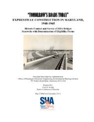
SECTIONTHREEHistoric ContextThe Kent Narrows Bridge serving US 50/US301 (now MD 18B), <strong>built</strong> in 1951, was alsodesigned to provide a higher span (18 feet at mean tide) and a moveable drawbridge, replacing atwo-lane drawbridge <strong>built</strong> in 1932. This span was at a location involving both water andvehicular traffic immediately east <strong>of</strong> the Bay Bridge and subject to increasingly heavy traffic asthe Bay Bridge opened and brought ever-larger numbers <strong>of</strong> vehicles. The 1951 Kent NarrowsBridge became obsolete by the 1980s when even higher volumes <strong>of</strong> traffic were subject to longbackups stretching for miles. A new high-level, fixed-span bridge replaced it in 1989-1990 (Pratt1952; Corddry 1983; SHA 1990).The Chesapeake Bay Bridge is the most significant bridge that connected formerly isolated parts<strong>of</strong> the state and is discussed below. Other examples include the MD 231 (Patuxent River) Bridge,<strong>built</strong> in 1950, that joined formerly disconnected parts <strong>of</strong> the state, in this case Charles andCalvert Counties, which <strong>historic</strong>ally relied on ferries for transport across a major body <strong>of</strong> water(Lowery 1998:6). The <strong>bridges</strong> crossing the Potomac cited by LaViness as significant for theirheight, also are examples <strong>of</strong> the theme <strong>of</strong> linkage. Both the Blue Bridge, <strong>built</strong> in 1954 inCumberland, and the Keyser-McCool Bridge, <strong>built</strong> <strong>between</strong> 1949 and 1951, allowed vehiculartraffic to travel <strong>between</strong> Maryland and West Virginia. These <strong>bridges</strong> enabled easier commercialand private travel in this mountainous area, removing much <strong>of</strong> the isolation <strong>of</strong> the area andsupporting the economic vitality <strong>of</strong> the region.Of the many <strong>bridges</strong> <strong>built</strong> in the period to support Maryland‘s <strong>highway</strong> projects, the ChesapeakeBay Bridge stands out as the most significant from many perspectives. The most spectacular roadproject <strong>of</strong> the era, it is both an example <strong>of</strong> improved bridge construction technologies and <strong>of</strong> acultural connector <strong>between</strong> two areas <strong>of</strong> the state that had been <strong>historic</strong>ally separate. Officiallynamed the William Preston Lane, Jr. Memorial Bridge and popularly called the Bay Bridge, it islocated east <strong>of</strong> Annapolis and spans the bay as part <strong>of</strong> US 50/US 301. The bridge‘s dual spansprovide a direct connection <strong>between</strong> Maryland‘s recreational areas along the ocean and themetropolitan areas <strong>of</strong> Baltimore, Annapolis, and Washington, D.C.Serious interest in a bridge across the Chesapeake Bay had begun as early as 1908 andproponents considered many location options. The location chosen was centrally located andserved traffic to and from Baltimore and Washington. Work began on the bridge in 1949 andreplaced two vehicular ferries that ran from near Annapolis to the Eastern Shore. The bridgeopened to traffic in 1952 and a parallel structure opened in 1973. With a shore-to-shore length <strong>of</strong>4.3 miles, the <strong>bridges</strong> are among the world‘s longest and considered by many to be among themost scenic <strong>of</strong> large bridge structures. Both <strong>bridges</strong> were designed by Greiner: the 1952 spancost $44 million and was <strong>built</strong> with two lanes; the second three-lane bridge, was <strong>built</strong> to be a―modernized look alike‖ and cost $117 million.The Bay Bridge made travel <strong>between</strong> the Eastern and Western Shores <strong>of</strong> Maryland easier thanever before, changing the economic and cultural relationship <strong>between</strong> the two areas <strong>of</strong> the stateand the orientation <strong>of</strong> the Eastern Shore from Philadelphia and Wilmington, Delaware toBaltimore and Washington. It also enabled commercial traffic to move more readily across thestate and thereby became a direct connection to the tourist, recreational and agricultural regions<strong>of</strong> the Eastern Shore. The Chesapeake Bay Bridge was controversial; some Eastern Shoreresidents resisted the changes that would result, including economic development some felt wasout <strong>of</strong> character with the small town, rural atmosphere <strong>of</strong> the Shore and the inevitable presence\15-SEP-11\\ 4-17