historic context of maryland highway bridges built between 1948 ...
historic context of maryland highway bridges built between 1948 ...
historic context of maryland highway bridges built between 1948 ...
- No tags were found...

You also want an ePaper? Increase the reach of your titles
YUMPU automatically turns print PDFs into web optimized ePapers that Google loves.
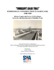
F I N A L R E P O R THISTORIC CONTEXT OFMARYLAND HIGHWAY BRIDGESBUILT BETWEEN <strong>1948</strong> AND 1960Prepared forMaryland State Highway Administration707 N. Calvert StreetBaltimore, MD 21202September 2011URS Corporation12420 Milestone Center Drive, Suite 150Germantown, Maryland 2087615296716
ACKNOWLEDGEMENTSURS would like to acknowledge the numerous individuals who assisted withthe State Historic Bridge Context and Inventory <strong>of</strong> <strong>1948</strong>-1960 Bridges inMaryland. At the State Highway Administration, Maryland Department <strong>of</strong>Transportation, we wish to thank Anne Bruder, who provided much usefulinformation and leads on where to look for information on <strong>bridges</strong> <strong>built</strong> in thestate during the period <strong>1948</strong> to 1960. URS also appreciates the assistance thatTim Tamburrino at the Maryland Historical Trust Department <strong>of</strong> Economicand Community Development provided for this project. We also wish tothank S. Murray Miller and and Nick Deros, who as former employees <strong>of</strong> theJ. E. Greiner Company—one <strong>of</strong> the engineering firms that eventually becamepart <strong>of</strong> URS—provided much valuable oral information about theirassociations with State Highway Administration bridge work. Finally, wealso would like to express our appreciation to Charissa Wang <strong>of</strong> HardlinesDesign Company, our subcontractor. Through the support research and all <strong>of</strong>the fieldwork that four Hardlines employees—Mary Crowe, Roy Hampton,Stan Popovich, and Amy Case—performed, URS was able to develop this<strong>historic</strong> bridge <strong>context</strong> update for the State Highway Administration
ERRATAURS completed this report in 2004. Since then some projects have beencompleted (such as the Woodrow Wilson Bridge) or have been undertaken inthe intervening seven years.
Executive Summary2. Bet ween May and Septemb er 2003, URS Corporation (URS) <strong>of</strong> Gaithersbu rg, M aryland and F lorence, New Jersey prep ared an <strong>historic</strong> cont ext <strong>of</strong> high way bridg es from th e <strong>1948</strong>-1960 p eriod for the M aryland Stat e Hig h way Admin istration (SH A). Th e project up dated and exp anded upon the SH A’s exist ing <strong>historic</strong> bridg e <strong>context</strong>—H istoric High way Bridg es in Maryland: 1631 – 1960, Historic Cont ext Repo rt (Paula Spero & Associat es and Louis B erg er & Asso ciates, 1995). As part <strong>of</strong> the project, UR S condu cted a surv ey <strong>of</strong> 21 h igh way <strong>bridges</strong> th roughout M aryland representin g 12 different bridg e t yp es <strong>built</strong> b et ween <strong>1948</strong> and 1960. Th e project h ad multip le goals: to dev elop more fully the histo ric <strong>context</strong> for b ridg es <strong>built</strong> in M aryland fro m th e <strong>1948</strong>- 1960 p eriod to reflect th e techno logical in novation s in bridge design and constru ction from this period; to establish criteria for th e evaluation <strong>of</strong> the significanceand integrit y <strong>of</strong> <strong>1948</strong>-1960 high way b ridg es in M aryland for their eligibilit y for listin g in the N ation al Reg ist for Historic Places (NRHP); to do cu ment and record 21 h igh way <strong>bridges</strong> in M aryland fro m the <strong>1948</strong>- 1960 p eriod representing 12 diff erent bridg e t yp es; and to app ly this criteria in the evaluat ion <strong>of</strong> th e 21 su rveyed high way b ridg es for th eir NRH P-eligibilit y.URS served as project manager and provided agency coordination. URS also conductedbackground research on the history <strong>of</strong> road building in Maryland from the <strong>1948</strong>-1960 period,conducted research on the history <strong>of</strong> the individual surveyed <strong>bridges</strong>, and wrote the <strong>historic</strong><strong>context</strong>. Hardlines Design Company (Hardlines) <strong>of</strong> Columbus, Ohio, serving as a subconsultantfor URS, conducted the field survey <strong>of</strong> 21 SHA <strong>highway</strong> <strong>bridges</strong> in Maryland. Fieldwork wasconducted from May to July 2003. Following the survey work, Hardlines completed MarylandInventory <strong>of</strong> Historic Properties (MIHP) forms and, along with URS, evaluated the surveyed<strong>bridges</strong> on MIHP Determination <strong>of</strong> Eligibility (DOE) forms. The results <strong>of</strong> the survey evaluationare listed in Table 1.MIHP #Table 1 – NRHP Recommendations for 21 SurveyedHighway Bridges in Maryland from <strong>1948</strong> – 1960BridgeName/LocationB-4632 I-895 Bridge over CSXRailroad TracksBA-2681BA-2713CT-784CARR-1673Wise Avenue Bridgeover Bear CreekMD 157 (PeninsulaExpressway) Bridge overBear CreekMD 2 Bridge over theNarrowsMD 32 Bridge overLiberty ReservoirCountyBaltimoreCityBaltimoreBaltimoreCalvertCarrollBridgeTypeDate BuiltNRHPEligible?K-truss 1957 Yes A, CDouble LeafBasculeTrunnionDouble LeafBasculeTrunnionReinforcedConcrete SlabSteel Deck(Warren) Truss<strong>1948</strong> Yes A, C1960 No NA1958 No N/A1952 Yes A, CNRHPCriterionCE-1083MD 213 Bridge overChesapeake & DelawareCanalCecilMetal DeckArch (TiedArch)1949 Yes A, CMIHP #BridgeName/LocationCountyBridgeTypeDate BuiltNRHPEligible?NRHPCriterionCH-781MD 225 Bridge overMattawoman CreekCharlesPrestressedConcreteGirder1957 Yes A, CF-3-205MD 144 Bridge overMonocacy RiverFrederickSteel Deck(Warren) Truss1955 Yes A, CG-III-A-199Sang Run Road Bridgeover YoughioghenyRiverGarrettStringer/FloorBeam System1955 Yes A, CG-IV-A-290Swallow Falls RoadBridge overYoughiogheny RiverGarrettStringer/FloorBeam System1960 Yes A, CHA-2045Hookers Mill RoadBridge over Bynum RunHarfordConcrete BoxGirder1957 Yes A,C\15-SEP-11\\ i
Executive SummaryHA-2046PG:68-100PG:82A-52PG:85A-58PG:85A-59QA-542Phillips Mill RoadBridge over East Branch<strong>of</strong> Winters RunUS 1 Northbound Bridgeover NW Branch <strong>of</strong>Anacostia RiverUS 301 SouthboundBridge over West Branch<strong>of</strong> Patuxent RiverUS 301 NorthboundBridge over TimothyBranchUS 301 SouthboundBridge over TimothyBranchMD18B Bridge overKent NarrowsS-512 US 13 NorthboundBridge over CSXRailroad TracksS-513 US 13 NorthboundBridge over ManokinRiverWA-VI-56WA-VI-57I-70 Bridge over RampE2 from Maryland 61Eastbound LaneI-70 Bridge over RampE2 from Maryland 61Westbound LaneHarfordPrinceGeorge‘sPrinceGeorge‘sPrinceGeorge‘sPrinceGeorge‘sQueen Anne‘sConcrete BoxGirderConcreteBeam1958 Yes C1956-57 Yes A,CSteel Beam 1949 Yes AConcrete Arch 1950 No NAConcrete Arch 1950 No NADouble LeafBascule-Trunnion1951 Yes A, CSomerset Steel Beam 1957 Yes A, CSomerset Steel Beam 1958 No NAWashingtonWashingtonConcrete RigidFrameConcrete RigidFrame1960 Yes A, C1960 Yes A, C\15-SEP-11\\ ii
Table <strong>of</strong> ContentsExecutive Summary ............................................................................................................................... ES-1Introduction ............................................................................................................................................... 1-1Methodology ............................................................................................................................................. 3-12.1 Background .............................................................................................. 3-12.2 Fieldwork ................................................................................................. 3-12.3 Research and Context Update .................................................................. 3-12.4 Project Personnel ..................................................................................... 3-22.5 Previous Documentation .......................................................................... 3-2Historic Context ........................................................................................................................................ 4-13.1 Introduction .............................................................................................. 4-13.2 Maryland Highways Before and During World War II ........................... 4-23.3 Highway Development in Maryland After World War II ....................... 4-73.4 Maryland and Federal Highway Policy ................................................... 4-73.5 The SRC and Highway Politics In Maryland .......................................... 4-93.6 The SRC & The Division <strong>of</strong> Bridge Design .......................................... 4-113.7 Important Maryland Highway and Bridge Projects During the<strong>1948</strong>-1960 Period ................................................................................... 4-14Post World War II Technological Developments .................................................................................... 5-14.1 Developments in Design .......................................................................... 5-14.2 Materials and Technique Developments .................................................. 5-14.3 Individual Bridge-Type Developments.................................................... 5-34.3.1 Metal Truss Bridges (Including Steel) ......................................... 5-34.3.2 Metal Girder Bridges ................................................................... 5-44.3.3 Metal Suspension Bridges............................................................ 5-44.3.4 Steel Arch Bridges ....................................................................... 5-44.3.5 Movable Bridges .......................................................................... 5-54.3.6 Prestressed Concrete Bridges ....................................................... 5-54.3.7 Reinforced Concrete Bridges ....................................................... 5-64.3.8 Concrete Rigid Frame Bridges..................................................... 5-64.3.9 Wood Bridges .............................................................................. 5-7Consulting Engineers and Contractors .................................................................................................. 6-1Results <strong>of</strong> Field Investigations ................................................................................................................ 7-16.1 National RegisteR <strong>of</strong> Historic Places Eligibility ..................................... 7-16.2 Descriptions <strong>of</strong> Surveyed Properties ........................................................ 7-6\15-SEP-11\\ iii
Table <strong>of</strong> ContentsConclusion and Recommendations ........................................................................................................ 8-1References Cited ...................................................................................................................................... 9-1TablesTable 1 – NRHP Recommendations for 21 Surveyed Highway Bridges in Maryland from<strong>1948</strong> – 1960.............................................................................................................. iTable 2 – Bridges Surveyed by URS as Part <strong>of</strong> the Survey <strong>of</strong> <strong>1948</strong> – 1960 Bridges inMaryland .............................................................................................................. 1-2Table 3 – Previously Surveyed <strong>1948</strong> – 1960 Bridges in Maryland ............................................. 3-2Table 4 – National Register <strong>of</strong> Historic Places Eligibility Determination <strong>of</strong> <strong>1948</strong> – 1960Bridges in Maryland ............................................................................................ 3-3AppendicesAppendix AAppendix BAppendix CAppendix D<strong>1948</strong>-1960 Maryland Bridge StatisticsMaryland Bridges by Type and YearResumes <strong>of</strong> Key PersonnelNotes from August 25, 2003 Interviews with Former J. E. GreinerCompany Employees\15-SEP-11\\ iv
SECTIONONEIntroductionIntroductionIn 1995, the Maryland State Highway Administration (SHA) joined with the Federal HighwayAdministration (FHWA) and the Maryland Historical Trust (MIHP) to identify the <strong>historic</strong><strong>highway</strong> <strong>bridges</strong> owned by either the SHA or by Maryland counties and cities. The resultingInteragency Historic Highway Bridge Committee (IHHBC) was comprised <strong>of</strong> representativesfrom the three agencies. As part <strong>of</strong> the initiative, 1,072 <strong>bridges</strong> constructed <strong>between</strong> 1809 and1947 were inventoried and evaluated for eligibility to be listed in the National Register <strong>of</strong>Historic Places (NRHP). The IHHBC reviewed each inventory form and recommended 472 <strong>of</strong>the 1,072 <strong>bridges</strong> as eligible for inclusion in the NRHP. The results <strong>of</strong> the 1995 survey and<strong>context</strong>ual research are presented in Historic Highway Bridges in Maryland: 1631 – 1960,Historic Context Report (Paula Spero & Associates and Louis Berger & Associates, 1995). Thereport provided the basis for the NRHP-eligibility evaluation <strong>of</strong> any bridge <strong>built</strong> before 1947.In 2003, SHA proposed to undertake Phase II <strong>of</strong> its Historic Bridge Inventory to survey <strong>bridges</strong><strong>built</strong> <strong>between</strong> <strong>1948</strong> and 1960 (Appendix A). According to SHA‘s internal records, the StateRoads Commission (STC) and the counties and Baltimore City constructed 586 <strong>highway</strong> <strong>bridges</strong>during this period (Appendix B). Thus, a large number <strong>of</strong> <strong>bridges</strong> are or will be in need <strong>of</strong>evaluation for NRHP-eligibility to fulfill SHA‘s responsibilities under Section 106 <strong>of</strong> theNational Historic Preservation Act (NHPA) <strong>of</strong> 1966, as amended. The existing <strong>historic</strong> <strong>context</strong>written in 1995 did not adequately address the technological innovations in bridge design andconstruction characteristics <strong>of</strong> this period, nor did it provide a comprehensive history <strong>of</strong> roadbuilding activities in Maryland during this period, and it did not establish criteria for theevaluation <strong>of</strong> <strong>bridges</strong> from this period to reflect these innovations.In May 2003, the SHA contracted with URS Corporation (URS) <strong>of</strong> Gaithersburg, Maryland andFlorence, New Jersey to prepare an update <strong>of</strong> its <strong>historic</strong> bridge <strong>context</strong> and to conduct a survey<strong>of</strong> 21 <strong>bridges</strong> encompassing 12 bridge types <strong>built</strong> in the state <strong>between</strong> <strong>1948</strong> and 1960. Theproject had multiple goals: to develop more fully the <strong>historic</strong> <strong>context</strong> for <strong>bridges</strong> from the <strong>1948</strong>-1960 period to reflect the technological innovations in bridge design and construction from thisperiod; to establish criteria for the evaluation <strong>of</strong> the significance and integrity <strong>of</strong> <strong>1948</strong>-1960<strong>highway</strong> <strong>bridges</strong> in Maryland for their eligibility for listing in the National Register for HistoricPlaces (NRHP); to document and record 21 <strong>highway</strong> <strong>bridges</strong> in Maryland from the <strong>1948</strong>-1960period representing 12 different bridge types; and, to apply this criteria in the evaluation <strong>of</strong> the21 surveyed <strong>highway</strong> <strong>bridges</strong> for NRHP-eligibility.The 586 <strong>bridges</strong> constructed in Maryland <strong>between</strong> <strong>1948</strong> and 1960 represent 19 different bridgetypes. Of this number, twelve bridge types were surveyed by URS:―K‖ trussConcrete SlabSteel Deck (Warren) TrussMetal Deck Arch (Tied Arch)Double Leaf Bascule TrunnionPrestressed Concrete GirderConcrete Box GirderStringer/Floor Beam SystemSteel BeamConcrete ArchConcrete Rigid FrameConcrete Beam\15-SEP-11\\ 1-1
SECTIONONEIntroductionTwenty one <strong>bridges</strong>, dating from the <strong>1948</strong> – 1960 period and representing thse 12 bridge types,were chosen by the SHA, in consultation with MHT and FHWA, to be surveyed as part <strong>of</strong> theexpanded inventory and <strong>historic</strong> <strong>context</strong> update. The <strong>bridges</strong> and their respective types areidentified in Table 2:Table 2 – Bridges Surveyed by URS as Part <strong>of</strong> the Survey <strong>of</strong> <strong>1948</strong> – 1960Bridges in MarylandMIHP # Bridge Name/Location County Bridge Type Date BuiltB-4632 I-895 Bridge over CSX Railroad Tracks Baltimore City K-truss 1957BA-2681 Wise Avenue Bridge over Bear Creek Baltimore Double LeafBasculeTrunnionBA-2718 MD 157 Bridge over Bear Creek Baltimore Double LeafBasculeTrunnionCT-784 MD 2 Bridge over the Narrows Calvert ReinforcedConcrete SlabCARR-1673 MD 32 Bridge over Liberty Reservoir Carroll Steel Deck(Warren) TrussCE-1083MD 213 Bridge over Chesapeake &Delaware CanalCecilMetal DeckArch (TiedArch)CH-781 MD 225 Bridge over Mattawoman Creek Charles PrestressedConcreteGirderF-3-205 MD 144 Bridge over Monocacy River Frederick Steel Deck(Warren) TrussG-III-A-199G-IV-A-290HA-2045HA-2046PG:68-100PG:82A-52PG:85A-58Sang Run Road Bridge overYoughiogheny RiverSwallow Falls Road Bridge overYoughiogheny RiverHookers Mill Road Bridge over BynumRunPhillips Mill Road Bridge over EastBranch <strong>of</strong> Winters RunUS 1 Northbound Bridge over NWBranch <strong>of</strong> Anacostia RiverUS 301 Southbound Bridge over WestBranch <strong>of</strong> Patuxent RiverUS 301 Northbound Bridge over TimothyBranchGarrettGarrettHarfordHarfordPrinceGeorge‘sPrinceGeorge‘sPrinceGeorge‘sStringer/FloorBeam SystemStringer/FloorBeam SystemConcrete BoxGirderConcrete BoxGirder<strong>1948</strong>1960195819521949195719551955196019571958Concrete Beam 1956-1957Steel Beam 1949Concrete Arch 1949\15-SEP-11\\ 1-2
SECTIONONEIntroductionMIHP # Bridge Name/Location County Bridge Type Date BuiltPG:85A-59US 301 Southbound Bridge over TimothyBranchPrinceGeorge‘sConcrete Arch 1950QA-542 MD18B Bridge over Kent Narrows Queen Anne‘s Double LeafBascule-TrunnionS-512 US 13 Northbound Bridge over CSXRailroad TracksS-513 US 13 Northbound Bridge over ManokinRiverWA-VI-56WA-VI-57I-70 Bridge over Ramp E2 fromMaryland 615 Eastbound LaneI-70 Bridge over Ramp E2 fromMaryland 615 Westbound Lane1951Somerset Steel Beam 1957Somerset Steel Beam 1958WashingtonWashingtonConcrete RigidFrameConcrete RigidFrame19601960\15-SEP-11\\ 1-3
3. Section 1 ONE Methodolog ySECTIONTWOMethodology3.1 BACKGROUNDThe Historic Highway Bridges in Maryland: 1631 – 1960, Historic Context Report providedbackground and preliminary evaluation <strong>of</strong> post-World War II <strong>bridges</strong>, but did not fully addressthe important <strong>context</strong>ual issues that architectural historians, industrial historians, and engineershave examined during the past decade concerning the post-World War II road building era inMaryland. Therefore, SHA sought an update <strong>of</strong> its <strong>historic</strong> <strong>context</strong> that would provide the basisfor evaluation <strong>of</strong> <strong>historic</strong> <strong>bridges</strong> and begin a new phase <strong>of</strong> identification and evaluation with asample <strong>of</strong> 21 <strong>highway</strong> <strong>bridges</strong> <strong>built</strong> in Maryland <strong>between</strong> <strong>1948</strong> and 1960. In addition, the new<strong>context</strong> report would contain information about previous documentation efforts and build on thework contained in the Historic Highway Bridges in Maryland. The end product would includewell-developed information about technological innovations in bridge design and manufacturing,bridge manufacturing companies and designers, and important transportation advances or eventsfrom <strong>1948</strong> through 1960 in Maryland specifically and the United States generally.3.2 FIELDWORKTwenty-one <strong>highway</strong> <strong>bridges</strong>, representing the <strong>1948</strong> – 1960 period and 12 different bridge types,were chosen by the SHA, in consultation with MHT and FHWA, to be surveyed as part <strong>of</strong> theexpanded inventory <strong>of</strong> <strong>historic</strong> <strong>bridges</strong>. Hardlines architectural historians visited each bridge anddocumented the bridge and its appurtenances on Maryland Inventory <strong>of</strong> Historic Properties(MIHP) forms. In addition to completing each MIHP form, a MHT Determination <strong>of</strong> Eligibility(DOE) form with a detailed National Register eligibility evaluation was also completed for each<strong>of</strong> the surveyed <strong>bridges</strong>. Each bridge was recorded on the appropriate USGS quadrangle map at1:24,000 scale and photographs were taken using 5 x7-inch, 35-millimeter black-and-white film,and 35-millimeter color slide film. Hardlines also obtained the MIHP inventory numbers foreach bridge from the MHT Inventory Registrar.3.3 RESEARCH AND CONTEXT UPDATEURS updated the <strong>historic</strong> <strong>context</strong> written in 1995 to include information regarding technologicalinnovations in bridge design and manufacturing, bridge manufacturing companies and designers,and important transportation advances or events from <strong>1948</strong> through 1960 in Marylandspecifically and the United States generally, as these themes correspond to National RegisterCriteria A, B, C and D. In order to develop a <strong>historic</strong> <strong>context</strong> update for the post-World War IIor mid-century-era <strong>bridges</strong>, historians from URS and Hardlines also conducted general andspecific research at a number <strong>of</strong> local, regional, and university repositories. In addition, thesehistorians researched county and/or SHA bridge maintenance records and construction plans, aswell as secondary sources <strong>of</strong> information, including the Office <strong>of</strong> Bridge Development‘s 2003Bridge Inventory and the most current list <strong>of</strong> county-owned <strong>bridges</strong> in Maryland. The historiansalso had access to the most current SHA Historic Bridge Inventory (1995 – 2001). Inspection <strong>of</strong>previous cultural resource survey reports, site forms, and other references was conducted eitherat MHT or at SHA. Other repositories <strong>of</strong> information used in the research effort include, but arenot limited to, the Enoch Pratt Free Library‘s Maryland Room, the Maryland State Archives, theHistorical Society <strong>of</strong> Maryland Library, New Jersey State Library, New York Public Library, and\15-SEP-11\\ 3-1
SECTIONTWOMethodologythe Library <strong>of</strong> Congress. The inspected documents included <strong>historic</strong> maps, reports, articles,papers, <strong>historic</strong> photographs, monographs, and books.3.4 PROJECT PERSONNELURS Architectural History Team Leader Ge<strong>of</strong>frey Henry served as Principal Investigator andProject Manager for the Historic Context Update and Survey <strong>of</strong> 21 <strong>1948</strong>-1960 Highway Bridgesin Maryland Project for the SHA. He directed the research, evaluation, and writing <strong>of</strong> the <strong>historic</strong><strong>context</strong> for this project. URS Architectural Historians Mark Edwards, Amy Barnes, FredHolycross, Craig Tuminaro, Aaron Levinthal, Ellen Jenkins, and Marvin Brown conductedresearch, wrote individual bridge histories, and evaluated the 21 <strong>bridges</strong> for NRHP-eligibility.Fred Holycross, Aaron Levinthal, and URS Historian Ingrid Wuebber conducted <strong>historic</strong>research and wrote the updated <strong>historic</strong> <strong>context</strong> for <strong>1948</strong>-1960 <strong>highway</strong> <strong>bridges</strong> in Maryland.Hardlines Architectural Historian Charissa Wang served as Project Manager for the fieldworkphase <strong>of</strong> this project. Fieldwork was conducted by Hardlines Architectural Historians/HistoriansRoy Hampton, Stan Popovich, Amy Case, and Mary Crowe. The survey team was divided intotwo groups to conduct the survey fieldwork: one group working in the eastern half <strong>of</strong> Maryland;the second group working in the western half.The historians and architectural historians meet the Secretary <strong>of</strong> Interior’s Pr<strong>of</strong>essionalQualifications Standards for history and architectural history, published in 36 CFR Part 61(Appendix C).3.5 PREVIOUS DOCUMENTATIONFour <strong>highway</strong> <strong>bridges</strong> <strong>built</strong> during the <strong>1948</strong>-1960 period in Maryland have been previouslysurveyed and evaluated for NRHP eligibility. These <strong>bridges</strong> were surveyed and evaluated as part<strong>of</strong> the Section 106 process, which mandates consideration <strong>of</strong> the effects to NRHP-listed or -eligible resources (including <strong>bridges</strong>) from federally funded actions undertaken by SHA. Table 3lists these previously surveyed and evaluated <strong>highway</strong> <strong>bridges</strong>.Bridge #Table 3 – Previously Surveyed <strong>1948</strong>–1960 Highway Bridges in MarylandBridge Name/Location0400800 MD 231 over thePatuxent RiverMIHP/DOE #CT-1214County Date Built NRHPEligible?Calvert andCharlesNRHPCriterion1950/1951 Yes Criterion C2200302 Business US 13 over theBaltimore & OhioRailroad TracksWI-222 Wicomico 1930; SecondSpan-1951YesCriterion C0106600 Blue Bridge/ MD 942over the North Branch <strong>of</strong>the Potomac RiverAL-IV-A-153Allegany1954; renovated1996YesCriterion CF-10700 Doubs Road over theTuscarora CreekF-1-215 Frederick 1935; re<strong>built</strong>1950NoNot Applicable\15-SEP-11\\ 3-2
SECTIONTWOMethodologyNineteen <strong>highway</strong> <strong>bridges</strong> in Maryland dating from the <strong>1948</strong>-1960 period have been evaluatedfor NRHP-eligibility without the completion <strong>of</strong> individual MIHP forms. MHT DOE forms werecompleted and/or MIHP ID numbers were assigned to these <strong>bridges</strong> as part <strong>of</strong> their evaluation. Inaccordance with the provisions <strong>of</strong> Section 106 <strong>of</strong> the NHPA, the NRHP-eligibilitydeterminations were made by SHA with the concurrence <strong>of</strong> MHT.Bridge #Table 4 – NRHP Eligibility Determinations <strong>of</strong> <strong>1948</strong>–1960 Bridges inMarylandBridge Name/Location0309900 MD151 over MD 151Band the Patapsco &Black River Railroad1600800 US Alternate 1 over theAnacostia River0201801 MD 195 over the AmtrakRailroad Tracks andStony Run0201802 MD 195 over the AmtrakRailroad Tracks andStony Run0204200 MD 70 over WeemsCreek and College Creek0204300 MD 70 over WeemsCreek and College CreekBC-40200Waterview Avenue overMD 2950305200 Cold Bottom Road overI-830315700 I-695 and I-83Expressway projects0603201 MD 140 over theMaryland MidlandRailroad and MD 270603202 MD 140 over theMaryland MidlandRailroad and MD 27MIHP/DOE #County Date Built NRHPEligible?NRHPCriterionBA-2714 Baltimore 1954 Yes Criterion CPG:69-35DOE-AN-0002DOE-AN-0003DOE-B-1345DOE-BA-0002DOE-BA-0006PrinceGeorge‘s1955 Yes Criterion CAnne Arundel 1950 No Not ApplicableAnne Arundel 1950 No Not ApplicableAnne Arundel 1953 No Not ApplicableAnne Arundel 1954 No Not ApplicableBaltimoreCity1950 No Not ApplicableBaltimore 1955 No Not ApplicableBaltimore 1954 No Not ApplicableCarroll 1952 No Not ApplicableCarroll 1952 No Not Applicable0604101 MD 140 over MD 97 Carroll 1952 No Not Applicable0604102 MD 140 over MD 97 Carroll 1952 No Not ApplicableHO-00900Old Montgomery Roadover Deep RunP-48600 Molly Berry Road overRock CreekDOE-HO-0002DOE-PR-0007Howard 1955 No Not ApplicablePrinceGeorge‘s1956 No Not Applicable\15-SEP-11\\ 3-3
4. Section 2 TW O Historic Co ntextSECTIONTHREEHistoric Context4.1 INTRODUCTIONThe years <strong>between</strong> <strong>1948</strong> and 1960 are one <strong>of</strong> the most active periods <strong>of</strong> road and bridgeconstruction in Maryland‘s history. Relentlessly increasing traffic volumes, coupled with aminimal amount <strong>of</strong> maintenance during the World War II years, created the almostinsurmountable challenge for <strong>highway</strong> engineers <strong>of</strong> rebuilding the state‘s road system. Prewarpredictions from <strong>highway</strong> experts could not envision the volume <strong>of</strong> traffic and the increases invehicle speed and size that would occurred after 1945. Maryland was in need <strong>of</strong> an improved<strong>highway</strong> system to meet these demands and to enable the state‘s businesses to prosper (PublicAdministration Service 1952:6).In 1947, Governor William Preston Lane (1947-1951) unveiled a plan to launch the greatest roadbuilding program in Maryland‘s history intended to make the state‘s <strong>highway</strong> system ―second tonone in the nation‖ and to lay the groundwork for major construction projects in the 1950s (StateRoads Commission 1949:61; 1960:3). By the early 1950s, the motoring public was beginning tosee some improvement as new road construction (such as the limited-access WashingtonNational Pike) and reconstruction (such as the divided <strong>highway</strong> extension <strong>of</strong> US 140 in CarrollCounty) were underway or completed (State Roads Commission 1950:1; 1952:2, 4). Between1947 and 1951, the state saw 757 miles <strong>of</strong> roads <strong>built</strong> or re<strong>built</strong>, work on the Chesapeake BayBridge (the governor‘s highest priority project) began, and planning for a statewide expresswaysystem was underway (LeViness 1958:157; State Roads Commission 1964:17).Maryland‘s next Governor, Theodore Roosevelt McKeldin (1951-1959), continued the efforts toimprove roadways and <strong>bridges</strong> in the state. In 1951-1952, McKeldin commissioned a study thatfound that 67 percent <strong>of</strong> the state‘s roads were in need <strong>of</strong> improvement or reconstruction to reachstandards adopted by the State Roads Commission (SRC) in <strong>1948</strong>. The study recommended a 12-year program to rebuild Maryland‘s <strong>highway</strong> system by 1965 (LeViness 1958:165–167, 175–176; State Roads Commission 1952:5; 1954:2). Many Maryland residents saw that effort as toolittle and too slow; by 1960, the public was impatient with what they perceived as inadequate andobsolete roadways. A five-year program, the so-called ―Go Roads‖ program, was instituted in1960 to plan for 100 miles <strong>of</strong> primary and interstate <strong>highway</strong> construction in each <strong>of</strong> the nextfive years and to extend modern primary <strong>highway</strong>s or expressways into every region <strong>of</strong> the state,with beltways to serve urban areas (State Roads Commission 1960:3).Bridge building and design was an integral part <strong>of</strong> Maryland‘s overall road-building programafter World War II. Failing <strong>bridges</strong> were in need <strong>of</strong> replacement or repair and new <strong>bridges</strong> wereplanned as part <strong>of</strong> an overall upgrade <strong>of</strong> the state‘s road system. During 1947 and <strong>1948</strong>, theDivision <strong>of</strong> Bridge Design completed preliminary studies, estimates, and schemes forconstructing more than 50 new <strong>bridges</strong> and bridge improvement projects to repair and strengthenexisting structures (State Roads Commission 1949:65–66, 70). This was particularly important ina state like Maryland split down the middle by the Chesapeake Bay with numerous tributariesthroughout the state feeding the bay.In addition, many large bridge and road projects <strong>built</strong> during this period had important socialimplications: the Chesapeake Bay Bridge ended the isolation <strong>of</strong> the Eastern Shore; the PatuxentRiver Bridge united two Southern Maryland counties; and the beltways around Washington andBaltimore under construction at the end <strong>of</strong> the period encouraged the relentless sub-urbanization<strong>of</strong> their surrounding counties. The SRC bridge database lists 586 <strong>bridges</strong> <strong>built</strong> <strong>between</strong> <strong>1948</strong> and\15-SEP-11\\ 4-1
SECTIONTHREEHistoric Context1960 on state and county roads and 203 on interstates. Bridges were constructed in all <strong>of</strong>Maryland‘s 23 counties and in the city <strong>of</strong> Baltimore (SHA 2003). This period <strong>of</strong> bridgeconstruction left a pr<strong>of</strong>ound mark on the state‘s transportation system and on its landscape thatcontinues to link and shape Maryland‘s diverse communities.4.2 MARYLAND HIGHWAYS BEFORE AND DURING WORLD WAR IIDuring the 1920‘s, Marylanders took to the road in increasing numbers. To keep up withincreased demand, the State Roads Commission (SRC) improved the hard-surfaced road systemand paved the secondary system <strong>of</strong> farm-to-market feeder roads. The agency was justifiablyproud <strong>of</strong> its accomplishments, as Maryland was considered to have the country‘s best roadsystem in the period <strong>between</strong> 1915 and 1925. Nevertheless, instead <strong>of</strong> remaining at the forefront<strong>of</strong> road construction, Maryland soon lost ground to the onslaught <strong>of</strong> tractor-trailers and passengervehicles that became faster, heavier, and more numerous than the state‘s roads were designed tocarry. Highway departments throughout the country found themselves dealing with these sameissues, yet Maryland‘s predicament was more pressing due to the state‘s streams and waterwaysthat pass through every region <strong>of</strong> Maryland emptying into the Chesapeake Bay. Its bays, rivers,and estuaries had facilitated communication and provided transportation corridors withinMaryland for centuries, but in the automobile age, traffic could not flow smoothly without theconstruction and maintenance <strong>of</strong> numerous <strong>bridges</strong> to connect an enhanced <strong>highway</strong> system.Roads and <strong>bridges</strong> previously <strong>built</strong> to meet local and regional needs had to meet the demands <strong>of</strong>heavier and faster traffic moving over longer distances. The solution lay in design improvementssuch as flattening steep grades, reducing dangerous curves, providing longer sight lines,widening pavement, adding more traffic lanes, and building medians to separate oncoming lanesin high volume traffic areas (LeViness 1958:101-102; State Roads Commission 1940:1). Despitethe country‘s economic woes in the 1930‘s, revenues from road use remained stable and someplaces registered an increase in the sale and use <strong>of</strong> automobiles. Buses, <strong>of</strong>fering lower fares thanrail travel, also became a preferred method <strong>of</strong> transportation for those who could not afford a car(Kuennen 2001a:21).The federal government reacted to the nation‘s economic decline during the Great Depression byexpanding road funding. In 1930, federal aid increased from $75 million to $125 million andCongress appropriated emergency funding for <strong>highway</strong>s even during the leanest years <strong>of</strong> the1930s. The National Industrial Recovery Act <strong>of</strong> 1933 earmarked $400 million for <strong>highway</strong>projects without requiring matching state funds. Prior to the Great Depression, federal spendinghad targeted state <strong>highway</strong> systems in rural areas. Now, grants became available forimprovements to city streets and municipal construction programs that linked to the state<strong>highway</strong> system. For the first time, the Public Works Administration administered federal fundsand bypassed state road departments by delivering the money directly to local government. Roadprojects operated as employment programs as well as being an economic stimulus (Kuennen2001a:22).In 1934, the Hayden-Cartwright Act appropriated $200 million to reestablish the lapsed federalaid <strong>highway</strong> program. This legislation is noteworthy for being the first time that funds were setaside for state <strong>highway</strong> departments to plan for the future, make surveys, and investigate theeconomic and engineering benefits <strong>of</strong> particular road improvements (Kuennen 2001a:20-21).\15-SEP-11\\ 4-2
SECTIONTHREEHistoric ContextHighway departments began examining such factors as road conditions, the volume and nature <strong>of</strong><strong>highway</strong> traffic, <strong>highway</strong> life spans, and future <strong>highway</strong> needs.In 1937, the Maryland General Assembly authorized the SRC to formulate a comprehensive planfor the construction <strong>of</strong> <strong>bridges</strong> and tunnels across major bodies <strong>of</strong> water in Maryland. The intent<strong>of</strong> the plan was to provide north-south arterial roadways that would bypass congested urbanareas. Funding for this program came from state revenue bonds that were to be repaid from tolls.The SRC hired the J. E. Greiner Company (Greiner), a Baltimore-based engineering design firmwith an international reputation in construction, to develop a proposal for bridge constructionacross the state. The resulting report, Maryland’s Primary Bridge Program, recommended abridge across the Susquehanna River at Havre de Grace; a bridge across or tunnel under thePatapsco River <strong>between</strong> the Fairfield and Canton sections <strong>of</strong> Baltimore City; a bridge across thePotomac River at Ludlow‘s Ferry; and a bridge across the Chesapeake Bay (Bruder 2000:11-12). These vital crossings would require the construction <strong>of</strong> long multi-span <strong>bridges</strong> (or possiblya tunnel in the case <strong>of</strong> the Patapsco River site). Congress ratified the plan in 1938 under itsregulatory powers over navigable waterways and the Public Works Administration promptlyawarded financial aid to the SRC to build the Susquehanna and Potomac River Bridges, butdeferred action on the remaining two projects until after the war (Greiner 1944:2).The SRC chose Greiner to plan the Susquehanna River crossing. The firm designed an elevatedbridge to accommodate the shipping traffic still active on the river. The bridge projectcomplemented improvements underway to heavily traveled US 40 <strong>between</strong> Baltimore and theDelaware State line in Cecil County, where a relocation <strong>of</strong> the alignment was necessary toeliminate sharp curves, reduce grades, extend sight lines, and widen the roadway for dualization.Greiner‘s design called for a steel three-span bridge, consisting <strong>of</strong> one through-truss and twopartial through-trusses, while the remainder <strong>of</strong> the bridge would utilize deck trusses or deckgirders (Bruder 2000:13-14). The total length <strong>of</strong> the four-lane bridge was 1.5 miles and crossedthe Susquehanna River from a point near Perryville in Cecil County to a point near Havre deGrace in Harford County. The bridge opened in 1940 as the Susquehanna River Toll Bridge. In1986, it was renamed for Thomas J. Hatem (1925-1985) who represented Harford County in theHouse <strong>of</strong> Delegates from 1955 to 1958.Greiner also designed the Potomac River Bridge (US 301) <strong>between</strong> Charles County, Marylandand King George County, Virginia. The bridge opened in December 1940 and enabled travelersfrom eastern and southern Maryland heading to Virginia and points further south to bypassWashington, D.C. where they had previously crawled through along US 1. Traffic engineerspredicted the bridge would carry an average <strong>of</strong> 136,000 vehicles-per-year during the first fiveyears. During 1942, the traffic volume surpassed 171,600 vehicles; four years later, the countclimbed to 453,900 annually. Traffic peaked at 3.2 million in 1964 but dropped by a third thefollowing year after the opening <strong>of</strong> the Capital Beltway (I 495), which allowed southboundmotorists to quickly travel around Washington, cross the Potomac River along the WoodrowWilson Bridge, and continue south into Virginia (St. Mary‘s Today 2004). In 1968, the US 301Bridge was renamed the Harry W. Nice Memorial Bridge to honor the governor <strong>of</strong> Maryland(1935-1939) during whose administration the bridge was planned and <strong>built</strong>.John Greiner‘s partner, Herschel Allen, developed and patented the ―Potomac Pier‖ for the NiceBridge project. His pier design eliminated the need for a c<strong>of</strong>fer dam by placing a steel form onthe floor <strong>of</strong> the river and then driving piles through the form. Additional piles were attached and\15-SEP-11\\ 4-3
SECTIONTHREEHistoric Contextcovered by concrete until the pier was fully formed. Greiner engineers used a cantilever designfor the main span <strong>of</strong> the 11,446-foot bridge. (Bruder 2000:14-15).The 1930s also saw construction activities focused on the elimination <strong>of</strong> railroad grade crossingswith federal funds helping state <strong>highway</strong> departments cover the costs. Additional federal dollarscame from the Emergency Relief Appropriation Act <strong>of</strong> 1935 that provided $200 million toeliminate the most dangerous crossings (Kuennen 2001a:21). With these funds, the SRC made aninventory <strong>of</strong> all the railroad crossings in the state and formulated hazard ratings for eachcrossing.By 1938, Maryland completed work on 70 grade elimination projects, but still had 150 gradecrossings in the state <strong>highway</strong> system outside <strong>of</strong> incorporated towns and cities. The only form <strong>of</strong>protection on nearly all these crossings was a warning sign. The SRC looked at accident reportsinvolving grade crossings around the state. They found 27 people killed and another 70 peopleinjured over a five-year period. The Commission concluded that the construction <strong>of</strong> an expensiveoverpass or underpass was not necessary at every grade crossing. Instead, changes to the road orthe installation <strong>of</strong> flashing lights or a warning signal, known as a ―wig-wag,‖ could provide aquicker and better way to utilize scarce funds (State Roads Commission 1938:30-31).In 1938, the SRC reported on the results <strong>of</strong> a statewide <strong>highway</strong> planning study showing thatMaryland contained a total <strong>of</strong> 18,137.6 miles <strong>of</strong> roadway, <strong>of</strong> which 4,057 miles or, about 21percent, was under the direct control <strong>of</strong> the SRC. Traffic volume on state <strong>highway</strong>s ranged froma high <strong>of</strong> more than 20,000 vehicles a day along US 1 <strong>between</strong> Baltimore and Washington, toless than ten vehicles a day on a road in Charles County. An increasing proportion <strong>of</strong> thesevehicles were trucks (State Roads Commission 1938:17).At the national level, Congress requested the Bureau <strong>of</strong> Public Roads (BPR) in 1938 to study thefeasibility <strong>of</strong> a system <strong>of</strong> high-speed national <strong>highway</strong>s. The BPR worked with state <strong>highway</strong>departments to develop planning surveys following passage <strong>of</strong> the Hayden-Cartwright Act in1934 that allowed 1.5% <strong>of</strong> federal <strong>highway</strong> funds to be used for ―surveys, plans, and engineeringinvestigation <strong>of</strong> projects for future construction.‖ The effort also led states to undertake massiveneeds studies to project future population trends, traffic volumes, and vehicle ownership trends(McDonald 2003).The resulting data provided the foundation for the BPR‘s 1939 report Toll Roads and FreeRoads, a master plan for a 26,700-mile interstate <strong>highway</strong> system. President Roosevelt appointedthe National Interregional Highway Committee to study the plan in 1941. Congress backed theCommittee‘s expanded version <strong>of</strong> the plan and the BPR issued a revised master plan,Interregional Highways in 1944 that urged state <strong>highway</strong> departments to begin planning for a40,000-mile network <strong>of</strong> express roads so work could begin as soon as the war ended (Seely2000).In 1940, the SRC published its twenty-year plan for meeting Maryland‘s future <strong>highway</strong> needs.Entitled Maryland’s Highway Needs 1941-1960: A Report <strong>of</strong> the State-wide Highway PlanningSurvey, the plan envisioned a long-range construction program based on the premise that theSRC would control all aspects <strong>of</strong> planning, financing, constructing, improving, and maintainingthe state‘s <strong>highway</strong> system with local city streets and county roads remaining under municipal orcounty control. One <strong>of</strong> the benefits <strong>of</strong> planning two decades in advance was that it made theacquisition <strong>of</strong> right-<strong>of</strong>-ways less costly. Backed up with effective zoning laws, the SRC hoped to\15-SEP-11\\ 4-4
SECTIONTHREEHistoric Contextcontrol commercial encroachment and limit access to the roadway (State Roads Commission1940:xvii-xix).The twenty-year plan was the culmination <strong>of</strong> several years <strong>of</strong> research and analysis intoMaryland‘s roads. Begun in August 1936, planners thoroughly investigated the scope andphysical condition <strong>of</strong> the road system and <strong>highway</strong> structures, including <strong>bridges</strong>. The plannerswere looking to understand how Maryland‘s <strong>highway</strong>s did not meet the present needs <strong>of</strong>motorists and to project how they might not meet future needs. The planners studied thecharacter and volume <strong>of</strong> traffic flow and predicted traffic growth in the future in order to developthe construction program based on objective criteria. The plan recommended improvements andtheir locations, and the manner in which <strong>highway</strong> funds could best be utilized (State RoadsCommission 1940:1-2).The planning survey counted 703 <strong>bridges</strong> that were twenty feet or more in length on the ruralstate <strong>highway</strong> system. Of those <strong>bridges</strong>, 24 were judged as being in poor condition and 120 asfair. Approximately 60 percent <strong>of</strong> the <strong>bridges</strong> averaged 110 feet in length and 20 to 26 feet inwidth. Another 11 percent <strong>of</strong> <strong>bridges</strong> were even narrower and longer. Engineering studies hadthus far shown that 20 feet <strong>of</strong> paved surface was the minimum for safe passing on lightlytraveled two-lane roads and that an additional 10 feet was best to minimize the possibility <strong>of</strong>collision with bridge railings. Only 29 percent <strong>of</strong> <strong>bridges</strong> in existence in the late 1930s hadwidths <strong>of</strong> 27 feet or more. Since a width <strong>of</strong> 27 feet was inadequate for <strong>bridges</strong> on three and fourlaneroads, the number <strong>of</strong> <strong>bridges</strong> deemed inadequate was even higher. Consequently, about 20percent <strong>of</strong> the state‘s <strong>bridges</strong> were posted with load and speed restrictions. The study concluded,―[t]hese narrow and defective structures are extremely hazardous to traffic, and their replacementforms a logical part <strong>of</strong> the modernization program‖ (State Roads Commission 1940:14-15).A SRC publication from the same period, Modernizing Maryland Highways, emphasized thecommission‘s desire to address the ―deficiencies‖ and ―inadequacies‖ <strong>of</strong> the state <strong>highway</strong>system. This pamphlet exhaustively listed <strong>highway</strong> problems including 600 sharp curves, 1,500steep grades, 16,000 places where obstructions limited sight distance, and more than 400inadequate <strong>bridges</strong>, among numerous other problems. The SRC called for funding on over $216million through 1960 with $55 million ―urgently needed within the next five years‘ to pay thecosts <strong>of</strong> modernization. The SRC suggested that a boost in registration fees for commercialtrucks be increased, changes made to refund claims on motor fuel taxes, and consolidation <strong>of</strong><strong>highway</strong> administration to pay for the program (Modernizing Maryland Highways c.1940).With the threat <strong>of</strong> involvement in wars in Europe and Asia imminent, pundits, politicians andsome road builders discussed the idea that an interstate system could strengthen internal nationalsecurity. The American Road Builders Association (ARBA) suggested in 1940 that ―[a] network<strong>of</strong> limited access <strong>highway</strong>s is highly desirable in any plan <strong>of</strong> national defense at a time when anew world conflict is threatened‖ (Kuennen 2001a:23).The limited-access design <strong>of</strong> the Pennsylvania Turnpike, which opened in 1940, became a modelfor future interstates. Built as a four-lane ―super<strong>highway</strong>‖ through the Allegheny Mountains, thePennsylvania Turnpike was the first road in the United States that had no cross streets, norailroad crossings, and no traffic lights over its entire length. When the war ended, trafficmushroomed and plans were made to extend the turnpike east to Philadelphia and west to Ohio.Traffic volume by 1950 reached 4.4 million vehicles, nearly 3 1/2 times what the planners had\15-SEP-11\\ 4-5
SECTIONTHREEHistoric Contextoriginally envisioned. In 1952 with both extensions open, traffic volume ballooned to 11 millionvehicles (Orr 1999).World War II curtailed the growing call for a modern interstate system. The Defense HighwayAct <strong>of</strong> 1941 authorized surveys and plans, including advance engineering, for the development<strong>of</strong> a strategic network <strong>of</strong> <strong>highway</strong>s and <strong>of</strong> bypasses around, and extensions into and through,cities. The Defense Highway Act also restricted the activities <strong>of</strong> state <strong>highway</strong> departments andfederal funds to what was a ―Strategic Network <strong>of</strong> Highways,‖ a system <strong>of</strong> roads that accessedmilitary bases, defense-manufacturing plants, and other strategic sites. With the economyfocused on the war effort, state <strong>highway</strong> departments and their scarce stockpile <strong>of</strong> materiel, werefurther limited to projects with a direct benefit to industrial plants or military facilities (Kuennen2001b:15; State Roads Commission 1943:73-74).By early 1941, these national defense concerns superceded the SRC‘s <strong>highway</strong> constructionprogram. The SRC‘s plans for crossing the Chesapeake Bay and Patapsco River would have towait until peacetime. Maryland, however, enjoyed a strategic position in the nation‘s defensesystem and was part <strong>of</strong> the Strategic Network <strong>of</strong> Highways. As the gateway to the nation‘scapital, and having several important Army and Naval installations, Maryland became a focus <strong>of</strong>efforts to build a national system <strong>of</strong> inter-regional <strong>highway</strong>s that would support defense needs.During World War II, Maryland <strong>built</strong> the Suitland Parkway (US 675), Indian Head Highway(MD 210), and the extension <strong>of</strong> MD 235 to the Patuxent River Naval Air Station in St. Mary‘sCounty, all roads that connected military bases to Washington (Bruder 2001). The state alsore<strong>built</strong> roads linking military bases near Solomons Island with Prince Frederick in CalvertCounty, constructed the Camp Ritchie-Pen Mar Road in Washington County, dualized the roadto the Sparrows Point area east <strong>of</strong> Baltimore, and improved access to Aberdeen ProvingGrounds. These and other projects totaled approximately $28 million (LeViness 1958: 15).While funds for other projects dried up during the war, planning continued to some degree. Bythe Second World War, Baltimore-Washington Boulevard (US 1), which connected the twocities was viewed as one <strong>of</strong> the most dangerous roads in the country. The road was a heavilytraveled <strong>highway</strong> infamous for its many accidents. Known as ―Death Highway‖, US 1 haddangerous curves, narrow ten foot-wide lanes, and no traffic medians. Its accident rate was threetimes the national average and thirty to forty people died each year along the roadway(Kaszynski 2000:162-163).Increasing congestion and traffic hazards made modernization <strong>of</strong> US 1 a priority for the SRC.Greiner was hired to address the <strong>highway</strong>‘s needs and in March 1944, the engineering firmsubmitted a preliminary report on the <strong>highway</strong> and its approaches to the Patapsco River Bridge.Greiner‘s planning approach included the ―freeway principle <strong>of</strong> <strong>highway</strong> design‖ that wouldproduce a safe roadway for motor vehicles driven at high speeds. The freeway principal designapproach included grade separations for cross traffic; the use <strong>of</strong> median strips or center guardrails <strong>between</strong> opposing traffic lanes; guard rails along the outer shoulders; merge lanes;deceleration lanes; right-hand exits; long curves providing long sight distance; and surface andunderground drainage systems (Greiner 1944:2-3).The traffic dangers and congestion on Baltimore-Washington Boulevard became an example tomany <strong>of</strong> the need to upgrade the state‘s road system to enable a growing, modernizing society totravel for commerce and pleasure. A Life magazine article from 1955 entitled ―Dead End for theU. S. Highway,‖ used US 1 as an example <strong>of</strong> what was wrong with America‘s roads. The article\15-SEP-11\\ 4-6
SECTIONTHREEHistoric Contextexplained that American cars were ―big, fast, and comfortable,‖ while the country‘s roads were―awful.‖ U.S. 1 had become an ―oxcart route for giant trucks‖ (Brean 1955:112). The followingsection discusses how Maryland sought to change both the reality and the perception <strong>of</strong> ―1955cars and 1935 roads‖ in the period from <strong>1948</strong> to 1960.4.3 HIGHWAY DEVELOPMENT IN MARYLAND AFTER WORLD WAR IITwo major factors drove the increase in <strong>highway</strong> construction in Maryland from <strong>1948</strong> to 1960:bad roads and more cars. American roads were already unable to handle increasing traffic loadsbefore the war and had deteriorated further due to lack <strong>of</strong> maintenance. The solution seemedsimple—existing roads must be fixed and new <strong>highway</strong>s <strong>built</strong> in order for the economy to growand prosper. However, other trends were also driving the need to expand the <strong>highway</strong> system.Maryland, like American society as a whole, was mobilizing and moving like never before. Thecontinued rise <strong>of</strong> the automobile as a symbol <strong>of</strong> the American way <strong>of</strong> life became inexorablylinked to a shift in population to the suburbs.The monetary investment in Maryland‘s roads in this period is an example <strong>of</strong> how stategovernment responded to these cultural trends by building new roads and <strong>bridges</strong> to keep everincreasingnumbers <strong>of</strong> vehicles moving on the state‘s <strong>highway</strong>s. Maryland also took advantage <strong>of</strong>increased funding for <strong>highway</strong>s and other roads from the federal government. Improved roadsand <strong>bridges</strong> were more than ever a crucial part <strong>of</strong> both the country‘s infrastructure as it began atransition from being primarily an urbanized place (in terms <strong>of</strong> where most <strong>of</strong> the populationlived) in the late nineteenth and early twentieth centuries, to becoming a suburbanized society bythe end <strong>of</strong> the twentieth century (Brugger 1988:575). The SRC played a major role in makingMaryland a modern, suburbanized society with roads to match and the state‘s collection <strong>of</strong><strong>bridges</strong> shows the material investment in roads in the period as the American lifestyle becamebased on individual mobility enabled by the automobile.4.4 MARYLAND AND FEDERAL HIGHWAY POLICYThe rise <strong>of</strong> the American suburb and the rapid shift <strong>of</strong> population in Maryland to its suburbanareas in this period played a major role in developing political support for government fundingfor new and improved <strong>highway</strong>s to service the changing suburban landscape. In addition,Americans simply wanted cars. The post war period saw a huge increase in car purchases byMarylanders and traffic counts soared on all <strong>of</strong> the state‘s main <strong>highway</strong>s. The need for modernmulti-lane <strong>highway</strong>s became more acute as the number <strong>of</strong> vehicles increased. Crumbling twolane<strong>highway</strong>s were obsolete, clogged with commercial traffic, commuters, and vacationerscompeting for road space. Travel time increased as more cars drove longer distances and mainarteries became congested by unlimited access from side traffic. Cars were larger, heavier, andfaster at a time when <strong>bridges</strong> were not strong enough and roads not wide enough. Americansdrove on a hazardous 1920s <strong>highway</strong> system <strong>built</strong> to handle low speeds, with dangerous curves,narrow <strong>bridges</strong>, and numerous intersections (Kaszynski 2000:162).During the war years, <strong>highway</strong> construction essentially halted except for defense-relatedprojects. Consequently, the <strong>highway</strong>s experienced rapid deterioration at a time when they carriedheavier loads for which they were not designed (Childs 1949:17-19). Previously, the nation‘srailroads had been able to meet the transportation needs <strong>of</strong> most Americans with railroads alsocarrying the bulk <strong>of</strong> America‘s commercial traffic. After World War II, most railroads\15-SEP-11\\ 4-7
SECTIONTHREEHistoric Contextexperienced a steep decline in service and dependability, putting additional strains on thenation‘s roadways. A new, first-class <strong>highway</strong> system was coming to be seen as essential to thepostwar American lifestyle as Maryland‘s economy, like that <strong>of</strong> other states, became increasinglydependent upon a <strong>highway</strong> network linking material, manpower, and markets.In the quarter century following the first Federal Aid Road Act in 1916, states used federalmoney to surface rural roads and to integrate local roads into a national system. Yet theimprovement <strong>of</strong> rural roads actually increased the volume <strong>of</strong> traffic on the main <strong>highway</strong>s.By World War II, traffic jams were making travel through American cities, includingWashington and Baltimore, unbearable. Planning for an interstate system to relieve congestionbegan in the late 1930‘s with the Federal-Aid Highway Act <strong>of</strong> 1938 that asked the predecessor <strong>of</strong>the Federal Highway Administration (FHWA), the Bureau <strong>of</strong> Public Roads (BPR), to study thefeasibility <strong>of</strong> a toll-financed system <strong>of</strong> three east-west and three north-south super<strong>highway</strong>s. TheBPR‘s report, Toll Roads and Free Roads, showed that a toll system would not be selfsupportingand instead advocated a 26,700-mile interregional <strong>highway</strong> network. In 1941,President Franklin D. Roosevelt appointed a National Interregional Highway Committee toevaluate the need for a national expressway system. The committee‘s January 1944 report,Interregional Highways, advocated a system <strong>of</strong> 33,900 miles, plus an additional 5,000 miles <strong>of</strong>auxiliary urban routes (FHWA 2004).In 1944, Congress initiated a large-scale program <strong>of</strong> joint action by federal, state, and localgovernments, called the Federal-Aid Highway Act <strong>of</strong> 1944, that included urban <strong>highway</strong>improvements and expanded the scope <strong>of</strong> federal aid to include secondary rural roads. Alongwith supplemental legislation passed in <strong>1948</strong>, Congress authorized large sums <strong>of</strong> moneyspecifically for the relief <strong>of</strong> urban traffic problems and traffic congestion in general (LeViness1958:182).These programs set up a system <strong>of</strong> federal aid whereby the states could obtain special allocationsfor primary, secondary, and urban road projects. Special allocations for projects were made up totwo years in advance to enable states to develop their road plans and to raise matching funds.These allocations, known as ABC funds, were an integral part <strong>of</strong> postwar road buildingprograms. The 1944 Federal Aid-Highway Act also laid the foundation <strong>of</strong> the future interstate<strong>highway</strong> system by selecting the most heavily traveled roads <strong>of</strong> the federal-aid primary system t<strong>of</strong>orm the interstate network. This system <strong>of</strong> roads would connect state capitals, principalmetropolitan areas, cities, and industrial centers by direct routes (LeViness 1958:182;MacDonald 1949:32).The Federal-Aid Highway Act <strong>of</strong> 1954 set aside $175 million for the construction <strong>of</strong> theinterstate <strong>highway</strong> system. However, even more money was needed for the system that PresidentDwight Eisenhower envisioned, and he continued to press for additional funds. Two years later,the expanded Federal-Aid Highway Act <strong>of</strong> 1956 authorized a budget <strong>of</strong> $25 billion, <strong>of</strong> which thefederal share was to be 90%. The Act proposed a 41,000-mile interstate <strong>highway</strong> system to becompleted by 1969. It was the most comprehensive and expensive public works program in thecountry‘s history. The program included uniform design standards and gave the federalgovernment the authority to condemn and purchase land for rights-<strong>of</strong>-way (Childs 1949:20;Kaszynski 2000:137).Many states were unwilling to devote scarce federal-aid funds for interstates but instead lookedfor ways to improve their own transportation infrastructure with privately funded <strong>highway</strong>s.\15-SEP-11\\ 4-8
SECTIONTHREEHistoric ContextHighway ―authorities‖ as governing agencies were created to fund construction and maintenance<strong>of</strong> <strong>highway</strong>s through the sale <strong>of</strong> bonds underwritten by the state and through toll collection(Kaszynski 2000:138, 146). Maryland was not shy about taking federal funding to finance publicprograms, and by 1958 was receiving almost $10 million for improvement <strong>of</strong> its primary<strong>highway</strong> system, secondary roads and its urban <strong>highway</strong>s. Maryland‘s interstates consisted <strong>of</strong>350 miles <strong>of</strong> roads in 1958, including portions <strong>of</strong> both the Baltimore and Washington beltways,and the state intended to apply for 194 more miles in the future. In the same year, the state wasapproved to receive (apportionment was on a two-year cycle) over $56 million in 1960 for itsshare <strong>of</strong> cost to build the federal interstate system in Maryland (LeViness 1958: 182-183).Maryland demonstrated its commitment to the concept <strong>of</strong> the federal interstate system and toroads in general by its early construction <strong>of</strong> many sections <strong>of</strong> several <strong>of</strong> the future interstateroutes selected by the federal government in 1947. Maryland <strong>of</strong>ficials saw <strong>highway</strong> constructionas among the state‘s most important responsibilities and Governors and the legislature in thisperiod launched the biggest road building program in the state‘s history (LeViness 1958: 157).The SRC <strong>built</strong> portions <strong>of</strong> the Baltimore-Harrisburg Expressway (today I 83), the BaltimoreBeltway (1 695), the Washington Circumferential Highway (now the Capital Beltway; I 495),and a bypass around Frederick without funding from the Federal-Aid Highway Act <strong>of</strong> 1956 thatprovided 90% grants for projects with a 10% match from each state (LeViness 1958: 183-184).State funding for <strong>highway</strong>s increased 409% from 1945 to 1951 in Maryland at a time when thepercentage <strong>of</strong> increase for the entire state budget rose at a rate <strong>of</strong> 25% a year, or 264% for thesame period (Callcott 1985: 105).4.5 THE SRC AND HIGHWAY POLITICS IN MARYLANDThe major public expenditure in the state during this period was for <strong>highway</strong> improvements.Seven major road improvements took place in Maryland during the period from <strong>1948</strong> to 1960,each costing more than $100 million to construct. Not all <strong>of</strong> the seven were in the suburbs butthey had their greatest impact there by primarily servicing the outer reaches <strong>of</strong> Baltimore andWashington, thereby promoting sub-urbanization by enabling commuting farther distances thanever before (Callcott 1988:76). Those projects included:The Chesapeake Bay Bridge (1952);Baltimore-Washington Parkway; MD 295 (1954);John Hanson Highway, Washington-Annapolis; US 50 (1955);Baltimore-Frederick; I 70 (1956);Baltimore Harbor Tunnel and the Harbor Tunnel Thruway; I 895 (1957);Washington-Frederick; I 270 (1957);Baltimore-Harrisburg; I 83 (1959).During the 1950s, the State‘s population increased nearly one-third to 3.1 million people. Pentupdemand for automobiles outstripped supply and people were happy to drive anything withfour wheels. By the early 1950s, Maryland had 800,000 motor vehicles registered, roughly onecar for every three people. Road construction could not keep up with the 18 million new cars on\15-SEP-11\\ 4-9
SECTIONTHREEHistoric Contextthe road <strong>between</strong> 1945 and 1950 (Kaszynski 2000:137; Public Administration Service 1952:11;State Roads Commission 1964:8-10).The SRC focused its resources on addressing the deterioration as best it could. The first twoyears following the war, 1946 and 1947, were spent keeping <strong>highway</strong>s minimally drivable andmaking surveys and plans for future construction. Construction and maintenance costs doubledin the post-war years above the cost-<strong>of</strong>-living index. Postwar design standards also pushed upcosts with twenty-foot pre-war pavements being widened to a safer twenty-four feet, thereduction <strong>of</strong> grades requiring more excavation, heavier traffic requiring thicker pavement, andcontrolled-access expressways necessitating grade separations and interchanges (LeViness1958:162). Yet the legislature and Governors in the period moved forward with new plans andways to pay for them.Major construction activities resumed in <strong>1948</strong> with the implementation <strong>of</strong> Governor WilliamPreston Lane Jr.‘s (1947-1951) <strong>highway</strong> construction plan that was enthusiastically approved bythe state legislature in 1947 and which provided $200 million over five years. Governor Lane‘sroad program called for new construction <strong>of</strong> expressways, dual <strong>highway</strong>s, and two-lane<strong>highway</strong>s. Existing roads were to be improved by widening and resurfacing until they could becompletely re<strong>built</strong> in the future. A network <strong>of</strong> secondary roads was also planned. In <strong>1948</strong> theSRC‘s Chief Engineer prepared a report entitled Desirable Standards for Roads <strong>of</strong> the StateHighway System <strong>of</strong> Maryland. The standards delineated dimensions for <strong>highway</strong>s and associatedstructures that were to be designed according to the expected levels <strong>of</strong> traffic for each project(State Roads Commission 1949:61; 1960:3). In the four years <strong>of</strong> Lane‘s administration, the SRC<strong>built</strong> or repaired 757 miles <strong>of</strong> roads at a cost <strong>of</strong> over $106 million, began the interstate andexpressway system and started work on the Chesapeake Bay Bridge. Road building in Marylandincreased from a yearly average <strong>of</strong> $7 million to over $33 million in the same period (LaViness1958: 157).Lane‘s administration also contributed to modernizing Maryland‘s <strong>highway</strong>s by planning andpartially constructing some <strong>of</strong> the state‘s first controlled- or limited-access <strong>highway</strong>s. The year1947 was a significant turning point in the design and construction <strong>of</strong> <strong>highway</strong>s in Maryland inthis regard. Up until that time, it had been the policy <strong>of</strong> the SRC to permit unrestricted access toall <strong>highway</strong>s, both new and existing. That changed when the General Assembly approved theExpressway Act <strong>of</strong> 1947 that legally established the concept <strong>of</strong> controlled access expressways inMaryland and approved a $200-million bond issue for major <strong>highway</strong> improvements thatincluded a number <strong>of</strong> new expressways. The Act defined an expressway as a major thoroughfarecontaining two or more lanes in each direction with medians separating the lanes, gradeseparation structures at all intersections, and entrances or exits from the road limited to specificlocations (LaViness 1958:161).The dangers exhibited by the example <strong>of</strong> US 1 showed that limiting access not only made roadssafer but also made them more efficient. Prior to this time roads were operated with ―unlimitedaccess‖ that allowed anyone who could afford land along a road to construct entrances andoperate a business or build a residence. The busier the road, the quicker it became congested bycommercial buildings, signs and other devices to attract the passerby and convince them to slowor stop (Brean 1955:116). The concept was hard to sell in much <strong>of</strong> the state, but the Laneadministration vigorously supported the principle and began construction <strong>of</strong> the Baltimore-Washington Expressway (later Parkway), one <strong>of</strong> Maryland‘s most important <strong>highway</strong> projects <strong>of</strong>\15-SEP-11\\ 4-10
SECTIONTHREEHistoric Contextthe period. When completed, the <strong>highway</strong> was a 30 mile-long divided <strong>highway</strong> requiring <strong>bridges</strong>and connecting roads in 3 counties. Lane‘s tenure also saw construction starts on the Baltimore-Harrisburg Expressway (I 83) and the Washington National Pike (later I 270) south <strong>of</strong> Frederick,with the principle as a guide. Partial limited access (where access was denied except at selectedroad crossings) was used for new <strong>highway</strong>s such as the eastern approach to the Bay Bridge (US50) and the section <strong>of</strong> US 40 from Pine Orchard to West Friendship (La Viness 1958:161).Governor Lane‘s enthusiasm for spending money on roads and other programs led to hisreplacement by Theodore R. McKeldin (1951-1959) as state spending rose from $60 to $219million during his term and the higher taxes need to pay his programs became too burdensomefor most voters (Brugger 1988:569). Yet, McKeldin also believed that the modernization <strong>of</strong>roads and state services in general was among his chief aims in <strong>of</strong>fice. He therefore supportedthe completion <strong>of</strong> the Bay Bridge and funded a study <strong>of</strong> future road needs and how to pay forthem (Brugger 1988:574; LaViness 1958:165). Known as the Twelve-Year Program,McKeldin‘s plan was designed to rebuild Maryland‘s road system by 1965 and included apriority system that enabled each county to receive advance notice <strong>of</strong> the improvements theycould expect and when they would be <strong>built</strong> (LaViness 1958:165).The Legislature adopted McKeldin‘s plan in 1953 with estimated completion costs <strong>of</strong> $568million. The plan scheduled improvements to both the primary and secondary systems in thestate with SRC District Engineers reviewing the plans to utilize their knowledge <strong>of</strong> local roads.The plan called for 241 miles <strong>of</strong> roads <strong>of</strong> the State Primary System to be constructed and/orreconstructed at a cost <strong>of</strong> $367 million and 2,208 miles <strong>of</strong> the State Secondary System at a cost<strong>of</strong> $200 million (Twelve-Year Program 1952:11-12.). The most significant <strong>highway</strong> projectscompleted during his term were the first Chesapeake Bay Bridge (1952), the Baltimore-Washington Parkway (1954), the John Hanson Highway <strong>between</strong> Washington and Annapolis(1955), Interstate 70 from Baltimore to Frederick (1956), the Baltimore Harbor Tunnel andHarbor Tunnel Thruway (1957), and Interstate 270 from Washington to Frederick (1957)(Callcott 1985:67).Governor J. Millard Tawes (1959-1967) continued the support <strong>of</strong> road modernization at the end<strong>of</strong> this period with extraordinary new levels <strong>of</strong> spending being supported by the 90% matchingfunds for interstate <strong>highway</strong>s provided by the federal government. Tawes oversaw thecompletion <strong>of</strong> the Baltimore-Harrisburg Expressway (I 83) in 1959 and later in his term theWashington and Baltimore beltways, and the portions <strong>of</strong> interstate from Baltimore toWilmington, Delaware (I 95), Baltimore to Hancock (I 70), and Washington to Frederick (I 270)(Callcott 1985:67).4.6 THE SRC & THE DIVISION OF BRIDGE DESIGNWith the rapid increase <strong>of</strong> <strong>highway</strong> construction after <strong>1948</strong>, the SRC‘s Division <strong>of</strong> BridgeDesign (DBD) became overwhelmed preparing plans and specifications for structures on newroadways, and for the repair and widening <strong>of</strong> existing <strong>bridges</strong>. The DBD also prepared studies,estimates, and plans for county road structures when requested, making their job even harder.The SRC divided the state into six engineering districts, each under the control <strong>of</strong> a DistrictEngineer, who was responsible for constructing and maintaining <strong>highway</strong>s, <strong>bridges</strong>, and otherfacilities <strong>of</strong> the SRC, including both state and county roads. By 1952, the volume <strong>of</strong>construction and reconstruction had overtaxed the resources <strong>of</strong> all <strong>of</strong> the engineering districts. In\15-SEP-11\\ 4-11
SECTIONTHREEHistoric Contextresponse, the SRC reorganized and created a seventh district, spreading the heavy load a bit inthe ensuing years (State Roads Commission 1949:111; 1952:2).The DBD was initially divided into three sections, Design and Drafting; Specifications andContracts; and Hydraulics and Construction. Later a section dealing with Special Studies,Reports, and Permits was added (LeViness 1958:131; State Roads Commission 1952:46). TheDBD designed all types <strong>of</strong> <strong>highway</strong> <strong>bridges</strong> from the simplest <strong>of</strong> timber trestles to multi-milliondollar projects such as the Patuxent River Bridge. The design services <strong>of</strong> consulting engineeringfirms were typically utilized when projects had a short timeframe, such as the Baltimore-Washington Expressway, or were <strong>of</strong> a specialized nature, such as for the design and construction<strong>of</strong> draw spans (State Roads Commission 1949:64, 69).During 1947 and <strong>1948</strong>, the DBD completed preliminary studies, estimates, and schemes forconstructing more than fifty new and improved <strong>bridges</strong> as well as repairing and strengtheningexisting structures. The SRC‘s bridge engineers prepared all drawings, plans, specifications, andcontract documents for the projects and the DBD assumed the construction managementresponsibility for the more complex bridge projects, with as many as fifteen such projects undertheir supervision at any one time. Between July 1950 and June 1952, the DBD prepared 250 sets<strong>of</strong> construction plans for the repair, rehabilitation, and widening <strong>of</strong> existing <strong>bridges</strong> including abroad range <strong>of</strong> structure types from small drainage culverts to major, long span <strong>bridges</strong> crossingrivers and streams, <strong>highway</strong>s and railroads. The DBD was also responsible for collectingtechnical data concerning load limits <strong>of</strong> trucks and for non-bridge projects such as bulkheads,jetties, weighing stations, maintenance facilities, and potential ferry systems. The Bureau wasalso responsible for the immediate replacement <strong>of</strong> structures destroyed by flash floods (StateRoads Commission 1952:46, 49). This level <strong>of</strong> activity continued through the 1950s.Between <strong>1948</strong> and 1950, the State Roads Commission increased the staff <strong>of</strong> the EngineeringDepartment, but was still unable to keep pace with the workload. Workweeks expanded from 40to 60 hours for many engineers. Finding qualified men to fill the ranks <strong>of</strong> the expandingengineering division was difficult, due to competition for trained bridge engineers in the climate<strong>of</strong> postwar improvements. Most <strong>of</strong> those available were recent college graduates. During thesummer months, engineering pr<strong>of</strong>essors became temporary employees. Problems continued asengineers jumped to private industry in search <strong>of</strong> better financial compensation. It became evenmore difficult to hire adequately experienced staff during the Korean War (1950-1953) as asubstantial proportion <strong>of</strong> SRC employees were either in active military service or were <strong>of</strong>military age (LeViness 1958:162; State Roads Commission 1950:2).The SRC was chronically short-staffed and saw the logical solution to be the use <strong>of</strong> paidconsultants. The use <strong>of</strong> consulting engineers was nothing new. The SRC had used theengineering services <strong>of</strong> an outside consulting firm as far back as 1916 during the construction <strong>of</strong>Baltimore‘s Hanover Street Bridge. Nevertheless, during the first half <strong>of</strong> the century this was theexception. The urgency <strong>of</strong> the postwar building programs however substantially increased theirinvolvement on large SRC projects (LeViness 1958:171; State Roads Commission 1949:1-2, 61;1950:67, 69).In 1954, the DBD became the Bureau <strong>of</strong> Bridges (the Bureau) as the Twelve-Year Programnecessitated a reorganization <strong>of</strong> the department. The Bureau became responsible not just for thedesign <strong>of</strong> <strong>bridges</strong>, but also for supervising the construction and maintenance <strong>of</strong> <strong>bridges</strong>. Due tothe work load in the period the Bureau increased its use <strong>of</strong> consulting engineering firms to design\15-SEP-11\\ 4-12
SECTIONTHREEHistoric Contextand prepare specifications. By 1956 more than half <strong>of</strong> the contracts put out for bid by the Bureau<strong>of</strong> Bridges were designed by consulting engineering firms (State Roads Commission 1956:59).The Bureau reviewed the work <strong>of</strong> outside consulting firms to ensure they conformed to theSRC‘s standard geometrics, types, details and specifications (State Roads Commission 1954:60).However, McKeldin‘s Twelve-Year Program created the need to establish a Reviewing Office inorder to oversee the work <strong>of</strong> the increasing numbers <strong>of</strong> consulting engineers. The expandedprogram <strong>of</strong> rehabilitating and constructing new <strong>highway</strong>s greatly increased the volume <strong>of</strong>engineering services required by the Bureau <strong>of</strong> Bridges. Between January 1954 and June 1956,the Bureau entered into 89 contracts with 30 local and out-<strong>of</strong>-state consulting engineering firms.Some contracts covered all services from preliminary studies through the supervision andinspection <strong>of</strong> construction. Others were more limited in scope and covered only those phases <strong>of</strong>engineering work that could not be expeditiously carried out by the SRC‘s engineering staff(State Roads Commission 1956:11-12).In 1955, Maryland legislators launched an attack on the SRC for depending too greatly on the J.E. Greiner engineering firm. The criticism stemmed from the manner in which new right-<strong>of</strong>-waywas acquired for the 13.5 miles <strong>of</strong> approaches to the planned Baltimore Harbor Tunnel. The SRChad followed Greiner‘s recommendation and hired two real estate firms to acquire the right-<strong>of</strong>waybecause its own right-<strong>of</strong>-way department was overloaded with work and lacked theexpertise in the acquisition <strong>of</strong> industrial properties. The legislative committee attacked the SRCfor its ―extreme‖ dependence on consulting engineers that seemed to them a clear indication thatthe SRC had abdicated its responsibilities by allowing Greiner a greater share in policy decisionsthan was prudent (Engineering News-Record, December 15, 1955: 24).Criticism concerning the activities <strong>of</strong> the SRC had begun during the 1954 gubernatorialcampaign when the Democratic candidate accused Republican Governor McKeldin and the SRC<strong>of</strong> political favoritism in the granting <strong>of</strong> non-construction contracts. The Democratic-controlledGeneral Assembly had continued the attacks on the SRC following McKeldin‘s reelection(Engineering News-Record, December 1, 1955:25). The outcome was to replace the three-manState Roads Commission with a single director with control over administration and operations.Matters <strong>of</strong> policy were delegated to a three-man advisory board, <strong>of</strong> which the director was amember. The director would have two deputies, one in charge <strong>of</strong> administration and the otheroverseeing operations. An aide to the deputy for operations would be in charge <strong>of</strong> the Bureau <strong>of</strong>Engineering and the Bureau <strong>of</strong> Maintenance. Separate divisions were created for Right-Of-Way,Traffic, and Research and Standards (Engineering News-Record, December 1, 1955:25).At the end <strong>of</strong> the 1950s, the SRC went through another reorganization. A Division <strong>of</strong> Planningand Programming was established to coordinate <strong>highway</strong> construction and location withstatewide and regional planning. A Division <strong>of</strong> Administration was created to handleadministrative functions <strong>of</strong> all divisions. The Commission itself expanded from three membersat-largeto seven members, six <strong>of</strong> whom represent regions <strong>of</strong> the State (State Roads Commission1960:20).\15-SEP-11\\ 4-13
SECTIONTHREEHistoric Context4.7 IMPORTANT MARYLAND HIGHWAY AND BRIDGE PROJECTS DURING THE<strong>1948</strong>-1960 PERIODThe number <strong>of</strong> <strong>highway</strong> projects initiated and completed in the period, or soon thereafter, isextraordinary. Governor William Preston Lane Jr., as discussed above, vigorously supported<strong>highway</strong> construction and his ambitious program to improve and enlarge the state‘s road systemafter 1947 included beginning construction on the following major Maryland <strong>highway</strong> projects(State Roads Commission 1949:65-66, 70; 1950:3):The Washington-Baltimore Expressway (now MD 295), completed as the Baltimore-Washington Parkway in 1954;A new Defense Highway connecting Annapolis and Washington, called the Annapolis-Washington Expressway and later renamed the John Hanson Highway and the Blue StarMemorial Highway (now US 50/301), completed in 1955;The Baltimore-Harrisburg Expressway (I 83), completed in 1959;The Frederick-Washington Expressway, also known as the Washington National Pike, laterrenamed the Dwight D. Eisenhower Highway (now I 270), completed in 1957;A <strong>highway</strong> from the Chesapeake Bay Bridge to the Maryland-Delaware Line (now US 301);The dualization <strong>of</strong> the Baltimore Frederick National Pike westward from Ellicott City, (nowUS 40).Governor Theodore R. McKeldin continued the strong advocacy <strong>of</strong> <strong>highway</strong> construction after1951 and counted the Baltimore Harbor Tunnel, the largest public enterprise in the State‘shistory, as his favorite project. During 1951 and 1952, he directed SRC engineers to undertake aphysical inventory <strong>of</strong> the entire 4,736-mile state road system. The study found roads <strong>built</strong> duringthe previous administration to be satisfactory but that 67 percent <strong>of</strong> the rest were in need <strong>of</strong>improvement or reconstruction to meet SRC standards adopted in <strong>1948</strong>. The study also revealeda need for an additional 291 miles <strong>of</strong> new roads, including an expressway to link the ChesapeakeBay Bridge to the Delaware State line (now US 301) and beltway routes around Washington andBaltimore (now I 495 and I 695). The Twelve-Year Road Construction and ReconstructionProgram that resulted was enacted into law in 1953 and was designed to rebuild Maryland‘s<strong>highway</strong> system by 1965 (LeViness 1958:165-167, 175-176; State Roads Commission 1952:5;1954:2). The SRC plan recommended improvements and new construction affecting 3,450 miles,about three-quarters <strong>of</strong> Maryland‘s road system (Engineering News-Record, February 5,1953:26; April 16, 1953:23).The Twelve-Year Program was broken up into three four-year phases, with a legislative reviewrequired at the end <strong>of</strong> each period. The Twelve-Year Program‘s priorities continued theunfinished portions <strong>of</strong> projects begun during the Lane administration and included several newones:The Baltimore Beltway (now I 695) completed 1962;Washington, D.C. Beltway (now I 495) completed 1964;The dualization <strong>of</strong> US 301 from Baltimore to the Potomac River Bridge (now Governor NiceMemorial Bridge);\15-SEP-11\\ 4-14
SECTIONTHREEHistoric ContextExtension <strong>of</strong> a <strong>highway</strong> <strong>between</strong> Glen Burnie and the Potomac River Bridge (now I 97, US301, MD 3);US 50 <strong>between</strong> Washington and US 301;A new <strong>highway</strong> <strong>between</strong> Baltimore and Wilmington, Delaware, later called the John F.Kennedy Highway (now I 95) completed in 1963;The Baltimore-Harrisburg Expressway (I 83) completed in 1959;Improvements to US 15 in Frederick County and US 11 in Washington County;Improvements to the Frederick-Washington Expressway, also known as the WashingtonNational Pike, later renamed the Dwight D. Eisenhower Highway (now I 270).At the top <strong>of</strong> the SRC‘s list during the period <strong>of</strong> the Twelve-Year Program was the construction<strong>of</strong> an expressway to link the new Chesapeake Bay Bridge to the newly completed DelawareMemorial Bridge to connect with the New Jersey Turnpike. This would provide an importantlink for long-haul vehicular traffic along the Atlantic seaboard and provide a bypass <strong>of</strong> congestedcities. The Twelve-Year Program also provided for reconstruction <strong>of</strong> 2,200 miles <strong>of</strong> secondaryand farm-to-market roads (Engineering News-Record, April 16, 1953:23; Engineering News-Record, November 20, 1952:27; State Roads Commission 1956:3-5; 1958:3-4).By 1960, the ―keystone‖ <strong>of</strong> travel through Maryland before the interstate system was completedwas a system <strong>of</strong> three <strong>bridges</strong> and a tunnel-expressway <strong>built</strong> by the SRC. Together the system<strong>of</strong>fered travelers through the state two major options when traveling north to south acrossMaryland and relieved much <strong>of</strong> the traffic congestion on urban streets and rural roads. The firstoptional route crossed the Susquehanna River Bridge (US 40) and bypassed busy Baltimorethrough the Baltimore Harbor Tunnel, connecting with US 301 on its way south to the PotomacRiver Bridge into Virginia. The second option was to travel from Delaware across the EasternShore on US 301, crossing the Chesapeake Bay Bridge and continuing on US 301 to Virginia.Before the interstate system was completed in the late 1960s, these routes made Maryland aviable part <strong>of</strong> the national travel system on the East Coast.Much <strong>of</strong> the Maryland <strong>highway</strong> system modernized in the 1950s was ultimately absorbed intothe interstate <strong>highway</strong> system. The Federal-Aid Highway Act <strong>of</strong> 1956 established a partnershipwith <strong>highway</strong> departments <strong>of</strong> several states to construct the interstate system according to plansapproved by the Bureau <strong>of</strong> Public Roads. Maryland‘s SRC <strong>built</strong> approximately 354 miles <strong>of</strong>interstate <strong>highway</strong> (State Roads Commission 1960:4).In 1955, the General Assembly approved plans for Maryland‘s first toll-road. The proposed 48-mile toll road (I 95) would parallel US 40 <strong>between</strong> Baltimore and the Delaware state line and becompleted in time for the scheduled 1957 opening <strong>of</strong> the Baltimore Harbor Tunnel (now I 95/I895) (Engineering News-Record, April 14, 1955, page 24). The complex <strong>of</strong> controlled-access tollexpressways on the East Coast that had begun with the opening <strong>of</strong> the Pennsylvania Turnpike in1940, culminated in expressways in Delaware and Maryland by 1963. By that year, motoristscould travel from Maine south to Virginia, or west to Illinois, without stopping at a traffic light,except at Breezewood, Pennsylvania.By 1958, the SRC had to admit that they were lagging behind their goals for the first four years<strong>of</strong> their Twelve-Year Program but had completed 70% <strong>of</strong> the planned mileage (EngineeringNews-Record, March 20, 1958:25). In 1960, the SRC revised the Twelve-Year Program in\15-SEP-11\\ 4-15
SECTIONTHREEHistoric Contextresponse to the growing impatience <strong>of</strong> Maryland‘s residents with inadequate and obsoleteroadways. The ―Go Roads‖ program, a 5-year program, was instituted that concentrated onprimary <strong>highway</strong> construction. It was expected that almost 100 miles <strong>of</strong> primary and interstate<strong>highway</strong>s could be constructed for each <strong>of</strong> the five years. The ―Go Roads‖ program had as itsgoal the extension <strong>of</strong> modern primary <strong>highway</strong>s or expressways into every region <strong>of</strong> the Statewith urban areas being served by beltways (State Roads Commission 1960:3).Bridge construction in Maryland <strong>between</strong> <strong>1948</strong> and 1960 grew rapidly along with thisintensification <strong>of</strong> <strong>highway</strong> construction. In this period, 586 <strong>bridges</strong> were constructed on state andcounty roads and 203 on interstates. Maryland <strong>bridges</strong> won several ―aesthetic bridge‖ contests inthe period. For example the Shell Road Ramp Bridge at the entrance to the Baltimore HarborTunnel was awarded ―First Honorable Mention‖ by the American Institute <strong>of</strong> Steel Constructionin 1958 (LaViness: 138). However, the design <strong>of</strong> <strong>bridges</strong> in this period was relativelyhomogeneous and was driven primarily by cost, constructability, future maintenance, andenvironmental concerns. Bridges in this period exploited the latest technologies, yet the use <strong>of</strong>innovative and artistic designs was not common. Maryland <strong>bridges</strong> in this period can bedescribed as a group as being designed in a way to exhibit a clean, uncluttered appearance withminimal decoration, many <strong>of</strong> them with elements <strong>of</strong> the streamlined form characteristic <strong>of</strong> theModerne style <strong>of</strong> the 1930s and 1940s.Two significant themes <strong>of</strong> bridge building in this period were the development <strong>of</strong> high-level<strong>bridges</strong> and the linkage <strong>of</strong> formerly isolated communities and regions <strong>of</strong> the state by new<strong>bridges</strong>. As has been discussed, the development <strong>of</strong> a modern road system in the state wascontingent on <strong>bridges</strong> that crossed the Chesapeake Bay and other bodies <strong>of</strong> water withoutimpeding river traffic. By the 1950s and 1960s, motorists no longer patiently waited whiledraw<strong>bridges</strong> moved up and down for water traffic. The solution at the widest and most activewater crossings was the construction <strong>of</strong> high-level <strong>bridges</strong>, usually <strong>built</strong> away from populatedareas because <strong>of</strong> their long approaches. Since tall <strong>bridges</strong> were also needed to span <strong>highway</strong>s,railways and urban neighborhoods that could not be demolished, the construction <strong>of</strong> tall <strong>bridges</strong>with long approaches became the most practical way to make both the road and river systemswork efficiently (LaViness 1958: 139-140).Historian Charles LaViness discusses high-level <strong>bridges</strong> as a distinguishing bridge type in thisperiod in his book A History <strong>of</strong> Road Building in Maryland (1958). Among the important <strong>bridges</strong>from his perspective were the ―four high-level <strong>bridges</strong> [<strong>built</strong>] across the Potomac,‖ especially theKeyser-McCool Bridge in Alleghany County that spans the Potomac, two railroads, and portions<strong>of</strong> the towns on each side <strong>of</strong> the river. He also mentions the ―Blue Bridge‖ in downtownCumberland, the US 50 bridge <strong>built</strong> in 1953 across the Severn River, and seven others.Other examples <strong>of</strong> significant high-level <strong>bridges</strong> in this period include the MD 213 Bridge(Chesapeake City Bridge). The US Army Corps <strong>of</strong> Engineers constructed the Chesapeake CityBridge in 1949 after ocean-going tankers damaged the earlier steel lift bridge at the location. Alift bridge, <strong>built</strong> in 1927, was on the main automobile route through town (MD 213), andalthough it was an improvement to the earlier bridge (as it allowed large ships to access thecanal) it was a hindrance to vehicular traffic forced to wait for ships to pass beneath it (Legler2002: 44; Pratt Free Library 1933). The high-level, fixed-span bridge <strong>built</strong> by the Corps in 1949spanned the canal at such a height that most vessels easily passed beneath its span.\15-SEP-11\\ 4-16
SECTIONTHREEHistoric ContextThe Kent Narrows Bridge serving US 50/US301 (now MD 18B), <strong>built</strong> in 1951, was alsodesigned to provide a higher span (18 feet at mean tide) and a moveable drawbridge, replacing atwo-lane drawbridge <strong>built</strong> in 1932. This span was at a location involving both water andvehicular traffic immediately east <strong>of</strong> the Bay Bridge and subject to increasingly heavy traffic asthe Bay Bridge opened and brought ever-larger numbers <strong>of</strong> vehicles. The 1951 Kent NarrowsBridge became obsolete by the 1980s when even higher volumes <strong>of</strong> traffic were subject to longbackups stretching for miles. A new high-level, fixed-span bridge replaced it in 1989-1990 (Pratt1952; Corddry 1983; SHA 1990).The Chesapeake Bay Bridge is the most significant bridge that connected formerly isolated parts<strong>of</strong> the state and is discussed below. Other examples include the MD 231 (Patuxent River) Bridge,<strong>built</strong> in 1950, that joined formerly disconnected parts <strong>of</strong> the state, in this case Charles andCalvert Counties, which <strong>historic</strong>ally relied on ferries for transport across a major body <strong>of</strong> water(Lowery 1998:6). The <strong>bridges</strong> crossing the Potomac cited by LaViness as significant for theirheight, also are examples <strong>of</strong> the theme <strong>of</strong> linkage. Both the Blue Bridge, <strong>built</strong> in 1954 inCumberland, and the Keyser-McCool Bridge, <strong>built</strong> <strong>between</strong> 1949 and 1951, allowed vehiculartraffic to travel <strong>between</strong> Maryland and West Virginia. These <strong>bridges</strong> enabled easier commercialand private travel in this mountainous area, removing much <strong>of</strong> the isolation <strong>of</strong> the area andsupporting the economic vitality <strong>of</strong> the region.Of the many <strong>bridges</strong> <strong>built</strong> in the period to support Maryland‘s <strong>highway</strong> projects, the ChesapeakeBay Bridge stands out as the most significant from many perspectives. The most spectacular roadproject <strong>of</strong> the era, it is both an example <strong>of</strong> improved bridge construction technologies and <strong>of</strong> acultural connector <strong>between</strong> two areas <strong>of</strong> the state that had been <strong>historic</strong>ally separate. Officiallynamed the William Preston Lane, Jr. Memorial Bridge and popularly called the Bay Bridge, it islocated east <strong>of</strong> Annapolis and spans the bay as part <strong>of</strong> US 50/US 301. The bridge‘s dual spansprovide a direct connection <strong>between</strong> Maryland‘s recreational areas along the ocean and themetropolitan areas <strong>of</strong> Baltimore, Annapolis, and Washington, D.C.Serious interest in a bridge across the Chesapeake Bay had begun as early as 1908 andproponents considered many location options. The location chosen was centrally located andserved traffic to and from Baltimore and Washington. Work began on the bridge in 1949 andreplaced two vehicular ferries that ran from near Annapolis to the Eastern Shore. The bridgeopened to traffic in 1952 and a parallel structure opened in 1973. With a shore-to-shore length <strong>of</strong>4.3 miles, the <strong>bridges</strong> are among the world‘s longest and considered by many to be among themost scenic <strong>of</strong> large bridge structures. Both <strong>bridges</strong> were designed by Greiner: the 1952 spancost $44 million and was <strong>built</strong> with two lanes; the second three-lane bridge, was <strong>built</strong> to be a―modernized look alike‖ and cost $117 million.The Bay Bridge made travel <strong>between</strong> the Eastern and Western Shores <strong>of</strong> Maryland easier thanever before, changing the economic and cultural relationship <strong>between</strong> the two areas <strong>of</strong> the stateand the orientation <strong>of</strong> the Eastern Shore from Philadelphia and Wilmington, Delaware toBaltimore and Washington. It also enabled commercial traffic to move more readily across thestate and thereby became a direct connection to the tourist, recreational and agricultural regions<strong>of</strong> the Eastern Shore. The Chesapeake Bay Bridge was controversial; some Eastern Shoreresidents resisted the changes that would result, including economic development some felt wasout <strong>of</strong> character with the small town, rural atmosphere <strong>of</strong> the Shore and the inevitable presence\15-SEP-11\\ 4-17
SECTIONTHREEHistoric Context<strong>of</strong> outsiders (Brugger 1988: 654). Even so, when completed the Bay Bridge succeeded indrawing the Eastern and Western Shores together by (Calcott l985: 105-106).The 1952 structure is multi-span, consisting <strong>of</strong> concrete beam approaches, Weichert and simpledeck trusses, and two types <strong>of</strong> cantilever trusses, which form a suspension bridge at the maincrossing, allowing large ocean-going ships to continue to pass beneath the bridge (Bruder2000:16). Bethlehem Steel directed the bridge‘s erection using a design from Greiner(Engineering News-Record: August 7, 1952: 42). A team <strong>of</strong> contractors worked to accomplishvarious components <strong>of</strong> the job including marine contractors Merritt-Chapman & Scott Corp,Frederick Snare Corp, and J. Rich Steers, Inc. Onshore contractors included Booth & Flinn Co.and Baltimore Contractors, Inc (Engineering News-Record, October 26, 1950:32).The bridge was unique due to its length <strong>of</strong> 21,286 feet from end to end and for Greiner‘s design<strong>of</strong> a c<strong>of</strong>fer dam that reduced foundation construction costs (Engineering News-Record, October26, 1950:32-34). The project included a timesaving innovation developed by cablemanufacturer, John A. Roebling & Sons, <strong>of</strong> Trenton, New Jersey, who refined methods formeasuring the tension and length <strong>of</strong> the cable strands (Engineering News-Record, January 8,1953:43). Other design and construction innovations included new methods for the cablespinningprocess and the completion <strong>of</strong> sections <strong>of</strong> the suspension bridge <strong>of</strong>f site at a pier inBaltimore before being floated to the site (Engineering News-Record, August 7, 1952:40-42).The scale <strong>of</strong> the project inspired an innovative cantilevered scaffold system devised by theKaufman Construction Company, which had the contract to pave 67 approach spans(Engineering News-Record, September 6, 1951:48). The suspension bridge was completed onJune 2, 1952 and the first traffic crossed the bridge on July 30, 1952.By 1960, Maryland‘s <strong>highway</strong> system was entirely re<strong>built</strong> and a vast improvement on theoutdated network <strong>of</strong> roads that existed at the end <strong>of</strong> World War II. The improved system <strong>of</strong> roadsand <strong>bridges</strong> was one <strong>of</strong> the country‘s most modern systems <strong>of</strong> limited access <strong>highway</strong>s withhigh-level <strong>bridges</strong> spanning every major body <strong>of</strong> water and unifying the entire state into anintegrated and efficient transportation network. The political and financial support at the statelevel for a modernized <strong>highway</strong> system set the stage for the increased sub-urbanization thatcontinued unabated after 1960. Formerly isolated rural areas and disconnected communities wereintegrated as never before, enabling dramatic economic growth as the twentieth century came toclose.\15-SEP-11\\ 4-18
5. Section 3 THR EE Post W orld W ar II T echnolog ical Dev elopment s Asso ciated W ith Maryland Bridge Con structionSECTIONFOURPost World War II Technological Developments5.1 DEVELOPMENTS IN DESIGNThe most important technological development in bridge design and construction after WorldWar II was bridge design standardization. This phenomenon occurred years before the postwarperiod but design standardization paved the way for the rapid-fire, postwar technologicaldevelopments that increased the economy, quality, and quantity <strong>of</strong> bridge construction.In the late nineteenth century railroad bridge designers began to standardize their plans in theinterest <strong>of</strong> efficiency. Roadway bridge designers followed suit in the early twentieth century. Theroadway bridge standardization movement began as a component <strong>of</strong> the Good Roads movementin the early twentieth century. State and municipal roadway bridge design systems becamehighly standardized <strong>between</strong> 1900 and 1960. Bridge standardization increased constructioneconomy. Lower construction costs and rapid construction rates enabled bridge constructors tokeep better pace with the demands <strong>of</strong> increased road usage.Consultant engineers did continue to be hired by states and municipalities when the realities <strong>of</strong> aconstruction plan required uniquely intensive study and design planning efforts. In these casesconsultants were hired to do the work that states and municipalities could not balance alongsideregular workloads. A notable example <strong>of</strong> the type <strong>of</strong> contribution that consultants added tounique bridge design and construction in Maryland is the Chesapeake Bay Bridge project (1949-1952) (Spero and Berger & Associates 1995: 29-30).After World War II, technological innovations had an immense impact on bridge projectplanning. Advances included the introduction <strong>of</strong> the computer, the tellurometer, andphotogrammetry. An electronic computer was installed in the Road Design Division in 1957.The computer could make calculations 10 times faster than the engineers could and the newtechnology assisted with design problems; its effectiveness led to the expansion <strong>of</strong> itsapplications and its adoption by other divisions. A tellurometer used microwaves to measuredistances. In 1958, the Bureau <strong>of</strong> Public Roads chose Maryland as one <strong>of</strong> three <strong>highway</strong>departments to test the tellurometer‘s usefulness in plotting new <strong>highway</strong>s. The State RoadsCommission found the tellurometer to be extremely accurate. The new tool was proven to befaster and less expensive than conventional triangulation or traverse methods (LeViness1958:200).Aerial photography and photogrammetry were applied to the preparation <strong>of</strong> new <strong>highway</strong> plansbeginning in the 1950s. Photogrammetry allowed engineers to survey alternate routes withoutsending out survey parties. The first use <strong>of</strong> photogrammetry in Maryland was applied to theplanning <strong>of</strong> the Rising Sun Bypass, a three-mile relocation <strong>of</strong> US 1, opened in 1957 (LeViness1958: 200, 195 – 198).5.2 MATERIALS AND TECHNIQUE DEVELOPMENTSDuring the postwar period, advances in bridge building materials and building techniquesassisted in the improvement, development and construction <strong>of</strong> many types <strong>of</strong> <strong>bridges</strong>. Theseadvancements are in evidence along roadways throughout Maryland.The development and availability <strong>of</strong> high-strength and corrosion-resistant steel to bridge buildersincreased both bridge capacity and lifespan. Fabrication was further empowered by the adoptions<strong>of</strong> welding technology and the introduction <strong>of</strong> the high-strength bolt (Burroughs 1975: 463-464).\15-SEP-11\\ 5-1
SECTIONFOURPost World War II Technological DevelopmentsWelding and bolting eliminated the need for the slow and tedious work <strong>of</strong> the rivet gangs.Improved falsework increased construction efficiency. Wood falsework was replaced by metalfalsework sections after 1930 (Bigelow 1975, 242-243). The production <strong>of</strong> large prefabricatedbridge sections necessitated advances in delivery strategy and improved construction efficiency.Large sections were delivered by road or railroad. Crane technology continued to improvethroughout the period and the utility <strong>of</strong> the bridge deck as an integral structural componentincreased span strength (Burroughs 1975: 463-465, 474).The use <strong>of</strong> prestressed (and post-tensioned) concrete in <strong>bridges</strong> in the 1950s was the mostnotable technological advance in Maryland and North America. A series <strong>of</strong> prestressed concrete<strong>bridges</strong> were <strong>built</strong> <strong>between</strong> 1950 and 1954 that spanned Tampa Bay <strong>between</strong> St. Petersburg andPalmetto, Florida. At the time, it was one <strong>of</strong> the world‘s longest crossings, with an overall length<strong>of</strong> 15 miles (Hammond 1960:85 – 88). According to noted American bridge designer T. Y. Lin:―The most important development [in concrete bridge development <strong>between</strong> 1925 and 1975] iscertainly the introduction and expansion <strong>of</strong> prestressed concrete for bridge construction‖ (Linand Kulka 1995:491).Historian David J. Brown summarizes the theory <strong>of</strong> prestressing and its attractiveness to bridgedesigners as follows:Any building (or bridge) material can be ―pre-stressed.‖ A single rope across ariver, stretched from one tree to another, has tensile stresses locked into it toreduce its flexibility. The principle <strong>of</strong> prestressing concrete, expressed at itssimplest, is much the same: longitudinal steel strands in a concrete beam arestretched or tensioned and then anchored to the ends <strong>of</strong> the beam. Thisneutralizes the tensile forces created by dead, live, and environmental loads—andthus the propensity <strong>of</strong> concrete for cracking—by the application <strong>of</strong> greatercompressive forces. Far more effectively than with simple reinforcement,prestressing maximizes concrete‘s strength in compression and compensates forits weakness in tension.Prestressed concrete is economical because <strong>of</strong> its sturdiness and also because it islighter than conventional reinforced concrete (1998:124).Prestressed concrete can be created in two ways: it can be accomplished via pretensioning, inwhich the concrete is cast around steel cables that are already in tension; or the concrete can bepost-tensioned. In post-tensioning, concrete is poured with intentional voids that allow for thethreading, stretching, and anchoring <strong>of</strong> cables after the concrete has hardened. Both means areutilized in bridge construction—the former at elements precast in the factory; the latter for thecasting and later tensioning <strong>of</strong> members in place.American engineer P. A. Jackson was likely the first to formulate the idea <strong>of</strong> prestressingconcrete in 1872. French engineer Eugène Freyssinet pioneered and propelled the use <strong>of</strong>prestressed concrete in <strong>bridges</strong> during the second quarter <strong>of</strong> the twentieth century (Brown1998:124). It was not until after World War II, however, that the technique crossed (or recrossed)the Atlantic. The first prestressed concrete bridge erected in the United States was theWalnut Street Bridge, erected in Philadelphia in 1950 (Barker and Puckett 1997:20). Prior to1975, virtually all precast beam and girder <strong>bridges</strong> erected in the United States utilizedprestressed concrete. The Walnut Street Bridge, which utilized post-tensioned construction, was\15-SEP-11\\ 5-2
SECTIONFOURPost World War II Technological Developmentsa notable and unusual exception. Post-tensioning was much more common in Europe than NorthAmerica in the material‘s early years (Lin and Kulka 1975:495 – 496).The major impetus behind the push towards increased concrete construction was the Bureau <strong>of</strong>Public Road‘s Criteria for Prestressed Concrete Bridges. This tome, written in 1955, encouragedthe broadened use <strong>of</strong> prestressed, precast concrete bridge member use in the construction <strong>of</strong>interstate <strong>highway</strong> overpasses across the nation (Spero and Berger & Associates 1995: 138).Maryland began to build prestressed concrete <strong>bridges</strong> in 1954. The first example was theShawan Road overpass on the Baltimore-Harrisburg Expressway; it used the post-tensiontechnique. The pretensioned technique was used for the <strong>bridges</strong> on the Princess Anne andFlintstone bypasses. Maryland had 20 prestressed concrete <strong>highway</strong> <strong>bridges</strong> by 1958 (LeViness1958:199; State Roads Commission 1954:63-64).The techniques <strong>of</strong> prestressing and post-tensioning have evolved through the development <strong>of</strong>different high-strength steel and concrete compositions and formwork systems, as well as thecreation <strong>of</strong> methods for compacting concrete via vibration before setting. These developments,and the development <strong>of</strong> prestressing itself, are largely a result <strong>of</strong> the use <strong>of</strong> different materialsrather than design. The prestressed <strong>bridges</strong> <strong>of</strong> the 1950s looked, on the surface, like theirreinforced-concrete companions.Improvements in bridge planning technology, engineering technology, and materials technologyspawned positive reciprocating relationships <strong>between</strong> materials developers and bridge builders.An advance in one field prompted advances in others but the start <strong>of</strong> the trickle-down began withthe introduction <strong>of</strong> the computer. Computer aided engineering initiated engineering efficiency.Engineering advances necessitated the inventiveness <strong>of</strong> steel producers to provide products thatmet new engineering demands. These advances facilitated the construction <strong>of</strong> increasinglylonger, lighter and more economical bridge spans (Burroughs 1975: 463-465, 474).5.3 INDIVIDUAL BRIDGE-TYPE DEVELOPMENTS5.3.1 Metal Truss Bridges (Including Steel)<strong>1948</strong>-1960: 3 Metal truss <strong>bridges</strong> constructed (Maryland State Highway Administration2003).Between 1900 and 1960, the State <strong>of</strong> Maryland standardized metal truss <strong>highway</strong> bridge plans.This bridge type was mainly used for lengthy spans. During the period, the State <strong>of</strong> Marylandutilized Weichert truss systems most especially in west portions <strong>of</strong> the state (Spero and Berger &Associates 1995: 84-85).A notable metal truss <strong>bridges</strong> in the United States during this period include the Nishanic Station,N.J., lenticular truss bridge. This bridge is similar to Roebling‘s Smithfield Street Bridge inPittsburgh, Pennsylvania. Another is the Hanalei, Kauai, Hawaii, dual-truss, combination bridge.Restorationists have recently received awards from the Federal Highway Administration for theirefforts in preserving these <strong>bridges</strong> (Flynn, 2004).During the postwar period, stronger, lighter steel, high-strength bolt technology, crane efficiencyand improved falsework were developed and applied to metal truss bridge building projects.\15-SEP-11\\ 5-3
SECTIONFOURPost World War II Technological DevelopmentsThese advancements greatly improved metal truss bridge building economy (Bigelow 1975: 242-243). As a rule, however, truss <strong>bridges</strong> are only rarely <strong>built</strong> today.5.3.2 Metal Girder Bridges<strong>1948</strong>-1960: 468 metal girder <strong>bridges</strong> constructed (Maryland State Highway Administration2003).Following the close <strong>of</strong> World War II metal girder bridge technology was adopted by countiesand municipalities across the United States. From 1920-1965, metal girder <strong>bridges</strong> and <strong>bridges</strong>upport structures were constructed using metal I-beams and metal plate girders. These <strong>bridges</strong>commonly featured I-beams and plate girders that were encased in concrete.After World War II, aluminum and other alternative metals were occasionally utilized by bridgebuilders. In Maryland, an aluminum girder bridge (Bridge # 13046) was constructed over thePatapsco River‘s South Branch near Sykesville in 1963. This bridge was constructed by the StateRoads Commission and International Aluminum Structures Inc.Bridge #13046 is the only bridge <strong>of</strong> its type in Maryland and one <strong>of</strong> only seven in NorthAmerica. Bridge #13046 is a three-span structure made <strong>of</strong> riveted and triangular box stiffenedsheet girders. These members support a light concrete slab sheathed with a bituminous deck thatserves as the riding surface (Spero and Berger & Associates 1995: 109-112).5.3.3 Metal Suspension Bridges<strong>1948</strong>-1960: 1 metal suspension bridge project completed (Maryland State HighwayAdministration 2003).The best example <strong>of</strong> a metal suspension bridge in Maryland is the wire cable strung, ChesapeakeBay Bridge (Spero and Berger & Associates 1995: 114-118), completed in 1952. Due to the factthat these long spanning <strong>bridges</strong> rely on a roadway suspended from cables, these bridge typesmust be aerodynamically stable. An infamous aerodynamically unstable bridge is the TacomaNarrows Bridge in the State <strong>of</strong> Washington. This bridge is well known for its convulsions in theface <strong>of</strong> high winds (Matsuo Bridge Company 1999).5.3.4 Steel Arch Bridges<strong>1948</strong>-1960: 3 steel arch <strong>bridges</strong> constructed (Maryland State Highway Administration 2003).Steel arch <strong>bridges</strong> were usually constructed to span long distances, such as wide river corridors.Examples elsewhere in the US include the Hell Gate Bridge in New York, New York; the HenryHudson Bridge over the Hudson River in New York, New York; and the Rainbow Bridge atNiagara Falls (Hollingsworth 1975: 89-94). The construction <strong>of</strong> these spans has slowed since theadvent <strong>of</strong> the cable-stayed bridge (National Information Service for Earthquake Engineering2004).Steel arch bridge construction benefited from the many technological innovations that wereadopted during the postwar period. Innovations that benefited this type <strong>of</strong> bridge constructionincluded; improvements in steel quality, strength and corrosion resistance, planning, planstandardization and prefabrication <strong>of</strong> structural elements, the incorporation <strong>of</strong> bolt technology\15-SEP-11\\ 5-4
SECTIONFOURPost World War II Technological Developmentsand improvements in welding techniques. These developments economized and enabled anincrease in the efficiency <strong>of</strong> construction <strong>of</strong> these bridge types (Hollingsworth 1975: 87-89).5.3.5 Movable Bridges<strong>1948</strong>-1960: 5 movable <strong>bridges</strong> constructed (Maryland State Highway Administration 2003).Movable <strong>bridges</strong> are put in place to fit unique situations where static span <strong>bridges</strong> would impedethe movement <strong>of</strong> objects in the waterways below the span. Vertical lift and bascule <strong>bridges</strong> arethe most frequently constructed types (Suffness 1992: 4, 11). The replacement Woodrow WilsonBridge Project, a bascule bridge, is currently underway <strong>between</strong> the States <strong>of</strong> Maryland andVirginia. This bridge links the two states, carries I-95/I-495 and spans the Potomac River(Woodrow Wilson Bridge Project: Project Overview: What and Why 2004).Many technological improvements refined movable bridge construction <strong>between</strong> the years <strong>of</strong>1924-1974. Many patented designs became available after the expiration <strong>of</strong> their owner‘s patentsin the 1940s and 1950s. Plan standardization economized fabrication. The abandonment <strong>of</strong>riveting and the adoption <strong>of</strong> welding, use <strong>of</strong> new metal types and alloys, gearing efficiencyimprovements and improvements in bearings, lubrication and efficiency all played a vital role inthe development <strong>of</strong> this bridge type. Additionally, electrical power was incorporated into bridgemovement devices and later, remote controls <strong>of</strong> these electrical devices were adopted into thecontrol mechanisms <strong>of</strong> these <strong>bridges</strong> (Hardesty, Fischer and Christie 1975: 520, 522).5.3.6 Prestressed Concrete Bridges(See below for bridge counts.)The development <strong>of</strong> prestressed concrete broadened the use <strong>of</strong> concrete in bridge constructionnationwide (Spero and Berger & Associates 1995: 138). In 1955, the Bureau <strong>of</strong> Public Roadspublished the Criteria for Prestressed Concrete Bridges. This publication further encouragednationwide adoption <strong>of</strong> the technology (Spero and Berger & Associates 1995: 138). The WalnutStreet Bridge, in Philadelphia, Pennsylvania, which utilized post-tensioned construction in 1949,was a notable and unusual exception. Post-tensioning was much more common in Europe thanNorth America in the material‘s early years due to German and English strides in materialdevelopment (Lin and Kulka 1975: 496, 491).The development <strong>of</strong> prestressed concrete is directly related to the development <strong>of</strong> high-strengthsteel. Prestressed concrete can be created in two ways: it can be accomplished via pretensioning,in which the concrete is cast around steel cables that are already in tension; or the concrete canbe post-tensioned. In post-tensioning, concrete is poured with intentional voids that allow for thethreading, stretching, and anchoring <strong>of</strong> cables after the concrete has hardened. Both means areutilized in bridge construction—the former are elements that are precast in the factory; the latterfor the casting and later tensioning <strong>of</strong> members in place (Lin and Kulka 1975: 491-495).Within the United States, precast structural components were most commonly used inprestressed bridge construction. The precasting process was economical because it allowedstructural members to be fabricated <strong>of</strong>f-site and for the member forms to be re-used. Themembers, if not cast on-site, needed to be transported via road or rail to the bridge constructionsite. Forms were also used in place at the construction site and it was possible for an entire span\15-SEP-11\\ 5-5
SECTIONFOURPost World War II Technological Developmentsto have been cast in place as part <strong>of</strong> the bridge structure. Steel trusses were also used to supportprefabricated segments as they were installed (Lin and Kulka 1975: 494-495).Early precast beam and girder <strong>bridges</strong> were simple fifty to 100 foot spans. These short spanswere later improved upon by the placement <strong>of</strong> reinforcing bars over pier locations (Lin andKulka 1975: 495-496). An example <strong>of</strong> a pretensioned concrete bridge is Bridge 0802200, theMD 225 bridge over Mattawoman Creek (Maryland State Highway Administration 2003).5.3.7 Reinforced Concrete Bridges(See below for bridge counts.)In Maryland, reinforced concrete bridge plans were standardized early in the 20 th century. Thisexplains the large number <strong>of</strong> small 20 th century concrete <strong>bridges</strong> <strong>of</strong> this type found within thestate. Reinforced concrete <strong>bridges</strong> were used liberally on the Eastern Shore and the technologywas used in the constructions <strong>of</strong> small, long and movable span <strong>bridges</strong> (Spero and Berger &Associates 1995: 29-30).An example <strong>of</strong> a reinforced concrete slab bridge is the Horseshoe Road over Stone Creek Bridgelocated near Octoraro, in Cecil County ((Legler and Highsmith 2002: Cecil County).5.3.8 Concrete Rigid Frame Bridges(See below for counts.)The first concrete rigid frame bridge constructed in Maryland is dated to 1934. Following theclose <strong>of</strong> World War II construction <strong>of</strong> this bridge type mushroomed. These <strong>bridges</strong> were bothcast and constructed from prefabricated components and cast in place. Casts consisted <strong>of</strong> singularor multiple sections. Smaller structures were slab-beam types reinforced with tension steel.These structures were very stable, did not feature arches and could be buried, constructed atgrade or constructed above the ground surface (Parsons, Brinckerh<strong>of</strong>f, Quade & Douglas 1997:3-23). An example <strong>of</strong> a concrete rigid frame bridge is the MD 97 bridge that spans Big PipeCreek in Carroll County, Maryland. This bridge is located near Union Mills, Maryland and was<strong>built</strong> in 1934 (Legler and Highsmith 2002: Carroll County).Counts <strong>of</strong> Concrete Bridges Constructed Between <strong>1948</strong>-1960Concrete Arch: 2Concrete Slab: 28Concrete Beam (including Tee Beam): 14Concrete Rigid Frame: 20Concrete Girder or Box Beam: 18(Maryland State Highway Administration 2003).\15-SEP-11\\ 5-6
SECTIONFOURPost World War II Technological Developments5.3.9 Wood Bridges<strong>1948</strong>-1960: 30 constructed (Maryland State Highway Administration 2003).During the postwar period, wood <strong>bridges</strong> continued to be constructed in Maryland, but weremainly located in Southern Maryland and on the Eastern Shore. Wood <strong>bridges</strong> were functionaland economical and gave the ―appearance from the roadway <strong>of</strong> a much more costly bridge.‖Two types <strong>of</strong> wood <strong>bridges</strong> were constructed during this period. Both types were compositewood and reinforced concrete structures and are known as T-beam <strong>bridges</strong> and Composite SlabDeck <strong>bridges</strong>. T-beam <strong>bridges</strong> utilize timber stringers and concrete slabs while Composite SlabDecks utilize wood formed, cast concrete sections supported by wood piers (Spero and Berger &Associates 1995: 39, 43). An example <strong>of</strong> a timber bridge is the Bestpitch Ferry Road Bridge thatspans the Transquaking River in Dorchester County, <strong>built</strong> in 1946 (Legler and Highsmith 2002:Dorchester County).\15-SEP-11\\ 5-7
SECTIONFIVEConsulting Engineers and Contractors6. Section 4 F OUR Consultin g En gin eers and ContractorsThe following is a list <strong>of</strong> contractors and engineering firms that were active in either <strong>highway</strong> orbridge construction in Maryland during the twentieth century. Some <strong>of</strong> these firms have beenabsorbed by other firms or have fallen out <strong>of</strong> business while some remain strong competitors.AMERICAN BRIDGE COMPANYThe American Bridge Company was formed in 1870. In 1900, financier J.P. Morgan combinedhis firm with 28 other bridge companies, while retaining the American Bridge Company name(American Bridge Company 2004).The Pittsburgh Bridge Company, a Pittsburgh, Pennsylvania-based company, was incorporatedin 1881 following a founding date <strong>of</strong> 1878. The company specialized in metal truss <strong>bridges</strong>before they were integrated with the American Bridge Company in 1900. The Pittsburgh BridgeCompany continued to use its own moniker until 1903.The Wrought Iron Bridge Company was also bought out by the American Bridge Company in1900. In 1864, David Hammond organized this Canton, Ohio based company; it was laterincorporated in 1871. This company is known to have constructed many late-nineteenth centuryPratt through truss <strong>bridges</strong> in the State <strong>of</strong> Maryland. The company patented a metal arch-trussbridge and made it available to markets in the eastern United States. It also was an innovator andleader among later nineteenth century bridge manufacturers. Hammond staunchly advocated thevirtues <strong>of</strong> wrought iron over wood and cast iron (Spero and Berger & Associates 1995: B-10).In 1900 the Youngstown Bridge Company was purchased by the American Bridge Company.This Youngstown, Ohio based bridge company operated as the Morse Bridge Company from1878 until circa 1888 when it changed its name to the Youngstown Bridge Company. In 1891,the Youngstown Bridge Company constructed the Waverly Street Bridge that passes overGeorge‘s Creek in Westernport, Allegany County, Maryland. The firm produced <strong>bridges</strong> until1900 when it was consolidated into the larger firm (Spero and Berger & Associates 1995: B-10).Following these purchases and incorporations under the American Bridge Company umbrella,the American Bridge Company became a subsidiary <strong>of</strong> the newly consolidated steel trust, UnitedStates Steel Corporation in 1901. Prior to this, the American Bridge Company pioneered the use<strong>of</strong> steel as a construction material (American Bridge Company 2004).The American Bridge Company <strong>built</strong> the MD 213 Bridge completed in 1949 over theChesapeake and Delaware Canal. This metal tied arch bridge is the most visible Maryland bridgedesigned by the American Bridge Company during this period(Mountford 2002).BETHLEHEM STEEL CORPORATIONThis Bethlehem, Pennsylvania-based steel producing giant constructed the Paper Mill Bridgeover the Gunpowder Falls River and the no longer extant Deep Creek Lake Bridge formerlylocated on US 219 (Spero and Berger & Associates 1995: B-2). The Paper Mill Bridge was <strong>built</strong>in 1922 (Janburg 2004). The Deep Creek Lake Bridge was <strong>built</strong> in the late 19 th century (GarrettCounty Historical Society Museum 2004). A large Bethlehem Steel plant was located atSparrows Point, Maryland (Spero and Berger & Associates 1995: B-2).\15-SEP-11\\ 6-1
SECTIONFIVEConsulting Engineers and ContractorsCHANEY ENTERPRISESFrom the early 1950s to 1962, this company held the road maintenance contract for PrinceGeorge‘s County. In 1962, ―Babe‖ Chaney, his son Richard, Jack Havenner, and Jack Misterexpanded their business ventures to include concrete services. Construction business was phasedout and the Charles County Concrete and Charles County Sand & Gravel companies were begun.The Charles County Block Company was created in 1964; later that same year, the AnnapolisConcrete and Annapolis Sand & Gravel operation became part <strong>of</strong> the business group. ChaneyEnterprises is now comprised <strong>of</strong> the following companies; Charles County Block, CharlesCounty Concrete, Charles County Sand & Gravel, Annapolis Concrete, Annapolis Sand &Gravel and Leonardtown Sand & Gravel.CHARLES PERRING COMPANYThis Baltimore, Maryland based company constructed the movable span bridge that crossed theChoptank River at Cambridge, Maryland (Spero and Berger & Associates 1995: B-2). Thisbridge was known as the Emerson C. Harrington Bridge and was constructed in 1935 beforebeing abandoned in 1987 (Dukes 2004).Charles Perring was a notable engineer who worked for a number <strong>of</strong> engineering companies.Perring also served as Chief Engineer for the City <strong>of</strong> Baltimore from 1920 to 1928 (Spero andBerger & Associates 1995: B-2).CONTEE SAND AND GRAVELEstablished in 1928, Contee Sand and Gravel Company, Inc., operated a quarry in PrinceGeorge‘s County, Maryland. The company ran mining and processing operations on a 293-acrearea near Laurel, Maryland until July <strong>of</strong> 1982. This company is now known as the KonterraCorporation.FAIRCHILD ENGINEERING AND AIRPLANE CORPORATIONHarry Kahn, an employee <strong>of</strong> the Fairchild Engineering and Airplane Corporation, designedBridge # 13046. (Spero and Berger & Associates 1995: B-3). This aluminum girder bridge wasconstructed over the Patapsco River‘s South Branch near Sykesville in 1963. This bridge wasconstructed by the State Roads Commission and International Aluminum Structures Inc. Thebridge is the only bridge <strong>of</strong> its type in Maryland and one <strong>of</strong> only seven in North America. Thisbridge is a three-span structure made <strong>of</strong> riveted and triangular box stiffened sheet girders. Bridgemembers support a light concrete slab sheathed with a bituminous deck that serves as the ridingsurface (Spero and Berger & Associates 1995: 109-112).GEORGE & LYNCH, INC.George & Lynch, Inc. is a 78-year-old construction company based in New Castle, Delaware.The company‘s services include concrete construction, site work, road building, marine work,water and wastewater plants, buildings, landfill construction and operation, and directionalboring.\15-SEP-11\\ 6-2
SECTIONFIVEConsulting Engineers and ContractorsHARDESTY & HANOVER CONSULTING ENGINEERSHardesty & Hanover Consulting Engineers is located in New York, New York (Hardesty &Hanover 2004). Established in 1887, Hardesty & Hanover has been responsible for planning andengineering many <strong>of</strong> the major <strong>bridges</strong>, <strong>highway</strong>s, and expressways throughout the nation. Thisfirm was the successor to Waddell & Hardesty, who were industry leaders in movable bridgedesign. Hardesty & Hanover designed the bridge over Kent Narrows that carries MD 18(formerly US 50/301) in 1951 (Suffness 1992:3).HARRIS STRUCTURAL STEELHarris Structural Steel, based in South Plainfield, New Jersey, has been in operation since 1910.Harris Structural Steel is part <strong>of</strong> the larger Harris Camden Terminal, Inc. The company hasprovided its services for such structures as the Betsy Ross Bridge, the Verrazano NarrowsBridge, the Throgs Neck Bridge, and the Roosevelt Island Bridge. Harris Structural Steel was theprime contractor and also produced plate girders for the bridge over the lower Patuxent River atSolomons Island, Maryland (Harris Terminal 2004). This bridge was completed in 1977(Southern-Maryland.info 2004).J.E. GREINER COMPANY (LATER KNOWN AS GREINER ENGINEERING)John Edwin Greiner founded this Baltimore, Maryland company in 1908. Greiner, as an engineerformerly <strong>built</strong> <strong>bridges</strong> for regional railroads. Following the foundation <strong>of</strong> his company, Greinerand Hershel Heathcote Allen <strong>built</strong> notable <strong>bridges</strong> for the State Roads Commission. The GreinerCompany planned the Paper Mill Bridge over Loch Raven Reservoir in 1921; this was a steelthrough truss bridge, the first <strong>of</strong> its kind in the state. It was <strong>built</strong> by Bethlehem Steel BridgeCompany in 1922 (Suffness 2000: 8-9). Greiner also authored the 1938 Maryland‘s PrimaryBridge Program. This text illustrated the need for major water crossings in the state (Spero andBerger & Associates 1995: B-4). It also called for ferries to be replaced with bridge spans.Greiner‘s early firm had focused on the development <strong>of</strong> moveable <strong>bridges</strong> (Bruder 2000: 12, 8).Some Greiner bridge examples include the Governor Harry W. Nice Memorial Bridge, theThomas J. Hatem Memorial Bridge, the first Chesapeake Bay Bridge (1947-1952) and the 1916Rall-type rolling lift bascule bridge at Hanover Street in Baltimore, Maryland (Spero and Berger& Associates 1995: B-4). Additionally, Greiner designed the Wise Avenue over Bear CreekBridge (MIHP BA-2681, Bridge B0079) in <strong>1948</strong>. This bridge is located in Baltimore County,Maryland east <strong>of</strong> the communities <strong>of</strong> Dundalk and Inverness (Wise Avenue over Bear CreekConstruction Drawings 1946)In 1950 the Greiner Company constructed the MD 231 Bridge overthe Patuxent River (Bridge 4008), a movable bridge with a swinging span and the movable 1932MD 331 ―Dover Bridge‖ over the Choptank River (Bridge 20023) (Suffness 1992: 7).MCLEAN CONTRACTINGThis 110-year old Glen Burnie, Maryland-based firm was established by Colin McLean in 1903in Baltimore, Maryland. McLean also constructed parts or all <strong>of</strong> the Naval Academy Bridge inAnnapolis, and the South River Bridge in Edgewater (Wilson 2003: B1-B2). They were alsoassociated with numerous <strong>bridges</strong> along US 50 on the Eastern Shore.\15-SEP-11\\ 6-3
SECTIONFIVEConsulting Engineers and ContractorsMERRITT, CHAPMAN & SCOTTCaptain Israel Merritt founded Merritt, Chapman & Scott in 1880 when he purchased the CoastWrecking Company. Merritt had been the overseer <strong>of</strong> the company‘s salvage operations in 1860.Merritt‘s firm merged with Chapman Derrick and Wrecking Company 17 years later. In 1922,the company again merged with the New London, Connecticut-based T. A. Scott Company.Merritt, Chapman & Scott was instrumental in the construction <strong>of</strong> the Chesapeake Bay Bridge aswell as the Baltimore Harbor Tunnel. The Merritt-Chapman & Scott Corporation was a leader inits field until the late twentieth century, when the company collapsed due to financial hardships.PALMER & LAMBDINIn 1947, this company constructed Bridge No. 3071 (Spero and Berger & Associates 1995: B-6).This bridge is located in Glyndon, Maryland and passes over the CSX Railroad tracks (BaltimoreCounty, Maryland 2004). This company is headquartered in Baltimore, Maryland(http://www.bcpl.net/~cvpark/).ROANOKE IRON AND BRIDGE COMPANY (ALSO KNOWN AS ROANOKE BRIDGECOMPANY)This Roanoke, Virginia based company specialized in metal truss <strong>bridges</strong> and was established in1906. In 1914 it joined Salem, Virginia‘s Camden Iron Works but maintained the moniker <strong>of</strong> theRoanoke Bridge and Iron Works. Throughout the 1920s and 1930s, this company constructedseveral <strong>bridges</strong> in Maryland. Three examples <strong>of</strong> their work include two Camelback pony truss<strong>bridges</strong> <strong>built</strong> in 1932 (MIHP-CE-999 and MIHP-HA-1577) and the bridge that carries MD 214over the Patuxent River. The Patuxent River Bridge is an example <strong>of</strong> their riveted camelbackthrough truss bridgework (MIHP-AA-761) (Spero and Berger & Associates 1995: B-8). Thisbridge was completed in 1977 (Southern-Maryland.info 2004).STROBEL STEEL CONSTRUCTION COMPANYThis Chicago, Illinois based company manufactured Rall-type rolling lift machinery componentsthat were used on the Hanover Street Bridge in Baltimore, Maryland. This bridge wasconstructed by the J.E. Greiner Company for the Maryland State Roads Commission in 1916(Spero and Berger & Associates 1995: B-9).WADDELL & HARDESTYThis New York, New York based firm was founded in 1887 and was the third incarnation <strong>of</strong> afirm originally founded by Dr. J.A.L. Waddell. This firm lasted from 1927 to 1945 under theWaddell and Hardesty name and engineered the vertical lift <strong>bridges</strong> that were this firm‘sspecialty. Waddell and Hardesty constructed Bridge 2053, this bridge carries Maryland 181across Spa Creek in Annapolis, Maryland as well as the 1952 Bridge 17006 that carriesMaryland 18B over Kent Narrows (this bridge was <strong>built</strong> by Hardesty & Hanover, the seventhincarnation <strong>of</strong> the Waddell & Hardesty firm;). Both <strong>bridges</strong> are Chicago trunnion bascule bridgetypes (Spero and Berger & Associates 1995: B-9 – B-10).\15-SEP-11\\ 6-4
SECTIONFIVEConsulting Engineers and ContractorsWHITMAN, REQUARDT & ASSOCIATES, LLPEzra Whitman was given the first Chairmanship <strong>of</strong> the Maryland‘s State Roads Commission in1939. Whitman founded his firm in 1915. The company was reorganized twice: once in 1925,when it became Whitman, Requardt and Smith, and again in 1943, when Benjamin Smith boughtout portions <strong>of</strong> the company (URS Corporation 2004: 23).This company designed the I 895 Bridge (B-4632) (Bridge No. BC07800) over the CSX(formerly Baltimore & Ohio) Railroad tracks in 1957 (Maryland Transportation Authority nodate). The designers chose a highly unusual K truss design (Whalen 2000).In the 1960s, Whitman, Requardt & Associates, LLP, began to provide services in <strong>highway</strong>transportation and building design. In the 1970s the company expanded into marine engineering.The firm designed two <strong>of</strong> the largest graving docks in the world for their clients, BethlehemShipbuilding and the Newport News Shipbuilding and Dry Dock Company (URS Corporation2004: 23).Whitman, Requardt & Associates, LLP, also participated in the planning and design <strong>of</strong> subways,stations, and aerial line structure for both the Baltimore Region Rapid Transit and theWashington Mass Transit Authority Systems. The firm presently provides planning and designservices to the Maryland Mass Transit Authority. Whitman, Requardt & Associates, LLP, isbased out <strong>of</strong> Baltimore, Maryland, and has six branch <strong>of</strong>fices that serve the Mid-Atlantic region.WILSON T. BALLARDCornell University engineering graduate Wilson T. Ballard served as the chief engineer <strong>of</strong>Maryland‘s State Roads Commission for eight years in the early, mid-twentieth century. Ballardstarted his civil engineering company, Wilson T. Ballard Company, in the spring <strong>of</strong> <strong>1948</strong>. Overthe past 55 years, Wilson T. Ballard Company has primarily worked with government agencieswithin the Middle Atlantic region. The company provides consultant civil engineering services,with an emphasis in the planning and design <strong>of</strong> <strong>highway</strong>s, <strong>bridges</strong>, water distribution, sewagecollection, and related facilities. Clients have included the University <strong>of</strong> Maryland, TowsonUniversity, and the U.S. Army Corp <strong>of</strong> Engineers (URS Corporation 2004: 22-23). In 1958, thiscompany worked on the designs for Bridge No. B147. This bascule span bridge carries thePeninsula Expressway over Bear Creek (Suffness 1992: 8).\15-SEP-11\\ 6-5
SECTIONSIXResults <strong>of</strong> Field Investigations7. Section 5 F IVE Resu lts <strong>of</strong> Field Investigat ionsSHA in consultation with MIHP and FHWA had previously chosen a total <strong>of</strong> 21 <strong>bridges</strong>representing 12 bridge types <strong>built</strong> during period <strong>1948</strong> – 1960 to be included in an update <strong>of</strong> theexisting bridge survey.7.1 NATIONAL REGISTER OF HISTORIC PLACES ELIGIBILITYAs part <strong>of</strong> the scope <strong>of</strong> work for this project, the 21 <strong>highway</strong> <strong>bridges</strong> <strong>built</strong> in the <strong>1948</strong>-1960period surveyed in 2003 by URS for SHA were evaluated for their eligibility for listing in theNational Register <strong>of</strong> Historic Places (National Register). The National Register Criteria forEvaluation (contained in Bulletin 15-How to Apply the National Register Criteria for Evaluation)identify the range <strong>of</strong> resources and kinds <strong>of</strong> significance that will qualify properties for listing inthe National Register. The Criteria (known individually as Criteria A, B, C, and D) are writtenbroadly to recognize the wide variety <strong>of</strong> <strong>historic</strong> properties associated with the nation‘s historyand pre-history. In addition, both the Maryland Historical Trust and the Maryland HistoricBridge Inventory1809-1960 (Spero and Berger & Associates 1995) have developed generalevaluation standards for <strong>historic</strong> <strong>bridges</strong>. These standards involve a series <strong>of</strong> research questionsthat aid in defining the <strong>historic</strong>al significance <strong>of</strong> the bridge not only as an individual <strong>built</strong> entity,but as part <strong>of</strong> the larger transportation network. These research questions guided URS in thedevelopment <strong>of</strong> National Register eligibility recommendations for the surveyed <strong>bridges</strong>.Criterion A“Properties can be eligible for the National Register if they are associated with events that havemade a significant contribution to the broad patterns <strong>of</strong> our history.”A bridge may be eligible if it is the span directly associated with a political, economic, social ormilitary event (or series <strong>of</strong> events) significant in local, regional, state, or national history. Bridgescan be considered eligible if they are associated with significant transportation events such as thedevelopment <strong>of</strong> turnpikes and <strong>highway</strong>s, <strong>highway</strong> improvements, or an important crossing <strong>of</strong> arailroad or waterway. Many <strong>bridges</strong> are associated with State and local government attempts toimprove roadway safety, to improve accessibility, or to provide more direct routes to or around acommunity.Evaluating a single structure, such as a bridge, for the National Register under Criterion Ainvolves conducting intensive research on the bridge‘s construction history, the history <strong>of</strong>previous <strong>bridges</strong> at this location (if any) and the history <strong>of</strong> the surrounding communities whichthis bridge or the associated roadway is linked. The evaluation should establish ―specificassociations with the continuance <strong>of</strong> watercourse crossings related to <strong>historic</strong> transportation,communities, industrial or agricultural sites‖(Spero and Berger & Associates 1995: C-4).As with the other three National Register Criteria, a bridge can be significant on the local,regional, state, or national level. An example <strong>of</strong> a <strong>highway</strong> bridge in Maryland dating from the<strong>1948</strong>-1960 period considered eligible for the National Register under Criterion A on the locallevel is the Sang Run Road Bridge (Bridge G06400) in Garrett County. The bridge is associatedwith the <strong>historic</strong>al development <strong>of</strong> the surrounding Sang Run community. Research reveals that abridge at this location crossing the Youghiogheny River was first <strong>built</strong> as early as 1828. This firstbridge was re<strong>built</strong> in 1863, and the stone piers <strong>of</strong> this bridge probably serve to support thepresent bridge. The Sang Run area grew in popularity with the improvements made to Swallow\15-SEP-11\\ 7-1
SECTIONSIXResults <strong>of</strong> Field InvestigationsFalls and Herrington Manor State Parks in the 1930s. Increased automobile traffic <strong>between</strong> US219 and the two state parks necessitated the building <strong>of</strong> the present Sang Run Road Bridge in1955.An example <strong>of</strong> a <strong>highway</strong> bridge in Maryland dating from the <strong>1948</strong>-1960 period eligible for theNational Register under Criterion A on the state level is the MD 213 Bridge over the Chesapeake& Delaware Canal (Bridge CE0100). The bridge is associated with the <strong>historic</strong>ally significantChesapeake & Delaware Canal and the Atlantic Intracoastal Waterway <strong>of</strong> which the canal is nowa part. The canal, completed in 1829 and widened numerous times during the twentieth century,links the Delaware River and the Chesapeake Bay, and was <strong>built</strong> to provide a shortened inlandroute <strong>between</strong> Philadelphia and Baltimore. The MD 213 Bridge, completed in 1949, is associatedwith the canal‘s period <strong>of</strong> ownership (1919-present) by the US Army Corps <strong>of</strong> Engineers, whichmaintains and operates the canal and the several <strong>bridges</strong> that cross over it in both Delaware andMaryland. The present MD 213 Bridge was <strong>built</strong> to replace an earlier mechanical lift bridge also<strong>built</strong> by the USACE and destroyed following a 1942 freighter collision.Criterion B“Properties can be eligible for the National Register if they are associated with the lives <strong>of</strong>persons significant in our past.”A bridge may be eligible for the National Register under Criterion B if it is associated withindividuals or groups important to the history <strong>of</strong> a Maryland community, region, the State <strong>of</strong>Maryland or the nation (Spero and Berger & Associates 1995: C-5). A bridge may also beeligible if it can be associated with persons <strong>of</strong> local, state, or national importance if they areassociated with political, economic, military or social <strong>historic</strong>al events. Evaluating a singlestructure, such as a bridge, for the National Register under Criterion B involves conductingintensive research on the bridge‘s construction history, and its association with prominentindividuals. A bridge may be considered eligible for the National Register under Criterion B forits association with individual engineers, architects and builders or like commercial firms <strong>of</strong>local, state or national importance. However, because this association is almost always in the<strong>context</strong> <strong>of</strong> the individual‘s capacity as a designer, Criterion C (see below) is usually moreapplicable. For this reason, application <strong>of</strong> Criterion B in evaluating the eligibility <strong>of</strong> an individualbridge for listing in the National Register is rare.Criterion C“Properties can be eligible for the National Register if they embody the distinctivecharacteristics <strong>of</strong> a type, period, or method <strong>of</strong> construction, or that represent the work <strong>of</strong> amaster, or that possess high artistic value, or that represent a significant and distinguishableentity whose components may lack individual distinction.”Evaluating a single structure, such as a bridge, for the National Register under Criterion Cinvolves conducting intensive research on the bridge‘s construction history and its associationwith prominent bridge designers or design/engineering companies. Research should establishboth the rarity and importance <strong>of</strong> the bridge type during the study period. For example, metaltruss <strong>highway</strong> <strong>bridges</strong> are associated with the adoption <strong>of</strong> uniform engineering standards and theuse <strong>of</strong> simplified, functional (primarily Warren and Pratt type truss) designs during the early and\15-SEP-11\\ 7-2
SECTIONSIXResults <strong>of</strong> Field Investigationsmid-twentieth century. The use <strong>of</strong> truss technology is increasingly rare in Maryland after WorldWar II and thus a truss bridge from this period would more likely be considered eligible for theNational Register under Criterion C than would a similar bridge from the pre-World War IIperiod. The MD 144 Bridge over the Monocacy River (Bridge 1003803) in Frederick County isNational Register-eligible under Criterion C on the state level, as it is one <strong>of</strong> only two deck truss<strong>highway</strong> <strong>bridges</strong> <strong>built</strong> in Maryland during the <strong>1948</strong>-1960 period, and is distinguished by itsarched Warren truss design.Metal truss <strong>bridges</strong> may also be considered eligible if they reflect a unique design or a significantdevelopment in the history <strong>of</strong> bridge engineering (Spero and Berger & Associates 1995: C-14).One such bridge is the I 895 Bridge (BC07800) over the CSX tracks in Baltimore County whichis National Register-eligible under Criterion C on the state level as the only <strong>highway</strong> bridgeusing a ―K‖ truss design <strong>built</strong> in Maryland.Historic research also can reveal the bridge‘s attribution to a particular designer, design firm, orgovernment entity. This is particularly true for <strong>bridges</strong> not prepared according to standardizedplans or that spanned particularly challenging waterways or land forms. In these cases, the StateRoads Commission usually contracted out the bridge design to a commercial engineering designfirm, such as the well-known J.E. Greiner firm <strong>of</strong> Baltimore. The Wise Avenue over Bear CreekBridge (B0079) in Baltimore is National Register-eligible under Criterion C, not only as a rareexample <strong>of</strong> a bascule bridge in Maryland, but also for its design association with the J.E. Greinerfirm.A bridge may be National Register-eligible if it is associated with designers who developedpatented or proprietary bridge features. These bridge types may be examples <strong>of</strong> rare or commontypes used on spans across the State <strong>of</strong> Maryland. The Kent Narrows Bridge (Bridge 1700600) inQueen Anne‘s County is National Register-eligible under Criterion C as it is one <strong>of</strong> only twomovable <strong>bridges</strong> in Maryland designed by the New York engineering firm <strong>of</strong> Hardesty &Hanover. Hardesty & Hanover and its predecessor firms were national leaders in thedevelopment <strong>of</strong> movable bridge technology from the late nineteenth century through the present.Carrying equal weight with a bridge‘s <strong>historic</strong>al (Criterion A or B) or engineering significance(Criterion C) is the bridge‘s integrity. Integrity is usually defined as the ability <strong>of</strong> a resource toconvey its <strong>historic</strong>al significance. Within the concept <strong>of</strong> integrity, the National Register Criteriarecognize seven aspects <strong>of</strong> integrity that in various degrees define integrity: location, design,workmanship, materials, setting, feeling, and association.In evaluating the aspects <strong>of</strong> integrity for a <strong>historic</strong> bridge, it is necessary to define those characterdefining elements <strong>of</strong> a bridge which are necessary components <strong>of</strong> its type. The most prominentfeature <strong>of</strong> a metal arch bridge is its bowstring arch, but additional elements include the approachspans, the substructure <strong>of</strong> piers and abutments, and the railing if any. Character-definingelements <strong>of</strong> a concrete beam bridge would include the superstructure <strong>of</strong> slab, beams, and parapet,and the substructure elements <strong>of</strong> abutments and piers. Alterations <strong>of</strong> these features detract fromthe integrity <strong>of</strong> the bridge as a whole and thus its National Register eligibility, while meresurface changes such as a redecking <strong>of</strong> a truss bridge would not.\15-SEP-11\\ 7-3
SECTIONSIXResults <strong>of</strong> Field InvestigationsCriterion D“Properties can be eligible for the National Register if they have yielded or are likely to yieldinformation important in prehistory or history.”Because this Criterion applies ordinarily to archeological resources, eligibility under thisCriterion was not evaluated as part <strong>of</strong> this study.The Historic Highway Bridges in Maryland: 1631 – 1960, Historic Context Report containsadditional criteria for common bridge types and technologies found in Maryland. The fieldworkand <strong>context</strong>ual research conducted by URS and Hardlines as part <strong>of</strong> the Historic HighwayBridges <strong>of</strong> the <strong>1948</strong>-1960 Period Project revealed that the following factors are particularlyimportant in evaluating postwar <strong>bridges</strong> in Maryland, and may be used to augment the abovementionedNational Register Criteria. These evaluation factors include:Association with statewide transportation planning efforts:- Private automotive clubs or local/county governments constructed many <strong>bridges</strong> inthe nineteenth and early twentieth centuries. As transportation planning matured bymid-century, postwar transportation planning projects were <strong>of</strong>ten initiated on the statelevel (following federal planning guidelines). This is indicative <strong>of</strong> new transportationlaws that took a more standardized approach to transportation planning.Association with large transportation infrastructure projects:Scale:- Many <strong>of</strong> these <strong>bridges</strong> may not be significant examples when evaluated individually.However, postwar transportation planning in Maryland was sometimes characterizedby larger projects that encompassed more than one bridge. It is important to evaluatethe thematic and design relationships <strong>between</strong> an individual bridge and any potentiallarger transportation project (which may include an evaluation <strong>of</strong> the larger resource).An individual bridge, while lacking individual significance, could be evaluated as acontributing resource within a larger district <strong>of</strong> related resources.- Bridges that display a larger scale should be more carefully evaluated. The postwarperiod <strong>of</strong> transportation planning in Maryland was frequently associated with thedesign and construction <strong>of</strong> wider, dualized roadway design. This effort later includedlimited access interstate <strong>highway</strong>s, which were preceded by the design <strong>of</strong> roadwaysthat were larger—and wider—and could better accommodate a higher rate <strong>of</strong> traveland a larger capacity.Safety improvements:- Many postwar <strong>bridges</strong> were designed to replace smaller, earlier structures. Roadwayimprovements in Maryland <strong>of</strong>ten demonstrate an increased sense <strong>of</strong> safety; tight,narrow, and dangerous curves associated with earlier roadways (intended for a slowerrate <strong>of</strong> speed) were <strong>of</strong>ten replaced in the postwar era. Postwar automotive travel (andtransportation design) was distinctly different than prewar travel—much <strong>of</strong> thisrelates to different life-safety features associated with a higher rate <strong>of</strong> speed.-\15-SEP-11\\ 7-4
SECTIONSIXResults <strong>of</strong> Field InvestigationsTechnology:- Bridges that display the early use <strong>of</strong> technological advances in design andconstruction methods in the postwar era before or immediately concurrent with theformal adoption <strong>of</strong> those standards by a statewide design authority are more likely tobe considered eligible as significant examples <strong>of</strong> innovative design. Other <strong>bridges</strong>,<strong>built</strong> after particular technological methods became accepted standard practices, maybe considered representative examples <strong>of</strong> that design type, but may be less significanton an individual basis.Integrity and type:- Transportation design in Maryland took place on an unprecedented scale in anattempt to correspond to the unrivaled ownership and use <strong>of</strong> automobiles.Accordingly, Maryland features a large number <strong>of</strong> standardized examples <strong>of</strong> bridgetypes. Bridges that are representative <strong>of</strong> typical—or representative—bridge typesmay be individually eligible, but should be scrutinized closely with a strictapplication <strong>of</strong> integrity criteria. There is more likely to be a lower percentage <strong>of</strong> trulysignificant individual examples <strong>of</strong> these popular bridge types than those bridge typesthat are unique or distinctive (and, hence, smaller in the total number <strong>built</strong>).\15-SEP-11\\ 7-5
SECTIONSIXResults <strong>of</strong> Field Investigations7.2 DESCRIPTIONS OF SURVEYED PROPERTIESBridge #: BC07800Bridge Name: I 895 Bridge over the CSX Railroad Tracks (MIHP# B-4632)County: Baltimore CityDate <strong>of</strong> Construction: 1957Bridge Type: K-trussNRHP Eligibility/ Criterion: Criterion A and Criterion CSummary Description:Bridge No. BC07800, a steel "K" truss bridge <strong>built</strong> in 1957, carries I 895 over the CSX (formerlyBaltimore and Ohio) Railroad tracks. The bridge connects the Harbor Tunnel thruway Brooklynarea to the toll plaza for the Baltimore Harbor Tunnel. The bridge runs east-west and carries fourlanes <strong>of</strong> vehicular traffic, two in each direction. A concrete median separates the two directions<strong>of</strong> traffic. The bridge does not possess sidewalks. The bridge spans the CSX Railroad trackswith a vertical clearance <strong>of</strong> approximately 22 feet. The "K" truss portion <strong>of</strong> the bridge measuresjust over 977 feet in length. Piers that consist <strong>of</strong> four square concrete columns each support theapproach spans to the bridge and concrete girders. A large, centrally located concrete piersupports the "K" truss. The superstructure <strong>of</strong> the truss is composed <strong>of</strong> 28 full-sized "K" panels.Two smaller panels forming the end curve <strong>of</strong> the truss are located at each end <strong>of</strong> the structure.The substructure <strong>of</strong> the truss is composed <strong>of</strong> steel stringers and floor beams supporting aconcrete-filled steel grid deck.Statement <strong>of</strong> Significance:The I 895 Bridge (MIHP # B-4632, Bridge BC07800) over the CSX (formerly Baltimore &Ohio) Railroad tracks is <strong>historic</strong>ally associated with the construction <strong>of</strong> the Baltimore HarborTunnel. Completion <strong>of</strong> the tunnel was one <strong>of</strong> four major bridge/tunnel construction projects\15-SEP-11\\ 7-6
SECTIONSIXResults <strong>of</strong> Field Investigationsenvisioned in the 1938 Primary Bridge Program by the State Roads Commission. Its completionin 1957 was an important milestone in the nation‘s interstate <strong>highway</strong> system. The construction<strong>of</strong> the tunnel‘s approach road, the Harbor Tunnel Thruway (now I 895), was an integral part <strong>of</strong>the Baltimore Harbor Tunnel project. Whitman, Requardt & Associates (WR&A) served as theconsulting bridge engineer in the design <strong>of</strong> the bridge which carried the Harbor Tunnel Thruwayover the tracks <strong>of</strong> the Baltimore & Ohio (B&O Railroad). The B&O placed several restrictionson the bridge‘s design, allowing only one pier skewed 45 degrees to fit <strong>between</strong> the existingtracks and a large sanitary trunk sewer in the 1,000 foot-long railroad track area. Based on theseand other considerations, WR&A chose a ―K‖ truss design, a highly unusual and complex designfor this bridge. Completed in 1957, the I 895 Bridge over the CSX tracks remains the only<strong>highway</strong> bridge utilizing a ―K‖ truss design <strong>built</strong> in Maryland.National Register <strong>of</strong> Historic Places Eligibility:The I 895 Bridge (MIHP # B-4632, Bridge BC07800) over the CSX (formerly Baltimore &Ohio) Railroad tracks is National Register-eligible under Criterion A on the state level for its<strong>historic</strong>al association with the construction <strong>of</strong> the Baltimore Harbor Tunnel, with the period <strong>of</strong>significance <strong>of</strong> 1957. Completion <strong>of</strong> the tunnel was one <strong>of</strong> four major bridge/tunnel constructionprojects envisioned in the 1938 Primary Bridge Program by the State Roads Commission. Itscompletion in 1957 was an important milestone in the nation‘s interstate <strong>highway</strong> system. Theconstruction <strong>of</strong> the tunnel‘s approach road, the Harbor Tunnel Thruway (now I 895), was anintegral part <strong>of</strong> the Baltimore Harbor Tunnel project.The I 895 Bridge over the CSX tracks is not associated with an individual on the local, state, ornational level and is not National Register-eligible under Criterion B.The I 895 Bridge over the CSX tracks is National Register-eligible under Criterion C on the statelevel as the only <strong>highway</strong> bridge using a ―K‖ truss design <strong>built</strong> in Maryland, with a period <strong>of</strong>significance <strong>of</strong> 1957. Whitman, Requardt & Associates (WR&A) served as the consulting bridgeengineer in the design <strong>of</strong> the bridge which carried the Harbor Tunnel Thruway over the tracks <strong>of</strong>the Baltimore & Ohio (B&O Railroad). The B&O placed several restrictions on the bridge‘sdesign, allowing only one pier skewed 45 degrees to fit <strong>between</strong> the existing tracks and a largesanitary trunk sewer in the 1,000 foot-long railroad track area. Based on these and otherconsiderations, WR&A chose the ―K‖ truss design, a highly unusual and complex design for thisbridge.National Register-eligibility under Criterion D was not investigated as a part <strong>of</strong> this study.\15-SEP-11\\ 7-7
SECTIONSIXResults <strong>of</strong> Field InvestigationsBridge #: B-07900Bridge Name: Wise Avenue Bridge over Bear Creek (MIHP# BA-2681)County: BaltimoreDate <strong>of</strong> Construction: 1943Bridge Type: Double Leaf Bascule TrunnionNRHP Eligibility/ Criterion: Criterion A and Criterion CSummary Description:The Wise Avenue over Bear Creek Bridge (MIHP # BA-2681, Bridge B-07900) is a doubleleafedbascule trunnion bridge, <strong>built</strong> in <strong>1948</strong>, that carries Wise Avenue over Bear Creek, east <strong>of</strong>the communities <strong>of</strong> Dundalk and Inverness, in Baltimore County. The bridge runs northwestsoutheastand carries two lanes <strong>of</strong> traffic, one in each direction. The bridge spans Bear Creekwith a vertical clearance <strong>of</strong> approximately 14 feet in the boat channel. The bascule span isapproximately 91 feet long, while the entire bridge is approximately 429 feet long. Thesuperstructure west <strong>of</strong> the bascule span consists <strong>of</strong> a 10 foot high reinforced concrete bearing.The substructure is comprised <strong>of</strong> two 15-foot-high reinforced concrete piers, each <strong>of</strong> which isconstructed from two concrete piers. The deck <strong>of</strong> this span is a metal grid. The bascule portion<strong>of</strong> the span is supported by a 25-foot-high reinforced concrete bearing and a 30-foot-highreinforced concrete bearing with an operator‘s house. The superstructure east <strong>of</strong> the bascule spanconsists <strong>of</strong> a 10 foot high reinforced concrete bearing. The substructure is comprised <strong>of</strong> a 15-foot-high reinforced concrete pier, which is constructed from two concrete piers. The deck <strong>of</strong>this span is a metal grid.A dedication plaque is located at the northeast corner <strong>of</strong> the bridge. It states "Wise AvenueBridge A.D. <strong>1948</strong> County Commissioners Baltimore County Maryland Christian H. Kahl,President Bremen A. Trail, John R. Haut J. Fred Offutt, Roads Engineer J.E. Greiner Company,Consulting Engineer McLean Contracting Company, Contractors W.J. Dahle & Son."\15-SEP-11\\ 7-8
SECTIONSIXResults <strong>of</strong> Field InvestigationsStatement <strong>of</strong> Significance:The Wise Avenue over Bear Creek Bridge (MIHP # BA-2681, Bridge B-07900) was constructedin <strong>1948</strong> on Wise Avenue, east <strong>of</strong> the communities <strong>of</strong> Dundalk and Inverness, in BaltimoreCounty. The bridge replaced an existing 1895 drawbridge located at this site as a part <strong>of</strong> post-World War II roadway improvements. The Wise Avenue over Bear Creek Bridge is a six spanmovable double leaf bascule bridge running west to east across Bear Creek. This bridge is one <strong>of</strong>three examples <strong>of</strong> this type constructed in Maryland from <strong>1948</strong> to 1960 and one <strong>of</strong> two examples<strong>of</strong> its type constructed in Baltimore County.National Register <strong>of</strong> Historic Places Eligibility:The Wise Avenue over Bear Creek Bridge (MIHP # BA-2681, Bridge B-07900) is eligible forlisting in the National Register under Criterion A on the state level, with the period <strong>of</strong>significance <strong>of</strong> <strong>1948</strong>. The bridge is associated with post-World War II roadway improvements onthe North Point peninsula due to the importance <strong>of</strong> Bethlehem Steel‘s Sparrow‘s Point shipyardand steel mill, the largest in the world by the 1950s, to the regional economy.The Wise Avenue over Bear Creek Bridge is not National Register-eligible under Criterion B, asit is not associated with an individual significant on the local, state, or national level.The Wise Avenue over Bear Creek Bridge is National Register-eligible under Criterion C on thestate level, with the period <strong>of</strong> significance <strong>of</strong> <strong>1948</strong>, as a notable late example <strong>of</strong> the basculebridge type displaying an unusual degree <strong>of</strong> architectural style. It displays elements <strong>of</strong> theStreamline Moderne style in its design, making this a late example <strong>of</strong> this architectural style bythe time this bridge was constructed. This bridge is one <strong>of</strong> three examples <strong>of</strong> this typeconstructed in Maryland from <strong>1948</strong> to 1960 and one <strong>of</strong> two examples <strong>of</strong> its type constructed inBaltimore County. It is also eligible under Criterion C for its association with its designer, theJ.E. Greiner Company, and the associate engineer for the project, McLean Contracting. A sixspan movable double leaf bascule bridge, it was designed specifically for its site by the J.E.Greiner Company, one <strong>of</strong> the major bridge design firms for the Maryland State RoadCommission in the 20th century. The company designed several <strong>bridges</strong> for the Maryland StateRoads Commission during this period. The bridge retains all <strong>of</strong> the character-defining elements<strong>of</strong> its type intact and retains its integrity <strong>of</strong> location, design, association, setting, materials,workmanship, and feeling.National Register-eligibility under Criterion D was not investigated as part <strong>of</strong> this study.\15-SEP-11\\ 7-9
SECTIONSIXResults <strong>of</strong> Field InvestigationsBridge #: 0336500Bridge Name: MD 157 Bridge over Bear Creek (MIHP# BA-2713)County: BaltimoreDate <strong>of</strong> Construction: 1960Bridge Type: Double Leaf Bascule TrunnionNRHP Eligibility/ Criterion: Not EligibleSummary Description:The MD 157 Bridge over Bear Creek, also known as the Cort Memorial Bridge, (MIHP BA-2713, Bridge 0336500) is a double leaf bascule trunnion bridge, <strong>built</strong> in 1960 and rehabilitatedin 1999, that carries MD 157 (the Peninsula Expressway) over Bear Creek. The bridge runsnorthwest-southeast and carries four lanes <strong>of</strong> vehicular traffic, two in each direction. The <strong>bridges</strong>pans Bear Creek with a vertical clearance <strong>of</strong> almost 25 feet in the boat channel. The bridge iscomposed <strong>of</strong> 16 spans and measures almost 1,348 feet in length <strong>between</strong> bearings at theabutments. The overall width <strong>of</strong> the structure is nearly 50 feet with four-foot sidewalks. Thesubstructure is composed <strong>of</strong> nine visible piers east <strong>of</strong> the bascule span. The approach spans <strong>of</strong>the bridge have prestressed concrete girders and a reinforced concrete deck. The spans flankingthe bascule span have seven new steel interior rolled beams and the original riveted steel plategirders at each fascia. The bascule span is a double-leaf trunnion with an open concrete deck. Itconsists <strong>of</strong> riveted <strong>built</strong>-up steel plate fascia bascule girders with a steel rolled beam stringer andfloor-beam system. The two story control house for the bridge, composed <strong>of</strong> pre-cast concretepanels, is located on the northwest pier <strong>of</strong> the bascule span. A concrete parapet with a two-barguardrail is located on the approach spans. The bascule span has a metal railing topped with atwo-bar guardrail.Statement <strong>of</strong> Significance:The MD 157 Bridge over Bear Creek, also known as the Cort Memorial Bridge, (MIHP BA-2713, Bridge 0336500) was constructed in 1960, east <strong>of</strong> the communities <strong>of</strong> Dundalk andInverness, in Baltimore County. The bridge was constructed as a part <strong>of</strong> the development <strong>of</strong> the\15-SEP-11\\ 7-10
SECTIONSIXResults <strong>of</strong> Field InvestigationsPeninsula Expressway which connects the Dundalk area and Southeast Baltimore with I-695,the Baltimore Beltway. The MD 157 Bridge over Bear Creek is a sixteen span movable doubleleaf bascule bridge running northwest to southeast across Bear Creek. This bridge is one <strong>of</strong>three examples <strong>of</strong> this type constructed in Maryland from <strong>1948</strong> to 1960 and one <strong>of</strong> twoexamples <strong>of</strong> its type constructed in Baltimore County. The bridge was significantly altered in1999.National Register <strong>of</strong> Historic Places Eligibility:The MD 157 Bridge over Bear Creek, also known as the Cort Memorial Bridge, (MIHP BA-2713, Bridge 0336500) is not eligible for listing in the National Register under Criterion A.While the bridge is associated with post-World War II roadway improvements on the NorthPoint peninsula it does not retain sufficient integrity to convey its period <strong>of</strong> significance. Thebridge has lost its integrity <strong>of</strong> design, materials, workmanship, and feeling due to the 1999rehabilitation <strong>of</strong> the bridge which included the complete replacement <strong>of</strong> twelve piers and theremoval <strong>of</strong> four piers, reducing the total number <strong>of</strong> spans to sixteen. The original light fixtures,railings, and signage were also changed in order to meet 1999 state <strong>highway</strong> standards.The Wise Avenue over Bear Creek Bridge is not National Register-eligible under Criterion B, asit is not associated with an individual significant on the local, state, or national level.The Wise Avenue over Bear Creek Bridge is not National Register-eligible under Criterion C, asit is not an intact example <strong>of</strong> its typology in Baltimore County or Maryland. The bridge was<strong>built</strong> by the Wilson T. Ballard Company, which was known for the comprehensive planning anddesign <strong>of</strong> <strong>highway</strong>s and <strong>bridges</strong> for the Maryland State Roads Commission during this period.However, this bridge does not retain sufficient integrity to convey its period <strong>of</strong> significance.Both the substructure and the superstructure <strong>of</strong> the bridge have been replaced and four <strong>of</strong> thespans removed during the 1999 rehabilitation. At that time, the original light fixtures, railings,and signage were also changed in order to meet 1999 state <strong>highway</strong> standards.National Register-eligibility under Criterion D was not investigated as part <strong>of</strong> this study.\15-SEP-11\\ 7-11
SECTIONSIXResults <strong>of</strong> Field InvestigationsBridge #: 0400500Bridge Name: MD 2 Bridge over the Narrows (CT-784)County: CalvertDate <strong>of</strong> Construction: 1958; 1986Bridge Type: Reinforced Concrete SlabNRHP Eligibility/ Criterion: Not EligibleSummary Description:Bridge No. 0400500, <strong>built</strong> in 1958 and 1986, carries MD 2 over the Narrows at Solomons Islandat the site <strong>of</strong> an earlier 1910s bridge. It connects Johnstown to the north with Solomons Island tothe south. The bridge carries two lanes <strong>of</strong> traffic, one each direction. The bridge has a 20-footclear span and measures approximately 25 feet from abutment to abutment. The western half <strong>of</strong>the bridge, dating to 1958, is a reinforced concrete slab with integral concrete caps that dropbelow the s<strong>of</strong>fit <strong>of</strong> the slab at the abutments. The western portion <strong>of</strong> the bridge deck is paved inblacktop. The eastern half <strong>of</strong> the bridge, dating to 1986, is also a reinforced concrete slab, whichlargely replaced the original 1910s structure. The stem wall <strong>of</strong> the abutments directly supportsthis slab. The eastern portion <strong>of</strong> the bridge deck is concrete, about 2'-2" thick. A metal railingcomposed <strong>of</strong> squared pipes is located on each side <strong>of</strong> the bridge. A concrete wingwall extends ata 45-degree skew at the east end <strong>of</strong> the north abutment to meet a concrete seawall.Statement <strong>of</strong> Significance:The MD 2 Bridge (MIHP ID # CT-784, Bridge 0400500) over the Narrows at Solomons Islandin southern Calvert County is a reinforced concrete slab bridge. The State Roads Commissionfirst <strong>built</strong> a bridge in this location over the shallow waterway in the 1910s, replacing animprovised bridge that was likely <strong>built</strong> by residents <strong>of</strong> the area in the late nineteenth century.The bridge physically connected what had been a small, relatively isolated community that hadmainly relied on boats and other water vessels for transport <strong>of</strong>f <strong>of</strong> and on to the Island. Thebridge <strong>of</strong>fered residents <strong>of</strong> Solomons Island and the surrounding communities another means <strong>of</strong>accessing the Island-- the automobile. Automobile use became increasingly popular in the\15-SEP-11\\ 7-12
SECTIONSIXResults <strong>of</strong> Field Investigationstwentieth century. Increased automobile use required an expansion <strong>of</strong> the bridge in 1958. Thewidened portion also utilized reinforced concrete slabs. In 1986, portions <strong>of</strong> the super andsubstructures <strong>of</strong> the original 1910s bridge were largely replaced in a rehabilitation effort.National Register <strong>of</strong> Historic Places Eligibility:The MD 2 Bridge (MIHP ID # CT-784, Bridge 0400500) over the Narrows is not eligible forlisting in the National Register for Historic Places under Criterion A. While the bridge isassociated with the expansion and development <strong>of</strong> southern Calvert County, and specificallySolomon‘s Island, and is important as a <strong>historic</strong>al crossing that connected the once relativelyisolated community with the main land, the bridge does not retain integrity <strong>of</strong> design, setting,materials, workmanship or feeling as much <strong>of</strong> the original portion, ca. 1910, <strong>of</strong> the bridge wasreplaced during a partial replacement <strong>of</strong> the super and substructure in 1986.The MD 2 Bridge is not National Register-eligible under Criterion B, as it is not associated withan individual significant on the local, state, or national level.The MD 2 Bridge is not National Register-eligible under Criterion C as it is not significant in thehistory <strong>of</strong> bridge engineering or design, nor is it an example <strong>of</strong> the work <strong>of</strong> a renowned engineer,craftsman, bridge company, or contractor. It does not exemplify significant engineeringsolutions developed in response to conditions characteristic <strong>of</strong> the locality or region. It also doesnot retain sufficient integrity to stand as a representative example <strong>of</strong> a specific bridge type whichmay survive in substantial numbers. It is not an example <strong>of</strong> a rare bridge type nor does it possessarchitectural or artistic distinction. While the MD 2 Bridge over the Narrows does reflectcommon construction techniques <strong>of</strong> the early twentieth century in the United States, it does notdemonstrate innovative technical solutions and lacks integrity <strong>of</strong> design, setting, materials,workmanship and feeling.National Register-eligiblity under Criterion D was not investigated as part <strong>of</strong> this study.\15-SEP-11\\ 7-13
SECTIONSIXResults <strong>of</strong> Field InvestigationsBridge #: 0604900Bridge Name: MD 32 over the Liberty Reservoir (CARR-1673)County: CarrollDate <strong>of</strong> Construction: 1952Bridge Type: Steel Deck (Warren) TrussNRHP Eligibility/ Criterion: Criterion A and Criterion CSummary Description:Bridge No. 0604900, <strong>built</strong> in 1952, runs northwest-southeast and carries the two lanes <strong>of</strong> MD 32over Liberty Reservoir just south <strong>of</strong> Louisville. The bridge consists <strong>of</strong> two main Warren-typetruss spans (about 216 feet in length) supporting the bridge deck, with smaller steel girderapproach spans (about 70 feet in length) located on each end. The main truss spans consist <strong>of</strong>eight panels. The trusses, made from riveted steel, sit on a central reinforced concrete bent pierwith two columns. The other piers are composed <strong>of</strong> two independent concrete pedestals spaced20 feet apart on center. The truss spans sit on the central columns via steel rockers and have flatbottom chords. The outer ends <strong>of</strong> the truss spans are supported on small concrete foundations.The steel girder spans are supported on these concrete foundations on one end and reinforcedconcrete abutments on the outer end. The truss supports a concrete deck that has two traffic\15-SEP-11\\ 7-14
SECTIONSIXResults <strong>of</strong> Field Investigationslanes and one emergency lane, totaling 36 feet with a four-foot overhang on each side. The deckalso has a concrete parapet that also features a standard metal guardrail.Statement <strong>of</strong> Significance:The MD 32 Bridge (MIHP # CARR-1673, Bridge 0604900) over the Liberty Reservoir inCarroll County is a rare example <strong>of</strong> a truss bridge designed and constructed in the <strong>1948</strong>-1960period. It is one <strong>of</strong> only three truss <strong>bridges</strong>, and one <strong>of</strong> the only two deck truss <strong>bridges</strong> toincorporate a Warren truss, <strong>built</strong> during this period. While the bridge has undergone somealterations to the road deck and concrete abutments during a 1993-94 rehabilitation, it remainslargely intact. It is also significant for its association with the Liberty Reservoir, an importantpublic works project <strong>of</strong> the post-World War II period in Baltimore, and as an example <strong>of</strong> thework <strong>of</strong> J.E. Greiner Company, a prominent Baltimore engineering firm.National Register <strong>of</strong> Historic Places Eligibility:The MD 32 Bridge (MIHP # CARR-1673, Bridge 0604900) over the Liberty Reservoir iseligible for listing in the National Register under Criterion A on the local level with a period <strong>of</strong>significance <strong>of</strong> 1941-56 for its association with the Liberty Dam and Reservoir, an importantpublic works projects for the City <strong>of</strong> Baltimore. The Liberty Reservoir was the result <strong>of</strong> a jointpublic-private campaign <strong>between</strong> City <strong>of</strong>ficials and the Citizens‘ Planning and HousingAssociation (CPHA), a citizens group formed in 1941 with the aim <strong>of</strong> improving housing andhealth conditions throughout the City.The MD 32 Bridge is not National Register-eligible under Criterion B, as it is not associated withan individual significant on the local, state, or national level.The MD 32 Bridge is National Register-eligible under Criterion C on the local level with aperiod <strong>of</strong> significance <strong>of</strong> 1952. Although the MD 32 Bridge has undergone some alterations tothe road deck and concrete abutments during a 1993-1994 rehabilitation, the bridge retains itsintegrity <strong>of</strong> location, design, setting, association, materials, and feeling. Replacement <strong>of</strong> itsoriginal railings and parapets has adversely impacted the bridge‘s integrity <strong>of</strong> workmanship. It isa rare example <strong>of</strong> a truss bridge designed and constructed in the <strong>1948</strong>-1960 period. It is one <strong>of</strong>only three truss <strong>bridges</strong>, and one <strong>of</strong> only two deck truss <strong>bridges</strong> to incorporate a Warren truss,<strong>built</strong> in Maryland during this period. It is additionally significant as an example <strong>of</strong> the work <strong>of</strong>J.E. Greiner Company, a prominent Baltimore engineering firm that designed numerous <strong>bridges</strong>throughout Maryland during the twentieth century.National Register-eligibility under Criterion D was not investigated as part <strong>of</strong> this study.\15-SEP-11\\ 7-15
SECTIONSIXResults <strong>of</strong> Field InvestigationsBridge #: CE0100Bridge Name: MD 213 Bridge over the Chesapeake & Delaware Canal (MIHP# CE-1083)County: CecilDate <strong>of</strong> Construction: 1949Bridge Type: Metal Deck Arch (Tied Arch)NRHP Eligibility/ Criterion: Criterion A and Criterion CSummary Description:Bridge No. CE0100, <strong>built</strong> <strong>between</strong> 1946-1949, carries MD 213 over the Chesapeake & DelawareCanal in Chesapeake City. The south approach spans <strong>of</strong> the bridge along MD 213 form thewestern boundary <strong>of</strong> the South Chesapeake City Historic District, which is listed in the NationalRegister <strong>of</strong> Historic Places. The 540-foot long bridge consists <strong>of</strong> a series <strong>of</strong> steel girder approachspans to the north and south <strong>of</strong> the main span. The main span is a large tied steel arch span thatcrosses the Chesapeake and Delaware Canal. This span rests on two concrete piers via a series<strong>of</strong> steel rockers. The tied arch span consists <strong>of</strong> a steel segmental arch with the steel girder roaddeck supported by two sets <strong>of</strong> 13 vertical steel ties. The main span is positioned 135 feet abovethe canal to accommodate shipping traffic. The bridge carries a concrete road bed with twotraffic lanes and a raised concrete pedestrian walkway. The bridge retains its original heavy steelguardrails throughout the tied arch span and the approach spans. A chain link fence has beeninstalled above the guardrails.A bronze plaque located at the end <strong>of</strong> the bridge's south approach ramp is mounted on a concreteend post at the southeast corner <strong>of</strong> the bridge. The plaque reads "Chesapeake City HighwayBridge, constructed by Corps <strong>of</strong> Engineers, 1946-1949. Colonel F.F. French, C.E., PhiladelphiaDistrict Engineer. Engineers: Parsons Brinckerh<strong>of</strong>f, Hall and McDonald. Contractors: AmericanBridge Company, Superstructure, Fehlhaber Pile Company, Substructure, George and Lynch,Approaches."\15-SEP-11\\ 7-16
SECTIONSIXResults <strong>of</strong> Field InvestigationsStatement <strong>of</strong> Significance:The MD 213 Bridge over the Chesapeake & Delaware Canal (MIHP # CE-1083, BridgeCE0100) is associated with the <strong>historic</strong>ally significant Chesapeake & Delaware Canal and theAtlantic Intracoastal Waterway <strong>of</strong> which the canal is now a part. The canal, completed in 1829and widened numerous times during the twentieth century, links the Delaware River and theChesapeake Bay, and was <strong>built</strong> to provide a shortened inland route <strong>between</strong> Philadelphia andBaltimore. The MD 213 Bridge, completed in 1949, is associated with the canal‘s period <strong>of</strong>ownership (1919-present) by the US Army Corps <strong>of</strong> Engineers (USACE), which maintains andoperates the canal and the several <strong>bridges</strong> that cross over it in both Delaware and Maryland. Thepresent MD 213 Bridge was <strong>built</strong> to replace an earlier mechanical lift bridge also <strong>built</strong> by theUSACE and destroyed following a 1942 freighter collision. The bridge‘s tied arch (also knownas bowstring arch) design is also significant, as it is one <strong>of</strong> only two tied arch <strong>bridges</strong> <strong>built</strong> inMaryland during the <strong>1948</strong>-1960 period. The bridge contractors for the Chesapeake City Bridge,the American Bridge Company, are among America‘s premier bridge builders. Formed in 1870,the company is responsible for two <strong>of</strong> the most famous arch <strong>bridges</strong> in the United States: theBayonne Bridge in New Jersey (1932) and the New River Gorge Bridge (1977) in West Virginia.National Register <strong>of</strong> Historic Places Eligibility:The MD 213 Bridge over the Chesapeake & Delaware Canal (MIHP # CE-1083, BridgeCE0100) is National Register-eligible under Criterion A on the state level with the period <strong>of</strong>significance being 1949. The bridge is associated with the <strong>historic</strong>ally significant Chesapeake &Delaware Canal and the Atlantic Intracoastal Waterway <strong>of</strong> which the canal is now a part. Thecanal, completed in 1829 and widened numerous times during the twentieth century, links theDelaware River and the Chesapeake Bay, and was <strong>built</strong> to provide a shortened inland route<strong>between</strong> Philadelphia and Baltimore. The MD 213 Bridge, completed in 1949, is associated withthe canal‘s period <strong>of</strong> ownership (1919-present) by the US Army Corps <strong>of</strong> Engineers, whichmaintains and operates the canal and the several <strong>bridges</strong> that cross over it in both Delaware andMaryland. The present MD 213 Bridge was <strong>built</strong> to replace an earlier mechanical lift bridge also<strong>built</strong> by the USACE and destroyed following a 1942 freighter collision.The MD 213 Bridge over the Chesapeake & Delaware Canal is not eligible under Criterion B asit is not associated with an individual significant on the local, state, or national level.The MD 213 Bridge is National Register–eligible under Criterion C on the state level with theperiod <strong>of</strong> significance as 1949. The bridge‘s tied arch (also known as bowstring arch) design issignificant, as it is one <strong>of</strong> only two tied arch <strong>bridges</strong> <strong>built</strong> in Maryland during the <strong>1948</strong>-1960period. The tied arch is a variation <strong>of</strong> the simple arch bridge which allows for construction evenif the ground is not solid enough to deal with the horizontal forces. Rather than relying on thefoundation to restrain the horizontal forces, the girder itself ―ties‖ both ends <strong>of</strong> the arch together.Only about eighty tied arch <strong>bridges</strong> have been <strong>built</strong> in the United States. Besides the MD 213Bridge, the only other tied arch bridge <strong>built</strong> in Maryland during the <strong>1948</strong>-1960 period is the socalledBlue Bridge (Bridge 1006) in Cumberland, Allegany County. Completed in 1954, the BlueBridge consists <strong>of</strong> two tied arch spans and crosses the North Branch <strong>of</strong> the Potomac River<strong>between</strong> Cumberland and Ridgeley, West Virginia.The MD 213 Bridge over the Chesapeake & Delaware Canal is also eligible under Criterion C onthe state level with period <strong>of</strong> significance as 1949 as the work <strong>of</strong> the American Bridge Company.\15-SEP-11\\ 7-17
SECTIONSIXResults <strong>of</strong> Field InvestigationsThe American Bridge Company is among America‘s premier bridge builders. Formed in 1870,the company is responsible for two <strong>of</strong> the most famous arch <strong>bridges</strong> in the United States: theBayonne Bridge in New Jersey (1932) and the New River Gorge Bridge (1977) in West Virginia.The MD 213 Bridge over the Chesapeake & Delaware Canal is a notable example <strong>of</strong> work by thecompany due to the rarity <strong>of</strong> its type.MD 213 serves as the western boundary <strong>of</strong> the South Chesapeake City Historic District, listed inthe National Register. The MD 213 Bridge is located just north <strong>of</strong> the northwest corner <strong>of</strong> thisdistrict. The MD 213 Bridge is not recommended eligible as a contributing resource in this<strong>historic</strong> district as its construction date <strong>of</strong> 1949 places it outside <strong>of</strong> the district‘s 1829-1900period <strong>of</strong> significance. The South Chesapeake City Historic District is associated with the period<strong>of</strong> private ownership <strong>of</strong> the Chesapeake & Delaware Canal until 1919. The MD 213 bridge was<strong>built</strong> by the US Army Corps <strong>of</strong> Engineers which assumed control <strong>of</strong> the canal and its <strong>bridges</strong>after 1919.National Register-eligibility under Criterion D was not investigated as part <strong>of</strong> this study.\15-SEP-11\\ 7-18
SECTIONSIXResults <strong>of</strong> Field InvestigationsBridge #: 0802200Bridge Name: MD 225 Bridge over Mattawoman Creek (MIHP# CH-781)County: CharlesDate <strong>of</strong> Construction: 1957Bridge Type: Prestressed Concrete GirderNRHP Eligibility/ Criterion: Criterion A and Criterion CSummary Description:Bridge No. 0802200 is a three-span, prestressed concrete girder bridge, <strong>built</strong> in 1957, that carriesMD 225 over Mattawoman Creek. The bridge runs northeast-southwest and carries two lanes <strong>of</strong>vehicular traffic, one in each direction. The bridge spans Mattawoman Creek with a verticalclearance <strong>of</strong> approximately 8.5 feet. The bridge is approximately 180 feet long and 38 feet wide,with a clear roadway width <strong>of</strong> 30 feet. Metal joint plates are located at the meeting point <strong>of</strong> each<strong>of</strong> the spans and at each end <strong>of</strong> the bridge. It appears that the deck has been surfaced withblacktop within the past ten years. The substructure <strong>of</strong> the bridge is composed <strong>of</strong> two large bents.Each bent consists <strong>of</strong> seven concrete-filled, fluted, steel Monotubes, 18-inch diameter columns.The columns are capped by concrete slabs that support nine concrete beams that run the length <strong>of</strong>the bridge and support the concrete deck. The bridge appears to retain its original parapet. Therail portion consists <strong>of</strong> two horizontal pipes, with vertical members spaced approximately fourfeet apart. The railing terminates into concrete end panels.Statement <strong>of</strong> Significance:The MD 225 Bridge over Mattawoman Creek (MIHP ID# CH-781, Bridge 0802200) was <strong>built</strong> in1957 at the site <strong>of</strong> at least two earlier <strong>bridges</strong> over Mattawoman Creek in Charles County, MD.The present MD 225 Bridge is a three-span prestressed concrete girder bridge with a concretedeck. The deck carries two lanes <strong>of</strong> traffic and is supported by two piers that contain sevenconcrete Monotube columns. It is one <strong>of</strong> only two <strong>bridges</strong> <strong>built</strong> in Charles County during the<strong>1948</strong>-1960 period and one <strong>of</strong> twelve pre-stressed concrete <strong>bridges</strong> <strong>built</strong> throughout Maryland in1957. The bridge is significant as a <strong>historic</strong>ally important crossing, associated with the\15-SEP-11\\ 7-19
SECTIONSIXResults <strong>of</strong> Field Investigationsdevelopments and improvements to roadways in northeastern Charles County, especially thosethat serviced the Indian Head Naval Powder Factory, now known as the Naval Surface WarfareCenter, Indian Head Division (NSWC).National Register <strong>of</strong> Historic Places Eligibility:The MD 225 Bridge (MIHP ID# CH-781, Bridge 0802200) is eligible for listing in the NationalRegister for Historic Places under Criterion A on the local level, with a period <strong>of</strong> significance <strong>of</strong>1957. The bridge is a <strong>historic</strong>ally important crossing, associated with the development <strong>of</strong>Charles County, and specifically the area around the Indian Head naval facility (now known asNaval Surface Warfare Center, Indian Head Division), in the northeastern area <strong>of</strong> the county.The crossing connected portions <strong>of</strong> the county with the village <strong>of</strong> Indian Head and the navalfacility which employed many local residents in its initial construction in 1890 and after. Thefirst bridge, likely erected in the 1910s was replaced in 1928 by two concrete slab <strong>bridges</strong>. Thetwo <strong>bridges</strong> were destroyed by a flood in 1955 and were replaced by the existing bridge.The MD 225 Bridge is not National Register-eligible under Criterion B, as it is not associatedwith an individual significant on the local, state, or national level.The MD 225 Bridge is National Register-eligible under Criterion C on the state level with aperiod <strong>of</strong> significance <strong>of</strong> 1957. As one <strong>of</strong> the first fifteen prestressed concrete <strong>bridges</strong> <strong>built</strong> in themid-to-late 1950s in Maryland, it is significant in the history <strong>of</strong> bridge engineering and its use <strong>of</strong>prestressed concrete exemplifies an innovative technological solution. The bridge also retains itsintegrity <strong>of</strong> location, design, setting, materials, workmanship, feeling and association and istherefore a representative example <strong>of</strong> a three-span prestressed concrete girder bridge.National Register-eligibility under Criterion D was not investigated as part <strong>of</strong> this study.\15-SEP-11\\ 7-20
SECTIONSIXResults <strong>of</strong> Field InvestigationsBridge #: 1003803Bridge Name: MD 144 Bridge over the Monocacy River (MIHP# F-3-205)County: FrederickDate <strong>of</strong> Construction: 1955Bridge Type: Steel Deck (Warren) TrussNRHP Eligibility/ Criterion: Criterion A and Criterion CSummary Description:Bridge No. 1003803, <strong>built</strong> in 1955 and reconstructed in 1987, carries MD 144 over theMonocacy River in Frederick County. The bridge runs northwest-southeast just west <strong>of</strong> the<strong>highway</strong>'s intersection with Linganore Road, just east <strong>of</strong> the city <strong>of</strong> Frederick. The structure is athree-span Warren truss with arched lower chords and a top-mounted steel deck. The center spanis about 208 feet long, and the east and west spans are about 156 feet long. The end trusseswiden towards the center <strong>of</strong> the bridge. The outer end <strong>of</strong> each <strong>of</strong> the side span trusses sits on aconcrete abutment, while the inner edges are supported on two sets <strong>of</strong> twin reinforced concretecolumns on spread footings with steel noses. Each truss support consists <strong>of</strong> a concrete base, withtwo columns rising out <strong>of</strong> the base. The columns are joined at the middle by a concrete beam,and support a concrete slab. The bridge truss sits on this slab on steel rockers. The center spanwidens at its outer edges and narrows at the center. This truss supports steel stringers framedinto steel floor beams connected to the truss panel points. The sides <strong>of</strong> the road deck are linedwith a 14-inch wide concrete parapet and standard metal railing that were replaced in a 1987reconstruction <strong>of</strong> the bridge. The bridge carries a standard 24 foot wide concrete road bed withtwo traffic lanes and one emergency lane.Statement <strong>of</strong> Significance:The MD 144 Bridge over the Monocacy River (MIHP # F-3-205, Bridge 1003803) in FrederickCounty was constructed in 1955 as part <strong>of</strong> improvements undertaken by the State RoadsCommission to upgrade roads and <strong>bridges</strong> throughout the state. The bridge was <strong>built</strong> in 1955according to standardized plans <strong>of</strong> the State Roads Commission dated May, 1954 and was\15-SEP-11\\ 7-21
SECTIONSIXResults <strong>of</strong> Field Investigationsintended to carry the eastbound lane <strong>of</strong> the new dual <strong>highway</strong> US 40 over the river. The bridge‘sdesign is significant, as it is one <strong>of</strong> only two metal deck truss <strong>highway</strong> <strong>bridges</strong> <strong>built</strong> in Marylandduring the <strong>1948</strong>-1960 period . While the bridge has undergone emergency stringer repairs in1986 and replacement <strong>of</strong> the road deck and approach roadways in 1987, its primary characterdefiningelements as a metal deck truss bridge, especially its arched Warren truss system andconcrete supports, remain largely intact. It is also significant for its association with US 40, one<strong>of</strong> the country‘s important intercontinental <strong>highway</strong>s <strong>of</strong> the early twentieth century prior to theintroduction <strong>of</strong> the interstate system.National Register <strong>of</strong> Historic Places Eligibility:The MD 144 Bridge over the Monocacy River (MIHP # F-3-205, Bridge 1003803) in FrederickCounty is eligible for listing in the National Register under Criterion A on the state level with aperiod <strong>of</strong> significance <strong>of</strong> 1955 to 1970, for its association with US 40, one <strong>of</strong> the earlytranscontinental <strong>highway</strong>s <strong>built</strong> prior to the construction <strong>of</strong> the interstate <strong>highway</strong> system. Thebridge is the third at this location that spanned the Monocacy River and that were components <strong>of</strong><strong>historic</strong> roads, including the Baltimore to Frederick Town Turnpike, Baltimore Turnpike and US40, linking the local community to Baltimore and to the Western United States, therebysupporting economic development <strong>of</strong> the region.The MD 144 Bridge over the Monocacy River is not National Register-eligible under CriterionB, as it is not associated with an individual significant on the local, state, or national level.The MD 144 Bridge is National Register-eligible under Criterion C on the local level with aperiod <strong>of</strong> significance <strong>of</strong> 1955. It is one <strong>of</strong> only three deck truss <strong>highway</strong> <strong>bridges</strong> <strong>built</strong> inMaryland during this period, and is distinguished by its arched Warren truss design. Althoughthe MD 144 Bridge has undergone some alterations to the road deck and stringers duringrehabilitations in 1986 and 1987, the bridge retains its integrity <strong>of</strong> location, design, setting,association, materials, and feeling. Replacement <strong>of</strong> its original railings and parapets has affectedthe bridge‘s integrity <strong>of</strong> workmanship.National Register-eligibility under Criterion D was not investigated as part <strong>of</strong> this study.\15-SEP-11\\ 7-22
SECTIONSIXResults <strong>of</strong> Field InvestigationsBridge #: G-06400Bridge Name: Sang Run Road Bridge over the Youghiogheny River (MIHP# G-III-A-199)County: GarrettDate <strong>of</strong> Construction: 1955Bridge Type: Steel Girder / Floorbeam SystemNRHP Eligibility/ Criterion: Criterion A and Criterion CSummary Description:Bridge No. G-06400, also known as the Sang Run Road Bridge, was <strong>built</strong> in 1955 and carriesSang Run Road across the Youghiogheny River in a rural portion <strong>of</strong> Garrett County. This is afour-span steel beam bridge with a steel grid deck supported by two concrete cantileverabutments and three stone masonry solid shaft piers with concrete aprons. Its overall length is222'-8" with a clear roadway <strong>of</strong> 17'-0". The abutments are composed <strong>of</strong> a combination <strong>of</strong> pouredconcrete and sandstone, although the sandstone is barely visible. The anchor bolts for the exteriorbearings are placed less than two inches from the edge <strong>of</strong> the beam seat. The three stone piers areroughly rectangular in form, and are composed <strong>of</strong> rubble blocks with a chiseled surface and laidin a somewhat irregular pattern. The south side <strong>of</strong> each pier comes to a point to minimizeerosion from the flow <strong>of</strong> the river, while the north ends <strong>of</strong> the piers are rounded in pr<strong>of</strong>ile. Thesemasonry piers appear to have been hand dressed and show chisel marks. There are sevenW24x79.5 steel beams in each span, resting on steel plates with hold-down straps at each pier.The steel grid deck is open except for the concrete filled 5.75'-wide section along the north side<strong>of</strong> the bridge that forms a pedestrian walkway. The bridge has a modern double W-beam railingin good condition that appears to have been installed within the last ten years.Statement <strong>of</strong> Significance:The Sang Run Road Bridge (MIHP # G-III-A-199, Bridge G-06400) was <strong>built</strong> in 1955 at the site<strong>of</strong> at least two earlier <strong>bridges</strong> across the Youghiogheny River, just west <strong>of</strong> the Sang Run\15-SEP-11\\ 7-23
SECTIONSIXResults <strong>of</strong> Field Investigationscommunity. Sang Run is one <strong>of</strong> six early-nineteenth century villages established along the riverin present-day Garrett County. During the nineteenth and early twentieth centuries, Sang Runconsisted <strong>of</strong> a dozen residences and also supported a church, a school, and a coal mine. In the1930s, the development <strong>of</strong> nearby Swallow Falls and Herrington Manor State Parks breathednew economic life into the surrounding community and increased automobile traffic throughSang Run. The present Sang Run Road Bridge, <strong>built</strong> in 1955, is a steel girder bridge with a floorbeam and stringer system erected on the stone piers <strong>of</strong> the predecessor bridge. It is one <strong>of</strong> onlytwo such <strong>bridges</strong> <strong>built</strong> in Garrett County during the <strong>1948</strong>-1960 period and one <strong>of</strong> only four such<strong>bridges</strong> <strong>built</strong> in Maryland during this period.National Register <strong>of</strong> Historic Places Eligibility:The Sang Run Road Bridge (MIHP # G-III-A-199, Bridge G-06400) is eligible for listing in theNational Register under Criterion A on the local level with the period <strong>of</strong> significance being1863-1955. The bridge is associated with the <strong>historic</strong>al development <strong>of</strong> the Sang Runcommunity. Settlement at Sang Run dates from the early 1800s, with a bridge at this locationcrossing the Youghiogheny River first <strong>built</strong> as early as 1828. This first bridge was re<strong>built</strong> in1863, and the stone piers <strong>of</strong> this bridge probably serve to support the present bridge. The SangRun area grew in popularity with the improvements made to Swallow Falls and HerringtonManor State Parks in the 1930s. Increased automobile traffic <strong>between</strong> US 219 and the two stateparks necessitated the building <strong>of</strong> the present Sang Run Road Bridge in 1955.The Sang Run Road Bridge is not National Register-eligible under Criterion B, as it is notassociated with an individual significant on the local, state, or national level.The Sang Run Road Bridge is National Register-eligible under Criterion C on the local levelwith a period <strong>of</strong> significance <strong>of</strong> 1955. The bridge is one <strong>of</strong> only two metal girder <strong>bridges</strong> inGarrett County <strong>built</strong> in the <strong>1948</strong>-1960 period with a metal stringer and floor system. It is one <strong>of</strong>only four such <strong>bridges</strong> <strong>built</strong> statewide from this period. Additionally, the bridge design is highlyunusual in that it incorporates the <strong>historic</strong> stone piers <strong>of</strong> its predecessor bridge, indicating thebridge designers‘ recognition <strong>of</strong> the superior workmanship and stability <strong>of</strong> these piers. The SangRun Road Bridge retains its integrity <strong>of</strong> location, design, setting, association, materials, andfeeling. Replacement <strong>of</strong> its original railings has diminished the bridge‘s integrity <strong>of</strong>workmanship.National Register-eligibility under Criterion D was not investigated as part <strong>of</strong> this study.\15-SEP-11\\ 7-24
SECTIONSIXResults <strong>of</strong> Field InvestigationsBridge #: G-02000Bridge Name: Swallow Falls Road Bridge over the Youghiogheny River (MIHP# G-IV-A-290)County: GarrettDate <strong>of</strong> Construction: 1960Bridge Type: Steel Girder / Floorbeam SystemNRHP Eligibility/ Criterion: Criterion A and Criterion CSummary Description:Bridge No. G-02000, also known as the Swallow Falls Road Bridge, was <strong>built</strong> in 1960 andcarries Swallow Falls Road across the Youghiogheny River in a rural area <strong>of</strong> Garrett County.This is a two-span steel beam bridge with an open steel grate deck. The substructure has twoprecast crib wall abutments with concrete bases and a pier consisting <strong>of</strong> a concrete cap andfooting with five RCCP columns. The overall length <strong>of</strong> the bridge is 101'-4" with a clearroadway <strong>of</strong> 19'-11". Each span is composed <strong>of</strong> five W30x108 steel beams that support W8x13floor beams with the steel deck on top. The main beams, which bear on steel plates, have W14diaphragms spanning <strong>between</strong> them. The four-foot cantilever on each side is diagonally bracedfrom the main beam at about a 45-degree angle. The bridge has its original two-strand steelrailing and posts, which rises about 5'-5" from the bottom <strong>of</strong> the floor beams. The wingwalls areprecast concrete cribbing with a concrete base, similar to the abutments. A small sandstonerubble masonry pier is located to the north <strong>of</strong> the bridge on the east side <strong>of</strong> the river. It appears tobe a remnant <strong>of</strong> an earlier, probably nineteenth century bridge that once stood at this site.Statement <strong>of</strong> Significance:The Swallow Falls Road Bridge (MIHP # G-IV-A-290, Bridge G-02000) was <strong>built</strong> in 1960 nearthe site <strong>of</strong> an earlier nineteenth-century bridge across the Youghiogheny River, near the SwallowFalls community, in western Garrett County. In the 1930s, the development <strong>of</strong> nearby SwallowFalls and Herrington Manor State Parks breathed new economic life into the surrounding areaand increased automobile traffic through the small Swallow Falls community. The presentSwallow Falls Road Bridge, <strong>built</strong> in 1960, is a steel girder bridge with floor deck system erected\15-SEP-11\\ 7-25
SECTIONSIXResults <strong>of</strong> Field Investigationsnear one <strong>of</strong> the stone foundations <strong>of</strong> a predecessor bridge. This replacement bridge is one <strong>of</strong> onlytwo such <strong>bridges</strong> using this girder system <strong>built</strong> in Garrett County during the <strong>1948</strong>-1960 period,and only one <strong>of</strong> four such <strong>bridges</strong> <strong>built</strong> during this period in Maryland.National Register <strong>of</strong> Historic Places Eligibility:The Swallow Falls Road Bridge (MIHP # G-IV-A-290, Bridge G-02000) is eligible for listing inthe National Register under Criterion A on the local level with the period <strong>of</strong> significance being1960. The bridge is associated with the <strong>historic</strong>al development <strong>of</strong> the Swallow Falls communityafter the 1930s. The Swallow Falls area grew in popularity as a vacation destination with theimprovements made to Swallow Falls and Herington Manor State Parks in the 1930s. Increasedautomobile traffic <strong>between</strong> US 219 and the two state parks necessitated the building <strong>of</strong> thepresent Swallow Falls Road Bridge in 1960. The bridge serves as the eastern entrance toSwallow Falls State Park, which annually accommodates over 200,000 visitors.The Swallow Falls Road Bridge is not National Register-eligible under Criterion B, as it is notassociated with an individual significant on the local, state, or national level.The Swallow Falls Road Bridge is National Register-eligible under Criterion C on the local levelwith a period <strong>of</strong> significance <strong>of</strong> 1960. The present Swallow Falls Road Bridge, <strong>built</strong> in 1960, is asteel girder bridge with floor deck system and was erected near one <strong>of</strong> the stone foundations <strong>of</strong> a19th-century bridge. This replacement bridge is one <strong>of</strong> only two such <strong>bridges</strong> using this girdersystem <strong>built</strong> in Garrett County during the <strong>1948</strong>-1960 period, and only one <strong>of</strong> four such <strong>bridges</strong><strong>built</strong> during this period in Maryland. In addition, the RCCP columns that make up the centralpier are not seen on any other bridge in Garrett County. The Swallow Falls Road Bridge retainsvirtually all <strong>of</strong> the character-defining elements <strong>of</strong> its superstructure and substructure intact. It hasretained its integrity <strong>of</strong> location, design, association, setting, materials, and feeling. Alterations toits original railings have diminished the bridge‘s integrity <strong>of</strong> workmanship.National Register-eligibility under Criterion D was not investigated as part <strong>of</strong> this study.\15-SEP-11\\ 7-26
SECTIONSIXResults <strong>of</strong> Field InvestigationsBridge #: H-01300Bridge Name: Hookers Mill Bridge over Bynum Run (MIHP# HA-2045)County: HarfordDate <strong>of</strong> Construction: 1957Bridge Type: Prestressed Concrete Box GirderNRHP Eligibility/ Criterion: Criterion A and Criterion CSummary Description:Bridge No. H-01300 is a two-span prestressed concrete box girder bridge <strong>built</strong> in 1957. It carriesHookers Mill Road over Bynum Run in Harford County, north <strong>of</strong> Edgewood, a suburbanresidential area. The bridge runs northwest-southeast along the length <strong>of</strong> Hookers Mill Roadthrough the Bynum Run Conservation Area. There are two reinforced concrete abutments at eachend <strong>of</strong> the bridge, and the outer wing wall <strong>of</strong> each abutment is six feet long. At the center <strong>of</strong> thebridge, a rectangular reinforced concrete pier, each end <strong>of</strong> which is pointed and has a steel bullnose, supports the two spans. The box girder spans each consist <strong>of</strong> a series <strong>of</strong> nine pre-stressedconcrete box girders that form a 28'-2" foot wide deck that accommodates a two-lane asphaltroad about two inches thick. The overall clear span <strong>of</strong> the bridge is 84 feet, with each <strong>of</strong> the twospans being 42 feet in length, while the overall length <strong>of</strong> the bridge including abutments andwing walls is about 100 feet.Statement <strong>of</strong> Significance:The Hookers Mill Road Bridge over Bynum Run (MIHP # HA-2045, Bridge H-01300) inHarford County was <strong>built</strong> in 1957 at the site <strong>of</strong> an earlier covered bridge that burned in 1955.With the development <strong>of</strong> roadways in the eighteenth century, mills began to spring up on almostevery usable stream. Hookers Mill and the Hookers Mill Bridge were constructed ca. 1860 byAquila Hall. The present Hookers Mill Bridge is a two span prestressed concrete box girderbridge which is supported by a rectangular reinforced concrete pier that is pointed at each end\15-SEP-11\\ 7-27
SECTIONSIXResults <strong>of</strong> Field Investigationsand covered with a steel bull nose-shaped. The bridge is one <strong>of</strong> only two pre-stressed concretebox girder <strong>bridges</strong> <strong>built</strong> in Maryland in 1957.National Register <strong>of</strong> Historic Places Eligibility:The Hookers Mill Bridge over Bynum Run (MIHP # HA-2045, Bridge H-01300) in HarfordCounty is eligible for listing in the National Register for Historic Places under Criterion A on thelocal level with a period <strong>of</strong> significance <strong>of</strong> 1957. The bridge is associated with an important<strong>historic</strong>al crossing near the town <strong>of</strong> Bush. The original bridge, <strong>built</strong> ca. 1860, was constructed t<strong>of</strong>acilitate the transportation <strong>of</strong> goods to and from Hookers Mill which was an important center <strong>of</strong>commerce for the town <strong>of</strong> Bush and Harford County. The original covered bridge <strong>built</strong> at thelocation burned in 1955 and the existing bridge was re<strong>built</strong> on the site in 1957.The Hookers Mill Bridge over Bynum Run is not National Register-eligible under Criterion B, asit is not associated with an individual significant on the local, state, or national level.The Hookers Mill Bridge over Bynum Run is National Register-eligible under Criterion C on thestate level with a period <strong>of</strong> significance <strong>of</strong> 1957. The bridge is one <strong>of</strong> the earliest examples <strong>of</strong> thepre-stressed concrete box girder <strong>bridges</strong> <strong>built</strong> in Maryland <strong>between</strong> the <strong>1948</strong>-1960 period, thus itis eligible under Criterion C. The Hookers Mill Bridge retains sufficient integrity <strong>of</strong> design,materials, workmanship, association, setting, and location to stand as a representative example <strong>of</strong>a specific bridge type which may survive in substantial numbers.National Register-eligibility under Criterion D was not investigated as part <strong>of</strong> this study.\15-SEP-11\\ 7-28
SECTIONSIXResults <strong>of</strong> Field InvestigationsBridge #: H-07000Bridge Name: Phillips Mill Road Bridge over the East Branch <strong>of</strong> Winters Run (MIHP# HA-2046)County: HarfordDate <strong>of</strong> Construction: 1958Bridge Type: Prestressed Concrete Box GirderNRHP Eligibility/ Criterion: Criterion CSummary Description:Bridge H-07000, also known as the Phillips Mill Road Bridge, was <strong>built</strong> in 1958 and carriesPhillips Mill Road over the East Branch <strong>of</strong> Winters Run. The bridge is a single span concrete boxgirder bridge that carries a two-lane road over a stream in a rural area with sparse residentialdevelopment. The two concrete abutments have outer walls that are six feet long. A smallconcrete abutment to the west <strong>of</strong> the bridge marks the location <strong>of</strong> a former bridge (dateunknown) that stood at this site and that was demolished to make way for the current span. Nineconcrete box girders, each 27" deep and 36" wide with a half-inch joint, sit on the abutments tosupport an asphalt roadway. The roadway has two 11-foot wide traffic lanes, and the overallwidth <strong>of</strong> the bridge is 16 feet. A concrete parapet at each edge <strong>of</strong> the bridge sits on top <strong>of</strong> theconcrete box girders and projects out slightly over the girders. The parapet supports steel pipesthat are connected by concrete beams that form a guardrail for the bridge. The clear span <strong>of</strong> thebridge is 25 feet.Statement <strong>of</strong> Significance:The Phillips Mill Road Bridge over the East Branch <strong>of</strong> Winters Run (MIHP # HA-2046, BridgeH-07000) was <strong>built</strong> in 1958 at the site <strong>of</strong> at least one earlier bridge over the East Branch <strong>of</strong>Winter‘s Run in Harford County. The present Phillips Mill Bridge is a single span prestressedconcrete box girder bridge. It is one <strong>of</strong> five prestressed concrete box girders <strong>built</strong> in the state in1958.\15-SEP-11\\ 7-29
SECTIONSIXResults <strong>of</strong> Field InvestigationsNational Register <strong>of</strong> Historic Places Eligibility:The Phillips Mill Road Bridge over the East Branch <strong>of</strong> Winters Run (MIHP # HA-2046, BridgeH-07000) in Harford County is not eligible for listing in the National Register for Historic Placesunder Criterion A as it does not reflect trends in the social, economic, industrial, andtransportation development <strong>of</strong> its locality or <strong>of</strong> the state, region, or nation. The crossing is not a<strong>historic</strong> river crossing as the road and crossing have been moved.The Phillips Mill Road Bridge over the East Branch <strong>of</strong> Winters Run is not National Registereligibleunder Criterion B, as it is not associated with an individual significant on the local, state,or national level.The Phillips Mill Road Bridge over the East Branch <strong>of</strong> Winters Run is National Register-eligibleunder Criterion C on the state level with a period <strong>of</strong> significance <strong>of</strong> 1958.The bridge is one <strong>of</strong> theearliest examples <strong>of</strong> the pre-stressed concrete box girder <strong>bridges</strong> <strong>built</strong> in Maryland during the<strong>1948</strong>-1960 period. The Phillips Mill Bridge retains sufficient integrity <strong>of</strong> design, materials,workmanship, association, setting, and location to stand as a representative example <strong>of</strong> a specificbridge type which may survive in substantial numbers.National Register-eligibility under Criterion D was not investigated as part <strong>of</strong> this study.\15-SEP-11\\ 7-30
SECTIONSIXResults <strong>of</strong> Field InvestigationsBridge #: 1600501Bridge Name: US 1 Northbound Bridge over the Northwest Branch <strong>of</strong> the Anacostia River(MIHP# PG:68-100)County: Prince George‘sDate <strong>of</strong> Construction: 1956-57Bridge Type: Concrete BeamNRHP Eligibility/ Criterion: Criterion A and Criterion CSummary Description:Bridge No. 1600501, a prestressed concrete beam bridge <strong>built</strong> in 1956-1957, carries US 1Northbound over the Northwest Branch <strong>of</strong> the Anacostia River. The bridge runs northeastsouthwestand carries two lanes <strong>of</strong> traffic. The bridge is a short span that does not have piers forsupport. The bridge measures approximately 85 feet long and 43 feet wide. The bridge iscomposed <strong>of</strong> ten prestressed concrete beams with cast-in-place concrete <strong>between</strong> the beamflanges. It appears the deck <strong>of</strong> the bridge has been resurfaced with blacktop within the past tenyears. Metal joint plates are located at each end <strong>of</strong> the bridge. The bridge‘s superstructurefeatures a parapet with a concrete wall and bowed Alcoa railing. The railing, which is original,looks much like the one depicted in a <strong>historic</strong> photograph <strong>of</strong> the no-longer-extant bridge carryingUS 50 over the Severn River in Annapolis, which opened in 1953. The date "1957" is inscribedin the concrete parapet at the southeast corner <strong>of</strong> the bridge.Statement <strong>of</strong> Significance:Bridge No. 1600501 was part <strong>of</strong> the first small group <strong>of</strong> prestressed concrete <strong>bridges</strong> erected inMaryland in the mid 1950s and is therefore significant in the history <strong>of</strong> bridge engineering in thestate. This prestressed concrete beam bridge, <strong>built</strong> in 1956-1957, carries US 1 northbound overthe Northwest Branch <strong>of</strong> the Anacostia River. The bridge‘s superstructure features a parapet witha concrete wall and bowed Alcoa railing. The railing, which is original, looks much like the onedepicted in a <strong>historic</strong> photograph <strong>of</strong> the no-longer-extant bridge carrying US 50 over the SevernRiver in Annapolis, which opened in 1953. The bridge is also significant for its association withan important mid twentieth-century trend in Maryland‘s history—the modernization by the State\15-SEP-11\\ 7-31
SECTIONSIXResults <strong>of</strong> Field InvestigationsRoads Commission <strong>of</strong> the <strong>highway</strong> system <strong>of</strong> the counties ringing the District <strong>of</strong> Columbia inresponse to the heavy post-World War II sub-urbanization <strong>of</strong> the area. In particular, it isassociated with the efforts <strong>of</strong> the Commission to comprehensively address problems <strong>of</strong> floodingin Prince George‘s County along the Anacostia River and its branches.National Register <strong>of</strong> Historic Places Eligibility:The US 1 Northbound Bridge over the Northwest Branch <strong>of</strong> the Anacostia River is eligible forlisting in the National Register under Criterion A at the local level with a period <strong>of</strong> significancefrom 1956 to 1957. The bridge is eligible under Criterion A for its association with a significantmid twentieth-century trend in Maryland‘s history, the modernization by the State RoadsCommission <strong>of</strong> the <strong>highway</strong> system <strong>of</strong> the counties ringing the District <strong>of</strong> Columbia in responseto the heavy post-World War II sub-urbanization <strong>of</strong> the area. The bridge is not directlyconnected with the construction or reconstruction <strong>of</strong> a particular <strong>highway</strong>, but rather it isassociated with the efforts <strong>of</strong> the Commission to comprehensively address problems <strong>of</strong> floodingin Prince George‘s County along the Anacostia River and its branches. The bridge has not beenaltered beyond the standard actions necessary to maintain a busy <strong>highway</strong> bridge and retains allseven aspects <strong>of</strong> integrity.The US 1 Northbound Bridge over the Northwest Branch <strong>of</strong> the Anacostia River is not NationalRegister-eligible under Criterion B, as it is not associated with an individual significant at thelocal, state, or national level.The US 1 Northbound Bridge over the Northwest Branch <strong>of</strong> the Anacostia River is eligible forlisting in the National Register under Criterion C at the state level with a period <strong>of</strong> significancefrom 1956 to 1957. Part <strong>of</strong> the first small group <strong>of</strong> prestressed concrete <strong>bridges</strong> erected inMaryland in the mid 1950s, it is significant in the history <strong>of</strong> bridge engineering and its use <strong>of</strong>prestressed concrete exemplifies an innovative technological solution.National Register-eligibility under Criterion D was not investigated as part <strong>of</strong> this study.\15-SEP-11\\ 7-32
SECTIONSIXResults <strong>of</strong> Field InvestigationsBridge #: 1605402Bridge Name: US 301 Southbound Bridge over the Western Branch <strong>of</strong> the Patuxent River(MIHP# PG:82A-52)County: Prince George‘sDate <strong>of</strong> Construction: 1949; 1986Bridge Type: Steel BeamNRHP Eligibility/ Criterion: Criterion ASummary Description:Bridge No. 1605402, a steel beam bridge <strong>built</strong> in 1949, carries US 301 southbound over theWestern Branch <strong>of</strong> the Patuxent River. The bridge runs northeast-southwest and carries two lanes<strong>of</strong> vehicular traffic. The bridge is approximately 136 feet long and 45 feet wide. Thesubstructure is composed <strong>of</strong> two concrete piers. Each pier is scored with three recessed filletsand both ends <strong>of</strong> each pier come to a point to minimize erosion from the river. The piers supportseven I-beams that run the length <strong>of</strong> the bridge and support a concrete deck. In 1986, arehabilitation and replacement <strong>of</strong> the decks <strong>of</strong> this bridge and the northbound bridge (Bridge No.1605401) was performed. At that time, the deck <strong>of</strong> the bridge was replaced and resurfaced andthe parapets <strong>of</strong> the bridge were replaced. According to original drawings, the bridge once had ametal railing that terminated into curved concrete end posts. The current parapet is composedentirely <strong>of</strong> concrete with the west parapet possessing a two-bar metal rail at the top. A modernmetal guardrail is present at both approaches to the bridge and it terminates into the concreteparapet. The dates "1949-1986" are inscribed in the concrete parapet at the northwest corner <strong>of</strong>the bridge.Statement <strong>of</strong> Significance:The US 301 Southbound Bridge over the Western Branch <strong>of</strong> the Patuxent River (MIHP # PG:82A-52; Bridge 1605402) was erected in 1949 on US 301 southeast <strong>of</strong> the community <strong>of</strong> UpperMarlboro, Prince George‘s County. US 301 was created <strong>between</strong> 1922 and 1928. The bridgewas <strong>built</strong> at the beginning <strong>of</strong> the second principal period <strong>of</strong> construction <strong>of</strong> the route, which\15-SEP-11\\ 7-33
SECTIONSIXResults <strong>of</strong> Field Investigationsextended from the late 1940s through the mid 1950s. In 1986 the bridge‘s railings and deck werereplaced as part <strong>of</strong> a third period <strong>of</strong> improvements to the <strong>highway</strong>.National Register <strong>of</strong> Historic Places Eligibility:The US 301 Southbound Bridge over the Western Branch <strong>of</strong> the Patuxent River is eligible forlisting in the National Register under Criterion A at the local level with a period <strong>of</strong> significance<strong>of</strong> 1949. The bridge is eligible under Criterion A for its association with a significant midtwentieth-century trend in Maryland‘s history, the modernization by the State RoadsCommission <strong>of</strong> the state‘s <strong>highway</strong> system including the expansion <strong>of</strong> existing routes. Thedualization <strong>of</strong> US 301 led to the construction <strong>of</strong> this bridge to carry the southbound lanes <strong>of</strong>traffic for the improved roadway. The dualization <strong>of</strong> this route led to improved transportationand access to communities along the Delmarva Peninsula and the Western Shore <strong>of</strong> Maryland.The bridge has not been altered beyond the standard actions necessary to maintain a busy<strong>highway</strong> bridge and retains all seven aspects <strong>of</strong> integrity.The US 301 Southbound Bridge over the Western Branch <strong>of</strong> the Patuxent River is not NationalRegister-eligible under Criterion B, as it is not associated with an individual significant at thelocal, state, or national level.The US 301 Southbound Bridge over the Western Branch <strong>of</strong> the Patuxent River is not NationalRegister-eligible under Criterion C. The bridge is not a rare or significant example <strong>of</strong> its type,design, or construction on the local, state, or national level, nor was it designed by a significantengineer, bridge company, or contractor.National Register-eligibility under Criterion D was not investigated as part <strong>of</strong> this study.\15-SEP-11\\ 7-34
SECTIONSIXResults <strong>of</strong> Field InvestigationsBridge #: 1605701Bridge Name: US 301 Northbound Bridge over Timothy Branch (MIHP# PG:85A-58)County: Prince George‘sDate <strong>of</strong> Construction: 1928; 1950; 1992Bridge Type: Concrete ArchNRHP Eligibility/ Criterion: Not EligibleSummary Description:Bridge No. 1605701 is a small, closed spandrel concrete arch/prestressed concrete beam bridge,<strong>built</strong> in 1928 and widened in 1950 and 1992. The bridge carries US 301 Northbound over theTimothy Branch <strong>of</strong> Mattawoman Creek, north <strong>of</strong> Cedarville-McKendree Road in the town <strong>of</strong>Mattawoman. The bridge runs north-south and carries two lanes <strong>of</strong> vehicular traffic. The bridgeis approximately 35 feet long and 48 feet wide. The structure is composed <strong>of</strong> a closed spandrelconcrete arch with prestressed concrete beams on the east to widen the structure. The closedspandrel arch dates to 1928. The arch was extended in 1950, and the prestressed concrete beamsdate to 1992, as the structure was widened twice. The bridge has a concrete parapet; the eastparapet appears to be newer than the west one. A modern guardrail lines the approaches to thebridge. The dates "1928-91" are inscribed in the concrete parapet on the southeast corner <strong>of</strong> thebridge.Statement <strong>of</strong> Significance:The US 301 Northbound Bridge over Timothy Branch (MIHP # PG: 85A-58, Bridge 1605701)was erected in 1928 on US 301, across the Timothy Branch <strong>of</strong> the Mattawoman Creek, north <strong>of</strong>the community <strong>of</strong> Mattawoman, which is located in Charles County. The bridge was <strong>built</strong> aspart <strong>of</strong> the development <strong>of</strong> US 301 in Maryland, which was designed to address the rapid growthin population and automobile ownership on the Western Shore in the late 1910s and 1920s. Thisbridge was erected in 1928 as a concrete-arch structure during the first period <strong>of</strong> construction <strong>of</strong>US 301. In 1949-1950, at the beginning <strong>of</strong> the route‘s second principal period <strong>of</strong> construction,the bridge was widened as a part <strong>of</strong> the dualization <strong>of</strong> the roadway. In 1992, the bridge wasaltered a second time when it was widened through the use <strong>of</strong> prestressed concrete beams.\15-SEP-11\\ 7-35
SECTIONSIXResults <strong>of</strong> Field InvestigationsNational Register <strong>of</strong> Historic Places Eligibility:The US 301 Northbound Bridge over Timothy Branch is not eligible for listing in the NationalRegister under Criterion A. While the bridge is associated with post-World War II roadwayimprovements to US 301, it does not retain sufficient integrity to convey its period <strong>of</strong>significance. The bridge has lost its integrity <strong>of</strong> design, materials, workmanship, and feeling dueto two distinct alterations. The bridge‘s 1928 appearance has been obscured by its 1950widening and both its 1928 and 1950 appearance were obscured by a 1992 widening whichincluded the addition <strong>of</strong> prestressed concrete beams and a prestressed concrete fascia beam tosupport the increased loads. Principal character-defining features <strong>of</strong> the bridge‘s superstructureand substructure including the arch ribs, spandrel wall, and parapet, have lost their integritythrough these alterations, which have significantly altered the bridge‘s appearance andcompromised its ability to convey its period <strong>of</strong> significance.The US 301 Northbound Bridge over Timothy Branch is not National Register-eligible underCriterion B, as it is not associated with an individual significant at the local, state, or nationallevel.The US 301 Northbound Bridge over Timothy Branch is not National Register-eligible underCriterion C. While the bridge is one <strong>of</strong> only two examples <strong>of</strong> concrete arch bridge constructionin Maryland from <strong>1948</strong>-1960, it does not retain sufficient integrity to convey its period <strong>of</strong>significance. The bridge has lost its integrity <strong>of</strong> design, materials, workmanship, and feeling dueto two distinct alterations. The bridge‘s 1928 appearance has been obscured by its 1950widening and both its 1928 and 1950 appearance were obscured by a 1992 widening whichincluded the addition <strong>of</strong> prestressed concrete beams and a prestressed concrete fascia beam tosupport the increased loads. Principal character-defining features <strong>of</strong> the bridge‘s superstructureand substructure including the arch ribs, spandrel wall, and parapet, have lost their integritythrough these alterations, which have significantly altered the bridge‘s appearance andcompromised its ability to convey its period <strong>of</strong> significance.National Register-eligibility under Criterion D was not investigated as part <strong>of</strong> this study.\15-SEP-11\\ 7-36
SECTIONSIXResults <strong>of</strong> Field InvestigationsBridge #: 1605702Bridge Name: US 301 Southbound Bridge over Timothy Branch (MIHP# PG:85A-59)County: Prince George‘sDate <strong>of</strong> Construction: 1950; 1989Bridge Type: Concrete ArchNRHP Eligibility/ Criterion: Not EligibleSummary Description:Bridge No. 1605702 is a small, closed spandrel concrete arch/prestressed concrete beam bridge,<strong>built</strong> in 1950 and widened in 1989. The bridge carries US 301 Southbound over the TimothyBranch <strong>of</strong> Mattawoman Creek, north <strong>of</strong> Cedarville-McKendree Road in the town <strong>of</strong>Mattawoman. The bridge runs north-south and carries two lanes <strong>of</strong> vehicular traffic. The bridgeis approximately 35 feet long and 48 feet wide. The structure is composed <strong>of</strong> a closed spandrelconcrete arch with prestressed concrete beams on the west to widen the structure. The closedspandrel arch dates to 1950, and the prestressed concrete beams date to 1989, as the structurewas widened. The bridge has a concrete parapet; the west parapet appears to be newer than theeast one. A modern guardrail lines the approaches to the bridge.Statement <strong>of</strong> Significance:The US 301 Southbound Bridge over Timothy Branch (MIHP # PG: 85A-59, Bridge 1605702)was erected in 1949-1950 on US 301, across the Timothy Branch <strong>of</strong> the Patuxent River, north <strong>of</strong>the community <strong>of</strong> Mattawoman, which is located in Charles County. The bridge was <strong>built</strong> as part<strong>of</strong> the dualization <strong>of</strong> US 301 in Maryland, which was designed to address the rapid growth inpopulation. In 1989, the bridge was altered when it was widened through the use <strong>of</strong> prestressedconcrete beams.National Register <strong>of</strong> Historic Places Eligibility:The US 301 Southbound Bridge over Timothy Branch is not eligible for listing in the NationalRegister under Criterion A. While the bridge is associated with post-World War II roadwayimprovements to US 301 and the dualization <strong>of</strong> this roadway, it does not retain sufficientintegrity to convey its period <strong>of</strong> significance. The bridge has lost its integrity <strong>of</strong> design,\15-SEP-11\\ 7-37
SECTIONSIXResults <strong>of</strong> Field Investigationsmaterials, workmanship, and feeling due to the 1989 alterations. The bridge‘s originalappearance has been obscured by the 1989 widening which included the addition <strong>of</strong> prestressedconcrete beams and a prestressed concrete fascia beam to support the increased loads. Principalcharacter-defining features <strong>of</strong> the bridge‘s superstructure and substructure including the archribs, spandrel wall, and parapet, have lost their integrity through these alterations, which havesignificantly altered the bridge‘s appearance and compromised its ability to convey its period <strong>of</strong>significance.The US 301 Southbound Bridge over Timothy Branch is not National Register-eligible underCriterion B, as it is not associated with an individual significant at the local, state, or nationallevel.The US 301 Southbound Bridge over Timothy Branch is not National Register-eligible underCriterion C. While the bridge is one <strong>of</strong> only two examples <strong>of</strong> concrete arch bridge constructionin Maryland from <strong>1948</strong>-1960, it does not retain sufficient integrity to convey its period <strong>of</strong>significance. The bridge has lost its integrity <strong>of</strong> design, materials, workmanship, and feeling dueto the 1989 alterations. The bridge‘s original appearance has been obscured by the 1989widening which included the addition <strong>of</strong> prestressed concrete beams and a prestressed concretefascia beam to support the increased loads. Principal character-defining features <strong>of</strong> the bridge‘ssuperstructure and substructure including the arch ribs, spandrel wall, and parapet, have lost theirintegrity through these alterations, which have significantly altered the bridge‘s appearance andcompromised its ability to convey its period <strong>of</strong> significance.National Register-eligibility under Criterion D was not investigated as part <strong>of</strong> this study.\15-SEP-11\\ 7-38
SECTIONSIXResults <strong>of</strong> Field InvestigationsBridge #:1700600Bridge Name: MD 18B Bridge over Kent Island Narrows (MIHP# QA-542)County: Queen Anne‘sDate <strong>of</strong> Construction: 1951Bridge Type: Double Leaf Bascule TrunnionNRHP Eligibility/ Criterion: Criterion A and Criterion CSummary Description:Bridge No. 1700600 (MIHP # QA-542) is a 12-span steel beam and bascule bridge, <strong>built</strong> in1952, that carries MD 18B over Kent Narrows. The bridge runs northwest-southeast, connectingStevensville to Queenstown, and carries two lanes <strong>of</strong> vehicular traffic, one in each direction. Atwo-bar guard rail is located atop the concrete sidewalks. An original three-bar metal railing islocated on the bascule span. The bridge is composed <strong>of</strong> 12 spans and is approximately 663 feetlong. The overall width <strong>of</strong> the superstructure is almost 68 feet. The superstructure is composed<strong>of</strong> nine approach spans, two flanking spans, and one bascule span. The approach spans are steelstringers with a composite concrete deck. The flanking spans are composed <strong>of</strong> riveted plategirders and floorbeams and rolled steel stringers with a concrete deck. The bascule span is adouble leaf trunnion with an open steel grate deck. The substructure consists <strong>of</strong> concreteabutments, nine concrete pile bents, and two bascule piers. A control house is located on thesouth end <strong>of</strong> the west bascule pier and appears to be unaltered from its original constructionStatement <strong>of</strong> Significance:The Kent Narrows Bridge (MIHP # QA-542, Bridge 1700600) carries MD 18B (formerly part <strong>of</strong>US 50/301) over Kent Narrows and connects Kent Island with the mainland portion <strong>of</strong> QueenAnne‘s County. The Kent Narrows Bridge was <strong>built</strong> in 1951 as part <strong>of</strong> the state‘s massive roadbuilding campaign on the Western and Eastern Shores <strong>of</strong> Maryland carried out in the late 1940sand early 1950s leading up to the completion <strong>of</strong> the Chesapeake Bay Bridge in 1952. This road\15-SEP-11\\ 7-39
SECTIONSIXResults <strong>of</strong> Field Investigationsbuilding campaign involved the widening and dualization <strong>of</strong> US 50 and US 301 and thereplacement <strong>of</strong> obsolete and/or inadequate <strong>bridges</strong> along these routes. On Kent Island, US50/301 absorbed a portion <strong>of</strong> existing MD 18 and the Kent Narrows Bridge was <strong>built</strong> in 1951 toreplace an overhead bascule bridge at this location. In 1990 this bridge was replaced by a highlevel bridge over Kent Narrows and the 1951 bridge reverted to use as a bridge for local trafficonly.National Register <strong>of</strong> Historic Places Eligibility:The Kent Narrows Bridge (Bridge 1700600) is eligible under Criterion A on the state level withthe period <strong>of</strong> significance being 1951-1990. The bridge is associated with the road buildingcampaign conducted by the State Roads Commission in connection with the building <strong>of</strong> theChesapeake Bay Bridge. As part <strong>of</strong> this campaign, US 50 and 301 were widened and dualized.On the Eastern Shore, a new US 50/301 was constructed to replace MD 18 and 404 as the maincross-peninsula <strong>highway</strong>s. Because <strong>of</strong> this, a new and wider bascule bridge was needed toreplace the two-lane bascule bridge over Kent Narrows. This bridge was replaced by a new highlevelbridge over Kent Narrows in 1990. The bridge was an integral part <strong>of</strong> this route <strong>between</strong>1951 and 1990.The Kent Narrows Bridge (Bridge 1700600) is not associated with an individual significant onthe local, state, or national level and is not eligible under Criterion B.The Kent Narrows Bridge (Bridge 1700600) is eligible under Criterion C on the state level withthe period <strong>of</strong> significance as 1951. The Kent Narrows Bridge is a rare example <strong>of</strong> a trunniondouble leaf bascule bridge in Maryland, one <strong>of</strong> only three such <strong>bridges</strong> <strong>built</strong> in the <strong>1948</strong>-1960period in the state and one <strong>of</strong> only eight <strong>of</strong> this type <strong>built</strong> in the state. It is one <strong>of</strong> two movable<strong>bridges</strong> in Maryland designed by the New York engineering firm <strong>of</strong> Hardesty & Hanover. Thefirm <strong>historic</strong>ally has been a national leader in the development <strong>of</strong> movable bridge technology.The Kent Narrows Bridge was not evaluated under Criterion D as a part <strong>of</strong> this study.\15-SEP-11\\ 7-40
SECTIONSIXResults <strong>of</strong> Field InvestigationsBridge #: 1900401Bridge Name: US 13 Northbound Bridge over CSX Railroad Tracks (MIHP# S-512)County: SomersetDate <strong>of</strong> Construction: 1957Bridge Type: Steel BeamNRHP Eligibility/ Criterion: Criterion A and Criterion CSummary Description:Bridge No. 1900401, <strong>built</strong> in 1957, carries US 13 Northbound over the CSX Railroad tracks inSomerset County. The bridge runs east-west and carries two lanes <strong>of</strong> vehicular traffic. The <strong>bridges</strong>pans the CSX (originally Pennsylvania, then Norfolk and Southern, and then Conrail) Railroadtracks with a vertical clearance <strong>of</strong> approximately 24 feet. The bridge is approximately 215 feetin length and almost 35 feet wide. Patterned steel joint plates are located at each end <strong>of</strong> thebridge deck. It appears that the deck has been surfaced with blacktop within the past ten years.The substructure <strong>of</strong> the bridge is composed <strong>of</strong> two Monotube pile bents, each <strong>of</strong> which consists<strong>of</strong> 13 painted, concrete-filled fluted steel columns on concrete crash walls. Seven steel beamsthat run the length <strong>of</strong> the structure support the concrete deck. Shorter cross beams are staggeredacross the width <strong>of</strong> the structure. Concrete panel abutments are located at each end <strong>of</strong> the bridge.The bridge retains its original parapets.Statement <strong>of</strong> Significance:The US 13 Northbound Bridge (MIHP # S-512, Bridge 1900401) was erected in 1956-1957 overthe Pennsylvania Railroad tracks, currently owned by CSX, just west <strong>of</strong> the Pocomoke River anddowntown Pocomoke City in Somerset County. Built as part <strong>of</strong> the development <strong>of</strong> US 13 onMaryland‘s Eastern Shore, the <strong>highway</strong> was widened and, in places, rerouted in order to addressrapidly increasing traffic demands in the 1950s. Additionally, the bridge was erected as part <strong>of</strong>the State Roads Commission‘s efforts to eliminate dangerous at-grade railroad crossings. The\15-SEP-11\\ 7-41
SECTIONSIXResults <strong>of</strong> Field Investigationsbridge is a steel girder structure, as were most <strong>of</strong> the other <strong>bridges</strong> <strong>built</strong> by the state as part <strong>of</strong> itsat-grade elimination program. It has undergone no notable alterations since its construction andretains its integrity.National Register <strong>of</strong> Historic Places Eligibility:The US 13 Northbound Bridge over the CSX Railroad tracks is recommended eligible forNational Register <strong>of</strong> Historic Places listing under National Register Criteria A and C. It has notbeen altered beyond the standard actions necessary to maintain a busy <strong>highway</strong> bridge andretains all seven National Register elements <strong>of</strong> integrity. The bridge is eligible under Criterion Afor its association with two significant mid-twentieth-century trends in Maryland‘s history—themodernization by the State Roads Commission <strong>of</strong> the principal roads on the Eastern Shore <strong>of</strong>Maryland in response to heavy post-World War II-era traffic demands and the state‘s program <strong>of</strong>eliminating dangerous at-grade railroad crossings during the period. The bridge‘s eligibilityunder this Criterion is local with a period <strong>of</strong> significance <strong>of</strong> 1957.The US 13 Northbound Bridge over the CSX Railroad tracks is not National Register-eligibleunder Criterion B, as it is not associated with an individual significant on the local, state, ornational level.This bridge is eligible under Criterion C at the local level, with a period <strong>of</strong> significance <strong>of</strong> 1957.It retains sufficient integrity to represent a common bridge type—the steel girder—that issupported by fluted Monotube pile bents. The principal character-defining elements <strong>of</strong> itssuperstructure (rolled I-beams) and <strong>of</strong> its substructure (abutments and concrete piers) are intact.National Register-eligibility under Criterion D was not investigated as part <strong>of</strong> this study.\15-SEP-11\\ 7-42
SECTIONSIXResults <strong>of</strong> Field InvestigationsBridge #: 1901201Bridge Name: US 13 Northbound Bridge over the Manokin River (MIHP# S-513)County: SomersetDate <strong>of</strong> Construction: 1958; 1980Bridge Type: Steel BeamNRHP Eligibility/ Criterion: Not EligibleSummary Description:Bridge No. 1901201 is a steel beam bridge, constructed in 1958, that carries US 13 Northboundover the Manokin River in Somerset County. The bridge runs northwest-southeast and carriestwo lanes <strong>of</strong> vehicular traffic. The bridge is approximately 43 feet wide and has two 40-footspans. The substructure <strong>of</strong> the bridge is composed <strong>of</strong> one large, centrally located pier. The pier isa Monotube pile bent consisting <strong>of</strong> 11 concrete-filled steel, fluted columns atop a concrete base.Eleven steel beams run the length <strong>of</strong> the bridge to support the concrete deck. The lower portions<strong>of</strong> the abutments at each end <strong>of</strong> the structure appear to be composed <strong>of</strong> older concrete. Theupper portion <strong>of</strong> each abutment is composed <strong>of</strong> new concrete. According to a 2001 inspectionreport, the superstructure <strong>of</strong> the bridge was <strong>built</strong> in 1980. The bridge's concrete deck appears todate to this era. Metal joint plates are located at each end <strong>of</strong> the bridge. The parapet appears todate to 1980. The parapet is composed <strong>of</strong> a concrete base topped by a modern two-bar metal rail.The dates "1958" and "1980" are inscribed in the concrete parapet at the southeast corner <strong>of</strong> thebridge.Statement <strong>of</strong> Significance:The US 13 Northbound Bridge over the Manokin River (MIHP # S-513, Bridge 1901201) waserected in 1958 over the Manokin River at what is now the northern edge <strong>of</strong> Princess Anne inSomerset County. Built as part <strong>of</strong> the development <strong>of</strong> US 13 on Maryland‘s Eastern Shore, the<strong>highway</strong> was dualized and, in places, rerouted in order to address rapidly increasing trafficdemands in the 1950s. The rerouting included the construction <strong>of</strong> a bypass around Princess\15-SEP-11\\ 7-43
SECTIONSIXResults <strong>of</strong> Field InvestigationsAnne that included this bridge. The bridge is a steel girder structure, as were most <strong>of</strong> the other<strong>bridges</strong> <strong>built</strong> by the state during the decade. In 1980 its superstructure, as well as its deck andparapets were replaced.National Register <strong>of</strong> Historic Places Eligibility:The US 13 Northbound Bridge over the Manokin River is not eligible for listing in the NationalRegister under Criterion A. While the bridge is associated with post-World War II roadwayimprovements to US 13, the principal north-south route on the Delmarva Peninsula and the post-World War II dualization <strong>of</strong> this roadway, it does not retain sufficient integrity to convey itsperiod <strong>of</strong> significance. The bridge has lost its integrity <strong>of</strong> design, materials, workmanship, andfeeling due to the 1980 alterations which included the construction <strong>of</strong> a new steel superstructureand the replacement <strong>of</strong> the upper portions <strong>of</strong> the concrete abutments. At this time, the bridgedeck and railing were replaced with designs that met the 1980 state <strong>highway</strong> standards. Thesealterations have significantly altered the bridge‘s appearance and compromised its ability toconvey its period <strong>of</strong> significance.The US 13 Northbound Bridge over the Manokin River is not National Register-eligible underCriterion B, as it is not associated with an individual significant on the local, state, or nationallevel.The US 13 Northbound Bridge over the Manokin River is not National Register-eligible underCriterion C. The bridge is not a rare or significant example <strong>of</strong> its type, design, or construction onthe local, state, or national level, nor was it designed by a significant engineer, bridge company,or contractor. Additionally, the bridge has lost its integrity <strong>of</strong> design, materials, workmanship,and feeling due to the 1980 alterations which included the construction <strong>of</strong> a new steelsuperstructure and the replacement <strong>of</strong> the upper portions <strong>of</strong> the concrete abutments. Thesealterations have significantly altered the bridge‘s appearance and compromised its ability toconvey its period <strong>of</strong> significance.National Register-eligibility under Criterion D was not investigated as part <strong>of</strong> this study.\15-SEP-11\\ 7-44
SECTIONSIXResults <strong>of</strong> Field InvestigationsBridge #: 2106103Bridge Name: I 70 Bridge over Ramp E2 from Maryland 615 Eastbound Lanes (MIHP# WA-VI-56)County: WashingtonDate <strong>of</strong> Construction: 1960Bridge Type: Concrete Rigid FrameNRHP Eligibility/ Criterion: Criterion A and Criterion CSummary Description:Bridge No. 2106103 consists <strong>of</strong> a concrete overpass that carries two eastbound traffic lanes andone emergency lane <strong>of</strong> I 70 over Hollow Road. A nearly identical overpass (Bridge 2106104)carries the westbound lanes <strong>of</strong> I 70 over Hollow Road. This overpass consists <strong>of</strong> two reinforcedconcrete abutments approximately 40 feet long. The center span is a concrete rigid frame 26 feetwide, with a minimum clearance <strong>of</strong> 16 feet. The abutments feature a battered inner edge on thearch side, and the arch is slightly recessed, with the battered abutments projecting slightly. Aslightly projecting concrete parapet surmounts the abutments and arch. On each side, analuminum pipe railing arises from the concrete coping. The bridge supports a 40-foot wide roaddeck that accommodates an asphalt roadway with two traffic lanes and an emergency lane. Thelargely identical westbound bridge lies approximately fifty feet north <strong>of</strong> the eastbound span. Atthe end <strong>of</strong> the concrete parapet on the southwest corner <strong>of</strong> the bridge, the construction date"1960" is incised.Statement <strong>of</strong> Significance:The I 70 Bridge over Ramp E2, Eastbound Lanes (MIHP # WA-IV-56, Bridge 2106103) wascompleted in 1960 at MD 615, east <strong>of</strong> the community <strong>of</strong> Hancock, in Washington County. Thebridge was <strong>built</strong> as part <strong>of</strong> the development <strong>of</strong> I 70 in Maryland and the adaptation <strong>of</strong> portions <strong>of</strong>US 40 into the Interstate System. The I 70 Bridge over Ramp E2, Eastbound Lanes is a concreterigid frame structure erected to allow high-speed traffic to easily cross above MD 615. This\15-SEP-11\\ 7-45
SECTIONSIXResults <strong>of</strong> Field Investigationsbridge is one <strong>of</strong> the first two <strong>bridges</strong> completed in Washington County during the initial phase <strong>of</strong>construction <strong>of</strong> I 70 in Maryland.National Register <strong>of</strong> Historic Places Eligibility:The I 70 Bridge over Ramp E2, Eastbound Lanes (MIHP # WA-IV-56, Bridge 2106103) iseligible for listing in the National Register under Criterion A on the state level with the period <strong>of</strong>significance as 1960. The bridge is associated with the <strong>historic</strong>al development <strong>of</strong> I 70, the firstInterstate in Maryland. It is one <strong>of</strong> the first two <strong>bridges</strong> completed in Washington County duringthe initial phase <strong>of</strong> construction <strong>of</strong> I 70 in Maryland. Work on the route began in Maryland in1956 with <strong>of</strong>ficial construction beginning in 1960. A single-span, concrete rigid frame structure,the bridge was designed specifically for its site by Michael Baker, Jr., Inc., an engineering firmspecializing in bridge and <strong>highway</strong> design, for the Maryland State Road Commission in 1958.The company, which is still in existence, designed several <strong>bridges</strong> for the Maryland State RoadsCommission during this period.The I 70 Bridge over Ramp E2, Eastbound Lanes is not National Register-eligible underCriterion B, as it is not associated with an individual significant on the local, state, or nationallevel.The I 70 Bridge over Ramp E2, Eastbound Lanes is National Register-eligible under Criterion Con the local level as a notable example <strong>of</strong> the concrete rigid frame bridge type, a rare type inMaryland bridge design. The bridge was one <strong>of</strong> the last two examples <strong>of</strong> this type designed andconstructed in Maryland in the <strong>1948</strong>-1960 period. This bridge type was popular in the 1920s and1930s but was constructed on a limited basis in Maryland into the 1950s and was rarely usedafter 1960. The I 70 Bridge over Ramp E2, Eastbound Lanes retains all <strong>of</strong> the character-definingelements <strong>of</strong> its type intact. Further, it retains its integrity <strong>of</strong> location, design, association, setting,materials, workmanship, and feeling.National Register-eligibility under Criterion D was not investigated as part <strong>of</strong> this study.\15-SEP-11\\ 7-46
SECTIONSIXResults <strong>of</strong> Field InvestigationsBridge #: 2106104Bridge Name: I 70 Bridge over Ramp E2 from Maryland 615 Westbound Lanes (MHP# WA-VI-57)County: WashingtonDate <strong>of</strong> Construction: 1960Bridge Type: Concrete Rigid FrameNRHP Eligibility/ Criterion: Criterion A and Criterion CSummary Description:Bridge No. 2106104 consists <strong>of</strong> a concrete overpass that carries two westbound traffic lanes andone emergency lane <strong>of</strong> I 70 over Hollow Road. A nearly identical overpass (Bridge 2106103)carries the eastbound lanes <strong>of</strong> I70 over Hollow Road. This overpass consists <strong>of</strong> two reinforcedconcrete abutments approximately 45 feet long. The center span is a concrete rigid frame 26 feetwide, with a minimum clearance <strong>of</strong> 16 feet. The abutments feature a battered inner edge on thearch side, and the arch is slightly recessed, with the battered abutments projecting slightly. Aslightly projecting concrete parapet surmounts the abutments and arch. On each side, analuminum pipe railing arises from the concrete coping. The bridge supports a 40-foot wide roaddeck that accommodates an asphalt roadway with two traffic lanes and an emergency lane. Thelargely identical eastbound bridge lies approximately fifty feet south <strong>of</strong> the westbound span. Atthe end <strong>of</strong> the concrete parapet on the northeast corner <strong>of</strong> the bridge, the construction date "1960"is incised.Statement <strong>of</strong> Significance:The I 70 Bridge over Ramp E2, Westbound Lanes (MIHP # WA-IV-57, Bridge 2106104) wascompleted in 1960 at MD 615, east <strong>of</strong> the community <strong>of</strong> Hancock, in Washington County. Thebridge was <strong>built</strong> as part <strong>of</strong> the development <strong>of</strong> I 70 in Maryland and the adaptation <strong>of</strong> portions <strong>of</strong>US 40 into the Interstate System. The I 70 Bridge over Ramp E2, Westbound Lanes is aconcrete rigid frame structure erected to allow high-speed traffic to easily cross above MD 615.\15-SEP-11\\ 7-47
SECTIONSIXResults <strong>of</strong> Field InvestigationsThis bridge is one <strong>of</strong> the first two <strong>bridges</strong> completed in Washington County during the initialphase <strong>of</strong> construction <strong>of</strong> I 70 in Maryland.National Register <strong>of</strong> Historic Places Eligibility:The I 70 Bridge over Ramp E2, Westbound Lanes (MIHP # WA-IV-57, Bridge 2106104) iseligible for listing in the National Register under Criterion A on the state level with the period <strong>of</strong>significance as 1960. The bridge is associated with the <strong>historic</strong>al development <strong>of</strong> I 70, the firstInterstate in Maryland.It is one <strong>of</strong> the first two <strong>bridges</strong> completed in Washington County duringthe initial phase <strong>of</strong> construction <strong>of</strong> I 70 in Maryland. Work on the route began in Maryland in1956 with <strong>of</strong>ficial construction beginning in 1960. A single-span, concrete rigid frame structure,the bridge was designed specifically for its site by Michael Baker, Jr., Inc., an engineering firmspecializing in bridge and <strong>highway</strong> design, for the Maryland State Road Commission in 1958.The company, which is still in existence, designed several <strong>bridges</strong> for the Maryland State RoadsCommission during this period.The I 70 Bridge over Ramp E2, Westbound Lanes is not National Register-eligible underCriterion B, as it is not associated with an individual significant on the local, state, or nationallevel.The I 70 Bridge over Ramp E2, Westbound Lanes is National Register-eligible under Criterion Con the local level as a notable example <strong>of</strong> the concrete rigid frame bridge type, a rare type inMaryland bridge design. The bridge was one <strong>of</strong> the last two examples <strong>of</strong> this type designed andconstructed in Maryland in the <strong>1948</strong>-1960 period. This bridge type was popular in the popular inthe 1920s and 1930s but was constructed on a limited basis in Maryland into the 1950s and wasrarely used after the <strong>1948</strong>-1960 period. The I 70 Bridge over Ramp E2, Westbound Lanes retainsall <strong>of</strong> the character-defining elements <strong>of</strong> its type intact. Further, it retains its integrity <strong>of</strong> location,design, association, setting, materials, workmanship, and feeling.National Register-eligibility under Criterion D was not investigated as part <strong>of</strong> this study.\15-SEP-11\\ 7-48
8. Section 6 SIX Conclu sion an d Reco mmendat ionsSECTIONSEVENConclusion and Recommendations8.1 SUMMARY AND CONCLUSIONSBetween May and September 2003, URS Corporation (URS) <strong>of</strong> Gaithersburg, Maryland andFlorence, New Jersey prepared an <strong>historic</strong> <strong>context</strong> <strong>of</strong> <strong>highway</strong> <strong>bridges</strong> from the <strong>1948</strong>-1960period for the Maryland State Highway Administration (SHA). The project updated andexpanded upon the SHA‘s existing <strong>historic</strong> bridge <strong>context</strong>—Historic Highway Bridges inMaryland: 1631 – 1960, Historic Context Report (Paula Spero & Associates and Louis Berger &Associates, 1995). As part <strong>of</strong> the project, URS conducted a survey <strong>of</strong> 21 <strong>highway</strong> <strong>bridges</strong>throughout Maryland representing 12 different bridge types <strong>built</strong> <strong>between</strong> <strong>1948</strong> and 1960. Theproject had multiple goals: to develop more fully the <strong>historic</strong> <strong>context</strong> for <strong>bridges</strong> <strong>built</strong> inMaryland from the <strong>1948</strong>-1960 period to reflect the technological innovations in bridge designand construction from this period; to establish criteria for the evaluation <strong>of</strong> the significance andintegrity <strong>of</strong> <strong>1948</strong>-1960 <strong>highway</strong> <strong>bridges</strong> in Maryland for their eligibility for listing in theNational Register for Historic Places (NRHP); to document and record 21 <strong>highway</strong> <strong>bridges</strong> inMaryland from the <strong>1948</strong>-1960 period representing 12 different bridge types; and to apply thiscriteria in the evaluation <strong>of</strong> the 21 surveyed <strong>highway</strong> <strong>bridges</strong> for their NRHP-eligibility.URS served as project manager and provided agency coordination. URS also conductedbackground research on the history <strong>of</strong> road building in Maryland from the <strong>1948</strong>-1960 period,conducted research on the history <strong>of</strong> the individual surveyed <strong>bridges</strong>, and wrote the <strong>historic</strong><strong>context</strong>. Hardlines Design Company (Hardlines) <strong>of</strong> Columbus, Ohio, serving as a subconsultantfor URS, conducted the field survey <strong>of</strong> 21 SHA <strong>highway</strong> <strong>bridges</strong> in Maryland. Fieldwork wasconducted from May to July 2003. Following the survey work, Hardlines completed MarylandInventory <strong>of</strong> Historic Properties (MIHP) forms.8.2 RECOMMENDATIONSURS evaluated the surveyed <strong>bridges</strong> on MIHP Determination <strong>of</strong> Eligibility (DOE) forms andrecommends 17 <strong>bridges</strong> eligible for the National Register <strong>of</strong> Historic Places under one or more<strong>of</strong> the National Register Criteria. The <strong>bridges</strong> recommended eligible for listing in the NationalRegister are listed in Table 4 below.Table 4 – Highway Bridges in Maryland from <strong>1948</strong> – 1960 Recommended Eligiblefor the National RegisterMIHPID #BridgeName/LocationB-4632 I-895 Bridge over CSXRailroad TracksBA-2681CARR-1673CE-1083Wise Avenue Bridgeover Bear CreekMD 32 Bridge overLiberty ReservoirMD 213 Bridge overChesapeake &Delaware CanalCountyBaltimoreCityBaltimoreCarrollCecilBridgeTypeDate BuiltNRHPEligible?K-truss 1957 Yes A, CDouble LeafBasculeTrunnionSteel Deck(Warren)TrussMetal DeckArch (TiedArch)<strong>1948</strong> Yes A, C1952 Yes A, C1949 Yes A, CNRHPCriterion\15-SEP-11\\ 8-1
SECTIONSEVENConclusion and RecommendationsCH-781MD 225 Bridge overMattawoman CreekCharlesPrestressedConcreteGirder1957 Yes A, CF-3-205G-III-A-199G-IV-A-290HA-2045HA-2046PG:68-100PG:82A-52QA-542MD 144 Bridge overMonocacy RiverSang Run Road Bridgeover YoughioghenyRiverSwallow Falls RoadBridge overYoughiogheny RiverHookers Mill RoadBridge over BynumRunPhillips Mill RoadBridge over EastBranch <strong>of</strong> Winters RunUS 1 NorthboundBridge over NWBranch <strong>of</strong> AnacostiaRiverUS 301 SouthboundBridge over WestBranch <strong>of</strong> PatuxentRiverMD18B Bridge overKent NarrowsS-512 US 13 NorthboundBridge overPennsylvania RailroadTracksS-513 US 13 NorthboundBridge over ManokinRiverWA-VI-56WA-VI-57I-70 Bridge over RampE2 from Maryland 61Eastbound LaneI-70 Bridge over RampE2 from Maryland 61Westbound LaneFrederickGarrettGarrettHarfordHarfordPrinceGeorge’sPrinceGeorge’sQueenAnne’sSteel Deck(Warren)TrussStringer/FloorBeam SystemStringer/FloorBeam SystemConcrete BoxGirderConcrete BoxGirderConcreteBeam1955 Yes A, C1955 Yes A, C1960 Yes A, C1957 Yes A,C1958 Yes C1956-57 Yes A,CSteel Beam 1949 Yes ADouble LeafBascule-Trunnion1951 Yes A, CSomerset Steel Beam 1957 Yes A, CSomerset Steel Beam 1958 No NAWashingtonWashingtonConcreteRigid FrameConcreteRigid Frame1960 Yes A, C1960 Yes A, C\15-SEP-11\\ 8-2
SECTIONEIGHTReferences Cited9. Section 7 SEVEN Referen ces C itedAmerican Bridge Company2004 History. Web publication available at:http://www.americanbridge.net/company/history.php. Document last accessedOctober 27, 2004.Baltimore County, Maryland2004 Preliminary and Final Landmarks List. Web publication available at:http://www.co.ba.md.us/Agencies/planning/<strong>historic</strong>_preservation/landmarks_list.html. Document last accessed October 27, 2004Barker, Richard M., and Jay A. Puckett1997 Design <strong>of</strong> Highway Bridges. John Wiley & Sons, Inc.: New York.Bigelow, Lawrence N.1975 ―Fifty-Year Development—Construction <strong>of</strong> Steel Truss Bridges.‖ Journal <strong>of</strong> theConstruction Division (September 1975, pp. 239-257).Brean, Herbert.1955 ―Dead End for the U. S. Highway.‖ (Life, Volume 38, May 30).Brown, David J.1998 Bridges: Three Thousand Years <strong>of</strong> Defying Nature. Mitchell Beazley: London.Bruder, Anne E.2000 Untitled Greiner Bridge Presentation (dated October 2000). Available atMaryland State Highway Administration, Baltimore Maryland.Brugger, Robert J.1988 Maryland: A Middle Temperament. The Johns Hopkins University Press: Baltimore,Maryland.Burroughs, Edward A.1975 ―Fifty Year Development- Construction <strong>of</strong> Steel Girder Bridges.‖ Journal <strong>of</strong> theConstruction Division.( September 1975, pp. 463-465, 474).Calcott, George H.1985 Maryland & America: 1940 to 1980. The Johns Hopkins University Press.Baltimore, Maryland.Childs, W. F., Jr.1949 ―President‘s Address‖ in Proceedings <strong>of</strong> Twenty-fifth Annual Convention <strong>of</strong> theAssociation <strong>of</strong> Highway Officials <strong>of</strong> the North Atlantic States [Held at the HotelStatler, Boston, March 1, 2, 3, 1949]. The Association <strong>of</strong> Highway Officials <strong>of</strong>the North Atlantic States, Office <strong>of</strong> the Secretary, State House Annex, Trenton,New Jersey.\15-SEP-11\\ 9-1
SECTIONEIGHTReferences CitedCorddry, Mary1983 ―Plan to Cut Shore Bridge Openings Outlined”. Baltimore Sun (February 16,1983). Baltimore, Maryland.Cromwell Valley Park2004 Welcome To Cromwell Valley Park. Web publication available at:http://www.bcpl.net/~cvpark Document last accessed October 21, 2004.Dukes, Corey2004 Abandoned US 50 / US 213 Emerson C. Harrington Memorial DrawbridgeCambridge, MD. Web publication available at:http://www.delmarva<strong>highway</strong>s.com/harringtonbridge.htm. Document lastaccessed October 27, 2004Engineering News-Record1950 ‗‗Six Contractors Tackle First Bridge over Chesapeake.‘‘ (October 26, 1950): 32-34.1951 ‗‗Field and Office.‘‘ (September 6, 1951): 48.―Four Miles <strong>of</strong> Bridge Spans Erected Without Falsework.‖ (September 27, 1951):42-44, 47.1952 ―$568-million Road Plan Urged for Maryland.‖ (November 20, 1952): 27.―Pre-Assembly Pays on Suspension Span.‖ (August 7, 1952): 40-42.―Traffic Snarls Spur New Highway Plans.‖ (December 25, 1952): 28.1953 ―Quicker Cable-Strand Erection Method.‖ (January 8, 1953): 43.―Variety <strong>of</strong> Highway Problems Assails State Legislatures in New Year.‖(February 5, 1953): 26.―12-year $568-million Road Program Approved by Maryland Legislature.‖ (April16, 1953): 23.1955 ―Maryland Melee: Legislators Hit Highway Commission‘s Delegation <strong>of</strong>Acquisition Powers.‖ (December 15, 1955): 24.―Maryland Approves Toll Road.‖ (April 14, 1955): 24.―Maryland Revamps Road Setup.‖ (December 1, 1955): 25.1958 ―Maryland Is 30% Behind On 12 Year Road Program.‖ (March 20, 1958): 25.\15-SEP-11\\ 9-2
SECTIONEIGHTReferences Cited1960 ―Concrete Bridges Outnumber Steel.‖ (October 6, 1960): 22.Federal Highway Administration2004 Dwight D. Eisenhower National System <strong>of</strong> Interstate and Defense Highway.Online at: http//www.fhwa.dot.gov/programadmin/interstate.html. Last accessedOctober 11, 2004.Flynn, Larry2004 A Fighter For Historic Bridges. Web publication available at:http://www.roads<strong>bridges</strong>.com/rb/index.cfm/powergrid/rfah=%7Ccfap=/CFID/749240/CFTOKEN/28294420/fuseaction/show Article/articleID/1408. Document lastaccessed October 22, 2004.Garrett County Historical Society Museum2004 Garrett County History: The Lake Under Deep Creek Lake. Web publicationavailable at: http://www.deepcreeklake/gchs/history/G01901H.htm. Documentlast accessed October 27, 2004Hardesty, Egbert R., Henry W. Fischer, and Richard W. Christie1975 ―Fifty-Year History <strong>of</strong> Moveable Bridge Construction‖ Parts I and II.‖ Journal <strong>of</strong>the Construction Division ( September 1975, pp. 511-543).Hardesty & Hanover2004 Hardesty & Hanover , L.L.P.: Company Information. Web publication availableat: http://www.hardesty-hanover.com/index2.asp?page=company. Document lastaccessed October 27, 2004.Harris Camden Terminal2004 Harris Camden Terminal, Camden, New Jersey. Web publication available at:http://www.harristerminal.com/Patuxent%20Bridge.htm. Document last accessedOctober 27, 2004.Hollingsworth, William F.1975 ―Construction <strong>of</strong> Steel Arch Bridges.‖ Journal <strong>of</strong> the Construction Division(March 1975, pp. 87 – 89).Janberg, Nicolas2004 Papermill Road Bridge. Web publication available at:http://www.structurae.net/en/structures/data/s00079933/index.cfm. Cocument lastaccessed October 27, 2004.J. E. Greiner Company1944 Washington-Baltimore Freeway North From Jessups Road, Volume 1. Submittedto the State Roads Commission <strong>of</strong> Maryland. Baltimore, Maryland.\15-SEP-11\\ 9-3
SECTIONEIGHTReferences CitedKaszynski, William2000 The American Highway: The History and Culture <strong>of</strong> Roads in the United States.McFarland & Company, Inc., Jefferson, North Carolina and London.2001a2001b2001cKuennen, Tom―As Depression Deepens, ARTBA Defends Road Program, User Taxes.‖Transportation Builder Magazine (April, 2001). Online at:http://www.expresswaysonline.com.―ARTBA Resumes Fight for Interstate System As World War II Ends.‖Transportation Builder Magazine (May, 2001: 15-18.) Online at: http://www.expresswaysonline.com.―ARTBA Weathers Crises, Leverages Military to Support Birth <strong>of</strong> InterstateSystem.‖ Transportation Builder Magazine (June, 2001:25-28). Online at: http://www.expresswaysonline.com.Legler, Dixie and Carol M. Highsmith2002 Historic Bridges <strong>of</strong> Maryland. Maryland Historical Trust Press, Baltimore, MD.LeViness, Charles T.1958 A History <strong>of</strong> Road Building in Maryland. Edited by J. William Hunt. State RoadsCommission <strong>of</strong> Maryland, Baltimore, Maryland.Lin, Tung Y., and Felix Kulka1975 ―Fifty-Year Advancement in Concrete Bridge Construction.‖ Journal <strong>of</strong> theConstruction Division, September 1975, pp. 491-510.Lowery, Andrea W. Bakewell1998 Patuxent River Bridge. Maryland Historical Trust Inventory Form, No, CT-1214.Crownsville, MarylandMaryland State Highway Administration1990 Ceremony to Mark Opening <strong>of</strong> Kent Narrows Bridge to Eastbound Traffic. PressRelease No 5456, November 21, 1990. Baltimore, Maryland.2003 <strong>1948</strong>-1960 Bridge Statistics. Staff Report. Baltimore, Maryland.Matsuo Bridge Company1999 Suspension. Web publication available at: http://www.matsuobridge.co.jp/english/<strong>bridges</strong>/basics/suspension.shtmDocument last accessedOctober 22, 2004.McDonald, Douglas B.\15-SEP-11\\ 9-4
SECTIONEIGHTReferences Cited2003. Transportation Research at WSDOT: Future Directions. Online at:http://www.wsdot.wa.gov/commission/AgendasMinutes/agendas/2003/Mar19/TranspResearch_Cur.pdf.)Mountford, Kent2002 ―C&D Canal: Charting the Course that Began with Mapmaker‘s Dream.‖ BatJournal, volume 11, number 10, January-February 2002.Multnomah County Oregon2004 Bridge Types: Movable. Web publication available at:http://www.co.multnomah.or.us/dbcs/LUT/<strong>bridges</strong>/bridge_types/bridge_types_movable.shtml Document last accessed October 22, 2004.National Information Service for Earthquake Engineering2004 Steel Arch Bridges. Web publication available at:http://nisee.berkeley.edu/leonhardt/html/steel_arch_<strong>bridges</strong>.html Document lastaccessed October 22, 2004.Orr, James1999 Pennsylvania Turnpike: A History. Online at:http://users.zoominternet.net/~jamieo/Turnpike_Page.htm).P. A. C. Spero & Company and Louis Berger & Associates1985 Historic Highway Bridges in Maryland: 1631-1960: Historic Context Report.Prepared for the Maryland State Highway Administration, July 1995, revisedOctober 1995.Parsons, Brinckerh<strong>of</strong>f, Quade & Douglas, Inc.1997 Small Structures on Maryland’s Roadways: Historic Context Report. Prepared forthe Maryland State Highway Administration, June 1997.Pratt Free Library1933 ―The Chesapeake‘s Bid for a Deep-Sea Canal.‖ (October, 1, 1933). UnknownPublication article in Vertical File Collection: Bridges-Chesapeake and DelawareCanal, Chesapeake City.1952 ―Old and New”. (October, 1, 1933). Unknown Publication photograph andcaption in Vertical File Collection: Bridges-Kent Island Narrows.Public Administration Service1952 Maryland’s Highways: A Report on an Administrative Survey. PublicAdministration Service, Washington, D.C.St. Mary‘s Today2004 The Governor Harry W. Nice Bridge. Online at: http://www.stmarystoday. com/governor_harry_w.htm.\15-SEP-11\\ 9-5
SECTIONEIGHTReferences CitedSeely, Bruce E.2000 Frank Turner: A Place in Transportation History. Paper presented at theTransportation Research Board (TRB) Annual Meeting, Washington, D.C.,January 11, 2000. Online At: http:// www4.trb.org/trb homepage.nsf/ web/ frank_turner_history_seely.Southern Maryland Info2004 Solomons Island. Web publication available at: http://www.southern<strong>maryland</strong>.info/County%20Guides/Calvert_county/city_town_guide/Solomons_Island/solomons_island.htm. Document last accessed October 27, 2004.State Roads Commission <strong>of</strong> MarylandVarious Report <strong>of</strong> the State Roads Commission <strong>of</strong> Maryland. Biennial report including anOperating Report and Financial Report for Fiscal Years 1947-<strong>1948</strong>, 1949-1950,1951-1952, 1953-1954, 1955-1956, 1957-1958. Baltimore, Maryland.1938 Preliminary Report <strong>of</strong> the Maryland State-wide Highway Planning Survey. InCooperation with the United States Department <strong>of</strong> Agriculture, Bureau <strong>of</strong> PublicRoads. Baltimore, Maryland.1940 Maryland Highway Needs 1941-1960. Baltimore, Maryland.c.1940 Modernizing Maryland Highways. Baltimore, Maryland.1943 Report <strong>of</strong> the State Roads Commission <strong>of</strong> Maryland. Baltimore, Maryland1950 Report <strong>of</strong> the State Roads Commission <strong>of</strong> Maryland. Baltimore, Maryland.1952 Report <strong>of</strong> the State Roads Commission <strong>of</strong> Maryland. Baltimore, Maryland.Proposed Twelve-Year Program for Road Construction and Reconstruction:1954-1965. Baltimore, Maryland.1953 Report <strong>of</strong> the State Roads Commission <strong>of</strong> Maryland. Baltimore, Maryland1954 Report <strong>of</strong> the State Roads Commission <strong>of</strong> Maryland. Baltimore, Maryland.1955 Report <strong>of</strong> the State Roads Commission <strong>of</strong> Maryland. Baltimore, Maryland1956 Report <strong>of</strong> the State Roads Commission <strong>of</strong> Maryland. Baltimore, Maryland.1958 Report <strong>of</strong> the State Roads Commission <strong>of</strong> Maryland. Baltimore, Maryland.1960 Report <strong>of</strong> the State Roads Commission <strong>of</strong> Maryland. Baltimore, Maryland1960 Tomorrow’s Roads Today: Twenty-Seventh Biennial Report for the Fiscal Years1959-1960. State Roads Commission, Baltimore, Maryland.\15-SEP-11\\ 9-6
SECTIONEIGHTReferences Cited1962 Forging Ahead: An Interim Report, 1960-1962. State Roads Commission <strong>of</strong>Maryland, Baltimore, Maryland.1964 Statewide Highway Needs Study, Legislative Report: A Report to the MarylandGeneral Assembly. State Roads Commission, Baltimore, Maryland.Suffness, Rita M.1992 Movable Span Bridges Of Maryland. Prepared for the Maryland State HighwayAdministration, 1992, revised 1995.Wilson, Paul2003 A Century <strong>of</strong> Building Bridges: McLean Contracting’s Work Spans Shores 100Years. The Sunday Capital (Annapolis, Maryland). Sunday, June 1. 2003, B1-B2.Woodrow Wilson Bridge Project2004 Woodrow Wilson Bridge Project: Project Overview: What and Why. Publicationavailable at: http://www.wilsonbridge.com/po-whatwhy.html Document lastaccessed October 22, 2004.Libraries, Archives and Repositories ConsultedEnoch Pratt Library (Maryland Room), Baltimore - vertical files dealing with Maryland <strong>bridges</strong>Library <strong>of</strong> Congress ,Washington, DC - General information on <strong>bridges</strong> and additional Marylandbridge materialMaryland Historical Trust Library, Crownsville - Inventory <strong>of</strong> Historic Places, National RegisterNominations, Determinations <strong>of</strong> Eligibility, Cultural Resource ReportsMaryland State Archives, Annapolis - photographs from the Sarikas Collection and materialspublished by the State Roads CommissionMaryland State Highway Administration- Cultural Resource Library and Bridge EngineeringDepartment, Baltimore - Reports published by or for the State Roads Commission, bridge filesMaryland Transportation Authority- District Offices, photographic and written documentationNew Jersey State Library, Trenton - Engineering News-Record on micr<strong>of</strong>ilmNew York Public Library, (Science, Business, and Industry Library), New York - AdditionalSHA annual reports\15-SEP-11\\ 9-7
Appendix A<strong>1948</strong>-1960 Maryland Bridge Statistics\15-SEP-11\\ A
Appendix A<strong>1948</strong>-1960 Maryland Bridge Statistics<strong>1948</strong>-1960 Bridge Statistics:County State Bridges County Bridges TotalAllegany 10 14 24Anne Arundel 43 16 59Baltimore 50 43 93Baltimore City 0 63 63Calvert 3 0 3Caroline 4 10 14Carroll 11 9 20Cecil 3 5 8Charles 2 0 2Dorchester 0 0 0Frederick 48 5 53Garrett 5 14 19Harford 0 25 25Howard 7 10 17Kent 5 0 5Montgomery 36 15 51Prince George's 52 18 70Queen Anne's 10 4 14Somerset 3 4 7St. Mary's 4 0 4Talbot 5 3 8Washington 21 4 25Wicomico 6 6 12Worcester 3 2 5TOTAL 331 270 601\15-SEP-11\\ A-1
Appendix BMaryland Bridges By Type and Year\15-SEP-11\\ B
Maryland Bridges by Type and Year (<strong>1948</strong>-1960)Appendix BMaryland Bridges By Type And YearTYPE/YEAR <strong>1948</strong> 1949 1950 1951 1952 1953 1954 1955 1956 1957 1958 1959 1960 TOTALTimber beam (includesStringer/Multibeam or Girder) 1 4 8 5 2 1 1 1 1 3 27Timber Slab 1 1 1 3Stone Arch 2 2 4Metal Thru Truss 1 1Metal Deck Truss 1 1 2Movable Swing 1 1Movable Single Leaf Bascule 0Movable Double Leaf Bascule 1 1 1 3Metal Rolled Girder (Girder andFloorbeam System) 1 1 1 1 4Metal Rolled Girder ConcreteEncased (includes Stringer/Multibeam or Girder) 5 18 54 10 15 20 28 56 12 96 49 47 34 444Metal Plate Girder 1 1 3 1 2 1 1 1 11Metal Plate Girder Concrete Encased 1 1Metal Thru Arch 1 1 2Metal Deck Arch 1 1Concrete Arch 2 2Concrete Slab 6 1 3 1 2 1 2 1 6 5 28Concrete Beam (includes Tee Beam) 2 3 1 1 3 1 1 1 1 14Concrete Rigid Frame 1 2 1 1 2 2 1 5 3 2 20Concrete Box Beam or Girder 1 1 2 5 3 6 18TOTAL 9 27 80 20 23 28 34 68 15 104 62 62 54 586\15-SEP-11\\ B-1
Appendix CResumes <strong>of</strong> Key Personnel\15-SEP-11\\ C
Appendix DNotes From August 25, 2003 Interviews With Former J. E.Greiner Company Employees\15-SEP-11\\ D
Appendix DNotes From August 25, 2003 Interviews With Former J. E. Greiner Company EmployeesINTERVIEW 1Interviewee: S. Murray Miller, Geotechnical EngineerLocation: URS Corporation, Hunt Valley, MarylandEducation: B.A. and M.A. from Johns Hopkins UniversityCompany History: started with Greiner in 1953Background and General InformationMr. Murray has had ―every conceivable type‖ <strong>of</strong> association with bridge construction in his 50+years at URS/Greiner Corporation. Although he works ―mostly with bridge foundations,‖ Mr.Murray also has experience with site selection, geotechnical investigations <strong>of</strong> sites, foundationreports, working with contractors to accommodate field problems, and supportive excavation forfoundation work, including accommodations for working in water, sheeting, and shoring. Healso works with contractors during the design process to monitor and correct lateral squeeze,settlement <strong>of</strong> piles, negative friction <strong>of</strong> piles, and tension considerations. After a bridge is <strong>built</strong>,it still requires diligent monitoring due to daily wear and tear, as well as shifts in the soil. Forexample, approaches can shift and squeeze the movable parts on a bridge.Maryland 157 Over Bear CreekMr. Murray worked on this project with Wilson Ballard, Sr., a former partner and chief engineerwith Greiner. Described by Murray as one <strong>of</strong> the ―muckety mucks,‖ Ballard ―left to form hisown firm, while his son Wilson Ballard, Jr., started, ―or cut his teeth‖ at Greiner. The elderWilson had his son start out at Greiner rather than his own firm; the younger Wilson eventuallytook over for his father and ―made a bundle <strong>of</strong> money.‖ Allegedly, father and son designed thisbridge.I-95 Over Baltimore & Ohio Railroad TracksA “great project… terrific bridge… a lot <strong>of</strong> people that like steel <strong>bridges</strong> think this is reallysomething to see.”S. Murray MillerFor this project, Greiner was the overall consultant to the state <strong>of</strong> Maryland. Mr. Miller workedon the K-truss design for the bridge. The panels <strong>of</strong> this bridge have a K configuration becausethis design <strong>of</strong>fers an ―advantageous way to handle stresses.‖ The bridge is very long and the―dumbest looking thing because it spans over a railroad yard that does not exist.‖ The bridge hashuge abutments and long spans, although there is very little under the bridge to necessitate longspans. This bridge was very expensive, due to the length <strong>of</strong> its spans. The longer the <strong>bridges</strong>pan, the deeper a bridge must be to ensure proper support; ―a bridge will sag under its ownweight.‖ ―The depth <strong>of</strong> girder and truss is a function <strong>of</strong> span.‖ The deeper the bridge, the moreexpensive it is to construct. At the time the bridge was <strong>built</strong>, the railroad did not want to make adecision on the future layout <strong>of</strong> the tracks, so they were <strong>built</strong> to accommodate a much largerrailroad yard. Mr. Miller did reiterate that the Maryland Transportation Authority suffered in\15-SEP-11\\ D-1
Appendix DNotes From August 25, 2003 Interviews With Former J. E. Greiner Company Employeesregard to the cost <strong>of</strong> this project, so history ―shouldn‘t be too hard on them,‖ as it is not theirfault that the railroad would not make any concessions.Wise Avenue BridgeAlthough this bridge was <strong>built</strong> before Miller‘s time at Greiner, he was involved with one <strong>of</strong> itsrehabilitations efforts. ―Like every other bridge, it is outside in the air 24-7/365…and is subjectto freeze/thaw, wet/dry, and environmental destruction.‖ This bridge exhibited deterioration <strong>of</strong>underlying support piles; a rehabilitation <strong>of</strong> the caps was required due to the deterioration <strong>of</strong> theconcrete in water. In order to repair the piles, a ―c<strong>of</strong>fer dam‖ had to be constructed around them,allowing the engineers to pump water out. This bridge required an ―extensive amount <strong>of</strong> work torepair.‖ Once a bridge is shut down, repairs on the mechanical portions <strong>of</strong> it are also possible.Chesapeake City Bridge―Greiner really wanted to work on this bridge,‖ though they were not awarded the contract.Liberty Reservoir BridgeThis bridge was actually constructed ―in the dry,‖ or before the water from the dam ―came up.‖The dam was <strong>built</strong> downstream and a big lake was created. The lake flooded several <strong>of</strong> the state<strong>highway</strong>s; now although those waters have receded, the ground is still ―mushy‖ from theirpresence. The main bridge over the reservoir was very striking to see before the water from thedam was released, as one could observe the massive piers. As the water flooded, ―less and less<strong>of</strong> the piers‖ were visible, making the bridge appear very ordinary.Potomac-Type PiersMr. Miller also spoke with us about ―Potomac-type piers‖ that J. E. Greiner was responsible forinnovating. The piers, as their name implies, were originally used for bridge construction on thePotomac River. Over time these piers have been modified for use on the Woodrow WilsonBridge and as far away as San Francisco. J. E. Greiner determined the Potomac piers to be suchan asset to the pr<strong>of</strong>ession that, rather than patenting them, he ―gave,‖ or donated, the design tothe engineering pr<strong>of</strong>ession.\15-SEP-11\\ D-2
Appendix DNotes From August 25, 2003 Interviews With Former J. E. Greiner Company EmployeesINTERVIEW 2Interviewee: Nick Deros, Bridge Project ManagerLocation: URS Hunt Valley, MarylandEducation: B.A. and M.A. from Johns Hopkins UniversityHistory with Company: 19 years with URSBackground and General InformationMr. Deros has completed several bridge inspections, although he has not necessarily done workon them.Bear Creek (Wise Avenue)URS was involved with a rehab project here in the mid-1980s. When rehab work is necessary, itmeans that there are structural deficiencies in the structure. When a bridge is ―functionallyobsolete,‖ it is time for bridge replacement. An example <strong>of</strong> a functionally obsolete bridge is onewhere the traffic has increased to such a degree that the bridge can no longer meet the demand.―A lot <strong>of</strong> factors affect bridge replacement.‖ The most important <strong>of</strong> these are usage and location.For example, <strong>bridges</strong> that are salted down in the winter decay at a faster rate. There is noconnection <strong>between</strong> bridge replacement and changes in technology; i.e. a bridge would notimmediately be replaced due to increasing technology.\15-SEP-11\\ D-3