

Mapping to Proposed Zoning By-Law - Town of Innisfil
Mapping to Proposed Zoning By-Law - Town of Innisfil
Mapping to Proposed Zoning By-Law - Town of Innisfil

Create successful ePaper yourself
Turn your PDF publications into a flip-book with our unique Google optimized e-Paper software.
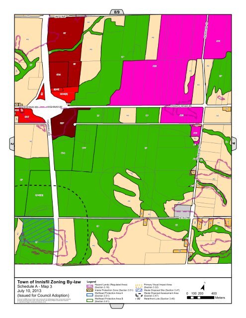
RRAG2ND LINEAG8/9AGCTAGAGSIDEROAD 10ASCEPAGEPEPCTASCAGAGAGCT-2EPAGCH-10CHCH-11(H)AGRRCH-6RRCHHIGHWAY 89HIGHWAY 89CT-2COUNTY ROAD 89RRCH-7EPAGEPASCAGAGHIGHWAY 400CBPRRASCAGAGEP2EP-6EP-7EPAGAGSIDEROAD 10EP4AGAGRREPAGAGAGRREPEP-12(H)AGAGRRAGIE14TH LINEEPRREPAGRRAGRREPAGAGAGEPAGAGRRAGRRAGRRAG<strong>Town</strong> <strong>of</strong> <strong>Innisfil</strong> <strong>Zoning</strong> <strong>By</strong>-lawSchedule A - Map 3July 10, 2013(Issued for Council Adoption)Produced by MMM Group Limited under license with the Nottawasaga Valley Conservation Authority.Produced using information under License with the Lake Simcoe Region Conservation Authority© Lake Simcoe Region Conservation Authority, 2012.LegendHazard Lands (Regulated Area)(Section 3.19)! ! !Intake Protection Zone (Section 3.51)Wellhead Protection Area A(Section 3.51)Wellhead Protection Area B(Section 3.51)! ! !!! !Primary Visual Impact Area(Section 3.32)Waste Disposal Site (Section 3.47)Waste Disposal Assessment Area(Section 3.47)W - W Waterfront Lots (Section 3.49)W W¯0 100 200 400Meters


