CRoW leaflet (for PDF) - Yorkshire Dales National Park
CRoW leaflet (for PDF) - Yorkshire Dales National Park CRoW leaflet (for PDF) - Yorkshire Dales National Park
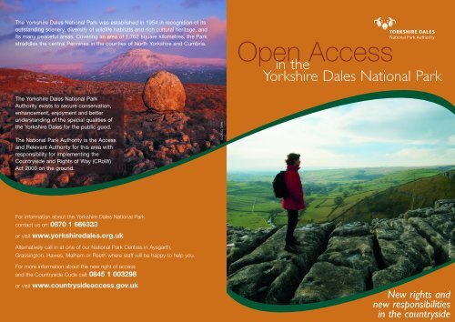
The Yorkshire Dales National Park was established in 1954 in recognition of itsoutstanding scenery, diversity of wildlife habitats and rich cultural heritage, andits many peaceful areas. Covering an area of 1,762 square kilometres, the Parkstraddles the central Pennines in the counties of North Yorkshire and Cumbria.Open Accessin theYorkshire Dales National ParkThe Yorkshire Dales National ParkAuthority exists to secure conservation,enhancement, enjoyment and betterunderstanding of the special qualities ofthe Yorkshire Dales for the public good.The National Park Authority is the Accessand Relevant Authority for this area withresponsibility for implementing theCountryside and Rights of Way (CRoW)Act 2000 on the ground.© DAVID TARNFor information about the Yorkshire Dales National Parkcontact us on: 0870 1 666333or visit www.yorkshiredales.org.ukAlternatively call in at one of our National Park Centres in Aysgarth,Grassington, Hawes, Malham or Reeth where staff will be happy to help you.© DAVID TARNFor more information about the new right of accessand the Countryside Code call: 0845 1 003298or visit www.countrysideaccess.gov.ukDesigned and produced by roomfordesign.co.ukNew rights andnew responsibilitiesin the countryside
- Page 2 and 3: Time to celebrate!A new rightin the
The <strong>Yorkshire</strong> <strong>Dales</strong> <strong>National</strong> <strong>Park</strong> was established in 1954 in recognition of itsoutstanding scenery, diversity of wildlife habitats and rich cultural heritage, andits many peaceful areas. Covering an area of 1,762 square kilometres, the <strong>Park</strong>straddles the central Pennines in the counties of North <strong>Yorkshire</strong> and Cumbria.Open Accessin the<strong>Yorkshire</strong> <strong>Dales</strong> <strong>National</strong> <strong>Park</strong>The <strong>Yorkshire</strong> <strong>Dales</strong> <strong>National</strong> <strong>Park</strong>Authority exists to secure conservation,enhancement, enjoyment and betterunderstanding of the special qualities ofthe <strong>Yorkshire</strong> <strong>Dales</strong> <strong>for</strong> the public good.The <strong>National</strong> <strong>Park</strong> Authority is the Accessand Relevant Authority <strong>for</strong> this area withresponsibility <strong>for</strong> implementing theCountryside and Rights of Way (<strong>CRoW</strong>)Act 2000 on the ground.© DAVID TARNFor in<strong>for</strong>mation about the <strong>Yorkshire</strong> <strong>Dales</strong> <strong>National</strong> <strong>Park</strong>contact us on: 0870 1 666333or visit www.yorkshiredales.org.ukAlternatively call in at one of our <strong>National</strong> <strong>Park</strong> Centres in Aysgarth,Grassington, Hawes, Malham or Reeth where staff will be happy to help you.© DAVID TARNFor more in<strong>for</strong>mation about the new right of accessand the Countryside Code call: 0845 1 003298or visit www.countrysideaccess.gov.ukDesigned and produced by room<strong>for</strong>design.co.ukNew rights andnew responsibilitiesin the countryside
Time to celebrate!A new rightin thecountrysideLarge areas of the <strong>Yorkshire</strong><strong>Dales</strong> <strong>National</strong> <strong>Park</strong> are nowaccessible <strong>for</strong> recreation on footas a result of the Countryside andRights of Way (<strong>CRoW</strong>) Act 2000.The Act gives people the right towalk freely on designated ‘access’land without having to stay on rightsof way.These extensive areas – shown on themap overleaf – linked with the existingrights of way network give plenty ofscope <strong>for</strong> enjoyable and, in somecases, challenging walks.Open access across the <strong>National</strong> <strong>Park</strong>has increased from just 4% to around62% – that’s an extra 102,000 hectaresof hidden countryside to explore.Respect...Open access applies to mappedareas of open country and registeredcommon land.Access to lower lying farmland, buildings,parks and gardens, active quarries, golfcourses, railways, or land within 20 metresof a house or building containing livestockwithin mapped areas is not included.The new right applies to recreationon foot or by wheelchair.This means activities such as walking,sightseeing, bird-watching, climbing,running and picnicking. Riding a horseor bicycle, driving a vehicle, camping andcertain other activities are not included,but where such activities already takeplace legally (eg. on an existing bridleway)they are unaffected.Most access land is privatelyowned, grazed by sheep and cattle,or managed <strong>for</strong> grouse.The activities of those who manage theland have shaped the <strong>Yorkshire</strong> <strong>Dales</strong>landscape we see today. Please respecttheir livelihoods by following any generalor local restrictions and byelaws (thesewill be signed) and take care not to startany fires.Protect...The <strong>Yorkshire</strong> <strong>Dales</strong> <strong>National</strong> <strong>Park</strong>is a special place.The <strong>Yorkshire</strong> <strong>Dales</strong> <strong>National</strong> <strong>Park</strong>is a special landscape of internationalimportance <strong>for</strong> its habitats, wildlife,breeding birds and archaeology.Care should be taken to protectthese features.Keep your dog under close controlThe <strong>Dales</strong> is an important habitat <strong>for</strong> manyspecies of birds so please help to minimisedisturbance during the breeding season(1st March to 31st July).You must keep your dog on a short lead(less than 2 metres long) and avoid birdson the ground or adult birds that aredistressed by walking around the area andmoving away quickly, allowing the parentsto return.Likewise, you must keep your dog on alead when on open access land at all timesof year in the vicinity of livestock. On publicrights of way your dog should be keptunder close control – preferably on a lead.Enjoy...Walk safely – remember to wearsuitable clothing and footwear.Weather conditions in the hills can changequickly and you need to be well prepared.Tell someone where you are going andwhen you expect to return and do not walkalone if inexperienced. Take particular careof hazards such as old mineshafts, sinkholes and peat bogs, which can befound throughout the area.Take care when approachinggrazing cattle.Cattle may not be used to walkers.In most cases they will ignore you butthey may become protective of calves,especially in the presence of dogs. If youare worried about being cornered by cattlewalk around rather than amongst them anduse alternative routes if available.If cattle approach you, let go of yourdog straightaway.Plan ahead and check <strong>for</strong>local restrictions.From time to time access may berestricted in certain areas <strong>for</strong> reasons suchas land or livestock management or natureconservation. Note that dogs are likelyto be excluded from heather moorlandsmanaged <strong>for</strong> grouse. Wherever possible,such exclusions and closures will bemarked by signs on site, but <strong>for</strong> the mostup-to-date in<strong>for</strong>mation visit the nationalwebsite www.countrysideaccess.gov.ukor call 0845 1 003298.Since the mid 19th century peoplehave campaigned <strong>for</strong> this historicright to some of the most spectacularlandscapes in England – but withthe new rights come newresponsibilities <strong>for</strong> all.© DAVID TARN© DAVID TARN© KATHRYN STOREY
Open Accessin the<strong>Yorkshire</strong> <strong>Dales</strong> <strong>National</strong> <strong>Park</strong>This map shows those areas of the <strong>Yorkshire</strong> <strong>Dales</strong> <strong>National</strong> <strong>Park</strong> designated as open access landunder the Countryside and Rights of Way (<strong>CRoW</strong>) Act 2000.Editions of the Ordnance Survey ® Explorer TM maps published in May 2005 show all known access land– including new mapped open access land, areas with pre-existing agreements and landdedicated by a landowner <strong>for</strong> public access.In some areas and/or at certain times of year access may be restrictedor dogs may be excluded. For example, dogs will not be allowed atany time of year on many heather moorlands.Guidance is available at local Access In<strong>for</strong>mation Points (AIP)(at locations marked on this map and on Ordnance Survey maps),on the national website www.countrysideaccess.gov.ukand at <strong>National</strong> <strong>Park</strong> Centres.Visitors are advised tocheck on this website orat <strong>National</strong> <strong>Park</strong> Centres<strong>for</strong> any local restrictionsand that an area is openbe<strong>for</strong>e setting out. Anappropriate OrdnanceSurvey map will providethe in<strong>for</strong>mation you needwhen exploring this areaon foot.Open access landin the <strong>Dales</strong> can bereached from existingroads, rights of way,permissive routesand other publicplaces. Please enterand leave by usingexisting entry pointssuch as gates and stileswherever possible.Look out <strong>for</strong> this symbol whichshows that land is open <strong>for</strong> publicaccess on foot or by wheelchair.Access rights <strong>for</strong> other activities mayalso apply.To enjoy your visit fully and help look after this specialplace <strong>for</strong> everyone, please follow the Countryside Code:l Be safe – plan ahead and follow any signsl Leave gates and property as you find theml Protect plants and animals, and take your litter homel Keep dogs under close controll Consider other peopleAccess In<strong>for</strong>mation Point<strong>National</strong> <strong>Park</strong> CentreRiversRoadsOpen Access Land – <strong>CRoW</strong> ActBarden Moor and Barden Fell Access Area– existing open access agreement (local byelaws apply)This map is reproduced from Ordnance Survey materialwith the permission of Ordnance Survey on behalf of the controllerof Her Majesty’s Stationery Office © Crown copyright. Unauthorised reproductioninfringes Crown copyright and may lead to prosecution or civil proceedings. <strong>Yorkshire</strong> <strong>Dales</strong><strong>National</strong> <strong>Park</strong> Authority LA 08905L Additional in<strong>for</strong>mation: © <strong>Yorkshire</strong> <strong>Dales</strong> <strong>National</strong> <strong>Park</strong> Authority


