University of Madras
University of Madras
University of Madras

Create successful ePaper yourself
Turn your PDF publications into a flip-book with our unique Google optimized e-Paper software.
nrd;idg; gy;fiyf;f<strong>of</strong>k;<strong>University</strong> <strong>of</strong> <strong>Madras</strong>Centenary Buildings, Tholkappiar Campus, Chepauk, Chennai - 600 005(Established under the Act <strong>of</strong> Incorporation XXVII <strong>of</strong> 1857 – <strong>Madras</strong> <strong>University</strong> Act 1923)(State <strong>University</strong>)` `/-APPLICATION FOR ADMISSION TO M.Sc in GEOINFORMATICS UNDER PRIVATE STUDY(CBCS- SEMESTER PATTERN) FOR THE ADADEMIC YEAR 2012-2013(Offered by Department <strong>of</strong> Geography)Note: ( Before filling the Application go through the ‘INSTRUCTIONS TO CANDIDATES” appended)1. Please read the Prospectus carefully before filling in the application .2. Applications must be complete in all respects.3. In the case <strong>of</strong> students withdrawing from Programmes after admission, NO REFUND OF FEES will be made by the <strong>University</strong>4. under any circumstance.5. The completed Application should be sent directly to the Registrar, <strong>University</strong> <strong>of</strong> <strong>Madras</strong>, Tholkappiar Campus,Chennai-6000051. Name <strong>of</strong> the Applicant (In English) : _________________________________________(In Vernacular) : ________________________________________2. Name <strong>of</strong> the Father / Husband : ___________________Mother ________________3. AddressAffix recentPhotograph(a) Permanent Address(b) Address for CommunicationPin CodePhone No.Mobile No.Email Id:Pin CodePhone No.Mobile No.Email Id:4. Date <strong>of</strong> Birth (DD/MM/YYYY) :5. Sex : Male / Female :6. Religion :7. Nationality: Indian /Others Specify : ___________8. Community: SC / SCA/ ST / BC / BC (Muslim) /MBC/DNC / OC :9. Differently abled person : Blind / Hearing Impaired / Orthopedically Challenged10. Qualification which makes the applicant eligible for applying to the present course :Degree : _________________ Subject (Main) : ____________________________________
11. Years studied in School and College : • 10+2+3 +2= 17 Years •10+2+4 = 16 Years• 10+2+3 = 15 Years • Others12. Provide details <strong>of</strong> Educational QualificationCourse /TrainingDegree /DiplomaReg. No.Name <strong>of</strong> the Institutionand <strong>University</strong>Month & Year<strong>of</strong> PassingPercentage <strong>of</strong>Marks AwardedUGAny otherDegree/DiplomaMathematics& StatisticalKnowledgeComputerKnowledge13 Trade / Industry / Government/Employment DetailsName <strong>of</strong> the Organisationand AddressPosition Held Duration Responsibilities14. Organisational Sponsorship and the Authorised Signature:(Also enclose a sponsorship letter by the organisation)15. Enclosures (Attested Photo copies only) :(a) X standard and HSC Certificate(b) Mark sheets and Provisional/ Degree Certificate / pro<strong>of</strong> <strong>of</strong> Educational Qualification(c) Community Certificate(d) Academic / Industrial Experience / Sponsorship Letter16. Any other information which you would like to present in support <strong>of</strong> your application:DECLARATION BY THE APPLICANTI hereby declare that the particulars furnished above are correct. I agree that the authorities may invalidate my application,at any time, if any <strong>of</strong> the information furnished is found to be false. I am aware that my eligibility for admission for a coursewill be decided by the concerned admitting authority.Place :Date : Signature <strong>of</strong> the Applicant
UNIVERSITY OF MADRASAPPLICATION FOR ADMISSION TO M.Sc in GEOINFORMATICS UNDER PRIVATE STUDY (CBCS-SEMESTER PATTERN) FOR THE ADADEMIC YEAR 2012-2013(Offered by Department <strong>of</strong> Geography)Name <strong>of</strong> the Applicant :(In Capital Letters)Admissions 2012-2013Admission test / Interview Card(To be filled by the Applicant)Signature <strong>of</strong> the Applicant :Affix recentPhotograph______________________________________________________________________________________To be filled by the <strong>University</strong> DepartmentAdmission Test Interview IntimationRegistration Number: _________________Date : _________________ Time :Venue: _______________________________________________________________Department’s SealSignature <strong>of</strong> the Head <strong>of</strong> the Department______________________________________________________________________________________Instructions :1. The Candidate is advised to be present at the specified venue at least 15 minutes before the commencement <strong>of</strong> the Test/ Interview.2. Please bring all evidences for (a) Years <strong>of</strong> study (b) Eligibility requirements (i.e.) UG/PG/ Diploma (c) Experiences(d) Sponsorship (if any)3. NO TA/DA will be provided by the <strong>University</strong>
UNIVERSITY OF MADRASM.Sc. DEGREE COURSE IN GEOINFORMATICS(Under Private Study)CBCS - Semester Pattern(With effect from the academic year 2012-2013 onwards)\INSTRUCTION TO CANDIDATES1.IntroductionAn intensive Two-year M.Sc., Geoinformatics (Private study ) at the Department <strong>of</strong> Geography,<strong>University</strong> <strong>of</strong> <strong>Madras</strong> is designed to provide the candidates a sound knowledge in the field <strong>of</strong> Geospatialtechnology for effective use <strong>of</strong> Geoinformatics in sustainable resource development planning .The course isdesigned for management level training for duration <strong>of</strong> two years. Upon completion <strong>of</strong> the course,participants should be able to contribute to the design, implementation and management <strong>of</strong> geoinformationproduction systems and quality control systems2.ObjectivesThe main objective is to provide a comprehensive training in theory and practice in the field <strong>of</strong>Geoinformatics at the level <strong>of</strong> supervisors. After the completion <strong>of</strong> the Degree, the graduate should becapable <strong>of</strong> performing competently the routine tasks in the field <strong>of</strong> geoinformatics and capacity to supervisetechnicians in the routine tasks and relate to pr<strong>of</strong>essionals in the planning and execution <strong>of</strong> Geoinformaticsprojects.3. Main Target Groups:The course is mainly intended for those who are involved in the operational use <strong>of</strong> integratedgeoinformation production and management in:· National survey and mapping organizations, International organizations, United nations etc· Application oriented organizations,(cadastre, Local authorities, utilities companies, naturalInternational organizations, United Nations etc resources surveys, environment, privategeoinformation production organizations).· Private sector, (examples: Information technology industry, GIS consulting firms,Environmental management agencies, Tourist industry, Utility companies,E-commerce, Mineral Exploration).· Emergency services, Public health and epidemiology, Planning and Urban development,Crime mapping, Transportation and infrastructure.· And many more.4. Eligibility for AdmissionA candidates who has passed BA/B.Sc., Degree Examination with Geography/Geology/physics/Environmental Sciences / Computer science / Computer Applications /InformationTechnology/ Agriculture/Remote sensing as the main subject <strong>of</strong> study or Geography as one <strong>of</strong> thesubjects <strong>of</strong> study with knowledge <strong>of</strong> Mathematics /Statistics at least at the +2 level or BE CivilEngineering or any information Technology related fields or an examination <strong>of</strong> any other <strong>University</strong>accepted by the Syndicate as equivalent thereto.Candidates with degrees in other subject areas will be considered if the demonstrate interest,aptitude and experience in a field relevant to the application <strong>of</strong> geospatial technology.5. Duration <strong>of</strong> the courseThe duration <strong>of</strong> the course is for two academic years consisting <strong>of</strong> four semesters.
6. Medium <strong>of</strong> instruction: English7. Nature <strong>of</strong> the Programme:The course is a combination <strong>of</strong> lectures, demonstrations, seminars, practical and projectworkshops <strong>of</strong>fered under choice Based credit system (CBCS).The course will be <strong>of</strong>fered under private studyat the Department <strong>of</strong> Geography, <strong>University</strong> <strong>of</strong> <strong>Madras</strong>8. Cost <strong>of</strong> the programme and student strengthCourse fee is Rs.50,000/- (fifty thousand only) for two years .Fees should be paid at the time <strong>of</strong>admission . Payment shall be made in two installments ( First year : 25,000, Second year 25,000) Maximumstudent strength will be 100.Course fee for foreign student US$ 2,000.9. Compulsory Intensive Contact Classes and Orientation :Ten days <strong>of</strong> practical sessions including lectures and seminars will be conducted at theDepartment <strong>of</strong> Geography, <strong>University</strong> <strong>of</strong> <strong>Madras</strong> for each semester and the attendance is compulsory and aminimum <strong>of</strong> 80 percent <strong>of</strong> attendance to be gained by each candidate. For the examination purposes, therecord works completed and duly signed at the intensive practical training along will be considered forexamination. All practical exercises will be recorded in A4 size sheets and submitted for evaluation.Examinations will be conducted at the end <strong>of</strong> each semester. The candidates who pass all the examinationprescribed for the course in the first appearance only are eligible for ranking .Examination for theory,practical and project work will be conducted by Department <strong>of</strong> Geography, <strong>University</strong> <strong>of</strong> <strong>Madras</strong>.10. Project workThe M.Sc., project is an extended piece <strong>of</strong> work carried out largely independently .At the end <strong>of</strong> thethird semester, the title <strong>of</strong> the project work will be decided and approved for each candidate .A facultymember will be assigned as advisor. The topic for research project work within the fields <strong>of</strong> cartography,geographic information science, spatial planning photogram metric mapping, settlement studies, remotesensing, etc .will be selected by the student in consultation with the advisor .Students are encouraged to carryout projects in collaboration with industry, or in support <strong>of</strong> Research projects in the Departments <strong>of</strong>Geography /Government departments/UN Agencies. At the end <strong>of</strong> the project, students will have to present aseminar. The project report shall be submitted by the candidate before the commencement <strong>of</strong> the second yearExaminations. Viva will be conducted at the Department <strong>of</strong> Geography. <strong>University</strong> <strong>of</strong> <strong>Madras</strong>, Chennai11. Eligibility for the Award <strong>of</strong> Degree:A candidate shall be declared to have passed the examination if he/she obtains not less than 50% <strong>of</strong>the marks in each paper / Practical/ Project. The candidate who does not obtain the required minimum marksfor a pass in a paper(s) / Practical/Project shall be required to appear for and pass the same at a subsequentappearance. A candidates shall be eligible for the award <strong>of</strong> the degree only if he/she has undergone the fullcourse <strong>of</strong> study for a period <strong>of</strong> not less than two academic years and pass the examinations in all the foursemesters and earn the prescribed 91 credits.All courses are standardized and the credits for each course are in accordance with the hours <strong>of</strong>learning process, which includes lectures, labs or Project work or presentation in the form <strong>of</strong> report or /recordthe subjects listed under each semester are compulsory courses in each semester.12. ExaminationExaminations will be conducted at the end <strong>of</strong> each semester. The candidates who pass all the examinationprescribed for the course in the first appearance only are eligible for ranking.
NOTIFICATION FOR INTERNET PURPOSEThe <strong>University</strong> is <strong>of</strong>fering M.Sc.,(Geoinformatics) degree course under private study(semester) during the academic year 2012-2013 in the Department <strong>of</strong> Geography.1.IntroductionAn intensive Two-year M.Sc., Geoinformatics (Private study ) at the Department <strong>of</strong>Geography, <strong>University</strong> <strong>of</strong> <strong>Madras</strong> is designed to provide the candidates a sound knowledge inthe field <strong>of</strong> Geospatial technology for effective use <strong>of</strong> Geoinformatics in sustainable resourcedevelopment planning .The course is designed for management level training for duration <strong>of</strong>two years. Upon completion <strong>of</strong> the course, participants should be able to contribute to thedesign, implementation and management <strong>of</strong> geoinformation production systems and qualitycontrol systems2.ObjectivesThe main objective is to provide a comprehensive training in theory and practice in thefield <strong>of</strong> Geoinformatics at the level <strong>of</strong> supervisors. After the completion <strong>of</strong> the Degree, thegraduate should be capable <strong>of</strong> performing competently the routine tasks in the field <strong>of</strong>geoinformatics and capacity to supervise technicians in the routine tasks and relate topr<strong>of</strong>essionals in the planning and execution <strong>of</strong> Geoinformatics projects.3. Main Target Groups:The course is mainly intended for those who are involved in the operational use <strong>of</strong>integrated geoinformation production and management in:· National survey and mapping organizations, International organizations, Unitednations etc· Application oriented organizations,(cadastre, Local authorities, utilitiescompanies, natural International organizations, United Nations etc resourcessurveys, environment, private geoinformation production organizations).· Private sector, (examples: Information technology industry, GIS consulting firms,Environmental management agencies, Tourist industry, Utility companies,E-commerce, Mineral Exploration).· Emergency services, Public health and epidemiology, Planning and Urbandevelopment, Crime mapping, Transportation and infrastructure.· And many more.
4. Eligibility for AdmissionA candidates who has passed BA/B.Sc., Degree Examination with Geography/Geology/physics/Environmental Sciences / Computer science / Computer Applications/Information Technology/ Agriculture/Remote sensing as the main subject <strong>of</strong> study orGeography as one <strong>of</strong> the subjects <strong>of</strong> study with knowledge <strong>of</strong> Mathematics /Statistics atleast at the +2 level or BE Civil Engineering or any information Technology related fieldsor an examination <strong>of</strong> any other <strong>University</strong> accepted by the Syndicate as equivalentthereto.Candidates with degrees in other subject areas will be considered if they candemonstrate interest ,aptitude and experience in a field relevant to the application <strong>of</strong>geospatial technology.5. Duration <strong>of</strong> the courseThe duration <strong>of</strong> the course is for two academic years consisting <strong>of</strong> foursemesters.6. Medium <strong>of</strong> instruction: English7. Nature <strong>of</strong> the Programme:The course is a combination <strong>of</strong> lectures, demonstrations, seminars, practical andproject workshops <strong>of</strong>fered under choice Based credit system (CBCS).The course will be <strong>of</strong>feredunder private study at the Department <strong>of</strong> Geography, <strong>University</strong> <strong>of</strong> <strong>Madras</strong>8. Cost <strong>of</strong> the programme and student strengthCourse fee is Rs.50,000/- (fifty thousand only) for two years .Fees should be paid atthe time <strong>of</strong> admission . Payment shall be made in two installments ( First year : 25,000, Secondyear 25,000) Maximum student strength will be 100.Course fee for foreign student US$ 2,000.9. Compulsory Intensive Contact Classes and Orientation :Ten days <strong>of</strong> practical sessions including lectures and seminars will be conducted atthe Department <strong>of</strong> Geography, <strong>University</strong> <strong>of</strong> <strong>Madras</strong> for each semester and the attendance iscompulsory and a minimum <strong>of</strong> 80 percent <strong>of</strong> attendance to be gained by each candidate. Forthe examination purposes, the record works completed and duly signed at the intensivepractical training along will be considered for examination. All practical exercises will berecorded in A4 size sheets and submitted for evaluation. Examinations will be conducted at theend <strong>of</strong> each semester. The candidates who pass all the examination prescribed for the course in
the first appearance only are eligible for ranking .Examination for theory, practical and projectwork will be conducted by Department <strong>of</strong> Geography, <strong>University</strong> <strong>of</strong> <strong>Madras</strong>.10. Project workThe M.Sc., project is an extended piece <strong>of</strong> work carried out largely independently .Atthe end <strong>of</strong> the third semester, the title <strong>of</strong> the project work will be decided and approved foreach candidate .A faculty member will be assigned as advisor. The topic for research projectwork within the fields <strong>of</strong> cartography, geographic information science, spatial planningphotogram metric mapping, settlement studies, remote sensing, etc .will be selected by thestudent in consultation with the advisor .Students are encouraged to carry out projects incollaboration with industry, or in support <strong>of</strong> Research projects in the Departments <strong>of</strong> Geography/Government departments/UN Agencies. At the end <strong>of</strong> the project, students will have topresent a seminar. The project report shall be submitted by the candidate before thecommencement <strong>of</strong> the second year Examinations. Viva will be conducted at the Department <strong>of</strong>Geography. <strong>University</strong> <strong>of</strong> <strong>Madras</strong>, Chennai11. Eligibility for the Award <strong>of</strong> Degree:A candidate shall be declared to have passed the examination if he/she obtains notless than 50% <strong>of</strong> the marks in each paper / Practical/ Project. The candidate who does notobtain the required minimum marks for a pass in a paper(s) / Practical/Project shall be requiredto appear for and pass the same at a subsequent appearance. A candidates shall be eligible forthe award <strong>of</strong> the degree only if he/she has undergone the full course <strong>of</strong> study for a period <strong>of</strong> notless than two academic years and pass the examinations in all the four semesters and earn theprescribed 91 credits.All courses are standardized and the credits for each course are in accordance with thehours <strong>of</strong> learning process, which includes lectures, labs or Project work or presentation in theform <strong>of</strong> report or /record the subjects listed under each semester are compulsory courses ineach semester.12. ExaminationExaminations will be conducted at the end <strong>of</strong> each semester. The candidates who pass all theexamination prescribed for the course in the first appearance only are eligible for ranking.
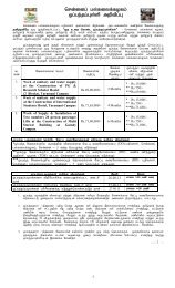
ISSUE OF APPLICATION IN PERSON:Applications can be had in person at the information centre, <strong>University</strong> <strong>of</strong> <strong>Madras</strong>,Chennai -600 005 on payment <strong>of</strong> Rs 300/-by cash.ISSUE OF APPLICATION BY POST:Those who want to obtain application by post have to send a written requisitionspecifying the name <strong>of</strong> the programme together with a Demand Draft for a sum <strong>of</strong> Rs .350/- (Rs.300/-towards cost <strong>of</strong> Application and Rs .50/-towards postage) drawn in favour <strong>of</strong> “TheRegistrar ,<strong>University</strong> <strong>of</strong> <strong>Madras</strong>, Chennai -5.”Application can also be downloaded from the university website athttp://www.unom.ac.in However the cost <strong>of</strong> application for Rs 300/- by means <strong>of</strong> Demand Draftshall be enclosed, failing which the application will be summarily rejected.Last date for issue /submission <strong>of</strong> filled in application: .28.09.2012.REGISTRAR-I/CNo:ERC/M.SC.,/PS/Notification/2012-2013/ GII