the challenges of using remote sensing imagery in gis - Malaysia ...
the challenges of using remote sensing imagery in gis - Malaysia ...
the challenges of using remote sensing imagery in gis - Malaysia ...
You also want an ePaper? Increase the reach of your titles
YUMPU automatically turns print PDFs into web optimized ePapers that Google loves.
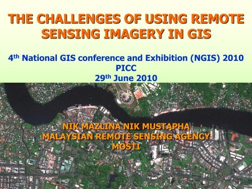
THE CHALLENGES OF USING REMOTESENSING IMAGERY IN GIS4 th National GIS conference and Exhibition (NGIS) 2010PICC29 th June 2010NIK MAZLINA NIK MUSTAPHAMALAYSIAN REMOTE SENSING AGENCYMOSTI
SPATIAL RESOLUTIONRemote Sens<strong>in</strong>g <strong>Malaysia</strong>
QuickBird (0.67 m) Ikonos (1 m) SPOT-5 (2.5 m)SPOT-5 (5 m) SPOT-5 (10 m) Landsat-5 TM (30 m)SCALE 1:2,300
QuickBird (0.67 m) Ikonos (1 m) SPOT-5 (2.5 m)SPOT-5 (5 m) SPOT-5 (10 m) Landsat-5 TM (30 m)SCALE 1:3,500
QuickBird (0.67 m) Ikonos (1 m) SPOT-5 (2.5 m)SPOT-5 (5 m) SPOT-5 (10 m) Landsat-5 TM (30 m)SCALE 1:10,000
QuickBird (0.67 m) Ikonos (1 m) SPOT-5 (2.5 m)SPOT-5 (5 m) SPOT-5 (10 m) Landsat-5 TM (30 m)SCALE 1:25,000
QuickBird (0.67 m) Ikonos (1 m) SPOT-5 (2.5 m)SPOT-5 (5 m) SPOT-5 (10 m) Landsat-5 TM (30 m)SCALE 1:50,000
SPECTRAL RESOLUTIONRemote Sens<strong>in</strong>g <strong>Malaysia</strong>
• The number <strong>of</strong> spectral bands <strong>the</strong> satellite sensor recordsdata• Landsat TM sensor has 7 bands while Spot-5 has 4 bands• Landsat TM image have greater spectral resolution thanSpot-5 image
SPOT SPECTRAL BANDSB1 (Green) B2 (Red) B3 (Near-IR) B4 (SWIR)• Several spectralbands isnecessary todist<strong>in</strong>guishbetween differentmaterials on <strong>the</strong>image
SPOT : Bands 432 (RGB)SPOT : Bands 342 (RGB)
LANDSAT-5 TMSPECTRAL BANDSBand 1Band 4Band 2Band 5Band 3Band 6Band 7
Landsat TM: Bands 321 (RGB)Landsat TM : Bands 432 (RGB)
Landsat TM : Bands 432 (RGB)Landsat TM : Bands 543 (RGB)
Landsat TM : Bands 453 (RGB)Landsat TM : Bands 543 (RGB)
RADIOMETRIC RESOLUTIONRemote Sens<strong>in</strong>g <strong>Malaysia</strong>
• Radiometric resolution describes <strong>the</strong> capability <strong>of</strong> <strong>the</strong> image tostore data/<strong>in</strong>formation• A simple analogy: a 5 MegaPixel camera is much more capable<strong>in</strong> captur<strong>in</strong>g details & features compared to a 1 MegaPixelcamera.2-bit image8-bit image
Example : IKONOS is 11-bit data and SPOT is 8-bit data.In a 11-bit image, features <strong>in</strong> shadowed regions are still visiblecompared to shadowed regions <strong>in</strong> an 8-bit imageIKONOS : 11-bitSPOT : 8-bit
TEMPORAL RESOLUTIONRemote Sens<strong>in</strong>g <strong>Malaysia</strong>
• The frequency <strong>of</strong> satellite overpass at <strong>the</strong> same locationLandsat TM satellite look<strong>in</strong>g at nadirSpot satellite look<strong>in</strong>g at nadirdate 1 date 2date 1 date 216 days26 days• The Spot satellite system<strong>in</strong>creases <strong>the</strong> ability toacquire images by <strong>the</strong> use <strong>of</strong><strong>of</strong>f-nadir view<strong>in</strong>gSpot satellite look<strong>in</strong>g at <strong>of</strong>f-nadirdate 1 date 25 days
SPOT-5 Orbital Calendar9 Sept14 Sept19 Sept
SWATH WIDTHRemote Sens<strong>in</strong>g <strong>Malaysia</strong>
NOAA swath 4800 km 2600 km
Landsat swath= 185 km 185 km
LandsatNOAA swath compared to Landsat
SPOT swath= 60 km 60 km
SPOTSpot swath vs.Landsat
QuickBird swath= 16 km 16 km
QuickBirdQuickBird swath vs. Spot
Type <strong>of</strong>SatelliteSpatial Resolution(meters)Swath Width(Geographic Coverageper Image)# spectralbandsFrequency <strong>of</strong>Repeat Coverage<strong>of</strong> Same LocationRadiometricLOW(NOAA)resolution 1100m 2700 km swath 5 bands 1-2 days 8 bits(MODIS)resolution 250m, 1000m 2300 km swath 36 bands 1-2 days 8 bitsMEDIUM(LANDSAT TM)resolution 15m, 30m 183 km swath 7 bands 15-30daysHIGH8 bits(SPOT5)resolution 2.5m, 5m, 10m 60 km swath 4 bands 15-30days8 bits(GEOEYE-1,IKONOS)resolution 0.5m, 1m ~10 km swath 4 bands Months toyears11 bits
How Satellite Imagery Benefit GIS?SATELLITE IMAGERYCAPABILITIESSystematic image collection(frequent repeat coverage)Synoptic observations(wide swath)Multi spectral observationsmakes GIS real timeGives GIS a source<strong>of</strong> <strong>in</strong>formation forgeneration & revision<strong>of</strong> geospatial dataGreatly enhanced aGIS mapp<strong>in</strong>g projectVarious spatial resolutionRemote Sens<strong>in</strong>g <strong>Malaysia</strong>
THE CHALLENGES IN THESUCCESSFUL USAGE OFIMAGERY IN A GISRemote Sens<strong>in</strong>g <strong>Malaysia</strong>
MAKE THE IMAGERY GIS-READY Image must be re<strong>gis</strong>tered to specificplaces on <strong>the</strong> earth• simple geometric transformation to fit<strong>imagery</strong> to <strong>the</strong> vector database• for precise mapp<strong>in</strong>g, image must beorthorectified and adjust <strong>the</strong> projection<strong>of</strong> <strong>the</strong> vector data to match that <strong>imagery</strong>Remote Sens<strong>in</strong>g <strong>Malaysia</strong>
EXTRACT INFORMATION FROM IMAGERY By means <strong>of</strong> image analysis <strong>us<strong>in</strong>g</strong> imageprocess<strong>in</strong>g techniques• visual process<strong>in</strong>g - image <strong>in</strong>terpretation<strong>us<strong>in</strong>g</strong> colour, size, shape, texture, pattern,site & association
• digital process<strong>in</strong>gSpectral enhancement, image classification – spectralclassification, pattern recognition, textural analysisand change detection
To automate <strong>in</strong>formation extraction from ahigh resolution <strong>imagery</strong> require computerbased expert system
LARGE SIZE OF IMAGE DATA A s<strong>in</strong>gle snapshot image is alwayshundreds <strong>of</strong> megabytes Image mosaic cover<strong>in</strong>g a state can behundreds <strong>of</strong> gigabytes The higher <strong>the</strong> spatial, spectral andradiometric resolution, <strong>the</strong> larger <strong>the</strong>file size Requires high storage and process<strong>in</strong>gcapacity
ACCESS IMAGERY IN A TIMELY MANNER Many GIS applications require recent<strong>imagery</strong>. If its not archived, <strong>the</strong> imagehas to be acquired The downside - to acquire cloud-freeimages <strong>in</strong> a humid tropic country like<strong>Malaysia</strong> takes a long time
10-01-2010 25-02-201026-01-2010 26-02-201005-02-2010 03-03-201021-02-2010 24-03-2010
RECENT DEVELOPMENT &RECOMMENDATIONS TOADDRESS THE CHALLENGESRemote Sens<strong>in</strong>g <strong>Malaysia</strong>
standard GIS s<strong>of</strong>tware <strong>in</strong>corporateswizard based user <strong>in</strong>terface for users tocreate own ortho<strong>imagery</strong> Orthorectified <strong>imagery</strong> products fromRemote Sens<strong>in</strong>g <strong>Malaysia</strong> current GIS s<strong>of</strong>tware provide an easy touse <strong>in</strong>tuitive image process<strong>in</strong>g andanalysis tools that enable users toextract <strong>in</strong>formation quickly and easilyRemote Sens<strong>in</strong>g <strong>Malaysia</strong>
hands-on-tra<strong>in</strong><strong>in</strong>g on image process<strong>in</strong>gand analysis by Remote Sens<strong>in</strong>g<strong>Malaysia</strong> compromise large size high resolution<strong>imagery</strong> with medium resolution image compression ECW/ JPEG 2000format for efficient storage <strong>of</strong> <strong>imagery</strong>Remote Sens<strong>in</strong>g <strong>Malaysia</strong>
utilize Image Web Server for handl<strong>in</strong>g<strong>imagery</strong> and a GIS map server for <strong>the</strong>vector layers cloud comput<strong>in</strong>g and image stream<strong>in</strong>gtechnology Remote Sens<strong>in</strong>g <strong>Malaysia</strong> providecustom image acquisition - user canplan acquisition dur<strong>in</strong>g <strong>the</strong> month <strong>of</strong>good wea<strong>the</strong>rRemote Sens<strong>in</strong>g <strong>Malaysia</strong>
CONCLUSION <strong>the</strong> advancement <strong>of</strong> ICT, <strong>remote</strong><strong>sens<strong>in</strong>g</strong> and GIS technology aremeet<strong>in</strong>g <strong>the</strong>se <strong>challenges</strong> satellite <strong>imagery</strong> will cont<strong>in</strong>ue to growas an important source <strong>of</strong> geospatial<strong>in</strong>formation for GISRemote Sens<strong>in</strong>g <strong>Malaysia</strong>
THANK YOUfor enquiries, please contactmazl<strong>in</strong>a@<strong>remote</strong><strong>sens<strong>in</strong>g</strong>.gov.myor visit http://www.<strong>remote</strong><strong>sens<strong>in</strong>g</strong>.gov.myRemote Sens<strong>in</strong>g <strong>Malaysia</strong>


