

report of the western ghats ecology expert panel
report of the western ghats ecology expert panel
report of the western ghats ecology expert panel

Create successful ePaper yourself
Turn your PDF publications into a flip-book with our unique Google optimized e-Paper software.
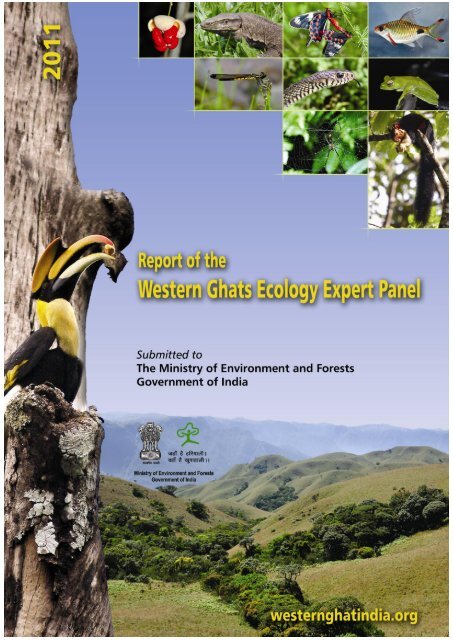
Report <strong>of</strong> <strong>the</strong> Western GhatsEcology Expert PanelPart ISubmitted toThe Ministry <strong>of</strong> Environment and Forests,Government <strong>of</strong> India31 August 2011
Report <strong>of</strong> <strong>the</strong> WGEEP 2011Cover Design:Courtesy - Kerala State Biodiversity Boardii
Report <strong>of</strong> <strong>the</strong> WGEEPPanel MembersPr<strong>of</strong>. Madhav GadgilShri B.J. KrishnanDr. K.N. GaneshaiahDr. V.S. VijayanPr<strong>of</strong>. (Ms.) Renee BorgesPr<strong>of</strong>. R. SukumarDr. Ligia NoronhaMs Vidya S. NayakDr. D. K. SubramaniamDr. R.V. VarmaChairman, Kerala State Biodiversity BoardChairmanMemberMemberMemberMemberMemberMemberMemberMemberMember (ex-<strong>of</strong>ficio)Chairman, National Biodiversity Authority(NBA)Pr<strong>of</strong> S.P. GautamChairman, Central Pollution Control Board(CPCB)Dr. R.R. NavalgundDirector, Space Application Centre (SAC)Dr. G.V. SubrahmanyamAdvisor (RE), Ministry <strong>of</strong> Environment &Forests, Government <strong>of</strong> India, New DelhiMember (ex-<strong>of</strong>ficio)Member (ex-<strong>of</strong>ficio)Member (ex-<strong>of</strong>ficio)Member-Secretary (ex-<strong>of</strong>ficio)iii
Report <strong>of</strong> <strong>the</strong> WGEEPPrefaceIndia is remarkable for <strong>the</strong> deep and abiding concern demonstrated by its people and itssuccessive Central, State and local Governments towards halting <strong>the</strong> rapid pace <strong>of</strong>degradation <strong>of</strong> <strong>the</strong> environment. Our country has been a pioneer in <strong>the</strong> area <strong>of</strong> integrating<strong>the</strong> needs <strong>of</strong> development with <strong>the</strong> desire to protect <strong>the</strong> environment, as reflected in <strong>the</strong>emphasis on sustainable development as a key feature <strong>of</strong> <strong>the</strong> development strategy <strong>of</strong> <strong>the</strong>nation since <strong>the</strong> Fourth Five Year Plan <strong>of</strong> <strong>the</strong> country in <strong>the</strong> early 1970s. The constitution <strong>of</strong><strong>the</strong> Western Ghats Ecology Expert Panel by <strong>the</strong> Ministry <strong>of</strong> Environment and Forests <strong>of</strong> <strong>the</strong>Government <strong>of</strong> India is yet ano<strong>the</strong>r reflection <strong>of</strong> <strong>the</strong> seriousness with which our countryviews <strong>the</strong>se significant challenges.The Western Ghats are naturally an important focus <strong>of</strong> sustainable development efforts. Theprotector <strong>of</strong> <strong>the</strong> Indian peninsula, <strong>the</strong> mo<strong>the</strong>r <strong>of</strong> <strong>the</strong> Godavari, Krishna, Netravathi, Kaveri,Kunthi, Vaigai and a myriad o<strong>the</strong>r rivers, Kalidasa likens <strong>the</strong> Western Ghats to acharming maiden; Agastyamalai is her head, Annamalai and Nilgiri <strong>the</strong> breasts, her hips<strong>the</strong> broad ranges <strong>of</strong> Kanara and Goa, her legs <strong>the</strong> nor<strong>the</strong>rn Sahyadris. Once <strong>the</strong> lady wasadorned by a sari <strong>of</strong> rich green hues; today her mantle lies in shreds and tatters. It hasbeen torn asunder by <strong>the</strong> greed <strong>of</strong> <strong>the</strong> elite and gnawed at by <strong>the</strong> poor, striving to eke out asubsistence. This is a great tragedy, for this hill range is <strong>the</strong> backbone <strong>of</strong> <strong>the</strong> <strong>ecology</strong> andeconomy <strong>of</strong> south India.Yet, on <strong>the</strong> positive side, <strong>the</strong> Western Ghats region has some <strong>of</strong> <strong>the</strong> highest levels <strong>of</strong>literacy in <strong>the</strong> country, and a high level <strong>of</strong> environmental awareness. Democraticinstitutions are well entrenched, and Kerala leads <strong>the</strong> country in capacity building andempowering <strong>of</strong> Panchayat Raj Institutions. Goa has recently concluded a very interestingexercise, Regional Plan 2021, <strong>of</strong> taking inputs from Gram Sabhas in deciding on land usepolicies. Evidently, <strong>the</strong> Western Ghats constitutes an appropriate region <strong>of</strong> <strong>the</strong> country toattempt to make <strong>the</strong> transition towards an inclusive, caring and environment-friendlymode <strong>of</strong> development.It is <strong>the</strong>refore with tremendous enthusiasm that <strong>the</strong> Western Ghats Ecology Expert Panel hasapproached its appointed task. The Panel embarked upon <strong>the</strong> assignment through a multiprongedstrategy which included (i) compilation <strong>of</strong> all readily available and accessibleinformation on <strong>the</strong> Western Ghats, (ii) development <strong>of</strong> a geospatial database on ecologicalsensitivity for <strong>the</strong> entire Western Ghats region which would provide a multi-criteria decisionsupport system for demarcation <strong>of</strong> ecologically sensitive areas, and (iii) comprehensiveconsultations with principal stakeholders which included civil society groups, government<strong>of</strong>ficials, and peoples’ representatives, ranging from members <strong>of</strong> Gram Panchayats and ZillaParishads to MLAs and MPs.It is noteworthy that in all <strong>the</strong>se endeavors special effort was made to have wide-rangingdiscussions with complete transparency. All <strong>the</strong> information generated by <strong>the</strong> Panelincluding <strong>the</strong> geospatial database is publicity available through a dedicated website createdfor <strong>the</strong> Panel.During <strong>the</strong> course <strong>of</strong> <strong>the</strong> last one and half years, Western Ghats Ecology Expert Panel hashad fourteen Panel meetings wherein <strong>the</strong> Panel deliberated at length on various issuesrelated to <strong>the</strong> Western Ghats region. The detailed minutes <strong>of</strong> all <strong>the</strong>se meetings are availableon <strong>the</strong> Ministry’s website. These meeting were interspersed with brainstorming sessions,public consultations and field visits. The central stream <strong>of</strong> thought was to develop a soundv
Report <strong>of</strong> <strong>the</strong> WGEEP 2011scientific methodology/basis for arriving at decisions, with <strong>the</strong>se decisions deliberated uponby adopting a participatory approach.The <strong>report</strong> embodies among o<strong>the</strong>r things (i) categorization <strong>of</strong> <strong>the</strong> Western Ghats into threezones <strong>of</strong> varied ecological sensitivity, based upon careful analysis done by WGEEP, (ii)broad sectoral guidelines for each <strong>of</strong> <strong>the</strong>se zones, and (iii) a broad framework forestablishment <strong>of</strong> <strong>the</strong> Western Ghats Ecology Authority.In this endeavor, <strong>the</strong> Panel has utilized <strong>the</strong> <strong>expert</strong>ise <strong>of</strong> a number <strong>of</strong> people andorganizations to whom <strong>the</strong> <strong>panel</strong> expresses its gratitude. The Panel thanks <strong>the</strong> Ministry <strong>of</strong>Environment and Forests, Government <strong>of</strong> India, for giving it this unique opportunity to bepart <strong>of</strong> a very significant initiative directed at conserving <strong>the</strong> natural heritage <strong>of</strong> <strong>the</strong> WesternGhats – a global biodiversity hotspot.Pr<strong>of</strong>. Madhav GadgilChairmanWestern Ghats Ecology Expert Panelvi
Report <strong>of</strong> <strong>the</strong> WGEEPAcknowledgementsThe Western Ghats Ecology Expert Panel (WGEEP) acknowledges <strong>the</strong> valuable inputsprovided by <strong>the</strong> Hon. Ministers for Environment and Forests, GoI, several Ministers <strong>of</strong> StateGovernments, and <strong>the</strong> Members <strong>of</strong> Parliament <strong>of</strong> <strong>the</strong> Western Ghats region.The WGEEP acknowledges <strong>the</strong> help and cooperation provided by <strong>the</strong> State Environmentand Forest Departments, as well as o<strong>the</strong>r departments including Rural Development andPanchayat Raj, and institutions such as KILA and KFRI <strong>of</strong> various Western Ghats States viz.Gujarat, Maharashtra, Goa, Karnataka, Kerala and Tamil Nadu.The WGEEP acknowledges <strong>the</strong> members <strong>of</strong> all <strong>the</strong> civil society groups who have interactedand shared <strong>the</strong>ir invaluable experience and information with <strong>the</strong> Panel. Many <strong>of</strong> <strong>the</strong>m haveplayed an important role in evolving policy and management formulations for <strong>the</strong>ecologically sensitive zones. Individual names <strong>of</strong> <strong>the</strong> members and <strong>the</strong> civil society groupsappear at relevant places in <strong>the</strong> Annexures.The WGEEP acknowledges with great pleasure <strong>the</strong> warmth with which people at <strong>the</strong> grassrootswelcomed it and shared <strong>the</strong>ir understanding, perceptions and concerns.The WGEEP acknowledges <strong>the</strong> significant and critical inputs provided by Shri SanjayUpadhyay, Advocate, Supreme Court and Managing Partner, ELDF, regarding <strong>the</strong>modalities for setting up <strong>the</strong> proposed Western Ghats Ecology Authority.Most importantly, <strong>the</strong> Western Ghats Ecology Expert <strong>panel</strong> puts on record its gratitude toDr. S.N. Prasad and its deep appreciation <strong>of</strong> his effort in preparing <strong>the</strong> geospatial databasefor arriving at ecological sensitivity levels for <strong>the</strong> whole Western Ghats region. Thisdatabase is <strong>the</strong> basis for defining <strong>the</strong> proposed ecologically sensitive zones across <strong>the</strong>Western Ghats.The Panel would also like to acknowledge <strong>the</strong> following persons for <strong>the</strong>ir invaluable helpand assistance in accessing <strong>the</strong> data and information required for <strong>the</strong> geospatial databaseused by WGEEP:1. Mr Kiran, Arundhati Das, V Srinivasan and Dr Jagdish Krishnaswamy <strong>of</strong> ATREE(Habitat-related information for parts <strong>of</strong> Maharashtra, Karnataka, Kerala and TamilNadu)2. Mr Ravindra Bhalla <strong>of</strong> FERAL and Mr Bhaskar Acharya <strong>of</strong> CEPF3. Dr R J R Daniels <strong>of</strong> Care Earth (point locations <strong>of</strong> mammals, reptiles, birds, amphibiansand fishes)4. Dr K A Subramanian, ZSI (point locations <strong>of</strong> Odonata)5. Pr<strong>of</strong> R Sukumar (elephant corridors)6. Dr K N Ganeshiah (Western Ghats boundary)7. Dr P S Roy (habitat information and shapefiles for Gujarat and Maharashtra)8. Dr Bharucha and Dr Shamita <strong>of</strong> BVIEER, Pune, and Dr Jay Samant and his colleaguesfrom DEVRAAI, Kolhapur (data on parts <strong>of</strong> Maharashtra)9. Dr K S Rajan Open Source Geospatial Foundation – India chapter and IIIT, Hyderabad(geospatial statistical analyses)vii
Report <strong>of</strong> <strong>the</strong> WGEEP 201110. Dr P V K Nair, KFRI (analyses for Kerala)11. Mr Santosh Gaikwad, Mr Siva Krishna, Mr Ravi Kumar, Ch. Appalachari, and Mr SaiPrasad <strong>of</strong> SACON for <strong>the</strong>ir invaluable and dogged GIS work12. Ms Amruta Joglekar <strong>of</strong> Garware College, Pune, for able support in <strong>the</strong> work <strong>of</strong> <strong>the</strong> Panelfor its Maharashtra segment.The Panel acknowledges <strong>the</strong> efficient support provided by Ms. Geetha Gadgakar, Centre forEcological Sciences, Indian Institute <strong>of</strong> Science, Bengaluru, in convening <strong>the</strong> Panel meetingsand brainstorming sessions, and by Ms. Saroj Nair, The Energy and Resources Institute,(TERI) New Delhi with <strong>the</strong> formatting <strong>of</strong> <strong>the</strong> <strong>report</strong>. Special thanks to Ms Shaily Kedia <strong>of</strong>TERI, for research support at various points.The WGEEP acknowledges <strong>the</strong> whole-hearted support provided by <strong>the</strong> Ministry <strong>of</strong>Environment and Forests, Government <strong>of</strong> India, and its <strong>of</strong>ficers. In particular we wish toacknowledge <strong>the</strong> unstinting and enthusiastic support provided by Dr Amit Love (DeputyDirector, MoEF).viii
Report <strong>of</strong> <strong>the</strong> WGEEPTable <strong>of</strong> ContentsPREFACE .......................................................................................................................................... VACKNOWLEDGEMENTS......................................................................................................... VIILIST OF TABLES .......................................................................................................................... XILIST OF FIGURES ......................................................................................................................... XIILIST OF BOXES .......................................................................................................................... XIIILIST OF A NNEXURES ............................................................................................................ XIVLIST OF ABBREVIATIONS .................................................................................................... XVREPORT OF THE PANEL – PART I .................................................................................................. 11. Summary ........................................................................................................................... 12. Introduction ...................................................................................................................... 23. Mandate <strong>of</strong> <strong>the</strong> Panel ....................................................................................................... 34. Organization <strong>of</strong> <strong>the</strong> <strong>report</strong> .............................................................................................. 45. Activities undertaken ...................................................................................................... 56. Boundaries <strong>of</strong> <strong>the</strong> Western Ghats .................................................................................. 57. The Setting ........................................................................................................................ 88. Develop sustainably – conserve thoughtfully ........................................................... 139. Ecologically Sensitive Zones ........................................................................................ 169.1 Western Ghats Database ............................................................................................ 1710. ESZ assignment .............................................................................................................. 2011. Existing ESZs: Lessons Learnt ...................................................................................... 2712. Buffering Protected Areas ............................................................................................. 3712.1 Bhimashankar Wild Life Sanctuary ....................................................................... 3912.2 A people-oriented process to ESZ delimitation ......................................................... 4013. Proposed guidelines/summary recommendations for sector-wise activities ...... 4113.1 Regional Plans and ESZs ...................................................................................... 4714. Western Ghats Ecology Authority ............................................................................... 4914.1 The Legal Framework ............................................................................................. 5215. Athirappilly and Gundia Hydel projects .................................................................... 5815.1 The Athirappilly Project ........................................................................................ 5815.2 Gundia hydroelectric project .................................................................................. 6516. Ratnagiri and Sindhudurg districts ............................................................................. 7116.1 Assignment <strong>of</strong> levels <strong>of</strong> ecological sensitivity ........................................................ 7116.2 Deficit in environmental governance ..................................................................... 7116.3 Recommendations .................................................................................................. 74ix
Report <strong>of</strong> <strong>the</strong> WGEEP 201117. Mining in Goa ................................................................................................................. 7617.1 Status and Trends .................................................................................................. 7617.2 Footprints <strong>of</strong> mining .............................................................................................. 7717.3 Governance Issues .................................................................................................. 8117.4 Recommendations .................................................................................................. 84Appendices ............................................................................................................................ 86Appendix 1: Methodology employed in generating and interpreting <strong>the</strong> Western GhatsDatabase and assigning ESZs .................................................................................... 86Appendix 2: Proposed assignment <strong>of</strong> various Western Ghats Talukas to ESZ1, ESZ2 andESZ3 ........................................................................................................................... 92Appendix 3: Proposed ESZ1, and ESZ2 assignment <strong>of</strong> various Western Ghats talukas forwhich less than 50% area is within <strong>the</strong> Western Ghats boundary............................. 95Appendix 4 : Current Science Paper ................................................................................ 97References ............................................................................................................................ 146x
Report <strong>of</strong> <strong>the</strong> WGEEPList <strong>of</strong> TablesTable 1 Geographical attributes <strong>of</strong> <strong>the</strong> Western Ghats ................................................................... 8Table 2 Specific proposals for new Ecologically Sensitive Localities (ESL) ............................... 19Table 3 Proposed assignment <strong>of</strong> various Western Ghats districts to ESZ1, ESZ2 and ESZ3 .. 25Table 4 Proposed ESZ1, and ESZ2 assignment <strong>of</strong> various talukas for which less than 50%area is within Western Ghats boundary................................................................................. 25Table 5 Proposals for Ecologically Sensitive Localities (ESL) in Sindhudurg District ............. 26Table 6 Proposed guidelines and summary recommendations for sector-wise activities ....... 41Table 7 Salient features <strong>of</strong> <strong>the</strong> proposed Gundia Hydroelectric project ................................... 66Table 8 Survey Responses to mining activity ................................................................................ 84xi
Report <strong>of</strong> <strong>the</strong> WGEEP 2011List <strong>of</strong> FiguresFigure 1 Western Ghats Boundary ................................................................................................... 7Figures 2–7 Depicting PAs and ESZ1, ESZ2 and ESZ3 ................................................................. 22Figure 8 Production <strong>of</strong> Iron ore in Goa (1992-2009) ...................................................................... 77Figure 9 Mining leases in Goa ......................................................................................................... 78Figure 10 Sedimentation <strong>of</strong> river beds and estuaries .................................................................... 79Figure 11 Overburden dumps close to waterbodies ..................................................................... 79xii
Report <strong>of</strong> <strong>the</strong> WGEEPList <strong>of</strong> BoxesBox 1: Development by Exclusion: Lote MIDC and pollution <strong>of</strong> Dabhol creek ...................... 14Box 2: Conservation by Exclusion: Soligas <strong>of</strong> BRT hills.............................................................. 15Box 3: Adaptive Co-management .................................................................................................. 15Box 4: Mapping Ecologically Significant and Sensitive Areas <strong>of</strong> <strong>the</strong> Western Ghats: ProposedProtocols and Methodology ..................................................................................................... 18Box 5: A grass-roots level initiative ............................................................................................... 26Box 6: Extracts from resolution <strong>of</strong> Gram Sabha <strong>of</strong> village Talkat, Taluka Dodamarg, DistrictSindhudurg (translated from Marathi)................................................................................... 27Box 7: Dahanu Taluka Environment Protection Authority ........................................................ 29Box 8: Mahabaleshwar Panchgani Eco-Sensitive Zone .............................................................. 31Box 9: A summary <strong>of</strong> feedback from citizens in Mahabaleshwar-Panchgani ESZ ................. 35Box 10: Kolhapur Wild Life Division’s proposed management rules for EcologicallySensitive Zones around Protected Areas ............................................................................... 38Box 11: Regional Plans and <strong>the</strong> WGEA ......................................................................................... 48Box 12: PILs in mining in Goa ........................................................................................................ 83xiii
Report <strong>of</strong> <strong>the</strong> WGEEP 2011List <strong>of</strong> AnnexuresAnnexures A: Establishment <strong>of</strong> Expert Panel on Western Ghats .............................................. 110Annexure B: Commissioned Papers ............................................................................................. 115Annexure C : Brainstorming Sessions ........................................................................................... 122Annexure D: Consultations with Government Officials ............................................................ 128Annexure E: Public Consultations/ Roundtable/ Consultations with Civil Society Groups . 131Annexure F: Field Visits .................................................................................................................. 144xiv
Report <strong>of</strong> <strong>the</strong> WGEEPList <strong>of</strong> AbbreviationsATREEBMCBVIEERCCFCEACECCEIACESCETPCFRCPSSCRDSCPCBCZMADCRDECDEVRAAIDPDECDPC(s)DPDCDPRDRPDTEPADTPEACEPAAshoka Trust for Research in Ecology and <strong>the</strong> EnvironmentBiodiversity Management CommitteeBharati Vidyapeeth Institute <strong>of</strong> Environmental Education and ResearchChief Conservator <strong>of</strong> ForestsCentral Electricity AuthorityCentral Empowered CommitteeComprehensive Environment Impact AssessmentCentre for Ecological SciencesCommon effluent treatment plantCommunity Forest ResourcesChalakudy Puzha Samrakshana SamithiChalakudy River Diversion SchemeCentral Pollution Control BoardCoastal Zone Management AuthorityDevelopment Control RegulationsDistrict Ecology CommitteesDevelopment Research, Awareness & Action InstituteDevelopment PlanDistrict Ecological CommitteeDistrict Planning Committee (s)District Planning and Development CouncilDetailed Project ReportDistrict Regional PlansDahanu Taluka Environment Protection AuthorityDirector <strong>of</strong> Town PlanningEnvironment Appraisal CommitteeEnvironment Protection Actxv
Report <strong>of</strong> <strong>the</strong> WGEEP 2011EPRESAESLESZEVIFGDFRAFSIGAPGGGJDCGHEPGMOGMOEAGOKGoMGRIHAGRPHEPHLMCHTIBWLJNNURMKFRIKMDAKPCLKSBBKSEBKSSPEnvironment (Protection) RulesEcologically Sensitive AreaEcologically Sensitive LocalityEcologically Sensitive ZoneEnhanced Vegetation IndexFlue gas desulfurizerForest Rights ActFloor Space IndexGood Agricultural PracticeGoa Government’s Golden Jubilee Development CouncilGundia Hydro-Electric ProjectGenetically modified organismsGoa Mineral Exporters AssociationGovernment <strong>of</strong> KarnatakaGovernment <strong>of</strong> MaharashtraGreen Rating for Integrated Habitat AssessmentGoa Regional PlanHydro Electric ProjectHigh Level Monitoring Committeehigh tensionIndian Board <strong>of</strong> Wild LifeJawaharlal Nehru National Urban Renewal MissionKerala Forest Research instituteKolkata Metropolitan Development AuthorityKarnataka Power Corporation LimitedKerala State Biodiversity BoardKerala State Electricity BoardKerala Sastra Sahithya Parishathxvi
Report <strong>of</strong> <strong>the</strong> WGEEPLSGMAHASESAMMDRMCDMCMMCRMFDMGNREGAMIDCMMDRMODISMoEFMoTAMPCMPESZMPTMTDCNCAERNCFNDVINEERINIOOGCPA(s)PCCFPESAPILPPPLocal Self GovernmentsMaharashtra Sahyadri Ecologically Sensitive AreaMines & Minerals (Development & Regulation) Act.Municipal Corporation DistrictsMillion cubic metresMineral Concession Rules.Maharashtra Forest DepartmentThe Mahatma Gandhi National Rural Employment Guarantee ActMaharashtra Industrial Development CorporationMinerals and Metals (Development and Regulation)Moderate Resolution Imaging SpectroradiometerMinistry <strong>of</strong> Environment and ForestsMinistry <strong>of</strong> Tribal AffairsMetropolitan Planning CommitteeMahabaleshwar Panchgani Ecological Sensitive ZoneMormugao Port TrustMaharashtra Tourism Development CorporationNational Council <strong>of</strong> Applied Economic ResearchNature Conservation FoundationNormalized Differential Vegetation IndexNational Environmental Engineering Research InstituteNational Institute <strong>of</strong> OceanographyOpen Geospatial StandardsProtected Area(s)Principal Chief Conservator <strong>of</strong> Forests (India)Panchayat Extension to <strong>the</strong> Scheduled Areas ActPublic Interest LitigationPublic Private Partnershipxvii
Report <strong>of</strong> <strong>the</strong> WGEEP 2011PRIPWDRRCRTISAMSEZSPCBSRTMSRUDPASTPsTBGRITERITIFFULBUNESCOVP(s)WAPCOSWGWGEAWGEEPWGMCMPWLSZASIZMPZPPanchayat Raj InstitutionPublic Works DepartmentRiver Research CentreRight To InformationSpatial analyses in Macro EcologySpecial Economic ZonesState Pollution Control BoardShuttle Radar Topographic MissionState Regional and Urban Development Planning ActsSewage Treatment PlantsTropical Botanical Garden and Research InstituteThe Energy and Resources InstituteTagged Image File FormatUrban Local BodyUnited Nations Educational Scientific and Cultural OrganizationVillage Panchayat(s)Water and Power Consultancy ServicesWestern GhatsWestern Ghats Ecology AuthorityWestern Ghats Ecology Expert PanelWestern Ghats Master Conservation and Management PlanWild Life SanctuaryZoning Atlas for Siting <strong>of</strong> IndustriesZonal Master PlanZilla Parishadxviii
Report <strong>of</strong> <strong>the</strong> WGEEPReport <strong>of</strong> <strong>the</strong> Panel – Part I1. SummaryOn <strong>the</strong> basis <strong>of</strong> careful and extensive compilation <strong>of</strong> information, and wide-ranging fieldvisits, consultations and analysis, <strong>the</strong> Western Ghats Ecology Expert Panel (WGEEP) hasdesignated <strong>the</strong> entire Western Ghats as an Ecologically Sensitive Area (ESA) and, assignedthree levels <strong>of</strong> Ecological Sensitivity to different regions <strong>of</strong> it. These are termed asEcologically Sensitive Zone 1 (ESZ1), Ecologically Sensitive Zone 2 (ESZ2) and EcologicallySensitive Zone 3 (ESZ3). A number <strong>of</strong> specific proposals received by <strong>the</strong> Panel fromindividual Gram Panchayats as well as NGOs from different parts <strong>of</strong> <strong>the</strong> Western Ghats arereferred to as Ecologically Sensitive Localities (ESL).The database employs square grids <strong>of</strong> ~ 9 km x 9 km that do not correspond ei<strong>the</strong>r to naturalfeatures such as watersheds, or administrative units such as village or taluka boundaries. Itwill clearly be desirable to put in place a system <strong>of</strong> zonation that jointly considers microwatershedsand village boundaries to decide on specific limits <strong>of</strong> ESZ1, ESZ2 and ESZ3, aswell as to arrive at a locality specific management plan. This would be a task that will haveto be initiated by <strong>the</strong> Western Ghats Ecology Authority through a broad-based participatoryprocess when it is put in place. However, as a first step, we suggest <strong>the</strong> Ministry <strong>of</strong>Environment and Forests provisionally notify <strong>the</strong> initial limits <strong>of</strong> ESZ1, ESZ2 and ESZ3based on WGEEP analysis. This may be most appropriately done at Taluka/Block level. Withthis in view, we have gone ahead and assigned ESZ1, ESZ2 and ESZ3 levels to all <strong>the</strong> 142talukas within <strong>the</strong> Western Ghats boundary. The assigned ESZ level to <strong>the</strong> taluka is thatESZ that covers <strong>the</strong> largest fraction <strong>of</strong> <strong>the</strong> taluka. In <strong>the</strong> case <strong>of</strong> Goa, 1 minute x 1 minutegrids were used and <strong>the</strong> zones across talukas were defined based on ecologicalsignificance <strong>of</strong> grids.WGEEP advocates a graded or layered approach, with regulatory as well as promotionalmeasures appropriately fine-tuned to local ecological and social contexts within <strong>the</strong> broadframework <strong>of</strong> ESZ1, ESZ2 and ESZ3. While we advocate this fine-tuning through aparticipatory process going down to gram sabhas, it is appropriate to provide a broad set <strong>of</strong>guidelines as a starting point. WGEEP has attempted to arrive at such a set <strong>of</strong> broad guidelinesfor <strong>the</strong> various sectors on <strong>the</strong> basis <strong>of</strong> extensive consultations with <strong>of</strong>ficials, <strong>expert</strong>s,civil society groups and citizens at large.WGEEP recommends that no new dams based on large scale storage be permitted inEcologically Sensitive Zone 1 as defined by <strong>the</strong> Panel. Since both <strong>the</strong> Athirappilly andGundia hydel project sites fall in Ecologically Sensitive Zone 1, <strong>the</strong>se projects should not beaccorded environmental clearance.For <strong>the</strong> state <strong>of</strong> Goa, WGEEP recommends an indefinite moratorium on new environmentalclearances for mining in Ecologically Sensitive Zones 1 and 2, a phasing out <strong>of</strong> mining inEcologically Sensitive Zone 1 by 2016 and continuation <strong>of</strong> existing mining in EcologicallySensitive Zone 2 under strict regulation with an effective system <strong>of</strong> social audit. Themoratorium on new clearances in ESZ2 can be revisited as and when <strong>the</strong> situation improvesand when a comprehensive study on <strong>the</strong> impact <strong>of</strong> mining on <strong>the</strong> <strong>ecology</strong>, environment,human health, and biodiversity by a competent multidisciplinary team, working along withpeople’s institutions, has been concluded.The Panel has been asked to suggest an appropriate course <strong>of</strong> fur<strong>the</strong>r development <strong>of</strong>mining, power production and polluting industries in Ratnagiri and Sindhudurg districts <strong>of</strong>
Report <strong>of</strong> <strong>the</strong> WGEEP 2011Maharashtra. Only portions <strong>of</strong> <strong>the</strong>se districts are covered by <strong>the</strong> Western Ghats, and forwhich WGEEP has completed assignment <strong>of</strong> Ecologically Sensitive Zones and providedguidelines for sectors. For <strong>the</strong>se Western Ghats regions <strong>of</strong> <strong>the</strong> district, <strong>the</strong> Panel recommendsan indefinite moratorium on new environmental clearances for mining in EcologicallySensitive Zones 1 and 2, a phasing out <strong>of</strong> mining in Ecologically Sensitive Zone 1 by 2016and continuation <strong>of</strong> existing mining in Ecologically Sensitive Zone 2 under strict regulationwith an effective system <strong>of</strong> social audit. It also recommends that in Ecologically SensitiveZones 1 and 2, no new polluting (red and orange category) industries, which would includecoal-based power plants, should be permitted to be established; <strong>the</strong> existing red and orangecategory industries should be asked to switch to zero pollution by 2016, again with aneffective system <strong>of</strong> social audit.WGEEP has not undertaken any extensive compilation <strong>of</strong> pertinent information andassignment <strong>of</strong> levels <strong>of</strong> ecological sensitivity to <strong>the</strong> plains and coastal portions <strong>of</strong> Ratnagiriand Sindhudurg districts falling outside <strong>the</strong> Western Ghats. Never<strong>the</strong>less, <strong>the</strong> limitedinvestigations <strong>of</strong> <strong>the</strong> Panel in <strong>the</strong>se plains and coastal tracts suggest that <strong>the</strong>se are undersevere environmental and social stress, and it is essential that a careful Cumulative ImpactAnalysis <strong>of</strong> various development activities in <strong>the</strong>se tracts, ideally in conjunction with Raigaddistrict <strong>of</strong> Maharashtra and <strong>the</strong> state <strong>of</strong> Goa, must be immediately undertaken, preferablyunder <strong>the</strong> leadership <strong>of</strong> <strong>the</strong> National Institute <strong>of</strong> Oceanography, Goa. The Panelrecommends that <strong>the</strong> current moratorium on new environmental clearances for mining, andred and orange category polluting industries and power plants in <strong>the</strong> plains and coastaltracts <strong>of</strong> Ratnagiri and Sindhudurg districts should be extended till satisfactory completion<strong>of</strong> a Carrying Capacity analysis for <strong>the</strong>se districts. The moratorium may <strong>the</strong>n be reviewed inlight <strong>of</strong> <strong>the</strong> findings <strong>of</strong> <strong>the</strong> study.The Panel believes that immediate steps must be taken to address <strong>the</strong> issue <strong>of</strong> a seriousdeficit in environmental governance all over <strong>the</strong> Western Ghats tract. The Panel is impressedboth by levels <strong>of</strong> environmental awareness and commitment <strong>of</strong> citizens towards <strong>the</strong> cause <strong>of</strong><strong>the</strong> environment, and <strong>the</strong>ir helplessness in <strong>the</strong> face <strong>of</strong> <strong>the</strong>ir marginalization in <strong>the</strong> currentsystem <strong>of</strong> governance. The Panel urges <strong>the</strong> Ministry <strong>of</strong> Environment and Forests to take anumber <strong>of</strong> critical steps to involve citizens. These would include: pro-active and sympa<strong>the</strong>ticimplementation <strong>of</strong> <strong>the</strong> provisions <strong>of</strong> <strong>the</strong> Community Forest Resources <strong>of</strong> <strong>the</strong> Forest RightsAct, establishment <strong>of</strong> fully empowered Biodiversity Management Committees in all localbodies, promotion <strong>of</strong> programmes on <strong>the</strong> pattern <strong>of</strong> ‘Conservation <strong>of</strong> biodiversity rich areas<strong>of</strong> Udumbanchola taluka’ formulated by <strong>the</strong> Kerala State Biodiversity Board, a radicalreform <strong>of</strong> Environmental Impact Analysis and Clearance processes, pro-active disclosure <strong>of</strong>all information <strong>of</strong> public interest interpreted in <strong>the</strong> broadest possible sense, a revival <strong>of</strong> <strong>the</strong>Paryavaran Vahini programme, and institution <strong>of</strong> a social audit process for allenvironmental issues on <strong>the</strong> model <strong>of</strong> that for <strong>the</strong> Mahatma Gandhi National RuralEmployment Guarantee Act in Andhra Pradesh.2. Introduction“When ascending, and on gaining <strong>the</strong> summit <strong>of</strong> any <strong>of</strong> <strong>the</strong>se passes (in <strong>the</strong> Western Ghats), <strong>the</strong>scenery which everywhere presents itself is <strong>of</strong> <strong>the</strong> grandest kind. Some idea <strong>of</strong> it may be formed byimagining mountains succeeding mountains, three or four thousand feet high, covered with trees,except in places where <strong>the</strong> huge, black, barren rocks are so solid as to prevent <strong>the</strong> hardiest shrub fromfinding root in <strong>the</strong>ir clefts. The verdure about <strong>the</strong> Ghats to <strong>the</strong> southward <strong>of</strong> Poona is perpetual, butduring <strong>the</strong> rainy season, especially towards <strong>the</strong> latter part <strong>of</strong> it, when <strong>the</strong> torrents are pouring from<strong>the</strong> sides <strong>of</strong> <strong>the</strong> mountains, <strong>the</strong> effect is greatly heightened by <strong>the</strong> extreme luxuriance <strong>of</strong> vegetation”.- Grant Duff (1826) History <strong>of</strong> Marathas, Vol. 12
Report <strong>of</strong> <strong>the</strong> WGEEPDescribing King Raghu's conquest <strong>of</strong> <strong>the</strong> four corners <strong>of</strong> India, Kalidasa likens <strong>the</strong> mountainrange <strong>of</strong> Western Ghats to a comely young maiden, her head near Kanyakumari, Anaimalaisand Nilgiris her breasts, Goa her hips, and her feet near river Tapi. All over <strong>the</strong> world, suchmountains, endowed as <strong>the</strong>y are with high levels <strong>of</strong> environmental heterogeneity, aretreasure troves <strong>of</strong> natural diversity. Thus, in <strong>the</strong> Western Ghats <strong>the</strong> annual rainfall rangesfrom as much as 8000 mm in <strong>the</strong> south<strong>western</strong> corner <strong>of</strong> <strong>the</strong> upper Nilgiris to a mere 500mm in <strong>the</strong> Moyar gorge just 30 km to its east. In contrast, <strong>the</strong> annual rainfall spans a range <strong>of</strong>no more than 1000 mm over hundreds <strong>of</strong> kilometers across <strong>the</strong> Deccan plateau. Mountainsalso create isolated habitats far away from o<strong>the</strong>r similar habitats, promoting local speciation.Hence distinct species <strong>of</strong> <strong>the</strong> flowering plant Rhododendron and <strong>the</strong> mountain tahr goatHemitragus occur on <strong>the</strong> higher reaches <strong>of</strong> <strong>the</strong> Western Ghats and Himalayas, with a largegap in <strong>the</strong> distribution <strong>of</strong> <strong>the</strong>se genera in between. Moreover, mountains, being lesshospitable to human occupation, retain much larger areas under natural or semi-naturalbiological communities. This is why <strong>the</strong> Western Ghats and <strong>the</strong> Eastern Himalayas are today<strong>the</strong> most significant repositories <strong>of</strong> India's biodiversity. Amongst <strong>the</strong>m, <strong>the</strong> Western Ghatsscores over <strong>the</strong> Eastern Himalayas in harbouring a larger number <strong>of</strong> species restricted toIndia alone. Not only are <strong>the</strong> Western Ghats and Eastern Himalayas biological treasuretroves, <strong>the</strong>y are also two <strong>of</strong> <strong>the</strong> world's biodiversity hot spots, a hot spot being abiodiversity-rich area that is also under a high degree <strong>of</strong> threat.3. Mandate <strong>of</strong> <strong>the</strong> PanelIn view <strong>of</strong> <strong>the</strong> environmental sensitivity and ecological significance <strong>of</strong> <strong>the</strong> Western Ghatsregion and <strong>the</strong> complex interstate nature <strong>of</strong> its geography, as well as possible impacts <strong>of</strong>climate change on this region, <strong>the</strong> Ministry <strong>of</strong> Environment and Forests, Government <strong>of</strong>India, constituted, by an order dated 4 March 2010, a Western Ghats Ecology Expert Panel(WGEEP) (Appendix A ).The Panel was asked to perform <strong>the</strong> following functions:(i)(ii)(iii)(iv)(v)To assess <strong>the</strong> current status <strong>of</strong> <strong>ecology</strong> <strong>of</strong> <strong>the</strong> Western Ghats region.To demarcate areas within <strong>the</strong> Western Ghats Region which need to be notified asecologically sensitive and to recommend for notification <strong>of</strong> such areas as ecologicallysensitive zones under <strong>the</strong> Environment (Protection) Act, 1986. In doing so, <strong>the</strong> Panelshall review <strong>the</strong> existing <strong>report</strong>s such as <strong>the</strong> Mohan Ram Committee Report, Hon’bleSupreme Court’s decisions, recommendations <strong>of</strong> <strong>the</strong> National Board for Wildlife andconsult all concerned State Governments.To make recommendations for <strong>the</strong> conservation, protection and rejuvenation <strong>of</strong> <strong>the</strong>Western Ghats Region following a comprehensive consultation process involvingpeople and Governments <strong>of</strong> all <strong>the</strong> concerned States.To suggest measures for effective implementation <strong>of</strong> <strong>the</strong> notifications issued by <strong>the</strong>Government <strong>of</strong> India in <strong>the</strong> Ministry <strong>of</strong> Environment and Forests declaring specificareas in <strong>the</strong> Western Ghats Region as eco-sensitive zones under <strong>the</strong> Environment(Protection) Act, 1986.To recommend <strong>the</strong> modalities for <strong>the</strong> establishment <strong>of</strong> Western Ghats EcologyAuthority under <strong>the</strong> Environment (Protection) Act, 1986 which will be a pr<strong>of</strong>essionalbody to manage <strong>the</strong> <strong>ecology</strong> <strong>of</strong> <strong>the</strong> region and to ensure its sustainable developmentwith <strong>the</strong> support <strong>of</strong> all concerned states.3
Report <strong>of</strong> <strong>the</strong> WGEEP 2011(vi)(vii)To deal with any o<strong>the</strong>r relevant environment and ecological issues pertaining toWestern Ghats Region, including those which may be referred to it by <strong>the</strong> CentralGovernment in <strong>the</strong> Ministry <strong>of</strong> Environment and Forests.The Ministry has subsequently asked <strong>the</strong> Panel to include in its mandate (a) <strong>the</strong>entire stretch <strong>of</strong> Ratnagiri and Sindhudurg districts, including <strong>the</strong> coastal region, andto specifically examine <strong>the</strong> (b) Gundia and (c) Athirappilly Hydroelectric projects. (d)recommendations with regard to <strong>the</strong> moratorium on new mining licenses in Goa.4. Organization <strong>of</strong> <strong>the</strong> <strong>report</strong>This <strong>report</strong> is divided in two Parts, Part I and Part II. Part I is <strong>the</strong> main <strong>report</strong> <strong>of</strong> <strong>the</strong> WGEEPwhich deals with all <strong>the</strong> terms <strong>of</strong> reference while Part II contains elaborate discussion oncurrent status <strong>of</strong> <strong>ecology</strong> <strong>of</strong> Western Ghats and specific detailed write ups on various sectorssuch as Land Use and Human Settlements, Water resources, Agriculture (includingHorticulture and Plantations), Forestry and Biodiversity, Industry – organized, Mining,Power and Energy, Tourism, Transport and Communication, Education, Science andTechnology and Information Management on which <strong>the</strong> recommendations <strong>of</strong> <strong>the</strong> Panelmade in <strong>the</strong> main <strong>report</strong> were based.Section 1 <strong>of</strong> this Part I summarizes <strong>the</strong> issues dealt with in Part I. Section 2 provides anintroduction; Section 3 deals with <strong>the</strong> mandate; Section 4 explains <strong>the</strong> organization <strong>of</strong> <strong>the</strong><strong>report</strong>; Section 5 deals with <strong>the</strong> activities undertaken, Section 6 deals with <strong>the</strong> boundaries <strong>of</strong><strong>the</strong> Western Ghats region, Section 7 deals with <strong>the</strong> overall setting <strong>of</strong> <strong>the</strong> Western Ghats andSection 8 outlines an inclusive approach to conservation / development issues that WGEEPbelieves should guide fur<strong>the</strong>r development when <strong>the</strong> Western Ghats Ecology Authority(WGEA) has been put in place. Sections 9 and 10 discuss <strong>the</strong> concept <strong>of</strong> ecologically sensitiveareas / zones, outline <strong>the</strong> development <strong>of</strong> a Western Ghats Database employed to demarcateecologically sensitive zones and lay out <strong>the</strong> specific proposals <strong>of</strong> WGEEP for areas within <strong>the</strong>Western Ghats Region which need to be notified as ecologically sensitive zones 1, 2 and 3under <strong>the</strong> Environment (Protection) Act, 1986. Section 11 reviews <strong>the</strong> current pattern <strong>of</strong>management <strong>of</strong> ecologically sensitive areas / zones and reviews our experiences with <strong>the</strong>establishment and management <strong>of</strong> existing ecologically sensitive areas / zones. Section 12goes on to review <strong>the</strong> experience <strong>of</strong> as yet nascent proposals <strong>of</strong> establishing ecologicallysensitive areas / zones around Protected Areas <strong>of</strong> Western Ghats. Section 13 outlines aninclusive approach to conservation / development issues that WGEEP believes should guidefur<strong>the</strong>r development <strong>of</strong> ecologically sensitive areas / zones in <strong>the</strong> Western Ghats andproposes a series <strong>of</strong> guidelines for regulation <strong>of</strong> activities that may potentially haveenvironmentally adverse impacts as well as promotion <strong>of</strong> activities that may potentiallyhave environmentally positive impacts in ecologically sensitive areas / zones 1, 2, and 3 in<strong>the</strong> Western Ghats. Section 14 puts forward our proposals for <strong>the</strong> establishment,composition and functioning <strong>of</strong> <strong>the</strong> Western Ghats Ecology Authority in <strong>the</strong> Centre andassociated state level Western Ghats Ecology Authorities as well as District EcologyCommittees. Section 15 provides reviews and recommendations <strong>of</strong> WGEEP with respect toAthirappilly and Gundia Hydroelectric projects. Section 16 provides a review <strong>of</strong> <strong>the</strong>prevalent situation in, and recommendations <strong>of</strong> WGEEP with respect to Ratnagiri andSindhudurg districts. Finally, Section 17 provides a review <strong>of</strong> <strong>the</strong> prevalent situation in andrecommendations <strong>of</strong> WGEEP with respect to mining leases in Goa. The appendices,annexures and references conclude Part I <strong>of</strong> this Report.4
Report <strong>of</strong> <strong>the</strong> WGEEP5. Activities undertakenWGEEP initiated its activities on March 30, 2010 with a meeting in Bengaluru. It hassubsequently held a total <strong>of</strong> 14 Panel meetings, concluding with a meeting on 16-17 August2011 at Bengaluru. It obtained extensive inputs from <strong>the</strong> civil society as also Governmentagencies and technical <strong>expert</strong>s with <strong>the</strong> help <strong>of</strong> a series <strong>of</strong> 42 Commissioned papers, 7brainstorming sessions, 1 Expert Consultative Meeting, 8 consultations with Governmentagencies and 40 consultations with civil society groups, and 14 field visits. In addition,extensive inputs were obtained from both Government agencies and civil society groups inGoa through <strong>the</strong> involvement <strong>of</strong> two members <strong>of</strong> WGEEP, Madhav Gadgil and LigiaNoronha as members <strong>of</strong> Goa Government’s Golden Jubilee Development Council. WGEEPalso set up a public website to obtain civil society inputs. Fur<strong>the</strong>r details <strong>of</strong> <strong>the</strong>se activitiesare provided in Appendices B- F.The mandate <strong>of</strong> WGEEP poses a number <strong>of</strong> scientific challenges. It calls for a comprehensiveunderstanding <strong>of</strong> <strong>the</strong> current status and ongoing changes in <strong>the</strong> <strong>ecology</strong> <strong>of</strong> this extensiveregion covering approximately 129037 sq km, with a special focus on <strong>the</strong> implications <strong>of</strong>manifold human interventions. A great deal <strong>of</strong> information on <strong>the</strong>se issues is available;however, <strong>the</strong> information is <strong>of</strong> variable quality and reliability, is <strong>of</strong>ten not properlyreferenced spatially, and is poorly organized. Thus, for example, <strong>the</strong> on-going exercise <strong>of</strong> <strong>the</strong>Goa Regional Plan 2021 undertook <strong>the</strong> tasks <strong>of</strong> compilation <strong>of</strong> manifold data scattered withdifferent State Governmental agencies that had never been brought toge<strong>the</strong>r in one place,and organizing it spatially on a Google Earth image platform. This is something that isreadily possible today for <strong>the</strong> entire Western Ghats tract, and WGEEP decided to initiatesuch an exercise. Indeed <strong>the</strong> Pronab Sen Committee had strongly recommended that such anexercise be immediately undertaken for <strong>the</strong> whole country, as early as 2000. WGEEP hasmade an appropriate beginning, albeit fully a decade later.A key mandate <strong>of</strong> WGEEP is to demarcate areas within <strong>the</strong> Western Ghats Region whichneed to be notified as ecologically sensitive zones under <strong>the</strong> Environment (Protection) Act,1986. WGEEP hopes to anchor this on empirical facts with <strong>the</strong> help <strong>of</strong> <strong>the</strong> database that istoge<strong>the</strong>r for this purpose. An appropriate scientific methodology has been developed forthis purpose, and published in <strong>the</strong> January 25, 2011 issue <strong>of</strong> <strong>the</strong> journal Current Sciencesoliciting feedback from <strong>the</strong> public (Appendix 4).6. Boundaries <strong>of</strong> <strong>the</strong> Western GhatsGiven its mandate, WGEEP has attempted to define <strong>the</strong> Western Ghats from anenvironmental view-point. The term Western Ghats refers to <strong>the</strong> practically unbroken hillchain (with <strong>the</strong> exception <strong>of</strong> <strong>the</strong> Palakkad Gap) or escarpment running roughly in a northsouthdirection, for about 1500 km parallel to <strong>the</strong> Arabian sea coast, from <strong>the</strong> river Tapi(about 21 0 16’ N) down to just short <strong>of</strong> Kanyakumari (about 8 0 19’ N) at <strong>the</strong> tip <strong>of</strong> <strong>the</strong> Indianpeninsula. In some accounts <strong>the</strong> term Western Ghats or Sahyadris is restricted only to <strong>the</strong><strong>western</strong> escarpment <strong>of</strong> <strong>the</strong> Peninsular Plateau from <strong>the</strong> Tapi southwards to <strong>the</strong> region <strong>of</strong>Kodagu, (about 12 degrees N) while <strong>the</strong> higher mountain ranges fur<strong>the</strong>r south, including <strong>the</strong>Nilgiris, <strong>the</strong> Anamalais, <strong>the</strong> Cardamom hills and <strong>the</strong> Agasthyamalai range, being referred toas a distinct geological entity named as <strong>the</strong> Sou<strong>the</strong>rn Block (Mani 1974). For our purposeswe use <strong>the</strong> term Western Ghats in <strong>the</strong> broader sense to include <strong>the</strong> entire tract <strong>of</strong> hills from<strong>the</strong> Tapi to Kanyakumari.5
Report <strong>of</strong> <strong>the</strong> WGEEP 2011One issue that has to be resolved while defining <strong>the</strong> boundaries <strong>of</strong> <strong>the</strong> Western Ghats is itseastern limits in relation to what has been geographically termed as <strong>the</strong> Eastern Ghats. Therehave, however, been few attempts to accurately define <strong>the</strong> borders <strong>of</strong> <strong>the</strong>se Ghats and hence<strong>the</strong> boundaries still remain elusive. The Western Ghats also have a number <strong>of</strong> eastern and<strong>western</strong> spurs, particularly in Maharashtra and Tamilnadu, making it difficult to define aprecise boundary. Several institutions both at national (e.g. National Remote SensingAgency) and international (e.g. Birdlife International, Conservation International) levels,have tried to define <strong>the</strong> boundaries, usually in <strong>the</strong> context <strong>of</strong> <strong>the</strong>ir biodiversity survey andconservation programmes, but <strong>the</strong>se do not tally . Clearly <strong>the</strong> lack <strong>of</strong> consensus among <strong>the</strong>seattempts could be because <strong>the</strong> drivers used for defining <strong>the</strong> boundaries are ei<strong>the</strong>r not alwaysdefined or are not agreed upon.For <strong>the</strong> purpose <strong>of</strong> defining <strong>the</strong> boundary <strong>of</strong> <strong>the</strong> Western Ghats, we used altitude and forestarea or vegetation as drivers defining <strong>the</strong> boundaries. Our operational definition for <strong>the</strong>`Ghats’ <strong>the</strong>refore is forest area above a certain altitude. Accordingly we demarcated <strong>the</strong>eastern edge by identifying <strong>the</strong> forested areas that are above 500 m; <strong>the</strong> rationale for this cut<strong>of</strong>f followed from <strong>the</strong> digital data which showed that, in general, 500m constitutes <strong>the</strong>elevation at which <strong>the</strong> Western Ghats rise discretely from <strong>the</strong> Deccan plateau. For <strong>the</strong><strong>western</strong> edge, we used a cut <strong>of</strong>f <strong>of</strong> forested areas at 150 m and above as <strong>the</strong> Ghats fall moresteeply down to <strong>the</strong> coastline as compared to <strong>the</strong> eastern side <strong>of</strong> <strong>the</strong> Ghats 1 . We also foundthat whenever <strong>the</strong> forested areas at elevations <strong>of</strong> more than 150m drop directly into <strong>the</strong>ocean or within a distance <strong>of</strong> 1km <strong>of</strong> <strong>the</strong> coastline, it was difficult to define <strong>the</strong> coast. Hence,in such situations (as in parts <strong>of</strong> Maharashtra), <strong>the</strong> coastline itself was considered as <strong>the</strong><strong>western</strong> edge <strong>of</strong> <strong>the</strong> Ghats. We used <strong>the</strong> land-use map developed by Forest Survey <strong>of</strong> Indiato demarcate forested areas, and GTOPO30 (Global 30 Arc-Second Elevation Data Set) foraltitude details at 1 x 1 km resolution. The boundaries were defined by overlaying <strong>the</strong>se twodatasets and following <strong>the</strong> criteria defined above. We also used <strong>the</strong> annual cumulative NDVI(normalized differential vegetation index) values as a surrogate for vegetation or forestcover 2 but eventually found that <strong>the</strong> Forest Survey <strong>of</strong> India’s map per se was sufficient for<strong>the</strong> purpose.It is generally agreed upon in <strong>the</strong> scientific literature that <strong>the</strong> sou<strong>the</strong>rn-most and <strong>western</strong>mostextent <strong>of</strong> <strong>the</strong> Eastern Ghats is <strong>the</strong> hill range in Karnataka and Tamil Nadu known as<strong>the</strong> Biligirirangans (Mani 1974). The meeting place <strong>of</strong> <strong>the</strong> Western Ghats (<strong>the</strong> Nilgiris) and<strong>the</strong> Eastern Ghats (Biligirirangans) is <strong>the</strong> Moyar river valley between <strong>the</strong> Sigur plateau and<strong>the</strong> Talamalai plateau at a much lower elevation (250 m) between <strong>the</strong> two hill ranges. Thereis however both topographic and forest contiguity between <strong>the</strong> two ranges <strong>of</strong> <strong>the</strong> Nilgirisand <strong>the</strong> Biligirirangans making it difficult to mark a clear geographic boundary. The regionbetween <strong>the</strong> Nilgiris and <strong>the</strong> Biligirirangans thus constitutes important habitat contiguity forseveral floral and faunal elements and, hence, it would be prudent to include <strong>the</strong> latter hillrange within <strong>the</strong> ambit <strong>of</strong> <strong>the</strong> proposed Western Ghats Authority that aims to conserve <strong>the</strong><strong>ecology</strong> <strong>of</strong> <strong>the</strong> Ghats.We thus propose that <strong>the</strong> Biligirirangan range <strong>of</strong> Karnataka and Tamil Nadu, running in anorth-south direction for about 150 km, be included within <strong>the</strong> boundaries <strong>of</strong> <strong>the</strong> WesternGhats for <strong>the</strong> purposes <strong>of</strong> <strong>the</strong> Western Ghats Authority. A clear boundary has to beidentified for <strong>the</strong> eastern boundary <strong>of</strong> <strong>the</strong> Biligirirangans and we propose <strong>the</strong> following1This cut<strong>of</strong>f to decide on <strong>the</strong> boundary needs to be revisited as it is an approximation.2NDVI is a Normalized Differential Vegetation Index computed as a ratio <strong>of</strong> (NIR-RED) to (NIR + RED), whereNIR and RED are near infrared and red bands respectively. It characterizes <strong>the</strong> vegetation cover in an area.6
Report <strong>of</strong> <strong>the</strong> WGEEPunambiguous administrative boundary that also corresponds to a topographic boundary.For <strong>the</strong> nor<strong>the</strong>rn part <strong>of</strong> <strong>the</strong> Biligirirangans in Karnataka <strong>the</strong> boundary would be <strong>the</strong>boundary <strong>of</strong> <strong>the</strong> Chamrajnagar Forest Division that precisely abuts <strong>the</strong> highway fromKollegal to Satyamangalam in <strong>the</strong> east. For <strong>the</strong> sou<strong>the</strong>rn part <strong>of</strong> <strong>the</strong> Biligirirangans in TamilNadu, we propose <strong>the</strong> eastern boundary <strong>of</strong> <strong>the</strong> Nilgiri Biosphere Reserve that incorporates apart <strong>of</strong> <strong>the</strong> Satyamangalam Forest Division and also abuts to its east <strong>the</strong> Kollegal-Satyamangalam highway.As per <strong>the</strong>se boundaries, <strong>the</strong> Western Ghats stretches to a length <strong>of</strong> 1490 km from TapiValley in <strong>the</strong> north to Kanyakumari in south. (Figure 1) With an area <strong>of</strong> approximately129037 sq km, it stretches to a width <strong>of</strong> 210 km in Tamilnadu and narrows to as small as 48km in Maharashtra (leaving <strong>the</strong> Palghat gap). We must however admit that <strong>the</strong> WesternGhats Ecology Authority, when put in place, will have to take ano<strong>the</strong>r look at <strong>the</strong>boundaries we suggest, since we have not been able to find <strong>the</strong> time to examine and refine<strong>the</strong>se with enough care. For example, we noticed too late for correction that important areassuch as Dapoli and Guhagar in Ratnagiri District, and secondary ranges <strong>of</strong> <strong>the</strong> WesternGhats in Thane and Raigad districts such as Tungareshwar, Manor, Tansa, Vaitarna, Prabaletc have been excluded. Table 1 provides <strong>the</strong> geographical attributes <strong>of</strong> <strong>the</strong> Western Ghats.Figure 1 Western Ghats Boundary7
Report <strong>of</strong> <strong>the</strong> WGEEP 2011Table 1 Geographical attributes <strong>of</strong> <strong>the</strong> Western GhatsAttributes <strong>of</strong> <strong>the</strong> Western GhatsNor<strong>the</strong>rn limitEastern limitTotal areaEnd-to-end lengthMin widthMax width8 0 19’ 8‛ - 21 0 16’ 24‛ (N)72 0 56’ 24‛ - 78 0 19’ 40‛ (E)129037 sq km1490 km48 km210 kmThus defined, Western Ghats do not correspond exactly to particular administrative unitssuch as districts and talukas. The district boundaries do not, by and large, coincide withlimits <strong>of</strong> Western Ghats, except in a few cases such as Kodagu, Nilgiris, Wynaad and Idukki.The majority <strong>of</strong> districts also include ei<strong>the</strong>r West Coast or Western Peninsular tract regionsalong with Western Ghats areas.Western Ghats as an administrative entity was <strong>the</strong>refore first visualized only in <strong>the</strong> context<strong>of</strong> Regional Planning exercises, beginning with a <strong>report</strong> prepared by <strong>the</strong> Town and CountryPlanning Organization, Delhi in <strong>the</strong> 1960s. This <strong>report</strong> delineated <strong>the</strong> Western Ghats atTaluka level, and became <strong>the</strong> basis <strong>of</strong> <strong>the</strong> Planning Commission’s Western GhatsDevelopment Programme(WGDP) initiated in 1974-75 across 132 talukas. 3 This serves as<strong>the</strong> basis <strong>of</strong> disbursement <strong>of</strong> Central Government assistance. However, it must be noted thatthis administrative definition has no implications in terms <strong>of</strong> environmental regulation.Since talukas do constitute a reasonable administrative unit for defining <strong>the</strong> Western Ghats,WGEEP proposes that talukas be <strong>the</strong> focus for our fur<strong>the</strong>r discussion.7. The SettingThe hill chain <strong>of</strong> <strong>the</strong> Western Ghats, a treasure trove <strong>of</strong> biodiversity and <strong>the</strong> water tower <strong>of</strong>Peninsular India, runs parallel to <strong>the</strong> West coast <strong>of</strong> India from <strong>the</strong> river Tapi in <strong>the</strong> north toKanyakumari in <strong>the</strong> south. The Ghats descend steeply to <strong>the</strong> coastal plains on <strong>the</strong> west, butmerge ra<strong>the</strong>r gently through a series <strong>of</strong> hills with <strong>the</strong> Deccan plateau. Geologically <strong>the</strong> Ghatsfall into two sections. North <strong>of</strong> <strong>the</strong> river Kali is <strong>the</strong> Deccan trap country <strong>of</strong> relatively fragilerocks and flat hill tops. The hills do not rise much beyond 1500 m in this tract. South <strong>of</strong> Kaliis <strong>the</strong> region <strong>of</strong> Precambrian archean crystalline rocks which are much harder. The hills tendto be rounded and rise to 2000 m or more.The Western Ghats force <strong>the</strong> moisture laden winds coming <strong>of</strong>f <strong>the</strong> Arabian Sea to rise andreceive in consequence heavy precipitation <strong>of</strong> 2000 mm or more a year. To <strong>the</strong> lee <strong>of</strong> <strong>the</strong>Ghats is a region <strong>of</strong> rain shadow; and <strong>the</strong> eastern slopes <strong>of</strong> <strong>the</strong> Ghats are much drier than3The WGDP is currently being implemented in 171 talukas <strong>of</strong> Western Ghats viz. Maharashtra (63taluka), Karnataka (40 talukas), Kerala (32 talukas), Tamil Nadu (33 talukas) and Goa (3 ) talukas) assome <strong>of</strong> <strong>the</strong> original talukas have been sub-divided. Source:http://planningcommission.nic.in/aboutus/committee/wrkgrp11/tg11_hillarea.pdf accessed in August20118
Report <strong>of</strong> <strong>the</strong> WGEEP<strong>the</strong> Western face. The rainfall is heavier to <strong>the</strong> south and extends over 8–9 months a year; itis lower and restricted to 4 months <strong>of</strong> <strong>the</strong> south-west monsoon in <strong>the</strong> nor<strong>the</strong>rn parts <strong>of</strong> <strong>the</strong>Western Ghats.Given this rainfall regime, <strong>the</strong> <strong>western</strong> slopes <strong>of</strong> <strong>the</strong> Ghats have a natural cover <strong>of</strong> evergreenforest, which changes to moist and <strong>the</strong>n dry deciduous types as one comes to <strong>the</strong> easternslopes. The vegetation reaches its highest diversity towards <strong>the</strong> sou<strong>the</strong>rn tip in Kerala withits high statured, rich tropical rain forests. The commercially most important species, teak,however, grows best in tracts <strong>of</strong> more moderate rainfall where <strong>the</strong> natural vegetation is <strong>of</strong><strong>the</strong> moist deciduous type.The Western Ghats are second only to <strong>the</strong> Eastern Himalaya as a treasure trove <strong>of</strong> biologicaldiversity in India. Originally recognized as among <strong>the</strong> several global ‚hotspots <strong>of</strong>biodiversity‛, <strong>the</strong> Western Ghats along with its geographical extension in <strong>the</strong> wet zone <strong>of</strong> SriLanka are now also considered one <strong>of</strong> <strong>the</strong> eight ‚hottest hot spots‛ <strong>of</strong> biodiversity (Myers etal. 2000). At <strong>the</strong> same time, <strong>the</strong> high human population density and major transformation <strong>of</strong><strong>the</strong> landscape since <strong>the</strong> mid-18 th century also emphasize <strong>the</strong> urgency <strong>of</strong> conservation <strong>of</strong> <strong>the</strong>Ghats and sustainable use <strong>of</strong> its resources. A study in <strong>the</strong> sou<strong>the</strong>rn region, comprising <strong>the</strong>states <strong>of</strong> Karnataka, Kerala and Tamil Nadu, showed that between 1920–1990 about 40% <strong>of</strong><strong>the</strong> original vegetation cover was lost or converted to ano<strong>the</strong>r form <strong>of</strong> land use (Menon andBawa 1997). It is estimated that not more than about 7% <strong>of</strong> <strong>the</strong> area <strong>of</strong> <strong>the</strong> Western Ghats ispresently under primary vegetation cover, though a much larger area is under secondaryforest or some form <strong>of</strong> tree cover. Nearly 15% <strong>of</strong> <strong>the</strong> Ghats is also under <strong>the</strong> Protected Areasystem.The great topographic heterogeneity (from sea level to 2695 m at its highest point, <strong>the</strong>Anaimudi peak) and a strong rainfall gradient (annual precipitation <strong>of</strong> 700 cm along west-facing slopes) combine to give rise to a tremendousdiversity <strong>of</strong> life forms and vegetation types, including tropical wet evergreen forest,montane stunted evergreen forest (shola) and grassland, lateritic plateaus, moist deciduousand dry deciduous forest, dry thorn forests, and grassland. Many <strong>of</strong> <strong>the</strong>se are criticalhabitats for plants and animals: for instance, <strong>the</strong> lateritic plateaus <strong>of</strong> Maharashtra harbourunique floral elements as well as provide seasonal foraging grounds for large mammals suchas gaur; <strong>the</strong> shola forests and grasslands <strong>of</strong> <strong>the</strong> sou<strong>the</strong>rn Western Ghats are unique as well ashighly vulnerable to future climate change; <strong>the</strong> riparian vegetation along <strong>the</strong> numerous eastand west-flowing rivers and streams <strong>of</strong> <strong>the</strong> Ghats shelter high levels <strong>of</strong> plant and animaldiversity in addition to acting as corridors, while <strong>the</strong> relict lowland dipterocarp forests andMysristica swamps to <strong>the</strong> west are highly threatened.The importance <strong>of</strong> <strong>the</strong> Western Ghats in terms <strong>of</strong> its biodiversity can be seen from <strong>the</strong>known inventory <strong>of</strong> its plant and animal groups, and <strong>the</strong> levels <strong>of</strong> endemism in <strong>the</strong>se taxa(Gunawardene et al. 2007). Nearly 4000 species <strong>of</strong> flowering plants or about 27% <strong>of</strong> <strong>the</strong>country’s total species are known from <strong>the</strong> Ghats. Of 645 species <strong>of</strong> evergreen trees (>10 cmdbh), about 56% is endemic to <strong>the</strong> Ghats. Among <strong>the</strong> lower plant groups, <strong>the</strong> diversity <strong>of</strong>bryophytes is impressive with 850-1000 species; <strong>of</strong> <strong>the</strong>se 682 species are mosses with 28%endemics and 280 species are liverworts with 43% endemics.Among <strong>the</strong> invertebrate groups, about 350 (20% endemic) species <strong>of</strong> ants, 330 (11% endemic)species <strong>of</strong> butterflies, 174 (40% endemic) species <strong>of</strong> odonates (dragonflies and damselflies),and 269 (76% endemic) species <strong>of</strong> mollusks (land snails) have been described from thisregion. The known fish fauna <strong>of</strong> <strong>the</strong> Ghats is 288 species with 41% <strong>of</strong> <strong>the</strong>se being endemic to<strong>the</strong> region. The Western Ghats are particularly notable for its amphibian fauna with about9
Report <strong>of</strong> <strong>the</strong> WGEEP 2011220 species <strong>of</strong> which 78% are endemic; <strong>the</strong> recent discovery <strong>of</strong> a new genus <strong>of</strong> frog,Nasikabactrachus sahyadrensis, with Indo-Madagscan affinity, in <strong>the</strong> sou<strong>the</strong>rn Western Ghatsaffirms <strong>the</strong> importance <strong>of</strong> <strong>the</strong> region in harbouring <strong>the</strong>se ancient Gondwanan lineages.Similarly, <strong>the</strong> Ghats are unique in its caecilian diversity harbouring 16 <strong>of</strong> <strong>the</strong> country’s 20known species, with all 16 species being endemic. Of <strong>the</strong> 225 described species <strong>of</strong> reptiles,62% are endemic; special mention must be made <strong>of</strong> <strong>the</strong> primitively burrowing snakes <strong>of</strong> <strong>the</strong>family Uropeltidae that are mostly restricted to <strong>the</strong> sou<strong>the</strong>rn hills <strong>of</strong> <strong>the</strong> Western Ghats.Over 500 species <strong>of</strong> birds and 120 species <strong>of</strong> mammals are also known from this region. TheWestern Ghats region harbours <strong>the</strong> largest global populations <strong>of</strong> <strong>the</strong> Asian elephant, andpossibly <strong>of</strong> o<strong>the</strong>r mammals such as tiger, dhole, and gaur. The Western Ghats also harbour anumber <strong>of</strong> wild relatives <strong>of</strong> cultivated plants, including pepper, cardamom, mango, jackfruitand plantain. This biological wealth has paid rich dividends over <strong>the</strong> years. In fact, <strong>the</strong> tractwas famous for its wild produce <strong>of</strong> pepper, cardamom, sandal and ivory.This diversity has been in continual decline over <strong>the</strong> last century and more especially inrecent decades, with many biological communities and types being almost totally eliminated.It is, however, notable that some <strong>of</strong> <strong>the</strong> age-old conservation practices, such asmaintenance <strong>of</strong> sacred groves, sacred ponds and river stretches, as well as protection <strong>of</strong>sacred species such as many primates and peafowl, continue to effectively protect manyelements <strong>of</strong> biodiversity to this day. In addition, recent decades have seen o<strong>the</strong>r significantmeasures being initiated to conserve some <strong>of</strong> this fast vanishing biological diversity with <strong>the</strong>constitution <strong>of</strong> Wildlife Sanctuaries, National Parks and Tiger Reserves. These measureshave led to a welcome increase in populations <strong>of</strong> many wild animals. Regrettably this hasalso exacerbated man–wildlife conflict.The traditional land use in <strong>the</strong> Ghats has been paddy cultivation in <strong>the</strong> valleys,supplemented by cultivation <strong>of</strong> millets and legumes on <strong>the</strong> hill slopes. Hill slopeagriculture used to be largely <strong>of</strong> <strong>the</strong> shifting slash-and-burn type, but this has graduallybeen changed to cultivation <strong>of</strong> terraces. The traditional horticultural crops were arecanuton <strong>the</strong> hills and coconut on <strong>the</strong> coast, along with mango and jackfruit. Cattle and buffalowere maintained in great numbers wherever <strong>the</strong> natural vegetation was deciduous forest,but <strong>the</strong>se were largely absent in tracts <strong>of</strong> evergreen vegetation.A number <strong>of</strong> horticultural and tuber crops were introduced to this region throughEuropean influence. Prominent amongst <strong>the</strong>se are tea, c<strong>of</strong>fee, rubber, cashew, tapioca andpotato. Pepper and cardamom, which are native to <strong>the</strong> evergreen forests <strong>of</strong> <strong>the</strong> WesternGhats were also taken up as plantation crops on a more extensive scale in modern times.Many <strong>of</strong> <strong>the</strong> newer plantations were taken up by clear felling natural evergreen foreststracts which till <strong>the</strong>n had predominantly tribal populations.The most important forest produce <strong>of</strong> <strong>the</strong> Ghats in earlier times were cardamom, pepper andivory although teak wood had been exported from <strong>the</strong> west coast ports even in medievaltimes. The earliest forest plantations recorded were <strong>the</strong> teakwood plantations raised by <strong>the</strong>Angres, Maratha naval chiefs <strong>of</strong> Shivaji in <strong>the</strong> 17th Century. Exploitation <strong>of</strong> timber on a largescale, however, started only with <strong>the</strong> British. The evergreen forests were extracted forrailway sleepers and deciduous forests were progressively replaced by teak plantations. Asthis demand picked up, forests which were till <strong>the</strong>n largely managed by VillageCommunities were bifurcated into forests on village common lands and state-ownedReserved Forests. The community held grazing lands and forests cover extensive areas inmany parts <strong>of</strong> <strong>the</strong> Western Ghats, as do privately held forest lands to a lesser extent. Theselands have been considerably overexploited and degraded in recent decades.10
Report <strong>of</strong> <strong>the</strong> WGEEPThe demands on reserved forests peaked between 1950–1980 with an explosion <strong>of</strong> forestbasedindustries such as paper, plywood, polyfibres and matchwood. Although <strong>the</strong>sedemands were expected to be met through sustainable harvests, this did not materializeand <strong>the</strong> forests were overexploited. The response was a switch to ‚aggressive‛ from‚conservation‛ forestry with large-scale clear felling <strong>of</strong> natural forests and plantation <strong>of</strong>exotic species such as eucalyptus and Acacia auriculiformis. Many <strong>of</strong> <strong>the</strong> eucalyptusplantations failed because <strong>of</strong> various diseases. Consequently, harvests from ReservedForests have slowly tapered <strong>of</strong>f after <strong>the</strong> 1980’s with <strong>the</strong> industry turning to import <strong>of</strong>pulp, pulpwood and timber from abroad. There have been o<strong>the</strong>r competing demands onreserved forest lands as well, especially for cultivation and river valley projects.Collection <strong>of</strong> forest produce such as pepper, cardamom, ivory, honey, wax, myrobalan hasgone on for a long time in <strong>the</strong> Western Ghats. The bamboos and reeds <strong>of</strong> <strong>the</strong> Ghat forestshave also supported extensive basket weaving. There have been shipyards on <strong>the</strong> westcoast using <strong>the</strong> timber <strong>of</strong> <strong>the</strong> hills for a very long time, as also artisans making woodentoys. There has been substantial decline in many <strong>of</strong> <strong>the</strong>se activities with depletion <strong>of</strong>resources like honey and bamboo, and complete ban on use <strong>of</strong> ivory.Several industries were started in <strong>the</strong> early decades before independence, primarily toutilize <strong>the</strong> forest resources <strong>of</strong> <strong>the</strong> Western Ghats. These have included saw mills, brickand tile, paper, polyfibre, matchwood, plywood, and tanning. A few o<strong>the</strong>r industrieshave sprung up based on <strong>the</strong> mineral resources <strong>of</strong> <strong>the</strong> hills such as <strong>the</strong> steel works atBhadravati. By and large, <strong>the</strong>se industries have grown beyond <strong>the</strong> capacity <strong>of</strong> <strong>the</strong>Western Ghats forest resource base to sustain <strong>the</strong>m, and are now depending on importsor wood resources produced on farmland.The bulk <strong>of</strong> <strong>the</strong> rains <strong>of</strong> Peninsular India fall on <strong>the</strong> Western Ghats from which originateKrishna, Godavari and Kaveri, <strong>the</strong> three major rivers <strong>of</strong> <strong>the</strong> Sou<strong>the</strong>rn Peninsula, as well asmany shorter west flowing rivers <strong>of</strong> <strong>the</strong> west coast. Traditionally <strong>the</strong>se water resources wereused to irrigate <strong>the</strong> valleys under paddy and arecanut on <strong>the</strong> hills with construction <strong>of</strong> smallponds and channels. Beginning with <strong>the</strong> British times, however, many major river valleyprojects have been executed, ei<strong>the</strong>r to irrigate <strong>the</strong> drier tracts to <strong>the</strong> east or to generate powerby taking advantage <strong>of</strong> <strong>the</strong> steep slopes to <strong>the</strong> west. These have rapidly proliferated sinceindependence and today cover almost every river valley in certain regions such as thatstretching from Mumbai to Kolhapur in Maharashtra. In recent years <strong>the</strong>se reservoirs havealso become <strong>the</strong> locus <strong>of</strong> development <strong>of</strong> resorts and hill stations like Amby Valley andLavasa. In ano<strong>the</strong>r more recent development, wind mills are being set up in large numberson <strong>the</strong> crestline <strong>of</strong> <strong>the</strong> Ghats with steep roads up <strong>the</strong> hill slopes leading to substantialnegative impacts on <strong>ecology</strong> and water resources.The Western Ghats are rich in iron, manganese and bauxite ores in parts <strong>of</strong> <strong>the</strong>ir ranges.These are being extracted on a large scale and exported in ore form, especially from Goa.With a steep increase in iron ore prices and demand for lower grade ores, mining activitieshave grown rapidly and <strong>of</strong>ten in violation <strong>of</strong> all laws, resulting in serious environmentaldamage and social disruption.Several centres <strong>of</strong> pilgrimage have traditionally attracted many visitors to <strong>the</strong> WesternGhats, prominent amongst <strong>the</strong>se being Sabarimalai in Kerala, Madeveshwaramalai inKarnataka and Mahabaleshwar in Maharashtra. A number <strong>of</strong> o<strong>the</strong>r tourist centres havesprung up in modern times. The best known are Ooty in <strong>the</strong> Nilgiris and <strong>the</strong> ThekkadyWildlife Sanctuary in Kerala. Recent decades have seen a boom in building <strong>of</strong> secondholiday homes, tourist resorts housed in plantations and new hill stations.11
Report <strong>of</strong> <strong>the</strong> WGEEP 2011Transport and communication has been difficult in <strong>the</strong> Western Ghats because <strong>of</strong> <strong>the</strong> hillyterrain, heavy rains, washing <strong>of</strong>f <strong>of</strong> roads and thick forests. In fact, <strong>the</strong> strength <strong>of</strong> <strong>the</strong>Maratha empire founded by Shivaji rested on <strong>the</strong> strategic advantages <strong>of</strong> an inaccessibleterrain. Transport and communications really began to reach deeper into <strong>the</strong> Western Ghatsonly in British times. A spurt was given to <strong>the</strong> development <strong>of</strong> <strong>the</strong>se facilities afterindependence when major river valley and mining projects brought development <strong>of</strong>extensive transport and communication facilities in <strong>the</strong>ir wake. Recent decades have seen arapid spurt in growth <strong>of</strong> roads as well as railway lines across <strong>the</strong> Ghats with resultantdisruption <strong>of</strong> connectivity between natural habitats.The Western Ghats have always been sparsely populated compared to <strong>the</strong> adjoining plains,because <strong>of</strong> <strong>the</strong> difficult terrain and widely prevalent incidence <strong>of</strong> malaria. The coastal plainsunder paddy and coconut have supported far denser populations while <strong>the</strong> Deccan plateauto <strong>the</strong> east had intermediate levels <strong>of</strong> population density. The settlements on <strong>the</strong> Ghats havebeen <strong>of</strong> small sizes and scattered; <strong>the</strong> bigger towns all falling on <strong>the</strong> eastern side on <strong>the</strong>banks <strong>of</strong> major rivers, or on <strong>the</strong> west coast at river mouths, where <strong>the</strong>y served as ports. Withrapid increase in means <strong>of</strong> communication and transport, emergence <strong>of</strong> a large wealthymiddle class and availability <strong>of</strong> powerful earth-moving machinery, <strong>the</strong> Western Ghats arebeginning to be urbanized with a proliferation <strong>of</strong> holiday homes and resorts. These tend tobe accompanied by a total decimation <strong>of</strong> natural biological communities and displacement<strong>of</strong> local people.The people <strong>of</strong> <strong>the</strong> Western Ghats traditionally depended heavily on natural vegetation formeeting <strong>the</strong>ir requirement <strong>of</strong> shelter, fodder and fuel. They also derived much nutritionfrom hunted meat; consequently <strong>the</strong>ir quality <strong>of</strong> life has rapidly eroded in recent decadeswith <strong>the</strong> depletion <strong>of</strong> natural vegetation and extermination <strong>of</strong> wild animals. The major gainfor <strong>the</strong> people from <strong>the</strong> view point <strong>of</strong> a better life has been <strong>the</strong> eradication <strong>of</strong> diseases,especially malaria, and <strong>the</strong> development <strong>of</strong> better means <strong>of</strong> transport and communication.Modern health and educational facilities have : percolated little to <strong>the</strong> hills except in <strong>the</strong> State<strong>of</strong> Kerala where <strong>the</strong>re has been remarkable progress, accompanied by a substantial fall in<strong>the</strong> rate <strong>of</strong> population growth.The Western Ghats has a large tribal population only in a few pockets such as <strong>the</strong> Dangsand Thane districts north <strong>of</strong> Mumbai and Wynaad and Nilgiris tracts. The Nilgirisharbour <strong>the</strong> only truly stone age hunting ga<strong>the</strong>ring tribe <strong>of</strong> Peninsular India, <strong>the</strong>Cholanaikas. The tribals have borne <strong>the</strong> brunt <strong>of</strong> <strong>the</strong> degradation <strong>of</strong> <strong>the</strong> Western Ghatsenvironment and have received little <strong>of</strong> <strong>the</strong> benefits <strong>of</strong> development. Vested interestshave also blocked <strong>the</strong> implementation <strong>of</strong> acts such as PESA and FRA that were meant togive <strong>the</strong>m a better deal.By and large <strong>the</strong> Western Ghats have been subjected to a rapid erosion <strong>of</strong> natural capitalwith <strong>the</strong> building up <strong>of</strong> man-made capital, regrettably imposing excessive, unnecessaryenvironmental damage in <strong>the</strong> process, accompanied by a degradation <strong>of</strong> social capital aswell. Yet, on <strong>the</strong> positive side, <strong>the</strong> Western Ghats region has some <strong>of</strong> <strong>the</strong> highest levels <strong>of</strong>literacy in <strong>the</strong> country, and a high level <strong>of</strong> environmental awareness. The democraticinstitutions are well entrenched, and Kerala leads <strong>the</strong> country in capacity building andempowering <strong>of</strong> Panchayat Raj Institutions. Goa has recently concluded a very interestingexercise, Regional Plan 2021, <strong>of</strong> taking inputs from Gram Sabhas in deciding on land usepolicies. Evidently, <strong>the</strong> Western Ghats is an appropriate region <strong>of</strong> <strong>the</strong> country to attemptto make <strong>the</strong> transition towards an inclusive, caring and environment-friendly mode <strong>of</strong>development.12
Report <strong>of</strong> <strong>the</strong> WGEEP8. Develop sustainably – conserve thoughtfullyMany stakeholders have suggested that, apart from <strong>the</strong> context <strong>of</strong> provision <strong>of</strong> Centralfinancial assistance for plan schemes, <strong>the</strong> Western Ghats Region should have a regulatorycontent <strong>of</strong> a go- no go nature; that certain activities would be banned within <strong>the</strong> limits <strong>of</strong> <strong>the</strong>Western Ghats, but fully permitted outside <strong>the</strong>se limits. WGEEP would like to submit thatwe should move away from such formulae that impart inflexibility to developmentprocesses. To take a very simple example, <strong>the</strong> norm for <strong>the</strong> size <strong>of</strong> agricultural holding inwhich a farm house may be constructed is 2 acres throughout <strong>the</strong> state <strong>of</strong> Maharashtra. Butin <strong>the</strong> hilly terrain <strong>of</strong> Mahabaleshwar, one <strong>of</strong> <strong>the</strong> existing ESAs <strong>of</strong> Western Ghats, 80% <strong>of</strong>farmers hold less than 2 acres <strong>of</strong> land. All <strong>of</strong> <strong>the</strong>m have <strong>the</strong>refore been forced to stay insmall, overcrowded houses in Gaothans, which have not been permitted to grow over <strong>the</strong>last 60 years, despite substantial increase in <strong>the</strong>ir populations. Farmers <strong>of</strong> Mahabaleshwarhave <strong>the</strong>refore been requesting that <strong>the</strong> threshold for permission for a farm house beappropriately changed in <strong>the</strong>ir locality, to no avail. They feel particularly frustrated to seeconsiderable construction activity <strong>of</strong> bungalows for <strong>the</strong> rich and hotels going on withoutmuch difficulty, while <strong>the</strong>y see no signs <strong>of</strong> relief for <strong>the</strong>mselves.Indeed, what we see around <strong>the</strong> Western Ghats and <strong>the</strong> rest <strong>of</strong> <strong>the</strong> country may be termed‚Development by Exclusion‛ hand in hand with ‚Conservation by Exclusion‛. Despite <strong>the</strong>73 rd and 74 th Amendments to <strong>the</strong> Constitution that have devolved powers <strong>of</strong> makingdecisions relating to development to Panchayat Raj Institutions and Nagarpalikas, alldevelopment decisions are being thrust on <strong>the</strong> people. For instance, in Ratnagiri districtseveral Gram Panchayats, and Panchayat Samitis, including <strong>the</strong> Ratnagiri Taluka PanchayatSamiti, have specifically passed resolutions relating to environmental issues that are alsobeing completely ignored by <strong>the</strong> State Government. Box 1 presents a specific case <strong>of</strong> such‚Development by Exclusion‛ in <strong>the</strong> context <strong>of</strong> development <strong>of</strong> a chemical industry in <strong>the</strong>same district.13
Report <strong>of</strong> <strong>the</strong> WGEEP 2011Box 1: Development by Exclusion: Lote MIDC and pollution <strong>of</strong> Dabhol creekThe experience <strong>the</strong> world over is that people, and not government or industry, have led movementsto protect <strong>the</strong> environment. It is <strong>the</strong>refore important that people be vigorously inducted intoprotecting, managing, and monitoring <strong>the</strong> environment. In this context, <strong>the</strong> Ministry <strong>of</strong>Environment and Forests had an excellent scheme <strong>of</strong> district-level Paryavaran Vahinis. Under thisscheme concerned citizens were conferred authority to monitor environmental degradation such aspollution and deforestation, and <strong>report</strong> to <strong>the</strong> District Collector, who would <strong>the</strong>n enquire into <strong>the</strong>matter. The programme was very effective in districts like Dakshin Kannada during <strong>the</strong> 1990’s and<strong>the</strong> Steering Committee for Environment and Forests for <strong>the</strong> 11 th Five Year Plan had stronglyrecommended that as part <strong>of</strong> <strong>the</strong> effort to promote partnerships, <strong>the</strong> 11 th Plan should revive <strong>the</strong>programme <strong>of</strong> district-level Paryavaran Vahinis to promote a broadly participatory process <strong>of</strong>environmental monitoring and management. During <strong>the</strong> meeting with Government <strong>of</strong> Maharshtra<strong>of</strong>ficials in Mumbai on 30 th September, 2010, Madhav Gadgil (MG) <strong>the</strong>refore enquired if <strong>the</strong>re wereany on-going programmes <strong>of</strong> involving <strong>the</strong> people in environmental monitoring in Ratnagiri-Sindhudurg districts. MG was informed that a similar function was being performed by a RatnagiriDistrict Environment Committee chaired by <strong>the</strong> Ratnagiri District Collector (which, it eventuallyturned out, did not exist at all), and additionally <strong>the</strong>re was a very active ‘Lote Abhyas Gat’ attachedto Lote MIDC, a chemical industries complex.MG immediately contacted Ratnagiri District Collector, as well as <strong>the</strong> Lote Abhyas Gat with <strong>the</strong>help <strong>of</strong> Maharashtra State Pollution Control Board. On 5th October 2010 ,MG had a meeting with<strong>the</strong> Lote Abhyas Gat, and a field visit to <strong>the</strong> Common Effluent Treatment Plant and somesurrounding areas, as well as visits to Dabhol creek and discussions with many communitymembers. It is notable that contrary to information provided by authorities in <strong>the</strong> meeting inMumbai, <strong>the</strong> Abhyas Gat has been totally inactive, with no meetings over more than two years. Inspite <strong>of</strong> <strong>the</strong>ir demand, a representative <strong>of</strong> Kotavale village that has suffered maximally frompollution is not included in <strong>the</strong> Abhyas Gat. It was revealed that <strong>the</strong> CETP cannot handle <strong>the</strong>quantity <strong>of</strong> effluent it is receiving, and its functioning is highly defective. MG saw large overflows<strong>of</strong> untreated effluent from <strong>the</strong> plant going into streams serving Kotavale village. Since <strong>the</strong> situationis not being brought under control, <strong>the</strong> Sarpanch <strong>of</strong> Kotavale attempted to commit suicide bydrinking <strong>the</strong> polluted stream water. He was rushed to Mumbai and saved, but <strong>the</strong>re has been noabatement <strong>of</strong> pollution affecting Kotavale. People also <strong>report</strong>ed that solid toxic sludge fromindustries was mixed with soil and dumped in <strong>the</strong> Ghat area. It is understood that many industriesat Lote are pumping toxic waste into ground water through bore wells. Apparently, three such caseswere brought to light, but <strong>the</strong>re has been no action. Very recently, some unidentified party hasdumped toxic wastes via a tanker in <strong>the</strong> Boraj Dam which is <strong>the</strong> water supply <strong>of</strong> Khed town. Thetown water supply had to be stopped for several weeks, but nobody has been brought to book.There has been significant decline in fish landings from Dabhol creek due to Lote chemicalpollution, and severe loss <strong>of</strong> employment opportunities for members <strong>of</strong> fishing communities. Withall <strong>the</strong>se problems persisting all that <strong>the</strong> Pollution Control Board has done seems to be to transfer<strong>the</strong> Lote <strong>of</strong>fice to Chiplun, rendering any chances <strong>of</strong> effective action even more remote than before.Not only are people not being active partners in <strong>the</strong> process <strong>of</strong> development, but <strong>the</strong>ir civil rights <strong>of</strong>protesting against excessive pollution levels, certainly well above legal limits, are beingsystematically suppressed. There had never been any violent agitation in Ratnagiri district till anactivist protesting Jaitapur project was killed by a jeep, allegedly belonging to <strong>the</strong> Nuclear PowerCorporation and driven by a police constable in early 2011. Yet <strong>the</strong> District Collector hadpromulgated Bombay Police Act 1951 Sec, 37(1)(3), prohibiting public ga<strong>the</strong>ring <strong>of</strong> more than fivepeople for as many as 191 days between 28.08.07 to 21.10.09 to suppress protests againstunacceptable levels <strong>of</strong> pollution, particularly from Lote MIDC.It is <strong>report</strong>ed that this industrial complex employs 11,000 people; while <strong>the</strong> local fishermen claimthat <strong>the</strong> resultant pollution has rendered 20,000 people from <strong>the</strong>ir community jobless. With all <strong>the</strong>sepersistent and unrectified problems, we were informed by an MIDC <strong>of</strong>ficer that <strong>the</strong>y are planning toset up a new Petrochemical MIDC area nearby on 550Ha.The Indian society has rich traditions <strong>of</strong> nature conservation, and some <strong>of</strong> <strong>the</strong> best preservedremnants <strong>of</strong> indigenous vegetation <strong>of</strong> Western Ghats are in <strong>the</strong> form <strong>of</strong> Sacred Groves. Yet<strong>the</strong> <strong>of</strong>ficial conservation efforts in <strong>the</strong> form <strong>of</strong> Protected Areas are being pursued on <strong>the</strong>assumption that it is <strong>the</strong> local people who are primarily responsible for loss <strong>of</strong> biodiversityand <strong>the</strong> highest priority should be given to excluding <strong>the</strong>m. See Box 2 for such an example.It is also notable that <strong>the</strong> Forestry establishment is <strong>the</strong> only wing <strong>of</strong> <strong>the</strong> Government that14
Report <strong>of</strong> <strong>the</strong> WGEEPrefuses to work with <strong>the</strong> Panchayat Raj Institutions, with <strong>the</strong> trivial exception <strong>of</strong> <strong>the</strong> SocialForestry wing.Box 2: Conservation by Exclusion: Soligas <strong>of</strong> BRT hillsBRT hills are a forest covered range in Karnataka to <strong>the</strong> east <strong>of</strong> <strong>the</strong> Nilgiris. It is <strong>the</strong> traditionalhomeland <strong>of</strong> Soliga tribals, who earlier practised hunting-ga<strong>the</strong>ring and shifting cultivation. Theyhave protected a large sacred grove, harbouring a magnificent Michelia champaka tree. When thisarea was declared a Wild Life Sanctuary, Soligas could no longer hunt or practice shiftingcultivation. So ga<strong>the</strong>ring <strong>of</strong> honey, medicinal plants and amla (Phyllanthus emblica) became <strong>the</strong>mainstay <strong>of</strong> <strong>the</strong>ir subsistence. A voluntary organization, Vivekananda Girijana Kalyana Kendra,has organized <strong>the</strong>m effectively and helped set up a system <strong>of</strong> regulated collection, processing andmarketing <strong>of</strong> forest produce. A scientific institution, ATREE, has been engaged in a study <strong>of</strong> <strong>the</strong>Soliga forest produce collection practices and <strong>the</strong>ir impact on resource stocks. They have come to<strong>the</strong> conclusion that <strong>the</strong>se practices are entirely sustainable. The Soliga earnings had also improvedbecause <strong>of</strong> <strong>the</strong>ir own processing industry. Most regrettably, <strong>the</strong> Forest Department has banned allcollection <strong>of</strong> forest produce for marketing, forcing Soligas into destitution.It is now widely accepted that development plans should not be cast in a rigid framework,but ought to be tailored to prevalent locality and time-specific conditions with fullparticipation <strong>of</strong> local communities, a process that has been termed adaptive co-management.What should be ‘go’ and what should be ‘no go’ development options ought <strong>the</strong>n to bedecided on a case-by-case basis, in tune with <strong>the</strong> specific environmental and socio-economiccontext, and aspirations <strong>of</strong> <strong>the</strong> local communities. Such a system <strong>of</strong> adaptive co-managementwould marry conservation to development, and not treat <strong>the</strong>m as separate, incompatibleobjectives. See Box 3 for a discussion <strong>of</strong> this approach.Box 3: Adaptive Co-managementAdaptive co-management is an emerging approach for governance <strong>of</strong> social-ecological systems.Novelty <strong>of</strong> adaptive co-management comes from combining <strong>the</strong> iterative learning dimension <strong>of</strong>adaptive management and <strong>the</strong> linkage dimension <strong>of</strong> collaborative management in which rightsand responsibilities are jointly shared. Complementarities among concepts <strong>of</strong> collaboration andadaptive management encourage an approach to governance that encompasses complexity andcross-scale linkages, and <strong>the</strong> process <strong>of</strong> dynamic learning. Adaptive co-management thus <strong>of</strong>fersconsiderable appeal in light <strong>of</strong> <strong>the</strong> complex systems view. In this regard, adaptive co-managementhas been described as an emergent and self-organizing process facilitated by rules and incentives<strong>of</strong> higher levels, with <strong>the</strong> potential to foster more robust social-ecological systems. Key features <strong>of</strong>adaptive co-management include:• A focus on learning-by-doing• Syn<strong>the</strong>sis <strong>of</strong> different knowledge systems• Collaboration and power-sharing among community, regional and national levels• Management flexibilityThese features can promote an evolving, place-specific governance approach in which strategiesare sensitive to feedback (both social and ecological) and oriented towards system resilience andsustainability. Such strategies include dialogue among interested groups and actors (local–national), <strong>the</strong> development <strong>of</strong> complex, redundant and layered institutions, and a combination <strong>of</strong>institutional types, designs and strategies that facilitate experimentation and learning throughchange. O<strong>the</strong>r important <strong>the</strong>mes in adaptive co-management include improving evaluation <strong>of</strong>process and outcomes, additional emphasis on power, <strong>the</strong> role <strong>of</strong> social capital, and meaningfulinteractions and trust building as <strong>the</strong> basis for governance in social-ecological systems.Yet we are today stuck in a system that forcibly divorces conservation from development. Itends up creating a dichotomy so that our policies at once promote reckless development in15
Report <strong>of</strong> <strong>the</strong> WGEEP 2011certain areas, and thoughtless conservation in o<strong>the</strong>r areas. In <strong>the</strong> process we constituteislands <strong>of</strong> biodiversity (and social exclusion) – <strong>the</strong> so-called Protected Areas (PAs) – in anocean <strong>of</strong> ecological devastation outside <strong>of</strong> <strong>the</strong>se PAs. As we will explore below in somedetail, our insistence on ‚not a blade <strong>of</strong> grass shall be removed from PAs‛ is asinappropriate as complete disregard for pollution control laws outside <strong>of</strong> PAs. WGEEPwould like to propose that we should instead attempt to develop a model <strong>of</strong> conservationand development compatible with each o<strong>the</strong>r encompassing <strong>the</strong> whole <strong>of</strong> <strong>the</strong> Western Ghatsregion, to replace <strong>the</strong> prevailing ‚Develop recklessly – conserve thoughtlessly‛ pattern withone <strong>of</strong> ‚Develop sustainably – conserve thoughtfully‛. The fine-tuning <strong>of</strong> development–conservation practices to local context that this calls for would require full involvement <strong>of</strong>local communities. To sum up, WGEEP advocates a layered, nuanced, participatoryapproach, so that boundaries will not be discontinuities and <strong>the</strong>refore will not be <strong>of</strong> unduesignificance. Hence, while we will, <strong>of</strong> course, talk <strong>of</strong> <strong>the</strong> boundaries <strong>of</strong> <strong>the</strong> Western Ghats,we plead that <strong>the</strong> pattern <strong>of</strong> adaptive co-management that we propose may also be appliedto regions beyond <strong>the</strong>se boundaries.9. Ecologically Sensitive ZonesSection 3 <strong>of</strong> <strong>the</strong> Environment (Protection) Act 1986 (EPA) gives power to <strong>the</strong> Union Ministry<strong>of</strong> Environment and Forests to take all measures that it feels is necessary for protecting andimproving <strong>the</strong> quality <strong>of</strong> <strong>the</strong> environment and to prevent and control environmentalpollution. To meet this objective <strong>the</strong> Central Government can restrict areas in which anyindustries, operations or processes, or class <strong>of</strong> industries, operations or processes shall not becarried out or shall be carried out subject to certain safeguards. [Sec. 3(2) (v)]Section 5(I) <strong>of</strong> <strong>the</strong> Environment (Protection) Rules 1986 (EPR) states that <strong>the</strong> CentralGovernment can prohibit or restrict <strong>the</strong> location <strong>of</strong> industries and carrying out certainoperations or processes on <strong>the</strong> basis <strong>of</strong> considerations like <strong>the</strong> biological diversity <strong>of</strong> an area(clause v), maximum allowable limits <strong>of</strong> concentration <strong>of</strong> pollutants for an area (clause ii),environmentally compatible land use (clause vi), or proximity to Protected Areas (clauseviii).These provisions were invoked in 1989 in <strong>the</strong> context <strong>of</strong> Murud-Janjira, a coastal village <strong>of</strong>Maharashtra. Subsequently, <strong>the</strong> term ‘Ecologically Fragile Area’ was used for <strong>the</strong> first timein 1991 in <strong>the</strong> context <strong>of</strong> Dahanu Taluka in coastal Maharashtra. This has been followed bydeclaration <strong>of</strong> a number <strong>of</strong> o<strong>the</strong>r areas such as <strong>the</strong> Mahabaleshwar- Panchgani and Ma<strong>the</strong>ranhills in <strong>the</strong> Maharashtra Western Ghats as Ecologically Sensitive Zones / Areas. So far, <strong>the</strong>seEcologically Sensitive Zones / Areas have been established ei<strong>the</strong>r as a result <strong>of</strong> initiatives <strong>of</strong>some civil society organizations wishing to protect a particularly vulnerable and significantarea, or as a consequence <strong>of</strong> a resolution <strong>of</strong> <strong>the</strong> Indian Board for Wildlife in 2002 to protectareas up to ten kilometres from <strong>the</strong> boundaries <strong>of</strong> Protected Areas, namely WildlifeSanctuaries and National Parks.Over <strong>the</strong> years, a variety <strong>of</strong> terms such as Ecologically Sensitive/ Ecologically Fragile/Ecosensitive/ Ec<strong>of</strong>ragile Zones/ Areas have been used in <strong>the</strong> context <strong>of</strong> programmes relatingto Ecologically Sensitive Zones and Areas. It is obviously useful to introduce some standardterminology and definitions. WGEEP will <strong>the</strong>refore use <strong>the</strong> term ‘Ecologically SensitiveArea’ while referring to extensive tracts and ‘Ecologically Sensitive Zone’ while referring tospecific zones within <strong>the</strong> extended ‘Ecologically Sensitive Area’ for which a particular set <strong>of</strong>regulatory/ promotional activities have been proposed.16
Report <strong>of</strong> <strong>the</strong> WGEEPThe Pronab Sen Committee set up in 2000 by <strong>the</strong> Ministry <strong>of</strong> Environment and Forestsproposed a series <strong>of</strong> species, ecosystem and geo-morphology based parameters to decideupon ecologically sensitive areas in India. The Sen Committee’s foremost criterion foridentification <strong>of</strong> an ESA is endemism, and <strong>the</strong> Committee proposed that <strong>the</strong> area <strong>of</strong>occurrence <strong>of</strong> every endemic species needs to be protected in its entirety. The WesternGhats harbours well over two thousand endemic species <strong>of</strong> flowering plants, fish, frogs,birds and mammals amongst <strong>the</strong> better known groups <strong>of</strong> organisms, and no doubtthousands more amongst less studied groups including insects. Amongst <strong>the</strong>mselves <strong>the</strong>seendemics would cover <strong>the</strong> entire geographical extent <strong>of</strong> <strong>the</strong> Western Ghats and allconceivable habitats, including many disturbed ones such as roadsides. The Western Ghatsregion thus qualifies as an ESA under several o<strong>the</strong>r, primary as also auxiliary, criteriaproposed by <strong>the</strong> Pronab Sen committee. WGEEP fully endorses <strong>the</strong> conclusion that followsthis set <strong>of</strong> criteria for <strong>the</strong> identification <strong>of</strong> an ESA, and recommends that <strong>the</strong> entire WesternGhats tract should be considered as an Ecologically Sensitive Area.However, a uniform set <strong>of</strong> regulations cannot, obviously, be promulgated under <strong>the</strong> EPA forthis entire region. Hence, WGEEP recommends <strong>the</strong> adoption <strong>of</strong> a graded or layeredapproach, and suggests that <strong>the</strong> entire Western Ghats be characterized as comprising (1)Regions <strong>of</strong> highest sensitivity or Ecologically Sensitive Zone 1 (ESZ1), (2) Regions <strong>of</strong> highsensitivity or ESZ2, and <strong>the</strong> remaining (3) Regions <strong>of</strong> moderate sensitivity or ESZ3. Thesewill be complementary to areas already declared as Protected Areas, which will continue tobe managed under regulations prescribed by pertinent acts such as <strong>the</strong> Wildlife ProtectionAct. Thus, WGEEP has come up with four colour maps spanning <strong>the</strong> entire Western Ghatsdepicting PAs, and ESZ1, ESZ2 and ESZ3.9.1 Western Ghats DatabaseSuch an assignment <strong>of</strong> ESZ1, ESZ2 and ESZ3 can be done on two bases; namely (1) Theexisting Protected Area network and (2) systematic mapping and recording <strong>of</strong> base-line dataas recommended by <strong>the</strong> Sen Committee. Indeed, as early as 2000, <strong>the</strong> Sen committee hadcalled for systematically mapping and recording base-line data for <strong>the</strong> entire country, as alsoto design and operationalize a comprehensive monitoring programme and network,involving not only government agencies but also o<strong>the</strong>r institutions, universities, NGOs, andindividuals, particularly those living in pertinent areas. This challenge was taken up byWGEEP, and considerable progress made in <strong>the</strong> exercise <strong>of</strong> development <strong>of</strong> a spatialdatabase, for over 2200 grids <strong>of</strong> 5’x 5’ or roughly 9 km x 9 km through compilation <strong>of</strong> allreadily available information on topography, land cover and occurrence <strong>of</strong> biodiversityelements. The rationale and methodology followed has been widely exposed to scientificscrutiny through publication <strong>of</strong> a detailed exposition in Current Science, India’s leadingscientific journal, in January 2011(Gadgil, M. et al. 2011). Box 4 briefly summarises <strong>the</strong>methodology followed. The detailed methodology followed in <strong>the</strong> development <strong>of</strong> thisdatabase is explained in Section 20. The WGEEP database is complemented by development<strong>of</strong> similar, more detailed, information bases by BVIEER, Pune and DEVRAAI, Kolhapur.17
Report <strong>of</strong> <strong>the</strong> WGEEP 2011Box 4: Mapping Ecologically Significant and Sensitive Areas <strong>of</strong> <strong>the</strong> Western Ghats:Proposed Protocols and Methodology(Abstract <strong>of</strong> Gadgil et al (2011): Current Science)One <strong>of</strong> <strong>the</strong> objectives assigned for <strong>the</strong> Western Ghats Ecology Expert Panel (WGEEP) <strong>of</strong> <strong>the</strong>Ministry <strong>of</strong> Environment and Forestry, GOI, was to identify <strong>the</strong> Ecologically Sensitive Areas(ESAs) along Western Ghats, and <strong>the</strong>nce to suggest regulatory procedures to conserve <strong>the</strong>m.However <strong>the</strong> <strong>panel</strong> came to realize that globally <strong>the</strong>re is no consensus ei<strong>the</strong>r on <strong>the</strong> criteria todefine ESAs or, on an adaptable methodology to identify <strong>the</strong>m. Therefore defining and developinga methodology became an important first step before <strong>the</strong> <strong>panel</strong> could map <strong>the</strong> ESAs. This paper<strong>report</strong>s <strong>the</strong> outcome <strong>of</strong> a series <strong>of</strong> discussions and consultations held by <strong>the</strong> <strong>panel</strong> for a consensuson defining and mapping ESAs. The purpose <strong>of</strong> this paper is two-fold: first, to invoke discussionand suggestions from a wider section <strong>of</strong> <strong>expert</strong>s, on <strong>the</strong> conceptual and methodological detailsarrived at by <strong>the</strong> WGEEP; second to promote <strong>the</strong> methodology as a generic procedure for mappingESAs in o<strong>the</strong>r significant bio-rich areas within and outside <strong>the</strong> country.We propose below a set <strong>of</strong> <strong>the</strong>se attributes with <strong>the</strong> criteria to be used for each <strong>of</strong> <strong>the</strong>m and <strong>the</strong>nprovide a methodological process to combine and use <strong>the</strong>se criteria in demarcating ESA especiallyfor a large area such as <strong>the</strong> Western Ghats.1. Biological attributes: We propose that demarcation <strong>of</strong> an ESA shall consider <strong>the</strong> followingcomponents <strong>of</strong> biological and cultural uniqueness and richness :a. Biodiversity richness: Richness in diversity at all taxonomic groups and hierarchies.b. Species Rarity: Rarity <strong>of</strong> population size, distribution and also rarity in taxonomicrepresentation.c. Habitat Richness: Spatial heterogeneity <strong>of</strong> landscape elementsd. Productivity: Total biomass productivitye. Estimate <strong>of</strong> biological/ecological resilience: Representation <strong>of</strong> <strong>the</strong> plesio-vegetationf. Cultural and Historical Significance: Evolutionary–historical value and cultural–historicalvalue <strong>of</strong> <strong>the</strong> area2. Geo-climatic layers attributes: These include <strong>the</strong> range <strong>of</strong> layers that assess <strong>the</strong> innate or naturalvulnerability <strong>of</strong> <strong>the</strong> area. Obviously features such as slope, aspect, altitude, precipitation etc shallbe used under <strong>the</strong> following two component attributes:a. Topographic Features: Slope, altitude, aspect etc.,b. Climatic Features: Precipitation, number <strong>of</strong> wet days etc.,.c. Hazard vulnerability: Natural hazards such as landslides and fires.3. Stake Holders Valuation: It is important to invite <strong>the</strong> opinion <strong>of</strong> <strong>the</strong> public and local bodiesespecially <strong>the</strong> Zilla Panchayats, village level political bodies and also o<strong>the</strong>r civil societies to enlist<strong>the</strong> areas that <strong>the</strong>y feel ecologically and environmentally sensitive and use <strong>the</strong>se as importantattributes.(As <strong>the</strong> Methodology described in Section 20 indicates, we could not compile <strong>the</strong> full set <strong>of</strong> dataindicated above, nor have we been able to cover all <strong>the</strong> criteria proposed by <strong>the</strong> Pronab Sencommittee, primarily due to lack <strong>of</strong> time.)Admittedly <strong>the</strong>re still are serious lacunae. In particular, <strong>the</strong> database is yet to incorporateconsiderations <strong>of</strong> habitat continuity, o<strong>the</strong>r than in <strong>the</strong> special case <strong>of</strong> elephant corridors. It isalso weak in terms <strong>of</strong> information on streams, rivers and o<strong>the</strong>r wetlands, as well as groundwater, and fur<strong>the</strong>r careful work is needed to identify, protect and sustainably manageaquatic habitats and water resources. Since our focus is on hill areas, this database alsoleaves out <strong>of</strong> consideration <strong>of</strong> issues <strong>of</strong> significance for <strong>the</strong> west coast and coastal plains,such as mangrove forests and khajan lands. Never<strong>the</strong>less, we now have, for <strong>the</strong> first time in<strong>the</strong> country, a comprehensive, spatially-referenced database on a series <strong>of</strong> importantecological parameters, transparently available in <strong>the</strong> public domain that can serve as <strong>the</strong>18
Report <strong>of</strong> <strong>the</strong> WGEEPbasis <strong>of</strong> a systematic delineation <strong>of</strong> different levels <strong>of</strong> ecological significance/ sensitivity for asizeable region.WGEEP, <strong>of</strong> course, realizes that ecological sensitivity is not merely a scientific, but verymuch a human concern. In particular, a great deal <strong>of</strong> locality-specific understanding <strong>of</strong> whathas been happening and what is desirable, is simply not part <strong>of</strong> any scientific databases andresides with local communities. WGEEP <strong>the</strong>refore invited all concerned people andinstitutions to share <strong>the</strong>ir own perceptions as to what specific areas on <strong>the</strong> Western Ghatsshould be identified as being ‘Ecologically Sensitive Areas’, why <strong>the</strong>y feel so, and what set <strong>of</strong>regulations tailored to <strong>the</strong> needs <strong>of</strong> <strong>the</strong> locality should be put in place if <strong>the</strong> area were to beformally declared as being ecologically sensitive.In response, we have received a number <strong>of</strong> specific proposals from individual GramPanchayats as well as NGOs from different parts <strong>of</strong> <strong>the</strong> Western Ghats. Two <strong>of</strong> <strong>the</strong>se areparticularly noteworthy, (a) Gramsabha resolutions from a single cluster <strong>of</strong> 25 villages fromSavantwadi and Dodamarg talukas <strong>of</strong> Sindhudurg district that <strong>the</strong>y wish <strong>the</strong>ir areas to beconstituted as ESAs, and (b) careful proposal for a ‚Maharashtra Sahyadri EcologicallySensitive Area‛ by DEVRAAI, an NGO from Kolhapur drawing on extensive researchconducted at Shivaji University. The proponents <strong>of</strong> <strong>the</strong>se proposals have used <strong>the</strong> termEcologically Sensitive Area in <strong>the</strong> currently prevalent sense, before WGEEP had decided totreat <strong>the</strong> entire Western Ghats region as an Ecologically Sensitive Area with different levels<strong>of</strong> ecologically sensitive zones. The proposals received by <strong>the</strong> WGEEP are referred to by <strong>the</strong>Panel as ‚Ecologically Sensitive Localities‛ to differentiate from its proposal to constitute<strong>the</strong> entire Western Ghats region as an Ecologically Sensitive Area. Table 2 lists specificproposals received from civil society for designation <strong>of</strong> new Ecologically Sensitive Localities.(ESL)While <strong>the</strong> Panel is specifying ESZ1, ESZ2 and ESZ3 grids and talukas for immediate action,it is not specifying any specific action for <strong>the</strong> localities listed in Table 2. This is for threereasons: Firstly, because it was not possible to demarcate <strong>the</strong> boundaries which essentiallyrequire intensive field work, secondly, it was not possible to arrive at well-designedadministrative mechanism to deal with <strong>the</strong>m, and thirdly, because <strong>the</strong>re may be many o<strong>the</strong>rdeserving sites in <strong>the</strong> Western Ghats to be so designated and <strong>the</strong> Panel was not able toundertake a process <strong>of</strong> properly identifying <strong>the</strong>m given <strong>the</strong> time constraints.Table 2 Specific proposals for new Ecologically Sensitive Localities (ESL)ESLsMaharashtra• Lonavla-Khandala• Maharashtra Sahyadri• Cluster <strong>of</strong> 25 villages from Savantwadi and Dodamarg talukas• ESAs surrounding Protected AreasGoa• Sahyadri• ESAs surrounding Protected AreasKarnataka• Sahyadri• Kodachadri• Kodagu• ESAs surrounding Protected Areas19
Report <strong>of</strong> <strong>the</strong> WGEEP 2011ESLsTamil Nadu• Valparai• ESAs surrounding Protected Areas• Kodaikanal• Nilgiri DistrictKerala• Mandakol• Panathadi• Paithal Mala• Brahmagiri-Thirunelli• Wayanad• Banasura-Kuttiyadi• Nilumbur-Mepadi• Silent Valley- New Amarambalam• Siruvani• Nelliampathy• Peechi-Vazhani• Athirappilly-Vazhachal• Pooyamkutty Munnar• Cardamom Hills• Periyar• Kulathupuzha• Agasthya Mala• ESAs surrounding Protected Areas10. ESZ assignmentWGEEP proposes that <strong>the</strong> 2200 odd grids spanning <strong>the</strong> entire Western Ghats be assigned to(1) Protected Areas, namely, existing Wild Life Sanctuaries and National Parks, and (2) ESZ1(3) ESZ2 and (4) ESZ3 on <strong>the</strong> basis <strong>of</strong> composite scores <strong>of</strong> ecological significance derivedfrom <strong>the</strong> database generated by WGEEP. Since a long-standing effort has gone intoidentification <strong>of</strong> Protected Areas and <strong>the</strong>y represent both social and ecological values, wepropose that grids with scores at <strong>the</strong> level <strong>of</strong> Protected Areas and above within <strong>the</strong> samestate be assigned to ESZ1 category, with <strong>the</strong> proviso that <strong>the</strong> total area under PAs and ESZ1be limited to 60% to balance <strong>the</strong> development needs <strong>of</strong> states. We propose that ~25% <strong>of</strong>grids with scores at <strong>the</strong> lower end be assigned to ESZ3 category, and <strong>the</strong> balance to ESZ2.This implies a decision to treat ~75% <strong>of</strong> <strong>the</strong> grids as belonging to PAs, ESZ1 or ESZ2. Ournational goal is to maintain 66% <strong>of</strong> area under forest cover in all hill tracts. Given that <strong>the</strong>Western Ghats is a hill region <strong>of</strong> special significance, we decided that it was appropriate toaim at 75% being treated as areas <strong>of</strong> high or highest significance. In view <strong>of</strong> <strong>the</strong> strongnorth–south ecological gradient over <strong>the</strong> Western Ghats, one cannot really treat <strong>the</strong> GujaratDangs and Kerala Ashambu hills on <strong>the</strong> same footing. Therefore, this exercise has beenundertaken separately for each state. In states where <strong>the</strong> boundary <strong>of</strong> <strong>the</strong> Western Ghatscoincides or is very close to coastal areas, <strong>the</strong> WGEEP has left out a width <strong>of</strong> 1.5 km from <strong>the</strong>coast from <strong>the</strong> delimitation exercise to acknowledge <strong>the</strong> fact that <strong>the</strong> scoring exercise did notreflect coastal ecological values and sensitivities.20
Report <strong>of</strong> <strong>the</strong> WGEEPTo sum up:1. Western Ghats regions <strong>of</strong> each state are treated separately.2. Existing Protected Areas are treated as a fourth separate category.3. ESZ1, ESZ2 and ESZ3 status is assigned only to grids outside existing Protected Areas.4. ESZ1 status is assigned only to such grids as have a score at least equaling, or higherthan <strong>the</strong> lowest scoring grids falling within existing Protected Areas.5. Detailed information such as localities <strong>of</strong> origin <strong>of</strong> rivers, laterite plateaus, and localitieswhere local communities have expressed a strong interest in conservation can be used todecide on demarcation <strong>of</strong> ecologically sensitive localities6. The extent <strong>of</strong> existing Protected Areas plus ESZ1will not normally exceed 60% <strong>of</strong> <strong>the</strong>total area.7. The extent <strong>of</strong> area covered by existing Protected Areas plus ESZ1 and ESZ2 toge<strong>the</strong>r willbe around 75%.8. The extent <strong>of</strong> ESZ3 will normally be around 25% <strong>of</strong> <strong>the</strong> total area.Figures 2–7 give <strong>the</strong> State-wise colour maps depicting PAs and ESZ1, ESZ2 and ESZ3 for all<strong>the</strong> grids covering <strong>the</strong> Western Ghats region. Please note that in Figure 2, Kanakapura talukadoes not fall within <strong>the</strong> boundaries <strong>of</strong> <strong>the</strong> Western Ghats and in Figure 7, Denkanikota andBhavani taluka do not fall within <strong>the</strong> boundaries <strong>of</strong> <strong>the</strong> Ghats.21
Report <strong>of</strong> <strong>the</strong> WGEEP 2011Figure 2Figure 3Figures 2–7 Depicting PAs and ESZ1, ESZ2 and ESZ322
Report <strong>of</strong> <strong>the</strong> WGEEPFigure 4Figure 523
Report <strong>of</strong> <strong>the</strong> WGEEP 2011Figure 6Figure 724
Report <strong>of</strong> <strong>the</strong> WGEEPThe database employs square grids <strong>of</strong> 5 minutes x 5 minute or grids ~9 km x 9 km that donot correspond ei<strong>the</strong>r to natural features such as watersheds, or administrative units such asvillage or taluka boundaries. It will be clearly be desirable to put in place a system <strong>of</strong>zonation that jointly considers micro-watersheds and village boundaries to decide onspecific limits <strong>of</strong> ESZ1, ESZ2 and ESZ3, as well as to arrive at a locality-specific managementplan. This would be a task that will have to be initiated by <strong>the</strong> Western Ghats EcologyAuthority through a broad-based participatory process when WGEA is put in place.However, as a first step, we suggest <strong>the</strong> Ministry <strong>of</strong> Environment and Forests provisionallynotify <strong>the</strong> initial limits <strong>of</strong> ESZ1, ESZ2 and ESZ3 based on WGEEP analysis. This may be mostappropriately done at Taluka/ Block level. With this in view, we have gone ahead andassigned ESZ1, ESZ2 and ESZ3 levels to all <strong>the</strong> 134 4 talukas <strong>of</strong> Western Ghats. The assignedlevel to <strong>the</strong> taluka is <strong>the</strong> ESZ that covers <strong>the</strong> largest fraction <strong>of</strong> <strong>the</strong> taluka.Tables 3 and 4 provide a summary listing <strong>of</strong> taluka assignments for all states except Goa.Appendix 2 and 3 at <strong>the</strong> end <strong>of</strong> <strong>the</strong> document provide detailed district and taluka lists.Table 3 Proposed assignment <strong>of</strong> various Western Ghats districts to ESZ1, ESZ2 and ESZ3State No <strong>of</strong> Districts in<strong>the</strong> WGNo <strong>of</strong> Talukasassigned to ESZ1No Talukasassigned to ESZ2No Talukasassigned to ESZ3Gujarat 3 1 1 1Maharashtra 10 32 4 14Goa 2 NA NA NAKarnataka 11 26 5 12Kerala 12 15 2 8Tamil 6 9 2 2Nadu*Totals 44 83 14 37* Based on <strong>the</strong> reorganization <strong>of</strong> districts and talukas, this will changeTable 3 above covers only talukas with 50% or more <strong>of</strong> <strong>the</strong>ir area included within <strong>the</strong>Western Ghats boundary. There are, however, grids that have been assigned ei<strong>the</strong>r ESZ1 orESZ2 status that fall in talukas not included in Table 3. Table 4 lists such talukas. In <strong>the</strong>case <strong>of</strong> Goa, 1 minute x 1 minute grids were used, and <strong>the</strong> zoning was done at <strong>the</strong> level <strong>of</strong>grids <strong>of</strong> ecological significance and not extended to talukas given Goa’s size (see Appendix1). These zones will have to be harmonized with Goa’s ongoing process <strong>of</strong> ecologicalsensitive zoning under <strong>the</strong> Regional Plan 2021.Table 4 Proposed ESZ1, and ESZ2 assignment <strong>of</strong> various talukas for which less than 50%area is within Western Ghats boundaryStateNo <strong>of</strong> Districts in<strong>the</strong> WGNo <strong>of</strong> Talukasassigned to ESZ1No Talukas assignedto ESZ2Gujarat 2 - 4Maharashtra 11 6 23Goa - - -Karnataka 15 1 22Kerala 9 2 16Tamil Nadu* - - -* See Appendix 2 and 34Eight talukas <strong>of</strong> Goa in <strong>the</strong> Western Ghat region have not been included in this table.25
Report <strong>of</strong> <strong>the</strong> WGEEP 2011The Western Ghats Ecology Authority would also have to identify <strong>the</strong> Gram Panchayats thatare covered in this fashion and initiate a broad-based participatory process to decide onspecific limits <strong>of</strong> ESZ1 and ESZ2, as well as to arrive at a locality-specific management plan.Box 5 refers to one such grass-root initiative. Table 5 provides <strong>the</strong> names <strong>of</strong> 25 villages inSindhudurg district whose Gram Sabhas have submitted resolutions requesting that <strong>the</strong>irPanchayat areas should be constituted as Ecologically Sensitive Localities (ESL). Box 6contains an extract <strong>of</strong> one such resolution.Box 5: A grass-roots level initiativeA total <strong>of</strong> 25 Gram Sabhas from Sindhudurg district have passed resolutions requesting that <strong>the</strong>irPanchayat areas be designated as ecologically sensitive areas. Of course, WGEEP is not in aposition to verify exactly what transpired during <strong>the</strong>se Gram Sabha meetings, and whe<strong>the</strong>r <strong>the</strong>meetings were conducted following proper procedures. Never<strong>the</strong>less field visits to several <strong>of</strong> <strong>the</strong>sevillages suggested that <strong>the</strong> resolutions have strong popular support. Notably several o<strong>the</strong>r GramPanchayats in <strong>the</strong> region have passed resolutions to <strong>the</strong> contrary, namely, that <strong>the</strong>y do not wish<strong>the</strong>ir Gram Panchayat areas to be constituted as ecologically sensitive areas. On fur<strong>the</strong>r discussion,it turns out that people are trying to balance two evils. They feel that if <strong>the</strong>ir Gram Panchayat areasare constituted as ecologically sensitive areas, it would reduce <strong>the</strong> threat <strong>of</strong> completely unwelcomemining activities. At <strong>the</strong> same time <strong>the</strong>y are afraid that if <strong>the</strong>ir Gram Panchayat areas areconstituted as ecologically sensitive areas, <strong>the</strong>y will come under <strong>the</strong> stranglehold <strong>of</strong> <strong>the</strong> ForestDepartment, which is also unwelcome. This is a classic example <strong>of</strong> <strong>the</strong> syndrome <strong>of</strong> developmentby exclusion, and conservation also by exclusion that plagues us today. Only when we put in itsplace inclusive development as well as inclusive conservation, will we be able to move in <strong>the</strong>direction <strong>of</strong> environmentally sustainable and people-friendly development. WGEEP would like toplead that we must take this route. In any event, it is notable that all <strong>the</strong> 25 Gram Panchayats thathave sent in resolutions asking for <strong>the</strong>ir areas to be declared as ecologically sensitive areasconstitute a single compact cluster that falls in <strong>the</strong> region designated as ESZ1 on <strong>the</strong> basis <strong>of</strong>DEVRAAI’s carefully compiled database.Table 5 Proposals for Ecologically Sensitive Localities (ESL) in Sindhudurg DistrictTalukaDodamargSavantwadiNames <strong>of</strong> villagesFukeri, Kolzar, Kumbral, Sasoli, Kalne, Ugade, Zolambe, Talkat, Bhike-Konal, DharpiKesari, Dabhil, Asaniye, Padve-Majgaon, Udeli, Degve, Bhalawal,Sarmale, Otavane, Fansavade, Tamboli, Konshi, Nangar Tas, Nevali,Padve26
Report <strong>of</strong> <strong>the</strong> WGEEPBox 6: Extracts from resolution <strong>of</strong> Gram Sabha <strong>of</strong> village Talkat, Taluka Dodamarg,District Sindhudurg (translated from Marathi)It is necessary to consider <strong>the</strong> following things for conservation <strong>of</strong> forest, and development <strong>of</strong> <strong>the</strong>village:Watershed development programme: Though we have perennial streams as a water source forvillage, it is important to plan methods for efficient use <strong>of</strong> <strong>the</strong>se resources. In summer, orchards donot get enough water due to lack <strong>of</strong> planning. It is possible to build nala bunds and small dams forwater storage. Government <strong>of</strong>ficials have made preliminary observations and conductedbackground investigations in <strong>the</strong> village. That’s why it is very important to prioritise watersheddevelopment. Each wadi in <strong>the</strong> village is in need <strong>of</strong> this.Perennial streams are present in <strong>the</strong> Western Ghats ridges in <strong>the</strong> village. It is possible to build minihydel projects for power generation on <strong>the</strong>se streams. There is need to study this possibility. It isneeded to improve <strong>the</strong> present condition <strong>of</strong> cashewnut and arecanut orchards. In <strong>the</strong> areas whereforest and enough water sources for horticulture are not present, we can develop agr<strong>of</strong>orestrydependent on rainwater. We require training and funds from <strong>the</strong> government for this.At present we don’t have a plant nursery. We can develop one indigenous plant nursery for <strong>the</strong>above-mentioned agr<strong>of</strong>orestry. Some self-help groups will get income from this.Village tourism: Traditional houses, orchards and greenery in our village attract tourists. Ourpeople from Mumbai (whose native place is Talkat) come here along with <strong>the</strong>ir city friends. Thereis scope to develop <strong>the</strong> village as a tourist place.Human–Wildlife conflict: Location <strong>of</strong> Talkat village is near to <strong>the</strong> forest. Orchards are surroundedby forest. The forest area in <strong>the</strong> village is blessed with rich wildlife as it is a part <strong>of</strong> <strong>the</strong> forestbetween Amboli-Tillari. We are living with this wildlife for many years. But <strong>the</strong>se days we arefacing nuisance from monkeys, sambar, elephant and leopards. While preparing a developmentplan we have to consider this issue. We do like to live with wildlife.This is what we think. Government and villagers should work on <strong>the</strong> development plan <strong>of</strong> ourEcologically Sensitive Area. We are ready to do it. Because projects like mining are hazardous forour life as well as will destroy our income source. Instead <strong>of</strong> such projects we would like to haveour village located in an Ecologically Sensitive Area.11. Existing ESZs: Lessons LearntThe Pronab Sen Committee did not evolve a methodology for regulating <strong>the</strong> nature andextent <strong>of</strong> human activity in designated Ecologically Sensitive Zones/ Areas, a task that wasaddressed later by <strong>the</strong> Ministry <strong>of</strong> Environment and Forests itself. For this purpose, <strong>the</strong>MoEF has put in place a centralized system grounded in regulating land use employing <strong>the</strong>provisions <strong>of</strong> Section 5 <strong>of</strong> <strong>the</strong> Environment Protection Act, 1986. After receiving an ESAproposal, <strong>the</strong> MoEF prepares <strong>the</strong> ESA notification and calls for responses from <strong>the</strong> publicand <strong>the</strong> concerned state government. Since land is a state subject, <strong>the</strong> state government is<strong>the</strong>n asked to prepare a Regional Development Plan that will provide for appropriate use <strong>of</strong>land as visualized in <strong>the</strong> Ecologically Sensitive Zone/ Area notification. The stategovernments, in turn, finalize <strong>the</strong> Regional Development Plan after calling for public inputs.To oversee <strong>the</strong> implementation, MoEF constitutes a High Level Monitoring Committee(HLMC), in most cases without any local representation.While <strong>the</strong> constitution <strong>of</strong> such ESZ /ESAs has had many positive consequences, <strong>the</strong>re arealso serious flaws in <strong>the</strong> system. The most serious problem is that <strong>the</strong> system dependsheavily on bureaucratic regulation. With little or no meaningful participation by <strong>the</strong> localcommunity, and given <strong>the</strong> absence <strong>of</strong> bureaucratic transparency and lack <strong>of</strong> accountability,this breeds corruption. The result is that <strong>the</strong> weaker sections suffer harassment andextortion, while <strong>the</strong> wealthy and <strong>the</strong> powerful successfully flout <strong>the</strong> regulations, leading totremendous local resentment.27
Report <strong>of</strong> <strong>the</strong> WGEEP 2011There are four ESZs constituted in <strong>the</strong> state <strong>of</strong> Maharashtra, namely, Murud-Janjira, DahanuTaluka, Ma<strong>the</strong>ran and Mahabaleshwar-Panchgani. The experience has been that both <strong>the</strong>Central and State Government authorities tend to act slowly and hesitantly in <strong>the</strong> necessaryfollow-up. For instance, in <strong>the</strong> case <strong>of</strong> <strong>the</strong> Dahanu Taluka Environment Protection Authority(DTEPA), <strong>the</strong> Authority was constituted for an initial period <strong>of</strong> one year vide Notificationdated 19-12-1996 and <strong>the</strong>reafter <strong>the</strong> Ministry started granting extensions piecemeal, first fora period <strong>of</strong> two months, next for a period <strong>of</strong> three months, <strong>the</strong>reafter for a period <strong>of</strong> sixmonths. The Ministry was requested to make this Authority one <strong>of</strong> a permanent nature from<strong>the</strong> perspective <strong>of</strong> <strong>the</strong> efficiency <strong>of</strong> <strong>the</strong> monitoring function <strong>of</strong> <strong>the</strong> Authority. However, <strong>the</strong>Ministry granted extensions for <strong>the</strong> period <strong>of</strong> six months from November–December1999onwards, until <strong>the</strong> Courts intervened once more. It is only such Court interventions thathave ensured that DTEPA is armed by powers to issue directions under Section 5 and fortaking measures with respect to <strong>the</strong> matters referred to in Clauses (v), (vi), (vii), (viii), (ix),(x) and (xii) <strong>of</strong> Sub Section (2) <strong>of</strong> Section 3 <strong>of</strong> <strong>the</strong> Environment (Protection) Act, 1986.In contrast, <strong>the</strong> Mahabaleshwar-Panchagani High Level Monitoring Committee hascontinued to suffer seriously through lack <strong>of</strong> continuity, as also due to lack <strong>of</strong> adequatepowers. WGEEP has had extensive dialogue with current Mahabaleshwar-PanchaganiHLMC members and o<strong>the</strong>r activists, as also field visits and discussions with a cross-section<strong>of</strong> local community members, and a picture <strong>of</strong> very mixed reactions emerges.Unfortunately, <strong>the</strong>re was no HLMC in place at all for a period <strong>of</strong> years from 2002–2005.While under <strong>the</strong> current Chairmanship <strong>of</strong> Shri Dev Mehta, <strong>the</strong> HLMC has tried to reach outto people and solve <strong>the</strong>ir problems, this did not happen earlier. So people have a strongimpression that <strong>the</strong> ESZ is a regime imposed from outside and that it is a regime focused onrigid bureaucratic controls that are subverted by corrupt <strong>of</strong>ficials to harass and extort.WGEEP has received written petitions complaining that a farmer is obliged to pay a bribe <strong>of</strong>Rs 20,000 to get permission to dig a bore well on his farm. Mahabaleshwar-Panchaganiregion has large populations <strong>of</strong> Scheduled Tribes and traditional forest dwellers. Hence, itwas imperative that <strong>the</strong> Forest Rights Act should have been implemented in <strong>the</strong>se areas inits true spirit five years ago. Nothing has been done in this regard, and it appears that this isto facilitate extortion. People complain <strong>of</strong> very old paths to <strong>the</strong>ir villages being disrupted bytrenches dug by <strong>the</strong> Forest Department, and Madhav Gadgil has personally inspected some<strong>of</strong> <strong>the</strong>se. Allegedly, <strong>the</strong> trenches are <strong>the</strong>n filled on payment <strong>of</strong> bribes, to be dug again sometime later. The apparent lack <strong>of</strong> local support for <strong>the</strong> ESZ is also reflected in <strong>the</strong> <strong>report</strong> that atone time activists <strong>of</strong> <strong>the</strong> Bombay Environmental Action Group could visit Ma<strong>the</strong>ran, one <strong>of</strong><strong>the</strong> ESZs promoted by <strong>the</strong>m, only under police protection (Kapoor, M: K Kohli and MMenon, 2009 ).Boxes 7, 8 and 9 summarize <strong>the</strong>se experiences.28
Report <strong>of</strong> <strong>the</strong> WGEEPBox 7: Dahanu Taluka Environment Protection AuthorityThe Hon. Supreme Court in disposing <strong>of</strong> <strong>the</strong> Writ Petition No. 231 <strong>of</strong> 1994, ordered as under:-‚that continuous monitoring at <strong>the</strong> level <strong>of</strong> <strong>the</strong> State Government and also by some independentStatutory Authority is necessary to protect <strong>the</strong> ecologically fragile Dahanu Taluka. The StateGovernment is under an obligation to implement Town / Regional Plan as approved by Government <strong>of</strong>India subject to <strong>the</strong> conditions imposed in <strong>of</strong>ficial memorandum dated 6 th March, 1996, by Govt. <strong>of</strong>India, and directed <strong>the</strong> State <strong>of</strong> Maharashtra to execute <strong>the</strong> said Plan, subject to conditions and also twonotifications issued by Government <strong>of</strong> India, Dated 19-2-1991 (CRZ Notification) and NotificationDated 20-6-1991 pertaining to Dahanu area. The State Government shall also take into considerationand implement all <strong>the</strong> Recommendations <strong>of</strong> NEERI, as reproduced in <strong>the</strong> said Judgment.‛The said Writ Petition is transferred to <strong>the</strong> Bombay High Court to monitor is still pending. The WritPetition No. is 981/1998.Also <strong>the</strong> Hon. Supreme Court directed <strong>the</strong> Central Government to constitute an Authority underSection 3(3) <strong>of</strong> <strong>the</strong> Environment (Protection), Act, 1986 and also confer on <strong>the</strong> said Authority all <strong>the</strong>powers necessary to protect <strong>the</strong> ecologically fragile Dahanu Taluka and to control pollution in <strong>the</strong> saidArea. The Authority shall be headed by a Retired High Court Judge and it may have o<strong>the</strong>r Memberswith <strong>expert</strong>ise in <strong>the</strong> field <strong>of</strong> Hydrology, Oceanography, Terrestrial and Aquatic Ecology, EnvironmentEngineering, Developmental and Environment Planning and Information Technology, to be appointedby Central Government. The Central Government shall confer on <strong>the</strong> said Authority all <strong>the</strong> powers toissue directions under Section 5 and for taking measures with respect to <strong>the</strong> matters referred to inClauses (v), (vi), (vii), (viii), (ix), (x) and (xii) <strong>of</strong> Sub Section (2) <strong>of</strong> Section 3 <strong>of</strong> <strong>the</strong> Environment(Protection) Act, 1986.The Central Government shall constitute <strong>the</strong> Authority before 20 th December, 1996. The Authority soconstituted by <strong>the</strong> Central Government shall consider and implement <strong>the</strong> ‚Precautionary Principle‛and ‚Polluter Pays Principle‛. The Authority shall also consider and implement <strong>the</strong> Recommendations<strong>of</strong> NEERI and implement <strong>the</strong> two Notifications dated 19-2-1991 (CRZ Notification) and Dated 20-6-1991 (Dahanu Notification), Regional Plan for <strong>the</strong> Dahanu Taluka , Development Plan for DahanuTown etc.Accordingly, <strong>the</strong> Ministry <strong>of</strong> Environment and Forests, New Delhi, vide Notification bearingNo,.S.O.884 (E), dated 19-12-1996 has constituted <strong>the</strong> Authority called as ‚Dahanu Taluka EnvironmentProtection Authority‛.Initially <strong>the</strong> DTEPA was constituted for <strong>the</strong> period <strong>of</strong> one year vide Notification dated 19-12-1996 up to18 th Dec. 1997 and <strong>the</strong>reafter <strong>the</strong> Ministry started granting extensions piecemeal, first for <strong>the</strong> period <strong>of</strong>two months, for <strong>the</strong> period <strong>of</strong> three months, <strong>the</strong>reafter for <strong>the</strong> period <strong>of</strong> six months. The Ministry wasrequested to make this Authority <strong>of</strong> permanent nature for discharging efficiently <strong>the</strong> monitoringfunction <strong>of</strong> <strong>the</strong> Authority. However, <strong>the</strong> Ministry granted extensions for <strong>the</strong> period <strong>of</strong> six months fromNov–Dec1999 onwards. Thereafter, an application was filed before <strong>the</strong> Supreme court bearing No.I.A.Nos. 2 & 3 in Writ Petition No. (Civil) No.231/1994, by <strong>the</strong> Ministry, and Supreme Court videOrder dated 09/09/2002 extended <strong>the</strong> period <strong>of</strong> this Authority ‚until fur<strong>the</strong>r Orders‛ <strong>of</strong> <strong>the</strong> SupremeCourt and <strong>the</strong> Ministry issued Notification No.S.O.1211(E), dated 18 th Nov. 2002, granting extension‚Until fur<strong>the</strong>r orders‛.It may be noted that <strong>the</strong> authority has one member representing civil society, an NGO representative.This position has been vacant for <strong>the</strong> last 16 months.Special features <strong>of</strong> <strong>the</strong> AuthorityThe Meetings <strong>of</strong> <strong>the</strong> Authority are open meetings and <strong>the</strong> discussions on <strong>the</strong> questions takeplace in <strong>the</strong> presence <strong>of</strong> <strong>the</strong> citizens <strong>of</strong> <strong>the</strong> area, activists, as well as <strong>the</strong> Officers <strong>of</strong> <strong>the</strong>concerned Government Departments and <strong>of</strong> <strong>the</strong> Project Agencies. All <strong>the</strong> complaints receivedby <strong>the</strong> DTEPA are considered and discussed in <strong>the</strong> meeting itself, after hearing all sides with<strong>the</strong> people from <strong>the</strong> area being present. This is a ‘Public Consultation’ in <strong>the</strong> true sense. Thedecisions are taken in <strong>the</strong> presence <strong>of</strong> all and <strong>the</strong>ir implementation is also followed regularly.So far all <strong>the</strong> decisions are unanimous. About 70 to 100 local people attend <strong>the</strong> Meetings <strong>of</strong>DTEPA and <strong>the</strong>ir problems/complaints are resolved regularly by <strong>the</strong> Authority.A unique criterion laid down by <strong>the</strong> Authority is <strong>the</strong> Social Cost <strong>of</strong> <strong>the</strong> Project. The Officersin-charge <strong>of</strong> <strong>the</strong> Projects are directed to compensate <strong>the</strong> people <strong>of</strong> <strong>the</strong> area, who are likely tobe affected, by providing some social amenities, such as Samaj Mandir, Cement Bandharas,Bus Stand Sheds, Gymnasium, Cemetery, Bore wells, Mobile Van for Kasa Hospital, Trauma29
Report <strong>of</strong> <strong>the</strong> WGEEP 2011Centres, Soil Erosion Bunds etc. The Authority is happy to <strong>report</strong> that <strong>the</strong> project owners, as well as<strong>the</strong> general public co-operates in <strong>the</strong> development <strong>of</strong> such social amenities.The Right to Good Environment is treated as part and parcel <strong>of</strong> Article 21 <strong>of</strong> <strong>the</strong> Constitution i.e.Right to Life. Therefore, care is being taken <strong>of</strong> <strong>the</strong> people living in <strong>the</strong> vicinity. In order to judge <strong>the</strong>effect <strong>of</strong> emission from <strong>the</strong> Thermal Power Plant and o<strong>the</strong>r industries on <strong>the</strong> environment or <strong>ecology</strong>,even physical health check up surveys are taken by <strong>the</strong> authorities concerned and in this <strong>the</strong> projectowners as well as social clubs and <strong>the</strong> public <strong>of</strong> <strong>the</strong> area helped <strong>the</strong> DTEPA. In this process <strong>the</strong>Authority carried out health surveys and has conducted medical examinations /check ups <strong>of</strong> <strong>the</strong>women and <strong>the</strong> children <strong>of</strong> <strong>the</strong> area, as well as <strong>the</strong> persons employed in <strong>the</strong> Buffer and BalloonIndustries etc. Therefore, <strong>the</strong> <strong>ecology</strong> and <strong>the</strong> environment, whose well being is <strong>the</strong> right <strong>of</strong> <strong>the</strong>people, guaranteed under section 51 <strong>of</strong> <strong>the</strong> Constitution <strong>of</strong> India, is protected by doing such surveys,so that remedies can be determined, which can <strong>the</strong>n be implemented.This Authority adopted <strong>the</strong> new concepts <strong>of</strong> ‚Pre-afforestation‛ and ‚Pre-habilitation‛ keeping inview <strong>the</strong> said Right to Protection <strong>of</strong> Life. Government agencies always say that <strong>the</strong> lands for thispurpose are already earmarked; <strong>the</strong>n it is better to follow this principle, because compensatoryafforestation and rehabilitation is absolutely necessary.The doctrine <strong>of</strong> Public Trust as laid down by <strong>the</strong> Fa<strong>the</strong>r <strong>of</strong> <strong>the</strong> Nation, is now accepted by <strong>the</strong>Supreme Court <strong>of</strong> United States <strong>of</strong> America, as well as <strong>the</strong> Supreme Court <strong>of</strong> India. Meaning<strong>the</strong>reby, that <strong>the</strong> State or <strong>the</strong> Government is a Trustee and not <strong>the</strong> owner <strong>of</strong> <strong>the</strong> National Resources.Therefore, it is <strong>the</strong> duty <strong>of</strong> <strong>the</strong> State to use <strong>the</strong> same for <strong>the</strong> Public Good. The expression used is, ‚toreallocate <strong>the</strong> resources for public use, ra<strong>the</strong>r than self interest <strong>of</strong> private parties‛.The Supreme Court vide Order dated 31st October, 1996 did not dispose <strong>of</strong> <strong>the</strong> Writ Petition, buttransferred it to <strong>the</strong> Bombay High Court and directed it ‚to monitor <strong>the</strong> whole matter‛, and to dealwith <strong>the</strong> polluting and obnoxious industries, operating in Dahanu Taluka, in accordance with <strong>the</strong>Law, keeping in view <strong>the</strong> Town/Regional Plan, Government <strong>of</strong> India Notifications and <strong>the</strong> NEERIReport. Because <strong>of</strong> this, it was easy for this Authority to deal with <strong>the</strong> problems. Unfortunately, <strong>the</strong>power plant is practically in <strong>the</strong> sea and it uses coal. Therefore, installation <strong>of</strong> an FGD plant wasabsolutely necessary. Ano<strong>the</strong>r problem is <strong>of</strong> fly ash, which requires serious consideration..The plantis under vigilance <strong>of</strong> <strong>the</strong> Authority and 70% fly ash is utilized, according to <strong>the</strong> RIL <strong>report</strong>. Themechanism <strong>of</strong> dealing with <strong>the</strong> balance fly ash is still under discussion.30
Report <strong>of</strong> <strong>the</strong> WGEEPBox 8: Mahabaleshwar Panchgani Eco-Sensitive ZonePresented by D. Mehta – Chairman HLMC, Mahabaleshwar-Panchgani ESZA Brief Background <strong>of</strong> Mahabaleshwar-Panchgani Region 'Eco Sensitive Zone'Mahabaleshwar-Panchgani region is a popular tourist hill station; <strong>the</strong> only one <strong>of</strong> its kind in <strong>the</strong>Nor<strong>the</strong>rn Western Ghats. However, <strong>the</strong> region also has a rich natural heritage, and is <strong>the</strong> origin <strong>of</strong><strong>the</strong> Krishna and Koyna rivers. The region faces a severe threat from booming tourism and itsfallout, like illegal settlements, illegal hotels, illegal deforestation, solid waste pollution, trafficcongestion, etc.In order to contain <strong>the</strong>se harmful consequences <strong>of</strong> uncontrolled development in <strong>the</strong>Mahabaleshwar-Panchgani region, a notification was issued by <strong>the</strong> Ministry <strong>of</strong> Environmentand Forests in January 2001 whereby <strong>the</strong> region was declared as an 'Eco-sensitive Zone' coveringan area <strong>of</strong> 123.96 sq kms. Controlled, sustainable development and protection to ecologicallysensitive areas within <strong>the</strong> region was envisaged under this notification.The importance <strong>of</strong> <strong>the</strong> Mahabaleshwar-Panchgani Eco Sensitive Zone (MPESZ) has increased,among o<strong>the</strong>r things, due to <strong>the</strong> recent judgment given by <strong>the</strong> Krishna Water Disputes tribunal.Since Krishna and Koyna are <strong>the</strong> major rivers which will affect <strong>the</strong> area upstream <strong>of</strong> <strong>the</strong> Almattidam, practically every year during <strong>the</strong> monsoons, regulating and managing <strong>the</strong> head waters <strong>of</strong><strong>the</strong>se two rivers has acquired a special significance.The Dhom and Balkawadi Dams on <strong>the</strong> Krishna and <strong>the</strong> reservoir on <strong>the</strong> Koyna will have to bemanaged and regulated carefully in order to avoid or at least minimize flooding <strong>of</strong> areasupstream <strong>of</strong> <strong>the</strong> Almatti dam. Therefore, <strong>the</strong> entire ecologically sensitive zone <strong>of</strong> Mahabaleshwarand Panchgani which receives <strong>the</strong> head waters <strong>of</strong> <strong>the</strong>se rivers will have to be conserved as floodregulating catchments, among o<strong>the</strong>r things.Mahabaleshwar receives up to 8000 mm <strong>of</strong> rain during <strong>the</strong> monsoon, which is absorbed by <strong>the</strong>forests on <strong>the</strong> nine plateaus and on <strong>the</strong> slopes and ledges <strong>of</strong> <strong>the</strong> MPESZ. Due to <strong>the</strong> impact <strong>of</strong>climate change, both wea<strong>the</strong>r and rainfall patterns have changed significantly.The ecological and river basin significance notwithstanding, this region also has to cater for over10 lakh tourists who converge on this hill resort every year and have to be provided with basicamenities and tourist facilities <strong>of</strong> high standards.The resident population, which hosts <strong>the</strong>se tourists also, have specific needs and requirementswhich need to be fulfilled.Experience <strong>of</strong> working in <strong>the</strong> HLMC <strong>of</strong> <strong>the</strong> Mahabaleshwar Panchgani eco-sensitive zoneThe High Level Monitoring Committee (HLMC) appointed by <strong>the</strong> Ministry <strong>of</strong> Environment andForests has been trying to achieve <strong>the</strong>se objectives since its initial appointment in 2002 to 2005 and<strong>the</strong>n later from 2008 to 2012.Important decisions taken during <strong>the</strong> recent period include;Proactive and Development oriented decisions:1. Regional PlanThe HLMC scrutinized <strong>the</strong> entire regional plan and submitted its detailed <strong>report</strong> containing avision statement, aims and objective, and important additions and modifications, to <strong>the</strong> Ministry<strong>of</strong> Environment and Forests (MoEF), GoI. The HLMC <strong>report</strong> was fully accepted. The RegionalPlan inclusive <strong>of</strong> HLMC <strong>report</strong> [Zonal Master Plan] has been approved by <strong>the</strong> MoEF and has beensent to <strong>the</strong> Government <strong>of</strong> Maharashtra (GoM) for final notification.The HLMC appointed a sub-committee headed by Mr. David Cardoz to survey <strong>the</strong> waterfalls andsources <strong>of</strong> streams in <strong>the</strong> Zone in March 2010. Sources <strong>of</strong> streams and twelve waterfalls have beensurveyed, identified and are now included in <strong>the</strong> Zonal Master Plan. Similarly, <strong>the</strong> rationalization<strong>of</strong> boundaries <strong>of</strong> a buffer zone around <strong>the</strong> ESZ is being studied by Pr<strong>of</strong>. Jay Samant and Pr<strong>of</strong>.Vijay Paranjpye. On completion <strong>of</strong> <strong>the</strong> study appropriate recommendations will be made to <strong>the</strong>Government.31
Report <strong>of</strong> <strong>the</strong> WGEEP 20112 Tourism Master PlanThe Terms <strong>of</strong> Reference for <strong>the</strong> Tourism Master Plan have been finalized by <strong>the</strong> HLMC andgiven to <strong>the</strong> Maharastra tourism development corporation, MTDC. However, <strong>the</strong> MTDC hasnot yet prepared <strong>the</strong> Tourism Master Plan, which will have to be a crucial part <strong>of</strong> <strong>the</strong> ZonalMaster Plan.3 Development PlansGuidelines for <strong>the</strong> finalisation <strong>of</strong> <strong>the</strong> Development Plans for <strong>the</strong> Panchgani and MahabaleshwarTownships have been given to <strong>the</strong> Director <strong>of</strong> Town Planning (DTP) (GoM). TheseDevelopment Plans (DPs) when completed by <strong>the</strong> DTP and approved by MoEF will be treatedas <strong>the</strong> Sub-zonal Master Plans.4 Institutes for Climate ChangeA decision has been taken to set up a Climate Change Institute in Mahabaleshwar which will beusing advanced techniques and equipment for monitoring meteorological changes on a shortterm as well as long term basis. This institute will be located within <strong>the</strong> premises <strong>of</strong> <strong>the</strong>Meteorological Department located at Mahabaleshwar.5 New Gaothans – (Village settlements)Twelve villages within <strong>the</strong> ESZ were facing major administrative and developmental problemsbecause <strong>of</strong> <strong>the</strong> pending final declaration as Gaothans by <strong>the</strong> GoM. The HLMC has during its lastmeeting advised <strong>the</strong> Collector Satara to start approving applications for housing in proposedGaothan areas and <strong>the</strong> ADTP was requested to incorporate <strong>the</strong> changes in <strong>the</strong> Zonal Master Planaccordingly.It is expected that this decision will greatly ease <strong>the</strong> provision <strong>of</strong> basic facilities like connectingroads to <strong>the</strong>se villages.6 Environment AwarenessAn awareness program has been launched and printed material in Marathi and English, CDs,films etc. have been distributed/ are being distributed to schools, guides, hoteliers, grampanchayats, and govt. <strong>of</strong>fices etc. who interface with public regularly. A website will be set upto exclusively deal with HLMC matters. Two interpretation centres in Mahabaleshwar andPanchgani have been set up. More interpretation centres within <strong>the</strong> Region are being set up.Seminars for school children, teachers, principals and guides were organised to explain SEZ andto understand <strong>the</strong>ir responses.7 Involvement <strong>of</strong> local residentsTo interact closely with local citizens, meetings are held prior to every HLMC meeting with <strong>the</strong>following existing groups:Local administrative staff,School teachers, voluntary groups, activists and stakeholders like:Hoteliers Association,Taxi and horse owners Associations,Association <strong>of</strong> strawberry growers,Association <strong>of</strong> guides, tour operators and adventure clubs,Association <strong>of</strong> shop keepers and merchants.All relevant information about <strong>the</strong> provisions <strong>of</strong> <strong>the</strong> ESZ, along with <strong>the</strong> historical,geographical, and biological and heritage-related information is made available to such groupsand concerned citizens. These informal meetings helped <strong>the</strong> HLMC in understanding localdifficulties and suggestions, many <strong>of</strong> which are reflected in its decisions.We are actively encouraging formation <strong>of</strong> NGOs <strong>of</strong> local people for better interaction.8 Encouraging Eco-tourismThe HLMC has indicated to all agencies and stakeholders that <strong>the</strong>re will have to be a major shiftfrom leisure and conventional tourism to ecological, cultural and agro-tourism, etc. Meetingswith guides have been held in this connection and for whom a training workshop is beingorganized. In order to divert tourist flow towards nature trails, horse rides, and hiking trails,maps have been prepared with <strong>the</strong> help <strong>of</strong> <strong>the</strong> Hoteliers Association.Regulatory and Restrictive DecisionsThe HLMC had been approached with a proposal for a Ropeway Project across <strong>the</strong> Venna Lake.After several meetings and deliberations <strong>the</strong> HLMC has decided not to approve it, since itwould not be permissible under <strong>the</strong> Ropeways Act, GoM, and since it is harmful to <strong>the</strong> MPESZ.An Amusement Park was set up at Panchgani without following <strong>the</strong> correct procedures, and32
Report <strong>of</strong> <strong>the</strong> WGEEPwithout obtaining permissions from <strong>the</strong> HLMC or <strong>the</strong> MoEF and not consistent with <strong>the</strong> ESZcriteria. The HLMC is trying to minimize <strong>the</strong> damage due to <strong>the</strong> Amusement Park and hasdirected <strong>the</strong> agency to carry out certain corrective measures. The proposed Zonal Master Plan(RP) has ensured that no such undesirable development takes place in future.In order to curb unauthorized constructions, and <strong>the</strong> misuse <strong>of</strong> FSI, a decision has been taken toprovide electric connections and o<strong>the</strong>r civic amenities only for approved development plans/projects. The Bed and Breakfast concept which was being widely misused has been frozentemporarily till new guidelines contained in <strong>the</strong> ZMP are notified.It was observed that a large number <strong>of</strong> mega-sized hoardings were being illegally put up,<strong>the</strong>reby blocking <strong>the</strong> natural and man-made heritage sites. A decision was taken to remove allunauthorized hoardings. The PWD has recently removed 58 such hoardings. Similar actionswill be continued by o<strong>the</strong>r departments as well.Collector Satara, Member Secretary <strong>of</strong> <strong>the</strong> HLMC, has initiated a drive to disallow plastic bagsbelow 50 microns thickness and <strong>the</strong> local Municipal authorities and agencies have also beenasked to do <strong>the</strong> same. The local authorities were advised to increase <strong>the</strong> quantum <strong>of</strong> fines forthis infraction to act as a more effective deterrent. The larger establishments like hotels andresidential schools have agreed to <strong>the</strong> procurement <strong>of</strong> bulk supply <strong>of</strong> milk and drinking waterin order to reduce <strong>the</strong> use and disposal <strong>of</strong> plastic bags. Small entrepreneurs have beenencouraged to produce paper, cloth and jute bags.Work in ProgressThe GoM has approved funds for Sewage Treatment Plants (STPs) at both Mahabaleshwar andPanchgani, however <strong>the</strong> work being done is very slow and unsatisfactory and in <strong>the</strong> case <strong>of</strong>Panchgani, <strong>the</strong> implementation has been unsatisfactory and incorrect. The Municipal Councilsare being monitored and have been asked to <strong>report</strong> to <strong>the</strong> HLMC on a monthly basis.The HLMC has proposed <strong>the</strong> preparation <strong>of</strong> a roads and traffic management plan. Vehiclesusing alternative energy and a reliable public transportation system within <strong>the</strong> MPESZ will be<strong>the</strong> principal elements <strong>of</strong> this plan.The HLMC has been working on plans and procedure for converting <strong>the</strong> ESZ into an organicfarming zone. The successful example set by <strong>the</strong> Himachal Pradesh Government will be takenas <strong>the</strong> basis for this purpose. Issues such as eliminating plastics in organic farming will be dealtwith in consultation with <strong>the</strong> local farming communitySuggestions for making <strong>the</strong> HLMC more effective:A. Suggestions specific to Mahabaleshwar-Panchgani ESZ (MPESZ)1 The ‘forest alike areas’ surveyed as per Supreme Court orders are to be treated as deemedforests. HLMC has requested MoEF to give specific instructions to <strong>the</strong> state government asto how permissions for development on such identified spots should be given, keeping inmind <strong>the</strong> fact that those who protected forests on <strong>the</strong>ir plot should not be penalized and<strong>the</strong>y should at least get <strong>the</strong> FSI normally available on such a plot without getting into <strong>the</strong>long procedure <strong>of</strong> approaching MoEF with a management plan. HLMC should be givenpowers to consider all applications pertaining to such plots to avoid hardship to owners.2 The Zonal Master Plan (ZMP) would not be complete unless maps <strong>of</strong> forest surveys areintegrated into <strong>the</strong> plan. In order not to delay final publication <strong>of</strong> ZMP, it is suggested thatsuch maps could be put on to websites to begin with. Subsequently certified maps can bemade available in <strong>the</strong> <strong>of</strong>fices <strong>of</strong> <strong>the</strong> Tahsildar, chief <strong>of</strong>ficers, Forest Department, Collectorand <strong>the</strong> interpretation centres.3 The State Tourism Department was mandated to prepare <strong>the</strong> tourism master plan which isto be treated as a subzonal plan, after approval by MoEF and Ministry <strong>of</strong> Tourism, GOI.Despite <strong>the</strong> lapse <strong>of</strong> 8 years, work has not begun and <strong>the</strong> matter needs to be taken up at <strong>the</strong>highest level <strong>of</strong> state government.4 For want <strong>of</strong> budgetary provisions, <strong>the</strong> HLMC is unable to appoint consultants for variousmeasures like <strong>the</strong> transport and traffic plan, conservation and awareness drives etc. TheMoEF should direct <strong>the</strong> state government to provide funds specifically to <strong>the</strong> HLMC for thispurpose. In addition MoEF can consider giving matching grants. It would be a nice idea tostart with at least 1% <strong>of</strong> <strong>the</strong> District Planning and Development Council (DPDC) budget.Moreover, <strong>the</strong> funds from <strong>the</strong> Krishna Valley Action Plan and Hill Area Development Plan,etc., should be utilised for projects which enhance <strong>the</strong> eco-sensitivity <strong>of</strong> <strong>the</strong> ESZ.B. General suggestions for all HLMCs.1 Composition and tenure: The tenure <strong>of</strong> 2 years is too short for <strong>the</strong> HLMC to complete itstask. It is suggested that <strong>the</strong> tenure should be at least 3–5 years.33
Report <strong>of</strong> <strong>the</strong> WGEEP 2011The representation <strong>of</strong> non-<strong>of</strong>ficial members should be increased to include <strong>expert</strong>s in <strong>the</strong>fields <strong>of</strong> biodiversity, geophysics, hydrology, socio-economics, as well as local representativespreferably through an NGO. Since tourism is one <strong>of</strong> <strong>the</strong> engines <strong>of</strong> growth in hill areas, an<strong>expert</strong> on eco-tourism should also be included. It would be appropriate in <strong>the</strong> MPESZ tomake <strong>the</strong> Managing Director (MD) <strong>of</strong> <strong>the</strong> Krishna Valley Development Corporation amember <strong>of</strong> <strong>the</strong> HLMC.The HLMC need not be too large and some government <strong>of</strong>fices could be excluded e.g.Director <strong>of</strong> Municipal administration who is not concerned with ecological issues. Similarly<strong>the</strong> Secretary <strong>of</strong> Environment is unable to attend and is always represented through <strong>the</strong>Pollution Control Board who are members in any case.2 Powers to take punitive actions: Powers under section 5 <strong>of</strong> EPA (1986) should be given to <strong>the</strong>HLMC to take quick and effective action against <strong>of</strong>fenders.The recommendations <strong>of</strong> <strong>the</strong> Central Empowered Committee (CEC) in I.A No. 659 and 669 <strong>of</strong>2001 in Writ Petition (Civil) No. 202 <strong>of</strong> 1995 at page 9, para ii) are as follows-‚The Monitoring Committee set-up under <strong>the</strong> notification has been given powers only under section 19<strong>of</strong> <strong>the</strong> Environment (Protection) Act, 1986, to file complaints. Power u/s 5 and 10 <strong>of</strong> <strong>the</strong> said Actshould also be given, as has been given to similar o<strong>the</strong>r authorities such as <strong>the</strong> Coastal ZoneManagement Authorities, etc. These powers would permit a smo<strong>the</strong>r and better functioning <strong>of</strong> <strong>the</strong>Monitoring Committee.”3 Finance: The HLMC is provided with no funds at all, ei<strong>the</strong>r by central or state governments.As a result, it is unable to take up special projects, consultancies, awareness drives orenvironmental research. In fact most <strong>of</strong> <strong>the</strong> non-<strong>of</strong>ficial members spend <strong>the</strong>ir own money ando<strong>the</strong>r resources to carry on <strong>the</strong> work <strong>of</strong> <strong>the</strong> HLMC.4 Co-ordination: For better coordination it is suggested that MoEF should regularly holdworkshops for non-<strong>of</strong>ficial members <strong>of</strong> all HLMCs, concerned state environment secretary,proposed WGEA authority, MoEF and o<strong>the</strong>r national and international <strong>expert</strong>s.5 Execution: It is found generally that except <strong>the</strong> Collector who is also <strong>the</strong> Member Secretary <strong>of</strong>HLMC, o<strong>the</strong>r government <strong>of</strong>ficials who are members do not regularly attend meetings. Ourpresent experience shows that <strong>the</strong> local authorities do not take <strong>the</strong> directions <strong>of</strong> <strong>the</strong> HLMCseriously. The state governments show benign neglect, at best. There is a need to givedirections to speedily comply with all HLMC decisions. The concerned state departmentsshould regularly monitor <strong>the</strong> implementation and enforcement <strong>of</strong> HLMC decisions.C. Proposed Western Ghats Ecology AuthorityWe appreciate that <strong>the</strong> Chairman <strong>of</strong> WGEEP has made efforts to take cognizance <strong>of</strong> <strong>the</strong> difficultiesfaced by HLMCs in <strong>the</strong>ir functioning. Due to <strong>the</strong> brief tenure <strong>of</strong> <strong>the</strong> WGEEP, it was not possiblefor HLMCs to participate in <strong>the</strong> deliberations <strong>of</strong> <strong>the</strong> WGEEP.As and when <strong>the</strong> Western Ghats Ecology Authority is constituted, it would be useful to set up amechanism to involve concerned HLMCs for continuous interaction with <strong>the</strong> Authority. BesidesHLMC’s answerability to MoEF, <strong>the</strong>ir functioning should be under <strong>the</strong> overall supervision <strong>of</strong> <strong>the</strong>WGEA. Since <strong>the</strong> jurisdiction <strong>of</strong> WGEA is large, it would be difficult for <strong>the</strong> Authority to monitordevelopment at <strong>the</strong> micro-level. As such it is recommended that administrative units like <strong>the</strong>HLMC be set up in identified ESZs. The WGEA should include NGOs, tourism and socioeconomic<strong>expert</strong>s in addition to technical <strong>expert</strong>s.34
Report <strong>of</strong> <strong>the</strong> WGEEPBox 9: A summary <strong>of</strong> feedback from citizens in Mahabaleshwar-Panchgani ESZPrepared by Madhav Gadgil as summarized by Suresh Pingale, a local strawberry androse cultivatorThe ESZ programme is designed and operates in a highly centralized fashion; <strong>the</strong>re has been no involvement<strong>of</strong> citizens in making any pertinent decisions, on deciding on how <strong>the</strong> ecological objectives would be bestserved, and in day-to-day operation <strong>of</strong> <strong>the</strong> ESZ authorityMany so-called illegal constructions targeted were temporary sheds or cowsheds. People who hadrefused to give bribes were victimized. At <strong>the</strong> same time, a hotel near <strong>the</strong> ST stand which hadprobably undertaken construction without permission, was spared. The whole proposal for <strong>the</strong>ESZ was developed and moved by Bombay-based people; <strong>the</strong>re was essentially no involvement <strong>of</strong>local people, especially farmers and adivasis. Local people, including elected members on localbodies had no idea whatsoever <strong>of</strong> <strong>the</strong> intention behind <strong>the</strong> ESZ. There were rumors <strong>of</strong> <strong>the</strong> on-goingprocess and people, e.g. Gavlis, Kolis, and Dhavad Muslims especially from remote hamlets, wereafraid <strong>the</strong>y were going to be ousted, and were exploited by <strong>the</strong> <strong>of</strong>ficials. Forest dwellers werealienated from <strong>the</strong>ir access to <strong>the</strong> forest, with negative consequences. At <strong>the</strong> same time, large scaleconstructions continued, especially by those with black money, such as smugglers, to set up hotels.Forest Officials neglected maintenance <strong>of</strong> access to tourist view points like Bombay Point.Citizens have little awareness about <strong>the</strong> purpose <strong>of</strong> <strong>the</strong> ESZ, what is expected to be achieved, and how <strong>the</strong>ESZ authority is supposed to functionBarring some political leaders and a small educated class <strong>of</strong> year-long residents, <strong>the</strong> general publichas no idea about <strong>the</strong> ESZ. They have a vague idea that an <strong>of</strong>fice in Bhopal, and ano<strong>the</strong>r inMumbai, is controlling affairs. Forest <strong>of</strong>ficials keep particularly alo<strong>of</strong> from local people. Evenpolitical leaders have no idea <strong>of</strong> possible projects <strong>of</strong> positive interest to local people from <strong>the</strong> ESZprogramme.Broader considerations, e.g. stream conservation or restoration, promotion <strong>of</strong> organic farming, soil carbonsequestration, reducing use <strong>of</strong> agro-chemicals, promoting bridle paths are completely ignoredThe ESZ role seems to be restricted to regulation <strong>of</strong> construction and tree felling. As a nurseryowner, Suresh Pingale wished to propagate and popularize indigenous species that do well locally.There was no response from <strong>of</strong>ficials to such a proposal.Citizens are not informed about <strong>the</strong> respective roles and authority <strong>of</strong> <strong>the</strong> HLMC and <strong>of</strong> bureaucracy;consequently <strong>the</strong>y are misled, creating greater opportunities for corruptionEven political leaders are unclear on <strong>the</strong>ir roles. The local leadership that is positively interested inmaintaining <strong>ecology</strong> is encouraged in no way. They are treated as enemies. The revenue and forest<strong>of</strong>ficials are aligned to commercial interests and wealthier outsiders owning property in <strong>the</strong>locality.Citizens are not informed <strong>of</strong> and no attempt is made to implement Acts that would involve <strong>the</strong>m actively inconservation efforts,e.g. Biological Diversity Act, Protection <strong>of</strong> Plant Varieties and Farmer’s Rights Act andCommunity Forest Resources, Forest Rights ActLocal leadership would be quite positively inclined to implement provisions <strong>of</strong> <strong>the</strong>se acts, but arecompletely uninformed.Bureaucracy and political leadership continually try to push through projects favouring <strong>the</strong> construction andcommercial tourism lobbyEven today <strong>the</strong>re is on-going conversion <strong>of</strong> Agricultural to Non-agricultural land involvingcorrupt practices.Citizens are harassed and substantial bribes collected, for simple building repairs, for minor construction, fordigging wellsSuresh Pingale’s own small bamboo pole shed shaded by a net to protect nursery plants wasclassified as an illegal construction but his shed was demolished long before a notice to this effect35
Report <strong>of</strong> <strong>the</strong> WGEEP 2011was served. This is routine occurrence. People complain that <strong>the</strong>y have to pay a bribe <strong>of</strong> Rs20,000 for permission to dig a bore well; for an open well even larger amounts are demanded.Farms on hilly lands may be split on two levels; levelling <strong>of</strong> land is <strong>the</strong>n permitted only onpayment <strong>of</strong> bribes.A bribe <strong>of</strong> at least Rs 1000–1500 from small farmers is demanded for a smallextension <strong>of</strong> verandas.Citizens are harassed by closure <strong>of</strong> roads to old villages in areas surrounded by forests in existence for along timePreviously jeepable roads, or those traversable by bullock carts are now made unusable bytrenches dug by <strong>the</strong> Forest Department; <strong>the</strong>se are allowed to be repaired on payment <strong>of</strong> bribes.Villagers without sanctioned gaothans are particularly vulnerable to harassmentWhile populations have grown, gaothan areas have remained static over <strong>the</strong> last 40 years. Dueto natural growth in populations, new construction are needed but are not permissible. Under<strong>the</strong> land revenue code, a farmer is allowed to construct a farm house if he holds a minimum <strong>of</strong>one acre, whereas in <strong>the</strong> ESZ no such permission will be granted for landholdings <strong>of</strong> less thantwo acres. An estimated 80% <strong>of</strong> farmers own less than two acres <strong>of</strong> land and are deniedpermission to build causing great hardships. They are forced to dwell in very small huts ingaothans.Rampant violations do go on, such as illegal construction, illegal tree felling, operations behind highcorrugated iron sheet fencesAllegedly 3000 trees were felled by Ramba Hotels Pvt Ltd. Currently a new extension toBrightland Hotel seems to be indulging in similar tree cutting. Allegedly <strong>the</strong>re has been a clearcase <strong>of</strong> illegal construction in Bhose village. As <strong>of</strong> today, at least in 4 large plots inMahableshwar, construction along with suspected tree felling is going on behind <strong>the</strong> shelter <strong>of</strong>high corrugated iron sheets.O<strong>the</strong>r suggestionsIt is imperative that we involve local people, promote proper public awareness. The ESZprogramme should also provide positive opportunities. Strong and authoritative handling by<strong>the</strong> bureaucracy, forest and revenue <strong>of</strong>ficials has strangely resulted in degradation <strong>of</strong> <strong>the</strong> socioecologicalbalance <strong>of</strong> <strong>the</strong> area, as this attitude discourages voluntary participation <strong>of</strong> villagers,farmers and adivasis who live here. Fortunately <strong>the</strong>se people, especially <strong>the</strong> educated youthand enlightened leadership, have realized that <strong>the</strong>ir lot will be much better if <strong>the</strong>y preserve andenhance biodiversity. Instead <strong>of</strong> taking <strong>of</strong> confrontationist postures, if government <strong>of</strong>ficialsencourage participation <strong>of</strong> people, <strong>the</strong>ir creative, positive energy and participatory work willcertainly play an important role in achieving sound ecological objectives.With <strong>the</strong>se aims in mind, care should be taken towards creation <strong>of</strong> employment opportunities.Agriculture would provide great scope in this direction. Organic farming, specialty fruitcultivation, such as all berries, kiwi etc should be encouraged with technical inputs, marketingfacilities and related assistance. Preservation, packaging and processing <strong>of</strong> agri-products wouldadd substantially to <strong>the</strong> incomes <strong>of</strong> farmers. In this direction agri-, eco- and health- tourism,jungle trekking etc may generate fur<strong>the</strong>r employment opportunities.Education, promotion <strong>of</strong> local/ adivasi arts and crafts would provide honourable livelihoods to<strong>the</strong> poor. An institute for this purpose should be established. About 200 magicians/madarisfrom Ghorpadi, a village near Pune visit and perform for tourists in Mahabaleshwar/Panchganimaking good earnings. On similar lines local youths be trained for performing arts such assongs, music etc.Gram Sabhas in small forest hamlets should be especially made aware <strong>of</strong> provisions like ForestRights Act.36
Report <strong>of</strong> <strong>the</strong> WGEEP12. Buffering Protected AreasAno<strong>the</strong>r stream <strong>of</strong> ESZ related activities has stemmed from a resolution <strong>of</strong> <strong>the</strong> Indian Boardfor Wildlife in 2002 to constitute areas up to ten kilometres from <strong>the</strong> boundaries <strong>of</strong> ProtectedAreas such as Wildlife Sanctuaries and National Parks as ESZs /ESAs. In pursuance <strong>of</strong> thisresolution, MoEF called for proposals from State Governments, with Forest Departmentsexpected to take <strong>the</strong> initiative. By 2002, <strong>the</strong> Pronab Sen (2000) committee <strong>report</strong> onidentifying parameters for designating ecologically sensitive areas was available. This <strong>report</strong>had called for systematically mapping and recording base-line data, as also to design andoperationalize a comprehensive monitoring programme and network, involving not onlygovernment agencies but also o<strong>the</strong>r institutions, universities, NGOs, and individuals,particularly those living in <strong>the</strong> pertinent areas. No such information base has been created.An excellent voluntary attempt along <strong>the</strong>se lines was made by Ashish Kurne, an MScstudent at Bharati Vidyapeeth Institute <strong>of</strong> Environmental Research and Education, Punewho visited 16 PAs <strong>of</strong> Maharashtra, including several in <strong>the</strong> Western Ghats and submitted a<strong>the</strong>sis outlining <strong>the</strong> issues that will need to be addressed in this regard. The <strong>the</strong>sis wassubmitted in 2004 and his guide, Dr Erach Bharucha, published a detailed paperincorporating <strong>the</strong> results. This material was presented to Maharashtra Forest Department.(Bharucha et al. 2011).When <strong>the</strong> Forest Departments were goaded into some action after a Court judgment in 2005,<strong>the</strong> PCCF sent out letters in which he asked <strong>the</strong> various Forest Department functionaries toprepare appropriate proposals after consulting <strong>the</strong>se publications. Yet only some hesitant,tardy action is being taken relating to PAs in Kolhapur Circle, namely Radhanagari WLS,Chandoli NP, and Koyna WLS, a follow up that is still incomplete six years after <strong>the</strong> wakeupcall by <strong>the</strong> courts in 2005.WGEEP made serious, concerted attempts to obtain information relating to any such followup for all Western Ghats PAs, with some limited success only for <strong>the</strong> state <strong>of</strong> Maharashtra.Some information was obtained relating to PAs in Kolhapur Circle, and two Conservators <strong>of</strong>Forest who had been in charge, M K Rao (13 May,2011) and Sai Prakash (11 June,2011), werekind enough to explain <strong>the</strong> position in person. Both confirmed that no cognizancewhatsoever was taken <strong>of</strong> <strong>the</strong> Kurne <strong>the</strong>sis, nor <strong>of</strong> <strong>the</strong> many studies undertaken by <strong>the</strong> facultyand research students <strong>of</strong> Shivaji University. They also confirmed that no systematic data hasbeen recorded by <strong>the</strong> Maharashtra Forest Department. Minutes <strong>of</strong> <strong>the</strong> meeting note that twoForest Officials advised that <strong>the</strong> steep escarpments <strong>of</strong> <strong>the</strong> Western Ghats that fall within <strong>the</strong>10 km zone from PAs, and also have some Reserve Forest areas should not be considered asbeing ecologically sensitive. This is incredible in view <strong>of</strong> <strong>the</strong> fact that <strong>the</strong>se escarpments fulfiltwo <strong>of</strong> <strong>the</strong> primary criteria <strong>of</strong> <strong>the</strong> Pronab Sen committee including [i] Steep Slopes and [ii]Origins <strong>of</strong> Rivers, and <strong>the</strong> areas so sought to be dismissed include very steep slopes andlocations <strong>of</strong> origins <strong>of</strong> some important west-flowing rivers. In any case, even as <strong>of</strong> August2011, <strong>the</strong> Forest Department has advised WGEEP that no proper maps for proposed ESAsaround <strong>the</strong>se PAs have been prepared.The Forest Department has also gone about <strong>the</strong> business <strong>of</strong> formulating <strong>the</strong> managementregime around <strong>the</strong>se PAs in a most unsatisfactory fashion. A notification asking <strong>the</strong> public toexpress <strong>the</strong>ir views on <strong>the</strong>se issues was issued around August–September 2010. This37
Report <strong>of</strong> <strong>the</strong> WGEEP 2011notification specified <strong>the</strong> management regime throughout <strong>the</strong> 10 km zone.. 5 Box 10 provides<strong>the</strong> proposed management rules for <strong>the</strong> buffer areas around PAs in Kolhapur.Box 10: Kolhapur Wild Life Division’s proposed management rules for EcologicallySensitive Zones around Protected Areas• Within <strong>the</strong> 10 km extent <strong>of</strong> ESZ an area <strong>of</strong> 1 km will be declared as a buffer zone. There will beno construction within <strong>the</strong> buffer zone. Buffer zone will be maintained free and green.• There shall be no noise pollution in <strong>the</strong> ESZ.• No artificial lighting will be used in ESZ.• There shall be no industrial establishments in ESZ.• There will be no stone quarries and mining in ESZ. No new proposal will be entertained• No tree cutting will be permitted in private /revenue land without permission <strong>of</strong> DistrictCollector.• It will be essential to guard natural heritage.• There shall be no modifications to waterfalls, caves etc.• Special efforts will be made to save endangered plant species.• Human heritage such as forts etc will be protected.• Excessive use <strong>of</strong> natural water sources for industrial establishments /residential buildings willbe prohibited. Similarly care will be taken to prevent water pollution.• Use <strong>of</strong> plastic will be banned.• Construction on hill slopes will be prohibited.• It will be necessary to properly manage sewage.• Pollution resulting from burning <strong>of</strong> solid wastes will be banned.• Pollution from vehicular emissions will be controlled.While <strong>the</strong>re are many eco-friendly and positive suggestions in <strong>the</strong>se management rules,<strong>the</strong>re has been little or no dialogue <strong>of</strong> <strong>of</strong>ficials with local communities, and consequently<strong>the</strong>re is much confusion as to <strong>the</strong> management regime that will be followed in <strong>the</strong>se ESZ/ESAs. For instance, “No artificial lighting will be used in ESZ” can be interpreted as noelectric lights, nor even kerosene lanterns or oil lanterns with wicks will be permitted eveninside residences in <strong>the</strong> 10 km zone. This zone includes large numbers <strong>of</strong> villages, and manyo<strong>the</strong>r establishments. People interpret such regulations in only one way; that <strong>the</strong>se willcreate opportunities for <strong>of</strong>ficials to harass and extort bribes.As a result, WGEEP has received many representations that <strong>the</strong> only fallout <strong>of</strong> such aprogramme will be for <strong>the</strong> poor to suffer harassment and extortion, and <strong>the</strong> wealthy and <strong>the</strong>powerful to successfully flout <strong>the</strong> regulations. Indeed, Kolhapur Zilla Parishad has passed aformal resolution on 6 th October 2010 rejecting <strong>the</strong> ESZ /ESAs around PAs in <strong>the</strong> Kolhapurdistrict. When WGEEP visited Kolhapur and neighbouring areas between 11–12 October,2010, it received a large number <strong>of</strong> written and oral representations submitting that while<strong>the</strong>y are very much in favour <strong>of</strong> nature conservation, <strong>the</strong> Forest Department is an agency5Ref: Power point presentation made by Mr.Chavan, DFO at <strong>the</strong> meeting held on 12/10/2010 at Kolhapur ZillaParishad Assembly Hall)38
Report <strong>of</strong> <strong>the</strong> WGEEPthat will only harass and in no way act positively to conserve nature. Indeed, a writtensubmission from a prominent member <strong>of</strong> Wai Taluka panchayat has gone so far as to statethat <strong>the</strong> rule <strong>of</strong> <strong>the</strong> Forest Department is more tyrannical than that <strong>of</strong> <strong>the</strong> East IndiaCompany.Several political leaders belonging to many different parties from Sindhudurg also metWGEEP between 6–10 October, 2010, and submitted memoranda to <strong>the</strong> same effect. Notablyenough, in <strong>the</strong> same Sindhudurg district, some 25 village Gramsabhas have passedresolutions requesting <strong>the</strong>ir areas to be constituted as ‘Ecologically Sensitive Areas’. WGEEPhad <strong>the</strong> opportunity <strong>of</strong> visiting many <strong>of</strong> <strong>the</strong>se villages on 9 th October and discussing <strong>the</strong>WGEEP concept <strong>of</strong> ‘Ecologically Sensitive Areas’. It was made clear to <strong>the</strong>m that <strong>the</strong>re needbe no rigid regulations associated with ESAs in <strong>the</strong>ir villages; instead <strong>the</strong>y should<strong>the</strong>mselves suggest an environment- and people-friendly management system that <strong>the</strong>ybelieve to be appropriate. Many <strong>of</strong> <strong>the</strong>se Gramsabhas have submitted <strong>the</strong>ir proposals toWGEEP along <strong>the</strong>se lines.12.1 Bhimashankar Wild Life SanctuaryMahabaleshwar-Panchgani ESA, constituted prior to <strong>the</strong> IBWL resolution <strong>of</strong> 2002 calling for<strong>the</strong> 10 km ESAs around PAs, serves to protect a significant belt <strong>of</strong> evergreen forest <strong>of</strong> <strong>the</strong>Western Ghats, near <strong>the</strong> origin <strong>of</strong> Krishna river and its major tributary, Koyna. Thenorthward extension <strong>of</strong> this evergreen forest belt constitutes <strong>the</strong> Bhimashankar WildlifeSanctuary, an ancient, extensive Sacred Grove on <strong>the</strong> hill from which <strong>the</strong> Bhima river,ano<strong>the</strong>r major tributary <strong>of</strong> <strong>the</strong> Krishna, originates. No action whatsoever has been takensince 2002 to establish an ESA around this PA, despite <strong>the</strong> following communication fromPPCF(WL), Maharashtra dated 19/8/04 to CCF(WL), Nagpur, Nashik, Mumbai andCF(project Tiger), Amaravati: “Central Government had asked for proposals regarding <strong>the</strong>constitution <strong>of</strong> ESZs over an area <strong>of</strong> 10 km surrounding all PAs in connection with aresolution <strong>of</strong> <strong>the</strong> IBWL in 2002. The follow up should have been concluded by 2004.However, no action has been taken so far. Hence, in response to <strong>the</strong> direction <strong>of</strong> NagpurHigh Court, all Wildlife Wardens in charge <strong>of</strong> Protected Areas are asked to constitute acommittee involving forest <strong>of</strong>ficials as well as NGOs and Hon. Wildlife Wardens to decideon <strong>the</strong> necessity <strong>of</strong> declaration <strong>of</strong> ESZs around PAs. Even if it is considered unnecessary toconstitute any ESZ, full rationale for why this is considered appropriate should beprovided.” The <strong>report</strong> was to be submitted by 30.10.04. Subsequently a Wind Mill project by<strong>the</strong> company ENERCON has come up in this area. This project has proved to becontroversial, with pending Court cases. As a result WGEEP was asked to specially look into<strong>the</strong> matter by <strong>the</strong> Hon Minister for Environment and Forests at <strong>the</strong> WGEEP meeting in hischambers on 24 March 2011.WGEEP <strong>the</strong>refore attempted to obtain information in this connection from <strong>the</strong> following<strong>of</strong>ficials <strong>of</strong> Maharashtra Forest Department: PCCF(General), PCCF(WL), CF(T),Pune,CF(WL), Pune. Beginning 7 th April 2011, <strong>the</strong>y were all requested in writing to provide allpertinent background documents and maps relating to ENERCON project, and <strong>the</strong> proposalto constitute an ESZ around Bhimashankar Wildlife Sanctuary. The Forest Departmentsubsequently facilitated WGEEP field visits to this area by Madhav Gadgil on 14 April, 2011and by Renee Borges on 19 May, 2011. Pertinent documents were requested during <strong>the</strong>sefield visits also. No documents relating to Bhimashankar Wildlife Sanctuary have beenprovided to Madhav Gadgil at any stage till date despite repeated reminders, and on 2 ndJune 2011 Shri Sinha CF(T), Pune personally told Madhav Gadgil that no papers relating tothis matter are traceable in any <strong>of</strong>fice <strong>of</strong> <strong>the</strong> Maharashtra Forest Department. However,39
Report <strong>of</strong> <strong>the</strong> WGEEP 2011Renee Borges was handed a file with correspondence that has been exchanged on <strong>the</strong>ENERCON project and also <strong>the</strong> legal proceedings vis-a-vis <strong>the</strong> case filed by Shri Kale. Inaddition, substantial material was accessed under RTI by an activist, Shri D K Kale, aresident <strong>of</strong> Chas village close to project area, and this was made available to WGEEP.Evidently, this project should not have been cleared at all without completing <strong>the</strong>constitution <strong>of</strong> <strong>the</strong> Ecologically Sensitive Zone, as also implementation <strong>of</strong> Forests Rights Act(FRA).It is clear from field inspection, as well as from Google Earth images, that <strong>the</strong> hills wherewind mills have come up are tracts <strong>of</strong> high rainfall and biodiversity-rich evergreen forest,contiguous with that in <strong>the</strong> Bhimashankar WLS, and home to Maharashtra’s state animal,<strong>the</strong> Malabar Giant Squirrel Ratufa indica. In fact, RB noticed nests <strong>of</strong> <strong>the</strong> Giant Squirrel in <strong>the</strong>project area. The local Range Forest Officer had also clearly recorded <strong>the</strong>se facts andrecommended that <strong>the</strong> wind mill project should not be sanctioned. He was overruled by hissuperior <strong>of</strong>ficers who have cleared <strong>the</strong> project by patently misrepresenting <strong>the</strong> facts onground.Apart from substantial forest destruction (including Forest Department estimates <strong>of</strong> about28,000 trees being cut) via wide roads cutting huge swa<strong>the</strong>s through Reserve Forest, <strong>the</strong>wind mill project has triggered large scale erosion and landslides through poor construction<strong>of</strong> roads with steep gradients, and all this rubble is ending up on fertile farmland and inreservoirs <strong>of</strong> tributaries <strong>of</strong> <strong>the</strong> Krishna.The Forest Department is colluding with wind mill project operators in also illegallydenying citizens access to <strong>the</strong>se hills. Boards and check-posts have been put up by <strong>the</strong>company, falsely claiming to be authorized by <strong>the</strong> Forest Department. There are manytraditional forest dwellers on <strong>the</strong>se hills. Not only are <strong>the</strong>ir rights under <strong>the</strong> Forest RightsAct not being recognized, <strong>the</strong>y are being illegally restrained in <strong>the</strong>ir movements on hills <strong>the</strong>yhave inhabited for centuries.12.2 A people-oriented process to ESZ delimitationWGEEP <strong>the</strong>refore believes that it is inappropriate to depend exclusively on Governmentagencies for constitution and management <strong>of</strong> ESZs. Instead, WGEEP suggests that <strong>the</strong> finaldemarcation <strong>of</strong> <strong>the</strong> Zones (including those surrounding PAs, as also in context <strong>of</strong> <strong>the</strong>UNESCO Heritage Site proposal) taking micro-watersheds and village boundaries intoaccount, and fine tuning <strong>of</strong> <strong>the</strong> regulatory as well as promotional regimes, must be based onextensive inputs from local communities and local bodies, namely, Gram Panchayats, TalukaPanchayats, Zilla Parishads, and Nagarpalikas, under <strong>the</strong> overall supervision <strong>of</strong> <strong>the</strong> WesternGhats Ecology Authority (WGEA), State level Ecology Authorities and District EcologyCommittees (see details <strong>of</strong> <strong>the</strong>se proposed committees later). An interesting precedent forthis process has been established during <strong>the</strong> preparation <strong>of</strong> <strong>the</strong> Goa Regional Plan 2021. Thefirst step in this GRP21 planning was a compilation <strong>of</strong> a comprehensive, spatially referenced,database on land, water and o<strong>the</strong>r natural resources <strong>of</strong> Goa state; however, regrettably,unlike our Western Ghats database, this has not been, as yet, made available in <strong>the</strong> publicdomain. Yet, this information was selectively shared with all Gram Sabhas and <strong>the</strong>irsuggestions as to <strong>the</strong> desired pattern <strong>of</strong> land use obtained, consolidated and used as animportant basis for <strong>the</strong> preparation <strong>of</strong> <strong>the</strong> final plan. Again, regrettably, <strong>the</strong> Government <strong>of</strong>Goa has not continued with <strong>the</strong> dialogue, failing to go back to <strong>the</strong> Gram Sabhas when it feltit appropriate to diverge from <strong>the</strong> Gram Sabha suggestions. Never<strong>the</strong>less, this is an excellentmodel that should be implemented in its true spirit, and WGEEP proposes that WGEAshould follow it.40
Report <strong>of</strong> <strong>the</strong> WGEEPAno<strong>the</strong>r admirable model for WGEA is <strong>the</strong> formulation <strong>of</strong> ‘Conservation <strong>of</strong> biodiversity richareas <strong>of</strong> Udumbanchola taluka’ project by Kerala State Biodiversity Board (2010) Theprocedure followed has been grounded in <strong>the</strong> powers and functioning <strong>of</strong> BiodiversityManagement Committees (BMC) in local bodies at all levels, namely Gram Panchayats,Taluka Panchayats and Zilla Panchayats, as also Nagarpalikas and Mahanagarpalikas,linked to state level Biodiversity Boards and <strong>the</strong> National Biodiversity Authority. Thisinstitutional structure <strong>of</strong> BMCs, mandated by India’s Biological Diversity Act 2002 for <strong>the</strong>country as a whole, is potentially readily available throughout <strong>the</strong> Western Ghats region andprovides a sound basis for designing a transparent, participatory system for arriving at finaldecisions regarding (1) delineation <strong>of</strong> ESZ1, ESZ2 and ESZ3, and (2) <strong>the</strong> management regimeto be followed in ESZ1, ESZ2 and ESZ3, fine-tuned to local ecological and social contextwherever necessary. This highly desirable participatory process will obviously take sometime. Never<strong>the</strong>less, WGEEP strongly commends its adoption. In <strong>the</strong> meantime, <strong>the</strong> Ministry<strong>of</strong> Environment and Forests, GoI, must take immediate steps to safeguard <strong>the</strong> preciousnatural heritage <strong>of</strong> <strong>the</strong> Western Ghats. With this in view WGEEP strongly recommends that<strong>the</strong> Ministry <strong>of</strong> Environment and Forests immediately notifies under EPA <strong>the</strong> limits <strong>of</strong> ESZ1,ESZ2 and ESZ3 as proposed by WGEEP at taluka level, along with an appropriateregulatory regime as suggested in Table 6.13. Proposed guidelines/summary recommendations forsector-wise activitiesWGEEP advocates a graded or layered approach, with regulatory as well as promotionalmeasures appropriately fine-tuned to local ecological and social contexts within <strong>the</strong> broadframework <strong>of</strong> (1) Regions <strong>of</strong> highest sensitivity or Ecologically Sensitive Zone 1 (ESZ1), (2)Regions <strong>of</strong> high sensitivity or ESZ2, and <strong>the</strong> (3) Regions <strong>of</strong> moderate sensitivity or ESZ3.While we advocate this fine-tuning through a participatory process going down to gramsabhas, it is appropriate to provide a broad set <strong>of</strong> guidelines as a starting point. WGEEP hasattempted to arrive at such a set <strong>of</strong> broad guide-lines for <strong>the</strong> various sectors on <strong>the</strong> basis <strong>of</strong>extensive consultations with <strong>of</strong>ficials, <strong>expert</strong>s, civil society groups and citizens at large.These are summarized in Table 6.Table 6 Proposed guidelines and summary recommendations for sector-wise activities 6Sector ESZ1 ESZ2 ESZ3Across <strong>the</strong> WesternGhatsLand useGenetically modified crops should not be allowedPhase out <strong>the</strong> use <strong>of</strong> plastic bags in shops, commercial establishments, touristspots, on a priority basis (not more than 3 years)For all settlements and built areas/ to be developed areas, certain types <strong>of</strong> areaswould be no-go areas, including water courses, water bodies, special habitats,geological formations, biodiversity rich areas, and sacred grovesSpecial Economic Zones should not be permittedNew hill stations should not be allowedPublic lands should not be converted to private lands;Change in land use notpermitted from forest to nonforestuses or agricultural tonon-agricultural, exceptChange in land usenot permitted fromforest to non-forestuses or agriculturalChanges fromagricultural to nonagriculturallandpermitted, considering6Detailed sectoral recommendations are in Part II <strong>of</strong> <strong>the</strong> Report41
Report <strong>of</strong> <strong>the</strong> WGEEP 2011Sector ESZ1 ESZ2 ESZ3agriculture to forest (or treecrops) except when extension <strong>of</strong>existing village settlement areasto accommodate increase inpopulation <strong>of</strong> local residents.For existing built structures suchas hotels, resorts, <strong>the</strong> tourismpolicy <strong>of</strong> <strong>the</strong> MOEFappropriately refined by WGEA,to be followedRoad and o<strong>the</strong>r infrastructuralexpansion plans to be submittedfor EIA scrutiny by <strong>the</strong> ULB /Local Planning Authority beforeexecution <strong>of</strong> projects, especiallyassessing <strong>the</strong> cost-benefitsconsidering ecological costs andpublic benefits.to non-agricultural,except agriculture t<strong>of</strong>orest (or tree crops)except whenextension <strong>of</strong> existingvillage settlementareas toaccommodateincrease inpopulation <strong>of</strong> localresidents.For existing builtstructures such ashotels, resorts, <strong>the</strong>tourism policy <strong>of</strong><strong>the</strong> MOEFappropriatelyrefined by WGEA,to be followedRoad and o<strong>the</strong>rinfrastructuralexpansion plans tobe submitted forEIA scrutiny by <strong>the</strong>ULB / LocalPlanning Authoritybefore execution <strong>of</strong>projects, especiallyassessing <strong>the</strong> costbenefitsconsideringecological costs andpublic benefits.<strong>the</strong> following (andmitigating <strong>the</strong>impacts) in addition to<strong>the</strong> o<strong>the</strong>rsocioeconomic andenvironmentalparameters:Building codesconsisting <strong>of</strong> greentechnologyand green buildingmaterialsA building code should be evolved by <strong>the</strong> WGEA which include inter-alia ec<strong>of</strong>riendlybuilding material and construction methods, minimising <strong>the</strong> use <strong>of</strong> steel,cement and sand, providing water harvesting methods, non-conventional energyand waste treatment The application or detailing <strong>of</strong> <strong>the</strong> framework would bedone by local authorities to suit local conditions..Area treatment/plot development/landscaping in <strong>the</strong>open areas <strong>of</strong> plotsWaste treatmentCertain recognized best practices <strong>of</strong> construction/development such as topsoilconservation, trees conservation etc. should be followed as per <strong>the</strong> guidelines <strong>of</strong>Green Building certifications <strong>of</strong> Eco Housing, GRIHA or any o<strong>the</strong>r appropriatecodes to be encouraged.Certain activities for example filling <strong>of</strong> marshes/ wetlands, introduction <strong>of</strong> alieninvasive species are not permittedThe area that may be paved is to be restricted; paving <strong>of</strong> ground areas may bedone in such a manner that <strong>the</strong>re is no change in <strong>the</strong> run-<strong>of</strong>f / permeability <strong>of</strong> <strong>the</strong>plot overall before and after paving (if some area is paved, <strong>the</strong> recharge fromo<strong>the</strong>r areas will have to be enhanced)Local authorities should be made responsible to for developing regional systemsfor handling hazardous, toxic, biomedical wastes as well as recyclable materialsNo hazardous or toxic wasteprocessing unitsNo hazardous ortoxic wasteprocessing unitsRecycling and wasteprocessing and unitscompliant with PCBregulations should besited in ESZ3 areas (oroutside <strong>the</strong> WGregion) and shouldcater to nearby ESZ142
Report <strong>of</strong> <strong>the</strong> WGEEPSector ESZ1 ESZ2 ESZ3and 2 areasWastewatermanagementWaterAgricultureMandatory for all layouts/ building developments though <strong>the</strong> choice <strong>of</strong>technology would vary with size <strong>of</strong> settlement;Should be such as to permit, reuse, recharge, recycling as locally appropriate andpermit recovery <strong>of</strong> energy where possibleDecentralized water resources management plans at Local Self Government levelProtect high altitude valley swamps and water bodies.Catchment area treatment plans <strong>of</strong> hydroelectric and major irrigation projectsshould be taken up to improve <strong>the</strong>ir life span.Improve river flows and water quality by scientific riparian managementprogrammes involving community participationWater conservation measures should be adopted through suitable technology upgradation and public awareness programmesInter-basin diversions <strong>of</strong> rivers in <strong>the</strong> Western Ghats should not be allowedPromote organic agricultural practices; discourage cultivation <strong>of</strong> annual crops onslopes exceeding 30%, where perennial crops should be promoted; introduceincentive payments for sequestration <strong>of</strong> carbon in soils, introduce incentivepayments for maintenance <strong>of</strong> select traditional cultivars, encourage participatorybreeding programmes to improve productivity <strong>of</strong> traditional cultivars; encourageprecision agricultural practices, No GMOsPhase out all use <strong>of</strong> chemicalpesticides/ weedicides withinfive yearsPhase out, through a system <strong>of</strong>positive incentives, use <strong>of</strong>chemical fertilizers within fiveyearsPhase out all use <strong>of</strong>chemical pesticides/weedicides withineight yearsPhase out, through asystem <strong>of</strong> positiveincentives, use <strong>of</strong>chemical fertilizerswithin eight yearsPhase out all use <strong>of</strong>chemical pesticides/weedicides within tenyearsPhase out, through asystem <strong>of</strong> positiveincentives, use <strong>of</strong>chemical fertilizerswithin ten yearsAnimal HusbandryFisheryForestry:Government landsIntroduce incentive payments as ‚conservation service charges‛ for maintenance<strong>of</strong> land races <strong>of</strong> livestock;Redeploy subsidies for chemical fertilizers towards maintenance <strong>of</strong> livestock andproduction <strong>of</strong> biogas and generation <strong>of</strong> organic manure;Restore community grasslands and forest grazing lands outside <strong>the</strong> ProtectedAreas.Breeds which can withstand adverse agro climatic conditions should beencouragedApplication <strong>of</strong> weedicides in cash crop areas alongside <strong>the</strong> roads must beprohibited, since almost all plants coming under <strong>the</strong> weed category are richcattle fodder.The unused land in tea estates should be used for cattle rearing and <strong>the</strong> organicmanure thus produced used for tea plantation.Strictly control use <strong>of</strong> dynamite and o<strong>the</strong>r explosives to kill fish; provide fishladders at all reservoirsIntroduce incentive payments as ‚conservation service charges‛ for maintenance<strong>of</strong> indigenous fish species in tanks under control <strong>of</strong> Biodiversity ManagementCommittees or Fishermen’s co-operatives; monitor and control trade in aquariumfishes with <strong>the</strong> help <strong>of</strong> Biodiversity Management CommitteesForest Rights Act to be implemented in its true spirit by reaching out to people t<strong>of</strong>acilitate <strong>the</strong>ir claims, Community Forest Resource provisions under FRA toreplace all current Joint Forest Management programmes,43
Report <strong>of</strong> <strong>the</strong> WGEEP 2011Sector ESZ1 ESZ2 ESZ3No monoculture plantation <strong>of</strong>exotics like eucalyptus;No pesticide/ weedicideapplication;Extraction <strong>of</strong> medicinal plantswith strict regulationsNo monocultureplantation <strong>of</strong> exoticslike eucalyptus;Encourage planting<strong>of</strong> endemic species;Phase out pesticide/weedicideapplication;Extraction <strong>of</strong>medicinal plantswith strictregulationsNo monocultureplantation <strong>of</strong> exoticslike eucalyptus;Encourage planting <strong>of</strong>endemic species;Phase out pesticide/weedicide application;Extraction <strong>of</strong>medicinal plants withstrict regulationsForestry: privatelandsRecognize rights <strong>of</strong> all small-scale, traditional private land holders under FRA,Introduce incentive payments as ‚conservation service charges‛ for maintenance<strong>of</strong> natural vegetation for small land holders, as also for switch-over from annualcrops to perennial crops on steep slopes for small landholders. Introduceincentives such as tax breaks or renewal <strong>of</strong> leases as ‚conservation servicecharges‛ for maintenance <strong>of</strong> natural vegetation for small land holders;Forestry: privatelandsNo monoculture plantation <strong>of</strong>exotics like eucalyptus; existingplantations <strong>of</strong> such exoticsshould be replaced by plantingendemic species or allowing areato revert to grassland where itwas originally grassland.No pesticide/ weedicideapplication;Extraction <strong>of</strong> medicinal plantswith strict regulations ;Encourage planting <strong>of</strong> endemicspeciesNo monocultureplantation <strong>of</strong> exoticslike eucalyptus;existing plantations<strong>of</strong> such exoticsshould be replacedby planting endemicspecies or allowingarea to revert tograssland where itwas originallygrasslandEncourage planting<strong>of</strong> endemic species;No monocultureplantation <strong>of</strong> exoticslike eucalyptus;existing plantations <strong>of</strong>such exotics should bereplaced by plantingendemic species orallowing area to revertto grassland where itwas originallygrasslandEncourage planting <strong>of</strong>endemic species inprivate forests;Quarrying withstrict regulations;Quarrying with strictregulations;Phase out pesticide/weedicideapplicationPhase out pesticide/weedicide applicationBiodiversityIntroduce incentive payments as ‚conservation service charges‛ formaintenance <strong>of</strong> sacred groves; for maintenance <strong>of</strong> biodiversity elements onprivate lands, lands under control <strong>of</strong> Biodiversity Management Committees,JFM lands, and lands assigned as Community Forest ResourcesMake special funds available to Biodiversity Management Committees fordisbursal in relation to wildlife related damageMiningNo new licenses to be given forminingWhere mining exists, it shouldbe phased out in 5 years, by 2016Detailed plans forenvironmental and socialrehabilitation <strong>of</strong> mines to beclosed.No new licenses tobe given formining.This moratoriumcan be reviewed ona case by case basisExisting mining toadopt good practicemining and beunder strictregulation andNew mining may betaken up only forscarce minerals notavailable on <strong>the</strong> plainsand should be understrict regulation andsocial audit, subject t<strong>of</strong>ree prior informedconsent <strong>of</strong> tribal ando<strong>the</strong>r communitiesand in recognition <strong>of</strong>tribal rights.44
Report <strong>of</strong> <strong>the</strong> WGEEPSector ESZ1 ESZ2 ESZ3Illegal mining to be stoppedimmediatelysocial auditDetailed plans forenvironmental andsocial rehabilitation<strong>of</strong> mines to beclosed.Illegal mining to bestoppedimmediatelyExisting mining toadopt good practicemining and be understrict regulation andsocial auditIllegal mining to bestopped immediatelyQuarry and sandminingWhere exists should becontrolled effectively forenvironmental and socialimpacts immediatelyNo new licenses to be given forquarry and sand miningUpgradationpossible/permittedsubject to strictregulation andsocial auditExisting and newquarry and sandmining should beunder strictregulations and socialaudit and withoutaffecting tribal rightsPolluting Industry(Red /Orange)No new polluting (red andorange category) industries; forexisting industries switch to zeropollution by 2016 and be subjectto strict regulation and socialauditNo new polluting(red and orangecategory) industries;for existingindustries switch tozero pollution by2016 and be subjectto strict regulationand social auditNew industries maybe set up under strictregulation and socialaudit.Non polluting(Green/ Blue)IndustryWith strict regulation and socialaudit.Local bioresource based industryshould be promoted. All shouldbe strictly regulated and besubject to social audit.Promote Green/Blue industries.Local bioresourcebased industryshould bepromoted. Allshould be strictlyregulated and besubject to socialaudit.Promote Green/ Blueindustries. Localbioresource basedindustry should bepromoted. All shouldbe strictly regulatedand be subject to socialaudit.Power/EnergyEducate <strong>the</strong> energy consumer about <strong>the</strong> environmental and social impacts <strong>of</strong>energy production and <strong>the</strong> need for reducing ‚luxury‛ demandEncourage demand side management; enhanced energy efficiency across sectorsLaunch ‚smart‛ campaigns as key components <strong>of</strong> demand side management,focusing on smart grids, smart buildings, smart power, smart logistics and smartmotorsPromote decentralized electricity, use <strong>of</strong> solar powerAllow run <strong>of</strong> <strong>the</strong> river schemeswith maximum height <strong>of</strong> 3 mpermissible which would servelocal energy needs <strong>of</strong> tribal/ localcommunities / plantationcolonies subject to consent <strong>of</strong>gram sabha and all clearancesSmall bandharaspermissible for localand tribalcommunity use /local selfgovernment useLarge Power plantsare allowed subject tostrict environmentalregulations including1. cumulative impactassessment studies45
Report <strong>of</strong> <strong>the</strong> WGEEP 2011Sector ESZ1 ESZ2 ESZ3from WGEA, SEA and DECsNo forest clearance or streamdiversion for new projectsRun <strong>of</strong> <strong>the</strong> river schemes notallowed in first order or secondorder streamsPromote small scale, micro andpico hydropower systems, thatare people owned & managedand are <strong>of</strong>f gridNew small hydropower projects(10 MW and below) arepermissibleNo new <strong>the</strong>rmal power plantsStrict environmental regulation<strong>of</strong> existing <strong>the</strong>rmal power plantsExisting <strong>the</strong>rmal plants toactively promote alternate uses<strong>of</strong> fly ash - such as in roadmaking in addition to <strong>the</strong>existing practices<strong>of</strong> manufacture <strong>of</strong> fly ash bricksNo large scale wind powerprojectsPromote biomass based /solarsources for decentralized energyneeds.No new damsabove 15 m or new<strong>the</strong>rmal plantspermissibleNew hydro projectsbetween 10- 25 MW(up to 10 m ht)permissibleAll projectcategories subject tovery strict clearanceand complianceconditions throughSEA and DECs <strong>of</strong>WGEAHave run <strong>of</strong>f <strong>the</strong>river hydropowerprojects but aftercumulative impactstudy <strong>of</strong> <strong>the</strong> riverbasin is doneRegulated windpower projects butafter cumulativeenvironmentalimpact assessment(CEIA)Zero pollution to berequired <strong>of</strong> existingThermal PowerPlants2. carrying capacitystudies3. minimum forestclearance ( norms tobe set by WGEA)4. based on assessment<strong>of</strong> flows required fordownstream needsincluding <strong>the</strong>ecological needs <strong>of</strong> <strong>the</strong>riverExisting Power plantssubject to strictregulation and socialaudit.Zero pollution to berequired for new<strong>the</strong>rmal power plants.Wind projects onlyafter CEIAFor already existingdams reservoiroperations to berescheduled forallowing more waterdownstreamNo diversion <strong>of</strong> streams/ rivers allowed for any power projects and if alreadyexisting, to be stopped immediatelyCatchment area treatment in a phased manner following watershed principles;continuous non-compliance <strong>of</strong> clearance conditions for three years would entaildecommissioning <strong>of</strong> existing projectsDams and <strong>the</strong>rmal projects that have crossed <strong>the</strong>ir viable life span (for dams <strong>the</strong>threshold is 30–50 years) to be decommissioned in phased mannerAll project categories to be jointly operated by LSGs and Power Boards with strictmonitoring for compliance under DECsTransportNo new railway lines andmajor roads, except where it ishighly essential( as perhaps, incase <strong>of</strong> Goa), and subject to EIA,strict regulation and social audit.No new railwaylines and majorroads, except whenhighly essential andsubject to EIA, strictregulation andsocial audit.Essential new roads/railways may beallowed subject tostrict regulation andsocial audit.Avoidance <strong>of</strong> new highways,expresswaysUpgradation <strong>of</strong>46
Report <strong>of</strong> <strong>the</strong> WGEEPSector ESZ1 ESZ2 ESZ3roads possible/permitted subject toEIAs, strictregulation andsocial auditTourismEcotourism policy <strong>of</strong> MoEFrefined by <strong>the</strong> WGEA topromote minimal impacttourism in <strong>the</strong> regionStrict regulation for wastemanagement, traffic and wateruseStrict regulation onbasis <strong>of</strong> a Tourismmaster plan andsocial audit.Tourism MasterPlan should bebased on carryingcapacity <strong>of</strong> area andafter taking intoaccount social andenvironmentalcosts.Strict regulation andsocial auditTourism Master Planshould be based oncarrying capacity <strong>of</strong>area and after takinginto account social andenvironmental costsEducationScience andTechnologyInformationmanagementReconnect children and youth to local environment through educationprogrammes focusing on local environmental issues, especially degradation <strong>of</strong>natural resources <strong>of</strong> land and water and air and water pollution.Tailor Environmental Education projects to serve as an instrument <strong>of</strong>participatory environmental monitoring involving local community members;connect such exercises to preparation <strong>of</strong> ‚People’s Biodiversity Registers‛ by <strong>the</strong>local Biodiversity Management CommitteesStudents’ ‚River Clubs‛ should be encouraged in schools situated along <strong>the</strong>course <strong>of</strong> <strong>the</strong> respective riverTeach agriculture in schoolsCumulative impact assessment for all new projects such as dams, mines, tourism,and housing, that impact upon water resources should be conducted andpermission given only if <strong>the</strong>y fall within <strong>the</strong> carrying capacityFocus research on perfecting green technology and make it affordable forcommon people.Environment flow assessments indicators should be worked out by Researchinstitutions, NGOs along with local communitiesBuild on <strong>the</strong> Western Ghats database <strong>of</strong> WGEEP to create an open, transparent,participatory system <strong>of</strong> environmental monitoring involving all citizens, inparticular <strong>the</strong> student communityUpdate and upgrade a hydrological data base <strong>of</strong> rivers and consolidate <strong>the</strong>ecological data base and information at river basin level13.1 Regional Plans and ESZsThe overall planning and development <strong>of</strong> <strong>the</strong> extensive Western Ghats region would have tobe placed within <strong>the</strong> framework <strong>of</strong> <strong>the</strong> proposed Ecologically Sensitive Zones. Box 11suggests an approach as developed by Pr<strong>of</strong>essor Edgar Ribeiro, Retd Chief Town Planner,GOI, New Delhi.47
Report <strong>of</strong> <strong>the</strong> WGEEP 2011Box 11: Regional Plans and <strong>the</strong> WGEANote prepared by Pr<strong>of</strong>essor Edgar RibeiroA. DPCs and MPCs under <strong>the</strong> Constitution1. THE 73/74 th Constitutional Amendment Acts, 92, introduced <strong>the</strong> concept <strong>of</strong> District PlanningCommittees (DPCs) and Metropolitan Planning Committees (DPCs). Thus within <strong>the</strong>Administrative Districts <strong>of</strong> India and which with <strong>the</strong> ushering in <strong>of</strong> 5 year plans in 1950 saw <strong>the</strong>emergence <strong>of</strong> Development Blocks in empathy with <strong>the</strong> administrative sub-districts <strong>of</strong> Talukas /Tehsils, a new dimension to districts has constitutionally been introduced. Uniquely DPC’s/MPC’s focus on down-top participatory growth based on electoral wards that define <strong>the</strong>Municipalities and Village Panchayats within Development Blocks /Tehsils that constitute <strong>the</strong>Districts <strong>of</strong> <strong>the</strong> State /UT’s <strong>of</strong> India. There are no governance overlaps in this three-tier hierarchy<strong>of</strong> Municipalities (Corporations, Councils, Nagar Panchayats) and <strong>of</strong> Village Panchayats andwhich settlements in turn constitute <strong>the</strong> regions <strong>of</strong> Districts with DPCs or MPCs.2. The constitutional amendments have ensured that at least 2/3 rds <strong>of</strong> MPC and 3/4 th <strong>of</strong> DPCmembers would be from <strong>the</strong> electoral Constituencies with a minimum <strong>of</strong> one-third electedrepresentatives being women apart from catering to o<strong>the</strong>r statutory reservations. The Constitutionhas also attempted to address <strong>the</strong> vexing question <strong>of</strong> inter-se sectoral development conflicts on <strong>the</strong>use <strong>of</strong> scarce land by mandating that DPCs /MPCs would prepare draft development plans for<strong>the</strong>ir jurisdiction by amalgamating sectoral projects in a programmed development format for <strong>the</strong>consideration <strong>of</strong> <strong>the</strong> State Government. However confusion persists on <strong>the</strong> sanctity <strong>of</strong> a draft plan.3. Currently most states have DPCs in place but with limited functions. This is through 3-tierPanchayat Raj Institution (PRIs ) <strong>of</strong> village Panchayats (VPs) Development Blocks and Districts(Kerala, Karnataka, Maharashtra, Gujarat) or 2-item PRIs <strong>of</strong> VPs and Districts as in Goa.4. However only Kolkata Urban .Area has a working MPC in place with <strong>the</strong> KMDA doubling up asits technical secretariat. The Constitution requires that <strong>the</strong>se MPCs be established for allMetropolitan Areas (population exceeding one million) i.e., 35 in number in 2001. In fact in <strong>the</strong>12 th 5 year plan, promotional funds through JNNURM is likely to be withheld to states that do notconstitute MPCs. A bottleneck in this regard is stated to be <strong>the</strong> jurisdictional overlaps in perimetropolitanareas between DPCs with <strong>the</strong>ir Zilla Parishads (ZP) or equivalent institutions andMPCs outside full Municipal Corporation Districts.5. An option that is under debate is, if all continuous districts with peri-metropolitan areas, could beplaced in <strong>the</strong>ir entirety under <strong>the</strong> MPC. Thereby each state would have distinct Districts withDPCs serviced by ZPs and distinct MPCs serviced by Metropolitan Development Authorities withZPs <strong>of</strong> such districts <strong>report</strong>ing to MPCs for draft development plan purposes apart from <strong>the</strong>iro<strong>the</strong>r statutory functions.B. The emerging role <strong>of</strong> spatial plans (regional and urban plans).1. The Constitutional amendments that have established MPCs and DPCs attempt to address <strong>the</strong>issues <strong>of</strong> sectoral investment development planning but not necessarily <strong>the</strong> implications <strong>of</strong> suchsectoral investment planning on <strong>the</strong> use <strong>of</strong> land and which increasingly are inter-se in conflict dueto escalating land shortages and <strong>the</strong> need to cater to spatial development (<strong>the</strong> use <strong>of</strong> land and <strong>the</strong>emerging built environment) after ensuring <strong>the</strong> conservation <strong>of</strong> environmentally eco-sensitiveland and areas /plots <strong>of</strong> identified heritage value.2. This issue is currently being addressed by <strong>the</strong> Ministry <strong>of</strong> Urban Development through a model‚spatial‛ Development Planning Law for <strong>the</strong> States <strong>of</strong> <strong>the</strong> Union to adopt. This draft law aims toensure an integrative spatial canvas covering <strong>the</strong> entire state with Regional level broad brushplans for Districts, for settlement level plans for Municipalities /Panchayats, and for local arealevel electoral ward plans, each with 20-year perspectives and 5-yearly development programmes,complete with distinct land use zones, a chart <strong>of</strong> uses allowed in each land use zone andDevelopment Control Regulations (DCRs) for each land use zone. More importantly, <strong>the</strong> draft lawaims to ensure that this instrument is to be <strong>the</strong> only law in <strong>the</strong> state that determines <strong>the</strong> use <strong>of</strong>land. Thereby, under this law no project or scheme would be prepared and processed as suchprojects/schemes are prepared under several Acts, notably Municipality/PRI Acts, DevelopmentAuthority Acts, Industrial Development Acts, Infrastructure Development Authority Acts, etc.The definition <strong>of</strong> project or scheme in <strong>the</strong> draft Regional and Urban Planning Law is as below.48
Report <strong>of</strong> <strong>the</strong> WGEEP3. ‚A project or scheme‛ is a plan to scale for a plot <strong>of</strong> an area for implementation under localAuthorities Acts or any o<strong>the</strong>r Act – Central or State. These are to follow <strong>the</strong> stipulations <strong>of</strong> this Actand inter alia comprise <strong>of</strong> plans for transport and o<strong>the</strong>r infrastructure, layouts with or withoutdesigns for <strong>the</strong> development <strong>of</strong> townships or areas for housing, industries, commerce, institutions,recreation, conservation and for redevelopment including those <strong>of</strong> obsolete or bad layouts.4. Thus a distinction is made between a Spatial Planning Frame work‛ (regional/settlement /Localarea ) and a ‚Project/Scheme‛ (regional /settlement /local Area.)C. The Western Ghats Ecology Authority (WGEA)1. The moment is opportune for <strong>the</strong> WGEA to be set up along with o<strong>the</strong>r such Authorities for India’seco-sensitive areas. In fact over one third <strong>of</strong> India’s 650 or so districts are largely eco –sensitive andwhere development has to play a supporting role. On <strong>the</strong> o<strong>the</strong>r hand around a third <strong>of</strong> India’sDistricts are development friendly and where eco-sensitivity has to be judiciously introduced. Theremaining districts need a balance between development and eco-sensitivity.2. The epoch-making (and overdue) WGEA is for an Authority for a spine covering (in full or part)several districts in six states (Gujarat, Maharashtra, Goa, Karnataka, Kerala and Tamil Nadu). All<strong>the</strong>se districts need spatial regional plans (as in Kerala and Goa). These district level statutorysurface utilization plans if prepared and processed would earmark eco-sensitive land use zonesalong with o<strong>the</strong>r use zones. The boundaries <strong>of</strong> <strong>the</strong> WGEA area would accordingly have to be shownon each spatial regional plan <strong>of</strong> <strong>the</strong> relevant district <strong>of</strong> all <strong>the</strong> participating states. Thereby clearancewould be required from <strong>the</strong> WGEA before any development is to take place (regional /settlement/local area level) within <strong>the</strong> identified boundaries.3. The fact has to be underlined that <strong>the</strong> WGEA is a ‚Project body‛ and not a land use frameworkbody as <strong>the</strong> framework is provided under <strong>the</strong> Regional Urban Development Planning Act <strong>of</strong> <strong>the</strong>State. As <strong>the</strong> WGEA project matures, any land use <strong>the</strong>y consider fragile (for conservation) hasmandatorily to be shown on <strong>the</strong> Regional Development plan. Over a period <strong>of</strong> time <strong>the</strong> WGEAwould determine areas to be conserved, those to be preserved and those that can be developed withspecial DCRs. These would have to be incorporated in each <strong>the</strong> District Regional Plans. It would<strong>the</strong>refore help if ‚Project‛ terminologies are distinct from framework terminologies. Typically, a‘Zone’ is a land use zone as a crucial component <strong>of</strong> spatial development plans.4. In retrospect, if <strong>the</strong> WGEA had been set up a decade ago Lavasa/Amby Valley as regional projectswould have taken ano<strong>the</strong>r shape in empathy with <strong>the</strong> WGEA ecological mandate and not asglobally advertised real estate entities. Therefore, for <strong>the</strong> WGEA project to succeed it should bedeveloped within <strong>the</strong> context <strong>of</strong> State Regional and Urban Development Planning Acts and with <strong>the</strong>term ‘development’ being redefined to incorporate conservation and preservation.5. In fact, <strong>the</strong> WGEA project could pioneer <strong>the</strong> new paradigm <strong>of</strong> spatial development planning <strong>of</strong>‚development in <strong>the</strong> context <strong>of</strong> conservation‛ through a subtle exercise <strong>of</strong> ‚Constraints andOpportunities‛ where <strong>the</strong> positive constraints <strong>of</strong> forest covers, multi-cropped agriculture landswetlands / water bodies, natural / man-made environments and <strong>the</strong> like are mapped with zero orsubdued DCRs, round which <strong>the</strong> development opportunities <strong>of</strong> transport, basic infrastructure aresuper imposed for built form land uses with appropriate and even promotional DCRs.14. Western Ghats Ecology AuthorityThe Western Ghats Ecology Authority (WGEA) should be a statutory authority appointedby <strong>the</strong> Ministry <strong>of</strong> Environment and Forests, Government <strong>of</strong> India, enjoying powers underSection 3 <strong>of</strong> <strong>the</strong> Environment (Protection) Act 1986. Of course, <strong>the</strong> Western Ghats is anextensive region spanning over six states, 44 districts, and 142 talukas, so <strong>the</strong> WGEA wouldneed to function in a networked fashion with six constituent State Western Ghats EcologyAuthorities, appointed jointly by <strong>the</strong> State Governments and <strong>the</strong> Central Ministry <strong>of</strong>Environment and Forests. The State Western Ghats Ecology Authorities should interactclosely with <strong>the</strong> State Biodiversity Boards and Pollution Control Boards, as well as StatePlanning Departments administering <strong>the</strong> Western Ghats Development Programmes fundedthrough Five Year Plans by <strong>the</strong> Planning Commission. It would be appropriate that all <strong>the</strong>Western Ghats Development Plan schemes are worked out by <strong>the</strong> State Governments with49
Report <strong>of</strong> <strong>the</strong> WGEEP 2011<strong>the</strong> help <strong>of</strong> <strong>the</strong> State Western Ghats Ecology Authorities and used to support sustainabledevelopment oriented schemes developed under <strong>the</strong> guidance <strong>of</strong> <strong>the</strong> Western Ghats EcologyAuthority.Currently, <strong>the</strong> Ecologically Sensitive Areas are administered with <strong>the</strong> help <strong>of</strong> High LevelMonitoring Committees appointed by <strong>the</strong> Central Ministry <strong>of</strong> Environment and Forests.These are hampered by lack <strong>of</strong> regulatory powers, except in <strong>the</strong> case <strong>of</strong> <strong>the</strong> Dahanu TalukaEcology Authority established through a judgment <strong>of</strong> <strong>the</strong> Supreme Court. They are alsohampered by lack <strong>of</strong> financial and human resources. In some cases, no HLMC has been inplace for several years at a stretch. WGEEP proposes that <strong>the</strong>y should be replaced by DistrictEcology Committees in all Western Ghats districts. These District Ecology Committeesshould work in collaboration with <strong>the</strong> district level Zilla Parishad/ Zilla PanchayatBiodiversity Management Committees, as well as District Planning Committees. Indeed, itmay be appropriate that <strong>the</strong> district level Biodiversity Management Committees, which arestatutory bodies established under <strong>the</strong> Biological Diversity Act and not ad-hoc committeeswhich may cease to function for years at a stretch as has happened with HLMCs, may beasked to discharge <strong>the</strong> functions <strong>of</strong> WGEA District Ecology Committees by augmenting <strong>the</strong>irmembership by some <strong>expert</strong>s appointed by <strong>the</strong> Central Ministry <strong>of</strong> Environment and Forestsand State Western Ghats Ecology Authorities.WGEA should focus on promoting transparency, openness and participation in every way.An excellent tool for this could be <strong>the</strong> revival <strong>of</strong> <strong>the</strong> scheme <strong>of</strong> Paryavaran Vahinis, orcommittees <strong>of</strong> concerned citizens to serve as environmental watchdogs and undertake firsthand monitoring <strong>of</strong> <strong>the</strong> environmental situation in <strong>the</strong> district as required. These ParyavaranVahini volunteers could play a significant role in building capacity <strong>of</strong> people at <strong>the</strong> grassrootlevel for conservation, sustainable development and ecorestoration. WGEA could alsoundertake to appoint Environmental Ombudsmen in all districts. It should vigorouslypromote <strong>the</strong> institution <strong>of</strong> a social audit process for all environmental issues on <strong>the</strong> model <strong>of</strong>that for <strong>the</strong> Mahatma Gandhi National Rural Employment Guarantee Act in AndhraPradesh.WGEEP has made excellent progress in <strong>the</strong> development <strong>of</strong> a spatial database, for over 2200grids <strong>of</strong> 5’x5’ or roughly 9 km x 9 km through compilation <strong>of</strong> all readily availableinformation on topography, land cover and occurrence <strong>of</strong> biodiversity elements for <strong>the</strong>Western Ghats. WGEA should vigorously pursue fur<strong>the</strong>r development <strong>of</strong> this database bybringing on board many available databases such as that prepared in connection with ZonalAtlases for Siting <strong>of</strong> Industries (ZASI), by sponsoring fur<strong>the</strong>r scientific inputs, as also bylinking Environmental Education activities at school and college levels and <strong>the</strong> People’sBiodiversity Register exercises to augment <strong>the</strong> database. WGEA should encourage citizeninvolvement in continual development <strong>of</strong> <strong>the</strong> Western Ghats database on <strong>the</strong> pattern <strong>of</strong> <strong>the</strong>Australian River Watch schemes. In this context, WGEA should help overcome <strong>the</strong> entirelyunjustifiable difficulties that researchers encounter today in working in forest areas. WGEAshould pursue concerned Government agencies to make available all pertinent informationpro-actively as provided in <strong>the</strong> Right to Information Act, and not wait for applications bycitizens. For example, <strong>the</strong> Ministry <strong>of</strong> Environment and Forests should immediately makepublic all district level Zonal Atlases for Siting <strong>of</strong> Industries in a searchable form on <strong>the</strong>Ministry’s website, which may <strong>the</strong>n be linked to <strong>the</strong> Western Ghats database.WGEA should lead a radical reform <strong>of</strong> <strong>the</strong> Environmental Impact Analysis and Clearanceprocess. It should revisit <strong>the</strong> list <strong>of</strong> projects that require Environmental Impact Analysis andClearance and include certain items such as Wind Mills and small scale hydroelectricprojects that are excluded today, and seek ways to carry out <strong>the</strong> EIAs in a transparent50
Report <strong>of</strong> <strong>the</strong> WGEEPfashion. Fur<strong>the</strong>rmore, it should link Environmental Education activities at school andcollege levels and <strong>the</strong> People’s Biodiversity Register exercises to <strong>the</strong> EIA process. Equallyurgent is <strong>the</strong> need to promote a more holistic perspective and organize a process <strong>of</strong>Cumulative Impact Analysis in place <strong>of</strong> <strong>the</strong> current project-by-project clearances.WGEA should strive to promote a participatory, bottom-up approach to conservation,sustainable development and ecorestoration <strong>of</strong> <strong>the</strong> Western Ghats. With this in view, itshould encourage devolution <strong>of</strong> democratic processes as visualized in <strong>the</strong> 73 rd and 74 thAmendments to <strong>the</strong> Indian Constitution. Kerala, one <strong>of</strong> <strong>the</strong> Western Ghats states has madesubstantial progress in this direction, and WGEA should promote <strong>the</strong> emulation <strong>of</strong> Keralaexample in all <strong>the</strong> Western Ghats districts. Kerala has also taken <strong>the</strong> lead in meaningfulimplementation <strong>of</strong> <strong>the</strong> Biological Diversity Act through Biodiversity ManagementCommittees, and WGEA should take immediate steps to ensure establishment <strong>of</strong>Biodiversity Management Committees at all levels, namely, Gram Panchayats, TalukaPanchayats, Zilla Panchayats, as also Nagarpalikas and Mahanagarpalikas in all <strong>the</strong> WesternGhats districts. Fur<strong>the</strong>rmore, WGEA should ensure that BMCs are motivated throughempowerment to levy 'collection charges' as provided in <strong>the</strong> Biological Diversity Act. Theseinstitutions may be involved in developing programmes on <strong>the</strong> model <strong>of</strong> ‘Conservation <strong>of</strong>biodiversity rich areas <strong>of</strong> Udumbanchola taluka’ in Kerala. These Biodiversity ManagementCommittees are expected to take care <strong>of</strong> agro-biodiversity as well, and in this context <strong>the</strong>provisions <strong>of</strong> <strong>the</strong> Protection <strong>of</strong> Plant Varieties and Farmers’ Rights Act 2001 are highlyrelevant. A National Gene Fund has been established under PPVFRA and has substantialamounts available. These funds can be utilized to build capacity at <strong>the</strong> Panchayat level for insitu conservation <strong>of</strong> genetic diversity <strong>of</strong> indigenous crop varieties.The Mahatma Gandhi National Rural Employment Guarantee Act has much potential for<strong>the</strong> task <strong>of</strong> ecorestoration. It also has <strong>the</strong> advantage that Gram Sabhas are expected to beinvolved in planning <strong>of</strong> <strong>the</strong> works to be undertaken. O<strong>the</strong>r opportunities exist for capacitybuilding and empowerment <strong>of</strong> Gram Sabhas through Extension <strong>of</strong> Panchayat Raj to <strong>the</strong>Scheduled Areas Act (PESA) and <strong>the</strong> Forest Rights Act, and WGEA should promote proactiveand sympa<strong>the</strong>tic implementation <strong>of</strong> PESA and <strong>of</strong> <strong>the</strong> provision <strong>of</strong> Community ForestResources under <strong>the</strong> Forest Rights Act.Finally, WGEA should strive to make a transition from regulations and negative incentivesto promote nature conservation-oriented activities to a system <strong>of</strong> use <strong>of</strong> positive incentives toencourage continued conservation-oriented action in <strong>the</strong> context <strong>of</strong> traditional practices suchas sacred groves and to initiate o<strong>the</strong>r action in modern contexts. An example <strong>of</strong> <strong>the</strong> latter is<strong>the</strong> payment <strong>of</strong> conservation service charges by <strong>the</strong> Kerala Biodiversity Board to a farmerwho has maintained mangrove growth on his private land. WGEA should undertake acritical assessment <strong>of</strong> <strong>the</strong> efficacy <strong>of</strong> funds being deployed towards conservation effortstoday in <strong>the</strong> form <strong>of</strong> salaries and perks <strong>of</strong> bureaucrats and technocrats, including <strong>the</strong>ir jeepsand buildings to house <strong>the</strong>m. It would undoubtedly be found to be exceedingly low. Thesefunds should <strong>the</strong>n be redeployed over a period <strong>of</strong> time to provide positive incentives to localcommunities to maintain biodiversity elements <strong>of</strong> high value to conservation.Technical inputs would be required to decide on a common system <strong>of</strong> assigningconservation value to specific elements <strong>of</strong> biodiversity and to organize a reliable, transparentsystem <strong>of</strong> monitoring biodiversity levels within <strong>the</strong> territories assigned to various localcommunities, in <strong>the</strong> form <strong>of</strong> ei<strong>the</strong>r Community Forest Resources assigned under FRA, orPanchayat areas assigned to Biodiversity Management Committees. Educational institutionsat all levels, from village primary schools to universities, could play an important role in this51
Report <strong>of</strong> <strong>the</strong> WGEEP 2011effort. Indeed, <strong>the</strong>se exercises could become very valuable components <strong>of</strong> environmentaleducation curricula. In <strong>the</strong> long run, only a very lean bureaucratic apparatus should beretained to play a coordinating, facilitative role and to ensure that local communities caneffectively enforce a desired system <strong>of</strong> protection and management <strong>of</strong> <strong>the</strong> natural resourcebase. Such a system would create a very efficient market for conservation performance sothat funds earmarked to promote biodiversity would flow to localities and localcommunities endowed with capabilities <strong>of</strong> conserving high levels <strong>of</strong> biodiversity. Thissystem would also channel rewards for conservation action to relatively poorer communitiesliving close to <strong>the</strong> earth, <strong>the</strong>reby serving <strong>the</strong> ends <strong>of</strong> social justice, and creating in <strong>the</strong> longrange a situation far more favourable to <strong>the</strong> maintenance <strong>of</strong> biodiversity on <strong>the</strong> earth.14.1 The Legal FrameworkMandate <strong>of</strong> <strong>the</strong> WGEA1. In order to address <strong>the</strong> myriad environmental implications in <strong>the</strong> Western Ghats, whichis proposed as an Ecologically Sensitive Area along with varying degree <strong>of</strong> ecologicalsensitivity as ESZ1, 2 and 3, it is proposed that an apex authority for <strong>the</strong> entire WesternGhats along with state Western Ghats authorities for each state and within <strong>the</strong>m DistrictEcology Committees (DEC) be created to address <strong>the</strong> various environmental challenges<strong>of</strong> <strong>the</strong> Western Ghats. The Western Ghats Ecological Authority (WGEA) (hereinafter <strong>the</strong>Authority) shall be <strong>the</strong> Apex multi-statal authority for regulation, management andplanning <strong>of</strong> all activities impacting all categories <strong>of</strong> ecologically sensitive zones within<strong>the</strong> states <strong>of</strong> <strong>the</strong> Western Ghats namely Gujarat, Goa, Maharashtra, Karnataka, TamilNadu and Kerala, and shall be constituted under <strong>the</strong> relevant provisions <strong>of</strong> <strong>the</strong>Environment Protection Act, 1986.Constitution1. The Authority shall be constituted by <strong>the</strong> Central Government through <strong>the</strong> Ministry <strong>of</strong>Environment and Forests in consultation with <strong>the</strong> state governments <strong>of</strong> <strong>the</strong> WesternGhats.Role <strong>of</strong> <strong>the</strong> Authority: Conformity with o<strong>the</strong>r Environmental Laws1. The Authority shall function in conformity with all o<strong>the</strong>r environmental laws such asWildlife Protection Act, 1972, Forest Conservation Act, 1980, Rules, Orders andNotifications issued under <strong>the</strong> Environment Protection Act, 1986, <strong>the</strong> Biodiversity Act,2002, <strong>the</strong> Air Act, 1981, Water Act, 1974, and <strong>the</strong> Rules made <strong>the</strong>reunder and also <strong>the</strong>Scheduled Tribes and O<strong>the</strong>r Traditional Forest Dwellers (Recognition <strong>of</strong> Forest Rights)Act, 2006, and Rules and <strong>the</strong> Provisions <strong>of</strong> Panchayats (Extension to Scheduled Areas)Act, 1996, and its state adaptations as <strong>the</strong> case may be. In o<strong>the</strong>r words this notificationunder <strong>the</strong> EPA will not be in derogation <strong>of</strong> but in addition to o<strong>the</strong>r environmental lawsto deal with <strong>of</strong>fenders in <strong>the</strong> Ecologically Sensitive Area <strong>of</strong> <strong>the</strong> Western Ghats.Constitution <strong>of</strong> <strong>the</strong> Western Ghat Ecology Authority1. The WGEA shall comprise discipline or domain <strong>expert</strong>s, resource <strong>expert</strong>s and includerepresentation from <strong>the</strong> nodal ministries. Discipline or domain <strong>expert</strong>s include <strong>expert</strong>sfrom <strong>the</strong> discipline <strong>of</strong> science, economics, law, sociology and <strong>the</strong> like. Resource <strong>expert</strong>sinclude <strong>expert</strong>s in forestry, hydrology, soil science, agriculture, land use, <strong>ecology</strong> and <strong>the</strong>like.52
Report <strong>of</strong> <strong>the</strong> WGEEPThe Western Ghats Ecology Authority shall comprise 24 members as given hereunderNon-Official Members1. Chairman – A retired judge <strong>of</strong> <strong>the</strong> Supreme Court, preferably from <strong>the</strong> Western Ghatsregion, with proven integrity and sympa<strong>the</strong>tic to <strong>the</strong> cause <strong>of</strong> conservation and pro-poorsustainable developmentOrAn eminent ecologist/conservation biologist <strong>of</strong> <strong>the</strong> Western Ghats region who has madesubstantial contribution to <strong>the</strong> Conservation <strong>of</strong> <strong>the</strong> region in <strong>the</strong> last 25 years (preferablyfrom one <strong>of</strong> <strong>the</strong> Western Ghats States).2. An eminent conservation biologist <strong>of</strong> Western Ghats region who had contributed to <strong>the</strong>cause <strong>of</strong> conservation <strong>of</strong> Western Ghats (preferably from <strong>the</strong> Western Ghats States).3. An eminent environmental lawyer or environmental law academician/Pr<strong>of</strong>essor familiarwith <strong>the</strong> laws <strong>of</strong> <strong>the</strong> Western Ghats States (preferably from <strong>the</strong> Western Ghats States).4. An eminent social Scientist/economist/sociologist (preferably from <strong>the</strong> Western GhatsStates).5. An eminent agricultural scientist/Pr<strong>of</strong>essor (preferably from <strong>the</strong> Western Ghats States).6. An eminent landscape ecologist7. A representative <strong>of</strong> a prominent tribal group ( on rotation from each State)8–13. Civil Society Representatives- one from each State <strong>of</strong> <strong>the</strong> Western Ghats who hadcontributed to <strong>the</strong> conservation <strong>of</strong> <strong>the</strong> Ghats in <strong>the</strong> respective State.Official Members8. One Representative <strong>of</strong> MoEF – An Additional Secretary, MoEF- GOI-Ex-Officio9. Chairman Pollution Control Board – Central –Ex Officio10. One Member <strong>of</strong> Central Planning Commission who is dealing with WesternGhats/Environment –Ex Officio.11. Chairman National Biodiversity Authority –Ex-Officio12. Member Secretary (Full time) – any <strong>of</strong>ficer in <strong>the</strong> cadre <strong>of</strong> Joint Secretary/Scientist-G tobe deputed by MoEF-GOI with <strong>the</strong> consent <strong>of</strong> <strong>the</strong> Chairman <strong>of</strong> <strong>the</strong> WGEA.19 – 24. Member Secretary <strong>of</strong> each <strong>of</strong> <strong>the</strong> State Western Ghats Ecology BoardPowers and Authority <strong>of</strong> WGEA1. The Authority shall be a statutory authority whose recommendations are ordinarilybinding. (This could be patterned on <strong>the</strong> National Board <strong>of</strong> Wildlife where <strong>the</strong>irdecisions are rarely tampered with and by and large have been approved even by <strong>the</strong>Supreme Court <strong>of</strong> India.)2. The Authority shall have jurisdiction over location <strong>of</strong> industry or o<strong>the</strong>r facilities orprocesses, land use planning and any o<strong>the</strong>r activity having adverse impact on <strong>the</strong> ESZfrom environmental, social and ecological aspects.3. The Authority shall also be <strong>the</strong> final authority for approving <strong>the</strong> Ecologically SensitiveZones in a prescribed period as recommended by <strong>the</strong> WGEEP in consultation with <strong>the</strong>53
Report <strong>of</strong> <strong>the</strong> WGEEP 2011states in various categories such as ESZ 1, 2 and 3. However, an inclusive andparticipatory consultation process shall precede such finalization <strong>of</strong> <strong>the</strong> variouscategories <strong>of</strong> ESZs in a prescribed time period (say six months).4. The Authority shall also establish a transparent decision-making process wheredecisions shall be speaking orders for every approval or rejection and also <strong>the</strong> method <strong>of</strong>arriving at any adjudication process. It shall also publish its decision in <strong>the</strong> publicdomain as soon as <strong>the</strong> final decision is taken.5. The Authority shall also be <strong>the</strong> appellate authority for any decision taken by <strong>the</strong> stateauthorities provided if <strong>the</strong>re are disputes between two states within <strong>the</strong> Western Ghats,<strong>the</strong>n such disputes may directly be brought before <strong>the</strong> Authority which shall be <strong>the</strong> finalauthority for adjudication <strong>of</strong> such disputes.6. The Authority may also revalidate accredited EIA Consultants for working in <strong>the</strong>Western Ghats if <strong>the</strong>y deem fit and shall also have <strong>the</strong> power to blacklist suchconsultants if proved guilty <strong>of</strong> any malafide action, provided that such accredited EIAconsultants shall have <strong>the</strong> opportunity <strong>of</strong> being heard.7. The WGEA shall have <strong>the</strong> power to issue directions to <strong>the</strong> state government or agenciesor authorities to prohibit, regulate or allow any activity that may have adverse impact on<strong>the</strong> Western Ghats and to comply with its orders.8. The WGEA shall also have <strong>the</strong> power to issue clarifications on any provisions in <strong>the</strong>notification.9. The Authority shall have <strong>the</strong> power to levy fines and o<strong>the</strong>r punitive measures as laiddown in <strong>the</strong> Environment Protection Act and o<strong>the</strong>r environmental laws.10. The WGEA shall have <strong>the</strong> power to call for any records, documents, or notes by anyauthority, agency within concerned state government as well as <strong>the</strong> central governmentin order to arrive at any decision. It shall be empowered under <strong>the</strong> relevant provision <strong>of</strong><strong>the</strong> Civil Procedure Code.Functions <strong>of</strong> WGEA1. The WGA shall function in accordance with <strong>the</strong> mandate <strong>of</strong> <strong>the</strong> Environment ProtectionAct, 1986 and o<strong>the</strong>r environmental laws such as Wildlife Protection Act, 1972, ForestConservation Act,1980 and Rules and Guidelines issued <strong>the</strong>reunder, <strong>the</strong> various Rulesand notifications issued under <strong>the</strong> EPA, <strong>the</strong> Biodiversity Act, 2002, <strong>the</strong> Air Act,1981Water Act, 1974 and also <strong>the</strong> Forest Rights Act, 2006 and <strong>the</strong> Provisions <strong>of</strong> PanchayatsExtension to Scheduled Areas Act.2. The WGEA shall also approve <strong>the</strong> master land use plan <strong>of</strong> <strong>the</strong> ESZ which shall beprepared by <strong>the</strong> state governments in consultation with <strong>the</strong> DEC.3. The WGEA shall develop a Western Ghats-specific master plan for <strong>the</strong> conservation <strong>of</strong>biological diversity/ecosystem and promotion <strong>of</strong> sustainable development. Such a masterplan shall be developed with a bottom up approach through specific village, taluka anddistrict (by whatever name called) plans, schemes and programmes.4. The WGEA shall lay down normative standards for regulating, managing andcontrolling activities that have adverse impact on <strong>the</strong> <strong>ecology</strong> and social fabric <strong>of</strong> <strong>the</strong>communities with respect to environmental decisions in <strong>the</strong> Western Ghats.54
Report <strong>of</strong> <strong>the</strong> WGEEP5. The WGEA shall promote, coordinate research and monitoring <strong>of</strong> activities that haveimpacts on <strong>the</strong> <strong>ecology</strong> <strong>of</strong> <strong>the</strong> Western Ghats.6. The WGEA shall be vested with delegated powers under Section 3(2) and o<strong>the</strong>r relevantprovisions <strong>of</strong> <strong>the</strong> EPA in order to discharge its functions effectively for <strong>the</strong> conservationand development <strong>of</strong> <strong>the</strong> Western Ghats.7. The Authority shall be guided by <strong>the</strong> conditions and restrictions enumerated in <strong>the</strong>Schedule where different guidelines have been enumerated and sectors have been listedalong with <strong>the</strong> permissivity or prohibitions as <strong>the</strong> case may be. Such conditions may beadhered to in <strong>the</strong> strictest sense unless a project is <strong>of</strong> strategic defence requirement insuch ESZs.8. The Authority shall follow a cumulative impact approach to projects that are permissibleand shall ensure that <strong>the</strong> regional planning process sets an upper limit for number, sizeand nature <strong>of</strong> projects or activities in <strong>the</strong> given region.9. The WGEA shall perform such o<strong>the</strong>r functions as may be necessary to carry out <strong>the</strong>purposes <strong>of</strong> this Notification with regard to conservation and sustainable managementand regulation <strong>of</strong> <strong>the</strong> Western Ghats Ecological Sensitive Area.Constitution <strong>of</strong> State Western Ghat Ecology Authorities1. There shall be State authorities created by <strong>the</strong> Central Government in consultation with<strong>the</strong> respective state governments (patterned on <strong>the</strong> State Environment ImpactAssessment Authority) and in consultation with <strong>the</strong> apex Western Ghats EcologyAuthority.2. The State Ecology Authorities shall comprise <strong>of</strong> discipline or domain <strong>expert</strong>s, resource<strong>expert</strong>s and representation from nodal departments. Discipline or domain <strong>expert</strong>sinclude <strong>expert</strong>s from <strong>the</strong> discipline <strong>of</strong> science, economics, law, sociology and <strong>the</strong> like.Resource <strong>expert</strong>s include <strong>expert</strong>s in forestry, hydrology, soil science, agriculture, landuse, <strong>ecology</strong> and <strong>the</strong> like.Composition <strong>of</strong> State Western Ghats Authority (SWGA): It shall comprise 11 membersNon-Official Members1. Chairman – retired High Court Judgeoreminent ecologist <strong>of</strong> <strong>the</strong> area preferably from <strong>the</strong> Western Ghats region2. Eminent enviro-legal <strong>expert</strong> <strong>of</strong> <strong>the</strong> area preferably from <strong>the</strong> Western Ghats region3. An eminent ecologist <strong>of</strong> <strong>the</strong> region4–6 Eminent Civil Society representatives <strong>of</strong> <strong>the</strong> concerned StateOfficial Members:7. Chairman, State Pollution Control Board- -Ex-Officio8. Principal Secretary, Dept <strong>of</strong> Environment and Forest <strong>of</strong> <strong>the</strong> concerned State- Ex-Officio9. One representative <strong>of</strong> <strong>the</strong> State Planning Board <strong>of</strong> <strong>the</strong> State.10. Chairman- State Biodiversity Board-Ex-Officio55
Report <strong>of</strong> <strong>the</strong> WGEEP 201111. Member Secretary (Full time) – One <strong>of</strong>ficer <strong>of</strong> <strong>the</strong> rank <strong>of</strong> Joint Secretary/Advisor-G (<strong>of</strong><strong>the</strong> State Government) to be deputed by <strong>the</strong> concerned State.Special Invitee: Chairman may invite subject <strong>expert</strong>s or Government Officials as and when<strong>the</strong> services <strong>of</strong> such invitees are required.Power <strong>of</strong> State Authority1. The State Authorities shall be <strong>the</strong> deciding authority for every dispute on <strong>the</strong> WesternGhats relating to environment within its jurisdiction and that is brought before itthrough a prescribed process.2. The State Authority may also appoint an Environmental Ombudsman, on <strong>the</strong> pattern <strong>of</strong>Ombudsmen for MGNREGA, in each district who may be <strong>the</strong> focal point between <strong>the</strong>Authority and <strong>the</strong> District and who shall head <strong>the</strong> District Ecology Committee.3. The State WGEA shall have <strong>the</strong> power to issue directions to any agency at <strong>the</strong> state levelor authorities to prohibit, regulate or allow any activity that may have adverse impact on<strong>the</strong> Western Ghats within <strong>the</strong> state jurisdiction and ensure compliance with its orders.4. The State WGEA shall be vested with delegated powers under Section 3(2) and o<strong>the</strong>rrelevant provisions <strong>of</strong> <strong>the</strong> EPA in order to discharge its functions effectively for <strong>the</strong>conservation and development <strong>of</strong> <strong>the</strong> Western Ghats in <strong>the</strong>ir specific jurisdiction.5. The State WGEA shall have <strong>the</strong> power to levy fines and o<strong>the</strong>r punitive measures as laiddown in <strong>the</strong> Environment Protection Act and o<strong>the</strong>r environmental laws.6. The State WGEA shall have <strong>the</strong> power to call for any records, documents, or notes byany authority, agency within concerned state government as well as <strong>the</strong> centralgovernment in order to arrive at any decision. It shall be empowered under relevantprovision <strong>of</strong> <strong>the</strong> Civil Procedure Code.Constitution <strong>of</strong> <strong>the</strong> District Ecology Committee1. The State Authorities shall also constitute a District Ecology Committee (DEC) at everyWestern Ghats District in consultation with <strong>the</strong> state Government and <strong>the</strong> WGEA whichwill be <strong>the</strong> scrutinizing and verifying body for any dispute regarding ecologicallysensitive zones within its jurisdiction.2. The District Ecology Committees shall comprise <strong>of</strong> discipline or domain <strong>expert</strong>s,resource <strong>expert</strong>s and representation from nodal departments. Discipline or domain<strong>expert</strong>s include <strong>expert</strong>s from <strong>the</strong> discipline <strong>of</strong> science, economics, law, sociology and <strong>the</strong>like. Resource <strong>expert</strong>s include <strong>expert</strong>s in forestry, hydrology, soil science, agriculture,land use, <strong>ecology</strong> and <strong>the</strong> like.3. The DEC may also appoint Environment Awareness Volunteers ( patterned onParyavaran Vahinis or Hony Wildlife Wardens) whose primary task would be to raiseawareness about <strong>the</strong> ecological importance <strong>of</strong> <strong>the</strong> Western Ghats and carry outparticipatory monitoring among o<strong>the</strong>r things.Function <strong>of</strong> <strong>the</strong> District Ecology Committee1. The DEC shall be <strong>the</strong> initiating planning agency at <strong>the</strong> district level for <strong>the</strong> WesternGhats Master Plan through a bottom up process and also be <strong>the</strong> scrutiny agency toassess <strong>the</strong> integration <strong>of</strong> o<strong>the</strong>r plans by o<strong>the</strong>r departments into <strong>the</strong> master plan at <strong>the</strong>district level.56
Report <strong>of</strong> <strong>the</strong> WGEEP2. The DEC shall also be <strong>the</strong> first statutory body for scrutinizing and verifying any dispute,before it is brought to <strong>the</strong> state authority. However, if a dispute involves more than onedistrict, such disputes may directly be brought before <strong>the</strong> state authority.Term <strong>of</strong> Authority1. The term <strong>of</strong> <strong>the</strong> members <strong>of</strong> all Authorities and Committees shall be 5 years.Cognisance <strong>of</strong> Offence including Citizens Suit Provision1. No court will take cognizance <strong>of</strong> any <strong>of</strong>fence unless a complaint is filed in a prescribedmanner and through an authorized <strong>of</strong>ficer <strong>of</strong> <strong>the</strong> authority at <strong>the</strong> district, state orAuthority level.2. There shall also be a citizen suit provision wherein any citizen shall have <strong>the</strong> power tosend a notice in a prescribed form to any district <strong>ecology</strong> committee, state authority or<strong>the</strong> apex WGEA to take action on any violation <strong>of</strong> <strong>the</strong> said notification or against any acthaving adverse impact on <strong>the</strong> environment and <strong>ecology</strong> <strong>of</strong> <strong>the</strong> Western Ghats.Financial Autonomy <strong>of</strong> <strong>the</strong> Western Ghats Ecology Authority and o<strong>the</strong>r StateAuthorities and District Ecology Committee1. The Central Government shall ensure that <strong>the</strong>re is a complete financial autonomy <strong>of</strong> <strong>the</strong>Authority, <strong>the</strong> State WGEA and DEC wherein <strong>the</strong> central government along with <strong>the</strong>concerned state governments shall pool in resources for <strong>the</strong> functioning <strong>of</strong> suchauthorities and Committees. Fur<strong>the</strong>r, a portion <strong>of</strong> any pecuniary fine may be utilized for<strong>the</strong> functioning <strong>of</strong> <strong>the</strong> authority itself.Dispute Resolution1. When any person is aggrieved by any activity or act <strong>of</strong> any o<strong>the</strong>r person(s) , or agency orauthority in contravention <strong>of</strong> <strong>the</strong> provisions <strong>of</strong> <strong>the</strong> notification or which has an adverseimpact on <strong>the</strong> <strong>ecology</strong>, environmental or social consequences on <strong>the</strong> ESZs <strong>of</strong> <strong>the</strong> WesternGhats as prescribed in <strong>the</strong> Sectoral guidelines as enumerated in <strong>the</strong> Schedule, <strong>the</strong>n s/hemay approach <strong>the</strong> concerned authority through <strong>the</strong> District Ecology Committee, StateAuthority or <strong>the</strong> apex WGEA as <strong>the</strong> case may be in a prescribed form.2. The concerned Authority or Committee shall respond within a period <strong>of</strong> thirty days andadjudicate <strong>the</strong> dispute within a prescribed period which may ordinarily be six months orearlier and in exceptional circumstances may be extended by giving reasons <strong>the</strong>re<strong>of</strong>. Theconcerned Authority or Committee shall give a reasonable opportunity to all parties forbeing heard ei<strong>the</strong>r in person or through representative(s).Establishment <strong>of</strong> Western Ghats Conservation and Management Foundation1. The Central Government through <strong>the</strong> WGEA shall establish a Western GhatsConservation and Management Foundation which shall be financially independent tosupport <strong>the</strong> various extension activities <strong>of</strong> <strong>the</strong> WGEA.2. Such funds may be used to carry out fur<strong>the</strong>r research on specific issues, field visits andassessments, obtaining <strong>expert</strong>s’ views and o<strong>the</strong>r materials necessary for arriving atsound environmental decisions.57
Report <strong>of</strong> <strong>the</strong> WGEEP 2011Proposed Framework <strong>of</strong> <strong>the</strong> Western Ghat Ecology Authority1. Statement <strong>of</strong> Object and Rationale <strong>of</strong> <strong>the</strong> Authority2. Preamble3. Definitions4. Constitution <strong>of</strong> WGE Authority5. Term <strong>of</strong> <strong>of</strong>fice and conditions <strong>of</strong> service <strong>of</strong> members6. Officers and employees <strong>of</strong> WGE Authority7. Powers8. Functions9. Procedure to be regulated by <strong>the</strong> Authority10. Grants and loans to <strong>the</strong> Authority and Constitution <strong>of</strong> Fund11. Accounts and audit <strong>of</strong> <strong>the</strong> Authority12. Annual <strong>report</strong> <strong>of</strong> <strong>the</strong> Authority13. Annual <strong>report</strong> and audit <strong>report</strong> to be laid before parliament14. Constitution <strong>of</strong> State Authority15. Constitution <strong>of</strong> District Ecology Committee16. Western Ghats Master Conservation and Management Plan17. Alteration and modification <strong>of</strong> <strong>the</strong> ESZ categories18. Establishment <strong>of</strong> Western Ghats Conservation and Management Foundation19. Offences by Company20. Immunity to Officers discharging duties in <strong>of</strong>ficial capacity15. Athirappilly and Gundia Hydel projectsWGEEP proposes that Environmental Clearance should not be given to any large scalestorage dams in ESZ1 and ESZ2. Reportedly, Karnataka Power Corporation now proposes toreduce <strong>the</strong> submergence area for Gundia project by 80% from original proposal by dropping<strong>of</strong> Hongadahalla dam. Never<strong>the</strong>less, <strong>the</strong> o<strong>the</strong>r proposed Bettad kumari dam also comesunder ESZ1. Likewise, <strong>the</strong> location <strong>of</strong> Athirappilly dam falls in ESZ1. Hence we recommendthat <strong>the</strong> Ministry <strong>of</strong> Environment and Forests refuse Environmental Clearance to <strong>the</strong>se twoprojects. WGEEP fur<strong>the</strong>r notes that <strong>the</strong> process <strong>of</strong> proper assignment <strong>of</strong> rights under <strong>the</strong>Scheduled Tribes and o<strong>the</strong>r Traditional Forest Dwellers (Rights over <strong>the</strong> Forest) Act has notbeen completed in ei<strong>the</strong>r <strong>of</strong> <strong>the</strong>se areas, it is <strong>the</strong>refore quite improper to accordEnvironmental or Forest Clearances to <strong>the</strong>se two projects.15.1 The Athirappilly Project1. The KSEB (Kerala State Electricity Board) proposes a hydro-electric dam across <strong>the</strong>Chalakudy River in Trichur district, Kerala, to generate 163 MW <strong>of</strong> power (233 Mu firmenergy) to meet <strong>the</strong> deficit during <strong>the</strong> peak hours from 6 pm to 10 pm.58
Report <strong>of</strong> <strong>the</strong> WGEEP2. The concrete gravity dam is envisaged to be 23 m in height and 311 m in length. Thewater spread area would be 104 ha, whereas <strong>the</strong> total forest area required would be 138ha. Water from <strong>the</strong> dam will be brought through a 4.69 km tunnel <strong>of</strong> 6.4 m diameter to<strong>the</strong> main power house situated north-west <strong>of</strong> <strong>the</strong> dam site and above Kannankuzhithoduinto which <strong>the</strong> tail race water will be emptied. These discharges through <strong>the</strong>Kannankuzhithodu will join <strong>the</strong> Chalakudy River at a distance <strong>of</strong> 1.5 km. Two penstockseach <strong>of</strong> 3.4 diameter and 50 m length will be provided to <strong>the</strong> power house with aninstalled capacity <strong>of</strong> 2 x 80 MW. Apart from <strong>the</strong>se, two dam-toe generators with 1.5 MWcapacity each are planned 50 m down <strong>the</strong> dam, thus making <strong>the</strong> total installed capacityto163 MW.Background1. The Ministry <strong>of</strong> Environment and Forests, Government <strong>of</strong> India, gave environmentalclearance on 20.1.1998 and forest clearances on 22.12.1997 (Stage I - Forest Clearance) andon 16.12.1999 (Stage II Forest Clearance).2. The honourable High Court <strong>of</strong> Kerala suspended <strong>the</strong> above sanction on three PublicInterest Litigations, based on <strong>the</strong> irregularities in <strong>the</strong> procedure followed for tenderingand against <strong>the</strong> clearance <strong>of</strong> <strong>the</strong> MoEF which was in violation <strong>of</strong> <strong>the</strong> EnvironmentalProtection Act. The High Court fur<strong>the</strong>r asked <strong>the</strong> KSEB to re-examine <strong>the</strong> procedure and,directed <strong>the</strong> Central Government to withdraw <strong>the</strong> sanction given earlier and conduct apublic hearing in accordance with <strong>the</strong> EIA notification <strong>of</strong> <strong>the</strong> MoEF (1994) and <strong>the</strong>amendment to it dated 10.4.1997 (Kerala High Court judgment dated 17.10.2001) and<strong>the</strong>n reconsider <strong>the</strong> grant <strong>of</strong> Environmental Clearance3. Accordingly, a public hearing was conducted by <strong>the</strong> Kerala State Pollution ControlBoard on 6.2.2002 at Trichur. The arguments against <strong>the</strong> reliability <strong>of</strong> <strong>the</strong> EIA conductedby <strong>the</strong> TBGRI (Tropical Botanical Gardens and Research Institute) in 1996, <strong>the</strong> impact onenvironment and biodiversity and, <strong>the</strong> technical feasibility <strong>of</strong> <strong>the</strong> project based on <strong>the</strong>actual availability <strong>of</strong> water were raised by <strong>the</strong> ga<strong>the</strong>ring. Considering all <strong>the</strong>se, <strong>the</strong>Public Hearing Panel asked for a second EIA which should be comprehensive andshould include inter alia consultations with local bodies, various departments <strong>of</strong> <strong>the</strong>government and <strong>the</strong> local communities <strong>of</strong> <strong>the</strong> river basin.4. The KSEB engaged WAPCOS (Water and Power Consultancy Services, India Ltd) inJanuary 2002 to conduct a Comprehensive Environment Impact Assessment (CEIA).Their <strong>report</strong> was questioned by <strong>the</strong> Chalakudy Puzha Samrakhna Samithi (ChalakudyRiver Protection Council) on various grounds: its period <strong>of</strong> study, consultations withvarious agencies (local bodies, various departments <strong>of</strong> <strong>the</strong> government and <strong>the</strong> localcommunities) suggested by <strong>the</strong> High Court, methodology, and scientific reliability.5. The KSBB (Kerala State Biodiversity Board) in an affidavit filed in <strong>the</strong> High Court <strong>of</strong>Kerala categorically stated that <strong>the</strong> EIA <strong>report</strong> <strong>of</strong> WAPCOS was not comprehensive, andthat <strong>the</strong> methods followed for <strong>the</strong> biodiversity studies were wrong and unacceptable.There was no indication that WAPCOS had any consultation with <strong>the</strong> agenciessuggested by <strong>the</strong> Public Hearing Panel.6. However, <strong>the</strong> KSEB went ahead and obtained <strong>the</strong> clearance from <strong>the</strong> MoEF on 10.2.2005.Ano<strong>the</strong>r PIL was filed by <strong>the</strong> Athirappilly Gram Panchayat and <strong>the</strong> Kadar tribals, <strong>the</strong>actual potential sufferers <strong>of</strong> <strong>the</strong> proposed dam, challenging <strong>the</strong> sanction accorded by <strong>the</strong>59
Report <strong>of</strong> <strong>the</strong> WGEEP 2011MoEF, mainly on <strong>the</strong> ground that <strong>the</strong> <strong>report</strong> <strong>of</strong> <strong>the</strong> second EIA was not circulated andkept away from <strong>the</strong> public and that <strong>the</strong>re was no public hearing on <strong>the</strong> second EIA.7. The honourable Division Bench <strong>of</strong> <strong>the</strong> High Court <strong>of</strong> Kerala by its order dated 23 March2006 quashed <strong>the</strong> Environmental Clearance given by <strong>the</strong> MoEF on 10.2.2005 and asked<strong>the</strong> Kerala State Pollution Control Board to conduct a Public Hearing after ‚publishing<strong>the</strong> environmental assessment <strong>report</strong> stated to have been prepared by <strong>the</strong> KSEB‛.8. Thus, <strong>the</strong> second Public Hearing on <strong>the</strong> proposed Athirapilly hydro-electric dam wasconducted on 15 June 2006 at Chalakudy, Trichur. According to <strong>the</strong> written submissionmade by CPSS (Chalakudy Puzha Samrakshana Samithi) to <strong>the</strong> WGEEP, more than 1200people attended <strong>the</strong> Public Hearing where none spoke in favour <strong>of</strong> <strong>the</strong> project and, in<strong>the</strong> 252 written representations submitted to <strong>the</strong> Public Hearing Panel, <strong>the</strong> ratio for andagainst <strong>the</strong> project was 1:9 respectively. CPSS fur<strong>the</strong>r states that <strong>the</strong> minutes <strong>of</strong> <strong>the</strong> PublicHearing Panel was not unanimous; <strong>of</strong> <strong>the</strong> five members, three were against <strong>the</strong> projectand among <strong>the</strong>m two happened to be <strong>the</strong> Presidents <strong>of</strong> <strong>the</strong> Athirapilly Gram Panchayatand <strong>the</strong> Chalakudy Block Panchayat; representatives <strong>of</strong> <strong>the</strong> people <strong>of</strong> <strong>the</strong> two Panchayatswho would be affected directly by <strong>the</strong> construction <strong>of</strong> dam.9. Pressure from civil society mounted up again, against <strong>the</strong> project. A five member EAC(Environment Appraisal Committee) <strong>of</strong> <strong>the</strong> MoEF visited <strong>the</strong> dam site and related areas,and had discussions with those opposing <strong>the</strong> project as well as <strong>of</strong>ficers <strong>of</strong> <strong>the</strong> KSEB atAthirappilly on April 2007. It also conducted a ‚public hearing‛ at <strong>the</strong> Town Hall,Trichur, <strong>the</strong> following day. The <strong>the</strong>n Chairman <strong>of</strong> <strong>the</strong> KSBB was also present at <strong>the</strong>meeting. The members <strong>of</strong> <strong>the</strong> Committee did not seek any clarification on <strong>the</strong> pointsraised by those objecting to <strong>the</strong> project. Instead it was just ano<strong>the</strong>r ‚Public hearing‛10. Based on <strong>the</strong> <strong>report</strong> <strong>of</strong> this Committee, <strong>the</strong> Expert Committee for River Valley projects <strong>of</strong><strong>the</strong> MoEF gave clearance for <strong>the</strong> project on 18 July 2007.11. PILs were filed again by Ms. Geetha, representative <strong>of</strong> <strong>the</strong> Primitive Kadar Tribe, andMr. C. G. Madhusoodhanan, a hydrology engineer, <strong>the</strong> former challenging <strong>the</strong> projecton <strong>the</strong> ground <strong>of</strong> <strong>ecology</strong> and biodiversity and <strong>the</strong> impact on <strong>the</strong>ir life-support system,while <strong>the</strong> latter challenged <strong>the</strong> WAPCOS EIA per se and <strong>the</strong> hydrological data base usedin <strong>the</strong> WAPCOS study.12. The Kerala State Biodiversity Board discussed <strong>the</strong> issue in detail and took a decisionagainst <strong>the</strong> project considering <strong>the</strong> rich biodiversity <strong>of</strong> <strong>the</strong> area and filed an affidavit at<strong>the</strong> Kerala High Court as KSBB has been made a Respondent.13. The Kerala High Court heard <strong>the</strong> case twice, in 2008 and in 2009, by two DivisionBenches. The judgment is awaited.14. On mounting pressure from <strong>the</strong> Government <strong>of</strong> Kerala for <strong>the</strong> clearance from <strong>the</strong> MOEF,it has asked <strong>the</strong> WGEEP to examine <strong>the</strong> issue, along with a few o<strong>the</strong>r projects proposedin <strong>the</strong> Western Ghats, and give recommendations.Visits and consultations1. The WGEEP visited <strong>the</strong> proposed dam site, <strong>the</strong> reservoir area, <strong>the</strong> primitive tribalsettlements at Pokalappara and Vazhzchal, its surroundings and, <strong>the</strong> downstreamThumburmuzhi Major Irrigation project (Chalakudy River Diversion Scheme) on 29January 2011. It had consultations at various levels; with <strong>the</strong> representatives <strong>of</strong> <strong>the</strong>primitive Kadar tribe at <strong>the</strong> site, <strong>the</strong> local Panchayat (Athirappilly Panchayat), and <strong>the</strong>60
Report <strong>of</strong> <strong>the</strong> WGEEPgeneral public who responded to <strong>the</strong> WGEEP’s press note inviting those interested tocome and give <strong>the</strong>ir views.2. In addition to <strong>the</strong>se, <strong>the</strong> WGEEP organized a technical consultation which was attendedby <strong>expert</strong>s from <strong>the</strong> KSEB, Chalakudy Puzha Samrakshana Samithi, River ResearchCentre, KSSP (Kerala Sastra Sahithya Parishath), KFRI (Kerala Forest Research institute),KSBB (Kerala State Biodiversity Board), TBGRI (Tropical botanical Garden and ResearchInstitute), NCF (Nature Conservation Foundation). Officers from Kerala State’sdepartments <strong>of</strong> Irrigation, Tribal Department, and Forest & Wildlife, Tourism section,retired forest <strong>of</strong>ficers, Vana Samrakhana Samithi, and KSEB’s Officers' Association werealso present. It goes to <strong>the</strong> credit <strong>of</strong> <strong>the</strong> WGEEP that this was <strong>the</strong> first time that such adiscussion was held between <strong>the</strong> proponents and opponents <strong>of</strong> <strong>the</strong> project.3. The WGEEP heard <strong>the</strong> views <strong>of</strong> all sections and individuals and, <strong>the</strong> Chairman, WGEEPrequested <strong>the</strong> KSEB and all o<strong>the</strong>r participants that if <strong>the</strong>y had any additional informationor more detailed answers to questions raised by both <strong>the</strong> parties, <strong>the</strong>y may send <strong>the</strong>m to<strong>the</strong> Chairman by e-mail/post.4. Considering <strong>the</strong> views expressed by and <strong>the</strong> written representations received from <strong>the</strong>local primitive tribal community, Athirappilly Panchayat, <strong>the</strong> general public, technical<strong>expert</strong>s including <strong>the</strong> <strong>of</strong>ficers <strong>of</strong> <strong>the</strong> Kerala State Electricity Board, <strong>the</strong> detailed minutes<strong>of</strong> <strong>the</strong> 14 th meeting <strong>of</strong> <strong>the</strong> Kerala State Biodiversity Board held on 26 September 2007, <strong>the</strong>EIAs conducted by <strong>the</strong> TBGRI (1996) and WAPCOS (2002), <strong>the</strong> results <strong>of</strong> <strong>the</strong> three publichearings as given in <strong>the</strong> minutes <strong>of</strong> <strong>the</strong> KSBB, technical details <strong>of</strong> <strong>the</strong> project explained by<strong>the</strong> KSEB, questions raised on <strong>the</strong> technical feasibility <strong>of</strong> <strong>the</strong> project, alternatives forpower and <strong>the</strong> alternatives suggested by <strong>the</strong> Kerala High Court in its judgment <strong>of</strong> 17October 2001, <strong>the</strong> WGEEP comes to <strong>the</strong> following conclusions:Biodiversity1. Unique riverine forest ecosystem: The riparian vegetation in <strong>the</strong> Chalakudy riversystem is unique in that <strong>the</strong>re is no such riparian vegetation at such low elevationsanywhere else in <strong>the</strong> Western Ghats, especially in Kerala.2. High endemism in <strong>the</strong> riparian vegetation: The riparian vegetation in <strong>the</strong> proposeddam site contains 155 species <strong>of</strong> endemic plants and more than 33 species <strong>of</strong> plantsbelonging to <strong>the</strong> Rare, Endangered and Threatened categories <strong>of</strong> IUCN3. Richness in endemic, endangered species: The project area has a high degree <strong>of</strong>endemic species <strong>of</strong> several taxa: 21% <strong>of</strong> plants (out <strong>of</strong> 508 spp.), 16% <strong>of</strong> butterflies (out <strong>of</strong>54 spp.), 53% <strong>of</strong> amphibians (out <strong>of</strong> 17 spp.), 21% <strong>of</strong> reptiles (out <strong>of</strong> 19 spp.), 13% <strong>of</strong> birds(out <strong>of</strong> 98 spp.) and, 14% <strong>of</strong> mammals (out <strong>of</strong> 22 spp.) recorded in <strong>the</strong> area are endemicspecies (WAPCOS EIA 2002).4. Critically endangered plants: Critically endangered riparian trees such as Syzygiumoccidentalis and Atuna travancorica occur in <strong>the</strong> area.5. Rare species <strong>of</strong> plants in Kerala: Gymnema khandalense was <strong>report</strong>ed in Kerala only fromAthirappilly. A new species <strong>of</strong> plant, namely Lagenandra nairii is <strong>report</strong>ed only fromAthirappilly6. Habitat connectivity: The riparian vegetation <strong>of</strong> <strong>the</strong> Vazhachal-Athirappilly area servesas a link between <strong>the</strong> varied habitats at lower and higher elevations.7. The very high conservation value: According to <strong>the</strong> Biodiversity Conservation Strategyand Action Plan for Kerala prepared by <strong>the</strong> French Institute, Pondicherry, <strong>the</strong>conservation value <strong>of</strong> <strong>the</strong> Vazhachal (project area) is as high as 75%. The KFRI, in a61
Report <strong>of</strong> <strong>the</strong> WGEEP 2011recent study, has also classified Vazhachal area as a High Value Biodiversity Area andhas brought out a detailed Biodiversity Management Plan for it.8. Unique area for bird conservation: i) Of <strong>the</strong> 486 species <strong>of</strong> birds recorded from Kerala,234 are sighted in <strong>the</strong> Vazhachal-Athirappilly area, ii) all <strong>the</strong> four species <strong>of</strong> hornbillsfound in Kerala, namely Malabar Grey Hornbill, Grey Hornbill, Malabar Pied Hornbill,and Great Indian Hornbill occur in <strong>the</strong> Athirappilly-Vazhachal area; a very rarephenomenon, iii) riparian forests <strong>of</strong> <strong>the</strong> area constitute one <strong>of</strong> <strong>the</strong> only two breedingsites <strong>of</strong> <strong>the</strong> Malabar Pied Hornbill in Kerala, <strong>the</strong> o<strong>the</strong>r being Aralam Wildlife Sanctuary,iv) 12 <strong>of</strong> <strong>the</strong> 16 species (75%) <strong>of</strong> <strong>the</strong> endemic species <strong>of</strong> birds seen in <strong>the</strong> Western Ghatsare present in <strong>the</strong> Athirappilly-Vazhachal area.9. Important Bird Area (IBA): The Vazhachal-Sholayar area has been identified as aglobally Important Bird Area in 1995 by Birdlife International, Cambridge.10. Extremely high fish diversity: Out <strong>of</strong> <strong>the</strong> 210 species recorded in Kerala, <strong>the</strong> ChalakudyRiver has 104 species including 22 Endangered and 9 Critically Endangered species.11. Fishes found only in Chalakudy River: In an exhaustive analysis <strong>of</strong> <strong>the</strong> fish fauna <strong>of</strong>Kerala, it is <strong>report</strong>ed that out <strong>of</strong> <strong>the</strong> 210 freshwater species <strong>of</strong> fishes in Kerala, 23 arefound only in <strong>the</strong> Chalakudy River.12. New species <strong>of</strong> fish: The fish fauna <strong>of</strong> <strong>the</strong> Chalakudy River is unique in that <strong>the</strong>re are asmany as five new species, namely Osteochilichthys longidorsalis, Travancoria elongata,Horabagrus nigrocollaris, Puntius chalakudiensis, and Salarias reticulatus were discovered for<strong>the</strong> first time from <strong>the</strong> Chalakudy River13. An extremely rare species <strong>of</strong> fish: The population <strong>of</strong> one fish species (Osteochilichthyslongidorsalis) found only in <strong>the</strong> Chalakudy river has reduced 99% during <strong>the</strong> last twodecades.14. Fish abundance in <strong>the</strong> project area: In a single study, out <strong>of</strong> <strong>the</strong> 99 species <strong>of</strong> fishrecorded in <strong>the</strong> Chalakudy River, 68 were from <strong>the</strong> project area.15. Breeding area <strong>of</strong> fish: Athirappilly-Vazhachal area provides microhabitats for variousspecies <strong>of</strong> fishes to breed.16. Fish migration: Some <strong>of</strong> <strong>the</strong> species <strong>of</strong> fish migrate upstream while some do sodownstream to complete <strong>the</strong>ir annual life cycle . Hence, construction <strong>of</strong> <strong>the</strong> dam willdirectly affect <strong>the</strong> survival <strong>of</strong> <strong>the</strong>se species.17. Chalakudy River as a Fish Sanctuary: Considering <strong>the</strong> rich fish diversity and its o<strong>the</strong>rvarious importance as given above, <strong>the</strong> National Bureau <strong>of</strong> Fish Genetic Resources hasrecommended <strong>the</strong> Chalakudy river to be declared as a Fish Sanctuary18. Loss <strong>of</strong> microhabitats <strong>of</strong> amphibians: Some amphibians such as <strong>the</strong> torrent frogMicrixalus saxicolus recorded from <strong>the</strong> area are confined only to <strong>the</strong> boulders submergedin <strong>the</strong> water course would lose <strong>the</strong>ir habitat by commissioning this project,19. Elephant Reserve: The entire project area falls within <strong>the</strong> Elephant Reserve No.9identified by <strong>the</strong> MOEF under ‘Project Elephant’.20. Migratory route <strong>of</strong> elephants: The submergence area is within <strong>the</strong> migratory route <strong>of</strong>elephants from Parambikulam plateau to Pooyamkutty forests.21. Presence <strong>of</strong> <strong>the</strong> rare Lion-tailed Macaque: One troop containing around 13 individuals<strong>of</strong> <strong>the</strong> Lion-tailed Macaque, an endemic, endangered species <strong>of</strong> <strong>the</strong> Western Ghats, livesin <strong>the</strong> riparian vegetation <strong>of</strong> <strong>the</strong> submergence area.22. Ideal habitat <strong>of</strong> <strong>the</strong> rare Cane Turtle: The cane turtle, an endemic and endangeredspecies, first <strong>report</strong>ed here, is currently <strong>the</strong> only place where <strong>the</strong>y could be seen inreasonable numbers23. Loss <strong>of</strong> riparian forest: Construction <strong>of</strong> <strong>the</strong> dam and subsequent submergence will cause<strong>the</strong> loss <strong>of</strong> 28.4 ha <strong>of</strong> riparian forest rich in biodiversity and endemic species.62
Report <strong>of</strong> <strong>the</strong> WGEEP24. Loss <strong>of</strong> animals <strong>of</strong> lower taxonomic groups: No serious attempts have been made so farto document <strong>the</strong> lower forms <strong>of</strong> life in this biodiversity-rich ecosystem. The present EIAalso did not work on <strong>the</strong> lower forms. The rich microhabitats in <strong>the</strong> riverine systemholds promise for <strong>the</strong> discovery <strong>of</strong> a large number <strong>of</strong> hi<strong>the</strong>rto unknown species,especially invertebratesImpact on <strong>ecology</strong>1. Complete alteration <strong>of</strong> <strong>the</strong> <strong>ecology</strong> <strong>of</strong> <strong>the</strong> river system: Construction <strong>of</strong> <strong>the</strong> dam willcompletely alter <strong>the</strong> <strong>ecology</strong> <strong>of</strong> <strong>the</strong> river system, both upstream and downstream <strong>of</strong> <strong>the</strong>proposed dam site (from a dynamic and vital ecosystem to merely a physical watertransporting system).2. Indispensability <strong>of</strong> <strong>the</strong> flow <strong>of</strong> water for ecosystem functioning: One <strong>of</strong> <strong>the</strong> vitalreasons for <strong>the</strong> high species richness and endemism <strong>of</strong> <strong>the</strong> area is <strong>the</strong> total volume <strong>of</strong>water flow and <strong>the</strong> fluctuation in it from a minimum <strong>of</strong> 7.26 cumec in May to 229 .97cumec in August (average <strong>of</strong> 50 years; 1941–1942 to 1995–1996; table 4.10 <strong>of</strong> <strong>the</strong> EIA<strong>report</strong>).3. Alteration <strong>of</strong> <strong>the</strong> <strong>ecology</strong> <strong>of</strong> <strong>the</strong> system: The proposal to regulate <strong>the</strong> water flow to 7.75cumec, consequent to <strong>the</strong> construction <strong>of</strong> dam. This diversion <strong>of</strong> water for powergeneration would certainly affect <strong>the</strong> <strong>ecology</strong> <strong>of</strong> <strong>the</strong> system, especially <strong>the</strong> area between<strong>the</strong> dam site and <strong>the</strong> point where <strong>the</strong> tail race waters joins <strong>the</strong> Chalakudy river, a stretch<strong>of</strong> 7.89 km. The water flow in this sector would be only 7.75 cumec throughout <strong>the</strong> year.Impact on drinking water and agriculture downstream1. Impact on <strong>the</strong> availability <strong>of</strong> water in downstream Panchayats: Construction <strong>of</strong> <strong>the</strong>dam and retention <strong>of</strong> water for 20 hrs while releasing only a portion <strong>of</strong> it andsubsequently releasing 5–8 times more water during an interval <strong>of</strong> four hours at nightwould certainly affect <strong>the</strong> flow pattern, which would affect <strong>the</strong> irrigation dynamics aswell as <strong>the</strong> <strong>ecology</strong> <strong>of</strong> <strong>the</strong> area.2. The downstream irrigation needs <strong>of</strong> <strong>the</strong> ayacut (14000 ha spread across 20 Local SelfGovernments in <strong>the</strong> districts <strong>of</strong> Thrissur and Ernakulam) depend on <strong>the</strong> ChalakudyRiver Diversion Scheme (CRDS). According to KSEB <strong>the</strong> present water discharge fromPoringalkuthu Hydro-electric Project, <strong>the</strong> main source <strong>of</strong> water for <strong>the</strong> AthirappillyProject, during lean months is 6.2–7.6 cumec for 20 hours and 36–38 cumecs for fourhours (peak hours – 6 pm to 10 pm). The KSEB ensures 7.65 cumec for 20 hours and 36–38 cumecs for four hours even after <strong>the</strong> Athirappilly project is implemented. Therefore,according to KSEB, <strong>the</strong> water available to <strong>the</strong> CRDS will not be affected.3. While this variation (7.65–38 cumec) itself would affect irrigation, <strong>the</strong> Chalakudy PuzhaSamrakshana Samithi (CPSS) challenges <strong>the</strong>se figures and points out that <strong>the</strong> impact willbe more severe. According to <strong>the</strong>m, quoting <strong>the</strong> figures <strong>of</strong> <strong>the</strong> 2003 DPR (flow seriesfrom 1970–71 to 2001–02), <strong>the</strong> present discharge through <strong>the</strong> river from December toApril is 14.92 cumec. Based on <strong>the</strong> maintenance schedule <strong>of</strong> generators at Poringalkuthu,<strong>the</strong> average flow for 20 hours between December and April is 13.25 cumec and that forfour hours is 25–31 cumec. If <strong>the</strong> project comes through, <strong>the</strong> 20 hours flow will reducefrom <strong>the</strong> average <strong>of</strong> 13.25 cumec to 7.65 cumecs, and that for four hours will increase toabout 50 cumecs. This will badly affect irrigation from <strong>the</strong> CRDS. The irrigation needsfrom CRDS cannot be met with a flow <strong>of</strong> 7.65 cumec for 20 hrs. The change in <strong>the</strong> flowpattern would also affect <strong>the</strong> ground water in <strong>the</strong> catchments <strong>of</strong> <strong>the</strong> ayacut which in turnwould affect <strong>the</strong> availability <strong>of</strong> drinking water in <strong>the</strong> area. The KSEB did not counter63
Report <strong>of</strong> <strong>the</strong> WGEEP 2011<strong>the</strong>se arguments at <strong>the</strong> Technical Consultation held by <strong>the</strong> WGEEP at Chalakudy inJanuary 2011.4. It may also be noted that water scarcity is already experienced in <strong>the</strong> downstreamPanchayats, and salinity intrusion is <strong>report</strong>ed up to 20 km from <strong>the</strong> coast. Construction<strong>of</strong> one more dam and changes in <strong>the</strong> flow pattern would aggravate <strong>the</strong> situation.Impact on <strong>the</strong> tribal population1. Although most <strong>of</strong> <strong>the</strong> tribal dwellings in <strong>the</strong> area will not be affected by <strong>the</strong> project, <strong>the</strong>irhabitats will certainly be seriously affected. A few dwellings may also fall within <strong>the</strong>submergence area when <strong>the</strong> dam is full.2. There are eight Kadar settlements in <strong>the</strong> Vazhachal Forest Division extending to 413 sqkm. Two <strong>of</strong> <strong>the</strong>m, namely Vazhachal and Pokalapara settlements, with 56 and 23families respectively, are within <strong>the</strong> reach <strong>of</strong> <strong>the</strong> high impact area <strong>of</strong> <strong>the</strong> proposedAthirappilly project.3. The Kadar tribe is considered to be <strong>the</strong> most primitive <strong>of</strong> <strong>the</strong> South Indian forest tribesthat show more evidence <strong>of</strong> a Negrito ancestry with a predominant proto-Australoidelement. They are a primitive hunter and food ga<strong>the</strong>rer tribe originally restricted to <strong>the</strong>forests and hill tracts <strong>of</strong> Chalakudy river basin and <strong>the</strong>ir population is fewer than 1500.They had been subjected to various resettlements on account <strong>of</strong> construction <strong>of</strong> variousdams above <strong>the</strong> proposed dam in Athirappilly.4. Although <strong>the</strong> tribal settlements would not fall within <strong>the</strong> submergence area, exceptprobably a few at <strong>the</strong> Pokalapara settlement, <strong>the</strong>ir habitats in both <strong>the</strong> settlements will beseriously affected. The Vazhachal settlement with 56 families, <strong>the</strong> Tribal CooperativeSociety, and Tribal Residential LP school are all within just 400 m downstream <strong>of</strong> <strong>the</strong>dam site. The Pokalappara settlement with 23 families is on <strong>the</strong> border <strong>of</strong> <strong>the</strong> proposedreservoir and a few houses may fall within <strong>the</strong> reservoir area when it is full.5. No action has been taken as per <strong>the</strong> statutory provisions <strong>of</strong> <strong>the</strong> Scheduled Tribes ando<strong>the</strong>r Traditional Forest Dwellers (Recognition <strong>of</strong> Forest Rights) Act, 2006, under which<strong>the</strong>re are special provisions to recognize ‚rights over community tenures <strong>of</strong> habitat andhabitation for primitive tribal groups and pre-agricultural communities‛.Technical feasibility <strong>of</strong> <strong>the</strong> project1. The technical feasibility <strong>of</strong> <strong>the</strong> project was questioned by <strong>the</strong> RRC (River ResearchCentre, Chalakudy) and CPSS (Chalakudy Puzha Samrakshana Samithi) on <strong>the</strong>following main grounds which were not countered or answered by <strong>the</strong> KSEB at <strong>the</strong>technical consultation held by <strong>the</strong> WGEEP at Chalakudy.2. Availability <strong>of</strong> water and power generationVaried figures are shown on <strong>the</strong> availability <strong>of</strong> water:a. Water availability as per 1999 DPR : 1269 MCMb. Water availability as per 2003 DPR : 1169 MCMc. Water availability as per CWC : 1056 MCM3. In all <strong>the</strong>se calculations, <strong>the</strong> water diverted to Idamalayar Diversion Scheme appearednot to have been considered. Data obtained by <strong>the</strong> RRC (River Research Centre,Chalakudy) from KSEB under RTI show that after deducting <strong>the</strong> water made available to<strong>the</strong> Idamalayar diversion Scheme, only 750 MCM will be available to <strong>the</strong> Athirappillydam.64
Report <strong>of</strong> <strong>the</strong> WGEEP4. The Central Electricity Authority had calculated <strong>the</strong> electricity generation from <strong>the</strong>project at 233 MU per annum on <strong>the</strong> basis <strong>of</strong> <strong>the</strong> figures given in 2003 DPR; i.e. 1169MCM. Since water availability will be only 750 MCM, <strong>the</strong> power generation will bereduced accordingly. An analysis <strong>of</strong> daily generation and discharge data fromPoringalkuthu from 1987 to 2006 (received under RTI) suggests that even at 70%dependability <strong>the</strong> generation at Athirappilly hydroelectric project will be about 170 MUand 210 MU respectively with and without <strong>the</strong> Idamalayar diversion.5. During <strong>the</strong> lean periods (December–May) and considering <strong>the</strong> Idamalayar DiversionScheme, <strong>the</strong> power that could be generated will only be less than 25 MU. In case <strong>the</strong>Idamalayar Diversion Scheme is stopped as KSEB claims, <strong>the</strong> major portion <strong>of</strong> <strong>the</strong>electricity that is being generated from that scheme, about 60 MU (as per WAPCOS EIA),will cease to be available. That means <strong>the</strong>re will be a substantial loss to <strong>the</strong> total powergrid during lean periods, if <strong>the</strong> Athirappilly Project comes through.ConclusionsConsidering (1) <strong>the</strong> biodiversity richness, <strong>the</strong> high conservation value, highly significantfish fauna with type locality <strong>of</strong> five new species and as many as 22 endemic and 9 criticallyendangered species, <strong>the</strong> bird fauna with 75% <strong>of</strong> <strong>the</strong> endemics <strong>of</strong> <strong>the</strong> Western Ghats, and <strong>the</strong>unique riverine ecosystem not seen in o<strong>the</strong>r areas in <strong>the</strong> State, (2) <strong>the</strong> impact <strong>of</strong> <strong>the</strong> projecton <strong>the</strong> biodiversity and <strong>the</strong> ecosystem, some <strong>of</strong> which may be irreparable, (3) <strong>the</strong> impact ondownstream irrigation and drinking water, (4) <strong>the</strong> questionable technical feasibility <strong>of</strong> <strong>the</strong>project, (5) <strong>the</strong> meagre amount <strong>of</strong> power that could be generated from <strong>the</strong> project, (6) impacton <strong>the</strong> habitats <strong>of</strong> <strong>the</strong> primitive Kadar tribes <strong>of</strong> <strong>the</strong> area, (7) <strong>the</strong> high cost <strong>of</strong> constructioneven without considering <strong>the</strong> ecosystem services and environmental cost, and (8) <strong>the</strong>judgment <strong>of</strong> <strong>the</strong> honourable High Court <strong>of</strong> Kerala made on 17 October 2001 directing <strong>the</strong>KSEB to “take all necessary steps to repair and restore to full capacity , all <strong>the</strong> existingHydro Electric Projects to ensure that <strong>the</strong> generation <strong>of</strong> power as envisaged is obtained andalso to take steps to ensure that transmission losses are minimized and that <strong>the</strong>ft <strong>of</strong> energyis prevented and to <strong>the</strong> extent possible eliminated altoge<strong>the</strong>r”, <strong>the</strong> WGEEP recommends to<strong>the</strong> MoEF that <strong>the</strong> Athirapilly -Vazhachal area should be protected as such and <strong>the</strong>permission for <strong>the</strong> proposed hydro-electric project at Athirappilly should not be given. TheWGEEP fur<strong>the</strong>r recommends that <strong>the</strong> Chalakudy River should be declared as a fish diversityrich area, to be managed on <strong>the</strong> pattern <strong>of</strong> ‘Conservation <strong>of</strong> biodiversity rich areas <strong>of</strong>Udumbanchola taluka’ in Kerala.15.2 Gundia hydroelectric projectThe ProjectKarnataka Power Corporation Limited (KPCL) has proposed a hydro-electric project in <strong>the</strong>Gundia River Basin in <strong>the</strong> Hassan and Dakshina Kannada districts <strong>of</strong> Karnataka state togenerate 200 MW <strong>of</strong> power (613 MU). Three stages have been proposed for development <strong>of</strong>this project – <strong>the</strong> first stage would include utilization <strong>of</strong> water from Yettinahole, Kerihole,Hongadahalla and Bettakumari streams covering a catchment area <strong>of</strong> 178.5 km 2 , <strong>the</strong> secondstage would include Kumaradhara and Lingathhole covering 78 km 2 <strong>of</strong> catchment area and<strong>the</strong> third stage would involve six streams including Kumarahole and Abilbiruhole coveringa catchment area <strong>of</strong> 70 km 2 .The total catchment area <strong>of</strong> all <strong>the</strong> streams contemplated for power development is 323.5 sq.km with an average annual yield <strong>of</strong> 975 Mcum. The area is proposed to be developed in two65
Report <strong>of</strong> <strong>the</strong> WGEEP 2011phases. Phase I is proposed to be developed initially which will include pooling <strong>of</strong> watersby linking Yettinahole, Kerihole, Hongadahalla and Bettakumari. Small weirs/dams across<strong>the</strong>se would be built to intercept <strong>the</strong> flows in <strong>the</strong> streams and this water will be drawnthrough a tunnel running from Yettinahole leading to Bettakumari reservoir. From <strong>the</strong>foreshores <strong>of</strong> this reservoir, water will be led to an underground powerhouse through a 7.8km long head race tunnel opening into a surge tank. From this tank, water will be leadthrough a 850 m long pressure shaft bifurcating into two penstocks and an undergroundpowerhouse. The proposed installed capacity <strong>of</strong> <strong>the</strong> powerhouse is two units <strong>of</strong> 200 MWeach (400 MW). Phase II contemplates two tunnels – one taking <strong>the</strong> waters <strong>of</strong>Kadumanehalla and surrounding areas through a 13 km long unlined tunnel to <strong>the</strong> tunnelstarting from Yettinahole weir, while <strong>the</strong> o<strong>the</strong>r will bring <strong>the</strong> waters <strong>of</strong> Lingathhole andKumaradhara to Bettakumari reservoir through a 15 km long unlined tunnel. In <strong>the</strong> secondphase, only small weirs <strong>of</strong> about 5 m height are proposed for diversion <strong>of</strong> waters. With <strong>the</strong>completion <strong>of</strong> Phase I <strong>of</strong> <strong>the</strong> project, <strong>the</strong> annual energy generation in a 90% dependable yearwill be 653 MU whereas <strong>the</strong> estimated annual energy generation for <strong>the</strong> ultimateimplementation in a 90% dependable year from this project will be 1136 MU. The basic cost<strong>of</strong> <strong>the</strong> project for Phase-I only including obligatory works <strong>of</strong> Phase-II works out to be Rs.926.50 crores at high tension (HT) bus. Table 7 provides <strong>the</strong> salient features <strong>of</strong> <strong>the</strong> project.Table 7 Salient features <strong>of</strong> <strong>the</strong> proposed Gundia Hydroelectric projectYettinahole Weir Kerihole Weir Hongadhalla Weir BettakumariDamLatitude 12°51’40‛ 12°50’03‛ 12°49’29‛ 12°47’09‛Longitude 75°43’20‛ 75°42’44‛ 75°42’23‛ 75°40’10‛Catchment area 60.50 km 2 27.00 km 2 8.50 km 2 35.00 km 2Full ReservoirLevel (FRL)EL 750 m EL 763 m EL 745 m EL 740 mRiverbed Level EL 738 m EL 758 m EL 730 m EL 720 mIntake WeirLevelEL 743.50 m EL 759.40 m - EL 681 mType <strong>of</strong> Dam Concrete Concrete Composite CompositeHeight <strong>of</strong> Dam 15 m 8 m 32 m 62 mLength <strong>of</strong> Damat top80 m 68 m 152.40 m 575 mSpillway andNumber <strong>of</strong>Gates36 m length, 3gates <strong>of</strong> 10 x 8 msize53 m length,over flow type60 m length, 4 gates<strong>of</strong> 12 x 10 m size45m length, 3gates <strong>of</strong> 12 x 10 msizeDesign inflow 525 cumecs 360 cumecs 1544 cumecs 954 cumecs66
Report <strong>of</strong> <strong>the</strong> WGEEPYettinahole Weir Kerihole Weir Hongadhalla Weir BettakumariDamfloodAverage yield 163 Mcum 86 Mcum 28 Mcum 120 McumArea undersubmersion11.54 Ha 0.09 Ha 40 Ha 133 HaAccess and deviation roads (length 100 km, width 10m):Dams, power house and o<strong>the</strong>r structures:O<strong>the</strong>r uses (including quarry, field <strong>of</strong>fice, material stack, yard, etc.):Excavated tunnel muck dump, stock yard:100 Ha170 Ha15 Ha275 HaPlease note that <strong>the</strong>se submersion areas do not include <strong>the</strong> HONGADAHALLA dam (523.80 ha) which has<strong>report</strong>edly been cancelled.UNDERGROUND POWER HOUSEType <strong>of</strong> turbinesInstalled capacityApproach tunnel to UGPHFrancis turbine200 MW965 m ‘D’- shaped 7 m diaENERGYAverage annual energy1136 MU (90% dependable)COSTTotal basic cost <strong>of</strong> <strong>the</strong> projectRs 926.50 croresBackgroundGovernment <strong>of</strong> Karnataka (GOK) allotted <strong>the</strong> Gundia Hydro-Electric Project (GHEP) toKarnataka Power Corporation Limited (KPCL) on 06-10-1998. Since <strong>the</strong>n, KPCL obtainedclearances from a number <strong>of</strong> state and central government departments including <strong>the</strong>Fisheries Department, GOK (letter dated 28-09-2006), Department <strong>of</strong> Culture, ArchaeologicalSurvey <strong>of</strong> India, GOI (letter dated 10-03-2008), and Directorate <strong>of</strong> Health & Family WelfareServices, GOK (letter dated 16-04-2008). The Central Electricity Authority (CEA) accordedconcurrence to <strong>the</strong> project vide <strong>the</strong>ir letter dated 25-04-2008. KPCL also obtained <strong>the</strong>approval from <strong>the</strong> Water Resources Department, GOK (letter dated 02-05-2008) andapproval for land availability from Government <strong>of</strong> Karnataka (letter dated 06-06-2008). Noobjection to <strong>the</strong> proposed project was received from <strong>the</strong> Ministry <strong>of</strong> Defence, GOI, through aletter dated 07-07-2009.67
Report <strong>of</strong> <strong>the</strong> WGEEP 2011A public hearing was conducted at Hongadahalla in Sakleshpura taluk <strong>of</strong> Hassan district on06-06-2008 where representatives <strong>of</strong> <strong>the</strong> District Administrations <strong>of</strong> Hassan District andDakshina Kannada District along with people affected by <strong>the</strong> proposed project were presentand expressed <strong>the</strong>ir views on <strong>the</strong> proposed project. The Karnataka State Pollution ControlBoard (KSPCB) submitted a copy <strong>of</strong> <strong>the</strong> proceedings <strong>of</strong> <strong>the</strong> public hearing along with a letterdated 27-09-2008 to Ministry <strong>of</strong> Environment and Forests, GoI. KPCL also submitted aComprehensive Environment Impact Assessment (CEIA) <strong>report</strong> to MoEF on 05/06-11-2008.The 20 th meeting <strong>of</strong> <strong>the</strong> Expert Appraisal Committee (EAC) <strong>of</strong> MoEF was held on 21-11-2008which considered <strong>the</strong> project for clearance. The MoEF conveyed <strong>the</strong> observation <strong>of</strong> <strong>the</strong> 20 thmeeting <strong>of</strong> <strong>the</strong> EAC vide letter dated 03-12-2008 and insisted on conducting a public hearingin Dakshina Kannada district also. The KPCL submitted <strong>the</strong> clarification to MoEF on16-02-2009.A public hearing was conducted in Siribagilu village <strong>of</strong> Putturtaluk <strong>of</strong> Dakshina KannadaDistrict on 25-03-2009. A copy <strong>of</strong> <strong>the</strong> proceedings <strong>of</strong> <strong>the</strong> hearing was furnished to MoEF byKSPCB on 18-04-2009. The 27 th meeting <strong>of</strong> <strong>the</strong> EAC <strong>of</strong> MoEF was held on 15-06-2009 whichconsidered <strong>the</strong> project for clearance. The MoEF sought information on certain points videletter dated 29-06-2009 to which KPCL furnished compliance through a letter dated 29-09-2009. The Malenadu Janapara Horata Samiti made a presentation before <strong>the</strong> subcommittee<strong>of</strong> <strong>the</strong> Expert Appraisal Committee for River Valleys and Hydro Electric Projects, MoEF,New Delhi on <strong>the</strong>ir visit to <strong>the</strong> GHEP site on 05-12-2009. The noted environmentalist andChipko movement leader Shri Sunder Lal Bahuguna protested at Bettakumari (GundiaProject Balancing Site) and conducted a protest meeting at Hongadhalla village on 21-12-2009. The next day a big protest rally and public meeting was organized by <strong>the</strong> MalenaduJanapara Horata Samiti in Hassan town. It would be pertinent to mention that several suchlocal protests had also been organized between 2004–2006.WGEEP Visits and ConsultationsAt <strong>the</strong> invitation <strong>of</strong> Pr<strong>of</strong>. Madhav Gadgil, Chairman, Western Ghats Ecology Expert Panel,Ministry <strong>of</strong> Environment and Forests, a team constituting Dr. T.V. Ramachandra (Member,Western Ghats Task Force, and Scientific Officer, Centre for Ecological Sciences, IndianInstitute <strong>of</strong> Science), Pr<strong>of</strong>. M. D. Subhash Chandran (Member, Karnataka BiodiversityBoard), Mr. Harish Bhat (Hon. Wildlife Warden, Bangalore) and o<strong>the</strong>r researchers visited <strong>the</strong>proposed Gundia Hydroelectric Project site from 29 th August 2010 to 31 st August 2010. Theywere accompanied by some local villagers and representatives. The team also conducted apublic hearing meeting on 31 st August 2010 in Hongadhalla village, where local people cameout in significant number to express <strong>the</strong>ir views and opinions about <strong>the</strong> proposedhydroelectric project. This was presented to <strong>the</strong> WGEEP on 15 th September 2010.Subsequently, Pr<strong>of</strong>. Madhav Gadgil, with WGEEP member Ms Vidya Nayak, visited <strong>the</strong>project site on 16 th September and had a consultation meeting with locals on 17 th Sept 2010.Biodiversity <strong>of</strong> <strong>the</strong> Gundia project areaThe Gundia River is an important tributary <strong>of</strong> <strong>the</strong> Kumaradhara originating at an elevation<strong>of</strong> about 1400 m in Sakleshpura taluk in Hassan District. The Netravathi and Kumaradhararivers are two west-flowing rivers <strong>of</strong> <strong>the</strong> Central Western Ghats in Karnataka. Gundia Riveris formed by <strong>the</strong> Yettinahole and Kemphole streams to which Kadumanehole andHongadahalla streams join along <strong>the</strong> course <strong>of</strong> <strong>the</strong> river. The Gundia catchment comesunder influence <strong>of</strong> <strong>the</strong> south-west monsoon in <strong>the</strong> months <strong>of</strong> June to September. This riverbasin is situated along a narrow belt <strong>of</strong> tropical wet evergreen and semi-evergreen climax68
Report <strong>of</strong> <strong>the</strong> WGEEPand secondary forests that are generally classified under two major forest types 1)Dipterocarpus indicus–Kingiodendron pinnatum–Humboldtia brunonis type <strong>of</strong> lower elevation(0–850 m elevation) and 2) Mesua ferrea–Palaquium ellipticum type <strong>of</strong> mid-elevation (650–1400m). However, <strong>the</strong>se tree species are not characteristic <strong>of</strong> <strong>the</strong> areas that would be directlyaffected by <strong>the</strong> project (submergence and construction). Vateria indica and Elaeocarpustuberculatus are <strong>the</strong> two most common and dominant trees in terms <strong>of</strong> abundance and basalarea (Sukumar and Shanker 2010). Much <strong>of</strong> <strong>the</strong> forest in <strong>the</strong> basin is secondary growth withsome patches <strong>of</strong> primary evergreen forest remaining. Large extent <strong>of</strong> grassland,characteristic <strong>of</strong> degraded vegetation, is also seen in this basin.This region is representative <strong>of</strong> <strong>the</strong> biodiversity <strong>of</strong> <strong>the</strong> moist <strong>western</strong> tract <strong>of</strong> <strong>the</strong> WesternGhats. Of <strong>the</strong> plant species found in <strong>the</strong> basin nearly 36% are endemic to <strong>the</strong> Western Ghats,while 87% <strong>of</strong> amphibians and 41% <strong>of</strong> fishes <strong>of</strong> this basin are similarly endemic to WesternGhats. Several species <strong>of</strong> animals included in Schedule I <strong>of</strong> <strong>the</strong> Wildlife Protection Act (1972)also seen in this basin though <strong>the</strong>ir abundance may be low.The salient features <strong>of</strong> <strong>the</strong> biodiversity <strong>of</strong> <strong>the</strong> Gundia basin can be summarised as follows(Sukumar and Shanker 2011):a) Plants: The tree species (woody plants >1 cm dbh) mean richness <strong>of</strong> 43 species (in 0.1hectare) and associated measures <strong>of</strong> heterogeneity are comparable to that <strong>of</strong> <strong>the</strong> richness<strong>of</strong> o<strong>the</strong>r Western Ghats moist tropical forests such as at Kudremukh (Karnataka) andSilent Valley (Kerala), though lower than at Sengal<strong>the</strong>ri in <strong>the</strong> Kalakkad-MundanthuraiTiger Reserve (Tamil Nadu). Being situated in valleys, <strong>the</strong> tree richness <strong>of</strong> <strong>the</strong>Bettakumari and <strong>the</strong> Hongadahalla submerge sites are higher than <strong>the</strong> average richness<strong>of</strong> <strong>the</strong> Gundia basin. Out <strong>of</strong> 18 species <strong>of</strong> Western Ghats endemic plants recorded in onestudy, 16 species are widespread in <strong>the</strong> <strong>ghats</strong>, one (Atlantia wightii) is restricted toKarnataka and Kerala and <strong>the</strong> o<strong>the</strong>r (Pinganga dicksonii) is restricted to Karnataka.However, <strong>the</strong> biomass <strong>of</strong> <strong>the</strong> vegetation in <strong>the</strong> Gundia basin is much lower than o<strong>the</strong>rcomparable forests in <strong>the</strong> Western Ghats such as Kudremukh and Silent Valley,presumably because <strong>of</strong> removal <strong>of</strong> large trees in Gundia.b) Insects: A bee new to science was discovered by Renee M. Borges and team within anant-plant Humboldtia brunonis that is found in <strong>the</strong>se forests and is endemic to <strong>the</strong> WesternGhats. This cuckoo bee Braunsapis bislensis Michener & Borges (named after <strong>the</strong> Bisleforests in which it was found) is a unique species that is parasitic on Braunsapispuangensis.c) Fishes: Three locally-protected sites for mahseers in <strong>the</strong> downstream region <strong>of</strong> <strong>the</strong>Kumaradhara and Nethravathi indicate <strong>the</strong> fish richness <strong>of</strong> <strong>the</strong> region as well as <strong>the</strong>conservation priority given to <strong>the</strong>se rivers by local people.d) Amphibians: Out <strong>of</strong> a total <strong>of</strong> 21 species <strong>of</strong> amphibians recorded in this study, 18 specieswere endemic to <strong>the</strong> Western Ghats while two species (Nyctibatrachus sanctipalustris andIndirana gundia) are presently known only from <strong>the</strong> Gundia basin.e) Birds: Of 69 species <strong>of</strong> birds sampled in this study, 6 species were endemic to <strong>the</strong>Western Ghats.f) Mammals: Several species <strong>of</strong> mammals that are listed under Schedule I <strong>of</strong> <strong>the</strong> WildlifeProtection Act (1972) are present in <strong>the</strong> Gundia basin though at low abundances. Liontailedmacaque – Macaca silenus), Travancore flying squirrel (Petinomys fuscocapillus), andNilgiri marten (Martes gwatkinsii) have been <strong>report</strong>ed from <strong>the</strong> broader region though<strong>the</strong>y were not recorded in <strong>the</strong> biodiversity study within <strong>the</strong> project areas. Similarly, <strong>the</strong>69
Report <strong>of</strong> <strong>the</strong> WGEEP 2011presence <strong>of</strong> tiger (Pan<strong>the</strong>ra tigris) has been <strong>report</strong>ed from <strong>the</strong> region. The Asian elephant(Elephas maximus) is also present in <strong>the</strong> region, and has been recorded in <strong>the</strong> project area,though at very low densities compared to its presence in <strong>the</strong> major elephant habitat(Mysore Elephant Reserve) <strong>of</strong> Karnataka. The Gundia basin lies outside <strong>the</strong> PushpagiriWildlife Sanctuary that is a part <strong>of</strong> <strong>the</strong> Project Elephant: Mysore Elephant Reserve. Thesignificance <strong>of</strong> <strong>the</strong> Gundia basin for movement <strong>of</strong> elephants between <strong>the</strong> MysoreElephant Reserve and o<strong>the</strong>r areas to <strong>the</strong> north <strong>of</strong> <strong>the</strong> Hassan-Sakleshpur-Mangalorehighway has not been investigated so far. Presently, it has not been listed among <strong>the</strong>priority elephant corridors recognized by <strong>the</strong> Government <strong>of</strong> India as given in <strong>the</strong>publication Right <strong>of</strong> Passage: Elephant Corridors <strong>of</strong> India (Menon et al. 2005).Land-use pattern <strong>of</strong> <strong>the</strong> Gundia BasinLand-use in <strong>the</strong> river basin includes cardamom and c<strong>of</strong>fee plantations. In <strong>the</strong>se plantationssome <strong>of</strong> <strong>the</strong> original trees are preserved to favour <strong>the</strong> shade- and humidity-lovingcardamom plants beneath. This cash crop fetches high returns <strong>of</strong> Rs 1500 per kg <strong>of</strong> driedfruit. Both small and large farmers <strong>of</strong> Gundia basin are engaged in cardamom cultivation.The c<strong>of</strong>fee estates, both small and large, like in <strong>the</strong> rest <strong>of</strong> <strong>the</strong> Central Western Ghats,constitute a major economic activity in <strong>the</strong> region. In many large private holdings a portionis under wild vegetation, though unauthorized logging has already removed many <strong>of</strong> <strong>the</strong>large trees such as Elaeocarpus tuberculatus, Calophyllum polyanthum, Vateria indica, Holigarnagrahami and Garcenia indica (Sukumar and Shanker 2010). In fact, illegal logging is rampantin this region and most <strong>of</strong> <strong>the</strong> valuable Calophyllum polyanthum has already disappeared.Likewise, encroachment on forest land by settlers is also common and has contributed toreduction and degradation <strong>of</strong> forests.Recommendations1. The execution <strong>of</strong> <strong>the</strong> Gundia project in three stages and two phases will cause large scaleland cover changes in this basin. The impacts on <strong>the</strong> habitat and biodiversity would comenot only from submergence but also associated activity including building constructions aswell as roads to access <strong>the</strong> various project sites.2. The project would alter <strong>the</strong> hydrological regime <strong>of</strong> <strong>the</strong> river basin. Kumaradhara River, aperennial source <strong>of</strong> water to <strong>the</strong> important temple-township at Subramanya, will lose waterdue to its diversion to <strong>the</strong> Bettakumari dam. This may have implications for <strong>the</strong> piligrimsvisiting <strong>the</strong> temple. The implications <strong>of</strong> land cover changes on <strong>the</strong> catchment yield as well asdiversion <strong>of</strong> waters as envisaged in <strong>the</strong> project are not clear. Current perennial streams couldbecome seasonal (as has happened in <strong>the</strong> Sharavathi river basin), while <strong>the</strong> alteredhydrology downstream could affect livelihoods <strong>of</strong> local people.3. The tunnel access to <strong>the</strong> main underground powerhouse is located in an area <strong>of</strong> primaryforest cover. This location is not desirable as it would cause disturbance to one <strong>of</strong> <strong>the</strong> fewremaining patches <strong>of</strong> primary evergreen forests <strong>of</strong> <strong>the</strong> Gundia basin.4. The proposed Gundia hydro-electric project falls in an area that has been classified asEcologically Sensitive Zone 1 by <strong>the</strong> WGEEP (Figure 2). WGEEP recommends that no largestorage dams be permitted in ESZ1.5. The recommendation <strong>of</strong> <strong>the</strong> WGEEP is <strong>the</strong>refore not to permit <strong>the</strong> execution <strong>of</strong> <strong>the</strong>Gundia hydroelectric project (in three stages and two phases) as <strong>the</strong> loss <strong>of</strong> biodiversity andenvironmental impacts would be significant.70
Report <strong>of</strong> <strong>the</strong> WGEEP16. Ratnagiri and Sindhudurg districtsThe Panel has been asked to suggest an appropriate course <strong>of</strong> fur<strong>the</strong>r development <strong>of</strong>mining, power production and polluting industries in Ratnagiri and Sindhudurg districts <strong>of</strong>Maharashtra. This entire region has been seriously impacted, both environmentally andsocially by a number <strong>of</strong> mining, power projects, and polluting industries. The impacts aremanifold; depletion and pollution <strong>of</strong> ground water, siltation <strong>of</strong> water bodies, increased floodfrequencies, loss <strong>of</strong> fertile agricultural land, depletion <strong>of</strong> fisheries, deforestation, loss <strong>of</strong>unique biodiversity elements such as herbaceous plants <strong>of</strong> lateritic plateaus, air pollution,noise pollution, traffic congestion and accidents, increase in respiratory ailments, and so on.The situation clearly warrants a careful assessment and mid-course correction.The problem is not just legal, but substantial levels <strong>of</strong> illegal activities. For instance, manyfarmers complain <strong>of</strong> miners muscling <strong>the</strong>ir way onto private land and digging pits. Pollutionfrom many industries is also well above legally permissible limits. Consequently, <strong>the</strong>re ismuch social discord, especially because people firmly believe that <strong>the</strong> law and ordermachinery is being misused to protect illegal activities.16.1 Assignment <strong>of</strong> levels <strong>of</strong> ecological sensitivityOnly a portion <strong>of</strong> Ratnagiri and Sindhudurg districts comes under Western Ghats and hasbeen assigned to ESZ1, ESZ2 and ESZ3 categories on <strong>the</strong> basis <strong>of</strong> WGEEP database. A group<strong>of</strong> scientists and activists associated with <strong>the</strong> Development Research, Awareness & ActionInstitute (DEVRAAI), Kolhapur has been working in close collaboration with WGEEP, andhas submitted a proposal for <strong>the</strong> constitution <strong>of</strong> ‚Maharashtra Sahyadri EcologicallySensitive Area (MAHASESA)‛. This group has at its disposal extensive data culled from anumber <strong>of</strong> research projects and student dissertations undertaken at Shivaji University, andusing this material, as well as fresh field work, this group has assigned ESZ1, ESZ2 andESZ3 categories for some areas falling in Satara, Sangli, Kolhpur, Ratnagiri and Sindhudurgdistricts following WGEEP methodology. Hence for <strong>the</strong> areas thus covered by DEVRAAI forRatnagiri and Sindhudurg districts, WGEEP has decided to accept <strong>the</strong>ir assignments <strong>of</strong>levels <strong>of</strong> Ecological Sensitivity. Indeed, <strong>the</strong> proposed Western Ghats Ecology Authorityshould promote such exercises throughout <strong>the</strong> Western Ghats region.16.2 Deficit in environmental governanceWGEEP’s extensive field visits and consultations with Government <strong>of</strong>ficials, industryrepresentatives, elected <strong>of</strong>ficials <strong>of</strong> Panchayat Raj institutions, state legislature and members<strong>of</strong> parliament, scientific and technical <strong>expert</strong>s, as well as citizen groups representing farmers,herders, fisherfolk, artisans, industrial and farm labourers all point to a grave deficit inenvironmental governance.Consider, as an example, ZASI. The Ministry <strong>of</strong> Environment and Forests has sponsored <strong>the</strong>preparation <strong>of</strong> <strong>the</strong>se Zoning Atlases for Siting <strong>of</strong> Industries (ZASI) by Central and StatePollution Control Boards with substantial financial and technical help from German Donors.It has generated a spatial database for all <strong>the</strong> districts <strong>of</strong> <strong>the</strong> country, mapping existingpollution levels and environmentally and socially sensitive areas, delineating zones where itwould be undesirable to add fur<strong>the</strong>r pollution loads, and suggesting locations whereindustries with different levels <strong>of</strong> potential air and water pollution impacts may be set upwithout undue environmental risks. Clearly, this is a valuable exercise, although it has somelimitations, and has potential <strong>of</strong> promoting environmentally and socially sustainabledevelopment. Apparently under unfair pressure, <strong>the</strong> Ministry <strong>of</strong> Environment and Forests71
Report <strong>of</strong> <strong>the</strong> WGEEP 2011has suppressed making this exercise fully public. As a result, <strong>the</strong> Ratnagiri ZASI has notbeen released at all, and a copy was obtained by WGEEP only after much effort. Despiterepeated requests, ZASI <strong>report</strong>s for o<strong>the</strong>r Western Ghats districts have not been madeavailable to WGEEP. The Ministry <strong>of</strong> Environment and Forests must obviouslyexpeditiously put all <strong>the</strong>se documents in <strong>the</strong> public domain. A perusal <strong>of</strong> <strong>the</strong> Ratnagiri ZASIreveals that today industries are being located without due regard to clear cut prescriptions<strong>of</strong> ZASI. Such decisions clearly require to be reviewed.Maharashtra Government has prepared a Regional Plan for Ratnagiri and Sindhudrgdistricts emphasizing <strong>the</strong> natural endowments and strengths <strong>of</strong> <strong>the</strong>se districts, andprescribing land use priorities. However, <strong>the</strong>se prescriptions are being comprehensivelyviolated in current practice. Such decisions ought to be reviewed.Current environmental clearance processes are seriously defective. The EIAs are particularlyweak in <strong>the</strong> sections on biodiversity and socio-economic issues. For instance, <strong>the</strong>y commonlydismiss as barren land, <strong>the</strong> ‘sadas’ or <strong>the</strong> wind swept lateritic plateaus <strong>of</strong> <strong>the</strong> Western Ghatswith stunted tree growth. These plateaus are very rich in biodiversity. In fact, Dr Sanjappa,former Director, Botanical Survey <strong>of</strong> India states that <strong>the</strong>se plateaus are, for <strong>the</strong>ir size, <strong>the</strong>country’s richest repository <strong>of</strong> endemic plant species. There are o<strong>the</strong>r importantenvironmental resources that are ignored, such as bivalve production on tidal mudflats. Arecent study in Aghanashini estuary <strong>of</strong> Uttara Kannada district just to <strong>the</strong> south <strong>of</strong> Goa hasrevealed that <strong>the</strong> annual value <strong>of</strong> this production was Rs. 5.6 crores.The EIA process leaves out <strong>of</strong> consideration many pertinent issues. For example,transmission lines emanating from power projects have significant impacts on mango andcashew orchards, as well as forests on Western Ghats; such impacts are ignored.Similarly transport <strong>of</strong> ore by trucks on roads and by barges on rivers and ships on sea allhave significant environmental and social impacts that have never been considered.The inputs made available during <strong>the</strong> Public Hearings process are <strong>of</strong>ten simply ignored,leading to high levels <strong>of</strong> social frustration and discord. For instance, in Kalane village inSindhudurg, <strong>the</strong> first Public hearing relating to <strong>the</strong> mine was held on 20-9-2008. At this time,<strong>the</strong> Marathi EIA was not available and <strong>the</strong>refore <strong>the</strong> hearing was postponed. The publichearing was once again held on 11-10-2008, after <strong>the</strong> Marathi EIA was made available. Atthis hearing, <strong>the</strong> unanimous resolution <strong>of</strong> <strong>the</strong> Gram Panchayat dated 6-8-2008 opposingmining was submitted and several objections were raised: 1) Pollution <strong>of</strong> Kalane riverand adverse impact on water supply scheme on this river at Chandel in Goa. 2) Adverseimpact on horticulture dependent on natural water sources in Kalane. The villagers were notprovided summary minutes during <strong>the</strong> public hearing. These summary minutes were madeavailable only after 57 days. Despite <strong>the</strong> unanimous rejection <strong>of</strong> <strong>the</strong> mining proposal, <strong>the</strong>Government <strong>of</strong> Maharashtra has gone ahead and accorded Environmental Clearance to <strong>the</strong>mine on 17th March 2009. In <strong>the</strong> absence <strong>of</strong> any transparent, participatory monitoringprocess, <strong>the</strong> conditions imposed while according Environmental Clearance are routinelyviolated. Indeed, <strong>the</strong> absence <strong>of</strong> any transparent, participatory process <strong>of</strong> environmentalmonitoring is a burning issue. Ratnagiri district has been an epicentre <strong>of</strong> environmentrelated agitations in recent years.India’s Biological Diversity Act, 2002, provides for establishment <strong>of</strong> Biological DiversityManagement Committees (BMC) involving local community members at Gram, Taluka,Zilla Panchayat, as well as at Municipal levels. These BMCs have <strong>the</strong> responsibility <strong>of</strong>documenting local biodiversity resources, and <strong>the</strong> authority to regulate <strong>the</strong>ir harvests, andlevy collection charges for permitted uses. Such BMCs could provide a meaningful public72
Report <strong>of</strong> <strong>the</strong> WGEEPforum and play a significant role in local level environmental management and monitoring.Unfortunately, no step has been taken to implement <strong>the</strong> Biological Diversity Act in <strong>the</strong> state<strong>of</strong> Maharashtra, and <strong>the</strong> implementation has been unsatisfactory and restricted to <strong>the</strong> statelevel committee in Goa. The BMCs must be immediately activated at all levels, before takingany fur<strong>the</strong>r decisions.The on-going and proposed mining, industrial and power project activities are in seriousconflict with <strong>the</strong> traditional economic sectors <strong>of</strong> agriculture, horticulture and fisheries, and<strong>the</strong> newer tourism sector on which <strong>the</strong> lives <strong>of</strong> a large majority <strong>of</strong> <strong>the</strong> people <strong>of</strong> Ratnagiriand Sindhudurg depend. For instance, mangoes are exported in substantial quantities fromthis region. Recently, <strong>the</strong> doors <strong>of</strong> <strong>the</strong> global export market for <strong>the</strong> Alphonso Mango haveopened through Global GAP certification. These global standards demand that <strong>the</strong>re beno seriously air polluting industries, including coal based power plants in <strong>the</strong>ir vicinity. If<strong>the</strong>se come up, and even if it turns out that pollution, such as from <strong>the</strong>rmal power plants,does not harm <strong>the</strong> orchards, <strong>the</strong> inevitable loss <strong>of</strong> export market is bound to hithorticulture hard. Given this very significant social conflict, it is vital that people be fullytaken on board in deciding on <strong>the</strong> course <strong>of</strong> future economic development.Huge conflicts have emerged in <strong>the</strong> context <strong>of</strong> acquisition <strong>of</strong> land for various industrial,power and mining projects. Land was acquired from farmers <strong>of</strong> Jaitapur area by invokingemergency provisions, leading to grave social discord. There are examples <strong>of</strong> peoplebeing misled and being forced to accept activities against <strong>the</strong>ir wishes. In Ratnagiri districtPTIANA now plans to set up a coal-based power plant on land people sold on <strong>the</strong>understanding that it was being purchased to set up an ecotourism resort. Finolex is forciblyclosing fishermen’s traditional access to fishing areas. Residents <strong>of</strong> Tamboli villagein Sindhudurg district narrate that <strong>the</strong>y suddenly discovered in 2006 that mining had beenentered as ‘o<strong>the</strong>r rights’ on <strong>the</strong>ir land records without so much as informing <strong>the</strong>m, althoughthis can only be done with <strong>the</strong>ir full concurrence. They had to resort to prolonged agitation,including fast unto death in 2007 to have <strong>the</strong>se illegal entries removed. We mustclearly evolve systems <strong>of</strong> meaningful participation by people in deciding on <strong>the</strong> course <strong>of</strong>future economic development.Social discontent is also fuelled by failure to enforce laws such as pollution control. TheCommon Effluent Treatment Plant at <strong>the</strong> chemical industry estate at Lote in Ratnagiridistrict cannot handle <strong>the</strong> quantity <strong>of</strong> effluent it is receiving, and its functioning ishighly defective. During a visit in October 2010, WGEEP saw large overflows <strong>of</strong> untreatedeffluent from <strong>the</strong> plant going into streams serving Kotavale village. Since <strong>the</strong> situation isnot being brought under control, <strong>the</strong> Sarpanch <strong>of</strong> Kotavale attempted to commit suicide bydrinking <strong>the</strong> polluted stream water. He was rushed to Mumbai and saved, but <strong>the</strong>re hasbeen no abatement <strong>of</strong> pollution affecting Kotavale. Also, in 2000, around 30 school childrennear Lote MIDC became unconscious due to inhalation <strong>of</strong> poisonous gases. The companyinvolved took no notice, and did not come forward to take children to <strong>the</strong> hospital. Peoplealso <strong>report</strong>ed that solid toxic sludge from industries was mixed with soil and dumped in <strong>the</strong>ghat (a steep hill road) area. Very recently, some party has dumped toxic wastes via atanker in <strong>the</strong> Boraj Dam which is <strong>the</strong> source <strong>of</strong> water supply to Khed town. The town watersupply had to be stopped for several weeks, but nobody has been brought to book. Therehas been significant decline in fish landings from Dabhol creek due to chemical pollutionfrom Lote, and severe loss <strong>of</strong> employment opportunities for members <strong>of</strong> fishingcommunities.73
Report <strong>of</strong> <strong>the</strong> WGEEP 2011With all <strong>the</strong>se problems persisting all that <strong>the</strong> Maharashtra Pollution Control Board hasdone seems to be to transfer <strong>the</strong> Lote <strong>of</strong>fice to far <strong>of</strong>f Chiplun, rendering any chances <strong>of</strong>effective action even more remote than before. While promises to stop pollution gounfulfilled, protests and demonstrations are routinely suppressed by invoking <strong>the</strong> BombayPolice Act 1951 Sec, 37(1)(3) prohibiting ga<strong>the</strong>rings <strong>of</strong> people. Between 2008–2009,such orders were promulgated in Ratnagiri district for no less than 191 days. With all <strong>the</strong>sepersistent and unrectified problems, we were informed by an MIDC <strong>of</strong>ficer that <strong>the</strong>y areplanning to set up a new Petro-Chemical complex near <strong>the</strong> existing MIDC area on 550Ha.Obviously, we must evolve systems <strong>of</strong> meaningful participation by people in deciding on<strong>the</strong> course <strong>of</strong> future economic development to ensure that development genuinely benefitssociety at large, and is not hijacked merely to serve particular vested interests.While <strong>the</strong> 73rd and 74th amendments to <strong>the</strong> Indian constitution have attempted to empowerpeople at <strong>the</strong> grass-root level, this is not being translated into practice. For instance, severalGram Panchayats and Panchayat Samitis, including <strong>the</strong> Ratnagiri Taluka Panchayat Samiti,have specifically passed resolutions relating to environmental issues that are beingcompletely ignored by <strong>the</strong> state government. We must clearly move towards making grassrootsempowerment <strong>of</strong> people a reality.An important act empowering people in hilly, forested tracts like Ratnagiri-Sindhudurg-Goa is <strong>the</strong> Scheduled Tribes and O<strong>the</strong>r Traditional Forest Dwellers (Rights over Forests) Act(FRA), 2006. Regrettably, <strong>the</strong> current state <strong>of</strong> implementation <strong>of</strong> FRA everywhere, includingin Maharashtra, is characterized by a series <strong>of</strong> serious problems, as set out in great detail in<strong>the</strong> just completed <strong>report</strong> <strong>of</strong> <strong>the</strong> Saxena Committee set up jointly by MoEF and MoTA.All <strong>the</strong> exercises <strong>of</strong> Environmental Impact Assessment undertaken so far have <strong>the</strong> seriouslimitation that <strong>the</strong>y look at various interventions one at a time, ignoring <strong>the</strong> cumulativeimpacts. For example, air pollutant emissions from a coal based power plant maybe acceptable when looked at individually. But, in certain seasons, emissions from severalsuch power plants may accumulate in some particular basin in a hilly region andconsiderably exceed <strong>the</strong> threshold for tolerance. Similarly, ore transport trucks from a singlemine may be accommodated on <strong>the</strong> road without excessive traffic congestion, butthose from five mines may exceed <strong>the</strong> carrying capacity <strong>of</strong> <strong>the</strong> roads and lead to intolerablelevels <strong>of</strong> congestion and road accidents. Ano<strong>the</strong>r key factor that is generally ignored is <strong>the</strong>continuity <strong>of</strong> habitats so essential for maintenance <strong>of</strong> several elements <strong>of</strong> biodiversity. Again<strong>the</strong> cumulative effects may be totally unacceptable, although individual impacts maybe acceptable. For many such reasons it is essential to look at <strong>the</strong> cumulative impacts <strong>of</strong>various industrial, mining, power generation and o<strong>the</strong>r activities in Ratnagiri andSindhudurg districts, and <strong>the</strong> adjoining state <strong>of</strong> Goa.16.3 RecommendationsMining, power production and polluting industriesThe Panel has been asked to suggest an appropriate course <strong>of</strong> fur<strong>the</strong>r development <strong>of</strong>mining, power production and polluting industries in Ratnagiri and Sindhudurg districts <strong>of</strong>Maharashtra. Given <strong>the</strong> many problems facing <strong>the</strong>se ecologically rich yet fragile districts, itis clear that we must proceed with great care. Only <strong>the</strong> eastern portions <strong>of</strong> <strong>the</strong>se districts arecovered by <strong>the</strong> Western Ghats for which WGEEP has completed assignment <strong>of</strong> EcologicallySensitive Zones and guidelines for fur<strong>the</strong>r development projects. For <strong>the</strong>se Western Ghatsregions <strong>of</strong> <strong>the</strong> district, <strong>the</strong> Panel recommends:74
Report <strong>of</strong> <strong>the</strong> WGEEP(a) An indefinite moratorium on new environmental clearances for mining in EcologicallySensitive Zones 1 and 2(b) A phasing out <strong>of</strong> mining from ESZ1 by 2016(c) Continuation <strong>of</strong> existing mining in Ecologically Sensitive Zone 2 under strict regulationwith an effective system <strong>of</strong> social audit(d) No new red and orange category industries, which would include coal based powerplants, should be permitted to be established in Ecologically Sensitive Zones 1 and 2(e) The existing red and orange category industries should be asked to switch to zeropollution in Ecologically Sensitive Zones 1 and 2 by 2016, and operated only under aneffective system <strong>of</strong> social auditCumulative impact analysisWGEEP has not undertaken any extensive compilation <strong>of</strong> pertinent information andassignment <strong>of</strong> levels <strong>of</strong> ecological sensitivity to <strong>the</strong> plains and coastal portions <strong>of</strong> Ratnagiriand Sindhudurg districts falling outside <strong>the</strong> Western Ghats. Never<strong>the</strong>less, <strong>the</strong> limitedinvestigations <strong>of</strong> <strong>the</strong> Panel in <strong>the</strong>se plains and coastal tracts suggest that <strong>the</strong>se are undersevere environmental and social stress, and it is essential that a careful Cumulative ImpactAnalysis <strong>of</strong> various development activities in <strong>the</strong>se tracts, ideally in conjunction with Raigaddistrict <strong>of</strong> Maharashtra and <strong>the</strong> state <strong>of</strong> Goa, must be immediately undertaken, preferablyunder <strong>the</strong> leadership <strong>of</strong> <strong>the</strong> National Institute <strong>of</strong> Oceanography, Goa.This should not be a techno-centric study alone, but should ensure that people’sdeep locality-specific knowledge <strong>of</strong> environmental issues and <strong>the</strong>ir development aspirationsare taken on board. To this end, <strong>the</strong> Ministry <strong>of</strong> Environment and Forests should ask <strong>the</strong>state Forest Departments to proactively assist <strong>the</strong> Tribal Welfare Departments inimplementation <strong>of</strong> <strong>the</strong> Scheduled Tribes and O<strong>the</strong>r Traditional Forest Dwellers (Rights overForests) Act. The implementation <strong>of</strong> <strong>the</strong> Community Forest Resources provisions <strong>of</strong> thisact would greatly help create broad-based stakes for people in safeguarding <strong>the</strong>environment <strong>of</strong> <strong>the</strong> region. Fur<strong>the</strong>rmore, <strong>the</strong> Ministry <strong>of</strong> Environment and Forests shouldensure <strong>the</strong> establishment <strong>of</strong> Biological Diversity Management Committees in all local bodiesin this region, motivate <strong>the</strong>m through empowerment to levy 'collection charges' as providedin <strong>the</strong> Biological Diversity Act and fund <strong>the</strong> BMCs to document <strong>the</strong> local ecological settingand biodiversity resources in collaboration with local educational institutions. This wouldnot only fur<strong>the</strong>r encourage local community members to engage in taking good care <strong>of</strong> <strong>the</strong>irown environment, but generate much detailed information <strong>of</strong> key relevance for <strong>the</strong>proposed cumulative environmental impact analysis.Of course a strong scientific institution needs to take overall responsibility <strong>of</strong> such anexercise and ensure sound scientific and technical inputs. Therefore, as mentioned above,WGEEP recommends that NIO, Goa, be asked to play such a role. The Panel recommendsthat <strong>the</strong> current moratorium on new environmental clearances for mining, and red andorange category polluting industries and power plants in <strong>the</strong> plains and coastal tracts <strong>of</strong>Ratnagiri and Sindhudurg districts should be extended till satisfactory completion <strong>of</strong> suchan analysis <strong>of</strong> <strong>the</strong> Carrying Capacity <strong>of</strong> <strong>the</strong>se districts. The moratorium may <strong>the</strong>n bereviewed in light <strong>of</strong> <strong>the</strong> findings <strong>of</strong> <strong>the</strong> study.75
Report <strong>of</strong> <strong>the</strong> WGEEP 201117. Mining in GoaThe Ministry <strong>of</strong> Environment and Forests has requested WGEEP to provide inputs to review<strong>the</strong> current moratorium on fresh clearances for mining in Goa. The Panel’s observations andanalysis are based on:• Papers commissioned for <strong>the</strong> Western Ghats Ecology Expert Panel (WGEEP) (R Kerkar,2010; N Alvares, 2010; G Kalampavara, 2010)• A multistakeholder workshop organized by <strong>the</strong> Panel in September 2010.http://moef.nic.in/downloads/public-information/mom-6-<strong>western</strong>-<strong>ghats</strong>.pdf• Materials prepared for <strong>the</strong> Panel by Goa Foundation and <strong>the</strong> Goa Teamhttp://moef.nic.in/downloads/public-information/Annexure3-6th.pdf• Our field visits to Goa’s mining areas in September 2010 and January 2011 andinteractions with mine owners and managers, villagers, NGOs• A number <strong>of</strong> studies on mining in Goa (TERI, 1997; Goa Foundation, 2002; TERI, 2006;CSE, 2008; NCAER 2010; GMOEA <strong>report</strong>s; Basu, 2011; Mukhopadhyay and Kadekodi,2011, TERI, DISHA study ongoing)Based on observations and analysis, <strong>the</strong> Panel recommends an indefinite moratorium onnew environmental clearances for mining in Ecologically Sensitive Zones 1 and 2 in Goaand a phasing out <strong>of</strong> mining to 2016 in Ecologically Sensitive Zone 1 as defined by <strong>the</strong>Western Ghats Panel. The Panel also makes a number <strong>of</strong> recommendations to reduce <strong>the</strong>environmental and social impacts <strong>of</strong> mining in Goa and in o<strong>the</strong>r regions which are includedin Part II <strong>of</strong> <strong>the</strong> WGEEP Report. The moratorium for ESZ2 can be revisited as and when <strong>the</strong>situation improves.17.1 Status and TrendsThe mining and quarrying industry in Goa is <strong>the</strong> second most important industry next to <strong>the</strong>tourism industry. The wholly exported iron ore industry contributes to exports, employmentand foreign exchange earnings <strong>of</strong> India. For <strong>the</strong> year 2009–2010, <strong>the</strong> contribution togovernment revenues <strong>of</strong> state and centre was Rs. 500 crores and Rs. 2000 crores respectively.(GMOEA and NCAER (2010). The share from this sector to state income is estimated to bearound 4.7% (1999/00 prices); 10.1% at 2007/08 prices (indirect 17%) (Economic Survey <strong>of</strong>Goa 2009–2010) Contribution from mining and quarrying is mainly from iron ore mining.Figure 8 shows <strong>the</strong> increase in production <strong>of</strong> iron ore in Goa for <strong>the</strong> period 1992–2009. Therehas been an increase from 12.1 million metric tonnes in 1992 to 41.1 million metric tonnes in2009 with a 20 million metric tonnes increase in <strong>the</strong> last 5 years alone. GMOEA estimate that<strong>the</strong>re has been considerable illegal mining <strong>of</strong> around 10 million metric tonnes. 100% <strong>of</strong> Goa’sore is exported <strong>of</strong> which about 89% is exported to China and about 8% to Japan (GMOEAand NCAER, 2010).76
199219931994199519961997199819992000200120022003200420052006200720082009million metric tonnesReport <strong>of</strong> <strong>the</strong> WGEEPProduction <strong>of</strong> Iron ore in Goa, 1992-2009454035302520151050Figure 8 Production <strong>of</strong> Iron ore in Goa (1992-2009)Source: GMOEA (2010)Year17.2 Footprints <strong>of</strong> miningMost <strong>of</strong> <strong>the</strong> mining in Goa is in <strong>the</strong> Western Ghats (Figure 9). The mining belt extends 65 kmfrom sou<strong>the</strong>ast to northwest spanning some 700 sq. km. Goa is <strong>the</strong> only state in India, as aresult <strong>of</strong> a historical regulatory legacy, where iron ore mines are concentrated in lease areas<strong>of</strong> less than 100 hectares. There are a number <strong>of</strong> leases that have been dormant but are beingreactivated given <strong>the</strong> rising demand for iron ore from China. Following are <strong>the</strong> keysustainability footprints that are a result <strong>of</strong> mining activities in Goa; <strong>the</strong>se have also beenrecognized in <strong>the</strong> draft Regional Plan <strong>of</strong> Goa 2021 (RPG-21) 7 .7The subsequent paragraphs draw from earlier studies but also RPG-2021; Kerkar, 2010; presentation made byGoa team to <strong>the</strong> WGEEP on 27 September 2010.77
Report <strong>of</strong> <strong>the</strong> WGEEP 2011Figure 9 Mining leases in GoaSource: Goa Foundation, 2010, presentation to <strong>the</strong> WGEEP, 27.9.11Most mining leases are located in and around Wildlife Sanctuaries (WLS) and forest areas.For example, 31 leases are within 2 km <strong>of</strong> WLS, <strong>of</strong> which 7 are working mines; 13 leases arewithin 1 km <strong>of</strong> WLS. Evidence <strong>of</strong> some mines operating illegally within WLS also exists.2500 ha <strong>of</strong> forest area were lost to mining in <strong>the</strong> period between 1988–1997. (TERI, 1997) Nostudies to assess <strong>the</strong> loss in forest area in <strong>the</strong> Western Ghats have been done since <strong>the</strong>n.Forests are practically non existent in some parts <strong>of</strong> <strong>the</strong> Bicholim taluka where mining hasbeen in operation since <strong>the</strong> late 1940s. In parts <strong>of</strong> Sattari and Sanguem talukas, forests areaffected in mining villages. Biodiversity loss associated with <strong>the</strong> land use and cover changeresulting from mining operation in <strong>the</strong> region is very serious .Surface waterThe loading jetties <strong>of</strong> <strong>the</strong> barges are right on <strong>the</strong> river bank and <strong>the</strong>se result in surface waterpollution during loading and unloading operations. Sedimentation <strong>of</strong> river beds andestuaries (Figure 10) (particularly <strong>the</strong> Mandovi-Zuari estuarine complex) and <strong>the</strong> resultantflooding <strong>of</strong> <strong>the</strong> rivers like Bicholim and Sanquelim have been attributed to this activity.Dumps are located close to water bodies which contributes to <strong>the</strong> silt run<strong>of</strong>f into <strong>the</strong> waterespecially during Goa’s heavy monsoons (Figure 11).78
Report <strong>of</strong> <strong>the</strong> WGEEPFigure 10 Sedimentation <strong>of</strong> river beds and estuariesFigure 11 Overburden dumps close to waterbodiesSource: R GawasOpencast mining has induced significant changes in water quality and quantity besidescausing topographical, morphological, and land use changes. The following two problems in<strong>the</strong> mining areas have been identified:• Suspended particulate matter in <strong>the</strong> mine and tailings discharge water used for paddycultivation can be major threats to sustainability <strong>of</strong> fertility <strong>of</strong> <strong>the</strong>se agricultural lands.• Direct surface run<strong>of</strong>f from <strong>the</strong> adjoining mine dumps into <strong>the</strong> agricultural lands adds to<strong>the</strong> problem <strong>of</strong> siltation.GroundwaterMining activities involve <strong>the</strong> conjunctive production <strong>of</strong> groundwater as <strong>the</strong>y requireconsiderable pumping out <strong>of</strong> water. Many studies have highlighted <strong>the</strong> negative impact <strong>of</strong>Goa’s mining activities on local hydrology (MS Swaminathan 1982; TERI 1997; G.T. Mara<strong>the</strong>,IIT; B.S. Chowdhri and A.G. Chachadi; NEERI Report; Regional Plan <strong>of</strong> Goa, 2021.) Aswater tables drop due to <strong>the</strong> drainage <strong>of</strong> water into mining pits in zones <strong>of</strong> unconfinedaquifers, local wells go dry and affect availability <strong>of</strong> water for domestic needs andagriculture and this impacts local lives. Water shortages as a result <strong>of</strong> mining activities havebeen well documented (TERI, 1997; TERI, 2002). Evidence from studies (TERI, 2006) also79
Report <strong>of</strong> <strong>the</strong> WGEEP 2011reveals that <strong>the</strong> impact <strong>of</strong> changes in groundwater is disproportionately borne by womenwho are more vulnerable to insecurity, poverty, and ill health.Waste DumpsEnormous amount <strong>of</strong> mining waste is piled up in steep and high dumps. Some <strong>of</strong> thisoverburden waste is being mined currently as it contains material <strong>of</strong> an iron content that hasa market in China. Ano<strong>the</strong>r important concern is how <strong>the</strong> mines will be backfilled once <strong>the</strong>ore is exhausted, if we export most <strong>of</strong> this excavated material out <strong>of</strong> <strong>the</strong> country.Local air qualityThere is massive movement <strong>of</strong> minerals by road as well as rail from Karnataka to Goa for <strong>the</strong>purpose <strong>of</strong> blending with local ore for its upgradation as well as export by miners throughMormugao Port Trust (MPT) and for 5 sponge iron plants located in Goa. An ongoing TERIstudy estimates that 39% <strong>of</strong> emission loads for PM10 in Goa are from <strong>the</strong> mining region and25% from industry. It is observed that trucks have been using NH4A and transporting oreupto Usgao to access fur<strong>the</strong>r shipment through barges to MPT. This has been creatingenormous traffic problems as well as environmental hazards along its route due to orespilling over <strong>the</strong> wayside by overloaded, and <strong>of</strong>ten uncovered, trucks. Many accidents areobserved in <strong>the</strong> ore transport route. Studies have also estimated that exposure to airpollution (especially respirable suspended particulate matter) is high in <strong>the</strong> mining clustersand transport corridors in Goa, affecting <strong>the</strong> health <strong>of</strong> local communities.AgricultureAgriculture has also been severely affected in <strong>the</strong> area due to extraction <strong>of</strong> ground water,vast areas being covered by siltation and mining dust, thus destroying farms and livelihood(TERI, 1997; Kerkar, 2010; Goa Team Presentation to <strong>the</strong> WGEEP, 2010). Agricultural fieldsat <strong>the</strong> foothills <strong>of</strong> <strong>the</strong> dumps and mining areas have been severely impacted due to siltationfrom mining. This has led, at times, to serious conflicts between those involved inagriculture and mining in <strong>the</strong> area. A current case in point is Colomba village in Sanguemtaluka, where 23 mining concessions granted during <strong>the</strong> Portuguese regime are located andwhich cover 75% <strong>of</strong> <strong>the</strong> village. A few <strong>of</strong> <strong>the</strong>se mines have already commenced activities. Ino<strong>the</strong>r words this agricultural village is under <strong>the</strong> shadow <strong>of</strong> being completely consumed bymines, leading to local agitation. Ano<strong>the</strong>r village is that <strong>of</strong> Caurem. Kerkar (2010) in hispaper to <strong>the</strong> WGEEP notes ‚Very few villages in Goa are blessed with <strong>the</strong> ecological heritage<strong>of</strong> sacred groves, perennial springs and rich forests like that <strong>of</strong> Cavare <strong>of</strong> Quepem in southGoa. But today, (<strong>the</strong>) very existence <strong>of</strong> Cavare is threatened on account <strong>of</strong> increasing miningactivities.‛ Agriculture and mining, people and mining companies, are pitted against eacho<strong>the</strong>r. Current laws <strong>of</strong>fer inadequate compensation for those whose land and livelihood istaken away by mining.Many <strong>of</strong> <strong>the</strong>se environmental and social impacts do not get reflected when one hears <strong>of</strong> <strong>the</strong>value that mining contributes to <strong>the</strong> gross state domestic product (GSDP). An exploratorystudy to value some <strong>of</strong> <strong>the</strong> impacts <strong>of</strong> mining in Goa using 1996/97 data, for example,suggested that even if this partial accounting <strong>of</strong> <strong>the</strong> environmental and social impacts isnetted out <strong>of</strong> <strong>the</strong> value created by mining activity in terms <strong>of</strong> value added to GSDP, <strong>the</strong>‚true income‛ would be only 15% <strong>of</strong> <strong>report</strong>ed income (Noronha, 2001; TERI, 2002, ). Morerecent papers in response to <strong>the</strong> NCAER Report (2010) suggest that <strong>the</strong> benefit-cost ratios nolonger favour mining in Goa (Basu, 2011; Mukhopadhyay and Kadekodi, 2011).80
Report <strong>of</strong> <strong>the</strong> WGEEP17.3 Governance IssuesThe total failure to implement <strong>the</strong> community forest resources provisions <strong>of</strong> FRA inGoa has absolutely no justification. To take a specific case, <strong>the</strong> Devapon Dongar mine <strong>of</strong>Caurem village in Quepem taluka <strong>of</strong> Goa is located on a hill sacred to <strong>the</strong> Velips, aScheduled Tribe group, and to sanction a mine on this hill against serious local opposition,and without completing <strong>the</strong> implementation <strong>of</strong> FRA is thoroughly inexcusable.Illegal mining is observed in Goa, both in terms <strong>of</strong> no clearances obtained, fraudulent EIAsand/or flouting <strong>of</strong> conditions <strong>of</strong> environmental clearances. The Panel has obtained a list <strong>of</strong>mines that are flouting environmental conditionalities in terms <strong>of</strong> extracting ore beyondoutput limits.The EIA, Environmental Clearance Process, and EC violationsThe EIA process which is so central to protect <strong>the</strong> ecosystems in <strong>the</strong> Western Ghats wasfound to be defective at several points 8 .• These relate to <strong>the</strong> poor quality <strong>of</strong> EIA <strong>report</strong>s and <strong>the</strong> process <strong>of</strong> public hearings. Notonly were EIAs seen at times to be fraudulent, but it is found that <strong>the</strong> minutes <strong>of</strong> publichearings are also manipulated. We have seen and heard <strong>of</strong> cases where <strong>the</strong> EIAconsultant did not visit <strong>the</strong> village or did not conduct appropriate surveys and impactstudies. EIAs are prepared by agencies employed by project proponents and are<strong>the</strong>refore under tremendous pressure to tweak <strong>the</strong> information so as t<strong>of</strong>acilitate clearance. They are consequently riddled with incomplete and <strong>of</strong>tenpatently false information. For example, <strong>the</strong> EIA <strong>report</strong> for Devapon Dongar mine <strong>of</strong>Caurem village in Quepem taluka <strong>of</strong> Goa states that <strong>the</strong>re are no water courses in <strong>the</strong>mine lease area. Field inspection by WGEEP revealed <strong>the</strong> presence <strong>of</strong> two perennialsprings.• The EIAs are particularly weak in <strong>the</strong> sections on biodiversity and socio-economicissues. For instance, <strong>the</strong>y commonly dismiss as barren land, <strong>the</strong> ‘sada’s’ or <strong>the</strong> windswept plateaus <strong>of</strong> <strong>the</strong> Western Ghats with stunted tree growth. These plateaus arevery rich in biodiversity, being habitats <strong>of</strong> many endemic herbaceous plants, are amajor source <strong>of</strong> fodder for livestock, and sources <strong>of</strong> streams that are vital to <strong>the</strong> life invalleys surrounding <strong>the</strong>m.• Given that EIA <strong>report</strong>s are not to be trusted, <strong>the</strong> role <strong>of</strong> <strong>the</strong> Environmental AppraisalCommittee (EAC) for <strong>the</strong> sector becomes that much more important. The Composition<strong>of</strong> <strong>the</strong> Environmental Appraisal Committee (EAC) is considered inadequate since it doesnot always have representation from <strong>the</strong> region in which <strong>the</strong> project is to be located.Many problems emerge because <strong>the</strong> EAC does not have a sense <strong>of</strong> <strong>the</strong> place and alsoknowledge <strong>of</strong> what o<strong>the</strong>r activities may be stressing <strong>the</strong> region when <strong>the</strong> new project isbeing proposed. Since EAC deliberations take place in Delhi, without, most <strong>of</strong>ten, a visitto <strong>the</strong> project site, local level pressures and concerns are not always understood, since<strong>the</strong> EIA <strong>report</strong> is defective and <strong>the</strong> public hearing minutes are manipulated Given this,reliance on faulty EIA <strong>report</strong>s makes a mockery <strong>of</strong> <strong>the</strong> whole regulatory process.• States, such as Goa, felt that <strong>the</strong> EC 2006 notification reduced <strong>the</strong> SPCB to post <strong>of</strong>fices;little state/local input permeated into <strong>the</strong> EC process. 9 However, at o<strong>the</strong>r places it was8WGEEP observations are based on field work, consultations with GOG, SPCB etc., and more generally on RDutta and R Sreedhar, 2010; Asaniye PH April 2010: N Alvares, 2010; Goa team presentation to <strong>the</strong> WGEP, 27September 2010;81
Report <strong>of</strong> <strong>the</strong> WGEEP 2011felt that <strong>the</strong> SPCB acted against <strong>the</strong> interests <strong>of</strong> <strong>the</strong> local people by misleading <strong>the</strong> EAC <strong>of</strong><strong>the</strong> MoEF.• The perception <strong>of</strong> <strong>the</strong> State government is that its views or <strong>the</strong> State Pollution ControlBoard’s views do not find place in <strong>the</strong> whole procedure and process post 2006 except in<strong>the</strong> Consent to Establish which in any case happens only after <strong>the</strong> MoEF has given itsclearance. States do have a veto-under <strong>the</strong> ‚consent to establish‛ requirement but thatneeds to be exercised better. It was felt that pressure to give consent is high post <strong>the</strong>clearance from <strong>the</strong> MOEF.• Environmental Clearances are given to individual projects so <strong>the</strong> cumulative Impacts <strong>of</strong>Projects are ignored 10• Despite poor history <strong>of</strong> compliance, <strong>the</strong> Project Promoter is granted clearance for newprojects. For example, most <strong>of</strong> those mines found extracting more than <strong>the</strong> norms laiddown in <strong>the</strong>ir ECs and consents have been granted renewal by <strong>the</strong> Pollution Board.)In <strong>the</strong> absence <strong>of</strong> any transparent, participatory monitoring process, <strong>the</strong> conditions imposedwhile according Environmental Clearance are <strong>of</strong>ten violated. The Environmental Clearancegranted stipulates that if <strong>the</strong>re are any water courses, <strong>the</strong>y should not be disturbed and thatdense natural vegetation be maintained for a distance <strong>of</strong> 50 meters on ei<strong>the</strong>r side <strong>of</strong> <strong>the</strong>water courses. Field inspection revealed that <strong>the</strong>se conditions were totally violated; that <strong>the</strong>streams are dammed, <strong>the</strong>ir flow diverted and stream bank vegetation destroyed. There ison-going serious social strife in this area due to this and o<strong>the</strong>r such violations <strong>of</strong> conditions.This state <strong>of</strong> affairs has led to enormous disaffection in <strong>the</strong> state regarding mining activity.The PILs against mining in this state also support <strong>the</strong> increased public opposition to whatmining is doing to <strong>the</strong> local environment here (Box 12).9It is held by <strong>the</strong> former Secy, MoEF, P Ghosh, that SPCB in forwarding <strong>the</strong> minutes can (and should) give <strong>the</strong>views <strong>of</strong> <strong>the</strong> State and <strong>the</strong> MoEF would be bound to consider <strong>the</strong>m. However, he stated, that <strong>the</strong> procedure canbe re-visited to provide a separate forum for inputs (not veto!) by <strong>the</strong> State Personal communication, 2011.10Since <strong>the</strong> year 2003, for example, about 141 Environmental Clearances have been granted for mining in a smallstate like Goa, and predominantly in <strong>the</strong> Western Ghat talukas <strong>of</strong> <strong>the</strong> State.82
Report <strong>of</strong> <strong>the</strong> WGEEPBox 12: PILs in mining in GoaWater• ‚Advalpal village in north Goa has filed PILs against two mining companies citing diversion<strong>of</strong> streams by <strong>the</strong> mining companies as <strong>the</strong> main reason for <strong>the</strong> repeated flooding <strong>of</strong> <strong>the</strong> villageevery monsoon and for <strong>the</strong> blockage <strong>of</strong> <strong>the</strong>ir water source for irrigating <strong>the</strong>ir fields‛Agriculture• ‚
Report <strong>of</strong> <strong>the</strong> WGEEP 2011Table 8 Survey Responses to mining activityClustersVillagers’ viewsAbout new mining activityAbout fate <strong>of</strong> existing minesYes No Don’tknowExpandFreezeCapacityCloseDon’tknowCluster I 33 41 26 40 42 13 8Cluster II 33 34 33 45 24 11 16Cluster III 36 28 36 47 40 3 10Cluster IV 5 35 60 7 88 5 0Source: Household survey (TERI 1997) (Mineral production at 17 million tonnes)17.4 RecommendationsRecommendation 1: Exclusion <strong>of</strong> mining from ecologically sensitive areas/zones• No mining should be allowed in <strong>the</strong> Western Ghats in Goa in:oooCurrent protected areas, i.e., national parks and wild life sanctuaries as per currentSupreme Court orders and wildlife Act 1972 provisionsIn regions <strong>of</strong> high sensitivity, ESZ1, as being demarcated by <strong>the</strong> WGEEP.All Environmental Clearances for mines in <strong>the</strong>se areas should have an additionalconditionality requiring (i) 25% reduction in mining every year till 2016, whenmining has to be stopped in ESZ1 (ii) environmental rehabilitation <strong>of</strong> <strong>the</strong> mined areapost closure.• In EZ2, current mining may be allowed but no new mining licenses should be granteduntil <strong>the</strong> conditions in <strong>the</strong> mining region improve.Recommendation 2: Mineral Extraction Control• Close all mines that have been extracting ore beyond limits allowed by environmentalclearance given as evident from data available with WGEEP• Introduce an iron ore content cut <strong>of</strong>f for iron ore extraction that reflects environmentaland social concerns.• Cancel all working leases by 2016 and non-working leases immediately in ESZ1s.• Mining leases in WL Sanctuaries to be permanently cancelled. While mines may beclosed, <strong>the</strong> leases in Goa are still showing <strong>the</strong>m as existing mines. Hence <strong>the</strong>y must beterminated under section 4 <strong>of</strong> <strong>the</strong> MMDR Act. Any orders passed by <strong>the</strong> Collector andRevenue Officer excluding any <strong>of</strong> <strong>the</strong>se mines from <strong>the</strong> Netravali Wildlife Sanctuary tobe cancelled. This is also <strong>the</strong> recommendation <strong>of</strong> <strong>the</strong> Central Empowered Committee.• Mining leases in <strong>the</strong> catchment area <strong>of</strong> dams used for drinking water to be terminated.84
Report <strong>of</strong> <strong>the</strong> WGEEP• Rules for Sand mining (Padmalal, 2011)ooooooSand mining to be audited; introduce sand mining holidays on stretches <strong>of</strong> riversAggregate management should be considered separately from river management.Separate legislations are required for <strong>the</strong> purposeExamine and encourage alternatives to river sand for construction purposesNecessary steps are to be taken to promote regeneration <strong>of</strong> natural riparianvegetation in areas hit by anthropogenic interferences along <strong>the</strong> river and tributarybanks.The developmental and infrastructural activities in <strong>the</strong> riparian areas should becarried out only after proper Environmental Impact Assessments by a competentauthority.• For mining in Goa, cumulative EIAs must be made mandatory ra<strong>the</strong>r than entertainingEIAs for individual leases in <strong>the</strong> same areas.O<strong>the</strong>r recommendations regarding regulation <strong>of</strong> conjunctive productions <strong>of</strong> minerals andground water, regeneration <strong>of</strong> agriculture, better practices in mining, etc are discussed inPart II <strong>of</strong> <strong>the</strong> WGEEP Report.85
Report <strong>of</strong> <strong>the</strong> WGEEP 2011AppendicesAppendix 1: Methodology employed in generating and interpreting <strong>the</strong>Western Ghats Database and assigning ESZsThe following datasets were used for geospatial analyses.1. Data Sets:1. Western Ghats boundary (shape file) obtained from Dr. Ganeshaiah, Member,WGEEP2. India states, districts, talukas (shape file ) source : DIVA-GIS (http://www.divagis.org/)3. Shuttle Radar Topographic Mission (SRTM) data for India (TIFF) at 90 m resolution.4. Data on endemic plants, IUCN Red list Mammals, percent forest, unique evergreenelements, forest with low edge: (from Das et al., 2006) 25k grid (shape file)5. Forest types <strong>of</strong> India (TIFF)6. Protected Areas <strong>of</strong> Western Ghats Cover (shape file) Source: FERAL7. Elephant Corridors <strong>of</strong> Western Ghats Cover (shape file) Source: Pr<strong>of</strong> R Sukumar,CES, and WTI.8. Endemic vertebrate data <strong>of</strong> Western Ghats Cover (Spread sheet) Source: RanjitDaniels9. Endemic Odonata data <strong>of</strong> Western Ghats Cover (shape file) Source: ZSI10. Enhanced vegetation index <strong>of</strong> MODIS for North Maharashtra and Gujarat11. Riparian Forests derived through drainage and forest cover12. Important Bird Areas (IBAs) as point coveragesOf <strong>the</strong>se, data sets 1–5 and 8–12 were used for <strong>the</strong> geospatial analyses. For NorthMaharashtra and Gujarat, Enhanced Vegetation Index (EVI) <strong>of</strong> MODIS was used as <strong>the</strong>forest vegetation data were not readily available.Use <strong>of</strong> Free and Open Source S<strong>of</strong>tware:Free and Open source geospatial tools (www.osgeo.org) were extensively used as givenbelowDesktop GIS: Open jump, QGIS, SAGA, DIVA-GISDatabase: PostgreSQL/ PostGISWeb GIS: OpenGeo Suite which is a complete web platform based upon Open GeospatialStandards (OGC) which includes GeoServer (GIS Server), PostgreSQL/PostGIS(Database),Geo Web Cache (Cache Engine), Geoexplorer (for Visualization <strong>of</strong> WMS layers), GeoEditor(Online editing geospatial data), and Styler (Online styling <strong>of</strong> <strong>the</strong> data).A web enabled searchable database has been a major contribution <strong>of</strong> this short-term project.In addition, through UNICODE, local language adoption has been showcased usingMarathi as an example.86
Report <strong>of</strong> <strong>the</strong> WGEEPIn addition, using methods <strong>of</strong> spatial analyses on large landscape level data, an attempt wasmade to arrive at <strong>the</strong> relative importance <strong>of</strong> <strong>the</strong>se seven attributes. This has been doneusing a programme called Spatial analyses in Macro Ecology (SAM) . However, this hasbeen done only on a preliminary exploratory basis to showcase one possible way <strong>of</strong>reducing <strong>the</strong> dimensionality <strong>of</strong> <strong>the</strong> factors involved. Not much headway was made withthis approach due to several operational constraints.2. Data Cleaning Process:a. 5 minute x 5 minute grid file generation for Western Ghats Cover (shape file) usingVector Grid plugin <strong>of</strong> QGISb. 1 minute x 1 minute grid file generation for Western Ghats Cover <strong>of</strong> Goa state (shapefile) using Vector Grid plugin <strong>of</strong> QGISc. Rasterization <strong>of</strong> each attribute <strong>of</strong> ATREE data by applying Surface method usingRasterize (Vector to Raster) plugin <strong>of</strong> QGISd. Generated slope map in TIFF format using GDAL librarye. Generated shape files for following classes in Endemic Vertebrate data (RanjitDaniels, 2011) Amphibians Birds Reptiles Fish Endemic Odonata (ZSI, 2011)3. Uploading datasets into database:All <strong>the</strong> available and generated datasets were uploaded to <strong>the</strong> PostgreSQL/PostGIS databaseusing QGIS as below. The vector datasets were uploaded to <strong>the</strong> database using <strong>the</strong> SPITplugin <strong>of</strong> QGIS while raster datasets were uploaded using Load Raster to PostGIS plugin<strong>of</strong> QGIS. In case <strong>of</strong> Raster dataset, <strong>the</strong> data was stored into 64 x 64 blocks.4. Vector/Raster analysis using PG Raster <strong>of</strong> PostGISa. Vector/Raster analysis was done for elevation values from SRTM data using WKTRaster Queries. Following is <strong>the</strong> sample query for it.Sample Query:Create table as SELECT e.id,test.val, ST_Intersection(test.geom, e.geometry)AS gv FROM (SELECT (ST_DumpAsPolygons(ST_SetBandNodataValue(rast, 0))).geom,(ST_DumpAsPolygons(ST_SetBandNodataValue(rast, 0))).val FROM )as test, as e WHERE ST_Intersects(test.geom, e.geometry);5. Grouping and averaging <strong>of</strong> pixel values based upon gridsThereafter, average elevation values were calculated for each 5' x 5' grid for each state in <strong>the</strong>Western Ghats and considered as a parameter.The steps 4–5 were performed for parameters such as maximum slope values, endemicplants, iucn max, unique percent, comp3 percent, forest percent values, area <strong>of</strong> riparian87
Report <strong>of</strong> <strong>the</strong> WGEEP 2011forest (see explanation <strong>of</strong> parameter below) for each 5' x 5' grid for each state in <strong>the</strong> WesternGhats Cover.6. Ranking <strong>the</strong> parameters generatedAssigned ranks for <strong>the</strong> following 8 parametersa. Endemic plants : Number <strong>of</strong> endemic plant speciesb. IUCN_max: Number <strong>of</strong> IUCN Red listed mammal speciesc. Unique percent: Percentage <strong>of</strong> area covered by unique evergreen ecosystemsd. Comp3 percent : Percentage <strong>of</strong> area covered by relatively undisturbed forest withlow edgee. Forest percent: Percentage <strong>of</strong> forest areaf. Elevationg. Slopeh. Riparian Forests/VegetationAs <strong>the</strong>re is an ecological gradient from north to south in <strong>the</strong> Western Ghats with changes indiversity and species richness as well as physical features, a normalization for every statewas done for <strong>the</strong>se parameters. Thus, scores were normalized for each state. For instance,<strong>the</strong> highest recorded altitude in a given grid in a state was given <strong>the</strong> maximal score and allo<strong>the</strong>r grids in that state were ranked in relative fashion. After normalization ranks wereassigned on a scale from 1 to 10 based on <strong>the</strong> maximum value <strong>of</strong> each parameter for eachstate.7. Average <strong>of</strong> <strong>the</strong> ranks for all parametersSubsequent to <strong>the</strong> rank generation, <strong>the</strong> average <strong>of</strong> <strong>the</strong> ranks for all parameters werecalculated. If, for a grid, <strong>the</strong>re is data for only for 5 parameters out <strong>of</strong> 8 parameters, <strong>the</strong>ndividing <strong>the</strong> sum by <strong>the</strong> number <strong>of</strong> parameters assessed took care <strong>of</strong> <strong>the</strong> problem <strong>of</strong> dataavailable for variable numbers <strong>of</strong> parameters per grid.8. ESZ assignment algorithm1. We treat Western Ghats regions <strong>of</strong> each state separatelya. Existing Protected Areas are treated as a fourth separate categoryb. ESZ1, ESZ2 and ESZ3 status are assigned only to grids outside existing ProtectedAreasc. ESZ1 status are assigned only to such grids as have a score at least equalling, orhigher than <strong>the</strong> lowest scoring grids falling within existing Protected Areasd. The extent <strong>of</strong> existing Protected Areas plus ESZ1will not normally exceed 60% <strong>of</strong><strong>the</strong> total areae. The extent <strong>of</strong> ESZ3 will normally be around 25% <strong>of</strong> <strong>the</strong> total areaWith <strong>the</strong>se stipulations, we adopt <strong>the</strong> following procedure:Let p be <strong>the</strong> percentage <strong>of</strong> area falling under existing Protected Areas88
Report <strong>of</strong> <strong>the</strong> WGEEPLet x be <strong>the</strong> percentage <strong>of</strong> area assigned to ESZ1Let y be <strong>the</strong> percentage <strong>of</strong> area assigned to ESZ2Let z be <strong>the</strong> percentage <strong>of</strong> area assigned to ESZ3Obviously, p+x+y+z = 100Now, we can visualize three scenarios in terms <strong>of</strong> value <strong>of</strong> p; [1] p>75, [2] 60
Report <strong>of</strong> <strong>the</strong> WGEEP 20119. Outputsb. The parameters are ranked on a 1-10 scale, with lowest at 1 and highest ecologicalsignificance at 10c. Composite scores – average for each grid- are calculatedd. For arriving at ESZs, <strong>the</strong> grid scores were treated thus:All grids having PAs are excluded for arriving at <strong>the</strong> ESZ1. Since <strong>the</strong>se gridsalso have scores, a guiding strategy for demarcation <strong>of</strong> ESZ1 is <strong>the</strong> range <strong>of</strong>scores for PAs <strong>of</strong> a given state. Thus <strong>the</strong> average minimum threshold forGoa PAs is 4.92. Hence all grids having a score <strong>of</strong> above 4.92 get assigned toESZ1.Thus 11 grids out <strong>of</strong> a total <strong>of</strong> 55 grids make <strong>the</strong> cut (20%). The gridswith PAs are 21 in number and account for 38% <strong>of</strong> <strong>the</strong> total grids. ESZ1 andPAs toge<strong>the</strong>r constitute 58%.<strong>the</strong> lowest quartile (approx. 25%) <strong>of</strong> <strong>the</strong>se scores for grids was computed. ForGoa , this score is 3.14 which means all grids below this core are assigned toESZ 3. For Goa <strong>the</strong>re are 12 grids under ESZ3 , which constitute about 22% <strong>of</strong><strong>the</strong> area.The balance <strong>of</strong> grids are assigned to ESZ2. These are 11 in number (20%, adeviation <strong>of</strong> 5% from <strong>the</strong> suggested 15% <strong>of</strong> area).The results obtained are presented asa. A spatial depiction <strong>of</strong> ESZs grid-wise as well as taluka-wise and displayed on acolour palette , with Green showing ESZ1, Red showing ESZ2 and yellow showingESZ3.b. Percent grids for a given score for each state both in a tabular and graphical notationc. Riparian forest scores for each state and in different elevation zonesd. 1' x 1' grid analysis for Goa to incorporate <strong>the</strong> results <strong>of</strong> <strong>the</strong> Goa Regional plane. A Web GIS application10. Information and Data Sourcesa. Habitat related information in <strong>the</strong> form <strong>of</strong> shape files for parts <strong>of</strong> Mahrashtra,Karnataka, Kerala and Tamil Nadu: Mr Kiran , Arundhati Das, V Srinivasan and DrJagdish Krishnaswamy <strong>of</strong> ATREE Additional data from Ravindra Bhalla <strong>of</strong> FERALand Bhaskar Acharya <strong>of</strong> CEPFb. Dr RJR Daniels <strong>of</strong> Care Earth: point locations <strong>of</strong> mammals, reptiles, birds,amphibians and fishesc. Dr K A Subramanian , ZSI: point locations <strong>of</strong> Odonatad. Pr<strong>of</strong> R Sukumar: information on elephant corridorse. Dr K N Ganeshiah: Western Ghats boundaryf. Dr P S Roy, Director, Indian Institute <strong>of</strong> Remote sensing, Dehra Dun: habitatinformation and shape files for Gujarat and Maharashtrag. Dr Bharucha and Shamita from BVIEER, Pune: data on parts <strong>of</strong> Maharashtra90
Report <strong>of</strong> <strong>the</strong> WGEEPh. Dr K S Rajan , Open Source Geospatial Foundation – India chapter and IIIT,Hyderabad : geospatial statistical analysesi. Dr P V K Nair, KFRI: assistance in analyses for Keralaj. Santosh Gaikwad, Siva Krishna, Ravi Kumar, Ch.Appalachari, Sai Prasad <strong>of</strong> SACON:GIS work.91
Report <strong>of</strong> <strong>the</strong> WGEEP 2011Appendix 2: Proposed assignment <strong>of</strong> various Western Ghats Talukas toESZ1, ESZ2 and ESZ3State District Talukas assigned toESZ1Gujarat The Dangs AhwaNavsariValsadBelgaumTalukas assignedto ESZ2VansadaTalukas assignedto ESZ3DharampurBelgaum,KhanapurChamrajnagarKollegal,Gundlupet,YelandurKarnatakaChikmagalurNarasimharajapura,Tarikere, Mudigere,Koppa, SringeriChikmagalurKadurDakshin Kannad Beltangadi, Sulya PutturDavanagereBhadravatiHassan Sakleshpur Holenarsipur,Belur, Alur,ArkalgudKodaguSomvarpet,Virarajendrapet,MadikeriMysore Heggadadevankote Piriyapatna HunsurShimoga Tirthalli, Hosanagara Sagar, Shimoga SorabUdupi Karkal KundapuraUttar KannadaHonavar, Bhatkal,Sirsi, Siddapur,Ankola, Karwar,Yellapur, SupaKumtaKerala Idukki Todupulai,Udumbanchola,Devikolam, PirmedKannurTellicherryKasaragodHosdurgKollam Punalur KottarakaraKottayam Kanjirapalli Pala (Lalam)KozhikodeMahe92
Report <strong>of</strong> <strong>the</strong> WGEEPState District Talukas assigned toESZ1MalappuramTalukas assignedto ESZ2Talukas assignedto ESZ3MalappuramPalakkad Mannarkkad, Chittur AlatturPattanamtitta Rani, n.a. ( 2275) MallapalliThiruvananthapuramNedumangadThrissur Irinjalakuda Trichur VadakkancheriWayanadVayittiri,Manantavadi, SultansBatteryMaharashtra Ahmednagar Parner AkolaKolhapurRadhanagari,Gargoti, Shahuwadi,Panhala, BavdaAjra, Chandgad,GadhinglajNandurbarNavapurNashikNashik, Peint,DindoriSurganaIgatpuriPuneGhod, Paud, Bhor,WadgaonJunnar, SasvadRaigarhMhasla, Pali,Poladpur, Roha, n.a. (1657), Pen, Mahad,n.a. ( 1634)Mangaon,n.a. ( 1572)Ratnagiri Devrukh, Chiplun Mandangarh KhedSataraMedha, Patan,Mahabaleshwar, WaiKoregaonVaduj, DahivadiSindhudurgKankauli, SavantvadiThaneMurbad, Mokhada,n.a.Shahapur( 1482), JawharTamilNadu*CoimbatorePollachi,UdumalaippettaiDindigul Kodaikkanal DindigulErodeNilgirisUdagamandalam,Gudalur, KotagiriSatyamangalamCoonoorTheni Uttamapalaiyam Periyakulam93
Report <strong>of</strong> <strong>the</strong> WGEEP 2011State District Talukas assigned toESZ1Talukas assignedto ESZ2Talukas assignedto ESZ3Tirunelveli KattaboSengottai,Ambasamudram*The list <strong>of</strong> talukas within <strong>the</strong> Western Ghats in Tamil Nadu according to more recentinformation <strong>of</strong> reorganized administrative units is as follows (<strong>the</strong> assignment <strong>of</strong> <strong>the</strong>se newtalukas to ESZs has yet to be done) :Coimbatore district (Coimbatore North, Coimbatore South, Mettupalayam, Pollachi, andValparai talukas)Dindugal district (Kodaikanal, Nilakotai, and Palani talukas)Erode district (Satyamangalam taluka)Kanyakumari district (Kalkulam, and Vilvankode talukas)The Nilgiris district (Coonoor, Gudalur, Kotagiri, Kundah, Panthalur, andUdhagamandalam talukas)Tirunelveli district (Ambasamudram, Nanguneri, Radhapuram, Shenkottai, Sivagiri,Thenkasi, and Veerakeralamputhur talukas)Tiruppur district (Udumalpet taluka)Theni district (Andipatti, Bodinayakanur, Periyakulam, and Uthampalayam talukas)Virudunagar district (Rajapalayam and Srivilliputhur talukas)94
Report <strong>of</strong> <strong>the</strong> WGEEPAppendix 3: Proposed ESZ1, and ESZ2 assignment <strong>of</strong> various WesternGhats talukas for which less than 50% area is within <strong>the</strong> Western GhatsboundaryState District Talukas withareasassigned toESZ1Talukas with areasassignedto ESZ2Dadra and Nagar HaveliDadra and NagarHaveliSilvassaGujarat Navsari ChikhliSuratBelgaumMysoreHassanShimogaHaveriChitradurgaDharwadUchchhal, Vyara, SongadhGokak, HukeriMysore, KrishnarajanagaraHassan, Arsikere,ChannarayapatnaShikarpurHangalHosdurga, HolalkereKalghatgiUttara Kannanda Haliyal Haliyal, MundgodBelgaumDavanagereUdupiChamrajnagarBail HongalHonnali, ChannagiriUdupiChamrajnagarKerala Kottayam ChanganacheriErnakulamPerumbavur, Alwaye,Kotamangalam, MuvattupulaPalakkad Palghat Palghat, OttappalamMalappuramPerintalmanna, TirurKozhikode Kozhikode Quilandi, KozhikodeKannurKasaragodThiruvananthapuramTalipparambaKasaragodTrivandrum, Chirayinkil95
Report <strong>of</strong> <strong>the</strong> WGEEP 2011State District Talukas withareasassigned toESZ1KollamMaharashtra Nashik Kalvan,Chandvad,SinnarTalukas with areasassignedto ESZ2QuilonChandvad, Sinnar, SatanaSindhudurgKudal,VaibhavwadiSangli Shirala Atpadi, Kava<strong>the</strong> Mahankal,Tasgaon, ViteThaneDhuleRatnagiriSolapurPuneKolhapurRajgurunagar,n.a. ( 1612)BhiwandiSakriDapoli, GuhagarMalsiras, SangoleRajgurunagar, n.a. ( 1612),ShirurKagalAhmednagar Sangamner Sangamner, AhmadnagarSataraKarad, Shirwal, Phaltan, SataraTamil NaduSee Appendix 2 footnote for list <strong>of</strong> talukas under <strong>the</strong> recent reorganization.These have not been assigned ESZ at this stage.96
Report <strong>of</strong> <strong>the</strong> WGEEPAppendix 4 : Current Science PaperMapping Ecologically Significant and Sensitive Areas <strong>of</strong> Western Ghats: ProposedProtocols and MethodologyMadhav Gadgil 1,2* , R J Ranjit Daniels 3 , K N Ganeshaiah 4,5 , S Narendra Prasd 6 ,M S R Murthy 7 , C S Jha 7 , B R Ramesh 8 , K A Subramanian 9Abstract:One <strong>of</strong> <strong>the</strong> objectives assigned for <strong>the</strong> Western Ghats Ecology Expert Panel (WGEEP) <strong>of</strong> <strong>the</strong>Ministry <strong>of</strong> Environment and Forestry, GOI, was to identify <strong>the</strong> Ecologically Sensitive Areas(ESAs) along Western Ghats, and <strong>the</strong>nce to suggest regulatory procedures to conserve <strong>the</strong>m.However <strong>the</strong> <strong>panel</strong> came to realize that globally <strong>the</strong>re is no consensus ei<strong>the</strong>r on <strong>the</strong> criteriato define ESAs or, on an adaptable methodology to identify <strong>the</strong>m. Therefore defining anddeveloping a methodology became an important first step before <strong>the</strong> <strong>panel</strong> could map <strong>the</strong>ESAs. This paper <strong>report</strong>s <strong>the</strong> outcome <strong>of</strong> a series <strong>of</strong> discussions and consultations held by<strong>the</strong> <strong>panel</strong> for a consensus on defining and mapping ESAs. The purpose <strong>of</strong> this paper is tw<strong>of</strong>olded: first, to invoke discussion and suggestions from a wider section <strong>of</strong> <strong>expert</strong>s, on <strong>the</strong>conceptual and methodological details arrived at by <strong>the</strong> WGEEP; second to promote <strong>the</strong>methodology as a generic procedure for mapping ESAs in o<strong>the</strong>r significant bio-rich areaswithin and outside <strong>the</strong> country.1Agharakar Research Institute, G G Agarkar Road, Pune 411004 and 2 Chairman, Western Ghats Ecology ExpertPanel3Care Earth Trust, No 5, 21st Street, Thillaiganganagar, Chennai 600 0614School <strong>of</strong> Ecology and Conservation and Department <strong>of</strong> Forestry and Environment Sciences, University <strong>of</strong>Agricultural Sciences, GKVK Bengaluru, 560065 and 5 Member, Western Ghats Ecology Expert Panel.6Salim Ali Centre for Ornithology and Natural History, Deccan Regional station, Tarnaka,Hyderabad,5000177National Remote Sensing Centre, ISRO, Balanagar, Hyderabad, 5606258Institute Francies De Pondicherry, 1 st Louies Street, PB 33 Pondicherry 605 0029Zoological Survey <strong>of</strong> IndiaI, Pune.* Author for Correspondence97
Report <strong>of</strong> <strong>the</strong> WGEEP 2011Ecologically Sensitive Area (ESA) is a concept more easily perceived than perhaps defined.Just as <strong>the</strong> term `biodiversity’, ESA is among <strong>the</strong> most widely used terms with nounequivocally accepted definition. In fact ESA is <strong>of</strong>ten referred synonymous to,Environmentally Sensitive Areas 1-5 , Environmentally Sensitive Zones 6 , EcologicallySensitive Ecosystem 7 , Ecologically Sensitive Sites 8 etc., depending upon <strong>the</strong> context and <strong>the</strong>area or location that is being referred to, for conservation. In most <strong>of</strong> <strong>the</strong>se situations <strong>the</strong>terms used are without any specific definition or with variable meanings (see table 1 ). Andfor <strong>the</strong> same reason it is possible only to enlist a set <strong>of</strong> criteria that characterise <strong>the</strong> ESAs, all<strong>of</strong> which, though, may not be applicable to all <strong>the</strong> situations. One such criterion is that ESAsare expected to have least resilience to disturbance and hence are difficult to be recovered orrestored if perturbed by external influences.Western Ghats Ecology Expert Panel (WGEEP), set up by <strong>the</strong> Ministry <strong>of</strong> Environment <strong>of</strong>Forestry, GOI was assigned <strong>the</strong> task identifying such sensitive areas. However, <strong>the</strong> <strong>panel</strong>found that world over a number <strong>of</strong> features are being used for identifying <strong>the</strong> ESAs indifferent contexts. In fact some <strong>of</strong> <strong>the</strong>se refer more to <strong>the</strong> significance <strong>of</strong> <strong>the</strong> area- ei<strong>the</strong>recological, or economical, than merely to its resilience (table 1). Given <strong>the</strong> fact that <strong>the</strong>eventual purpose <strong>of</strong> identifying ESAs is to ensure conservation <strong>of</strong> sites that are important, itis perhaps imperative to consider features that define <strong>the</strong> ecological and economic values aswell along with <strong>the</strong> resilience <strong>of</strong> an area while identifying <strong>the</strong> ESAs. Therefore, following acountry-wide consultancy among <strong>the</strong> <strong>expert</strong>s and <strong>the</strong> interested stake holders, WGEEPattempted to re-evaluate <strong>the</strong> concept <strong>of</strong> ESAs, redefine <strong>the</strong> concept if possible and developa consensus protocol for mapping <strong>the</strong> ESAs along Western Ghats. In this paper we outline<strong>the</strong> conceptual basis and details <strong>of</strong> protocols arrived at, through a series <strong>of</strong> discussions by<strong>the</strong> WGEEP for mapping <strong>the</strong> ESAs for Western Ghats. We hope that a generalized form <strong>of</strong><strong>the</strong>se protocols could be used for o<strong>the</strong>r biorich areas as well within and outside <strong>the</strong> country.A working definition <strong>of</strong> ESA:While <strong>the</strong>re does not exist an unequivocally accepted definition, McMillan Dictionary 9defines environmentally sensitive area as an area where <strong>the</strong> natural environment can easily beharmed. Accordingly, for <strong>the</strong> present purpose though, it may be convenient to defineEcologically Sensitive Areas as those ecological units that may be easily affected or harmed, wewish to refrain from <strong>of</strong>fering a specific definition. Never<strong>the</strong>less, for operational purposes, wewish to refer to ESAs as those areas that are ecologically and economically very important, but,vulnerable to even mild disturbances and hence demand conservation. We refer to `ecologically andeconomically important’ areas as those that are biologically and ecologically `rich’ `valuable’and, or `unique’ and are hence irreplaceable if destroyed. Fur<strong>the</strong>r, by <strong>the</strong> virtue <strong>of</strong> <strong>the</strong>mbeing biologically rich, <strong>the</strong>y could be potentially <strong>of</strong> high value to <strong>the</strong> human societies, helpin maintaining <strong>the</strong> ecological stability <strong>of</strong> <strong>the</strong> area, and important in conserving biologicaldiversity. Similarly, <strong>the</strong>ir `uniqueness’ may be recognised ei<strong>the</strong>r by <strong>the</strong> rarity <strong>of</strong> <strong>the</strong> livingsystems <strong>the</strong>y harbour that are difficult to replace if lost, or by <strong>the</strong> uniqueness <strong>of</strong> <strong>the</strong> services<strong>the</strong>y <strong>of</strong>fer to human society. Their `vulnerability’ could be determined by <strong>the</strong>irphysiographic features that are prone to erosion or degradation under human and o<strong>the</strong>rinfluences such as erratic climate. Several earlier attempts to define ESAs have alsosuggested <strong>the</strong>se components as important (see table 1) directly or indirectly.98
Report <strong>of</strong> <strong>the</strong> WGEEPDo we need a different Terminology?Clearly, as being practiced or being suggested world over for demarcating <strong>the</strong>m, ESAs arenot merely sensitive areas but are also Ecologically Significant Areas. They are significantfor <strong>the</strong>ir biological value, ecological value, economic value, cultural and historical (bothbiological and anthropological) values and also significant because <strong>the</strong>y are sensitive toexternal and natural pressures. Therefore <strong>the</strong>y need to be conserved though with gradedlevels <strong>of</strong> protection depending upon <strong>the</strong>ir intrinsic value and extent <strong>of</strong> resilience. In o<strong>the</strong>rwords <strong>the</strong>re appears to be a consensus, at least in practice and by suggestions, that <strong>the</strong> ESAsshall not be merely ecologically sensitive areas but are also biologically and ecologicallysignificant areas. Given <strong>the</strong> fact that Ecological Significance is a much wider and moreinclusive term than <strong>the</strong> specific Ecological Sensitivity, we propose to use <strong>the</strong> termEcologically Significant Areas in lieu <strong>of</strong> Ecologically Sensitive Areas (but retain <strong>the</strong>abbreviation as ESA). Thus in <strong>the</strong> ensuing pages we use ESAs in this sense and not to refermerely to ecologically sensitive areas.Why ESAs?In India, <strong>the</strong>re are a good set <strong>of</strong> conservation sites such as biosphere reserves, national parksand wild-life sanctuaries that constitute an effective network <strong>of</strong> protected areas forconserving biological diversity and natural habitats 10,11 . All <strong>the</strong>se are large forested areasidentified for conservation because <strong>the</strong>y harbour high levels <strong>of</strong> biological diversity or,flagship species or, unique landscape elements. However excepting in certain cases such as<strong>the</strong> handful <strong>of</strong> bio-sphere reserves, <strong>the</strong> demarcation <strong>of</strong> <strong>the</strong> areas for <strong>the</strong>se conservationprograms was not based on any scientific data or on a large scale consultation involvingdiverse stake holders. Ra<strong>the</strong>r, more <strong>of</strong>ten <strong>the</strong>y have been identified ei<strong>the</strong>r on <strong>the</strong> basis <strong>of</strong> <strong>the</strong>wisdom <strong>of</strong> <strong>the</strong> forest managers and, or, on <strong>the</strong> basis <strong>of</strong> a historical contingents (eg., <strong>the</strong> royalhunting grounds, historically known places for certain species such as lions, buffers <strong>of</strong>reservoirs etc.,). Never<strong>the</strong>less <strong>the</strong> demarcated areas have been remarkably effective inattaining <strong>the</strong> goals <strong>of</strong> <strong>the</strong> conservation programs in <strong>the</strong> post independent period 10,11notwithstanding <strong>the</strong> repeated conflicts emerging between <strong>the</strong> native residents and <strong>the</strong>managers in several areas, and, distinct lacunae identified in some areas for effectiveconservation <strong>of</strong> <strong>the</strong> focal species (such as <strong>the</strong> lack <strong>of</strong> most essential corridors between certainPAs for large animals such as elephants 12 etc.,Against <strong>the</strong> background <strong>of</strong> such effectiveness <strong>of</strong> <strong>the</strong> existing network <strong>of</strong> conservations sites,an obvious question would be why do we need ESAs? While <strong>the</strong> existing network <strong>of</strong>conservation sites have been wonderfully effective, <strong>the</strong>re are several unforeseenconsequences as given below, that have biased our emphasis, and our attitude in <strong>the</strong>conservation efforts. We opine that <strong>the</strong>se biases could be corrected by extending <strong>the</strong>existing conservation networks and we argue that <strong>the</strong> approach taken through ESAs couldaddress such problems and complement <strong>the</strong> existing programs.Asymmetry in conservation efforts: While national parks, wildlife sanctuaries, andbiosphere reserves are important and effective in conservation, <strong>the</strong>ir establishment has led toa complacency in our attitude towards o<strong>the</strong>r un-recognised but equally important areas. Ahost <strong>of</strong> unique habitats 13 (such a Myristica swamps, floral plateaus <strong>of</strong> north Western Ghats,sholas <strong>of</strong> high altitude), lesser charismatic species (such as <strong>the</strong> endangered plants, lesservisible but threatened insects etc.,) and newly emerging hotter -spots (eg., `hot-specks’ suchas certain water bodies with unusually high concentration <strong>of</strong> diversity, water seepages thatteem with insect, plant and o<strong>the</strong>r animal life but are vulnerable to desiccation etc., assuggested by Dr P T Cherian; personal comunication ) are lacking <strong>the</strong> required attention99
Report <strong>of</strong> <strong>the</strong> WGEEP 2011from <strong>the</strong> existing conservation programs. Identification <strong>of</strong> such unique habitats and microniches<strong>of</strong> species require special efforts and <strong>the</strong> approach <strong>of</strong> ESA would at least partlyaddress this problem.The neglect <strong>of</strong> small and beautiful: There are a number <strong>of</strong> smaller units <strong>of</strong> <strong>the</strong> wilderness,that are significant for <strong>the</strong>ir historical, cultural and social relevance and hence deserve to beconserved (example limestone outcrops at Yana in Karnataka). Unfortunately, <strong>the</strong>y can notbe conserved via <strong>the</strong> existing network <strong>of</strong> conservation sites because <strong>the</strong>y are smaller in size,or biologically poor or lack <strong>of</strong> charismatic wildlife etc., There are <strong>of</strong> course newconservation approaches emerging such as <strong>the</strong> identification <strong>of</strong> biodiversity heritage sites,conservation reserves etc., For instance, as per <strong>the</strong> provision provided in Wildlife(Protection) Act 1972 even small areas such as tree groves, traditionally venerated by localhuman communities can be conserved; <strong>the</strong>re are also instances <strong>of</strong> such efforts as for example<strong>of</strong> <strong>the</strong> kind established by <strong>the</strong> TN Forest Department along <strong>the</strong> banks <strong>of</strong> <strong>the</strong> Tambaraparaniriver close to KMTR in Tirunelveli. However The ESA-approach proposed here attempts toencompass all <strong>the</strong>se along with a host <strong>of</strong> areas <strong>of</strong> conservation interest that are o<strong>the</strong>rwiseneglected.Non-valuation <strong>of</strong> invisible services: There are several areas that do not fall under <strong>the</strong>existing network <strong>of</strong> conservation, but <strong>of</strong>fer a range <strong>of</strong> tangible and <strong>of</strong>ten invisible services to<strong>the</strong> communities. These services that have generally gone unnoticed require immediateconservation. For instance, vast areas <strong>of</strong> grass lands, not so rich in biodiversity could beserving as catchment areas for important rivers that provide agricultural- and food- stabilityto people far <strong>of</strong>f in <strong>the</strong> downstream. A small patch <strong>of</strong> land in <strong>the</strong> form <strong>of</strong> sacred grove couldbe <strong>of</strong>fering <strong>the</strong> most important medicinal plants used regularly by <strong>the</strong> communitiesdepending on it. Areas that provide such invisible services may be important for localscommunities dependent on <strong>the</strong>m and hence could be considered as important components<strong>of</strong> ecologically significant areas.Need for variable management strategies: Protected Area networks are rigid with respectto <strong>the</strong>ir management and <strong>the</strong> local dependents have least role in utilizing, managing andconserving <strong>the</strong>m. Considering <strong>the</strong> formidable costs involved in expanding <strong>the</strong> PA networkand <strong>the</strong> general lack <strong>of</strong> wilderness outside <strong>the</strong> domain <strong>of</strong> human societies it would be morepractical to think <strong>of</strong> alternate ways <strong>of</strong> a variable management system. Several <strong>of</strong> <strong>the</strong> areas <strong>of</strong>conservation significance may be managed by variable regulations with a consensus on itsutilization and sustenance/management. In o<strong>the</strong>r words we need a network <strong>of</strong> conservationsites that have variable and perhaps even flexible management strategies. As would beshown below ESAs can be identified with such flexible system <strong>of</strong> management. In fact <strong>the</strong>recould be ESAs with PAs embedded within <strong>the</strong>m with an adaptive regime <strong>of</strong> regulation.Thus <strong>the</strong>re is a need to expand <strong>the</strong> scope <strong>of</strong> <strong>the</strong> existing process <strong>of</strong> identifying <strong>the</strong> areas forconservation. Ecologically Significant Areas (ESAs) as proposed here aim at attaining thismuch more comprehensively than focusing merely on <strong>the</strong> biodiversity richness, or onecologically sensitive areas. It takes a more general complementary (than being competing)approach for identifying conservation sites.Demarcating <strong>the</strong> ESAsA. Criteria for Demarcating ESAsAs discussed above, <strong>the</strong>re are three important attributes that need to be considered indefining <strong>the</strong> ecological significance or sensitivity <strong>of</strong> an area: <strong>the</strong> physico-climatic features(geo-climatic features), <strong>the</strong> biological features and <strong>the</strong> social relevance (including <strong>the</strong>ir100
Report <strong>of</strong> <strong>the</strong> WGEEPcultural, economic and historical importance) <strong>of</strong> <strong>the</strong> area. All <strong>the</strong>se can be grouped under a)abiotic attributes, b) biotic attributes and c) anthropological or socio-cultural attributes. Suchattributes are suggested and used by o<strong>the</strong>r workers also 4 . But as yet we do not find anystructured protocol for using <strong>the</strong>se attributes to arrive at ESAs. We propose below a set <strong>of</strong><strong>the</strong>se attributes with <strong>the</strong> criteria to be used for each <strong>of</strong> <strong>the</strong>m and <strong>the</strong>n provide amethodological process to combine and use <strong>the</strong>se criteria in demarcating ESA especially fora large area such as Western Ghats.1. Biological attributes: We propose that demarcation <strong>of</strong> an ESA shall consider <strong>the</strong>following components <strong>of</strong> biological and cultural uniqueness and richness :a. Biodiversity richness: Richness in diversity at all taxonomic groups and hierarchies.b. Species Rarity- Rarity <strong>of</strong> population size, distribution and also rarity in taxonomicrepresentation.c. Habitat Richness: Spatial heterogeneity <strong>of</strong> Landscape elementsd. Productivity: Total biomass productivitye. Estimate <strong>of</strong> biological/ecological resilience: Representation <strong>of</strong> <strong>the</strong> plesio-vegetationf. Cultural and Historical Significance: Evolutionary- historical value and culturalhistoricalvalue <strong>of</strong> <strong>the</strong> area2. Geo-climatic layers attributes: These include <strong>the</strong> range <strong>of</strong> layers that assess <strong>the</strong> innate ornatural vulnerability <strong>of</strong> <strong>the</strong> area. Obviously features such as slope, aspect, altitude,precipitation etc shall be used under <strong>the</strong> following two component attributes:a. Topographic Features: Slope, altitude, aspect etc.,b. Climatic Features: Precipitation, number <strong>of</strong> wet days etc.,.c. Hazard vulnerability: Natural hazards such as landslides and fires.3. Stake Holders Valuation: It is important to invite <strong>the</strong> opinion <strong>of</strong> <strong>the</strong> public and localbodies especially <strong>the</strong> Zilla Panchayats, village level political bodies and also o<strong>the</strong>r civilsocieties to enlist <strong>the</strong> areas that <strong>the</strong>y feel ecologically and environmentally sensitive and use<strong>the</strong>se as important attributes.B. Methodology to demarcate ESAsi. Grid <strong>the</strong> study area: Most <strong>of</strong>ten ESAs are discussed and debated with a focus onindividual landscape elements, specific sites, localities, and habitats. This has obviouslybought in a lot <strong>of</strong> ad-hocism in to <strong>the</strong> process <strong>of</strong> recognising <strong>the</strong> ESA. But we propose thatan exercise to identify ESAs is preferably taken up for a vast area (landscapes) using acommon set <strong>of</strong> criteria and by adopting a uniform, replicable methodology. Accordingly, wepropose here one such protocol for mapping ESAs <strong>of</strong> <strong>the</strong> Western-Ghats (Figure 1).However <strong>the</strong> methodology proposed here can be generalized for o<strong>the</strong>r similar bio-rich areasas well.ii. Since it is difficult to decide in advance <strong>the</strong> exact size <strong>of</strong> <strong>the</strong> ESAs, we propose that <strong>the</strong>area in question could be divided in to grids <strong>of</strong> suitable size, depending upon <strong>the</strong> datasetsavailable and vastness <strong>of</strong> <strong>the</strong> area. In case <strong>of</strong> Western Ghats we propose a 5’ X 5 ’ gridsbecause most <strong>of</strong> <strong>the</strong> data sets available complement well at this scale .101
Report <strong>of</strong> <strong>the</strong> WGEEP 2011iii. Valuing Grids for <strong>the</strong>ir ecological sensitivity: Data and information could be obtainedfor <strong>the</strong> entire Western Ghats on each <strong>of</strong> <strong>the</strong> criterion listed and maps depicting <strong>the</strong> threeattributes are developed as below:1. Biological and cultural Layer:a. Species Biological Richness: Areas that harbour high levels <strong>of</strong> biological diversity shall beconsidered as important ESAs than those that are less diverse and <strong>the</strong> diversity could bemeasured preferably using <strong>the</strong> Avalanche Index 14,15 that integrates diversity at all levels <strong>of</strong>taxonomic hierarchy. Fur<strong>the</strong>r in this particular situation, <strong>the</strong>se values could to benormalized from <strong>the</strong> lowest (1) to <strong>the</strong> highest (10) values <strong>of</strong> biological diversity and eachgrid shall <strong>the</strong>n be attached with <strong>the</strong> normalized value corresponding to its level <strong>of</strong>biodiversity.b. Rarity <strong>of</strong> species :i. Distributional Rarity: Areas that contain <strong>the</strong> rarest <strong>of</strong> <strong>the</strong> species are to be considered moreimportant because <strong>the</strong> loss <strong>of</strong> <strong>the</strong>se species is irreversible. For this, <strong>the</strong> rarity <strong>of</strong> each speciesneeds to be defined quantitatively as <strong>the</strong> proportion <strong>of</strong> <strong>the</strong> total grids occupied by it (Pi) andfor each grid <strong>the</strong>se rarity values are summed over all <strong>the</strong> species in that grid. Accordingly,<strong>the</strong> rarity <strong>of</strong> species can range from 1/ N for those that occur in only one <strong>of</strong> <strong>the</strong> total Ngrids to 1.00 for those that occur in all <strong>the</strong> grids. These rarity values <strong>of</strong> <strong>the</strong> species are <strong>the</strong>nsummed over all <strong>the</strong> species (S) for each grid to arrive at a Rarity Value for each grid. It isimportant to consider only <strong>the</strong> naturalized species to avoid <strong>the</strong> recently introduced invaders.The Rarity Value <strong>of</strong> a grid (RVg) is given bySRVg = ∑ (Pi)i = 1Fur<strong>the</strong>r <strong>the</strong>se RVg values shall be normalized again from 1 (lowest ) to 10 (highest) andassigned to <strong>the</strong> grids. Such quantification is fortunately possible now owing to <strong>the</strong> datasetsaccumulated on <strong>the</strong> distribution <strong>of</strong> species for several bio-rich areas.ii. Taxonomic rarity: Using <strong>the</strong> taxonomic hierarchy from <strong>the</strong> datasets available 16taxonomically (and hence probably evolutionarily) rare species shall be identified as <strong>the</strong>families that contain only one monotypic genus. Such families are counted for each grid andnormalized between 1 to 10.c. Habitat Richness: Habitat heterogeneity is well known to be correlated to <strong>the</strong> diversity <strong>of</strong> arange <strong>of</strong> organisms especially <strong>of</strong> animals including aquatic fishes 17,18 . Therefore, in <strong>the</strong>absence <strong>of</strong> data on a wide range <strong>of</strong> animals, we propose that grids that contain high levels<strong>of</strong> habitat heterogeneity or landscape heterogeneity shall be regarded as biologically richand hence as ESAs. Habitat heterogeneity is possible to be quantified for large areas such asWestern Ghats as fine resolution remote sense data sets are now available. The habitatrichness <strong>of</strong> a grid (HRg)can be computed using Simpson Index where <strong>the</strong> species arereplaced by <strong>the</strong> landscape types and <strong>the</strong> frequency <strong>of</strong> <strong>the</strong> species by <strong>the</strong> proportion <strong>of</strong> <strong>the</strong>area occupied by <strong>the</strong> landscape types as given below:LHRg = ∑ (Pi)^2i = 1102
Report <strong>of</strong> <strong>the</strong> WGEEPwhere Pi is <strong>the</strong> proportion <strong>of</strong> <strong>the</strong> area <strong>of</strong> <strong>the</strong> ith landscape element and L, <strong>the</strong> number <strong>of</strong>elements in <strong>the</strong> grid.These values are <strong>the</strong>n normalized from 1 to 10 and assigned to grids.d. Productivity : It has been demonstrated that productivity <strong>of</strong> an area, as represented by <strong>the</strong>cumulative greenness or NDVI over <strong>the</strong> year is a good surrogate for <strong>the</strong> vegetationdiversity 19,20 . Since this index captures <strong>the</strong> extent primary productivity that sustains life, itcan also be used as a surrogate for diversity <strong>of</strong> a host <strong>of</strong> organisms for which data sets arenot available. Here again <strong>the</strong> cumulative NDVI over <strong>the</strong> year is attached for each grid andnormalized to range from 1 to 10. We understand that this parameter may underestimate<strong>the</strong> importance <strong>of</strong> certain habitats such as grass lands, and overestimate for o<strong>the</strong>rs such asevergreen forests, we also realize that <strong>the</strong>re are a number <strong>of</strong> possible ways <strong>of</strong> using NDVI tocircumvent <strong>the</strong>se biases. But given that we have o<strong>the</strong>r attributes that capture <strong>the</strong> importance<strong>of</strong> such habitats, we wish to restrict to <strong>the</strong> cumulative values <strong>of</strong> NDVI as it does represent<strong>the</strong> base productivity for <strong>the</strong> life to sustain.e. Estimate <strong>of</strong> biological /ecological resilience: The extent <strong>of</strong> deviations in <strong>the</strong> biologicalcomposition (plant composition) <strong>of</strong> an area from its original plesio-climax compositionwould reflect <strong>the</strong> resilience <strong>of</strong> <strong>the</strong> system over large time scale; those that have deviatedmore from <strong>the</strong> original composition can be considered to be least resilient and hence areecologically highly sensitive. For this we propose to estimate <strong>the</strong> proportion <strong>of</strong> <strong>the</strong> existingvegetation that reflects <strong>the</strong> plesio-climax as an index <strong>of</strong> resilience 21,22 . These proportions areassigned to all <strong>the</strong> grids and <strong>the</strong>n normalized to range from 1 (highest deviations) to 10 (leastdeviations).f. Cultural Significance: Areas that harbour historical relics and cultural diversity alsoshall be considered important as ESAs. While <strong>the</strong>re is no easy way to value <strong>the</strong> culturalsignificance, we suggest that <strong>the</strong> oldest <strong>of</strong> <strong>the</strong> relics shall get <strong>the</strong> highest value (10) and <strong>the</strong>most recent <strong>the</strong> low value (1); if <strong>the</strong>re are no relics <strong>the</strong> grid gets zero value.2. Geo-climatic layers:a. Topographic Features: Areas with steep slopes and high altitudes are likely to be erodedmore easily, and hence vulnerable to natural erosion. Obviously such areas need to beconsidered as least resilient and hence environmentally sensitive zones areas. We suggestthat <strong>the</strong> slopes, and altitudes can be normalized within each grid from 1 (least average slopeor lowest average altitude) to 10 (high slope and high altitude) and assigned to <strong>the</strong> grids (seeFigure 2 and 3 as examples).b. Climatic Features: Areas with high rain fall, and with a narrow window <strong>of</strong> wet or rainyseason (actual length <strong>of</strong> dry season or number <strong>of</strong> rainy days in conjunction with total annualprecipitation; rainfall in excess <strong>of</strong> 3000mm and dry season that exceeds 6 months have madelandscapes <strong>the</strong> most vulnerable/least resilient; Pascal, 1988) are most vulnerable <strong>of</strong> erosionand hence needs to be considered environmentally sensitive. Accordingly <strong>the</strong>se arenormalized within each from 1 (low rain fall or highest number <strong>of</strong> rainy days) to 10 (highestrain fall or least number <strong>of</strong> rainy days) and assigned to grids.c. Hazard vulnerability: Available data on natural hazards such as avalanches and firesshall be obtained wherever possible and attached to <strong>the</strong> grids, and normalized from 1 to 10.3. Stake Holders Valuation: WGEEP has been having local consultations, public hearingand is also getting responses from wide section <strong>of</strong> civil societies (through <strong>the</strong> websitewww.<strong>western</strong>ghstsindia.org) for <strong>the</strong>ir inputs on <strong>the</strong> ESAs. Similar opinions shall be invited103
Report <strong>of</strong> <strong>the</strong> WGEEP 2011from public and local bodies. Too <strong>of</strong>ten <strong>the</strong>se would not be having <strong>the</strong> exact boundariesand hence <strong>the</strong>y would be assigned to grids. These area <strong>the</strong>n normalized from 1 to 10.Grading <strong>the</strong> ESAs:There could be no immediate consensus on how to weigh each <strong>of</strong> <strong>the</strong>se attributes but onesimple way (but obviously un acceptable to all) would be to weigh <strong>the</strong> three criteria (Abiotic,Biotic and Socio-cultural) equally. We wish to continue such a process with <strong>the</strong> hope thatonce <strong>the</strong> results are out, <strong>the</strong>re could be fur<strong>the</strong>r discussions, re-valuation and revision <strong>of</strong> <strong>the</strong>ESAs. However for <strong>the</strong> time being we propose that all <strong>the</strong> three attributes viz., biological,geo-climatic and public perception are developed and graded as given in <strong>the</strong> table -1 below.Each <strong>of</strong> <strong>the</strong>m is divided into three categories based on <strong>the</strong> importance <strong>of</strong> <strong>the</strong> biologicalcomponent, environmental sensitivity and valuation by <strong>the</strong> public and are rankedaccordingly. These attributes are later overlaid as shown in table 2. The biological and geoclimaticlayers are first combined and <strong>the</strong> public perception layer is overlaid on this to arriveat <strong>the</strong> different grades <strong>of</strong> ESAs (see table 2).Once <strong>the</strong> grids are assigned with <strong>the</strong>se grades/ranks, areas for demarcating ESAs areidentified as set <strong>of</strong> consecutive grids with similar grading/ranking. However <strong>the</strong> more finescale borders <strong>of</strong> <strong>the</strong> ESAs can be developed with local inputs from <strong>the</strong> forest managers and<strong>the</strong> stake holders before <strong>the</strong>y are legally declared as ESAs.Conclusions:We are aware that <strong>the</strong> protocol and methodology provided here for mapping ESAs can notbe final and may not be directly adaptable without fur<strong>the</strong>r discussions. However it is ourhope that responses from a wider section <strong>of</strong> <strong>expert</strong>s and <strong>the</strong> consequent discussions helpsignificantly towards developing a more generic methodology on which <strong>the</strong>re could bemore consensus. In <strong>the</strong> meanwhile, however WGEEP has been compiling <strong>the</strong> datasetsrequired for <strong>the</strong> purpose for mapping <strong>the</strong> ESAs along Western Ghats using <strong>the</strong>se steps.Any constructive suggestions during <strong>the</strong> process would be highly appreciated.Acknowledgments: We thank all <strong>the</strong> members <strong>of</strong> <strong>the</strong> Western Ghats Ecology Expert Panel,especially Drs R. Sukumar, Ligia Noronha and Rene Borges for <strong>the</strong>ir inputs and suggestionat different stages <strong>of</strong> <strong>the</strong> development <strong>of</strong> this MS. We also thank Ministry <strong>of</strong> Environmentand Forestry, for funding this work. In particular we thank Dr G V Subramanyan for hishelp and cooperation in organizing <strong>the</strong> discussions. Our thanks are also due to staff <strong>of</strong>ATREE, FERAL and French Institute for <strong>the</strong>ir suggestions and inputs. Miss Asha workingfor her Ph D at SEC, UAS Bengaluru on ESAs and Narayani Barve from Kansas StateUniversity have been <strong>of</strong> special help in preparing <strong>the</strong> maps.104
Report <strong>of</strong> <strong>the</strong> WGEEPTable 2. Suggested methodology to categorise and valuing <strong>the</strong> attribute layersSl Attributes Category ValuingNo1 Biological BHV (Biologically Highly Valued)BMV (Biologically Modestly moderately Valued)BLV (Biologically Less Valued)10502 Geo-climatic EHS (Environmentally Geo-climatically HighlySensitive)EMS (Environmentally Geo-climaticallyModerately Sensitive)ELS (Environmentally Geo-climatically LessSensitive )3 PublicperceptionVIPP (Very Important through Public Perception)MIPP (Moderately Important through PublicPerception)LIPP (Less Important through Public Perception)10501050Table 3 Suggested methodology to combine <strong>the</strong> valued layers and grading <strong>the</strong> ESAs.Combined Value fromLayers 1 and 210 -200 -10Value fromPublicPerceptionESA GradeExtent <strong>of</strong> protection5-10 Grade1 Highly Protected with no activitiesinside0-5 Grade 2 High protection with regulatedactivities5-10 Grade 3 Regulated Protection0-5 Grade 4 To be kept under watchReferences:1. Saxena, M R., R Kumar, P. R. Saxena, R Nagaraja, S. C. Jayanthi, 2007 Remote sensingand GIS based approach for environmental sensitivity studies. A case study from IndianCoast. Internation Society for Photogrammetry and Remote Sensing. www.ispres.org.2. Hemkumara, G P T S, 2009, GIS Based analysis on environmental sensitive areas andidentification <strong>of</strong> <strong>the</strong> potential disaster hazardous locations in sou<strong>the</strong>rn Sri Lanka.International Journal <strong>of</strong> Civil and Environmental Engineering, 9:311-315.3. MacDonald, A., 2000, Assessment <strong>of</strong> risk and identification <strong>of</strong> environmentally sensitiveareas. Interspill Marseille 2000 Conference and Exhibition, www.interspill.com4. Steiner, F., J Blair, L McSherry, S Guhathakurtha, J Marruffo, M Holm, 2000, A watershedat watershed: <strong>the</strong> potential for environmentally sensitive area protection in <strong>the</strong>upper San Pedro Drainage Basic (Mexico and USA). Landscape and UrbanPlanning, 49: 129-1485. Capuzucca, J., 2001, Federal Hill: An extraordinarily environmentally sensitive andhistorically significant area. Executive Summary, August 2001.www.graphicwitness.com.105
Report <strong>of</strong> <strong>the</strong> WGEEP 20116 Anon. 2008, Environmentally Sensitive Zones. (Maharastra Pollution Control Board),www.mpcb.gov.on7. Lin, M, Yu Cao, Y. Tao, J. Shih, G. Yan, Y Lee, D. Xiao, S, Wang, H Chiu, 2006, ChangingLandscapes: Monitoring Ecologically Sensitive Ecosystems in a dynamic semi-aridlandscape using satellite imagery: A case study in Ejin Oasis, Western China. InAgricuture and Hydrology Applicatoions <strong>of</strong> Remote Sensing, edited byKuligowski, R. and J S Parihar.8. http://cfs.nrcan.gc.ca/subsite/guidelines/introduction9. http://www.macmillandictionary.com/dictionary/british/environmentally-sensitive-area10. Ravikanth, G., Uma Shaanker, R., and Ganeshaiah, K.N., 2000. Conservation status <strong>of</strong>forests in India: a cause for worry? J. Indian Inst. Sci., 80: 591-60011. Gadgil, M. and Meher-Homji, V.M. 1986, Role <strong>of</strong> protected areas in conservation In :V.L. Chopra and T.N. Khoshoo ed. Conservation <strong>of</strong> Productive Agriculture,Indian Council <strong>of</strong> Agricultural Research, New Delhi. pp. 143-159)12. Menon, V.,Tiwari, S. K., Easa P. S. and Sukumar, R. 2005, Right <strong>of</strong> Passage:Elephant Corridors <strong>of</strong> India. In (Eds.) Conservation Reference Series 3. WildlifeTrust <strong>of</strong> India, New Delhi. Pp 287.13. Daniels, R J R and Vencatesan J (2008) Western Ghats: Biodiversity, People,Conservation. New Delhi, Rupa and Co.14. Ganeshaiah, K.N., Chandrashekara, K. & Kumar, A.R.V., 1997, Avalanche index: A newmeasure <strong>of</strong> biodiversity based on biological heterogeneity <strong>of</strong> <strong>the</strong> communities.Curr. Sci., 73 (2): 128-13315. Ganeshaiah, K.N., and Uma Shaanker, R., 2000. Measuring biological heterogeneity <strong>of</strong>forest vegetation types: Avalanche index as an estimate <strong>of</strong> biological diversity.Biodiversity and Conservation., 9: 953-96316. Ganeshaiah K N and Uma Shaanker, 2003, Sasya Sahyadri- A database on taxonomy,diversity and distribution <strong>of</strong> plants <strong>of</strong> Western Ghats. SEC, UAS Bengaluru.17. Tews, J., U. Brose, V. Grimm, K. Tielborger, M. C. Wichmann, M. Shwager, and F. Jeltsch,2003, Animal species diversity driven by habitat heterogeneity/diversity: <strong>the</strong>importance <strong>of</strong> keystone structures. Journal <strong>of</strong> Biogeography, 31: 79-9218. Jean-Franc¸ ois Gue´ gan, Sovan Lek & Thierry Oberdorff, 1998, Energy availability andhabitat heterogeneity predict global riverine fish diversity. Nature, 391: 382-384.19. Kamaljit Bawa, Joseph Rose, Ganeshaiah. K.N., Narayani Barve, Kiran, M.C. and UmaShaanker. R. 2002. Assessing Biodiversity from Space: an Example from <strong>the</strong>Western Ghats, India. Conservation Ecology. 6 (2): 7.20. Waring, R. H., N. C. Coops, W. Fan, J. M. Nightingale, 2006, MODIS enhanced vegetationindex predicts tree species richness across forested ecoregions in <strong>the</strong> contiguousU.S.A., Remote Sensing <strong>of</strong> Environment 103 (2006) 218–22621 Gadgil, M. and Meher-Homji, V.M. 1986 Localities <strong>of</strong> great significance to conservation<strong>of</strong> India's biological diversity Proceedings <strong>of</strong> <strong>the</strong> Indian Academy <strong>of</strong> Sciences,Animal / Plant Sciences Supplement, pp. 165-180.106
Report <strong>of</strong> <strong>the</strong> WGEEP22. Pasacal, J P (1988) Wet evergreen forests <strong>of</strong> <strong>the</strong> Western Ghats. French Institute,Pondicherry, pp345.23. Manka-White, L, 1997, Increasing awareness and accuracy in identifyingenvironmentally sensitive areas within Cook Inlet, Alaska. International Oil SpillConference, 946-94724.Gad, A and A Shalaby, 2010, Assessment and mapping <strong>of</strong> desertification sensitivity usingremote sensing and GIS. Case study: Inland Sinai and Eastern Desert Wadies. InUS-Egypt Workshop on Space Technology and Geoinformation for sustainabledevelopment, Cairo, Egypt, 14-17, June 2010.25. Subramanya K A, Framework for assigning ecological sensitivity to wetlands <strong>of</strong> <strong>the</strong>Western Ghats.- a <strong>report</strong>26. http//www.<strong>western</strong><strong>ghats</strong>india.orgTable 1. Terminologies used and <strong>the</strong> attributes suggested to be used while identifying <strong>the</strong>ESAs.Term UsedEnvironmentally SensitiveArea 4OrEcologicallySensitiveEcosystems 7EcologicallySensitive ZoneDesertificationSensitivity 24EcologicallySensitiveAreas 25(Pronab SenCommittee<strong>report</strong> toMOEF, GOI)IntrinsicBiological valueHabitats, PlantTypesFishes reptilesbirds, mammalsBiologicalDiversityEndangeredspecies,ForestsVegetationquality(Vegetationcover)EndemismRarityEndangeredspeciesCentres <strong>of</strong>evolution <strong>of</strong>domesticatedspecies, Specialbreedingsite/areaIntrinsicEcologicalService valueLinkageCorridorsSeismic areas,Groundwaterrecharge,Public watersupply areas,HabitatsSpecialisedecosystemsWildlifeCorridorsOrigins <strong>of</strong>RiversWetlandsGrasslandsIntrinsic EconomicValueCommunity needs,Economics,Agricultural Land,Major settlementsAreas or centres <strong>of</strong>less known foodplantsIntrinsic SocioculturalValueHuman history,land Use, UniqueFarmlands, PrimefarmlandsRecreation areasCommunityorganizationDemographics.Torurist andreligious placesSacred grovesIntrinsicSensitivitySoils,Hydrology,Physography(slopeelevation),Geology,CliamateFlood prone,Earthquake,Soil quality(texture,depth, slope,),Climaticquality index(Erosion,Rainfall,Aridity) etc.,Areas withintrinsicallylow resilienceSteep Slopes107
Report <strong>of</strong> <strong>the</strong> WGEEP 2011Figure 1. The terrain map if <strong>the</strong> Western Ghats. The boundary map has been preparedfollowing a series <strong>of</strong> discussions26 by Narayani Barve, Ganeshaiah, K N and R UmaShaanker. The terrain on <strong>the</strong> boundary has been overlaid by S N Prasad. For details seeWestern Ghats boundary section <strong>of</strong> www.<strong>western</strong><strong>ghats</strong>india.orgFigure 2. The elevation map <strong>of</strong> Western Ghats (prepared by SN Prasad)108
Report <strong>of</strong> <strong>the</strong> WGEEPFigure 3. Grids (.1250 X 0.1250) <strong>of</strong> Western Ghats ranked based on annual precipitation.The data was obtained from <strong>the</strong> DIVA GIS program which <strong>of</strong>fers average for 100 years and<strong>the</strong> map was prepared by Asha and K N Ganeshaiah109
Report <strong>of</strong> <strong>the</strong> WGEEP 2011AnnexuresAnnexures A: Establishment <strong>of</strong> Expert Panel on Western GhatsNo.1/1/2010- RE (ESZ)Government <strong>of</strong> IndiaMinistry <strong>of</strong> Environment & Forests(RE Division)****Paryavaran Bhavan,CGO Complex, Lodi Road,New Delhi – 110 003OFFICE ORDERDated: March 4, 2010Sub:Constitution <strong>of</strong> Western Ghats Ecology Expert Panel1. The Western Ghats region runs to a length <strong>of</strong> 1600 kilometers starting from <strong>the</strong>mouth <strong>of</strong> <strong>the</strong> river Tapti near <strong>the</strong> border <strong>of</strong> Gujarat and Maharashtra to Kanyakumari, <strong>the</strong>sou<strong>the</strong>rn most tip <strong>of</strong> India in Tamil Nadu covering six states namely; Tamil Nadu,Karnataka, Kerala, Goa, Maharashtra and Gujarat (portions <strong>of</strong> Dang Forests). The regioncovers an area <strong>of</strong> about 1.60 lac square kilometers.2. The Western Ghats Region generally receives 500 mm to 7000 mm <strong>of</strong> rainfall. Most<strong>of</strong> <strong>the</strong> rivers in peninsular India have <strong>the</strong>ir origin in Western Ghats <strong>of</strong> which Godavari,Krishna, Kaveri, Kali Nadi and Periyar are <strong>of</strong> inter – state importance. These waterresources have been harnessed for irrigation and power. About 30% <strong>of</strong> <strong>the</strong> area <strong>of</strong> <strong>the</strong>Western Ghats Region is under forests. The region is also a treasure house <strong>of</strong> plant andanimal life. The Western Ghats is one <strong>of</strong> <strong>the</strong> four Biodiversity hotspots <strong>of</strong> <strong>the</strong> country. Theregion harbors 1,741 species <strong>of</strong> flowering pants and 403 species <strong>of</strong> birds. Notable wildlifeincludes <strong>the</strong> tiger, elephant, <strong>the</strong> Indian bison, lion-tailed macaque, wynad laughing thrush,Travancore tortoise, uropeltid snakes, several species <strong>of</strong> legless amphibians and dipterocarptrees.3. The traditional horticultural crops in <strong>the</strong> region are arecanut, pepper and cardamomin <strong>the</strong> hills and coconuts in <strong>the</strong> coast along with mango and jack fruit. Tea, c<strong>of</strong>fee, rubber,cashew and tapioca are <strong>the</strong> o<strong>the</strong>r important plantation crops <strong>of</strong> <strong>the</strong> region. This region hasone <strong>of</strong> <strong>the</strong> world’s highest concentrations <strong>of</strong> wild relatives <strong>of</strong> cultivated plants. Some <strong>of</strong> <strong>the</strong>National parks situated in this region are <strong>the</strong> Borivali National Park, Nagarhole NationalPark, Bandipur National Park, Annamalai Wildlife Sanctuary, Periyar National Park, etc.110
Report <strong>of</strong> <strong>the</strong> WGEEP4. The ecological and environmental problems <strong>of</strong> <strong>the</strong> area include increasing pressure<strong>of</strong> population and industry including tourism on land and vegetation; submergence <strong>of</strong> forestareas under river valley projects, encroachment on forest lands; mining operations, clearfelling <strong>of</strong> natural forests for raising tea, c<strong>of</strong>fee, rubber, eucalyptus, wattle and o<strong>the</strong>rmonoculture plantations; infrastructural projects such as railway lines and roads, soilerosion, land slides; habitat fragmentation and rapidly declining biodiversity.5. Given <strong>the</strong> environmental sensitivity and ecological significance <strong>of</strong> <strong>the</strong> region and <strong>the</strong>complex interstate nature <strong>of</strong> its geography, as well as <strong>the</strong> possible impacts <strong>of</strong> climate changeon this region, it is proposed to constitute a Western Ghats Ecology Expert Panel.6. The Western Ghats Ecology Expert Panel is hereby constituted with <strong>the</strong> followingmembers for a period <strong>of</strong> one year from <strong>the</strong> date <strong>of</strong> issue <strong>of</strong> this order, namely 13 :1. Pr<strong>of</strong>. Madhav Gadgil ChairmanEx-Chairman, Centre for Ecological Sciences,Indian Institute <strong>of</strong> Science,A-18, Spring Flowers, PanchavatiPashan RoadPune – 411 008,Maharashtra.2. Shri B.J. Krishnan MemberSenior Advocate,Nilgiris Centre, Hospital Road,Ootacamund - 643001Tamil Nadu.3. Dr. Nandkumar Mukund Kamat, MemberAssistant Pr<strong>of</strong>essor,Department <strong>of</strong> Botany,Goa University,Goa.4. Dr. K.N. Ganeshaiah MemberAshok Trust for Research in Ecology & Environment(ATREE),659 5 th A Main, HebbalBengaluru - 560 024, Karnataka.13- Dr. Nandkumar Kamat has since resigned from <strong>the</strong> Panel- Dr. V.S. Vijayan has been included as a non-<strong>of</strong>ficial <strong>expert</strong> member in his individual capacity while Dr.R.V.Varma has become an ex-<strong>of</strong>ficio member as Chairman, Kerala State biodiversity Board111
Report <strong>of</strong> <strong>the</strong> WGEEP 20115. Dr. V.S. Vijayan MemberChairman,(ex-<strong>of</strong>ficio)Kerala Biodiversity Board,Pallimukku, Pettah P. O.Thiruvananthapuram - 695 024Kerala.6. Pr<strong>of</strong>. (Ms.) Renee Borges MemberCentre for Ecological Sciences,Indian Institute <strong>of</strong> Science (IISC),Bengaluru – 560 012, Karnataka.7. Pr<strong>of</strong>. R. Sukumar, MemberChairman, Centre for Ecological Sciences,Indian Institute <strong>of</strong> Science (IISc),Bengaluru – 560 012, Karnataka.8. Dr. Ligia Noronha MemberDirector (Resources & Global Security Division),The Energy and Resources Institute (TERI),Darbari Block, India Habitat Centre,Lodhi Road, New Delhi – 110 003.9. Ms Vidya S. Nayak MemberNagarika Seva Trust,Gurvayankere - 574 217,Belthangadi Taluk,Dakshina Kannada District, Karnataka.10. Dr. D. K. Subramaniam MemberPr<strong>of</strong>essor <strong>of</strong> Computer Science and Automation,and Ecological Sciences, IISc, Bengaluru (Retd)Foundation for Advancement <strong>of</strong> Education and ResearchG5, Swiss Complex, 33, Race Course RoadBengaluru – 560 001, Karnataka.11. Dr. P.L. Gautam MemberChairman, National Biodiversity Authority (NBA) (ex-<strong>of</strong>ficio)5th Floor, TICEL Bio Park,Taramani Road, Taramani,112
Report <strong>of</strong> <strong>the</strong> WGEEPChennai - 600 113, Tamil Nadu.12. Pr<strong>of</strong>. S.P. Gautam MemberChairman, Central Pollution Control Board (CPCB) (ex-<strong>of</strong>ficio)Parivesh Bhavan, CBD-Cum-Office Complex,East Arjun Nagar, Delhi – 110 032.13. Dr. R.R. Navalgund MemberDirector, Space Application Centre (SAC),(ex-<strong>of</strong>ficio)Ahmedabad – 380 015 Gujarat.14. Dr. G.V. Subrahmanyam Member-SecretaryAdvisor (RE), Ministry <strong>of</strong> Environment &(ex-<strong>of</strong>ficio)Forests, Government <strong>of</strong> India, New Delhi.7. The Panel shall perform, <strong>the</strong> following functions, namely:-(i)(ii)(iii)(iv)(v)(vi)to assess <strong>the</strong> current status <strong>of</strong> <strong>ecology</strong> <strong>of</strong> <strong>the</strong> Western Ghats region.to demarcate areas within <strong>the</strong> Western Ghats Region which need to be notified asecologically sensitive and to recommend for notification <strong>of</strong> such areas as ecologicallysensitive zones under <strong>the</strong> Environment (Protection) Act, 1986. In doing so, <strong>the</strong> Panelshall review <strong>the</strong> existing <strong>report</strong>s such as <strong>the</strong> Pronab Sen Committee <strong>report</strong> and Dr. T.S. Vijayraghvan Committee Report, Hon’ble Supreme Court’s directions,Recommendations <strong>of</strong> <strong>the</strong> National Board for Wildlife and consult all concerned StateGovernments.to make recommendations for <strong>the</strong> conservation, protection and rejuvenation <strong>of</strong> <strong>the</strong>Western Ghats Region following a comprehensive consultation process involvingpeople and Governments <strong>of</strong> all <strong>the</strong> concerned States.to suggest measures for effective implementation <strong>of</strong> <strong>the</strong> notifications issued by <strong>the</strong>Government <strong>of</strong> India in <strong>the</strong> Ministry <strong>of</strong> Environment and Forests declaring specificareas in <strong>the</strong> Western Ghats Region as Eco-sensitive zones under <strong>the</strong> Environment(Protection) Act, 1986.to recommend <strong>the</strong> modalities for <strong>the</strong> establishment <strong>of</strong> Western Ghats EcologyAuthority under <strong>the</strong> Environment (Protection) Act, 1986 which will be a pr<strong>of</strong>essionalbody to manage <strong>the</strong> <strong>ecology</strong> <strong>of</strong> <strong>the</strong> region and to ensure its sustainable developmentwith <strong>the</strong> support <strong>of</strong> all concerned states.to deal with any o<strong>the</strong>r relevant environment and ecological issues pertaining toWestern Ghats Region, including those which may be referred to it by <strong>the</strong> CentralGovernment in <strong>the</strong> Ministry <strong>of</strong> Environment and Forests.8. The Panel may co-opt any o<strong>the</strong>r <strong>expert</strong>(s) /<strong>of</strong>ficial (s), if necessary, for taking requisiteinputs, with <strong>the</strong> permission <strong>of</strong> <strong>the</strong> Chair.113
Report <strong>of</strong> <strong>the</strong> WGEEP 20119. The Panel shall furnish its <strong>report</strong> to <strong>the</strong> Central Government through <strong>the</strong> Ministry <strong>of</strong>Environment and Forests within six months from <strong>the</strong> date <strong>of</strong> its constitution. Additionalsubmissions, if any, may be submitted after this period.10. The Panel shall have its meetings at Delhi or at any o<strong>the</strong>r place within India asdecided by <strong>the</strong> Chair.11. The TA/DA <strong>of</strong> non-<strong>of</strong>ficial members, including co-opted members, if any, forattending <strong>the</strong> meetings <strong>of</strong> <strong>the</strong> Panel and for undertaking site visits, if any, will be met by <strong>the</strong>Ministry <strong>of</strong> Environment & Forests as per rules.12. The non-<strong>of</strong>ficial members, including co-opted members, if any, are entitled for asitting fee <strong>of</strong> Rs. 1000/- per day during <strong>the</strong> meetings <strong>of</strong> <strong>the</strong> Panel.13. This issues with <strong>the</strong> approval <strong>of</strong> <strong>the</strong> Competent Authority and with <strong>the</strong> concurrence<strong>of</strong> <strong>the</strong> Integrated Finance Division <strong>of</strong> this Ministry, vide <strong>the</strong>ir U.O. Note Dy. No. 407/AS & FA/ F/10 dated 04-03-2010.ToCopy to:All Members(Dr. G.V. Subrahmanyam)1. Pay & Accounts Officer, Principal Pay & Accounts Office, Ministry <strong>of</strong>Environment & Forests, New Delhi.2. IFD/B& A Section, Ministry <strong>of</strong> Environment & Forests.3. PS to MOS (I/C), E&F. New Delhi4. PPS to Secretary (E&F)5. PPS to Addl. Secretary (MFF).6. Guard File.7. Spare Copies (10).Adviser (RE)114
Report <strong>of</strong> <strong>the</strong> WGEEPAnnexure B: Commissioned PapersSl.No. Name Theme1 V.B.Savarkar,464 Rasta Peth, Flat 3, Nr. MSEDC Ltd. PowerHouse, Opposite. Mahalaxmi Motors,Pune-411011. Maharashtra.E-mail : woodowl464@yahoo.co.in2 Mohana, G.S.Assistant Pr<strong>of</strong>essor (Genetics and PlantBreeding) , Ponnampet-571 216, Coorg district,Karnataka state, INDIAPhone: 08274 249156Mobile: + 91 99022 73468; 99862 23568Email: mohangs2007@gmail.comAlso atDepartment <strong>of</strong> Forest Biology and TreeImprovement, College <strong>of</strong> Forestry (UAS,Bangalore)Phone: 08274 249370 extn. 2153 Padmalal, DCentre for Earth Science Studies,Thiruvanathapuram- 695031, Kerala, IndiaE mail: drdpadmalal@gmail.com4. N. Baskaran (with technical assistance <strong>of</strong> R.Sukumar), Asian Nature ConservationFoundation, Innovation Centre, Indian Institute<strong>of</strong> Science, Bangalore 560012E-mail: basakar@ces.iisc.ernet.in5 V. BhaskarPr<strong>of</strong>essor <strong>of</strong> Forestry & Former Director (Rtd.),National Afforestation & Eco-DevelopmentBoard, Regional Centre, Ministry <strong>of</strong>Environment & Forest, Govt. <strong>of</strong> India,University <strong>of</strong> Agricultural Sciences, Bangalore– 560 065Residence: No. 33, 'Udayaravi', 2nd Main Road,Cholanagar, R.T. Nagar P.O., Bangalore - 560032Email: vbhaskar49@yahoo.co.in orvbhaskar49@gmail.comProtected Areas in Support <strong>of</strong>Conservation <strong>of</strong> Biological Diversity andO<strong>the</strong>r Values <strong>of</strong> Western GhatsWild Relatives <strong>of</strong> Cultivated Plants andCrop genetic Resources <strong>of</strong> <strong>the</strong> WesternGhats:Alluvial Sand Mining: The KeralaExperienceThe State <strong>of</strong> Asian Elephants in <strong>the</strong>Western Ghats, Sou<strong>the</strong>rn India and ItsImplications to Promote Conservation <strong>of</strong><strong>the</strong> Ecology <strong>of</strong> Western GhatsBalsams (Genus : Impatiens L.) Of WesternGhats6 K.A.Subramanian, Biodiversity and Status <strong>of</strong> RiverineEcosystems <strong>of</strong> <strong>the</strong> Western Ghats115
Report <strong>of</strong> <strong>the</strong> WGEEP 2011Sl.No. Name ThemeScientist C,Zoological Survey <strong>of</strong> IndiaPrani Vigyan Bhavan,M-BlockNew AliporeKolkata-700 053Ph: +91-33-24008595 (O)Fax:+91-33-24008595 (O)Mobile: +91-9088039540E-mail: subbuka.zsi@gmail.com7 R J Ranjit DanielsManaging Trustee, Care Earth Trust, No 5, 21stStreet, Thillaiganganagar, Chennai 600 061E-mail: ranjit.daniels@gmail.com;www.careearthtrust.org8 S K Khanduri IFSDirector,Environment and Climate Change,Social Forestry Complex, Vattiyurkavu POThiruvananthapuram, Kerala 695013E-mail: skhanduri@sify.com9 E Somanathan,Indian Statistical Institute, DelhiE-mail:som@isid.ac.in10 M. D. Subash ChandranCES Field Station, Viveknagar, Kumta – 581343,Uttara Kannada)E-mail: mdschandra@yahoo.com11 Aparna WatveBIOME, 34/6, Gulawani Maharaj Road, Pune411004E-mail: aparnawatve@gmail.com12 Mrunalini VanaraseEcological Society, PuneE-mail: ioraespune@gmail.com,ecological.society@gmail.com13 Vinod Kumar Uniyal, IFS,Head, PA Network, WL Management andConservationEducationEcologically Sensitive Areas and Birds <strong>of</strong><strong>the</strong> Western GhatsForest Management In Kerala in Context<strong>of</strong> Evolving Forestry and ConservationConcerns for Western GhatsIncentive-Based Approaches to NatureConservationOn Understanding and Saving <strong>the</strong> SacredGroves <strong>of</strong> Western GhatsRocky Plateaus (Special focus on <strong>the</strong>Western Ghats and Konkan)Regeneration <strong>of</strong> Streams <strong>of</strong> Western GhatsEcodevelopment Committees: TranslatingTheory into Practice116
Report <strong>of</strong> <strong>the</strong> WGEEPSl.No. Name ThemeWildlife Institute <strong>of</strong> IndiaP.B.No. 18, ChandrabaniDehradun (Uttarakhand) -248001E-mail: vkuniyal50@rediffmail.com14 Dilip B. BoralkarFormer Member Secretary, MaharashtraPollution Control Board# 602, Amar Residency, Sion-Trombay Road,Punjabwadi, Deonar, Mumbai 400 088E-mail: dbboralkar@gmail.com15 N. Anil Kumar & M. K. Ra<strong>the</strong>esh NarayananM S Swaminathan Research Foundation,Community Agro-biodiversity Centre,Puthurvayal P.O, Wayanad 673 121, KeralaE-mail: anil@mssrf.res.in16 Narayan G. HegdeBAIF Development Research FoundationPune 411 058E-mail: nghegde@baif.org.in17 Dr. Ritwick DuttaCo Convener, EIA Resource and ResponseCentre, N-71 Lower Ground Floor, GreaterKailash -1 New DelhiE-mail: ritwickdutta@gmail.comwww.ercindia.org18 Honnavalli N. Kumara 1 and Mewa Singh 21Salimali Centre for Ornithology and NaturalHistory, Anaikatti P.O., Coimbatore, 641108,India.2Biopsychology Laboratory, University <strong>of</strong>Mysore, Mysore, 570006, IndiaE-mail: mewasingh@bsnl.in19 R.S. Bhalla a , Jagdish Krishnaswamy b ,SrinivasVaidyanathan aaFoundation for Ecological Research, Advocacyand LearningbAshoka Trust for Research in Ecology and <strong>the</strong>EnvironmentE-mail: jagdish@atree.org,jagdish.krishnaswamy@gmail.comIndustrial PollutionDiversity, Use Pattern and Management <strong>of</strong>Wild Food Plants <strong>of</strong> Western Ghats: AStudy from Wayanad DistrictTree Planting on Private LandsA Framework for EIA Reforms in <strong>the</strong>Western GhatsDistribution, Status And Conservation <strong>of</strong>Primates <strong>of</strong> <strong>the</strong> Western GhatsVulnerabilities <strong>of</strong> Critical Ecosystems andServices in <strong>the</strong> Western Ghats to OverlandFlows and Sedimentation During ExtremeRainfall Events20 Snehlata Nath Livelihood Security in <strong>the</strong> Western Ghats –117
Report <strong>of</strong> <strong>the</strong> WGEEP 2011Sl.No. Name ThemeKeystone Foundation, Groves Hill Road,Kotagiri, Nilgiris, Tamil NaduE-mail: sneh@keystone-foundation.orgSome Notes & Discussions21 R J Ranjit DanielsManaging Trustee, Care Earth Trust, No 5, 21stStreet, Thillaiganganagar, Chennai 600 061;E-mail: ranjit.daniels@gmail.com22 M.S. ViraraghavanHillview, Fernhill Road, Kodaikanal 624101,Tamil NaduE-mail: girija.vira@gmail.com23 Anita Varghese 1,2 ,Tamara Ticktin 2 , SnehlataNath 1 , Senthil Prasad 1 , Sumin George 11Keystone Foundation, Kotagiri, Nilgiris, TamilNadu, India. kf@keystone-foundation.org2Department <strong>of</strong> Botany, University <strong>of</strong> Hawaii,Manoa, HI.E-mail: anita@keystone-foundation.org24 N.A. Aravind* and K.V. Gururaja***SuriSehgal Centre for Biodiversity andConservationAshoka Trust for Research inEcology and <strong>the</strong> Environment (ATREE), RoyalEnclave, Sriramapura, Jakkur PO., Bangalore560064E-mail: aravind@atree.org**Centre for Infrastructure, SustainableTransportation and Urban Planning (CiSTUP),Indian Institute <strong>of</strong> Science, Bangalore 560012E-mail: gururaj@cistup.iisc.ernet.in25 G. RavikanthAshoka Trust for Research in Ecology and <strong>the</strong>Environment, Royal Enclave, Srirampura,Jakkur Post, Bangalore 560064, IndiaPhone: 091-080-23635555 (110)Email: gravikanth@atree.org26 N A Madhyastha and Aravind N A*Malacology Centre, Poornaprajna CollegeUdupi 576101*ATREE, Royal Enclave, Sriram Puram, P OJekkur, Bangalore 64.E Mail: na.madhyastha@gmail.com27 Shashidhar Viraktamath* and BhaktibhavanaRajankarSpatial Heterogeneity, Landscapes andEcological Sensitivity in <strong>the</strong> Western GhatsHill Stations in <strong>the</strong> Western Ghats.Kodaikanal – A Case StudyNon Timber Forest Products: Experiencesin Conservation, Enterprise, Livelihoodsand Traditional Knowledge in <strong>the</strong> NilgiriBiosphere Reserve, Western Ghats, IndiaAmphibians <strong>of</strong> <strong>the</strong> Western GhatsConservation <strong>of</strong> Forest Genetic Resourcesin Western Ghats, IndiaLand Snails <strong>of</strong> Western GhatsWild Bees <strong>of</strong> Western Ghats: CropPollination Deficits118
Report <strong>of</strong> <strong>the</strong> WGEEPSl.No. Name ThemeDepartment <strong>of</strong> Agricultural Entomology,University <strong>of</strong> Agricultural Sciences, Dharwad580005*E-mail: shashiv777@gmail.com28 Kalyan Kumar ChakravartyB-15 (8th Floor),Delhi Administration Officers' Flats,Sector D-2,Near DDA Sports Complex,Vasant Kunj,New Delhi - 110070Mobile - 9818857536Res.(phone) – 26891504E-mail: msk4747@yahoo.co.in29 K.S. ValdiyaJawaharlal Nehru Centre for AdvancedScientific Research, Bangalore – 560 064E-mail: ksvaldiya@gmail.com,valdiya@jncasr.ac.in30 D.J. BhatDepartment <strong>of</strong> Botany, Goa University, Goa-403 206, IndiaE-mail: bhatdj@rediffmail.com31 K.R. SridharDepartment <strong>of</strong> Biosciences, MangaloreUniversity, Mangalagangotri,Mangalore 574 199, Karnataka, IndiaE-mail: sirikr@yahoo.com32 Sanjeeva Nayaka and Dalip Kumar UpretiLichenology Laboratory, National BotanicalResearch Institute (CSIR)Rana Pratap Marg, Lucknow – 226 001, U.P.E-mail: nayaka.sanjeeva_n@gmail.com33 A.Sundara,"Kartikeya" 1st floor, Sharada Nagara,SHRINGERI577139 (Karnataka)E-mail: nasundara@gmail.com34 Rajendra KerkarKeri – Sattari, Goa 403505A Prolegomena towards a Strategy for BioCultural Survival in <strong>the</strong> Western GhatsGeological Framework and Tectonics <strong>of</strong>Western GhātDocumentation <strong>of</strong> Micro-Fungal Diversityin <strong>the</strong> Forests <strong>of</strong> Western Ghats, IndiaAquatic Fungi in <strong>the</strong> Western Ghats –Current Status and Future ConcernsLichen Diversity in Western Ghats: Needfor Quantitative Assessment andConservationGlimpses <strong>of</strong> <strong>the</strong> Prehistoric and <strong>the</strong> Proto-Historic Cultures in <strong>the</strong> Region <strong>of</strong> WesternGhat and EcologyMining – Goa, Konkan (social andecological aspects)119
Report <strong>of</strong> <strong>the</strong> WGEEP 2011Sl.No. Name ThemeE-mail: rpkerkar@yahoo.com35 Glenn KalavamparaGoa Mineral Ore Exporters Association, P.OBox 113, Vaglo Building, Panaji - Goa 403001E-mail: Gmoea1963@yahoo.com,glenngoa@yahoo.com36 Dr. Jayendra LakhmaprukarGujarat Ecological Society, 3rd Floor, SynergyHouse, Subhanpura, Vadodara- 390023E-mail: jlakhmapurkar@yahoo.com37 EQUATIONS#415, 2 C Cross, 4th Main, OMBR Layout,Banaswadi , Bengaluru – 560043, IndiaTelephone: +91-80-25457607 / 25457659Fax: +91-80-25457665Email: info@equitabletourism.orgUrl: www.equitabletourism.orgResearch Team : Rosemary Viswanath, AditiChanchani, Varun Santhosh, Sabitha LorenzAdvisory Team : K T SureshE-mail: ktsuresh2006@gmail.com38 Manasi Karandikar and Ketaki GhateOikos, 210, Siddharth Towers, Kothrud,Pune – 29.E-mail: oikos@oikos.in Website: www.oikos.in39 Devavrat MehtaChairman, Hlmc, Panchagani-MahabaleshwarNo. 404, SHALAKAM.K.Road, MUMBAI-400021E-mail: devshalaka@rediffmail.comMining – Geological and EconomicPerspectiveMining in Gujarat – Impacts onBiodiversityTourism in Forest Areas <strong>of</strong> WesternGhatsSahyadri -‘Western Ghats’ : An Overview<strong>of</strong> Private Ownership, CommercialDevelopment and its Impact on EcosystemTourism Development Strategy in WesternGhats40 Vishwambhar ChoudhariOasis Environmental Foundation, PuneE-mail: oasisenv@vsnl.com41 Vijay ParanjpeGomukh Environmental Trust For SustainableDevelopment, PuneE-mail: gomukh@pn3.vsnl.net.inCritical Analysis <strong>of</strong> Environmental ImpactAssessment Process and EnvironmentalClearance Procedure in IndiaThreats to <strong>the</strong> Western Ghats <strong>of</strong>Maharashtra: An Overview120
Report <strong>of</strong> <strong>the</strong> WGEEPSl.No. Name Theme42 Adv. Norma AlvaresGoa FoundationG-8, St Britto’s Apts, Feira Alta,Mapusa,Bardez, Goa – 403507E-mail: goafoundation@gmail.com,cnalvares@gmail.comPolitical Struggle through LawThe Public Interest Litigation (PIL) routeto environmental security in India withspecial reference to <strong>the</strong> environmentmovement in Goa.121
Report <strong>of</strong> <strong>the</strong> WGEEP 2011Annexure C : Brainstorming SessionsDate Place Topic18 November 2010 Centre for Ecological SciencesIndian Institute <strong>of</strong> Science,Bengaluru19 November 2010 Centre for Ecological SciencesIndian Institute <strong>of</strong> Science,Bengaluru27 January 2011 Kerala Forest Research Institute,Peechi28 January 2011 Kerala Forest Research Institute,Peechi3 March 2011 Centre for Ecological SciencesIndian Institute <strong>of</strong> Science,BengaluruExpertConsultativeMeetings27 March 2011 Centre for Ecological SciencesIndian Institute <strong>of</strong> Science,BengaluruPower SectorJoint Forest ManagementWater resources planningDecentralized PlanningLand Use PolicyEcologically sensitive areas in Western Ghats inTamil Nadu state with particular reference toNilgiris and Valparai.ParticipantsPr<strong>of</strong> R. Sukumar Dr. S.N. Prasad,Shri BJ Krishnan,Dr. TR Shankar Raman,Dr. N Bhaskaran3 rd to 5 th May 2011Kerala Institute <strong>of</strong> LocalAdministration, ThrissurDevelopment <strong>of</strong> management plans forecologically sensitive zonesLists <strong>of</strong> ParticipantsBrainstorming Session on Role <strong>of</strong> Power Sector in Development <strong>of</strong> Western Ghats held atIndian Institute <strong>of</strong> Science, Bengaluru on 18 November 2010No. Name Organization1 S. Sumathy Malarvizhi TN Power Finance Corporation2 Anandi Sharan Green party India3 Shubhada Shintre Synergy lee Resources4 EAS Sarma Individual5 M.G. Waghmare Executive Director, Mahagenco122
Report <strong>of</strong> <strong>the</strong> WGEEPNo. Name Organization6 C.V. Ramachandra CES, IISc7 Ranjan Rao Yerdoor Nagarika Seva Trust8 A. S. Reddy CCF (RO, MoEF), Bangalore9 A.B. Harrapanhali Director (RO, MoEF) Bangalore11 C. Kaliyapervmal Director (RO, MoEF) Bangalore12 Santosh Kumar Singh Adani Power13 Karuna Raina Green Peace14 Amruta Joglekar RANWA15 Shankar Sharma Individual16 K.N. Balasubramanya KPCL17 S.L.Rao ISEC18 Anadakumar A KPCL19 V.M. Shastri Associate Vice President, JSW Energy20 G. Krishnadas IISc21 Y.B. Ramakrishna Chairman, Bi<strong>of</strong>uel Taskforce Karnataka22 Ashwin Gambhir Prayas Pune23 Belure Sudarshna Individual24 S. Ramesh Chief Engineer, KPCL25 C.K. Sar Wild Orissa, Bhubhaneswar26 Mukti Roy CES, IISc27 N. Baskaran ANCF28 P. Vethamony NIO, Goa29 J. Srinivasan IISc30 A. Uduya Green Peace31 MSKVN Rao Energy Sector32 M.D. Subhashchandran IISc33 A.K. Shyam Individual123
Report <strong>of</strong> <strong>the</strong> WGEEP 2011Brainstorming Session on Role <strong>of</strong> Joint Forest Management (JFM) in Western Ghats heldat Indian Institute <strong>of</strong> Science, Bengaluru on 19 November 2010No. Name Organization1 Bhagwan Singh APCCF, Tamil Nadu Forest Department2 Anandi Sharan Green party India3 Mohan Hirabai Hiralal Vrikshamitra, Chandrapur-Gadchiroli4 A.K. Joshi PCCF, Maharastra5 M.H. Swaminath APCCF, Karnataka Forest Department6 Ranjan Rao Yerdoor Nagarika Seva Trust, Karnataka7 A. S. Reddy CCF (RO, MoEF), Bangalore8 Rajeeva Nagarika Seva Trust, Karnataka9 Madhu Sarin CSD11 Amruta Joglekar RANWA, Project Assistant WGEEP12 A.K. Shyam IndividualBrainstorming Session on Water Resources Planning in Western Ghats held at KeralaForest Research Institute, Peechi on 27 January 2011No. Name Organization1 Pr<strong>of</strong> S. Janakrajan Madras Institute <strong>of</strong> Development Studies, Chennai2 Dr. K.J. Joy Forum for Policy Dialogue on Water Conflicts in India C/oSOPPECOM, Pune3 Dr. Sudhirendar Shrama Ecological Foundation, New Delhi4 Mr. Samir Mehta International Rivers, Mumbai5 Dr. A. Latha River Research Centre, Kerala6 Shri S.P. Ravi Chalakudy Puzha Samrakshana Samithi, Kerala7 Shri Shree Padre Water Journalist, Post Vaninagar, Kerala8 Dr. K.M. Madhavan Nambuthiri Water Consultant, Kerala9 Dr. K. A. Subramaniam ZSI, Pune11 Dr. S. N. Prasad SACON, Hyderabad12 Er. M. Syed Mohamed Abuthalib SG&SWRDC, Chennai13 Er. M. Manmathan SG&SWRDC, Chennai14 Shri Devrata Mehta High Level Monitoring Committee, Panchgani-MahabaleshwarESA124
Report <strong>of</strong> <strong>the</strong> WGEEPBrainstorming Session on Decentralized Planning in Western Ghats held at Kerala ForestResearch Institute, Peechi on 28 January 2011No. Name Organization1 Pr<strong>of</strong>. M.K. Prasad Information Kerala Mission2 Shri S.M. Vidyanand Special Chief Secretary, Govt <strong>of</strong> Kerala3 Dr. K.A. Subramaniam ZSI, Pune4 Dr. S. Narendra Prasad SACON, Hyderabad5 Shri Devrata Mehta High Level Monitoring Committee, Panchgani-Mahabaleshwar ESA6 Ms. Prakriti Srivastava DIG (WL), Ministry on Environment & Forests, Government <strong>of</strong> India,New Delhi7 Col. C.P. Muthana KMFT, Kodagu8 Mr K.A. RaviChengappaCauvery Sene9 Mr. K.N. Chengappa KMFT, Kodagu11 Mr. Babu Kottur KMFT12 Mr. Balakrishna Shetty Janagrithi Samithi13 Vidya Dinkar Citizens Forum for Mangalore Development14 Vinay P Kumar Krishi Bhoomi Samakrshama SamitiBrainstorming Session on land use policy in Western Ghats held at Indian Institute <strong>of</strong>Science, Bengaluru on 3 rd March 2011.No. Name Organization1. Shri Edgar Ribeiro former Chief Town Planner, Government <strong>of</strong> India2. Shri Y.B. Ramakrishna Executive Chairman, Karnataka State Bi<strong>of</strong>uel Taskforce3. Dr. A.K. Shyam formerly at NTPC4. Ms T.M. Sudha Senior Town Planner, Department <strong>of</strong> Town and Country Planning,Kerala5. Dr. Gopal Kadekodi Centre for Multi-Disciplinary Development Research, Dharwad6. Dr. SeemaPurushothamanATREE, Bangalore7. Dr. Jagdish Krisnaswamy ATREE, Bangalore8. Dr. Shrinivas Badiger ATREE, Bangalore9. Dr. T.R. Shankar Raman Nature Conservation Foundation, Mysore125
Report <strong>of</strong> <strong>the</strong> WGEEP 2011WGEEP meeting and Expert Consultative meeting at Kerala Institute <strong>of</strong> LocalAdministration, Thrissur held on 3 rd May 2011S.No. Name Institution1 Pr<strong>of</strong> K.P. Kannan Centre for Development Studies, Thiruvanthapuram2 Dr. CTS Nair Executive Vice PresidentKerala State Council for Science Technology and Environment3 Shri C.P. Narayanan Member, Kerala Planning Board4 Dr. A Latha River Research Centre5 Pr<strong>of</strong> MK Prasad Executive Chairman, Information Kerala Mission6 Shri SM Vijayanand Additional Chief Secretary, Government <strong>of</strong> Kerala7 Dr. R. AjayakumarVarmaMember Secretary, Kerala State Council for Science Technology andEnvironment8 Shri M.S. Vinod Deptt <strong>of</strong> Rural Development, Government <strong>of</strong> Kerala9 Shri Aby George Programme Officer, Social Audit, NREGA10 Pr<strong>of</strong> T. Gangadharan Consultant, Kerala Institute <strong>of</strong> Local Administration, Thrissur11 Dr. S. N. Prasad Senior Principal Scientist, SACON12 Shri Nitin Rai ATREE, Bengaluru13 Shri Pratim Roy Keystone Foundation, Kotagiri14 Shri A.K. Shyam Ex-NTPC, Bangalore15 Shri Sanjay Upadhyay Senior Advocate, Supreme Court16 Shri Samir Mehta International Rivers, Mumbai17 Shri R.K. Garg Vice Chairman, EAC (Industries) Mumbai18 Smt Archana Godbole AERF, Pune19 Dr. N Ramakantan Director, Kerala Institute <strong>of</strong> Local Administration, Thrissur19 Dr. Vijaya Kumar Nair KFRI20 Dr. CP Shahji Kerala State Biodiversity BoardWGEEP meeting and Expert Consultative meeting at Kerala Institute <strong>of</strong> LocalAdministration, Thrissur held on 4 th May 2011S.No. Name Institution1 Pr<strong>of</strong> K.P. Kannan Centre for Development Studies, Thiruvanthapuram2 Shri C.P. Narayanan Member, Kerala Planning Board3 Dr. A Latha River Research Centre4 Pr<strong>of</strong> MK Prasad Executive Chairman, Information Kerala Mission5 Dr. R. AjayakumarVarmaMember Secretary, Kerala State Council for Science Technologyand Environment126
Report <strong>of</strong> <strong>the</strong> WGEEPS.No. Name Institution6 Shri Aby George Programme Officer, Social Audit, NREGA7 Pr<strong>of</strong> T. Gangadharan Consultant, Kerala Institute <strong>of</strong> Local Administration, Thrissur8 Dr. S. N. Prasad Senior Principal Scientist, SACON9 Shri Nitin Rai ATREE, Bengaluru10 Shri Pratim Roy Keystone Foundation, Kotagiri11 Shri A.K. Shyam Ex-NTPC, Bangalore12 Shri Sanjay Upadhyay Senior Advocate, Supreme Court13 Shri Samir Mehta International Rivers, Mumbai14 Shri R.K. Garg Vice Chairman, EAC (Industries) Mumbai15 Smt Archana Godbole AERF, Pune16 Ms Prakriti Srivastava DIG (WL) MoEF17 Dr HC SharatChandra BengaluruWGEEP meeting and Expert Consultative meeting at Kerala Institute <strong>of</strong> LocalAdministration, Thrissur held on 5 th May 2011S.No. Name Institution1 Dr. A Latha River Research Centre2 Dr. S. N. Prasad Senior Principal Scientist, SACON3 Shri Nitin Rai ATREE, Bengaluru4 Shri Pratim Roy Keystone Foundation, Kotagiri5 Shri A.K. Shyam Ex-NTPC, Bangalore6 Shri Samir Mehta International Rivers, Mumbai7 Shri R.K. Garg Vice Chairman, EAC (Industries) Mumbai8 Smt Archana Godbole AERF, Pune9 Shri Raghu Babu GIZ Delhi10 Dr HC SharatChandra Bengaluru11 Dr. CP Shahji Kerala State Biodiversity Board127
Report <strong>of</strong> <strong>the</strong> WGEEP 2011Annexure D: Consultations with Government OfficialsMaharastraDate Place Officer and Name <strong>of</strong>Government Department30/09/2010 Mantralaya,Mumbai Pr<strong>of</strong>. Madhav GadgilChairman,WGEEPAmruta JoglekarProject Assistant ,WGEEPDr. Amit LoveDeputy Director, MoEFMr. Niraj KhatriDeputy Director, MoEFDr. A. MehrotraDirector, BhopalShri B.R. NaiduZonal Officer, Central PollutionControl Board, West Zone,VarodadraShri B. V. RathodAddl. Director, Industries,MumbaiDr. K. ShivajiCEO, MIDCShri R.V. SonjeAddl. C.E., MIDCShri Prakash ChavanExecutive Engineer, MIDCShri P.P. NandusekarAdvisor (Env), MIDCShri S.D. LandgeDirector, Town Planning, M.S.PuneShri C.S. ThotweDirector (Projects), Mahagenco,MumbaiShri K.M. ChirutkarCGM Corporation Office,MahagencoCapt. J.B. RohillaHydrographer, MMBShri A.M. KhanIssues/RemarksStatus <strong>of</strong> differentprojects in Ratnagiriand Sindhudurg district128
Report <strong>of</strong> <strong>the</strong> WGEEPDate Place Officer and Name <strong>of</strong>Government DepartmentPrincipal Secy. (Industries)Smt. Valsa SinghSecretary, EnvironmentDepartmentShri Nitin KakodkarJoint Secretary (Forests),Revenue & Forests DepartmentShri G.N. WaradeDirector, EnvironmentDepartmentDr. B.N. PatilScientist-I, EnvironmentDepartmentShri M.M. NgullieScientist, Grade I, EnvironmentDepartmentShri V.M. MotghareMPCB, Head QuarterShri P.D, GoudJt. Secretary, Home DepartmentShri S.V. ZanzaneSection Officer, (Energy), I.E.&L. DepartmentShri Vijay ChavanG.M., MTDCShri Ajay AmbekarDy. Secretary, TourismShri Suresh SurveUnder Secretary (Tourism)Shri Radheshyam MopalwarMember-Secretary, MaharashtraPollution Control BoardIssues/Remarks30-11-2010Department <strong>of</strong>Biodiversity, AbasahebGarware CollegeDr.Amar Supate, MaharashtraPollution ControlBoard,MaharashtraMeeting regardingZASI in MaharashtraDistricts13/05/2011 A 18 Spring FlowersPanchavati Pashan PuneShri.M.K.Rao,CF(Wl),Forest Department,Government<strong>of</strong> MaharashtraStatus <strong>of</strong> 10 km Bufferzone around ProtectedArea30-05-2011CCF,Territorial<strong>of</strong>fice,PuneShri. Sinha, CCF(T)Forest Department,Government<strong>of</strong> MaharashtraStatus <strong>of</strong> 10 km Bufferzone around ProtectedArea129
Report <strong>of</strong> <strong>the</strong> WGEEP 2011Date Place Officer and Name <strong>of</strong>Government DepartmentIssues/Remarks02-06-2011Yashvantrao ChavanSabhagruh,PuneShri. Sinha, CCF(T)Forest Department,Government<strong>of</strong> MaharashtraStatus <strong>of</strong> 10 km Bufferzone around ProtectedArea11-06-2011A 18 Spring FlowersPanchavati Pashan PuneShri.Saiprakash, ForestDepartment,Government <strong>of</strong>MaharashtraStatus <strong>of</strong> 10 km Bufferzone around ProtectedAreaTamil NaduDate Place Officer and Name <strong>of</strong>Government DepartmentIssues/RemarksDec.23,2010Chennai, TNPrincipal Seceretary,Environment and Forest,Principal Chief Conservator <strong>of</strong>Forest and Chief WildlifeWarden <strong>of</strong> Govt. <strong>of</strong> Tamil Nadu.Issues <strong>of</strong> conservation, sustainabledevelopment and governance in <strong>the</strong>context <strong>of</strong> <strong>the</strong> proposed ecologicallysensitive areas <strong>of</strong> Western Ghats inTamil Nadu.Jan.18,2011Ootacamund,Nilgiris, TNCollector <strong>of</strong> Nilgiris, FieldDirector Mudumalai TigerReserve and District ForestOfficers <strong>of</strong> Gudalur, NilgirisSouth and Nilgiris NorthIssues <strong>of</strong> conservation, sustainabledevelopment and governance in <strong>the</strong>context <strong>of</strong> <strong>the</strong> proposed ecologicallysensitive areas <strong>of</strong> Western Ghats inTamil Nadu.130
Report <strong>of</strong> <strong>the</strong> WGEEPAnnexure E: Public Consultations/ Roundtable/ Consultations withCivil Society GroupsKarnatakaDate Place Issues/Remarks Participants11.2.2011 ShirsiForestryCollege14.2.2011 School <strong>of</strong>Social Work,RoshniNilaya,MangaloreConservetion <strong>of</strong> MangrovesForest, Myristica swamps.Aganashini, Sharavathi,Bedthi river basin should bedeclared ESZ1.‣ Dankshin Kannada &Udupi District should bedeclared Ecologicalysensitive area.‣ Declaration <strong>of</strong> SEZ inCoastal Belt is devastingand Petro ChemicalIndustries and ThermalPlant in coastal regionwill effect W.Ghats. So itshould be stopped.‣ Permission should not begiven to Gundia HydelProject-ESA region.‣ No River Diversion orRiver Linkages.Conservation <strong>of</strong> SacredGrooves‣ No G.M.Crops inW.Ghats region.Chaired by Ananta Ashisara, Chairman,Karnataka Western Ghats Task Force, Ms.Vidya Nayak, WGEEP, Shri Vasudev-TaskForce, DFO, Canara Circle,Environmentalists, Scientists, Farmers,NGO’s <strong>of</strong> U.K. & Belgaum.Chaired by Keshava Korse, member <strong>of</strong>Karnataka W.Ghats Task Force, VidyaNayak-WGEEP,H.C.Sharathchandra,Ex.Chairman, KSPCB,Pr<strong>of</strong>.K.P.Achar, Pr<strong>of</strong>.N.A.Madhyasta, Pr<strong>of</strong>.Ramachandra, B.K.Parameshwara Rao,Organic Farmer; Vasudeva Boluru,Fishermen Leader; NGO Heads;Environmentalists; Media & Press personel;Farmers; Consumer activists; Civil Societymembers <strong>of</strong> Udupi & D.K.28.2.2011 Dr.T.M.A.PaiHall, SriJ.C.B.M.College,Shringeri‣ Acording to Forest RightAct, Trible Rights shouldbe protected. Tribleshould not be evictedfrom National Parkharassment from ForestDepartment andNaxalites should beaddressed. The Forestdwellers are ready toleave <strong>the</strong> forest if <strong>the</strong>yare given agriculturalland with land records.‣ Conservation <strong>of</strong> SacredGrooves and Heritagesights.Chaired by Gajendra Gorasukudige,member, W.Ghats Task Force; Vidya Nayak,WGEEP; Pr<strong>of</strong>.Kumaraswamy Udupa,Botanist; Veerappa Gowda, Principle; ACFKambli; Members <strong>of</strong> Raitha Sangha;Environmentalists; NGO’s; Farmers; Tribals<strong>of</strong> Chikamagalore and Shivamogga.131
Report <strong>of</strong> <strong>the</strong> WGEEP 2011Date Place Issues/Remarks Participants‣ No Dams in W. Ghats10.6.2011 KodavaSamaja Hall,Vijayanagar,MysoreEcologically <strong>the</strong> whole <strong>of</strong>Kodagu District should bedeclared as ecologically silentarea and should be protected.Seetavana, Bisle Forest, SeegeGudda, Biligiri Ranga,Jumma Male, MajrabadhForest should be declaredESA. Tourism should bestrictly regulated. Land UsePolicy should be strictlyregulated. Tribals Rightsshould be protected. NoRailway project. No morecutting forest for PowerTransmission Line.Chaired by Dr.K.A.Kushalappa, KodaguModel Foresters, Ponnampete;Dr.K.N.Ganeshaiah and Vidya Nayak-WGEEP; Dr.Vasudev, W.G.Task Force; DFO<strong>of</strong> Mandya and Mysore;Dr.C.G.Kushalappa, Forestry College,Ponnampete; Pr<strong>of</strong>.Mohan, Forestry College;NGO’s; Tribles Groups; Environmentalists;Rtd. Forest Officials; Agriculturists; EstateOwners <strong>of</strong> Kodagu, Hassan, MysoreDivision.28 May2011Centre forEcologicalSciencesIndianInstitute <strong>of</strong>Sciences,BengaluruConsultation on KarnatakaESAsDr. S.N. Prasad1. Mr. Rajeeva SalianNagarika Seva TrustGuruvayanakere,BelthangadyDakshina Kannada district2. Ms. Nyla CoelhoParyavarniBelgaumnylasai@gmail.com3. Mr. Balakrishna ShettyJana Jagrithi Samithi4. Mr. S. RajannaAPCCF (FRM)Aranya BhavanBangalore5. Mr. C.S. RajuAPCCF (HQ&C)6. Mr. S.V. Hosur132
Report <strong>of</strong> <strong>the</strong> WGEEPDate Place Issues/Remarks ParticipantsC.F. (F.C)7. Mr. Siddarth Machadosiddarthmachado@hotmail.com8. Ms. Vidya NayakNagarika Seva TrustGuruvayanakere,BelthangadyDakshina Kannada district9. Mr. Vinay KumatKaraavali Karnataka Janaabhivrudhi Vedike(KKJV)Mangalore10.Mr. Sagar Dharasagardhara@gmail.com11. Mr. Y.B. RamakrishnaChairman, Karnataka State Bi<strong>of</strong>uelDevelopment Board12. Ms. Vidya DinkerCitizens Forum for Mangalorevidyadinker@gmail.com13. Dr. H.C. Sharatchandrasharatchandra@vsnl.net14. Mr. G.S. KariyappaForest DepartmentKarnataka15. Pr<strong>of</strong>. Renee M. BorgesCentre for Ecological SciencesIndian Institute <strong>of</strong> ScienceBangalore 560012renee@ces.iisc.ernet.in133
Report <strong>of</strong> <strong>the</strong> WGEEP 2011MaharastraDate Place Issues/Remarks28/10-29/10/201029/11-6/12/2010BVIEER, PuneBengaluruOpen Consultation on how to demarcateEcological Sensitive AreaNumber <strong>of</strong> Participants: 118List <strong>of</strong> participants given at point 1 belowCumulative Impact Assessment in Konkan,Maharashtra13/12/2010 Department <strong>of</strong> Biodiversity,Abasaheb Garware College26/12/2010 A 18 Spring Flowers PanchavatiPashan PuneFlaws in EIA Process and Lavasa issueEnvironmental Problems inKonkan,Maharashtra04/01/2011 Oikos <strong>of</strong>fice,Pune Lavasa –Environmental Impact07/01/2011 Oikos <strong>of</strong>fice, Pune Lavasa-Field Work Planning07/01/2011 Gomukh, Pune Mahabaleshwar-Pachgani ESZ09/01/2011 Gomukh, Pune HLMC functions in MPESZ and suggestions forWestern Ghats Ecology Authority06/02/2011 A 18 Spring Flowers PanchavatiPashan Pune10/02/2011 Department <strong>of</strong> Biodiversity,Abasaheb Garware College18/02/2011 Department <strong>of</strong> Biodiversity,Abasaheb Garware College19/02/2011 Department <strong>of</strong> Biodiversity,Abasaheb Garware College27/02/2011 Department <strong>of</strong> Biodiversity,Abasaheb Garware CollegeMeeting with NPCIL <strong>of</strong>ficials on Jaitapur ProjectLong Term Ecology Monitoring site andCumulative Impact Assessment in KonkanNor<strong>the</strong>rn Western Ghats data and Long termEcology monitoring site in KonkanCumulative Impact Assessment and Long termEcology monitoring site in KonkanDEVRAAI ESZ proposal for sou<strong>the</strong>rn part <strong>of</strong>Western Ghats <strong>of</strong> Maharashtra09/03/2011 Department <strong>of</strong> Biodiversity,Abasaheb Garware CollegeLocal people facing Problems inMahabaleshwar- Panchgani ESZ11/03/2011 COEP,Pune Cumulative Impact Assessment in Konkan17/03/2011 Kokan Krushi Vidyapeeth,Dapoli Cumulative Impact Assessment and long term<strong>ecology</strong> monitoring site in Konkan17/03/2011 Datar, Behre, JoshiCollege,Chiplun17/03/2011 Gogate- Jogalekar College,RatnagiriCumulative Impact Assessment and long term<strong>ecology</strong> monitoring site in KonkanCumulative Impact Assessment and long term<strong>ecology</strong> monitoring site in Konkan18/03/2011 Sangameshwar Cumulative Impact Assessment and long term134
Report <strong>of</strong> <strong>the</strong> WGEEPDate Place Issues/Remarks<strong>ecology</strong> monitoring site in Konkan22/03/2011 BVIEER, Pune Nor<strong>the</strong>rn Western Ghats data and ESA inMaharashtra25/04/2011 CDAC Pune Biodiversity data from Nashik,Nandurbar andnor<strong>the</strong>rn Western Ghats23/06/2011 BVIEER, Pune ESAs in Maharashtra Western Ghats21/07/2011 Gomukh, Pune Mahabaleshwar-Pachgani ESZ25/07/2011 CDAC Pune ESAs in Maharashtra Western Ghats11/08/2011 BVIEER, Pune ESZ levels to Taluks in Maharashtra WesternGhatsTamil NaduDate Place Issues/RemarksJan. 16,2011Ootacamund,Nilgiris, TNConservation <strong>of</strong> natural resources, sustainable development andgovernance in <strong>the</strong> context <strong>of</strong> ecological sensitive areas in WesternGhats in <strong>the</strong> Nilgiris district.GoaDate Place Issues/Remarks27.9.2010 National Institute <strong>of</strong> Oceanography, Goa Iron ore mining in GoaNumber <strong>of</strong> participants: 87List given at point 2 belowMeeting <strong>of</strong> <strong>the</strong> WGEEP with <strong>the</strong> members <strong>of</strong> <strong>the</strong> Save Western Ghats Movement(SWGM) BengaluruDate Place Issues/Remarks5.3.2011 Indian Institute <strong>of</strong>Science, BengaluruInteraction with SWGM on different issues related with WesternGhats, demarcation and management <strong>of</strong> ecologically sensitiveareas.List <strong>of</strong> participants1. Shri Somnath Sen2. Shri Pratim Roy3. Dr. Latha Anantha4. Shri S. Unnikrishnan4. Dr. Archana Godbole5. Shri Samir Mehta6. Ms Snehlata Nath7. Shri Madhu Ramnath8. Ms. Suprabha Seshan135
Report <strong>of</strong> <strong>the</strong> WGEEP 2011KeralaDate Place Issues/Remarks26 & 27 July20109 November2010TrivandrumTrivandrum2 May 2011 KFRI, Peechi,Trichur31 May 2011 KFRI, Peechi,Trichur1 June 2011 KFRI, Peechi,Trichur2 June 2011 KFRI, Peechi,Trichur11 August2011KFRI, Peechi,TrichurESA, Decentralised Planning, water resources, plantation,agriculture with Government <strong>of</strong>ficials and NGOsDiscussion on ESA with active conservationistsDiscussion on ESA with a core group <strong>of</strong> conservationists who isfamiliar with <strong>the</strong> areasESA discussion with a core group <strong>of</strong> conservationists who isfamiliar with <strong>the</strong> areasESA discussion with a core group <strong>of</strong> conservationists who isfamiliar with <strong>the</strong> areasESA discussion with a core group <strong>of</strong> conservationists who isfamiliar with <strong>the</strong> areasFinalizing <strong>the</strong> ESA <strong>the</strong> core group <strong>of</strong> conservationists who isfamiliar with <strong>the</strong> areasList <strong>of</strong> participants in public consultation on how to demarcate Ecological SensitiveAreas in Pune on 28th October 2010No. Name Organization1 Hirji E Nagarwala Individual2 Rajbir Singh Bhadana Videocon Industries3 Loveleen Kumar Garg UEGPL4 Hasti Mal Kachhara Urban Energy generation5 Amruta Joglekar Honarary researcher, RANWA, Abhaseb Garware College6 Medhavi Tadwalkar Honarary researcher, RANWA,7 Anuj Khare Nature Walk, Pune8 Sunil Manahar kale Abhaseb Garware College9 Amrita Neelkantan BNHS11 Dr. Korad Vishakha Ferguson College12 Y. V. kanhare Private13 Dr K A Subramaniam ZSI, WRC, Pune14 Jayant Kulakarni Wildlife Research and Conservation Society136
Report <strong>of</strong> <strong>the</strong> WGEEPNo. Name Organization15 Dr. Prachi Mehta Wildlife Research and Conservation Society16 Dr. M.S. Pradhan Individual17 Madhav Sahasvabudhe Prayas Energy Group18 Dr Ankur Patwardhan Garware College19 Mrs Poorva Joshi Garware College20 Rishikesh Patil Honarary researcher, RANWA, Abhaseb Garware College21 Mridul S Kashelkar M.Sc. Student Garware College22 Shubheda Shintre Crossover Advisors Pvt ltd23 Nandinidevi Pant Pratinidhi Restoration <strong>of</strong> Nature24 Pradeep Charan Kalpvriksh Pune25 Sunil G Ingle Maharastra State Power Generation Company26 M.R. Lad MSPCL27 Ketaki Ghate Oikos28 Manasi Karandikar Oikos29 Dr C.P. vibhute Pune University30 Vidya S Kudale Biodiversity Department Garware College31 Shweta S Majumdar Biodiversity Department Garware College32 Amit S Kalyankar Biodiversity Department Garware College33 Prerna Agarwal IISER, Pune34 Manali B Rane Biodiversity Department Garware College35 Ashok D’Costa Turbosketch, Goa36 Durga Thikale Biodiversity Department Garware College37 Mukta Mahajan Biodiversity Department Garware College38 Anand Dandekar Maharastra Nav Nirman Sena39 Kiran Purandare Nisarga Vedh40 P.K. Mirashe MPCB Pune41 M.M. Ngullie Environment Department GoM42 K.N. Hasabnis MPCB Pune43 Vivek M Tumsare -44 R.K. Adkar C/o CF (WL) Pune137
Report <strong>of</strong> <strong>the</strong> WGEEP 2011No. Name Organization45 N. Hariharan Adani Power46 A. Barodia Adani Power47 Anupriya Karippadath Abhasaheb College48 D.K. Goyal NDCIL Mumbai49 Sajal Kulkarni Abhasaheb College50 Sanjay Patil BAIF51 S W H Naqvi Director SFD Pune52 S.P. Nande OSD Energy Department Goa53 Sachin A Punekar Agarkar Research Institute54 Dr. V. B. Sawarkar -55 M.G. Waghmode MSPGCL56 K.M. Chisutkar MSPGCL57 Dr Archana Godbole AERF58 Kadam Arunas -59 Prasad Joshi Sakal Media Group60 Santosh Kr Singh Adani Power Ltd61 Eva Pilot Geomed Germany62 Thomas Kraft Geomed Germany63 Rahul. D. Prabhu Khanolkar BVIEER64 Aparna Watve BIOME65 Pradeep Patankar Hon. Wildlife warden Satara66 Vijay P -67 Kalpana Kadap Asstt. Pr<strong>of</strong>. SCOA, landscape Architecture68 Anand Chain Sakal Times69 Dr Mayuri Panse -70 Dipannita Das TOI71 Santosh R Go Maharastra72 Bhagyashree Kul<strong>the</strong> DNA73 Amruta MKCL74 Shamita Deo Kalpavrikhsa75 Hema & Nudrak BEAG138
Report <strong>of</strong> <strong>the</strong> WGEEPNo. Name Organization76 Lakshmikant Survey <strong>of</strong> India77 David -78 Dr. Dhavle P.V.79 S. Asthana Forest80 Meenakshi Gurrav Pudhari Newspaper81 Satish Awate CEE82 J.S. Duge MAHAGENCO83 Swati Shinde Times <strong>of</strong> India84 Amol Gole Times <strong>of</strong> India85 Jagdsing Girage Collector Raigads Representative86 Dr. Pramod Patil Gahivar Foundation87 Melissa Greenberg The Alliance <strong>of</strong> global Education88 Chelsea O Julliran The Alliance <strong>of</strong> Global Education89 Allegra Mount The Alliance <strong>of</strong> Global Education90 Liza Gordon The Alliance <strong>of</strong> Global Education91 Erik Rempen The Alliance <strong>of</strong> Global Education92 Harencha Whitchorft The Alliance <strong>of</strong> Global Education93 Jeannie Kinnett The Alliance <strong>of</strong> Global Education94 Preston Hollts The Alliance <strong>of</strong> Global Education95 Sarah Stodder The Alliance <strong>of</strong> Global Education96 Donas Piper University <strong>of</strong> Applied Science, Berlin97 Dr. J. Sohoeikart University <strong>of</strong> Applied Science, Berlin98 Kusum Karnik Shashwat99 Jayant Sarnaik AERF100 Niteen Pawar -101 M. S. Somni Individual102 U.V.Singh -103 Nilam V Kumbhar BVIEER104 Priti BVIEER105 Nayela Sultanpuri BVIEER139
Report <strong>of</strong> <strong>the</strong> WGEEP 2011No. Name Organization106 R. Khalid BVIEER107 Alineza lakhamsey BVIEER108 Kand Mandke Deptt. <strong>of</strong> Audiology, BVU109 Yogeah Kakade Deptt. <strong>of</strong> Audiology, BVU110 Dayanand Hembade Deptt. <strong>of</strong> Audiology, BVU111 Govind Rajopadhye Deptt. <strong>of</strong> Audiology, BVU112 Janvi Desmukh Deptt. <strong>of</strong> Audiology, BVU113 Anisha Gejji Deptt. <strong>of</strong> Audiology, BVU114 Arun Lad Deptt. <strong>of</strong> Audiology, BVU115 Priyanka Nitturkar Deptt. <strong>of</strong> Audiology, BVU116 Sachin J Patil Deptt. <strong>of</strong> Audiology, BVU117 V Arya Anil Kumar Deptt. <strong>of</strong> Audiology, BVU118 Sanchid Kashmiri Deptt. <strong>of</strong> Audiology, BVUList <strong>of</strong> participants in public consultation on mining in Goa on 27th September 2010No. Name Organization1 Abhijit Prabhudesai Goenchea Xetkarancho Ekvott2 Carmen Miranda Save Western Ghats campaign3 Kamalakar Sadhale Nirmal Vishwa4 M.K. Janarthanam Goa University5 G.H. Karkare ICPL6 Maria A Couro ---7 B.S. Kantak Chowgule & Co. Ltd8 Shridhar Hegde Farmto Kamas Pvt Ltd9 Hartman Desouza Save Western Ghats campaign11 Rebouri Saha GBA12 Gabriella D’cruz Goa Foundation13 Pandurang Patil Utkarsh Mandal, Rivona140
Report <strong>of</strong> <strong>the</strong> WGEEPNo. Name Organization14 Anirudh P Dev Ruskiray Gram Vikas Kendra15 Rama P Velip Colomba village16 Dr. A.R. Prabhudesai Colomba vilage17 A.J. Simon Goa Foundation18 G. Shirish M/s V.M. Salgaocar19 Asavari Kulkarni -do-20 Dr. A.G. Chachati Goa University21 Dayeedar Gaonka Gakuved Federation22 Sanjay Alberto Timblo Private Ltd23 Saroj Kumar -do-24 Nirmal Kulkarni Mhadei Research Centre25 Rajendra P Kerkar Goa Foundation Wildlfie Core Group26 Nyla Coelho Goa Foundation (SEF)27 Sujeet Dongre CEE Goa State Office28 Dr. Manoj Borkar BRC, Carmel College29 Baban Ingole NIO Goa30 Ayesha Madan Goa Foundation31 U S Tilla Fomento32 Satyam Vaiude Fomento33 Rajendra Kakodkar Kaizen Consultants34 P F X D’Lima GIM35 Claude Alvares Goa Foundation36 D.N.F. Carealho Forest Deptt37 M.V. Karkhanis -do-38 Yogesh -do-39 V. Khulhring -do-40 Debendra Dalei -do-41 Devika Sequeira Deccan Herald42 A. Nayak V.M.S.B.43 Rajagopal Prashant ACF (N)141
Report <strong>of</strong> <strong>the</strong> WGEEP 2011No. Name Organization44 S.Sridhar GMOEA45 D.V.Pichamuthu Federation <strong>of</strong> Indian Mineral industries (FIMI)46 Glenn Kalavanpara GMOEA47 M.V. Khenderpuskar Chowgule48 S.Y. Waluse -do-49 H.P. Nandey RBSMPL50 Hector Ferrandes Directorate <strong>of</strong> Mines and Geology51 Parag Rangnekar MFG52 M.K. Shambhu Forest Department Goa53 John Fernandes NGO Quepem54 Dr. Sachin Tendulkar MFG Panaji55 Dr. G.T. Kumar IFS DCF ( North Goa)56 Harish Rasani DMC57 Babu T Gowta GAKUVED58 Lisa Dias-Noronha Concerned Citizen59 Andrea Pereira Concerned Citizen60 Terence Jorge Concerned Citizen61 Punkaj Vaju Affected Parties62 Loena Fernandes GOACAN63 Roland Martins GOACAN64 Edgar Ribeiro ---65 Gayatriraje Chowgule Conan Agro marine66 Tillottama Chowgule Conan Agro marine67 Dean D’cruz --68 Patricia Pinto PMCA69 Christopher Foensea AITUC70 Rakesh Y Kandolkanti Prudent Media71 Jagdish Desai SESA Goa72 Rahul Alvares Goa Foundation73 Anil Patil Zee News74 Tulsidas Chail CNN IBN142
Report <strong>of</strong> <strong>the</strong> WGEEPNo. Name Organization75 Manoj Thakur Samruddha Resources76 Zarina Dacunha GXE-Margoa77 Paul Fernandes Times <strong>of</strong> India78 Dr. Joe D’souza CCP79 Mahesh Patil SESA Goa80 Sharon Dcosta CSJP81 Fr. Maverick Fernandes CSJP82 Satish S Naik Samruddha Resources83 Pradeep Kr Dolei Samruddha Resources84 Dinesh Dias GRID85 Alok Patil SIPLtd86 AEM Ventures Amit Patkar87 Sanghmitra Mainkar Journalist ‚ Gomantak‛143
Report <strong>of</strong> <strong>the</strong> WGEEP 2011Annexure F: Field VisitsKarnatakaDate Place Issues/Remarks Participants16.9.2010 Gundia Ecologically Sensitive area. Rareand endangered species <strong>of</strong> floraand fauna, amphibians, snakes andreptiles, Pushpagiri Sanctuary,Elephant Reserve, Demand formore compensation, Elephant andHuman conflict, strong oppositionfor Gundia Hydal Project fromlocal people and Panchayat’s. N<strong>of</strong>ur<strong>the</strong>r fragmentation <strong>of</strong> W.Ghats.No Mini/Micro Hydel Project, NoRiver Diversion.Pr<strong>of</strong>.Madhava Gadgil; Dr.Subramanyam;Vidya Nayak, Pr<strong>of</strong>.Subhashchandran,Dr.Harish Bhat, IISc; Y.B.Ramakrishna,Chairman, Bio Fuel Task Force-K. ; RanjanRaol Yerdoor, W.Ghats Task Force; DFO,ACF, KPCL representatives;Environmentalists; Peoplesrepresentatives; Wild Life Warden;Agriculturists; Anganawady Workers;SHG Leaders; Women’s Forum members.MaharastraDate Place Issues/Remarks4/10-12/10/201028/11-1/12/2010Ratanagiri-Sindhudurg-Kolhapurdistricts (Visit to project sites)Aamby Valley, Ma<strong>the</strong>ran,Lonavala, Lavasa19/01/2011 Lavasa City Lavasa Field VisitVisit to Ratanagiri-Sindhudurg-Kolhapurdistricts in MaharashtraDevelopment <strong>of</strong> Townships in Western Ghatsfrom perspective <strong>of</strong> Regional Planning1/3-4/3/2011 Mahabaleshwar-Panchgani Problems <strong>of</strong> ESZ rules to Local People16/3-19/3/2011Ratnagiri District in Maharashtra14/04/2011 ENERCON wind mill sites nearBhImashankar Wildlife Sanctuary15/05-16/05/2011Mahabaleshwar19/05/2011 ENERCON wind mill sites nearBhimashankar Wildlife SanctuaryKonkan Field tour for long term <strong>ecology</strong>monitoring site and cumulative impactassessmentEnvironmental Impact <strong>of</strong> Wind mill project inProposed ESA adjoining BhImashankar WildlifeSanctuaryMahabaleshwar-Panchgani ESZ field visitEnvironmental Impact <strong>of</strong> Wind mill project inProposed ESA adjoining Bhimashankar WildlifeSanctuaryTamil NaduDate Place Issues/RemarksMay, June,July, 2010Ootacamund,CoimbatoreTo assess <strong>the</strong> status <strong>of</strong> <strong>ecology</strong>, environmental pollution inWestern Ghats areas.Jan, Feb, Mar,2011Kodaikanal, ValparaiTo assess <strong>the</strong> status <strong>of</strong> <strong>ecology</strong>, environmental pollution inWestern Ghats areas.144
Report <strong>of</strong> <strong>the</strong> WGEEPGoaDate Place Issues/Remarks28.9.2010 Site Visit to iron ore mines, Madei and BhagwanMahavir Wildlife SanctuaryIron ore mining12/1-24/1/2011 Goa Mining in GoaKeralaDate Place Issues/Remarks29January2011Athirappilly,Vazhachal, TrichurAthirappilly project: WGEEP site visit, consultation at <strong>the</strong>Athirappilly Panchayath, Public consultation and Technicalconsultation with <strong>of</strong>ficers <strong>of</strong> <strong>the</strong> Kerala State Electricy Board,145
Report <strong>of</strong> <strong>the</strong> WGEEP 2011ReferencesAhmed B M. 1991. Man and Wild Boar, Sus scr<strong>of</strong>a cristatus (Wagner) interaction from <strong>the</strong>Western Ghats region <strong>of</strong> South Maharashtra. Ph.D.<strong>the</strong>sis submitted to <strong>the</strong> ShivajiUniversity, Kolhapur.Almeida S M. 1990. Flora <strong>of</strong> Sawantwadi. Jodhpur: Scientific publishers. Vol. 1, p. 129Alvares N, 2010. Political Struggle through Law The Public Interest Litigation (PIL) routeto environmental security in India with special reference to <strong>the</strong> environmentmovement in Goa. WGEEP Commissioned paper;http://www.<strong>western</strong><strong>ghats</strong>india.org/commissioned-papersAnonymous, Census <strong>of</strong> India. 2001. District census Handbook <strong>of</strong> Kolhapur ,Satara, Sangli,Ratnagiri, Sindhudurg, Raighar District. Series 28, Govt. <strong>of</strong> MaharashtraAnonymous. 1985. The Report <strong>of</strong> <strong>the</strong> Working Group on Hill Area DevelopmentProgramme for The Seventh Five Year Plan 1985-90. Planning Commission,Government <strong>of</strong> India, Chapter 3.Anonymous. 2000. Report <strong>of</strong> <strong>the</strong> Committee on Identifying Parameters for DesignatingEcologically Sensitive Areas in India. Ministry <strong>of</strong> Environment and Forest,Government <strong>of</strong> IndiaAnonymous. 2004. Minutes <strong>of</strong> meeting Mohan Ram Committee. Meeting dated 29th June2004Anonymous. 2008. Report <strong>of</strong> The task group on, Problems <strong>of</strong> Hilly Habitations in AreasCovered by <strong>the</strong> Hill Areas Development Programme (HADP)/ Western GhatsDevelopment Plan(WGDP). Planning Commission, Government <strong>of</strong> India. Chapter 1.Anonymous. 2010. Manthan-Report National Committee on Forest Rights Act. A jointcommittee <strong>of</strong> Ministry <strong>of</strong> Environment and Forests and Ministry <strong>of</strong> Tribal Affairs,GOI.Anonymous. 2010. Minutes <strong>of</strong> <strong>the</strong> Seventh Meeting <strong>of</strong> <strong>the</strong> Western Ghats Ecology ExpertPanel. Meeting held on 29th October, 2010 at Bharati Vidyapeeth Institute <strong>of</strong>Environmental Education and Research (BVIEER), Pune.Anonymous. 2010. Ratnagiri and Sindhudurg districts: Summary <strong>report</strong> <strong>of</strong> <strong>the</strong>Maharashtra government consultation. Western Ghats Ecology Expert Panel, 30thSep & study tour, 4th to 11th October, 2010.Anonymous. The Sahyadri Companion (1995). Sahyadri prakashan.Appayya M K and Desai A A. 2007. Assessment <strong>of</strong> <strong>the</strong> problems caused by elephants inHassan district, Karnataka state. Report prepared for Project Elephant, MoEF,Government <strong>of</strong> India and Chief Wildlife Warden, Karnataka Forest Department,Karnataka State.Awale V. Ongoing. Flora <strong>of</strong> Chandoli. Ph.D in Botany, Shivaji University, Kolhapur.Bachulkar C. 1995. Flora <strong>of</strong> Satara District (Koyna vally). Ph.D <strong>the</strong>sis, Shivaji University,Kolhapur.Basu R. 2011. Does NCAER value rigour, independence and quality? On behalf <strong>of</strong> <strong>the</strong> GoaFoundation, Submitted to Economic and Political WeeklyBhalerao R J. 1997. Stress Effect <strong>of</strong> Environmental factors on fresh water fishes. Ph.D.<strong>the</strong>sis, Shivaji University Kolhapur.Bharucha E K, Kurne A, Shinde A, Kolte P and Patel B. 2011. Protected areas and LandscapeLinkages. Case studies from <strong>the</strong> Maharashtra Scenario.Bhushan C and H M Zeya. 2008. Rich Land Poor People. New Delhi : Centre for Science andEnvironment. 356 pp.146
Report <strong>of</strong> <strong>the</strong> WGEEPCEPF. 2007. Report on Ecosystem Pr<strong>of</strong>ile, Western Ghats & Sri lanka Biodiversity HotspotWestern Ghats Region.Choudri B S and A G Chachadi 2006. Status <strong>of</strong> groundwater availability and recharge in<strong>the</strong> mining watersheds <strong>of</strong> North Goa. In Multiple Dimensions <strong>of</strong> Global EnvironmentalChange, pp. 623 - 649, edited by S Sonak. New Delhi, India: TERI Press. 726 ppDaniels RJR, Hedge M, Joshi NV and Gadgil M. 1991. Assigning conservation value: A casestudy from India. Conservation biology. 5: 464–475. Report <strong>of</strong> <strong>the</strong> WGEEPDaniels R J R. 1992. Geographical distribution patterns <strong>of</strong> Amphibians in <strong>the</strong> WesternGhats, India. Journal <strong>of</strong> Biogeography. 19 (5): 521-529Daniels R J R. 2001. National Biodiversity Strategy and Action Plan – Western Ghats Ecoregion.Submitted to <strong>the</strong> Ministry <strong>of</strong> Environment and Forests, Government <strong>of</strong> IndiaDesai B K. 1992. Potential <strong>of</strong> Wildlife conservation in Radhanagari Wildlife Sanctuary(extended) in Western Ghats <strong>of</strong> South Maharashtra. Ph.D <strong>the</strong>sis, Shivaji UniversityKolhapur.Deshmukh S. 1999. Conservation and development <strong>of</strong> sacred groves in Maharashtra.Submitted to The Forest Department, Govt. <strong>of</strong> Maharashtra.Gadgil Madhav, RJR Daniels, K N Ganeshaiah, S N Prasad, M S R Murthy, C S Jha, B RRamesh and K A Subramaniam. 2011 Mapping ecologically sensitive, significantand salient areas <strong>of</strong> Western Ghats: proposed protocol and methodology. CurrentScience. 100(2): 175-182Ganeshaiah K N et al. 2002. A regional approach for <strong>the</strong> conservation <strong>of</strong> <strong>the</strong> biodiversity <strong>of</strong><strong>the</strong> Western Ghats. Tropical ecosystem: Structure, diversity and human welfare. pp 552-556.Gargate A V. Ongoing. Environmental impacts <strong>of</strong> Developmental activities on <strong>the</strong> Ecotourismpotential <strong>of</strong> Sindhudurg district. Ph. D. Environmental Science, ShivajiUniversity KolhapurGargate AV, Samant J S. 2010. Environmental Impact <strong>of</strong> Tourism in <strong>the</strong> Warna Basin (Inpress)Goa Foundation. 2002. Fish Curry and Rice - a source book on Goa, its <strong>ecology</strong> and life-style.Mapusa : Goa Foundation. ISBN 81-85569-48-7Govt. <strong>of</strong> Goa. 2010. Economic Survey for Goa 2009-2010. Compiled by <strong>the</strong> Directorate <strong>of</strong>Planning, Statistics and Evaluation -Government <strong>of</strong> Goa. Available athttp://goadpse.gov.in/publications/economicsurvey0910.pdfGunawardene N R, Daniels A E D, Gunatilleke I A U N, Gunatilleke C V S, Karunakaran P V,Nayak K G, Prasad S, Puyravaud P, Ramesh B R, Subramanian K A and Vasanthy G.2007. A brief overview <strong>of</strong> <strong>the</strong> Western Ghats – Sri Lanka biodiversity hotspot.Current Science 93: 1567-1572.Gururaja K V, Sreekantha Sameer Ali, Rao G R, Mukri V D and Ramachandra T V. 2007.Biodiversity and Ecological Significance <strong>of</strong> Gundia River Catchment. CESTechnical Report 116, Centre for Ecological Sciences, Indian Institute <strong>of</strong> Science,Bangalore.Hegde N G. 2010. Tree Planting on Private Lands. Commissioned Paper. Western GhatsEcology Expert Panel (WGEEP). Constituted by <strong>the</strong> Ministry <strong>of</strong> Environment andForests, Government <strong>of</strong> India, New Delhi. www.<strong>western</strong><strong>ghats</strong>india.orghttp://edc.usgs.gov/products/elevation/gtopo30/gtopo30.htmlhttp://edcsns17.cr.usgs.gov/1KM/ (AVHRR 1 km images).Johnsingh A.J.T et al. 2010. Saving Sahyadri. Frontline, 27(24): 64-72Kale M P, Ravan S A. 2009. Patterns <strong>of</strong> Carbon Sequestration in Forests <strong>of</strong> Western Ghatsand Study <strong>of</strong> Applicability <strong>of</strong> Remote Sensing in Generating Carbon Creditsthrough Afforestation/ Reforestation. J. Indian Soc. Remote Sens. 37: 457-471147
Report <strong>of</strong> <strong>the</strong> WGEEP 2011Kalavampara, G. 2010. Mining – Geological and Economic Perspective. WGEEPCommissioned paper http://www.<strong>western</strong><strong>ghats</strong>india.org/commissioned-papers/Kapoor, M: K Kohli and M Menon, 2009 . India’s Notified Ecologically Sensitive Areas(ESAs):The story so far. KalpavrikshKaranth K U. 1992. Conservation Prospects for lion-tailed macaques in Karnataka, India.Zoo Biology,11: 33-41.Karanth, K U. 1985. Ecological status <strong>of</strong> <strong>the</strong> lion-tailed macaque and its rainforest habitatsin Karnataka, India. Primate Conservation, 6: 73-84.Kerkar Rajendra.2010. Mining – Goa, Konkan (social and ecological aspects). WGEEPCommissioned paper; http://www.<strong>western</strong><strong>ghats</strong>india.org/commissioned-papers/Kulkarni B G. 1990. Flora <strong>of</strong> Sindhudurg. Botanical Survey <strong>of</strong> India pp. 1-625 Report <strong>of</strong> <strong>the</strong>WGEEP 2011Kulkarni Jayant, Prachi Mehta and Umesh Hiremath. 2008. Man-Elephant Conflict inSindhudurg and Kolhapur Districts <strong>of</strong> Maharashtra, India. Case Study <strong>of</strong> a StateComing to Terms with Presence <strong>of</strong> Wild Elephants, Final Technical Report.Envirosearch, Pune.Kumara, H N. 2005. An ecological assessment <strong>of</strong> mammals in non-sanctuary areas <strong>of</strong>Karnataka. PhD Thesis, University <strong>of</strong> Mysore, Mysore.Kurane A H and Samant J. 2010. The Environmental and Social Impact <strong>of</strong> Deforestation in<strong>the</strong> Western Ghats: with Emphasis on <strong>the</strong> Warna River Basin (In press)Kurane A H. 2008. Environmental impact <strong>of</strong> shifting cultivation on Western Ghats (atGajapur and Manoli villages <strong>of</strong> Shahuwadi Taluka). M.Sc project,Shivaji University,Kolhapur.Kurane A H. Ongoing. Studies on <strong>the</strong> potential <strong>of</strong> Eco-Restoration in <strong>the</strong> Western Ghats <strong>of</strong>south Maharashtra. Ph. D. Environmental Science, Shivaji University Kolhapur.Kurup G U. 1989. Rediscovery <strong>of</strong> <strong>the</strong> small Travancore Flying squirrel. Oryx, 23: 2-3.Lad R J and Samant J. 2010. Environmental and Social Impacts <strong>of</strong> Mining In <strong>the</strong> WesternGhats : A Case Study <strong>of</strong> Warna Basin. (In press)Lad R J. Ongoing. Studies on <strong>the</strong> impact Mining activities on Environment in Kolhapurdistrict. Ph. D. Environmental Science ,Shivaji University KolhapurLal M and Singh R. 1998. Carbon Sequestration Potential <strong>of</strong> Indian Forests. EnvironmentalMonitoring and Assessment, 60:315-327Mali S.1998. Plant chemical pr<strong>of</strong>ile and its influence on food selection in Malabar GaintSquirrel, Ratufa indica, Ph. D. Thesis, (B.N.H.S) Mumbai University, MumbaiManglekar S B. Ongoing. Studies on <strong>the</strong> Environmental disasters and <strong>the</strong>re mitigation: Acase study <strong>of</strong> Kolhapur district. Ph. D. Environmental Science Shivaji UniversityKolhapur.Mani M S. 1974. Introduction. In Ecology and biogeography <strong>of</strong> India, edited by M S Mani. TheHague: W Junk PublishersMenon S and Bawa K S. 1997. Applications <strong>of</strong> geographic information systems, remotesensing, and a landscape <strong>ecology</strong> approach to biodiversity conservation in <strong>the</strong>Western Ghats. Current Science 73: 134-145.Menon V, Tiwari S K, Easa P S and Sukumar R. 2005. Right <strong>of</strong> Passage: Elephant Corridors<strong>of</strong> India. Wildlife Trust <strong>of</strong> India. Conservation Series No.3.Michener C D, Borges R M, Zacharias M, and Shenoy M. 2003. A new parasitic bee <strong>of</strong> <strong>the</strong>genus Braunsapis from India (Hymenoptera: Apidae: Allodapini). Journal <strong>of</strong> <strong>the</strong>Kansas Entomological Society, 76:518-522.MoEF. 2000. Report <strong>of</strong> <strong>the</strong> Committee on identifying parameters for designatingEcologically Sensitive Areas in India (Pronab Sen Committee Report)148
Report <strong>of</strong> <strong>the</strong> WGEEPMohite S A and Samant J S. 2010. Fish and Fisheries <strong>of</strong> Warna River Basin (In press)Mohite S A. Ongoing. Impact <strong>of</strong> land use changes on Riparian Habitats in PanchgangaRiver System. Ph.D. Environmental Science, Shivaji University Kolhapur.Mukhopadhyay, P and G K Kadekodi, 2011. Missing <strong>the</strong> Woods for <strong>the</strong> Ore: Goa’sDevelopment Myopia. Submitted to <strong>the</strong> Economic and Political Weekly.Myers N, Mittermeier R A, Mittermeier C G, da Fonseca G A B, and Kent J. 2000.Biodiversity hotspots for conservation priorities. Nature 403: 853-858.Noronha L. 2001. Designing tools to track health and well-being in mining regions <strong>of</strong>India. Natural Resources Forum 25(1): 53-65Noronha. L and S Nairy 2005. ‘Assessing Quality <strong>of</strong> Life in a Mining Region’, Economic andPolitical Weekly, 1 January 2005, pp 72-78.Pascal J P, Sunder S S and Meher-Homji M V. 1982. Forest Map <strong>of</strong> South-India Mercara–Mysore. Karnataka and Kerala Forest Departments and The French Institute,Pondicherry.Pawar C D. 1988. Studies on fish and fisheries <strong>of</strong> river Panchganga. M. Phil dissertation ,Shivaji University, KolhapurPlanning Commission. Tenth five Year Plan Government <strong>of</strong> India. Chapter 40.Ramachandra T V, Subash Chandran M D, Bhat H R Rao G R , Sumesh D, Mukri V andBoominathan M. 2010. Biodiversity, Ecology and Socio-Economic Aspects <strong>of</strong>Gundia River Basin in <strong>the</strong> context <strong>of</strong> proposed Mega Hydro Electric Power Project.CES Technical Report 122, CES. IISc, Bangalore. [Report prepared at <strong>the</strong> invitation <strong>of</strong>Pr<strong>of</strong>. Madhav Gadgil, Chairman, Western Ghats Ecology Expert Panel, MoEF, GoI]River Water quality implementation, GR Maharashtra, No.2009/325/61/1,dated 13th July2009.Samant J.S 1990 . The Dajipur Sanctuary and Its Potential as a National Park. InConservation in developing countries: problems and prospects : proceedings <strong>of</strong> <strong>the</strong>centenary seminar <strong>of</strong> <strong>the</strong> Bombay Natural History Society. Edited by J.C. Daniel & J.S.Serrao. Bombay: Bombay Natural History Society; New York: Oxford UniversityPress. 656 p.Shinde K. 1989. Impact <strong>of</strong> dam construction and agriculture practices on <strong>the</strong> animaldiversity in Koyna catchment. M. Phil dissertation, Shivaji University, Kolhapur.Shinde R V. 1992. Studies on Hydro Biology <strong>of</strong> <strong>the</strong> Panchaganga river system in <strong>the</strong>Western Ghats. Ph.D. <strong>the</strong>sis, Shivaji University Kolhapur.Sohani S. 2009. Study on <strong>the</strong> Environmental impact on amphibians in Sindhudurg andRatnagiri districts in Maharashtra. Ph. D <strong>the</strong>sis, Shivaji University Kolhapur.Subramanian K A. 2010. Biodiversity and status <strong>of</strong> Riverine Ecosystems <strong>of</strong> <strong>the</strong> WesternGhats. Submitted to Western Ghats Ecology Expert Panel.Sukumar R and Shanker K. 2010. Biodiversity <strong>of</strong> <strong>the</strong> proposed Gundia HydroelectricProject, Karnataka. Project Report for KPCL. Centre for Ecological Sciences, IndianInstitute <strong>of</strong> Science, Bangalore.Surwase V P. 1988. Evaluation <strong>of</strong> <strong>the</strong> impact <strong>of</strong> human activities on animal diversity in <strong>the</strong>Chandoli Wildlife Sanctuary. M. Phil dissertation, Shivaji University, Kolhapur.Sustainable Village Development. GR Maharashtra,No.2610/1/4, dated on 18th August, 2010.Swaminathan M S. 1982. Report <strong>of</strong> <strong>the</strong> task Force on Eco Development Plan for Goa. Govt.<strong>of</strong> India. Planning Commission 133 ppTERI. 1997. Area environmental quality management (AEQM) plan for <strong>the</strong> mining belt <strong>of</strong>Goa. Submitted to The Directorate <strong>of</strong> Planning Statistics and Evaluation, Govt. <strong>of</strong>Goa. Govt.<strong>of</strong> Goa/TERI: Goa. 300 pp149
Report <strong>of</strong> <strong>the</strong> WGEEP 2011TERI. 2006. Environmental and social performance indicators and sustainability markersin mineral development: Reporting progress towards improved ecosystem healthand human well-being Phase III. Prepared for International Development ResearchCentre, Ottawa, Canada. [2002WR41]UNEP-WCMC. 2008. Carbon and biodiversity: a demonstration atlas. Eds. Kapos V,Ravilious C, Campbell A, Dickson B, Gibbs H, Hansen M, Lysenko I, Miles L, Price J,Scharlemann J P W, Trumper K. Cambridge,UK : UNEP-WCMC.Vagholikar N, Moghe K, Dutta R. 2003. Undermining India, Impacts <strong>of</strong> mining onecologically sensitive areas. Kalpavriksh.Venkatesan R, Rao Sambasiva and Kumar Siddharth. 2010. Study <strong>of</strong> Contribution <strong>of</strong> GoanIron Ore Mining Industry. NCAERVishwanath R, et.al. 2011. Tourism in Forest Areas <strong>of</strong> Western Ghats. Equations WGEEPCommissioned paper; http://www.<strong>western</strong><strong>ghats</strong>india.org/commissioned-papers/Warhust A and L Noronha. (Eds) 1999. Environmental policy in Mining : CorporateStrategy and Planning for Closure, Lewis Publishers, London, 1999.Yadav S R and Sardesai M. 2000. Flora <strong>of</strong> Kolhapur district. Shivaji University, KolhapurReport <strong>of</strong> <strong>the</strong> WGEEP150
Report <strong>of</strong> <strong>the</strong> WGEEPGiven <strong>the</strong> environmental sensitivity and ecological significance <strong>of</strong><strong>the</strong> Western Ghats region and <strong>the</strong> complex interstate nature <strong>of</strong> itsgeography, The Ministry <strong>of</strong> Environment & Forests constituted aWestern Ghats Ecology Expert Panel.The Terms <strong>of</strong> Reference <strong>of</strong> <strong>the</strong> Committee are as under:i. to assess <strong>the</strong> current status <strong>of</strong> <strong>ecology</strong> <strong>of</strong> <strong>the</strong> Western Ghatsregion.ii. to demarcate areas within <strong>the</strong> Western Ghats Region whichneed to be notified as ecologically sensitive and torecommend for notification <strong>of</strong> such areas as ecologicallysensitive zones under <strong>the</strong> Environment (Protection) Act, 1986.In doing so, <strong>the</strong> Panel shall review <strong>the</strong> existing <strong>report</strong>s suchas <strong>the</strong> Pronab Sen Committee <strong>report</strong> and Dr. T.S.Vijayraghavan Committee Report, Hon’ble Supreme Court’sdirections, Recommendations, <strong>of</strong> <strong>the</strong> National Board forWildlife and consult all concerned State Governments.iii. to make recommendations for <strong>the</strong> conservation, protectionand rejuvenation <strong>of</strong> <strong>the</strong> Western Ghats Region following acomprehensive consultation process involving people andGovernments <strong>of</strong> all <strong>the</strong> concerned States.iv. to suggest measures for effective implementation <strong>of</strong> <strong>the</strong>notifications issued by <strong>the</strong> Government <strong>of</strong> India in <strong>the</strong>Ministry <strong>of</strong> Environment and Forests declaring specific areasin <strong>the</strong> Western Ghats Region as Eco-sensitive zones under <strong>the</strong>Environment (Protection) Act, 1986.v. to recommend <strong>the</strong> modalities for <strong>the</strong> establishment <strong>of</strong>Western Ghats Ecology Authority under <strong>the</strong> Environment(Protection) Act, 1986 which will be a pr<strong>of</strong>essional body tomanage <strong>the</strong> <strong>ecology</strong> <strong>of</strong> <strong>the</strong> region and to ensure itssustainable development with <strong>the</strong> support <strong>of</strong> all concernedstates.vi. to deal with any o<strong>the</strong>r relevant environment and ecologicalissues pertaining to Western Ghats Region, including thosewhich may be referred to it by <strong>the</strong> Central Government in <strong>the</strong>Ministry <strong>of</strong> Environment and Forests.
Report <strong>of</strong> <strong>the</strong> Western GhatsEcology Expert PanelPart IISubmitted toThe Ministry <strong>of</strong> Environment and Forests,Government <strong>of</strong> India31 August 2011
Report <strong>of</strong> <strong>the</strong> WGEEPCover Design:Courtesy - Kerala State Biodiversity Board
Report <strong>of</strong> <strong>the</strong> WGEEPPanel MembersPr<strong>of</strong>. Madhav GadgilShri B.J. KrishnanDr. K.N. GaneshaiahDr. V.S. VijayanPr<strong>of</strong>. (Ms.) Renee BorgesPr<strong>of</strong>. R. SukumarDr. Ligia NoronhaMs Vidya S. NayakDr. D. K. SubramaniamDr. R.V. VarmaChairman, Kerala State Biodiversity BoardChairmanMemberMemberMemberMemberMemberMemberMemberMemberMember (ex-<strong>of</strong>ficio)Chairman, National Biodiversity Authority(NBA)Pr<strong>of</strong> S.P. GautamChairman, Central Pollution Control Board(CPCB)Dr. R.R. NavalgundDirector, Space Application Centre (SAC)Dr. G.V. SubrahmanyamAdvisor (RE), Ministry <strong>of</strong> Environment &Forests, Government <strong>of</strong> India, New DelhiMember (ex-<strong>of</strong>ficio)Member (ex-<strong>of</strong>ficio)Member (ex-<strong>of</strong>ficio)Member-Secretary (ex-<strong>of</strong>ficio)
Report <strong>of</strong> <strong>the</strong> WGEEPPrefaceIndia is remarkable for <strong>the</strong> deep and abiding concern demonstrated by its people and itssuccessive Central, State and local Governments towards halting <strong>the</strong> rapid pace <strong>of</strong>degradation <strong>of</strong> <strong>the</strong> environment. Our country has been a pioneer in <strong>the</strong> area <strong>of</strong> integrating<strong>the</strong> needs <strong>of</strong> development with <strong>the</strong> desire to protect <strong>the</strong> environment, as reflected in <strong>the</strong>emphasis on sustainable development as a key feature <strong>of</strong> <strong>the</strong> development strategy <strong>of</strong> <strong>the</strong>nation since <strong>the</strong> Fourth Five Year Plan <strong>of</strong> <strong>the</strong> country in <strong>the</strong> early 1970s. The constitution <strong>of</strong><strong>the</strong> Western Ghats Ecology Expert Panel by <strong>the</strong> Ministry <strong>of</strong> Environment and Forests <strong>of</strong> <strong>the</strong>Government <strong>of</strong> India is yet ano<strong>the</strong>r reflection <strong>of</strong> <strong>the</strong> seriousness with which our countryviews <strong>the</strong>se significant challenges.The Western Ghats are naturally an important focus <strong>of</strong> sustainable development efforts. Theprotector <strong>of</strong> <strong>the</strong> Indian peninsula, <strong>the</strong> mo<strong>the</strong>r <strong>of</strong> <strong>the</strong> Godavari, Krishna, Netravathi, Kaveri,Kunthi, Vaigai and a myriad o<strong>the</strong>r rivers, Kalidasa likens <strong>the</strong> Western Ghats to acharming maiden; Agastyamalai is her head, Annamalai and Nilgiri <strong>the</strong> breasts, her hips<strong>the</strong> broad ranges <strong>of</strong> Kanara and Goa, her legs <strong>the</strong> nor<strong>the</strong>rn Sahyadris. Once <strong>the</strong> lady wasadorned by a sari <strong>of</strong> rich green hues; today her mantle lies in shreds and tatters. It hasbeen torn asunder by <strong>the</strong> greed <strong>of</strong> <strong>the</strong> elite and gnawed at by <strong>the</strong> poor, striving to eke out asubsistence. This is a great tragedy, for this hill range is <strong>the</strong> backbone <strong>of</strong> <strong>the</strong> <strong>ecology</strong> andeconomy <strong>of</strong> south India.Yet, on <strong>the</strong> positive side, <strong>the</strong> Western Ghats region has some <strong>of</strong> <strong>the</strong> highest levels <strong>of</strong>literacy in <strong>the</strong> country, and a high level <strong>of</strong> environmental awareness. Democraticinstitutions are well entrenched, and Kerala leads <strong>the</strong> country in capacity building andempowering <strong>of</strong> Panchayat Raj Institutions. Goa has recently concluded a very interestingexercise, Regional Plan 2021, <strong>of</strong> taking inputs from Gram Sabhas in deciding on land usepolicies. Evidently, <strong>the</strong> Western Ghats constitutes an appropriate region <strong>of</strong> <strong>the</strong> country toattempt to make <strong>the</strong> transition towards an inclusive, caring and environment-friendlymode <strong>of</strong> development.It is <strong>the</strong>refore with tremendous enthusiasm that <strong>the</strong> Western Ghats Ecology Expert Panel hasapproached its appointed task. The Panel embarked upon <strong>the</strong> assignment through a multiprongedstrategy which included (i) compilation <strong>of</strong> all readily available and accessibleinformation on <strong>the</strong> Western Ghats, (ii) development <strong>of</strong> a geospatial database on ecologicalsensitivity for <strong>the</strong> entire Western Ghats region which would provide a multi-criteria decisionsupport system for demarcation <strong>of</strong> ecologically sensitive areas, and (iii) comprehensiveconsultations with principal stakeholders which included civil society groups, government<strong>of</strong>ficials, and peoples’ representatives, ranging from members <strong>of</strong> Gram Panchayats and ZillaParishads to MLAs and MPs.It is noteworthy that in all <strong>the</strong>se endeavors special effort was made to have wide-rangingdiscussions with complete transparency. All <strong>the</strong> information generated by <strong>the</strong> Panelincluding <strong>the</strong> geospatial database is publicity available through a dedicated website createdfor <strong>the</strong> Panel.During <strong>the</strong> course <strong>of</strong> <strong>the</strong> last one and half years, Western Ghats Ecology Expert Panel hashad fourteen Panel meetings wherein <strong>the</strong> Panel deliberated at length on various issuesrelated to <strong>the</strong> Western Ghats region. The detailed minutes <strong>of</strong> all <strong>the</strong>se meetings are availableon <strong>the</strong> Ministry’s website. These meeting were interspersed with brainstorming sessions,public consultations and field visits. The central stream <strong>of</strong> thought was to develop a soundi
Report <strong>of</strong> <strong>the</strong> WGEEPscientific methodology/basis for arriving at decisions, with <strong>the</strong>se decisions deliberated uponby adopting a participatory approach.The <strong>report</strong> embodies among o<strong>the</strong>r things (i) categorization <strong>of</strong> <strong>the</strong> Western Ghats into threezones <strong>of</strong> varied ecological sensitivity, based upon careful analysis done by WGEEP, (ii)broad sectoral guidelines for each <strong>of</strong> <strong>the</strong>se zones, and (iii) a broad framework forestablishment <strong>of</strong> <strong>the</strong> Western Ghats Ecology Authority.In this endeavor, <strong>the</strong> Panel has utilized <strong>the</strong> <strong>expert</strong>ise <strong>of</strong> a number <strong>of</strong> people andorganizations to whom <strong>the</strong> <strong>panel</strong> expresses its gratitude. The Panel thanks <strong>the</strong> Ministry <strong>of</strong>Environment and Forests, Government <strong>of</strong> India, for giving it this unique opportunity to bepart <strong>of</strong> a very significant initiative directed at conserving <strong>the</strong> natural heritage <strong>of</strong> <strong>the</strong> WesternGhats – a global biodiversity hotspot.Pr<strong>of</strong>. Madhav GadgilChairmanWestern Ghats Ecology Expert Panelii
Report <strong>of</strong> <strong>the</strong> WGEEPAcknowledgementsThe Western Ghats Ecology Expert Panel (WGEEP) acknowledges <strong>the</strong> valuable inputsprovided by <strong>the</strong> Hon. Ministers for Environment and Forests, GoI, several Ministers <strong>of</strong> StateGovernments, and <strong>the</strong> Members <strong>of</strong> Parliament <strong>of</strong> <strong>the</strong> Western Ghats region.The WGEEP acknowledges <strong>the</strong> help and cooperation provided by <strong>the</strong> State Environmentand Forest Departments, as well as o<strong>the</strong>r departments including Rural Development andPanchayat Raj, and institutions such as KILA and KFRI <strong>of</strong> various Western Ghats States viz.Gujarat, Maharashtra, Goa, Karnataka, Kerala and Tamil Nadu.The WGEEP acknowledges <strong>the</strong> members <strong>of</strong> all <strong>the</strong> civil society groups who have interactedand shared <strong>the</strong>ir invaluable experience and information with <strong>the</strong> Panel. Many <strong>of</strong> <strong>the</strong>m haveplayed an important role in evolving policy and management formulations for <strong>the</strong>ecologically sensitive zones. Individual names <strong>of</strong> <strong>the</strong> members and <strong>the</strong> civil society groupsappear at relevant places in <strong>the</strong> Annexures.The WGEEP acknowledges with great pleasure <strong>the</strong> warmth with which people at <strong>the</strong> grassrootswelcomed it and shared <strong>the</strong>ir understanding, perceptions and concerns.The WGEEP acknowledges <strong>the</strong> significant and critical inputs provided by Shri SanjayUpadhyay, Advocate, Supreme Court and Managing Partner, ELDF, regarding <strong>the</strong>modalities for setting up <strong>the</strong> proposed Western Ghats Ecology Authority.Most importantly, <strong>the</strong> Western Ghats Ecology Expert <strong>panel</strong> puts on record its gratitude toDr. S.N. Prasad and its deep appreciation <strong>of</strong> his effort in preparing <strong>the</strong> geospatial databasefor arriving at ecological sensitivity levels for <strong>the</strong> whole Western Ghats region. Thisdatabase is <strong>the</strong> basis for defining <strong>the</strong> proposed ecologically sensitive zones across <strong>the</strong>Western Ghats.The Panel would also like to acknowledge <strong>the</strong> following persons for <strong>the</strong>ir invaluable helpand assistance in accessing <strong>the</strong> data and information required for <strong>the</strong> geospatial databaseused by WGEEP:1. Mr Kiran, Arundhati Das, V Srinivasan and Dr Jagdish Krishnaswamy <strong>of</strong> ATREE(Habitat-related information for parts <strong>of</strong> Maharashtra, Karnataka, Kerala and TamilNadu)2. Mr Ravindra Bhalla <strong>of</strong> FERAL and Mr Bhaskar Acharya <strong>of</strong> CEPF3. Dr R J R Daniels <strong>of</strong> Care Earth (point locations <strong>of</strong> mammals, reptiles, birds, amphibiansand fishes)4. Dr K A Subramanian, ZSI (point locations <strong>of</strong> Odonata)5. Pr<strong>of</strong> R Sukumar (elephant corridors)6. Dr K N Ganeshiah (Western Ghats boundary)7. Dr P S Roy (habitat information and shapefiles for Gujarat and Maharashtra)8. Dr Bharucha and Dr Shamita <strong>of</strong> BVIEER, Pune, and Dr Jay Samant and his colleaguesfrom DEVRAAI, Kolhapur (data on parts <strong>of</strong> Maharashtra)9. Dr K S Rajan Open Source Geospatial Foundation – India chapter and IIIT, Hyderabad(geospatial statistical analyses)10. Dr P V K Nair, KFRI (analyses for Kerala)iii
Report <strong>of</strong> <strong>the</strong> WGEEP11. Mr Santosh Gaikwad, Mr Siva Krishna, Mr Ravi Kumar, Ch. Appalachari, and Mr SaiPrasad <strong>of</strong> SACON for <strong>the</strong>ir invaluable and dogged GIS work12. Ms Amruta Joglekar <strong>of</strong> Garware College, Pune, for able support in <strong>the</strong> work <strong>of</strong> <strong>the</strong> Panelfor its Maharashtra segment.The Panel acknowledges <strong>the</strong> efficient support provided by Ms. Geetha Gadgakar, Centre forEcological Sciences, Indian Institute <strong>of</strong> Science, Bengaluru, in convening <strong>the</strong> Panel meetingsand brainstorming sessions, and by Ms. Saroj Nair, The Energy and Resources Institute,(TERI) New Delhi with <strong>the</strong> formatting <strong>of</strong> <strong>the</strong> <strong>report</strong>. Special thanks to Ms Shaily Kedia <strong>of</strong>TERI, for research support at various points.The WGEEP acknowledges <strong>the</strong> whole-hearted support provided by <strong>the</strong> Ministry <strong>of</strong>Environment and Forests, Government <strong>of</strong> India, and its <strong>of</strong>ficers. In particular we wish toacknowledge <strong>the</strong> unstinting and enthusiastic support provided by Dr Amit Love (DeputyDirector, MoEF).iv
Report <strong>of</strong> <strong>the</strong> WGEEPTable <strong>of</strong> ContentsPREFACE ........................................................................................................................................... IACKNOWLEDGEMENTS.......................................................................................................... IIILIST OF TAB LES ...................................................................................................................... VIILIST OF FIGURES ................................................................................................................... VIIILIST OF BOXES .......................................................................................................................... IXLIST OF ABBREVIATIONS ....................................................................................................... XREPORT OF THE PANEL – PART II ................................................................................................. 11. Status <strong>of</strong> Ecology <strong>of</strong> <strong>the</strong> Western Ghats ................................................................................. 1Geological and Biological Landscapes ................................................................................. 1Human Pressure and Ecological Impacts ........................................................................... 7Assessing <strong>the</strong> Current Ecological Status <strong>of</strong> <strong>the</strong> Western Ghats ....................................... 11Future climate change and <strong>the</strong> vulnerability <strong>of</strong> ecosystems across <strong>the</strong> Western Ghats ... 292. Sectoral Recommendations .................................................................................................... 322.1 Water use ................................................................................................................................ 32Issues <strong>of</strong> Concern .............................................................................................................. 33Measures for Mitigation/Improvement ............................................................................ 352.2 Agriculture ............................................................................................................................. 38Issues <strong>of</strong> Concern .............................................................................................................. 39Measures for Mitigation/Improvement ............................................................................ 392.3 Animal Husbandry ............................................................................................................... 43Issues <strong>of</strong> Concern .............................................................................................................. 44Measures for Mitigation/Improvement ............................................................................ 452.4 Fisheries .................................................................................................................................. 48Issues <strong>of</strong> Concern .............................................................................................................. 48Measures for Mitigation/Improvement ............................................................................ 492.5 Forests and Biodiversity ....................................................................................................... 50Issues <strong>of</strong> Concern .............................................................................................................. 51Measures for Mitigation/Improvement ............................................................................ 662.6 Organized Industry .............................................................................................................. 67Issues <strong>of</strong> Concern .............................................................................................................. 68Measures for Mitigation/Improvement ............................................................................ 702.7 Mining..................................................................................................................................... 70Issues <strong>of</strong> Concern .............................................................................................................. 70Measures for Mitigation/Improvement ............................................................................ 71v
Report <strong>of</strong> <strong>the</strong> WGEEP2.8 Power and Energy ................................................................................................................. 76Issues <strong>of</strong> Concern .............................................................................................................. 80Measures for Mitigation/Improvement ............................................................................ 822.9 Tourism .................................................................................................................................. 84Issues <strong>of</strong> Concern .............................................................................................................. 84Measures for Mitigation/Improvement ............................................................................ 842.10 Transport .............................................................................................................................. 86Issues <strong>of</strong> Concern .............................................................................................................. 86Measures for Mitigation/Improvement ............................................................................ 882.11 Human Settlements............................................................................................................. 89Issues <strong>of</strong> Concern .............................................................................................................. 90Measures for Mitigation/Improvement ............................................................................ 912.12 Science and Technology ..................................................................................................... 92Issues <strong>of</strong> Concern .............................................................................................................. 93Measures for Mitigation/Improvement ............................................................................ 932.13 Nutrition and Health .......................................................................................................... 943. Towards Multi-centred Governance in <strong>the</strong> Western Ghats .............................................. 96Governance Deficits .......................................................................................................... 97Measures for Improved Governance ............................................................................... 104A More Thoughtful Conservation and Development Through Education ..................... 111Direct Payments to People, Communities and Companies for Conserving <strong>the</strong>Biodiversity <strong>of</strong> <strong>the</strong> Western Ghats ............................................................................ 116UNESCO’s World Heritage Convention ....................................................................... 121Appendices ................................................................................................................................ 122Appendix 1 : Kerala State Organic Farming Policy, Strategy and Action Plan, Govt<strong>of</strong> Kerala, 2010 .......................................................................................................... 122Appendix 2 : Minerals and Minerals Productions in <strong>the</strong> Western Ghats ...................... 140a. Minerals in <strong>the</strong> Western Ghat States/Districts .................................................... 140b. Mineral Production in 2007–08 ........................................................................... 143Appendix 3 : Objections Raised at UN Permanent Forum on Indigenous Issues toIndian Proposals ....................................................................................................... 151REFERENCES ............................................................................................................................... 154ANNEXURE: MINUTES OF THE MEETINGS OF THE WGEEP .................................................. 157vi
Report <strong>of</strong> <strong>the</strong> WGEEPList <strong>of</strong> TablesTable 1 Wet evergreen vegetation types and <strong>the</strong>ir occurrence in <strong>the</strong> geological landscapes ... 4Table 2 Overview <strong>of</strong> <strong>the</strong> history <strong>of</strong> natural and social landscape ................................................. 7Table 3 List <strong>of</strong> Dams on <strong>the</strong> Nor<strong>the</strong>rn Western Ghats .................................................................... 9Table 4 Tiger population estimates in Sariska Tiger Reserve ...................................................... 51Table 5 State-wise Distribution <strong>of</strong> Approved Special Economic Zones (SEZs) in India .......... 67vii
Report <strong>of</strong> <strong>the</strong> WGEEPList <strong>of</strong> FiguresFigure 1 Location <strong>of</strong> <strong>the</strong> 3 key regions and 9 geological landscapes <strong>of</strong> <strong>the</strong> Western Ghats ...... 3Figure 2 Gujarat Western Ghats ....................................................................................................... 23Figure 3 Maharashtra Western Ghats ............................................................................................. 24Figure 4 Goa Western Ghats ............................................................................................................. 25Figure 5 Karnataka Western Ghats .................................................................................................. 26Figure 6 Kerala Western Ghats ........................................................................................................ 27Figure 7 Kerala and Tamil Nadu Western Ghats .......................................................................... 28Figure 8 Dominant Vegetation ......................................................................................................... 30Figure 9 Vunerability to climate change ......................................................................................... 31Figure 10 Fuels used in Cooking and Lighting in rural households in varous states ............. 78Figure 11 Power Generation Infrastructure located in Western ................................................. 79Figure 12 The Mumbai-Pune Expressway Courtesy ................................................................... 88viii
Report <strong>of</strong> <strong>the</strong> WGEEPList <strong>of</strong> BoxesBox 1: General patterns in <strong>the</strong> Western Ghats .......................................................................... 5Box 2: Kalu dam: Submission .................................................................................................... 37Box 3: Vaitarana Fish Sanctuary (Maharashtra): A communication .................................... 50Box 4: Patch <strong>of</strong> Shola forest cleared in violation <strong>of</strong> laws: probe ........................................... 54Box 5: JFPM – An experience from <strong>the</strong> Western Ghats .......................................................... 58Box 6: Note on FRA Implementation for Kadars, a Primitive Tribal Group, inVazhachal Forest Division ................................................................................................... 61Box 7: The tragic blunder <strong>of</strong> Bharatpur .................................................................................... 63Box 8: Biligiri Rangaswamy Temple (BRT) hills ..................................................................... 63Box 9: Air Quality status in Ratnagiri District, Maharashtra ................................................ 69Box 10: Regulated Mining Model proposed by Shri D V Kesarkar, M.L.A.,Savantwadi, Sindhudurg district, Maharashtra ............................................................... 75Box 11: List <strong>of</strong> Roads across <strong>the</strong> Nor<strong>the</strong>rn Western Ghats .................................................... 88Box 12: N.C. Saxena Committee <strong>report</strong> (2010) on <strong>the</strong> status <strong>of</strong> implementation <strong>of</strong>FRA ....................................................................................................................................... 100Box 13: Current regulatory oversight on matters relating to ENRM ................................. 104Box 14: Plachimada experience ............................................................................................... 107ix
Report <strong>of</strong> <strong>the</strong> WGEEPList <strong>of</strong> AbbreviationsACFADCAOFFPSAPEDAAQARCASCASASTRPATREEBDABEEBMCBODCAACAMPACCACCFCDMCESCFMCFReCFRtCPCBCPFFZCRPFCRZCSDCSRDBTDCAssistant Conservator <strong>of</strong> ForestsAutonomous District CouncilArea Oriented Fuel wood and Fodder Projects SchemeAgricultural and Processed Food Products Export Development AuthorityAir QualityAutonomous Regional CouncilAustralian Soil Carbon Accreditation SchemeAssociation <strong>of</strong> Scheduled Tribes and Rural Poor in Regeneration <strong>of</strong>Degraded ForestsAshoka Trust for Research In Ecology and <strong>the</strong> EnvironmentBiological Diversity ActBureau <strong>of</strong> Energy EfficiencyBiodiversity Management CommitteeBiochemical Oxygen DemandConstitutional Amendment ActCompensatory Afforestation and Management and Planning AuthorityCommunity Conservation AreasChief Conservator <strong>of</strong> ForestsClean Development MechanismCentre for Ecological SciencesCommunity Forest ManagementCommunity Forest ResourcesCommunity Forest RightsCentral Pollution Control BoardChemical Pesticide and Fertilizer-Free Zones.Central Reserve Police ForceCoastal Regulation ZoneCouncil for Social DevelopmentCorporate Social ResponsibilityDepartment <strong>of</strong> BiotechnologyDistrict Collectoratex
Report <strong>of</strong> <strong>the</strong> WGEEPDCFDDTDFODLCDPC(s)DSAsDTEPAEACECEIAENRMEPAESAsESLsESZFAAFAOFCFDFDCFEVORDFGDFGECFRAFRCFRIGAGALASAGDPGIMGISGMGNGoIDeputy Conservator <strong>of</strong> ForestsDichlorodiphenyltrichloroethaneDistrict Forest OfficerDivisional Level CommitteeDistrict Planning Committee (s)Defined Sequestration AreasDahanu Taluka Environment Protection AuthorityEnvironment Appraisal CommitteeEnvironmental ClearancesEnvironmental Impact AssessmentEnvironmental and Natural Resource ManagementEnvironment Protection ActEcologically Sensitive AreasEcologically Sensitive LocalitiesEcologically Sensitive ZoneFood Adulteration ActFood and Agriculture OrganizationForest ClearanceForest DepartmentsForest Development CorporationsFederation <strong>of</strong> Voluntary Organizations for Rural DevelopmentFlue Gas DesulphurisationForest Grievance Enquiry CommitteeForest Rights ActForest Rights CommitteeForest Research InstituteGram SabhasGroup Approach for Locally Adapted and Sustainable AgricultureGross Domestic ProductGreen India MissionGeographic Information SystemGenetically ModifiedGoa-NilgirisGovernment <strong>of</strong> Indiaxi
Report <strong>of</strong> <strong>the</strong> WGEEPGSPCBHEPIAEPSICARICDSICFICTIFAIFRsIGNFAIIScIMDIUCNJFMJFMCsKAUKFDKILAKSBBKSSPKVKLAMPSLEISALPGLSGMEAMFPsMGNREGSMIDCMILMAMMSCMoEFMoRDMoTAGoa State Pollution Control BoardHydro Electric ProjectIntegrated Afforestation and Eco-Development Projects SchemeIndian Council <strong>of</strong> Agricultural ResearchIntegrated Child Development ServicesInternational Crane FoundationInformation and Communication TechnologiesIndian Forest ActIndividual Forest RightsIndira Gandhi National Forest AcademyIndian Institute <strong>of</strong> ScienceIndian Meteorological DepartmentInternational Union For Conservation Of NatureJoint Forest ManagementJoint Forest Management CommitteesKerala Agricultural UniversityKarnataka Forest Department’sKerala Institute <strong>of</strong> Local AdministrationKerala State Biodiversity BoardKerala Sastra Sahithya ParishathKrishi Vigyan KendraLarge Area Multi Purpose SocietiesLow External Input Sustainable AgricultureLiquefied Petroleum GasLocal Self GovernmentMillennium Ecosystem AssessmentMinor Forest ProductsMahatma Gandhi National Rural Employment Guarantee SchemeMaharashtra Industrial Development CorporationKerala Co-Operative Milk Marketing FederationMining Monitoring Sub CommitteeMinistry <strong>of</strong> Environment and ForestsMinistry <strong>of</strong> Rural DevelopmentMinistry <strong>of</strong> Tribal Affairsxii
Report <strong>of</strong> <strong>the</strong> WGEEPMPCBMPNAEBNAPNAPCCNCANCCNCERTNCRNEERINFPNFRCNGOsNPNPOPNRCNREGANRSCNSSNTCANTFPNTFPNTPCNWGsOFPCOFRIOGCOKMOTFDPAsPCCFPCSPDRPESAMaharashtra Pollution Control BoardMember <strong>of</strong> ParliamentNational Afforestation and Ecodevelopment BoardThe National Afforestation ProgrammeNational Action Plan on Climate ChangeNational Commission on AgricultureNational Cadet CorpsThe National Council <strong>of</strong> Educational Research and TrainingNational Curriculum ReviewNational Environmental Engineering Research InstituteNational Forest PolicyNational Forest Rights CouncilNon Governmental OrganizationsNational ParkNational Programme for Organic ProductionNational Research CouncilNational Rural Employment Guarantee ActNational Remote Sensing AgencyNational Service SchemeNational Tiger Conservation AuthorityNon-Timber Forest ProduceNon-Timber Forest ProduceNational Thermal Power CorporationNor<strong>the</strong>rn Western GhatsOrganic Farmer Producer CompaniesOrganic Farming Research InstituteOpen Geospatial StandardsOrganic Kerala MissionO<strong>the</strong>r Traditional Forest DwellerProtected Area(s)Principal Chief Conservator <strong>of</strong> ForestsProduction Consumption SystemsPeople’s Biodiversity RegistersPanchayat Extension to <strong>the</strong> Scheduled Areas Actxiii
Report <strong>of</strong> <strong>the</strong> WGEEPPGSPGSCPPPPPVRFAPRIsPTGR&DREDDREDD+RESRFRFDRFLRTIS&TSACSCIPsSDASDLCSEMCESEZsSFRSSLMCSPCBSPCSSPGISTSTPsT & DTCSTDTEDDYTERIParticipatory Guarantee SystemParticipatory Guarantee System <strong>of</strong> CertificationPublic Private PartnershipsProtection <strong>of</strong> Plant Variety and Farmers’ Rights ActPanchayat Raj InstitutionsPrimitive Tribal GroupResearch and DevelopmentReduced Emissions from Deforestation and Forest DegradationReduced Emissions from Deforestation and Forest Degradation (REDD),Forest Conservation, and Enhancement <strong>of</strong> Carbon Stocks and SustainableManagement <strong>of</strong> ForestRenewable Energy SourcesReserve ForestsRegional Forest Department.Reserve Forest LandRight to InformationScience and TechnologySpace Application CentreSoil Carbon Incentive PaymentsState Department <strong>of</strong> AgricultureSub-Divisional Level CommitteeSocio-Ecological Multi Criteria EvaluationApproved Special Economic ZonesState Forest Resources SurveyState Level Monitoring CommitteeState Pollution Control BoardsSustainable Production Consumption SystemsSpace Department <strong>of</strong> Government <strong>of</strong> IndiaScheduled TribeSewage Treatment PlantsTransmission and DistributionTechnical Support ConsortiumTribal DepartmentThe Energy Data Directory & YearbookThe Energy and Resources Institutexiv
Report <strong>of</strong> <strong>the</strong> WGEEPTFRTORTSPTTFUGCUNDGUNEPUNESCOUNFCCCVECVFCSVFPCKVP(s)VPFWCCWGWGAWGEAWGEACWGEEPWGNGWGPPWGRWGSoPGWHCWLPAWLSWTOZASZASIZPTribal Forest Right ActTerms <strong>of</strong> ReferenceTribal Sub Plan AreaTiger Task ForceUniversity Grants CommissionUnited Nations Development GroupsUnited Nations Environment ProgrammeUnited Nations Educational Scientific and Cultural OrganizationUN Framework Convention on Climate ChangeVillage Electricity CommitteeVillage Forest Cooperative SocietiesVegetable and Fruit Promotion Council <strong>of</strong> KeralaVillage Panchayat(s)Van Panchayat ForestsWorld Conservation CongressWestern GhatsWestern Ghats AuthorityWestern Ghats Ecology AuthorityWestern Ghats Expert Appraisal CommitteeWestern Ghats Ecology Expert PanelWestern Ghats North <strong>of</strong> GoaWestern Ghats Parisara PrakashanaWestern Ghats RegionWestern Ghats South <strong>of</strong> <strong>the</strong> Palghat GapWorld Heritage CommitteeWild Life (Protection) ActWild Life SanctuaryWorld Trade OrganisationZonal Atlas <strong>of</strong> <strong>the</strong> StatesZoning Atlas for Siting <strong>of</strong> IndustriesZilla Parishadxv
Report <strong>of</strong> <strong>the</strong> WGEEPReport <strong>of</strong> <strong>the</strong> Panel – Part IIThis <strong>report</strong> is divided in two Parts, Part I and Part II. Part I is <strong>the</strong> main <strong>report</strong> <strong>of</strong> <strong>the</strong> WGEEPwhich deals with all <strong>the</strong> terms <strong>of</strong> reference, while Part II contains a discussion on <strong>the</strong> currentstatus <strong>of</strong> <strong>ecology</strong> <strong>of</strong> <strong>the</strong> Western Ghats and specific detailed write-ups about various sectorson which <strong>the</strong> recommendations <strong>of</strong> <strong>the</strong> Panel made in <strong>the</strong> main <strong>report</strong> are based. Part IIconcludes with our proposals for a system <strong>of</strong> multi-centered governance to marryconservation to environmentally and socially sustainable development in <strong>the</strong> Western Ghatsregion.1. Status <strong>of</strong> Ecology <strong>of</strong> <strong>the</strong> Western GhatsThe Western Ghats are an intricate product <strong>of</strong> long processes <strong>of</strong> geological evolution, <strong>of</strong>evolution <strong>of</strong> life on earth, and <strong>of</strong> evolution <strong>of</strong> human civilizations. The drama started when<strong>the</strong> great sou<strong>the</strong>rn continent <strong>of</strong> Gondwanaland began to split 255 million years ago, with <strong>the</strong>India-Madagascar fragment drifting northwards. Gondwanaland was <strong>the</strong>n covered by fernsand gymnosperms, and populated by frogs and reptiles, but <strong>the</strong> flowering plants, and with<strong>the</strong>m bees, butterflies, birds and mammals had yet to reach high levels <strong>of</strong> diversityanywhere on <strong>the</strong> earth. When Madagascar parted company from India some 90 millionyears ago <strong>the</strong> resultant stresses raised <strong>the</strong> Western Ghats parallel to <strong>the</strong> west coast. Around65 million years ago, <strong>the</strong> Indian fragment passed over a weak spot <strong>of</strong> <strong>the</strong> earth’s crust on itsnorthward journey, producing a tremendous volcanic eruption that created <strong>the</strong> Deccantraps. This kicked up an enormous amount <strong>of</strong> dust cooling <strong>the</strong> earth and leading to <strong>the</strong>demise <strong>of</strong> dinosaurs and <strong>the</strong> accompanying rise <strong>of</strong> birds and mammals. These birds andmammals, and <strong>the</strong> flowering plants could reach India from <strong>the</strong> Asian mainland only after<strong>the</strong> Indian fragment collided with it some 55 million years ago, leading to <strong>the</strong> uprising <strong>of</strong> <strong>the</strong>Himalayas, and <strong>the</strong> onset <strong>of</strong> <strong>the</strong> monsoons. The Western Ghats lie at a good distance from<strong>the</strong> point <strong>of</strong> contact with <strong>the</strong> Asian mainland, and although <strong>the</strong>ir blocking <strong>of</strong> <strong>the</strong> monsoonwinds has produced a wet climate similar to that in Sou<strong>the</strong>ast Asia, <strong>the</strong>ir biota remainedra<strong>the</strong>r isolated and impoverished compared to that in <strong>the</strong> Eastern Himalayas. But <strong>the</strong> biota<strong>of</strong> <strong>the</strong> Western Ghats, although not as diverse as that <strong>of</strong> Eastern Himalayas, has a muchgreater proportion <strong>of</strong> species confined to India and Sri Lanka. So in <strong>the</strong>se days <strong>of</strong> sovereignrights <strong>of</strong> countries over genetic resources for which <strong>the</strong>y are <strong>the</strong> countries <strong>of</strong> origin, <strong>the</strong>Western Ghats are a treasure trove <strong>of</strong> biological diversity <strong>of</strong> very special value to India.Humans, <strong>of</strong> course, evolved much, much later on <strong>the</strong> African subcontinent, and our ownspecies colonized India around 60 thousand years ago. Initially, human populationsprospered only in <strong>the</strong> drier parts <strong>of</strong> <strong>the</strong> sub-continent, around river valleys such as that <strong>of</strong><strong>the</strong> Indus. This is where agriculture took root in India some ten thousand years ago,pr<strong>of</strong>oundly modifying <strong>the</strong> landscapes. But <strong>the</strong> wet forests <strong>of</strong> Western Ghats were colonizedmuch later, only about three thousand years ago, when iron tools became handy. This iswhat probably lies behind <strong>the</strong> legend <strong>of</strong> Parashuram, equipped with <strong>the</strong> parashu or iron axecreating <strong>the</strong> civilization <strong>of</strong> <strong>the</strong> west coast and <strong>the</strong> Western Ghats. Fire and iron <strong>the</strong>n moulded<strong>the</strong> vegetation <strong>of</strong> <strong>the</strong> Western Ghats as human settlements grew.Geological and Biological LandscapesDrawing on Pascal (1988), Daniels (2010), in a paper commissioned for <strong>the</strong> WGEEP, classifies<strong>the</strong> entire Western Ghats into nine geological landscapes across three regions – Surat-Goa,Goa-Nilgiris, and South <strong>of</strong> Palghat Gap. These nine landscapes are:
Report <strong>of</strong> <strong>the</strong> WGEEP1. Surat-Goa Deccan Trap Landscape (extending between Surat and Belgaum) – L12. Goa-Nilgiris Pre-Cambrian Dharwar System Landscape (extending between Panajiand Kudremukh) – L23. Goa-Nilgiris Pre-Cambrian Peninsular Gneiss Landscape (extending betweenShimoga-Kodachadri and Mysore) – L34. Goa-Nilgiris Pre-Cambrian Charnockites Landscape (extending between Kasargodand Nilgiris) – L45. Goa-Nilgiris Recent Sedimentary Rocks Landscape (extending between Malabar andTrichur) – L56. South <strong>of</strong> Palghat Gap Pre-Cambrian Charnockites Landscape (extending fromAnamalai and Palani Hills till Shencottah Pass) – L67. South <strong>of</strong> Palghat Gap Pre-Cambrian Peninsular Gneiss Landscape (extending fromMadurai to Kanyakumari; west <strong>of</strong> 78 o E) – L78. South <strong>of</strong> Palghat Gap Pre-Cambrian Khondalites Landscape (extending westwardsand south <strong>of</strong> Shencottah Pass till about Trivandrum) – L89. South <strong>of</strong> Palghat Gap Recent Sedimentary Rocks Landscape (extending from Cochinthrough Travancore) – L9Figure 1 provides <strong>the</strong> location <strong>of</strong> <strong>the</strong> three key regions and nine geological landscapes <strong>of</strong> <strong>the</strong>Western Ghats.The Surat-Goa region which covers around a third <strong>of</strong> <strong>the</strong> entire Western Ghats is alsorelatively <strong>the</strong> most homogeneous in terms <strong>of</strong> geology and can be treated as a large geologicallandscape (L1; see Map), while <strong>the</strong> Goa-Nilgiris has 4 distinct geological landscapes withinit. The smallest region is <strong>the</strong> South <strong>of</strong> Palghat Gap with 4 distinct geological landscapeswithin it. Relative to its size, <strong>the</strong> South <strong>of</strong> Palghat region that consists <strong>of</strong> landscapes L6–9 is<strong>the</strong> most spatially heterogeneous. This region also has <strong>the</strong> highest peak (<strong>the</strong> Anaimudi) in<strong>the</strong> Western Ghats. It is fur<strong>the</strong>r characterized by its wetness (example Valparai) and shortestdry season (2–3 months in Travancore; Pascal 1988). At <strong>the</strong> o<strong>the</strong>r extreme, it alsoaccommodates <strong>the</strong> driest hills in <strong>the</strong> Western Ghats, viz., <strong>the</strong> east Palani Hills (Kodaikanal).2
Report <strong>of</strong> <strong>the</strong> WGEEPSurat-GoaRegionL1L2Goa-NilgirisL3RegionL5L4South <strong>of</strong>L6L9L8L7Hills > 1000mPalghat GapRegionL1- Surat-Goa Deccan Trap LandscapeL2- Goa-Nilgiris Pre-Cambrian Dharwar System LandscapeL3- Goa-Nilgiris Pre-Cambrian Peninsular Gneiss LandscapeL4- Goa-Nilgiris Pre-Cambrian Charnockites LandscapeL5- Goa-Nilgiris Recent Sedimentary Rocks LandscapeL6- South <strong>of</strong> Palghat Gap Pre-Cambrian Charnockites LandscapeL7- South <strong>of</strong> Palghat Gap Pre-Cambrian Peninsular Gneiss LandscapeL8- South <strong>of</strong> Palghat Gap Pre-Cambrian Khondalites LandscapeL9- South <strong>of</strong> Palghat Gap Recent Sedimentary Rocks LandscapeFigure 1 Location <strong>of</strong> <strong>the</strong> 3 key regions and 9 geological landscapes <strong>of</strong> <strong>the</strong> Western GhatsSource: Daniels, 20103
Report <strong>of</strong> <strong>the</strong> WGEEPVegetationThe broad classification <strong>of</strong> vegetation does not, however, coincide with <strong>the</strong> geologicallandscapes, but seems to be more associated with topography and climatic conditions,particularly <strong>the</strong> length <strong>of</strong> <strong>the</strong> dry season. Of <strong>the</strong> eleven distinct types <strong>of</strong> evergreen vegetationidentified in <strong>the</strong> Western Ghats, 7 occur in L3 making it <strong>the</strong> most spatially heterogeneousgeological landscape. 1 (Table 1)Table 1 Wet evergreen vegetation types and <strong>the</strong>ir occurrence in <strong>the</strong> geological landscapesVegetation L1 L2 L3 L4 L5 L6 L7 L8 L9Dipterocarpus bourdillonii-Dipterocarpus indicus-Anacolosadensiflora+ +Dipterocarpus indicus-Kingiodendronpinnatum-Humboldtia brunonisDipterocarpus indicus-Humboldtiabrunonis-Poeciloneuron indicumDipterocarpus indicus-Diospyroscandolleana-Diospyros oocarpa+ + +++Persea macrantha-Diospyros spp-Holigarna spp+Dipterocarpus indicus-Persea macrantha +Cullenia exarillata-Mesua ferrea-Palaquium ellipticum+ +Mesua ferrea-Palaquium ellipticum +Memecylon umbellatum-Syzigiumcumini-Actinodaphne angustifolia+Diospyros spp-Dysoxylummalabaricum-Persea macrantha+Poeciloneuron indicum-Palaquiumellipticum-Hopea pongaShefflera sp-Gordonia obtusa-Meliosomaarnottiana++ + +Total 1 2 7 3 1 2 0 1 1Source: Daniels, 2010, Table 3, p 8Wet evergreen forests are absent in L7. In <strong>the</strong> absence <strong>of</strong> a tight link between geology and<strong>the</strong> present vegetation, it can be speculated that landscape level changes in <strong>the</strong> distribution1Spatial heterogeneity is an expression <strong>of</strong> resilience in that a geographical unit (such as a landscape) redistributesits biological resources into what might be considered a ‘meta-community’. Local extinctions, migrations andshifting mosaics enhance <strong>the</strong> beta diversity within disturbed landscapes (Munoz et al, 2008).4
Report <strong>of</strong> <strong>the</strong> WGEEPand diversity <strong>of</strong> flora in <strong>the</strong> Western Ghats have gone through several stages <strong>of</strong> succession,some <strong>of</strong> <strong>the</strong> more recent ones induced and maintained by human pressures.Spatial heterogeneity, high conservation value and ecologically sensitivityDaniels (2010) argues (p 11) that while an irreplaceable locality, site or habitat is certainlyone that has high conservation value, it is not to be treated as an ecologically sensitive area.He suggests that what is evident in <strong>the</strong> Western Ghats is some sort <strong>of</strong> correspondencebetween sites <strong>of</strong> high conservation value and <strong>the</strong> spatial heterogeneity <strong>of</strong> <strong>the</strong> region. ‚Of <strong>the</strong>3 regions identified by Pascal (1988), <strong>the</strong> Goa-Nilgiris region and <strong>the</strong> South <strong>of</strong> Palghat Gapregion are more heterogeneous. The most spatially heterogeneous Western Ghats South <strong>of</strong>Palghat Gap region has <strong>the</strong> maximum number <strong>of</strong> irreplaceable sites. Such correspondence,where au<strong>the</strong>nticated across taxa, can be useful in prioritizing a landscape that has beendesignated as ecologically sensitive. In o<strong>the</strong>r words, in <strong>the</strong> exercise <strong>of</strong> protecting andmanaging ecologically sensitive landscapes, irreplaceable sites have high supplementaryvalue. ‚Daniels identifies some general patterns in <strong>the</strong> Western Ghats that can be accepted asrealistic and adopted while characterizing and delineating ecologically sensitive landscapes.(Box 1)Box 1: General patterns in <strong>the</strong> Western Ghats• The 1600 km north-south hill chain <strong>of</strong> <strong>the</strong> Western Ghats falls into 3 major regions; <strong>the</strong> North <strong>of</strong>Goa (WGNG) region, <strong>the</strong> central Goa-Nilgiris (GN) region and <strong>the</strong> sou<strong>the</strong>rn Western Ghats South<strong>of</strong> <strong>the</strong> Palghat Gap (WGSoPG) region• Each <strong>of</strong> <strong>the</strong> three regions is comprised <strong>of</strong> one or more distinct geological landscapes. There aretotally 9 geological landscapes; L1 covering region WGNG, L2–L5 covering region GN and L6–L9covering region WGSoPG• Eleven distinct wet evergreen vegetation types are spread over <strong>the</strong> 3 regions and 9 landscapes; L7lacks wet evergreen vegetation, whereas L3 has 7 <strong>of</strong> <strong>the</strong> 11 types• The geographical spread <strong>of</strong> <strong>the</strong> wet evergreen vegetation does not correspond with <strong>the</strong> geologicallandscapes; <strong>the</strong> distribution is apparently limited only by rainfall, length <strong>of</strong> dry season(seasonality) and topography• Trends in beta diversity along any geo-climatic gradient are better discernable in woody plantcommunities than in birds; information on o<strong>the</strong>r taxa is sparse• Beta diversity can be used as a reliable estimator <strong>of</strong> landscape level resilience and thus ecologicalsensitivity.Source; Daniels: 2010, p 13The geological landscape L3 is <strong>of</strong> considerable interest in <strong>the</strong> context <strong>of</strong> landscape levelresilience. The landscape, Daniels suggests, can be more precisely identified as <strong>the</strong> ‘SouthKarnataka Western Ghats’ that stretches between Shimoga and Mysore, including <strong>the</strong>coastal zone. Fur<strong>the</strong>r, he says that ‚< it is likely that <strong>the</strong> diversity in wet evergreenvegetation types found here is due to <strong>the</strong> high rainfall, shorter dry season and humanimpacts‛. In summary, he says, <strong>the</strong> unexplained diversity in <strong>the</strong> types <strong>of</strong> wet evergreenvegetation in L3, and <strong>the</strong> ra<strong>the</strong>r abrupt disappearance <strong>of</strong> wet evergreen vegetation in L1 and5
Report <strong>of</strong> <strong>the</strong> WGEEPjust north <strong>of</strong> L2 only point to <strong>the</strong> adverse roles <strong>of</strong> <strong>the</strong> longer dry season and human impacts.He suggests that although <strong>the</strong>re is not adequate amount <strong>of</strong> published information tosubstantiate this observation, Pascal (1988) can be used as a basis for <strong>the</strong> followingspeculation:• The resilience <strong>of</strong> wet (rainfall <strong>of</strong> 2000 mm and above) lowland landscapes in <strong>the</strong>Western Ghats is inversely related to <strong>the</strong> length <strong>of</strong> <strong>the</strong> dry season.• Landscapes that receive rainfall in excess <strong>of</strong> 3000 mm or 5000 mm are apparentlyvulnerable to desiccation (affecting natural regeneration <strong>of</strong> wet evergreen vegetation)when <strong>the</strong> length <strong>of</strong> <strong>the</strong> dry season exceeds a certain threshold.• Within a rainfall regime, human impacts such as extensive opening <strong>of</strong> canopy (asexperienced during shifting cultivation and clear-felling operations), fire and grazingcan transform <strong>the</strong> vegetation in vulnerable landscapes more drastically (<strong>of</strong>tenirreversibly) than in those that enjoy shorter dry seasons.• In <strong>the</strong> Western Ghats, lower resilience in wet landscapes that experience dry seasonsin excess <strong>of</strong> 6 months has led to irreversible changes in <strong>the</strong> woody plant speciescomposition <strong>of</strong> <strong>the</strong> lowland evergreen vegetation types.• Transformation that is initially apparent as diversification <strong>of</strong> vegetation types (asseen in L3), becomes more rapid and drastic with longer dry seasons (as witnessed inL2) and is complete and irreversible resulting in total loss <strong>of</strong> a pristine plantcommunity as that L1 has experienced.• The present condition and distribution <strong>of</strong> Dipterocarpus-dominated lowland wetevergreen vegetation seem to be a good indicator <strong>of</strong> landscape level resilience in <strong>the</strong>Western Ghats.• The ra<strong>the</strong>r homogeneous lowland Dipterocarpus-dominated wet evergreenvegetation, when pristine, extended north into <strong>the</strong> Uttara Kannada (L2) district if notfur<strong>the</strong>r into south<strong>western</strong> Maharashtra.• The Dipterocarpus indicus dominated wet evergreen vegetation diversified into 4distinct sub-types and <strong>the</strong> Dipterocarpus indicus-Persea macrantha sub-type gave wayto a distinct Persea macrantha-dominated type in Uttara Kannada (in whichDipterocarpus indicus may still be sporadically found) more recently.• Persea macrantha-dominated wet evergreen forests may also have occurred in <strong>the</strong>landscape north <strong>of</strong> Goa (L1) during recent history; Pascal (1988) has listed thisspecies as occasional in <strong>the</strong> medium elevation Memecylon umbellatum-Syzigiumcumini-Actinodaphne angustifolia type <strong>of</strong> wet evergreen forests <strong>of</strong> Ma<strong>the</strong>ran andMahabaleshwar (Maharashtra).• Pascal (1988) attributes <strong>the</strong> drastic transformation in <strong>the</strong> plant species composition <strong>of</strong><strong>the</strong> wet evergreen forests <strong>of</strong> Maharashtra to shifting cultivation and <strong>the</strong> long dryseason.Landscapes with least resilience in <strong>the</strong> Western GhatsDaniels points to <strong>the</strong> fact that ‚[l]andscapes that have shown <strong>the</strong> least resilience are mainlylocated in <strong>the</strong> Western Ghats <strong>of</strong> Karnataka, Goa and Maharashtra. Whereas <strong>the</strong> least resilientlandscape L1 that is spread across Maharashtra has been totally denuded <strong>of</strong> <strong>the</strong> original wetevergreen forest type, <strong>the</strong> Western Ghats <strong>of</strong> Karnataka (L2 and L3) are in various stages <strong>of</strong>recovery. The Western Ghats that run south beginning around Shimoga-Kodachadri latitude6
Report <strong>of</strong> <strong>the</strong> WGEEP(L3) is clearly <strong>the</strong> transition. Better ecological management <strong>of</strong> <strong>the</strong> landscape can help itrecover and merge with <strong>the</strong> sou<strong>the</strong>rn Western Ghats. Negligent management will certainlydegrade it fur<strong>the</strong>r and push it to an ecological state comparable with that <strong>of</strong> L2 andeventually L1.‛He points to <strong>the</strong> higher beta diversity (or species turnover from locality to locality) in L3, aspatially homogeneous landscape, and suggests this may be <strong>the</strong> first indication <strong>of</strong> lowresilience and higher ecological sensitivity. He concludes by stating that ‚[v]egetation, <strong>the</strong>primary determinant <strong>of</strong> biodiversity, is not quite influenced by <strong>the</strong> underlying geologicalformations in <strong>the</strong> Western Ghats. Spatial heterogeneity, <strong>the</strong>refore, is best explained byrainfall, length <strong>of</strong> <strong>the</strong> dry season and topography.‛ He concludes that ‚in this regard, aspatially homogeneous landscape with high levels <strong>of</strong> beta diversity should be a matter <strong>of</strong>ecological concern.‛Human Pressure and Ecological ImpactsHumans, with <strong>the</strong>ir tool use and deliberate, planned actions are <strong>of</strong> course <strong>the</strong> dominantactors on earth today and have shaped <strong>the</strong> <strong>ecology</strong> <strong>of</strong> <strong>the</strong> Western Ghats over manymillennia. However, <strong>the</strong>ir influence has grown tremendously once iron tools permitted <strong>the</strong>mto bring extensive tracts <strong>of</strong> wet forests under cultivation. Human influences have certainlybeen disruptive, but humans are also remarkable for being <strong>the</strong> only species that can beprudent, that can deliberately put conservation measures into practice. The following tableprovides an overview <strong>of</strong> <strong>the</strong> history <strong>of</strong> <strong>the</strong> natural and social landscape <strong>of</strong> <strong>the</strong> WesternGhats.Table 2 Overview <strong>of</strong> <strong>the</strong> history <strong>of</strong> natural and social landscape# Period Social Organization Forest Utilisation Conservation practices1 Before1000 BCHunting ga<strong>the</strong>ringand fishing societiesGa<strong>the</strong>ring <strong>of</strong> biologicalresourcesSacred groves and sacredspecies2 1000 BCto 300BCAgriculturalcommunities in rivervalleysRiver valley land diverted toagricultureSacred groves and sacredspecies3 300 BCto 300ADEarly chiefdomsengaged in overseastradeVigorous trade in pepper,cardamom and o<strong>the</strong>r naturalforest produceSacred groves and sacredspecies4 300 ADto 1500ADCaste societydeveloped along withformation <strong>of</strong> statesGa<strong>the</strong>ring <strong>of</strong> spices continues;spice gardens developed innarrow river valleysSacred groves and sacredspecies; traditions <strong>of</strong>restrained resource use5 1500 ADto 1800ADInfluence <strong>of</strong> Europeancolonial powersbeginning to be feltVigorous trade in spices;demand on timber forshipbuildingSacred groves and sacredspecies; traditions <strong>of</strong>restrained resource use6 1800 ADto I860ADTraditional socialorganization breakingup under British ruleUnregulated exploitation <strong>of</strong>natural teak, catechu etc.Sacred groves and sacredspecies, and traditions <strong>of</strong>restrained resource usecontinue to be maintained,but many destroyed7
Report <strong>of</strong> <strong>the</strong> WGEEP# Period Social Organization Forest Utilisation Conservation practices7 1860 ADto 1947ADContinuance <strong>of</strong>British rule; landlordsand bureaucratsdominateShifting cultivation banned inmany tracts; State takeover <strong>of</strong>forest lands; large-scale teakplantationsSacred groves and sacredspecies; traditions <strong>of</strong>restrained resource usecontinue to be maintained,but many destroyed8 1947 ADto 1960ADTraditional socialhierarchy breaksdown in independentIndia; commerce andDiversion <strong>of</strong> land foragriculture and river valleyprojects; rapid rise <strong>of</strong> forestbasedindustryWildlife Sanctuaries andNational Parks begin to beestablishedindustry dominant,9 1960 ADto 1980ADPace <strong>of</strong> forest-basedindustrialdevelopment slowsdownBeginning <strong>of</strong> shortages <strong>of</strong>forest produce; large-scaleeucalyptus plantations; largescaleriver valley projectsMany sacred groves felledto meet industrialrequirements; many moreWildlife Sanctuaries andNational Parks established10 1980 ADtillpresentContradictions in <strong>the</strong>development processbecome significantPace <strong>of</strong> diversion <strong>of</strong> forestlands and clear-felling <strong>of</strong>natural forests slows down;privatization <strong>of</strong> land andwater resources and largescaleconflicts over landacquisitionWildlife Sanctuaries andNational Parkscomplemented byBiosphere Reserves, andEcologically SensitiveAreasThe pace <strong>of</strong> human interventions has been continually escalating and <strong>the</strong> colonial and postindependenceperiods are, <strong>of</strong> course, <strong>of</strong> great interest. A good overview <strong>of</strong> <strong>the</strong>sedevelopments for <strong>the</strong> nor<strong>the</strong>rn Western Ghats (NWGs) , a region under pr<strong>of</strong>ound humaninfluences because <strong>of</strong> its proximity to Mumbai, <strong>the</strong> economic capital <strong>of</strong> India, is narrated byShri Vijay Paranjpye in <strong>the</strong> special paper commissioned by WGEEP (see Paranjpye, 2011).Paranjpye (2011) records that ‚an unprecedented pace <strong>of</strong> development on <strong>the</strong> NWGsoccurred during <strong>the</strong> British Period due to three major interventions – 1. Construction <strong>of</strong>Railways, 2. Roads, and 3. Dams. These became <strong>the</strong> 'channels' <strong>of</strong> resource extraction,exploitation, and appropriation by <strong>the</strong> ever expanding urban and industrial settlements <strong>of</strong>Mumbai-Thane, Nashik, Pune, which has continued in <strong>the</strong> present times. The first railwayacross <strong>the</strong> Western Ghats was built from Mumbai to Pune, and was completed in 1863. Thesecond line was consequently laid from Mumbai to Igatpuri in 1865. A major impact <strong>of</strong> <strong>the</strong>construction <strong>of</strong> <strong>the</strong> railway line was <strong>the</strong> transport <strong>of</strong> agricultural products and forestresources to an untapped market in Peninsular India. Wood from <strong>the</strong> Western Ghats couldbe transported to most corners <strong>of</strong> <strong>the</strong> country, through <strong>the</strong> medium <strong>of</strong> railways. Hill stationslike Lonavala, Khandala, Ma<strong>the</strong>ran grew after <strong>the</strong> construction <strong>of</strong> railways. However, <strong>the</strong>most far-reaching impact on <strong>the</strong> NWGs in terms <strong>of</strong> area covered, scale <strong>of</strong> projects and timerequired was <strong>the</strong> construction <strong>of</strong> dams in <strong>the</strong> British Period. The first dam in <strong>the</strong> Nor<strong>the</strong>rnWestern Ghats in British India was built in Mumbai at Vihar in 1860. It was followed by <strong>the</strong>construction <strong>of</strong> over 20 dams till 1947 (on <strong>the</strong> NWGs alone).‛ This, he notes, continued post-1947. ‚In 2009, <strong>the</strong> number <strong>of</strong> existing dams, and <strong>the</strong> construction <strong>of</strong> on-going ones hadreached a total <strong>of</strong> 1821 structures, out <strong>of</strong> which approximately 200 <strong>of</strong> <strong>the</strong> large dams lay in8
Report <strong>of</strong> <strong>the</strong> WGEEP<strong>the</strong> NWG. A list <strong>of</strong> 165 dams is included below found in <strong>the</strong> National Register <strong>of</strong> LargeDams (2009) and from Google Earth.Table 3 List <strong>of</strong> Dams on <strong>the</strong> Nor<strong>the</strong>rn Western GhatsMalangaon Latipada Chanakpur DamOzarkhed Punegaon KaranjwanWaghad Palkhed Alandi (nashik)Gangapur Mukne DarnaKadwa Waldevi Upper VaitarnaBhandardara Pimpalgaon Joge YedgaonWadaj Dimbhe ChaskamanThokalwadi Bhama-Askhed UksanValwan Shiravata PawanaMulshi Temghar KhadakwaslaPanshet Varasgaon GunjwaniBhatghar Malhar sagar Veer DamNeera-Deoghar Dhom-Balkawdi KanherUrmodi Ner Dam KoynaMorna Dam Chandoli KadveKasari Kumbhi PombareTulshi (Kolhapur) Kurli RadhanagariKalammawadi Patgaon ChikotraChhitri Jangamhatti TillariRakaskop Anjuna Mukti DamGondur Dam Purmepeda JamfalKhulte Khandlay KothareKanoli Devbhane BurzadNandra Rangawli AnchaleMotinalla Chougaon LamkhaniNawatha Haranbari BurdakhaHatti Chavdi PanzaraVirkhel Burai KakniKayankanda Jamkhedi Kabryakhadak9
Report <strong>of</strong> <strong>the</strong> WGEEPAnjneri Warshi GovapurBordaivat Otur DhardedigarBhadane Malgaon Malgaon-ChinchpadaRameshwar Khirad Markand PimpriDhanoli Jamlewani BheguKhariyaghutighat Lower Panzara KaranjwanKawadsar Talegaon Trambak SadagaonLadachiShiwan Lower Tapi NaikwadiAmboli Mahiravani RahudKone Alandi (Nasik) WaldeviWaghera MI Alwandi TringalwadiKhed (Igatpuri) Taloshi ShenwadChilewadi Utchil YenereRanjiwadi Wadaj ParundeWaghdara (Otur) Ballalwadi AnepemdaraManikdoh Lohare kasare AmbikhanAmbikhalsa Kelewadi BoriSakur Ambidumala BelapurGohe Andra dam JadhavwadiMulshi on Mula Rihe BhugaonChinchwad Pimpoli WalenHadashi Lavarde MarnewadiShere Kamboli GaddvaneHadshi 2 Andur BorgaonNimgaon Koregaon MandaveEkrukh Hotagi BhoseAs identified on 20th February 2011 (Note that each one <strong>of</strong> <strong>the</strong>se can be located on Google Earth)Source: Paranjpye, 2011Construction <strong>of</strong> dams was <strong>of</strong>ten followed by <strong>the</strong> construction <strong>of</strong> roads, connecting remoteareas in <strong>the</strong> Western Ghats to <strong>the</strong> cities, <strong>the</strong>reby exposing <strong>the</strong> virgin forests to more and10
Report <strong>of</strong> <strong>the</strong> WGEEPmore exploitation. The roads constructed for increasing <strong>the</strong> communications network andfor <strong>the</strong> 'development <strong>of</strong> backward areas' intersected <strong>the</strong> forests and have hastened <strong>the</strong>process <strong>of</strong> forest depletion.Paranjpye notes that new industrial estates are being established, fur<strong>the</strong>r into <strong>the</strong> Sahyadrisas land is available at throw away prices due to its typical topography. Large areas are <strong>the</strong>nflattened to accommodate <strong>the</strong> industrial units. He points to over 30 SEZs and industrialestates in <strong>the</strong> Nor<strong>the</strong>rn Western Ghats that have been notified covering several hectares <strong>of</strong>land (Maharashtra Industrial Development Corporation website). However, Paranjpye notes‚<strong>the</strong> larger ecosystem experiences tremendous damage during and after <strong>the</strong> construction <strong>of</strong>such estates.‛ (p 18)Paranjpye also refers to projects such as Amby Valley and Lavasa and <strong>the</strong> social andenvironmental implications <strong>the</strong>se have. He points to several policy questions that arise fromsuch projects: (p 23)a. Whe<strong>the</strong>r <strong>the</strong> State Government is authorised to buy 'surplus' land from <strong>the</strong> community,and whe<strong>the</strong>r it can sell or lease <strong>the</strong>se 'surplus' lands for private purposes.b. Whe<strong>the</strong>r selling public land to a private corporation for establishing a 'privatelygoverned and managed' city can be justified as a 'larger social benefit' that requires largescaledisplacement <strong>of</strong> local communities.c. Whe<strong>the</strong>r virgin lands in <strong>the</strong> Sahyadris, especially <strong>the</strong> upper watersheds <strong>of</strong> rivers, can beopened up for development <strong>of</strong> such dispersed urban areas, hill stations, farm house plotsor holiday resorts, andd. Therefore, how resilient is <strong>the</strong> Sahyadri landscape to withstand <strong>the</strong>se sudden and violentdevelopmental pressures.Humans are thus not only <strong>the</strong> most destructive, but paradoxically <strong>the</strong> only prudent species<strong>of</strong> animal on earth. That is, <strong>of</strong> course, why WGEEP was set up to review <strong>the</strong> status <strong>of</strong>Western Ghats <strong>ecology</strong> and to suggest how we may now move towards ecologically andsocially more sustainable patterns <strong>of</strong> development. The Panel’s assessment <strong>of</strong> <strong>the</strong> ecologicalstatus <strong>of</strong> <strong>the</strong> Western Ghats is <strong>report</strong>ed below.Assessing <strong>the</strong> Current Ecological Status <strong>of</strong> <strong>the</strong> Western GhatsThe basis for identification <strong>of</strong> Ecological Sensitive Areas anywhere in <strong>the</strong> country, including,<strong>of</strong> course, <strong>the</strong> Western Ghats, is provided by <strong>the</strong> Report <strong>of</strong> <strong>the</strong> Pronab Sen Committee on‚Identifying Parameters for Designating Ecologically Sensitive Areas in India,‛ <strong>of</strong> <strong>the</strong>Ministry <strong>of</strong> Environment & Forests, GoI, September, 2000. As an important follow up <strong>of</strong> this<strong>report</strong>, <strong>the</strong> Pronab Sen Committee had recommended that:1. There is no comprehensive programme for generating base-line data on differentaspects relating to bio-geographical regions in India. Measures need to be taken tosystematically map and record such information on ecological characteristics.2. The <strong>expert</strong>ise available on Conservation Biology, including <strong>ecology</strong> and wildlife, in<strong>the</strong> country is extremely limited, especially in so far as field investigation isconcerned. Measures need to be taken to encourage and expand such capabilities in<strong>the</strong> country, both at <strong>the</strong> institutional and individual levels.3. A comprehensive monitoring programme and network must immediately bedesigned and operationalized, which would involve not only government agencies11
Report <strong>of</strong> <strong>the</strong> WGEEPbut also o<strong>the</strong>r institutions, universities, NGOs, and even individuals, particularlythose living in and around <strong>the</strong>se areas.4. In view <strong>of</strong> <strong>the</strong> urgency <strong>of</strong> <strong>the</strong> situation, <strong>the</strong> above steps should be carried out inMission mode.Primary CriteriaThe Pronab Sen Committee recommends that areas which meet even one <strong>of</strong> <strong>the</strong> followingprimary criteria deserve to be protected without any additional factor or consideration beingbrought in.Species-based1. Endemism2. Rarity3. Endangered species4. Centers <strong>of</strong> evolution <strong>of</strong> domesticated speciesEcosystem-based5. Wildlife Corridors6. Specialized ecosystems7. Special breeding site/area8. Areas with intrinsically low resilience9. Sacred groves10. Frontier ForestsGeo-morphological features-based11. Uninhabited Islands in <strong>the</strong> sea12. Steep Slopes13. Origins <strong>of</strong> RiversThe ‚Definitions‛ and ‚Area‛ sections that follow for each criterion are taken directly from<strong>the</strong> Pronab Sen Committee <strong>report</strong>.(MOEF, 2000)EndemismDEFINITIONEndemism refers to any species which is exclusively confined to a particular geographical area andoccurs nowhere else in <strong>the</strong> world.AREAThe area <strong>of</strong> occurrence <strong>of</strong> an endemic species needs to be protected in its entirety. The precisedemarcation <strong>of</strong> <strong>the</strong> area may take into account population density <strong>of</strong> <strong>the</strong> endemic species, quality <strong>of</strong>habitat, level <strong>of</strong> exploitation and <strong>the</strong> effect <strong>of</strong> introduced taxa, pathogens, competitors, parasites and/or pollutants.Application to Western GhatsThe Western Ghats harbors over 1500 endemic species <strong>of</strong> flowering plants, and at leastano<strong>the</strong>r 500 species <strong>of</strong> endemic fishes, amphibians, reptiles, birds and mammals. A very12
Report <strong>of</strong> <strong>the</strong> WGEEPsubstantial number <strong>of</strong> invertebrates and fungi are also likely to be endemic, but little isknown <strong>of</strong> <strong>the</strong>m. For instance, apart from dragonflies, most species <strong>of</strong> aquatic insects from<strong>the</strong> Western Ghats are yet to be described. These endemics are distributed throughout <strong>the</strong>region, in all sorts <strong>of</strong> habitats. Thus, several species <strong>of</strong> <strong>the</strong> wild yam genus Amorphophallusthat are endemic to Western Ghats occur in highly human impacted habitats such asroadsides. It can <strong>the</strong>refore be stated with complete confidence that <strong>the</strong> entire WesternGhats region needs to be protected in its entirety as <strong>the</strong> area <strong>of</strong> occurrence <strong>of</strong> a substantialnumber <strong>of</strong> endemic species.Since no action has been taken since 2000 to organize pertinent information as called for by<strong>the</strong> Pronab Sen Committee, WGEEP had to initiate compilation <strong>of</strong> such data. We couldaccess <strong>the</strong> following relevant data sets for <strong>the</strong> Western Ghats:1. Endemic plants: Number <strong>of</strong> endemic plant species2. Endemic vertebrates3. Endemic OdonataThis, <strong>of</strong> course, is very incomplete information that WGEEP has been able to use inquantifying <strong>the</strong> levels <strong>of</strong> ecological sensitivity over <strong>the</strong> Western Ghats.Endangered speciesDEFINITIONA species facing a very high risk <strong>of</strong> extinction in <strong>the</strong> wild in <strong>the</strong> near future.AREAThe area containing an endangered species needs to be protected in its entirety. In case <strong>of</strong> fragmentedareas <strong>of</strong> occurrence <strong>of</strong> an endangered species, all fragments having high population density andhabitat integrity should be <strong>of</strong> prime concern.Application to Western GhatsThe internationally accepted designation <strong>of</strong> Western Ghats as a biodiversity hot spot isrelated to a substantial number <strong>of</strong> endangered species in this region. These are distributedthroughout <strong>the</strong> region; for instance a large number <strong>of</strong> frog species and herbaceous species <strong>of</strong><strong>the</strong> hill plateaus <strong>of</strong> <strong>the</strong> nor<strong>the</strong>rn Western Ghats and grasslands adjoining sholas in <strong>the</strong>sou<strong>the</strong>rn Western Ghats are endangered. It can, <strong>the</strong>refore, be stated with completeconfidence that <strong>the</strong> entire Western Ghats region needs to be protected as containingseveral endangered species. WGEEP could access <strong>the</strong> following relevant data sets:1. IUCN_max: Number <strong>of</strong> IUCN Red listed mammal speciesThis, <strong>of</strong> course, is very incomplete information that WGEEP has been able to use inquantifying <strong>the</strong> levels <strong>of</strong> ecological sensitivity over <strong>the</strong> Western Ghats.RarityDEFINITIONA species with a small world population that is not at present endangered or vulnerable, but is at risk.AREAThe area <strong>of</strong> occupancy <strong>of</strong> a rare species needs to be protected in its entirety. The precise demarcation<strong>of</strong> <strong>the</strong> area will be based on <strong>the</strong> population density <strong>of</strong> <strong>the</strong> rare species, quality <strong>of</strong> habitat, level <strong>of</strong>exploitation and <strong>the</strong> effect <strong>of</strong> introduced species, pathogens, competitors, parasites and/or pollutants.13
Report <strong>of</strong> <strong>the</strong> WGEEPApplication to Western GhatsThe situation with respect to rare species is very similar to that with respect to endangeredspecies. It can, <strong>the</strong>refore, be stated with complete confidence that <strong>the</strong> entire WesternGhats region needs to be protected as containing several endangered species. WGEEPcould access <strong>the</strong> following relevant data sets:1. IUCN_max: Number <strong>of</strong> IUCN Red listed mammal speciesThis, <strong>of</strong> course, is very incomplete information that WGEEP has been able to use inquantifying <strong>the</strong> levels <strong>of</strong> ecological sensitivity over <strong>the</strong> Western Ghats.Centres <strong>of</strong> evolution <strong>of</strong> domesticated speciesDEFINITIONAreas associated with <strong>the</strong> origin <strong>of</strong> domesticated species which continue to harbour <strong>the</strong>ir wildrelatives and/or progenitors.AREAThe scope <strong>of</strong> this criterion should not be limited to areas containing domesticated crop plants alone,though it is most critical in that area. Animal breeds and aquatic stock in <strong>the</strong>ir wild state are alsoimportant sources providing a wide base <strong>of</strong> genetic variability which can be used and exploited forpurposes <strong>of</strong> improvement <strong>of</strong> domestic livestock or aqua-culture species. Areas in which suchpopulations are located, <strong>the</strong>refore, are also to be considered ecologically sensitive.Application to Western GhatsWestern Ghats are a particularly notable centre <strong>of</strong> evolution <strong>of</strong> domesticated plant speciesincluding pepper, cardamom, cinnamon, mango and jackfruit. Indeed <strong>the</strong> Uttara Kannadadistrict has <strong>the</strong> world’s highest concentration <strong>of</strong> wild relatives <strong>of</strong> domesticated plants. TheWestern Ghats is also <strong>the</strong> centre <strong>of</strong> evolution <strong>of</strong> a number <strong>of</strong> now domesticated ornamentalfish species such as those belonging to genus Puntius, distributed throughout <strong>the</strong> region.The entire Western Ghats, <strong>the</strong>refore, deserves to be considered ecologically sensitive.Wildlife corridorsDEFINITION(a)(b)(c)(d)AREAA linear two dimensional landscape element that connects two or more patches <strong>of</strong> wildlifehabitats that have been connected in historical time and is meant to function as a conduit fordesignated animal species. Even isolated strips, but usually attached to a patch <strong>of</strong> somewhatsimilar vegetation, could serve as a corridor.Streams, rivulets, rivers and <strong>the</strong>ir flood plains are natural corridors as <strong>the</strong>y facilitatemovement and dispersal <strong>of</strong> designated aquatic species.Riparian zones, along with intermittent and permanent streams and rivers, provide migrationroutes for certain designated species, such as butterflies, birds, bats, squirrels and monkeys.Wetland habitats along <strong>the</strong> migration route <strong>of</strong> designated migratory waterfowls that providepassage for large scale movement and food. Such a series <strong>of</strong> wetland habitats or network <strong>of</strong>staging sites along <strong>the</strong> migratory highways so as to reach wintering areas is crucial for <strong>the</strong>conservation <strong>of</strong> birdsIdentification <strong>of</strong> <strong>the</strong> area constituting wildlife corridors is not easy since it not only varies fromspecies to species, but also between any pair <strong>of</strong> sub-populations <strong>of</strong> a given species. Consideration alsohas to be given to <strong>the</strong> nature and purpose <strong>of</strong> migration, since <strong>the</strong> characteristics <strong>of</strong> <strong>the</strong> corridors whichare critical may vary depending upon <strong>the</strong> purpose. Detailed observations over an adequate period <strong>of</strong>time is, <strong>the</strong>refore, usually necessary for delineating <strong>the</strong> geographical boundaries <strong>of</strong> such corridors.The problem is fur<strong>the</strong>r complicated by <strong>the</strong> fact that since this parameter is being applied only to‚designated‛ species - i.e. those which are already known to be suffering from ecological stress – <strong>the</strong>possibility exists that habitat fragmentation may already have occurred through excessive human14
Report <strong>of</strong> <strong>the</strong> WGEEPinterference in <strong>the</strong> ‚historical‛ corridors. Therefore, observation <strong>of</strong> existing migration patterns and <strong>the</strong>corridors involved may not be sufficient to provide full information on <strong>the</strong> requisite degree <strong>of</strong> interconnectivity<strong>of</strong> habitats that is necessary to ensure survival and growth <strong>of</strong> <strong>the</strong> species. There may besituations where ‚historical‛ corridors would have to be identified and rehabilitated by deliberateand planned reduction <strong>of</strong> existing human activity.Application to Western GhatsThe Western Ghats are very rich in what is referred to here as ‚designated‛ species, namely,rare, endangered and threatened species, and <strong>the</strong> continuity <strong>of</strong> habitat for such species is amatter <strong>of</strong> considerable concern. Fragmentation <strong>of</strong> forests, as also disruption <strong>of</strong> continuity<strong>of</strong> freshwater habitats <strong>the</strong>refore need to be considered. This is happening so widely that<strong>the</strong> entire Western Ghats deserves to be considered ecologically sensitive. WGEEP hasbeen able to access <strong>the</strong> following databases that are pertinent in this context:Percentage <strong>of</strong> area covered by relatively undisturbed forest with low edgeRiparian Forests/VegetationElephant corridorsAdmittedly, this is quite incomplete information.Specialised ecosystemsDEFINITIONSpecialized ecosystems are complex and highly diversified. They exhibit delicate interdependencebetween biotic and abiotic variables and are characterized by <strong>the</strong>ir biological productivity, specializedadaptations in <strong>the</strong> native or inhabiting organisms resulting in unique biodiversity and giving rise tocomplex ecological processes.AREASpecialized ecosystems are usually extremely sensitive to changes in <strong>the</strong> abiotic characteristics <strong>of</strong> <strong>the</strong>habitat concerned. Since such abiotic characteristics can be seriously affected by perturbations takingplace even beyond <strong>the</strong> immediate vicinity, <strong>the</strong> area <strong>of</strong> protection will need to be defined with respectto <strong>the</strong> critical abiotic characteristics <strong>of</strong> each identified ecosystem and <strong>the</strong> manner in which <strong>the</strong>y canpossibly be disturbed. Restrictions in activity may, <strong>the</strong>refore, have to be placed on locations which arerelatively distant from <strong>the</strong> actual location <strong>of</strong> <strong>the</strong> ecosystems which would depend upon factors likewater currents, wind directions, and o<strong>the</strong>r geo-morphological features which may affect soil orchemical characteristics <strong>of</strong> <strong>the</strong> habitat.Fresh Water Swamps:Fresh water swamps are slow moving streams, rivers or isolated depressions, which aredominated by herbaceous vegetation. They are also extremely rich in <strong>the</strong>ir faunal diversity,including migratory waterfowl. In addition to <strong>the</strong>ir richness in terms <strong>of</strong> specialized flora andfauna, <strong>the</strong>y also regulate hydrological cycle through recharging <strong>of</strong> <strong>the</strong> ground water andseasonally controlling <strong>the</strong> release <strong>of</strong> excess water. Some <strong>of</strong> <strong>the</strong> main examples are asfollows:-(i) Myristica swamp forests :These are distributed only in Travancore (Kerala) along streams (below 300 m altitude)on sandy alluvium rich in humus and inundated during <strong>the</strong> latter half <strong>of</strong> <strong>the</strong> year. Thedominant tree is Myristica sp.(ii) Tropical hill valley swamp forests :15
Report <strong>of</strong> <strong>the</strong> WGEEPThey cover along streams on gravelly and sandy beds in submontane tracts <strong>of</strong> <strong>the</strong>Himalayas (in states <strong>of</strong> Uttar Pradesh, West Bengal and Assam) and at few places in <strong>the</strong>Western Ghats in particular Wynaad forest division in Nilgiris (Kerala).Application to Western GhatsWestern Ghats harbor many significant specialized ecosystems such as Myristica swamps,high elevation shola-grasslands and hill plateaus <strong>of</strong> nor<strong>the</strong>rn Western Ghats. All <strong>of</strong> <strong>the</strong>se areseverely disturbed and in consequence large tracts <strong>of</strong> Western Ghats deserve to beconsidered ecologically sensitive.Special breeding sites/areasDEFINITIONAn area associated with any stage <strong>of</strong> <strong>the</strong> reproductive behaviour <strong>of</strong> a designated species.AREASites associated with <strong>the</strong> reproductive, breeding or nurturing behaviour <strong>of</strong> designated species and<strong>the</strong>ir associated ecosystems.Application to Western GhatsSpawning migrations <strong>of</strong> endemic, endangered freshwater fishes are severely disruptedthroughout <strong>the</strong> Western Ghats. Hence, <strong>the</strong> entire Western Ghats region needs to beconsidered as being ecologically sensitive.In this context, WGEEP could access pertinent data on Riparian Forests/Vegetation.Areas with intrinsically low resilienceDEFINITIONEcosystems which are susceptible to irreparable damage from an even low level <strong>of</strong> disturbance.AREAThe extent <strong>of</strong> occurrence <strong>of</strong> such ecosystems, including sufficient areas for <strong>the</strong>ir protection andpotential expansion depending upon <strong>the</strong> abiotic characteristics <strong>of</strong> <strong>the</strong> ecosystems.Application to Western GhatsResilience is a difficult concept, and RJR Daniels has made a careful attempt to apply it to<strong>the</strong> Western Ghats. He suggests that <strong>the</strong> Western Ghats <strong>of</strong> Karnataka, Goa andMaharashtra are particularly low in resilience, and <strong>the</strong>refore need special protection.Sacred grovesDEFINITIONForest areas or patches <strong>of</strong> natural vegetation preserved over generations on religious grounds.AREAThe entire area that is demarcated by tradition as being part <strong>of</strong> a “sacred grove”.Application to Western Ghats16
Report <strong>of</strong> <strong>the</strong> WGEEPWestern Ghats are a rich repository <strong>of</strong> sacred groves, and <strong>the</strong>re have been many initiativesas in Kodagu to conserve <strong>the</strong>m. These sacred groves need special consideration throughout<strong>the</strong> Western Ghats tract.Frontier forestsDEFINITIONRemnants <strong>of</strong> primeval natural forests that have remained on <strong>the</strong> whole relatively undisturbed and bigenough to maintain <strong>the</strong>ir biological diversity including viable populations <strong>of</strong> species associated with<strong>the</strong> specific forest-type.AREAThe extent <strong>of</strong> occurrence <strong>of</strong> such natural forest ecosystems, including sufficient areas for <strong>the</strong>irprotection and potential expansion.Application to Western GhatsSome examples <strong>of</strong> <strong>the</strong>se are to be found on <strong>the</strong> <strong>western</strong> escarpments <strong>of</strong> <strong>the</strong> Western Ghats.WGEEP could access a database on ‚Percentage <strong>of</strong> area covered by relatively undisturbedforest with low edge‛ pertinent in this context.DEFINITIONA natural slope <strong>of</strong> 20 degrees or greater.AREAThe slope <strong>of</strong> a land area is generally defined as its upward or downward inclination to horizontalplane and it is usually measured as an angle in relation to <strong>the</strong> horizontal plane.In <strong>the</strong> Indian context, <strong>the</strong> gradient nomenclature, which is usually used in engineering designs and<strong>the</strong> image processing techniques (GIS), classify slopes as given in <strong>the</strong> table below:Gradient NomenclatureSlope Per cent Description- 0-3 Flat2 o 3-8 Gently sloping4 o 8-15 Sloping8 o 15-25 Moderately Steep14 o 25-50 Steep26 o 50-100 Very Steep45 o 100 Extremely SteepIt may be seen that <strong>the</strong> 20 o cut-<strong>of</strong>f recommended by <strong>the</strong> Committee represents <strong>the</strong> upper half <strong>of</strong> <strong>the</strong>‚Steep‛ classification and higher gradients. Since a mountain or a hill slope may contain segmentshaving different degrees <strong>of</strong> inclination, <strong>the</strong> criterion should be applied to <strong>the</strong> totality <strong>of</strong> <strong>the</strong> slope from<strong>the</strong> base to <strong>the</strong> apex. Also, since <strong>the</strong> angle <strong>of</strong> a slope is related to <strong>the</strong> distance from which it ismeasured, measurements need to be taken from different points along <strong>the</strong> slope and, if at any point<strong>the</strong> angle exceeds 20 o , <strong>the</strong> area above that point should be treated as a steep slope. The relevant areafor protection would need to take into account certain destructive features which are commonlypresent including various combinations <strong>of</strong> steep slopes, seismicity, residual soil, high pore water17
Report <strong>of</strong> <strong>the</strong> WGEEPpressure, thick and deeply wea<strong>the</strong>red soil cover, undercutting <strong>of</strong> <strong>the</strong> base <strong>of</strong> <strong>the</strong> slope, and weakmaterial outcropping below stronger material. Since <strong>the</strong> horizontal planes near <strong>the</strong> top and base <strong>of</strong> aslope are prone to landslides and receive boulders /debris <strong>of</strong> a slide respectively, suitable buffer zonesare designated. In general, a minimum horizontal distance <strong>of</strong> 500 m at both ends <strong>of</strong> a slope isrecommended as a buffer zone. In mountainous ecosystems, buffer zones may need to be extendedfur<strong>the</strong>r in landslide-prone slopes.Steep slopesApplication to Western GhatsThe Western Ghats is a region rich in many localities with steep slopes. Fortunately, wenow have good digital databases providing elevation data, and WGEEP has been able toaccess databases on Slopes and Elevation.Origins <strong>of</strong> riversDEFINITIONA glacier, mountain, hill or spring from where a water stream originates is referred to as <strong>the</strong> origin <strong>of</strong>a river.AREAThe area relevant to <strong>the</strong> origin <strong>of</strong> a river is not strictly limited to <strong>the</strong> natural point <strong>of</strong> origin <strong>of</strong> <strong>the</strong> riveritself (for example, <strong>the</strong> exact point at which <strong>the</strong> water spring emerges), but <strong>the</strong> entire area necessaryfor preserving <strong>the</strong> geological and hydrological features which are critical for <strong>the</strong> sustainability <strong>of</strong> <strong>the</strong>river sources. Thus, it is not enough to protect only <strong>the</strong> glaciers or <strong>the</strong> snow receiving slopes whichfeed <strong>the</strong> river, but also <strong>the</strong> channels, fissures and o<strong>the</strong>r features which are intrinsic to <strong>the</strong> process <strong>of</strong>recharging <strong>the</strong> water source. Similar considerations would apply to <strong>the</strong> recharging <strong>of</strong> spring and rainfedrivers.18
Report <strong>of</strong> <strong>the</strong> WGEEPApplication to Western GhatsWestern Ghats are a veritable water tower <strong>of</strong> <strong>the</strong> Indian Peninsula and <strong>the</strong>refore <strong>the</strong> source<strong>of</strong> numerous east- and west-flowing streams. Evidently <strong>the</strong> entire Western Ghats regionmust be considered as ecologically sensitive for preserving <strong>the</strong> geological andhydrological features which are critical for <strong>the</strong> sustainability <strong>of</strong> <strong>the</strong> river sources <strong>of</strong> <strong>the</strong>Indian Peninsula.Auxiliary CriteriaThe principal objective <strong>of</strong> identifying <strong>the</strong>se seven auxiliary criteria is to draw attention tocharacteristics which indicate <strong>the</strong> potential for ecological sensitivity without necessarilybeing definitive in this regard.Species based1. Areas or centers <strong>of</strong> less known food plantsEcosystem based2. Wetlands3. GrasslandsGeo-morphological features based4. Upper Catchment areas5. Not so Steep Slopes6. High Rainfall Areas7. O<strong>the</strong>r uninhabited IslandsCentres <strong>of</strong> less known food plantsDEFINITIONAreas associated with <strong>the</strong> origin <strong>of</strong>/ or containing <strong>the</strong> wild progenitors <strong>of</strong> less known plants <strong>of</strong>potential food and horticultural values.AREAThe entire area <strong>of</strong> occurrence <strong>of</strong> a viable population <strong>of</strong> such plant species.Application to Western GhatsThe Western Ghats are very rich in a wide variety <strong>of</strong> lesser known food plants, includingleafy vegetables, tubers and fruit. Evidently <strong>the</strong> entire Western Ghats region must beconsidered ecologically sensitive as being associated with <strong>the</strong> origin <strong>of</strong>/ or containing <strong>the</strong>wild progenitors <strong>of</strong> lesser known plants <strong>of</strong> potential food and horticultural values.WetlandsDEFINITIONWetlands are submerged or water saturated lands, both natural and man-made, permanent ortemporary, with water that is static or flowing, fresh, brackish, salty, including areas <strong>of</strong> marine water,19
Report <strong>of</strong> <strong>the</strong> WGEEP<strong>the</strong> depth <strong>of</strong> which at low tide does not exceed six meters.AREAAs identified by <strong>the</strong> natural boundaries <strong>of</strong> <strong>the</strong> water body.Application to Western GhatsThe Western Ghats region has a number <strong>of</strong> natural, as also many man-made wetlands thatare important from <strong>the</strong> perspective <strong>of</strong> aquatic organisms and migratory waterfowl. These aredistributed throughout <strong>the</strong> region; hence, <strong>the</strong> entire Western Ghats region needs to beconsidered as being ecologically sensitive as a repository <strong>of</strong> wetlands.GrasslandsDEFINITIONGrasslands are terrestrial ecosystems characterised by plant communities belonging to <strong>the</strong> grassfamily - „graminoids‟ and „forbs‟.AREAAreas containing small, isolated or remnant patches <strong>of</strong> any type <strong>of</strong> natural grassland supportinglivestock, native wild animals and avi-fauna.Grasslands may be classified as temperate or tropical grasslands. Within <strong>the</strong> temperate zone, <strong>the</strong>natural grasslands are distinguished from semi-natural types. The semi-natural types have beendivided fur<strong>the</strong>r into those used primarily for hay and those that are grazed by domesticated livestock.Likewise, scattered and small tropical natural grasslands are found in arid and semi-arid areas, whereclimate is <strong>the</strong> prime controlling factor, under light to moderate grazing pressure by ungulates. Ingeneral, majority <strong>of</strong> <strong>the</strong> natural grasslands (arid, semi-arid, wet and tall and temperate) have beenseverely impaired. Now only small, isolated fragments or remnant patches <strong>of</strong> grassland habitats areseen. However, even in this category, several sites have undergone considerable modification because<strong>of</strong> excessive livestock grazing.Application to Western GhatsWestern Ghats region has a number <strong>of</strong> natural, as also many man-made grasslands that areimportant from <strong>the</strong> perspective <strong>of</strong> herbaceous flora as also herbivorous animals. These aredistributed throughout <strong>the</strong> region; hence, <strong>the</strong> entire Western Ghats region needs to beconsidered as being ecologically sensitive as harbouring extensive grasslands.Upper catchment areasDEFINITIONCatchment area, also referred to as drainage area, is a basin like structure for collecting and drainingwater. Upper Catchment Area typically refers to a basin which collects precipitation, mostly in <strong>the</strong>mountainous or hilly region or <strong>the</strong> upper reaches <strong>of</strong> a river following its origin. The water collected isabsorbed by <strong>the</strong> soils or drains into <strong>the</strong> river.AREAThe designated „upper catchment area‟ from which water is collected into <strong>the</strong> upper stretch <strong>of</strong> a rivervaries widely from river to river. It is dependent on various factors viz. location <strong>of</strong> origin <strong>of</strong> <strong>the</strong> river,slopes <strong>of</strong> <strong>the</strong> basin, tributaries, annual discharge, geology, soil characteristics and forest cover.Application to Western Ghats20
Report <strong>of</strong> <strong>the</strong> WGEEPAs discussed above, Western Ghats are a veritable water tower <strong>of</strong> <strong>the</strong> Indian Peninsula and<strong>the</strong>refore <strong>the</strong> source <strong>of</strong> numerous east- and west-flowing rivers. Evidently <strong>the</strong> entireWestern Ghats region must be considered as ecologically sensitive as being ‘uppercatchment areas’ critical for <strong>the</strong> sustainability <strong>of</strong> <strong>the</strong> rivers <strong>of</strong> <strong>the</strong> Indian Peninsula.Not so steep slopesDEFINITIONA slope greater than 10 degree but less than 20 degree.AREAAn area which may have its upward or downward inclination to horizontal plane between 10 and lessthan 20 degrees. Since <strong>the</strong> horizontal planes near <strong>the</strong> top and base <strong>of</strong> a slope are prone to landslidesand receive boulders /debris <strong>of</strong> a slide respectively, suitable buffer zones are designated. In general, aminimum horizontal distance <strong>of</strong> 200m at both <strong>the</strong> ends <strong>of</strong> a slope is recommended as buffer zones.In mountainous ecosystems, buffer zones need to be extended in landslide prone slopes which tend topossess certain destructive features, including various combinations <strong>of</strong> steep slopes, residual soil,high pore water pressure, thick and deeply wea<strong>the</strong>red soil cover, undercutting <strong>of</strong> <strong>the</strong> base <strong>of</strong> <strong>the</strong>slope, and weak material outcropping below stronger material.Application to Western GhatsThe Western Ghats are a region with ei<strong>the</strong>r steep or not so steep slopes. Fortunately, we nowhave good digital databases providing elevation data, and WGEEP has been able to accessdatabases on Slopes and Elevation.High rainfall areasDEFINITIONAreas having precipitation intensity greater than 200 cm per year.AREAAreas which receive high precipitation on a “normal” basis as identified by <strong>the</strong> Indian MeteorologicalDepartment (IMD) or from Remote Sensing Data. This would exclude areas which receive such levels<strong>of</strong> precipitation only on an episodic basis.Application to Western GhatsWestern Ghats are a veritable water tower <strong>of</strong> <strong>the</strong> Indian Peninsula and much <strong>of</strong> <strong>the</strong> regionreceives rainfall greater than 200 cm per year. Evidently most <strong>of</strong> <strong>the</strong> Western Ghats regionmust be considered as an ecologically sensitive region with high precipitation.21
Report <strong>of</strong> <strong>the</strong> WGEEPWGEEP exercise on assessing relative levels <strong>of</strong> ecological sensitivity in differentareas <strong>of</strong> <strong>the</strong> Western GhatsIn view <strong>of</strong> <strong>the</strong> above, WGEEP concluded that <strong>the</strong> entire Western Ghats tract should beconsidered as ecologically sensitive. Regrettably, WGEEP had to initiate its work in 2010,without any substantial progress having been achieved in terms <strong>of</strong> organizing a nationalmission on developing an ecological sensitivity database as suggested by <strong>the</strong> Pronab SenCommittee. Fur<strong>the</strong>rmore, <strong>the</strong> Pronab Sen Committee had not provided any guidance on <strong>the</strong>management regime for ecologically sensitive areas. Since a uniform regime for <strong>the</strong> entireWestern Ghats tract is not feasible, WGEEP decided on adopting a layered approach andattempted to assign relative levels <strong>of</strong> ecological sensitivity to different areas.For this purpose, WGEEP divided <strong>the</strong> entire Western Ghats region into 5 minute x 5 minutegrids. WGEEP is naturally constrained to using only <strong>the</strong> readily available datasets to decideon relative levels <strong>of</strong> ecological sensitivity <strong>of</strong> different areas. These included:1. Endemic plants : Number <strong>of</strong> endemic plant species2. IUCN_max: Number <strong>of</strong> IUCN Red listed mammal species3. Unique per cent: Percentage <strong>of</strong> area covered by unique evergreen ecosystems suchas shola forests4. Comp3 per cent : Percentage <strong>of</strong> area covered by relatively undisturbed forest withlow edge5. Forest per cent: Percentage <strong>of</strong> forest area6. Elevation7. Slope8. Riparian Forests/VegetationAdmittedly, <strong>the</strong>se tend to emphasize forest biota and ignore issues such as habitatcontinuity. However, perforce we have had to focus on readily available datasets. It is hopedthat <strong>the</strong> Western Ghats Ecology Authority would be able to take this exercise fur<strong>the</strong>r.Western Ghats are a highly heterogeneous region with a marked north-south gradient interms <strong>of</strong> rainfall and length <strong>of</strong> rainy period. There is also much variation in elevation andgeology. It is <strong>the</strong>refore to be expected that <strong>the</strong>re will be substantial variation from state tostate in terms <strong>of</strong> ecological endowments and sensitivity. At <strong>the</strong> same time, it is proper thatecological protection efforts should be fairly evenly distributed through <strong>the</strong> Western Ghatsregion. Hence it is appropriate to look separately at each state to assess relative levels <strong>of</strong>ecological sensitivity <strong>of</strong> different areas within <strong>the</strong> state.The relative and not absolute values <strong>of</strong> <strong>the</strong> parameters are pertinent for our purpose. Withthis in view, we normalized <strong>the</strong>se parameters separately for each state. For instance, <strong>the</strong>highest recorded altitude in a state was assigned <strong>the</strong> score <strong>of</strong> 10 and all o<strong>the</strong>r grids in thatstate were ranked on a scale from 1 to 10. This was followed by calculation <strong>of</strong> <strong>the</strong> average <strong>of</strong><strong>the</strong> ranks for all available parameters for each grid. As a result, a particular grid could beassigned a very high value, close to 10 , only if it, simultaneously has, for that state,relatively very high elevation, very high slope, very high number <strong>of</strong> endemic plants, veryhigh number <strong>of</strong> red listed mammalian species, very high percentage <strong>of</strong> area covered byunique evergreen ecosystems, very high riparian forest and so on. Consequently, grids <strong>of</strong>substantial biodiversity endowments could still exhibit apparently low values such as 3 or 4.22
Report <strong>of</strong> <strong>the</strong> WGEEPThis procedure also implies that a large proportion <strong>of</strong> grids would tend to be assignedquantitatively lower values if <strong>the</strong>re is high grid-to-grid variation in <strong>the</strong> parameter values,and higher values if <strong>the</strong>re is low grid-to-grid variation in <strong>the</strong> parameter values. This has <strong>the</strong>result that <strong>the</strong> largely homogeneous Western Ghats tracts <strong>of</strong> Gujarat have <strong>the</strong> largest area in<strong>the</strong> score class 5–7, while <strong>the</strong> major part <strong>of</strong> <strong>the</strong> Western Ghat area in o<strong>the</strong>r states is in <strong>the</strong>score class 3–5. Ano<strong>the</strong>r apparently anomalous result is that a number <strong>of</strong> Important BirdAreas fall in apparently low scoring grids. This is related to <strong>the</strong> fact that, as Daniels andGadgil (1992) have shown, evergreen forests <strong>of</strong> <strong>the</strong> Western Ghats tend to possess low levels<strong>of</strong> bird diversity compared to drier, generally deciduous forestsGiven <strong>the</strong>se effects, it is clear that <strong>the</strong> conservation significance <strong>of</strong> a particular grid is not tobe judged on <strong>the</strong> basis <strong>of</strong> <strong>the</strong> absolute score, but scores in comparison with areasindependently assessed to be <strong>of</strong> high conservation value. Areas that have already beenincorporated in <strong>the</strong> network <strong>of</strong> Protected Areas, viz Wildlife Sanctuaries and NationalParks, provide a convenient yardstick. WGEEP has <strong>the</strong>refore used <strong>the</strong> thumb rule that <strong>the</strong>highest ecological sensitivity status <strong>of</strong> ESZ1 will be assigned only to grids which have, ata minimum, a score at least as high as <strong>the</strong> lowest score assigned to a PA grid in <strong>the</strong>concerned state.See Figures 2– 7 which provide <strong>the</strong> grid maps for <strong>the</strong> Western Ghat states.Figure 2 Gujarat Western Ghats23
Report <strong>of</strong> <strong>the</strong> WGEEPFigure 3 Maharashtra Western Ghats24
Report <strong>of</strong> <strong>the</strong> WGEEPFigure 4 Goa Western Ghats25
Report <strong>of</strong> <strong>the</strong> WGEEPFigure 5 Karnataka Western Ghats26
Report <strong>of</strong> <strong>the</strong> WGEEPFigure 6 Kerala Western Ghats27
Report <strong>of</strong> <strong>the</strong> WGEEPFigure 7 Kerala and Tamil Nadu Western Ghats28
Report <strong>of</strong> <strong>the</strong> WGEEPFuture climate change and <strong>the</strong> vulnerability <strong>of</strong> ecosystems across <strong>the</strong>Western Ghats 2Climate change as a consequence <strong>of</strong> anthropogenic greenhouse gas emissions and itsimplications for biodiversity have been well documented globally. It can be expected that<strong>the</strong> biodiversity-rich Western Ghats would also be impacted by climate change, and thisshould be factored into considerations <strong>of</strong> ecological sensitivity <strong>of</strong> different regions orecosystem types in <strong>the</strong> <strong>ghats</strong>.Modelling climate change impactsThere have been a few modeling studies on <strong>the</strong> potential impact <strong>of</strong> climate change on <strong>the</strong>forests <strong>of</strong> India (Ravindranath et al. 2006; Chaturvedi et al. 2011). More specific to <strong>the</strong>Western Ghats, an early study assessed <strong>the</strong> possible impact <strong>of</strong> climate change on <strong>the</strong>vegetation and forest-based product flows in <strong>the</strong> Nilgiri Biosphere Reserve and <strong>the</strong> UttaraKannada district (Ravindranath et al. 1997). Using an empirical-statistical model, this studybrought out <strong>the</strong> potential <strong>of</strong> dry thorn forest to spread at <strong>the</strong> expense <strong>of</strong> deciduous forestand <strong>the</strong> montane grassland to shrink from increasing temperature.The latest study (Chaturvedi et al. 2011) used <strong>the</strong> dynamic vegetation model IBIS (IntegratedBiosphere Simulator, v.2). The baseline simulation brought out only <strong>the</strong> following dominantvegetation types – Tropical Evergreen Forest, Tropical Deciduous Forest, andSavanna/Grassland – in <strong>the</strong> Western Ghats, ra<strong>the</strong>r than a more complex situation that alsoincludes montane forest/grassland, semi-evergreen forest, dry thorn forest and <strong>the</strong> division<strong>of</strong> deciduous into moist and dry forest. Climate change projections for <strong>the</strong> Western Ghatsregion were based on <strong>the</strong> Regional Climate Model <strong>of</strong> <strong>the</strong> Hadley Centre (HadRM3), U.K. for<strong>the</strong> A2 scenario (atmospheric CO 2 levels <strong>of</strong> 750 ppm by 2085) and <strong>the</strong> B2 scenario (CO 2 <strong>of</strong> 575ppm) at a resolution <strong>of</strong> 0.5° by 0.5°. The model was run for <strong>the</strong> period 2071-2100 (mid-year1985).We considered a total <strong>of</strong> 51 grids (0.5° by 0.5°) in <strong>the</strong> simulation <strong>of</strong> which 26 underwentchange under A2 scenario (51% grids) and 16 underwent change in <strong>the</strong> more benign B2scenario (31%). The figures below depict <strong>the</strong> baseline vegetation distribution and vegetationchanges expected under <strong>the</strong> A2 scenario. (Figures 8 and 9)2This subsection has inputs from Rajiv K. Chaturvedi29
Report <strong>of</strong> <strong>the</strong> WGEEPFigure 8 Dominant VegetationA measure <strong>of</strong> forest vulnerability in <strong>the</strong> Western GhatsA “vulnerability index” was also developed on <strong>the</strong> basis <strong>of</strong> whe<strong>the</strong>r or not a particular forestgrid is (a) projected to undergo vegetation change under climate change scenario (b)monoculture or mixed species forest and (c) dense forest, moderately dense or a fragmentedforest. Based on <strong>the</strong>se indicators each forest grid was assigned a score between 1 to 7 – 1(blue color in <strong>the</strong> map) being <strong>the</strong> least vulnerable and 7 (red color in <strong>the</strong> map) being <strong>the</strong> mostvulnerable.30
Report <strong>of</strong> <strong>the</strong> WGEEPFigure 9 Vunerability to climate changeThis exercise indicates a greater degree <strong>of</strong> vulnerability in <strong>the</strong> nor<strong>the</strong>rn and central region <strong>of</strong><strong>the</strong> <strong>ghats</strong>. However, we must interpret <strong>the</strong>se results cautiously; change in forest type maynot necessarily be negative as when a drier type <strong>of</strong> vegetation may change to a moister type,while <strong>the</strong> coarse resolution <strong>of</strong> <strong>the</strong> model does not pick up <strong>the</strong> sensitive montane ecosystemin <strong>the</strong> sou<strong>the</strong>rn Western Ghats as described below.Sensitivity <strong>of</strong> <strong>the</strong> montane shola forests and grasslandsModel IBIS has its limitations in that it does not simulate <strong>the</strong> tropical montaneforest/grassland complex <strong>of</strong> <strong>the</strong> Western Ghats. At <strong>the</strong> same time, <strong>the</strong> coarse resolution <strong>of</strong><strong>the</strong> model does not distinguish <strong>the</strong> montane ecosystem prevalent in <strong>the</strong> Nilgiris and fur<strong>the</strong>rsouth in <strong>the</strong> Western Ghats. We thus have to separately consider <strong>the</strong> sensitivity <strong>of</strong> <strong>the</strong>characteristic montane stunted evergreen forests (known locally as sholas) and <strong>the</strong> grasslandsfound at elevations above 1800 m asl in locations such as <strong>the</strong> Nilgiris, <strong>the</strong> Anamalais and <strong>the</strong>Palani hills as well as high elevations both to <strong>the</strong> north and <strong>the</strong> south <strong>of</strong> <strong>the</strong>se mountainranges (Sukumar et al. 1995).Paleoclimatic studies have shown that <strong>the</strong> shola forests and grasslands have contracted andexpanded in tune with past climate change. The following predictions have thus been madefor this montane ecosystem as regards <strong>the</strong> future climate change impacts. In many montaneregions such as <strong>the</strong> Nilgiris and <strong>the</strong> Palanis, <strong>the</strong> grasslands have been planted with exoticssuch as Australian wattles (Acacia spp.) and eucalypts (Eucalyptus spp.). These plants withC3 pathway <strong>of</strong> photosyn<strong>the</strong>sis can be expected to take advantage <strong>of</strong> <strong>the</strong> increasing levels <strong>of</strong>31
Report <strong>of</strong> <strong>the</strong> WGEEPatmospheric carbon-dioxide (<strong>the</strong> so-called CO 2 fertilization effect) for enhanced growth.Increasing temperature would also help <strong>the</strong> wattles to spread preferentially (over sholaspecies) into colder grassland areas, where frost is presently limiting, and <strong>the</strong>re areindications that this is happening. The exotic invasive plant scotch broom (Cystisus scoparius)has also spread considerably in recent times across <strong>the</strong> grasslands in <strong>the</strong> Nilgiris. Alteration<strong>of</strong> <strong>the</strong> natural montane grassland would have implications for endemic animals such as <strong>the</strong>Nilgiri tahr (Nilgiritragus hylocrius) and Nilgiri pipit (Anthus nilghiriensis).In <strong>the</strong> next section, we a review <strong>of</strong> a number <strong>of</strong> significant sectors and our recommendationson how development activities can be regulated to protect <strong>the</strong> Western Ghats from on-goingonslaughts2. Sectoral RecommendationsThe Western Ghats Ecology Panel (WGEEP) recommends a graded or layered approach toregulation and promotion <strong>of</strong> development activities located in <strong>the</strong> Ghats depending on <strong>the</strong>kind <strong>of</strong> environmental impacts <strong>the</strong> activity entails and <strong>the</strong> ecological sensitivity <strong>of</strong> <strong>the</strong> Ghatregion. As per <strong>the</strong> recommendations <strong>of</strong> <strong>the</strong> Panel, <strong>the</strong> Western Ghats has been zoned into (1)Regions <strong>of</strong> highest sensitivity or Ecologically Sensitive Zone 1 (ESZ1), (2) Regions <strong>of</strong> highsensitivity or ESZ2, and <strong>the</strong> (3) Regions <strong>of</strong> moderate sensitivity or ESZ3. In <strong>the</strong>se zones, <strong>the</strong>Panel recommends that development activity needs to be decided through a participatoryprocess involving <strong>the</strong> gram sabhas. However, as a starting point, a broad set <strong>of</strong> guidelines isprovided in Table 6 <strong>of</strong> Part I <strong>of</strong> <strong>the</strong> <strong>report</strong>. These broad guide-lines for <strong>the</strong> various sectors arebased on extensive consultations with <strong>of</strong>ficials, <strong>expert</strong>s, civil society groups and citizens atlarge. In <strong>the</strong> sub sections that follow, <strong>the</strong> key sectors are discussed as <strong>the</strong>y relate to <strong>the</strong>Western Ghats, <strong>the</strong> issues <strong>of</strong> concern are highlighted and measures are suggested foraddressing <strong>the</strong>m. The role <strong>of</strong> <strong>the</strong> Western Ghats Ecology Authority is also discussed.2.1 Water useWater resources management in <strong>the</strong> Western Ghats region is inextricably linked toimproving <strong>the</strong> flows in <strong>the</strong> rivers and <strong>the</strong> health <strong>of</strong> <strong>the</strong> catchments.Western Ghats is <strong>the</strong> origin <strong>of</strong> many <strong>of</strong> <strong>the</strong> important Peninsular Rivers like Cauvery,Krishna and Godavari that drain <strong>the</strong> Deccan Plateau and flow eastwards. The hundreds <strong>of</strong>shorter perennial monsoon fed west flowing rivers like Sharavati, Netravathi, Periyar, and<strong>the</strong> Bharathapuzha travel through steeper and more undulating topography beforeemptying into <strong>the</strong> Arabian Sea. A rough estimate reveals that 245 million people in <strong>the</strong> fiveWestern Ghats states directly depend on <strong>the</strong>se rivers for <strong>the</strong>ir diverse water needs.Geographically, <strong>the</strong> Western Ghats is <strong>the</strong> catchment for river systems that drain almost 40 %<strong>of</strong> <strong>the</strong> land area in India.The basin area <strong>of</strong> west flowing shorter rivers is mostly located on <strong>the</strong> steep <strong>western</strong> slopes.Except for a few coastal streams 1/3 rd <strong>of</strong> <strong>the</strong> basin area <strong>of</strong> most <strong>of</strong> <strong>the</strong> river basins is locatedwithin <strong>the</strong> Western Ghats. This too makes <strong>the</strong>m fragile and calls for <strong>the</strong>ir proper care andmanagement. Once <strong>the</strong>se streams leave <strong>the</strong> Western Ghats proper, <strong>the</strong>y are drained andenriched by <strong>the</strong> once fertile steep river valleys, midlands and flood plains. The coastal andbackwater fisheries is sustained by <strong>the</strong> rich nutrients and sediments brought down by <strong>the</strong>flowing rivers. The musings by fisher folk in coastal Kerala: ‘The Sea begins in <strong>the</strong>mountains’ and ‘fertility <strong>of</strong> <strong>the</strong> coast and <strong>the</strong> plains depends on <strong>the</strong> wealth from <strong>the</strong> rivers’,hold significance in this context.32
Report <strong>of</strong> <strong>the</strong> WGEEPOpen dug wells and springs are <strong>the</strong> o<strong>the</strong>r important water resources being extensively usedfor irrigation and drinking water purposes in <strong>the</strong> Western Ghats region. In several places,water-harvesting structures dependent on rainwater are also used. In <strong>the</strong> Sigur plateau,numerous drinking water schemes dependent on <strong>the</strong> Moyar River are being operated for <strong>the</strong>tribal and dalit populations. Bore wells have made <strong>the</strong>ir entry in <strong>the</strong> recent past due tointensive irrigation patterns and lowering <strong>of</strong> water tables. As for Kerala, <strong>the</strong> groundwaterpotential is low when compared to o<strong>the</strong>r states and shallow dug wells are <strong>the</strong> most commonsource <strong>of</strong> freshwater. However, over <strong>the</strong> years <strong>the</strong> groundwater table is lowering at analarming rate indicative <strong>of</strong> poor recharging capacity.On <strong>the</strong> o<strong>the</strong>r hand, water needs for drinking water, energy, irrigation and industrialpurposes are growing in <strong>the</strong> Western Ghats States. More and more water is being divertedeven from irrigation dams to meet <strong>the</strong> thirst <strong>of</strong> <strong>the</strong> expanding urban spaces and forindustries. We have examples <strong>of</strong> Siruvani, Kabini, Peechi and Malampuzha reservoirs across<strong>the</strong> Western Ghats where irrigation water is being diverted for drinking and for <strong>the</strong>industrial needs <strong>of</strong> cities in <strong>the</strong> midlands like Coimbatore, Bangalore and Mysore, Thrissurand Palakkad respectively. New dams are being planned and some <strong>of</strong> <strong>the</strong>m are in differentphases <strong>of</strong> construction in <strong>the</strong> Maharashtra Western Ghats to meet <strong>the</strong> expanding needs <strong>of</strong>Mumbai and its suburbs. Pinjal, Shai, Gargai, Kalu and Vaitarani dams are recent cases.Water abstraction through check dams across hill streams is being practiced for decades bytea and c<strong>of</strong>fee plantations in upstream catchments <strong>of</strong> rivers to meet <strong>the</strong>ir drinking andirrigation needs. This has resulted in cutting <strong>of</strong>f <strong>the</strong> stream flows at <strong>the</strong>ir origin itself.Indiscriminate and unplanned tourism is ano<strong>the</strong>r reason for increasing water abstractionand diversion. The tourism industry in Ooty depends on <strong>the</strong> reservoirs constructed across<strong>the</strong> tributaries <strong>of</strong> <strong>the</strong> Cauvery in <strong>the</strong> high mountains since <strong>the</strong> times <strong>of</strong> <strong>the</strong> British.Studies reveal that east-flowing rivers like Krishna, Cauvery are struggling to reach <strong>the</strong> seasdue to over abstraction <strong>of</strong> both surface and groundwater. Basins are closing and its impact isfelt even on delta fishing, farming livelihoods and <strong>ecology</strong>. During <strong>the</strong> 2001–2004 droughtyears, <strong>the</strong> discharge from <strong>the</strong> Krishna to <strong>the</strong> ocean was almost nil! As for <strong>the</strong> west-flowingrivers, saline ingress is advancing even into <strong>the</strong> midlands due to reduced downstream flows.Crop losses and saline water intrusion into drinking water has been <strong>report</strong>ed in Keraladuring severe summer owing to salinity intrusion. In Goa, mining has affected groundwaterand surface flows and drainage patterns <strong>of</strong> rivers impacting downstream needs and waterquality. Tailings from mines are polluting streams and rivers. The Kudremukh mining issueis a classic case <strong>of</strong> mining-related pollution.This mountain range has a long history <strong>of</strong> human interventions and each <strong>of</strong> <strong>the</strong>se havedirectly or indirectly impacted upon <strong>the</strong> water resources availability and recharge in <strong>the</strong>region. Some <strong>of</strong> <strong>the</strong> important interventions and issues that have had lasting impacts onwater resources and its management in <strong>the</strong> Western Ghats are briefly discussed below.Issues <strong>of</strong> ConcernForest destruction in <strong>the</strong> river catchmentsWestern Ghats has a long history <strong>of</strong> deforestation. Deforestation <strong>of</strong> upper catchments <strong>of</strong>rivers for timber, river valley projects and plantations has drastically reduced <strong>the</strong> capacity <strong>of</strong><strong>the</strong> hill streams that feed into <strong>the</strong> rivers to hold and recharge water. Drying up <strong>of</strong> streamsimmediately after <strong>the</strong> monsoons and desiccation related to deforestation is clearly evident.This in turn has contributed to reduced summer flows.33
Report <strong>of</strong> <strong>the</strong> WGEEPRiver management in <strong>the</strong> Western GhatsMost <strong>of</strong> <strong>the</strong> rivers in <strong>the</strong> Western Ghats are ei<strong>the</strong>r dammed or diverted, some <strong>of</strong> <strong>the</strong>m atseveral sites for power generation in <strong>the</strong> upper reaches and irrigation in <strong>the</strong> lower reaches.For instance, <strong>the</strong> east-flowing tributaries <strong>of</strong> Cauvery (Bhavani, Moyar, Kabani) and Krishna(Bhima, Tunga, Bhadra) are already dammed. The west-flowing shorter rivers (Sharavathi,Periyar) have been dammed at several places. We also have complete diversion <strong>of</strong> riverflows at Mullaperiyar and Parambikulam dams involving Kerala and Tamil Nadu. Westflowingrivers have been virtually made into east-flowing rivers by violating all naturallaws.Dams are without dispute <strong>the</strong> most direct modifiers <strong>of</strong> river flows. They can heavily modify<strong>the</strong> magnitude (amount) <strong>of</strong> water flowing downstream, change <strong>the</strong> timing, frequency andduration <strong>of</strong> high and low flows and alter <strong>the</strong> natural rates at which rivers rise and fall duringrun<strong>of</strong>f events. Severe daily flow fluctuation between peak and <strong>of</strong>f peak times below dams iscommonplace in west-flowing dammed rivers. This has impacted drinking water schemes,major and minor irrigation projects operating in downstream areas apart from cutting <strong>of</strong>fflood plains and impacting aquatic <strong>ecology</strong> and riparian systems. However very few studiesare available that correlate <strong>the</strong> reservoir operations with <strong>the</strong> different types <strong>of</strong> downstreamimpacts and put measures in place for mitigation.In <strong>the</strong> case <strong>of</strong> inter-basin water diversions, absolutely no natural flows or even ‘minimumflows’, leave alone environmental flows, are left below <strong>the</strong> dams. The Mullaperiyar dam is aclassic case where <strong>the</strong> main tributary <strong>of</strong> Periyar has been completed diverted to <strong>the</strong> Vaigaibasin in <strong>the</strong> east. Idukki dam does not even have a spillway for allowing monsoon spills into<strong>the</strong> river. In Maharashtra, <strong>the</strong> tail race discharges <strong>of</strong> Koyna Powerhouse I, II and III arereleased into <strong>the</strong> west-flowing Vashishthi River and lead to heavy floods in Chiplun.Continuous stretches <strong>of</strong> rivers have dried up irreparably below diversions affecting river<strong>ecology</strong>, surface flows and even ground water seepage.Many <strong>of</strong> <strong>the</strong> reservoirs especially in <strong>the</strong> steep valleys are silting up prematurely due to <strong>the</strong>massive encroachment and deforestation <strong>of</strong> catchments consequent to dam construction.Idukki dam is a classic case wherein <strong>the</strong> entire catchment was encroached along with damconstruction.The operations <strong>of</strong> hydro electric stations (reservoir operations) are in tune with <strong>the</strong> powerneeds ra<strong>the</strong>r than <strong>the</strong> downstream water needs. Hence daily flow fluctuations created bypeak and <strong>of</strong>f peak operations <strong>of</strong> reservoirs in dammed rivers have led to upstream–downstream conflicts in many river basins. Similarly diversion <strong>of</strong> flows into ano<strong>the</strong>r riverbasin after power generation is creating problems <strong>of</strong> daily flood in <strong>the</strong> recipient basin anddrought in diverted basins. These are turning into management issues which need to beaddressed at a basin level. However, <strong>the</strong>re is a lack <strong>of</strong> systematic river basin level data onecological changes due to hydrological alterations created by dams.Incorrect land use patternsMining for mineral ores, granite and lateritic mining has affected water availability andrecharge especially in <strong>the</strong> lower altitude regions and midlands. In Goa alone, <strong>the</strong>government itself has acknowledged that over half <strong>of</strong> <strong>the</strong> 300 odd mining leases are locatedclose to water bodies. Data tabled in <strong>the</strong> Goa Assembly revealed that several <strong>of</strong> <strong>the</strong> 182mining leases exist within one kilometer <strong>of</strong> a major irrigation project, <strong>the</strong> Selaulim dam,which provides drinking water to six lakh people in south Goa, virtually half <strong>the</strong> population<strong>of</strong> Goa (Ref:http://www.deccanherald.com/content/85522/182-mining-leases-goa-near.html).34
Report <strong>of</strong> <strong>the</strong> WGEEPIn South Karnataka and North Kerala, surangams–a traditional irrigation system in lateritichills is losing out to lateritic mining. Many <strong>of</strong> <strong>the</strong> rivers in this region originate from <strong>the</strong>selateritic hills and many <strong>of</strong> <strong>the</strong> Western Ghats Rivers like Chandragiri, Valapattanam, andNetravathi benefit from <strong>the</strong> water recharged by lateritic hills in <strong>the</strong>ir flow downstream.Agricultural practices including cropping patterns have a role to play in water resourcemanagement in <strong>the</strong> Western Ghats. Planting steep slopes with soil-eroding monocu;turecrops like rubber and banana, and heavy tillage, has led to increased surface run<strong>of</strong>f alongwith loss <strong>of</strong> precious top soil. This has contributed to low seepage and infiltration intodeeper soil depths. The deforestation for tea, c<strong>of</strong>fee and cardamom plantations located athigher altitudes has contributed to drying up <strong>of</strong> hill streams.Reclamation <strong>of</strong> high altitude valley swamps is contributing to water scarcity in <strong>the</strong> uppercatchments. Many <strong>of</strong> <strong>the</strong> rivers originate from <strong>the</strong>se swamps and are source <strong>of</strong> perennialflow. In <strong>the</strong> Nilgiris, most <strong>of</strong> <strong>the</strong> fertile water rich swamps have been converted for intensivepesticide-based farming, greenhouse farms, housing, etc.Sand miningMost <strong>of</strong> <strong>the</strong> rivers in Western Ghats are facing <strong>the</strong> consequences <strong>of</strong> indiscriminate sandmining. The lowering <strong>of</strong> water tables and deterioration <strong>of</strong> water quality are <strong>the</strong> immediateimpacts. River beds in some stretches are lower than <strong>the</strong> sea level accelerating saline ingress.Drinking water scarcity is on <strong>the</strong> rise in river bank panchayats in spite <strong>of</strong> being close to <strong>the</strong>river. Plan funds are spent for providing drinking water even to panchayats on river banks.Sand mining has also impacted breeding and feeding grounds <strong>of</strong> fish and o<strong>the</strong>r aquaticspeciesMeasures for Mitigation/ImprovementTime for river basin-level planning and decentralised management <strong>of</strong> waterresources in <strong>the</strong> Western GhatsAs cited above, <strong>the</strong> impacts <strong>of</strong> incorrect land use and interventions are already evident.Reduced summer flows, flow fluctuations, lowering <strong>of</strong> water tables and degrading waterquality are all direct impacts <strong>of</strong> <strong>the</strong> presently followed project-oriented, demand–supplybased and ad hoc approach to water resource planning and management. The time is ripe fora paradigm shift in approach to river basin-level management <strong>of</strong> water resources wherewater is considered an integral part <strong>of</strong> <strong>the</strong> ecosystem. Some important measures that can beadopted in this regard are briefly detailed.1. Local self- government level decentralized water management plans to be developedat least for <strong>the</strong> next 20 years: Water resource management plans with suitable watershedmeasures, afforestation, eco-restoration <strong>of</strong> catchments, rainwater recharging andharvesting, storm water drainage, water auditing, recycling and reuse etc. should bebuilt into <strong>the</strong> plans. These water management plans should integrate into basin levelmanagement plans. The objective is to reduce <strong>the</strong> dependence on rivers and externalsources and to improve recharge.2. Reschedule reservoir operations in dammed rivers and regulate flows in rivers toimprove downstream flows and also to act as a conflict resolution strategy. These shouldbe implemented with an effective public monitoring system in place.3. Revive traditional water harvesting systems like recharge wells, surangams, etc.35
Report <strong>of</strong> <strong>the</strong> WGEEP4. Protect high altitude valley swamps that are <strong>the</strong> origins <strong>of</strong> rivers from fur<strong>the</strong>rreclamation and real estate or agricultural development and declare <strong>the</strong>m as ‘hotspotsfor community conservation’.5. Participatory sand auditing and strict regulations to be put in place.6. Declare ‚sand holidays‛ based on assessments and sand audits for mined riverstretches. Items 5 and 6 would work to improve <strong>the</strong> water retention capacity in <strong>the</strong> river.7. Rehabilitation <strong>of</strong> mined areas to be taken up by <strong>the</strong> companies / agencies with specialfocus on reviving <strong>the</strong> water resources like rivers, wells, tanks, etc. that have beendestroyed by <strong>the</strong> mines.8. Planters, local self-governments and Forest Departments in high altitude areas shouldcome toge<strong>the</strong>r for eco-restoration <strong>of</strong> <strong>the</strong> forest fragments between <strong>the</strong> tea and c<strong>of</strong>feeestates and revive hill streams.9. Take up catchment area treatment plans <strong>of</strong> hydro and major irrigation projects toimprove <strong>the</strong>ir life span.10. Riparian management can be taken up with community participation and involvementto improve river flows and water quality.11. Water conservation measures should be adopted through suitable technologyupgradation and public awareness programs.12. Reconnect children and youth to rivers and water resources through basin leveleducation programs.Actionable points for <strong>the</strong> WGEAThe (proposed) Western Ghats Ecology Authority (WGEA) can take a strongrecommendatory and advisory role in this regard. Some <strong>of</strong> <strong>the</strong> important recommendationsfor WGEA are:1. Declare origins <strong>of</strong> rivers as Ecologically Sensitive Localities (ESLs) (<strong>the</strong> catchment area)2. Many projects in <strong>the</strong> Western Ghats are on-going or completed with violations inenvironmental clearance and forest clearance or even no clearances at all, as in <strong>the</strong> case<strong>of</strong> <strong>the</strong> Kalu and Shai dams in Maharashtra. The WGEA should act as an additional layerfor screening projects approved by <strong>the</strong> Expert Appraisal Committees (EACs), subject<strong>the</strong>m to additional scrutiny in terms <strong>of</strong> <strong>the</strong> geographical context, ecological sensitivity,status <strong>of</strong> river basin and need for environmental flows taking into consideration allseason flows instead <strong>of</strong> ad hoc allocations.3. Till <strong>the</strong> WGEA comes into operation, issue a moratorium on all on-going projects likedams and mines that can impact upon water resources in a substantial way. The WGEAshould subject <strong>the</strong> projects to scrutiny for mandatory clearances and compliances, andaugment <strong>the</strong> level <strong>of</strong> public consultation before deciding on whe<strong>the</strong>r to allow <strong>the</strong>m toprogress or not.4. No more inter-basin diversions <strong>of</strong> rivers shall be allowed in <strong>the</strong> Western Ghats.5. Take up sample river basins in each state and recommend to <strong>the</strong> State Governments tocarry out :36
Report <strong>of</strong> <strong>the</strong> WGEEP• Environment flow assessments involving social movements for river protection,research institutions, NGOs along with communities to put in place indicators forenvironmental flow assessment• Assessment <strong>of</strong> downstream impacts <strong>of</strong> dams on river <strong>ecology</strong>, flood plains, fishinghabitats, livelihoods, etc.• Salinity intrusion mapping so as to suggest improved flows in future• Improve reservoir operations management in dammed rivers to improve meeting <strong>of</strong>water needs <strong>of</strong> downstream populations. Put proper monitoring <strong>of</strong> reservoiroperations in place involving downstream local self-governments and departments.• Update and upgrade hydrological databases in rivers and consolidate <strong>the</strong> ecologicaldatabase and information at river basin level• Based on <strong>the</strong> consolidation <strong>of</strong> databases, declare high conservation value stretches <strong>of</strong>rivers as ESAs and keep <strong>the</strong>m free <strong>the</strong>m from fur<strong>the</strong>r development.6. Recommend to State Governments to take up decentralised bottom–up river basinplanning with restoration built into <strong>the</strong> plans.7. River Basin Planning should be supported by suitable legal institutions that are capable<strong>of</strong> integrating different departments which are presently dealing with or impacting on<strong>the</strong> rivers in a compartmentalized manner. Put in place river basin organizationsadapted to <strong>the</strong> State’s administrative context8. All new projects in <strong>the</strong> Western Ghats (dams, mines, tourism, housing, etc. that impactupon water resources) should be subject to cumulative impact assessment and shouldnot exceed <strong>the</strong> carrying capacity.9. Stronger and stricter laws for regulation <strong>of</strong> sand mining to be developed10. Recommend <strong>the</strong> decommissioning <strong>of</strong> dams that have outlived <strong>the</strong>ir utility, areunderperforming, and have silted up beyond acceptable standards, etc.Box 2: Kalu dam: Submission from Indavi Tulpule, Surekha Dalvi and ParineetaDandekarThe Kalu dam site is situated in <strong>the</strong> ecologically sensitive Western Ghats region in <strong>the</strong> Tribal Sub Plan(TSP) area <strong>of</strong> Murbad Tehsil in Thane District <strong>of</strong> Maharashtra. This dam, with a storage capacity <strong>of</strong>407.99 MCM will submerge an area <strong>of</strong> 2100 hectares, including about 1000 hectares <strong>of</strong> forest land.The project does not have Forest Clearance nor has <strong>the</strong> process <strong>of</strong> land acquisition started. Despitethis, M/s F.A. Enterprises, Khar, Mumbai (The contractor for this work and many o<strong>the</strong>r ongoing damsto supply water for industries and drinking in Mumbai) has already started <strong>the</strong> work under <strong>the</strong>monitoring <strong>of</strong> Sub Divisional Engineer, Hetawane Medium Projects Sub division no. 6, Vashind,District Thane,(Authority: Executive Engineer Raigad Irrigation Division No- 2, Konkan Bhavan, NewMumbai)The work started by <strong>the</strong> contractor under <strong>the</strong> guidance <strong>of</strong> project authorities is entirely illegal and iscausing massive damage to <strong>the</strong> invaluable <strong>ecology</strong> <strong>of</strong> <strong>the</strong> region as well as <strong>the</strong> livelihoods <strong>of</strong> <strong>the</strong>Adivasis.Various Irregularities in Kalu Dam:1. Although <strong>the</strong> project does not have Forest Clearance, work has already started on what <strong>the</strong>y referto as ‘non-Forest Land’ (which is forested Adivasi land). As per <strong>the</strong> Supreme Court Order, workon non-forest land cannot proceed without a clearance for forest lands for projects that requireforest-land and non-forest land.2. The project authorities claim that <strong>the</strong> contractor has undertaken only ‘Ancillary’ activities as <strong>the</strong>yhave yet to receive Forest Clearance. These Ancillary activities should include only temporarywork. However, <strong>the</strong> contractor and Project proponents have already caused massive deforestation37
Report <strong>of</strong> <strong>the</strong> WGEEPand destructive excavations. Such destruction <strong>of</strong> forest without <strong>the</strong> Forest Clearance is also illegaland in violation <strong>of</strong> <strong>the</strong> FCA. Levelling work is on going with more than 30 dozers and 100 JCBSon <strong>the</strong> site, plying incessantly.• A huge foundation excavation for <strong>the</strong> dam is on-going.• A guest house for Project <strong>of</strong>ficers, staff and contractors has been constructed , which is alavish structure fitted with AC and LCD TV sets• Ironically, though <strong>the</strong> scope <strong>of</strong> ‘Ancillary Works’ include shelter for dam workers, at Kalu <strong>the</strong>workers and <strong>the</strong>ir children sleep in <strong>the</strong> river bed (which is dangerous and illegal), while <strong>the</strong>CRPF police force, installed at <strong>the</strong> site for months, reside in rooms.3. The non forest land on which this excavation and levelling is continuing belongs to Adivasis. Nolegal process <strong>of</strong> acquisition has even been started regarding <strong>the</strong>se or any o<strong>the</strong>r lands which needto be acquired for this project. Since <strong>the</strong>re have been no EIAs, no Environmental Clearance, noPublic Hearing, <strong>the</strong> local peoples’ voice is left unheard.4. The entire area to be submerged and affected by <strong>the</strong> Kalu Dam is a Tribal Sub Plan Area (TSP)-Scheduled Area. The provisions <strong>of</strong> PESA require informed consent from Gram Sabhas for thisproject. No such consent has been given by any Gram Sabhas. Most <strong>of</strong> <strong>the</strong> Gram Sabhas haveresolved to resist this project. Thus <strong>the</strong> on-going construction <strong>of</strong> this dam amounts to Violation<strong>of</strong> PESA.5. The submergence area <strong>of</strong> <strong>the</strong> Kalu Project includes about 1000 hectares <strong>of</strong> forest land. The area isinhabited by Scheduled Tribes and o<strong>the</strong>r traditional Forest Dwellers who depend entirely on <strong>the</strong>forest land and resources for <strong>the</strong>ir bona fide livelihood needs. Many <strong>of</strong> <strong>the</strong>se tribals andtraditional Forest Dwellers have filed Individual Cultivation Rights claims under <strong>the</strong> ‘ScheduledTribes and o<strong>the</strong>r Traditional Dwellers (Recognition <strong>of</strong> Forest Rights) Act 2006 (FRA)’. Fur<strong>the</strong>r,about 20–25 hamlets/ villages have <strong>the</strong>ir community forest rights in this forest in <strong>the</strong> form <strong>of</strong> foodga<strong>the</strong>ring, collection and sale <strong>of</strong> minor forest produce like bamboo, Mahua, mangoes, karwandas,tendu leaves, cashews, gum, firewood, etc. They also depend on this forest for herbal medicines.Most <strong>of</strong> <strong>the</strong>se have not been documented or settled yet.6. The 2006 FRA, Section 4, subsection 5 states: ‚No member <strong>of</strong> a forest dwelling scheduled tribes oro<strong>the</strong>r traditional forest dwelling communities shall be evicted or removed from forest land underhis occupation till <strong>the</strong> recognition and verification process under this act is complete.‛ Therefore<strong>the</strong> ongoing work on <strong>the</strong> Kalu dam is also a violation <strong>of</strong> <strong>the</strong> FRA.7. The Katkari, Thakur and Mahadev Koli Tribes have more than 20 traditional worship places inthis forest area and <strong>the</strong>re are many sacred groves and trees associated with <strong>the</strong>se places.8. The lands and forests also act as grazing grounds for cattle and goats. Fish from <strong>the</strong> streams andriver are an important source <strong>of</strong> protein for <strong>the</strong>se tribals.9. The project contractor has already clear felled thousands <strong>of</strong> trees near <strong>the</strong> dam site withoutseeking permission even from <strong>the</strong> Regional Forest Department. After repeated agitations byShramik Mukti Sangathana, <strong>the</strong> local Forest <strong>of</strong>ficials confiscated one JCB, one Dumper and morethan 3000 c. meter <strong>of</strong> Timber. But this is just a small fraction and <strong>the</strong> felling is continuing in <strong>the</strong>absence <strong>of</strong> any stringent action by <strong>the</strong> Forest Department, or any o<strong>the</strong>r Department.Therefore, in order to protect ecologically invaluable forests and <strong>the</strong> basic human rights <strong>of</strong> some <strong>of</strong><strong>the</strong> weakest citizens <strong>of</strong> our country, we urge you to immediately stop <strong>the</strong> illegal and unjust work atKalu dam and inspect o<strong>the</strong>r such works on-going at <strong>the</strong> neighbouring Shai project site, Balaganga,and Poshir. We also urge that <strong>the</strong> EIA notification be changed to ensure that EIAs, EnvironmentClearance and Public Hearings are mandatory for all such dams, including Kalu and Shai dams.Lastly, we urge you to take action against those guilty <strong>of</strong> violations and ensure that such violationsare not repeated.2.2 AgricultureThe <strong>ecology</strong> <strong>of</strong> <strong>the</strong> Western Ghats has been subjected to enormous damages, <strong>of</strong>tenirreparable, from <strong>the</strong> time <strong>of</strong> shifting cultivation (punam krishi) <strong>of</strong> tribal and o<strong>the</strong>r indigenouscommunities since centuries to <strong>the</strong> current intensive monoculture <strong>of</strong> commercial crops suchas tea, c<strong>of</strong>fee, cardamom, rubber, pineapple, and timber plantations. Till <strong>the</strong> advent <strong>of</strong> <strong>the</strong>British, <strong>the</strong> culture <strong>of</strong> growing single crops was never heard <strong>of</strong> in <strong>the</strong> mountains. This wasessentially because agriculture was meant for assuring food security and income generation38
Report <strong>of</strong> <strong>the</strong> WGEEPwas achieved partly through <strong>the</strong> collection <strong>of</strong> various spices and o<strong>the</strong>r forest produce. Thispractice and concept underwent a major change since <strong>the</strong> last century by <strong>the</strong> introduction <strong>of</strong>tea, c<strong>of</strong>fee and teak plantations initiated by <strong>the</strong> British and later supported by <strong>the</strong>Government <strong>of</strong> independent India. Various commodity Boards were established to supporteach crop, to expand <strong>the</strong>ir cultivation, production and marketing.Issues <strong>of</strong> ConcernThe expansion <strong>of</strong> commercial plantations in <strong>the</strong> Western Ghats has led to fragmentation <strong>of</strong>forest, soil erosion, degradation <strong>of</strong> river ecosystems and toxic contamination <strong>of</strong> <strong>the</strong>environment. The use <strong>of</strong> pesticides like DDT was started in <strong>the</strong> tea plantations during <strong>the</strong>British period itself. Of late, <strong>the</strong> quantity <strong>of</strong> toxic pesticides being pumped into <strong>the</strong>plantations is so huge that not only has it impacted <strong>the</strong> <strong>ecology</strong> and biodiversity <strong>of</strong> <strong>the</strong>Ghats, but has also made agriculture unsustainable. This was more evident in <strong>the</strong> latenineties when <strong>the</strong> price <strong>of</strong> commodities came down, largely due to <strong>the</strong> changing tradepolicies, leading to farmer suicides and closure <strong>of</strong> many plantations especially <strong>of</strong> tea. Theeconomic uncertainty again led to destructive crop shifts, thus fur<strong>the</strong>r adding to <strong>the</strong>problem. The introduction <strong>of</strong> water guzzling crops and varieties aggravated <strong>the</strong> problem.Most farmers have realized this. Environmental groups raised concerns and asked for moresustainable management practices. In recent years, scientists have also been raising <strong>the</strong> issue<strong>of</strong> soil erosion and environmental contamination.One <strong>of</strong> <strong>the</strong> most crucial ecological issues <strong>of</strong> great concern is that degradation andcontamination <strong>of</strong> soil and water in <strong>the</strong> upper reaches <strong>of</strong> <strong>the</strong> Ghats gets carried downstreamleading to <strong>the</strong> degradation <strong>of</strong> midlands and coastal regions. Therefore, a policy shift isurgently warranted curtailing <strong>the</strong> environmentally disastrous practices and switching overto a more sustainable farming approach in <strong>the</strong> Western Ghats.In order to accomplish this, <strong>the</strong> following major changes are to be brought into <strong>the</strong> currentagriculture development in <strong>the</strong> whole <strong>of</strong> Western Ghats through a policy supporting <strong>the</strong>environment and integration <strong>of</strong> various State departments and o<strong>the</strong>r agencies working in <strong>the</strong>region. A separate strategy would be needed for large plantations and small farmers. Sincecommodity Boards play a major role in agriculture development in <strong>the</strong> Western Ghats andsince <strong>the</strong>y come under <strong>the</strong> Ministry <strong>of</strong> Commerce, a clear policy direction would be neededto support sustainable agriculture development in this region. Fur<strong>the</strong>rmore, it must berecognised that food security as usually measured by cereal consumption (wheat and rice) isnot <strong>the</strong> same as nutritional security which requires <strong>the</strong> consumption <strong>of</strong> a diverse diet <strong>of</strong>many agricultural products. To put such a policy change in practice covering <strong>the</strong> entireWestern Ghats, a coordinating agency with executive powers would be essential. Theproposed Western Ghats Ecology Authority will be <strong>the</strong> best suited one for this task.Measures for Mitigation/Improvement1. Landscape planning in select regions /locations: Identify locations where planning canbe done based on <strong>the</strong> landscape characteristics, treating each area as part <strong>of</strong> a largerlandscape and integrating various cropping systems and o<strong>the</strong>r development into it.2. Shift from monoculture to polyculture/mixed cropping systems: The large extent <strong>of</strong>monoculture plantations such as tea, c<strong>of</strong>fee, and cardamom needs to integrate moreindigenous crops, especially food crops and edible fruiting trees best suited to <strong>the</strong>locality, to help reduce soil erosion, improve water holding capacity <strong>of</strong> <strong>the</strong> soil, enhanceproductivity and, improve economic returns from unit area. Necessary policies need to39
Report <strong>of</strong> <strong>the</strong> WGEEPbe formulated in each State to accommodate this unavoidable change. Implementing<strong>the</strong>m will not be that difficult since most <strong>of</strong> <strong>the</strong> large plantations are in leased lands from<strong>the</strong> Government with specific conditions. Both private and public sector plantationsshould follow a polyculture/ agro-forestry approach. Government-owned plantationsshould set a model by taking <strong>the</strong> lead to bring in such a change for sustainability. Apartfrom this, each plantation has to set aside a percentage <strong>of</strong> its area, to be fixed, if need be,by a proper scientific assessment, for natural regeneration , especially near watersources.3. Encourage/Support ecological soil conservation measures in <strong>the</strong> Western Ghats: Thecurrent approach <strong>of</strong> constructing stone pitched bunds in plantations and small farmsneeds to be abandoned and support be given for growing live hedges and soil and waterbinding crops.4. Discontinue <strong>the</strong> use <strong>of</strong> weedicides: Of late, <strong>the</strong> use <strong>of</strong> weedicides in <strong>the</strong> Western Ghatshas increased to such a large extent that <strong>the</strong>y have become a menace to biodiversity,including many economically valuable species. Fur<strong>the</strong>r, it has led to <strong>the</strong> emergence <strong>of</strong>more hardy weeds. Hence, <strong>the</strong>re is an urgent need for restricting <strong>the</strong> use <strong>of</strong> weedicides in<strong>the</strong> Western Ghats and to progressively ban <strong>the</strong>m according to <strong>the</strong>ir hazardous nature.One <strong>of</strong> <strong>the</strong> major reasons for going in for weedicides, according to farmers, is that <strong>the</strong>yare more economical than employing manual labour or o<strong>the</strong>r mechanical methods. It is,<strong>the</strong>refore, important that Government subsidise labour for weed removal. One option isto provide MGNREGS support to small and marginal farmers and subsidies formechanizing weed control in <strong>the</strong> large plantations.5. Phase out <strong>the</strong> use <strong>of</strong> insecticides and fungicides: The need for curtailing <strong>the</strong> use <strong>of</strong>chemical pesticides and fungicides is <strong>of</strong> greater priority in <strong>the</strong> Western Ghats thanelsewhere, as application <strong>of</strong> <strong>the</strong>se ‚poisons‛ in <strong>the</strong> higher hills gets carried downstreampolluting <strong>the</strong> entire wetland systems. Therefore, <strong>the</strong>re has to be a coordinatedprogramme and action plan for <strong>the</strong> entire Western Ghats to ease out <strong>the</strong> use <strong>of</strong>insecticides and fungicides within a period <strong>of</strong> 5-10 years in a phased manner and, bringin No Pesticide Management and organic practices for pest and disease control. TheOrganic Farming Policy <strong>of</strong> Kerala (Appendix 1) could be adopted as a model not only for<strong>the</strong> Western Ghats, but also for all <strong>the</strong> six States benefitted by <strong>the</strong> mountain system.Areas need to be selected on a priority basis for implementing <strong>the</strong> same. Plantations andfarms lying adjacent to <strong>the</strong> forest areas and water sources have to be taken on priorityand <strong>the</strong> programme integrated with <strong>the</strong> annual plan <strong>of</strong> <strong>the</strong> respective Panchayat.Financial and technical supports need to be provided to <strong>the</strong> farmers during <strong>the</strong> transitionperiod.6. Encourage use <strong>of</strong> organic manures: Use <strong>of</strong> chemical manure has not only killed <strong>the</strong> soilbiota but also has even changed <strong>the</strong> soil structure affecting soil fertility in <strong>the</strong> WesternGhats. This leads to application <strong>of</strong> an increasing quantum <strong>of</strong> chemical fertilizers withoutany scientific basis. Since fertilizers demand more water, <strong>the</strong>re is an increased andunsustainable exploitation <strong>of</strong> water resources in <strong>the</strong> Ghats affecting <strong>the</strong> entire <strong>ecology</strong> <strong>of</strong><strong>the</strong> hills and downstream. Therefore <strong>the</strong>re is an urgent need for evolving organicmanagement practices. Supports/ subsidies need to be provided for practices such as onfarmdevelopment <strong>of</strong> organic manure, crop rotation, and raising green manure crops.Production <strong>of</strong> organic manure should be completely decentralized promotingproduction in <strong>the</strong> ward level. Self-help groups/ local entrepreneurs should be supportedto set up units for <strong>the</strong> manufacture <strong>of</strong> organic farming material such as good qualityorganic manure, oil cakes, and bio-fertilizers so that good quality manure can be assured40
Report <strong>of</strong> <strong>the</strong> WGEEPon time. Large plantations should produce organic manure in <strong>the</strong>ir plantations<strong>the</strong>mselves so that more employment can be generated along with ensuring application<strong>of</strong> organic manure.7. Financial support to organic farmers: Yield loss in <strong>the</strong> first two to three years has to becompensated by <strong>the</strong> State. This could, probably, be done without causing muchadditional financial burden to <strong>the</strong> State, provided <strong>the</strong> subsidies and supports given to<strong>the</strong> agro-chemicals are diverted for supporting <strong>the</strong> organic and ecological framers. Thewhole organic farming programme has to be integrated with <strong>the</strong> annual programme <strong>of</strong><strong>the</strong> Panchayat and provision given for it in <strong>the</strong> annual budget. At least 20% <strong>of</strong>agriculture and horticulture and 10% <strong>of</strong> plantation in each Panchayat should beconverted into organic production every year, making food crops in <strong>the</strong> whole <strong>of</strong> <strong>the</strong>Western Ghats poison-free within <strong>the</strong> next five years and cash crops within <strong>the</strong> next 10years.8. Selection <strong>of</strong> crops and varieties: The current policy <strong>of</strong> introducing high yieldingvarieties and hybrids for improving productivity need to be revisited to accommodateecological sustainability in management practices. Many <strong>of</strong> <strong>the</strong> crops and varieties incultivation are highly water-intensive and also input-intensive. This has to be completelydiscouraged by identifying such crops and consequently developing crops and varietieswhich are less demanding. Local nurseries and seed banks <strong>of</strong> such crops need to bedeveloped to meet <strong>the</strong> needs <strong>of</strong> <strong>the</strong> farmers. The basic approach for production in <strong>the</strong>Western Ghats should be for quality produce ra<strong>the</strong>r than just quantity and a separatestrategy and network should be developed for marketing <strong>the</strong>se good quality products.Value addition and local employment generation should be ano<strong>the</strong>r strategy to generatemore income and improve <strong>the</strong> local economy.9. Agro-biodiversity conservation and crop improvement: It is quite indisputable thatsince <strong>the</strong> Green Revolution <strong>the</strong> country has lost many <strong>of</strong> its traditional local cultivars ando<strong>the</strong>r biodiversity elements in <strong>the</strong> agro-ecosystem. It is more so in <strong>the</strong> Western Ghatswhich has been <strong>the</strong> store house <strong>of</strong> diversity <strong>of</strong> most <strong>of</strong> <strong>the</strong> cultivated varieties <strong>of</strong> grains,vegetables, tubers, and fruits. Determined efforts need to be taken to identify, restore,protect and conserve <strong>the</strong> genetic resources in <strong>the</strong> farmers’ field itself, even whiledeveloping ex-situ conservation centres also. A participatory plant breeding and cropimprovement programme needs to be launched at <strong>the</strong> Panchayat level with farmers,including women, to restore traditional varieties and develop good varieties suitable foreach locality. It may be noted that mountain ecosystems naturally have a diversity andlocal adaptability <strong>of</strong> cultivars and hence <strong>the</strong> seeds developed for <strong>the</strong> plains and o<strong>the</strong>rregions may not perform well in this area. Conserving locally adaptive varieties mayalso become extremely relevant in <strong>the</strong> context <strong>of</strong> climate change.10. Make <strong>the</strong> Western Ghats free <strong>of</strong> Genetically Modified crops, trees and animals: Thebiodiversity <strong>of</strong> <strong>the</strong> Western Ghats, one <strong>of</strong> <strong>the</strong> biodiversity hot spots <strong>of</strong> <strong>the</strong> world,although not yet fully documented, has been <strong>the</strong> source <strong>of</strong> original genes responsible for<strong>the</strong> present day cultivars. It is <strong>the</strong>refore vital to conserve <strong>the</strong>m and guard <strong>the</strong>m fromgenetic contamination from unnatural sources such as GM crops and GM trees. Sincegenetic contamination <strong>of</strong> local varieties from GM crops is an established fact, no attemptshould be allowed to introduce GM crops in <strong>the</strong> Western Ghats. Not even open fieldtrials should be allowed. However, Bt cotton, <strong>the</strong> first genetically modified crop in <strong>the</strong>country, is being cultivated in some parts <strong>of</strong> <strong>the</strong> Western Ghats. Immediate action iscalled for to stop this practice and farmers involved should be supplied with non-Btcotton seeds. They should also be encouraged to go <strong>the</strong> organic way and a separate41
Report <strong>of</strong> <strong>the</strong> WGEEPmarketing channel opened up for cotton farmers in <strong>the</strong> Western Ghats. Attempts arebeing made to introduce GM trees such as GM rubber. This should never be allowed.11. Awareness building: Awareness building among different sectors including consumers,traders, policy makers on a regular basis on <strong>the</strong> indispensability <strong>of</strong> sustainableagriculture development in <strong>the</strong> Western Ghats is a must to ensure larger social supportfor <strong>the</strong> implementation <strong>of</strong> various programmes. Various innovative methods have to beadopted for <strong>the</strong> same using <strong>the</strong> creative energy <strong>of</strong> local communities.12. Educating children about organic and ecological farming and <strong>the</strong>ir role in conserving<strong>the</strong> biodiversity <strong>of</strong> <strong>the</strong> Western Ghats: The importance <strong>of</strong> <strong>the</strong> Western Ghats, especiallyits role as a source <strong>of</strong> water and as a genetic store house <strong>of</strong> cultivars, <strong>the</strong> need forconserving its biodiversity, <strong>the</strong> role <strong>of</strong> ecological agriculture in limiting <strong>the</strong> damage to<strong>the</strong> ecosystem, and such topics should be taught formally and informally in all <strong>the</strong>schools and o<strong>the</strong>r educational institutions in <strong>the</strong> Western Ghats states in <strong>the</strong> locallanguages.13. Forest corridors: Plantations between <strong>the</strong> forest patches used by animals for movementshould be abandoned and steps taken to gradually revert <strong>the</strong>m back to forest where everrequired.14. Forest patches within and along <strong>the</strong> streams in <strong>the</strong> plantation: Forest patches within<strong>the</strong> plantations and <strong>the</strong> forest vegetation along <strong>the</strong> course <strong>of</strong> <strong>the</strong> streams and rivulets areto be protected as <strong>the</strong>y are havens for biodiversity. Many endangered, endemic specieshave been <strong>report</strong>ed from <strong>the</strong>se ‚islands <strong>of</strong> biodiversity.‛ Expansion <strong>of</strong> plantations into<strong>the</strong>se areas should never be allowed.15. Community forestry: Community forestry should be encouraged to help providenecessary manure, fodder for farming, fuel wood and o<strong>the</strong>r needs.16. Wildlife problems: One <strong>of</strong> <strong>the</strong> major problems for farming in <strong>the</strong> Western Ghats is <strong>the</strong>destruction caused to it frequently by <strong>the</strong> wildlife. While farmers should be compensatedfor crop loss, change <strong>of</strong> crops unsuitable for wildlife may be considered. In <strong>the</strong> case <strong>of</strong>wild boar which is a menace to agriculture in many places, <strong>the</strong> only solution, probably,is to cull <strong>the</strong>m under strict guidelines and make commercially viable value addedproducts as cottage industry. While crop change may control <strong>the</strong> damage to certainextent in <strong>the</strong> case <strong>of</strong> herbivores, farming in forest cleared areas which were traditionalmigratory route <strong>of</strong> elephants may have to be abandoned. Farmers thus affected need tobe adequately compensated.17. Marketing: Strategies focusing on: (a) maximum pr<strong>of</strong>its to <strong>the</strong> farmers reducing <strong>the</strong>middlemen, (b) fixing premium prices, for produce resulting from conservation effortsas done for Costa Rican C<strong>of</strong>fee, (c) linking <strong>the</strong> products <strong>of</strong> organic practices in <strong>the</strong>Western Ghats to local and regional markets, (d) securing carbon credits for organicfarmers and, (e) ensuring Government support for all <strong>the</strong>se efforts should be developedand implemented under <strong>the</strong> overall supervision <strong>of</strong> <strong>the</strong> proposed Western Ghats EcologyAuthority18. Tribal farming: A separate strategy on priority for tribal farming to revive <strong>the</strong>irtraditional farming methods and culture, bringing back <strong>the</strong> traditional cultivars and foodculture needs to be developed.19. Research: Research related to agriculture and horticulture in <strong>the</strong> Western Ghats regionshould give priority for restoration <strong>of</strong> traditional cultivars, and developing locally42
Report <strong>of</strong> <strong>the</strong> WGEEPsuitable, low cost organic farming technologies and practices. Local educational andresearch institutions should be encouraged to take up research projects to help farmersshift from non-organic methods to organic agriculture.These are some <strong>of</strong> <strong>the</strong> ways forward for protecting <strong>the</strong> natural, cultural and socialfoundations <strong>of</strong> <strong>the</strong> Western Ghats and ensuring <strong>the</strong> integrity <strong>of</strong> this unique mountainsystem.2.3 Animal HusbandryLivestock, mostly cattle, goats, sheep and poultry rearing is a major livelihood activity in <strong>the</strong>Western Ghats. Cattle rearing is for milk, agriculture (for manure and for ploughs), andtransport; sheep and goat for meat and income from sale and manure; and poultry mostlyfor consumption and sale. Several well-defined livestock breeds well adapted to <strong>the</strong> localconditions have been bred in this region. However, <strong>the</strong>re has been a declining trend in <strong>the</strong>indigenous livestock populations in contrast to a marked increase in crossbred cattle due tointroduction <strong>of</strong> exotic breeds as part <strong>of</strong> <strong>the</strong> livestock development programmes <strong>of</strong> <strong>the</strong>Government resulting in more damage than benefit to <strong>the</strong> livestock keepers.Karnataka is one <strong>of</strong> <strong>the</strong> few states, which has collected information on breeds <strong>of</strong> sheep, goatand pigs, besides cattle and buffaloes. The state has a crossbred cattle population <strong>of</strong> 16 lakhsalong with a population <strong>of</strong> 2,000 exotic cattle. This comes to about 17% <strong>of</strong> <strong>the</strong> total cattlepopulation <strong>of</strong> <strong>the</strong> state. The state has <strong>report</strong>ed information on <strong>the</strong> different breeds <strong>of</strong>indigenous cattle, namely Hallikar, Amruthamahal, Khilaar, Deoni, Malanadu Gidda (a welladapted local breed <strong>of</strong> <strong>the</strong> Western Ghats) and Krishna Valley breeds. The prevalence <strong>of</strong>various buffalo breeds, namely Murrah, Surthi, Pandarpuri, and Mehasaani has been<strong>report</strong>ed in Karnataka. Merino, Rambouillet and Corriedale are some <strong>of</strong> <strong>the</strong> exotic breeds <strong>of</strong>sheep found in <strong>the</strong> state. A variety <strong>of</strong> different indigenous breeds <strong>of</strong> sheep, namely Bannur,Deccani, Bellary and Hassan are found in Karnataka. The population <strong>of</strong> around 20,000crossbred pigs in Karnataka consists mainly <strong>of</strong> Landrace and Yorkshire breeds.Local breeds <strong>of</strong> cattle found in <strong>the</strong> Kollegal-Satyamangalam range <strong>of</strong> <strong>the</strong> Western Ghats(Karnataka and Tamilnadu) comprise <strong>the</strong> Konga, Karagu Batta, Hasur Batta and Gujjamavutypes and <strong>the</strong> communities rearing <strong>the</strong>m are <strong>the</strong> Kampaliga and Soliga Tribes.According to <strong>the</strong> 2003 census, Karnataka had 5.15 % <strong>of</strong> cattle, 4.08 % <strong>of</strong> buffaloes, 11.8 % <strong>of</strong>sheep, 3.61 % <strong>of</strong> goats, 2.31 % <strong>of</strong> pigs and 5.23 % <strong>of</strong> <strong>the</strong> poultry population <strong>of</strong> <strong>the</strong> country. InKarnataka, crossbred cattle increased by 23.9 percent but indigenous cattle decreased by16.80 %, in <strong>the</strong> period between 1997 and 2003. The buffalo population has also decreased by8.6 %, <strong>the</strong> population <strong>of</strong> sheep, goats and pigs have decreased by 9.3 %, 8.02 %, and 22.96 %respectively during <strong>the</strong> period. The total livestock in <strong>the</strong> state has decreased from 29.57million (1992 census) to 28.526 million (1997 census) and 25.621 million (2003 census) in <strong>the</strong>last three censuses.Kerala: Two distinct cattle breeds, namely Vechur (almost extinct) and Kasergode Dwarf;<strong>the</strong> Malabar goat breed, <strong>the</strong> Naked Neck poultry breed and several o<strong>the</strong>r non-descriptbreeds are being reared in Kerala.Crossbreeds are introduced on a large scale by <strong>the</strong> Government for promoting dairyfarming. Indigenous cattle breeds were not considered for cross breeding programmes.Instead <strong>the</strong> exotic Jersey and Holstein-Friesian (HF) breeds were introduced. Waynaaddistrict tribals constitute 42% <strong>of</strong> <strong>the</strong> population. Now this district is also <strong>the</strong> highestproducer <strong>of</strong> milk which was not a traditional enterprise. In <strong>the</strong> last two decades, a drastic43
Report <strong>of</strong> <strong>the</strong> WGEEPdecline in all types <strong>of</strong> livestock and poultry population was noticed. The reasons for <strong>the</strong>decline are scarcity <strong>of</strong> low cost and quality fodder, rapid increase in <strong>the</strong> cost <strong>of</strong> feed andindiscriminate slaughter <strong>of</strong> local breeds <strong>of</strong> animals for meat. Farmers’ preferences have alsochanged from local breeds to crossbreeds because <strong>of</strong> <strong>the</strong> promotion <strong>of</strong> dairy farming and <strong>of</strong>milk breeds by <strong>the</strong> Government. Fur<strong>the</strong>r, replacement <strong>of</strong> <strong>the</strong> diversified inter-croppingagriculture system, as elsewhere, by mono-culture and commercial crops, and <strong>the</strong> resultantreplacement <strong>of</strong> <strong>the</strong> great indigenous genetic agro-diversity by a narrow genetic range haslead to a huge scarcity <strong>of</strong> food and fodder for animals in <strong>the</strong> form <strong>of</strong> crop residues.Tamil Nadu: The major local breeds in Tamil Nadu are Kangayam cattle, Thoda buffalo(Nilgiris), Mecheri sheep (Erode), and Coimbatore sheep. Although <strong>the</strong> Kangayam cattleconform largely to <strong>the</strong> Sou<strong>the</strong>rn Indian Mysore type, studies show evidences <strong>of</strong> <strong>the</strong> Gray-White Ongole cattle traits in <strong>the</strong>ir genetic composition. Possibly this mixture has given <strong>the</strong>breed its larger size in comparison with o<strong>the</strong>r cattle <strong>of</strong> <strong>the</strong> Mysore type. These cattle are bredin <strong>the</strong> sou<strong>the</strong>rn and sou<strong>the</strong>astern area <strong>of</strong> <strong>the</strong> Coimbatore district <strong>of</strong> Tamil Nadu. There aretwo varieties <strong>of</strong> Kangayam cattle, one small and <strong>the</strong> o<strong>the</strong>r large. The smaller variety is morenumerous in <strong>the</strong> Kangayam, Dharampuram, Udmalpet, Pollachi, Paddadam and Erodesubdivisions, while <strong>the</strong> larger variety occurs mostly in <strong>the</strong> areas <strong>of</strong> Karur, Aravakurchi andDindigul subdivisions. The breed is found in its pure form in <strong>the</strong> herds <strong>of</strong> some largebreeders, notably <strong>the</strong> Pattagar <strong>of</strong> Palayamkottai, who are supposed to have one <strong>of</strong> <strong>the</strong> bes<strong>the</strong>rds <strong>of</strong> <strong>the</strong> breed in <strong>the</strong> country. Kangayam cattle are <strong>of</strong> moderate size, active andpowerful, and are highly priced animals. The cows are generally poor milk yielders but<strong>the</strong>re are exceptions.In Tamil Nadu, crossbred cattle increased by 46.61 % while indigenous varieties decreasedby 27.79 % between 1997 and 2003. The buffalo population has decreased heavily by 39.51 %while sheep and goat populations increased by 6.35 % and 27.45 % respectively. The pigpopulation has decreased by 47.29 % in <strong>the</strong> State.Maharashtra: Cattle, sheep, goat and poultry are <strong>the</strong> livestock reared in <strong>the</strong> MaharashtraWestern Ghats. Dangi Cattle is an endangered breed that takes its name from <strong>the</strong> hilly track<strong>of</strong> <strong>the</strong> Dangs adjoining Gujarat and is found in <strong>the</strong> eastern hill slopes, characterized by drydeciduous forests, <strong>of</strong> <strong>the</strong> Western Ghats hill ranges <strong>of</strong> Nasik and Igatpuri. Mansoli, <strong>the</strong>Naked Neck poultry breed is found on <strong>the</strong> <strong>western</strong> Konkan coastal regions which are hillywith very high rainfall. There are several o<strong>the</strong>r livestock breeds which are locally reared andsuitable to <strong>the</strong> local conditions.Issues <strong>of</strong> ConcernPlant diversity <strong>of</strong> <strong>the</strong> Western Ghats and livestock rearingThe rich biodiversity <strong>of</strong> <strong>the</strong> Western Ghats (plants and crops) has been a major source <strong>of</strong>fodder, medicinal plants and crop residues. Adivasi communities and <strong>the</strong> local communitiesliving in <strong>the</strong> forest and hilly areas are those who were conserving livestock breeds withspecific traits suitable to local environments and local production systems. The adivasicommunities are mostly dependent on forest herbs for treating <strong>the</strong>ir animals and <strong>the</strong>secommunities possess a huge wealth <strong>of</strong> traditional healing knowledge which is being passedon from generation to generation (e.g. Bedekampaliga, Soliga, Kani, Muluvakuruvar, andKatunayaka communities).The local breeds <strong>of</strong> livestock reared in <strong>the</strong>se areas were well adapted to <strong>the</strong> local topographicand environmental conditions. The introduction <strong>of</strong> exotic crossbreeds has disturbed <strong>the</strong>44
Report <strong>of</strong> <strong>the</strong> WGEEPentire production systems and <strong>the</strong> traditional knowledge on feeding and healing is beingeroded. The crossbreeds require more concentrates and roughage than <strong>the</strong> indigenousbreeds and are <strong>of</strong>ten attacked by contagious diseases. Thus <strong>the</strong> cost <strong>of</strong> feeding andmanagement <strong>of</strong> livestock has increased and has become a burden for livestock keepers.Grazing issues in <strong>the</strong> Western GhatsThe traditional pattern <strong>of</strong> animal rearing in <strong>the</strong> Western Ghats areas consists <strong>of</strong> keepingherds <strong>of</strong> indigenous cattle which depend totally on community and forest grazing land.One <strong>of</strong> <strong>the</strong> major challenges being faced by <strong>the</strong> cattle keepers in recent years is <strong>the</strong>conversion <strong>of</strong> grasslands and degraded lands for various plantations, e.g. bi<strong>of</strong>uelplantations, and o<strong>the</strong>r activities under government programmes <strong>the</strong>reby reducing <strong>the</strong>grazing land.The increased population and <strong>the</strong> rapid decline <strong>of</strong> forest and community grazing landscompelled <strong>the</strong> farmers to switch over to smaller animals like goats which has aggravated <strong>the</strong>damage to already diminished grazing lands since goats are aggressive browsers.The shift or change in agricultural practices such as raising more cash crops compared t<strong>of</strong>ood crops in turn has also affected quality fodder production.The uncontrolled usage <strong>of</strong> weedicides in cash crops has caused <strong>the</strong> naturally available grassvarieties to perish and has thus made <strong>the</strong> recommended practice <strong>of</strong> stall feeding difficult.The decision by tea estate managements not to allow <strong>the</strong>ir labourers to rear cattle in <strong>the</strong>uncultivated areas <strong>of</strong> <strong>the</strong> estates has also made cattle keeping unattractiveThe strict policy <strong>of</strong> <strong>the</strong> Forest Department <strong>of</strong> Tamil Nadu which has imposed a total ban ongrazing <strong>of</strong> goats inside <strong>the</strong> forests, although well intended for <strong>the</strong> conservation <strong>of</strong> forests,has thrown a difficult challenge to goat farming. Alternative sources may have to be workedout so that <strong>the</strong> local communities dependent on goat farming will not be affected.Measures for Mitigation/ImprovementSustainable strategy <strong>of</strong> livestock development for <strong>the</strong> Western GhatsAnimal breeds and <strong>the</strong>ir selectionSince <strong>the</strong> milk production status <strong>of</strong> indigenous animals will not fall within <strong>the</strong> economicallypr<strong>of</strong>itable range, support needs to be given to farmers willing to keep indigenous cattle. Aspecial priced marketing system for <strong>the</strong>ir organic products should be established, andfinancial assistance for conserving an indigenous species is to be provided. Financialassistance should be determined according to <strong>the</strong> degree <strong>of</strong> ecological richness that <strong>the</strong>ybring back to <strong>the</strong> area. Only those breeds which can withstand <strong>the</strong> adverse agro-climaticconditions must be encouraged in <strong>the</strong>se areas. Such protection <strong>of</strong> indigenous locally adaptedbreeds has great significance in <strong>the</strong> context <strong>of</strong> climate change since depending on climateshifts suitably adapted breeds will be available across <strong>the</strong> Western Ghats spectrum. Iffarmers cannot afford to keep exotics or crossbreds, <strong>the</strong>se must not be introduced as <strong>the</strong>yonly lay fur<strong>the</strong>r stress on <strong>the</strong> farmers and <strong>the</strong>ir households. There are groups working on <strong>the</strong>improvement <strong>of</strong> indigenous cattle in this region. Recognise and support such groups for <strong>the</strong>sustainable development <strong>of</strong> animal husbandry in <strong>the</strong> Western Ghats45
Report <strong>of</strong> <strong>the</strong> WGEEPAnimal nutrition – Feeding and grazingImproving <strong>the</strong> fodder and vegetation resourcesAttempts should be made to restore community grasslands and forest grazing lands outside<strong>the</strong> Protected Areas. Unused public land may be converted to fodder cultivating lands, <strong>the</strong>work force for which could be managed from <strong>the</strong> MGNREGP or similar on-going projects.Systems <strong>of</strong> rotational grazing and grazing management have to be developed at <strong>the</strong> villagelevel to prevent over exploitation <strong>of</strong> resources, help resource regeneration, and also to meet<strong>the</strong> needs <strong>of</strong> different communities.Village communities should be supported to plan <strong>the</strong>ir fodder requirements and to adoptsuitable methods by which fodder can be grown and managed. Importance must be given tovaried fodder trees, grasses, forbs and shrubs and <strong>the</strong>ir protection.Improved systems <strong>of</strong> storing fodder for scarcity periods especially in <strong>the</strong> case <strong>of</strong> grasses alsohave to be encouraged.Goat-rearing projects should consider local browsing areas and should not be dependent onforest areas. Cultivation <strong>of</strong> fodder plants should be a major component in such projects. Stallfeeding <strong>of</strong> goats should be encouraged in areas where <strong>the</strong> ecological situation is very fragileand where goat-based livelihood needs to be protected.A second crop <strong>of</strong> fodder in paddy fields using residual moisture is advisable.Application <strong>of</strong> weedicides in cash crop areas alongside roads must be prohibited, sincealmost all plants classified as weeds are in fact rich cattle fodder, and much livestock grazingoccurs along roadsides.Grazing restrictions imposed on <strong>the</strong> grounds <strong>of</strong> forest conservation should be revisited insuch a way that traditional culture and ways <strong>of</strong> life <strong>of</strong> local communities are not affectedwhile protecting <strong>the</strong> regeneration <strong>of</strong> forest plant species.Commercial dairy farmingAnimal husbandry practices must be integrated with o<strong>the</strong>r agriculture activities forsustainability; <strong>the</strong>refore an integrated approach involving allied sectors is important inplanning animal husbandry activities.Since agriculture in <strong>the</strong> Western Ghats is proposed to be totally organic, animal husbandryhas a vital role to play. The rejuvenation process <strong>of</strong> <strong>the</strong> over-exploited land itself would,certainly, require large quantities <strong>of</strong> organic matter. The only sustainable source for this iscattle rearing.Since milk production is an important sector, assistance such as veterinary facilities, animalhealth surveillance, and feed subsidies may be provided to progress largely towards stallfedcattle. Good cattle sheds and scientific practices must be provided to <strong>the</strong> farmers.Instead <strong>of</strong> larger dairy farming units, mini-dairy units with 3–4 cattle many be encouraged,particularly for women self-help groups.An integrated approach <strong>of</strong> cultivating paddy, millets, legumes and o<strong>the</strong>r food crops whichbesides providing nutritional security to <strong>the</strong> farmer’s household in turn would also supplyenough fodder for <strong>the</strong> stall-fed group <strong>of</strong> cattle should be encouraged and financiallyassisted.46
Report <strong>of</strong> <strong>the</strong> WGEEPEvery household in <strong>the</strong> Western Ghats area having two dairy animals may be financiallyassisted to build biogas plants which will not only improve <strong>the</strong>ir living conditions but alsohelp reduce <strong>the</strong> dependence on firewood to some extent. Moreover, <strong>the</strong> slurry from <strong>the</strong>biogas plant could be used as manure. This may also be thought <strong>of</strong> at a village level wherelarger biogas plants could be maintained.Convert tea estates to organic production with <strong>the</strong> integration <strong>of</strong> animal husbandrySince tea estates occupy large land holdings in <strong>the</strong> sou<strong>the</strong>rn Western Ghats and since <strong>the</strong>re isa heavy demand for organic tea internationally, attempts should be made to integrateanimal husbandry with tea cultivation. Unused land in tea estates could be used for stall fedcattle rearing and <strong>the</strong> organic manure thus produced used for tea plantation.Earlier, tea estate labourers reared cattle within <strong>the</strong> estates, a practice which has beenrecently disallowed by <strong>the</strong> management. This practice can be restored and streng<strong>the</strong>ned. Themanure produced may be used as fertilizer for <strong>the</strong> plantation, thus achieving <strong>the</strong> production<strong>of</strong> organic tea and organically produced milk simultaneouslyUse <strong>of</strong> weedicides in tea plantations must be completely stopped.Animal healthLivestock in <strong>the</strong> Western Ghats region is prone to a number <strong>of</strong> diseases. In view <strong>of</strong> <strong>the</strong>limited veterinary services available, <strong>the</strong> animal husbandry department should extendveterinary services to <strong>the</strong>se livestock especially preventive measures such as regularvaccinations and de-worming for controlling diseases. It would be ideal if every village hadits own animal health worker who was trained in giving vaccinations, first aid, elements <strong>of</strong>traditional veterinary practices, ethnoveterinary medicine using locally available plants, aswell as dealing with veterinary emergencies.Cultivation <strong>of</strong> medicinal plantsPlants with medicinal properties have been used traditionally for treating domestic animals.However, several important naturally occurring medicinal plants in <strong>the</strong> Western Ghats arebeing over-exploited and have become locally extinct or rare.These plants should be grown on a large scale, even in <strong>the</strong> backyard <strong>of</strong> every tribal hut ando<strong>the</strong>r settlements. It would, <strong>the</strong>refore, be advisable to start nurseries for medicinal plants aswell as medicine making units at <strong>the</strong> Panchayat level which should run on a cooperativebasis. These medicines would <strong>the</strong>n make <strong>the</strong> local communities less dependent on distan<strong>the</strong>alth services for <strong>the</strong>mselves as well as for <strong>the</strong>ir cattle.Educating and sensitizing school students about animal husbandryIt is important to educate students about <strong>the</strong>ir domestic and local livestock diversity, and <strong>the</strong>need for preserving and restoring it considering <strong>the</strong> crucial role that <strong>the</strong>se animals play in<strong>the</strong> sustainable development <strong>of</strong> <strong>the</strong> area. ‚Exploring our environment: a manual for greenschools‛ produced by Bharati Vidyapeeth Institute <strong>of</strong> Environment Education, Pune, is anexcellent example <strong>of</strong> a document that also emphasises local livestock breeds.Marketing livestock produce.Wherever marketing is a problem, all animal-derived products need to be processed intonon-perishable forms. Value addition into products which are <strong>of</strong> low bulk but command agood price is necessary. The earlier practice <strong>of</strong> converting surplus milk into ghee and khoya47
Report <strong>of</strong> <strong>the</strong> WGEEPneeds to be revived. It is also possible to experiment with new products such as cheese andyoghurt. However, care must be taken to ensure high degree quality control in <strong>the</strong> productsderived so that <strong>the</strong>y could command premium prices.2.4 FisheriesDepletion <strong>of</strong> <strong>the</strong> fishery resources is a serious issue in <strong>the</strong> Western Ghats region. Comparedto marine fish resources / biodiversity, <strong>the</strong> freshwater fish diversity is on <strong>the</strong> decline due tovarious reasons. Traditionally <strong>the</strong> conservation and management <strong>of</strong> fishery resources werevested with local communities, but this has now been altered. Several innovative measuresare required to revive this highly valued resource and to use it in a sustainable manner onaccount <strong>of</strong> its relevance in livelihood improvement and food security. There is a need to readdress<strong>the</strong>se issues with <strong>the</strong> fisheries department and o<strong>the</strong>r impacting sectors to reorientconservation measures in a participatory mode. Fur<strong>the</strong>rmore, local fish consumption hasbeen a traditional source <strong>of</strong> protein for local people from time immemorial.Issues <strong>of</strong> Concern• Habitat loss, including loss <strong>of</strong> mangroves• Pollution due to pesticides, industrial effluents/o<strong>the</strong>r sources• Waste dumping in rivers• Improper river maintenance and management• Unscientific methods <strong>of</strong> collection (use <strong>of</strong> poisons, electro-fishing, dynamiting etc.)• Impoundments in rivers, check dams• Introduction <strong>of</strong> exotic fishes• Destruction/loss <strong>of</strong> breeding grounds• Fish diseases• Over-exploitation• Unauthorised ornamental fish trade• Sand mining• Excessive tourism activities in freshwater lakes• Decline <strong>of</strong> indigenous species due to introduction <strong>of</strong> exotic and alien fishes speciesExamples from KeralaIn Periyar Lake, which is well known as one <strong>of</strong> <strong>the</strong> biodiversity hotspots <strong>of</strong> Kerala, exoticspecies such as Cyprinus carpio have already established breeding populations andcontribute more than 70 percent <strong>of</strong> <strong>the</strong> exploited stock. A high percentage <strong>of</strong> diet overlapexists between native fish species like Tor khudree, Gonoproktopterus curmuca, Lepidopygopsistypus and exotic species like tilapia (Oreochromis mossambicus) and common carp (Cyprinuscarpio). There are established populations <strong>of</strong> tilapia in almost all rivers <strong>of</strong> Kerala. The exotichigh-yielding African catfish (Clarias gariepinus) is ano<strong>the</strong>r potential danger to indigenousspecies. Alien species such as catla (Catla catla), rohu (Laboe rohita) and mrigal (Cyrrhinusmrigala) have been cultured in most <strong>of</strong> <strong>the</strong> reservoirs and ponds <strong>of</strong> Kerala and this has led toa gradual reduction <strong>of</strong> <strong>the</strong> endemic fish populations in <strong>the</strong>se water bodies.48
Report <strong>of</strong> <strong>the</strong> WGEEPWater qualityAgriculture in <strong>the</strong> catchment areas has aggravated water pollution by <strong>the</strong> application <strong>of</strong>chemical pesticides. Industries discharge effluents containing heavy metals such as mercury,zinc and cadmium above <strong>the</strong> permitted level; this has resulted in mortality <strong>of</strong> fishes in <strong>the</strong>major rivers. The ammonia content <strong>of</strong> effluents discharged into <strong>the</strong> rivers is also abovepermissible limits.Pollutants such as acids, alkalis, fluorides and radioactive materials were detected in <strong>the</strong>effluent waters <strong>of</strong> industries in <strong>the</strong> Cochin area as a result <strong>of</strong> which <strong>the</strong> Eloor-Varappuzhaareas <strong>of</strong> <strong>the</strong> Cochin backwaters are being transformed into a barren contaminated zone.Measures for Mitigation/Improvement• Regular monitoring <strong>of</strong> fish wealth to assess <strong>the</strong> health/ diversity <strong>of</strong> <strong>the</strong> fish population.• Banning <strong>the</strong> use <strong>of</strong> plastics which settle at <strong>the</strong> bottom <strong>of</strong> water bodies and lakes andaffect breeding <strong>of</strong> some species.• Management measures aimed at conserving freshwater fish biodiversity to beincorporated into <strong>the</strong> fishery policy.• The database on population size and geographical distribution <strong>of</strong> endangered andendemic species should be streng<strong>the</strong>ned by undertaking extensive micro-geographicalsurveys. Information on area <strong>of</strong> distribution and micro-geographical characteristics <strong>of</strong><strong>the</strong> habitats <strong>of</strong> <strong>the</strong>se ecologically sensitive fishes will be inputs for establishment <strong>of</strong>aquatic reserves for <strong>the</strong> conservation <strong>of</strong> <strong>the</strong>se species.• Information regarding migration, breeding behaviour and spawning grounds <strong>of</strong>threatened fishes should be generated through extensive surveys and analysis. Such adatabase is essential for both ex situ and in situ conservation <strong>of</strong> <strong>the</strong> species.• Techniques should be developed for <strong>the</strong> captive breeding and broodstock development<strong>of</strong> fishes <strong>of</strong> potential economic importance.• Broodstock maintenance centres and hatcheries should be established exclusively forindigenous, endangered and critically endangered fishes for <strong>the</strong>ir in situ conservationand aqua ranching as a substitute for <strong>the</strong>ir natural recruitment.• Investigation on <strong>the</strong> invasive nature <strong>of</strong> exotic species in <strong>the</strong> natural habitats should becarried out. The functioning <strong>of</strong> <strong>the</strong> committee constituted under <strong>the</strong> Government <strong>of</strong> Indiato quarantine and control introduction <strong>of</strong> exotic species should be made more effectiveand foolpro<strong>of</strong>.• Strict vigilance and monitoring, including enforcement <strong>of</strong> laws, to be ensured to reduce<strong>the</strong> loss <strong>of</strong> <strong>the</strong> natural breeding grounds <strong>of</strong> <strong>the</strong> fishes arising from reclamation <strong>of</strong> paddyand wetlands.• Streng<strong>the</strong>n awareness programmes to ensure <strong>the</strong> sustainability and survival <strong>of</strong> fishresources.• Regulation on fishing, during breeding seasons in freshwater environs to restore natural/wild stock• Establishment <strong>of</strong> fish sanctuaries49
Report <strong>of</strong> <strong>the</strong> WGEEP• Sand mining and o<strong>the</strong>r activities which destroy <strong>the</strong> habitat <strong>of</strong> many endemic fishes to berestricted.• Live-fencing using native plant species instead <strong>of</strong> stone walls to be encouraged forprotecting river banks.• River Management Funds to be utilised for activities related to river health programmesand not for construction or o<strong>the</strong>r developmental activities.• Regulation <strong>of</strong> ornamental fish collection from <strong>the</strong> wild.Box 3: Vaitarana Fish Sanctuary (Maharashtra): Parineeta Dandekar, 22 May 2011(communicated to Madhav Gadgil)When on a field visit to dams in <strong>the</strong> Vaitarna and surrounding basins, I came across a beautiful fishsanctuary in <strong>the</strong> Tilase village <strong>of</strong> Wada Taluka in Thane District and thought this might be <strong>of</strong> interestto you.The site is downstream <strong>of</strong> <strong>the</strong> upper Vaitarna Dam and is predominantly a ravine in hard rock. On <strong>the</strong>banks <strong>of</strong> this stretch is <strong>the</strong> Mandikeshwar Shiv Temple. The area on <strong>the</strong> adjoining bank has deep poolswith perennial water availability and <strong>the</strong>re is a wonderful congregation <strong>of</strong> Deccan Mahseer here.The fish are not accustomed to being fed much and do not leap out like <strong>the</strong> fish at Shringeri orChipplagudde, but <strong>the</strong> size <strong>of</strong> <strong>the</strong>se Mahseer is definitely bigger than <strong>the</strong>ir counterparts in Tunga.There is a fishing ban in this stretch and when I suggested looking closely at <strong>the</strong> fish, I was told that<strong>the</strong>y are sacred and do not get caught in nets/ hooks.However, activities like washing clo<strong>the</strong>s and utensils do take place at <strong>the</strong> very same spot.I was told that <strong>the</strong>re was a major fish kill some five years ago when water from <strong>the</strong> upstream reservoirwas not released for an extended period.Now, <strong>the</strong>re is one more reservoir, <strong>the</strong> Middle Vaitarna, <strong>the</strong> tallest dam in Maharashtra, coming up justupstream <strong>of</strong> this region, between this site and <strong>the</strong> original Upper Vaitarna Dam.Action points for Western Ghats Ecological Authority• The various polices and legal measures available have to be coordinated andimplemented through user agencies at both Central and State governments to achievedesired effects on conservation <strong>of</strong> freshwater fishes.• Appropriate measures need to be evolved to prevent illegal conversion andencroachment on water bodies.2.5 Forests and BiodiversityOur nation is evidently at a crossroads today, with grave misgivings on continuing withbusiness as usual. This <strong>the</strong>n is an appropriate juncture at which to undertake a freshassessment <strong>of</strong> <strong>the</strong> forestry–biodiversity sector from a scientific perspective. The spirit <strong>of</strong>science is captured well in J D Bernal’s (1939) definition that ‚science is an organizedenterprise <strong>of</strong> scepticism‛. Pr<strong>of</strong>essor Satish Dhawan, who served as Secretary, SpaceDepartment <strong>of</strong> Government <strong>of</strong> India from 1972–1980 was such a true scientist. He was veryskeptical <strong>of</strong> <strong>the</strong> claims <strong>of</strong> <strong>the</strong> forestry establishment that as much as 23% <strong>of</strong> <strong>the</strong> country’sland was under forest cover. So he asked his colleagues in <strong>the</strong> Space Department toundertake an independent assessment with <strong>the</strong> help <strong>of</strong> satellite imagery. Their estimate wasfar lower at 14%. This stimulated a healthy dispute leading to a so-called reconciliation at50
Report <strong>of</strong> <strong>the</strong> WGEEP19%. Unfortunately, <strong>the</strong> sceptical spirit was buried with <strong>the</strong> handing over <strong>of</strong> <strong>the</strong> job <strong>of</strong> <strong>the</strong>continuous monitoring <strong>of</strong> forest cover, with <strong>the</strong> help <strong>of</strong> satellite imagery, to <strong>the</strong> ForestSurvey <strong>of</strong> India, an agency <strong>of</strong> <strong>the</strong> forestry establishment itself, and naturally unable to actindependently.Ano<strong>the</strong>r pithy statement about what constitutes <strong>the</strong> scientific spirit comes from <strong>the</strong>ma<strong>the</strong>matician-philosopher Whitehead (1927): ‚Modern science accepts brute facts, whe<strong>the</strong>rreasonable or not!‛ One such set <strong>of</strong> brute facts relates to <strong>the</strong> existence <strong>of</strong> paper tigers. Whentigers were no more being sighted at Sariska, despite <strong>the</strong> <strong>of</strong>ficial claims that many existed,<strong>the</strong> Prime Minister set up a Tiger Task Force (2005). The Task Force could access informationavailable with <strong>the</strong> field staff and could put toge<strong>the</strong>r <strong>the</strong> following picture (Tiger Task Force2005)Table 4 Tiger population estimates in Sariska Tiger ReserveYear 1998 1999 2000 2001 2002 2003 2004Tiger population (<strong>of</strong>ficial census) 24 26 26 26 27 26 17Tiger estimates by field staff 17 6 5 3 0 1 0Evidently, <strong>the</strong> establishment was deliberately circulating misleading information. In spite <strong>of</strong><strong>the</strong> Tiger Task Force putting this on record, no action was ever initiated to penalize thoseresponsible for this perjury. There is thus abundant evidence that business as usual willsimply not do.Issues <strong>of</strong> ConcernScientific basis <strong>of</strong> forestry and biodiversity managementThe British introduced <strong>the</strong> current system <strong>of</strong> Forest Management in India some 150 yearsago with claims that it was a scientific system that would result in sustainable harvests. Both<strong>the</strong>se claims <strong>of</strong> scientific basis and <strong>of</strong> sustainability are <strong>of</strong> dubious validity. Science muststand on a solid bedrock <strong>of</strong> empirical facts. An important weakness <strong>of</strong> so-called scientificforestry is <strong>the</strong> lack or poor quality <strong>of</strong> its database, as <strong>the</strong> two examples cited above makeabundantly clear.In <strong>the</strong> 1960’s <strong>the</strong> Forestry establishment decided to abandon <strong>the</strong> "cautious" approach <strong>of</strong>conservation forestry and to become ‚aggressive"– clearfell and raise plantations, such asthose <strong>of</strong> exotic tropical pine or Eucalyptus species (Gadgil, Prasad and Ali 1983; FAO, 1984;National Commission on Agriculture, 1976). Regrettably, <strong>the</strong>re was no careful scientificresearch on which species would succeed and what productivities could be realized. Some <strong>of</strong><strong>the</strong> very best <strong>of</strong> <strong>the</strong> Western Ghats natural forest was clearcut, on <strong>the</strong> supposition that <strong>the</strong> newplantations <strong>of</strong> Eucalyptus would annually produce a biomass <strong>of</strong> between 14 to 28 tonnes perhectare. A significant proportion <strong>of</strong> <strong>the</strong>se plantations were a dismal failure, especially in <strong>the</strong>high rainfall tracts due to fungal diseases cutting down <strong>the</strong>ir productivity to just 1 to 3 tonnesper hectare (Prasad, 1984). Many steep slopes <strong>of</strong> <strong>the</strong> Western Ghats <strong>of</strong> Kerala and Karnatakawere laid waste as <strong>the</strong> magnificent old stands <strong>of</strong> evergreens gave way to miserable stands <strong>of</strong>sickly Eucalyptus.51
Report <strong>of</strong> <strong>the</strong> WGEEPSimilarly, an assessment <strong>of</strong> bamboo resources <strong>of</strong> Karnataka on <strong>the</strong> basis <strong>of</strong> <strong>the</strong> data availablefrom <strong>the</strong> State Forest Resources Survey, paper mills, and extensive field work showed that<strong>the</strong> stocks were overestimated by a factor <strong>of</strong> ten (Gadgil and Prasad 1978, Prasad and Gadgil1981). Scientific management also calls for knowledge <strong>of</strong> growth patterns to decide on aharvesting regime that will make <strong>the</strong> most <strong>of</strong> <strong>the</strong> growth potential. Yet, a majority <strong>of</strong> <strong>the</strong>preservation plots set up in <strong>the</strong> early 1900s to collect data on girth increments <strong>of</strong> differenttree species under different environmental conditions in <strong>the</strong> country are ei<strong>the</strong>r poorlymaintained or destroyed (Gupta 1981). Similarly, Karnataka Forest Department’sprescriptions on <strong>the</strong> number <strong>of</strong> bamboo culms to be extracted from a clump were flawedbecause <strong>of</strong> a failure to appreciate <strong>the</strong> exponential nature <strong>of</strong> <strong>the</strong> growth <strong>of</strong> a bamboo clumpand consequent excessive harvests from smaller-sized clumps (Kadambi 1949). Fur<strong>the</strong>rmore,<strong>the</strong> practices involved cleaning <strong>of</strong> <strong>the</strong> thorny covering developing naturally at <strong>the</strong> base <strong>of</strong> abamboo clump. This was supposed to promote better growth <strong>of</strong> new shoots. In fact, removal<strong>of</strong> <strong>the</strong> thorny covering rendered <strong>the</strong> young shoots readily accessible to grazing by a wholerange <strong>of</strong> animals so that <strong>the</strong> recruitment <strong>of</strong> new culms to <strong>the</strong> clumps remained very poorand <strong>the</strong> bamboo stocks remained stagnant. In contrast, <strong>the</strong> local villagers were fully aware <strong>of</strong>this difficulty attendant on clump cleaning and left <strong>the</strong> thorny cover intact while harvestingbamboo for <strong>the</strong>ir own use (Prasad and Gadgil 1981).Working Plans as hypo<strong>the</strong>sesThe modern scientific method has been termed <strong>the</strong> ‚hypo<strong>the</strong>tico-deductive‛ method. Hence,a truly scientific enterprise would treat documents such as ‚Working Plans‛ as scientificdocuments to be made available for peer review by all interested parties, not as <strong>of</strong>ficialsecrets. The yields expected to be realized, and <strong>the</strong> stocks expected to be left behind after <strong>the</strong>harvests, would be treated as hypo<strong>the</strong>ses to be tested. If <strong>the</strong> yields do not materialize, or <strong>the</strong>stocks are not sustained, <strong>the</strong>n a scientific enterprise would acknowledge that <strong>the</strong>re areobvious errors <strong>of</strong> fact or logic, and attempt to look for <strong>the</strong>se and correct <strong>the</strong>m. It would alsotry to bring on board all interested parties, technical <strong>expert</strong>s, as well as o<strong>the</strong>r stakeholdersfrom civil society, in an effort to understand <strong>the</strong> mistakes and correct <strong>the</strong>m.In its place, all that happens is occasional remarks on <strong>the</strong> efficacy <strong>of</strong> earlier Working Planswhen new ones are prepared. To quote one such: ‚In <strong>the</strong> Yekkambi-Sonda area <strong>the</strong> A coupesunder Edie's plan and replacement felling areas under Garland's plan have resulted in totalexploitation <strong>of</strong> all valuable species
Report <strong>of</strong> <strong>the</strong> WGEEP<strong>of</strong> tree growth in <strong>the</strong> selection circle had been declining progressively. The response was toconvert it into a ‚clearfelling circle‛ and to completely liquidate all tree growth, replacing itby monoculture plantations. At <strong>the</strong> same time, part <strong>of</strong> <strong>the</strong> hill slope ‚protection circle‛ thatwas supposed to be perpetually left untouched, was brought under <strong>the</strong> selection circle. Asthis addition to <strong>the</strong> selection circle was also overexploited, <strong>the</strong>se steep hill slope areas werealso clear felled, and <strong>the</strong> selection circle was extended to yet steeper slopes. This is a classicexample <strong>of</strong> <strong>the</strong> process <strong>of</strong> sequential overexploitation.Sequential overexploitationIndeed, India’s forest resources have been continually subjected to such a process <strong>of</strong>sequential overuse. Prasad and Gadgil (1981) illustrate this process <strong>of</strong> non-sustainable use <strong>of</strong>pulpwood resources by paper mills along several dimensions. The contractors supplyingbamboo rarely adhered to prescriptions. Instead <strong>of</strong> removing a fraction <strong>of</strong> culms from allclumps throughout a block, <strong>the</strong>y removed all culms from <strong>the</strong> clumps most accessible from<strong>the</strong> road. Next year a fresh road would be made fur<strong>the</strong>r inside <strong>the</strong> block and all roadsideclumps clearfelled, and so on in a sequence reaching into less and less accessible terrain.Secondly, as <strong>the</strong> forest areas nearby <strong>the</strong> mill were depleted, supplies were drawn fromfur<strong>the</strong>r and fur<strong>the</strong>r away. Thus WCPM (West Coast Paper Mill) in Karnataka first went toneighbouring Andhra and <strong>the</strong>n fur<strong>the</strong>r afield to Garhwal, to Assam, and finally toNagaland. Thirdly, as <strong>the</strong> supplies <strong>of</strong> bamboo, <strong>the</strong> most suitable species for paper making,dwindled o<strong>the</strong>r harder and harder woods were tapped. Fourthly, <strong>the</strong> mills moved fromreserve forest land, from which <strong>the</strong>y acquired supplies subsidized by <strong>the</strong> state to <strong>the</strong> tune <strong>of</strong>1.50 rupee per tonne <strong>of</strong> bamboo (when <strong>the</strong> market price was 5000 rupees per tonne), to use<strong>of</strong> bagasse from sugarcane, or to Eucalyptus grown on farm lands (Gadgil, M. and Guha,R.1992 Gadgil,M. and Rao, P.R.S. 1998).Knowledge managementThe system <strong>of</strong> knowledge management <strong>of</strong> <strong>the</strong> forestry establishment is not an open,participatory system in <strong>the</strong> spirit <strong>of</strong> science. Ra<strong>the</strong>r, it is a system emphasizing monopolyover collection and interpretation <strong>of</strong> data. Thus <strong>the</strong> Tiger Task Force (2005) recorded <strong>the</strong>following statement by Raghunandan Chundawat, a wildlife researcher: ‚Unfortunately inlast three decades no system has been created that encourages or institutionalizes access toavailable pr<strong>of</strong>essional research in protected areas nor that takes advantage <strong>of</strong> <strong>the</strong> growingbody <strong>of</strong> pr<strong>of</strong>essionals with <strong>expert</strong>ise in relevant areas who work outside <strong>the</strong> government.We need to change <strong>the</strong> attitude <strong>of</strong> our management from a guard protecting jewels to alibrarian who is managing library <strong>of</strong> unexplored knowledge and inviting people forlearning. These problems occur now and again because we have failed to create a system,which supports and provides protection to independent research in <strong>the</strong> country.‛Just to cite an example <strong>of</strong> an experience <strong>of</strong> mine [Madhav Gadgil:MG] from <strong>the</strong> pre-RTI era,at a meeting in <strong>the</strong> early 1980s in Kolkata, presided over by <strong>the</strong> Finance Minister <strong>of</strong> WestBengal to discuss environment and forest issues, <strong>the</strong> PCCF asserted that Working Plans aretechnical documents that must never be made available to <strong>the</strong> general public. In <strong>the</strong> early1980s, MG was informed that a full set <strong>of</strong> Working Plans for India was not available at anyinstitution in India, including FRI at Dehra Dun. Subsequently, MG could access and study<strong>the</strong>m at <strong>the</strong> Commonwealth Forestry Institute at Oxford. When <strong>the</strong> proposal to clearfelllarge tracts <strong>of</strong> natural sal forests <strong>of</strong> Bastar and plant <strong>the</strong>m up with tropical pine was opposedby many tribal groups, MG came to serve on a committee looking into <strong>the</strong> wholeprogramme. The choice <strong>of</strong> tropical pine was being pushed on <strong>the</strong> basis <strong>of</strong> supposedly high53
Report <strong>of</strong> <strong>the</strong> WGEEPproduction <strong>of</strong> a pilot plantation <strong>of</strong> <strong>the</strong> species. As a committee we discovered that this pilotplantation lay in ruins, and <strong>the</strong>re were no proper records available <strong>of</strong> <strong>the</strong> performance <strong>of</strong>tropical pine at all. The whole affair was a gigantic fraud (Gadgil, M., Prasad, S.N. and RaufAli 1983)Are forests/wildlife being genuinely protected?On conquering India, <strong>the</strong> British described <strong>the</strong> land as an ocean <strong>of</strong> trees, teeming withwildlife. This heritage has been liquidated under <strong>the</strong> so-called scientific management,initiated under colonial rule. The pace <strong>of</strong> destruction has only accelerated on independence –through liquidation <strong>of</strong> private forests, through large scale felling as roads connected hi<strong>the</strong>rtoinaccessible regions on account <strong>of</strong> development projects, through decimation <strong>of</strong> <strong>the</strong> resourcebase <strong>of</strong> forest-based industries that have been practicing excessive, undisciplined harvests.All this served <strong>the</strong> interests <strong>of</strong> <strong>the</strong> ruling classes; it was in no way being driven by <strong>the</strong>marginalized rural, tribal communities, who were being blamed all <strong>the</strong> time by <strong>the</strong> <strong>of</strong>ficials.A classic case <strong>of</strong> how <strong>the</strong>se groups were victimized was that <strong>of</strong> <strong>the</strong> village forests <strong>of</strong> UttaraKannada district, earlier a part <strong>of</strong> Bombay State. The village forests <strong>of</strong> Chitragi, Muroor-Kallabbe and Halakar were established in 1930 as a rare example <strong>of</strong> implementation <strong>of</strong> <strong>the</strong>provision for handing over reserve forests as village forests in <strong>the</strong> Indian Forest Act 1927.This was done on <strong>the</strong> basis <strong>of</strong> recommendations <strong>of</strong> a Forest Grievance Enquiry Committee <strong>of</strong><strong>the</strong> district in 1922, which had praised <strong>the</strong> age-old, excellent community level management<strong>of</strong> <strong>the</strong>se three villages. They were functioning well till <strong>the</strong> linguistic reorganization <strong>of</strong> <strong>the</strong>state brought Uttara Kannada district into Karnataka. The Karnataka Forest Departmentpromptly served notice on <strong>the</strong>se Village Forest Committees liquidating <strong>the</strong>m on <strong>the</strong> pretextthat <strong>the</strong> Karnataka Forest Rules had no provision for village forests. Tragically, <strong>the</strong> Chitragivillagers totally destroyed <strong>the</strong>ir dense forests within fifteen days <strong>of</strong> receiving <strong>the</strong> notice,while those <strong>of</strong> Halakar and Muroor-Kallabbe appealed <strong>the</strong> order. The people <strong>of</strong> Halakarfinally won <strong>the</strong>ir court case after 28 years <strong>of</strong> litigation and have continued to manage <strong>the</strong>irvillage forest very well to this day.Some six years ago, a CBI enquiry ordered into <strong>the</strong> Sariska tigers debacle reached <strong>the</strong>conclusion that <strong>the</strong> tigers could not have been poached without <strong>of</strong>ficial connivance.Never<strong>the</strong>less, no <strong>of</strong>ficial was ever brought to book, while many local villagers were arrestedand beaten up by <strong>the</strong> police.Consider also <strong>the</strong> following recent news item. (Box 4)Box 4: Patch <strong>of</strong> Shola forest cleared in violation <strong>of</strong> laws: probeA patch <strong>of</strong> Shola forest in Kodaikanal has been cleared in violation <strong>of</strong> forest protection laws and aroad was unauthorisedly laid to facilitate construction <strong>of</strong> a resort, a departmental probe by seniorforest <strong>of</strong>ficials has revealed. According to Forest department sources, local forest <strong>of</strong>ficials cleared apatch in Tiger Shola (evergreen forest) Reserve Forest in Perumalmalai division in Perambukkanalbeat in Kodaikanal forest division. A team <strong>of</strong> <strong>of</strong>ficials led by K. Palani, District Forest Officer,Sirumalai Interface Forest Division, Kodaikanal, conducted an inquiry into <strong>the</strong> incident andsubmitted a <strong>report</strong> to <strong>the</strong> Department.The <strong>report</strong> submitted by <strong>the</strong> team led by Mr. Palani said <strong>the</strong> Dindigul district administration issuedorders to cut 3,000 eucalyptus trees on a private land in Adukkam village. Following this, <strong>the</strong> privateland owner laid a new road for a distance <strong>of</strong> 362 meters with a width <strong>of</strong> 3.50 meters. Earth-movingequipment was used to lay <strong>the</strong> road and <strong>the</strong> obstructing Shola forest trees were uprooted. Rockypatches in <strong>the</strong> area were destroyed using dynamites.According to <strong>the</strong> <strong>report</strong>, <strong>the</strong> incident came to light on March 24 this year (2011) when <strong>the</strong> AssistantConservator <strong>of</strong> Forests, Kodaikanal, inspected <strong>the</strong> Tiger Shola Reserve Forests. He immediatelyintimated <strong>the</strong> violation to <strong>the</strong> District Forest Officer, Kodaikanal. A case was registered by <strong>the</strong> Forest<strong>of</strong>ficials, who secured two labourers in this connection. When <strong>the</strong>y were about to be produced before<strong>the</strong> magistrate one <strong>of</strong> <strong>the</strong>m escaped. This was <strong>the</strong> <strong>of</strong>ficial version <strong>of</strong> <strong>the</strong> local Forest <strong>of</strong>ficials, <strong>the</strong> <strong>report</strong>54
Report <strong>of</strong> <strong>the</strong> WGEEPsaid.Non-inclusion <strong>of</strong> real <strong>of</strong>fenders in <strong>the</strong> case, delayed registration <strong>of</strong> <strong>the</strong> case, failure to seize <strong>the</strong>vehicles used for laying <strong>the</strong> road, <strong>the</strong> failure <strong>of</strong> <strong>the</strong> Forest Ranger to submit a timely <strong>report</strong> aboutlaying <strong>of</strong> road to <strong>the</strong> District Forest <strong>of</strong>ficer were some <strong>of</strong> <strong>the</strong> findings <strong>of</strong> <strong>the</strong> <strong>report</strong>.Even after realizing <strong>the</strong> importance <strong>of</strong> Shola forests, <strong>the</strong>se were allowed to be destroyed to lay <strong>the</strong>road in Reserve Forests and <strong>the</strong> District Forest Officer failed to conduct a field inspection beforeallowing <strong>the</strong> cutting <strong>of</strong> eucalyptus trees.These were some <strong>of</strong> <strong>the</strong> major violations found by <strong>the</strong> special team, which conducted <strong>the</strong>investigation, <strong>the</strong> <strong>report</strong> fur<strong>the</strong>r said. S. Subashkar, Forest Guard, Perambukkanal beat; D.A.S.Nathan, Forest, Perumalmalai division; N. Musthafa, Forest Ranger, Kodaikanal; M.Chandru,Forester, Hill Area Protection Range, Kodaikanal; R.Paramasivam, Range Officer, Hill Area ProtectionRange, Kodaikanal; and <strong>the</strong> District Forest Officer D. Sampath were indicted in <strong>the</strong> <strong>report</strong> for failingin <strong>the</strong>ir duty.‚It is condemnable that <strong>the</strong>re was an attempt to show that much <strong>of</strong> <strong>the</strong> extent on which <strong>the</strong> road waslaid in Tiger Shola Reserve Forest land belonged to privately-owned patta land, <strong>the</strong>reby seeking tosurrender reserve forest land in favour <strong>of</strong> private parties,‛ <strong>the</strong> <strong>report</strong> said.It estimated that an extent <strong>of</strong> 20 hectares <strong>of</strong> forest land was sought to be projected as patta land.Economic efficiency <strong>of</strong> performanceAll public sector and government operations are notoriously wasteful <strong>of</strong> India’s limitedeconomic resources. But we have a few careful studies. One such is Somanathan’s work onrelative efficiency <strong>of</strong> State versus Van Panchayat management in <strong>the</strong> state <strong>of</strong> Uttarakhand.There is strong evidence from Kumaun that this type <strong>of</strong> community management is far morecost-effective than state management (Somanathan, Prabhakar et al. 2009). Van Panchayatshave been at least as effective at conservation as <strong>the</strong> state has, and at one-tenth <strong>the</strong> cost.Ano<strong>the</strong>r study, currently under review (Baland et al, 2008), streng<strong>the</strong>ns this finding byconcluding that tree damage in Van Panchayat forests from <strong>the</strong> lopping <strong>of</strong> branches isconsiderably less than that seen in Reserved Forests, while o<strong>the</strong>r measures are notsignificantly different.Quality <strong>of</strong> governanceExtortionFinally, we need to consider <strong>the</strong> quality <strong>of</strong> governance by <strong>the</strong> forestry and wildlifeestablishment. That too leaves much to be desired. The forest <strong>of</strong>ficials have notoriously used<strong>the</strong>ir regulatory powers to harass and extort resources from rural and tribal communities.While all are aware that this has been going on all over <strong>the</strong> country, <strong>the</strong>re is little properdocumentation <strong>of</strong> <strong>the</strong> process. So, MG interviewed a number <strong>of</strong> forest fringe villagers fromNandurbar and Gadchiroli districts <strong>of</strong> Maharashtra. They <strong>report</strong> that every such family endsup losing between 1500 to 3000 rupees per year in <strong>the</strong> form <strong>of</strong> cash, grain, chicken, liquor orforced labour such as supply <strong>of</strong> fuelwood as bribes to Forest Department personnel.Similarly some 2 crore families in India live in <strong>the</strong> forest vicinity. If <strong>the</strong>y pay an average <strong>of</strong>even Rs. 1000 per year, this amounts to an underground economy <strong>of</strong> 2 billion rupees, firmlyrooted for at least 150 years.Failure to implement <strong>of</strong>ficial programmesIn India today it is in <strong>the</strong> tribal and o<strong>the</strong>r forested lands that nature is most bountiful. Sadly,<strong>the</strong> human communities coexisting with this wealth <strong>of</strong> nature are afflicted by poverty andmalnutrition. Clearly we must transform <strong>the</strong> system that has created this equation <strong>of</strong> riches<strong>of</strong> nature coupled with deprived human communities. Of course, we must conserve, and,indeed, rejuvenate nature; but surely not by treating our own people as enemies. The manydifferent components <strong>of</strong> our own society and our system <strong>of</strong> governance are undoubtedly55
Report <strong>of</strong> <strong>the</strong> WGEEPinflicting wounds on <strong>the</strong> natural world today. So, all <strong>of</strong> us must learn to deal with naturalresources in a disciplined and prudent manner. But this cannot be achieved merely throughimposing restrictions on communities living close to nature. After all, such communities dohave a greater stake in <strong>the</strong> health <strong>of</strong> <strong>the</strong> environment. However, it is only in exceptionalcases that local people are today taking good care <strong>of</strong> <strong>the</strong> natural world. This is because,beginning with <strong>the</strong> British times, people have been deprived <strong>of</strong> all rights over naturalresources, and <strong>the</strong>se have been dedicated, initially to meeting colonial demands and lately toserving industrial and urban interests. We have made available to <strong>the</strong> plywood industry foras little as sixty rupees, giant wild mango trees which yielded fruit famous for pickles worthhundreds <strong>of</strong> rupees every year. Such perverse incentives have destroyed people'smotivation for guarding nature.Fortunately <strong>the</strong> tide is turning. Joint Forest Management (JFM), Extension <strong>of</strong> Panchayati Rajto Scheduled Areas (PESA), Protection <strong>of</strong> Plant Variety and Farmers’ Rights Act (PPVRFA),Biological Diversity Act (BDA) and <strong>the</strong> Scheduled Tribes and o<strong>the</strong>r Traditional ForestDwellers (Rights over <strong>the</strong> Forest) Act (FRA) have conferred substantial rights over naturalresources to local communities. Along with <strong>the</strong> rights, <strong>of</strong> course, comes <strong>the</strong> duty, <strong>the</strong>responsibility <strong>of</strong> using this natural wealth prudently, in a sustainable fashion. At <strong>the</strong> sametime, <strong>the</strong> Mahatma Gandhi National Rural Employment Guarantee Scheme has opened upopportunities to earn a livelihood, while protecting nature, and rejuvenating naturalresources. If we employ <strong>the</strong> provisions <strong>of</strong> all <strong>the</strong>se various acts in an integrated fashion, it issurely possible to accomplish a great deal.It must be admitted <strong>of</strong> course that many people have misgivings about <strong>the</strong>se peopleorientedacts, especially, FRA. They fear that:• The rights conferred on tribals and traditional forest dwellers would result in large scaletree felling.• The implementation <strong>of</strong> this act will adversely affect wildlife and biodiversity.• Tribals and forest dwellers would not be in a position to prudently manage CommunityForest Resources.• Outsiders will capture <strong>the</strong> land <strong>of</strong> forest dwellers and encroach on lands rich in naturalwealth.But let us ask, what may we expect, if in place <strong>of</strong> local communities, we give more powers to<strong>the</strong> state machinery? Will this lead to better protection <strong>of</strong> <strong>the</strong> forest cover, <strong>of</strong> wildlife, andhalt encroachment <strong>of</strong> outsiders? Consider our experience <strong>of</strong> <strong>the</strong> last six decades <strong>of</strong>independence, leaving aside <strong>the</strong> awful destruction <strong>of</strong> <strong>the</strong> continent, which <strong>the</strong> Britishdescribed as an ocean <strong>of</strong> trees on <strong>the</strong>ir first arrival, during <strong>the</strong> colonial period.• When nearly 11 % <strong>of</strong> <strong>the</strong> country's land surface under privately-owned forests was madeover to forest authorities, delays and corruption resulted in destruction <strong>of</strong> <strong>the</strong> bulk <strong>of</strong>this tree cover.• Due to developmental projects whenever roads reached earlier inaccessible forest areas,<strong>the</strong>re ensued large-scale felling <strong>of</strong> state forests.• Forest-based industries, to which were made available bamboo, or huge trees forpulpwood at throw away prices, promptly exhausted <strong>the</strong>se resources.• Forest Development Corporations turned <strong>the</strong>mselves into (in <strong>the</strong> words <strong>of</strong> Dr. Salim Aliand Mrs. Indira Gandhi), Forest Destruction Corporations and clear-felled huge tracts <strong>of</strong>rich natural forest without ensuring its replacement by productive forests.56
Report <strong>of</strong> <strong>the</strong> WGEEP• Forest departments played a major role in destroying sacred groves under many guises.• With people viewing forest authorities as <strong>the</strong>ir enemies, <strong>the</strong> notorious criminalVeerappan remained at large for two decades, despite killing several government<strong>of</strong>ficials, and devastated <strong>the</strong> sandal wood trees and tuskers <strong>of</strong> Karnataka and Tamilnadu.• All tigers were poached out <strong>of</strong> <strong>the</strong> very well funded Sariska Tiger Reserve. Yet <strong>the</strong>government machinery did nothing beyond disseminating false information on <strong>the</strong>number <strong>of</strong> tigers.• The anti-people policies <strong>of</strong> forest authorities have landed rich wildlife habitats like <strong>the</strong>Keoladev Ghana National Park into serious trouble.Consider, on <strong>the</strong> o<strong>the</strong>r hand, what our people have accomplished, despite <strong>the</strong> powers thatbe continually giving <strong>the</strong>m false promises, trying <strong>the</strong>ir best to weaken people’sorganizations, and trying to co-opt people into <strong>the</strong> corrupt system.• All over <strong>the</strong> country, keystone ecological resources like peepal, banyan, gular treessurvive in good numbers.• Even today we are discovering new flowering plant species like Kuntsleria keralense insacred groves protected by people in thickly populated coastal Kerala.• Monkeys and peafowl still survive in many parts <strong>of</strong> our country.• Numbers <strong>of</strong> chinkaras, blackbuck, and nilgai are actually on <strong>the</strong> increase.• People play a leading role in arresting poachers <strong>of</strong> animals like blackbuck.• In many parts <strong>of</strong> Rajasthan people are protecting community forest resources such as"Orans".• In Nagaland many community forests are under good management.• Many Van Panchayats <strong>of</strong> Uttaranchal are managing forest recourses prudently.• Many village communities <strong>of</strong> <strong>the</strong> Central Indian belt are managing well forest resourcesover which <strong>the</strong>y earlier enjoyed nistar rights.• Villages like Halakar in Karnataka are still preserving village forests well in spite <strong>of</strong>many attacks by state machinery.• Peasants <strong>of</strong> Ratnagiri district have ensured good regeneration <strong>of</strong> <strong>the</strong>ir private forests• Thousands <strong>of</strong> self-initiated forest protection committees <strong>of</strong> Orissa have regeneratedforests brought under community protection.One must also emphasize that <strong>the</strong> excellent present day forest cover <strong>of</strong> Switzerland hasregenerated entirely on community forest lands.After all it is <strong>the</strong> local people that benefit truly by sustaining <strong>the</strong> health <strong>of</strong> <strong>the</strong> localecosystem. It is <strong>the</strong>y that can guard and nurture <strong>the</strong>se ecosystems most effectively. It is also<strong>the</strong>y who possess locality specific knowledge <strong>of</strong> <strong>the</strong>se ecosystems to manage <strong>the</strong>m in aflexible fashion. Today we have a tremendous opportunity to work with <strong>the</strong> people and toprotect and rejuvenate our natural resources, while at <strong>the</strong> same time enhancing <strong>the</strong> quality<strong>of</strong> people's lives. It is <strong>the</strong>refore imperative that we strive to implement not only <strong>the</strong> letter,but also <strong>the</strong> spirit <strong>of</strong> pro-people legislations such as Joint Forest Management (JFM),Extension <strong>of</strong> Panchayati Raj to Scheduled Areas (PESA), Protection <strong>of</strong> Plant Variety andFarmers’ Rights Act (PPVRFA), Biological Diversity Act (BDA), and <strong>the</strong> Scheduled Tribesand o<strong>the</strong>r Traditional Forest Dwellers (Rights over <strong>the</strong> Forest) Act (FRA).57
Report <strong>of</strong> <strong>the</strong> WGEEPJoint Forest ManagementJoint Forest Management programmes, now about twenty years old, were meant to spread<strong>the</strong> benefits <strong>of</strong> forestry to disproportionately poor marginalized citizens who live in <strong>the</strong>vicinity <strong>of</strong> forests. However, <strong>the</strong>y suffer from several flaws:• They do not entitle all residents <strong>of</strong> a village rights in <strong>the</strong> management and rights to <strong>the</strong>products <strong>of</strong> <strong>the</strong> forests under <strong>the</strong>ir control. Many instances where <strong>the</strong> poorer inhabitantshave been excluded from JFM groups have been seen.• The JFM groups do not have security <strong>of</strong> tenure since <strong>the</strong>ir control may be taken awaythrough an administrative decision <strong>of</strong> <strong>the</strong> forest department <strong>of</strong> <strong>the</strong> state government atany time. This leads to insufficient incentive to invest in and safeguard forests.• Too much control to interfere in management is still vested in state forest departments.There is no provision for transparent monitoring <strong>of</strong> forest conservation. As a result, we haveno systematic data from which to assess <strong>the</strong> effectiveness <strong>of</strong> JFM, only large numbers <strong>of</strong>unrepresentative case studies. A much better model for decentralized management is <strong>the</strong>Van Panchayat system <strong>of</strong> Uttarakhand that began in Kumaun in 1930. There is strongevidence from Kumaun that this type <strong>of</strong> community management is far more cost-effectivethan state management (Somanathan, Prabhakar et al. 2009). Van Panchayats have been atleast as effective at conservation as <strong>the</strong> state has, and at one-tenth <strong>the</strong> cost. Ano<strong>the</strong>r study,(Baland et al, 2008) streng<strong>the</strong>ns this finding by concluding that tree damage in VanPanchayat forests from <strong>the</strong> lopping <strong>of</strong> branches is considerably less than that seen inReserved Forests, while o<strong>the</strong>r measures are not significantly different.The Forest Rights Act <strong>of</strong> 2006 allows for community management <strong>of</strong> forests for tribal peopleand o<strong>the</strong>r forest dwellers as a matter <strong>of</strong> right, but leaves <strong>the</strong> design and powers <strong>of</strong> <strong>the</strong>community management institution unclear. As <strong>the</strong> work <strong>of</strong> last year’s Nobel laureate ineconomics, Elinor Ostrom shows (Ostrom 1990), it is crucial that <strong>the</strong>re be good design <strong>of</strong> <strong>the</strong>community management institution so that it provides <strong>the</strong> incentive for wise use <strong>of</strong> forests.It follows that a well-designed community management system should be put in placethroughout India wherever <strong>the</strong>re are people living in <strong>the</strong> vicinity <strong>of</strong> forests. This wouldresult in savings in expenditure on <strong>the</strong> administration <strong>of</strong> Reserved and Protected Forests <strong>of</strong><strong>the</strong> order <strong>of</strong> 90%, and would greatly contribute to <strong>the</strong> welfare <strong>of</strong> people living near forests.These savings will be realized over time as <strong>the</strong> forest staff employed in administration andpolicing duties can be reduced in number.Box 5: JFPM – An experience from <strong>the</strong> Western GhatsNagarika Seva Trust (NST), Belthangadi, Dakshina Kannada, from <strong>the</strong> Western Ghats was closelyinvolved in <strong>the</strong> initial stages (1993) <strong>of</strong> JFPM in Kundapura division <strong>of</strong> Karnataka. Two <strong>of</strong>ficers <strong>of</strong>Karnataka Forest Department (KFD) Mr. M.L. Ram Prakash (CCF) and Mr. K.N. Murthy (DCF) werereally interested in forming Village Forest Committees (VFCs) so that <strong>the</strong> people’s participation in <strong>the</strong>development and protection <strong>of</strong> forests was ensured in letter and in spirit. The first VFC was formed atShirlalu village <strong>of</strong> Belthangady Taluk. NST facilitated formation <strong>of</strong> 11 VFCs in Venuru Range.There was great resistance by o<strong>the</strong>r FD <strong>of</strong>ficers to this process because <strong>the</strong>y felt <strong>the</strong>y would lose <strong>the</strong>irpower/control. Because <strong>of</strong> <strong>the</strong> commitment <strong>of</strong> <strong>the</strong>se two <strong>of</strong>ficers more than 100 VFCs were formed inKundapura Division. However, <strong>the</strong> adjacent Mangalore Division formed 25 VFCs under great pressure,ignoring NGOs/NST but involving timber merchants. Subsequently all <strong>the</strong>se VFCs functioned justunder FD without any people’s participation.There is no coordination between VFC and Biodiversity Management Committees (BMCs) set up underBDA. The functions and powers <strong>of</strong> <strong>the</strong>se two bodies are to be clearly defined. BMCs are moredemocratic and participatory, though <strong>the</strong>y too have not always lived up to expectation. But at least <strong>the</strong>reis scope for people’s participation with Grama Panchayats linked to <strong>the</strong>m. BMC’s scope should beexpanded to cover even areas managed by VFCs or VFCs may be merged with BMCs. This will havebetter result with people’s participation and <strong>the</strong>re will be more accountability.58
Report <strong>of</strong> <strong>the</strong> WGEEPConvert JFM into CFMIt may be recalled that <strong>the</strong> National Forest Policy way back in 1988 had recognized <strong>the</strong>meeting <strong>of</strong> local needs as an important goal <strong>of</strong> forest policy, and had explicitly de-prioritizedrevenue generation as an objective. It gave a clear incentive for participatory forestry, andrecommended creating a massive people’s movement with <strong>the</strong> involvement <strong>of</strong> women forachieving <strong>the</strong> objectives <strong>of</strong> <strong>the</strong> policy which included conservation <strong>of</strong> biological diversity,increasing forest/tree cover, increasing productivity <strong>of</strong> forests etc. One <strong>of</strong> <strong>the</strong> immediateimpacts <strong>of</strong> this policy was <strong>the</strong> 1990 circular from MOEF asking states to initiate Joint ForestManagement schemes for regenerating degraded forests.The JFM experiment has generated many positive outcomes in different locations, but <strong>the</strong>reare limitations also. The ‘jointness’ in JFM is seriously limited in <strong>the</strong> field, with day-to-daydecisions being controlled by <strong>the</strong> forest <strong>of</strong>ficial who is usually <strong>the</strong> ex-<strong>of</strong>ficio secretary <strong>of</strong> <strong>the</strong>committee. The silvicultural decisions rest with <strong>the</strong> FDs, and <strong>the</strong>ir focus remains on treeplanting (<strong>of</strong>ten fast-growing exotic species), <strong>the</strong>reby adversely affecting graziers and notnecessarily meeting even firewood or NTFP augmentation goals. Being implemented as part<strong>of</strong> bilateral/multi-lateral projects, JFM has tended to be funding-driven and <strong>the</strong>reforefunding-dependent, with activities dropping dramatically after <strong>the</strong> project is over.A serious problem is that <strong>of</strong> elite capture, i.e. capture <strong>of</strong> resources by a few in <strong>the</strong> village.This problem bedevils all ‘participatory’ government programmes (such as watersheddevelopment), not just JFM. But it is particularly problematic in forest management because<strong>the</strong>re is <strong>of</strong>ten divergence <strong>of</strong> interests over how to manage commonly held resources,between women, graziers, firewood headloaders, NTFP collectors, and those looking forpr<strong>of</strong>its from commercial timber/s<strong>of</strong>twood production. Consequently, elite capture activelyhurts marginalized groups. FDs <strong>of</strong>ten find it convenient to allow elite capture, and in fact toactively use <strong>the</strong> elite to achieve <strong>the</strong>se objectives while bypassing true participation, which isa difficult and messy process.FRA provides an opportunity to reverse this situation since all JFM areas as well asforests under exclusive village management should be claimed by <strong>the</strong> community undersection 3(1)(i) <strong>of</strong> <strong>the</strong> Act and managed as a community resource. To facilitate <strong>the</strong> process,FD should provide protection and technical support, and be responsible for ensuringcompliance with sustainable use and conservation regulations.In case <strong>the</strong> gram sabha or <strong>the</strong> community is not keen to take over management <strong>of</strong> JFMforests under FRA, or management claims are not accepted under FRA, <strong>the</strong> governmentshould take suo moto action to place JFMCs under <strong>the</strong> Gram Sabhas. This will ensure that <strong>the</strong>members <strong>of</strong> <strong>the</strong> JFMCs are democratically elected by <strong>the</strong> Gram Sabha. We expectgovernment to learn from <strong>the</strong> past experience, and make JFM more democratic andparticipatory, giving highest priority to <strong>the</strong> livelihood needs <strong>of</strong> <strong>the</strong> poorest.Livelihood support through minor forest products (MFPs)Even <strong>the</strong> best <strong>of</strong> efforts to promote CFM and participatory JFM may still leave out vast tracts<strong>of</strong> forests where <strong>the</strong>re is substantial use <strong>of</strong> forests by local communities but nei<strong>the</strong>rcommunity management under FRA, nor JFM are in place. In such areas as well as inCFM/JFM areas, as per <strong>the</strong> 1988 Forest Policy, government should promote such silviculturalpractices that maximise <strong>the</strong> production <strong>of</strong> NTFPs and ga<strong>the</strong>rable biomass. Legal safeguards<strong>of</strong> providing ownership over MFPs to communities under PESA and FRA may not be able toprevent deterioration in <strong>the</strong> quantity and quality <strong>of</strong> <strong>the</strong> ga<strong>the</strong>red NTFPs, or incomes<strong>the</strong>refrom. Some <strong>of</strong> <strong>the</strong> processes that may cause this are: deforestation, preference for man-59
Report <strong>of</strong> <strong>the</strong> WGEEPmade plantations in place <strong>of</strong> mixed forests, regulatory framework, diversion <strong>of</strong> NTFPs andforests to industries, nationalization <strong>of</strong> NTFPs, and exploitation by government agencies andcontractors in <strong>the</strong> marketing <strong>of</strong> NTFPs.Therefore in addition to guaranteeing that FRA is implemented in letter and in spirit, onewould have to address three inter-related issues for ensuring that forest dwellers’livelihoods are supported and enriched by NTFPs:1. how to increase NTFP production,2. how to improve access <strong>of</strong> <strong>the</strong> poor to NTFPs, and3. how to maximize <strong>the</strong>ir incomes through marketing.Multiple objectives to maximise outputs from many products will require innovative andexperimental silviculture, which must focus more on <strong>the</strong> management <strong>of</strong> shrub and herblayers, and on forest floor management to enrich <strong>the</strong> soil and encourage naturalregeneration. For instance, FD’s present management <strong>of</strong> sal in Andhra Pradesh and MadhyaPradesh seems to be for timber, and hence only one shoot is allowed to grow. Since salcoppices well, degraded forests and hills close to a village should be managed under acoppice or a coppice-with-standards system for fuelwood and sal leaves.Sensitising <strong>the</strong> forest serviceSince both FRA and JFM mandate close collaboration between foresters and local forestdwellers, <strong>the</strong> need for a sensitive and responsive Forest Department cannot be overemphasized.Unfortunately, <strong>the</strong> internal culture <strong>of</strong> <strong>the</strong> Forest Department has continued tobe hierarchical and authoritarian, and not participative. A paradigm shift in its outlook canbe achieved by good training modules at <strong>the</strong> Indira Gandhi National Forest Academy(IGNFA) and refresher/in-service courses at various institutions. This and o<strong>the</strong>r policymeasures within <strong>the</strong> department should aim at <strong>the</strong> following outcomes:• greater interaction with forest dwellers and ensuring <strong>the</strong>ir all-round economic and socialdevelopment, involving <strong>the</strong>m at all stages <strong>of</strong> planning and implementation <strong>of</strong> forestryprogrammes run by <strong>the</strong> Department, and supporting <strong>the</strong>ir own planning andimplementation <strong>of</strong> community-based forestry programmes,• increasing emphasis on environmental conservation for streng<strong>the</strong>ning <strong>the</strong> base forsustained agricultural production and water security,• increasing role <strong>of</strong> watershed and landscape approach to forestry requiring integratedland management,• increasing interaction between agriculture, animal husbandry and forestry,• greater public awareness about forestry and <strong>the</strong> demand for people’s participation inforestry programmes,• greater appreciation <strong>of</strong> <strong>the</strong> role <strong>of</strong> environmentalists in forest management,• more adaptive, participatory and transparent planning processes, based on robustresearch that is open to independent <strong>expert</strong>ise and knowledge including from localcommunities, and• increasing focus on understanding and managing complex ecosystems, helping sustain<strong>the</strong>ir resilience and adaptability in <strong>the</strong> face <strong>of</strong> multiple challenges including climatechange, conserving a range <strong>of</strong> native biodiversity ra<strong>the</strong>r than only individual megafaunaspecies, and helping revive/sustain threatened species <strong>of</strong> both plants and animals.60
Report <strong>of</strong> <strong>the</strong> WGEEPBox 6: Note on FRA Implementation for Kadars, a Primitive Tribal Group, in VazhachalForest Division1. While <strong>the</strong> Kadars constitute a Primitive Tribal Group (PTG), <strong>the</strong>ir community or habitat rights have notbeen discussed or established.2. The Forest Rights Committee (FRC) for each settlement was selected without following <strong>the</strong> rules and notthrough <strong>the</strong> gramsabha.3. There is a minimal level <strong>of</strong> awareness among <strong>the</strong> Kadars or tribal promoters supporters or <strong>the</strong> TribalDepartment and <strong>the</strong> Forest Department on <strong>the</strong> nuances <strong>of</strong> <strong>the</strong> Forest Rights Act and <strong>the</strong> Rules or itssignificance and implications.4. There is lack <strong>of</strong> co-ordination between <strong>the</strong> concerned departments regarding effective implementation.5. Training programs for creating awareness seem to have been ei<strong>the</strong>r not carried out properly or have notpercolated down to <strong>the</strong> lowest appropriate level.JH Hutton (1946) stresses <strong>the</strong> importance <strong>of</strong> <strong>the</strong> Kadar tribes in his seminal book , ‘Caste in India: ItsNature, Function and Origin’ thus; ‚Perhaps <strong>the</strong> most primitive <strong>of</strong> <strong>the</strong> South Indian forest tribes isthat <strong>of</strong> <strong>the</strong> Kadars <strong>of</strong> <strong>the</strong> Cochin State, a tribe which shows more traces <strong>of</strong> a Negrito ancestry than anyo<strong>the</strong>r, though that is not a great deal, <strong>the</strong> proto-Australoid element predominating‛.The significance <strong>of</strong> <strong>the</strong> Kadar tribes has been highlighted in many anthropological studies. They are aprimitive hunter and food ga<strong>the</strong>rer tribe originally restricted to <strong>the</strong> forests and hill tracts <strong>of</strong> <strong>the</strong>Chalakudy river basin. Census figures show that <strong>the</strong>y are less than 1500 in number. They have beenleading a life completely dependent on <strong>the</strong> forests, small wildlife and <strong>the</strong> flowing river for fish,collecting tubers, honey and o<strong>the</strong>r minor forest produce. After one and a half centuries <strong>of</strong> constantforced translocation across <strong>the</strong> river basin due to clearance <strong>of</strong> forests for plantations and submergence<strong>of</strong> <strong>the</strong>ir settlements due to dam reservoirs, <strong>the</strong>y are more or less stabilized along <strong>the</strong> main valley <strong>of</strong><strong>the</strong> river. There are 8 Kadar settlements in <strong>the</strong> 413 sq. km Vazhachal Forest Division. Two <strong>of</strong> <strong>the</strong>irsettlements, Vazhachal and Pokalapara are within <strong>the</strong> area projected to be seriously impacted by <strong>the</strong>proposed Athirappilly Hydroelectric Project. In turn much <strong>of</strong> <strong>the</strong>ir original forest habitat has beendestroyed and has become degraded. Presently two <strong>of</strong> <strong>the</strong>se settlements in <strong>the</strong> proposed impact areaare trying to make a living with <strong>the</strong> help <strong>of</strong> Vana Samrakshana Samithi activities under <strong>the</strong> KeralaForest Department.The level <strong>of</strong> awareness <strong>of</strong> <strong>the</strong> Kadar tribe about <strong>the</strong> FRA and its proceduresExcept for very few, most <strong>of</strong> <strong>the</strong> Kadars at Pokalapara and Vazhachal Settlements are not aware <strong>of</strong> <strong>the</strong>FRA and its implications. The two or three persons within <strong>the</strong> tribe who know about <strong>the</strong> Act are onlyaware that such an Act exists and that it is for recognition, restoring and vesting <strong>of</strong> <strong>the</strong>ir rights.However <strong>the</strong>y were not aware <strong>of</strong> <strong>the</strong> different types <strong>of</strong> forest rights that <strong>the</strong>y are entitled to as persection 3 <strong>of</strong> Chapter II <strong>of</strong> <strong>the</strong> Act based on which claims can be made at <strong>the</strong> FRC. Hence <strong>the</strong> basicpremise <strong>of</strong> <strong>the</strong> rights establishment as claimed by <strong>the</strong> Tribal Department <strong>of</strong>ficials is flawed. Since <strong>the</strong>yare a PTG, <strong>the</strong>y should have been made aware <strong>of</strong> sections a, c, d, e, i, j, k, and l by <strong>the</strong> Sub-DivisionalLevel Committee (SDLC) as per section 6 (k) <strong>of</strong> <strong>the</strong> FRA Rules outlining <strong>the</strong> functions <strong>of</strong> <strong>the</strong> SDLCbefore seeking claims. This has not happened.The Kadars are not at all aware <strong>of</strong> <strong>the</strong>ir community rights. They were asked to claim 8 to 10 acres <strong>of</strong>land by <strong>the</strong> Tribal Department and file <strong>the</strong>ir claims accordingly which <strong>the</strong>y obliged without knowing<strong>the</strong> law.The process <strong>of</strong> implementation and where it stands nowAs per <strong>the</strong> evidence ga<strong>the</strong>red from various departments and <strong>the</strong> Kadar tribes, Forest RightsCommittees were formed without involving gramasabhas. In <strong>the</strong> first meeting itself, <strong>the</strong> tribaldepartment formed FRCs without taking serious efforts to enlighten <strong>the</strong> tribes on details <strong>of</strong> <strong>the</strong> Act.During <strong>the</strong> selection <strong>of</strong> FRC members, <strong>the</strong>y said that <strong>the</strong>re would be training programs for <strong>the</strong>seselected members. However, <strong>the</strong> Kadars claim that no such training program was conducted for <strong>the</strong>mand for <strong>the</strong> tribal promoters. Staff from <strong>the</strong> District Collectorate, tribal department, and Athirappillygrama panchayat visited all tribal settlements, organized meetings and selected <strong>the</strong> FRC membersinstead <strong>of</strong> through <strong>the</strong> gramsabha process. They never mentioned <strong>the</strong> community rights that arespecified in <strong>the</strong> law. They asked <strong>the</strong> tribes to claim some forest land and <strong>the</strong>y promised to give <strong>the</strong>mthat land.In some colonies, FRC members filled <strong>the</strong> FRA form for <strong>the</strong> tribals and in most <strong>of</strong> <strong>the</strong> colonies,promoters filled <strong>the</strong> form. As per instructions <strong>of</strong> <strong>the</strong> Tribal Department, every family claimed 8 to 10acres near <strong>the</strong>ir settlements. The filled claim forms were submitted in <strong>the</strong> panchayat and were <strong>the</strong>ntransferred to <strong>the</strong> Tribal Department. The Revenue Department started a survey in each colonywithout informing <strong>the</strong> FRC members <strong>of</strong> <strong>the</strong> settlements, so that disputes occurred in some colonies61
Report <strong>of</strong> <strong>the</strong> WGEEPwhile a survey.The Forest Department was not involved in any crucial steps <strong>of</strong> <strong>the</strong> implementation process. As per<strong>the</strong> Act, <strong>the</strong> gramsabha should be given guidance from <strong>the</strong> SDLC. The first SDLC meeting wasconvened only after <strong>the</strong> selection <strong>of</strong> FRC members and filing <strong>of</strong> claim forms in <strong>the</strong> VazhachalDivision. In this meeting, no tribes and block Panchayat members participated. Hence before formingFRCs, no such meeting at <strong>the</strong> SDLC seems to have occurred. The Forest Department was alsounaware <strong>of</strong> <strong>the</strong> selection <strong>of</strong> FRC members. The SDLC did not give any information or map to <strong>the</strong>FRCs before filling <strong>the</strong> FRA forms. Since <strong>the</strong> Forest Department is <strong>the</strong> custodian <strong>of</strong> forest resources,has micro-plans for each settlement and is aware <strong>of</strong> <strong>the</strong> details <strong>of</strong> <strong>the</strong> land in which <strong>the</strong> tribes aresettled, how <strong>the</strong>se forms can be filled and forest area be claimed properly without <strong>the</strong> <strong>the</strong>irinvolvement remains <strong>the</strong> larger question.Kerala Institute <strong>of</strong> Local Administration (KILA) seems to have provided training for tribal <strong>of</strong>ficersand Panchayat Presidents. Unfortunately, <strong>the</strong> benefits <strong>of</strong> <strong>the</strong>se training programmes have not reached<strong>the</strong> tribes.According to <strong>the</strong> Athirappilly Gram Panchayat, <strong>the</strong> gramasabha was conducted. But suchgramasabhas or oorukkoottam were never held specifically for discussing <strong>the</strong> FRA or selecting FRCmembers. Even after <strong>the</strong> selection <strong>of</strong> FRC members, FRA-related matters were never discussed in latergramasabhasAs it stands now, individual rights over <strong>the</strong> forest land on which <strong>the</strong> Kadars are presently living insettlements seems to have been somehow established by record. However, as revealed from <strong>the</strong>above, even this is implemented without following <strong>the</strong> proper procedure, without creation <strong>of</strong>awareness amongst <strong>the</strong> Kadars on <strong>the</strong> law and without any co-ordination between <strong>the</strong> Forest andTribal Department.Community or habitat rights has not even been discussed amongst <strong>the</strong> Kadar tribes and is yet to betaken up seriously in <strong>the</strong> project area as well as in o<strong>the</strong>r Kadar settlements in <strong>the</strong> Division.BiodiversityOver millennia, Indian society has evolved a variety <strong>of</strong> biodiversity-friendly practices. Thanksto <strong>the</strong>se traditions, pristine patches <strong>of</strong> vegetation persist in <strong>the</strong> form <strong>of</strong> sacred groves overmuch <strong>of</strong> <strong>the</strong> Western Ghats, a myriad banyan and peepal trees dot <strong>the</strong> countryside, whilethousands <strong>of</strong> troops <strong>of</strong> langurs and macaques roam freely in towns and villages. The Indianlion survives in <strong>the</strong> Gir National Park, protected against heavy odds by <strong>the</strong> Nawab <strong>of</strong>Junagarh in what was once a princely hunting preserve. Today India has a well-dispersednetwork <strong>of</strong> Wildlife Sanctuaries, National Parks and Biosphere Reserves, covering over 4percent <strong>of</strong> <strong>the</strong> land surface. This is indeed a most creditable performance in an old, denselysettled country (Gadgil 1991).But <strong>the</strong> current state-sponsored approach to biodiversity conservation is evidently underserious strain (Singh 1995). As a major conservation measure, it has tended to focus on<strong>the</strong> elimination <strong>of</strong> subsistence demands <strong>of</strong> local communities, a focus that has brought inits wake serious conflicts. It has attempted to divorce conservation from development, andis today facing <strong>the</strong> threat <strong>of</strong> opening up large tracts <strong>of</strong> nature reserves to mining and o<strong>the</strong>rexploitative development (Nambiar 1993). It has paid little attention to <strong>the</strong> significant levels<strong>of</strong> biodiversity in areas outside nature reserves, whe<strong>the</strong>r it is in wetlands or on farm bunds. Ithas completely ignored issues such as in situ conservation <strong>of</strong> land races <strong>of</strong> husbanded plantsand animals. Finally, it has treated with contempt folk practices like sacred groves, as wellas extensive practical ecological knowledge <strong>of</strong> large numbers <strong>of</strong> Indians living close to <strong>the</strong>earth.Problems <strong>of</strong> tight control over Protected AreasThere is a wide-spread belief amongst urban conservation activists, endorsed wholeheartedly by <strong>the</strong> forestry establishment, that it is <strong>the</strong> local community members and <strong>the</strong>irsubsistence requirements that are <strong>the</strong> main threat to India’s wildlife. The case study <strong>of</strong> BRT62
Report <strong>of</strong> <strong>the</strong> WGEEPhills brings out how erroneous this line <strong>of</strong> thinking has been, as does <strong>the</strong> experience <strong>of</strong> <strong>the</strong>Bharatpur wetland. WGEA should <strong>the</strong>refore focus on promoting proper implementation <strong>of</strong><strong>the</strong> Forest Rights Act which confers on forest dwellers certain rights and responsibilitiesinside Wildlife Sanctuaries and National Parks also.Box 7: The tragic blunder <strong>of</strong> BharatpurUnfortunately, even as knowledgeable a scientist as Dr. Salim Ali subscribed to this perspectivewithout examining <strong>the</strong> issues in depth. The Bharatpur wetland, famous for large heronries in <strong>the</strong>rainy season and <strong>the</strong> enormous flocks <strong>of</strong> migratory birds visiting in winter, was one <strong>of</strong> <strong>the</strong> firstwildlife sanctuaries to be created after independence at <strong>the</strong> instance <strong>of</strong> Dr Salim Ali in <strong>the</strong> 1950s. Hehad worked for years at Bharatpur, banding thousands <strong>of</strong> migratory birds. Bharatpur had beensubject to grazing by buffaloes and o<strong>the</strong>r uses such as collection <strong>of</strong> khus grass by <strong>the</strong> local people forcenturies, and had remained a biodiversity-rich habitat. However, Dr Salim Ali felt that <strong>the</strong> habitatwould greatly benefit from a cessation <strong>of</strong> buffalo grazing and was supported by <strong>expert</strong>s <strong>of</strong> <strong>the</strong>International Crane Foundation. These recommendations led to <strong>the</strong> declaration <strong>of</strong> <strong>the</strong> locality as aNational Park in 1982. The rigid regulations applicable to a National Park called for total cessation <strong>of</strong><strong>the</strong> livelihood activities <strong>of</strong> local people, so buffalo grazing was banned without any alternatives being<strong>of</strong>fered. There were protests; seven people were killed in <strong>the</strong> firing that followed, but <strong>the</strong> ban wasenforced.This intervention led to a totally unexpected outcome. It turned out that buffaloes were keeping awater-loving grass Paspalum under control. When grazing stopped this grass grew unchecked,rendering <strong>the</strong> wetland a far worse habitat for waterfowl, <strong>the</strong> prime objective <strong>of</strong> <strong>the</strong> National Parkmanagement. The numbers <strong>of</strong> visiting Siberian cranes also started to decline. Residents <strong>of</strong> <strong>the</strong> villageAghapur adjoining <strong>the</strong> National Park have an intriguing suggestion in this regard. They believe thatSiberian cranes earlier had better access to underground corms and tubers, <strong>the</strong>ir major food, because<strong>the</strong> soil used to be loosened while <strong>the</strong> villagers were digging for khus roots. Since this collectionregime was stopped on declaration <strong>of</strong> <strong>the</strong> National Park, <strong>the</strong> soil was compacted reducing <strong>the</strong> access<strong>of</strong> <strong>the</strong> cranes to this food. This is a plausible hypo<strong>the</strong>sis worth fur<strong>the</strong>r exploration (Gadgil et al 2000).Box 8: Biligiri Rangaswamy Temple (BRT) hillsWhile <strong>the</strong> social impacts <strong>of</strong> denying rights to forest dwellers are high, <strong>the</strong>re have also been high coststo <strong>the</strong> conservation <strong>of</strong> biodiversity that have not been as widely discussed. Centralized systems <strong>of</strong>forest management have resulted in <strong>the</strong> production <strong>of</strong> standardized responses to local <strong>ecology</strong> andcontexts. The application <strong>of</strong> a single management system (such as bans on fire, shifting cultivationand forest produce harvest) has meant that local understanding and knowledge <strong>of</strong> tribals on foresthistory and <strong>ecology</strong> has been completely ignored, resulting in a collapse <strong>of</strong> forest function,particularly well documented in <strong>the</strong> case <strong>of</strong> <strong>the</strong> BRT hills in Mysore district <strong>of</strong> Karnataka. At <strong>the</strong> sametime, local people have constantly argued for <strong>the</strong> re-introduction <strong>of</strong> customary practices thatprotected <strong>the</strong> forest that is now valued for its biodiversity. Giving rights to <strong>the</strong> forest and to forestconservation will enable local and contextual management <strong>of</strong> <strong>the</strong> forests. The systematic separation <strong>of</strong>people from <strong>the</strong> forest, <strong>the</strong> labeling <strong>of</strong> historic dwellers as encroachers, and complete denial <strong>of</strong> rightshas resulted in local people becoming antagonistic to wildlife and forests. There have been increasingexamples <strong>of</strong> subversion <strong>of</strong> state efforts to protect forests. Forest dwellers <strong>the</strong>refore set fires during <strong>the</strong>dry season to cause maximum damage, ra<strong>the</strong>r than <strong>the</strong> traditional early season burns that only burnt<strong>the</strong> understory. To spite <strong>the</strong> forest department, disenchanted local people align with timber andpoaching mafias to gain some reward from <strong>the</strong> forest, which <strong>the</strong>y have been denied through adraconian forest policy. In <strong>the</strong> rare cases that conservation has shown any success it has been through<strong>the</strong> use <strong>of</strong> state enforcement and not through any willing compliance with laws by local communities.The state has <strong>of</strong>ten stifled local protest by increased funding for staff, patrol vehicles and arms. Themilitarization <strong>of</strong> conservation is a growing global trend.Using <strong>the</strong> FRA to slow down diversion <strong>of</strong> forestsOne <strong>of</strong> <strong>the</strong> most beneficial outcomes <strong>of</strong> <strong>the</strong> FRA for conservation is that it is slowing down <strong>the</strong>diversion <strong>of</strong> forests for development purposes. In 2009 <strong>the</strong> Ministry <strong>of</strong> Environment and Forestsissued a circular instructing state forest departments to obtain written consent from gram sabhas inareas where forest was being diverted for non-forest purposes. That people live in most forests that63
Report <strong>of</strong> <strong>the</strong> WGEEPare being acquired for mines, dams, and major development projects and <strong>the</strong>refore require <strong>the</strong>irrights under <strong>the</strong> FRA to be settled, has posed a huge hurdle to <strong>the</strong> till now speedy clearance <strong>of</strong>projects. The environmental clearance process was and continues to be a poorly undertaken effort, butnow with <strong>the</strong> requirement <strong>of</strong> gram sabha consent and <strong>the</strong> implementation <strong>of</strong> FRA, developmentprojects are facing a stiff challenge from an unexpected quarter.Community Forest Rights and conservationWhile much has been written about <strong>the</strong> FRA, this section will focus on <strong>the</strong> opportunities in <strong>the</strong> act forbiodiversity conservation by local communities, using <strong>the</strong> case <strong>of</strong> Biligiri Rangaswamy TempleWildlife Sanctuary in <strong>the</strong> Western Ghats. The FRA is an unprecedented law that aims to providerights to forest land, forest produce and rights to management and customary practices. The focus <strong>of</strong><strong>the</strong> act is to ensure that forest dwellers whose lives have been impacted by forest policy are now ableto secure an existence in forests. It recognizes that individual rights to land are only a small part <strong>of</strong>livelihoods in forests. The suite <strong>of</strong> community forest rights that might be claimed are numerous andreflects <strong>the</strong> dependence <strong>of</strong> local people on forests, as well as <strong>the</strong>ir historical marginalization anddenial <strong>of</strong> rights.Section 3 (1) <strong>of</strong> <strong>the</strong> FRA lists <strong>the</strong> rights that might be claimed by forest dwellers. Out <strong>of</strong> <strong>the</strong> 13 rightslisted, two pertain to rights to land (forest land currently being cultivated and in situ or alternativeland in case <strong>of</strong> illegal eviction in <strong>the</strong> past), and <strong>the</strong> rest are community rights ranging from forestproduce harvest, fishing, to conversion <strong>of</strong> forest to revenue villages. The biodiversity-related rightsare to ‘protect, regenerate, or conserve or manage any community forest resource, which <strong>the</strong>y havebeen traditionally protecting and conserving for sustainable use’ and ‘right <strong>of</strong> access to biodiversityand community right to intellectual property and traditional knowledge related to biodiversity andcultural diversity’. Once vested with rights, <strong>the</strong> act empowers rights holders to ‘constituteCommittees for <strong>the</strong> protection <strong>of</strong> wildlife, forest and biodiversity’. The act is however silent on <strong>the</strong>process by which <strong>the</strong>se committees will interact with <strong>the</strong> forest department and o<strong>the</strong>r agencies whichhave so far had control over wildlife, forest and biodiversity management. This has caused sometension between <strong>the</strong> forest administration whose responsibilities under <strong>the</strong> Forest Conservation Act1980 and <strong>the</strong> Wildlife Protection Act 1972 continue in forest lands leading to resistance from stateforest departments across <strong>the</strong> country to <strong>the</strong> vesting <strong>of</strong> community forest rights.The FRA provides space for local and contextual flexibility that might be used by gram sabhas andcollaborative institutions to evolve <strong>the</strong>ir own mechanism for forest management. Some authors haveargued that <strong>the</strong> lack <strong>of</strong> an institutional structure results in a lack <strong>of</strong> clarity on <strong>the</strong> functioning <strong>of</strong> <strong>the</strong>secommittees and on <strong>the</strong> relationship between <strong>the</strong> gram sabha and <strong>the</strong> forest administration (Lele 2008).The FRA does not give a clear road map for <strong>the</strong> roles <strong>of</strong> gram sabhas versus <strong>the</strong> forest department. Acommittee set up by <strong>the</strong> Ministry <strong>of</strong> Environment and Forests tasked with redefining <strong>the</strong> role <strong>of</strong> <strong>the</strong>forest department in <strong>the</strong> light <strong>of</strong> <strong>the</strong> FRA did not succeed in fully accomplishing this effort. Earlierdecentralization attempts that laid down detailed institutional structures <strong>of</strong>ten resulted in intensebureaucratic control and usurpation <strong>of</strong> local institutions and efforts. By empowering gram sabhas andnot mandating that <strong>the</strong>y manage resources, <strong>the</strong> FRA gives communities that desire to manage <strong>the</strong>irresources an opportunity to do so. By identifying <strong>the</strong> gram sabha as <strong>the</strong> primary institution, <strong>the</strong> FRAbuilds on nascent decentralization attempts. The lack <strong>of</strong> a prescribed institutional structure howevermeans that only those gram sabhas that are politically aware will be in a position to aspire to manageresources on <strong>the</strong>ir own. It is not surprising <strong>the</strong>refore that in <strong>the</strong> several years since <strong>the</strong> notification <strong>of</strong><strong>the</strong> act <strong>the</strong>re has been only one instance <strong>of</strong> a gram sabha claiming and receiving rights to conserve andmanage <strong>the</strong>ir community forest area, as occurred in Mendha-Lekha gram sabha <strong>of</strong> Gadchiroli district<strong>of</strong> Maharashtra. This is as much a result <strong>of</strong> state resistance as <strong>of</strong> local reticence, clearly itself a result <strong>of</strong>long decades <strong>of</strong> centralized control.The Council for Social Development (CSD) in its <strong>report</strong> on <strong>the</strong> implementation <strong>of</strong> <strong>the</strong> FRA noted that‘all non-land rights in <strong>the</strong> Act – most <strong>of</strong> which are community rights – have largely been ignored inimplementation. The Central and State governments have treated <strong>the</strong> Act as if it is a land titledistribution scheme.’ As noted above, <strong>the</strong> barriers to <strong>the</strong> vesting and exercising <strong>of</strong> <strong>the</strong> CFRs have beenat <strong>the</strong> level <strong>of</strong> <strong>the</strong> state, gram sabha and civil society. In addition to <strong>the</strong> reticence <strong>of</strong> local bodies inclaiming CFR, <strong>the</strong> resistance by <strong>the</strong> state is based on a outmoded idea that local communities do nothave <strong>the</strong> capacity to manage <strong>the</strong>ir resources and that all forms <strong>of</strong> local use are degrading. This isbased on a colonial premise <strong>of</strong> traditional practices being unscientific and degrading and that <strong>expert</strong>knowledge is important for <strong>the</strong> conservation <strong>of</strong> biodiversity or <strong>the</strong> management <strong>of</strong> forests. We mightlook at a few current examples to show that nothing is far<strong>the</strong>r from <strong>the</strong> truth. The case study <strong>of</strong>Biligiri Rangaswamy Temple Wildlife Sanctuary (BRT) in <strong>the</strong> Karnataka Western Ghats shows thatSoligas have nuanced and contextual knowledge <strong>of</strong> local <strong>ecology</strong>.Rights, local knowledge and culture in a protected areaThe BRT forest has faced a series <strong>of</strong> policy changes that have impacted both tribals and <strong>the</strong> forest. Theestablishment <strong>of</strong> <strong>the</strong> sanctuary in 1975 displaced Soligas from <strong>the</strong>ir shifting cultivation sites to settledcolonies. This was accompanied by a major change in land-use management. The agriculturalpractices <strong>of</strong> Soligas were altered from shifting cultivation to settled agriculture, and <strong>the</strong>ir forest64
Report <strong>of</strong> <strong>the</strong> WGEEPmanagement practices ceased abruptly including <strong>the</strong> use <strong>of</strong> early season fire that was until <strong>the</strong>nwidely used for a variety <strong>of</strong> purposes. The collection <strong>of</strong> non-timber forest produce (NTFP) washowever allowed for several years until 2005 when following <strong>the</strong> amendment to <strong>the</strong> WildlifeProtection Act <strong>the</strong> collection <strong>of</strong> NTFP was banned. This had an immense impact on <strong>the</strong> livelihoods <strong>of</strong><strong>the</strong> Soligas who were heavily dependent on forest produce (Hegde et al 1996, Setty et al 2008,Sandemose 2009). The enactment <strong>of</strong> <strong>the</strong> FRA and continued campaigning by Soliga welfare groupsresulted in <strong>the</strong> forest department agreeing to un<strong>of</strong>ficially permit <strong>the</strong> collection <strong>of</strong> Phyllanthus spp.(amla) fruits and honey. The FRA has been successful in producing a strong sense among <strong>the</strong> Soligasthat <strong>the</strong>ir previous tenuous existence in <strong>the</strong> sanctuary will be streng<strong>the</strong>ned through rights to forestproduce harvest and to cultivable land.As is obvious to even <strong>the</strong> most casual visitor to BRT, <strong>the</strong> forest is smo<strong>the</strong>red by <strong>the</strong> invasive speciesLantana camara. Soligas have for long claimed that <strong>the</strong> suppression <strong>of</strong> fire has increased lantanadensity and coverage due to a lack <strong>of</strong> management. Soligas customarily managed <strong>the</strong> habitat usingfire, which promoted <strong>the</strong> growth <strong>of</strong> tubers and controlled <strong>the</strong> understory. Fires were set early in <strong>the</strong>season and maintained <strong>the</strong> forest in a state <strong>of</strong> flux. Invasive species were <strong>the</strong>refore kept in check.‘Scientific’ forest management and <strong>the</strong> resulting ban on fires and customary management led to anincreased density <strong>of</strong> lantana. Ano<strong>the</strong>r observation by <strong>the</strong> Soligas is regarding <strong>the</strong> increased spread <strong>of</strong>hemiparasites on amla trees resulting in <strong>the</strong> mortality <strong>of</strong> adult trees. They suggest that hemiparasiteswhich are sensitive to ground fires are no longer controlled by fire and thus have increased. Thespread <strong>of</strong> lantana is truncating <strong>the</strong> population growth <strong>of</strong> tree species by preventing seedlings fromgrowing through <strong>the</strong> dense lantana growth, while hemiparasites are killing adult trees. Soligas havethus highlighted <strong>the</strong> intricate interactions between fire, hemi-parasites and tree mortality. Thecessation <strong>of</strong> traditional practices has given rise to an entirely avoidable ecological outcome. This isclear demonstration <strong>of</strong> how local communities have <strong>the</strong> capacity to manage forests. If <strong>the</strong> forestdepartment had been open enough to incorporate local understandings into <strong>the</strong>ir management plans,<strong>the</strong> forests <strong>of</strong> BRT would have been in better condition than <strong>the</strong>y are today. The provision in <strong>the</strong> FRAabout gram sabha committees and <strong>the</strong>ir role in forest management could be <strong>the</strong> appropriate structurefor Soligas to apply <strong>the</strong>ir knowledge about forest dynamics. They have in <strong>the</strong> recent times <strong>of</strong>fered<strong>the</strong>ir assistance to <strong>the</strong> forest department in identifying areas that should first be cleared <strong>of</strong> lantana,and suggesting ways that hemiparasite density could be reduced during amla fruit harvest.Modern forest management has also erased people from <strong>the</strong> forests by ignoring <strong>the</strong>ir location, history,culture and knowledge. Soligas have demarcated areas <strong>of</strong> <strong>the</strong> BRT forest into yelles. Each yellecontains five sacred sites that are specific to a kula and are protected and guided by <strong>the</strong> presence <strong>of</strong>gods and spirits. Yelles are cultural spaces that housed <strong>the</strong> five sacred sites and were subdividedamongst <strong>the</strong> clans based on requirement for <strong>the</strong> cultural practice <strong>of</strong> members <strong>of</strong> particular clans thatdid not have a cultural space close to <strong>the</strong>ir dwelling. Yelles are thus kula-specific boundaries withinwhich forest areas have been named. making it possible for Soligas to orally demarcate <strong>the</strong> boundary<strong>of</strong> each yelle. Mapping has revealed that <strong>the</strong> entire forest area within <strong>the</strong> sanctuary is comprised <strong>of</strong> 46yelles. The mapping effort in BRT is <strong>the</strong> first such attempt in India and has generated enormousinterest amongst <strong>the</strong> Soligas. While <strong>the</strong>re was unanimous agreement on <strong>the</strong> mapping <strong>of</strong> <strong>the</strong> sacredsites <strong>the</strong>re were differential perceptions <strong>of</strong> <strong>the</strong> mapping <strong>of</strong> yelle depending on age and role within <strong>the</strong>community. Soligas who are part <strong>of</strong> <strong>the</strong> customary institutions saw <strong>the</strong> identification <strong>of</strong> yelleboundaries as an opportunity to rejuvenate <strong>the</strong> kula system with its traditional <strong>of</strong>fice and culturalpractice. They hoped to see Soliga customary law reinstated. Soliga elders visualised <strong>the</strong> yelle as aboundary within which <strong>the</strong> five elements - devaru, kallugudi, veeru, samadhi and habbi - were present.The younger Soligas, who being aware <strong>of</strong> <strong>the</strong> recent legal provisions for claiming rights under <strong>the</strong>FRA are excited about using <strong>the</strong> sacred site maps as evidence to reassert local control in <strong>the</strong> landscapefor livelihoods and identity.Implementation <strong>of</strong> <strong>the</strong> Forests Rights Act in BRTSoon after <strong>the</strong> notification <strong>of</strong> <strong>the</strong> rules for <strong>the</strong> FRA in 2008, Soligas in BRT began to actively constituteforest rights committees in <strong>the</strong> forest areas <strong>of</strong> Chamrajanagar district. A total <strong>of</strong> 105 committees wereconstituted in <strong>the</strong> district. The first claims filed by Soligas were community forest rights under section3(1)c specifically for NTFP collection and trade within <strong>the</strong> BRT sanctuary. While across <strong>the</strong> country<strong>the</strong> initial claims were for land rights, Soligas chose to first apply for NTFP collection rights as <strong>the</strong>yhad been banned from NTFP collection after <strong>the</strong> amendment to <strong>the</strong> Wildlife Protection Act whichbanned NTFP collection from national parks and sanctuaries. The impact <strong>of</strong> <strong>the</strong> ban on householdincome and well being has been severe.Although <strong>the</strong> Sub-divisional Level Committee approved <strong>the</strong> claim for NTFP rights, <strong>the</strong> District LevelCommittee has not granted NTFP rights even after three years <strong>of</strong> intense parleying by Soligas and <strong>the</strong><strong>of</strong>ficers <strong>of</strong> <strong>the</strong> tribal and district administration. The forest department representative on <strong>the</strong>committee has prevented <strong>the</strong> granting <strong>of</strong> community rights citing <strong>the</strong> WLPA provisions that ban <strong>the</strong>collection <strong>of</strong> NTFP. This is a violation <strong>of</strong> <strong>the</strong> FRA and <strong>the</strong> Soligas are planning to appeal this decisionwith <strong>the</strong> State-level monitoring committee which is headed by <strong>the</strong> Chief Secretary <strong>of</strong> <strong>the</strong> state.In 2009, Soliga households in BRT and surrounding areas applied for rights to individual land and byearly 2011 a total <strong>of</strong> 1438 Soliga households were granted individual rights to cultivated land, but not65
Report <strong>of</strong> <strong>the</strong> WGEEPhabitation. Nearly half <strong>the</strong> Soliga households are landless, so <strong>the</strong> grant <strong>of</strong> land does not in itselfensure better livelihoods for Soligas. Community forest rights are essential for <strong>the</strong>ir livelihoods andpoverty alleviation. In addition to claiming rights to NTFP, eight Gram sabhas have applied for rightsto fishing, grazing, conservation, and management. The BRT case reflects a country-wide pattern in<strong>the</strong> vesting <strong>of</strong> individual rights in forests but a great reluctance to grant community rights <strong>of</strong> anykind.Tiger reserve status for BRT affects local rights and livelihoodsTo make matters worse for Soliga rights and livelihoods, <strong>the</strong> Karnataka state government obtained anin-principle approval from <strong>the</strong> Ministry <strong>of</strong> Environment and Forests to declare BRT a Tiger Reserve inSeptember 2010 and notified <strong>the</strong> reserve in January 2011. There were wide spread protests from allquarters when news <strong>of</strong> <strong>the</strong> in-principle approval was received. The Soligas wrote to minsters andbureaucrats in <strong>the</strong> state and central governments, including to <strong>the</strong> Minister <strong>of</strong> Environment andForests and to <strong>the</strong> National Tiger Conservation Authority (NTCA), many <strong>of</strong> whose members wereagainst <strong>the</strong> notification. The declaration was done in haste and without <strong>the</strong> final approval from <strong>the</strong>NTCA. This development nullifies <strong>the</strong> gains under FRA and threatens <strong>the</strong> Soligas with dislocation,curtailment and loss <strong>of</strong> livelihoods. Although <strong>the</strong> FRA is clear that all rights should be vested beforeany modification <strong>of</strong> rights can occur, <strong>the</strong> forest department is continuing to deny Soligas access rightsto NTFPs and <strong>the</strong> forest. The declaration <strong>of</strong> core and critical tiger habitats within <strong>the</strong> sanctuary willlead to <strong>the</strong> eventual relocation <strong>of</strong> about 10 podus to establish inviolate areas for tiger conservation.This will have an immense impact on <strong>the</strong> socio-cultural and economic condition <strong>of</strong> <strong>the</strong> Soligas. Theconflict between <strong>the</strong> forest department and <strong>the</strong> Soligas has been increasing over <strong>the</strong> past decade. Thestrict enforcement <strong>of</strong> an exclusionary conservation policy and <strong>the</strong> denying <strong>of</strong> rights under <strong>the</strong> FRA arefueling resentment towards <strong>the</strong> state forest department, <strong>the</strong> forests and wildlife.Measures for Mitigation/Improvement• Monitoring and strict compliance <strong>of</strong> existing Acts and Rules, laws and legal measures byForest and Wildlife, Revenue Departments.• Participatory approach; JFM activities to be suitably improved to get <strong>the</strong> desired results;LSGs/NGOs and o<strong>the</strong>r self-help groups to be involved in conservation activities,especially in areas outside <strong>the</strong> PAs• Promote social security forest plantations as done in Gujarat to provide job security andpr<strong>of</strong>it sharing <strong>of</strong> <strong>the</strong> local community• Collaborative inputs from R&D Centres, Universities and o<strong>the</strong>r scientific institutions inscientifically managing <strong>the</strong> forests• Use <strong>the</strong> Green Indian Mission effectively by incorporating indigenous, and ecosystemfriendlyspecies• Promote systems <strong>of</strong> providing incentives to local people for conservation efforts• Early detection, identification and rapid management strategies against invasive alienspecies.• Streng<strong>the</strong>ning <strong>the</strong> Rural Development department on issues related to bamboo/reedresource availability/marketing and also <strong>of</strong> o<strong>the</strong>r NTFPs• Modify suitably <strong>the</strong> Mahatma Gandhi National Rural Employment Guarantee Scheme topromote and support forest management and NTFP cultivation• The Forest Rights Act (FRA) 2006 has yet to be implemented in its true spirit and <strong>the</strong>State Forest Departments to be alerted to <strong>the</strong> fact that implementation <strong>of</strong> this act isneeded for future forestry governance.• Improving <strong>the</strong> quality <strong>of</strong> <strong>the</strong> forests and take proactive measures to address <strong>the</strong>demographic and developmental pressures on forests66
Report <strong>of</strong> <strong>the</strong> WGEEPAction points for Western Ghats Ecological AuthoritySupport local-level consultations at Local Self-Government level and a bottom–upapproach to achieve acceptance and transparency in <strong>the</strong> whole process.To improved decision making, goods and services (biodiversity values and ecosystemservices) <strong>of</strong> forests to be valued more accurately and a master plan for biodiversityeconomics <strong>of</strong> <strong>the</strong> Western Ghats to be prepared, under <strong>the</strong> proposed WGEA.• Enforce principles <strong>of</strong> Responsible Forest Management and trade practices.• Modification/unification <strong>of</strong> various acts and rules related to forests and wildlife andevolve implementation strategies.2.6 Organized IndustryThe importance <strong>of</strong> <strong>the</strong> industrial sector in <strong>the</strong> Indian economy has risen over <strong>the</strong> years. Thecontribution <strong>of</strong> industries to <strong>the</strong> gross domestic product (GDP) has improved along with arise in <strong>the</strong> share <strong>of</strong> employment in <strong>the</strong> secondary sector. The new economic policy with itspackage <strong>of</strong> globalisation, liberalisation and privatisation changed <strong>the</strong> entire scenario <strong>of</strong> <strong>the</strong>Indian industrial sector and a sharp rise in foreign investment is now being seen. TheWestern Ghat states are also coastal states, and as such have always attracted industriesgiven <strong>the</strong> access to ports and water. In more recent times <strong>the</strong>y have been importantinvestment destinations. In <strong>the</strong> decade since 2000, <strong>the</strong>ir share <strong>of</strong> <strong>the</strong>se states has been 53% <strong>of</strong><strong>the</strong> total Foreign Direct Investment (FDI), with Maharashtra, Dadra & Nagar Haveli andDaman & Diu being about a third <strong>of</strong> <strong>the</strong> total (RBI data). These states have also been foundattractive for <strong>the</strong> location <strong>of</strong> SEZs. 55% <strong>of</strong> <strong>the</strong> notified SEZs by 31 December 2010 were in<strong>the</strong>se states and 60% <strong>of</strong> <strong>the</strong> operational ones. Formal and in principle approvals are also over50% <strong>of</strong> <strong>the</strong> total in <strong>the</strong>se categories for <strong>the</strong>se states, making <strong>the</strong>m <strong>the</strong> industrial engines <strong>of</strong>India’s growth story (Table 5).Table 5 State-wise Distribution <strong>of</strong> Approved Special Economic Zones (SEZs) in IndiaStates/UTs As on 31.12.2010FormalApprovalsIn PrincipalApprovalsNotifiedSEZsOperationalSEZsGoa 7 0 3 0Gujarat 46 13 29 13Karnataka 56 10 36 20Kerala 28 0 17 7Maharashtra 105 38 63 16Tamil Nadu 70 19 57 22Total in WG states 312 80 205 7867
Report <strong>of</strong> <strong>the</strong> WGEEPStates/UTs As on 31.12.2010FormalApprovalsIn PrincipalApprovalsNotifiedSEZsOperationalSEZsShare <strong>of</strong> total (%) 54 52 55 60India 580 155 374 130Source : Ministry <strong>of</strong> Commerce & Industry, Govt. <strong>of</strong> India & Rajya Sabha Unstarred Question No. 4320, dated on05.05.2010.http://www.indiastat.com/industries/18/industrialparksspecialeconomiczonessez/27570/stats.aspx• Spatial location(D B Boralkar 2010; TERI, 2005 COMAPS study, TERI Disha– Goaongoing study)Many <strong>of</strong> <strong>the</strong> investments are concentrated in a narrow strip <strong>of</strong> districts running from SouthGujarat to <strong>the</strong> Konkan in Maharashtra. In Gujarat, investment in <strong>the</strong> coastal districts <strong>of</strong>Vadodara, Bharuch and Surat account for a large share <strong>of</strong> <strong>the</strong> total investment in Gujarat. InMaharashtra, <strong>the</strong>re are about 22,000 small, medium and large industries in <strong>the</strong> <strong>western</strong>coastal part <strong>of</strong> Maharashtra State, <strong>of</strong> which 234 are large scale units which are highlypolluting and categorized by <strong>the</strong> Central Pollution Control Board as ‚Red‛ categoryindustries. The principal industrial zone in Maharashtra is <strong>the</strong> Mumbai-Thane-Pune belt,accounting for almost 60 % <strong>of</strong> <strong>the</strong> State's output. Most <strong>of</strong> <strong>the</strong> investments in Maharashtra arein <strong>the</strong> coastal Konkan belt. Raigarh tops <strong>the</strong> list, followed by <strong>the</strong> neighbouring districtRatnagiri. The two districts toge<strong>the</strong>r account for about 38% <strong>of</strong> <strong>the</strong> total investment whileMumbai accounts for 7%. One <strong>of</strong> <strong>the</strong> aspects <strong>of</strong> Maharashtra’s industrialisation has been <strong>the</strong>over-industrialisation <strong>of</strong> <strong>the</strong> Mumbai-Thane-Pune-Nashik belt and also <strong>the</strong> Konkancoastline. These regions have reached <strong>the</strong> saturation point (Deshpande et al., 1996, Gadgil,2010).In Goa, <strong>the</strong>re are 20 industrial estates hosting about 2037 industrial units and 18 largepolluting industries. Most <strong>of</strong> <strong>the</strong>se industrial estates are located on <strong>the</strong> Western Ghatplateaus While a large number <strong>of</strong> <strong>the</strong>se in operation are located within <strong>the</strong> 20 industrialestates, a large portion <strong>of</strong> polluting industries operate from outside <strong>the</strong> industrialestates.(TERI, ongoing study)In Karnataka, industries majorly include pulp and paper, sugar, distilleries, cement,petroleum, chemicals and pharmaceuticals, iron and steel, ore processing and mining.C<strong>of</strong>fee pulping units, mostly located in Coorg, Chikmagalur and Hassan districts, which areall part <strong>of</strong> <strong>the</strong> Western Ghats, have pollution problems. Cultivation <strong>of</strong> tea in <strong>the</strong> Nilgiris hascome at <strong>the</strong> expense <strong>of</strong> <strong>the</strong> region’s biodiversity particularly in <strong>the</strong> Nilgiris and areas likeCoonoor (Boralkar, 2010, op cit.) The huge people-wildlife conflict issue in <strong>the</strong>se areas ispartly due to this industry.Issues <strong>of</strong> ConcernWhile <strong>the</strong> attraction <strong>of</strong> industry to <strong>the</strong>se Western Ghat states is beneficial, <strong>the</strong>re are seriousconcerns because <strong>of</strong> <strong>the</strong> environmental and social impacts <strong>of</strong> such industries and SEZlocations. The social impacts are centred around land acquisition and compensation issues,68
Report <strong>of</strong> <strong>the</strong> WGEEPwhile <strong>the</strong> environmental impacts are focused around demand for energy, emissions fromfactories and air pollution, water pollution due to industrial effluents, or land degradationdue to land conversions. Many industries require large quantities <strong>of</strong> water in <strong>the</strong>irmanufacturing processes. Industrial use <strong>of</strong> water far exceeds household use.In Maharashtra, besides causing air pollution due to industrial processes and fossil fuelburning, industries discharge about 678,000 cubic meters <strong>of</strong> industrial effluent which ispartially treated and/or treated. . The impacts <strong>of</strong> Lote MIDC on <strong>the</strong> local creeks andmangrove forests have been <strong>report</strong>ed in Gadgil (2010) and Ratnagiri Zonal Atlas for citingIndustries (ZASI) (2006). As an example, <strong>the</strong> Box below <strong>report</strong>s <strong>the</strong> air quality in Ratnagiridistrict, which shows critical air pollution levels in <strong>the</strong> Lote MIDC area.Box 9: Air Quality status in Ratnagiri District, MaharashtraAir qualityCriticalLowMediumHighLocationLote MIDC areaAwashi at Khed TalukaMirzole, Zadgaon, Ranpur-GolapDevrukhSource: MPCB, Ratnagiri (2005)The industrial units in Goa generate industrial waste water/effluent at about 8400 cu. m perday as per GSPCB. All <strong>the</strong> units are <strong>report</strong>ed to have <strong>the</strong>ir own effluent treatment plants.Effluent is generated mainly by <strong>the</strong> breweries, distilleries, drugs and a sugar manufacturingunit.A Zoning Atlas for Siting <strong>of</strong> Industries has been prepared for North and South Goa districts.It is evident from this exercise that <strong>the</strong>re are no low ecological sensitivity zones (green colourcodes) for <strong>the</strong> siting <strong>of</strong> industries. Most <strong>of</strong> Goa falls in <strong>the</strong> red and orange areas which isclassified under <strong>the</strong> category <strong>of</strong> very high and high sensitivity to air and water pollution. Afew areas in yellow suggest suitability <strong>of</strong> low to medium pollution potential where bestpractices and technologies are to be applied.Some <strong>of</strong> <strong>the</strong> concerns voiced by stakeholders with regard to <strong>the</strong> impact <strong>of</strong> industries on <strong>the</strong>ecosystems <strong>of</strong> <strong>the</strong> Western Ghats are <strong>the</strong> following: (Dhara, 2010)• Air pollution will decrease crop yields significantly, and impact negatively on humanhealth and <strong>the</strong> vegetation <strong>of</strong> <strong>the</strong> Western Ghats.• Because <strong>of</strong> <strong>the</strong> low pH (~4), highly porous lateritic soils, and highly inter-connectedaquifers in <strong>the</strong> coastal strip, solid wastes, including ash from <strong>the</strong>rmal power plants willleach into <strong>the</strong> aquifers and contaminate ground water in a substantial area around <strong>the</strong>solid waste dumps.• Liquid effluents, even if treatment facilities are available, will contaminate <strong>the</strong> rivers andstreams <strong>of</strong> <strong>the</strong> area and affect <strong>the</strong> livelihood <strong>of</strong> <strong>the</strong> local fishermen.69
Report <strong>of</strong> <strong>the</strong> WGEEP• Industries that require copious quantities <strong>of</strong> water, eg. <strong>the</strong>rmal power plants, paperplants, may migrate towards <strong>the</strong> Western Ghats as o<strong>the</strong>r parts <strong>of</strong> India gradually becomemore water-stressed. Once core sector industries—oil refineries, power plants—take rootalong <strong>the</strong> coast, o<strong>the</strong>r downstream and ancillary industries will follow.Measures for Mitigation/Improvementa. Promote industries and services that involve dematerialization – e.g. e-commerce, e-paper, teleconferencing, videoconferencingb. Promote education hubs for <strong>the</strong> states in <strong>the</strong> <strong>western</strong> Ghatsc. Encourage local bioresource-based industry – vermiculture, cane crafts, apiaries,basket weaving, afforestation, kitchen gardens, etc.d. Special incentives should be given to agro-based fruit and food processing industriese. Encourage cottage and s<strong>of</strong>t non-polluting industriesf. The Zoning Atlas for Siting <strong>of</strong> Industries should be used as a tool for decisionmakingat various levels for industry, regulatory authorities and <strong>the</strong> general public.Perhaps <strong>the</strong> WGEA should engage with ZASI and adopt this tool to ensure thatindustry has <strong>the</strong> least impact on <strong>the</strong> <strong>ecology</strong> <strong>of</strong> <strong>the</strong> Western Ghats and <strong>the</strong> coast.2.7 MiningAll <strong>of</strong> <strong>the</strong> six states <strong>of</strong> <strong>the</strong> Western Ghats have important mineral deposits, both major andmineral. The most important <strong>of</strong> <strong>the</strong> major minerals are iron ore, manganese and bauxite. Theregion is also rich in rare earths and sands (see Appendix 2). Mining activity, especially <strong>of</strong>iron ore, has increased steeply since 2002 in response to <strong>the</strong> rise in mineral prices. This isespecially so in <strong>the</strong> case <strong>of</strong> Goa and Karnataka. When earlier an average Fe content <strong>of</strong> 55 was<strong>the</strong> cut <strong>of</strong>f for iron ore, today this is 40. Many environmental clearances (EC) have beensought and given in <strong>the</strong> last few years in Western Ghat States; however, no attention hasbeen given to cumulative impacts <strong>of</strong> such activity. In 2010, a moratorium on new ECs forGoa was declared by <strong>the</strong> Minister for Environment and Forests in response to <strong>the</strong> people’sdemand for <strong>the</strong> same. In Tamil Nadu and Kerala, sand is being mined in huge amounts forconstruction purposes causing a number <strong>of</strong> environmental and social issues. ‚Floodplainmining is severe in Thiruvananthapuram, Kollam, Alappuzha, Kottayam, Ernakulam andThrissur, districts. Mining <strong>of</strong> sand from back waters and beaches is common all along <strong>the</strong>coastal area.‛ (Padmalal, 2011, WGEEP Commissioned paper)Issues <strong>of</strong> ConcernMining activity creates considerable negative externalities which are not sufficientlyaddressed. It is <strong>of</strong>ten ground water intensive and environmentally degrading. Forests andbiodiversity are lost or degraded along with precious ecological services (includingbuffering capacities for climate regulation). Surface water stretches are affected as a result <strong>of</strong>dump run <strong>of</strong>f or due to ore transport when riverborne. Air pollution is considerable bothfrom operations as well as through fugitive dust from ore transport. Often, mining activityoccurs close to wild life sanctuaries (WLS). In Goa for example, 31 leases are within 2 km <strong>of</strong>a WLS <strong>of</strong> which 7 are working mines; 13 leases are within 1 km <strong>of</strong> a WLS.Social impacts too are several: health impacts <strong>of</strong> polluted water and air; lost agriculturallivelihoods; displacement; accidents on roads and water insecurity as mining sucks out well70
Report <strong>of</strong> <strong>the</strong> WGEEPwater from <strong>the</strong> adjoining areas. Many <strong>of</strong> <strong>the</strong>se environmental and social impacts do not getreflected when one hears <strong>of</strong> <strong>the</strong> value that mining contributes to <strong>the</strong> gross domestic product.Illegal mining is observed in many parts <strong>of</strong> <strong>the</strong> Western Ghats, both in terms <strong>of</strong> noclearances obtained, fraudulent EIAs and/or flouting <strong>of</strong> conditions <strong>of</strong> clearances, Anemerging view is that <strong>the</strong> agent (government) does not fully reflect <strong>the</strong> interest <strong>of</strong> <strong>the</strong>principal (<strong>the</strong> people). The view is also emerging that <strong>the</strong>re exists government collusion withindustry (Goa, Sindudurg, Ratnagiri, Bellary in Western Ghat states). This state <strong>of</strong> affairs hasled to enormous disaffection in <strong>the</strong> states regarding mining activity. The strongest evidence<strong>of</strong> this disaffection and anger is in <strong>the</strong> state <strong>of</strong> Goa.The Panel was confronted with some questions from stakeholders that require reflection andaction:• Why should mining not be banned to arrest <strong>the</strong> fur<strong>the</strong>r loss <strong>of</strong> cultural and biologicaldiversity and destruction <strong>of</strong> <strong>the</strong> <strong>ecology</strong> <strong>of</strong> <strong>the</strong> Western Ghats?• Why should mining be privileged over o<strong>the</strong>r land, waterways, forests and groundwateruses/users?• How have/are <strong>the</strong> intergenerational questions around mineral depletion beenaddressed?• Why is <strong>the</strong>re so much illegal mining? Who is doing anything about it?• What about <strong>the</strong> corruption at all levels <strong>of</strong> jurisdiction?Measures for Mitigation/ImprovementExclusion <strong>of</strong> mining from ecologically sensitive areas/zones• No mining should be allowed in <strong>the</strong> Western Ghats in:• Current protected areas, i.e., National Parks and Wildlife Sanctuaries as per currentSupreme Court orders and <strong>the</strong> Wildlife Act 1972 provisions, and• In regions <strong>of</strong> high sensitivity, i.e. ESZ1, as demarcated by <strong>the</strong> WGEEP for <strong>the</strong> states <strong>of</strong><strong>the</strong> Western Ghats.• All Environmental Clearances for mines in <strong>the</strong>se areas should have an additionalconditionality requiring for 25% reduction in mining every year till 2016, when mininghas to be stopped in ESZ1.• In EZ2 <strong>of</strong> <strong>the</strong> Western Ghats, current mining may be allowed but no new mining. Miningto be subject to strong environmental and social controls• In o<strong>the</strong>r areas <strong>of</strong> <strong>the</strong> Western Ghats, mining may be allowed but subject to <strong>the</strong> FCA ando<strong>the</strong>r clearances and strong environmental and social controls in place as discussedbelow• For mining within <strong>the</strong> Western Ghats, cumulative EIAs must be made mandatory ra<strong>the</strong>rthan entertaining EIAs for individual leases in <strong>the</strong> same areas.• There may be some areas that are claimed to be ecologically very sensitive but have notappeared so from <strong>the</strong> WGEEP demarcation exercise. The precautionary principle shouldbe applied to such areas and mining must be banned for at least <strong>the</strong> next five years until71
Report <strong>of</strong> <strong>the</strong> WGEEPreputed institutions complete <strong>the</strong> study <strong>of</strong> biodiversity and evaluate <strong>the</strong> actual level <strong>of</strong>ecological sensitivityAction Point: Ecological Sensitive Zones to be declared by <strong>the</strong> MOEF under EPA withdifferent conditionalitiesMineral Extraction Control• Close all mines that have been extracting ore beyond <strong>the</strong> limits allowed by <strong>the</strong>ir givenenvironmental clearances• Introduce an Fe cut <strong>of</strong>f for iron ore that reflects environmental and social concerns toprevent <strong>the</strong> current observed rush to mine• Close all mines that violate norms set out by <strong>the</strong> Zonal Atlas <strong>of</strong> <strong>the</strong> States• Cancel all working and non-working leases in ESZ1s as proposed by WGEEP• Mining leases in Wildlife Sanctuaries and National Parks to be permanently cancelled• Mining leases in <strong>the</strong> catchment area <strong>of</strong> dams used for drinking water to be terminatedRules for Sand mining (Padmalal, 2011)• Sand mining to be audited; introduce sand mining holidays on stretches <strong>of</strong> rivers• Aggregate management should be considered separately from river management• Separate legislations are required for <strong>the</strong> purpose• Examine and encourage alternatives to river sand for construction purposes• Necessary steps are to be taken to promote regeneration <strong>of</strong> natural riparian vegetation inareas hit by anthropogenic interferences along <strong>the</strong> river and tributary banks• The developmental and infrastructural activities in <strong>the</strong> riparian areas should be carriedout only after proper Environmental Impact Assessments by a competent authorityAction Point: Constitute a Mining Monitoring sub-committee <strong>of</strong> WGEAProtection <strong>of</strong> ground water from mining impactsRegulation <strong>of</strong> conjunctive production <strong>of</strong> minerals and ground water• For mines currently operating below <strong>the</strong> water table, it should be mandatory for <strong>the</strong>company to have plans in place for ground water management and use that will notaffect local wells and water supply• Without water mapping, no mining should be allowed to commence• Offsets should be mandatory, for example through rain water harvesting• No mining should be allowed below <strong>the</strong> water table level <strong>of</strong> <strong>the</strong> area if geological oro<strong>the</strong>r factors do not allow improved practicesGround water management in mining areas• More studies and more data to be generated on ground water in <strong>the</strong> mining areas, bothfrom an anthropocentric and an ecological point <strong>of</strong> view• Conduct a study to examine <strong>the</strong> practice <strong>of</strong> industry on mining discharge72
Report <strong>of</strong> <strong>the</strong> WGEEP• More data sharing regarding ground water and collaboration between departments inorder to tackle this issue, specifically <strong>the</strong> Indian Bureau <strong>of</strong> Mines and <strong>the</strong> NationalInstitute <strong>of</strong> Hydrology.• Create a PPP with Municipal water supply and industry to ensure piped water supply toall villages in mining regions within a maximum time frame <strong>of</strong> two years• The suitability <strong>of</strong> abandoned or exhausted pits as water storage sites could be evaluated,provided forest land is not involved since <strong>the</strong> law requires forest land to be restored t<strong>of</strong>orest.Actionable Point: A special cell within WGEA to deal with ground water issuesPlanning for regeneration <strong>of</strong> agriculture in mining areasNeeds to done at <strong>the</strong> watershed or micro-watershed level.This would include:• Intensive dump management <strong>of</strong> all dumps within <strong>the</strong> micro-watershed• Desilting <strong>of</strong> water bodies from <strong>the</strong> upper reaches to <strong>the</strong> bottom <strong>of</strong> <strong>the</strong> micro-watershedand treatment <strong>of</strong> <strong>the</strong> drainage network to minimise transport <strong>of</strong> silt (eg. lose bouldercheck dams)• Desilting <strong>of</strong> fields and/or application <strong>of</strong> soil amendments• Attending to issues <strong>of</strong> desiccation and loss <strong>of</strong> water• Participatory planning and management• Coordination by all regulatory and development authoritiesIncentivising improved environmental behavior in <strong>the</strong> mineral sector• Environmental education• Indicators to track environmental performance• Green accounting at <strong>the</strong> state level (impact adjusted income accounts)• Market instruments to create incentives• Compensation for forest preservation in resource rich states• Immediate adoption <strong>of</strong> a system <strong>of</strong> Rehabilitation Bonds or o<strong>the</strong>r financial assurances asrequired under <strong>the</strong> Mineral Concession Rules.Improving health in mining regions• Improve surveillance and monitoring <strong>of</strong> diseases and disorders and provision <strong>of</strong> reliefand rehabilitation for people affected by mining. Mining companies should be asked tohave a health insurance policy for people in mining regions.• Increased education on health disorders through Panchayat–NGO partnerships• Get mining to partner with Panchayats and Primary health centres to provide bothdiagnostics and treatments that are industry-linked• Reduce air pollution in road corridors/waterways• Immediate enforcement <strong>of</strong> clearance conditions to stop overloading <strong>of</strong> trucks and barges:73
Report <strong>of</strong> <strong>the</strong> WGEEPooMining companies need to formulate a ‚no-overloading‛ policy and ensure thatit is adhered to by each <strong>of</strong> <strong>the</strong> trucks/barges working for <strong>the</strong>m.Cancellation <strong>of</strong> mine/barge permits if violation is observed• Tarpaulin covers to be mandatory for both barges and trucks• Speed limits to be imposed and enforced• Companies to be responsible for clean up <strong>of</strong> incremental pollution over and above what<strong>the</strong> government does for <strong>the</strong> taxes that it charges on road and barges• Revision <strong>of</strong> transportation rates:omining companies need to keep <strong>the</strong> 10 tonne limit for current trucks in mindwhile calculating transportation rates• No ore carrying trucks over 10 tonne limit should be allowed on public roadsAction Point: Constitute Mining Monitoring sub committee <strong>of</strong> WGEAAddressing legacy <strong>of</strong> abandoned (orphaned) mines• Dedicated resources to convert abandoned mines to productive assetso This could be ei<strong>the</strong>r through cess, or plan funds, or specific financial transferso Addressed through Public-Private PartnershipsAction Point: Constitute Mining Monitoring sub committee <strong>of</strong> WGEAInvestment in <strong>the</strong> mining region• Plan for closure: Convert closed mines to productive economic assets ei<strong>the</strong>r fortourism or horticulture• Set up Minerals Foundation (as in Goa) which should work out a detailed plan toinvest in region to provide common facilities• Invest in micro-plans for villages affected by miningAction Point: Constitute Mining Monitoring sub committee <strong>of</strong> WGEABetter practices in mining 3• Air pollution control measures, including use <strong>of</strong> low carbon emitting equipment andimproved energy efficient practices.• Pollution control measures, including wheel washing system at every exit <strong>of</strong> <strong>the</strong>mine.• Stabilization <strong>of</strong> dumps with geotextiles and arresting <strong>of</strong> silt3 see Kalavampara, 2010 for more suggestions74
Report <strong>of</strong> <strong>the</strong> WGEEP• Adopting more scientific mining technology from time to time.• Working preferably to demineralise one part <strong>of</strong> mine and concurrent backfillingsystem to be adopted so as to accommodate waste rocks within mining leasewherever applicable.• Scientific methods to be adopted for dump stabilization and erosion control.• Work with grasses only and shrubs for dumps which will control erosion better andquicker if dump material is to be used for backfilling• Proper drainage and settling arrangements before surface run<strong>of</strong>f is let out insurrounding water bodies.Box 10: Regulated Mining Model proposed by Shri D V Kesarkar, M.L.A., Savantwadi,Sindhudurg district, MaharashtraAs <strong>the</strong> elected representative <strong>of</strong> this area and having a practical experience <strong>of</strong> both fields, I would liketo suggest <strong>the</strong> following model for mining operations in <strong>the</strong> district and especially for myconstituency. I am sure you will consider <strong>the</strong> proposal positively in <strong>the</strong> interest <strong>of</strong> this region.1. Only one site should be sanctioned in one village.2. There should be control on production <strong>of</strong> minerals on a yearly basis (one mining season).3. In case <strong>of</strong> iron ore, 2 hectares <strong>of</strong> land per year or depending on condition <strong>of</strong> <strong>the</strong> land should beallowed for <strong>the</strong> excavation.4. Multipit system and a controlled production system should be utilized for mining in Sindhudurg.5. Not more than 10 hectares should be used as a dumping ground, The rejection should be properlystaged and hydro-seeding process should be utilized for making <strong>the</strong> dump into a green plantationusing local varieties <strong>of</strong> plants, especially fruit-bearing plants and o<strong>the</strong>r important plants which areecologically suitable for that area.6. At <strong>the</strong> end <strong>of</strong> completion <strong>of</strong> excavations <strong>of</strong> <strong>the</strong> minerals, <strong>the</strong> pit should be refilled with rejected soilfrom <strong>the</strong> second pit. The process should be continued so that at <strong>the</strong> end <strong>of</strong> 5 th year <strong>the</strong> area utilizedshould not be more than 20 hectares. At <strong>the</strong> end <strong>of</strong> <strong>the</strong> entire operation only one pit which will act aswater storage area along with plantations on all <strong>the</strong> benches should be developed.7. The local community should be given a stake-holder status in <strong>the</strong> project by <strong>of</strong>fering <strong>the</strong>m financialbenefits by <strong>the</strong> following method. 2.5 percent <strong>of</strong> <strong>the</strong> market value <strong>of</strong> <strong>the</strong> gross production should goto <strong>the</strong> land holder and villagers <strong>of</strong> <strong>the</strong> said area as <strong>the</strong> compensation <strong>of</strong> earning <strong>the</strong>y have lost.Ano<strong>the</strong>r 2.5 percent should be spent on infrastructure <strong>of</strong> <strong>the</strong> village including plantation <strong>of</strong> trees,water supply, building <strong>of</strong> new roads, construction <strong>of</strong> schools, distance service, street lights, gardens,play parks, etc. out <strong>of</strong> which a minimum <strong>of</strong> 25 % should be utilized for ecological improvement <strong>of</strong> <strong>the</strong>region. A fur<strong>the</strong>r 2.5 percent should be kept as reserve for <strong>the</strong> future, which is to be utilized afterclosure <strong>of</strong> <strong>the</strong> industry. The utilization <strong>of</strong> this reserved funds could be decide by <strong>the</strong> WGEEP on <strong>the</strong>lines <strong>of</strong> Norwegian model. Based on <strong>the</strong> present market trade and production capacity <strong>of</strong> 2 milliontones from <strong>the</strong> 2 hectare pit, each village will get Rs. 45 crores per annum.8. Sindhudurg being a tourism district also having good green coverage, and being rich inbiodiversity, <strong>the</strong> following precautions have to be taken: while sanctioning any proposal especiallyregarding <strong>the</strong> iron ore deposits which are ei<strong>the</strong>r to be exported or processed in <strong>the</strong> industrial zone, <strong>the</strong>area should be properly identified in <strong>the</strong> regional plan. A mechanical system for transportation <strong>of</strong> <strong>the</strong>mineral ei<strong>the</strong>r in <strong>the</strong> form <strong>of</strong> slurry or powder should be used. The slurry could be transported inpipelines and <strong>the</strong> powder or <strong>the</strong> lumps can be transported through a closed conveyer belt system orin closed containers which could be transported on a ropeway. This will reduce <strong>the</strong> pollution createdby road transportation by dust and carbon emission.9. The systems should be developed ei<strong>the</strong>r individually or entire mine operators could be combinedto erect <strong>the</strong> required infrastructure. This point could be discussed among <strong>the</strong> entrepreneurs who arewilling to set up <strong>the</strong>ir unit and <strong>the</strong> WGEEP committee, and a suitable technical solution could bearrived at. Only those companies who are interested and ready to invest <strong>the</strong> required large amountsin infrastructure, including inputs regarding <strong>the</strong> conservation <strong>of</strong> <strong>ecology</strong>, should be allowed toengage in mining operations in <strong>the</strong> district.75
Report <strong>of</strong> <strong>the</strong> WGEEP10. As suggested in <strong>the</strong> summary draft <strong>report</strong> <strong>of</strong> <strong>the</strong> study tour, small hydro-electricity projectsshould be promoted in <strong>the</strong> area and <strong>the</strong> excess available water after generation <strong>of</strong> electricity could beutilized for providing water to <strong>the</strong> farmers for agri-horticultural use in <strong>the</strong> area where mining activitywill take place. In few cases because <strong>of</strong> <strong>the</strong> mining pits <strong>the</strong> ground water level goes down. In suchcases <strong>the</strong> farming activity in <strong>the</strong> said area will not get affected because <strong>of</strong> <strong>the</strong> small dams. Forexample, a small dam in Phukeri village can produce electricity and give water to villages likeAsaniye, Zolambe, Talkat, etc. Modern technology like drip irrigation can be used for properutilization <strong>of</strong> <strong>the</strong> water. The company should bear <strong>the</strong> cost <strong>of</strong> <strong>the</strong> hydro-electricity generation project.A drip irrigation system could be subsidized through government schemes and <strong>the</strong> funds madeavailable through <strong>the</strong> company for village infrastructure.11. It should be made compulsory for <strong>the</strong> companies to fence <strong>the</strong> entire operation area around <strong>the</strong>project by constructing a 2.5 meter high wall so that no animals are affected by <strong>the</strong> operations carriedout inside <strong>the</strong> enclosed mining area.12. The movement <strong>of</strong> trucks and o<strong>the</strong>r machinery should be restricted within this compound wall,and <strong>the</strong> operation should take place only between sunrise to sunset.13. Proper precautions should be taken that during <strong>the</strong> operations, <strong>the</strong> dust is controlled by using <strong>the</strong>latest technique <strong>of</strong> spraying water on <strong>the</strong> entire area. Also adequate tree plantation should be donealong <strong>the</strong> project area which will act as a barrier for sound pollution, if any.14. Before starting any operation in any area a proper survey <strong>of</strong> plants in <strong>the</strong> area <strong>of</strong> operation shouldbe made and a nursery should be established for transplantation and ex-situ conservation.15. The sacred grove (dev rai) should be protected in each village; <strong>the</strong> management for conservation<strong>of</strong> <strong>the</strong> dev rai should be entrusted to <strong>the</strong> local communities for which <strong>the</strong> expenditure could be madeby CSR <strong>of</strong> <strong>the</strong> company.2.8 Power and EnergyThe many power projects— hydro, <strong>the</strong>rmal, nuclear, wind — in <strong>the</strong> states <strong>of</strong> <strong>the</strong> WesternGhats was one key recurring <strong>the</strong>me before WGEEP. Many stakeholders argued that <strong>the</strong>seprojects were harming <strong>the</strong> ecosystems <strong>of</strong> <strong>the</strong> Western Ghats, and questioned whe<strong>the</strong>r <strong>the</strong>rereally was a need for so many power projects in such an ecologically sensitive area. 4 Manymore, especially <strong>the</strong>rmal power projects, are on <strong>the</strong> anvil and it is unclear if all <strong>of</strong> <strong>the</strong>se areneeded, and sustainable, given <strong>the</strong>ir resource requirements and potential environmental andsocial impacts (Dharmadhikary and Dixit, 2011).To get a sense <strong>of</strong> <strong>the</strong> energy context, we have looked at some <strong>of</strong> <strong>the</strong> power and energystatistics in <strong>the</strong> Western Ghats States. The data suggest that <strong>the</strong> per capita powerconsumption varies widely in <strong>the</strong> states, from Goa being 3.5 times <strong>the</strong> national average toKerala being just 2/3 <strong>of</strong> it. The proportion <strong>of</strong> villages that have been electrified is highrelative to <strong>the</strong> rest <strong>of</strong> India, but <strong>the</strong> range <strong>of</strong> rural households without access to electricityranges from 8% in Goa to 35% in Maharashtra. Industry in <strong>the</strong>se states comprises both largeand small sectors, and is <strong>the</strong> largest consumer <strong>of</strong> energy. The large-scale industry comprisesore processing, iron and steel, cement, petroleum refineries, sugar, distilleries, fertilizers andpetrochemicals, all <strong>of</strong> which are large energy consumers. There also is a large small- andmedium-sector that contributes to industrial value and provide a large source <strong>of</strong>employment. An important segment <strong>of</strong> this sector is energy-intensive comprising sectorssuch as foundries, brick kilns, textile processing, ceramics, pottery, glassware, and bakery.In terms <strong>of</strong> power supply, <strong>the</strong> states show a mix. Gujarat and Maharashtra have a high peaksupply deficit, twice <strong>the</strong> national average; Maharashtra also has a high energy shortage. ButKarnataka and Tamil Nadu are better placed in terms <strong>of</strong> supply deficits relative to o<strong>the</strong>rWestern Ghat states and also <strong>the</strong> national average. Power supply can be locally sourced and4 Brainstorming session on <strong>the</strong> role <strong>of</strong> <strong>the</strong> Power Sector in <strong>the</strong> development <strong>of</strong> <strong>the</strong> Western Ghats states, IISc,Bengaluru on 18.11.2010;76
Report <strong>of</strong> <strong>the</strong> WGEEPproduced or can be obtained from o<strong>the</strong>r states, but a failure to plan for needs can result in amushrooming <strong>of</strong> diesel-fired back up sets which can have serious local environmentalproblems. Transmission and distribution (T and D) losses are also still high suggesting <strong>the</strong>need for urgent action on this front.Energy for cooking and lighting in householdsFigure 10 below presents <strong>the</strong> state-wise usage <strong>of</strong> LPG (Map 1) and kerosene (Map 2) asprimary cooking fuels, and electricity (Map 3) and kerosene (Map 4) used in lighting among1000 rural households in various states in 2007–08. It is evident that except for Goa, where41% <strong>of</strong> rural households use LPG, usage <strong>of</strong> LPG for cooking is low and people are stilldependent on firewood for <strong>the</strong>ir cooking needs in rural areas. Kerala reveals a higherproportion <strong>of</strong> rural households using LPG for cooking as compared to neighbouringKarnataka where households are more dependent on firewood. In urban households in Goaand Maharashtra, over 80% and 70% <strong>of</strong> households respectively use LPG for cooking.In case <strong>of</strong> lighting, more households use electricity than kerosene in <strong>the</strong> Western Ghat statesas compared to <strong>the</strong> rest <strong>of</strong> <strong>the</strong> country.77
Report <strong>of</strong> <strong>the</strong> WGEEPFigure 10 Fuels used in Cooking and Lighting in rural households in varous statesSource: TEDDY 201078
Report <strong>of</strong> <strong>the</strong> WGEEPPower Generation Infrastructure located in Western Ghat statesPower generation infrastructure located in <strong>the</strong> states is largely <strong>the</strong>rmal (64%). Of <strong>the</strong>installed <strong>the</strong>rmal capacity in <strong>the</strong> region, 47% is coal-based, 15% natural gas and 2% diesel.Hydro power represents 14% <strong>of</strong> installed capacity and is significant in Karnataka, Keralaand Tamil Nadu; nuclear constitutes 3% and is mostly located in Maharashtra. Renewableenergy sources, essentially wind, comprise 19% <strong>of</strong> installed capacity and is important inTamil Nadu, Maharashtra and Karnataka. (Figure 11)20000.00Installed capacity (MW) as on 31 March 201018000.0016000.0014000.0012000.0010000.008000.006000.004000.002000.000.00Goa Gujarat Maharashtra Karnataka Kerala Tamil NaduStatesCoal Gas Diesel Nuclear Hydro Renewable energy sourcesFigure 11 Power Generation Infrastructure located in WesternSource: TEDDY 2010A number <strong>of</strong> <strong>the</strong>rmal power sector projects are planned in <strong>the</strong> state <strong>of</strong> Maharashtra in <strong>the</strong>period ending 2012. Hydro power projects are also planned in Karnataka and Kerala. Two <strong>of</strong><strong>the</strong> more controversial ones, Gundia in Karnataka and Athirappilly in Kerala are discussedin detail in Part I <strong>of</strong> <strong>the</strong> <strong>report</strong>. Papers on <strong>the</strong>se topics are also available on <strong>the</strong> WGEEPwebsite – http://www.<strong>western</strong><strong>ghats</strong>india.org/The many planned projects are creating concerns in various districts. In Raigad andRatnagiri, for example, Prayas notes that 33000 MW <strong>of</strong> <strong>the</strong>rmal power projects are in <strong>the</strong>pipeline for environmental clearances. Many <strong>of</strong> <strong>the</strong>se power projects will have seriousenvironmental and social impacts. Given that <strong>the</strong>y are planned to be set up in clusters, <strong>the</strong>reare also cumulative impacts that need to be considered (Dharmadhikary and Dixit, 2011).The 2010 tour <strong>report</strong> to Ratnagiri-Sindhudurg districts by <strong>the</strong> Chairman, WGEEP, has <strong>the</strong>following comment which reflects <strong>the</strong> concern that while local regions have to put up with79
Report <strong>of</strong> <strong>the</strong> WGEEP<strong>the</strong> negative externalities <strong>of</strong> power plant development, <strong>the</strong> benefits go to very different sets<strong>of</strong> people:‚The current energy requirements <strong>of</strong> <strong>the</strong>se districts are 180 megawatts a year, while <strong>the</strong>current production is 4,543 Megawatts (Koyna 2000 MW, RGPCL 2200 MW, Finolex 43 MW,JSW 300 MW and remaining 900 MW proposed within 2-3 Months) a year. So <strong>the</strong>se districtsare more than meeting <strong>the</strong>ir own requirements and contributing to <strong>the</strong> national pool.‛Fur<strong>the</strong>r,‚If Mumbai has huge requirements, one may reasonably propose that a giant coal basedpower plant be located on <strong>the</strong> Malabar Hill, which <strong>of</strong>fers a topographical situation identicalto <strong>the</strong> current site <strong>of</strong> Jindal plant. Such location will have <strong>the</strong> fur<strong>the</strong>r huge advantage that <strong>the</strong>power will not have to be transmitted over huge distances, greatly reducing transmissionlosses, and <strong>the</strong> huge losses <strong>of</strong> horticultural production under power lines in <strong>the</strong> Ratnagiri-Sindhudurg districts.‛(p 6)Issues <strong>of</strong> ConcernThe development-environment trade-<strong>of</strong>f has its strongest manifestation in <strong>the</strong> energy andpower sector. The dependence on fossil fuels in this sector has implications for <strong>the</strong> globaland local environment. As people <strong>of</strong> this country become part <strong>of</strong> a global community, asmore people move into <strong>the</strong> middle income classes, material aspirations tend to rise. We seein India, <strong>the</strong> increased aspirations <strong>of</strong> a people moving up <strong>the</strong> income ladder and demanding<strong>the</strong> trappings <strong>of</strong> a ‚modern‛ life which creates a whole set <strong>of</strong> new energy consumers, newpolitical pressures, increased demand for mobility, all <strong>of</strong> which result in an increaseddemand for energy and fuels. Along with this growth-driven demand for energy, <strong>the</strong>re is alarge proportion <strong>of</strong> people who have no or little access to electricity for lighting and are stilldependent on <strong>the</strong> use <strong>of</strong> ‚dirty‛ fuels for cooking and lighting that are detrimental to <strong>the</strong>irhealth and well being. So we are faced with three key aspects <strong>of</strong> <strong>the</strong> dilemma – how do wemeet energy for growth, and address energy poverty while also protecting <strong>the</strong> environment?Considerable concern is expressed about <strong>the</strong> environmental and social impacts <strong>of</strong> existingand proposed power infrastructure. 5 Construction and maintenance <strong>of</strong> energy facilities insensitive zones <strong>of</strong> <strong>the</strong> Western Ghats, it is argued, can affect ecosystem structure throughclearing <strong>of</strong> vegetation, and habitat loss or fragmentation. This can affect not only <strong>the</strong> faunaand flora but also <strong>the</strong> microclimate in <strong>the</strong> region. The major impact that power plants havehad and continue to have is loss <strong>of</strong> forest cover, where forest has been cleared for a dam.Compensatory afforestation as a measure required under <strong>the</strong> law exists but does not restore<strong>the</strong> richness and <strong>the</strong> complexity <strong>of</strong> <strong>the</strong> biodiversity lost when original forests are cleared.O<strong>the</strong>r impacts include degradation <strong>of</strong> vegetation due to <strong>the</strong>rmal emissions or pollution <strong>of</strong>water bodies due to release <strong>of</strong> effluents. The effects <strong>of</strong> <strong>the</strong>rmal power plants on <strong>the</strong>environment are mainly due to temperature rise <strong>of</strong> water and fly ash. Temperature alsoexerts direct influence on toxicity. Higher temperatures <strong>of</strong> water would lead to greaterdissolution <strong>of</strong> chemicals and o<strong>the</strong>r pollutants such as grease leading to greaterenvironmental damage. Apart from <strong>the</strong> rise in temperature, discharged waters are alsoaltered chemically during <strong>the</strong> cooling processes. The water contains chlorine and o<strong>the</strong>r BODmaterial, which affects aquatic life adversely.5 Brainstorming session on <strong>the</strong> role <strong>of</strong> <strong>the</strong> Power Sector in <strong>the</strong> development <strong>of</strong> <strong>the</strong> Western Ghats states, IISc,Bengaluru on 18.11.2010; WGEEP analysis80
Report <strong>of</strong> <strong>the</strong> WGEEPFly ash is known to contain heavy metals such as Zn (6%), Ba (12.2%), Cu (1.3%), As (0.02%),V (0.08%), Ti (0.02%) and Mn (0.23%). Particles <strong>of</strong> fly ash also contain toxic elements such aslead and mercury (Sankarapandi, 1994, Prayas, 2011). Reproduction <strong>of</strong> fish is affected due todeposition <strong>of</strong> fly ash in <strong>the</strong> marginal areas <strong>of</strong> <strong>the</strong> river, which act as <strong>the</strong>ir breeding grounds.Fly ash covers extensive areas <strong>of</strong> <strong>the</strong> bottom, blanketing <strong>of</strong>f <strong>the</strong> substratum, resulting inretardation or total elimination <strong>of</strong> benthic communities. Thick deposits <strong>of</strong> fly ash at <strong>the</strong>bottom make <strong>the</strong> nutrients unavailable to <strong>the</strong> aquatic community and <strong>the</strong>reby affectproductivity.It was pointed out at our stakeholder meetings that cumulative impacts studies are neededfor <strong>the</strong> proposed merchant power plants in <strong>the</strong> Konkan region, and improved EIA practices.Many concerns were expressed on <strong>the</strong> overdevelopment <strong>of</strong> river basins <strong>of</strong> <strong>the</strong> Western Ghatsfor hydropower or water projects. There were suggestions that <strong>the</strong> origin <strong>of</strong> rivers bedeclared as ‚no go‛ areas to protect <strong>the</strong> rivers and that no new dams be allowed in overdevelopedbasins. The need to maintain <strong>the</strong> environmental flows <strong>of</strong> rivers was alsohighlighted. 6 Above all, it was highlighted that <strong>the</strong> cumulative impacts on <strong>the</strong> ecosystems <strong>of</strong><strong>the</strong> Western Ghats <strong>of</strong> all <strong>the</strong> projects that exist and are proposed for <strong>the</strong> states have not beenassessed.Given <strong>the</strong> sensitivity <strong>of</strong> <strong>the</strong> Western Ghats, many have suggested that it is important to findways in which energy needs can be met through more efficient energy use and lessdegrading, less polluting, intrusive energy sources. Renewable energy is indeed beingactively encouraged in many states given <strong>the</strong> more global concerns with fossil fuel basedenergy. The need for land and water for solar power and <strong>the</strong> local social impacts this canhave was also highlighted. Ano<strong>the</strong>r insufficiently studied impact, but <strong>of</strong>ten cited in ourstakeholder meetings, is from transmission lines as <strong>the</strong>se can also cause linear intrusions orlinear fragmentations <strong>of</strong> habitats. In case <strong>of</strong> renewable energy projects, it was suggested thatdecentralized <strong>of</strong>f-grid generation be promoted in <strong>the</strong> more ecologically sensitive areas toavoid <strong>the</strong> need for long transmission lines.However, <strong>the</strong>re is need for a greater understanding <strong>of</strong> <strong>the</strong> impacts <strong>of</strong> <strong>the</strong> development <strong>of</strong><strong>the</strong>se renewable energy sources on <strong>the</strong> local environment. For example, large scale windenergy farms do have significant effects on local ecosystems (NRC, 2007). There are manycommercial proposals to erect wind mills in <strong>the</strong> Western Ghats and several have also beencompleted. Unfortunately, <strong>the</strong> areas deemed suitable for windmills, i.e. where <strong>the</strong>re may becontinuous high velocity winds are also <strong>the</strong> crest lines <strong>of</strong> <strong>the</strong> Western Ghat mountains whichhave <strong>the</strong> steepest slopes, <strong>the</strong> most fragile ecosystems, and are also accessed via equallybiodiverse lateritic plateaus which harbour some <strong>of</strong> <strong>the</strong> most unique biodiversity elementsin <strong>the</strong> Ghats. Hauling construction cranes (<strong>of</strong> <strong>the</strong> size used for building skyscrapers in cities)required to erect <strong>the</strong> huge wind masts as well as hauling <strong>the</strong> wind masts <strong>the</strong>mselves to <strong>the</strong>secrests <strong>of</strong> <strong>the</strong> mountains also requires <strong>the</strong> construction <strong>of</strong> roads in <strong>the</strong>se remote areas whichin turn necessitates <strong>the</strong> large-scale destruction <strong>of</strong> forests, habitats and soils, includingleading to landslides and massive soil erosion in <strong>the</strong>se high rainfall areas. A WGEEP study(by Madhav Gadgil and Renee Borges) <strong>of</strong> one such windmill project completed byENERCON just 2 km from <strong>the</strong> boundary <strong>of</strong> <strong>the</strong> Bhimashankar Wildlife Sanctuary inMaharashtra highlighted <strong>the</strong> grave destruction <strong>of</strong> <strong>the</strong> pristine environment in <strong>the</strong> area bythis supposedly ‚green technology‛. (see reference to this project also in Part I <strong>of</strong> <strong>the</strong>WGEEP Report). The ‚zone <strong>of</strong> influence‛ <strong>of</strong> this project <strong>the</strong>refore was much larger than <strong>the</strong>length <strong>of</strong> <strong>the</strong> roads, or <strong>the</strong> area covered by each windmill mast and associated structures6 A Latha, Bengaluru meeting.81
Report <strong>of</strong> <strong>the</strong> WGEEPwhich was projected by <strong>the</strong> company as <strong>the</strong> area under <strong>the</strong> project. This study <strong>the</strong>reforeclearly highlighted <strong>the</strong> urgent need for supposedly green technologies such as windmills toalso undergo a comprehensive cumulative impact assessment before <strong>the</strong>ir clearance, ascurrently such technologies being considered ‚green‛ are exempt from requiring an EIA. Itis recommended that a moratorium be placed on all wind energy farm proposals untilcomprehensive EIA studies are conducted. In any case, WGEEP has also recommended thatno windmills be allowed in ESZ1.Measures for Mitigation/ImprovementSeveral measures can be recommended as responses to <strong>the</strong> policy dilemma posed in <strong>the</strong>opening paragraph. These can be grouped under: demand side management, increasedclean energy supply, clean fossil fuel technologies in production and use, and improvedenvironmental governance around <strong>the</strong> power sectorWith regard to energy demand• The need to revisit <strong>the</strong> concept <strong>of</strong> energy equity in <strong>the</strong> Indian context, wherein somegroups <strong>of</strong> people in <strong>the</strong> Western Ghats (and o<strong>the</strong>r) states are over-consuming energy,while o<strong>the</strong>rs are energy poor. In <strong>the</strong> context not just <strong>of</strong> global concerns, but localenvironmental and social issues linked to energy production and use, <strong>the</strong>re is need foran energy policy that clearly reflects sustainability and equity considerations. There isneed to differentiate between ‚luxury and wasteful‛ and ‚reasonable and adequate‛energy consumption in all <strong>of</strong> our energy demand projections. The equitable per capitaenergy consumption norms that are being demanded in <strong>the</strong> climate change debate acrosscountries should also be studied for <strong>the</strong>ir relevance across regions and groupsdomestically.• Much more emphasis is needed on assessing state potential to undertake energyefficiency measures in various sectors to reduce demand projections The role <strong>of</strong> <strong>the</strong>Bureau <strong>of</strong> Energy Efficiency (BEE )was emphasized here. Need to include estimates <strong>of</strong>energy efficiency potential in energy demand forecasts, so that demand figures arereasonable, not portrayed as gigantic as this creates pressure for increased energysupplies which can have adverse environmental impacts• Educating <strong>the</strong> energy consumer about <strong>the</strong> environmental and social impacts <strong>of</strong> energyproduction and <strong>the</strong> need for reducing ‚luxury‛ demand• There is need also to launch ‚smart‛ campaigns as key components <strong>of</strong> demand sidemanagement, focusing on smart grids, smart buildings, smart power, smart logistics andsmart motorsWith regard to energy supply• Encourage <strong>the</strong> use <strong>of</strong> clean energy – renewable energy projects and energy efficiency;wherever possible, small renewable projects to be encouraged• Micro and mini hydel projects in ecosensitive areas in <strong>the</strong> Ghats should be designedmore to meet local power demand and not to feed to <strong>the</strong> grids as power lines are neededto evacuate power from <strong>the</strong>se plants• The importance <strong>of</strong> allowing for <strong>the</strong> intermittent nature <strong>of</strong> some renewable energysources and ensuring backup storage facilities• Use <strong>of</strong> Smart grids82
Report <strong>of</strong> <strong>the</strong> WGEEPoooTo enhance communication and computing capability to improve flexibility <strong>of</strong>energy infrastructureTo enable better monitoring <strong>of</strong> electricity flows across <strong>the</strong> grid and improvedpreventive maintenanceReduction in T&D losses• Encourage states to adopt regulatory policies <strong>of</strong> open access to have more efficient andreliable electricity supply and reduce <strong>the</strong> need <strong>of</strong> using polluting diesel-fired back upunits in industry.• Upscaling interesting energy innovations: For example, a model micro-hydrocommunity system in Pathanpara Kerala, where according to <strong>report</strong>s financing for <strong>the</strong>project was secured from <strong>the</strong> village through cash or kind. The models used by SELCOto provide solar energy in unelectrified villages or <strong>the</strong> LABL model for solar lightingneed a careful assessments <strong>of</strong> <strong>the</strong> lessons <strong>the</strong>y <strong>of</strong>fer.• Introducing benefit sharing arrangements when land is acquired: For example, a recent<strong>report</strong> that <strong>the</strong> Kerala government had mooted a business model for an 80 MW windpower plant with tribals <strong>of</strong> Palakkad. This will be a partnership between NTPC, KSEBand <strong>the</strong> tribal people <strong>of</strong> Palakkad. The commercial agreement will involve a fixedamount <strong>of</strong> money per unit <strong>of</strong> power generated on tribal land (FE 22 June).With regard to environmental clearances• Need for a complete overhaul <strong>of</strong> environmental clearance procedures <strong>of</strong> power plants.• EIA procedures should take into account carrying capacity <strong>of</strong> region and also requirecumulative impact studies when power plants are planned to be in clusters.• As <strong>of</strong> now EIA guidelines in India do not include renewable energy projects. This shouldbe corrected as it is increasingly well established that <strong>the</strong>y do have several impactsespecially wind farms. For example, UNEP has prepared guidelines for environmentaldue diligence <strong>of</strong> such projects which could be examined. Wind mill projects should berequired to have a cumulative impact assessment before clearance is accorded.• Need for greater environmental and social impacts studies and anticipatory planning forrenewable energy projects as <strong>the</strong>se are poised to take <strong>of</strong>f.• Need for greater care in clearing <strong>the</strong>rmal power projects by <strong>the</strong> MOEF in <strong>the</strong> WesternGhat region• Strict adherence to environmental clearance conditions when projects are sanctioned• Social and environmental audits to ensure such conditions are met• Good practices to be followed at all life cycle stages – pre siting, construction,development, operation and closure• CAMPA funds should be used to promote green jobs in <strong>the</strong> states where <strong>the</strong>se fundshave been collected.Actionable Point: A special cell within WGEA to deal with power and energy sector-relatedissues83
Report <strong>of</strong> <strong>the</strong> WGEEP2.9 TourismTourism in <strong>the</strong> Western Ghats has been increasing steeply. The forms <strong>of</strong> tourism observedare nature based: <strong>ecology</strong> and wildlife; religious; social; and business (see Equations, 2010,WGEEP Commissioned Paper). Religious tourism has <strong>the</strong> highest share <strong>of</strong> tourism in <strong>the</strong>Western Ghats followed by nature-based, social and business; <strong>the</strong> largest share <strong>of</strong> tourists isfrom <strong>the</strong> domestic sector. Tourist flows have risen quite steeply to <strong>the</strong> Protected Areas (PAs)in <strong>the</strong> Western Ghats – Periyar, Mudumalai, Bandipur, Nagarhole, Dandeli-Anshi since2000. The growth <strong>of</strong> resorts close to <strong>the</strong> PAs post 2000 has been recorded in several studies(Equations, 2010). Most <strong>of</strong> <strong>the</strong> tourism is unplanned and unregulated. However, it isobserved that even planned world class tourism projects, e.g Amby Valley, Lavasa, haveconsiderable local impacts. Tourism is promoted by <strong>the</strong> Centre and states without anyproper EIA and Cumulative Impact Assessments.Issues <strong>of</strong> ConcernSome <strong>of</strong> <strong>the</strong> main environmental footprints relate to <strong>the</strong> uncontrolled growth <strong>of</strong> touristestablishments in <strong>the</strong> Western Ghats leading to habitat fragmentation and increasinghuman–animal conflict. There is also a tremendous increase in garbage which attractsvarious pest species and also causes an increase in pathogens and disease. Untreated wateris discharged into <strong>the</strong> open and this impacts vegetation and ground water. There is alsoincreased risk <strong>of</strong> fires. Intensive water demand from tourism is a natural outcome.On <strong>the</strong> socio-cultural front, it is argued that <strong>the</strong>re are changes in traditional livelihoods – e.g.agriculture because <strong>of</strong> land use change and labour shortages and loss <strong>of</strong> access byindigenous and local communities to <strong>the</strong>ir land and resources as well as sacred sites. Despiteecotourism, arising as a concept to promote nature conservation, it is found that <strong>the</strong> wayecotourism is practiced in India, it is being perceived as becoming just ano<strong>the</strong>r form <strong>of</strong> masstourism. However, "ecotourism is environmentally responsible travel and visitation to relativelyundisturbed natural areas, in order to enjoy and appreciate nature (and any accompanying culturalfeatures - both past and present) that promotes conservation, has low negative visitor impact, andprovides for beneficially active socio-economic involvement <strong>of</strong> local populations." (IUCN)Policy attention is required on <strong>the</strong> following key pressures on ecosystems arising from:• The increased pace <strong>of</strong> tourism• Increased externalities <strong>of</strong> tourism• Location <strong>of</strong> tourist infrastructure, depending on size, numbers• Tourist behaviour – noise, waste generation and disposal,• Absence <strong>of</strong> waste management and waste water management• Local impacts on livelihoods, culture• Absence <strong>of</strong> benefit sharingMeasures for Mitigation/ImprovementTourism needs special attention in <strong>the</strong> Western Ghats. Such sites need to be understood asproduction–consumption systems (PCS). These are ‚systems in which environmental goodsand services, individuals, households, firms and states are linked by flows <strong>of</strong> materials,energy and relationships in which transactions <strong>of</strong> money and information or negotiation <strong>of</strong>power and influence take place‛ (Lebel and Lorek, 2010, p 6)84
Report <strong>of</strong> <strong>the</strong> WGEEPSustainable PCS involve• Management <strong>of</strong> risk and uncertainty through strong sustainability rules;• Use <strong>of</strong> industrial <strong>ecology</strong> principles, eco-technologies, in activities• Adoption <strong>of</strong> carrying-capacity concepts, pollution prevention and polluter paysprinciples in regulationSPCS are linked with notions <strong>of</strong> <strong>the</strong> carrying capacity <strong>of</strong> a location• Allowing tourism up to <strong>the</strong> environmental carrying capacity while exceeding cultural orsocial limits may not be in <strong>the</strong> interests <strong>of</strong> sustainable development in <strong>the</strong> Western Ghats• Investments can be made in order to increase a region’s carrying capacity (e.g. in waterrecycling, establishment <strong>of</strong> green corridors for wildlife, etc.).• Technological or policy innovations or more efficient use <strong>of</strong> resources may also easeenvironmental limitations.More specifically,In ESZ1,Ecotourism policy <strong>of</strong> MoEF to be followed refined by <strong>the</strong> WGEA to promote minimalimpact tourism in <strong>the</strong> region• Strict regulation for waste management, traffic and water useIN ESZ2Strict regulation, on <strong>the</strong> basis <strong>of</strong> a Tourism master plan and social audit.Tourism Master Plan should be based on carrying capacity <strong>of</strong> area and after taking intoaccount social and environmental costs.In ESZ3Strict regulation and social audit <strong>of</strong> tourist projectsTourism Master Plan should be based on carrying capacity <strong>of</strong> area and after taking intoaccount social and environmental costsMore generally,• Small scale tourism should be encouraged adopting benefit sharing with localcommunities: small get-aways, spice farms, homestead tourism, etc. Tourisminfrastructure, particularly accommodation, should be encouraged to be eco-friendly,with careful use <strong>of</strong> locally available materials. Incentives for <strong>the</strong> same need to be given in<strong>the</strong> form <strong>of</strong> subsidies.• Concretisation around springs, lakes and o<strong>the</strong>r perennial water bodies. should bediscouraged• There should be careful thought given to tourism infrastructure.ooSite specific control <strong>of</strong> tourism infrastructure in buffers <strong>of</strong> Protected AreasProvision for rainwater harvesting should be made compulsory for all new large andmedium tourist infrastructure in <strong>the</strong> Western Ghats• Restriction on vehicular movements85
Report <strong>of</strong> <strong>the</strong> WGEEP• Careful planning for <strong>the</strong> management <strong>of</strong> wasteoooActionable Pointo2.10 TransportStrong regulation <strong>of</strong> use <strong>of</strong> plastics and ban <strong>of</strong> use <strong>of</strong> plastic bags by commercialestablishments, shops, etc.Special arrangements for water bottle collectionEncourage more local partnerships for waste management in tourist sitesA special cell within WGEA needs to be constituted to deal with tourism-relatedissues. Control <strong>of</strong> tourism developments and activities, including licensing andoverall targets for and limits to <strong>the</strong> scale and type <strong>of</strong> tourism should be overseenby <strong>the</strong> WGEATransport infrastructure is key to <strong>the</strong> connection <strong>of</strong> different parts <strong>of</strong> <strong>the</strong> country, to enable abalanced regional development, for developing a communications network and to promoteintra- and inter-state commerce and industry. In <strong>the</strong> case <strong>of</strong> <strong>the</strong> Western Ghats, <strong>the</strong> long<strong>western</strong> coastline and <strong>the</strong> need for connecting this to <strong>the</strong> hinterland <strong>of</strong> <strong>the</strong> peninsula isobviously an important infrastructural imperative. Presently, only <strong>the</strong> Palghat Gap providesa passage between <strong>the</strong> coast and <strong>the</strong> hinterland through <strong>the</strong> plains. However, roads,railways, and highways passing through <strong>the</strong> hilly terrain <strong>of</strong> Western Ghat region have beenone <strong>of</strong> <strong>the</strong> key instruments <strong>of</strong> change affecting its ecological status. The Panel notes that <strong>the</strong>rapidly rising demand for transport infrastructure has been <strong>of</strong> serious concern, given <strong>the</strong>impacts that <strong>the</strong>y have on <strong>the</strong> forest, biodiversity and wildlife <strong>of</strong> <strong>the</strong> Western Ghat region.Issues <strong>of</strong> ConcernRoads and railway lines also bring in <strong>the</strong>ir wake linear development <strong>of</strong> human settlementsand o<strong>the</strong>r forms <strong>of</strong> land-use change. In many cases, such linear development is moreharmful to <strong>the</strong> <strong>ecology</strong> as compared to <strong>the</strong> direct impact <strong>of</strong> <strong>the</strong> transport project itself. Thedevelopment <strong>of</strong> transport infrastructure is <strong>of</strong> great concern to ecological and biodiversity hotspots as <strong>the</strong>y fragment habitats and cause biodiversity loss. Roads passing through hillyterrain involve considerable blasting and cutting <strong>of</strong> rock/soil along <strong>the</strong> slopes.Apart from immediate concerns <strong>of</strong> disturbance to <strong>the</strong> natural habitat, this increases <strong>the</strong> risk<strong>of</strong> landslides during periods <strong>of</strong> heavy rainfall as has occurred commonly at several places in<strong>the</strong> Western Ghats, a good example being <strong>the</strong> Mettupalayam to Udhagamandalam road in<strong>the</strong> Nilgiris that has witnessed frequent landslides. At <strong>the</strong> same time, <strong>the</strong> steep cuts alongroads across hilly terrain make it impossible for larger animals such as elephant to getacross; typically <strong>the</strong>ir movements are restricted to narrow passages along stream or rivercourses or even completely broken. Road kills <strong>of</strong> animals is a commonly observablephenomenon along road in <strong>the</strong> <strong>ghats</strong>, especially those that go through flat terrain <strong>the</strong>rebyallowing vehicles to move at high speed. Permanent lighting on roads, honking, <strong>the</strong> speed <strong>of</strong>vehicles, accidents, and disturbance to <strong>the</strong> animal life in <strong>the</strong> forests are o<strong>the</strong>r serious issues.Road construction is under way not only across <strong>the</strong> Western Ghats but also along <strong>the</strong> crestline,thus dissecting wildlife corridors, and isolating <strong>the</strong> already small patches <strong>of</strong> forests andwilderness. There are again constant demands for new roads in <strong>the</strong> region. Many moreprojects are on <strong>the</strong> anvil and thus require serious attention given <strong>the</strong>ir potential impacts.86
Report <strong>of</strong> <strong>the</strong> WGEEPParanjpye (2011, pp 14-17) notes that while in <strong>the</strong> Nineties, <strong>the</strong> number <strong>of</strong> roads cuttingacross <strong>the</strong> Nor<strong>the</strong>rn Western Ghats was around thirteen, <strong>the</strong> number in 2011 was twentyone.(Box 11 ) This list is not exhaustive but indicative <strong>of</strong> <strong>the</strong> road development in <strong>the</strong> region.This number includes <strong>the</strong> four-lane Express Highway connecting Pune and Mumbai as wellas <strong>the</strong> highway under construction between Nashik and Mumbai. Paranjpye (2011) notesthat <strong>the</strong> construction <strong>of</strong> <strong>the</strong> Mumbai-Pune Expressway has resulted in irreparable andirreversible damage to <strong>the</strong> proposed Fr. Santapau Wildlife Sanctuary near Lonavala. In <strong>the</strong>early 1990s, he reflects ‚a road meant <strong>the</strong> development <strong>of</strong> towns and villages which <strong>of</strong>tendeveloped at <strong>the</strong> intersection <strong>of</strong> roads and became an outlet for <strong>the</strong> forest produce, timber,minerals, etc. However, <strong>the</strong> trend today is that <strong>the</strong>se areas sandwiched between <strong>the</strong> threemetropolitan (Pune, Mumbai and Nashik) areas are slowly falling prey to land grab for largescale industrialisation and <strong>the</strong> urban crawl, which wipe out entire patches <strong>of</strong> forests at a veryrapid pace.‛The Konkan Railway, completed in 2001/2002 is one such contested space <strong>of</strong> environmentversus development, and impacts on coastal versus forest <strong>ecology</strong>. The Railway traversesthrough 4 <strong>of</strong> <strong>the</strong> 6 states <strong>of</strong> <strong>the</strong> Western Ghats and many <strong>of</strong> its districts. The Railway has hada number <strong>of</strong> impacts, both on forest and coastal <strong>ecology</strong>, more on <strong>the</strong> latter because <strong>of</strong> itsalignment and was much fought against in <strong>the</strong> state <strong>of</strong> Goa as it was expected to have, andhas had, enormous impacts on coastal <strong>ecology</strong>, especially on mangrove forests, swamps andkhazan lands. A number <strong>of</strong> track maintenance problems and collapse <strong>of</strong> tunnels have beenobserved, along with frequent incidents <strong>of</strong> landslides and slippages blocking <strong>the</strong> track. TheRailway has involved diversion <strong>of</strong> forest land as it crossed parts <strong>of</strong> <strong>the</strong> Western Ghats asdocumented by Ranade (2009).Similarly, <strong>the</strong> number <strong>of</strong> major roads in <strong>the</strong> sou<strong>the</strong>rn Western Ghats have also resulted inecological problems. For instance, <strong>the</strong> highways from Mysore through <strong>the</strong> Protected Areas<strong>of</strong> Nagarahole, Bandipur, Mudumalai and Wynaad in <strong>the</strong> states <strong>of</strong> Karnataka, Tamil Naduand Kerala witness heavy traffic with resulting disturbance to wildlife (Vidya and Thupil2010). In 2010 <strong>the</strong> Karnataka High Court imposed a ban on movement <strong>of</strong> traffic across <strong>the</strong>sehighways during <strong>the</strong> night, an order that has been contested by traders from Kerala. TheTenkasi-Kollam railway line and <strong>the</strong> highway across <strong>the</strong> Shencottah Gap in sou<strong>the</strong>rn TamilNadu and Kerala has now completely cut <strong>of</strong>f <strong>the</strong> movement <strong>of</strong> elephants between <strong>the</strong> north(Srivilliputhur-Ranni-Konni Divisions) and <strong>the</strong> south (<strong>the</strong> Kalakkad-Mundanthurai andNeyyar Reserves), isolating <strong>the</strong> relatively smaller population in <strong>the</strong> south.There have been a number <strong>of</strong> recent demands for more railway lines through <strong>the</strong> sou<strong>the</strong>rnWestern Ghats. These include <strong>the</strong> proposed Hubli-Ankola line, <strong>the</strong> Talguppa-Honnavar line,<strong>the</strong> Mysore-Kannur line, <strong>the</strong> Chamarajnagar-Satyamangalam line, and a line to Sabarimalai.The proposed Chamarajnagar-Satyamangalam line would pass through <strong>the</strong> forests <strong>of</strong>Satyamangalam Forest Division, <strong>the</strong> steep slopes <strong>of</strong> <strong>the</strong> Talamalai plateau and through <strong>the</strong>Moyar River Valley, a major stronghold <strong>of</strong> <strong>the</strong> elephant. The potential for train accidentsinvolving elephants would be very high. The line would also effectively slice through <strong>the</strong>only connection between <strong>the</strong> Western Ghats and <strong>the</strong> Eastern Ghats. For <strong>the</strong> present,clearance has not been provided for this railway line on <strong>the</strong> basis <strong>of</strong> <strong>the</strong> scientific evidence.87
Report <strong>of</strong> <strong>the</strong> WGEEPBox 11: List <strong>of</strong> Roads across <strong>the</strong> Nor<strong>the</strong>rn Western GhatsSakri – PimpalnerSakri – DahivelKalwan - DhuleNashik - KasaraSangamner – BhandardaraAhmednagar – KalyanPune – NashikPune – Mumbai OldPune – Mumbai ExpressPune - Satara (Katraj)Pune - Satara (Kumbharli)Karad – ChiplunSatara – Mahabaleshwar – PoladpurKolhapur- Shahuwadi – RatnagiriRajapur – KolhapurKolhapur – Kudal ( Phonda Ghat)Belgaum – KudalNipani – KudalPanji – BelgaumPune – Bhor – MahadSource: Paranjpye, 2011, p 10-11Figure 12 The Mumbai-PuneExpressway Courtesywww.amitkulkarni.info.Source: Picture 9, V Paranjpye, 2011Measures for Mitigation/ImprovementThe Panel recommends <strong>the</strong> following:• No new railway lines and major roads in ESZ1, except where it is highly essential (asperhaps in Goa), and subject to EIA, strict regulation and social audit. Goa is a specialcase because it has most <strong>of</strong> its current development, including <strong>the</strong> Konkan Railwaylocated along its coastal regions. Balancing development and decongesting <strong>the</strong> coast thusrequires some movement to <strong>the</strong> talukas in <strong>the</strong> Western Ghats, which are mostlydemarcated as ESZ1 by <strong>the</strong> Panel. Given that Goa‟s boundary with Karnataka is in ESZ1,88
Report <strong>of</strong> <strong>the</strong> WGEEPit may require some leeway on this issue. Goa‟s Regional Plan 21 also has plans tospatially move development to inner talukas and this will require some transportinfrastructure development.• Avoidance <strong>of</strong> new highways, expressways in ESZ1.• No new railway lines and major roads, except when highly essential and subject to EIA,strict regulation and social audit in ESZ2.• Upgrading <strong>of</strong> roads and railways is permissible in ESZ2 subject to strict guidelines.• Essential new roads/ railways may be allowed in ESZ3 subject to strict regulation andsocial audit.• A master plan be prepared for <strong>the</strong> transport sector in <strong>the</strong> entire Western Ghats thatwould take into consideration both present needs and future demands <strong>of</strong> transport <strong>of</strong>people and goods across <strong>the</strong> <strong>ghats</strong> in relation to <strong>the</strong> biodiversity and ecological value <strong>of</strong><strong>the</strong> area. Such a master plan could <strong>the</strong>n make recommendations <strong>of</strong> possible development<strong>of</strong> essential railway line/s and/or roads that would cause <strong>the</strong> least disturbance to <strong>the</strong><strong>ecology</strong>.• All future proposals for railway lines and roads should undergo a thoroughenvironmental and wildlife impact assessment. The WGEA should set up a subcommittee (comprising all relevant stakeholders and local communities and tribes) toassess <strong>the</strong> environmental and ecological impacts <strong>of</strong> constructing any transportinfrastructure through rich forests, wildlife habitats and wildlife corridors.• Before a project is approved, necessary mitigation measures including engineeringsolutions such as tunnelling, bridges, overpasses or elevated roads to facilitate <strong>the</strong>passage <strong>of</strong> animals, should be a mandatory part <strong>of</strong> <strong>the</strong> project design.2.11 Human SettlementsChanging trends <strong>of</strong> ownership and lifestyleOver <strong>the</strong> past few years, villagers have been selling <strong>the</strong>ir lands, and ei<strong>the</strong>r work as labour on<strong>the</strong> land or migrate to nearby towns / cities in search <strong>of</strong> work and a ‚better‛ life. The newowners, i.e. city people purchase lands from <strong>the</strong>se farmers and convert it into a farm house /resort with city amenities and city plans. Many times <strong>the</strong>y convert <strong>the</strong> land into horticultureplantations (mostly mango especially in Maharashtra), or introduce non-native plants forlandscaping/greening purposes or try out innovative plants like tea, c<strong>of</strong>fee, etc. But for all<strong>the</strong>se activities, <strong>the</strong> original plant diversity is removed indiscriminately. Increasingly, <strong>the</strong>Western Ghat areas are now being occupied by urban individuals / developers with landholdings ranging from 0.5 acres to 1000+ acres. These people are politicians, developers, <strong>the</strong>common man, corporates, and industrialists.Second homesWhen cities started becoming overcrowded and polluted, people needed a weekenddestination and creative developers <strong>of</strong>fered it with farm-house schemes and resorts. For <strong>the</strong>past two decades, <strong>the</strong> Western Ghats have become dotted with farmhouses, resorts and <strong>the</strong>irilk, attracting elite city people. City dwellers need a neat and clean look and all cityamenities wherever <strong>the</strong>y travel. This started <strong>the</strong> massive development <strong>of</strong> <strong>the</strong> hills to modify89
Report <strong>of</strong> <strong>the</strong> WGEEPand conquer nature. At <strong>the</strong> same time, when city people were attracted to <strong>the</strong> hills, <strong>the</strong>village people wanted city life. So <strong>the</strong>y started selling land, and migrating to cities.City lifestyle in <strong>the</strong> GhatsCity people living in <strong>the</strong> Ghats need all <strong>the</strong> modern amenities even in countryside houses.Good wide roads, water, electricity, etc., are all needed for <strong>the</strong> weekend home. Theinfrastructure is built with inert and non-renewable materials like cement, steel, bricks andquarried stone. Palace-like houses are replete with ACs, TVs, marble, and similar luxuries.Consequently, <strong>the</strong> weekend home becomes more lavish and energy-consuming than a cityhome. Along with urban amenities, elements in city gardens are incorporated in <strong>the</strong> hillgardens. Gardens with excessive resource consumption and non-native plants are laid outwith large lawns and flower beds which need daily watering, fertilisers and pesticides. Thegardens are overlaid with pathways, paving, steps, etc., consuming a lot <strong>of</strong> cement. Manytimes invasive plant varieties are used that are dangerous to local ecosystems. There are noguidelines or norms for garden development in sensitive hilly areas.Hills to developed destinationsDepending on ownership, <strong>the</strong> resultant treatment to <strong>the</strong> land and its impact on ecosystemsvary.• Individual owners - Farm house, Resort, Farm lands, Horticulture• Land developers – Farm house scheme, Resort, Townships• Industries – IT park, Processing units, Floriculture etc.A large number <strong>of</strong> farm houses and resort projects are being set up all over <strong>the</strong> WesternGhats on land holdings ranging from 10 acres to 500 acres. This is apart from huge projectslike Amby Valley and Lavasa. Developmental activities associated with <strong>the</strong>se projects areroads, terracing, vegetation cutting, construction and landscaping, all proving dangerous tobiodiversity. Such impacts cannot be measured or compensated by any amount <strong>of</strong> greeningactivities.Issues <strong>of</strong> ConcernThese new settlement patterns and developments are resulting in hill cutting and physicalchanges in slope pr<strong>of</strong>ile due to roads, terracing, construction, etc. Modification inhydrological patterns are noticed; terracing is causing removal <strong>of</strong> vegetation and soil andchanges in hill topography. Dumping <strong>of</strong> material like stones, sand, bricks is observed as isquarrying for stone, murrum, and soil for various construction purposes.Allied (or indirect) activities required as support structure during development also cause alot <strong>of</strong> damage to ecosystems. These are:• Establishment <strong>of</strong> a labour colony and temporary settlements on land• Problems <strong>of</strong> waste disposal, both solid and liquid• Increase in vegetation cutting for fuel wood• Increase in wildlife hunting• Temporary access roads• Quarries and stone crushers90
Report <strong>of</strong> <strong>the</strong> WGEEP• Disturbance to slopes & streams• Temporary material storage cause levelling <strong>of</strong> large areas• Stone dust causes air, soil & water pollution• Ill effect <strong>of</strong> accumulation <strong>of</strong> stone dust on vegetationHydrology changes• Canalisation, modifications, removal <strong>of</strong> boulders, loss <strong>of</strong> riparian vegetation, habitatspose threat to stream ecosystem and its function• Changes in natural streams & hyporheic zones• Loss <strong>of</strong> special biodiversity like streamside vegetation and aquatic life• Destruction <strong>of</strong> natural springs and oozes• Alteration <strong>of</strong> sub-surface flows• Damage to ground water table• Introduction <strong>of</strong> waste water to water bodies• Increase in run<strong>of</strong>f due to hard paved surfaces and reduction in water percolationSoil:• Increase in soil erosion• Resource is wasted during construction activityVegetation:• Major loss to unique floral species• Introduction <strong>of</strong> non-natives for plantation• Underground tubers are removedFauna• Direct impact on small and ground dwelling fauna• Destruction <strong>of</strong> migratory routes and corridorsMeasures for Mitigation/ImprovementThe Panel recommends <strong>the</strong> following:ooooFor all settlements and built areas/ to be developed areas, certain types <strong>of</strong> areaswould be no-go areas, including water courses, water bodies, special habitats,geological formations, biodiversity rich areas, and sacred grovesSpecial Economic Zones should not be permittedNew hill stations should not be allowedPublic lands should not be converted to private lands91
Report <strong>of</strong> <strong>the</strong> WGEEPIn ESZ1,ooChange in land use should not be permitted from forest to non-forest uses oragricultural to non-agricultural, except agriculture to forest (or tree crops), andexcept when extension <strong>of</strong> existing village settlement areas to accommodateincrease in population <strong>of</strong> local residents.For existing built structures such as hotels, resorts, <strong>the</strong> tourism policy <strong>of</strong> <strong>the</strong>MOEF appropriately refined by WGEA, to be followedIn ESZ2.ooChange in land use should not be permitted from forest to non-forest uses oragricultural to non-agricultural, except agriculture to forest (or tree crops) exceptwhen extension <strong>of</strong> existing village settlement areas to accommodate increase inpopulation <strong>of</strong> local residents.For existing built structures such as hotels, resorts, <strong>the</strong> tourism policy <strong>of</strong> <strong>the</strong>MOEF appropriately refined by WGEA, to be followedA building code should be evolved by <strong>the</strong> WGEA which include inter-alia eco-friendlybuilding material and construction methods, minimising <strong>the</strong> use <strong>of</strong> steel, cement and sand,providing water harvesting methods, non-conventional energy and waste treatment Theapplication or detailing <strong>of</strong> <strong>the</strong> framework can be done by local authorities to suit localconditions.Certain recognized best practices <strong>of</strong> construction/development such as topsoil conservation,trees conservation etc. should be followed as per <strong>the</strong> guidelines <strong>of</strong> Green Buildingcertifications <strong>of</strong> Eco Housing, GRIHA or any o<strong>the</strong>r appropriate codes to be encouraged.Certain activities for example filling <strong>of</strong> marshes/ wetlands, introduction <strong>of</strong> alien invasivespecies are not permittedoThe area that may be paved is to be restricted; paving <strong>of</strong> ground areas may bedone in such a manner that <strong>the</strong>re is no change in <strong>the</strong> run-<strong>of</strong>f / permeability <strong>of</strong> <strong>the</strong>plot overall before and after paving (if some area is paved, <strong>the</strong> recharge fromo<strong>the</strong>r areas will have to be enhanced)2.12 Science and TechnologyIn general, <strong>the</strong> contributions from <strong>the</strong> Science and Technology sector in solvingenvironmental issues are found wanting. Eco-friendly technologies in various sectors havenot been developed and even <strong>the</strong> available technologies have not been applied orpopularised, to <strong>the</strong> full extent. There is need to insist on ‘Green Technology’ to beimplemented, wherever possible in <strong>the</strong> Western Ghats region.Through some <strong>of</strong> <strong>the</strong> R&D Centres/ Universities have developed eco-friendly technologies,<strong>the</strong>y do not get <strong>the</strong> desired attention and are not being utilised or transferred in an effectivemanner.The institutional mechanisms have to be streng<strong>the</strong>ned to transfer <strong>the</strong> technologiesdeveloped at ISRO/ DST/ DBT and o<strong>the</strong>r centres <strong>of</strong> excellence in <strong>the</strong> country and StateScience and Technology Institutions.92
Report <strong>of</strong> <strong>the</strong> WGEEPIssues <strong>of</strong> Concern• Scientific inputs are lacking in environmental resource management/ sustainableutilisation <strong>of</strong> resources.• No integration between R&D Centres, Universities and o<strong>the</strong>r scientific organisationsboth at Centre and State level in addressing environmental issues.• Some <strong>of</strong> <strong>the</strong> useful technical <strong>report</strong>s/ <strong>the</strong>ses from various R&D centres and Universitiesrelated to application <strong>of</strong> technology in solving environmental problems are not madeavailable for evaluation under practical situations.• Modern technologies are not used in solving environmental issues.• There is lack <strong>of</strong> R&D in providing alternatives to <strong>the</strong> use <strong>of</strong> nature resources forconstruction purposes• Green technologies for various sectors are not developed or used.• Mechanisation in agriculture and material handling is absent or low.• There is an absence <strong>of</strong> technologies for value added products.• There is lack <strong>of</strong> proven / effective methods <strong>of</strong> pest and vector control which usebiological means.• Modern technologies like remote sensing and GIS are not being properly utilised innatural resource management.• Solid waste treatment, plastic recycling and disposal are inadequate• e-waste management in <strong>the</strong> IT sector is lacking.Measures for Mitigation/Improvement• Promote green technologies in various sectors (housing, energy, agriculture) andencourage investments in this area.• Develop sophisticated technologies in <strong>the</strong> following areas and / or transfer <strong>the</strong> existingtechnology for wider use and application:(i)(ii)(iii)(iv)(v)recovery <strong>of</strong> petroleum from plasticsEvaluate <strong>the</strong> potential <strong>of</strong> bio fuels; wood gasification technology to meet fuelneedsBiological control <strong>of</strong> pests and diseasesUse <strong>of</strong> Remote Sensing and GIS in natural resource management and to developlocal level plansAdopt, adapt or modify existing technologies to suit local conditions• Reduce <strong>the</strong> energy intensity <strong>of</strong> production and focus on sectors which are more efficientin <strong>the</strong> use <strong>of</strong> energy, water and natural resources.• Make water harvesting compulsory and also use <strong>of</strong> solar energy wherever possible.• Collate database on Science and Technology-based innovations on <strong>the</strong> environment andtake steps to improve capacity building at local level using <strong>the</strong>se technologies.93
Report <strong>of</strong> <strong>the</strong> WGEEP• Accessibility <strong>of</strong> Science and Technology benefits is now available only to a group <strong>of</strong>privileged class and measures to initiate action to receive <strong>the</strong>se benefits in a more broadbasedmanner to be evolved.• Adopt mechanisation in agriculture and o<strong>the</strong>r sectors to reduce pressure on humanlabour (which is costlier/ unavailable in some places) and making it available at locallevels.• Enforce improved technology in <strong>the</strong> industrial units and mines to check effluentemission.• Enhance <strong>the</strong> efficiency <strong>of</strong> existing technologies in controlling pollution <strong>of</strong> air, water andsoil and conserve <strong>the</strong> biodiversity.Action points for WGEA• A separate cell should be set up within WGEA to look into transfer <strong>of</strong> technology <strong>of</strong>usable technologies and promote ‘green technologies’ under various sectors in <strong>the</strong>Western Ghats’ region.• Adopt ‚polluter pays‛ principle and generate income to fund R&D centres ondeveloping eco-friendly technologies.• Come up with a ‘vision statement’ to enhance <strong>the</strong> science and technology capacity toprovide ecologically, economically and socially viable solutions with emphasis onconservation <strong>of</strong> biodiversity.• Promote green technologies• Promote Citizen Science• Adopt <strong>the</strong> Australian River Watch modelManaging information• Follow <strong>the</strong> lead <strong>of</strong> Goa Regional Plan 2021, that has put toge<strong>the</strong>r an excellent GISdatabase, pulling toge<strong>the</strong>r information from diverse agencies, and that could be used inmany ways, e.g. to identify mine degraded areas outside mining leases, or to identifyencroachments in riverine areas• Government agencies should proactively disclose information as required by RTI• No information is currently available on vital issues such as natural springs• Potential valuable role <strong>of</strong> student projectsNeed to create publicly accessible, transparent, participatory database on environmentalresources,2.13 Nutrition and HealthEspecially after globalization and commercialization, coupled with cultural alienation andtransformed lifestyles, humans have been paying heavily in <strong>the</strong> form <strong>of</strong> lifestyle diseases.Increased consumption <strong>of</strong> popular fast food/junk food is known to cause lifestyle diseases.Wild plant resources can provide raw materials for a number <strong>of</strong> traditional, local, healthyand eco-friendly ‛slow‛ foods such as idly, dosa, vada, bonda, patrode, paratha, tukudi, semige94
Report <strong>of</strong> <strong>the</strong> WGEEP(vermicelli), chutney, curry, sambar, rasam, sukka, tambuli, pickle, jamoon, halwa, juices anddecoctions.The Western Ghats has been identified as one <strong>of</strong> <strong>the</strong> world’s top hotspots <strong>of</strong> biodiversity.The Western Ghats, toge<strong>the</strong>r with <strong>the</strong> adjoining west coasts form an important eco-region <strong>of</strong>India. Ecological and economic issues mainly focus on nature’s goods and services, such asclean air and water, fertile soil, fodder and fuel wood, bamboo, cane and medicinal plants,honeybees, fish and animal husbandry as <strong>the</strong>y relate to <strong>the</strong> material, aes<strong>the</strong>tic, cultural,spiritual needs <strong>of</strong> human beings. Manifold processes over a period <strong>of</strong> time have eroded <strong>the</strong>availability and enjoyment <strong>of</strong> <strong>the</strong>se gifts <strong>of</strong> nature. It is <strong>the</strong>refore appropriate that <strong>the</strong> process<strong>of</strong> development become more sensitive to <strong>the</strong> needs <strong>of</strong> sustaining nature’s goods andservices, even as it promotes man made goods such as roads and bore-wells, sprinklers,fertilizers and pesticides, telephones, mobiles and internets, radio and TV broadcasts.Grassroots inputs play a vital role in sustaining nature’s goods and services, since <strong>the</strong>se arestill highly significant to <strong>the</strong> quality <strong>of</strong> life <strong>of</strong> <strong>the</strong> people from rural localities; people whodepend on water from streams to irrigate <strong>the</strong>ir fields or provide some fish as food, orbamboo and cane to thatch cattle-sheds or weave baskets, or use fuelwood to cook ormedicinal herbs to treat illness. The rural people are also <strong>the</strong> custodians <strong>of</strong> valuableresources such as traditional crop varieties and also have a treasury <strong>of</strong> knowledge such as<strong>the</strong> use <strong>of</strong> wild plants as food, cosmetics and medicines. In <strong>the</strong> modern times <strong>of</strong> patentingand globalization <strong>of</strong> trade, it is important to preserve <strong>the</strong>se biological resources andknowledge and to ensure just-sharing <strong>of</strong> benefits from <strong>the</strong>ir commercial use.Locally value-added ecosystem goods may include mats, baskets, pickles from amla, largeserving spoons made <strong>of</strong> coconut shells, rain-cover (gorabe) made from <strong>the</strong> leaves <strong>of</strong> Vateriaindica, milk products like dood-peda, areca palm leaf (sheath) plates etc.Hedgerows are rich hunting grounds for wild berries, fungi (mushrooms) and o<strong>the</strong>r leafyvegetables. Cucumbers, pumpkins, watermelons and o<strong>the</strong>r squashes are cultivated asvegetables because <strong>of</strong> <strong>the</strong>ir high water content and refreshing nature, although <strong>the</strong>y are lowin calories. Cucumbers are valued as an ingredient in skin care preparations. Fibreconsumption help to prevent constipation and also help to lower cholesterol levels in <strong>the</strong>blood. Dietary sources <strong>of</strong> fibres mainly include fruits, figs, vegetables, cereals and pulses.The patterns <strong>of</strong> land use and <strong>of</strong> agriculture have changed over time, <strong>the</strong>reby affectingecosystem services. There were many varieties <strong>of</strong> paddy. Since paddy is <strong>the</strong> least payingcrop, it is losing out to o<strong>the</strong>r crops. In addition, <strong>the</strong> new farming practices have led to <strong>the</strong>increased use <strong>of</strong> chemical fertilizers and pesticides, coupled with intensive irrigation. Theincreasing areas <strong>of</strong> monoculture plantation crops, especially arecanut, coconut andcashewnut have caused reduction in <strong>the</strong> output <strong>of</strong> food grains. The land use changes,especially <strong>the</strong> conversion <strong>of</strong> former common village lands and scrub lands that were onceused as grazing lands to habitation or to Casuarina, Acacia or rubber plantations have led t<strong>of</strong>orced reduction in livestock holdings and a decline in organic manure resources.The Western Ghats ecosystem also harbour a range <strong>of</strong> cultural practices like sacred groves,sacred stretches <strong>of</strong> river/stream beds, tanks, mangroves and sacred species <strong>of</strong> plants andanimals. The smaller sacred groves are generally referred to as ‘devarabana’ or ‘nagabana’(serpent groves), which are occasionally linked to temple complexes. Many species <strong>of</strong> <strong>the</strong>genus Ficus are protected by <strong>the</strong> people. Nagabanas protected <strong>the</strong> cobras. In most <strong>of</strong> <strong>the</strong>temple ponds sacred animals such as <strong>the</strong> mahseer fishes and turtles are protected. Thesacred groves are also experiencing a variety <strong>of</strong> pressures including grazing, illegal felling <strong>of</strong>trees, hunting <strong>of</strong> wild animals and more recently concretization <strong>of</strong> nagabanas in <strong>the</strong> pretext <strong>of</strong>95
Report <strong>of</strong> <strong>the</strong> WGEEPrenovation. Fur<strong>the</strong>r, <strong>the</strong> ongoing acquisition <strong>of</strong> agricultural land from <strong>the</strong> farmers for <strong>the</strong>implementation <strong>of</strong> Special Economic Zones (SEZs) has not only affected <strong>the</strong> alreadydepleting agricultural productivity, but has also destroyed a number <strong>of</strong> sacred grovesleading to <strong>the</strong> extinction <strong>of</strong> some <strong>of</strong> <strong>the</strong> pristine sacred forest patches and <strong>the</strong>ir endemic floraand fauna.Thus, ecosystem goods and services sustain and fulfill human life and <strong>the</strong>y may be groupedinto ‘provisioning’ services, such as food, water, fibre, fuels and o<strong>the</strong>r products; ‘supporting’services, such as biodiversity, soil formation, pollination, waste treatment, nutrient cycling;and ‘enriching’ services, such as aes<strong>the</strong>tic, social relations and cultural traditions.Nutritional needs vary individually, depending on a variety <strong>of</strong> factors including age, sex,level <strong>of</strong> physical activity, metabolic rate and state <strong>of</strong> health. However, whe<strong>the</strong>r a personneeds a low daily intake <strong>of</strong> 1500 calories or a high intake <strong>of</strong> 3000 calories – <strong>the</strong> proportion <strong>of</strong>food from <strong>the</strong> different food groups should almost always remain <strong>the</strong> same. By eating avariety <strong>of</strong> foods in sensible proportions an optimum level <strong>of</strong> every nutrient needed tomaintain good health can be obtained. Protecting a diversity <strong>of</strong> traditional food resources in<strong>the</strong> Western Ghats would thus ensure nutritional security as well as ensure good health <strong>of</strong><strong>the</strong> local people.3. Towards Multi-centred Governance in <strong>the</strong> Western GhatsGovernance for <strong>the</strong> Western Ghats requires us to work with complexity. This necessitatesdesigning institutions that involve multiple levels and multiple actors – state and non-state,and across many levels for <strong>the</strong> support <strong>of</strong> new norms and sustainability practices. In o<strong>the</strong>rwords, we need many centres for decision-making and at many scales, which enablethinking across knowledge domains, social relationships, and competing interests.Excessive centralization <strong>of</strong> regulatory control does not, and has not worked well. Patchyenforcement and inadequate monitoring and <strong>of</strong>ten an incomplete understanding <strong>of</strong>environmental regulations has resulted in poor environmental outcomes as we have alreadyobserved. In <strong>the</strong> case <strong>of</strong> decentralized institutions, not only is <strong>the</strong>re inadequate regulatorycapacity, but <strong>of</strong>ten <strong>the</strong> blurring <strong>of</strong> interests between <strong>the</strong> regulators and <strong>the</strong> regulated createsunsatisfactory results in terms <strong>of</strong> environmental and social outcomes. This <strong>the</strong>n requires usto work in a more participatory fashion, and with o<strong>the</strong>r forms <strong>of</strong> governance, processes andnorms beyond just legal rules with a view to achieve <strong>the</strong> outcomes that we desire.To deal with complexity we need resilient institutions that are able to adapt to changes andpressures around <strong>the</strong>m. It is in this context that we would like to suggest that we streng<strong>the</strong>nresource and environmental federalism in <strong>the</strong> Western Ghats, and move towards morepolycentric forms <strong>of</strong> governance, and many centres <strong>of</strong> decision-making, which will enablemore innovative responses, learning, cooperation and better adaptation to ecosystempressures and changes. We believe that <strong>the</strong> key focus <strong>of</strong> <strong>the</strong> WGEA should be to ‚facilitate<strong>the</strong> development <strong>of</strong> institutions that bring out <strong>the</strong> best in humans‛(Ostrom 2009). To citeOstrom (2009) again, ‚building trust in one ano<strong>the</strong>r and developing institutional rules thatare well matched to <strong>the</strong> ecological systems being used are <strong>of</strong> central importance for solvingsocial dilemmas‛ (p 24).This section <strong>of</strong> <strong>the</strong> Panel Report will focus on issues <strong>of</strong> governance and <strong>the</strong>n propose specificmeasures in <strong>the</strong> trajectory towards multi-centred governance with a view to achievinggreater social harmony. It also discusses <strong>the</strong> special role <strong>of</strong> education in promoting a morethoughtful conservation and development in <strong>the</strong> Western Ghats. The section concludes with96
Report <strong>of</strong> <strong>the</strong> WGEEPsuggestions on how people, communities and companies can be incentivised to conserve<strong>the</strong> biodiversity <strong>of</strong> <strong>the</strong> Western Ghats.Governance DeficitsIn <strong>the</strong> course <strong>of</strong> <strong>the</strong> Panel’s work, it became evident that a number <strong>of</strong> issues relating togovernance needed attention. Many <strong>of</strong> <strong>the</strong>se were also <strong>report</strong>ed by authors who contributedpapers to support <strong>the</strong> work <strong>of</strong> <strong>the</strong> WGEEP. In this section, we highlight some key areas thatneed attention.Environmental Impact Assessment (EIA) and Environmental Clearance (EC) processThe EIA process which is so central to protect <strong>the</strong> ecosystems in <strong>the</strong> Western Ghats wasfound to be defective at several points (WGEEP observations; WGEEP commissioned papersby R Dutta and R Sreedhar, 2010, Equations, 2010 and N Alvares, 2010; M Gadgil, FieldReport. 4th to 11th October, 2010)1. These relate to <strong>the</strong> poor quality <strong>of</strong> EIA <strong>report</strong>s and <strong>the</strong> process <strong>of</strong> public hearings. Notonly were EIAs seen at times to be fraudulent, but it is found that <strong>the</strong> minutes <strong>of</strong> publichearings are also manipulated. We have seen and heard <strong>of</strong> cases where <strong>the</strong> EIAconsultant did not visit <strong>the</strong> village or did not conduct appropriate surveys and impactstudies.2. Given that EIA <strong>report</strong>s are not to be trusted, <strong>the</strong> role <strong>of</strong> <strong>the</strong> Environmental AppraisalCommittee (EAC) for <strong>the</strong> sector becomes that much more important. The Composition <strong>of</strong><strong>the</strong> Environmental Appraisal Committee (EAC) is considered inadequate since it doesnot always have representation from <strong>the</strong> region in which <strong>the</strong> project is to be located..Many problems emerge because <strong>the</strong> EAC does not have a sense <strong>of</strong> <strong>the</strong> place and alsoknowledge <strong>of</strong> what o<strong>the</strong>r activities may be stressing <strong>the</strong> region when <strong>the</strong> new project isbeing proposed. Since EAC deliberations take place in Delhi, without, most <strong>of</strong>ten, a visitto <strong>the</strong> project site, local-level pressures and concerns are not always understood.Consequently <strong>the</strong> EIA <strong>report</strong> is <strong>of</strong>ten defective and <strong>the</strong> public hearing minutes aremanipulated Given this, reliance on faulty EIA <strong>report</strong>s makes a mockery <strong>of</strong> <strong>the</strong> wholeregulatory process.3. States, such as Goa, felt that EC 2006 notification reduced <strong>the</strong> SPCB to post <strong>of</strong>fices; littlestate/local input was provided into <strong>the</strong> EC process. However, at o<strong>the</strong>r places, it was feltthat <strong>the</strong> SPCB acted against <strong>the</strong> interests <strong>of</strong> <strong>the</strong> local people by misleading <strong>the</strong> EAC <strong>of</strong> <strong>the</strong>MoEF.4. The perception <strong>of</strong> <strong>the</strong> State government is that its views or <strong>the</strong> State Pollution ControlBoard’s views do not find place in <strong>the</strong> whole procedure and process post-2006 except in<strong>the</strong> ‚consent to establish‛ which in any case happens only after <strong>the</strong> MoEF has given itsclearance. States do have a veto under <strong>the</strong> ‚consent to establish‛ requirement but thatneeds to be exercised better. It was felt that pressure to consent is high post-EC when <strong>the</strong>stakes are high.5. Environmental Clearances are given to individual projects so <strong>the</strong> Cumulative Impacts <strong>of</strong>Projects are ignored6. Despite a poor history <strong>of</strong> compliance <strong>the</strong> promoter is granted clearance for new projects7. Exclusion <strong>of</strong> projects from <strong>the</strong> EIA process: The 2006 notification left out many projectsfrom <strong>the</strong> requirement <strong>of</strong> obtaining Environmental Clearance on grounds <strong>of</strong> scale and tosimplify <strong>the</strong> process. However many <strong>of</strong> <strong>the</strong>se have serious impacts on <strong>the</strong> Western97
Report <strong>of</strong> <strong>the</strong> WGEEPGhats. For example, hydro projects below 25 MW, wind farms, tourism projects,townships etc. The problem becomes really serious when one considers that some <strong>of</strong><strong>the</strong>se are coming in close proximity resulting in cumulative impacts. Fur<strong>the</strong>rmore, many<strong>of</strong> <strong>the</strong>se projects have been thought to be exempt from environmental clearances because<strong>the</strong>y are considered ‚green‛ technologies, e.g. wind farms. ‚Green‛ projects and socalled‚small-scale projects‛ must require an EIA and a Cumulative EnvironmentalImpact Assessment wherever applicable.Poor level <strong>of</strong> Compliance and Monitoring for projects:• Conditions <strong>of</strong> Environmental Clearance are not observed. Many mines, for example,who are mining beyond <strong>the</strong> tonnage are permitted to continue with impunity.• There is not enough capacity at SPCB-level to monitor projects.• There is also inadequate understanding and monitoring <strong>of</strong> <strong>the</strong> impact <strong>of</strong> gases (SO2 andNOx) on plantations and forests.Poor implementation <strong>of</strong> PESA and Forest Rights ActPESAIn 1996, <strong>the</strong> Indian Parliament passed <strong>the</strong> Panchayats (Extension to Scheduled Areas) Act orPESA, with <strong>the</strong> political class acknowledging <strong>the</strong> dire need to protect <strong>the</strong> rights andresources <strong>of</strong> <strong>the</strong> communities in Schedule V areas, by recognizing and upholding <strong>the</strong>ir rightto self-governance (Choudhary, C. & Dandekar, A. 2010). The law, according to Dileep SinghBhuria, <strong>the</strong> Chairman <strong>of</strong> <strong>the</strong> committee that worked on it, could ‚mark <strong>the</strong> beginning <strong>of</strong> anew era in <strong>the</strong> history <strong>of</strong> tribal people...‛How was this act a departure? PESA recognized <strong>the</strong> gram sabha (a habitation was <strong>the</strong>natural unit <strong>of</strong> <strong>the</strong> community, and its adult members constitute <strong>the</strong> gram sabha, as against<strong>the</strong> elected gram panchayat) to be pre-eminent. The gram sabha was recognized as beingcompetent to act on a range <strong>of</strong> powers, including:• <strong>the</strong> power to prevent alienation <strong>of</strong> land in <strong>the</strong> Scheduled Areas and to take appropriateaction• to restore any unlawfully alienated land <strong>of</strong> a Scheduled Tribe• <strong>the</strong> ownership <strong>of</strong> minor forest produce• <strong>the</strong> power to enforce prohibition, or to regulate or restrict <strong>the</strong> sale and consumption <strong>of</strong>any intoxicant• <strong>the</strong> power to exercise control over money lending to <strong>the</strong> Scheduled Tribes• <strong>the</strong> power to exercise control over institutions and functionaries in all social sectors• <strong>the</strong> power to control local plans, and resources for such plans including tribal sub-plans• <strong>the</strong> power <strong>of</strong> prior recommendation in granting prospecting licenses or mining leases forminor minerals as well as for grant <strong>of</strong> concessions for <strong>the</strong> exploitation <strong>of</strong> minor mineralsby auction• <strong>the</strong> right to be consulted on matters <strong>of</strong> land acquisition• <strong>the</strong> power to issue utilisation certificates for government works undertaken in <strong>the</strong>irvillage98
Report <strong>of</strong> <strong>the</strong> WGEEPPESA thus constructs tribal self-governance around certain key features. The first featurethrough Sec. 4 (b) fundamentally departs from colonial praxis by affirming that an organicself-governing community ra<strong>the</strong>r than an administrative unit like a village is <strong>the</strong> basic unit<strong>of</strong> self-governance.PESA also recognizes a habitation to be a natural unit <strong>of</strong> <strong>the</strong> community, whose adultmembers constitute <strong>the</strong> gram sabha. In Sec. 4 (d) and 4 (m)(ii), communities are declaredcompetent to safeguard and preserve <strong>the</strong>ir culture and tradition, exercise command overnatural resources, enjoy ownership <strong>of</strong> minor forest produce and adjudicate <strong>the</strong>ir disputes.Under Sec. 4 (m) (vi), <strong>the</strong> village assembly is empowered to monitor all state institutionswithin its jurisdiction, e.g. schools, health centres etc, with <strong>the</strong> functionaries under itscontrol.Sec. 4 (i), (j), (k) & (l) mark a departure from colonial laws like <strong>the</strong> Land Acquisition Act,Forest and Mining Acts, and ordain that communities must be consulted on acquisition <strong>of</strong>,or access to land and land-based resources. They also affirm that <strong>the</strong> tribal community has<strong>the</strong> capability and competence to adjudicate on, and act in its wisdom to put an end to allexploitative relations including land alienation, money lending, market relations and alcoholtrade. This establishes <strong>the</strong> supremacy <strong>of</strong> <strong>the</strong> gram sabha, whose power cannot be usurped bya superior body.Thus PESA is a unique legislation, <strong>of</strong>ten described as a Constitution within <strong>the</strong> Constitution,which attempts to bring toge<strong>the</strong>r in a single frame two totally different worlds – <strong>the</strong> simplesystem <strong>of</strong> tribal communities governed by <strong>the</strong>ir respective customs and traditions, and <strong>the</strong>formal system <strong>of</strong> <strong>the</strong> State governed exclusively by laws. The second important aspect <strong>of</strong>PESA is that it spells out a general frame <strong>of</strong> reference for governance in <strong>the</strong> Scheduled Areas.It envisages a number <strong>of</strong> options that may be exercised in each case by <strong>the</strong> concernedauthorities depending on <strong>the</strong> local situation. It is presumed that <strong>the</strong> alternative chosen willnot violate <strong>the</strong> general spirit <strong>of</strong> PESA. In <strong>the</strong> words <strong>of</strong> a key figure involved in <strong>the</strong> grassrootsmovement for <strong>the</strong> passing <strong>of</strong> <strong>the</strong> legislation, ‚PESA moved from development delivery toempowerment; from implementation to planning; from circumscribed involvement toconscious participation (Prabhu, 2004).‛However, in <strong>the</strong> decade-and-a half since it was passed, <strong>the</strong> promise <strong>of</strong> PESA tragicallyremains mostly unrealised. The legislative and executive work, which state governmentswere meant to undertake, still remain incomplete. Fur<strong>the</strong>r, as <strong>the</strong> above reading <strong>of</strong> <strong>the</strong> lawshows, PESA envisaged a radical shift in <strong>the</strong> balance <strong>of</strong> power – from <strong>the</strong> state apparatusand from <strong>the</strong> economic and political elite to <strong>the</strong> community. However, a community canexercise this wide range <strong>of</strong> powers meaningfully only when <strong>the</strong>y have access to adequateinformation and capabilities, in alliance with o<strong>the</strong>r arms <strong>of</strong> <strong>the</strong> state. All this has been giveninadequate attention. The entire effort <strong>of</strong> all organs <strong>of</strong> government ought to have beendirected towards building up <strong>the</strong> necessary capabilities such that <strong>the</strong>‘constitutional/statutory’ competence mandated in communities gets fullest attention. Thisdoes not seem to have happened, with <strong>the</strong> forestry establishment playing a notablyobstructive role. On <strong>the</strong> o<strong>the</strong>r hand legal and administrative subterfuge has relegated <strong>the</strong>provisions <strong>of</strong> PESA to a set <strong>of</strong> unfulfilled aspirations and <strong>the</strong> agenda <strong>of</strong> self-governanceremains postponed.Forest Rights ActThe Scheduled Tribes and O<strong>the</strong>r Traditional Forest Dwellers (Recognition <strong>of</strong> Forest Rights)Act, passed in 2006, is a landmark legislation that aims to undo <strong>the</strong> historical injustice doneto tribals and o<strong>the</strong>r forest dwellers as a result <strong>of</strong> non-recognition <strong>of</strong> <strong>the</strong>ir forest rights.99
Report <strong>of</strong> <strong>the</strong> WGEEPHowever, it has not yet succeeded fully in achieving its objectives because <strong>of</strong> somedifficulties in implementation.Lands classified as forest, constituting about 23% <strong>of</strong> <strong>the</strong> country's land area, are inhabited bysome <strong>of</strong> India's poorest and most marginalized communities, who traditionally havedepended on <strong>the</strong>se areas for cultivation, collection <strong>of</strong> minor forest produce, use <strong>of</strong> waterbodies, grazing <strong>of</strong> animals, etc. The historic significance <strong>of</strong> <strong>the</strong> Act was because forest laws<strong>of</strong>ten deemed tribals and o<strong>the</strong>r forest dwellers as ‚encroachers‛ or criminals whileexercising <strong>the</strong>ir customary rights. The Forest Rights Act was intended to address thissituation by providing legal recognition to forest dwellers' rights, while making forestmanagement more open and participatory.The difficulties in implementation <strong>of</strong> this Act have resulted in <strong>the</strong> majority <strong>of</strong> claims byforest dwellers in many States being rejected: in some States, rejection rates are higher than60%. The failures to recognize community rights, especially to minor forest produce, havebeen even more widespread. Due process in deciding on <strong>the</strong> claims has been compromisedin many cases, and specific documentary evidence is being insisted upon, contrary to <strong>the</strong>letter and spirit <strong>of</strong> <strong>the</strong> law. Gram sabhas are not being held at <strong>the</strong> village or community levelas required by <strong>the</strong> law, and where <strong>the</strong>se are held, <strong>the</strong>ir recommendations are <strong>of</strong>ten not givensufficient weight.One <strong>of</strong> <strong>the</strong> key innovations <strong>of</strong> <strong>the</strong> Act was to provide recognition to communities’ rights touse, protect and conserve community forest resources. This was intended to be a first step toshift towards a democratic frame <strong>of</strong> forest governance. However, <strong>the</strong>se rights have not beenrecognized in almost all states.Box 12: N.C. Saxena Committee <strong>report</strong> (2010) on <strong>the</strong> status <strong>of</strong> implementation <strong>of</strong> FRAThe current state <strong>of</strong> implementation (<strong>of</strong> FRA) is characterized by a series <strong>of</strong> serious problems,including in particular:1. Constitution <strong>of</strong> Gram Sabhas is at <strong>the</strong> panchayat level, ra<strong>the</strong>r than at <strong>the</strong> village/hamlet level. Asis evidently clear from section 2(g) and 2(p) <strong>of</strong> <strong>the</strong> Act, <strong>the</strong> gram sabhas are to be convened at <strong>the</strong>hamlet level in schedule V areas, and <strong>the</strong> revenue village level in o<strong>the</strong>r areas. However, in anumber <strong>of</strong> states, such as AP, WB, and UP, <strong>the</strong>se are being called at <strong>the</strong> panchayat level, which isillegal.2. Extensive and wrong rejections, primarily due to hasty enquiries and lack <strong>of</strong> a thoroughexamination <strong>of</strong> <strong>the</strong> rejected cases by senior <strong>of</strong>ficials. Claimants whose cases are rejected are notgiven any ‚reasonable opportunity‛, as provided in Rule 4(c). Decision rejecting <strong>the</strong> applicationshas not been communicated to <strong>the</strong> claimant in writing anywhere, with <strong>the</strong> result that <strong>the</strong> peoplehave not been able to exercise <strong>the</strong> right to appeal. The Tribal Development Departments <strong>of</strong> <strong>the</strong>state governments have nei<strong>the</strong>r cross-checked <strong>the</strong> work being done at <strong>the</strong> village level by <strong>the</strong>revenue and forest <strong>of</strong>ficials, nor did <strong>the</strong>y engage any outside agency to do independentassessment.3. Powers <strong>of</strong> <strong>the</strong> FRC and GS are exercised by <strong>the</strong> village level <strong>of</strong>ficials, and <strong>the</strong> non-<strong>of</strong>ficials <strong>of</strong> <strong>the</strong>FRC and GS are just putting <strong>the</strong>ir signatures to <strong>the</strong> <strong>report</strong>s written by <strong>the</strong> <strong>of</strong>ficials. The villagelevel enquiry <strong>report</strong>s have not been verified (not even one percent) by block or district level<strong>of</strong>ficials.4. As per rule 10, <strong>the</strong> State Level Monitoring Committee has to devise criteria and indicators formonitoring <strong>the</strong> process <strong>of</strong> recognition and vesting <strong>of</strong> forest rights; and monitor <strong>the</strong> process <strong>of</strong>recognition, verification and vesting <strong>of</strong> forest rights in <strong>the</strong> State. It was for <strong>the</strong> Tribal Departmentin <strong>the</strong> States to develop qualitative indicators, call meetings with peoples’ representatives, holdpublic consultations, put pressure on <strong>the</strong> Revenue and Forest Departments at <strong>the</strong> district level todo justice to <strong>the</strong> forest dwellers, and improve communication between <strong>of</strong>ficials and <strong>the</strong> people. Inmost states, on <strong>the</strong> o<strong>the</strong>r hand, it appears that monitoring has been only statistical with a focus onquick disposal, ra<strong>the</strong>r than on ensuring that all occupations are regularized as per law5. In almost no instance has <strong>the</strong> SDLC and DLC pro-actively provided maps, documents, andevidence to FRCs and GSs, though this is required by <strong>the</strong> FRA.100
Report <strong>of</strong> <strong>the</strong> WGEEP6. Though <strong>the</strong> FRA provides for multi-stakeholder verification and decision-making at variouslevels, in many places <strong>the</strong> opinions <strong>of</strong> forest staff/<strong>of</strong>ficers appear to have over-ridden all else. Thisis due to lack <strong>of</strong> interest and capacity in Tribal Department <strong>of</strong>ficers to handle matters <strong>of</strong> forestrights. These departments are used to giving scholarships and grants to beneficiaries, but have noexperience <strong>of</strong> dealing with programmes that require inter-departmental coordination. Most nodal<strong>of</strong>ficers were thus quite happy collecting statistical information (<strong>of</strong>ten from FD) on FRA, but tookno initiative in verifying <strong>the</strong> figures, arranging for a supervision infrastructure, or assessing <strong>the</strong>quality <strong>of</strong> performance <strong>of</strong> districts.7. Evictions are taking place in violation <strong>of</strong> Section 4(5) <strong>of</strong> <strong>the</strong> FRA, which states: ‚Save as o<strong>the</strong>rwiseprovided, no member <strong>of</strong> FDST or OTFD shall be evicted or removed from forest land under hisoccupation till <strong>the</strong> recognition and verification procedure is complete‛. There have beenwidespread <strong>report</strong>s <strong>of</strong> evictions in violation <strong>of</strong> this provision, before and during <strong>the</strong> tenure <strong>of</strong> <strong>the</strong>Committee. There is little evidence that such illegal actions have been dealt with seriously byei<strong>the</strong>r state governments or by MoEF and MoTA.8. OTFDs: The committee has observed that, in all <strong>the</strong> states where FRA is being implemented,OTFDs have been generally excluded from <strong>the</strong> claims process on <strong>the</strong> grounds that <strong>the</strong>y have notbeen cultivating <strong>the</strong> claimed plot for 75 years. MoTA needs to clarify that <strong>the</strong> requirement ‚for atleast three generations prior to December 2005‛ applies to <strong>the</strong> residency clause only, and relatesto <strong>the</strong> recognition <strong>of</strong> a non-Scheduled Tribe person as an OTFD under <strong>the</strong> Act. This requirementdoes not relate to <strong>the</strong> parcel <strong>of</strong> land for which a claim is being made, or to <strong>the</strong> forest on whicho<strong>the</strong>r rights are being claimed. The claimant need not have occupied <strong>the</strong> land, or been using <strong>the</strong>forest, for 75 years. If s/he was dependent on <strong>the</strong> forest as <strong>of</strong> 13 December 2005 for her/his bonafide livelihoods needs as defined in Rule 2(b) <strong>of</strong> <strong>the</strong> FRA Rules, s/he would be eligible under <strong>the</strong>Act.9. Non-recognition <strong>of</strong> community forest resource rights and o<strong>the</strong>r non-land rights.Progress on community forest rights (CFRt)The foundation <strong>of</strong> FRA is <strong>the</strong> assertion that only security <strong>of</strong> tenure and formalized recordedrights in favour <strong>of</strong> forest users would lead to its responsible management and sustainability.The Act and <strong>the</strong> Rules made under FRA, <strong>the</strong>refore, give details <strong>of</strong> institutional arrangementsfor <strong>the</strong> protection, management and regeneration <strong>of</strong> community forest resources (CFR).These are defined in section 2(a) <strong>of</strong> FRA as customary common forest lands where <strong>the</strong>communities had traditional access, or which could be construed to be customaryboundaries <strong>of</strong> a village, in o<strong>the</strong>r words, those areas where communities can demonstrate<strong>the</strong>ir traditional access.Despite <strong>the</strong> fact that <strong>the</strong> main intention <strong>of</strong> FRA was to promote community participation andmanagement, our field work shows that recognition <strong>of</strong> individual rights has takenprecedence over community or group rights, and <strong>the</strong> focus seems to be confined only to landrights for agriculture – one amongst <strong>the</strong> thirteen sets <strong>of</strong> rights recognized under <strong>the</strong> Act. Out<strong>of</strong> <strong>the</strong> remaining 12, at least <strong>the</strong> following seven rights constitute community forest rights(CFRt), <strong>the</strong> formalization <strong>of</strong> which has unfortunately been ignored by <strong>the</strong> districtadministration:1. Community rights such as nistar, by whatever name called, including those used inerstwhile Princely States, Zamindari or such intermediary regimes; (Section 3(1) (b))2. O<strong>the</strong>r community rights <strong>of</strong> uses or entitlements such as fish and o<strong>the</strong>r products <strong>of</strong> waterbodies, grazing (both settled or transhumant) and traditional seasonal resource access <strong>of</strong>nomadic or pastoralist communities; (Section 3(1) (d))3. Rights including community tenures <strong>of</strong> habitat and habitation for primitive tribal groupsand pre-agricultural communities; (Section 3(1) (e))101
Report <strong>of</strong> <strong>the</strong> WGEEP4. Right to protect, regenerate or conserve or manage any community forest resource which<strong>the</strong>y have been traditionally protecting and conserving for sustainable use; (Section 3(1)(i))5. Rights which are recognized under any State law or laws <strong>of</strong> any Autonomous DistrictCouncil or Autonomous Regional Council or which are accepted as rights <strong>of</strong> tribalsunder any traditional or customary law <strong>of</strong> <strong>the</strong> concerned tribes <strong>of</strong> any State; (Section 3(1)(j))6. Right <strong>of</strong> access to biodiversity and community right to intellectual property andtraditional knowledge related to biodiversity and cultural diversity; (Section 3(1) (k))7. Any o<strong>the</strong>r traditional right customarily enjoyed by <strong>the</strong> forest dwelling Scheduled Tribesor o<strong>the</strong>r traditional forest dwellers, as <strong>the</strong> case may be, which are not mentioned inclauses (a) to (k) but excluding <strong>the</strong> traditional right <strong>of</strong> hunting or trapping or extracting apart <strong>of</strong> <strong>the</strong> body <strong>of</strong> any species <strong>of</strong> wild animal (Section 3(1) (l))In addition to <strong>the</strong>se seven rights, section 3(1)(c) recognizes right <strong>of</strong> ‘ownership, access tocollect, use, and dispose <strong>of</strong> minor forest produce which has been traditionally collectedwithin or outside village boundaries’, and this right is both for individuals and communities<strong>of</strong> <strong>the</strong> village.The reasons for neglect <strong>of</strong> <strong>the</strong> community perspective in <strong>the</strong> implementation <strong>of</strong> <strong>the</strong> Act aresummarized below:• FRA has largely been portrayed as a legislation to provide individual land rights,especially during its promulgation and in its first phase <strong>of</strong> implementation. At severalsites <strong>the</strong> Committee was told that <strong>the</strong> SDLCs or DLCs were first dealing with IFRs andwould only <strong>the</strong>n get into processing CFRt. Many <strong>of</strong>ficials stated lack <strong>of</strong> staff as onereason for this, though it is not clear why <strong>the</strong>y cannot deal with CFRs which are alwaysgoing to be much less in number than IFRs.• MoTA (Ministry <strong>of</strong> Tribal Affairs) has not collected information on cases and area forwhich community rights under section 3(1)(b) to (m) have been granted by <strong>the</strong> states,and thus has not been able to build any pressure on <strong>the</strong> states for ignoring to recognize<strong>the</strong>se rights. It is simply not known how many claims have been made/accepted/rejectedat various levels, <strong>of</strong> each subsection <strong>of</strong> section 3 that provides for community rights.• The data are fur<strong>the</strong>r complicated by <strong>the</strong> confusion prevailing in <strong>the</strong> field between Section3(1) and Section 3(2); several states appear to be <strong>report</strong>ing <strong>the</strong> latter for <strong>the</strong> former; many<strong>of</strong> <strong>the</strong> claims currently being classified as CFRt claims in <strong>the</strong> State or MoTA databases,are actually claims for development facilities under Section 3(2). Even MoTA is unable toprovide figures separately for <strong>the</strong> two sub-sections.• There is a lack <strong>of</strong> baseline information on <strong>the</strong> existence <strong>of</strong> rights (recorded orunrecorded), and existence <strong>of</strong> customary practices relating to management, use, andprotection, in most places. This makes difficult any robust comparative assessment <strong>of</strong> <strong>the</strong>situation prior to and after <strong>the</strong> FRA’s promulgation.• The number <strong>of</strong> applications received for CFRt is very low, and acceptance abysmallylower, compared to <strong>the</strong> potential if judged by <strong>the</strong> number <strong>of</strong> villages that are livingwithin or adjacent to forests.• Where CFRt claims have been made or accepted, <strong>the</strong> extent is <strong>of</strong>ten much less thanactually used or managed by <strong>the</strong> community.102
Report <strong>of</strong> <strong>the</strong> WGEEP• There is little thinking on <strong>the</strong> status, management, and conservation <strong>of</strong> areas with CFRt,and specifically CFRe (community forest resource), including issues <strong>of</strong> relationship <strong>of</strong><strong>the</strong> Gram Sabha with existing agencies managing <strong>the</strong>se areas, and <strong>of</strong> <strong>the</strong>complementarities and contradictions with o<strong>the</strong>r laws operating in such areas.• Even where <strong>the</strong>re is knowledge about <strong>the</strong> fact that CFRt can be claimed, at many sitescommunities or relevant <strong>of</strong>ficials are not clear on how to determine and verify suchrights, and so have not started <strong>the</strong> process. There is also confusion on how to determine<strong>the</strong> boundaries <strong>of</strong> CFRt (especially in <strong>the</strong> case <strong>of</strong> <strong>the</strong> claim to CFRe); or on whe<strong>the</strong>r CFRtcan be claimed over more than 4 hectares, even though <strong>the</strong> FRA is clear that this limit isonly for rights claimed under Section 3(1(a). The process has also got stuck in placeswhere more than one village has a claim on <strong>the</strong> same forest area, and no process hasbeen put in place to reconcile such overlapping claims (though <strong>the</strong> FRA has provided forsuch a procedure).• Amongst <strong>the</strong> various kinds <strong>of</strong> CFRt, <strong>the</strong> right to manage/protect CFR given in Section3(1)(i) is one <strong>of</strong> those with <strong>the</strong> least awareness. One reason for this is that this sub-sectionis not specifically mentioned in Claim Form B that is attached with <strong>the</strong> Rules; thisinexplicable and unexplained omission has caused many communities to not claim thisright even when <strong>the</strong>y have claimed o<strong>the</strong>r CFRt.• At many sites, misleading information on CFRt has been provided by <strong>of</strong>ficials or civilsociety organizations, to communities (not necessarily deliberately, since in many casessuch <strong>of</strong>ficials or NGOs have <strong>the</strong>mselves misunderstood <strong>the</strong> FRA’s provisions). Amongst<strong>the</strong> most common <strong>of</strong> <strong>the</strong>se is that CFRt relate only to development facilities listed underSection 3(2). Also widespread in some states is <strong>the</strong> belief that CFRt need not be appliedfor, since people are already benefiting from existing arrangements such as nistar rights,JFM/CFM agreements, Van Panchayat agreements, etc.• At many places where communities have attempted to make CFRt claims, <strong>the</strong>y haveencountered various kinds <strong>of</strong> obstructions, such as refusal to give relevant records, suchas maps, refusal to accept claims because <strong>the</strong> land being claimed is located in ‚JointForest Management‛ areas, etc.There are a number <strong>of</strong> issues where <strong>the</strong>re is lack <strong>of</strong> clarity, on <strong>the</strong> relationship between <strong>the</strong>GS and <strong>the</strong> Forest Department, and <strong>the</strong> relationship between <strong>the</strong> FRA, IFA and WLPA, inrelation to CFRt. These are yet to manifest <strong>the</strong>mselves across most <strong>of</strong> India, simply becauseCFRs have hardly become operational as yet.Overall, given <strong>the</strong> serious inadequacies in implementation <strong>of</strong> CFRt at all levels, <strong>the</strong>re is aneed for a 2 nd phase <strong>of</strong> FRA implementation in all states, in which primary focus is on CFRt.The 20 July 2010 letter <strong>of</strong> MoTA to all states also indicates such a course <strong>of</strong> action. While thisbelated letter is appreciated, it is important for MoTA and all state nodal agencies to gobeyond this by issuing clarifications and instructions.Progress with CFRt implementation needs to be monitored as a special exercise, as part <strong>of</strong><strong>the</strong> overall monitoring process by <strong>the</strong> National Forest Rights Council. A simple, ‘how-to’guide on CFRt needs to be produced by MoTA which can be adapted by state nodalagencies as appropriate, and issued in large numbers to communities and relevant <strong>of</strong>ficials.Poor regulatory oversight and institutional coordinationThe institutional oversight on matters relating to environmental and natural resourcemanagement (ENRM) is highlighted in Box 13. It is evident that local governments and local103
Report <strong>of</strong> <strong>the</strong> WGEEPcommunity are not being sufficiently involved in <strong>the</strong> oversight process. There is alsoinsufficient coordination between <strong>the</strong> centre and states and across levels; consequently manykey concerns remain unattended. This results in poor delivery, insufficient feedback fromaffected groups for policy revisiting, and subsequently social disharmony and conflict.Box 13: Current regulatory oversight on matters relating to ENRMKey functions/responsibilitiesCentre State LocalgovernmentCommunityLand issues: access,compensationOverseeing <strong>of</strong> environmentaland health impactsMoEFDoRev,AgricultureSPCBsMissing/weak linkForest ClearancesMOEFRehabilitation <strong>of</strong> projectaffectedpeopleMoRDDoRev/RDSocial investmentprogrammesMoRDInadequate databases <strong>of</strong> relevance to governance and planningDatabases that are needed for regulation and good development planning are deficient suchas for example spatial data bases.Measures for Improved GovernanceThe discussion on proposed measures for improved governance focuses on <strong>the</strong> following:1. Adopting Principles for development and conservation in <strong>the</strong> Western Ghats2. Regulating development activity in <strong>the</strong> Western Ghats through ESZs3. Decentralization as <strong>the</strong> route to a more inclusive multi-centred governance anddevelopment in <strong>the</strong> Western Ghats4. EIA, Environmental Clearance Reform, Implementation <strong>of</strong> PESA, FRA5. Diffusion <strong>of</strong> Control through SocietyPrinciples for Development and Conservation in <strong>the</strong> Western GhatsThrough our work on <strong>the</strong> Western Ghats, we have arrived at <strong>the</strong> following sets <strong>of</strong> principlesthat we believe should guide development and conservation.1. Whe<strong>the</strong>r it is for conservation or development, inclusion and transparency should bekey.2. Development planning should be decentralized, water shed-based, with increasedconvergence <strong>of</strong> planning at grassroots level.104
Report <strong>of</strong> <strong>the</strong> WGEEP3. District Planning Committees mandated under <strong>the</strong> Constitution should be supportedin all Western Ghat States and <strong>the</strong>se DPCs should be mandated to arrive at <strong>the</strong>district plan.4. Ecological sustainable livelihoods should be brought into <strong>the</strong> planning process fornatural resource management, and tribal communities should be involved whereverrelevant.5. Education to address individual/ community valuation <strong>of</strong> resources6. Appropriate green technologies that reduce <strong>the</strong> footprint <strong>of</strong> development:a. Use <strong>of</strong> appropriate materials, conserving water and soil, and energy savingcentres that make such technologies accessible in one placeb. Training programs, to enable households to use thisc. Use <strong>of</strong> Industrial Ecology principles, Eco-Technologies7. Use <strong>of</strong> carrying capacity concepts, pollution prevention, polluter pays principles8. FPIC through <strong>the</strong> gram panchayat route for mega-development projects, if at allAction Point: These considerations can be included in <strong>the</strong> design <strong>of</strong> <strong>the</strong> WGEARegulating Development Activity in <strong>the</strong> Western GhatsESZs in <strong>the</strong> Western Ghats are demarcated using a socio-ecological multi-criteria evaluation(SEMCE), discussed in Part 1 <strong>of</strong> <strong>the</strong> WGEEP Report. ES Zones are to be seen as tools forbalancing conservation and economic activity such as:1. Areas where human activities will continue, but be prudently regulated under <strong>the</strong>Environment (Protection) Act, 1986.2. Areas not at all meant to stop development in ways that would hurt local people, but toensure that development is environment-friendly and people-oriented, as well as servesto preserve <strong>the</strong> ecological heritage on a long term basis.3. Areas with no set regulations, such as ban on all new industries, or on conversion <strong>of</strong>agricultural into commercial land, that would prevail in every ESA.4. Areas where regulations should be worked out with due respect to local context.5. Areas which are not just about regulation, but about positive promotion <strong>of</strong> environmentfriendlydevelopment as well.Table 6 in Part I summarizes <strong>the</strong> broad guidelines for regulation <strong>of</strong> development activity in<strong>the</strong> Zones.Action Point: The Ecological Sensitive Zones and broad guidelines should be woven into <strong>the</strong>WGEA structure and regulatory functionsDecentralization as <strong>the</strong> route to a more inclusive multi-centred governance anddevelopment in <strong>the</strong> Western GhatsWGEEP recommends that following <strong>the</strong> Constitutional amendment and provisions fordecentralized government, this should be actively supported in development planning in<strong>the</strong> Western Ghats. According to Article 243 (G) <strong>of</strong> <strong>the</strong> 73rd Constitutional Amendment Act,<strong>the</strong> States are required to devolve adequate powers and responsibilities on <strong>the</strong> PanchayatiRaj Institutions (PRIs) in order to make <strong>the</strong>m effective institutions <strong>of</strong> local self-government.105
Report <strong>of</strong> <strong>the</strong> WGEEPThe responsibility for <strong>the</strong> preparation <strong>of</strong> plans for economic development and social justiceand its implementation in relation to 29 subjects listed in <strong>the</strong> Eleventh Schedule is alsobestowed on <strong>the</strong> PRIs.District Planning Committees mandated under <strong>the</strong> Constitution should be supported in allWestern Ghat States and <strong>the</strong>se DPCs should be mandated to arrive at <strong>the</strong> district plan. To beable to do this effectively, spatial planning should be <strong>the</strong> focus. All necessary technicalsupport should be provided to DPCs and LGs from <strong>the</strong> State, academic institutions, NGOsand o<strong>the</strong>r <strong>expert</strong>s for local planning. Some <strong>of</strong> <strong>the</strong> key issues that need attention are <strong>the</strong>management <strong>of</strong> solid waste, waste water, local impacts <strong>of</strong> mining, tourism on livelihoods,and benefit sharing from such activities. Management should seek to integrate issues.Special purpose vehicles should be set up by local governments to handle multijurisdictionalmatters, such as watershed development, waste disposal, and naturalresources management. 7 Ecological sustainable livelihoods should be brought into <strong>the</strong>planning process for natural resource management and tribal communities should beinvolved wherever relevant.WGEEP believes that if local governments are given clear roles and held accountable for<strong>the</strong>se, <strong>the</strong> incentive structures will be transformed. There will be a demand for capacity to becreated and this will put pressure on higher levels <strong>of</strong> government to meaningfully respond.A note <strong>of</strong> caution to be heeded is that devolution <strong>of</strong> powers <strong>of</strong> licensing natural resource useto local bodies without adequate safeguards can result in ruthless exploitation <strong>of</strong> <strong>the</strong>seresources. 8 Such powers can create incentives for Panchayats to have this as <strong>the</strong> preferredroute ra<strong>the</strong>r though taxing property. The issue <strong>of</strong> proximity to <strong>the</strong> governed can also resultin corruption and nepotism in <strong>the</strong> handing out <strong>of</strong> granite and sand extraction licenses, forexample. To avoid this, several design precautions have to be kept in mind while entrustingconservation responsibilities to local governments: Firstly, one must not give <strong>the</strong>m scope tosubstitute <strong>the</strong>ir property tax bases with revenues earned from indiscriminate exploitation <strong>of</strong>finite natural resources. 9 Secondly, <strong>the</strong>re has to be overseeing and appropriate safeguardsbuilt in. Thirdly, design principles should focus on creating <strong>the</strong> appropriate incentives for<strong>the</strong> building <strong>of</strong> trust and reciprocity.The following suggestions would go a long way on better natural resource governance byLocal Governments (Raghunanda, 2008).First, given <strong>the</strong> externalities that are associated with natural resource management andgovernance, <strong>the</strong>re must be scope for arrangements that are more flexible and which can gobeyond <strong>the</strong> tiered system <strong>of</strong> Local Government. Thus, local governments should beencouraged to enter into partnerships with each o<strong>the</strong>r, form clusters and collaborate withprivate entities to tailor proper arrangements for natural resource management and createmany centres for decision-making.Two, in <strong>the</strong> context <strong>of</strong> natural resource management across urban and rural localgovernments should use <strong>the</strong> instrumentality <strong>of</strong> <strong>the</strong> District and Metropolitan PlanningCommittees to develop solutions for matters that straddle rural and urban jurisdictions,such as water supply, garbage disposal etc., by providing an overarching system than7 Ideas taken from <strong>the</strong> Conclusions <strong>of</strong> <strong>the</strong> Conference <strong>of</strong> Academics on Panchayati Raj Inclusive Growth throughInclusive Governance: The Future Agenda for Local Government, 25-26 February 2009, New Delhi8 Ibid.9 In Karnataka when Mandal Panchayats were given <strong>the</strong> rights in 1987 for <strong>the</strong> extraction <strong>of</strong> minor minerals suchas granite, <strong>the</strong>re were several instances <strong>of</strong> <strong>the</strong>m indiscriminately issuing licenses for granite extraction,sometimes even endangering historical sites such as forts and archeological excavations.106
Report <strong>of</strong> <strong>the</strong> WGEEPmanages <strong>the</strong>se activities. Finally, it will be necessary to create a set <strong>of</strong> new fiscal instrumentsand arrangements for resource sharing and benefit sharing from utilisation <strong>of</strong> naturalresources. Similar instruments such as SPVs will need to be conceived for undertakingcommon over-arching projects.Box 14: Plachimada experienceA myth actively perpetuated by traditional politicians and a supportive bureaucracy is that panchayatbodies are India's lowest ranked implementing agency for government programmes. Thus <strong>the</strong>ir statusas an institution <strong>of</strong> self-government, as designated in <strong>the</strong> Indian Constitution, remains a distantdream. This is why, when <strong>the</strong> Plachimada panchayat in Kerala's Pallakad district rescinded <strong>the</strong>license <strong>of</strong> a global s<strong>of</strong>t drink major corporate and <strong>the</strong> state high court dismissed <strong>the</strong> company's writpetition challenging this decision, it became an event with huge ramifications.The event strongly indicates <strong>the</strong> emergence <strong>of</strong> <strong>the</strong> panchayat as 'government'. That is why <strong>the</strong> fightbetween <strong>the</strong> panchayat and <strong>the</strong> company – paternally supported by <strong>the</strong> state government – hasoccurred on <strong>the</strong> terrain <strong>of</strong> constitutional rights and <strong>the</strong>ir relevance to public good.While cancelling <strong>the</strong> license, <strong>the</strong> panchayat evoked its constitutional rights (fur<strong>the</strong>r empowered bystate legislation). As local elected government, it has argued, it has <strong>the</strong> duty to protect <strong>the</strong> well-being<strong>of</strong> its subjects. So it has <strong>the</strong> right to cancel – or refuse permission – to anything that affects its subjectsadversely. The panchayat holds <strong>the</strong> s<strong>of</strong>t drink plant responsible for depleting groundwater in <strong>the</strong> areaunder its jurisdiction; this has affected local agriculture. The panchayat's reasoning is important: itestablishes <strong>the</strong> crucial link between governance and managing local natural resources, and if historyserves memory right, panchayats were formulated precisely for this reason. The Plachimadapanchayat has established <strong>the</strong> supremacy <strong>of</strong> an elected government.The company contends <strong>the</strong> panchayat is a subordinate <strong>of</strong> <strong>the</strong> state government and thus can notoperate out <strong>of</strong> its domain. This is usual corporate arrogance, which was shattered by <strong>the</strong> turn <strong>of</strong>events. The company has visibly panicked, what with <strong>the</strong> prospect <strong>of</strong> being denied permissionpermanently, and is now sitting-in at hearings with village leaders. The Constitution has givenenough power to <strong>the</strong> panchayat (to avoid such stand-<strong>of</strong>fs, it has even listed 29 functions in a separateschedule) to function totally outside state policy. Judicial pronouncement from <strong>the</strong> Supreme Courtalso upholds <strong>the</strong> panchayat's power to evolve its policy and to take all necessary steps to implementit. Plachimada is a first-hand lesson on <strong>the</strong> power <strong>of</strong> local government. This is <strong>the</strong> event's firstimportant lesson.Coincidentally, Plachimada occurred even as India tried dimly – hesitantly – to remember Bhopal, site<strong>of</strong> <strong>the</strong> world's worst industrial disaster. Or, should we say: corporate social irresponsibility. Bhopal isa perfect case <strong>of</strong> how a gap between government and people can stymie <strong>the</strong> delivery <strong>of</strong> justice.Practically nobody has been punished for this disaster. More importantly, people's right to knowabout <strong>the</strong> hazards <strong>the</strong>y and <strong>the</strong>ir environs might encounter gets grossly curtailed by such distance.Till December 2-3, 1984, local residents had no clue about <strong>the</strong> poison being brewed right in <strong>the</strong>irbackyard.To think <strong>of</strong> Bhopal's affected people reacting against <strong>the</strong> plant as swiftly and successfully asPlachimada is, unfortunately, wishful thinking. When <strong>the</strong> disaster occurred, panchayats were notconstitutional bodies (panchayats were made possible by <strong>the</strong> 72nd and 73rd amendments to <strong>the</strong>Constitution in 1992). The idea <strong>of</strong> making people a part <strong>of</strong> governance was overpowered by <strong>the</strong> needto get more industries. This overpowering need to seek multinational investment is still a policy, but<strong>the</strong> difference is that, in between, Bhopal happened. Plachimada residents asked questions <strong>of</strong> <strong>the</strong>company that Bhopal victims would surely have asked much before <strong>the</strong> tragedy. Arguably <strong>the</strong>107
Report <strong>of</strong> <strong>the</strong> WGEEPtragedy could have been averted. Thus Plachimada comes across as an effective mechanism to instilcorporate accountability in <strong>the</strong> country, and for <strong>the</strong> corporate sector an amicable way to transactbusiness. This is <strong>the</strong> second important implication <strong>of</strong> <strong>the</strong> event.Notwithstanding sceptics, panchayats are showing signs <strong>of</strong> maturity as able governments. This is not<strong>the</strong> place to clinically dissect a crucial development like this, but to realise <strong>the</strong> inevitability <strong>of</strong>panchayat as government. Interpreting Plachimada as a setback to <strong>the</strong> country's economicliberalisation programme is primarily abrogating responsibility in a democracy, that also <strong>the</strong> world'slargest one. If <strong>the</strong> states use <strong>the</strong> 'federal' argument to ask for more power from <strong>the</strong> Union, <strong>the</strong>y mustapply <strong>the</strong> same argument to <strong>the</strong>mselves and give power back to <strong>the</strong> panchayats.In fact empowered panchayats like Plachimada can make <strong>the</strong> flow <strong>of</strong> investment smooth and faster.Companies will not only bypass <strong>the</strong> massive bureaucratic hierarchy, but can also avoid Plachimadalikescenarios. This is because panchayats will make allowance only for such companies as would suit<strong>the</strong>ir growth; at <strong>the</strong> same time, <strong>the</strong> responsibility <strong>of</strong> how companies conduct <strong>the</strong>mselves will fall to<strong>the</strong> panchayats. Small in size, panchayats would also be able to speedily sort disputes out.But before all this happens, as a beginning, <strong>the</strong> company and <strong>the</strong> Kerala state government must givein to what Plachimada wants.Action point: Local government should have representation in <strong>the</strong> proposed Western GhatEcological AuthorityEIA and Environmental Clearance (EC) Reform, Implementation <strong>of</strong> key ActsWithin existing provisions <strong>of</strong> EIA processes, <strong>the</strong> following needs to be done (Dutta andSreedhar, 2010):• Specific Terms <strong>of</strong> Reference (TORs) should be framed for preparation <strong>of</strong> EIA <strong>report</strong>s forprojects located in <strong>the</strong> Western Ghats and <strong>the</strong> TORs should be available for publiccomments.• The process <strong>of</strong> accreditation <strong>of</strong> EIA consultants is welcome. It would be better still if <strong>the</strong>project proponent deposited <strong>the</strong> money with <strong>the</strong> MoEF and <strong>the</strong> MoEF <strong>the</strong>n chose <strong>the</strong>consultant so as to preserve <strong>the</strong> independence <strong>of</strong> <strong>the</strong> consultant.• The EIA process in <strong>the</strong> Western Ghats should move to Regional and Cumulative ImpactAssessments and carrying capacity studies.The EIA clearance procedure introduced in 2006 can be re-visited:• To provide a separate forum for inputs by <strong>the</strong> State: The conditions in <strong>the</strong> EnvironmentalClearances specify <strong>the</strong> role <strong>of</strong> <strong>the</strong> Regional Office <strong>of</strong> <strong>the</strong> MoEF, to monitor <strong>the</strong> conditionsstipulated in <strong>the</strong> ECs. It would be ideal that <strong>the</strong> State Pollution Control Boards shouldundertake <strong>the</strong>se tasks. This will help resolve many local monitoring issues and curbunhealthy mining practices, which <strong>the</strong> mining operators indulge in, in <strong>the</strong> absence <strong>of</strong>regular monitoring <strong>of</strong> mining conditions by <strong>the</strong> Regional Office. 10• For inclusion <strong>of</strong> projects having significant impacts within <strong>the</strong> ambit <strong>of</strong> <strong>the</strong> EIA: It wasobserved that several projects with significant impacts were outside <strong>the</strong> purview <strong>of</strong> <strong>the</strong>10Suggestion from <strong>the</strong> Government <strong>of</strong> Goa.108
Report <strong>of</strong> <strong>the</strong> WGEEPEIA process or requiring only state clearances, i.e. <strong>the</strong> so-called B category. Examples <strong>of</strong>such projects are: diversion <strong>of</strong> rivers, mini-hydel projects, wind mills, tourism projectsand resorts specially located within or in proximity <strong>of</strong> forest land and o<strong>the</strong>r ecologicallysensitive areas. For <strong>the</strong> Western Ghats, given <strong>the</strong> richness <strong>of</strong> <strong>the</strong> area, this differentiationshould be revisited. Instead <strong>of</strong> such compartmentalization <strong>of</strong> projects, protecting <strong>the</strong>environment needs better coordination between Centre and State entities and acrossState regulatory and development bodies. The EIA process has to also take into accountwhe<strong>the</strong>r a particular project is permissible in <strong>the</strong> ESZs so declared.• No mine or tourist infrastructure is to be allowed to continue if environmental rules andconditions <strong>of</strong> clearance are flouted.• Streng<strong>the</strong>n institutional coordination for monitoring impactsGiven that <strong>the</strong> challenges to <strong>the</strong> tribal community’s way <strong>of</strong> life have severely intensified in<strong>the</strong> past decade with a liberalizing economy, <strong>the</strong> wooing <strong>of</strong> private capital for industry, <strong>the</strong>pr<strong>of</strong>itable rush for natural resources (in particular, minerals and farmland) along with <strong>the</strong>phenomenon <strong>of</strong> left-wing insurgency, <strong>the</strong> neglect <strong>of</strong> PESA has had particularly tragic andviolent implications.The Western Ghats region has a few Scheduled V areas such as <strong>the</strong> district <strong>of</strong> Nandurbar inMaharashtra where <strong>the</strong> experience <strong>of</strong> implementation <strong>of</strong> PESA has also been very negative.Consequently we need to move ahead to genuinely empower tribal people using <strong>the</strong> pathbreakingprovisions <strong>of</strong> PESA.Action Point:A special Western Ghats Expert Appraisal Committee should be set up (or may be part <strong>of</strong><strong>the</strong> function <strong>of</strong> <strong>the</strong> proposed Western Ghats Ecology Authority) to fur<strong>the</strong>r appraise a projectafter it is recommended by <strong>the</strong> Sector-specific EAC.A separate Cell is needed to take forward <strong>the</strong> enforcement <strong>of</strong> PESA and FRA in WesternGhat districtsDiffusion <strong>of</strong> Control through SocietyWe would also like to suggest that governance in <strong>the</strong> Western Ghats allow for a wider range<strong>of</strong> instruments, norms and processes beyond <strong>the</strong> legal rules that are in place and <strong>the</strong>rebyallow a diffusion <strong>of</strong> regulatory control through society in order to streng<strong>the</strong>n gooddevelopment practices and incentivise conservation (Scott, 2004). Such processes andinstruments can include <strong>the</strong> following:• Pro-active disclosure <strong>of</strong> information in connection with RTI• Social audits <strong>of</strong> projects and development activities• Participatory monitoring <strong>of</strong> impacts using tools and indicators• Green accounts for <strong>the</strong> minerals and tourism sector• Creation <strong>of</strong> spatial databases• Creation <strong>of</strong> incentives for conservation and innovationso Payments for ecosystem services (Somanathan, 2010)ooInfluence social attitudes and normsReward good corporate/state behaviour109
Report <strong>of</strong> <strong>the</strong> WGEEPoEncourage green innovationsStreng<strong>the</strong>ning Environmental GovernanceThe Panel believes that immediate steps must be taken to address <strong>the</strong> issue <strong>of</strong> <strong>the</strong> seriousdeficit in environmental governance all over <strong>the</strong> Western Ghats tract. The Panel is impressedboth by levels <strong>of</strong> environmental awareness and commitment by citizens towards <strong>the</strong> cause <strong>of</strong>environment, and <strong>the</strong>ir helplessness in <strong>the</strong> face <strong>of</strong> <strong>the</strong>ir marginalization in <strong>the</strong> current system<strong>of</strong> governance. The Panel urges <strong>the</strong> Ministry <strong>of</strong> Environment and Forests to take a number <strong>of</strong>urgent steps to involve <strong>the</strong> citizens, in particular:(a) pro-active and sympa<strong>the</strong>tic implementation <strong>of</strong> provision <strong>of</strong> Community Forest Resources<strong>of</strong> <strong>the</strong> Forest Rights Act,(b) establishment <strong>of</strong> fully empowered Biodiversity Management Committees in all localbodies,(c) promotion <strong>of</strong> programmes on <strong>the</strong> pattern <strong>of</strong> ‘Conservation <strong>of</strong> biodiversity rich areas <strong>of</strong>Udumbanchola taluk’ formulated by Kerala State Biodiversity Board,(d) a radical reform <strong>of</strong> Environmental Impact Analysis and Clearance process,(e) a revival <strong>of</strong> Paryavaran Vahini programme, and(f) institution <strong>of</strong> a social audit process for all environmental issues on <strong>the</strong> model <strong>of</strong> that forMahatma Gandhi National Rural Employment Guarantee Act in Andhra Pradesh.To recapitulate, we recommend <strong>the</strong> following:• Pro-active disclosure <strong>of</strong> information in connection with RTI• Implementation <strong>of</strong> Forest Rights Act, 2006• No mine or tourist infrastructure to be allowed to continue if environmental rules areflouted• Social audits and participatory monitoring <strong>of</strong> impacts using tools• Recognize and incentivise good corporate behaviour• Green accounts for <strong>the</strong> minerals and tourism sector• Require EIA even for ‚green‛ technologies• Creation <strong>of</strong> spatial databases in <strong>the</strong> public domain• Streng<strong>the</strong>ning institutional coordination before giving EC• Streng<strong>the</strong>n institutional coordination for monitoring impacts• Tax <strong>the</strong> mining and industrial sectors to improve social infrastructure in region• Streng<strong>the</strong>n local panchayat capacity in environmental governance• Empower local panchayats in mining regions financially by sharing royalty with <strong>the</strong>m• Central Government to arrive at ways to compensate Western Ghats states for <strong>the</strong>contribution to preservation <strong>of</strong> country’s forests given <strong>the</strong> high share <strong>of</strong> forests in <strong>the</strong>irland area110
Report <strong>of</strong> <strong>the</strong> WGEEPA More Thoughtful Conservation and Development Through EducationRole <strong>of</strong> Schools, Colleges and Voluntary AgenciesEducational institutions with <strong>the</strong>ir voluntary force <strong>of</strong> students <strong>of</strong> NSS and NCCprogrammes, <strong>of</strong>ten working in tandem with local voluntary agencies, could an make animportant contribution to <strong>the</strong> effort at environmentally and socially sound development <strong>of</strong><strong>the</strong> Western Ghats. To be fruitful, however, such an effort should be directed and formpart <strong>of</strong> a long term plan. Ideally, <strong>the</strong> effort should focus on a definite locality and should beundertaken in collaboration with <strong>the</strong> local village panchayats, <strong>the</strong>ir BiodiversityManagement Committees, as well as Governmental agencies.Environmental education is now a compulsory component <strong>of</strong> educational activities at allstages from <strong>the</strong> Primary Level through University education, thanks to a Supreme Courtorder <strong>of</strong> 22 November 1991. The National Council <strong>of</strong> Educational Research and Training and<strong>the</strong> University Grants Commission are guiding this process, which is being implemented at<strong>the</strong> state level. It would be very fruitful for WGEA to establish links with <strong>the</strong>se extensiveeducational activities. The National Curriculum Review 2005 has made a number <strong>of</strong>significant suggestions in this context. These include <strong>the</strong> need to ground EnvironmentalEducation in student activities relating to local environmental issues and to use <strong>the</strong>information so generated to create a publicly accessible, transparent database on India’senvironment.Parisara: A free, public domain knowledge resource on Indian environmentdeveloped in a collaborative fashionAll over <strong>the</strong> world, citizens are a great repository <strong>of</strong> detailed information on many facets <strong>of</strong><strong>the</strong>ir local environment. Our citizens, especially students and teachers, ought <strong>the</strong>refore toplay an important role in this process <strong>of</strong> building up a good information resource on India’senvironment. The rapidly advancing tools <strong>of</strong> ICT hold much promise in facilitating such aparticipatory process <strong>of</strong> knowledge generation. An outstanding example <strong>of</strong> such anapplication is Wikipedia, <strong>the</strong> free encyclopaedia that anyone can edit. Wikipedia articles areexpected to be encyclopaedic, i.e. based on published, au<strong>the</strong>nticated information, and not onprimary observations. Thus, a review <strong>of</strong> published information on birds <strong>of</strong> Ratnagiri districtcan qualify for an article in Wikipedia, while a checklist <strong>of</strong> birds <strong>of</strong> a particular collegecampus based on personal observations. However, <strong>the</strong> Wiki s<strong>of</strong>tware is freely available foro<strong>the</strong>r users to create <strong>the</strong>ir own websites. Therefore, such a checklist could be hosted on aWiki site set up on <strong>the</strong> website <strong>of</strong> a school/ college, or some o<strong>the</strong>r appropriate agency.Taking advantage <strong>of</strong> <strong>the</strong> Wiki facility, o<strong>the</strong>r students or interested citizens, observingadditional species may <strong>the</strong>n quickly add to <strong>the</strong> checklist. They may also add images <strong>of</strong> <strong>the</strong>sebird species in Wikimedia Commons, <strong>the</strong>ir local names in <strong>the</strong>Hindi/Gujarati/Konkani/Marathi/Kannada/Tamil/Malayalam Wiktionary, classificationdetails in Wikispecies, and show <strong>the</strong> location <strong>of</strong> <strong>the</strong> college campus on Google Earth images.Ano<strong>the</strong>r application <strong>of</strong> interest is a shared spreadsheet that is made available to all orselected users for concurrent data entry or modification, usually on a private or publicnetwork. One may visualize students from different colleges collecting information on BODlevels and o<strong>the</strong>r water quality parameters, in different water bodies, as a part <strong>of</strong> <strong>the</strong>irEnvironmental Education projects. They may all be authorized to access a sharedspreadsheet on which information from a number <strong>of</strong> different investigations can be111
Report <strong>of</strong> <strong>the</strong> WGEEPuploaded, validated by a moderator, integrated, analyzed and eventually shared with <strong>the</strong>public.The WGEA may begin this collaborative process <strong>of</strong> developing publicly accessibleinformation on India’s environment, with a pilot project in Western Ghats districts. Theprogramme may involve <strong>the</strong> many interested citizens <strong>of</strong> <strong>the</strong> district working with aconsortium <strong>of</strong> junior and undergraduate colleges representing both urban and rurallocalities. It would take advantage <strong>of</strong> <strong>the</strong> fact that it is now mandatory for students in XI–XIIstandards as well as for second year undergraduates in all branches to undertake a majorproject on <strong>the</strong> environment. It could also build upon <strong>the</strong> provisions <strong>of</strong> <strong>the</strong> BiologicalDiversity Act 2002 that mandates all local bodies–Panchayats and Nagarpalikas–throughout<strong>the</strong> country to undertake documentation <strong>of</strong> local biodiversity resources and associatedknowledge in <strong>the</strong> form <strong>of</strong> “People’s Biodiversity Registers”.To succeed, such an endeavour clearly needs vigorous scientific support. The WGEA shouldprovide this with <strong>the</strong> help <strong>of</strong> a Technical Support Consortium (TCS), primarily <strong>of</strong> local,district-based scientists. This group will have to develop manuals detailing studymethodologies, formats in which quantitative data may be collected to support <strong>the</strong>sestudies, as also o<strong>the</strong>r resource material such as field guides to identification <strong>of</strong> bioindicators<strong>of</strong> water quality etc. Most importantly, <strong>the</strong> TCS may help through assessing <strong>the</strong> quality <strong>of</strong><strong>the</strong> primary data posted by students or o<strong>the</strong>r interested citizens on <strong>the</strong> various Wiki sitesthat may be networked to constitute a non-peer reviewed publication called ‚Western GhatsParisara Sthiti”. TCS may help in selecting material <strong>of</strong> good quality from this informationresource, help in its interpretation in light <strong>of</strong> available scientific knowledge and in itspublication in an appropriate peer-reviewed medium. Since much <strong>of</strong> such information,although <strong>of</strong> good quality, is likely to be <strong>of</strong> very locality-specific interest, it might beworthwhile organizing a locality-specific on-line publication called ‚Western Ghats ParisaraPrakashana” to host it. Once properly peer reviewed and published, this information may beused to write Wikipedia articles.This should set up a positive feedback system, because <strong>the</strong> more knowledge <strong>the</strong>re is, <strong>the</strong>more readily can its quality be assessed, and <strong>the</strong> more readily can it be added to. Withstudents, and o<strong>the</strong>r interested citizens generating knowledge about <strong>the</strong> environment, <strong>the</strong>quality <strong>of</strong> environmental education will improve. The built in transparency <strong>of</strong> <strong>the</strong> processwould promote honest submissions, as well as grading. It would be a self-correcting systemwith a built-in forum for all citizens, including <strong>expert</strong>s to assess, point out possibledeficiencies, and incorporate improvements. In <strong>the</strong> long run, this process should create atotally transparent, publicly accessible information resource on India’s environment withproper accreditation to concerned students, teachers and o<strong>the</strong>r interested citizens for allitems <strong>of</strong> information.Analysis <strong>of</strong> <strong>the</strong> Local SituationThe particular problems <strong>of</strong> environment and development <strong>of</strong> a region vary a great dealespecially in a hilly tract such as <strong>the</strong> Western Ghats with its tremendous variation inrainfall, landform, extent <strong>of</strong> deforestation, population pressure and so on. Pointing out andinvestigating <strong>the</strong> specific problems <strong>of</strong> a locality does not require very sophisticated technicalinstrumentation and <strong>expert</strong>ise, but can be very valuable for planning development. Schools,colleges and voluntary agencies could easily take up simple useful investigations <strong>of</strong> thistype in a specific locality. The following is a sample <strong>of</strong> <strong>the</strong> kinds <strong>of</strong> questions that may beinvestigated:112
Report <strong>of</strong> <strong>the</strong> WGEEP1. What is <strong>the</strong> depth <strong>of</strong> water table in <strong>the</strong> wells in different months <strong>of</strong> <strong>the</strong> years? How hasthis level changed in recent years with <strong>the</strong> installation <strong>of</strong> electric pumpsets?2. How much <strong>of</strong> <strong>the</strong> land previously accessible to grazing has been covered by Eupatorium?3. What was <strong>the</strong> actual level <strong>of</strong> compensation which was productively invested by farmerswho were rehabilitated due to a development project?4. What is <strong>the</strong> quantity <strong>of</strong> paddy straw used up as thatching material every year?5. What are <strong>the</strong> population levels <strong>of</strong> mosquito vectors <strong>of</strong> malaria in different seasons <strong>of</strong> <strong>the</strong>year?6. What are <strong>the</strong> levels <strong>of</strong> gastrointestinal infections at different times <strong>of</strong> <strong>the</strong> year and indifferent strata <strong>of</strong> <strong>the</strong> society?7. What are <strong>the</strong> levels <strong>of</strong> pesticide usage in arecanut orchards? Which pesticides are used?Are <strong>the</strong>re any known suspected cases <strong>of</strong> pesticide poisoning?8. How many years <strong>of</strong> fallow period are being allowed in <strong>the</strong> shifting cultivation <strong>of</strong> hillslopes?9. What are <strong>the</strong> locally growing plants used for medicinal purposes?10. What is <strong>the</strong> source <strong>of</strong> energy used for domestic cooking?If properly organized in a free, public domain knowledge resource on Indian environmentdeveloped in a collaborative fashion, as sketched above, a wealth <strong>of</strong> useful informationpertinent to questions <strong>of</strong> environmentally sound development could be thus collected andused in highlighting specific local problems and required solutions. This could serve as avery useful aid to learning and teaching in educational institutions as well.Public AwarenessThere is a great scope for educational and voluntary organisations to take <strong>the</strong> lead ineducating <strong>the</strong> public, as also <strong>the</strong> technical people and administrators, about locallysignificant issues <strong>of</strong> environment and development. Many form <strong>of</strong> media, ranging fromlectures, exhibitions, plays and songs could be employed. The Society for EnvironmentalEducation in Kerala at Payyanur and <strong>the</strong> Kerala Sastra Sahitya Parishat have beenorganising exhibitions, touring <strong>the</strong>atre productions, and publishing magazines, and books aswell as conducting nature camps. The Hulgol Group Villages Co-operative Service Society inSirsi taluk has organised lectures for <strong>the</strong>ir members on management <strong>of</strong> livestock,development <strong>of</strong> fodder resources and merits <strong>of</strong> stall feeding. The Mahavishnu YuvakMandali in Kumta taluk had organised a training programme on <strong>the</strong> construction <strong>of</strong> fuelefficient smokeless chulas at home. A variety <strong>of</strong> such models is thus already availableand could be very pr<strong>of</strong>itably emulated more widely.Organizing PeoplePerhaps <strong>the</strong> most serious stumbling block in <strong>the</strong> way <strong>of</strong> eco-development is <strong>the</strong> fact that <strong>the</strong>masses <strong>of</strong> people are poor, and uneducated, and so fragmented by barriers <strong>of</strong> caste andreligion that <strong>the</strong>y cannot act toge<strong>the</strong>r in common interest. They are so pressed by <strong>the</strong>need <strong>of</strong> making daily ends meet, that <strong>the</strong>y find it difficult to exercise prudence in <strong>the</strong>irown future interest. Therefore a major contribution that <strong>the</strong> educational andvoluntary organizations could make is to help in organizing <strong>the</strong>se people to co -113
Report <strong>of</strong> <strong>the</strong> WGEEPoperate with each o<strong>the</strong>r in good management <strong>of</strong> natural resources, and to takeproper advantage <strong>of</strong> <strong>the</strong> many Government schemes to help <strong>the</strong>m in thisendeavour. The following is a list <strong>of</strong> worthwhile projects in this context:1. Organise <strong>the</strong> villagers to agree to protect a fuel-cum-fodder plantation taken up under<strong>the</strong> social forestry programme on village common land2. Organise a rotational grazing system on <strong>the</strong> village gochar land3. Organise forest labourers, co-operative societies or LAMPS in tribal areas to take upworking <strong>of</strong> forests4. Organise a community biogas plant5. Organise a co-operative programme <strong>of</strong> soil conservation on agricultural landsDiffusion <strong>of</strong> Desirable TechnologiesA major block in our development programmes has been <strong>the</strong> lack <strong>of</strong> serious effort atunderstanding <strong>the</strong> problems <strong>of</strong> diffusion <strong>of</strong> new technologies under <strong>the</strong> field conditions, and <strong>the</strong>n,promoting such diffusion. Local schools, colleges and voluntary agencies could take an activepart in this process by analysing <strong>the</strong> situation, arranging model demonstrations, providingvoluntary help to set up a project, acting as liaison with <strong>the</strong> Governmental agencies involvedor acting as agencies for <strong>the</strong> execution <strong>of</strong> a project. Examples <strong>of</strong> such technologies whichdeserve consideration include:1. Revegetation <strong>of</strong> barren slopes by species <strong>of</strong> utility to <strong>the</strong> local population2. Fuel-efficient smokeless chulas,3. Compacted soil cement blocks for construction4. Sulabha Shouchalaya latrinesThere are thus a whole varieties <strong>of</strong> ways in which educational and voluntaryorganisations could promote <strong>the</strong> process <strong>of</strong> environmentally-sound development.At <strong>the</strong> same time, <strong>the</strong>se could streng<strong>the</strong>n <strong>the</strong>ir own resource base by executingcertain project components such as setting up nurseries for social forestryplantations or construction <strong>of</strong> chulas in scheduled caste houses.Role <strong>of</strong> Universities and Scientific InstitutionsThe following is an indicative list <strong>of</strong> areas <strong>of</strong> high priority for scientific research anddevelopment work for <strong>the</strong> Western Ghats tract:1. Changes in soil fertility in relation to levels <strong>of</strong> use <strong>of</strong> organic manure and chemicalfertilizers2. Standing biomass and productivity <strong>of</strong> various sources <strong>of</strong> organic manure3. Evolution <strong>of</strong> pesticide resistance amongst animal and microbial pests4. Impact <strong>of</strong> pesticide usage on human and livestock health5. Utilization <strong>of</strong> land in relation to its capability6. Extent <strong>of</strong> soil erosion from hill slopes under different land usages114
Report <strong>of</strong> <strong>the</strong> WGEEP7. Extent <strong>of</strong> water run<strong>of</strong>f versus percolation from hill slopes under different land usages8. Socio-economic forces promoting cultivation <strong>of</strong> hill slopes9. Techno-economic feasibility <strong>of</strong> discontinuance <strong>of</strong> cultivation <strong>of</strong> hill slopes and aswitchover to tree and fodder crop production on such lands10. Possible role <strong>of</strong> rural employment generating programmes in switchover to tree andfodder crop production on hill slopes11. Dependence <strong>of</strong> horticultural crops on forest cover in <strong>the</strong> neighbourhood for maintenance<strong>of</strong> microclimate, water regime, supply <strong>of</strong> leaf manure, fuelwood for curing tea etc.12. Maintenance and liquidation <strong>of</strong> shade trees in plantation crops especially cardamom13. Implications <strong>of</strong> future plans <strong>of</strong> extension <strong>of</strong> plantation crops for <strong>the</strong> maintenance <strong>of</strong> <strong>the</strong>natural vegetation on <strong>the</strong> Western Ghats14. People’s attitude towards <strong>the</strong> use <strong>of</strong> community and state-owned land, pressures <strong>of</strong>fuelwood extraction and grazing on community and state-owned as well as privatelyheld lands15. Social organisations needed to ensure proper use <strong>of</strong> community and state-owned lands,16. Current patterns <strong>of</strong> utilisation <strong>of</strong> malki forest lands17. Techno-economic feasibility <strong>of</strong> switchover to stall feeding <strong>of</strong> livestock18. Maintenance <strong>of</strong> goats on <strong>the</strong> Western Ghats19. Enhancing <strong>the</strong> fodder resources <strong>of</strong> Western Ghats,20. Development <strong>of</strong> fisheries in large reservoirs <strong>of</strong> <strong>the</strong> Western Ghats21. An inventory <strong>of</strong> all near-virgin forest tracts <strong>of</strong> <strong>the</strong> Western Ghats22. Impact <strong>of</strong> grazing, fuelwood collection, selection felling on levels <strong>of</strong> biological diversity<strong>of</strong> <strong>the</strong> Western Ghats23. Cultural traditions <strong>of</strong> conservation <strong>of</strong> biological diversity <strong>of</strong> <strong>the</strong> Western Ghats24. Man–wildlife conflict especially for elephant and wild pig populations25. Economies <strong>of</strong> on-site preservation <strong>of</strong> indigenous varieties <strong>of</strong> cultivated plants26. Non-sustainable use <strong>of</strong> ground water resources <strong>of</strong> Western Ghats27. Micro- and mini-hydel potential—its utilization through pilot demonstrations28. Impact <strong>of</strong> accessibility by road on <strong>the</strong> forest cover <strong>of</strong> Western Ghats,29. Utilization <strong>of</strong> plant material in rural house construction30. Improving <strong>the</strong> life <strong>of</strong> thatch on huts and cattle sheds31. Impact <strong>of</strong> sanitation measures on incidence <strong>of</strong> diseases in rural areas <strong>of</strong> Western Ghats32. Role <strong>of</strong> natural living resources in nutrition <strong>of</strong> people <strong>of</strong> Western Ghats33. Environmental control <strong>of</strong> vectors <strong>of</strong> diseases such as malaria and KED in <strong>the</strong> WesternGhats34. Socio-economic factors affecting <strong>the</strong> diffusion <strong>of</strong> environmentally desirable technologies115
Report <strong>of</strong> <strong>the</strong> WGEEP35. Socio-economic and psychological factors determining <strong>the</strong> number <strong>of</strong> children desiredby families <strong>of</strong> Western Ghats tract36. Perception <strong>of</strong> environmentally and socially sound developmental priorities by people <strong>of</strong>various strata.Catalysing Environmentally and Socially Sound DevelopmentThere is clearly considerable scope for Research Institutions, Universities and researchmindedfaculty members <strong>of</strong> colleges to generate scientific information and technologies <strong>of</strong>immense value to <strong>the</strong> process <strong>of</strong> environmentally sound development <strong>of</strong> <strong>the</strong> Western Ghats.There are several reasons why very little has so far been accomplished in <strong>the</strong>se directions.Foremost amongst <strong>the</strong>se is <strong>the</strong> lack <strong>of</strong> tradition and interest in working with peopleand under field conditions. But technologies developed in isolation in laboratories atresearch stations <strong>of</strong>ten prove irrelevant in <strong>the</strong> field. It is <strong>the</strong>refore very important that weshould now create new traditions <strong>of</strong> field research and <strong>of</strong> experimenting with technologiesunder field conditions.Each University or scientific institution selecting a particular group <strong>of</strong> village or watershedfor detailed long-term effort would best accomplish this. It could <strong>the</strong>n involve itself in avariety <strong>of</strong> environmentally-sound development-oriented action programmes in collaborationwith local schools, colleges and voluntary agencies and governmental agencies. Its originalresearch and technical development work could form part <strong>of</strong> such an overall programme with<strong>the</strong> local schools, colleges and voluntary agencies taking up <strong>the</strong> major responsibility <strong>of</strong>actual field action. We believe that this could serve as a very good model for catalysingenvironmentally sound development.Direct Payments to People, Communities and Companies forConserving <strong>the</strong> Biodiversity <strong>of</strong> <strong>the</strong> Western GhatsForest ecosystems provide a wide range <strong>of</strong> provisioning, regulating, supporting and culturalservices broadly termed <strong>the</strong> ‘ecosystem services’ (MEA, 2003). A key goal <strong>of</strong> creating aWestern Ghats Ecology Authority is to maintain <strong>the</strong> existing forest cover as well as increase<strong>the</strong> tree cover in o<strong>the</strong>r areas including degraded lands and privately held lands so as topromote ecological sustainability. At <strong>the</strong> same time, <strong>the</strong> large human population in <strong>the</strong><strong>ghats</strong>, <strong>the</strong> highest population density <strong>of</strong> any <strong>of</strong> <strong>the</strong> ‚global hotspots <strong>of</strong> biodiversity‛, alsomakes it imperative that people meaningfully participate in <strong>the</strong> conservation <strong>of</strong> this region.We think that this would be best achieved under <strong>the</strong> present circumstances through asystem <strong>of</strong> incentives and payments for ecosystem services to people, communities and evencorporate (such as plantation companies) for maintaining or increasing tree cover as well asfacilitating <strong>the</strong> presence and movement <strong>of</strong> wildlife.In addition to <strong>the</strong> role <strong>of</strong> forest cover in conserving biodiversity and regulating <strong>the</strong>hydrology <strong>of</strong> <strong>the</strong> region, we may also add <strong>the</strong> following positive ecological roles <strong>of</strong>increasing <strong>the</strong> tree cover <strong>of</strong> <strong>the</strong> region:a) Provide alternative sources <strong>of</strong> biomass-related products to people who may o<strong>the</strong>rwisedepend on protected areas and o<strong>the</strong>r forest areas for <strong>the</strong>ir needs.b) Promote <strong>the</strong> overall ecological resilience <strong>of</strong> <strong>the</strong> region.c) Improve habitat connectivity across <strong>the</strong> <strong>ghats</strong> in order to facilitate migration andadaptation <strong>of</strong> plant and animal species to future climate change.116
Report <strong>of</strong> <strong>the</strong> WGEEPd) Contribute to reducing <strong>the</strong> country‟s greenhouse gas emissions through sequesteringcarbon into biomass.There are a number <strong>of</strong> ways in which incentive-based approaches to nature conservationhave been experimented with globally (Somanathan 2010). These could be ei<strong>the</strong>r in <strong>the</strong> form<strong>of</strong> deterrents for activities that are seen as inimical to biodiversity conservation (prohibitionon entry into and extraction from land declared as ‚protected areas‛, imposition <strong>of</strong> taxes onundesirable land-use) or incentives <strong>of</strong> a positive nature as listed below:1) Allocation <strong>of</strong> rights to revenue generated from use <strong>of</strong> biodiversity to localcommunities who at <strong>the</strong> same time nurture and protect this biodiversity. Examples <strong>of</strong> thiswould include <strong>the</strong> Van Panchayat system in <strong>the</strong> Kumaun region <strong>of</strong> Uttarakhand Himalayathat began in 1930 (and has expanded considerably since <strong>the</strong>n) and <strong>the</strong> Joint ForestManagement experiment in <strong>the</strong> country that began in <strong>the</strong> 1990s.2) Subsidies to activities which are complementary to conservation. An example <strong>of</strong> thisis a suite <strong>of</strong> actions broadly classified as ‚eco-development‛ in which loans or smallamounts <strong>of</strong> capital are provided to people living in <strong>the</strong> fringe or within forest areas to help<strong>the</strong>m start non-forest related businesses. Subsidies for cooking gas or solar cookers to reduce<strong>the</strong> dependence <strong>of</strong> people on fuel wood collected from forests are ano<strong>the</strong>r example <strong>of</strong> suchincentives.3) Direct payments for conservation. Economists have recently favoured <strong>the</strong> directpayment <strong>of</strong> incentives to land-owners and communities for <strong>the</strong>ir demonstrableachievements in conservation (Ferraro and Kiss 2002). This approach, also known as‚payments for ecosystem services‛, has never been tried in India but is being implementedboth in developed (e.g. U.S.A., Australia) and developing (e.g. Mexico, Costa Rica,Colombia) countries. The draft eco-tourism policy for Protected Areas posted on <strong>the</strong> website<strong>of</strong> <strong>the</strong> Ministry <strong>of</strong> Environment and Forests, Govt. <strong>of</strong> India, on June 2, 2011, also makes amention <strong>of</strong> financial incentives to private land owners near Protected Areas for maintainingforest cover.Here <strong>the</strong> <strong>panel</strong> makes a case for using <strong>the</strong> third mechanism, namely, that <strong>of</strong> judicious directpayments for conservation for promoting <strong>the</strong> <strong>ecology</strong> <strong>of</strong> <strong>the</strong> Western Ghats. While <strong>the</strong>framework for such a scheme to operate in <strong>the</strong> Western Ghats has to be worked out in detail,some examples are provided <strong>of</strong> <strong>the</strong> context <strong>of</strong> such direct payments as well as <strong>the</strong> financialmechanisms available to implement such a programme.Context <strong>of</strong> direct payments for conservationi) Payments to people: Considerable land area <strong>of</strong> <strong>the</strong> Western Ghats region is underprivate ownership <strong>of</strong> individuals. This would include <strong>the</strong> large number <strong>of</strong> settlements,cultivated areas and o<strong>the</strong>r privately-owned land under o<strong>the</strong>r forms <strong>of</strong> land-use. Increasing<strong>the</strong> tree cover in some <strong>of</strong> <strong>the</strong>se lands that are strategically located would help fulfil some <strong>of</strong><strong>the</strong> positive ecological roles mentioned above while also increasing <strong>the</strong> income andpromoting a positive conservation outlook among land owners. While <strong>the</strong> choice <strong>of</strong> treespecies perceived by people as pr<strong>of</strong>itable seems to be most important determinant <strong>of</strong> success<strong>of</strong> tree planting programmes in <strong>the</strong> country (Hegde 2010), this limitation may be partlyovercome through incentives for planting native species, irrespective <strong>of</strong> pr<strong>of</strong>itability, as wellas permitting economically valuable species to be planted and harvested in a regulatedmanner.117
Report <strong>of</strong> <strong>the</strong> WGEEPii) Payments to communities: Unlike <strong>the</strong> nor<strong>the</strong>astern region where a major part <strong>of</strong> <strong>the</strong>land is under <strong>the</strong> control <strong>of</strong> village communities, a much smaller proportion <strong>of</strong> <strong>the</strong> WesternGhats is vested under community ownership. Examples would include community grazinglands, traditional Toda community patta lands (in <strong>the</strong> Nilgiris), betta lands in UttaraKannada district and perhaps Kovikam lands in Kerala. Some <strong>of</strong> <strong>the</strong>se lands could haveconsiderable value for biodiversity if <strong>the</strong>y are not transformed into o<strong>the</strong>r land uses, or <strong>the</strong>remay be scope for bringing <strong>the</strong>se under forest cover. Although <strong>the</strong> option <strong>of</strong> declaring <strong>the</strong>seas Community Reserves exists under <strong>the</strong> Wildlife Protection Act, this concept has not reallycaught on because <strong>of</strong> <strong>the</strong> lack <strong>of</strong> incentives and <strong>of</strong> clarity on community rights. Paymentscould be made to communities for maintaining such lands in a favourable state forbiodiversity.iii) Payments to companies: The proposal to make payments to <strong>the</strong> corporate sector forconservation <strong>of</strong> biodiversity may seem too radical at first, but we think <strong>the</strong>re is a specificcontext in which such incentives could be explored. Large areas <strong>of</strong> <strong>the</strong> Western Ghats areunder commercial plantations <strong>of</strong> tea, c<strong>of</strong>fee, cardamom, rubber and o<strong>the</strong>r species. Plantationlands may be under private ownership (i.e. patta lands held by companies or individuals) orunder long-term lease from <strong>the</strong> government. Many <strong>of</strong> <strong>the</strong>se plantations are embeddedwithin existing protected areas or about <strong>the</strong> boundaries <strong>of</strong> protected areas; as such <strong>the</strong>y haveconsiderable potential for conservation <strong>of</strong> biodiversity as well as providing passages for <strong>the</strong>migration/movement <strong>of</strong> animal species. The importance <strong>of</strong> bringing plantations within <strong>the</strong>ambit <strong>of</strong> direct payments for conservation thus lies in <strong>the</strong>ir strategic location and <strong>the</strong>considerable area <strong>the</strong>y can provide for biodiversity conservation.Plantations can be brought under a conservation programme under two situations:a) Plantations on private lands: Many plantations maintain a certain proportion <strong>of</strong> <strong>the</strong>irland under natural vegetation cover. These areas may be important not just for <strong>the</strong>biodiversity <strong>the</strong>y hold but also for providing habitat connectivity. Examples <strong>of</strong> this wouldinclude riparian habitat <strong>of</strong> tea estates in <strong>the</strong> Valparai plateau and <strong>the</strong> thorn forest <strong>of</strong> Singaraestate (c<strong>of</strong>fee plantation) in <strong>the</strong> Nilgiris where specific parcels <strong>of</strong> land are identified ascorridors for elephants [Baskaran et al. 1995; Anand Kumar et al. 2010]. Both regulatoryorders (prohibiting <strong>the</strong> conversion <strong>of</strong> such lands to o<strong>the</strong>r use) as well as rewards (paymentsfor <strong>the</strong> ecosystem services provided) should go hand-in-hand to achieve conservation goals.Ano<strong>the</strong>r example would be <strong>the</strong> importance <strong>of</strong> evergreen forest patches within land ownedby plantations in <strong>the</strong> <strong>ghats</strong> for maintaining populations <strong>of</strong> <strong>the</strong> endangered and endemic liontailedmacaque. Plantation companies who maintain private lands under forests or o<strong>the</strong>rforms <strong>of</strong> natural vegetation such as montane grassland should also be rewarded for <strong>the</strong>intrinsic biodiversity values <strong>the</strong>y preserve. Such rewards need not be solely in <strong>the</strong> form <strong>of</strong>direct payments; <strong>the</strong>se could also be indirect recognition through a process <strong>of</strong> ‚certification‛that would enhance <strong>the</strong> prestige <strong>of</strong> <strong>the</strong> company and <strong>the</strong> value <strong>of</strong> <strong>the</strong>ir products; certifiedc<strong>of</strong>fee for example fetches premium prices in <strong>the</strong> international market.b) Plantations on leased lands: The issue <strong>of</strong> incentives to plantations on leased land maybe contentious, especially when conservationists would argue that all such lands shouldrevert to government control upon expiry <strong>of</strong> <strong>the</strong> present leases. We do not have statistics on<strong>the</strong> precise extent <strong>of</strong> plantations in privately-owned versus leased lands but <strong>the</strong> latter isexpected to be much smaller than <strong>the</strong> former category overall in <strong>the</strong> Western Ghats [T.R.Shankar Raman, pers. comm.]. The plantations have a large labour force whose futureemployment will have to be factored into any transition plans; it would be both sociallyunacceptable and politically a very difficult decision to render a large work force idle. Thepotential <strong>of</strong> such lands for biodiversity conservation can only be realized if <strong>the</strong>se are brought118
Report <strong>of</strong> <strong>the</strong> WGEEPunder native tree cover. The private sector is more likely to more achieve this in a costeffectivemanner, a task that should perhaps be carried out in a phased manner. A mixedstrategy <strong>of</strong> forest restoration and regulated nature tourism along with reduced area under<strong>the</strong> original plantation could perhaps provide <strong>the</strong> necessary economic viability forsustaining <strong>the</strong> land-use <strong>of</strong> such areas.Financial mechanisms for direct payments for conservationSeveral national policies and programmes have been formulated and are being implementedto maintain and enhance <strong>the</strong> green cover <strong>of</strong> India. There are also emerging internationalmechanisms which provide opportunities to provide financial initiatives for afforestation,reforestation and forest conservation. Such programmes could provide <strong>the</strong> needed financesfor enhancing <strong>the</strong> role <strong>of</strong> people, communities and companies in protecting, managing andregenerating <strong>the</strong> forests and biodiversity <strong>of</strong> Western Ghats.a) Green India Mission: The National Mission for a Green India is one <strong>of</strong> <strong>the</strong> eightMissions under <strong>the</strong> National Action Plan on Climate Change (NAPCC). Green India Mission(GIM) acknowledges <strong>the</strong> influences that <strong>the</strong> forestry sector has on environmentalamelioration though climate mitigation, food security, water security, biodiversityconservation and livelihood security <strong>of</strong> forest dependent communities (GIM, 2010) and puts‚greening‛ in <strong>the</strong> context <strong>of</strong> climate change adaptation and mitigation. The Mission aims atresponding to climate change by a combination <strong>of</strong> adaptation and mitigation measures,which would help:enhancing carbon sinks in sustainably managed forests and o<strong>the</strong>r ecosystemsadaptation <strong>of</strong> vulnerable species/ecosystems to <strong>the</strong> changing climate, andadaptation <strong>of</strong> forest-dependent communities.The Mission envisages a clear role for local communities and promotion <strong>of</strong> decentralizedgovernance. The Mission aims to bring primacy to Gram Sabha as an overarching institutionto oversee Mission implementation at <strong>the</strong> village level. The committees set up by <strong>the</strong> GramSabha, including revamped JFMCs, CFM groups, Van Panchayats, Committees set up underForest Rights Act; Biodiversity Management Committees etc., will be streng<strong>the</strong>ned as <strong>the</strong>primary institutions on <strong>the</strong> ground for nested decentralized forest governance in rural areas.Likewise, <strong>the</strong> Mission will support revamping/streng<strong>the</strong>ning <strong>of</strong> <strong>the</strong> Forest DevelopmentAgencies to support <strong>the</strong> field institutions. GIM is a large programme and with appropriateincentives including financial could ensure <strong>the</strong> participation <strong>of</strong> people and communities inforest regeneration in <strong>the</strong> Western Ghats.b) CAMPA: The ‚State Compensatory Afforestation Fund Management and PlanningAuthority‛ (State CAMPA) is intended as an instrument to accelerate activities forpreservation <strong>of</strong> natural forests, management <strong>of</strong> wildlife, infrastructure development in <strong>the</strong>sector and o<strong>the</strong>r allied works. CAMPA seeks to promote:Conservation, protection, regeneration and management <strong>of</strong> existing natural forestsConservation, protection and management <strong>of</strong> wildlife and its habitat within andoutside protected areas including <strong>the</strong> consolidation <strong>of</strong> <strong>the</strong> protected areasCompensatory afforestationPromotion <strong>of</strong> environmental services.Research, training and capacity building.119
Report <strong>of</strong> <strong>the</strong> WGEEPThe large funding available under <strong>the</strong> CAMPA programme could be utilized to provideincentives to local communities to undertake compensatory afforestation on degraded forestlands as well as increase tree cover on private lands in a cost-effective manner.c) National Afforestation and Ecodevelopment Board (NAEB): The NationalAfforestation Programme (NAP) was formulated by merger <strong>of</strong> four 9th Plan centrallysponsoredafforestation schemes <strong>of</strong> <strong>the</strong> Ministry <strong>of</strong> Environment & Forests, namely,Integrated Afforestation and Eco-Development Projects Scheme (IAEPS), Area Oriented Fuelwood and Fodder Projects Scheme (AOFFPS), Conservation and Development <strong>of</strong> Non-Timber Forest Produce including Medicinal Plants Scheme (NTFP), and Association <strong>of</strong>Scheduled Tribes and Rural Poor in Regeneration <strong>of</strong> Degraded Forests (ASTRP). This wasdone with a view to reducing <strong>the</strong> multiplicity <strong>of</strong> schemes with similar objectives, ensuringuniformity in funding pattern and implementation mechanism, avoiding delays inavailability <strong>of</strong> funds to <strong>the</strong> field level and institutionalizing peoples participation in projectformulation and its implementation. The NAEB is responsible for promoting afforestation,tree planting, ecological restoration and eco-development activities in <strong>the</strong> country, withspecial attention to <strong>the</strong> degraded forest areas and lands adjoining <strong>the</strong> forest areas, ProtectedAreas as well as ecologically fragile areas. One <strong>of</strong> <strong>the</strong> important roles <strong>of</strong> NAEB is to creategeneral awareness and help foster people's movement for promoting afforestation and ecodevelopmentwith <strong>the</strong> assistance <strong>of</strong> voluntary agencies, non-government organisations,Panchayati Raj institutions and o<strong>the</strong>rs and promote participatory and sustainablemanagement <strong>of</strong> degraded forest areas and adjoining lands.d) Clean Development Mechanism (CDM): CDM is one <strong>of</strong> <strong>the</strong> funding mechanismsunder <strong>the</strong> UNFCCC (UN Framework Convention on Climate Change). Both afforestationand reforestation activities are included under CDM. The carbon revenue derived fromafforestation under <strong>the</strong> CDM is largely transferred to <strong>the</strong> local communities and farmers.CDM is <strong>the</strong>refore a ‘win-win’ strategy, providing local benefits (to communities) as well asglobal benefits, contributing to <strong>the</strong> stabilization <strong>of</strong> CO2 concentration in <strong>the</strong> atmosphere. Theforest dwellers and rural communities will be rewarded for providing global environmentalbenefits. A large number <strong>of</strong> forestry projects, particularly JFM under CDM, implemented indifferent regions <strong>of</strong> India, incorporating innovative technical, institutional and financialinterventions, could lead to a large positive impact on forest conservation and regeneration,degraded land reclamation and socio-economic development <strong>of</strong> rural communities, in aparticipatory way. CDM is also suited for large scale reforestation projects such asconversion <strong>of</strong> monoculture plantations to a more natural forest cover. Currently four CDMafforestation projects have been approved in India and are under implementation.e) REDD+: Parties to <strong>the</strong> UN Framework Convention on Climate Change (UNFCCC)have agreed to mitigate climate change through several activities, namely, ReducedEmissions from Deforestation and Forest Degradation (REDD), Forest Conservation, andEnhancement <strong>of</strong> Carbon Stocks and Sustainable Management <strong>of</strong> Forests, collectively knownas REDD+. The Cancun agreement encourages all countries to find effective ways to reduce<strong>the</strong> human pressures on forests that result in degradation and greenhouse gas emissions.This would require addressing drivers <strong>of</strong> deforestation and forest degradation and inclusion<strong>of</strong> local communities in protection, management and conservation <strong>of</strong> forests and carbonstocks, linking REDD+ with sustainable development and poverty reduction. AlthoughIndia has traditionally been characterized a ‚Low Forest - Low Deforestation‛ country, <strong>the</strong>reis significant scale small scale deforestation and forest degradation in India. Consequently<strong>the</strong>re is potential for REDD+ activities in India after due care is taken with rights <strong>of</strong> local120
Report <strong>of</strong> <strong>the</strong> WGEEPpeople. The Western Ghats would be a logical starting point for seeking finances <strong>of</strong> <strong>the</strong>seactivities.ConclusionsIndia has realized <strong>the</strong> importance <strong>of</strong> involving local communities in forest protection andmanagement, and has developed several policies and implemented large programmes suchas Joint Forest Management programme. India has multiple institutional approaches t<strong>of</strong>orest protection and management. However, in spite <strong>of</strong> its rich experience in forestmanagement through traditional initiatives, JFM, social forestry and farm forestry, <strong>the</strong>genuine involvement and empowerment <strong>of</strong> local communities is limited. It is necessary touse this vast experience and existing policies to formulate and implement appropriatepolicies, including transfer <strong>of</strong> financial powers, and institutions to promote sustainable andparticipatory forestry under <strong>the</strong> emerging programmes and mechanisms. Some potentialrecommendations could be as follows:1. National programmes such as Greening India Mission, CAMPA and NAEB shouldinclude not just intentions <strong>of</strong> involving people and local communities but aim for genuineand effective transfer <strong>of</strong> powers and funds to local institutions for implementing <strong>the</strong>programmes.2. Similarly, international mechanisms such as CDM and REDD+ could be tapped toprovide adequate financial resources for larger scale efforts (such as on plantations) toregenerate forests. These international mechanisms already have arrangements to ensuretransfer <strong>of</strong> all financial returns from carbon credits to local communities.3. Guidelines should be developed to ensure transfer <strong>of</strong> funds from <strong>the</strong>se large nationalprogrammes, as envisaged under <strong>the</strong> international mechanisms, to local communities andnot mere pronouncements <strong>of</strong> involvement <strong>of</strong> communities. Local community led initiativeswith financial resources and powers could provide a cost-effective way <strong>of</strong> implementing <strong>the</strong>programmes, which has not been attempted so far.These national and international mechanisms, with adequate financial resources andpowers, could be deployed in <strong>the</strong> Western Ghats for effective participation <strong>of</strong> localcommunities.UNESCO’s World Heritage ConventionThere can be no dispute that <strong>the</strong> Western Ghats are a unique biological heritage that needsto be protected, and nurtured along <strong>the</strong> path <strong>of</strong> environmentally and socially sounddevelopment. This is why WGEEP has strongly recommended that <strong>the</strong> entire Western Ghatstract be considered as an Ecologically Sensitive Area, with substantial areas brought underEcologically Sensitive Zones 1 and 2. It is proposed that <strong>the</strong> fur<strong>the</strong>r process <strong>of</strong> fine-tuning<strong>the</strong> limits <strong>of</strong> <strong>the</strong> various zones, deciding on management regimes and <strong>the</strong> implementation bea participatory process going right down to gram sabhas. WGEEP believes that <strong>the</strong>seproposals are far more comprehensive, and would more effectively serve <strong>the</strong> objectives <strong>of</strong><strong>the</strong> UNESCO Heritage Programme, than <strong>the</strong> proposals currently submitted by <strong>the</strong>Government <strong>of</strong> India. Importantly, <strong>the</strong> WGEEP proposals would overcome <strong>the</strong> serious andquite genuine objections raised at <strong>the</strong> UN Permanent Forum on Indigenous Issues to <strong>the</strong>Indian proposals on 17 May 2011 at <strong>the</strong> Tenth Session, New York, 16–27 May 2011. (SeeAppendix 3)121
Report <strong>of</strong> <strong>the</strong> WGEEPAppendicesAppendix 1 : Kerala State Organic Farming Policy, Strategy and ActionPlan, Govt <strong>of</strong> Kerala, 2010VisionMake Kerala’s farming sustainable, rewarding, and competitive, ensuring poison-free water,soil and food to every citizen.BackgroundIndia has a glorious history <strong>of</strong> farming, starting probably from <strong>the</strong> 6 th millennium BC in <strong>the</strong>Indus Valley, harnessing <strong>the</strong> annual floods and <strong>the</strong> subsequent alluvial deposits. The IndusValley Civilization was founded on sustainable farming practices. Subsequently, our cultureand ethos became reflections <strong>of</strong> <strong>the</strong> agricultural practices and it becamemutually inseparable till recently. The harvest <strong>of</strong> <strong>the</strong> main crops is celebrated throughout <strong>the</strong>country.In Kerala, it went to <strong>the</strong> extent <strong>of</strong> identifying <strong>the</strong> farmland with Mo<strong>the</strong>r God or a female. Justlike <strong>the</strong> female has to take rest after delivery, <strong>the</strong> farm land has also to be given rest for threemonths after <strong>the</strong> harvest; tilling is strictly prohibited during this period. Although it maylook superstitious, <strong>the</strong> ecological reason behind this ritual is that tilling during <strong>the</strong> monsoonleads to severe soil erosion and thus, is an unsustainable practice. Therefore, sustainabilityhas been <strong>the</strong> hallmark <strong>of</strong> our farming system from time immemorial; growing <strong>the</strong> timetested, wea<strong>the</strong>r suited, traditional crops with or without additional organic inputs, butdeeply interwoven with <strong>the</strong> ecological systems and climatic conditions.The once flourished Pokkali cultivation in <strong>the</strong> coastal districts and <strong>the</strong> Kaipad farming systemin Kannur district are testimonials to man’s ingenuity in harnessing <strong>the</strong> natural events forfarming, that too integrated farming, without affecting <strong>the</strong> natural ecological processes andwithout even any external inputs.However, <strong>the</strong> so-called modern agriculture – unmindful <strong>of</strong> <strong>the</strong> ecosystem principles sorevered and practiced for centuries –l ed to seemingly irrevocable ecological andenvironmental catastrophes in <strong>the</strong> country. The Green Revolution essentially replaced <strong>the</strong>traditional varieties with high-yielding ones. These high-yielding varieties now recognizedas ‘high input varieties’ needed tonnes <strong>of</strong> fertilizers, to achieve <strong>the</strong> target growth. The cropsand varieties alien to <strong>the</strong> soil attracted new pests and diseases and also outbreaks <strong>of</strong> existingpests. To combat <strong>the</strong>m, came in huge quantities <strong>of</strong> pesticides. Input <strong>of</strong> <strong>the</strong>se "exotic"elements into <strong>the</strong> traditional farming led to a multitude <strong>of</strong> environmental issues.The microorganisms declined; <strong>the</strong> soil lost its fertility and vitality; water demand increasedand, <strong>the</strong> time tested traditional varieties disappeared. In short, <strong>the</strong> century-old practicescame to a halt. The eternal relationship between <strong>the</strong> farmer and farmland was lost. Moreimportantly, sustainability <strong>of</strong> <strong>the</strong> agriculture systems collapsed, cost <strong>of</strong> cultivation soared,income <strong>of</strong> farmers stagnated and, food security and food safety became a dauntingchallenge.122
Report <strong>of</strong> <strong>the</strong> WGEEPBiodiversity in <strong>the</strong> agricultural fields has now become a history <strong>of</strong> <strong>the</strong> past. The farmlandbecame silent; devoid <strong>of</strong> <strong>the</strong> croak <strong>of</strong> frogs, chattering <strong>of</strong> warblers, whistling <strong>of</strong> WhistlingDucks. The long tubular straw striven nests <strong>of</strong> <strong>the</strong> Baya weaver bird hanging on <strong>the</strong> fronds<strong>of</strong> palms – a once spectacular sight – have disappeared from most localities. Theinsectivorous birds such as <strong>the</strong> drongo, bee-eater, even <strong>the</strong> house sparrow became rare orlocally extinct, indicating <strong>the</strong> collapse <strong>of</strong> <strong>the</strong> entire food webs <strong>of</strong> <strong>the</strong> farmland.In <strong>the</strong> forestry sector, fortunately, <strong>the</strong> use <strong>of</strong> pesticides has been much less. However, <strong>the</strong>aerial spraying <strong>of</strong> pesticides in India was first tried in Kerala in 1965 to control <strong>the</strong> teakdefoliators in Konni forest division. It was noted that within 48 hours nearly 162 non-targetspecies <strong>of</strong> arthropods were knocked down.The mentally and physically retarded and handicapped children in Padri village inKasergod tell <strong>the</strong> world in unequivocal terms <strong>the</strong> tragedies and disasters that aerial spraying<strong>of</strong> pesticides could inflict on human life.As a result <strong>of</strong> all <strong>the</strong>se "modern" techniques, <strong>the</strong> air, water and <strong>the</strong> soil were polluted; mostfood grains and farm products were contaminated by pesticides. The run <strong>of</strong>f from <strong>the</strong> farmland contaminated <strong>the</strong> wetlands – rivers, tanks, ponds, reservoirs, lakes and all water bodies– and <strong>the</strong> life in <strong>the</strong>m. Fishes carried high levels <strong>of</strong> pesticides and also heavy metals, <strong>the</strong>latter as a result <strong>of</strong> <strong>the</strong> many chemical industries that sprang up to provide chemicalfertilizers.Health hazards became unimaginably high. Incidence <strong>of</strong> fatal diseases rose. Hospitals withmodern amenities came up in <strong>the</strong> cities as pr<strong>of</strong>it-making industries. Pharmaceuticalsflourished.Food crops became non-attractive, while cash crops became more remunerative. Rice fieldshave been filled up for non-agricultural activities. The area under cash cropsexpanded during <strong>the</strong> last 20 years (16% under rubber alone), while that under food cropsplummeted (to just 9% <strong>of</strong> <strong>the</strong> total cultivated area). The monoculture <strong>of</strong> such economicallyvaluable crops led to soil erosion and loss <strong>of</strong> soil fertility to a great extent. The advent <strong>of</strong>chemical intensive farming and its prevalence in Kerala for <strong>the</strong> past 50 years have resulted in<strong>the</strong> near stagnant levels <strong>of</strong> productivity <strong>of</strong> many <strong>of</strong> <strong>the</strong>se economically important crops suchas coconut, cashew, pepper, c<strong>of</strong>fee, tea, cardamom and arecanut. Besides <strong>the</strong>se, manyregions in Kerala, like Wayanad started facing acute water scarcity. The State has taken note<strong>of</strong> it and given priority in <strong>the</strong> Eleventh Five Year Plan.Over and above, <strong>the</strong> economic liberalization and WTO policies added to <strong>the</strong> woes <strong>of</strong> <strong>the</strong>farmers by bringing down <strong>the</strong> prices <strong>of</strong> agriculture commodities. They are caught in <strong>the</strong> debttrap owing to <strong>the</strong> loans taken to meet <strong>the</strong> high cost <strong>of</strong> farming, as it demanded more externalinputs such as fertilizers, pesticides and water. These led to increasing instances <strong>of</strong> suicideby farmers. Investment in agriculture has essentially changed from <strong>the</strong> farmer to <strong>the</strong>industries supplying input to <strong>the</strong> farmer, and as a direct consequence, net income forfarmers decreased while <strong>the</strong> industries supporting agriculture in <strong>the</strong> country flourished.The national policies <strong>of</strong> opening <strong>the</strong> retail sector to national and multinational companiespose great threat to our food sovereignty and right to safe food. The enhanced ‘food miles’led to increased carbon emission, fur<strong>the</strong>r increasing <strong>the</strong> load <strong>of</strong> green house gases. The123
Report <strong>of</strong> <strong>the</strong> WGEEPpotent danger <strong>of</strong> introducing Genetically Modified crops, monopoly <strong>of</strong> seeds by nationaland multinational corporate bodies could very well be <strong>the</strong> last straw on <strong>the</strong> camel’s back for<strong>the</strong> farmers <strong>of</strong> Kerala.Many farmers have realized that <strong>the</strong>y are fighting a losing battle with <strong>the</strong> "high yieldvariety-fertilizer-pesticide pack" <strong>of</strong> <strong>the</strong> Green Revolution. They have also realized that <strong>the</strong>degradation and disruption <strong>of</strong> <strong>the</strong> fragile ecosystems <strong>of</strong> ‘God’s own country’ are <strong>the</strong> chiefculprits for <strong>the</strong> water scarcity, nutritional insecurity, loss <strong>of</strong> primary productivity andagrarian crisis being faced by <strong>the</strong> State.The farmers in Kerala are convinced that <strong>the</strong> only way is to return to <strong>the</strong> traditionalsustainable ways <strong>of</strong> cultivation without harming <strong>the</strong> ecosystem. Thus organic farming, asystem with <strong>the</strong> broad principle <strong>of</strong> ‘live and let live’, came up which was recognizednationally and internationally.Organic agriculture is not limited to crop production alone, but encompasses animalhusbandry, dairy, fisheries, poultry, piggery, forestry, bee keeping, and also uncultivatedbiodiversity around.By and large, <strong>the</strong>re is an increasing awareness among <strong>the</strong> consumers also on <strong>the</strong> deleteriouseffects <strong>of</strong> pesticides and hence, <strong>the</strong>re has been a high demand for organically cultivated foodproduce. Therefore, it has become a solemn responsibility <strong>of</strong> <strong>the</strong> Government to encourageorganic farming to ensure poison-free food at an affordable price to every citizen.There have been demurs and doubts on <strong>the</strong> practicability <strong>of</strong> organic farming on <strong>the</strong> groundsthat <strong>the</strong> production would plummet and <strong>the</strong> country would once again be forced to yetano<strong>the</strong>r food crisis. This is quite unfounded. Success stories on high productivity <strong>of</strong> organicfarming are now abundant. The Food and Agriculture Organization <strong>report</strong>s at <strong>the</strong>International Conference on Organic Agriculture and Food Security 2007 as follows:"Conversion <strong>of</strong> global agriculture to organic management, without converting wild lands toagriculture and using N-fertilizers, would result in a global agricultural supply <strong>of</strong> 2640 to 4380kcal/person/day. Sustainable intensification in developing countries through organic practices wouldincrease production by 56 per cent. Organic yields on average are comparable to conventional yields;although yields do decline initially when converting from high-input systems and almost double whenconverting from low-input systems". It also has found that organic farms use 33 to 56 percentless energy per ha than conventional farms.Worldwide, as <strong>of</strong> now, more than 22.81 million hectares <strong>of</strong> land area are managedorganically and <strong>the</strong> market <strong>of</strong> organic food is around $30 billion. It may be noted that Cuba,a country with 42,402 sq. miles <strong>of</strong> land and with 11.3 million people, is completely organic.A brief history <strong>of</strong> organic farmingPesticides have been in use in agriculture since <strong>the</strong> Second World War and from <strong>the</strong> verybeginning <strong>the</strong>re have been concerns about <strong>the</strong> commercialization <strong>of</strong> chemical pesticides.Rachel Carson’s "Silent Spring" published in 1964 brought out <strong>the</strong> scientific certainties <strong>of</strong> <strong>the</strong>impacts <strong>of</strong> pesticides on environment. Although DDT was banned in <strong>the</strong> developed world in<strong>the</strong> 1970s, and its use in <strong>the</strong> agriculture fields <strong>of</strong> developing countries later, varieties <strong>of</strong> toxicpesticides found <strong>the</strong>ir way into <strong>the</strong> farms .The scientific predictions <strong>of</strong> Rachel Carson124
Report <strong>of</strong> <strong>the</strong> WGEEPbecame true and <strong>the</strong> public, especially farmers and scientists, <strong>the</strong> world over realised <strong>the</strong>dangers <strong>of</strong> pesticides. This led to <strong>the</strong> beginning <strong>of</strong> non-chemical farming. Researches andtrials <strong>of</strong> traditional methods and also new models <strong>of</strong> soil and crop management began toappear.For <strong>the</strong> last 4–5 decades scientists have been trying to find out a sustainable agriculturalsystem. One <strong>of</strong> <strong>the</strong> prominent personalities among <strong>the</strong>m was Sir Albert Howard, <strong>the</strong>Advisor for Agriculture in India from 1905 to 1924. "An Agricultural Testament", written byhim, is considered to be <strong>the</strong> first au<strong>the</strong>ntic book on organic farming in India. The "indoormethod" in organic composting was also worked out first by him.The permaculture (permanent agriculture) experiments <strong>of</strong> Bill Mollison and Holmen in <strong>the</strong>1970s gave hope to many farmers <strong>the</strong> world over. The permaculture wave had its impact inKerala too and since <strong>the</strong>n many farmers have started experimenting with this methodologyand <strong>the</strong>y found that this is one <strong>of</strong> <strong>the</strong> best practices for Kerala with its topographicalpeculiarities and high rainfall so as to conserve soil and water and improve productivity <strong>of</strong><strong>the</strong>ir farms.In a <strong>report</strong> submitted in 1983 to <strong>the</strong> Department <strong>of</strong> Agriculture <strong>of</strong> <strong>the</strong> United States, RobertPapendick and James Parr, agriculture scientists <strong>of</strong> <strong>the</strong> same department, had emphasised<strong>the</strong> crucial need for focussing research on sustainable agriculture to replace <strong>the</strong> farmingsystems being followed using chemical pesticides and fertilizers.The infamous Bhopal tragedy <strong>of</strong> 1984 was an eye opener to a larger section <strong>of</strong> people inIndia and abroad. Discussion on alternatives began seriously. Publication <strong>of</strong> <strong>the</strong> book "OneStraw Revolution" in 1984 by Masanobu Fukuoka (a Japanese scientist turned farmer), on hissuccess in natural farming for <strong>the</strong> last half a century and, translation <strong>of</strong> his book intoMalayalam in 1985 were timely in channelising such discussions in Kerala. Biodynamicfarming was ano<strong>the</strong>r method <strong>of</strong> organic farming which attracted many farmers.The very sustainability <strong>of</strong> agriculture assumed serious concern in <strong>the</strong> discussions among <strong>the</strong>farmers and organizations in Andhra Pradesh, Karnataka, Tamil Nadu, Gujarat,Maharashtra, Punjab and Kerala during <strong>the</strong> same period. The total external dependence <strong>of</strong>farmers for agriculture inputs had started affecting <strong>the</strong>ir economies leading to desperationamong farming communities and ultimately to an agrarian crisis. As an alternative, to makefarming sustainable, Low External Input Sustainable Agriculture (LEISA) thus gainedmomentum in many places, especially sustainable among small and marginal farmers. Theagriculture crisis that began in <strong>the</strong> late 1990s fur<strong>the</strong>r streng<strong>the</strong>ned this movement. Manyindividuals and organizations started interacting with farmers to make <strong>the</strong>m understand <strong>the</strong>problems <strong>of</strong> <strong>the</strong> modern agriculture.Thus, from a simple beginning, organic farming later matured to such dimensions aswomen’s empowerment, seed conservation, development <strong>of</strong> seed banks, value addition and,more importantly, food and nutritional security. It took only 10–15 years for this transitionand <strong>the</strong> results are encouraging.Currently <strong>the</strong>re are a number <strong>of</strong> certified organic farmers in <strong>the</strong> state, those cultivating cashcrops such as spices, tea, and c<strong>of</strong>fee, mainly targeting <strong>the</strong> export market and also noncertifiedorganic farmers who focus on food crops and biodiversity. All <strong>of</strong> <strong>the</strong>m, whe<strong>the</strong>r125
Report <strong>of</strong> <strong>the</strong> WGEEPcertified or not, focus clearly on soil health improvement. Kerala also has an accreditedorganic certifying agency catering to <strong>the</strong> needs <strong>of</strong> <strong>the</strong> farmers.Some <strong>of</strong> <strong>the</strong> farming systems such as Pokkali and Kaipad cultivation, cultivation <strong>of</strong> Jeerakasalaand Gandhakasala varieties <strong>of</strong> paddy in Wayanad and, homestead farming systems all over<strong>the</strong> state are organic by default. Studies have established <strong>the</strong> economic viability andproductivity <strong>of</strong> homestead farms in <strong>the</strong> State and elsewhere. Recently <strong>the</strong> Adat panchayathin Thrissur district has started organic cultivation <strong>of</strong> rice in an area <strong>of</strong> 2,500 acres, promotingintegrated farming system, which is known as <strong>the</strong> Adat model. Similarly, Marappanmoolain Wayanad has ano<strong>the</strong>r model organic farming system involving hundreds <strong>of</strong> farmers.Marketing <strong>of</strong> organic produce is also being experimented upon in many places like OrganicBazaar in Thiruvananthapuram, Eco-shops in Thrissur and Kozhikode, and Jaiva KrishiSevana Kendram in Kannur. Self-help groups <strong>of</strong> women are encouraged to undertakeorganic farming <strong>of</strong> vegetables in some panchayats.There is a rich potential for promoting organic farming in Kerala in <strong>the</strong> light that intensity <strong>of</strong>inorganic agriculture here is not that severe compared to that in o<strong>the</strong>r States in <strong>the</strong> country.While <strong>the</strong> national average consumption <strong>of</strong> fertilizers and pesticides during 2002–2003 was90kg/ha and 288g/ha respectively, it was only 60kg/ha and 224g/ha respectively in Kerala.This points to <strong>the</strong> positive side <strong>of</strong> agriculture in Kerala in terms <strong>of</strong> <strong>the</strong> already low levels <strong>of</strong>consumption <strong>of</strong> hazardous chemicals and, <strong>the</strong>refore, chances <strong>of</strong> redeeming farmers toorganic agriculture are quite high.Realising <strong>the</strong> ground realities, <strong>the</strong> State Department <strong>of</strong> Agriculture commenced organicfarming promotional activities since 2002–03. In <strong>the</strong> following year, <strong>the</strong> Department set up acell for Promotion <strong>of</strong> Sustainable Agriculture and Organic Farming. It has also launched twobrands, namely ‘Kerala Organic’ and ‘Kerala Naturals’ to market organic farm produces.Currently, about 7,000 farmers practice organic farming in <strong>the</strong> State as per NPOP standards,covering a total area <strong>of</strong> 5750 ha. But non-certified organic cultivation areas, assessments <strong>of</strong>which have not been done, are expected to be much more than this.Benefits <strong>of</strong> organic farming• Makes agriculture more rewarding, sustainable and respectable.• Sustains soil fertility by preventing <strong>the</strong> loss <strong>of</strong> soil and leaching <strong>of</strong> minerals.• Protects and enriches biodiversity – micro organisms, soil flora and fauna, plants andanimals.• Requires less water and promotes water conservation.• Improves and maintains <strong>the</strong> agro-ecosystem and natural landscapes for sustainableproduction.• Depends mostly on renewable on-farm resources.• Encourages consumption <strong>of</strong> renewable energy resources – mechanical and o<strong>the</strong>ralternate sources <strong>of</strong> fuel.• Includes domestic animals as an essential part <strong>of</strong> <strong>the</strong> organic system which helpsmaintaining soil fertility and also increases <strong>the</strong> income <strong>of</strong> farmers.126
Report <strong>of</strong> <strong>the</strong> WGEEP• Ensures pollution free air, water, soil, food, and natural ecosystems.• Improves agro-biodiversity (both varieties and crops).• Protects and enhances traditional knowledge in farming, processing and seedimprovement leading to its protection for <strong>the</strong> future generations.• Reduces <strong>the</strong> cost <strong>of</strong> production through locally suitable methods and inputs.• Produces adequate quantity <strong>of</strong> nutritious, wholesome and best quality food anddevelops a healthy food culture.• Reduces food mileage, and <strong>the</strong>reby, carbon emission.The State Government is seized <strong>of</strong> <strong>the</strong> importance <strong>of</strong> organic farming, and realized <strong>the</strong>health hazards and un-sustainability <strong>of</strong> chemical farming as it clearly states in itsBiodiversity Strategy and Action Plan that <strong>the</strong> state has to have an organic farming policy toprotect its rich biodiversity and thus sustain various livelihoods dependent on this preciousresource.Organic Farming Policy, Strategy and Action Plan Objectives1. Make farming sustainable, remunerative and respectable.2. Enhance natural soil fertility and productivity.3. Ensure soil and water conservation.4. Ensure agricultural bio-security and food and nutritional security.5. Create and ensure domestic market for organic products controlled by <strong>the</strong> farmers.6. Avoid <strong>the</strong> use <strong>of</strong> agrochemicals and o<strong>the</strong>r hazardous material, and ensure chemical-freewater, soil, air and food.7. Ensure seed, food and sovereignty.8. Promote biodiversity based ecological farming.9. Ensure quality control in organic inputs and agricultural produce10. Enable human health promotion by providing safe agricultural products andcommodities11. Conservation and extension <strong>of</strong> traditional knowledge related to agriculture.FAO put <strong>the</strong> objectives succinctly: "Organic agriculture improves food access by increasingproductivity, diversity and conservation <strong>of</strong> natural resources, by raising incomes and by reducingrisks for farmers. Improvement also results from sharing <strong>of</strong> knowledge among farmers. These benefitslead to poverty reduction and a reversal <strong>of</strong> rural outward migration. Policy requirements to improvefood access include: increasing farmers’ rights to seeds, local varieties and biodiversity; expandingfair-trade systems along <strong>the</strong> full value chain; evaluating current emergency aid and procurementprogrammes; and streng<strong>the</strong>ning <strong>the</strong> rights <strong>of</strong> indigenous farmers".127
Report <strong>of</strong> <strong>the</strong> WGEEPStrategies and Action PlanGeneral approach: The mission to convert Kerala into an organic State is to be achievedfocusing on potential crops and areas in a phased and compact manner with <strong>the</strong> aim <strong>of</strong>converting a minimum <strong>of</strong> 10% <strong>of</strong> <strong>the</strong> cultivable land into entirely organic every year andthus achieving <strong>the</strong> target within five to ten years. On completion <strong>of</strong> <strong>the</strong> third year <strong>of</strong>implementation <strong>of</strong> <strong>the</strong> organic farming policy, a Committee <strong>of</strong> <strong>expert</strong>s comprisingrepresentatives <strong>of</strong> farmers and scientists should make a comprehensive assessment <strong>of</strong> <strong>the</strong>farmer’s well being, economy and environment, and only after rectifying <strong>the</strong> drawbacks, ifany, can <strong>the</strong> policy be implemented in <strong>the</strong> rest <strong>of</strong> <strong>the</strong> areas.Definition <strong>of</strong> organic farmerA farmer may be defined as an 'Organic Farmer' provided he/she adheres to and practices<strong>the</strong> following three essentialities <strong>of</strong> organic farming.1. a farmer who practices mixed farming including food crops2. a farmer who ensures <strong>the</strong> conservation <strong>of</strong> soil and water3. a farmer who conserves <strong>the</strong> biodiversity <strong>of</strong> <strong>the</strong> farmlandStrategy 1Ensure seed sovereignty <strong>of</strong> <strong>the</strong> farmers and <strong>the</strong> StateAction1.1 Establish seed villages exclusively for organic farming.1.1 (a) Begin programmes for <strong>the</strong> production <strong>of</strong> seeds, seedlings, planting materials and,traditional animal breeds at <strong>the</strong> Panchayat level, so as to become self-sufficient in<strong>the</strong> availability <strong>of</strong> good quality local seeds, both indigenous and breeder seedsdeveloped by <strong>the</strong> KAU and o<strong>the</strong>r institutions <strong>of</strong> agricultural research.1.1(b)1.1(c)1.1(d)Begin at <strong>the</strong> farmers’ group levels, seed banks and seed cooperatives to produce,store, share and supply good quality seeds, including those which are traditionaland location specific.Promote farmers who can produce organically, good quality seeds and developparticipatory seed production programmes along with <strong>the</strong> KAU and o<strong>the</strong>rinstitutions <strong>of</strong> agricultural research.Develop storage facilities/protection measures using traditional methods1.2 Ensure maintenance <strong>of</strong> traceability chain mandatory at <strong>the</strong> Local Self GovernmentInstitution level by <strong>the</strong> Biodiversity Management Committees (BMC) with regard toseeds produced, sold, transferred and shared in <strong>the</strong> Panchayat to protect <strong>the</strong> farmersfrom spurious low quality seeds, including hazardous genetically modified seeds1.3 Declare and ensure Genetically Modified (GM)-free villages/panchayats and State1.4 Establish a mechanism to regulate <strong>the</strong> prices <strong>of</strong> seeds128
Report <strong>of</strong> <strong>the</strong> WGEEP1.5 Ensure supply <strong>of</strong> locally suitable seeds in each agro-climatic zoneStrategy 2Implementation <strong>of</strong> organic farming policy in a phased mannerAction2.1 Conduct an initial assessment <strong>of</strong> <strong>the</strong> status <strong>of</strong> organic farming and farmers in <strong>the</strong> Stateincluding cultivated, certified and non-cultivated wild organic areas in <strong>the</strong> State.2.2 Develop an action plan with an objective <strong>of</strong> converting annual crops such as grains,fruits and vegetables to organic within five years and <strong>the</strong> perennial crops with in 10years.2.3 Develop a clear plan <strong>of</strong> action with budgets for incorporation into <strong>the</strong> planning process<strong>of</strong> <strong>the</strong> Local Self Government Institutions for phasing in organic farming in <strong>the</strong> State.2.4 Special thrust should be initially given to complex, diverse and risk-prone areas such asrain-fed districts, drought-prone districts, food crop producing districts and tribaldistricts.2.5 All agricultural practices to be launched in <strong>the</strong> tribal belts <strong>of</strong> Kerala shouldcompulsorily be organic.Strategy 3Compact Area Group approach in organic farmingAction3.1 Encourage <strong>the</strong> formation <strong>of</strong> organic farmers groups, especially women organic farmergroups, clubs, SHGs and cooperatives for <strong>the</strong> purpose <strong>of</strong> cultivation, input production,seed/seedlings/planting materials production, certification and marketing.3.2 Each group should be <strong>of</strong> a minimum <strong>of</strong> five members (as stipulated under <strong>the</strong>Participatory Guarantee System <strong>of</strong> Certification)3.3 Models such as Vegetable and Fruit Promotion Council <strong>of</strong> Kerala (VFPCK),Maarappanmoola Cooperative Society, Adat Cooperative Society for paddy, GALASA,Compact Area Group approach <strong>of</strong> Kannore KVK, and Harithasree may be adopted.3.4 Encourage Kudumbasree, Vanasamrakshana Samithi, Theera SVS, and Grama HarithaSamithi to develop organic farming enterprisesStrategy 4Streng<strong>the</strong>n soil and ensure water conservation measuresAction4.1 Declare <strong>the</strong> existing sacred groves, ponds and mangroves as protected areas and ensure<strong>the</strong>ir conservation.129
Report <strong>of</strong> <strong>the</strong> WGEEP4.2 Ensure organic farming approach in all <strong>the</strong> watershed development areas and extendsupport including capacity building and financial assistance for soil and waterconservation measures through ongoing watershed development programmes.4.3 Integrate <strong>the</strong> various institutions presently involved in watershed management andintroduce organic farming as a key component.4.4 Adopt appropriate agronomic practices suitable to <strong>the</strong> agro-ecological conditions aswell as <strong>the</strong> topographical conditions at <strong>the</strong> micro watershed level and,discourage/restrict inappropriate crops and cropping practices.4.5 Kerala Agricultural University and o<strong>the</strong>r research institutions should develop suitablecrop combinations and locally suitable technology, through participatory research withfarmers.4.6 Encourage landowners and part-time farmers by providing adequate financial supportto utilize <strong>the</strong>ir lands for organic farming, if left unutilized.4.7 Formulate legislative measures to rejuvenate and protect traditional water resourcesincluding fresh water lakes, surangas and ensure rain water conservation, restriction <strong>of</strong>bore wells, especially in dark zones and recharging <strong>of</strong> existing bore wells, open wellsand ponds, and o<strong>the</strong>r conservation measures so as to improve <strong>the</strong> ground water tableand also to conserve top soil.4.8 Establish testing facilities for soil, water, micronutrients and microorganisms at least at<strong>the</strong> block and introduce <strong>the</strong> system <strong>of</strong> providing Soil Health Cards.4.9 Promote bio-fencing and thus help ensure soil and water conservation, and availability<strong>of</strong> green manure and green leaf manure4.10 Conduct training programmes for resource persons at <strong>the</strong> Local Self GovernmentInstitution level on soil and water conservation measures4.11 Avoid use <strong>of</strong> plastics in agricultural practices. Coir and o<strong>the</strong>r natural fibres should beencouraged to prepare shade for nurseries and flower farming.Strategy 5Promote a mixed farming approach for livelihood security and ecological sustainabilityAction5.1 Make crop–livestock (including poultry) integrated farming as part <strong>of</strong> organic farming,with women-centered ownership and management in <strong>the</strong> farmer households andgroups. Emphasis may be given to Kerala’s traditional farming approach <strong>of</strong> integratedfarming <strong>of</strong> dominantly coconut with cattle and poultry.5.2 Develop bee-keeping, fisheries, duckeries and similar enterprises as part <strong>of</strong> <strong>the</strong> mixedfarming programme.130
Report <strong>of</strong> <strong>the</strong> WGEEP5.3 Promote decentralized production <strong>of</strong> livestock feed from locally available resources, butexcluding spurious ingredients such as growth promoters and hormones.5.4 Document and popularise traditional knowledge related to animal health care.5.5 Develop linkages between organic farmers and livestock growing farmers for exchange<strong>of</strong> manure for fodder.5.6 Encourage mixed cropping <strong>of</strong> indigenous trees and medicinal plants through organicfarming.5.7 Promote proven and successful practices developed by farmers.5.8 Tax relaxation shall be given to land holdings with maximum forest and wild trees.Strategy 6Conserve and improve agro-biodiversity and undomesticated biodiversityAction6.1 Document agro-biodiversity and related traditional knowledge and practice, bothcultivated and un-cultivated, in each Panchayat.6.2 Encouragement in <strong>the</strong> form <strong>of</strong> financial support may be given for <strong>the</strong> establishment <strong>of</strong>model agro-biodiversity conservation farms.6.3 Develop programmes for farmers to collect, purify and multiply traditional seeds.6.4 Encourage protection <strong>of</strong> traditional agricultural systems such as Kaipad, Pokkali, Kole andKuttanad as "agricultural heritage <strong>of</strong> Kerala"6.5 Promote indigenous rice varieties such as navara, jeerakasala and gandhakasala andalso o<strong>the</strong>r traditional indigenous varieties <strong>of</strong> crops.Strategy 7Launch a state-wide intensive campaign on organic farming in <strong>the</strong> form <strong>of</strong> apopular movement: "Jaiva Keralam"Action7.1 Organise Organic Melas in all districts.7.2 Begin state-wide awareness programmes for <strong>the</strong> promotion <strong>of</strong> organic farming focusingon <strong>the</strong> advantages <strong>of</strong> organic produce and harmful effects <strong>of</strong> chemical-based farming.7.3 Produce handouts, publications <strong>of</strong> case studies and best practices, video films, postersand o<strong>the</strong>r awareness materials to reach out to all sections, especially women.7.4 Organize workshops, seminars and exchange programmes for consumers, teachers,traders, farmers, government and semi-government <strong>of</strong>ficials in <strong>the</strong> related area.131
Report <strong>of</strong> <strong>the</strong> WGEEP7.5 Ensure <strong>the</strong> strict enforcement <strong>of</strong> <strong>the</strong> provisions <strong>of</strong> <strong>the</strong> Food Adulteration Act, 1954, andrules 1955, and bring suitable legislations to notify and enable AgricultureOfficers, Veterinary Doctors and similar pr<strong>of</strong>essionals as Inspectors under <strong>the</strong> Act andalso establish quality and adulteration testing facilities at district level.7.6 Encourage setting up <strong>of</strong> organic kitchen gardens, organic orchards in urban and ruralhouseholds.Strategy 8Ensure availability <strong>of</strong> quality organic manure to <strong>the</strong> farmersAction8.1 Encourage, with adequate support, <strong>the</strong> availability <strong>of</strong> biomass in <strong>the</strong> organic farm itself,through programmes such as crop rotation, tree crops, cover crops, leguminous crops,green manure and green leaf manure.8.2 Provide support for cows, buffaloes, ducks, fish, poultry and goats, preferablytraditional breeds, to organic farmers/groups to ensure integrated farming and <strong>the</strong>availability <strong>of</strong> farmyard manure and urine.8.3 Required changes in <strong>the</strong> exisiting Cattle Breeding Policy may be made to ensureavailability <strong>of</strong> indigenous varities <strong>of</strong> cows and buffaloes to <strong>the</strong> organic farmers.8.4 Encourage <strong>the</strong> production <strong>of</strong> various types <strong>of</strong> compost in <strong>the</strong> farm itself, includingvermi-composting and biogas slurry.8.5 Formulate special programmes for increasing <strong>the</strong> biomass and organic manures,especially in rain-fed cultivation areas where soil depletion is high, so as to droughtpro<strong>of</strong><strong>the</strong> farm.8.6 Encourage indigenous species <strong>of</strong> earthworms and effective microorganisms incomposting.8.7 Establish a decentralized system to produce organic manure from biodegradableorganic waste segregated at source.8.8 Ensure <strong>the</strong> quality <strong>of</strong> <strong>the</strong> organic manure and establish a centralized testing laboratoryto monitor <strong>the</strong> same.8.9 Discourage burning <strong>of</strong> all organic materials in <strong>the</strong> field, which could be utilized asmanure.8.10 Under <strong>the</strong> leadership <strong>of</strong> <strong>the</strong> "Padasekhara Samithi" and o<strong>the</strong>r farmer groups draw <strong>the</strong>benefits <strong>of</strong> <strong>the</strong> provisions <strong>of</strong> <strong>the</strong> National Rural Employment Guarantee Programme toensure production <strong>of</strong> green leaves and extraction <strong>of</strong> silt from <strong>the</strong> rural ponds, tanks,reservoirs, streams and rivulets for augmenting <strong>the</strong> fertility <strong>of</strong> <strong>the</strong> farm lands.132
Report <strong>of</strong> <strong>the</strong> WGEEPStrategy 9Ensure farm inputs for organic farmingAction9.1 Implement programmes for <strong>the</strong> production <strong>of</strong> seeds, seedlings and o<strong>the</strong>r plantingmaterials, manure, plant protection materials at <strong>the</strong> farm with <strong>the</strong> help <strong>of</strong> agriculturedepartment, agricultural university, at local level.9.2 Encourage Farmers Associations/Clubs/Cooperatives/Companies <strong>of</strong> farmers,SHG’s/Youth groups at <strong>the</strong> local level to produce need-based farm inputs.9.3 Link organic municipal solid waste segregated at source, especially from markets,hostels, densely populated areas and o<strong>the</strong>r institutions including night soil to farmsthrough such means as simple and cost-effective decentralised composting,biogasification and vermi-composting and thus ensure organic matter recycling.Organic waste treatment plant should be made compulsory for <strong>the</strong> flats.9.4 Conduct training programmes for local resource persons for producing good qualityinput, quality testing and for such related aspects at <strong>the</strong> Local Self GovernmentInstitution level.9.5 Formulate legislative measures to empower <strong>the</strong> Local Self Government Institutions,reputed NGOs for ensuring quality <strong>of</strong> inputs, including necessary rules, guidelines,standards, monitoring and testing procedures, and establishment <strong>of</strong> laboratories.9.6 Establish special financial assistance schemes, and/or link existing support schemes togroups to start production facilities for farm inputs.9.7 Develop local linkages for low cost input materials to farmers and ensure markets forgood quality input materials at reasonable price9.8 Steps may be taken to formulate <strong>the</strong> organic farming packages developed by <strong>the</strong>Agricultural University in collaboration with organic farmers. Priority may be given forcrops like banana, ginger, pineapple, vegetables, pepper, cardamom, paddy etc.9.9 Prepare a database on <strong>the</strong> organic content <strong>of</strong> <strong>the</strong> soil in different zones <strong>of</strong> Kerala.9.10 Ensure <strong>the</strong> quality <strong>of</strong> fruits and vegetables coming from o<strong>the</strong>r states.Strategy 10Capacity Building for farmers, implementing <strong>of</strong>ficers, agencies, and local selfgovernmentmembersAction10.1 Conduct orientation, training and exposure visit programmes.10.2 Group <strong>of</strong> 10–20 unemployed youth in each Panchayat (50% women) in <strong>the</strong> model <strong>of</strong>Kudumbasree would be designated as "Karshaka Sevakar", trained in all facets <strong>of</strong>133
Report <strong>of</strong> <strong>the</strong> WGEEPorganic farm management supported through Local Self Government Institutionprogrammes to assist farmers in organic farming.10.3 Develop <strong>the</strong> existing Agro-clinics <strong>of</strong> <strong>the</strong> Department <strong>of</strong> Agriculture into OrganicFarming Resource Centres and <strong>the</strong> staff should be given training on organic farming.10.4 Create awareness on organic farming practices among <strong>the</strong> agriculture <strong>of</strong>ficers in <strong>the</strong>Agriculture Department.Strategy 11Develop Model Sustainable Organic Farms in <strong>the</strong> StateAction11.1 Every Local Self Government Institution would develop model organic farms in selectfarmers’ fields.11.2 Research Stations in each agro-ecological zones under <strong>the</strong> KAU and o<strong>the</strong>r agriculturalinstitutions should be converted to organic management systems, and thus become afield study centre for students, farmers and peoples’ representatives.11.3 Such farming areas could be made part <strong>of</strong> <strong>the</strong> responsible tourism programme.Strategy 12Ensure and improve <strong>the</strong> health and well being <strong>of</strong> <strong>the</strong> tribals through special tribalagriculture programmes.Action12.1 Ensure adequate nutritional food availability for tribals, whose traditional agriculturehas been degraded.12.2 Develop specific programmes for <strong>the</strong> rejuvenation <strong>of</strong> <strong>the</strong>ir traditional agriculture andknowledge protection.12.3 Ensure sustainable collection <strong>of</strong> minor forest produce and facilitate <strong>the</strong> fair marketing<strong>of</strong> <strong>the</strong>se produce through organic outlets.12.4 Formulate specific schemes to provide tribal children with <strong>the</strong>ir traditional food atleast once in a day.12.5 Develop village (ooru) level seed banks <strong>of</strong> <strong>the</strong>ir traditional crops and medicinal plants.12.6 Integrate watershed programmes, NREG etc in <strong>the</strong> rejuvenation <strong>of</strong> tribal agriculture.134
Report <strong>of</strong> <strong>the</strong> WGEEPStrategy 13Establish Producer Companies promoted by organic farmersAction13.1 Facilitate establishment <strong>of</strong> Organic Farmer Producer Companies or similar concerns asan organic farmers-promoted enterprise with share investment by <strong>the</strong> organic farmersand <strong>the</strong> LSGsStrategy 14Establish storage and transportation facilitiesAction14.1 Establish separate and decentralized storage facilities for organic farm produce toensure its organic integrity and help farmers in certification processes.14.2 Provide separate local transportation facilities for organic produce to nearby domesticmarkets.Strategy 15Promote farm level processing, value addition and encourage <strong>the</strong> use <strong>of</strong> organic farmproduce in food industryAction15.1 Encourage farm processing by farmers groups, SHGs and Farmer ProducerCompanies for value addition.15.2 Ensure value addition does not compromise organic produce quality by facilitatingtesting and evaluation <strong>of</strong> processes with help from KAU and o<strong>the</strong>r researchinstitutions.15.3 Encourage organic food-based industry in Kerala to procure and use organic producein <strong>the</strong>ir products.15.4 Set up food industries at manageable decentralised levels in <strong>the</strong> State with specialincentive packages.Strategy 16Develop diverse channels for marketing <strong>of</strong> organic produceAction16.1 Set up separate markets/facilities for organic produce certified by <strong>the</strong> PGS processthrough <strong>the</strong> existing channels <strong>of</strong> marketing <strong>of</strong> agriculture products such as <strong>the</strong> Milma,Supplyco, Horti-corp, Haritha and People’s Market.135
Report <strong>of</strong> <strong>the</strong> WGEEP16.2 Encourage direct marketing/linkages by farmers groups with end-user institutionssuch as schools, hostels, hotels, hospitals, Ayurveda centres, SHGs making foodproducts and food-based industries in <strong>the</strong> State.16.3 Encourage institutions such as schools, hostels, hospitals and government institutionsto procure local organic produce following rules and specific guidelines.16.4 Disallow large private retail corporations through suitable legislations.16.5 Encourage existing vegetable, fruits and grocery vendors to promote organic products16.6 Facilitate <strong>the</strong> establishment <strong>of</strong> organic farm produce outlets in all <strong>the</strong> districts, with <strong>the</strong>help <strong>of</strong> Governmental and Non-governmental organizations.16.7 Ensure that <strong>the</strong> tourism industry, through <strong>the</strong> Responsible Tourism Initiative, sourceorganic produce from local producers as much as possible for <strong>the</strong>ir hotels and resorts.Strategy 17Develop a simple certification process in <strong>the</strong> State for all organic farmersAction17.1 Encourage through specific schemes <strong>the</strong> implementation <strong>of</strong> an internal control systemfor organic farmers’ group.17.2 Encourage <strong>the</strong> Participatory Guarantee System <strong>of</strong> Certification for small and marginalfarmers to supply to <strong>the</strong> domestic market.17.3 NGOs accredited by <strong>the</strong> PGS Council <strong>of</strong> India should be authorised to help implementand monitor <strong>the</strong> PGS system in <strong>the</strong> State.17.4 The State will develop an Organic Kerala Certification and a logo, and "Jaiva Keralam"shall be developed as a brand. Since each country is following different norms, cropsaimed at export may go for third party certification.17.5 Fix local standards for quality testing and certification.17.6 Ensure that every organic farmer who is doing organic farming for three years is given<strong>the</strong> certificate free <strong>of</strong> cost.17.7 Include organic livestock rearing (animal husbandry) in <strong>the</strong> certification systemStrategy 18Provide financial incentives for promoting organic farmingAction18.1 Provide interest-free loans to organic farmers, especially small and marginal farmers.Credits linked to banks should be subsidized through Central/State Governments.18.2 Set in place production linked incentive system supports.136
Report <strong>of</strong> <strong>the</strong> WGEEP18.3 Promote a revolving funds system.18.4 Provide assistance during conversion period: two years for annual crops and threeyears for perennials.18.5 Introduce a State-led insurance scheme for small and marginal organic farmers18.6 Introduce a pension scheme for organic farmers.Strategy 19Encourage <strong>the</strong> use <strong>of</strong> renewable energy sourcesAction19.1 Assistance in terms <strong>of</strong> <strong>expert</strong>ise and finances should be given for use <strong>of</strong> biogas plants,solar energy and wind energy units wherever feasible to reduce dependence onexternal energy sources.19.2 Develop appropriate small farm machinery for reducing energy, cost and drudgery.Strategy 20ActionIntroduce organic farming in education institutions20.1 Introduce organic farming in educational institutions, prisons and juvenile homes,through academic inputs. A specific campaign shall be started among students toensure that <strong>the</strong>y consume organically grown food.20.2 Set up a system in all schools in Kerala to have organic vegetable and fruit gardens aswell as paddy, in potential regions, as part <strong>of</strong> inculcating among <strong>the</strong> children <strong>the</strong> lovefor organic farming and biodiversity conservation, and perpetuation in <strong>the</strong>irhouseholds. Necessary support schemes may be formulated and implemented through<strong>the</strong> Local Self Government Institutions.20.3 Encourage schools to have seed banks and seed farms in <strong>the</strong> premises, whereverfeasible, to produce and supply good quality seeds for use in nearby regions.20.4 Promote children–farmer interfaces in each school, which shall include visits toorganic farms.20.5 Encourage schools to link with organic farmers for supply <strong>of</strong> rice, vegetables, fruits,pulses, milk, egg and honey as part <strong>of</strong> <strong>the</strong> noon meal and nutritional supplementprogrammes. The ICDS can also be encouraged to supply organic food processed andprepared through SHGs for <strong>the</strong> Anganwadis.20.6 Provide suitable incentives to baby-food industries that use organic inputs andprocesses.20.7 Develop a curriculum for school students on organic farming.137
Report <strong>of</strong> <strong>the</strong> WGEEP20.8 Publicity through <strong>the</strong> Farm Information Bureau.Strategy21Reorient Research, Education and ExtensionAction21.1 The KAU would set up a special multi-institutional special task force to re-orient <strong>the</strong>Research, Education and Extension systems to support <strong>the</strong> Organic Farming Policyand <strong>the</strong> transition <strong>of</strong> <strong>the</strong> State’s agriculture to organic farming.21.2 The KAU shall develop a package <strong>of</strong> practices and model demonstration farms fororganic farming in different agro-ecological zones.21.3 Introduce as part <strong>of</strong> <strong>the</strong> course curriculum, both at under- and post-graduate levels,interactions with leading organic farmers, groups and NGOs promoting organicfarming in <strong>the</strong> state.21.4 Develop participatory research programmes with organic farmers on all aspects <strong>of</strong>organic farming, ensuring a monthly remuneration for <strong>the</strong> farmers <strong>of</strong> <strong>the</strong> participatoryresearch programme.21.5 Research and inventories to recognize and document existing practices <strong>of</strong> organicfarmers.21.6 Identify and screen native livestock/fish breeds which are locally adaptable andresistant to parasites and diseases.21.7 Develop herbal remedies for control <strong>of</strong> diseases and pests <strong>of</strong> livestock/ crops/ fish.21.8 To institutionalise <strong>the</strong> above, an Organic Farming Research Institute (OFRI) may be setup.Strategy 22Phase out Chemical Pesticides and Fertilizers from <strong>the</strong> farming sectorAction22.1 Ensure phased restriction/ban <strong>of</strong> sale and use <strong>of</strong> chemical agricultural inputs such asfertilizers, pesticides, fungicides and weedicides parallel to <strong>the</strong> implementation <strong>of</strong> <strong>the</strong>organic farming policy in <strong>the</strong> region.22.2 Through necessary legislation stop <strong>the</strong> sale and use <strong>of</strong> <strong>the</strong> highly toxic Class-1a and 1bpesticides as a preliminary step.22.3 Declare and maintain ecologically sensitive areas with rich biodiversity and naturalresource base (e.g. water bodies) as Chemical-, Pesticide-, and Fertilizer-Free Zones.138
Report <strong>of</strong> <strong>the</strong> WGEEP22.4 Regulate <strong>the</strong> sale and use <strong>of</strong> pesticides through necessary legislations, enforcing aprescription-based system ensuring that pesticides are sold only on a case-to-case basisafter obtaining prescription from <strong>the</strong> Agriculture Officer.22.5 Strictly prohibit <strong>the</strong> sale <strong>of</strong> pesticides to children, pregnant women and non-farmers22.6 Generate a database on <strong>the</strong> non-agricultural use <strong>of</strong> pesticides (e.g.household, storage,food processing, construction) and regulate its sale and use.22.7 Review and regulate promotional activities and advertisements <strong>of</strong> pesticides as per <strong>the</strong>FAO Code <strong>of</strong> Conduct and Guidelines for Pesticide Use.22.8 Conduct periodical analysis <strong>of</strong> water, soil, milk and crops at <strong>the</strong> district level wherepesticides continue to be used and <strong>the</strong> data to be made public.22.9 Precautionary measures should be taken before using exotic organisms for biocontrolprogrammes.Strategy 23Integrate <strong>the</strong> programmes and activities <strong>of</strong> various departments, local self-governmentsand organizationsAction23.1 Integrate <strong>the</strong> various government departments, institutions, civil societies, and <strong>the</strong>irschemes in a harmonious manner duly considering organic farming principles andlocal situations. These include government departments such as Agriculture, AnimalHusbandry, Forest, Fisheries, Local Bodies, Finance, Revenue, Industries, Tribal, Khadiand Village Industries, Financial Institutions, State Corparations, Department;institutions such as Kerala Agriculture University, ICAR institutions in <strong>the</strong> state;Commodity Boards for Spices, C<strong>of</strong>fee, Tea, Coconut and Rubber; APEDA, MILMAand o<strong>the</strong>r milk marketing societies; Farmers’ Organisations and Societies, Self HelpGroups; Organic Farming Associations, and NGOs promoting organic farmingStrategy 24Organisational set-up for promotion <strong>of</strong> organic farmingAction24.1 Set up an Organic Kerala Mission to implement <strong>the</strong> organic farming policy, strategyand action plan and ensure <strong>the</strong>ir success. Since <strong>the</strong> coordination <strong>of</strong> <strong>the</strong> variousdepartments is vital for <strong>the</strong> some, a General Council to be chaired by <strong>the</strong> HonourableChief Minister, and since <strong>the</strong> policy has to be implemented by <strong>the</strong> AgriculturalDepartment, an Executive Committee to be chaired by <strong>the</strong> Honourable Minister forAgriculture will supervise and guide <strong>the</strong> functioning <strong>of</strong> <strong>the</strong> Organic Kerala Mission.139
Report <strong>of</strong> <strong>the</strong> WGEEPAppendix 2 : Minerals and Minerals Productions in <strong>the</strong> Western Ghatsa. Minerals in <strong>the</strong> Western Ghat States/DistrictsDistricts <strong>of</strong> Western<strong>ghats</strong>Important MineralsMaharashtraNasikThaneDhulebauxite, china claylimestoneNandurbarPuneSindhudurgRaigadbauxite, china clay, chromite, iron ore, quartz and silicasandbauxiteSataraRatnagiriSangliKolhapurAhmednagarbauxite, fireclay, manganese ore, quartz and silica sandlimestonebauxite, laterite, quartz and silica sandlimestoneGujaratSuratValsadfireclay, lignite, limestone, quartz/silicabauxite, limestone, quartz/silicaDangsKarnatakaBelgaumbauxite, china clay, dolomite, felspar, limestone,manganese ore, quartz/silica sand, quartzite140
Report <strong>of</strong> <strong>the</strong> WGEEPDistricts <strong>of</strong> Western<strong>ghats</strong>Uttara KannadaShimogaUdupiDakshina KannadaChickmagalurHassanImportant Mineralsbauxite, china clay, dolomite, iron ore(hematite), iron ore(magnetite), limestone, kyanite, manganese ore,quartz/silica sandfireclay, iron ore (hematite), limestone, kyanite,manganese ore, quartz/silica sandbauxite, limestone, quartz/silica sandbauxite, china clay, iron ore (magnetite), limestone,kyanite, quartz/silica sandbauxite, china clay, chromite, dunite/pyroxinite, ironore(hematite), iron ore (magnetite), limestone, kyanite,manganese ore, quartz/silica sand, talc/steatitechina clay, dunite/pyroxinite, felspar, fireclay, gold, ironore (magnetite), limestone, quartz/silica sand, talc/steatite,chromiteKodaguChamrajnagarMysoreDharwad*chromite, dolomite, dunite/pyroxinite, limestone, kyanite,mangnesite, quartz/silica sand, talc/steatitechina clay, fireclay, gold, iron ore(hematite), quartz/silicasandKeralaKasargodKannurKozikodeMalappuramWayanadbauxite, china clay, limestone, quartz/silica, titaniumbauxite, china clay, limestonelimestonelimestonequartz/silicaPalghatThrissurchina clay, limestone141
Report <strong>of</strong> <strong>the</strong> WGEEPDistricts <strong>of</strong> Western<strong>ghats</strong>ErnakulamPathanamthittaImportant Mineralschina clay, limestonetitaniumIdukkiKottayamAllapuzaKollamThiruvananthpuramchina claychina clay, limestone, quartz/silicabauxite, china clay, limestone, sillimanite, titanium, zirconbauxite, china clay, quartz/silica, sillimanite, titaniumTamil NaiduNilgirisCoimbatorebauxite, magnesitefelspar, gypsum, limestone, magnesite, quartz/silica sand,steatiteTheniDindigulVirudunagarTirunelveliErodeMaduraiKanyakumaribauxite, felspar, limestone, quartz/ silica sandgypsum, limestonegarnet, granite, gypsum, limestone, magnesite, titaniumfelspar, granite, quartz/ silicagranite, graphite, limestone, quartz/ silica sandgarnet, titanium, zirconSource: IBM 2008142
Report <strong>of</strong> <strong>the</strong> WGEEPb. Mineral Production in 2007–08In red: WG districtsStateImportantMineralDistrict2007-08(p)TonnesValue <strong>of</strong>production(Rs. '000)State value<strong>of</strong> mineralproduction(Rs. '000)Mineralproductionas a % <strong>of</strong>stateproductionMaharashtra 50652367BauxiteChina ClayLimestoneChromiteIron Ore(Hematite)QuartzSilica SandKohlapur, Raigad,Ratnagiri, Satara,Sindhudurg, ThaneAmravati, Bhandara,Chandrapur, Nagpur,Sindhudurg, ThaneAhmednagar,Chandrapur, Dhule,Gadchiroli, Nagpur,Nanded, Pune,Sangli, YavatmalBhandara,Chandrapur, Nagpur,SindhudurgChandrapur,Gadchiroli,SindhudurgBhandara,Chandrapur,Gadchiroli, Gondia,Kohlapur, Nagpur,Ratnagiri,SindhudurgBhandara,Chandrapur,Gadchiroli, Gondia,Kohlapur, Nagpur,Ratnagiri,Sindhudurg1785330 531830 1.05009600000 987938 1.9504588000 396291 0.782413442 1648 0.0033443259 96313 0.1901143
Report <strong>of</strong> <strong>the</strong> WGEEPStateImportantMineralDistrict2007-08(p)FireclayAmravati,Chandrapur, Nagpur,Ratnagiri7239 543 0.0011ManganeseOreBhandara, Nagpur,Ratnagiri854120 5313228 10.4896Laterite Kohlapur 245237 58538 0.1156Gujrat 63445599FireclayLigniteLimestoneQuartzSilicaBharuch, Kachchh,Mehsana, Rajkot,Sabarkantha, Surat,SurendernagerBharuch, Bhavnagar,Kachchh, SuratAmreli, Banaskantha,Bharuch, Bhavnagar,Jamnagar, Junagadh,Kheda, Kachchh,Panchmahals,Porbandar, Rajkot,Sabarkantha, Surat,Vadodra, ValsadBharuch, Bhavnagar,Dahod, Kheda,Kachchh,Panchmahals, Rajkot,Sabarkantha, Surat,Surendrnagar,Vadodra, ValsadBharuch, Bhavnagar,Dahod, Kheda,Kachchh,Panchmahals, Rajkot,Sabarkantha, Surat,Surendrnagar,Vadodra, Valsad35451 2531 0.004011788000 8277771 13.047022120000 2743616 4.324469255 6361 0.0100383349 39876 0.0629Bauxite Amreli, Bhavnagar, 12515094 2278084 3.5906144
Report <strong>of</strong> <strong>the</strong> WGEEPStateImportantMineralDistrict2007-08(p)Jamnagar, Junagarh,Kheda, Kachchh,Porbandar,Sabarkantha, ValsadKerala 7482336BauxiteChina ClayLimestoneQuartz/SilicaSillimaniteTitaniumZirconKannur, Kasaragod,Kollam,ThiruvananthpuramAlappuzha,Ernakulam, Kannur,Kasaragod, Kollam,Kottayam, Pallakad,Thiruvananthpuram,ThrissurAlappuzha,Ernakulam, Kannur,Kollam, Kottayam,Kozikode,Mallapuram,Pallakad, ThrissurAlappuzha,Kasaragod,Thiruvananthpuram,WaaynadKollam,ThiruvananthpuramKosaragod, Kollam,Pathanamthitta,ThiruvananthpuramKollam- -475000 147326 1.969038552 18298 0.244514570 87420 1.1684Tamil Nadu 30065910BauxiteDindigul, Namakkal,Salem, Nilgiri342687 3663 0.0122145
Report <strong>of</strong> <strong>the</strong> WGEEPStateImportantMineralDistrict2007-08(p)FelsparCoimbatore,Dindigul, Erode,Kanchipuram, Karur,Namakkal, Salem,Tiruchirapalli576 261 0.0009GarnetRamanathapuram,Tiruchirapalli,Tiruvarur,Kanyakumari,Thanjavur,Tirunelveli,Kottabomman863014 289493 0.9629GraniteDharmapuri, Erode,Kanchipuram,Madurai,P.Muthuramalingam,Salem,Thiruvannamalai,Tiruchirapalli,Tirunelveli, Vellore,VillupuramGraphiteMadurai,Ramnathapuram,Shivganga, Vellore50543 16204 0.0539GypsumCoimbatore,Perambalur,Ramnathapuram,Tiruchirapalli,Tirunelveli,Thoothukudi,Virudhunagar- -LimestoneCoimbatore,Cuddalore, Dindigul,Kanchipuram, Karur,Madurai,Nagapattinum,Namakkam,Perambalur,Ramnathapuram,Salem, Thiruvallur,Tiruchirapalli,17336000 2514291 8.3626146
Report <strong>of</strong> <strong>the</strong> WGEEPStateImportantMineralDistrict2007-08(p)Tirunelveli, Vellore,Villupuram,VirudhunagarMagnesiteCoimbatore,Dharmapuri, Karur,Namakkal, Nilgiri,Salem, Tiruchirapalli,Tirunelveli, Vellore179095 301549 1.0030QuartzChengai-Anna,Chennai, Coimbatore,Cuddalore,Dharmapuri, Dinigul,Erode, Kanchipuram,Karur, Madurai,Namakkal, Periyar,Perambalur, Salem,Thiruvallur,Thiruvarur,Nagapattinam,Tiruchipallai,Villupuram,Virudhnagar, Vellore5828 6504 0.0216SilicaChengai-Anna,Chennai, Coimbatore,Cuddalore,Dharmapuri, Dinigul,Erode, Kanchipuram,Karur, Madurai,Namakkal, Periyar,Perambalur, Salem,Thiruvallur,Thiruvarur,Nagapattinam,Tiruchipallai,Villupuram,Virudhnagar, Vellore27206 10264 0.0341SteatiteCoimbatore, Salem,Tiruchirapalli,Vellore- -TitaniumKanyakumari,Nagapattinum,Ramanathapuram,147
Report <strong>of</strong> <strong>the</strong> WGEEPStateImportantMineralDistrict2007-08(p)Thiruvallur,Tirunelveli,ThootukudiZirconKanyakumariKarnataka 44949142BauxiteChina ClayChromiteDolomiteDunite/PyroxeniteFelsparFireclayGoldBelgaum,Chickmagalur, Uttar& Dakshin Kannada,UdipiBangalore, Belgaum,Bellary, Bidar,Chickmagalur,Dharwad, Gadag,Hassan, Haveri,Koalr, Uttar &Dakshin Kannada,Shimoga, TumkurChickmagalur,Hasan, MysoreBagalkot, Belgaum,Bijapur, Chitradurga,Mysore, UttarKanadda, TumkurChickmagalur,Hasan, MysoreMysore, Belgaum,Chitradurga, HassanBangalore,Chitradurga, Hassan,Dharwad, Kolar,Shimoga, TumkurChitradurga,Dharwad, Gadag,Gulbarga, Hasan,Haveri, Kolar,161554 28425 0.063245000 4500 0.01007257 43843 0.0975348690 46020 0.10246438 515 0.0011- -- -2831kg 2799422 6.2280148
Report <strong>of</strong> <strong>the</strong> WGEEPStateImportantMineralDistrict2007-08(p)Raichur, TumkurIron Ore(Hematite)Bagalkot, Bellary,Bijapur,Chickmagalur,Chitradurga,Dharwad, Gadag,Uttar Kannada,Shimoga, Tumkur45605000 39919060 88.8094Iron Ore(Magnetite)Chickmagalur,Hasan, Uttar &Dakshin Kannada,Shimoga0.0000KyaniteChickmagalur,Chitradurga, Coorg,Mandya, Mysore,Shimog, DakshinKannada- -LimestoneBagalkot, Belgaum,Bellary, Bijapur,Chickmagalpur,Chitradurga,Davangere, Gadag,Gulbarga, Hassan,Mysore, Uttar &Dakshin Kannnada,Shimoga, Tumkur,Udipi14859000 1309892 2.9142MagnesiteCoorg, Mandya,Mysore4602 7714 0.0172ManganeseOreBelgaum, Bellary,Chickmagalur,Chitradurga,Davangere, UttarKannada, Shimog,Tumkur309716 388210 0.8637QuatrzBagalkot, Bangalore,Belgaum, Bellary,Chickmagalpur,Chitradurga,Davangere,2500 153 0.0003149
Report <strong>of</strong> <strong>the</strong> WGEEPStateImportantMineralDistrict2007-08(p)Dharwad, Gadag,Gulbarga, Hasan,Haveri, Kolar,Koppal, Mandya,Mysore, Uttar &Dakshin Kannada,Raichur, Shimoga,Tumkur, UdupiSilicaBagalkot, Bangalore,Belgaum, Bellary,Chickmagalpur,Chitradurga,Davangere,Dharwad, Gadag,Gulbarga, Hasan,Haveri, Kolar,Koppal, Mandya,Mysore, Uttar &Dakshin Kannada,Raichur, Shimoga,Tumkur, Udupi89713 8792 0.0196Talc/SteatiteBellary,Chickmagalpur,Chitradurga, Hassan,Mandya, Mysore,Raichur, Tumkur358 36 0.0001Source: IBM 2008150
Report <strong>of</strong> <strong>the</strong> WGEEPAppendix 3 : Objections Raised at UN Permanent Forum on IndigenousIssues to Indian ProposalsUN Permanent Forum on Indigenous Issues, Tenth Session, New York, 16–27 May 2011:Agenda Item 3(c): Follow-up to <strong>the</strong> recommendations <strong>of</strong> <strong>the</strong> Permanent Forum: free, priorand informed consent (Tuesday, 17 May 2011)Joint Statement on Continuous violations <strong>of</strong> <strong>the</strong> principle <strong>of</strong> free, prior and informedconsent in <strong>the</strong> context <strong>of</strong> UNESCO’s World Heritage Convention Submitted by:Budakattu Krishikara Sangha, Karnataka, Western Ghats, India (representing indigenouspeoples <strong>of</strong> Pushpagiri Wildlife Sanctuary, Brahmagiri Wildlife Sanctuary, TalacauveryWildlife Sanctuary, Padinalknad Reserved Forest, Kerti Reserved Forest); PothigaimalaiAdivasi Kanikkaran Samuthaya Munnetra Sangam (Kalakkad Mundanthurai Tiger Reserve,Western Ghats, India); Adivasi Gothrajaan Sabha, Kerala (Aralam Wildlife Sanctuary,Western Ghats, India); Adivasi-Dalit Land Rights Committee, Kerala; Adivasi GothraMahasabha, Kerala, India (representing Shendurney Wildlife Sanctuary, Neyyar WildlifeSanctuary, Peppara Wildlife Sanctuary, Kulathupuzha Range, Palode Range, Ranni ForestDivision, Konni Forest Division, Achankovil Forest Division, Mankulam Range, ChinnarWildlife Sanctuary, Silent Valley National Park, Attapadi Reserved Forest, Aralam WildlifeSanctuary); Kerala Girivarga Kanikkar Sangham (Shendurney Wildlife Sanctuary, NeyyarWildlife Sanctuary, Peppara Wildlife Sanctuary, Kulathupuzha Range, Palode Range); alongwith a large number <strong>of</strong> o<strong>the</strong>r organizations from all over <strong>the</strong> world.Introduction1. We would like to again bring to <strong>the</strong> attention <strong>of</strong> <strong>the</strong> Permanent Forum our seriousconcern about <strong>the</strong> continuous and on-going disrespect <strong>of</strong> <strong>the</strong> principle <strong>of</strong> free, prior andinformed consent by UNESCO’s World Heritage Committee when it designates sites inIndigenous peoples’ territories as ‚World Heritage sites‛.2. This issue has already been brought to <strong>the</strong> attention <strong>of</strong> <strong>the</strong> Permanent Forum on severaloccasions, by Indigenous peoples and organizations from many different parts <strong>of</strong> <strong>the</strong>world.3. There are numerous examples <strong>of</strong> Indigenous sites on <strong>the</strong> World Heritage List that havebeen inscribed without <strong>the</strong> free, prior and informed consent <strong>of</strong> <strong>the</strong> Indigenous peoplesconcerned. In many cases Indigenous peoples were not even consulted when <strong>the</strong>irterritories were designated as World Heritage sites, although this designation can havefar-reaching consequences for <strong>the</strong>ir lives and human rights, <strong>the</strong>ir ability to carry out <strong>the</strong>irsubsistence activities, and <strong>the</strong>ir ability to freely pursue <strong>the</strong>ir economic, social andcultural development in accordance with <strong>the</strong>ir right <strong>of</strong> self-determination.4. The practice <strong>of</strong> <strong>the</strong> World Heritage Committee is inconsistent with <strong>the</strong> provisions <strong>of</strong> <strong>the</strong>UN Declaration on <strong>the</strong> Rights <strong>of</strong> Indigenous Peoples, <strong>the</strong> Programme <strong>of</strong> Action for <strong>the</strong>Second International Decade <strong>of</strong> <strong>the</strong> World's Indigenous People, <strong>the</strong> United NationsDevelopment Group’s Guidelines on Indigenous Peoples’ Issues, <strong>the</strong> comments andconcluding observations <strong>of</strong> <strong>the</strong> UN human rights treaty monitoring bodies, <strong>the</strong> views <strong>of</strong><strong>the</strong> UN Special Rapporteur on <strong>the</strong> rights <strong>of</strong> indigenous peoples, <strong>the</strong> Resolutions <strong>of</strong> <strong>the</strong>4th World Conservation Congress (Barcelona, 2008), and <strong>the</strong> recommendations <strong>of</strong> <strong>the</strong>Permanent Forum on Indigenous Issues.151
Report <strong>of</strong> <strong>the</strong> WGEEP5. It is also inconsistent with UNESCO’s objective to integrate a human rights-basedapproach into all <strong>of</strong> its programmes and activities. It contrasts with <strong>the</strong> practice <strong>of</strong>UNESCO’s Intergovernmental Committee for <strong>the</strong> Safeguarding <strong>of</strong> <strong>the</strong> IntangibleCultural Heritage, which has adopted Operational Directives ensuring that elements canonly be inscribed on UNESCO’s lists <strong>of</strong> intangible cultural heritage if <strong>the</strong> free, prior andinformed consent <strong>of</strong> <strong>the</strong> communities and groups concerned has been obtained.6. Last year, at <strong>the</strong> World Heritage Committee’s 34th Session in Brasilia (25 July – 3 August2010), <strong>the</strong> Committee inscribed two sites on <strong>the</strong> World Heritage List although questionshad been raised regarding Indigenous peoples’ participation in <strong>the</strong> nomination processesand <strong>the</strong>ir free, prior and informed consent: <strong>the</strong> Northwest Hawaiian Islands MarineMonument (‚Papahānaumokuākea Marine National Monument‛) and <strong>the</strong> NgorongoroConservation Area in Tanzania.The latter was re-inscribed as a cultural World Heritagesite, because <strong>of</strong> its significance as an archaeological site, not because <strong>of</strong> <strong>the</strong> significance <strong>of</strong><strong>the</strong> Maasai culture. We are concerned that <strong>the</strong> Committee’s recognition <strong>of</strong> only <strong>the</strong>archaeological values, and not <strong>the</strong> living cultural values <strong>of</strong> <strong>the</strong> Indigenous residents, mayexacerbate <strong>the</strong> already existing imbalances in <strong>the</strong> management framework for <strong>the</strong>Ngorongoro Conservation Area and lead to additional restrictions on <strong>the</strong> livelihoods <strong>of</strong><strong>the</strong> Indigenous residents and fur<strong>the</strong>r infringements on <strong>the</strong>ir rights.7. This year, at its upcoming 35th Session in Paris (19-29 June 2011), <strong>the</strong> World HeritageCommittee will be considering several nominations <strong>of</strong> sites that are located inIndigenous peoples’ territories. These include (among o<strong>the</strong>r sites):• ‚Western Ghats‛ (India);• ‚Trinational de la Sangha‛ (Republic <strong>of</strong> Congo / Cameroon / Central AfricanRepublic);• ‚Kenya Lake System in <strong>the</strong> Great Rift Valley‛ (Kenya).All three <strong>of</strong> <strong>the</strong> mentioned sites are nominated under natural World Heritage criteria alone,without giving due consideration to <strong>the</strong> Indigenous cultural values connected to <strong>the</strong>se areasand Indigenous peoples’ roles as stewards <strong>of</strong> <strong>the</strong>se places. Moreover, all <strong>of</strong> <strong>the</strong> mentionednominations were prepared without meaningful involvement and consultation <strong>of</strong> <strong>the</strong>Indigenous peoples concerned and without obtaining <strong>the</strong>ir free, prior and informed consent.RecommendationsWe urge <strong>the</strong> Permanent Forum to call on <strong>the</strong> World Heritage Committee:a. to defer all World Heritage nominations <strong>of</strong> sites in Indigenous peoples’ territories if itcannot be ensured that <strong>the</strong> Indigenous peoples have been adequately consulted andinvolved and that <strong>the</strong>ir free, prior and informed consent has been obtained;b. to defer <strong>the</strong> nominations <strong>of</strong> ‚Western Ghats‛, ‚Trinational de la Sangha‛ and ‚KenyaLake System in <strong>the</strong> Great Rift Valley‛, and call on <strong>the</strong> respective State parties to consultand collaborate with <strong>the</strong> Indigenous peoples concerned, in order to ensure that <strong>the</strong>irvalues and needs are reflected in <strong>the</strong> nomination documents and management plans andto obtain <strong>the</strong>ir free, prior and informed consent;c. to endorse <strong>the</strong> UN Declaration on <strong>the</strong> Rights <strong>of</strong> Indigenous Peoples and use it as <strong>the</strong>basic reference framework when making decisions about World Heritage sites inIndigenous territories, toge<strong>the</strong>r with <strong>the</strong> UNDG Guidelines on Indigenous Peoples’Issues;152
Report <strong>of</strong> <strong>the</strong> WGEEPReferences1. Article 32(2) <strong>of</strong> <strong>the</strong> UN Declaration on <strong>the</strong> Rights <strong>of</strong> Indigenous Peoples (UN Doc.A/RES/61/295, Annex), adopted by <strong>the</strong> UN General Assembly on 13 September 2007,states: ‚States shall consult and cooperate in good faith with <strong>the</strong> indigenous peoplesconcerned through <strong>the</strong>ir own representative institutions in order to obtain <strong>the</strong>ir free andinformed consent prior to <strong>the</strong> approval <strong>of</strong> any project affecting <strong>the</strong>ir lands or territoriesand o<strong>the</strong>r resources
Report <strong>of</strong> <strong>the</strong> WGEEPReferencesAlvares N. 2010. Political Struggle through Law The Public Interest Litigation (PIL) route toenvironmental security in India with special reference to <strong>the</strong> environment movement inGoa. WGEEP Commissioned paper. http://www.<strong>western</strong><strong>ghats</strong>india.org/commissionedpapers/Anand Kumar M, Mudappa D and Raman T R S. 2010. Asian elephant Elephas maximus habitat useand ranging in fragmented rainforests and plantations in <strong>the</strong> Anamalai hills, India. TropicalConservation Science 3: 143-158.Baskaran N et al. 1995. Home range <strong>of</strong> elephants in <strong>the</strong> Nilgiri Biosphere Reserve. In A week wi<strong>the</strong>lephants edited by J C Daniel and H S Datye. Bombay Natural History Society and OxfordUniversity Press: Mumbai.Boralkar D B. 2010. Industrial pollution in <strong>the</strong> Western Ghats. WGEEP Commissioned paperhttp://www.<strong>western</strong><strong>ghats</strong>india.org/commissioned-papers/Cancun Agreement. 2011. CP16/CMP 6, The Cancún AgreementsCentral Water Commission. 2009. National Register <strong>of</strong> Large Dams - 2009.http://www.cwc.nic.in/main/downloads/National%20Register%20<strong>of</strong>%20Large%20Dams%202009.pdfChaturvedi R K, Gopalakrishnan R, Jayaraman M, Bala G, Joshi N V, Sukumar R and Ravindranath NH. 2011. Impact <strong>of</strong> climate change on Indian forests: a dynamic vegetation modelingapproach. Mitigation and Adaptation Strategies to Global Change 16: 119-142.Choudhary C and Dandekar A. 2010. PESA, Left-Wing Extremism and Governance: Concerns andChallenges in India’s Tribal Districts. IRMA Ahmedabad, Ministry <strong>of</strong> Panchayati Raj, Govt.<strong>of</strong> IndiaDaniels R J R, Joshi N V and Gadgil M. 1992. On <strong>the</strong> relationship between bird and woody plantspecies diversity in <strong>the</strong> Uttara Kannada district <strong>of</strong> south India. Proc. Natl. Acad. Sci.USA89(12): 5311 5315Daniels R J R. 2010. Spatial Heterogeneity, Landscapes and Ecological Sensitivity in <strong>the</strong> WesternGhats. WGEEP Commissioned paper. http://www.<strong>western</strong><strong>ghats</strong>india.org/commissionedpapers/Dhara S. 2010. Suggested resolution for <strong>the</strong> consideration <strong>of</strong> <strong>the</strong> Western Ghat group. Fordiscussion at <strong>the</strong> Save Western Ghats meet, Kotagiri, 18-20 Feb 2010. KodachadriEnvironment Forum, Sahyadri Ecology Forum, Hyderabad Platform, Cerana Foundation.Available at http://www.<strong>western</strong><strong>ghats</strong>india.org/taxonomy/term/23Dharmadhikary S and Dixit S. 2011. Thermal Power Plants on <strong>the</strong> anvil: Implications and need forrationalization. Prayas Discussion paper.Dutta R and Sreedhar R. 2010. A framework for EIA reforms in <strong>the</strong> Western Ghats. WGEEPCommissioned paper http://www.<strong>western</strong><strong>ghats</strong>india.org/commissioned-papers/Equations. 2010. Tourism in <strong>the</strong> Western Ghats. WGEEP Commissioned paperhttp://www.<strong>western</strong><strong>ghats</strong>india.org/commissioned-papers/Food and Agriculture Organization. 1984. Intensive multiple-use forest management in Kerala.Forestry Paper - 53. FAO, Rome.Gadgil M and Rao P R S. 1998. Nurturing Biodiversity: An Indian Agenda. Centre for EnvironmentEducation, Ahmedabad. p. 163.Gadgil M, Daniels R J R, Ganeshaiah K N, Prasad S N , Murthy MSR , Jha C S , Ramesh B R andSubramaniam K A. 2011 Mapping ecologically sensitive, significant and salient areas <strong>of</strong>Western Ghats: proposed protocol and methodology. Current Science 100(2): 175-182Gadgil M, Prasad S N and Ali Rauf. 1983. Forest management in India : a critical review.Gadgil M. 1991. Conserving India's biodiversity : <strong>the</strong> societal context. Evolutionary Trends in Plants5(1), 3‐8.Gadgil M. 2000. Poverty and Biodiversity. Encyclopedia <strong>of</strong> Biodiversity 4: 7263- 7287. Academic PressGadigil M & Guha R. 1992. This fissured land: An ecological history <strong>of</strong> India. Oxford UniversityPress: New Delhi154
Report <strong>of</strong> <strong>the</strong> WGEEPGIM. 2010. National Mission for a Green India. Under <strong>the</strong> National Action Plan on Climate Change,Ministry <strong>of</strong> Environment and Forests, Government <strong>of</strong> India, New Delhi.Gupta A C. 1981. Preservation plots in Karnataka In: National seminar on forests and environment.2-3 December. BengaluruHegde N G. 2010. Tree planting on private lands. WGEEP Commissioned paperhttp://www.<strong>western</strong><strong>ghats</strong>india.org/commissioned-papers/Indian Bureau <strong>of</strong> Mines. 2008. Indian Minerals Yearbook. Ministry <strong>of</strong> Mines, Government <strong>of</strong> IndiaKadambi K.1949. On <strong>the</strong> <strong>ecology</strong> and silviculture <strong>of</strong> Dendrocalamusstrictus in <strong>the</strong> bamboo forests<strong>of</strong> Bhadravathi division, Mysore. Karnataka Forest Department. Bengaluru.Kalavampara G. 2010. Mining–Geological and Economic Perspective. WGEEP Commissioned paperhttp://www.<strong>western</strong><strong>ghats</strong>india.org/commissioned-papers/Lebel L and Lorek S. 2010. Production Consumption Systems and <strong>the</strong> Pursuit <strong>of</strong> Sustainability. In:Sustainable Consumption Production Systems: Knowledge, Engagement and Practice, edited byLebel, L, S Lorek, R Daniel, 2010. Chapter 1. Springer: London and New YorkMEA: Millennium Ecosystem Assessment. 2003. Ecosystems and human well-being: A frameworkfor assessment. Island Press: Washington DC.MoEF. 2000. Report <strong>of</strong> <strong>the</strong> Committee on identifying parameters for designating EcologicallySensitive Areas in India (Pronab Sen Committee Report)Munoz F, Couteron P and Ramesh B R. 2008. Beta diversity in spatially implicit neutral models: anew way to assess species migration. The American Naturalist 172(1): 116-127National Commission on Agriculture. 1976. Report <strong>of</strong> <strong>the</strong> NCA - Part IX - Forestry. Ministry <strong>of</strong>Agriculture, Government <strong>of</strong> India, New DelhiNRC. 2007. Environmental impacts <strong>of</strong> wind-energy projects. National Academies Press: USAOstrom E. 2009. Beyond Markets and States: Polycentric Governance <strong>of</strong> Complex EconomicSystems. Nobel lecture, December 8, 2009Padmalal. 2011. Alluvial Sand Mining: The Kerala Experience. WGEEP Commissioned paper.http://www.<strong>western</strong><strong>ghats</strong>india.org/commissioned-papers/Paranjpye V. 2011. Threats to <strong>the</strong> Western Ghats <strong>of</strong> Maharashtra: An overview. WGEEPCommissioned paper. http://www.<strong>western</strong><strong>ghats</strong>india.org/commissioned-papers/Pascal J P. 1988. Wet Evergreen Forests <strong>of</strong> <strong>the</strong> Western Ghats <strong>of</strong> India: <strong>ecology</strong>, structure, floristiccomposition and succession. Institut Francais de Pondicherry, Pondicherry.Prasad S N and Gadgil M. 1978. Vanishing bamboo stocks. Commerce 1000‐1004Prasad S N and M Gadgil. 1981. Conservation and management <strong>of</strong> bamboo resources <strong>of</strong> Karnataka..Karnataka State Council for Science and Technology.Prasad S N. 1984. Productivity <strong>of</strong> eucalyptus plantations in Karnataka. Paper presented at <strong>the</strong>National seminar on eucalyptus, Kerala Forest Research Institute, Peechi.Raghunanda T R. 2008. Natural resource governance and local governments: challenges and policysolutions. Paper to <strong>the</strong> Third TERI-KAS Conference on Resource Security: The GovernanceDimension. New DelhiRanade P S. 2009. Infrastructure development and its environmental impact : study <strong>of</strong> KonkanRailway. Concept Publishing Co.: New DelhiRavindranath N H, Joshi N V, Sukumar R and Saxena A. 2006. Impact <strong>of</strong> climate change on forests inIndia. Current Science 90: 354-361.Ravindranath N H, Sukumar R and Deshingkar P. 1997. Climate change and forests: Impacts andAdaptation – A case study from <strong>the</strong> Western Ghats, India. Stockholm Environment Institute:Stockholm.RBI Data. http://www.indiastat.com/Industries/18/ StateRBIRegionwiseForeignDirectInvestment/449558/458047/data.aspx, accessed on July 13, 2011Scott C. 2004. Regulation in <strong>the</strong> age <strong>of</strong> governance: <strong>the</strong> rise <strong>of</strong> <strong>the</strong> post regulatory state. In ThePolitics <strong>of</strong> Regulation edited by J Jordana and D Levi-Faur. Edward Elgar: UK, chapter 7.Somanathan E, Prabhakar R, Mehta B S. 2009. Decentralization for cost-effective conservation. Proc.Natl. Acad. Sci. USA 106: 4143-4147.Somanathan E. 2010. Incentive Based Approaches to Nature Conservation. WGEEP Commissionedpaper. http://www.<strong>western</strong><strong>ghats</strong>india.org/commissioned-papers/155
Report <strong>of</strong> <strong>the</strong> WGEEPSubash Chandran M D. 1997. On <strong>the</strong> ecological history <strong>of</strong> <strong>the</strong> Western Ghats. Current Science 73(2):146-155.Sukumar R, Suresh H S and Ramesh R. 1995. Climate change and its impact on tropical montaneecosystems in sou<strong>the</strong>rn India. Journal <strong>of</strong> Biogeography 22: 533-536.TERI. 2006. National Action Plan (NPA) for Preventing Pollution <strong>of</strong> Coastal Waters from LandBased Activities. Prepared for Ministry <strong>of</strong> Environment and Forests.TERI. 2011. The Energy Data Directory & Yearbook (TEDDY) 2010. TERI Press. New DelhiTERI. Ongoing. DISHA Goa studyVidya T N C and Thuppil V. 2010. Immediate behavioural responses <strong>of</strong> humans and Asianelephants in <strong>the</strong> context <strong>of</strong> road traffic in sou<strong>the</strong>rn India. Biological Conservation 123:1891-1900.Viraraghavan M S. 2010. Hill Stations in <strong>the</strong> Western Ghats. Kodaikanal – A Case Study. WGEEPCommissioned paper. http://www.<strong>western</strong><strong>ghats</strong>india.org/commissioned-papers/Wesley D G. 1964. Revised Working Plan <strong>of</strong> <strong>the</strong> Yellapur and Mundgod teak High forests. KanaraEastern Division. Karnataka Forest Department.BengaluruWebsiteshttp//www.<strong>western</strong><strong>ghats</strong>india.orghttp://new.dpi.vic.gov.au/__data/assets/excel_doc/0007/68227/dpi-bond-calculator-1-December-2010.xlshttp://www.deccanherald.com/content/85522/182-mining-leases-goa-near.html).http://www.indiastat.com/industries/18/industrialparksspecialeconomiczonessez/27570/stats.aspx156
Report <strong>of</strong> <strong>the</strong> WGEEPAnnexure: Minutes <strong>of</strong> <strong>the</strong> Meetings <strong>of</strong> <strong>the</strong>WGEEPMinutes <strong>of</strong> <strong>the</strong> First Meeting <strong>of</strong> <strong>the</strong> Western Ghats Ecology Expert Panel held on 31 stMarch 2010 at 10.00 am at ATREE, Bengaluru.The first meeting <strong>of</strong> <strong>the</strong> Western Ghats Ecology Expert Panel was held at Ashoka Trust forResearch in Ecology and Environment (ATREE), Royal Enclave, Srirampura, Jakkur Post,Bengaluru 560 064 on 31 st March, 2010. The following were present:1. Pr<strong>of</strong>. Madhav Gadgil Chairman2. Shri. B.J. Krishnan Member3. Dr. Nandakumar Mukund Kamat Member4. Dr. K.N. Ganeshaiah Member5. Dr. V.S. Vijayan Member6. Pr<strong>of</strong>. (Ms.) Renee Borges Member7. Pr<strong>of</strong>. R. Sukumar Member8. Dr. Ligia Noronha Member9. Ms. Vidya S. Nayak Member10. Pr<strong>of</strong>. S. P. Gautam Member11. Dr. G. V. Subrahmanyam Member SecretaryDr. P.L. Gautam, Chairman, National Biodiversity Authority; Dr. R.R. Navalgund, Director,SAC, Ahmedabad, Member <strong>of</strong> <strong>the</strong> Panel could not attend <strong>the</strong> meeting. He deputed Dr. P. S.Roy, Dy. Director, NRSC, Hyderabad to represent him.The Chairman welcomed all <strong>the</strong> members and requested <strong>the</strong>m to introduce <strong>the</strong>mselves.Thereafter, Dr. G.V. Subrahmanyam briefly outlined <strong>the</strong> tasks and expected outcomes <strong>of</strong> <strong>the</strong>Panel. These included assessment <strong>of</strong> <strong>the</strong> current status <strong>of</strong> <strong>the</strong> <strong>ecology</strong> <strong>of</strong> <strong>the</strong> Western Ghatsregion, demarcation <strong>of</strong> areas within <strong>the</strong> region to be notified as ecologically sensitive zonesunder <strong>the</strong> Environment (Protection) Act, 1986, as also to recommend modalities for <strong>the</strong>establishment <strong>of</strong> <strong>the</strong> Western Ghats Ecology Authority under <strong>the</strong> Environment (Protection)Act. He also informed members that <strong>the</strong> Panel, with a term <strong>of</strong> one year, was to submit itsinterim <strong>report</strong> within six months from <strong>the</strong> date <strong>of</strong> its constitution.The Chairman briefly explained <strong>the</strong> TORs <strong>of</strong> <strong>the</strong> <strong>panel</strong> and introduced <strong>the</strong> major agendapoints to be taken up during <strong>the</strong> meeting. These included:1. Work plan2. Organizing an information system3. Organizing a process <strong>of</strong> Comprehensive Consultation4. Time frame157
Report <strong>of</strong> <strong>the</strong> WGEEPI. Work PlanThe Chairman introduced <strong>the</strong> agenda item on work plan (Annexure-I) as prepared by himand <strong>the</strong>reafter a detailed discussion was held. The following were <strong>the</strong> major points thatemerged during <strong>the</strong> discussions:• The Panel may collect <strong>the</strong> following relevant information to address <strong>the</strong> terms <strong>of</strong>reference listed at I to VI <strong>of</strong> <strong>the</strong> MoEF order <strong>of</strong> 4 th March, 2010:ooStatus and on-going changes in health <strong>of</strong> soils, water, air, biodiversity, ruraland urban settlements, forestry, farming, herding, fishing, industry, tourism,mining etc.Institutional issues related to ecologically sensitive areas, communityconservation areas, wildlife sanctuaries, national parks, biosphere reserves,project tiger reserves, environmental impact assessment, assessment <strong>of</strong>carrying capacity, Central and State Pollution Control Boards, CoastalRegulation Zone, National, State and local biodiversity authority/ boards/management committees, Heritage sites, Threatened species, Protection <strong>of</strong>Plant Varieties and Farmers Rights Act, Joint Forest Management, TribalForest Right Act, models like Dahanu Taluka Environment ProtectionAuthority, working <strong>of</strong> Panchayati Raj Institutions, possible new initiativesgrounded in positive incentives such as <strong>the</strong> Australian Soil CarbonAccreditation scheme and Costa Rica’s Payment <strong>of</strong> Service Charges t<strong>of</strong>armers for providing watershed services through maintenance <strong>of</strong> tree coveron private land.o A Western Ghats Ecology Authority could be constituted under Sub-section 3<strong>of</strong> Section 3 <strong>of</strong> Environment (Protection) Act, 1986, as has been done in <strong>the</strong>case <strong>of</strong> <strong>the</strong> Dahanu Authority and many o<strong>the</strong>r such Authorities. Though <strong>the</strong>Dahanu Authority is an outcome <strong>of</strong> judicial intervention, <strong>the</strong> Ministry as anExecutive could pro-actively constitute <strong>the</strong> proposed Western Ghats EcologyAuthority as has been contemplated under <strong>the</strong> Environment (Protection) Act,1986. Never<strong>the</strong>less, it may be desirable to enact a separate law for establishing<strong>the</strong> ‘Western Ghats Ecology Authority’. Such a law would serve as a model infuture.• Intersectoral/interdepartmental conflict resolution (vis-à-vis mining against forests etc.)could be done by suitable amendment to <strong>the</strong> EPA to establish a clear hierarchy for betterexecutive and judicial interpretation.• The Panel suggested that <strong>the</strong> schedule <strong>of</strong> <strong>the</strong> work may be divided into <strong>the</strong> followingmodules:ooooResearch,Stakeholders consultation (Region-wise and State-wise) including <strong>the</strong>administration, MPs <strong>of</strong> <strong>the</strong> Western Ghats Region and local people,Outreach/communication plan andImplementation/constitution <strong>of</strong> <strong>the</strong> Western Ghats Authority.158
Report <strong>of</strong> <strong>the</strong> WGEEPII.Organizing an Information SystemThe Chairman introduced <strong>the</strong> detailed Agenda (Annexure-II) as prepared by him and<strong>the</strong>reafter detailed deliberations were held by <strong>the</strong> Panel and <strong>the</strong> following action pointsemerged:• Need to immediately begin with <strong>the</strong> organization <strong>of</strong> information pertaining to <strong>the</strong>current status <strong>of</strong> <strong>the</strong> <strong>ecology</strong> <strong>of</strong> <strong>the</strong> Western Ghats Region and to demarcate areas within<strong>the</strong> Western Ghats Region to be notified as ecologically sensitive areas under <strong>the</strong>Environment (Protection) Act, 1986.• Besides plants, animals, insects, birds etc., emphasis also needs to be given to <strong>the</strong>precious microbial diversity <strong>of</strong> <strong>the</strong> Western Ghats where hundreds <strong>of</strong> novel microbialspecies have been identified. Historical, archaeological aspects such as prehistorichuman occupation sites and routes <strong>of</strong> migration, rock art sites etc. also need to beconsidered.• The emphasis for data collection is on published material in English but a lot <strong>of</strong>information on <strong>the</strong> Western Ghats exists in local languages <strong>of</strong> <strong>the</strong> region in <strong>the</strong> fiveWestern Ghats states and at least abstracts <strong>of</strong> <strong>the</strong>se could be compiled.• The tribals <strong>of</strong> <strong>the</strong> Western Ghats need special focus as <strong>the</strong>y have traditional knowledgeabout <strong>the</strong> forest resources and <strong>the</strong>y are <strong>the</strong> main stakeholders.• The Ministry would make available <strong>the</strong> <strong>report</strong>s <strong>of</strong> <strong>the</strong> Pranob Sen and <strong>the</strong> Dr. T.S.Vijayaraghavan Committees on ecologically sensitive areas and also <strong>the</strong>recommendations <strong>of</strong> <strong>the</strong> National Board for Wildlife and Hon’ble Supreme Courtdecisions relating to eco-sensitive zones around National Parks and Sanctuaries.• Dr. Ganeshaiah who has been involved in <strong>the</strong> development <strong>of</strong> <strong>the</strong> India Bio-resourcesInformation Network and associated with ATREE’s India Biodiversity Portal and Dr.Sukumar who heads CES, IISc, which hosts ENVIS’s Sahyadri: Western GhatsBiodiversity Information System, were requested to assist <strong>the</strong> Panel in organizing <strong>the</strong>relevant information system using modern information technologies such as ICTincluding web 2.0 technologies. The assistance <strong>of</strong> Mr. Janardhan Pillai, Systems Manager,CES, may be sought.• Dr. Ganeshaiah was requested to develop a proposal seeking a seed budget to initiate aprogramme for creating a Western Ghats data base site. This website is initiallyintended to serve <strong>the</strong> Western Ghats Ecology Expert Panel, including its outreachactivities, but will eventually be expanded as a dedicated site for <strong>the</strong> Western Ghats database management. A detailed proposal along with budgetary details for this purposewill be submitted to <strong>the</strong> MoEF for financial assistance. The Panel strongly recommendedthat such a proposal be funded in an expeditious manner.• To incorporate in <strong>the</strong> proposed information system as well as uploaded on <strong>the</strong> web, s<strong>of</strong>tcopies be created <strong>of</strong> <strong>the</strong> documents relating to Western Ghats Ecology that are currentlyavailable as hard copies. Some <strong>of</strong> <strong>the</strong>se include <strong>the</strong> following:oo<strong>the</strong> framework for assessment <strong>of</strong> <strong>the</strong> carrying capacity <strong>of</strong> Dakshina Kannada Districtby Dr. D.K. Subramanian<strong>the</strong> initial project document and a ten-year assessment <strong>of</strong> <strong>the</strong> Nilgiris biospherereserve prepared by Pr<strong>of</strong>. Madhav Gadgil159
Report <strong>of</strong> <strong>the</strong> WGEEPooooooorelevant impact assessment documents especially those pertaining to protected areasin Western Ghats to be provided by MoEF, e.g. Kudremukh Iron Ore Project EIA<strong>report</strong> by NEERISpecific <strong>report</strong>s <strong>of</strong> importance towards defining Eco-sensitive Areas in <strong>the</strong> WesternGhats to be identified by <strong>the</strong> Panel and to be commissioned by <strong>the</strong> MinistryLandscape-level information by Dr. P.S. Roy, NRSC, HyderabadJudicial and policy-related information to be provided by Shri B.J. KrishnanVarious types <strong>of</strong> literature from NGOs, Millennium Biodiversity Report <strong>of</strong> CDFC andsacred groves to be provided by Ms. Vidya S. NayakInformation on Goa to be provided by Dr. Nandkumar Mukund KamatCompilation <strong>of</strong> existing information on Western Ghats Microbial Biodiversity and tosuggest systematic eco-conservation and sustainable utilization measures by Dr.Nandkumar Mukund Kamat• The Chairman noted that a vast amount <strong>of</strong> pertinent information is available with <strong>the</strong>Ministry <strong>of</strong> Environment and Forests in its archives; this includes EIAs <strong>of</strong> projects on <strong>the</strong>Western Ghats, deliberations <strong>of</strong> various committees such as <strong>the</strong> Western Ghats EcodevelopmentResearch Programme, review <strong>of</strong> Niligiri Biosphere Reserve and so on.Apparently <strong>the</strong>re is no system <strong>of</strong> filing and retrieval <strong>of</strong> all this valuable information. TheMinistry is urged to initiate <strong>the</strong> process <strong>of</strong> identifying all such, so-called, ‘gray’ literature,scanning it and creating s<strong>of</strong>t copies through an optical character recognition (OCR)process.• The Panel suggested that <strong>the</strong> data may be organized into biodiversity data,landscape/landuse data, natural resources (including soil, water and minerals), variouspolicy / legal sets, conservation-related data, data related to endangered species, threatmaps, human resources, spatial data, traditional / cultural data, pollution-related issuesfrom <strong>the</strong> Central Pollution Control Board (CPCB), tourism, governance and variousnotifications and finally bibliography.• The Panel also suggested that important persons involved in <strong>the</strong> <strong>ecology</strong> <strong>of</strong> <strong>the</strong> WesternGhats be contacted; viz. Shri Jayant Kulkarni, Pune; Pr<strong>of</strong>. Sharad Lele; Dr. N.R. Shetty;Pr<strong>of</strong>. Vinod Vyasulu, IIM, Bengaluru; Dr. Janardhan Pillai, Centre for Budgetary Policy,Bengaluru, and also contacts be made with various institutions viz. Project Tiger <strong>of</strong>MoEF (Dr. Rajesh Gopal), Shri K.G. Tampi, IG (NAEB) and Forest Department MoEF(Dr. Dilip Kumar, DG & SS), Justice Dharmadhikari, Dahanu Authority, andAnthropological Society <strong>of</strong> India for tribal-related information.• A questionnaire to collect information as per <strong>the</strong> mandate <strong>of</strong> <strong>the</strong> Panel will be designedby Dr. Sukumar for circulation to all PCCFs <strong>of</strong> Forest Departments and DistrictAdministration <strong>of</strong> <strong>the</strong> concerned States. Chairman may send a common circular(preferably in local/<strong>of</strong>ficial language <strong>of</strong> <strong>the</strong> state) to Panchayat Raj institutions (PRIs) inWestern Ghats districts asking for <strong>the</strong>ir comments/ suggestions so that <strong>the</strong> Panel’s workbecomes truly participative at <strong>the</strong> grass-roots level. It was noted that Panchayat levelBiodiversity Management Committees have been formed only in some Panchayats inKarnataka and Kerala.• The Chairman identified <strong>the</strong> following as focal points for organizing <strong>the</strong> informationsystem:160
Report <strong>of</strong> <strong>the</strong> WGEEPooooooDr. K.N. Ganeshaiah and Dr. Sukumar – The information system, web-baseddatabaseDr. Nandkumar Mukund Kamat – various parameters pertaining to ecologicallysensitive areas taking into account <strong>the</strong> existing <strong>report</strong>s <strong>of</strong> <strong>the</strong> Pranob Sen and Dr. T.S.Vijayaraghavan Committees on ecologically sensitive areas.Dr. K.N. Ganeshaiah and Dr. R. Sukumar – Mapping <strong>of</strong> Boundaries <strong>of</strong> <strong>the</strong> WesternGhats in collaboration with Dr. P.S. Roy, NRSC, HyderabadDr. B.J. Krishnan and Dr. Ligia Noronha – Site visit plans, public consultationprocesses to arrive at <strong>the</strong> core issues <strong>of</strong> <strong>the</strong> conservation processDr. Renee Borges and Dr. Sukumar – To design <strong>the</strong> questionnairePr<strong>of</strong>. S.P. Gautam – All pollution and industry-related informationIII.Organizing a Process <strong>of</strong> Comprehensive ConsultationThe Chairman introduced <strong>the</strong> agenda on organizing a process <strong>of</strong> comprehensiveconsultation (Annexure-III) as prepared by him. Thereafter, <strong>the</strong> Panel discussed <strong>the</strong> agendaand <strong>the</strong> following action points emerged:• Such a consultative process could involve: (a) discussions with people in <strong>the</strong> field in locallanguages, (b) brainstorming sessions involving a cross section <strong>of</strong> actors includinggovernment representatives in English, (c) correspondence including e-mails, and (d)web-based discussion forums.• To put toge<strong>the</strong>r a web-based data base <strong>of</strong> individuals and institutions concerned wi<strong>the</strong>nvironmental issues pertinent to <strong>the</strong> Western Ghats. This should be an open process <strong>of</strong>involving all interested individuals and institutions to register <strong>the</strong>mselves.• The web-based discussions need to be moderated taking <strong>the</strong> advantage <strong>of</strong> <strong>the</strong> experience<strong>of</strong> people like Dr. Aparna Watve.• The data base should include <strong>the</strong> following fields:ooData base <strong>of</strong> individuals:First nameLast namePreferred address for postal communicationE-mailTelephone Number(s)Geographic area <strong>of</strong> interestThematic area <strong>of</strong> interestData base <strong>of</strong> Institutions:NameNature <strong>of</strong> organizationPreferred address for postal communicationE-mail161
Report <strong>of</strong> <strong>the</strong> WGEEPIVTelephone number(s)Geographic area <strong>of</strong> interestThematic area <strong>of</strong> interest• Broad outline <strong>of</strong> <strong>the</strong> public consultation process will be prepared by Shri B.J. Krishnan inconsultation with <strong>the</strong> o<strong>the</strong>r members <strong>of</strong> <strong>the</strong> Panel.• The brainstorming sessions could be organized in <strong>the</strong> form <strong>of</strong> four or five workshops <strong>of</strong>two days each on identified <strong>the</strong>mes followed by Panel meetings. The <strong>the</strong>mes for <strong>the</strong>workshops will be identified by Dr. Ligia Noronha in consultation with <strong>the</strong> o<strong>the</strong>rmembers <strong>of</strong> <strong>the</strong> Panel.• It would be useful to form an informal consultative – ‚Western Ghats Inter-UniversityForum‛ to bring toge<strong>the</strong>r all <strong>the</strong> universities along <strong>the</strong> Western Ghats. The Chairmanmay write to <strong>the</strong> respective VCs to solicit help. Al <strong>the</strong> universities have repositories <strong>of</strong>information on <strong>the</strong> Western Ghats.• All deliberations <strong>of</strong> <strong>the</strong> <strong>panel</strong> would be posted on <strong>the</strong> Ministry’s website. It might beappropriate to direct media to this material, ra<strong>the</strong>r than engage in making any o<strong>the</strong>rcomments.Time frameThe Chairman introduced <strong>the</strong> agenda item on time frame (Annexure-IV) and after detaileddiscussions, <strong>the</strong> following time frame emerged:• Commissioning <strong>of</strong> discussion papers – a list <strong>of</strong> discussion papers to be prepared by Dr.Ganeshaiah and circulated to all <strong>the</strong> members and finalized by 12 th April, 2010.Thereafter, <strong>the</strong>y will be commissioned by MoEF as quickly as possible with a requestthat <strong>the</strong>y be submitted by 15 th July, 2010.• Develop <strong>the</strong> Western Ghats Ecology Expert Panel (WGEEP) webpage on MoEF, ATREEand CES, IISc websites by 25 th April, 2010. This will provide access to all documents <strong>of</strong>interest (older documents, commissioned papers as <strong>the</strong>y are received, all records <strong>of</strong> work<strong>of</strong> WGEEP). Some <strong>of</strong> <strong>the</strong>se will be both <strong>the</strong> normal and wiki version, open for inputs byall registrants. Hosting <strong>of</strong> pertinent documents will begin on 15 th April, 2010 andcontinue till 15 th September, 2010. Dr. Ganeshaiah will develop a proposal in this regardand submit <strong>the</strong> same to <strong>the</strong> Ministry immediately.• Put up a site for registration by individuals and institutions who wish to contribute to<strong>the</strong> work <strong>of</strong> <strong>the</strong> WGEEP by 25 th April, 2010. This will be done by Dr. Ganeshaiah.• Site visits and consultation by members <strong>of</strong> <strong>the</strong> WGEEP. A tentative set <strong>of</strong> criteria forselecting sites for <strong>the</strong>se visits will be prepared and circulated by Shri B.J. Krishnan.Based on <strong>the</strong> feedback a full plan for sites visit will be prepared. This will be finalized at<strong>the</strong> second meeting <strong>of</strong> <strong>the</strong> Panel in <strong>the</strong> Nilgiris on 7 th May, 2010. Site visits will <strong>the</strong>n beconducted over <strong>the</strong> period 15 th May to 15 th August, 2010. Records <strong>of</strong> <strong>the</strong> observationsand discussions during <strong>the</strong>se visits would be immediately put up on <strong>the</strong> WGEEPwebpage, welcoming public feedback.• Brainstorming sessions on specific <strong>the</strong>mes: A broad programme will be prepared by Dr.Ligia Noronha and will be circulated to all <strong>the</strong> members. Based on <strong>the</strong> feedback, <strong>the</strong><strong>the</strong>mes will be finalized by 15 th April, 2010.• Develop and post initial version <strong>of</strong> <strong>the</strong> <strong>report</strong> <strong>of</strong> <strong>the</strong> WGEEP on its webpage by 1 stSeptember, 2010, welcoming public feedback.162
Report <strong>of</strong> <strong>the</strong> WGEEP• Submit a final version <strong>of</strong> <strong>the</strong> <strong>report</strong> <strong>of</strong> <strong>the</strong> WGEEP in both printed form and as a moredetailed web-based version by 15 th September, 2010.O<strong>the</strong>r PointsSustainable models <strong>of</strong> living in and across <strong>the</strong> Western Ghats where ecological/naturalresources <strong>of</strong> Western Ghats linked to new marketing /employment opportunities, e.g. insale <strong>of</strong> agro-horticultural produce, medicinal plants, handicrafts, artwork, ecotourismneed to be highlighted.The Panel suggested that all meetings should be held in all <strong>the</strong> concerned States and itwas recommended to convene <strong>the</strong> next meeting <strong>of</strong> <strong>the</strong> Panel on 7 th May 2010 at Ooty /Kotagiri, Nilgiris.The meeting ended with a vote <strong>of</strong> thanks to <strong>the</strong> Chair.163
Report <strong>of</strong> <strong>the</strong> WGEEPAnnexure-I: Western Ghats Expert Group: Work Plan1. Our Western Ghats Expert Group has a challenging assignment ahead <strong>of</strong> us.Our mandate is:i. To assess <strong>the</strong> current status <strong>of</strong> <strong>ecology</strong> <strong>of</strong> <strong>the</strong> Western Ghats region.ii.iii.iv.To demarcate areas within <strong>the</strong> Western Ghats Region which need to be notified asecologically sensitive and to recommend notification <strong>of</strong> such areas as ecologicallysensitive zones under <strong>the</strong> Environment (Protection) Act, 1986. In doing so, <strong>the</strong> Panelshall review <strong>the</strong> existing <strong>report</strong>s such as <strong>the</strong> Mohan Ram Committee Report, Hon’bleSupreme Court’s decisions, Recommendations <strong>of</strong> <strong>the</strong> National Board for Wildlife andconsult all concerned State Governments.To make recommendations for <strong>the</strong> conservation, protection and rejuvenation <strong>of</strong> <strong>the</strong>Western Ghats Region following a comprehensive consultation process involvingpeople and Governments <strong>of</strong> all <strong>the</strong> concerned States.To suggest measures for effective implementation <strong>of</strong> <strong>the</strong> notifications issued by <strong>the</strong>Government <strong>of</strong> India in <strong>the</strong> Ministry <strong>of</strong> Environment and Forests declaring specificareas in <strong>the</strong> Western Ghats Region as eco-sensitive zones under <strong>the</strong> Environment(Protection) Act, 1986.v. To recommend <strong>the</strong> modalities for <strong>the</strong> establishment <strong>of</strong> <strong>the</strong> Western Ghats EcologyAuthority under <strong>the</strong> Environment (Protection) Act, 1986 which will be a pr<strong>of</strong>essionalbody to manage <strong>the</strong> <strong>ecology</strong> <strong>of</strong> <strong>the</strong> region and to ensure its sustainable developmentwith <strong>the</strong> support <strong>of</strong> all concerned states.vi.To deal with any o<strong>the</strong>r relevant environment and ecological issues pertaining to <strong>the</strong>Western Ghats Region, including those which may be referred to it by <strong>the</strong> CentralGovernment in <strong>the</strong> Ministry <strong>of</strong> Environment and Forests.2. In order to accomplish this, we would need to consider <strong>the</strong> following:ContextStatus and ongoing changes in health <strong>of</strong> soils, water, air, biodiversityRural and urban settlementsForestryFarmingHerdingFishingIndustryTourismMining164
Report <strong>of</strong> <strong>the</strong> WGEEPInstitutional issues:Ecologically Sensitive AreasCommunity Conservation AreasWild Life SanctuariesNational ParksBiosphere ReservesProject Tiger ReservesEnvironmental Impact AssessmentAssessment <strong>of</strong> Carrying CapacityCentral and State Pollution Control BoardsCoastal Regulatory ZoneNational, State and Local Biodiversity Authority/Boards/ Management CommitteesHeritage SitesThreatened SpeciesProtection <strong>of</strong> Plant Varieties and Farmers‟ Rights ActJoint Forest ManagementTribal Forest Rights ActModels like Dahanu Taluka Environment Protection Authority (DTEPA)Working <strong>of</strong> Panchayati Raj InstitutionsPossible new initiatives, grounded in positive incentives, such as <strong>the</strong> Australian Soil CarbonAccreditation Scheme, and Costa Rica’s payment <strong>of</strong> service charges to farmers for providingwatershed services through maintenance <strong>of</strong> tree cover on private land.3. I suggest that we examine <strong>the</strong> list set out above, and amend it as appropriate. We might<strong>the</strong>n like to apportion responsibilities for dealing with <strong>the</strong> various <strong>the</strong>mes amongstourselves, and chalk out a Work Plan at our first meeting in Bengaluru on 31 st March 2010.Appendix: Dahanu Taluka Environment Protection Authority (DTEPA)A unique prototype <strong>of</strong> a democratic institution set up to protect <strong>the</strong> <strong>ecology</strong>, naturalresources and livelihoods <strong>of</strong> a region, <strong>the</strong> Dahanu Taluka Environment Protection Authority(DTEPA) has for a period <strong>of</strong> ten years been more than just a watchdog institution.Recognising <strong>the</strong> ecological politics <strong>of</strong> control over natural resources, <strong>the</strong> Authority hasunwaveringly stood by <strong>the</strong> principles <strong>of</strong> social justice and equitable rights for localcommunities. With its landmark orders and judgments, <strong>the</strong> DTEPA has contributed to <strong>the</strong>environmental discourse and debate in India.With <strong>the</strong> local groups in Dahanu seeking legal redress for consistent flouting <strong>of</strong>environmental laws, <strong>the</strong> Supreme Court in a landmark order, in 1996 recommended <strong>the</strong>setting up <strong>of</strong> a special Authority in "order to address <strong>the</strong> complex issues <strong>of</strong> planning andmanagement <strong>of</strong> ecologically fragile areas". (Read Supreme Court Order, October 1996)165
Report <strong>of</strong> <strong>the</strong> WGEEPWith <strong>the</strong> mandate to protect <strong>the</strong> ecologically fragile area <strong>of</strong> Dahanu taluka, specificallycontrol pollution, consider and implement <strong>the</strong> Precautionary Principle and <strong>the</strong> Polluter Paysprinciple, <strong>the</strong> Authority was set up in December 1996 headed by Justice ChandrashekharDharmadhikari (Read Notification setting up <strong>of</strong> <strong>the</strong> special Dahanu Taluka EnvironmentProtection Authority, 1996).The Authority also has as its members <strong>expert</strong>s from <strong>the</strong> areas <strong>of</strong> hydrology, environmentalengineering, urban planning, etc. Government representatives like <strong>the</strong> Collector <strong>of</strong> Thaneand Member Secretary, Maharashtra Pollution Control Board are also its members.Considered a quasi-judicial body, <strong>the</strong> Authority has functioned like a peoples' courtresponding to local environmental complaints and problems. Through a process <strong>of</strong> hearings,<strong>the</strong> Authority has been able to discuss and debate issues in a most democratic mannerholding both public and private institutions accountable. In a sense an environmentalconsciousness and responsibility has been forced into <strong>the</strong> minds <strong>of</strong> bureaucrats, electedrepresentatives and private players with <strong>the</strong> Authority taking <strong>the</strong> position <strong>of</strong> a strict schoolteacher.For instance, <strong>the</strong> Authority ensured that <strong>the</strong> Power Grid Corporation while setting up hightransmission lines through Dahanu, undertakes a massive compensatory afforestationproject <strong>of</strong> planting ten trees for every tree cut. Preference was given to indigenous varietiesand <strong>the</strong> project was not sanctioned until a deposit was give to <strong>the</strong> forest department to start<strong>the</strong> afforestation project.The Authority started its term with a heavily contested project – despite <strong>the</strong> fact that Dahanuhad been declared ecologically fragile, since its coastline fell under <strong>the</strong> most stringent clause<strong>of</strong> <strong>the</strong> Coastal Regulation Zone (CRZ) Notification and <strong>the</strong>re was a series <strong>of</strong> orders andjudgments restricting industrial development, a proposal to set up a multi-billion dollarindustrial port in Dahanu was mooted.The Authority took up this issue and a series <strong>of</strong> hearings were conducted. Representatives <strong>of</strong><strong>the</strong> global giant P&O had to appear and submit <strong>the</strong>ir <strong>report</strong>s and so on. Communitymembers, environmental groups also submitted <strong>the</strong>ir data on <strong>the</strong> negative effects <strong>of</strong> <strong>the</strong> Porton Dahanu. Eventually, with <strong>the</strong> substantive legal arguments, scientific <strong>report</strong>s and wellarticulated resistance to <strong>the</strong> project from <strong>the</strong> affected communities, <strong>the</strong> Authority rejected<strong>the</strong> siting <strong>of</strong> <strong>the</strong> port in Dahanu. (Read landmark order <strong>of</strong> September 1998 rejecting <strong>the</strong> siting<strong>of</strong> <strong>the</strong> port at Vadhavan)The <strong>the</strong>rmal power plant has been ano<strong>the</strong>r significant area <strong>of</strong> intervention. The DahanuAuthority passed an order in May 1999 directing that <strong>the</strong> <strong>the</strong>rmal power plant comply withclearance conditions and set up a Flue Gas Desulphurisation (FGD) Plant to reduce <strong>the</strong>emissions <strong>of</strong> sulphur from its plant. Once again in 2005, <strong>the</strong> Authority passed a significantjudgment directing energy giant Reliance to produce a bank guarantee <strong>of</strong> Rupees 300 croreto show its commitment in setting up <strong>the</strong> FGD unit.(Read landmark 300 crore order passed by <strong>the</strong> Authority on March 19, 2005)The Dahanu Authority continues to play an important role in ensuring that Dahanu Talukabecomes a model taluka <strong>of</strong> environmental protection and conservation.166
Report <strong>of</strong> <strong>the</strong> WGEEPAustralian Soil Carbon Accreditation Scheme (ASCAS)From: Christine Jones, PhD, Founder, Amazing Carbon, www.amazingcarbon.comAppropriately managed agricultural soils can sequester large volumes <strong>of</strong> atmosphericcarbon dioxide, significantly improving soil water-holding capacity, nutrient status andagricultural productivity. Under <strong>the</strong> Australian Soil Carbon Accreditation Scheme (ASCAS),carbon sequestration is measured within Defined Sequestration Areas (DSAs) located onregeneratively managed broad acre cropping and grazing lands. Soil Carbon IncentivePayments (SCIPs) are paid annually and retrospectively for validated soil carbon increasesabove initial baseline levels determined within each DSA.Receipt <strong>of</strong> Soil Carbon Incentive Payments is similar to being paid 'on delivery’ for livestockor grain, with <strong>the</strong> bonus being that sequestered carbon remains in <strong>the</strong> soil, conferringproduction and NRM benefits. Soil Carbon Incentive Payments are calculated at onehundredth<strong>the</strong> 100-year rate ($25/tonne CO2-e).The ASCAS model is based on financial reward from <strong>the</strong> private sector, creating acollaborative and progressive market based instrument to help address a wide range <strong>of</strong>environmental issues. Increased levels <strong>of</strong> soil carbon have multiple landscape health andproductivity advantages.The Australian Soil Carbon Accreditation Scheme is a first in <strong>the</strong> Sou<strong>the</strong>rn Hemisphere,placing Australia among world leaders in <strong>the</strong> recognition <strong>of</strong> soils as a verifiable carbon sink.Payments for watershed servicesContext:Payments for environmental services (PES) are a means <strong>of</strong>creating a market in environmental/ecosystem services.They link those who value a given service with those whocan provide it. Most early PES initiatives were in LatinAmerica, which remains <strong>the</strong> region with <strong>the</strong> most PESschemes, followed by Asia, and lastly Africa (Figure 1).Payments for watershed functions seek to link upstream landuse and management with downstream water use and Figure 1management to realize benefits for upstream anddownstream participants in <strong>the</strong> scheme and o<strong>the</strong>rs in <strong>the</strong> area – not to mention for <strong>the</strong>environment. The ideal is a voluntary agreement between at least one buyer and one seller <strong>of</strong>ecosystem services (or land-use changes presumed to provide an ecosystem service). PESschemes have become increasingly popular with donors over <strong>the</strong> last few years; yet despite<strong>the</strong>ir widespread application, by <strong>the</strong>ir nature <strong>the</strong>y are not primarily intended as a tool forpoverty reduction – but <strong>the</strong>y may be tailored to this purpose.From IFAD’s perspective, <strong>the</strong> problem is that poor rural people lack <strong>the</strong> prerequisites forparticipation in PES. Often, <strong>the</strong>y do not have secure land tenure, rewards are easily usurpedby <strong>the</strong> elite, and <strong>the</strong>y lack <strong>the</strong> assets (human capital, natural resources, etc.) to provide <strong>the</strong>level <strong>of</strong> service needed to yield <strong>the</strong> desired impacts. Part <strong>of</strong> <strong>the</strong> solution to this stubborndilemma may be to eschew PES schemes that simply seek market creation. Ra<strong>the</strong>r thanclinging to economic principles, develop a variant <strong>of</strong> PES that builds on <strong>the</strong> reality faced in167
Report <strong>of</strong> <strong>the</strong> WGEEPrural areas. This means allowing for market support, subsidies and a means <strong>of</strong> directing PESbenefits to poor people – in short, developing pro-rural-poor PES.Main challenges‘Market creation’ is <strong>the</strong> market-based incentive ideally employed for PES. It involves puttingan economic value on environmental services and bringing toge<strong>the</strong>r willing buyers andproviders – examples include emissions trading, nutrient trading, wetland mitigation andPES. Yet <strong>the</strong> goal <strong>of</strong> market creation is exactly what may impede PES schemes from beingpro-rural-poor. If <strong>the</strong>y are indeed intended to be pro-rural-poor, <strong>the</strong>n it is arguablynecessary to depart from <strong>the</strong> economic tenets <strong>of</strong> PESWatershed-based PES schemes are not, by definition, pro-poor. They are not intended forthis purpose, <strong>the</strong>y are intended to secure watershed functions such as downstream watersupply. If <strong>the</strong>y are to be made to fit into a poverty-reduction box, <strong>the</strong>y must be tailored to fitthis role. The ideal <strong>of</strong> PES is to link those who value ecosystem services with those who canprovide <strong>the</strong>m so as to create a market. In <strong>the</strong> context <strong>of</strong> developing countries, poor ruralpeople may not be <strong>the</strong> best vehicle to achieve this end.The bottom line is that if donors and governments are willing to accept a compromisedversion <strong>of</strong> PES in order to target poor rural people, <strong>the</strong>n PES schemes for watershed servicescan indeed benefit <strong>the</strong>m – but PES might not be <strong>the</strong> right name for such schemes.IFAD approachesIntersectoral management is a relatively new, holistic approach that <strong>of</strong>fers a promisingframework for better understanding and pro-poor mobilization <strong>of</strong> potential developmentsynergies. In IFAD’s approach to water, this <strong>the</strong>me is not central, but is considered a holisticelement in streng<strong>the</strong>ning poor rural people's livelihoods and resilience. IFAD investmentapproaches to water-related interface management take into account <strong>the</strong> country-specificstructures <strong>of</strong> <strong>the</strong> rural political economy. In so doing, <strong>the</strong>y support <strong>the</strong> development <strong>of</strong> propoor,community-based natural resource management (NRM) institutions, which in turnimprove farmer-led agriculture, natural resource technologies, and <strong>the</strong> sharing <strong>of</strong>knowledge <strong>of</strong> <strong>the</strong>se achievements.When planning a watershed PES scheme intended to benefit poor rural people, severalassumptions must be tested against <strong>the</strong> ‘new rurality’. For instance, <strong>the</strong> likelihood thatupstream land users will benefit from PES does not necessarily mean that <strong>the</strong>re will be asubstantial impact on poverty. Across many watersheds, a large proportion <strong>of</strong> <strong>the</strong>population may be poor, but this will not be true everywhere; and <strong>the</strong> poorest people maynot be <strong>the</strong> ones who receive <strong>the</strong> payments.Institutional approaches• Make secure land tenure a prerequisite for participation in PES schemes – pro-poor oro<strong>the</strong>rwise – and provide for it. The poorest people are almost always landless. Thecreation <strong>of</strong> legal and institutional frameworks that allow poor rural people to participateand that ideally provide secure land tenure will <strong>of</strong>ten be incentive enough to encourageinitial participation.• Facilitate an effective and impartial legal system to ensure that would-be participantscan enter into contractual PES arrangements with confidence. Ideally, PES schemesshould be formally recognized by <strong>the</strong> country’s legal and institutional framework, butthis is not essential.168
Report <strong>of</strong> <strong>the</strong> WGEEP• Reduce transaction costs by concentrating service providers into groups. Groups <strong>of</strong>service providers or consumers have a more effective voice in negotiations than doindividuals; <strong>the</strong>y are better able to monitor compliance; and <strong>the</strong>y can more easily acceptor make payments.• Establish a strong, independent intermediary between service providers and consumersin order to: ensure that water resource allocations are properly monitored and assessed;assist in <strong>the</strong> resolution <strong>of</strong> disputes; and, most importantly, provide a mechanism for <strong>the</strong>regular transfer <strong>of</strong> payments.Technical approaches• Assess demand as a first step in setting up a PES scheme. There must be sufficientdemand for <strong>the</strong> service, and would-be participants must have <strong>the</strong> capacity to provide it.In parallel with assessing demand, planners can discover which types <strong>of</strong> incentives(payments, rewards) are most likely to encourage and sustain <strong>the</strong> participation <strong>of</strong> serviceproviders.• Technically assess, monitor and evaluate <strong>the</strong> likely effects <strong>of</strong> introducing PES. In <strong>the</strong>planning stages, appropriate measurement, testing and modeling should be used (e.g.hydrographs, remote sensing and allocation models) to determine <strong>the</strong> likely effects <strong>of</strong> <strong>the</strong>proposed land-use change on downstream water quality and quantity. Moreover, <strong>the</strong>setechniques can help identify which households and communities need to participate inorder to achieve <strong>the</strong> desired downstream results – optimizing, ra<strong>the</strong>r than maximizing,participation.• Monitor schemes independently once <strong>the</strong>y are implemented. It is important that landusemanagement and downstream water quality and quantity are independentlymonitored at regular intervals by an independent intermediary trusted by both buyersand sellers.• Reward service providers for land management changes. That is, reward upstream landand water users for <strong>the</strong>ir actions, not for <strong>the</strong> outcomes <strong>of</strong> <strong>the</strong> changes made, since it isnot certain that changes to upstream land management will yield <strong>the</strong> desired effectsdownstream.Investment approaches• Invest in smaller-scale schemes, which are more likely to benefit poor people, beingmore easily managed and monitored.• Build capacity and invest in education; both are crucial to PES schemes. Once ecosystemservices are assigned an economic value, both service providers and consumers willassign a market value to <strong>the</strong>se services, which may, in turn, lead to more efficient use <strong>of</strong><strong>the</strong> resource.• Package payments as incentives or rewards, such as credit, vouchers for school fees orlivestock. Direct money payments for services rendered may not always be ideal or evendesired by service providers.• Provide start-up investment. This is essential to ensure that <strong>the</strong> pro-poor PES schemesactually work and, in particular, that poor groups and households are able to and willparticipate.169
Report <strong>of</strong> <strong>the</strong> WGEEP• Provide funding for ongoing subsidies and market support. Donors and participatingagencies must be willing to face <strong>the</strong> likely need for such support (e.g. demandaugmentation)IFAD case studyGreen water credits in KenyaOver <strong>the</strong> last two and half decades, most <strong>of</strong> Kenya’s cropland has lost its topsoil, while <strong>the</strong>population has doubled, boosting demand for power and water. Green water credits (GWC)<strong>of</strong>fer a tried and tested means <strong>of</strong> providing Kenya with food, water and power security.GWC are payments or rewards for water and land management services provided byfarmers, which in turn benefit downstream users by providing <strong>the</strong>m better-quality waterand a more reliable supply. World Soil Information (ISRIC) will begin a full-scale GWCproject in <strong>the</strong> near future (Pro<strong>of</strong>-<strong>of</strong>-Concept <strong>of</strong> a Global Mechanism to Pay Rainfed LandUsers for Water Management Activities), based on extensive testing and piloting in Kenya.In <strong>the</strong> GWC pro<strong>of</strong> <strong>of</strong> concept, focus groups were organized to give voice to land users.Water user groups and o<strong>the</strong>r institutions in <strong>the</strong> sector shared <strong>the</strong>ir views <strong>of</strong> existinginstitutional capacities.Much was learned from <strong>the</strong>se sessions and filtered into <strong>the</strong> current project design.Leaseholds were identified as one <strong>of</strong> <strong>the</strong> best means <strong>of</strong> providing GWC participants withsecure land tenure, in order to ensure that <strong>the</strong> project is pro-rural-poor. In addition, <strong>the</strong>Kenyan hydroelectric company, KenGen, was identified as an ideal GWC partner: <strong>the</strong>y havea clear incentive to pay, a long-term commitment to <strong>the</strong> scheme, and <strong>the</strong> financial resourcesneeded.The project’s policy will be to encourage group ra<strong>the</strong>r than individual participation, and <strong>the</strong>Government <strong>of</strong> Kenya has attempted to decentralize water provision and operation andmaintenance responsibilities, while providing an enabling policy and regulatoryenvironment.The promise <strong>of</strong> GWC Kenya can be measured anecdotally by <strong>the</strong> Government’s desire toscale it up to <strong>the</strong> national level. This does not testify to <strong>the</strong> scheme’s pro-poor impact (whichwill have to wait for eventual assessment), but it does indicate <strong>the</strong> demand for such anapproach.Topic sheet author: Alasdair CohenPeer reviewed by: Marcela Quintero (CGIAR)ReferencesCohen, A. 2008. Prerequisites and semantics: The challenges <strong>of</strong> implementing pro-poorpayments for watershed services. Technical Background Report: Rural Poverty Portal.Rome: IFAD.Dent, D., and J. Kauffman. 2007. The spark has jumped <strong>the</strong> gap: green water creditspro<strong>of</strong>-<strong>of</strong>-concept. Wageningen, <strong>the</strong> Ne<strong>the</strong>rlands: ISRIC – World Soil Information.170
Report <strong>of</strong> <strong>the</strong> WGEEPFAO. 2004. Payment schemes for environmental services in watersheds. Rome: Food andAgriculture Organization <strong>of</strong> <strong>the</strong> United Nations.Pagiola, S., A. Arcenas and G. Platais. 2005. Can payments for environmental serviceshelp reduce poverty? An exploration <strong>of</strong> <strong>the</strong> issues and <strong>the</strong> evidence to date from LatinAmerica. World Development 33: 237-253.Pfaff, A., S. Kerr, L. Lipper, R. Cavatassi, B. Davis, J. Hendy and G.A. Sanchez-Az<strong>of</strong>eifa.2007. Will buying tropical forest carbon benefit <strong>the</strong> poor? Evidence from Costa Rica. LandUse Policy 24: 600-610.Wunder, S. 2005. Payments for environmental services: Some nuts and bolts. Jakarta:Center for International Forestry Research (CIFOR).Biodiversity Procurement SchemesPr<strong>of</strong>essor Peter Bardsley(http://www.findan<strong>expert</strong>.unimelb.edu.au/researcher/person666.html)Background - Some Australian ExperienceAwareness <strong>of</strong> environmental issues and <strong>the</strong> value placed on environmentalgoods and services has risen steadily over some decades in Australia, becoming increasinglyimportant as a political issue. This is understandable, and consistent with worldwidepatterns. These appear to be goods for which demand systematically increases as income,wealth, education and <strong>the</strong> communication intensity associated with globalisation increase.As <strong>the</strong> supply <strong>of</strong> <strong>the</strong>se goods diminishes, while demand increases, <strong>the</strong> value placed on <strong>the</strong>mnaturally rises. These trends can, I think, be predicted to continue, and will become moreand more evident in India, as in Australia and <strong>the</strong> rest <strong>of</strong> <strong>the</strong> world, in <strong>the</strong> future. I think thatit is clear that future generations will wish that we had done more.Since <strong>the</strong>se are public goods, and <strong>the</strong>ir provision is also subject to various forms <strong>of</strong> marketfailure, <strong>the</strong>re is a very sound economic efficiency case for public intervention, ei<strong>the</strong>r bygovernments or by non-government agencies.Australia has seen <strong>the</strong> growth <strong>of</strong> a very significant public willingness to pay for such goods,particularly for actions to protect biodiversity. This has taken <strong>the</strong> form <strong>of</strong> political pressuresuch that environmental policy is now a mainstream political issue, and private action. Withthis rise in willingness to pay, <strong>the</strong>re is increasing dissatisfaction with <strong>the</strong> mechanismsavailable to meet <strong>the</strong> demand. Standard government regulatory responses are rarelyincentive compatible, and can create perverse incentives that are actually counterproductive.Voluntarism, while admirable, <strong>of</strong>ten lacks scientific depth or <strong>the</strong> capacity forlong term commitment. People are increasingly dissatisfied with policies that are merelysymbolic, or are inefficient and do not give value for money, and that <strong>of</strong>ten lead to noscientifically valid verifiable outcomes.The design <strong>of</strong> good policy instruments for <strong>the</strong> provision <strong>of</strong> environmental services is afruitful area for <strong>the</strong> application <strong>of</strong> modern economic <strong>the</strong>ory, particularly <strong>the</strong> economics <strong>of</strong>information and incentives, but this is an area that has been ra<strong>the</strong>r neglected. Over <strong>the</strong> pastdecade, a group <strong>of</strong> economists and scientists have worked on this issue in Australia. Themain elements <strong>of</strong> <strong>the</strong> approach have been <strong>the</strong> objective is a practical framework for171
Report <strong>of</strong> <strong>the</strong> WGEEPachieving desired outcomes, which means changing people's behaviour; this means aligning<strong>the</strong>ir incentives with ours start from first principles, and work analytically towards asolution (ra<strong>the</strong>r than beginning with a preconception <strong>of</strong>, or ideological predisposition to, anyparticular type <strong>of</strong> policy instrument) close partnership from <strong>the</strong> beginning between scienceand economics recognise <strong>the</strong> fundamental importance <strong>of</strong> information and incentives, andengage with scientists on <strong>the</strong>se issues, start small (pilot projects, demonstration projects,experimental economics lab work), refine <strong>the</strong> approach, build confidence, build <strong>expert</strong>ise,demonstrate results, take <strong>the</strong> long view.Over <strong>the</strong> last decade, beginning with an initial pilot project for managing biodiversity onprivate land in Victoria, Australia, we have developed a program <strong>of</strong> biodiversityprocurement auctions, and related programs, that have now been adopted state-wide as <strong>the</strong>preferred policy approach. Imitation programs have been initiated in <strong>the</strong> majority <strong>of</strong>Australian states, and <strong>the</strong>re is interest from agencies in <strong>the</strong> US, Canada, France and Scotland.The project has involved partnership between <strong>the</strong> following groups: economists. ecologists(development <strong>of</strong> metrics, contract design, on ground implementation), hydrologists andbiophysical modelers (connecting local interventions to large scale landscape effects),computer scientists and environmental engineers (remote sensing, micro sensor networkarrays, for contract monitoring). A lot <strong>of</strong> material, including field manuals and someevaluations, are available on <strong>the</strong> web athttp://www.dse.vic.gov.au/DSE/nrence.nsf/LinkView/DED128E11A362A51CA256FFF001CAB6C544ABC860B2506F7CA257004002550CCEcoTenderWhat are ecoMarkets? | How ecoMarkets work | The science behind ecoMarkets |EcoTender | BushTender | BushBrokerWhat is EcoTender?EcoTender is an auction-based approach that expands BushTender to include multipleenvironmental outcomes. It introduced a more detailed way to evaluate tenders, based onpotential improvements in salinity, biodiversity, carbon sequestration and water quality.Under EcoTender, landholders are invited to tender contracts to deliver <strong>the</strong>se multipleenvironmental benefits, primarily by means <strong>of</strong> improved native vegetation management andrevegetation works on <strong>the</strong>ir properties.Successful bids include activities <strong>of</strong>fering <strong>the</strong> best value for money to <strong>the</strong> community, basedon ecosystem outcomes, <strong>the</strong> significance <strong>of</strong> <strong>the</strong> environmental assets affected by <strong>the</strong>sechanges and <strong>the</strong> cost. Successful landholders receive periodic payments as <strong>the</strong>y deliver <strong>the</strong>management actions under contractual agreements with <strong>the</strong> DSE.• Current EcoTender• Past EcoTendersEcoTender processLandholders start by registering <strong>the</strong>ir interest to participate in EcoTender. A DSE FieldOfficer will <strong>the</strong>n come and visit <strong>the</strong>ir property to advise on <strong>the</strong> environmental significance <strong>of</strong><strong>the</strong> site. They will work with <strong>the</strong> landholder to identify on-ground actions that could beincluded in a five-year EcoTender Management Plan.172
Report <strong>of</strong> <strong>the</strong> WGEEPThe Field Officer will write up <strong>the</strong> management plan based on actions agreed with <strong>the</strong>landholder. The plan could include planting new native vegetation, weed control orprotection <strong>of</strong> existing native vegetation along waterways, around wetlands, in gullies andpaddocks.The landholder uses this Management Plan as <strong>the</strong> basis for <strong>the</strong>ir EcoTender bid along withdetails on how much <strong>the</strong>y expect to be paid to do <strong>the</strong> environmental work over five years.Successful EcoTender bids are those showing best environmental value for money, withsuccessful landholders receiving periodic payments for management activities conductedunder agreements entered into with <strong>the</strong> DSE.Potential For Cooperation With IndiaFirst <strong>of</strong> all, it is not <strong>the</strong> case that we have a model that can simply be transferred to ano<strong>the</strong>renvironment. What we do have is a group <strong>of</strong> people with considerable experience inthinking about problems <strong>of</strong> this nature; I think that <strong>the</strong>y would be delighted to be involvedin exploring <strong>the</strong>se ideas in an Indian context.From an economist's viewpoint, <strong>the</strong>re are two main aspects to <strong>the</strong> biodiversity procurementproblem. One is identifying which projects are worth investing in, given <strong>the</strong> fact that peopledo not necessarily have an incentive to be truthful (would YOU tell <strong>the</strong> government that youhave something rare and valuable on your land?). Developing this idea leads naturally in<strong>the</strong> direction <strong>of</strong> designing certain kinds <strong>of</strong> auctions. The second is designing <strong>the</strong> incentivestructure for <strong>the</strong> groups who participate in your program (rewards, penalties, risk sharing,monitoring, transactions cost). This leads naturally to what economists understand bycontract design. Both issues clearly need to be addressed to some degree. In Australia, mostattention has been given to <strong>the</strong> auction <strong>the</strong>ory, and less to <strong>the</strong> contract design issue. This isnow being rectified, and we are looking intensively, both from <strong>the</strong> economic design and <strong>the</strong>science/engineering points <strong>of</strong> view, at contract design and practical contract implementationissues.Given <strong>the</strong> Indian context, I think that it is in <strong>the</strong> latter area, <strong>of</strong> contract design andimplementation, where <strong>the</strong> most interesting work might be done. We have in fact beenlooking for a project <strong>of</strong> this type. So I think that <strong>the</strong>re would be considerable interest from<strong>the</strong> Australian end in some kind <strong>of</strong> cooperation in this area.E Somanathan, Pr<strong>of</strong>essor, Planning Unit, Indian Statistical Institute, New DelhiI would add <strong>the</strong> following to Peter's note [see Peter Bardsley above]. A valuable pilot projectin India would:1. Protect a habitat not already protected by regulation and with no plausible alternativemeans <strong>of</strong> funding protection (such as tourism).2. Be <strong>of</strong> high value from <strong>the</strong> perspective <strong>of</strong> <strong>the</strong> conservation organisations funding <strong>the</strong>project, and from that <strong>of</strong> <strong>the</strong> public at large.3. Make a clearly measurable difference to what would have occurred in <strong>the</strong> project'sabsence. We'll have to think carefully about this one. One possibility is to locate a set <strong>of</strong>comparable candidate locations.Then select one (or some) <strong>of</strong> <strong>the</strong>m for <strong>the</strong> project, ei<strong>the</strong>r by auction, randomly or somesuitable means. Then monitor both <strong>the</strong> selected and non-selected areas and compare <strong>the</strong>m.4. Be potentially replicable.173
Report <strong>of</strong> <strong>the</strong> WGEEPAnnexure-II: Western Ghats Expert Group: Organizing a process <strong>of</strong> comprehensiveconsultationOne <strong>of</strong> <strong>the</strong> mandates <strong>of</strong> our Western Ghats Expert Group is ‚to make recommendations for<strong>the</strong> conservation, protection and rejuvenation <strong>of</strong> <strong>the</strong> Western Ghats Region following acomprehensive consultation process involving people and Governments <strong>of</strong> all <strong>the</strong> concernedStates.‛We would have to work out how to organize such a process <strong>of</strong> comprehensive consultation.It could involve: a) Discussions with people in <strong>the</strong> field in local languages, b) Brain-stormingsessions involving a cross-section <strong>of</strong> actors, including Government representatives, inEnglish, c) Correspondence, including Emails, and d) Web-based discussion forums.During our first meeting on March 31, we should chalk out a strategy for this component <strong>of</strong>our work plan, assigning responsibilities amongst ourselves. To facilitate <strong>the</strong>seconsultations, we should immediately begin putting toge<strong>the</strong>r a web-based database <strong>of</strong>individuals and institutions concerned with environmental issues pertinent to <strong>the</strong> WesternGhats. This should be an open process <strong>of</strong> inviting all interested individuals and institutionsto register <strong>the</strong>mselves.The web-based discussion would need to be moderated; to this end we may take advantage<strong>of</strong> experience <strong>of</strong> people like Dr Aparna Watve who has serious interest in issues <strong>of</strong> <strong>the</strong>Western Ghats as well.The database may include <strong>the</strong> following fields:Database <strong>of</strong> individualsFirst nameLast namePreferred address for postal communicationEmailTelephone number(s)Geographic areas <strong>of</strong> interest [to be selected from a drop-down list]Thematic areas <strong>of</strong> interest [to be selected from a drop-down list]Database <strong>of</strong> institutionsNameNature <strong>of</strong> organization [to be selected from a drop-down list]Preferred address for postal communicationEmailTelephone numbersGeographic areas <strong>of</strong> interest [to be selected from a drop-down list]Thematic areas <strong>of</strong> interest [to be selected from a drop-down list]174
Report <strong>of</strong> <strong>the</strong> WGEEPAnnexure-III: Western Ghats Expert Group: Organizing an Information SystemThe mandate <strong>of</strong> our Western Ghats Expert Group includes two information-intensive items:(i) To assess <strong>the</strong> current status <strong>of</strong> <strong>ecology</strong> <strong>of</strong> <strong>the</strong> Western Ghats region.(ii) To demarcate areas within <strong>the</strong> Western Ghats Region which need to be notified asecologically sensitive and to recommend for notification <strong>of</strong> such areas as ecologicallysensitive zones under <strong>the</strong> Environment (Protection) Act, 1986. In doing so, <strong>the</strong> Panelshall review <strong>the</strong> existing <strong>report</strong>s such as <strong>the</strong> Mohan Ram Committee Report, Hon‟bleSupreme Court‟s decisions, Recommendations <strong>of</strong> <strong>the</strong> National Board for Wildlife andconsult all concerned State Governments.It is <strong>the</strong>refore important that we immediately begin organizing information pertinent to<strong>the</strong>se <strong>the</strong>mes. For this purpose, we ought to take full advantage <strong>of</strong> modern developments inInformation and Communications Technology (ICT), including <strong>the</strong> Web2.0 technologies,such as wikis. Fortunately, we have amongst our members considerable experience and<strong>expert</strong>ise in this area. Dr. Ganeshaiah has been leading <strong>the</strong> development <strong>of</strong> <strong>the</strong> IBIN (IndiaBioresources Information Network), and is associated with ATREE’s India BiodiversityPortal; Dr Sukumar heads CES, IISc which hosts <strong>the</strong> ENVironmental Information System*ENVIS+’s Sahyadri: Western Ghats Biodiversity Information System. So I would like torequest Dr. Ganeshaiah to lead this effort.In this context, it would be useful to incorporate in our Information System and upload on<strong>the</strong> web, many documents that may currently exist only as hard copies. Examples include<strong>the</strong> framework for an assessment <strong>of</strong> <strong>the</strong> ‘Carrying Capacity’ <strong>of</strong> Dakshina Kannada district,prepared by Dr. D.K.Subramaniam, or <strong>the</strong> initial project document and a ten-yearassessment <strong>of</strong> <strong>the</strong> Nilgiri Biosphere Reserve prepared by me. We also need to identify andupload all pertinent Environmental Impact Assessment documents, beginning with that <strong>of</strong>Liquid Propulsion R&D unit (at Valiamalla) and <strong>the</strong> test station (near Nagercoil) <strong>of</strong> VikramSarabhai Space Centre commissioned by Dr Satish Dhawan in 1975, before this became aformal requirement, and including that <strong>of</strong> Bedthi Hydroelectric Project in 1979, a morerecent one <strong>of</strong> <strong>the</strong> Kudremukh Iron Ore Project by NEERI, and <strong>the</strong> latest one <strong>of</strong> <strong>the</strong> NeutrinoObservatory in <strong>the</strong> Nilgiris, and so on. A serious effort on a war footing will have to belaunched in this context, and I would like to request Dr G V Subrahmanyam to lead thiseffort. Of course, we also need to have ready access to and examine <strong>the</strong> Mohan RamCommittee Report, Hon’ble Supreme Court’s decisions, recommendations <strong>of</strong> <strong>the</strong> NationalBoard for Wildlife etc, specifically mentioned in our mandate. Of course, <strong>the</strong>se are only someinitial suggestions; all <strong>of</strong> us need to put our heads toge<strong>the</strong>r and finalize a comprehensive list<strong>of</strong> useful information resources during our first meeting.We might also wish to commission specific reviews <strong>of</strong> existing information. Possibilitiesinclude: 1) Birds <strong>of</strong> Western Ghats and a strategy for <strong>the</strong>ir conservation: Dr Ranjit Daniels,2) Amphibians <strong>of</strong> Western Ghats and a strategy for <strong>the</strong>ir conservation: Dr Gururaja, 3) Hillstreams <strong>of</strong> Western Ghats and a strategy for <strong>the</strong>ir conservation: Dr K A Subramaniam, 4)Balsams <strong>of</strong> Western Ghats and a strategy for <strong>the</strong>ir conservation: Dr Bhaskar, 5) Uropeltidsnakes <strong>of</strong> Western Ghats and a strategy for <strong>the</strong>ir conservation: Dr Karthik Shankar, 6) Tigerand pan<strong>the</strong>r populations <strong>of</strong> Western Ghats and a strategy for <strong>the</strong>ir conservation: Dr. UmaRamakrishnan, 7) Elephant populations <strong>of</strong> Western Ghats and a strategy for <strong>the</strong>irconservation: Dr T N C Vidya, 8) Landscapes <strong>of</strong> Western Ghats: Dr Harini Nagendra, 9)175
Report <strong>of</strong> <strong>the</strong> WGEEPCrop genetic resources <strong>of</strong> Western Ghats and a strategy for <strong>the</strong>ir conservation: An <strong>expert</strong>from NBPGR, 10) Wild relatives <strong>of</strong> Cultivated Plants <strong>of</strong> Western Ghats and a strategy for<strong>the</strong>ir conservation: An <strong>expert</strong> from NBPGR, 11) Current Protected Areas Network <strong>of</strong> <strong>the</strong>Western Ghats: Dr Savarkar, former Director, WII, and so on. Please note that this is only anindicative list based on my personal knowledge; your feedback is most welcome; <strong>the</strong> listmay be examined, changed, added to and finalized at our first meeting.All <strong>of</strong> this will need some funding from <strong>the</strong> Ministry, and I would like to request Dr G VSubrahmanyam to assess <strong>the</strong> possibilities before our first meeting.All thoughts, ideas, <strong>of</strong>fers <strong>of</strong> undertaking specific responsibilities in this context, would bemost welcome.176
Report <strong>of</strong> <strong>the</strong> WGEEPAnnexure-IV: Western Ghats Expert Group: Time frameAgenda item for meeting <strong>of</strong> <strong>the</strong> Western Ghats Expert Group on 31/03/10.We need to decide upon a time frame for completing our assignment.I propose <strong>the</strong> following for consideration.1. Chalk out a work plan and time frame: 31/03/102. Complete commissioning <strong>of</strong> discussion papers (to be submitted by 15/07/10) by15/04/103. Develop a Western Ghats Expert Group web page on ATREE and CES, IISc, websitesby 15/04/10. This will provide access to all documents <strong>of</strong> interest (older documents,commissioned papers as <strong>the</strong>y are received, all records <strong>of</strong> work <strong>of</strong> <strong>the</strong> Western GhatsExpert Group). Some <strong>of</strong> <strong>the</strong>se will be in both normal and wiki versions, open forinputs by all registrants. Posting <strong>of</strong> pertinent documents will begin on 15/04/10, andcontinue till 15/09/10.4. Put up a site for registration by individuals and institutions who wish to contributeto <strong>the</strong> work <strong>of</strong> <strong>the</strong> Western Ghats Expert Group by 15/04/105. Site visits and consultations by members <strong>of</strong> Western Ghats Expert Group: 15/04/10to 15/08/10. A broad programme will be decided upon on 31/03/10. Records <strong>of</strong><strong>the</strong>se discussions and consultations would be immediately put up on <strong>the</strong> WesternGhats Expert Group web page, welcoming public feedback.6. Brain storming sessions on specific <strong>the</strong>mes: 15/04/10 to 15/08/10. A broadprogramme will be decided upon on 31/03/10. Records <strong>of</strong> <strong>the</strong>se discussions wouldbe immediately put up on <strong>the</strong> Western Ghats Expert Group web page, welcomingpublic feedback.7. Develop and post an initial version <strong>of</strong> <strong>the</strong> Report <strong>of</strong> <strong>the</strong> Western Ghats Expert Groupon its web page by 01/09/10, welcoming public feedback.8. Submit a final version <strong>of</strong> <strong>the</strong> Report <strong>of</strong> <strong>the</strong> Western Ghats Expert Group, in bothprinted form, and as a more detailed web based version by 15/09/10.177
Report <strong>of</strong> <strong>the</strong> WGEEPMinutes <strong>of</strong> <strong>the</strong> Second Meeting <strong>of</strong> <strong>the</strong> Western Ghats Ecology Expert Panel held on 7 thMay 2010 at 10.00 am at BSI, Coimbatore.The second meeting <strong>of</strong> <strong>the</strong> Western Ghats Ecology Expert Panel was held at BotanicalSurvey <strong>of</strong> India (BSI), Coimbatore on 7 th May, 2010. The following were present:1. Pr<strong>of</strong>. Madhav Gadgil Chairman2. Shri. B.J. Krishnan Member3. Dr. K.N. Ganeshaiah Member4. Dr. V.S. Vijayan Member5. Pr<strong>of</strong>. (Ms.) Renee Borges Member6. Pr<strong>of</strong>. R. Sukumar Member7. Pr<strong>of</strong>. S. P. Gautam Member8. Ms. Vidya S. Nayak Member9. Dr. G. V. Subrahmanyam Member SecretaryThe following Members <strong>of</strong> <strong>the</strong> Panel could not attend <strong>the</strong> meeting:1. Dr. Nandakumar Mukund Kamat2. Dr. Ligia Noronha3. Dr. D.K.Subrahmanyam4. Dr. P.I. GautamDr. R.R. Navalgund was represented by Dr. Murthy, NRSA, Hyderabad.The following <strong>expert</strong>s were co-opted by <strong>the</strong> Chairman <strong>of</strong> <strong>the</strong> Panel:1. Dr. Ranjit R. Daniels, Care Earth Trust, Chennai2. Dr. Pratim Roy, Keystone Foundation, Kotagiri3. Dr. Latha, River Research Centre, Kerala4. Dr. Sanjappa, BSI, Kolkata5. Dr. P. Pramod, SACON, Coimbatore6. Dr. S. N. Prasad, SACON, CoimbatoreThe Chairman welcomed all <strong>the</strong> Members and briefly explained <strong>the</strong> action taken on <strong>the</strong>points that emerged in <strong>the</strong> first Meeting <strong>of</strong> <strong>the</strong> WGEEP. He stressed that <strong>the</strong> currentidentification <strong>of</strong> Ecologically Sensitive sites such as Ma<strong>the</strong>ran and Mahabaleshwar on <strong>the</strong>Western Ghats was based on <strong>the</strong> concern <strong>of</strong> particular groups <strong>of</strong> individuals with respect tothose specific sites, and not on <strong>the</strong> basis <strong>of</strong> a comprehensive assessment <strong>of</strong> <strong>the</strong> totality <strong>of</strong> <strong>the</strong>situation on <strong>the</strong> Western Ghats. As opposed to this, <strong>the</strong> site for <strong>the</strong> country’s first BiosphereReserve in <strong>the</strong> Nilgiris had been identified on <strong>the</strong> basis <strong>of</strong> an assessment <strong>of</strong> all potential sites178
Report <strong>of</strong> <strong>the</strong> WGEEPfrom <strong>the</strong> Western Ghats region. WGEEP would now have to follow this precedent andundertake a comprehensive assessment <strong>of</strong> <strong>the</strong> totality <strong>of</strong> <strong>the</strong> situation on <strong>the</strong> Western Ghats.Such an assessment <strong>of</strong> potential Ecologically Sensitive Areas within <strong>the</strong> Western Ghatsregion on a scientific basis calls for a sound information base. He also emphasised <strong>the</strong> needfor consultations with <strong>the</strong> local people and all o<strong>the</strong>r concerned stakeholders in <strong>the</strong> process <strong>of</strong>delineating Ecologically Sensitive Areas within <strong>the</strong> Western Ghats region, and <strong>the</strong>importance <strong>of</strong> avoiding situations such as in Ma<strong>the</strong>ran, where <strong>the</strong> Kalpavriksh studymentions that <strong>the</strong> members <strong>of</strong> BEAG (Bombay Environment Action Group), <strong>the</strong> originalproponents <strong>of</strong> <strong>the</strong> Ma<strong>the</strong>ran ESA can now visit <strong>the</strong> site only under police escort. TheChairman informed <strong>the</strong> Panel about <strong>the</strong> concerns expressed by <strong>the</strong> Hon’ble Minister <strong>of</strong> State(Independent Charge) Environment and Forests about <strong>the</strong> ecological sensitivity <strong>of</strong> <strong>the</strong>Western Ghats region through a letter addressed to him. In this letter, <strong>the</strong> Hon’ble Ministerhas urged <strong>the</strong> Panel that while it continues working on <strong>the</strong> larger issues in a comprehensivemanner as planned, <strong>the</strong> work plan was to be undertaken in two parallel tracks; one to begin<strong>the</strong> task urgently to complete <strong>the</strong> demarcation <strong>of</strong> areas within <strong>the</strong> Western Ghats Region tobe notified as Ecologically Sensitive Areas within <strong>the</strong> next 4-5 months and parallel to thisactivity <strong>the</strong> Panel should continue <strong>the</strong> broader work plan as proposed by <strong>the</strong> Panel tosuggest measures that would promote conservation, protection and rejuvenation <strong>of</strong> <strong>the</strong><strong>ecology</strong> <strong>of</strong> <strong>the</strong> Western Ghats Region.The Chairman indicated that <strong>the</strong>se suggestions from <strong>the</strong> Hon. Minister were fullyacceptable, and that <strong>the</strong> action plan <strong>of</strong> WGEEP may involve <strong>the</strong> following steps that may bepursued in parallel:(a) Drawing up a set <strong>of</strong> criteria for identification <strong>of</strong> ESAs, based on earlier work such as<strong>the</strong> Sen Committee <strong>report</strong>(b) Put toge<strong>the</strong>r an information base on <strong>the</strong> Western Ghats that would support objectiveidentification <strong>of</strong> potential ESAs arranged in order <strong>of</strong> priority. Suggest appropriateregulatory measures that need to be put in place for management <strong>of</strong> differentpotential ESAs on a case by case basis(c) Call on different civil society groups to propose areas for protection as ESAs.(d) Call on different local bodies (gram panchayats, taluk panchayats, zilla parishads,and nagarpalikas) to propose areas for protection as ESAs(e) Assess ESA proposals received from different civil society groups and local bodies inlight <strong>of</strong> <strong>the</strong> exercises [a] and [b](f) Suggest how <strong>the</strong> Western Ghats Ecology Authority may operate.The Chairman <strong>the</strong>n briefly explained <strong>the</strong> agenda for <strong>the</strong> Meeting and <strong>the</strong> agenda items weretaken up for discussion. These included:1. Review <strong>of</strong> actions taken so far regarding website (Dr. Ganeshaiah)2. Delineation <strong>of</strong> geographical limits (Dr. Ganeshaiah and Dr. Kamat)3. Registering individuals and institutions who wish to interact (Dr. Ganeshaiah and Sh.B.J. Krishnan)4. Finalizing <strong>the</strong> list <strong>of</strong> commissioned papers (Pr<strong>of</strong>. Madhav Gadgil)5. Themes, participants and schedule <strong>of</strong> Brainstorming Sessions (Pr<strong>of</strong>. Madhav Gadgil) and6. Schedule <strong>of</strong> site visits / consultations (Pr<strong>of</strong>. Madhav Gadgil and Sh. B.J. Krishnan).179
Report <strong>of</strong> <strong>the</strong> WGEEPThe detailed agenda on which <strong>the</strong> Coimbatore discussions were based is given in AnnexuresA,B,C.The major outcomes <strong>of</strong> <strong>the</strong> Meeting were as follows:I. Review <strong>of</strong> progress <strong>of</strong> website:Dr. Ganeshaiah presented <strong>the</strong> basic structure <strong>of</strong> website and mentioned that <strong>the</strong> website forWestern Ghats will be developed with a facility for registration <strong>of</strong> individuals andinstitutions.The Ministry has released <strong>the</strong> requisite funds as sought by <strong>the</strong> ATREE for <strong>the</strong> development<strong>of</strong> <strong>the</strong> Western Ghats Ecology website by ATREE with <strong>the</strong> condition that <strong>the</strong> proposedwebsite will cover <strong>the</strong> entire <strong>ecology</strong> <strong>of</strong> <strong>the</strong> Western Ghats region which will be interactiveand dynamic with domain registration <strong>of</strong> gov.in and have linkages to o<strong>the</strong>r websites <strong>of</strong> <strong>the</strong>Western Ghats, and will also have a provision for updating it remotely. After itsdevelopment, <strong>the</strong> website shall be transferred to <strong>the</strong> Ministry and shall be maintained by <strong>the</strong>Ministry.Fur<strong>the</strong>r, <strong>the</strong> <strong>panel</strong> members were requested to send <strong>the</strong> papers / concerned material in <strong>the</strong>irrespective domain areas for uploading on <strong>the</strong> website. The Chairman opined thatdocuments may be uploaded for discussion in 15 days.II. Registering individuals and institutions who wish to interact with <strong>the</strong> Panel.Sh. B. J. Krishnan provided to <strong>the</strong> Panel details <strong>of</strong> individuals and <strong>the</strong>ir organizationsworking in <strong>the</strong> States <strong>of</strong> <strong>the</strong> Western Ghats Region who had expressed <strong>the</strong>ir desire tointeract with <strong>the</strong> WGEEP and would like to get registered on <strong>the</strong> website. They would behappy to contribute extensively to <strong>the</strong> proposed consultations as well as to field visitsinareas falling within <strong>the</strong>ir respective States. These are as follows:I Organisations/individuals (according to State):1. Gujarat: Kutch Mahila Vikas Sangathan – Ms. Sushma lyer2. Maharastra: Applied Environmental Research Foundation – Dr. Archana Godbole.Email: archanagodbole64@gmail.com3. Goa: Goa Foundation – Ms. Norma Alvares.4. Karnataka: Nature Conservation Foundation, Mysore – Dr. N. Madhusudan5. Kerala: (i) River Research Centre, Vayali, Thirssur – Dr. A Latha.Email: rrckerala@gmail.com(2) Pr<strong>of</strong>. M.K. Prasad, KSSP, Kerala6. Tamil Nadu: Keystone Foundation, Kotagiri, Nilgiris – Dr. Pratim RoyEmail: pratim@keystone-foundation.orgII Organisations/individuals (<strong>the</strong>matic/generic):1. Environment & Social Movement: SWGM – Pandurang Hegde, SirsiEmail: appiko@gmail.com180
Report <strong>of</strong> <strong>the</strong> WGEEP2. Conservation Education: Ms. Anitha Sharma, Balvihar, Trivandrum3. Biodiversity Research: ATREE Bangalore, Agumbe Rainforest Research Foundation,Shimoga4. Livelihoods: Deshpande Foundation, Hubli5. Political Economy: Sampark, Bangalore – Ms. Smita Premchandran6. Gujarat: Kutch Mahila Vikas Sangathan – Ms. Sushma lyer7. Maharastra: Applied Environmental Research Foundation – Dr. Archana Godbole8. Karnataka: Nature Conservation Foundation – Dr. N. Madhusudan9. Tamil Nadu: Keystone Founsation – Dr. Pratim Roy10. Kerala: River Research Centre – Dr. A Latha; V Gayali, ThrissurIII. Geographical Limits:The Panel deliberated at length on <strong>the</strong> geographical limits for drawing <strong>the</strong> map <strong>of</strong> WesternGhats region for <strong>the</strong> purpose <strong>of</strong> its conservation and sustainable development.The Panel opined that <strong>the</strong> delineation <strong>of</strong> <strong>the</strong> map <strong>of</strong> <strong>the</strong> Western Ghats region should bebased on topography, taking account <strong>of</strong> altitude, slope and connectivity. The overallWestern Ghat region would fall into three segments with extended plains areas separating<strong>the</strong>m, viz. Western Ghats north <strong>of</strong> <strong>the</strong> Palghat gap, Western Ghats south <strong>of</strong> <strong>the</strong> Palghat gap,and <strong>the</strong> BRT hills.National Remote Sensing Agency (NRSA) was requested to define <strong>the</strong> BRT Hills segment forinclusion in <strong>the</strong> map <strong>of</strong> <strong>the</strong> Western Ghats region.IV. Commissioned papers:The Panel discussed at length <strong>the</strong> list <strong>of</strong> Commissioned papers as given at Annexure ‘A’ <strong>of</strong><strong>the</strong> agenda. The Panel decided that <strong>the</strong> authors <strong>of</strong> commissioned papers should be requestedto address <strong>the</strong> specific <strong>the</strong>me, as <strong>the</strong>y see fit, in <strong>the</strong> context <strong>of</strong> <strong>the</strong> mandate <strong>of</strong> <strong>the</strong> WesternGhats Ecology Expert Panel; keeping in mind that it is desirable to: [a] draw a picture <strong>of</strong> <strong>the</strong>current status <strong>of</strong> <strong>ecology</strong> <strong>of</strong> <strong>the</strong> Western Ghats region, [b] provide suggestions as tomeasures that would promote conservation, protection and rejuvenation <strong>of</strong> <strong>the</strong> <strong>ecology</strong> <strong>of</strong><strong>the</strong> Western Ghats Region, [c] provide suggestions as to areas within <strong>the</strong> Western GhatsRegion which may be considered for notification as ecologically sensitive.The nearly-final list <strong>of</strong> Commissioned Papers as agreed by <strong>the</strong> Panel is as follows:S.N Name Mobile/ landline E-mail Themeo.1 V.B.Savarkar, 464Rasta Peth, Flat 3,Nr. MSEDC Ltd.Power House,Opposite.Mahalaxmi Motors,Pune-411011.Maharashtra.9890045692.020-26133844woodow464@yahoo.co.in Protected AreasNetwork181
Report <strong>of</strong> <strong>the</strong> WGEEPS.N Name Mobile/ landline E-mail Themeo.2 G S Mohan College <strong>of</strong> ForestryPonnampetMohangs2007@gmail.com Wild relatives <strong>of</strong>Cultivated Plantsand Crop geneticresources3 D. Padmalal,EnvironmentalSciences Division,drpadmalal@yahoo.com Alluvial sandMining- <strong>the</strong> KeralaexperienceCentre for EarthScienceStudies,Thiruvananthapuram, 695031, Kerala4 Ajay Desai Ajay Desai(ajayadesaih@yahoo.com)Elephants5 AJT Johnsingh,former Dean, WildLife Institute <strong>of</strong>India, Bengaluru6 Kartik ShankerCentre for EcologicalSciencesIndian Institute <strong>of</strong>ScienceBangalore 5600127 Bhaskar, formerly <strong>of</strong>UAS, Bengaluru8 K.A.SubramanianScientist CZoological Survey <strong>of</strong>IndiaWestern RegionalCentreRawet Road, Sector-29VidyanagarAkurdi, PCNT (PO)Pune-411 0449 T.N.C. Vidya,JNCASR, Bangalore,and N. Basakaran,ANCF, Bangalore10 Ranjit Daniels,Careearth, ChennaiCare Earth TrustNo 5, 21st StreetThillaiganganagarChennai 600 061Office :080- 22933104, 2360 0985(Labs-Internal): 233,313 Res: 32720750Mobile: 9945565935.ajt.johnsingh@gmail.comkshanker@ces.iisc.ernet.in9844021625 vbhaskar49@yahoo.co.in BalsamsPhone (Office): +91-20-27655213,27652564,27651927Phone(Residence):+91-20-27658971Phone(Mobile):+91-9422907805Fax (Office): +91-20-27652564Tel: 91-44-6543 5841Mobile:09282123242subbuka.zsi@gmail.comtncvidya@jncasr.ac.in,baskar@ces.iisc.ernet.incareearth careearthWild life poachingUropeltid snakesHill streamsLarge mammalpopulationsBirds11 C T S Nair, formerly<strong>of</strong> FAO, Nilambur12 E Somanathan,Indian StatisticalInstitute, Delhi13 B R Ramesh, FrenchInstitute, Pondichery14 M D SubashChandran, CES, IISc,Bengaluru15 T R Shankar Raman,Nature ConservationFoundation, 3076/5,IV Cross, GokulamPark, Mysore - 57000209995305542 ctsnair@hotmail.com Working <strong>of</strong> forests098681 82096, 011-41493939E. SomanathanRamesh09242123555 subash mdTelephone :+91.821.2515 601Facsimile :+91.821.2513 822trsr@ncf-india.orgIncentive basedapproaches to natureconservationTreesSacred grovesShola- grasslands182
Report <strong>of</strong> <strong>the</strong> WGEEP18 Ranjan Rao Yerdoor,Nagarika Seva Trust,Gurvayankere80-2353007009448287055 nstgkere@sancharnet.in Joint ForestManagementprogrammes19 Aparna Watve 09822597288 Dr. Aparna Watve20 S N Prasad, SACON 09440602754 S Narendra PrasadGrassy plateausWetlands21 Vijay Paranjape 9922009749 gomukh@pn3.vsnl.net.in Dams22 Mrunal Wanarase,Ecological Society,Pune09822000862 ioraespune@gmail.com,ecological.society@gmail.com,23 Jay Samant, formerlyShivaji University,Kolhapur24 Kusum Karnik,Shashvat25 Vinod Uniyal, KeralaForest Department26 K.V.S. Prasad, AMEfoundation, No. 204,100 feet ring road,3rd phase,Banashankari, 2ndblock, 3rd stage,Bengaluru, 56008527 Sharad Lele, ATREE,Bengaluru28 SHALINIRAGHUNATH,Department <strong>of</strong>Studies in Folklore,Karnatak University,Dharwad 580 003,Karnataka29 PandurangPhaldessai, membersecretary, Kalaakademy, Panaji,Goa, 91-832-2420451,30 Dilip Boralkar,Mumbai31 Shyam Asolekar, IIT,Mumbai32 S. Muralidharan,Sálim Ali Centre forOrnithology andNatural History,Anaikatty Post,Coimbatore - 641108,Tamil Nadu,.33 Anil Kumar, MSSRF,Chennai09822655168 Udaysinh gaikwadS.N Name Mobile/ landline E-mail Themeo.16 A Damodaran, 080-26993323 damodaran@iimb.ernet.in Plantation cropsCenter for PublicPolicy, IndianInstitute <strong>of</strong>Management,Bengaluru17 Nitin Rai, ATREE,BengaluruTelephone: +91-80-23635555 Fax : +91-Nitin RaiTribal Forest RightsAct91-080-26699512,91-080-26699522,fax-91080-26699410(O) 0836-2215299,(R) 0836-2778233,(M) 09845809746Res. 91-832-2410888 (R)9822123030 (M)09892542288,022-25552558022 -25767867,09820410443Tele Fax: +91 - 422 -2657088Tele : +91 - 422 -2657101 - 102, 131,199shashwatSharad Leledboralkar@gmail.com,asolekar@iitb.ac.insalimali@vsnl.comRegeneration <strong>of</strong>streamsRiver pollutionReligious tourismEcodeveolpmentcommitteesSustainableagricultureWatershedmanagementNature in Folklore <strong>of</strong>central WesternGhats (Karnataka)Natural resources asreflected in folklore<strong>of</strong> GoaIndustrial PollutionFunctioning <strong>of</strong> ESAAuthorityPesticidesWild food plants183
Report <strong>of</strong> <strong>the</strong> WGEEPS.N Name Mobile/ landline E-mail Themeo.34 Shri L. NarayanReddy, Srinivaspura,080 7651360 Potential <strong>of</strong> organicfarmingMarlenanahalli,Dodaballapura,Hanabe, 56120335 N G Hegde,Formerly <strong>of</strong> BAIF,Pune09890181848 nghegde@baif.org.in Tree growth onprivate lands36 Jayant Kulkarni, RowHouse 1, Ratan ParkPhase 2, 127/5, SusRoad, PashanPune 41102109423006694Office: +9120-65222903/25861310Home : +9120-65619257main@envirosearch.in,jayant.kulkarni@envirosearch.inHuman- wild lifeconflict37 Sagar Dhara, E-303,HighriseArparments , LowerTank, Bund RoadHyderabad 500 080(040) 636593Fax: (040) 636593Sagar Dhara,sagdhara@hd1.vsnl.net.inEIA process38 Mewa Singh, MysoreUniversity, Mysore39 JagdishKrishnaswamy/Kiran, ATREE,Bengaluru40 SNEHLATA NATH,Keystone Centre,Groves Hill Road,Kotagiri, Nilgiris,Tamil Nadu41 Harini Nagendra,ATREE, Bengaluru42 T R Vijayaraghavan,IAS (Retd)43 ANITA VARGHESEKeystone Centre,Groves Hill Road,Kotagiri, Nilgiris,Tamil Nadu44 Dr AravindATREE45 Dr VasudevaCollege <strong>of</strong> ForestrySirsi46 Dr RavikanthATREE09448603506 mewasingh@bsnl.n PrimatesTelephone: +91-80-23635555 ,Fax : +91-80-23530070jagdish@atree.org,jagdish.krishnaswamy@gmail.comharini.nagendra@gmail.comamadhyastha@gmail.comvasukoppa@gmail.comgravikanth@gmail.comCriteria for decidingon EcologicallySensitive AreasLivelihood securityLandscapesHill stationsNon-Timber ForestProduceAmphibiansEconomicallyimportant butendangered speciesConservation <strong>of</strong>forest geneticresources47 DK Ved, FRLHT dk.ved@frlht.org Medicinal Plants48 NAMadhyastha/Rajendra MavinkurveMalacology Centre,Poorna PrajnaCollege, Udupi-576101na_madhyastha@sancharnet.in(Please check this email)Land snails <strong>of</strong>Western Ghats49 PA SebastianDivision <strong>of</strong>Arachnology, Dept.<strong>of</strong> ZoologySacred Heart CollegeThevara, Cochin-682013, Keralaadministrator@southindianspiders.orgSpiders184
Report <strong>of</strong> <strong>the</strong> WGEEPS.N Name Mobile/ landline E-mail Themeo.50 Dr ShashidharViraktamathUniversity <strong>of</strong>AgriculturalSciences, Dharwad51 Kalyan KumarChakravarty(Former Director <strong>of</strong>Indira GandhiRashtriya ManavSangrahalaya,Ministry <strong>of</strong> Culture,Bhopal)52 KS ValdiyaJNCASR, Bangalore53 N M Kamat, GoaUniversity54 D.J.Bhat, GoaUniversity55 K.R.Sridhar,MangaloreUniversity56 Urmila Makhija,Agharkar ResearchInstitute, G.G.Agarkar Road, Pune-411 004valdiya@jncasr.ac.inWild bees <strong>of</strong> WesternGhats; croppollination deficitsHill forts andcultural heritage,including rockcarvingsGeological andpalaeobiologicalheritage (rare rockformations;fossiliferous strata)Ethnomycology <strong>of</strong><strong>western</strong> <strong>ghats</strong> (focuson edible, medicinal,toxic andhallucinogenicspecies)Microbial habitatsand resourcesterrestrialMicrobial habitatsand resourcesaquaticLichens57 K. Gopalkrishna BhatDept <strong>of</strong> Botany,PoornaprajnaCollege, UdupiAdd: "Madhuca",Durga Saw MillLane, Chitpady,UDUPI, 57610158 C.Achalender Reddy,I.F.S,Secretary,National BiodiversityAuthority,5th Floor, TICELBiopark,Taramani, Chennai -600 113Tamilnadu, India.59 Norma Alvares, GoaFoundationG-8, St Britto’s Apts,Feira Alta,Mapusa,Bardez,Goa – 403507,60 A. Sundara, Director<strong>of</strong> <strong>the</strong> Post-GraduateResearch Centre <strong>of</strong><strong>the</strong>Karnataka Universityat Bijapur9449935486 Conservation <strong>of</strong>Pteridophyes andGymnosperms <strong>of</strong>Western Ghats44-22541071(Off),+91-44-24515020(Resi).Mobile: +91 96770 66330832-2256479 /2263305secretary@nbaindia.in,achal.reddy@gmail.comEcotourismdevelopment andopportunities inWestern GhatsEnvironmental PILand judicial activism:A Western GhatsNGOperspectivePrehistoric andprotohistoric culturalheritage <strong>of</strong> WesternGhats185
Report <strong>of</strong> <strong>the</strong> WGEEPS.N Name Mobile/ landline E-mail Themeo.61 RaghunandanRaghavan,IAS(Retd), No 1KPTCL Quarters,Hosakerehalli MainRoad, Bangalore560085Landline: 08026420700cell: 9845749988districts62 Antoniomascarenhas@nio.org,Mascarenhas, NIO,Dona Paula, Goa,63 Alito Sequiera,Associate pr<strong>of</strong>essor,dept. <strong>of</strong> sociology,Goa University,Taleigao, Goa,0832651930864 Ranjan Solomon,149/D, Gina,Maina-CurtorimSalcete, Goa –403709,65 Dr T T Sreekumarassistant pr<strong>of</strong>essor,communications andnew mediaprogrammeNational University<strong>of</strong> Singapore66 Ramesh Ganwas,Senior teacher,GovindGunaji sawant highschool, Sarvona,Bicholim67 Rajendra Kerkar ,Gonteli,Keri, Sattari,9421248545,Telephone: 91-0832-2450335Fax: 91-0832-2450602Telephone +91 –9881181350(Mobile)and +91 - 832-2787667 (Home),Tel: +65-6516 3148Fax: +65- 6779 4911alito@unigoa.ac.in,ranjan.solomon@gmail.comcnmsttp@nus.edu.sg;sreekumar@nus.edu.sgrpkerkar@yahoo.comNeed for enhancing<strong>the</strong> role and capacity<strong>of</strong> <strong>the</strong> Panchayats forimprovinggovernance in <strong>the</strong>Western GhatsTourism-Legal,technical, ecologicaland environmentalissues (Goa,Konkan, CoastalKarnataka) esp. w.r.t.CRZ, geo andecohazards, SLR etc.Tourism-Social,cultural issuesTourism –Cultural,social ethical issuesTourism in Kerala –social, culturalimpactsMining (Konkan andGoa)Mining-people’sperspectivesMining-Goa, Konkan(social, ecological)68 Glenn (GMOEA) Mining-Geologicaland Economicperspective69 Gujarat ecologicalsociety70 Kanchi KohliKalpavriksh71 D. Padmalal,EnvironmentalSciences Division,Centre for EarthScienceStudies,Thiruvananthapuram, 695031, Keralahttp://www.gesindia.org/eco.htmkanchikohli@gmail.comdrpadmalal@yahoo.comMining (Gujarat)-Mining (Karnataka)-Alluvial sandMining- <strong>the</strong> Keralaexperience72 Pratim Roy Tourism73 VB Mathur, WII,Wildlife TourismDehra Dun74 M P Nair Keystone species75 ??? Transportinfrastructure76 Sankaran, K F R I Invasive species186
Report <strong>of</strong> <strong>the</strong> WGEEPS.N Name Mobile/ landline E-mail Themeo.77 Suresh, Equations Tourism in forestareas78 Gautam, CPCB Systems <strong>of</strong>environmentalmonitoring79 Murthy, NRSC,HyderabadLand covermonitoring80 Dr. Pratim RoyKeystoneFoundation, KotagiriSustainableecotourism inNilgirisFor preparation <strong>of</strong> commissioned papers, <strong>the</strong> Panel suggested that an Honorarium <strong>of</strong> Rs.10,000/- should be provided to each contributor and funds for this purpose will be madeavailable by <strong>the</strong> MoEF. Pr<strong>of</strong>. Sukumar has kindly agreed to write to all <strong>the</strong> authors andobtain <strong>the</strong>ir acceptance / willingness within two weeks; <strong>the</strong>rafter <strong>the</strong> authors will berequested to submit <strong>the</strong> papers in <strong>the</strong>ir allotted <strong>the</strong>mes within 3 months to <strong>the</strong> CES, IISc,Bengaluru for peer review and acceptance. The papers will accompany an executivesummary with a focus on policy. The commissioning <strong>of</strong> papers would be undertaken at CES,IISc, BengaluruV. Brainstorming sessions:The Panel discussed <strong>the</strong> <strong>the</strong>mes, participants and schedules <strong>of</strong> brainstorming sessions givenin <strong>the</strong> Agenda at Annexure-B. The Panel opined that <strong>the</strong> brainstorming session should beoperationalised at CES, IISc, Bengaluru. The Panel finalised <strong>the</strong> list <strong>of</strong> brainstorming sessionsas indicated below:S.No.ThemeResponsible <strong>panel</strong>memberLead discussant1 Positive and negative experiences <strong>of</strong>administering Ecologically Sensitive AreasMadhav GadgilS Asolekar2 Current EIA process and how we may reform it Ligia Noronha Sagar Dhara3 Assessing regional level Carrying Capacities DK Subramaniam Somnath Nayak4 Incentive based approaches to natureconservation5 Potential <strong>of</strong> Joint Forest ManagementProgrammes for promoting ecologicallypositive action6 Potential <strong>of</strong> Tribal Forest Rights Act forpromoting ecologically positive action7 Sequestering carbon in agricultural soils andgrazing lands8 Potential <strong>of</strong> Biological Diversity and PPVFRActs for promoting ecologically positive action9 How to manage mining projects so as tominimize ecological damage, and possiblygenerate positive outcomesR SukumarVidya NayakBJ KrishnanBJ KrishnanNandkumar KamatNandkumar Kamat,Dr. V.S. VijayanE SomanathanR R YerdoorNitin RaiK.V.S. PrasadRaghunandanRaghavanRajendra Kerkar10 How to manage tourism projects so as to Renee Borges C.Achalender187
Report <strong>of</strong> <strong>the</strong> WGEEPS.No.ThemeResponsible <strong>panel</strong>memberLead discussantminimize ecological damage, and possiblygenerate positive outcomesReddy11 How to manage power projects so as tominimize ecological damage, and possiblygenerate positive outcomes12 How to manage river valley projects so as tominimize ecological damage, and possiblygenerate positive outcomes13 How to manage road/ railway projects so as tominimize ecological damage, and possiblygenerate positive outcomes14 Patterns <strong>of</strong> distribution <strong>of</strong> biological diversityand human activities on <strong>the</strong> Western Ghats15 Sites that deserve to be declared as EcologicallySensitive Ares <strong>of</strong> Western GhatsLigia NoronhaDK SubramaniamR SukumarKN GaneshaiahKN GaneshaiahNorma AlvaresT R VijayaraghavanJagdishKrishnaswamyR VasudevaRanjit Daniels16 Land Use Planning Renee Borges V S Vijayan17. Invasive Alien Species Dr. Sankaran, KFRI(subject <strong>expert</strong>)Dr.Ramachandaran,KFRIThe members <strong>of</strong> <strong>the</strong> Panel were requested to send <strong>the</strong>ir detailed proposals in respect <strong>of</strong> <strong>the</strong>irallotted <strong>the</strong>mes indicating <strong>the</strong> schedules, duration, and participants along with budgetaryrequirements to Pr<strong>of</strong>. Sukumar, CES, IISc, BengaluruVI. Site visits and public consultationsThe <strong>panel</strong> discussed <strong>the</strong> site visit plan and public consultation processes to arrive at <strong>the</strong> coreissues <strong>of</strong> conservation process as proposed by Sh. B. J. Krishnan which is given in <strong>the</strong>agenda at Annexure C. After detailed deliberations <strong>the</strong> Panel agreed to employ <strong>the</strong>framework suggested by Sh. B.J. Krishnan and Pr<strong>of</strong>. Madhav Gadgil’s as given in Annexure– C <strong>of</strong> <strong>the</strong> agenda.The detailed plans for various states will be drawn up by <strong>the</strong> following members:1. Gujarat and Maharashtra: Madhav Gadgil and Renee Borges2. Goa: Nandkumar Kamat and Ligia Naronha3. Karnataka: KN Ganeshaiah and Vidya Nayak4. Tamilnadu: B J Krishnan and Sukumar5. Kerala: V S VijayanThe members <strong>of</strong> <strong>the</strong> Panel are requested to submit details <strong>of</strong> <strong>the</strong>mes, responsibility andschedule <strong>of</strong> site visits / consultations in respect <strong>of</strong> each <strong>of</strong> <strong>the</strong>ir States in <strong>the</strong> Western Ghatsregion as per <strong>the</strong> details given in Annexure C <strong>of</strong> <strong>the</strong> agenda to Pr<strong>of</strong>. Sukumar, CES, IISc,Bengaluru for inclusion in <strong>the</strong> budgetary proposal being prepared by him.The Panel noted that <strong>the</strong> <strong>of</strong>ficial term <strong>of</strong> Dr V S Vijayan as Chairman, Kerala StateBiodiversity Board may end by end <strong>of</strong> May 2010. His current position on WGEEP is in his188
Report <strong>of</strong> <strong>the</strong> WGEEP<strong>of</strong>ficial capacity. WGEEP would, <strong>of</strong> course, welcome <strong>the</strong> new Chairman, Kerala StateBiodiversity Board as an ex-<strong>of</strong>ficio member. However, given Dr V S Vijayan’s extensiveinvolvement in WGEEP thus far, and his deep knowledge <strong>of</strong> <strong>the</strong> field situation in Kerala andTamil Nadu, he may be co-opted as a member <strong>of</strong> WGEEP for <strong>the</strong> remaining tenure <strong>of</strong>WGEEP in his personal capacity, in <strong>the</strong> eventuality <strong>of</strong> his ceasing to be <strong>the</strong> Chairman, KeralaState Biodiversity Board.VII. The Panel suggested that Pr<strong>of</strong>. Sukumar, CES, IISc, Bangaluru will develop a detailedproposal along with <strong>the</strong> budgetary requirements towards:1. Commissioned papers2. Brainstorming sessions3. Site visits and public consultationsAs noted below Drs Ganeshaiah, Murthy, Daniels and Prasad will develop ano<strong>the</strong>r proposalfor developing a quantitative data base on Western Ghats based on available informationthat will provide an objective basis for delineation <strong>of</strong> Ecologically Sensitive Areas.The proposals <strong>the</strong>n will be submitted to <strong>the</strong> Ministry for financial assistance.VIII. Brainstorming Session on Criteria for deciding Ecologically Sensitive AreasRegarding <strong>the</strong> agenda items related to criteria for deciding on Ecologically Sensitive Areas,Dr. Ranjit R.J. Daniels who was co-opted by <strong>the</strong> Panel presented a paper on <strong>the</strong> criteria fordeciding Ecologically Sensitive Areas which focussed on <strong>the</strong> following steps:1. Define ecological sensitivity2. Classify <strong>the</strong> entire Western Ghats into landscapes <strong>of</strong> varying levels <strong>of</strong> ecologicalsensitivity3. Grade <strong>the</strong> different landscapes along a scale <strong>of</strong> decreasing sensitivity; example Grade Ibeing <strong>the</strong> most sensitive, Grade II less sensitive and so on4. List out <strong>the</strong> salient physiographic and ecological attributes adopted in gradinglandscapes5. Prepare a map <strong>of</strong> <strong>the</strong> entire Western Ghats delineating landscapes by <strong>the</strong>ir respectiveecological sensitivity grade6. The map will generally guide <strong>the</strong> delineation <strong>of</strong> any landscape as ecologically sensitivearea (ESA)7. Biological communities and species can be used as tools for prioritizing landscapes8. Biological communities and species should have one or more characteristics such asbeing relic, representative, endemic, endangered, <strong>of</strong> great human use value, etc9. All o<strong>the</strong>r values being equal, priority should be accorded to landscapes that are likely tocomplement ongoing conservation efforts when delineated as ESA.10. Assessment at 3 levels is needed such as: Landscapes wherein Topography and climatecan predict <strong>the</strong> ecological sensitivity <strong>of</strong> landscapes and <strong>the</strong> most sensitive landscapeshave shown <strong>the</strong> least resilience which has been assessed based on our understanding <strong>of</strong>trends <strong>of</strong> change in communities <strong>of</strong> woody plants, amphibians and birds. Landscapeshave been classified in six grades viz., Grade I and Grade II are divided on <strong>the</strong> basis <strong>of</strong>189
Report <strong>of</strong> <strong>the</strong> WGEEPaltitudes, Grade III as watersheds, Grade IV as hill–coast ecotones, Grade V as culturallandscapes and Grade VI landscapes that have shown <strong>the</strong> most resilience.Biological Communities <strong>of</strong> special sensitivity include those that are relic, representative,<strong>of</strong> restricted range, with high species richness, with high levels <strong>of</strong> endemism, <strong>of</strong> highecological service value and with high values <strong>of</strong> endemic, endangered, sacred/veneratedand human use species .The Chairman while summing up <strong>the</strong> discussion as <strong>the</strong> criteria to demarcate areas asEcologically Sensitive Areas in <strong>the</strong> Western Ghats region, opined that <strong>the</strong> Panel has beenconsidering <strong>the</strong> available guidelines as contained in <strong>the</strong> Pranob Sen Committee Report aswell as <strong>the</strong> experience thus far in already notified Ecologically Sensitive Areas <strong>of</strong> Ma<strong>the</strong>ran,Mahableshwar-Panchgani and Dahanu. He also observed that <strong>the</strong>re are a number <strong>of</strong>practical problems in employing criteria as given in <strong>the</strong> Sen Committee Report.For instance, it was proposed that <strong>the</strong> area <strong>of</strong> occupancy <strong>of</strong> an endemic species needs to beprotected in its entirety. The Western Ghats harbours well over one thousand endemicspecies <strong>of</strong> flowering plants, fish, frogs, birds and mammals amongst <strong>the</strong> better knowngroups <strong>of</strong> organisms, and no doubt thousands more amongst less studied groups includinginsects. Amongst <strong>the</strong>mselves <strong>the</strong>se would cover <strong>the</strong> entire geographical extent <strong>of</strong> <strong>the</strong>Western Ghats and all conceivable habitats, including many disturbed ones such asroadsides. There are thus obvious difficulties in operationalizing this, as well as o<strong>the</strong>rrecommendations <strong>of</strong> <strong>the</strong> Sen Committee.It was also noted that <strong>the</strong> experience <strong>of</strong> ‚India’s notified ecologically sensitive areas‛ hasbeen summarized in a <strong>report</strong> published by Kalpavriksh in 2009. It narrates <strong>the</strong> experiences<strong>of</strong> three areas <strong>of</strong> interest to WGEEP, namely, Dahanu, Ma<strong>the</strong>ran and Mahabaleshwar. In all<strong>the</strong>se cases <strong>the</strong> identification <strong>of</strong> ESAs began with interests <strong>of</strong> specific groups, in particular,<strong>the</strong> Bombay Environmental Action Group, in protecting <strong>the</strong>se particular areas. In contrast,WGEEP would have to assess <strong>the</strong> situation over <strong>the</strong> entire stretch <strong>of</strong> Western Ghats and <strong>the</strong>nidentify particular areas as appropriate for designation as ESAs, assigned to different levels<strong>of</strong> priority. In all cases so far, <strong>the</strong> initiative has come from above, and not from <strong>the</strong> groundlevel. Surely, WGEEP should not impose its recommendations in this fashion from above,and must promote a process <strong>of</strong> broad-based public consultations from <strong>the</strong> ground level upto fulfill its mandate.The Panel also opined that it should look at <strong>the</strong> global-best practices and accordingly pickup <strong>the</strong> best suitable for <strong>the</strong> needs <strong>of</strong> <strong>the</strong> Western Ghats Region.The Panel suggested that a project on assessing <strong>the</strong> levels <strong>of</strong> eco-sensitivity along <strong>the</strong>Western Ghats is to be developed by Dr. Ranjit Daniels, Dr. Pramod, Dr. M.S.R. Murthy andDr. Ganeshaiah with Dr. Murthy as nodal person and should be submitted to MoEF forfinancial assistance. The outcome <strong>of</strong> this project would be used by <strong>the</strong> Panel in demarcatingareas as Ecologically Sensitive Areas in <strong>the</strong> Western Ghats Region.The Chairman invited Dr. Pratim Roy and Dr. Latha, <strong>the</strong> co-opted <strong>expert</strong>s for that meeting,to make <strong>the</strong>ir observations.Dr. Pratim Roy, Director Keystone Foundation while participating in <strong>the</strong> brainstormingsession made <strong>the</strong> following observations:1. Instead <strong>of</strong> identifying all those areas which are ecologically sensitive and perhaps“re-discovering <strong>the</strong> wheel” why don‟t we demarcate all areas which haveecologically destructive or severely unsustainable practices? Then <strong>the</strong> areas which190
Report <strong>of</strong> <strong>the</strong> WGEEPare left out could be <strong>the</strong> landscape that requires to be preserved, and <strong>the</strong> value <strong>of</strong>conservation would thus be enhanced.2. Fragmentation is <strong>the</strong> biggest issue. If <strong>the</strong> <strong>panel</strong> arrives at how to connect <strong>the</strong>fragmented areas <strong>the</strong>n <strong>the</strong> flow <strong>of</strong> ecological processes, linkages and continuity willstart to tick again. This would include pollination flows, river valleys, upstream anddownstream linkages.3. The Panel has an opportunity to do something unique here. In terms <strong>of</strong> classification<strong>of</strong> <strong>ecology</strong> and inventories; if people on <strong>the</strong> ground, i.e. communities across 51districts are to be involved in this exercise <strong>the</strong>n it will become truly a partnershipbetween science and people‟s movements. SWGM (Save Western Ghats Movement)can help <strong>the</strong> Expert Panel as much as possible to make this paradigm shift.4. It may be desirable to have broad criteria and sub-criteria to capture niches andspecial areas such as water-falls and water bodies.5. Western Ghats should be divided into 4 zones – North, Central, South Central, andSouth – in each <strong>of</strong> <strong>the</strong>se areas we could contact local stakeholders – tribals and nontribalswhose livelihoods and lives depend on <strong>the</strong> natural resources that are found inthis region such as plantations, rivers, forests, NTFPs, cultural spaces – if <strong>the</strong>irinsights can come forth and <strong>the</strong>y can be a part <strong>of</strong> this consultation process – <strong>the</strong>n itwill be unique and relevant to <strong>the</strong>se changing times. Need for wide dissemination <strong>of</strong>information such as radio, post cards as well as places where web-based inputsthrough open source s<strong>of</strong>tware.6. Two examples were given to expand on this concept – Hill wetlands in <strong>the</strong> Nilgiris –we have surveyed 38 wetlands and have detailed analysis <strong>of</strong> ecological andlivelihood status in those areas. We could plug that in <strong>the</strong> larger Western GhatsWetlands database. Ano<strong>the</strong>r example is Non-Timber Forest Produce – through ournetwork we could provide data from across <strong>the</strong> Western Ghats on <strong>the</strong> communitiesand <strong>the</strong>ir dependence on NTFPs, <strong>the</strong> current practices, trade and business, and <strong>the</strong>ecological aspects <strong>of</strong> sustainable harvesting. Perspectives <strong>of</strong> ancestral domains andhome ranges need to be brought in as a current tool for delineation purposes <strong>of</strong> hills,valleys and plains – which connect culture, <strong>ecology</strong>, social systems and economy <strong>of</strong><strong>the</strong> region.7. A strategy <strong>of</strong> less intensive growth pattern and s<strong>of</strong>ter / greener industries in parts <strong>of</strong><strong>the</strong> Western Ghats may enable <strong>the</strong> promotion <strong>of</strong> eco-enterprises such as eco-tourism,value addition <strong>of</strong> local products, and viable small cottage industries which areecologically sustainable. The Keystone Foundation could share <strong>the</strong>ir 16 years <strong>of</strong> localenterprise experience in promoting contextual ventures which improve <strong>ecology</strong> andbiodiversity.8. A series <strong>of</strong> panchayats as in <strong>the</strong> case <strong>of</strong> <strong>the</strong> People‟s Biodiversity Register or 9districts <strong>of</strong> NBR (Nailigiris Biosphere Reserve) may be taken up for a local levelconsultation process to identify ecological and connected social issues. The WesternGhats Fly Through map hosted by <strong>the</strong> Keystone Foundation is intended to be anopen source and participatory exercise through which o<strong>the</strong>r stakeholders andinterest-groups can contribute with information on <strong>the</strong>ir local ecosystems andenvironmental issues in <strong>the</strong>ir area.191
Report <strong>of</strong> <strong>the</strong> WGEEPDr. A Latha from River Research Centre, Kerala, while participating in <strong>the</strong> brainstormingsession during <strong>the</strong> meeting made <strong>the</strong> following important points / observations relating toWestern Ghats <strong>ecology</strong> and its conservation:1. The people living within ESAs when declared should own <strong>the</strong> ESA concept and be readyto cooperate in its effective implementation. Also, <strong>the</strong>re is need to sensitize <strong>the</strong> peopleand rope in <strong>the</strong> support and consensus <strong>of</strong> local self-governments, MLAs and MPs earlyin <strong>the</strong> process before finally declaring ESAs.2. There should be a Zonal approach to declaration <strong>of</strong> ESAs in <strong>the</strong> long run. Within alarger declared ESA Zone, <strong>the</strong>re can be smaller zones <strong>of</strong> ‘no touch or no moredevelopment’ and <strong>the</strong>re could be zones <strong>of</strong> ‘development with caution’ just like in <strong>the</strong>case <strong>of</strong> <strong>the</strong> CRZ Notifications.3. As far as possible, highly ecologically sensitive river basins or landscapes withconsiderable representation and extent <strong>of</strong> PAs, IBAs, Elephant Reserves etc. within <strong>the</strong>mcan be considered for ESAs.4. The extent <strong>of</strong> destruction / degradation / human intervention could be a criterion fordeciding ESAs. For instance, <strong>the</strong> extent <strong>of</strong> dammed stretches in a river basin, extent <strong>of</strong>dried up river stretches below dams and diversions, extent <strong>of</strong> mined catchments, extent<strong>of</strong> catchments with monoculture plantations etc. could be criteria for deciding ESAsalong with biogeographical aspects. For instance <strong>the</strong> entire Kannan Devan Hills villagein Munnar High Ranges is a potential ESA within <strong>the</strong> larger Munnar landscape.5. Along with cultural aspects, <strong>the</strong> traditional hunting and ga<strong>the</strong>ring areas <strong>of</strong> primitivehunter-ga<strong>the</strong>rer tribes needs to be preserved for posterity. Hence, while declaring ESAssuch areas may be given high priority.6. Once <strong>the</strong> ESAs have been declared on a Zonal basis, perspective management planswith clear prescriptions <strong>of</strong> what can be allowed and what cannot be allowed within <strong>the</strong>ESA can be worked out for each ESA. ESA Management Committees can be formedwhich are multidisciplinary in nature with representatives from different departments,local self-governments, MLAs , MPs, NGOs and grass-roots organizations etc. workingwithin that ESA. They can work under <strong>the</strong> proposed Western Ghats Ecology Authorityto prepare perspective plans for <strong>the</strong> respective ESA. Separate monitoring committeescan be set up to oversee effective implementation.7. Along with <strong>the</strong> declaration <strong>of</strong> <strong>the</strong> ESAs <strong>the</strong> <strong>expert</strong> <strong>panel</strong> should also recommendrestorative measures in <strong>the</strong> ESA as part <strong>of</strong> <strong>the</strong> perspective planning process to be takenup after declaration based on <strong>the</strong> context.The Keystone Foundation and River Research Centre, Kerala, were requested to submitinnovative ideas / success stories for effective implementation <strong>of</strong> Ecologically SensitiveAreas Notifications.192
Report <strong>of</strong> <strong>the</strong> WGEEPAnnexure: Agenda WGEEP meeting, Coimbatore, 7th May 2010Review <strong>of</strong> action taken so farWebsite (Ganeshaiah)Decisions neededGeographical limits (Ganeshaiah, Kamat)Registering individuals and institutions who wish to interact (Ganeshaiah, Krishnan)Commissioned papers (Gadgil) – Annexure AThemes, participants and schedule <strong>of</strong> Brainstorming Sessions (Gadgil) – Annexure BThemes, responsibility and schedule <strong>of</strong> site visits/ consultations (Gadgil, Krishnan) – Annexure CEach member should present her/his proposal for site visits she/he desires to undertake. Weshould consolidate and arrive at a final plan during this meeting.TimetableI believe that <strong>the</strong> real bottleneck is going to be obtaining required Ministry <strong>of</strong> Environmentand Forest sanctions for undertaking our proposed work plan. I suggest that we finalize <strong>the</strong>detailed work plan at this meeting. We will not decide on <strong>the</strong> actual time schedule,including <strong>the</strong> date <strong>of</strong> <strong>the</strong> next meeting, until <strong>the</strong> requisite sanctions are obtained. Only afterall <strong>the</strong> sanctions are in place, we will initiate action and decide on a time frame. Till <strong>the</strong>n wewill keep WGEEP in suspended animation. If it is still in suspended animation on September1, 2010; or, for that matter, when our term ends in March 2011, so be it. But, <strong>of</strong> course, I verymuch hope that <strong>the</strong> sanctions will be obtained promptly so that we can get going.BrainstormingCriteria for deciding on Ecologically Sensitive AreasPaper presentation by:Ranjit R J Daniels, Care Earth Trust, Chennai 600 061Discussant: Dr P Pramod, SACON, Coimbatore193
Report <strong>of</strong> <strong>the</strong> WGEEPAnnexure A: Commissioned papers: penultimate listWe shall request <strong>the</strong> authors <strong>of</strong> commissioned papers to address <strong>the</strong> specific <strong>the</strong>me, as <strong>the</strong>ysee fit, in <strong>the</strong> context <strong>of</strong> <strong>the</strong> mandate <strong>of</strong> <strong>the</strong> Western Ghats Ecology Expert Panel, keeping inmind that it is desirable to: [a] draw a picture <strong>of</strong> <strong>the</strong> current status <strong>of</strong> <strong>ecology</strong> <strong>of</strong> <strong>the</strong> WesternGhats region, [b] provide suggestions as to measures that would promote conservation,protection and rejuvenation <strong>of</strong> <strong>the</strong> <strong>ecology</strong> <strong>of</strong> <strong>the</strong> Western Ghats Region, [c] providesuggestions as to areas within <strong>the</strong> Western Ghats Region which may be considered fornotification as ecologically sensitive.# Name Mobile/ landline E-mail Theme1 V.B.Savarkar, 464 RastaPeth, Flat 3, Nr. MSEDCLtd. Power House,Opposite. MahalaxmiMotors, Pune-411011.Maharashtra.9890045692.020-26133844woodow464@yahoo.co.inProtected Areas Network2 G S Mohan College <strong>of</strong>ForestryPonnampet3 D. Padmalal,Environmental SciencesDivision, Centre forEarth ScienceStudies,Thiruvananthapuram,695031, KeralaMohangs2007@gmail.comdrpadmalal@yahoo.comWild relatives <strong>of</strong> CultivatedPlants and Crop geneticresourcesAlluvial sand Mining- <strong>the</strong>Kerala experience4 Ajay Desai Ajay Desai(ajayadesaih@yahoo.com)Elephants5 A J T Johnsingh, formerDean, Wild LifeInstitute <strong>of</strong> India,Bengaluruajt.johnsingh@gmail.comWild life poaching6 Kartik ShankerCentre for EcologicalSciencesIndian Institute <strong>of</strong>ScienceBangalore 560012Office :080- 22933104, 2360 0985(Labs-Internal):233, 313 Res:32720750Mobile:9945565935kshanker@ces.iisc.ernet.inUropeltid snakes7 Bhaskar, formerly UAS,Bengaluru9844021625 vbhaskar49@yahoo.co.in Balsams194
Report <strong>of</strong> <strong>the</strong> WGEEP# Name Mobile/ landline E-mail Theme8 K.A.SubramanianScientist CZoological Survey <strong>of</strong>IndiaWestern RegionalCentreRawet Road, Sector-29VidyanagarAkurdi, PCNT (PO)Pune-411 044Phone (Office):+91-20-27655213,27652564,27651927Phone(Residence):+91-20-27658971Phone(Mobile):+91-9422907805Fax (Office): +91-20-27652564subbuka.zsi@gmail.comHill streams9 T.N.C. Vidya, JNCASR,Bangalore, and N.Basakaran, ANCF,Bangaloretncvidya@jncasr.ac.in,baskar@ces.iisc.ernet.inLarge mammal populations10 Ranjit Daniels,Careearth, ChennaiCare Earth TrustNo 5, 21st StreetThillaiganganagarTel: 91-44-65435841Mobile:09282123242careearth careearthBirdsChennai 600 06111 C T S Nair, formerly,FAO, Nilambur09995305542 ctsnair@hotmail.com Working <strong>of</strong> forests12 E Somanathan, IndianStatistical Institute,Delhi098681 82096,011-41493939E. SomanathanIncentive based approachesto nature conservation13 B R Ramesh, FrenchInstitute, PondicheryRameshTrees14 M D Subash Chandran,CES, IISc, Bengaluru09242123555 subash mdSacred groves15 T R Shankar Raman,Nature ConservationFoundation, 3076/5, IVCross, Gokulam Park,Mysore - 570 002Telephone :+91.821.2515 601Facsimile :+91.821.2513 822trsr@ncf-india.orgShola- grasslands16 A Damodaran, Centerfor Public Policy, IndianInstitute <strong>of</strong>Management,Bengaluru080-26993323 damodaran@iimb.ernet.inPlantation crops17 Nitin Rai, ATREE,BengaluruTelephone: +91-80-23635555 Fax :+91-80-23530070Nitin RaiTribal Forest Rights Act195
Report <strong>of</strong> <strong>the</strong> WGEEP# Name Mobile/ landline E-mail Theme18 Ranjan Rao Yerdoor,Nagarika Seva Trust,Gurvayankere09448287055 nstgkere@sancharnet.in Joint Forest Managementprogrammes19 Aparna Watve 09822597288 Dr. Aparna Watve20 S N Prasad, SACON 09440602754 S Narendra PrasadGrassy plateausWetlands21 Vijay Paranjape 9922009749 gomukh@pn3.vsnl.net.in Dams22 Mrunal Wanarase,Ecological Society, Pune23 Jay Samant, formerlyShivaji University,Kolhapur24 Kusum Karnik,Shashvat25 Vinod Uniyal, KeralaForest Department26 K.V.S. Prasad, AMEfoundation, No. 204,100 feet ring road, 3rdphase,Banashankari, 2ndblock, 3rd stage,Bengaluru, 56008527 Sharad Lele, ATREE,Bengaluru28 SHALINIRAGHUNATH,Department <strong>of</strong> Studiesin Folklore,Karnatak University,Dharwad 580 003,Karnataka29 Pandurang Phaldessai,member secretary, Kalaakademy, Panaji,Goa, 91-832-2420451,09822000862 ioraespune@gmail.com,ecological.society@gmail.com,09822655168 Udaysinh gaikwad91-080-26699512,91-080-26699522,fax-91080-26699410(O) 0836-2215299,(R) 0836-2778233,(M) 0984580974691-832-2410888(R) 9822123030(M)shashwatSharad Lele,Regeneration <strong>of</strong> streamsRiver pollutionReligious tourismEcodeveolpmentcommitteesSustainable agricultureWatershed managementNature in folklore <strong>of</strong>Central Western Ghats(Karnataka)Natural resources asreflected in folklore <strong>of</strong> Goa30 Dilip Boralkar, Mumbai 09892542288,022-25552558dboralkar@gmail.com,Industrial Pollution31 Shyam Asolekar, IIT,Mumbai022 -25767867,09820410443asolekar@iitb.ac.inFunctioning <strong>of</strong> ESAAuthority196
Report <strong>of</strong> <strong>the</strong> WGEEP# Name Mobile/ landline E-mail Theme32 S. Muralidharan,Sálim Ali Centre forOrnithology andNatural History,Anaikatty Post,Tele Fax: +91 -422 - 2657088Tele : +91 - 422 -2657101 - 102,131, 199salimali@vsnl.comPesticidesCoimbatore - 641 108,Tamil Nadu,.33 Anil Kumar, MSSRF,ChennaiWild food plants34 Shri L. Narayan Reddy,Srinivaspura,Marlenanahalli,Dodaballapura,Hanabe, 56120335 N G Hegde, Formerly<strong>of</strong> BAIF, Pune080 7651360 Potential <strong>of</strong> organicfarming09890181848 nghegde@baif.org.in Tree growth on privatelands36 Jayant Kulkarni, RowHouse 1, Ratan ParkPhase 2, 127/5, SusRoad, PashanPune 41102109423006694Office: +9120-65222903/25861310Home : +9120-65619257main@envirosearch.in,jayant.kulkarni@envirosearch.inHuman–wildlife conflict37 Sagar Dhara, E-303,Highrise Arparments ,Lower Tank, BundRoad(040) 636593Fax: (040) 636593Sagar Dhara,sagdhara@hd1.vsnl.net.inEIA processHyderabad 500 08038 Mewa Singh, MysoreUniversity, Mysore09448603506 mewasingh@bsnl.n Primates39 Jagdish Krishnaswamy/Kiran, ATREE,BengaluruTelephone: +91-80-23635555 ,Fax : +91-80-23530070jagdish@atree.org,jagdish.krishnaswamy@gmail.comCriteria for deciding onEcologically Sensitive Areas40 Snehlata Nath,Keystone Centre,Groves Hill Road,Kotagiri, Nilgiris, TamilNaduLivelihood security41 Harini Nagendra,ATREE, Bengaluruharini.nagendra@gmail.comLandscapes42 T R Vijayaraghavan,IAS (Retd)Hill stations43 Anita VargheseKeystone Centre,Groves Hill Road,Kotagiri, Nilgiris, TamilNaduNon-Timber Forest Produce197
Report <strong>of</strong> <strong>the</strong> WGEEP# Name Mobile/ landline E-mail Theme44 Dr AravindATREE45 Dr VasudevaCollege <strong>of</strong> ForestrySirsi46 Dr RavikanthATREEamadhyastha@gmail.comvasukoppa@gmail.comgravikanth@gmail.comAmphibiansEconomically important butendangered speciesConservation <strong>of</strong> forestgenetic resources47 Ved, FRLHT dk.ved@frlht.org Medicinal Plants48 NAMadhyastha/RajendraMavinkurveMalacology Centre,Poorna Prajna College,Udupi-57610149 PA SebastianDivision <strong>of</strong>Arachnology, Dept. <strong>of</strong>ZoologySacred Heart CollegeThevara, Cochin-682013, Kerala50 Dr ShashidharViraktamathUniversity <strong>of</strong>Agricultural Sciences,Dharwad51 Kalyan KumarChakravarty(Former Director <strong>of</strong>Indira GandhiRashtriya ManavSangrahalaya, Ministry<strong>of</strong> Culture, Bhopal)52 KS ValdiyaJNCASR, Bangalore53 N M Kamat, GoaUniversity54 D.J.Bhat, GoaUniversityna_madhyastha@sancharnet.inadministrator@southindianspiders.orgvaldiya@jncasr.ac.inLand snails <strong>of</strong> WesternGhatsSpidersWild bees <strong>of</strong> WesternGhats; crop pollinationdeficitsHill forts and culturalheritage, including rockcarvingsGeological andpalaeobiological heritage(rare rock formations;fossiliferous strata)Ethnomycology <strong>of</strong> WesternGhats (focus on edible,medicinal, toxic andhallucinogenic species)Microbial habitats andresources-terrestrial198
Report <strong>of</strong> <strong>the</strong> WGEEP# Name Mobile/ landline E-mail Theme55 K.R.Sridhar, MangaloreUniversity56 Urmila Makhija,Agharkar ResearchInstitute, G.G. AgarkarRoad, Pune-411 00457 K. Gopalkrishna BhatDept <strong>of</strong> Botany,Poornaprajna College,UdupiAdd: "Madhuca", DurgaSaw Mill Lane,Chitpady, Udupi,576101Microbial habitats andresources-aquaticLichens9449935486 Conservation <strong>of</strong>pteridophyes andgymnosperms <strong>of</strong> WesternGhats58 C.Achalender Reddy,I.F.S,Secretary,National BiodiversityAuthority,44-22541071(Off),+91-44-24515020(Resi).Mobile: +91 9677066330secretary@nbaindia.in,achal.reddy@gmail.comEcotourism developmentand opportunities inWestern Ghats5th Floor, TICELBiopark,Taramani, Chennai -600 113Tamilnadu, India.59 Norma Alvares, GoaFoundationG-8, St Britto’s Apts,Feira Alta,Mapusa,Bardez,832-2256479 /2263305Environmental PIL andjudicial activism: AWestern Ghats NGOperspectiveGoa – 403507,60 A. Sundara, Director <strong>of</strong><strong>the</strong> Post-GraduateResearch Centre <strong>of</strong> <strong>the</strong>Prehistoric andprotohistoric culturalheritage <strong>of</strong> Western GhatsKarnataka University atBijapur61 RaghunandanRaghavan, IAS(Retd),No 1 KPTCL Quarters,Hosakerehalli MainRoad, Bangalore 560085Landline: 08026420700cell: 9845749988Need for enhancing <strong>the</strong> roleand capacity <strong>of</strong> <strong>the</strong>Panchayats for improvinggovernance in <strong>the</strong> WesternGhats districts,62 Antonio Mascarenhas,NIO, Dona Paula, Goa,Telephone: 91-0832-2450335Fax: 91-0832-2450602mascarenhas@nio.org,Tourism–legal, technical,ecological andenvironmental issues (Goa,Konkan, CoastalKarnataka) esp. w.r.t. CRZ,geo and ecohazards, SLRetc.199
Report <strong>of</strong> <strong>the</strong> WGEEP# Name Mobile/ landline E-mail Theme63 Alito Sequiera,Associate pr<strong>of</strong>essor,alito@unigoa.ac.in,Tourism–social, culturalissuesDept. <strong>of</strong> Sociology, GoaUniversity, Taleigao,Goa, 0832651930864 Ranjan Solomon ,149/D,Gina,Maina-CurtorimSalcete, Goa – 403709,Telephone +91 –9881181350(Mobile)and +91 - 832-2787667 (Home),ranjan.solomon@gmail.comTourism–Cultural, socialethical issues65 Dr T T SreekumarAssistant Pr<strong>of</strong>essor,Communications andNew Media ProgrammeTel: +65-65163148 Fax: +65-6779 4911cnmsttp@nus.edu.sg;sreekumar@nus.edu.sgTourism in Kerala–social,cultural impactsNational University <strong>of</strong>Singapore66 Ramesh Ganwas, Seniorteacher, GovindGunaji Sawant HighSchool, Sarvona,Bicholim, GoaMining (Konkan and Goa)Mining–people’sperspectives67 Rajendra Kerkar ,Gonteli,Keri, Sattari, Goa9421248545 rpkerkar@yahoo.com Mining–Goa, Konkan(social, ecological)68 Glenn (GMOEA) Mining-Geological andEconomic perspective69 Gujarat EcologicalSociety70 Kanchi Kohli,Kalpavrikshhttp://www.gesindia.org/eco.htmkanchikohli@gmail.comMining (Gujarat)Mining (Karnataka)200
Report <strong>of</strong> <strong>the</strong> WGEEPAnnexure B: Brainstorming Sessions: Penultimate list# Theme Responsible <strong>panel</strong>memberLead discussant1 Positive and negative experiences <strong>of</strong> administeringEcologically Sensitive AreasMadhav GadgilS Asolekar2 Current EIA process and how we may reform it Ligia Naronha Sagar Dhara3 Assessing regional level Carrying Capacities DK Subramaniam Somnath Nayak4 Incentive based approaches to nature conservation R Sukumar E Somanathan5 Potential <strong>of</strong> Joint Forest Management Programmes forpromoting ecologically positive action6 Potential <strong>of</strong> Tribal Forest Rights Act for promotingecologically positive action7 Sequestering carbon in agricultural soils and grazinglands8 Potential <strong>of</strong> Biological Diversity and PPVFR Acts forpromoting ecologically positive action9 How to manage mining projects so as to minimizeecological damage, and possibly generate positiveoutcomes10 How to manage tourism projects so as to minimizeecological damage, and possibly generate positiveoutcomes11 How to manage power projects so as to minimizeecological damage, and possibly generate positiveoutcomes12 How to manage river valley projects so as tominimize ecological damage, and possibly generatepositive outcomes13 How to manage road/ railway projects so as tominimize ecological damage, and possibly generatepositive outcomes14 Patterns <strong>of</strong> distribution <strong>of</strong> biological diversity andhuman activities on <strong>the</strong> Western Ghats15 Sites that deserve to be declared as EcologicallySensitive Ares <strong>of</strong> Western GhatsVidya NayakBJ KrishnanBJ KrishnanNandkumarKamatNandkumarKamatRenee BorgesLigia NaronhaDK SubramaniamR SukumarKN GaneshaiahKN GaneshaiahR R YerdoorNitin RaiKVS. PrasadRaghunandanRaghavanRajendra KerkarC AchalenderReddyNorma AlvaresT RVijayaraghavanJagdishKrishnaswamyR VasudevaRanjit Daniels16 Land Use Planning Renee Borges V S Vijayan201
Report <strong>of</strong> <strong>the</strong> WGEEPAnnexure C: Site VisitsB.J. Krishnan proposals:Site Visit Plan and Public Consultation Processes to arrive at <strong>the</strong> core issues <strong>of</strong> <strong>the</strong>conservation processTASK: 1. Broad outline <strong>of</strong> <strong>the</strong> Public Consultation Process (and)2. A tentative set <strong>of</strong> criteria for selecting Sites for VisitFor <strong>the</strong> sake <strong>of</strong> convenience and easy identification, I have broadly divided <strong>the</strong> entireWestern Ghats regions into four Zones (1) Sou<strong>the</strong>rn Western Ghats (2) South-Centralinclusive <strong>of</strong> Nilgiri Biosphere Reserve (3) Central and (4) Western Zones – See AnnexureB. Outline <strong>of</strong> <strong>the</strong> Public Consultation / ApproachConsultation processes for each zone and <strong>the</strong>mes will have stakeholders representing <strong>the</strong> 3dimensions <strong>of</strong> <strong>the</strong> CBD (Convention on Biological Diversity) objective triangle• Conservation – Ecology• Sustainable Use <strong>of</strong> Natural Resources – Economics• Benefit Sharing – EquityTo validate <strong>the</strong> current situation, each stage <strong>of</strong> <strong>the</strong> consultation process will engage variousstakeholders. I suggest selecting research institutions, private and government and NGOs /CSOs to provide inputs, data, evidences, case studies and innovative ideas in each <strong>of</strong> <strong>the</strong>selected sites.C. Core Issues <strong>of</strong> Conservation Processes / Proposed Themes: Broad outline for PublicConsultation process and tentative set <strong>of</strong> Criteria for selecting Sites for Visits1. Plantations / Farming Practices – Annamalais / South Western Ghats/Nilgiris• Agricultural plantation like tea, c<strong>of</strong>fee, rubber, cardamom in areas near forests• Cultivation along steep slopes• Soil erosion• Frequent landslides• Chemical Inputs / Pesticides / Toxics• Buffer zones not protected or declared• Encroachments into forest areas• Farming and excessive application <strong>of</strong> Chemical Pesticides• Need for Organic Farming2. Mining – Goa / Central Western Ghats• Deforestation• Buffer zones not protected or declared• Encroachments into forest areas3. Rivers, Dams & Reservoirs – Idduki / South Western Ghats202
Report <strong>of</strong> <strong>the</strong> WGEEP• Forests submerged under reservoirs• Tourism related pollution, traffic and disturbance to wild life and <strong>ecology</strong>• Riparian zone destruction and/ or loss• Legal Protection <strong>of</strong> Catchment Areas (no legislative protection in state or centre)• Power lines cutting through forests4. Wildlife Corridors / Man – Animal Conflict – Nilgiris / South Central Western Ghats• Forest Fragmentation – lost continuity• Poaching and wild life trade• Invasion <strong>of</strong> exotic species• Frequent forest fires• Grazing by domesticated animals from <strong>the</strong> surrounding villages / settlements• Buffer zones not protected or declared• Encroachments into forest areas5. Tourism – Goa and Ooty / South Central Western Ghats• Unregulated / unplanned / issues <strong>of</strong> carrying capacity• Benefit sharing• Infrastructure – Carrying Capacity <strong>of</strong> roads6. Energy / Power Plants / Heavy Industries – Dahanu, Ratnagiri / North Western Ghats/and all o<strong>the</strong>r areas• Pollution – land, air, water• Displacement7. Urban Settlements – North Western Ghats• Unplanned Infrastructure and buildings• Highways cutting through forestsWESTERN GHATS: ZONES AND DISTRICTSTentative set <strong>of</strong> criteria for selecting sites for visits/ Public consultation Processes:Proposed Zonation <strong>of</strong> Western Ghats (4 Zones) for <strong>the</strong> purpose <strong>of</strong> Identifying <strong>the</strong>maticissues and consultation processes and site visits.S.No Zones District1 North Western Ghats (NWG) Surat2 North Western Ghats (NWG) The Dangs3 North Western Ghats (NWG) Valsad4 North Western Ghats (NWG) Nandurbar5 North Western Ghats (NWG) Dhule203
Report <strong>of</strong> <strong>the</strong> WGEEP6 North Western Ghats (NWG) Nashik7 North Western Ghats (NWG) Thane8 North Western Ghats (NWG) Pune9 North Western Ghats (NWG) Ahmadnagar10 North Western Ghats (NWG) Satara11 Central Western Ghats (CWG) Ratnagiri12 Central Western Ghats (CWG) Sindhudurg13 Central Western Ghats (CWG) Kolhapur14 Central Western Ghats (CWG) Sangli15 Central Western Ghats (CWG) Belgaum16 Central Western Ghats (CWG) Dharwad17 Central Western Ghats (CWG) Uttara Kannada18 Central Western Ghats (CWG) Shimoga19 Central Western Ghats (CWG) Udupi20 Central Western Ghats (CWG) Chikmagalur21 Central Western Ghats (CWG) Hassan22 Central Western Ghats (CWG) Dakshina Kannada23 South Central Western Ghats (SCWG) Kodagu24 South Central Western Ghats (SCWG) Mysore25 South Central Western Ghats (SCWG) Chamarajanagar26 Central Western Ghats (CWG) North Goa27 Central Western Ghats (CWG) South Goa28 South Central Western Ghats (SCWG) Kasaragod29 South Central Western Ghats (SCWG) Kannur30 South Central Western Ghats (SCWG) Wayanad31 South Central Western Ghats (SCWG) Kozhikode32 South Central Western Ghats (SCWG) Malappuram33 South Central Western Ghats (SCWG) Palakkad34 South Western Ghats Thrissur35 South Western Ghats Ernakulam36 South Western Ghats Idukki37 South Western Ghats Kottayam38 South Western Ghats Alappuzha39 South Western Ghats Pathanamthitta40 South Western Ghats Kollam204
Report <strong>of</strong> <strong>the</strong> WGEEP41 South Western Ghats Thiruvananthapuram42 South Central Western Ghats (SCWG) Erode43 South Central Western Ghats (SCWG) The Nilgiris44 South Central Western Ghats (SCWG) Coimbatore45 South Western Ghats Dindigul46 South Western Ghats Madurai47 South Western Ghats Virudhunagar48 South Western Ghats Theni49 South Western Ghats Tirunelveli50 South Western Ghats Kanniyakumari51 North Western Ghats (NWG) RaigarhMadhav Gadgil proposals:Site visits may involve one or more members. At least one <strong>of</strong> <strong>the</strong> members should be fluentin <strong>the</strong> local language.We might wish to choose representative examples <strong>of</strong> <strong>the</strong> following three types <strong>of</strong> sites forfield visits by one or more members/ entire <strong>panel</strong>:• Candidate sites for being declared as Ecologically Sensitive Areas• Sites representing various types <strong>of</strong> serious threats to ecological health: river valleyprojects, mining, power projects, industrial pollution, tourism, roads and railways• Sites representing examples <strong>of</strong> positive action: for example, Dahanu ESA Authority,Lamkani revegetation, Thekkady EDAs205
Report <strong>of</strong> <strong>the</strong> WGEEPMinutes <strong>of</strong> <strong>the</strong> Third Meeting <strong>of</strong> <strong>the</strong> Western Ghats Ecology Expert Panel held on 23 –24 June, 2010 at Dahanu, Maharashtra.The third meeting <strong>of</strong> <strong>the</strong> Western Ghats Ecology Expert Panel (WGEEP) was held atDahanu, Maharashtra on 23 – 24 June, 2010. The following were present:1. Pr<strong>of</strong>. Madhav Gadgil Chairman2. Shri. B.J. Krishnan Member3. Dr. K.N. Ganeshaiah Member4. Dr. Ms. Ligia Noronha Member5. Dr. V.S. Vijayan Member6. Dr. P.L. Gautam Member7. Pr<strong>of</strong>. S. P. Gautam Member8. Ms. Vidya S. Nayak Member9. Dr. G. V. Subrahmanyam Member SecretaryThe following Members <strong>of</strong> <strong>the</strong> Panel could not attend <strong>the</strong> meeting:1. Dr. D.K. Subrahmanyam2. Pr<strong>of</strong>. (Ms.) Renee Borges3. Pr<strong>of</strong>. R. Sukumar4. Dr. Nandkumar Mukund KamatDr. R.R. Navalgund was represented by Dr. Chandrasekhar Jha, NRSC, Hyderabad.Mrs. Usha Subramaniam, Additional Director, MoEF, also participated in <strong>the</strong> Meeting.The Following Special Invitees were present:1. Justice C.S. Dharmadhikari, Chairman, Dahanu Taluka EnvironmentProtection Authority (DTEPA)2. Mrs. Asha Dahake, Town Planner & SO, DTEPA3. Shri N.R. Praveen, Deputy Conservator <strong>of</strong> Forests, Dahanu Forest Division4. Shri Ashok D. Patil, Asst. Forest Officer, Dahanu Forest Division5. Dr. J.M. Jare, S.D.O. DahanuThe meeting began on 23 rd morning with a site visit by <strong>the</strong> Expert Panel to <strong>the</strong> areas wheretree plantation has been undertaken by <strong>the</strong> DTEPA. The WGEEP was able to visit a few <strong>of</strong><strong>the</strong> 12 upavans (small forests) developed in <strong>the</strong> area by <strong>the</strong> DTEPA with <strong>the</strong> assistance <strong>of</strong> <strong>the</strong>Forest Deptt.The Panel met in <strong>the</strong> afternoon <strong>of</strong> 23 rd June, 2010 to discuss <strong>the</strong> agenda items <strong>of</strong> <strong>the</strong> 3 rdmeeting <strong>of</strong> <strong>the</strong> WGEEP.Chairman initiated <strong>the</strong> meeting by thanking DTEPA and <strong>the</strong> Forest Dept., Dahanu Talukafor organizing <strong>the</strong> site visits as also for making arrangements for <strong>the</strong> meeting at Dahanu.After welcoming all <strong>the</strong> Members he briefly explained <strong>the</strong> Agenda for <strong>the</strong> meeting and206
Report <strong>of</strong> <strong>the</strong> WGEEPproposed introduction <strong>of</strong> two more items namely, Lavasa Township and BVEERI, Pune fordiscussion and stated that <strong>the</strong> Panel could adopt <strong>the</strong> agenda after which <strong>the</strong> agenda itemswould be taken up individually for discussion.Then <strong>the</strong> agenda was adopted by <strong>the</strong> Members <strong>of</strong> <strong>the</strong> Panel with <strong>the</strong> comment that <strong>the</strong>WGEEP should give utmost priority to <strong>the</strong> development <strong>of</strong> guidelines and criteria fordemarcation <strong>of</strong> any area as ecologically sensitive or fragile in <strong>the</strong> Western Ghats Region.After this <strong>the</strong> agenda items were taken up for discussion.Agenda Item No.1: Confirmation <strong>of</strong> <strong>the</strong> Minutes <strong>of</strong> <strong>the</strong> Second Meeting <strong>of</strong> <strong>the</strong> WGEEPheld on 7 th May, 2010The minutes were confirmed with <strong>the</strong> clarification that <strong>the</strong> six <strong>expert</strong>s who were present in<strong>the</strong> Second Meeting are to be shown as special invitees, invited specifically for <strong>the</strong> secondmeeting and not as co-opted members. It was also decided that <strong>the</strong> Minutes <strong>of</strong> <strong>the</strong> meetings<strong>of</strong> <strong>the</strong> WGEEP would be put up in <strong>the</strong> website <strong>of</strong> <strong>the</strong> both MoEF and WGEEP, after <strong>the</strong>yhave been seen and approved by <strong>the</strong> members <strong>of</strong> <strong>the</strong> Panel.Agenda Item No. 2: Inauguration <strong>of</strong> WGEEP website.The WGEEP website was formally inaugurated by Justice C.S. Dharmadhikari, Chairman,DTEPA. Dr. Ganeshaiah demonstrated <strong>the</strong> features <strong>of</strong> <strong>the</strong> website and mentioned that <strong>the</strong>website would be interactive and dynamic in nature with a query answer system. Thewebsite is designed in such a way that spatial data can also be uploaded. The Chairmancongratulated Dr. Ganeshiah in getting <strong>the</strong> website developed in such a short time. TheWGEEP decided to place on record its appreciation and gratitude to Dr. Ganeshaiah fordeveloping <strong>the</strong> WGEEP website. Several suggestions were also given by <strong>the</strong> members forexpanding <strong>the</strong> information base <strong>of</strong> <strong>the</strong> website. All <strong>the</strong> Members <strong>of</strong> <strong>the</strong> Panel wererequested to upload <strong>the</strong> information available with <strong>the</strong>m relating to <strong>the</strong> Western GhatsRegion on <strong>the</strong> website. It was decided that under <strong>the</strong> window – ‚discussion‛ in <strong>the</strong> website,a page for WGEEP be created to receive queries and suggestions from concernedstakeholders and to respond to <strong>the</strong> same.Agenda Item No. 3: Geographical limitsThe Panel discussed <strong>the</strong> geographical limits for drawing <strong>the</strong> map <strong>of</strong> Western Ghats Regionfor <strong>the</strong> purpose <strong>of</strong> its conservation and sustainable development. As National RemoteSensing Center (NRSC) has defined <strong>the</strong> BRT Hills segment, it was decided to include thissegment in <strong>the</strong> map <strong>of</strong> <strong>the</strong> Western Ghats Region.Agenda Item No.4: Status <strong>of</strong> <strong>the</strong> project to assess <strong>the</strong> levels <strong>of</strong> eco-sensitivity along <strong>the</strong>Western GhatsChairman mentioned that as decided in <strong>the</strong> 2 nd meeting <strong>of</strong> <strong>the</strong> WGEEP, NRSC was toprepare a detailed proposal on assessing <strong>the</strong> levels <strong>of</strong> eco-sensitivity along <strong>the</strong> WesternGhats. He <strong>the</strong>refore requested Dr. Chandrashekhar Jha to apprise <strong>the</strong> Panel <strong>of</strong> <strong>the</strong> progressregarding this. Dr. Jha <strong>the</strong>n made a detailed power point presentation on <strong>the</strong> proposalduring which it was mentioned that in view <strong>of</strong> <strong>the</strong> procedural constraints in appointment <strong>of</strong>project staff, NRSC may not be in a position to take up implementation <strong>of</strong> <strong>the</strong> proposal.After discussion, it was decided that <strong>the</strong> project proposal would be prepared by Dr. S. N.Prasad, SACON, Hyderabad in consultation with NRSC and would be submitted to <strong>the</strong>Ministry for financial assistance. Dr. Moorthy and Dr. Jha from NRSC, Dr. K.N. Ganeshiahand Dr. Ranjit R. J. Daniels will also collaborate in this project.207
Report <strong>of</strong> <strong>the</strong> WGEEPAgenda Item No.5: Commissioning <strong>of</strong> Papers and organization <strong>of</strong> Brainstorming Sessions/ Site Visits.A detailed project proposal comprising <strong>of</strong> commissioned papers (80 in number) and details<strong>of</strong> brainstorming sessions and site visits for public consultations, along with budgetaryrequirements, has been prepared by Pr<strong>of</strong>. R. Sukumar and <strong>the</strong> same has been received in <strong>the</strong>Ministry. The proposal is under active consideration in <strong>the</strong> Ministry for release <strong>of</strong> requisitefunds. During <strong>the</strong> meeting it was clarified that <strong>the</strong> brainstorming sessions will be <strong>of</strong> threedays duration each with two sessions per day. Dr. Ligia Noronha was requested tocoordinate <strong>the</strong> site visits for <strong>the</strong> State <strong>of</strong> Goa and also to take on <strong>the</strong> o<strong>the</strong>r responsibilitiesthat were given to Dr. Nandkumar Mukund Kamat who has resigned from <strong>the</strong> membership<strong>of</strong> <strong>the</strong> Panel.Agenda Item No.6: Interaction with <strong>the</strong> group undertaking <strong>the</strong> study <strong>of</strong> Carrying Capacity<strong>of</strong> Uttara Kannada DistrictThe Chairman introduced <strong>the</strong> Agenda and also briefly explained <strong>the</strong> application <strong>of</strong> <strong>the</strong>concept <strong>of</strong> carrying capacity to parts or whole <strong>of</strong> <strong>the</strong> Western Ghats Region. He informed<strong>the</strong> Panel that Dr. T V Ramachandra is presently engaged in Study <strong>of</strong> <strong>the</strong> Carrying Capacity<strong>of</strong> Uttara Kannada District. Since Uttara Kannada is an important component <strong>of</strong> <strong>the</strong>Western Ghats, this work would be <strong>of</strong> relevance to WGEEP. Hence, it was decided to inviteDr. Ramachandra to make a presentation before <strong>the</strong> Panel.Agenda Item No. 7: Lavasa TownshipThe Chairman informed <strong>the</strong> Panel that in view <strong>of</strong> <strong>the</strong> apprehensions expressed by peopleabout this Township, <strong>the</strong> WGEEP may have an open discussion with Lavasa Corporationand o<strong>the</strong>r interested people.Agenda Item No. 8: Consideration <strong>of</strong> <strong>the</strong> proposal <strong>of</strong> Bharati Vidyapeeth Institute forEnvironment Education and Research (BVIEER), Pune.The Chairman informed <strong>the</strong> Panel that BVIEER has carried out extensive work on <strong>the</strong>Western Ghats <strong>of</strong> Dangs (Gujarat) and Maharashtra. The BVIEER has <strong>of</strong>fered to review allavailable literature on <strong>the</strong>se areas and prepare a background paper, if possible in bothMarathi and English addressing <strong>the</strong> mandate <strong>of</strong> Panel. Once this is ready, it could beuploaded on <strong>the</strong> WGEEP website and also circulated widely through<strong>the</strong> media followed byan open discussion meeting at BVIEER which will be hosted by <strong>the</strong>m.Agenda Item No.9: DiscussionPresentation by Justice Chandrashekhar Dharmadhikari, Chairman DTEPA.The Chairman extended a warm welcome to Justice C.S. Dharmadhikari and expressed hisgratitude that in spite <strong>of</strong> <strong>the</strong> heavy rains Justice Dharmadhikari could come to share with <strong>the</strong>WGEEP his experience and knowledge on <strong>the</strong> subject.The Panel sought <strong>the</strong> advice <strong>of</strong> Justice C.S. Dharmadhikari, Chairman, DTEPA, as a wayforward for <strong>the</strong> WGEEP in <strong>the</strong> light <strong>of</strong> his vast experience in administering <strong>the</strong> DahanuTaluka Environment Protection Authority (DTEPA) with specific reference to <strong>the</strong> following:a) To share <strong>the</strong> experiences <strong>of</strong> <strong>the</strong> DTEPA with <strong>the</strong> WGEEP with reference toecologically sensitive areas.b) To advise on <strong>the</strong> measures for effective implementation <strong>of</strong> <strong>the</strong> notifications issued by<strong>the</strong> MoEF declaring specific areas in <strong>the</strong> Western Ghats region as eco-sensitive zonesunder <strong>the</strong> EPA, 1986.208
Report <strong>of</strong> <strong>the</strong> WGEEPc) To advise on <strong>the</strong> modalities for <strong>the</strong> establishment <strong>of</strong> <strong>the</strong> Western Ghats EcologyAuthority under <strong>the</strong> EPA, 1986.Justice Chandrashekhar Dharmadhikari, Chairman DTEPA, made a detailed presentationregarding <strong>the</strong> role and functioning <strong>of</strong> <strong>the</strong> DTEPA followed by a presentation by Mrs. AshaDahake, Town Planner, SO, DTEPA.The salient points made by <strong>the</strong> Chairman, DTEPA, during his presentation include <strong>the</strong>following:i. The Authority had adopted <strong>the</strong> new concepts <strong>of</strong> pre-afforestation and prehabilitation,keeping in view <strong>the</strong> Right to Protection <strong>of</strong> Life and also since reafforestationand re-habilitation do not take place as planned.ii.iii.iv.The Authority has accepted <strong>the</strong> slogan <strong>of</strong> ‚Development without Tears‛ and believesthat development should not be for a few, at <strong>the</strong> cost <strong>of</strong> <strong>the</strong> Public. For this purpose,a Social Cost is added to every projectDTEPA is able to carry out its mandate being a Statutory Authority vested with <strong>the</strong>powers under <strong>the</strong> Environment (Protection) Act, 1986. Therefore, he suggested that<strong>the</strong> proposed Western Ghats Ecology Authority should be a Statutory Authorityvested with powers under <strong>the</strong> EPA except for <strong>the</strong> powers <strong>of</strong> prosecution.The Authority successfully convinced <strong>the</strong> concerned authorities <strong>of</strong> <strong>the</strong> power plant inDahanu to install an FGD (Flue-gas desulfurisation) Plant which was absolutelynecessary for controlling sulfur dioxide emissions.v. The principle <strong>of</strong> transparency and public participation was followed by <strong>the</strong>Authority, in order to enable <strong>the</strong> affected persons to put forward <strong>the</strong>ir suggestionsand objections which could be considered very objectively. He emphasized <strong>the</strong> needfor public consultation and not public hearing, as <strong>the</strong> former allows a dialogue.Public consultation would not only include hearing objections but even acceptingsuggestions which may be made by affected persons or by any o<strong>the</strong>r interestedparties.vi.The criteria for deciding whe<strong>the</strong>r an area is ecologically fragile cannot be imprisonedin a straitjacket formula, as <strong>the</strong> criteria may change according to <strong>the</strong> facts andcircumstances <strong>of</strong> each case.Agenda Item No. 10: Action Plan for WGEEPThe Chairman <strong>the</strong>n took up <strong>the</strong> action plan as outlined in Annexure-C <strong>of</strong> <strong>the</strong> Agenda Notewhich is enclosed. The action plan was discussed in detail and <strong>the</strong> Panel accepted <strong>the</strong> actionplan in toto. The following major decisions inter alia, emerged during <strong>the</strong> discussions:(a) The Panel agreed to draw up a set <strong>of</strong> criteria for identification <strong>of</strong> ESAs by building on<strong>the</strong> earlier work such as <strong>the</strong> Pronob Sen Committee <strong>report</strong>.(b) To finalize a note on ESA for public circulation in English and local languages,incorporating <strong>the</strong> following points: [i] ESAs are not meant to stop development inways that would hurt local people, but to ensure that development is environmentfriendlyand people-oriented, as well as serve to preserve ecological heritage on along-term basis. [ii] There are no set regulations that would prevail in every ESA;ra<strong>the</strong>r, <strong>the</strong> regulations need to be worked out with due respect to <strong>the</strong> local context.209
Report <strong>of</strong> <strong>the</strong> WGEEP(c) The proposed Western Ghats Ecology Authority should be a Statutory Authorityvested with powers under <strong>the</strong> Environment (Protection) Act, 1986 except powers forprosecution.The Panel also visited <strong>the</strong> Reliance Dahanu Thermal Power Station to inspect <strong>the</strong> FGD plantinstalled at <strong>the</strong> instance <strong>of</strong> <strong>the</strong> DTEPA for control <strong>of</strong> sulfur dioxide emissions.The Panel decided to hold <strong>the</strong> 4 th meeting at Trivandrum in <strong>the</strong> last week <strong>of</strong> July, 2010.The meeting ended with a vote <strong>of</strong> thanks to <strong>the</strong> Chair.210
Report <strong>of</strong> <strong>the</strong> WGEEPAnnexure : Agenda for <strong>the</strong> Third Meeting <strong>of</strong> WGEEP23 – 24 June, 2010 at DahanuReview <strong>of</strong> action taken so farA] WebsiteB] Geographical limitsC] Status <strong>of</strong> project on assessing <strong>the</strong> levels <strong>of</strong> eco-sensitivity along <strong>the</strong> Western Ghats beingdeveloped by Drs. M.S.R. Murthy (nodal responsibility), Ganeshiah, Ranjit Daniels, and P.PramodD] Arrangements for commissioning papers, holding brainstorming sessions, and financingsite visits and consultations through CES, IIScE] Interaction with group undertaking <strong>the</strong> study <strong>of</strong> Carrying Capacity <strong>of</strong> Uttara KannadadistrictDecisions neededTimetableDiscussion itemsA] Experiences to date <strong>of</strong> Ecologically Sensitive Areas with special reference to Dahanu ESA.This discussion will be on <strong>the</strong> background <strong>of</strong> <strong>the</strong> field visit on 23 June, and will be facilitatedby Justice Chandrashekhar Dharmadhikari, Chairman, Dahanu Taluka EcologicallySensitive Area authority.B] Measures for effective implementation <strong>of</strong> <strong>the</strong> notifications issued by <strong>the</strong> Government <strong>of</strong>India in <strong>the</strong> Ministry <strong>of</strong> Environment and Forests declaring specific areas in <strong>the</strong> WesternGhats Region as eco-sensitive zones under <strong>the</strong> Environment (Protection) Act, 1986. JusticeChandrashekhar Dharmadhikari would be requested to give his advice on this issue as well.C] Modalities for <strong>the</strong> establishment <strong>of</strong> Western Ghats Ecology Authority under <strong>the</strong>Environment (Protection) Act, 1986 which will be a pr<strong>of</strong>essional body to manage <strong>the</strong> <strong>ecology</strong><strong>of</strong> <strong>the</strong> region and to ensure its sustainable development with <strong>the</strong> support <strong>of</strong> all concernedstates. Justice Chandrashekhar Dharmadhikari would be requested to give his advice on thisissue also.D] Putting into operation <strong>the</strong> following process:a) Drawing up a set <strong>of</strong> criteria for identification <strong>of</strong> ESAs, based on earlier work such as SenCommittee <strong>report</strong>.b) Put toge<strong>the</strong>r an information base on Western Ghats that would support objectiveidentification <strong>of</strong> potential ESAs arranged in order <strong>of</strong> priority. (Work relevant to steps aand b is being undertaken by <strong>the</strong> group headed by Dr. Murthy).c) Prepare a list in order <strong>of</strong> priority <strong>of</strong> potential ESAs identified on <strong>the</strong> basis <strong>of</strong> such aninformation base.d) Call on different civil society groups to propose areas for protection as ESAs, and tosuggest how <strong>the</strong>se areas should be managed on a case by case basis.211
Report <strong>of</strong> <strong>the</strong> WGEEPe) Call on different local bodies (Gram Panchayats, Taluk Panchayats, Zilla Parishads, andNagarpalikas) to propose areas for protection as ESAs, and to suggest how <strong>the</strong>se areasshould be managed on a case by case basis.f) Assess ESA proposals received from different civil society groups and local bodies, asalso generated on <strong>the</strong> basis <strong>of</strong> WGEEP’s own information base, and suggest appropriateregulatory measures that need to be put in place for management <strong>of</strong> different potentialESAs thus identified on a case by case basis.g) Suggest how <strong>the</strong> Western Ghats Ecology Authority may operate.Annexure A: Response to Shri Jairam Ramesh, Hon. Minister for Environment andForests, Government <strong>of</strong> India, from Chair, WGEEPThank you so much for your most kind letter <strong>of</strong> 4 th May, with its many valuable suggestionsfor <strong>the</strong> functioning <strong>of</strong> WGEEP. We fully appreciate that our priority function is to demarcateareas within <strong>the</strong> Western Ghats region to be notified as Ecologically Sensitive Areas. In thiscontext we have been examining <strong>the</strong> available guidelines, as well as <strong>the</strong> experience thus far.The most significant guidelines are contained in <strong>the</strong> Sen Committee <strong>report</strong>; however, <strong>the</strong>reare a number <strong>of</strong> practical difficulties in employing <strong>the</strong>ir criteria. For instance, it is proposedthat <strong>the</strong> area <strong>of</strong> occupancy <strong>of</strong> an endemic species needs to be protected in its entirety.Western Ghats harbours well over one thousand endemic species <strong>of</strong> flowering plants, fish,frogs, birds and mammals amongst <strong>the</strong> better known groups <strong>of</strong> organisms, and no doubtthousands more amongst less studied groups including insects. Amongst <strong>the</strong>mselves <strong>the</strong>sewould cover <strong>the</strong> entire geographical extent <strong>of</strong> <strong>the</strong> Western Ghats and all conceivablehabitats, including many disturbed ones such as roadsides. There are thus obviousdifficulties in operationalizing this, as well as o<strong>the</strong>r recommendations <strong>of</strong> Sen Committee.The experience <strong>of</strong> ‚India’s notified ecologically sensitive areas‛ has been summarized in a<strong>report</strong> published by Kalpavriksh in 2009. It narrates <strong>the</strong> experiences <strong>of</strong> three areas <strong>of</strong> interestto WGEEP, namely, Dahanu, Ma<strong>the</strong>ran and Mahabaleshwar. In all <strong>the</strong>se cases <strong>the</strong>identification <strong>of</strong> ESAs began with interests <strong>of</strong> specific groups, in particular, BombayEnvironmental Action Group, in protecting <strong>the</strong>se particular areas. In contrast, WGEEPwould have to assess <strong>the</strong> situation over <strong>the</strong> entire stretch <strong>of</strong> Western Ghats and <strong>the</strong>n identifyparticular areas as appropriate for designation as ESAs, assigned to different levels <strong>of</strong>priority. In all cases so far, <strong>the</strong> initiative has come from above, and not from <strong>the</strong> groundlevel, so much so, that in <strong>the</strong> absence <strong>of</strong> local involvement and support, Kalpavriksh <strong>report</strong>notes that activists <strong>of</strong> Bombay Environmental Action Group can today visit Ma<strong>the</strong>ran onlyunder police protection. Surely, WGEEP should not impose its recommendations in thisfashion from above, and must promote a process <strong>of</strong> broad based public consultations fromground level up to fulfill its mandate.The action plan <strong>of</strong> WGEEP may <strong>the</strong>n involve <strong>the</strong> following steps that may be pursued inparallel:1. Drawing up a set <strong>of</strong> criteria for identification <strong>of</strong> ESAs, based on earlier worksuch as Sen Committee <strong>report</strong>2. Put toge<strong>the</strong>r an information base on Western Ghats that would supportobjective identification <strong>of</strong> potential ESAs arranged in order <strong>of</strong> priority.Suggest appropriate regulatory measures that need to be put in place formanagement <strong>of</strong> different potential ESAs on a case by case basis212
Report <strong>of</strong> <strong>the</strong> WGEEP3. Call on different civil society groups to propose areas for protection as ESAs.4. Call on different local bodies (gram panchayats, taluk panchayats, zillaparishads, and nagarpalikas) to propose areas for protection as ESAs5. Assess ESA proposals received from different civil society groups and localbodies in light <strong>of</strong> <strong>the</strong> exercises [a] and [b]6. Suggest how <strong>the</strong> Western Ghats Ecology Authority may operate.I attach a note that provides some fur<strong>the</strong>r details. We are working hard and would like tocomplete <strong>the</strong> task assigned to us in a timely fashion. However, I see no alternative to <strong>the</strong> sixstep process outlined above. I will, <strong>of</strong> course, keep you posted as we progress, and wouldappreciate your feedback at all stages <strong>of</strong> our work. In <strong>the</strong> meanwhile, I would greatlyappreciate your support in ensuring that <strong>the</strong> financial sanctions required from your Ministryto pursue our work plan are obtained in an expeditious fashion.213
Report <strong>of</strong> <strong>the</strong> WGEEPAnnexure B: An appraisal <strong>of</strong> <strong>the</strong> Report <strong>of</strong> <strong>the</strong> Pronab Sen Committee on IdentifyingParameters for designating Ecologically Sensitive Areas in India. September, 2000.IntroductionAn important element <strong>of</strong> <strong>the</strong> mandate <strong>of</strong> <strong>the</strong> Western Ghats Ecology Expert Panel is todemarcate areas within <strong>the</strong> Western Ghats Region which need to be notified as ecologicallysensitive and to recommend for notification <strong>of</strong> such areas as ecologically sensitive zonesunder <strong>the</strong> Environment (Protection) Act, 1986. In doing so, <strong>the</strong> Panel has been asked toreview <strong>the</strong> existing <strong>report</strong>s such as <strong>the</strong> Mohan Ram Committee Report, Hon’ble SupremeCourt’s decisions, Recommendations <strong>of</strong> <strong>the</strong> National Board for Wildlife and consult allconcerned State Governments. So far, WGEEP has not been provided any <strong>of</strong> <strong>the</strong>se <strong>report</strong>s.However, we have been supplied a copy <strong>of</strong> <strong>the</strong> Report <strong>of</strong> <strong>the</strong> Pronab Sen Committee onIdentifying Parameters for Designating Ecologically Sensitive Areas in India, September,2000. This <strong>report</strong> is clearly a significant starting point for WGEEP’s work. This note <strong>the</strong>reforeprovides an appraisal <strong>of</strong> this <strong>report</strong>.Need for objective criteriaThe <strong>report</strong> begins by stating that a balance had to be struck between <strong>the</strong> protection <strong>of</strong>ecologically sensitive areas (ESA) and <strong>the</strong> needs <strong>of</strong> national development, particularly in <strong>the</strong>context <strong>of</strong> a country like India with low levels <strong>of</strong> income and high levels <strong>of</strong> poverty.Therefore, <strong>the</strong> parameters had to be selected and defined in such a manner that <strong>the</strong>yrepresented only <strong>the</strong> critical elements <strong>of</strong> ecological preservation and did not impinge undulyon <strong>the</strong> process <strong>of</strong> development and efforts at eradication <strong>of</strong> poverty. Second, it was clearlyrecognized that in view <strong>of</strong> <strong>the</strong> pressing demands on land and land-use patterns, areasdesignated as ecologically sensitive would become issues for litigation. Therefore, <strong>the</strong>parameters evolved by <strong>the</strong> committee and <strong>the</strong> modes <strong>of</strong> application would have to beframed in such a manner that <strong>the</strong>y could stand scrutiny in <strong>the</strong> courts <strong>of</strong> law. As <strong>the</strong>committee stresses, it is <strong>the</strong>refore important that <strong>the</strong> criteria should be as objective aspossible, and applicable in a transparent manner, while keeping in mind that it is notpracticable that ESAs cover a very large proportion <strong>of</strong> <strong>the</strong> Western Ghats tract.The Sen Committee Report proposes that <strong>the</strong> operative concept which would need to form<strong>the</strong> basis <strong>of</strong> defining ecological fragility is organisms or life forms. It goes on to define‚ecological sensitivity” as <strong>the</strong> imminent possibility <strong>of</strong> permanent and irreparable loss <strong>of</strong>extant life forms from <strong>the</strong> world; or significant damage to <strong>the</strong> natural processes <strong>of</strong> evolutionand speciation. It states that <strong>the</strong> loss <strong>of</strong> a species in its entirety from <strong>the</strong> world is a gravematter. The prevention <strong>of</strong> such a possibility is not merely an ethical issue, which placesabsolute importance on <strong>the</strong> right to existence <strong>of</strong> every form <strong>of</strong> life, but it has a practicaldimension as well. The importance <strong>of</strong> genetic resources is only now beginning to be realizedto any extent, and even today our knowledge <strong>of</strong> <strong>the</strong> intricate and complex relationshipbetween different forms <strong>of</strong> life and <strong>the</strong>ir environment is at best rudimentary. Given thisinadequacy <strong>of</strong> knowledge, conservation <strong>of</strong> bio-diversity would have to cover not onlyspecies which are presently threatened and protection <strong>of</strong> eco-systems which havedemonstrated qualities <strong>of</strong> high evolutionary activity, but also characteristics whoseecological impact can be so widespread that <strong>the</strong>re is no reasonable method <strong>of</strong> predicting <strong>the</strong>consequences on present and future progress <strong>of</strong> bio-diversity.214
Report <strong>of</strong> <strong>the</strong> WGEEPSen Committee CriteriaThe Sen Committee Report goes on to list thirteen principal parameters <strong>of</strong> ecologicalsensitivity falling into three broad categories <strong>of</strong> ecological significance. The first <strong>of</strong> <strong>the</strong>secategories is species-related, and defines <strong>the</strong> characteristics <strong>of</strong> species which are or maybecome threatened with extinction. The second category relates to eco-systems. Some <strong>of</strong><strong>the</strong>se derive <strong>the</strong>ir importance from being essential to <strong>the</strong> survival <strong>of</strong> <strong>the</strong> first category, while<strong>the</strong> rest are critical for maintaining <strong>the</strong> range and pace <strong>of</strong> evolution and speciation. Thethird category includes geo-morphological conditions which are known to have substantialeffect on eco-systems at large.Principal criteriaSpecies-basedEndemismRarityEndangered speciesCenters <strong>of</strong> evolution <strong>of</strong> domesticated speciesEcosystem-basedWildlife corridorsSpecialized ecosystemsSpecial breeding site/areaAreas with intrinsically low resilienceSacred grovesFrontier forestsGeo-morphological features-basedUninhabited islands in <strong>the</strong> seaSteep slopesOrigins <strong>of</strong> riversThe Sen Committee Report states that areas which meet even one <strong>of</strong> <strong>the</strong> above primarycriteria deserve to be protected without any additional factor or consideration being broughtin. In addition to <strong>the</strong>se primary criteria, <strong>the</strong> Committee has also identified seven auxiliarycriteria, which though less compelling than <strong>the</strong> primary criteria, never<strong>the</strong>less requireconsideration in view <strong>of</strong> our insufficient state <strong>of</strong> knowledge and ecological understanding.Areas which are characterized by <strong>the</strong>se auxiliary criteria need fur<strong>the</strong>r investigation in orderto establish <strong>the</strong> degree <strong>of</strong> ecological sensitivity that may be present.Auxiliary CriteriaSpecies-basedAreas or centers <strong>of</strong> less known food plants215
Report <strong>of</strong> <strong>the</strong> WGEEPEcosystem-basedWetlandsGrasslandsGeo-morphlogical features-basedUpper catchment areasNot so steep slopesHigh rainfall areasO<strong>the</strong>r uninhabited islandsThe Sen Committee opines that <strong>the</strong> Government should move proactively in identifying andprotecting areas as expeditiously as possible. The mandate <strong>of</strong> <strong>the</strong> WGEEP is a step in thisdirection. In order to fulfil this requirement, a number <strong>of</strong> steps are necessary. First, <strong>the</strong> SenCommittee recognizes that <strong>the</strong> availability <strong>of</strong> information and knowledge limits <strong>the</strong> ability<strong>of</strong> <strong>the</strong> Government to move on a broad front. A certain amount <strong>of</strong> prioritization, <strong>the</strong>refore,becomes necessary. A convenient starting point would be to consider such areas which arealready known to be ei<strong>the</strong>r ecologically important or under ecological stress. According to<strong>the</strong> Sen Committee, examples <strong>of</strong> such areas are:a) National Parks and Sanctuariesb) Tiger Reservesc) Protected and Reserve Forestsd) Biosphere Reservese) National Marine Parksf) Coastal Regulation Zone – I (i)g) Hill StationsAlthough some <strong>of</strong> <strong>the</strong> above areas are already under some form <strong>of</strong> protection, <strong>the</strong> SenCommittee was <strong>of</strong> <strong>the</strong> view that additional protection under <strong>the</strong> EPA should never<strong>the</strong>less beaccorded to ei<strong>the</strong>r <strong>the</strong> whole or part <strong>of</strong> <strong>the</strong> above areas which fulfil <strong>the</strong> criteria <strong>of</strong> ecologicalsensitivity as defined in <strong>the</strong> Sen Committee Report. Such multiple protection is both feasibleunder law and desirable under ecological considerations.The Sen Committee Report states that this would still, however, leave vast areas <strong>of</strong> <strong>the</strong>country uncovered in so far as assessment <strong>of</strong> <strong>the</strong>ir ecological sensitivity is concerned. Given<strong>the</strong> size <strong>of</strong> <strong>the</strong> country, it is very unlikely that at <strong>the</strong> present rate <strong>of</strong> progress, completeecological mapping would be feasible within any reasonable span <strong>of</strong> time. Reliance would,<strong>the</strong>refore, have to be placed on research and investigations that are being carried out by awide range <strong>of</strong> people ranging from academics to environmental activists. In order to utilizesuch data effectively, it will be necessary for <strong>the</strong> Government to evolve a transparent systemby which such information ei<strong>the</strong>r becomes available or is accessed with relative ease and isevaluated to determine prioritization <strong>of</strong> areas for detailed investigation <strong>of</strong> ecologicalsensitivity. For this purpose, <strong>the</strong> criteria <strong>of</strong> ecological sensitivity must be made widelyavailable and a format devised by which <strong>the</strong> relevant information can be passed on to <strong>the</strong>Government in a systematized manner. Application <strong>of</strong> information technology can help thisprocess significantly. WGEEP proposes to take this route, and to undertake a programme <strong>of</strong>216
Report <strong>of</strong> <strong>the</strong> WGEEPfur<strong>the</strong>r work involving: (1) A critical appraisal <strong>of</strong> <strong>the</strong> criteria proposed by <strong>the</strong> SenCommittee, (2) Formulation <strong>of</strong> a set <strong>of</strong> more objective and practicable criteria, (3) Organizing<strong>the</strong> readily available relevant information with respect to <strong>the</strong> Western Ghats in order toidentify candidate sites for being considered Ecologically Sensitive Areas in order <strong>of</strong>priority.Difficulties in employing <strong>the</strong> Sen Committee criteriaEndemic and rare speciesIt must be noted that <strong>the</strong>re are a number <strong>of</strong> practical difficulties in employing <strong>the</strong> SenCommittee criteria. Their foremost principal criterion is endemism, followed by rarity. TheSen Committee Report states that:‚endemism refers to any species which is exclusively confined to a particular geographicalarea and occurs no where else in <strong>the</strong> world. The area <strong>of</strong> occurrence <strong>of</strong> an endemic speciesneeds to be protected in its entirety. The precise demarcation <strong>of</strong> <strong>the</strong> area may take intoaccount population density <strong>of</strong> <strong>the</strong> endemic species, quality <strong>of</strong> habitat, level <strong>of</strong> exploitationand <strong>the</strong> effect <strong>of</strong> introduced taxa, pathogens, competitors, parasites and /or pollutants.‛Incidentally, <strong>the</strong> Sen Committee Report erroneously refers to <strong>the</strong> Nilgiri Langur as Macacasilenus. The Sen Committee Report proposes that <strong>the</strong> area <strong>of</strong> occupancy <strong>of</strong> an endemic (asalso rare) species needs to be protected in its entirety. The precise demarcation <strong>of</strong> <strong>the</strong> areawill be based on <strong>the</strong> population density <strong>of</strong> <strong>the</strong> endemic/ rare species, quality <strong>of</strong> habitat, level<strong>of</strong> exploitation and <strong>the</strong> effect <strong>of</strong> introduced species, pathogens, competitors, parasites and/orpollutants.There are obvious difficulties in operationalizing this recommendation. The Western Ghatsharbours well over thousand <strong>of</strong> endemic species <strong>of</strong> flowering plants, fish, frogs, birds andmammals amongst <strong>the</strong> better known groups <strong>of</strong> organisms, and no doubt thousands moreamongst less studied groups including insects. Amongst <strong>the</strong>mselves <strong>the</strong>se would cover <strong>the</strong>entire geographical extent <strong>of</strong> <strong>the</strong> Western Ghats and all conceivable habitats, including manydisturbed ones such as roadsides.Endangered SpeciesThe Sen Committee Report also states that an ‘Endangered Species’ is a species facing a veryhigh risk <strong>of</strong> extinction in <strong>the</strong> wild in <strong>the</strong> near future, and that <strong>the</strong> area containing anendangered species needs to be protected in its entirety. In case <strong>of</strong> fragmented areas <strong>of</strong>occurrence <strong>of</strong> an endangered species, all fragments having high population density andhabitat integrity should be <strong>of</strong> prime concern. Here again, all vulture species have recentlybecome seriously endangered. They occur in fragmented populations over <strong>the</strong> entire stretch<strong>of</strong> <strong>the</strong> Western Ghats. So, once again, we have problems in operationalizing thisrecommendation.Centres <strong>of</strong> evolution <strong>of</strong> domesticated speciesThe Western Ghats are an important center <strong>of</strong> origin <strong>of</strong> cultivated plants such as pepper,cardamom, jackfruit and many o<strong>the</strong>rs, such as yams. The Sen Committee Reportrecommends that areas associated with <strong>the</strong> origin <strong>of</strong> domesticated species which continue toharbour <strong>the</strong>ir wild relatives and/or progenitors should be considered ecologically sensitive.These occur in fragmented populations over <strong>the</strong> entire stretch <strong>of</strong> Western Ghats, includingroadsides. So, once again, we have problems in operationalizing this recommendation.Special Breeding Sites/Areas217
Report <strong>of</strong> <strong>the</strong> WGEEPThe Sen Committee <strong>report</strong> defines Special Breeding Sites/Areas as areas associated with anystage <strong>of</strong> <strong>the</strong> reproductive behaviour <strong>of</strong> a designated species, where designated species areany recognized endemic, rare or endangered species. Incidentally, it cites Keoladeo NationalPark, Bharatpur, for Siberian Cranes as an instance <strong>of</strong> a Special Breeding Site. This is anerror; <strong>the</strong> Keoladeo National Park, Bharatpur, is only a winter visiting area for SiberianCranes. The Special Breeding Sites/ Areas are recommended to be considered ecologicallysensitive. All <strong>the</strong> streams and rivers <strong>of</strong> Western Ghats harbour some endemic, rare orendangered species, as do all grasslands, and forests. Even many farms and orchardsharbour endemic, rare or endangered species <strong>of</strong> limbless amphibians or uropeltid snakes.All <strong>of</strong> <strong>the</strong>m breed in <strong>the</strong>se localities. So, once again, we have problems in operationalizingthis recommendation.Areas with Intrinsically Low ResilienceThe Sen Committee <strong>report</strong> defines as ‘Areas with Intrinsically Low Resilience’ ecosystemswhich are susceptible to irreparable damage from even a low level <strong>of</strong> disturbance, and gives,as an example, ‘Evergreen Forests <strong>of</strong> <strong>the</strong> nor<strong>the</strong>rn Western Ghats’. It recommends that <strong>the</strong>extent <strong>of</strong> occurrence <strong>of</strong> such ecosystems, including sufficient areas for <strong>the</strong>ir protection andpotential expansion depending upon <strong>the</strong> abiotic characterstics <strong>of</strong> <strong>the</strong> ecosystems beconsidered ecologically sensitive. The Evergreen Forests <strong>of</strong> <strong>the</strong> nor<strong>the</strong>rn Western Ghatsoccur in fragments over <strong>the</strong> entire stretch <strong>of</strong> <strong>the</strong> Nor<strong>the</strong>rn Western Ghats. So, once again, wehave problems in operationalizing this recommendation.Sacred GrovesThe Sen Committee <strong>report</strong> recommends that <strong>the</strong> entire area that is demarcated by traditionas being part <strong>of</strong> a ‚sacred grove‛ should be considered ecologically sensitive. These occur inseveral thousand fragments <strong>of</strong> several hectares to stands <strong>of</strong> just a few trees scattered over <strong>the</strong>entire stretch <strong>of</strong> <strong>the</strong> Western Ghats. So, once again, we have problems in operationalizingthis recommendation.Steep SlopesThe Sen Committee <strong>report</strong> defines <strong>the</strong>se as natural slopes <strong>of</strong> 20 degrees or greater. Itrecommends that such slopes along with a minimum horizontal distance <strong>of</strong> 500m at bo<strong>the</strong>nds <strong>of</strong> a slope be considered ecologically sensitive. These would cover much <strong>of</strong> <strong>the</strong> <strong>western</strong>slopes <strong>of</strong> <strong>the</strong> Western Ghats. So, once again, we have problems in operationalizing thisrecommendation.Origins <strong>of</strong> RiversThe Sen Committee <strong>report</strong> refers to as <strong>the</strong> origin <strong>of</strong> a river as a mountain, hill or spring fromwhere a water stream originates. It suggests that <strong>the</strong> area relevant to <strong>the</strong> origin <strong>of</strong> a river isnot strictly limited to <strong>the</strong> exact point at which <strong>the</strong> water spring emerges, but <strong>the</strong> entire areanecessary for preserving <strong>the</strong> geological and hydrological features which are critical for <strong>the</strong>sustainability <strong>of</strong> <strong>the</strong> river sources. Thus, it is not enough to protect only <strong>the</strong> slopes whichfeed <strong>the</strong> river, but also <strong>the</strong> channels, fissures and o<strong>the</strong>r features which are intrinsic to <strong>the</strong>process <strong>of</strong> recharging <strong>the</strong> water source. These would cover almost <strong>the</strong> entire stretch <strong>of</strong> <strong>the</strong>Western Ghats. So, once again, we have problems in operationalizing this recommendation.Auxiliary criteriaThese are some <strong>of</strong> <strong>the</strong> difficulties in operationalizing <strong>the</strong> recommendations <strong>of</strong> <strong>the</strong> SenCommittee <strong>report</strong> relating to principal criteria. Similar difficulties would attendoperationalizing <strong>the</strong> recommendations <strong>of</strong> <strong>the</strong> Sen Committee <strong>report</strong> relating to many <strong>of</strong> <strong>the</strong>218
Report <strong>of</strong> <strong>the</strong> WGEEPauxiliary criteria. Consider, for instance, High Rainfall Areas, defined as areas havingprecipitation intensity greater than 200 cm per year. This would cover almost <strong>the</strong> entirestretch <strong>of</strong> <strong>the</strong> Western Ghats, barring some rain shadow areas to <strong>the</strong> East. So, once again, wehave problems in operationalizing this recommendation.Regulating activities in ESAsIn addition to laying down objective and scientific parameters for identifying ecologicallysensitive areas in <strong>the</strong> country, <strong>the</strong> terms <strong>of</strong> reference <strong>of</strong> <strong>the</strong> Sen Committee required it to‚evolve an appropriate methodology for regulating various activities in such areas‛. The SenCommittee noted that this is no easy task, since <strong>the</strong> nature <strong>of</strong> protection that may berequired will vary not only from parameter to parameter but quite possibly from onespecific constituent <strong>of</strong> a particular parameter to ano<strong>the</strong>r. The Committee debated this issueat length, and unanimously concluded that to lay down a specific methodology, or even aset <strong>of</strong> methodolgies, for regulation <strong>of</strong> activities would be both impractical and undesirable,particularly at <strong>the</strong> level <strong>of</strong> generality that has been used for identification <strong>of</strong> <strong>the</strong> parameters.The nuances <strong>of</strong> ecological sensitivity are such that excessive rigidity on this count coulddefeat <strong>the</strong> very purpose <strong>of</strong> this exercise, which seeks to strike a balance betweenpreservation <strong>of</strong> our ecological endowments and <strong>the</strong> needs <strong>of</strong> development. The Committeefelt that <strong>the</strong> system presently being followed for notifying environmentally sensitive areasunder <strong>the</strong> EPA, which involves wide public consultation on <strong>the</strong> nature and manner <strong>of</strong>regulation <strong>of</strong> economic activities in <strong>the</strong> identified areas, was appropriate and adequate for<strong>the</strong> purpose with only minor modifications. The modifications which would need to beintroduced have to do with <strong>the</strong> degree <strong>of</strong> transparency and with <strong>the</strong> precise characteristics <strong>of</strong>ecological sensitivity which require preservation. Mechanical application <strong>of</strong> existingregulations on use may not suffice, and consultation with <strong>expert</strong>s on <strong>ecology</strong> should form anintegral part <strong>of</strong> <strong>the</strong> process. The Sen Committee also felt that <strong>the</strong> weaknesses that exist in <strong>the</strong>monitoring <strong>of</strong> permissible activities need to be corrected expeditiously through widening<strong>the</strong> ambit <strong>of</strong> information flows and sources.The nature and extent <strong>of</strong> human activity that can be permitted in designated ecologicallysensitive areas will vary from criterion to criterion. These must <strong>the</strong>refore be worked outwith due regard to <strong>the</strong> nature <strong>of</strong> <strong>the</strong> criterion and its implications.The story so farThe experience <strong>of</strong> ‚India’s notified ecologically sensitive areas‛ has been summarized in a<strong>report</strong> published by Kalpavriksh in 2009. It narrates <strong>the</strong> experiences <strong>of</strong> three areas <strong>of</strong> interestto WGEEP, namely, Dahanu, Ma<strong>the</strong>ran and Mahabaleshwar. In all <strong>the</strong>se cases <strong>the</strong>identification <strong>of</strong> ESAs began with interests <strong>of</strong> specific groups, in particular, BombayEnvironmental Action Group, in protecting <strong>the</strong>se particular areas. In contrast, WGEEPwould have to assess <strong>the</strong> situation over <strong>the</strong> entire stretch <strong>of</strong> <strong>the</strong> Western Ghats and <strong>the</strong>nidentify particular areas as appropriate for designation as ESAs, ordered on different levels<strong>of</strong> priority. In all cases so far, <strong>the</strong> initiative has come from above, and not from <strong>the</strong> groundlevel, so much so, that in <strong>the</strong> absence <strong>of</strong> local involvement and support, <strong>the</strong> Kalpavriksh<strong>report</strong> notes that activists <strong>of</strong> <strong>the</strong> Bombay Environmental Action Group can today visitMa<strong>the</strong>ran only under police protection. Surely, WGEEP should not impose itsrecommendations in this fashion from above, and must promote a process <strong>of</strong> broad-basedpublic consultations from <strong>the</strong> ground level up to fulfil its mandate.219
Report <strong>of</strong> <strong>the</strong> WGEEPAnnexure C: An action plan for WGEEPThe action plan <strong>of</strong> WGEEP may <strong>the</strong>n involve <strong>the</strong> following steps that may be pursued inparallel:a) Drawing up a set <strong>of</strong> criteria for identification <strong>of</strong> ESAs, based on earlier work such as <strong>the</strong>Sen Committee <strong>report</strong>.b) Put toge<strong>the</strong>r an information base on <strong>the</strong> Western Ghats that would support objectiveidentification <strong>of</strong> potential ESAs arranged in order <strong>of</strong> priority, and generate a prioritizedlist <strong>of</strong> potential ESAs on <strong>the</strong> basis <strong>of</strong> such an information base. (Work relevant to steps aand b is being undertaken by <strong>the</strong> group headed by Dr. Murthy.)c) Call on different civil society groups to propose areas for protection as ESAs, and tosuggest how <strong>the</strong>se areas should be managed on a case by case basis.d) Call on different local bodies (gram panchayats, taluk panchayats, zilla parishads, andnagarpalikas) to propose areas for protection as ESAs, and to suggest how <strong>the</strong>se areasshould be managed on a case by case basis.With regard to steps c and d, we should finalize a note on ESA for public circulation. Isuggest that <strong>the</strong> note may incorporate <strong>the</strong> following points: [i] ESAs are not meant to stopdevelopment in ways that would hurt local people, but to ensure that development isenvironment-friendly and people-oriented, as well as serves to preserve ecological heritageon a long-term basis. [ii] There are no set regulations that would prevail in every ESA;ra<strong>the</strong>r, <strong>the</strong> regulations need to be worked out with due respect to local context. So if peoplein a particular locality believe that <strong>the</strong>irs is an ecologically fragile area that needs to beprotected through a ban on all mining, and highly polluting industries, but that no o<strong>the</strong>rregulations are called for, <strong>the</strong>y may propose so. Or <strong>the</strong>y may propose that highly pollutingindustries be banned throughout <strong>the</strong> area, but mining may be banned on slopes <strong>of</strong> greaterthan 20 degrees, but permitted elsewhere. Or <strong>the</strong>y may propose that no agricultural landshould be permitted to be converted to o<strong>the</strong>r uses, and that only organic agriculture may bepracticed, and so on. [iii] People may <strong>the</strong>refore make proposals for constitution <strong>of</strong> ESAs thatshould include documentation <strong>of</strong> <strong>the</strong> following three elements: (a) Ecological value <strong>of</strong> <strong>the</strong>area under consideration, (b) Susceptibility <strong>of</strong> <strong>the</strong> area to degradation <strong>of</strong> <strong>ecology</strong> under‘Business-as-usual’ development, (c) Regulatory measures that may be applied in differentzones <strong>of</strong> <strong>the</strong> proposed ESAs, and (d) Mechanisms for ensuring compliance to regulatorymeasures that may be applied in different zones <strong>of</strong> <strong>the</strong> proposed ESAs. The note maysuggest a variety <strong>of</strong> monitoring mechanisms for consideration, such as (i) establishment <strong>of</strong>Biodiversity Management Committees under <strong>the</strong> Biological Diversity Act in all <strong>the</strong> localbodies at village, wards in urban areas, towns, cities, taluks and zilla levels charged withresponsibility for environmental monitoring, and (ii) Revival <strong>of</strong> <strong>the</strong> program <strong>of</strong> ParyavaranVahinis, along with various Expert and Monitoring Committee mechanisms.The circulation <strong>of</strong> <strong>the</strong> note in English and all state languages should be followed by webbased,video conference-based as well as face-to-face public consultations throughout <strong>the</strong>Western Ghats tract. We may, for example, convene state level meetings <strong>of</strong> MLAs, MLCs,and Presidents <strong>of</strong> ZPs to discuss <strong>the</strong>se issues and build consensus.e) Assess ESA proposals received from different civil society groups and local bodies, asalso <strong>the</strong> proposals generated on <strong>the</strong> basis <strong>of</strong> WGEEP’s own information base, andsuggest appropriate regulatory measures that need to be put in place for management <strong>of</strong>different potential ESAs thus identified on a case by case basis.220
Report <strong>of</strong> <strong>the</strong> WGEEPf) Suggest how <strong>the</strong> Western Ghats Ecology Authority may operate. We should finalize anote on our proposals on how <strong>the</strong> Western Ghats Ecology Authority may operate forpublic circulation based on discussions during our 3 rd Meeting on 24 th June.Dear Colleagues, I wish to add two items to <strong>the</strong> agenda:1. Site visit to Lavasa as a case study on tourism in Western Ghats2. Request to BVIEER to help in review <strong>of</strong> Dangs and Maharashtra Western <strong>ghats</strong>I quote <strong>the</strong> pertinent letter below:***************************************Dr Erach Bharucha,Bharati Vidyapeeth Institute <strong>of</strong> Environmental Education and Research,PuneDear Dr Bharucha,Sub: Western Ghats Ecology Expert Panel- request on behalf <strong>of</strong>Thank you so much for your most kind <strong>of</strong>fer <strong>of</strong> help in taking forward <strong>the</strong> work programme <strong>of</strong> WesternGhats Ecology Expert Panel, particularly in <strong>the</strong> context <strong>of</strong> Western Ghats <strong>of</strong> Dangs and Maharashtra,when we personally met at BVIEER on 15th June. The mandate <strong>of</strong> WGEEP is as follows:(i) To assess <strong>the</strong> current status <strong>of</strong> <strong>ecology</strong> <strong>of</strong> <strong>the</strong> Western Ghats region.(ii) To demarcate areas within <strong>the</strong> Western Ghats Region which need to be notified as ecologicallysensitive and to recommend for notification <strong>of</strong> such areas as ecologically sensitive zones under <strong>the</strong>Environment (Protection) Act, 1986. In doing so, <strong>the</strong> Panel shall review <strong>the</strong> existing <strong>report</strong>s such as<strong>the</strong> Mohan Ram Committee Report, Hon’ble Supreme Court’s decisions, Recommendations <strong>of</strong> <strong>the</strong>National Board for Wildlife and consult all concerned State Governments.(iii) To make recommendations for <strong>the</strong> conservation, protection and rejuvenation <strong>of</strong> <strong>the</strong> WesternGhats Region following a comprehensive consultation process involving people and Governments <strong>of</strong>all <strong>the</strong> concerned States.(iv) To suggest measures for effective implementation <strong>of</strong> <strong>the</strong> notifications issued by <strong>the</strong> Government <strong>of</strong>India in <strong>the</strong> Ministry <strong>of</strong> Environment and Forests declaring specific areas in <strong>the</strong> Western GhatsRegion as eco-sensitive zones under <strong>the</strong> Environment (Protection) Act,1986.(v) To recommend <strong>the</strong> modalities for <strong>the</strong> establishment <strong>of</strong> Western Ghats Ecology Authority under <strong>the</strong>Environment (Protection) Act, 1986 which will be a pr<strong>of</strong>essional body to manage <strong>the</strong> <strong>ecology</strong> <strong>of</strong> <strong>the</strong>region and to ensure its sustainable development with <strong>the</strong> support <strong>of</strong> all concerned states.(vi) To deal with any o<strong>the</strong>r relevant environment and ecological issues pertaining to Western GhatsRegion, including those which may be referred to it by <strong>the</strong> Central Government in <strong>the</strong> Ministry <strong>of</strong>Environment and Forests.We would <strong>the</strong>refore like to request you to draw on BVIEER’s own extensive work on <strong>the</strong> <strong>of</strong> WesternGhats <strong>of</strong> Dangs and Maharashtra, as also review o<strong>the</strong>r available material and prepare a backgroundpaper, if possible in both English and Marathi, addressing our mandate by early August 2010. Thiscould be uploaded on <strong>the</strong> WGEEP website as well as circulated through o<strong>the</strong>r media, followed by anopen discussion meeting in <strong>the</strong> BVIEER auditorium around <strong>the</strong> third week <strong>of</strong> August. I also greatly221
Report <strong>of</strong> <strong>the</strong> WGEEPappreciate <strong>the</strong> fact that you do not require any specific funding to render this important service toWGEEP.With personal regards,Yours sincerely,Madhav GadgilChairmanWestern Ghats Ecology Expert Panel222
Report <strong>of</strong> <strong>the</strong> WGEEPMinutes <strong>of</strong> <strong>the</strong> Fourth Meeting <strong>of</strong> <strong>the</strong> Western Ghats Ecology Expert Panel held on 26 th to27 th July, 2010 at Thiruvananthapuram, Kerala.The fourth meeting <strong>of</strong> <strong>the</strong> Western Ghats Ecology Expert Panel (WGEEP) was held atThiruvananthapuram, Kerala on 26 th - 27 th July, 2010. The following were present:1. Pr<strong>of</strong>. Madhav Gadgil Chairman2. Dr. Ms. Ligia Noronha Member3. Dr. V.S. Vijayan Member4. Dr. P.L. Gautam Member5. Ms. Vidya S. Nayak Member6. Dr. R. V. Varma Member7. Dr. G. V. Subrahmanyam Member SecretaryThe following Members <strong>of</strong> <strong>the</strong> Panel could not attend <strong>the</strong> meeting:1. Dr. D.K. Subrahmanyam2. Pr<strong>of</strong>. (Ms.) Renee Borges3. Pr<strong>of</strong>. R. Sukumar4. Shri B.J. Krishnan5. Dr. K.N. Ganeshaiah6. Pr<strong>of</strong>. S.P. Gautam7. Dr. R.R. NavalgundThe Following Special Invitees were present:1. Dr. Nalini BhatAdviser MoEF2. Pr<strong>of</strong>. M.K. PrasadExecutive ChairmanKerala Information Mission3. Dr. C.T.S. NairExecutive Vice PresidentKerala State Council for Science, Technology and Environment4. Dr. S. Narendra Prasad,Senior Principal ScientistSalim Ali Centre for Ornithology and Natural History223
Report <strong>of</strong> <strong>the</strong> WGEEP5. Shri. Tony ThomasOne Earth One Life6. Shri. S.K. JohnDirector, VASUDA7. Dr. A. LathaRiver Research Centre8. Shri. A. V. GeorgeChairman; Advisory Board WWF-Kerala9. Shri R. SridharProgarmme Director, THANAL10. Shri. S. K. JohnCOSTFORD11. Shri. M. DivakaranJoint Director, Western Ghats Cell, Government <strong>of</strong> Kerala12. Dr. Sreekumar ChattopadhayaScientist E2, Centre for Earth Science Studies, AkulamShri Mullakkara Retnakaran, Hon’ble Minister for Agriculture, Government <strong>of</strong> Kerala and ShriBinoy Viswom, Hon’ble Minister for Forests, Govt. <strong>of</strong> Kerala, also addressed <strong>the</strong> meeting andparticipated in <strong>the</strong> discussions.Dr. R. V. Varma welcomed <strong>the</strong> Hon’ble Ministers, Members <strong>of</strong> Panel and <strong>the</strong> invitees. TheChairman initiated <strong>the</strong> meeting by thanking <strong>the</strong> Kerala State Biodiversity Board fororganizing <strong>the</strong> meeting <strong>of</strong> <strong>the</strong> Panel at Thiruvananthapuram and <strong>the</strong>n briefly outlined <strong>the</strong>agenda for <strong>the</strong> Meeting. He stressed on <strong>the</strong> need for an integrated, transparent andparticipative process in identifying <strong>the</strong> various levels <strong>of</strong> eco-sensitivity in <strong>the</strong> Western Ghats.Fur<strong>the</strong>r, he briefly introduced <strong>the</strong> four major <strong>the</strong>mes <strong>of</strong> discussion on biodiversityconservation in Western Ghats and <strong>the</strong> agenda to be followed in <strong>the</strong> meeting.He mentioned that it was very appropriate that this series <strong>of</strong> discussions was being held atThiruvananthapuram as Kerala has always being in <strong>the</strong> forefront <strong>of</strong> a holistic andparticipatory approach to environmental issues beginning with <strong>the</strong>ir pioneering study <strong>of</strong>economic, technological, and ecological analysis <strong>of</strong> Silent Valley in 1979 and <strong>the</strong> Panchayatlevelresource mapping programme <strong>of</strong> <strong>the</strong> 1990s.Shri Mullakkara Retnakaran, Hon’ble Minister for Agriculture, Government <strong>of</strong> Kerala,discussed <strong>the</strong> fragility <strong>of</strong> <strong>the</strong> Western Ghats and remarked that anthropological changes arerampant in <strong>the</strong> Western Ghats Region. He fur<strong>the</strong>r added that organic farming in 50,000acres <strong>of</strong> Kerala is moving towards making <strong>the</strong> agriculture in <strong>the</strong> state sustainable. Heelaborated on <strong>the</strong> organic farming initiative <strong>of</strong> <strong>the</strong> Government <strong>of</strong> Kerala. This was followedby <strong>the</strong> discussion on <strong>the</strong> possible merits <strong>of</strong> promoting organic farming in <strong>the</strong> Western Ghatsespecially in <strong>the</strong> more eco-sensitive regions.224
Report <strong>of</strong> <strong>the</strong> WGEEPShri Binoy Viswom, Hon’ble Minister for Forests. Govt. <strong>of</strong> Kerala, explained <strong>the</strong> initiativestaken by <strong>the</strong> Government <strong>of</strong> Kerala towards forest conservation in <strong>the</strong> Western Ghats region<strong>of</strong> <strong>the</strong> State <strong>of</strong> Kerala.Dr. V. S. Vijaynan made a presentation on experiences and options for sustainableagriculture and horticulture in <strong>the</strong> Western Ghats, and <strong>the</strong> relevance <strong>of</strong> <strong>the</strong> Protection <strong>of</strong>Plant Varieties and Farmers’ Rights Act. He stressed that after <strong>the</strong> Green Revolution <strong>of</strong> <strong>the</strong>1960s, rampant use <strong>of</strong> pesticides has increased from 20 MT in 1953 to 120 MT in 2000. Thepresence <strong>of</strong> heavy metals and pesticides in fishes indicate how severely polluted are air,water, soil and food.Dr. R. Sridhar made a presentation on organic farming in <strong>the</strong> Western Ghats and correcting50 years <strong>of</strong> unsustainable agriculture development. He discussed <strong>the</strong> various stages frompolicy formulation to implementation and consultations conducted with all stake holders –farmers, civil society, scientists, department <strong>of</strong>ficials. He explained how organic practices arebeing developed by Kerala Agricultural University in consultation with farmers and NGOsand how changes have been incorporated in due course.Three o<strong>the</strong>r special invitees also shared some experiences:(i) Sh. Tony Thomas shared his experience on inter-planting in rubber plantations with80 different species <strong>of</strong> trees to create a multi-species forest. Notably, <strong>the</strong> yield <strong>of</strong>rubber latex has actually increased because <strong>of</strong> <strong>the</strong> higher level <strong>of</strong> humidity in such aplantation.(ii) Sh. S. K. John shared his experience <strong>of</strong> no tillage, multi-storeyed, multi-speciesagriculture / horticulture/ forestry plantations in Wynaad.(iii) Sh. A.V. George stressed that <strong>the</strong> low elevation tea plantation is now no longerpr<strong>of</strong>itable, and that some way had to be found <strong>of</strong> making a transition.Dr. P. L. Gautam gave a background on <strong>the</strong> Convention on Biological Diversity, NationalBiodiversity Authority, State Biodiversity Boards and Biodiversity ManagementCommittees. He emphasized <strong>the</strong> important role <strong>of</strong> local Biodiversity ManagementCommittees in <strong>the</strong> conservation and sustainable use <strong>of</strong> biodiversity resources. He mentionedthat a sui generis system was being developed for protection <strong>of</strong> <strong>the</strong> Intellectual PropertyRights <strong>of</strong> <strong>the</strong> traditional knowledge holders. Apart from <strong>the</strong> Biodiversity Act, he alsomentioned <strong>the</strong> related International Conventions and Acts, including <strong>the</strong> Protection <strong>of</strong> PlantVarieties and Farmers’ Rights Act.The Chairman suggested that pending <strong>the</strong> finalization <strong>of</strong> this sui generis system, sensitiveinformation, which may be misappropriated by commercial interests as well as o<strong>the</strong>rsensitive information which may unfavorably affect rare and endangered species, should notbe included in any public database at this stage. However, it would be very useful to digitizeand make publicly available all o<strong>the</strong>r information. In particular this would help <strong>the</strong> NationalAuthority and State Boards to establish communication with <strong>the</strong> local biodiversitymanagement committees whenever <strong>the</strong>re are applications for accessing biodiversityresources and associated knowledge by commercial enterprises.Dr. R. V. Varma shared his experiences <strong>of</strong> established Biodiversity Management Committeesand preparation <strong>of</strong> People’s Biodiversity Registers in a number <strong>of</strong> panchayats in <strong>the</strong> State <strong>of</strong>Kerala. He emphasized <strong>the</strong> need for capacity building <strong>of</strong> panchayats as well as support byproviding <strong>expert</strong>ise in taxonomy efforts. It was felt that establishment <strong>of</strong> biodiversity225
Report <strong>of</strong> <strong>the</strong> WGEEPcommittees and biodiversity registers in panchayats throughout <strong>the</strong> Western Ghats regionwould be very desirable.Pr<strong>of</strong>. M. K. Prasad outlined <strong>the</strong> emergence and significance <strong>of</strong> Information andCommunication Technology in modern times and shared his experiences <strong>of</strong> <strong>the</strong> KeralaInformation Mission in organizing information essential for promoting <strong>the</strong> ecological health<strong>of</strong> <strong>the</strong> Western Ghats.Dr. S. N. Prasad shared <strong>the</strong> experiences <strong>of</strong> <strong>the</strong> use <strong>of</strong> Open Source Geospatial Tools inconservation; <strong>the</strong>se are s<strong>of</strong>tware suites for processing spatial data such as maps, satellitedata and o<strong>the</strong>r geo-referenced data and information.Dr. C.T.S. Nair presented an analysis <strong>of</strong> <strong>the</strong> past, present and future <strong>of</strong> a green economy and<strong>of</strong> natural resources. He elaborated on a green economy which is sustainable and resilient in<strong>the</strong> long run, primarily based on renewable resources, and which maintains and improvesecosystem services besides enhancing inter- and intra-generational equity. He explained <strong>the</strong>three-pronged approach to accomplish <strong>the</strong> transition into a green economy via 1) awarenessand local action, 2) reforming government policies and regulations, and 3) transformingpublic sector departments / institutions as major agents.Dr. R. Sridhar fur<strong>the</strong>r shared his experience about <strong>the</strong> role <strong>of</strong> engineers in a green economyand <strong>the</strong> difficulties involved in persuading <strong>the</strong>m to consider green technologies.Dr. S.N. Prasad made a presentation on <strong>the</strong> status <strong>of</strong> project on assessing <strong>the</strong> levels <strong>of</strong> ecosensitivityalong <strong>the</strong> Western Ghats being developed by Dr. S.N. Prasad, Dr. MSR Murthy,Ranjit Daniels and Dr K.N. Ganeshiah. The major points emerged include <strong>the</strong> following: 1)The latest available land use /land cover maps <strong>of</strong> NRSC (AWIFS) should be used. Inaddition, <strong>the</strong> French Institute vegetation maps beginning with <strong>the</strong> first set <strong>of</strong> maps datingback from <strong>the</strong> 1960s may be used for delineating potential climax vegetation and assessinganthropgenic influences. Also data on NDVI for <strong>the</strong> Western Ghats should be included in<strong>the</strong> spatial analyses. FSI may also be contacted for obtaining forest density and forest covermaps. A budget for carrying out this work by Drs KN Ganeshiah, Ranjit Daniels, MSRMurthy and SN Prasad for a period <strong>of</strong> six months was presented.2) A Track-II initiative to supplement this scientific exercise activity was suggested. In thisactivity tentative identification <strong>of</strong> ESAs by <strong>the</strong> resource persons identified to contribute ~80different status papers on various <strong>the</strong>mes be initiated immediately. Similarly o<strong>the</strong>r existinginformation bases such as <strong>the</strong> hotspots <strong>of</strong> biodiversity identified by <strong>the</strong> KarnatakaBiodiversity Strategy and Action Plan exercise, and any inputs from members <strong>of</strong> <strong>the</strong> publicshould be utilised. The suggested areas along with outputs from activity 1, will <strong>the</strong>n form<strong>the</strong> basis for field visits by <strong>the</strong> <strong>panel</strong> members and subsequently for finalization <strong>of</strong> ESAs.Review <strong>of</strong> actions taken so far:1. Website: The Western Ghats website is functional and <strong>the</strong>re is good response.2. Geographical Limits: Various proposals are being considered and for administrativepurposes <strong>the</strong> delineation <strong>of</strong> <strong>the</strong> Western Ghats as settled by Dr. M. S. Swaminathan,Member in-charge <strong>of</strong> <strong>the</strong> Hill areas in <strong>the</strong> Planning Commission during 1981 may betaken as a reference.3. Regarding <strong>the</strong> issue <strong>of</strong> assessing <strong>the</strong> levels <strong>of</strong> eco-sensitivity along <strong>the</strong> WesternGhats, Dr. S.N. Prasad made a presentation and defined an „ecological sensitive area(ESA) as a bio-climatic unit (as demarcated by entire landscapes) in <strong>the</strong> WesternGhats wherein human impacts have locally caused irreversible changes in <strong>the</strong>226
Report <strong>of</strong> <strong>the</strong> WGEEPstructure <strong>of</strong> biological communities (as evident in number/ composition <strong>of</strong> speciesand <strong>the</strong>ir relative abundances) and <strong>the</strong>ir natural habitats‟.It was decided that <strong>the</strong> Hon. Union Minister for Environment and Forests may berequested to write to various opinion leaders as well as publish in <strong>the</strong> newspapers a noteon ‘Ecologically Sensitive Areas’ calling for suggestions on this issue. A note on‘Ecologically Sensitive Areas’ prepared by WGEEP will be forwarded to <strong>the</strong> Hon.Minister for fur<strong>the</strong>r action.Dr. V. S. Vijayan raised <strong>the</strong> issue <strong>of</strong> <strong>the</strong> need for defining and formulating guidelines for<strong>the</strong> ESA, as he had done at <strong>the</strong> third meeting at Dahanu. He felt that unless this is done,no progress can be made in identifying ESAs, which is <strong>the</strong> primary mandate <strong>of</strong> <strong>the</strong>WGEEP.Dr. Subrahmanyam drew <strong>the</strong> attention <strong>of</strong> <strong>the</strong> Panel to <strong>the</strong> definition <strong>of</strong> an ESA as givenin <strong>the</strong> Pronob Sen Report which may be taken as a base for fur<strong>the</strong>r refinement. TheChairman <strong>the</strong>n pointed out that in that case we would have to declare <strong>the</strong> whole <strong>of</strong>Western Ghats as an ESA. Dr. Vijaynan added that this was quite appropriate, andshould be done; but in addition we would have to delineate various areas <strong>of</strong> <strong>the</strong> WesternGhats according to <strong>the</strong>ir conservation importance as ESA class A, B, C and so on. All <strong>the</strong>shola forests, origin <strong>of</strong> rivers, biodiversity rich areas should be grouped as class A, wheretotal protection should be given, whereas, Class B and C could be regulated at differentlevels in terms <strong>of</strong> human interventions depending on <strong>the</strong> conservation importance and<strong>the</strong> socio-economic and environmental setting <strong>of</strong> <strong>the</strong> area.Regarding commissioning <strong>of</strong> papers, <strong>the</strong> following is <strong>the</strong> status as reviewed in <strong>the</strong>meeting:# Name Theme Status as on 21.7.2010Confirmed/Regretted/Noresponse/Unable to contact1 V.B.Savarkar, 464 Rasta Peth,Flat 3, Nr. MSEDC Ltd.Power House, Opposite.Mahalaxmi Motors, Pune-411011. Maharashtra.Protected Areas NetworkConfirmed2 G S Mohan Wild relatives <strong>of</strong> CultivatedPlants and Crop geneticresourcesConfirmed3 D. Padmalal, EnvironmentalSciences Division, Centre forEarth ScienceStudies,Thiruvananthapuram,695031, KeralaAlluvial sand Mining- <strong>the</strong>Kerala experienceConfirmed4 Dr. Ajay DesaiMember, SteeringCommitteeProject ElephantB.C. 84,Camp BelgaumBelgaum 590 001.Elephants Reminder on 20.7.2010Telephoned. Will respond soon.Drop if not available.227
Report <strong>of</strong> <strong>the</strong> WGEEP# Name Theme Status as on 21.7.2010Confirmed/Regretted/Noresponse/Unable to contact5 A J T Johnsingh, formerDean, Wild Life Institute <strong>of</strong>India, Bengaluru-----------------------Mr. Ashok Kumar, WTIWild life poachingAJT Johnsingh Regretted.Pr<strong>of</strong>. Sukumar contacted Mr.Ashok Kumar who has agreedto write.6 Kartik ShankerCentre for EcologicalSciencesIndian Institute <strong>of</strong> ScienceBangalore 560012Uropeltid snakes Confirmed –Consideringhis ongoing projects on <strong>the</strong>status and distribution <strong>of</strong> frogs,lizards andsnakes <strong>of</strong> <strong>the</strong> Western Ghats, hewould prefer to prepare a paperon <strong>the</strong>segroups as a whole ra<strong>the</strong>r thanon <strong>the</strong> somewhat narrow <strong>the</strong>me<strong>of</strong> uropeltidsnakes. This may be agreed to.7 Bhaskar, formerly UAS,Bengaluru8 K.A.SubramanianScientist CZoological Survey <strong>of</strong> IndiaWestern Regional CentreRawet Road, Sector-29VidyanagarAkurdi, PCNT (PO)Pune-411 044BalsamsHill streamsConfirmed – would like todiscuss details with Pr<strong>of</strong>.SukumarConfirmed9 T.N.C. Vidya, JNCASR,Bangalore, and N.Basakaran, ANCF, Bangalore10 Ranjit Daniels, Careearth,Chennai Care Earth TrustNo 5, 21st StreetThillaiganganagarChennai 600 061Large mammal populationsBirdsConfirmedTNC Vidya wants more timeBaskaran - confirmedConfirmed228
Report <strong>of</strong> <strong>the</strong> WGEEP# Name Theme Status as on 21.7.2010Confirmed/Regretted/Noresponse/Unable to contact11 C T S Nair, formerly, FAO,NilamburShri S K Khanduri, IFS ,"skhanduri ."hasagreed to write a paper onworking <strong>of</strong> forests in Kerala.12 E Somanathan, IndianStatistical Institute, Delhi13 B R Ramesh, FrenchInstitute, Pondichery14 M D Subash Chandran, CES,IISc, BengaluruWorking <strong>of</strong> forestsIncentive based approachesto nature conservationTreesSacred grovesRegretted.Pr<strong>of</strong>. Madhav Gadgil has beenrequested to suggest an alternatenameConfirmedAwaiting responseReminder 20.7.2010Confirmed15 T R Shankar Raman, NatureConservation Foundation,3076/5, IV Cross, GokulamPark, Mysore - 570 002Shola- grasslands Reminder by e-mail 19.7.2010Telephoned.Will be respondingsoon16 A Damodaran, Center forPublic Policy, IndianInstitute <strong>of</strong> Management,BengaluruT R Shankar Raman maysuggestPlantation cropsRegretted.Pr<strong>of</strong>. Madhav Gadgil has beenrequested to suggest an alternatename17 Nitin Rai, ATREE, Bengaluru Tribal Forest Rights Act Confirmed18 Ranjan Rao Yerdoor,Nagarika Seva Trust,GurvayankereCould ask Ranjana Kanhere,Janaarth, Shahada,Nandurbar; 09326160354,janarthorg@rediffmail.comJoint Forest ManagementprogrammesAwaiting responseReminder 19.7.2010Contacted on phone. He willsend his response soon. May notbe able to write.19 Aparna Watve Grassy plateaus Confirmed20 S N Prasad, SACON Wetlands Confirmed21 Vijay Paranjape Dams Confirmed by phone22 Mrunal Wanarase, EcologicalSociety, Pune23 Jay Samant, formerly ShivajiUniversity, KolhapurRegeneration <strong>of</strong> streamsRiver pollutionConfirmedConfirmed24 Kusum Karnik, Shashvat Religious tourism Confirmed25 Vinod Uniyal, WII, DehraDunEcodeveolpmentcommitteesConfirmed229
Report <strong>of</strong> <strong>the</strong> WGEEP# Name Theme Status as on 21.7.2010Confirmed/Regretted/Noresponse/Unable to contact26 K.V.S. Prasad, AMEfoundation, No. 204, 100 feetring road, 3rd phase,Banashankari, 2nd block, 3rdstage, Bengaluru, 560085Shri R. Sridhar, ProgarmmeDirector THANAL hasagreed to writeSustainable agricultureRegretted27 Sharad Lele, ATREE,BengaluruDr V S Vijayan will suggestan alternative28 Shalini Raghunath,Department <strong>of</strong> Studies inFolklore,Karnatak University,Dharwad 580 003, Karnataka29 Pandurang Phaldessai,Member Secretary, KalaAkademy, Panaji,Goa, 91-832-2420451,Watershed managementNature in Folklore <strong>of</strong> centralWestern Ghats (Karnataka)Natural resources asreflected in folklore <strong>of</strong> GoaRegrettedConfirmed by phoneConfirmed30 Dilip Boralkar, Mumbai Industrial Pollution Confirmed by phone31 Shyam Asolekar, IIT,Mumbai;32 S. Muralidharan,Sálim Ali Centre forOrnithology and NaturalHistory,Anaikatty Post,Coimbatore - 641 108,Tamil Nadu,.33 Anil Kumar, MSSRF,Chennai34 Shri L. Narayan Reddy,Srinivaspura,Marlenanahalli,Dodaballapura,Hanabe, 561203Functioning <strong>of</strong> ESAAuthorityPesticidesWild food plantsPotential <strong>of</strong> organic farmingNo responseReminder 20.7.2010Tephoned : Will respond soonDrop if not available.Confirmed by phoneConfirmedLetter sent by speed post.No response.Telephone number does notexistDrop if not available.230
Report <strong>of</strong> <strong>the</strong> WGEEP# Name Theme Status as on 21.7.2010Confirmed/Regretted/Noresponse/Unable to contact35 N G Hegde, Formerly <strong>of</strong>BAIF, Pune36 Jayant Kulkarni, Row House1, Ratan Park Phase 2, 127/5,Sus Road, PashanPune 411021Tree growth on privatelandsHuman–wildlife conflictConfirmed by phoneConfirmed37 Sagar Dhara, E-303, HighriseArparments , Lower Tank,Bund RoadHyderabad 500 080Let us ask Dr H.C.Sharatchandra, No.66,Belaku, 3 rd main, AmarjyothiLayout, Cholanagara,Bangalore-560033, Phone:08023332480, 2558851,Mob:9448056248,sharatchandra@vsnl.com orsharatchandra@vsnl.net38 Mewa Singh, MysoreUniversity, Mysore39 Jagdish Krishnaswamy/Kiran, ATREE, Bengaluru40 Snehlata Nath, KeystoneCentre, Groves Hill Road,Kotagiri, Nilgiris, TamilNaduEIA processPrimatesCriteria for deciding onEcologically Sensitive AreasLivelihood securityNo responseReminder 20.7.2010ConfirmedConfirmedConfirmed41 Harini Nagendra, ATREE,BengaluruRanjit Daniels may berequested42 T R Vijayaraghavan,Let us request:M.S.ViraraghavanPalni Hills ConservationCouncilKodaikanalTamil Nadu; Girija43 Anita Varghese,Keystone Centre, GrovesHill Road, Kotagiri, Nilgiris,Tamil NaduLandscapesHill stationsNon-Timber Forest ProduceRegrettedPr<strong>of</strong>. Madhav Gadgil has beenrequested to suggest an alternatenameUnable to contact. Could not getcontact detailsConfirmed231
Report <strong>of</strong> <strong>the</strong> WGEEP# Name Theme Status as on 21.7.2010Confirmed/Regretted/Noresponse/Unable to contact44 Dr AravindATREE45 Dr VasudevaCollege <strong>of</strong> ForestrySirsi46 Dr RavikanthATREEAmphibiansEconomically important butendangered speciesConservation <strong>of</strong> forestgenetic resourcesConfirmedConfirmedConfirmed47 Mr. D.K. Ved, FRLHT Medicinal Plants He will take a few days to sendhis response48 NA Madhyastha/RajendraMavinkurveMalacology Centre,Poorna Prajna College,Udupi-57610149 PA SebastianDivision <strong>of</strong> Arachnology,Dept. <strong>of</strong> ZoologySacred Heart CollegeThevara, Cochin-682013,KeralaWe may drop this topic50 Dr Shashidhar ViraktamathUniversity <strong>of</strong> AgriculturalSciences, Dharwad51 Kalyan Kumar Chakravarty(Former Director <strong>of</strong> IndiraGandhi Rashtriya ManavSangrahalaya, Ministry <strong>of</strong>Culture, Bhopal)52 KS ValdiyaJNCASR, BangaloreLand snails <strong>of</strong> WesternGhatsSpidersWild bees <strong>of</strong> Western Ghats:crop pollination deficitsHill forts and culturalheritage, including rockcarvingsGeological andpalaeobiological heritage(rare rock formations;fossiliferous strata)Confirmed.He wants to include Fresh WaterMolluscs and change <strong>the</strong> title to‚Non-Marine Molluscs <strong>of</strong> WG‛.E-mails bounced. Unable to getlatest contact information.Continuing to find.Drop if not available.ConfirmedConfirmed. Wants more time –till NovemberConfirmed53 N M Kamat, Goa University Ethnomycology <strong>of</strong> <strong>western</strong><strong>ghats</strong> (focus on edible,medicinal, toxic andhallucinogenic species)Confirmed54 D.J.Bhat, GoaUniversityMicrobial habitats andresources-terrestrialConfirmed232
Report <strong>of</strong> <strong>the</strong> WGEEP# Name Theme Status as on 21.7.2010Confirmed/Regretted/Noresponse/Unable to contact55 K.R.Sridhar,Department <strong>of</strong> BiosciencesMangaloreUniversityMicrobial habitats andresources-aquaticConfirmed56 Urmila Makhija, AgharkarResearch Institute, G.G.Agarkar Road, Pune-411 00457 K. Gopalkrishna BhatDept <strong>of</strong> Botany,Poornaprajna College, UdupiWe may drop this topic58 C.Achalender Reddy, I.F.S,Secretary,National BiodiversityAuthority,5th Floor, TICEL Biopark,Taramani, Chennai - 600 113Tamilnadu, India.59 Norma Alvares, GoaFoundationG-8, St Britto’s Apts, FeiraAlta, Mapusa, Bardez,Goa – 403507, Ligia willprovide an earlier paper byNorma on this topic.60 A. Sundara, Director <strong>of</strong> <strong>the</strong>Post-Graduate ResearchCentre <strong>of</strong> <strong>the</strong>Karnataka University atBijapur61 Raghunandan Raghavan,IAS(Retd), No 1 KPTCLQuarters, HosakerehalliMain Road, Bangalore560085LichensConservation <strong>of</strong>Pteridophytes andGymnosperms <strong>of</strong> WesternGhatsEcotourism developmentand opportunities inWestern GhatsEnvironmental PIL andjudicial activism: A WesternGhats NGOperspectivePrehistoric andprotohistoric culturalheritage <strong>of</strong> Western GhatsNeed for enhancing <strong>the</strong> roleand capacity <strong>of</strong> <strong>the</strong>Panchayats for improvinggovernance in <strong>the</strong> WesternGhats districts,E-mail to aripune id bounced.Managed to get ano<strong>the</strong>r e-mailid and spoke to her on phone.She will respond soon.Drop if not available.RegrettedDrop if not available.ConfirmedNo responseReminder 20.7.2010Telephoned – Very doubtful <strong>of</strong>writingConfirmed on 21.7.2010In <strong>the</strong> USA till end <strong>of</strong> October.Sent <strong>the</strong> invitation by e-mail.Confirmed. Needs periodicalreminders233
Report <strong>of</strong> <strong>the</strong> WGEEP# Name Theme Status as on 21.7.2010Confirmed/Regretted/Noresponse/Unable to contact62 Antonio Mascarenhas, NIO,Dona Paula, Goa,Ligia may suggestalternativeTourism-Legal, technical,ecological andenvironmental issues (Goa,Konkan, Coastal Karnataka)esp. w.r.t. CRZ, geo andecohazards, SLR etc.Regretted63 Alito Sequiera, Associatepr<strong>of</strong>essor,Dept. <strong>of</strong> Sociology, GoaUniversity, Taleigao, Goa,08326519308Ligia may suggestalternative64 Ranjan Solomon ,149/D,Gina,Maina-Curtorimn Salcete,Goa – 403709,Ligia may suggestalternative65 Dr T T SreekumarAssistant Pr<strong>of</strong>essor,Communications and NewMedia ProgrammeNational University <strong>of</strong>Singapore66 Ramesh Ganwas, Seniorteacher, GovindGunaji Sawant High School,Sarvona, BicholimLigia may suggestalternativeTourism–social, culturalissuesTourism–cultural, socialethical issuesTourism in Kerala–social,cultural impactsMining (Konkan and Goa)Mining–people’sperspectivesNo responseReminder 20.7.2010No responseReminder 20.7.2010Telephone numbers are notworkingAuto message – Out <strong>of</strong> townDrop if not available.Letter sent by speed post.Awaiting response67 Rajendra Kerkar, Gonteli,Keri, Sattari, Goa68 Glenn (GMOEA)Ligia may suggestalternativeMining–Goa, Konkan(social, ecological)Mining–Geological andEconomic perspectiveConfirmedUnable to get contact details234
Report <strong>of</strong> <strong>the</strong> WGEEP# Name Theme Status as on 21.7.2010Confirmed/Regretted/Noresponse/Unable to contact69 Gujarat Ecological Society Mining (Gujarat) Sent an e-mail to <strong>the</strong> Directorrequesting him to suggest names<strong>of</strong> people to write on this <strong>the</strong>me.No response.70 Kanchi Kohli, Kalpavriksh Mining (Karnataka) Confirmed. ButTelephoned: They have a newdirector – Dr. Anil Karnik whois out <strong>of</strong> town, returning on 26 thJuly.wants some clarifications beforewriting.71 Dr Murthy, NRSC,Hyderabad72 Pratim RoyDirectorKeystone FoundationLand cover monitoringTourismConfirmedAwaiting response73 Mathur, WII, Dehra Dun Wildlife Tourism Regrets??Pr<strong>of</strong>. Sukumar to contact74 M P Nair Keystone species Trying to get latest contactinformation.75 T R Shankar Raman or V SVijayan may suggestTransport infrastructure76 Sankaran, KFRI Invasive species Confirmed77 Suresh, EQUATIONS Tourism in forest areas Awaiting responseReminder 20.7.201078 Gautam, CPCB Systems <strong>of</strong> environmentalmonitoringAwaiting responseReminder 21.7.201079 Kranti Yardi, BharatiVidyapeeth Institute forEnvironmental Educationand Research, Pune, 020-24275684,kranti@bvieer.edu.in80 Shamita, Bharati VidyapeethInstitute for EnvironmentalEducation and Research,Pune, 020-24275684,shamita@bvieer.edu.inMaharashtra WesternGhats: an ecological status<strong>report</strong>Maharashtra WesternGhats: identifying criticalareas235
Report <strong>of</strong> <strong>the</strong> WGEEPThe Chairman informed <strong>the</strong> Panel <strong>of</strong> his interaction with <strong>the</strong> Chairmen <strong>of</strong> <strong>the</strong> two StatutoryAuthorities established by <strong>the</strong> Ministry <strong>of</strong> Environment and Forests, GOI, namely, JusticeBhaskaran <strong>of</strong> Loss <strong>of</strong> Ecology Authority, Chennai, and Shri Bhure Lal <strong>of</strong> EnvironmentProtection (Prevention and Control) Authority <strong>of</strong> Delhi regarding <strong>the</strong>ir advice on <strong>the</strong> nature,constitution, powers and functioning <strong>of</strong> <strong>the</strong> proposed Western Ghats Ecology Authority.The main suggestions that emerged were:1. The Authority should not merely be a recommendatory authority, but a statutoryauthority exercising powers conferred under <strong>the</strong> Environment Protection Act.2. The Authority should identify specific environmental issues on which it shouldfocus. Examples <strong>of</strong> such issues could be: protection <strong>of</strong> upper catchments <strong>of</strong> rivers,conservation <strong>of</strong> germplasm <strong>of</strong> wild relatives <strong>of</strong> cultivated plants, prevention <strong>of</strong>groundwater pollution, and so on.3. Having identified its focal issues <strong>the</strong> Authority should devise a strategy <strong>of</strong> dealingwith <strong>the</strong>m.4. The Authority should be in position to arrange for field investigations, marshal factsand institute action.5. The Authority should liaison with concerned Government agencies and persuade<strong>the</strong>m to act.6. The Authority should work with people while maintaining an appropriate distance.The Chairman <strong>the</strong>n introduced <strong>the</strong> new responsibilities assigned to <strong>the</strong> Panel by <strong>the</strong>Ministry <strong>of</strong> Environment and Forests seeking <strong>the</strong> comments / opinion <strong>of</strong> <strong>the</strong> Panel in respect<strong>of</strong> <strong>the</strong> following three projects:1. Gundia Hydroelectric Project,2. Puyankutti Hydroelectric Project and3. Athirappilly Hydroelectric ProjectIn addition to <strong>the</strong> above three, <strong>the</strong> Ministry also sought views on projects in Ratnagiri andSindhdurg, Maharashtra.The Chairman requested Dr. Nalini Bhat, Advisor, MoEF, to give <strong>the</strong> Panel a briefbackground to <strong>the</strong> projects referred toabove. Dr. Nalini Bhat briefly explained about <strong>the</strong>three projects which were being examined in <strong>the</strong> Ministry for environmental clearancethrough <strong>the</strong> Expert Appraisal Committee and to begin with requested <strong>the</strong> Panel to provide<strong>the</strong>ir comments / suggestions on <strong>the</strong> Gundia Hydroelectric Project in Karnataka. Thefollowing points emerged:(i) The Panel may undertake a site visit to Gundia and Arthirappilly to study <strong>the</strong>environmental scenario on <strong>the</strong> ground and <strong>the</strong> likely environmental impacts on <strong>the</strong><strong>ecology</strong> <strong>of</strong> <strong>the</strong> region and on humans settlements.(ii) The Ministry has initiated Carrying Capacity Studies <strong>of</strong> mining in Goa and <strong>of</strong> <strong>the</strong>Teesta River in Sikkim. Also <strong>the</strong> Government <strong>of</strong> Karnataka has initiated a carryingcapacity study in Uttar Kannada. The terms <strong>of</strong> reference <strong>of</strong> <strong>the</strong>se studies will bestudied by <strong>the</strong> Panel to initiate such studies in Western Ghats Region.236
Report <strong>of</strong> <strong>the</strong> WGEEP(iii) The Panel opined that it may be appropriate to defer <strong>the</strong>ir comments / suggestionson <strong>the</strong> projects referred to <strong>the</strong>m till <strong>the</strong> levels <strong>of</strong> eco-sensitivity in Western GhatsRegion are identified and demarcated.Dr. Ligia Noronha during <strong>the</strong> interactive discussions suggested <strong>the</strong> following tentativechecklist on things that <strong>the</strong> Panel needs to focus on, discuss and write about:1. What regulations regarding development activities are needed to be put in placewithin <strong>the</strong> ecological zones identified2. Key principles <strong>of</strong> sustainable development that must be followed in <strong>the</strong> followingactivities in <strong>the</strong> districts <strong>of</strong> <strong>the</strong> Western Ghats: Plantations, Agriculture, Mining,Ecotourism, Infrastructure needs and Hydroelectric projects3. Need to study existing Land Use Policies and Plans <strong>of</strong> Western Ghat states4. Linking <strong>the</strong> Panel’s work to emerging initiatives for Panchayats5. Identifying ways to get <strong>the</strong> acceptance <strong>of</strong> people: green dividends, benefit sharing etc.6. Identification <strong>of</strong> institutional supports: review <strong>of</strong> Boards, Councils, BMC, ZPsThe next meeting <strong>of</strong> <strong>the</strong> Panel will be held in Delhi with <strong>the</strong> MPs from <strong>the</strong> Western GhatsRegion.The meeting ended with a vote <strong>of</strong> thanks to <strong>the</strong> Chair.237
Report <strong>of</strong> <strong>the</strong> WGEEPMinutes <strong>of</strong> <strong>the</strong> Meeting <strong>of</strong> <strong>the</strong> MPs <strong>of</strong> <strong>the</strong> Western Ghats Region with <strong>the</strong> Minister <strong>of</strong>State (I/C) Environment and Forests along with <strong>the</strong> Members <strong>of</strong> <strong>the</strong> Western GhatsEcology Expert Panel held on 17th August, 2010 at Parliament House Annexe, New Delhi.A Meeting <strong>of</strong> <strong>the</strong> Members <strong>of</strong> Parliament (MPs) <strong>of</strong> <strong>the</strong> Western Ghats Region with <strong>the</strong>Members <strong>of</strong> <strong>the</strong> Western Ghats Ecology Expert Panel (WGEEP) was held under <strong>the</strong>Chairmanship <strong>of</strong> Shri Jairam Ramesh, Minister <strong>of</strong> State (I/C) E&F on 17th August, 2010, atParliament House Annexe, New Delhi.Shri Jairam Ramesh, Hon’ble MOS (I/C) E&F initiated <strong>the</strong> proceedings by welcoming all <strong>the</strong>MPs and o<strong>the</strong>r <strong>of</strong>ficials participating in <strong>the</strong> meeting. He <strong>the</strong>n introduced Dr. MadhavGadgil, Chairman <strong>of</strong> <strong>the</strong> WGEEP as a distinguished ecologist <strong>of</strong> <strong>the</strong> country who was alsoinvolved in <strong>the</strong> efforts to protect <strong>the</strong> Silent Valley area in Kerala. Dr. Gadgil, he stated, is alsoa member <strong>of</strong> <strong>the</strong> National Advisory Council set up by <strong>the</strong> Government <strong>of</strong> India under <strong>the</strong>Chairmanship <strong>of</strong> Smt. Sonia Gandhi. The Minister mentioned that one <strong>of</strong> <strong>the</strong> importantmandates <strong>of</strong> <strong>the</strong> WGEEP is to demarcate ecologically sensitive areas in <strong>the</strong> Western GhastsRegion with a view to notifying <strong>the</strong>m under <strong>the</strong> Environment (Protection) Act, 1986. TheMinister also introduced all <strong>the</strong> members <strong>of</strong> <strong>the</strong> WGEEP and <strong>the</strong> staff <strong>of</strong> MoEF to <strong>the</strong> MPs.He <strong>the</strong>n invited Dr. Madhav Gadgil, Chairman, WGEEP to make a presentation on <strong>the</strong>mandate and <strong>the</strong> work done so far by <strong>the</strong> WGEEP including <strong>the</strong> need to protect, conserveand preserve <strong>the</strong> region.Dr. Madhav Gadgil <strong>the</strong>n made a detailed PowerPoint presentation on <strong>the</strong> Western GhatsRegion covering its rich biodiversity, natural and human resources, agrobiodiversity,aes<strong>the</strong>tic appeal etc. The presentation also covered <strong>the</strong> impacts <strong>of</strong> unplanned and destructivedevelopment in <strong>the</strong> region. He <strong>the</strong>n briefed <strong>the</strong> MPs about WGEEP, its Terms <strong>of</strong> Reference,<strong>the</strong> work done by <strong>the</strong> Panel so far and requested all MPs to provide <strong>the</strong>ir valuable inputs toenable <strong>the</strong> Panel to make realistic recommendations for conservation, protection andrejuvenation <strong>of</strong> <strong>the</strong> Western Ghats Region.The Minister gave a brief background on <strong>the</strong> constitution <strong>of</strong> <strong>the</strong> WGEEP and informed <strong>the</strong>MPs about <strong>the</strong> importance <strong>of</strong> conservation <strong>of</strong> biological diversity especially in <strong>the</strong> WesternGhats Region which is one <strong>of</strong> <strong>the</strong> World’s recognized Biodiversity Hotspots. In this context,he informed <strong>the</strong> MPs about <strong>the</strong> forthcoming 10th Conference <strong>of</strong> Parties (CoP) to <strong>the</strong>Convention on Biological Diversity (CBD) to be held in Nagoya, Japan in October this yearand <strong>the</strong> 11th CoP, which is being hosted by India in Oct, 2012. He also mentioned that <strong>the</strong>reis a need to have focused attention on <strong>the</strong> Western Ghats Region as is being done for <strong>the</strong>Himalayan region.The Minister <strong>the</strong>n stated that <strong>the</strong> main idea <strong>of</strong> today’s meeting was to inform <strong>the</strong> MPs about<strong>the</strong> working <strong>of</strong> <strong>the</strong> WGEEP and that <strong>the</strong> final aim <strong>of</strong> <strong>the</strong> Panel is to identify ‘No Go’ areas in<strong>the</strong> Western Ghats Region where no development would be allowed and to identify thoseareas where development needs to be regulated considering <strong>the</strong> environmental sensitivityand ecological significance <strong>of</strong> <strong>the</strong> region. He also clarified that <strong>the</strong> intention <strong>of</strong> <strong>the</strong> Ministry isnot to stop development but to come out with ideas and solutions to integrateenvironmental issues with development so that we may achieve sustainable development <strong>of</strong><strong>the</strong> region.He expressed happiness at <strong>the</strong> remarkable attendance <strong>of</strong> <strong>the</strong> MPs from <strong>the</strong> Western GhatsRegion and said that it shows <strong>the</strong> keen interest <strong>the</strong> MPs are taking in environmental issues238
Report <strong>of</strong> <strong>the</strong> WGEEPrelating to <strong>the</strong> Western Ghats Region. With <strong>the</strong>se introductory remarks, he invited <strong>the</strong> viewsand suggestions <strong>of</strong> all <strong>the</strong> MPs.All <strong>the</strong> MPs agreed with <strong>the</strong> need to protect and preserve <strong>the</strong> environment <strong>of</strong> <strong>the</strong> WesternGhats Region including its Forests, Wildlife and o<strong>the</strong>r natural resources. They alsocongratulated <strong>the</strong> Minister for having constituted <strong>the</strong> WGEEP and for convening <strong>the</strong>meeting <strong>of</strong> <strong>the</strong> MPs with Experts which is <strong>the</strong> first <strong>of</strong> its kind and <strong>the</strong>y appreciated <strong>the</strong>democratic process <strong>of</strong> consultation adopted by <strong>the</strong> Minister in this regard.The main points raised by <strong>the</strong> MPs are summarized State-wise below:-Kerala:1. The Athirappilly issue which has already been examined by o<strong>the</strong>r Committees <strong>of</strong> <strong>the</strong>Ministry should not be re-opened.2. Demarcation <strong>of</strong> ecologically sensitive areas should not result in disturbing settledpeople, i.e. areas where people have been living for centuries should not bedisturbed.3. Cut-throat measures such as providing monitory compensation to adivasis as isbeing done under <strong>the</strong> Tiger Project, should not be used in rehabilitating people whilepreserving forests and wildlife.4. Biodiversity Committees exist in every Zilla but most <strong>of</strong> <strong>the</strong>m do not have a specificagenda. MoEF may consider giving a specific agenda to <strong>the</strong>se committees.5. New Guidelines need to be developed for identifying Ecologically Sensitive Zones(ESZs) as <strong>the</strong> common man cannot understand <strong>the</strong>se categories. The Guidelines maycontain <strong>the</strong> criteria for identification <strong>of</strong> ESZs and <strong>the</strong> level <strong>of</strong> sensitivity <strong>of</strong> <strong>the</strong> areaetc. Geomorphologic Zones may also be included in ESZs so that <strong>the</strong>y can bevisualized.6. There are a lot <strong>of</strong> legal problems and issues in <strong>the</strong> Western Ghats <strong>of</strong> Kerala since <strong>the</strong>promulgation <strong>of</strong> <strong>the</strong> Kerala Forests (Vesting and Management <strong>of</strong> Ecologically FragileLands), Act, 2003. In areas already declared as Ecologically Fragile Lands (EFL)under this Act, it is difficult to carry out even normal agricultural activities, such asplucking <strong>of</strong> coconuts. This aspect needs to be taken into consideration whiledemarcating ecologically sensitive areas by <strong>the</strong> WGEEP.7. In <strong>the</strong> Idukki- Munnar region, more than 200 acres <strong>of</strong> Cardamom Plantations havebeen classified as forest land. The Cardamom Reserve Land and <strong>the</strong> CHR issues <strong>of</strong>Idukki district needs to be settled soon.8. The State <strong>of</strong> Kerala is in <strong>the</strong> process <strong>of</strong> formulating / implementing organic farmingpolicies as pesticides are reaching <strong>the</strong> rivers, thus polluting <strong>the</strong> water, food and soil.Presence <strong>of</strong> heavy metals and pesticides in fish indicates <strong>the</strong> seriousness <strong>of</strong> <strong>the</strong>situation. This needs to be taken into consideration by <strong>the</strong> WGEEP.9. The approach <strong>of</strong> WGEEP in demarcating areas should be realistic and <strong>the</strong> Panel mustconsult <strong>the</strong> State Government, <strong>the</strong> Panchayats and even people at <strong>the</strong> grassroot levelsbefore making recommendations.10. The issues relating to human–wildlife conflicts, especially at Erimala, which is at <strong>the</strong>boundary between Kerala and Karnataka, need to be resolved.239
Report <strong>of</strong> <strong>the</strong> WGEEP11. Millions <strong>of</strong> rupees in fuel can be saved if <strong>the</strong> Kottam-Ambasamudram Road betweenTamil Nadu and Kerala is opened for traffic.12. At <strong>the</strong> Periyar, Munnar and Anaimudi areas, no compensation has reached <strong>the</strong>affected people so far. Whe<strong>the</strong>r <strong>the</strong> Anaimudi area is going to be declared as aBiosphere Reserve or not may be clarified.13. WGEEP should have more members. Protection <strong>of</strong> <strong>the</strong> Western Ghats should not betaken over by environmental fundamentalists.14. The WGEEP should also identify and document alternative energy projects that areimplementable in Kerala as <strong>the</strong> State is really short <strong>of</strong> energy and has no gas or coal.15. Whe<strong>the</strong>r it is possible to regenerate biodiversity once it is destroyed may also beclarified.16. Different Ministries <strong>of</strong> <strong>the</strong> Government are implementing several projects / schemesfor development <strong>of</strong> <strong>the</strong> region which have similar objectives. But, as <strong>the</strong>re is nocoordination / interaction between <strong>the</strong> Ministries it results in duplication <strong>of</strong> efforts.There should be a more integrated approach to development between <strong>the</strong> Ministries<strong>of</strong> Panchayati Raj, Rural Development and Environment & Forests.17. The pesticide endosulfan already banned by 62 countries <strong>of</strong> <strong>the</strong> World is still beingused in India. The WGEEP may look into this issue.Maharashtra:1. The illegal encroachments in Koyna Wildlife Sanctuary, now declared as SahayadariTiger Project in Maharashtra, are serious and need urgent attention <strong>of</strong> MoEF. Morethan 500 trees have been cut illegally within <strong>the</strong> Sanctuary area and over 215windmills and 10 Resorts have been set up within <strong>the</strong> premises <strong>of</strong> <strong>the</strong> Sanctuarywithout permission from <strong>the</strong> Forest Department. A 6.5 Kms stretch <strong>of</strong> bituminousroad has also been constructed under <strong>the</strong> Prime Minister‟s Gram Sadak Yojanawithout requisite permission from <strong>the</strong> Forest/ Wildlife Department.2. In 1965, <strong>the</strong> Koyna Hydro Electric Project displaced more than 100 villages. Nojustice has been done to <strong>the</strong>se villagers till date, i.e. even after 45 years. WGEEP mustkeep such realities in mind, while declaring any area as ESA, which may result indisplacing people.3. The main focus <strong>of</strong> <strong>the</strong> Government and its policies must be on <strong>the</strong> improvement <strong>of</strong><strong>the</strong> lives <strong>of</strong> <strong>the</strong> common man. We need to protect people first. In Ratnagiri andRaigarh districts <strong>the</strong>re are very high levels <strong>of</strong> poverty and unemployment, resultingin <strong>the</strong> men <strong>of</strong> <strong>the</strong> villages migrating to Mumbai, leaving only <strong>the</strong> women and oldpeople in <strong>the</strong> villages. These areas, <strong>the</strong>refore urgently need development, which willlead to generation <strong>of</strong> jobs and alleviation <strong>of</strong> poverty. This may be kept in mind whiledeclaring „No Go‟ areas in <strong>the</strong> Western Ghats Region <strong>of</strong> <strong>the</strong> State.4. Setting up <strong>of</strong> a Sewage Treatment Plant in Ma<strong>the</strong>ran which has been pending sincelong needs to be expedited. The WGEEP is requested to undertake a site visit toMa<strong>the</strong>ran which is already a notified eco-sensitive area by <strong>the</strong> MoEF.5. The Maharashtra-Krishna Valley Corporation administers more than 11 major dams.Whatever land <strong>the</strong>re is in Satara district, belongs to <strong>the</strong> Forest Department. Villagesin buffer areas should be de-notified. Though <strong>the</strong>re are massive tree plantations inthis area under US-aided projects, <strong>the</strong> villagers do not have enough food from <strong>the</strong>ir240
Report <strong>of</strong> <strong>the</strong> WGEEPlands. Agro- and eco-tourism are <strong>the</strong> only sources <strong>of</strong> income for <strong>the</strong> people in <strong>the</strong>buffer area.6. The High Level Monitoring Committee (HLMC) for Mahabaleshwar-PanchganiRegion, consists <strong>of</strong> 7 Members from Government Departments and only 3 membersare subject <strong>expert</strong>s. The Chairman <strong>of</strong> <strong>the</strong> HLMC is not performing his dutieseffectively. These issues may be examined/ rectified by <strong>the</strong> Ministry.7. In Thane district, several environmental problems are being faced such as: (a)Rampant destruction <strong>of</strong> mangroves, (b) Indiscriminate land filling <strong>of</strong> HazardousWastes, (c) Effluent Treatment Plants (ETPs) being run by private operators do notmaintain <strong>the</strong> BOD, COD limits specified and thus pollute <strong>the</strong> rivers affecting <strong>the</strong> poorfishermen and (d) Levelling <strong>of</strong> natural hillocks for construction purposes.Tamil Nadu:Goa:1. There is practically no development at all in <strong>the</strong> Ambasamudram, Kutrallam areas <strong>of</strong>Tamil Nadu, except for <strong>the</strong> Papanasam Hydro Electric Project. The Ambasamudram-Thiruvananthapuram Road has been pending for more than 50 years. But inside <strong>the</strong>declared forests, <strong>the</strong>re are so many well-laid roads, which, ironically are being usedby anti-social elements for illegally cutting and transporting trees.2. While protection <strong>of</strong> forests and wildlife is no doubt important, it must also be notedthat it leads to increase in human–animal conflicts. Poor village farmers‟ cultivatedareas are destroyed by wild pigs, which sometime also attack people. Elephantsroutinely enter banana plantations and cause severe loss to <strong>the</strong> farmers‟ livelihood.3. The problems faced by small farmers holding agricultural land adjacent to /bordering forests need special attention. In fact, many such farmers in Tamil Naduare ready to surrender such lands, as <strong>the</strong>y are unable to do anything with <strong>the</strong>se landsas most <strong>of</strong> <strong>the</strong>m are classified as protected areas. Whe<strong>the</strong>r <strong>the</strong>re is any scheme forproviding compensation to such farmers needs to be examined. This issue needs tobe kept in mind by <strong>the</strong> WGEEP while demarcating eco-sensitive zones.4. There is need for bringing about awareness among school children <strong>of</strong> <strong>the</strong> importance<strong>of</strong> planting trees and <strong>the</strong>y should be encouraged to plant trees in <strong>the</strong>ir respectiveareas.5. The rope way project between Palni and Kodaikanal – 13 km long – needs to beexpedited.1. The State <strong>of</strong> Goa is narrow with no width. The Goa Panchayats have no land at all.These issues are specific to <strong>the</strong> State <strong>of</strong> Goa. The WGEEP must <strong>the</strong>refore take <strong>the</strong>State Government into confidence before coming out with recommendations fordeclaring ESAs in <strong>the</strong> State.2. State-owned Forest Corporations, especially those <strong>of</strong> cash crops such as rubber andcashew, must be replaced by perennial forests.3. The Forest Department should not limit its role only to distribute saplings – it shouldalso be involved in planting saplings at <strong>the</strong> appropriate time and in protecting <strong>the</strong>mon a sustained basis.241
Report <strong>of</strong> <strong>the</strong> WGEEPKarnataka:1. Income-generating Community Forest programmes are being implemented in everyPanchayat <strong>of</strong> Karnataka and are being received enthusiastically by <strong>the</strong> people.However, <strong>the</strong> land on which such forests are to be developed is very degraded. TheState Government. is ready to provide plants and <strong>the</strong> villagers are ready to plant andprotect <strong>the</strong>m. MoEF is requested to provide guidance to such programmes under <strong>the</strong>Green India Mission.Response <strong>of</strong> MoS (I/C) E&FSumming up <strong>the</strong> discussions, MoS (I/C) E&F made <strong>the</strong> following points: -1. As far as Constituency Level issues are concerned, MoS (I/C) E&F will respond toeach <strong>of</strong> <strong>the</strong> MPs individually.2. The request <strong>of</strong> all <strong>the</strong> MPs <strong>of</strong> Kerala, regarding Athirappilly issue to be exemptedfrom WGEEP‟s mandate, was noted by <strong>the</strong> Minister.3. Regarding specific areas such as Athirappilly, Pooyankutti, Ratnagiri, Sindhdurg etc.separate „Status Reports‟ will be prepared.4. All <strong>the</strong> analysis/ findings/ recommendations <strong>of</strong> <strong>the</strong> WGEEP will be discussed withall <strong>the</strong> six concerned State Governments. Demarcation <strong>of</strong> ESA, „No Go‟ areas, „GoAreas‟ subject to environmental safeguards will be shared with <strong>the</strong> StateGovernments. The working <strong>of</strong> <strong>the</strong> WGEEP and demarcation <strong>of</strong> ESAs will be done ina most democratic manner.5. The Chairman <strong>of</strong> WGEEP is <strong>the</strong> greatest champion <strong>of</strong> public consultation. Themembers <strong>of</strong> WGEEP are fully aware <strong>of</strong> <strong>the</strong> need and importance <strong>of</strong> publicconsultation. The Panel‟s work will be done only through an interactive/ democraticprocess.6. If any MPs <strong>of</strong> <strong>the</strong> concerned state or State Government forward names <strong>of</strong> <strong>expert</strong>s tobe co-opted as members <strong>of</strong> <strong>the</strong> WGEEP, it will be considered.7. MoEF recognizes that <strong>the</strong> State <strong>of</strong> Kerala will need a special dispensation, as <strong>the</strong> area<strong>of</strong> forest in proportion to <strong>the</strong> land area is <strong>the</strong> highest in <strong>the</strong> State. We cannot wishaway settlements where people have been living in <strong>the</strong> same area for more than 100years. Such settlements will be given special consideration.8. Regarding <strong>the</strong> endosulfan issue, Chairman CPCB has been requested to get atechnical <strong>report</strong> prepared on <strong>the</strong> implications <strong>of</strong> <strong>the</strong> use <strong>of</strong> endosulfan. With this, <strong>the</strong>Minister once again thanked all <strong>the</strong> MPs from <strong>the</strong> Western Ghats Region for <strong>the</strong>irparticipation in <strong>the</strong> Meeting as well as for <strong>the</strong>ir valuable suggestions to <strong>the</strong> WGEEP.9. After this meeting <strong>the</strong> WGEEP met separately under <strong>the</strong> Chairmanship <strong>of</strong> Pr<strong>of</strong>.Madhav Gadgil and it was decided that <strong>the</strong> next meeting <strong>of</strong> <strong>the</strong> WGEEP will be heldat Goa between 26th–29 September, 2010. The meeting will also include a site visit by<strong>the</strong> Members <strong>of</strong> <strong>the</strong> Panel to <strong>the</strong> mining areas to understand <strong>the</strong> environmentalsituation <strong>of</strong> <strong>the</strong> mines <strong>of</strong> <strong>the</strong> State.The meeting ended with a vote <strong>of</strong> thanks to <strong>the</strong> Chair.242
Report <strong>of</strong> <strong>the</strong> WGEEPMinutes <strong>of</strong> <strong>the</strong> Sixth Meeting <strong>of</strong> Western Ghats Ecology Expert Panel held at NationalInstitute <strong>of</strong> Oceanography, Goa between 26–28 September 2010The Western Ghats Ecology Expert Panel (WGEEP), met on 26 th , and 28 th September, 2010 atNational Institute <strong>of</strong> Oceanography, Goa.The following members were present:Pr<strong>of</strong>. Madhav GadgilShri B J KrishnanDr. V.S. VijayanPr<strong>of</strong>. (Ms.) Renee BorgesDr. Ligia NoronhaMs. Vidya S. NayakDr. G.V. SubrahmanyamChairmanMemberMemberMemberMemberMemberMember SecretaryWGEEP <strong>panel</strong> members Dr. P.L. Gautam, Chairman, National Biodiversity Authority; Dr.R.R. Navalgund, Director, Space Application Centre, Ahmedabad;Pr<strong>of</strong>. S P Gautam,Chairman, Central Pollution Control Board; Dr. R. Sukumar, IISc, Bengaluru; Dr. K.N.Ganeshiah, UAS, Bengaluru; Dr. R.V. Verma, Chairman, Kerala Biodiversity Board; Dr. D.K.Subramaniam, IISc, Bengaluru, could not attend <strong>the</strong> meeting. Shri Neeraj Khatri (DeputyDirector, MoEF) and Dr. Amit Love, (Deputy Director, MoEF) were also present during <strong>the</strong>meeting.The Chairman welcomed <strong>the</strong> Members <strong>of</strong> <strong>the</strong> Panel and briefly explained <strong>the</strong> agenda itemsfollowing which <strong>the</strong> agenda items were taken up individually for discussion. The agendaitems are enclosed at Annexure 1.1) Confirmation <strong>of</strong> minutes <strong>of</strong> <strong>the</strong> 5 th meeting <strong>of</strong> WGEEPThe minutes <strong>of</strong> <strong>the</strong> 5 th meeting <strong>of</strong> WGEEP were confirmed without any modifications by <strong>the</strong><strong>panel</strong>.2) Review <strong>of</strong> actions taken so fara) Review <strong>of</strong> progress <strong>of</strong> website, geographical delimitation <strong>of</strong> <strong>the</strong> Western Ghats andproject on levels <strong>of</strong> ecosensitivity along Western GhatsThe Panel reviewed <strong>the</strong> progress achieved on <strong>the</strong> website, geographical delimitation <strong>of</strong>Western Ghats and Project on levels <strong>of</strong> ecosensitivity along Western Ghats. The Panel was <strong>of</strong><strong>the</strong> view that <strong>the</strong> progress achieved was satisfactory.b) Status <strong>of</strong> commissioned papersThe status <strong>of</strong> commissioned papers was examined in detail. The Chairman informed <strong>the</strong>Panel members that commissioned papers have begin to come in. The following fourcommissioned papers have been received (i–ii) Landscape and Birds <strong>of</strong> Western Ghats – Dr.Ranjit Daniels, (iii) Alluvial sand mining – Dr. D. Padmalal, and (iv) Tree growth on privatelands – Shri N.G. Hegde243
Report <strong>of</strong> <strong>the</strong> WGEEPThe Chairman asked Dr Vijayan to follow up <strong>the</strong> commissioned paper on organicagriculture. The Chairman informed <strong>the</strong> members that Dr. M.H. Swaminath <strong>of</strong> KarnatakaForest Department has agreed to do a commissioned paper on ‚Effects <strong>of</strong> roads, railways,transmission lines on Western Ghats <strong>ecology</strong>‛ and Ms. Geetha, IISc Bangalore was requestedto send a formal communication to Dr Swaminath about this.Mr. Edger Ribeiro, former Chief Town Planner, GOI, has received a formal invitation towrite a commissioned paper on land use policy in <strong>the</strong> Western Ghats. The Chairmaninformed members that <strong>the</strong> paper on ecosensitive areas to be published in Current Sciencewould be ready in 10 days.Mr. Glenn Kalampavara <strong>of</strong> GMOEA was also to be asked to contribute a paper on miningissues and practices in Goa.3) Reporting itemsa) Discussion with Director, Town and Regional Planning, Government <strong>of</strong> MaharastraPr<strong>of</strong>essor Madhav Gadgil, Chairman, WGEEP, informed <strong>the</strong> <strong>panel</strong> members about hismeeting with Director (Town Planning) Maharastra. He informed <strong>the</strong> members that <strong>the</strong>Town and Country Planning Act and Town and Country Planning Code provide <strong>the</strong>framework for formulating regional plans. He also mentioned that district-level regionalplans can be sourced from Director (Town and Country Planning) <strong>of</strong> each state. TheChairman entrusted responsibilities <strong>of</strong> <strong>the</strong> following members for collection <strong>of</strong> District-wiseregional plans1) Dr Vijayan – Kerala2) Dr. Renee Borges – Karnataka3) Shri B.J. Krishnan – Tamil NaduThe ministry will send letters to <strong>the</strong> concerned <strong>of</strong>ficers in <strong>the</strong> state governments with copiesendorsed to members in this regardThe Chairman mentioned that Pr<strong>of</strong> Sukumar may be requested to send whateverinformation is available on <strong>the</strong> Uttara Kanada Carrying Capacity study done by Pr<strong>of</strong>essorT.V. Ramachandra to be uploaded on <strong>the</strong> website – www.<strong>western</strong><strong>ghats</strong>india.org.b) Interaction with Karnataka Government’s Western Ghats Task force and site visit toproposed Gundia hydroelectric power project sitePr<strong>of</strong> Madhav Gadgil informed <strong>the</strong> <strong>panel</strong> members about <strong>the</strong> interaction with KarnatakaGovernment’s Western Ghats Task force and <strong>the</strong> site visit to <strong>the</strong> proposed Gundiahydroelectric power project by two <strong>panel</strong> members and <strong>the</strong> Member Secretary <strong>of</strong> <strong>the</strong> <strong>panel</strong>(Pr<strong>of</strong>essor Madhav Gadgil, Ms Vidya Nayak and Dr. G.V. Subrahmanyam) along with<strong>of</strong>ficials <strong>of</strong> MoEF.He mentioned about <strong>the</strong> detailed and productive discussion <strong>the</strong> Panel members (Pr<strong>of</strong>essorMadhav Gadgil, Dr. Renee Borges, Ms Vidya Nayak, Dr. G.V. Subrahmanyam) had withState Forest Department <strong>of</strong>ficials and Karnataka Government’s Western Ghats Task force atAranaya Bhavan, Bengaluru.With reference to <strong>the</strong> site visit to <strong>the</strong> proposed Gundia hydroelectric power project, Pr<strong>of</strong>Madhav Gadgil informed <strong>the</strong> members that <strong>the</strong> Karnataka Power Corporation Limitedalleged that it was a ‘secret’ site visit and that <strong>the</strong>y were not informed. In this regard Pr<strong>of</strong>Madhav Gadgil detailed <strong>the</strong> chronology <strong>of</strong> events in undertaking <strong>the</strong> site visit.244
Report <strong>of</strong> <strong>the</strong> WGEEPAt <strong>the</strong> outset, a letter was sent to Principal Secretary (Environment), Government <strong>of</strong>Karnataka three weeks before <strong>the</strong> proposed visit. Apparently, she was on leave. Ms. VidyaNayak, Member, WGEEP, arranged <strong>the</strong> site visit through <strong>the</strong> Chairman, Bi<strong>of</strong>uel Taskforce,Government <strong>of</strong> Karnataka, who holds a Minister <strong>of</strong> State rank in <strong>the</strong> Government <strong>of</strong>Karnataka. Karnataka government <strong>of</strong>ficials were informed through him. The collector <strong>of</strong>Hasan district, where <strong>the</strong> project site is situated, was also informed.Pr<strong>of</strong> Madhav Gadgil clarified that <strong>of</strong>ficials <strong>of</strong> Karnataka Power Corporation Limited (KPCL)gave him a copy <strong>of</strong> <strong>the</strong> presentation given by KPCL to <strong>the</strong> Expert Appraisal Committee <strong>of</strong>MoEF. The KPCL <strong>of</strong>ficials were also present at <strong>the</strong> public consultation held at <strong>the</strong> site and<strong>the</strong>y also met <strong>the</strong> Collector <strong>of</strong> Hasan District along with <strong>the</strong> Panel members. Hence <strong>the</strong>rewas nothing ‘secret’ about <strong>the</strong> site visit.During <strong>the</strong> deliberations among <strong>the</strong> Panel members it was suggested that clarificationsregarding <strong>the</strong> Gundia visit would be put on <strong>the</strong> WGEEP website. Fur<strong>the</strong>r, it was alsosuggested that Dr. G.V. Subrahmanyam, Advisor, MoEF, could write to <strong>the</strong> ManagingDirector <strong>of</strong> KPCL. Ms Vidya Nayak informed <strong>the</strong> Panel members that <strong>the</strong> Gundia visit waspublicized using handouts, flyers and <strong>the</strong> local press.c) Thematic discussion – Round table with civil society, industry and government <strong>of</strong> Goa on27 th September 2010The Panel observed <strong>the</strong> following points raised by <strong>the</strong> two major groups:Points raised by <strong>the</strong> Goa Foundation and o<strong>the</strong>r Environmental Groups:1. The mining licenses given prior to 1980 have to be revisited and cancelled.2. All <strong>the</strong> Wildlife Sanctuaries in <strong>the</strong> State should be declared under EcologicallySensitive Areas.3. Licenses given for mining inside <strong>the</strong> Sanctuaries should be cancelled.4. Any orders for de-notifying any area from existing Sanctuaries for any purpose,including mining, shall be revoked in line with <strong>the</strong> recommendations <strong>of</strong> <strong>the</strong> CEC.5. The proposal <strong>of</strong> <strong>the</strong> Goa team to declare four sanctuaries along with adjacent areas asa tiger reserve may be recommended by <strong>the</strong> WGEEP.6. The Sahyadri Ecologically Sensitive Area (SESA) proposal <strong>of</strong> recommending <strong>the</strong> fourSanctuaries to be notified as an ESA shall be revisited in compliance with <strong>the</strong> criteriadeveloped for <strong>the</strong> whole <strong>of</strong> <strong>the</strong> Western Ghats by <strong>the</strong> WGEEP and also considering<strong>the</strong> proposal <strong>of</strong> <strong>the</strong> State Pollution Control Board given in its Environment andZoning Atlas. Copies <strong>of</strong> <strong>the</strong> above proposals should be obtained by <strong>the</strong> WGEEP.7. Sacred Groves and Ecosystems <strong>of</strong> Sadas should be declared as ESAs.8. Lateritic plateaus in Goa are rich in biodiversity and hence, should be considered forESAs.9. Mining in <strong>the</strong> Thalvadi Irrigation project must be stopped.10. The Goa Government‟s proposal for “Zero buffer” for <strong>the</strong> Sanctuaries shall berejected outright and fixed at 10 km.11. There is an indication <strong>of</strong> increasing incidence <strong>of</strong> human–wildlife incidence whichshould also be considered while recommending <strong>the</strong> area for a buffer zone.245
Report <strong>of</strong> <strong>the</strong> WGEEP12. Mining leases within a three km radius <strong>of</strong> wildlife sanctuaries should be terminated.13. Mining leases in <strong>the</strong> Selaulim Dam should be revoked.14. No mining should be permitted in <strong>the</strong> Forest Working Plan Divisions <strong>of</strong> North andSouth Divisions.15. No forest clearance should be given for mining as <strong>the</strong>re is no land available forcompensatory afforestation and, moreover, compensatory afforestation schemeshave been a failure.16. Mining causes depletion <strong>of</strong> ground water leading to water scarcity in <strong>the</strong> area.Points raised by <strong>the</strong> Federation <strong>of</strong> Indian Minerals Industries (FIM) Sou<strong>the</strong>rn Region:1. Delineation <strong>of</strong> <strong>the</strong> Western Ghats needs to be put down on a map which has to betied to <strong>the</strong> coordinates <strong>of</strong> <strong>the</strong> Survey <strong>of</strong> India topo-sheets.2. Similarly, <strong>the</strong> boundaries <strong>of</strong> Wildlife Sanctuaries and National Parks have to beaccurately defined so that <strong>the</strong>re is no confusion on <strong>the</strong> ground.3. The developmental needs <strong>of</strong> <strong>the</strong> people and <strong>the</strong> states have to be considered alwayskeeping in mind ecological and environmental concerns.4. Mining and agriculture are <strong>the</strong> only two activities which create value out <strong>of</strong> mo<strong>the</strong>rearth. If minerals are not extracted, <strong>the</strong>ir worth is <strong>the</strong> same as mud.5. The employment potential <strong>of</strong> mining is huge as apart from <strong>the</strong> persons directlyemployed, an army <strong>of</strong> people is engaged in loading, transportation and ore treatmentplants. It also spawns ancillary activities like workshops, eateries, schools andhospitals. It is estimated that for every person directly employed, ten o<strong>the</strong>r jobs aregenerated.6. There are also many environmental-friendly technologies available. The use <strong>of</strong>ripper/ dozers or “surface miners” obviates <strong>the</strong> need for blasting. In certaindeposits, underground mining is an option and <strong>the</strong> environmental impacts are muchless in that case than in open-cast mining.7. Transportation also plays a major role in pollution. Alternatives like conveyors andaerial ropeways can be considered particularly in hilly terrain.8. A point to be considered is that in <strong>the</strong> absence <strong>of</strong> economic activities, <strong>the</strong> youthparticularly tend to get disaffected and led astray. A case in point is that after <strong>the</strong>closure <strong>of</strong> Kudremukh, naxalism has raised its head in <strong>the</strong> area.9. Therefore, FIM‟s suggestion is to declare <strong>the</strong> present sanctuaries and parks as ecosensitiveareas and leave <strong>the</strong> rest <strong>of</strong> <strong>the</strong> Western Ghats for developmental activities.10. FIM, from <strong>the</strong> perspective <strong>of</strong> a responsible mining industry, will pledge to followsound mining practices and participate in <strong>the</strong> overall development <strong>of</strong> <strong>the</strong> areas.11. Not only will mines comply with all environmental laws, many are already goingbeyond what is statutorily laid down.12. The mining industry is also willing to contribute 26% <strong>of</strong> <strong>the</strong> royalty (over and above<strong>the</strong> current royalty) towards a Development Fund to be channelized into <strong>the</strong> areasaround <strong>the</strong> mining areas. It will also follow <strong>the</strong> Relief and Rehabilitation policy <strong>of</strong> <strong>the</strong>government.246
Report <strong>of</strong> <strong>the</strong> WGEEP13. On <strong>the</strong> export <strong>of</strong> iron ore, FIM categorically stated that 90% <strong>of</strong> exports are iron orefines and inferior grades which no domestic producer <strong>of</strong> iron will touch. If a productcan be sold economically in <strong>the</strong> domestic market, which producer will like to exportit and that too after paying export duty?Both <strong>the</strong> parties expressed <strong>the</strong>ir willingness to cooperate with <strong>the</strong> WGEEP for anydiscussion on <strong>the</strong> issue.fur<strong>the</strong>rFollowing <strong>the</strong> discussion, Dr Vijayan observed that although <strong>the</strong> economic return from <strong>the</strong>mining activities have been highlighted, <strong>the</strong>re apparently has been no comprehensive studyon <strong>the</strong> loss/impact on <strong>the</strong> environment, human health, ground water, biodiversity and o<strong>the</strong>raspects <strong>of</strong> <strong>ecology</strong>. Till such a study is done <strong>the</strong>re has to be a moratorium on mining.The Panel decided to discuss <strong>the</strong> matter fur<strong>the</strong>r at <strong>the</strong> next meeting <strong>of</strong> <strong>the</strong> WGEEP scheduledon 28 and 29 October at Pune.The Panel members expressed <strong>the</strong>ir satisfaction on a very meaningful round table discussionwith civil society, industry and <strong>the</strong> government <strong>of</strong> Goa with a specific focus on iron oremining in <strong>the</strong> Goa Western Ghats. Dr. Ligia Noronha brought to <strong>the</strong> notice <strong>of</strong> <strong>the</strong> <strong>panel</strong> thatfor <strong>the</strong> Goa meeting, site visit and round table discussion, she had written to government<strong>of</strong>ficials on 7 September 2010 by email but got no response from <strong>the</strong>m. Dr. G.V.Subrahmanyam, Advisor, MoEF, had also written to <strong>the</strong> Secretary (Environment) Goainforming about <strong>the</strong> meeting <strong>of</strong> <strong>the</strong> Panel. The Panel noted <strong>the</strong> lack <strong>of</strong> responsiveness <strong>of</strong> <strong>the</strong>state government <strong>of</strong>ficials.d) Site visits to iron mines in Goa and Mhadei and Bhagavan Mahavir Wildlife SanctuaryThe Panel members along with <strong>of</strong>ficials <strong>of</strong> <strong>the</strong> State Forest Department had site visits to <strong>the</strong>forest and mining regions on <strong>the</strong> 28th. The Panel members visited <strong>the</strong> Sankelim iron oremines <strong>of</strong> Sesa Goa and were shown <strong>the</strong> activities in place for ecological restoration in thisnon-active mine. It was also shown an active new mine that has commenced in <strong>the</strong> area andthat has been made pr<strong>of</strong>itable due to <strong>the</strong> increased demand from China and <strong>the</strong> rise in ironore prices. Unfortunately <strong>the</strong> Panel was unable to see o<strong>the</strong>r active mines, despite requests to<strong>the</strong> Goa Government to arrange for a more detailed visit to <strong>the</strong> mining region. However, <strong>the</strong>Panel was given detailed presentations and documentation by non-governmentalorganizations, and also got responses by <strong>the</strong> mining industry to issues raised by NGOs on<strong>the</strong> 27 th on mining in Goa. This is documented in <strong>the</strong> note on that consultation.The Panel members also visited <strong>the</strong> Mhadei Sanctuary, Anjuna Dam area and fringes <strong>of</strong> <strong>the</strong>Bhagavan Mahavir Wildlife Sanctuary to understand <strong>the</strong> proposal <strong>of</strong> <strong>the</strong> State ForestDepartment on notification <strong>of</strong> ecologically sensitive areas around <strong>the</strong>se Sanctuaries. ThePanel noted <strong>the</strong> proximity <strong>of</strong> some <strong>of</strong> <strong>the</strong> mines to <strong>the</strong> Sanctuaries and reflected on some <strong>of</strong><strong>the</strong> impacts that this proximity could have on <strong>the</strong> forests. The impact <strong>of</strong> mining on wildlifecorridors was also discussed with State forest <strong>of</strong>ficials.e) Proposed interaction with Secretary (Environment), Government <strong>of</strong> Maharastra on 30 thSeptember 2010The Chairman informed <strong>the</strong> Panel members about his scheduled interaction with Secretary(Environment), Government <strong>of</strong> Maharastra and o<strong>the</strong>r <strong>of</strong>ficials <strong>of</strong> <strong>the</strong> MaharastraGovernment on 30 th September 2010.247
Report <strong>of</strong> <strong>the</strong> WGEEPf) On-going preparations for visits to Ratnagiri-Sindhudurg districts from 4 th to 12 thOctober 2010Pr<strong>of</strong> Madhav Gadgil informed <strong>the</strong> <strong>panel</strong> members that Maharastra Government is wellaware about his field visit to Ratnagiri and Sibdhudurg districts. He also mentioned that <strong>the</strong>collector <strong>of</strong> Ratnagiri wants to meet him. Fur<strong>the</strong>r, he informed <strong>the</strong> Panel Members that while21 Gram Panchayats <strong>of</strong> Sindhudurg want to be part <strong>of</strong> an ecologically sensitive area, on <strong>the</strong>o<strong>the</strong>r hand <strong>the</strong> vice president <strong>of</strong> <strong>the</strong> Zilla Parishad <strong>of</strong> Kolhapur expressed that <strong>the</strong> villagersdon’t want Kolhapur to declared as an ESA. Pr<strong>of</strong>essor Madhav Gadgil said that he isplanning to arrange for a meeting with Zilla Parsihad members and to have an opendiscussion on ecologically sensitive areasThe Chairman, WGEEP, informed that Dr. Sharat Chandra, ex-Chairman KarnatakaPollution Control Board, has agreed to do a study on <strong>the</strong> impact <strong>of</strong> urbanization <strong>of</strong> Ratnagiriand Sindhudurg districts. He has submitted a proposal to <strong>the</strong> MoEF for <strong>the</strong> same and he hasbeen advised by <strong>the</strong> MoEF to reassess and revise his budgetary requirements.g) Definition and criteria for identification <strong>of</strong> ecologically sensitive areasPr<strong>of</strong>. Madhav Gadgil initiated <strong>the</strong> discussion on <strong>the</strong> criteria for identification <strong>of</strong> ecologicallysensitive areas. He outlined <strong>the</strong> primary and auxillary criteria listed by <strong>the</strong> Pronab SenCommittee for designating an area ecologically sensitive. These criteria could be classifiedbased upon biodiversity, ecosystem and geomorphological features. The importantparameter in this <strong>report</strong> for identification <strong>of</strong> an ecologically sensitive area is <strong>the</strong> presence <strong>of</strong>endemic species. Pr<strong>of</strong> Madhav Gadgil mentioned that <strong>the</strong>re is difficulty in using <strong>the</strong>secriteria as <strong>the</strong> only basis for identification <strong>of</strong> ecologically sensitive areas in <strong>the</strong> WesternGhats, as <strong>the</strong> total area <strong>of</strong> <strong>the</strong> Western Ghats would qualify as ecologically sensitive, and itwould be necessary to look for additional ways to suggest a more graduated regime <strong>of</strong>regulations. He suggested that resilience <strong>of</strong> an ecosystem is now considered to be a moremeaningful criterion for characterizing ecological sensitivity. Resilience <strong>of</strong> an ecosystemcould be viewed as <strong>the</strong> ability <strong>of</strong> <strong>the</strong> ecosystem to recover from anthropogenic perturbations.The important issue in using ecosystem resilience as a criterion for assessing ecologicalsensitivity is how resilience <strong>of</strong> ecosystems can be measured. Pr<strong>of</strong> Madhav Gadgil elaborated<strong>the</strong> work carried out by Dr. Ranjit Daniels at <strong>the</strong> landscape level wherein Dr. Daniels hadcompared landscapes having undisturbed vegetation and landscapes where vegetation wasdisturbed due to external perturbations. Based upon <strong>the</strong> ability <strong>of</strong> <strong>the</strong> ecosystems in <strong>the</strong>disturbed landscapes to recover or maintain <strong>the</strong>mselves ecological sensitivity could begraded. Hence ecosystems could be classified as more or less resilient.Fur<strong>the</strong>r Pr<strong>of</strong>. Madhav Gadgil expressed his views that a graduated or layered approachwould be a better means to identify <strong>the</strong> ecologically sensitivity <strong>of</strong> an area, ra<strong>the</strong>r than abinary approach <strong>of</strong> ‘sensitive’ and ‘not sensitive’ areas in terms <strong>of</strong> ecological sensitivity. Thecategorization <strong>of</strong> ecological sensitivity would allow certain sets <strong>of</strong> activities to be permissiblefor a certain area depending upon <strong>the</strong> level and nature <strong>of</strong> its ecological sensitivity.h) Notification <strong>of</strong> ecological sensitive areas around protected areas in GoaMoEF informed members about <strong>the</strong> issue <strong>of</strong> notification <strong>of</strong> ecologically sensitive areasaround National Parks and Wildlife Sanctuaries in all <strong>the</strong> states. The <strong>panel</strong> members werealso informed that <strong>the</strong> Goa state government has submitted its proposal for notification <strong>of</strong>ecologically sensitive area around 6 National Parks and Wildlife Sanctuaries falling within<strong>the</strong> Western Ghats range. The area to be notified as ecologically sensitive around <strong>the</strong> 6National Parks and Wildlife Sanctuaries varied from 0–6 km on a case-to-case basis. MoEF248
Report <strong>of</strong> <strong>the</strong> WGEEPrequested <strong>the</strong> <strong>panel</strong> to consider <strong>the</strong>se proposals in its broad mandate <strong>of</strong> EcologicallySensitive Areas in <strong>the</strong> Western Ghats Region.i) Development issues and ecologically sensitive areasShri B.J. Krishnan brought to <strong>the</strong> notice <strong>of</strong> <strong>the</strong> <strong>panel</strong> that most <strong>of</strong> <strong>the</strong> hydel projects areinvariably present in areas which can be classified as ecologically sensitive. Dr. LigiaNoronha pointed out that a distinction has to be made between run-<strong>of</strong>-<strong>the</strong>-river versuswater storage projects. Ms. Vidya S. Nayak highlighted <strong>the</strong> issue that <strong>the</strong> whole concept <strong>of</strong>micro-hydel projects being less environmentally damaging is defeated by <strong>the</strong> fact that microhydelprojects need to have grid connectivity resulting in cutting down <strong>of</strong> forests for laying<strong>of</strong> power lines. Dr. Ligia Noronha said that <strong>the</strong>re is no justifiable reason for large-scale landrequirement for setting up power projects. Fur<strong>the</strong>r, <strong>the</strong>re is an urgent need for optimizingland area requirement per unit energy produced. Pr<strong>of</strong>. Madhav Gadgil pointed out thatenvironmental impacts <strong>of</strong> laying transmission lines are not factored into EnvironmentalImpacts Assessment <strong>report</strong>s.Pr<strong>of</strong>. Madhav Gadgil suggested that a brainstorming session could be held at IISc,Bengaluru, with specific reference to <strong>the</strong> power sector and role <strong>of</strong> power in <strong>the</strong> developmentstrategy <strong>of</strong> <strong>the</strong> Western Ghats. He fur<strong>the</strong>r suggested that <strong>the</strong> brainstorming session cancover (i) issues and options related with <strong>the</strong> power sector and (ii) <strong>the</strong> role <strong>of</strong> <strong>the</strong> power sectorin <strong>the</strong> regional development strategy for <strong>the</strong> Western Ghats.Dr. Vijayan wanted to clarify <strong>the</strong> terms <strong>of</strong> reference <strong>of</strong> <strong>the</strong> Panel under which <strong>the</strong>development strategy <strong>of</strong> <strong>the</strong> Western Ghats will be covered. The Chairman clarified thatbroad issues relating to development strategy and sector-specific issues related to power,road, railways are covered under item no 3 <strong>of</strong> <strong>the</strong> terms <strong>of</strong> reference <strong>of</strong> <strong>the</strong> <strong>panel</strong>.4) Decisions neededa) Future site visitsChairman, WGEEP, brought out <strong>the</strong> issue <strong>of</strong> future site visits for consideration <strong>of</strong> <strong>the</strong>members. He suggested one <strong>of</strong> <strong>the</strong> areas which can be considered for a site visit is <strong>the</strong>Western Ghats region between Mumbai and Pune. This segment <strong>of</strong> <strong>the</strong> Western Ghats isunder tremendous pressure <strong>of</strong> urbanization. Many residential and tourist complexes arecoming up in this region,e.g. projects like Amby valley and Lavasa. Pr<strong>of</strong> Madhav Gadgilsuggested that this area requires a special examination. He recommended a small project canbe given to T.R. Vijayaraghavan, a retired IAS <strong>of</strong>ficer, and to Edgar Rebeiro for this purpose.Travel expenses for <strong>the</strong>se consultants can be met from <strong>the</strong> money sent to IISc for site visits. Itwould be a great help to <strong>the</strong> WGEEP to know what <strong>the</strong>se <strong>expert</strong>s feel about urbanization in<strong>the</strong> Western Ghats.b) Future brainstorming sessionsFollowing <strong>the</strong> discussion on <strong>the</strong> issue <strong>of</strong> future site visits, <strong>the</strong> issue <strong>of</strong> future brainstormingsessions was taken up. It was decided that <strong>the</strong> brainstorming session in Bengaluru would beon Joint Forest Management, and <strong>the</strong> Power Sector . The members were informed that <strong>the</strong>Karnataka Forest Department has agreed to participate in <strong>the</strong> brainstorming session on JointForest Management in <strong>the</strong> Western Ghats.It was decided that in <strong>the</strong> second brainstorming session on <strong>the</strong> power sector, KarnatakaPower Corporation Limited would be invited. Fur<strong>the</strong>rmore, representatives <strong>of</strong> all StateElectricity Boards <strong>of</strong> Western Ghat States and representatives <strong>of</strong> private power companies249
Report <strong>of</strong> <strong>the</strong> WGEEPwould also be invited. The dates <strong>of</strong> <strong>the</strong> brainstorming session at Bengaluru were fixed as 18 th– 19 th November 2010.c) Next meeting <strong>of</strong> WGEEP at PuneIt was decided that <strong>the</strong> next meeting <strong>of</strong> WGEEP would take place on 28 th – 29 th October 2010in Pune at Bharati Vidyapeeth. The Panel meeting would also involve a brainstormingsession on <strong>the</strong> Maharastra Western Ghats and discussion on <strong>the</strong> spatial database beingprepared for WGEEP. Pr<strong>of</strong>essor Madhav Gadgil informed <strong>the</strong> <strong>panel</strong> that Bharati Vidyapeethhas prepared a review <strong>of</strong> <strong>the</strong> status <strong>of</strong> <strong>the</strong> Western Ghats in Maharastra.d) Time tableKeeping in view <strong>the</strong> prescribed Terms <strong>of</strong> Reference <strong>of</strong> WGEEP and <strong>the</strong> scope <strong>of</strong> work givenby <strong>the</strong> MoEF, <strong>the</strong> Panel members unanimously felt that <strong>the</strong> Chairman should ask for anextension <strong>of</strong> time period for <strong>the</strong> submission <strong>of</strong> <strong>the</strong> <strong>report</strong> by <strong>the</strong> Panel.The Panel members thanked <strong>the</strong> National Institute <strong>of</strong> Oceanography for hosting <strong>the</strong> 6 thmeeting <strong>of</strong> <strong>the</strong> Western Ghats Ecology Expert Panel.The meeting ended with a vote <strong>of</strong> thanks to <strong>the</strong> Chair.250
Report <strong>of</strong> <strong>the</strong> WGEEPSummary Record <strong>of</strong> Round Table discussion with Civil Society, Industry and GoaGovernment held on 27th September 2010 and Site Visit to iron ore mines, Mhadei andBhagwan Mahavir Wildlife Sanctuary on 28th September 2010Round Table discussion with Civil Society, Industry and Goa GovernmentThe Western Ghats Expert Ecology Panel (WGEEP) had a round table discussion with civilsociety, industry and Goa Government on 27 September 2010 at <strong>the</strong> National Institute <strong>of</strong>Oceanography (NIO), Goa.Dr. S. Shetye, Director, NIO, Goa welcomed <strong>the</strong> members <strong>of</strong> WGEEP. He expressed hishappiness on being able to participate in <strong>the</strong> deliberations. He mentioned that though <strong>the</strong>study <strong>of</strong> <strong>the</strong> Western Ghats does not directly form part <strong>of</strong> <strong>the</strong> mandate <strong>of</strong> NIO, <strong>the</strong>degradation <strong>of</strong> <strong>the</strong> Western Ghats certainly effects <strong>the</strong> <strong>ecology</strong> <strong>of</strong> coastal areas, <strong>the</strong> study <strong>of</strong>which is part <strong>of</strong> <strong>the</strong> mandate <strong>of</strong> NIO.After <strong>the</strong> welcome address by <strong>the</strong> Director, NIO, <strong>the</strong>re was a round <strong>of</strong> introductions <strong>of</strong> <strong>the</strong>participants. Pr<strong>of</strong>essor Madhav Gadgil, Chairman, Western Ghats Ecology Expert Panel(WGEEP) thanked civil society groups, industry and government for coming to <strong>the</strong> roundtable discussion.Pr<strong>of</strong> Madhav Gadgil gave a brief overview <strong>of</strong> <strong>the</strong> terms <strong>of</strong> reference and main objectives <strong>of</strong><strong>the</strong> WGEEP. The main objectives <strong>of</strong> <strong>the</strong> WGEEP are (i) to identify areas which areecologically sensitive in <strong>the</strong> Western Ghats, (ii) to identify criteria for <strong>the</strong>ir identification and(iii) to determine how ecologically sensitive areas should be managed. He mentioned thatecologically sensitive areas cannot be managed by a rigid set <strong>of</strong> regulations but <strong>the</strong>y shouldbe managed by graduated regulations which are fine tuned to <strong>the</strong> local context and shouldhave positive development initiatives. He stressed <strong>the</strong> need for making a developmentstrategy for Western Ghats which mainstreams environmental concerns into <strong>the</strong>development process. He also emphasized <strong>the</strong> making <strong>of</strong> a road map for development <strong>of</strong>such a strategy.Dr Claude Alvares, Goa Foundation, welcomed <strong>the</strong> members <strong>of</strong> WGEEP. On behalf <strong>of</strong> <strong>the</strong>Goa Team he thanked WGEEP for giving <strong>the</strong>m an opportunity to present <strong>the</strong>ir case. He saidthat <strong>the</strong> presentation that was to be made to <strong>the</strong> Panel was put toge<strong>the</strong>r by <strong>the</strong> GoaFoundation and o<strong>the</strong>r like-minded people who constitute <strong>the</strong> ‚Goa Team‛. He brought to<strong>the</strong> attention <strong>of</strong> WGEEP members <strong>the</strong> proposal <strong>of</strong> <strong>the</strong> Shayadri Ecological Sensitive Area(SESA) which is pending with <strong>the</strong> Government <strong>of</strong> India. The area to be notified in thisproposal encompasses 4 wildlife sanctuaries <strong>of</strong> Goa. The Goa Team now proposes a biggerarea to be brought under SESA. The new proposal is based upon actual delimitation <strong>of</strong>Western Ghats based upon geomorphology and vegetation type. Dr. Alvares told <strong>the</strong> Panelmembers that <strong>the</strong> Goa Team has done substantial work on <strong>the</strong> new SESA proposal. GoaTeam is even ready with a draft notification. He fur<strong>the</strong>r informed <strong>the</strong> Panel that <strong>the</strong>modified SESA proposal as projected by <strong>the</strong> Goa Team is in agreement with <strong>the</strong> ZoningAtlas developed by <strong>the</strong> Goa Pollution Control Board and draft Regional Plan <strong>of</strong> Goa 2021.He mentioned that Goa has 58% forest cover and that a number <strong>of</strong> mining leases operate inand around forest areas. The Goa Team has prepared a map which superimposes miningleases on <strong>the</strong> forest cover map <strong>of</strong> Goa. According to <strong>the</strong> Goa Team, mining is incompatiblewith <strong>the</strong> <strong>ecology</strong> <strong>of</strong> <strong>the</strong> Western Ghats. It has serious adverse effects on <strong>the</strong> <strong>ecology</strong> <strong>of</strong> <strong>the</strong>Western Ghats. Some <strong>of</strong> <strong>the</strong> recommendations <strong>of</strong> <strong>the</strong> Goa Team on mining activities are (i)mining leases within Wildlife Sanctuaries should be permanently cancelled, (ii) mining251
Report <strong>of</strong> <strong>the</strong> WGEEParound <strong>the</strong> Selaulim Dam, which is a major source <strong>of</strong> water for Goa, should be stopped, and(iii) no fresh forest clearances should be given for mining activity since no land is availablein Goa for compensatory afforestation programmes.Dr. Alvares pointed out that according to a Supreme Court order <strong>the</strong>re should be no miningactivity within 10 km <strong>of</strong> a Wildlife Sanctuary. There should be a 10 km buffer zone around aWildlife Sanctuary whereas <strong>the</strong> Goa Government has proposed a Zero km buffer in <strong>the</strong> case<strong>of</strong> Mhadei and Netravali Wildlife Sanctuaries. He said that this decision <strong>of</strong> <strong>the</strong> Governmentis wrong as most <strong>of</strong> <strong>the</strong> overburden dumps are present outside <strong>the</strong> mining area.After <strong>the</strong> presentation <strong>of</strong> Dr. Alvares, members <strong>of</strong> <strong>the</strong> Goa Team gave presentations ondifferent aspects <strong>of</strong> Western Ghats biodiversity and <strong>ecology</strong>, mining industry and its effecton <strong>the</strong> Western Ghats. The Goa Team submitted a dossier to WGEEP which contained asummary <strong>of</strong> <strong>the</strong> presentation given to WGEEP along with some o<strong>the</strong>r additional documents.Shri Rajendra Kerkar, environmentalist, made a presentation for declaring <strong>the</strong> wildlifesanctuaries and adjacent areas in Goa as a tiger reserve. He proposed that <strong>the</strong> Tiger Reservewould include areas <strong>of</strong> Bhagwan Mahavir Wildlife Sanctuary/National Park, CotiagoWildlife Sanctuary, Mhadei Wildlife sanctuary, and Netravali Wildlife Sanctuary.Pr<strong>of</strong> M.K. Janarthanam, Department <strong>of</strong> Botany, Goa University, gave a presentation onecologically sensitive lateritic plateaus <strong>of</strong> Western Ghats. He highlighted <strong>the</strong> importance <strong>of</strong><strong>the</strong>se plateaus as biodiversity rich areas which support a substantial number <strong>of</strong> endemicspecies found in <strong>the</strong> Western Ghats . He provided evidence from taxonomic and ecologicalstudies that <strong>the</strong>se plateaus are rich in biodiversity and <strong>the</strong>re is every reason to consider <strong>the</strong>mecologically sensitive.Dr. Borkar and his colleagues in <strong>the</strong>ir presentation highlighted a large number <strong>of</strong> endemicanimal species in <strong>the</strong> Western Ghats especially in <strong>the</strong> following groups (i) amphibians, (ii)butterflies, (iii) uropeltid snakes, (iv) arachnids, and (v) birds. Dr. Borkar stressed that much<strong>of</strong> <strong>the</strong> diversity is yet to be documented.Shri Kamlakar Sadhale gave a presentation on ‘The Western Ghats and water conservationregime’. He highlighted <strong>the</strong> importance <strong>of</strong> <strong>the</strong> Western Ghats as a catchment area and <strong>the</strong>adverse effects mining has on <strong>the</strong> Western Ghats with specific reference to fresh waterresources.Shri Rajendra Kakodkar presented <strong>the</strong> economic perspective <strong>of</strong> mining for Western Ghats<strong>ecology</strong>. He pointed out that <strong>the</strong> rapid increase in mining in <strong>the</strong> last 10 years has made lowgrade and deep seated ores economically viable. He also detailed <strong>the</strong> economic aspects <strong>of</strong>mining with respect to revenue, mineable resources, and employment generation. Hehighlighted <strong>the</strong> adverse effects <strong>of</strong> mining on <strong>the</strong> small state <strong>of</strong> Goa.Rama Velip, local villager from Colomba village, highlighted <strong>the</strong> adverse effects <strong>of</strong> miningon agriculture and water resources. He pointed out that mining damages surface waterbodies by siltation due to which <strong>the</strong>y get choked. The ground water level decreasesdramatically near mining areas due to mining activity below <strong>the</strong> water table level .Dr. Prabhudesai, a medical doctor practicing in <strong>the</strong> villages adjacent to mining areas,elaborated upon <strong>the</strong> public health effects <strong>of</strong> mining and pointed out <strong>the</strong> increased incidence<strong>of</strong> chest disorders due to mining. He also highlighted adverse health effects due to noisepollution.After <strong>the</strong> presentations <strong>of</strong> <strong>the</strong> Goa Team, Pr<strong>of</strong>essor Madhav Gadgil, Chairman, WGEEP,called upon <strong>the</strong> representatives <strong>of</strong> <strong>the</strong> mining industry to give <strong>the</strong>ir point <strong>of</strong> view.252
Report <strong>of</strong> <strong>the</strong> WGEEPThe representatives <strong>of</strong> <strong>the</strong> mining industry presented <strong>the</strong>ir views to <strong>the</strong> Panel Members.They highlighted <strong>the</strong> following points.a) The mining industry plays an important role in employment and revenue generationin Goa.b) The mining industry is willing to have a dialogue with civil society. It is also willingto contribute towards upgradation <strong>of</strong> civic infrastructure in areas adjoining mines.c) The mining industry recognized <strong>the</strong> fact that an increase in <strong>the</strong> production capacity<strong>of</strong> mines has led to a huge strain on <strong>the</strong> road network <strong>of</strong> Goa. This has resulted indifficulty to <strong>the</strong> villages adjoining <strong>the</strong> roads. Approximately 12,000 trucks transportiron ore across Goa. The increased transportation requirement is used fortransporting ore from Goa and ore from <strong>the</strong>re to adjoining land-locked states. Themining industry <strong>of</strong> Goa is willing to invest in improving <strong>the</strong> road network used fortransportation <strong>of</strong> <strong>the</strong> ore.d) As a responsible industry, <strong>the</strong> mining industry will comply with all environmentalregulations.e) The mining industry in Goa promotes a policy <strong>of</strong> sustainable mining through variousinitiatives apart from utilizing latest technology and reclamation <strong>of</strong> mined pits.f) A clear demarcation <strong>of</strong> <strong>the</strong> Western Ghats with <strong>the</strong> coordinates marked and tied to<strong>the</strong> grid <strong>of</strong> Survey <strong>of</strong> India maps will help remove a lot <strong>of</strong> ambiguity in <strong>the</strong> mind <strong>of</strong><strong>the</strong> industry as to where to mine.g) The mining industry agrees that no irreversible damage should be done to <strong>the</strong>Western Ghats.h) Complete banning <strong>of</strong> mining activity is not an option. It provides revenue to <strong>the</strong>government and provides employment to <strong>the</strong> local people, but <strong>the</strong> industry isconcerned with <strong>the</strong> recent rapid increase in mining activity in Goai) Goa‟s mining belt would be under threat if a 10 km buffer zone is notified as anecosensitive zone.j) There are procedural delays in <strong>the</strong> government which is one <strong>of</strong> <strong>the</strong> reasons for illegalmining. A prospecting license which should be cleared in 9 months takes 6 years.k) There should be a development plan as to which areas can be mined for a 20-yearperiod and which can be mined for 5-year period.l) The depth <strong>of</strong> surface mining needs to be mentioned in environmental clearances.Pr<strong>of</strong>essor Madhav Gadgil asked <strong>the</strong> Goa Team for <strong>the</strong>ir suggestions for regulated mining inGoa.Dr. Claude Alvares, Director, Goa Foundation, mentioned <strong>the</strong> following points with respectto regulation <strong>of</strong> mining activity if it is not banned completely.(i) There should be a cap on <strong>the</strong> mining targets for <strong>the</strong> mining companies. This capshould be based upon <strong>the</strong> concept <strong>of</strong> sustainability.(ii) No mining should be allowed below <strong>the</strong> water table level <strong>of</strong> <strong>the</strong> area. Mining activitybelow <strong>the</strong> water table level in Goa has led to drought-like situations in villagesadjoining mining lease areas.253
Report <strong>of</strong> <strong>the</strong> WGEEP(iii) The mining companies should follow <strong>the</strong> principle <strong>of</strong> equity in <strong>the</strong>ir corporate socialresponsibility (CSR) activities. The inequitable distribution <strong>of</strong> CSR activity has led todivision <strong>of</strong> villagers into haves and have-nots.(iv) The mining companies should be transparent in <strong>the</strong>ir functioning and should shareinformation and data on environmental parameters and hydrological maps.(v) The number <strong>of</strong> trucks transporting iron ore and <strong>the</strong>ir overloading has to beregulated.After this Dr. Renee Borges, Member, WGEEP, chaired <strong>the</strong> round table discussion asPr<strong>of</strong>essor Madhav Gadgil had to leave for an urgent commitment.Dr Manoj Borkar, Carmel College, mentioned that <strong>the</strong> process <strong>of</strong> EIA should be madetransparent. A Biodiversity Cess should be applied on industries for <strong>the</strong> cause <strong>of</strong>biodiversity conservation. There should be monitoring <strong>of</strong> post-environmental clearance <strong>of</strong>mining activity. Alternative livelihoods for <strong>the</strong> people which are based uponbiodiversity/bioresources should be encouraged.Mr.Christopher Fonseca, trade union leader, raised <strong>the</strong> issue <strong>of</strong> labour welfare. Hementioned that <strong>the</strong>re is no adequate space for mining workers and <strong>the</strong>re are labourproblems in <strong>the</strong> mining industry.Mr. H Fernandes, representative from <strong>the</strong> Directorate <strong>of</strong> Mines, Goa, explained <strong>the</strong> currentstatus <strong>of</strong> mining leases in Goa. He also explained that mine closure occurs ei<strong>the</strong>r whenmining lease periods get over or when <strong>the</strong> deposit is completely extracted.Mr. Edgar Ribeiro, town planner, stressed <strong>the</strong> need for addressing environmental concernsby incorporating <strong>the</strong>m into <strong>the</strong> regional plan <strong>of</strong> Goa. He highlighted <strong>the</strong> fact that regionalplans are legal documents and hence can be enforced.a) Many representatives from civil society raised <strong>the</strong> following points for consideration<strong>of</strong> WGEEP.b) There should be a people‟s audit <strong>of</strong> <strong>the</strong> mining companies which should be basedupon a fair and just mechanism. There should be committees at <strong>the</strong> taluka level tooversee mining activities.c) The social cost <strong>of</strong> mining should be evaluated and factored into <strong>the</strong> revenues <strong>of</strong> <strong>the</strong>mining companiesd) Transparency is required from both <strong>the</strong> mining industry and civil society groups.e) The process <strong>of</strong> EIA should be done in transparent manner. An independent agencyshould conduct <strong>the</strong> EIA; it should not be carried out by consultants at <strong>the</strong> behest <strong>of</strong><strong>the</strong> project proponent.Dr. Vijayan, Member, WGEEP, commented on <strong>the</strong> need to assess <strong>the</strong> economic value <strong>of</strong> <strong>the</strong>ecosystem services provided by forest areas, and that this could be much higher than <strong>the</strong>revenue that <strong>the</strong> mining industry gives to <strong>the</strong> government. He also highlighted <strong>the</strong>re shouldbe rigorous evaluation <strong>of</strong> EIA <strong>report</strong>s.After <strong>the</strong> participants had expressed <strong>the</strong>ir views, Dr. Renee Borges on behalf <strong>of</strong> <strong>the</strong> WGEEPthanked NIO for hosting <strong>the</strong> Round Table Discussion.254
Report <strong>of</strong> <strong>the</strong> WGEEPSite visit to iron ore mines in Goa and Mhadei and Bhagavan Mahavir Wildlife SanctuaryThe Panel members along with <strong>of</strong>ficials <strong>of</strong> <strong>the</strong> State Forest Department visited Sanquelimiron ore mines <strong>of</strong> Sesa Goa. Shri Mahesh Patil, General Manager <strong>of</strong> <strong>the</strong> mines, explained <strong>the</strong>mining plan and <strong>the</strong> general lay out <strong>of</strong> <strong>the</strong> mine to <strong>the</strong> Panel members. Shri Patil explainedto <strong>the</strong> Panel members that earlier Acacia auriculiformis was used in <strong>the</strong> plantation activity bySesa but now <strong>the</strong>y are in process <strong>of</strong> replacing Acacia auriculiformes with native species <strong>of</strong> <strong>the</strong>region. He fur<strong>the</strong>r elaborated upon <strong>the</strong> water conservation measures being carried out in <strong>the</strong>mines. The Panel members were taken around <strong>the</strong> mining area. They were shown <strong>the</strong>various activities <strong>of</strong> <strong>the</strong> Mining company for environmental protection and ecologicalrestoration. The Panel members were informed that <strong>the</strong> company has developed abiodiversity area, fishing pond, medicinal garden, and bamboo area inside <strong>the</strong> mining leasearea. Shri Patil said that <strong>the</strong> work done by Sesa in Sanquelim mines was a model forreclamation <strong>of</strong> iron ore mines.After visiting <strong>the</strong> iron ore mines <strong>the</strong> Panel members proceeded to Keri Forest Rest Housewhere Shri Shashi Kumar, Additional Principal Chief Conservator <strong>of</strong> Forests, ForestDepartment Goa, welcomed <strong>the</strong> Panel members and gave a brief overview <strong>of</strong> forests <strong>of</strong> Goa.This was followed by a brief presentation by Dr. G. Trinadh Kumar, DCF, (North Goa). Thepresentation detailed different aspects <strong>of</strong> forest cover, forest classification and <strong>the</strong> protectedarea network in Goa.Following <strong>the</strong> presentation, discussion on <strong>the</strong> proposal <strong>of</strong> <strong>the</strong> state government fordeclaration <strong>of</strong> ecologically sensitive areas around national parks and wildlife sanctuarieswas taken up. The Additional PCCF explained <strong>the</strong> constraints due to which in certain casesno area was proposed for declaration as ecologically sensitive around a wildlife sanctuary.He highlighted <strong>the</strong> fact that Goa is a small state and hence enough land is not available fordevelopment. On <strong>the</strong> issue <strong>of</strong> mining in protected forest areas <strong>the</strong> Additional PCCFinformed <strong>the</strong> Panel members that no mining activity is being carried out in any protectedarea in Goa. He fur<strong>the</strong>r clarified that <strong>the</strong> state government is not considering any freshproposal <strong>of</strong> mining till a Mining Policy is finalized. On <strong>the</strong> same lines no proposal fordiversion <strong>of</strong> forest land is being considered till a Forest Policy is announced.From Keri Forest Rest House, <strong>the</strong> Panel members went to Mhadei Wildlife Sanctuary via <strong>the</strong>Anjunem Dam area. The State Forest Department <strong>of</strong>ficials highlighted <strong>the</strong> close proximity <strong>of</strong>human habitation to <strong>the</strong> Wildlife Sanctuary. They also pointed out <strong>the</strong> <strong>the</strong> dense forest cover<strong>of</strong> <strong>the</strong> Western Ghat area <strong>of</strong> <strong>the</strong> Sanctuary. After visiting <strong>the</strong> Mhadei Wildlife Sanctuary, <strong>the</strong>Panel proceeded to Bhagavan Mahavir Wildlife Sanctuary. Enroute <strong>the</strong> Panel members sawa number on iron ore mines and trucks used for transportation <strong>of</strong> iron ore. The Panelmembers were taken to a place on <strong>the</strong> way from Mollem to Collem which is <strong>the</strong> boundary <strong>of</strong>Bhagavan Mahavir Sanctuary where <strong>the</strong> State government has proposed a zero km buffer tobe declared as ecologically sensitive. The State Forest Department <strong>of</strong>ficials explained thatthis was done as <strong>the</strong> land next to <strong>the</strong> Wildlife Sanctuary was private land and thatdeclaration <strong>of</strong> an ecologically sensitive area on private land may reduce <strong>the</strong> genuinedevelopment needs <strong>of</strong> <strong>the</strong> landowner. The Panel members felt that <strong>the</strong>re is a need to educate<strong>the</strong> local people that declaration <strong>of</strong> an area as ecologically sensitive does not necessarilymean complete ban on development activities. It only restricts activities that can severelyimpact <strong>the</strong> <strong>ecology</strong> <strong>of</strong> <strong>the</strong> area. After <strong>the</strong> site visit <strong>the</strong> WGEEP members left for NIO.255
Report <strong>of</strong> <strong>the</strong> WGEEPMinutes <strong>of</strong> <strong>the</strong> Seventh Meeting <strong>of</strong> <strong>the</strong> Western Ghats Ecology Expert Panel held on 29 thOctober, 2010 at Bharati Vidyapeeth Institute <strong>of</strong> Environmental Education and Research(BVIEER), Pune.The seventh meeting <strong>of</strong> <strong>the</strong> Western Ghats Ecology Expert Panel (WGEEP) was held on 29 thOctober, 2010 at BVIEER, Pune. The following members <strong>of</strong> <strong>the</strong> WGEEP were present:1. Pr<strong>of</strong>. Madhav Gadgil Chairman2. Dr. V.S. Vijayan Member3. Pr<strong>of</strong>. (Ms.) Renee Borges Member4. Ms. Vidya S. Nayak Member5. Pr<strong>of</strong>. R. Sukumar Member6. Shri B.J. Krishnan Member7. Dr. G. V. Subrahmanyam Member SecretaryThe following Members <strong>of</strong> <strong>the</strong> Panel could not attend <strong>the</strong> meeting:1. Dr. D.K. Subrahmanyam2. Dr. R. V. Verma3. Dr. (Mrs.) Ligia Noronha4. Dr. P.L. Gautam5. Pr<strong>of</strong>. S.P. Gautam6. Dr. K.N. GaneshaiahDr. Erach Barucha, Director, BVEERI; Dr. S. N. Prasad, SACON; Dr. Shamita, BVIEER; Sh.Ashok D’Costa, Turbosketch, Goa; Sh. Manish Kale, C-DAC, Pune and Sh. G. S. Pujari,NRSC, ISRO were also present in <strong>the</strong> meeting. Shri Neeraj Khatri (Deputy Director, MoEF)was also present during <strong>the</strong> meeting.The Chairman welcomed <strong>the</strong> Members <strong>of</strong> <strong>the</strong> Panel and briefly explained <strong>the</strong> agenda itemsfollowing which <strong>the</strong> agenda items were taken up individually for discussion.1) Review <strong>of</strong> actions taken so fara) Review <strong>of</strong> progress <strong>of</strong> website, geographical delimitation <strong>of</strong> Western Ghats and projecton level <strong>of</strong> ecosensitivity along Western GhatsThe Panel reviewed <strong>the</strong> progress achieved on <strong>the</strong> website, and geographical delimitation <strong>of</strong>Western Ghats. The Panel was <strong>of</strong> <strong>the</strong> opinion that <strong>the</strong> progress achieved was satisfactory.Pr<strong>of</strong>essor Madhav Gadgil, Chairman, WGEEP, stressed <strong>the</strong> importance <strong>of</strong> mapping <strong>of</strong>ecologically sensitive areas in Western Ghats. The Chairman requested Dr. S.N. Prasad,SACON to make a presentation on ecologically sensitive / significant and salient areas <strong>of</strong>Western Ghats stressing on <strong>the</strong> proposed protocols and methodologies.256
Report <strong>of</strong> <strong>the</strong> WGEEPDr. Prasad discussed <strong>the</strong> criteria for demarcating ecologically sensitive areas and <strong>the</strong>division <strong>of</strong> areas into grids <strong>of</strong> suitable size depending upon <strong>the</strong> database available and <strong>the</strong>vastness <strong>of</strong> <strong>the</strong> area.The Chairman stated that rate <strong>of</strong> change <strong>of</strong> degradation/transformation and o<strong>the</strong>r changesmay be predicted from <strong>the</strong> satellite images <strong>of</strong> <strong>the</strong> 70s and 80s and <strong>the</strong> level <strong>of</strong> persistencemay reflect how changes took place. Dr. Renee Borges suggested that changes in land usepattern, vegetation and agricultural practices may also reflect <strong>the</strong> trend <strong>of</strong> change.Dr. V.S. Vijayan remarked that levels <strong>of</strong> resilience depend on <strong>the</strong> levels <strong>of</strong> disturbancewhich in many cases are not known adequately. He observed that <strong>the</strong> grid size explained byDr. Prasad during his presentation was too large, approximately 8100 ha (5’ x 5’) and inmany cases <strong>the</strong>re will not be any data at all and, in some cases <strong>the</strong> data available will be to<strong>of</strong>ew to determine <strong>the</strong>ir priority for conservation. He fur<strong>the</strong>r explained that after all we arenot laying <strong>the</strong> grids and collecting data via a statistical design, but laying <strong>the</strong> grids andputting onto <strong>the</strong>m whatever data that are available.Dr. Vijayan suggested that we could adopt two approaches for identifying <strong>the</strong> ESA, namely(1) based on <strong>the</strong> matrix <strong>of</strong> ecological, geological, climatic and socio-cultural characteristicsand (2) areas which require no fur<strong>the</strong>r information for declaring as ESA, i.e. those which areknown for <strong>the</strong>ir biodiversity richness and ecological as well as environmental significance.The Panel requested Dr. Vijayan to provide a brief write-up on <strong>the</strong> methodology which assubmitted by him is given belowThe <strong>panel</strong> resolved to adopt <strong>the</strong> following two-way approach for <strong>the</strong> identification <strong>of</strong> ESAs.Approach-IAreas which are known for <strong>the</strong>ir ecological values1. All shola forests along with <strong>the</strong> grasslands and surrounding ecosystems2. All forests contiguous with <strong>the</strong> PAs depending on <strong>the</strong> area3. All habitat corridors,4. Catchments <strong>of</strong> <strong>the</strong> origin <strong>of</strong> all rivers5. Catchments and riverine vegetation <strong>of</strong> all <strong>the</strong> rivers originating from <strong>the</strong> WesternGhats up to <strong>the</strong> borders <strong>of</strong> <strong>the</strong> Western Ghats6. Steep and degraded slopes7. Sacred groves8. Areas known for endemic, endangered species9. Forests and degraded forests on <strong>the</strong> slopes10. Wetlands11. All Protected Areas12. Hill Stations13. Areas with history <strong>of</strong> landslides and those prone to landslides257
Report <strong>of</strong> <strong>the</strong> WGEEPApproach-IIIdentifying and prioritising ESA based on a matrix <strong>of</strong> biological, geo-climatic and socio-cultural values1. Biological values would include: biodiversity richness, species rarity, taxon rarity, habitatrichness, productivity, ecological resilience, and colonial breeding sites.2. Geo-climatic values will cover: topographic features (slope, altitude, aspect etc), climaticfeatures (precipitation, number <strong>of</strong> wet days) and hazard vulnerability (land slide, fire etc)3. Socio- Cultural values will cover: stake-holders’ perceptions on ESAs, evolutionaryhistoricalvalues and cultural-historical values <strong>of</strong> <strong>the</strong> area.These matrices will be developed by <strong>the</strong> WGEEP based on <strong>the</strong> available informationsuperimposed on each <strong>of</strong> <strong>the</strong> 5’ x 5’ grids covering <strong>the</strong> entire Western Ghats. The gridgetting <strong>the</strong> highest score will be considered as ecologically highly significant while <strong>the</strong>lowest less significant.The areas identified as ESA under Approach-I would also be covered under Approach-II.However, if any <strong>of</strong> those areas get a lower value under <strong>the</strong> grid system, <strong>the</strong> decision underApproach–I would prevail and such areas would be subjected to fur<strong>the</strong>r investigations <strong>of</strong><strong>the</strong>ir values.Pr<strong>of</strong>essor Madhav Gadgil remarked that <strong>the</strong> list <strong>of</strong> criteria for areas which are known for<strong>the</strong>ir ecological values provided by Dr Vijayan has large overlap with <strong>the</strong> criteria proposedby <strong>the</strong> Pronab Sen committee. WGEEP may <strong>the</strong>refore employ all Pronab Sen committeecriteria, along with any additional criteria suggested by Dr Vijayan.Mrs. Vidya Nayak recommended that technical people must also be included in <strong>the</strong>stakeholders for additional information or detailed information. Dr. R. Sukumar expressedhis views about <strong>the</strong> vulnerability <strong>of</strong> ecosystems and drew attention to forest fires and <strong>the</strong>frequency <strong>of</strong> such fires. Fur<strong>the</strong>r, he stressed that ownership <strong>of</strong> land should have no bearingon identification <strong>of</strong> ecologically sensitive areas.The Panel recommended that to maintain heterogeneity, 5′×5' grids are more suitable units.Fur<strong>the</strong>r, it was also suggested that Forest Survey <strong>of</strong> India be contacted to get any databaseand maps related to <strong>the</strong> Western Ghats with forest types.It was decided that Dr. Sukumar shall write letters to <strong>the</strong> Forest Survey <strong>of</strong> India, DeccanCouncil <strong>of</strong> Agricultural Research, Mysore and French Institute for various maps anddatabases.Fur<strong>the</strong>r, it was discussed to have images with reference to species and biodiversity data. Itwas opined that for vegetation 5'×5' grids are not suitable, hence <strong>the</strong> combination <strong>of</strong> variousgrids can be used for validation <strong>of</strong> plants for which 3.5’x 3.5’ may be used.The Chairman was <strong>of</strong> <strong>the</strong> opinion that one <strong>of</strong> <strong>the</strong> objectives <strong>of</strong> <strong>the</strong> Panel must be to improve<strong>the</strong> quality <strong>of</strong> information.He informed <strong>the</strong> members about submission and web publication <strong>of</strong> <strong>the</strong> paper ‘MappingEcologically Sensitive, Significant, and Salient Areas <strong>of</strong> Western Ghats: Proposed Protocolsand Methodology’ in Current Science. This was done so that wider response can be generatedfrom <strong>the</strong> scientific community in India.Dr. Bharucha stressed on individual information with respect to vegetation, endangeredspecies and wetlands. He opined that river catchments and reservoirs have different types <strong>of</strong>ecologically sensitive areas and <strong>the</strong>se may be categorized region-wise.258
Report <strong>of</strong> <strong>the</strong> WGEEPb) Proposal to commission Dr. H.C. Sharatchandra to undertake a review <strong>of</strong> CarryingCapacity <strong>of</strong> Ratnagiri-Sindhudurg DistrictsThe proposal <strong>of</strong> Dr. Sharatchandra on ‚Assessment <strong>of</strong> Impacts <strong>of</strong> Urbanization in KonkanRegion covering <strong>the</strong> districts <strong>of</strong> Ratnagiri and Sindhudurg‛ at a total cost <strong>of</strong> Rs. 11.95 Lakhsfor a duration <strong>of</strong> three months that was submitted to MoEF for financial assistance wasplaced before <strong>the</strong> Panel. The Panel was informed by <strong>the</strong> Member Secretary that <strong>the</strong> PrincipalInvestigator has sought emoluments at <strong>the</strong> rate <strong>of</strong> Rs. 1 lakh/month for three months. It wasalso proposed in <strong>the</strong> proposal to hire two external <strong>expert</strong>s with monthly emoluments <strong>of</strong> Rs.40,000/-. The Member Secretary informed <strong>the</strong> members <strong>of</strong> <strong>the</strong> Panel that <strong>the</strong> presentproposal <strong>of</strong> Dr. Sharatchandra was not in conformity with <strong>the</strong> available research guidelines<strong>of</strong> <strong>the</strong> Ministry. Hence, it was not possible to get administrative and financial approval for<strong>the</strong> Project.The Panel opined that if <strong>the</strong> proposal does not meet <strong>the</strong> guidelines <strong>of</strong> <strong>the</strong> MoEF, <strong>the</strong>n <strong>the</strong>Chairman may be requested to ask BVIEER to undertake <strong>the</strong> proposed project as per <strong>the</strong>norms <strong>of</strong> MoEF. The Panel also suggested that <strong>the</strong> Panel should go ahead with its work evenif <strong>the</strong> project has not been able to take <strong>of</strong>f.c) Status <strong>of</strong> Commissioned papers. Commissioning <strong>of</strong> a paper on EIA by Ritwick Duttaand his colleagues at EIA Resource and Response Centre (ERC) Western Ghats Cell(http://www.ercindia.org) and commissioning Dr. Ribeiro to undertake a study <strong>of</strong> <strong>the</strong>urbanization <strong>of</strong> <strong>the</strong> Western GhatsThe Panel decided that Shri Ritwick Dutta and his colleagues would be requested to write apaper on Environmental Impact Assessment and related issues. Dr. Sukumar would send aformal invitation in this regard to Shri Ritwick Dutta. Fur<strong>the</strong>r, it was also suggested to inviteShri Edgar Riberio to prepare a commissioned paper on <strong>the</strong> urbanization <strong>of</strong> <strong>the</strong> WesternGhats as Dr. Riberio has prepared <strong>the</strong> Goa Master Plan.d) It was finalized to commission site visits to Amby Valley and Lavasa City projects and <strong>the</strong>stretch between Mumbai and Mahableshwar-Panchgani by Shri Edgar Riberio. To facilitate<strong>the</strong> same, Dr. Bharucha may provide <strong>the</strong> logistic support and Dr. Shamita/ Kranti <strong>of</strong> BVEERImay accompany Sh Ribeiro on <strong>the</strong>se visits.d) Gundia hydroelectric project: assessment <strong>of</strong> EIA by Dr. M.D. Subhash ChandranRegarding Gundia project, <strong>the</strong> following observation were made: (i) The EIA <strong>report</strong>s werevery defective and (ii) Dr. Subhash Chandran may be requested to do <strong>the</strong> evaluation <strong>of</strong> <strong>the</strong>EIA <strong>report</strong> <strong>of</strong> Gundia Hydroelectric Power Project, on <strong>the</strong> same lines as he has agreed for <strong>the</strong>Athirappilly project.Dr. Sukumar suggested that WGEEP should not take up any more such EIA projects infuture which <strong>the</strong> Chairman agreed. It was also decided that any new or old project shall bekept pending till <strong>the</strong> final <strong>report</strong> <strong>of</strong> <strong>the</strong> <strong>panel</strong> is completed and published. Regarding <strong>the</strong>Athirappilly project, <strong>the</strong> Panel was <strong>of</strong> <strong>the</strong> opinion that more site visits are required before<strong>the</strong> final recommendations are made.Fur<strong>the</strong>rmore, <strong>the</strong> Chairman added that recommendations <strong>of</strong> <strong>the</strong> Panel on <strong>the</strong>se Proposalswill be given only after <strong>the</strong> analysis <strong>of</strong> <strong>the</strong> Panel on ecologically sensitive areas in <strong>the</strong>Western Ghats is complete. The Panel will give recommendations regarding <strong>the</strong>se projectsbased upon <strong>the</strong> analysis <strong>of</strong> ecological sensitivity and its criteria.259
Report <strong>of</strong> <strong>the</strong> WGEEP2) Reporting Itemsa) Discussion with Secretary (Environment) and o<strong>the</strong>r <strong>of</strong>ficials <strong>of</strong> Government <strong>of</strong>Maharastra on 30/9/2010 and site visit to Sindhudurg districtsThe Chairman made <strong>the</strong> following observations regarding his discussions with Secretary(Environment) and o<strong>the</strong>r <strong>of</strong>ficials <strong>of</strong> Government <strong>of</strong> Maharastra on 30/9/2010 and <strong>the</strong> sitevisit to Sindhudurg districts.(i) The discussion with Secretary (Environment) and o<strong>the</strong>r <strong>of</strong>ficials from <strong>the</strong> stategovernment <strong>of</strong> Maharastra was very fruitful. The state government <strong>of</strong>ficials explained <strong>the</strong>government’s perspective on various issues related to development in <strong>the</strong> Western Ghatsregion especially in <strong>the</strong> Ratnagiri and Sindhudurg region.(ii) During <strong>the</strong> visit to Ratnagiri, Chairman observed that inadequate monitoring was beingcarried out. District Level Environmental Committees at Ratnagiri were not formed. Thelocal abhyas gat (study group) at Lote Chemical Industries Complex <strong>of</strong> MIDC was inactive. Itwas noted that <strong>the</strong> abhyas gat was formed in 2006, only two meetings have been held so far,and <strong>the</strong> Common Effluent Treatment Plant is not working properly. In some cases, <strong>the</strong>effluents are being discharged into <strong>the</strong> ground water by borewells or transported by tankersto dump in nearby ponds.(iii) It was observed that local people participated actively during <strong>the</strong> field visits <strong>of</strong> <strong>the</strong>Chairman, WGEEP. During <strong>the</strong> field visits <strong>the</strong> severe environmental degradation <strong>of</strong>Ratnagiri and Sindhudurg districts was also discussed with special emphasis on <strong>the</strong> ENRONThermal Power Plant and Ratnagiri Gas Power Project.(iv) The Chairman informed <strong>the</strong> Panel members about <strong>the</strong> perception <strong>of</strong> local people onecologically sensitive areas. He mentioned that in Ratnagiri and Sindhudurg districts, 22villages unanimously resolved that <strong>the</strong>se may be notified as ecologically sensitive areas.On <strong>the</strong> o<strong>the</strong>r hand <strong>the</strong> Zilla Parishad <strong>of</strong> Kolhapur has passed a resolution that no part <strong>of</strong><strong>the</strong>ir area shall be declared as an ecologically sensitive area.3) Discussion itemsa) MiningThe Panel discussed <strong>the</strong> various points raised by both <strong>the</strong> Goa Foundation and <strong>the</strong>Federation <strong>of</strong> Indian Minerals Industries (FIMI) Sou<strong>the</strong>rn Region. It particularly noted two<strong>of</strong> <strong>the</strong> points raised by <strong>the</strong> latter that (a) if minerals are not extracted, <strong>the</strong> worth <strong>of</strong> mo<strong>the</strong>rearth is <strong>the</strong> same as mud and, (b) declare <strong>the</strong> present sanctuaries and parks as eco-sensitiveareas and leave <strong>the</strong> rest <strong>of</strong> <strong>the</strong> Western Ghats for development activities.The <strong>panel</strong> also noted that during its Goa visit, <strong>the</strong> <strong>panel</strong> could visit only one mining site andthat <strong>the</strong>re is a need for assessing o<strong>the</strong>r mining areas in <strong>the</strong> State before <strong>the</strong> <strong>panel</strong> make itsobservations/suggestions. The Panel constituted a team consisting <strong>of</strong> <strong>the</strong> following membersfor <strong>the</strong> same: (i) B. J. Krishnan, (ii) Dr. Ligia Noronha, and (iii) Dr. V. S. Vijayan.b) Ground water issuesThe Panel requested Dr. Renee Borges to follow up on <strong>the</strong> commissioned paper on Groundwater issues.c) Social perceptions relating to ESAsThe Panel deliberated upon <strong>the</strong> social perceptions <strong>of</strong> Ecologically Sensitive Areas at length.260
Report <strong>of</strong> <strong>the</strong> WGEEP4) Decisions Neededa) Future site visitsThe Panel decided that <strong>the</strong> site visit to <strong>the</strong> Athirappilly Project needs to be undertakenbefore <strong>the</strong> recommendations on <strong>the</strong> project site are finalized. It was decided that <strong>the</strong> site visitwould be undertaken during December/January. It was decided that <strong>the</strong> Panel will requestShri Edgar Riberio to undertake site visits to Amby Valley and Lavasa city projects and alsoto <strong>the</strong> stretch between Mumbai and Mahabaleshwar-Panchgani. To facilitate <strong>the</strong> visits <strong>the</strong>Panel requested Dr. Erach Bharucha to provide logistic support. The Panel also requestedDr. Shamita Kumar/ Kranti Yardi, BVIEER to accompany Sh Ribeiro on <strong>the</strong> site visit.b) Future brainstorming sessionsIt was fur<strong>the</strong>r decided that a full day brainstorming session on ‘Role <strong>of</strong> power sector in <strong>the</strong>development <strong>of</strong> <strong>the</strong> Western Ghats’ would be held on 18th November at Centre forEcological Sciences, IISc Bengaluru, wherein <strong>the</strong> government sector as well as <strong>the</strong> privatesector would be invited. It was also decided to hold a half-day brainstorming session on‘Joint Forest Management’ on 19th November at Centre for Ecological Sciences, IIScBengaluru.The Panel decided that <strong>the</strong> next meeting <strong>of</strong> WGEEP would be held on 19th November 2010at IISc, Bengaluru.The meeting ended with a vote <strong>of</strong> thanks to <strong>the</strong> Chair.261
Report <strong>of</strong> <strong>the</strong> WGEEPSummary Record <strong>of</strong> Public Consultation with Civil Society, Industry and Government <strong>of</strong>Maharastra held on 28th October 2010 at Bharati Vidyapeeth Institute <strong>of</strong> EnvironmentalEducation and Research, PuneThe Western Ghats Ecology Expert Panel (WGEEP) held a Public Consultation with civilsociety, industry and <strong>the</strong> Government <strong>of</strong> Maharastra on 28 October 2010 at BharatiVidyapeeth Institute <strong>of</strong> Environmental Education and Research (BVIEER), Pune.1) Dr. Shamita Kumar, BVIEER, Pune welcomed Pr<strong>of</strong>essor Madhav Gadgil, Chairman,WGEEP, and members <strong>of</strong> WGEEP to <strong>the</strong> Public Consultation on <strong>the</strong> nor<strong>the</strong>rn WesternGhats. She also welcomed <strong>the</strong> <strong>of</strong>ficials <strong>of</strong> <strong>the</strong> government <strong>of</strong> Maharashtra and <strong>the</strong>participants to <strong>the</strong> Public Consultation. She informed <strong>the</strong> participants that BVIEER haddone a study and prepared a discussion paper on <strong>the</strong> Ecological Status <strong>of</strong> <strong>the</strong> nor<strong>the</strong>rnWestern Ghats and Identification <strong>of</strong> Potential Ecologically Sensitive Areas in <strong>the</strong> Region.2) Pr<strong>of</strong>essor Madhav Gadgil thanked <strong>the</strong> Participants who had come for <strong>the</strong> publicconsultation. This was followed by a round <strong>of</strong> introduction. The Chairman opined that <strong>the</strong>participants represent a wide cross section <strong>of</strong> <strong>the</strong> society including representatives fromgovernment, voluntary groups and students. He was happy to note that a few people fromrural areas were also present at <strong>the</strong> Public Consultation. He hoped that <strong>the</strong>re would be avigorous discussion on various issues related with <strong>the</strong> nor<strong>the</strong>rn Western Ghats.Chairman highlighted <strong>the</strong> following two major tasks, which have been assigned to <strong>the</strong>WGEEP: (i) identify Ecologically Sensitive Areas (ESA) in <strong>the</strong> Western Ghats and determinehow to manage <strong>the</strong>m, and (ii) to propose a management strategy for <strong>the</strong> Western Ghatswhich is environment-friendly. To fulfill <strong>the</strong>se tasks, WGEEP has undertaken a range <strong>of</strong>activities, one <strong>of</strong> <strong>the</strong>m being commissioning a study and discussion paper by BVIEER on <strong>the</strong>Ecological Status <strong>of</strong> <strong>the</strong> nor<strong>the</strong>rn Western Ghats which are spread across from <strong>the</strong> GujaratDangs to Goa. He informed <strong>the</strong> members that BVIEER has prepared a backgrounddocument which has been uploaded on <strong>the</strong>ir website so that people can be exposed to thisinformation and can comment on it. He also welcomed remarks from <strong>the</strong> participants.Pr<strong>of</strong>essor Madhav Gadgil said that <strong>the</strong> opinions regarding ecologically sensitive areas arehighly polarized with some sections <strong>of</strong> <strong>the</strong> society supporting <strong>the</strong> concept while o<strong>the</strong>rsections opposing <strong>the</strong> concept <strong>of</strong> ESAs. He gave <strong>the</strong> example <strong>of</strong> Kodagu wherein <strong>the</strong> localpeople wanted Kodagu to be declared as an eco-sensitive area. On <strong>the</strong> o<strong>the</strong>r hand, <strong>the</strong>Kolhapur Zilla Parishad does not want Kolhapur to be declared as an eco-sensitive area. Hestressed <strong>the</strong> fact that in <strong>the</strong> past notifications <strong>of</strong> Ecologically Sensitive Areas have followed atop-down approach wherein <strong>the</strong> government, judiciary or activist groups led <strong>the</strong> notificationprocess <strong>of</strong> an ESA without consulting <strong>the</strong> local people <strong>of</strong> <strong>the</strong> area. He gave examples <strong>of</strong>where recent government and judicial actions on ESAs met with resentment at local level.He said that WGEEP was considering and deliberating upon <strong>the</strong> criteria to identifyecologically sensitive areas and <strong>the</strong> various management options available for <strong>the</strong>irmanagement. The Chairman highlighted <strong>the</strong> fact that WGEEP wanted greater participation<strong>of</strong> <strong>the</strong> local people in <strong>the</strong> process <strong>of</strong> notification <strong>of</strong> ecologically sensitive areas and that localbodies and local people are taken on board while making management plans for <strong>the</strong>se areas.He highlighted <strong>the</strong> fact that <strong>the</strong> recent intent notification by <strong>the</strong> Government on declaration<strong>of</strong> Dhandi as an ecologically sensitive area was different in spirit as compared to earliernotifications.262
Report <strong>of</strong> <strong>the</strong> WGEEPHe stressed that <strong>the</strong> new approach to ecologically sensitive areas was to makeenvironmental protection a participatory activity where local people have an active role in it.He said that <strong>the</strong> Public Consultation would focus on potential ecologically sensitive areas inGujarat, Maharastra and Goa.3) Dr Erach Bharucha gave a presentation on <strong>the</strong> discussion paper prepared by BVIEER on<strong>the</strong> Ecological Status <strong>of</strong> <strong>the</strong> nor<strong>the</strong>rn Western Ghats and <strong>the</strong> identification <strong>of</strong> potentialecologically sensitive areas in <strong>the</strong> region. Dr. Bharucha recollected his long association with<strong>the</strong> nor<strong>the</strong>rn Western Ghats and <strong>the</strong> various ways in which BVIEER is intimately related tothis segment <strong>of</strong> Western Ghats though its activities <strong>of</strong> environmental education andresearch. He stressed that <strong>the</strong> Western Ghats is a living laboratory. He said that in hispresentation he would highlight <strong>the</strong> process used for preparing <strong>the</strong> <strong>report</strong>. He outlined <strong>the</strong>structure <strong>of</strong> <strong>the</strong> <strong>report</strong> which included (i) concepts <strong>of</strong> ecological sensitivity – <strong>the</strong> differentways <strong>of</strong> thinking involved, (ii) effects <strong>of</strong> threats on <strong>the</strong> nor<strong>the</strong>rn Western Ghats, (iii)planning for ESAs which includes categorization <strong>of</strong> ESAs and prioritizing ESAs, (iv)implementing ESAs including conservation planning and corridoring existing importantareas <strong>of</strong> biodiversity, and (v) judicial implications <strong>of</strong> ESAs.Dr. Bharucha highlighted <strong>the</strong> fact that <strong>the</strong> nor<strong>the</strong>rn Western Ghats are a hotspot <strong>of</strong>biodiversity and are under tremendous anthropogenic pressure due to which <strong>the</strong>y areundergoing rapid changes. He stressed that <strong>the</strong> nor<strong>the</strong>rn Western Ghats is <strong>the</strong> mostthreatened region <strong>of</strong> <strong>the</strong> Western Ghats. Fur<strong>the</strong>rmore, <strong>the</strong> problem is compounded by <strong>the</strong>fact that <strong>the</strong> information available on this region is very scarce and is not much publicized.On <strong>the</strong> contrary he said that lots <strong>of</strong> information is available on <strong>the</strong> Western Ghats regionsouth <strong>of</strong> Goa. He said that <strong>the</strong>re is an urgent need for formulating a development strategyfor <strong>the</strong> region as <strong>the</strong>se areas are multiple-use areas with great ecological value. He informed<strong>the</strong> members that parts <strong>of</strong> <strong>the</strong> Western Ghats region have been traditionally protected due tocultural practices; <strong>the</strong>se areas included sacred groves, origin <strong>of</strong> rivers, and hill top temples.He highlighted <strong>the</strong> fact that <strong>the</strong> term ecologically sensitive area has been used loosely. Hedetailed <strong>the</strong> chronology <strong>of</strong> major events in <strong>the</strong> development <strong>of</strong> <strong>the</strong> concept <strong>of</strong> ecologicallysensitive areas. Dr. Bharucha elaborated upon <strong>the</strong> significant threat factors to <strong>the</strong> nor<strong>the</strong>rnWestern Ghats (NWG) which included (i) extensive wasteful road network, (ii) intensiveness<strong>of</strong> agriculture, (iii) new township development, (iv) intensive tourism, and (v) invasivespecies. According to him one <strong>of</strong> <strong>the</strong> major effects <strong>of</strong> <strong>the</strong>se threats was that <strong>the</strong> pristinevegetation <strong>of</strong> <strong>the</strong> nor<strong>the</strong>rn Western Ghats would become patchy and <strong>the</strong> natural resourcesmay also be annihilated. He said that in NWG, areas which can be classified as ecologicallysensitive could be categorized into three groups viz. (i) protected areas, (ii) buffers <strong>of</strong>protected areas, and (iii) hill stations as ecologically sensitive areas. According to <strong>the</strong> study<strong>of</strong> BVIEER <strong>the</strong> proposals for future ecologically sensitive areas include (i) reserve andprotected forests, (ii) village forests, (iii) catchments <strong>of</strong> rivers and (iv) catchments <strong>of</strong> dams,and (v) Important Bird Areas in and outside Protected Areas. He also highlighted <strong>the</strong> needto conserve specialized highly fragile ecosystems which may be very small but are extremelyimportant. For example, sacred groves, old growth forests, plateau tops, valleys, andwaterfalls.He presented a framework for prioritizing ecologically sensitive areas using a GIS format. In<strong>the</strong> framework, relative weights are given to ecological characteristics <strong>of</strong> an area and also to<strong>the</strong> threats to <strong>the</strong> <strong>ecology</strong> <strong>of</strong> that area. Features such as species richness, habitats <strong>of</strong>threatened species, and animal corridors are also taken into account. This leads tocategorization <strong>of</strong> an area based on ecological sensitivity into robust, sensitive, highly263
Report <strong>of</strong> <strong>the</strong> WGEEPsensitive and fragile. The ecologically important areas are <strong>the</strong>n plotted on a taluka-wisemap. He mentioned that no portion <strong>of</strong> <strong>the</strong> nor<strong>the</strong>rn Western Ghats can be classified as‚robust‛. Based upon <strong>the</strong> threats to <strong>the</strong> <strong>ecology</strong> <strong>of</strong> an area, a disturbance index for each areawas calculated which was used to map threat levels on a taluka-wise map.In <strong>the</strong> end, Dr. Bharucha stated that for successful implementation <strong>of</strong> <strong>the</strong> concept <strong>of</strong>ecologically sensitive areas, people’s participation is a must.4) After <strong>the</strong> presentation Pr<strong>of</strong>essor Madhav Gadgil thanked Dr. Bharucha for a lucidexposition <strong>of</strong> <strong>the</strong> process <strong>of</strong> preparing <strong>the</strong> <strong>report</strong> by BVIEER. He said that a solidinformation base should be developed which should be used to arrive at an informeddecision. He informed <strong>the</strong> participants that WGEEP has a limited mandate and it willprovide background information to <strong>the</strong> proposed Western Ghats Ecology Authority. He alsostressed <strong>the</strong> need for <strong>report</strong>s and documents to be made available in <strong>the</strong> local language, in<strong>the</strong> present case Marathi.5) Pr<strong>of</strong>essor Vijay Paranjape made a presentation on developmental pressures on <strong>the</strong>nor<strong>the</strong>rn Western Ghats. He pointed out that to understand <strong>the</strong> effects <strong>of</strong> developmentalpressures it is important to understand <strong>the</strong> nature <strong>of</strong> pressure and whe<strong>the</strong>r anything can bedone to mitigate <strong>the</strong> pressure. Fur<strong>the</strong>rmore, he said that his presentation would focus on <strong>the</strong>effects <strong>of</strong> threats on <strong>the</strong> last 3 criteria mentioned in <strong>the</strong> Pronab Sen Committee <strong>report</strong>. Thesecriteria basically relate to <strong>the</strong> geo-morphological features <strong>of</strong> <strong>the</strong> Western Ghats. This is sobecause <strong>the</strong> major development projects have physical impacts on land and water systems.He pointed out <strong>the</strong> Mumbai-Thane-Pune-Nashik belt in <strong>the</strong> nor<strong>the</strong>rn Western Ghats is <strong>the</strong>economic growth engine <strong>of</strong> <strong>the</strong> country and is a high growth centre. The land prices in thisregion are very high which has resulted in MIDC and promoters <strong>of</strong> SEZ to look for areaswhere land is cheap. These areas are more <strong>of</strong>ten than not ecologically sensitive areas. Hementioned that it has to be understood what is meant by sensitivity and <strong>the</strong> sensitivity is towhat. He elaborated that when we talk about sensitivity we imply vulnerability to humaninterference.Pr<strong>of</strong>essor Paranjape fu<strong>the</strong>r mentioned that we are following <strong>the</strong> non-sustainabledevelopment path. He gave example <strong>of</strong> <strong>the</strong> number <strong>of</strong> roads that cut across <strong>the</strong> WesternGhats. He pointed out that <strong>the</strong> major function <strong>of</strong> <strong>the</strong>se roads is to connect <strong>the</strong> coast topeninsular India. Fur<strong>the</strong>rmore, <strong>the</strong>se roads not only open avenues for development <strong>of</strong> anarea but are also used as medium for draining <strong>the</strong> resources <strong>of</strong> <strong>the</strong> area. He drew <strong>the</strong> parallel<strong>of</strong> <strong>the</strong> British Raj when roads were constructed to drain resources. Though he mentionedthat roads can be used for draining resources he also emphasized <strong>the</strong> fact that <strong>the</strong>y havedefinitive positive effects on <strong>the</strong> development <strong>of</strong> an area such as better connectivity andeducation.Pr<strong>of</strong>essor Paranjape called <strong>the</strong> Western Ghats <strong>the</strong> ‚Water Towers‛ <strong>of</strong> Peninsular India. Heelaborated this by saying that <strong>the</strong> Western Ghats spread over a length <strong>of</strong> 1600 km with awidth <strong>of</strong> 30 km have a huge catchement area. This with a dense forest cover makes <strong>the</strong>m avery important water source. He highlighted <strong>the</strong> fact that in 1990 <strong>the</strong>re were 49 dams whichhave now gone up to 63 in 2010. Fur<strong>the</strong>r, he pointed out that <strong>the</strong>re is no valley in <strong>the</strong>nor<strong>the</strong>rn Western Ghats which does not have a dam.He pointed out <strong>the</strong>se dams have given an opportunity to private developers which nowwant to purchase land next to <strong>the</strong> dams reservoir as it provides a scenic view <strong>of</strong> <strong>the</strong>reservoir. To get this land private developers have made a case by saying that <strong>the</strong>y aredeveloping new tourist resorts which would, when developed, take away pressures fromtourist places such as Ma<strong>the</strong>ran, Panchgani, and Mahabaleshwar. He fur<strong>the</strong>r explained that264
Report <strong>of</strong> <strong>the</strong> WGEEP<strong>the</strong>se private developers have been able to get vast tracts <strong>of</strong> land to <strong>the</strong> extent <strong>of</strong> 1000 hawhich included forest land, ‚watan land‛– land belonging to <strong>the</strong> local tribal community.This, he said, was made possible by a series <strong>of</strong> Government <strong>of</strong> Maharastra notificationswhich facilitated this transfer. He gave examples <strong>of</strong> Amby valley and Lavasa in this regard.He fur<strong>the</strong>r emphasized <strong>the</strong> fact that this kind <strong>of</strong> new urbanization and tourism developmentis not in <strong>the</strong> interest <strong>of</strong> common people and is a major threat to <strong>the</strong> <strong>ecology</strong> <strong>of</strong> <strong>the</strong> nor<strong>the</strong>rnWestern Ghats. He said <strong>the</strong>se developments are for <strong>the</strong> elite in society. Fur<strong>the</strong>rmore, suchactivities are damaging <strong>the</strong> <strong>ecology</strong> <strong>of</strong> <strong>the</strong> Western Ghats by cutting down vast tracts <strong>of</strong>forests and increasing soil erosion.He contrasted this by mentioning that Ma<strong>the</strong>ran has been a tourist resort for commonpeople since 1850. Nearly 16,50,000 common people visit Ma<strong>the</strong>ran annually. He highlighted<strong>the</strong> case <strong>of</strong> Mahabaleshwar and Panchgani where <strong>the</strong> 52 villages want tourists to come so<strong>the</strong>y can earn <strong>the</strong>ir livelihood. He said village-based tourism needs to be encouraged. Hesaid <strong>the</strong> villagers should be made proud <strong>of</strong> <strong>the</strong>ir heritage and made to plan <strong>the</strong>ir owndevelopment plans. In Mahabaleshwar 16 different occupation committees have beenformed which regulate <strong>the</strong>ir own occupation activities.He said <strong>the</strong> local people should be made to appreciate <strong>the</strong> concept <strong>of</strong> ecologically sensitivearea and this can be done by more people-to-people contact. He also stressed <strong>the</strong> need <strong>of</strong>translating government notifications into Marathi so that <strong>the</strong> people can understand what iswritten in <strong>the</strong>m. He pointed out that <strong>the</strong> main thing which needs to be done is to reduce <strong>the</strong>vulnerability <strong>of</strong> <strong>the</strong> areas.He gave ano<strong>the</strong>r example wherein 23 villages were relocated when Pawana Dam was built.These villages demanded water from <strong>the</strong> Dam; out <strong>of</strong> <strong>the</strong> 23 villages only two villages havebeen given water while <strong>the</strong> rest <strong>of</strong> <strong>the</strong> water was diverted to Pimpri-Chinchawad industrialestate. He said such kind <strong>of</strong> development can in no way be called people-centricdevelopment.6) Pr<strong>of</strong>essor Sukumar, Member, WGEEP, enquired about <strong>the</strong> legal status <strong>of</strong> land before itwas given to Lavasa. Pr<strong>of</strong>essor Paranjape replied that <strong>the</strong> land given to Lavasa includedforest land, irrigation land, social forestry land, agricultural land and watan land or triballand.Pr<strong>of</strong>essor Paranjape highlighted <strong>the</strong> fact that presently <strong>the</strong> whole swa<strong>the</strong> <strong>of</strong> land withLavasa is denuded and lacks vegetation cover. He said Lavasa will become green but notwith native species.7) After his talk, Pr<strong>of</strong> Paranjape commented upon <strong>the</strong> notion <strong>of</strong> Carrying Capacity <strong>of</strong> anarea. He said that <strong>the</strong> results <strong>of</strong> Carrying Capacity studies depend upon <strong>the</strong> assumptionswhich are made and with relation to which resource Carrying Capacity is being estimated.He fur<strong>the</strong>r highlighted <strong>the</strong> issue <strong>of</strong> how village people cannot make a structureddevelopment plan in <strong>the</strong> conventional sense. The local villagers are aware <strong>of</strong> <strong>the</strong>ir needsbased upon which <strong>the</strong>y can make a different kind <strong>of</strong> development plan which is targetedtowards fulfilling needs. He said that <strong>the</strong>re is difference between an <strong>of</strong>ficial plan and <strong>the</strong>villagers’ perspective on planning.7) Dr. Archana Godbole highlighted <strong>the</strong> fact that <strong>the</strong> time <strong>of</strong> one month given by WGEEP istoo short for <strong>the</strong> villagers <strong>of</strong> Ratnagiri and Sindhudurg to be able to develop <strong>the</strong>irdevelopment plans. Pr<strong>of</strong>essor Madhav Gadgil explained to <strong>the</strong> participants that WGEEP hasrequested <strong>the</strong> Gram Sabhas to give what <strong>the</strong>y visualize as <strong>the</strong>ir development objectives, witha focus on management <strong>of</strong> ecologically sensitive areas, and not a development plan. This265
Report <strong>of</strong> <strong>the</strong> WGEEPwas done with an aim to trigger <strong>the</strong> process <strong>of</strong> people’s involvement in developmentplanning. He fur<strong>the</strong>r clarified that <strong>the</strong> elements <strong>of</strong> <strong>the</strong> plan can come from people’ssuggestions.8) Dr. Farooq Wadia informed <strong>the</strong> participants on <strong>the</strong> brief history <strong>of</strong> <strong>the</strong> Mahabaleshwarecologically sensitive area. He said that <strong>the</strong>re was deforestation happening inMahabaleshwar and Panchgani following which <strong>the</strong> Bombay Environment Action Groupinitiated <strong>the</strong> proposal for declaring Mahabaleshwar as an ESA and also formulated <strong>the</strong>regional plan <strong>of</strong> <strong>the</strong> area. Following this, <strong>the</strong> Committee set up by <strong>the</strong> MoEF for <strong>the</strong>Ecologically Sensitive Area has made a significant contribution towards <strong>the</strong> 2 nd regional planfor <strong>the</strong> region.9) Pr<strong>of</strong>essor V.B. Mathur, Dean, Wildlife Institute <strong>of</strong> India, gave a presentation on <strong>the</strong> SerialNomination <strong>of</strong> <strong>the</strong> Western Ghats for inscription on <strong>the</strong> World Heritage List to <strong>the</strong> WGEEP.He gave a brief overview about <strong>the</strong> World Heritage Convention, and that it is a unique legalinstrument for protection <strong>of</strong> <strong>the</strong> cultural and natural landscape. He mentioned that <strong>the</strong>natural heritage included physical and biological formations. He informed <strong>the</strong> Panelmembers that <strong>the</strong>re are 911 world heritage sites. He also outlined <strong>the</strong> criteria for inscriptionon <strong>the</strong> World Heritage List. The Western Ghats region has been chosen for nominationunder <strong>the</strong> natural heritage category. The Western Ghats fulfill two important criteria fornomination to <strong>the</strong> World Heritage list. These two criteria are (i) outstanding example <strong>of</strong>significant ongoing ecological and biological processes and (ii) most important andsignificant natural habitats for in situ conservation <strong>of</strong> biological diversity. He informed <strong>the</strong>members that nominations under natural heritage sites are evaluated by IUCN, whilenominations for cultural sites are evaluated by ICOMOS. He said that for serial nomination<strong>of</strong> <strong>the</strong> Western Ghats as World Heritage Sites, <strong>the</strong> sites selected were chosen from ProtectedAreas i.e. Wildlife Sanctuaries and National parks from different Western Ghats states.Pr<strong>of</strong>essor Mathur detailed <strong>the</strong> methodology adopted for <strong>the</strong> purpose. He mentioned thatGujarat and Goa were hesitant in putting up <strong>the</strong>ir Protected Areas for nomination. Heinformed that recently a team for IUCN was in India to evaluate <strong>the</strong> proposals forinscription to <strong>the</strong> World Heritage List. It was pointed out that <strong>the</strong> IUCN team and <strong>of</strong>ficials <strong>of</strong>Karanataka Forest Department faced a hostile public reaction in Kodagu. Pr<strong>of</strong>essor MadhavGadgil highlighted that people’s participation is a must for conservation efforts to besuccessful. He said that State Forest Departments should take note <strong>of</strong> this. Pr<strong>of</strong>. Mathur saidthat, besides <strong>the</strong> honour and recognition, <strong>the</strong> importance <strong>of</strong> being inscribed on <strong>the</strong> WorldHeritage list is direct and indirect financial benefits which can be used for conservation and<strong>the</strong> development <strong>of</strong> local communities.10) Dr. Savarkar, Former Director, Wildlife Institute <strong>of</strong> India gave a talk on <strong>the</strong> notion <strong>of</strong>ecologically sensitive areas and <strong>the</strong>ir management. He said <strong>the</strong> main intention <strong>of</strong> his talk isto provoke <strong>the</strong> ga<strong>the</strong>ring and make <strong>the</strong> deliberations more participatory. He commentedupon <strong>the</strong> suggestion made by Dr. Bharucha on corridoring Protected Areas <strong>of</strong> <strong>the</strong> WesternGhats. He said that <strong>the</strong> definitions <strong>of</strong> corridors are very varied. He pointed out that <strong>the</strong>re is amanagement system to look into buffers <strong>of</strong> protected areas.He said that <strong>the</strong> process <strong>of</strong> village-level planning which has been suggested as one <strong>of</strong> <strong>the</strong>methods for management <strong>of</strong> Ecologically Sensitive Areas can be emulated from <strong>the</strong>ecodevelopment planning projects. He informed <strong>the</strong> members in <strong>the</strong>se projects microplanning at village level has been successfully carried out by State Forest Departments. Healso stressed <strong>the</strong> need for capacity building at village level institutions to undertake <strong>the</strong>seplanning initiatives. He pointed out that monitoring at ground level is <strong>of</strong> paramount266
Report <strong>of</strong> <strong>the</strong> WGEEPimportance. This can help in carrying out mid-course corrections. He pointed out that <strong>the</strong>state Forest Departments have a planning process which is nearly 130 years old and now <strong>the</strong>new mandate for <strong>the</strong> forest sector is preservation <strong>of</strong> biological diversity.Pr<strong>of</strong>essor Madhav Gadgil clarified that planning needs for ecodevelopment projects andecologically sensitive area are different. The WGEEP can make a mention in its <strong>report</strong> thatplanning for ecologically sensitive area is a long-term process and <strong>the</strong> plan can beformulated in one or two years.After this Pr<strong>of</strong> Paranjape, Dr Savarkar, and Dr. Bharucha chaired <strong>the</strong> session designated forinteraction with <strong>the</strong> participants. The following issues emerged:a) Cumulative effects <strong>of</strong> projects need to be considered ra<strong>the</strong>r than evaluating <strong>the</strong>m on anindividual basis. The example was given <strong>of</strong> micro- and mini-hydel projects below 5 MWwhich do not require an EIA or environmental clearance but if many projects come near byeach o<strong>the</strong>r <strong>the</strong>re could be a significant impact.b) The issue <strong>of</strong> declaring 10 km area around Protected Areas as ecologically sensitive areaswas highlighted. Participants were concerned as to what would happen to <strong>the</strong> people livingin <strong>the</strong>se areas; will <strong>the</strong>y be relocated? It was clarified by <strong>the</strong> Chairs <strong>of</strong> <strong>the</strong> session that nodisplacement <strong>of</strong> people would be required. Declaration <strong>of</strong> ecologically sensitive areas wouldbar only environmentally unsound activities. They said buffer areas and ecologicallysensitive areas are multiple use areas. Pr<strong>of</strong>essor Madhav Gadgil clarified that gradedregulations would be put in place for <strong>the</strong> management <strong>of</strong> ecologically sensitive areas toreduce <strong>the</strong> level <strong>of</strong> conflict.c) The development <strong>of</strong> Regional Plans and <strong>the</strong> planning process in Ecologically SensitiveAreas was discussed. Dr Bharucha said regional plans are sometimes insensitive to <strong>ecology</strong>and show much greater concern for urban development. With reference to <strong>the</strong> participation<strong>of</strong> local villagers in planning process, a mention was made that villagers do not have asectoral perspective towards planning since <strong>the</strong>y look at issues as a whole. It was felt that acertain level <strong>of</strong> facilitation and capacity building would be required for microplanning withvillagers.Dr. G.V. Subrahmanyam pointed out that after declaration <strong>of</strong> an Ecologically Sensitive Area,<strong>the</strong> Zonal Master Plan has to be developed within a period <strong>of</strong> two years . Pr<strong>of</strong>essor MadhavGadgil clarified that even though <strong>the</strong> state government is involved in this planning, <strong>the</strong>Constitution <strong>of</strong> India has now empowered village bodies to make <strong>the</strong>ir own plans. Such anexercise has been done in Kerala. Dr. Vijayan pointed out that in Kerala <strong>the</strong>re is a Centre forLocal Self-Government which trains Panchayat Heads on how to make development plans.This helps in getting <strong>the</strong> notion <strong>of</strong> development from bottom-up and not from top-down.The issue <strong>of</strong> integration <strong>of</strong> different village plans was also discussed.d) It was suggested that in <strong>the</strong> given scenario <strong>of</strong> rapid urbanization in <strong>the</strong> nor<strong>the</strong>rn WesternGhats, especially in areas near Pune, <strong>the</strong>re is an urgent need to restrict development <strong>of</strong> landby a Government Policy. The city fringe has become a zone <strong>of</strong> development. The citydwellers are purchasing village lands and developing <strong>the</strong>m. It was felt that while evolvingany policies on restriction <strong>of</strong> certain activities it has to be kept in mind that people who havepreserved <strong>the</strong>ir natural resources should not be punished.e) The management strategy for private forests in Ecologically Sensitive Areas was alsodiscussed. It was felt that <strong>the</strong> owners <strong>of</strong> private forests should be compensated in somemeasure through conservation service charge as has been done in Costa Rica.267
Report <strong>of</strong> <strong>the</strong> WGEEPf) The importance <strong>of</strong> <strong>the</strong> nor<strong>the</strong>rn Western Ghats being a hotspot <strong>of</strong> biodiversity washighlighted. It was pointed out that <strong>the</strong>re are 26 micro centres <strong>of</strong> biological evolution in thisregion. It was highlighted that <strong>the</strong> Panchgani lateritic plateau is a type locality <strong>of</strong> manyspecies. Fur<strong>the</strong>r, <strong>the</strong> fact that certain areas <strong>of</strong> nor<strong>the</strong>rn Western Ghats such as Dhapoli inRatnagiri District are repositories and archives <strong>of</strong> fossils was also highlighted.g) The Chairs <strong>of</strong> this session concluded by saying that to effectively implement <strong>the</strong> concept<strong>of</strong> ecologically sensitive areas <strong>the</strong>re has to be a common frame <strong>of</strong> reference for differentGovernment Departments. Fur<strong>the</strong>rmore, <strong>the</strong>re has to be integration between variousGovernment Departments. There has to be a cohesive association between different citizensgroups working in <strong>the</strong> nor<strong>the</strong>rn Western Ghats as is <strong>the</strong> case in Sou<strong>the</strong>rn Western Ghats sothat more results are delivered. Government orders and notifications need to be simplifiedso that local people can understand and make use <strong>of</strong> <strong>the</strong>m.h) Finally, it was pointed out by <strong>the</strong> Chairman, WGEEP, that <strong>the</strong> role <strong>of</strong> WGEEP was tocollate information and provide recommendations to <strong>the</strong> Government on EcologicallySensitive Areas. It was envisaged that <strong>the</strong>re would be a seamless transition from WGEEP to<strong>the</strong> Western Ghats Ecology Authority.At <strong>the</strong> end <strong>of</strong> <strong>the</strong> Public Consultation Pr<strong>of</strong>essor Madhav Gadgil, Chairman, WGEEP,thanked <strong>the</strong> participants for coming to this meeting. He also thanked BVIEER and its faculty,staff and students for organization <strong>of</strong> this Public Consulation.Dr. Shamita Kumar, Vice President, BVIEER, proposed a formal vote <strong>of</strong> thanks to <strong>the</strong>WGEEP and <strong>the</strong> participants in <strong>the</strong> Public Consultation.268
Report <strong>of</strong> <strong>the</strong> WGEEPMinutes <strong>of</strong> <strong>the</strong> Eighth Meeting <strong>of</strong> <strong>the</strong> Western Ghats Ecology Expert Panel (WGEEP) heldat <strong>the</strong> Indian Institute <strong>of</strong> Science, Bengaluru, on 19 November 2010The Western Ghats Ecology Expert Panel met on 19 th November 2010 at Indian Institute <strong>of</strong>Science, Bengaluru.The following members were present:-Pr<strong>of</strong>. Madhav GadgilShri B J KrishnanDr. V.S. VijayanDr. K.N. GaneshaiahPr<strong>of</strong>. (Ms.) Renee BorgesDr. Ligia NoronhaMs. Vidya S. NayakDr. G.V. SubrahmanyamChairmanMemberMemberMemberMemberMemberMemberMember SecretaryDr. P.L. Gautam, Chairman, National Biodiversity Authority; Dr. R.R. Navalgund, Director,Space Application Centre, Ahmedabad; Pr<strong>of</strong>. S P Gautam, Chairman, Central PollutionControl Board; Dr. R. Sukumar, IISc. Bengaluru; Dr. R.V. Verma, Chairman, KeralaBiodiversity Board; Dr. D.K. Subramaniam, IISc, Bengaluru; all Members <strong>of</strong> <strong>the</strong> Panel couldnot attend <strong>the</strong> meeting. Dr. Amit Love, (Deputy Director, MoEF) was also present during<strong>the</strong> meeting.The Chairman welcomed <strong>the</strong> Members <strong>of</strong> <strong>the</strong> Panel and briefly explained <strong>the</strong> agenda itemsfollowing which <strong>the</strong> agenda items were taken up individually for discussion.1) Review <strong>of</strong> actions taken so fara) Review <strong>of</strong> progress <strong>of</strong> website, geographical delimitation <strong>of</strong> Western Ghats and project on level <strong>of</strong>ecosensitivity along <strong>the</strong> Western GhatsThe Chairman informed <strong>the</strong> members that <strong>the</strong> Panel website had some problems <strong>of</strong> effectivenavigation and search options. Dr. Ganeshsiah, who is <strong>the</strong> nodal person managing <strong>the</strong> Panelwebsite, informed <strong>the</strong> Panel members that <strong>the</strong>se problems have now been rectified.b) Proposal to commission Dr. H.C. Sharatchandra to undertake a review <strong>of</strong> Carrying Capacity <strong>of</strong>Ratnagiri-Sindhudurg DistrictsDr. G.V. Subrahmanyam, Member Secretary, WGEEP, informed <strong>the</strong> Panel that <strong>the</strong> proposal<strong>of</strong> Dr. Sharatchandra in <strong>the</strong> present form was not according to <strong>the</strong> Research Guidelines <strong>of</strong><strong>the</strong> Ministry. The honorarium proposed by Dr. Sharatchandra was also not in accordancewith <strong>the</strong> guidelines. Hence, <strong>the</strong> Ministry would not be able to support <strong>the</strong> project. The Panelnoted <strong>the</strong> inability <strong>of</strong> <strong>the</strong> Ministry to fund <strong>the</strong> proposal in <strong>the</strong> present form and decided todrop <strong>the</strong> proposal.c) Status <strong>of</strong> commissioned papersThe Panel was informed that most <strong>of</strong> <strong>the</strong> <strong>expert</strong>s, who had been contacted to preparecommissioned papers for <strong>the</strong> Panel, have agreed. Of <strong>the</strong> total commissioned papers, IISc had269
Report <strong>of</strong> <strong>the</strong> WGEEPreceived 22 papers from different authors till date. The Panel was informed that 20 papershave already been uploaded on <strong>the</strong> website <strong>of</strong> <strong>the</strong> Panel.d) Proposed study by Shri Ribeiro pertaining to urbanization <strong>of</strong> Western GhatsThe Chairman, WGEEP, informed <strong>the</strong> Panel that Shri Ribeiro, a senior town planner, wouldundertake a study on <strong>the</strong> urbanization <strong>of</strong> <strong>the</strong> Western Ghats region between Mumbai andMahabaleshwar. For this he would undertake site visits <strong>of</strong> <strong>the</strong> region from 28 November2010 to 1 December 2010. Shri Riberio would give his suggestions on issues related tourbanization after <strong>the</strong> site visits. BVIEER has kindly agreed to provide logistical support for<strong>the</strong> site visit. The budget for <strong>the</strong> site visits would be met from <strong>the</strong> funds released by <strong>the</strong>MoEF to IISc.2) Discussion itemsa & b) Mining & social perceptions relating to ESAsDr. Ligia Noronha, Member (WGEEP) gave a brief presentation on <strong>the</strong> mining sector in Goawith specific focus on <strong>the</strong> management regimes and environmental effects <strong>of</strong> mining. Shealso covered <strong>the</strong> issue <strong>of</strong> demarcation <strong>of</strong> ecologically sensitive areas around <strong>the</strong> protectedareas in Goa. Pr<strong>of</strong>essor Madhav Gadgil suggested that broad suggestions on issues relatedto mining could be incorporated into <strong>the</strong> regional development strategy. He also suggestedthat with reference to developmental activities we should recommend <strong>the</strong> process and not<strong>the</strong> exact targets. He also said that usage <strong>of</strong> available information should be made. Shri B.JKrishnan mentioned that mining is a destructive activity and <strong>the</strong> Panel should help inrejuvenation <strong>of</strong> <strong>the</strong> Western Ghats. Dr. Vijayan emphasized that mining also has severenegative impacts on biodiversity <strong>of</strong> <strong>the</strong> area. The Panel decided to take a final view on <strong>the</strong>matter after <strong>the</strong> site visit by Dr Vijayan and Shri B.J. Krishnan to <strong>the</strong> mines.Following <strong>the</strong> discussion on mining, Dr. Vijayan raised <strong>the</strong> issue <strong>of</strong> identification <strong>of</strong>ecologically sensitive areas and <strong>the</strong> methodology adopted for <strong>the</strong> same. Dr. Vijayan broughthis write-up on <strong>the</strong> methodology for assessment <strong>of</strong> ESAs to <strong>the</strong> notice <strong>of</strong> <strong>the</strong> Panel. Pr<strong>of</strong>essorMadhav Gadgil informed <strong>the</strong> members that as Dr Vijayan’s criteria had many things incommon with <strong>the</strong> Pronab Sen Committee Criteria,.<strong>the</strong>refore each locality (grid) would begraded according to <strong>the</strong> methodology developed by <strong>the</strong> Panel and <strong>the</strong> Pronab Sen Criteria.This would lead to accommodation <strong>of</strong> <strong>the</strong> list <strong>of</strong> criteria given by Dr. Vijayan. He alsostressed <strong>the</strong> fact that <strong>the</strong> Pronab Sen criteria would be properly scored.c) Reforming <strong>the</strong> EIA processThe Chairman informed <strong>the</strong> <strong>panel</strong> members that as much <strong>of</strong> <strong>the</strong> debate in <strong>the</strong> Western Ghatsinvolves major development activities it is timely that <strong>the</strong> Panel examines <strong>the</strong> environmentalimpact assessment process for <strong>the</strong>se activities.Dr. H. C. Sharatchandra, former Chairman, Karnataka Pollution Control Board, gave apresentation to <strong>the</strong> <strong>panel</strong> on ‚EIA notification: Issues and Challenges‛. He divided his talkinto two parts: (i) SWOT (Strengths, Weaknesses, Opportunities and Threats) analysis <strong>of</strong> <strong>the</strong>EIA process and (ii) issues related to public participation. He covered <strong>the</strong> definition <strong>of</strong> EIAand <strong>the</strong> process and steps involved in <strong>the</strong> EIA. He also gave a brief chronology <strong>of</strong> <strong>the</strong>development <strong>of</strong> <strong>the</strong> EIA process in India. He informed <strong>the</strong> <strong>panel</strong> that <strong>the</strong> latest notificationwhich is being used to undertake EIA is <strong>the</strong> 2006 notification <strong>of</strong> <strong>the</strong> Ministry. He said that<strong>the</strong> EIA process could be foolpro<strong>of</strong> if we have well defined legal structure and a goodregulatory structure.270
Report <strong>of</strong> <strong>the</strong> WGEEPHe highlighted <strong>the</strong> following lacunae in <strong>the</strong> current EIA process: (i) insufficient baselineenvironmental data, (ii) reliability <strong>of</strong> data in <strong>the</strong> EIA <strong>report</strong>s, (iii) kind and type <strong>of</strong> scoping,(iv) issues related with public consultation, and (v) cumulative versus individual effects <strong>of</strong>developmental activities. According to him, <strong>the</strong> decentralization <strong>of</strong> EIA process to SEAC(State Expert Appraisal Committee) and SEIAA (State Environmental Impact AssessmentAuthority) has led to increase in malpractices in <strong>the</strong> process. He suggested <strong>the</strong> following tostreng<strong>the</strong>n <strong>the</strong> EIA process: (i) <strong>the</strong> <strong>the</strong> importance <strong>of</strong> EIA should be explained to industry ina proactive manner, (ii) information about <strong>the</strong> project and <strong>the</strong> EIA document should begiven to <strong>the</strong> people well in time, (iii) vernacular languages should be used to communicate<strong>the</strong> environmental impacts <strong>of</strong> <strong>the</strong> developmental activity, and (iv) regional EIAs should becarried out to study cumulative impacts.After <strong>the</strong> presentation, Dr. G.V. Subrahmanyam, Advisor, MoEF and Member Secretary,WGEEP, explained to <strong>the</strong> Panel members in detail <strong>the</strong> genesis <strong>of</strong> <strong>the</strong> EIA notification <strong>of</strong> 2006and <strong>the</strong> broad principles on which <strong>the</strong> notification is based. Dr. Ligia Noronha said that <strong>the</strong>role <strong>of</strong> SPCB is central in <strong>the</strong> EIA process. Pr<strong>of</strong>essor Madhav Gadgil informed <strong>the</strong> membersabout his experiences with <strong>the</strong> EIA process. He stressed that it is <strong>of</strong> utmost importance tostudy and find out what happens at <strong>the</strong> ground level both before and after environmentalclearances are given. He informed <strong>the</strong> Panel members that in certain cases <strong>the</strong> government<strong>of</strong>ficials are not aware as to what is happening at <strong>the</strong> ground level. Dr. Sharatchandrapointed out <strong>the</strong> lack <strong>of</strong> coordination between different governmental agencies involved in<strong>the</strong> regulation <strong>of</strong> <strong>the</strong> environment. Pr<strong>of</strong>essor Madhav Gadgil said that lot is to be desiredfrom <strong>the</strong> data presented in <strong>the</strong> EIA <strong>report</strong>s.d) Draft <strong>report</strong> <strong>of</strong> <strong>the</strong> study tour <strong>of</strong> Ratnagiri-Sindhudurg-Kolhapur DistrictsPr<strong>of</strong>essor Madhav Gadgil presented his draft tour <strong>report</strong> on Ratnagiri-Sindhudurg-Kolhapur Districts to <strong>the</strong> Panel. He briefed <strong>the</strong> Panel about <strong>the</strong> structure <strong>of</strong> <strong>the</strong> <strong>report</strong>, <strong>the</strong>methodology adopted and <strong>the</strong> main observations presented in <strong>the</strong> <strong>report</strong>. The Panel noted<strong>the</strong> contents <strong>of</strong> <strong>the</strong> <strong>report</strong> and approved it. The Panel also noted <strong>the</strong> contents <strong>of</strong> <strong>the</strong> letterfrom Dr. Archana Godbole to Shri Jairam Ramesh, Hon’ble Minister <strong>of</strong> State (I/C),Environment and Forests, regarding <strong>the</strong> conduct <strong>of</strong> WGEEP in undertaking study tours. ThePanel suggested that since <strong>the</strong> Study Tour Report answers all <strong>the</strong> queries raised by Dr.Archana Godbole and <strong>the</strong> same would be uploaded on <strong>the</strong> MoEF website, a specificresponse to her may not be necessary.3. Decisions neededa) Next stepsThe Panel decided to have <strong>the</strong> next meeting <strong>of</strong> <strong>the</strong> Panel in Kerala from 27 th to 29 th <strong>of</strong> January2011. It was also decided that <strong>the</strong> Panel would visit <strong>the</strong> Athirappilly Hydroelectric PowerProject site and have two brainstorming sessions on (i) water resources in <strong>the</strong> Western Ghatsand (ii) local self-governance in <strong>the</strong> Western Ghats in Kerala during this period. The <strong>panel</strong>agreed to adhere to <strong>the</strong> stipulated time frame allotted by <strong>the</strong> MoEF.The meeting ended with a vote <strong>of</strong> thanks to <strong>the</strong> Chair.271
Report <strong>of</strong> <strong>the</strong> WGEEPSummary Record <strong>of</strong> <strong>the</strong> Brainstorming Session on Role <strong>of</strong> Power Sector in Development<strong>of</strong> Western Ghats held at Indian Institute <strong>of</strong> Science, Bengaluru, on 18 November 2010Pr<strong>of</strong>essor Madhav Gadgil, Chairman, Western Ghats Ecology Expert Panel (WGEEP)welcomed <strong>the</strong> participants to <strong>the</strong> brainstorming session on behalf <strong>of</strong> <strong>the</strong> WGEEP. Heinformed <strong>the</strong> participants that a whole range <strong>of</strong> issues including environmental, social andeconomic issues which are related with <strong>the</strong> power sector would be covered.He said that one <strong>of</strong> <strong>the</strong> concerns with respect to <strong>the</strong> environmental clearances given topower projects, which are located in close proximity to each o<strong>the</strong>r, is that <strong>the</strong> impacts <strong>of</strong> suchpower plants are considered on an individual basis, and not on a cumulative basis. Headded that <strong>the</strong> topography <strong>of</strong> Western Ghats is such that pollutants generated by powerplants can get concentrated in certain areas. He also pointed out that EIAs are deficient inimportant details and are carried out with a careless attitude. He informed <strong>the</strong> participantsthat <strong>the</strong> Panel would try to develop a perspective on what details are missed out during <strong>the</strong>EIA process.Pr<strong>of</strong>essor Madhav Gadgil informed <strong>the</strong> participants that WGEEP aims to address two majorissues, viz. (i) identification <strong>of</strong> ecologically sensitive areas and <strong>the</strong>ir management in <strong>the</strong>Western Ghats, and (ii) a regional development strategy for <strong>the</strong> Western Ghats. He fur<strong>the</strong>rsaid that a methodology for <strong>the</strong> identification <strong>of</strong> ecologically sensitive areas in <strong>the</strong> WesternGhats has been put up on <strong>the</strong> website <strong>of</strong> <strong>the</strong> Panel and suggestions on it from <strong>the</strong>participants are welcome. Pr<strong>of</strong>essor Gadgil also mentioned that WGEEP is also preparing adetailed database on Western Ghats Ecology, which would also be used for <strong>the</strong> identification<strong>of</strong> ecologically sensitive areas.Pr<strong>of</strong> Madhav Gadgil said that <strong>the</strong> Panel is getting inputs from <strong>the</strong> local communities livingin Western Ghats on what <strong>the</strong>y think is important and needs to be preserved. He highlighted<strong>the</strong> case <strong>of</strong> lateritic plateaus found in Maharastra, Goa and North Karanataka. Theseplateaus are one <strong>of</strong> <strong>the</strong> richest in terms <strong>of</strong> endemic herbaceous species in India but EIAstudies would mention <strong>the</strong>se plateaus are barren. The reason is that EIAs are carried outduring <strong>the</strong> dry season when <strong>the</strong> plateau lacks vegetation. He said <strong>the</strong> local people <strong>of</strong> <strong>the</strong>seplateaus in Maharastra have written poems in Marathi which describe <strong>the</strong> rich wealth <strong>of</strong><strong>the</strong>se areas but this rich biodiversity is never reflected in EIAs. He said <strong>the</strong>se inputs could begot from local people.In <strong>the</strong> broader context <strong>of</strong> developing a regional development strategy, brainstormingsessions on important sectors such as power, mining etc. are being held. The present sessionwould focus on <strong>the</strong> context in which power development in <strong>the</strong> Western Ghats needs to takeplace. Finally, he said that <strong>the</strong> WGEEP would make recommendations, which would form<strong>the</strong> basis <strong>of</strong> <strong>the</strong> Western Ghats Ecology Authority.Pr<strong>of</strong>essor Madhav Gadgil observed that <strong>the</strong>re are participants from civil society, academics,public and private power companies and corporations. There was a round <strong>of</strong> introductions.Shri Y.B. Ramakrishna, Chairman, Bi<strong>of</strong>uels Taskforce, Government <strong>of</strong> Karanataka, spoke on‚Meeting Energy Needs through Renewables and Demand Side Management:Various possibilities in Karnataka‛. He highlighted <strong>the</strong> fact that as a society we wererefusing to leave old paradigms. He mentioned <strong>the</strong> fact that fossil fuels which are nonrenewablein nature, have driven <strong>the</strong> world economy in <strong>the</strong> last century. Fur<strong>the</strong>r, he addedthat <strong>the</strong> use <strong>of</strong> fossil fuels have had an adverse impact on <strong>the</strong> environment. He informed <strong>the</strong>272
Report <strong>of</strong> <strong>the</strong> WGEEPga<strong>the</strong>ring about a new concept in measuring fossil fuel requirement – cubic mile <strong>of</strong> oil(CMO). According to recent estimates while humanity is consuming 1.06 cubic mile <strong>of</strong>oil/year, <strong>the</strong> proven oil reserves in <strong>the</strong> world are 43 CMO, <strong>the</strong> gas reserves are 42 CMO while<strong>the</strong> coal reserves come to about 122 CMO. He <strong>the</strong>n elaborated on <strong>the</strong> fact that conversiontechnologies adopted in <strong>the</strong> past were not very efficient and that while <strong>the</strong> conversionefficiency was nearly 38 %, <strong>the</strong> rest <strong>of</strong> <strong>the</strong> energy was wasted. He stressed <strong>the</strong> fact that <strong>the</strong>reis an urgent need to adopt conversion technologies which are more efficient. ShriRamakrisha elaborated on <strong>the</strong> power scenario in Karnataka and highlighted <strong>the</strong> fact that <strong>the</strong>capacity utilization was very low. He stressed upon <strong>the</strong> fact that if <strong>the</strong>re was properutilization <strong>of</strong> <strong>the</strong> installed capacity <strong>the</strong>re would be no deficiency <strong>of</strong> power. Shri Ramakrishnaspecifically commented upon micro- and mini-hydel projects. He said that <strong>the</strong> power lineswhich are needed to evacuate power from <strong>the</strong> plants lead to fragmentation <strong>of</strong> forest areas.According to him it would be meaningful to have micro- and mini-power projects whichcater to local demand and not to <strong>the</strong> grid. Finally he covered <strong>the</strong> options available for powergeneration from renewable sources and presented an integrated plan to manage <strong>the</strong> powersector. Dr. A. K. Sharma, formerly at NTPC, enquired about <strong>the</strong> measures taken by <strong>the</strong>Karnataka Government on <strong>the</strong> energy efficiency front and <strong>the</strong> roadmap for use <strong>of</strong> alternateenergy sources. Discussion took place on how demand forecasts are made based upon <strong>the</strong>rate <strong>of</strong> growth <strong>of</strong> GDP, use <strong>of</strong> energy efficiency measures and use <strong>of</strong> alternate energysources.Shri Shankar Sharma, power policy analyst, spoke on <strong>the</strong> impact <strong>of</strong> power projects on <strong>the</strong>Western Ghats. At <strong>the</strong> outset, Shri Sharma pointed out that we should aim to protect all <strong>the</strong>ecologically sensitive areas <strong>of</strong> <strong>the</strong> country which include <strong>the</strong> Western Ghats, Eastern Ghats,wetlands, and forests <strong>of</strong> Central India. O<strong>the</strong>rwise we are not solving <strong>the</strong> problem but onlypostponing it. According to him development activity <strong>of</strong> <strong>the</strong> scale being discussed here haseffects across <strong>the</strong> different regions. He said that <strong>the</strong> power sector development in <strong>the</strong>Western Ghats has done more harm than good.He mentioned that <strong>the</strong> impacts <strong>of</strong> conventional power plants could be categorized intoeconomic, social and environmental costs. In his presentation he focused on <strong>the</strong>environmental costs. In <strong>the</strong> Western Ghats, <strong>the</strong> power generation infrastructure includesdams, <strong>the</strong>rmal power plants, nuclear power plants and large-scale wind farms. Heelaborated upon <strong>the</strong> environmental effects <strong>of</strong> <strong>the</strong> different types <strong>of</strong> power plants, <strong>the</strong> majorone being loss <strong>of</strong> forest cover. He remarked upon <strong>the</strong> utility <strong>of</strong> <strong>the</strong> Green India Missionwhen deforestation is occurring due to <strong>the</strong> irrational development <strong>of</strong> <strong>the</strong> power sector. ShriSharma fur<strong>the</strong>r added that as a country we should look at per capita forest cover which isvery low. He also summarized <strong>the</strong> role <strong>of</strong> <strong>the</strong> power sector in GHG (greenhouse gas)emissions.Shri Sharma highlighted <strong>the</strong> inequities in <strong>the</strong> distribution <strong>of</strong> power in <strong>the</strong> country and <strong>the</strong>inefficiencies in <strong>the</strong> power sector. He flagged <strong>the</strong> issue <strong>of</strong> high transmission and distributionlosses. Fur<strong>the</strong>r, he spelt out a future action plan for <strong>the</strong> power sector which includedeffective demand side management, highest possible level <strong>of</strong> energy efficiencies, optimallevels <strong>of</strong> energy conservation, and widespread use <strong>of</strong> distributed renewable energy sources.After <strong>the</strong> presentation, Dr. V.M. Shastri, JSW Energy, clarified that in <strong>the</strong> case <strong>of</strong> run-<strong>of</strong>-<strong>the</strong>river projects methane emissions are not an environmental problem. Dr. Shyam said thatadequate safe guards are now put in place with respect to disposal <strong>of</strong> fly ash from coal-firedpower plants. He also commented upon lack <strong>of</strong> evidence for reservoir-induced seismicity aspresented by Shri Sharma.273
Report <strong>of</strong> <strong>the</strong> WGEEPPr<strong>of</strong>essor J Srinivasan, Chairman, Divecha Centre for Climate Change, IISc, Bengaluru,spoke on <strong>the</strong> effect <strong>of</strong> air pollution on human health and <strong>the</strong> modelling <strong>of</strong> cumulativeimpacts <strong>of</strong> development projects on air quality. In his presentation, he covered issues relatedto air pollution and human health, aerosol dispersion, <strong>the</strong> Gaussian plume model, anddispersion <strong>of</strong> air pollutants. He also highlighted <strong>the</strong> use <strong>of</strong> models in prediction <strong>of</strong> <strong>the</strong>cumulative impacts <strong>of</strong> power plants on air quality. He covered <strong>the</strong>se issues through variouscase studies. He also mentioned <strong>the</strong> environmental issues related with fly ash generatedfrom coal-based power plants including radioactivity in fly ash.Dr P.J. Paul <strong>of</strong> Aerospace Engineering Department, Indian Institute <strong>of</strong> Science, Bengaluru,gave a talk on <strong>the</strong> use <strong>of</strong> biomass for power generation. He said a mechanism needs to bedeveloped for collection and utilization <strong>of</strong> agricultural residues effectively. The cost <strong>of</strong>power generated through agricultural residues is directly related to <strong>the</strong> cost <strong>of</strong> <strong>the</strong>agricultural residues. He mentioned that <strong>the</strong>re is a non-formal mechanism for collection <strong>of</strong>agricultural biomass. He informed <strong>the</strong> participants about <strong>the</strong> amount <strong>of</strong> agricultural residuegenerated in Karnataka. He added that in Karnataka 1000 MW is produced from biomassbasedpower plants. Following <strong>the</strong> presentation a brief discussion took place on <strong>the</strong> use <strong>of</strong>biomass for power generation versus <strong>the</strong> alternative uses <strong>of</strong> biomass including its use asfarmyard manure.Dr. P. Vethamony, National Insititute <strong>of</strong> Oceanography, gave a presentation on <strong>the</strong> effect <strong>of</strong>power plants on marine ecosystems. He said that industries have been set up both on <strong>the</strong>east and west coasts <strong>of</strong> India. These industries have become clustered in selected areas along<strong>the</strong> coast with <strong>the</strong> exception <strong>of</strong> Goa. Dr Vethamony said that due to <strong>the</strong> rapid pace <strong>of</strong>industrial development, assessment <strong>of</strong> singular or individual impact <strong>of</strong> projects is notreasonable. He gave example <strong>of</strong> <strong>the</strong> Gulf <strong>of</strong> Kutch where many industrial activities such asrefineries, fertilized plants, and <strong>the</strong>rmal power plants are being set up. He also highlighted<strong>the</strong> presence <strong>of</strong> <strong>the</strong> Marine National Park and Sanctuary on <strong>the</strong> sou<strong>the</strong>rn coast <strong>of</strong> <strong>the</strong> Gulf <strong>of</strong>Kutch. He detailed <strong>the</strong> parameters which were monitored during <strong>the</strong> study carried out in<strong>the</strong> Gulf <strong>of</strong> Kutch. With reference to <strong>the</strong> proposed power plants, which are going to comeup on <strong>the</strong> west coast, he elaborated upon a case study <strong>of</strong> one such power plant Finally, heprovided typical oceanographic investigations which are required to be carried out for animpact assessment study <strong>of</strong> power plants .Dr. T.V. Ramachandra, CES, IISc, gave a presentation on <strong>the</strong> ‚Options for Energy Generationin Uttara Kanada District‛. In his presentation, Dr. Ramachandra gave an overview <strong>of</strong> <strong>the</strong>energy scenario in Karnataka explaining <strong>the</strong> sector-wise breakup, <strong>the</strong> present installedcapacity and growth in <strong>the</strong> installed capacity. He outlined <strong>the</strong> methodology adopted for <strong>the</strong>estimation <strong>of</strong> solar energy, wind energy and bioenergy potential in Uttara Kanada. Hehighlighted <strong>the</strong> alternatives to establishment <strong>of</strong> mega power projects which includedenvironmentally sound design, use <strong>of</strong> bioresources in power generation, micro/mini/smallhydroprojects. He explained <strong>the</strong> concept <strong>of</strong> environmentally sound design using <strong>the</strong> Bedthihydroelectric project. Following <strong>the</strong> presentation <strong>the</strong>re was a discussion on how even afterreducing <strong>the</strong> submergence area <strong>of</strong> a Dam <strong>the</strong> electricity production remained <strong>the</strong> same.Ashwin Gambhir, Energy Group, Prayas (Pune) gave a presentation on ‚Electricity Needand Future Outlook: Need for Mid-course Correction‛. At <strong>the</strong> outset he said that <strong>the</strong> powersector cannot be examined at a regional level in view <strong>of</strong> <strong>the</strong> national grid coming up. ShriGambhir focused on <strong>the</strong> inequity in electricity availability and distribution. He said that as acountry we have not been able to use <strong>the</strong> increase in electricity production to increase <strong>the</strong>Human Development Index (HDI) <strong>of</strong> <strong>the</strong> country. We can achieve higher HDI by providingelectricity to <strong>the</strong> poor. He fur<strong>the</strong>r added that <strong>the</strong> efforts on clean energy production should274
Report <strong>of</strong> <strong>the</strong> WGEEPfocus on energy efficiency measures which would reduce <strong>the</strong> need for capacity addition.Fur<strong>the</strong>rmore, he said that post E-Act 2003 <strong>the</strong> demand and supply <strong>of</strong> electricity is seen at <strong>the</strong>national level and that <strong>the</strong> number <strong>of</strong> power plants given environmental clearances wouldexceed <strong>the</strong> base load energy need till 2020. As a mid-course correction he suggested thatprojects which are not in an advanced stage <strong>of</strong> implementation can be screened based onenvironmental and social criteria. In <strong>the</strong> post-2020 scenarion Shri Gambhir suggested arelook at <strong>the</strong> following issues: (i) type <strong>of</strong> industrialization, (ii) tariff policy, and (iii) need forpromotion <strong>of</strong> small renewable projects.Shri E.A.S. Sarma in his presentation highlighted <strong>the</strong> invincible link between <strong>ecology</strong> andlivelihood <strong>of</strong> people. He stressed upon <strong>the</strong> concept <strong>of</strong> promoting energy efficiency and <strong>the</strong>role <strong>of</strong> <strong>the</strong> Bureau <strong>of</strong> Energy Efficiency in it. He said that <strong>the</strong> marginal social cost <strong>of</strong> <strong>the</strong>development <strong>of</strong> <strong>the</strong> power sector is very high and that for every MW <strong>of</strong> power produced<strong>the</strong>re are people who suffer. He stressed <strong>the</strong> need for power sector planning. Fur<strong>the</strong>rmore,he pointed out that <strong>the</strong> proposed merchant power plants, which have been givenenvironmental clearances in <strong>the</strong> Konkan region, would produce 15, 600 MW <strong>of</strong> power. If all<strong>the</strong>se power plants come up <strong>the</strong>n <strong>the</strong>re would be surplus power in <strong>the</strong> region. He said that itwas very difficult for state governments to handle power from merchant power plants. Hegave <strong>the</strong> example <strong>of</strong> Enron in this regard where <strong>the</strong> State was not able to handle 2400MW.Shri Sarma highlighted <strong>the</strong> fact that because all <strong>the</strong>se power plants are coming up in <strong>the</strong>Konkan region, <strong>the</strong> cumulative impact <strong>of</strong> <strong>the</strong>se plants should be assessed. He also opinedthat to make <strong>the</strong> process <strong>of</strong> EIA more meaningful, <strong>the</strong> EIA consultants should be delinkedfrom <strong>the</strong> developers. Finally, two legal principles which are central to <strong>the</strong> debate onenvironmental issues were highlighted, viz. (i) <strong>the</strong> doctrine <strong>of</strong> public trust, and (ii) <strong>the</strong>precautionary principle approach. Shri Sarma said that <strong>the</strong> Government holds <strong>the</strong> naturalresources <strong>of</strong> <strong>the</strong> country in public trust and acts as a trustee <strong>of</strong> <strong>the</strong>se resources.After <strong>the</strong> presentations from civil society, <strong>the</strong> presentations from industry representativeswere taken up.Shri S. Ramesh, Chief Engineer, Karnataka Power Corporation Limited (KPCL) gave apresentation about <strong>the</strong> proposed Gundia Hydro Power Project. He explained <strong>the</strong> mandate <strong>of</strong>KPCL and its brief history. He highlighted <strong>the</strong> fact that power production was not difficultbut transmitting <strong>the</strong> power was difficult to manage. Fur<strong>the</strong>rmore, he explained <strong>the</strong> practicalaspects <strong>of</strong> renewable energy and <strong>the</strong> experiences <strong>of</strong> KPCL with renewable energy. Heexplained in detail <strong>the</strong> layout and design <strong>of</strong> <strong>the</strong> Gundia Hydro project. He gave clarificationson <strong>the</strong> issues <strong>of</strong> forest and environmental clearances <strong>of</strong> <strong>the</strong> project, use <strong>of</strong> non-submergencearea and land requirement for transmission lines.Shri M.G. Waghmare, Executive Director, Mahagenco, gave a presentation on <strong>the</strong> proposedDhopawe Thermal Power Project. In his talk he explained <strong>the</strong> sectorwise installed capacity<strong>of</strong> Mahagenco, <strong>the</strong> demand shortfall as per <strong>the</strong> 17 th EPS and <strong>the</strong> capacity-additionprogramme <strong>of</strong> Mahagenco. He elaborately detailed <strong>the</strong> clearances obtained for <strong>the</strong> Dhopaweproject, details <strong>of</strong> <strong>the</strong> project, <strong>the</strong> EIA and environmental monitoring stations. He alsoemphasized <strong>the</strong> site selection aspects <strong>of</strong> <strong>the</strong> Dhopawe project site. He explained that <strong>the</strong> siteis a lateritic plateau and does not have any threatened plant species. After <strong>the</strong> presentations,clarifications were sought from Shri Waghmare with respect to <strong>the</strong> status <strong>of</strong> <strong>the</strong> farmers <strong>of</strong><strong>the</strong> area, adverse environmental effects <strong>of</strong> <strong>the</strong> power plant with respect to water resources,mango orchards, common pasture land, effect on fish landings, and <strong>the</strong> access <strong>of</strong> <strong>the</strong>fishermen to <strong>the</strong> sea.275
Report <strong>of</strong> <strong>the</strong> WGEEPDr V.M. Shastri, JSW Energy, gave a presentation on a 4 x 300 MW <strong>the</strong>rmal power plant atJaigad to be set up by JSW. He provided a brief background <strong>of</strong> <strong>the</strong> JSW group. He explained<strong>the</strong> property plan, statutory clearances obtained for <strong>the</strong> project and <strong>the</strong> environmentalprotection measures taken. Following this he detailed <strong>the</strong> specially commissioned impactstudies carried out with respect to <strong>the</strong> effect <strong>of</strong> power plant emissions on mango plantations.He also elaborated upon <strong>the</strong> land use, land cover and mango plantations in a 10 km radius<strong>of</strong> <strong>the</strong> power plant. Fur<strong>the</strong>r, he spelt out <strong>the</strong> status <strong>of</strong> legal cases and <strong>the</strong> environmentalclearance given by MoEF. He also exhibited <strong>the</strong> compliance table with EC and <strong>the</strong> amendedEC <strong>of</strong> MoEF including provision for FGD. He explained <strong>the</strong> ash evacuation plan and <strong>the</strong>CSR and environmental protection activity by JSW.276
Report <strong>of</strong> <strong>the</strong> WGEEPSummary Record <strong>of</strong> <strong>the</strong> Brainstorming Session on Role <strong>of</strong> Joint Forest Management (JFM)in <strong>the</strong> Western Ghats held at Indian Institute <strong>of</strong> Science, Bengaluru, on 19 November 2010Pr<strong>of</strong>essor Madhav Gadgil, Chairman, WGEEP, initiated <strong>the</strong> proceedings for <strong>the</strong>brainstorming session on <strong>the</strong> role <strong>of</strong> joint forest management in <strong>the</strong> Western Ghats. He told<strong>the</strong> participants about <strong>the</strong> main objectives <strong>of</strong> <strong>the</strong> Panel, viz. (i) identification <strong>of</strong> ecologicallysensitive areas and <strong>the</strong>ir management in <strong>the</strong> Western Ghats, (ii) regional developmentstrategy for <strong>the</strong> Western Ghats, and (iii) modalities for <strong>the</strong> formation <strong>of</strong> <strong>the</strong> Western GhatsEcology Authority. The Chairman informed <strong>the</strong> participants that very fruitful andproductive brainstorming session have been held on <strong>the</strong> following topics (i) iron ore miningin Goa, (ii) pressures <strong>of</strong> urbanization in <strong>the</strong> Western Ghats in Pune, and (iii) role <strong>of</strong> <strong>the</strong>power sector in <strong>the</strong> Western Ghats at Bangalore. He said that <strong>the</strong> idea <strong>of</strong> organizing <strong>the</strong> halfdaybrainstorming session on Joint Forest Management came from <strong>the</strong> interaction with <strong>the</strong>Western Ghats Task Force, Government <strong>of</strong> Karnataka.The Chairman suggested that <strong>the</strong> participants should focus <strong>the</strong>ir presentations on <strong>the</strong> JFMexperience, its future and role in <strong>the</strong> Western Ghats. He also suggested that <strong>the</strong> participantsshould consider newer legislations enacted by <strong>the</strong> Government <strong>of</strong> India such as <strong>the</strong>Scheduled Tribes and o<strong>the</strong>r Traditional Forest Dwellers (Recognition <strong>of</strong> Forest Rights) Actand its role/impact on JFM. This was followed by a round <strong>of</strong> introduction <strong>of</strong> <strong>the</strong> participants.Shri A.K. Joshi, PCCF, Maharasatra, at <strong>the</strong> outset mentioned that <strong>the</strong> Western Ghats is ahotspot <strong>of</strong> biodiversity and areas such as <strong>the</strong> Kas Plateau in Maharastra is being consideredby <strong>the</strong> UN and IUCN Committee for nomination as a World Heritage Site. He highlighted<strong>the</strong> fact that Ratnagiri and Sindhudurg areas <strong>of</strong> Maharastra Western Ghats are highlyforested areas. The Forest Survey <strong>of</strong> India has <strong>report</strong>ed a forest cover <strong>of</strong> nearly 49%. Hecontrasted this fact with <strong>the</strong> designated reserve forest area <strong>of</strong> <strong>the</strong> districts, which is about10.8 %. This is because most <strong>of</strong> <strong>the</strong> forested area is primarily private land.Shri Joshi gave a brief overview <strong>of</strong> administrative and legal instruments available throughwhich tree cover <strong>of</strong> private areas can be protected. One such act is <strong>the</strong> Tree Act. This actrelates to legal protection <strong>of</strong> 15–16 tree species which are present in <strong>the</strong> Schedule <strong>of</strong> <strong>the</strong> TreeAct. He informed <strong>the</strong> participants that <strong>the</strong> tree density in <strong>the</strong> Western Ghats is around 800trees/hectare and most <strong>of</strong> <strong>the</strong> tree species are not listed in <strong>the</strong> Schedule <strong>of</strong> <strong>the</strong> Tree Act. O<strong>the</strong>rthan <strong>the</strong> scheduled trees, people are free to cut trees for <strong>the</strong>ir own personal use fromcommunity lands.Felling <strong>of</strong> trees can also be contained by <strong>the</strong> Land Revenue code which regulates felling <strong>of</strong>trees in sensitive areas such as water courses on revenue land. Ano<strong>the</strong>r legislation wherein<strong>the</strong> preservation <strong>of</strong> forest is vested with <strong>the</strong> government is <strong>the</strong> Maharastra Private ForestAcquisition Act. He informed <strong>the</strong> participants as most <strong>of</strong> <strong>the</strong> forest lands are under privateholding <strong>the</strong>y are outside any legal protection. Fur<strong>the</strong>r, 49 mining proposals which arelocated in <strong>the</strong> Western Ghats <strong>of</strong> Maharastra are not covered by regulation.Regarding <strong>the</strong> JFM experience in Maharastra he said that <strong>the</strong>re are 15,500 villages which arepresent on <strong>the</strong> periphery <strong>of</strong> forest areas in Maharastra. Nearly 12,000 forest committees havebeen formed and around 3000 are doing good work. He said that under <strong>the</strong> Tukaram VanYojana, awards are given to <strong>the</strong> JFM Committees doing good work. He pointed out that JFMCommittees need to work in a more responsible manner.Shri Bhagwan Singh, Additional PCCF, Tamil Nadu, gave a presentation on Joint ForestManagement in Tamil Nadu. He gave a brief pr<strong>of</strong>ile <strong>of</strong> forests <strong>of</strong> Tamil Nadu. He informed<strong>the</strong> participants that <strong>the</strong> JFM movement started in Tamil Nadu through Japanese funding in277
Report <strong>of</strong> <strong>the</strong> WGEEP1997. He elaborated on <strong>the</strong> basic principles <strong>of</strong> JFM and <strong>the</strong> empowerment <strong>of</strong> <strong>the</strong> localcommunities through JFM. He informed <strong>the</strong> participants about JFM initiatives in TamilNadu.Shri Singh provided information on <strong>the</strong> administrative mechanisms for <strong>the</strong> implementation<strong>of</strong> JFM programmes. At <strong>the</strong> State level <strong>the</strong> Chief Secretary is <strong>the</strong> head <strong>of</strong> <strong>the</strong> JFM Committee.At <strong>the</strong> District level <strong>the</strong> JFM Committee is chaired by <strong>the</strong> District Collector and has membersfrom <strong>the</strong> village council. The Divisional Forest Officer is <strong>the</strong> Member Secretary <strong>of</strong> <strong>the</strong>Committee. This committee basically coordinates <strong>the</strong> activities <strong>of</strong> various line Departments.Villages adjoining forest areas, which could have an impact on <strong>the</strong> forests, are selected forformulation <strong>of</strong> Village Forest Committees. The Village Forest Committee (VFC) has onewilling male or female member from each household. The President <strong>of</strong> <strong>the</strong> committee isselected by election. The Member Secretary <strong>of</strong> <strong>the</strong> Village Forest Committee is <strong>the</strong> RangeForest Officer. Shri Singh informed <strong>the</strong> participants that <strong>the</strong> Executive Committee <strong>of</strong> <strong>the</strong> VFCdecides on issues such as disbursement <strong>of</strong> microcredit finances and choice <strong>of</strong> species to beplanted.He <strong>the</strong>n elaborated on <strong>the</strong> various activities carried out under JFM which includedemployment schemes, microcredit financing, village- and community-developmentactivities. He also stressed <strong>the</strong> achievements <strong>of</strong> <strong>the</strong> JFM programme.Ms Madhu Sarin enquired about <strong>the</strong> administrative mechanism <strong>of</strong> <strong>the</strong> JFM schemes and <strong>the</strong>role <strong>of</strong> <strong>the</strong> Range Forest Officer vis-à-vis <strong>the</strong> power <strong>of</strong> drawing and disbursing grants,following which discussion on <strong>the</strong> issue <strong>of</strong> <strong>the</strong> Forest Rights Act and Joint ForestManagement ensued.Dr. M.H. Swaminath, Additional PCCF, Karnataka Forest Department, gave his reflectionson JFM activities. At <strong>the</strong> outset he gave a brief pr<strong>of</strong>ile <strong>of</strong> <strong>the</strong> forest area in Karnataka. Heinformed <strong>the</strong> members that <strong>the</strong> total forest area in Karnataka is 4.2 million hectares <strong>of</strong> which1.7 million hectares is in <strong>the</strong> Western Ghats. He also informed <strong>the</strong> members that <strong>the</strong> WesternGhats are spread across 6 districts. In <strong>the</strong> 1990s <strong>the</strong>re was a big gap between <strong>the</strong> ForestDepartment and <strong>the</strong> local people. At that time JFM became a handy tool to bridge <strong>the</strong> gapbetween <strong>the</strong> local people and <strong>the</strong> forest department. The JFM project was initiated with <strong>the</strong>DFID (Department for Interntional Development, UK) project in Uttar Kanada which tookup ecorestoration <strong>of</strong> degraded forests. Dr Swaminath told <strong>the</strong> participants that when <strong>the</strong>project funding from DFID stopped, <strong>the</strong> village forest committees became non-functionaldue to <strong>the</strong> financial crisis. This happened due to inadequate institutional development.According to Dr. Swaminath, in Karnataka <strong>the</strong>re are nearly 4000 VFCs <strong>of</strong> which 40 % may beactually working. He said that VFCs are working wherever <strong>the</strong> funds from Government <strong>of</strong>India are still operational. He said that <strong>the</strong> state Forest Department is trying to revive <strong>the</strong>VFCs.The benefit-sharing mechanism at <strong>the</strong> beginning <strong>of</strong> <strong>the</strong> programme was 50 % to <strong>the</strong> localpeople; however, this was not a big incentive for <strong>the</strong> local people. The benefit-sharingmechanism was since revised. The state forest department has also devised a benefit-sharingmechanism in which 75 % goes to <strong>the</strong> VFCs and 25 % goes to <strong>the</strong> state pool. Dr. Swaminathwas apprehensive about <strong>the</strong> accountability <strong>of</strong> <strong>the</strong> VFC in <strong>the</strong> absence <strong>of</strong> <strong>the</strong> Range ForestOfficer. He said that <strong>the</strong> VFC constitution is similar to that <strong>of</strong> Tamil Nadu. He also informed<strong>the</strong> participants that <strong>the</strong> state forest department is trying to give more rights to <strong>the</strong> localpeople for NTFPs and grazing. Presently <strong>the</strong> forest department has control over <strong>the</strong>se issues.278
Report <strong>of</strong> <strong>the</strong> WGEEPFollowing <strong>the</strong> presentation <strong>of</strong> Dr. Swaminath, <strong>the</strong> following issues were flagged by <strong>the</strong>participants: (i) <strong>the</strong> degraded nature <strong>of</strong> forests given to VFCs, (ii) <strong>the</strong> empowerment <strong>of</strong>elected members <strong>of</strong> <strong>the</strong> VFCs, (iii) blanket rights on NTFPs for <strong>the</strong> local communities, and(iv) <strong>the</strong> issue <strong>of</strong> settlement <strong>of</strong> forest rights. Pr<strong>of</strong>essor Madhav Gadgil enquired about <strong>the</strong>community forest resources provision <strong>of</strong> <strong>the</strong> Forest Rights Act. Shri Yerdoor, Nagarika SevaTrust, enquired about bottlenecks in <strong>the</strong> implementation <strong>of</strong> JFM. It was brought out during<strong>the</strong> discussions that <strong>the</strong> basic philosophy <strong>of</strong> <strong>the</strong> JFM is defeated when <strong>the</strong> Forest Departmentthinks itself as <strong>the</strong> owner and gives benefits to <strong>the</strong> people. The issue <strong>of</strong> settlement <strong>of</strong> ForestRights in Karnataka was also discussed.Shri K.S. Reddy, CCF (Regional Office, MoEF, Bengaluru), informed <strong>the</strong> members that 20 –25 million hectares <strong>of</strong> degraded forests are present in <strong>the</strong> country <strong>of</strong> which 3 million hectaresare those degraded forest areas which are not able to support biological productivity. Hence<strong>the</strong> quality <strong>of</strong> such sites is low. He said that it is important to recognize <strong>the</strong> differencebetween site quality <strong>of</strong> different areas. Fur<strong>the</strong>r, he added that JFM activitites will not be ableto solve <strong>the</strong> problem <strong>of</strong> degradation <strong>of</strong> those forests whose site quality is very low. Thosedegraded forest sites which have <strong>the</strong> potential to support productivity should be taken upunder JFM and <strong>the</strong>se sites should be protected and restored. According to Shri Reddy fullrights can be given to <strong>the</strong> local people but <strong>the</strong> key to this would be <strong>the</strong> principle <strong>of</strong>sustainable harvest, and reduction <strong>of</strong> anthropogenic pressures. He said that one <strong>of</strong> <strong>the</strong>crucial issues is <strong>the</strong> allocation <strong>of</strong> land resources for specific purposes such as for fuel woodversus tobacco. Shri Reddy said that settlement <strong>of</strong> forest rights is an on-going process.Ms Madhu Sarin, CSD, spoke about ‚Community Control on Natural Resources‛. She talkedabout <strong>the</strong> experiences gained from Sukhomajri in Haryana. At <strong>the</strong> outset she highlighted <strong>the</strong>following two points regarding <strong>the</strong> participation <strong>of</strong> local communities in natural resourcesmanagement: (i) power should rest in <strong>the</strong> villages and not with <strong>the</strong> government, (ii) <strong>the</strong>principle <strong>of</strong> equity has to be followed. She elaborated <strong>the</strong> second point – every one in acommunity who incurs <strong>the</strong> cost <strong>of</strong> protection <strong>of</strong> a natural resource should have an equalshare in that natural resource. She added that protection <strong>of</strong> natural resources willfully by <strong>the</strong>local communities leads to ‚social fencing‛ <strong>of</strong> that resource from exploitation. She addedthat <strong>the</strong> Forest Conservation Act and o<strong>the</strong>r such acts have created walls <strong>of</strong> mistrust between<strong>the</strong> government and <strong>the</strong> local people. She said that <strong>the</strong> notification <strong>of</strong> forest areas under FCAis ad hoc and lacks a clear rationale.She informed <strong>the</strong> participants that <strong>the</strong> JFM movement started in <strong>the</strong> 1980s and <strong>the</strong> HaryanaJFM Policy was much before <strong>the</strong> Government <strong>of</strong> India policy <strong>of</strong> 1 June 1990. According toher <strong>the</strong> following should be key considerations in JFM programmes: (i) to have autonomousself-governing institutions with no government servant as its member, (ii) to recognizepeople–resource linkages for which government institutions should enter into locationspecificagreements with <strong>the</strong> local communities, (iii) <strong>the</strong> existing customary boundaries anduse patterns should be recognized, and (iv) to streng<strong>the</strong>n existing livelihoods <strong>of</strong> <strong>the</strong> localcommunities.She highlighted <strong>the</strong> following drawbacks in <strong>the</strong> JFM programme as it is practiced: (i) JFMpracticed by <strong>the</strong> Forest Departments is – we decide, you participate, (ii) JFM talks aboutconditional entitlements and not rights, (iii) MoUs entered into cannot be implemented in<strong>the</strong> true sense, and (iv) villagers are confined to degraded forest areas. Ms Sarin said that <strong>the</strong>genesis <strong>of</strong> <strong>the</strong> Forest Rights Act was <strong>the</strong> massive abuse <strong>of</strong> <strong>the</strong> JFM programme. She pointedout that local people had to gratify <strong>the</strong> local <strong>of</strong>ficials to get <strong>the</strong>ir due under JFM. She addedthat <strong>the</strong> Forest Rights Act provides a means for restoration to communities what was279
Report <strong>of</strong> <strong>the</strong> WGEEPalready <strong>the</strong>irs and to try to undo <strong>the</strong> historical injustice done to <strong>the</strong>m. She highlighted <strong>the</strong>point that in many states tribal rights have not been settled.Shri Mohan Hirabhai Hiralal, Covenor, Vrikshamitra (Gadchiroli, Maharastra), in hispresentation highlighted <strong>the</strong> various legislative and administrative mechanisms throughwhich forest rights <strong>of</strong> local communities can be recognized. He highlighted <strong>the</strong> fact that JFMshould be considered an important tool for Participatory Forest Management whereverforest rights are not covered by <strong>the</strong> Forest Rights Act, 2006 or under sec 28 <strong>of</strong> <strong>the</strong> IFA, 1927.He elaborated on <strong>the</strong> methodology for recognition <strong>of</strong> community forest rights under FRA,2006, IFA 1927 and through JFM.Shri Hiralal stressed <strong>the</strong> need for recognizing <strong>the</strong> Gram Sabha or Mohallasabha as <strong>the</strong> basicunit <strong>of</strong> governance. He gave <strong>the</strong> example <strong>of</strong> Mendha (Lekha) where <strong>the</strong> government hasrecognized Gram Sabha under FRA 2006. He detailed <strong>the</strong> modalities which need to becarried out for <strong>the</strong> recognizing <strong>the</strong> Gram Sabha or Mohallasabha as <strong>the</strong> basic unit <strong>of</strong>governance. Fur<strong>the</strong>r he highlighted how <strong>the</strong> Gram Sabha can also serve in <strong>the</strong> role <strong>of</strong>different committees such as <strong>the</strong> Community Forest Committee, Village BiodiversityManagement Committee and JFM committee. He elaborated on good governance practiceswhich need to be undertaken under <strong>the</strong> Gram Sabha model. In <strong>the</strong> end he summarized <strong>the</strong>Gram Sabha model by stating that in <strong>the</strong> villages, <strong>the</strong> local people are <strong>the</strong> government. Heinvoked <strong>the</strong> concept <strong>of</strong> direct democracy and stressed on <strong>the</strong> strength <strong>of</strong> <strong>the</strong> individualwithin a community.Rajeeva, from Nagarik Seva Trust, spoke in Kannada regarding his grassroots experience inDakshin Kannada district. His talk has been translated and summarized below. He informed<strong>the</strong> participants that <strong>the</strong> first Village Forest Committee was set up in Dakshin Kannadadistrict under <strong>the</strong> DFID project. He said that <strong>the</strong> money received by <strong>the</strong> VFC is completelyretained by <strong>the</strong> State Forest Department and is spent entirely under <strong>the</strong> control <strong>of</strong> <strong>the</strong> ForestRange Officer. The President <strong>of</strong> <strong>the</strong> VFC is merely told to sign. He said that can people canask for <strong>the</strong> accounts in General Body Meeting but <strong>the</strong> <strong>of</strong>ficials at <strong>the</strong> village level do notknow <strong>the</strong> details <strong>of</strong> involvement <strong>of</strong> o<strong>the</strong>r line departments. He also mentioned that <strong>the</strong>NTFPs are never shared with <strong>the</strong> local community. In some cases <strong>the</strong> NTFPs are stolen from<strong>the</strong> forest and <strong>the</strong> VFC has no control on <strong>the</strong>m.He highlighted <strong>the</strong> fact that under <strong>the</strong> JFM programme, tree plantation did happen on asizeable area <strong>of</strong> land and that microplans were made at <strong>the</strong> village level. He said that <strong>the</strong>MoU is one-sided. He highlighted <strong>the</strong> fact that local people are told to conserve nearbyforest areas but <strong>the</strong>y do not have any say in <strong>the</strong>ir management. The eco-developmentcommittees near National Parks have no involvement <strong>of</strong> people.Dr Ganeshaiah asked whe<strong>the</strong>r <strong>the</strong>re were any comparative studies demonstrating betterforest stock under Joint Forest Management. Shri Reddy informed that studies in AndhraPradesh had revealed no significant difference in forest stocks under and outside JointForest Management.280
Report <strong>of</strong> <strong>the</strong> WGEEPMinutes <strong>of</strong> <strong>the</strong> Ninth Meeting <strong>of</strong> Western Ghats Ecology Expert Panel (WGEEP) held atKerala Forest Research Institute, Peechi on 28 January 2011The Western Ghats Ecology Expert Panel met on 28 th January 2011 at Kerala Forest ResearchInstitute, Thrissur.The following members were present:-Pr<strong>of</strong>. Madhav GadgilShri B J KrishnanDr. V.S. VijayanDr. R.V.VarmaDr. Renee BorgesPr<strong>of</strong> R. SukumarMs. Vidya S. NayakDr. G.V. SubrahmanyamChairmanMemberMemberMemberMemberMemberMemberMember SecretaryDr. Ligia Noronha, TERI, New Delhi; Dr. R.R. Navalgund, Director, Space ApplicationCentre, Ahmedabad; Pr<strong>of</strong>. S P Gautam, Chairman, Central Pollution Control Board; Dr. D.K.Subramaniam, IISc, Bengaluru; Dr. K.N. Ganeshaiah, UAS, Bangalore; all Members <strong>of</strong> <strong>the</strong>Panel could not attend <strong>the</strong> meeting. Dr. Amit Love (Deputy Director, MoEF) was alsopresent during <strong>the</strong> meeting.Special InviteesShri Devrat Mehta, Chairman, High Level Monitoring Committee, Mahabaleshwar-Panchgani Ecosensitive AreaDr. S.N. Prasad, Senior Principal Scientist, SACON, HyderabadDr. K.A. Subramaniam, ZSI, PuneThe Chairman welcomed <strong>the</strong> Members <strong>of</strong> <strong>the</strong> Panel and initiated <strong>the</strong> discussion on <strong>the</strong>identification <strong>of</strong> ecologically sensitive areas in <strong>the</strong> Western Ghats region. Pr<strong>of</strong> MadhavGadgil outlined a proposal wherein <strong>the</strong> whole Western Ghats region could be classified asEcological Sensitive Area and it could be fur<strong>the</strong>r classified into different zones with varieddegree <strong>of</strong> regulatory and promotional activities depending upon <strong>the</strong> ecological sensitivity <strong>of</strong>each zone. This would be followed by development <strong>of</strong> detailed guidelines for preparation <strong>of</strong>development plans for each zone. The Chairman suggested that such guidelines for each <strong>of</strong><strong>the</strong> zones would be developed through a worshop in collaboration with Kerala Institute <strong>of</strong>Local Administration (KILA).Pr<strong>of</strong>essor Madhav Gadgil informed <strong>the</strong> Panel about <strong>the</strong> resolutions passed by 22Gramsabhas <strong>of</strong> Ratnagiri and Sindhudurg regions for declaring <strong>the</strong>ir areas as ecologicallysensitive areas. Most <strong>of</strong> <strong>the</strong>se villages are located in <strong>the</strong> vicinity <strong>of</strong> mines. He fur<strong>the</strong>r saidthat most <strong>of</strong> <strong>the</strong> resolutions were in Marathi. Pr<strong>of</strong> Gadgil read out one such resolution,which was translated from Marathi into English. Pr<strong>of</strong>essor Madhav Gadgil informed <strong>the</strong>Panel members that most <strong>of</strong> <strong>the</strong> o<strong>the</strong>r Gramsabha proposals were on similar lines to <strong>the</strong> one281
Report <strong>of</strong> <strong>the</strong> WGEEPhe read out. The Gramsabhas resolutions also included a tentative management plan for <strong>the</strong>areas under <strong>the</strong>ir jurisdiction.Shri Devrat Mehta, Chairman, High Level Monitoring Committee (HLMC), Mahabaleshwar-Panchgani Ecosensitive Area gave a talk on <strong>the</strong> Mahabaleshwar-Panchgani EcosensitiveArea and <strong>the</strong> issues relating to <strong>the</strong> management <strong>of</strong> <strong>the</strong> same. He informed <strong>the</strong> Panel that <strong>the</strong>main objective in setting up <strong>the</strong> Mahabaleshwar-Panchgani Ecosensitive Area was tomaintain <strong>the</strong> green cover <strong>of</strong> <strong>the</strong> area. The state govenment agreed to <strong>the</strong> proposal <strong>of</strong>maintaining green cover and declaration <strong>of</strong> an ecologically sensitive area at <strong>the</strong> outset, butwas not very clear as to what an ecosensitive area notification meant. Thus, now <strong>the</strong> StateGovernment has developed an apathy towards <strong>the</strong> Mahabaleshwar-Panchgani EcosensitiveArea.Shri Mehta gave a brief history <strong>of</strong> <strong>the</strong> Mahabaleshwar-Panchgani EcoSensitive Area withrespect to <strong>the</strong> notification and <strong>the</strong> setting up <strong>of</strong> <strong>the</strong> High Level Monitoring Committee. Heinformed <strong>the</strong> Panel that he took over as Chairman, HLMC, in November 2009. Fur<strong>the</strong>r, ShriMehta also informed <strong>the</strong> Panel members that after taking over as Chairman, he has madeseparate subcommittees and prepared a Draft Regional Plan for <strong>the</strong> area. The draft RegionalPlan keeps <strong>the</strong> specific requirements <strong>of</strong> <strong>the</strong> ESA in focus. He highlighted <strong>the</strong> fact that as per<strong>the</strong> ESA notifications, a Regional Plan can be approved when <strong>the</strong> Tourism Plan <strong>of</strong> <strong>the</strong> area isalso approved. Shri Mehta suggested that <strong>the</strong> approval <strong>of</strong> <strong>the</strong> Regional Plan and <strong>the</strong>preparation <strong>of</strong> <strong>the</strong> tourism plan should be delinked in this particular instance. According tohim, <strong>the</strong> framework for activities can be defined in <strong>the</strong> regional plan and <strong>the</strong> detailed plan <strong>of</strong>activities could be given in subzonal plans – such as <strong>the</strong> tourism master plan. He informed <strong>the</strong>Panel members that <strong>the</strong> HLMC has laid down <strong>the</strong> criteria for development <strong>of</strong> <strong>the</strong> TourismMaster Plan.Shri Devrat Mehta informed <strong>the</strong> Panel that in <strong>the</strong> absence <strong>of</strong> concrete guidelines, somepeople have misused schemes for promotion <strong>of</strong> tourism for illegal construction. He gave <strong>the</strong>example <strong>of</strong> <strong>the</strong> Bed and Breakfast scheme, which was launched to promote homesteadtourism by local people, but was used as a guise for illegal construction and running <strong>of</strong>hotels by non-residents. Shri Mehta read out <strong>the</strong> draft regional plan <strong>of</strong> <strong>the</strong> Mahabaleshwar-Panchgani area and explained <strong>the</strong> various initiatives launched by <strong>the</strong> HLMC. He alsoinformed <strong>the</strong> Panel that <strong>the</strong> HLMC has created a broad framework for <strong>the</strong> development <strong>of</strong><strong>the</strong> Tourism Master Plan for <strong>the</strong> region which has been sent to <strong>the</strong> State Government.Shri Mehta highlighted <strong>the</strong> fact that under <strong>the</strong> ESA notification, a Monitoring Committee isset up but actually <strong>the</strong> Monitoring Committee is quite ineffective in carrying outmanagement functions. He said that in such a case <strong>the</strong>re should be a provision in <strong>the</strong>notification which enables <strong>the</strong> Monitoring Committee to take action against <strong>of</strong>fenders. Forthis, he said <strong>the</strong>re is a need to earmark <strong>of</strong>fices through which <strong>the</strong> HLMC will take action. Heemphasized that <strong>the</strong>re is no need to earmark any actual staff for this purpose. He also addedthat powers need to be devolved to <strong>the</strong> HLMC if effective management <strong>of</strong> ESAs needs to becarried out. He suggested that <strong>the</strong> composition <strong>of</strong> <strong>the</strong> HLMC should not be loaded towardsgovernment <strong>of</strong>ficials, and that it would be more meaningful to have subject <strong>expert</strong>s. He alsosuggested that <strong>the</strong>re should be a buffer zone around an ESA. Fur<strong>the</strong>r, he said that <strong>the</strong> MoEFshould appoint coordinators for each state for <strong>the</strong> administration <strong>of</strong> Ecologically SensitiveAreas.Dr. S.N. Prasad made a presentation on ‚Assessing Levels <strong>of</strong> Ecological Sensitivity <strong>of</strong>Western Ghats‛. Dr Prasad explained <strong>the</strong> grid size for developing a spatially explicitdatabase. He also explained <strong>the</strong> various parameters used for arriving at ecological sensitivity282
Report <strong>of</strong> <strong>the</strong> WGEEPscores for <strong>the</strong> grids. He also mentioned <strong>the</strong> sources <strong>of</strong> information for each parameter. Dr.Prasad presented <strong>the</strong> ecological sensitivity scores for grids in <strong>the</strong> states <strong>of</strong> Kerala, TamilNadu, and Karnataka. He explained <strong>the</strong> various layers which have been developed asoverlays on <strong>the</strong> Google Earth images.After <strong>the</strong> presentation, Pr<strong>of</strong> R. Sukumar sought clarifications on <strong>the</strong> boundaries anddelimitation <strong>of</strong> <strong>the</strong> Western Ghats. Pr<strong>of</strong> Sukumar also explained <strong>the</strong> geographicaldistribution <strong>of</strong> elephants across <strong>the</strong> Western Ghats region. He informed <strong>the</strong> Panel Membersthat he would pass on <strong>the</strong> information on boundaries <strong>of</strong> elephant reserves to Dr. Prasad forincorporation into <strong>the</strong> geospatial database being developed for <strong>the</strong> Panel. Shri B. J. Krishnanenquired about <strong>the</strong> scores allotted to <strong>the</strong> Nilgiri region. Dr Prasad requested Sri B.J.Krishnan to send material relating to Palni hills for incorporation in <strong>the</strong> database. Dr. K.Subramaniam, ZSI, was also requested to provide <strong>the</strong> following data for incorporation in <strong>the</strong>geospatial database: (i) invertebrate taxa especially on dragonflies and damsel flies, (ii) damspresent in <strong>the</strong> Western Ghats region, and (iii) watershed boundaries for major rivers.Dr. S.N. Prasad informed <strong>the</strong> Panel Members that no weights have been attached to <strong>the</strong>parameters used for arriving at ecological sensitivity scores. Fur<strong>the</strong>r, <strong>the</strong> issue <strong>of</strong> correlationbetween <strong>the</strong> variables could be examined at a later date using available statistical tools.Representatives from Cauvery Sene (a citizens group), Madikeri, Kodagu, presented aproposal to declare Kodagu as an ecologically sensitive area. They requested <strong>the</strong> Panelmembers to recommend imposition <strong>of</strong> a moratorium till <strong>the</strong> proposal <strong>of</strong> Kodagu is examinedby <strong>the</strong> Ministry for declaring it as an ecologically sensitive area. After <strong>the</strong> presentation, Dr.V.S. Vijayan enquired from <strong>the</strong> Kodagu team whe<strong>the</strong>r <strong>the</strong> local panchayats have beenconsulted on <strong>the</strong> proposal for making Kodagu an ecologically sensitive area. Pr<strong>of</strong> R.Sukumar sought clarifications on <strong>the</strong> land rights <strong>of</strong> <strong>the</strong> local community and <strong>the</strong> legalproblems which could be involved with issuing a moratorium on development activity in<strong>the</strong> region.Ms. Prakruti Srivastava, DIG (WL), Ministry <strong>of</strong> Environment and Forests, gave apresentation on <strong>the</strong> notification <strong>of</strong> ecologically sensitive areas around National Parks andWildlife Sanctuaries spread across <strong>the</strong> country. She explained in detail <strong>the</strong> genesis <strong>of</strong> <strong>the</strong>proposal and chronology <strong>of</strong> events. She informed <strong>the</strong> Panel Members that <strong>of</strong> <strong>the</strong> 619 PAspresent in <strong>the</strong> country, <strong>the</strong> Ministry had received only 5 proposals as on date and only 1notification has taken place. She informed <strong>the</strong> Panel Members that <strong>the</strong> Wildlife Division <strong>of</strong><strong>the</strong> Ministry is preparing guidelines to be followed for <strong>the</strong> notification <strong>of</strong> ecologicallysensitive areas around Protected Areas.She explained <strong>the</strong> draft guidelines to <strong>the</strong> Panel members. It was suggested by <strong>the</strong> Panel thatit would be meaningful to have public consultations with local bodies such as Panchayatsbefore formulating <strong>the</strong> ESA proposals. The Panel also suggested that a representative from<strong>the</strong> Panchayat/Biodiversity Managament Committee/Village Forest Committee should be amember <strong>of</strong> <strong>the</strong> Committee which will be set up for each PA to decide on <strong>the</strong> extent <strong>of</strong> <strong>the</strong>ecologically sensitive area around that PA as suggested in <strong>the</strong> draft guidelines.The Chairman initiated discussion on <strong>the</strong> time line for submission <strong>of</strong> <strong>the</strong> <strong>report</strong> to <strong>the</strong>Ministry. The Chairman suggested that he would develop an outline and <strong>the</strong> broad contents<strong>of</strong> <strong>the</strong> <strong>report</strong> by early February which would <strong>the</strong>n be sent to all Panel Members forcomments. After receiving comments and suggestions on <strong>the</strong> draft outline, <strong>the</strong> Chairmanwill incorporate <strong>the</strong> views and suggestion <strong>of</strong> <strong>the</strong> members and prepare a draft <strong>report</strong> byMarch 2011.283
Report <strong>of</strong> <strong>the</strong> WGEEPDr. V.S. Vijayan sought clarification on what is <strong>the</strong> view <strong>of</strong> <strong>the</strong> <strong>panel</strong> on <strong>the</strong> conceptecologically sensitive areas in <strong>the</strong> Western Ghats and <strong>the</strong> methodology for development <strong>of</strong>concrete proposals for ecologically sensitive areas. The Chairman suggested that ESArankings for <strong>the</strong> grids would be made available in <strong>the</strong> coming 15 days. After that each <strong>of</strong> <strong>the</strong>Panel Members can study <strong>the</strong> grid-based sensitivity rankings for <strong>the</strong> entire Western Ghats.This would be followed by a meeting <strong>of</strong> <strong>the</strong> Panel in early March to finalize <strong>the</strong> proposalsregarding ESAs.Pr<strong>of</strong> R. Sukumar suggested that after preparation <strong>of</strong> <strong>the</strong> draft <strong>report</strong> it could be uploaded on<strong>the</strong> Ministry’s web site for public comments. These comments can <strong>the</strong>n be considered by <strong>the</strong>Panel and <strong>the</strong> final <strong>report</strong> be prepared for submission to <strong>the</strong> Ministry. Dr. Renee Borgessuggested that if all <strong>the</strong> members are coming to IISc Bengaluru in early March <strong>the</strong>n <strong>the</strong>brainstorming session on land use planning could be organized during that period also.Pr<strong>of</strong>essor Madhav Gadgil suggested that during <strong>the</strong> March meeting <strong>of</strong> <strong>the</strong> Panel <strong>the</strong>proposals for ecological sensitive areas would be finalized. The Chairman proposed that,based upon <strong>the</strong> ecological sensitivity scores, <strong>the</strong> Western Ghats region could be categorizedinto 5 zones. This zonation <strong>of</strong> <strong>the</strong> Western Ghats would <strong>the</strong>n be put on <strong>the</strong> web for publiccomments. Of <strong>the</strong> five zones, zone 5 may be treated as <strong>the</strong> most sensitive zone which needsto be highly protected. The Chairman proposed that <strong>the</strong> detailed guidelines for <strong>the</strong>management <strong>of</strong> each zone could be developed in collaboration with <strong>the</strong> Kerala Institute <strong>of</strong>Local Administration. For this a workshop may be organized in May where <strong>expert</strong>s fromdifferent areas could be called.Pr<strong>of</strong> Sukumar said that <strong>the</strong> proposed zonation should be based upon <strong>the</strong> ecologicalsensitivity scores and grid analysis and it should not be limited to political/state orlegislative boundaries. Dr. Vijayan said that ground truthing should be carried out to check<strong>the</strong> reliability <strong>of</strong> <strong>the</strong> ecological sensitivity scores for each grid. Dr.R.V.Varma said that siteswhich have small areas but high conservation values and are outside <strong>the</strong> typical PA networkcan be protected with <strong>the</strong> approval <strong>of</strong> State Government as Community Reserves under <strong>the</strong>Wildlife Protection Act. Following this a discussion ensued with respect to notification <strong>of</strong>areas under <strong>the</strong> Wildlife Protection Act or Environment (Protection) Act.Finally, <strong>the</strong> WGEEP visualized <strong>the</strong> following timeline for concluding its activities:(i) An interim <strong>report</strong> outlining <strong>the</strong> ecological sensitivity scores for <strong>the</strong> entire WesternGhats will be prepared by 1/3/11.(ii) This <strong>report</strong> would be discussed at <strong>the</strong> next meeting <strong>of</strong> WGEEP scheduled to be heldin Bengaluru from 3 rd to 5 th March 2011.(iii) Based on <strong>the</strong> discussions a revised <strong>report</strong> will be prepared and discussed at <strong>the</strong> Panelmeeting proposed to be held around 23/3/2011 in Delhi with <strong>the</strong> Hon’ble Minister forEnvironment and Forests.(iv) The Draft <strong>report</strong> prepared after deliberations will be uploaded on <strong>the</strong> Ministry <strong>of</strong>Environment and Forests website for public comments.(v) A 4-day workshop will be held at Kerala Institute <strong>of</strong> Local Administration, Thrissurin early May 2011 to suggest guidelines for development planning for differentregions <strong>of</strong> Western Ghats taking into account <strong>the</strong>ir level <strong>of</strong> ecological sensitivity.(vi) A final <strong>report</strong> based upon <strong>the</strong> inputs received from this workshop, and from <strong>the</strong>public, will be submitted by 30 June 2011.284
Report <strong>of</strong> <strong>the</strong> WGEEPDr. G.V. Subrahmanyam enquired about <strong>the</strong> view <strong>of</strong> <strong>the</strong> Panel on <strong>the</strong> issue <strong>of</strong> declaration <strong>of</strong>ecologically sensitive areas around National Parks and Wildlife Sanctuaries. Pr<strong>of</strong>essorMadhav Gadgil clarified that <strong>the</strong> Panel has unaninmously recommended to <strong>the</strong> WildlifeDivision <strong>of</strong> <strong>the</strong> Ministry that a component <strong>of</strong> public consultation should be added in <strong>the</strong>guidelines for declaration <strong>of</strong> ecologically sensitive zone around protected areas. Fur<strong>the</strong>r, arepresentative <strong>of</strong> local bodies should be a member <strong>of</strong> <strong>the</strong> Committee to be set up for eachProtected Area which will decide on <strong>the</strong> extent <strong>of</strong> ecological sensitive zone around <strong>the</strong> PA.He said that till such time that <strong>the</strong> draft guidelines are finalized <strong>the</strong> proposals for ESAs maybe put on hold.Shri B.J. Krishnan said that management plans needs to be developed for ecologicallysensitive areas and clear administrative mechanism also needs to be worked out. Dr. R.V.Varma suggested that <strong>the</strong> Biodiversity Monitoring Committees set up under <strong>the</strong> BiologicalDiversity Act can provide a focal point for <strong>the</strong> administration <strong>of</strong> ecologically sensitive areas.Ms Vidya Nayak and Shri B.J. Krishnan commented that BMCs are not functioningeffectively in Karnataka and Tamil Nadu. Hence <strong>the</strong> use <strong>of</strong> BMCs as focal points foradministering ESAs needs to be revisited. This was followed by detailed discussions on <strong>the</strong>governance mechanisms for ESAs and <strong>the</strong> regulatory powers <strong>of</strong> <strong>the</strong> Western Ghats EcologyAuthority under section 5 <strong>of</strong> <strong>the</strong> EPA.Next stepsThe Panel decided to have <strong>the</strong> next meeting <strong>of</strong> <strong>the</strong> Panel in Bengaluru from 3 rd to 5 th <strong>of</strong>March 2011 at Indian Institute <strong>of</strong> Science. It was also decided to have a brainstormingsession on land use planning in <strong>the</strong> Western Ghats on 3 rd March 2011.The meeting ended with a vote <strong>of</strong> thanks to <strong>the</strong> Chair.Summary Record <strong>of</strong> <strong>the</strong> Brainstorming Session on Water Resources Planning in <strong>the</strong>Western Ghats held at Kerala Forest Research Institute (KFRI), Peechi, on 27 January 2011Dr. K.V. Sankaran, Director, KFRI, welcomed <strong>the</strong> WGEEP members and <strong>the</strong> participants <strong>of</strong><strong>the</strong> brainstorming session. He also said that it was <strong>the</strong> privilege <strong>of</strong> KFRI to host <strong>the</strong> WGEEPmeeting at KFRI. He requested <strong>the</strong> Panel members to visit <strong>the</strong> various Divisions <strong>of</strong> <strong>the</strong>Institute to familiarize <strong>the</strong>mselves with work carried out by <strong>the</strong> Institute in <strong>the</strong> area <strong>of</strong>tropical forest <strong>ecology</strong>.Pr<strong>of</strong>essor Madhav Gadgil, Chairman, WGEEP, thanked Dr. K.V. Sankaran for hosting <strong>the</strong>meeting <strong>of</strong> WGEEP at KFRI. He informed <strong>the</strong> participants that he has been associated withKFRI in various ways in <strong>the</strong> past. This was followed by a round <strong>of</strong> introductions.Pr<strong>of</strong> Gadgil welcomed <strong>the</strong> participants to <strong>the</strong> brainstorming session on Water ResourcesPlanning in Western Ghats organized by WGEEP. He informed <strong>the</strong> house that WGEEP hasbeen organizing brainstorming sessions on important <strong>the</strong>mes related to Western Ghats. Hesaid that earlier brainstorming sessions have been held on (i) organic agriculture in Kerala,(ii) iron ore mining at Goa, (iii) pressures <strong>of</strong> urbanization in Western Ghats at Pune, (iv) role<strong>of</strong> <strong>the</strong> power sector and role <strong>of</strong> Joint Forest Management in <strong>the</strong> Western Ghats at Bangalore.Pr<strong>of</strong>essor Gadgil recollected his recent experiences with respect to how water resources areimpacted upon by development activities and how <strong>the</strong>se are <strong>report</strong>ed in EIA <strong>report</strong>s. Hegave <strong>the</strong> example <strong>of</strong> a specific case in Goa where a mine was located inside a sacred groveand was damaging many springs which are present in <strong>the</strong> area. The EIA <strong>report</strong> stated that<strong>the</strong>re were no water courses in <strong>the</strong> area. The environmental clearance mentioned that285
Report <strong>of</strong> <strong>the</strong> WGEEPnatural water courses should not be tampered with. Pr<strong>of</strong>essor Madhav Gadgil informed <strong>the</strong>participants that according to <strong>the</strong> interpretation <strong>of</strong> <strong>the</strong> mine manager, EIA notificationspecified water courses as nullahs and not springs. Fur<strong>the</strong>r, <strong>the</strong> toposheet did not have anyblue line demarcating water courses. Through this example, he highlighted <strong>the</strong> fact that<strong>the</strong>re is inadequate information on water resources in <strong>the</strong> upper reaches <strong>of</strong> <strong>the</strong> WesternGhats.Pr<strong>of</strong> Gadgil gave ano<strong>the</strong>r example <strong>of</strong> forest areas in Ratnagiri District. He said that <strong>the</strong>Zoning Atlas for Siting <strong>of</strong> Industries (ZASI) mentions <strong>the</strong>re is 2.5 % forest area in <strong>the</strong> district,whereas <strong>the</strong> satellite imagery shows around 42 % forest area, since most <strong>of</strong> <strong>the</strong> forest area inRatnagiri is private forest area. Prescriptions for siting <strong>of</strong> industries takes into account only2.5 % forest area. The Zoning Atlas for Siting <strong>of</strong> industries also gives consideration to majorrivers only and not o<strong>the</strong>r natural water sources.Shri Samir Mehta, South Asia Programme Director, International Rivers, gave a presentationon ‚Water and Natural Resources Governance within ESAs – <strong>the</strong> Challenges inImplementation‛. He informed <strong>the</strong> participants that he was associated with <strong>the</strong> planningprocess <strong>of</strong> Ma<strong>the</strong>ran and Mahabaleshwar-Panchgani ecologically sensitive areas and wasalso involved in <strong>the</strong> vision document for <strong>the</strong> Mt Abu ESA notification.Shri Samir Mehta said that <strong>the</strong> procedure followed for <strong>the</strong> development <strong>of</strong> <strong>the</strong> regional plan<strong>of</strong> ecologically sensitive areas is laid down by <strong>the</strong> Town Planning Act. Generally, <strong>the</strong> TownPlanning Acts are not amenable to ESA planning, as <strong>the</strong>y are related more to regulation <strong>of</strong>land use. Every state government has its own methodology and procedures for townplanning. He said <strong>the</strong> that regional planning process has worked for town planning andtransport but not in <strong>the</strong> case <strong>of</strong> ecologically sensitive areas.He explained <strong>the</strong> process followed in <strong>the</strong> preparation <strong>of</strong> <strong>the</strong> regional plan with respect to <strong>the</strong>ecologically sensitive areas in Maharastra. After <strong>the</strong> Gazette notification <strong>of</strong> an EcologicallySensitive Area, <strong>the</strong> Government <strong>of</strong> Maharastra set up a regional planning board whichincluded elected representatives <strong>of</strong> <strong>the</strong> Government and two members <strong>of</strong> civil society. Theregional planning board had three subcommittees under it, one subcommittee each ontourism, environment and land use. He said that <strong>the</strong> Land Use committee which is chairedby <strong>the</strong> Collector compiles recommendations <strong>of</strong> <strong>the</strong> Environment and TourismSubcommittee. Shri Mehta said that none <strong>of</strong> <strong>the</strong> members <strong>of</strong> <strong>the</strong> regional planning board talkabout issues related with environment and <strong>ecology</strong>. The regional plan so developed isbiased towards development and lays down land use zoning only.He highlighted <strong>the</strong> fact that all through <strong>the</strong> planning process no line organizations areidentified for implementation <strong>of</strong> policies and programmes. Fur<strong>the</strong>r, <strong>the</strong>re is no integrationand coordination between different government departments. He gave <strong>the</strong> example <strong>of</strong> <strong>the</strong>Western Ghats Development Programme which was started in 1974–1975 by <strong>the</strong>Government <strong>of</strong> Maharastra in this regard.Shri Samir Mehta stressed on <strong>the</strong> need for following <strong>the</strong> precautionary principle inecologically sensitive areas. He suggested that <strong>the</strong> process <strong>of</strong> planning for ecologicallysensitive areas should be from <strong>the</strong> perspective <strong>of</strong> effective management <strong>of</strong> natural resources.He highlighted <strong>the</strong> case <strong>of</strong> <strong>the</strong> Ma<strong>the</strong>ran Ecologically Sensitive Area where even after 7 years<strong>the</strong> Master Plan has not been developed. According to him <strong>the</strong> major concern is <strong>the</strong> process<strong>of</strong> how to meaningfully engage <strong>the</strong> state government in <strong>the</strong> process <strong>of</strong> planning forecologically sensitive areas.286
Report <strong>of</strong> <strong>the</strong> WGEEPShri Samir Mehta proposed that <strong>the</strong> Ministry should identify Line Departments and spellout workplans for each <strong>of</strong> <strong>the</strong>m in an accompanying document and not in <strong>the</strong> mainnotification itself, as is conventionally done by many Ministries <strong>of</strong> <strong>the</strong> Government. Hesuggested that <strong>the</strong> Panel should lay down <strong>the</strong> process for development <strong>of</strong> <strong>the</strong> Master Planincluding identification <strong>of</strong> stakeholders. This process should also facilitate out-<strong>of</strong>-<strong>the</strong>-boxthinking in <strong>the</strong> government.According to Shri S. Mehta, <strong>the</strong> Western Ghats Ecology Authority (WGEA) for <strong>the</strong> wholeWestern Ghats will not work smoothly as <strong>the</strong> requirements for each <strong>of</strong> <strong>the</strong> Western Ghatsstates may be different. He suggested that <strong>the</strong> WGEA should have sub <strong>panel</strong>s for each <strong>of</strong> <strong>the</strong>Western Ghats states with a common Chairman for <strong>the</strong> whole Authority. Fur<strong>the</strong>rmore, <strong>the</strong>Ministry <strong>of</strong> Environment and Forests can set up a Western Ghats Regional Office <strong>of</strong> <strong>the</strong>MoEF for <strong>the</strong> purpose <strong>of</strong> administration <strong>of</strong> <strong>the</strong> Western Ghats. He added that <strong>the</strong> WGEAshould have a conflict resolution <strong>expert</strong> who engages <strong>the</strong> different parties on interest-basednegotiations ra<strong>the</strong>r than position-based negotiations.Shri S. Mehta also commented on <strong>the</strong> functioning <strong>of</strong> <strong>the</strong> WGEEP. He said that WGEEP hasundertaken <strong>the</strong> process <strong>of</strong> public consultation but interest groups have not been givenadequate time to participate in <strong>the</strong> public consultation. He commended <strong>the</strong> WGEEP on <strong>the</strong>brilliant work which has been carried out developing a geospatial database whereingeographical grids have been assigned ecological sensitivity scores.On <strong>the</strong> issue <strong>of</strong> construction <strong>of</strong> dams on <strong>the</strong> rivers in <strong>the</strong> Western Ghats region, Shri SamirMehta said that no big dams should be allowed in <strong>the</strong> Western Ghats. He emphasized thateven run-<strong>of</strong>-<strong>the</strong>-river projects are not good in <strong>the</strong> case <strong>of</strong> west-flowing rivers <strong>of</strong> <strong>the</strong> WesternGhats region. The down-stream effects <strong>of</strong> dams need to be studied for <strong>the</strong> complete river till<strong>the</strong> river meets <strong>the</strong> sea. He highlighted <strong>the</strong> concept <strong>of</strong> environment flows <strong>of</strong> <strong>the</strong> river. Hementioned that according to stipulations <strong>the</strong>re should be 15 % environmental flow in <strong>the</strong>river but this is not followed in <strong>the</strong> process <strong>of</strong> dam design.After <strong>the</strong> talk, Dr. Renee Borges commented that it was not good that <strong>the</strong> committeesinvolved in <strong>the</strong> planning process <strong>of</strong> Ecological Sensitive Areas work independently. ShriDevrat Mehta said that in <strong>the</strong> case <strong>of</strong> Mahabaleshwar-Panchgani <strong>the</strong> High Level MonitoringCommittee set up by MoEF has given <strong>the</strong> overall guidelines to <strong>the</strong> different committeesinvolved in <strong>the</strong> preparation <strong>of</strong> <strong>the</strong> regional plan due to which <strong>the</strong> regional plan <strong>of</strong>Mahabaleshwar-Panchgani could be salvaged. He brought <strong>the</strong> issue <strong>of</strong> what should formpart <strong>of</strong> <strong>the</strong> zonal plan or and what should be included in <strong>the</strong> subzonal plans. He informed<strong>the</strong> members that <strong>the</strong> Mahabaleshwar-Panchgani notification is 10 years old. Dr VS Vijayansaid that public consultation should be undertaken after <strong>the</strong> draft plan is ready.Dr K.J. Joy, National Convener, Forum for Policy Dialogue on Water Conflicts in India, gavea presentation on ‚Water resources planning and people's livelihoods in <strong>the</strong> Nor<strong>the</strong>rn part<strong>of</strong> <strong>the</strong> Western Ghats:The case <strong>of</strong> Warana Basin‛. He said that <strong>the</strong> work presented wascarried out under <strong>the</strong> Live Diverse project undertaken in <strong>the</strong> Warana basin <strong>of</strong> Maharastra.He informed <strong>the</strong> participants that <strong>the</strong> people <strong>of</strong> <strong>the</strong> study area have suffered doubledisplacement, first when <strong>the</strong> Warana Dam was constructed and <strong>the</strong>n when <strong>the</strong> ChandoliNational Park was created. Dr Joy gave a brief pr<strong>of</strong>ile <strong>of</strong> <strong>the</strong> area which included watersheddetails. He informed <strong>the</strong> members that <strong>the</strong> Warana river is a tributary <strong>of</strong> <strong>the</strong> Krishna andforms part <strong>of</strong> <strong>the</strong> larger Krishna Basin. He also presented <strong>the</strong> water use pr<strong>of</strong>ile <strong>of</strong> <strong>the</strong> area.He highlighted <strong>the</strong> relationship between livelihood and biomass resources. The local peoplegenerated <strong>the</strong>ir livelihood from direct use <strong>of</strong> biomass, by modifying <strong>the</strong> biomass, or byselling <strong>the</strong> biomass. He also brought out <strong>the</strong> intricate linkage between biomass generation287
Report <strong>of</strong> <strong>the</strong> WGEEPand availability <strong>of</strong> water resources. Fur<strong>the</strong>r, he mentioned that social arrangements canmodify biomass use. Hence, <strong>the</strong>se social arrangements should be considered in <strong>the</strong> planningprocess.He said that under <strong>the</strong> programme <strong>the</strong> basin was categorized into three different zones.Zone 1 was <strong>the</strong> upper part <strong>of</strong> <strong>the</strong> basin. The area in Zone 1 had steep slopes and <strong>the</strong> area forundertaking agriculture was very limited. The economy <strong>of</strong> Zone 1 could be called a moneyorder economy. Zone 1 was a surplus water/biomass zone after taking into consideration <strong>the</strong>biomass requirement for livelihood, <strong>the</strong> water resources required to raise <strong>the</strong> biomass, andwater requirement for domestic use. This surplus water/biomass could be used fordevelopment <strong>of</strong> ecotourism in <strong>the</strong> area.Zone 2 was a transitional zone. Zone 2 was mainly rainfed with some irrigation facility. Thiszone was deficient in water and biomass requirement. The efficient use <strong>of</strong> water is <strong>the</strong> keyissue for this zone. Efficient use <strong>of</strong> water resources could be achieved by equitable access towater resources and better choice <strong>of</strong> crops and better agronomic practices. It was suggestedthat biomass processing for income generation through non-agricultural pathways shouldbe <strong>the</strong> key activity.Zone 3 was a heavily irrigated zone and was dominated heavily by sugarcane cultivation.Recommendations for <strong>the</strong> zone included promotion <strong>of</strong> water-saving techniques so thatexcess water can be used in Zone 2. Fur<strong>the</strong>r, broad basing <strong>of</strong> <strong>the</strong> cropping pattern andprocessing <strong>of</strong> biomass was also recommended.Pr<strong>of</strong> Janakarajan, Madras Institute <strong>of</strong> Development Studies, gave a presentation on‚Vulnerabilities <strong>of</strong> East-Flowing Rivers: Some Issues and Concerns‛. Pr<strong>of</strong> Janakrajan saidthat <strong>the</strong> Western Ghats are <strong>the</strong> foundation for south India in terms <strong>of</strong> water resources andbiodiversity. The major east-flowing rivers, which originated in <strong>the</strong> Western Ghats, are <strong>the</strong>Krishna, Godavari, Pennar and Cauvery. Pr<strong>of</strong> Jankarajan gave basic details <strong>of</strong> <strong>the</strong> eastflowingrivers which included <strong>the</strong> catchment area, average annual potential and utilizablesurface water potential. He highlighted <strong>the</strong> inter-state nature <strong>of</strong> <strong>the</strong>se rivers. He stressedupon <strong>the</strong> critical issues, which concern <strong>the</strong> entire east-flowing rivers <strong>of</strong> <strong>the</strong> Western Ghats.These include upstream development, increasing pollution load, delta vulnerability andwater conflicts.Pr<strong>of</strong> Janakarajan also highlighted <strong>the</strong> following issues which need contextualization in terms<strong>of</strong> water resources: (i) unsustainable development, (ii) persistent poverty, (iii) uncontrolledurbanization, and (iv) myopic sectoral approach for growth and development. Followingthis he gave a brief overview <strong>of</strong> <strong>the</strong> pressures on <strong>the</strong> Krishna river including high pollutionload. He explained in detail disturbing features <strong>of</strong> <strong>the</strong> River Cauvery basin. Some <strong>of</strong> <strong>the</strong>mwere: (i) highly used, urbanized and water deficit basin, (ii) high level <strong>of</strong> pollution, (iii)negligible environmental flow in river except during <strong>the</strong> monsoons, and (iv) saline ingress in<strong>the</strong> delta region. He covered <strong>the</strong> delta vulnerabilities <strong>of</strong> <strong>the</strong> Cauvery Delta. Fur<strong>the</strong>r, Pr<strong>of</strong>Janakarajan also outlined <strong>the</strong> impact <strong>of</strong> climate change on coastal ecosystems and coastalagriculture.He summed up by saying that east-flowing rivers and <strong>the</strong>ir river basins are <strong>the</strong> food basket<strong>of</strong> India. This region has become increasingly vulnerable due to high level <strong>of</strong> pollution andrapid urbanization. As a way forward he suggested that pollution <strong>of</strong> <strong>the</strong> rivers should bereduced, <strong>the</strong> intimate link between <strong>the</strong> delta region and <strong>the</strong> upper reaches <strong>of</strong> <strong>the</strong> river needsto be recognized and <strong>the</strong>re should be a comprehensive policy backed by legislation for betterriver basin management as well as better enforcement and monitoring mechanisms forpollution control.288
Report <strong>of</strong> <strong>the</strong> WGEEPAfter <strong>the</strong> presentation, Pr<strong>of</strong> Sukumar enquired about <strong>the</strong> reduced flow in <strong>the</strong> Cauvery river.Dr. R.V. Varma asked about <strong>the</strong> effect <strong>of</strong> seawater ingress on well water quality.Shree Padre, Water Journalist, spoke on ‚Water Conservation in <strong>the</strong> Lateritic Zone <strong>of</strong>Western Ghats – Lessons from Experience‛. Shri Padre informed <strong>the</strong> participants that <strong>the</strong>history <strong>of</strong> open wells went back 4500 years. He said that if an open well cannot yield waterin <strong>the</strong> Western Ghats <strong>the</strong>n it cannot yield water anywhere. He said <strong>the</strong> local people in <strong>the</strong>Western Ghats have developed ingenious methods for rainwater harvesting andaugmentation <strong>of</strong> <strong>the</strong>ir local water supply. Shri Padre stressed on <strong>the</strong> important role <strong>of</strong> mediain highlighting <strong>the</strong>se local innovations for water conservation, which have not beendocumented as yet. He said that now people have started to recognize <strong>the</strong> importance <strong>of</strong>local rainwater harvesting techniques. The concept <strong>of</strong> recharge wells is becoming popular inBengaluru.Shri Padre gave examples <strong>of</strong> water conservation and augmentation measures on lateritic hilltops. He elaborated <strong>the</strong> cases <strong>of</strong> Johars and Madakas or nullah-bunds where <strong>the</strong> local peoplemake a temporary check dam along drainage lines <strong>of</strong> a depression on lateritic hill tops. Inthis method advantage is taken <strong>of</strong> depression shape wherein <strong>the</strong> depression has abottleneck-like feature on <strong>the</strong> main drainage line, which is plugged to retain water at aminimal cost. Shri Padre suggested that such areas on lateritic hill tops where Madakas canbe made should be reserved for public purposes. According to him this will bring down <strong>the</strong>costs <strong>of</strong> watershed development.He also suggested that abandoned laterite quarries should also be left untouched so that<strong>the</strong>y can also act as points for water recharge. Shri Padre also elaborated upon <strong>the</strong> followingexamples <strong>of</strong> local innovations for water conservation and augmentation (i) Kutta –temporary check dam, (ii) Surangas – gravity irrigation, (iii) use <strong>of</strong> abandoned termitemounds as water recharge points, and (iv) creation <strong>of</strong> percolation ponds in 5 % area <strong>of</strong> a ricefield. Shri Padre stressed upon <strong>the</strong> importance <strong>of</strong> vegetation in recharge <strong>of</strong> ground waterand <strong>the</strong> fact that ground water recharge can be enhanced by protection <strong>of</strong> natural vegetationin an area.Dr. Renee Borges sought clarification on how abandoned termite mounds act as rechargepoints for ground water. The participants appreciated <strong>the</strong> illustrated presentation <strong>of</strong> ShriPadre for documenting <strong>the</strong> local techniques <strong>of</strong> water conservation in <strong>the</strong> Western Ghats.Dr. A. Latha, River Research Centre, gave a presentation on ‚Decentralized River BasinPlanning for West-Flowing Rivers‛. She stressed upon <strong>the</strong> fact that rivers and landscapes areintricately connected. Hence, river basin planning was a must. She highlighted <strong>the</strong> wrongapproaches which have been adopted in <strong>the</strong> past with reference to forests and rivers. Some<strong>of</strong> <strong>the</strong>m are (i) building more and more water storage structures ignoring <strong>the</strong> need tomaintain environmental flow in <strong>the</strong> river, (ii) considering river as conduits <strong>of</strong> pollution, (iii)neglecting <strong>the</strong> importance <strong>of</strong> river in riparian <strong>ecology</strong>, (iv) delinking land use and river<strong>ecology</strong>, (v) keeping primary users away from <strong>the</strong> planning process, and (vi) reclaimingwetlands.Dr. Latha stressed on <strong>the</strong> importance <strong>of</strong> maintaining environmental flow in <strong>the</strong> river. Shesaid that in <strong>the</strong> case <strong>of</strong> <strong>the</strong> Western Ghats we are dealing with a highly fragile landscape. Shehighlighted <strong>the</strong> facts that (i) Western Ghat rivers originate at high elevations in <strong>the</strong> Ghatsand reach <strong>the</strong> sea in less than 50 km, and (ii) nearly 1/3 rd <strong>of</strong> <strong>the</strong>ir river basin is in <strong>the</strong> WesternGhats. Thus <strong>the</strong>re is an intricate link between <strong>the</strong> <strong>ecology</strong> <strong>of</strong> <strong>the</strong> Western Ghats and <strong>the</strong> riverflows. Dr. Latha informed <strong>the</strong> participants that due to faulty planning rivers are not reaching289
Report <strong>of</strong> <strong>the</strong> WGEEP<strong>the</strong> sea in <strong>the</strong> summer season; consequently <strong>the</strong>re are unnatural flow fluctuations, andfisheries are being adversely affected.According to her, it is imperative now to undertake catchment-level planning andmanagement. The suggestions given by Dr. Latha included basin-level impact study <strong>of</strong> largedam projects, origin <strong>of</strong> rivers to be declared as ‚no go‛ areas, free-flowing biodiversity-richstrectches <strong>of</strong> rivers be declared as ESAs, and no environmental clearance be given to newdams in overdeveloped and closing basins. She said that <strong>the</strong>re is an urgent need forgovernment departments, local bodies and river basin communities to understand <strong>ecology</strong><strong>of</strong> rivers. Fur<strong>the</strong>r, if any meaningful solution is to be developed, involvement <strong>of</strong> localcommunities in implementation, planning and management <strong>of</strong> river basins is a must. Shelisted <strong>the</strong> enabling steps which should be taken up by <strong>the</strong> government in this regard. Themajor one involves creating an institutional environment for participatory decentralizedriver basin managament. Dr. A. Latha also detailed activities to be undertaken as part <strong>of</strong> ariver basin plan.Dr. K. A. Subramaniam, ZSI, Pune, gave a presentation on ‚Biodiversity and Status <strong>of</strong>Riverine Ecosystems <strong>of</strong> <strong>the</strong> Western Ghats‛. Dr. Subramaniam showed <strong>the</strong> different riverbasins present in <strong>the</strong> Western Ghats. He also showed <strong>the</strong> different ecological zones <strong>of</strong> atypical river, viz. (i) headwater zone, (ii) mid reach, and (iii) floodplains. Dr. Subramaniamshowed <strong>the</strong> different types <strong>of</strong> stream habitats found in <strong>the</strong> Western Ghats. He also illustrated<strong>the</strong> different types <strong>of</strong> wetland habitats found in <strong>the</strong> Western Ghats which include Myristicaswamps, high altitude streams and bogs. Dr. Subramaniam gave a brief overview <strong>of</strong> <strong>the</strong>floral and faunal diversity <strong>of</strong> <strong>the</strong> riverine ecosystems in <strong>the</strong> Western Ghats. He highlighted<strong>the</strong> unique species <strong>of</strong> aquatic macroinvertebrates, odonates, fishes, amphibians and reptilesfound in <strong>the</strong> Western Ghats. Dr Subramaniam stressed <strong>the</strong> high degree <strong>of</strong> endemicity invarious taxa. He focussed on <strong>the</strong> distribution <strong>of</strong> endemic Odonata and Amphibia in <strong>the</strong>Western Ghats which were clustered in <strong>the</strong> sou<strong>the</strong>rn Western Ghats.After giving a brief overview <strong>of</strong> <strong>the</strong> biodiversity associated with riverine ecosystems <strong>of</strong> <strong>the</strong>Western Ghats, Dr. Subramaniam listed <strong>the</strong> major threats associated with rivers in <strong>the</strong>Western Ghats, <strong>the</strong> major threat being dams and hydroelectric power projects. DrSubramaniam presented <strong>the</strong> various dammed river basins and sub-basins in <strong>the</strong> WesternGhats. He highlighted an important fact that <strong>the</strong>re are very few river basins in <strong>the</strong> WesternGhats which do not have any dams. He also showed <strong>the</strong> o<strong>the</strong>r threats associated withriverine ecosystems <strong>of</strong> <strong>the</strong> Western Ghats which include mining, deforestation, development<strong>of</strong> road infrastructure, sand mining, plantation development, unplanned tourism, pollutionand biological invasions. Finally, he suggested measures for biological conservation in <strong>the</strong>Western Ghats.Shri Sudhidhendra Sharma, Director, Ecological Foundation, gave a talk on ‚IntegratingEcosystem Services in Water Resources Planning for <strong>the</strong> Western Ghats‛. He started his talkby saying that during <strong>the</strong> deliberations <strong>the</strong> participants have only stated <strong>the</strong> obvious andhave not focussed upon what needs to be done. He commented upon <strong>the</strong> tasks which <strong>the</strong>proposed Western Ghats Ecology Authority has to perform and <strong>the</strong> fact that <strong>the</strong> WesternGhats are spread across many states.Shri Sharma gave <strong>the</strong> example <strong>of</strong> New York city where <strong>the</strong> local government decided toinvest in <strong>the</strong> protection <strong>of</strong> upland areas to improve <strong>the</strong> quality water ra<strong>the</strong>r than setting up<strong>of</strong> a conventional water treatment plant. The people residing in <strong>the</strong> upland areas were givenmonetary incentives for maintaining <strong>the</strong> catchment areas. Through this case study ShriSharma made out a case for payment <strong>of</strong> ecosystem services to <strong>the</strong> local communities. He290
Report <strong>of</strong> <strong>the</strong> WGEEPgave ano<strong>the</strong>r example <strong>of</strong> one such case in Assam wherein downstream communities pay forecosystem services to <strong>the</strong> upstream communities. He said that this system has been inoperation successfully and <strong>the</strong> local communities have worked out a mutually acceptablecompensation mechanism.Shri Sharma said that <strong>the</strong> difficult part in payment for ecosystem services is how to computevalues for ecosystem services. He added that <strong>the</strong>re are many case studies where paymentfor ecosystem services has been undertaken as a mode for environmental protection. Hegave examples <strong>of</strong> China and Australia where payment for ecosystems services has beenadopted. He commented that in <strong>the</strong> case <strong>of</strong> environmental protection, <strong>the</strong> market is <strong>the</strong>problem and also <strong>the</strong> solution.Following <strong>the</strong> presentation <strong>of</strong> Shri Sharma a discussion ensued on <strong>the</strong> importance andrelevance <strong>of</strong> ecological economics in solving environmental problems.Shri Devrat Mehta, Chairman, High Level Monitoring Committee, Mahabaleshwar-Panchgani, spoke about ‚Management <strong>of</strong> Rivers and Lakes <strong>of</strong> <strong>the</strong> Western Ghats‛. He gaveexamples where <strong>the</strong> planning processes were undertaken with a well meaning objective <strong>of</strong>environmental protection. He talked about <strong>the</strong> planning process which was undertaken forlake districts in Maharastra with <strong>the</strong> purpose <strong>of</strong> promoting tourism in <strong>the</strong> early 80s.According to <strong>the</strong> plan, no development was allowed in <strong>the</strong> 100m zone around <strong>the</strong> lake and<strong>the</strong> FSI (Floor Space Index) was regulated in <strong>the</strong> zone between 100m–500m from <strong>the</strong> lake.Any construction activity was to be merged with <strong>the</strong> landscape and felling <strong>of</strong> trees wascompletely banned. This plan was not approved by <strong>the</strong> <strong>the</strong>n government due to politicalinterests. He also gave <strong>the</strong> example <strong>of</strong> Waghora river and Ajanta and Ellora caves. ShriMehta said that under <strong>the</strong> Ajanta and Ellora development plan, land was bought along <strong>the</strong>river to protect <strong>the</strong> Ajanta and Ellora caves and <strong>the</strong> riverine <strong>ecology</strong>.He stressed on <strong>the</strong> need for development <strong>of</strong> regulations for areas adjacent to rivers and lakesand hill top areas. He pointed out that due to <strong>the</strong> CRZ notification private developers havemoved away from <strong>the</strong> coast and have started developing on hill tops adjacent to <strong>the</strong> coastalzone. Fur<strong>the</strong>rmore he informed <strong>the</strong> participants that <strong>the</strong> developer becomes <strong>the</strong> planningauthority when townships occupy and area <strong>of</strong> more than 100 acres. He discussed <strong>the</strong> cases<strong>of</strong> Ambi Valley and Lavasa.Dr. S. N Prasad, SACON, and Dr. K.A. Subramaniam, ZSI, spoke on ‚Conservation <strong>of</strong>Aquatic Ecosystems <strong>of</strong> <strong>the</strong> Western Ghats‛. Dr Prasad gave a talk on <strong>the</strong> geospatial databasebeing developed for WGEEP and how <strong>the</strong> information on endemic fish species would beintroduced as an overlay on <strong>the</strong> Google Earth map. He also informed <strong>the</strong> participants thatseven parameters have been used to arrive at <strong>the</strong> ESA rankings. He informed <strong>the</strong> membersthat as all <strong>the</strong> information has not been incorporated in <strong>the</strong> database, some <strong>of</strong> <strong>the</strong> gridswhich had low ecological sensitivity rankings had endemic species in <strong>the</strong>m.Open DiscussionThe brainstorming session on Water Resources Planning was followed by an opendiscussion by <strong>the</strong> participants and WGEEP Panel Members.Pr<strong>of</strong>essor Madhav Gadgil, Chariman, WGEEP, outlined <strong>the</strong> major tasks which <strong>the</strong> Panel willundertake, viz. (i) assignment <strong>of</strong> sensitivity scores to all parts <strong>of</strong> <strong>the</strong> Western Ghats, (ii)preparation <strong>of</strong> guidelines for regulation and promotion <strong>of</strong> activities under various sectorsfor areas in relation to <strong>the</strong>ir sensitivity scores, (iii) designing a participatory process forpreparation <strong>of</strong> environmentally and socially sustainable development plans for <strong>the</strong> WesternGhats region. He informed <strong>the</strong> participants about <strong>the</strong> time line which <strong>the</strong> WGEEP is291
Report <strong>of</strong> <strong>the</strong> WGEEPenvisaging for submission <strong>of</strong> <strong>the</strong> <strong>report</strong>. Fur<strong>the</strong>r, he told <strong>the</strong> participants that <strong>the</strong> draft <strong>report</strong><strong>of</strong> <strong>the</strong> Panel would be uploaded on <strong>the</strong> Ministry’s web site for comments from <strong>the</strong> public.Pr<strong>of</strong> Gadgil stressed upon <strong>the</strong> need for effective water resources planning in EcologicallySensitive Areas.Dr. Joy highlighted <strong>the</strong> issue <strong>of</strong> how <strong>the</strong> Western Ghats Ecology Authority will relate too<strong>the</strong>r regulatory authorities such as <strong>the</strong> Maharastra Water Regulatory Authority (MWRA).The MWRA has <strong>the</strong> authority to settle entitlements and inter-sectoral use <strong>of</strong> water resources.He also pointed that <strong>the</strong>re are various government regulations on water-related issues. ThePanel will have to consider <strong>the</strong>m while defining <strong>the</strong> authority <strong>of</strong> WGEA.Dr. Joy also pointed out that <strong>the</strong>re is no need for any large water impoundments in <strong>the</strong> headwater zone <strong>of</strong> <strong>the</strong> rivers in Mahrastra. He informed <strong>the</strong> members that even with many largedams, <strong>the</strong> irrigated area in Maharastra is only 17 %. According to him it would be moremeaningful to have local water harvesting structures in <strong>the</strong> villages so that water can bemade available locally for irrigation and o<strong>the</strong>r uses. Dr. Joy also commented on <strong>the</strong>regulation <strong>of</strong> mining activity in <strong>the</strong> Western Ghats region. He said that mining should beregulated by a two-pronged approach, viz (i) mining companies should be made to strictlyadhere to <strong>the</strong> environmental clearance conditions, and (ii) <strong>the</strong>y should undertakeecorestoration <strong>of</strong> mined-out areas.Dr. Vijayan said that <strong>the</strong> Panel should clearly demarcate ‚No Go‛ areas in <strong>the</strong> WesternGhats and <strong>the</strong> Panel should make a clear recommendation for adoption <strong>of</strong> greentechnologies and organic agriculture in <strong>the</strong> Western Ghats. On <strong>the</strong> issue <strong>of</strong> dams, Dr Vijayansaid that no large dams should be allowed in <strong>the</strong> Western Ghats. He also said that <strong>the</strong> wholeWestern Ghats should be declared as an ecosensitive area having different zones <strong>of</strong> varyingecological sensitivity.Pr<strong>of</strong> Madhav Gadgil asked whe<strong>the</strong>r <strong>the</strong> Panel will be able to make a case for declaring <strong>the</strong>whole Western Ghats as an ecologically sensitive area.Ms. Vidiya Nayak said that subsidy to fertilizer companies should be stopped and <strong>the</strong>money could be directly transferred to <strong>the</strong> farmers for promotion <strong>of</strong> organic agriculture. Pr<strong>of</strong>Madhav Gadgil commented that different alternatives have to be explored for this. Dr. V.S.Vijayan said that <strong>the</strong> amount given in subsidies should be made explicit. Pr<strong>of</strong> Sukumar saidthat organic agriculture in Western Ghats should be encouraged. He also commented thatfarmers have to be given economic incentives such as tax breaks for promotion <strong>of</strong> organicagriculture. Dr Vijayan said that use <strong>of</strong> pesticides has been promoted by marketing activities<strong>of</strong> shopkeepers.Shri B.J. Krishnan said that <strong>the</strong> concept <strong>of</strong> declaring <strong>the</strong> whole Western Ghats as anEcologically Sensitive Area with zones <strong>of</strong> varied degree <strong>of</strong> ecological sensitivity wascommendable. Fur<strong>the</strong>r, he said that organic agriculture can be implemented in <strong>the</strong> WesternGhats in a phased manner. Dr. R.V. Varma suggested that <strong>the</strong> Panel should recommend that<strong>the</strong> Western Ghats should be made a pesticide-free zone. He invited <strong>the</strong> attention <strong>of</strong> <strong>the</strong>Panel to <strong>the</strong> endosulfan problem in Kerala.Dr. Latha said that plantations in Western Ghats should be made pesticide-free in a phasedmanner. She said <strong>the</strong> cost <strong>of</strong> plantations is increasing, and to make plantations pesticide-freeplanters should be involved in <strong>the</strong> process. She also suggested that planters should beinvolved in <strong>the</strong> process <strong>of</strong> eco-restoration <strong>of</strong> old plantations and <strong>the</strong>y should be involved inwelfare schemes in <strong>the</strong>ir areas.292
Report <strong>of</strong> <strong>the</strong> WGEEPDr. Varma also opined that conservation <strong>of</strong> forests <strong>of</strong> <strong>the</strong> Western Ghats is important forwater security <strong>of</strong> <strong>the</strong> region. He said that <strong>the</strong> Panel should declare over-exploited regions <strong>of</strong>rivers in <strong>the</strong> Western Ghats as ecologically sensitive. Shri Sameer Mehta was <strong>of</strong> <strong>the</strong> opinionthat no dams should be allowed in <strong>the</strong> Western Ghats region. He suggested that if any waterregulation has to be considered it should be for <strong>the</strong> purpose <strong>of</strong> drinking and irrigation only,and not for power generation. He also said that <strong>the</strong>re should be provision fordecommissioning <strong>of</strong> existing dams on Western Ghats rivers and <strong>the</strong>se dams should not bereplaced by new dams.Shri Padre highlighted <strong>the</strong> issue that traditional knowledge related to water conservation isnot taken into account. Dr. Latha added that riparian river basin restoration activities shouldbe taken up through involvement <strong>of</strong> local self-governments. Dr. Vidya Nayak suggestedthat schools should also be involved in <strong>the</strong> environment movement.Dr. Renee Borges raised <strong>the</strong> issue <strong>of</strong> <strong>the</strong> use <strong>of</strong> ground water in <strong>the</strong> Western Ghats and <strong>the</strong>regulations which govern such use. It was suggested that <strong>the</strong>re is an urgent need for a study<strong>of</strong> catchment hydrology and <strong>the</strong> movement <strong>of</strong> water in lateritic formations.Dr. Latha stressed on <strong>the</strong> following non-negotiables which should be kept in mind whileplanning for ESAs: (i) no inter-linking <strong>of</strong> rivers, (ii) no pesticide use in plantations, (iii) noplantation activity in <strong>the</strong> shola regions <strong>of</strong> <strong>the</strong> Western Ghats, and (iv) downstream impacts<strong>of</strong> water regulation structures to be studied.Pr<strong>of</strong> Sukumar suggested that special schemes should have to be developed for EcologicallySensitive Areas. Regarding regulation <strong>of</strong> rivers in <strong>the</strong> Western Ghats, Pr<strong>of</strong> Sukumarsuggested that <strong>the</strong> concept <strong>of</strong> environmental flows should be central to <strong>the</strong> planning process.Pr<strong>of</strong> Sukumar sought clarification on <strong>the</strong> issue <strong>of</strong> private developers becoming planners in<strong>the</strong> Western Ghats region with respect to <strong>the</strong> specific instances <strong>of</strong> Lavasa and Amby Valley.He also highlighted <strong>the</strong> fact that government funds are not utilized in a proper manner. Hesuggested that <strong>the</strong> government should use CAMPA funds for payment for ecologicalservices programmes in Western Ghats states. Under such programmes, local people havingprivate forests could be remunerated for protection <strong>of</strong> <strong>the</strong> forests. Similarly, incentivesshould be provided to planters who undertake eco-restoration programmes.293
Report <strong>of</strong> <strong>the</strong> WGEEPSummary Record <strong>of</strong> <strong>the</strong> Brainstorming Session on Decentralized Planning in WesternGhats held at Kerala Forest Research Institute (KFRI), Peechi on 28 January 2011Pr<strong>of</strong>essor Madhav Gadgil, Chairman, Western Ghats Ecology Expert Panel, welcomed <strong>the</strong>participants to <strong>the</strong> brainstorming session on Devolution <strong>of</strong> Powers to Local Self-Governments in Relation to <strong>the</strong> Environment. He thanked Shri S.M. Vijayanand, SpecialChief Secretary, Department <strong>of</strong> Local Self-Government, Government <strong>of</strong> Kerala, and Pr<strong>of</strong>M.K. Prasad, Chief, Information Kerala Mission. Pr<strong>of</strong> Gadgil recollected <strong>the</strong> exceptionalwork carried out by Kerala Sasthra Sahitya Parishad (KSSP) in <strong>the</strong> area <strong>of</strong> <strong>the</strong> environment.He said that through <strong>the</strong> brainstorming session <strong>the</strong> Panel wants to understand how toadminister <strong>the</strong> whole <strong>of</strong> <strong>the</strong> Western Ghats if it is declared as an ecologically sensitive area,and what are <strong>the</strong> options.Shri S. M. Vijayanand, Special Chief Secretary, Government <strong>of</strong> Kerala, gave a presentationon ‚Decentralization – Learning from <strong>the</strong> Kerala Experience with special reference toenvironment‛. Shri Vijayanand informed <strong>the</strong> participants <strong>the</strong>re was no organized selfgovernancein Kerala till 1995. The devolution <strong>of</strong> power to people in Kerala was done with abig bang approach. The power from <strong>the</strong> state was transferred to Panchayats in one go and<strong>the</strong> mechanisms for implementation were built afterwards. The responsibilities were givenfirst and <strong>the</strong> capacities were built at a later stage. The core <strong>of</strong> <strong>the</strong> Local Self-GovernmentModel is that <strong>the</strong> elected Panchayat is <strong>the</strong> executive authority and <strong>the</strong> government servant is<strong>the</strong> ex-<strong>of</strong>ficio Secretary to <strong>the</strong> Panchayat. The people’s group and volunteer groups provide<strong>the</strong> technical core <strong>of</strong> <strong>the</strong> local government. The initial focus <strong>of</strong> <strong>the</strong> Local governments was on<strong>the</strong> planning process which <strong>the</strong>n went on to management <strong>of</strong> natural resources.Ecodevelopment <strong>of</strong> <strong>the</strong> area was a natural corollary to <strong>the</strong> decentralization.Shri Vijayanand gave a brief pr<strong>of</strong>ile <strong>of</strong> <strong>the</strong> Panchayati Raj institutions in Kerala. He <strong>the</strong>nexplained <strong>the</strong> various Fs involved in <strong>the</strong> decentralization process. These were (i) functions,(ii) functionaries, (iii) finances, (iv) framework, (v) freedom, (vi) fraternity, and (v)functionings. Shri Vijayanand said that <strong>the</strong>re is a clear division <strong>of</strong> responsibility between <strong>the</strong>Local Governments and <strong>the</strong> state governments. This is important because accountabilitymechanisms work effectively if <strong>the</strong> power to implement is clear. The Local Self-Governments have an important role with respect to development <strong>of</strong> infrastructure andprovision <strong>of</strong> services, as well as human development functions in <strong>the</strong>ir areas. In o<strong>the</strong>rmatters <strong>the</strong>re is overlap with state government functions which is also clearly decided. Hesaid that in Kerala <strong>the</strong> state government has no executive control over Local Governments.Shri Vijayanand informed <strong>the</strong> participants that work and workers go toge<strong>the</strong>r. He said thatalong with devolution <strong>of</strong> work, <strong>the</strong> staff from various departments have been transferred toLocal Governments. The Local Governments have <strong>the</strong> power to assign and review work, andhave disciplinary and fiscal control over <strong>the</strong> staff. Issues such as recruitment are handled by<strong>the</strong> state government. Within this model <strong>the</strong>re is a concept <strong>of</strong> ex-<strong>of</strong>ficio secretary to <strong>the</strong> localgovernment. There is a code <strong>of</strong> conduct for <strong>the</strong> <strong>of</strong>ficers and representative <strong>of</strong> Local Self-Government which is enforceable.Shri Vijayanand said that fiscal decentralization has been carried out in a transparentmanner. No discretion is allowed for allocation <strong>of</strong> funds to <strong>the</strong> Local Governments. It is donethrough a fixed worked out formula. This is done keeping in view <strong>the</strong> works carried out byLocal Governments and <strong>the</strong> State Finance Commission recommendations. The majority <strong>of</strong><strong>the</strong> centrally-sponsored schemes <strong>of</strong> <strong>the</strong> Ministry <strong>of</strong> Rural Development are implementedthrough Local Governments including <strong>the</strong> MGNREGS (Mahatma Gandhi National Rural294
Report <strong>of</strong> <strong>the</strong> WGEEPEmployment Guarantee Scheme). Shri Vijayanand outlined <strong>the</strong> major parameters whichdefine <strong>the</strong> quality <strong>of</strong> funds transferred to Local Governments.He also explained in detail <strong>the</strong> framework developed within which <strong>the</strong> Local Governmentsfunction in Kerala. He elaborated that <strong>the</strong>re is a strong legal framework which is providedby <strong>the</strong> Panchayati Raj Act and o<strong>the</strong>r such acts. The accountability system developed is veryrobust and <strong>the</strong> administrative systems are in <strong>the</strong> process <strong>of</strong> being institutionalized. Fur<strong>the</strong>r,local self-governance is based upon rigorous participatory planning methodology. There areworking groups which deal with separate sectors including environment and naturalresource management. There is also a provision <strong>of</strong> an Ombudsman and an ApellateAuthority.In <strong>the</strong> Kerala model <strong>of</strong> decentralization, a high degree <strong>of</strong> autonomy has been given to LocalGovernments in <strong>the</strong> use <strong>of</strong> available resources and in taking decisions. There is freedomfrom executive interference. The Local Self-Governments in Kerala function along with ahost <strong>of</strong> related institutions which act in a complementary and enabling way to <strong>the</strong> LocalGovernments. Some <strong>of</strong> <strong>the</strong> institutions are (i) State Development Council, (ii) Kerala Institute<strong>of</strong> Local Administration, and (iii) Information Kerala Mission. Shri Vijayanand highlighted<strong>the</strong> significant achievements <strong>of</strong> <strong>the</strong> decentralization process. According to him,decentralization has resulted in (i) diffused development stimulus which has an impact onreduction <strong>of</strong> intra-state inequality, (ii) strong pro-poor expenditure, (iii) improvement inservice delivery and infrastructure, and (iv) transparency in administration and betterpeoples’ participation. He also highlighted his concerns with respect to decentralization.They related to a weakening in <strong>the</strong> administrative capacities <strong>of</strong> <strong>the</strong> <strong>of</strong>ficials, planning basedon negotiated priorities not data analysis, and resources being thinly spread out.Shri Vijayanand explained in detail <strong>the</strong> role <strong>of</strong> Local Self-Governments in activities related to<strong>the</strong> environment. These activities included Resource Mapping, preparation <strong>of</strong> WatershedStatus Reports, Master Plans, Biodiversity Registers, and State <strong>of</strong> Environment Reports. Healso informed <strong>the</strong> participants that Local Governments are also involved in energy planning.Finally, he said that in <strong>the</strong> future <strong>the</strong> Local Self-Governance will have to focus on (i) goodgovernance, (ii) natural resource management, (iii) improved planning techniques, and (iv)new measures <strong>of</strong> accountability.After <strong>the</strong> presentation <strong>the</strong>re was an open discussion on various aspects related withdecentralization. Pr<strong>of</strong> Madhav Gadgil said that <strong>the</strong> Kerala model for decentralization willprovide key inputs into <strong>the</strong> recommendations <strong>of</strong> <strong>the</strong> Panel relating to administration <strong>of</strong>ecologically sensitive areas. He also commented that MNREGS is an important tool whichcould be used for ecorestoration <strong>of</strong> degraded lands.Dr. Vijayan pointed out that <strong>the</strong> activities undertaken in <strong>the</strong> MNREGS should be withparticipation <strong>of</strong> <strong>the</strong> local people. He gave examples <strong>of</strong> failed experiences in <strong>the</strong> early phases<strong>of</strong> its implementation in Kerala.Shri Devrat Mehta sought clarifications on how exactly <strong>the</strong> system <strong>of</strong> Ombudsman workswith special reference to <strong>the</strong> Local Self-Governments. Shri Vijayanand explained <strong>the</strong>constitution <strong>of</strong> <strong>the</strong> Ombudsman which had members from civil society, judiciary and <strong>the</strong>government.Dr. R.V. Varma informed <strong>the</strong> members that preparation <strong>of</strong> PBR (Peoples’ BiodiversityRegister) is mandatory for Local Self-Governments, for which money is provided by <strong>the</strong>State Biodiversity Board. The Biodiversity Board also provided money for organizingawareness programmes for school children.295
Report <strong>of</strong> <strong>the</strong> WGEEPDr. Vijayan said that <strong>the</strong> whole Western Ghats should be declared as an ecosensitive areaand <strong>the</strong>n zones <strong>of</strong> varying ecological sensitivity should be defined as in <strong>the</strong> case <strong>of</strong> CRZ. Hesaid that planning for ESAs should be based on ground truthing at <strong>the</strong> village level and <strong>the</strong>livelihood issues <strong>of</strong> <strong>the</strong> people should be addressed. Shri B.J. Krishnan commented that <strong>the</strong>development plan for ESAs should be loosely structured by listing down <strong>the</strong> activities whichcan be undertaken in <strong>the</strong> zone. Dr. Vijayan said that <strong>the</strong> notification should have certainrestrictive activities, banned activities, and certain activities which should be promoted.Pr<strong>of</strong> Madhav Gadgil said that he is in favour <strong>of</strong> people-based planning for ESAs ra<strong>the</strong>r thancentralized planning. He said that detailed guidelines for each zone in <strong>the</strong> Western GhatsESA can be made with <strong>the</strong> involvement <strong>of</strong> <strong>the</strong> Kerala Institute <strong>of</strong> Local Administration.Summary record <strong>of</strong> <strong>the</strong> Public Consultation at Athirappilly on 29 January 2011Field VisitThe six-member <strong>panel</strong> headed by Pr<strong>of</strong>.Madhav Gadgil reached Athirappilly by 7 a.m. Theyvisited <strong>the</strong> riparian forest within <strong>the</strong> project area and also <strong>the</strong> tribal hamlet at Vazhachal.They also visited <strong>the</strong> submergible areas and <strong>the</strong> Athirappilly waterfalls. On <strong>the</strong>ir return <strong>the</strong>ymet Ms.V.K.Geetha, a member <strong>of</strong> <strong>the</strong> Kadar community who has gone to court against <strong>the</strong>Athirappilly Hydro Electric Project and listened to her. She explained that <strong>the</strong> livelihood <strong>of</strong><strong>the</strong> Kadar tribes solely depends on <strong>the</strong> forests and <strong>the</strong> river and <strong>the</strong>y should not bedisplaced. During <strong>the</strong> discussions with <strong>the</strong> tribal representatives it was mentioned that <strong>the</strong>community rights <strong>of</strong> <strong>the</strong> tribals as per <strong>the</strong> Forest Rights Act were not recognised. The forest<strong>of</strong>ficials present at <strong>the</strong> site were also not able to clarify <strong>the</strong> points raised by <strong>the</strong> committee.Hearing at Panchayat OfficeShri B.D. Devassy, MLA, Chalakkudy, argued in favour <strong>of</strong> <strong>the</strong> project and pleaded before<strong>the</strong> committee not to oppose it. The Panchayat President <strong>of</strong> Athirappilly Mr.Baby K.Thomas,and <strong>the</strong> Ward Member Mr.Mulari Chakkathara, strongly opposed <strong>the</strong> construction <strong>of</strong> <strong>the</strong>hydroelectric dam. The Block Panchayat President Mrs.Leena mentioned that she is a localperson who has analysed <strong>the</strong> various pros and cons <strong>of</strong> <strong>the</strong> proposed project. She indicatedthat agencies like Pollution Control Board and Kerala State Electricity Board gave wronginformation on many issues. She said she has a lot <strong>of</strong> interest in protecting <strong>the</strong> river base andalso <strong>the</strong> rights <strong>of</strong> <strong>the</strong> Kadar community and was against <strong>the</strong> proposal for <strong>the</strong> hydroelectricproject. The Vice President <strong>of</strong> <strong>the</strong> Athirappilly Panchayat Mrs. Devi also argued against <strong>the</strong>project. Mr. K.S. Sathish Kumar pleaded for <strong>the</strong> project and informed that permission wasalready obtained in <strong>the</strong> past. He also said that <strong>the</strong> project would be beneficial for <strong>the</strong> tribalsand also suggested that <strong>the</strong> waterfall be retained. The Panchayat Members Ms. Sicily Antonyand Ms. Jaya Thampi spoke in favour <strong>of</strong> <strong>the</strong> project. The Ward Member Ms. SandhyaUnnikrishnan, who is also a tribal argued in favour <strong>of</strong> <strong>the</strong> project and also suggested that <strong>the</strong>waterfall be maintained intact and also <strong>the</strong> livelihood <strong>of</strong> <strong>the</strong> tribals in <strong>the</strong> area be protected.Hearing at Aroormuzhi Community HallAt <strong>the</strong> public consultation meting at Aroormuzhi Community Hall, 27 people spoke. Allthose who spoke feared that <strong>the</strong> project will adversely affect <strong>the</strong> drinking and irrigationwater needs <strong>of</strong> <strong>the</strong> people and also <strong>the</strong> current tourism activities on which hundreds <strong>of</strong> localpeople depend on for <strong>the</strong>ir livelihood. Smt. Ammini Amma, leader <strong>of</strong> <strong>the</strong> Athirappillystruggle, opined that <strong>the</strong>re had been a steady decrease in <strong>the</strong> river flow during <strong>the</strong> last 45years. She also submitted photographs <strong>of</strong> <strong>the</strong> Athirappilly water fall taken during <strong>the</strong>296
Report <strong>of</strong> <strong>the</strong> WGEEPmonsoon and summer. Shri T.N. Radhakrishnan, ex–MLA, warned that people living in <strong>the</strong>constituencies <strong>of</strong> Kodagara, Chalakkudy, Kodungallor, Vadakekara and Angamali wouldface untold sufferings if <strong>the</strong> project is implemented, as <strong>the</strong> diminishing water levels in <strong>the</strong>Chalakudi river will reduce water flow in <strong>the</strong> canals <strong>of</strong> <strong>the</strong> river leading to severe drought in<strong>the</strong> above constituencies. The Chalakkudy River Protection Forum Chairman Shri. K.K.Shelley also feared that <strong>the</strong> proposed dam will lead to destruction <strong>of</strong> 1400 ha <strong>of</strong> agriculturalland. According to Dr. P.M. Joy implementation <strong>of</strong> <strong>the</strong> Athirappilly dam would also affect<strong>the</strong> Periyar river. He fur<strong>the</strong>r stated that <strong>the</strong> water flow from Poringalkuthu to Edamalayarwill result in decreased production <strong>of</strong> electricity in Edamalayar and lowering <strong>of</strong> water levelin <strong>the</strong> Periyar. Construction <strong>of</strong> <strong>the</strong> dam at huge costs to produce very little electricity is awaste. The same view was also expressed by Shri. Shilu Chali <strong>of</strong> <strong>the</strong> Forest ProtectionSamithi who added that <strong>the</strong> proposed project would also lead to destruction <strong>of</strong> <strong>the</strong> naturalriparian forest and displacement <strong>of</strong> more than 200 odd families <strong>of</strong> Schedule Castes andSchedule Tribes. Shri Gopala Krishnan, representative <strong>of</strong> <strong>the</strong> N.S.S. Karayogam, alsovehemently opposed <strong>the</strong> proposed project. According to Shri Shajan Pu<strong>the</strong>nvelikara andShri Antony Putharipal ano<strong>the</strong>r adverse impact <strong>of</strong> <strong>the</strong> proposed project on <strong>the</strong> river anddownstream population was that when <strong>the</strong> water flow in <strong>the</strong> Chalakudy river decreasesseepage <strong>of</strong> saline water will destroy cultivation and also result in shortage <strong>of</strong> drinking water.Former Panchayat Presidents Shri N.R. Sa<strong>the</strong>esan and Shri Muhammed mentioned about<strong>the</strong> chances <strong>of</strong> earthquakes occurring in <strong>the</strong> area, if <strong>the</strong> dam is constructed. O<strong>the</strong>rs whospoke against <strong>the</strong> project included Mr. M.V. Gangadharan, Mr. K. Rajan, Mr. V.T. Balaram,Mr. Dilik Divakaran, Paulson Kodiyan, Chandra Sekharan, Sivankutty, E.M. George,Shakeer, Janaki, Geetha and Jesna Alfus. All <strong>of</strong> <strong>the</strong>m expressed <strong>the</strong>ir concern and opposed<strong>the</strong> proposal for <strong>the</strong> construction <strong>of</strong> <strong>the</strong> dam.Public Consultation <strong>of</strong> technical groupAt <strong>the</strong> beginning itself, Pr<strong>of</strong>.Madhav Gadgil, Chairman, WGEEP explained <strong>the</strong> mandate <strong>of</strong><strong>the</strong> Panel and also mentioned that <strong>the</strong> strategy would be <strong>the</strong> overall development <strong>of</strong> <strong>the</strong>Western Ghats with due consideration for conservation <strong>of</strong> biodiversity. The <strong>panel</strong> is alsotrying to identify ecologically significant areas based on scientific data. The various technicalgroups present were <strong>the</strong> Kerala State Electricity Board (KSEB), Irrigation Department, TribalWelfare Department, Tropical Botanical Research Institute, Kerala Forest Research Institute,Kerala State Biodiversity Board and two NGOs – River Research Centre and Kerala SasthraSahithya Parishad.The KSEB placed before <strong>the</strong> committee <strong>the</strong>ir arguments in favour <strong>of</strong> <strong>the</strong> project with a powerpoint presentation. They also explained past issues related to <strong>the</strong> project. The IrrigationDepartment mentioned that <strong>the</strong>re would not be any problem if <strong>the</strong> project comes through.The Tourism Department was <strong>of</strong> <strong>the</strong> view that, if <strong>the</strong> project comes though more touristswill visit <strong>the</strong> area.The Forest Department took a neutral stand and did not specifically mention any matter foror against <strong>the</strong> project. They also mentioned that <strong>the</strong> earlier decision in favour <strong>of</strong> <strong>the</strong> projecthas not been changed and also <strong>report</strong>ed that <strong>the</strong> Forest Rights Act came into force later. Thetribal welfare department informed <strong>the</strong> Panel that <strong>the</strong> issues related to title deeds <strong>of</strong> <strong>the</strong>tribals are in its final stage. They also wanted <strong>the</strong> interests <strong>of</strong> <strong>the</strong> tribals be protected. TheTBGRI, which has done an EIA at <strong>the</strong> instance <strong>of</strong> KSEB, supported <strong>the</strong> project. The KFRIwhich did a study <strong>of</strong> <strong>the</strong> value <strong>of</strong> <strong>the</strong> biodiversity <strong>of</strong> Vazhachal highlighted <strong>the</strong> biodiversityrichness <strong>of</strong> <strong>the</strong> area and also <strong>the</strong> unique riparian forest ecosystem. The Kerala StateBiodiversity Board also highlighted <strong>the</strong> importance <strong>of</strong> <strong>the</strong> biodiversity in <strong>the</strong> area, especially<strong>the</strong> rich and endemic fish fauna and also <strong>the</strong> presence <strong>of</strong> several unique invertebrates and297
Report <strong>of</strong> <strong>the</strong> WGEEPmicrobes which have not been studied in detail. The Board in fact wanted a multiinstitutionalteam to conduct an in-depth study on <strong>the</strong> biodiversity <strong>of</strong> <strong>the</strong> area.The River Research Centre made a detailed presentation (with 4 <strong>expert</strong>s in different fields)and questioned <strong>the</strong> reliability <strong>of</strong> facts provided by KSEB and o<strong>the</strong>rs who supported <strong>the</strong>project. Clarifications on many technical issues were not readily available and Pr<strong>of</strong>. Gadgilsuggested that KSEB provide <strong>the</strong>se details by mail. He said that MoEF will also put <strong>the</strong>seclarifications on <strong>the</strong> website <strong>of</strong> WGEEP for <strong>the</strong> people to see and react. The Kerala SasthraSahithya Parishad suggested that as per <strong>the</strong> EIA, alternatives have to be suggested.According to <strong>the</strong>m a hydroelectric project with reduced power generation than <strong>the</strong> 163 megawatts as originally proposed may be thought <strong>of</strong>.Pr<strong>of</strong>. Madhav Gadgil assured participants that <strong>the</strong> various issues raised will be consideredand <strong>the</strong> <strong>report</strong> will be handed over to MoEF by March 2011. The final decision will be takenby <strong>the</strong> MoEF.After <strong>the</strong> Technical Consultations on <strong>the</strong> Athirappilly Hydroelectric project, citizens groupsfrom Goa and Mangalore gave detailed presentations on <strong>the</strong> Sahyadri Ecologically SensitiveArea (SESA) and Kodachadri Ecologically Senstive Area (KESA), respectively, to <strong>the</strong>WGEEP.Summary Record <strong>of</strong> <strong>the</strong> Brainstorming Session on land use policy in <strong>the</strong> Western Ghatsheld at Indian Institute <strong>of</strong> Science, Bengaluru, on 3 rd March 2011.Pr<strong>of</strong> Gadgil welcomed <strong>the</strong> participants to <strong>the</strong> brainstorming session on land use policy in <strong>the</strong>Western Ghats organized by <strong>the</strong> Western Ghats Ecology Expert Panel (WGEEP). Heinformed <strong>the</strong> house that WGEEP has been organizing brainstorming sessions on important<strong>the</strong>mes related to Western Ghats. Fur<strong>the</strong>r, he said that earlier brainstorming sessions havebeen held on (i) organic agriculture in Kerala, (ii) iron ore mining at Goa, (iii) pressures <strong>of</strong>urbanization in Western Ghats at Pune, (iv) role <strong>of</strong> power sector and role <strong>of</strong> Joint ForestManagement in Western Ghats at Bangalore (v) water resources planning in Western Ghatsin Kerala and (vi) decentralized planning in Western Ghats in Kerala.Shri Edgar Ribeiro, former Chief Town Planner, Government <strong>of</strong> India, spoke on <strong>the</strong> LandUse Policy for <strong>the</strong> Western Ghats. He stressed upon <strong>the</strong> fact that land has become a scarceresource in India with <strong>the</strong> increasing population level. This has not only restricted <strong>the</strong> policyoptions available but has also made implementation <strong>of</strong> programmes difficult. The spatialstructure <strong>of</strong> India is also changing with rapid urbanization taking place. He said that <strong>the</strong>re isan urgent need for an urban and rural land use policy at <strong>the</strong> state level. He said that <strong>the</strong> 73 rdand 74 th constitutional amendments have supported development <strong>of</strong> statutory spatial plansfor integrated development plans <strong>of</strong> <strong>the</strong> Government. He said that now plans can bedeveloped at <strong>the</strong> state, district, municipality, panchayat and electoral ward level. Accordingto him <strong>the</strong> plans should have a 20-year perspective and 5-year programmes. He emphasizedthat laws governing development planning need to be streng<strong>the</strong>ned.Fur<strong>the</strong>r, he said that it was imperative that development planning law is <strong>the</strong> only law in <strong>the</strong>state which regulates land use in both urban and rural areas. He added that <strong>the</strong> practice tohave development plans made by Industrial Development Corporations has led to lot <strong>of</strong>abuse and conflicts on land use. The same is happening with SEZs. He highlighted <strong>the</strong> factthat a lot <strong>of</strong> land is going outside statutory spatial frameworks in <strong>the</strong> form <strong>of</strong> PPP (PublicPrivate Partnership) projects. Pr<strong>of</strong>. Ribeiro stressed that spatial development plans should<strong>the</strong>refore be <strong>the</strong> key to land use policy which should be based on sustainable development298
Report <strong>of</strong> <strong>the</strong> WGEEPprinciples. He suggested that as a priority activity a state land use policy could be made for<strong>the</strong> six Western Ghats states and each state policy should be approved by <strong>the</strong> Centralgovernment in terms <strong>of</strong> national policies, safeguarding operational uses and infrastructuredevelopment etc.Pr<strong>of</strong>. Ribeiro informed <strong>the</strong> participants that <strong>the</strong>re are 40 revenue districts in <strong>the</strong> WesternGhats and spatial development plans for each district should be developed. It should be athree-tier exercise at <strong>the</strong> district level (regional), municipalities and panchayat level(settlements level), and electoral ward level (local areas). These spatial plans should have a20-year perspective and 5-year programme plans. These plans would have land use maps,with a matrix <strong>of</strong> activities for each land use and a development control chart for each landuse zone. Fur<strong>the</strong>r, <strong>the</strong>re would be sub plans related to transportation, services andenvironment. He said that out <strong>of</strong> <strong>the</strong> six Western Ghats states, 5 have three tier (District –Taluka (block) –settlement) panchayati raj institutions while Goa has two tier (District –settlement) system.A critical component <strong>of</strong> <strong>the</strong> Regional (even Settlement) plan is <strong>the</strong> presence <strong>of</strong> ecosensitivezones. Through demarcation <strong>of</strong> ecosensitve zones on <strong>the</strong> Regional Development Plans, <strong>the</strong>ywould get credence on statutory Development Plans. The Goa Regional Plan 2021 is a goodexample <strong>of</strong> this. Finally, he said that for success in implementation <strong>of</strong> this system <strong>the</strong>re hasto be a synergy between <strong>the</strong> State Development Planning Board and <strong>the</strong> State PlanningCommission, which regulates development plan funds.Shri Y.B. Ramakrishna, Executive Chairman, Karnataka State Bi<strong>of</strong>uel Taskforce, gave apresentation on Bio Fuels–Land Management issues with specific reference to <strong>the</strong> WesternGhats . He gave a brief introduction about <strong>the</strong> bi<strong>of</strong>uel status at global, national and statelevel (Karnataka). He stressed that degraded and fallow lands could be brought underbi<strong>of</strong>uel cultivation. This would yield benefits to <strong>the</strong> local people. He explained how <strong>the</strong>bi<strong>of</strong>uel plantation, extraction and production could work on a participatory anddecentralized mode. Finally he said that A pragmatic land use policy needs to be adoptedfor taking up ecologically sustainable and socially acceptable developmental projects andthat bi<strong>of</strong>uel plantations with local species may be promoted on betta land, kumki land and allmarginal and fallow lands with total participation <strong>of</strong> communities.Ms T.M. Sudha, Senior Town Planner, Department <strong>of</strong> Town and Country Planning, Kerala,gave a presentation on ‚Opportunities in Participatory Planning in Evolving a Land UsePolicy for <strong>the</strong> Western Ghats Region‛. Ms Sudha gave an introduction about Keralaincluding an overview <strong>of</strong> <strong>the</strong> Kerala Western Ghats. Ms Sudha highlighted <strong>the</strong> peculiarities<strong>of</strong> land holdings and settlements in Kerala which included scattered homesteads and arural–urban continuum. She said that urban sprawl is very common in Kerala and <strong>the</strong> percapita land availability is very low. To limit urban sprawl a judicious land use policyalongwith a comprehensive development plan which includes concerns <strong>of</strong> <strong>the</strong> environmentwas required.In <strong>the</strong> specific case <strong>of</strong> <strong>the</strong> Western Ghats, <strong>the</strong> Kerala Government has involved local bodiessuch as Panchayati Raj institutions for implementation <strong>of</strong> programmes under <strong>the</strong> WesternGhats Development Programme. It has streng<strong>the</strong>ned people’s groups such as Self-HelpGroups, Neighborhood Groups, User Groups, and Kudumbashree (State PpvertyEradication Mission <strong>of</strong> Government <strong>of</strong> Kerala). The Kerala Government has also initiated <strong>the</strong>formulation <strong>of</strong> District Development Plans in a participatory mode with <strong>the</strong> involvement <strong>of</strong>people, local governments (Panchayati Raj Institutions), line departments, NGOs andtechnical support provided by <strong>the</strong> Town and Country Planning Department. This pilot299
Report <strong>of</strong> <strong>the</strong> WGEEPproject has been taken up in Kollam district. For <strong>the</strong> formulation <strong>of</strong> <strong>the</strong> District DevelopmentPlans, a District-Level Technical Committee was set up which had subcommittees ondifferent <strong>the</strong>matic areas including those related with <strong>the</strong> environment. Finally, she said thatdecentralized participatory planning was an opportunity to respond to local requirementsand conservation needs.Dr. Gopal Kadekodi, Centre for Multi-Disciplinary Development Research, Dharwad, gave apresentation on socioeconomic considerations for forest land use management . Dr.Kadekodi at <strong>the</strong> outset said that <strong>the</strong> land use problem could be seen in <strong>the</strong> context <strong>of</strong> anoptimum resource use paradigm where <strong>the</strong> equilibrium situation is arrived at after lookingat <strong>the</strong> supply side and <strong>the</strong> competing uses available. He said that forests are a kind <strong>of</strong>equilibrium resource keeping in view <strong>of</strong> <strong>the</strong> land being covered by <strong>the</strong>m and <strong>the</strong> manyecosystem services which are useful for humans. He added that <strong>the</strong> main problem in <strong>the</strong>current context is <strong>the</strong> best land use option between agriculture and non-agriculture. He gaveexamples <strong>of</strong> land use and land cover changes in <strong>the</strong> Western Ghats with specific reference toconversions <strong>of</strong> forest land for different uses including mining and dams.Dr Kadekodi provided a framework on how to capture <strong>the</strong> social cost <strong>of</strong> forest landconversion and <strong>the</strong> mechanism <strong>of</strong> how to deal with <strong>the</strong> conversion <strong>of</strong> forest land. He saidthat this can be done by compensating <strong>the</strong> loss <strong>of</strong> social marginal cost and developinginstitutions to implement <strong>the</strong> compensatory principle. He informed <strong>the</strong> participants that toarrive at an estimate <strong>of</strong> <strong>the</strong> social marginal cost, forest resources and biodiversity have to bevalued in an ecological and economic framework. He explained <strong>the</strong> valuation frameworkand various types <strong>of</strong> values associated with forest resources. Finally, he gave <strong>the</strong> example <strong>of</strong><strong>the</strong> Net Present Value concept developed by <strong>the</strong> Kanchan Chopra Committee to value forestresources. This exercise suggested an allocation <strong>of</strong> compensation for forest loss amongstdifferent stakeholders including <strong>the</strong> local community, state and central governments.However, this recommendation was not incorporated by <strong>the</strong> Supreme Court in its judgment.Dr. Seema Purushothaman, ATREE, Bangalore, gave a presentation on land use regulationsfor poverty reduction in <strong>the</strong> forest peripheries <strong>of</strong> <strong>the</strong> Western Ghats. At <strong>the</strong> outset, Dr.Purushothaman commented upon <strong>the</strong> utility and success <strong>of</strong> market-based instruments andeconomic valuation in conservation <strong>of</strong> resources. During her presentation she highlighted<strong>the</strong> intricate link between land use and poverty, <strong>the</strong> policies which affect land use, andgovernance <strong>of</strong> common property resources. She explained <strong>the</strong> policies which affect land usein forest peripheries. She also explained <strong>the</strong> policy and enforcement gaps which couldaggravate poverty by a case study <strong>of</strong> Anaikutty area in Tamil Nadu. Dr Purushothaman alsocovered issues related to governance <strong>of</strong> common property resources (CPRs). She gave details<strong>of</strong> a case study wherein <strong>the</strong> conventional wisdom regarding CPRs was challenged and <strong>the</strong>reasons for <strong>the</strong> same. In <strong>the</strong> end, she provided a new approach for governance <strong>of</strong> CPRs.Dr. Jagdish Krishnaswamy, ATREE, gave a presentation on ‚Effects <strong>of</strong> Land-Cover Changeon Hydrology in <strong>the</strong> Western Ghats‛. Dr. Krishnaswamy informed <strong>the</strong> members thatdifferent ecosystems and different forest types partition input rainfall into differenthydrological components in a differential manner. He explained <strong>the</strong> basic water balancemodel and various hypo<strong>the</strong>ses on <strong>the</strong> effects <strong>of</strong> forest loss on stream water yield. Hepresented data from case studies carried out by him to test <strong>the</strong>se hypo<strong>the</strong>ses in wet and dryforest regions. For <strong>the</strong> wet regions, one <strong>of</strong> <strong>the</strong> main conclusions was that forests generatemore delayed stream flows and rainfall falling on forested areas spends more time in forestecosystems as compared to degraded forest and plantation areas. In <strong>the</strong> drier areas, <strong>the</strong>re is aview that increase in <strong>the</strong> number <strong>of</strong> trees increases evapotranspiration which leads toreduced stream flow. According to Dr. Krishnaswamy, <strong>the</strong> trade<strong>of</strong>f between increased300
Report <strong>of</strong> <strong>the</strong> WGEEPcarbon storage by plantation activities vis-à-vis hydrological effects <strong>of</strong> massive plantationactivities need to be carefully examined. Finally, Dr. Krishnaswamy said that hydrologicalservices are very sensitive to land-cover change and <strong>the</strong>re are synergies betweenhydrological services, carbon storage and sequestration, and biodiversity conservation.Dr. Shrinivas Badiger, ATREE, gave a presentation on agricultural land use changes andcropping system choices in Western Ghats catchments: hydrological regime changes andimplications for food-security and livelihoods. Dr. Badiger said that areas which have highforest cover have high water availability in generic terms. He said that changes inagricultural land use patterns in upper, mid-stream and lower catchments has led todepletion in stream/river flow regimes and aquifer reserves. He explained this by a casestudy <strong>of</strong> Malaprabha basin where <strong>the</strong>re has been intensification <strong>of</strong> agriculture and increasein sugarcane cultivation which has led to depletion in stream flows (especially postmonsoondry season) and groundwater levels. He concluded that agricultural land-useregulation is inevitable to improve <strong>the</strong> ecosystem functions <strong>of</strong> upper catchments.Dr. T.R. Shankar Raman, Nature Conservation Foundation, Mysore, gave a presentation on‚Plantations and Land Use Change in <strong>the</strong> Western Ghats: Conservation, Restoration andSustainable Agriculture‛. Dr. Shankar Raman informed <strong>the</strong> members that most rainforestfragments found in tea and c<strong>of</strong>fee plantations are private forest areas. The level <strong>of</strong> habitatmodification determines <strong>the</strong> species composition <strong>of</strong> <strong>the</strong>se forest fragments. He brought out<strong>the</strong> importance <strong>of</strong> <strong>the</strong>se forest fragments as refugia and as corridors for wildlife. He said that<strong>the</strong> forest fragments present in plantations and riparian tracts need to be conserved due to<strong>the</strong> important role <strong>the</strong>y play as wildlife habitat and corridors. Dr. Raman said that ripariantracts are little strips <strong>of</strong> vegetation which have disproportionately high value. He stressed<strong>the</strong> fact that <strong>the</strong>re is a need to ecologically restore <strong>the</strong>se forest fragments and riparian strips.He showed <strong>the</strong> various steps involved in <strong>the</strong> ecological restoration <strong>of</strong> <strong>the</strong>se fragments.Dr. Shankar Raman also highlighted <strong>the</strong> work being carried out to identify native shadetrees for tea and c<strong>of</strong>fee plantations. This activity becomes important as <strong>the</strong> area underplantations is increasing. He stressed upon <strong>the</strong> ecosystem services provided by nativebiodiversity to <strong>the</strong> c<strong>of</strong>fee plantations. Dr. Shankar Raman informed <strong>the</strong> participants <strong>of</strong>schemes <strong>of</strong> fostering responsible land use in <strong>the</strong>se plantations by giving business incentivesfor sustainable agriculture. He mentioned about <strong>the</strong> growing demand for tea and c<strong>of</strong>feewhich have conservation certification such as that <strong>of</strong> <strong>the</strong> Rainforest Alliance. Thiscertification is given to plantations which meet certain fixed standards.Finally, Dr. Shankar Raman talked about conservation initiatives and <strong>the</strong> effects <strong>of</strong> linearintrusions such as roads and transmission lines on rain forest. He suggested <strong>the</strong> need for apolicy on linear intrusion in rain forest areas and <strong>the</strong> scheme <strong>of</strong> activities which could betaken up in this regard on a priority basis.After <strong>the</strong> presentation <strong>the</strong>re was an open discussion <strong>of</strong> land use policy and developmentplanning. Dr. Gopal Kadekodi said that development planning should take into account <strong>the</strong>land capability and <strong>the</strong> capacity <strong>of</strong> land to support development. He fur<strong>the</strong>r added that GISshould be used to overlay societal preferences on different types <strong>of</strong> land. Dr. T.R. ShankarRaman said that <strong>the</strong>re should be an incentive scheme for undertaking ecological restorationby <strong>the</strong> local people. Pr<strong>of</strong> Madhav Gadgil highlighted <strong>the</strong> importance <strong>of</strong> riparian strips inWestern Ghats <strong>ecology</strong>. He informed <strong>the</strong> members that <strong>the</strong> riparian strip next to riverKayadhu in Hingoli District is an important habitat for native grasses and legumes inMaharastra. The local people maintain <strong>the</strong>se riparian strips and harvest <strong>the</strong>se native grassspecies for <strong>the</strong>ir use.301
Report <strong>of</strong> <strong>the</strong> WGEEPPr<strong>of</strong>. Ribeiro made a case for sound development planning for sustainable development.This was followed by a discussion on what development means, and that development as itis understood today is for whom and for what purpose. Shri B.J. Krishnan said that <strong>the</strong>reshould be a role for local communities in <strong>the</strong> formulation <strong>of</strong> development control rules. MsSudha said that development should have a common definition and <strong>the</strong>re should be clearparameters for development.Pr<strong>of</strong>essor Madhav Gadgil discussed <strong>the</strong> proposal to undertake participatory planning <strong>of</strong>ecologically sensitive areas at <strong>the</strong> electoral ward level. Ms Sudha said that we should guideand educate <strong>the</strong> local people to formulate plans for ecologically sensitive areas.302
Report <strong>of</strong> <strong>the</strong> WGEEPMinutes <strong>of</strong> <strong>the</strong> Tenth Meeting <strong>of</strong> Western Ghats Ecology Expert Panel (WGEEP) held atIndian Institute <strong>of</strong> Science, Bengaluru, on 4 th and 5 th March 2011 preceded by abrainstorming session on land use policy held on 3 rd March 2011The Western Ghats Ecology Expert Panel met on 4 th March 2011 at Indian Institute <strong>of</strong>Science, Bengaluru.The following members were present:Pr<strong>of</strong>. Madhav GadgilShri B J KrishnanDr. V.S. VijayanDr. R.V.VarmaDr. Renee BorgesDr. K.N. GaneshaiahMs. Vidya S. NayakDr. G.V. SubrahmanyamChairmanMemberMemberMemberMemberMemberMemberMember SecretaryDr. Ligia Noronha, TERI, New Delhi; Dr. R.R. Navalgund, Director, Space ApplicationCentre, Ahmedabad; Pr<strong>of</strong>. S P Gautam, Chairman, Central Pollution Control Board; Dr. D.K.Subramaniam, IISc, Bengaluru; Pr<strong>of</strong> R. Sukumar, IISc, Bengaluru; all Members <strong>of</strong> <strong>the</strong> Panelcould not attend <strong>the</strong> meeting. Dr. Amit Love (Deputy Director, MoEF) was also presentduring <strong>the</strong> meeting.The Chairman welcomed <strong>the</strong> Members <strong>of</strong> <strong>the</strong> Panel. He informed <strong>the</strong> members that <strong>the</strong>rewould be four presentations followed by Panel deliberations which would form <strong>the</strong> agendafor <strong>the</strong> day. The presentations were on: (i) adaptive agr<strong>of</strong>orestry in <strong>the</strong> Western Ghats regionby P. R. Sheshagiri Rao, (ii) <strong>the</strong> framework and components <strong>of</strong> <strong>the</strong> WGEEP <strong>report</strong> by Pr<strong>of</strong>Madhav Gadgil, (iii) geospatial database for assessment <strong>of</strong> ecologically sensitivity by Dr. S.N. Prasad, and (iv) SESA proposal by Pr<strong>of</strong> Madhav Gadgil.Shri P. R. Sheshagiri Rao gave a presentation on ‚Adaptive Agr<strong>of</strong>orestry in <strong>the</strong> WesternGhats region‛. He explained what is meant by adaptive agr<strong>of</strong>orestry and how it is differentfrom conventional agr<strong>of</strong>orestry. Typically, adaptive agr<strong>of</strong>orestry is characterized by veryhigh tree density and a short rotation period coupled with activities to nurture and improvesoil quality. He indicated <strong>the</strong> areas <strong>of</strong> <strong>the</strong> country where this technology could be applied.Shri Rao explained <strong>the</strong> principles <strong>of</strong> <strong>the</strong> technology in detail with examples. He said that ifthis technology has to be applied in <strong>the</strong> Western Ghats area it would have to be adapted for<strong>the</strong> special context. Shri Rao fur<strong>the</strong>r added that different verticals involved in <strong>the</strong> processwould have to be integrated, viz. production, market, policy and information. He pointedout some limiting factors for which <strong>the</strong> technology will have to be fine tuned in <strong>the</strong> specificcase <strong>of</strong> <strong>the</strong> Western Ghats. Some <strong>of</strong> <strong>the</strong> limiting factors are: (i) high rainfall, (ii) steep slopes,and (iii) lateritic soils. Shri Rao also highlighted <strong>the</strong> opportunities, which are available in <strong>the</strong>Western Ghats region with respect to this technology. He finally detailed how <strong>the</strong>opportunities available in <strong>the</strong> Western Ghats region could be used for <strong>the</strong> success <strong>of</strong> <strong>the</strong>technology.303
Report <strong>of</strong> <strong>the</strong> WGEEPPr<strong>of</strong>essor Madhav Gadgil gave a presentation on <strong>the</strong> framework and components <strong>of</strong> <strong>the</strong>WGEEP <strong>report</strong>. At <strong>the</strong> outset <strong>the</strong>re was a discussion on <strong>the</strong> format <strong>of</strong> <strong>the</strong> <strong>report</strong>. It wasdecided that <strong>the</strong> <strong>report</strong> would have three parts: (i) executive summary, (ii) main <strong>report</strong>, (iii)anexures to <strong>the</strong> <strong>report</strong>. Following this, discussion took place on various components <strong>of</strong> <strong>the</strong><strong>report</strong>.a. Pr<strong>of</strong> Madhav Gadgil covered <strong>the</strong> quotations, which have to be included in <strong>the</strong>introductory section, followed by TORs <strong>of</strong> <strong>the</strong> Panel and <strong>the</strong> activities undertaken by <strong>the</strong>Panel in <strong>the</strong> last one year. It was suggested that <strong>the</strong> development <strong>of</strong> <strong>the</strong> website <strong>of</strong> <strong>the</strong>Panel be included in <strong>the</strong> activities <strong>of</strong> <strong>the</strong> Panel.b. The setting <strong>of</strong> Western Ghats in terms <strong>of</strong> its boundaries, landscapes and ecosystem were<strong>the</strong>n elaborated. There was a discussion on <strong>the</strong> demarcation <strong>of</strong> <strong>the</strong> boundaries <strong>of</strong> <strong>the</strong>Western Ghats. Dr Ganeshaiah informed <strong>the</strong> members that a lot work had been carriedout for <strong>the</strong> demarcation <strong>of</strong> <strong>the</strong> Western Ghats. The criteria used included geographiccontinuity, slope and forest type. There was also a discussion on <strong>the</strong> history <strong>of</strong> <strong>the</strong>demarcation <strong>of</strong> <strong>the</strong> Western Ghats boundaries wherein different criteria such as geology,administrative boundaries and vegetation have been used for demarcation. Pr<strong>of</strong>essorMadhav Gadgil gave <strong>the</strong> example <strong>of</strong> Bhimashankar in Pune district, a very hilly area, butnot classified as hilly, due to which certain forms <strong>of</strong> soil conservation measures could notbe carried out. The importance <strong>of</strong> boundary setting was discussed. The Chairman saidthat <strong>the</strong> Panel advocates a layered, nuanced, participatory approach so that boundarieswill not be discontinuities and <strong>the</strong>refore will not be <strong>of</strong> undue significance.c. The threats faced by <strong>the</strong> Western Ghats and <strong>the</strong> challenges faced by local communitiesinhabiting <strong>the</strong> region were discussed. Following this, Pr<strong>of</strong>essor Madhav Gadgil delvedupon <strong>the</strong> pillars <strong>of</strong> sustainable development, and <strong>the</strong> real meaning <strong>of</strong> <strong>the</strong> worddevelopment. He <strong>the</strong>n discussed <strong>the</strong> paths which could be followed to achievedevelopment.d. Pr<strong>of</strong> Madhav Gadgil elaborated upon <strong>the</strong> currently available tools such as Town andCountry Planning Act, Hill Stations and Lake Districts Policy, Zoning Atlases for Siting<strong>of</strong> Industries, environment and forest related legislations. He also covered <strong>the</strong> newconservation initiatives such as community conservation areas in Udumbanchola inIdukki, positive incentives for conservation as in <strong>the</strong> case <strong>of</strong> Kerala mangroves andrestoration <strong>of</strong> rainforest patches in plantation areas. Fur<strong>the</strong>r, Pr<strong>of</strong> Gadgil also brought to<strong>the</strong> notice <strong>of</strong> <strong>the</strong> members <strong>the</strong> ecodevelopment committee <strong>of</strong> <strong>the</strong> Periyar Tiger Reserve.He also stressed upon <strong>the</strong> role <strong>of</strong> people in environmental monitoring <strong>of</strong> pollution and<strong>the</strong> case <strong>of</strong> <strong>the</strong> Paryavaran Vahini Scheme <strong>of</strong> <strong>the</strong> Ministry. He also narrated <strong>the</strong>experience in implementation <strong>of</strong> <strong>the</strong> PESA (Panchayat Extension to <strong>the</strong> Scheduled Areas)Act, <strong>the</strong> case <strong>of</strong> development planning and democratic devolution <strong>of</strong> power. He talkedabout <strong>the</strong> Kerala experience and <strong>the</strong> Goa decentralization approach in planning. It wasalso decided that biosphere reserves would also be discussed in <strong>the</strong> <strong>report</strong> as amanagement tool.e. Following this, <strong>the</strong> Chairman elaborated upon <strong>the</strong> Pronab Sen criteria for determination<strong>of</strong> ecological sensitivity. He said that if <strong>the</strong> Pronab Sen Criteria are applied all <strong>of</strong> <strong>the</strong>Western Ghats will classify as ecologically sensitive. He said that <strong>the</strong> Panel envisagesadopting a graduated approach for ecologically sensitive spanning from highly sensitiveto less sensitive. He <strong>the</strong>n discussed <strong>the</strong> guidelines prescribed by <strong>the</strong> Wildlife Division <strong>of</strong><strong>the</strong> Ministry to notify ecologically sensitive areas around <strong>the</strong> national parks and wildlifesanctuaries.304
Report <strong>of</strong> <strong>the</strong> WGEEPDr. R.V. Varma(i) Encroachment in <strong>the</strong> Western Ghats (Slide 12)(ii) Pilgrimage tourism (Slide 14)(iii) Community conservation area – Udumbanchola (Slide 26)(iv) Incentives to private owners <strong>of</strong> mangrove areas (Slide 26)(v) Biological diversity – Kerala model (Slide 27)(vi) Conversion <strong>of</strong> cardamom hill reserve to rubber plantations (Slide 58)(vii) Effect <strong>of</strong> plantation <strong>of</strong> spices and condiments on environment (Slide 58)(ix) Introduction <strong>of</strong> exotic fishes (Slide 63)(x) Promoting traditional conservation practices (Slide 72)(xi) Biodiversity and tribal cooperation (Slide 74)(xii) Biodiversity awareness programmes (Slide 86)(xiii) Centre–State institutional arrangements (Slide 93)Shri B.J. Krishnan(i) Forest rights (Slide 12)(ii) Biodiversity and tribals – Keystone Foundation (Slide 74)Dr. Renee Borges(i) Environmental Policy – Bhutan (Slide 49)(ii) Risk evaluation <strong>of</strong> GM crops (Slide 59)(iii) Invasive species (Slide 84)Ms. Vidya Nayak(i) DANIDA <strong>report</strong> (Slide 23)(ii) Joint Forest Managament – Dakshin Kannada experience (Slide 28)(iii) Water diversion structures (Slide 57)(iv) Swapping <strong>of</strong> land for resettlement (Slide 58)(v) Grazing lands and social forestry (Slide 64)(vi) Promoting traditional conservation practices (Slide 72)Dr. T.R. Shankar Raman(i) Promotion <strong>of</strong> organic tea (Slide 59)Dr. Jagdish Krishnaswamy/ Dr. Badiger(i) Effect <strong>of</strong> plantations on water use <strong>of</strong> an area (Slide 57)The following information would be provided by <strong>the</strong> Ministry306
Report <strong>of</strong> <strong>the</strong> WGEEP(i) Loss <strong>of</strong> Ecology Authority and polluter pays principle (Slide 14)(ii) Ecodevelopment Committee <strong>of</strong> Periyar (Slide 20)(iii) Attapadi case study (slide 20)(iv) EIA process (Slide 24)(v) Process <strong>of</strong> declaration <strong>of</strong> ecologically sensitive areas under EPA 1986, number <strong>of</strong>ecologically sensitive areas declared till date.(vi) UNESCO heritage site proposal for Western Ghats (Slide 37)(vii) State-wise policy for protection <strong>of</strong> environment – Uttarakhand, Sikkim, HimachalPradesh. (Slide 49)The Panel noted <strong>the</strong> contents <strong>of</strong> <strong>the</strong> letter sent by <strong>the</strong> Nilgiri Wildlife and EnvironmentAssociation addressed to <strong>the</strong> Hon’ble MOS (I/C) E&F on <strong>the</strong> public consultation held inOotacamund on 18 th January 2011.This was followed by a detailed presentation by Dr. S.N. Prasad on <strong>the</strong> grid-wise ecologicalsensitivity scores for <strong>the</strong> states <strong>of</strong> Karnataka, Tamil Nadu and Kerala. He explained to <strong>the</strong>members <strong>the</strong> variables which have been used for arriving at sensitivity scores and <strong>the</strong>meaning <strong>of</strong> <strong>the</strong> different sensitivity scores. He also explained to <strong>the</strong> members that specialecosystems such as riparian forests have been added as a separate layer on <strong>the</strong> map. Thiswill facilitate highlighting sensitivity where riparian forests are present. The Panel memberswent through <strong>the</strong> grid-wise sensitivity scores for <strong>the</strong> states <strong>of</strong> Karnataka, Kerala and TamilNadu.The meeting <strong>of</strong> <strong>the</strong> Panel continued on <strong>the</strong> 5 th March 2011.307
Report <strong>of</strong> <strong>the</strong> WGEEPMinutes <strong>of</strong> <strong>the</strong> Tenth Meeting The Western Ghats Ecology Expert Panel again met againon 5 th March 2011 at Indian Institute <strong>of</strong> Science, Bengaluru for <strong>the</strong> Tenth Meeting <strong>of</strong>Western Ghats Ecology Expert Panel (WGEEP).The following members were present:-Pr<strong>of</strong>. Madhav GadgilShri B J KrishnanDr. V.S. VijayanDr. R.V.VarmaDr. Renee BorgesPr<strong>of</strong> R. SukumarMs. Vidya S. NayakDr. G.V. SubrahmanyamChairmanMemberMemberMemberMemberMemberMemberMember SecretaryDr. Ligia Noronha, TERI, New Delhi; Dr. K.N. Ganeshaiah, Member; Dr. R.R. Navalgund,Director, Space Application Centre, Ahmedabad; Pr<strong>of</strong>. S P Gautam, Chairman, CentralPollution Control Board; Dr. D.K. Subramaniam, IISc, Bengaluru; all Members <strong>of</strong> <strong>the</strong> Panelcould not attend <strong>the</strong> meeting. Dr. Amit Love (Deputy Director, MoEF) was also presentduring <strong>the</strong> meeting.The Chairman welcomed <strong>the</strong> Members <strong>of</strong> <strong>the</strong> Panel and informed <strong>the</strong>m that <strong>the</strong> agenda for<strong>the</strong> day was (i) deliberations with representatives <strong>of</strong> Save Western Ghats Movement, (ii)presentation on <strong>the</strong> geospatial database for assessment <strong>of</strong> ecologically sensitivity, and (iii)presentation on <strong>the</strong> SESA proposal with specific reference to <strong>the</strong> mandate <strong>of</strong> <strong>the</strong> WesternGhats Ecology Authority and recommendations with respect to <strong>the</strong> authority.Shri Somnath Sen, SWGM, said that <strong>the</strong> Save Western Ghats Movement has a rich body <strong>of</strong>experience at policy and ground level and through this interaction wanted to flag key issuesand contribute to <strong>the</strong> thinking <strong>of</strong> <strong>the</strong> Panel.Shri Pratim Roy gave a brief history <strong>of</strong> <strong>the</strong> genesis <strong>of</strong> WGEEP and <strong>the</strong> role <strong>of</strong> SWGM inWestern Ghats conservation. He flagged <strong>the</strong> issue <strong>of</strong> demarcation <strong>of</strong> Ecologically SensitiveAreas in <strong>the</strong> Western Ghats and how to put science into practice at <strong>the</strong> ground level. Hestressed <strong>the</strong> need to make decentralized environmental governance as local as possible.Dr. Latha commented upon <strong>the</strong> ESA methodology. She appreciated <strong>the</strong> methodologydeveloped by <strong>the</strong> Panel and said that as per <strong>the</strong>ir expectations <strong>the</strong> Protected Areas gothigher ecological sensitivity scores. This was because <strong>the</strong>re was more information availableabout <strong>the</strong>m. She fur<strong>the</strong>r added that <strong>the</strong> grid-based sensitivity scores provide <strong>the</strong> basis fordeveloping different zones <strong>of</strong> ecological sensitivity. Dr. Latha commented that <strong>the</strong> gridmethodology can be fur<strong>the</strong>r enriched by inclusion <strong>of</strong> more factors. One such factor whichshould be included in <strong>the</strong> methodology is rivers and <strong>the</strong> associated riparian forests.Pr<strong>of</strong>essor Madhav Gadgil commented upon <strong>the</strong> suggestions made by members <strong>of</strong> SWGM.He said that <strong>the</strong> Panel will recommend a graduated approach to ecological sensitivity, i.e.<strong>the</strong>re would be zones <strong>of</strong> different ecological sensitivity ra<strong>the</strong>r than an ESA versus no ESAapproach. Fur<strong>the</strong>r, <strong>the</strong> Panel would recommend graded management regimes which wouldbe developed by a decentralized participatory approach. He also said that <strong>the</strong> inputs from308
Report <strong>of</strong> <strong>the</strong> WGEEP<strong>the</strong> local people would be taken into account while finalizing <strong>the</strong> ecologically sensitive areas.Pr<strong>of</strong> Gadgil fur<strong>the</strong>r said that <strong>the</strong> Panel will also adopt a participatory approach indevelopment planning and prioritization and <strong>the</strong> participation <strong>of</strong> <strong>the</strong> local people may be at<strong>the</strong> electoral ward level.Dr. Archana Godbole commented that threats should be made a factor and should bequantified for arriving at <strong>the</strong> ecological sensitivity scores <strong>of</strong> different areas. Thequantification <strong>of</strong> threats is a more important variable than <strong>the</strong> IUCN categories which havebeen used.Shri Somnath Sen requested <strong>the</strong> Panel to indicate issues under consideration <strong>of</strong> <strong>the</strong> Panel sothat <strong>the</strong> SWGM can contribute meaningfully.Pr<strong>of</strong>essor Madhav Gadgil gave a brief overview <strong>of</strong> <strong>the</strong> important issues being considered by<strong>the</strong> Panel. Some <strong>of</strong> <strong>the</strong> issues were (i) protection <strong>of</strong> stretches <strong>of</strong> rivers which are relativelyundisturbed, eg. some stretches <strong>of</strong> <strong>the</strong> Aghanashini, (ii) area-specific development issuessuch as Amby valley and Lavasa.He said that <strong>the</strong> Panel is deliberating whe<strong>the</strong>r certain activities may be regulated all across<strong>the</strong> Western Ghats such as <strong>the</strong> use <strong>of</strong> GMOs. Then <strong>the</strong>re may be specific recommendationsfor certain areas such as Munnar. He also suggested that <strong>the</strong> Panel would try to suggest <strong>the</strong>process by which local participatory inputs play a major role in <strong>the</strong> formulating <strong>of</strong>development plans. The process will be finalized at a workshop at <strong>the</strong> Kerala Institute <strong>of</strong>Local Administration. Pr<strong>of</strong>essor Gadgil said that <strong>the</strong> Panel envisaged submission <strong>of</strong> <strong>the</strong>final <strong>report</strong> by June 30, 2011.Pr<strong>of</strong> Gadgil said that <strong>the</strong> Panel is envisaging recommending that <strong>the</strong> Western Ghats EcologyAuthority should be a statutory body and not a recommendatory, advisory or monitoringbody. Fur<strong>the</strong>r, it would not be a unitary authority, but would have state level bodies whosedetails would have to be worked out.Shri Samir Mehta said that <strong>the</strong> composition <strong>of</strong> WGEA is a critical factor in its success. Theimportant question is whe<strong>the</strong>r <strong>the</strong> WGEA will have <strong>the</strong> local elected representativesmembers in it or not and <strong>the</strong> number <strong>of</strong> government <strong>of</strong>ficials, civil society representatives tobe included. He stressed that for effective running <strong>of</strong> WGEA, political buy-in <strong>of</strong> <strong>the</strong> WGEAis important. He also highlighted changes which will have to be brought into <strong>the</strong> EIAprocess specifically keeping in view <strong>the</strong> recommendations <strong>of</strong> WGEEP and <strong>the</strong> role andmandate <strong>of</strong> WGEA.Shri Mehta suggested that <strong>the</strong> state-level committees under <strong>the</strong> WGEA should be mandatedto demarcate <strong>the</strong> boundaries <strong>of</strong> specific ESAs. He stressed upon that fact that publicconsultation should be held before <strong>the</strong> ESA notification is carried out. It was also suggestedthat <strong>the</strong> WGEA should be an automonous, pr<strong>of</strong>essional body which has civil societyrepresentatives and its decisions should be based on rigorous science. The <strong>of</strong>fice <strong>of</strong> <strong>the</strong>WGEA could be located at <strong>the</strong> Regional <strong>of</strong>fices <strong>of</strong> <strong>the</strong> Ministry. The members also discussed<strong>the</strong> use <strong>of</strong> CAMPA funds by <strong>the</strong> Authority for data collection.Pr<strong>of</strong>essor Madhav Gadgil informed <strong>the</strong> participants that he had had discussions with <strong>the</strong>Chairpersons <strong>of</strong> <strong>the</strong> three existing authorities set up by <strong>the</strong> Ministry, viz. Dahanu Authority,Loss <strong>of</strong> Ecology Authority, and Bhure Lal Authority. He said that generally pr<strong>of</strong>essionalbodies do not have elected representatives. He also said that <strong>the</strong> Panel is trying to formulate<strong>the</strong> role <strong>of</strong> WGEA in <strong>the</strong> EIA process.309
Report <strong>of</strong> <strong>the</strong> WGEEPPr<strong>of</strong>essor Gadgil said that detailed boundaries <strong>of</strong> <strong>the</strong> ESAs would be worked out through abottom-up approach. Fur<strong>the</strong>r, he added <strong>the</strong> Panel does not visualize just two levels <strong>of</strong>sensitivity and ra<strong>the</strong>r <strong>the</strong>re would be different zones <strong>of</strong> ecological sensitivity. These zoneswould be demarcated using <strong>the</strong> participatory approach. Pr<strong>of</strong>essor Gadgil also discussedabout advantages <strong>of</strong> direct democracy in decision making on issues related to <strong>the</strong>environment. He gave <strong>the</strong> example <strong>of</strong> Goa in this regard. He added that <strong>the</strong> financialresources <strong>of</strong> WGEA and <strong>the</strong> use <strong>of</strong> CAMPA funds would be deliberated upon.Dr. V.S. Vijayan said that WGEA should be system-centered and not individual-centered.He fur<strong>the</strong>r said that only green technologies should be allowed in <strong>the</strong> entire Western Ghatsregion. Pr<strong>of</strong>. Raman Sukumar said that WGEA should not be on <strong>the</strong> lines <strong>of</strong> NTCA (NationalTiger Conservation Authority) where <strong>the</strong> members are not informed about decisions. Hegave <strong>the</strong> example <strong>of</strong> <strong>the</strong> BRT Tiger Reserve in this regard where <strong>the</strong> members <strong>of</strong> NTCAlearned about <strong>the</strong> decision post facto.Shri B.J. Krishnan said that <strong>the</strong> Panel has come to <strong>the</strong> decision <strong>of</strong> a graduated approachra<strong>the</strong>r than a ‚Go–No go‛ approach through a democratic and harmonious process. He alsosaid that through <strong>the</strong> graduated approach <strong>the</strong> Panel aims to minimize <strong>the</strong> scope <strong>of</strong>exploitation <strong>of</strong> <strong>the</strong> Western Ghats region. Shri Krishnan fur<strong>the</strong>r added that <strong>the</strong> grid-basedapproach is an inclusive one and that <strong>the</strong> Panel was open to suggestions for improvement.Dr. Latha enquired about <strong>the</strong> process <strong>of</strong> ESA planning and how it relates to Local Self-Government (LSG) in <strong>the</strong> planning process. She said that <strong>the</strong> exact demarcation <strong>of</strong>boundaries <strong>of</strong> ESAs is a must for effective planning. She raised <strong>the</strong> issue <strong>of</strong> whe<strong>the</strong>rnotification <strong>of</strong> ESAs will be done sequentially or simultaneously. She said <strong>the</strong>se thingsshould be specifically addressed by <strong>the</strong> Panel in <strong>the</strong>ir <strong>report</strong>. Pr<strong>of</strong> Madhav Gadgil said that<strong>the</strong> example <strong>of</strong> <strong>the</strong> Goa Regional Plan 2021 where <strong>the</strong> planning process was carried using <strong>the</strong>bottom-up approach will be considered while evolving a process for involvement <strong>of</strong> LSGs inESA planning.Dr. Archana Godbole enquired about areas which will not qualify for ecological sensitivitybased upon <strong>the</strong> grid-based scores but also need to be protected. Pr<strong>of</strong> Gadgil clarified that insuch circumstances a detailed case should be made out and <strong>the</strong> Panel might invoke <strong>the</strong>precautionary principle in such cases. Pr<strong>of</strong> Raman Sukumar said that though <strong>the</strong> process <strong>of</strong>identification and demarcation <strong>of</strong> ESAs is dynamic in nature, it should not become ad hocand discretionary. There should be a 20-year perspective and 5-year planning.Ms Snehlata Nath said that in areas which get low ecological sensitivity scores, ecologicalrestoration should be recommended by <strong>the</strong> Panel. She also said that if people’s perceptionwas also quantified and included in <strong>the</strong> grid methodology, <strong>the</strong> rankings may change. Sheadded that a forum should be created for people’s participation and a mechanism should beput in place for conflict resolution and this should be part <strong>of</strong> <strong>the</strong> WGEA mechanism.Pr<strong>of</strong> R. Sukumar suggested that an incentive structure should be worked out for <strong>the</strong> localpeople who are involved in conservation efforts using CAMPA funds. Dr. R.V. Varmamentioned that <strong>the</strong> Kerala State Biodiversity Board is giving incentives to people forprotection <strong>of</strong> heronries. Ms. Vidya Nayak said that CAMPA funds should be used forecological restoration programmes. Pr<strong>of</strong> Madhav Gadgil told <strong>the</strong> participants that localcommunities can also be given incentives under <strong>the</strong> Protection <strong>of</strong> Plant Varieties andFarmers’ Rights Act where <strong>the</strong> local people conserve <strong>the</strong> indigenous cultivars <strong>of</strong> crop plants.Ms. Vidya Nayak suggested that Biodiversity Management Committees and Village ForestCommittees should be streng<strong>the</strong>ned.310
Report <strong>of</strong> <strong>the</strong> WGEEPShri Madhu Ramnath, Palni Hills Conservation Council, gave a brief pr<strong>of</strong>ile <strong>of</strong> <strong>the</strong> PalniHills. He stressed <strong>the</strong> fact that most <strong>of</strong> <strong>the</strong> pristine and threatened areas <strong>of</strong> <strong>the</strong> region areoutside <strong>the</strong> PA network. According to him <strong>the</strong> Panel should recommend ecologicalrestoration <strong>of</strong> degraded areas in <strong>the</strong> Palni region.Ms Latha said that <strong>the</strong>re should be a plan for long term monitoring <strong>of</strong> downstream impacts<strong>of</strong> dams. She also stressed <strong>the</strong> concept <strong>of</strong> environmental flows. She suggested that fundsgenerated by <strong>the</strong> government from sand mining should be used for conservation andrestoration initiatives. Pr<strong>of</strong> Madhav Gadgil said that it would be meaningful if she couldgive <strong>the</strong> list <strong>of</strong> parameters which should be monitored for downstream effects.Pr<strong>of</strong> Madhav Gadgil thanked <strong>the</strong> members <strong>of</strong> <strong>the</strong> SWGM for <strong>the</strong>ir interaction with <strong>the</strong> Paneland told <strong>the</strong>m to suggest four representatives <strong>of</strong> SWGM which would attend <strong>the</strong> workshopin KILA from 3 rd -5 th <strong>of</strong> May.This was followed by a presentation by Dr. S.N. Prasad on geospatial analysis forassessment <strong>of</strong> ecological sensitivity scores. It was suggested that <strong>the</strong> ecological sensitivityscores could be colour coded and <strong>the</strong> range <strong>of</strong> colours would follow <strong>the</strong> VIBGYORspectrum. Voilet will indicate lowest ecological sensitivity score whereas red would indicatehighest ecological sensitivity score. Pr<strong>of</strong> Madhav Gadgil suggested that it would bemeaningful to look specifically at special ecosystems such as lateritic plateaus, sholas andcloud forests, grasslands and riparian forests in <strong>the</strong> geospatial grid analysis.Pr<strong>of</strong> Madhav Gadgil gave a presentation on <strong>the</strong> SESA proposal. The SESA proposalprovided a primer for discussion about <strong>the</strong> mandate, composition and function <strong>of</strong> <strong>the</strong>Western Ghats Ecology Authority. The presentation was followed by discussion on <strong>the</strong>ambit and scope <strong>of</strong> <strong>the</strong> Western Ghats Ecology Authority and demarcation <strong>of</strong> ecologicallysensitive areas in Western Ghats.Pr<strong>of</strong> Madhav Gadgil proposed that <strong>the</strong> entire Western Ghats could be classified as anEcologically Significant Area, out <strong>of</strong> which selected areas could be notified as EcologicallySensitive Area in legal terms. Pr<strong>of</strong> Raman Sukumar supported <strong>the</strong> proposal that <strong>the</strong> entireWestern Ghats be declared as an Ecologically Significant Area with selected areas beingnotified as Ecologically Sensitive Area. This was followed by a discussion on whe<strong>the</strong>r <strong>the</strong>whole Western Ghats should be notified as Ecologically Sensitive Area or <strong>the</strong> Western Ghatswould be designated as an Ecologically Sensitive Area with selected areas being notified asecologically sensitive areas. Shri Vijayan supported <strong>the</strong> idea that <strong>the</strong> entire Western Ghats belegally notified as an Ecologically Sensitive Area.Dr. R.V. Varma said that state governments would not agree with <strong>the</strong> proposal <strong>of</strong> <strong>the</strong> entireWestern Ghats being declared as a Ecologically Sensitive Area. Dr. G.V. Subrahmanyampointed out that declaring <strong>the</strong> Western Ghats as an Ecologically Sensitive Area would alsoaffect <strong>the</strong> EIA process as all <strong>the</strong> projects which would earlier be classified as category Bprojects would become Category A projects. Pr<strong>of</strong> Madhav Gadgil said that declaration <strong>of</strong> <strong>the</strong>whole Western Ghats as an ESA would centralize a lot <strong>of</strong> power with <strong>the</strong> UnionGovernment which is not a good practice. This is exemplified in <strong>the</strong> case <strong>of</strong> mining in Goa.Shri B.J. Krishnan said that planning and management <strong>of</strong> ESAs should be pro-people. Dr.Renee Borges said that <strong>the</strong> Panel should provide prescriptions for development planning <strong>of</strong><strong>the</strong> Western Ghats. Pr<strong>of</strong> Madhav Gadgil said that through <strong>the</strong> model <strong>of</strong> ecologicallysignificant and ecological sensitive areas, <strong>the</strong> Panel will try to inject better practices <strong>of</strong>development planning in <strong>the</strong> Western Ghats.311
Report <strong>of</strong> <strong>the</strong> WGEEPFinally, it was decided that <strong>the</strong> Western Ghats could be declared as an EcologicallySignificant Area. Within this ecologically significant matrix, Ecologically Sensitive Areaswould be notified. Each group <strong>of</strong> Panel members would look after <strong>the</strong> particular statesallocated to <strong>the</strong>m. This group would demarcate Ecologically Sensitive Areas in <strong>the</strong>irrespective states and provide guidelines for participatory development planning. It was alsodecided that WGEA should have statutory powers and it should have state-level committeeswhich would firm up proposals <strong>of</strong> Ecologically Sensitive Areas <strong>of</strong> each state. The WGEAwould promote environmentally sound development in <strong>the</strong> Western Ghats.The meeting ended with a vote <strong>of</strong> thanks to <strong>the</strong> Chair.312
Report <strong>of</strong> <strong>the</strong> WGEEPMinutes <strong>of</strong> <strong>the</strong> Eleventh Meeting <strong>of</strong> Western Ghats Ecology Expert Panel (WGEEP) heldat Paryavaran Bhavan, New Delhi, on 24 th March 2011 with <strong>the</strong> Hon’ble MOS (I/C) E&FThe Western Ghats Ecology Expert Panel met on 24 th March 2011 at Paryavaran Bhavan,New Delhi with <strong>the</strong> Hon’ble MOS (I/C) E&F.The following members were present:-Pr<strong>of</strong>. Madhav GadgilPr<strong>of</strong> S.P. GautamShri B J KrishnanDr. V.S. VijayanDr. R.V.VarmaDr. Ligia NoronhaMs. Vidya S. NayakDr. G.V. SubrahmanyamCo-opted <strong>expert</strong> memberDr. S.N. Prasad, SACON, HyderabadSpecial InviteesChairmanMemberMemberMemberMemberMemberMemberMember SecretaryDr. P.J. Dilip Kumar, Director General <strong>of</strong> Forests & Special Secretary, Ministry <strong>of</strong>Environment & Forests (MoEF), Government <strong>of</strong> IndiaShri Jagdish Kishwan, Additional Director General <strong>of</strong> Forests (Wildlife), MoEFShri A.K. Srivastava, Inspector General <strong>of</strong> Forests (Wildlife), MoEFShri B.M.S. Rathore, Joint Secretary, MoEFDr. K.N. Ganeshaiah, UAS, Bangalore; Dr. R.R. Navalgund, Director, Space ApplicationCentre, Ahmedabad; Dr. D.K. Subramaniam, IISc, Bengaluru; Pr<strong>of</strong> R. Sukumar, IISc,Bengaluru, Dr Renee Borges, IISc, Bengaluru, all Members <strong>of</strong> <strong>the</strong> Panel could not attend <strong>the</strong>meeting. Shri Neeraj Khatri (Deputy Director, MoEF) and Dr. Amit Love (Deputy Director,MoEF) were also present during <strong>the</strong> meeting.Pr<strong>of</strong>essor Madhav Gadgil gave a presentation on <strong>the</strong> framework and components <strong>of</strong> <strong>the</strong>WGEEP <strong>report</strong>.At <strong>the</strong> outset, Pr<strong>of</strong> Madhav Gadgil, Chairman, Western Ghats Ecology Expert Panel(WGEEP) covered <strong>the</strong> material that will form part <strong>of</strong> <strong>the</strong> introductory section <strong>of</strong> <strong>the</strong> <strong>report</strong>.This included a few quotations and extracts <strong>of</strong> an article published by Ram Guha in OutlookMagazine. Following this <strong>the</strong>re would be a section on <strong>the</strong> TORs <strong>of</strong> <strong>the</strong> Panel and <strong>the</strong>activities undertaken by <strong>the</strong> Panel during <strong>the</strong> past year.Pr<strong>of</strong> Gadgil elaborated on <strong>the</strong> contents <strong>of</strong> <strong>the</strong> section on Demarcation <strong>of</strong> Western GhatsBoundaries. He said that <strong>the</strong> boundaries <strong>of</strong> <strong>the</strong> Western Ghats are not very rigid and <strong>the</strong>Western Ghats have very strong westward and eastward linkages. He added that <strong>the</strong>administrative definition <strong>of</strong> <strong>the</strong> Western Ghats has no implications in terms <strong>of</strong>environmental regulation and <strong>the</strong> actual boundaries <strong>of</strong> <strong>the</strong> Western Ghats. WGEEP proposesto demarcate geographical boundaries on <strong>the</strong> basis <strong>of</strong> slope, elevation and continuity <strong>of</strong> hilly313
Report <strong>of</strong> <strong>the</strong> WGEEPtracts. Pr<strong>of</strong> Gadgil explained <strong>the</strong> implications <strong>of</strong> demarcation <strong>of</strong> <strong>the</strong> Western Ghats withrespect to management and regulatory regimes which would be adopted in <strong>the</strong> WesternGhats vis-à-vis o<strong>the</strong>r areas. He said that <strong>the</strong>re were two possible alternatives (i) developrecklessly – conserve thoughtlessly (ii) develop thoughtfully – conserve thoughtfully. Heinformed <strong>the</strong> members that <strong>the</strong> Panel advocates a layered, nuanced, participatory approach,so that boundaries will not be discontinuities and <strong>the</strong>refore will not be <strong>of</strong> undue significance.Pr<strong>of</strong> Gadgil covered <strong>the</strong> material which would be included in <strong>the</strong> section on <strong>the</strong>environmental setting <strong>of</strong> <strong>the</strong> Western Ghats in terms <strong>of</strong> its landscapes, and ecosystems. He<strong>the</strong>n dwelt on <strong>the</strong> challenges faced with respect to <strong>the</strong> governance <strong>of</strong> environment andnatural resources and also listed case studies from <strong>the</strong> Western Ghats where <strong>the</strong> governance<strong>of</strong> natural resources and <strong>the</strong> environment has left a lot to be desired. He said that <strong>the</strong> Paneladvocates for moving towards sustainable and inclusive growth whereas at presentexclusionary development and exclusionary conservation is being followed. Fur<strong>the</strong>r, Pr<strong>of</strong>Gadgil said that for moving towards sustainable development <strong>the</strong> followingdoctrines/principles have to be put in practice (i) public trust doctrine, (ii) polluter paysprinciple, and (iii) precautionary principle. Pr<strong>of</strong> Madhav Gadgil elaborated upon <strong>the</strong>currently available legal and policy instruments available for <strong>the</strong> management <strong>of</strong> <strong>the</strong>environment and natural resources <strong>of</strong> <strong>the</strong> Western Ghats region. He supplemented <strong>the</strong>sewith case studies highlighting <strong>the</strong> strengths/weaknesses <strong>of</strong> <strong>the</strong>se legal and policy tools inadministering <strong>the</strong> environment and natural resources in Western Ghats region. Pr<strong>of</strong> Gadgilcovered <strong>the</strong> new conservation initiatives such as community conservation areas inUdumbanchola in Idukki, positive incentives for conservation as in <strong>the</strong> case <strong>of</strong> Keralamangroves and restoration <strong>of</strong> rainforest patches in plantation areas. Fur<strong>the</strong>r, he stressedupon <strong>the</strong> fact that provisions <strong>of</strong> <strong>the</strong> Forest Conservation Act and Forest Rights Act have notbeen applied fully in <strong>the</strong> Western Ghats. He gave examples <strong>of</strong> forest clearances given formining in Goa and non-implementation <strong>of</strong> Forest Rights Act in Athirappilly, Gundia andGoa.This was followed by an elaboration on <strong>the</strong> Pronab Sen criteria for determination <strong>of</strong>ecological sensitivity. He said that that <strong>the</strong> Pronab Sen Committee did not provide for anyguidelines for <strong>the</strong> management <strong>of</strong> Ecologically Sensitive Areas (ESAs). The Panel envisages agraduated approach for <strong>the</strong> management <strong>of</strong> ESAs. The ecologically sensitive areas would begraded from highly sensitive to less sensitive ra<strong>the</strong>r than by using a ‚go, no-go‛ approach.He gave <strong>the</strong> example <strong>of</strong> <strong>the</strong> graded management regime that has been adopted in <strong>the</strong> GoaRegional Plan 2021.He <strong>the</strong>n discussed <strong>the</strong> guidelines prescribed by <strong>the</strong> Wildlife Division <strong>of</strong> <strong>the</strong> Ministry tonotify ESAs around <strong>the</strong> National Parks and Wildlife Sanctuaries. Pr<strong>of</strong> Gadgil listed <strong>the</strong>activities that are prohibited, regulated or to be promoted in ESAs as per <strong>the</strong> guidelines. Heinformed <strong>the</strong> members that as per <strong>the</strong> guidelines green technologies have to be activelypromoted in ESAs. He highlighted <strong>the</strong> fact that wind mills which are considered to be agreen technology and are exempt from any kind <strong>of</strong> Environmental Impact Assessment haveled to wide spread deforestation in <strong>the</strong> Western Ghats. According to him, this issue <strong>of</strong> windmills required serious consideration. Hon’ble MOS (I/C) E&F suggested that <strong>the</strong> Panelshould examine this issue in detail in its <strong>report</strong>.Pr<strong>of</strong> Madhav Gadgil elaborated upon <strong>the</strong> methodology adopted by <strong>the</strong> Panel foridentification <strong>of</strong> ecologically sensitive areas using a geospatial grid-based approach whereecological sensitivity was scored. He also mentioned that WGEEP will also consider inputsfrom <strong>the</strong> local public as in <strong>the</strong> case <strong>of</strong> Gram Sabhas <strong>of</strong> Ratnagiri and Sindhudurg districts314
Report <strong>of</strong> <strong>the</strong> WGEEPand proposals from NGOs as in <strong>the</strong> case <strong>of</strong> Kodagu, Sahayadri and Kodachadri ESAproposals to demarcate ecologically sensitive areas.Fur<strong>the</strong>r, he said that since <strong>the</strong> entire Western Ghats qualifies as an ecologically sensitive areaas per <strong>the</strong> Pronab Sen criteria, <strong>the</strong> WGEEP proposes to classify <strong>the</strong> entire Western Ghats asan Ecologically Significant Area and in this Ecologically Significant Matrix, selected areascould be notified as Ecologically Sensitive Areas in legal terms. He elaborated that <strong>the</strong>rewould be different zones <strong>of</strong> ecological sensitivity which would vary from zones <strong>of</strong> highestsensitivity to zones <strong>of</strong> low sensitivity. The nomenclature <strong>of</strong> <strong>the</strong> zones could be ecosenstivecore, ESZ1, ESZ2, ESZ3 and <strong>the</strong> ecologically significant matrix.After <strong>the</strong> section <strong>of</strong> demarcation on ESAs <strong>the</strong>re would be a section on management regimesto be adopted in <strong>the</strong> Western Ghats. Pr<strong>of</strong> Gadgil said that <strong>the</strong> Western Ghats would serve asa laboratory where development programmes that are compatible with nature conservationand that promote social justice would be followed. The management strategy developed for<strong>the</strong> Western Ghats would focus on conservation and efficient use <strong>of</strong> resources. He said thatWGEEP proposes to prepare a development strategy for various sectors with respect to <strong>the</strong>Ecosensitive core, ESZ1, ESZ2, ESZ 3 and ecologically significant matrix. Pr<strong>of</strong> Gadgil fur<strong>the</strong>radded that a participatory approach would be adopted for <strong>the</strong> formulation <strong>of</strong> <strong>the</strong>development strategy for each area. He said that lessons could be taken from <strong>the</strong>environmental policies <strong>of</strong> Sikkim, Uttarakhand and Himachal Pradesh and also from o<strong>the</strong>rcountries such as Costa Rica, Australia and Norway. Fur<strong>the</strong>r, he added that Payment forEcosystem Services could provide a model for incentivizing conservation and sustainabledevelopment as has been done in Australia and Costa Rica.Pr<strong>of</strong> Gadgil gave a brief idea for <strong>the</strong> proposed Western Ghats Ecology Authority (WGEA)and said that <strong>the</strong> WGEA would have statutory powers. Fur<strong>the</strong>r, he added that WGEAwould have State Level Committees, which would firm up proposals for EcologicallySensitive Areas <strong>of</strong> each state. The WGEA would promote environmentally sounddevelopment <strong>of</strong> <strong>the</strong> Western Ghats.After <strong>the</strong> presentation on <strong>the</strong> framework and components <strong>of</strong> WGEEP <strong>report</strong> by Pr<strong>of</strong> MadhavGadgil, Hon’ble MOS (I/C) E&F appreciated <strong>the</strong> work done by <strong>the</strong> Panel and gave a goaheadsignal to <strong>the</strong> Panel to finalize <strong>the</strong> WGEEP <strong>report</strong>. Hon’ble MOS (I/C) E&F left <strong>the</strong>meeting after giving his comments.Pr<strong>of</strong> Madhav Gadgil expressed his satisfaction that <strong>the</strong> Hon’ble Minister had given a clearsignal for finalization <strong>of</strong> <strong>the</strong> Report. He added that <strong>the</strong> Panel should now assess <strong>the</strong> itemsthat need to be executed for finalization <strong>of</strong> <strong>the</strong> <strong>report</strong>. Pr<strong>of</strong> Gadgil opined that it would bemeaningful to introduce threats as a variable in <strong>the</strong> geospatial grid methodology forcalculating ecological sensitivity. Dr. S. N. Prasad clarified that presently it would bedifficult to quantify <strong>the</strong> threats in <strong>the</strong> stipulated period <strong>of</strong> time. Pr<strong>of</strong> Gadgil suggested thatas a first step dams, highways, railways and mines could be depicted on <strong>the</strong> geospatial map.Detailed discussion took place on <strong>the</strong> status <strong>of</strong> identification and demarcation <strong>of</strong>Ecologically Sensitive Areas in various Western Ghat states. It was decided that <strong>the</strong> WGEEPmembers responsible for each <strong>of</strong> <strong>the</strong> allotted states would give broad proposals <strong>of</strong> ESAs for<strong>the</strong>ir respective states. They would also suggest <strong>the</strong> process and guidelines for developmentplanning <strong>of</strong> <strong>the</strong> ESAs with full rationale. The complete proposals for ESAs would beprepared by adopting <strong>the</strong> participatory approach with <strong>the</strong> involvement <strong>of</strong> <strong>the</strong> local people in<strong>the</strong> planning process. The participatory process would be finalized in <strong>the</strong> next meeting <strong>of</strong> <strong>the</strong>Panel at Kerala Institute <strong>of</strong> Local Administration from 3 rd to 5 th <strong>of</strong> May 2011.315
Report <strong>of</strong> <strong>the</strong> WGEEPThere was discussion on <strong>the</strong> issue <strong>of</strong> management <strong>of</strong> areas which have low ecologicalsensitivity scores due to degradation <strong>of</strong> <strong>the</strong> environment but require urgent attention so thatmitigative measures and ecological restoration programmes can be initiated as in <strong>the</strong> case <strong>of</strong>Munnar in Kerala.The meeting ended with a vote <strong>of</strong> thanks to <strong>the</strong> Chair.316
Report <strong>of</strong> <strong>the</strong> WGEEPMinutes <strong>of</strong> <strong>the</strong> twelth Meeting <strong>of</strong> Western Ghats Ecology Expert Panel (WGEEP) andExpert Consultative Meeting held at Kerala Institute <strong>of</strong> Local Administration, Thrissur,from 3 rd to 5 th May 2011The Western Ghats Ecology Expert Panel met from 3 rd to 5 th May 2011 at Kerala Institute <strong>of</strong>Local Administration, ThrissurThe following members <strong>of</strong> <strong>the</strong> WGEEP were present:-Pr<strong>of</strong>. Madhav GadgilShri B J KrishnanDr. V.S. VijayanDr. R.V.VarmaPr<strong>of</strong> R. SukumarDr. Renee BorgesDr. Ligia NoronhaMs. Vidya S. NayakDr. G.V. SubrahmanyamChairmanMemberMemberMemberMemberMemberMemberMemberMember SecretaryDr. K.N. Ganeshaiah, UAS, Bengaluru; Dr. R.R. Navalgund, Director, Space ApplicationCentre, Ahmedabad; Pr<strong>of</strong>. S P Gautam, Chairman, Central Pollution Control Board; Dr. D.K.Subramaniam, IISc, Bengaluru; all Members <strong>of</strong> <strong>the</strong> Panel could not attend <strong>the</strong> meeting. ShriNeeraj Khatri (Deputy Director, MoEF) and Dr. Amit Love (Deputy Director, MoEF) werealso present during <strong>the</strong> meeting.The Panel Meeting and <strong>the</strong> Expert Consultative Meeting took place simultaneously. Themeetings were spread across three days from 3 rd to 5 th May 2011.Pr<strong>of</strong>essor Madhav Gadgil, Chairman, Western Ghats Ecology Expert Panel (WGEEP),welcomed <strong>the</strong> participants and thanked <strong>the</strong>m for accepting <strong>the</strong> invitation on behalf <strong>of</strong> <strong>the</strong>WGEEP. Pr<strong>of</strong>essor N. Ramakantan, Director, Kerala Institute <strong>of</strong> Local Administration(KILA), welcomed <strong>the</strong> participants and <strong>the</strong> members <strong>of</strong> WGEEP to <strong>the</strong> KILA.Pr<strong>of</strong> Madhav Gadgil highlighted <strong>the</strong> main tasks entrusted to <strong>the</strong> Panel by <strong>the</strong> Ministry, viz.(i) identification <strong>of</strong> ecologically sensitive areas in <strong>the</strong> Western Ghats and suggestingmanagement strategies for <strong>the</strong>m, (ii) proposing an overall development strategy for <strong>the</strong>Western Ghats for <strong>the</strong>ir protection and rejuvenation, and (iii) providing recommendationson <strong>the</strong> proposed Western Ghats Ecology Authority. Pr<strong>of</strong> Gadgil briefly explained <strong>the</strong>agenda items for 3 rd , 4 th and 5 th May following which <strong>the</strong> agenda items for 3 rd May 2011 weretaken up individually for discussion.Dr. V.S.Vijayan gave a presentation on assignment <strong>of</strong> sensitivity scores to different parts <strong>of</strong>Kerala Western Ghats. He also identified <strong>the</strong> panchayats which were present in <strong>the</strong>proposed ecologically sensitive areas.Pr<strong>of</strong> M.K Prasad made a presentation on ‚Development Plans based on Sustainable Use andConservation <strong>of</strong> Natural Resources: Guidelines for Gram Panchayats‛Shri S.M. Vijayanand, Additional Chief Secretary, Government <strong>of</strong> Kerala, spoke on <strong>the</strong>planning process adopted at <strong>the</strong> District and Local Self-Governments levels. He listed <strong>the</strong>317
Report <strong>of</strong> <strong>the</strong> WGEEPvarious steps involved in <strong>the</strong> planning process which included (i) situation analysis, (ii)consultations, (iii) strategy setting, (iv) issues and options, and (v) resource allocation. Hefur<strong>the</strong>r elaborated on <strong>the</strong> institutional framework involved in <strong>the</strong> planning process such asDistrict Planning Committees, Technical Advisory Groups, and Volunteer Technical Core.He mentioned that <strong>the</strong> District Planning process could easily be integrated with central planschemes.In <strong>the</strong> specific case <strong>of</strong> planning for Ecologically Sensitive Areas he stressed that <strong>the</strong> existinginstitutions should be built upon ra<strong>the</strong>r than creating a new institutional framework. Hefur<strong>the</strong>r mentioned that <strong>the</strong> planning should be more objectiv- based ra<strong>the</strong>r than based onspecific sectors. This will help in <strong>the</strong> integration <strong>of</strong> <strong>the</strong> functioning <strong>of</strong> various departmentstowards a common objective.Shri Vijayanand suggested that a Model Plan with sustainable development at its focuscould be prepared for <strong>the</strong> Panchayats. This plan could <strong>the</strong>n be implemented in selectedpanchayats on a pilot scale. He said that WGEEP could guide <strong>the</strong> development <strong>of</strong> suchplans. Pr<strong>of</strong> Madhav Gadgil said that <strong>the</strong> Panel could provide guidelines for <strong>the</strong> development<strong>of</strong> such a model plan. He fur<strong>the</strong>r requested Dr CTS Nair, Executive Vice President, KeralaState Council for Science and Technology, to be <strong>the</strong> Convener <strong>of</strong> <strong>the</strong> group which wouldformulate <strong>the</strong> Plan. This was followed by discussion on various aspects <strong>of</strong> developmentplanning and <strong>the</strong> ways in which development plans are implemented.Dr. CTS Nair said that <strong>the</strong> main challenges are (i) how decentralization and decentralizedplanning can break Departmental Silos, (ii) how we can build on existing institutions t<strong>of</strong>ulfill <strong>the</strong> objectives <strong>of</strong> model plans, (iii) how greater transparency can be brought into <strong>the</strong>system, and (iv) how existing science can be brought into action.Day 2: 4 May 2011Pr<strong>of</strong>essor Madhav Gadgil explained <strong>the</strong> agenda for <strong>the</strong> day. He also suggested that <strong>the</strong>WGEEP member handling <strong>the</strong> specific <strong>the</strong>matic area would chair deliberations on that<strong>the</strong>matic area.At <strong>the</strong> outset, Pr<strong>of</strong>essor Sukumar explained <strong>the</strong> rationale and <strong>the</strong> basis for delimitation <strong>of</strong> <strong>the</strong>spatial limits <strong>of</strong> <strong>the</strong> Western Ghats. He clarified that WGEEP has used an ecological basis for<strong>the</strong> demarcation <strong>of</strong> <strong>the</strong> Western Ghats. Pr<strong>of</strong> M.K. Prasad opined that if <strong>the</strong> Western Ghatsdefinition adopted by <strong>the</strong> WGEEP does not coincide with <strong>the</strong> <strong>of</strong>ficial government definition<strong>the</strong>re might be problems with respect to implementation <strong>of</strong> different schemes. It wasclarified that <strong>the</strong> present definition encompasses all <strong>the</strong> Western Ghats taluks which arecovered by <strong>the</strong> government definition, hence <strong>the</strong>re would be no problem.Shri B.J. Krishnan presented <strong>the</strong> constitution, mandate and functioning <strong>of</strong> <strong>the</strong> proposedWestern Ghats Ecology Authority (WGEA). At <strong>the</strong> outset, Shri Krishnan gave a briefdescription <strong>of</strong> <strong>the</strong> Environment (Protection) Act and <strong>the</strong> sections that are relevant to <strong>the</strong>establishment <strong>of</strong> <strong>the</strong> Authority. He covered in detail <strong>the</strong> salient features <strong>of</strong> <strong>the</strong> Authority,viz. nature and role <strong>of</strong> <strong>the</strong> Authority, functions and powers <strong>of</strong> WGEA, legal framework andinstitutional structure, composition <strong>of</strong> <strong>the</strong> Authority, tenure and secretariat <strong>of</strong> <strong>the</strong> Authority,finances, honorarium and allowances <strong>of</strong> members.Shri Krishnan said that <strong>the</strong> WGEA would be a statutory authority with a two-tiered system<strong>of</strong> one umbrella Central authority with state-level authorities. He detailed <strong>the</strong> constitution <strong>of</strong><strong>the</strong> Umbrella Authority and <strong>the</strong> state Authorities. The chairman <strong>of</strong> <strong>the</strong> Authority would be aretired Supreme Court judge or an eminent scientist.After <strong>the</strong> presentation <strong>of</strong> Shri Krishnan, <strong>the</strong>re was detailed discussion on various aspects <strong>of</strong><strong>the</strong> proposed WGEA, its mandate, constitution, powers and functioning. Shri Samir Mehta,318
Report <strong>of</strong> <strong>the</strong> WGEEPInternational Rivers, highlighted <strong>the</strong> facts that <strong>the</strong> powers and jurisdiction <strong>of</strong> <strong>the</strong> umbrellaWGEA and state authorities should be different o<strong>the</strong>rwise <strong>the</strong>re are chances <strong>of</strong> conflicts. ShriSanjay Upadhyay, Advocate, Supreme Court <strong>of</strong> India, enquired about <strong>the</strong> linkages <strong>of</strong> <strong>the</strong>proposed Authority with o<strong>the</strong>r statutory authorities in <strong>the</strong> area <strong>of</strong> environment and askedabout <strong>the</strong> need to have statutory authorities which have similar or overlapping powers. Hegave <strong>the</strong> example <strong>of</strong> <strong>the</strong> National Green Tribunal, State environmental appraisal authoritiesand Central and State Pollution Control Boards in this regard.Pr<strong>of</strong> K.P. Kannan opined that in <strong>the</strong> present form <strong>the</strong> proposed WGEA was highly unitary innature. Shri Sanjay Upadhyay suggested that <strong>the</strong> umbrella WGEA should act as an appellateauthority only in <strong>the</strong> case <strong>of</strong> inter-state issues and not matters related with one state alone.Dr. A.K. Shyam highlighted <strong>the</strong> issues related with <strong>the</strong> present institutional mechanism forappraising and conducting EIA vis-à-vis establishment <strong>of</strong> <strong>the</strong> proposed authority. He alsocommented upon lack <strong>of</strong> adequate representation <strong>of</strong> scientists in <strong>the</strong> Authority. Dr. V.S.Vijayan suggested that <strong>the</strong> Chairman, National Biodiversity Authority, should also be amember <strong>of</strong> <strong>the</strong> proposed WGEA.Pr<strong>of</strong> M.K. Prasad said that ra<strong>the</strong>r than setting up new regulatory bodies we should activateinstitutions and institutional mechanism which are not performing. Shri R.K. Garg said that<strong>the</strong> point <strong>of</strong> concern is that even though <strong>the</strong>re are institutions and laws with relation to <strong>the</strong>environment, development is being carried out in an unregulated manner. The importantissue is one <strong>of</strong> effective implementation <strong>of</strong> existing regulations and plugging <strong>the</strong> lacunae inexisting authorities and institutions. He suggested that <strong>the</strong> proposed WGEA should have awatchdog function which gives feedback to plug <strong>the</strong> deficiencies and lacunae <strong>of</strong> <strong>the</strong> systemra<strong>the</strong>r than functioning as a regulatory body.It was felt that <strong>the</strong> proposed WGEA should not be a strict regulatory body but it should havea watchdog function and that its recommendations should be binding. Pr<strong>of</strong> Madhav Gadgilsaid that <strong>the</strong>re are a number <strong>of</strong> regulatory bodies with overlapping powers. It would bemeaningful if <strong>the</strong> proposed WGEA monitors and points out <strong>the</strong> lacunae in <strong>the</strong> alreadyexisting institutions and institutional mechanisms.Dr. H.C. Sharatchandra presented an alternative framework for <strong>the</strong> proposed WGEA whichwas more in line with <strong>the</strong> views which were expressed.This was followed by a presentation by Dr. Ligia Noronha on development planning,governance and <strong>the</strong> role <strong>of</strong> Panchayati Raj institutions.Ms. Prakriti Srivastava, Deputy Inspector General (Wildlife), Ministry <strong>of</strong> Environment andForests, Government <strong>of</strong> India, made a presentation on <strong>the</strong> guidelines formulated by <strong>the</strong>Ministry for demarcation <strong>of</strong> ecologically sensitive areas around National Parks and WildlifeSanctuaries. She gave a brief overview <strong>of</strong> <strong>the</strong> chronology <strong>of</strong> events upto <strong>the</strong> issue <strong>of</strong>guidelines by <strong>the</strong> Wildlife Division <strong>of</strong> <strong>the</strong> Ministry. She highlighted <strong>the</strong> fact that <strong>the</strong> Ministryhas given lot <strong>of</strong> leverage to site-specificity <strong>of</strong> <strong>the</strong> ecological sensitive area around protectedareas by setting up <strong>of</strong> a three-member committee. She said that <strong>the</strong> <strong>report</strong> <strong>of</strong> <strong>the</strong> Committeewould bring out protection needs, development needs and conservation needs based uponwhich specific proposals for demarcation <strong>of</strong> ecologically sensitive areas would be assessed.Pr<strong>of</strong> Gadgil sought clarifications on <strong>the</strong> following issues regarding demarcation <strong>of</strong>ecologically sensitive areas around protected areas: (i) have any surveys have beenundertaken <strong>of</strong> areas surrounding PAs which have to be notified as ecologically sensitiveareas, (ii) have any functions been visualized for areas around PAs in <strong>the</strong> context <strong>of</strong>biodiversity conservation, (iii) what is <strong>the</strong> process <strong>of</strong> delineating ESA around PAs – who wasinvolved, how this was done? (iv) what is <strong>the</strong> process <strong>of</strong> deciding on regulatory measures;are <strong>the</strong>se generic or context-specific?319
Report <strong>of</strong> <strong>the</strong> WGEEPDr. Ligia Naronha sought clarifications on <strong>the</strong> proposals <strong>of</strong> ecologically sensitive areasaround PAs in Goa. Dr. Latha enquired about <strong>the</strong> process by which <strong>the</strong> proposals areforwarded from <strong>the</strong> states and at what juncture public consultations are held. Dr. G.V.Subrahmanyam explained <strong>the</strong> process <strong>of</strong> notification in detail.Dr. Ligia Naronha made a presentation on <strong>the</strong> ecological sensitivity scores <strong>of</strong> Goa. Sheexplained that as per <strong>the</strong> Goa Regional Plan 2021 nearly 80% <strong>of</strong> Goa is covered underecologically sensitive zones. There are two ecologically sensitive zones, viz. ESZ 1 and ESZ 2.ESZ 1 comprises Government and private forests, National Parks, Wildlife Sanctuaries,mangrove forest and water bodies. No new development is allowed in this zone. ESZ 2comprises paddy area and khazan lands, command areas, salt pans and heritage zones. Onlyregulated development is allowed in <strong>the</strong>se areas. The presentation was followed by detaileddiscussions on <strong>the</strong> mining scenario in Goa and environmental impacts <strong>of</strong> mining. Variousmethods were discussed for regulation <strong>of</strong> <strong>the</strong> mining sector in Goa.Pr<strong>of</strong> Madhav Gadgil made a presentation on <strong>the</strong> demarcation <strong>of</strong> ecologically sensitive areasin Maharastra.Day 3: 5 May 2011Shri Raghu Babu, GIZ (Gesellschaft für Internationale Zusammenarbeit), Delhi gave apresentation on <strong>the</strong> use <strong>of</strong> Zoning Atlas for Siting <strong>of</strong> Industries (ZASI) as a tool fordevelopment planning <strong>of</strong> ecologically sensitive areas. He explained <strong>the</strong> basic principlesinvolved in <strong>the</strong> development <strong>of</strong> a Zoning Atlas. He also gave an illustrative example <strong>of</strong>developing regional plan for TripuraAfter <strong>the</strong> presentation, Pr<strong>of</strong> Madhav Gadgil sought clarifications from Shri Raghu Baburegarding <strong>the</strong> Zoning Atlas for Ratnagiri and Sindhudurg districts with particular referenceto forest area in <strong>the</strong> districts. Pr<strong>of</strong> Gadgil opined that <strong>the</strong> Zoning Atlas for Ratnagiri andSindhudurg districts has mixed up legal and operational landuse categories. Dr.Sharatchandra said that Zoning Atlases had not been used for development planning in <strong>the</strong>country. Pr<strong>of</strong> Madhav Gadgil said that in <strong>the</strong> present form <strong>the</strong> planning approach followedfor development <strong>of</strong> Zoning Atlases and Regional Plans tends to follow a top–downapproach. It would be desirable that Planning should be bottom–up just as in <strong>the</strong> Keralamodel for Development Planning.The draft WGEEP <strong>report</strong> outline was deliberated upon in detail. This was followed by adetailed discussion on <strong>the</strong> sector-wise regional development strategy which was fine tunedwith <strong>the</strong> different levels <strong>of</strong> ecological sensitivity. The following sectors were discussed indetail: agriculture, forestry, tourism, transport and communication, power. Pr<strong>of</strong> MadhavGadgil suggested that <strong>the</strong> detailed write ups for each sectors that would be included in <strong>the</strong><strong>report</strong> be prepared in <strong>the</strong> following format: (i) issues, (ii) measures suggested, (iii) on-goingdecision-making process, and (iv) implementing <strong>the</strong> contemplated measures, (v) actionPoints for WGEAFinally, <strong>the</strong> Panel decided to have <strong>the</strong> next meeting at <strong>the</strong> Centre for Ecological Sciences,Indian Institute <strong>of</strong> Science, Bengaluru, on 20 th and 21 st June 2011.The meeting ended with a vote <strong>of</strong> thanks to <strong>the</strong> Chair.320
Report <strong>of</strong> <strong>the</strong> WGEEPMinutes <strong>of</strong> <strong>the</strong> thirteenth meeting <strong>of</strong> Western Ghats Ecology Expert Panel (WGEEP) heldat Indian Institute <strong>of</strong> Science, Bengaluru, from 20th to 21st June 2011The Western Ghats Ecology Expert Panel met from 20th to 21st June 2011 at Indian Institute<strong>of</strong> Science, Bengaluru.The following members <strong>of</strong> <strong>the</strong> WGEEP were present:-Pr<strong>of</strong>. Madhav GadgilChairmanShri B J KrishnanMemberDr. V.S. VijayanMemberDr. R.V.VarmaMemberPr<strong>of</strong> R. SukumarMemberDr. Ligia NoronhaMemberMs. Vidya S. NayakMemberDr. G.V. Subrahmanyam Member SecretaryDr. K.N. Ganeshaiah, UAS, Bengaluru; Dr. R.R. Navalgund, Director, Space ApplicationCentre, Ahmedabad; Pr<strong>of</strong>. S P Gautam, Chairman, Central Pollution Control Board; Dr. D.K.Subramaniam, IISc, Bengaluru; Dr Renee Borges, IISc, Bengaluru; all Members <strong>of</strong> <strong>the</strong> Panelcould not attend <strong>the</strong> meeting. Dr. S.N. Prasad, SACON, Hyderabad and Dr. M.D. SubhashChandran, CES, IISc also participated in <strong>the</strong> meeting. Dr. Amit Love (Deputy Director,MoEF) was also present during <strong>the</strong> meeting.1. Dr S.N. Prasad gave an elaborate presentation on <strong>the</strong> geospatial database used forarriving at ecological sensitivity scores. He explained in detail <strong>the</strong> methodology adopted forscoring <strong>the</strong> variables used in <strong>the</strong> geospatial database. The variables used in <strong>the</strong> geospatialdatabase are (i) elevation, (ii) slope, (iii) % forest cover, (iv) unique evergreen elements, (v)edge, (vi) riparian forests, (vii) endemic plants, and (viii) IUCN Red List category(mammals). He also elaborately explained <strong>the</strong> process <strong>of</strong> normalization <strong>of</strong> variables whilecalculating ecological sensitivity scores. It was decided that <strong>the</strong> raw data used in <strong>the</strong>geospatial database should be made available in <strong>the</strong> public domain and <strong>the</strong> detailedmethodology used in <strong>the</strong> geospatial database be clearly brought out in <strong>the</strong> WGEEP <strong>report</strong>.After detailed deliberations it was decided that <strong>the</strong> Western Ghats would be classified into 3zones differing in ecological sensitivity, viz. (i) ESZ1, (ii) ESZ2 and (iii) ESZ3 while ProtectedAreas would be a separate zone by <strong>the</strong>mselves. Protected Areas were given a special statusas <strong>the</strong>y are covered under <strong>the</strong> Wildlife Protection Act. The color scheme, which would beused for <strong>the</strong> depiction <strong>of</strong> <strong>the</strong>se zones on <strong>the</strong> maps, was also finalized. Pr<strong>of</strong> R. Sukumarsuggested that habitat connectivity should be added as a variable in <strong>the</strong> geospatial databasefor assessing <strong>the</strong> ecological sensitivity <strong>of</strong> an area. Pr<strong>of</strong> Madhav Gadgil suggested that <strong>the</strong>proposals <strong>of</strong> civil society groups for declaration <strong>of</strong> ecologically sensitive areas in <strong>the</strong> WesternGhats should be overlaid on this 4-zone map <strong>of</strong> <strong>the</strong> Western Ghats.This was followed by a discussion on <strong>the</strong> methodology for demarcation and delineation <strong>of</strong>ESZ 1, ESZ 2 and ESZ 3 in <strong>the</strong> Western Ghats. It was agreed that scores <strong>of</strong> National Parks321
Report <strong>of</strong> <strong>the</strong> WGEEPand Wildlife Sanctuaries can be taken as <strong>the</strong> bench mark value for defining <strong>the</strong> lower cut <strong>of</strong>fvalue for ESZ1, i.e. all grids which had ecological sensitivity scores equal to or higher than<strong>the</strong> lowest score <strong>of</strong> any grid in Protected Areas would be considered in ESZ 1. Pr<strong>of</strong> R.Sukumar and Dr. Ligia Noronha said that it was important to identify outliers if such amethodology is adopted.2. The Western Ghats Natural Heritage proposal submitted by <strong>the</strong> Government to UNESCOwas discussed by WGEEP. It was felt that <strong>the</strong>re is a need for greater participation <strong>of</strong> localpeople and communities in formulation and implementation <strong>of</strong> <strong>the</strong> Western Ghats NationalHeritage proposal.3. Dr. G.V. Subrahmanyam raised <strong>the</strong> issue <strong>of</strong> <strong>the</strong> guidelines <strong>of</strong> <strong>the</strong> Wildlife Division <strong>of</strong> <strong>the</strong>Ministry with reference to demarcation <strong>of</strong> ecologically sensitive areas around National Parksand Wildlife Sanctuaries and how <strong>the</strong>se guidelines can be integrated with <strong>the</strong> Panel’sRecommendations. Pr<strong>of</strong>. Madhav Gadgil said that <strong>the</strong> Wildlife Division should suitablyconsider WGEEP’s recommendations regarding demarcation <strong>of</strong> ecologically sensitive zones.4. Shri B.J. Krishnan gave a talk on <strong>the</strong> powers, functions and constitution <strong>of</strong> <strong>the</strong> proposedWestern Ghats Ecology Authority (WGEA). This was followed by a detailed point-wisediscussion on <strong>the</strong> draft note prepared by Shri B.J. Krishnan on <strong>the</strong> WGEA.5. Pr<strong>of</strong> Madhav Gadgil informed <strong>the</strong> Panel members that it would be advisable for <strong>the</strong>WGEEP to submit an interim <strong>report</strong> on <strong>the</strong> matters referred to WGEEP by June 30, 2011. Theissues referred to <strong>the</strong> WGEA are (i) moratorium on setting up <strong>of</strong> new industry and mining inRatnagiri and Sindhudurg districts <strong>of</strong> Maharashtra, (ii) Gundia hydroelectric power project,Karnataka, (iii) Athirappilly Hydroelectric Power Project, Kerala, and (iv) mining in Goa. All<strong>the</strong>se issues were discussed in detail by <strong>the</strong> Panel.6. Dr. Ligia Noronha gave a presentation on <strong>the</strong> mining sector in <strong>the</strong> state <strong>of</strong> Goa. M.D.Subash Chandran gave a talk on <strong>the</strong> Gundia Hydroelectric Power Project covering <strong>the</strong>chronological details <strong>of</strong> <strong>the</strong> project and <strong>the</strong> environmental and ecological impacts <strong>of</strong> <strong>the</strong>proposed project. He also provided an overview <strong>of</strong> <strong>the</strong> forest types <strong>of</strong> <strong>the</strong> area and <strong>the</strong>unique endemic species found in <strong>the</strong> project area <strong>of</strong> <strong>the</strong> Gundia Hydroelectric Power Project.Pr<strong>of</strong>. Madhav Gadgil presented <strong>the</strong> salient points <strong>of</strong> his detailed <strong>report</strong> on Ratnagiri andSindhudurg districts.7. Dr. V.S. Vijayan gave a presentation on <strong>the</strong> Athirappilly Hydroelectric Power Project inKerala. He detailed <strong>the</strong> chronological events with respect to <strong>the</strong> EIA process, environmentalclearances and <strong>the</strong> cases in <strong>the</strong> High Court <strong>of</strong> Kerala. He fur<strong>the</strong>r brought out <strong>the</strong> objections,which have been raised by <strong>the</strong> civil society groups on <strong>the</strong> techno-economic feasibility <strong>of</strong> <strong>the</strong>project and adverse environmental impacts <strong>of</strong> <strong>the</strong> project. He highlighted <strong>the</strong> fact thatconstruction <strong>of</strong> <strong>the</strong> Athirappilly dam will adversely effect <strong>the</strong> biodiversity <strong>of</strong> <strong>the</strong> area andlead to <strong>the</strong> destruction <strong>of</strong> lowland riparian forests; Dr Vijayan provided details <strong>of</strong> <strong>the</strong>biodiversity elements <strong>of</strong> <strong>the</strong> Athirappilly area. He also highlighted that <strong>the</strong> forest rights <strong>of</strong><strong>the</strong> Kadars which are a Primitive Tribal Group inhabiting <strong>the</strong> area have not been settledunder <strong>the</strong> Forests Right Act by <strong>the</strong> State Government.8. After <strong>the</strong> presentations, Pr<strong>of</strong>. Madhav Gadgil drew <strong>the</strong> attention <strong>of</strong> members to <strong>the</strong>ecological security <strong>of</strong> pristine rivers in <strong>the</strong> Western Ghats. He gave <strong>the</strong> example <strong>of</strong>Aghanashini River as one such pristine river. This was followed by a discussion on whe<strong>the</strong>rpristine river stretches in Western Ghats region could be considered as ecologically sensitiveareas.322
Report <strong>of</strong> <strong>the</strong> WGEEP9. Dr Ligia Naronha said that special emphasis should be given to protection <strong>of</strong> criticalhabitats and <strong>the</strong>re should be a section in <strong>the</strong> WGEEP <strong>report</strong> dealing with <strong>the</strong>se habitats. Pr<strong>of</strong>Raman Sukumar was requested to write a note in this regard for WGEEP <strong>report</strong>. It wasdecided that <strong>the</strong> Panel would recommend that <strong>the</strong> Ministry could initiate a study on riverineand riparian ecosystems in <strong>the</strong> Western Ghats. It was decided that Dr. R.V. Varma,Chairman, Kerala State Biodiversity Board, could act as a focal point for implementing <strong>the</strong>study across <strong>the</strong> Western Ghats.10. It was decided that <strong>the</strong> final WGEEP <strong>report</strong> would include sector-wise guidelines forESZ1, ESZ2 and ESZ3 in a matrix form. Pr<strong>of</strong>. R. Sukumar initiated <strong>the</strong> discussion on <strong>the</strong>broad sector-wise guidelines for <strong>the</strong> different ecosensitive zones, viz. ESZ1, ESZ2 and ESZ3.The following sectors were deliberated in detail: mining, power, roads and highways,infrastructure, industries, tourism, agriculture and plantations. The broad regulatory andpromotional activities were discussed. It was decided that <strong>the</strong> <strong>panel</strong> would give broadpolicy recommendations for each sector. Detailed sectoral guidelines would be finalized by<strong>the</strong> proposed Western Ghats Ecology Authority in consultation with <strong>the</strong> local communities.11. Finally, <strong>the</strong> framework <strong>of</strong> <strong>the</strong> WGEEP <strong>report</strong> was deliberated upon by <strong>the</strong> members.The contents <strong>of</strong> <strong>the</strong> <strong>report</strong>s were discussed. It was suggested that <strong>the</strong> <strong>report</strong> may havesections on delineation <strong>of</strong> ecologically sensitive areas, a broad introduction to <strong>the</strong> WesternGhats which would include <strong>the</strong> environmental setting, critical habitats, <strong>the</strong> boundary <strong>of</strong> <strong>the</strong>Western Ghats region, sector-wise guidelines, governance issues, nature <strong>of</strong> powers andfunctions <strong>of</strong> <strong>the</strong> proposed Western Ghats Ecology Authority, and Appendices. It wasdecided that many case studies would be incorporated in <strong>the</strong> relevant sections, which wouldhighlight specific issues related to <strong>the</strong> Western Ghats region.12. This was followed by a discussion on timelines and <strong>the</strong> expected date for submission <strong>of</strong><strong>the</strong> final <strong>report</strong> <strong>of</strong> <strong>the</strong> Panel. The Panel felt that keeping in view <strong>the</strong> complex issues, whichwould be addressed in <strong>the</strong> WGEEP <strong>report</strong>, it would be meaningful to seek an extension <strong>of</strong><strong>the</strong> tenure <strong>of</strong> <strong>the</strong> Panel till 31 Aug 2011. In this regard a specific request can be sent onbehalf <strong>of</strong> <strong>the</strong> Panel to <strong>the</strong> Hon’ble MEF by Pr<strong>of</strong> Madhav Gadgil, Chairman, WGEEP. It wasalso decided that <strong>the</strong> Panel would meet on 16–17 August 2011 at CES, Indian Institute <strong>of</strong>Science, Bengaluru, to finalize <strong>the</strong> <strong>report</strong>.The meeting ended with a vote <strong>of</strong> thanks to <strong>the</strong> Chair.323
Report <strong>of</strong> <strong>the</strong> WGEEPMinutes <strong>of</strong> <strong>the</strong> fourteenth meeting <strong>of</strong> Western Ghats Ecology Expert Panel (WGEEP) heldat Indian Institute <strong>of</strong> Science, Bengaluru, from 16 th to 17 th August 2011The Western Ghats Ecology Expert Panel met from 16 th to 17 th August 2011 at IndianInstitute <strong>of</strong> Science, Bengaluru.The following members <strong>of</strong> <strong>the</strong> WGEEP were present:-Pr<strong>of</strong>. Madhav GadgilChairmanShri B J KrishnanMemberDr. V.S. VijayanMemberPr<strong>of</strong> R. SukumarMemberMs. Vidya S. NayakMemberDr. Renee BorgesMemberDr. G.V. Subrahmanyam Member SecretaryDr. R.V.Varma, Chairman, Kerala State Biodiversity Board; Dr. Ligia Noronha, TERI, Delhi;Dr. K.N. Ganeshaiah, UAS, Bengaluru; Dr. R.R. Navalgund, Director, Space ApplicationCentre, Ahmedabad; Pr<strong>of</strong>. S P Gautam, Chairman, Central Pollution Control Board; Dr. D.K.Subramaniam, IISc, Bengaluru; all Members <strong>of</strong> <strong>the</strong> Panel could not attend <strong>the</strong> meeting. Dr.S.N. Prasad, SACON, Hyderabad, and Shri Sanjay Upadhyay, Advocate, Supreme Court <strong>of</strong>India and Managing Patner, ELDF, New Delhi, also participated in <strong>the</strong> meeting. Dr. AmitLove (Deputy Director, MoEF) was also present during <strong>the</strong> meeting.1. Pr<strong>of</strong> Madhav Gadgil, Chairman, WGEEP, initiated <strong>the</strong> meeting by saying that as this was<strong>the</strong> last meeting <strong>of</strong> <strong>the</strong> WGEEP all <strong>the</strong> substantive sections <strong>of</strong> <strong>the</strong> <strong>report</strong> should bedeliberated upon and finalized. He informed <strong>the</strong> members that Dr. Ligia Noronha, member,WGEEP, has volunteered to finalize <strong>the</strong> draft final <strong>report</strong>. Fur<strong>the</strong>r, he added that it has beensuggested that <strong>the</strong> executive summary <strong>of</strong> <strong>the</strong> <strong>report</strong> should be made concise to make it moremeaningful. Pr<strong>of</strong> Gadgil also said that Panel should stick to <strong>the</strong> timeline <strong>of</strong> 31 August 2011for submission <strong>of</strong> <strong>the</strong> <strong>report</strong>.2. Pr<strong>of</strong> Gadgil projected <strong>the</strong> contents page <strong>of</strong> <strong>the</strong> draft final <strong>report</strong>. He <strong>the</strong>n projected eachsection <strong>of</strong> <strong>the</strong> draft final <strong>report</strong> in chronological order and gave a brief summary <strong>of</strong> <strong>the</strong>section while highlighting <strong>the</strong> substantive points.3. Pr<strong>of</strong> Gadgil went through <strong>the</strong> initial sections <strong>of</strong> <strong>the</strong> <strong>report</strong>, which dealt with <strong>the</strong>Introduction to <strong>the</strong> <strong>report</strong>, mandate <strong>of</strong> <strong>the</strong> Panel, organization <strong>of</strong> <strong>the</strong> <strong>report</strong> and <strong>the</strong> activitiesundertaken by <strong>the</strong> Panel. He informed <strong>the</strong> members that <strong>the</strong> details <strong>of</strong> <strong>the</strong> activitiesundertaken by <strong>the</strong> Panel would be given in <strong>the</strong> Appendices.4. This was followed by a section on <strong>the</strong> boundaries <strong>of</strong> <strong>the</strong> Western Ghats. The members <strong>of</strong><strong>the</strong> Panel discussed in detail <strong>the</strong> delimitation <strong>of</strong> Western Ghat boundaries. Dr. Vijayanopined that if altitude was used as one <strong>of</strong> <strong>the</strong> criteria for delimiting <strong>the</strong> boundaries <strong>of</strong>Western Ghats <strong>the</strong>n crucial riparian habitats present on <strong>the</strong> <strong>western</strong> slopes <strong>of</strong> <strong>the</strong> WesternGhats may be left out. Dr. Renee Borges also highlighted <strong>the</strong> case <strong>of</strong> steep escarpmentspresent in <strong>the</strong> Bhimashankar area <strong>of</strong> <strong>the</strong> Maharashtra Western Ghats that may also be left324
Report <strong>of</strong> <strong>the</strong> WGEEPout. Finally, it was decided by <strong>the</strong> Panel that <strong>the</strong> boundaries proposed by WGEEP couldrationalized and firmed up by <strong>the</strong> proposed Western Ghats Ecology Authority.5. Dr. S.N. Prasad made a detailed presentation on <strong>the</strong> geospatial database on ecologicalsensitivity. He presented <strong>the</strong> outputs <strong>of</strong> <strong>the</strong> project which included state-wise details onecological sensitivity grid scores, maps delineating eco-sensitive zones with talukaboundaries and also <strong>the</strong> boundaries <strong>of</strong> <strong>the</strong> Western Ghats from <strong>the</strong> ecological point <strong>of</strong> view.The database generated has been made available in <strong>the</strong> public domain. The WGEEP hasaccepted <strong>the</strong> findings <strong>of</strong> <strong>the</strong> study which formed <strong>the</strong> basis for delineating and demarcating<strong>the</strong> eco-sensitive zones in <strong>the</strong> Western Ghats region.6. After this section, <strong>the</strong> sections on <strong>the</strong> environmental setting <strong>of</strong> <strong>the</strong> Western Ghats and <strong>the</strong>concept <strong>of</strong> ‚develop sustainably and conserve thoughtfully‛ was projected. Pr<strong>of</strong>. Gadgilinitiated <strong>the</strong> discussion on categorizing <strong>the</strong> whole Western Ghats into three zones <strong>of</strong> variedecological sensitivity and <strong>the</strong> implications <strong>of</strong> such a zonation. The members deliberatedupon <strong>the</strong> methodology adopted for classifying <strong>the</strong> Western Ghats into three zones, viz ESZ1,ESZ2 and ESZ3, and <strong>the</strong> ESZ assignment to various talukas <strong>of</strong> Western Ghats. It was feltthat <strong>the</strong> main text <strong>of</strong> <strong>the</strong> WGEEP <strong>report</strong> should have a succinct summary <strong>of</strong> <strong>the</strong>methodology adopted whereas <strong>the</strong> details <strong>of</strong> <strong>the</strong> methodology could be given in <strong>the</strong>Appendix. The detailed methodology would also include <strong>the</strong> limitations <strong>of</strong> <strong>the</strong>methodology adopted.7. The terms Ecologically Sensitive Area (ESA) and Ecologically Sensitive Zone (ESZ) werediscussed by <strong>the</strong> members with special reference to implementation <strong>of</strong> provisions whichwould be given in <strong>the</strong> proposed draft notification. It was felt that <strong>the</strong> proposals fordeclaration <strong>of</strong> ESAs received from civil society groups and generated through <strong>the</strong> process <strong>of</strong>active public participation by WGEEP would be tabulated and presented in a separate box in<strong>the</strong> main <strong>report</strong>.8. After this <strong>the</strong> section <strong>of</strong> <strong>the</strong> existing ESZs and <strong>the</strong> lessons learnt was projected. Theinstitutional mechanism for administering ESAs was discussed in detail. The Panel felt that<strong>the</strong> three-tiered approach suggested by it wherein <strong>the</strong>re would be a Central Western GhatsEcology Authority and six State Western Ghat Ecology Authorities followed by DistrictEcology Committees would provide a good mechnism for managing <strong>the</strong> <strong>ecology</strong> andenvironment <strong>of</strong> <strong>the</strong> Western Ghats. The District Ecology Committees would act as an agency<strong>of</strong> <strong>the</strong> WGEA for implementation <strong>of</strong> various plans. The Panel also deliberated upon <strong>the</strong>relative advantages <strong>of</strong> <strong>the</strong> District Ecology Committees over <strong>the</strong> High Level MonitoringCommittees (HLMCs) which are presently being set up for each ESA which is notified. Themembers discussed <strong>the</strong> experiences gained from <strong>the</strong> establishment <strong>of</strong> <strong>the</strong> present ESAs, and<strong>the</strong> management <strong>of</strong> <strong>the</strong>se ESAs through HLMCs. The case study provided by Shri DevratMehta, Chairman, High Level Monitoring Committee, Mahabaleshwar-Panchagani wasdiscussed. The Panel members were <strong>of</strong> <strong>the</strong> opinion that management <strong>of</strong> ESAs should bepeople-oriented.The section on buffering <strong>of</strong> protected areas detailed <strong>the</strong> experiences and case studies ondeclaration <strong>of</strong> ESAs around Protected Areas. As per <strong>the</strong> decision <strong>of</strong> <strong>the</strong> Indian Board <strong>of</strong>Wildlife and Supreme Court directions, <strong>the</strong> Government has to declare areas aroundNational Parks and Wildlife Sanctuaries as a ecologically sensitive areas. These areas wouldact as a buffer for <strong>the</strong> protected area buffer. Pr<strong>of</strong>essor Madhav Gadgil informed <strong>the</strong>members that case studies relating to declaration <strong>of</strong> ecologically sensitive areas aroundprotected areas would be included in <strong>the</strong> <strong>report</strong>. One <strong>of</strong> <strong>the</strong> case studies relates to325
Report <strong>of</strong> <strong>the</strong> WGEEPBhimashankar Wildlife Sanctuary in Maharastra wherein a large wind mill project wascoming up.9. This was followed by detailed discussion on <strong>the</strong> section containing broad sectoralguidelines for ESZ1, ESZ2 and ESZ3. Dr. Vijayan said that <strong>the</strong> use <strong>of</strong> chemical fertilizersshould be completely phased out from <strong>the</strong> Western Ghats over a fixed period <strong>of</strong> time. Afterdeliberations, <strong>the</strong> Panel recognized <strong>the</strong> importance and relevance <strong>of</strong> moving towardsorganic agriculture but felt that ra<strong>the</strong>r than prescribing fixed timelines it would be moreprudent to create enabling policies which promote organic agriculture. It was decided that<strong>the</strong> Panel would recommend provisions such as subsidies given to <strong>the</strong> fertilizer industry beused for <strong>the</strong> promotion <strong>of</strong> organic agriculture.Ms Vidya Nayak highlighted <strong>the</strong> importance <strong>of</strong> regulating uncontrolled industrialdevelopment in coastal areas because <strong>the</strong>y will also adversely affect <strong>the</strong> <strong>ecology</strong> <strong>of</strong> <strong>the</strong>Western Ghats. She also flagged <strong>the</strong> issue <strong>of</strong> land use and establishment <strong>of</strong> SEZs in <strong>the</strong>Western Ghats. The Panel members carefully went through <strong>the</strong> prescribed guidelines foreach sector in ESZ1, ESZ2 and ESZ3 and agreed upon <strong>the</strong> prescriptions provided <strong>the</strong>rein.After this <strong>the</strong> section dealing with <strong>the</strong> specific cases <strong>of</strong> Gundia and Athirappillyhydroelectric projects was discussed and this was followed by discussion on <strong>the</strong> industrialdevelopment and mining in Ratnagiri and Sindhudurg districts <strong>of</strong> Maharastra and iron oremining in Goa. The <strong>panel</strong> finalized <strong>the</strong> recommendations for all <strong>the</strong> four matters referred toit by <strong>the</strong> Ministry <strong>of</strong> Environment and Forests, Government <strong>of</strong> India.10. Pr<strong>of</strong> Madhav Gadgil initiated discussion on <strong>the</strong> modalities for submission <strong>of</strong> <strong>the</strong>WGEEP’s <strong>report</strong> to <strong>the</strong> Government. He also flagged items which would finally constitute<strong>the</strong> main <strong>report</strong> <strong>of</strong> WGEEP. It was decided that <strong>the</strong> <strong>report</strong> <strong>of</strong> WGEEP will have two parts.Part 1 would be <strong>the</strong> main <strong>report</strong> <strong>of</strong> WGEEP covering all <strong>the</strong> TORs <strong>of</strong> <strong>the</strong> Panel while Part 2would include elaborate discussions on <strong>the</strong> <strong>ecology</strong> <strong>of</strong> <strong>the</strong> Western Ghats and detailed writeups on various sectors.11. Pr<strong>of</strong> Madhav Gadgil initiated <strong>the</strong> discussion on <strong>the</strong> structure and function <strong>of</strong> <strong>the</strong>proposed Western Ghats Ecology Authority. He projected <strong>the</strong> section <strong>of</strong> <strong>the</strong> <strong>report</strong>, whichdeals with <strong>the</strong> proposed WGEA. Pr<strong>of</strong> Gadgil highlighted a few salient points to initiatediscussion on WGEA which were (i) concept <strong>of</strong> Environmental Ombudsman, (ii) chargingfees from project proponents for EIA, (iii) <strong>the</strong> possibility <strong>of</strong> <strong>the</strong> Biodiversity ManagementCommittee (BMC) acting as <strong>the</strong> District Ecology Committee, and (iv) em<strong>panel</strong>ment <strong>of</strong> EIAconsultants. The members <strong>of</strong> <strong>the</strong> Panel were in agreement on <strong>the</strong> concept <strong>of</strong> having anEnvironmental Ombudsman in <strong>the</strong> District Ecology Committee. It was felt that <strong>the</strong>Biodiversity Management Committee should not be given <strong>the</strong> role <strong>of</strong> a District EcologyCommittee as <strong>the</strong> role, mandate and composition <strong>of</strong> <strong>the</strong>se two committees differ greatly.12. There was detailed discussion on <strong>the</strong> role <strong>of</strong> WGEA in <strong>the</strong> EIA process. It was felt by <strong>the</strong>members that <strong>the</strong> concept <strong>of</strong> collection <strong>of</strong> fees by WGEA might create a conflict <strong>of</strong> interest.Shri Sanjay Upadhyay, Advocate, Supreme Court <strong>of</strong> India and Managing Partner, ELDF,New Delhi, was <strong>of</strong> <strong>the</strong> opinion that WGEA should be free from any fee collected fromproject proponents. Dr. V.S. Vijayan also expressed similar views. This was followed bydiscussion on <strong>the</strong> em<strong>panel</strong>ment <strong>of</strong> EIA consultants and selection <strong>of</strong> competent agencies to doEIA. Dr G.V. Subrahmanyam informed <strong>the</strong> Panel members that <strong>the</strong>re is already a schemefor accreditation <strong>of</strong> EIA consultants and <strong>the</strong> project proponent is free to choose from <strong>the</strong>accredited consultants. Pr<strong>of</strong> Raman Sukumar opined that it should be clarified whe<strong>the</strong>rWGEA will be a body selecting Competent Agencies for doing EIA or be a body which326
Report <strong>of</strong> <strong>the</strong> WGEEPwould give pr<strong>of</strong>essional opinion on specific projects. Dr. G.V. Subramanyam was <strong>of</strong> <strong>the</strong>opinion that WGEA should be a pr<strong>of</strong>essional body.Pr<strong>of</strong> Gadgil said that WGEA should catalyze <strong>the</strong> process wherein people’s groups do carefulanalysis <strong>of</strong> <strong>the</strong> environmental impacts <strong>of</strong> development projects and that WGEA shouldpromote independent data generation on Western Ghat <strong>ecology</strong> and biodiversity by citizens’groups.13. Pr<strong>of</strong> Gadgil requested Shri Sanjay Upadhyay to provide his views on <strong>the</strong> proposedWGEA. At <strong>the</strong> outset, Shri Sanjay Upadhyay mentioned that he has prepared a write up on<strong>the</strong> proposed WGEA. In his write up, he has used <strong>the</strong> formulation <strong>of</strong> Shri B.J. Krishnan on<strong>the</strong> proposed Authority and supplemented it with additional points.14. Shri Sanjay Upadhyay projected <strong>the</strong> salient points with reference to powers, functions,composition and constitution <strong>of</strong> WGEA. Some <strong>of</strong> <strong>the</strong> salient points were:(i) Respective State Governments would be consulted before constitution <strong>of</strong> <strong>the</strong> Central andState WGEAs as is done in <strong>the</strong> case <strong>of</strong> SEIAA.(ii) The recommendations <strong>of</strong> <strong>the</strong> WGEA would be ‚ordinarily binding‛ on <strong>the</strong> lines <strong>of</strong> <strong>the</strong>National Board <strong>of</strong> Wildlife resolutions.(iii) The boundaries <strong>of</strong> <strong>the</strong> ESZ1, ESZ2 and ESZ3 would be provisional and <strong>the</strong> notification <strong>of</strong><strong>the</strong>se will suggest <strong>the</strong> process for firming up and rationalizing <strong>the</strong>se boundaries with acomprehensive process <strong>of</strong> public participation.(iv) The members <strong>of</strong> <strong>the</strong> proposed WGEA would be technical <strong>expert</strong>s and eminent peoplewith practical experience.(v) The District Ecology Committee (DEC) would be <strong>the</strong> nodal agency for publicparticipation at <strong>the</strong> grassroots level. The DEC would be involved in <strong>the</strong> planning process at<strong>the</strong> district level and mainstream environmental concerns into <strong>the</strong> planning process. Itwould be <strong>the</strong> body to scrutinize district plans with respect to <strong>the</strong> <strong>ecology</strong> <strong>of</strong> <strong>the</strong> WesternGhats.(vi) The authority would check <strong>the</strong> veracity <strong>of</strong> facts presented in EIAs carried out fordevelopmental projects to be undertaken in this region. Shri Sanjay Upadhyay also detailed<strong>the</strong> basic tenets <strong>of</strong> <strong>the</strong> proposed notification for <strong>the</strong> Western Ghats Ecology Authority.15. Pr<strong>of</strong>essor Madhav Gadgil thanked Shri Sanjay Upadhyay for preparing a note on <strong>the</strong>proposed WGEA and for giving a presentation on this topic to <strong>the</strong> Panel at a very shortnotice.16. Finally, after detailed deliberations on <strong>the</strong> contents <strong>of</strong> <strong>the</strong> draft final <strong>report</strong> <strong>the</strong> Panelmembers adopted <strong>the</strong> draft final <strong>report</strong> <strong>of</strong> Western Ghats Ecology Expert Panel andauthorized <strong>the</strong> Chairman to submit <strong>the</strong> final <strong>report</strong> to <strong>the</strong> Ministry.17. Dr. G. V. Subrahmamyam, Member Secretary, WGEEP, proposed a formal vote <strong>of</strong> thanksto <strong>the</strong> Chairman and <strong>the</strong> members <strong>of</strong> <strong>the</strong> Panel for <strong>the</strong>ir active and whole-heartedparticipation in <strong>the</strong> deliberations <strong>of</strong> <strong>the</strong> Panel.327
Report <strong>of</strong> <strong>the</strong> WGEEPGiven <strong>the</strong> environmental sensitivity and ecological significance <strong>of</strong><strong>the</strong> Western Ghats region and <strong>the</strong> complex interstate nature <strong>of</strong> itsgeography, The Ministry <strong>of</strong> Environment & Forests constituted aWestern Ghats Ecology Expert Panel.The Terms <strong>of</strong> Reference <strong>of</strong> <strong>the</strong> Committee are as under:i. to assess <strong>the</strong> current status <strong>of</strong> <strong>ecology</strong> <strong>of</strong> <strong>the</strong> Western Ghats region.ii. to demarcate areas within <strong>the</strong> Western Ghats Region which need tobe notified as ecologically sensitive and to recommend fornotification <strong>of</strong> such areas as ecologically sensitive zones under <strong>the</strong>Environment (Protection) Act, 1986. In doing so, <strong>the</strong> Panel shallreview <strong>the</strong> existing <strong>report</strong>s such as <strong>the</strong> Pronab Sen Committee<strong>report</strong> and Dr. T.S. Vijayraghavan Committee Report, Hon’bleSupreme Court’s directions, Recommendations, <strong>of</strong> <strong>the</strong> NationalBoard for Wildlife and consult all concerned State Governments.iii. to make recommendations for <strong>the</strong> conservation, protection andrejuvenation <strong>of</strong> <strong>the</strong> Western Ghats Region following acomprehensive consultation process involving people andGovernments <strong>of</strong> all <strong>the</strong> concerned States.iv. to suggest measures for effective implementation <strong>of</strong> <strong>the</strong>notifications issued by <strong>the</strong> Government <strong>of</strong> India in <strong>the</strong> Ministry <strong>of</strong>Environment and Forests declaring specific areas in <strong>the</strong> WesternGhats Region as Eco-sensitive zones under <strong>the</strong> Environment(Protection) Act, 1986.v. to recommend <strong>the</strong> modalities for <strong>the</strong> establishment <strong>of</strong> WesternGhats Ecology Authority under <strong>the</strong> Environment (Protection) Act,1986 which will be a pr<strong>of</strong>essional body to manage <strong>the</strong> <strong>ecology</strong> <strong>of</strong> <strong>the</strong>region and to ensure its sustainable development with <strong>the</strong> support<strong>of</strong> all concerned states.vi. to deal with any o<strong>the</strong>r relevant environment and ecological issuespertaining to Western Ghats Region, including those which may bereferred to it by <strong>the</strong> Central Government in <strong>the</strong> Ministry <strong>of</strong>Environment and Forests.1
