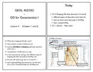
Geol 588 - GIS for Geoscientists II
Geol 588 - GIS for Geoscientists II
Geol 588 - GIS for Geoscientists II
- No tags were found...

Create successful ePaper yourself
Turn your PDF publications into a flip-book with our unique Google optimized e-Paper software.
Using surfaces in Arc<strong>GIS</strong> Spatial AnalystHillshade (typically assemi transparentoverlay)Aspect (8 different directions only)Contour (lines)Slope (degrees or percent, mayneed elevation conversion factorif elev. is in feet)Curvature (change of slope i.e.change of change of elevation)4
Digital Elevation Model(DEM)• Digital Terrain Model (DTM)• topography: Elevation (ft. or meter, sometimes: elevation infeet, horizontal distances in meters!)• US <strong>Geol</strong>ogical Survey:• 7.5’ maps (quads), 10 m, 30 m; 90 m• National Elevation Dataset (NED): 10 m• Shuttle Radar Topography Mission (SRTM): 90 m• raster values: large integers (1243 ft) or float (543.2 m)5
Slope & Azimuth6
Slope• Based on elevation difference of cellto elevation of surrounding cells• Gradient at cell (center)• Problem: if X/Y are in meters, elevation (Z) is in feet• Solution: multiply elevation by 3.280 (Z-factor)• Spatial Analyst -> Surface Analysis or ArcToolbox -Spatial Analyst tools (not TIN slope!)• geol<strong>588</strong>\data\mgisdata\BlackHills\rasters\dem27
Aspect• direction of cell center, whenlooking down towards max. (!) slope• in degrees (0 - 360) from North, circular data type• flat areas (i.e., no slope): encoded as -1• Problem: How to effectively convey direction?• Looks like “3D” slopes (similar to hill shading)• Spatial Analyst - Surface Analysis, ArctoolBox -Spatial Analysis Tools(!)- Aspect9
Hillshading• Trick to fool our eyes to see 3D relief•Simulate Sun from direction (0-360) and angle(0-90), creates grey scale map (0-255)• Gotcha: Sun must be in the North (270 - 90),otherwise relief looks inverted (humanevolution: sun from above)• 10-50% transparent, drape over DEM•graphical only(Symbolization) - less options,not as good?• Spatial Analyst - Surface Analysis, ArctoolBox -Spatial Analysis Tools(!)10
Viewshed• needs a shapefile with points(Sturgis -summits)• Which cells can be seen fromthese points?• Shoots rays from point to each cell, check <strong>for</strong> intersect withterrain• Can be more complex - add more data to points: height,view angle, distance (more next lab)• Observer points tool: which points can see other points?•Spatial Analyst - Surface Analysis, ArctoolBox - SpatialAnalysis Tools(!)11
HW 1 questions? Help?12