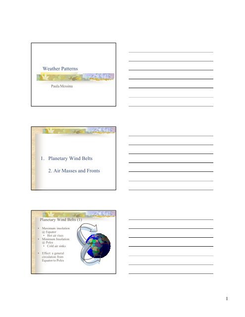
Weather Patterns 1. Planetary Wind Belts 2. Air Masses and Fronts
Weather Patterns 1. Planetary Wind Belts 2. Air Masses and Fronts
Weather Patterns 1. Planetary Wind Belts 2. Air Masses and Fronts
- No tags were found...

Create successful ePaper yourself
Turn your PDF publications into a flip-book with our unique Google optimized e-Paper software.
<strong>Weather</strong> <strong>Patterns</strong>Paula Messina<strong>1.</strong> <strong>Planetary</strong> <strong>Wind</strong> <strong>Belts</strong><strong>2.</strong> <strong>Air</strong> <strong>Masses</strong> <strong>and</strong> <strong>Fronts</strong><strong>Planetary</strong> <strong>Wind</strong> <strong>Belts</strong> (1)• Maximum insolation@ Equator• Hot air rises• Minimum Insolation@ Poles• Cold air sinks• Effect: a generalcirculation fromEquator to Poles1
<strong>Planetary</strong> <strong>Wind</strong> <strong>Belts</strong> (2)• Where air rises, itexp<strong>and</strong>s, it coolsdown, it producesclouds• The Equator,therefore, is a zone ofLOW PRESSURE• (Low pressure isassociated withclouds/rain, hightemperatures)<strong>Planetary</strong> <strong>Wind</strong> <strong>Belts</strong> (3)• Where air sinks, itbecomes compressed.• Any liquid water in itevaporates, causing theair to be very dry.• The Poles, therefore, arezones of HIGHPRESSURE• (High pressure is associatedwith cold, dry air)<strong>Planetary</strong> <strong>Wind</strong> <strong>Belts</strong> (4)• <strong>Air</strong> rising at theEquator also sinksat latitudes of 30 o N<strong>and</strong> 30 o S.90 o N• Therefore, inaddition to thePoles, there are highpressure zones ofsinking air found at30 o N <strong>and</strong> 30 o S.90 o S30 o N30 o S2
<strong>Planetary</strong> <strong>Wind</strong> <strong>Belts</strong> (5)• <strong>Air</strong> rises also atlatitudes of of60 o N <strong>and</strong> 60 o S.• Therefore, inaddition to theEquator, thereare low pressurezones of risingair found at60 o N <strong>and</strong> 60 o S.60 o N0 o60 o S<strong>Planetary</strong> <strong>Wind</strong>s (6)• So, Earth isdivided intozones, each 30 oof latitude thick,of alternatinghigh <strong>and</strong> lowpressure90 o N90 o S60 o N30 o N0 o30 o S60 o S<strong>Planetary</strong> <strong>Wind</strong>s (7)• Remember thatair moves fromareas of highpressure to areasof low pressure!90 o N60 o N30 o N0 o30 o S60 o S90 o S3
<strong>Planetary</strong> <strong>Wind</strong>s (8)• Remember theCoriolis Effect!• <strong>Air</strong> is deflected tothe right in theNorthernHemispehere, <strong>and</strong> isdeflected to the leftin the SouthernHemisphere!90 o N90 o S60 o N30 o N0 o30 o S60 o S<strong>Planetary</strong> <strong>Wind</strong> <strong>Belts</strong> (9)• <strong>Planetary</strong> <strong>Wind</strong> <strong>Belts</strong>• Polar easterlies• Prevailingwesterlies• Tradewinds• Zones of Convergence(<strong>and</strong> Low Pressure)• 0 o , 60 o N, 60 o S• Zones of Divergence(<strong>and</strong> High Pressure)• 30 o N, 90 o N, 30 o S, 90 o S<strong>Planetary</strong> <strong>Wind</strong> <strong>Belts</strong> (10)• So, in the US, weather patterns migrate across thecountry generally from southwest to northeastHHH1004 mb1008 mb1012 mb1016 mb1020 mb4
Part 2: <strong>Air</strong> <strong>Masses</strong> <strong>and</strong> <strong>Fronts</strong>What is an <strong>Air</strong> Mass?• An air mass is a large quantity of air that has thetemperature & humidity characteristics of thearea over which it formed.Cool <strong>and</strong>moistCool <strong>and</strong>dryWarm<strong>and</strong> dryWarm<strong>and</strong> moist<strong>Air</strong> Mass Nomenclature• mP=maritime Polar • cT=continental Tropical• cP=continental Polar • mT=maritime TropicalmPcPcTmT5
Cold <strong>Fronts</strong> (2)mPcT• Cold air wedges its way under warm air(because cold air is denser)• This causes the warm air to riseCold frontCold <strong>Fronts</strong> (3)• When air rises, it exp<strong>and</strong>s• When air exp<strong>and</strong>s, it cools downmPcT• When it cools to its dewpoint, clouds formCold frontCold <strong>Fronts</strong> (4)mPcT• Cold fronts are associated with thick (“cumuloform”)clouds, forming from rapidly rising air• Cold fronts produce heavy precipitation for shortperiods of time• Lightning is possibleCold front7
Warm <strong>Fronts</strong> (1)• When a warm air mass bumps into a cold airmass, a warm front forms at the boundary.cTcPWarm <strong>Fronts</strong> (2)cTcP• In cross section, this is what a warm frontlooks like:Warm frontWarm <strong>Fronts</strong> (3)• Since the cold air mass is denser, it stays close tothe ground.• The warm air mass gently slides over the cold airmass• So air is rising, but not significantly, as in thecase of a cold frontcTcPWarm front8
Warm <strong>Fronts</strong> (4)• The clouds that form are relatively flat(“stratiform”) clouds• Stratiform clouds are associated with lightrain or drizzle, for long periods of time.cTcPWarm frontCold <strong>Fronts</strong> vs. Warm <strong>Fronts</strong>• Cold fronts tend to move rapidly, so heavyprecipitation or showers last for shortbursts of time• Warm fronts move more slowly—<strong>and</strong> theirboundaries span more miles—so light rainmay persist for several days.Occluded <strong>Fronts</strong> (1)mPcTcP• A warm air mass may get “s<strong>and</strong>wichedbetween” two cold air masses9
mPcTcPOccluded <strong>Fronts</strong> (2)• Two cold air masses force a warm air mass totallyoff the groundOccludedfrontmPcTcPOccluded <strong>Fronts</strong> (3)• Clouds <strong>and</strong> precipitation are similar to those of awarm front, <strong>and</strong> a cold front in successionOccludedfrontStationary Front• A stationary front may be any type of front(cold, warm, or occluded) where the airmasses stop moving• Since the front does not move, precipitationmay persist for a long period of time.10
<strong>Weather</strong> Map Symbology (1)mPcTcTcP• Cold front (west); warm front (east)<strong>Weather</strong> Map Symbology (2)mPmPcT• Occluded front (west); stationary front (east)11