ClimateThe different parts of Hispaniola see major variationsin annual rainfall as a result of topography,prevailing winds, <strong>and</strong> the sporadic nature oftropical storms <strong>and</strong> hurricanes. The wettest areasare the peaks of the highl<strong>and</strong>s along the southerncoast, where rainfall can exceed 4000 mm,whilst the driest areas are in the northwest, whererainfall can drop to 350 mm per annum. All partsof Hispaniola experience a drier season fromDecember to April.At the national level, year round average temperaturesare 25° C for <strong>Haiti</strong> <strong>and</strong> 26.2° C for the<strong>Dominican</strong> <strong>Republic</strong>. Temperature variations arelinked to the seasons but also to the extent of cloud<strong>and</strong> altitude: the hottest regions are the dry plainsnear sea level where temperatures commonlyexceed 35° C <strong>and</strong> the coldest regions are thewet mountain peaks where temperatures rarelyexceed 20° C <strong>and</strong> can drop to 10° C degrees orlower.Climate Change<strong>Haiti</strong> has recently ranked 6 th at the 2012 ClimateRisk Index developed by the research institute Germanwatch.83 This indicator analyzes the impactsof extreme weather events of the last 20 years<strong>and</strong> identified <strong>Haiti</strong> as one of the most affectedcountries in the world. The <strong>Dominican</strong> <strong>Republic</strong>also ranks high on the same risk index, being oneof six Caribbean countries in the world’s top 40climate “hot spots”. 84 With a possible increase inthe frequency <strong>and</strong> severity of storms <strong>and</strong> adecrease in average rainfall 85 , the impacts ofchanging global <strong>and</strong> regional weather patternsis likely to further increase the vulnerability of theisl<strong>and</strong> to extreme weather events.Climate change projections for <strong>Haiti</strong> <strong>and</strong> the<strong>Dominican</strong> <strong>Republic</strong> are very similar. Both countriesanticipate increased average temperatures ofapproximately 0.7-1.0° C by 2030 <strong>and</strong> continuedincreases thereafter. 86, 87 Both countries also anticipatesignificant reductions in rainfall: up to 11% by2030 <strong>and</strong> 23% by 2050. 88, 89 Projections, however,vary greatly, highlighting the high level of uncertaintyin respect to the effects of climate changeon the isl<strong>and</strong>. The combination of increasedtemperature <strong>and</strong> decreased rainfall may well leadto water deficits <strong>and</strong> greatly reduced runoff/streamflows in both countries. 90More interesting, however, are changes that havealready taken place. In <strong>Haiti</strong>, <strong>UNEP</strong> field enquirieshave recorded significant anecdotal evidencefrom farmers of increased rainfall variability <strong>and</strong>later starting dates for the wet season. This issupported by studies showing that <strong>Haiti</strong>’s averagemonthly rainfall volumes have considerablydecreased <strong>and</strong> its patterns changed betweenthe beginning of the 20 th century <strong>and</strong> that of the21 st century. 91, 92 Data from 1900-1930, 1930-1960,1960-1990, had similar rainfall patterns. The threeperiods were characterized by two peaks, onebetween March-May <strong>and</strong> another betweenAugust-October. 93 These numbers contrast withthose of the 1990-2009 period. During this period,rainfall patterns have significantly changed,showing only one yearly peak in the month ofSeptember. Average monthly rainfall is the lowestcompared to the three previous 30-year periodsat 106 mm, <strong>and</strong> yearly average rainfall during thisperiod is the lowest at 1269 mm. The 1990-2009period has experienced a decrease in averageyearly rainfall of 368 mm compared to the precedingperiod. The 1990-2009 period has also seenthe most extreme rainfall variability, presentingboth the lowest (8.9 mm) <strong>and</strong> the highest (478 mm)monthly rainfall averages amongst all four 30-yearperiods analyzed.The <strong>Dominican</strong> <strong>Republic</strong> has experienced similarrainfall patterns as <strong>Haiti</strong>. Its yearly peaks havechanged from two a year, around March-May<strong>and</strong> August-October, to only one in the monthof September. 94 Even when the 1930-1960 periodexperienced lower average monthly <strong>and</strong> yearlyrainfall, the 1990-2009 period experienced themost extreme monthly rainfall volumes amongstthe four 30-year periods compared, with a low of13 mm <strong>and</strong> a high of 471 mm. 95 The 1990-2009period experienced a decrease in average yearlyrainfall of 275 mm compared to the 1960-1990period.Temperature patterns in <strong>Haiti</strong> also seem to havechanged throughout the course of the 20 thcentury <strong>and</strong> into the 21 st century. <strong>Haiti</strong>’s averagemonthly temperatures have gradually increasedthroughout the four periods mentioned. The 1900-1930 <strong>and</strong> 1930-1960 time periods had an averagetemperature of 24.3° C. For the 1960-1990 period,average temperatures increased by 1° C to anaverage temperature of 25.3° C, <strong>and</strong> increased24 <strong>Haiti</strong> <strong>–</strong> <strong>Dominican</strong> <strong>Republic</strong>: Environmental challenges in the border zone
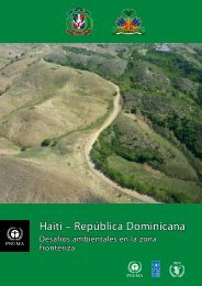
once again for the 1990-2009 period to an annualaverage temperature of 25.4°C. 96The <strong>Dominican</strong> <strong>Republic</strong> has experiencedsimilar temperature patterns as <strong>Haiti</strong>. Averagetemperatures in the <strong>Dominican</strong> <strong>Republic</strong> haveincreased by around 1.2° C from the 1930-1960to the 1960-1990 time period. Between the1960-1990 <strong>and</strong> 1990-2009 time periods, however,temperatures decreased by 0.3° C to a yearlyaverage of 24.7° C. 97In summary, climate change for Hispaniola isexpected to result in an overall drier <strong>and</strong> hotterclimate, with more severe dry seasons with lowerstream flows, <strong>and</strong> exacerbating existing health,social <strong>and</strong> economic challenges.HydrologyThe majority of the rivers in the mountainous regionsof Hispaniola are short <strong>and</strong> steep. This means thatwater flow rates at any particular time are governedmainly by recent rainfall (days to hours) rather thanannual rainfall. Flash floods can occur in a matterof hours <strong>and</strong> the same rivers can run almost dryfor two months in the dry season. Flow variations of100 times or more are not uncommon. The levelof responsiveness reduces with increasing size, thelarger rivers with large catchments are much morestable than the smaller rivers.At the national level <strong>Haiti</strong> has substantial fresh waterresources, divided between 30 main watersheds. 98However it also has national scale, chronic waterproblems including degraded catchments, waterscarcity, flooding <strong>and</strong> bacterial contamination ofwater sources.The different Departments of <strong>Haiti</strong> see major variationsin annual rainfall as a result of topography,prevailing winds <strong>and</strong> the sporadic nature of tropicalstorms <strong>and</strong> hurricanes. The wettest areas are thepeaks of the highl<strong>and</strong>s along the southern coast,where rainfall can exceed 4000 mm, while thedriest areas are in the northwest Departments,where rainfall can drop to 350 mm per annum.All parts of the country experience a drier seasonfrom December to April.The Pedernales river, that forms the border in the southern part of the isl<strong>and</strong>, has a low water flow duringlarge parts of the year <strong>and</strong> is easy cross on foot. The water flow can, however, increase dramatically withinhours as a result of heavy rains falling in the mountains a couple of kilometers from the low lying coastalareas.© <strong>UNEP</strong><strong>Haiti</strong> <strong>–</strong> <strong>Dominican</strong> <strong>Republic</strong>: Environmental challenges in the border zone25
- Page 1: Haiti - Dominican RepublicEnvironme
- Page 7 and 8: We congratulate all those who contr
- Page 9: countries. These issues include the
- Page 13: The differing levels of tree cover
- Page 16 and 17: A member of the assessment team col
- Page 18 and 19: Members of the assessment team inte
- Page 20 and 21: Consultation workshops were held in
- Page 22 and 23: Table 1. Key facts and statistics f
- Page 24 and 25: wandering over depleted fields and
- Page 28 and 29: Natural river flow variability due
- Page 30 and 31: EarthquakesHispaniola is located on
- Page 32: consumption and production culture
- Page 36 and 37: Map 6. The northern coast and the M
- Page 39 and 40: Map 8. The area surrounding the lak
- Page 41 and 42: although it is estimated to be much
- Page 43 and 44: Figure 3. Seasonality of food insec
- Page 45 and 46: e sold for a profit on the other si
- Page 47 and 48: viCase study 2. Comité Intermunici
- Page 49 and 50: Part 2 Identification andAnalysis o
- Page 51 and 52: and local issues. These include, fo
- Page 53: Lacking productive topsoil this lan
- Page 56 and 57: 5 Forest resources andterrestrial p
- Page 58 and 59: Satellite image 3. In the Massacre
- Page 60 and 61: un the risk of being either impriso
- Page 62 and 63: eing transported from the Dominican
- Page 64 and 65: 5.5 Collection of fuel woodFuel woo
- Page 66 and 67: !^5.6 Protected area management and
- Page 68 and 69: locations is contrasted with a degr
- Page 70 and 71: Enough is known, however, to be cer
- Page 72 and 73: plantations that the habitat will n
- Page 74 and 75: Satellite image 6. Just before reac
- Page 76 and 77:
interventions if well designed do w
- Page 78 and 79:
contaminated rivers are disease vec
- Page 80 and 81:
crust substantial enough to be the
- Page 82 and 83:
7 Coastal and marineresources7.1 In
- Page 84 and 85:
tuna, sea bream, yellowtail, hake,
- Page 86 and 87:
Mangroves are being cut to be sold
- Page 88 and 89:
Case study 6. Cooperation between f
- Page 90 and 91:
private sector better informed. Cus
- Page 92 and 93:
carrying money, and missing their d
- Page 94 and 95:
etween these two cordilleras), but
- Page 96:
Mineral exploration is starting in
- Page 99 and 100:
assessment team are all small scale
- Page 101 and 102:
Extreme poverty is a key driving fo
- Page 103 and 104:
it is present. The Haitian populati
- Page 105 and 106:
Atlantic storms will double in the
- Page 107 and 108:
A charcoal kiln burning inside the
- Page 109 and 110:
Table 5. Summary of the key recomme
- Page 111 and 112:
Ten recommendations are provided un
- Page 113 and 114:
oth environmentally damaging and li
- Page 115 and 116:
Improving cooperation and governanc
- Page 117 and 118:
f. Create and formalize fishing agr
- Page 119 and 120:
g. In the long term, aim for variou
- Page 121 and 122:
Haiti - Dominican Republic: Environ
- Page 123 and 124:
Annex I - Report terminologyArgumen
- Page 125 and 126:
Annex II - List of Acronyms and Abb
- Page 127 and 128:
Annex IV - Table connecting thereco
- Page 129 and 130:
23. United States Census Bureau. (2
- Page 131 and 132:
73. UN Development Programme - Haï
- Page 133 and 134:
117. Urban Design Lab, Columbia Uni
- Page 135 and 136:
161. Miniel, L. (2012, 20 April). I
- Page 137 and 138:
204. Peralta, C. (2012, 18 April).
- Page 139 and 140:
246. González Sánchez, F.F. (2012
- Page 141 and 142:
290. Laboratoire des Relations Hait
- Page 143 and 144:
Annex VI - AcknowledgementsContribu
- Page 145 and 146:
Claude PhanorMartin RapillyAdelita
- Page 147 and 148:
José Cristino CastilloRobert Crowl
- Page 149 and 150:
www.unep.org/disastersandconflicts