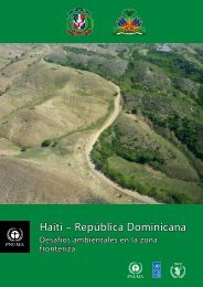
w<strong>and</strong>ering over depleted fields <strong>and</strong> unprotectedslopes.The consequences of this progressive disappearanceof <strong>Haiti</strong>an forests are dramatic. <strong>Haiti</strong> is veryvulnerable to water erosion because it is a mountainouscountry: two-thirds of rural areas containslopes of an angle of more than 20 degrees. 72Deforestation increases this vulnerability to erosion,<strong>and</strong> large amounts of the nation’s topsoil havebeen washed into the ocean. 73 This reduction insoil volume <strong>and</strong> vegetation cover has reducedthe infiltration capacity of the river catchments, somore water runs off quickly rather than sinking intothe soil <strong>and</strong> subsoil. As a result the country is morevulnerable to extreme events such as flooding <strong>and</strong>the rapid depletion of rivers in dry periods, whichin turn reduce the amount of crops <strong>and</strong> transformfarml<strong>and</strong> into wastel<strong>and</strong>. 74The coastal <strong>and</strong> marine shore environment of <strong>Haiti</strong>is also severely damaged. Inshore waters havebeen overfished <strong>and</strong> polluted by sewage, largenumbers of mangrove trees have been cut, <strong>and</strong>coral reefs have been badly damaged <strong>and</strong> insome places destroyed entirely. 75Urban environmental issues, such as solid wastemanagement, are highly visible <strong>and</strong> problematic.There are no sewage networks in any <strong>Haiti</strong>an urbancentres <strong>and</strong> the rivers <strong>and</strong> gullies are used as bothlatrines <strong>and</strong> waste disposal sites. Rivers are usedfor bathing, washing clothes <strong>and</strong> sometimes fordrinking water <strong>and</strong> so are vectors for disease ingeneral, <strong>and</strong> cholera in particular.The population as a whole is becoming moreaware of the environmental crisis, <strong>and</strong> underst<strong>and</strong>sits root causes well, <strong>and</strong> there has been substantialinternational investment in environmental rehabilitation.Nevertheless, underdevelopment, instability,<strong>and</strong> the absence of political will, have combinedto thwart an effective <strong>and</strong> durable response tothat crisis.<strong>Dominican</strong> <strong>Republic</strong>The <strong>Dominican</strong> <strong>Republic</strong> is in much better conditionenvironmentally than <strong>Haiti</strong>. The expansionof agricultural plantations <strong>and</strong> an increase incharcoal production have reduced the forestcover from about 75% of the overall territory in1922 76 to 12% in the early 1980s. Today, however,it reaches about 40% 77 <strong>and</strong> that recent increaseis due to three main factors:• Large-scale reforestation programmes (e.g.Plan Nacional Quisqueya Verde)• The conversion from charcoal <strong>and</strong> wooddependency to gas for cooking• The effective enforcement of laws <strong>and</strong>regulationsRecent surveys show that the forest cover iscontinuing to increase throughout the country,but that the increase is slower in the border zonethan it is in the rest of the country. 78 The maincause of deforestation in the border zone is still theillegal production of charcoal. Deforestation has,however, been halted in this part of the country,largely due to the strict enforcement of laws, <strong>and</strong>an increased awareness in local communities of79, 80the damage done by the charcoal trade.Even though most of the country is vulnerable toflooding, access to water is often scarce in the<strong>Dominican</strong> <strong>Republic</strong>. Uncontrolled development,above all in urban areas <strong>and</strong> at tourist destinations,has seriously threatened the water supply. In someareas the groundwater has been so depleted <strong>and</strong>contaminated by seawater that desalinizationplants have been installed. Another source ofcontamination is the <strong>Dominican</strong> <strong>Republic</strong>’s poorlyregulated industrial sector, which has boomed overthe last four decades.The coastline is also threatened in certain areas.Beaches are eroding <strong>and</strong> the flow of erodedsoil sediment into the sea damages coral reefs.Bearing in mind the importance of tourism as oneof the most important sectors of the <strong>Dominican</strong>economy, these are critical national issues.2.3 Geography, Geology, Climate,HydrologyThe geography of HispaniolaThe isl<strong>and</strong> of Hispaniola has a surface area of76,420 km² <strong>and</strong> is the second largest isl<strong>and</strong> in theCaribbean Sea. Located between the latitudesof 20 <strong>and</strong> 17 degrees north, the isl<strong>and</strong> is highlymountainous, with four major mountain rangesrunning generally west-northwest to east-southeast.The mountains are commonly steep <strong>and</strong> the22 <strong>Haiti</strong> <strong>–</strong> <strong>Dominican</strong> <strong>Republic</strong>: Environmental challenges in the border zone
highest peaks in <strong>Haiti</strong> <strong>and</strong> the <strong>Dominican</strong> <strong>Republic</strong>are at 2680 <strong>and</strong> 3098 metres above sea levelrespectively.One critical difference between the two countriesis that the <strong>Dominican</strong> <strong>Republic</strong> has much moreflat <strong>and</strong> gently sloping l<strong>and</strong> than <strong>Haiti</strong>. In <strong>Haiti</strong> theplains at the base of the mountains are generallyrelatively small. In comparison, the eastern<strong>and</strong> northern half of the <strong>Dominican</strong> <strong>Republic</strong> isdominated by relatively flat l<strong>and</strong> that is suitablefor agriculture. All major cities in both countriesare found either on the coast or on the flat alluvialplains.The original l<strong>and</strong> cover in both countries was subtropicalforest with some wetl<strong>and</strong>s. However, morethan four centuries of agricultural l<strong>and</strong> clearinghave seen this forest cover reduced dramatically.The deforestation rate has been much more severeon the <strong>Haiti</strong>an side, where a mere 3.7 per cent offorest cover remains (FAO classification system).The same metric for the <strong>Dominican</strong> <strong>Republic</strong> isapproximately 40 per cent. 81 Mangrove forestsalso remain along the shores but are generallyreducing in extent.Geology <strong>and</strong> soilsThe surface of Hispaniola is composed mainly ofmarine sediments, with sparse outcrops of oldermetamorphic rocks. The marine sediments aregenerally very rich in limestone, <strong>and</strong> light in appearance,hence the pale hue of much exposedground in both countries.The soils of Hispaniola reflect the geology <strong>and</strong>topography: soils were originally generally thin <strong>and</strong>limestone rich in the steeper hills <strong>and</strong> deeper <strong>and</strong>better quality in the alluvial plains. Only a minority ofthe mountainous regions with metamorphic geologyhave originally deep <strong>and</strong>/or good quality soils,although all regions in <strong>Haiti</strong> are now badly affectedby soil erosion <strong>and</strong> thin soil cover is the norm. 82 Soildepletion <strong>and</strong> erosion is also a significant issue inthe <strong>Dominican</strong> <strong>Republic</strong>, although not to the sameextent as in <strong>Haiti</strong>.The climate on Hispaniola is as diverse as its topography: there are great variations in both temperature <strong>and</strong>rainfall because the isl<strong>and</strong> consists of low-lying areas separated by mountain ranges that rise as high as3000 meters.© <strong>UNEP</strong><strong>Haiti</strong> <strong>–</strong> <strong>Dominican</strong> <strong>Republic</strong>: Environmental challenges in the border zone23
- Page 1: Haiti - Dominican RepublicEnvironme
- Page 7 and 8: We congratulate all those who contr
- Page 9: countries. These issues include the
- Page 13: The differing levels of tree cover
- Page 16 and 17: A member of the assessment team col
- Page 18 and 19: Members of the assessment team inte
- Page 20 and 21: Consultation workshops were held in
- Page 22 and 23: Table 1. Key facts and statistics f
- Page 26 and 27: ClimateThe different parts of Hispa
- Page 28 and 29: Natural river flow variability due
- Page 30 and 31: EarthquakesHispaniola is located on
- Page 32: consumption and production culture
- Page 36 and 37: Map 6. The northern coast and the M
- Page 39 and 40: Map 8. The area surrounding the lak
- Page 41 and 42: although it is estimated to be much
- Page 43 and 44: Figure 3. Seasonality of food insec
- Page 45 and 46: e sold for a profit on the other si
- Page 47 and 48: viCase study 2. Comité Intermunici
- Page 49 and 50: Part 2 Identification andAnalysis o
- Page 51 and 52: and local issues. These include, fo
- Page 53: Lacking productive topsoil this lan
- Page 56 and 57: 5 Forest resources andterrestrial p
- Page 58 and 59: Satellite image 3. In the Massacre
- Page 60 and 61: un the risk of being either impriso
- Page 62 and 63: eing transported from the Dominican
- Page 64 and 65: 5.5 Collection of fuel woodFuel woo
- Page 66 and 67: !^5.6 Protected area management and
- Page 68 and 69: locations is contrasted with a degr
- Page 70 and 71: Enough is known, however, to be cer
- Page 72 and 73: plantations that the habitat will n
- Page 74 and 75:
Satellite image 6. Just before reac
- Page 76 and 77:
interventions if well designed do w
- Page 78 and 79:
contaminated rivers are disease vec
- Page 80 and 81:
crust substantial enough to be the
- Page 82 and 83:
7 Coastal and marineresources7.1 In
- Page 84 and 85:
tuna, sea bream, yellowtail, hake,
- Page 86 and 87:
Mangroves are being cut to be sold
- Page 88 and 89:
Case study 6. Cooperation between f
- Page 90 and 91:
private sector better informed. Cus
- Page 92 and 93:
carrying money, and missing their d
- Page 94 and 95:
etween these two cordilleras), but
- Page 96:
Mineral exploration is starting in
- Page 99 and 100:
assessment team are all small scale
- Page 101 and 102:
Extreme poverty is a key driving fo
- Page 103 and 104:
it is present. The Haitian populati
- Page 105 and 106:
Atlantic storms will double in the
- Page 107 and 108:
A charcoal kiln burning inside the
- Page 109 and 110:
Table 5. Summary of the key recomme
- Page 111 and 112:
Ten recommendations are provided un
- Page 113 and 114:
oth environmentally damaging and li
- Page 115 and 116:
Improving cooperation and governanc
- Page 117 and 118:
f. Create and formalize fishing agr
- Page 119 and 120:
g. In the long term, aim for variou
- Page 121 and 122:
Haiti - Dominican Republic: Environ
- Page 123 and 124:
Annex I - Report terminologyArgumen
- Page 125 and 126:
Annex II - List of Acronyms and Abb
- Page 127 and 128:
Annex IV - Table connecting thereco
- Page 129 and 130:
23. United States Census Bureau. (2
- Page 131 and 132:
73. UN Development Programme - Haï
- Page 133 and 134:
117. Urban Design Lab, Columbia Uni
- Page 135 and 136:
161. Miniel, L. (2012, 20 April). I
- Page 137 and 138:
204. Peralta, C. (2012, 18 April).
- Page 139 and 140:
246. González Sánchez, F.F. (2012
- Page 141 and 142:
290. Laboratoire des Relations Hait
- Page 143 and 144:
Annex VI - AcknowledgementsContribu
- Page 145 and 146:
Claude PhanorMartin RapillyAdelita
- Page 147 and 148:
José Cristino CastilloRobert Crowl
- Page 149 and 150:
www.unep.org/disastersandconflicts