International Surveying Research Journal - RISM
International Surveying Research Journal - RISM
International Surveying Research Journal - RISM

Create successful ePaper yourself
Turn your PDF publications into a flip-book with our unique Google optimized e-Paper software.
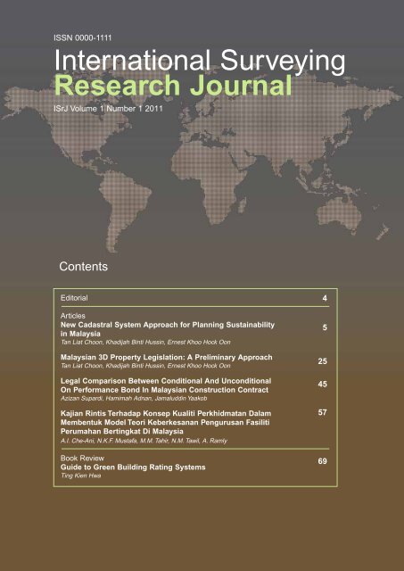
ISSN 0000-1111<br />
<strong>International</strong> <strong>Surveying</strong><br />
<strong>Research</strong> <strong>Journal</strong><br />
ISrJ Volume 1 Number 1 2011<br />
Contents<br />
Editorial<br />
Articles<br />
New Cadastral System Approach for Planning Sustainability<br />
in Malaysia<br />
Tan Liat Choon, Khadijah Binti Hussin, Ernest Khoo Hock Oon<br />
Malaysian 3D Property Legislation: A Preliminary Approach<br />
Tan Liat Choon, Khadijah Binti Hussin, Ernest Khoo Hock Oon<br />
Legal Comparison Between Conditional And Unconditional<br />
On Performance Bond In Malaysian Construction Contract<br />
Azizan Supardi, Hamimah Adnan, Jamaluddin Yaakob<br />
Kajian Rintis Terhadap Konsep Kualiti Perkhidmatan Dalam<br />
Membentuk Model Teori Keberkesanan Pengurusan Fasiliti<br />
Perumahan Bertingkat Di Malaysia<br />
A.I. Che-Ani, N.K.F. Mustafa, M.M. Tahir, N.M. Tawil, A. Ramly<br />
Book Review<br />
Guide to Green Building Rating Systems<br />
Ting Kien Hwa<br />
4<br />
5<br />
25<br />
45<br />
57<br />
69
<strong>Journal</strong> Objectives<br />
<strong>International</strong> <strong>Surveying</strong> <strong>Research</strong> <strong>Journal</strong> (ISrJ)<br />
is an international journal dedicated to the publication<br />
of theoretical and empirical refereed articles,<br />
case studies or critical literature surveys in the field<br />
of surveying research and policy. The scope of the<br />
journal is international in two aspects: it presents to<br />
a worldwide readership a view of the surveying practices<br />
of particular countries, and it encourages<br />
Editorial Board<br />
Editor<br />
Assoc. Prof. Sr Dr. Ting Kien Hwa<br />
Universiti Teknologi MARA, Shah Alam, Malaysia<br />
Sub-editors<br />
Assoc. Prof. Sr Dr. Juazer Rizal Abdul Hamid<br />
Universiti Teknologi MARA, Shah Alam, Malaysia<br />
Assoc. Prof. Sr Dr. Fadzil@Padzil Hassan<br />
Universiti Teknologi MARA, Shah Alam, Malaysia<br />
Sr Dr. Adi Irfan Che Ani<br />
Universiti Kebangsaan Malaysia, Bangi, Malaysia<br />
Members<br />
Prof. Sr Dr. Wan Muhd Aminuddin Wan Hussin<br />
Universiti Sains Malaysia, Penang, Malaysia<br />
Assoc. Prof. Sr Dr. Azman Mohd Suldi<br />
Universiti Teknologi MARA, Shah Alam, Malaysia<br />
Prof. Sr Dr. Hj Abdul Hadi Hj Nawawi<br />
Universiti Teknologi MARA, Shah Alam, Malaysia<br />
Y. Bhg. Dato’ Sr Mani Usilappan<br />
Usilappan Chartered Surveyor, Malaysia<br />
Sr Mazlan Mohd Tahir<br />
Universiti Kebangsaan Malaysia, Bangi, Malaysia<br />
Assoc. Prof. Sr Dr. Ahmad Ezanee Hashim<br />
Universiti Teknologi MARA, Shah Alam, Malaysia<br />
Assoc. Prof. Sr Dr. Hjh Wan Maimun Wan<br />
Abdullah<br />
Universiti Teknologi Malaysia, Malaysia<br />
Publishing Consultant<br />
DeCalais Sdn Bhd<br />
D-3-8 Plaza Damas, 60 Jalan Sri Hartamas 1, Sri Hartamas, 50480, Kuala Lumpur<br />
Tel: +603 6201 8857 Email: deepa@decalais.com<br />
knowledge sharing among researchers, policy makers<br />
and practitioners.<br />
The purpose of the <strong>International</strong> <strong>Surveying</strong><br />
<strong>Research</strong> <strong>Journal</strong> (ISrJ) serves to provide a forum<br />
for discussion and research to keep abreast of the<br />
new technologies developments and to stimulate<br />
research in the various surveying disciplines.<br />
<strong>International</strong> Advisory Board<br />
Prof. Low Sui Pheng<br />
National University of Singapore, Singapore<br />
Prof. Ghasan Aouad<br />
University of Salford, United Kingdom<br />
Prof. Dr.-Ing. Volker Coors<br />
Stuttgart - University of Applied Sciences, German<br />
Prof. Graeme Newell<br />
University of Western Sydney, Australia<br />
Prof. Chris Eves<br />
Queensland University of Technology, Australia
ISSN 0000-1111<br />
<strong>International</strong> <strong>Surveying</strong><br />
<strong>Research</strong> <strong>Journal</strong><br />
ISrJ Volume 1 Number 1 2011<br />
Contents<br />
Editorial<br />
Articles<br />
New Cadastral System Approach for Planning Sustainability<br />
in Malaysia<br />
Tan Liat Choon, Khadijah Binti Hussin, Ernest Khoo Hock Oon<br />
Malaysian 3D Property Legislation: A Preliminary Approach<br />
Tan Liat Choon, Khadijah Binti Hussin, Ernest Khoo Hock Oon<br />
Legal Comparison Between Conditional And Unconditional<br />
On Performance Bond In Malaysian Construction Contract<br />
Azizan Supardi, Hamimah Adnan, Jamaluddin Yaakob<br />
Kajian Rintis Terhadap Konsep Kualiti Perkhidmatan Dalam<br />
Membentuk Model Teori Keberkesanan Pengurusan Fasiliti<br />
Perumahan Bertingkat Di Malaysia<br />
A.I. Che-Ani, N.K.F. Mustafa, M.M. Tahir, N.M. Tawil, A. Ramly<br />
Book Review<br />
Guide to Green Building Rating Systems<br />
Ting Kien Hwa<br />
Copyright © 2011 Royal Institution of Surveyors Malaysia<br />
All rights reserved. No part of this publication may be reproduced in any form without prior written<br />
permission from the Royal Institution of Surveyors Malaysia.<br />
Disclaimer<br />
The views expressed in the papers are those of the authors and do not necessarily reflect the view of<br />
Royal Institution of Surveyors Malaysia.<br />
4<br />
5<br />
25<br />
45<br />
57<br />
69
4 <strong>International</strong> <strong>Surveying</strong> <strong>Research</strong> <strong>Journal</strong> (ISrJ)<br />
Editorial<br />
New research directions are arising at the boundaries and interfaces between surveying disciplines. This new<br />
journal provides the much needed vehicle for rigorous, peer-reviewed communication for the growing surveying<br />
community that strives to bridge these boundaries and create novel scholarship at the confluence of disciplines.<br />
As a journal dedicated to surveying research, the journal aims to provide a platform for the publication of<br />
research from various disciplines of surveying. It is hope that this journal will provide an international outlook<br />
and become an essential part of the intellectual foundation for the growing international research community.<br />
I hope this first issue of <strong>International</strong> <strong>Surveying</strong> <strong>Research</strong> <strong>Journal</strong> (ISrJ) is the springboard for further research<br />
and exploration of various surveying issues in the profession and industry. This journal will provide a forum for<br />
the rigorous exchange of ideas and seek an editorial balance that blends concepts and empirical observations<br />
to advance both the theory and practice of the surveying disciplines.<br />
Associate Professor Sr Dr. Ting Kien Hwa<br />
Editor<br />
Editorial Board
<strong>International</strong> <strong>Surveying</strong> <strong>Research</strong> <strong>Journal</strong> (ISrJ)<br />
VOLUME 1 NUMBER 1, 2011, 5-24<br />
ARTICLE<br />
New Cadastral System Approach for<br />
Planning Sustainability in Malaysia<br />
TAN LIAT CHOON 1 , KHADIJAH BINTI HUSSIN 1 , ERNEST KHOO HOCK OON 2<br />
1 Universiti Teknologi Malaysia<br />
Faculty of Geoinformation Science and Engineering<br />
81310, Skudai, Johor, Malaysia<br />
tanliatchoon@gmail.com, khadijah@utm.my<br />
2 Jurukur Khoo<br />
No. 11-A, Jalan Jaguh 1, Taman Harmoni 2, 81300, Skudai, Johor, Malaysia<br />
khoo1973@yahoo.com<br />
ABSTRACT<br />
This paper present solution for reformulate, further improve and enhance the usefulness of the existing cadastral<br />
system and title registration of multi-layer properties in order to facilitate a modern Malaysian Cadastral<br />
and Land Administration Systems.<br />
A conclusion from the first <strong>International</strong> Workshop on 3D cadastres in Delft was that the concept of property<br />
mainly depends on the national legal system, where each such system has its own instruments for multiple<br />
use of land (Registration of Properties in Strata, 2002). A common definition thus does not seem to exist.<br />
Each researchers dealing with this term choose their own stipulated definition or description. The introduction<br />
of the concept of 3D property establishes a strong link between the real world and legal cadastral entities.<br />
With 3D property, which differs from on surface properties where there must be no gaps or overlaps in<br />
their boundaries, 3D property can be located above or below one another.<br />
In this paper, we are looking into the field 3D property and it rights as well as the categorisation of 3D property<br />
issues relating to rights. Besides that, we also give an introduction into 3D cadastre, the importance of<br />
3D cadastre and the practical solution.<br />
Later, we present the 3D property type in Malaysia with an explanation on the land legislation framework,<br />
cadastral survey and registration in Malaysia. This paper discusses literature on good governance, e-government<br />
and intergovernmental coordination. Furthermore, this paper also includes discussions on the ways<br />
towards 3D property formation and the criteria associated with the establishment of Malaysian 3D cadastre<br />
for 3D property rights and the ways to achieve its implementation.<br />
Keywords: land administration, 3D, legislation, cadastre, property<br />
1. INTRODUCTION<br />
The main purpose of this research was to try to come to the generalised concept of 3D property<br />
rights and to suggest the possibilities of the implementation of this concept into current<br />
cadastral and land law practice in Malaysia as well as to identify possible problems<br />
emerging in this connection and to suggest ways to solve them. In this respect, many legal,<br />
technical and organisational matters should be investigated. This study is forced on the<br />
ISSN 0000-1111 © 2011 Royal Institution of Surveyors Malaysia
6 TAN LIAT CHOON, KHADIJAH BINTI HUSSIN, ERNEST KHOO HOCK OON<br />
legal issues, nevertheless, the overview of technical and organisational issues is provided<br />
for the comprehensive understanding of the problem in question.<br />
In order to achieve the purpose of the study, a number of issues have been considered.<br />
First, the international experience of the development of the new legislation regarding 3D<br />
property formation or alteration of the existing legislation was investigated. Secondly, the<br />
analysis has been carried out of the main problems associated with 3D property formation<br />
and the ways of solving them have been explored. The analysis was based, largely, on the<br />
Swedish experiences.<br />
Next, the ways to represent 3D property in the register have been investigated. The most<br />
important task here is to represent the vertical dimension in a clear and unambiguous way.<br />
It can be done by specifying upper and lower boundaries of the property rights, creating, in<br />
the way of layers of property rights. The limitation with this approach is that these layers<br />
can often be determined only for the objects whose horizontal projection is within the<br />
boundaries are of the ordinary parcel.<br />
2. 3D PROPERTY<br />
Before discuss on what 3D property is, it is important to generally know what real property<br />
or property is about. It is difficult to determine what is really real property or property<br />
(Mattsson, 2003a) because it is not a homogenous and standardised term, and different<br />
authors present different definitions (Paasch, 2004).<br />
When discussing what 3D property rights are, it is necessary to define firstly what 3D property<br />
is. As mentioned by Paulsson in her doctorate thesis about 3D property rights:<br />
It is not always easy to understand what is really meant by 3D property, as the concept<br />
has no simple meaning. There is no clear and unambiguous definition of this<br />
concept, especially since its forms vary in different countries and respective legislation,<br />
each having its own definition.<br />
(Paulsson, 2007: 25)<br />
It is worth to mention that issues of three-dimensional determination of property rights are<br />
becoming more and more important. 3D properties are not something new but they are like<br />
other conventional properties. They can be transferred, mortgaged, expropriated, inherited<br />
and can be created by cadastral procedures as a subdivision, partition and amalgamation.<br />
In my opinion, 3D properties are an extension of the concept of conventional properties,<br />
which posses all of the features pertaining to conventional properties, and can be integrated<br />
in the same legal framework as conventional properties. However, 3D properties have<br />
more advanced features where they are volumes, parts of spaces, while conventional properties<br />
are areas and parts of the earth’s surface. 3D properties can occupy different parts of<br />
space. They can be subdivided into strata that create separate parcels above or under the<br />
original surface parcels.<br />
In the most general sense, a 3D property can be defined as a property delimited both horizontally<br />
and vertically in length, width, height and depth, and sometimes can be defined as<br />
three-dimensionally determined property. Another definition that is more or less neutral<br />
and can be used in most countries is that, a 3D property is a volume that is delimited in<br />
length, width, height and depth. The latter definition is even more suitable as it reflects the<br />
physical nature of 3D property.<br />
2.1 3D Property Rights<br />
The concept, definition and term of 3D property rights vary in different countries and legislation,<br />
each with their own definition. The concept of 3D property rights depends on the<br />
<strong>International</strong> <strong>Surveying</strong> <strong>Research</strong> <strong>Journal</strong> (ISrJ)
New Cadastral System Approach for Planning Sustainability in Malaysia 7<br />
national legal system (Stoter, 2002). According to Paulsson (2007), in order to give a more<br />
exact definition of a 3D property rights, it is therefore necessary to look at the legislations<br />
of different countries that have the possibility of 3D property rights formation.<br />
There are two main types of 3D property rights can be identified when studying this concept.<br />
Firstly, independent 3D property type, also known as public 3D property type is a<br />
model of a sharing nature, intervening in the parties’ ability to share their property units as<br />
they wish, and imposing a certain framework on them, having an inevitable measure of coownership.<br />
Secondly, a condominium type, also known as common type, which is a form of 3D property<br />
rights, is defined by the United Nations Economic Commission for Europe (2002) as<br />
a part of common law jurisdictions that constitutes a special form of ownership giving the<br />
proprietor an absolute title to the property. This type of ownership is just one common way<br />
for people to own properties containing a number of flats or unit.<br />
2.2 Classification of 3D Property Rights<br />
There are different classifications on owning a building or a piece of land in three-dimensional<br />
delimited. Three-dimensional delimited properties can be classified into four types.<br />
They are public rights, common rights, management rights and private rights.<br />
There are three types of 3D property under public rights, namely air space 3D property, 3D<br />
property on the ground surface and subsurface 3D property. The splitting of land into independent<br />
public rights is used in some deed recordation system prevails countries to divide<br />
ownership three-dimensionally (Sandberg, 2001). Sometimes, it is called air rights or air<br />
space rights. In brief, the air space 3D property is not bound to a specific building or construction.<br />
In some legislation, it may contain only a space volume (Paulsson, 2007). One<br />
the other hand, the 3D property on the ground surface may only be created within a building<br />
or construction, the property will cease if the property is damaged.<br />
The other type that is broadly used for 3D property is the use of common rights. Common<br />
terms for this type of 3D property rights for condominium ownership is strata title, this type<br />
of ownership comprising individual ownership of dwellings in one building. It is derived<br />
from the common law (Reshetyuk, 2004) but is used in both civil law and common law<br />
countries, and is called strata title in countries with title registration systems, which are<br />
mostly common law countries (Mytrofanova, 2002). Further, strata titles in most countries<br />
are used for residential purposes, but in some countries, such as Malaysia, they can also be<br />
used for commercial and industrial purposes.<br />
Another way to gain private ownership of an apartment without owning it as property is<br />
through management rights. The characteristic of this management rights is that the formal<br />
owner holds the private rights of occupancy to condominium and stands between the resident<br />
and the property by proprietary leases, gives the rights to use it with shared expenses<br />
(Lilleholt et al., 2002 and Merwe, 1994). Finally, three-dimensional use of land is also<br />
probable through private rights, such as freehold, leasehold and easement. It is often used<br />
for underground transportation or piping purposes.<br />
3. 3D CADASTRE<br />
The multiple use of land is increasing. A person owing a parcel of land also possesses the<br />
rights to the column of air above and the column of soil under that land. At ground level<br />
the multiple use of land has resulted in the multiple exercises of rights of use and use of the<br />
regions above and below ground level in the division of rights in the ownership column<br />
(Barnasconi, 2006).<br />
ISrJ Vol.1 No.1, 2011
8 TAN LIAT CHOON, KHADIJAH BINTI HUSSIN, ERNEST KHOO HOCK OON<br />
Basically, the purpose of 3D cadastre objects modelling as proposed by Stoter (2004) is to<br />
provide boundary certainty of 3D cadastre objects particularly regarding 3D strata and stratum<br />
objects of ownership. As stated by Stoter in the need of a 3D cadastre:<br />
Pressure on land in urban areas and especially their business centers has led to<br />
overlapping and interlocking constructions …. Even when the creation of property<br />
rights to match these developments is available within existing legislation, describing<br />
and depicting them in the cadastral registration, process a challenge …. The<br />
challenge is how to register overlapping and interlocking construction when projected<br />
on the surface in a cadastral registration that register information on 2D<br />
parcels. Although property has been located on top of each other for many years, it<br />
is only recently that the question has been raised on to whether cadastral registration<br />
should be extended into the third dimension….<br />
(Stoter, 2004: 3)<br />
3.1 The Importance of 3D Cadastre<br />
Current cadastre registration systems, bound on ground surface’s topological and geometrically<br />
described parcels, have shown limitations in providing insight in three-dimensional<br />
location of three-dimensional constructions (for instance pipelines, tunnels, building complexes)<br />
and in the vertical dimension (depth and height) of right established for threedimensional<br />
constructions (Stoter and Ploeger, 2002; Stoter and Ploeger, 2003; and Stoter<br />
and Van Oosterom, 2006). In addition, cadastre should be able to describe the overall property<br />
ownership especially in Strata Title ownership.<br />
A 3D cadastre is defined as a cadastre that registers and gives insight into rights and restrictions<br />
not only on parcels, but also on 3D property units (Stoter, 2004). Thus, such conditions,<br />
for example overlapped buildings and utilities that prohibited property to be registered<br />
according to legal and organisational aspects using 2D cadastre could be handled by<br />
3D cadastre.<br />
In the near future, a cadastre will form complete methodical, comprehensive and updated<br />
documentation of public and private rights, ownership, land use and real estate in various<br />
spaces. Concurrently, Benhanu and Doytsher (2001) and Benhanu and Doytsher (2003)<br />
illustrated that the 3D boundaries and parcels in space will be determined by 3D cadastre<br />
and serves the legal and physical objectives. Therefore, a modern cadastre system should<br />
always reflect the existing situation of all property rights, including mixture of private and<br />
public properties. Moreover, this provides a better-rationalised management of the built<br />
environment, including regulations of legality of use or of economic application<br />
(Dimoponlou, Gavanas and Zuntelis, 2006).<br />
3.2 Practical Solution<br />
The vast development today makes an essential increasing demand for three-dimensional<br />
situations to support the volume parcels in real property objects. Therefore, one of the three<br />
fundamental concepts proposed by Stoter (2004) can be used to cater and solve those problems,<br />
which have occurred with some minor modification in order to suit with the cadastral<br />
survey, mapping registration system and land registration system for each respective<br />
country. Three fundamental concepts with several options are as follows:<br />
(a) Full 3D cadastre<br />
(b) 2D/3D hybrid cadastre<br />
(c) 2D cadastre with 3D tags linked to parcels in current cadastral registration.<br />
<strong>International</strong> <strong>Surveying</strong> <strong>Research</strong> <strong>Journal</strong> (ISrJ)
New Cadastral System Approach for Planning Sustainability in Malaysia 9<br />
4. 3D PROPERTY TYPE IN MALAYSIA<br />
4.1 Malaysian Cadastral System<br />
Peninsular Malaysia is a federation of states, each of which is responsible for its own land<br />
matters. All States operate a Torrens system of registration, administered by the State Land<br />
Offices and coordinated by the Department of Land and Mines. On the other hand, cadastral<br />
surveys are controlled by the Department of Survey and Mapping Malaysia that is a<br />
federal department. Department of Survey and Mapping Malaysia is responsible for cadastral<br />
survey work within Peninsular Malaysia but is supported by a growing number of<br />
licensed land surveyors, who are primarily responsible for engineering and subdivision surveys.<br />
Notwithstanding the above, the cadastre in the states of Sabah and Sarawak are<br />
administered by the Department of Land and Surveys. They have the ideal set up of having<br />
land administration and cadastral surveys under the control of a single organisation,<br />
which is a state entity.<br />
The objectives of the Malaysian Cadastral System are to provide security and simplicity to<br />
all dealings with land. It establishes and certifies, under the authority of the government,<br />
the ownership of an indefeasible title to land and simplifies, hastens and reduces the costs<br />
of all land dealings. The title is a conclusive proof that the person mentioned therein is the<br />
owner of the land described therein. Valid titles require an accurate description of boundaries<br />
and as such, cadastral survey plays an important role in the system.<br />
4.2 Malaysian Land Administration<br />
Malaysian Land Administration is traditionally based on Malaysian land law while cadastral<br />
system in Malaysia consists of land registration system and cadastral survey and mapping<br />
registration system that have different structures and authorisations. The land registration<br />
is a state government juridical while cadastral survey and mapping is under federal<br />
jurisdiction. It provides a variety of rights depending on the traditions of the country, but<br />
the legalistic cadastral system and land law are still using plane geometric expression for<br />
land and property tenure. They have not been prepared to register in three-dimensional situations.<br />
Land use rights are one of the rights that are often based on occupation of land over a long<br />
period and can be defined in written law or by traditions (Tan, Khadijah and Ernest Khoo,<br />
2009b). Hence, a systematic record of lands in all matter is very important in the land<br />
administration, planning and development of land. This means that, due to the ever increasing<br />
demand for ground space, the traditional paradigm in law should be changed (Nordin,<br />
2001). In brief, land administration in Malaysia is generally responsible for the collection<br />
of revenue, title registration, managing application for land dealings, changing of condition<br />
of land use, subdivision, partition or amalgamation of land or building and so on.<br />
4.3 Land in Malaysian Legislation<br />
In the Malaysian land registration, the process of recording rights in land is via registration<br />
of title of land. “Land is a state matters”, according to Federal Constitution 1957, land matters<br />
is under the jurisdiction of state government, handled by the respective state Registry<br />
or District Land Office, depending on where the document of title was formerly registered.<br />
Land Ownership as governed by the National Land Code 1965 (Act 56) is based on the<br />
Torrens System (see previous sections). It is protected by the National Land Code 1965<br />
(Act 56) in Section 340 (Registration to confer indefeasible title or interest, except in certain<br />
circumstances) and is guaranteed by the Federal Constitution 1957 as stated under<br />
Article 13 (rights to property). Once an ownership is being registered, the owner’s title and<br />
interest is indefeasible except when it involved fraud or misrepresentation. Furthermore,<br />
ISrJ Vol.1 No.1, 2011
10 TAN LIAT CHOON, KHADIJAH BINTI HUSSIN, ERNEST KHOO HOCK OON<br />
nobody shall be deprived of property unless he or she had been paid an adequate compensation.<br />
Meanwhile, there are three ways to acquire land. Firstly, the land can be acquired through<br />
alienation from the state authority under Section 42 and Sections 76 to 78, National Land<br />
Code 1965 (Act 56), secondly is by dealings and finally through inheritance. State agencies<br />
and the Federal Government are required to go through State Authority to acquire land<br />
in accordance with the Land Acquisition Act 1960 (Act 486) (Land Acquisition Act, 1960).<br />
4.4 Cadastral Survey and Registration in Malaysia<br />
All cadastral survey and registration are performed at the request of the Land Office on the<br />
issue of request for survey. The work of the Land Office is concerned with registration of<br />
title and with land alienation, either for individuals, government agencies, companies or<br />
groups. Meanwhile, the Federal Department of Director General of Lands and Mines<br />
(JKPTG) has a purely advisory role in State land matters staffed by servant administrators.<br />
The objectives of cadastral survey are primarily concerned with the determination of definition<br />
of property boundaries, locations and areas, through their marking and description<br />
on the ground and plans or maps respectively, for the purposes of alienation, subdivision,<br />
partition, amalgamation and conveyancing. The system as practised is one of fixed and<br />
defined boundary whereby parcel definition is by the officially emplaced and mathematically<br />
coordinated boundary marks (Nordin, 2001).<br />
The existing Malaysian cadastral survey and mapping registration system and land registration<br />
system, deals with properties not only located on the surface level, but above the<br />
surface level and also below the surface level. Therefore, the rights of the proprietor of the<br />
surface parcel shall also apply to the proprietor of the above that is air space and underground<br />
land as well (Tan, Khadijah and Ernest Khoo, 2010).<br />
The current Malaysian cadastral registration system does not include three-dimensional<br />
objects registration rights. This type of cadastral system has been practiced in Malaysia for<br />
a period of one hundred years and it provides essential information about land and property<br />
like ownerships of the lots and land parcels for the country. In addition, Cadastral<br />
Database Management System (CDMS) and Computerised Land Registration System<br />
(CLRS), which worked separately in each organisation with different legal aspect, are still<br />
in plane surface nature. Consequently, there are no three-dimensional property rights as<br />
well as 3D cadastral rights. However, these two systems later on can be incorporated in the<br />
registration form with the present advanced and modern technologies such as Geographical<br />
Information System, internet, web based and e-commerce applications.<br />
4.5 Integration of Cadastral Database Management System and Computerised<br />
Land Registration System<br />
There could be extensive benefits if Computerised Land Registration System (CLRS) of<br />
State Land and Mines Office and District Land Office and Cadastral Database Management<br />
System (CDMS) of Department of Survey and Mapping Malaysia, are linked together (Tan<br />
and Khadijah, 2010b). Therefore, with the integration of attribute data from CLRS and spatial<br />
data from CDMS and through identified applications, efficiency of land administration<br />
can be greatly improved. Nordin (2001) stated that the envisaged applications include online<br />
registration for survey and preparation of title, extending Digital Cadastral Database<br />
enquiry module to the land administrators and on the other hand, linking the Qualified Title<br />
information to the Digital Cadastral Database. Although conceptually tenable, the eventual<br />
implementation would need substantial negotiation and compromise among State Land<br />
and Mines Office (PTG) and District Land Office (PTD) and Department of Survey and<br />
<strong>International</strong> <strong>Surveying</strong> <strong>Research</strong> <strong>Journal</strong> (ISrJ)
New Cadastral System Approach for Planning Sustainability in Malaysia 11<br />
Mapping Malaysia (DSMM).<br />
With the vast change in the Information and Communication Technologies (ICT), such as<br />
Geographical Information System, internet and web-based application and together with<br />
the initiative of Malaysian Geospatial Data Infrastructure (MyGDI) National Spatial Data<br />
Infrastructure (NSDI), e-Land of Ministry of Natural Resources and Environment (NRE)<br />
and e-Cadastre of DSMM, CLRS and CDMS database could be integrated electronically.<br />
In order to achieve the goal of comprehensive Land Information System from district level<br />
up to state level and eventually at the national level, the integration of spatial CDMS database<br />
with the textual CLRS database play a preliminary requirement of all these (Tan and<br />
Khadijah, 2010a). Moreover, Mariappan (2005) introduced a mechanism to integrate these<br />
two standalone databases. He suggested that coordination among these authorities can be<br />
provided by the installation of centralised server or distributed server at each of their office<br />
that act as the transporters and bridges in exchanging data between CLRS and CDMS.<br />
4.6 Limitation in Malaysian Land Legislation<br />
The increasing number of land management professionals & licensed land surveyors meant<br />
that current land registration and cadastral systems are insufficient for the booming of complex<br />
high-density developments in urban areas. So, in big cities, there is growing interest<br />
and demand in using space above or below the ground surface for construction of real estate<br />
objects (Hassan, 2008; Hassan, Abdul Rahman and Stoter, 2006; Chong, 2006 and Ossko,<br />
2005). However, the legal changes in the land registries did not follow the growing demand<br />
and there are still constrains, difficulties to register the ownership of properties which is<br />
created above or on the underground surface. Therefore, there is a need of registration of<br />
stratified property on the legal status of properties, so that, to be able to define and manage<br />
the juridical situation accordingly, three-dimensional information are becoming necessary<br />
for land administration in this country.<br />
In land registry, there are difficulties to register the ownership and other rights of real estate<br />
objects above or below the ground surface. As a result, public facilities, like roads and<br />
streets have not been the part of many land registry and many objects have been constructed<br />
above or below the ground surface of public domains. Furthermore, the delineation of<br />
surface parcels, spatial sub parcels and spatial parcels that are vertically layered require<br />
spatial description, including data defining the vertical and horizontal boundaries between<br />
these units. The ability to present spatial characteristics of land parcels will allow a better<br />
definition of cadastral spatial subdivision with three-dimensional presentation, so that it<br />
will provide better results for inspection and analysis of data (Shoshani et al., 2004).<br />
4.7 Limitation in Land and Cadastre<br />
Current cadastre registration systems, bounded on topological plan and geometrically<br />
described parcels, have shown limitations in location of three-dimensional constructions<br />
(for example pipelines, tunnels, building complexes) and in the vertical dimension (depth<br />
and height) of right established for three-dimensional constructions (Stoter and Ploeger,<br />
2002; Stoter and Ploeger, 2003; and Stoter and Van-Oosterom, 2006).<br />
In the last couple of decades, there has been demand in urban areas for dividing up ownership<br />
in buildings so that different owners can own different parts or can own a delimited<br />
space below ground, a demand which the existing legislation is unable to adhere to (Julstad,<br />
2001). Prior to this, the question can arise from strata property ownership between one part<br />
used for commercial activities, for example shops and another part is used for housing purposes.<br />
It is better known as service apartment in Malaysia. In addition, another question<br />
arises from using of underground surface for different types of activity, which have no connection<br />
with the use of the ground above surface. According to Onsrud (2003), land below<br />
ISrJ Vol.1 No.1, 2011
12 TAN LIAT CHOON, KHADIJAH BINTI HUSSIN, ERNEST KHOO HOCK OON<br />
the level of any surface property is called no-man’s-land. Tunnels and other underground<br />
constructions in most cases such as in Malaysia are made without subdivision and formal<br />
registration in the cadastre and in the land registry. In fact, in most cases above or underground<br />
constructions have been considered as an extension and enclosed to the adjacent<br />
surface land as cross boundaries objects.<br />
4.8 Limitation in Legal and Organisational Aspects<br />
The traditional cadastre information which has served us for more than a century may not<br />
able to be continued anymore due to the lack of advanced legal and organisational condition<br />
for the three-dimensional legalistic information in the new era. For example, the rapid<br />
and complex development of such complicated construction moving skyward in large city<br />
centres such as in Kuala Lumpur city, Georgetown of Penang and Johor Bahru of Johore<br />
(Tan, Khadijah and Ernest Khoo, 2009a). Therefore, in any major city centre, land use are<br />
becoming so intensified, as different types of land use and properties are located in a complex<br />
three-dimensional situation (Ahmad Nasruddin and Abdul Rahman, 2006).<br />
From a general introduction by Ossko (2005), there are legal difficulties to register the<br />
objects, as properties, constructed above and below the ground surface in the traditional<br />
cadastral system and land registry due to some legal constrains since these have been created<br />
for on ground surface for a long time ago. In Malaysia, the main thing that hinders the<br />
progress has been the national legal systems (Tan, Khadijah and Ernest Khoo, 2009a),<br />
because there was no previsions on 3D property and lack of proper Malaysian cadastre law<br />
to cater the registration of legal and organisational aspects for 3D property units in full 3D<br />
cadastre as described by Stoter (2004). Therefore, the legal profession is always very conservative,<br />
they are always attached to the old and traditional land registry law and legal<br />
changes generally take quite a long time.<br />
Cadastre consists of spatial and non-spatial land information while land registration consists<br />
of non-spatial (textual) information. Under the current Malaysian practice, the issue<br />
of dispute between cadastre and land registration is whether the existing 2D cadastre legislative<br />
framework and title registration in organisational framework is able to reflect the<br />
real world spatial and non-spatial information in institutional issue about the rights of modern<br />
construction and development. Meanwhile, the registration of properties in threedimension<br />
is also different in countries running single authority of a unified land registry<br />
or separate cadastre and land registry under multi authority. In the case of multi authorities,<br />
the comprehensive decision-making is more difficult, but the implementation of threedimensional<br />
registration by separate organisations maybe easier because the full data consistency<br />
between the organisations is not always compulsory by law. On the other hand, in<br />
the case of single authority unified land registry, there is one decision maker and the comprehensive<br />
solution is easier to achieve. The data consistency between the legal and mapping<br />
part is compulsory by law. Therefore, the implementation of three-dimensional registration<br />
is more complicated (Ossko, 2005).<br />
5. GOOD GOVERNANCE<br />
Good governance is one of the important issues in development of land administration system<br />
which affects the need for its information and accessibility. According to Steudler<br />
(2004), the concept of governance is not only about government, it rather recognises the<br />
power exists inside and outside the formal authority and government institutions (amongst<br />
the government, private sector and civil society).<br />
In short, good governance is at the heart to good land administration. A successful land<br />
administration requires accountable, stable institutions, transparent and zero corruption<br />
<strong>International</strong> <strong>Surveying</strong> <strong>Research</strong> <strong>Journal</strong> (ISrJ)
New Cadastral System Approach for Planning Sustainability in Malaysia 13<br />
government. On the other hand, weak governance in land administration can lead to massive<br />
over regulation, conflicting production as well as gap-ridden laws, standards and legal<br />
documents (Williamson et al., 2008). Therefore, a national capacity is vital to formulate<br />
and implement laws necessary in implementing good governance.<br />
5.1 E-Government<br />
Since the twentieth century, land oriented infrastructures began to use all benefits of information<br />
and communication technologies to facilitate the processes of government and public<br />
administrations. These happened more rapidly especially during the twenty first century<br />
when the geographical information technology became more advanced and combined<br />
with the rapid growth of global information networks such as wider networks, mobile computing<br />
and the internet, making e-government widely known (Ting, 2002) whilst land oriented<br />
business is constantly evolving, looking for optimal solutions.<br />
With the implementation of e-government, businesses between citizens and government<br />
services can be made available online every second. This enables government agencies to<br />
align efforts to significantly improve service delivery and reduce operating costs. As pointed<br />
out by Warnest (2005), an effectively deployed e-government initiatives make conducting<br />
business with government easier, on the other hand, privacy and security is maintained.<br />
It is important to note that e-governance is related to the utilisation of e-government combined<br />
with processes for wider consultation within and between government, private sector<br />
and the public.<br />
Currently there is an increasing demand for rapid access to land related information as a<br />
strategic resource for development and business. The computerised multipurpose cadastre<br />
is one of the tools for the efficient handling of land, property related information beneficial<br />
to both government and private sectors, and land related information users across all sections<br />
of the community by adding value through the combination of data sets and making<br />
these widely accessible. In addition, United Nations Economic Commission for Europe<br />
(2005) noted that e-government could be successful only if it is properly designed and<br />
accepted by citizens, companies and administrations.<br />
5.2 Intergovernmental Coordination<br />
Land administration should ideally be under the supervision of a single authority that acts<br />
as the lead agency. Such an arrangement will guarantee the best possible coordination<br />
between the various parts of the whole process and provide the necessary framework for<br />
establishing a unified land information system and service. However, this ideal principle<br />
does not exist in most countries. In practice, many countries have a tradition of separate<br />
governmental institutions whereby the cadastre recording property boundaries and other<br />
information for taxation are separate legal registration systems under the control of federal<br />
ministry, and the local government being responsible for land and land use rights. Each<br />
ministry often makes its own rules, while co-operations between authorities depend more<br />
on personalities than on policies. This results in separate inquiries having to be made about<br />
rights of ownership and rights of use before any transfer can take place, leading to overlapping<br />
of efforts, inconsistencies and hence inaccuracies in the data with additional costs<br />
(United Nations Economic Commission for Europe, 2005).<br />
I strongly support the idea that one way to ensure closer cooperation between government<br />
bodies is to establish a higher level of land administration coordination board, such as the<br />
National Land Council or better known as Majlis Tanah Negara. This mechanism can help<br />
to coordinate the administration of land and the environment and can develop policies for<br />
handling land related data that are in line with the federal government and its local author-<br />
ISrJ Vol.1 No.1, 2011
14 TAN LIAT CHOON, KHADIJAH BINTI HUSSIN, ERNEST KHOO HOCK OON<br />
ities. It can help to reduce overlapping powers between ministries, increase efficiency, and<br />
provide a forum in which improvements to land administration services can be discussed<br />
in the light of changing circumstances and any consequence needed to amend the law. It<br />
can also recommend policies for archiving data that may be needed in the long-term national<br />
interest and address personal privacy matters as well as the confidentiality of data in<br />
order to protect the interests of private citizens.<br />
6. TOWARDS 3D PROPERTY FORMATION<br />
The development of 3D cadastre registration are more on the technical part where<br />
researchers study on the process of adding 3D cadastre objects in the current cadastre data<br />
model and information, accessible amongst the Department of Survey and Mapping<br />
Malaysia, State Land and Mines Office and District Land Office. Unfortunately, the two<br />
stated database, which are Cadastral Data Management System (CDMS) and Computerised<br />
Land Registration System (CLRS) database works separately in different authorities and is<br />
still not in three-dimensional situation. As mentioned in this research previously,<br />
Malaysian Land Administration is based on the Torrens System where cadastral map and<br />
document of title with spatial and textual information as a legal evidence is required under<br />
the rules and regulations in order to have full institutional coordination. Therefore, a good<br />
institution is very important to achieve an excellent and wonderful cadastre registration system.<br />
However, due to historical constraints, it seems quite difficult to realise this unless<br />
with full cooperation from various legal bodies, technical organisations and other land<br />
related governments and private sectors.<br />
Recently, the 3D cadastre proposed a registration model focused on the combination of<br />
these two different databases mentioned above and these two cadastre registration databases<br />
namely the legal rights, land attributes and the spatial objects geo-data. These three<br />
authorities mentioned above, are the main government agencies that are responsible for the<br />
cadastre registration system where they integrate and coordinate each other, in order to<br />
have an integrated and comprehensive cadastral system in Malaysia by using the 2D/3D<br />
hybrid cadastre approach (Stoter, 2004).<br />
The 3D cadastre objects such as stratified buildings, construction above and below the<br />
ground surface are responsibled by the Department of Survey and Mapping Malaysia, State<br />
Land and Mines Office and District Land Office on the ownership registration and object<br />
registration respectively. In short, 3D cadastre registration is a combination of land registration<br />
with plan land parcel and three-dimensional land parcel of cadastral registration.<br />
These are combinations of legal rights of land attributes, plane cadastral objects and threedimensional<br />
information.<br />
7. CRITERIA ASSOCIATED WITH THE ESTABLISHMENT OF MALAYSIAN<br />
3D CADASTRE FOR 3D PROPERTY RIGHTS AND THE WAYS TO<br />
ACHIEVE ITS IMPLEMENTATION<br />
The issues outlined in this section will prepared the basis of introduction of 3D cadastre for<br />
3D property rights in Malaysia.<br />
7.1 The Cost of Transition<br />
Any transition from one system to another more advanced system necessarily entails<br />
inevitable costs. One should acknowledge that it could be rather difficult to calculate such<br />
transition costs. Despite this fact, an attempt is made below to present at least the main<br />
directions of the expenditures for the introduction of 3D property formation as well as the<br />
factors that influence these expenditures. Where possible, the estimation is done in mone-<br />
<strong>International</strong> <strong>Surveying</strong> <strong>Research</strong> <strong>Journal</strong> (ISrJ)
New Cadastral System Approach for Planning Sustainability in Malaysia 15<br />
tary terms, primarily according to the information available about the developments in the<br />
countries that are going to introduce 3D property formation.<br />
First, it should be mentioned that the transition from existing formation to three-dimensional<br />
formation has only to take place when the benefits to be obtained from the new system<br />
overweigh the costs associated with its implementation. Otherwise, there is no reason to<br />
change the old system that, in this case can perform its functions to a satisfactory extent<br />
under given circumstances.<br />
In my opinion, the following measures entail main expenses with regard to the transformation<br />
from existing method to three-dimensional environment:<br />
(a) Changes in the property legislation<br />
(b) Changes in the property registration system as well as its registration and maintenance<br />
costs<br />
(c) Changes in the handling of cadastral procedures<br />
(d) Preparation of the new instructions, regulations, handbooks and so on<br />
(e) Education of the people who are to deal with different aspects of 3D property formation,<br />
such as surveyors, registrars and other<br />
7.2 Legal Issues<br />
7.2.1 The Necessity of Changes in the Land Related Legislation<br />
This issue associated with the establishment of 3D property formation, as has been mentioned<br />
in the previous chapters and sections, is the most important in the process of introducing<br />
3D property formation because it forms the base for all subsequent activities. The<br />
process of changes in the current legislation is rather time consuming which is quite natural<br />
as the matter in question should be comprehensively investigated and the host of factors<br />
should be considered. On the other hand, if the alteration of the current property legislation<br />
as artificially speeded up in order to get the working system as soon as possible, the<br />
consequences can be that unforeseen problems will arise and the amendments to the already<br />
adopted legislation on 3D property formation will be needed. As a result, the process of<br />
removing the failures can take longer times than would be needed in the case of careful<br />
investigation.<br />
In general, when deciding on the introduction of the 3D property formation into the current<br />
legislation, it is necessary first to clarify if there are some provisions in the legislation that<br />
allows consideration in handling 3D situations. Secondly, to clarify if these provisions are<br />
sufficient for the present moment, and for the immediate future, and thirdly, if not, what<br />
changes should be made? Property legislation in some countries is largely adapted to handling<br />
3D situations that only minor or even no changes are needed to the legislation. If the<br />
need for the new system has been identified, it is then necessary to decide which changes<br />
and additions should be made to the legislation. If, on the other hand, a country’s legislation<br />
lacks any provisions concerned with three-dimensional situations and the need for 3D<br />
property formation exists, the development of the purely three-dimensional legislation is a<br />
better alternative. The extent of the necessary changes and additions, which depends on the<br />
legislation, exerts great influence on the other legal, technical and organisational issues<br />
related to 3D property formation.<br />
7.2.2 Handling of Cadastral Procedure<br />
In principle, the introductions of 3D property formation must not significantly change the<br />
cadastral procedures, but some alterations in the old system are still inevitable. The appli-<br />
ISrJ Vol.1 No.1, 2011
16 TAN LIAT CHOON, KHADIJAH BINTI HUSSIN, ERNEST KHOO HOCK OON<br />
cation for a cadastral procedure concerned with 3D property formation will still be maintained<br />
by the survey and mapping department. The same suitability conditions must apply<br />
as to existing properties. What is specific for the formation of 3D properties is that during<br />
the procedure, the survey and mapping department should hold more consultations with the<br />
planning and building department.<br />
Together with conventional maps, construction drawings must have the possibility to be<br />
used as cadastral maps and serve for the determination of the new boundaries. It means that<br />
the survey and mapping department has to set up the requirements for these drawings. The<br />
survey and mapping department should, together with the professionals responsible for the<br />
project, control the drawings that are compiled by an authorised entity. If the survey and<br />
mapping department handles the drawings during the procedure, participation of a consultant<br />
who is literate in the property formation is recommended. The new property boundaries<br />
can be charted on the available drawings.<br />
In general, cadastral procedures associated with 3D property formation are more time consuming<br />
than the normal ones because more factors should often be considered under the<br />
procedure. It may also require closer cooperation between the survey and mapping department<br />
with the planning and building department.<br />
7.2.3 Definition of Boundary<br />
The drawing of the precise boundaries between 3D properties will be one of the greatest<br />
problems. Boundaries must be so well defined that there can be no misunderstanding in the<br />
rights and responsibilities. These boundaries must be described in detail in the document<br />
of title and cadastral map. That is why it is necessary to pay due attention to the issue of<br />
boundary determination in 3D property formation.<br />
First, the matter of outside the boundaries of a 3D property should be resolved. It is necessary<br />
to identify what else, besides the building or facility is included into a 3D property.<br />
Usually, the ground related in some way to the building or facility is included in the volume<br />
of the 3D property. For example, the ground on which the building is built, the ground<br />
area containing the exits from an underground property or the ground area between platforms<br />
in a 3D property.<br />
It is obvious that the property boundaries can no longer be described by x and y coordinates.<br />
They should instead be described in detail using x, y and z coordinates in the documents of<br />
title and cadastral map and this should be done with such precision that any doubt should<br />
never emerge concerning the exact position of the boundary.<br />
Another question is where to put the boundary between 3D properties within a building. It<br />
can be solved in different ways. In Malaysia, there are clear rules about it in the Strata<br />
Titles Act 1985 (Act 318) that the boundaries are in the middle of the walls, floors and ceilings<br />
and what is beyond this is common property. In other countries, for instance, in<br />
Sweden, it is up to a surveyor to decide where to put the boundaries in each particular case.<br />
The last approach is, in my opinion, more flexible than the first one as it allows finding a<br />
solution best suited to the particular circumstances. In addition, 3D property formation is<br />
such a complicated matter that it is very difficult to find some standardised solutions for the<br />
drawing of the boundaries.<br />
7.2.4 Management of 3D Property<br />
The introduction of 3D property formation has two contradictions. On one hand, each<br />
property should be as independent as possible from other properties. On the other hand,<br />
properties subdivided horizontally become more dependent on each other. Vertical relations<br />
between 3D properties become more complex than the horizontal properties. These<br />
<strong>International</strong> <strong>Surveying</strong> <strong>Research</strong> <strong>Journal</strong> (ISrJ)
New Cadastral System Approach for Planning Sustainability in Malaysia 17<br />
units cannot be separated and the upper levels are dependent on the support from the levels<br />
below. The underground is dependent on the upper levels for upward outlet, ventilation,<br />
drainage and passage purposes. When several properties are in such close connection within<br />
the same building complex or construction, it is also important that there are clear rules<br />
about rights between neighbours to get access to maintenance, repairing and building work.<br />
In the Swedish Land Code, for example, there are previsions intended for the protection of<br />
a property owner from the damage caused by non-maintenance of the neighbouring property.<br />
If, for instance, bearing to a fixed point for constructions in a building are included in<br />
3D properties, there is a great risk for such damage.<br />
Management of common property can be conducted through a Management Corporation or<br />
Joint Management Body for strata scheme that has not been subdivided. In complicated<br />
cases, a professional manager can be appointed. When all the owners take part in the management<br />
corporation, it can be easier for them to be aware of the costs and needs to be fulfilled,<br />
but for large schemes, self-management can be too complicated and then it is more<br />
convenient to let a professional manager to take care of it. Clear rules must also be established<br />
for all management corporations, because of the problems and disagreements that<br />
can arise. Problems can occur, for example, with the management of a building containing<br />
residential, commercial, office, car parking and shopping complex properties, such as in<br />
service apartment concept in mixed developments. The cooperation matters become difficult<br />
to handle in this case. Different property owners may have different views on what<br />
condition is considered good for the building and how much money should be spent on the<br />
management. Those living in the residential properties will not think so, evidently, invest<br />
in the renovation and repainting that puts the building in a good condition after every 20<br />
years. On the other hand, a professional manager who takes care of the retail properties on<br />
the ground floor would have completely different interest in the building being in a good<br />
condition. This shows that clear contradictions may exist concerning the condition in<br />
which the properties should be held.<br />
7.2.5 Fire Protection and Insurance in 3D Property<br />
When usual property formation is concerned, a building constitutes one property and thus<br />
has one owner. The fire protection of the building in this case means that the building is<br />
constructed in such a way that it can withstand fire until all people have been evacuated<br />
from the building. In the case of 3D property formation, there may be many property owners<br />
in the same building, who will be affected in case a fire breaks out. Therefore, the need<br />
exists for developing measures against fire spreading within building.<br />
The most common way of the fire protection is a firewall, which is a metal or concrete wall<br />
with very high withstanding capacity that will prevent fire spreading between properties<br />
without help of a fire brigade. It is quite easy to limit fire spreading horizontally between<br />
normal properties but in the case of 3D property formation, there is a risk of fire spreading<br />
in the vertical direction between different properties. Most often, it happens through windows.<br />
However, this can be resisted in different ways by:<br />
(a) Larger safety distance between windows vertical wise<br />
(b) Fireproof windows that are cannot be opened. However, these are inappropriate for<br />
dwelling purposes<br />
(c) Introduction of a kind of firewall that limits fire spreading in the vertical direction<br />
(d) The use of sprinklers that are automatically activated in case of fire<br />
Another important issue related to the security of 3D properties is insurance. With 3D<br />
property formation, many owners and different activities can be gathered in the same build-<br />
ISrJ Vol.1 No.1, 2011
18 TAN LIAT CHOON, KHADIJAH BINTI HUSSIN, ERNEST KHOO HOCK OON<br />
ing. Therefore, it is important to have clear rules about the insurance and to regulate the<br />
relations between the different kinds of insurance, such as what should be included in the<br />
insurance for building, for the private units and for the common property.<br />
7.2.6 Building Renovation Issues<br />
3D properties that most often tend to encompass a building or facility are subject to obsolescence<br />
because of time. It means that with time the question of renovation of building or<br />
facility or part of the same can arise. Sometimes, it may be even necessary to demolish a<br />
building or facility. As 3D properties within a building are considerably dependent on each<br />
other, it is necessary to have clear guidelines in the legislation concerning undertaking such<br />
measures.<br />
First, any works aimed at renovation or demolition of the existing building or facility or<br />
part of the same must require an official permit. The property owner applying for such a<br />
permit should gain consent from other property owners affected by the measure.<br />
Otherwise, the application will be rejected. Any works being undertaken in connection<br />
with building renovation should be carried out in such ways that no substantial damage or<br />
inconvenience are caused to the adjacent properties. Otherwise, the question of compensation<br />
should arise.<br />
7.2.7 Registration of 3D Property Rights<br />
The matter of registration is one of the most discussed one when it concerns 3D property<br />
formation. It is obvious because the main objective of any property register is to warrant<br />
legal security in property transactions. The registration is thus not an aim in itself. The primary<br />
target, from a legal point of view, is to make 3D property rights certain and transferable<br />
and, in this way, to make the multi use of space practically possible and attractive to<br />
the market. Therefore, all the legal situations, especially those related to complex threedimensional<br />
cases, have to be represented in the register in a correct way and the registration<br />
should provide an insight into the actual legal situation in a simple, straightforward and<br />
sustainable manner.<br />
Discussing about 3D property rights registration in the most general sense, one can point<br />
out first, that such registration will be, in one way or another, incorporated into the existing<br />
property registration framework of a country wishing to introduce 3D property formation.<br />
It is obvious that the introduction of purely three-dimensional registration would<br />
entail huge changes in the law and it, in itself, rather non-purposeful, because 3D property<br />
formation is often needed only for intensively used in urban areas. In many situations, normal<br />
registration is still sufficient and this will be the case in the observable future. The two<br />
types of properties will therefore co-exist in the registration system.<br />
As we saw in the previous sections, the main distinctive feature of 3D property formation<br />
is the vertical dimension being taken into consideration, and should be explicitly represented<br />
in the register. Therefore, from this point of view, it is important to understand how this<br />
dimension can be shown in the register, along with other relevant information on a particular<br />
3D property. Another important issue is the relationships between different 3D properties<br />
as well as between 3D properties and normal properties. In order to get a good<br />
insight, let us look at Sweden that has developed good prototypes of three-dimensional registration<br />
system.<br />
7.3 Technical Issues<br />
The technical perspective of 3D property formation has been paid great attention in recent<br />
years in many countries, primarily because technological achievements have made it possible<br />
not only to create models of 3D models of 3D objects but also to visualise these object<br />
<strong>International</strong> <strong>Surveying</strong> <strong>Research</strong> <strong>Journal</strong> (ISrJ)
New Cadastral System Approach for Planning Sustainability in Malaysia 19<br />
in 3D space. In addition, the new methods of 3D data acquisition have become available.<br />
All these facts increased the interest to three-dimensional issues in real estate property<br />
domain because now it turns out to be possible to establish a closer link between the real<br />
world and legal objects that represented in the register, which could add to the overall efficiency<br />
of the whole system of property rights. In my opinion, two general groups of such<br />
aspects can be identified:<br />
(a) The creation of a 3D data model in order to implement 3D objects into the current ordinary<br />
land information system<br />
(b) 3D cadastral mapping<br />
The first item is extremely important because without a 3D data model, it will be impossible<br />
to organise efficient management of 3D information in a property register. This problem<br />
can be separated into two different components:<br />
(a) Semantic data model<br />
(b) Geometric data model<br />
The second group of technical aspects of 3D property formation is 3D cadastral mapping<br />
that is obtaining digital mapping of 3D data for establishing a cadastral information system.<br />
This is a very problem everywhere, in general, because current cadastral maps, which are<br />
paper or digital, based often on lack of altimetry information, for example, in the form of<br />
contour lines, not to mention that there is often no information, regarding the existing infrastructure<br />
below and above the ground. Even if the legal system of a particular country<br />
allows managing three-dimensional situations to a satisfactory extent without recourse to<br />
3D property formation, the representation of these situations has always been plan dimension.<br />
In this respect, all countries face mainly the same problems.<br />
As a conclusion, one can say that paying due attention to the technical issues aimed at the<br />
establishment of the information base of 3D property formation results in getting the system<br />
that is capable of performing its tasks with a high degree of efficiency. It is also important<br />
to realise that, once obtained, three-dimensional information can be used for many purposes<br />
such as in city planning, city management, environment impact assessment and so<br />
on.<br />
7.4 Organisational Issues<br />
The success of any system of property formation and property registration is dependent on<br />
how the legal, technical and organisational aspects are resolved with regard to this system.<br />
One of the most important matters is to decide on the authority responsible for three-dimensional<br />
registration, survey and mapping. To the great extent, it depends on the current<br />
organisational framework in a particular country. To solve the registration of 3D properties<br />
requires comprehensive tools and solutions in legal and technical sides, practically in the<br />
cadastre and land registry. If the country in question has different authorities dealing with<br />
these two matters, the comprehensive decision-making is more difficult but the implementation<br />
of three-dimensional registration in separate organisations can be easier since the full<br />
data consistency is not always compulsory by law. This is the case with Malaysia where<br />
the registration of titles are by the State Lands and Mines Office and District Land Office<br />
while the survey and mapping falls under responsibility of Department of Survey and<br />
Mapping Malaysia, a federal agency.<br />
In the case of a single authority responsible for both cadastral and land registry, there is one<br />
decision maker and the comprehensive solution can be achieved easier. However, as the<br />
data consistency between the legal and mapping part is compulsory, the implementation of<br />
ISrJ Vol.1 No.1, 2011
20 TAN LIAT CHOON, KHADIJAH BINTI HUSSIN, ERNEST KHOO HOCK OON<br />
three-dimensional registration is more complicated. It means that the solution of threedimensional<br />
registration should be simultaneous in the legal and mapping parts of the system.<br />
8. RECOMMENDATIONS FOR AMENDMENT<br />
As has been mentioned in this study, the need of the introduction of 3D property formation<br />
exists in Malaysia, mainly in large cities. Therefore, we should look at the legal situations<br />
where 3D property formation can be relevant and what changes should be made to the current<br />
cadastral and land law in connection. Analysis of the Malaysian legislation allows us<br />
to state that it already provides for some elements of three-dimensional concerning property.<br />
According to the definition of real property given in the Real Property Gains Tax Act<br />
1976 (Act 169) as any land situated in Malaysia and any interest, option or other right in or<br />
over such land. Meaning that it is possible to own property where dimension is on surface,<br />
above surface and below surface. The matter of ownership of these three dimensions has<br />
been very important concerning 3D property rights.<br />
In order to make it possible to create 3D property in Malaysia, some changes will be needed<br />
to the legislation. It is necessary to make provisions for defining complicated building<br />
structures, especially those including the underground space and air space as separate 3D<br />
property. As far as utilities are concerned, it would also be useful to define them as a kind<br />
of 3D property so as to deal with them as integral legal objects, not divided among different<br />
parcels. The owners of these utilities, some of which are quite influential companies,<br />
can well be interested in the clear definition of all the legal issues with their possessions,<br />
which gives better security, and thus could form a room for working and adopting of the<br />
new legislation.<br />
9. CONCLUSIONS<br />
Malaysian land and cadastral registration is thought to be served by a transparent and accessible<br />
registration of rights to properties. Current cadastral systems that were traditionally<br />
parcel based meet complications when maintaining and providing information on the legal<br />
status of property in three-dimensional situations. The actual needs for a 3D cadastre and<br />
3D property registration consist of general, fundamental needs for a 3D cadastre, but also<br />
of country specific needs. General needs addressing the issue in how to maintain and provide<br />
three-dimensional information on properties in cadastre systems, which are traditionally<br />
based on a flat surface cadastral map and registry title.<br />
The development of modern society, being most active in urban areas, results in high pressure<br />
on the land use. Nowadays, many cities including those in Malaysia are often met with<br />
the problem of the lack of land for development that leads to the intensive use of space<br />
above and under the ground surface. Consequently, legal situations occur when different<br />
activities are located on different level of space. The experience shows that handling such<br />
situations within the existing traditional property formation framework does not allow providing<br />
a clear insight into the related property rights, and this framework is not adapted to<br />
the future when more complex situations may occur.<br />
Therefore, a new approach is needed which could overcome these deficiencies. Such<br />
approach is called 3D property formation and implies the system of measures aimed at the<br />
establishment of properties with the rights on them being explicitly defined both horizontally<br />
and vertically. Historically, property rights have been considered three-dimensional<br />
for quite a long time, but the lack of explicit vertical delimitation of these rights did not<br />
allow true 3D property. The need for 3D property formation exists also in Malaysia and<br />
<strong>International</strong> <strong>Surveying</strong> <strong>Research</strong> <strong>Journal</strong> (ISrJ)
New Cadastral System Approach for Planning Sustainability in Malaysia 21<br />
thus the ways to implement this possibility into the current cadastral and land law should<br />
be considered.<br />
A number of organisational issues must also be solved to get a well functioning system.<br />
They are the responsibility for 3D registration, preparation of guidelines, regulations, seculars<br />
and instructions as well as training of experts in the field of 3D property formation.<br />
Based on the above mentioned, possible directions of the establishment of 3D property formation<br />
in Malaysia have been outlined. The target groups are property above and below<br />
the surface, which includes structures attached to a multi-layer building, the using of air<br />
space, complex building structures encompassing underground spaces and utilities as well<br />
as building structure above public road. Since it is possible to own strata and stratum properties<br />
in Malaysia by Strata Titles Act 1985 (Act 318) and National Land Code 1965 (Act<br />
56) respectively, only the addition to the current legislation would be needed. First, neighbour<br />
relationships issues and management of common areas and second, the rights of ownership,<br />
fire protection, insurance and boundary definition. In order to be able to define<br />
above and underground spaces and utilities as 3D properties, the development and adoption<br />
of the new legislation would be needed.<br />
10. FURTHER RESEARCH<br />
From the discussion of the above results, there are some recommendations that can be made<br />
for future research. This study has just outlined the main problems associated with 3D<br />
property formation. Further research, of course, could be recommended to get better understanding<br />
of the whole matter that will, most likely, dominate in the land and cadastral related<br />
legislation. A number of legal, technical and organisational matters are still to be investigated.<br />
Besides that, as more and more countries introduce 3D property formation and<br />
more experience is accrued, new problems will emerge, and ways to solve them will be<br />
needed.<br />
Therefore, an intensive Three-dimensional Real Property Formation Act is needed to<br />
accomplish better methods in 3D property rights, meaning that the judicial framework in<br />
Malaysia should be further examined. 3D property registration is only possible when the<br />
judicial framework provides the possibility to establish volume parcels that is above, on and<br />
below the surface. Therefore, further research should focus on the questions that were proposed<br />
by Stoter (2004) that I found to be very suitable in Malaysian situations. Among the<br />
questions are: (a) How flexible is the definition of ownership rights of land from both judicial<br />
and a cadastral point of view? (b) Is it possible to establish volume parcels as in<br />
Sweden without changing the major land and cadastral legislation? (c) Are the judicial<br />
complexities to establish 3D property rights higher than the benefits? In addition, further<br />
research is required on what kind of three-dimensional information needed in Document of<br />
Title, Certified Plan other than that had been suggested in this thesis and how this information<br />
should be collected, structured and offered to make 3D cadastre for 3D property rights<br />
possible in Malaysia.<br />
REFERENCES<br />
Ahmad Nasruddin, M. H. and Abdul Rahman, A. (2006). Developing 3D Registration for<br />
3D Cadastre. In Abdul-Rahman, A., Zlatanova, S. and Coors, V. (Eds.). Innovations in 3D<br />
Geo Information Systems (pp. 535-546). Berlin, Heidelberg, New York: Springer-Verlag.<br />
Barnasconi, G. (2006). Re-Design Land Administration Strategy for Good Governance. In:<br />
Proceedings of PS 1.3, Land Administration and Good Governance, 5th FIG Regional<br />
Conference. 8-11 March 2006. Accra, Ghana.<br />
ISrJ Vol.1 No.1, 2011
22 TAN LIAT CHOON, KHADIJAH BINTI HUSSIN, ERNEST KHOO HOCK OON<br />
Benhamu, M. and Doytsher, Y. (2001). <strong>Research</strong> Toward a Multilayer 3D Cadastre: Interim<br />
Results. In Van Oosterom, P.J.M., Stoter, J.E. and Fendel, E.M. (Eds.). In Proceedings of<br />
the Registration of Properties in Strata-<strong>International</strong> Workshop on “3D Cadastres” (pp.<br />
35-51). Delft, the Netherlands.<br />
Benhamu, M. and Doytsher, Y. (2003). Toward a Spatial 3D Cadastre in Israel. Computers,<br />
Environment and Urban Systems. 27(2003), 359-374.<br />
Dimopoulou, E., Gavanas, I. and Zentelis, P. (2006). 3D Registrations in the Hellenic<br />
Cadastre. In: TS 14-3D and 4D Cadastres, Shaping the Change XXIII FIG Congress. 8-13<br />
October 2006. Munich, Germany.<br />
Hassan, M. I., Abdul Rahman, A. and Stoter, J. E. (2006). Developing Malaysian 3D<br />
Cadastre System-Preliminary Findings. In Abdul-Rahman, A., Zlatanova, S. and Coors, V.<br />
(Eds.). Innovations in 3D Geo Information Systems (pp. 519-533). Berlin, Heidelberg, New<br />
York: Springer-Verlag.<br />
Hassan, M. I. (2008). Malaysia 3D Cadastre: Legal and Organizational Aspects. In:<br />
Geoinformatics Postgraduate Seminar 2008. Universiti Teknologi Malaysia, Skudai, Johor,<br />
Malaysia. (P1)<br />
Julstad, B. and Ericsson, A. (2001). Property Formation and Three Dimensional Property<br />
Units in Sweden. In Van Oosterom, P.J.M., Stoter, J.E. and Fendel, E.M. (Eds.). In<br />
Proceedings of the Registration of Properties in Strata-<strong>International</strong> Workshop on “3D<br />
Cadastres” (pp. 173-190). Delft, the Netherlands.<br />
Land Acquisition Act (1960). Land Acquisition Act 1960 (Act 486), Rules & Order. As at<br />
1st March 2010.<br />
Lilleholt, K., Modeen, G., Re?i?nas, G., Stasevi?ius and Victorin, A. (2002). Apartment<br />
Ownership and Mortgage Finance in Lithuania. TemaNord 2002:579. Nordic Council of<br />
Ministers, Copenhagen.<br />
Mariappan, G. (2005). Isu-isu Pengintegrasian Pangkalan Data Ukur Kadaster dan Sistem<br />
Pendaftaran Tanah Berkomputer. M.Sc. Thesis. Universiti Teknologi Malaysia, Skudai,<br />
Johor, Malaysia.<br />
Mattsson, H. (2003a). Aspects of Real Property Rights and their Alteration. In H.<br />
Stuckenschmidt, E. Stubkjær and C. Schlieder (Eds.). The Ontology and Modelling of<br />
Real Estate Transactions (pp. 23-34). United Kingdom, Ashgate: <strong>International</strong> Land<br />
Management Series.<br />
Merwe, C. G. (1994). Apartment ownership. In A. N. Yiannopoulos (ed.). <strong>International</strong><br />
encyclopaedia of comparative law. Vol. 6, Property and trust. Mohr, Tübingen.<br />
Mytrofanova, O. (2002). The Problem of 3D Property Rights Determination and<br />
Registration: Legal and Organisational Issues. Avd. för Fastighetsvetenskap, Kungliga<br />
Tekniska Högskolan, Stockholm.<br />
National Land Code (1965). National Land Code (Act 56 of 1965) & Regulations. As at<br />
20th January 2010.<br />
Nordin, A. F. (2001). Institutional Issues in The Implementation of a Coordinated<br />
Cadastral System for Peninsular Malaysia : A Study on The Legal and Organisational<br />
Aspect. M.Sc. Thesis. Universiti Teknologi Malaysia, Skudai, Johor, Malaysia.<br />
Onsrud, H. (2003). Making a Cadastre Law for 3d Properties in Norway. Computers,<br />
Environment and Urban Systems. 27(2003), 375-382.<br />
<strong>International</strong> <strong>Surveying</strong> <strong>Research</strong> <strong>Journal</strong> (ISrJ)
New Cadastral System Approach for Planning Sustainability in Malaysia 23<br />
Ossko, A. (2005). Condominium Registration in the Unified Land Registry in Hungary<br />
Towards the 3D Registration. In: TS 6-3D Cadastre, from Pharaohs to Geoinformatics,<br />
FIG Working Week 2005 and GSDI-8. 16-21 April 2005. Cairo, Egypt.<br />
Paasch, J. M. (2004). A Legal Cadastral Domain Model. In: Joint FIG Commission 7 and<br />
COST Action G9, Workshop on Standardization in the Cadastral Domain. 9-10 December<br />
2004. Bamberg, Germany.<br />
Paulsson, J. (2007). 3D Property Rights-An Analysis of Key Factor Based on <strong>International</strong><br />
Experience. Ph.D. Thesis. Royal Institute of Technology, Stockholm, Sweden.<br />
Registration of Properties in Strata. (2002). Report on the working sessions, <strong>International</strong><br />
workshop on ‘3D Cadastres’. Delft, the Netherlands, 28-30 November 2001.<br />
Reshetyuk, Y. (2004). Investigation of the Needs and Possibilities of 3D Property<br />
Formation in Ukraine. M.Sc. Thesis. Royal Institute of Technology, Stockholm, Sweden.<br />
Sandberg, H. (2001). Three-Dimensional Division and Registration of Title to Land: Legal<br />
Aspects. In Van Oosterom, P.J.M., Stoter, J.E. and Fendel, E.M. (Eds.). In Proceedings of<br />
the Registration of Properties in Strata-<strong>International</strong> Workshop on “3D Cadastres” (pp.<br />
201-209). Delft, the Netherlands.<br />
Shoshani, U., Benhamu, M., Goshen, E. (2004). Registration of Cadastral Spatial Rights in<br />
Israel-A <strong>Research</strong> and Development roject. In: TS 25-Appropriate Technologies for Good<br />
Administration II-3D Cadastre, FIG Working Week 2004. 22-27 May 2004. Athens, Greece.<br />
Steudler, D. (2004). A Framework for the Evaluation of Land Administration Systems.<br />
Ph.D. Thesis. University of Melbourne, Melbourne, Victoria, Australia.<br />
Stoter, J. E. (2002). From 2D Parcels to 3D Registrations. 3D Cadastres: State-of-the-art.<br />
GIM <strong>International</strong>. February 2002.<br />
Stoter, J. E. and Ploeger, H. D. (2002). Multiple Use of Space: Current Practice of<br />
Registration and Development of a 3D Cadastre. In E. M. Fendel, K. Jones, R. Laurini et<br />
al. (Eds.). Proceedings of UDMS 2002, 23rd Urban Data Management Symposium (pp. I.1-<br />
I.16). Prague, Czech Republic: UDMS.<br />
Stoter, J. E. and Ploeger, H. D. (2003). Registration of 3D Objects Crossing Parcel<br />
Boundaries. In: TS 23-3D cadastres, FIG Working Week 2003. 13-17 April 2003. Paris,<br />
France.<br />
Stoter, J. E. (2004). 3D Cadastre. Ph.D. Thesis. Delft University of Technology, Delft, the<br />
Netherlands.<br />
Stoter, J.E. and Van Oosterom, P. J. M. (2006). 3D Cadastre in an <strong>International</strong> Context-<br />
Legal, Organizational, and Technological Aspects. (1st ed.). Boca Raton FL: Taylor &<br />
Francis Group.<br />
Tan, Liat Choon, Khadijah bt Hussin and Ernest Khoo, H.O. (2009a). Making 3D Property<br />
Legislation Feasible in Malaysia. In : Proceedings of 8th <strong>International</strong> Symposium and<br />
Exhibition on Geoinformation 2009 (ISG 2009). 10-11 August 2009. Kuala Lumpur,<br />
Malaysia.<br />
Tan, Liat Choon, Khadijah bt Hussin and Ernest Khoo, H.O. (2009b). Malaysian 3D<br />
Property Legislation-A Preliminary Approach. In Fuziah binti Hj. Abu Hanifah, Shaharudin<br />
bin Idrus , Azhari bin Mohamed et al. (Eds). Buletin Geospatial Sektor Awam. Edisi 2/2009.<br />
(pp. 17-28). Putrajaya, Malaysia: Pusat Infrastruktur Data Geospatial Negara (MaCGDI).<br />
Tan, Liat Choon, Khadijah bt Hussin and Ernest Khoo, H.O. (2010). 3D Property Situation<br />
in Malaysia-Initiatives towards 3D Cadastre. In: Proceedings of TS 5A-Development of 3D<br />
ISrJ Vol.1 No.1, 2011
24 TAN LIAT CHOON, KHADIJAH BINTI HUSSIN, ERNEST KHOO HOCK OON<br />
Cadastral, XXIV FIG <strong>International</strong> Congress 2010, Facing the Challenges-Building the<br />
Capacity. 11-16 April 2010. Sydney, Australia.<br />
Tan, Liat Choon and Khadijah bt Hussin (2010a). New Cadastral System Towards<br />
Sustainable Development. In: Proceedings of <strong>International</strong> Symposium and Exhibition on<br />
Geoinformation 2010 and Map Asia 2010. 26-28 July 2010. Kuala Lumpur, Malaysia.<br />
Tan, Liat Choon and Khadijah bt Hussin (2010b). Developing A New Cadastral<br />
Registration Approach. In Fuziah binti Hj. Abu Hanifah, Shaharudin bin Idrus , Azhari bin<br />
Mohamed et al. (Eds). Buletin Geospatial Sektor Awam. Edisi 2/2010. (pp. 4-11). Putrajaya,<br />
Malaysia: Pusat Infrastruktur Data Geospatial Negara (MaCGDI).<br />
Ting, L. (2002). Principles for an Integrated Land Administration System to Support<br />
Sustainable Development. Ph.D. Thesis. University of Melbourne, Melbourne, Victoria,<br />
Australia.<br />
United Nations Economic Commission for Europe (2002). Guildelines on Condominium<br />
Ownership of Housing for Countries in transition. United Nations Economic Commission<br />
for Europe. ECE/HBP/123.<br />
United Nations Economic Commission for Europe (2005). Land Administration in The<br />
UNECE Region: Development Trends and Main Principles. United Nations Economic<br />
Commission for Europe. ECE/HBP/140.<br />
Valstad, T. (2006). Development of 3D Cadastre in Norway. TS 14-3D and 4D Cadastres,<br />
In: Shaping the Changes, XXIII FIG Congress. 8-13 October 2006. Munich, Germany.<br />
Warnest, M. (2005). A Collaboration Model for National Spatial Data Infrastructure in<br />
Federated Countries. Ph.D. Thesis. University of Melbourne, Melbourne, Victoria,<br />
Australia.<br />
Williamson, I. P., Enemark, S., Wallace, J. and Rajabifard, A. (2008). Understanding land<br />
Administration Systems. In: proceedings of the <strong>International</strong> Seminar on Land<br />
Administration Trends and Issues in Asia and the Pacific Region. 19-22 August 2008.<br />
Kuala Lumpur, Malaysia.<br />
<strong>International</strong> <strong>Surveying</strong> <strong>Research</strong> <strong>Journal</strong> (ISrJ)
<strong>International</strong> <strong>Surveying</strong> <strong>Research</strong> <strong>Journal</strong> (ISrJ)<br />
VOLUME 1 NUMBER 1, 2011, 25-43<br />
ARTICLE<br />
Malaysian 3D Property Legislation:<br />
A Preliminary Approach<br />
TAN LIAT CHOON 1 , KHADIJAH BINTI HUSSIN 1 , ERNEST KHOO HOCK OON 2<br />
1 Universiti Teknologi Malaysia<br />
Faculty of Geoinformation Science and Engineering<br />
81310, Skudai, Johor, Malaysia<br />
tanliatchoon@gmail.com, khadijah@utm.my<br />
2 Jurukur Khoo<br />
No. 11-A, Jalan Jaguh 1, Taman Harmoni 2, 81300, Skudai, Johor, Malaysia<br />
khoo1973@yahoo.com<br />
ABSTRACT<br />
Malaysian land administration provides a variety of rights, depending on the traditions but the legacy cadastral<br />
system and land law are still using 2D geometry in legal and law expression for land and property tenure<br />
and not prepared three-dimensionally. These entire binding and legal document do not give enough threedimensional<br />
legislation information for multipurpose cadastral system in Malaysia.<br />
The aim of this paper is to identify the problem in current Malaysia Cadastral System. Besides, it describes<br />
the overview of cadastral system for 3D purpose and the situation in Malaysia. Some cases on 3D situations<br />
will be illustrated concerning the 3D property in Malaysia. Throughout the paper is become clear that quite<br />
a lot of study will be needed to realise the 3D cadastral for 3D property rights in Malaysia. Finally, scope,<br />
significance, contribution and conclusion of the research are presented.<br />
Keywords: land, three-dimensional (3D), cadastre, property<br />
1. INTRODUCTION<br />
One of the important issues with regard to property is the inadequacy of vacant land for<br />
rapid development. Many countries, including Malaysia, do not have enough vacant land<br />
on the ground surface to cater for the rapid development. Forrai and Kirschner (2002)<br />
observed that the availability of land use for future and further construction would be both<br />
expensive and limited in general. This is particularly true in big cities that see increasing<br />
numbers of mixed settlements amidst modern skyscrapers. This can be supported from a<br />
finding of questionnaire survey done i this research where fifty (47.2%) out of 106 respondents<br />
agreed and 16 (15.1%) respondents strongly agreed that some of the buildings had<br />
been built on top of each other or crossed boundary edges in real estate developments in<br />
Malaysia. As the demand and competition for space on land surface intensifies, the threedimensional<br />
aspect in property formation assumes an increasing importance. In recent<br />
times, this three-dimensional aspect plays a significant role in determining the rights of<br />
property unit through legislation, especially in areas with multi-level mixed developments<br />
in Malaysia. It supported by almost equal numbers of respondents (45 or 42.5% and 42 or<br />
ISSN 0000-1111 © 2011 Royal Institution of Surveyors Malaysia
26 TAN LIAT CHOON, KHADIJAH BINTI HUSSIN, ERNEST KHOO HOCK OON<br />
39.6%) strongly agreed or agreed respectively that there was a need for a legal registration<br />
status of 3D property. The so-called THREE-DIMENSIONAL (3D) PROPERTY that skyscrapers<br />
and other multi-level developments in urban areas are often regarded as; is a special<br />
category of property, separate from the traditional property, although in many countries,<br />
including Malaysia, have integrated these two types within the same legislation.<br />
Examples of such property unit can be found in the following situations: property above<br />
surface, such as constructions on top of each other, overhead infrastructure and utilities &<br />
the use of air space; property on surface, such as multi-storey buildings and landed properties<br />
in gated and guarded community; and property below surface, such as underground<br />
infrastructures and utilities.<br />
2. BACKGROUND AND CONTEXT<br />
A systematic record of land matters involving registration of the details of transaction, such<br />
as transfer of land and interest, lease, charge, easement and change of condition of the land<br />
is very important in land administration, planning and development. For this, a good land<br />
administration system is needed. As stated in the United Nations Economic Commission<br />
for Europe (1996), land administration consists of a Cadastral Survey and Mapping<br />
Registration System, and a Land Registration System. These two systems are very important<br />
for the formation of a good Land Administration System. As known by land administrators<br />
and land surveyors in Malaysia, cadastre is an information system consisting of a<br />
series of maps or plans showing the size and location of land parcel/parcels together with<br />
text records that describe the attributes of the land (Tan, Khadijah and Ernest Khoo, 2009b).<br />
It supported by the results of the questionnaire survey that showed more that half, 23<br />
(51.1%) and 28 (62.2%) of the respondents felt that the current cadastre system, surveying<br />
and mapping methods were understood by land administrators and land surveyors in<br />
Malaysia.<br />
In a cadastre system, the subdivision/partition of the surface into individual property unit,<br />
and amalgamation of many individual property units surface into one surface was originally<br />
applied only on surface boundaries. However, the use of a property would be impossible<br />
if the right of ownership is only applied to the actual land surface, excluding the dimension<br />
above ground surface and dimension below ground surface. Therefore, ownership<br />
rights are often not limited to the vertical horizon, but theoretically extended from the centre<br />
of the earth to the infinite sky (Stoter, 2004). Nowadays this is still the case in many<br />
countries, even though the property rights can be restricted in the vertical dimension by<br />
other rights, such as mineral and flying rights (Stoter, 2002). No reference was provided<br />
on the exact height or depth at which property rights are restricted.<br />
3. PROBLEM IN CURRENT MALAYSIAN CADASTRAL SYSTEM<br />
In the last couple of decades, there has been a demand in urban areas for dividing property<br />
ownership so that different owners can own different parts or can own a delimited space<br />
on, above or below ground surface. When multiple uses of space above surface was started<br />
by high rise constructions and aviation, it brought forth the question regarding whether<br />
such space could be subdivided into separate units for ownership had to be discussed<br />
(Sandberg, 2003). This has caused an emergence of situations where the dimensions above<br />
and below the ground surface are an important factor for property objects.<br />
Putting troubling features under the ground surface is a good way of saving the surface on<br />
the ground for other attractive land use. Multi-layer developments have also been necessary<br />
due to railway stations occupying extremely large areas in city centres and construc-<br />
<strong>International</strong> <strong>Surveying</strong> <strong>Research</strong> <strong>Journal</strong> (ISrJ)
Malaysian 3D Property Legislation: A Preliminary Approach 27<br />
tions above and below traffic routes, a phenomenon that started early in large cities in<br />
United States (Sandberg, 2003).<br />
The development above and below the ground surface can be facilitated by guaranteeing<br />
the property rights of owners. It is also believed that three-dimensional registration of proprietary<br />
rights promotes investment in such development projects (Doytsher, Forrai and<br />
Kirschner, 2001). The interest in urban areas for using land above and below ground is<br />
often connected with investors who are interested in making rights more secure and transferable<br />
(Paulsson, 2007).<br />
Other factors causal to the better interests of investors in constructions below or above the<br />
surface are augmented demands of building sites in metropolitan areas, higher land prices,<br />
new construction techniques and architectural treads as well as enhanced and cheaper methods<br />
for drilling in rocks. This has guide to a demand from the market for facilitating financial<br />
transactions for such constructions (Onsrud, 2001). This is similar to the registration<br />
system of land tenure title in Malaysia where it contains rights about the proprietor. As a<br />
result, different rights may exist in an integrated 3D property objects, hence resulting in the<br />
difficult of any decision-making on a lot/parcel. From the survey, altogether, 95 (89.6%)<br />
respondents responded that appropriate new legislation had an important role to play in<br />
recognition and registration of 3D property rights for Malaysia. Almost half of the respondents<br />
43 (40.6%) and 44 (41.5%) either strongly agreed or agreed that it should be made<br />
compulsory for those obtaining a new 3D property rights in land in order to register those<br />
rights, whether on, above or below ground surface. However, not all restrictions and<br />
imposed conditions are stated clearly in the register as there are some that are provided by<br />
law and have to be complied by the proprietor.<br />
Again, according to Paulsson (2007), several parties can simultaneously use one parcel,<br />
with rights limited in the third dimension. It is possible to use 3D properties for different<br />
types of facilities, both below and above ground surface. An example is a building divided<br />
into many parcels with different owners, or shopping block above the public/state road.<br />
In Malaysia, state roads and municipal roads belong to state government while federal<br />
roads belong to federal government (Tan, Khadijah and Ernest Khoo, 2009a). A good transportation<br />
system will reduce infrastructure costs and to increase the number of housing<br />
units built to maintain a comfortable residential environment (Tan, 2001). In general, the<br />
use of a good road system will benefit in terms of security, reduce infrastructure costs and<br />
increase the number of housing units to maintain a comfortable residential environment.<br />
When a private property is constructed above the public road, it is difficult for the cadastral<br />
system to recognise two or more different owners at the same time in the present legal<br />
documents that mentioned previously.<br />
Numerous situations can potentially give rise to disputes in property rights in the modern<br />
three-dimensional environment. For instance, in mixed development of service apartment,<br />
questions of ownership are likely to arise where some parts of a building are used for commercial<br />
activities and other parts of the same building are used for housing purposes or a<br />
grant to build an office block above the tracks of a railway line (Stoter and Ploeger, 2002).<br />
In addition, the use of underground surface for different types of activities that have no relation<br />
to land use on or above the ground surface will complicate matters further.<br />
Underground space is often used for access and support, mining, infrastructure systems,<br />
such as cables, water and drainage, and transport, such as parking space, railway and roads<br />
(Sandberg, 2003). According to Onsrud (2003), land below the level of any surface property<br />
is called `no man’s land`; these tunnels, storage spaces or other underground constructions<br />
are made without subdivision and formal registration in the cadastral survey as well<br />
as in the land registry.<br />
ISrJ Vol.1 No.1, 2011
28 TAN LIAT CHOON, KHADIJAH BINTI HUSSIN, ERNEST KHOO HOCK OON<br />
Again, where several private and public properties are closely connected within the same<br />
building, it is important that clear rules exist on the rights between neighbours in order to<br />
gain access for reasons of maintenance, repair and building work (Paulsson, 2007). The<br />
examples are creations of common property, right of way or easement. Access to these<br />
properties from the ground level must be resolved and the ownership and management of<br />
facilities that are not included in the apartment units, as well as the building structure and<br />
spaces between them, must be clarified. There is no doubt that it is important to regulate<br />
the relationship between the individual owners of rights. These matters are not always<br />
resolved in detail by law, but may be treated differently from case to case in the cadastral<br />
procedure. In addition, fire protection and insurance for the building and its units are issues<br />
that are of importance when many property units are united in one single building<br />
(Paulsson, 2007).<br />
In Malaysia, there is a lack of proper legislation regarding 3D property in land and cadastral<br />
law to cater for the registration of any related legal and technical aspects. Based on the<br />
analysis from the 106 valid returned questionnaires, 76 (71.7%) respondents were of the<br />
opinion that there was no land law, which embodied a right for people to hold and dispose<br />
of private rights in land in a 3D environment. Many conflicts seem to exist between laws<br />
and statutes with the current cadastral status. Therefore, the rights associated with this registration<br />
should be clear in the registry titles issued. About one-third (33.0%) respondents<br />
thought that the current land laws defined 3D property rights clearly while 61 (57.5%)<br />
responded that they did not, and 10 (9.4%) were unsure. As a result of this, perhaps better<br />
3D visualization should be developed and employed.<br />
For example, firstly, Strata Title Act 1985 (Act 318) allows land to be subdivided into<br />
parcels or land parcels based on the area occupied. Secondly, National Land Code 1965<br />
(Act 56) allows air space rights above ground surface up to a maximum of 21 years in form<br />
ranging from an absolute conveyance to splitting off individual rights associated with the<br />
air space parcel. A majority of the respondents, 69 (65.1%) out of 106, thought that the new<br />
3D property should be registered as leasehold rather than freehold properties. If leases<br />
were registered, two thirds of the respondents, totalling 73 (68.9%) and 22 (20.8%) felt that<br />
the leases should run at least 60 or 99 years respectively to maintain the worth of the asset<br />
and for it to be easily transferable. Eleven (10.4%) respondents opined that the lease should<br />
only be 21 years. This is always used in complicated urban multi-level mixed developments,<br />
or in the allocation of property rights concerning underground facilities in large<br />
urban areas (Mytrofanova, 2002).<br />
There are currently many arguments about the surface under different categories of land<br />
use, subdivision, partition and amalgamation. These arguments would evidently be different<br />
if 3D property rights are used. Without the possibility of using 3D properties, other<br />
legal rights have to be used to allow separate parties to use different parts of one building<br />
or property. Such rights invoked include easements, common property, joint property or<br />
joint ownership with an individual right to use a specific part. However, each of these<br />
forms has certain disadvantages and limitations. The need for numerous uses of space and<br />
access to three dimensionally defined spaces in general is not resolved satisfactorily with<br />
only the traditional definition of property, thus calling for the introduction of ownership<br />
rights to three dimensionally defined spaces. To make such rights possible, different and<br />
new legal institutions have to be created, such as condominiums and air rights (Sandberg,<br />
2003). Again, 3D property rights can take on different forms and can vary from full ownership<br />
to rights of different extents (Paulsson, 2007).<br />
Some common law jurisdictions have legislation permitting air space rights above ground<br />
level in forms ranging from an absolute conveyance to splitting off individual rights asso-<br />
<strong>International</strong> <strong>Surveying</strong> <strong>Research</strong> <strong>Journal</strong> (ISrJ)
Malaysian 3D Property Legislation: A Preliminary Approach 29<br />
ciated with the air space parcel. This is often used in a complicated town development in<br />
large multi-layer construction projects or in the allocation of property rights concerning<br />
underground facilities in massive urban areas. It can be said that the legislation found in<br />
common law legal system allows for a vertical division of space, with one party owning the<br />
strata structure, another one owning the land surface, and yet another owning the air rights.<br />
However, for civil law system, this is more tricky due to a stricter adherence, which the<br />
owner of the land has ownership that also extends unlimited into slay and down into the<br />
earth. Conversely, this traditional doctrine was formed at a time when there was little use<br />
for subsurface space (Sandberg, 2003).<br />
4. RESEARCH QUESTION<br />
The hypothesis of this research is that — what contents in general, in the relevant legal<br />
documents, documents of title and documents of strata title, certified plan and certified<br />
strata plan have to be amended or in order to translate the legal expression from traditional<br />
cadastral practice to future cadastral practice for 3D property — whether a new legislation<br />
should be introduced or only amend the present legislation where type of provisions<br />
in the new 3D property rights’ regulations and practices are needed to be inserted in the<br />
National Land Code 1965 (Act 56), Strata Title Act 1985 (Act 318), and the Building and<br />
Common Property (Maintenance and Management) Act 2007 (Act 663).<br />
On the other hand — what kinds of criteria are required to establish and implement in<br />
cadastral procedures where these 3D property rights could affect the Cadastral and Land<br />
Administration Systems practices — if the present legislation is adequate, then in regards<br />
to the technical aspects.<br />
5. RESEARCH OBJECTIVE<br />
In view of the current Malaysian Cadastral System, the main task of this research is to<br />
reformulate, further improve and enhance the usefulness of the existing cadastral system<br />
and title registration of multi-layer properties. To realise this, the objectives of this research<br />
are:<br />
a) To establish the fundamental principles in cadastral survey and mapping of 3D property<br />
rights by studying cadastral systems in Sweden, and to match those systems to the<br />
needs of the Malaysian Cadastral System.<br />
b) To examine the rights of land and property that dimension above, on and below the<br />
ground surface as provided by the National Land Code 1965 (Act 56), Strata Title Act<br />
1985 (Act 318), the Building and Common Property (Maintenance and Management)<br />
Act 2007 (Act 663), Certified Plan and Document of Title, and to make recommendations<br />
for changes to facilitate a modern Malaysian Cadastral and Land Administration<br />
Systems.<br />
6. RESEARCH METHOD<br />
This study was conducted to find out the problems in current Malaysian Cadastral System<br />
and how to improve the system towards sustainable multipurpose cadastre. The research<br />
was divided into two stages. The first stage involved secondary data collection and analysis.<br />
The second stage involved development of instrument based on first stage, primary<br />
data collection and analysis. The contents obtained from secondary data collection will be<br />
the basis for further study. The current study will be based on the document analysis of the<br />
secondary sources comprising of the contents from three (3) types of local legal documents.<br />
The legal documents data are National Land Code 1965 (Act 56), Strata Title Act 1985 (Act<br />
ISrJ Vol.1 No.1, 2011
30 TAN LIAT CHOON, KHADIJAH BINTI HUSSIN, ERNEST KHOO HOCK OON<br />
318) and the Building and Common Property (Maintenance and Management) Act 2007<br />
(Act 663).<br />
In second stage, a quantitative approach’s questionnaire survey was formulated to compare<br />
the collective perceptions of personnel from various government authorities and professional<br />
firms. The questionnaire surveys concentrate on the land administrator, planner and<br />
valuer from State Lands and Mines Office, State District Land Office, the Department of<br />
Director General of Lands and Mines Office and the State Local Authority (Valuation and<br />
Property Management Department and/or Town Planning and Development Department),<br />
and also on the surveyors from Department of Survey and Mapping Malaysia and Licensed<br />
Land Surveyors from Penang, Selangor, Federal Territory of Kuala Lumpur and Putrajaya<br />
and Johore.<br />
7. THE CADASTRAL SYSTEM<br />
In 1994, Working Group 7.1 of the FIG was assigned to develop a vision for a modern<br />
cadastre of 20 years into the future, to be known as Cadastre 2014. To develop the vision,<br />
the Working Group took into consideration essential matters in the era of new public management<br />
(Kaufmann and Steudler, 1998). In addition, another cadastral system based on<br />
three-dimensional cadastre object modelling proposed by Stoter provided boundary certainty<br />
of multi-level objects and property ownership in 2004 (Stoter, 2004). This was essentially<br />
the 3D Cadastre.<br />
Previously, cadastral system and the philosophy related to multipurpose cadastre had continuously<br />
to evolve in response to changing global and regional needs since the initial modern<br />
cadastre in the early 1980’s (Harcombe, 2001). In addition, by the year 2000 the cadas-<br />
<strong>International</strong> <strong>Surveying</strong> <strong>Research</strong> <strong>Journal</strong> (ISrJ)<br />
Primary Data<br />
• Questionnaires<br />
Interview<br />
Problem Statements<br />
<strong>Research</strong> Objectives<br />
Data Collection<br />
Quantitative Analysis<br />
Results and Finding<br />
Secondary Data<br />
Literature review<br />
(legal documents,<br />
books, articles,<br />
journals, other<br />
sources related to<br />
research topic)<br />
Qualitative<br />
Conclusion and Recommendations<br />
Figure 10: <strong>Research</strong> method flow chart
Malaysian 3D Property Legislation: A Preliminary Approach 31<br />
tral system was seen as a multipurpose governmental engine that operated best when they<br />
served administrative functions in land rights and focused on delivering sustainable land<br />
management. This means that a mature multipurpose cadastre could be considered as a<br />
land administration system in itself (Enemark, 2009). Another illustration by Ting and<br />
Williamson (1999) showed that the achievement of a useful multipurpose cadastre was<br />
made possible through the potentials of the information revolution and the technology that<br />
has continued to evolve with it. Concurrently, other key works on the cadastre such as the<br />
ones by Benhamu and Doytsher (2001) and Benhamu and Doytsher (2003) have illustrated<br />
that the three-dimensional boundaries and parcel in space to be determined by 3D cadastre<br />
is capable of serving the legal and physical objectives.<br />
8. THE NEEDS OF 3D CADASTRE/3D PROPERTY<br />
The basic land code in land administration adopted by many countries includes special legislation<br />
governing the operation of the cadastral survey and mapping, and land registration<br />
systems that addresses the nature of the land and real property. Land administration in<br />
every country is aimed at ensuring an undisturbed performance of ownership rights. Thus,<br />
the ability to fulfil this task demonstrates the extent of society’s ability to organise the legal<br />
basis for land ownership. In this regard, legal relations must be precisely defined in land<br />
law and in other laws that are related to properties.<br />
Thus, there is a necessity to find a suitable cadastre solution for multi-layer constructions.<br />
The traditional cadastral system and land registry based on ground surface have not taken<br />
into consideration to register this utilisation of land in a three-dimensional situation. As in<br />
Malaysia, only 11 (24.4%) respondents felt that the current registry was adequate and 4<br />
(8.9%) remained unsure while there were two-third, 30 (66.6%) of the respondents who<br />
either agreed or strongly agreed that the current cadastre system was unable to handle the<br />
registration of 3D properties under the existing legislation.<br />
Therefore, the proposed new cadastre system should be able to represent the actual situation<br />
and not just the parcel on ground surface. The implication of these new ways of land<br />
use due to a high demand for ground space means that changes must be made to the traditional<br />
paradigm to address the legal aspects. It is anticipated in the near future a new cadastre<br />
will have a system that is complete, systematic and comprehensive, besides containing<br />
updated documentation of public and private rights, ownership, land use and real estate in<br />
the various spaces. Therefore, a modern cadastre system should always reflect the existing<br />
situation of all property rights, including a mixture of private and public properties.<br />
Moreover, according to Dimopoulou, Gavanas and Zuntelis, (2006), this new cadastre system<br />
would provide a better-rationalised management of the built environment, including<br />
regulations of legality of use or of economic applications.<br />
It is true that 3D property is similar to the traditional surface property in many of its features.<br />
Just like traditional property, 3D property can be transferred, mortgaged, inherited<br />
and expropriated, as well as be created by available cadastral procedures, such as subdivision,<br />
partition and amalgamation. The 3D property addressed in this research, however, is<br />
treated as a separate kind of property in contrast with property above surface, property on<br />
surface and property below surface in terms of the latter is legal and technical features.<br />
Hence, a specific feature of 3D properties is that they are actually sections of space located<br />
on, above or below ground surface. These spaces can lie under or above the traditional<br />
on surface property or even another 3D property (Onsrud, 2001).<br />
3D properties can divide into public ownership, common ownership, management ownership<br />
and private ownership, the main problem is to clearly define and protect the rights in<br />
ISrJ Vol.1 No.1, 2011
32 TAN LIAT CHOON, KHADIJAH BINTI HUSSIN, ERNEST KHOO HOCK OON<br />
3D properties. This requires the 3D Cadastral System. Within the constraints of the present<br />
land registry system, various difficulties were encountered in registering the ownership<br />
and other rights of properties that are located on, above or below the ground surface. Based<br />
on the analysis from the 45 returned questionnaire from Department of Survey and<br />
Mapping Malaysia (DSMM) and Licensed Land Surveyor responding to whether the legal<br />
system recognised the various 3D properties, 14 (31.1%) answered in the affirmative<br />
whereas nine (20%) disagreed. Nearly half (22 or 48.9%) the respondents skirted the issue.<br />
The aim of the cadastre is to survey, record and register the rights and interests to the land<br />
that the law recognises, as these rights and interests as a legitimate relation between a rightful<br />
claimant and a certain lot of land. Therefore, without a clearly defined law, the mechanisms<br />
for acquisition, transfer, protection, restriction, creation as well as recording or registration<br />
of these 3D property rights and interests are meaningless in the cadastre (Molen,<br />
2003).<br />
9. MALAYSIAN CADASTRAL SYSTEM<br />
Traditionally, the Malaysian Cadastral System consists of different structures. Where, the<br />
jurisdiction for land registration is under the administration of the state government while<br />
cadastral survey and mapping is under the federal government and is managed by different<br />
government authorities. It was generally felt that, there should be one, and only one,<br />
authority conferred with the power to grant and authenticate land titles. There was concern<br />
that the security of tenures could otherwise be jeopardized. Accordingly, 82 (77.4%)<br />
respondents expected it to be easy to register properties in 3D with a single authority<br />
although 24 (22.6%) respondents thought it would be similarly easy with multiple authorities.<br />
There are two systems in the Malaysian Cadastral System, namely Cadastral Database<br />
Management System (CDMS) and Computerised Land Registration System (CLRS) operated<br />
by the Department of Survey and Mapping Malaysia (DSMM), State Land and Mines<br />
Office (PTG) as well as District Land Office (PTD) respectively (Tan, Khadijah and Ernest<br />
Khoo, 2009c). Both systems deal with properties located below, on and above the ground<br />
surface. There are 68 (64.2%) respondents felt that the law should place responsibility for<br />
maintaining the 3D land register on a specific government authority while 25 (23.6%)<br />
respondents did not agree while 13 (12.3%) respondents responded that they did not.<br />
The Cadastral Database Management System database stores information about land attributes,<br />
spatial objects and other things while the Computerised Land Registration System<br />
database stores information on land ownerships, land tenures and so on. From the 45<br />
returned questionnaire from Department of Survey and Mapping Malaysia (DSMM) and<br />
Licensed Land Surveyor, more than two-third, 37 (82.2%) of the total respondents either<br />
strongly agreed or agreed that DSMM should be responsible for maintaining the survey and<br />
mapping of registered 3D properties, whereas only 5 (11.1%) respondents were moderate<br />
in their view. Nevertheless, these two systems work separately in each organisation and<br />
have different legal aspects, which are still in traditional method.<br />
After the final survey of an individual parcel of land or a number of lands, a cadastral map,<br />
or better known as the Certified Plan would be produced for those plot/plots of land. A<br />
Certified plan is prepared following the format determined by the Department of Survey<br />
and Mapping Malaysia. It shows the lot boundary in various scales with a given plan number<br />
as well as any information pertaining to the lot location, number, area, bearing and distance.<br />
Out of 45 respondents, 26 (57.8%) respondents were of the opinion that all perimeter<br />
boundaries of the 3D property were identifiable. Nevertheless, 13 (28.9%) respondents<br />
<strong>International</strong> <strong>Surveying</strong> <strong>Research</strong> <strong>Journal</strong> (ISrJ)
Malaysian 3D Property Legislation: A Preliminary Approach 33<br />
thought otherwise, while the remaining six (13.3%) were unsure whether physical or virtual<br />
boundaries were identifiable.<br />
Many respondents felt that other relevant information on 3D properties and their regulation<br />
should be collated. Unlike the situation where the limits of the properties were only surveyed<br />
and indicated on plans, 3D geographical visualization methods could be employed<br />
to record many identifiable features as land users, facade, front, back, and side elevations,<br />
services, utilities, lamppost, traffic lights, even the roof, and the whole multitude can be<br />
captured and shown. The captured features and data would vary according to need.<br />
Immediately after the approval of Certified Plan, the document of title, such as Registry<br />
Title and Land Office Title would be prepared, approved and issued to the owner. The<br />
Registry Title refers to the title evidenced by a grant or State lease or by any document of<br />
title registered in a registry under the provisions of any previous land law. On the other<br />
hand, the Land Office Title means title evidenced by a Mukim grant or Mukim lease or by<br />
any document of title registered in a registry under the provisions of any previous land law.<br />
Unfortunately, most Certified Plan and Document of Title only represent the rights of<br />
ground surface level with parcel by descriptions on surface boundaries and rights of above<br />
and below surface level.<br />
There was a strong group of 99 (93.4%) respondents that supported the development of a<br />
new legislation integrating 3D property rights aspects. Present cadastral mapping is moving<br />
towards a system whereby property can be manipulated, processed, and managed in a<br />
three-dimensional environment. The mapping system that is being contemplated in<br />
Malaysia provides vital information, including location and ownership for properties.<br />
Whereas the current cadastral information serves present needs, there will be a time when<br />
the currently compiled information can no longer cater to more advanced and complex situations<br />
that result from innovative developments of the big city. What will inevitably be<br />
required, therefore, is a more advanced system that incorporates suitable legislative and<br />
technical solutions in parallel with the implementation of 3D property rights.<br />
In Malaysia, the cadastral system that has served us for more than a century may not be able<br />
to continue doing so due to the lack of an advanced level of legal and technical framework.<br />
Only 12 (11.3%) of the respondents were very satisfied and 36 (34.0%) respondents were<br />
satisfied with the current legal institutions in enforcing the land law. Twelve (11.3%)<br />
respondents were dissatisfied and 2 (1.9%) very much so. It would appear, therefore, that<br />
the legal institutions needed to be further improved to enforce land law satisfactorily. This<br />
is because land use is becoming so intensive, where different types of properties are now<br />
located in a complex three-dimensional configuration, especially in the city centre (Ahmad<br />
Nasruddin and Abdul Rahman, 2006).<br />
The present land utilisation indicated that there is a growing need for above and below<br />
ground space. This traditional paradigm requires amendment. There are also issues pertaining<br />
to the cadastral map, the traditional paper based and digital method of Certified Plan<br />
and Document of Title, as they are no longer legally and technically adequate. A case in<br />
point is storeys with different heights are represented as an identical flat plan in the multistorey<br />
mixed developments. This is a clear indication that traditional cadastral method cannot<br />
illustrate the actual height of each storey and which depicts how each storey lies on top<br />
of the other. A survey shown seventeen (16.0%) respondents opined that current land laws<br />
were being enforced adequately in all types of development and 56 (52.8%) thought the law<br />
recognised 3D property rights in mixed developments. Meanwhile, eighty-two (77.4%)<br />
respondents and 39 (36.8%) respondents respectively thought otherwise. This is due to<br />
ISrJ Vol.1 No.1, 2011
34 TAN LIAT CHOON, KHADIJAH BINTI HUSSIN, ERNEST KHOO HOCK OON<br />
lack of recognition or reflection in the cadastre. It is clear that the modern urban living and<br />
land usage needs are pushing hard on the existing laws. As an example, the transport hub<br />
at Kuala Lumpur Sentral where railroads, light rail transport systems, hotels, condominiums,<br />
car parks and various forms of utilities all crisscross over the same plot of land makes<br />
compliance with the provisions of laws difficult on the ground. Indeed, 88 (83.0%) respondents<br />
agreed that the practice on the ground reflected the provisions in the current land laws<br />
while 13 (12.3%) respondents responded that they did not.<br />
Owning to the above-mentioned reasons, ownership of these 3D properties can be easily<br />
infringed and subsequently resulting dissension and legal issues. These problems associated<br />
with 3D properties can only be solved through suitable legal and technical approaches,<br />
thereby underlining the pressing need for comprehensive legal and technical solutions for<br />
3D properties. Based on the survey findings, nearly half, 48 (45.3%), out of 106 respondents<br />
were dissatisfied with the Strata Titles Act 1985 (Act 318) and National Land Code<br />
1965 (Act 56) regarding 3D property, with a further seven (6.6%) feeling very dissatisfied.<br />
Another 33 (31.1%) respondents found the situation acceptable while only 18 (17%) of the<br />
respondents either very satisfied or satisfied on this issue. It would seem that these two legislations<br />
need further improvement.<br />
10. CURRENT PRACTICES OF THREE-DIMENSIONAL SITUATIONS IN<br />
MALAYSIA<br />
In order to illustrate the way 3D situations are currently registered and recognised in the<br />
Malaysian Cadastral Registration, few situations were selected and illustrated here. The<br />
purpose of the illustration is to show if current possibilities are sufficient in the National<br />
Land Code 1965 (Act 56), Strata Title Act 1985 (Act 318) and Building and Common<br />
Property (Maintenance and Management) Act 2007 (Act 663) or improvements are needed.<br />
All these situations were selected because they represented a few types of 3D property<br />
problems that still occur in practice as well as their simplicity. This study is divided into<br />
three types, namely dimension on surface, above surface and below surface for buildings,<br />
sky bridges, basement parking, utility transmission lines, and transportation network.<br />
The main characteristics of building properties are that many parties are involved in the<br />
ownership of the building and its related construction with different functions. Buildings<br />
are very valuable properties. Therefore, it is important to register it clearly and unambiguously<br />
in the cadastral registration. Meanwhile, infrastructure objects such as transmission<br />
lines and transportation network are objects that are necessary to transport electricity, vehicle<br />
and people. The main characteristics of infrastructure objects are the fact that they cross<br />
other parcel boundaries. According to Stoter (2004), from a cadastral point of view, it is<br />
important to register the property rights of these buildings and infrastructure objects, not<br />
only to know who the owner is but also to indicate who is responsible for the properties and<br />
objects in case of accidents and damage.<br />
10.1 Situation 1: Prangin Mall and Kompleks Tun Abdul Razak in Penang<br />
Figure 1 shows a good example of 3D situations (dimension above, on and below surface)<br />
of buildings, sky bridges above and basement parking below public road in Prangin Mall<br />
and Kompleks Tun Abdul Razak (KOMTAR).<br />
On the cadastral map that shown in Figure 2, we can outline the building above ground surface<br />
(red line) and basement parking below surface level (blue line), which is located<br />
between Lot 398 and Lot 399 respectively below public road that is Lebuh Lintang.<br />
Prangin Mall is the owner of the building. It has the recognised common rights of the<br />
whole building and can subdivide the building into individual parcels. Meanwhile, Penang<br />
<strong>International</strong> <strong>Surveying</strong> <strong>Research</strong> <strong>Journal</strong> (ISrJ)
Malaysian 3D Property Legislation: A Preliminary Approach 35<br />
Municipal Council, the local authority holds recognised rights of ownership on the public<br />
road that is Lebuh Lintang. However, Prangin Mall possesses unrecognised rights of ownership<br />
on the building and basement parking above and below public road.<br />
Figure 1: Buildings, sky bridges above and basement parking below public road<br />
Figure 2: Cadastral map showing location of the buildings, sky bridges and basement parking<br />
KOMTAR (Lot 400) is attached to Prangin Mall (Lot 398) and Pacific KOMTAR (Lot 389)<br />
via the sky bridges and building respectively from level two and three, which is above the<br />
public road that is Lebuh Teik Soon. On the cadastral map (Figure 3), we can see the buildings<br />
and sky bridges above surface level, located between Lot 400 and Lot 389 as well as<br />
Lot 400 and Lot 398 respectively, which is above the public road (Lebuh Teik Soon). The<br />
individual parcel owner has the recognised rights of common rights of the individual parcel<br />
in the building. On the other hand, Penang Municipal Council, the local authority is<br />
supposed to hold the recognised rights of ownership on the public road that is Lebuh Teik<br />
ISrJ Vol.1 No.1, 2011
36 TAN LIAT CHOON, KHADIJAH BINTI HUSSIN, ERNEST KHOO HOCK OON<br />
Soon. However, the public road that is part of Jalan Ria and Lebuh Teik Soon was surrendered<br />
to the management corporation of KOMTAR in order to subdivide of the building.<br />
Figure 3: Cadastral map showing location of the buildings and sky bridges<br />
10.2 Situation 2: Underground Complex in Kuala Lumpur<br />
The Dataran Merdeka (Merdeka Square), a field fronting the Royal Selangor Club that was<br />
extensively used for cricket, hockey, tennis and rugby matches until the mid-nineties when<br />
the whole area was rebuilt to accommodate an underground parking lot, shopping area,<br />
restaurants and a complex. Beneath the square are combinations of food stalls, leisure and<br />
entertainment complex known as Plaza Putra, which contains a theatre, food court, restaurants<br />
and souvenir shops and car parks. Figure 4 shows the overview picture of the underground<br />
Plaza Putra.<br />
<strong>International</strong> <strong>Surveying</strong> <strong>Research</strong> <strong>Journal</strong> (ISrJ)<br />
Figure 4: Overview picture of Plaza Putra
Malaysian 3D Property Legislation: A Preliminary Approach 37<br />
The cadastral map (standard sheet) on Figure 5 shows Royal Selangor Club that is Lot 70,<br />
and the field fronting it was originally the cricket green and rugby field, which was erected<br />
on Lot 71, now with Plaza Putra, located below it. The arrow indicates the entrance to<br />
Plaza Putra of the picture taken while the dash line indicated the position of the underground<br />
Plaza Putra. The field was reclaimed by Kuala Lumpur City Hall in 1987, which<br />
holds recognised private rights of the field and developed into underground shopping mall<br />
and car park, which is owned by many individual proprietors with unrecognised public<br />
rights. National Land Code 1965 (Act 56), Section 92C and Section 92D allowed underground<br />
land under State land and alienated land being alienated, and also National Land<br />
Code (Underground Land) (Minimum Depth) Regulations 2006 had specified the minimum<br />
depth of underground land to be alienated. However, the underground land subdivision was<br />
still pending and sadly to say that currently the whole Plaza Putra is still closed for reconstruction.<br />
Figure 5: Cadastral map showing location of the building<br />
10.3 Situation 3: Utility Transmission Lines in Kuala Lumpur<br />
According to Ganesan and Sreejamole (2009), a transmission line is a device designed to<br />
guide electrical energy from one point to another. It is used, for instance, to transfer the<br />
output energy of a transmitter to an antenna. The transmission line has one single purpose<br />
for both the transmitter and the antenna, which is to transfer the energy output of the transmitter<br />
to the antenna with the least possible power loss.<br />
ISrJ Vol.1 No.1, 2011
38 TAN LIAT CHOON, KHADIJAH BINTI HUSSIN, ERNEST KHOO HOCK OON<br />
Figure 6 shows a transmission line across a public road. According to the Malaysian Land<br />
Law, land reserved for public roads and transmission lines are not allocated with a lot number.<br />
Local authority owns public roads in municipal areas while transmission lines are<br />
given leasehold and both hold recognised private rights. A cadastral map (certified plan) in<br />
Figure 7 shows the transmission lines across Jalan Langkawi in between Lot 27322, 27323<br />
and 27321, Lot 27324 and Lot 27325.<br />
Figure 7: Cadastral map showing location of the transmission lines across public road<br />
<strong>International</strong> <strong>Surveying</strong> <strong>Research</strong> <strong>Journal</strong> (ISrJ)<br />
Figure 6: Picture of transmission lines above public road
Malaysian 3D Property Legislation: A Preliminary Approach 39<br />
10.4 Situation 4: Light Rail Transit Track, Tunnel and Station in Kuala Lumpur<br />
Rail transport in Malaysia comprised of heavy rail, light rail transit (LRT), monorail and a<br />
funicular railway line. They are for the urban public transport. The two lines in Kuala<br />
Lumpur are the Kelana Jaya Line (PUTRA LRT) and the Ampang Line (STAR LRT).<br />
Figure 8 shows certain screen on light rail transit track and tunnel.<br />
Figure 8: Light rail transit track and tunnel<br />
On the cadastral map (Standard Sheet) in Figure 9, Damai Station is an elevated station,<br />
which is located on a road reserve, and together with the rail track holds unrecognised private<br />
rights, which is in front of Lot 1365. This is the above ground surface track that cuts<br />
across the Ampang-Kuala Lumpur Elevated Highway, Klang River and passes through Lot<br />
710 and Lot 836, between Lot 835 and Lot 834 (indicate in figure with red dotted line). The<br />
rail track enters a underground tunnel before going to a rail track below Jalan Ampang and<br />
Figure 9: Cadastral map showing location of the light rail transit track and tunnel<br />
ISrJ Vol.1 No.1, 2011
40 TAN LIAT CHOON, KHADIJAH BINTI HUSSIN, ERNEST KHOO HOCK OON<br />
reaching Ampang Station that is located under the road reserve in between Jalan Ampang<br />
and Jalan Binjal. The underground rail track below Jalan Ampang continues its way<br />
towards the underground KLCC Station that is located below Lot 295 (indicate in figure<br />
with blue dotted line). These situations of overlapping private rights and public rights with<br />
the rail tracks and stations hold unrecognised public rights above and below the recognised<br />
private rights of public road and land parcels. Here, the red line indicates the rail track<br />
above ground surface while the blue line indicates the rail track below ground surface.<br />
11. SCOPE OF THE RESEARCH<br />
This research appraises 3D property rights for multi-storey properties in mixed development<br />
areas, by using the existing cadastral legislation framework without carrying out any<br />
new technical development. The focus of my research is on these two frameworks, namely<br />
3D property and 3D cadastre. 3D property lies on the two main forms, independent 3D<br />
property and condominium, which can be considered as the actual forms of 3D property.<br />
Meanwhile, 3D cadastre is a cadastre that registers and gives insight into rights on parcels<br />
and 3D property units. A 3D property is a bounded amount of space that a person owned<br />
real rights on a parcel. There is no any problem with respect to the third dimension because<br />
current cadastral registration is adequate to give insight into these two forms mentioned<br />
above. The problems occur in 3D property situations in which different property units or<br />
different types of land use are located on top of each other. These 3D property situations<br />
are divided into three types, namely dimension on surface, above surface and below surface<br />
for buildings, sky bridges, basement parking, utility transmission lines, transportation<br />
network and other things.<br />
The area of research is outlined by several considerations. First, the research focused only<br />
on mainly these three types of legal documents, namely, National Land Code 1965 (Act<br />
56), Strata Title Act 1985 (Act 318), and the Building and Common Property (Maintenance<br />
and Management) Act 2007 (Act 663). These legal documents were chosen because they<br />
require an inclusive 3D property rights to be incorporated into the current cadastral system,<br />
and also they were directly involved in the registration and cadastral survey of the multilevel<br />
properties.<br />
Second, this research would only focus on State District Land Office, State Local Authority<br />
(Valuation and Property Management Department and/or Town Planning and Development<br />
Department), Department of Director General of Lands and Mines Office, State Lands and<br />
Mines Office, Department of Survey and Mapping Malaysia, and Licensed Land Surveyors<br />
from Penang, Selangor, Kuala Lumpur/Putrajaya and Johore. They were chosen in this<br />
study as they were directly involved in the registration, cadastral survey and processing for<br />
multi-layer properties. Finally, this research only focused on the respondents selected from<br />
senior personnel in relevant regulatory authorities and companies.<br />
12. RESEARCH SIGNIFICANCE<br />
In Malaysian land and cadastral legislation, the lot or land parcel can be defined as a cone<br />
with its apex down to the centre of the earth, and with surface boundaries extending vertically<br />
upwards and downwards to an extent (Chong, 2006; and Hassan 2008). As a result,<br />
the lot has become the basic unit in Malaysian cadastral survey and mapping and land registry.<br />
Lots and land parcels adjudicative aspect consists of two parts, firstly, the ascertaining<br />
of the physically surface boundaries by land survey boundary mark and secondly, the<br />
official ascertainment of rights in land via registration and issue of Document of Title.<br />
Hence, the proprietor of the lot, together with the air space and the underground land that<br />
is attached, will continue to enjoy the rights to affect dealing, subdivision, partition, amal-<br />
<strong>International</strong> <strong>Surveying</strong> <strong>Research</strong> <strong>Journal</strong> (ISrJ)
Malaysian 3D Property Legislation: A Preliminary Approach 41<br />
gamation and even subdivision of building if allowed by the State Authority (Chong, 2006).<br />
In order to make these rights practicable for the proprietor, certain current law and legal<br />
clauses, statements in certain codes and acts have to be changed, added, or cancelled if necessary.<br />
Stratified properties, especially in mixed multi-level developments have become common,<br />
so the basis of the land and strata title arrangement are well tested. However, critical<br />
research on the problematic areas of land and strata title development in Malaysia has not<br />
been sufficient. Although research continues in universities and law related agencies, most<br />
of such studies relate only the technical aspects of the three-dimensional registration rather<br />
than the legal aspects, the studies by Chong (2006) on the legal and organisational aspects<br />
notwithstanding. The current research will attempt to examine and address some of the<br />
most problematic issues relating to the future development of multi-level building in mixed<br />
development.<br />
13. RESEARCH CONTRIBUTION<br />
I hopes that this study will assist better understanding of the nature of 3D property rights<br />
and constitute a good contribution to the available literature in the field. Many companies,<br />
agencies and peoples would benefit from the findings of this research. The contributions<br />
to knowledge of this research are as follows: (a) For cadastral survey and mapping, and<br />
land registration practices in Malaysian Cadastral System, (b) For formal definition of 3D<br />
property rights for multi-layer buildings in mix developments, (c) For explaining and structuring<br />
the discussion about 3D property rights by providing basic recommendations from<br />
the legislative and technical points of view in the cadastral system, and (d) For facilitating<br />
State Local Authority to increase their revenues through collection of assessment and quit<br />
rent. Furthermore, the findings and contributions of this thesis are expected to be of benefit<br />
in property-related knowledge as well as being applicable and useful to decision makers<br />
from various government authorities, professionals and housing developers in Malaysia.<br />
14. CONCLUSION<br />
Most traditional cadastral systems are based on registers that deal only with properties on<br />
the land surface. These systems are unsuitable for today’s multi-level real properties. To<br />
cater to both above and below surface constructions and to enable the registration of real<br />
properties that are not limited to the land surface, it is necessary to amend the legislation.<br />
A three-dimensional approach for Cadastral Survey and Mapping Registration System and<br />
Land Registration System can provide a better means to manage our modern world. The<br />
existing Cadastral Survey and Mapping Registration System have a number of inherent<br />
advantages such as responsibility for proprietary rights, up-to-date information coverage<br />
and good mapping (Benhamu and Doystsher, 2003). These advantages are notwithstanding<br />
as they suffer from a number of weaknesses arising from limitations that result in their<br />
dealing only with properties on the land surface.<br />
After reviewing several types of definitions, terms and concepts of 3D property, I strongly<br />
believed that 3D property is property with dimension above surface, dimension on surface<br />
and dimension below surface that legally delimited both vertically and horizontally. This<br />
definition includes different types of property in different legal contexts in different countries<br />
but still clearly distinguishes it from the traditional surface property. It is thus difficult<br />
to give a general definition that could be used internationally. Although 3D cadastre is<br />
more commonly used internationally and well understood by most researchers, alternatively,<br />
the term 3D property is used in this research since cadastre has more limited to taxation,<br />
ISrJ Vol.1 No.1, 2011
42 TAN LIAT CHOON, KHADIJAH BINTI HUSSIN, ERNEST KHOO HOCK OON<br />
records of proprietary rights in land, providing land related information and cadastral surveying<br />
and mapping.<br />
From the present survey, majority (57.5 %) of the respondents felt that the current land laws<br />
failed to define 3D property rights clearly. A large number (83.9%) of respondents thought<br />
that a new legislation that integrated three-dimensional aspects in cadastre registration, survey<br />
and mapping issues would address this anomaly. In this connection, government<br />
departments and agencies under various authorities are currently involved in preparing for<br />
the Cadastral System and Land Registration System in Malaysia. This is timely in view of<br />
the need for effective registration of 3D property and the improvement of the legal and<br />
technical regulations concerning 3D property rights.<br />
REFERENCES<br />
Ahmad Nasruddin, M. H. and Abdul Rahman, A. (2006). Developing 3D Registration for<br />
3D Cadastre. In Abdul-Rahman, A., Zlatanova, S. and Coors, V. (Eds.). Innovations in 3D<br />
Geo Information Systems (pp. 535-546). Berlin, Heidelberg, New York: Springer-Verlag.<br />
Benhamu, M. and Doytsher, Y. (2001). <strong>Research</strong> Toward a Multilayer 3D Cadastre: Interim<br />
Results. In Van Oosterom, P.J.M., Stoter, J.E. and Fendel, E.M. (Eds.). In Proceedings of<br />
the Registration of Properties in Strata-<strong>International</strong> Workshop on “3D Cadastres” (pp.<br />
35-51). Delft, the Netherlands.<br />
Benhamu, M. and Doytsher, Y. (2003). Toward a Spatial 3D Cadastre in Israel. Computers,<br />
Environment and Urban Systems. 27(2003), 359-374.<br />
Chong, Seng Chai. (2006). Towards a 3D Cadastre in Malaysia-An Implementation<br />
Evaluation. M.Sc. Thesis. Delft University of Technology, Delft, the Netherlands.<br />
Dimopoulou, E., Gavanas, I. and Zentelis, P. (2006). 3D Registrations in the Hellenic<br />
Cadastre. In: TS 14-3D and 4D Cadastres, Shaping the Change XXIII FIG Congress. 8-13<br />
October 2006. Munich, Germany.<br />
Doytsher, Y., Forrai, J. and Kirschner, G. (2001). Initiatives Toward a 3D Gis-related Multilayer<br />
Digital Cadastre in Israel. Survey of Israel, Israel.<br />
Enemark, S. (2009). Land Administration Systems-managing rights, restrictions and<br />
responsibilities in land. In: Map World Forum. 10-13 February 2009. Hyedrabad, India.<br />
Ganesan, L. and Sreejamole, S. (2009). Transmission Lines and Waveguides. (1st ed.). New<br />
York, USA: Mcgraw Hill.<br />
Harcombe, P. R. (2001). A Cadastral Model for Low Value Lands-The NSW Western Lands<br />
Exerience. M.Sc. Thesis. University of Melbourne, Melbourne, Victoria, Australia.<br />
Hassan, M. I. (2008). Malaysia 3D Cadastre: Legal and Organizational Aspects. In:<br />
Geoinformatics Postgraduate Seminar 2008. Universiti Teknologi Malaysia, Skudai, Johor,<br />
Malaysia.<br />
Kaufmann, J. and Steudler, D. (1998). Cadastre 2014-A Vision for a Future Cadastral<br />
System. In: Working Group 7.1 of FIG Commission 7 July 1998.<br />
Molen, P. V. D. (2003a). Institutional Aspects of 3D cadastres. Computers, Environment<br />
and Urban Systems. 27(2003), 383-394.<br />
Mytrofanova, O. (2002). The Problem of 3D Property Rights Determination and<br />
Registration: Legal and Organisational Issues. Avd. för Fastighetsvetenskap, Kungliga<br />
Tekniska Högskolan, Stockholm.<br />
<strong>International</strong> <strong>Surveying</strong> <strong>Research</strong> <strong>Journal</strong> (ISrJ)
Malaysian 3D Property Legislation: A Preliminary Approach 43<br />
Onsrud, H. (2002). Making Laws for 3D Cadastre in Norway. In: TS 7.8-3D cadastre, FIG<br />
XXII <strong>International</strong> Congress. 19-26 April 2002. Washington, D.C. USA.<br />
Onsrud, H. (2003). Making a Cadastre Law for 3d Properties in Norway. Computers,<br />
Environment and Urban Systems. 27(2003), 375-382.<br />
Paulsson, J. (2007). 3D Property Rights-An Analysis of Key Factor Based on <strong>International</strong><br />
Experience. Ph.D. Thesis. Royal Institute of Technology, Stockholm, Sweden.<br />
Sandberg, H. (2003). Three-dimensional Partition and Registration of Subsurface Space.<br />
Israel Law Review, Vol. 37, 120-167.<br />
Stoter, J. E. (2002). From 2D Parcels to 3D Registrations. 3D Cadastres: State-of-the-art.<br />
GIM <strong>International</strong>. February 2002.<br />
Stoter, J. E. (2004). 3D Cadastre. Ph.D. Thesis. Delft University of Technology, Delft, the<br />
Netherlands.<br />
Stoter, J. E. and Ploeger, H. D. (2002). Multiple Use of Space: Current Practice of<br />
Registration and Development of a 3D Cadastre. In E. M. Fendel, K. Jones, R. Laurini et<br />
al. (Eds.). Proceedings of UDMS 2002, 23rd Urban Data Management Symposium (pp. I.1-<br />
I.16). Prague, Czech Republic: UDMS.<br />
Tan, Liat Choon. (2001). Kajian Kesesuaian Pengubahsuaian Elemen Piawaian<br />
Perancangan Bagi Jalan Dalam Pembangunan Perumahan. M.Sc. Thesis. Universiti<br />
Teknologi Malaysia, Skudai, Johor, Malaysia.<br />
Tan, Liat Choon, Khadijah bt Hussin and Ernest Khoo, H.O. (2009a). Making 3D Property<br />
Legislation Feasible in Malaysia. In: Proceedings of TS 2A-Legal Aspects in Land<br />
Administration, 7th FIG Regional Conference, Spatial Data Serving People: Land<br />
Governance and Environment-Building the Capacity. 19-22 October 2009. Hanoi,<br />
Vietnam.<br />
Tan, Liat Choon, Khadijah bt Hussin and Ernest Khoo, H.O. (2009b). Malaysian 3D<br />
Property Legislation: A Preliminary Approach. In: Proceedings of ISPRS <strong>International</strong><br />
Workshop on Multidimensional & Mobile Data Model (ISPRS WG II-5). 21-22 October<br />
2009. Universiti Teknologi Malaysia, Skudai, Johor, Malaysia.<br />
Tan, Liat Choon, Khadijah bt Hussin and Ernest Khoo, H.O. (2009c). Making 3D Property<br />
Legislation Feasible in malaysia. In: Proceeding of 3rd <strong>International</strong> Conference on Built<br />
Environment in Developing Countries-Sustainable Built Environment: Tomorrow Agenda<br />
Today (ICBEDC 2009). 2-3 December 2009. Universiti Sains Malaysia, Pulau Pinang,<br />
Malaysia.<br />
Ting, L. and Williamson, I. P. (1999). Cadastral Trends: A Synthesis. The Australian<br />
Surveyor. Vol. 4, No. 1, 46-54.<br />
United Nations Economic Commission for Europe (1996). Land Administration<br />
Guidelines. Meeting of Officials on Land Administration, United Nations Economic<br />
Commission of Europe. ECE/HBP/96.<br />
ISrJ Vol.1 No.1, 2011
44 TAN LIAT CHOON, KHADIJAH BINTI HUSSIN, ERNEST KHOO HOCK OON<br />
<strong>International</strong> <strong>Surveying</strong> <strong>Research</strong> <strong>Journal</strong> (ISrJ)
<strong>International</strong> <strong>Surveying</strong> <strong>Research</strong> <strong>Journal</strong> (ISrJ)<br />
VOLUME 1 NUMBER 1, 2011, 45-55<br />
ARTICLE<br />
Legal Comparison Between<br />
Conditional And Unconditional<br />
On Performance Bond In<br />
Malaysian Construction Contract<br />
AZIZAN SUPARDI 1 , HAMIMAH ADNAN 1 , JAMALUDDIN YAAKOB 2<br />
1 Faculty of Architecture Planning & <strong>Surveying</strong><br />
Universiti Teknologi MARA, Selangor<br />
Email: zzan659@gmail.com<br />
2 Faculty of Built Environment<br />
Universiti Teknologi Malaysia, Johor<br />
ABSTRACT<br />
In Malaysia, during the research period of 20 years since the famous case of Teknik Cekap Sdn Bhd v Public<br />
Bank Berhad [1995] 3 MLJ 449 to Suharta Development Sdn Bhd v United Overseas Bank (M) Bhd & Anor<br />
[2005] 2 MLJ 762, the question of whether the performance bond in a construction contract is a conditional<br />
or an unconditional guarantees is still one of the issues relating to performance bond that has been discussed<br />
much of the time. Therefore, the objective of this paper is to determine the phrase(s) in the Performance Bond<br />
in a construction contract that determine whether the performance bond is a conditional or unconditional on<br />
demand guarantee. In order to achieve this objective, this pure legal research was conducted by content analyzing<br />
relevant court cases. From the findings, it can be concluded that unless an undisputed meaning of the<br />
words in the performance bond to make the performance bond to be purely conditional or unconditional ‘ondemand’<br />
bond, most court interpreted performance bond to be an on-demand performance bond which is only<br />
conditional upon the beneficiary asserting the basis of the claim upon the issuer of the bond contending that<br />
there has been breach of contract.<br />
Keywords: Performance Bond, Guarantees, Conditional, Unconditional, Malaysian Construction Contract<br />
1.0 INTRODUCTION<br />
In construction contracts, a ‘performance bond’ is a bond taken out by the contractor, usually<br />
with a bank or insurance company (in return for payment of a premium), for the benefit<br />
of and at the request of the employer, in a stipulated maximum sum of liability and<br />
enforceable by the employer in the event of the contractor’s default, repudiation or insolvency<br />
(Robinson et al. 1996).<br />
There are two types of performance bonds, as set out below (Robinson et al. 1996).<br />
¡ Conditional bond or default bond. A default bond is a contract of guarantee whereby<br />
the surety accepts ‘joint and several’ responsibility for the performance of the contractor’s<br />
obligations under the building contract: the contractor remains primarily liable for<br />
his performance and not protected by the bond.<br />
¡ Unconditional bond or on-demand bond. An on-demand bond is a covenant by the<br />
surety (usually a bank) to indemnify the employer following contractor’s default, sub-<br />
ISSN 0000-1111 © 2011 Royal Institution of Surveyors Malaysia
46 AZIZAN SUPARDI, HAMIMAH ADNAN, JAMALUDDIN YAAKOB<br />
ject to stated terms and up to a sum commonly between 10 and 20% of the main contract<br />
sum. The contractor is not a party to this arrangement (under on-demand bond in<br />
Malaysia, subject to stated terms and up to a sum commonly 5% of the main contract<br />
sum).<br />
However, in Malaysia, for 20 years since the famous Teknik Cekap Sdn Bhd v Public Bank<br />
Berhad [1995] 3 MLJ 449 to the recent Suharta Development Sdn Bhd v United Overseas<br />
Bank (M) Bhd & Anor [2005] 2 MLJ 762, the question of whether the performance bond in<br />
a construction contract is a conditional or an unconditional guarantees is still one of the<br />
issues relating to performance bond that been discussed This is important that the determination<br />
of the content of the performance bond will ensure whether the client can call upon<br />
the bond in the case of non-performance of the contractor or can the bank restraint the client<br />
from calling the bond. So, the phrase(s) in the bond shall be the issue of discussion.<br />
In order to determine the types of performance bond applicable in a contract, a thorough<br />
understanding of the content of the bond is required. The Court of Appeal in the famous<br />
Teknik Cekap Sdn Bhd v Public Bank Berhad [1995] 3 MLJ 449 held that:<br />
Therefore a performance bond is nothing more than a written guarantee, and in<br />
order to interpret the obligations of the bank, one need only to look at the written<br />
bond itself to determine what are the terms and conditions agreed upon between the<br />
parties. A great deal, therefore, depends on the wording of the bond itself.<br />
As such, this paper has the objective to determine the phrase(s) in the Performance Bond<br />
in a construction contract that determine whether the performance bond is a conditional or<br />
an unconditional on demand guarantee. By clearing this issue, it is hoped that no more dispute<br />
will arise under the interpretation of the content of the Performance Bond especially<br />
in a construction contract.<br />
2.0 PERFORMANCE BOND<br />
Principles<br />
Projects involve commercial risks and they involve people (Murdoch and Hughes, 2000).<br />
The following examples summarize many of the risks (Murdoch and Hughes, 2000). Some<br />
of them are contractor’s risks (for example: payments; price fluctuation; etc.) and some are<br />
employer’s risks (for example: workmanship; materials and goods; insolvency; etc.):<br />
¡ Physical works — ground conditions; artificial obstructions; defective materials or<br />
workmanship; tests and samples; weather; site preparation; inadequacy of staff, labour,<br />
plant, materials, time or finance.<br />
¡ Delay and disputes — possession of site; late supply of information; inefficient execution<br />
of work; delay outside both parties’ control; layout disputes.<br />
¡ Direction and supervision — greed; incompetence; inefficiency; unreasonableness;<br />
partiality; poor communication; mistakes in documents; defective designs; compliance<br />
with requirements; unclear requirements; inappropriate consultants or contractors;<br />
changes in requirements.<br />
¡ Damage and injury to persons and property — negligence or breach of warranty;<br />
uninsurable matters; accidents; uninsurable risks; consequential losses; exclusions, gaps<br />
and time limits in insurance cover.<br />
¡ External factors — government policy on taxes, labour, safety or other laws; planning<br />
approvals; financial constraints; energy or pay restraints; cost of war or civil commotion;<br />
malicious damage; intimidation; industrial disputes.<br />
<strong>International</strong> <strong>Surveying</strong> <strong>Research</strong> <strong>Journal</strong> (ISrJ)
Legal Comparison Between Conditional And Unconditional On Performance Bond In Malaysian Construction Contract 47<br />
¡ Payment — delay in settling claims and certifying; delay in payment; legal limits on<br />
recovery of interest; insolvency; funding constraints; shortcomings in the measure and<br />
value process; exchange rates; inflation.<br />
¡ Law and arbitration — delay in resolving disputes; injustice; uncertainty due to lack<br />
of records or ambiguity of contract; cost of obtaining decision; enforcing decisions;<br />
changes in statutes; new interpretations of common law.<br />
Definition<br />
In Teknik Cekap Sdn Bhd v Public Bank Berhad [1995] 3 MLJ 449, Shaik Daud JCA<br />
defines performance bond by stating:<br />
Having considered the submissions it is relevant to find out what therefore is a performance<br />
bond. As I see it there is nothing special or unique in a performance bond.<br />
It is in fact a written contract of guarantee by a bank, other financial institutions or<br />
in some cases as insurance company, whereby they guarantee the due performance<br />
of a contract and in the event of a breach or non-performance of the contract, they<br />
guarantee to pay, on a written demand being made, the sum stipulated in the guarantee.<br />
Therefore, a performance bond is nothing more than a written guarantee, and<br />
in order to interpret the obligations of the bank, one need to look at the written bond<br />
itself to determine what are the terms and conditions agreed upon between the parties.<br />
A great deal, therefore, depends on the wording of the bond itself.<br />
Nature of Performance Bond<br />
A bond or guarantee is an arrangement under which the performance of a contractual duty<br />
owed by one person (A) to another (B) is backed up by a third party (C). What happens is<br />
that C promises to pay B a sum of money if A fails to fulfill the relevant duty. In this context<br />
A is commonly known as the principal debtor or simply principal; B is called the beneficiary;<br />
and C is called the bondsman, surety or guarantor (Murdoch and Hughes, 2000).<br />
In a construction contract, performance bond is also a three-party instrument between<br />
bondsman, the employer and the contractor. The agreement, however, binds the contractor<br />
to comply with the terms of a contract. If the contractor fails to perform the contract, the<br />
bondsman assumes the responsibility to indemnify the employer up to the maximum<br />
amount of the bond. The Bondsman’s obligation to pay is now arises when called upon to<br />
do so by the employer.<br />
The obligation to pay is, however, independent of the underlying contract. This is due to<br />
the fact that the performance bond is like a letter of credit and designed to release ‘no quibble’<br />
cash to the beneficiary in the event the call on the bond. This is agreed by what Lord<br />
Denning MR said in Edward Owen Engineering Ltd v Barclays Bank <strong>International</strong> Ltd<br />
[1978] QB 159, [1978] 1 All ER 976, [1977] 3 WLR 764, [1978] 1 Lloyd’s Rep 166, 6<br />
Build LR 1, 10 Legal Decisions Affecting Bankers 50 that:<br />
A performance bond is a new creature so far as we are concerned. It has many similarities<br />
to a letter of credit, with which of course we are very familiar. It has been<br />
long established that when a letter of credit is issued and confirmed by a bank, the<br />
bank must pay it if the documents are in order and the terms of the credit are satisfied.<br />
Any dispute between buyer and seller must be settled between themselves. The<br />
bank must honour the credit.<br />
Types of Performance Bond<br />
There are two types of performance bond: conditional and unconditional or on demand.<br />
Mohamed Dzaiddin FCJ in delivering the grounds of judgment of the court in China<br />
ISrJ Vol.1 No.1, 2011
48 AZIZAN SUPARDI, HAMIMAH ADNAN, JAMALUDDIN YAAKOB<br />
Airlines Ltd v Maltran Air Corp Sdn Bhd (formerly known as Maltran Air Services Corp<br />
Sdn Bhd) and Another Appeal [1996] 2 MLJ 517 reveal this by saying:<br />
A bank guarantee is a performance bond. There are two types of performance bond.<br />
The first type is a conditional bond whereby the guarantor becomes liable upon<br />
proof of a breach of the terms of the principal contract by the principal and the beneficiary<br />
sustaining loss as a result of such breach. The guarantor’s liability will<br />
therefore arise as a result of the principal’s default. The second type is an unconditional<br />
or ‘on demand’ performance bond which is so drafted that the guarantor will<br />
become liable merely when demand is made upon him by the beneficiary with no<br />
necessity for the beneficiary to prove any default by the principal in performance of<br />
the principal contract.<br />
Construction of Performance Bond<br />
The Malaysian Superior courts have referred to and approved approach by IE Contractors<br />
Ltd v Lloyds Bank PLC, and Rafidain Bank [1990] 2 Lloyd’s Rep 496, SI Build LR 1 in a<br />
number of cases. One of the case that the Superior Court approval of the above judgment<br />
is Esso Petroleum Malaysia Inc v Kago Petroleum Sdn Bhd [1995] 1 MLJ 149. Peh Swee<br />
Chin FCJ in delivering the grounds of judgment of the court said that:<br />
That the real issue of a performance bond is one of contractual interpretation was<br />
the unanimous view of three judges in the Court of Appeal in IE Contractors Ltd v<br />
Lloyds Bank plc and Rafidain Bank [1990] 2 Lloyd’s Rep 496; (1991) 51 BLR 1. It<br />
is not our intention to write an essay on performance bonds, in the instant appeal,<br />
except to repeat that it ‘involves a straightforward exercise of construction, or interpretation,<br />
of the bond to discover the intention of the parties’ — per Sir Denys<br />
Buckley in IE Contractors [1990] 2 Lloyd’s Rep 496 at p 503; (1991) 51 BLR 1 at<br />
p 15.<br />
3.0 CONDITIONAL VERSUS UNCONDITIONAL PERFORMANCE BOND<br />
Methodology<br />
This pure legal research was conducted by content analysis of relevant court cases published<br />
in the Malayan Law <strong>Journal</strong> from 1995 to 2005. There are a lot of judgments being<br />
made to distinguish whether the bond is conditional or unconditional bond. Some of them<br />
will now being reproduces the important statements from the law cases that make up the<br />
comparative analysis on the differences.<br />
Law Cases held and cited to differentiate the conditionality of the Performance Bond by its<br />
wordings<br />
By using the words ‘Performance Bond’, 67 cases for 20 years from 1995 to 2005 were<br />
downloaded from the Malayan Law <strong>Journal</strong> to be analyzed further. From the first reading<br />
and screening of the above cases, the judge of 25 cases did interpret the distinction between<br />
‘conditional’ and ‘unconditional’ Performance Bond. Further screening was done from the<br />
25 cases whereby only cases which the judge discussed on the wordings or phrase(s) of the<br />
Performance Bond will be further analyzed. From this, 15 cases were identified to be further<br />
consumed as follows:<br />
Law Cases No. 1<br />
In Suharta Development Sdn Bhd v United Overseas Bank (M) Bhd & Anor [2005] 2 MLJ<br />
762, Abdul Wahab Said Ahmad JC followed LEC Contractors (M) Sdn Bhd (formerly<br />
known as Lotterworld Engineering & Construction Sdn Bhd) v Castle Inn Sdn Bhd & Anor<br />
[2000] 3 MLJ 339, and hold this guarantee is an unconditional on demand guarantee.<br />
<strong>International</strong> <strong>Surveying</strong> <strong>Research</strong> <strong>Journal</strong> (ISrJ)
Legal Comparison Between Conditional And Unconditional On Performance Bond In Malaysian Construction Contract 49<br />
Law Cases No. 2<br />
In Daewoo Engineering & Construction Co Ltd v The Titular Roman Catholic Archibishop<br />
of Kuala Lumpur [2004] 7 MLJ 136, Abdul Wahab Said Ahmad JC stated that:<br />
I agree with the learned defendant’s counsel that the Letter of Guarantee seen in isolation<br />
is payable on demand because of the presence of the no contestation clause,<br />
i.e. ‘notwithstanding any contestation or protest by the contractor or by the guarantor<br />
or by any third party.’<br />
Law Cases No. 3<br />
In Sime Engineering Sdn Bhd & Anor v Public Bank Berhad [2004] 7 MLJ 475, Vincent<br />
Ng J stated that:<br />
The area of law concerning bank guarantees is well established; in the absence of<br />
fraud, the bank is obliged to pay on the guarantee promptly on demand.<br />
Law Cases No. 4<br />
In Danaharta Managers Sdn Bhd v Huang Ee Hoe & Ors [2002] 2 MLJ 424, Kang Hwee<br />
Gee J impliedly followed Mohamed Dzaiddin FCJ (as he then was) in Government of<br />
Malaysia v South East Asia Insurance Bhd [2000] 3 MLJ 625, held at p 636B that:<br />
In our judgment, on its true construction this Gerenti Pelaksanaan is and unconditional<br />
bond or an on demand bond and all that is required to activate it is a written<br />
demand (Easal). It is simply a performance bond whereby the insurance company<br />
guarantees performance by the Contractor of the works under the said contract, and<br />
in the event of non performance or any breach of the terms thereof, the insurance<br />
company undertakes to pay the Government a sum not exceeding RM420,645 upon<br />
a formal demand. (Emphasis added)<br />
Law Cases No. 5<br />
As the previous case, in Government of Malaysia v South East Asia Insurance Bhd [2000]<br />
3 MLJ 625, Mohamed Dzaiddin FCJ, following Ackner LJ in Easal (Commodities) Ltd v<br />
Oriental Credit Ltd; Banque Du Caire SA v Wells Fargo Bank NA [1985] 2 Lloyd’s Rep<br />
546, further stated that:<br />
Paragraph 1 is so drafted that the guarantor shall become liable merely when<br />
demand is made by the Government notwithstanding any contestation or protest by<br />
the contractor or the guarantor or by any third party. It is clear that the overall purpose<br />
of the Insurance Guarantee is for the reimbursement of the advance payment<br />
of RM1,069,035, less whatever amounts of payment made by the guarantor and<br />
deductions out of the progress payments under paras 3 and 4 upon a written demand<br />
made. In Esal, the bank ‘undertake to pay the said amount on your written demand<br />
in the event that the supplier fails to execute the contract’. It was held that the latter<br />
words did not alter the fact that the moneys were payable upon a written demand.<br />
Likewise, in the present case, the words ‘notwithstanding any contestation or protest<br />
by the contractor or by ourselves or by any other third party’ in para 1 above, do<br />
not alter the fact that the money is payable on a written demand under and pursuant<br />
to the said Insurance Guarantee. Therefore, on its true construction this Insurance<br />
Guarantee is an on demand performance bond.<br />
Law Cases No. 6<br />
In LEC Contractors (M) Sdn Bhd (formerly known as Lotterworld Engineering &<br />
Construction Sdn Bhd) v Castle Inn Sdn Bhd & Anor [2000] 3 MLJ 339, Mokhtar Sidin<br />
ISrJ Vol.1 No.1, 2011
50 AZIZAN SUPARDI, HAMIMAH ADNAN, JAMALUDDIN YAAKOB<br />
JCA referred to several cases (Teknik Cekap Sdn Bhd v Public Bank Bhd [1995] 3 MLJ 449,<br />
Damatar Paints (P) Ltd v Indian Oil Corp AIR 1982 Delhi 57, Pesticides India v State<br />
Chemicals & Pharmaceuticals Corp of India AIR 1982 Delhi 78, China Airlines Ltd v<br />
Maltran Air Corp Sdn Bhd (formerly known as Maltran Air Services Corp Sdn Bhd) and<br />
another appeal [1996] 2 MLJ 517, Esal (Commodities) Ltd and Esso Petroleum Malaysia<br />
Inc v Kago Petroleum Sdn Bhd), and therefore stated that:<br />
From the authorities we have referred earlier it is clear to us that to determine<br />
whether a performance bond is a conditional or unconditional bond, the court<br />
should not be concerned whether there was actual breach being committed or not.<br />
It is for the parties to litigate as to whom the blame is to be placed. The court is only<br />
concerned whether on the wordings of the bond, it is an on demand bond. If it is so<br />
then the bank has to pay the person whom it guaranteed. The only exception to this<br />
is in the case of fraud which comes to the notice of the bank. As we have said earlier<br />
it is clear to us that this is an on demand performance bond. A proper demand<br />
had been made and as such the bank (second defendant) is obliged to pay the first<br />
defendant the amount stated in the bond. As to whether the plaintiff or the first<br />
defendant was at fault is not the concern of the bank. That dispute is for the parties<br />
to the contract to settle either by arbitration or by litigation in court. The bank has<br />
no choice but to pay the amount demanded. The first defendant is entitled to that<br />
sum not under the contract but under the performance bond.<br />
Law Cases No. 7<br />
In Fasda Heights Sdn Bhd v Soon Ee Sing Construction Sdn Bhd & Anor [1999] 4 MLJ<br />
199, Steve Shim J, while referring to Bocotra Construction Pte Ltd v A-G (No 2) [1995] 2<br />
SLR 733 (CA). Esal (Commodities) Ltd & Reltor Ltd v Oriental Credit Ltd & Wells Fargo<br />
Bank NA [1985] 2 AC 546, IE Contractors Ltd v Lloyd’s Bank plc & Rafidain Bank and<br />
Teknik Cekap, stated that:<br />
From the contents therein, it is clear that the plaintiff had asserted positively that<br />
the contractor had failed to execute the works under the building contract. There<br />
was also annexed to the letters of demand two certificates issued by the architect. In<br />
my view, the assertions as reflected in the two letters of demand were sufficient ‘to<br />
trigger off the guarantee’ (in the words of Shaik Daud JCA in Teknik Cekap) and on<br />
that basis, it is clear that the condition stipulated in the bank guarantee had been<br />
complied with and therefore the second defendant (bank) had no option but to<br />
release the monies to the plaintiff. In the circumstances, it was wrong for the second<br />
defendant to withhold or refuse to pay the monies to the plaintiff when the demand<br />
was made on the bank guarantee at the material time.<br />
Law Cases No. 8<br />
In Lotterworld Engineering & Construction Sdn Bhd v Castle Inn Sdn Bhd & Anor [1998]<br />
7 MLJ 165, Rekhraj J referred to Edward Owen Engineering Ltd v Barclays Bank<br />
<strong>International</strong> Ltd & Anor [1978] QB 159 and Re Esal (Commodities) Ltd [1985] BCLC 450<br />
stated that:<br />
The performance bond was procured by the plaintiff to the first named defendant<br />
and the plaintiff was fully aware of the choice of words expressing the intention —<br />
that it was payable, notwithstanding any contestation or protest by the contractor. It<br />
would be superfluous to submit now that it was not so intended and that the payment<br />
was subject to a dispute being decided because s 94 of the Evidence Act 1950, which<br />
reads — ‘when language used in a document is plain (ie unambiguous) in itself and<br />
when it applies accurately to existing facts, evidence may not be given to show that<br />
<strong>International</strong> <strong>Surveying</strong> <strong>Research</strong> <strong>Journal</strong> (ISrJ)
Legal Comparison Between Conditional And Unconditional On Performance Bond In Malaysian Construction Contract 51<br />
it was not meant to apply to such facts’. The words of the performance bond are<br />
clear in the context and consistent with an immediate undertaking to pay on written<br />
demand without any protest by the plaintiff, in that, the beneficiary is entitled to forfeit<br />
the cash deposit — if such had been obtained or in the case of a bond, an advantage<br />
to immediate payment before the underlying dispute is determined either by<br />
trial or by arbitration’. This court will not therefore attribute an intention contrary<br />
to the plain meaning of the words used to attach liability towards payment upon<br />
demand.<br />
Law Cases No. 9<br />
In Ramal Properties Sdn Bhd v East West-Umi Insurance Sdn Bhd [1998] 5 MLJ 233,<br />
Kamalanathan Ratnam JC, in referring Esal (Commodities) Ltd v Oriental Credit Ltd<br />
[1985] 2 Lloyd’s Rep 546, Teknik Cekap Sdn Bhd v Public Bank Bhd [1995] 3 MLJ 449 and<br />
Esso Petroleum, stated that:<br />
... There was nothing there that could suggest that the demand was not proper, and<br />
for complying with the simple words there of making a claim by ‘a demand in writing’,<br />
the said letter was sufficiently compliant even though it was verbose.<br />
Law Cases No. 10<br />
In China Airlines Ltd v Maltran Air Corp Sdn Bhd (formerly known as Maltran Air Services<br />
Corp Sdn Bhd) and Another Appeal [1996] 2 MLJ 517, Mohamed Dzaiddin FCJ (delivering<br />
the grounds of judgment of the court), after considering the cases of Esal<br />
(Commodities) Ltd, Esso Petroleum Malaysia Inc v Kago Petroleum Sdn Bhd [1995] 1<br />
MLJ 149, Edward Owen Engineering Ltd v Barclays Bank <strong>International</strong> Ltd [1978] 1 QB<br />
159 and RD Harbottle (Mercantile) Ltd v National Westminster Bank Ltd [1978] 1 QB 146,<br />
stated that:<br />
In her grounds of judgment, the learned judge recognized that AC4 is an ‘on demand<br />
guarantee’.<br />
Law Cases No. 11<br />
In Esso Petroleum Malaysia Inc v Kago Petroleum Sdn Bhd [1995] 1 MLJ 149, Peh Swee<br />
Chin FCJ (delivering the grounds of judgment of the court) following the case of IE<br />
Contractors [1989] 2 Lloyd’s Rep 205 stated that:<br />
On the type of such pure on demand performance bonds, the issuer should unquestionably<br />
pay on demand except in the case of fraud. Any argument of immediate disadvantage<br />
to the party who caused such a document to be in use is of no avail to the<br />
party who must face the risks of such unquestioned payment except where there is<br />
fraud; there was even no allegation of it, let alone any evidence of it.<br />
Law Cases No. 12<br />
In Nik Sharifuddin Bin Nik Kadir v Mohaiyani Securities Sdn Bhd [1994] 3 MLJ 551,<br />
Zakaria Yatim J, with the help of IE Contractors 51 BLR 5, Australasian Conference<br />
Association Ltd v Mainline Constructions Pty Ltd (In Liquidation) & Ors (1978) 141 CLR<br />
335, Jowitt v Callaghan (1938) 38 SR (NSW) 512 and Re Conley [1938] 2 All ER 127, stated<br />
that:<br />
In my opinion, the banker’s guarantee is not an unconditional guarantee. In the circumstances,<br />
the court should look at the underlying contract. Clause 6(ii) of the<br />
agreement provides that the plaintiff is to indemnify the defendant against all losses<br />
where a buying client has failed to pay within the time allowed by the KLSE Rules<br />
ISrJ Vol.1 No.1, 2011
52 AZIZAN SUPARDI, HAMIMAH ADNAN, JAMALUDDIN YAAKOB<br />
and where the defendant has to sell in the open market for the same securities and<br />
incurs a loss in doing so. Clause 11 provides for the termination of the agreement.<br />
Law Cases No. 13<br />
In Kirames Sdn Bhd v Federal Land Development Authority [1991] 2 MLJ 198, Zakaria<br />
Yatim J stated that:<br />
It is clear that the above document is a guarantee given by Jerneh Insurance Corp<br />
Sdn Bhd on behalf of the plaintiff for the due performance of the contract dated 3<br />
October 1985. The guarantee is an ‘on-demand’ guarantee.<br />
Law Cases No. 14<br />
In Patel Holdings Sdn Bhd v Estet Pekebun Kecil & Anor [1989] 1 MLJ 190, Wan Adnan<br />
J stated followed Edward Owen Engineering Ltd v Barclays Bank <strong>International</strong> Ltd [1978]<br />
QB 159 that:<br />
All this leads to the conclusion that the performance guarantee stands on a similar<br />
footing to a letter of credit. A bank which gives a performance guarantee must honour<br />
that guarantee according to its terms. It is not concerned in the least with the<br />
relations between the supplier and the customer; nor with the question whether the<br />
supplier has performed his contractual obligation or not; nor with the question<br />
whether the supplier is in default or not. The bank must pay according to its guarantee,<br />
on demand, if so stipulated, without proof or conditions. The only exception<br />
is when there is clear fraud of which the bank has notice.<br />
Law Cases No. 15<br />
In Teknik Cekap Sdn Bhd v Public Bank Bhd [1995] 3 MLJ 449, in also referred to several<br />
cases (IE Contractors Ltd v Lloyds Bank plc and Rafidain Bank (1990) 51 BLR 1, Edward<br />
Owen Engineering Ltd v Barclays Bank <strong>International</strong> Ltd & Anor [1978] 1 All ER 976;<br />
[1977] 3 WLR 764, Kirames Sdn Bhd v Federal Land Development Authority [1991] 2<br />
MLJ 198, Esso Petroleum Malaysia Inc v Kago Petroleum Sdn Bhd [1995] 1 MLJ 149 and<br />
Esal (Commodities) and Relton v Oriental Credit and Wells Fargo Bank NA [1985] 2<br />
Lloyd’s Rep 546), Shaik Daud JCA stated that:<br />
Teknik interprets that clause to be just this — that the performance bond is an on<br />
demand performance bond and the liability to pay arises once a demand is made<br />
and the fact that the demand in this case is silent as to any wrongdoing or omission<br />
committed by the sub-contractor is immaterial to the validity of the demand as the<br />
issuance of the demand itself implies that a breach had already been committed by<br />
the sub-contractor……….<br />
Comparative Analysis of the Law Cases<br />
From the analysis of the case laws, it seems that most of the judges referred to the surrounding<br />
five law cases which will be discussed below to interpret whether the wording of the<br />
performance bonds are conditional or unconditional ‘on-demand’ bonds. The cases together<br />
with the critical comments are now being elaborated.<br />
The first and mostly referred to be Easal (Commodities) Ltd & Reltor Ltd v Oriental Credit<br />
Ltd & Wells Fargo Bank NA [1985] 2 AC 546. This case gives the conclusion that there are<br />
three possible meanings for the words used in the performance bond. The first is that no<br />
more a written demand is required. The second is the demand must assert a failure to perform<br />
the contract. Lastly, there must in fact have been a failure to perform. However, most<br />
of the judge rejected the third solution. This was reflected in that part of the speech by<br />
Ackner LJ, which stated:<br />
<strong>International</strong> <strong>Surveying</strong> <strong>Research</strong> <strong>Journal</strong> (ISrJ)
Legal Comparison Between Conditional And Unconditional On Performance Bond In Malaysian Construction Contract 53<br />
If the performance bound was so conditional, then unless there was clear evidence<br />
that the seller admitted that he was in breach of the contract of sale, payment could<br />
safely be made by the bank except on a judgement of a court of competent jurisdiction<br />
and this result would be wholly inconsistent with the entire object of the transaction,<br />
namely, to enable the beneficiary to obtain prompt and certain payment.<br />
The second case is the Malaysian case of Esso Petroleum Malaysia Inc v Kago Petroleum<br />
Sdn Bhd [1995] 1 MLJ 149. However, after analyzing the judgment, it is seen that Peh Swee<br />
Chin FCJ in interpreting the words of the performance bond, referred to the case of IE<br />
Contractors Ltd v Lloyd’s bank plc and Rafidain Bank [1990] 2 Lloyd’s Rep 296. It is the<br />
third most referred law case for judgment.<br />
In IE Contractors Ltd v Lloyd’s bank plc and Rafidain Bank [1990] 2 Lloyd’s Rep 296,<br />
Staughton LJ made a conclusion that there was a bias or presumption in favour of the construction<br />
that performance bond was to be conditioned upon documents rather than facts.<br />
This statement is to be compared with the next case which is the fourth most referred case.<br />
The fourth case is also the famous Malaysian case of Teknik Cekap Sdn Bhd v Public Bank<br />
Bhd [1995] 3 MLJ 449. This case held that a performance bond was a conditional bond<br />
because the bond began with the words ‘if the subcontractor … shall in any respect fail to<br />
execute the contract or commit any breach of his obligations thereunder then the guarantor<br />
shall pay …’. However, this is the only Malaysian case that the court held the performance<br />
bond to be a conditional bond when similar wordings had been used in other<br />
Malaysian performance bond.<br />
Last but not least, the case of Edward Owen Engineering Ltd v Barclays Bank <strong>International</strong><br />
Ltd [1978] 1 QB 159. This case stressed the general nature of a performance bond that a<br />
bank is not concerned in the least with the relations between the supplier and the customer<br />
nor with the question whether the supplier has performed his contractual obligation or not,<br />
nor with the question whether the supplier is in default or not, the only exception being<br />
where there is clear evidence both of fraud and of the bank’s knowledge of that fraud.<br />
However, attention should be given as to what Steve Shin J held in Fasda Heights Sdn Bhd<br />
v Soon Ee Sing Construction Sdn Bhd & Anor [1999] 4 MLJ 199. He made quite good critics<br />
as to the wordings of the performance bond. He said that:<br />
In my view, the words used in the bank guarantee are sufficiently clear. On a proper<br />
reading of the whole paragraph cited above, they must reasonably be construed<br />
to mean that the bank (second defendant) would be liable to release the monies to<br />
the plaintiff immediately only upon the following ‘conditions’ namely: (1) that the<br />
demand is in writing; and (2) the contractor fails to execute the works and/or in<br />
breach of the contract. In this context it is significant to consider the nature and<br />
effect of the ‘conditions’ above.<br />
As regards the ‘condition’ for the demand to be made in writing, it has been said that<br />
such a ‘condition’ is merely to regulate the right to call on the guarantee and is<br />
therefore purely a procedural matter. It does not render a guarantee conditional in<br />
the true sense (see Bocotra Construction Pte Ltd v A-G (No 2) [1995] 2 SLR 733<br />
(CA). I am prepared to adopt that as a correct statement of law. That being the position,<br />
the requirement to make the demand in writing in this case does not render the<br />
bank guarantee conditional in the real sense.<br />
In considering the second ‘condition’, ie in the event the contractor fails to execute<br />
the works and/or in breach of the contract, I think it pertinent to cite the English<br />
case of Esal (Commodities) Ltd & Reltor Ltd v Oriental Credit Ltd & Wells Fargo<br />
ISrJ Vol.1 No.1, 2011
54 AZIZAN SUPARDI, HAMIMAH ADNAN, JAMALUDDIN YAAKOB<br />
Bank NA [1985] 2 AC 546 to see how the Court of Appeal in that case dealt with a<br />
performance bond which, in effect and in substance, is similar to the bank guarantee<br />
in our case. In that case, the bond provided as follows:<br />
We undertake to pay the said amount on your written demand in the event<br />
that the supplier fails to execute the contract in perfect performance ...<br />
It was held that there were three possible meanings for the words used: (i) that no<br />
more than a written demand was required; (ii) that the demand must assert a failure<br />
to perform the contract; or (iii) that there must in fact have been a failure to perform.<br />
The Court of Appeal unanimously rejected the third solution. This was reflected<br />
in that part of the speech by Ackner LJ, which stated:<br />
If the performance bound was so conditional, then unless there was clear evidence<br />
that the seller admitted that he was in breach of the contract of sale,<br />
payment could safely be made by the bank except on a judgement of a court<br />
of competent jurisdiction and this result would be wholly inconsistent with<br />
the entire object of the transaction, namely, to enable the beneficiary to<br />
obtain prompt and certain payment.<br />
Kamalanathan Ratnam JC in Ramal Properties Sdn Bhd v East West-Umi Insurance Sdn<br />
Bhd [1998] 5 MLJ 233 also made quite interesting statements towards the meaning of the<br />
words in the performance bond. He said that:<br />
Clause 2(i) of the performance bond in the instant case reads:<br />
If the contractor ... shall in any respect fail to execute the contract or commit<br />
any breach of his obligations thereunder, then the guarantor will indemnify<br />
and pay the principal ... .<br />
The said cl 2(i) is virtually identical to the one used in Teknik Cekap and is similar<br />
to the one used in Esal (Commodities). As such, I hold that cl 2(i) of the instant case<br />
renders the performance bond an on-demand performance bond which is only conditional<br />
upon the beneficiary asserting the basis of the claim upon the issuer of the<br />
bond contending that there has been a breach of contract. …<br />
4.0 CONCLUSION<br />
After discussing on the interpretation on application of injunction relief in performance<br />
bond, it is noticed that very careful choice of words should be adopted by the constructor<br />
of a performance bond so that a clear understanding of its conditionality can be achieved<br />
and undisputable.<br />
Therefore, the choice of words again should be an undisputed meaning of the words in the<br />
performance bond. This should indicate whether the performance bond itself is either purely<br />
conditional or purely unconditional ‘on-demand’ bond. The best examples for this are in<br />
the cases of Esso Petroleum Malaysia Inc v Kago Petroleum Sdn Bhd [1995] 1 MLJ 149<br />
and IE Contractors Ltd v Lloyd’s bank plc and Rafidain Bank [1990] 2 Lloyd’s Rep 296<br />
which respectively as follows:<br />
... we hereby unconditionally and irrevocably guarantee the payment to EPMI<br />
We undertake to pay you, unconditionally, the said amount on demand, being your<br />
claim for damages brought about by the abovenamed principal.<br />
<strong>International</strong> <strong>Surveying</strong> <strong>Research</strong> <strong>Journal</strong> (ISrJ)
Legal Comparison Between Conditional And Unconditional On Performance Bond In Malaysian Construction Contract 55<br />
5.0 REFERENCES<br />
Chow Kok Fong (2004), Law and Practice of Construction Contracts, 3rd Edition, Sweet<br />
& Maxwell Asia, Singapore.<br />
lizabeth A. Martin (2003), A Dictionary of Law, 5th Edition reissued with new covers,<br />
Oxford University Press, Oxford.<br />
Jabatan Kerja Raya (1988), A Guide on the Administration of Public Works Contracts, Ibu<br />
Pejabat JKR Malaysia.<br />
Jamaluddin Yaakob (2005), Performance Bond in Construction Contract: Problems with<br />
Drafting & Calling the Bonds, Seminar paper, Issues on Non-Performance of Construction<br />
Contract, UTM, Skudai, Johor.<br />
John Murdoch and Will Hughes (2000), Construction Contracts - Law and Management,<br />
3rd Edition, Spon Press, London.<br />
Khairuddin Abdul Rashid (2004), Guarantee Against Non-Performance of Construction<br />
Contract by the Contractor: Performance Guarantee Sum versus Performance Bond,<br />
Seminar, 1st <strong>International</strong> Conference, Toronto Canada, May 27 2004 - May 28 2004,<br />
World of Construction Project Management.<br />
Lim Chong Fong (2004), The Malaysian PWD Form of Construction Contract, Sweet &<br />
Maxwell Asia, Petaling Jaya.<br />
Nigel M. Robinson, Anthony P. Lavers, George Tan Keok Heng & Raymond Chan (1996),<br />
Construction Law in Singapore and Malaysia, Second Edition, Butterworths Asia,<br />
Singapore.<br />
Nur’Ain Ismail (2007), Performance Bond and An Injunction, Master’s Project Report<br />
(Dissertation), Universiti Teknologi Malaysia.<br />
P.W.D. Form 203A (Rev. 10/83) Standard Form of Contract to be Used Where Bills of<br />
Quantities Form Part of the Contract.<br />
S Radhakrihnan (1999), Legal Aspects of Insurance for Engineering Projects, Article,<br />
[1999] 1 MLJ cxxx; [1999] 1 MLJA 130.<br />
ISrJ Vol.1 No.1, 2011
56 AZIZAN SUPARDI, HAMIMAH ADNAN, JAMALUDDIN YAAKOB<br />
<strong>International</strong> <strong>Surveying</strong> <strong>Research</strong> <strong>Journal</strong> (ISrJ)
<strong>International</strong> <strong>Surveying</strong> <strong>Research</strong> <strong>Journal</strong> (ISrJ)<br />
VOLUME 1 NUMBER 1, December 2011, 57-65<br />
ARTICLE<br />
Kajian Rintis Terhadap Konsep<br />
Kualiti Perkhidmatan Dalam<br />
Membentuk Model Teori<br />
Keberkesanan Pengurusan Fasiliti<br />
Perumahan Bertingkat Di Malaysia<br />
A.I. Che-Ani 1 , N.K.F. Mustafa 2 , M.M. Tahir 1 , N.M. Tawil 1 , A. Ramly 3<br />
1 Jabatan Seni Bina, Fakulti Kejuruteraan dan Alam Bina, Universiti Kebangsaan Malaysia (UKM)<br />
adiirfan@gmail.com, designaar@gmail.com, aniemz72@yahoo.com<br />
2 Sekolah Senibina dan Alam Bina, Kolej Universiti Infrastruktur Kuala Lumpur (KLIUC)<br />
nurkhairul@kliuc.edu.my<br />
3 Jabatan Ukur Bangunan, Fakulti Alam Bina, Universiti Malaya<br />
drabr@msn.com<br />
ABSTRACT<br />
Kehidupan perumahan bertingkat semakin popular di Malaysia terutamanya bagi kawasan-kawasan bandar.<br />
Namun begitu, kaedah pengurusan fasilitinya yang tidak berkesan sering menjadi isu di dalam media.<br />
Penyelidikan ini boleh dijadikan panduan bagi pihak pengurusan fasiliti perumahan bertingkat dalam mengenal<br />
pasti faktor-faktor penting yang perlu diberi perhatian serius dalam sistem pengurusan. Kertas ini<br />
membincangkan mengenai aplikasi kualiti perkhidmatan dalam membina instrumen keberkesanan pengurusan<br />
fasiliti perumahan bertingkat. Perbincangan dibuat dengan meneliti hasil-hasil penyelidikan lepas dalam<br />
mengenalpasti pembolehubah kualiti perkhidmatan yang sesuai dan boleh dipercayai untuk membina instrumen<br />
keberkesanan. Hasil ujian kebolehpercayaan terhadap 150 skim perumahan bertingkat menunjukkan<br />
semua pembolehubah di dalam instrumen keberkesanan mempunyai kebolehpercayaan yang tinggi dengan<br />
nilai pekali Cronbach’s Alpha 0.8 ke atas. Ini secara tidak langsung memberi gambaran pembolehubah kualiti<br />
perkhidmatan boleh dijadikan asas dalam membina instrumen keberkesanan pengurusan fasiliti perumahan<br />
bertingkat di Malaysia.<br />
Keywords: kajian rintis, kualiti perkhidmatan, pengurusan fasiliti, perumahan bertingkat<br />
PENGENALAN<br />
Pengurusan fasiliti wujud di semua organisasi yang mempunyai aset. Ini termasuklah<br />
organisasi Perbadanan Pengurusan perumahan bertingkat yang memiliki harta bersama<br />
sebagai asetnya. Harta bersama ini perlu diurus secara profesional dalam memberi keseimbangan<br />
terhadap keperluan pemilik yang mempunyai pelbagai kepentingan. Ini ditambah<br />
pula dengan unit perumahan bertingkat yang dilihat sebagai sebuah pelaburan serta membawa<br />
pelbagai ciri-ciri sosial dan ekonomi yang sungguh luas (Alan, 2000; Tiun, 2006).<br />
Dalam menguruskan skim perumahan bertingkat, aspek pengurusan fasiliti harus di titikberatkan.<br />
Secara asasnya, pengurusan fasiliti menggabungkan keperluan penduduk, harta<br />
bersama dan penyenggaraan bangunan sebagai satu elemen yang perlu diurus dengan<br />
berkesan. Pengurusan yang tidak cekap hanya akan meningkatkan kos pengurusan fasiliti<br />
(Tuti dan Abdul Hakim, 2005) yang akhirnya akan membebankan Perbadanan Pengurusan.<br />
ISSN 0000-1111 © 2011 Royal Institution of Surveyors Malaysia
58 A.I. CHE-ANI, N.K.F. MUSTAFA, M.M. TAHIR, N.M. TAWIL, A. RAMLY<br />
Bagi menentukan keberkesanan ini, aspek kualiti perkhidmatan digunakan sebagai asas<br />
untuk membentuk instrumen keberkesanan. Perbincangan kertas ini dimulai dengan melihat<br />
konsep pengurusan fasiliti perumahan bertingkat. Seterusnya, perbincangan menjurus<br />
kepada bidang kualiti perkhidmatan dan hubungannya dalam membentuk pembolehubah<br />
keberkesanan. Bagi membuktikan kebolehpercayaan pembolehubah secara empirikal, analisis<br />
kebolehpercayaan dibentangkan; dan diakhiri dengan kesimpulan.<br />
KONSEP PENGURUSAN FASILITI PERUMAHAN BERTINGKAT<br />
Pengurusan perumahan bertingkat di Malaysia tertakluk kepada dua akta utama iaitu Akta<br />
Pemajuan Perumahan (Kawalan dan Pelesenan) 1966 dan Akta Hakmilik Strata 1985<br />
(AHS). Hanya bermula pada 12 April 2007, terdapat satu akta diperkenalkan dan digunakan<br />
secara bersama dengan AHS, iaitu Akta Bangunan dan Harta Bersama (Penyenggaraan dan<br />
Pengurusan) 2007 (Kerajaan Malaysia, 2007). Dalam pada itu, Pihak Berkuasa Negeri<br />
boleh mengadakan peraturan yang tidak bercanggah dengan AHS mengenai perkara yang<br />
berkaitan dengan fee, Mesyuarat Agung Tahunan Pertama (MATP), Perbadanan<br />
Pengurusan, klasifikasi bangunan kos rendah dan lain-lain. Peruntukan ini termaktub dalam<br />
Seksyen 81 AHS. Seterusnya pengurusan fasiliti perumahan bertingkat terbahagi kepada<br />
tiga sela waktu yang berbeza, iaitu sebelum pendaftaran hakmilik strata atau peringkat<br />
awalan, setelah buku daftar strata dibuka atau tempoh permulaan dan setelah penubuhan<br />
Perbadanan Pengurusan (Sapian, 2003; Kerajaan Malaysia, 2003c; Tiun, 2006; Yasmin dan<br />
Nor Azlina, 2006). Penyelidikan ini tertumpu kepada skim perumahan bertingkat yang<br />
telah mencapai sela ke-3 (setelah penubuhan Perbadanan Pengurusan) sahaja. Ini kerana<br />
pada peringkat ketiga, Perbadanan Pengurusan yang ditubuhkan adalah bersifat kekal selama<br />
mana sesuatu hakmilik strata tidak ditamatkan.<br />
Akta Hakmilik<br />
Strata 1985<br />
Lesen & Sijil<br />
Rajah 1 : Perhubungan Pihak Terlibat Dalam Pengurusan Fasiliti Perumahan Bertingkat<br />
(Diubahsuai daripada Hui, 2005)<br />
<strong>International</strong> <strong>Surveying</strong> <strong>Research</strong> <strong>Journal</strong> (ISrJ)<br />
Ahli Majlis<br />
Perbadanan<br />
Pengurusan<br />
Agen<br />
Pengurusan<br />
Pentadbiran<br />
Bajet<br />
Operasi & Penyenggaraan<br />
Bangunan<br />
Ahli Perbadanan<br />
Pengurusan (Penduduk)<br />
Pengurusan<br />
Risiko<br />
Projek &<br />
Renovasi
Kajian Rintis Terhadap Konsep Kualiti Perkhidmatan Dalam Membentuk Model Teori Keberkesanan<br />
Pengurusan Fasiliti Perumahan Bertingkat Di Malaysia<br />
Seterusnya aspek pengurusan fasiliti bagi perumahan bertingkat terbahagi kepada enam,<br />
iaitu kontrak perundangan, lesen dan sijil, operasi dan penyenggaraan bangunan, projek<br />
dan renovasi, pengurusan risiko, dan pentadbiran bajet (Hui, 2005). Secara teori, pihak<br />
yang terlibat dalam pengurusan perumahan bertingkat di Malaysia menyerupai keadaan<br />
yang sama di Hong Kong, lihat Rajah 1. Perbezaan ketara adalah peruntukan perundangan<br />
yang mengawal selia skim perumahan bertingkat; dengan Malaysia tertakluk kepada AHS,<br />
manakala Hong Kong tertakluk kepada Ordinan Pengurusan Bangunan (BMO). Agen<br />
Pengurusan bertanggungjawab terhadap kepuasan penduduk secara keseluruhan kerana<br />
penduduk adalah Ahli Perbadanan Pengurusan dan pemegang syer dalam sesuatu skim<br />
perumahan. Di samping itu, sebarang kerosakan atau aduan biasanya dilaporkan terus kepada<br />
Agen Pengurusan. Menghuraikan dengan lebih lanjut, perhubungan pihak yang terlibat<br />
dalam sebahagian aktiviti pengurusan perumahan bertingkat adalah sebenarnya merupakan<br />
akitiviti pengurusan fasiliti yang dilakukan oleh Agen Pengurusan di bawah kawalan Ahli<br />
Majlis.<br />
Apabila aspek pengurusan fasiliti diintegrasikan dalam konteks perumahan bertingkat,<br />
aspek pengguna atau penduduk perlu diberi perhatian. Merujuk kepada Rajah 1 di atas,<br />
penduduk berhubung secara terus dengan Ahli Majlis PP dan Agen Pengurusan.<br />
Keanggotaan sebagai ahli majlis sebenarnya terdiri daripada penduduk skim perumahan,<br />
sementara Perbadanan Pengurusan pula adalah dianggotai oleh semua penduduk. Untuk<br />
melicinkan perjalanan pengurusan perumahan bertingkat, maka Ahli Majlis PP perlu dilantik<br />
untuk menjalankan tanggungjawab bagi pihak Perbadanan Pengurusan (Baharuddin,<br />
2005). Menurut AHS, bilangan minimum ahli majlis adalah tiga dan bilangan maksimum<br />
adalah tiga belas.<br />
Setelah hakmilik strata dikeluarkan, segala fasiliti yang ada (iaitu mana-mana bahagian<br />
yang tidak terkandung dalam unit petak) disebut harta bersama. Harta bersama boleh dibahagikan<br />
kepada dua iaitu harta bersama dalam bangunan kediaman seperti koridor dan<br />
tangga; dan harta bersama luar bangunan kediaman seperti kawasan lapang, taman permainan,<br />
lanskap, jalanraya dalam skim perumahan dan rumah sampah.<br />
KUALITI PERKHIDMATAN DALAM PENGURUSAN FASILITI PERUMAHAN<br />
BERTINGKAT<br />
Aplikasi kualiti perkhidmatan digunakan secara meluas dalam pelbagai penyelidikan.<br />
Dengan adanya instrumen SERVQUAL, yang merupakan instrumen kualiti perkhidmatan<br />
yang boleh dipercayai dan dibuktikan melalui analisis statistik, menyebabkan banyak<br />
penyelidikan yang bersandarkan kepada bidang kualiti perkhidmatan (Zarita, 2006).<br />
Bahagian ini membincangkan aplikasi kualiti perkhidmatan dalam mengenalpasti pembolehubah<br />
keberkesanan pengurusan fasiliti perumahan bertingkat.<br />
Kualiti perkhidmatan adalah suatu fenomena yang kompleks jika dibandingkan dengan<br />
kualiti produk fizikal (Parasuraman et ai., 1985; Lindquist dan Persson, 1993; Gronroos,<br />
1998; Gronroos, 2000). Perkara penting yang perlu dipertimbangkan dalam mengukur<br />
kualiti perkhidmatan adalah sifat (atau nature) sesebuah perkhidmatan itu sendiri. Ini kerana<br />
setiap perkhidmatan mempunyai sifatnya yang tersendiri, dan pengukuran kualiti<br />
perkhidmatan perlu mengambil kira sifat-sifat tersebut (Parasuraman et al. 1985; 1988;<br />
1991; 1995). Dalam bidang pengurusan fasiliti, sifat terpenting yang harus diambil kira<br />
adalah konsep pengurusan fasiliti, iaitu 3P (people, property, process).<br />
Apabila diterjemahkan dalam pengurusan perumahan bertingkat adalah penduduk (people),<br />
penyenggaraan (property) dan kewangan (process). Sifat-sifat ini menjadi konstruk utama<br />
dalam membina instrumen keberkesanan dalam penyelidikan ini. Seterusnya pengukuran<br />
kualiti perkhidmatan melibatkan dimensi-dimensi tertentu yang menggambarkan definasi<br />
59<br />
ISrJ Vol.1 No.1, 2011
60 A.I. CHE-ANI, N.K.F. MUSTAFA, M.M. TAHIR, N.M. TAWIL, A. RAMLY<br />
operasi bagi sesuatu pembolehubah. Dimensi-dimensi kualiti perkhidmatan seperti<br />
diberikan oleh para sarjana kualiti perkhidmatan, iaitu Sasser, Parasuraman, Gronroos dan<br />
Johnston diberikan dalam Jadual 1.<br />
Sasser (1978) Parasuraman et al.<br />
(1985)<br />
Keadaan<br />
(Conditions)<br />
Ketekalan<br />
(Consistency)<br />
Lengkap<br />
(Completeness)<br />
Keterdapatan<br />
(Availability)<br />
Masa<br />
(Timing)<br />
Keselamatan<br />
(Security)<br />
Sikap<br />
(Attitude)<br />
Jadual 1: Dimensi Kualiti Perkhidmatan Oleh Pelbagai Sarjana (Zarita, 2006)<br />
<strong>International</strong> <strong>Surveying</strong> <strong>Research</strong> <strong>Journal</strong> (ISrJ)<br />
Parasuraman et al.<br />
(1988)<br />
Gronroos (1988) Johnston (1995)<br />
Jelas (tangibles) Jelas (tangibles) Nilai astetik<br />
(Aesthetics)<br />
Kebersihan<br />
(Cleanliness)<br />
Keselesaan (Comfort)<br />
Kebolehpercayaan<br />
(Reliability)<br />
Tindakbalas<br />
(Responsiveness)<br />
Keterampilan<br />
(Competence)<br />
Budi bahasa<br />
(Courtesy)<br />
Kredibiliti<br />
(Credibility)<br />
Keselamatan<br />
(Security)<br />
Akses<br />
(Access)<br />
Komunikasi<br />
(Communication)<br />
Persefahaman/<br />
mengenali<br />
pelanggan<br />
(Understanding/<br />
knowing the<br />
customer)<br />
Kebolehpercayaan<br />
(Reliability)<br />
Tindakbalas<br />
(Responsiveness)<br />
Jaminan<br />
(Assurance)<br />
Prihatin<br />
(Empathy)<br />
Kebolehpercayaan<br />
dan kejujuran<br />
(Reliability and<br />
trustworthiness)<br />
Pemulihan<br />
(Recovery)<br />
Reputasi dan<br />
kredibiliti<br />
(Reputation and<br />
credibility)<br />
Profesional dan<br />
kebolehan<br />
(Professional and<br />
skills)<br />
Sikap dan<br />
tingkahlaku<br />
(Attitudes and<br />
behaviours)<br />
Boleh didekati dan<br />
fleksibel<br />
(Accessibility and<br />
flexibility)<br />
Kebolehpercayaan<br />
(Reliability)<br />
Komitmen<br />
(Commitment)<br />
Kebolehfungsian<br />
(Functionality)<br />
Tindakbalas<br />
(Responsiveness)<br />
Keterdapatan<br />
(Availability)<br />
Prihatin dan menolong<br />
(Attentiveness and<br />
helpfulness)<br />
Keterampilan<br />
(Competence)<br />
Budi bahasa<br />
(Courtesy)<br />
Nilai kendiri (Integrity)<br />
Keselamatan<br />
(Security)<br />
Akses<br />
(Access)<br />
Komunikasi<br />
(Communication)<br />
Penjagaan<br />
(Care)<br />
Kemesraan<br />
(Friendliness)<br />
Fleksibiliti (Flexibility)<br />
Berdasarkan Jadual 1 di atas, model kualiti perkhidmatan yang dibangunkan oleh<br />
Parasuraman et al. (1988), iaitu SERVQUAL diaplikasikan dalam pembinaan instrumen<br />
keberkesanan penyelidikan ini. Penyelidikan Parasuraman et al. (1988) berkaitan dengan<br />
pembinaan model kualiti perkhidmatan telah dimulakan pada 1985, dengan objektif penye-
Kajian Rintis Terhadap Konsep Kualiti Perkhidmatan Dalam Membentuk Model Teori Keberkesanan<br />
Pengurusan Fasiliti Perumahan Bertingkat Di Malaysia<br />
lidikan untuk mengukur tanggapan pengguna terhadap kualiti perkhidmatan di syarikatsyarikat<br />
perkhidmatan dan jualan. SERVQUAL terbentuk melalui penyelidikan yang<br />
dilakukan pada 1988 dan dimensi dalam SERVQUAL diperhalusi pada 1991.<br />
Model kualiti perkhidmatan Parasuraman terbahagi kepada lima komponen yang dikelaskan<br />
di bawah dimensi kualiti proses. Lima dimensi di dalam model tersebut seperti dinyatakan<br />
oleh Parasuraman et al. (1988) adalah (i) jelas (tangible), (ii) kebolehpercayaan<br />
(reliability), (iii) bertanggungjawab (responsiveness), (iv) jaminan (assurance) dan (v) prihatin<br />
(empathy). Menurut Hui (2005) yang menggunakan model kualiti perkhidmatan<br />
dalam kajiannya, penghuraian semua komponen tersebut dalam konteks pengurusan<br />
perumahan adalah seperti berikut:<br />
a) Jelas : Merujuk kepada keadaan aset fizikal bangunan;<br />
b) Kebolehpercayaan : Kebolehan untuk memberikan perkhidmatan yang dijanjikan dengan<br />
berhemah dan tepat;<br />
c) Bertanggungjawab: Keinginan untuk menolong pihak berkepentingan dan menyediakan<br />
perkhidmatan yang memuaskan;<br />
d) Jaminan : Pengetahuan dan perhatian pihak pemberi perkhidmatan dan kebolehan mereka<br />
untuk memberikan kepercayaan dan keyakinan kepada pihak berkepentingan; dan<br />
e) Prihatin: Menjaga dan memberi perhatian sepenuhnya kepada setiap individu yang<br />
merupakan pihak berkepentingan.<br />
Menghuraikan lebih lanjut mengenai model kualiti perkhidmatan dan aplikasinya dalam<br />
konteks pengurusan fasiliti perumahan bertingkat, senario yang dinyatakan oleh Hui (2005)<br />
diambil sebagai contoh seperti berikut:<br />
“Penduduk A membuat laporan kerosakan yang terdapat kelembapan pada siling rumah.<br />
Penduduk A membuat laporan melalui panggilan telefon kepada pejabat Agen Pengurusan.<br />
Penyelia bertugas menyatakan kepada Penduduk A bahawa juruteknik akan tiba dirumah<br />
Penduduk A dalam tempoh masa satu jam setelah laporan dibuat. Juruteknik tiba di rumah<br />
penduduk A dalam tempoh 30 minit. Juruteknik menjalankan diagnosis kerosakan bangunan<br />
dan mendapati punca kelembapan siling tersebut adalah daripada kebocoran paip akibat<br />
pengubahsuaian tandas yang dilakukan oleh penduduk di tingkat atas, iaitu Penduduk<br />
B. Kerosakan telah dibaiki secara sementara oleh juruteknik dengan mengetatkan sambungan<br />
paip yang bocor. Juruteknik meminta Penduduk B memanggil semula kontraktor yang<br />
membuat pengubahsuaian rumahnya supaya membuat pemeriksaan terperinci terhadap<br />
semua sambungan paip. Juruteknik turut menjelaskan kepada kedua-dua penduduk akan<br />
situasi sebenar yang berlaku. Namun, penduduk A dilihat tidak begitu berpuas hati terhadap<br />
kerosakan yang dihadapinya. Penyelia bertugas membuat tindakan susulan dengan menasihati<br />
kedua-dua penduduk supaya berbincang mengenai tuntutan kerosakan dan pampasan<br />
terhadap kerosakan siling tersebut. Satu log dibuka oleh Agen Pengurusan dan kes ini dilaporkan<br />
untuk perhatian dan tindakan selanjutnya daripada Ahli Majlis PP dalam mesyuarat<br />
yang akan datang.”<br />
Seterusnya perkhidmatan yang diberikan oleh Agen Pengurusan dinilai dari perspektif lima<br />
dimensi model kualiti perkhidmatan. Penilaiannya adalah seperti berikut:<br />
a) Jelas - kelembapan siling didiagnosis dan pembaikan sementara dilakukan;<br />
b) Kebolehpercayaan - juruteknik menangani kes tersebut mengikut prosedur kerja berpiawai;<br />
c) Bertanggungjawab - dalam masa 30 minit, juruteknik sampai ke tempat kejadian dan<br />
berjumpa penduduk A;<br />
61<br />
ISrJ Vol.1 No.1, 2011
62 A.I. CHE-ANI, N.K.F. MUSTAFA, M.M. TAHIR, N.M. TAWIL, A. RAMLY<br />
d) Jaminan - nasihat profesional diberikan dalam tindakan susulan; dan<br />
e) Prihatin - juruteknik merasa sensitif terhadap perasaan kedua-dua penduduk dan<br />
mengambil langkah lanjutan supaya penduduk berpuas hati, walaupun juruteknik tahu<br />
dia tidak boleh menyelesaikan masalah tersebut.<br />
Merujuk kembali kepada senario di atas ia menerangkan bahawa perkara yang sepatutnya<br />
berlaku dalam aspek pengurusan fasiliti perumahan bertingkat. Selain dari itu, ia memberikan<br />
juga gambaran bahawa dimensi kualiti perkhidmatan boleh diintegrasikan dan<br />
dijadikan asas untuk mengukur keberkesanan. Atas dasar ini, instrumen keberkesanan yang<br />
dibina dalam penyelidikan ini adalah berasaskan kepada dimensi-dimensi kualiti perkhidmatan<br />
dengan mengambil kira juga situasi yang dinyatakan oleh Hui (2005) sebagai panduan.<br />
Aplikasi dimensi-dimensi kualiti perkhidmatan (seperti dalam Jadual 1) di dalam pembinaan<br />
instrumen keberkesanan penyelidikan ini dinyatakan dalam Jadual 2.<br />
Jadual 2 : Aplikasi Dimensi Kualiti Perkhidmatan Dalam Pembinaan Instrumen keberkesanan<br />
Pengurusan Fasiliti<br />
No<br />
Konstruk<br />
Instrumen<br />
Keberkesanan<br />
Dimensi Instrumen<br />
Keberkesanan<br />
Aplikasi Dimensi Kualiti Perkhidmatan Dalam<br />
Instrumen Keberkesanan<br />
1<br />
Sumber Kewangan Keterdapatan, Reputasi dan Kredibiliti<br />
2 Kewangan Peruntukan Kewangan Keterdapatan, Reputasi dan Kredibiliti<br />
3 Perbelanjaan Kewangan Keterdapatan, Reputasi dan Kredibiliti<br />
4<br />
5 Penyenggaraan Kualiti Keselamatan & Kesihatan Keselesaan, Kebersihan, Keselamatan, Jaminan<br />
Dari segi sumbangan kepada literatur, Williams et al. (1999) menyatakan bahawa kajian<br />
keberkesanan kualiti dalam sektor perumahan didapati kurang dilakukan jika dibandingkan<br />
dengan sektor-sektor lain. Sebaliknya kajian sektor perumahan banyak berkisar kepada<br />
aspek-aspek ekonomi dan kecekapan perkhidmatan. Perkara ini membuatkan pembinaan<br />
instrumen keberkesanan pengurusan fasiliti perumahan bertingkat sangat diperlukan bagi<br />
menghubungkan ruang-ruang literatur.<br />
Kajian Tiun (2006) pula turut memaparkan bahawa hingga kini pengurusan perumahan<br />
bertingkat tidak diuruskan secara profesional dan berhadapan dengan amalan pengurusan<br />
yang tidak berkesan. Oleh itu, instrumen keberkesanan ini mampu memberikan indikator<br />
untuk menilai profesionalism dan keberkesanan pengurusan perumahan bertingkat.<br />
Keberkesanan pengurusan perumahan bertingkat perlu dicapai untuk mempertingkat kualiti<br />
kehidupan. Ini kerana penduduk kini mahukan rumah yang lengkap dengan pakej fasiliti,<br />
bukan hanya unit rumah semata-mata (Tiun, 2006).<br />
<strong>International</strong> <strong>Surveying</strong> <strong>Research</strong> <strong>Journal</strong> (ISrJ)<br />
Kualiti Perkhidmatan Jelas, Kebolehpercayaan, Tindakbalas, Jaminan,<br />
Prihatin<br />
6 Kualiti Penyenggaraan Keterampilan, Tindakbalas, Jaminan, Penjagaan,<br />
Profesional dan Berkebolehan<br />
7<br />
Penyertaan Penduduk Ketekalan, Komitmen, Masa, Tindakbalas, Prihatin<br />
dan Menolong<br />
8 Tanggungjawab Penduduk Ketekalan, Kebolehpercayaan dan Kejujuran,<br />
Penduduk<br />
Komitmen, Tindakbalas, Prihatin dan Menolong, Bud<br />
Bahasa, Sikap dan Tingkahlaku<br />
9 Kepekaan Penduduk Ketekalan, Komitmen, Prihatin dan Menolong, Sikap<br />
dan Tingkahlaku
Kajian Rintis Terhadap Konsep Kualiti Perkhidmatan Dalam Membentuk Model Teori Keberkesanan<br />
Pengurusan Fasiliti Perumahan Bertingkat Di Malaysia<br />
KAEDAH PENYELIDIKAN<br />
Kertas ini memfokuskan kepada analisis literatur dan analisis kebolehpercayaan sebagai<br />
kajian rintis terhadap pembolehubah yang dikenalpasti secara teori. Analisis literatur menggabungkan<br />
konsep kualiti perkhidmatan dengan aspek pengurusan fasiliti perumahan bertingkat.<br />
Melalui analisis literatur, pembolehubah-pembolehuubah dalam menilai keberkesanan<br />
pengurusan fasiliti perumahan bertingkat adalah dikenalpasti. Seterusnya, item pengukuran<br />
adalah dibangunkan bagi semua 13 pembolehubah keberkesanan.<br />
Bagi menjalankan analisis kebolehpercayaan, satu kajian rintis menggunakan set soal<br />
selidik dijalankan terhadap 150 skim perumahan bertingkat bukan kos rendah yang terletak<br />
di Kuala Lumpur, Pulau Pinang, Selangor, Perak, Johor, Melaka dan Negeri Sembilan.<br />
Skim perumahan yang menjadi sampel adalah skim yang mempunyai Perbadanan<br />
Pengurusan yang masih aktif. Ujian kebolehpercayaan dibuat melalui pengiraan pekali<br />
Cronbach’s Alpha, dan di analisis menggunakan perisian SPSS versi 12.01. Untuk penyelidikan<br />
ini, semua pembolehubah yang mengukur persepsi terhadap keberkesanan pengurusan<br />
fasiliti perumahan bertingkat diukur dengan menggunakan skala sela (Likert 5-mata).<br />
Pengukuran dilakukan melalui tahap kepuasan responden terhadap setiap item dalam pembolehubah.<br />
HASIL ANALISIS KEBOLEHPERCAYAAN<br />
Jadual 3 : Ujian Kebolehpercayaan Pembolehubah Keberkesanan<br />
No<br />
Konstruk<br />
Instrumen<br />
Keberkesanan<br />
Dimensi Instrumen<br />
Keberkesanan<br />
Aplikasi Dimensi Kualiti Perkhidmatan Dalam<br />
Instrumen Keberkesanan<br />
1<br />
Sumber Kewangan Keterdapatan, Reputasi dan Kredibiliti<br />
2 Kewangan Peruntukan Kewangan Keterdapatan, Reputasi dan Kredibiliti<br />
3 Perbelanjaan Kewangan Keterdapatan, Reputasi dan Kredibiliti<br />
4<br />
Kualiti Perkhidmatan Jelas, Kebolehpercayaan, Tindakbalas, Jaminan,<br />
Prihatin<br />
5 Penyenggaraan Kualiti Keselamatan & Kesihatan Keselesaan, Kebersihan, Keselamatan, Jaminan<br />
6 Kualiti Penyenggaraan Keterampilan, Tindakbalas, Jaminan, Penjagaan,<br />
Profesional dan Berkebolehan<br />
7<br />
Penyertaan Penduduk Ketekalan, Komitmen, Masa, Tindakbalas, Prihatin<br />
dan Menolong<br />
8 Tanggungjawab Penduduk Ketekalan, Kebolehpercayaan dan Kejujuran,<br />
Penduduk<br />
Komitmen, Tindakbalas, Prihatin dan Menolong, Bud<br />
Bahasa, Sikap dan Tingkahlaku<br />
9 Kepekaan Penduduk Ketekalan, Komitmen, Prihatin dan Menolong, Sikap<br />
dan Tingkahlaku<br />
Hasil ujian adalah seperti dalam Jadual 3.<br />
Kertas ini memfokuskan kepada kajian rintis yang boleh dijadikan sandaran awal dalam<br />
menilai kesesuaian pembolehubah yang dibangunkan bagi mengukur keberkesanan pengurusan<br />
fasiliti perumahan bertingkat. Secara teknikalnya, koefesien Cronbach’s Alpha<br />
adalah sesuai digunakan untuk menilai kebolehpercayaan (reliability) pembolehubah.<br />
Peringkat kajian rintis ini amat penting dilakukan supaya instrumen yang dibangunkan<br />
mampu untuk mengukur perkara yang sepatutnya. Atas dasar ini, had perbincangan kertas<br />
ini hanya tertumpu kepada hasil kajian rintis yang melihat nilai koefesien Cronbach’s Alpha<br />
dalam menilai tahap kebolehpercayaan pembolehubah.<br />
63<br />
ISrJ Vol.1 No.1, 2011
64 A.I. CHE-ANI, N.K.F. MUSTAFA, M.M. TAHIR, N.M. TAWIL, A. RAMLY<br />
Nunnaly (1978) menyimpulkan bahawa nilai pekali Cronbach’s Alpha yang melebihi 0.70<br />
adalah dianggap sesuai dan boleh diterima. Hasil keputusan dalam Jadual 3 menunjukkan<br />
semua nilai pekali Cronbach’s Alpha melebihi 0.80. Ini mendedahkan bahawa semua pembolehubah<br />
yang terlibat dalam penyelidikan mencapai konsistensi dalaman dan kebolehpercayaan<br />
yang tinggi. Oleh itu, dapat dinyatakan bahawa pembolehubah yang digunapakai<br />
dalam penyelidikan adalah sesuai dan boleh dipercayai, sekaligus membuktikan aplikasi<br />
dimensi kualiti perkhidmatan sesuai digunakan dalam membina instrumen keberkesanan<br />
pengurusan fasiliti perumahan bertingkat di Malaysia.<br />
KESIMPULAN<br />
Sejak di awal 1990-an lagi; iaitu apabila terbentuknya instrumen SERVQUAL yang dibangunkan<br />
oleh Parasuraman pada 1988, bidang kualiti perkhidmatan diaplikasikan secara<br />
meluas dalam penyelidikan pelbagai industri. Kebanyakan penyelidikan menggunakan<br />
instrumen SERVQUAL sebagai asas pengukuran kualiti perkhidmatan. Perkembangan<br />
dimensi kualiti perkhidmatan menunjukkan terdapat 5 dimensi utama dalam menilai kualiti<br />
perkhidmatan, seperti yang diberikan oleh Parasuraman. Namun dalam membina instrumen<br />
keberkesanan, dimensi kualiti perkhidmatan yang berikan oleh sarjana lain turut diambil<br />
kira, iaitu berdasarkan dimensi yang diberikan oleh Sasser, Gronroos dan Johnston.<br />
Penyelidikan ini mendapati aplikasi kualiti perkhidmatan sesuai digunakan bagi membentuk<br />
instrumen untuk menilai keberkesanan pengurusan fasiliti skim perumahan bertingkat.<br />
Pengukuran dibuat bersandarkan konsep 3P pengurusan fasiliti, iaitu melalui konstruk<br />
kewangan, penyenggaraan dan penduduk. Pembolehubah yang dibina sebagai instrumen<br />
keberkesanan mempunyai nilai kebolehpercayaan yang tinggi melalui nilai pekali<br />
Cronbach’s Alpha yang melebihi 0.8. Dengan ini dapat disimpulkan bahawa dimensi kualiti<br />
perkhidmatan sesuai diaplikasikan sebagai pembolehubah dalam membina instrumen<br />
keberkesanan pengurusan fasiliti perumahan bertingkat yang boleh dipercayai.<br />
RUJUKAN<br />
Alan, L. (2000). Guide To Condominiums & Apartments In The Klang Valley. Kuala<br />
Lumpur: Leeds Publications.<br />
Baharuddin, P. (2005). Konsep Perbadanan Pengurusan. Seminar Sehari Strata 2005.<br />
Institut Tanah & Ukur Negara (INSTUN), Kementerian Sumber Asli dan Alam Sekitar.<br />
Hotel Vistana, Kuala Lumpur. 19 November 2005.<br />
Gronroos, C. (1998). Marketing Services: The Case of A Missing Product. <strong>Journal</strong> of<br />
Business & Industrial Marketing. Volume 14 Number 4/5. pp. 322-360.<br />
Gronroos, C. (2000). Service Management and Marketing: A Customer Relationship<br />
Management Approach. John Wiley & Sons Inc.<br />
Hui, E. Y. Y. (2005). Key Success Factors of Building Management In Large & Dense<br />
Residential Estates. <strong>Journal</strong> of Facilities. Volume 23 Number 1/2. pp. 47-62. MCB<br />
University Press.<br />
Kerajaan Malaysia (2003c). Panduan Kehidupan Bersama Dalam Bangunan Bertingkat<br />
(Hakmilik Strata). Jilid 2. Jabatan Ketua Pengarah Tanah & Galian, Kementerian Sumber<br />
Asli & Alam Sekitar.<br />
Kerajaan Malaysia (2007). Buku Panduan: Pelaksanaan Akta Bangunan dan Harta<br />
Bersama (Penyenggaraan dan Pengurusan) 2007. Kementerian Perumahan dan Kerajaan<br />
Tempatan. Kertas kerja dibentangkan pada “Roadshow On Improving Housing Delivery<br />
System”. 24 April 2007. Hotel & SPA Sunway Resort, Selangor.<br />
<strong>International</strong> <strong>Surveying</strong> <strong>Research</strong> <strong>Journal</strong> (ISrJ)
Kajian Rintis Terhadap Konsep Kualiti Perkhidmatan Dalam Membentuk Model Teori Keberkesanan<br />
Pengurusan Fasiliti Perumahan Bertingkat Di Malaysia<br />
Lindquist, H.; Persson, J. E. (1993). The Service Quality Concept and A Method of Inquiry.<br />
<strong>International</strong> of <strong>Journal</strong> of Service Industry Management. Volume 4 Number 3. pp. 18-29.<br />
MCB University Press.<br />
Nunnaly, J. (1978). Psychometric Theory. New York: McGraw-Hill.<br />
Parasuraman, A.; Zeithaml, V. Berry, L. L. (1985). A Conceptual Model of Service Quality<br />
and Its Implication For Future <strong>Research</strong>. <strong>Journal</strong> of Marketing. Volume 49 (Fall). pp. 41-<br />
50.<br />
Parasuraman, A.; Zeithaml, V. Berry, L. L. (1988). SERVQUAL: A Multiple-Item Scale For<br />
Measuring Customers’ Perception. <strong>Journal</strong> of Retailing. Volume 64 Number 1. pp. 12-41.<br />
Parasuraman, A.; Zeithaml, V. Berry, L. L. (1991). Perceived Service Quality As A<br />
Customer Based Performance Measure: An Empirical Examination of Organisational<br />
Barriers Using An Extended Service Quality Model. Human Resource Management.<br />
Volume 30 Number 3 (Fall). pp. 335-64.<br />
Parasuraman, A.; Zeithaml, V. Berry, L. L. (1995). Problems and Strategies In Services<br />
Marketing. <strong>Journal</strong> of Marketing. Volume 49 (Spring). pp. 33-46.<br />
Sapian, I. (2003). Pengurusan Penyenggaraan Bangunan & Kualiti Kehidupan Di<br />
Kondominium Di Malaysia. Seminar Pengurusan & Penyenggaraan Bangunan Ke-2, 22-23<br />
Disember 2003, Kuala Lumpur.<br />
Tiun, L. T. (2006). Managing High-Rise Residential Building In Malaysia: Where Are We?.<br />
Persatuan Sains Sosial, Universiti Putra Malaysia. 8-10 Ogos 2006. Fakulti Ekologi,<br />
Universiti Putra Malaysia.<br />
Tuti, H. J.; Abd. Hakim, M. (2005). Struktur, Strategi & Prestasi Pengurusan Fasiliti.<br />
Proceedings of The 4th MICRA Conference. Organised by Management In Construction<br />
<strong>Research</strong>ers Association (MICRA) & Built Environment Studies and <strong>Research</strong> Institute<br />
(BESTARI). 4-5 May 2005. Faculty of the Built Environment, University of Malaya. Kuala<br />
Lumpur. pp. 11-28 – 11-44.<br />
Williams, C. S.; Saunders, M. N. K.; Staughton, R. V. W. (1999). Understanding Service<br />
Quality In The New Public Sector: An Exploration Of Relationships In The Process Of<br />
Funding Social Housing. <strong>International</strong> <strong>Journal</strong> of Public Sector Management. Volume 12<br />
Number 4. pp. 366-380. MCB University Press.<br />
Yasmin, M. A.; Nor Azlina, S. (2006). A General Overview of The Issues Concerning The<br />
Non-Payment Towards Management Fund of Stratified Buildings In Kuala Lumpur. The<br />
Malaysian Surveyor 40(4). pp. 19-23.<br />
Zarita, A. B. (2006). PROPERTYQUAL: A Service Quality Instrument In Property<br />
Management of Purpose Built Office Buildings In Malaysia. Tesis Doktor Falsafah (Tidak<br />
Diterbitkan). Universiti Teknologi MARA (UiTM) Shah Alam.<br />
65<br />
ISrJ Vol.1 No.1, 2011
66 A.I. CHE-ANI, N.K.F. MUSTAFA, M.M. TAHIR, N.M. TAWIL, A. RAMLY<br />
<strong>International</strong> <strong>Surveying</strong> <strong>Research</strong> <strong>Journal</strong> (ISrJ)
<strong>International</strong> <strong>Surveying</strong> <strong>Research</strong> <strong>Journal</strong> (ISrJ)<br />
VOLUME 1 NUMBER 1, 2011, 67-68<br />
BOOK REVIEW<br />
Guide to Green Building<br />
Rating Systems<br />
Reeder, Linda; 2010, 222 pages,<br />
John Wiley & Sons, Inc., New Jersey, USA<br />
ISBN 978-0-470-40194-1<br />
Reviewed by:<br />
TING KIEN HWA<br />
Universiti Teknologi MARA, Malaysia<br />
tingkienhwa@yahoo.com<br />
Green rating tools have been gaining momentum globally and many countries have introduced<br />
new rating tools. There is now a plethora of green rating systems with different rating<br />
criteria. In certain countries such as USA, UK and Australia, there are more than one<br />
rating systems available. Investors, tenants, developers and local authorities need to understand<br />
the differences and similarities among these different rating systems. With the diversity<br />
of rating systems available, this book comes in handy for readers who would like to<br />
understand better the residential and commercial rating systems available in the USA.<br />
This book provides an easy to read arrangement by dividing selected green rating systems<br />
found in the USA into residential (Chapter 3 to Chapter 7) and commercial rating systems<br />
(Chapter 8 to Chapter 11). The residential systems covered in this book are Energy Star for<br />
Residential Projects, LEED for Homes, NAHB Model Green Home Building Guidelines and<br />
National Green Building Standard; while the commercial systems include Energy Star for<br />
Commercial Buildings, Green Globes and LEED for Commercial New Construction.<br />
A comparison is made among the residential rating systems in Chapter 1 and for the commercial<br />
rating systems in Chapter 2. The comparison is based on eligibility, market penetration,<br />
brand recognition, ease of use, compliance costs, professional designation etc. This<br />
comparison allows readers to have a better understanding of the different rating systems.<br />
For each rating system, the aspects on eligibility, rating process, certification cost, third<br />
party verification and certification criteria are discussed. Case studies are provided as supporting<br />
examples for each selected rating systems. For residential rating system, the case<br />
studies cover a wide range of residential properties such as custom made house, prefabricated<br />
homes, production homes and multi-family high-rise as examples whilst commercial<br />
rating system has examples based on retail property, office, community centre, university<br />
and health centre.<br />
This book explained clearly each of the selected rating system and is organized to allow the<br />
reader to find the information they wanted easily. It aims to help the reader to choose a suitable<br />
rating system for their projects. Overall the format of the book is easy to read and wellillustrated<br />
with photos, tables and figures.<br />
The weakness of this book is the lack of a list of comprehensive references that could provide<br />
a guide to further readings. The references at the end of each chapter are mostly weblinks<br />
and websites; there are few references to other journal articles and books.<br />
ISSN 0000-1111 © 2011 Royal Institution of Surveyors Malaysia
68 TING KIEN HWA<br />
Overall, this book serves as a good introduction and guide to some selected popular residential<br />
and commercial rating systems in USA. This book provides the foundation for readers<br />
to understand the components of the rating systems.<br />
It is not uncommon for the established and popular rating systems in one country being<br />
applied on buildings in other countries. This necessitates comparisons among international<br />
rating systems. However the international rating systems e.g. BRREAM, CASBEE, Green<br />
Star, HK-BEAM, SBTool etc. are discussed only briefly in this book. A detailed comparison<br />
of international rating systems would add value this book.<br />
<strong>International</strong> <strong>Surveying</strong> <strong>Research</strong> <strong>Journal</strong> (ISrJ)
Notes for Contributors<br />
<strong>International</strong> <strong>Surveying</strong> <strong>Research</strong> <strong>Journal</strong> (ISrJ)<br />
Submission Guidelines<br />
Electronic Submission<br />
Full paper submission should consist of a file in Microsoft<br />
Word format attached to an e-mail message.<br />
Format of Full Papers<br />
Language<br />
English and Malay<br />
Content<br />
Full paper should include title of paper, author details,<br />
Abstract, Keywords, and References.<br />
Paper Length<br />
Full paper should not be more than 20 pages, including all<br />
text, graphs, tables, diagrams, maps, pictures, illustrations,<br />
and appendices.<br />
Paper size<br />
Set paper size to A4. The lines of text (except the text<br />
under Abstract) should be intended left and right 3cm from<br />
the paper margin.<br />
Text font<br />
Times New Roman<br />
Abbreviations<br />
No full stop is needed for titles, names, acronyms, and<br />
measurement units: eg, Mr, Dr, PRC, UK, ISM, Jan, Feb,<br />
Mar, 4m, 5ft.<br />
Abstract<br />
Must be in English<br />
Abstract in bold, full caps, 12 point size, and centered. On<br />
the next line, type the content of the Abstract in 10-point<br />
size, indent 3cm on margins, left and right justified.<br />
Abstract should be in single paragraph outlining the aims,<br />
scope, and conclusion of the paper. It should be no more<br />
than 300 words in length.<br />
Keywords<br />
Drop 2 line spaces and type KEYWORDS in bold, full caps,<br />
12-point size, and left justified. Type the keywords in the<br />
next line and indent 3cm on both margins, left and right justified.<br />
Suggest approximately 5-10 keywords spaced by<br />
commas.<br />
Main Text<br />
Drop 2 line spaces before typing each of the above topics.<br />
The text should be single spaced, single column, indented<br />
3cm on margins, left and right justified, and 12-point size.<br />
Paragraphs should not have any indentations. Any abbreviations<br />
used should be defined.<br />
Section headings are in bold and full caps. There should be<br />
no blank lines between the heading and the first line of<br />
text. Separate paragraphs in each Section with one blank<br />
line. There should be two blank lines before each Section.<br />
Equations should be centered, with a spaced line above<br />
and below. Equation font size should be the same as that<br />
of the text. Use only those mathematical symbols supported<br />
by Microsoft word.<br />
All graphs, tables, diagrams, maps, and other illustrations<br />
should be in black and white. They should be labeled and<br />
embedded in text as close as possible to where they are<br />
first cited.<br />
References and table headings should appear above the<br />
table. Tables are to be centered on the page. Leave one<br />
New Cadastral System Approach for Planning Sustainability in Malaysia 69<br />
blank line before the table heading and one blank line after<br />
the table.<br />
Illustrations are to be centered, with the reference and caption<br />
printed below the figure. Footnotes should appear at<br />
the bottom of the page where they are cited, numbered<br />
and in 10 point size.<br />
References<br />
Drop 2 line spaces and type REFERENCES in bold. All references<br />
should be in 12-point size, left and right justified,<br />
intended 3cm on both margins for the first line and 3cm on<br />
the left margin for subsequent lines. List all bibliographical<br />
order by the last name of the first author at the end of the<br />
paper in the following format:<br />
<strong>Journal</strong>s<br />
Last name and initials author(s), (year of publication),<br />
paper title, journal volume: issue, page numbers, for examples:<br />
Stewart R (2001), the Spatial Data Infrastructure: Concept,<br />
Prototype Development and Future Direction, GIS -Today<br />
and Tomorrow, 28:2, 155-177.<br />
Books<br />
Last name and initials of author(s), (year of publication),<br />
book title (italics), edition (if any), publisher, for example:<br />
Blachut CD (1979), Urban <strong>Surveying</strong> and Mapping,<br />
Springer-Verlag, New York.<br />
Chapters in books<br />
Last name and initials of author(s), (year of publication),<br />
paper/chapter title, book title (italics), -last name and initials<br />
of book editor(s)(eds.), name of publisher, for example:<br />
Wofford LE (1999), Ethical Choice in Real Estate: Selected<br />
Perspectives from Economics, Psychology, and Sociology,<br />
Ethics in Real Estate, Roulac, S. (ed.), Kluwer Academic<br />
Publishers, Massachusetts, 39-70.<br />
The reference should be cited in the article by typing the<br />
last names of the authors (without any title) and year (in<br />
brackets), e.g. Steward (2001) and Fellows and Liu (1999),<br />
or Lai et al (2005) in case of more than 3 authors.<br />
References to the same author(s) in the same year should<br />
be differentiated by using 2005a, and 2005b etc.<br />
Copyright Transfer<br />
Submission of an article for publication implies the transfer<br />
of the copyright from the authors to Royal Institution of<br />
Surveyors Malaysia upon acceptance, and all authors are<br />
required to sign a Transfer of Copyright form. The final decision<br />
of acceptance rests with the Editorial board. Authors<br />
are responsible for all statements made in their articles.<br />
Financial Disclosure and Disclaimers<br />
Any affiliation with or involvement in any organization or<br />
entity with a direct financial interest in the subject matter or<br />
materials discussed in the manuscript should be disclosed<br />
in an attachment. Any financial or material support should<br />
be identified in the manuscript.<br />
For Enquiries<br />
Please email to the Editor of the <strong>International</strong> <strong>Surveying</strong><br />
<strong>Research</strong> <strong>Journal</strong> (ISrJ) at editor@rism.org.my or fax (603)<br />
7955 0253 or by post to Royal Institution of Surveyors<br />
Malaysia, 3rd Floor, Bangunan Juruukur, 64-66, Jalan 52/4,<br />
46200 Petaling Jaya, Selangor. Full papers are to be sent<br />
by e-mail to the editor at: editor@rism.org.my.<br />
ISrJ Vol.1 No.1, 2011
Royal Institution of Surveyors Malaysia,<br />
3rd Floor, Bangunan Juruukur, No. 64-66, Jalan 52/4, 46200 Petaling Jaya, Selangor, Malaysia<br />
Tel: +603 7955 1773 Fax: +603 7955 0253 Email: editor@rism.org.my<br />
ISSN 0000-1111