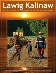
English - Balay Mindanaw
English - Balay Mindanaw
English - Balay Mindanaw

You also want an ePaper? Increase the reach of your titles
YUMPU automatically turns print PDFs into web optimized ePapers that Google loves.
LUMADNONG PAGKINABUHI NGADTO SA KALINAWMinalwang are concerned, Amay Mantangkilan said thatthere could be no conflict over territorial boundaries in theseareas because he is adept at recalling everything that helearned from his elders regarding their specific boundaries.Land boundaries, according to Amay, are usually marked bynatural borders like rivers and creeks, mountains and ridges.Hence, one cannot draw a straight line and declare it as hisduluna or land boundary because certainly, he is trespassingon another man’s gaop.The Higaunons and the ManobosAmay Mantangkilan declared that the Manobos and theHigaunons come from the same ancestors.“I was told that the Manobos and Higaunons basicallycome from the same ancestors. The delineation happenedwhen their respective forefathers decided to live in separateplaces. The Manobos opted to stay in one place, while theothers decided to move somewhere, to the gaun, that was whythey were called Higaunons.”Amay Mantangkilan added that the entry of the governmentand the influx of Dumagat settlers drove his ancestors, whoonce were coastal dwellers, to the gaun.The boundary that sets apart the Higaunons and theManobos is the area between Maramag and Salagapon.Salagapon, according to Biernatzki (1973: 22), is a waterfall ofthe Pulangi River in the vicinity of what is now the municipalityof Valencia, Bukidnon. Outwards of the said boundarywould be the territory of the Manobos, while the area thatsets inwards would be the Higaunons’. Amay Mantangkilanalso said that Tagoloan was the agreed boundary between theHigaunons and the Muslims.54“The original boundary was actually Salagapon, but