Draft Secondary Plan Policies - Town of Innisfil
Draft Secondary Plan Policies - Town of Innisfil
Draft Secondary Plan Policies - Town of Innisfil

You also want an ePaper? Increase the reach of your titles
YUMPU automatically turns print PDFs into web optimized ePapers that Google loves.
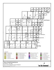
) To assist in the review <strong>of</strong> the Hydrogeological Study, the <strong>Town</strong> may retain a peer reviewconsultant at the expense <strong>of</strong> the proponent.c) Recommendations from the hydrogeological study shall be used as the basis <strong>of</strong> moredetailed hydrogeological analyses in the functional servicing plans in support <strong>of</strong> draft plans<strong>of</strong> subdivision. As part <strong>of</strong> the functional servicing plan, a detailed water balance updateshall be completed which takes into account the grading plan, site servicing details, on-sitesoil testing, and the lotting and density proposed in the draft plan <strong>of</strong> subdivision.d) Should dewatering and/or permanent lowering <strong>of</strong> the groundwater table be required forconstruction purposes, the anticipated impacts should be accounted for in a detailed waterbalance analysis and impact assessment. Recommendations for mitigation measuresshould be included in the detailed hydrogeological report to ensure maintenance <strong>of</strong> thehydrological function <strong>of</strong> the property and associated hydrological features. Suchrecommendations should be incorporated into the <strong>Draft</strong> <strong>Plan</strong> and Site <strong>Plan</strong>s whereapplicable.e) A well survey shall be conducted within and 500 metres <strong>of</strong> the boundaries <strong>of</strong> the <strong>Secondary</strong><strong>Plan</strong> area prior to draft plan approval. A subsequent well monitoring programme shall beestablished as a condition <strong>of</strong> draft plan approval.15.9.4 Archaeological StudyA Stage 2 archaeological survey (field based assessment) shall be completed by a registeredarchaeological consultant as a condition <strong>of</strong> <strong>Draft</strong> <strong>Plan</strong> <strong>of</strong> Subdivision approval to the satisfaction<strong>of</strong> the Ministry <strong>of</strong> Culture and Recreation. In the event that these surveys discoverarchaeological sites, a study, as a minimum, shall include an examination <strong>of</strong> the site, adescription <strong>of</strong> the artifacts discovered on site, an evaluation <strong>of</strong> the significance <strong>of</strong> any artifactsdiscovered on site, and recommendations for mitigative measures. Such measures mayinclude preservation by avoidance or mitigation by salvage excavation in advance <strong>of</strong>development.15.9.5 Conservation Authority RegulationsThe LSRCA has a Development, Interference with Wetlands and Alterations to Shorelines andWatercourses Regulation (Ontario Regulation 179/06) that replaces the former Fill Regulation.These areas are illustrated in Appendix C. These regulated areas include floodplains,watercourse meander belts, steep slopes, wetlands, and lands within 120 metres <strong>of</strong> ProvinciallySignificant Wetlands and 30 metres <strong>of</strong> other wetlands. The LSRCA requires a permit to beissued prior to development, site alteration, interference with wetlands and alterations towatercourses within the regulation limits.15.9.6 Noise and Vibrationa) Potential noise sources within the <strong>Secondary</strong> <strong>Plan</strong> area include but may not be limited to:i) The 20 th Sideroad;ii) The GO Rail line;iii) The Neighbourhood Commercial designation;iv) The Light Industrial Service designation; andJanuary 2012 20