Northern cape provincial article - South African Vacations
Northern cape provincial article - South African Vacations
Northern cape provincial article - South African Vacations
- No tags were found...

Create successful ePaper yourself
Turn your PDF publications into a flip-book with our unique Google optimized e-Paper software.
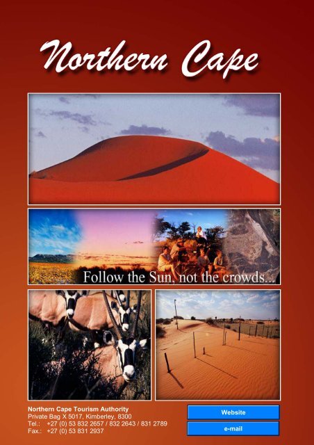
<strong>Northern</strong> Cape Tourism AuthorityPrivate Bag X 5017, Kimberley, 8300Tel.: +27 (0) 53 832 2657 / 832 2643 / 831 2789Fax.: +27 (0) 53 831 2937
Overview......................................................................................................- 3 -Climate......................................................................................................- 6 -Regions.....................................................................................................- 7 -The Diamond Fields .................................................................................- 8 -Kimberley..................................................................................................................................- 10 -Barkley West ...........................................................................................................................- 29 -Hartswater ................................................................................................................................- 32 -Jan Kempdorp ........................................................................................................................- 33 -Modder River...........................................................................................................................- 34 -Warrenton.................................................................................................................................- 35 -Windsorton...............................................................................................................................- 36 -Green Kalahari........................................................................................- 37 -Beeshoek..................................................................................................................................- 39 -Daniëlskuil................................................................................................................................- 40 -Groblershoop ..........................................................................................................................- 41 -Kakamas ...................................................................................................................................- 42 -Kanon Eiland (Canon Island)...........................................................................................- 46 -Keimoes ....................................................................................................................................- 47 -Kenhardt....................................................................................................................................- 48 -Mier Area ..................................................................................................................................- 50 -Olifantshoek (Elephants corner) .....................................................................................- 52 -Onseepkans ............................................................................................................................- 53 -Postmasburg...........................................................................................................................- 54 -Upington....................................................................................................................................- 56 -Kalahari...................................................................................................- 59 -Black Rock ...............................................................................................................................- 61 -Dibeng........................................................................................................................................- 61 -Hotazel.......................................................................................................................................- 62 -Kathu ..........................................................................................................................................- 63 -Kuruman....................................................................................................................................- 64 -Van Zylsrus ..............................................................................................................................- 68 -Karoo ......................................................................................................- 69 -Britstown ...................................................................................................................................- 71 -Campbell...................................................................................................................................- 72 -Carnarvon.................................................................................................................................- 73 -Colesberg .................................................................................................................................- 74 -De Aar ........................................................................................................................................- 76 -Douglas .....................................................................................................................................- 77 -- 1 -
Griquatown...............................................................................................................................- 78 -Hanover.....................................................................................................................................- 79 -Hopetown..................................................................................................................................- 81 -Hutchinson ...............................................................................................................................- 83 -Loxton.........................................................................................................................................- 83 -Marydale ...................................................................................................................................- 84 -Noupoort ...................................................................................................................................- 84 -Orania.........................................................................................................................................- 85 -Petrusville .................................................................................................................................- 86 -Philipstown ...............................................................................................................................- 87 -Prieska .......................................................................................................................................- 88 -Richmond..................................................................................................................................- 90 -Strydenburg .............................................................................................................................- 91 -Vanderkloof..............................................................................................................................- 92 -Van Wyksvlei...........................................................................................................................- 93 -Victoria West ...........................................................................................................................- 94 -Vosburg .....................................................................................................................................- 96 -Namakwa ................................................................................................- 97 -Aggeneys................................................................................................................................- 100 -Alexander Bay ......................................................................................................................- 101 -Brandvlei .................................................................................................................................- 103 -Calvinia ....................................................................................................................................- 104 -Concordia ...............................................................................................................................- 106 -Fraserburg..............................................................................................................................- 107 -Garies .......................................................................................................................................- 108 -Hondeklip Bay ......................................................................................................................- 109 -Kamieskroon .........................................................................................................................- 110 -Kleinzee / Koingnaas.........................................................................................................- 112 -Loeriesfontein .......................................................................................................................- 113 -Nababeep ...............................................................................................................................- 114 -Nieuwoudtville ......................................................................................................................- 115 -Okiep ........................................................................................................................................- 117 -Pella ..........................................................................................................................................- 118 -Pofadder..................................................................................................................................- 119 -Port Nolloth ............................................................................................................................- 119 -Steinkopf .................................................................................................................................- 123 -Sutherland..............................................................................................................................- 124 -Vioolsdrif .................................................................................................................................- 126 -Williston ...................................................................................................................................- 126 -Sources.................................................................................................- 127 -- 2 -
OverviewIn the north-west corner of <strong>South</strong> Africa, the sun points the way to a place ofclear skies, overwhelming quiet and wide open spaces … where one can standunder starlit skies and feel at one with the universe … where the scent of herbsis carried on the breeze ... and where one can travel the desert andunexpectedly hear the call of the sea. This is the <strong>Northern</strong> Cape, <strong>South</strong> Africa’slargest province, and it calls to us quietly, inviting us to come and discover itstreasures.By day, the open desert plains, tinted in the golden shades of the sun, seem tohold no secrets, but over the ages, many explorers have found otherwise. Theland keeps its treasures in plain sight and, like a trusting child, gladly revealsitself to those who pay it the attention it deserves.By night, the heavenly ceiling isdecorated with brilliant stars andmany people agree that nowhereelse can one see so many stars soclearly. The quiet black night formsa cocoon against the pressures ofthe world and the wind whispers ofpeace and harmony and the joy ofsimple pleasures. The Milky Wayis laid bare, inviting us tocontemplate our place in theuniverse and the <strong>South</strong>ern Crossbenignly gives us direction.Reminiscent of the discoverers of old, their sense of adventure uncurbed,modern-day adventurers are becoming more and more entranced with the<strong>Northern</strong> Cape. Hikers, 4x4 enthusiasts, river rafters, hunters and divers seizeat the opportunity to explore the unspoilt desert and dunes, river and sea.- 3 -
They do not come here to get lost in the crowds, but rather to find themselves,to hear again their own thoughts and to rediscover their connection with Nature.They harness all their senses to truly experience the <strong>Northern</strong> Cape and arewell rewarded for the effort.This is an old land that has many stories to tell. For many centuries, beingshave imprinted a record of their existence on this land, leaving behind atreasure trove of information. Signs of early life include dinosaur footprints andfossils that can be found at archaeological and palaeontological sitesthroughout the province.The intrepid San people, small tribes of hunter-gatherers, were among the firsthumans to explore this land and make it their home. Their account of their livesand beliefs has been left in the form of rock art all over the province.Every region and every season bring its own surprises.There are no prizes for guessing which treasure can be found in the DiamondFields region. The diamond rush that was sparked by a chance discovery of ashiny pebble in the year 1866 brought treasure hunters from all over the world,hungry for the riches they thought were theirs for the taking.The Karoo region offers silent testimony to the fact that life always finds a way.After the first rains, many species of succulents find their way to the surfaceand appear among the short grasses that feed the merino sheep which havebecome synonymous with the region.The first spring rains ignite a natural celebration of life in the dry winterlands<strong>cape</strong> of Namakwa, one of the most diverse regions in the province. Amulticoloured wild-flower carpet grows almost overnight, enticing thousands ofpeople to visit the area and share in the bounty of Mother Nature. In theRichtersveld, the halfmens (“half human”) stands guard over the flowers, withits head always turned north. As you follow the setting sun to the west, youhear the call of the Atlantic Ocean. Just over the next dune, the clear bluewaters shimmer in the last light of day and the West Coast stretches for miles.- 4 -
To those who have heard of the Kalahari Desert, the name “Green Kalahari”may appear to be a misnomer, but this region is only another bonus for thevisitor. A flourishing green valley marks the path that the Orange River cutsthrough the <strong>Northern</strong> Cape where farmers and in particular, winemakers, havelearnt to use every precious drop of water wisely.The Raptor Route leads to the Kalahari, an area of never-ending horizonswhere raptors, soaring high in the cloudless sky, sometimes cast the onlyshadows on the red sands. Under the sands lie incredible mineral riches andanother, even more precious treasure – water, which bursts forth joyously fromthe earth in clear cool springs.TheruggedcountrysThe rugged countryside, the open skies and the strong presence of undisturbedNature give rise to such feelings of peace, tranquillity and belonging thatvisitors often return to the <strong>Northern</strong> Cape. The road may stretch far ahead, butthe journey is well worthwhile. And, despite the size and ruggedness of theland, the people who live here do their best to make visitors welcome in theirland.A well-developed transportation and road network, modern telecommunicationfacilities and sophisticated shops offer visitors every convenience they mayneed. Combine this with the services of experienced tour guides, the comfort ofpleasant accommodation facilities and mapped-out and guided adventureroutes, and the <strong>Northern</strong> Cape is an easy place to visit and to fall in love with.- 5 -
ClimateThe <strong>Northern</strong> Cape is a dry region with fluctuating temperatures and differingtopographies. Its weather is typically that of desert and semi-desert areas.In <strong>South</strong> Africa summer is from December to February and in Januarytemperatures in the <strong>Northern</strong> Cape usually vary from 33 and 36 degreesCelsius. Although this is rare, summer temperatures in the <strong>Northern</strong> Cape havebeen known to exceed 40 degrees Celsius.During winter (June to August), day temperatures are mild (22 degreesCelsius), but the evenings can be cold (freezing point), after dew and frost havecooled down the earth. In winter, snow can often be seen on the mountainssurrounding Sutherland, one of the coldest towns in <strong>South</strong>ern Africa.The annual rainfall is never high (50 to 400 mm) and it is always lower than therate of evaporation. The western areas of the province, which include theNamakwa region and small sections of the Green Kalahari, receive rainfallduring the winter months. These rains bring to life the glorious displays of wildflowers that decorate these regions from late August until the end ofSeptember.The central and eastern parts of the province get their rain during the summermonths (December to February). These summer rains are often accompaniedby heavy thunderstorms.- 6 -
Regions- 7 -
The Diamond FieldsDiamond Fields Visitor CentrePO Box 1976, Kimberley, 8300Tel: +27 (0) 53 832 7298Fax: +27 (0) 53 832 7211E-mail: tourism@kbymun.org.za,One often wonders whetheryoung Erasmus Jacobsexperienced even a tinyshiver of anticipation on thatmomentous day in 1866when he set off on his walk.At some point during hiswalk, he stooped to pick upa shiny pebble and put it inhis pocket, perhaps to keepas a goodluck charm. Withthat small action he set off achain of events that wouldchange the history of <strong>South</strong>Africa forever. The pebblehe picked up was the Eureka, a 21-carat diamond. With the subsequentdiamond discoveries made in this region, such as the “Star of <strong>South</strong> Africa”, anamazing 83-carat stone, a diamond rush became a reality. From 1869 onwardsit brought treasure hunters from all over the world to this region, hungry for theriches they thought were theirs for the taking.The Diamond Fields regionis tucked into the uppereastern corner of theprovince. The regionborders the Free State andNorth West provinces.Incorporated in the DiamondFields are Kimberley, thecapital of the <strong>Northern</strong>Cape, as well as the townsof Barkly West, Hartswater,Jan Kempdorp, ModderRiver, Warrenton andWindsorton.- 8 -
Echoes of the past reverberate throughout this region and are an inextricablepart of its character. The recorded human history of the region dates back to theancient people who made engravings on glacial pavements and rocks. Sanrock art sites form an invaluable part of the history of the Diamond Fields.Many important battles of the devastating Anglo-Boer War that lasted from 1899to 1902 were fought in this region. Today, the land still bears its battle scars,often attracting history buffs.Despite its eventful past, there are still large undisturbed areas where thelands<strong>cape</strong> offers ample opportunities for hunting and adventure tourism.Hunters, hikers and 4x4 enthusiasts are welcome visitors to national, <strong>provincial</strong>and private conservation areas in the region.- 9 -
KimberleyTourism KimberleyPO Box 1976, Kimberley, 8300Tel: +27 (0) 53 8327298Fax: +27 (0) 53 8327211tourism@kbymun.org.zaKimberley, the capital of the <strong>Northern</strong>Cape, is also often called the DiamondCapital of the World. Without thefrenzied pace of larger cities, this cityoffers the lessons learned from thepast, the convenience of modernfacilities and the promise of a brightfuture, as its people rally round toensure its growth and prosperity.It is an enigmatic city, its characterdifficult to pin down. Modern goods aresold from antiquated buildings andhyper-modern structures reach towardsthe sky in a curious mix of old and new,modern and historic. Long-timeinhabitants exchange friendly greetingson the city streets as they walk pasthistoric buildings to enter a fast-foodrestaurant on the corner.The history of Kimberley tells of success and vastwealth, but also of heartbreak and lost hopes.While the fortunes of some improved to such anextent that they went on to finance thedevelopment of the Witwatersrand gold mines,many came to the diamond fields with stars intheir eyes, and found only disappointment.However, the tragedies did not stop new hopefulsfrom arriving every day, each new arrivalcontributing to the growth of a city.- 10 -
Development started in 1871, when diamonddeposits were found on the farm Vooruitzig, whichbelonged to the De Beers brothers. By 1872, amining town, home to more than 50 000 people,had grown where once only the springbokroamed.At first called “New Rush”, the name of the town was changed to Kimberley in1873, in honour of the Earl of Kimberley, the British Secretary of State for thecolonies at the time.Within a short space of time, the haphazardly-planned tent town mushroomedinto a city of substance and was the first in the <strong>South</strong>ern Hemisphere to installelectric streetlights and the first in <strong>South</strong> Africa to have a stock exchange. Atone time, Kimberley also had the dubious honour of being the town with themost pubs per person, in the world.Galeshewe, the satellite township that adjoins Kimberley, was originally builtunder the apartheid laws to house the area’s <strong>African</strong> population and it is stilllargely populated by <strong>African</strong> people. The township’s existence dates from1871 and for many years it was known as Number Two Location, until 1952when it was named after Chief Galeshewe of the Batlhaping tribe. He was animportant figure to the local <strong>African</strong> population and spent many years in jailafter rebelling against the Cape Colony government several times to protecthis people.- 11 -
Adventure and SportFly-fishing: Those in the know say that it is one of the most exciting anglingchallenges one can attempt – catching the spirited yellow fish along the200-km stretch of the Vaal River that flows through the province. After youhave triumphed over your tough, cold-blooded adversary, take time to lie onthe banks of the river and appreciate the lovely scenery.Cricket and rugby: The people of Kimberley are enthusiastic about their sportand there are several rugby and cricket fields and sport clubs. Visitors areoften granted temporary membership. Kimberley is the home ground of theGriqua Gemsbok Rugby Team and the Griqua Diamonds Cricket Club.Golf: The Kimberley Golf Club has been in existence since 1890. EveryOctober, this club is a hive of activity as players come from all over to join inthe 9 night, 8 day Festival of Golf known as the Barney Barnato.Hunting: Many private farms in the Kimberley area cater for hunters. For moreinformation, contact the Diamond Fields Tourism Office or the <strong>Northern</strong> CapeHunters’ Association.Riverton Pleasure Resort: A comfortable 27 km from Kimberley, on the banksof the Vaal River, lies the Riverton Pleasure Resort, where people can relax,enjoy the quiet and take part in water sports such as boating and fishing.Facilities include fully-equipped self-catering accommodation, a caravan park,a walk-in bird park, a powerboat jetty, a putt-putt course, swimming pools anda river ferry.- 12 -
Archaeology and PalaeontologyDriekopseiland: Within easy travelling distance from Kimberley, nearPlooysburg, lies Driekopseiland (Three Head/Hillock Island) where nomadicSan tribes made more than 3 000 rock engravings on the glacial pavements ofthe bed of the Riet (Reed) River. These engravings are believed to bebetween 800 and 2 500 years old. Visitors are warned that, because they lieon the riverbed, these engravings are often under water, especially afterheavy rains. San drawings most often depict San religious beliefs andexperiences of the spiritual world while under the influence of religioustrances. The Driekopseiland engravings are mainly abstract forms, but alsoinclude several animals that roamed the area at the time, humans, trees andgeometric symbols.Nooitgedacht Glacial Pavements: The sign pointing to the NooitgedachtGlacial Pavements site is situated on the Barkly West road, 24 km fromKimberley. Travel a further 8 km along a gravel road to the site, which ismarked by the ruins of an old house. The area has been marked off and signsrequest visitors not to damage any rocks. The formation of this geographicand archaeological feature started some 250 million years ago during an IceAge when enormous glaciers slowly ground over the 2 500 million-year-old- 13 -
Ventersdorp lava. As they moved, gravel and rocks in the glacier damaged thesurface, forming an uneven backdrop which the San later used as canvas fortheir rock engravings.Wildebeest Kuil Rock Art Tourism Centre: This development, 16 km fromKimberley, on the road to Barkly West, is a triumph for community tourism inthe province and in <strong>South</strong> Africa. This rock art site is situated on a farmbelonging to the !Xun and Khwe people and, in addition to giving visitorsaccess to this important archaeological discovery, it also affords the !Xun andKhwe people an opportunity to be actively involved in preserving andbenefiting from their ancestral legacy.The modern visitors’ centre features an arts and craft shop, a tea room, anexhibition of San history and a modern auditorium, where visitors can watch amovie on San culture and history. There are also facilities for an audio-guidedwalk of the rock art site. The art and crafts sold in the shop are made by thelocal !Xun and Khwe artists and are fitting souvenirs of your <strong>Northern</strong> Capetrip.Art and CraftsWilliam Humphreys Art Gallery: Kimberley is not to be outdone when it comesto arts and culture. The William Humphreys Art Gallery is situated in the heartof the city, in the civic centre in Jan Smuts Boulevard. Although the galleryfocuses on <strong>South</strong> <strong>African</strong> art, it also features the works of Dutch and FlemishMasters of the 16th and 17th centuries, as well as the art of British and otherEuropean Masters. The gallery often hosts temporary exhibitions by major<strong>South</strong> <strong>African</strong> and international artists and is one of the few art museums thatdisplay San rock art.Culture / CommunityTourismGaleshewe: As this satellite township isnot as large as many other townshipsthat adjoin cities, it offers the idealopportunity to study <strong>South</strong> <strong>African</strong>township life. Community developmentprojects have changed the face of thetownship somewhat and newgovernment buildings are being built onthe outskirts of the township – “Bringinggovernment to the people”.Confront the realities of separate development that millions still have to livewith, but also take note of the similarities between people everywhere.- 14 -
Township tours, conducted by experienced guides, are the best way to makesure that you visit all the historical and cultural sites.The sites include the erstwhileMalay Camp, the Sol PlaatjeHouse, the home of RobertSobukwe and the graveyard. Inthe evening, the guide will takeyou to a shebeen, where youcan have a drink with the localpeople. A stay in the guesthouseand conference centre inGaleshewe is also to berecommended.- 15 -
Entertainment and ShoppingFlamingo Casino: The Flamingo Casino is a<strong>South</strong>ern Sun development and was namedafter the graceful pink, long-legged birds thatfrequent the area. It is on the outskirts ofKimberley, on the main road to Johannesburgand large signs mark the entrance to thecasino. The casino offers a range ofentertainment activities, a conference centreand a road lodge.Flea markets: Kimberley houses a variety offlea markets at different venues. The DunluceArts and Crafts flea market is open toshoppers four times a year. Shoppers who donot like to buy en masse but prefer to buysomething individual and unique will be sureto find it at the Dunluce Art Market. A fleamarket is held on the last Sunday of everymonth, opposite the Oppenheimer Gardens inJan Smuts Boulevard.Jewellery shops: Visit one of Kimberley’s jewellery stores where designerjewellery with diamond and semi-precious stones found in the area are onsale. The jewellery is often individually crafted, a unique memento of your tripto <strong>South</strong> Africa.Shopping centres: The city of Kimberley has ultra modern shopping centres tocater for the seasoned shopper.- 16 -
Fauna and FloraKamfers Dam: The Kamfers Dam wetland on the outskirts of Kimberley on themain road to Johannesburg has Natural Heritage status. The dam, with itsextensive reedbeds, is fed by treated sewerage waters and is home to a largevariety of resident, migratory and nomadic birds.Some 186 species of birds livein or visit the wetlands,representing 62 avian families.However, the dam area is bestknown for the flocks of lesserand greater flamingoes that canbe seen from far away as alarge pinkish patch on the water.Only when you are close by willyou recognise the pink cloud asthousands of large white birdswith their long pink legs, pinkbeaks, pink patches on theirfeathers and gracefully bowednecks.- 17 -
History and Architecture<strong>African</strong>a Library: The <strong>African</strong>a Library in Du Toitspan Road is one of the bestresearch libraries in the country. One of its most precious documents isRobert Moffat’s personal copy of his Setswana translation of the Bible. Thebuilding, with its original wooden floors, shelves and floors and iron spiralstaircase, is a fitting treasure house for its valuable contents and, if the storiesabout it can be believed, jealous ghosts still try to guard the secrets containedin the documents.Battlefields Route: The N12Diamond Fields BattlefieldsRoute starts at Hopetown,120 km south of Kimberley,and signs along the routeindicate all the sites. Manyexperienced guides conducttours of these sites. TheAnglo-Boer War (1899 to1902) was the greatest warever fought on <strong>South</strong> <strong>African</strong>soil, a three-year war that leftscars over the entire country,as bitter battles were foughtbetween the Boer and Britishforces. Sites include thehistoric battlefields at OrangeRiver Station, Belmont,Graspan, Modder River,Magersfontein, Langberg,Koedoesberg Drift andCarter’s Ridge.Magersfontein is home to the best Anglo-Boer War museum in the country. Abrochure is available from the <strong>provincial</strong> or local tourism office.Belgravia Walk: A pleasant 2-km circular walk through the suburb of Belgravia,where some of the buildings date back to 1873, also affords an opportunity tovisit other historical sites. Tourists can complete a self-guided walk that startsat the McGregor Museum in Chapel Street. The museum has a brochure witha map that indicates more than 30 sites.- 18 -
Big Hole and Kimberley Mine Museum: You will not have seen Kimberley untilyou have paid a visit to the Big Hole and the Kimberley Mine Museum inTucker Street, one of <strong>South</strong> Africa’s largest full-scale open-air museums. Themuseum town stands on the site of the original Kimberley Mine, which closeddown in 1914 after it had yielded 2 722 kg of diamonds. The Big Hole wasonce a hillock, Colesberg Hill, but after 22,5 million tons of earth had beenremoved, it became the world’s largest man-made crater. Standing at theedge of the water-filled hole, one cannot help but admire the tenacity of man,digging 215 m into the earth without the help of a single piece of machinery.The buildings are typical of the building style of the time and include a church,diggers’ tavern, Barney Barnato’s Boxing Academy and several shops andhouses, as well as the De Beers Directors’ private railway coach.- 19 -
In fact, many ofthese buildingsare the “realthing” and havemerely beenmoved fromtheir originallocations. Tiredvisitors arebrought back tothe present bythe wonderfultaste of freshscones and teaserved in thetea room.Cathedral Church of St Cyprian: Thisbeautiful old church in Du Toitspan Roadhas the longest nave in the country.The Cenotaph and Cape Corps Memorial: William Timlin designed theCenotaph in honour of the 400 Kimberley men who died during World War I.The names of the men who died during World War II were added later. TheCape Corps Memorial has recently been moved next to the Cenotaph andcelebrates the men who were members of this famous corps. A German fieldgun forms the centrepiece of the memorial in Du Toitspan Road.- 20 -
City Hall: This elegant cream and white building in Roman Corinthian style issituated on the corners of Old Main Street and Transvaal Road in the citycentre. It dates from 1899, just before the Anglo-Boer War, and is acombination of elegance and superior workmanship, designed by architect,Fergus Carstairs Rogers.Clyde N Terry Hall of Militaria: This museum is the culmination of a lifelongpassion of a World War II veteran, Clyde Terry. His collection of all thingsmilitary is housed in a building next to the Kimberley MOTH Centre. ClydeTerry junior constructed the building to house his father’s display ofinternational military badges, uniforms, medals and other relics.De Beers Head Office: This office building in the centre of Kimberley inStockdale Street, was once the head office of Barney Barnato’s KimberleyCentral Diamond Mining Company. Barnato was one of the few diamond rushmillionaires. Today, the building is still integrally linked to the diamond tradeand is the seat of the De Beers Consolidated Mines Ltd Company.Duggan-Cronin Gallery: Museums not only serve to preserve old things, butalso tell the story of the people who made history. The Duggan Cronin Galleryin Egerton Road houses some 8 000 photographs, which Alfred Duggan-Cronin took from 1919 to 1939 while touring through <strong>South</strong>ern Africa. Hisphotographs depict the people and lifestyles of the time and immortalisescustoms and scenes that would otherwise have been lost to us forever. Theworks of other photographers are also shown.- 21 -
Dunluce: This architectural jewel, an elegant Victorian house at 10 LodgeRoad, was built in 1897 and was declared a national monument in 1990.Appointments to visit it should be made at the McGregor Museum.Dutch Reformed Church: The church dates back to 1871 but the presentbuilding in Long Street was built in 1885. In front of the building, theConcentration Camp Memorial honours the memory of those who died in theNewton Concentration Camp during the Anglo-Boer War.Ernest Oppenheimer MemorialGardens and Diggers Fountain: Thegardens, in Jan Smuts Boulevard, arenamed after Sir Ernest Oppenheimer,mining magnate and former mayor ofKimberley.The Diggers Fountain, surrounded bya rose garden, is a fountain and astatue of five miners holding up asieve and was designed by HermanWald. The five diggers represent the five diamond mines of Kimberley and thestatue honours the contribution that all diamond diggers made to thedevelopment of Kimberley.- 22 -
Freddy Tait Golf Museum: The museum at the Kimberley Golf Club was thefirst golfing museum in Africa. The display includes the putter that belonged tothe 1896 and 1898 British amateur golf champion, Freddy Tait. He was killedat Koedoesberg during the Anglo-Boer War.Ghost Trail: Join the ghost trail and let a guide lead you in the footsteps ofspirits who met sad and untimely deaths in the city that was built on thedreams of men. Visit buildings, such as the <strong>African</strong>a Library and Rudd House,where too many people have witnessed unexplainable events for them to bemere coincidences, and experience the thrill of anticipation as you wait for itsghostly inhabitants to appear.Great Kimberley North Walk: The 4 km route takes the visitor to some 40historical sites to the north of the city centre and starts at the Savoy Hotel.Halfway House: This historic watering hole in Du Toitspan Road is anotherrelic of the diamond digging era and used to be the Halfway Hotel. It is a fairassumption that it is one of the very few places in the country where you canenjoy a beer without getting out of your car, in a modernised version of CecilRhodes’s habit to sit astride his horse and enjoy his drink.Honoured Dead Memorial: Near thejunction where five roads meet, atthe highest point in Kimberley,stands this memorial in honour ofthe soldiers who defended the cityduring the Anglo-Boer War. Built atthe insistence of Cecil John Rhodes,the Honoured Dead Memorial issituated on the corner of Dalhamand Oliver Roads.Designed by Sir Herbert Baker, ithouses the vault that contains theremains of some British soldiers whodied during the Siege of Kimberley.“Long Cecil”, the cannon at the baseof the memorial, was built to defendthe British against Boer artillery fire.The inscription on the memorial waswritten by Rudyard Kipling.- 23 -
Jewish synagogue: The synagogue in Memorial Road was finished in 1902and was built in Byzantine style.Kimberley Club: This epitome of elegance was established in 1881. Some ofits more important members were Cecil John Rhodes, Barney Barnato, SirErnest Oppenheimer and his son, Harry Oppenheimer.Magersfontein: This important Anglo-Boer War site lies 31,5 km south ofKimberley on the airport road. The site of one of the most decisive battles ofthe war, 12 000 British were defeated by the troops of the Boer General, PietCronje, and his 8 200 men.The original gun positions and trenches are still intact and the museumdisplays uniforms, weaponry, documentation and photographs that tell the fullstory from both the Boer and the British side. Close to the site is the BurgherMonument, erected at the gravesite of Boers killed in the Anglo-Boer War.Market Square: The city of Kimberley originally developed around the square,which used to be the main trading area that served the diggers. It is right nextto the elegant City Hall.- 24 -
McGregor Museum: Thismagnificent building,surrounded by large, coolgardens evokes nostalgicvisions of carriages arriving inthe driveway and women involuminous ball gowns posingat the top of the balustrade forthe benefit of their admiringescorts.The museum exhibits include an astounding geological selection of local andinternational rock varieties, fossils and minerals, the Hall of Religions, adisplay on the history of the region and an extensive display on thedevelopment of humankind, the Ancestors Exhibition. Many of the museum’sresearchers are well-known specialists in their fields. In 1897, Cecil JohnRhodes had it built as a hotel and health resort for the wealthy Kimberleycrowd.Rhodes stayed here for the duration of the Kimberley Siege and the museumstill preserves the suite that he occupied. After serving several other purposes,the building became the headquarters of the McGregor Museum in 1971. Themain museum is in Atlas Street, but several other historical sites in Kimberleyare also under its administration.Pioneers of Aviation Museum: The museum is in General Van der Spuy Drive,the site of <strong>South</strong> Africa’s first flying school. The first flying school in <strong>South</strong>Africa was started in 1912 and many members of the <strong>South</strong> <strong>African</strong> Air Forcewere trained in the Compton-Paterson biplane, a life-size replica of which ison display in the museum.Rhodes Statue: The proud figure of Cecil John Rhodes, with a map on his lap,sits immortalised on his horse in Du Toitspan Road. Rhodes is one of thesuccess stories of the diamond fields and after having made his fortune, hewent on to play an important role in the business and politics of the country. Astaunch imperialist, he was one of the main supporters of the attempt to unify<strong>South</strong> Africa under the British flag that ultimately resulted in the Anglo-BoerWar.- 25 -
Robert Sobukwe House: This house, in Naledi Street in Galeshewe, was oncethe residence of Robert Sobukwe, an important figure in <strong>South</strong> <strong>African</strong> historyand a main role player in the process known as the rise of <strong>African</strong> politicalconsciousness. Sobukwe became famous after breaking away from the ANCin 1958 because he did not regard the ANC policies as militant enough. Hesubsequently formed the PAC and under his leadership, it staged massiveprotests against the National Party government. Sobukwe was incarceratedon Robben Island for nine years after the Sharpeville Massacre. After he wasreleased, and whilst living under house arrest in the township of Galeshewe,he practised law in Kimberley until his death in 1978.Rudd House: This house at 5 - 7 Loch Road, was built for HP Rudd, one ofthe mining magnates and a partner of Cecil John Rhodes, and has been fullyrestored to its original grandeur. The original building was a small squareconstruction, to which the Rudd family kept adding until they had created thisrambling home. Appointments for viewings should be made through theMcGregor Museum.School of Mines: This building in Hull Street was home to <strong>South</strong> Africa’s firstschool of mines. The school was later moved to the Witwatersrand and laterbecame the core of the University of the Witwatersrand.Seventh Day Adventist Church: The corrugated iron building on the corner ofBlacking Street and Dyer Place was built in 1890. Seventh Day Adventists in<strong>South</strong> Africa and Australia regard it as their mother church.Sister Henrietta Stockdale Statue: The statue of one of the most importanthistorical figures of Kimberley is situated at St. Cyprian’s Cathedral inDu Toitspan Road. Sister Henrietta was a member of the Anglican NursingOrder of St Michael and All Angels and her efforts were responsible for thefirst state registration of nurses in the world.Sol Plaatje Museum: Plaatje was a renowned author and journalist whoplayed an integral role in the history of <strong>South</strong> Africa and was part of the rise of<strong>African</strong> political consciousness. His house, at 20 Angel Street, is a nationalmonument and an institute for the study of <strong>African</strong> languages. Plaatje was afounder member of the <strong>African</strong> National Congress (ANC) and the firstSecretary General of the organisation. He was the first black <strong>South</strong> <strong>African</strong> towrite a novel in English (called Mhudi), made a significant contribution to<strong>South</strong> <strong>African</strong> journalism by recording events of the Anglo-Boer War andtranslated many Shakespearean works into Setswana. He died in 1932 andlies buried in the West End Cemetery.- 26 -
Transport Museum: The museum on the Kimberley Train Station tells the storyof railway developments in the area and has the cabin of a real steamlocomotive on display.Star of the West Pub: After ahot and sweaty day, come andenjoy a well-deserved brew,just like the miners of old, atthe Star of the West pub inNorth Circular Road. The “Star”is <strong>South</strong> Africa’s oldestcontinuously operating bar anddates back to the 1870s. Thebar counter and the shelvesbehind the bar are from theoriginal building, but the drinksand refreshments cater to thetastes of the modern visitor.Vintage Tram: Enjoy a historic journey in a historic vehicle that dates from1887. Car No 3 was reintroduced to active service in 1985 to ferry touristsacross town past historic buildings. The tram has a few regularly scheduledtrips during the day and the journey commences at the Big Hole andKimberley Mine Museum. It is the only active tram service in <strong>South</strong> Africa.- 27 -
Other AttractionsMine tours: The Bultfontein Mine was excavated during the diamond rush andit is still in operation today. Surface tours of the mine are offered twice dailyand it is the only diamond mine in the world that allows underground tours.The tours include a screening of a video about the history of Kimberley.- 28 -
Barkly WestThis small town, barely 35 km from Kimberley already brings us face to facewith the differences between town and city life.The town is largely made upof older buildings that are nowused for more modernpurposes and, should youchoose to drive straightthrough, you could miss someof the unexpected treasuresthat the little town has. BarklyWest started out as a smallmission village in 1849, underthe name Pniel (meaningFace of God).When diamonds were discovered on the Vaal River in 1869, thousands ofprospectors flooded the area and Barkly West became the site of the firstdiamond diggings in <strong>South</strong> Africa. On 30 July 1870, the diggers proclaimedthe Republic of Klipdrift and in 1873 the area was named Barkly West.The district’s current economy is dependent on stock- and irrigation farming,although lone diggers still pan a 150-km stretch of the Vaal River close to thetown.The nearby town of Delportshoop started off as a miner’s camp in the 1870s.Today most of the inhabitants of the village are employed at the opencast limequarry and the cement factory nearby.Adventure and SportHunting: Contact the Diamond Fields Tourist Office or the <strong>Northern</strong> CapeHunters’ Association for more information.Rekaofela Resort: The Setswana name for this resort means “Place ofGathering”. The resort lies 5 km from town on the banks of the Vaal River. Itcan provide accommodation to more than 100 people and has facilities foractivities such as canoeing, archery, rock climbing, hiking and orienteering.The resort also houses an adventure centre that presents courses in personaland group development.- 29 -
Archaeology and PalaeontologyCanteen Kopje: The diamond diggers did not only bring the literal riches ofdiamonds to the surface, they also uncovered many archaeological treasuresin the <strong>Northern</strong> Cape. The Canteen Kopje (Dutch word for hillock) site issituated on a hillock and is one of the most exceptional archaeological sitesalong the Vaal River. Stone tools ranging from 500 000 to one million yearsold have been discovered here. The site has an open-air archaeologicalmuseum with geological exhibits and fossils.Fauna and FloraThe Oribi GameReserve allows us tosee different species ofgame in their naturalhabitat.Vaalbos National Park:The park is namedafter the camphor bush(also known as thevaalbos).Tucked along the Vaal River, this 23 000-ha park conserves part of thetransitional vegetation zone where typical Karoo, Kalahari thornveld andgrassveld meet. In an area that was once the heart of the alluvial diamonddiggings, large raptors and the rare yellow-breasted form of the crimsonbreastedshrike now contend with cold winters and scorching summers.History and ArchitectureBarkly Bridge: This bridge, dating from 1885 was the first bridge built acrossthe Vaal River.Barkly West Museum: The exhibits in the museum include archaeologicaland geological findings from Canteen Kopje, as well as many historicalartefacts from early life in the Diamond Fields.Cultural History Museum: The museum is in a wing of the library andhouses a collection of cultural, historical and archaeological paraphernalia.Old Toll House: This relic stands on the northern bank of the Orange River.St. Mary’s Anglican Church: This, the first church on the diamond fields,was built in 1871.- 30 -
- 31 -Other AttractionsAlluvial Diamond Diggings: Quite alarge number of prospectors are stillhard at work on the river banks,searching for diamonds. Watch themwhile they work, but do not get tooclose.
HartswaterHartswater was established in 1984 to serve the northern section of theVaalharts irrigation scheme. The abundance of water is apparent from faraway as the fertile plant life covers the town and its surroundings in brilliantcolour.CuisineLangeberg Cooperative: This is a vegetable cooperative where visitors canlearn about the vegetable dehydration process.Hartswater Wine Cooperative: The cooperative bottles fortified and naturalwines under the Elements and Hinterlands labels.Other AttractionsVaalharts Irrigation Scheme: This ambitious scheme provides water for some1 250 farms in the Vaalharts Valley. The water is channelled from a diversionweir in the Vaal River through more than 800 km of canals.- 32 -
Jan KempdorpOriginally having the more melodious name of Andalusia, the town wasrenamed in 1954 after Jan Kemp, the Minister of Agriculture at the time. Thetown lies in the centre of the Vaalharts Irrigation Scheme, the reason why thetown and surrounding area are so green.Fauna and FloraGanspan Nature Reserve: The reserve lies 10 km south-west of the town andwas developed specifically to provide a home for aquatic birds.History and ArchitectureVaalharts Museum: When in town, make it a point to visit this charmingmuseum that covers the history of the region.- 33 -
Modder RiverThis historic town lies near the confluence of the Riet and Modder Rivers andhas seen much action. It was the site of a major battle fought between theBoers and the British on 28 November 1899, during the Anglo-Boer War. ABritish blockhouse that was built to guard the railway bridge can still be viewedtoday. At present, this small town is known for its irrigation scheme and thestock farming in the area.Adventure and SportHunting: Contact the Diamond Fields Tourism Office or the <strong>Northern</strong> CapeHunters’ Association for more information.CuisineVineyards: An irrigation scheme has opened the way for wine farmers todevelop prize vintages in the area. Landzicht is a cooperative cellar that hasproduced several prize-winning wines. Wilreza is privately-owned, theyoungest wine cellar in the Diamond Fields. Its labels depict the animals of the<strong>Northern</strong> Cape.History and ArchitectureN12 Battlefields Route: Modder River lies on the Battlefields Route and hastwo blockhouses, information panels and memorials to attract the interest ofhistorians.- 34 -
WarrentonAt first, the area was used to plant crops to feed the diamond diggers in otherareas. However, activities quickly changed when diamonds were alsodiscovered here in 1888. Mining continued until 1926, but the present-dayWarrenton is an important railway station that serves as the junction for theCape-Zimbabwe and Cape-Gauteng lines. The town is the main commercialcentre for the Ghaap Plateau. There are cheese factories in the region andkaolin (china clay) is mined.Adventure and SportHunting: Contact the Diamond Fields Tourism Office or the <strong>Northern</strong> CapeHunters’ Association for more information.History and ArchitectureOld Sluice and Waterwheel: This reminder of past activities is situated on thewestern side of the town.Other AttractionsSemi-precious stone factory: Visitors are allowed to visit the factory where thenatural wealth of the area is processed.- 35 -
WindsortonStarting out with the noblest of intentions, to mine for the souls of people, theHebron Mission station was quickly overrun by diggers when diamonds werefound here. The missionaries left and the town grew from the diggers’ camp inthe area. Windsor was the surname of the original owner of the land. Thearea has not yet been completely stripped of its riches and several diggers stillmake their living panning the gravel for diamonds.- 36 -
Green KalahariGreen Kalahari Regional Tourism OfficePrivate Bag X6039, Upington, 8800Tel: +27 (0) 54 337 2800 / 26Fax: +27 (0) 54 337 2888E-mail: greenkal@bodr.gov.zaWebsite: http://www.greenkalahari.co.zaA patch of paradise transported from a faraway land and laid over a lands<strong>cape</strong>of red dunes – that is the explanation that comes to mind when we look at thenorth and north-west of the <strong>Northern</strong> Cape, at the region known as the GreenKalahari.The Green Kalahari is a region of dramatic contrasts, a land where stretchedoutsemi-desert dunes meet up with vineyards and farmlands. A flourishinggreen valley marks the path that the Orange River cuts through the <strong>Northern</strong>Cape where farmers and, in particular, winemakers have learnt to use everyprecious drop of water wisely. The most northerly section of the <strong>Northern</strong>Cape, bordering on both Botswana and Namibia, this region is full ofsurprises.- 37 -
The Augrabies Falls National Park and the Kgalagadi Transfrontier Park (acombined conservation project between <strong>South</strong> Africa and Botswana), wherethousands of animals have found sanctuary, are undoubtedly the two jewels ofthe region. Vast and remote, relatively few people ever explore this land anddiscover its less obvious attractions. The traditional Riemvasmaak communityin the Mier area welcomes visitors. Travel by 4x4 to their remote home andsoak your tired bones in the healing water of the hot springs.The Roaring Sands at Witsand Nature Reserve have given rise to many tales.One legend comes from the San who say that it is the voices of theirancestors in the spirit world who are communicating with us. Scientists believethat it is merely the sound of smaller p<strong>article</strong>s moving among larger sandp<strong>article</strong>s - but who wants to accept this prosaic explanation?This is a land that inspires tales of spirits and secrets, where lawbreakers hidout from the Colonial authorities, disappearing among the local tribes. This iswhere hunters find their peace on the trail of their prey and where farmershave learnt to squeeze every drop of water from the earth and to bring forththe nectar of the gods. The islands in the Orange River are places to live andbuild upon the legacy of the early settlers and the river is a source of life andlaughter, as well as of adventure – the lifeblood of it all. This is also the regionof strange place names, where people have spent hours trying to figure outwhere names such as Kakamas, Mier, Beeshoek and Keimoes come from –an intriguing, wonderful place with many secrets to unfold.- 38 -
BeeshoekThe village of Beeshoek (“Cattle corner”) lies 10 km north-west ofPostmasburg and owes its existence to the iron ore operations at AssmangMine. The local recreation club is the nucleus of the villagers’ social life.Beeshoek’s single claim to fame is the surprising number of Springbok rugbyplayers who took the first steps on the path to fame on Beeshoek’s rugby field.Adventure and SportAmmosal Recreation Club: The club offers facilities for golf, squash,swimming, tennis, bowling, soccer and rugby.Fauna and FloraBeeshoek Nature Reserve: This small reserve conserves local plant andanimal life.Other AttractionsMine tours: Tours of the iron ore mine are conducted regularly. Advancebooking is required.- 39 -
DaniëlskuilDaniëlskuil (“Daniel’s Den”) lies in a particularly attractive setting at the foot ofthe Kuruman hills, 90 km south of Kuruman. A natural crater near the townreminded a missionary, the Reverend J Campbell, of the story of Daniel astold in the Bible and in 1820, the name of the village was changed fromFraaifontein (“Pretty fountain”) to Daniëlskuil. The limestone quarry, diamondmining and farming support the town’s population.Adventure and SportHiking: The farm Mount Carmel has several hiking trails.Hunting: Contact the <strong>Northern</strong> Cape Hunters’ Association for moreinformation.History and ArchitectureBritish Fort: During the Anglo-Boer War the British forces built this fort on ahillock outside town.Natural WondersBoesmangat (“Bushman Hole”) sinkhole: One of the attractions on MountCarmel farm is Boesmansgat, reputed to be the largest and second deepestsinkhole in the world.Gaol sinkhole: The sinkhole, from which the town derives its name, was oncebelieved to have been used by the Griqua people as a jail. This belief hassince been refuted.- 40 -
GroblershoopGroblershoop (“Grobler’s hope”) lies to the east of Upington and dates from1936. Grobler was the Minister of Agriculture of the time. Pioneer farmerssettled in the area as far back as the 1870s and agriculture is still the mainactivity of this part of the Orange River Valley.Adventure and SportWater sport: Since its completion in 1931,Boegoeberg Dam has afforded skiers, motorboatenthusiasts and anglers many hours of fun. Thelarge body of water amidst the red dunes andquiver trees of the Kalahari is a very attractivesite at which to relax.Archaeology and PalaeontologyFossilised track: The fossilised track atEselkloupan is very similar to that of a donkey.Make an advance appointment at the tourismoffice.CuisineOrange River Wine Cellars Cooperative: This is where the “fruit of the vine”ends up, as excellent wines. Wine tasting and tours of the cooperative are onoffer.History and ArchitectureWater Turbine: The water turbine on the farm Winstead was imported fromEngland in 1910. Its gears are made of solid oak.Natural WondersRoaring Sands: The white dunes that contrast sharply with the surroundingred Kalahari dunes are also known for the eerie roaring sound that the sandsat Brulsand (“Roaring Sands”) make when they are disturbed. Whether youchoose to believe the San, who say that it is the spirits of their ancestorsmaking contact or the scientists, who attribute it to the shifting of roundedsand p<strong>article</strong>s, upon hearing this eerie sound a shiver will travel down yourspine. A large part of Brulsand is in the southern section of the WitsandNature Reserve.- 41 -
KakamasModern-day Kakamas in the lower Orange River Valley is surrounded bygreen vineyards and lush fields of cotton and lucerne. This is a far cry from thetown’s beginning as a worker’s colony for the poor on land owned by theDutch Reformed Church. Until the church’s interests in the settlement wereliquidated, the settlers in the area were not allowed to own the land on whichthey worked. The origin of the name Kakamas has many people guessing.Some believe that Kakamas refers to the Khoi word “gagamas” that means“brown”, referring to the red clay that the local woman rubbed into their faces.Others believe that “Kakamas” was derived from a Koranna word meaning“poor pasture” or “ vicious charging ox”. This explanation is based on a storyabout cattle that had to be moved from the area because of the poor grazing.The cattle were moody and unwilling and eventually turned on their owners.Hence – “vicious charging ox”.Irrigation is the name of the game in the Orange River Valley and theconsidered and careful redistribution of water sustains an area that deliversagricultural products of world standards. Other Kakamas products are Collinspeaches, which are excellent for canning, and table grapes that are exportedall over the world.- 42 -
Adventure and SportAdventure Trail: The !Garib 3-in-1 Adventure in the Augrabies National Park isnot for the faint-hearted. This three-part adventure includes a 4 km rowing tripdown the Orange River, a 4 km hike and a 12-km mountain bike trip back tocamp. Enquiries and reservations for this adventure can be made at the park.4x4: To the north of the Augrabies Falls, 4x4s can travelto a remote lunar lands<strong>cape</strong> where the friendlyRiemvasmaak people will welcome visitors to thedelights of the Riemvasmaak Hot Springs.Game drives: Night drives in the Augrabies FallsNational Park are offered during peak holiday periods.Resident visitors to the park have access to threeswimming pools.Hiking: The Klipspringer hiking trail in the Augrabies National Park covers aparticularly beautiful area of the stark, but arresting, lands<strong>cape</strong> and canaccommodate groups of up to 12 persons. It takes three days and two nightsto complete the trail. Advance booking is essential. The trail is closed fromOctober to March on account of the high summer temperatures. Carry lots andlots of water.Hiking: The Augrabies National Park has several other nature trails, such asthe Arrow Point, Potholes and Moon Rock trails, each of which takesapproximately one hour to complete.White river rafting: The starting point in the Augrabies Falls National Park is atAugrabies Rush (above the Augrabies Falls). Enthusiasts meet at thecampsite in the Augrabies Falls National Park and are transported to thelaunch site. The rapids on the river-rafting route vary between grades two andthree. Paddling is not at all strenuous and beginners are welcome to “have ago”. However, safety precautions are still advised and a life jacket is, ofcourse, a must. The rapids below the Augrabies falls are renowned for theirpeaceful and scenic features. These rapids are also between grades two andthree but this factor depends greatly on the water level. Children over the ageof six can also do the trip, but should be accompanied by parents orresponsible adults.- 43 -
CuisineOrange River Wine Cooperative: Take home a few bottles of the excellentlocal wines to enjoy. Tours of the facility are also offered. Towns that areimportant for those who are interested in wine purchases are Groblershoop,Kakamas, Keimoes and Upington.CultureRiemvasmaak Community: The Riemvasmaak community lives in a remotearea of the province, north of the Augrabies Falls. Their home is a mountaindesert wilderness that was created by volcanic eruptions millions of years agoand their way of life is very much the same as that of their ancestors. Thecommunity is very friendly and its members welcome visitors to their homes.Make advance arrangements with the community, jump into your fully laden4x4 and be off for a relaxing holiday with a delightfully different cultural slant.Fauna and FloraThe Augrabies Falls National Park is a 28 000-ha national park, situated some40 km north-west of Kakamas and 120 km west of Upington. The park isnamed after its natural wonder, the sixth largest waterfall in the world, theAugrabies Falls. The name is derived from the Khoi word Aukoerebis (“Placeof the Great Noise”).- 44 -
The park protects the Orange River Nama Karoo vegetation type and its mostcharacteristic plant is the quiver tree or kokerboom (Aloe dichotoma). Over 55species of mammals and 63 species of reptiles live in the park and manyspecies of birds, including the black stork, black eagle, pygmy falcon, tractrac,pale chanting goshawk and Namaqua sandgrouse can be seen.History and ArchitectureHydroelectric Power Station: The powerstation is designed in Egyptian style.Irrigation Tunnels: Cornish miners built theirrigation tunnels outside Kakamas.Waterwheels: Eleven of the waterwheelsthat were erected for the irrigation schemeare still in operation on the canals. Some ofthese can be seen in Voortrekker Street andothers on the channels running through the fields.Natural WondersRockery Route: This gravel road goes from Neilersdrift to Kakamas via theNeuswier, providing access to a route along which miniature lands<strong>cape</strong>s ofother worlds appear to have been relocated. Rocky outcrops with camelthorn-and quiver trees give way to lush vineyards and islands in the river.Riemvasmaak Hot Springs: Even today, people still believe in the medicinalvalue of a dip in the hot springs. Riemvasmaak gets its name from the ancientpractice of tying thongs together to lower oneself down the steep ravine intothe spring. The spring is in a deep ravine, overshadowed by 80 m cliffs. Twoswimming pools have also been built, one resembling a conversation pit.- 45 -
Kanoneiland (Canon Island)Kanoneiland is a settlement on the largest island in the Orange River Valley -the biggest river settlement in the country. In 1928, a group of 52 privatesettlers began to clear the island for cultivation. The irrigation scheme in thearea supports the lush vineyards that are truly magnificent to look at. Inwinter, due to the low level of the water, the island looks like a series ofvineyards on dry land.However, come the rainy season, it is quite a different story. The islanderssometimes have to put up barrages to prevent the water from flooding theisland. Fortunately the living quarters have been built on the highest parts ofthe island and the islanders’ homes are generally safe. Guided tours of theisland are an experience not to be missed and groups of up to 20 people at atime can be catered for. Enjoy the traditional meals of the islanders and withthem, of course, the locally-produced wines.- 46 -
KeimoesThe village of Keimoes probably owes its name and its attractiveness to thelocal fountain. Keimoes is said to be a combination of the Nama words “gei”(great) and “mus” (fountain). However, some people believe that Klaas Lucas,a Koranna leader, gave this name to the colony that he established on thebanks of the Orange River when he discovered that a colony of mice wasalready living there. In the language of the Koranna the word “Keimoes”means “Mouse nest”.CuisineOrange River Wine CellarsCooperative: Thecooperative’s largestdistillery in the lowerOrange River Valley lieson the slopes of theTierberg mountain. Enjoythe wine-tasting tour of thefacility, as well as thelovely views.Fauna and FloraTierberg Nature Reserve: This reserve, 4 km from the town, includes Tierberg(“Tiger Mountain”), which affords the visitor with a magnificent view of theOrange River Valley, its islands and irrigation scheme. The reserve comprises160 ha and is home to several species of antelope and indigenous flora thatexplode into riotous colour in spring. Late winter surprises us with a prodigiousshow of aloes in flower.History and ArchitectureDutch Reformed Mission Church: The Reverend Schröder built the church in1889. The church is in Main Road.Persian Waterwheel: A reconstructed waterwheel is still in use on an irrigationcanal along Main Road.- 47 -
KenhardtIn 1868, frontier unrest erupted into open conflict and a special magistrate anda police contingent were sent to uphold law and peace in the area. InDecember 1868, these men erected their camp under a camel-thorn tree andthis was the beginning of what would later become the town of Kenhardt. TheKenhardt lands<strong>cape</strong> is dry but is also characterised by a lush green belt fed bythe Hartbees River and by irrigation water from the Rooiberg Dam. Because ofthe lack of trees in the area, a large number of weaver birds have to usetelegraph poles along the road to build their community nests. Their largenests can easily house 150 birds and these blocks of “bird apartments” can belived in for more than a century. This arid land holds a fascination of its own,the tedium of brown sand being broken only by black doleritic boulders.Adventure and SportVerneukpan: The wide-open spaces of Verneukpan offer ideal opportunitiesfor parasailing. Arrangements should be made beforehand. Verneukpan wasmade famous in 1929 when Sir Malcolm Campbell unsuccessfully attemptedto break the world land-speed record in his Bluebird 1.- 48 -
Archaeology and PalaeontologySan Trail: A guide can lead you over several hills, in the footsteps of the San,to spots which the San chose as canvases for their art.Fauna and FloraQuiver Tree Forest: One can hike through this forest of some 4 000 to 5 000trees that lies just outside Kenhardt on the way to Cape Town.History and ArchitectureGiant Camelthorn Tree: The tree under which the special magistrate set upcamp in 1868 is between 500 and 600 years old.Old Library Building: The building dates from 1897 and was used as a libraryuntil 1977. It was declared a national monument in 1978.- 49 -
Mier AreaThis typical Kalahari wilderness, where the dunes have an average height ofsome 35 m, is where you can put life into perspective, where you do not letyourself be misled by the unimportant.Adventure and SportGame viewing at Kgalagadi Transfrontier Park: Use your own vehicle or jointhe night drives at Nossob and Twee Rivieren with experienced rangers. Theundulating red dunes, clear blue skies and rich wildlife present many photoopportunities.Gemsbok Wilderness 4x4 Trail: This trail is in Botswana and is anincomparable wilderness experience. It is only suitable for 4x4 vehicles andvisitors who book in advance can explore a 257-km-long wilderness trackwhilst savouring the wonderful solitude and freedom of the park. The trailprovides a unique opportunity to enjoy and appreciate the fragile and wellconservedecosystem of the park.Kalahari 4x4 Trail: This is a 200-km circular route and takes about two to threedays to complete.Kgalagadi 4x4 Trail: This three-day 4x4 wilderness trail has two rest campsalong the Nossob River Valley. Trailers are not allowed.Hiking: The Kgalagadi Transfrontier Park has day walks mapped out atNossob and Twee Rivieren camps.- 50 -
Fauna and FloraKgalagadi Transfrontier Park: In the most northerly corner of the <strong>Northern</strong>Cape lies the 3,6 million-ha Kgalagadi Transfrontier Park, a triumph of modernconservation efforts. To ensure the long-term conservation of the entireKalahari ecosystem, Botswana’s Gemsbok National Park and <strong>South</strong> Africa’sKalahari Gemsbok National Park were amalgamated and the park now allowsdesert mammals, insects and reptiles, many of which are endemic to theregion, to move unhindered between these two countries. The lands<strong>cape</strong> ischaracterised by red sand dunes and camel-thorn trees, which provide sparseshade for the packs of black-maned Kalahari lions. Herds of gemsbok,springbok, eland and blue wildebeest have all adapted to this inhospitableenvironment and find sustenance in unlikely places, often relying onwaterholes and the tsamma plant as their sole supply of water.History and ArchitectureLoch Maree: Loch Maree is the largest unworked salt pan in the world, with acircumference of 24 km.- 51 -
Olifantshoek (Elephants corner)Olifantshoek lies at the foot of the Lange Mountains, on the Namakwari Route,and was officially founded in 1912. The exact origin of the name is unknown.Some believe that it is a direct adaptation of the Setswana word “ditlou” whichmeans “elephants”; others that elephant bones were found in the vicinity andstill others believe that ivory was used as collateral to buy the land on whichthe village was established.Adventure and SportHiking: The Neylan and the Pudu hiking trails are well worth exploring.Hunting: Contact the <strong>Northern</strong> Cape Hunters’ Association for moreinformation.Archaeology and PalaeontologySan Rock Art: Engravings of lion, giraffe and different types of antelopespecies can be viewed on Meerlust and Pan Heuwel farms.History and ArchitectureWar Graves: Graves dating back to 1879 (Galeshewe’s war) can be seen onthe farm Fuller.Natural WondersRoaring Sands: The white granular dunes of the Witsand Nature Reserve are100 m high and 10 km long. The dunes emit strange roaring sounds whenthey are disturbed by wind in hot, dry weather. The white colour of the sandsis caused by perennial waters that seep to the surface, leaching out the rediron oxides.- 52 -
OnseepkansAn unusual name for an unusual place. This small village is run as a Catholicmission station. On account of its efficient irrigation system it is a little greenoasis in the middle of the surrounding dry lands<strong>cape</strong>. The origin of the nameOnseepkans has been the cause of much speculation. It could be a derivativeof the Nama word for “watering place for cattle”. It could also be acombination of three Nama words meaning “an elbow projecting into the river”,“a rocky surface” and “thorn trees”. Irrigation started here as long ago as1916 and today crops such as lucerne, beans and citrus are grown in thearea.Adventure and SportHiking: A four to five-day hiking trail runs from Pella to Pofadder throughOnseepkans but it is only open from 1 May to 30 September.Fauna and FloraQuiver Tree Forest: A grove of these lovely succulent trees can be seen onCocoob farm.Natural WondersRitchie Falls: These falls are in the only part of the Orange River where theriver flows from west to east. The falls can only be reached on foot and are onthe Pofadder Hiking Trail.- 53 -
PostmasburgPostmasburg is surrounded by green growth that is fed by a dam and severalfountains. The town was proclaimed in 1892 and named after theReverend J Postma, a founding member of the Dutch Reformed Church.Postmasburg even had its own diamond rush. The first diamond wasdiscovered in 1918 and an open-cast mine grew as a result. The mine waspermanently flooded in 1935 and Postmasburg still boasts its own “Big Hole”,just like Kimberley. Although diamonds are still mined here, the mostimportant mineral is manganese.Adventure and Sport4x4 Trails: The Witsand NatureReserve has several 4x4 trails.Hiking and Biking: Witsand NatureReserve can be explored on foot oron bikes.Hunting: Contact the <strong>Northern</strong>Cape Hunters’ Association for moreinformation.Archaeology and PalaeontologyBlinkklipkop (“Shining Rock Hill”): Archaeological finds indicate that theKhoisan attempted mining in this area as early as 700 AD. They minedspecularite, which is a soft form of haematite. This stone was used as acosmetic and in certain rituals.Fauna and FloraPostmas Diamond Mine: Postmasburg’s own “Big Hole”, which was floodedwith water in 1935, is 45 m deep and filled with fish.Witsand (“White Sands”) Nature Reserve: Witsand is a rare jewel in thetreasure house of the Kalahari. Imagine a vista of creamy white dunes, 10 kmlong and 5 km wide, nestling in the folds of the surrounding red Kalaharidunes. Apart from their unique colour, these dunes are also known for theeerie roaring sound that the sands at Brulsand (“Roaring Sands”), the mostsoutherly section, make when they are disturbed. It is only during the periodfrom September to April that the sands “talk”. The reserve protects a highlysensitive ecosystem and many of the plants in the reserve are found nowhereelse in the world. Bird lovers are particularly drawn to the Witsand NatureReserve.- 54 -
History and ArchitectureReformed Church: The blue dolomite stone building was built in 1908. TheReverend Dirk Postma Statue stands nearby.Howitzer Gun: The impressive gun stands at the civic centre. It honours themen of Postmasburg who died during World War II.- 55 -
UpingtonUpington TourismPO Box 2856, Upington , 8800Tel: +27 (0) 54 3326064Fax: +27 (0) 54 3326064E-mail: tourism@kharahaismunicipality.co.zaAs the commercial and educational centre of the Green Kalahari, Upington ismuch larger than any of the surrounding villages. Bordered by the KalahariDesert and the Orange River, the town owes its agricultural prosperity toirrigation. The town grew out of the unification of the Olyfenhoutsdrift MissionStation and the Upington police station in 1871 and was named after the FirstAttorney-General of the Cape, SirThomas Upington. The town is linkedby air, rail and road to most parts ofthe country. Upington is a convenientstop-over for those travelling on theKalahari-Namaqua-Namibia(Namakwari) Route to and fromJohannesburg and Cape Town. Thetown has excellent accommodationfacilities, restaurants and shops.Adventure and SportHunting: Contact the <strong>Northern</strong> Cape Hunters’ Association for moreinformation.Boating, fishing and waterskiing: These activities can be enjoyed at variousvenues in the area.Golf: Golfing enthusiasts will enjoy the 18-hole golf course.CuisineOrange River Wine Cellars: Orange River Wine Cellars is a five-cellarcooperative. It is the largest in the country and the second largest in theworld. It offers wine-tasting tours and tours of the facility.<strong>South</strong> <strong>African</strong> Dried Fruit Cooperative: This modern cooperative is the secondlargest of its kind in the world. Freshly packed dried fruit can be bought on thepremises. Tours are offered in the mornings only.- 56 -
Entertainment and ShoppingDie Eiland (“The Island”): Two rows of date palms mark the entrance to thispopular holiday resort where the whole family will find something to do.Kalahari Kuierfees: Every year, this festival brings thousands of visitors toattempt the triathlon, to shop at the flea market and to enjoy theentertainment.Fauna and FloraDate Palm Avenue: Two rows of more than 200 date palm trees line theentrance of Die Eiland Holiday Resort. The palms were planted in 1935 by theDepartment of Lands. The 1 041-m avenue is one of the longest and densestpalm avenues in the <strong>South</strong>ern Hemisphere.Spitskop Nature Reserve: 13 km north of Upington, this reserve is home tosuch animal species as zebras, eland, hartebees, as well as to ostriches andmany others.- 57 -
History and ArchitectureCamel and Rider Statue: The statue in front of the police station honours thepolice who patrolled the desert territory in bygone years.Dutch Reformed Church: The church building was completed in 1919.Grave of Scotty Smith: This is the last resting place of the legendary outlawwho made the <strong>Northern</strong> Cape his hide-out. He died a rather unexciting deathduring the 1918 flu epidemic and is buried in the local cemetery. His realname was George St Leger Gordon Lennox.Hortentia Windmill: The mill was built in 1879 and can be seen from the bridgeon the Groblershoop road.Roman Catholic Church: This national monument, situated in Le Roux Street,was built in 1861 and renovated in 1947.Kalahari Oranje Museum: The building was built in 1875 as a church andmission station. The exhibitions in the museum reflect the history of Upingtonand the lower Orange River. In front of the museum a sculpture of a donkeyworking at a mill, pays tribute to this ‘beast of burden’ that has contributed somuch to the development of this town (and other towns).Natural WondersSemi-precious stones: The national treasures of the area (stones such asberyl, amethyst, tourmaline, agate, rose quartz and jasper) can be seen at theMuseum Office and in the foyer of the Oranje Hotel.- 58 -
KalahariKalahari Regional Tourism OfficePO Box 1480, Kuruman, 8460Tel: +27 (0) 53 712 1001Fax: +27 (0) 53 712 2502E-mail: info@kalahari.org.zaWebsite: www.kalahari.org.zaThe Raptor Route leads to the Kalahari, an area of never-ending horizonswhere raptors, soaring high in the cloudless sky, sometimes cast the onlyshadows on the red sands. This land was designed to fool the casual observerand award the intrepid discoverer. Under its sands lie incredible mineral richesand another, even more precious treasure – water, which bursts forth joyouslyfrom the earth in clear cool springs.Buried beneath the shifting sands of the Kalahari in the most north-easterncorner of the province, lies the legend of a lost city and the stilled voices of apast civilization. Simplicity, no frills, no fuss, this is the Kalahari and the peoplewho call it home. Scientists, philosophers and artists alike have all comeunder the spell of the overpowering silence and inspiring beauty of the reddunelands<strong>cape</strong>.- 59 -
The Kalahari is, for the largest part, an arid and harsh land. But if you thoughtthat the climate would discourage animals and birds from living there, youwould soon realise your error. Animal lovers and hunters are enthusiasticreturn visitors to the region. Animals can be seen from afar as they negotiatethe dunes and look for shelter and food on the Kalahari game reserves andgame farms. The Kalahari is home to over 40 species of raptors and vultures,and seven species of owls also travel the night skies.The small towns in the Kalahari were largely established where mineraldeposits, such as silver and manganese, were found. The Namakwari route(Namakwa and Kalahari) goes through the Kalahari and links the Gauteng andWestern Cape provinces, affording easy access to the Kalahari’s towns.- 60 -
Black RockThe village of Black Rock supports the Assmang Mine’s undergroundmanganese mining venture. Villagers can relax at the recreation club with itsmany sporting facilities.Other AtractionsManganese Mineral Collection: The collection is displayed at the AssmangMine’s Geology Office.Mine tour: Explore the tunnels and rock formations of the worked-outmanganese mine. Bookings need to be made a week in advance. Tours arerestricted to 20 people at a time.DibengThe Tswana word “Dibeng” means “First drinking place”. Dibeng wasdeveloped on the banks of the Gamagara River, which has since dried up.The nickname of the town, “Sunflower town”, refers to the many wind pumpsthat provide water for every property in the town.Adventure and SportHiking: The Steenkamp Trail explores a lovely section of the region.Hunting: Contact the <strong>Northern</strong> Cape Hunters’ Association for moreinformation.- 61 -
HotazelIf the name makes you break out in sweat and reach for a cold beer, you haveunderstood correctly. The town’s name is a corruption of “Hot as Hell”.Hotazel was developed to support the open-quarry manganese ore and sinterplant, the underground manganese ore mine and the railway terminus. Socialactivities revolve around the recreation club.Adventure and Sport4x4: The Kalahari Tsamma 4x4 trail runs through the region.- 62 -
KathuThe “town under the trees” was established to serve the iron ore miningactivities in the Kalahari. Kathu has one of the largest opencast iron mines inthe world. It is an attractive town with palms and limestone houses that echothe surrounding desert lands<strong>cape</strong>. The small mining community of Dingleton isnear Kathu.Adventure and SportGolf: Kathu has one of the most attractive golf courses in the country.Hunting: Contact the <strong>Northern</strong> Cape Hunters’ Association for moreinformation.Khai-Appel Recreation Resort: The resort offers fishing and horse riding andhas camping and caravanning facilities.Art and CraftsKathu Craft Centre: Local people sell their wares at the Centre.Fauna and FloraKathu Game Reserve: Birdwatchers and animal lovers will enjoy a respite atthe reserve just outside the town.History and AdventureBuilding styles: The limestone houses reflect the desert lands<strong>cape</strong> around itand are enhanced by the graceful palm trees that have been planted allaround town.Other AttractionsMine visit: Tours of the mine can be arranged.- 63 -
KurumanKuruman TourismPrivate Bag X1522, Kuruman, 8460Tel: +27 (0) 53 7121095Fax: +27 (0) 53 7123581E-mail: info@kalahari.org.zaThe “Oasis of the Kalahari” is generally believed to have been named after an18th century San leader, Kudumane. The permanent spring that delivers 20 to30 million litres of water to the surface daily, the Eye, is the source of the“Oasis” nickname. The generous source of water may have been one of thereasons why early missionaries settled here and established a strongmissionary heritage. Today, Kuruman has a healthy economy that dependsmainly on mining and agriculture. Vast deposits of manganese, iron, tiger’seye and the world’s richest deposits of blue asbestos are mined nearKuruman.Adventure and SportHiking: The Kuruman Hiking Trail not only allows views of the countryside butpasses places of interest such as the British forts, the Sinkhole, the DikgoingFountain (a waterhole used by the Tswana until 1956), the Dikgoing Caves,Roger’s Folly, the Wonder Hole (dolomite caves with seven fountains) andthe Second Eye. Detailed information and a map of the route can be obtainedat the information office. Another trail worth exploring is the Red Sands Trail.Hunting: Contact the <strong>Northern</strong> Cape Hunters’ Association for moreinformation.Paragliding and hang-gliding: There are paragliding and hang-glidingfacilities in the area.- 64 -
Archaeology and PalaeontologyWonderwerk Cave: This valuable archaeological site is situated on a privatelyownedfarm, Wonderwerk, 43 km south of Kuruman on theDaniëlskuil/Kimberley Road. The cave has yielded much information about thehabits of early man and excavations have unearthed a history that goes backsome 800 000 years. Archaeologists have found a wide variety of Late StoneAge artefacts, such as hand-axes, grass bedding, engraved stones, San rockpaintings made with red and yellow ochres and the bones of extinct animals.Many of the finds are part of the “Origins of Man” exhibition at Kimberley’sMcGregor Museum. The cave is still being excavated and archaeologists arehopeful that the cavern has tunnels that will lead them to even more sitesdeeper in the Kuruman hills.Visitors are taken on tours of the cave at specific times during the day.Wonderwerk has an information centre, camping and accommodation facilitiesand restrooms.Fauna and FloraBilly Duvenhage Nature Reserve: Travel for 2 km along the Kathu Road toreach the 1 400-ha reserve that is home to several game species. Its mostprominent inhabitants are three white rhinoceroses.Bird sanctuary: The wetland sanctuary on the Hotazel Road is covered ingrass, reeds and trees. Some 115 species of birds are found on this 7-hasanctuary, including herons, ducks and ibis. The key to the reserve can beobtained from the attendant at the municipal water works next to the road.- 65 -
Kalahari RaptorRehabilitation Centre: Thisprivately-owned centre lieson the road to Upingtonand rehabilitates injuredraptors, such as blackeagles. Those who willnever make it back to thewild are kept with love andin comfort. Although thesmell is quite off-putting,the vulture restaurant playsan important part in therehabilitation of vultures. Visits need to be arranged in advance. The centrealso has more information on the Raptor Route.Tswalu Kalahari Reserve: The Tswalu Kalahari Reserve is the largestprivately owned game reserve in <strong>South</strong> Africa. This 900-square km reservehas some 2 000 antelope, 5 000 zebra, as well as warthogs, giraffes,wildebeest, black rhino, lions and several other carnivores. Tswalu caters foran exclusive clientele of (mainly international) visitors.History and ArchitectureMoffat Mission Station: Just outside town lies Moffat Lane, the turn-off toMoffat’s Mission Station, a cool and tranquil spot where one can sit and reflectfor hours in a shady garden that has seen much history. The lovely old threewingedchurch is inspiring, even if you are not attending a service and theatmosphere seems permeated by the souls of the missionaries who foundsuch peace and purpose here. Mothibi, chief of the Batlhaping tribe, first gavethe Reverend John Evans permission to establish a mission stationdownstream from the Eye of Kuruman. In 1820, Robert Moffat and his wifetook over the station and, over the next 50 years, they did some of the mostremarkable missionary work on the continent. Many well-known people usedthe mission station as a base of operations from which to launch their inlandexpeditions. Moffat’s church was completed in 1838 and it was in this churchthat the Moffats’ daughter, Mary, married the explorer David Livingstone.The stump of the old wild almond tree, under which Livingstone reputedlyproposed to Mary, is in the Love Garden. Services are still conducted in thechurch with its mud floors, great wooden beams and thatched roof. The otherbuildings on the mission grounds include a tourist shop, a typical missionhouse and a building that houses the press on which Moffat printed the first<strong>African</strong> language version of the Bible, in Setswana. The press still works. AChristian Resource Centre is currently established on the mission grounds. Itruns various educational projects, a library and a conference centre.- 66 -
Truce Tree: During the Rebellion of 1914, 1 200 rebels invaded Kuruman toget supplies. After a short skirmish, the garrison responsible for the defence ofKuruman retreated. Although the rebels failed to take the town, an armisticewas negotiated that allowed them safe passage through Kuruman. They werealso allowed to replenish their supplies. A plaque marks the camelthorn tree inSeodin Road under which the armistice was negotiated.Natural WondersThe Eye: The spring in Main Street, is the largest natural fountain in the<strong>South</strong>ern Hemisphere. The water flows from solution cracks and cavities inthe dolomite and dolerite rocks of the earth. Among the carp, barbel and bluekurper, swims an endangered species of cichlid fish that has found sanctuaryin the spring. Fishing is strictly forbidden. There is a café and curio shop nearthe spring.- 67 -
Van Zylsrus“Van Zyl’s Rest” is an apt name for a town where people often stop over ontheir way to the Kgalagadi Transfrontier Park. The hotel, tea garden and caféare often filled with out-of-towners and the post office and other stores are areassuring sign of civilisation amid the red Kalahari dunes.Adventure and SportHiking: Enthusiasts can choose from several shortwalks in the area or can attempt the Springbokpantrail.Hunting: Contact the <strong>Northern</strong> Cape Hunters’Association for more information.- 68 -
KarooKaroo Regional Tourism OfficePrivate Bag X1012, De Aar, 7000Tel: +27 (0) 53 631 0891Fax: +27 (0) 53 631 2529The Karoo is an expanse of land inwhich animals, plants and humanshave been defying the odds formany centuries. The Karoosucculents are unique, hardy littleplants that do not easily give up,silent proof of the fact that lifealways finds a way. After the firstrains, many species of succulentsappear as if by magic among theshort grasses. The grasses feed themerino sheep, the other Karoochampions that are bred by thehardy farmers whose settlerancestors long ago decided that thechallenges of this arid climate wereno match for their ingenuity.The nomadic San tribes early on discovered the secret of the undergroundstreams, the main source of water in the Karoo. This knowledge often meantthe difference between life and death for the hunters who would travel for daysafter their wounded prey.Today, countless windmills pumpthe water from the earth andmany people make their livingfrom sheep and game farming.Several farmers have openedtheir land to visitors, offering awelcome relief from the fast paceof city life. These farm holidaysare becoming increasinglypopular among visitors.- 69 -
Karoo towns and villages are few and far between. Do not expect winking citylights, but be on the lookout for charming buildings in traditional Karooarchitecture, another example of man’s ability to adapt to a harsh climate.Adventurers are drawn to the Karoo. It is not a land for the faint of heart whoare not willing to adapt to Nature and its ways. Hiking and biking trails taketravellers on timeless voyages to fossil and San Rock Art sites, through alands<strong>cape</strong> that is mainly unmarked by human hands. The region is alsopopular among hunters, and many farms cater for international huntingexcursions.- 70 -
BritstownBritstown is named after Hans Brits, once a travelling companion of themissionary, David Livingstone. In 1877, a community centre and church werebuilt on a section of his farm, Gemsbokfontein. Irrigation of the area hadalready started in 1885. In 1961, a flood destroyed one of the irrigation dams,but this was rebuilt in 1964.Adventure and SportHunting: Contact the <strong>Northern</strong> Cape Hunters’ Association for moreinformation.Hiking: Explore the area on foot.Archaeology and PalaeontologySan Rock Art: Make an appointment to see the San Rock Art on the farmBrakwater.History and ArchitectureBritstown Museum: The museum, in Raath Street, is housed in the old HolyTrinity Church.Dutch Reformed Church: This lovely building in Church Street was built in1877.Museum: The museum in Richmond Street displays different historical meansof transport.- 71 -
CampbellThe village was built where dolomite rock formations, karee-and-wild olivetrees and natural springs are found. It was one of the first footholds ofChristianity north of the Orange River, and named after a British missionary,the Reverend John Campbell, who came to the area in 1813. Campbell lies onthe edge of the Ghaap Plateau and was once known as Grootfontein (“LargeFountain”) or Knoffelvallei (“Garlic Valley”).Fauna and FloraAloe Nature Reserve: Many aloes grow on a ravine on the edge of the GhaapPlateau. Several early travellers mentioned this attractive patch in theirwritings.Holy Ark Wood: This area has lovely trees and succulents.History and ArchitectureBartlett’s Church: The church, one of the oldest north of the Orange River,was completed in 1831. Two famous missionaries, Robert Moffat and DavidLivingstone, preached from its pulpit.Fabersput Battlefield: This is an Anglo-Boer War site.Grave of Oupa Swartbooi: Oupa Swartbooi was a British spy.Griqua Rebellion Site: White settlers and Griquas fought a fierce battle herein 1878.- 72 -
CarnarvonIn the midst of farms and flat-topped hills lies the village of Carnarvon, namedafter a one-time Colonial Secretary, Lord Carnarvon. Settlement in the areadates back to 1795 when a Rhenish mission was built to serve the Xhosacommunities who had moved up the Orange River. Carnarvon has someexcellent examples of corbelled houses, a distinctive <strong>Northern</strong> Capearchitectural style, dating to as far back as 1811 and 1815.Adventure and SportHiking: For those who would like to absorb the splendour of Nature first-hand,the hiking trail in the area presents an ideal opportunity.Hunting: Contact the <strong>Northern</strong> Cape Hunters’ Association for moreinformation.4x4: Several 4x4 routes are available in the area, for example at Oukraal.Archaeology and PalaeontologySan Rock Art: Several rock paintings can be viewed in the vicinity.Art and CraftOukraal Art and Crafts: Local artists sell their art and crafts at Oukraal.Fauna and FloraCarnarvon Nature Reserve: The reserve is also known as the Appie vanHeerden Nature Reserve. It lies 2 km from town off Road R63 to Loxton.Several species of Karoo plants thrive here and gemsbok, black wildebeest,zebra and springbok roam the area.Tortoise Reserve: About 60 mountain tortoises make their slow and patientway around the reserve. Some are so tame that they will even approach you ifyou offer them a snack.History and ArchitectureAnglo-Boer War Fort: The fort stands at the top of Carnarvon Koppie.Blikkies Bar: Have a cold brew in the bar, surrounded by beer cans collectedfrom all over the world.Carnarvon Museum: The museum is in the Old Church Hall and covers thecultural history of the region and its people and includes a corbelled house.Corbelled Houses: The corbelled houses of the <strong>Northern</strong> Cape were built bywhite farmers who had to make use of any available materials in the area.They used flat stones instead of wood for the roof trusses (as trees are veryrare in the Karoo) and a mixture of chaff and soil as cement. A mixture of fatand ox-blood gave the floors an earthy colour. There is a corbelled hut next tothe municipal buildings in town.- 73 -
ColesbergColesberg TourismPrivate Bag X6, Colesberg, 9795Tel: +27 (0) 51 7530777Fax: +27 (0) 51 7530574E-mail: belinda@mjvn.co.zaColesberg is a lovely town in a hilly lands<strong>cape</strong> and stands in the shadow ofthe towering Coleskop Mountain. The town is a convenient stop-over fortravellers on National Road N1 between Cape Town and Johannesburg,between the south and north of <strong>South</strong> Africa, and has several comfortableaccommodation facilities. The mountain overlooking the town, Coleskop, wasonce known as Toverberg (“Magic Mountain”). Imagine to what evil powersearly travellers attributed the fact that the mountain appears to come no closerthan when it is first spotted some 40 km away. Missionary work started in thearea in 1814, but the Cape Colony government stopped this activity whenwhite farmers complained about the large numbers of Khoisan that themission stations had attracted. By 1830, a town had been laid out. Colesbergwas named after Sir Lowry Cole, Governor of the Cape Colony at the time.Adventure and SportBoating, boardsailing, waterskiing: Vanderkloof Dam on the Orange River,north-west of the town, has facilities for several water sports.Hiking and biking: Several farms have well-marked trails for hiking andmountain biking.Hunting: Contact the <strong>Northern</strong> Cape Hunters’ Association for moreinformation.Fauna and FloraDoornkloof Nature Reserve: Observe animal species such as kudu, brownhyena, bat-eared fox and mountain reedbuck that live on the south-easternbanks of the Vanderkloof Dam, about 50 km from Colesberg. A 10-km stretchof the Seekoei (“Hippopotamus”) River flows through the reserve and wildolive-, sweet-thorn- and karee trees grow in abundance.History and ArchitectureAnglo-Boer War Sites: At one stage during the Anglo-Boer War, Colesbergwas the most southerly point at which the war was fought. The LocalInformation Office offers tours of the important war sites.Christ Church: Sophia, the wife of the Anglican Bishop Gray, designed thischurch, which was built in 1854. The interior of the building is beautifullydecorated, striking proof of a woman’s touch.- 74 -
Architectural styles: The buildings in the town are of Karoo, Cape Dutch,Victorian and Georgian styles. Flat-roofed Karoo cottages line both sides ofBell Street and the old horse mill is still in working order. A walking tour of thetown leads one past all the interesting buildings and takes approximately threehours to complete.Dutch Reformed Church: The church, in Church Street, was built in 1863.Schutz and De Jager Building: This, the oldest building in Colesberg, is inChurch Street.Trinity Methodist Church: The building in Church Street dates from 1840. TheNew Trinity Methodist Church in Stockenstroom Street was built in 1882.Colesberg Kemper Museum: The building in Murray Street dates back to 1862and was once the town clerk’s office. The museum documentation andartefacts include the Kemper collection (dating back to the 1880s), Anglo-BoerWar paraphernalia, a Karoo Nomad exhibition and a 19th-century toycollection.Diamond Mark: The town clerk’s office contains the original window pane onwhich the initials “DP” were scratched with the first diamond discovered in<strong>South</strong> Africa (found at Hopetown in 1866).- 75 -
De AarDe Aar TourismPO Box 42, De Aar, 7000Tel: +27 (0)53 6310927Fax: +27 (0)53 6310105E-mail: deaarmun@intekom.co.zaDe Aar town was establishedon a portion of a farm with thesame name, which means“artery”. The original ownersimagined the undergroundwater as flowing in lifesustainingarteries under thesurface.Originallyestablished as a railway town,De Aar is today one of themost important railwayjunctions in <strong>South</strong> Africa.Adventure and SportHunting: Contact the <strong>Northern</strong> Cape Hunters’ Association for moreinformation.Archaeology and PalaeontologySan Rock Art: San engravings can be seen on Nooitgedacht, Brandfonteinand Damfontein farms, near the town.History and ArchitectureOlive Schreiner House: Olive Schreiner was a famous <strong>South</strong> <strong>African</strong> authorand feminist who wrote “Women and Labour” and “The Story of an <strong>African</strong>Farm”. Her home is now a museum and also houses a restaurant.Garden of Remembrance: The garden was built in memory of the Britishsoldiers who were killed during the Anglo-Boer War.Other AttractionsWeather Station: Make an appointment to tour the facility.- 76 -
DouglasThe Orange and Vaal Rivers join near Douglas, a fast-growing town thatserves a large agricultural and stock-farming community. Developments in thearea started with a mission station. A town was started in 1867 and namedafter Sir Percy Douglas, Lieutenant-Governor of the Cape Colony.Adventure and SportAngling: The Vaal River at Douglas is a favourite spot for anglers.Hunting: Contact the <strong>Northern</strong> Cape Hunters’ Association for moreinformation.River rafting: This stretch of the Orange River is a popular venue for riverrafting.Picnicking: Die Neus (“The Nose”) is a scenic spot 14 km from town at theconfluence of the the Vaal and Orange Rivers.CuisineDouglas Wine Cellar: This cooperative was started in 1968 and is one of theoldest cellars north of the Orange River. It produces a wide variety of tableand dessert wines under the Avoca label.Other AttractionsBackhouse Brahman Stud: The largest Brahman cattle stud farm in thecountry is open to visitors by prior arrangement.- 77 -
GriquatownIn 1803, when missionaries brought the word of God north, they came uponGriquas, Koranna, Tswana and half-breeds (which proudly called themselvesBastaards (“Bastards”)). The Reverend John Campbell tried to unite thedifferent groups and in 1813, the mixed group became collectively known asGriquas (a corruption of the name of a San tribe, the Xurikwa), under theleadership of Adam Kok I and Andries Waterboer. The town Klaarwaterbecame Griquatown. Kok and Waterboer tried to lead together but could notget along and Kok and his people eventually moved away. After the discoveryof diamonds, several groups claimed ownership of this particular area. Afterownership was awarded to Waterboer, he immediately sought protection fromthe Crown, and the Colony of Griqualand West was established and was later,annexed to the Cape Colony. Griquatown has semi-precious stones such astiger’s eye and jasper and is an important centre for sheep farming.Adventure and SportHunting: Contact the <strong>Northern</strong> Cape Hunters’ Association for moreinformation.History and ArchitectureTwo Cannons: The cannons were gifts from Queen Victoria and they guardAndries Waterboer’s grave.Mary Moffat Museum: The museum was established in 1826 in an old missionchurch. Mary Moffat was the eldest daughter of the missionary Robert Moffatand she married Dr David Livingstone. Moffat, Livingstone and Waterboer allpreached from the pulpit in this church.- 78 -
HanoverIn 1854, when the local farmers wanted to develop a community centre, theybought a piece of land from one of the farmers, who requested that the townbe called after Hannover in Germany, as his forefathers had come from there.Somehow, the second “n” of the German name fell away and the town is stillcalled Hanover.Adventure and SportHunting: Contact the <strong>Northern</strong> Cape Hunters’ Association for moreinformation.Art and CraftsAngora Handcraft Centre: The centre, next to the N1 National Road, sellsbeautiful Angora wool handcrafted <strong>article</strong>s, such as tapestries, wall hangingsand jerseys. Tours are also conducted to venues where visitors can buyhandmade <strong>article</strong>s such as leather shoes and handbags.Fauna and FloraMieliefontein Ostrich Farm: Meet the fascinating ostrich, a bird that cannot fly,is bigger than some species of antelopes and which can out-kick a rugbyplayer.- 79 -
History and ArchitectureDutch Reformed Church: This is regarded as one of the finest buildingsbelonging to this denomination in the country. In 1872, the first ministerappointed to this church, the Reverend Thomas Burgers, became the secondPresident of the <strong>South</strong> <strong>African</strong> Republic also called the Transvaal.Cenotaph: This memorial was erected to honour those <strong>South</strong> <strong>African</strong>s whodied during World War II.Hanover Museum: The building housing the museum is the originalhomestead around which the town developed. The museum exhibitseveryday <strong>article</strong>s used during pioneering days, such as old glassware, bottles,clothing and implements.House of Olive Schreiner: Olive Schreiner, the famous <strong>South</strong> <strong>African</strong> authorand feminist, lived in this house in Grace Street during the Anglo-Boer War,mostly by herself, as her husband was in England on a pro-Boer campaign.Her husband returned in July 1900 and started a law practice in the town.- 80 -
HopetownThe year 1854 saw the construction of a Dutch Reformed Church and thebeginnings of a town that would later be made famous by the discovery of theEureka diamond. The name Hopetown is attributed to a story about the widowof the first owner of the farm, De Kalk, and the servant who asked her aboutthe piece of jewellery, in the form of a small anchor, that she always wore. Toher the anchor represented hope, and her answer motivated the servant tomake a tin imitation of the anchor and nail it to the entrance to the farmhouse.The first recorded diamond found in <strong>South</strong> Africa, the Eureka, was found nearHopetown in 1866.Two years later the 83,5 carat Star of <strong>South</strong> Africa was found on the farmZandfontein and the subsequent diamond rush brought thousands of peopleto the area. Today, the people around Hopetown are engaged in agriculturalpursuits.Archaeology and PalaeontologySan Rock Art: Some good examples of San rock art can be seen on the farmsHoutville and Gelukspoort.- 81 -
History and ArchitectureBlockhouse: The blockhouse at Orange River Station dates back to the Anglo-Boer War. The British built these all over the countryside to protect the railwaylines against Boer attacks.Concentration Camp Cemetery: Also at Orange River Station, this is the lastresting place of a number of Boer women and children who died underhorrible conditions in the Anglo-Boer War concentration camps. The Gardenof Remembrance was planted in honour of the casualties of that war.Convict Stone: The old magistrate’s building in the town did not have a holdingcell where they could keep convicts. The next logical choice was a largeheavy stone to which the convicts could be chained – hence the ConvictStone.Mark of “Star of <strong>South</strong> Africa”: When people would not believe that “The Starof <strong>South</strong> Africa” was really a diamond, a cut was made on one of the windowsof the building at 33 Church Street to prove its authenticity.Rural Monument: The monument commemorates the Great Trek of 1838,when thousands of Boers left the Cape Colony in protest against British ruleand formed independent Boer Republics north of the Orange River.Wagon Bridge and Toll House: This bridge over the Orange River (nowrebuilt) was blown up by British troops when they mistakenly thought that aBoer commando was heading towards them.- 82 -
HutchinsonHutchinson is a small village that owes its existence to the railwaydevelopments that followed as a result of the diamond rush. It was namedafter Sir Walter Hely Hutchinson, Governor of the Cape Colony in the lastdecade before establishment of the Union of <strong>South</strong> Africa in 1910. It came tolife as a railhead when the railway bypassed Victoria West, which lies 12 kmto the west.LoxtonAE Loxton was the owner of the farm upon which a small town wasestablished in 1899with a view to serving the sheep-farming community. InMarch 1961, Loxton was declared a disaster area when a flood destroyedthree quarters of the town. The people of the area nevertheless recovered andthey rebuilt their town, as good as new.Adventure and SportHunting: Contact the <strong>Northern</strong> Cape Hunters’ Association for moreinformation.- 83 -
MarydaleThe Dutch Reformed Church wasresponsible for establishing this village in1903. It was named after the wife of theowner of the farm, GP Snyman. Severaltypes of semi-precious stones are foundin the district.FloraKokerboom (“Quiver tree”) forest: Thesehardy trees grow north-east of the town.NoupoortThe railway gave this village life. In 1883, when the railway line was divertedto Colesberg, a station had to be built here and it was called after one of thefarms, Naauwpoort. Noupoort is the more modern version of the name andmeans “Narrow Pass”. In 1883 the line was constructed from Port Elizabeth toBloemfontein. A junction was established here to link the Port Elizabeth-Bloemfontein and Cape Town-Johannesburg lines.Adventure and SportHiking, biking and 4x4: Several trails, such as Brulberg and the TranskarooHiking Trail allow exploration of the rugged terrain.Hunting: Contact the <strong>Northern</strong> Cape Hunters’ Association for moreinformation.- 84 -
History and ArchitectureBritish Military Museum: The All Souls Anglican Church building in ShawStreet houses the museum. British soldiers started building the church duringthe Anglo-Boer War, but before they could complete their work, they had tomove up-country. No one has ever applied the finishing touches.British blockhouse: The British blockhouse is on Hospital Hill.OraniaOriginally built in 1970 to provide housing for the staff working on the OrangeRiver Project, present-day Orania was intended to be <strong>South</strong> Africa’s ownAfrikaner homeland. A small group of Afrikaners bought the town to establisha separate community in which white Afrikaans-speaking people who chose tolive according to what they view as the traditional Afrikaner way of life, couldsettle. A miniature statue of the late Dr Hendrik Verwoerd, considered bymany to the father of Apartheid, guards over the town. Mrs Betsie Verwoerd,his widow, lived here until her death in 2000. Pres Nelson Mandela visited herafter he was released from prison on Robben Island. The town is runaccording to strict rules and also demonstrates people’s unique ability toadapt. The irrigation system supplies water to the only fully organic vineyardsin <strong>South</strong>ern Africa, as well as to several other successful agricultural activities.History and ArchitectureCultural History Museum: The museum tells the history of the Afrikaner peopleand its displays include firearms that date back to the 18th century.- 85 -
PetrusvilleSnug in a valley, surrounded byhills lies the village of Petrusville,named after the owner of the farmon which it was founded in 1877.Adventure and SportHunting: Contact the <strong>Northern</strong>Cape Hunters’ Association formore information.Archaeology andPalaeontologySan Rock Art: Make anappointment to see the site on thefarm Kraaibosch.History and ArchitectureDutch Reformed Church Museum:The museum exhibits century-oldclothing and a horse-drawnhooded cart.Pillar Fountain: The fountain was erected to honour King Edward VII.Anglo-Boer War trenches: View the remnants of the trenches that were built inthe hills.- 86 -
PhilipstownThe Dutch Reformed Church established a town in 1863 and named it afterSir Philip Wodehouse, Governor of the Cape Colony. It is a lovely town withprime examples of Karoo architecture.Adventure and SportHunting: Contact the <strong>Northern</strong> Cape Hunters’ Association for moreinformation.Hiking: The Rooipoort Hiking Trail cuts an attractive path through the Karoo.Archaeology and PalaeontologySan Rock Art: Several farms, such as Kareepoort, Olievenfontein, Rooipoort,Somerlus and Waschbank, have San rock engraving sites.History and ArchitectureKaroo architecture: There are some prime examples of 19th century Karooarchitecture. The magistrate’s court and offices date from the early 20thcentury.National Monuments: The Old Prison Museum, the Magistrate’s Office, theReformed Church and Teichhouse have all been declared nationalmonuments.- 87 -
PrieskaThe original Koranna name, “Prieskab” means “Place of the lost she-goat”. Itlies on the south bank of the Orange River, at the foot of the Doringberg(“Thorn Mountain”) and was a popular campsite for hunters and travellersduring the 19th century. The town was founded in 1882 and is renowned forthe many types of semi-precious stones (especially tiger’s eye) found in thearea.Adventure and SportHiking: Explore the Doringberg along the Oranjezicht and T’Keikamspoorthiking trails, approximately 10 km south of the town.Hunting: Contact the <strong>Northern</strong> Cape Hunters’ Association for moreinformation.Archaeology and PalaeontologySchumann Rock Collection: This collection of semi-precious stones andancient San stone implements is housed in the Municipal Offices.San Rock Art: There are rock art sites on the farms Cypher, Kleindoring,Omdraaisvlei, Poortjie, Uitdraai and Wonderdraai.- 88 -
Fauna and FloraRia Huysamen Aloe Garden: A vast selection of succulents, including thehalfmens (“half human”) (also called the elephant trunk plant) grows in thegarden. The tallest of these specimens is believed to be centuries old.Die Bos Nature Reserve: Enjoy a picnic whilst listening to the songs of themultitude of birds that live along the Prieska River. Several suspended bridgeshave been built across the river, making for some hairy crossings. The reserveis also an ideal spot for anglers.History and ArchitectureAnglo-Boer War Fort: The British troops built the entire fort on the Prieskahillock with unprocessed tiger’s eye.Memorial Garden: Visit the graves of British soldiers who died during theAnglo-Boer War.Prieska Museum: The displays in the museum summarise the history of thearea.Natural Wonders“Wonder Draai” (Wonder Bend) Island in the Orange River, is shaped like ahorseshoe. The “wonder” lies in the fact that the river bends here in such away that the river appears to be flowing uphill.- 89 -
RichmondDevelopments in the area started in 1843 when a new congregation wasformed. The town was named after the Duke of Richmond, the father-in-law ofthe Governor of the Cape at that time. The town is a miniature historicaljewel, with many buildings dating back to early times, some of which showsigns of the two Boer attacks on the town during the Anglo-Boer War.Adventure and SportHunting: Contact the <strong>Northern</strong> Cape Hunters’ Association for moreinformation.Archaeology and PalaeontologyFossil Footprints and Bat Cave: The 60 claw-like fossilised footprints arepresumed to be those of Aulecephalodon, that lived some 250 million yearsago.History and ArchitectureAnglo-Boer War Graves: Many of the British soldiers who are buried atDeelfontein Station, died of enteric fever. A white cross in the middle of thecemetery commemorates the members of the hospital staff who alsosuccumbed to the fever while treating the soldiers.De Oude Dak (The old roof): Built in 1846, it is the oldest house in town.Dutch Reformed Church: The 1854 church has the oldest pulpit in <strong>South</strong>Africa.Saddle Horse Museum: Known for its horse-breeding farms, Richmond is thenatural home for this type of museum, one of only two saddle horse museumsin the world.Victorian Mail Box: The mail box was used during the time of Queen Victoriaand is one of only three similar mailboxes in the country.- 90 -
StrydenburgWhich choice do you make when no one can agree? – the simplest one. Thename Strydenburg means “Town of Strife” and was chosen after no one couldagree on a name for the town. The Dutch Reformed Church established thetown in 1892.Adventure and SportHunting: Contact the <strong>Northern</strong> Cape Hunters’ Association for moreinformation.Archaeology and PalaeontologySan Rock Art: See this art on the farms Kareekloof or Sandbult.Fauna and FloraBrakpan (“Brackish Pan”): Thousands of flamingos regularly visit the shallowpan west of town, especially after good rains.Aloe Garden: This is a popular picnic spot in Church Street.History and ArchitectureCruciform Church: This church is built in typical Karoo architectural style.- 91 -
VanderkloofVanderkloof (“Of the Ravine”) was originally built to house the people whobuilt the Vanderkloof Dam, which has the highest wall in the country. The damwas named after the farm on which it was built and lies on the border betweenthe <strong>Northern</strong> Cape and the Free State.Adventure and SportHunting: Contact the <strong>Northern</strong> Cape Hunters’ Association for moreinformation.Hiking: Hike through the Rolfontein Nature Reserve.Water sport: A popular holiday resort, the Vanderkloof Dam is approximately100 km long, providing more than enough space for a variety of water sportssuch as waterskiing, boardsailing and boating.Fauna and FloraRolfontein Nature Reserve: The reserve protects animals, such as wildebeest,zebra, hyena, cheetah and monkey and some 200 species of birds that livealong the north-western side of the Vanderkloof dam. The reserve has hikingtrails with overnight huts and picnic facilities.History and ArchitectureNature Conservation Museum: The museum is situated at the edge of theVanderkloof Dam.Vanderkloof Dam Tour:Take a closer look at thespectacular 108-m damwall and watch a slideshow about the historyand functioning of thedam.- 92 -
Van WyksvleiThe village dates from 1880 and was named after a local farmer, Van Wyk.Near town, the first dam ever to be built with state funds, the Van WyksvleiDam, dates from 1882 and is still in operation.Adventure and SportHunting: Contact the <strong>Northern</strong> Cape Hunters’ Association for moreinformation.Archaeology and PalaeontologySan Rock Art: Make arrangements to see the rock art on the farmSpringbokoog.- 93 -
Victoria WestVictoria West TourismPrivate Bag X329, Victoria West, 7070Tel: +27 (0) 53 6210026Fax: +27 (0) 53 6210368E-mail: vicwesmunic@xsinet.co.zaVictoria West lies on the main route between Kimberley and Cape Town and,like Kimberley, was once inundated by hopeful diamond hunters. Havingsurvived the diamond rush, a devastating flood and a severe drought, thetown stands about 60 km north of the “Three Sisters”, a rock formationconsisting of three very similar rounded hillocks. The town was established in1843 and was named after Queen Victoria.Adventure and SportHunting: Contact the <strong>Northern</strong> Cape Hunters’ Association for moreinformation.Fauna and FloraVictoria West Nature Reserve: View a variety of game species and if you arelucky, you may also see the rare riverine rabbit.History and ArchitectureAnglican Church: The church building dates from 1943 and has twoparticularly beautiful stained-glass windows.Apollo Theatre: The theatre is an excellent example of a tourism jewel that issometimes found in the most unlikely places. The cineam in the art deco styleof the 1950s preserves the grandeur and excitement of the time when filmheroes saved damsels in distress without creasing their dinner jackets. Thetheatre has been declared a heritage site and regularly hosts film festivals.Print Shop: The shop where the local paper, the Victoria West Messenger,was first printed in 1876, has changed little with the passage of time.Victoria Trading Post and Mannetjies Roux Museum: <strong>South</strong> <strong>African</strong> rugbyenthusiasts will be excited by the memorabilia from the life of formerSpringbok rugby player Mannetjies Roux. Roux is famous in <strong>South</strong> <strong>African</strong>rugby history and his name has even been immortalised in song.- 94 -
Victoria West Museum: The BJ Kempen Hall exhibits fossilised remains of fishthat prove that the dry Karoo was once, more than 200 million years ago, aninland sea. Other animal fossils are also displayed. The Nama-Karoo Biomeexhibit focuses on the 1 000 plant species, characteristic animal species andlands<strong>cape</strong> of the Karoo.The Dutch Reformed Church bought a section of the farm Zeekoegat in 1843and the church building was consecrated in 1855. The Cultural History Hall ofthe museum has displays on the role of the church, the opening of the firstbank, the history of sport in the area, the Victoria West Messenger newspaperand Early Stone Age artefacts.Natural WondersThree Sisters: The Three Sisters are a well-known landmark in <strong>South</strong> Africaand travellers on the Kimberley-Cape Town route use them as a referencepoint. The hillocks are rounded and flat-topped, with a strong “familyresemblance”.- 95 -
VosburgVosburg was established in 1895. It was named after the Vos and VanRensburg families, who played important roles in the history of the town.Twenty-two of the buildings in this small town have been declared nationalmonuments.Adventure and SportHunting: Contact the <strong>Northern</strong> Cape Hunters’ Association for moreinformation.Archaeology and PalaeontologySan Rock Art: Several ancient San implements, as well as examples of SanRock Art, can be seen on the farm Keurfontein. Prior arrangements forviewing them should be made.History and ArchitectureVosburg Museum: The museum building is an old-style Karoo house.- 96 -
NamakwaNamakwa Regional Tourism OfficePO Box 5, Springbok, 8240Tel: +27 (0) 27 718 2985 / 6Fax: +27 (0) 27 712 1421E-mail: namakwaland@intekom.co.zaWebsite: http://www.northern<strong>cape</strong>.org.zaThe first spring rains ignite a naturalcelebration of life in the dry winterlands<strong>cape</strong> of Namakwa, one of the mostdiverse regions in the province. A multicolouredwild-flower carpet grows almostovernight, enticing thousands of people tovisit the area and share in the bounty ofMother Nature. In the Richtersveld, thehalfmens (“half human”) succulent standsguard over the flowers, with its headalways turned north. As you follow thesetting sun to the west, you can hear thecall of the Atlantic Ocean. Just over thenext dune, the clear blue waters shimmerin the last light of day and the West Coaststretches for miles. Fishing and diamondmining are the main sources of livelihoodfor the people who live here.The Namakwa tourism region covers the western side of the province andincludes Namaqualand, the Hantam Karoo, the Richtersveld and the WestCoast. The cold Benguela Current of the Atlantic Ocean causes the region’sdry climate. Namakwa falls within <strong>South</strong> Africa’s winter rainfall area and evenin a good year, the rainfall may only be as high as 150 mm.At night, the stars that shine over this large expanse of land resemble thelights of a city, far off in the galaxy. The Milky Way is laid bare, inviting us tocontemplate our place in the universe. Such is the quality of stargazing in thisarea that the <strong>South</strong> <strong>African</strong> Astronomical Observatory has established itspremises in the town of Sutherland.Namaqualand can be a harsh and stony land but, soon after the winter rains, itis blessed by the abundant hand of Mother Nature, who takes advantage ofthe slightest concession in the harsh climate to create a wonderland offlowers.- 97 -
The Namaqua National Park was established to conserve the natural wonderthat occurs annually from July to September, depending on the winter rains.Soon though, as if careful not to spoil us, the earth returns to its semi-desertstatus and rests for another year. Then, the only signs of a more lushlands<strong>cape</strong> are to be found close to the Orange River, Namakwa’s lifeline.The Richtersveld lies in the north-west corner of the <strong>Northern</strong> Cape, in thebend of the Orange River on the border between <strong>South</strong> Africa and Namibia.This land calls to the heart of adventurers, inviting them to follow challenging4x4 routes, hike or bike across the land or brave the rapids of the OrangeRiver. The Richtersveld National Park lies in the remote north-west corner ofthe <strong>Northern</strong> Cape on the Namibian border and can only be accessed by 4x4vehicles.Some 250 million years ago, the Hantam Karoo was the stamping ground ofdinosaurs. At the time, it was an inland sea fringed by cycads. However,nature selected these mighty creatures for extinction and today, the onlyvisible sign of their existence is their footprints in the fossilised lakebed atGansfontein. The apparent apocalypse that changed the lands<strong>cape</strong> to an arid- 98 -
land of open plains, hills and rugged mountains also destroyed their naturalhabitat.The early white farmers who settled in the Hantam Karoo built corbelledhouses, the distinctive architectural style of the region. Wood and roof trusseswere not always available and they used flat stones for their walls, which theybuilt up in a dome style to form a roof. A mixture of chaff and soil was used ascement. The lime of anthills was used as a binding agent. Floors werepainted with a mixture of fat and ox-blood to give it an earthy colour.Since the waters are too cold for swimming, the West Coast is not atraditionally attractive coastal destination. Nevertheless, many visitors areattracted to life in the small fishing villages and patient anglers are a familiarsight on the rocks. Many fond holiday memories revolve around the adventureof catching and cooking your own seafood buffet. The stretch of coast fromsouth of Hondeklip Bay to the north of Alexander Bay, known as the DiamondCoast, is popular for another reason entirely, namely the alluvial diamondsthat are brought here by the rivers flowing to the sea.The Nama people have lived in Namakwa for a long time. Traditional mealsand the opportunity to get to know these fascinating people exist in smalltowns such as Eksteenfontein, Lekkersing, Kuboes and Sanddrift. Theirarchitecture of choice is the rounded Nama huts that were traditionally madefrom reed mats. Many Nama people still live in these houses, although theynow use other materials to construct the huts.- 99 -
AggeneysAggeneys means “Place of Water”, an appropriate name for a town thatdeveloped around an oasis. Until the 1970s, when significant mineral depositswere found, Aggeneys was nothing more than a small collection of cottagesbuilt around a post office and a store. Today, it is a mining complex, for silver,copper, lead and zinc.Adventure and SportGolf: Relax with a game of golf atthe 18-hole golf course at the feralanimal camp.Fauna and FloraKrater: The red dunes near townare home to the red lark.- 100 -
Alexander BayAlexander Bay is the most northerly town on the West Coast, established at aspot where the Orange River generously deposited diamonds over a very longperiod. Diamonds have been mined at Alexander Bay since they were firstdiscovered in 1826. Sir James Edward Alexander founded the town in 1836.In later years, the land became the property of a mining house and access tothe area was restricted. The local community was solely dependent on themine for employment, but today, other employment opportunities are beingcreated through agricultural and tourism developments. Plans are alsounderway to transfer ownership of the land to the local community. It should,however, be borne in mind that access to certain areas is still restricted.Adventure and SportAngling: Anglers have a choicebetween the Orange River and theAtlantic Ocean.4x4: Several trails criss-cross thearea. Enjoy unspoiled naturescenes near the Orange River orvisit the local Nama communities.Trained guides are available andsome companies rent out vehicles.Golf: Alexander Bay has a nine-holegolf course, but it is not open tovisitors except by priorarrangement.White water rafting and canoeing:The Orange River, especially thesection between the Richtersveldand Alexander Bay, is popular forcanoeing expeditions.Culture / Community TourismNama culture: Four Nama communities exist near Alexander Bay, atEksteenfontein, Sanddrift, Kuboes and Lekkersing. Eksteenfontein offerscomfortable accommodation facilities and activities such as donkeycart rides.Anglers are welcome at Sanddrift on the banks of the Orange River and theKuboes community gladly shares its culture with visitors.- 101 -
Fauna and FloraDesert Lichen Field: 26 species of lichen or moss grow in this field on top of ahill to the east of town. It is the largest field of its kind in the world.Orange River Estuary: Although affected by the mining operations, the estuaryis a RAMSAR wetland that is well known for the many species of waterbirdsthat frequent the area.History and ArchitectureAlluvial Diamond Mine and Museum Tour: Tours are only conducted onThursdays. Contact the mining company, Alexkor, to make a booking.- 102 -
BrandvleiBrandvlei was named after an old “Trekboer” (migrant farmer) called “OuBrand”, who was the first to settle in the marshy area. He was soon joined byother farmers and a community developed. Brandvlei saw tragedy in 1961when a flash flood crashed down upon the village with such fury that it wasliterally cut in two. The village is surrounded by large salt pans.Archaeology and PalaeontologySan Rock Art: Visit Lekkerlê and Kans farms to view the San rock engravings.Fauna and FloraBirdlife: The summer rains(November to March) turn thesalt pans into large expansesof standing water where largebird populations congregate.History andArchitectureDutch Reformed Church: Thechurch dates from the early1900s and was built in Neo-Gothic style.Verneukpan: The large flatexpanse of Verneukpan wasmade famous in 1929 whenSir Malcolm Campbellunsuccessfully attempted tobreak the world land-speedrecord in his Bluebird 1. Don’tbe tempted to improve on hisattempt in your rented car!- 103 -
CalviniaCalvinia TourismPrivate Bag X05, Calvinia, 8190Tel: +27 (0)27 3411080Fax: +27 (0)27 3411852E-mail: namakwa@hantam.co.zaThe religious reformer, John Calvin, would no doubt have been proud of thetown named after him, at the foot of the Hantam Mountains and on the banksof the Oorlogskloof River. This town was founded in 1851 and was a hub ofreligious activity for the farmers of the district who came from all over in theirox-wagons to celebrate Nagmaal (Holy Communion). Today, this town is atthe centre of one of the country’s largest wool-producing areas.Adventure and Sport4x4: Some of the farms have 4x4 trails. Most of the trails offer additionalattractions, such as Anglo-Boer War sites, San rock art and (during the spring)wild flowers.Hiking - Akkerendam Nature Reserve: Enjoy a hike in the shadows of theHantam Mountains.- 104 -
Fauna and FloraAkkerendam Nature Reserve: The reserve lies just north of town, in theshadow of the Hantam Mountains. Enjoy the beautiful scenery, interestingplants, such as the sterboom (star tree) and listen to the voices of the manyspecies of birds attracted by the presence of the Karee Dam.Wild flowers: The farms of the district are the sites of magnificent wild-flowerscenes during the flower season, just after the first spring rains.History and ArchitectureCalvinia Museum: The museum is housed in the Old Synagogue, built in 1920in the art deco style. Its exhibits feature the lifestyle of the early Europeansettlers and includes crockery, cutlery, costumes and furniture, as well as acedarwood horse-mill.Dutch Reformed Church: The stately church is a prime example of Neo-Gothicarchitecture.Grave of Abraham Esau: Abraham Esau, the “Martyr of Calvinia”, was acollaborator of the British who was shot by Boer forces during the Anglo-BoerWar.Hantam House: This building, in Cape Dutch style, still has its originalcedarwood woodwork and was built in 1854 by Field Cornet A van Wyk.Choose a traditional delicacy from the menu of the coffee house that was builtin the original kraal (pen) of the dwelling.- 105 -
ConcordiaConcordia, 22 km north-east of Springbok, owes its origin to the missionaryzeal of the Rhenish Mission Society. Dating from 1852, it was also the site ofcopper mining operations and served as temporary headquarters for Boerforces during the Anglo-Boer War.History and ArchitectureConcordia Graveyard: The graves of Rhenish missionaries are next to thoseof Boer soldiers who died during the Anglo-Boer War.Granite Ore Bins: The ore bins at the old Tweefontein and New Prospectmines are good examples of Cornish Stone Masonry.Rhenish Mission Church: The church dates back to 1852 when the missionwas first established.United Reform Church: Cornishmen built this church in 1875. The organ datesfrom 1915.Natural WondersOrbicule Koppie: The orbicular diorite rocks on this hill to the west of thevillage, are a rare geological phenomenon, created when granitoid magmasseparated while in a fluid state. One granite type then formed orbs within aground mass of slightly different composition.- 106 -
FraserburgFraserburg lies on a high plateau north of the Nuweveld Mountains. Originallyinhabited by the San, a town came into existence in 1852 after white farmershad settled in the area. The town was named after a Scotsman, the ReverendColin Fraser. Architecture enthusiasts and laymen alike will appreciate themany well-preserved Victorian buildings that lend the town its elegantcharacter.Adventure and Sport4x4: One of the most popular attractions of the area is the De Postjes 4x4Trail that negotiates the Nuweveld Mountain Range and takes the travellerover several farms.Hunting: Contact the <strong>Northern</strong> Cape Hunters’ Association for moreinformation.Archaeology and PalaeontologyGansfontein Palaeosurface: This palaeosurface, approximately 5 km out oftown, was discovered in 1968. It clearly shows the dinosaur footprints of largefour-footed, five-toed mammals that lived approximately 190 million years ago.History and ArchitectureCorbelled House: This house on the farm Grootfontein is an excellentexample of the houses built by early white settlers who had to learn to makeuse of any available material in this region where there are very few trees.Fraserburg Museum: The Old Rectory building houses some exhibits on thehistory of the region, including some magnificent fossils.Victorian Architecture: Many well-preserved examples of this style can beseen in town. Note the intricate wrought-iron ornamentation of the buildings.Peperbus (Pepper Box): This six-sided building was designed by theReverend Bamberger. Built in 1861 as an office, it has since housed thechurch, the magistrate’s office and the municipal offices.The Powder Magazine Depot: British forces stored their arms here duringthe Anglo-Boer War.- 107 -
GariesEvery year, thousands of visitors come to Garies (the Khoisan word for “couchgrass”) to view the wonder of the wild flowers. To the east lie the mountainsand to the west the sea. The town was established in 1845 on land that wasgiven to the Dutch Reformed Church by a farmer. The town was originallynamed Goedeverwagting after the original farm, but later renamed by a formerCape Premier, John X Merriman.Fauna and FloraSpring Flowers: Garies is one of the most popular tourism centres in thespring-flower region and is at its busiest during the spring months.History and ArchitectureThe Letterklip: Several large rocks carry the names of early Namaqualandtravellers. Simon van der Stel added his name when he was on his way to thecopper fields and British soldiers who stayed here during the Anglo-Boer Warchiselled their regimental crests into one of the rocks.- 108 -
Hondeklip BayThe name of this town can be literally translated as “Dog Rock Bay”. Somebelieve that the town was named after a 5-m-high rock next to the policestation that resembles a sitting dog. Another theory is that a pack of wild dogs,which had done a lot of damage to local flocks, were finally killed near thisrock.Many 4x4 enthusiasts, fishermen and divers would nominate this town as theirfavourite holiday destination. The village harbour serves fishing and diamondboats. Hondeklip Bay is an excellent venue for catching rock lobster and evenhouses a rock lobster processing plant.Adventure and SportFishing for crayfish and rock lobster: Permits for diving for crayfish and rocklobster can be obtained at the towns of Springbok and Garies.4x4 Routes: Explore the scenic coastline and fields of flowers.History and ArchitectureShipwreck: The wreck of the Aristea is evidence of the dangers of the coastand its hidden rocks, where many a ship has come to its end.- 109 -
KamieskroonKamieskroon is built on the strong rock formations of the KamiesbergMountains, 67 km south of Springbok. The town originated in 1860, 7 km northof where it is today. The original town was built in a ravine that was too narrowto allow further expansion and in 1924, the town council decided to demolishthe church and to rebuild it at a more convenient location. Some shops, apolice station, a post office and a school hostel were built at the same time.The Leliefontein area is south-east of Kamieskroon and is home to small,mainly Nama, settlements, such as those at Paulshoek and Kharkams.Adventure and SportHiking and biking: The area is a paradise for hikers and bikers. The scenery isspectacular but remember to take enough water along and be careful of thesun.CulturePaulshoek: This Nama settlement in the Kamiesberg Mountains has a culturalcamp where tourists can stay in Nama huts and enjoy traditional Namacuisine.Kharkams: A small community of Nama people lives south of Kamieskroon,among the wild flowers that bloom during spring.- 110 -
Fauna and FloraThe purpose of the Namaqua National Park is to conserve the natural wonderthat occurs annually in the Namakwa region. From July to September,depending on the winter rains, the dusty valleys of Namaqualand are clothedin a tapestry of brilliantly coloured wild flowers. The greater area of the park isnot yet open to visitors. However, the area formerly known as the SkilpadWildflower Reserve is open during August and September. The averageannual rainfall here is 340 mm and most of the rains fall during the wintermonths of June and August. This 900 ha section of the park is in theHardeveld or Namaqualand Klipkoppe (“Rocky Hills”), a broken chain ofmountains, approximately 50 km wide.Spring Flowers: Brilliant flowers carpet the town and its surroundings duringthe spring months.History and ArchitectureLeliefontein Methodist Church and Parsonage: These are both nationalmonuments. The Boer leader, Manie Maritz, reputedly killed a number ofKhoisan attackers with his bare hands inside the church building.Leliefontein Mission Station: The station dates back to the 19th century andstill houses the sundial that used to belong to its founder, the ReverendBarnabas Shaw.Lt DJ Darter’s Grave: The burial place of this British soldier, who was killedduring the Anglo-Boer War, constitutes the smallest piece of foreign landregistered in <strong>South</strong> Africa.- 111 -
Kleinzee / KoingnaasThis restricted area lies some 96 km west of Springbok, on the DiamondCoast. The diamond mining operations date back to 1927 and the mostsoutherly operations of the mine, at Koingnaas, only started in the 1970s. Thestrandveld is in excellent condition, but visitors still need permits to enter thearea.Adventure and Sport4x4 Routes: Group bookings can be made for several routes that lead toshipwrecks, undisturbed coastland and the alluvial mine.Fauna and FloraKleinzee Nature Reserve: More than 100 indigenous species of plants thrivein this area, which is smaller than four football fields.Seal Colony: More than 450 000 seals live on the admiralty strip on the coast.History and ArchitectureKleinzee Museum: The museum focuses on the mining, natural environmentand history of humankind in the area.- 112 -
LoeriesfonteinSome believe that the town was named after the song of the Knysna loerie (abird) that used to frequent the neighbourhood but there is disagreement as towhether any Knysna loeries ever nested in the area. Another explanation isthat the town was named after a travelling Jewish salesman, Lurie, who usedto peddle his wares in the area. A third group believes that the name of thetown was derived from the Afrikaans word “loer,” which means “to peep”.Adventure and Sport4x4: The Hantam Flower Trails start south of Loeriesfontein and head to thenorth of Calvinia.Fauna and FloraQuiver tree forest: The quiver tree (“kokerboom” in Afrikaans) is a large aloe, adistinctive member of the <strong>Northern</strong> Cape flora. Its soft, fleshy branches werehollowed out by San hunter-gatherers to serve as quivers for their arrows.Loeriesfontein is the site of one of the largest quiver tree forests in the world.The trees grow to heights of up to 4 m and they store water in their trunks,which enables them to resist drought and to live for up to 400 years.Spring flowers: The colourful flowery carpet made by the spring flowers in theregion is a sight not to be missed.History and ArchitectureMuseum: The museum is in the old Baptist Church building. The collection ofwindpumps is a quite unique feature.- 113 -
NababeepTwo Nama words combine to form the name of the town, “naba”, meaning“hump of an animal” and “bib”, meaning “small spring”. With a littleimagination, the town became “the spring behind the hill”. The towndeveloped in the 1850s when a copper mine was opened. When copper lostits value in 1919, the mine closed but reopened again in 1937. To this day, itis still the biggest copper mining town in the region.Adventure and SportHiking: The Skaaprivier (Sheep River) hiking trail takes two days to complete.History and ArchitectureMining Museum: The museum tells the story of the copper mining in theregion. Clara, a steam locomotive that was used to transport copper ore toPort Nolloth, is mounted on rails outside the museum.- 114 -
NieuwoudtvilleThe first white farmers reached the Bokkeveld plateau in the early 1700s, buta town was only established in 1897. The town with its sandstone buildings issurrounded by fields of heather, proteas and succulents, species that are notfound in other sections of the Hantam Karoo. This phenomenon is due to therelatively high rainfall that Nieuwoudtville enjoys. Two other phenomena arethe spectacular 100 m high Niewoudtville Falls on the Doring River andVanrhyns Pass, 8 km west of the town, a road with magnificent views.Adventure and SportOorlogskloof Nature Reserve: The reserve has a 146-km hiking trail.Hiking: Several hiking trails open up the wonders of the region to visitors.Archaeology and PalaeontologyOorlogskloof Glacial Rock Pavement: This site on the farm Oorlogskloof,10 km south-east of town, dates back to the Permian era some 280 millionyears ago.San Rock Art: San artists used yellow, grey and black ochres for the paintingsat Papkuilsfontein.Fauna and FloraGlenlyon Wild Flower Reserve: Nieuwoudtville has the greatest concentrationof bulb species in the world. Glenlyon itself is the home of 500 000 endemic“bulb binellas”.Oorlogskloof Nature Reserve: The reserve lies on the R27 turn-off from the N7national road, 6 km from town. The 10 km road in the reserve is gravelled.Protecting a prime region of the Bokkeveld Mountains, Oorlogskloof (“Ravineof War”) offers visitors breathtaking views of the mountains, the river andVanrhynspass. The reserve has a 146 km hiking trail.- 115 -
History and ArchitectureSandstone Buildings: Many of the buildings in the town have been built withlocally cut sandstone, helping the town to blend in with its surroundings.Natural WondersNieuwoudtville Falls. The water of the Doring River (Thorn River) explodesinto a million shiny drops and flies, momentarily free, through the air, only tocome back down to earth after a 100-m drop.Vanrhyns Pass: 8 km west of town. The road through the pass may be a featof modern engineering, but the magnificent views are all supplied by nature.- 116 -
OkiepThe name of this town has been derived from the Nama word “u-gieb” whichmeans “ the great brackish spring”. Okiep used to be the richest copper minein the world until it closed down in 1929.History and ArchitectureAnglo-Boer War sites: Okiep was one of the battlefields upon which the Anglo-Boer war was fought and several sites in town date back to this time. Theremains of the Crows Nest blockhouse is on a hill north-east of town andmany soldiers had their final resting place in the Okiep cemetery.Cornish Pump House: Built in 1882, the pumphouse is the only remaining oneof its kind in the <strong>South</strong>ern Hemisphere. It was used to pump water from themine.Smokestack: This ventilation shaft was built by the Cape Copper Company in1880.Fort Shelton: Only the remnants of stone walls mark the Anglo-Boer War sitethat was the main fortification of the British Home Guard during the siege ofOkiep in May 1902. Nine hundred defenders built nine blockhouses to keepGeneral Smuts’ forces at bay.- 117 -
PellaPella is probably the best known mission station in the <strong>Northern</strong> Cape. Themission station was founded by the London Missionary Society in 1814, toprovide sanctuary to the Khoisan people. It was named after a village inMacedonia that gave refuge to Christians in biblical times. Everyone left Pellain 1872 when a severe drought struck the area but in 1878, after the droughthad broken, the Roman Catholic Church reopened the mission station. Dates,pomegranates and grapes are grown at Pella and the dates are sold inwooden crates to customers all over the country.Adventure and Sport4x4 Route: The Namakwa 4x4 Trailstarts at Pella Mission Station, fromwhere it follows the Orange Riverfor 642 km to the sea. Choosefrom three different routes thattraverse areas where no othervehicles dare travel.Culture / CommunityTourismThe town itself is a culturalexperience and the inhabitants stilllive much as their forefathers did.History and ArchitectureCatholic Cathedral:Fathers JM Simon and Leo Wolfslaved together for seven years tobuild the cathedral that lies next tothe walled garden around theperennial spring. Their feat is madeeven more astounding by the factthat they built the cathedral solely from pictures found in a Germanencyclopaedia. Some of the first date palms in <strong>South</strong> Africa were planted inthe grounds that surround the cathedral. Both men are buried within thegrounds of the cathedral.Natural WondersPerennial Spring: The perennial spring next to the Pella cathedral supplieswater for the grapes, figs, pomegranates and grapes that grow around it.- 118 -
PofadderPofadder was a mission station,established in 1875, and named aftera Koranna chief, Klaas Pofadder. Theperennial spring provided whitefarmers with the incentive to settle inthe area. The first plots in the townwere officially sold in 1917. TheRoman Catholic Church in the townruns a chicken farm, a dairy and ablock-making enterprise that providesemployment opportunities to the poor.Adventure and SportHiking: Enjoy the lovely scenery andcrisp, clear air on the Pofadder HikingTrail. The region is also blessed by theannual occurrence of wild flowers.Port NollothPort Nolloth is a small West Coast harbour town where you can hear the voiceof the sea calling to you. A walk around town, past old buildings that show themark of the winds and the rain, leaves one tinged by melancholy. The harbourentrance is both too narrow and too shallow to be suitable for ore carriers andsmall-scale diamond recovery and crayfishing are the main sources of incomeof the people.Adventure and SportFishing and crayfishing: Even if youare only fishing for fun, you need toobtain the necessary licence.McDougall’s Bay: Enjoy boating,fishing and crayfishing atMcDougall’s Bay Holiday Resort,while you stay in a seaside cottageor house or camp at one of the sites.CuisineSeafood: If you do not have the time or the patience to catch your own, buyfresh fish and crayfish at the fish factory.- 119 -
SpringbokAs the sun sets behind the mountains, lights flicker on in the houses on themountainsides and calm descends upon Springbok, the capital of theNamakwa region. Attractively situated in a narrow valley of the KleinKoperberge (“Little Copper Mountains”), the town owes its existence to richcopper deposits and to a steady supply of fresh spring water. The town,Springbokfontein, developed in 1862, named after the herds of springbok thatfrequented the fountain.Adventure and Sport4x4: Goegap Nature Reserve: Explore the reserve via the 4x4 trails that varyconsiderably in the steep climbs, fast downhills, rocks and sand tracks thatthey cover.4x4: Richtersveld National Park: As the early morning fog rolls in from the coldAtlantic Ocean to revive the arid lands<strong>cape</strong>, set off in your 4x4 to discover thesecrets of the Richtersveld. It is recommended that you always drive in convoywith one or more other vehicles.Hiking: Blue Mine: The Blue Mine is Springbok’s original copper mine. When itopened in 1852, it was the first commercial mine in the country. A walking trailat the mine offers the visitor a view of the town from its western outskirts.Hiking: Goegap Nature Reserve: Hiking is the best way to appreciate the wildflowers that bloom during August and September. Make sure that you haveplenty of water – and don’t forget the sunscreen!- 120 -
Hiking: Richtersveld National Park,: The hiking trails of the park, theVensterval (four days, three nights), Lelieshoek-Oemsberg (three days, twonights), Kodaspiek (two days, one night) are only open from 1 April to 30September and provide an opportunity to study plants found nowhere else inthe world. Unless hikers are experienced, they are advised to engage theservices of an experienced guide, as there is no water in some areas andsome of the terrain is difficult to travel over.Art and CraftsSpinning and weaving: The talented artists who live in the region display theircreations at a site 50 km along the Kleinzee Road.Culture / Community TourismNamastat: Visitors have the opportunity to stay in the rounded huts, anarchitectural form that is unique to the Nama people. Visits include meetingthe local people and being treated to traditional Nama dishes. Contact theSpringbok Tourism Information Office for more details.Fauna and FloraGoegap Nature Reserve: Only 15 km from town, this reserve conserves some15 000 ha of typical Namakwa lands<strong>cape</strong> - rocky hills and sandy flats - andsupports a large number of different species of plants, birds, mammals andreptiles. Expect to be overawed by the sight of some 600 indigenous speciesof flowers, 45 species of mammals, 94 species of birds and several species ofreptiles and amphibians. The Hester Malan Wild Flower Garden with itssucculents and rock garden is a particularly attractive addition to the reserve.Richtersveld National Park: The Richtersveld National Park lies in the extremenorth-west corner of the <strong>Northern</strong> Cape on the Namibian border, in theNamakwa region. Only 4x4 vehicles and vehicles with high clearance, such askombis and LDVs can access the park. Conjure up a desolate and forbiddinglands<strong>cape</strong>, seemingly devoid of life, except for some far-off figures on thehorizon. These patient figures are the half-mens (“half-human”), largesucculents that patiently stand guard over the Richtersveld, a treasure chestcontaining the world’s richest desert flora.History and ArchitectureThe Dutch Reformed Church: This National Monument is locally known as theKlipkerk (“Stone Church”) and was built in 1921 with dressed stone and slate.Visits can be arranged through the minister of the church.Old Mineshaft: This shaft, 3 km south of Carolusberg, east of Springbok, wasdug in 1685 on the instructions of Simon van der Stel.- 121 -
Monument Koppie (“Hillock”): This Anglo-Boer War battlefield was the site ofone of the Boer victories over the British. The Anglo-Boer War was foughtfrom 1899 to 1902.Namaqualand Museum: The museum is housed in the old Jewish Synagoguein Synagogue Street. The building was completed in 1929 and was offered tothe town as a museum at a stage when there were not enough people of theJewish faith left in town to make up a congregation.Old Cemetery: Soldiers who died during the Anglo-Boer War, together with themining pioneers of the town, rest in the cemetery on Kleinzee Road. Some ofthese graves date back to 1860.Smelting Furnace: A short walk to the north of town in the direction of Okiepbrings you upon the oldest furnace of its kind in the country. Cornish minersbuilt the furnace in 1866 but it has not been used since 1871. It wasproclaimed a national monument in 1957.- 122 -
SteinkopfThis small village lies only 50 km from Springbok and the two are often seenas one. The Rhenish Mission Society founded a mission station here in 1819to preach the gospel to the Nama people. It is still chiefly inhabited by Namapeople, many of whom stay in the simple yet practical rounded Nama reedhuts. Most of the breadwinners work at the mines of Namakwa. Guided toursof the region are on offer.Art and CraftsArt: The Old Dutch Reformed Church houses an unlikely surprise - the artworkof some famous <strong>South</strong> <strong>African</strong> artists. The building itself is also a work of art.Fauna and FloraImmanuel Succulent Nursery: Buy some plants at the nursery and take apiece of the Richtersveld with you.History and ArchitectureKlipfontein Historical Site: The ruins of an old hotel, a water tower and thegraves of British soldiers killed in the Anglo-Boer War lie next to Road R382.Kinderlê (“Where children lie”): A simple, yet eloquent, Afrikaans name for thefinal resting place of 32 Nama children, killed in the 1800s by the Khoisan.- 123 -
SutherlandSutherland TourismPO Box 24, Sutherland, 6920Tel: +27 (0)23 5711265Fax: +27 (0)23 5711265E-mail: lando646@lando.co.zaIt may not be your imagination when you look up at the clear, dark night skiesaround Sutherland and think that the stars are brighter than you have everseen them. Perhaps the early white farmers who settled here from 1750onwards were so moved by this wondrous sight, that one of the first thingsthey did was to build a church. The town itself was established in 1855 andnamed after Henry Sutherland, a well-known cleric from the town ofWorcester.Sutherland is also known for its cold winters, caused by its height of1 600 m above sea level.Adventure and Sport4x4: The Banksgate 4x4 Trails offer six alternative routes for exploring theNuweveld Mountain range between Sutherland and Fraserburg.Hiking, biking and paragliding: These adventure opportunities attract manyvisitors to the area.Hunting: Contact the <strong>Northern</strong> Cape Hunters’ Association for moreinformation.Fauna and FloraIndigenous flora: The sterboom (“star tree”) and olifantspoot (“elephant’sfoot”), a unique succulent species, Daubenya Aurea and Secale <strong>African</strong>umare but two of the indigenous plants that grow in the area.History and ArchitectureThe Dutch Reformed Church: Travel for 50 km along Road 354 towardsMatjiesfontein to reach the lonely church building, which dates from the 18 thcentury and still has its original pedal organ. British soldiers scribbled graffition the walls when they occupied the town during the Anglo-Boer War.Louw House Museum: NP van Wyk Louw and his brother, WEG Louw, bothwell-known Afrikaans writers, were born in this house. The museum featuresmemorabilia of their lives and that of Dr Henry Olivier, also well known in hisfield. He was the engineer who worked on the Kariba and Cahora Bassa waterschemes on the Zambesi River.- 124 -
Natural WondersThe <strong>South</strong> <strong>African</strong> Astronomical Observatory: Situated on a ridge 18 km northeastof town, the domed buildings of the observatory are an intriguing sight.Low rainfall and the unpolluted air ensure maximum visibility for 80 per cent ofthe hours of darkness, allowing researchers maximum time to use thepowerful telescopes. Tours of the facility are conducted on certain days of theweek, at present only during daytime. Book visits at the local tourism office.- 125 -
VioolsdrifVioolsdrift is the border post between <strong>South</strong> Africa and Namibia. Adventurersare drawn to the Richtersveld region around the border post like moths to aflame.WillistonWilliston is an important road junction that links many of the towns of theHantam Karoo. It lies in the heart of a sheep-farming country. The town grewfrom a Rhenish mission station, called Amandelboom (almond tree). In 1919 itwas renamed in honour of the Colonial Secretary of the time, ColonelHampden Willis.History and ArchitectureCorbelled Houses: Examples of this distinctive architecture, built by earlywhite farmers remain in the region, for example at Stuurmansfontein andArbeidersfontein farms.Museum: The local museum is housed in an old mission station building thatdates from 1884.Tombstone Route: This route leads visitors to tombs and gravestones madeby local craftsmen.- 126 -
Sources<strong>South</strong> Africa’s <strong>Northern</strong> CapePublished on behalf of <strong>Northern</strong> Cape TourismPublished by: Tourism BlueprintVarious brochures published by local and regional tourism offices and the<strong>Northern</strong> Cape Tourism Authority.- 127 -