OXFORD EMPLOYMENT LAND STUDY APPENDICES March 2006
OXFORD EMPLOYMENT LAND STUDY APPENDICES March 2006 OXFORD EMPLOYMENT LAND STUDY APPENDICES March 2006
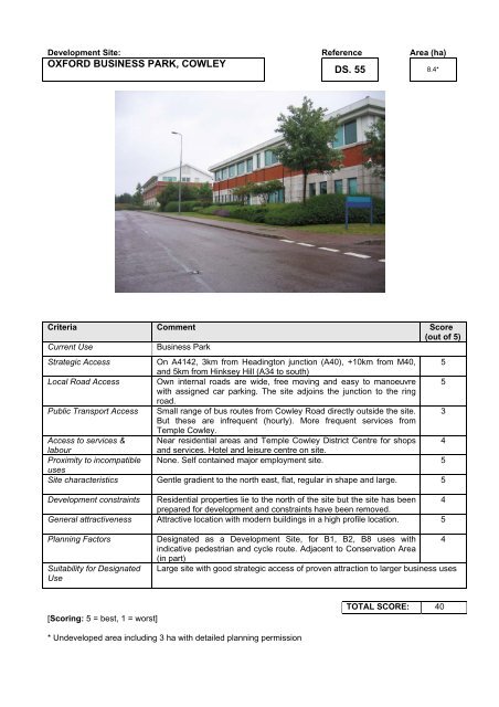
Development Site: Reference Area (ha) OXFORD BUSINESS PARK, COWLEY DS. 55 8.4* Criteria Comment Score (out of 5) Current Use Business Park Strategic Access Local Road Access Public Transport Access Access to services & labour Proximity to incompatible uses Site characteristics Development constraints General attractiveness Planning Factors Suitability for Designated Use [Scoring: 5 = best, 1 = worst] On A4142, 3km from Headington junction (A40), +10km from M40, 5 and 5km from Hinksey Hill (A34 to south) Own internal roads are wide, free moving and easy to manoeuvre 5 with assigned car parking. The site adjoins the junction to the ring road. Small range of bus routes from Cowley Road directly outside the site. 3 But these are infrequent (hourly). More frequent services from Temple Cowley. Near residential areas and Temple Cowley District Centre for shops 4 and services. Hotel and leisure centre on site. None. Self contained major employment site. 5 Gentle gradient to the north east, flat, regular in shape and large. 5 Residential properties lie to the north of the site but the site has been prepared for development and constraints have been removed. 4 Attractive location with modern buildings in a high profile location. 5 Designated as a Development Site, for B1, B2, B8 uses with 4 indicative pedestrian and cycle route. Adjacent to Conservation Area (in part) Large site with good strategic access of proven attraction to larger business uses * Undeveloped area including 3 ha with detailed planning permission TOTAL SCORE: 40
Development Site: Reference Area (ha) LAND AT REAR OF OXFORD RETAIL PARK, GARSINGTON ROAD DS. 56 1.15 Criteria Comment Score (out of 5) Current Use Vacant car park Strategic Access Local Road Access Public Transport Access Access to services & labour Proximity to incompatible uses Site characteristics Development constraints General attractiveness Planning Factors Suitability for Designated Use [Scoring: 5 = best, 1 = worst] On A4142 ring road, 3km from Headington junction (A40), +10km 4 from M40, and 5km from Hinksey Hill (A34 to south) Shared access to ring road with supermarket. Confusing filter road 4 layout on to ring road. H17a bus route runs directly to the superstore, but very infrequently 2 (once a day). Other routes run from Garsington / Watington Road (every hour). Retail warehouses and superstore are nearby, but no local services 2 such as banks/building societies. Few residential properties in the area. Standalone site, with no incompatible uses. 5 Large, flat, empty site which is irregular in shape due to superstore. 3 Tightly bound site by the recreation ground to the SW, the ring road to the NW, the superstore to the NE and the railway to the SE. Low profile site as it is isolated, but could be attractive for B2/B8 operator. Designated as a Development Site for B1(a), (b) and (c) uses, with indicative cycle route around site, and protected open space to south west. Shared access with retail park but otherwise good location for B1 uses TOTAL SCORE: 29 3 3 3
- Page 59 and 60: Site: Reference Area (ha) BLANCHFOR
- Page 61 and 62: Site: Reference Area (ha) TRAVIS PE
- Page 63 and 64: Site: Reference Area (ha) PRINTING
- Page 65 and 66: Site: Reference Area (ha) BLACKWELL
- Page 67 and 68: Site: Reference Area (ha) MAGDALEN
- Page 69 and 70: Site: Reference Area (ha) CAR TYRE
- Page 71 and 72: Site: Reference Area (ha) BUILDER
- Page 73 and 74: Site: Reference Area (ha) GARAGE RE
- Page 75 and 76: Site: Reference Area (ha) OXFORD PS
- Page 77 and 78: Site: Reference Area (ha) BMW PLANT
- Page 79 and 80: Site: Reference Area (ha) HARROW RO
- Page 81 and 82: Site: Reference Area (ha) CHILTERN
- Page 83 and 84: Site: Reference Area (ha) JORDAN HI
- Page 85 and 86: Site: Reference Area (ha) SITE AT C
- Page 87 and 88: Site: Reference Area (ha) BUILDER
- Page 89 and 90: Site: Reference Area (ha) TYRE & EX
- Page 91 and 92: Site: Reference Area (ha) DRENNAN I
- Page 93 and 94: Site: Reference Area (ha) POWELL’
- Page 95 and 96: APPENDIX 10 ASSESSMENT OF SAMPLE OF
- Page 97 and 98: Site: Reference Area (ha) 100a COWL
- Page 99 and 100: Site: Reference Area (ha) SALTER BR
- Page 101 and 102: Site: Reference Area (ha) OXFAM HOU
- Page 103 and 104: Site: Reference Area (ha) PEMBROKE
- Page 105 and 106: Site: Reference Area (ha) PHOENIX A
- Page 107 and 108: APPENDIX 11 ASSESSMENT OF DEVELOPME
- Page 109: Development Site: Reference Area (h
- Page 114 and 115: Development Site: Reference Area (h
- Page 116 and 117: Development Site: Reference Area (h
- Page 118 and 119: Development Site: Reference Area (h
- Page 120 and 121: Development Site: Reference Area (h
- Page 122 and 123: Development Site: Reference Area (h
- Page 124 and 125: Development Site: Reference Area (h
- Page 126 and 127: Development Site: Reference Area (h
- Page 128 and 129: Development Site: Reference Area (h
- Page 130: Development Site: Reference Area (h
- Page 133 and 134: Development Site: Reference Area (h
- Page 135 and 136: Development Site: Reference Area (h
- Page 137 and 138: Development Site: Reference Area (h
- Page 139 and 140: Development Site: Reference Area (h
- Page 141 and 142: Development Site: Reference Area (h
- Page 143 and 144: Development Site: Reference Area (h
- Page 145 and 146: Development Site: Reference Area (h
- Page 147 and 148: Reserved Site: Reference Area (ha)
- Page 149 and 150: Reserved Site: Reference Area (ha)
- Page 152 and 153: EMPLOYMENT GROWTH IN OXFORD CITY 20
- Page 154 and 155: EXTRAPOLATED EMPLOYMENT GROWTH IN O
- Page 156: OXFORD LEARNING PARTNERSHIP INITIAT
Development Site: Reference Area (ha)<br />
<strong>OXFORD</strong> BUSINESS PARK, COWLEY<br />
DS. 55<br />
8.4*<br />
Criteria Comment Score<br />
(out of 5)<br />
Current Use Business Park<br />
Strategic Access<br />
Local Road Access<br />
Public Transport Access<br />
Access to services &<br />
labour<br />
Proximity to incompatible<br />
uses<br />
Site characteristics<br />
Development constraints<br />
General attractiveness<br />
Planning Factors<br />
Suitability for Designated<br />
Use<br />
[Scoring: 5 = best, 1 = worst]<br />
On A4142, 3km from Headington junction (A40), +10km from M40, 5<br />
and 5km from Hinksey Hill (A34 to south)<br />
Own internal roads are wide, free moving and easy to manoeuvre 5<br />
with assigned car parking. The site adjoins the junction to the ring<br />
road.<br />
Small range of bus routes from Cowley Road directly outside the site. 3<br />
But these are infrequent (hourly). More frequent services from<br />
Temple Cowley.<br />
Near residential areas and Temple Cowley District Centre for shops 4<br />
and services. Hotel and leisure centre on site.<br />
None. Self contained major employment site. 5<br />
Gentle gradient to the north east, flat, regular in shape and large. 5<br />
Residential properties lie to the north of the site but the site has been<br />
prepared for development and constraints have been removed.<br />
4<br />
Attractive location with modern buildings in a high profile location. 5<br />
Designated as a Development Site, for B1, B2, B8 uses with 4<br />
indicative pedestrian and cycle route. Adjacent to Conservation Area<br />
(in part)<br />
Large site with good strategic access of proven attraction to larger business uses<br />
* Undeveloped area including 3 ha with detailed planning permission<br />
TOTAL SCORE: 40


