Largo Town Center Station Access Study - WMATA.com
Largo Town Center Station Access Study - WMATA.com
Largo Town Center Station Access Study - WMATA.com

Create successful ePaper yourself
Turn your PDF publications into a flip-book with our unique Google optimized e-Paper software.
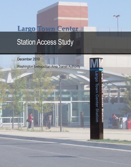
<strong>Largo</strong><strong>Town</strong><strong>Center</strong><strong>Station</strong>Aces<strong>Study</strong>December2010WashingtonMetropolitanAreaTransitAuthority
<strong>Largo</strong> <strong>Town</strong> <strong>Center</strong><strong>Station</strong> <strong>Access</strong> <strong>Study</strong>Final ReportWashington Metropolitan Area Transit AuthorityDepartment of Planning and Joint DevelopmentOffice of <strong>Station</strong> Area Planning and Asset ManagementDecember 2010Lead Agency:Consultant:Washington Metropolitan Area TransitAuthority<strong>Station</strong> Area Planning and Asset ManagementParsons BrinckerhoffSteven E. Goldin, DirectorRobin McElhenny, Manager of <strong>Station</strong> Area PlanningCatherine Jones, Senior Urban Planner600 5th Street NWWashington, DC 20001
<strong>Largo</strong> <strong>Town</strong> <strong>Center</strong> <strong>Station</strong> <strong>Access</strong> <strong>Study</strong>ContentsExecutive SummaryES-1<strong>Station</strong> Context 1Brief History 1Project Purpose and Scope 3Planning Context 3Existing <strong>Station</strong> Area Land Use and Zoning 4<strong>Station</strong> Facilities and Operations 9Metrorail Operations 9<strong>Station</strong> Facilities 10Internal <strong>Station</strong> Circulation 11Pedestrian <strong>Access</strong> & Circulation 13Bicycle <strong>Access</strong> & Circulation 14Bus <strong>Access</strong> & Circulation 14Kiss & Ride <strong>Access</strong> & Circulation 14Park & Ride <strong>Access</strong> & Circulation 16External <strong>Station</strong> <strong>Access</strong> 17Future <strong>Station</strong> Improvement Re<strong>com</strong>mendations 23Future Land Use 23Future Ridership 24<strong>Station</strong> Improvement Re<strong>com</strong>mendations 25Contentsi
<strong>Largo</strong> <strong>Town</strong> <strong>Center</strong> <strong>Station</strong> <strong>Access</strong> <strong>Study</strong>List of FiguresFigure 1: System MapES-1Figure 2: <strong>Station</strong> Site 1Figure 3: Existing Land Use 2Figure 4: Future Land Use Map from 2004 Sector Plan 3Figure 5: Local Non-residential Destinations 4Figure 6: Environmental Infrastructure 5Figure 7: Number of Daily Passengers by Mode of <strong>Access</strong> 9Figure 8: <strong>Station</strong> Facilities 10Figure 9: Allowable Walking Distances of <strong>Station</strong> Facilities from <strong>Station</strong> Entrance 11Figure 10: <strong>Station</strong> <strong>Access</strong> Hierarchy 11Figure 11: Pedestrian <strong>Access</strong> and Points of Conflict 12Figure 12: Bus Bays and Existing Bus Service 15Figure 13: Kiss & Ride Facilities 16Figure 14: Vehicular <strong>Station</strong> <strong>Access</strong> 18Figure 15: One <strong>Largo</strong> Metro Site Plan 23Figure 16: One <strong>Largo</strong> Metro Aerial Rendering 24Figure 17: Potential Reconfiguration of Harry S Truman Drive <strong>Access</strong> 27Figure 18: <strong>Station</strong> Improvement Re<strong>com</strong>mendations 29iiContents
<strong>Largo</strong> <strong>Town</strong> <strong>Center</strong> <strong>Station</strong> <strong>Access</strong> <strong>Study</strong>List of TablesTable 1: May 2009 Weekday Boardings 9Table 2: Projected Mode of <strong>Access</strong>, 2030 24Contentsiii
ExecutiveSummary<strong>Largo</strong> <strong>Town</strong> <strong>Center</strong><strong>Station</strong> <strong>Access</strong> <strong>Study</strong>Section 1
<strong>Largo</strong> <strong>Town</strong> <strong>Center</strong> <strong>Station</strong> <strong>Access</strong> <strong>Study</strong>vi Section 1
<strong>Largo</strong> <strong>Town</strong> <strong>Center</strong> <strong>Station</strong> <strong>Access</strong> <strong>Study</strong>modes of access. Approximately1% of riders carpooled, and lessthan one percent took a taxi orrode a bicycle to the station.<strong>Station</strong> access needs are changingas development near the stationcontinues to intensify. A recentdevelopment proposal proposesnearly 1 million square feet ofoffice space, over 9,000 square feetof retail, and a 13,000 square-footday care facility at the 11.8 acreparcel located to the west of the<strong>Largo</strong> <strong>Town</strong> <strong>Center</strong> Metro <strong>Station</strong>.The proposed development isa U-shaped building consistingof two main towers (13 and 10stories high) connected by a onestoryentrance pavilion and retailspace connected to a freestanding,1,398-space, five-story parkingstructure for tenant parking.Due to this and otherdevelopments in the station area,ridership at the <strong>Largo</strong> <strong>Town</strong><strong>Center</strong> <strong>Station</strong> is expected togrow 50% over current levelsby 2030. However, the Park& Ride lots at the station arecurrently at capacity. Therefore, aconcentrated effort must be madeto improve pedestrian, bicycle,and bus access to the station toac<strong>com</strong>modate future ridershipgrowth. This study assessespedestrian, bicycle, bus, Kiss &Ride, and Park & Ride access tothe <strong>Largo</strong> <strong>Town</strong> <strong>Center</strong> station,and offers re<strong>com</strong>mendations toimprove access to the station forall modes.ES-2 Section 1
<strong>Largo</strong> <strong>Town</strong> <strong>Center</strong> <strong>Station</strong> <strong>Access</strong> <strong>Study</strong>i Section 2
<strong>Largo</strong> <strong>Town</strong> <strong>Center</strong> <strong>Station</strong> <strong>Access</strong> <strong>Study</strong>Project Purpose andScopeThis <strong>Station</strong> <strong>Access</strong> Plan focuseson re<strong>com</strong>mendations to improvepedestrian, bicycle, bus, Kiss &Ride, and Park & Ride access toand from the station area.The <strong>Largo</strong> <strong>Town</strong> <strong>Center</strong> Metrorail<strong>Station</strong> is located in PrinceGeorge’s County, Marylandimmediately outside of theCapital Beltway (I-95/I-495) andapproximately a 1/2 mile northof Central Avenue (MD 214). Thestation is approximately 10 mileseast of downtown Washington,D.C., and local access to thestation is provided from HarryS Truman Drive and LottsfordRoad. It is one of two stationslocated within one mile fromFedEx Field, one of the largestfootball stadiums in the NationalFootball League and home to theWashington Redskins.As the terminus station of theBlue Line, the station caters notonly to the local residential and<strong>com</strong>mercial <strong>com</strong>munity, but alsoto a large number of <strong>com</strong>muters.The station’s facilities extend toboth the north and south sideof the elevated Metrorail tracks.The facility includes two abovegroundparking garages with atotal of 2,200 spaces, a bus loopwith seven bus bays, a 161-spaceKiss & Ride surface lot, two bikeracks and 48 bike storage lockers.The Kiss & Ride lot and the 4-levelsouth garage are located on thesoutheast side of the Metrorailtracks. The bus loop and five-levelnorth garage are on the north sideof the tracks.peak hours, as well as offpeak, weekend times and onefootball game day. During thesite visits, interviews with thestation managers, as well as anemployee of the Prince George’sCounty Revenue Authority, wereconducted to ascertain additionalissues and conflicts.Planning ContextThe study area falls under thejurisdictions of the 2002 PrinceGeorge’s County General Planand the 2004 Sector Plan forMorgan Boulevard and <strong>Largo</strong><strong>Town</strong> <strong>Center</strong> Metro Areas. TheGeneral Plan identifies the <strong>Largo</strong><strong>Town</strong> <strong>Center</strong> Metro <strong>Station</strong> as aMetropolitan <strong>Center</strong>, designatedfor a high concentration of landuses and economic activities thatattract employers, workers andcustomers from other parts of theWashington Metropolitan area.The Sector Plan re<strong>com</strong>mendsthat the land uses adjacent to the<strong>Largo</strong> <strong>Town</strong> <strong>Center</strong> <strong>Station</strong> consistof mixed-use office, multi-familyhousing, and retail, with a strongfocus on orienting these uses tothe Metro station. Its conceptincludes a horizontal mix of uses,with an enhanced, attractive andsafe pedestrian environment.Site observations were carriedout during morning and eveningFigure 4: Future Land Use Map from 2004 Sector PlanSection 23
<strong>Largo</strong> <strong>Town</strong> <strong>Center</strong> <strong>Station</strong> <strong>Access</strong> <strong>Study</strong>Existing <strong>Station</strong> AreaLand Use and ZoningThe station area contains largescale<strong>com</strong>mercial, entertainment,and multi-family residential<strong>com</strong>ponents, but the usesare segregated with limitedorientation to the Metro station.However, there is approximately50 acres of developable landlocated close to the station.Much of this acreage <strong>com</strong>esfrom two parcels that straddleGrand Boulevard (an accessroad to the south garage fromLottsford Road) , but also includesproperties along <strong>Largo</strong> Drive,which currently is occupied bylow density <strong>com</strong>mercial buildingsand two 100+ room hotels.Key <strong>com</strong>mercial, entertainment,and employment destinationswithin a half-mile of the stationinclude:• The Boulevard at the CapitalCentre, a 480,000 SF openair retail and entertainment<strong>com</strong>plex that includes theMagic Johnson Theaters andover 70 retail and diningestablishments.• Inglewood BusinessCommunity, a 174-acre sitethat en<strong>com</strong>passes currently1,272,240 SF of office and flexspace, with a potential buildoutof over 1.8 million SF.• <strong>Largo</strong> Park, an 85-acre officepark that is currently home to588,806 SF of office space andpotential build-out of almost1.1 million SF.• The Woodlands Businesscenter, a small office parkon <strong>Largo</strong> Drive withapproximately 37,000 SF ofoffice space.• <strong>Largo</strong> <strong>Town</strong> <strong>Center</strong> Shopping<strong>Center</strong>, a 250,000 SF shoppingcenter anchored by ShoppersFood Warehouse andMarshall’s.NInglewoodBusinessCommunityLottsford RoadFedEx Field<strong>Largo</strong> ParkLandover RoadArena DriveThe Boulevard atthe Capital <strong>Center</strong><strong>Largo</strong> <strong>Town</strong><strong>Center</strong>I-495MGrand BlvdWoodlandsBusiness <strong>Center</strong>Harry S Truman Rd<strong>Largo</strong> DrMidtown <strong>Largo</strong><strong>Station</strong><strong>Largo</strong>PlazaCentral AveAreas highlighted in blue denote Metro propertyFigure 5: Local Non-residential Destinations4 Section 2
<strong>Largo</strong> <strong>Town</strong> <strong>Center</strong> <strong>Station</strong> <strong>Access</strong> <strong>Study</strong>M<strong>Largo</strong> Metro <strong>Station</strong>StreamLakeWetland50’ Stream/Wetland BufferSlope > 25%Green Infrastructure PlanMRegulated AreaEvaluation AreaNetwork GapDigital Source:The Maryland-National Capital Parkand Planning CommissionFigure 6: Environmental InfrastructureIn addition, within a onemile radius are the followingdestinations:• FedEx Field, the 91,704seat stadium home to theWashington Redskins footballteam, located approximatelyone mile to the northwest.• <strong>Largo</strong> Plaza, a 600,000 SFshopping center anchored byGiant Foods and Target.Residential development withinthe Metrorail station study areais all multi-family residentialhousing (apartments andcondominiums), including:• The Midtown <strong>Largo</strong> <strong>Station</strong>condominiums, locatedat the southeast corner ofthe intersection of HarryS Truman Drive andLottsford Road, a 242-unitcondominium developmentthat opened in 2006• The Camden <strong>Largo</strong> <strong>Town</strong><strong>Center</strong> Apartments, a 219 unitapartment <strong>com</strong>munity• <strong>Largo</strong> <strong>Center</strong> Apartments• Lake Arbor TowersApartments• Lake <strong>Largo</strong> Condominiums• <strong>Largo</strong> <strong>Town</strong> <strong>Center</strong>CondominiumsWith the exception of theBoulevard at the Capital Centresite and the Metrorail stationsite, the land located within thedesignated <strong>Largo</strong> <strong>Town</strong> <strong>Center</strong>Metro Core is all zoned for mixedusedevelopment as regulated bythe design zones: Mixed Activity<strong>Center</strong> (M-A-C) and Mixed-UseInfill (M-U-I).The Metrorail station site itself iszoned Commercial Office (C-O),and is re<strong>com</strong>mended throughthe Sector Plan for air-rightsdevelopment with office uses anda quality hotel and conferencecenter if supported by the market.There are few physical restrictionsin the area. Topography isrelatively flat on both sides ofthe station, with the exception ofa slight grade change betweenthe station’s east entrance andHarry S. Truman Drive anda grade change between thesoutheast and northwest side ofthe tracks, which creates a bi-levelstation. A small stream bordersthe north side of the <strong>WMATA</strong>property, creating a small barrierbetween the Metro station and theBoulevard at Capital Centre.Section 25
<strong>Station</strong>Facilities andOperationsMetrorail Operations<strong>Station</strong> FacilitiesInternal <strong>Station</strong> CirculationPedestrian <strong>Access</strong> and CirculationBicycle <strong>Access</strong> and CirculationBus <strong>Access</strong> and CirculationKiss & Ride <strong>Access</strong> and CirculationPark & Ride <strong>Access</strong> and CirculationExternal <strong>Station</strong> <strong>Access</strong><strong>Largo</strong> <strong>Town</strong> <strong>Center</strong><strong>Station</strong> <strong>Access</strong> <strong>Study</strong>Section 3
<strong>Largo</strong> <strong>Town</strong> <strong>Center</strong> <strong>Station</strong> <strong>Access</strong> <strong>Study</strong>8 Section 3
<strong>Largo</strong> <strong>Town</strong> <strong>Center</strong> <strong>Station</strong> <strong>Access</strong> <strong>Study</strong><strong>Station</strong> Facilities and OperationsThe <strong>Largo</strong> <strong>Town</strong> <strong>Center</strong> Metrorailstation opened in 2004 as theterminus of the Blue Line.Because of its location at the endof a Metrorail line, the stationpredominately serves <strong>com</strong>mutersheading towards Washington D.C,on weekdays. However, becauseof the retail concentrations andstadium within walking distance,the station is also a destination forrecreational activity throughoutthe week.Metrorail OperationsA total of 10,379 passengers enterand exit the Metrorail station on atypical weekday. See Table 1 forstation entries and exits duringpeak and off-peak periods.According to Metro’s 2007Table 1: May 2009 Weekday BoardingsEntry ExitAM Peak 3,481 287AM Off-Peak 427 244PM Peak 600 3,043PM Off-Peak 670 1,627Daily Total 5,178 5,201Metrorail Passenger Survey,approximately 60% of passengersboarding a train at <strong>Largo</strong> <strong>Town</strong>center arrived at the stationby driving to the Park & Ride.Metrobus and other bus (13%),Kiss & Ride (12%), and Walking(12%) were also <strong>com</strong>mon modesof access. Approximately 1% ofriders carpooled, and less thanone percent took a taxi or rode abicycle to the station. See Figure7 for mode of access to <strong>Largo</strong><strong>Town</strong> <strong>Center</strong> <strong>Station</strong> in 2007. NoteCarpool, 65 Taxi, 19 Bicycle, 16Walk, 519Kiss & Ride, 539Metrobus/OtherBus, 600Park & Ride,2,809Figure 7: Number of Daily Passengers by Mode of <strong>Access</strong>, 2007Section 39
<strong>Largo</strong> <strong>Town</strong> <strong>Center</strong> <strong>Station</strong> <strong>Access</strong> <strong>Study</strong>that the data used in Table 1 wasrecorded two years after the dataused in Figure 7, and the growthin ridership at the <strong>Largo</strong> <strong>Town</strong><strong>Center</strong> Metro <strong>Station</strong> duringthis period is reflected in theseFacilitynumbers.During football season, somespectators use the station toaccess FedEx Field, which isapproximately one mile to theDescription1 Northwest <strong>Station</strong> Entrance Mezzanine-level entrance2 Southeast <strong>Station</strong> Entrance Upper-level entrance3 Bicycle Parking 9 bicycle racks, 48 bicycle lockers4 Bus Bays 7 bus bays, with shelthers/benches5 Kiss & Ride - pick up/drop off lane,taxi stand325 foot lane6 Kiss & Ride - short term parking 141 metered spaces7 Park & Ride - North Garage andEntrances (P)8 Park & Ride - South Garage andEntrances (P)2,200 spaces9 Motorcycle Parking 18 spacesnorthwest. However, the majorityof people going to the stadiumby Metrorail use the MorganBoulevard Metrorail <strong>Station</strong>. It isone stop before the <strong>Largo</strong> stationand a slightly shorter walk to thestadium.<strong>Station</strong> FacilitiesThe <strong>Largo</strong> <strong>Town</strong> <strong>Center</strong> Metrorail<strong>Station</strong> facilities are located ontwo levels. Passengers usingthe southeast entrance enter thestation on the upper level (at thesame height, but disconnectedfrom the station platform) anddescend to the mezzanine level.Passengers using the northwestentrance enter the station at themezzanine level. Both entrancesP7P138425P569Figure 8: <strong>Station</strong> Facilities10 Section 3
<strong>Largo</strong> <strong>Town</strong> <strong>Center</strong> <strong>Station</strong> <strong>Access</strong> <strong>Study</strong>Source: <strong>WMATA</strong>Figure 9: Allowable Walking Distances of <strong>Station</strong> Facilities from <strong>Station</strong> Entranceare surrounded by small plazalikespaces that are sparselylandscaped and furnished.All passengers ascend to theupper level station platform fromthe mezzanine level. The station’scenter platform is partiallycovered.Metro standards dictate theappropriate walking distancesto station elements (shown inFigure 9) as well as the hierarchyof station access (shown in Figure10). These standards were used toevaluate the station facilities.Source: <strong>WMATA</strong>Figure 10: <strong>Station</strong> <strong>Access</strong> HierarchySection 3Internal <strong>Station</strong>CirculationThe following facilities are locatedwithin the station:• 11 fare gates (1 ADAaccessible)• 10 fare vendors (including oneSmarTrip vendor)• 2 exit fare machines• Vertical circulation fromupper-level station entrance tomezzanine• 1 escalator• 1 set of stairs• 1 elevator• Vertical circulation frommezzanine to train platform• 3 escalators• 3 sets of stairs• 2 elevators• Vertical circulation fromSouth Garage to mezzanine• 1 set of stairs• Vertical circulation fromNorth Garage to mezzanineentrance• 1 elevator• 1 set of stairs• 1 empty elevator shaft forfuture expansion• Vertical circulation fromSouth Garage to upper levelstation entrance• 2 elevators• 1 set of stairsThere is a single escalatorbetween the upper level stationentrance and the mezzanine level;passengers entering or exitingthe station against the peakEscalator and stairs between thestation platform and mezzanine levelEscalator and elevator between upperlevel station entrance and mezzanine11
<strong>Largo</strong> <strong>Town</strong> <strong>Center</strong> <strong>Station</strong> <strong>Access</strong> <strong>Study</strong>flow must use either the stairsor the elevator. A single elevatorbetween the upper level stationentrance and the mezzanine levelmeans that during times of outagepersons who are unable to usethe escalator or stairs must enterthe station from the northwestmezzanine-level entrance.However, there is no personalvehicle access for those beingdropped off or spaces for shorttermparking at the mezzaninelevelentrance.The two elevators between themezzanine level and the trainplatform provide important backupin case one elevator is out ofservice.Passengers rarely wait on theplatform because of <strong>Largo</strong> <strong>Town</strong><strong>Center</strong> is terminus station. Trainswait at the platform beforedeparting, so riders wait on thetrain rather than on the platform.Because of this, no additionalseating or shelters are needed onthe station platform.During the site visits noconflicts were observed withstation circulation. The faremachines appeared sufficient toac<strong>com</strong>modate the AM peak, andfare gates allowed for a fairlysteady flow out of the stationduring the PM peak. Althoughup to five people were sometimesqueued to exit the faregates theline remained moving.Overall site access and circulationis fair. While facilities on site, suchas sidewalks and access roads, aresufficient, there are a few conflictsthat were observed and reported.These conflicts are shown inFigure 11 and are clarified in thefollowing sections for each of themodes of arrival to the station:• Pedestrians• Bicyclists• Buses• Vehicular <strong>Access</strong>• Kiss & Ride• Park & RideFigure 11: Pedestrian <strong>Access</strong> and Points of Conflict12 Section 3
<strong>Largo</strong> <strong>Town</strong> <strong>Center</strong> <strong>Station</strong> <strong>Access</strong> <strong>Study</strong>Crosswalks and brick pavers acrossLottsford RoadPedestrian connection to the stationfrom The Boulevard at Capital CentreSidewalk and fence along GrandBoulevardThe crosswalk and sidewalk at theBoulevard at Capital Centre parking lotPedestrian <strong>Access</strong> andCirculationIn 2007, approximately 12% ofstation passengers walked orbiked to the station. This is on thehigher end of similar end-of-linestations and could be due to <strong>Largo</strong><strong>Town</strong> <strong>Center</strong>’s concentration ofresidential development and itsretail/entertainment base. Thismode share has risen rapidly, upfrom 5% in 2006. The number oflocal destinations and residentialuses make convenient and safepedestrian connections importantfor existing passengers. Inaddition, an improved pedestrianenvironment will be critical toencourage a higher pedestrianaccess mode share and decreasethe strain on Park & Ride facilities,as well to as increase transit useby area visitors, employees andresidents.The three access points forpedestrians are from LottsfordRoad, Harry S Truman Driveand the Boulevard at the CapitalCentre. Pedestrian access isless than ideal at all three accesspoints.Lottsford Road is the primaryaccess road for passengersarriving at the station from thenorth and the east. LottsfordRoad is a two to four lane roadin each direction, with a wideplanted median. Sidewalks witha landscaped buffer from theroadway are available along bothsides of the road, and pedestriancrosswalks across Lottsford Roadhave special paving materials forbetter visibility. From LottsfordRoad, pedestrians access thestation either from GrandBoulevard or from the one-waydirection parking garage accessroad.Grand Boulevard is a designatedpedestrian entry point with asidewalk along the south sideof the street. The intersection ofGrand Boulevard and LottsfordRoad is signalized, with specialpaved crosswalks on two of thethree approaches. However, somejaywalking occurs across LottsfordRoad to access Grand Boulevardas the location of the gates andentrances for the residential<strong>com</strong>munities along LottsfordRoad are located away from thesignalized intersections.The one-way access road to thesouth parking garage is notintended for pedestrian useand does not have sidewalks oneither side, nor a intersectionand crosswalk for pedestrians tosafely cross over Lottsford Roadto access it. However, pedestrianswere still seen using the roadbecause it provides the mostdirect connection to the stationfrom the northeast. There is aneed for a sidewalk along thisroad to ac<strong>com</strong>modate pedestrians.For passengers walking from<strong>Largo</strong> Drive, Harry S TrumanDrive is the primary route.Should <strong>Largo</strong> Drive developwith more intense mixed uses,it will significantly increase theuse of this street as a pedestrianconnection to the Metrorailstation. Sidewalks with alandscaped buffer are availableon both side of Harry S TrumanDrive, but a crosswalk is notavailable for pedestrians to crossthe road at either station entrance.While Harry S Truman Drivecould also serve as a connectionfor pedestrians <strong>com</strong>ing frompoints to the south and theeast, pedestrians are currentlydiscouraged from using theconnection because the pathSection 313
<strong>Largo</strong> <strong>Town</strong> <strong>Center</strong> <strong>Station</strong> <strong>Access</strong> <strong>Study</strong>requires pedestrians to traversethe lengthy and busy Kiss & Rideparking lot.Passengers walking from theInglewood Business Communityor from the Boulevard at theCapital Centre generally enter thestation through the Boulevard atCapital Centre’s surface parkinglot. This parking lot has a stripedcrosswalk and narrow sidewalkthat connects pedestrians fromthe Metro property to the mainentry point of the shops, althoughfew pedestrians were seen usingit. Many preferred to cross thesurface lot to directly access theirdestination - e.g., RestaurantRow, the Magic Johnson theaters,etc. There is a high potential forconflict between pedestrians,particularly handicappedpedestrians, and vehicles that areparking and entering/exiting thelot. A stream is located betweenthe station and the Boulevardat the Capital Centre, whichrequires pedestrians to cross overa small pedestrian bridge in asemi-wooded area. On the Metroproperty, pedestrians using thisconnection must also cross theparking garage access road at acrosswalk to access the stationentrance.Bicycle <strong>Access</strong> andCirculationBicycles are poorly ac<strong>com</strong>modatedat and near the Metro station.Striped bicycle lanes in the stationarea do not exist, and high vehiclespeeds and the lack of shoulderson surrounding roadways createsa poor environment for bicyclists.In addition, there are few optionsfor bicycles to access the stationwithout conflicting with vehicles,buses or pedestrians.The station has nine wave-stylebicycle racks and 48 bicyclelockers. While the bicycle lockersare in a more prominent locationat both station entrances, thebicycle racks are located in anout-of-the-way location behindthe southeast station entrancewith poor visibility, lightingand security. In addition,wave-style bicycle racks arenot re<strong>com</strong>mended by theAssociation of Pedestrian andBicycle Professionals (APBP)because the actual rack capacityis generally lower than the statedrack capacity. APBP has concernsabout the style of bicycle rackbecause bicycles that are parkedperpendicular to the wave rackare not supported in two placesand are therefore more likely tofall over.Metro supports providing modernand well-maintained bike parkingfacilities to meet the demand ofbicycles and encourage moreMetrorail customers to bike tothe stations. The new standardfor bicycle racks is the inverted Urack, and where possible, locatingracks under covered areas.Bus <strong>Access</strong> andCirculationBus operations at the <strong>Largo</strong> <strong>Town</strong><strong>Center</strong> Metrorail <strong>Station</strong> occurat the mezzanine-level stationentrance area. Seven sawtooth busbays, each with its own shelterand bench, are located alongthe exterior of the bus loop. Theinterior of the loop is intendedfor bus layover but is currentlyinformally used for Metroemployee parking. The center ofthe loop is a grassy area withoutfurniture or any observed use.The bus bays are accessed viaHarry S Truman Drive. ExitingBicycle racks at the stationBicycle lockers near the north garagebuses make a left turn onto HarryS Truman Drive across threelanes of on<strong>com</strong>ing traffic. Thisresults in potential conflict dueto the slower acceleration andwider turning radii of buses,<strong>com</strong>bined with the volume andspeed of on<strong>com</strong>ing traffic. This isparticularly an issue during AMand PM peak hours.The <strong>Largo</strong> <strong>Town</strong> <strong>Center</strong>Metrorail <strong>Station</strong> is served byfour MetroBus routes on theCentral Avenue line and threeTheBus routes operated by PrinceGeorge’s County.Kiss & Ride <strong>Access</strong> andCirculationThe Kiss & Ride is accessedfrom Harry S Truman Drive andincludes the facilities shown inFigure 13. Circulation throughthe Kiss & Ride occurs via a onewayroad along the exterior of thesurface lot.14 Section 3
<strong>Largo</strong> <strong>Town</strong> <strong>Center</strong> <strong>Station</strong> <strong>Access</strong> <strong>Study</strong>There are potential conflicts whenvehicles exit the Kiss & Ride, asthey must make a left turn acrossthree lanes of on<strong>com</strong>ing traffic.The portion of Harry S TrumanDrive located directly before theentrance / exit to the Kiss & Ridecurves slightly, creating a poorsight line for on<strong>com</strong>ing trafficand exiting vehicles. This exit isparticularly problematic duringthe PM peak hours when thereare high traffic volumes in bothdirections on Harry S TrumanDrive. Cars have difficulty exitingthe lot - sometimes backing upto the station entrance, creatingproblems with congestion andcirculation.Sidewalk and shelters along bus loopFEBus turning on to Harry S TrumanDrive from the bus loopIn addition, there is an informalKiss & Ride operation at theGrand Boulevard entrance to theSouth Garage. Grand Boulevardhas a small “bump out” atthe south side of the entranceto the South Garage wherevehicles often drop off or waitfor passengers. Some motoristslikely find this a more convenientlocation for picking up anddropping off passengers becauseit is a more direct connectionfor vehicles <strong>com</strong>ing from thenorth and the east, and it doesnot have the same queuing toexit issues as the formal Kiss &Ride does. However, it also posesconflicts between vehicles exitingthe South Garage and vehiclesmaking a U-turn at the end ofGrand Boulevard to wait in thecul-de-sac. For these reasons afence was installed between thesidewalk and the road to dissuadepassengers from using thisarea as a Kiss & Ride. Signageprohibiting stopped vehicles atthis location is already present.Additional enforcement may benecessary to fully stop customersfrom using this area as anSection 3Route Direction Destination BusBayPeak HourDeparturesC21 westbound Addison Road Metro D 2C21 eastbound Collington <strong>Center</strong> C 2C22 westbound Addison Road Metro D 2C22 eastbound Collington <strong>Center</strong> C 2C26 westbound (T) <strong>Largo</strong> Metro B 2 arrivalsC26 eastbound East Kettering B 2C29 westbound Addison Road Metro D Saturday/SundayC29 eastbound Bowie State University B SaturdayC29 eastbound Pointer Ridge B Sunday21 northbound New Carrollton Metro F 221 southbound Upper Marlboro F 226 westbound (T) <strong>Largo</strong> Metro E 2 arrivals26 eastbound Morgan Boulevard E 228 northbound Inglewood Business Park E 228 southbound (T) <strong>Largo</strong> Metro E 2 arrivalsFigure 12: Bus Bays and Existing Bus ServiceBCD15
<strong>Largo</strong> <strong>Town</strong> <strong>Center</strong> <strong>Station</strong> <strong>Access</strong> <strong>Study</strong>informal Kiss & Ride.The capacity of the Kiss & Ride isample for existing use, althoughall of the handicap parking spaceswere occupied during site visits.While the curbside Kiss & Rideactivity at the station entranceis highly utilized, the secondcurbside shuttle lane, locatedfurther from the station entrance,is less frequently used.1 22 ‘Section A’ all-day 15 minute waiting spaces2 6 handicap parking spaces,3 131 7-hour metered spaces4 6 shuttle parking spaces5 18 motorcycle parking spacesPark & Ride <strong>Access</strong> andCirculationThe Park & Ride facilities at the<strong>Largo</strong> <strong>Town</strong> <strong>Center</strong> Metrorail<strong>Station</strong> consist of two 4- to 5-levelparking garages that have a totalof 2,200 spaces and are connectedat the top level by an auto bridge.Together the parking garages havethree entrances and two exits.<strong>Largo</strong> <strong>Town</strong> <strong>Center</strong> <strong>Station</strong> hasa parking utilization rate of over100%, with a significant amount ofturnover during the day.6 Two curbside pick-up/drop-off lanes of 320 feet and 225 feet are availablefor personal vehicles, shuttles and taxis7 Two shelters with benches for passengers waiting to be picked up; theseshelters are located approximately 200 feet from the station entrance alongthe northwest sidewalkFigure 13: Kiss & Ride FacilitiesKiss & Ride passenger drop-offCustomers walking through Kiss &RideThe entrance and exit from HarryS Truman Drive to the NorthGarage is an approximately 600-foot two-way access road thatleads to three parking booths forexit and entry for the parkinggarage. In the morning, traffic isoften backed up along the accessroad to enter into the garage;in the evening, during the PMpeak, the access road is also oftenbacked up with motorists exitingthe facility and waiting to makea left turn onto Harry S TrumanDrive. As with the other stationexits onto Harry S Truman Drive,this turn can be challengingbecause of the high volumes andspeeds of traffic <strong>com</strong>ing from bothdirections.There is an additional conflictpoint in front of the garage exit,where there is a popular, butunstriped, crossing for pedestrianswalking in between the Metrostation and the Boulevard at the16 Section 3
<strong>Largo</strong> <strong>Town</strong> <strong>Center</strong> <strong>Station</strong> <strong>Access</strong> <strong>Study</strong>Capital Centre. This crossingis particularly dangerous forpedestrians, as the long andstraight access road approachingthe parking garage can encouragespeeding by motorists.As the access road approaches thegarage entrance, it widens intothree unstriped lanes to allow forthe ‘middle lane’ to be a flex laneto ac<strong>com</strong>modate peak traffic.The Grand Boulevard entranceand exit from the South Garagehas three parking booths. Thereare two travel lanes to enter thegarage, and one travel lane to exitthe garage, with an additionalbump-out for a right-turn lane.No conflicts were observed orreported at this garage entranceand exit.The Lottsford Road entrance tothe South Garage is a slightlycurving one-way two laneaccess road. The entrance hastwo parking booths. Exceptfor potential conflicts withpedestrians who use this vehicleonlyroad as a route to the Metrostation, no other conflicts wereobserved or reported at thisgarage entrance.From the North Garage,customers access the station byan elevator (there is an additionalempty elevator shaft shouldadditional capacity for verticalcirculation be needed) or astaircase that leads to the plazaoutside of the northwest stationentrance. From the South Garage,customers can either access thestation via the plaza outside thesoutheast station entrance or viaa mezzanine-level corridor thatprovides an internal connectionbetween the garage and thestation mezzanine. However, thisconnection is rarely used becauseit is dark, unmonitored and has a90 degree turn that creates a blindspot for people.There are a number of capacityconcerns within the parkinggarages, as there is additionaldemand for long-term parkingbeyond what is provided. The2,200 spaces include spacesthat are reserved until 10 a.m.(there is a waiting list to receivea reserved parking space) andhandicap parking spaces. Thereserved spaces have been seen asparticularly problematic becausethey are not located close to thestation entrance - motorists willoften forego their reserved spacesand park in unreserved spacesto reduce the distance that theymust walk, effectively taking upthe equivalent of two parkingspaces until 10 a.m. In part due tothis practice, the parking garageis generally filled by 8:30 a.m. onweekdays; for those who park inreserved parking spaces without apass, the Prince George’s CountyRevenue Authority monitors thegarages and writes on average 40tickets a day to infractors. Thereserved parking spaces are 100%utilized.As the parking garages do nothave a device to indicate whenthey are full in the morning, thereare sometimes conflicts at thegarage entrances between vehiclesexiting the parking garage afterunsuccessfully finding a parkingspace and those vehicles that arestill queued to enter the garage.Some motorists will park at theBoulevard at the Capital Centre,which has ample parking capacityin close proximity to the Metrostation. However, this parkinglot is heavily monitored by theBoulevard’s staff, and vehicles areoften towed if their owners areobserved using the parking lot forPark & Ride operations.A number of security concernshave also been raised for theparking garages, often related totheft of items in vehicles or theftof the vehicle itself.External <strong>Station</strong> <strong>Access</strong>The <strong>Largo</strong> <strong>Town</strong> <strong>Center</strong> Metrorail<strong>Station</strong> has good vehicularaccess, with close proximity tothe Capital Beltway (I-95/I-495),Central Avenue (MD 214) andLandover Road (MD 202).Regional <strong>com</strong>muters who parkand ride at the station likelyoriginate from one of these majorthoroughfares. The State HighwayAdministration opened the nearbyArena Drive interchange for fulltimeuse in 2009, which providesa much improved connectionbetween the station and theBeltway in both directions.Central Avenue to the west isaccessed directly via Harry STruman Drive and <strong>Largo</strong> <strong>Center</strong>Drive. Central Avenue to the eastis more indirect and requiresconnection via Lottsford Roadand Arena Drive. The primarylocal vehicular connections areLottsford Road, Harry S TrumanDrive, Arena Drive, and <strong>Largo</strong>Drive. Lottsford Road is a two- tothree-lane road in each directionwith additional turn lanes anda wide landscaped median.Similarly, Arena Drive is also atwo- to three-lane road in eachdirection with additional turnlanes and a landscaped median.Harry S Truman Drive serves asan access road for the Metrorailstation facilities and the Boulevardat the Capital Centre. West of thestation, Harry S Truman functionsSection 317
<strong>Largo</strong> <strong>Town</strong> <strong>Center</strong> <strong>Station</strong> <strong>Access</strong> <strong>Study</strong>as a two-way street and consistsof two lanes in either direction,with a designated right-turnlane northbound and a medianturn lane. South of the Metrostation Kiss & Ride entrance, itsplits into a one way pair, withHarry S Truman Drive providingwestbound access with a two wayroad and a designated right-turnlane, and <strong>Largo</strong> Drive providingeastbound access. <strong>Largo</strong> Drive isa three-lane one-way road with adesignated left turn lane.The local vehicular connections allappear to have sufficient capacityto support existing vehiculartraffic, as well as a 16 percentincrease of Kiss & Ride trafficanticipated in 2030. It is notanticipated that there will beadditional Park & Ride activityoutside of what is currentlyoccurring as the Park & Ridegarages are already at capacity.Road Direction Purpose1 Kiss & Ride <strong>Access</strong> Road One way counter-clockwise This access road serves all Kiss & Ride functions2 Bus <strong>Access</strong> Road One way counter-clockwise3 Parking Garage <strong>Access</strong> Road Two way east-west4 Grand Boulevard Two way east-west5 Parking Garage <strong>Access</strong> Road One way west-boundThis bus- and service-vehicle only road serves the bus bays,station maintenance parking, and informal Metro-employeeparkingThis access road provides vehicle entrance to the northernparking garage from Harry S Truman DriveThis access road provides vehicle entrance to the southernparking garage from Lottsford Road2This access road provides vehicle entrance to the southernparaking garage from Lottsford Road5322114LOTTSFORD RDFigure 14: Vehicular <strong>Station</strong> <strong>Access</strong>18 Section 3
<strong>Largo</strong> <strong>Town</strong> <strong>Center</strong> <strong>Station</strong> <strong>Access</strong> <strong>Study</strong>Section 319
Future<strong>Station</strong>ImprovementRe<strong>com</strong>mendationsFuture Land UseFuture Ridership<strong>Station</strong> Improvement Re<strong>com</strong>mendations<strong>Largo</strong> <strong>Town</strong> <strong>Center</strong><strong>Station</strong> <strong>Access</strong> <strong>Study</strong>Section 4
<strong>Largo</strong> <strong>Town</strong> <strong>Center</strong> <strong>Station</strong> <strong>Access</strong> <strong>Study</strong>Future <strong>Station</strong> ImprovementRe<strong>com</strong>mendationsFuture Land UseThe only known developmentproposal within the station areais for the 11.8 acre parcel locatedat the northwest quadrant of theintersection of Lottsford Road andHarry S Truman Drive. The site isadjacent to the <strong>Largo</strong> <strong>Town</strong> <strong>Center</strong><strong>Station</strong> on the west and GrandBoulevard to the north. Theproposal calls for 966,517 squarefeet of office space, 9,743 squarefeet of retail, and a 13,300-squarefootday care center for 100children for a total proposedgross floor area of 989,560 squarefeet. The proposed gross floorarea will be provided within aU-shaped building consistingof two main towers (13 and 10stories high) connected by a onestoryentrance pavilion and retailspace connected to a freestanding,1,398-space, five-story parkingstructure. The design of the siteis specifically tailored to therequirements of the GeneralServices Administration (GSA),and the development hopes toattract the federal Departmentof Health and Human Services(DHHS) as a tenant.The U-shaped building fronts onLottsford Road and is flankedby a five-story parking structurethat is proposed to be accessedfrom Harry S Truman Drive.The retail space is proposed tobe along the northeast side ofthe parking structure, partiallyscreening the first level of theparking garage from a proposedurban plaza, which will connectto the Metro station. The plazaFigure 15: One <strong>Largo</strong> Metro Site PlanSection 423
<strong>Largo</strong> <strong>Town</strong> <strong>Center</strong> <strong>Station</strong> <strong>Access</strong> <strong>Study</strong>Future RidershipRidership ProjectionsCurrently, a total of 5,178passengers enter the Metrorailstation on a typical weekday. Thisfigure is expected to increase to7,900 entries by 2030 based on theMWCOG Round 7 populationprojections. This constitutes a 52%increase over current ridershipat the station. This significantincrease is due to the developmentpotential in the <strong>Largo</strong> station area.Figure 16: One <strong>Largo</strong> Metro Aerial Renderingfeatures planters with seat walls,trash receptacles, and a decorativepaving pattern. Loading facilitiesand mechanical equipment willbe located between the parkinggarage and the south office tower.Existing sidewalks are locatedadjacent to Grand Boulevard,Lottsford Road, and Harry STruman Drive. An outdoor playarea associated with the day carecenter is proposed to be locatedalong Harry S Truman Drive, onthe north side of the north officetower. A horseshoe-shaped driveis proposed at the front of thebuilding to ac<strong>com</strong>modate shuttlebus activity.A portion of the existing Metrostation Kiss & Ride facilityis located on the subject site,west of the proposed parkingstructure, within a previouslyrecordedsurface easement. Dueto the security requirements ofthe proposed tenant, a networkof stacked and staggered wallshas been included around theperimeter of the site. Retractablebollards, wedge barriers, andguard booths are strategicallylocated to maximize security.Six separate, relatively small,bioretention facilities areproposed and are scatteredaround the perimeter of the site.The applicant will be pursuingLeadership in Energy andEnvironmental Design (LEED)Silver certification for the buildingand may incorporate a number ofgreen design techniques into thebuilding including a partial greenroof on the one-story entrancepavilion. This rooftop area willdouble as an outdoor amenityarea for office workers.The <strong>Station</strong> <strong>Access</strong> <strong>Study</strong> concurswith the Planning Board’spedestrian re<strong>com</strong>mendationsand re<strong>com</strong>mends that Metro andPrince George’s County continueto support the <strong>Largo</strong> One Metroproject through the developmentreview process.. However, itsstatus and the status of the GSA’sdecision-making process isunknown.Mode of <strong>Access</strong>According to Metro’s 2007Passenger Survey, approximately12% access the station by walkingand biking, 13% by bus, 12% aredropped off, and 60% Park &Ride. Assuming that these modeshares will continue to hold truethrough 2030, Table 4 indicatesthe number of passengers thatthe Metrorail facilities shouldanticipate for station entry.These estimates are intended forplanning purposes only, as futureland use changes and accessimprovements can shift mode ofaccess percentages in the future.The pedestrian, bicycle, bus,and Kiss & Ride facilities areadequate to ac<strong>com</strong>modate thisfuture growth. However, thereare currently only 2,341 parkingspaces at the <strong>Largo</strong> <strong>Town</strong> <strong>Center</strong>station (2,200 Park & Ride spacesand 141 short-term meteredparking spaces). Today, overTable 2: Projected Mode of <strong>Access</strong>,2030Projected PassengersWalk 790Bus 910Kiss & Ride 820Park & Ride 4,20024 Section 4
<strong>Largo</strong> <strong>Town</strong> <strong>Center</strong> <strong>Station</strong> <strong>Access</strong> <strong>Study</strong>There is a need for a gateway orsignage towards the Boulevard atCapital CentreBrick pavers like this should beencouraged throughout the stationarea2,800 people drive and park atthe station, indicating a high levelof turnover in both the Kiss &Ride and Park & Ride facilities.However, by 2030 this figureis anticipated to grow to 4,200people, which will not be able tobe ac<strong>com</strong>modated through theexisting parking facilities. Metroshould continue to encouragepassengers to walk and bike tothe station and, to the maximumextent possible, provide andpromote ac<strong>com</strong>modations thatmake these the preferred methodsof accessing the station.<strong>Station</strong> ImprovementRe<strong>com</strong>mendationsPedestrian Re<strong>com</strong>mendationsThere are three primarypedestrian access points to andfrom <strong>Largo</strong> <strong>Town</strong> <strong>Center</strong> Metrostation: Grand Boulevard, thebridge between the Boulevardat the Capital Centre, and theLottsford Road south garageaccess road. All three need to beimproved.Grand Boulevard, which is alsoan entrance/exit for the southgarage, is considered the mainpedestrian route to the Metrostation from the north and west ofthe study area. Most of the peopleusing this route are <strong>com</strong>ing fromor going to the residences alongLottsford Road. The primaryimprovement needed alongGrand Boulevard is to widenthe sidewalk and make the areamore inviting. The June 11,2009 corrected resolution of thePrince George’s County PlanningBoard for Specific Design PlanSDP-0804 for <strong>Largo</strong> <strong>Town</strong><strong>Center</strong> (One <strong>Largo</strong> Metro) states,“the streetscape along GrandBoulevard is virtually nonexistent– the view from Lottsford Roadis stark and uninviting.” It goesonto say, “an eight-foot sidewalkis required along the site’sfrontage along Grand Boulevardto ac<strong>com</strong>modate pedestrianand bicycle traffic. Street treesshould also be provided betweenthe sidewalk and the curb inorder to soften the street edgeand provide and attractivepedestrian-scale environment.”The <strong>Station</strong> <strong>Access</strong> Plan concurswith the Planning Board’spedestrian re<strong>com</strong>mendationsand re<strong>com</strong>mends that Metro andPrince George’s County maintainclose coordination on the One<strong>Largo</strong> Metro project as it advancesthrough the development reviewprocess to ensure good pedestrianconnections.The unnamed entrance roadto Metro’s south garage fromLottsford Road (between GrandBoulevard and Arena Drive) is aninformal pedestrian route to thestation. For pedestrians <strong>com</strong>ingfrom the west, it is much shorterto walk down the access road andthrough the parking garage thanto walk along Lottsford Road anddown Grand Boulevard. Andwalk they do, even though theroute is not pedestrian friendly.There are no sidewalks and theroad is bounded by guard rails onboth sides. Although Metro maynot want to encourage pedestriansto use this route, it will be verydifficult to stop people from usingit. The route provides valuabletime and distance savings despiteits inhospitable environment.Therefore, Metro should improvethis access point for pedestrians.Due to the sloping terrainon either side of the existingroadway, the tail tracks on thenorth side of the roadway, and theretention pond on the south side,it will be difficult to create a newsidewalk alongside the existingroadway. An alternative, thoughnot ideal, would be to stripe orsegregate with small barriersa portion of the roadway forpedestrian use. However, analysisshould be conducted to furtherexplore this option. Colored orstamped pavement along the roadcould differentiate the pedestrianzone from the vehicular zone.These small changes wouldprovide pedestrians with adesignated walkway ratherthan walking in the middle ofthe road or along either side. Apainted pedestrian zone couldcontinue through the parkinggarage, around the vehicle accessgates, to connect to the station.High-visibility crosswalks couldalert drivers to the presence ofpedestrians, making this muchusedpedestrian route safer.Section 425
<strong>Largo</strong> <strong>Town</strong> <strong>Center</strong> <strong>Station</strong> <strong>Access</strong> <strong>Study</strong>The entrance to the Boulevard atCapital Centre also sees heavypedestrian traffic, and a bettergateway between the <strong>Largo</strong><strong>Town</strong> <strong>Center</strong> station and themall is needed. The Boulevard atCapital Centre is an importantdestination and feature of thestation area, but could be difficultfor first-time visitors to find.The station and the mall do notrelate and the route between thetwo looks ad hoc at best. Thecurrent access (a narrow bridgeover a wooded streambed) isbehind the north parking garageand requires pedestrians tocross the north garage entrance/exit. Once they enter the mallproperty, pedestrians need tomake their way through the mallparking lot before reaching theactual Boulevard. It is beyondthe scope of this report to makere<strong>com</strong>mendations for the mallproperty. However, the <strong>Study</strong>does re<strong>com</strong>mend that Metrowork with mall owners to createa pedestrian route on Metro’s andthe mall’s properties that is morevisible and wel<strong>com</strong>ing, and thatsafe passage for disabled patronsis prioritized.The area south of Harry STruman drive contains onestorysuburban-type officeand warehouse buildings andthe more urban four-storyMetropolitan at Lake <strong>Largo</strong>apartments. With the additionof the Metropolitan at Lake<strong>Largo</strong> apartments, Metro shouldencourage Prince George’sCounty to duplicate the brickcrosswalk paving currently atthe north and west sides of theintersection of Harry S TrumanDrive and Lottsford Road at thesouth and east sides. Similarly,Metro should encourage PrinceGeorge’s County to duplicate thecrosswalks between the stationand the confluence of <strong>Largo</strong> Driveand Harry S Truman Drive.Finally, Metro should work withPrince George’s County, and localbusinesses to provide additionalwayfinding to local destinationssuch as FedEx Field, theInglewood Business Community,and the Boulevard at the CapitalCentre.Bicycle Re<strong>com</strong>mendationsLess than one percent ofpassengers currently use bicyclesto access the station. To improvethe customer experience, Metroshould install a canopy overthe bicycle racks to help protectbicycles from sun, rain and snow.The number of existing bicycleracks and lockers should besufficient to meet future demand.However, bicycle racks are onlyavailable at the southeast stationentrance. To improve customerservice, bicycle racks (withcanopy) should be installed at thenorthwest station entrance. Thenew standard for bicycle racks isthe inverted U rack and, wherepossible, to locate racks undercovered areas. Metro shouldalso increase its promotion of thestation’s available bicycle lockers.Bicycle access into the station isdoable, but not ideal. The June11, 2009 corrected resolutionof the Prince George’s CountyPlanning Board for SpecificDesign Plan SDP-0804 for<strong>Largo</strong> <strong>Town</strong> <strong>Center</strong> (One <strong>Largo</strong>Metro) requires the developer toconstruct an eight-foot sidewalkand bicycle lanes along the southside of Grand Boulevard. Oneof the reasons given is so thatpedestrian and bicycle trafficcan be ac<strong>com</strong>modated. Thereis currently a sidewalk on theBicycle access along Grand Boulevardshould be improvedThe bus intersection with Harry STruman Drive could be reconfiguredsouth side of Grand Boulevardand no sidewalk on the northside. Because of the curb andfence along the south edge ofGrand Boulevard, a bicyclistneeds to enter the sidewalk atintersection of Lottsford Roadand Grand Boulevard. This isan awkward traffic movementbecause the cyclist is aiming forthe “incorrect” side of the street,that is, the left side rather than theright side. There is a traffic lightat this intersection, which helpswith traffic control, but confusion,conflicts, and collisions couldresult due to cyclists having tomake unexpected movements.Metro should consider signage tominimize the confusion.As described in the pedestriansection, for cyclists <strong>com</strong>ing fromthe north it may be quickerto travel down the unnamedentrance road to Metro’s southgarage to get to the station.26 Section 4
<strong>Largo</strong> <strong>Town</strong> <strong>Center</strong> <strong>Station</strong> <strong>Access</strong> <strong>Study</strong>The handicap parking spaces at theKiss & Ride lot should be reevaluatedSome Metro passengers already utilizethe Boulevard at Capital Centre’sparking lot as a shared facilityHowever this presents severalproblems. Cyclists need to avoidthe parking garage faregates;there is the potential for cyclist,vehicle, and pedestrian conflicts;and it is difficult to get a bicyclefrom the garage to the bicycleracks and lockers.A possible solution for bothissues would be to move thebicycle racks and lockers fromthe southeast station plaza andinto the south garage. However,this raises other issues that wouldneed to be resolved: How willcyclists bypass the faregates?Where will the racks and lockersbe located so that they are safeand convenient for cyclistsand automobile conflicts areminimized? Where can racks andlockers be installed in an alreadyfullgarage?bicycle, and vehicle zones andcrossings may reduce the conflictin the parking garage, but the lowlighting and blind turns createa dangerous environment forcyclists and pedestrians. Highvisibilitycrossings can improvethe safety of both cyclists andpedestrians.If it isn’t feasible to move the racksand lockers into the south garage,Metro should consider improvingthe Grand Boulevard entrance.This could be as simple as creatinga wide curb cut midway up GrandBoulevard to connect the roadwayto the sidewalk and striping adiagonal crossing from the rightside of the street to left. As ageneral rule, bicycle lanes shouldbe added on any reconfigured orwidened roadway.Bus Re<strong>com</strong>mendationsThe existing seven bus baysshould be sufficient to meetfuture demand. To improvecustomer service, Metro shouldprominently display informationthat clearly indicates which busroutes use which bus bays. As thenumber of buses stopping at thestation increases, this will be<strong>com</strong>eeven more important as multiplebus routes will stop at a particularbay.A <strong>com</strong>mon issue for bus, Kiss& Ride, and Park & Ride isimproving access from the stationonto Harry S Truman Drive. Thereare currently three full-movemententrances and exits along HarryS Truman Drive within 600 feetof each other. The constructionof One <strong>Largo</strong> Metro will addentrances and exits. The June 11,2009 corrected resolution of thePrince George’s County PlanningBoard for Specific Design PlanSDP-0804 for <strong>Largo</strong> <strong>Town</strong> <strong>Center</strong>(One <strong>Largo</strong> Metro) states that theproposal needs to be revised sothat it shows two loading dockentrances, one inbound and oneoutbound, and two inboundlanes (and no outbound lanes) toenter the project’s eastern parkinggarage.However, regardless of whathappens with One <strong>Largo</strong> Metro,Metro should strive to reducethe number of its full movementjunctions along Harry S TrumanDrive. A possible solution wouldbe to consolidate the bus andnorth parking garage entrancesand exits into a single entranceand single exit. The existing busentrance would be<strong>com</strong>e a rightinentrance for buses and northgarage parkers, and the exitingnorth garage access road wouldClear, delineated pedestrian,Figure 17: Potential Reconfiguration of Harry S Truman Drive <strong>Access</strong>Section 427
<strong>Largo</strong> <strong>Town</strong> <strong>Center</strong> <strong>Station</strong> <strong>Access</strong> <strong>Study</strong>be<strong>com</strong>e the exit. The exit wouldallow for both right and left turnexits. This solution would requirereconfiguring the bus loop toac<strong>com</strong>modate all bus bays on theinbound side. If the auto laneswere on a central ramp to thegarage under which the bus loopcould pass (as shown in Figure17), both bus access and autoaccess could be ac<strong>com</strong>modated.This option would require furtherinvestigation and coordinationwith Prince George’s County.Kiss & RideRe<strong>com</strong>mendationsThe current Kiss & Ride parkingcapacity is sufficient to meetfuture Kiss & Ride demand, andMetro should consider evaluatingthe current use configuration ofthe spaces so the lot can be betterutilized. Of primary concern isthe limited number of handicapparking spaces – both in the Kiss& Ride lot and in the Park & Ridegarages. Metro should evaluatethe usage of the handicap spacesin all three parking facilities anddetermine how best to serve thisneed.As discussed under busre<strong>com</strong>mendations, the Kiss &Ride entrance/exit is one of threefull movement connectionsalong Harry S Truman Drive.It is difficult to make a left turnout of the Kiss & Ride lot (thepredominant movement), andcould be the reason some peopleuse Grand Boulevard as aninformal Kiss & Ride location.One option to improve the Kiss& Ride entrance/exit would beto reconfigure the Kiss & Rideentrance/exit and confluence ofHarry S Truman Drive and <strong>Largo</strong>Drive into a more traditional4-way intersection. Anotheroption would be to move theentrance/exit so that is occursat Grand Boulevard ratherthan at Harry S Truman Drive.Implementing these options willrequire further investigation andcoordination with Prince George’sCounty.Finally, the second curb/shuttlelane in the Kiss & Ride should beretained in any future scenario.This important feature willac<strong>com</strong>modate future growth inshuttle activity at the station.Park & Ride Re<strong>com</strong>mendationsThe Park & Ride garages arenear capacity and in their currentconfigurations will not be ableto ac<strong>com</strong>modate future demand.It is re<strong>com</strong>mended that Metroconsider implementing actionsthat will maximize existingparking within the lots. Sincethere is ample parking in theKiss & Ride location, some of thespecialized uses currently locatedwithin the parking garages, suchas reserved parking and handicapparking, could be moved to theKiss & Ride location. This wouldfree up spaces that could be usedfor general parking.Metro may also want to considerworking with the Boulevard atthe Capital Centre to exploreopportunities for shared parkingon the mall’s underutilized spacesnear the station, but far from themall.As mentioned in the busre<strong>com</strong>mendation section, thenorth parking garage entrance/exit is one of three full movementjunctions along Harry S Trumandrive, and Metro should striveto reduce this number. It isre<strong>com</strong>mended that Metro considerconsolidating the bus and northparking garage access entrances/exits into two, limited movementaccess points – a right-in for busesand cars at the existing bus loopaccess point and a bus and carexit at the existing north garageentrance/exit.Overall Re<strong>com</strong>mendationsAll station improvementre<strong>com</strong>mendations should befinanced by a <strong>com</strong>bination of localjurisdictions, FTA grants, anddeveloper impact fees. An overallmap of station re<strong>com</strong>mendationsis provided on the following page.28 Section 4
<strong>Largo</strong> <strong>Town</strong> <strong>Center</strong> <strong>Station</strong> <strong>Access</strong> <strong>Study</strong>Figure 18: <strong>Station</strong> Improvement Re<strong>com</strong>mendations23610985111013111712141 Pedestrian/Bicycle Widen sidewalk along Grand Boulevard to ac<strong>com</strong>modate pedestrians and cyclists.2 Pedestrian Add striping or a barrier along the unnamed road to provide a safe area for pedestrians to walk.3 Pedestrian Improve gateway signage at the Boulevard at Capital Centre.4 Pedestrian Install brick crosswalk paving at both the intersection of Harry S Truman Drive & Lottsford Roadand the intersection of Harry S Truman Drive & <strong>Largo</strong> Drive.5 Bicycle Install canopy over existing bicycle racks.6 Bicycle Install additional bicycle racks at northwest station entrance.7 Bicycle Improve signage at Lottsford Road & Grand Boulevard for cyclists.8 Bus Prominently display information that clearly indicates which bus routes use which bus bays.9 Bus Install a continuous bus canopy loop in the long term.10 Bus/Park & Ride Consider a potential reconfiguration of the intersections along Harry S Truman Drive for buses andnorth garage access.11 Kiss & Ride/Park &RideEvaluate usage of handicapped parking spaces at both the Kiss & Ride and Park & Ride garages.12 Kiss & Ride Consider the reconfiguration of the Kiss & Ride entrance as a four-way intersection.13 Kiss & Ride Retain the shuttle lane at the Kiss & Ride to ac<strong>com</strong>modate growth in shuttle activity at the station.14 Overall Consider moving the <strong>Largo</strong> <strong>Town</strong> <strong>Center</strong> station pylon to the street to help define and identify thestation.4Section 429