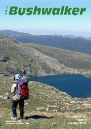
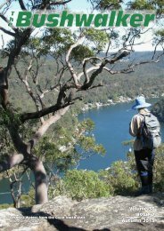
Volume 35 Issue 4 Spring 2010 - Confederation of Bushwalking Clubs
Volume 35 Issue 4 Spring 2010 - Confederation of Bushwalking Clubs
Volume 35 Issue 4 Spring 2010 - Confederation of Bushwalking Clubs
- No tags were found...

You also want an ePaper? Increase the reach of your titles
YUMPU automatically turns print PDFs into web optimized ePapers that Google loves.
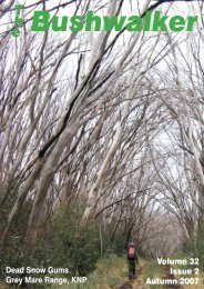
<strong>Volume</strong> <strong>35</strong><strong>Issue</strong> 4<strong>Spring</strong> <strong>2010</strong>
Photo: Lyn Brown,Batemans Bay Bushwalkers A wombat at NewnesContributions <strong>of</strong> interesting, especially typical and spectacular bushwalking photos are sought.you don’t want the same photographers all the time, do you?and you don’t want the editor’s photos all the time either, do you?Photo: Martin Smith, Ranger, C<strong>of</strong>fs Coast AreaMt Sturgiss at sunset, from the Styles Plain
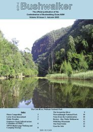
TheBushwalkerThe Official Publication <strong>of</strong> the<strong>Confederation</strong> <strong>of</strong> <strong>Bushwalking</strong> <strong>Clubs</strong> NSW<strong>Volume</strong> <strong>35</strong>, <strong>Issue</strong> 4, <strong>Spring</strong> <strong>2010</strong>ISSN 0313 2684Editor: Roger Caffineditor@bushwalking.org.auGraphic Design & Assembly:Barry Hanlon<strong>Confederation</strong> Officers:President: Dodie GreenAdministration Officer:admin@bushwalking.org.auWebsite: www.bushwalking.org.auAddress all correspondence to:PO Box 119, Newtown, NSW 2042The <strong>Confederation</strong> <strong>of</strong> <strong>Bushwalking</strong><strong>Clubs</strong> NSW Inc representsapproximately 66 <strong>Clubs</strong> with a totalmembership <strong>of</strong> about 8,700bushwalkers.Formed in 1932, the <strong>Confederation</strong>provides a united voice on behalf <strong>of</strong> allbushwalkers on conservation, accessand other issues.People interested in joining a bushwalkingclub may write to the<strong>Confederation</strong> Administrationadmin@bushwalking.org.aufor a list <strong>of</strong> <strong>Clubs</strong>, but a far moreuseful on-line list is available at the<strong>Confederation</strong> websitewww.bushwalking.org.au,broken up into areas. There’s lots <strong>of</strong>other good stuff there too, includingthe bushwalking FAQ.From theeditor’s desk. . .Walk Safely—Walk with a ClubThings have been quiet recently. The AAS has been brought undercontrol (I hope), the retail stores are being displaced by lowercostweb sales for some, and ... However, recent legislation bythe NSW Labor Party is threatening our National Parks, and must bewatched. Brian Everingham has an article in this issue about what YOUcan do to help limit the damage.The snow season this year was lousy, in more ways than one. So I don’thave too many good snow photos for this issue. A pity, and I fear it willonly get worse over the years.As for the front cover - we couldn’t find a way down into Harris Holefrom the ridge. But the view was excellent.Articles for Publication<strong>Clubs</strong> and members are encouraged to submit relevant articles, with a very strongpreference for those with good pictures. Both the author and the author’s club willfeature in the Byline - this is a good way to advertise YOUR club. We will also acceptarticles from outside bodies where the articles seem relevant to members. I cannotguarantee that all articles will be featured: like any other organisation we have budgetlimits.Articles may be edited for length and content to help fit into our page limit. Picturesshould be sent at maximum available resolution: at least 300 dpi, preferably in theiroriginal unedited form. JPG, PDF or TIFF formats are preferred. The text should besent as a plain text file (*.txt), NOT as a Word file (*.doc). I repeat, please sendthe pictures separate from the text file; do NOT send them embedded in a Word docfile. Pictures taken from a Word doc file are simply not good enough and won’t bepublished. And, <strong>of</strong> course, the Editor is always interested in receiving bushwalkingbooks and maps for review. All enquiries should be sent to editor@bushwalking.org.au.In addition, we need landscape-format photos for page 2 - inside the front cover. Theseshould be originals, NOT shrunk at all. Otherwise I will have to use my photos. (Mythanks for some recent contributions.)Please note that opinions expressed by authors may not represent the <strong>of</strong>ficial opinions<strong>of</strong> the <strong>Confederation</strong> or any Club. The Editor’s opinions are his own.Roger Caffin, EditorSubscribe to The BushwalkerKeep up with all the news and developmentshappening in the NSW bushwalking scene foronly $10 per year. This is to cover posting andhandling: the magazine itself is free.Send your name and address and cheque ormoney order to the <strong>Confederation</strong> <strong>of</strong> <strong>Bushwalking</strong><strong>Clubs</strong> NSW Inc, PO Box 119, NewtownNSW 2042. The new phone number is9565 4005. Make the cheque or money orderpayable to the <strong>Confederation</strong> <strong>of</strong> <strong>Bushwalking</strong><strong>Clubs</strong> NSW Inc as well: please do not abbreviatethe name!Please indicate which issue you want your subscriptionto start with. We don’t want to duplicatecopies you already have.Front Cover: Mt Wilworril above Jones Hole.Photo by Roger Caffin.IndexDon’t you wish you were here? 2From the Editor’s Desk 3Tree <strong>of</strong> Heaven 4South Coast Track, Tasmania 5Victoria Brook 7A place called Hades that is more like Heaven 8Wandering the Snowies 10Cuba, in the Footsteps <strong>of</strong> Fidel 12Innes National Park, Yorke Peninsula, South Australia 14Enlisting bushwalking club members 15Book Reviews 15Frederick Robert D’Arcy 15Discovering the Colo Wilderness on Foot 15<strong>Volume</strong> <strong>35</strong>, <strong>Issue</strong> 4, <strong>Spring</strong> <strong>2010</strong>The Bushwalker | 3
Walk Safely—Walk with a ClubThe Plant that Threatens the ShoalhavenPhotos by Basil SladeThe Tree <strong>of</strong> Heaven (the ‘ToH’) (Ailanthus altissima) is a noxiousweed that has spread along the Shoalhaven River. The NPWS isappealing to bushwalkers to help map patches <strong>of</strong> infestation. Wouldanyone seeing the ToH in the Shoalhaven, please take a GPS reading on itand report it either to the Bungonia local <strong>of</strong>fice <strong>of</strong> the NPWS or to myself(see below for details). I am happy to collate any reports and pass them on.The more accurate the information on its distribution, the more likely theNPWS is to have an adequate budget for eradication.The ToH appears to have spread from a large patch growing inNerrimunga Creek, with floods washing the seeds down into theShoalhaven. Patches <strong>of</strong> the ToH occur from Nerrimunga Creek to at leastBadgerys, some 20 km as the crow flies and a lot further by foot. The plantis usually found 2-6 metres above water level, frequently in places wherean eddy would form, eg at junctions with side creeks or where floodchannels rejoin.The ToH suckers rapidly and grows as a densely packed cluster <strong>of</strong>straight stems (see photos) with a dense foliage <strong>of</strong> long compound leaves(quite like a pencil cedar) with a single unpaired leaf at the tip. Newgrowth may be knee high, but the plants mature into 20 metre high trees.Two notable characteristics are the foliage has an obnoxious smell andthere are 2 glands near the base <strong>of</strong> each leaf (see photo). The only commonnative in the area that could be confused with the ToH is the White Cedar(Melia azedarach) that grows on the hillsides, but can easily bedistinguished by crooked stems and much smaller compound leaves withall the leaflets paired.The ToH needs to be controlled by poisoning to ensure the root systemis killed. If the plants are just pulled up the root system resprouts, andworse, fragments <strong>of</strong> the roots can grow and spread the infestation.Obviously, only the NPWS can authorise and supervise the use <strong>of</strong>herbicides on the land they manage, especially as this is drinking watercatchment.Patches <strong>of</strong> ToH can be seen at the mouth <strong>of</strong> Bungonia Creek and justdownstream <strong>of</strong> the Badgerys Track. For further information see theSouthern Tablelands and South Coast Noxious Plants Committee website atwww.southeastweeds.org.au.The likely source <strong>of</strong> this outbreakLeaf underside and glandsThe Ranger involved with the Tree <strong>of</strong> Heaven problem is:Audrey Kutzner, RangerNational Parks and Wildlife ServiceDepartment <strong>of</strong> Environment, Climate Change and WaterTelephone 4844 4277[Editor’s Note: it isn’t just the Shoalhaven which has this problem! I haveseen ToH on the Jenolan River, and there was a big thicket in Carlon Creekfor a while. Report ANY patches you see.]Individual walkersSmall walking groupsLarge walking groups1 to 7 day walksGuided and self guidedwalksIn house shuttle serviceSelf or fully cateredand BIMBIPARKDo the whole walk from 1 central pointor just drop in.Some typical young trees5 day walking packageIncludes: 5 nights accommodation,5 shuttles, Linen, Self catered, Selfguided, Standard cabin, <strong>of</strong>f peak.Cost twin share:$395.00 p/p ($780.00 total)Cost triple share:$290.00 p/p ($870.00 total)www.bimbipark.com.au - ph (03) 5237 92464 | The Bushwalker <strong>Volume</strong> <strong>35</strong>, <strong>Issue</strong> 4, <strong>Spring</strong> <strong>2010</strong>
Walk Safely—Walk with a ClubDennis Baker,Newcastle <strong>Bushwalking</strong> ClubAll nine <strong>of</strong> us gathered at theTASAIR <strong>of</strong>fice at 2:00 pm onSaturday the 9th January keen toget going - well there were some whowere a little apprehensive about the flightin a small plane. Names were registered,body weights and pack weights checkedand gas bottles purchased. Pilots finallyworked out their paperwork and we wereon our way. There would be three planes,the slowest ones taking <strong>of</strong>f first.Fran and I drew one <strong>of</strong> the slowestDescending to Freney Lagoonplanes but we had valuable cargo inFran’s pack (Lisa’s birthday cake) so herpack occupied its own seat all strapped in.The pilot issued us with our own headsetsso he could give us a commentary on thetrip as it was going to take about one hourto reach Melaleuca.As we passed Federation Peak andLake Geeves on our right we could look toour left and see some <strong>of</strong> the terrain wewould cross along the South Coast, thenin the distance the Western Arthur Rangeand Bathurst Harbour. The flight wasquite comfortable just below the clouds,then the airstrip appeared, a small whitestrip <strong>of</strong> gravel in the middle <strong>of</strong> the plains.We landed second and were able to watchas the third plane touched down,naturally giving the pilot a score out <strong>of</strong>ten.Everyone was quite “revved” up afterthe flight and once a group photo wastaken and we gathered our gas and fuelthe planes left in quick succession. We alldecided to check out the “orange belliedparrot” (neophema chrysogaster) from thehide provided and the shack that DenisKing had built (tin mine owner) in the1930s and the huts provided for walkers.At 4:20 pm we left Melaleuca andheaded across the white quartzite trackpast the open cut tin mine and onto thebutton grass heath plains. We had a 4hour walk to reach our first plannedcampsite at Point Eric. The weather wasquite cool and good for walking, the routewas a mixture <strong>of</strong> gravel track and in the<strong>Volume</strong> <strong>35</strong>, <strong>Issue</strong> 4, <strong>Spring</strong> <strong>2010</strong>lower sections duckboards. We reachedthe campsite before dark at about 8:30pm and found good water 200 m eastalong the beach. Following the cakeceremony we all went to bed.The following day we headed <strong>of</strong>f atabout 8:00 am and headed for LouisaRiver via Red Point Hills (elevation 200m). Once we left the beach and headedinland toward the Red Point hills wetraversed numerous duck boards andmainly dry scrubby plain. Once over the“Hills” some decided to do aside trip to Louisa Bay whilethe remainder <strong>of</strong> the partymoved on to the camp. Theweather was quite warm andthe sun on the duckboardsmade our feet burn requiringfrequent stops. Louisa Rivercampsite was excellent with abig swimming hole to cool <strong>of</strong>f.The third day was the bigone. Everyone was well awarethat the biggest obstacle wasthe “Ironbound Range”, a 900m climb and long slipperydescent to Little Deadmanscampsite. Because the weatherhad been quite hot it wasdecided to start early so we leftthe campsite at 6:30 am. Thiskept us in the shadow <strong>of</strong> themountain most <strong>of</strong> themorning, arriving at the 800 melevation point at around 11:00 am. Whata view! After having soaked up the viewswe headed <strong>of</strong>f up to the summit crossingpoint and then down the duckboards.Water was getting low. Fortunately wefound a creek not long after entering thebushy descent and decided to have lunchin the shade. After lunch we passedthrough varying conditions - slippery wetsections to boggy holes, all withinrainforest. Both Paul and myself agreedyou could not have had any closercomparison to the Kokoda track if youtried: the humidity was right up there.Finally we reached “Little Deadmans”camp and as we were all just about outwater we quickly refilled and set up ourtents.That afternoonsome had agood swim in thebay while otherstried bargainingfor crayfish fromnearbyfishermen,washing sweatyclothes and justrelaxing. Thefishermeninformed us laterthat evening thatthe forecast forthe next day wasfor 40 knotwinds and rain atabout lunch timeFlying past Federation Peakso we decided to get another early start toreach New River Lagoon by lunch time, toget the boat crossing out <strong>of</strong> the way.After another early start we reachedGroto Creek where we had to scrub ourboots and filled up with water beforesetting <strong>of</strong>f along Prion Beach. The windwas picking up but we reached the boatcrossing point just before lunch. The windwas from the northwest and creating“white caps” in the lagoon so we wastedno time in getting across the 200 m <strong>of</strong>water. We had been told that we couldprobably wade across further downtoward the outlet to the sea but the boatsprovided a bit <strong>of</strong> fun for all, particularly ifyou Wcouldn’t row very well.e had “sand” sandwiches on theother side and were unsuccessful infinding water before setting <strong>of</strong>f throughanother campsite then behind the duneswhere once again we were so protectedfrom the wind but you could hardlybreath with the heat and humidity.Milford Creek afforded us anotheropportunity to have a cool swim andrelax. The rain then started but with littleconviction. We decided it was getting coolso we should set <strong>of</strong>f for our next campsiteat Osmiridian Beach. On leaving the forestwe started crossing “Rocky Plains” and bynow the wind had picked up with somelight rain making things a little cold so itwas on with the raincoats again. Thistime, because we were exposed, the windwas literally blowing us <strong>of</strong>f our feet but itwasn’t long before we reached the turn <strong>of</strong>fto Osmiridian then it was all downhill tocamp.As with all the others, this campsitewas well protected so the tents went upLouisa Bay from the IronboundsThe Bushwalker | 5
Walk Safely—Walk with a ClubHugh Speirs,Blue Mountains Conservation SocietyWe parked on the Victoria FallsRoad at 470 806 at 0910. Theroute: first go eastwards alongthe now tree-blocked Odin Ridgestanchion access trail, then at a smallclearing near some rusted fuel drums(4724 8037) find the old track whichturns SE. Follow it to ~4761 8016, thenturn <strong>of</strong>f S and downwards, aiming to finda spectacular nose <strong>of</strong> rocks hovering overVictoria Brook ~477 797. A short breakwas had at this excellent photo spot.Access by the dry creek gully to the east isvery much downhill but not difficult untilthe creek is reached.The walk-through caveSoon we were in the creek,metaphorically speaking (at a junction at478 796), although one log crossing couldeasily have changed that to 'literally'. Forreasons not clarified (perhaps an elfishresponse to the magic <strong>of</strong> this place, orgamin desires to compete or show <strong>of</strong>f),the proclivity <strong>of</strong> most <strong>of</strong> the group was toengage in a race through the difficultgoing typical <strong>of</strong> what we've encounteredaround creeks since the flood rains <strong>of</strong> lastFeb. As expected the terrain is constantlychanging almost with each step, fromsteep up and down to that plus theaddition <strong>of</strong> steep-ish sideways. That’s notthe main problem: the Dec 2006 firesseem to have missed this creek - theundergrowth is very thick, very high, andvery ornery by nature. And those floodshad ripped down more trees. We've beenthrough worse, but it should still beclassed as difficult.‘Moving forward’ we were <strong>of</strong>ten unableto see where our feet might land, butcontinually having to climb over a maze<strong>of</strong> high debris. Long sticks helped infinding any waiting holes. Trees whichhad fallen and washed to creek level werea frequent hazard as we manoeuvred overor around them. Belly-crawling undersome I wondered whether Odin himselfwas watching and vicariously lapping upsome bizarre genuflection to his presence.The cliffs on the N. side werebecoming increasingly rugged as the creektwisted E and NE. Creek crossings werefrequent. Then at ~479 7963 (no GPSreception there) is ‘Barb’s Arch’ the mostwonderful walk-thru cave. Astoundinglybeautiful! A morning tea spot parexcellence! As Jim remarked, “If this ismorning tea, the Lunch Spot must besomething!”It was!We had abit further togo beforelunch and thegoing neverimproved.Our first 400m in the gullytook about anhour. By thenwe’d reached480 7974,opposite twonarrowgullies. TheeasternmostTree hugging, or just hanging on!(‘Lotti’s Escape’) <strong>of</strong>fers a sharp butinteresting exit point. On the recce we'dfound a short tape handy.We pushed on, turning S. The cliffswere a spectacular sight for anyone whowished to take time to enjoy them.Eventually ~481 795 we discovered apossible exit. A tape was handy for theclimb to the top. But the top wasn’t thetop, and a 25 m vertical cliff confrontedus which defied the brave efforts <strong>of</strong> even afew loonies. The last 250 m had taken 45minutes.It was time for lunch. Later, Emanuelreccied to the N and found a way to skirtthe monster via a series <strong>of</strong> roughly 2 msteps. With not a lot to hang onto, somelong-ish security tapes for the oldieshelped us to the ridge-top. Particularthanks to those young mountain goats:Lotti, Emanuel, Ann and Peter for helpingout their older (and ergo wiser?companions), This climb shall henceforthbe Aknown as the LEAP.t the top we looked E to the nextamazing ridge: ‘Alice’s Heights’ fromwhence first came the desire to explorethis ‘brook’. Between that and us was agully (~4825 796), broad, beautiful, andseemingly park-like from above. From themap it had been in my mind to try ittoday, but the going had been so slow andsome were coping with degrees <strong>of</strong> mildpain, so we decided to leave it untilanother day. If it is practicable, then itlooks easier than the way we came up.We’d travelled only a short distance,but at the suggestion we might head E t<strong>of</strong>ind more views the consensus was thattime was a factor - our c<strong>of</strong>fee time wouldbe curtailed. So, 2 km back up the ridgeto the cars then to Wentworth Falls and ilPostino’s for c<strong>of</strong>fee. Today’s walk wasrated 12.5 out <strong>of</strong> 10 by one member -thanks Barb, the cheque is in the mail! tTape-assisted descent<strong>Volume</strong> <strong>35</strong>, <strong>Issue</strong> 4, <strong>Spring</strong> <strong>2010</strong>The Bushwalker | 7
Walk Safely—Walk with a ClubSunlight in the slotsFirst a bit <strong>of</strong> geography. The Hadessection <strong>of</strong> the Poseidon Arena lieswest <strong>of</strong> Baal Bone Gap. It consistsessentially <strong>of</strong> two parallel, elongated,ellipsoid pods or clusters <strong>of</strong> pagodasorientated NW - SE, and separated by adeep ravine 1 . The overall western andsouthern boundaries are defined by theM<strong>of</strong>fitts Trail and the eastern boundary bythe Crown Creek Trail. The northernboundary is proscribed by an unnamedcreek that starts at approx GR 288 195near the cliff edge north <strong>of</strong> Baal BoneGap.The Hades is the eastern ridge <strong>of</strong> thePoseidon Arena complex 2 . It containssome <strong>of</strong> the more exotic residuallandforms and sculptures that are afeature <strong>of</strong> this pagoda country. It is alsoone <strong>of</strong> the more challenging pagoda areasto visit, requiring good balance,surefootedness and a willingness to acceptsome exposure. That being said it is afabulous destination that also includesstunning views, particularly from theLower Hades looking north-east over BaalBone Gap towards Point Cameron.Vehicles were parked on a high pointjust before the M<strong>of</strong>fitts Trail descendsthrough three 20 m contours where onlythe most robust <strong>of</strong> 4WD vehicles canpresently negotiate in comfort. We startedSerried ranks <strong>of</strong> Hades Pagodaswalking at 0915, heading SE down theM<strong>of</strong>fitts Trail then entering the timberedvalley <strong>of</strong> an unnamed creek to the north.Immediately we were surrounded by tallforest and lots <strong>of</strong> evidence <strong>of</strong> logging intimes past. Several large isolated pagodas,many covered in carpets <strong>of</strong> ferns andmosses, provided contrasting features.Crossing the formative creek, weheaded generally east up a ramp into thefirst pagodas <strong>of</strong> the Upper Hades Ridge,and enjoyed sweeping views NE <strong>of</strong> CrownCreek and the Capertee Valley. Thepr<strong>of</strong>ile <strong>of</strong> Pantoneys Crown was justvisible. Noted amongst the vegetationwere some very old, gnarled specimens <strong>of</strong>Isopogon anemonifolius, heavy withmature seed heads. We moved to the cliffedge to enjoy great views over Baal BoneGap and Point Cameron. As it was a crisp,(2 C), brilliantly clear day we enjoyed astunning panorama <strong>of</strong> the circlingmountains <strong>of</strong> the north and east CaperteeValley rim. Great landmarks such as thevolcanic cone <strong>of</strong> Tayan Pic could be easilyseen.Now we headed generally south alongthe ridge top, noting amazing delicateironstone residuals in fantastic shapes andconfigurations. A pair <strong>of</strong> pagodasrepresenting two figures in theunderworld, Orpheus and Eurydice werevisited. Orpheus is the slightly higher andeastern most in position. Eurydice has aweight problem and is the larger <strong>of</strong> thetwo. We climbed to the top <strong>of</strong> Orpheusincreasing the scope <strong>of</strong> our total view.After a compulsory picture session, wepushed on southwards, treading ever socarefully all the time, and where possibleavoiding thin ironstone. At 10:45 we satin a protected sunny alcove for morningtea. The wind, although very light andintermittent, cut like a knife when it didblow. After morning tea some localexploring took place. Many ironstoneforms presented as mythical andimpossible creatures that could be‘ridden’. Yuri posed on one such creature,“riding it into the eastern sky.”The next spot to visit was the boot <strong>of</strong>the ‘fleet <strong>of</strong> foot’ god, Mercury. The ‘boot’is about 3 m high, and is an almostperfect facsimile <strong>of</strong> a bushwalkers boot!Steve <strong>of</strong>fered to climb the boot, notrealising that it is separated by extremelydeep ravines on all sides <strong>of</strong> its naturalplinth. Having made successfully, it heposed sitting on the toe.The scale <strong>of</strong> the boot madehim a Lilliputiandiminutive. Lots <strong>of</strong> picturesfollowed.From this point the viewwest <strong>of</strong> the Poseidon Ridgeis stunning, particularlytowards the location <strong>of</strong> thestone Seahorse. Wecontinued with ourexploration pushing towardsthe southern edge <strong>of</strong> theMichael Keats,The Bush ClubPhotos byPeter Medbury,The Bush ClubUpper Hades. After passing through awonderful, dry and protected high cave,complete with Lyrebird tracks, weemerged onto yet another contiguousplatform that terminates in more pagodasand stunning views. Here the pagodasform a crenulated revetment above thegreat chasm that divides the Upper andLowerIHades.knew the way down the chasm, havingbeen involved in the previousdiscovery. This time we found anotherway that was much easier. I have toconfess that it was not nearly as excitingas the previous one. No one howevervolunteered to climb back up and do theoriginal one with me 3 . Disappointing!Down on the floor <strong>of</strong> the chasm it wasa carpet <strong>of</strong> ferns. A study <strong>of</strong> the largescale map also showed it as a possibleway down to the road, but a tame one.Not for us as we wanted first to go to theLower Hades and explore even more.Pagodas, pagodasThe climb up the southern wall intothe Lower Hades is easy, and near the topwe decided to explore a long overhang tothe west. As expected the floury sandfloor was full <strong>of</strong> animal and birdfootprints. Exiting the overhang at itswestern extremity <strong>of</strong>fered a promise <strong>of</strong> away to the top pagodas <strong>of</strong> the LowerHades. Not to be - just too many deepslots. We retraced our steps and securedthe top via a shallow, dry, inter-pagodacanyon immediately east and above thecommencementO<strong>of</strong> the long overhang.nce on top we explored a set <strong>of</strong>compound contiguous pagodas withstunning views. To the immediate northwere the compound revetments <strong>of</strong> theUpper Hades, grim and forbidding; raisingthe eyes to include the northern horizonthere was a special view <strong>of</strong> the cliff linefrom Baal Bone Gap to Point Cameron.This was especially good as the sunlightwas reflected <strong>of</strong>f the remote cliff walls,illuminating the background.Panning to almost due east, the viewwas <strong>of</strong> part <strong>of</strong> Hecates Cauldron revealingan array <strong>of</strong> pagodas and a long stretch <strong>of</strong>sheer sandstone walls. Moving around thepagoda tops we noted several pockets8 | The Bushwalker
Walk Safely—Walk with a ClubThe Bootwhere a compact Banksia sp. had grown, giving this area aprecise, manicured garden appearance.At 12:03 we looked over the southern end <strong>of</strong> the LowerHades. From here the now-drained and dead wetland swamps <strong>of</strong>Baal Bone Creek could also be seen 4 . Also from this point and toour east there is a deep and spectacular, sculptured slot. I knewfrom previous exploration that this canyon was not negotiablefromPthe top down.rior knowledge provided the time and opportunity for thegroup to explore to the very end <strong>of</strong> the Lower Hades pod <strong>of</strong>pagodas. Where the deep non-negotiable canyon starts on thetops there is a small, doable bridge where it is possible to getacross to the next set <strong>of</strong> otherwise isolated pagodas. Once overthis good progress was made until we were confronted withanother apparently non-negotiable slot. A couple <strong>of</strong> parallelramps to the west were then explored, the party dividing intotwo search groups.Group one headed down the southern most slot and thenfound a way to the top via a climb or two. The second groupenjoyed a walk down ramp that led almost directly to the bottomaccess <strong>of</strong> the deep canyon sighted earlier from the top. As we (Iwas leading group 2) were ‘almost there’ the irresistibletemptation was to go and look at it. We did, causing someconsternation for group 1.Minutes later, group 2 having sidled east around the base <strong>of</strong>the cliffs, we decided that a possible slot was a definite goer.Well, it was, and the squeeze we went through under a chockstone and the exposed climb that followed just added a bit <strong>of</strong>adrenalin to an already action packed day. Once all <strong>of</strong> group 2were all through this exciting process, the group 1 team led usup another exposed climb to the top <strong>of</strong> the last set <strong>of</strong> pagodas.This, the southern most outcrop <strong>of</strong> pagodas on the LowerHades, provides the most spectacular viewing <strong>of</strong> the entireHades complex. To the south there is a panoramic view overBaal Bone Creek and its associated former wetlands; to the eastthe amazing complex <strong>of</strong> Hecates Cauldron and to the NE thesuccessive skyline pr<strong>of</strong>iles <strong>of</strong> Mounts McLean, Jamison andDavidson. Point Cameron is the disjunct before the sweepingview <strong>of</strong> the Capertee Valley. It is real ‘wow’ country.Right on the end <strong>of</strong> the point there is a shallow natural pool(not reliable as a water source) that acts as a mirror creatinggreat photo opportunities. If we could only remove the collieryhead works from the scene and repair the damaged cliffs andwetlands caused by long wall mining the view would be perfect.Many pictures later we turned north in search <strong>of</strong> a perfect spotfor lunch. It was an absolute must to be in the sun and out <strong>of</strong> thewind. We picked a good spot, but 25 minutes was all we couldtake before the cold started to permeate through the layers <strong>of</strong>clothingWand into the bones.e now headed down the ramps once more, noting at leastfour Lyrebird nests in the pockmarked walls <strong>of</strong> the slots.We had earlier noted a high number <strong>of</strong> recently groomedLyrebird ‘dancing grounds’ in the Upper Hades area. The rampswere now familiar territory so a quick progress was made to thecliff base.Next it was time to explore once more a special slotdiscovered on the last trip, which is memorable for having abroken whiskey bottle on the floor about 4m in. As I wrote aboutit after the last visit, “inside it opened right up into a super littlecanyon, up to 4 m wide, maybe 30 m high and with a great lightplay. This was way beyond what I expected <strong>of</strong> the Hades Ridge.”Even though it wasearly, 13:45, the shadowswere lengthening rapidlyand the temperature washeading down into lowersingle figures equally fast.Joining the M<strong>of</strong>fitts Trail at13:50 we commencedwalking back towards thevehicles.Note. The M<strong>of</strong>fitts Trail iscurrently in very poorcondition. The bypassesacross the swamp area inJews Creek have beengouged deep and progressis necessarily slow. Furtherrain could mean that onlypowerful 4WDs could go allthe way. Several areaswhere the Trail crossesclayey sections on steepslopes closer to Ben Bullenare also dubious fortraction. tNotes:Delicately over the ironstone formations1. The northern most pod is the Upper Hades and the southern one theLower Hades.2. There are three pagoda ridges within the Poseidon Arena - The Hades(east ridge), The Poseidon Ridge (centre) and the Zeus Ridge (westridge)3. Extract from the walk report 21st May <strong>2010</strong>. “A slot-cum waterfallseemed as though it would work. Better still there appeared to be acorresponding way <strong>of</strong> route up the other side. The descent was athrilling experience but not to be attempted in the wet.” Also noted apossible third route to the east.4. This is a consequence <strong>of</strong> underground mining.The Bushwalker | 9
Walk Safely—Walk with a ClubDoubtful weather nearthe Porcupine RocksMid February <strong>2010</strong> and the last toarrive at the ski lodge inJindabyne was greeted bysixteen happy colourful walkers wavingenthusiastically from the balcony. That setthe tone for the next four days. We are agroup who walk together regularly; howgreat to have the opportunity to spend afew days together.At seven next morning Helenconducted half an hour <strong>of</strong> Tai Chi. Thefresh air perfumed by the scent <strong>of</strong>mountain trees, plus the calling <strong>of</strong> avariety <strong>of</strong> birds - parrots, magpies, crows,peewees and some unidentified callsmade this a magical half hour. Most <strong>of</strong> uswere familiar with this relaxing activity,while some were attempting it for the firsttime. Following a hearty breakfast fourdrivers loaded up their cars and <strong>of</strong>f wewent to Perisher Valley for our firstmountain walk. Alf, our walks leader,knew the mountains well and generouslyshared his life-long passion with us.The Porcupine track walk he had toldus the previous evening would be a goodstart. We shouldered our packs andfollowed Alf up the snaking path. A widevariety <strong>of</strong> wild flowers slowed us down aswe spent time inspecting them anddeciding what they could be. Weregretted our Australian plant expert hadbeen unable to come on the trip.Interestingly, the main wildlife apart fromthe birds was surprisingly long worms.The sky was overcast and duringmorning tea wenoticed some miston the mountain.A light raincommenced. Wewere wellprepared forchanging weatherand continuedwalking up. At thetop wecommenced lunch.Then withoutwarning the rainincreased, becameicy, and theheavens opened.Joan Collins, Watagan WanderersAlf decided the weather would onlyworsen so we would not complete thefinal circle. A hasty retreat was in order.The track was now a steady stream <strong>of</strong>rainwater. Back at the lodge we were glad<strong>of</strong> the drying room to dry out soddenshoes and clothes. A hot shower and acuppa soon revived us. A delicious dinnerand a glass <strong>of</strong> wine were appreciated.Toni and Graham had transported avariety <strong>of</strong> food to the lodge including lots<strong>of</strong> fruit and vegetables.Next morning after Tai Chi we wereready for our next walk, Eagles Nest toDead Horse Gap then return to Thredbovia the Cascades along Thredbo creek. Acar was left at Dead Horse Gap as aprecaution against emergency. It was aglorious sunny morning.We looked up at the mountain with afair amount <strong>of</strong> trepidation, glad the chairlift would carry us up over the onekilometer to Eagles Nest. We would bekeeping on our right the ridge line <strong>of</strong>Ramshead South which is a continuation<strong>of</strong> the Crackenback Range. Alighting fromthe chair lift the walk commenced withabout half a kilometer uphill. A young fitathlete passed us running up and downthe hill.Finally the track began to descend toDead Horse Gap. Two kilometers wouldnormally be a short walk, but our descentwas slowed as we concentrated onwinding around rocks and avoidingUp top <strong>of</strong> the mountains10 | The Bushwalker<strong>Volume</strong> <strong>35</strong>, <strong>Issue</strong> 4, <strong>Spring</strong> <strong>2010</strong>
Walk Safely—Walk with a Clubpuddles. A cheery group <strong>of</strong> youngwalkers, obviously having bivouackedovernight, strode past us up the mountainside towards Eagles Nest. Their heavyovernight backpacks seemed not to worrythem at all. lt was a while since we hadthat sort <strong>of</strong> strength and wondered wherethey would have spent the night. Probablyat Dead Horse Gap someone suggested.Morning tea was enjoyed under aclump <strong>of</strong> those great Kosciusko NationalPark icons, the mountain snowgum, Epauciflora. Following tea we began tonegotiate about a hundred steps obviouslymade for those longed legged men whostride down them barely glancing down.Slowly, steadying ourselves we descendedthe mountain, stopping occasionally toadmire the wonderful scenery.We arrived at Dead Horse Gap andchatted with a group <strong>of</strong> Newcastlewalkers resting in the shade. lt was a hotday. They left to continue their walk whilewe settled down to lunch.A further walk was suggested alongthe Cascades Hut track to see thebrumbies. Some <strong>of</strong> us went. It was a steephill with lots <strong>of</strong> evidence <strong>of</strong> the brumbies,but they had more sense than to be out inthe sun in the middle <strong>of</strong> the day.‘MadDogs and Englishmen’ someonequoted. Meanwhile a brown snake hadwandered towards the walkers stillenjoying a rest. And that was the end <strong>of</strong>that. . .The last five kilometers return toThredbo was mainly in the shade alongthe river. The cascades were splendid. Wewere all tired as we drove back to thechalet. We went to the club for dinner butit was disappointing. Our own cookingwas superior, all those years <strong>of</strong> experienceI suppose.Our last day was spent at CharlottePass. We studied the terrain from thelookout platform .That grey brick pathlooked steep. We might walk to the BlueLake. Maybe. Never the less weshouldered our packs for the last time andwalked down to the Snowy river. Perhapssome <strong>of</strong> us were not sorry when it wasobvious that we would be lucky to crossthe stepping stones without falling in. Wesat in the sun and admired the long steepwalk to Blue Lake. However, as crossingthe river was not an option we sat in thesun and enjoyed the scenery. Well,actually, some walkers did cross it. Themountains and valleys looked delightfulin the full sunincluding the trackwinding up to BlueLake just out <strong>of</strong>reach. At CharlottePass we took abreather. Then backto our lodge for ourlast happy hour,dinner and hilariousentertainment.We had awonderful time andfelt quite chuffed atwhat we hadachieved. The walkswere fun. Thedrives out toPerisher Valley,Heading for Dead Horse GapThredbo and Charlottes Pass were a treatin themselves and what wonderfulmajestic scenery; it has to be seen to bebelieved. We were grateful to Robin fororganizing such an excellent trip. Nextmorning we packed, cleaned and headedfor home. tCharlotte Pass Lookout<strong>Volume</strong> <strong>35</strong>, <strong>Issue</strong> 4, <strong>Spring</strong> <strong>2010</strong>The Bushwalker | 11
Walk Safely—Walk with a ClubPico Turquinoin the Sierra MaestraRoy JamiesonWhen I was planning my first tripto the Americas, Cuba reallywasn’t on the radar, but themore I thought about how close it was towhere I was going, the more sense itmade to go there. I quickly figured Ineeded to go to this Caribbean islandwhile the Castro revolutionary influenceremained.My main focus became the area thatspawned the revolution <strong>of</strong> the 1950s, theSierra Maestra mountain range, inlandfrom Cuba’s second city, Santiago deCuba. The range is incorporated within anational park called Pico Turquino(Turquoise Peak), which includes the Picoitself, at 1975 m, Cuba’s highestmountain. Nearby lies the revolutionaryheadquarters <strong>of</strong> Fidel Castro and hisfollowers.When I arrived at the parkheadquarters to get a permit I intended todo the walk to the summit <strong>of</strong> the Pico (26ü Comfortable, family friendly, lodge openall year with resident caretaker.ü Private bedrooms with 2, 3 or 4 beds andvanities.km) in the normal two days,spending a night at the refugio(hut) named Camp Joaquin.Imagine my shock, when I was told“you can’t do it because the refugiois booked out.”Horrified, I said to the headranger, “But I’ve come halfwayround the world to do this.” Thatseemed to have little impact so Ithen had to start thinking quickly.That’s when I asked if I could dothe trip in a day. The ranger wastaken aback by that and said “OK,if I can find you a guide preparedto do it, but you’ll have to negotiatea separate price with him.”So I waited for about half anhour and when he returned he said“I’ve found a guide for you.” So,besides handing over the equivalent <strong>of</strong>US$<strong>35</strong>, I did a separate deal with theü Self-catering kitchen .ü Magnificent views <strong>of</strong> Dargo Valley.ü Individual or group bookings welcome.For further information view our website or email: lasc.secretary@leetonlodge.comFor summer bookings <strong>2010</strong>/2011 contact:Caretaker Phone: 03 5759 3283 / 0416 253723or Caretaker email: lasc.mthotham@bigpond.comAt the summit <strong>of</strong> Pico Turquinoguide for US$40. We arranged to meet at5.45 am the next day for a 6 am start.The next morning the weather wasgood as we drove up to the trackhead and set <strong>of</strong>f under headlamps.Soon after dawn I could see thetarget in the distance. To beginwith, the terrain was good, butsoon became rugged and remindedme so much <strong>of</strong> my Australianwinter haunt, the Kanangra BoydWilderness. Some sections werealmighty steep but we made goodtime, getting to the summit at11.45 am. There were others thereand they raised their eyebrowswhen they heard we were doingthis in a day.After an early lunch we headed<strong>of</strong>f on the return journey andactually ran down the first section.Later I wished I hadn’t run becauseI needed all my energy to finish asthe temperatures rose to about 26C with a fair amount <strong>of</strong> humidity.But we arrived back at the car at 5pm, not a bad effort, 26 km in 11hours. I celebrated the achievementby buying my guide a beer at thebar <strong>of</strong> the Villa Santo Domingo.12 | The Bushwalker <strong>Volume</strong> <strong>35</strong>, <strong>Issue</strong> 4, <strong>Spring</strong> <strong>2010</strong>
Walk Safely—Walk with a ClubThe track to Fidel’s old campI then drove the 12 km back to my hotel to prepare for the nextday. Fidel Castro had climbed the Pico at least once, so I felt goodabout going where Castro had been and I knew the morrow wouldbring me even closer to his past: a visit to the Comandancia La Plata,his 1950s revolutionary headquarters.The next day we were blessed with good weather and set <strong>of</strong>f earlybecause the tourist hordes would be following later. The sign at thebeginning <strong>of</strong> the walk - “Sendero Sitio Historico”, said it all (path to ahistoric site). It really wasn’t a difficult track but it would’ve been adeal more isolated 50 years earlier. Everything was there, forwardsentry post and then other buildings including Fidel Castro’s ownshack. The museum, with artifacts and photographs from the period,was amazing.Some distance away was a small hospital with many drug bottlesand other paraphernalia from the period.We were only here for a few hours and it was time to move on. Aswe hiked out the foreign tourists were on there way, in sizeable groups.This was what I had primarily come to Cuba for, to walk in thefootsteps <strong>of</strong> Fidel Castro, before Cuba perhaps, becomes a verydifferent place. tFidel’s old shack<strong>Volume</strong> <strong>35</strong>, <strong>Issue</strong> 4, <strong>Spring</strong> <strong>2010</strong>The Bushwalker | 13
Walk Safely—Walk with a ClubInnes National ParkYorke Peninsula South AustraliaBarry Hanlon, The Bush ClubCape Spenser LighthouseLimestone cliffs near “The Gap”One <strong>of</strong> Victoria’s missing “Apostles”?Four members <strong>of</strong> the Sydney BushClub, visiting Adelaide and theBarossa for the Australian NationalOrienteering Championships, took time <strong>of</strong>fto visit the beautiful coastal national parkat the foot <strong>of</strong> the Yorke Peninsula, SA.European colonisation <strong>of</strong> the Innes areabegan in 1847 with land occupied forsheep grazing near Cape Spencer. Smallscale cropping occurred increasinglythroughout the nineteenth and earlytwentieth centuries.The park is named after William Innes,who discovered commercial quantities <strong>of</strong>gypsum in the area in the early 1900s. In1913 he set up the mining township <strong>of</strong>Inneston where gypsum was produceduntil 1930. During the boom phase thetownship boasted a population <strong>of</strong> around500 people. Although isolated, Innestonwas completely self-sufficient, having itsown school, post <strong>of</strong>fice, bakery, generalstore and tennis court.The more substantial buildings in theghost town have been renovated forvisitors accommodation. Our small groupenjoyed a very comfortable stay at NorfolkLodge at the eastern end <strong>of</strong> the townsite,which is an ideal base for several short tomedium distance day walks.The Stenhouse Bay jetty was built toenable ships to berth and load the baggedgypsum. The gypsum was processedlocally at Inneston and transported toStenhouse Bay by narrow gauge rail. Theold rail right-<strong>of</strong>-way is now a walking trailbetween Inneston and the licensedrestaurant and general store at StenhouseBay. Mining ceased in 1932 and in 1970Innes National Park was declared to savethe rare Great Western Whipbird.The geology <strong>of</strong> the park has a lot incommon with Kangaroo Island, which canbe seen on a clear day from the CapeSpenser Lighthouse. The coast and nearbyAlthorpe Islands are rugged with manyshoals and the skeletons <strong>of</strong> severalshipwrecks. Being on the windward side <strong>of</strong>the “roaring 40s” it must have been asignificant hazard in the sailing ship days.One <strong>of</strong> the most spectacular parts <strong>of</strong>the coast is “The Gap” where ferociouswinds have taken their toll and exposedthe limestone layers revealing theirsedimentary history.From Inneston it’s only a short distanceto Ethel Beach - one <strong>of</strong> the Peninsular’smany ocean graveyards. The skeletalremains <strong>of</strong> the Ethel lie on the beach. In1904 the 700 ton iron sailing ship had losta battle with a force seven gale - one lifewas lost. Now boogey boarders try theirluck in calmer waters. Pondalowie Bay,the next bay west, is famous around thecountry with surfers.In the spring Innes National Park turnsinto a rich carpet when wildflowers andshrubs come into bloom. Further inland, achain <strong>of</strong> salt lakes occurs amongstextensive mallee woodlands. tWest Cape’s all stainless-steel lighthouseView towards Pondalowie BayThe old gypsum wharf at Stenhouse Bay14 | The Bushwalker <strong>Volume</strong> <strong>35</strong>, <strong>Issue</strong> 4, <strong>Spring</strong> <strong>2010</strong>
NSW <strong>Bushwalking</strong> <strong>Confederation</strong>Frederick Robert D’ArcyColonial Surveyor, Explorer and ArtistAndy McQueen, <strong>2010</strong>ISBN 978064653<strong>35</strong>99This is not a book about bushwalking,nor is it a guide book about abushwalking route. It's a biography <strong>of</strong>Andy McQueen’s great great grandfather.But those <strong>of</strong> us who have explored theWollemi Wilderness will be very familiarwith the name <strong>of</strong> D’Arcy, because he wasthere before us, without any maps at all,and without any modern bushwalkinggear. What was he doing there? Surveyingthe rivers and the ridges for the firstmaps. I can only say he was one hell <strong>of</strong> acompetent bushman!Andy has written a warts and allbiography. D’Arcy was a wild character tobe sure, but the book makes the moderncarrying-ons in the NSW Governmentseem like child's play in some ways,compared to how the Colony was run inthose days. D’Arcy worked for SurveyorGeneral Mitchell, and seems to have spenthalf his time warring with him. Mitchellfired D'Arcy a number <strong>of</strong> times for awhole range <strong>of</strong> reasons, only to have torehire him because D’Arcy was the onlyone who could lead a party <strong>of</strong> convictsthrough Wollemi without having them allrun away and still come back with adecent survey <strong>of</strong> the area.For the rest <strong>of</strong> the story, which is longand involved, you will just have to readthe book. At ~270 pages, with colourpictures, reproductions <strong>of</strong> originaldocuments from the settlement, maps etc,all in a hard cover, it will keep youoccupied for quite a while. Fascinatingstuff, and well-told.The book retails for $45 and isavailable post-free from the author atandymacqueen@gmail.com.Roger CaffinDiscovering the ColoWilderness on FootSecond EditionAnthony DunkISBN 978-0-85881-227-7This is quite a slim book, and I wouldhesitate to call it a ‘Guide Book’. Inaddition to a bit <strong>of</strong> background, it coversseveral areas around the Colo region: theColo Gorge, the Putty area, the NorthernBlue Mountains, the Newnes area and theRhylstone area. But rather than givedetailed descriptions <strong>of</strong> a route and adetailed map for it, it gives just a sketchmap and a precis <strong>of</strong> the walk. As none <strong>of</strong>the walks described are hard, this leaves itto the walker to do his own ‘discovering’(as the title implies), and this has somemerit. There are 20 walks, plus 3extended walks. I have done all <strong>of</strong> themover the years.Available from Envirobook at:www.envirobook.com.auRoger CaffinWalk Safely—Walk with a ClubConservation organisations National ParksAssociation <strong>of</strong> NSW Inc. (NPA) and theNature Conservation Council <strong>of</strong> NSW Inc.(NCC) have appointed Delegates to the NationalParks & Wildlife Service’s Regional AdvisoryCommittees and Brian Everingham, NPA's newlyelected <strong>Confederation</strong> Delegate wishes to enlist clubmembers as follows:Members <strong>of</strong> the various clubs within the<strong>Confederation</strong> <strong>of</strong> <strong>Bushwalking</strong> <strong>Clubs</strong> usually gobushwalking in the national park estate managed byDECCW; our old National Parks and WildlifeService. We get into the bush, <strong>of</strong>ten <strong>of</strong>ftrack and <strong>of</strong>ten into the wild areas along way from the regular picniclocations and commercial facilities. Weappreciate those wild places and weknow them well.Indeed, we are probably morefamiliar with the back country <strong>of</strong> thenational park estate than the rangerswho manage those parks! Let's face it,most rangers are desk-bound, writingreports and/or Ministerials, doing thevarious chores that we ordinarily do inour own work but from which weescape when we “go bush”.In other words, members <strong>of</strong> thevarious walking clubs are the eyes andears <strong>of</strong> the Service and there is aconduit through which those eyes andears can ensure that what we observegets through to the managers. The NPAand the NCC, collectively, has the rightto have a member on each and everyRegional Advisory Committee in theState. Sometimes there is more thanone representative. They are the oneswho can take your concerns forward.What can you report on ?Track conditions, facilities such astoilet blocks, car parks, etc, illegalrubbish dumping, conflictingrecreational use that is outside thescope <strong>of</strong> the Plans <strong>of</strong> Management, etc.In other words, what you observe andwhat you think is in order to report. Itis even possible that you walk in areasthat abut the national park system andare in such condition that you wish it beadded to the national park. Let us know.It helps make our national park systemmore robust.The NPA/NCC delegates on theRegional Advisory Committees arecommunicating effectively. I have<strong>of</strong>fered to coordinate thatcommunication and I am the routethrough which ideas also filter to thePark Management Committee <strong>of</strong> NPA.Feel free to send me your findings(brian.everingham@gmail.com ) andknow I will pass then on and let youknow what is happening to your issue.One crucial issue at the moment ishow the Sustainable Assessment Criteriawill be interpreted in response to thechanges to the National Parks andWildlife Amendment (Visitors andTourists) Bill <strong>2010</strong>. NPA delegates arecurrently negotiating how the terms willbe interpreted and I will endeavour tolet you know <strong>of</strong> the outcome when thesituation is clearer.Brian EveringhamNPA Delegate to the<strong>Confederation</strong> <strong>of</strong><strong>Bushwalking</strong> <strong>Clubs</strong>NSW Inc.<strong>Volume</strong> <strong>35</strong>, <strong>Issue</strong> 4, <strong>Spring</strong> <strong>2010</strong>The Bushwalker | 15