

Integrated Training Area Management EA and Final FNSI
Integrated Training Area Management EA and Final FNSI
Integrated Training Area Management EA and Final FNSI

You also want an ePaper? Increase the reach of your titles
YUMPU automatically turns print PDFs into web optimized ePapers that Google loves.
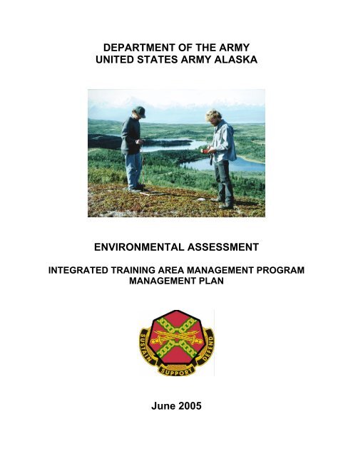
DEPARTMENT OF THE ARMYUNITED STATES ARMY ALASKAENVIRONMENTAL ASSESSMENTINTEGRATED TRAINING AR<strong>EA</strong> MANAGEMENT PROGRAMMANAGEMENT PLANJune 2005
FINAL FINDING OF NO SIGNIFICANT IMPACTUnited States Army Alaska, <strong>Integrated</strong> <strong>Training</strong> <strong>Area</strong> <strong>Management</strong> Program <strong>Management</strong>PlanThe National Environmental Policy Act of 1969 (NEPA) requires federal agencies to consider potentialenvironmental impacts prior to undertaking a course of action. Within the Department of the Army,NEPA is implemented through regulations promulgated by the Council on Environmental Quality [40CFR Parts 1500 – 1508], with supplemental guidance provided by Army NEPA regulations [32 CFR Part651]. In accordance with NEPA, U.S. Army Garrison, Alaska (USAG-AK) has prepared anenvironmental assessment (<strong>EA</strong>) to consider the environmental effects of a proposed management plan forits <strong>Integrated</strong> <strong>Training</strong> <strong>Area</strong> <strong>Management</strong> (ITAM) program.Description of Action: U.S. Army Alaska (USARAK) proposes to institute a management planthrough which to implement its ITAM program. This management plan would provide a systematicapproach to maintaining <strong>and</strong> improving its range <strong>and</strong> training l<strong>and</strong> infrastructure in support ofUSARAK’s mission to provide ready combat forces for worldwide joint military operations, crisisresponse <strong>and</strong> peacetime engagements. Currently, the ITAM program performs range <strong>and</strong> training l<strong>and</strong>maintenance <strong>and</strong> improvements in an ad-hoc fashion without a formal, systematic approach. Amanagement plan would institute st<strong>and</strong>ard operating procedures <strong>and</strong> best management practices for allITAM component programs <strong>and</strong> projects to provide consistency among management approaches, increaseoversight, <strong>and</strong> streamline processes <strong>and</strong> procedures to improve ITAM program efficiency. Themanagement plan would provide the st<strong>and</strong>ardization necessary to allow ITAM to more easily predictpossible impacts of projects <strong>and</strong> determine efficacy of project procedures. As individual ITAM projectsare identified, this <strong>EA</strong> would be utilized as the foundation for NEPA analysis. Project-specificassessments would tier from it to account for local conditions <strong>and</strong> impacts.The decision is whether to implement Alternative 1: Continue ITAM Program without a <strong>Management</strong>Plan (No Action); Alternative 2: Implement ITAM Program through a <strong>Management</strong> Plan (ProposedAction); or Alternative 3: Suspend ITAM Program. The preferred alternative is Alternative 2.Procedure: Analysis of potential environmental impacts associated with each alternative action is setforth in the United States Army Alaska <strong>Integrated</strong> <strong>Training</strong> <strong>Area</strong> <strong>Management</strong> Program <strong>Management</strong>Plan Environmental Assessment. The findings of this <strong>EA</strong> are incorporated into this final decisiondocument. Potential issues were determined to be relevant if they fell within the scope of the proposedaction, if they suggested different actions, or if they influenced the decision on the proposed action. Earlyin the process, USARAK <strong>and</strong> agency stakeholders or experts were informed of the proposed action, <strong>and</strong>their comments were solicited. Solutions responsive to public concerns <strong>and</strong> questions were integrated intoelements of the proposed action.Public comments were solicited following public announcements in the Fairbanks Daily News Miner <strong>and</strong>the Anchorage Daily News during the comment period that ran from 27 Apr 05 to 27 May 05. Commentswere received from two state <strong>and</strong> two federal agencies. No comments were received from the public. Allcomments were positive <strong>and</strong> provided clarifications relating to specific regulatory requirements for theITAM Plan.Discussion of Anticipated Environmental Impacts of the Implementation of a USARAKITAM Program <strong>Management</strong> Plan: After consideration of potential environmental impacts,community concerns, <strong>and</strong> USAGAK mission requirements, Alternative 2: Implement ITAM ProgramThrough a <strong>Management</strong> Plan (Proposed Action) was found to offer the best course of action.
TABLE OF CONTENTSCHAPTER 1: PURPOSE AND NEED FOR ACTION ............................................................................ 11.1 Introduction............................................................................................................................................... 11.1.1 <strong>Integrated</strong> <strong>Training</strong> <strong>Area</strong> <strong>Management</strong>............................................................................................ 11.2 Purpose <strong>and</strong> Need for Action.................................................................................................................... 21.2.1 ITAM Program Objectives.............................................................................................................. 31.2.2 Location........................................................................................................................................... 41.3 Scope of This <strong>EA</strong> <strong>and</strong> Decision to Be Made............................................................................................. 61.3.1 Issues Analyzed............................................................................................................................... 61.3.2 Issues Considered <strong>and</strong> Eliminated from Analysis ...........................................................................71.4 Interagency Coordination.......................................................................................................................... 71.5 Other Environmental Analyses Relevant to the Action ............................................................................ 81.6 Organizational Structure of This <strong>EA</strong> ........................................................................................................ 8CHAPTER 2: DESCRIPTION OF PROPOSED ACTION AND ALTERNATIVES ............................ 92.1 Detailed Description of the Alternatives................................................................................................... 92.1.1 Alternative 1: Continue ITAM Program without a <strong>Management</strong> Plan (No Action) ....................... 92.1.2 Alternative 2: Implement ITAM Program through a <strong>Management</strong> Plan (Proposed Action) .......... 92.1.3 Alternative 3: Suspend ITAM Program........................................................................................... 112.2 Summary of Environmental Consequences .............................................................................................. 112.2.1 Summary of Impacts under Each Alternative.................................................................................. 112.2.2 Summary of Cumulative Impacts.................................................................................................... 12CHAPTER 3: DESCRIPTION OF THE AFFECTED ENVIRONMENT AND ENVIRONMENTALCONSEQUENCES....................................................................................................................................... 143.1 Soil Resources........................................................................................................................................... 173.1.1 Affected Environment ..................................................................................................................... 173.1.2 Environmental Consequences ......................................................................................................... 193.2 Vegetation................................................................................................................................................. 243.2.1 Affected Environment ..................................................................................................................... 243.2.2 Environmental Consequences ........................................................................................................ 263.3 Wetl<strong>and</strong>s ................................................................................................................................................... 303.3.1 Affected Environment ..................................................................................................................... 303.3.2 Environmental Consequences ........................................................................................................ 313.4 Water Resources ....................................................................................................................................... 333.4.1 Affected Environment ..................................................................................................................... 333.4.2 Environmental Consequences ......................................................................................................... 353.5 Wildlife <strong>and</strong> Fisheries ............................................................................................................................... 373.5.1 Affected Environment ..................................................................................................................... 373.5.2 Environmental Consequences ........................................................................................................ 413.6 Fire <strong>Management</strong> ...................................................................................................................................... 433.6.1 Affected Environment ..................................................................................................................... 433.6.2 Environmental Consequences ........................................................................................................ 473.7 Public Access <strong>and</strong> Recreation................................................................................................................... 493.7.1 Affected Environment ..................................................................................................................... 493.7.2 Environmental Consequences ......................................................................................................... 51_____________________________________________________________________________________________Environmental AssessmentUnited States Army Alaska, <strong>Integrated</strong> <strong>Training</strong> <strong>Area</strong> <strong>Management</strong> Program<strong>Management</strong> Plani
3.8 Cultural Resources .................................................................................................................................... 543.8.1 Affected Environment ..................................................................................................................... 543.8.2 Environmental Consequences ........................................................................................................ 573.9 Human Health <strong>and</strong> Safety ......................................................................................................................... 593.9.1 Affected Environment ..................................................................................................................... 603.9.2 Environmental Consequences ......................................................................................................... 613.10 Socioeconomics ...................................................................................................................................... 623.10.1 Affected Environment ................................................................................................................... 623.10.2 Environmental Consequences ....................................................................................................... 643.11 Noise ....................................................................................................................................................... 653.11.1 Affected Environment ................................................................................................................... 653.11.2 Environmental Consequences ....................................................................................................... 663.12 Air Quality ............................................................................................................................................. 683.12.1 Affected Environment ................................................................................................................... 683.12.2 Environmental Consequences ....................................................................................................... 69CHAPTER 4: PREPARERS AND CONTRIBUTORS ....................................................................72CHAPTER 5: REFERENCES.........................................................................................................73CHAPTER 6: AGENCIES AND INDIVIDUALS CONTACTED ......................................................78APPENDIX A: LRAM FIVE-Y<strong>EA</strong>R PROJECT LIST.......................................................................A-1APPENDIX B: BEST MANAGEMENT PRACTICES .....................................................................B-1APPENDIX C: SAMPLE RECORD OF ENVIRONMENTAL CONSIDERATION (REC) ............... C-1APPENDIX D: ITAM PROJECT ASSESSMENT CHECKLIST .....................................................D-1APPENDIX E: AGENCY COMMENTS...........................................................................................E-1APPENDIX F: RESPONSES TO COMMENTS..............................................................................F-1LIST OF TABLESTable 2.1 ITAM Program General Project Categories.................................................................................... 10Table 2.2 Summary of Environmental Consequences under Each Alternative .............................................. 12Table 3.a Impact Thresholds in Relation to Issue <strong>and</strong> Region of Influence ................................................... 14Table 3.b Resources Affected by LRAM St<strong>and</strong>ard Operating Procedures..................................................... 15Table 3.1 Summary of Impacts to Soil Resources .......................................................................................... 24Table 3.2 Summary of Impacts to Vegetation ................................................................................................ 29Table 3.3 Summary of Impacts to Wetl<strong>and</strong>s................................................................................................... 33Table 3.4 Summary of Impacts to Water Resources....................................................................................... 37Table 3.5.a State of Alaska Listing of Species of Concern Found on USARAK L<strong>and</strong>s ................................ 38Table 3.5.b Summary of Impacts to Wildlife <strong>and</strong> Fisheries ........................................................................... 43Table 3.6 Summary of Impacts to Fire <strong>Management</strong>...................................................................................... 49Table 3.7 Summary of Impacts to Public Access <strong>and</strong> Recreation .................................................................. 53Table 3.8 Summary of Impacts to Cultural Resources <strong>and</strong> Subsistence......................................................... 59_____________________________________________________________________________________________Environmental AssessmentUnited States Army Alaska, <strong>Integrated</strong> <strong>Training</strong> <strong>Area</strong> <strong>Management</strong> Program<strong>Management</strong> Planii
Table 3.9 Summary of Impacts to Human Health <strong>and</strong> Safety......................................................................... 62Table 3.10 Summary of Impacts to Socioeconomics...................................................................................... 64Table 3.11 Summary of Impacts to Noise....................................................................................................... 68Table 3.12 Summary of Impacts to Air Quality.............................................................................................. 70LIST OF FIGURESFigure 1 General Locations: Fort Richardson, Fort Wainwright, <strong>and</strong> Donnelly <strong>Training</strong> <strong>Area</strong> ..................... 5LIST OF ACRONYMSAACADNLAK LCTACAA<strong>EA</strong>EISEPAFICUNGISGMUITAMLCTALRAMNAAQSNEPANRHPNRCSORRVPCBPSDRTLARTLPSRATCPTRIUSAGAKUSARAKAlaska Administrative CodeA-Weighted Day-Night Average Sound LevelAlaska L<strong>and</strong> Condition Trend AnalysisClean Air ActEnvironmental AssessmentEnvironmental Impact StatementEnvironmental Protection AgencyFederal Interagency Committee on Urban NoiseGeographic Information SystemsGame <strong>Management</strong> Unit<strong>Integrated</strong> <strong>Training</strong> <strong>Area</strong> <strong>Management</strong>L<strong>and</strong> Condition Trend AnalysisL<strong>and</strong> Rehabilitation <strong>and</strong> MaintenanceNational Ambient Air Quality St<strong>and</strong>ardsNational Environmental Policy ActNational Register of Historic PlacesNatural Resources Conservation ServiceOff-Road Recreational VehiclePolychlorinated BiphenylsPrevention of Significant DeteriorationRange <strong>and</strong> <strong>Training</strong> L<strong>and</strong> AssessmentRange <strong>and</strong> <strong>Training</strong> L<strong>and</strong> ProgramSustainable Range AwarenessTraditional Cultural Properties<strong>Training</strong> Requirements IntegrationUnited States Army Garrison, AlaskaUnited States Army Alaska_____________________________________________________________________________________________Environmental AssessmentUnited States Army Alaska, <strong>Integrated</strong> <strong>Training</strong> <strong>Area</strong> <strong>Management</strong> Program<strong>Management</strong> Planiii
CHAPTER 1: PURPOSE AND NEED FOR ACTION1.1 INTRODUCTIONThe United States Army must maintain its capability to put overwhelming l<strong>and</strong> combat power on futurebattlefields <strong>and</strong> defeat potential enemies. Decisive victories depend on the Army’s ability to deployrapidly, fight, self-sustain, <strong>and</strong> win quickly with minimum casualties. As the Department of Defense’spremiere l<strong>and</strong> force, the Army relies on l<strong>and</strong> to achieve its training <strong>and</strong> testing objectives <strong>and</strong> maintainforce readiness. Force readiness depends on high quality, realistic training. The Army must be allowed totrain as it will fight.The Army uses the Sustainable Range Program to improve the way it designs, manages, <strong>and</strong> uses ranges<strong>and</strong> to ensure that current <strong>and</strong> future doctrinal requirements are met. The goal of the Sustainable RangeProgram is to maximize the capability, availability, <strong>and</strong> accessibility of ranges <strong>and</strong> training l<strong>and</strong> tosupport training <strong>and</strong> testing requirements. It consists of two core programs: the Range <strong>and</strong> <strong>Training</strong> L<strong>and</strong>Program, which consists of range modernization <strong>and</strong> range operations; <strong>and</strong> the <strong>Integrated</strong> <strong>Training</strong> <strong>Area</strong><strong>Management</strong> (ITAM) program, which consists of l<strong>and</strong> management <strong>and</strong> l<strong>and</strong> maintenance activities. Thisenvironmental assessment (<strong>EA</strong>) addresses the implementation of a USARAK ITAM <strong>Management</strong> Plan, acomprehensive <strong>and</strong> consistent approach towards implementing the ITAM program.1.1.1 <strong>Integrated</strong> <strong>Training</strong> <strong>Area</strong> <strong>Management</strong>The Army recognizes that training to doctrinal st<strong>and</strong>ards under realistic combat conditions will affect theenvironment. Providing premiere <strong>and</strong> realistic training opportunities requires training l<strong>and</strong>s to be in goodenvironmental condition. It is in overcoming the apparent conflict between force readiness <strong>and</strong>environmental stewardship that the ITAM program serves the overall needs of the Army. The ITAMprogram essentially acts as an ongoing mitigation program for Army training <strong>and</strong> testing activities. It isthe Army's formal strategy for focusing on sustained use of training <strong>and</strong> testing l<strong>and</strong>s, <strong>and</strong> it provides theArmy with the sound planning <strong>and</strong> execution m<strong>and</strong>atory to protect Army l<strong>and</strong> as an essential asset fortraining.The intent of the ITAM program is to systematically provide a uniform training l<strong>and</strong> managementcapability across the total Army. The Army will manage its l<strong>and</strong>s in a manner to ensure no net loss oftraining capabilities <strong>and</strong> to support current <strong>and</strong> future training <strong>and</strong> mission requirements. The integrationof stewardship principles into training l<strong>and</strong> <strong>and</strong> conservation management practices ensures that theArmy’s l<strong>and</strong>s remain viable to support future training <strong>and</strong> mission requirements.ITAM establishes a systematic framework for decision-making <strong>and</strong> management of Army training l<strong>and</strong>s.It integrates elements of operational, environmental, master planning, <strong>and</strong> other programs that identify<strong>and</strong> assess l<strong>and</strong> use alternatives. The ITAM program also supports sound natural <strong>and</strong> cultural resourcesmanagement practices <strong>and</strong> stewardship of l<strong>and</strong> assets while sustaining those assets to support training,testing, <strong>and</strong> other installation missions.ITAM achieves successful maintenance <strong>and</strong> management of Army training l<strong>and</strong>s through its fivecomponent programs:• <strong>Training</strong> Requirements Integration (TRI) is a decision-support procedure that integrates allrequirements for l<strong>and</strong> use within the natural <strong>and</strong> cultural resources management processes. TRIintegrates the installation training <strong>and</strong> testing requirements for l<strong>and</strong> use derived from the Range_____________________________________________________________________________________________Environmental AssessmentUnited States Army Alaska, <strong>Integrated</strong> <strong>Training</strong> <strong>Area</strong> <strong>Management</strong> Program<strong>Management</strong> Plan 1
<strong>and</strong> <strong>Training</strong> L<strong>and</strong> Program, the range operations <strong>and</strong> training l<strong>and</strong> management processes, <strong>and</strong>the installation training readiness requirements with the installation's natural resources conditions.• L<strong>and</strong> Rehabilitation <strong>and</strong> Maintenance (LRAM) is the management process that cites protocols forreducing long-term impacts of training <strong>and</strong> testing by combining preventive <strong>and</strong> corrective l<strong>and</strong>reclamation, reshaping, rehabilitation, repair, <strong>and</strong> maintenance practices. It involves repair ofdamaged l<strong>and</strong>s <strong>and</strong> use of l<strong>and</strong> construction technology to avoid future damage to training l<strong>and</strong>s.LRAM uses technologies such as revegetation <strong>and</strong> erosion control techniques to maintain soils <strong>and</strong>vegetation required for accomplishment of the military mission. These efforts are specificallydesigned to maintain quality military training l<strong>and</strong>s <strong>and</strong> to minimize long-term costs associated withl<strong>and</strong> rehabilitation or additional l<strong>and</strong> purchase.• Sustainable Range Awareness (SRA) is the component of the ITAM program that seeks to foster aconservation ethic in military personnel. It is an educational <strong>and</strong> outreach process that educatesrange operations personnel <strong>and</strong> military <strong>and</strong> non-military l<strong>and</strong> users on their environmentalstewardship responsibilities. The educational materials produced by the SRA program describethe principles of l<strong>and</strong> stewardship <strong>and</strong> the practices of reducing training <strong>and</strong>/or testing impacts.• Range <strong>and</strong> <strong>Training</strong> L<strong>and</strong> Assessment (RTLA) is the monitoring component of the ITAM programwhich seeks to maintain a balance between the use of training l<strong>and</strong>s to maximize militarypreparedness <strong>and</strong> the conservation of biologically diverse <strong>and</strong> functioning ecosystems. RTLAprovides for the collecting, inventorying, monitoring, managing, <strong>and</strong> analyzing of tabular <strong>and</strong>spatial data concerning l<strong>and</strong> conditions <strong>and</strong> natural resources at U.S. Army Alaska (USARAK).RTLA also provides data needed to evaluate the capability of training l<strong>and</strong>s to meet multiple usedem<strong>and</strong>s on a sustainable basis.• Geographic Information Systems (GIS) is the foundational support element of the ITAMprogram. It is an important tool for resource (cultural, environmental, natural, <strong>and</strong> militarytraining) management <strong>and</strong> an important component of the USARAK decision support system.GIS is a computer-based tool capable of assembling, storing, manipulating, <strong>and</strong> displayinggeographically referenced information, (i.e., data identified according to their locations). GIStechnology integrates common database operations such as query <strong>and</strong> statistical analysis with theunique visualization <strong>and</strong> geographic analysis benefits offered by maps.United States Army Alaska is committed to providing its soldiers with the best training possible. As such,its training l<strong>and</strong>s must be maintained <strong>and</strong> managed in order to allow soldiers to train to st<strong>and</strong>ard.1.2 PURPOSE AND NEED FOR ACTIONThe guiding principle of Army environmental stewardship is that all activities, including training <strong>and</strong>testing, must be environmentally sustainable <strong>and</strong> meet current needs without compromising the integrityof the environment for future generations. The intent of the ITAM program is to systematically provide auniform training l<strong>and</strong> management capability across the total Army.Fulfilling USARAK’s mission to provide ready combat forces for worldwide joint military operations,crisis response, <strong>and</strong> peacetime engagements requires top-notch training facilities for soldiers to prepare.Realistic training scenarios require ongoing range <strong>and</strong> training l<strong>and</strong> maintenance <strong>and</strong> upgrades in order tomaintain a high quality training environment. With repeated use <strong>and</strong> no maintenance, training l<strong>and</strong>sdeteriorate. Use of increasingly sophisticated equipment without range improvements or upgrades canalso cause training l<strong>and</strong>s to become outdated <strong>and</strong> ineffective. Providing up-to-date training infrastructure_____________________________________________________________________________________________Environmental AssessmentUnited States Army Alaska, <strong>Integrated</strong> <strong>Training</strong> <strong>Area</strong> <strong>Management</strong> Program<strong>Management</strong> Plan 2
is essential to USARAK’s commitment of providing its soldiers with the highest quality training possible.Therefore, USARAK seeks the best possible approach to managing its training l<strong>and</strong>s in order to fulfillmission requirements.Currently, the ITAM program performs range <strong>and</strong> training l<strong>and</strong> maintenance <strong>and</strong> improvements in an adhocfashion without a formal, systematic approach. A management plan would institute st<strong>and</strong>ardoperating procedures <strong>and</strong> best management practices for the LRAM <strong>and</strong> RTLA programs to provideconsistency among management approaches, increase oversight, <strong>and</strong> streamline processes <strong>and</strong> proceduresto increase ITAM program efficiency. Additionally, many ITAM projects utilize construction contractors.Establishing st<strong>and</strong>ard operating procedures through the USARAK ITAM <strong>Management</strong> Plan will ensurest<strong>and</strong>ardization of technique <strong>and</strong> allow ITAM to more easily predict possible impacts <strong>and</strong> to determineefficacy of project procedures.All ITAM projects must meet applicable regulatory requirements before projects can be implemented.These include the National Environmental Policy Act (NEPA), National Historic Preservation Act,Archaeological Resources Protection Act, Clean Water Act, Alaska State laws, <strong>and</strong> USARAKregulations. Currently, NEPA documentation is inconsistent between ITAM projects. USARAK seeks toinstitute a method to ensure consistent NEPA documentation through this <strong>EA</strong> <strong>and</strong> successive projectspecificenvironmental <strong>and</strong> cultural analyses.1.2.1 ITAM Program ObjectivesThe following ITAM goals outline the program’s mission to steward Army training l<strong>and</strong> (AR 350-4ITAM):• Utilize current infrastructure to the most efficient extent possible in order to minimize cost <strong>and</strong>natural resource impacts.• Achieve optimal sustained use of l<strong>and</strong>s for the execution of realistic training, by providing asustainable core capability that balances usage, condition, <strong>and</strong> level of maintenance.• Implement a management <strong>and</strong> decision-making process that integrates Army training <strong>and</strong> othermission requirements for l<strong>and</strong> use with sound natural <strong>and</strong> cultural resources management.• Advocate proactive conservation <strong>and</strong> l<strong>and</strong> management practices.• Align Army training l<strong>and</strong> management priorities with training, testing, <strong>and</strong> readiness priorities.The objectives for meeting ITAM program goals are as follows:• Determine the capacity of the l<strong>and</strong> to sustain training <strong>and</strong> testing through diagnostic methods,models, <strong>and</strong> tools; <strong>and</strong> support assignment of the optimum type, frequency, duration <strong>and</strong> intensityof training <strong>and</strong> testing that can be conducted on a given parcel.• Identify the risks <strong>and</strong> costs associated with exceeding the capacity of the l<strong>and</strong>.• Allocate training l<strong>and</strong> uses, including the type, frequency, duration <strong>and</strong> intensity of use, based onthe capacity of the l<strong>and</strong> to sustain those uses.• Support sustained use of l<strong>and</strong> by planning, programming, <strong>and</strong> executing repair <strong>and</strong> maintenanceprojects <strong>and</strong> by reconfiguring <strong>and</strong> redesigning training <strong>and</strong> testing areas to meet recognizedrequirements.• Educate users to prevent avoidable damage to the l<strong>and</strong> <strong>and</strong> to minimize unavoidable damageresulting from training, testing, <strong>and</strong> other mission activities._____________________________________________________________________________________________Environmental AssessmentUnited States Army Alaska, <strong>Integrated</strong> <strong>Training</strong> <strong>Area</strong> <strong>Management</strong> Program<strong>Management</strong> Plan 3
• Establish a defined l<strong>and</strong> condition base line for natural <strong>and</strong> cultural resources that will bemaintained through ITAM <strong>and</strong> is relevant to the installation environmental setting <strong>and</strong> missionactivity.• Monitor l<strong>and</strong> <strong>and</strong> natural resource conditions <strong>and</strong> determine trends in those conditions.• Stabilize <strong>and</strong> sustain natural <strong>and</strong> cultural resource conditions by changing type, frequency,duration, or intensity of use, or by applying adjusted levels of repair <strong>and</strong> maintenance.• Increase underst<strong>and</strong>ing of Army mission training requirements by educating environmental <strong>and</strong>natural resources personnel.1.2.2 LocationImplementation of the USARAK ITAM <strong>Management</strong> Plan is proposed for Alaska’s three main Armyinstallations: Fort Richardson, Fort Wainwright, <strong>and</strong> Donnelly <strong>Training</strong> <strong>Area</strong> (Figure 1).Fort RichardsonFort Richardson encompasses approximately 61,000 acres. The post is located in south-central Alaskaadjacent to Anchorage, Eagle River, <strong>and</strong> Elmendorf Air Force Base (Figure 1). The Knik Arm of CookInlet borders the north side of the post, <strong>and</strong> Chugach State Park lies to the south <strong>and</strong> southeast. The townof Eagle River lies along the northeast border. Anchorage <strong>and</strong> Elmendorf Air Force Base form thewestern boundary.The western boundary is approximately 11 miles long, from the Knik Arm to its terminus besideAnchorage <strong>and</strong> Chugach State Park. The eastern border is 21 miles <strong>and</strong> also runs from Knik Arm toChugach State Park. Fort Richardson is approximately six miles across, from east to west.The cantonment area is situated at the base of the Chugach foothills, on the alluvial floodplain betweenthe Chugach Mountains <strong>and</strong> the Knik Arm of Cook Inlet. Located approximately seven miles fromdowntown Anchorage, the cantonment area is bordered on the west by Elmendorf Air Force Base, on thenorth by training areas, on the east by the Glenn Highway, <strong>and</strong> on the south by Ship Creek, recreationalareas, <strong>and</strong> training areas.Fort WainwrightFort Wainwright encompasses approximately 917,000 acres <strong>and</strong> lies near Fairbanks, 120 miles south ofthe Arctic Circle. The installation is located in central Alaska, north of the Alaska Range in the TananaRiver Valley (Figure 1). The Main Post consists of 13,700 acres, Tanana Flats <strong>Training</strong> <strong>Area</strong> is over655,000 acres, <strong>and</strong> Yukon <strong>Training</strong> <strong>Area</strong> totals 247,952 acres.The Main Post of Fort Wainwright is situated on a flat alluvial plain. It is bordered on the west by the cityof Fairbanks <strong>and</strong> on the other three sides by open space that is owned by the state of Alaska. Tanana Flats<strong>Training</strong> <strong>Area</strong> is located south of Main Post. Its north <strong>and</strong> east boundaries are formed by the TananaRiver, while the Wood River borders the western edge. Yukon <strong>Training</strong> <strong>Area</strong> is located 16 miles eastsoutheastof Fairbanks, <strong>and</strong> the post is bound by the Chena River on the north <strong>and</strong> the Salcha River to thesouth. Eielson Air Force Base is located on Yukon <strong>Training</strong> <strong>Area</strong>’s west border._____________________________________________________________________________________________Environmental AssessmentUnited States Army Alaska, <strong>Integrated</strong> <strong>Training</strong> <strong>Area</strong> <strong>Management</strong> Program<strong>Management</strong> Plan 4
_____________________________________________________________________________________________Environmental AssessmentUnited States Army Alaska, <strong>Integrated</strong> <strong>Training</strong> <strong>Area</strong> <strong>Management</strong> Program<strong>Management</strong> Plan 5
Donnelly <strong>Training</strong> <strong>Area</strong>Donnelly <strong>Training</strong> <strong>Area</strong> encompasses approximately 624,000 acres <strong>and</strong> is located within the TananaRiver Valley approximately 100 miles southeast of Fairbanks, near Delta Junction (Figure 1). Thesouthern portion of the post is within the foothills of the Alaska Range, <strong>and</strong> the northern part is bound bythe Tanana River. The Main Post consists of 6,700 acres that USARAK transferred to the Space <strong>and</strong>Missile Defense Comm<strong>and</strong>. USARAK will continue to implement the ITAM program on Space <strong>and</strong>Missile Defense Comm<strong>and</strong> l<strong>and</strong>s on an as-needed basis. Donnelly <strong>Training</strong> <strong>Area</strong> West is 531,000 acres<strong>and</strong> Donnelly <strong>Training</strong> <strong>Area</strong> East is 93,000 acres (USARAK 2002e). The Little Delta River borders thewestern boundary of Donnelly <strong>Training</strong> <strong>Area</strong> West, <strong>and</strong> the Delta River <strong>and</strong> portions of its floodplainsform the eastern border. The southern border follows a straight diagonal line from MacArthur Mountainto the Delta River, approximately 26 miles from the intersection of the Alaska <strong>and</strong> Richardson highways.To the north, the boundary follows a diagonal line from the Little Delta River to the Main Post.The Delta River <strong>and</strong> its floodplain form the west side of Donnelly <strong>Training</strong> <strong>Area</strong> East, <strong>and</strong> Granite Creekforms the eastern border. The northern boundary roughly parallels the Alaska Highway, <strong>and</strong> the southernboundary lies at the base of the Alaska Range’s foothills.Two outlying l<strong>and</strong> parcels are located near Donnelly <strong>Training</strong> <strong>Area</strong>. The Gerstle River <strong>Training</strong> <strong>Area</strong> isapproximately 19,000 acres <strong>and</strong> is located about three miles south of the Alaska Highway <strong>and</strong> 30 milessoutheast of Delta Junction. Gerstle River <strong>Training</strong> <strong>Area</strong> is a rectangular area, oriented northwest tosoutheast, <strong>and</strong> measures about five miles, north to south, <strong>and</strong> nine miles, east to west. Black Rapids<strong>Training</strong> <strong>Area</strong> <strong>and</strong> Whistler Creek Rock Climbing <strong>Area</strong> are 2,780 acres <strong>and</strong> are located 35 miles south ofDelta Junction along the east side of the Richardson Highway.1.3 SCOPE OF THIS <strong>EA</strong> AND DECISION TO BE MADEThe National Environmental Policy Act of 1969 (NEPA), CFR 1500-1508 <strong>and</strong> the EnvironmentalAnalysis of Army Actions; <strong>Final</strong> Rule [32 CFR Part 651 Fed. Reg. 29 March 02 (67FR15289-15332)]require the Army to assess the environmental impacts of the proposed action.This <strong>EA</strong> will provide the decision-maker with the information necessary to evaluate the environmental,cultural, <strong>and</strong> socioeconomic impacts associated with the alternatives as directed by NEPA. The selectionof an alternative will take into account technical, economic, <strong>and</strong> political feasibility; environmental <strong>and</strong>social issues; <strong>and</strong> the ability to meet objectives of the USARAK mission. The following alternatives havebeen evaluated for presentation to the decision-maker:• Alternative 1: Continue ITAM Program without a <strong>Management</strong> Plan (No Action)• Alternative 2: Implement ITAM Program through a <strong>Management</strong> Plan (Proposed Action)• Alternative 3: Suspend ITAM Program1.3.1 Issues AnalyzedThe ITAM program’s st<strong>and</strong>ard practices identified in the USARAK ITAM <strong>Management</strong> Plan at FortRichardson, Fort Wainwright, <strong>and</strong> Donnelly <strong>Training</strong> <strong>Area</strong> are the focus of this <strong>EA</strong>. The scope of thisdocument includes potential environmental, cultural, <strong>and</strong> socioeconomic impacts of the proposed action.Resource categories analyzed for the proposed action <strong>and</strong> alternatives include:• Soil Resources• Vegetation_____________________________________________________________________________________________Environmental AssessmentUnited States Army Alaska, <strong>Integrated</strong> <strong>Training</strong> <strong>Area</strong> <strong>Management</strong> Program<strong>Management</strong> Plan 6
CHAPTER 2: DESCRIPTION OF PROPOSED ACTION ANDALTERNATIVESUSARAK proposes to institute a management plan for implementing the ITAM program. Thismanagement plan would provide a systematic approach to maintaining <strong>and</strong> improving its range <strong>and</strong>training l<strong>and</strong> infrastructure in support of USARAK’s mission to provide ready combat forces forworldwide joint military operations, crisis response, <strong>and</strong> peacetime engagements. In order to prepare itscombat forces, USARAK must be able to provide the best possible training facilities. This requiresongoing maintenance <strong>and</strong> improvements to training l<strong>and</strong> infrastructure, which is accomplished throughthe ITAM program.2.1 DETAILED DESCRIPTION OF THE ALTERNATIVES2.1.1 Alternative 1: Continue ITAM Program without a <strong>Management</strong> Plan (No Action)Under the No Action Alternative, the ITAM program would continue to operate without a managementplan <strong>and</strong> without st<strong>and</strong>ard operating procedures for project implementation. As a result, ITAM projectswould occur on an ad-hoc basis with reduced ability for consistency between projects, potential for lessaccurate assessment of impacts, <strong>and</strong> limited contractor oversight. Projected ITAM projects for the nextfive years include approximately 1,000 acres of vegetation management <strong>and</strong> 500 acres of trail upgrades<strong>and</strong> road <strong>and</strong> pad hardening (Appendix A). NEPA analysis <strong>and</strong> documentation is required under thisalternative but has not been consistently fulfilled for ITAM projects (see Appendix C for a sample Recordof Environmental Consideration). Alternative 1 represents how ITAM is currently implemented atUSARAK.2.1.2 Alternative 2: Implement ITAM Program through a <strong>Management</strong> Plan (ProposedAction)Under Alternative 2, the ITAM program would continue to operate but would follow a management plan.The USARAK ITAM <strong>Management</strong> Plan would outline goals, objectives, measures of effectiveness, policy,procedures, <strong>and</strong> projects for each of the five components of the ITAM program. By st<strong>and</strong>ardizing ITAM’soperations, the management plan would allow ITAM to better fulfill its objectives (Section 1.2.1).General project categories are provided for each component of the ITAM program (Table 2.1). ITAM’splanning (TRI), education (SRA), <strong>and</strong> spatial data (GIS) programs do not involve direct contact withnatural resources, as do the management (LRAM) <strong>and</strong> monitoring (RTLA) programs. Therefore, generalproject categories for LRAM <strong>and</strong> RTLA represent st<strong>and</strong>ard operating procedures <strong>and</strong> best managementpractices that would be developed <strong>and</strong> followed for these programs. Detailed descriptions of the generalproject categories <strong>and</strong> st<strong>and</strong>ard operating procedures are provided in the chapters of the management planidentified in the table. The management plan can be found on USARAK’s conservation website(www.usarak.army.mil/conservation/NEPA_home.htm). Best management practices are described inAppendix B.The implementation of st<strong>and</strong>ard operating procedures <strong>and</strong> best management practices for the LRAM <strong>and</strong>RTLA programs would provide consistency among management approaches, increase oversight, <strong>and</strong>streamline processes <strong>and</strong> procedures to improve ITAM program efficiency. The management plan wouldprovide the st<strong>and</strong>ardization necessary to allow ITAM to more easily predict possible impacts of projects<strong>and</strong> to determine efficacy of project procedures. As individual ITAM projects are identified, this <strong>EA</strong>would be utilized as the foundation for NEPA analysis. A checklist (Appendix C) would be used to_____________________________________________________________________________________________Environmental AssessmentUnited States Army Alaska, <strong>Integrated</strong> <strong>Training</strong> <strong>Area</strong> <strong>Management</strong> Program<strong>Management</strong> Plan 9
determine whether additional NEPA analysis is warranted. If it is warranted, project-specific assessmentswould tier from this <strong>EA</strong> to account for local conditions <strong>and</strong> impacts.Under this alternative, the USARAK ITAM <strong>Management</strong> Plan would facilitate the assessment of impactsfor ITAM project NEPA compliance. The implementation of st<strong>and</strong>ard operating procedures <strong>and</strong> bestmanagement practices would result in impacts being more predictable <strong>and</strong> assessment potentially morethorough. Documentation of the st<strong>and</strong>ard operating procedures <strong>and</strong> best management practices wouldhelp ensure future NEPA documents for ITAM projects are more efficient <strong>and</strong> consistent. Informationfrom the USARAK ITAM <strong>Management</strong> Plan <strong>and</strong> this <strong>EA</strong> could be incorporated by reference in successiveNEPA documents. While this would be beneficial to institutional <strong>and</strong> administrative aspects of the ITAMprogram, it would not noticeably affect environmental or social resources.Table 2.1 ITAM Program General Project Categories. 1ITAM Component<strong>Training</strong> RequirementsIntegration (TRI)L<strong>and</strong> Rehabilitation <strong>and</strong>Maintenance (LRAM)General Project Category-Range Facility Inventory-Terrain Analysis-Maneuver L<strong>and</strong> Capability, Capacity, <strong>and</strong> ImpactAnalysis-<strong>Training</strong> Load Distribution-<strong>Training</strong> <strong>Area</strong> Reconfiguration-Environmental Limitations <strong>and</strong> Restrictions-Berm Installation <strong>and</strong> Maintenance-Biological <strong>and</strong> Chemical Controls-Culvert Installation-Dust Control-Education Kiosks-Erosion <strong>and</strong> Sediment Control Structures-Fire/Fuel Breaks <strong>and</strong> Trenches-Fire Suppression-Gravel Crushing-Gravel Extraction-Gravel Pit Development-Gravel Pit Reclamation-Guard Rail Installation-L<strong>and</strong> Grading <strong>and</strong> Shaping-Latrine <strong>and</strong> Water Point Installation-Low Water Crossing Hardening-Maneuver Trail Maintenance <strong>and</strong> Upgrade-Pad Hardening-Prescribed Burning-Revegetation-Road Crossings-Road Hardening-Sign <strong>and</strong> Seibert Stake Installation-Soil Stabilization Practices (Permanent)-Soil Stabilization Practices (Temporary)-Streambank Repair (Interior Alaska)-Streambank Repair (South Central Alaska)-Tactical Bridge Installation-Trail ClosureUSARAKITAM<strong>Management</strong>Plan ChapterChapter 4Chapter 5 <strong>and</strong>Appendix C2_____________________________________________________________________________________________Environmental AssessmentUnited States Army Alaska, <strong>Integrated</strong> <strong>Training</strong> <strong>Area</strong> <strong>Management</strong> Program<strong>Management</strong> Plan 10
ITAM ComponentSustainable Range Awareness(SRA)Range <strong>and</strong> <strong>Training</strong> L<strong>and</strong>Analysis (RTLA)General Project Category-<strong>Training</strong> <strong>Area</strong> Cleanup-Vegetation Cutting <strong>and</strong> Clearing (Mechanical)-Vegetation Cutting <strong>and</strong> Thinning (H<strong>and</strong>)-Vegetation Protection-Water Bar Installation-Wetl<strong>and</strong>s Reclamation-Implementation Plan-<strong>Training</strong>/Education Materials-Presentations/Briefing/<strong>Training</strong>-St<strong>and</strong>ard L<strong>and</strong> Condition Trend Analysis (LCTA)-Alaska Region L<strong>and</strong> Condition Trend Analysis (AKLCTA)-Small Mammal Monitoring-Avian Monitoring-Military Exercise Monitoring-Soil <strong>and</strong> Water Quality Monitoring-Rare, Threatened, <strong>and</strong> Endangered Species Monitoring-Wetl<strong>and</strong>s Monitoring-Invasive Species Monitoring-Spatial Data Collection, Input, Storage, Maintenance,Analysis, Distribution, <strong>and</strong> ProductsGeographic InformationSystem (GIS)1 LRAM projects have been proposed for the next five years <strong>and</strong> are described in Appendix A.USARAKITAM<strong>Management</strong>Plan ChapterChapter 6Chapter 7 <strong>and</strong>AppendicesE1 - E9Chapter 82.1.3 Alternative 3: Suspend ITAM ProgramUnder Alternative 3, the ITAM program would not be implemented. While ITAM is an Army-wideprogram <strong>and</strong> USARAK does not have the option to discontinue its use, Alternative 3 considers potentialenvironmental impacts if the program were discontinued. This provides a useful tool in assessing theeffectiveness of the ITAM program’s ability to sustain continued use of Army training l<strong>and</strong>s.2.2 SUMMARY OF ENVIRONMENTAL CONSEQUENCES2.2.1 Summary of Impacts under Each AlternativeTable 2.2 contains a summary matrix of the alternatives comparing their environmental consequences forthe specific resource categories. The table describes the range of environmental consequences of theproposed action <strong>and</strong> alternatives discussed in Chapter 3. The qualitative terms used in the matrix aregenerally defined as:• None – No impact is expected to occur.• Minor – Negative impacts are expected to occur; impacts would be measurable <strong>and</strong> may haveslight impact to resource.• Moderate – Negative impacts are expected to occur; impacts would be noticeable <strong>and</strong> would havea measurable effect on resource.• Severe – Negative impacts are expected to occur; impacts would be obvious <strong>and</strong> would haveserious consequences to resource. These impacts would be considered significant.• Beneficial – Beneficial impacts are expected to occur._____________________________________________________________________________________________Environmental AssessmentUnited States Army Alaska, <strong>Integrated</strong> <strong>Training</strong> <strong>Area</strong> <strong>Management</strong> Program<strong>Management</strong> Plan 11
Table 2.2 Summary of Environmental Consequences 1 under Each Alternative.Resource CategoriesAlternative 1 Alternative 2 Alternative 3Short Term Long Term Short Term Long Term Short Term Long TermMinor to Minor to Minor to Minor to Minor to Minor toSoil ResourcesVegetationWetl<strong>and</strong>sWater ResourcesWildlife <strong>and</strong>FisheriesBeneficialMinor toBeneficialMinor toBeneficialMinor toBeneficialMinor toBeneficialBeneficialMinor toBeneficialMinor toBeneficialBeneficialBeneficialBeneficialMinor toBeneficialMinor toBeneficialMinor toBeneficialMinor toBeneficialBeneficialMinor toBeneficialMinor toBeneficialSevereMinor toSevereSevereSevereMinor toSevereSevereBeneficial Severe SevereBeneficialModerate toSevereFire <strong>Management</strong> Beneficial Beneficial Beneficial Beneficial ModeratePublic Access <strong>and</strong>RecreationCultural Resources<strong>and</strong> SubsistenceHuman Health <strong>and</strong>SafetyModerate toSevereModerate toSevereBeneficial Beneficial Beneficial Beneficial Minor ModerateBeneficial 2 Beneficial 2 Beneficial 2 Beneficial 2 Moderate ModerateMinor toBeneficialMinor toBeneficialMinor toBeneficialMinor toBeneficialSocioeconomics Beneficial Beneficial Beneficial BeneficialNoiseNone toMinorBeneficialNone toMinorModerateNone toMinorModerateNone toMinorBeneficial Beneficial MinorNone toAir Quality Minor None Minor NoneModerate1 Short-term impacts are defined as impacts lasting for the duration of a project (typically about ten days) or up to one year,depending on the resource.2 Impacts would be beneficial only if properly applied. TRI, SRA, <strong>and</strong> GIS could have adverse impacts if they identifyarchaeological or cultural sites <strong>and</strong> make them publicly available.2.2.2 Summary of Cumulative ImpactsNone toModerateAnalysis of cumulative impacts is required for NEPA documents. Cumulative impacts result from theincremental impact of an action when added to other past, present, <strong>and</strong> reasonably foreseeable futureactions. Cumulative effects can also result from individually minor but collectively significant actionstaking place locally or regionally over a period of time. Impacts of these cumulative activities arediscussed in Chapter 3 of this <strong>EA</strong>. Activities resulting in cumulative impacts include cantonment <strong>and</strong>range improvement projects, training activities, <strong>and</strong> non-military activities. The regions of influence forcumulative impacts are similar to those described in Table 3.a.A variety of capital improvement projects are planned or are currently underway on installationcantonment areas. These areas typically contain installation support infrastructure. USARAK’scantonment areas have undergone substantial development over the past 50 years. Current <strong>and</strong> futureprojects include building upgrades, new training <strong>and</strong> support facilities, new housing, fencing, <strong>and</strong> otherinfrastructure._____________________________________________________________________________________________Environmental AssessmentUnited States Army Alaska, <strong>Integrated</strong> <strong>Training</strong> <strong>Area</strong> <strong>Management</strong> Program<strong>Management</strong> Plan 12
Maneuver training generally occurs outside of cantonment areas. There are several current <strong>and</strong> futurerange construction <strong>and</strong> improvement projects planned on USARAK l<strong>and</strong>s. These include new ranges,forward operations bases, battle courses, demolition areas, <strong>and</strong> maneuver corridors.USARAK is currently undergoing force transformation to a Stryker Brigade Combat Team. This entailsincreased training activity, stationing of new personnel, <strong>and</strong> utilization of additional support vehicles <strong>and</strong>equipment. Environmental impacts of this action on USARAK training l<strong>and</strong>s are presented in theTransformation of U.S. Army Alaska <strong>Final</strong> Environmental Impact Statement (USARAK 2004). TheITAM program was specifically developed to provide sustained use of military training l<strong>and</strong>s while alsoachieving long-term environmental sustainability. Many of the ITAM activities described in this <strong>EA</strong> weredesigned as mitigation for training impacts outlined in the aforementioned EIS.Non-military activities can also contribute to cumulative impacts on USARAK l<strong>and</strong>s. These includepublic recreation (including air-boating <strong>and</strong> off-road recreational vehicles) <strong>and</strong> other activities affectingUSARAK l<strong>and</strong>s such as the Trans-Alaska Pipeline <strong>and</strong> Alaska Railroad activities._____________________________________________________________________________________________Environmental AssessmentUnited States Army Alaska, <strong>Integrated</strong> <strong>Training</strong> <strong>Area</strong> <strong>Management</strong> Program<strong>Management</strong> Plan 13
CHAPTER 3: DESCRIPTION OF THE AFFECTED ENVIRONMENT ANDENVIRONMENTAL CONSEQUENCESThis chapter describes the affected environment (existing conditions) <strong>and</strong> the environmentalconsequences for the proposed action <strong>and</strong> alternatives. The table below describes thresholds to whichenvironmental impacts are compared. Exceeding a threshold would represent a significant impact underNEPA.Table 3.a Impact Thresholds 1 in Relation to Issue <strong>and</strong> Region of Influence.Resource/Issue ofRegion of Influence Threshold 2ConcernSoilsVegetationWetl<strong>and</strong>s <strong>and</strong>Water ResourcesWildlifeFisheriesFire <strong>Management</strong>Public Access <strong>and</strong>RecreationCultural ResourcesHuman Health <strong>and</strong>SafetySocioeconomicsNoiseInstallationwatershedsInstallationl<strong>and</strong>scapeWatershedsL<strong>and</strong>scape scaleWatershedsL<strong>and</strong>scape scaleInstallation <strong>and</strong>immediatesurrounding areaInstallation <strong>and</strong>immediatesurrounding areaInstallation <strong>and</strong>immediatesurrounding areaRegional scaleInstallation <strong>and</strong>surrounding areaErosion resulting in soil loss or compaction that precludesestablishment of native vegetation or sediment delivery;unpermitted construction during summer months; or unpermittedmechanical digging or drilling.Fragmentation, loss, or degradation of high quality natural areas orsensitive sites; local extirpation of rare or sensitive plant species; orthe introduction or extreme increased prevalence of undesirablenon-native species.Unpermitted deposition of dredged or fill materials into wetl<strong>and</strong>s<strong>and</strong> other “Waters of the U.S.”; a violation of federal or statedischarge permits; significant sedimentation of waterways; <strong>and</strong>/orpotential degradation of an aquifer.Population-level impacts (e.g., potential to reduce local populationsbelow self-sustaining levels, or long-term loss or impairment ofsubstantial portions of local habitat [species specific]); or directimpacts/disturbance to birds protected by the Migratory BirdTreaty Act.Impeded movement or access to habitat; removal of cover <strong>and</strong>foraging area; or unpermitted work conducted in anadromousstreams, especially during critical anadromous fish life cycles(mid-May to mid-July).Significantly increased risk of fire or reduced access for fireprotection crews.Significant impact on levels of recreational use or significantnumbers of users displaced to alternative locations for recreationalopportunities; non-compliance with the Sikes Act.Irreversible damage to a prehistoric or historic site that is listed oris eligible for listing in the National Register of Historic Places, oris listed as a National Historic L<strong>and</strong>mark.Significant increased risks to human health resulting fromh<strong>and</strong>ling, storage, <strong>and</strong> disposal of hazardous materials; orconditions leading to a Notice of Violation of laws pertaining tothe generation, use, or disposal of hazardous <strong>and</strong>/or toxic materialsor wastes.Significant impacts on levels of employment or family income,disproportionate impacts to minorities or low-income individuals,or causes health <strong>and</strong> safety risks for children.Any increase in Zone II or Zone III noise contours that wouldextend off installation boundaries into populated areas._____________________________________________________________________________________________Environmental AssessmentUnited States Army Alaska, <strong>Integrated</strong> <strong>Training</strong> <strong>Area</strong> <strong>Management</strong> Program<strong>Management</strong> Plan 14
Resource/Issue ofConcernRegion of Influence Threshold 2Air QualityInstallation <strong>and</strong>immediateViolation of state or federal air quality regulations.surrounding area1 Although some thresholds are designated based on legal or regulatory limits or requirements, others reflect discretionaryjudgment <strong>and</strong> best management practices on the part of the Army in order to accomplish its primary mission of military readinesswhile also fulfilling its conservation stewardship responsibilities. Quantitative or qualitative analyses may be used in determiningwhether, <strong>and</strong> the extent to which, a threshold is exceeded.2 Thresholds listed are for potential effects of the proposed action prior to or without mitigation.As LRAM activities are responsible for the majority of resource impacts under the proposed action, Table3.b outlines the resources affected by each of the LRAM st<strong>and</strong>ard operating procedures included in theUSARAK ITAM <strong>Management</strong> Plan. Effects on these resources are further described in Sections 3.1through 3.12 in this <strong>EA</strong>.Table 3.b Resources Affected by LRAM St<strong>and</strong>ard Operating Procedures.LRAM St<strong>and</strong>ard Operating ProcedureBerm Installation <strong>and</strong> MaintenanceBiological <strong>and</strong> Chemical ControlsCulvert InstallationDust ControlResource AffectedSoil Resources, Water Resources, Fire <strong>Management</strong>, CulturalResources, Human Health <strong>and</strong> Safety, Socioeconomics, NoiseWetl<strong>and</strong>s, SocioeconomicsWater Resources, Wildlife <strong>and</strong> Fisheries, Cultural Resources,Socioeconomics, NoiseSocioeconomics, Air QualityEducation KiosksErosion <strong>and</strong> Sediment Control StructuresFire/Fuel Breaks <strong>and</strong> TrenchesFire SuppressionGravel CrushingGravel ExtractionGravel Pit DevelopmentGravel Pit ReclamationGuard Rail InstallationL<strong>and</strong> Grading <strong>and</strong> ShapingLatrine <strong>and</strong> Water Point InstallationLow Water Crossing HardeningPublic Access <strong>and</strong> Recreation, Cultural Resources, SocioeconomicsSoil Resources, Water Resources, Wildlife <strong>and</strong> Fisheries,Socioeconomics, NoiseVegetation, Water Resources, Wildlife <strong>and</strong> Fisheries, Fire<strong>Management</strong>, Socioeconomics, NoiseVegetation, Fire <strong>Management</strong>, Cultural ResourcesSoil Resources, Wildlife <strong>and</strong> Fisheries, Cultural Resources,Socioeconomics, NoiseSoil Resources, Water Resources, Wildlife <strong>and</strong> Fisheries, CulturalResources, Socioeconomics, NoiseSoil Resources, Wetl<strong>and</strong>s, Water Resources, Wildlife <strong>and</strong> Fisheries,Cultural Resources, Socioeconomics, Noise, Air QualitySoil Resources, Vegetation, Water Resources, Wildlife <strong>and</strong>Fisheries, Cultural Resources, SocioeconomicsCultural Resources, Human Health <strong>and</strong> Safety, Socioeconomics,NoiseSoil Resources, Water Resources, Socioeconomics, NoiseWater Resources, Cultural Resources, Human Health <strong>and</strong> Safety,Socioeconomics, NoiseSoil Resources, Vegetation, Water Resources, Wildlife <strong>and</strong>Fisheries, Fire <strong>Management</strong>, Public Access <strong>and</strong> Recreation,Socioeconomics, Noise_____________________________________________________________________________________________Environmental AssessmentUnited States Army Alaska, <strong>Integrated</strong> <strong>Training</strong> <strong>Area</strong> <strong>Management</strong> Program<strong>Management</strong> Plan 15
Maneuver Trail Maintenance <strong>and</strong> UpgradePad HardeningPrescribed BurningRevegetationRoad CrossingsRoad HardeningSign <strong>and</strong> Seibert Stake InstallationSoil Stabilization Practices (Permanent)Soil Stabilization Practices (Temporary)Streambank Repair (Interior Alaska)Streambank Repair (South Central Alaska)Tactical Bridge InstallationTrail Closure<strong>Training</strong> <strong>Area</strong> CleanupVegetation Cutting <strong>and</strong> Clearing(Mechanical)Vegetation Cutting <strong>and</strong> Thinning (H<strong>and</strong>)Vegetation ProtectionWater Bar InstallationWetl<strong>and</strong>s ReclamationSoil Resources, Vegetation, Wetl<strong>and</strong>s, Water Resources, Wildlife<strong>and</strong> Fisheries, Fire <strong>Management</strong>, Public Access <strong>and</strong> Recreation,Cultural Resources, Socioeconomics, NoiseSoil Resources, Vegetation, Water Resources, Fire <strong>Management</strong>,Public Access <strong>and</strong> Recreation, Cultural Resources, Socioeconomics,NoiseSoil Resources, Vegetation, Water Resources, Wildlife <strong>and</strong>Fisheries, Fire <strong>Management</strong>, Socioeconomics, Air QualitySoil Resources, Vegetation, Water Resources, Wildlife <strong>and</strong>Fisheries, Fire <strong>Management</strong>, Public Access <strong>and</strong> Recreation, CulturalResources, SocioeconomicsSoil Resources, Vegetation, Wetl<strong>and</strong>s, Water Resources, Wildlife<strong>and</strong> Fisheries, Fire <strong>Management</strong>, Public Access <strong>and</strong> Recreation,Cultural Resources, Socioeconomics, NoiseSoil Resources, Vegetation, Wetl<strong>and</strong>s, Water Resources, Fire<strong>Management</strong>, Public Access <strong>and</strong> Recreation, Cultural Resources,Human Health <strong>and</strong> Safety, Socioeconomics, NoisePublic Access <strong>and</strong> Recreation, Cultural Resources, Socioeconomics,NoiseSoil Resources, Vegetation, Water Resources, Wildlife <strong>and</strong>Fisheries, Cultural Resources, Socioeconomics, NoiseSoil Resources, Vegetation, Water Resources, Wildlife <strong>and</strong>Fisheries, Cultural Resources, Socioeconomics, NoiseSoil Resources, Vegetation, Water Resources, Wildlife <strong>and</strong>Fisheries, Cultural Resources, SocioeconomicsSoil Resources, Vegetation, Water Resources, Wildlife <strong>and</strong>Fisheries, Cultural Resources, SocioeconomicsWater Resources, Wildlife <strong>and</strong> Fisheries, Cultural Resources,Socioeconomics, NoiseSoil Resources, Vegetation, Water Resources, Wildlife <strong>and</strong>Fisheries, Public Access <strong>and</strong> Recreation, Cultural Resources,SocioeconomicsSoil Resources, Wildlife <strong>and</strong> Fisheries, Human Health <strong>and</strong> Safety,SocioeconomicsSoil Resources, Vegetation, Wetl<strong>and</strong>s, Water Resources, Wildlife<strong>and</strong> Fisheries, Fire <strong>Management</strong>, Public Access <strong>and</strong> Recreation,Cultural Resources, Socioeconomics, NoiseSoil Resources, Vegetation, Wetl<strong>and</strong>s, Wildlife <strong>and</strong> Fisheries, Fire<strong>Management</strong>, Public Access <strong>and</strong> Recreation, Cultural Resources,Socioeconomics, NoiseVegetation, Water Resources, Wildlife <strong>and</strong> Fisheries, Public Access<strong>and</strong> RecreationSoil Resources, Vegetation, Water Resources, Public Access <strong>and</strong>Recreation, Cultural Resources, Socioeconomics, NoiseWetl<strong>and</strong>s, Water Resources, Wildlife <strong>and</strong> Fisheries, CulturalResources, Socioeconomics, Noise_____________________________________________________________________________________________Environmental AssessmentUnited States Army Alaska, <strong>Integrated</strong> <strong>Training</strong> <strong>Area</strong> <strong>Management</strong> Program<strong>Management</strong> Plan 16
3.1 SOIL RESOURCES3.1.1 Affected EnvironmentSoil is a dynamic medium made of mineral <strong>and</strong> biological matter, organic material, water, <strong>and</strong> air. Soilsare produced by the continual interaction of five soil-forming factors: climate, vegetation, organisms,parent material, <strong>and</strong> topography. Climate is the most important soil-forming factor for Alaska.Differences in soil composition <strong>and</strong> formation result in soils of differing properties, which are alsocontinually altered by natural processes. Soil properties ultimately determine the natural <strong>and</strong> humanactivities that can take place in a given area.Permafrost is defined as soil, silt, <strong>and</strong> rock that remain frozen year-round. Though a thin layer may thawduring summer months, the majority of permafrost remains frozen until the local climate changes or itmelts due to disturbance of the insulating peat <strong>and</strong> vegetation above it. Permafrost is a major factorinfluencing the distribution of vegetation <strong>and</strong> human activities in Alaska. It typically exists in multiplelayers of varying thickness ranging from less than one foot to more than 150 feet. Permafrost hasimportant influences on soil processes including cryoturbation (the mixing of soil due to freezing <strong>and</strong>thawing which results in contorted <strong>and</strong> broken horizons), rapid water runoff, ground subsidence <strong>and</strong>restriction of drainage. Thermokarst is the process <strong>and</strong> range of features resulting from irregularsubsidence of permafrost. These features include hummocks <strong>and</strong> mounds, water-filled depressions,flooded forests, <strong>and</strong> mudflows on sloping ground.More information can be found in the Transformation of U.S. Army Alaska <strong>Final</strong> Environmental ImpactStatement (USARAK 2004).Fort RichardsonSoil maps utilizing the Unified Soil Classification System describe a wide variety of engineering soiltypes on Fort Richardson. Glacial moraines, outwash, tidal flats, <strong>and</strong> peat bogs all provide a wide varietyof parent material for soils at the installation (USARAK 2004). The soils are shallow, immature, <strong>and</strong>deficient in primary plant nutrients <strong>and</strong> water retention ability, making them a primary limiting factor forvegetative growth during dry periods. In depressions <strong>and</strong> saturated areas, such as wetl<strong>and</strong>s, surfacehorizons may be covered with peat (USARAK 2002e). A soil survey of the Anchorage area conducted bythe Natural Resources Conservation Service identified two distinct climatic zones along with theirassociated soil types (Moore 2002) – the lowl<strong>and</strong>s surrounding Anchorage (including Fort Richardson)<strong>and</strong> the adjacent Chugach Mountains.Permafrost is found in less than 1% of Fort Richardson. It occurs primarily in patches of forested bogsnear Muldoon Road, with some permafrost persisting at high elevations. Although thermokarst hasoccurred in the forested bog areas, the effects of thermokarst have been negligible (
Mungoven 2001). Engineering soil types found at Fort Wainwright consist dominantly of silt on the hillswith wetter <strong>and</strong> more organic silty soils in the lower drainages (USARAK 2004).Most of the soils on Main Post are Chena alluvium, formed in unconsolidated silt-gravel mixture. Soils atTanana Flats <strong>Training</strong> <strong>Area</strong> are formed in various unconsolidated materials <strong>and</strong> are dominated by highlyorganic, wet, <strong>and</strong> cold soils (Rieger et al. 1979). The south slopes of the mountainous Yukon <strong>Training</strong><strong>Area</strong> consist of well-drained silt loams, while north-facing slopes are shallow, gravelly, silt loams.Drainage bottoms <strong>and</strong> depressions consist of shallow gravelly, silt loam covered with a thick layer of peat(BLM <strong>and</strong> U.S. Army 1994).On Main Post, permafrost occurs at variable depths with discontinuous permafrost lying just beneath thesurface in some areas. Most of Tanana Flats <strong>Training</strong> <strong>Area</strong> is underlain by continuous or discontinuouspermafrost. Permafrost lies within 20 inches of the surface <strong>and</strong> is nearly 128 feet thick in some places(USARAK 2002f). Tanana Flats is experiencing rapid <strong>and</strong> widespread thermokarst as a result ofdegrading permafrost. Eventually this will dramatically alter the structure <strong>and</strong> function of ecosystems inpermafrost-dominated areas. Yukon <strong>Training</strong> <strong>Area</strong> is in the discontinuous permafrost zone of Alaskawhere perennially frozen ground is widespread. The thick layers of peat typical of both north slopes <strong>and</strong>drainage bottoms/depressions are underlain by permafrost, while south slopes are generally free ofpermafrost (BLM <strong>and</strong> U.S. Army 1994).Fort Wainwright’s <strong>Integrated</strong> Natural Resources <strong>Management</strong> Plan (USARAK 2002f) indicated militaryactivity has its greatest impacts on soil productivity in the Main Post area due to construction. Soils inother areas have been impacted by military activities, localized around small arms ranges, roads, <strong>and</strong>other facilities. The Stuart Creek Impact <strong>Area</strong>, located in the Yukon <strong>Training</strong> <strong>Area</strong>, may have had moresevere erosion due to explosions <strong>and</strong> burning, but overall, soils on Fort Wainwright have been relativelyunaffected by military training (USARAK 2002f).Donnelly <strong>Training</strong> <strong>Area</strong>Soils in Donnelly <strong>Training</strong> <strong>Area</strong> are primarily derived from glacial activities, modified by streams <strong>and</strong>discontinuous permafrost, <strong>and</strong> in many places overlain by loess. Few soils in Donnelly <strong>Training</strong> <strong>Area</strong>have been mapped in detail, with the exception of areas near the Main Post cantonment area. The NaturalResources Conservation Service has identified 12 soil associations in the area (Rieger et al. 1979). Soilsin the northern, west-central, <strong>and</strong> eastern portions of Donnelly <strong>Training</strong> <strong>Area</strong> West were identified as siltloamassociations, while Donnelly <strong>Training</strong> <strong>Area</strong> East was described as a shallow silt-loam over gravellys<strong>and</strong>. Engineering soil types found at Donnelly <strong>Training</strong> <strong>Area</strong> are highly variable due to the diversegeomorphic l<strong>and</strong>scape <strong>and</strong> sediments comprising it (USARAK 2004).Soils at Gerstle River <strong>Training</strong> <strong>Area</strong> are described as poorly drained with mottled gray, gravelly silt ors<strong>and</strong>y loam beneath the thick surface mat of peat. Soils on the western portion of Black Rapids <strong>Training</strong><strong>Area</strong> were developed in glacial till <strong>and</strong> most are poorly drained. Bedrock outcrops on peaks <strong>and</strong> ridges<strong>and</strong> loose rubble occur in many high areas. Well-drained soils have developed in very gravelly material atthe foot of high ridges <strong>and</strong> on some south-facing slopes <strong>and</strong> hilly moraines at lower elevations. Theeastern portion of the training area is classified only as rough mountainous l<strong>and</strong> in a 1979 exploratorysurvey (Rieger et al. 1979).Permafrost is highly patchy <strong>and</strong> irregular on Donnelly <strong>Training</strong> <strong>Area</strong>, particularly in morainal areas whereabrupt changes in slope <strong>and</strong> aspect occur (Jorgenson et al. 2001). The highly variable sediment types,_____________________________________________________________________________________________Environmental AssessmentUnited States Army Alaska, <strong>Integrated</strong> <strong>Training</strong> <strong>Area</strong> <strong>Management</strong> Program<strong>Management</strong> Plan 18
complicated topography, <strong>and</strong> micro-climatic variability make prediction of permafrost difficult. Isolatedpatches of permafrost are found in areas under s<strong>and</strong>y gravel from 2 to 40 feet below ground level, withthickness varying from 10 to 118 feet. A relatively large portion of the l<strong>and</strong>scape has discontinuouspermafrost, but existing <strong>and</strong> ab<strong>and</strong>oned river channels, lakes, wetl<strong>and</strong>s, <strong>and</strong> other low-lying areas arelikely permafrost-free (Williams 1970). Gerstle River <strong>Training</strong> <strong>Area</strong> has a shallow permafrost table(below 10 to 20 inches) that occupies a broad outwash plain (Rieger et al. 1979). Permafrost conditions atBlack Rapids <strong>Training</strong> <strong>Area</strong> are assumed to be similar to those of Donnelly <strong>Training</strong> <strong>Area</strong>.Only a small proportion of Donnelly <strong>Training</strong> <strong>Area</strong> is presently affected by permafrost degradation,which is indicated by the presence of thaw ponds. Permafrost degradation appears to be less compared toFort Wainwright due to the cooler climate <strong>and</strong> higher elevations, <strong>and</strong> the prevalence of thaw-stable,gravelly soils at Donnelly <strong>Training</strong> <strong>Area</strong>. However, areas dominated by loess or other silty sediments maybe more vulnerable to permafrost degradation. Continued climatic warming or disturbance of the groundsurface may increase the amount of thermokarst at Donnelly <strong>Training</strong> <strong>Area</strong>.3.1.2 Environmental ConsequencesAlternative 1: Continue ITAM Program without a <strong>Management</strong> Plan (No Action)Under this alternative, the ITAM program would continue but without a management plan. TRI wouldcontinue to provide administrative <strong>and</strong> logistical support to ensure timely <strong>and</strong> efficient implementation ofthe ITAM program. GIS would continue to provide mapping <strong>and</strong> spatial assistance in characterizing soils<strong>and</strong> soil impacts to support <strong>and</strong> enhance management efforts. Impacts of the TRI, LRAM, SRA, <strong>and</strong>RTLA programs on soil resources are discussed below.TRIThe TRI program would ensure l<strong>and</strong> management practices that meet the Army’s needs while minimizingimpacts on the environment. Range facility inventories, terrain analysis, training area configuration, <strong>and</strong>training l<strong>and</strong> distribution are measures utilized under this program to integrate natural resourceconditions, including soils, with range operations <strong>and</strong> training requirements.LRAMAlthough any project involving earth moving will result in soil disturbance, most LRAM projects wouldresult in long-term beneficial impacts to soils.Site selection for gravel pit development would be based on soils <strong>and</strong> hydrology maps, ground truthing,<strong>and</strong> sample testing. These methods would identify areas that minimize natural resource impacts whilemeeting construction needs. Due to the lack of adequate gravel sources in Yukon <strong>Training</strong> <strong>Area</strong>, gravelextraction in this training area would include blasting bedrock with explosives <strong>and</strong> subsequent crushing<strong>and</strong> mixing to create gravel. The proposed quarry area, pending drill core testing, would be the northernBravo Battery in the northwest area of Fort Wainwright. Selection of this site would followrecommendations from a gravel inventory conducted for the Salcha-Delta Soil <strong>and</strong> Water ConservationDistrict during the summer of 2004 (Engebretson 2005).Permafrost areas would be avoided when possible, <strong>and</strong> consultation with the Department of Public Worksis necessary for all projects to determine if dig permits are required. Gravel extraction procedures wouldspecify that surface overburden (soil <strong>and</strong> vegetation) be rolled to the outer edges of the pit, then placed<strong>and</strong> notched to facilitate adequate drainage. This overburden would be reused for gravel pit reclamation.Side barrow (gravel extraction along roadsides) would typically be associated with trail <strong>and</strong> road upgrade_____________________________________________________________________________________________Environmental AssessmentUnited States Army Alaska, <strong>Integrated</strong> <strong>Training</strong> <strong>Area</strong> <strong>Management</strong> Program<strong>Management</strong> Plan 19
projects <strong>and</strong> would result in wide, concave ditches during construction. The concave ditches would bemaintained after construction in order to provide effective site drainage. Gravel pit development <strong>and</strong>extraction <strong>and</strong> crushing of gravel would result in some minor adverse impacts including increased soilerosion while pits are active. Soil contamination would also be possible due to high vehicle activity.Gravel pit reclamation, however, would have beneficial impacts on soil resources.Gravel pit reclamation procedures would include temporary grading, ditching, <strong>and</strong>/or constructing bermsto prevent overl<strong>and</strong> flows from entering the disturbed areas. Slopes would not exceed 2.5:1 to help reduceon-site erosion. Procedures would also recommend a wind <strong>and</strong> water erosion monitoring program.Permanent reclamation procedures would include utilizing original, on-site material as surface fill. Anyimported fill would be sterilized or covered by a minimum of three feet of on-site material. If available,on-site overburden material would be installed as the top four to six inches on all exposed soils.Military <strong>and</strong> recreational off-road travel as well as driving on the edges <strong>and</strong> sides of roads to avoid badroad conditions damages roadways <strong>and</strong> causes soil compaction <strong>and</strong> erosion. This would be less likely tooccur if existing roads were in good condition. Additionally, repeated use of firing points <strong>and</strong> bivouacsites often results in soil compaction <strong>and</strong> erosion due to heavy vehicular traffic. Road crossings, maneuvertrail upgrade <strong>and</strong> maintenance, <strong>and</strong> hardening of roads <strong>and</strong> pads would help reduce these impacts.Additionally, hardening low water crossings would concentrate vehicular impacts to a specified area. Thiswould minimize impacts to soils along the rest of streambanks. Projected trail upgrade <strong>and</strong> road/padhardening projects for the next five years include approximately 85 acres impacted at Fort Richardson,245 acres at Fort Wainwright, <strong>and</strong> 135 acres at Donnelly <strong>Training</strong> <strong>Area</strong> (Appendix A). Since theseprojects involve upgrade <strong>and</strong> maintenance of existing range <strong>and</strong> training l<strong>and</strong> infrastructure, the majorityof acres affected would be previously disturbed.Erosion <strong>and</strong> sediment control structures <strong>and</strong> l<strong>and</strong> grading <strong>and</strong> shaping would reduce erosion impacts byhelping control surface runoff <strong>and</strong> sedimentation, <strong>and</strong> directing water away from erosion-prone areas.Because soils exposed from these <strong>and</strong> other st<strong>and</strong>ard operating procedures are vulnerable to erosion,temporary <strong>and</strong> permanent soil stabilization practices would improve unstable soils. The most commonrevegetation activity on USARAK l<strong>and</strong>s would be seeding exposed soils. Live staking <strong>and</strong> fascines(tightly wrapped bundles of willow) would be methods used along streambanks, water courses, <strong>and</strong>erosion-prone slopes to stabilize soils, control erosion, <strong>and</strong> prevent bank slope failure.Streambank repair, rock armoring, <strong>and</strong> barb dikes would all help reduce streambank erosion. Hardeninglow water crossings would also help reduce streambank <strong>and</strong> bed erosion by providing designated crossinglocations. Water bars would be installed to prevent rill erosion by draining water from the portions of aroadway exceeding 5% slope. Trail closure would allow areas with compacted or eroded soils to recover.Installation <strong>and</strong> maintenance of berms behind firing targets would contain munitions, helping minimizesoil contamination.Vegetation management practices would also affect soils. Mowing would allow plant material to act as amulch layer. H<strong>and</strong> or mechanical vegetation thinning/cutting activities would be determined based on soiltype. Trees would typically be ground or cut flush with ground level, resulting in little or no intrusion intomineral soil. However, training area cleanup would involve the mechanical removal of stumps or treedebris <strong>and</strong> would disturb soils <strong>and</strong> prevent tree biomass from decomposing into the soils. Most h<strong>and</strong>clearing would occur on unfrozen hydric soils, while most mechanical operations would be conducted onfrozen soils. Projected thinning projects for the next five years include approximately 20 acres impactedat Fort Richardson <strong>and</strong> 140 acres at Fort Wainwright. About 100 acres of mowing is planned at Donnelly<strong>Training</strong> <strong>Area</strong> (Appendix A)._____________________________________________________________________________________________Environmental AssessmentUnited States Army Alaska, <strong>Integrated</strong> <strong>Training</strong> <strong>Area</strong> <strong>Management</strong> Program<strong>Management</strong> Plan 20
Some mechanical operations would require pulling of trees or tree clumps, which would remove root balls<strong>and</strong> associated soil. This would initially increase erosion by removing the root systems that help absorbwater <strong>and</strong> retain soils. However, downed trees would be piled <strong>and</strong> burned, chipped <strong>and</strong> spread out, orburied <strong>and</strong> left to decompose, all of which would return nutrients to soils rather than remove biomass offsite. Prescribed burning would be typically used for drop zone management <strong>and</strong> may result in increasederosion <strong>and</strong> potential permafrost impacts through increased soil temperatures. Projected burning projectsinclude 800 acres impacted at Donnelly <strong>Training</strong> <strong>Area</strong> (Appendix A).Best management practices for erosion control would be utilized in support of LRAM projects (AppendixB). These would include controlling runoff from l<strong>and</strong> grading activities by creating temporary <strong>and</strong>permanent diversions or dikes that would reduce slope length, collect storm water runoff, <strong>and</strong> deflectrunoff to outlets able to convey it by non-erosive means. Gradient terraces may be incorporated into thegrading plan to shorten the slope length <strong>and</strong> reduce storm water velocity. Check dams would be used toreduce the energy of storm water <strong>and</strong> help prevent erosion. Filter berms are temporary ridges that slow,filter, <strong>and</strong> divert flow from an open traffic area <strong>and</strong> act as an efficient form of sediment control. Grasslinedchannels would also be used in some areas to filter <strong>and</strong> convey runoff, <strong>and</strong> riprap would be used inareas of concentrated runoff to prevent erosion by stabilizing slopes, drainage ways, <strong>and</strong> outlets.Vegetated buffers would reduce the velocity of storm water runoff, help prevent soil erosion, provide anarea for the runoff to permeate the soil, <strong>and</strong> act as filters to catch sediment. Temporary storm draindiversions, earth dikes, <strong>and</strong> interceptor dikes would be used to contain storm water on-site or redirectstorm water to discharge into a sediment trap or basin. Subsurface drains would be used to preventsaturated soils that can hinder growth of certain types of vegetation <strong>and</strong> sometimes cause slope failure. Ahigh water table can saturate soils <strong>and</strong> prevent growth of certain types of vegetation. Mulch or sod wouldbe applied to stabilize exposed soils <strong>and</strong> reduce storm water runoff velocity. Permanent seeding would beused to reduce erosion, decrease sediment runoff from disturbed areas, <strong>and</strong> provide permanentstabilization in disturbed areas by establishing perennial vegetative cover. Soil roughening would often beused in conjunction with l<strong>and</strong> grading <strong>and</strong> seeding practices for temporary erosion control to reducerunoff velocity, increase infiltration, reduce erosion, trap sediment, <strong>and</strong> prepare soils for seeding <strong>and</strong>planting. Chemical soil stabilization would use soil additives or palliatives (including calcium chloride<strong>and</strong> anionic asphalt, latex, or resin-water emulsions) to provide temporary soil stabilization. Soilpalliatives would only be used on mineral soils.St<strong>and</strong> pipes (drain tubes placed perpendicular to the ground in areas susceptible to ponding) would beinstalled to maintain ponding water below levels that would overtop a road or pad <strong>and</strong> would helpminimize erosion due to flooding. Cobble drains would be installed underneath roads crossing subsurfacewater flows to prevent soil saturation <strong>and</strong> road impairment. Gabions would help reduce the impactof erosive, seasonal water flows. Log cribbing may be used to retain soil or gravel firmly in place.Asphalt or reinforced concrete may be used to control erosion (particularly, at stream crossings) or toreinforce specific erosion-prone areas along roadways or within training areas. Grid pavers made ofcement or plastic would be used to line ditches or stream bottoms where vehicles cross in order to preventerosion, stabilize the creek bottom, <strong>and</strong> minimize rutting or shifting of material.Construction sequencing, which involves timing l<strong>and</strong> disturbance activities to minimize soil erosion <strong>and</strong>sedimentation, would be used. Construction entrances would be designed to minimize the amount of mud<strong>and</strong> sediment attached to motorized vehicles leaving a construction area. Temporary stream crossingswould be erected when necessary to provide streambank stabilization, reduce damage to streambeds orchannels, <strong>and</strong> minimize sediment loading from construction traffic. Soil retention structures <strong>and</strong> practiceswould be used to hold soil in place, prevent slope failure, or keep soil contained within a site boundary.Geotextiles would protect soil surfaces from wind <strong>and</strong> water erosion while also allowing vegetation_____________________________________________________________________________________________Environmental AssessmentUnited States Army Alaska, <strong>Integrated</strong> <strong>Training</strong> <strong>Area</strong> <strong>Management</strong> Program<strong>Management</strong> Plan 21
growth. Wind <strong>and</strong> s<strong>and</strong> fences would be used to reduce the off-site movement of fine sedimentstransported by wind. Brush barriers <strong>and</strong> silt fences would trap sediment <strong>and</strong> prevent off-site transportfrom storm water run-off. On larger sites, sediment basins <strong>and</strong> rock dams would be used to trap sediments<strong>and</strong> temporarily detain runoff. Sediment traps would be used to specifically collect sediment-laden runofffrom disturbed areas <strong>and</strong> construction sites.SRAThis component of the ITAM program would educate soldiers about the importance of preventing damageto terrain, which can decrease training realism <strong>and</strong> undermine the training mission. Damage from trainingmaneuvers could cause loss of acreage for training, safety hazards, decreased tactical maneuverability,increased maintenance costs, <strong>and</strong> loss of vegetation. The SRA program would ensure that soldiers areaware of specific environmental concerns, regulations, <strong>and</strong> restrictions intended to minimize impacts tonatural resources, including soils. These include encouraging training plans to include locations of knownsensitive areas to ensure these areas are avoided <strong>and</strong> plans for repairing maneuver damage. Whenmaneuver damage occurs, units are required to report the damage to Range Control; if found negligent,the unit may be charged for repair.Requirements instruct soldiers to observe all speed limits <strong>and</strong> stay away from the edges of roads toprevent damage to roadways <strong>and</strong> soils <strong>and</strong> vegetation adjacent to roadways. Driving on the edges causesthem to break <strong>and</strong> crumble. This can result in roads washing out when it rains, leading to further erosionproblems.Virtually all off-road traffic leads to some form of erosion, causing both operational hazards <strong>and</strong>environmental damage. Maneuver requirements direct vehicles to remain on marked trails <strong>and</strong> designatedroutes (except when directed otherwise) during tactical deployment <strong>and</strong> established roads duringadministrative time. Cross-country travel in vehicles with low ground pressure is not restricted duringwinter months when the ground is frozen <strong>and</strong> the vegetation mat <strong>and</strong> soil is protected by snowpack.During April <strong>and</strong> May, vehicles are confined to designated roads <strong>and</strong> trails during breakup. From Maythrough September, however, cross-country movement is not permitted in designated alpine areas above600 meters elevation, wetl<strong>and</strong>s, <strong>and</strong> creek <strong>and</strong> river bottoms.Additionally, soldiers are directed to not drive directly up steep hills <strong>and</strong> to wash vehicles only atdesignated wash racks. Digging is allowed only in approved areas, <strong>and</strong> overlays are provided by rangecontrol. All foxholes, trench systems, tank traps, hull-down positions, <strong>and</strong> explosive excavations must bebackfilled <strong>and</strong> leveled before redeployment. Soldiers are directed to stockpile the topsoil separately whenexcavating, refill <strong>and</strong> smooth-over foxholes <strong>and</strong> trenches after exercises are completed, <strong>and</strong> disassemble<strong>and</strong> scatter all overhead cover. During snow removal, soldiers are directed to not allow the bulldozer’sblade to penetrate the vegetative mat <strong>and</strong> soil beneath the snowpack. The SRA program would have abeneficial impact by helping ensure that all military requirements aimed at protecting soils are known <strong>and</strong>followed.RTLABy maintaining a balance between the use of training l<strong>and</strong>s to maximize military preparedness <strong>and</strong> theconservation of biologically diverse <strong>and</strong> functioning ecosystems, RTLA would monitor the capability oftraining l<strong>and</strong>s to meet multiple use dem<strong>and</strong>s on a sustainable basis. It would seek to help avoid excessivemilitary use that would exhaust natural resources. The RTLA program would include St<strong>and</strong>ard L<strong>and</strong>Condition Trend Analysis (LCTA), Alaska L<strong>and</strong> Condition Trend Analysis (AK LCTA), militaryexercises monitoring, <strong>and</strong> soil <strong>and</strong> water quality monitoring._____________________________________________________________________________________________Environmental AssessmentUnited States Army Alaska, <strong>Integrated</strong> <strong>Training</strong> <strong>Area</strong> <strong>Management</strong> Program<strong>Management</strong> Plan 22
The LCTA program collects physical <strong>and</strong> biological resources data in order to relate l<strong>and</strong> conditions totraining <strong>and</strong> testing activities. These data provide information to effectively manage l<strong>and</strong> use <strong>and</strong> naturalresources. The AK LCTA program is the long-term monitoring program used to evaluate the ecologicalhealth of USARAK training areas. Annual field surveys provide data used to evaluate the capability oftraining l<strong>and</strong>s to meet multiple use dem<strong>and</strong>s (military <strong>and</strong> non-military) on a sustainable basis. Thisinformation is used to support l<strong>and</strong> use planning decisions including location <strong>and</strong> timing of militarytraining events, natural resources management, <strong>and</strong> prioritizing l<strong>and</strong> rehabilitation <strong>and</strong> restoration efforts.Military activities, such as cross-country maneuvers, digging of defensive fighting positions,snowplowing in winter, <strong>and</strong> bivouacs, can disturb training areas. The USARAK military exercisemonitoring methodologies would focus on monitoring training areas where military exercises are being orhave been conducted. Quantitative assessments by the AK LCTA program would document various typesof use <strong>and</strong> physical damage to the l<strong>and</strong>scape. Data would then be used to quantitatively assess the degreeof disturbance to training areas <strong>and</strong> identify priority areas for rehabilitation.Qualitative assessments would be conducted by USARAK Environmental Resources Department staffduring large military field training exercises to prevent undue l<strong>and</strong> damage <strong>and</strong> to ensure rapid <strong>and</strong> properremediation techniques are employed if necessary. Assessments would include optical surveying of areaswhere military exercises have occurred <strong>and</strong> documenting presence/absence, type, <strong>and</strong> degree ofdisturbance. Monitoring efforts would focus on ensuring military requirements for minimizing naturalresources impacts are being met during training exercises. Requirements aimed at minimizing impacts tosoils are described in the SRA program above.Through monitoring both vegetation <strong>and</strong> compliance with military regulations aimed at minimizingimpacts to soils, the RTLA program is beneficial to soil resources on USARAK l<strong>and</strong>s.Alternative 2: Implement ITAM Program through a <strong>Management</strong> Plan (Proposed Action)Under this alternative, the ITAM program would be implemented through a management plan, whichwould include st<strong>and</strong>ard operating procedures for LRAM <strong>and</strong> RTLA projects. Impacts to soil resources onUSARAK l<strong>and</strong>s due to TRI, LRAM, SRA, RTLA, <strong>and</strong> GIS activities would be similar to those describedunder the No Action alternative. Implementing st<strong>and</strong>ard operating procedures for the LRAM <strong>and</strong> RTLAprograms would ensure consistent <strong>and</strong> efficient l<strong>and</strong> management <strong>and</strong> monitoring practices. This wouldfacilitate assessment <strong>and</strong> implementation of effective management strategies aimed at minimizing soilimpacts. St<strong>and</strong>ardizing procedures would benefit monitoring activities by reducing data collection error<strong>and</strong> variability, <strong>and</strong> providing consistent data collection methods required to assure long-term usability<strong>and</strong> applicability of data.Alternative 3: Suspend ITAM ProgramUnder this alternative, all components of the ITAM program would discontinue operation. This wouldhave minor to severe impacts. <strong>Training</strong> l<strong>and</strong> rehabilitation, maintenance, <strong>and</strong> range improvements wouldcease despite continued use of USARAK l<strong>and</strong>s for Army training. Environmental damage from trainingwould not be monitored or rehabilitated <strong>and</strong> training l<strong>and</strong>s would deteriorate over time, resulting in severesoil disturbance, increased erosion, <strong>and</strong> decreased capacity for soils to withst<strong>and</strong> ongoing use. Without asystematic approach to sustain its training l<strong>and</strong>s, USARAK l<strong>and</strong>s would result in a net loss of trainingcapabilities <strong>and</strong> would not be able to fully support future training <strong>and</strong> mission requirements.In particular, canceling the LRAM program, which is primarily responsible for the maintenance of naturalresources on USARAK training l<strong>and</strong>s, <strong>and</strong> the RTLA program, which is responsible for monitoring the_____________________________________________________________________________________________Environmental AssessmentUnited States Army Alaska, <strong>Integrated</strong> <strong>Training</strong> <strong>Area</strong> <strong>Management</strong> Program<strong>Management</strong> Plan 23
iological impacts of military training, would have an increasingly adverse impact on soil resources.Additionally, the ITAM program is often utilized as mitigation for other Army projects. Cancellation ofthis program would result in USARAK falling out of NEPA compliance on numerous other projects.The following table presents a summary of qualitative impacts to soil resources resulting from eachalternative. Descriptions of the qualitative terms are provided in Chapter 2, Description of ProposedAction <strong>and</strong> Alternatives.Table 3.1 Summary of Impacts 1 to Soil Resources.ITAM ActivityAlternative 1 Alternative 2 Alternative 3Short Term Long Term Short Term Long Term Short Term Long TermTRI Beneficial Beneficial Beneficial Beneficial Minor ModerateLRAM Minor Beneficial Minor Beneficial Severe SevereSRA Beneficial Beneficial Beneficial Beneficial Minor ModerateRTLA Beneficial Beneficial Beneficial Beneficial Severe SevereGIS Beneficial Beneficial Beneficial Beneficial Minor Minor1 Short-term impacts are defined as impacts lasting from ten days up to one year, or until soils have stabilized.Cumulative ImpactsPast impacts to soil resources resulted from munitions, maneuvers, stream crossings, construction, <strong>and</strong>use of roads <strong>and</strong> trails. Impacts included permafrost melting <strong>and</strong> soil erosion, rutting, <strong>and</strong> compaction(USARAK 2004). In 1994, USARAK began efforts to counteract the cumulative effects of militarytraining by establishing the ITAM program.The greatest impacts to soil resources on installation l<strong>and</strong>s are from military training activities, resultingin similar impacts from past activities described above. Although all current <strong>and</strong> planned constructionactivities have the potential for minor adverse impacts to soils through disturbance or removal, bestmanagement practices would minimize <strong>and</strong> mitigate these impacts. Overall, the long-term cumulativeimpacts to soils resulting from ITAM activities under the proposed action would be beneficial.3.2 VEGETATION3.2.1 Affected EnvironmentMost l<strong>and</strong>s used by the U.S. Army in Alaska were relatively undisturbed when they were withdrawn formilitary use in the early 1950s. Little or no data exist on most plant species prior to the last 15 years, <strong>and</strong>the effects of military presence on biological diversity are not known. Military activities may haveresulted in localized changes in ecosystems <strong>and</strong> affected abundance of certain species for short periods,but probably have not affected the overall diversity of species. The greatest losses of habitat areassociated with construction <strong>and</strong> urbanization of the cantonment areas.USARAK l<strong>and</strong>s are within the polar domain of Bailey’s (1995) ecoregion classification system, which ischaracterized by low temperatures, severe winters, <strong>and</strong> relatively low precipitation. These l<strong>and</strong>s are alsoclassified within the subarctic division, which is influenced by cold snowy climate. Dominant forests inthe subarctic division are boreal subarctic forests, open lichen woodl<strong>and</strong>s, <strong>and</strong> taiga.The Sikes Act requires USARAK to prepare <strong>and</strong> implement <strong>Integrated</strong> Natural Resources <strong>Management</strong>Plans, which include management of forest resources to protect, maintain, <strong>and</strong> enhance military trainingenvironments. Maintenance of tree density, ground cover, <strong>and</strong> forest ecosystem function are critical to the_____________________________________________________________________________________________Environmental AssessmentUnited States Army Alaska, <strong>Integrated</strong> <strong>Training</strong> <strong>Area</strong> <strong>Management</strong> Program<strong>Management</strong> Plan 24
accomplishment of the Army’s mission. In addition, sustainable management of forest ensuresmaintenance of biological diversity, wildlife habitat, <strong>and</strong> continued development of outdoor recreation.Details for management of timber resources are found in the <strong>Integrated</strong> Natural Resources <strong>Management</strong>Plans for each post (USARAK 2002d,e,f).Invasive species are defined as species that are either non-native to an ecosystem or whose introductioncauses or is likely to cause economic or environmental harm or harm to human health (per ExecutiveOrder 13112). Title 11 Chapter 34 of the Alaska Administrative Code defines noxious weeds as “…anyspecies of plants, either annual, biennial, or perennial, reproduced by seed, root, underground stem, orbulblet, which when established is or may become destructive <strong>and</strong> difficult to control by ordinary meansof cultivation or other farm practices.”The Aleutian Shield Fern (Polystichum aleuticum) is the only plant species currently listed as federallythreatened or endangered in Alaska (USFWS 2004.) This species is not found on Fort Richardson, FortWainwright, or Donnelly <strong>Training</strong> <strong>Area</strong> (USARAK 2002d,e,f).Additional information can be found in the Transformation of U.S. Army Alaska <strong>Final</strong> EnvironmentalImpact Statement (USARAK 2004).Fort RichardsonMany different vegetative communities are present on Fort Richardson, from coastal salt marsh <strong>and</strong>boreal forest types to high alpine tundra, talus slopes, shrub l<strong>and</strong>s, snow beds, heaths, <strong>and</strong> meadows. Anecological survey of Fort Richardson conducted by Jorgensen et al. (2002) indicates the installation iscovered by forest (55.3%), scrub l<strong>and</strong>s (23.7%), barren l<strong>and</strong>s (5.5%), human disturbed l<strong>and</strong>s (13.1%), bog<strong>and</strong> wetl<strong>and</strong> (1.6%), meadow (0.7%) <strong>and</strong> water (0.5%). Forest types include white spruce, paper birch,<strong>and</strong> quaking aspen in upl<strong>and</strong> sites; cottonwood <strong>and</strong> poplar along principle streams with black spruce inwetter areas; <strong>and</strong> white spruce, mountain hemlock, <strong>and</strong> balsam poplar along tree lines. A floristicinventory of Fort Richardson also conducted by Lichvar et al. (1997) included vascular plants, ferns <strong>and</strong>fern allies, the more common mosses, liverworts, <strong>and</strong> lichens. The inventory documented 561 vascularspecies (representing approximately 30% of Alaska’s vascular flora types) <strong>and</strong> 239 non-vascular species.A complete inventory of flora found on Fort Richardson can be found in Fort Richardson’s <strong>Integrated</strong>Natural Resource <strong>Management</strong> Plan (USARAK 2002e).The Alaska Natural Heritage Program (2005) tracks rare vascular plant species in Alaska, approximately21 of which are known to occur on Fort Richardson (USARAK 2002e). Some alpine <strong>and</strong> wetl<strong>and</strong> areascontain plant species that are considered rare in Alaska or globally imperiled (Lichvar <strong>and</strong> Sprecher1998b). USARAK also lists three types of vascular plants found on Fort Richardson as species ofconcern: Viola selkirkii is rare in Alaska, Taraxacum carneocoloratum is taxonomically questionable butis rare globally <strong>and</strong> in Alaska, <strong>and</strong> Saxifraga adscendens oregonensis whose status is secure globally butis considered to be rare <strong>and</strong> imperiled in Alaska. No legal protection is conferred by these listings.Fort WainwrightAn ecological survey (Jorgensen et al. 1999) of Fort Wainwright (including Main Post, Tanana Flats<strong>Training</strong> <strong>Area</strong> <strong>and</strong> Yukon <strong>Training</strong> <strong>Area</strong>) identified 49 vegetation types <strong>and</strong> indicated the installationconsisted primarily of forest (53.4%), scrub l<strong>and</strong>s (17.5%), tundra (
willow scrub communities are common at Main Post, Tanana Flats <strong>Training</strong> <strong>Area</strong>, <strong>and</strong> Yukon <strong>Training</strong><strong>Area</strong>. Alpine tundra occurs above 2,500 feet in Yukon <strong>Training</strong> <strong>Area</strong>, with barren l<strong>and</strong>s occurring athigher altitudes. Vegetation communities found at Fort Wainwright are also described in Racine et al.(1997). Due to the variable climate, as well as physiographic <strong>and</strong> geographic patterns throughout theregion, a wide variety of forest types exist, including White Spruce, Paper Birch, Balsam Poplar, BlackSpruce, Spruce/Hardwood, <strong>and</strong> Quaking Aspen.A floristic inventory of Fort Wainwright Main Post, Tanana Flats <strong>Training</strong> <strong>Area</strong>, <strong>and</strong> Yukon <strong>Training</strong><strong>Area</strong> identified 217 non-vascular species <strong>and</strong> 561 vascular species (plants, ferns <strong>and</strong> fern allies, commonmosses, liverworts, <strong>and</strong> lichens) (Racine et al. 1997). The vascular species represent about 26% ofAlaskan vascular plants, as identified by Hultén (1968).At least 16 species of concern, as identified by the Alaska Natural Heritage Program (2005), are known tooccur on Fort Wainwright (USARAK 2002f). USARAK has listed four plants of concern that areprioritized for Army posts in interior Alaska: Apocynum <strong>and</strong>rosaemifolium is rare in Alaska,Dodecatheon pulchellum pauciflorum is taxonomically questionable but is imperiled in Alaska, Festucalenensis is rare in Alaska <strong>and</strong> globally imperiled, <strong>and</strong> Minuartia yukonensis which is secure globally butis uncommon in Alaska.Donnelly <strong>Training</strong> <strong>Area</strong>An ecological survey (Jorgensen et al. 2001) reported vegetation cover as forest (29.0%), scrub l<strong>and</strong>s(58.1%), tundra (4.4%), barren l<strong>and</strong>s/partially vegetated (3.6%), human disturbed (0.6%), <strong>and</strong> water(4.3%). Forests cover at Donnelly <strong>Training</strong> <strong>Area</strong> is diverse <strong>and</strong> includes pure st<strong>and</strong>s of spruce,hardwoods, <strong>and</strong> spruce/hardwood mixtures. The dominant types include white spruce, paper birch,quaking aspen, balsam poplar, black spruce, <strong>and</strong> spruce/hardwood. Scrub communities (typicallycomposed of alder, willow, <strong>and</strong> dwarf birch) occur at high mountain elevations, in small stream-valleybottoms, <strong>and</strong> as pioneer vegetation on disturbed sites. Dense thickets of scrub communities exist alongfloodplains or disturbed sites such as gravel pits, road shoulders, rights-of-way, <strong>and</strong> military trails(USARAK 1980). Most barren areas on Donnelly <strong>Training</strong> <strong>Area</strong> are located on gravel bars along theDelta River, the Little Delta River Delta Creek, Jarvis Creek, <strong>and</strong> Granite Creek (Jorgensen et al. 2001).Barren l<strong>and</strong>s also occur above tree line, along ridges, <strong>and</strong> adjacent to rivers <strong>and</strong> streams. Higher elevationsites along the southern portion of Donnelly <strong>Training</strong> <strong>Area</strong> support moist tundra, which grades into alpinetundra <strong>and</strong> then into barren l<strong>and</strong>.A floristic inventory of Donnelly <strong>Training</strong> <strong>Area</strong> (Racine et al. 2001) did not include all possible taxa onpost but identified 497 vascular species, representing about 26% of Alaskan vascular plants, as identifiedby Hultén (1968). At least 18 species of rare vascular plants on Donnelly <strong>Training</strong> <strong>Area</strong> are beingmonitored by the Alaska Natural Heritage Program (2005). Two plant species of concern, Carexsychnocephala <strong>and</strong> Dodecatheon pulchellum pauciflorum, are ranked in USARAK’s short list of speciesof concern for ecosystem management.3.2.2 Environmental ConsequencesAlternative 1: Continue ITAM Program without a <strong>Management</strong> Plan (No Action)Under the No Action alternative, the ITAM program would continue without a management plan. TheTRI, LRAM, SRA, RTLA, <strong>and</strong> GIS components of the ITAM program would continue to have beneficialimpacts on vegetation resources on USARAK l<strong>and</strong>s. GIS would provide spatial data <strong>and</strong> remote sensingcapabilities for vegetative information collection, analysis, presentation, <strong>and</strong> storage. GIS staff would_____________________________________________________________________________________________Environmental AssessmentUnited States Army Alaska, <strong>Integrated</strong> <strong>Training</strong> <strong>Area</strong> <strong>Management</strong> Program<strong>Management</strong> Plan 26
support the management capabilities <strong>and</strong> effectiveness of all ITAM programs. Impacts of the LRAM,SRA, <strong>and</strong> RTLA programs on vegetation are discussed below.TRIThe TRI program would ensure that l<strong>and</strong> management practices meet the Army’s needs while minimizingimpacts on the environment. Range facility inventories, terrain analysis, training area configuration, <strong>and</strong>training l<strong>and</strong> distribution are measures utilized under this program to integrate natural resourceconditions, including vegetation, with range operations <strong>and</strong> training requirements.LRAMLRAM projects would reduce long-term impacts of training <strong>and</strong> testing by combining preventive <strong>and</strong>corrective l<strong>and</strong> reclamation, reshaping, rehabilitation, repair, <strong>and</strong> maintenance practices. Althoughimpacts to vegetation would be beneficial overall, generally, any projects involving clearing of vegetationor disturbing soils would have the possibility of encouraging establishment of invasive species. Suchprojects include gravel extraction; road hardening (which often results in road widening); vegetationthinning <strong>and</strong> clearing; <strong>and</strong> prescribed burning. However, revegetation <strong>and</strong> reclamation projects would alsobe used to restore native flora whenever appropriate.The most common revegetation activity on USARAK l<strong>and</strong>s is seeding exposed soils, <strong>and</strong> native seed typemixes are used whenever appropriate. The native seed mix recommendations <strong>and</strong> revegetation practicesthat would be utilized are developed by the University of Alaska, Fairbanks, Cooperative ExtensionService’s A Revegetative Guide for Conservation Use in Alaska. Gravel pit reclamation projects includerecommendations for revegetation with native plants <strong>and</strong> monitoring for invasive species. Streambankstabilization practices would allow riparian vegetation to establish in previously degraded areas. Waterbars installed on roads would slow water flows <strong>and</strong> help keep soil <strong>and</strong> vegetation from washing awayduring periods of high water flow. Temporary <strong>and</strong> permanent soil stabilization practices would allowvegetation to establish <strong>and</strong> thrive. Protecting natural vegetation during construction activities would allowtheir erosion control, storm water detention, biofiltration, <strong>and</strong> aesthetic services to persist.Vegetation management practices, such as prescribed burning <strong>and</strong> h<strong>and</strong> or mechanical thinning/clearing,reduce tree st<strong>and</strong>s <strong>and</strong> would primarily be utilized to maintain certain species compositions or seral stages(particularly for fire management purposes; see Section 3.6). H<strong>and</strong> thinning results in limited residual treedamage while some mechanical operations require pulling trees or tree clumps, which results in theremoval of the root balls <strong>and</strong> associated soil. Mowing would also be used for similar reasons, mainly tokeep drop zones as grass areas <strong>and</strong> to prevent establishment of tall vegetation. Projected thinning projectsfor the next five years include approximately 20 acres impacted at Fort Richardson <strong>and</strong> 140 acres at FortWainwright. About 100 acres impacted by mowing <strong>and</strong> 800 impacted by burning are projected atDonnelly <strong>Training</strong> <strong>Area</strong>. Installation of a firebreak is projected at Fort Wainwright <strong>and</strong> would impact 37acres (Appendix A). Fire suppression activities <strong>and</strong> installation of fire/fuel breaks <strong>and</strong> trenches wouldbenefit vegetation by reducing wildfire risk <strong>and</strong> possible impacts of wildfire.Off-road maneuver <strong>and</strong> recreation travel <strong>and</strong> driving on the sides of roads to avoid poor road conditionsdamages vegetation <strong>and</strong> encourages establishment of invasive species. This would be less likely to occurif roads were in good condition. Additionally, repeated use of firing points <strong>and</strong> bivouac sites often resultsin soil erosion <strong>and</strong> compaction <strong>and</strong> almost complete removal of shrub vegetation due to heavy vehiculartraffic. Road crossings, maneuver trail upgrade <strong>and</strong> maintenance, <strong>and</strong> hardening of roads <strong>and</strong> pads wouldhelp reduce these impacts. Projected trail upgrade <strong>and</strong> road/pad hardening projects for the next five yearsinclude approximately 85 acres impacted at Fort Richardson, 245 acres at Fort Wainwright, <strong>and</strong> 135 acresat Donnelly <strong>Training</strong> <strong>Area</strong> (Appendix A). Since these projects involve upgrade <strong>and</strong> maintenance ofexisting range <strong>and</strong> training l<strong>and</strong> infrastructure, the majority of acres affected would be previously_____________________________________________________________________________________________Environmental AssessmentUnited States Army Alaska, <strong>Integrated</strong> <strong>Training</strong> <strong>Area</strong> <strong>Management</strong> Program<strong>Management</strong> Plan 27
disturbed. Further, hardening low water crossings would concentrate vehicular impacts to a specified area<strong>and</strong> minimize impacts to vegetation along the rest of streambanks. Trail closure would allow areas withcompacted or damaged vegetation to recover.Best management practices for erosion control would be utilized in support of LRAM projects (AppendixB) <strong>and</strong> would have beneficial impacts to vegetation. The erosion control best management practicesdiscussed in Section 3.1, Soil Resources, would also be beneficial to vegetation establishment <strong>and</strong>perseverance.RTLABy maintaining a balance between the use of training l<strong>and</strong>s to maximize military preparedness <strong>and</strong> theconservation of biologically diverse <strong>and</strong> functioning ecosystems, RTLA would monitor the capability oftraining l<strong>and</strong>s to meet multiple use dem<strong>and</strong>s on a sustainable basis. It would seek to help avoid excessivemilitary use that exhausts natural resources. The RTLA program would include measures for monitoringinvasive species; Alaska L<strong>and</strong> Condition Trend Analysis (AK LCTA) (described in Section 3.1); rare,threatened, <strong>and</strong> endangered species; <strong>and</strong> impacts to vegetation from military training.Invasive species monitoring would include AK LCTA surveys <strong>and</strong> forestry surveys. The AK LCTAprogram would conduct annual natural resource monitoring of training l<strong>and</strong>s <strong>and</strong> would documentvegetation, including invasive species. Forestry inventories would be conducted during field seasons <strong>and</strong>would record invasive species in databases for future monitoring <strong>and</strong> management efforts.Threatened, endangered, rare, uncommon, or priority flora species are identified through planning-levelflora surveys, AK LCTA surveys, <strong>and</strong> forest monitoring. The Alaska Natural Heritage Program’s PlantTracking Database is used to guide efforts to locate uncommon plant taxa. Flora planning-level surveysare conducted every ten years <strong>and</strong> are large-scale monitoring efforts that span a variety of projects. Theirmain purpose is to document threatened <strong>and</strong> endangered species. AK LCTA conducts annual naturalresource monitoring <strong>and</strong> documents threatened, endangered, rare, uncommon, or priority plant species.Rare plant surveys are conducted in areas of potential development when needed. Forest inventoriesrecord threatened, endangered, rare, uncommon, or priority forestry species.Military activities, such as cross-country maneuvers, digging of defensive fighting positions,snowplowing in winter, <strong>and</strong> bivouacs, can disturb training areas. USARAK military exercise monitoringmethodologies would focus on monitoring training areas where military exercises are being or have beenconducted. Qualitative assessments by Environmental Resources Department staff would be conductedduring large military field training exercises to prevent undue l<strong>and</strong> damage <strong>and</strong> to ensure rapid <strong>and</strong> properremediation measures. Assessments would include optical surveying of areas where military exerciseshave occurred <strong>and</strong> documenting presence/absence, type, <strong>and</strong> degree of disturbance. Monitoring effortswould focus on ensuring military requirements for minimizing impacts to natural resources are being metduring training exercises. Requirements aimed at minimizing vegetation impacts are described in the SRAprogram above.Through monitoring both vegetation <strong>and</strong> compliance with military regulations aimed at minimizingimpacts to vegetation, the RTLA program is beneficial to vegetation resources on USARAK l<strong>and</strong>s.Alternative 2: Implement ITAM Program through a <strong>Management</strong> Plan (Proposed Action)Under this alternative, the ITAM program would be implemented through a management plan, whichwould include st<strong>and</strong>ard operating procedures for LRAM <strong>and</strong> RTLA projects. Impacts to vegetation onUSARAK l<strong>and</strong>s due to TRI, LRAM, SRA, RTLA, <strong>and</strong> GIS activities would be similar to those described_____________________________________________________________________________________________Environmental AssessmentUnited States Army Alaska, <strong>Integrated</strong> <strong>Training</strong> <strong>Area</strong> <strong>Management</strong> Program<strong>Management</strong> Plan 28
under the No Action alternative. Implementing st<strong>and</strong>ard operating procedures for the LRAM <strong>and</strong> RTLAprograms would ensure consistent <strong>and</strong> efficient l<strong>and</strong> management <strong>and</strong> monitoring practices. This wouldfacilitate assessment of effective management strategies aimed at minimizing vegetation impacts.St<strong>and</strong>ardizing procedures would benefit monitoring activities by reducing data collection error <strong>and</strong>variability, <strong>and</strong> providing consistent data collection methods required to assure long-term usability <strong>and</strong>applicability of data.Alternative 3: Suspend ITAM ProgramUnder this alternative, all components of the ITAM program would discontinue operation. <strong>Training</strong> l<strong>and</strong>rehabilitation, maintenance, <strong>and</strong> range improvements would cease despite continued use of USARAKl<strong>and</strong>s for Army training. Environmental damage from training would not be monitored or rehabilitated,<strong>and</strong> training l<strong>and</strong>s would deteriorate over time, resulting in damage to vegetation, loss of vegetation,increased areas of soil disturbance amenable to invasive species, <strong>and</strong> altered composition of vegetativecommunities.In particular, canceling the LRAM program, which is primarily responsible for the maintenance of naturalresources on USARAK training l<strong>and</strong>s, <strong>and</strong> the RTLA program, which is responsible for monitoring thebiological impacts of military training, would have an increasingly adverse impact on vegetation.The following table presents a summary of qualitative impacts to vegetation resulting from eachalternative. Descriptions of the qualitative terms are provided in Chapter 2, Description of ProposedAction <strong>and</strong> Alternatives.Table 3.2 Summary of Impacts 1 to Vegetation.ITAM ActivityAlternative 1 Alternative 2 Alternative 3Short Term Long Term Short Term Long Term Short Term Long TermTRI Beneficial Beneficial Beneficial Beneficial Moderate SevereLRAM Minor Beneficial Minor Beneficial Severe SevereSRA Beneficial Beneficial Beneficial Beneficial Minor ModerateRTLA Beneficial Beneficial Beneficial Beneficial Severe SevereGIS Beneficial Beneficial Beneficial Beneficial Minor Minor1 Short-term impacts are defined as impacts lasting from ten days up to one year, or until vegetation has stabilized.Cumulative ImpactsPast impacts to vegetation resulted primarily from maneuver training exercises, construction of ranges,<strong>and</strong> construction of range <strong>and</strong> cantonment infrastructure. Impacts included clearing vegetation for roads,ranges, drop zones, l<strong>and</strong>ing strips, <strong>and</strong> camp sites. Constructed ranges have often required ongoingvegetation modification <strong>and</strong> some must remain free of high-st<strong>and</strong>ing vegetation, which preventsvegetation from progressing through successionary stages. Construction of designated roads has resultedin reduced off-road maneuver travel <strong>and</strong> vegetation disturbance (USARAK 2004). In 1994, USARAKbegan efforts to counteract the cumulative effects of military training by establishing the ITAM program.The greatest impacts to vegetation on installation l<strong>and</strong>s are from military training activities, resulting insimilar impacts from past activities described above. The ITAM program was created to monitor, restore,<strong>and</strong> repair l<strong>and</strong>s damaged by these activities in order to provide sustained use of military training l<strong>and</strong>swhile also achieving long-term environmental sustainability. ITAM activities also ensure militarypersonnel are aware of requirements to minimize disturbances to vegetation. Although all current <strong>and</strong>planned construction activities have the potential for minor adverse impacts to vegetation through_____________________________________________________________________________________________Environmental AssessmentUnited States Army Alaska, <strong>Integrated</strong> <strong>Training</strong> <strong>Area</strong> <strong>Management</strong> Program<strong>Management</strong> Plan 29
disturbance or removal, best management practices would minimize <strong>and</strong> mitigate these impacts. Overall,the long-term cumulative impacts to vegetation resulting from ITAM activities under the proposed actionwould be beneficial.3.3 WETLANDS3.3.1 Affected EnvironmentNearly one-half of Alaska is classified as wetl<strong>and</strong>s (Ford <strong>and</strong> Bedford 1987). They are sociologically,ecologically, <strong>and</strong> economically important for the state. Alaskan wetl<strong>and</strong>s are unique compared towetl<strong>and</strong>s in lower latitudes because of features such as permafrost <strong>and</strong> aufeis (overflows of ice that occurwhen a section of stream channel freezes completely). The presence of permafrost provides animpermeable layer, resulting in saturated surface soils.Types of wetl<strong>and</strong>s in Alaska include floodplains, lower elevation areas with st<strong>and</strong>ing water for at least10% of the growing season, areas periodically flooded by tides, <strong>and</strong> other areas supporting wetl<strong>and</strong> plantcommunities <strong>and</strong> hydric soils. Army l<strong>and</strong>s in Alaska have both saltwater <strong>and</strong> freshwater wetl<strong>and</strong>s.Saltwater wetl<strong>and</strong>s include tidal flats <strong>and</strong> estuaries. Freshwater wetl<strong>and</strong>s include freshwater marshes,bogs, <strong>and</strong> fens, which are distinguished by water source <strong>and</strong>/or vegetation type.USARAK classifies wetl<strong>and</strong>s as “high-function” or “low-function.” Note that these classifications areused for management purposes <strong>and</strong> are not m<strong>and</strong>ated by federal or state policies. High-function wetl<strong>and</strong>scurrently include riverine, permanent emergent, semi-permanent emergent areas, riparian areas, <strong>and</strong> othersensitive wildlife habitats that lie within any wetl<strong>and</strong> areas. Low-function wetl<strong>and</strong>s include all otherwetl<strong>and</strong> types. These classifications are undergoing review. Classification of wetl<strong>and</strong>s will be under theguidance of the U.S. Army Corps of Engineers while classification of habitat will be under U.S. Fish <strong>and</strong>Wildlife Service. Revised classifications will be based on field visits <strong>and</strong> vegetation types using AlaskaVegetation Classification (Viereck et al.), Alaska Biological Research mapping, National Wetl<strong>and</strong>Inventory wetl<strong>and</strong> classifications (Cowardin et al. 1979), <strong>and</strong> trafficability. Vegetation types will becategorized as either high value or low value for both wetl<strong>and</strong>s <strong>and</strong> wildlife habitat.USARAK obtained a Clean Water Act Section 404 five-year wetl<strong>and</strong> permit to conduct military trainingin wetl<strong>and</strong>s at Fort Wainwright (2000 to 2005) including Fort Wainwright Main Post, Tanana Flats<strong>Training</strong> <strong>Area</strong>, Yukon <strong>Training</strong> <strong>Area</strong>, <strong>and</strong> Donnelly <strong>Training</strong> <strong>Area</strong>. This permit, which expired in March2005, allowed limited maneuver or other military activities to occur in some wetl<strong>and</strong> areas where, in thepast, no activity was permitted at all. USARAK could not damage more than 40 acres of wetl<strong>and</strong>s peryear. If that amount was exceeded, training in wetl<strong>and</strong>s would be prohibited <strong>and</strong> individuals would beliable for fines <strong>and</strong> other penalties. Restoration of all wetl<strong>and</strong> damage was m<strong>and</strong>atory <strong>and</strong> completedunder the LRAM program. USARAK proposes to reapply for a five-year Section 404 individual wetl<strong>and</strong>spermit to continue conducting military operations on USARAK l<strong>and</strong>s, including the potential impact toup to 40 acres of wetl<strong>and</strong>s per year on Fort Wainwright <strong>and</strong> Donnelly <strong>Training</strong> <strong>Area</strong>.Environmental limitations overlays were developed as a tool for planning military training activities,managing wetl<strong>and</strong>s, <strong>and</strong> complying with the wetl<strong>and</strong>s permit. Each overlay is available in a summer <strong>and</strong>winter version. They include approved <strong>and</strong> restricted activities listed in three color-coded categories <strong>and</strong>are used during military training activities.Additional information regarding wetl<strong>and</strong>s on USARAK l<strong>and</strong>s can be found in the Transformation ofU.S. Army Alaska <strong>Final</strong> Environmental Impact Statement (USARAK 2004).._____________________________________________________________________________________________Environmental AssessmentUnited States Army Alaska, <strong>Integrated</strong> <strong>Training</strong> <strong>Area</strong> <strong>Management</strong> Program<strong>Management</strong> Plan 30
Fort RichardsonWetl<strong>and</strong>s comprise approximately 8% (4,990 acres) of Fort Richardson (Lichvar <strong>and</strong> Sprecher 1998b).Wetl<strong>and</strong> types on the post include estuarine, marine, palustrine, riverine, <strong>and</strong> lacustrine. They areclassified as Coastal Halophytic Zone, Lowl<strong>and</strong> Forest Wetl<strong>and</strong>s, Lacustrine Wetl<strong>and</strong>s, Alpine, <strong>and</strong>Subalpine Wetl<strong>and</strong>s.Eagle River Flats is the largest expanse of wetl<strong>and</strong>s at Fort Richardson (2,165 acres). This site was placedon the national priorities list for investigation <strong>and</strong> cleanup of hazardous substances (USARAK 1998).USARAK has not used white phosphorus munitions in wetl<strong>and</strong>s since 1989, when a study was initiated toevaluate the ecological effects of these munitions. USARAK banned the use of white phosphorusmunitions in all impact areas in Alaska in 1991, <strong>and</strong> this explosive is no longer used in any wetl<strong>and</strong>sthroughout the United States. Remediation throughout most of Eagle River Flats is complete, althoughtwo contaminated areas persist. Ongoing monitoring will assist in determining treatment options for theremaining contaminated areas (CRREL 2004).Fort WainwrightApproximately 42% (6,500 acres) of the Main Post is classified as wetl<strong>and</strong>s, with palustrine, riverine, <strong>and</strong>lacustrine types (Lichvar <strong>and</strong> Sprecher 1998a). Bogs, fens, <strong>and</strong> marshes are distributed over the post.Wetl<strong>and</strong>s comprise about 74% (483,500 acres) of Tanana Flats <strong>Training</strong> <strong>Area</strong> (Lichvar <strong>and</strong> Sprecher1998a). Most are classified as Lowl<strong>and</strong> Wet Needleleaf Forest <strong>and</strong> Lowl<strong>and</strong> Forest <strong>and</strong> ScrubThermokarst Complexes.Approximately 17% (42,600 acres) of Yukon <strong>Training</strong> <strong>Area</strong> is classified as wetl<strong>and</strong>s (Lichvar <strong>and</strong>Sprecher 1998a). The prevalent wetl<strong>and</strong> types include Shrub Wetl<strong>and</strong>s, Lowl<strong>and</strong> Wet Needleleaf Forest,Riverine <strong>and</strong> Lacustrine Complexes. Most middle <strong>and</strong> lower portions of north-facing slopes in thewetl<strong>and</strong>/upl<strong>and</strong> complex of Yukon <strong>Training</strong> <strong>Area</strong> are probably wetl<strong>and</strong>s.Donnelly <strong>Training</strong> <strong>Area</strong>Approximately 68% (431,940 acres) of Donnelly <strong>Training</strong> <strong>Area</strong> is wetl<strong>and</strong>s (Lichvar 2000), withpalustrine, riverine, <strong>and</strong> lacustrine types included. The palustrine shrub wetl<strong>and</strong>s are the most commonfound on the training area. The Delta River glaciated lowl<strong>and</strong>s, lower Delta Creek lowl<strong>and</strong>s, <strong>and</strong> upperDelta Creek lowl<strong>and</strong>s ecosections support most of the wetl<strong>and</strong>s on Donnelly <strong>Training</strong> <strong>Area</strong>. Mostwetl<strong>and</strong>s are classified as Lowl<strong>and</strong> Wet Low Scrub <strong>and</strong> Lowl<strong>and</strong> Tussock Scrub <strong>and</strong> Bog Lowl<strong>and</strong> WetForests.3.3.2 Environmental ConsequencesAlternative 1: Continue ITAM Program without a <strong>Management</strong> Plan (No Action)Under the No Action Alternative, ITAM projects would continue to take place without a managementplan or st<strong>and</strong>ard operating procedures. SRA, TRI, RTLA, <strong>and</strong> GIS would continue to have beneficialimpacts to wetl<strong>and</strong>s. GIS would benefit wetl<strong>and</strong>s by providing spatial information important formanaging wetl<strong>and</strong> areas. TRI would benefit wetl<strong>and</strong>s by ensuring wetl<strong>and</strong>s protection does not interferewith training needs. Environmental limitations maps would continue to be used to make militarypersonnel aware of sensitive areas to avoid. SRA, RTLA, <strong>and</strong> LRAM impacts are discussed below._____________________________________________________________________________________________Environmental AssessmentUnited States Army Alaska, <strong>Integrated</strong> <strong>Training</strong> <strong>Area</strong> <strong>Management</strong> Program<strong>Management</strong> Plan 31
SRAThrough the SRA program, soldiers would be educated on the types of activities that require a permit,including depositing soil or other materials into wetl<strong>and</strong>s, extracting water from wetl<strong>and</strong>s, refraining fromdigging in wetl<strong>and</strong>s, <strong>and</strong> projects taking place in or near wetl<strong>and</strong> areas. Environmental limitations mapswould continue to be distributed to soldiers so they would be aware of sensitive areas, including wetl<strong>and</strong>s.RTLARTLA would benefit wetl<strong>and</strong>s by monitoring wetl<strong>and</strong>s use to prevent prohibited activities in thesesensitive habitats <strong>and</strong> to assess the effectiveness of rehabilitation efforts. Military training activity <strong>and</strong>damage to wetl<strong>and</strong>s would be tracked, recorded annually, <strong>and</strong> submitted to the U.S. Army Corps ofEngineers if the five-year wetl<strong>and</strong>s permit is renewed. Recreational impacts to wetl<strong>and</strong>s would also bemonitored under RTLA.LRAMWetl<strong>and</strong>s restoration under LRAM would have beneficial impacts. Wetl<strong>and</strong>s restoration would includereturning the soils, hydrology, vegetative community, <strong>and</strong> biological habitat to a natural condition to theextent practicable. This may require the use of biological <strong>and</strong> chemical controls to control undesirableplant species <strong>and</strong> pests. Use of biological controls, such as predator or parasitic species, would beimplemented where available <strong>and</strong> feasible.Road hardening, road crossings <strong>and</strong> maneuver trail upgrades would benefit wetl<strong>and</strong>s by improving roadconditions. This would encourage drivers to remain on the road <strong>and</strong> out of wetl<strong>and</strong> areas. Drivers aremore likely to remain on roads if they are in good condition.Other LRAM projects are located so as to avoid wetl<strong>and</strong>s whenever possible. Some LRAM activities,however, would have adverse impacts to wetl<strong>and</strong>s if they cannot be avoided. These impacts includegravel pit development <strong>and</strong> mechanical cutting <strong>and</strong> clearing. This impact is considered minor adverse dueto USARAK’s preference to avoid wetl<strong>and</strong>s for construction projects. Required permits would be securedprior to any dredging or filling of wetl<strong>and</strong>s.Alternative 2: Implement ITAM Program through a <strong>Management</strong> Plan (Proposed Action)Impacts to wetl<strong>and</strong>s from Alternative 2 would be similar to those described under Alternative 1. St<strong>and</strong>ardprocedures for all ITAM programs identified in the USARAK ITAM <strong>Management</strong> Plan will provideconsistent <strong>and</strong> efficient work practices. This may improve wetl<strong>and</strong>s by ensuring that contractorsperforming the work would adhere to the st<strong>and</strong>ard procedures designed to protect <strong>and</strong> restore wetl<strong>and</strong>areas.Alternative 3: Suspend ITAM ProgramUnder Alternative 3, ITAM activities would not continue on USARAK installations. This action wouldhave severe adverse impacts to wetl<strong>and</strong>s. The greatest impacts would result from maneuver vehicledamage if soldiers <strong>and</strong> trainers did not avoid sensitive wetl<strong>and</strong> areas. Disturbed wetl<strong>and</strong>s would notundergo remediation.The following table presents a summary of qualitative impact to wetl<strong>and</strong>s resulting from each alternative.Descriptions of the qualitative terms are provided in Chapter 2, Description of Proposed Action <strong>and</strong>Alternatives._____________________________________________________________________________________________Environmental AssessmentUnited States Army Alaska, <strong>Integrated</strong> <strong>Training</strong> <strong>Area</strong> <strong>Management</strong> Program<strong>Management</strong> Plan 32
Table 3.3 Summary of Impacts 1 to Wetl<strong>and</strong>s.ITAM Activity Alternative 1 Alternative 2 Alternative 3TRI Beneficial Beneficial SevereLRAM Minor to Beneficial Minor to Beneficial SevereSRA Beneficial Beneficial SevereRTLA Beneficial Beneficial SevereGIS Beneficial Beneficial Severe1 Short-term <strong>and</strong> long-term impacts are expected to be similar.Cumulative ImpactsThe region of influence for wetl<strong>and</strong>s impacts resulting from the proposed action would be limited toinstallation l<strong>and</strong>s. Past wetl<strong>and</strong> disturbance due to maneuver training has been limited since most traininghas occurred during winter. Some wetl<strong>and</strong> damage has occurred from training, munitions, <strong>and</strong> recreationimpacts. Current <strong>and</strong> future construction, training, <strong>and</strong> non-military activities could impact some wetl<strong>and</strong>son all installations. Clean Water Act Section 404 permits have been issued for construction, training, <strong>and</strong>vegetation management activities within wetl<strong>and</strong>s. Impacts are reduced by following conditions outlinedin Section 404 permits or choosing sites where wetl<strong>and</strong>s do not exist (which is part of USARAK’s bestmanagement practices). The ITAM program further mitigates impacts by restoring damaged wetl<strong>and</strong>s,protecting sensitive wetl<strong>and</strong>s from damage by training or recreation, <strong>and</strong> monitoring wetl<strong>and</strong> quality.Some projects involving road <strong>and</strong> trail widening or tree clearing would add to adverse cumulative wetl<strong>and</strong>impacts, but they would be considered minor <strong>and</strong> insignificant.3.4 WATER RESOURCES3.4.1 Affected EnvironmentWaterways in Alaska are designated for one or more of the following uses:Class A: Water supply(i) drinking, culinary, <strong>and</strong> food processing(ii) agriculture, including irrigation <strong>and</strong> stock watering(iii) aquaculture(iv) industrialClass B: Water recreation(i) contact recreation(ii) secondary recreationClass C: Growth <strong>and</strong> propagation of fish, shellfish, other aquatic life <strong>and</strong> wildlifeWater quality criteria were developed by the State of Alaska for each designated use (18 AAC 70). If awater body is designated as having more than one use class, the more stringent water quality criterionapplies.Fort RichardsonFort Richardson has 12 named lakes <strong>and</strong> ponds <strong>and</strong> several unnamed water bodies. The combined area forthe named lakes <strong>and</strong> ponds is 359 acres. Five relatively large lakes, Clunie, Otter, Gwen, Thompson, <strong>and</strong>Waldon, are managed for recreational fishing. The waters on Fort Richardson are protected by freshwateruse classes A, B <strong>and</strong> C, as assigned by the State of Alaska._____________________________________________________________________________________________Environmental AssessmentUnited States Army Alaska, <strong>Integrated</strong> <strong>Training</strong> <strong>Area</strong> <strong>Management</strong> Program<strong>Management</strong> Plan 33
Ship Creek (from the Glenn Highway bridge to the mouth) is listed on the state’s 303 (d) list of impairedwaters due to excess fecal coliform bacteria, petroleum hydrocarbon, oil, <strong>and</strong> grease. A total maximumdaily load for fecal coliform has been determined. According to Alaska Department of EnvironmentalConservation studies, most of the pollutants entered Ship Creek as non-point sources from surface waterrunoff <strong>and</strong> groundwater downstream of the post, where the watershed is increasingly urbanized. Aftercompiling <strong>and</strong> reviewing the data, the state concluded that no cumulative or increasing water qualitydegradation was occurring in the lower portion of Ship Creek (ADEC 1996). Water from Ship Creek isdiverted for Fort Richardson, Elmendorf Air Force Base, <strong>and</strong> the Anchorage Municipality. Ship Creekleaves Fort Richardson at the border with Elmendorf Air Force Base.Eagle River is a glacial waterway that ends at Eagle River Flats, a 2,200-acre estuarine tidal marsh. EagleRiver Flats was removed from the state’s list of impaired waters after extensive remediation efforts forwhite phosphorous were shown to be successful (ADEC 2002).Industrial activities have had some effects on groundwater. Through monitoring, pollution was found tobe associated with underground storage tanks, chemical storage facilities, <strong>and</strong> chemical dumpsites. FortRichardson was identified as a CERCLA (Superfund) site. These areas are monitored intensively <strong>and</strong> noindication of deep groundwater pollution has been detected. Pollution has been minor <strong>and</strong> localized <strong>and</strong>no significant risks to human health were found. Water quality has improved recently due to Armyrestoration projects to mitigate previous damage to the groundwater quality (USARAK 2004).Fort WainwrightOverall surface water quality on Fort Wainwright is good. The Chena River has been designated for ClassA, B, <strong>and</strong> C uses. Iron concentrations, which stem from natural sources, exceed state secondary waterst<strong>and</strong>ards. The Chena River portion that runs through Fairbanks <strong>and</strong> Fort Wainwright is listed on thestate’s 303 (d) list for impaired waters. The pollutants of concern are petroleum, hydrocarbons, <strong>and</strong>sediment. The pollutant source is listed as urban runoff. A total maximum daily load for petroleum <strong>and</strong>hydrocarbons is expected this year (2005).Due to its remote location, surface water quality data are not collected for much of Tanana Flats <strong>Training</strong><strong>Area</strong>. Data for the Wood <strong>and</strong> Tanana rivers upstream <strong>and</strong> downstream of the training area are used toestimate water quality. However, since these streams are surface-water <strong>and</strong> spring-fed (not glacier-fed) itis expected that water quality would differ greatly between these rivers <strong>and</strong> the streams originating withinthe training area.Due to lack of human development <strong>and</strong> activity on the training area, surface waters on Yukon <strong>Training</strong><strong>Area</strong> are relatively pristine. Water bodies originating within Yukon <strong>Training</strong> <strong>Area</strong> flow into the ChenaRiver. The waters meet all primary drinking water st<strong>and</strong>ards, <strong>and</strong> iron is the only parameter to exceed theAlaska state secondary drinking water st<strong>and</strong>ards. All of Yukon <strong>Training</strong> <strong>Area</strong>’s surface waters have lowrates of primary <strong>and</strong> secondary productivity <strong>and</strong> high water quality.Groundwater in the Fort Wainwright area contains high levels of metals, especially iron. Elevated arseniclevels are prevalent in the upl<strong>and</strong> areas. These are naturally occurring levels <strong>and</strong> are not related to humancausedpollution (U.S. Army Corps of Engineers 1994).Industrial activity on Main Post has caused groundwater pollution associated with underground storagetanks, chemical storage facilities, <strong>and</strong> chemical dumpsites. These areas were identified <strong>and</strong> are monitoredintensively. Pollution at the sites is localized, <strong>and</strong> monitoring indicates no deep groundwater pollution._____________________________________________________________________________________________Environmental AssessmentUnited States Army Alaska, <strong>Integrated</strong> <strong>Training</strong> <strong>Area</strong> <strong>Management</strong> Program<strong>Management</strong> Plan 34
Army restoration projects have mitigated damage to groundwater quality, <strong>and</strong> practices that led tocontamination have been discontinued.Donnelly <strong>Training</strong> <strong>Area</strong>Donnelly <strong>Training</strong> <strong>Area</strong>’s surface waters are diverse <strong>and</strong> lie entirely within the Tanana River drainagebasin. A majority of the larger streams flowing through the area, such as the Delta River <strong>and</strong> Jarvis Creek,are glacial.The volume of surface water flow fluctuates dramatically by season. From October to May, flow islimited to groundwater seepage from aquifers into streams <strong>and</strong> many small streams freeze solid (zerodischarge). Any additional streamflow is converted to winter ice overflow, or “aufeis.” Aufeis is an icesheet that forms on a floodplain in winter when channels freeze solid or are otherwise dammed. Theadditional water spreads out over the frozen surface <strong>and</strong> freezes. Aufeis can accumulate several meters inthickness <strong>and</strong> cover large areas of the floodplain in streams such as the Delta River <strong>and</strong> Jarvis Creek.Snowmelt typically begins in May <strong>and</strong> reaches its peak in June, coinciding with the peak melting ofglaciers. Flows are greatest during June <strong>and</strong> July. After July, most of the snow has melted, <strong>and</strong> rainfallsustains a steady flow during August <strong>and</strong> September.The State of Alaska has designated the streams on Donnelly <strong>Training</strong> <strong>Area</strong> for all use classes (NancySonafrank, personnal communication 2005). Surface water quality values on Donnelly <strong>Training</strong> <strong>Area</strong>meet the state’s primary drinking water st<strong>and</strong>ards. However, aluminum, iron, <strong>and</strong> manganeseconcentrations were higher than the state’s secondary st<strong>and</strong>ards (USARAK 2004). High ironconcentrations are typical in streams that drain wetl<strong>and</strong> areas high in organic matter (Anderson 1970).3.4.2 Environmental ConsequencesAlternative 1: Continue ITAM Program without a <strong>Management</strong> Plan (No Action)Under the No Action Alternative, ITAM projects would continue to take place without a managementplan or st<strong>and</strong>ard operating procedures. SRA, TRI, RTLA, <strong>and</strong> GIS would continue to have beneficialimpacts to water resources. SRA would benefit water resources by educating soldiers to minimize erosion(particularly near waterways), only cross streams at designated crossings during winter, never fordwaterways, wash vehicles only at designated wash racks <strong>and</strong> never in any open body of water, use drippans when vehicles are stopped, <strong>and</strong> spill kits during any fuel or oil releases. TRI would benefit waterquality by ensuring that training does not interfere with measures taken to protect riparian areas. RTLA<strong>and</strong> GIS would benefit water quality by providing data collection, presentation, <strong>and</strong> storage capabilitiesrelated to water resource management. Soil <strong>and</strong> vegetation impacts can directly affect water quality; theseimpacts are discussed in Sections 3.1 <strong>and</strong> 3.2 respectively. LRAM impacts to water resources arediscussed below.LRAMGravel extraction, use of motorized vehicles, <strong>and</strong> vegetation management may have adverse impacts towater resources. Gravel extraction would have short-term minor adverse impacts to water quality iferosion into waterways occurs. The area of gravel extraction would be susceptible to erosion until the areaundergoes reclamation. Berms, ditches, <strong>and</strong> culverts, however, would be strategically used to minimizethese impacts. Inadvertent release of fuel or oil from vehicles used during LRAM activities would beadverse to water quality if released near waterways. Pond extraction of gravel would occur in existingman-made ponds that do not support fish or recreation. Side barrow excavation, while initially making thearea susceptible to erosion, would undergo reclamation by refilling <strong>and</strong> shaping the area to provide for_____________________________________________________________________________________________Environmental AssessmentUnited States Army Alaska, <strong>Integrated</strong> <strong>Training</strong> <strong>Area</strong> <strong>Management</strong> Program<strong>Management</strong> Plan 35
effective site drainage. Required permits would be secured prior to any dredging or filling of waters of theU.S. under Section 404 of the Clean Water Act. In addition, necessary permits would be secured prior tothe construction, excavation, or deposition of materials in, over, or under such waters, or any work whichwould affect the course, location, condition, or capacity of those waters as required under Section 10 ofthe Rivers <strong>and</strong> Harbors act.Vegetation management, including thinning, clearing, mowing, <strong>and</strong> prescribed burning, may havetemporary adverse impacts to water quality. Erosion from soil disturbance may occur with equipment use<strong>and</strong> tree removal. Erosion in riparian areas would be minimized by use of specialized equipment, such asa hydro-ax, which is designed to keep tree roots in place. The short-term impacts would be minor.Other LRAM activities would have beneficial impacts to water resources. Maintenance <strong>and</strong> repairactivities designed to reduce erosion would continue to have beneficial long-term impacts to waterquality. Erosion prevention projects include road <strong>and</strong> pad hardening, maneuver trail upgrades, gabioninstallation, streambank stabilization, low water crossing hardening, tactical bridge installation,revegetation, temporary <strong>and</strong> permanent stabilization practices, water bars, trail closure, <strong>and</strong> protectingexisting vegetation. Temporary minor adverse impacts may occur while the activities are taking place(approximately ten days). These impacts would result from minor erosion into waterways from vehicleuse <strong>and</strong> short-term soil disturbance. Long-term beneficial impacts would result from decreased erosioninto waterways.Installation of culverts would benefit water resources by enhancing or maintaining area hydrology whenroads or trails are constructed. Fish friendly culverts would be used as requested by Alaska Department ofNatural Resources. These culverts would create a more natural velocity flow of water that is better suitedfor small fish fry traveling up or down the streambed.L<strong>and</strong> grading <strong>and</strong> shaping would improve water quality by promoting adequate drainage. Installation ofpre-fabricated latrines would benefit water quality by keeping human waste from entering waterways.Restoration of wetl<strong>and</strong>s would benefit water quality since wetl<strong>and</strong>s act as natural filters for some waterpollutants <strong>and</strong> minimize flooding impacts.Best management practices (Appendix B) would be used to divert storm water in areas where runoff fromareas of higher elevation poses a threat of property damage or erosion. These practices would mitigate theimpacts from military training <strong>and</strong> construction projects <strong>and</strong> may include storm water conveyancechannels, level spreaders, outlet protection, paved flumes, gradient terraces, vegetated buffers, sedimenttraps, or check dams. Filter berms made of loose gravel, stone, or crushed rock would be used to slow,filter, <strong>and</strong> divert flow from exposed traffic areas. Storm drain inlets may be protected by gravel <strong>and</strong> cinderblocks or absorbent manufactured materials to prevent soil <strong>and</strong> pollutants from entering the storm watersewage system. For detailed descriptions of best management practices, see the USARAK ITAM<strong>Management</strong> Plan.Alternative 2: Implement ITAM Program through a <strong>Management</strong> Plan (Proposed Action)Impacts to water resources from Alternative 2 would be similar to those described under Alternative 1.St<strong>and</strong>ard procedures for all ITAM programs identified in the ITAM management plan will provideconsistent <strong>and</strong> efficient work practices. This would improve water quality by ensuring that contractorsperforming the work would adhere to the st<strong>and</strong>ard procedures designed to protect waterways._____________________________________________________________________________________________Environmental AssessmentUnited States Army Alaska, <strong>Integrated</strong> <strong>Training</strong> <strong>Area</strong> <strong>Management</strong> Program<strong>Management</strong> Plan 36
Alternative 3: Suspend ITAM ProgramUnder Alternative 3, ITAM activities would not continue on USARAK installations. This action wouldhave severe adverse impacts to water quality. Discontinuing TRI, SRA, <strong>and</strong> RTLA would have negativeimpacts to water resources by not allowing for monitoring of damage, not integrating training withenvironmental protection, <strong>and</strong> not educating soldiers about procedures for training near waterways. GISwould not be available to store <strong>and</strong> present spatial data relevant to water resources. Maintenance <strong>and</strong>repair activities under the LRAM program would not take place under Alternative 3. This would result insediment in waterways from uncontrolled erosion.The following table presents a summary of qualitative impacts to water resources resulting from eachalternative. Descriptions of the qualitative terms are provided in Chapter 2, Description of ProposedAction <strong>and</strong> Alternatives.Table 3.4 Summary of Impacts 1 to Water Resources.ITAM Alternative 1 Alternative 2 Alternative 3Activity Short Term Long Term Short Term Long Term Short Term Long TermTRI Beneficial Beneficial Beneficial Beneficial Severe SevereLRAM Minor Beneficial Minor Beneficial Severe SevereSRA Beneficial Beneficial Beneficial Beneficial Severe SevereRTLA Beneficial Beneficial Beneficial Beneficial Severe SevereGIS Beneficial Beneficial Beneficial Beneficial Minor Minor1 Short-term impacts are defined as impacts lasting for the duration of a project (approximately ten days) or until vegetation isstabilized.Cumulative ImpactsThe region of influence for water resource impacts resulting from the proposed action would be limited toUSARAK l<strong>and</strong>s <strong>and</strong> areas immediately adjacent. Past impacts to water resources include sedimentation,explosive munitions training, <strong>and</strong> localized contamination (USARAK 2004). Current <strong>and</strong> futureconstruction, training, <strong>and</strong> non-military activities may all impact water resources. The purpose of ITAM,however, is to monitor <strong>and</strong> repair the impacts caused by training <strong>and</strong> recreation. Additionally, bestmanagement practices serve to mitigate construction impacts to water quality. ITAM activities wouldtherefore contribute long-term beneficial cumulative impacts to water resources.3.5 WILDLIFE AND FISHERIES3.5.1 Affected EnvironmentWildlife <strong>and</strong> fisheries management on USARAK l<strong>and</strong>s has traditionally supported recreational <strong>and</strong>subsistence use, maintenance of populations <strong>and</strong> habitats, <strong>and</strong> preservation of biological diversity.Wildlife <strong>and</strong> fish populations <strong>and</strong> their habitats are managed cooperatively by USARAK, the AlaskaDepartment of Fish <strong>and</strong> Game, <strong>and</strong> the U.S. Fish <strong>and</strong> Wildlife Service.No federal or state listed threatened or endangered species have been found on USARAK l<strong>and</strong>s(USARAK 2002d,e,f). The State of Alaska maintains a list of sensitive species, endangered species, <strong>and</strong>species of special concern for wildlife. Table 3.5.a lists wildlife species of concern found on USARAKl<strong>and</strong>s. These state listed species are not afforded legislative protection (Alaska Department of Fish <strong>and</strong>_____________________________________________________________________________________________Environmental AssessmentUnited States Army Alaska, <strong>Integrated</strong> <strong>Training</strong> <strong>Area</strong> <strong>Management</strong> Program<strong>Management</strong> Plan 37
Game 1998). More information on wildlife <strong>and</strong> fisheries can be found in the Transformation of U.S. ArmyAlaska <strong>Final</strong> EIS (USARAK 2004).Table 3.5.a State of Alaska Listing of Species of Concern Found on USARAK L<strong>and</strong>s.Common Name Scientific Name USARAK L<strong>and</strong>sAmerican peregrine falcon 1Fort Richardson, Occasional FortFalco pereginus anatumWainwright, Donnelly <strong>Training</strong> <strong>Area</strong>Northern goshawk (southeast population) Accipter gentiles laingi Occasional Fort RichardsonOlive-sided flycatcher 2Fort Richardson, Fort Wainwright,Contopus cooperiDonnelly <strong>Training</strong> <strong>Area</strong>Gray-cheeked thrushCatharus minimusFort Richardson, Fort Wainwright,Donnelly <strong>Training</strong> Are,Townsend’s warblerDendroica townsendiiFort Richardson, Fort Wainwright,Donnelly <strong>Training</strong> <strong>Area</strong>Blackpoll warblerDendroica striataFort Richardson, Fort Wainwright,Donnelly <strong>Training</strong> <strong>Area</strong>Brown bear (Kenai Peninsula population) Ursus arctos horribilis Possible Fort RichardsonHarbor seal Phoca vitulina Occasional Fort RichardsonBeluga whale (Cook Inlet population) Delphinapterus leucas Occasional Fort RichardsonSource: Alaska Department of Fish <strong>and</strong> Game 19981 Downlisted from the Alaska Endangered Species List2 Category 2 C<strong>and</strong>idate Species Under Federal Endangered Species ActFort RichardsonMammalsLarge mammals on Fort Richardson include black bear, grizzly bear, moose, <strong>and</strong> Dall sheep. Small game<strong>and</strong> furbearers found on Fort Richardson include coyote, lynx, red squirrel, snowshoe hare, hoarymarmot, pine marten, beaver, river otter, wolverine, red fox, porcupine, mink, beaver, muskrat, <strong>and</strong>ermine or short-tailed weasel.Two wolf packs inhabit the east side of the Glenn Highway <strong>and</strong> another pack probably occupies the westside, near Eagle River Flats (Kellie Peirce, personal communication 2002). The Ship Creek pack occupiesthe eastern portion of Fort Richardson, <strong>and</strong> the Eagle River Flats pack occupies the western portion.In recent years, beluga whales have been sighted within Eagle River Flats, as far as 1¼ miles up the EagleRiver <strong>and</strong> in Cook Inlet adjacent to Elmendorf Air Force Base. Beluga whales have also been observedpursuing salmon along rivers (Quirk 1994). Harbor seals <strong>and</strong> orca whales are sighted occasionally.Avian SpeciesSurveys have identified 75 species of birds in the tidal salt marsh, including 24 species of waterfowl(USARAK 2004). Additionally, approximately 40 species of passerines <strong>and</strong> neotropical migratory birds<strong>and</strong> 6 species of raptors are found at Fort Richardson (Gossweiler 1984; CH2M Hill 1994; Andres et al.2001; USARAK 2002e; Schempf 1995).Three species on the list of Priority Species for Conservation are confirmed to be on Fort Richardson(Boreal Partners in Flight Working Group 1999). These include the Northern shrike, varied thrush, <strong>and</strong>blackpoll warbler. The golden-crowned sparrow, also a priority species, is found on Fort Richardson._____________________________________________________________________________________________Environmental AssessmentUnited States Army Alaska, <strong>Integrated</strong> <strong>Training</strong> <strong>Area</strong> <strong>Management</strong> Program<strong>Management</strong> Plan 38
Reptiles <strong>and</strong> AmphibiansOne species of amphibian, the wood frog, is commonly found in bogs, freshwater <strong>and</strong> saltwater marshes,<strong>and</strong> lake margins on post. Wood frogs are important prey species for s<strong>and</strong>hill cranes (CH2M Hill 1994).No reptiles occur on Fort Richardson.FisheriesTen species of fish are found in Fort Richardson’s lakes <strong>and</strong> waterways. Four lakes on Fort Richardson(Clunie, Gwen, Otter, <strong>and</strong> Walden) are stocked under the Fort Richardson Army Base Subdistrict Plan(Alaska Department of Fish <strong>and</strong> Game 2002). In addition, chinook <strong>and</strong> coho salmon are stocked in ShipCreek under the Alaska Department of Fish <strong>and</strong> Game Enhancement Plan (Alaska Department of Fish<strong>and</strong> Game 2002)Wild populations of game fish include king salmon, chum salmon, silver salmon, red salmon, pinksalmon, <strong>and</strong> Dolly Varden. Fort Richardson’s only significant nongame fish are the three-spinestickleback <strong>and</strong> the slimy sculpin.Fort WainwrightMammalsLarge mammals on Fort Wainwright include black bear, grizzly bear, moose, <strong>and</strong> caribou. Tanana Flats<strong>Training</strong> <strong>Area</strong> is particularly important for moose <strong>and</strong> supports the state’s largest population. Caribouhave historically used Yukon <strong>Training</strong> <strong>Area</strong> <strong>and</strong> Tanana Flats <strong>Training</strong> <strong>Area</strong>, but populations havedeclined over the years, possibly due to predation <strong>and</strong> severe winters (USARAK 2004).Fifteen species of furbearers inhabit Tanana Flats <strong>Training</strong> <strong>Area</strong> <strong>and</strong> Yukon <strong>Training</strong> <strong>Area</strong>. These includewolverines, coyotes, lynx, red fox, pine marten, wolves, snowshoe hare, <strong>and</strong> red squirrel. Other speciesinclude muskrat, beaver, <strong>and</strong> four species of weasel. River otter exist, but they are not common(USARAK 2004).Known small mammals include five vole species, two lemming species, two species of mice, <strong>and</strong> fourspecies of shrew. The little brown bat is found in wooded areas <strong>and</strong> in ab<strong>and</strong>oned buildings. Introducedmammals such as the house mouse, Norway rat, <strong>and</strong> woodchuck also exist in the cantonment area ofMain Post.Avian SpeciesSpruce grouse, ruffed grouse, <strong>and</strong> ptarmigan are common in the region. Grouse hunting is popular atYukon <strong>Training</strong> <strong>Area</strong> <strong>and</strong> they are also harvested on Main Post. The variety of nongame birds on l<strong>and</strong>sassociated with Fort Wainwright includes at least 58 passerines. Benson (1999) observed 61 species ofbirds during a 1998 survey at Tanana Flats <strong>Training</strong> <strong>Area</strong>.Although no threatened, endangered, or species of special concern were observed, several Priority Speciesfor Conservation (Boreal Partners in Flight Working Group 1999) were observed. In addition, six speciesof woodpecker, the rock dove, Rufous hummingbird, <strong>and</strong> belted kingfisher have been observed on thesel<strong>and</strong>s.At least 25 species of waterfowl <strong>and</strong> 20 species of raptors use Fort Wainwright (BLM <strong>and</strong> U.S. Army1994). Twenty-six species of shorebirds, three gull species, <strong>and</strong> the Arctic tern have also been observed(USARAK 1999). Four species of loon <strong>and</strong> two types of grebes have been observed to use waterways on_____________________________________________________________________________________________Environmental AssessmentUnited States Army Alaska, <strong>Integrated</strong> <strong>Training</strong> <strong>Area</strong> <strong>Management</strong> Program<strong>Management</strong> Plan 39
Fort Wainwright <strong>and</strong> associated l<strong>and</strong>s (USARAK 1999).Reptiles <strong>and</strong> AmphibiansThe wood frog is the only amphibian species found at Fort Wainwright. No reptiles exist on FortWainwright.FisheriesMost ponds or lakes on Fort Wainwright do not support fish populations during winter. However, astocking program provides recreational fishing opportunities for the public during summer. Stocked lakesinclude River Road Pond, Monterey Lake, Weigh Station Ponds 1 <strong>and</strong> 2, <strong>and</strong> Manchu Lake.The Tanana River supports seasonal populations of Arctic grayling, king salmon, chum salmon, sheefish,humpback whitefish, round whitefish, Arctic lamprey, least cisco, Alaska blackfish, burbot, longnosesucker, northern pike, slimy sculpin, <strong>and</strong> lake chub.The Chena <strong>and</strong> Salcha rivers support Arctic grayling, king salmon, chum salmon, sheefish, humpbackwhitefish, round whitefish, Arctic lamprey, least cisco, Alaska blackfish, burbot, longnose sucker,northern pike, slimy sculpin, <strong>and</strong> lake chub. These rivers <strong>and</strong> clear-running tributaries are importantspawning areas for summer chum <strong>and</strong> king salmon. Horseshoe Lake, located in the northwest corner ofthe Yukon <strong>Training</strong> <strong>Area</strong>, supports a native population of northern pike (BLM <strong>and</strong> U.S. Army 1994).Donnelly <strong>Training</strong> <strong>Area</strong>MammalsLarge mammals on Donnelly <strong>Training</strong> <strong>Area</strong> include black bear, grizzly bear, moose, Dall sheep, caribou,<strong>and</strong> bison. Donnelly <strong>Training</strong> <strong>Area</strong> typically has three or four wolf packs, although the structure,distribution, <strong>and</strong> numbers of packs in a given area are highly variable. Other furbearers on the trainingarea include lynx, beaver, river otter, pine marten, muskrat, mink, coyotes, red fox wolverine <strong>and</strong> fourspecies of weasel. Anderson et al. (2000) conducted a small mammal survey at Donnelly <strong>Training</strong> <strong>Area</strong>.Eleven species of small mammals were found in this study.Avian SpeciesSeveral upl<strong>and</strong> game species are found on Donnelly <strong>Training</strong> <strong>Area</strong>, including three species of bothptarmigan <strong>and</strong> grouse. Twenty-eight species of ducks <strong>and</strong> geese use l<strong>and</strong>s <strong>and</strong> waterways on the trainingarea. Approximately 300,000 s<strong>and</strong>hill cranes, a large portion of the world’s population, migrate throughDonnelly <strong>Training</strong> <strong>Area</strong> from late April through mid-May.Anderson et al. (2000) reported sightings of black-backed woodpecker, gray-cheeked thrush, variedthrush, bohemian waxwing, Townsend’s warbler, blackpoll warbler, Smith’s longspur, <strong>and</strong> rustyblackbird. The dark-eyed junco, savanna sparrow, Wilson’s warbler, <strong>and</strong> orange-crowned warbler wereobserved most frequently.A variety of other bird species are found on Donnelly <strong>Training</strong> <strong>Area</strong> including three loon, two grebe,three gull, one tern, one dove, one hummingbird, one kingfisher, <strong>and</strong> six woodpecker.Reptiles <strong>and</strong> AmphibiansWood frogs are the only amphibians on Donnelly <strong>Training</strong> <strong>Area</strong>. No reptiles exist on Donnelly <strong>Training</strong>_____________________________________________________________________________________________Environmental AssessmentUnited States Army Alaska, <strong>Integrated</strong> <strong>Training</strong> <strong>Area</strong> <strong>Management</strong> Program<strong>Management</strong> Plan 40
<strong>Area</strong>.FisheriesDonnelly <strong>Training</strong> <strong>Area</strong> West is within the Fairbanks <strong>Management</strong> <strong>Area</strong> for fisheries <strong>and</strong> Donnelly<strong>Training</strong> <strong>Area</strong> East is within the Delta Junction <strong>Management</strong> <strong>Area</strong>. Sixteen lakes on Donnelly <strong>Training</strong><strong>Area</strong>, ranging from three to 320 acres, are stocked. Naturally occurring populations of lake chub, northernpike, sculpin, <strong>and</strong> the northern longnose sucker are found in lakes at Donnelly <strong>Training</strong> <strong>Area</strong> (BLM <strong>and</strong>U.S. Army 1994).Major streams on Donnelly <strong>Training</strong> <strong>Area</strong> are generally silt laden <strong>and</strong> do not support fisheries. JarvisCreek <strong>and</strong> the Delta River are glacially fed <strong>and</strong> flow from the north side of the Alaska Range to theTanana River. Downstream of Donnelly <strong>Training</strong> <strong>Area</strong>, the Tanana River provides year-round habitat forsome species, overwintering habitat for others, <strong>and</strong> supports migratory species. The mouth of the DeltaRiver is important to chum salmon. Grayling migrate through these glacial streams to clear tributaries tospawn, <strong>and</strong> a few clear streams provide summer habitat for grayling (Parker 2004).3.5.2 Environmental ConsequencesAlternative 1: Continue ITAM Program without a <strong>Management</strong> Plan (No Action)TRI would maintain the environmental limitations inventory to protect sensitive habitats, includingwetl<strong>and</strong>s <strong>and</strong> riparian areas, from training impacts. GIS would assist wildlife <strong>and</strong> fisheries managementby providing spatial data collection, analysis, presentation, <strong>and</strong> storage of natural resource data. Theimpacts of LRAM, SRA, <strong>and</strong> RTLA are discussed below.SRASRA would benefit wildlife by educating soldiers to not harass fish or wildlife. Harassment is defined aspursuit with vehicles or aircraft, feeding, or shooting wildlife. Individuals who harass fish or wildlifewould be subject to prosecution. Additionally, soldiers would be directed to report any injured animals orany wildlife encountered during live-fire exercises to Range Operations. All activity must be suspendeduntil the animals leave the area.Soldiers would be directed to not disrupt large areas of woody vegetation such as willows <strong>and</strong> birchsaplings important for wildlife. Additionally, SRA would require that all barbed, commo, concertina, <strong>and</strong>trip wire is removed immediately after training exercises. These precautions would be beneficial forprotecting wildlife habitat.LRAMLRAM projects would have minor short-term adverse impacts to wildlife <strong>and</strong> would last for the durationof project activities. Most projects, on average, last approximately ten days. Expansion of drop zones maytake up to two summers to complete, but would be infrequent. Disturbance to wildlife during this timewould result from increased noise from equipment <strong>and</strong> general human activity. Activities with short-termadverse impacts include gravel extraction, road <strong>and</strong> maneuver trail upgrades, road crossings, tacticalbridge installation <strong>and</strong> vegetation removal. Estimated acres impacted from road <strong>and</strong> maneuver trailupgrades <strong>and</strong> pad hardening projects for the next five years are approximately 80 acres at FortRichardson, approximately 200 acres at Fort Wainwright, <strong>and</strong> approximately 100 acres at Donnelly<strong>Training</strong> <strong>Area</strong> (Appendix A). Since LRAM projects involve maintenance <strong>and</strong> repair of existing range <strong>and</strong>training l<strong>and</strong> infrastructure, the majority of acres affected would be previously disturbed. Long-termlocalized disturbance to habitat would result from projects intended to remove or alter vegetation for longperiods of time. These projects include creation of new gravel pits, drop zones, or fire/fuel breaks._____________________________________________________________________________________________Environmental AssessmentUnited States Army Alaska, <strong>Integrated</strong> <strong>Training</strong> <strong>Area</strong> <strong>Management</strong> Program<strong>Management</strong> Plan 41
Long-term beneficial impacts to wildlife <strong>and</strong> fisheries would result from habitat improvement projectsincluding revegetation projects that prevent erosion, stabilize soils, <strong>and</strong> restore native flora <strong>and</strong> importantforage <strong>and</strong> habitat for wildlife. Streambank stabilization practices, such as willow fascines <strong>and</strong> otherbioengineering techniques, would greatly benefit fisheries habitat as well as provide increased forage <strong>and</strong>habitat for wildlife in riparian areas. Vegetation management practices would improve wildlife habitat byproviding clearings important for edge species <strong>and</strong> by protecting existing vegetation. Estimated acresimpacted from vegetation management activities over the next five years are approximately 20 acres atFort Richardson, 140 acres at Fort Wainwright, <strong>and</strong> 900 acres at Donnelly <strong>Training</strong> <strong>Area</strong> (Appendix A).Of the 900 acres impacted at Donnelly <strong>Training</strong> <strong>Area</strong>, approximately 570 acres of impact would resultfrom a prescribed burn at Buffalo Drop Zone, a previously cleared area.Installation of barb dikes or thalweg deflectors would have short-term adverse impacts duringconstruction due to downstream siltation. Once installed, they would improve fisheries habitat by creatingincreasing pools in streams. Gabion installation would benefit desired fish species by excluding nondesiredfish from upstream migration (e.g. longnose sucker) <strong>and</strong> preventing them from out-competingdesired fish species (e.g. salmon).RTLAThe RTLA program would include avian, wetl<strong>and</strong>s, vegetation, small mammal, <strong>and</strong> large mammalmonitoring. Aerial monitoring would be conducted at Fort Wainwright <strong>and</strong> Donnelly <strong>Training</strong> <strong>Area</strong> <strong>and</strong>remote areas of Fort Richardson. Aerial surveys at Fort Wainwright <strong>and</strong> Donnelly <strong>Training</strong> <strong>Area</strong> areconducted mainly to monitor trumpeter swan nesting <strong>and</strong> broods <strong>and</strong> bison calving <strong>and</strong> tracking. Theestimated flight time for swan surveys for 2005 is 80 hours (Kellie Peirce, personal communication2005). Minor short-term adverse impacts may result from monitoring conducted by small plane orhelicopter. For more information on noise impacts, see Section 3.11, Noise.Long-term beneficial impacts to wildlife <strong>and</strong> fisheries result form RTLA monitoring. Monitoring datawould be used by Army environmental staff to guide <strong>and</strong> prioritize natural resource managementdecisions. Initial monitoring data would be used as a baseline from which future studies can be compared.Long-term monitoring would provide data to study trends in habitat <strong>and</strong> wildlife <strong>and</strong> fish populations.This data can be used to adaptively manage Army training <strong>and</strong> testing activities.Alternative 2: Implement ITAM Program through a <strong>Management</strong> Plan (Proposed Action)Under this alternative, the ITAM program would be implemented through a management plan that wouldinclude st<strong>and</strong>ard operating procedures for LRAM <strong>and</strong> RTLA projects. Impacts to wildlife <strong>and</strong> fisheries onUSARAK l<strong>and</strong>s due to TRI, LRAM, SRA, RTLA, <strong>and</strong> GIS activities would be similar to those describedunder the No Action Alternative. Implementing st<strong>and</strong>ard operating procedures for the LRAM <strong>and</strong> RTLPprograms would ensure consistent l<strong>and</strong> management <strong>and</strong> monitoring practices. St<strong>and</strong>ardizing procedureswould especially benefit LRAM activities, since adherence to best management practices (Appendix B)would increase efficiency <strong>and</strong> may reduce short-term impacts to wildlife <strong>and</strong> fisheries during projectconstruction.Alternative 3: Suspend ITAM ProgramUnder Alternative 3, all components of the ITAM program would discontinue operation. <strong>Training</strong> l<strong>and</strong>rehabilitation, maintenance, <strong>and</strong> range improvements would cease despite continued use of l<strong>and</strong> for Armytraining. In the absence of LRAM <strong>and</strong> RTLA activities, wildlife would not be disturbed by construction<strong>and</strong> monitoring. However, the benefits of LRAM <strong>and</strong> RTLA for improving <strong>and</strong> monitoring habitat <strong>and</strong>_____________________________________________________________________________________________Environmental AssessmentUnited States Army Alaska, <strong>Integrated</strong> <strong>Training</strong> <strong>Area</strong> <strong>Management</strong> Program<strong>Management</strong> Plan 42
wildlife would also cease. Elimination of the SRA program would cause moderate adverse impacts due tounintended or negligent military activity. Similarly, eliminating the TRI program would adversely impactfish <strong>and</strong> wildlife by no longer informing military personnel to avoid or use caution in sensitive areas,including wetl<strong>and</strong> <strong>and</strong> riparian areas.The following table presents a summary of qualitative impacts to wildlife <strong>and</strong> fisheries resulting fromeach alternative. Descriptions of the qualitative terms are provided in Chapter 2, Description of ProposedAction <strong>and</strong> Alternatives.Table 3.5.b Summary of Impacts 1 to Wildlife <strong>and</strong> Fisheries.ITAM Alternative 1 Alternative 2 Alternative 3Activity Short Term Long Term Short Term Long Term Short Term Long TermTRI Beneficial Beneficial Beneficial Beneficial Moderate ModerateLRAM Minor Beneficial Minor Beneficial Severe SevereSRA Beneficial Beneficial Beneficial Beneficial Moderate ModerateRTLA Minor Beneficial Minor Beneficial Severe SevereGIS Beneficial Beneficial Beneficial Beneficial Moderate Moderate1 Short-term impacts are defined as impacts lasting for the duration of a project (approximately ten days).Cumulative ImpactsPast activities on USARAK l<strong>and</strong>s have adversely impacted wildlife <strong>and</strong> fisheries through gradual habitatloss, exposure to toxic materials, <strong>and</strong> noise (USARAK 2004). Current <strong>and</strong> new construction projectswould have additional adverse impacts on wildlife <strong>and</strong> fisheries. For more information on changes tohabitat, see Section 3.2, Vegetation. However, activities under the proposed action would add beneficiallong-term effects to the overall cumulative impacts on this resource through habitat improvement projectssuch as revegetation, vegetation management, wetl<strong>and</strong>s reclamation, streambank stabilization, <strong>and</strong> otherstream habitat improvement activities. Monitoring the impacts of training activities <strong>and</strong> adaptingmanagement actions to accommodate changing conditions would also have a beneficial cumulativeimpact.3.6 FIRE MANAGEMENT3.6.1 Affected EnvironmentFires are frequent in interior Alaska <strong>and</strong> are important to many ecosystems for function <strong>and</strong> productivity.Wildfires, however, are a concern for USARAK due to the potential impact on human activities,structures, <strong>and</strong> military operations. Incendiary devices <strong>and</strong> lightning are the two major causes of fires oninstallation l<strong>and</strong>s. Other less common causes are field burning, exhaust, recreation, trash burning, <strong>and</strong>warming fires.Fire management on USARAK installations is required by the Sikes Act <strong>and</strong> Army Regulation 200-3.Additional direction regarding fire management is stated in a 1995 Memor<strong>and</strong>um of Underst<strong>and</strong>ingbetween the Bureau of L<strong>and</strong> <strong>Management</strong> <strong>and</strong> USARAK as well as in the Army’s wildl<strong>and</strong> fire policyguidance document (Department of the Army 2002). Wildl<strong>and</strong> fire management in Alaska requires multiagencycooperation <strong>and</strong> is a joint effort by USARAK <strong>and</strong> the Bureau of L<strong>and</strong> <strong>Management</strong>, Alaska FireService. The Alaska Fire Service also has a Reciprocal Fire <strong>Management</strong> Agreement with the State ofAlaska’s Department of Natural Resources, Division of Forestry (Alaska Fire Service <strong>and</strong> State of Alaska_____________________________________________________________________________________________Environmental AssessmentUnited States Army Alaska, <strong>Integrated</strong> <strong>Training</strong> <strong>Area</strong> <strong>Management</strong> Program<strong>Management</strong> Plan 43
1998).The Alaska Interagency Wildl<strong>and</strong> Fire <strong>Management</strong> Plan (Alaska Wildl<strong>and</strong> Fire Coordinating Group1998), which is reviewed annually, designated wildl<strong>and</strong> fire management areas <strong>and</strong> allowed l<strong>and</strong>managers to establish fire management options according to l<strong>and</strong> use objectives <strong>and</strong> constraints. The planalso established four fire management options used to determine the appropriate level of fire suppression:Critical, Full, Modified, <strong>and</strong> Limited. L<strong>and</strong> managers may select among these options for different parcelsof l<strong>and</strong>, based on evaluation of legal m<strong>and</strong>ates, policies, regulations, resource management objectives,<strong>and</strong> local conditions. In addition, two fire management option categories have been developed specificallyfor l<strong>and</strong>s managed by USARAK: Unplanned <strong>Area</strong>s <strong>and</strong> Restricted <strong>Area</strong>s or Hot Zones (USARAK 1999).In fire-prone areas, climate, human activity, <strong>and</strong> types of vegetation (or fuels) determine the level ofwildl<strong>and</strong> fire risk. Common fuels found on USARAK installations include: black spruce (highlyflammable, located in wetter <strong>and</strong> cooler sites, crown fires common); white spruce (less flammable,located in warmer <strong>and</strong> drier sites, crown fires less common); mixed spruce/hardwood st<strong>and</strong>s (mostlywhite with occasional black spruce, hardwoods less flammable, moderate fire intensity); bluejointreedgrass (patchy occurrence, fires can start <strong>and</strong> spread easily, <strong>and</strong> burn intensely); <strong>and</strong> tundra (grassesare typically highly flammable, slightly less so in alpine tundra areas) (Musitano <strong>and</strong> Hayes 2002).Three management actions are used to prevent wildfires. First, the likelihood of starting a fire is reducedby limiting military activities according to fire danger as calculated by the Canadian Forest Fire DangerRating System. Range Control uses these ratings to restrict munitions <strong>and</strong> pyrotechnics as fire dangerincreases. Second, wildfire danger is lessened by decreasing fuel hazard through the mechanical removalof fuels <strong>and</strong> through prescribed burning. The third management action involves stationing a wildl<strong>and</strong> fireteam <strong>and</strong> equipment from the Alaska Fire Service during some training activities conducted at times ofhigh fire danger. Range Control already requires troops to carry firefighting tools during high fire danger,<strong>and</strong> a proposal is pending to station a wildl<strong>and</strong> firefighting team at all training events conducted duringhigh fire danger.Additional information regarding fire management on USARAK l<strong>and</strong>s can be found in theTransformation of U.S. Army Alaska <strong>Final</strong> Environmental Impact Statement (USARAK 2004).Fort RichardsonWildfires were found to be prevalent in the 1800s <strong>and</strong> early 1900s. Forty-eight percent of Fort Richardsonover the past 200 years has been affected by fire (Jorgenson et al. 2002). Although fires were relativelysmall <strong>and</strong> localized due to the weather <strong>and</strong> climate, human settlement resulted in fire suppression <strong>and</strong> thedevelopment of road systems further reduced natural fire frequency at Fort Richardson. Althoughwildfires are a concern at Fort Richardson, they are rarely a significant problem.The north post of Fort Richardson is classified for Full <strong>and</strong> Critical fire management options due to thehigh value of resources at risk from fire, in addition to the post’s proximity to Anchorage, Eagle River,<strong>and</strong> Elmendorf Air Force Base (Alaska Wildl<strong>and</strong> Fire Coordinating Group 1998). Most of the north postis classified for Critical fire management. The training areas along Knik Arm are classified for Full firemanagement. Many military resources at north post are at risk from wildl<strong>and</strong> fire. Cultural resources staffidentified sites in the north post area, but management options related to wildl<strong>and</strong> fire have not beendetermined. The north post is bound by Elmendorf Air Force Base, private parcels, railroad l<strong>and</strong>s, <strong>and</strong>Native Corporation l<strong>and</strong>s (USARAK 2002b)._____________________________________________________________________________________________Environmental AssessmentUnited States Army Alaska, <strong>Integrated</strong> <strong>Training</strong> <strong>Area</strong> <strong>Management</strong> Program<strong>Management</strong> Plan 44
The south post has areas classified under Critical, Full, <strong>and</strong> Limited fire management. Most of the southpost is under Full fire management because the area is mainly used for military training <strong>and</strong> small armsranges. The alpine zones are classified for Limited fire management because of their remote location.Many military resources are at risk from wildl<strong>and</strong> fire in the training areas of the south post, includingtwo small arms complexes. Additional surveys are needed to ascertain sites where ordnance has been used<strong>and</strong> disposed. Cultural resources staff identified sites in the south post area, but management optionsrelated to wildl<strong>and</strong> fire are pending. The south post is bound by private parcels <strong>and</strong> state l<strong>and</strong>s (USARAK2002b).The spruce bark beetle has killed most of the larger white spruce in the north <strong>and</strong> south post trainingareas. For the most part, the infestation is over; now the dead spruce are starting to fall down, resulting inhigh fuel loads on the forest floor. Additionally, deaths of larger spruce trees have allowed areas to betaken over by bluejoint reedgrass, increasing potential fire risk. The absence of wildfires may beinhibiting the potential for optimal ecosystem development. Spruce bark beetle infestation in old-agedtimber is one problem that may have been exacerbated by a lack of wildfires (USARAK 2002b). Toreduce this threat, 60 acres of dead spruce were removed along the Stuckagain Heights residential area,<strong>and</strong> ten acres of dead spruce were removed near another housing area in 2003. Grezelka Range wastreated with 20-acre prescribed burns in both 2003 <strong>and</strong> 2004, <strong>and</strong> removal of dead spruce from a 20-acrearea behind Grezelka Range is being considered. Because of the extensive mortality of white spruce in thearea, fire prevention activities were conducted in 1999 <strong>and</strong> 2000 to reduce fuel loads adjacent to the smallarms ranges (USARAK 2002b).Other fire management projects completed on Fort Richardson include a 20-acre prescribed burn onGrezelka Range <strong>and</strong> 10 acres of mechanical thinning near Fort Richardson housing areas. In 2004, fourfirefighter access trails were built behind the Small Arms Complex, <strong>and</strong> prescribed burns were conductedon Malamute DZ (100 acres) <strong>and</strong> again on Grezelka Range (20 acres). Future fire management projectsinclude mechanical fuel load reduction at Grezelka Range <strong>and</strong> prescribed burns at the Infantry SquadBattle Course, Infantry Platoon Battle Course, <strong>and</strong> the Digital Multi Purpose <strong>Training</strong> Range.Fort WainwrightApproximately 30% of Fort Wainwright has burned since 1950, <strong>and</strong> a substantial portion of the area hasburned more than once. Records of fire occurrences since 1950 indicate that about 1% of Fort Wainwrighthas burned annually (Jorgenson et al. 1999). The average interval for fire recurrence on any given area atFort Wainwright varies from 100 to 150 years (USARAK 2002c).The Fort Wainwright Fire Department is responsible for fire suppression on Main Post. The cantonmentarea is categorized as Critical fire management due to the urban <strong>and</strong> residential areas adjacent to it(Alaska Wildl<strong>and</strong> Fire Coordinating Group 1998). On Tanana Flats <strong>Training</strong> <strong>Area</strong>, primary responsibilityfalls under the Alaska Fire Service. Currently the training area is classified for Limited fire suppressionbecause relatively few resources are at risk from fire <strong>and</strong> because USARAK recognizes fire as a naturalprocess in ecosystem function.The eastern portion of Yukon <strong>Training</strong> <strong>Area</strong> is under Limited fire management because it is too close toan impact area, few resources are at risk, <strong>and</strong> USARAK recognizes fire as a natural <strong>and</strong> desirable processfor ecosystem function. The western portion of the training area is assigned Full fire management due toits proximity to developed residential areas, in addition to resources of value on adjacent military l<strong>and</strong>s.The central portion of the training area is listed for Modified fire management, <strong>and</strong> this area acts as abuffer between the Limited <strong>and</strong> Full management areas (USARAK 2002c)._____________________________________________________________________________________________Environmental AssessmentUnited States Army Alaska, <strong>Integrated</strong> <strong>Training</strong> <strong>Area</strong> <strong>Management</strong> Program<strong>Management</strong> Plan 45
Prescribed burns, mechanical thinning, <strong>and</strong> branch cutting are planned along the boundary of thecantonment area. The Small Arms Complex (2,000 acres) is burned annually, <strong>and</strong> Husky DZ (400 acres)was burned in 2004. Planning is underway for prescribed burning of Stuart Creek Impact <strong>Area</strong>, <strong>and</strong>mechanical hazard fuel reduction projects for the Infantry Platoon Battle Course <strong>and</strong> Multi-Purpose<strong>Training</strong> Range off of Manchu Road. Prescribed burns are also being planned for Alpha Impact <strong>Area</strong>,Ammo Bunker <strong>and</strong> Manchu Range, as well as at Tanana Flats <strong>and</strong> other assorted sites for habitatenhancement.Donnelly <strong>Training</strong> <strong>Area</strong>Fifty-nine percent of Donnelly <strong>Training</strong> <strong>Area</strong> has burned since 1950, <strong>and</strong> a considerable portion hasburned more than once (Jorgenson et al. 2001.) Approximately 16% of Donnelly <strong>Training</strong> <strong>Area</strong> hasburned within the past 30 years. Based on fires recorded on the installation since 1950, 1.2% of the areahas burned annually. Fires in the outlying training areas include a 1994 fire that burned approximately55% of the Gerstle River <strong>Training</strong> <strong>Area</strong>. The last wildfire in the Black Rapids <strong>Training</strong> <strong>Area</strong> is believedto have been in 1954 (Dan Rees, personal communication 2002).Most of Donnelly <strong>Training</strong> <strong>Area</strong> West is classified for Limited fire management because few resourcesare at risk from fire <strong>and</strong> USARAK recognizes that fire is a natural process in ecosystem function (AlaskaWildl<strong>and</strong> Fire Coordinating Group 1998). A private hunting lodge, located along the extreme westernboundary of Donnelly <strong>Training</strong> <strong>Area</strong> West, is given Full fire suppression status. The northern boundary ofDonnelly <strong>Training</strong> <strong>Area</strong> West is classified for Modified fire management to provide a buffer to adjacentstate l<strong>and</strong>s that are classified under Full management status. Donnelly <strong>Training</strong> <strong>Area</strong> West is bound byprivate parcels <strong>and</strong> state l<strong>and</strong>s (USARAK 2002a).Currently, Donnelly <strong>Training</strong> <strong>Area</strong> East is a Full fire management area due to the close proximity of thecommunity of Delta Junction <strong>and</strong> the cantonment area of Fort Greely. This area is subject to high winds<strong>and</strong> extreme fire behavior, further supporting the Full fire suppression status. The northern portion of theFort Greely Main Post is a Critical fire management area due to the life <strong>and</strong> property at risk (AlaskaWildl<strong>and</strong> Fire Coordinating Group 1998). The Army does have structures at risk throughout Donnelly<strong>Training</strong> <strong>Area</strong> East. Donnelly <strong>Training</strong> <strong>Area</strong> East also surrounds a portion of private <strong>and</strong> state l<strong>and</strong> knownas the “Key Hole” (USARAK 2002a).Gerstle River <strong>Training</strong> <strong>Area</strong> is classified as a Limited fire management area due to risks of unknownordnance <strong>and</strong> other weapons used on the site (Alaska Wildl<strong>and</strong> Fire Coordinating Group 1998). Adjacentl<strong>and</strong>s are classified for Limited, Modified, <strong>and</strong> Full fire management status. Gerstle River <strong>Training</strong> <strong>Area</strong>is bound by state l<strong>and</strong>s (USARAK 2002a). Black Rapids <strong>Training</strong> <strong>Area</strong> is classified under the Full firemanagement option in order to protect the resources of the site (Alaska Wildl<strong>and</strong> Fire CoordinatingGroup 1998). The road corridor adjacent to Black Rapids is classified for Modified fire managementstatus, while the training center is located within a Limited fire management area. The Army has mappedstructures at Black Rapids <strong>Training</strong> Center <strong>and</strong> they fall under the Full management option. Black Rapidsis bound by federal <strong>and</strong> state l<strong>and</strong>s (USARAK 2002a).Fuels management projects on Donnelly <strong>Training</strong> <strong>Area</strong> completed in 2004 include a 2,000-acre burn atTexas Range (a 3,000-acre burn was also conducted in 2003), approximately 300 acres of fuels reductionat Jarvis North along the north boundary of Donnelly <strong>Training</strong> <strong>Area</strong>, 40 acres of thinning at Bolio Lake<strong>Training</strong> <strong>Area</strong>, a fuels assessment at Gerstle River, <strong>and</strong> a prescribed burn for reduced fuel loading on60,000 acres of Oklahoma Impact <strong>Area</strong>. Fire management projects are also being planned for Lakes_____________________________________________________________________________________________Environmental AssessmentUnited States Army Alaska, <strong>Integrated</strong> <strong>Training</strong> <strong>Area</strong> <strong>Management</strong> Program<strong>Management</strong> Plan 46
Impact <strong>Area</strong>, Wills Range Complex, Buffalo DZ, Eddy DZ, Donnelly West, Hays Lake, Delta RiverBison Range, <strong>and</strong> Bolio Lake Impact <strong>Area</strong>.3.6.2 Environmental ConsequencesAlternative 1: Continue ITAM Program without a <strong>Management</strong> Plan (No Action)Under the No Action Alternative, the ITAM program would continue without a management plan. TheTRI, LRAM, SRA, RTLA <strong>and</strong> GIS components of the ITAM program would continue to have beneficialimpacts on fire management. The TRI program would improve fire management by helping ensure l<strong>and</strong>management practices that integrate consideration of natural resource conditions (including fire risk) withrange operations <strong>and</strong> training requirements. Impacts of the LRAM, SRA, RTLA, <strong>and</strong> GIS programs onfire management are discussed below.LRAMLRAM projects would reduce long-term impacts of training <strong>and</strong> testing by combining preventive <strong>and</strong>corrective l<strong>and</strong> reclamation, reshaping, rehabilitation, repair, <strong>and</strong> maintenance practices. Some of theseprojects would have the added benefit of improving fire management. Road crossings, road <strong>and</strong> padhardening, <strong>and</strong> maneuver trail upgrade <strong>and</strong> maintenance would provide flatter, more solid surfaces for firefighting vehicle movement <strong>and</strong> may allow faster response times. Hardening low water crossings wouldalso improve vehicle passage over waterways. Projected maneuver trail upgrade <strong>and</strong> road/pad hardeningprojects for the next five years include approximately 85 acres impacted at Fort Richardson, 245 acres atFort Wainwright, <strong>and</strong> 135 acres at Donnelly <strong>Training</strong> <strong>Area</strong> (Appendix A). Since these projects involvemaintenance <strong>and</strong> repair of existing range <strong>and</strong> training l<strong>and</strong> infrastructure, the majority of these projectswould be improvements to existing roads <strong>and</strong> not creation of new ones.Revegetation practices would also result in reduced fire risk. Revegetation would use native seed mixrecommendations from the University of Alaska, Fairbanks, Cooperative Extension Service. Deliberateuse of these native mixes would prevent invasive species, which tend to be more fire prone, fromestablishing in areas with disturbed soils. Vegetation thinning <strong>and</strong> clearing (h<strong>and</strong> or mechanical) would beconducted for fuel reduction <strong>and</strong> fuel break projects. Prescribed burns in areas with woody vegetation <strong>and</strong>grasses greater than one acre in size would be used to reduce fuels <strong>and</strong> release plant nutrients into the soil.Installation of berms behind firing targets would minimize ricochet, capture munitions, <strong>and</strong> reduceaccidental fire starts. Installation of fire/fuel breaks <strong>and</strong> trenches would assist fire-fighting efforts. Firesuppression would involve using shovels <strong>and</strong> pulaskis to extinguish small fires, or spraying water orchemicals using backpack sprayers, trucks or helicopters. Projected thinning projects for the next fiveyears include approximately 20 acres impacted at Fort Richardson <strong>and</strong> 140 acres at Fort Wainwright.About 100 acres impacted by mowing <strong>and</strong> 800 impacted by burning are projected at Donnelly <strong>Training</strong><strong>Area</strong>. Installation of a firebreak is projected at Fort Wainwright <strong>and</strong> would impact 37 acres (Appendix A).SRAThis program would ensure soldiers are aware of specific environmental concerns, regulations <strong>and</strong>restrictions intended to minimize natural resource impacts. SRA guidelines would include procedures forusing fire during training events, such as burning excess powder charges in burn pans <strong>and</strong> using onlyfallen shrubs/trees for firewood. Guidelines would also remind soldiers that clearance from Range Controlis required before any burning activity takes place; open fires are prohibited except in emergencies or aspart of an approved training exercise; fires are prohibited from June to October when fire danger is high;use of pyrotechnics, smoke pots, <strong>and</strong> grenades may be restricted when fire danger is high; <strong>and</strong> smokegrenades <strong>and</strong> star cluster flares are only to be used in case of emergency when fire danger is high. For_____________________________________________________________________________________________Environmental AssessmentUnited States Army Alaska, <strong>Integrated</strong> <strong>Training</strong> <strong>Area</strong> <strong>Management</strong> Program<strong>Management</strong> Plan 47
unplanned fires, soldiers are directed to report the fire immediately <strong>and</strong> assist firefighters except when inimpact areas. The SRA program would help ensure these military requirements are followed.RTLAUnder the RTLA program, field crews would conduct forest inventory <strong>and</strong> fire suppression work duringfield seasons. Invasive species, which are often more fire prone than native species, would be recorded indatabases for future monitoring <strong>and</strong> management efforts. Additionally, RTLA would conduct militaryexercise monitoring to ensure military requirements, including those discussed under SRA above, wouldbe met during training exercises. This would help ensure that any high-risk fire behavior or unplannedfires would be spotted <strong>and</strong> reported immediately.GISGIS would provide spatial data <strong>and</strong> remote sensing capabilities to help identify <strong>and</strong> map fire-prone areas<strong>and</strong> degree of fire risk by allowing spatial representation of vegetation type, weather conditions, <strong>and</strong> road<strong>and</strong> building infrastructure. It would also aid prioritization of areas in need of fuels managementactivities. In the event of wildfire, GIS would be an important tool for implementing effective <strong>and</strong>efficient firefighting strategy.Alternative 2: Implement ITAM Program through a <strong>Management</strong> Plan (Proposed Action)Under this alternative, the ITAM program would be implemented through a management plan that wouldinclude st<strong>and</strong>ard operating procedures for LRAM <strong>and</strong> RTLA projects. St<strong>and</strong>ardizing operating procedureswould ensure that fuels reduction, fire/fuel breaks <strong>and</strong> trenches, <strong>and</strong> fire suppression efforts would becompleted to specification. Impacts to fire management due to TRI, LRAM, SRA, RTLA, <strong>and</strong> GISactivities would be similar to those described under the No Action Alternative.Alternative 3: Suspend ITAM ProgramUnder this alternative, all components of the ITAM program would discontinue operation. <strong>Training</strong> l<strong>and</strong>rehabilitation, maintenance, <strong>and</strong> range improvements would cease despite continued use of USARAKl<strong>and</strong>s for Army training. Absence of the RTLA program would not affect fire management. The TRIprogram would not be present to ensure the integration of environmental considerations with trainingrequirements. This would impede USARAK’s ability to consider fire risk when planning trainingoperations. The SRA program would not exist to ensure military personnel are aware of fire restrictions<strong>and</strong> regulations. This may increase the occurrence of unintended fires. Eliminating the GIS program couldmake fire management <strong>and</strong> firefighting activities less efficient <strong>and</strong> thus less effective.Discontinuation of the LRAM program would not allow fire management to benefit from accessimprovements such as low water crossings <strong>and</strong> road <strong>and</strong> trail hardening. Fuels reduction, fire suppressionactivities, <strong>and</strong> installation of fire/fuel breaks <strong>and</strong> trenches would not exist <strong>and</strong> would result in severe firerisk. Overall, fire management would be severely impacted by this alternative.The following table presents a summary of qualitative impacts to fire management resulting from eachalternative. Descriptions of the qualitative terms are provided in Chapter 2, Description of ProposedAction <strong>and</strong> Alternatives._____________________________________________________________________________________________Environmental AssessmentUnited States Army Alaska, <strong>Integrated</strong> <strong>Training</strong> <strong>Area</strong> <strong>Management</strong> Program<strong>Management</strong> Plan 48
Table 3.6 Summary of Impacts 1 to Fire <strong>Management</strong>.ITAM Activity Alternative 1 Alternative 2 Alternative 3TRI Beneficial Beneficial ModerateLRAM Beneficial Beneficial SevereSRA Beneficial Beneficial ModerateRTLA Beneficial Beneficial MinorGIS Beneficial Beneficial Minor1Short-term <strong>and</strong> long-term impacts are expected to be similar.Cumulative ImpactsPast activities have had adverse impacts to fire management through inadvertent fire starts, both on <strong>and</strong>off installation l<strong>and</strong>s, <strong>and</strong> aggressive fire suppression. However, military fires were usually quicklycontrolled. The importance of fire to Alaskan ecosystems is recognized <strong>and</strong> decisions to control a fire orlet it burn are made on a case-by-case basis (USARAK 2004). The establishment of cooperativeagreements between the Bureau of L<strong>and</strong> <strong>Management</strong>’s Alaska Fire Service has improved firemanagement on USARAK l<strong>and</strong>s.All current <strong>and</strong> planned training activities have the potential to adversely impact fire management throughincreased risk of fire. The ITAM program would help minimize this potential through ensuring firedanger is considered when training plans are created, reducing fire danger through reduction of fuel loads<strong>and</strong> construction of fuel breaks, preventing occurrence of accidental fire starts, <strong>and</strong> monitoring for fireproneareas. The overall cumulative impact to fire management resulting from ITAM activities under theproposed action would be beneficial.3.7 PUBLIC ACCESS AND RECR<strong>EA</strong>TION3.7.1 Affected EnvironmentU.S. Army Alaska’s primary mission is to maintain <strong>and</strong> enhance the combat readiness of its soldiers.USARAK also recognizes the responsibility to allow public access to military l<strong>and</strong>s in compliance withthe Sikes Act, which requires public access to military installations to the extent that such use isconsistent with the military mission <strong>and</strong> the protection of fish <strong>and</strong> wildlife resources. Public access issubject to requirements deemed necessary to ensure safety <strong>and</strong> military security.Military l<strong>and</strong>s in Alaska provide desirable areas for recreational activities. They contain many stockedlakes <strong>and</strong> significant game populations in relatively close proximity to the more highly populated areas inAlaska. These l<strong>and</strong>s include the immediate post l<strong>and</strong>s <strong>and</strong> adjoining l<strong>and</strong>s under military control fortraining. Recreational uses include hunting, fishing, trapping, off-road recreational vehicle use, hiking,boating, picnicking, berry picking, bird-watching, skiing, <strong>and</strong> dog sledding.The <strong>Integrated</strong> Natural Resource <strong>Management</strong> Plans (USARAK 2002d,e,f) discuss specific actions tomanage <strong>and</strong> improve public access <strong>and</strong> recreation on USARAK l<strong>and</strong>s. These include implementation ofan outdoor recreation management plan to maintain <strong>and</strong> enhance recreational opportunities, outdoorrecreation monitoring to determine impacts of recreation on ecosystems, <strong>and</strong> specific measures to manageoutdoor recreation in light of increased recreational use. Updating recreational vehicle use policies <strong>and</strong>implementing a <strong>Training</strong> <strong>Area</strong> Recovery Plan program to rest, rehabilitate, <strong>and</strong> control erosion areexamples of such measures._____________________________________________________________________________________________Environmental AssessmentUnited States Army Alaska, <strong>Integrated</strong> <strong>Training</strong> <strong>Area</strong> <strong>Management</strong> Program<strong>Management</strong> Plan 49
USARAK also implemented the USARTRAK system to facilitate access to military l<strong>and</strong>s by allowingrecreational users to use their Recreation Access Permit to remotely check in to installations <strong>and</strong> trainingareas. USARTRAK message systems are maintained by Range Control <strong>and</strong> have information on the latesttraining area closures <strong>and</strong> construction. This information is also listed in weekly bulletins <strong>and</strong> radioannouncements.Fort Richardson, Fort Wainwright, <strong>and</strong> Donnelly <strong>Training</strong> <strong>Area</strong> have four primary categories ofrecreation use areas: Open Use, Modified Use, Limited Use, <strong>and</strong> Off-Limits areas. All recreationalcategories are subject to periodic change or restrictions. The categories are defined as follows:• Open Use – areas open year-round to all forms of recreation, unless closed by the Range Controloffice. Ground <strong>and</strong> off-road recreational vehicle (ORRV) use is permissible here.• Modified Use – areas available to all non-motorized forms of recreation year-round but limited toareas where frozen conditions exist (more than six inches of ice or snow cover present). ModifiedUse restrictions are largely applicable to USARAK’s wetl<strong>and</strong>s.• Limited Use – areas open to all non-motorized forms of recreation year-round. No ORRV use ispermitted in these areas at any time. Limited Use areas relate primarily to locations with highaverage use levels, such as in or near cantonment areas.• Closed – areas closed to all forms of recreation at all times. This is due primarily to eitherconflicts with military use <strong>and</strong> the primary military mission, or to human health <strong>and</strong> safetyconcerns.Additional information regarding public access <strong>and</strong> recreation on USARAK l<strong>and</strong>s can be found in theTransformation of U.S. Army Alaska <strong>Final</strong> Environmental Impact Statement (USARAK 2004).Fort RichardsonAt Fort Richardson, moose is the most favored game species <strong>and</strong> salmon the number one fish species.Other outdoor activities include hiking, camping, small game hunting, berry picking, woodcutting, <strong>and</strong>dog sledding. Road access onto Fort Richardson is possible primarily from the Glenn Highway, the maingate, or along Arctic Valley Road. The post is also accessible via Richardson Drive from Elmendorf AirForce Base. Additionally, USARAK allows Eagle River rafting traffic to enter Fort Richardson l<strong>and</strong>s.Paved <strong>and</strong> unimproved roads cover much of the northern <strong>and</strong> central portions of the post. Two ORRVaccess trails exist on post <strong>and</strong> connect green spaces near the cantonment area to more remote locations.Trails also connect the post to Chugach State Park <strong>and</strong> the Municipality of Anchorage’s Far NorthBicentennial Park, which share Fort Richardson’s southern boundary.Fort WainwrightHunting <strong>and</strong> fishing are the main recreational activities occurring on Fort Wainwright l<strong>and</strong>s. Data showthat 21% of the interior Alaska moose harvest occurs on military l<strong>and</strong>s, while 2.3% of the Interior caribouharvest <strong>and</strong> 2.1% of the sheep harvest are also on military-controlled l<strong>and</strong>s (ADFG 2001). The mostpopular fish species are salmon <strong>and</strong> trout. Other recreational activities include hiking, camping, smallgame hunting, berry picking, <strong>and</strong> dog sledding.Access is allowed on many parts of Fort Wainwright Main Post. Roads <strong>and</strong> trails are both plentiful, <strong>and</strong>the open spaces remaining in the Fort Wainwright cantonment area are important contributors torecreation opportunities for post inhabitants. The core cantonment area consists of l<strong>and</strong>scaped yards,_____________________________________________________________________________________________Environmental AssessmentUnited States Army Alaska, <strong>Integrated</strong> <strong>Training</strong> <strong>Area</strong> <strong>Management</strong> Program<strong>Management</strong> Plan 50
office buildings, ball fields <strong>and</strong> open fields. Hunting <strong>and</strong> ORRV use is not permitted in the cantonmentarea.Access to Tanana Flats <strong>Training</strong> <strong>Area</strong> is more difficult than to other parts of Fort Wainwright. TananaFlats <strong>Training</strong> <strong>Area</strong> is bordered by the Tanana <strong>and</strong> Wood rivers <strong>and</strong> there are no bridges into the trainingarea. Ground vehicles can access Tanana Flats <strong>Training</strong> <strong>Area</strong> in winter on constructed ice bridges.Summer access is by boat or plane only. Most of the training area is wetl<strong>and</strong>s <strong>and</strong> largely categorized as aModified Use area. Yukon <strong>Training</strong> <strong>Area</strong> is readily accessible from the ground. Access is primarilyavailable via Manchu Road through Eielson Air Force Base. Additional access is possible via JohnsonRoad, which connects to the Richardson Highway.Donnelly <strong>Training</strong> <strong>Area</strong>Recreational opportunities at Donnelly <strong>Training</strong> <strong>Area</strong> are similar to those found on Fort Wainwright. Inaddition to ground access <strong>and</strong> roads, much of Donnelly <strong>Training</strong> <strong>Area</strong> is available to ORRVs <strong>and</strong> aerialaccess. ORRV <strong>and</strong> winter trails exist across both the eastern <strong>and</strong> western training areas. The 33-MileLoop Road is one of the more popular trail systems on Donnelly <strong>Training</strong> <strong>Area</strong> East. Donnelly <strong>Training</strong><strong>Area</strong> West is accessible in winter when the Delta River is frozen over, or by air or boat in summer.Donnelly <strong>Training</strong> <strong>Area</strong> East is primarily managed as Open Use. The exception is Jarvis Creek <strong>and</strong> someisolated wetl<strong>and</strong> areas that are considered Limited Use areas. As portions of Donnelly <strong>Training</strong> <strong>Area</strong> Westare primarily designated as impact area, most of the central training area is Off-Limits. Modified <strong>and</strong>Open Use areas exist to the north <strong>and</strong> south, along the northern boundary of the training area <strong>and</strong> thefoothills of the Alaska Range.3.7.2 Environmental ConsequencesAlternative 1: Continue ITAM Program without a <strong>Management</strong> Plan (No Action)Under the No Action Alternative, the ITAM program would continue without a management plan. TheTRI, LRAM, SRA, RTLA, <strong>and</strong> GIS components of the ITAM program would continue to have beneficialimpacts on public access <strong>and</strong> recreation. Prior to public use of USARAK l<strong>and</strong>s, Recreational AccessPermits would continue to be required in addition to use of the USARTRAK system to check in <strong>and</strong>obtain information on range closures.TRIBy integrating consideration of natural resources with range operations <strong>and</strong> training requirements, the TRIprogram would ensure l<strong>and</strong> management practices that both meet the Army’s needs while minimizingimpacts on the environment. Minimizing the impacts of Army training on USARAK l<strong>and</strong>s would enhancethe quality of Army l<strong>and</strong>s for public recreation.LRAMLRAM projects would reduce long-term impacts of training <strong>and</strong> testing by combining preventive <strong>and</strong>corrective l<strong>and</strong> reclamation, reshaping, rehabilitation, repair, <strong>and</strong> maintenance practices. While theseefforts would be specifically designed to maintain quality military training l<strong>and</strong>s, they would also maintainquality l<strong>and</strong>s for public recreation. Recreational activities would be temporarily disallowed in some areaswhere LRAM projects would be conducted. However, these access closures would be temporary,localized, <strong>and</strong> have minor adverse effects on public access <strong>and</strong> recreation. Historically, LRAMconstruction projects are completed in ten days on average. The longest projects (such as expansion of adrop zone) could take up to two summers to complete, but this would be infrequent._____________________________________________________________________________________________Environmental AssessmentUnited States Army Alaska, <strong>Integrated</strong> <strong>Training</strong> <strong>Area</strong> <strong>Management</strong> Program<strong>Management</strong> Plan 51
LRAM projects beneficial to public access <strong>and</strong> recreation would include road crossings; hardening ofroads, pads, <strong>and</strong> low water crossings; maneuver trail upgrade <strong>and</strong> maintenance; trail closures; installationof water bars; revegetation <strong>and</strong> protection of existing vegetation; vegetation thinning or clearing; <strong>and</strong>installation of education kiosks, signs, <strong>and</strong> Seibert stakes.Driving conditions for public recreation would be improved by maneuver trail upgrades <strong>and</strong> maintenance;road crossings; <strong>and</strong> hardening of roads, pads, <strong>and</strong> low water crossings. These improvements would alsoallow the public to access more installation l<strong>and</strong>. Installation of water bars to prevent rill erosion bydraining water from roadways would also reduce road damage <strong>and</strong> improve accessibility. Projected trailupgrade <strong>and</strong> road/pad hardening projects for the next five years include approximately 85 acres impactedat Fort Richardson, 245 acres at Fort Wainwright, <strong>and</strong> 135 acres at Donnelly <strong>Training</strong> <strong>Area</strong> (AppendixA). Since these projects involve maintenance <strong>and</strong> repair of existing range <strong>and</strong> training l<strong>and</strong> infrastructure,the majority of these projects would be improvements to existing roads <strong>and</strong> not the creation of new ones.These projects would improve availability of installation l<strong>and</strong>s previously difficult to access for bothrecreation <strong>and</strong> military training. This would possibly result in increased training exercises <strong>and</strong> morefrequent public access closures in those areas. Additionally, trail closures <strong>and</strong> restoration projects used toprevent trail proliferation <strong>and</strong> degradation of existing trails would reduce both military <strong>and</strong> public accessin some areas.Revegetation, protection of existing vegetation, <strong>and</strong> vegetation thinning or clearing could improvewildlife forage <strong>and</strong> habitat, resulting in improved hunting opportunities. Projected thinning projects forthe next five years include approximately 20 acres impacted at Fort Richardson <strong>and</strong> 140 acres at FortWainwright. About 100 acres of mowing is planned at Donnelly <strong>Training</strong> <strong>Area</strong> (Appendix A). Installationof signs, Seibert stakes, <strong>and</strong> education kiosks would improve both public communication of recreationpolicies <strong>and</strong> demarcation of areas with restricted public access. Plans to install signage at unmarkedentrance points <strong>and</strong> underutilized, stocked lakes on Donnelly <strong>Training</strong> <strong>Area</strong> would impact approximatelyone acre (Appendix A).Overall, LRAM activities would be expected to have minor adverse short-term impacts <strong>and</strong> beneficiallong-term impacts to public access <strong>and</strong> recreation.SRAThis program would ensure soldiers are aware of specific environmental concerns (for example,sensitivity of wetl<strong>and</strong>s <strong>and</strong> permafrost areas) <strong>and</strong> regulations <strong>and</strong> restrictions intended to minimize naturalresource impacts. SRA guidelines would detail procedures for field operations (litter removal, wastedisposal, camouflage, fire, excavation, snow removal, etc.), on- <strong>and</strong> off-road vehicle movement, h<strong>and</strong>lingof hazardous wastes, harassment of wildlife, off-limits areas, <strong>and</strong> noise. The SRA program would bebeneficial to public access <strong>and</strong> recreation by encouraging a l<strong>and</strong> stewardship ethic among militarypersonnel to help minimize unintended or unnecessary <strong>and</strong> negligent natural resource damage due tomilitary training.RTLABy maintaining a balance between the use of training l<strong>and</strong>s to maximize military preparedness <strong>and</strong> theconservation of biologically diverse <strong>and</strong> functioning ecosystems, RTLA would monitor the capability oftraining l<strong>and</strong>s to meet multiple use dem<strong>and</strong>s on a sustainable basis. It would seek to help avoid excessivemilitary use that would exhaust natural resources. The RTLA program includes avian, wetl<strong>and</strong>s,vegetation, <strong>and</strong> both small <strong>and</strong> large mammal monitoring. Monitoring would be generally scheduledaround training activities <strong>and</strong> would not require public access restrictions._____________________________________________________________________________________________Environmental AssessmentUnited States Army Alaska, <strong>Integrated</strong> <strong>Training</strong> <strong>Area</strong> <strong>Management</strong> Program<strong>Management</strong> Plan 52
Aerial wildlife monitoring would continue at all installations but would not close airspace or incurairspace restrictions that would affect the general aviation community. At Fort Richardson, historicalaverage total flight time is approximately ten hours annually. At Fort Wainwright <strong>and</strong> Donnelly <strong>Training</strong><strong>Area</strong>, flight time is 2004 totaled 53 hours <strong>and</strong> is projected at 80 hours for 2005. Occasionally (once every5-10 years), remote sites would be accessed for monitoring by helicopter <strong>and</strong> would generally be short induration (15-30 minutes).While RTLA monitoring activities would not directly affect public access, they would benefit publicrecreation by helping monitor <strong>and</strong> maintain healthy ecosystems. Additionally, wildlife monitoring wouldprovide information necessary to minimize impacts of training on wildlife <strong>and</strong> recreational huntingopportunities.GISGIS support would be provided to all components of the ITAM program as an important asset for bothmilitary training <strong>and</strong> natural <strong>and</strong> cultural resources management. It would allow all components of theITAM program to be more effective at managing <strong>and</strong> sustaining natural resources on USARAK l<strong>and</strong>s,thus providing better recreational opportunities for the public.Alternative 2: Implement ITAM Program through a <strong>Management</strong> Plan (Proposed Action)Under this alternative, the ITAM program would be implemented through a management plan that wouldinclude st<strong>and</strong>ard operating procedures for LRAM <strong>and</strong> RTLA projects. Impacts to public access <strong>and</strong>recreation due to TRI, LRAM, SRA, RTLA, <strong>and</strong> GIS activities would be similar to those described underthe No Action Alternative.Alternative 3: Suspend ITAM ProgramUnder this alternative, all components of the ITAM program would discontinue operation. <strong>Training</strong> l<strong>and</strong>rehabilitation, maintenance, <strong>and</strong> range improvements would cease despite continued use of USARAKl<strong>and</strong>s for Army training. Environmental damage from training could cause safety hazards, loss ofvegetation, <strong>and</strong> loss of useable l<strong>and</strong> for both training <strong>and</strong> public recreation. <strong>Training</strong> l<strong>and</strong>s woulddeteriorate over time, resulting in reduced aesthetics <strong>and</strong> increased impediments to public access due topoor environmental conditions <strong>and</strong> lack of road <strong>and</strong> trail maintenance. <strong>Area</strong>s could increasingly be closedto public access due to poor training l<strong>and</strong> condition <strong>and</strong> its inability to sustain multiple uses. In particular,canceling the LRAM program, which is primarily responsible for the maintenance of natural resources onUSARAK training l<strong>and</strong>s, <strong>and</strong> the RTLA program, which is responsible for monitoring the biologicalimpacts of military training, would have an increasingly adverse impact on public access <strong>and</strong> recreation.The following table presents a summary of qualitative impacts to public access <strong>and</strong> recreation resultingfrom each alternative. Descriptions of the qualitative terms are provided in Chapter 2, Description ofProposed Action <strong>and</strong> Alternatives.Table 3.7 Summary of Impacts 1 to Public Access <strong>and</strong> Recreation.Alternative 1 Alternative 2 Alternative 3ITAM ActivityShort Term Long Term Short Term Long Term Short Term Long TermTRI Beneficial Beneficial Beneficial Beneficial Minor MinorLRAM Minor Beneficial Minor Beneficial Moderate SevereSRA Beneficial Beneficial Beneficial Beneficial Minor MinorRTLA Beneficial Beneficial Beneficial Beneficial Minor ModerateGIS Beneficial Beneficial Beneficial Beneficial Minor Minor1 Short-term impacts are defined as impacts lasting from ten days up to one year, or for the duration of a project._____________________________________________________________________________________________Environmental AssessmentUnited States Army Alaska, <strong>Integrated</strong> <strong>Training</strong> <strong>Area</strong> <strong>Management</strong> Program<strong>Management</strong> Plan 53
Cumulative ImpactsPast military activities have had adverse impacts to public access <strong>and</strong> recreation through permanentclosure of some areas (such as impact areas) <strong>and</strong> temporary closures of l<strong>and</strong>s for training. However,construction of roads <strong>and</strong> trails on Army properties have led to beneficial impacts by improving publicaccessibility to USARAK l<strong>and</strong>s for recreational purposes (USARAK 2004).All current <strong>and</strong> planned construction activities have the potential to adversely impact public access <strong>and</strong>recreation. Construction activities typically result in temporary closures of certain areas for the durationof construction projects. The ITAM program includes many activities requiring construction activity.However, as construction projects last an average of ten days, the cumulative impact of these constructionactivities would be minor. Several ITAM projects would also result in improvements to public access.The largest impacts to public access <strong>and</strong> recreation result from military training activities. In comparison,the overall cumulative impact of ITAM activities to public access <strong>and</strong> recreation under the proposedaction would be minor adverse to beneficial.3.8 CULTURAL RESOURCES3.8.1 Affected EnvironmentCultural resources include features <strong>and</strong> objects dating to the prehistoric <strong>and</strong> historic periods that are foundor are likely to be found as defined by the National Historic Preservation Act of 1966 (as amended).<strong>Management</strong> of cultural resources on federal l<strong>and</strong>s depends on eligibility of resources for inclusion in theNational Register of Historic Places (NRHP). Additionally, properties of traditional <strong>and</strong> religiousimportance relating to Alaska Native villages may be determined eligible for listing in the NRHP. Suchsites may also be considered sacred sites <strong>and</strong> are generally referred to as traditional cultural properties(TCPs). TCPs are expected to closely relate to traditional subsistence, cultural, <strong>and</strong> religious practices onl<strong>and</strong>s managed by USARAK.Subsistence has been legally defined to include the customary <strong>and</strong> traditional uses of fish, plant materials<strong>and</strong> game for Alaska's rural residents. Food is one of the most important subsistence uses of wildresources. However, there are other important uses of subsistence products, such as clothing, fuel,transportation, construction, home goods, sharing, customary trade, ceremony, arts <strong>and</strong> crafts. Harvestingof non-game resources, such as edible or medicinal plants, is determined by public access (when <strong>and</strong>where). There are no federal restrictions on the season, take, <strong>and</strong> eligibility of rural residents for nongameresources. Additional sections in this <strong>EA</strong> related to subsistence include Section 3.5, Wildlife <strong>and</strong>Fisheries, <strong>and</strong> Section 3.7, Public Access <strong>and</strong> Recreation.Additional information on cultural resources <strong>and</strong> subsistence on USARAK l<strong>and</strong>s can be found in theTransformation of U.S. Army Alaska <strong>Final</strong> EIS (USARAK 2004) <strong>and</strong> the Draft EIS for the Construction<strong>and</strong> Operation of a Battle <strong>Area</strong> Complex <strong>and</strong> Combined Arms Collective <strong>Training</strong> Facility (USARAK2004).Fort RichardsonCultural ResourcesArcheological surveys suggest the existence of several prehistoric sites, most likely contained within themoraine features scattered across Fort Richardson. Several potential locations of both historical <strong>and</strong>ethnographic significance exist, including portions of the Iditarod Historic Trail._____________________________________________________________________________________________Environmental AssessmentUnited States Army Alaska, <strong>Integrated</strong> <strong>Training</strong> <strong>Area</strong> <strong>Management</strong> Program<strong>Management</strong> Plan 54
Historic building surveys on Fort Richardson have addressed only the Nike Site Summit <strong>and</strong> select ColdWar-era buildings. As a result of these surveys’ findings, the Nike Site Summit was nominated <strong>and</strong>approved for inclusion in the NHRP as a historic district.SubsistenceFort Richardson lies within the traditional l<strong>and</strong>s of the Dena’ina, Athabaskans. The closest Dena’inavillage to Fort Richardson is the Native Village of Eklutna, located approximately 25 miles north of thecantonment area <strong>and</strong> post entrance. The Native Village of Knik <strong>and</strong> many other communities from furtherup Knik Arm traditionally traveled to the Anchorage area with the June king salmon runs. It is known thatmany communities in the Cook Inlet region traditionally used a wide variety of subsistence resources thatare present today on Fort Richardson. It is hoped that a better underst<strong>and</strong>ing of subsistence use <strong>and</strong>traditional use areas on Fort Richardson will be gained through ongoing coordination efforts.The Federal Subsistence Board delineated a Fort Richardson <strong>and</strong> Elmendorf Air Force Base <strong>Management</strong><strong>Area</strong> (consisting of Fort Richardson <strong>and</strong> Elmendorf military reservations). Under the “special provisions”for <strong>Management</strong> Unit 14, the Fort Richardson <strong>and</strong> Elmendorf <strong>Management</strong> <strong>Area</strong> is closed to subsistencetaking of wildlife per the 2004-2005 Subsistence <strong>Management</strong> Regulations. Subsistence take under thecustomary <strong>and</strong> traditional use determinations are permitted for areas in <strong>Management</strong> Unit 14C other thanFort Richardson <strong>and</strong> Elmendorf Air Force Base. Hunting <strong>and</strong> fishing on For Richardson is permittedunder State of Alaska general hunting <strong>and</strong> fishing regulations.Fort WainwrightCultural ResourcesArchaeological surveys conducted on Fort Wainwright located six archaeological sites on Main Post.Only one site has been evaluated for eligibility for NRHP listing <strong>and</strong> it was determined not eligible. Theremaining five sites have not been evaluated.The entire Fort Wainwright Main Post has been inventoried <strong>and</strong> evaluated for eligibility for inclusion inthe NRHP under the World War II <strong>and</strong> the Cold War historic contexts. Under the World War II context,Ladd Field, which has been designated a National Historic L<strong>and</strong>mark, includes 38 buildings <strong>and</strong>structures.Under the Cold War context, Main Post has been identified <strong>and</strong> determined eligible for inclusion, but hasnot been formally nominated for listing. A study of Ladd Air Force Base’s historic context was completedin 2000 (Price 2000). All buildings on Fort Wainwright were evaluated under the Cold War context. Thisresulted in the identification of the Ladd Air Force Base Historic District, which includes 71 buildings<strong>and</strong> structures.Seven surveys conducted in the Yukon <strong>Training</strong> <strong>Area</strong> identified fifteen archaeological sites. Thirteen ofthe sites are not eligible for listing in the NHRP because they were located in highly disturbed areas. Twosites have not been evaluated for eligibility.No building surveys have been conducted in Tanana Flats <strong>Training</strong> <strong>Area</strong>. Based on studies conducted byU.S. Army Alaska, no historic buildings are expected to exist on the training area (Neely 2001; Neely2002; Price 2002)._____________________________________________________________________________________________Environmental AssessmentUnited States Army Alaska, <strong>Integrated</strong> <strong>Training</strong> <strong>Area</strong> <strong>Management</strong> Program<strong>Management</strong> Plan 55
Two surveys conducted on Yukon <strong>Training</strong> <strong>Area</strong> revealed eight archaeological sites. Six of the sites arenot eligible for listing in the NHRP because they were located in highly disturbed areas. Two sites havenot been evaluated for eligibility.Two Nike Missile sites existed on Yukon <strong>Training</strong> <strong>Area</strong>, Site Mike <strong>and</strong> Site Peter. Each site consisted ofa Battery Control <strong>Area</strong> <strong>and</strong> a Launch <strong>Area</strong>. Due to clean-up activities in the late 1980s <strong>and</strong> early 1990s,these sites no longer have historic integrity <strong>and</strong> are not eligible for inclusion in the NHRP (Denfeld 1988,1994).An early mining study indicates that no significant mining activities occurred on Yukon <strong>Training</strong> <strong>Area</strong>(Neely 2001). The Pine Creek mining complex in the northeastern corner of Yukon <strong>Training</strong> <strong>Area</strong> waslisted as a potential historic property (Higgs et al. 1999); however, based on the early mining study (Neely2001), it is ineligible for listing in the NHRP. No other historic buildings are expected to exist on Yukon<strong>Training</strong> <strong>Area</strong>.SubsistenceFort Wainwright training areas fall within the traditional l<strong>and</strong>s of Tanana <strong>and</strong> Tanacross Athabaskans.Traditional settlement patterns focused on a widely mobile <strong>and</strong> seasonal lifestyle, with the fall caribou<strong>and</strong> moose hunt playing a pivotal role in subsistence preparations for the winter while summer activitieswere focused on fish camps, berry/root collecting <strong>and</strong> sheep hunting (McKennan 1981). Fish <strong>and</strong> moosecontinue to play a primary role in Interior communities near Fort Wainwright training area l<strong>and</strong>s,including Gerstle River <strong>and</strong> Black Rapids training areas (Martin 1983, Marcotte 1991, personalcommunication with tribal representatives from the Interior 2000 <strong>and</strong> 2001). Plant gathering continues tobe a focus in the spring, summer <strong>and</strong> fall, with residents from Dot Lake, for example, traveling as far asDonnelly Dome, Delta Junction <strong>and</strong> Eielson Air Force Base to collect berries, roots, <strong>and</strong> plant resources(Martin 1983).Due to the size <strong>and</strong> relatively remote location of Fort Wainwright, natural resources <strong>and</strong> wildlifepopulations are fairly well preserved. Customary <strong>and</strong> traditional use has been determined for thefollowing species: brown bear, moose, beaver, coyote, red fox, hare, lynx, marten, mink <strong>and</strong> weasel,muskrat, otter, wolf, wolverine, grouse, <strong>and</strong> ptarmigan. Subsistence permits can be obtained for the takeof these species.Donnelly <strong>Training</strong> <strong>Area</strong>Cultural ResourcesTwenty-three archaeological investigations have been conducted on Donnelly <strong>Training</strong> <strong>Area</strong> to date.Three hundred twenty sites were identified, with 13 of these comprising two archaeological districts.Sixty-six sites have been evaluated for NRHP listing, 25 of which are eligible. These investigations havecovered 45,810 acres (approximately 8%) of Donnelly <strong>Training</strong> <strong>Area</strong>. The majority of the archaeologicalsurveys conducted in Donnelly <strong>Training</strong> <strong>Area</strong> have been limited to Donnelly <strong>Training</strong> <strong>Area</strong> East, whichmakes up only 25% the training area. Because of its remote setting, the archaeology of Donnelly <strong>Training</strong><strong>Area</strong> West is poorly understood <strong>and</strong> represents a gap in the underst<strong>and</strong>ing of the area’s prehistory.A study on early trails identified a number of historic trails on Donnelly <strong>Training</strong> <strong>Area</strong> (Neely 2002). Thisstudy, however, only identified the Donnelly-Washburn Winter Cut-Off Trail as having potentialeligibility for inclusion in the NRHP.It is expected that traditional cultural properties will be identified on Donnelly <strong>Training</strong> <strong>Area</strong> <strong>and</strong> willconsist of sites <strong>and</strong> l<strong>and</strong>marks that reflect the seasonality of subsistence activities. USARAK <strong>and</strong> the U.S._____________________________________________________________________________________________Environmental AssessmentUnited States Army Alaska, <strong>Integrated</strong> <strong>Training</strong> <strong>Area</strong> <strong>Management</strong> Program<strong>Management</strong> Plan 56
Air Force 611 th CES have an ongoing project, contracted to Tanana Chiefs Conference, Inc., to identify<strong>and</strong> evaluate TCPs that may be present on military managed l<strong>and</strong>s in the interior of Alaska, includingDonnelly <strong>Training</strong> <strong>Area</strong>. No information has been provided to date on USARAK managed l<strong>and</strong>s. A finalreport is expected at the end of 2005.SubsistenceDonnelly <strong>Training</strong> <strong>Area</strong> is situated within federal subsistence management unit (or GMU) 20. GMU 20 issubdivided into six large subunits. Donnelly <strong>Training</strong> <strong>Area</strong> East is in subunit 20D <strong>and</strong> makes upapproximately 2.5% of the subunit. Federal subsistence management regulations apply to all of GMU 20.Immediately south of Donnelly <strong>Training</strong> <strong>Area</strong> East, <strong>and</strong> running along the length of the RichardsonHighway to the town of Glennallen, are vast tracks of federal l<strong>and</strong>. Much of this federal l<strong>and</strong> is similar tothat found in Donnelly <strong>Training</strong> <strong>Area</strong> East, <strong>and</strong> is managed to allow a subsistence harvest preference forlarge game animals. The close proximity of these l<strong>and</strong>s to a major public highway also offers ready accessto game <strong>and</strong> plant resources.Regional populations with recognized subsistence interests (rural status) on USARAK l<strong>and</strong>s includeHealy Lake Village, Village of Dot Lake, Native Village of Tanacross, Native Village of Tetlin,Northway Village, Delta Junction, Big Delta, Deltana, <strong>and</strong> Dry Creek. Data gathering on subsistenceactivities on (<strong>and</strong> around) USARAK l<strong>and</strong>s is currently ongoing.3.8.2 Environmental ConsequencesAlternative 1: Continue ITAM Program without a <strong>Management</strong> Plan (No Action)Under the No Action Alternative, ITAM projects would continue to take place without a managementplan or st<strong>and</strong>ard operating practices. SRA, TRI, <strong>and</strong> GIS would continue to have no adverse effects oncultural resources, if properly applied. SRA would benefit cultural resources by educating soldiers to stayaway from known cultural resource sites <strong>and</strong> to immediately report any cultural sites found duringtraining events. If cultural artifacts are discovered while digging, excavation is to be halted at once <strong>and</strong>the Environmental Resources Department contacted. TRI would compile known cultural resource data<strong>and</strong> incorporate the information into overlays to ensure trainers do not disturb cultural resources.However, exact locations of sites are not placed on maps. GIS would assist cultural resourcesmanagement by storing <strong>and</strong> presenting cultural resources spatial data. Remote sensing tools additionallyhelp staff to identify possible cultural resource sites. RTLA activities would not involve cultural resourcesmanagement nor pose any risks to cultural sites or subsistence. LRAM impacts are discussed below.SRA, TRI, GIS, <strong>and</strong> RTLA activities would not impact subsistence resources nor restrict access tosubsistence resources. For specific impacts to wildlife <strong>and</strong> fisheries <strong>and</strong> public access, see Sections 3.5<strong>and</strong> 3.7 respectively.LRAMLRAM would not involve cultural resources management. LRAM projects, however, could have adverseimpacts to cultural resources, particularly if previously unknown sites are disturbed from earth-movingactivities. Activities with potential cultural resource impacts include gravel extraction; road, pad, firingpoint, <strong>and</strong> forward operations base hardening; maneuver trail upgrades; revegetation; fire suppression;vegetation management; gabion installation; latrine installation; streambank stabilization; low watercrossing hardening; water bars; guard rail installation; tactical bridge installation; <strong>and</strong> wetl<strong>and</strong> restoration.In compliance with Section 106 of the National Historic Preservation Act, specific LRAM projects wouldundergo a review by cultural resources staff before implementation._____________________________________________________________________________________________Environmental AssessmentUnited States Army Alaska, <strong>Integrated</strong> <strong>Training</strong> <strong>Area</strong> <strong>Management</strong> Program<strong>Management</strong> Plan 57
LRAM activities under Alternative 1 would benefit subsistence by improving habitat for importantwildlife <strong>and</strong> fish subsistence resources. Habitat improvements would be made through vegetationmanagement, wetl<strong>and</strong>s restoration, <strong>and</strong> streambank stabilization projects. Improvement of roads <strong>and</strong> trailswould also improve access for subsistence resources. Trail closures due to repair would reduce certainareas for subsistence access until the area is restored. This is considered a minor adverse impact sinceother areas equal in subsistence value would remain open for access.LRAM projects involving road maintenance <strong>and</strong> upgrades would also improve access to subsistenceresources. However, increased human activity during maintenance <strong>and</strong> repair projects would temporarilydisturb wildlife.Alternative 2: Implement ITAM Program through a <strong>Management</strong> Plan (Proposed Action)Cultural resource impacts from Alternative 2 would be the same as those described under Alternative 1.While the st<strong>and</strong>ard procedures for all ITAM programs identified in the USARAK ITAM <strong>Management</strong> Planwould provide consistency <strong>and</strong> efficient work practices, these are not expected to create noticeablydifferent affects to cultural resources or subsistence.Alternative 3: Suspend ITAM ProgramUnder Alternative 3, ITAM activities would not continue on USARAK l<strong>and</strong>s. This action would haveadverse impacts to cultural resources <strong>and</strong> subsistence. Soldiers would not be educated about theimportance of avoiding cultural sites <strong>and</strong> the proper notification for newly discovered sites under the SRAprogram. TRI would not ensure that mission requirements do not interfere with cultural resources. GISwould not exist to provide spatial data to support cultural resources programs. Suspending RTLA wouldnot affect cultural resources or subsistence.LRAMMaintenance <strong>and</strong> repair activities under the LRAM program would not take place under Alternative 3.Discontinuing LRAM programs could benefit cultural resources by reducing the amount of grounddisturbance. Discontinuing road improvement, however, may increase risk to cultural resources. Ifadequate roads do not exist, soldiers <strong>and</strong> the recreating public would be more likely to drive off-road <strong>and</strong>increase areas disturbed.Subsistence would be adversely impacted from discontinuing the LRAM program because training l<strong>and</strong>swould not undergo repair after damage. This would greatly degrade habitat for species important forsubsistence. Additionally, roads <strong>and</strong> trials would not be repaired or upgraded. This would hinder access tomany areas for subsistence resources.The following table represents a summary of qualitative impacts to cultural resources that would resultfrom each alternative. Descriptions of the qualitative terms are provided in Chapter 2, Description ofProposed Action <strong>and</strong> Alternatives._____________________________________________________________________________________________Environmental AssessmentUnited States Army Alaska, <strong>Integrated</strong> <strong>Training</strong> <strong>Area</strong> <strong>Management</strong> Program<strong>Management</strong> Plan 58
Table 3.8 Summary of Impacts 1 to Cultural Resources <strong>and</strong> Subsistence.Alternative 1 Alternative 2 Alternative 3ITAMActivityCulturalResourcesSubsistenceCulturalResourcesSubsistenceCulturalResourcesSubsistenceTRI Beneficial 2 None Beneficial 2 None Severe NoneLRAM Minor Beneficial Minor Beneficial Beneficial ModerateSRA Beneficial 2 Beneficial Beneficial 2 Beneficial Severe NoneRTLA None None None None None NoneGIS Beneficial 2 None Beneficial 2 None Minor None1 Short-term <strong>and</strong> long-term impacts are expected to be similar.2 Impacts would be beneficial only if properly applied. TRI, SRA, <strong>and</strong> GIS could have adverse impacts if they identify sitelocations <strong>and</strong> make them publicly available.Cumulative ImpactsCultural ResourcesPast activities may have impacted cultural resources by disturbing or destroying undocumented orundiscovered cultural sites. Additional impacts could result from current <strong>and</strong> planned constructionprojects, training activities, <strong>and</strong> recreation. Activities under the proposed action would add beneficial tominor adverse cumulative impacts to cultural resources on USARAK l<strong>and</strong>s. The proposed action, ifproperly applied, would serve to prevent adverse impacts through TRI, SRA, <strong>and</strong> GIS programs.However, these same programs could have adverse impacts if site locations become public knowledge.LRAM projects would contribute to the negative cumulative impacts of all other ground-disturbingactivities. Since each LRAM project will undergo further cultural resources review, the cumulativeimpacts to cultural resources from these projects would be minor.SubsistencePast activities have impacted subsistence resources by altering habitat, restricting access, <strong>and</strong> militarytraining. Additional impacts could result from current <strong>and</strong> planned construction projects, trainingactivities, <strong>and</strong> recreation. Activities under the proposed action would add long-term beneficial impacts tosubsistence resources by improving access roads <strong>and</strong> trails <strong>and</strong> by improving habitat.3.9 HUMAN H<strong>EA</strong>LTH AND SAFETYHuman health <strong>and</strong> safety includes those facets of military activities <strong>and</strong> materials that potentially pose arisk to the health, safety, <strong>and</strong> well-being of the public, military personnel, <strong>and</strong> civilian employees <strong>and</strong>dependents. Risks involve hazardous materials <strong>and</strong> wastes. Hazardous materials include petroleumcontaminatedabsorbent pads, batteries, light ballasts, mercury-containing light bulbs, non-recyclable oils<strong>and</strong> fuels, compressed gas, non-recyclable hydraulic fluid, lead-based paint, paint, paint thinners <strong>and</strong>solvents, pesticides, photo-developing chemicals, s<strong>and</strong>blast residue, solvents <strong>and</strong> degreasers, thermostatswith mercury ampoules, <strong>and</strong> non-recyclable transmission fluid. Asbestos, radon, polychlorinatedbiphenyls (PCBs), <strong>and</strong> pesticides are also considered hazardous wastes.Unexploded ordnance, vehicular accidents, <strong>and</strong> other occupational safety hazards can occur withUSARAK activities. More information on human health <strong>and</strong> safety can be found in the Transformation ofU.S. Army Alaska <strong>Final</strong> EIS (USARAK 2004)._____________________________________________________________________________________________Environmental AssessmentUnited States Army Alaska, <strong>Integrated</strong> <strong>Training</strong> <strong>Area</strong> <strong>Management</strong> Program<strong>Management</strong> Plan 59
3.9.1 Affected EnvironmentFort RichardsonFort Richardson is registered with the EPA as a "Large Quantity Generator" of hazardous waste, per theResource Conservation <strong>and</strong> Recovery Act. Hazardous wastes at Fort Richardson are associated withequipment maintenance (e.g., vehicles, boats, aircraft) <strong>and</strong> facilities operation. The wastes are temporarilystored in drums at satellite accumulation points located around post. Satellite accumulation points arelocated where wastes are generated on a continual basis. Other locations or facilities that do not generatewastes are subject to on-call collection of hazardous wastes.Currently, Building 45-125 on Fort Richardson serves as the centralized hazardous waste collection site.All hazardous wastes collected on post are brought to this facility for processing <strong>and</strong> off-post disposal.During 2001, Fort Richardson generated 4,959,080 pounds of hazardous waste. The amount of hazardouswaste was artificially high due to off-site disposal of 4,895,467 pounds of PCB-contaminated soil. Onaverage, hazardous waste generated at Fort Richardson is less than 100,000 pounds.Fort Richardson has 22 aboveground storage tanks with capacities ranging from 300 to 50,000 gallons.All of these tanks are located within the cantonment area <strong>and</strong> contain diesel fuel, gasoline, aviation fuels(JP-8), <strong>and</strong> heating oil. Because the total fuel capacity stored at Fort Richardson does not exceed 420,000gallons, an Oil Discharge <strong>and</strong> Contingency Plan is not required. However, Fort Richardson does have aSpill Prevention, Control <strong>and</strong> Countermeasures Plan that details spill response <strong>and</strong> prevention measuresfor all fuel storage areas.Forty-two underground storage tanks are located at Fort Richardson. All of the underground storage tanksconform to the applicable Army, State of Alaska, <strong>and</strong> EPA guidelines. These tanks are monitored monthly<strong>and</strong> are equipped with electronic monitoring devices designed to detect leaks <strong>and</strong> overfills.Fort WainwrightFort Wainwright is registered with the EPA as a Large Quantity Generator of hazardous waste, per theResource Conservation <strong>and</strong> Recovery Act. Hazardous wastes at Fort Wainwright are associated withequipment maintenance (e.g., vehicles, boats, aircraft) <strong>and</strong> facilities operation.Currently, Building 3489 on Fort Wainwright serves as the centralized hazardous waste collection site forthe post. All hazardous wastes collected on post are brought to this facility for processing <strong>and</strong> off-postdisposal. During 2001, Wainwright generated 468,500 pounds of hazardous waste.Fort Wainwright has 13 aboveground storage tanks with capacities ranging from 300 to 13,000 gallons.All of these tanks are located within the cantonment area <strong>and</strong> contain diesel fuel, gasoline, aviation fuels(JP-8), <strong>and</strong> heating oil. Because the total fuel capacity stored at Fort Wainwright does not exceed 420,000gallons, an Oil Discharge Prevention <strong>and</strong> Contingency Plan is not required. However, Fort Wainwrightdoes have a Spill Prevention, Control <strong>and</strong> Countermeasures Plan that details spill response <strong>and</strong> preventionmeasures for all fuel storage areas.Fifty-nine underground storage tanks are located on Fort Wainwright. All underground storage tanksconform to the applicable Army, State of Alaska, <strong>and</strong> EPA guidelines. Each tank is monitored monthly<strong>and</strong> is equipped with electronic monitoring devices designed to detect leaks <strong>and</strong> overfills._____________________________________________________________________________________________Environmental AssessmentUnited States Army Alaska, <strong>Integrated</strong> <strong>Training</strong> <strong>Area</strong> <strong>Management</strong> Program<strong>Management</strong> Plan 60
Donnelly <strong>Training</strong> <strong>Area</strong>DTA has few issues relating to human health <strong>and</strong> safety. Due to the lack of a cantonment area, housing,<strong>and</strong> potential waste-generating facilities, Donnelly <strong>Training</strong> <strong>Area</strong> is not considered a USARAK propertyhaving significant human health <strong>and</strong> safety issues.Petroleum, oils, <strong>and</strong> lubricants are used during construction <strong>and</strong> training events. Fuel distribution points<strong>and</strong> refueling operations are constructed <strong>and</strong> operated in accordance with USARAK Regulation 200-4,Hazardous Waste, Used Oil, <strong>and</strong> Hazardous Materials <strong>Management</strong>.3.9.2 Environmental ConsequencesAlternative 1: Continue ITAM Program without a <strong>Management</strong> Plan (No Action)Under the No Action Alternative, ITAM projects would continue to take place without a managementplan or st<strong>and</strong>ard operating procedures. TRI <strong>and</strong> GIS would not have any impacts to human health <strong>and</strong>safety. RTLA may occasionally require monitoring within impact areas. This would pose some risks tomonitoring personnel. LRAM <strong>and</strong> SRA impacts are discussed below.LRAMEquipment operators would wear appropriate hearing protection. If any pesticides or herbicides are used,adherence to all DOD <strong>and</strong> Army guidance for h<strong>and</strong>ling <strong>and</strong> use will be required. Benefits to human health<strong>and</strong> safety include latrine installation, road hardening, <strong>and</strong> berm installation. Installation of latrines willprotect human health by properly disposing of human waste. Road hardening, maneuver trail upgrades,<strong>and</strong> guard rail installation improve safe driving conditions for both soldiers <strong>and</strong> recreationists. Berminstallations behind targets prevent ricochet <strong>and</strong> improve the safety of training ranges.SRASRA would continue to have beneficial impacts to human health <strong>and</strong> safety. Through the SRA program,soldiers are directed to properly dispose of or recycle wastes, properly dispose of human waste, keeprecords up to date, properly label hazardous waste, never mix hazardous products–not even for thepurpose of disposal–<strong>and</strong> turn in hazardous waste to the Department of Public Works. Additionally,soldiers are instructed to immediately report petroleum, oil, <strong>and</strong> lubricants <strong>and</strong> all other hazardousmaterial spills to 911 <strong>and</strong> then to Range Control. Any remnants of hazardous materials found in the field(e.g., fuel-soaked soil, asbestos-contaminated structures, <strong>and</strong> ab<strong>and</strong>oned drums) are to be reported to theEnvironmental Resources Department.Alternative 2: Implement ITAM Program through a <strong>Management</strong> Plan (Proposed Action)Impacts to human health <strong>and</strong> safety from Alternative 2 would be similar to those described underAlternative 1. St<strong>and</strong>ard operating procedures for all ITAM programs identified in the USARAK ITAM<strong>Management</strong> Plan would provide consistent <strong>and</strong> efficient work practices. This may improve human health<strong>and</strong> safety by ensuring that contractors would adhere to st<strong>and</strong>ard procedures, particularly those related toinadvertent petroleum, oil, or lubricant releases during LRAM projects. Overall, impacts underAlternative 2 would be beneficial.Alternative 3: Suspend ITAM ProgramUnder Alternative 3, ITAM activities would not continue on USARAK installations. This action wouldhave adverse impacts to human health <strong>and</strong> safety. Moderate impacts would result from discontinuing the_____________________________________________________________________________________________Environmental AssessmentUnited States Army Alaska, <strong>Integrated</strong> <strong>Training</strong> <strong>Area</strong> <strong>Management</strong> Program<strong>Management</strong> Plan 61
SRA program, which educates soldiers about proper h<strong>and</strong>ling <strong>and</strong> disposal of hazardous wastes <strong>and</strong>procedures to follow for inadvertent fuel releases.RTLA, TRI <strong>and</strong> GIS would not affect human health <strong>and</strong> safety. Additional regulations, not related toITAM but related to human health <strong>and</strong> safety issues, would continue to take place <strong>and</strong> benefit humanhealth <strong>and</strong> safety. These include, but are not limited to, Army Regulation 55-2, Transportation <strong>and</strong>Travel; Army Regulation 200-1, Environmental Protection <strong>and</strong> Enhancement; <strong>and</strong> Army Regulation 200-5, Pest <strong>Management</strong>.The following table presents a summary of qualitative impacts to human health <strong>and</strong> safety resulting fromeach alternative. Descriptions of the qualitative terms are provided in Chapter 2, Description of ProposedAction <strong>and</strong> Alternatives.Table 3.9 Summary of Impacts 1 to Human Health <strong>and</strong> Safety.ITAM Activity Alternative 1 Alternative 2 Alternative 3TRI None None NoneLRAM Beneficial Beneficial MinorSRA Beneficial Beneficial ModerateRTLA Minor Minor NoneGIS None None None1 Short-term <strong>and</strong> long-term impacts are expected to be similar.Cumulative ImpactsPast human health <strong>and</strong> safety impacts on USARAK l<strong>and</strong>s involved the use of explosive munitions,convoy use of public roadways, <strong>and</strong> inadvertent releases of hazardous materials (USARAK 2004). Sincehuman health <strong>and</strong> safety issues are so highly regulated, current <strong>and</strong> proposed actions are not likely to addto adverse cumulative impacts. Programs are in place to minimize impacts resulting from current or futureconstruction or training activities <strong>and</strong> from the proposed action. The ITAM program would further benefitexisting programs mainly through educating personnel on human health <strong>and</strong> safety measures.Additionally, best management practices (Appendix B) for managing storm water during constructionwould serve to prevent inadvertent contaminant releases from entering storm sewers or waterways.3.10 SOCIOECONOMICS3.10.1 Affected EnvironmentU.S. Army Alaska continues to play an important role in the regional economies surrounding its threemain installations/training l<strong>and</strong>s: Fort Richardson (Anchorage), Fort Wainwright (Fairbanks), <strong>and</strong>Donnelly <strong>Training</strong> <strong>Area</strong> (Delta Junction). Total payroll for statewide U.S. Army operations at theseinstallations are about $331 million while the non-payroll expenditures account for about $297 million(Department of Defense, Directorate for Information Operations <strong>and</strong> Reports 2004). Together, thesecontribute approximately $1.3 billion in direct <strong>and</strong> indirect economic activity for the state of Alaska.Additional information regarding socioeconomics surrounding USARAK installations can be found in theTransformation of U.S. Army Alaska <strong>Final</strong> Environmental Impact Statement (USARAK 2004)._____________________________________________________________________________________________Environmental AssessmentUnited States Army Alaska, <strong>Integrated</strong> <strong>Training</strong> <strong>Area</strong> <strong>Management</strong> Program<strong>Management</strong> Plan 62
The Anchorage <strong>Area</strong> <strong>and</strong> Fort RichardsonAnchorage is the largest city in Alaska with approximately 40% of the state’s population residing withinits municipality (Alaska Department of Commerce, Community, <strong>and</strong> Economic Development 2004).Total government employment in the Anchorage area is noticeably high at 26%. Uniformed military atFort Richardson <strong>and</strong> Elmendorf Air Force Base add about 8,500 employees to the area’s workforce <strong>and</strong>comprise almost 23% of government employment. The pay differential between private <strong>and</strong> public sectorsruns opposite to the nationwide pattern with uniformed military earnings somewhat below thegovernment average.Including employment <strong>and</strong> income multipliers, Fort Richardson contributed approximately $588 million<strong>and</strong> 9,900 jobs to the local economy in 2000 (Department of Defense, Directorate for InformationOperations <strong>and</strong> Reports 2004.)The Fairbanks North Star Borough <strong>and</strong> Fort WainwrightThe Fairbanks North Star Borough is the second largest population area after Anchorage. It includes theorganized municipalities of Fairbanks <strong>and</strong> North Pole within its boundaries. Eielson Air Force Base <strong>and</strong>Fort Wainwright are also located within its boundaries <strong>and</strong> comprise the borough’s largest economicengine. Average monthly employment <strong>and</strong> earnings in the Fairbanks North Star Borough indicate theinfluence of public expenditures is remarkably high with total government employment comprisingapproximately 44% of the area’s workforce (Alaska Department of Labor <strong>and</strong> Workforce Development2004). Uniformed military at Fort Wainwright <strong>and</strong> Eielson Air Force Base contribute 7,000 employees<strong>and</strong> comprise almost 40% of the total government workforce (Department of Defense, Directorate forInformation Operations <strong>and</strong> Reports 2004).Including employment <strong>and</strong> income multipliers, Fort Wainwright contributed approximately $655 million<strong>and</strong> 14,400 jobs to the local economy in 2000 (Department of Defense, Directorate for InformationOperations <strong>and</strong> Reports 2004.)Southeast Fairbanks Census Region <strong>and</strong> Donnelly <strong>Training</strong> <strong>Area</strong>Donnelly <strong>Training</strong> <strong>Area</strong> is located within the Southeast Fairbanks Census <strong>Area</strong>, an area that is mostlyunincorporated <strong>and</strong> not a well-defined region in terms of political, economic, or social boundaries. Forcensus purposes, the Southeast Fairbanks <strong>Area</strong> includes the region surrounding the Alaska Highwaybetween the Fairbanks North Star Borough <strong>and</strong> the Canadian border. At one time, Fort Greely was thelargest single employer in the region, stationing some 300 non-uniformed personnel (in addition touniformed personnel). As a result of Base Re-Alignment <strong>and</strong> Closure in the 1990s, Fort Greely wastransferred to the Space Missile Defense Comm<strong>and</strong> <strong>and</strong> the number of uniformed military personnel atDonnelly <strong>Training</strong> <strong>Area</strong> was dramatically reduced. In 2000, there were only 13 uniformed personnel <strong>and</strong>100 non-uniformed personnel in residence at Donnelly <strong>Training</strong> <strong>Area</strong>. Currently, approximately 40% oftotal jobs in the census area are governmental (Alaska Department of Labor <strong>and</strong> Workforce Development2004).Including employment <strong>and</strong> income multipliers, Donnelly <strong>Training</strong> <strong>Area</strong> contributed approximately $50million <strong>and</strong> 500 jobs to the local economy in 2000 (USARAK Public Affairs Office 1995-2002.)_____________________________________________________________________________________________Environmental AssessmentUnited States Army Alaska, <strong>Integrated</strong> <strong>Training</strong> <strong>Area</strong> <strong>Management</strong> Program<strong>Management</strong> Plan 63
3.10.2 Environmental ConsequencesAlternative 1: Continue ITAM Program without a <strong>Management</strong> Plan (No Action)Under the No Action Alternative, the ITAM program would continue without a management plan. TheTRI, LRAM, SRA, RTLA, <strong>and</strong> GIS components of the ITAM program would continue to have a minorbeneficial impact on local economies through employment of approximately two or three full-timecivilian positions (<strong>and</strong> some part-time <strong>and</strong> seasonal employment) <strong>and</strong> their associated payrollexpenditures at each installation. Additionally, LRAM projects would utilize private contractors tocomplete 98% of their projects. Projected projects for the next five years include approximately 1,000acres of vegetation management projects <strong>and</strong> 500 acres of trail upgrades <strong>and</strong> road <strong>and</strong> pad hardening.Contracting with local companies would contribute approximately $1 million annually to the Anchorageeconomy <strong>and</strong> $2,000,000 annually to the Fairbanks economy. Projects conducted at Donnelly <strong>Training</strong><strong>Area</strong> typically utilize contractors from Fairbanks.Alternative 2: Implement ITAM Program through a <strong>Management</strong> Plan (Proposed Action)Under this alternative, the ITAM program would be implemented through a management plan that wouldinclude st<strong>and</strong>ard operating procedures for LRAM <strong>and</strong> RTLA projects. Employment numbers would beunaffected by this alternative. Implementing st<strong>and</strong>ardized operating procedures for the LRAM programwould have the possibility of causing some projects to cost slightly more or less (<strong>and</strong>/or take a little moreor less time to complete), depending on the project. However, these impacts would not be noticeable atthe regional level. Impacts to socioeconomics due to TRI, LRAM, SRA, RTLA, <strong>and</strong> GIS activities wouldbe similar to those described under the No Action Alternative.Alternative 3: Suspend ITAM ProgramUnder Alternative 3, all components of the ITAM program would discontinue operation. This wouldremove all employment positions required for implementing the ITAM program. The absence of LRAMwould also discontinue use of local contractors for completion of LRAM projects. Due to the relative sizeof the Anchorage <strong>and</strong> Fairbanks economies, impacts would be minor <strong>and</strong> adverse but would not beexpected to have a noticeable impact at the regional level.Suspending the ITAM program would severely hamper USARAK’s ability to meet mission trainingrequirements. USARAK l<strong>and</strong>s would degrade <strong>and</strong> become less able to sustain training activities withoutthe ITAM program. As a result, the need to acquire new l<strong>and</strong>s in order to fulfill mission requirementsbecomes a possibility. Acquisition of new l<strong>and</strong>s could take place through l<strong>and</strong> transfer or outrightpurchase <strong>and</strong> would likely come at taxpayer expense.The following table presents a summary of qualitative impacts to socioeconomics resulting from eachalternative. Descriptions of the qualitative terms are provided in Chapter 2, Description of ProposedAction <strong>and</strong> Alternatives.Table 3.10 Summary of Impacts 1 to Socioeconomics.ITAM Activity Alternative 1 Alternative 2 Alternative 3TRI None None NoneLRAM Beneficial Beneficial None-MinorSRA None None NoneRTLA None None NoneGIS None None None1 Short-term <strong>and</strong> long-term impacts are expected to be similar._____________________________________________________________________________________________Environmental AssessmentUnited States Army Alaska, <strong>Integrated</strong> <strong>Training</strong> <strong>Area</strong> <strong>Management</strong> Program<strong>Management</strong> Plan 64
Cumulative ImpactsAll current <strong>and</strong> future programs <strong>and</strong> activities resulting in employment of personnel have both beneficial<strong>and</strong> adverse socioeconomic impacts. Beneficial impacts result from providing employment opportunitiesthat contribute to the local economy through payroll expenditures. Beneficial impacts also result fromactivities that stimulate economic activity, such as contracting work to local businesses. However,increased populations can also result in adverse impacts similar to those from past activities describedabove. The ITAM program currently employs two to three civilians per installation <strong>and</strong> the proposedaction would not result in additional employment. Projects contracted to local business would havepositive socioeconomic effects. Overall, cumulative impacts of the proposed action to socioeconomicswould be none to beneficial.3.11 NOISE3.11.1 Affected EnvironmentThe Federal Interagency Committee on Urban Noise (FICUN) has developed guidelines for consideringnoise in l<strong>and</strong> use planning <strong>and</strong> control. Using the A-Weighted Day-Night Average Sound Level (ADNL),an average measure of noise events occurring over a 24-hour period with a 10-decibel penalty added tonoise events between 10 p.m. <strong>and</strong> 6 a.m., three noise zones were developed (FICUN 1980). L<strong>and</strong> usessuch as residential areas, schools, <strong>and</strong> hospitals (noise-sensitive l<strong>and</strong> uses) are not compatible withincertain zones unless measures such as double-paned windows have been included in construction to lowerinterior noise levels. In other zones, noise-sensitive l<strong>and</strong> uses are not at all compatible (FICUN 1980).USARAK provides a two-week notice to the public for noise generated during late firing trainingoperations (between 10 p.m. <strong>and</strong> 6 a.m.) through local newspapers <strong>and</strong> television. Notices are intended asan additional safety measure to keep the public informed regarding areas to avoid during training events.Noise from transportation sources, such as vehicles <strong>and</strong> aircraft, <strong>and</strong> from continuous sources, such asgenerators, are assessed using the ADNL <strong>and</strong> are measured in A-weighted decibels (dBA). Impulse noisesresulting from armor, artillery, <strong>and</strong> demolition activities are assessed using the C-Weighted Day-NightAverage Sound Level <strong>and</strong> are measured in C-weighted decibels (dBC). Impacts of noise on wildlife areaddressed in Section 3.5, Wildlife <strong>and</strong> Fisheries.In fulfillment of Army regulations (AR 200-1), which implement federal law concerning environmentalnoise generated by Army activities including aircraft operations, range firing, <strong>and</strong> weapons testing,USARAK developed an Environmental Noise <strong>Management</strong> Plan for each installation (in 2001) thatassessed the noise environments <strong>and</strong> associated impacts. Although Army vehicles tend to be louder thantypical passenger cars, noise impacts are localized.Additional information regarding noise on USARAK l<strong>and</strong>s can be found in the Transformation of U.S.Army Alaska <strong>Final</strong> Environmental Impact Statement (USARAK 2004).Fort RichardsonThe existing noise environment at Fort Richardson is documented in its Installation Environmental Noise<strong>Management</strong> Plan (Montgomery et al. 2001a) <strong>and</strong> includes noise sources from traffic, aircraft, <strong>and</strong> small<strong>and</strong> large caliber weapons. The plan concluded that no significant noise problems were associated withexisting operations._____________________________________________________________________________________________Environmental AssessmentUnited States Army Alaska, <strong>Integrated</strong> <strong>Training</strong> <strong>Area</strong> <strong>Management</strong> Program<strong>Management</strong> Plan 65
Fort Richardson receives few complaints each year from the surrounding community regardingenvironmental noise. Most calls are from people with questions or requests for information. The fewcomplaints recently logged are due to noise from rotary-wing flights <strong>and</strong> fixed-wing aircraft, typicallyfrom other installations in or approaching Fort Richardson airspace. To lessen noise-related problems,Fort Richardson has adopted newer, quieter equipment <strong>and</strong> changed timing <strong>and</strong> location of trainingactivities to reduce noise impact on the public (Montgomery et al. 2001a).Fort WainwrightThe existing noise environment for Fort Wainwright Main Post, Yukon <strong>Training</strong> <strong>Area</strong>, <strong>and</strong> Tanana Flats<strong>Training</strong> <strong>Area</strong> is documented in its Installation Environmental Noise <strong>Management</strong> Plan (Montgomery etal. 2001b). Noise sources include traffic, aircraft, <strong>and</strong> large <strong>and</strong> small caliber weapons. Fort Wainwrightreceives relatively few noise complaints each year from the surrounding community. Most documentedcomplaints are inquiries about noise sources <strong>and</strong> when noise is expected to cease. Fort Wainwright staffhas found that advanced public notice of training schedules decreases the number of calls to the PublicAffairs Office, the department responsible for managing noise complaints.Donnelly <strong>Training</strong> <strong>Area</strong>The current noise environment at Donnelly <strong>Training</strong> <strong>Area</strong> is documented in the Environmental Noise<strong>Management</strong> Plan that was prepared for Fort Greely (Montgomery <strong>and</strong> Watson 2001). Routine noisegenerating operations at Donnelly <strong>Training</strong> <strong>Area</strong> involve small arms training, artillery training <strong>and</strong> rotarywing<strong>and</strong> fixed-wing aircraft. Minor sources of noise include construction, traffic, <strong>and</strong> recreation. Aircraftactivity takes place throughout the airspace above Donnelly <strong>Training</strong> <strong>Area</strong>, with the highest concentrationof aircraft operations in the immediate vicinity of Allen Army Airfield. Other existing aircraft noise isattributed to Air Force operations over Donnelly <strong>Training</strong> <strong>Area</strong> airspace.Donnelly <strong>Training</strong> <strong>Area</strong> receives relatively few environmental noise complaints each year from thesurrounding community. Most calls are from people with questions or requests for information. The fewrecently-logged complaints stem from noise of large-scale training activities such as Northern Edge <strong>and</strong>Cope Thunder.3.11.2 Environmental ConsequencesAlternative 1: Continue ITAM Program without a <strong>Management</strong> Plan (No Action)Under the No Action Alternative, the ITAM program would continue without a management plan. TheTRI component of the ITAM program would have no noise impacts. GIS would provide for spatial datacollection, analysis, presentation, <strong>and</strong> storage. For example, noise contours created by GIS staff wouldassist analysis of USARAK noise impacts to wildlife <strong>and</strong> neighboring communities. Noise impacts of theLRAM, SRA, <strong>and</strong> RTLA programs are discussed below.LRAMTemporary <strong>and</strong> local noise impacts from vehicle traffic <strong>and</strong> construction activities would be expectedduring most LRAM projects. Gravel pits would typically be located within three miles of proposedconstruction activity. Historically, LRAM construction projects are completed in ten days on average. Thelongest projects (such as expansion of a drop zone) could take up to two summers to complete, but thiswould be infrequent._____________________________________________________________________________________________Environmental AssessmentUnited States Army Alaska, <strong>Integrated</strong> <strong>Training</strong> <strong>Area</strong> <strong>Management</strong> Program<strong>Management</strong> Plan 66
Due to the lack of adequate gravel sources in Yukon <strong>Training</strong> <strong>Area</strong>, gravel pit development in thistraining area would include blasting bedrock with explosives <strong>and</strong> subsequent crushing <strong>and</strong> mixing tocreate gravel. The proposed quarry area, pending drill core testing, would be the northern Bravo Batteryin the northwest area of Fort Wainwright. This location is remote (approximately ten miles east of EielsonAir Force Base) <strong>and</strong> not near any human occupation, so noise impacts due to blasting would be temporary<strong>and</strong> localized. Impacts to wildlife are addressed in Section 3.5, Wildlife <strong>and</strong> Fisheries.SRASRA guidelines inform soldiers of military procedures regarding noise. These procedures includeprohibiting training activities that generate noise (firing blanks, pyrotechnics, simulators, etc.) in areasadjacent to populated areas between 10p.m. <strong>and</strong> 6 a.m., unless granted by Range Control. Additionally, allareas within one-half mile of the installation boundaries are closed to training activities to buffer adjacent,non-military l<strong>and</strong>s from military activities. The SRA program would help reduce military noise impactsby encouraging a l<strong>and</strong> stewardship ethic <strong>and</strong> minimizing unintended or unnecessary <strong>and</strong> negligent noisedue to military training.RTLAAerial monitoring under the RTLA program would result in minimal noise impacts. Much of the wildlifeaerial monitoring would be conducted at Fort Wainwright <strong>and</strong> Donnelly <strong>Training</strong> <strong>Area</strong>. Historically, a180 horsepower, single engine, 2-seat aircraft has been used, <strong>and</strong> 53 hours of flight time were logged atTanana Flats <strong>Training</strong> <strong>Area</strong> in 2004. In 2005, approximately 80 hours of flight time is projected for aerialmonitoring at both Tanana Flats <strong>and</strong> Donnelly <strong>Training</strong> <strong>Area</strong>s. At Fort Richardson, a 200 horsepower,single engine, 4-seat aircraft has been historically used for about 10 hours of flight time annually. Themost recent surveys were conducted in 2003 on the north post of Fort Richardson, which is remote <strong>and</strong>not near any human occupation.Occasionally (once every 5-10 years) remote sites would be accessed by helicopter. These flights wouldgenerally be short in duration (15-30 minutes) <strong>and</strong> in remote areas. Overall, noise impacts from RTLAmonitoring activities would be infrequent, temporary, <strong>and</strong> localized.Alternative 2: Implement ITAM Program through a <strong>Management</strong> Plan (Proposed Action)Under this alternative, the ITAM program would be implemented through a management plan that wouldinclude st<strong>and</strong>ard operating procedures for LRAM <strong>and</strong> RTLA projects. Noise impacts due to TRI, LRAM,SRA, RTLA, <strong>and</strong> GIS activities would be similar to those described under the No Action Alternative.Alternative 3: Suspend ITAM ProgramUnder this alternative, all components of the ITAM program would discontinue operation. <strong>Training</strong> l<strong>and</strong>rehabilitation, maintenance, <strong>and</strong> range improvements would cease despite continued use of USARAKl<strong>and</strong>s for Army training. In the absence of LRAM <strong>and</strong> RTLA activities, temporary noise impacts due toconstruction <strong>and</strong> monitoring would discontinue. However, elimination of the SRA program could causeminor adverse noise impacts due to unintended or negligent military activity.The following table presents a summary of qualitative impacts to noise resulting from each alternative.Descriptions of the qualitative terms are provided in Chapter 2, Description of Proposed Action <strong>and</strong>Alternatives._____________________________________________________________________________________________Environmental AssessmentUnited States Army Alaska, <strong>Integrated</strong> <strong>Training</strong> <strong>Area</strong> <strong>Management</strong> Program<strong>Management</strong> Plan 67
Table 3.11 Summary of Impacts 1 to Noise.ITAM ActivityAlternative 1 Alternative 2 Alternative 3:Short Term Long Term Short Term Long Term Short Term Long TermTRI None None None None None NoneLRAM Minor None Minor None Beneficial NoneSRA Beneficial Beneficial Beneficial Beneficial Moderate ModerateRTLA None-Minor None-Minor None-Minor None-Minor Beneficial NoneGIS Beneficial Beneficial Beneficial Beneficial Minor Minor1 Short-term impacts are defined as impacts lasting from ten days up to one year, or for the duration of a project.Cumulative ImpactsPast activities have had adverse noise impacts through construction activities <strong>and</strong> use of weapons,vehicles, <strong>and</strong> air support during training on USARAK l<strong>and</strong>s. Most construction occurred on cantonmentareas, <strong>and</strong> noise impacts from training were generally considered minor (USARAK 2004).All current <strong>and</strong> planned construction activities have the potential for cumulative impacts to noise.Construction activities under the ITAM program would contribute localized, short-term <strong>and</strong> minorimpacts from increased vehicular traffic <strong>and</strong> construction equipment for the duration of projects (ten dayson average). Noise impacts from gravel blasting on Yukon <strong>Training</strong> <strong>Area</strong> may be audible off installationboundaries, but this would occur infrequently <strong>and</strong> at locations distant from residences (10 miles east ofEielson Air Force Base, <strong>and</strong> 20-30 miles east of the cities of North Pole <strong>and</strong> Fairbanks). Aerialmonitoring would contribute minor noise impacts during monitoring overflights. ITAM would also helpminimize noise impacts from military training activities.The largest noise impacts on installations result from military training activities. In comparison, theoverall impact of ITAM activities under the proposed action to noise would be none to beneficial.3.12 AIR QUALITY3.12.1 Affected EnvironmentThe Clean Air Act (CAA) authorizes the Environmental Protection Agency (EPA) to establish nationalambient air quality st<strong>and</strong>ards (NAAQS) to protect public health <strong>and</strong> the environment. St<strong>and</strong>ards for thesix criteria air pollutants have been adopted by the State of Alaska. These include ozone, carbonmonoxide, nitrogen dioxide, sulfur dioxide, inhaleable particulate matter, <strong>and</strong> lead. Carbon monoxide(CO) <strong>and</strong> particulate matter (PM) are specific pollutants of concern for Alaskan communities. Moreinformation on air quality can be found in the Transformation of U.S. Army Alaska <strong>Final</strong> EIS (USARAK2004).Fort RichardsonWhile the city of Anchorage is subject to maintenance plan requirements for CO <strong>and</strong> the Eagle River areais in a nonattainment area for PM 10 , Fort Richardson is not within either of these areas.Fort Richardson is in attainment with the NAAQS for all the criteria air pollutants._____________________________________________________________________________________________Environmental AssessmentUnited States Army Alaska, <strong>Integrated</strong> <strong>Training</strong> <strong>Area</strong> <strong>Management</strong> Program<strong>Management</strong> Plan 68
Fort WainwrightThe Fairbanks North Star Borough nonattainment area for CO was redesignated from nonattainment toattainment for CO by the EPA on 27 September 2004 (Fed. Reg. 27 July 2004 (69FR44601-44607).<strong>Area</strong>s classified as attainment but operating under a maintenance plan are referred to as maintenanceareas. <strong>Area</strong>s of Fort Wainwright located within the North Star Borough maintenance area are subject togeneral conformity regulations to ensure that federal activities do not interfere with the pollutant limits setin state implementation plans. A portion of Fort Wainwright is located within this maintenance area.Ice fog is an air pollution problem in interior Alaska caused by man-made sources of water vapor. It canoccasionally occur for weeks at a time, whenever temperatures go below -35° F. Cooling waters frompower plants are the largest single source. Automobiles are next in importance because of their widerangingmobility <strong>and</strong> exhaust pipes close to ground level. Also, many cars are left with engines idling forhours at a time during very cold weather (Benson 1970).Donnelly <strong>Training</strong> <strong>Area</strong>Donnelly <strong>Training</strong> <strong>Area</strong> is designated as an attainment area for the six regulated NAAQS <strong>and</strong> is permittedas a separate facility from Fort Wainwright. Since the annual potential emission is less than 100 tons forany of the criteria pollutants, no air quality operating permit is required at this time.Fugitive dust is typically generated from daily industrial activities such as bulk material h<strong>and</strong>ling, storage,<strong>and</strong> construction projects. The Delta River <strong>and</strong> Jarvis Creek are large sources of fugitive dust during windevents in summer, <strong>and</strong> sometimes during winter months. Driving heavy machinery, constructionequipment, <strong>and</strong> personal <strong>and</strong> tactical vehicles on unpaved surfaces can also generate fugitive dust.No air quality monitoring data exists for Donnelly <strong>Training</strong> <strong>Area</strong> or for any of the surroundingcommunities. Particulate sampling equipment was recently installed at Fort Greely, but insufficient datahave been collected to provide an accurate measure of air quality relative to this pollutant. Air quality atDonnelly <strong>Training</strong> <strong>Area</strong> approximates natural baseline conditions, given the low density of hum<strong>and</strong>evelopment <strong>and</strong> emission sources present. While Donnelly <strong>Training</strong> <strong>Area</strong> does experience periodicepisodes of ice fog, they are generally short in duration. Strong <strong>and</strong> persistent temperature inversions dooccur but, due to the limited number of emission sources, the inversions are unlikely to cause pollutantlevels that exceed the NAAQS.3.12.2 Environmental ConsequencesAlternative 1: Continue ITAM Program without a <strong>Management</strong> Plan (No Action)Under the No Action Alternative, ITAM projects would continue to take place without a managementplan or st<strong>and</strong>ard operating procedures. Overall, impacts to air quality under Alternative 1 are minor due toLRAM activities.SRA, TRI, <strong>and</strong> GIS programs would not have any impacts to air quality. RTLA would contribute aninsignificant amount of emissions from vehicles used during monitoring activities. LRAM impacts arediscussed below.LRAMMaintenance <strong>and</strong> repair activities under all LRAM projects requiring vehicles would contribute to minoremissions through vehicle exhaust <strong>and</strong> from generation of dust. Dust may be generated from travel on dirt_____________________________________________________________________________________________Environmental AssessmentUnited States Army Alaska, <strong>Integrated</strong> <strong>Training</strong> <strong>Area</strong> <strong>Management</strong> Program<strong>Management</strong> Plan 69
oads <strong>and</strong> hauling fill <strong>and</strong> rock materials. These impacts would be temporary, lasting for the duration ofthe maintenance activity (approximately ten days).CO emissions from construction <strong>and</strong> maintenance vehicles would be expected to be below the 100 tonsper year threshold within the maintenance area of Fort Wainwright. A record of non-applicability wouldlikely be prepared, along with supporting NEPA analysis, for projects that occur within the maintenancearea.Prescribed burning would contribute to temporary air quality impacts. Prescribed burning requires priorwritten Alaska Department of Environmental Conservation approval if the intent is to burn more than 40acres a year. Over the next five years, approximately 800 acres may be burned at Donnelly <strong>Training</strong> <strong>Area</strong>.These burns will require written approval.Chemical soil stabilizers or water may be used as a best management practice (Appendix B) to reducefugitive dust emissions during training <strong>and</strong> construction exercises. Additionally, wind fences <strong>and</strong> s<strong>and</strong>fences may be used to reduce the off-site movement of fine sediments transported by wind. Thesepractices would be beneficial to local air quality during dust generating activities, particularly at Donnelly<strong>Training</strong> <strong>Area</strong> where fine loess soils are prone to wind erosion.Alternative 2: Implement ITAM Program through a <strong>Management</strong> Plan (Proposed Action)The air quality impacts from Alternative 2 would be the same as those described under Alternative 1.While the st<strong>and</strong>ard operating procedures for all ITAM programs identified in the USARAK ITAM<strong>Management</strong> Plan would provide consistent <strong>and</strong> efficient work practices, these are not expected to changeair quality.Alternative 3: Suspend ITAM ProgramUnder Alternative 3, ITAM activities would not continue on USARAK installations. Decreasedmaintenance <strong>and</strong> repair activities would take place under this alternative. This could cause slightlydecreased emissions from using less construction <strong>and</strong> maintenance vehicles. Air quality would mostnoticeably be affected under Alternative 3 by not implementing dust control best management practice.This would cause moderate adverse impacts to air quality.The following table presents a summary of qualitative impacts to air quality resulting from eachalternative. Descriptions of the qualitative terms are provided in Chapter 2, Description of ProposedAction <strong>and</strong> Alternatives.Table 3.12 Summary Impacts 1 to Air Quality.ITAM Alternative 1 Alternative 2 Alternative 3Activity Short Term Long Term Short Term Long Term Short Term Long TermTRI None None None None None NoneMinor toMinor toLRAMNoneNone Moderate ModerateBeneficialBeneficialSRA None None None None None NoneRTLA None None None None None NoneGIS None None None None None None1 Short-term impacts are defined as impacts lasting for the duration of a project (approximately ten days)._____________________________________________________________________________________________Environmental AssessmentUnited States Army Alaska, <strong>Integrated</strong> <strong>Training</strong> <strong>Area</strong> <strong>Management</strong> Program<strong>Management</strong> Plan 70
Cumulative ImpactsAll past, current, <strong>and</strong> planned construction projects <strong>and</strong> training activities have local air quality impacts.These impacts consist of dust generated from ground <strong>and</strong> vegetation disturbance due to construction <strong>and</strong>training, increased use of unimproved roads for Stryker training, <strong>and</strong> use of motorized constructionequipment. Emissions generated by construction equipment would be temporary <strong>and</strong> insignificant. Theproposed action would mitigate dust generation through use of dust control best management practicesduring construction activities. Therefore, the overall impact of the proposed action to cumulative airquality at all locations would be minor._____________________________________________________________________________________________Environmental AssessmentUnited States Army Alaska, <strong>Integrated</strong> <strong>Training</strong> <strong>Area</strong> <strong>Management</strong> Program<strong>Management</strong> Plan 71
CHAPTER 4: PREPARERS AND CONTRIBUTORSCarrie Barta, USAGAK NEPA Coordinator, USAGAK, CEMML, Fort Wainwright.<strong>EA</strong> Contribution: Agency Consultation, Document Review.Br<strong>and</strong>on Berta, ITAM Coordinator, USAGAK, CEMML, Fort Richardson.<strong>EA</strong> Contribution: ITAM <strong>Management</strong> Plan Preparation, Document ReviewAm<strong>and</strong>a Brashear, NEPA Analyst, CEMML, Colorado State University.<strong>EA</strong> Contribution: Document PreparationEllen Clark, ITAM Coordinator, USAGAK, CEMML, Donnelly <strong>Training</strong> <strong>Area</strong>.<strong>EA</strong> Contribution: ITAM <strong>Management</strong> Plan Preparation, Document Review.Jeff Durham, Program Administrator, Salcha-Delta Soil <strong>and</strong> Water Conservation District.<strong>EA</strong> Contribution: ITAM <strong>Management</strong> Plan Preparation, Document Review.Gary Larsen, Conservation Chief <strong>and</strong> ITAM Coordinator, USAGAK, CEMML, Fort Richardson.<strong>EA</strong> Contribution: ITAM <strong>Management</strong> Plan Preparation, Document Review.Glenda Lesondak, Technical Editor, CEMML, Colorado State University.<strong>EA</strong> Contribution: Editing.Kellie Peirce, RTLA Coordinator, USARAK, CEMML, Fort Richardson.<strong>EA</strong> Contribution: ITAM <strong>Management</strong> Plan Preparation, Document Review.Julie Raymond-Yakoubain, Archaeologist, USAGAK, CEMML, Fort Wainwright.<strong>EA</strong> Contribution: Cultural Resources Editing <strong>and</strong> Review.Jessica Resnik, NEPA Analyst, CEMML, Colorado State University.<strong>EA</strong> Contribution: Document Preparation.Rees, Dan, Forester, USARAK, CEMML, Fort Wainwright.<strong>EA</strong> Contribution: Fire <strong>Management</strong> Editing <strong>and</strong> Review.Russ Sackett, Cultural Resource Manager, USAGAK CEMML, Fort Richardson.<strong>EA</strong> Contribution: Cultural Resources Editing <strong>and</strong> Review.Roger Sayre, Fort Wainwright NEPA Coordinator, USAGAK, CEMML, Fort Wainwright.<strong>EA</strong> Contribution: Agency Consultation, Document Review._____________________________________________________________________________________________Environmental AssessmentUnited States Army Alaska, <strong>Integrated</strong> <strong>Training</strong> <strong>Area</strong> <strong>Management</strong> Program<strong>Management</strong> Plan 72
CHAPTER 5: REFERENCESAlaska Department of Commerce, Community, <strong>and</strong> Economic Development. 2004. Alaska EconomicInformation System website. Date visited: November 11, 2004.http://www.commerce.state.ak.us/dca/AEIS/AEIS_Home.htmAlaska Department of Environmental Conservation (ADEC). 1996. Water Quality Assessment Report.Division of Air <strong>and</strong> Water Quality: Juneau, Alaska.Alaska Department of Environmental Conservation (ADEC). 2002. Website. Date visited: February 8,2005. .http://www.state.ak.us/dec/water/wqsar/waterbody/cat5-303(d)list.pdfAlaska Department of Fish <strong>and</strong> Game (ADFG). 1998. State of Alaska Species of Special Concern.http://www.wildlife.alaska.gov/aawildlife/endangered/es_ssc.cfmAlaska Department of Fish <strong>and</strong> Game (ADFG). 2001. Proportion of Military Fishing <strong>and</strong> Hunting to TotalLicensees. Alaska Fish <strong>and</strong> Game 2001 License File (CD-ROM): Juneau, Alaska.Alaska Department of Fish <strong>and</strong> Game (ADFG). 2002. Statewide Stocking Plan for Recreational Fisheries,2002. Sport Fish Division: Anchorage, Alaska.Alaska Department of Labor <strong>and</strong> Workforce Development. 2004. Workforce Info website. Date visited:November 12, 2004. http://almis.labor.state.ak.us/Alaska Fire Service <strong>and</strong> State of Alaska. 1998. Cooperative Fire Protection Agreement between U. S.Department of the Interior, Bureau of L<strong>and</strong> <strong>Management</strong>, Alaska Fire Service <strong>and</strong> State ofAlaska, Department of Natural Resources, Division of Forestry.Alaska Natural Heritage Program. 2005. Alaska Biodiversity webpage. Date Visited: February 22, 2005.http://aknhp.uaa.alaskaedu/Alaska Wildl<strong>and</strong> Fire Coordinating Group. 1998. Alaska Interagency Wildl<strong>and</strong> Fire <strong>Management</strong> Plan.www.dnr.state.ak.us/foreestry/pdfs/98AIFMP.pdf Date visited: February 16, 2005.Anderson, G.S. 1970. Hydrologic Reconnaissance of the Tanana Basin, Central Alaska. Map fromHydrologic Investigations Atlas. HA-319 (sheet 2 of 4).Anderson, B.A., R.J. Ritchie, B.E. Lawhead, J.R. Rose, A.M. Wildman, S.F. Schlenter. 2000. "WildlifeStudies at Fort Wainwright <strong>and</strong> Fort Greely, Central Alaska, 1998." <strong>Final</strong> Report, U.S. ArmyCold Regions Research <strong>and</strong> Engineering Laboratory <strong>and</strong> U.S. Army Alaska: Fairbanks, Alaska.Andres, B.A., A.J. Sorenson, <strong>and</strong> B.T. Browne. 2001. Inventory <strong>and</strong> Monitoring of Neotropical MigratoryL<strong>and</strong>birds on Fort Richardson, Alaska.Bailey, R.G. 1995. Description of the Ecoregions of the United States. Second Edition. MiscellaneousPublication Number 1391. USDA Forest Service: Washington, D.C.Benson, C.S. 1970. Ice Fog: Low Temperature Air Pollution. Corps of Engineers, U.S. Army. ColdRegions Research <strong>and</strong> Engineering Laboratory: Hanover, New Hampshire._____________________________________________________________________________________________Environmental AssessmentUnited States Army Alaska, <strong>Integrated</strong> <strong>Training</strong> <strong>Area</strong> <strong>Management</strong> Program<strong>Management</strong> Plan 73
Benson, A.M. 1999. Distribution of L<strong>and</strong>birds among Habitats on the Tanana Flats <strong>and</strong> Yukon Maneuver<strong>Area</strong>, Fort Wainwright, Alaska 1998. Alaska Bird Observatory: Fairbanks, Alaska.Boreal Partners in Flight Working Group. 1999. L<strong>and</strong>bird Conservation Plan for Alaska BiogeographicRegions. Version 1.0. U.S. Fish <strong>and</strong> Wildlife Service: Anchorage, Alaska.Bristol Environmental <strong>and</strong> Engineering Service. 2003. Draft Sampling Report Range CharacterizationJarvis Creek, Fort Greely, Alaska. Contract Report to U.S. Army Engineer District, Alaska.Bureau of L<strong>and</strong> <strong>Management</strong> (BLM) <strong>and</strong> U.S. Army. 1994. Fort Wainwright Yukon Maneuver <strong>Area</strong>Proposed Resource <strong>Management</strong> Plan <strong>Final</strong> Environmental Impact Statement.CH2M Hill. 1994. Comprehensive Evaluation Report, Eagle River Flats, Fort Richardson, Alaska.Prepared for Department of Public Works, Fort Richardson Alaska. 193p.Cold Regions Research <strong>and</strong> Engineering Laboratory (CRREL). 2004. Website. Date visited: February 8,2005. .http://www.crrel.usace.army.mil/erf/currentactivities/Denfeld, D.C. 1988. Nike Hercules in Alaska. Anchorage, Alaska: U.S. Army Corps of Engineers, AlaskaDistrict.Denfeld, D.C. 1994. The Cold War in Alaska: A <strong>Management</strong> Plan for Cultural Resources, 1994-1999.Anchorage, Alaska: U.S. Army Corps of Engineers, Alaska District.Department of the Army. 2002. Army Wildl<strong>and</strong> Fire Policy Guidance. Assistant Chief of Staff forInstallation <strong>Management</strong>. Washington, D.C.: August, 2002.Department of Defense, Directorate for Information Operations <strong>and</strong> Reports. 2004. Atlas/Data Abstractfor the United States <strong>and</strong> Selected <strong>Area</strong>s, Fiscal Year 2003. Date visited: November 11, 2004.http://web1.whs.osd.mil.mmid/L03/fy03/03top.htmEngebretson, Sara L. 2005. Gravel Material Site Inventory, Yukon <strong>Training</strong> <strong>Area</strong>, Fort WainwrightAlaska. Salcha-Delta Soil <strong>and</strong> Water Conservation District: Delta Junction, Alaska.Federal Interagency Committee on Urban Noise (FICUN). 1980. Guidelines for Considering Noise inL<strong>and</strong> Use Planning <strong>and</strong> Control. Federal Interagency Committee on Urban Noise.Ford, J. <strong>and</strong> B.L. Bedford. 1987. The Hydrology of Alaskan Wetl<strong>and</strong>s, U.S.A.: A Review. Arctic <strong>and</strong>Alpine Research 19:209-229.Gossweiler, W.A. 1984. Fort Richardson Natural Resources <strong>Management</strong> Plan. Natural ResourcesBranch: Fort Richardson, Alaska.Higgs, A.S., B.A. Potter, P.M. Bowers, <strong>and</strong> O.K. Mason. 1999. Cultural Resources Survey Report of theYukon <strong>Training</strong> <strong>Area</strong> <strong>and</strong> Fort Greely Army L<strong>and</strong>s Withdrawal, Alaska. Northern L<strong>and</strong> UseResearch, Inc.: Fairbanks, Alaska.Hultén, E. 1968. Flora of Alaska <strong>and</strong> Neighboring Territories. A Manual of the Vascular Plants. StanfordUniversity Press: Stanford, California._____________________________________________________________________________________________Environmental AssessmentUnited States Army Alaska, <strong>Integrated</strong> <strong>Training</strong> <strong>Area</strong> <strong>Management</strong> Program<strong>Management</strong> Plan 74
Jorgenson, M. Torre, J.E. Roth, M.K. Raynolds, M.D. Smith, W. Lentz, A.L. Zusi-Cobb, <strong>and</strong> C.H.Racine. 1999. An Ecological L<strong>and</strong> Survey for Fort Wainwright, Alaska. CRREL Report 99-9.Prepared by ABR, Inc. for U.S. Army Alaska.Jorgenson, M. Torre, J.E. Roth, M.D. Smith, S. Schlentner, W. Lentz, E.R. Pullman <strong>and</strong> C.H. Racine.2001. An Ecological L<strong>and</strong> Survey for Fort Greely, Alaska. ERDC/CRREL Report TR-01-4.Prepared by U.S. Army Corps of Engineers: Engineer Research <strong>and</strong> Development Center for U.S.Army Alaska.Jorgenson, M. Torre, J.E. Roth, S.F. Schlentner, E.R. Pullman, <strong>and</strong> M. Mac<strong>and</strong>er. 2002. An EcologicalL<strong>and</strong> Survey for Fort Richardson, Alaska. Draft Report. Prepared by ABR, Inc. for U.S. ArmyAlaska.Lichvar, R., C. Racine, B. Murray, G. T<strong>and</strong>e, R. Lipkin, <strong>and</strong> M. Duffy. 1997. An Inventory of theVascular <strong>and</strong> Cryptogam Plant Species at Fort Richarsdon, Alaska. Technical Report EL-97-4.U.S. Army Corps of Engineers, Waterways Experiment Station: Vicksburg, Mississippi.Lichvar, R. 2000. Wetl<strong>and</strong> Delineation at Fort Greely, Alaska. U.S. Army Engineering <strong>and</strong> ResearchDevelopment Center Cold Region Research <strong>and</strong> Engineering Laboratory: Hanover, NewHampshire.Lichvar, R. <strong>and</strong> S. Sprecher 1998a. Wetl<strong>and</strong> Delineation at Fort Wainwright, Alaska. Draft Report. U.S.Army Engineer Waterways Experiment Station: Vicksburg, Mississippi.Lichvar, R. <strong>and</strong> S. Sprecher 1998b. Wetl<strong>and</strong> Delineation <strong>and</strong> Characterization at Fort Richardson, Alaska.U.S. Army Engineer Waterways Experiment Station: Vicksburg, Mississippi.Marcotte, J. 1991. Wild Fish <strong>and</strong> Game Harvest <strong>and</strong> Use by Residents of Five Upper TananaCommunities, Alaska, 1987-1988. Alaska Department of Fish <strong>and</strong> Game: Juneau, Alaska.Martin, Gayle. 1983. Use of Natural Resource by the Residents of Dot Lake, Alaska. Technical Paper No.19. Division of Subsistence Alaska Department of Fish <strong>and</strong> Game: Fairbanks, Alaska.McKennan, R. A. 1981. Tanana, The H<strong>and</strong>book of North American Indian: Subarctic, vol. 6. SmithsonianInstitution: Washington, D.C.Montgomery <strong>and</strong> Watson. 2001. Installation Environmental Noise <strong>Management</strong> Plan, Fort Greely,Alaska, December 2001.Montgomery, Watson <strong>and</strong> Herza. 2001a. Installation Environmental Noise <strong>Management</strong> Plan, FortRichardson, Alaska October 2001.Montgomery, Watson, <strong>and</strong> Herza. 2001b. Installation Environmental Noise <strong>Management</strong> Plan, FortWainwright, Alaska October 2001.Moore, D. 2002. Soil Survey of Anchorage <strong>Area</strong>, Alaska. U.S. Department of Agriculture, NaturalResources Conservation Service.Musitano, M. <strong>and</strong> C. Hayes. 2002. Unpublished report. Fuels Assessment for Range Upgrade/ExpansionProjects at Fort Wainwright, Fort Greely, Fort Richardson, Alaska. June 2002._____________________________________________________________________________________________Environmental AssessmentUnited States Army Alaska, <strong>Integrated</strong> <strong>Training</strong> <strong>Area</strong> <strong>Management</strong> Program<strong>Management</strong> Plan 75
Neely, R. J. 2001. Early Mining History: Fort Wainwright <strong>and</strong> Fort Greely, Alaska. Center for Ecological<strong>Management</strong> of Military L<strong>and</strong>s, Colorado State University: Fort Collins, Colorado.Neely, R. J. 2002. Early Transportation Networks: Fort Wainwright <strong>and</strong> Fort Greely, Alaska. Center forEnvironmental <strong>Management</strong> of Military L<strong>and</strong>s, Colorado State University: Fort Collins,Colorado.Peirce, K. 2002. Personal communication. Email correspondence. LCTA Coordinator. U.S. ArmyGarrison, Alaska. Fort Richardson.Peirce, K. 2005. Personal communication. Email correspondence. LCTA Coordinator. U.S. ArmyGarrison, Alaska. Fort Richardson.Price, K. 2000. Northern Defenders: Cold War Context of Ladd Air Force Base, Fairbanks, Alaska, 1947-1961.Center for Ecological <strong>Management</strong> of Military L<strong>and</strong>s, Colorado State University: FortCollins, Colorado.Price, K. 2002. Homesteads on Fort Wainwright, Alaska. Center for Environmental <strong>Management</strong> ofMilitary L<strong>and</strong>s, Colorado State University: Fort Collins, Colorado.Quirk, W. 1994b. A Series of Memor<strong>and</strong>a for the Record on the Subject: Reconnaissance, dating fromSeptember 1990 to May 1994. Environmental Resources Department: Fort Richardson, Alaska.Racine, C.H., R. Lichvar, B. Murray, G. T<strong>and</strong>e, R. Lipkin, <strong>and</strong> M. Duffy. 1997. A Floristic Inventory <strong>and</strong>Spatial Database for Fort Wainwright, Interior Alaska, Special Report 97-23. Prepared by U.S.Army Corps of Engineers, Cold Regions Research Engineering Laboratory: Fairbanks, Alaska.Racine, C.H., R. Lichvar, <strong>and</strong> M. Duffy. 2001. An Inventory of the Vascular Flora of Fort Greely, InteriorAlaska. ERDC.CRREL Report TR-01-5. Prepared by U.S. Army Corps of Engineers, EngineerResearch <strong>and</strong> Development Center: Fairbanks, Alaska.Rees, Daniel. 2002. Personal communication. Forester, Fort Wainwright, Alaska.Rieger, S., D.B. Schoephorster, <strong>and</strong> C. E. Furbush. 1979. Exploratory Soil Survey of Alaska. SoilConservation Service, U.S. Department of Agriculture: Washington, D.C.Schempf, P.F. 1995. Inventory of Raptors on Fort Richardson, Alaska. Report by U.S. Fish <strong>and</strong> WildlifeService: Juneau, Alaska. 6p. + maps.Sonafrank, N. 2005. Personal communication. Telephone conversation. Section Manager, Division ofWater, Alaska Department of Environmental Conservation. Fairbanks, Alaska.Swanson D.K. <strong>and</strong> M. Mungoven. 2001. Soil Survey of Fort Wainwright <strong>Area</strong>, Alaska – An InterimReport. U.S. Department of Agriculture Natural Resource Conservation Service.U.S. Air Force (USAF). 1995. <strong>Final</strong> Environmental Impact Statement, Alaska Military Operations <strong>Area</strong>s,Volumes I-IV. 11 th Air Force, Elmendorf Air Force Base, Alaska.U.S. Army Alaska (USARAK). 1980. <strong>Final</strong> Environmental Impact Statement L<strong>and</strong> Withdrawal, 172 ndInfantry Brigade (Alaska), Fort Greely, Alaska._____________________________________________________________________________________________Environmental AssessmentUnited States Army Alaska, <strong>Integrated</strong> <strong>Training</strong> <strong>Area</strong> <strong>Management</strong> Program<strong>Management</strong> Plan 76
U.S. Army Alaska (USARAK). 1998. Proposed Plan for Cleanup Action at Operable Unit C, FortRichardson, Alaska. Directorate of Public Works, U.S. Army Alaska: Fort Richardson, Alaska.U.S. Army Alaska (USARAK). 1999. <strong>Final</strong> Legislative Environmental Impact Statement for AlaskaArmy L<strong>and</strong>s Withdrawal Renewal. U.S. Army Alaska, Department of the Army: Fort Richardson,Anchorage, Alaska.U.S. Army Alaska (USARAK). 2002a. Draft Fire <strong>Management</strong> Plan, Donnelly <strong>Training</strong> <strong>Area</strong>, Alaska.Natural Resources Branch.U.S. Army Alaska (USARAK). 2002b. Draft Fire <strong>Management</strong> Plan, Fort Richardson, Alaska. NaturalResources Branch.U.S. Army Alaska (USARAK). 2002c. Draft Fire <strong>Management</strong> Plan. Fort Wainwright, Alaska. NaturalResources Branch.U.S. Army Alaska (USARAK). 2002d. <strong>Integrated</strong> Natural Resources <strong>Management</strong> Plan 2002-2006: FortGreely <strong>and</strong> Donnelly <strong>Training</strong> <strong>Area</strong>. Natural Resources Branch, U.S. Army Alaska: FortRichardson, Alaska.U.S. Army Alaska (USARAK). 2002e. <strong>Integrated</strong> Natural Resources <strong>Management</strong> Plan 2002-2006: FortRichardson. Natural Resource Branch, U.S. Army Alaska: Fort Richardson, Alaska.U.S. Army Alaska (USARAK). 2002f. <strong>Integrated</strong> Natural Resources <strong>Management</strong> Plan 2002-2006: FortWainwright. Natural Resources Branch, U.S. Army Alaska: Fort Richardson, Alaska.U.S. Army Alaska (USARAK). 2004. Transformation of U.S. Army Alaska <strong>Final</strong> Environmental ImpactStatement. Center for Environmental <strong>Management</strong> of Military L<strong>and</strong>s: Fort Collins, Colorado.U.S. Army Alaska (USARAK). 2004. Draft Environmental Impact Statement for the Construction <strong>and</strong>Operation of a Battle <strong>Area</strong> Complex <strong>and</strong> a Combined Arms Collective <strong>Training</strong> Facility withinU.S. Army <strong>Training</strong> L<strong>and</strong>s in Alaska: Combat <strong>Training</strong> Facility.U.S. Army Alaska (USARAK) Public Affairs Office. 1995-2002. “FY 2000 Demographics” Comm<strong>and</strong>Information Cards for Fort Greely, Fort Wainwright <strong>and</strong> Fort Richardson. Managerial ServicesDivision, Fort Richardson: Anchorage, Alaska.U.S. Army Corps of Engineers. 1994. Background Data Analysis for Arsenic, Barium, Cadmium,Chromium, <strong>and</strong> Lead on Fort Wainwright. U.S. Army Corps of Engineers, Alaska District:Anchorage, Alaska.Williams, J.R. 1970. Groundwater in the Permafrost Regions of Alaska. Geological Survey ProfessionalPaper 696._____________________________________________________________________________________________Environmental AssessmentUnited States Army Alaska, <strong>Integrated</strong> <strong>Training</strong> <strong>Area</strong> <strong>Management</strong> Program<strong>Management</strong> Plan 77
CHAPTER 6: AGENCIES AND INDIVIDUALS CONTACTEDTom Brooks, Alaska RailroadBruce Carr, Director of Strategic Planning, Alaska RailroadTami Defries, Bureau of L<strong>and</strong> <strong>Management</strong>, Alaska Fire ServiceChristy Everett, U.S. Army Corps of Engineers, Regulatory BranchKevin Gardner, Chief of Environmental Planning, USAGAKChristopher Garner, USAGAKBarbara Hotchkin, Alaska RailroadNancy Ihlenfeldt, Alaska Department of Natural Resources, Office of Habitat <strong>and</strong> PermittingTom Kurth, State of Alaska, Division of ForestryForrest McDaniel, U.S. Army Corps of Engineers, Regulatory BranchBob Henszey, U.S. Fish <strong>and</strong> Wildlife Service, Project Planning DivisionLarry Molitor, Salcha-Delta Soil <strong>and</strong> Water Conservation DistrictMark A. Somerville, Alaska Department of Natural Resources, Office of Habitat <strong>and</strong> PermittingNancy Sonafrank, Alaska Department of Environmental Conservation, Division of WaterRyan Winn, U.S. Army Corps of Engineers, Regulatory Branch_____________________________________________________________________________________________Environmental AssessmentUnited States Army Alaska, <strong>Integrated</strong> <strong>Training</strong> <strong>Area</strong> <strong>Management</strong> Program<strong>Management</strong> Plan 78
APPENDIX A: LRAM FIVE-Y<strong>EA</strong>R PROJECT LISTThis is a proposed project list that will be continually updated. All projects may not be implementedwithin five years <strong>and</strong> additional projects may be added.Project NameFort RichardsonProject DescriptionApproximateAcresImpacted<strong>Training</strong> <strong>Area</strong>Rotation PlanImplementationfor <strong>Training</strong><strong>Area</strong>s 1B & 1CBunker HillManeuverCorridorThinning Phase 3M16 RecordRange (widenservice roads to20 feet)M16 RecordRange Bermerosion control(144) bermsEngineerExpresswayWidening Phase 1Bulldog TrailWidening Phase 2<strong>Training</strong> <strong>Area</strong>Rotation PlanImplementationfor <strong>Training</strong><strong>Area</strong>s 2A & 2BEngineerExpresswayWidening Phase 2These areas, located at Fort Richardson, Alaska, are used by troops to maintain military readiness <strong>and</strong>preparedness. Impacts from the use of the area are typical of military training exercises <strong>and</strong> include trailproliferation, vegetation damage, exposure of soil, road <strong>and</strong> trail degradation <strong>and</strong> impaired access. Theseimpacts, if left untreated, can decline <strong>and</strong> result in erosion <strong>and</strong> impaired drainage/hydrology. This projectwill mitigate training impacts by improving the health of existing vegetation through mowing, hydroaxing<strong>and</strong> fertilizing; the establishment of new vegetation in exposed area by hydro-seeding; the closingof unnecessary trails; the improvement of drainage through grading <strong>and</strong> the installation of water bars <strong>and</strong>culverts; <strong>and</strong> the reshaping <strong>and</strong> restoration of areas damaged by vehicles <strong>and</strong> equipment.This project will create maneuverable lanes through the forested area to provide realistic overl<strong>and</strong> trainingopportunities for soldiers. The tree thinning treatments are designed specifically for the Stryker vehicle.The treatments used will be designed to minimize stump height <strong>and</strong> residual slash, maintain a safeoperation width between trees, <strong>and</strong> maximize concealment <strong>and</strong> cover.This project will improve the existing roads <strong>and</strong> will re-establish hardened road surfaces <strong>and</strong> drainagefeatures, including crowns, out/in slopes, ditches, water bars <strong>and</strong> culverts. These sections of road networkwithin the range are characterized by poor drainage, insufficient <strong>and</strong> inappropriate road base <strong>and</strong> capmaterial, rutting <strong>and</strong> large erosion features, which impede access. These projects will improve access <strong>and</strong>control erosion by improving drainage through grading, ditching, installing geotextile <strong>and</strong> fill material<strong>and</strong> confining activities to hardened surfaces.This project will re-establish 144 existing range berms at the M16 Record Range. These berms arecharacterized by eroding features that impede training opportunities. This project will improve training byrestoring <strong>and</strong> revegetating the eroded berms to a state suitable for training.This project will improve the existing road <strong>and</strong> will re-establish hardened road surfaces <strong>and</strong> drainagefeatures, including crowns, out/in slopes, ditches, water bars <strong>and</strong> culverts. These sections of road arecharacterized by poor drainage, insufficient <strong>and</strong> inappropriate road base <strong>and</strong> cap material, rutting <strong>and</strong>large erosion features, which impede access. These projects will improve access <strong>and</strong> control erosion byimproving drainage through grading, ditching, installing geotextile <strong>and</strong> fill material <strong>and</strong> confiningactivities to hardened surfaces.This project will improve the existing road <strong>and</strong> will re-establish hardened road surfaces <strong>and</strong> drainagefeatures, including crowns, out/in slopes, ditches, water bars <strong>and</strong> culverts. These sections of road arecharacterized by poor drainage, insufficient <strong>and</strong> inappropriate road base <strong>and</strong> cap material, rutting <strong>and</strong>large erosion features, which impede access. These projects will improve access <strong>and</strong> control erosion byimproving drainage through grading, ditching, installing geotextile <strong>and</strong> fill material <strong>and</strong> confiningactivities to hardened surfaces.These areas, located at Fort Richardson, Alaska, are used by troops to maintain military readiness <strong>and</strong>preparedness. Impacts from the use of the area are typical of military training exercises <strong>and</strong> include trailproliferation, vegetation damage, exposure of soil, road <strong>and</strong> trail degradation <strong>and</strong> impaired access. Theseimpacts, if left untreated, can decline <strong>and</strong> result in erosion <strong>and</strong> impaired drainage/hydrology. This projectwill mitigate training impacts by improving the health of existing vegetation through mowing, hydroaxing<strong>and</strong> fertilizing; the establishment of new vegetation in exposed area by hydro-seeding; the closingof unnecessary trails; the improvement of drainage through grading <strong>and</strong> the installation of water bars <strong>and</strong>culverts; <strong>and</strong> the reshaping <strong>and</strong> restoration of areas damaged by vehicles <strong>and</strong> equipment.This project will improve the existing road <strong>and</strong> will re-establish hardened road surfaces <strong>and</strong> drainagefeatures, including crowns, out/in slopes, ditches, water bars <strong>and</strong> culverts. These sections of road arecharacterized by poor drainage, insufficient <strong>and</strong> inappropriate road base <strong>and</strong> cap material, rutting <strong>and</strong>large erosion features, which impede access. These projects will improve access <strong>and</strong> control erosion byimproving drainage through grading, ditching, installing geotextile <strong>and</strong> fill material <strong>and</strong> confiningactivities to hardened surfaces.5Not YetDetermined2.4715.706.06Not YetDetermined12.2_____________________________________________________________________________________________Environmental AssessmentUnited States Army Alaska, <strong>Integrated</strong> <strong>Training</strong> <strong>Area</strong> <strong>Management</strong> Program<strong>Management</strong> Plan A-1
Project NameBulldog TrailWidening Phase 3<strong>Training</strong> <strong>Area</strong>Rotation PlanImplementationfor <strong>Training</strong><strong>Area</strong>s 3, 4, 5Project DescriptionThis project will improve the existing road <strong>and</strong> will re-establish hardened road surfaces <strong>and</strong> drainagefeatures, including crowns, out/in slopes, ditches, water bars <strong>and</strong> culverts. These sections of road arecharacterized by poor drainage, insufficient <strong>and</strong> inappropriate road base <strong>and</strong> cap material, rutting <strong>and</strong>large erosion features, which impede access. These projects will improve access <strong>and</strong> control erosion byimproving drainage through grading, ditching, installing geotextile <strong>and</strong> fill material <strong>and</strong> confiningactivities to hardened surfaces.These areas, located at Fort Richardson, Alaska, are used by troops to maintain military readiness <strong>and</strong>preparedness. Impacts from the use of the area are typical of military training exercises <strong>and</strong> include trailproliferation, vegetation damage, exposure of soil, road <strong>and</strong> trail degradation <strong>and</strong> impaired access. Theseimpacts, if left untreated, can decline <strong>and</strong> result in erosion <strong>and</strong> impaired drainage/hydrology. This projectwill mitigate training impacts by improving the health of existing vegetation through mowing, hydroaxing<strong>and</strong> fertilizing; the establishment of new vegetation in exposed area by hydro-seeding; the closingof unnecessary trails; the improvement of drainage through grading <strong>and</strong> the installation of water bars <strong>and</strong>culverts; <strong>and</strong> the reshaping <strong>and</strong> restoration of areas damaged by vehicles <strong>and</strong> equipment.ApproximateAcresImpacted6.06Not YetDeterminedEngineerExpresswayWidening Phase 3Fire Tower RidgeRoad WideningPhase 1Bulldog TrailWidening Phase 4<strong>Training</strong> <strong>Area</strong>Rotation PlanImplementationfor <strong>Training</strong><strong>Area</strong>s 6A, 6B, 7A,7BInfantry PlatoonBattle CourseRange Bermerosion controlInfantry SquadBattle CourseRange Bermerosion controlFire Tower RidgeRoad WideningPhase 2This project will improve the existing road <strong>and</strong> will re-establish hardened road surfaces <strong>and</strong> drainagefeatures, including crowns, out/in slopes, ditches, water bars <strong>and</strong> culverts. These sections of road arecharacterized by poor drainage, insufficient <strong>and</strong> inappropriate road base <strong>and</strong> cap material, rutting <strong>and</strong>large erosion features, which impede access. These projects will improve access <strong>and</strong> control erosion byimproving drainage through grading, ditching, installing geotextile <strong>and</strong> fill material <strong>and</strong> confiningactivities to hardened surfaces.This project will improve the existing road <strong>and</strong> will re-establish hardened road surfaces <strong>and</strong> drainagefeatures, including crowns, out/in slopes, ditches, water bars <strong>and</strong> culverts. These sections of road arecharacterized by poor drainage, insufficient <strong>and</strong> inappropriate road base <strong>and</strong> cap material, rutting <strong>and</strong>large erosion features, which impede access. These projects will improve access <strong>and</strong> control erosion byimproving drainage through grading, ditching, installing geotextile <strong>and</strong> fill material <strong>and</strong> confiningactivities to hardened surfaces.This project will improve the existing road <strong>and</strong> will re-establish hardened road surfaces <strong>and</strong> drainagefeatures, including crowns, out/in slopes, ditches, water bars <strong>and</strong> culverts. These sections of road arecharacterized by poor drainage, insufficient <strong>and</strong> inappropriate road base <strong>and</strong> cap material, rutting <strong>and</strong>large erosion features, which impede access. These projects will improve access <strong>and</strong> control erosion byimproving drainage through grading, ditching, installing geotextile <strong>and</strong> fill material <strong>and</strong> confiningactivities to hardened surfaces.These areas, located at Fort Richardson, Alaska, are used by troops to maintain military readiness <strong>and</strong>preparedness. Impacts from the use of the area are typical of military training exercises <strong>and</strong> include trailproliferation, vegetation damage, exposure of soil, road <strong>and</strong> trail degradation <strong>and</strong> impaired access. Theseimpacts, if left untreated, can decline <strong>and</strong> result in erosion <strong>and</strong> impaired drainage/hydrology. This projectwill mitigate training impacts by improving the health of existing vegetation through mowing, hydroaxing<strong>and</strong> fertilizing; the establishment of new vegetation in exposed area by hydro-seeding; the closingof unnecessary trails; the improvement of drainage through grading <strong>and</strong> the installation of water bars <strong>and</strong>culverts; <strong>and</strong> the reshaping <strong>and</strong> restoration of areas damaged by vehicles <strong>and</strong> equipment.This project will re-establish existing range berms at the IPBC Range. These berms are characterized byeroding features that impede training opportunities. This project will improve training by restoring <strong>and</strong>revegetating the eroded berms to a state suitable for training.This project will re-establish existing range berms at the ISBC Range. These berms are characterized byeroding features that impede training opportunities. This project will improve training by restoring <strong>and</strong>revegetating the eroded berms to a state suitable for training.This project will improve the existing road <strong>and</strong> will re-establish hardened road surfaces <strong>and</strong> drainagefeatures, including crowns, out/in slopes, ditches, water bars <strong>and</strong> culverts. These sections of road arecharacterized by poor drainage, insufficient <strong>and</strong> inappropriate road base <strong>and</strong> cap material, rutting <strong>and</strong>large erosion features, which impede access. These projects will improve access <strong>and</strong> control erosion byimproving drainage through grading, ditching, installing geotextile <strong>and</strong> fill material <strong>and</strong> confiningactivities to hardened surfaces.9.095.646.06Not YetDeterminedNot YetDeterminedNot YetDetermined5.27_____________________________________________________________________________________________Environmental AssessmentUnited States Army Alaska, <strong>Integrated</strong> <strong>Training</strong> <strong>Area</strong> <strong>Management</strong> Program<strong>Management</strong> Plan A-2
Project NameClunie LakeRoad WideningPhase 1Bulldog TrailWidening Phase 5<strong>Training</strong> <strong>Area</strong>Rotation PlanImplementationfor <strong>Training</strong><strong>Area</strong>s 8A, 8B, 8C,8D, 8E, 9A, 9B,10A, 10BFire Tower RidgeRoad WideningPhase 3Clunie LakeRoad WideningPhase 2Clunie LakeRoad WideningPhase 3Project DescriptionThis project will improve the existing road <strong>and</strong> will re-establish hardened road surfaces <strong>and</strong> drainagefeatures, including crowns, out/in slopes, ditches, water bars <strong>and</strong> culverts. These sections of road arecharacterized by poor drainage, insufficient <strong>and</strong> inappropriate road base <strong>and</strong> cap material, rutting <strong>and</strong>large erosion features, which impede access. These projects will improve access <strong>and</strong> control erosion byimproving drainage through grading, ditching, installing geotextile <strong>and</strong> fill material <strong>and</strong> confiningactivities to hardened surfaces.This project will improve the existing road <strong>and</strong> will re-establish hardened road surfaces <strong>and</strong> drainagefeatures, including crowns, out/in slopes, ditches, water bars <strong>and</strong> culverts. These sections of road arecharacterized by poor drainage, insufficient <strong>and</strong> inappropriate road base <strong>and</strong> cap material, rutting <strong>and</strong>large erosion features, which impede access. These projects will improve access <strong>and</strong> control erosion byimproving drainage through grading, ditching, installing geotextile <strong>and</strong> fill material <strong>and</strong> confiningactivities to hardened surfaces.These areas, located at Fort Richardson, Alaska, are used by troops to maintain military readiness <strong>and</strong>preparedness. Impacts from the use of the area are typical of military training exercises <strong>and</strong> include trailproliferation, vegetation damage, exposure of soil, road <strong>and</strong> trail degradation <strong>and</strong> impaired access. Theseimpacts, if left untreated, can decline <strong>and</strong> result in erosion <strong>and</strong> impaired drainage/hydrology. This projectwill mitigate training impacts by improving the health of existing vegetation through mowing, hydroaxing<strong>and</strong> fertilizing; the establishment of new vegetation in exposed area by hydro-seeding; the closingof unnecessary trails; the improvement of drainage through grading <strong>and</strong> the installation of water bars <strong>and</strong>culverts; <strong>and</strong> the reshaping <strong>and</strong> restoration of areas damaged by vehicles <strong>and</strong> equipment.This project will improve the existing road <strong>and</strong> will re-establish hardened road surfaces <strong>and</strong> drainagefeatures, including crowns, out/in slopes, ditches, water bars <strong>and</strong> culverts. These sections of road arecharacterized by poor drainage, insufficient <strong>and</strong> inappropriate road base <strong>and</strong> cap material, rutting <strong>and</strong>large erosion features, which impede access. These projects will improve access <strong>and</strong> control erosion byimproving drainage through grading, ditching, installing geotextile <strong>and</strong> fill material <strong>and</strong> confiningactivities to hardened surfaces.This project will improve the existing road <strong>and</strong> will re-establish hardened road surfaces <strong>and</strong> drainagefeatures, including crowns, out/in slopes, ditches, water bars <strong>and</strong> culverts. These sections of road arecharacterized by poor drainage, insufficient <strong>and</strong> inappropriate road base <strong>and</strong> cap material, rutting <strong>and</strong>large erosion features, which impede access. These projects will improve access <strong>and</strong> control erosion byimproving drainage through grading, ditching, installing geotextile <strong>and</strong> fill material <strong>and</strong> confiningactivities to hardened surfaces.This project will improve the existing road <strong>and</strong> will re-establish hardened road surfaces <strong>and</strong> drainagefeatures, including crowns, out/in slopes, ditches, water bars <strong>and</strong> culverts. These sections of road arecharacterized by poor drainage, insufficient <strong>and</strong> inappropriate road base <strong>and</strong> cap material, rutting <strong>and</strong>large erosion features, which impede access. These projects will improve access <strong>and</strong> control erosion byimproving drainage through grading, ditching, installing geotextile <strong>and</strong> fill material <strong>and</strong> confiningactivities to hardened surfaces.ApproximateAcresImpacted5.152.06Not YetDetermined4.555.399.09Fort WainwrightYukon <strong>Training</strong><strong>Area</strong> ObservationPoint ShackUpgradeThis project is located in the Yukon <strong>Training</strong> <strong>Area</strong> <strong>and</strong> will improve1900 m of an existing road to a 24-ftwidth, all-season surface with adequate slope <strong>and</strong> drainage. In addition, a 30 m by 30 m hardened pad willbe installed <strong>and</strong> a line of sight will be cleared from the OP to the Impact <strong>Area</strong>. This facility will be used toallow units to observe firing in the Stuart Creek Impact <strong>Area</strong>. This project will improve access <strong>and</strong>control erosion by improving drainage through grading, establishing ditches, installing geotextile <strong>and</strong> fillmaterial <strong>and</strong> confining activities to hardened surfaces.3.8Bravo BatteryForwardOperations BaseCombined ArmsCollective<strong>Training</strong> FacilityTrail UpgradeThe project is located in the Yukon <strong>Training</strong> <strong>Area</strong> adjacent to FP New Bravo <strong>and</strong> will improve an areaapproximately 4.5 acres to accommodate year-round vehicular traffic. In addition, an access road will beestablished to support entry <strong>and</strong> exit of this facility. An area approximately 2 acres will be thinned <strong>and</strong>trails improved to allow access to a tent area. A latrine will be installed on site, along with several bermedareas for POL <strong>and</strong> maintenance activities. This project will improve access <strong>and</strong> control erosion byimproving drainage through grading, establishing ditches, installing geotextile <strong>and</strong> fill material <strong>and</strong>confining activities to hardened surfaces.This project is located within the cantonment area <strong>and</strong> will improve a network of existing trailsapproximately 1500 m in length to an all-season surface <strong>and</strong> width of 24 feet with adequate slope <strong>and</strong>drainage. This project will improve access to the Fort Wainwright CACTF <strong>and</strong> control erosion byimproving drainage through grading, establishing ditches, installing geotextile <strong>and</strong> fill material <strong>and</strong>confining activities to hardened surfaces._____________________________________________________________________________________________Environmental AssessmentUnited States Army Alaska, <strong>Integrated</strong> <strong>Training</strong> <strong>Area</strong> <strong>Management</strong> Program<strong>Management</strong> Plan A-36.52.7
Project NameYukon <strong>Training</strong><strong>Area</strong> DemolitionRange Phase 1Yukon <strong>Training</strong><strong>Area</strong> DemolitionRange Phase 2Yukon <strong>Training</strong><strong>Area</strong> DemolitionRange Phase 3Yukon <strong>Training</strong><strong>Area</strong> Firing PointDirect FireDrivers <strong>Training</strong>Course Phases 1-5Yukon <strong>Training</strong><strong>Area</strong> Firing PointLatrinesHusky Drop ZoneAccess RoadPhase 2Latrine - BirchHill BiathlonRangeSmall ArmsComplexFirebreakWarrior ForwardOperations BasePhase 3BDE CQM 25-Meter RangeProject DescriptionThis project is located in the YTA <strong>and</strong> will improve an 1800 m existing trail to a 24-ft width all-seasonsurface. This road will be used as the access route for YTA Demolition Range Phase 2 <strong>and</strong> 3, which willharden a 15.5-acre clearing. This project will improve access <strong>and</strong> control erosion by improving drainagethrough grading, establishing ditches, installing geotextile <strong>and</strong> fill material <strong>and</strong> confining activities tohardened surfaces.This project is located in the YTA <strong>and</strong> will improve an existing clearing into a 15.5-acre hardened pad.This facility will be used as a Light Demolition Range <strong>and</strong> will include a series of berms to separate thedifferent demolition stations. This project will extend upgrades made in YTA Demolition Range Phase 1<strong>and</strong> will improve access <strong>and</strong> control erosion by improving drainage through grading, ditching, removingoverburden to gravel or bedrock, installing fill material <strong>and</strong> confining activities to hardened surfaces.This project is located in the YTA <strong>and</strong> will improve a15.5-acre hardened pad installed in Phase 2. Phase 3will complete the Light Demolition Range through the installation of native seed <strong>and</strong> demo range trainingfeatures, including a hardened road section, chain link <strong>and</strong> plywood. This project will extend upgradesmade in YTA Demolition Range Phase 1 <strong>and</strong> 2 <strong>and</strong> will improve range use <strong>and</strong> control erosion byconfining specific demolition activities to appropriate areas <strong>and</strong> the seeding of berms <strong>and</strong> exposed soilareas.This project is located in the YTA <strong>and</strong> will improving a 1000 m existing trail to a 24-ft width, all-seasonsurface. In addition, a 2.5-acre pad will be hardened. This facility will be used to allow units to fire theirdirect fire system, Javelins <strong>and</strong> TOWs into the Stuart Creek Impact <strong>Area</strong>. This project will improveaccess <strong>and</strong> control erosion by improving drainage through grading, ditching, removing overburden togravel or bedrock, installing fill material <strong>and</strong> confining activities to hardened surfaces.The project is located in the cantonment area within the Local <strong>Training</strong> <strong>Area</strong>s 113 <strong>and</strong> 114 <strong>and</strong> willimprove 11 km of existing roads <strong>and</strong> trails <strong>and</strong> install concrete <strong>and</strong> earthen obstacle proficiency stations.The project will be installed in five 2.2 km phases <strong>and</strong> will provide basic <strong>and</strong> proficiency trainingopportunities through the negotiation of several different types of obstacles, such as side slopes, inclines,declines <strong>and</strong> self recovery areas. This project will improve access <strong>and</strong> control erosion by improvingdrainage through grading, re-establishing ditches, installing geotextile <strong>and</strong> fill material <strong>and</strong> confiningactivities to hardened surfaces.This project is located in the YTA <strong>and</strong> will install pre-fabricated ROMTEC SST Single Restroom latrinesat previously constructed Firing Points in the YTA, including FP Charlie, FP Bravo 1, FP Bravo 2 <strong>and</strong> FPBravo 3. Installing permanent latrines will eliminate the need for units from contracting portable latrineswhen conducting firing activities.This project will improve a 1200 m by 10 m section along the east side of Husky Drop Zone to apermanent year round access route <strong>and</strong> extend upgrades made in Husky DZ Road Access Phase 1. Thisproject will also provide a base for additional access improvements <strong>and</strong> the addition of an upgradedBattalion Staging <strong>Area</strong> adjacent to the drop zone. This project will improve access <strong>and</strong> control erosion byimproving drainage through grading, establishing ditches, installing geotextile <strong>and</strong> fill material <strong>and</strong>confining activities to hardened surfaces.This project is located in the cantonment area <strong>and</strong> will install ROMTEC SST Single Restroom prefabricatedlatrine at the newly constructed Birch Hill Biathlon Range. The facility currently has no latrineassociated with it <strong>and</strong> is in an area open to public recreational use. This project will provide forappropriate <strong>and</strong> sanitary human waste disposal.This project will install approximately 37 acres of hazardous fuel reduction fire breaks on the west <strong>and</strong>east borders of the Small Arms Complex (SAC). The 5000m by 30m (total of both sections) fire breakwill be mechanically cleared of all vegetation to the ground surface.This project is located in the cantonment area <strong>and</strong> will upgrade 7 acres of existing pads <strong>and</strong> roads with anadditional 6” of cap fill material, approximately 17,000 cy. This project will exp<strong>and</strong> upgrades made inWarrior FOB Phase 2 <strong>and</strong> improve year round access to the site. In addition, it will facilitate erosioncontrol by confining activities to hardened surfaces.This project is located in the Small Arms Complex adjacent to Range Road <strong>and</strong> will upgradeapproximately 9 acres between the M203 Range <strong>and</strong> the MRFR by mechanically removing vegetationfrom a 100 m by 350 m section, hardening an access trail from the Range Road to the Range <strong>Area</strong> will behardened <strong>and</strong> installing a 100 m x 20 m x 5 m berm along the edge of the MRFR range. This project willimprove access <strong>and</strong> control erosion by improving drainage through grading, installing geotextile <strong>and</strong> fillmaterial <strong>and</strong> confining activities to hardened surfaces. In addition, range operation safety will beimproved through a containment berm.ApproximateAcresImpacted18.818.818.84.325.9130.43779.1_____________________________________________________________________________________________Environmental AssessmentUnited States Army Alaska, <strong>Integrated</strong> <strong>Training</strong> <strong>Area</strong> <strong>Management</strong> Program<strong>Management</strong> Plan A-4
Project NameBrigadier RoadUpgradeCharlie BatteryForwardOperations BaseYukon <strong>Training</strong><strong>Area</strong> ConvoyLive Fire RangePhase 1Yukon <strong>Training</strong><strong>Area</strong> ConvoyLive Fire RangePhase 2Digital Multi-Purpose <strong>Training</strong>Range/InfantryPlatoon BattleCourse ForwardOperations BasePhase 1Digital Multi-Purpose <strong>Training</strong>Range/InfantryPlatoon BattleCourse ForwardOperations BasePhase 2Digital Multi-Purpose <strong>Training</strong>Range/InfantryPlatoon BattleCourse ForwardOperations BasePhase 3Yukon <strong>Training</strong><strong>Area</strong> Firing Point11 UpgradeYukon <strong>Training</strong><strong>Area</strong> Firing Point12 UpgradeProject DescriptionThis project is located in the YTA <strong>and</strong> will improve a 1200 m section of existing road. This road is amajor access route for the eastern portion of the YTA <strong>and</strong> is characterized by a steep grade exceeding an18% slope, significant concentrated rill erosion <strong>and</strong> unsafe winter driving condition, including trackedvehicles. This project will re-establish a hardened road base with a maximum slope of 12% by installingre-routes, geotextile material <strong>and</strong> fill material <strong>and</strong> will improve access <strong>and</strong> erosion control throughgrading, ditching <strong>and</strong> the confinement of activity to hardened surfaces. In addition, this project willsignificantly improve safety during winter driving conditions.This project is located in the YTA adjacent to Johnson Road will improve a 4.5-acre section associatedwith FP Charlie by hardening a 30 m by 30 m pad <strong>and</strong> a 300 m access road <strong>and</strong> thinning a 2-acre tentarea. A latrine will be constructed on site along with several bermed areas for POL <strong>and</strong> maintenanceactivities. This project will improve access <strong>and</strong> control erosion by improving drainage through grading,establishing ditches, installing geotextile <strong>and</strong> fill material <strong>and</strong> confining activities to hardened surfaces.This project is located in the YTA adjacent to the Stuart Creek Impact <strong>Area</strong> <strong>and</strong> will upgrade a 4 kmsection of existing road by spot hardening, clearing lines of sight <strong>and</strong> installing 2 target objective areas.This area is characterized by steep slopes, rill erosion, poor drainage <strong>and</strong> rutting. This project willimprove access <strong>and</strong> control erosion by improving drainage through grading, establishing ditches,installing geotextile <strong>and</strong> fill material <strong>and</strong> confining activities to hardened surfaces.This project is located in the YTA adjacent to the Stuart Creek Impact <strong>Area</strong> <strong>and</strong> will upgrade a 4 kmsection of existing road by spot hardening, clearing lines of sight <strong>and</strong> installing 3 target objective areas.This area is characterized by steep slopes, rill erosion, poor drainage <strong>and</strong> rutting. This project exp<strong>and</strong>supgrades made in Convoy Live Fire Range Phase 1 <strong>and</strong> will improve access <strong>and</strong> control erosion byimproving drainage through grading, establishing ditches, installing geotextile <strong>and</strong> fill material <strong>and</strong>confining activities to hardened surfaces.This project is located in the YTA within an area formally known as Lower Winter Camp. This projectwill include initial road/pad base hardening of a 500 m by 10 m access trail <strong>and</strong> a 150 m by 150 m pad.The DMPTR/IPBC FOB will exp<strong>and</strong> upgrades made on previous Lower Winter Camp projects <strong>and</strong> willsupport bivouac activities associated with the DMPTR <strong>and</strong> IPBC Ranges. This project will improveaccess <strong>and</strong> control erosion by improving drainage through grading, establishing ditches, installinggeotextile <strong>and</strong> fill material <strong>and</strong> confining activities to hardened surfaces.This project is located in the YTA within an area formally known as Lower Winter Camp. This projectwill exp<strong>and</strong> upgrades from DMPTR/IPBC Fob Phase 1 by installing an intermediate cap on a 500 m by10 m access trail <strong>and</strong> a 150 m by 150 m pad. This project will improve access <strong>and</strong> control erosion byimproving drainage through grading, establishing ditches, installing geotextile <strong>and</strong> fill material <strong>and</strong>confining activities to hardened surfaces.This project is located in the YTA within an area formally known as Lower Winter Camp. This projectwill complete upgrades from DMPTR/IPBC Fob Phase 1 <strong>and</strong> 2 by installing a final cap on a 500 m by 10m access trail <strong>and</strong> a 150m by 150m pad. This project will improve access <strong>and</strong> control erosion byimproving drainage through grading, establishing ditches, installing geotextile <strong>and</strong> fill material <strong>and</strong>confining activities to hardened surfaces.This project is located in the YTA TA 7 <strong>and</strong> will improve an existing firing point that is no longer inuseable condition. This project will upgrade approximately 2.5 acres by clearing vegetation <strong>and</strong> hardeninga 100 m by 100 m pad <strong>and</strong> a 100 m by 10 m access road. This project will improve access <strong>and</strong> controlerosion by improving drainage through grading, establishing ditches, installing geotextile <strong>and</strong> fill material<strong>and</strong> confining activities to hardened surfaces.This project is located in the YTA Stuart Creek Impact <strong>Area</strong> <strong>and</strong> will improve an existing firing point thatis no longer in useable condition. This project will upgrade approximately 2.5 acres by clearingvegetation <strong>and</strong> hardening a 100 m by 100 m pad <strong>and</strong> a 100 m by 10 m access road. This project willimprove access <strong>and</strong> control erosion by improving drainage through grading, establishing ditches,installing geotextile <strong>and</strong> fill material <strong>and</strong> confining activities to hardened surfaces.ApproximateAcresImpacted34.59.910.16.86.86.82.52.5_____________________________________________________________________________________________Environmental AssessmentUnited States Army Alaska, <strong>Integrated</strong> <strong>Training</strong> <strong>Area</strong> <strong>Management</strong> Program<strong>Management</strong> Plan A-5
Project NameYukon <strong>Training</strong><strong>Area</strong> Firing Point13 UpgradeNBC ParkingUpgradeHusky Drop ZoneForwardOperations Base– Phase 1Husky Drop ZoneForwardOperations Base– Phase 2Husky Drop ZoneForwardOperations Base– Phase 2Multi PurposeMachine GunFiring PositionsUpgradeYukon <strong>Training</strong><strong>Area</strong> RoadImprovements –GeneralPriority 1 –Johnson, Quarry<strong>and</strong> BrigadierIntersectionPriority 2 –Skyline RoadPriority 3 –Brigadier RoadPriority 4 –Quarry RoadStuart CreekImpact <strong>Area</strong>Survey LineAlpha Impact<strong>Area</strong> Survey LineProject DescriptionThis project is located in the YTA Stuart Creek Impact <strong>Area</strong> <strong>and</strong> will improve an existing firing point thatis no longer in useable condition. This project will upgrade approximately 2.5 acres by clearingvegetation <strong>and</strong> hardening a 100 m by 100 m pad <strong>and</strong> a 100 m by 10 m access road. This project willimprove access <strong>and</strong> control erosion by improving drainage through grading, establishing ditches,installing geotextile <strong>and</strong> fill material <strong>and</strong> confining activities to hardened surfaces.This project is located within the cantonment area <strong>and</strong> will upgrade the existing parking area <strong>and</strong> trailnetwork, approximately 2 acres, to accommodate the Stryker Brigade. This area is currently onlyaccessible during frozen soils conditions. This project will harden the existing pad <strong>and</strong> trails <strong>and</strong> willimprove access <strong>and</strong> control erosion by improving drainage through grading, establishing ditches,installing geotextile <strong>and</strong> fill material <strong>and</strong> confining activities to hardened surfaces.This project is located in the YTA adjacent to Husky DZ <strong>and</strong> will upgrade an existing 24-acre clearing toaccommodate large scale brigade training exercises by hardening a 22-acre pad <strong>and</strong> a 30 m by 20 mlooping access road by installing an initial road/pad base. This project will be installed in three phases <strong>and</strong>will exp<strong>and</strong> upgrades made in previous Husky DZ projects. In addition, this project will improve access<strong>and</strong> control erosion by improving drainage through grading, establishing ditches, installing geotextile <strong>and</strong>fill material <strong>and</strong> confining activities to hardened surfaces.This project is located in the YTA adjacent to Husky DZ <strong>and</strong> will upgrade an existing 24-acre clearing toaccommodate large scale brigade training exercises by hardening an intermediate cap on a 22-acre pad<strong>and</strong> a 30 m by 20 m looping access road. This project will exp<strong>and</strong> upgrades made in Husky DZ FOBPhase 1. In addition, this project will improve access <strong>and</strong> control erosion by improving drainage throughgrading, establishing ditches, installing geotextile <strong>and</strong> fill material <strong>and</strong> confining activities to hardenedsurfaces.This project is located in the YTA adjacent to Husky DZ <strong>and</strong> will upgrade an existing 24-acre clearing toaccommodate large scale brigade training exercises by hardening a final cap on a 22 acre pad <strong>and</strong> a 30mby 20m looping access road. This project will exp<strong>and</strong> upgrades made in Husky DZ FOB Phase 1. Inaddition, this project will improve access <strong>and</strong> control erosion by improving drainage through grading,establishing ditches, installing geotextile <strong>and</strong> fill material <strong>and</strong> confining activities to hardened surfaces.This project is located on the Small Arms Complex <strong>and</strong> will upgrade the existing firing positions on theMPMG Range to accommodate Stryker access <strong>and</strong> provide for stable platform fire. This project willallow marksmanship training on all weapon system inherent to the Stryker vehicle at a home station.Upgrades will include pad hardening <strong>and</strong> the installation of concrete on the west <strong>and</strong> east sides of theMPMG Range access road. This project will improve access <strong>and</strong> control erosion by improving drainagethrough grading, establishing ditches, installing geotextile, fill material <strong>and</strong> concrete <strong>and</strong> confiningactivities to hardened surfaces.This series of projects will improve sections of existing road within the YTA <strong>and</strong> will re-establishhardened road surfaces <strong>and</strong> drainage features, including crowns, out/in slopes, ditches, water bars <strong>and</strong>culverts. These sections of road are characterized by poor drainage, insufficient <strong>and</strong> inappropriate roadbase <strong>and</strong> cap material, rutting <strong>and</strong> large erosion features, which impede access. These projects willimprove access <strong>and</strong> control erosion by improving drainage through grading, ditching, installing geotextile<strong>and</strong> fill material <strong>and</strong> confining activities to hardened surfaces.This project is located in the YTA <strong>and</strong> will cut a 40,000 m by 6 m survey line around the permanentimpact area. This project will create a mechanically treated, highly visible impact area perimeter that willimprove safety during training exercises <strong>and</strong> other operations adjacent to the impact area. It will alsoprovide a moderate firebreak.This project is located in the Tanana Flats <strong>and</strong> will cut a 30,000 m by 6 m survey line around thepermanent impact area. This project will create a mechanically treated, highly visible impact areaperimeter that will improve safety during training exercises <strong>and</strong> other operations adjacent to the impactarea. It will also provide a moderate firebreak.ApproximateAcresImpacted2.522424245Not YetDetermined510101059.344.5_____________________________________________________________________________________________Environmental AssessmentUnited States Army Alaska, <strong>Integrated</strong> <strong>Training</strong> <strong>Area</strong> <strong>Management</strong> Program<strong>Management</strong> Plan A-6
Project NameDonnelly <strong>Training</strong> <strong>Area</strong>Buffalo DropZone AccessPhase 1Buffalo DropZone AccessPhase 2Project DescriptionThis project will improve a 1500 m section of an existing road leading into the Buffalo Drop Zone off of33 Mile Loop Road. The road intersects the Richardson Highway <strong>and</strong> is the main entry point for troopactivities within 6 major training areas. This section of road is characterized by relatively flat slopes thatare poorly drained with two significant erosion features <strong>and</strong> has received significant impacts from Strykertraffic. This project will improve access <strong>and</strong> control erosion by improving drainage through grading, reestablishingditches <strong>and</strong> the installation of geotextile <strong>and</strong> fill material.This project will improve a 5000 m section of an existing road leading into the Buffalo Drop Zone off of33 Mile Loop Road. This road is the main route for troop activities within 6 major training areas. Thissection of road is characterized by long open flat portions with soft areas that are insufficiently drained<strong>and</strong> has received significant impacts from Stryker traffic. This project will extend the length ofimprovements from BDZ Access PH 1 <strong>and</strong> will improve access <strong>and</strong> control erosion by improvingdrainage through grading, re-establishing ditches <strong>and</strong> the installation of geotextile <strong>and</strong> fill material.ApproximateAcresImpacted3.712.4Buffalo DropZone AccessPhase 3Meadows RoadUpgrade <strong>and</strong>Repair Phase 1Meadows RoadUpgrade <strong>and</strong>Repair Phase 2Windy RidgeRoad Upgrade<strong>and</strong> Repair Phase1Windy RidgeRoad Upgrade<strong>and</strong> Repair Phase2Buffalo DropZone Vegetation<strong>Management</strong> –BurnBuffalo DropZone Vegetation<strong>Management</strong> –MowThis project will improve a 6500 m section of an existing road leading away from the Buffalo Drop Zoneoff of 33 Mile Loop Road. This road is the main route for troop activities within 6 major training areas.This section of road is characterized by insufficient outsloped curves <strong>and</strong> low soft areas that are poorlydrained <strong>and</strong> have received significant impacts from Stryker traffic. This project will extend the length ofimprovements from BDZ Access PH 2 <strong>and</strong> will improve access <strong>and</strong> control erosion by improvingdrainage through grading, re-establishing ditches <strong>and</strong> the installation of geotextile <strong>and</strong> fill material.This project will improve a 4500 m section of an existing road. Meadows Road is a major route for troopactivities within the OP <strong>and</strong> Bolio training areas <strong>and</strong> the Collective <strong>Training</strong> Range. This section of roadis characterized by poorly drained areas prone to rutting <strong>and</strong> potholes <strong>and</strong> has received significant impactsfrom Stryker traffic. This project will improve access <strong>and</strong> control erosion by improving drainage throughgrading, re-establishing ditches <strong>and</strong> the installation of geotextile <strong>and</strong> fill material.This project will improve a 7000 m section of an existing road. Meadows Road is a major route for troopactivities within the OP <strong>and</strong> Bolio training areas <strong>and</strong> the Collective <strong>Training</strong> Range. This section of roadis characterized by poorly drained areas prone to rutting <strong>and</strong> potholes <strong>and</strong> has received significant impactsfrom Stryker traffic. This project will extend the length of improvements from Meadows Road Upgrade<strong>and</strong> Repair PH 1 <strong>and</strong> will improve access <strong>and</strong> control erosion by improving drainage through grading, reestablishingditches <strong>and</strong> the installation of geotextile <strong>and</strong> fill material.This project will improve a 2250 m section of an existing road. Windy Ridge Road is a major route fortroop activities associated with the Texas <strong>and</strong> Washington Impact Ranges. This section of road ischaracterized by rill erosion, poor drainage <strong>and</strong> wind erosion <strong>and</strong> has received significant impacts fromStryker traffic. This project will improve access <strong>and</strong> control erosion by improving drainage throughgrading, re-establishing ditches <strong>and</strong> the installation of geotextile, fill material <strong>and</strong> water bars.This project will improve a 3000 m section of an existing road. Windy Ridge Road is a major route fortroop activities associated with the Texas <strong>and</strong> Washington Impact Ranges. This road is characterized byrill erosion, poor drainage <strong>and</strong> wind erosion <strong>and</strong> has received significant impacts from Stryker traffic.This project will extend the length of improvements from Windy Ridge Road Upgrade <strong>and</strong> Repair PH 1will improve access <strong>and</strong> control erosion by improving drainage through grading, re-establishing ditches<strong>and</strong> the installation of geotextile, fill material <strong>and</strong> water bars.This project will provide for effect vegetation management within the Buffalo Drop Zone through a 12-year rotational burning cycle, with burning taking place on years 1 <strong>and</strong> 7. Maintaining safe drop zonecondition requires the removal of woody vegetation in favor of native grasses. Burning will be combinedwith rotational mowing to remove live stem <strong>and</strong> woody debris from within the drop zone boundaries. Thisproject will provide for the propagation of native grasses by improving soil conditions through theintroduction of burn residue <strong>and</strong> will maintain effective plant based erosion control by leaving rootmasses intact.This project will provide for effect vegetation management within the Buffalo Drop Zone through a 12-year rotational mowing cycle, with mowing taking place on years 4 <strong>and</strong> 10. Maintaining safe drop zonecondition requires the removal of woody vegetation in favor of native grasses. Mowing will be combinedwith rotational burning to remove live stem <strong>and</strong> woody debris from within the drop zone boundaries. Thisproject will provide for the propagation of native grasses by improving soil conditions through theintroduction of decomposing mulch-type residue <strong>and</strong> will maintain effective plant based erosion controlby leaving root masses intact.16.111.217.35.67.5576576_____________________________________________________________________________________________Environmental AssessmentUnited States Army Alaska, <strong>Integrated</strong> <strong>Training</strong> <strong>Area</strong> <strong>Management</strong> Program<strong>Management</strong> Plan A-7
Project NameEddy Drop ZoneVegetation<strong>Management</strong> –BurnEddy Drop ZoneVegetation<strong>Management</strong> –MowBison PlotVegetation<strong>Management</strong> –BurnBison PlotVegetation<strong>Management</strong> –MowProject DescriptionThis project will provide for effect vegetation management within the Eddy Drop Zone through a 12-yearrotational burning cycle, with burning taking place on years 1 <strong>and</strong> 7. Maintaining safe drop zonecondition requires the removal of woody vegetation in favor of native grasses. Burning will be combinedwith rotational mowing to remove live stem <strong>and</strong> woody debris from within the drop zone boundaries. Thisproject will provide for the propagation of native grasses by improving soil conditions through theintroduction of burn residue <strong>and</strong> will maintain effective plant based erosion control by leaving rootmasses intact.This project will provide for effect vegetation management within the Buffalo Drop Zone through a 12-year rotational mowing cycle, with mowing taking place on years 4 <strong>and</strong> 10. Maintaining safe drop zonecondition requires the removal of woody vegetation in favor of native grasses. Mowing will be combinedwith rotational burning to remove live stem <strong>and</strong> woody debris from within the drop zone boundaries. Thisproject will provide for the propagation of native grasses by improving soil conditions through theintroduction of decomposing mulch-type residue <strong>and</strong> will maintain effective plant based erosion controlby leaving root masses intact.This project will provide for effect vegetation management within the Bison Plots located off of MeadowsRoad through a 6-year rotational cycle of burning, mowing <strong>and</strong> fertilizing, with burning taking place onyear 1. Maintaining healthy grass st<strong>and</strong>s requires the removal of thatch <strong>and</strong> non-desired plant species.Burning will improve soil conditions <strong>and</strong> promote the propagation of mono-type grass st<strong>and</strong>s through theintroduction of burn residue <strong>and</strong> will maintain effective plant based erosion control by leaving rootmasses intact.This project will provide for effect vegetation management within the Bison Plots located off of MeadowsRoad through a 6-year rotational cycle of mowing, burning <strong>and</strong> fertilizing, with mowing taking place onyear 4. Maintaining healthy grass st<strong>and</strong>s requires periodic stem length reduction. Mowing will improvesoil conditions <strong>and</strong> promote the propagation of mono-type grass st<strong>and</strong>s through the introduction ofdecomposing stem debris <strong>and</strong> will maintain effective plant based erosion control by leaving root massesintact.ApproximateAcresImpacted2072074848Bison PlotVegetation<strong>Management</strong> –FertilizeOber <strong>Training</strong><strong>Area</strong> <strong>Training</strong><strong>Area</strong> RotationPlanButch <strong>Training</strong><strong>Area</strong> <strong>Training</strong><strong>Area</strong> RotationPlanObservation Post<strong>Training</strong> <strong>Area</strong><strong>Training</strong> <strong>Area</strong>Rotation PlanThis project will provide for effect vegetation management within the Bison Plots located off of MeadowsRoad through a 6-year rotational cycle of fertilizing, mowing <strong>and</strong> burning, with fertilizing taking place onyears 1 <strong>and</strong> 4. Maintaining healthy grass st<strong>and</strong>s requires the periodic introduction of the essential plantnutrients nitrogen, phosphorous, potassium <strong>and</strong> sulfur. Fertilizing will improve soil conditions <strong>and</strong>promote the propagation of mono-type grass st<strong>and</strong>s through the introduction of additional plant nutrients<strong>and</strong> will maintain effective plant based erosion control by promoting root growth.The Ober <strong>Training</strong> <strong>Area</strong>, located within the Donnelly <strong>Training</strong> <strong>Area</strong>, Alaska, is used by troops to maintainmilitary readiness <strong>and</strong> preparedness. Impacts from the use of the area are typical of military trainingexercises <strong>and</strong> include trail proliferation, vegetation damage, exposure of soil, road <strong>and</strong> trail degradation<strong>and</strong> impaired access. These impacts, if left untreated, can decline <strong>and</strong> result in erosion <strong>and</strong> impaireddrainage/hydrology. This project will mitigate training impacts by improving the health of existingvegetation through mowing, hydro-axing <strong>and</strong> fertilizing; the establishment of new vegetation in exposedarea by hydro-seeding; the closing of unnecessary trails; the improvement of drainage through grading<strong>and</strong> the installation of water bars <strong>and</strong> culverts; <strong>and</strong> the reshaping <strong>and</strong> restoration of areas damaged byvehicles <strong>and</strong> equipment.The Butch <strong>Training</strong> <strong>Area</strong>, located within the Donnelly <strong>Training</strong> <strong>Area</strong>, Alaska, is used by troops tomaintain military readiness <strong>and</strong> preparedness. Impacts from the use of the area are typical of militarytraining exercises <strong>and</strong> include trail proliferation, vegetation damage, exposure of soil, road <strong>and</strong> traildegradation <strong>and</strong> impaired access. These impacts, if left untreated, can decline <strong>and</strong> result in erosion <strong>and</strong>impaired drainage/hydrology. This project will mitigate training impacts by improving the health ofexisting vegetation through mowing, hydro-axing <strong>and</strong> fertilizing; the establishment of new vegetation inexposed area by hydro-seeding; the closing of unnecessary trails; the improvement of drainage throughgrading <strong>and</strong> the installation of water bars <strong>and</strong> culverts; <strong>and</strong> the reshaping <strong>and</strong> restoration of areasdamaged by vehicles <strong>and</strong> equipment.The Observation Post <strong>Training</strong> <strong>Area</strong>, located within the Donnelly <strong>Training</strong> <strong>Area</strong>, Alaska, is used bytroops to maintain military readiness <strong>and</strong> preparedness. Impacts from the use of the area are typical ofmilitary training exercises <strong>and</strong> include trail proliferation, vegetation damage, exposure of soil, road <strong>and</strong>trail degradation <strong>and</strong> impaired access. These impacts, if left untreated, can decline <strong>and</strong> result in erosion<strong>and</strong> impaired drainage/hydrology. This project will mitigate training impacts by improving the health ofexisting vegetation through mowing, hydro-axing <strong>and</strong> fertilizing; the establishment of new vegetation inexposed area by hydro-seeding; the closing of unnecessary trails; the improvement of drainage throughgrading <strong>and</strong> the installation of water bars <strong>and</strong> culverts; <strong>and</strong> the reshaping <strong>and</strong> restoration of areasdamaged by vehicles <strong>and</strong> equipment._____________________________________________________________________________________________Environmental AssessmentUnited States Army Alaska, <strong>Integrated</strong> <strong>Training</strong> <strong>Area</strong> <strong>Management</strong> Program<strong>Management</strong> Plan A-848272727
Project NameJarvis East<strong>Training</strong> <strong>Area</strong><strong>Training</strong> <strong>Area</strong>Rotation PlanProject DescriptionThe Jarvis East <strong>Training</strong> <strong>Area</strong>, located within the Donnelly <strong>Training</strong> <strong>Area</strong>, Alaska, is used by troops tomaintain military readiness <strong>and</strong> preparedness. Impacts from the use of the area are typical of militarytraining exercises <strong>and</strong> include trail proliferation, vegetation damage, exposure of soil, road <strong>and</strong> traildegradation <strong>and</strong> impaired access. These impacts, if left untreated, can decline <strong>and</strong> result in erosion <strong>and</strong>impaired drainage/hydrology. This project will mitigate training impacts by improving the health ofexisting vegetation through mowing, hydro-axing <strong>and</strong> fertilizing; the establishment of new vegetation inexposed area by hydro-seeding; the closing of unnecessary trails; the improvement of drainage throughgrading <strong>and</strong> the installation of water bars <strong>and</strong> culverts; <strong>and</strong> the reshaping <strong>and</strong> restoration of areasdamaged by vehicles <strong>and</strong> equipment.ApproximateAcresImpacted27Jarvis West<strong>Training</strong> <strong>Area</strong><strong>Training</strong> <strong>Area</strong>Rotation PlanDonnelly<strong>Training</strong> <strong>Area</strong><strong>Training</strong> <strong>Area</strong>Rotation PlanOP RoadDrainageUpgrades33 Mile LoopRoad Phase 8A33 Mile LoopRoad Phase 8B33 Mile LoopRoad Phase 1RepairThe Jarvis West <strong>Training</strong> <strong>Area</strong>, located within the Donnelly <strong>Training</strong> <strong>Area</strong>, Alaska, is used by troops tomaintain military readiness <strong>and</strong> preparedness. Impacts from the use of the area are typical of militarytraining exercises <strong>and</strong> include trail proliferation, vegetation damage, exposure of soil, road <strong>and</strong> traildegradation <strong>and</strong> impaired access. These impacts, if left untreated, can decline <strong>and</strong> result in erosion <strong>and</strong>impaired drainage/hydrology. This project will mitigate training impacts by improving the health ofexisting vegetation through mowing, hydro-axing <strong>and</strong> fertilizing; the establishment of new vegetation inexposed area by hydro-seeding; the closing of unnecessary trails; the improvement of drainage throughgrading <strong>and</strong> the installation of water bars <strong>and</strong> culverts; <strong>and</strong> the reshaping <strong>and</strong> restoration of areasdamaged by vehicles <strong>and</strong> equipment.The Donnelly <strong>Training</strong> <strong>Area</strong>, located within the Donnelly <strong>Training</strong> <strong>Area</strong>, Alaska, is used by troops tomaintain military readiness <strong>and</strong> preparedness. Impacts from the use of the area are typical of militarytraining exercises <strong>and</strong> include trail proliferation, vegetation damage, exposure of soil, road <strong>and</strong> traildegradation <strong>and</strong> impaired access. These impacts, if left untreated, can decline <strong>and</strong> result in erosion <strong>and</strong>impaired drainage/hydrology. This project will mitigate training impacts by improving the health ofexisting vegetation through mowing, hydro-axing <strong>and</strong> fertilizing; the establishment of new vegetation inexposed area by hydro-seeding; the closing of unnecessary trails; the improvement of drainage throughgrading <strong>and</strong> the installation of water bars <strong>and</strong> culverts; <strong>and</strong> the reshaping <strong>and</strong> restoration of areasdamaged by vehicles <strong>and</strong> equipment.This project will improve a 7000 m section of an existing road. OP Road is a major route for troopactivities occurring along the western edge of the Donnelly East <strong>Training</strong> <strong>Area</strong>s. This section of road ischaracterized by steep hilly terrain, adverse slope concentrated rill erosion <strong>and</strong> soft wet areas in poorlydrained road saddles. This project will improve access <strong>and</strong> control erosion by improving drainage throughgrading, re-establishing ditches, road crown, out/in slopes <strong>and</strong> the installation of water bars.This project will improve a 2250 m section of an unimproved existing road base on the southern end of 33Mile Loop Road. This road is the main route for troop activities within 6 major training areas. Thissection of road is essentially inaccessible to military vehicles due large erosion features from poordrainage <strong>and</strong> deep ruts. This project will extend the length of improvements from 33 Mile Loop RoadPhase 7B <strong>and</strong> will improve access <strong>and</strong> control erosion by improving drainage through grading, reestablishingditches, cutouts <strong>and</strong> the installation of geotextile <strong>and</strong> fill material. This project will alsominimize impacts to sensitive cultural sites by controlling off road access through the installation of rockbarriers.This project will improve a 2000 m section of an unimproved existing road base on the southern end of 33Mile Loop Road. This road is the main route for troop activities within 6 major training areas. Thissection of road is essentially inaccessible to military vehicles due large erosion features from poordrainage <strong>and</strong> deep ruts. This project will extend the length of improvements from 33 Mile Loop RoadPhase 8A to the Jarvis Creek low water crossing <strong>and</strong> will improve access <strong>and</strong> control erosion byimproving drainage through grading, re-establishing ditches <strong>and</strong> the installation of geotextile <strong>and</strong> fillmaterial.This project will improve a 1750 m section of previously improved road on the northern end of 33 MileLoop Road adjacent to Eddy Drop Zone. This road is the main route for troop activities within 6 majortraining areas. This section of road was impaired from a significant flood overflow event from JarvisCreek that washed away the majority of road base material exposing geotextile. In addition, ditches, lowwater crossings <strong>and</strong> culverts were compromised. This project will re-establish the road <strong>and</strong> drainagefeatures through grading, ditching <strong>and</strong> the installation of geotextile, fill material, culverts <strong>and</strong> mortaredlow water crossings.272717.32.324.4_____________________________________________________________________________________________Environmental AssessmentUnited States Army Alaska, <strong>Integrated</strong> <strong>Training</strong> <strong>Area</strong> <strong>Management</strong> Program<strong>Management</strong> Plan A-9
Project Name33 Mile LoopRoad ShortcutUpgradeProject DescriptionThis project will improve a 2250 m section of an unimproved existing road base on the southern end of 33Mile Loop Road. This road is a shortcut route for troop activities in the southern portion of 33 Mile LoopRoad. This section of road is inaccessible to military vehicles due a large erosion feature in a probablewetl<strong>and</strong> area at the midpoint <strong>and</strong> several smaller poorly drained soft areas along the entire length. Thisproject will connect the improvements from 33 Mile Loop Road Phase 1 with Phase 5 <strong>and</strong> will improveaccess <strong>and</strong> control erosion by improving drainage through grading, establishing ditches <strong>and</strong> theinstallation of a culvert, geotextile <strong>and</strong> fill material. This project will also minimize impacts to sensitivewetl<strong>and</strong> areas by controlling off road access.ApproximateAcresImpacted2.3J Lake AccessControlJ Lake is accessed from Windy Ridge Road <strong>and</strong> is a stocked with game fish by the Alaska Department ofFish <strong>and</strong> Game. This lake receives significant recreational use. A previously installed gabion project atthe western end of the lake resulted in a construction access trail that has proliferated into a vehicle routeto the lake shore. This access was not intended for vehicular use post construction <strong>and</strong> is eroding due toinappropriate use. This project will block the access route at its intersection with Windy Ridge Road,allowing only pedestrian traffic. The blockade will be constructed from large boulders.0.1J Lake GabionRepairObservationPoint 2AForwardOperations BaseUpgradeDome RoadUpgrade <strong>and</strong>RepairBig Lake RoadUpgrade <strong>and</strong>RepairBig Lake/WindyRidge TrailUpgrade Phase 133 Mile LoopRoad Phase 1BJ Lake is accessed from Windy Ridge Road <strong>and</strong> is a stocked with game fish by the Alaska Department ofFish <strong>and</strong> Game. This lake receives significant recreational use. A rock basket gabion with woven filterfabric was installed at the western end of the lake to control the highly competitive long nose sucker fishfrom entering the lake from a seasonal stream. The woven filter fabric has been pulled <strong>and</strong> frayed fromthe gabion wire, mostly due to inappropriate recreational access across <strong>and</strong> behind the structure. Thisproject will remove the existing fabric <strong>and</strong> replace it with a seamed higher tensile strength fabric that willbetter resist recreational impacts.This project will improve approximately 2 acres of unimproved trails adjacent to the Battalion ForwardOperations Base on South Beales Road with a network of hardened trails <strong>and</strong> tent pads. The area isaccessed from OP Road adjacent OP2A <strong>and</strong> will connect to the bivouac pad within the FOB. The area ischaracterized by relatively flat slopes with poorly drained sections of trails <strong>and</strong> is covered by a mix ofsmall spruce <strong>and</strong> aspen. This project will improve access <strong>and</strong> control erosion by confining bivouacactivities to hardened surfaces through grading <strong>and</strong> the installation of geotextile <strong>and</strong> fill material.This project will improve a 7000 m section of an existing road. Dome Road is a major route for troopactivities within the Donnelly training area. This section of road is characterized by poorly drained areasprone to rutting <strong>and</strong> potholes <strong>and</strong> has received significant impacts from Stryker traffic. This project willimprove access <strong>and</strong> control erosion by improving drainage through grading, re-establishing ditches <strong>and</strong>the installation of geotextile <strong>and</strong> fill material.This project will improve a 500 m section of an existing road. Big Lake Road provides access to a seriesof trails within the Bolio <strong>Training</strong> <strong>Area</strong>. This section of road is impassible accept during frozen soils <strong>and</strong>light snow conditions <strong>and</strong> is characterized by areas of deep organics <strong>and</strong> silts that are poorly drained withsignificant erosion features that are prone to severe rutting <strong>and</strong> width proliferation. This project willimprove access <strong>and</strong> control erosion by improving drainage through grading, establishing ditches <strong>and</strong> theinstallation of geotextile <strong>and</strong> fill material.This project will improve a series of unimproved trails between Big Lake <strong>and</strong> Windy Ridge Road. Thisarea is used during field training exercises <strong>and</strong> provides a wide variety of terrain from low flat areas tosteep hills <strong>and</strong> ridge lines. This area of trails is characterized by poorly-drained low spots, narrow trailwidths <strong>and</strong> adverse slope rill erosion. This project will improve access <strong>and</strong> control erosion by improvingdrainage through grading <strong>and</strong> the installation of geotextile <strong>and</strong> fill material in selected areas.This project will improve a 1250 m section of an unimproved existing road base between 33 Mile LoopPhases 1 <strong>and</strong> 2. This road is the main route for troop activities within 6 major training areas. This sectionof road is essentially inaccessible to military vehicles due large erosion features from poor drainage, deepruts <strong>and</strong> adverse hilltop slopes, which result in high centering. This project will connect the improvementspreviously completed on 33 Mile Loop Road Phase 1 <strong>and</strong> 2 <strong>and</strong> will improve access <strong>and</strong> control erosionby improving drainage through grading, re-establishing ditches <strong>and</strong> the installation of geotextile <strong>and</strong> fillmaterial. This project will also minimize impacts to sensitive cultural sites by confining access to ahardened road surface.0.12Not YetDetermined1.37.23.1_____________________________________________________________________________________________Environmental AssessmentUnited States Army Alaska, <strong>Integrated</strong> <strong>Training</strong> <strong>Area</strong> <strong>Management</strong> Program<strong>Management</strong> Plan A-10
Project NameOld RichardsonHighwayUpgradeInstitutionalControls –General Phase 1Vegetation<strong>Management</strong> –General Phase 1Project DescriptionThis project will improve a 5000 m section of an existing road. The Old Richardson Highway connects toWindy Ridge Road <strong>and</strong> is a major route for troop activities associated with the Texas <strong>and</strong> WashingtonImpact Ranges. This section of road lies on military l<strong>and</strong>s south of the keyhole <strong>and</strong> is characterized byareas of transect rill erosion <strong>and</strong> poorly defined ditches <strong>and</strong> has received impacts from Stryker traffic.This project will improve access <strong>and</strong> control erosion by improving drainage through grading, reestablishingditches <strong>and</strong> the installation of geotextile, fill material, water bars <strong>and</strong> culverts.Donnelly <strong>Training</strong> East has numerous unmarked entrance points throughout its perimeter, especiallyalong 33 Mile Loop Road <strong>and</strong> the Richardson Highway. It is vitally important that the public, especiallyrecreational users, know where the training area boundaries are located along the trails <strong>and</strong> roads thatenter military l<strong>and</strong>. In addition, there are a series of unmarked stocked lakes that provide excellentrecreational opportunities for military <strong>and</strong> non-military l<strong>and</strong> users. This project will install institutionalcontrol signs at significant points throughout the training area to control <strong>and</strong> confine access <strong>and</strong> ensureappropriate recreational use of military l<strong>and</strong>s. In addition, this project will help prevent military personnelfrom accidentally moving outside of military l<strong>and</strong>s during training exercises.Donnelly <strong>Training</strong> <strong>Area</strong> East has numerous areas that require minor vegetation management throughmowing, fertilizing <strong>and</strong> reseeding. These areas include firing <strong>and</strong> impact berms <strong>and</strong> small cleared areaswithin the Wills Range Small Arms Complex, 33 Mile Loop Road, the CTR, the UAV, <strong>and</strong> Windy RidgeRoad. This project will provide as needed management activities to promote vegetation st<strong>and</strong> health,sustainability <strong>and</strong> height/spread control.ApproximateAcresImpacted12.41100_____________________________________________________________________________________________Environmental AssessmentUnited States Army Alaska, <strong>Integrated</strong> <strong>Training</strong> <strong>Area</strong> <strong>Management</strong> Program<strong>Management</strong> Plan A-11
APPENDIX B: BEST MANAGEMENT PRACTICESBest <strong>Management</strong>PracticeAsphaltBrush BarrierCheck DamsChemical StabilizationCobble DrainsConstruction EntrancesConstruction Sequencing(General) ConstructionSite Waste <strong>Management</strong>(Permanent) Diversions(Temporary) DiversionDikes, Earth Dikes, &Interceptor DikesDrainage SwalesBest <strong>Management</strong> Practice DescriptionAsphalt can be used as a structural material for erosion control much like reinforcedconcrete. It can be used at stream crossings or to reinforce specific erosion proneareas along roadways or within training areas.Brush barriers are perimeter sediment control structures used to prevent soil in stormwater runoff from leaving a construction site. Brush barriers are constructed ofmaterial such as small tree branches, root mats, stone, or other debris left over fromsite clearing <strong>and</strong> grubbing.Check dams are small, temporary dams constructed across a swale or channel.Check dams can be constructed using gravel, rock, s<strong>and</strong>bags, logs, or straw bales<strong>and</strong> are used to slow the velocity of concentrated flow in a channel. By reducing thevelocity of the water flowing through a swale or channel, check dams reduce theerosion in the swale or channel. As a secondary function, check dams can also beused to catch sediment from the channel itself or from the contributing drainage areaas storm water runoff flows through the structure.Chemical stabilizers, also known as soil binders or soil palliatives, providetemporary soil stabilization. Examples of chemical adhesives include anionic asphaltemulsion, latex emulsion, resin-water emulsions, <strong>and</strong> calcium chloride. Materials aresprayed onto the surface of exposed soils to hold the soil in place <strong>and</strong> protect againsterosion from runoff <strong>and</strong> wind.Cobble drains are typically installed underneath roads crossing sub-surface waterflows to prevent fill material saturation <strong>and</strong> impairment. Cobble drains typically runto a downhill slope <strong>and</strong> are installed perpendicular to the road base. The outlet is leftopen.The purpose of stabilizing entrances to a construction site is to minimize the amountof sediment leaving the area as mud attached to motorized vehicles. Installing a padof gravel over filter cloth where construction traffic leaves a site can help stabilize aconstruction entrance. As a vehicle drives over the gravel pad, mud <strong>and</strong> sediment areremoved from the vehicle's wheels <strong>and</strong> offsite transport of soil is reduced.Construction sequencing requires creating <strong>and</strong> following a work schedule thatbalances the timing of l<strong>and</strong> disturbance activities <strong>and</strong> the installation of measures tocontrol erosion <strong>and</strong> sedimentation, in order to reduce on-site erosion <strong>and</strong> off-sitesedimentation.Building materials <strong>and</strong> other construction site wastes must be properly managed <strong>and</strong>disposed of to reduce the risk of pollution from materials such as surplus or refusebuilding materials or hazardous wastes.Diversions can be constructed by creating channels across slopes with supportingearthen ridges on the bottom sides of the slopes. The ridges reduce slope length,collect storm water runoff, <strong>and</strong> deflect the runoff to acceptable outlets that convey itwithout erosion.Earthen perimeter controls usually consist of a dike or a combination dike <strong>and</strong>channel constructed along the perimeter of a disturbed site. Simply defined, anearthen perimeter control is a ridge of compacted soil, often accompanied by a ditchor swale with a vegetated lining, located at the top or base of a sloping disturbed area.A drainage swale is a channel with a lining of vegetation, riprap, asphalt, concrete,or other material <strong>and</strong> is used to intercept <strong>and</strong> divert flow to a suitable outlet. It isconstructed by excavating a channel <strong>and</strong> applying the appropriate stabilization. Theycan be used to convey runoff from the bottom or top of a slope. For swales draininga disturbed area, the outlet can be to a sediment trapping device prior to its release._____________________________________________________________________________________________Environmental AssessmentUnited States Army Alaska, <strong>Integrated</strong> <strong>Training</strong> <strong>Area</strong> <strong>Management</strong> Program<strong>Management</strong> Plan B-1
Filter BermsGabionsGeotextilesGradient TerracesGrass-Lined ChannelsGrid PaversL<strong>and</strong> GradingLog CribbingMulchingPreserving NaturalVegetationReinforced ConcreteRiprapSediment Basins <strong>and</strong>Rock DamsA gravel or stone filter berm is a temporary ridge made up of loose gravel, stone, orcrushed rock that slows, filters, <strong>and</strong> diverts flow from an open traffic area <strong>and</strong> acts asan efficient form of sediment control. A specific type of filter berm is the continuousberm, a geosynthetic fabric that encapsulates s<strong>and</strong>, rock, or soil.Gabions consist of coarse aggregates set in wire gabion baskets <strong>and</strong> are aligned in aterraced wall formation. They are installed to prevent non-desired fish passagebetween water bodies while maintaining water flow <strong>and</strong> to control erosive seasonalwater flows.Geotextiles are porous fabrics also known as filter fabrics, road rugs, syntheticfabrics, construction fabrics, or simply fabrics. Geotextiles are manufactured byweaving or bonding fibers made from synthetic materials such as polypropylene,polyester, polyethylene, nylon, polyvinyl chloride, glass, <strong>and</strong> various mixtures ofthese materials. As a synthetic construction material, geotextiles are used for avariety of purposes such as separators, reinforcement, filtration <strong>and</strong> drainage, <strong>and</strong>erosion control.Gradient terraces are made of either earthen embankments or ridge <strong>and</strong> channelsystems that are properly spaced <strong>and</strong> are constructed with an adequate grade. Theyreduce damage from erosion by collecting <strong>and</strong> redistributing surface runoff to stableoutlets at slower speeds <strong>and</strong> by increasing the distance of overl<strong>and</strong> runoff flow.Grass-lined channels convey storm water runoff through a stable conduit. Vegetationlining the channel reduces the flow velocity of concentrated runoff. Grassedchannels usually are not designed to control peak runoff loads by themselves <strong>and</strong> areoften used in combination with other BMPs, such as subsurface drains <strong>and</strong> riprapstabilization.Cement or plastic grid pavers can be used to line ditches or stream bottoms wherevehicles cross in order to control erosion, stabilize stream bottoms, <strong>and</strong> minimizerutting or shifting of material. Grid pavers also reduce storm water runoff, helpprevent flooding, reduce non-point source pollution, reduce imperviousness of thearea, <strong>and</strong> minimize site disturbance.L<strong>and</strong> grading involves reshaping the ground surface to planned grades as determinedby an engineering survey, evaluation, <strong>and</strong> layout. L<strong>and</strong> grading provides moresuitable topography for buildings, facilities, <strong>and</strong> other l<strong>and</strong> uses <strong>and</strong> helps to controlsurface runoff, soil erosion, <strong>and</strong> sedimentation during <strong>and</strong> after construction.Log cribbing is an erosion control technique specifically used to retain soil or gravelfirmly to its original place or to confine it as much as possible within the siteboundary.Mulching is a temporary erosion control practice in which materials such as grass,hay, wood chips, wood fibers, straw, or gravel are placed on exposed or recentlyplanted soil surfaces.The principal advantage of preserving natural vegetation is the protection ofdesirable trees, vines, bushes, <strong>and</strong> grasses from damage during project development.Vegetation provides erosion control, storm water detention, biofiltration, <strong>and</strong>aesthetic values to a site during <strong>and</strong> after construction activities.Reinforced concrete can be used to control erosion at stream crossings, or toreinforce specific erosion prone areas along roadways or within the training areas.Riprap is a permanent, erosion-resistant layer made of stones. It is intended toprotect soil from erosion in areas of concentrated runoff. Riprap may also be used tostabilize slopes that are unstable because of seepage problems.Sediment basins <strong>and</strong> rock dams are two ways to capture sediment from storm waterrunoff before it leaves a construction site. Both structures allow a shallow pool toform in an excavated or natural depression where sediment from storm water runoffcan settle._____________________________________________________________________________________________Environmental AssessmentUnited States Army Alaska, <strong>Integrated</strong> <strong>Training</strong> <strong>Area</strong> <strong>Management</strong> Program<strong>Management</strong> Plan B-2
Sediment Trap(Permanent) SeedingSilt Fence(Temporary) Slope DrainSoddingSoil RetentionSoil RougheningSpill Prevention <strong>and</strong>Control PlanSt<strong>and</strong> Pipes(Temporary) StormDrain DiversionStorm Drain InletProtection(Temporary) StreamCrossingsSubsurface DrainsVegetated BufferSediment traps are small impoundments that allow sediment to settle out of runoffwater. They are usually installed in a drainage way or other point of discharge froma disturbed area.Permanent seeding is used to control runoff <strong>and</strong> erosion on disturbed areas byestablishing perennial vegetative cover from seed. It is used to reduce erosion, todecrease sediment yields from disturbed areas, <strong>and</strong> to provide permanentstabilization.Silt fences are used as temporary perimeter controls around sites where there will besoil disturbance due to construction activities. They consist of a length of filterfabric stretched between anchoring posts spaced at regular intervals along the siteperimeter.A temporary slope drain is a flexible conduit extending the length of a disturbedslope <strong>and</strong> serving as a temporary outlet for a diversion.Sodding is a permanent erosion control practice that involves laying a continuouscover of grass sod on exposed soils. In addition to stabilizing soils, sodding canreduce the velocity of storm water runoff. Sodding can provide immediatevegetative cover for critical areas <strong>and</strong> stabilize areas that cannot be vegetated byseed. It also can stabilize channels or swales that convey concentrated flows <strong>and</strong> canreduce flow velocities.Soil retention measures are structures or practices that are used to hold soil in placeor to keep it contained within a site boundary. They may include grading orreshaping the ground to lessen steep slopes or shoring excavated areas with wood,concrete, or steel structures.Soil roughening is a temporary erosion control practice often used in conjunctionwith grading. Soil roughening involves increasing the relief of a bare soil surfacewith horizontal grooves, stair-stepping (running parallel to the contour of the l<strong>and</strong>),or tracking using construction equipment.Spill prevention <strong>and</strong> control plans should clearly state measures to stop the source ofa spill, contain the spill, clean up the spill, dispose of contaminated materials, <strong>and</strong>train personnel to prevent <strong>and</strong> control future spills.St<strong>and</strong> pipes, also known as drop inlets, are used in areas where ponding water levelsmust be maintained without being allowed to overtop a road or pad. The height of avertical pipe inlet is set at an elevation that maintains desired water levels, <strong>and</strong> atrash rack-rate assembly is typically installed on the top of the vertical pipe toprevent coarse debris from entering it.Temporary storm drain diversions are storm drain pipes which redirect an existingstorm drain system or outfall channel to discharge into a sediment trap or basin.Storm drain inlet protection measures are controls that help prevent soil <strong>and</strong> debrisdue to site erosion from entering storm drain drop inlets.A temporary steam crossing is a structure erected to provide a safe <strong>and</strong> stable wayfor construction vehicle traffic to cross a running watercourse. The primary purposeof such a structure is to provide streambank stabilization, reduce the risk ofdamaging the streambed or channel, <strong>and</strong> reduce the risk of sediment loading fromconstruction traffic.These are perforated pipe or conduit placed beneath the surface of the ground at adesignated depth <strong>and</strong> grade. They are used to drain an area by lowering the watertable. A high water table can saturate soils <strong>and</strong> prevent the growth of certainvegetation. Drains can help prevent soil from “slipping” down the hill.Vegetated buffers are areas of either natural or established vegetation that aremaintained to protect the water quality of neighboring areas. Buffer zones reduce thevelocity of storm water runoff, provide an area for the runoff to permeate the soil,contribute to ground water recharge, <strong>and</strong> act as filters to catch sediment._____________________________________________________________________________________________Environmental AssessmentUnited States Army Alaska, <strong>Integrated</strong> <strong>Training</strong> <strong>Area</strong> <strong>Management</strong> Program<strong>Management</strong> Plan B-3
Wind Fences <strong>and</strong> S<strong>and</strong>FencesS<strong>and</strong> fences are barriers of small, evenly spaced wooden slats or fabric erected toreduce wind velocity <strong>and</strong> to trap blowing s<strong>and</strong>. They can be used effectively asperimeter controls around open construction sites to reduce the off-site movement offine sediments transported by wind. They also prevent off-site damage to roads,streams, <strong>and</strong> adjacent properties._____________________________________________________________________________________________Environmental AssessmentUnited States Army Alaska, <strong>Integrated</strong> <strong>Training</strong> <strong>Area</strong> <strong>Management</strong> Program<strong>Management</strong> Plan B-4
APPENDIX C: SAMPLE RECORD OF ENVIRONMENTALCONSIDERATION (REC)RECORD OF ENVIRONMENTAL CONSIDERATIONTITLE: Prescribed Fire at the Stuart Creek Impact <strong>Area</strong>, Yukon <strong>Training</strong> <strong>Area</strong>, Fort Wainwright, AlaskaDESCRIPTION OF PROPOSED ACTION: The Bureau of L<strong>and</strong> <strong>Management</strong>’s Alaska Fire Service(AFS) proposes to conduct a prescribed burn on l<strong>and</strong>s within the Stuart Creek Impact <strong>Area</strong> on the FortWainwright Army Installation (FWA), Yukon <strong>Training</strong> <strong>Area</strong> (YTA). The prescribed burn is intended tominimize the risk of wildfire starts by reducing grass <strong>and</strong> fine fuel loading in the impact area. Theproposed burning activity also provides for firefighter <strong>and</strong> public safety <strong>and</strong> offers training on prescribedburning techniques for AFS personnel.The Stuart Creek Impact <strong>Area</strong> is located 15 miles east of the Eielson Air Force Base airfield, with itscenter of mass located at the approximate Universal Transverse Mercator (UTM) coordinates of WS522537, WS 7176153. The Stuart Creek Impact <strong>Area</strong> burn would cover approximately 2,900 acres. Theburn area is bounded to the south by the Brigadier Road, to the west by Skyline Road <strong>and</strong> to the north <strong>and</strong>east by a number of access trails into the impact area. The area will be sectioned into 3 units. Improvedroads <strong>and</strong> two track trails intersect <strong>and</strong> bound the three units to the north, east <strong>and</strong> south. Vegetationwithin the burn units consist of areas dominated by grass, forbs, willow, aspen, spruce <strong>and</strong> birch. Smokeimpacts on off-site values are expected to be low due to the desired wind transport of a south, west ornorthwest-dominated wind. Risk of fire escaping the area will be low due to the prescribedenvironmental conditions of the burn (which are based on set weather parameters that allow for optimumburning), <strong>and</strong> pre-treating adjacent fuels with water prior to ignition. Since this burn will be conductedwithin a dedicated impact area, a helicopter will be used for ignition <strong>and</strong> will be available for suppression,if necessary.ANTICIPATED DATE AND/OR DURATION OF THE PROPOSED ACTION: Burning activitiesare anticipated to begin in early to mid-May of 2005, depending on green-up conditions. Vegetation mustnot have too much fuel moisture (green-up), as it does not allow for optimum burning. This project maybe postponed until the fall of 2005 or spring of 2006, due to unfavorable weather conditions <strong>and</strong>/or AFSscheduling conflicts. The duration of the prescribed burn is anticipated to be no longer than one week.This prescribed burn is scheduled for maintenance burning at two to five year intervals.MITIGATION AND/OR SPECIAL CONDITIONS: U.S. Army Alaska Range Control must becontacted at (907) 353-1265 prior to any burning activities. If poor air mixing heights or air qualityconditions exist, all burning activities must be postponed until conditions improve. All AFS personnelwill be briefed on the potential <strong>and</strong> hazards of unexploded ordnance within the immediate area. Existingroads <strong>and</strong> trails should be used for site access if needed. The AFS has prepared a Prescribed Fire BurnPlan for this action <strong>and</strong> should be consulted prior to burning activities. Public notification procedures areoutlined in the Prescribed Fire Burn Plan, which typically involves placing notices in local newspapers.This project will not create any sub-surface ground disturbance. In the event that sub-surface disturbanceis required, the Environmental Resources Department archeologist will be notified prior to any digging orearthwork. In the event that cultural resources are disturbed or discovered without digging or earthworkduring this project, the Environmental Resources Department archeologist shall be notified. Both the U.S.Air Force <strong>and</strong> U.S. Army Alaska Range Controls have been notified, <strong>and</strong> actions have been taken to avoidscheduling conflicts._____________________________________________________________________________________________Environmental AssessmentUnited States Army Alaska, <strong>Integrated</strong> <strong>Training</strong> <strong>Area</strong> <strong>Management</strong> Program<strong>Management</strong> Plan C-1
CATEGORICAL EXCLUSION: The project has undergone NEPA review <strong>and</strong> qualifies for categoricalexclusion g(2) as listed in Appendix B, Part 651 of 32 CFR (Environmental Analysis of Army Actions)<strong>and</strong> that no extraordinary circumstances exist as defined in paragraph 651.29. All screening criteria havebeen met.Prepared by: __________________________________Reviewed by: _________________________________Chief, Environmental DepartmentDirectorate of Public WorksApproved by: ________________________________DirectorDirectorate of Public Works_____________________________________________________________________________________________Environmental AssessmentUnited States Army Alaska, <strong>Integrated</strong> <strong>Training</strong> <strong>Area</strong> <strong>Management</strong> Program<strong>Management</strong> Plan C-2
APPENDIX D: ITAM PROJECT ASSESSMENT CHECKLISTPROJECT:DESCRIPTION AND LOCATION:FORM COMPLETED BY:DATE:In reference to the above project, check yes or no for each item below. If “yes” isindicated for any of the questions, additional NEPA analysis may be needed for theproject. If “yes” is not indicated for any of the questions, the sample Record ofEnvironmental Consideration (REC) should be used. USAGAK NEPA staff should beprovided a copy of this checklist <strong>and</strong> consulted prior to project activity. Projectmanagers should maintain this checklist as part of the project administrative record.ProjectYes No□ □ Is this project in addition to those listed in Appendix A (LRAM Five-Year Project List) ofthe USARAK ITAM Program <strong>Management</strong> Plan <strong>EA</strong>?□ □ Is this project in addition to those listed in Table 5-2 (St<strong>and</strong>ard LRAM Projects) of theUSARAK ITAM Program <strong>Management</strong> Plan?□ □ Is a procedure, method, practice, or technique being used for this project that is notlisted in either Table 2.1 or Appendix B of the USARAK ITAM Program <strong>Management</strong>Plan <strong>EA</strong>, or Table 5-1 (LRAM St<strong>and</strong>ard Practices) of the USARAK ITAM Program<strong>Management</strong> Plan?□ □ Is the project or its potential impacts considered environmentally controversial?□ □ Could the project result in high or uncertain environmental risks?Soil ResourcesYes No□ □ Is permafrost present within the project or construction footprint?□ □ Has the Department of Public Works (DPW) determined that a dig permit is necessary?□ □ Could impacts to soils resulting from this project be greater than those described inSection 3.1, Soil Resources, of the USARAK ITAM Program <strong>Management</strong> Plan <strong>EA</strong>?_____________________________________________________________________________________________Environmental AssessmentUnited States Army Alaska, <strong>Integrated</strong> <strong>Training</strong> <strong>Area</strong> <strong>Management</strong> Program<strong>Management</strong> Plan D-1
VegetationYes No□ □ Could the project significantly contribute to the introduction, continued existence, orspread of noxious weeds or non-native invasive species known to occur in the area(E.O. 13112)?□ □ Will the project occur in an area where there are federally listed, endangered, orthreatened vegetation?□ □ Could impacts to vegetation resulting from this project be greater than those describedin Section 3.2, Vegetation, of the USARAK ITAM Program <strong>Management</strong> Plan <strong>EA</strong>?Wetl<strong>and</strong>sYes No□ □ Is the project located within a wetl<strong>and</strong>?□ □ Will the project involve dredging, disposal of dredged material, excavation, or filling of awetl<strong>and</strong> as described under Section 404 of the Clean Water Act?□ □ Could the project result in modifications or adverse effects to wetl<strong>and</strong>s?□ □ Could impacts to wetl<strong>and</strong>s resulting from this project be greater than those described inSection 3.3, Wetl<strong>and</strong>s, of the USARAK ITAM Program <strong>Management</strong> Plan <strong>EA</strong>?Water ResourcesYes No□ □ Is the project located within a floodplain (E.O. 11988)?□ □ Is any part of the project footprint depicted as a red area on the environmental limitationsoverlay?□ □ Will the project expose one or more acres of soil?□ □ Will the project involve discharge (or runoff) of sediment into a waterway or storm sewer?□ □ Will the project result in diversion or obstruction of stream flow?□ □ Will the project impact a wild or scenic river?□ □ Will the project involve dredging or filling of a water body as described under Section 404of the Clean Water Act?□ □ Will the project involve construction, excavation, or deposition of materials in, over, orunder a water body, or would any work affect the course, location, condition, or capacityof a water body as described under Section 10 of the Rivers <strong>and</strong> Harbors Act?□ □ Could the project result in potential impacts to surface water quality?□ □ Could impacts to waters resulting from this project be greater than those described inSection 3.4, Water Resources, of the USARAK ITAM Program <strong>Management</strong> Plan <strong>EA</strong>?Wildlife <strong>and</strong> FisheriesYes No□ □ Will the project occur in an area where there are migratory birds or federally listed,endangered, or threatened wildlife or habitat?□ □ Could the project affect the marine environment?□ □ Could impacts to wildlife <strong>and</strong> fisheries resulting from this project be greater than thosedescribed in Section 3.5, Wildlife <strong>and</strong> Fisheries, of the USARAK ITAM Program<strong>Management</strong> Plan <strong>EA</strong>?_____________________________________________________________________________________________Environmental AssessmentUnited States Army Alaska, <strong>Integrated</strong> <strong>Training</strong> <strong>Area</strong> <strong>Management</strong> Program<strong>Management</strong> Plan D-2
Fire <strong>Management</strong>Yes No□ □ Could this project interfere with Alaska Fire Service or military firefighting efforts?□ □ Could impacts to fire management resulting from this project be greater than thosedescribed in Section 3.6, Fire <strong>Management</strong>, of the USARAK ITAM Program<strong>Management</strong> Plan <strong>EA</strong>?Public Access <strong>and</strong> RecreationYes No□ □ Will the project significantly hinder compliance with the Sikes Act?□ □ Could impacts to public access <strong>and</strong> recreation resulting from this project be greater thanthose described in Section 3.7, Public Access <strong>and</strong> Recreation, of the USARAK ITAMProgram <strong>Management</strong> Plan <strong>EA</strong>?Cultural ResourcesYes No□ □ Could the project involve disturbance of previously undisturbed ground?□ □ Has the project undergone Cultural Resource <strong>Management</strong> staff review?□ □ Could impacts to cultural resources resulting from this project be greater than thosedescribed in Section 3.8, Cultural Resources, of the USARAK ITAM Program<strong>Management</strong> Plan <strong>EA</strong>?□ □ Could impacts to subsistence resulting from this project be greater than those describedin Section 3.8, Cultural Resources, of the USARAK ITAM Program <strong>Management</strong> Plan<strong>EA</strong>?Human Health <strong>and</strong> SafetyYes No□ □ Will the project involve the demolition of a structure?□ □ Could impacts to human health <strong>and</strong> safety resulting from this project be greater thanthose described in Section 3.9, Human Health <strong>and</strong> Safety, of the USARAK ITAMProgram <strong>Management</strong> Plan <strong>EA</strong>?SocioeconomicsYes No□ □ Could the project have disproportionately high <strong>and</strong> adverse effect on low income orminority populations (E.O. 12898)?□ □ Could impacts to socioeconomics resulting from this project be greater than thosedescribed in Section 3.10, Socioeconomics, of the USARAK ITAM Program<strong>Management</strong> Plan <strong>EA</strong>?NoiseYes No□ □ Could the project generate significant short-term or long-term noise impacts?□ □ Could impacts to noise resulting from this project be greater than those described inSection 3.11, Noise, of the USARAK ITAM Program <strong>Management</strong> Plan <strong>EA</strong>?_____________________________________________________________________________________________Environmental AssessmentUnited States Army Alaska, <strong>Integrated</strong> <strong>Training</strong> <strong>Area</strong> <strong>Management</strong> Program<strong>Management</strong> Plan D-3
Air QualityYes No□ □ Could emissions resulting from the project cause the installation to exceed regulated airpollutant criteria?□ □ Could impacts to air quality resulting from this project be greater than those described inSection 3.12, Air Quality, of the USARAK ITAM Program <strong>Management</strong> Plan <strong>EA</strong>?Cumulative ImpactsYes No□ □ Could the project have a direct relationship to other actions with individually insignificantbut cumulatively significant environmental effects?□ □ Could cumulative impacts resulting from this project be greater than those described inSection 3.13, Cumulative Impacts, of the USARAK ITAM Program <strong>Management</strong> Plan<strong>EA</strong>?_____________________________________________________________________________________________Environmental AssessmentUnited States Army Alaska, <strong>Integrated</strong> <strong>Training</strong> <strong>Area</strong> <strong>Management</strong> Program<strong>Management</strong> Plan D-4
APPENDIX E: AGENCY COMMENTSThe following comments have been made by the U.S. Army Corps of Engineers, Fairbanks RegulatoryField Office addressing general concerns with the <strong>EA</strong> <strong>and</strong> ITAM Plan.Comments on Specific Sections of the <strong>EA</strong>.A review of the <strong>EA</strong> document by this office indicates that the evaluation of Wetl<strong>and</strong> <strong>and</strong>Water Resources Sections are incomplete or inadequate.3.3 Wetl<strong>and</strong>s1) USARAK does not have a current wetl<strong>and</strong> permit to conduct military training inwetl<strong>and</strong>s at Fort Wainwright, Tanana Flats <strong>Training</strong> <strong>Area</strong>, Yukon <strong>Training</strong> <strong>Area</strong>or in Donnelly <strong>Training</strong> area as noted on page 30.2) USARAK classifies wetl<strong>and</strong>s as “high-function” <strong>and</strong> “low-function”. It states thathigh-function wetl<strong>and</strong>s include riverine, permanent emergent, semi- permanentemergent areas, riparian areas, <strong>and</strong> other sensitive wildlife habitats that lie inwetl<strong>and</strong> areas. It does not state how the classifications were developed, or what“functions” are being reviewed for a given area. Wetl<strong>and</strong>s reviewed under thisfunctional assessment were obtained from the NWI mapping.3) CE/EPA wetl<strong>and</strong> definition not included in <strong>EA</strong>.4) Consideration should be given to the relationship between the CE technicalguideline for wetl<strong>and</strong>s <strong>and</strong> the classification system developed for the Fish <strong>and</strong>Wildlife Service (FWS), U.S. Department of the Interior, by Cowardin et al.(1979). The FWS classification system was developed as a basis for identifying,classifying, <strong>and</strong> mapping wetl<strong>and</strong>s, other special aquatic sites, <strong>and</strong> deepwateraquatic habitats. Using this classification system, the National Wetl<strong>and</strong> Inventory(NWI) is mapping the wetl<strong>and</strong>s, other special aquatic sites, <strong>and</strong> deepwateraquatic habitats of the United States. The technical guideline for wetl<strong>and</strong>s underthe1987 Corps of Engineers Wetl<strong>and</strong>s Delineation Manual includes most, but notall, wetl<strong>and</strong>s identified in the FWS system. The difference is due to two principalfactors:a. The FWS system includes all categories of special aquatic sites identified inthe EPA Section 404 b. (l) guidelines. All other special aquatic sites are clearlywithin the purview of Section 404; thus, special methods for their delineation areunnecessary.b. The FWS system requires that a positive indicator of wetl<strong>and</strong>s be present forany one of the three parameters, while the technical guideline for wetl<strong>and</strong>srequires that a positive wetl<strong>and</strong> indicator be present for each parameter(vegetation, soils, <strong>and</strong> hydrology), except in limited instances identified in themanual.3.4 Water ResourcesThe <strong>EA</strong> does not address waters regulated under Section 10 of the Rivers <strong>and</strong> HarborAct <strong>and</strong> “other waters” regulated under Section 404 of the Clean Water Act._____________________________________________________________________________________________Environmental AssessmentUnited States Army Alaska, <strong>Integrated</strong> <strong>Training</strong> <strong>Area</strong> <strong>Management</strong> Program<strong>Management</strong> Plan E-1
APPENDIX B: Best <strong>Management</strong> PracticesAsphalt is noted as a structural material for erosion control that can be used in streamcrossings.APPENDIX D: ITAM Project Assessment ChecklistWetl<strong>and</strong> Checklist addresses an impact threshold on wetl<strong>and</strong>s that does not exist.Water Resources Checklist does not address Section 10 <strong>and</strong> Section 404 impacts towaters of the United States (waters not regulated as wetl<strong>and</strong>s).Comments on Specific Sections of the <strong>Integrated</strong> <strong>Training</strong> <strong>Area</strong> <strong>Management</strong> (ITAM) Five-Year<strong>Management</strong> Plan.4.2.7.1 Five Year Wetl<strong>and</strong>s Maneuver PermitUSARAK does not have a current five-year general wetl<strong>and</strong> permit from the Corps ofEngineers._____________________________________________________________________________________________Environmental AssessmentUnited States Army Alaska, <strong>Integrated</strong> <strong>Training</strong> <strong>Area</strong> <strong>Management</strong> Program<strong>Management</strong> Plan E-2
_____________________________________________________________________________________________Environmental AssessmentUnited States Army Alaska, <strong>Integrated</strong> <strong>Training</strong> <strong>Area</strong> <strong>Management</strong> Program<strong>Management</strong> Plan E-3
_____________________________________________________________________________________________Environmental AssessmentUnited States Army Alaska, <strong>Integrated</strong> <strong>Training</strong> <strong>Area</strong> <strong>Management</strong> Program<strong>Management</strong> Plan E-4
_____________________________________________________________________________________________Environmental AssessmentUnited States Army Alaska, <strong>Integrated</strong> <strong>Training</strong> <strong>Area</strong> <strong>Management</strong> Program<strong>Management</strong> Plan E-5
_____________________________________________________________________________________________Environmental AssessmentUnited States Army Alaska, <strong>Integrated</strong> <strong>Training</strong> <strong>Area</strong> <strong>Management</strong> Program<strong>Management</strong> Plan E-6
Sent: Monday, June 13, 2005 5:00 PMTo: Barta Carrie L MS DPW NEPA COORDINATORSubject: <strong>Integrated</strong> <strong>Training</strong> <strong>Area</strong> Mgmt Plan <strong>EA</strong>Carrie:The ADNR, Office of Habitat <strong>Management</strong> <strong>and</strong> Permitting (OHMP) hasreviewed the above referenced document <strong>and</strong> has the following comments onthe Environmental Assessment:- Table 4-3. Definition ... Summer Months:-- RED (page 38). Under the third column, "ADF&G permit" needs to bereplaced with "ADNR-OHMP permit."- Table 4-4. Definition ... Winter Months:-- YELLOW (page 39). Under the third column, "ADF&G permit" needs to bereplaced with "ADNR-OHMP permit."-- RED (page 39). Under the third column, "ADF&G permit" needs to bereplaced with "ADNR-OHMP permit."- Table 5-1. LRAM St<strong>and</strong>ard Practices:-- <strong>Training</strong> <strong>Area</strong> <strong>Management</strong>. Culvert Installation (page 58). The lastsentence says, "USARAK utilizes both Anadromous <strong>and</strong> non-anadromousculverts." What does this mean? Whether the stream supports anadromousor resident fish, the culvert must be designed for fish passage designflows <strong>and</strong> flood flows.-- <strong>Training</strong> <strong>Area</strong> <strong>Management</strong>. Gravel Extraction (page 58). In the past,gravel material has been obtained from Jarvis Creek for Ft. Greeleyprojects. Will in-stream (i.e., gravel bar) material sites not be usedin the future?-- <strong>Training</strong> <strong>Area</strong> Repair. Dust Control (page 59). What is the sourcefor water for most dust control projects? If the water is withdrawnfrom a stream, a permit is required from the OHMP <strong>and</strong> the ADNR, Divisionof Mining, L<strong>and</strong> <strong>and</strong> Water (i.e., Temporary Water Use Permit).-- <strong>Training</strong> <strong>Area</strong> Repair. Streambank Repair (Interior Alaska) (page 60).This paragraph states, "The three main bio-engineering stabilizationpractices used on Fort Richardson..." I assume this is a typo <strong>and</strong> thatthe last two sentences of this paragraph can be deleted. As far as Iknow, the military has not constructed a bank stabilization project onFort Wainwright or Greeley.-- <strong>Training</strong> <strong>Area</strong> Repair. Sreambank Repair (South Central Alaska) (page61).The last sentence, "Specific methods for streambank stabilization areused in interior Alaska" can be deleted.If you have any questions regarding the comments above, please call. Iwill try <strong>and</strong> get comments on Appendix C2. of the <strong>EA</strong> to you as soon aspossible.I am sorry for the delay <strong>and</strong> appreciate your patience._____________________________________________________________________________________________Environmental AssessmentUnited States Army Alaska, <strong>Integrated</strong> <strong>Training</strong> <strong>Area</strong> <strong>Management</strong> Program<strong>Management</strong> Plan E-7
Thank you,Nancy IhlenfeldtHabitat BiologistAK Department of Natural ResourcesOffice of Habitat <strong>Management</strong> & Permitting Fairbanks Office907-459-7287Sent: Tuesday, June 21, 2005 3:18 PMTo: Barta Carrie L MS DPW NEPA COORDINATORCc: bob_henszey@fws.govSubject: <strong>Integrated</strong> <strong>Training</strong> <strong>Area</strong> Mgmt PlanCarrie:In addition to the comments sent on June 13, 2005 regarding the abovereferenced Environmental Assessment, the ADNR, Office of Habitat<strong>Management</strong> <strong>and</strong> Permitting (OHMP) has the following comments regardingAppendix C2 of the <strong>EA</strong>:(1) I think an introduction paragraph stating that all activitiesdescribed in this document require a permit(s) from one or more state<strong>and</strong>/or federal agency.(2) Page C2-1 through C2-2. C2-3. Culvert Installation. Using theheadings "Non Anadromous Fish Culverts" <strong>and</strong> "Anadromous Fish Culverts"is confusing.Culverts placed for maintaining area hydrology should be called"wetl<strong>and</strong>" or "drainage" culverts. Culverts placed in streams to allowfish passage are required in streams that support both anadromous <strong>and</strong>resident fish (i.e., not just streams designated as anadromous). Thewidth of the stream will designate the diameter of the culvert <strong>and</strong> if abridge would be more appropriate than a culvert(s).(3) Page C2-2 through C2-5. Dust Control. The water source should be aconsideration -- if withdrawing water from a stream, lake or pond a FishHabitat Permit as well as a Temporary Water Use Permit from the ADNR,Division of Mining, L<strong>and</strong> <strong>and</strong> Water may be required.(4) Page C2-5. Erosion <strong>and</strong> Sediment Control Structures.A. Asphalt. What would be the application of asphalt at a streamcrossing?B. Barbed Dike or Thalweg Deflector Devices. In-stream structuresshould be the last resort at solving stream bank erosion problems,especially in streams that have been designated as anadromous. Inaddition, these structures must be designed by an experiencedengineer/hydrologist. If these structures are not designed <strong>and</strong>constructed properly, they can be destructive. What is "AlaskaStreambank Repair #27", the last sentence in the paragraph?(5) Page C2-13. I. Gabions. First paragraph, second sentence -Why/when would you want to prevent fish passage from one waterbody toanother?_____________________________________________________________________________________________Environmental AssessmentUnited States Army Alaska, <strong>Integrated</strong> <strong>Training</strong> <strong>Area</strong> <strong>Management</strong> Program<strong>Management</strong> Plan E-8
Second paragraph - I do not underst<strong>and</strong> what is being described, is thestructure going all the way across the stream?(6) Page C2-18. III. Outlet Protection. Are these outlets drainingdirectly into streams that support fish? If so, the design <strong>and</strong>construction methods need to keep that in mind.(7) Page C2-19. Q. Reinforced Concrete. The first sentence states thatreinforced concrete can be used to control erosion at streamcrossings....what is the application for this? More details would be nice.(8) Page C2-20. R. Rip Rap. Third paragraph, second sentence - whatother materials (other than riprap) <strong>and</strong> what methods can be employed onslopes steeper than 2:1 for erosion protection? Riprap structuresplaced on the bottom of a stream to create riffles <strong>and</strong> pools must bedesigned by an engineer/hydrologist who has experience with these typesof projects. If installed <strong>and</strong>/or designed improperly, these structurescan be very destructive to a stream <strong>and</strong> the existing fish habitat.(9) Page C2-21. R. Rip Rap. First bullet - "Riprap limits. The riprapshould extend for the maximum flow depth, or to a point where vegetationwill be satisfactory to control erosion." What is meant by "maximumflow depth"? Should this be "ordinary high water elevation"? Thirdbullet - "Riprap Size. The size of riprap to be installed depends onsite-specific conditions." Please add at the end of the sentence,"...(e.g., hydrology, bank steepness, cause of erosion, etc.)"Second paragraph, second sentence - Please add at the end of thesentence, "...(i.e., when water levels are at there lowest)." Thestatement, "Bypassing base flows or temporarily blocking base flows aretwo possible methods." is not really a true statement. As stated above,the OHMP prefers that this type of work be conducted when water levelsare low <strong>and</strong> the introduction of sediment can be minimized. Installingtemporary in-stream structures <strong>and</strong>/or blocking streams should be a lastoption for this type of work. And, the last sentence in this paragraphI do not believe is a true statement - it really depends on the cause oferosion <strong>and</strong> the stream type.Third paragraph, last sentence reads "Control of weed <strong>and</strong> brush growthmay be needed in some locations." It has been documented that rootstructures (e.g., grass, willows, shrubs) on <strong>and</strong> above a stream bank,especially within a riprap structure, immensely helps strengthen thestructure <strong>and</strong> bank. If there are willows growing in the riprap, Istrongly suggest not disturbing them.(10) Page C2-35. Y. Sediment Trap. Fourth paragraph - just toreiterate, even though a structure placed in a stream is "temporary" itwill still require a Fish Habitat Permit from the OHMP.(11) Page C2-36. Y. Sediment Trap. First paragraph, the third sentencereads "Fords are appropriate in steep areas subject to flashflooding..."The OHMP would include the following stipulations in a vehicle streamcrossing permit: (1) stream crossings shall be made from bank to bank ina direction substantially perpendicular to the direction of stream flow;_____________________________________________________________________________________________Environmental AssessmentUnited States Army Alaska, <strong>Integrated</strong> <strong>Training</strong> <strong>Area</strong> <strong>Management</strong> Program<strong>Management</strong> Plan E-9
(2) stream crossings shall be made only at locations with graduallysloping banks, not at sheer or cut banks. Timing restrictions forcrossing a stream may apply depending on type of fish species present<strong>and</strong> habitat type.Second paragraph, second sentence reads, "The expected load <strong>and</strong>frequency of a stream crossing, however, will govern the selection of abridge as the correct choice for a temporary stream crossing." Fishhabitat <strong>and</strong> fish species present in the stream should also be a strongfactor when deciding.The third sentence states that "bridges usually cause minimaldisturbance to a stream's bank" <strong>and</strong> then the figure states "properlyinstalled stream crossings can prevent destruction of stream habitat".These are both true statements, but the bridge structure displayed inthe figure would be very destructive to a stream bank.(12) Page C2-37. First paragraph, second sentence reads "The culvert...should be of sufficient diameter to allow for complete passage of flowduring peak flow periods". In addition, if fish are present in thestream, the culvert diameter should be designed in relation to thestream width <strong>and</strong> depth <strong>and</strong> fish use in that portion of the waterbody.Third paragraph, first sentence reads, "Fords should be constructed ofstabilizing material such as large rocks." Fish passage must bemaintained at all times when a structure is placed across a stream, somaterial amount <strong>and</strong> size needs to be considered carefully.(13) Page C2-39 through 41. C2-10. Gravel Extraction. Overburdenshould be stockpiled <strong>and</strong> kept separated from mining activities; it canbe a valuable tool when used for reclamation once the material site hasbeen exhausted.(14) Page C2-41. C2-12. Gravel Pit Reclamation. Please change the lastsentence to read, "Slopes within a reclaimed pit do not exceed 2:1 <strong>and</strong>are track walked (parallel to the pit) for re-seeding <strong>and</strong>/orfertilizing."(15) Page C2-50. C. Live Staking. Third paragraph - we have found thatlonger (than 10-24 inches) willow stakes have higher success rates - themore length of a stake you can get into the ground the better.(16) Page C2-58. A. Brush Layering. I do not believe that the brushlayering technique would do well on "...steep slopes <strong>and</strong> streambanks..."Slopes steeper than 2:1 are difficult to work on <strong>and</strong> to get vegetationto grow on, even with the use of a fabric. In the last sentence of thisparagraph, the word "needed" needs to be changed to "seeded." Also notethat over-seeding with grass can lead to low success of willows due tocompetition for water <strong>and</strong> nutrients.(17) Page C2-63. H. Vegetative matting. The first sentence shouldread, "A vegetative mat is a large transplant of plants with roots <strong>and</strong>soil intact."(18) Page C2-67. M. Spruce Tree Revetment. A suggestion for the second_____________________________________________________________________________________________Environmental AssessmentUnited States Army Alaska, <strong>Integrated</strong> <strong>Training</strong> <strong>Area</strong> <strong>Management</strong> Program<strong>Management</strong> Plan E-10
sentence could read, "The trees are secured tightly to the bank withcable <strong>and</strong> earth anchors, <strong>and</strong> preferably to the stream bed below thewater level."If the structure(s) is not secured properly (i.e., tightly against thebank <strong>and</strong> bed) they can cause more damage than good.(19) Page C2-67 through 68. N. Root Wads. Please add to the end of theparagraph, "The root fan of the structure is placed in a dredged channelparallel to the toe of the bank so 1/3 of the fan is below the streambed <strong>and</strong> the tree trunk (or bole) is resting at stream bed elevation.The bole of the tree is securely anchored <strong>and</strong> set into the bank (oftenthe existing bank is removed <strong>and</strong> back filled over the boles). The bolesare placed close enough so the root fans over lap.(20) Page C2-68. O. Vegetative Buffer. I think a different name forthis section would be appropriate <strong>and</strong> then it needs to be maintainedthroughout this section. I am assuming you are referring to apermanent, preferably natural "structure"?? Maybe "Riparian Buffer".First paragraph, end of second sentence please add "...catch sediment<strong>and</strong> toxic chemicals (e.g., pesticides, fertilizers)."Second paragraph, last sentence should read, "...potential sources ofnon point source pollution."Third bullet - please change sentence to read, "...of storm waterpollutants, annual rainfall, <strong>and</strong> primary l<strong>and</strong> use of adjacent property."(21) Page C2-69. O. Vegetative Buffer. I do not agree with the secondparagraph, especially if the buffer is near a waterbody. This area(buffer) should be kept as natural as possible with no use offertilizers, lime, or mowing.(22) Page C2-70. A. Buffer Zones. The name of this section needs tobe used <strong>and</strong> kept separate from Section O. Vegetative Buffer. The thirdparagraph, fourth sentence has two miss-spelled words: "moving" shouldbe "mowing" <strong>and</strong> "irrigatin" should be "irrigating". The third <strong>and</strong>fourth sentences talk about maintaining <strong>and</strong> maintenance of these areas-- is maintenance really important? I could see maintenance needs in a"city"type atmosphere, but not in most places in Alaska.(23) Page C2-79. F. Temporary Stream Crossings. Can you make referencein this section to the previous section on temporary stream crossingswhere more information is given?(24) Page C2-79. Streambank Repair (Interior Alaska). First paragraph,third sentence please change the word "can" to "may" be utilized in theinterior.A. Riprap - please add "...usually to the ordinary high water line" atthe end of the sentence.B. Gabions - are usually used in place of riprap to construct an apron<strong>and</strong> prevent further erosion of the toe of the bank, not usually tocreate a new stream bank._____________________________________________________________________________________________Environmental AssessmentUnited States Army Alaska, <strong>Integrated</strong> <strong>Training</strong> <strong>Area</strong> <strong>Management</strong> Program<strong>Management</strong> Plan E-11
Third paragraph should read, "These types of stream bank stabilizationtechniques may be used..."Fourth paragraph, the sentence that reads, "Riprap protects soil fromerosion <strong>and</strong> is often used on steep slopes built with fill materials thatare subject to harsh weather or seepage." Riprap will not remain stableon slopes steeper than 1.5:1 <strong>and</strong> must be a gradation of size <strong>and</strong> shape.Sentence, "It is used where water is turbulent <strong>and</strong> fast flowing <strong>and</strong>where soils may erode under the design flow conditions." I have seenmany rip rap structures fail under these conditions - it is not a fixall <strong>and</strong> should not be represented as such! Rip rap structures speed upwater energy, harden the bank <strong>and</strong> bed surface <strong>and</strong> can have negativeeffects on downstream banks.The OHMP would like to consider all other options, before agreeing to arip rap structure.Page C2-80. The first sentence on this page should read, "...is usuallyapplied in an even layer along the stream bank." The second sentence ofthis paragraph is confusing - should it be in this section?General comment for this section - vegetation (e.g., live willowstaking, fascine bundles, brush mats <strong>and</strong> layering) above the rip rap isalways recommended <strong>and</strong> a preferred technique for these types ofprojects.(25) Page C2-81. B. Rock Armoring. Within the first paragraph, pleaseinclude language stating that these structures are always "keyed-in" atboth the upstream <strong>and</strong> downstream end of the structure <strong>and</strong> most often,placed on top of permeable geotextile fabric.Second paragraph, please add to the end of the first sentence, "...(CAT320) from the top of the bank." The next sentence should be deleted --all work should be conducted from the top of the bank <strong>and</strong> equipmentin-stream (working or crossing) should be minimized if allowed at all.Last paragraph, please change to read, "...<strong>and</strong> cutting a trench at thetoe of the bank below..."(26) Page C2-82. II. Geotextile. First sentence change the word "toe"to "trench" <strong>and</strong> delete the word "cut".(27) Page C-82. C. Barb Dikes or Thalweg Deflectors. Could we givethis structure one name <strong>and</strong> use it throughout? Most agencies recognizethis type of structure as a "rock barb."First paragraph - Please state somewhere in this paragraph that thesestructures must be designed by an experienced hydrologist/engineer.Second paragraph, the second sentence should read, "Silt fences may beinstalled during construction to prevent downstream siltation." Siltfencing is not the only, <strong>and</strong> not always the best, erosion control methodavailable. Please add to the end of the third sentence, "...<strong>and</strong> toensure correct placement."_____________________________________________________________________________________________Environmental AssessmentUnited States Army Alaska, <strong>Integrated</strong> <strong>Training</strong> <strong>Area</strong> <strong>Management</strong> Program<strong>Management</strong> Plan E-12
The third paragraph seems too specific; it includes information thatwould be site specific <strong>and</strong> probably different at every site. Again,that kind of information/design would need to come from the engineer.If you feel it needs to be included, maybe more general informationwould be better.(28) Page C2-83. D. Root Wad Stabilization. The first paragraph refersto "damaged road area" - this is confusing - I assume you mean streambank.Again, the text in this section may be too detailed/specific <strong>and</strong> will bedifferent from site to site. General information like including riprapfor a base or to help anchor the boles <strong>and</strong> anchoring boles with deadmananchors or other such devices should be included.(29) Page C2-85. F. Vegetative Matting. Please see (17) commentsabove.(30) Page C2-86. G. Brush Layering. Please see (16) comments above.(31) Page C2-87. C2-31. Vegetation Cutting <strong>and</strong> Clearing (Mechanical).Please add to this section text referring to maintaining a riparianbuffer near water bodies when clearing if possible.One last general comment, brush mattressing has proven to be asuccessful bank stabilization method as well.If these comments are acceptable, please incorporate them into the BMPtable (Appendix C3) as well.Thank you for the opportunity to comment <strong>and</strong> I apologize for thelateness.Sincerely,Nancy IhlenfeldtHabitat BiologistAK Department of Natural ResourcesOffice of Habitat <strong>Management</strong> & Permitting Fairbanks Office907-459-7287_____________________________________________________________________________________________Environmental AssessmentUnited States Army Alaska, <strong>Integrated</strong> <strong>Training</strong> <strong>Area</strong> <strong>Management</strong> Program<strong>Management</strong> Plan E-13
APPENDIX F: RESPONSES TO COMMENTSCOMMENTRESPONSEU.S. Army Corps of Engineers, Fairbanks Regulatory Field Office<strong>EA</strong> CommentsUSARAK does not have a current wetl<strong>and</strong> permit to conduct militarytraining in wetl<strong>and</strong>s at Fort Wainwright, Tanana Flats <strong>Training</strong> <strong>Area</strong>, Yukon<strong>Training</strong> <strong>Area</strong> or in Donnelly <strong>Training</strong> area as noted on page 30.Accepted. Text corrected inSection 3.3.USARAK classifies wetl<strong>and</strong>s as “high-function” <strong>and</strong> “low-function”. It statesthat high-function wetl<strong>and</strong>s include riverine, permanent emergent, semipermanentemergent areas, riparian areas, <strong>and</strong> other sensitive wildlifehabitats that lie in wetl<strong>and</strong> areas. It does not state how the classificationswere developed, or what “functions” are being reviewed for a given area.Wetl<strong>and</strong>s reviewed under this functional assessment were obtained fromthe NWI mapping.CE/EPA wetl<strong>and</strong> definition not included in <strong>EA</strong>.Consideration should be given to the relationship between the CEtechnical guideline for wetl<strong>and</strong>s <strong>and</strong> the classification system developedfor the Fish <strong>and</strong> Wildlife Service (FWS), U.S. Department of the Interior, byCowardin et al. (1979). The FWS classification system was developed as abasis for identifying, classifying, <strong>and</strong> mapping wetl<strong>and</strong>s, other specialaquatic sites, <strong>and</strong> deepwater aquatic habitats. Using this classificationsystem, the National Wetl<strong>and</strong> Inventory (NWI) is mapping the wetl<strong>and</strong>s,other special aquatic sites, <strong>and</strong> deepwater aquatic habitats of the UnitedStates. The technical guideline for wetl<strong>and</strong>s under the1987 Corps ofEngineers Wetl<strong>and</strong>s Delineation Manual includes most, but not all,wetl<strong>and</strong>s identified in the FWS system. The difference is due to twoprincipal factors: a. The FWS system includes all categories of specialaquatic sites identified in the EPA Section 404 b. (l) guidelines. All otherspecial aquatic sites are clearly within the purview of Section 404; thus,special methods for their delineation are unnecessary. b. The FWS systemrequires that a positive indicator of wetl<strong>and</strong>s be present for any one of thethree parameters, while the technical guideline for wetl<strong>and</strong>s requires that apositive wetl<strong>and</strong> indicator be present for each parameter (vegetation, soils,<strong>and</strong> hydrology), except in limited instances identified in the manual.The <strong>EA</strong> does not address waters regulated under Section 10 of the Rivers<strong>and</strong> Harbor Act <strong>and</strong> “other waters” regulated under Section 404 of theClean Water Act.Asphalt is noted as a structural material for erosion control that can beused in stream crossings.Wetl<strong>and</strong> Checklist addresses an impact threshold on wetl<strong>and</strong>s that doesnot exist.Water Resources Checklist does not address Section 10 <strong>and</strong> Section 404impacts to waters of the United States (waters not regulated as wetl<strong>and</strong>s).ITAM <strong>Management</strong> Plan CommentsAccepted. Text clarified inSection 3.3.NotedAccepted. Text clarified inSection 3.3.Accepted. Text clarified inSection 3.4.NotedAccepted. Text clarified inchecklistAccepted. Text clarified inchecklist_____________________________________________________________________________________________Environmental AssessmentUnited States Army Alaska, <strong>Integrated</strong> <strong>Training</strong> <strong>Area</strong> <strong>Management</strong> Program<strong>Management</strong> Plan E-14
USARAK does not have a current five-year general wetl<strong>and</strong> permit from Accepted. See changes inthe Corps of Engineers.ITAM <strong>Management</strong> Plan.State of Alaska, Department of Natural Resources, Office of Habitat <strong>Management</strong> <strong>and</strong> Permitting,AnchorageITAM <strong>Management</strong> Plan CommentsCulverts installed in fish bearing streams should have a width that is atleast 120% of the ordinary high water width of the stream <strong>and</strong> should bebedded 20% of the diameter.Installed culverts should follow, as best possible, the natural contour of thestream.Sufficient depth of flow <strong>and</strong> appropriate water velocities for fish passageshould be provided in culvert installations. A minimum of 200 mm of depthshould be maintained. Depending upon the grade of the culvert <strong>and</strong>/or itslength, it may be necessary to construct a downstream step pool or installbaffles within the culvert to achieve the 200 mm minimum depththroughout the culvert.Culverts should be installed during low flow periods whenever possible.Where significant flow is present, generally acceptable techniques toisolate the construction site from stream flow include, but at not limited to,channel bypasses, temporary flumes, sheet pile or s<strong>and</strong>bag walls, waterfilled coffer dams, or pumping the stream flow around the work site.Accepted. See changes inITAM <strong>Management</strong> Plan.Accepted. See changes inITAM <strong>Management</strong> Plan.Accepted. See changes inITAM <strong>Management</strong> Plan.Accepted. See changes inITAM <strong>Management</strong> Plan.Accepted. See changes inITAM <strong>Management</strong> Plan.Accepted. See changes inITAM <strong>Management</strong> Plan.The LRAM should contain SOP's on temporary water diversions.If water withdrawals from fish bearing waters are planned within the ITAM,then a SOP should be added for this.State of Alaska, Department of Natural Resources, Office of Habitat <strong>Management</strong> <strong>and</strong> Permitting,FairbanksPages E-7 through E-13Accepted. See changes inITAM <strong>Management</strong> Plan._____________________________________________________________________________________________Environmental AssessmentUnited States Army Alaska, <strong>Integrated</strong> <strong>Training</strong> <strong>Area</strong> <strong>Management</strong> Program<strong>Management</strong> Plan E-15


