

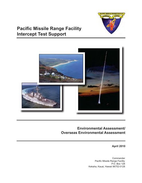
Pacific Missile Range Facility Intercept Test Support
Pacific Missile Range Facility Intercept Test Support
Pacific Missile Range Facility Intercept Test Support

You also want an ePaper? Increase the reach of your titles
YUMPU automatically turns print PDFs into web optimized ePapers that Google loves.
<strong>Pacific</strong> <strong>Missile</strong> <strong>Range</strong> <strong>Facility</strong><strong>Intercept</strong> <strong>Test</strong> <strong>Support</strong>Environmental Assessment/Overseas Environmental AssessmentApril 2010Commander<strong>Pacific</strong> <strong>Missile</strong> <strong>Range</strong> <strong>Facility</strong>P.O. Box 128Kekaha, Kauai, Hawaii 96752-0128
UNCLASSIFIEDSECURITY CLASSIFICATION OF THIS PAGEREPORT DOCUMENTATION PAGEForm ApprovedOMB No. 0704-01881a. REPORT SECURITY CLASSIFICATION1b. RESTRICTIVE MARKINGS2a. SECURITY CLASSIFICATION AUTHORITY3. DISTRIBUTION/AVAILABILITY OF REPORT2b. DECLASSIFICATION/DOWNGRADING SCHEDULE4. PERFORMING ORGANIZATION REPORT NUMBER(S)5. MONITORING ORGANIZATION REPORT NUMBER(S)6a. NAME OF PERFORMING ORGANIZATION 6b. OFFICE SYMBOL(If applicable)7a. NAME OF MONITORING ORGANIZATION6c. ADDRESS (City, State, and ZIP Code)7b. ADDRESS (City, State, and ZIP Code)8a. NAME OF FUNDING/SPONSORINGORGANIZATION8b. OFFICE SYMBOL(if applicable)9. PROCUREMENT INSTRUMENT IDENTIFICATION NUMBER8c. ADDRESS (City, State, and ZIP Code)10. SOURCE OF FUNDING NUMBERSPROGRAM ELEMENTNO.PROJECTNO.TASKNO.WORK UNITACCESSION NO.11. TITLE (Include Security Classification)12. PERSONAL AUTHOR(S)13a. TYPE OF REPORT 13B. TIME COVEREDFROMTO14. DATE OF REPORT (Year, Month, Day) 15. PAGE COUNT16. SUPPLEMENTARY NOTATION17. COSATI CODESFIELD GROUP SUB-GROUP18. SUBJECT TERMS (Continue on reverse if necessary and identify by block number)19. ABSTRACT (Continue on reverse if necessary and identify by block number)20. DISTRIBUTION/AVAILABILITY OF ABSTRACTX UNCLASSIFIED/UNLIMITED SAME AS RPT. DTIC USERS21. ABSTRACT SECURITY CLASSIFICATION22a. NAME OF RESPONSIBLE INDIVIDUAL22b. TELEPHONE (Include Area Code) 22c. OFFICE SYMBOLDD Form 1473, JUN 86 Previous editions are obsolete SECURITY CLASSIFICATION OF THIS PAGEUNCLASSIFIED
Executive Summary
Executive SummaryEXECUTIVE SUMMARYIntroductionThe United States (U.S.) Department of the Navy (Navy) has prepared this EnvironmentalAssessment (EA)/Overseas Environmental Assessment (OEA) to evaluate and discuss theenvironmental consequences of updating the capabilities of the <strong>Pacific</strong> <strong>Missile</strong> <strong>Range</strong> <strong>Facility</strong>(PMRF), Kauai, HI to support future tests of Ballistic <strong>Missile</strong> Defense (BMD) intercepttechnologies. This EA/OEA is in compliance with the National Environmental Policy Act (NEPA)of 1969 (42 United States Code § 4321 et seq.); the Council on Environmental QualityRegulations for Implementing the Procedural Provisions of NEPA (Title 40 Code of FederalRegulations [CFR] §§ 1500-1508 [2005]); Department of the Navy Procedures for ImplementingNEPA (32 CFR § 775 [2005]); and Executive Order 12114, Environmental Effects Abroad ofMajor Federal Actions. The NEPA process ensures that environmental impacts of proposedmajor Federal actions are considered in the decision-making process. Executive Order 12114requires environmental consideration for actions that may significantly harm the environment ofthe global commons (e.g., environment outside U.S. Territorial Seas). This EA/OEA satisfiesthe requirements of both NEPA and Executive Order 12114.BackgroundPMRF is located in Hawaii on and off the western shores of the island of Kauai and includesbroad ocean areas to the north, south, and west. The relative isolation of PMRF, a year-roundtropical climate, and an open ocean area relatively free of human interference are significantfactors in PMRF’s excellent record of safely conducting testing and training activities. PMRFhas a mission to provide training for Navy and other Department of Defense (DoD) personnelusing existing equipment and technologies for real-world requirements to maintain and achieverequired states of readiness. PMRF is a Major <strong>Range</strong> and <strong>Test</strong> <strong>Facility</strong> Base and as suchsupports the full spectrum of DoD <strong>Test</strong> and Evaluation requirements, such as research,development, test, and evaluation (RDT&E) programs developed by the DoD (Navy, Army) andthe <strong>Missile</strong> Defense Agency (MDA). PMRF also is the world’s largest instrumented, multienvironment,military test range capable of supporting subsurface, surface, air, and spaceoperations.PMRF consists of 1,100 square nautical miles (nm 2 ) of instrumented underwater ranges, 42,000nm 2 of controlled airspace, and a Temporary Operating Area (TOA) covering 2.1-million nm 2 ofocean area. The TOA was established to support missile defense testing and extends primarilynorth and west of Kauai. The range and speed of the weapon and missile systems tested atPMRF require the large TOA to contain debris and expended materials from test missions.To ensure safe operations, PMRF requests use of the airspace from the Federal AviationAdministration (FAA) during missile defense testing. The FAA issues a Notice to Airmen(NOTAM) to prevent aircraft from flying into specific areas of airspace until testing is complete.Purpose and NeedThe purpose of the Proposed Action is to provide PMRF with the enhanced capability to furthertest and evaluate Navy and DoD BMD systems, as well as train personnel in the use of thesesystems.April 2010 PMRF <strong>Intercept</strong> <strong>Test</strong> <strong>Support</strong> EA/OEA es-1
Executive SummaryMore specifically, the purpose of the Proposed Action is to:• Enhance PMRF’s range capability and support facilities in order to support futurerequirements of testing existing and new BMD programs at PMRF.• Evaluate airspace needed to accommodate more complex intercept engagementscenarios for missile defense test programs.• Upgrade base activities and facilities to support future fleet training, land-basedtraining, RDT&E activities, and base operations and maintenance activities asrequired.• Provide additional capabilities to ensure safe conduct and evaluation of training andRDT&E missions in a modern, multi-threat, multi-dimensional environment, for futureprograms, which would continue as fully integrated range services, at PMRF.The ability to provide complex missile defense testing scenarios is a major concern and goal ofthe U.S. Navy; therefore, the implementation of the Proposed Action is needed because missiledefense tests are becoming increasingly more complicated with multiple engagements, longertime of flight, intercepts at higher altitudes, and increased closing velocities.PMRF needs these additional enhancements to deliver quality data products to improve thecustomers’ abilities to achieve readiness and other national defense objectives. Targets whichsimulate the characteristics of incoming hostile missiles are required. To be effective, futuretesting and engagement scenarios will need to be conducted in a more realistic fashion. PMRFneeds these additional enhancements to deliver quality data products to improve the nation’sabilities to achieve readiness and other national defense objectives.Proposed ActionThe Proposed Action for this EA/OEA is to further enhance the intercept test capabilities ofPMRF. This enhancement includes the construction and modification of PMRF facilities to testnew land-based interceptor systems and the enhancement of current intercept test capabilitiesof PMRF. The Proposed Action would support and maintain DoD (Army, Navy), MDA, andother potential customers’ RDT&E operations, and associated range capabilities (includinghardware and infrastructure improvements).Under the Proposed Action, existing range and land-based operations and training, and theongoing maintenance of the technical and logistical facilities would continue. In this context,increased flexibility in missile defense testing would represent a small incremental change inongoing activities, although the area used would be increased, with longer engagementdistances, higher altitudes, and longer-range targets and interceptors.The Proposed Action would also include testing of defensive missile systems such as the AegisAshore <strong>Missile</strong> Defense program which will adapt the Aegis Standard <strong>Missile</strong> and AN/SPY1Radar for land-based operation. These programs would involve the placement of new landlaunchedsystems at PMRF, including required missile launcher, radar, and support facilities.PMRF identified sites available for use by the Aegis Ashore <strong>Missile</strong> Defense program. The<strong>Missile</strong> Defense Agency’s siting process narrowed the potential sites to the following:es-2 PMRF <strong>Intercept</strong> <strong>Test</strong> <strong>Support</strong> EA/OEA April 2010
Executive Summary• Launch Site (The interceptor launch area could be constructed on PMRF/Main Baseat one of the three following sites on northern PMRF):- Aegis site,- Exoatmospheric Discrimination Experiment (EDX) site, or- Kauai <strong>Test</strong> <strong>Facility</strong> (KTF) Pad 1• Aegis Ashore <strong>Test</strong> Center (AN/SPY-1 Radar, Administrative <strong>Support</strong> Building,Launch Control Center, and support facilities at one of the following sites):- Adjacent to the Calibration Laboratory (east side) or- Adjacent to the Hawaii Air National Guard (HIANG) (south side)• BMD System Communications <strong>Support</strong> Complex Site at one of the following sites:- South of the proposed Aegis Ashore <strong>Test</strong> Center at the HIANG PMRF site or- Golf Site south of the Terminal High Altitude Area Defense (THAAD) radar pads• Administrative <strong>Support</strong> Building at the THAAD administrative area on central PMRFNo-Action AlternativeThe No-action Alternative for this EA/OEA is a continuation of current and previously analyzedand approved activities. The No-action Alternative is the combination of the programs andactions analyzed in the 2008 Final Hawaii <strong>Range</strong> Complex Environmental ImpactStatement/Overseas Environmental Impact Statement and any additional PMRF programsanalyzed since April 2008, as they relate to BMD test systems, sensors, and facilities. If thisalternative is selected, PMRF would continue existing range training and operation activities,and base operations and maintenance activities. Any mitigation measures developed for theseactivities would continue to be implemented.Impact Assessment MethodologyThirteen broad areas of environmental analysis were originally considered to provide a contextfor understanding the potential effects of the Proposed Action and to provide a basis forassessing the severity of potential impacts. These areas included air quality, airspace,biological resources, cultural resources, geology and soils, hazardous materials and waste,health and safety, land use, noise, socioeconomics, transportation, utilities, and waterresources. These areas were analyzed as applicable for the proposed location or activity.ResultsUnder the Proposed Action, a limited number of small, lightweight fragments resulting fromsome missile intercepts could potentially drift beyond current PMRF-controlled areas. <strong>Intercept</strong>sat higher altitudes would not necessarily generate more debris fragments, but the greateraltitude would cause the small, lightweight fragments to be widely dispersed over a larger area,including land areas. The enhanced testing could result in the dispersion of small, lightweightfragments over land areas on Kauai, Niihau, and the Northwestern Hawaiian Islands (NWHI),over the open ocean between individual islands, or over part of the channel between Kauai andOahu depending on the actual test parameters. The fragments would not be harmful to peopleon the ground, and PMRF would continue to ensure the protection of the public from anyintercept or other missile debris through the application of established standard range safetyprocedures and risk standards, including <strong>Range</strong> Commanders Council (RCC) Standard 321,April 2010 PMRF <strong>Intercept</strong> <strong>Test</strong> <strong>Support</strong> EA/OEA es-3
Executive SummaryCommon Risk Criteria Standards for National <strong>Test</strong> <strong>Range</strong>s, Subtitle: Inert Debris. The RCCStandards are guidelines that provide definitive and quantifiable measures to protect missionessentialpersonnel and the general public. These guidelines address flight safety hazards(including inert debris) and consequences potentially generated by range operations. Thefragments would be light-weight and widely dispersed and thus it is highly improbable that therewould be any harm to vegetation or wildlife.The pattern of the fragments could result in effects to all or parts of the airspace over Kauai,Niihau, the NWHI, over the open ocean between individual islands, or over part of the channelbetween Kauai and Oahu depending on the actual test parameters.PMRF would notify the FAA that a test is being planned that could temporarily affect airspace.The FAA would review the request and advise regarding windows of opportunity for the testingin order to minimize or avoid effects. These windows would determine whether the test couldbe performed, since a minimum of 2 hours (includes launch, intercept, and fragment settlement)of time would be required for a test. PMRF would then request altitude reservations from theFAA, which, if approved, would issue NOTAMs covering this additional temporary airspace.Each individual test is coordinated with FAA prior to altitude reservation request. If Medevac orother emergency flights are requested prior to a missile launch, the launch would be delayeduntil the medical emergency flight is over.Table ES-1 summarizes the conclusions of the impact analyses made for each of the areas ofenvironmental consideration.es-4 PMRF <strong>Intercept</strong> <strong>Test</strong> <strong>Support</strong> EA/OEA April 2010
Executive SummaryResourceCategoryAir QualityAirspace(offshoreandonshore)<strong>Pacific</strong> <strong>Missile</strong> <strong>Range</strong> <strong>Facility</strong>(PMRF)No-action: No significant impacts areexpected. No change in regional airquality is anticipated from training,missile launches, and facilitiesenhancements.Proposed Action: Temporarylocalized increase in air emissions fromconstruction and launches/operations;no effect to region's current attainmentstatus. Air emissions from newgenerators needed to generate up to 4megawatts of power could require thecurrent Title V permit for PMRF/MainBase or Kauai <strong>Test</strong> <strong>Facility</strong> to bemodified. A portion of this energy maycome from carbon-neutral or noncarbonsources to reduce green housegas emissions.No-action: Any potential impacts areminimized through standard operatingprocedures, compliance with DoDdirectives, and close coordination withthe Federal Aviation Administration.Mitigation includes Notices to Airmen(NOTAMs).Proposed Action: Additional airspaceimpacted by fine, small fragments withpotential to damage engines of smalljets and helicopters and skinpenetration of larger high-speedaircraft. These small fragments havethe potential to affect arriving anddeparting flights at area airports (e.g.,Lihue or Princeville) and air traffic(helicopter tours) in the area forapproximately 1 hour from intercept.Mitigation would include coordinationwith the FAA to identify windows ofopportunity to minimize effects andNOTAMS.Table ES-1: Summary of Environmental ImpactsKamokala MagazinesNiihauNorthwestern Hawaiian Islands(Magazines 12 and 13)(NWHI)No-action: No impact; No-action: No impact;No-action: Not applicable.continuation of current continuation of current and Proposed Action: No potential toand previously analyzed previously analyzed and adversely affect air quality.and approved activities. approved activities.Proposed Action: No Proposed Action: No potentialpotential to adversely to adversely affect air quality.affect air quality.No-action: No impact;continuation of currentand previously analyzedand approved activities.Proposed Action: Nopotential to adverselyaffect airspace.No-action: Impacts limited tooccasional flights by the island’shelicopter.Proposed Action: Additionalairspace impacted by fine, smallfragments with potential todamage engines of small jetsand helicopters and skinpenetration of larger high-speedaircraft. These small fragmentshave the potential to affectarriving and departing flights inthe area for approximately 1hour from intercept. Mitigationwould include coordination withthe FAA to identify windows ofopportunity to minimize effectsand NOTAMS.No-action: Impacts limited to overflight ofthe NWHI, including thePapahānaumokuākea Marine NationalMonument. NOTAMs issued prior to alltests that could result in impacts to theseislands.Proposed Action: Additional airspaceimpacted by fine, small fragments withpotential to damage engines of small jetsand helicopters and skin penetration oflarger high-speed aircraft. These smallfragments have the potential to affectarriving and departing flights at areaairports (e.g., Midway) and air traffic(helicopter tours) in the area forapproximately 1 hour from intercept.Mitigation would include coordination withthe FAA to identify windows of opportunityto minimize effects and NOTAMS.Open OceanNo-action: Continuation oftemporary localized minoremissions from missile/targetintercept.Proposed Action: No potentialto adversely affect air quality.No-action: Any potential impactsare minimized through SOPs,compliance with DoD directives,and close coordination with theFAA.Proposed Action: Additionalairspace impacted by fine, smallfragments with potential todamage engines of small jets andhelicopters and skin penetrationof larger high-speed aircraft.These small fragments have thepotential to affect arriving anddeparting flights at area airports(e.g., Lihue, Princeville, Midway)and air traffic (helicopter tours) inthe area for approximately 1 hourfrom intercept. Mitigation wouldinclude coordination with the FAAto identify windows of opportunityto minimize effects andNOTAMS.April 2010 PMRF <strong>Intercept</strong> <strong>Test</strong> <strong>Support</strong> EA/OEA es-5
Executive SummaryTable ES-1: Summary of Environmental Impacts (Continued)ResourceCategoryBiologicalResources(offshoreandonshore)<strong>Pacific</strong> <strong>Missile</strong> <strong>Range</strong> <strong>Facility</strong>(PMRF)No-action: Training and missilelaunches will have no significantimpacts on terrestrial biologicalresources; compliance with SOPs willcontinue to minimize the effects onvegetation and wildlife, as well as limitthe potential for introduction of invasiveplant species.Proposed Action: Short-term noiserelatedimpacts to wildlife; no impactsto Essential Fish Habitat; minimaleffects expected to vegetation (nounique habitat or indigenous or nativevegetation would be disturbed) andwildlife (outdoor lighting associatedwith construction activities andpermanent structures would beproperly shielded), including threatenedor endangered species during testing;no direct impacts to wetlands.Potential ingestion of toxins by fishspecies, which may be used for foodsources, would be remote due tobuffering capacity of seawater.Radar would not be directed toward theground; unlikely that environmentalexposures will ever consist ofcontinuous, constant values of powerdensity; unlikely that a bird wouldremain within the radar beam for anyconsiderable length of time.Kamokala Magazines(Magazines 12 and 13)No-action: No impact.Proposed Action: Nopotential to adverselyaffect biologicalresources.Niihau Northwestern Hawaiian Islands Open OceanNo-action: Training activitiesand major exercises take placein current operating areas, withno planned expansion.Compliance with relevant Navypolicies and procedures duringthese activities minimize theeffects on vegetation andwildlife, as well as limit thepotential for introduction ofinvasive plant species.Temporary, short-term startleeffects from noise to wildlife andbirds would continue. Noimpacts from electromagneticradiation generation to wildlifeare expected.Proposed Action: Fine, lowenergyfragments are notanticipated to affect vegetationor wildlife, including candidate,threatened, or endangeredspecies.No-action: Some current flight trajectoriescan result in missiles flying over portions ofthe Papahānaumokuākea Marine NationalMonument; debris is not expected toseverely harm threatened, endangered,migratory, or other endemic species. Theprobability for debris to hit birds, seals, orother wildlife is extremely low. Quantitiesof falling debris will be very low and widelyscattered so as not to present a toxicityissue. Falling debris will also have cooleddown sufficiently so as not to present a firehazard for vegetation and habitat. Iffeasible, consideration is given toalterations in the missile flight trajectory, tofurther minimize the potential for debrisimpacts.Proposed Action: Falling debris frommissile tests with trajectories that have thepotential to affect land on the NWHI willcool down sufficiently prior to impact thusnot a fire hazard for vegetation; potentialingestion of toxins by fish species, whichmay be used for food sources, would beremote due to buffering capacity ofseawater, some fish may be injured orkilled if present at the initial point of largedebris contact; probability of marinemammals being struck by debris frommissile testing would be remote.No-action: Potential for impactson deep water corals from Navytraining and RDT&E activities isvery limited; activities identifiedhave minimal effects on fish;unlikely that direct hit from a pieceof missile launch debris wouldimpact a sea turtle or marinemammal at the surface; DoD andPMRF follow launch and rangesafety policies and procedures toensure that any potential risks tomarine mammals are minimized.Proposed Action: Potentialingestion of toxins by fishspecies, which may be used forfood sources, would be remotedue to buffering capacity ofseawater, some fish may beinjured or killed if present at theinitial point of large debriscontact; probability of marinemammals being struck by debrisfrom missile testing would beremote; the radar main beamwould not be directed at thesurface of the ocean; highlyunlikely that an individual whaleor turtle would be on orsubstantially above surface of thewater for a significant amount oftime within side lobe areas duringthe particular time that radarwould be operating.es-6 PMRF <strong>Intercept</strong> <strong>Test</strong> <strong>Support</strong> EA/OEA April 2010
Executive SummaryTable ES-1: Summary of Environmental Impacts (Continued)ResourceCategoryCulturalResources(offshoreandonshore)Geologyand Soils<strong>Pacific</strong> <strong>Missile</strong> <strong>Range</strong> <strong>Facility</strong>(PMRF)No-action: No impact if areas withknown cultural resources are avoided.Proposed Action: Significant impactsare not anticipated. Consultation withthe Hawaii State Historic PreservationOfficer and Native Hawaiianorganizations and individuals; closecoordination with the PMRFEnvironmental Engineer; andadherence to U.S. Navy guidelines andthe PMRF Integrated CulturalResources Management Plan wouldfurther minimize any potential forimpacts.No-action: <strong>Test</strong>ing will continue tohave minimal direct impact on thebeach and inland areas, and soils arenot being permanently affected.Proposed Action: Minor localized soilerosion during construction. Noadditional impact.Kamokala Magazines(Magazines 12 and 13)No-action: There are noidentified archaeologicalor Native Hawaiianresources of significanceat this location; however,the magazinesthemselves (caves) havebeen determined eligiblefor inclusion in the NRHP.No impact.Proposed Action: Nopotential to adverselyaffect cultural resources.The two magazines (12and 13) built in 2002 arenot historic properties. Asa result, any alterationscan proceed as needed.No-action: No impact.Proposed Action: Nopotential to adverselyaffect geology and soils.Niihau Northwestern Hawaiian Islands Open OceanNo-action: As a privatelyowned island, resources onNiihau are protected by thelandowners and proponents,and stipulations are included incontracts for various projects toensure that sensitive culturalresources areas are eitheravoided or disturbanceminimized.Proposed Action: Nosignificant impacts anticipated.Debris analyses of the types,quantities, weights, and sizesassociated with the interceptsindicate that the potential tosignificantly impact land andoffshore resources of Niihau isextremely remote. In addition,trajectories can be altered undercertain circumstances to furtherminimize the potential forimpacts.No-action: No potential toadversely affect resource.Proposed Action: No potentialto adversely affect geology andsoils.No-action: <strong>Missile</strong> defense activities,including THAAD, have the potential togenerate fine, small fragments that fallwithin areas of the NWHI and thePapahānaumokuākea Marine NationalMonument; potential to impact landresources of any type is very low andextremely remote; trajectories can bealtered under certain circumstances tofurther minimize the potential for impacts.Future missions will include considerationof missile flight trajectory alterations, iffeasible, to minimize the potential for debriswithin these areas; NWHI impacts are notexpected.Proposed Action: No significant impactsanticipated. Debris analyses of the types,quantities, weights, and sizes associatedwith the intercepts indicate that thepotential to significantly impact land andoffshore resources of the NWHI isextremely remote. In addition, trajectoriescan be altered under certain circumstancesto further minimize the potential forimpacts.No-action: Not applicable.Proposed Action: No potential toadversely affect geology and soils.No-action: No significantimpacts were identified. Culturalresources within open ocean(typically shipwrecks) aresubmerged at considerabledepth, and the potential for themto be disturbed is extremelyremote.Proposed Action: No significantimpacts anticipated. Debrisanalyses of the types, quantities,weights, and sizes associatedwith the intercepts indicate thatthe potential to significantlyimpact resources in the openocean is extremely remote. Inaddition, trajectories can bealtered under certaincircumstances to further minimizethe potential for impacts. Asfeasible, mission flight trajectorieswill be altered to minimize thepotential for debris within theseareas.No-action: Not applicable.Proposed Action: No potentialto adversely affect geology andsoils.April 2010 PMRF <strong>Intercept</strong> <strong>Test</strong> <strong>Support</strong> EA/OEA es-7
Executive SummaryTable ES-1: Summary of Environmental Impacts (Continued)ResourceCategoryHazardousMaterialsand WasteHealth andSafety<strong>Pacific</strong> <strong>Missile</strong> <strong>Range</strong> <strong>Facility</strong>(PMRF)No-action: No impacts.Proposed Action: Minor amounts ofhazardous contaminants to surfacesoils at launch site. All hazardousmaterials/waste would be managed inaccordance with DoD HazardousWaste Management Plans and SpillPrevention, Control, AndCountermeasure Plans.No-action: Impacts will continue to beminimized through compliance withRCC, Navy and Department of Energystandard operating procedures, rangesafety, policies, and plans.Proposed Action: Minimal increase inpersonnel and public health and safetyrisks during construction and operation;all civilian and base personnelexcluded from electromagnetic hazardarea during radar operations.Personnel and public excluded fromthe ground hazard area during launch.See Airspace impacts.Kamokala Magazines(Magazines 12 and 13)No-action: No impact;storage of andtransportation of ordnanceto Kamokala Magazinesare conducted inaccordance withestablished Department ofTransportation, DoD, andNavy safety procedures.Proposed Action: Noadditional impacts.No-action: No impact.Compliance with existinghealth and safety plansand procedures willcontinue to minimizeimpacts.Proposed Action: Noadditional impacts.Niihau Northwestern Hawaiian Islands Open OceanNo-action: PMRF currently hasappropriate plans in place tomanage hazardous materialsand waste on Niihau.Proposed Action: Notaddressed because there is nopotential to adversely affectNiihau.No-action: No adverseimpacts; PMRF takes everyreasonable precaution duringplanning and execution ofoperations, training exercises,and test and developmentactivities to prevent injury tohuman life or property at Niihau.Compliance with RCC andexisting health and safety plansto minimize impacts. Radar andelectronic warfare sites arelocated away from the public.Proposed Action: Debris withthe potential to cause injury tounprotected individuals wouldbe expected to fall within theground hazard area and oceanimpact zones. The acceptablelevel of risks to people will notchange.No-action: Not applicable.Proposed Action: Not addressedbecause there is no potential to adverselyaffect NWHI.No-action: Not applicable.Proposed Action: Prior to launch, regionswith a significant probability of impacts byintercept debris and stage impact areas willbe determined clear of the public and nonessentialpersonnel, because debris isexpected to fall within these areas.See Airspace impacts.No-action: Hazardous materialswill continue to be controlled incompliance with DoD plans.Fragments of expended trainingmaterials, e.g., missiles, could bedeposited on the ocean floor.The wide dispersal and lowfrequency of events minimizes theimpact.Proposed Action: No additionalimpact.No-action: Potential impactminimized through compliancewith RCC, standard operatingprocedures, and DoD Directives,and the use of NOTAMs andNOTMARs.Proposed Action: Prior tolaunch, regions with a significantprobability of impacts by interceptdebris and stage impact areas willbe determined clear of the publicand non-essential personnel,because debris is expected to fallwithin these areas.es-8 PMRF <strong>Intercept</strong> <strong>Test</strong> <strong>Support</strong> EA/OEA April 2010
Executive SummaryTable ES-1: Summary of Environmental Impacts (Continued)ResourceCategoryLand UseNoiseSocioeconomics(offshore andonshore)Transportation(onshoreand offshore)<strong>Pacific</strong> <strong>Missile</strong> <strong>Range</strong> <strong>Facility</strong>(PMRF)No-action: No adverse effects oncoastal use or resources documentedin Navy’s Coastal ConsistencyDetermination in accordance with theCoastal Zone Management Act;closure of public recreational areasduring hazardous activities willcontinue.Proposed Action: No additionalimpact.No-action: Due to the design of theinterceptor missile, the low testfrequency, and the short duration ofeach test, as well as the distance frompopulation centers, noise impacts fromlaunch tests are contained within testboundaries and do not causeannoyance in populated areas.Proposed Action: Noise generatedduring construction would haveminimal effect on sensitive noisereceptors. No additional impact.No-action: Beneficial impact on theeconomy and community on Kauai.Proposed Action: Slight beneficialeconomic impact from temporaryincrease in jobs associated withProposed Action.No-action: No impact; Transportationof ordnance and liquid propellants isconducted in accordance withestablished procedures.Proposed Action: Transportationsystem is adequate to handle demand.Kamokala Magazines(Magazines 12 and 13)No-action: No impact.Proposed Action: Nopotential to adverselyaffect land use.No-action: No impact.Proposed Action:Analyzed as part ofPMRF.No-action: Analyzedas part of PMRF.Proposed Action:Analyzed as part ofPMRF.No-action: Analyzedas part of PMRF.Proposed Action:Analyzed as part ofPMRF.Niihau Northwestern Hawaiian Islands Open OceanNo-action: No impact. Noimprovements or upgradesperformedProposed Action: No potential toadversely affect land use.No-action: No impact. PMRFoverflights generate high noiselevels. However, these are discreteevents, relatively few in number,and restricted as to the actualgeographic locations in which theyare allowed to occur. The landbasedtraining generates relativelylow levels of noise in isolated areas.Proposed Action: No potential foradverse noise effects.No-action: No Impact. The activitiesof PMRF personnel, while onNiihau, are strictly controlled by anexisting protocol.Proposed Action: No potential foradverse socioeconomic impacts.No-action: Not applicableProposed Action: No potential toadversely transportation.No-action: No impact.Proposed Action: No potential toadversely affect land use.No-action: Not applicable.Proposed Action: No potential foradverse noise effects.No-action: Not applicable.Proposed Action: No potential foradverse socioeconomic impacts.No-action: Not applicable.Proposed Action: No potential toadversely affect transportation.No-action: Not applicable.Proposed Action: No potentialto adversely affect resource.No-action: Potential impactminimized through standardoperating procedures andcompliance with DoD Directives,and the use of NOTAMs andNOTMARs, thereby precludingany acoustical impacts onsensitive human receptors.Proposed Action: Point ofintercept of airborne targets wouldresult in a negligible level ofincreased sound in the openocean where typically no sensitivesound human receptors arepresent.No-action: Minimal impact dueto issuance of NOTMARs andNOTAMs.Proposed Action: No additionalimpacts to socioeconomics.No-action: Minimal impact dueto issuance of NOTMARs andNOTAMs.Proposed Action: No additionalimpacts to transportation.April 2010 PMRF <strong>Intercept</strong> <strong>Test</strong> <strong>Support</strong> EA/OEA es-9
Executive SummaryTable ES-1: Summary of Environmental Impacts (Continued)ResourceCategoryUtilities<strong>Pacific</strong> <strong>Missile</strong> <strong>Range</strong> <strong>Facility</strong>(PMRF)No-action: No impact.Proposed Action: Commercialelectricity and generators will be used.An upgrade to power capacity ispossible.No-action: No impact; emissions fromlaunches and exercises do notsignificantly affect water resources;compliance with SOPs will minimizeimpact on beach and inland areas.Proposed Action: No additionalimpact.Kamokala Magazines(Magazines 12 and 13)No-action: Analyzed aspart of PMRF.Proposed Action:Analyzed as part ofPMRF.No-action: Analyzed aspart of PMRF.Proposed Action:Analyzed as part ofPMRF.Niihau Northwestern Hawaiian Islands Open OceanWaterResourcesNo-action: Not applicable.Proposed Action: No potentialto adversely affect utilities.No-action: Not applicable.Proposed Action: No potentialto adversely affect waterresources.No-action: Not applicable.Proposed Action: No potential toadversely affect utilities.No-action: Not applicable.Proposed Action: No potential toadversely affect water resources.No-action: Not applicable.Proposed Action: No potentialto adversely affect utilitiesNo-action: No significantimpacts due to the smallquantities of materials relative tothe extent of the sea ranges andlarge volumes of water in whichthey will be dispersed.Proposed Action: No additionalimpact.es-10 PMRF <strong>Intercept</strong> <strong>Test</strong> <strong>Support</strong> EA/OEA April 2010
Acronyms and Abbreviations
Acronyms and AbbreviationsACRONYMS AND ABBREVIATIONSAAQSAATCACAMAICUZALTRVAPIAPZARDELARTCCASTATCAABARSTURBCSCBMDBSURECFRCHRIMPCNELCODACSdBdBADLNRDNLDoDDOEDOTEAEDXEEZEFHEISEMRAmbient Air Quality StandardsAegis Ashore <strong>Test</strong> CenterAir Conformity Applicability ModelAir Installation Compatible Use ZoneAltitude ReservationAgricultural Preservation InitiativeAccident Potential ZoneAdvanced Radar Detection LaboratoryAir Route Traffic Control CenterAboveground Storage TankAir Traffic Control Assigned AirspaceBarking Sands Tactical Underwater <strong>Range</strong>BMD System Communications <strong>Support</strong> ComplexBallistic <strong>Missile</strong> DefenseBarking Sands Underwater <strong>Range</strong> ExtensionCode of Federal RegulationsConsolidated Hazardous Material Reutilization and InventoryManagement ProgramCommunity Noise Equivalent LevelCarbon MonoxideDivert and Attitude Control SystemDecibelA-weighted Decibel(s)Department of Land and Natural ResourcesDay-Night Average Sound LevelDepartment of DefenseDepartment of EnergyDepartment of TransportationEnvironmental AssessmentExoatmospheric Discrimination ExperimentExclusive Economic ZoneEssential Fish HabitatEnvironmental Impact StatementElectromagnetic RadiationApril 2010 PMRF <strong>Intercept</strong> <strong>Test</strong> <strong>Support</strong> EA/OEA AC-1
Acronyms and AbbreviationsEPCRAEmergency Planning and Community Right-to-Know ActESAEndangered Species ActESQDExplosive Safety Quantity-DistanceETOPExtended Twin-Engine Aircraft Operations°F Degrees FahrenheitFAAFederal Aviation AdministrationFACSFACPH Fleet and Area Control and Surveillance <strong>Facility</strong> Pearl HarborFARFederal Aviation RegulationFLFlight LevelFMPFishery Management PlanFONSIFinding of No Significant ImpactFTFFlexible Target FamilyFTSFlight Termination SystemFYFiscal YearGHGGreenhouse GasGMDGround-based Midcourse DefenseGPDGallons Per DayGPSGlobal Positioning SystemHARHawaii Administrative RulesHERFHazard of Electromagnetic Radiation to FuelHEROHazard of Electromagnetic Radiation to OrdnanceHERPHazard of Electromagnetic Radiation to PersonnelHIANGHawaii Air National GuardHMXCyclotetramethylenetetranitramineHPHorsepowerHRCHawaii <strong>Range</strong> ComplexHRSHawaii Revised StatutesHTPB/APHydroxyl-terminated Polybutadiene/Ammonium PerchlorateHUDU.S. Department of Housing and Urban DevelopmentHVACHeating, Ventilation, and Air ConditioningICAOInternational Civil Aviation AdministrationICRIMPIntegrated Cultural Resources Management PlanIFRInstrument Flight RulesIRPInstallation Restoration ProgramIUCNInternational Union for Conservation of Nature and Natural Resources(World Conservation Union)AC-2 PMRF <strong>Intercept</strong> <strong>Test</strong> <strong>Support</strong> EA/OEA April 2010
Acronyms and AbbreviationsJBPHHKIUCKTFkVkWL dnLEBL eqL maxLOSMBTAMDAmg/kgmimi 2MLPMMPAMRTFBMSFCMAMWmW/in 2NAAQSNAVSEAOPNEPAnmnm 2NMFSNOAANOTAMNOTMARNO xNRHPNWHIOEAOEISORMPJoint Base Pearl Harbor-HickamKauai Island Utility CooperativeKauai <strong>Test</strong> <strong>Facility</strong>Kilovolt(s)Kilowatt(s)Day-Night Average Sound LevelLaunch Equipment BuildingEnergy Equivalent Sound LevelMaximum Sound LevelLevel of ServiceMigratory Bird Treaty Act<strong>Missile</strong> Defense AgencyMilligrams Per KilogramMile(s)Square Mile(s)Mobile Launch PlatformMarine Mammal Protection ActMajor <strong>Range</strong> and <strong>Test</strong> <strong>Facility</strong> BaseMagnuson-Stevens Fishery Conservation and Management ActMegawatt(s)Milliwatts per Square InchNational Ambient Air Quality StandardsNaval Sea Systems Command PublicationNational Environmental Policy ActNautical Mile(s)Square Nautical Mile(s)National Marine Fisheries ServiceNational Oceanic and Atmospheric AdministrationNotice to AirmenNotice to MarinersNitrogen DioxidesNational Register of Historic PlacesNorthwestern Hawaiian IslandsOverseas Environmental AssessmentOverseas Environmental Impact StatementOcean Resources Management PlanApril 2010 PMRF <strong>Intercept</strong> <strong>Test</strong> <strong>Support</strong> EA/OEA AC-3
Acronyms and AbbreviationsOSHAOPNAVINSTPLPM-10PM-2.5PMRFPMRFINSTppmPVCRCCRDT&ERFRIMPACRSOPSHPOSMSOPSPLASHSWTRTHAADTOAU.S.U.S.C.USCGUSEPAUSFWSUSTVFRVLSVOCWPRFMCOccupational Safety and Health AdministrationOffice of the Chief of Naval Operations InstructionPublic LawParticulate Matter with an Aerodynamic Diameter Less Than or Equal to10 MicronsParticulate Matter with an Aerodynamic Diameter Less Than or Equal to2.5 Microns<strong>Pacific</strong> <strong>Missile</strong> <strong>Range</strong> <strong>Facility</strong><strong>Pacific</strong> <strong>Missile</strong> <strong>Range</strong> <strong>Facility</strong> InstructionParts Per MillionPolyvinyl Chloride<strong>Range</strong> Commanders CouncilResearch, Development, <strong>Test</strong>, and EvaluationRadiofrequencyRim of the <strong>Pacific</strong><strong>Range</strong> Safety Operation PlanState Historic Preservation OfficerStandard <strong>Missile</strong>Standard Operating ProcedureStructure of Populations, Levels of Abundance and Status of HumpbacksShallow Water <strong>Test</strong> <strong>Range</strong>Terminal High Altitude Area DefenseTemporary Operating AreaUnited StatesUnited States CodeUnited States Coast GuardUnited States Environmental Protection AgencyUnited States Fish and Wildlife ServiceUnderground Storage TankVisual Flight RulesVertical Launch SystemVolatile Organic CompoundWestern <strong>Pacific</strong> Regional Fishery Management CouncilAC-4 PMRF <strong>Intercept</strong> <strong>Test</strong> <strong>Support</strong> EA/OEA April 2010
Table of Contents
Table of ContentsTABLE OF CONTENTSEXECUTIVE SUMMARY ......................................................................................................... es-1ACRONYMS AND ABBREVIATIONS ..................................................................................... AC-11.0 PURPOSE OF AND NEED FOR ACTION .......................................................................... 1-11.1 INTRODUCTION ................................................................................................ 1-11.2 BACKGROUND .................................................................................................. 1-11.3 PACIFIC MISSILE RANGE FACILITY ................................................................ 1-31.4 BALLISTIC MISSILE DEFENSE CAPABILITIES ............................................... 1-71.5 PURPOSE AND NEED ...................................................................................... 1-81.6 RELATED ENVIRONMENTAL DOCUMENTATION .......................................... 1-91.7 COOPERATING AGENCY ............................................................................... 1-101.8 PUBLIC NOTIFICATION AND REVIEW .......................................................... 1-101.9 DECISIONS TO BE MADE............................................................................... 1-102.0 DESCRIPTION OF THE PROPOSED ACTION AND ALTERNATIVES ........................ 2-12.1 NO-ACTION ALTERNATIVE .............................................................................. 2-12.1.1 RANGE TRAINING AND OPERATION ACTIVITIES—NO-ACTIONALTERNATIVE ....................................................................................... 2-12.1.1.1 <strong>Range</strong> Safety and <strong>Range</strong> Control ......................................... 2-102.1.1.2 <strong>Test</strong>ing and Training ............................................................. 2-152.1.1.3 Sensor Systems ................................................................... 2-232.1.1.4 Communications System Operations ................................... 2-252.1.2 PMRF BASE OPERATIONS AND MAINTENANCE—NO-ACTIONALTERNATIVE ..................................................................................... 2-262.1.2.1 Ordnance .............................................................................. 2-262.1.2.2 <strong>Range</strong> Boats <strong>Support</strong> ........................................................... 2-272.1.2.3 Air <strong>Support</strong> Operations ......................................................... 2-272.1.2.4 Visual Imaging ...................................................................... 2-272.1.2.5 Meteorology and Oceanography .......................................... 2-282.1.2.6 Other <strong>Support</strong> Facilities ........................................................ 2-282.1.2.7 Ongoing Maintenance and Operations ................................. 2-282.2 PROPOSED ACTION ...................................................................................... 2-292.2.1 RANGE TRAINING AND OPERATION—PROPOSED ACTION ......... 2-402.2.1.1 <strong>Range</strong> Safety and <strong>Range</strong> Control ......................................... 2-402.2.1.2 <strong>Test</strong>ing and Training ............................................................. 2-412.2.1.3 Sensor Systems ................................................................... 2-422.2.1.4 Construction Requirements .................................................. 2-422.2.2 BASE OPERATIONS AND MAINTENANCE—PROPOSED ACTIONALTERNATIVE ..................................................................................... 2-492.3 ALTERNATIVES CONSIDERED BUT NOT CARRIED FORWARD ................ 2-50April 2010 PMRF <strong>Intercept</strong> <strong>Test</strong> <strong>Support</strong> EA/OEA i
Table of Contents3.0 AFFECTED ENVIRONMENT ......................................................................................... 3-13.1 KAUAI ................................................................................................................. 3-33.1.1 KAUAI—ONSHORE ............................................................................... 3-33.1.1.1 PMRF/Main Base—Onshore .................................................. 3-33.1.1.1.1 Air Quality—PMRF/Main Base—Onshore ........... 3-33.1.1.1.2 Airspace—PMRF/Main Base—Onshore ............. 3-53.1.1.1.3 Biological Resources—PMRF/Main Base—Onshore ............................................................... 3-93.1.1.1.4 Cultural Resources—PMRF/Main Base—Onshore ............................................................. 3-163.1.1.1.5 Geology and Soils—PMRF/Main Base—Onshore ............................................................. 3-183.1.1.1.6 Hazardous Materials and Waste—PMRF/Main Base—Onshore ............................. 3-203.1.1.1.7 Health and Safety—PMRF/Main Base—Onshore ............................................................. 3-213.1.1.1.8 Land Use—PMRF/Main Base—Onshore .......... 3-263.1.1.1.9 Noise—PMRF/Main Base—Onshore ................ 3-303.1.1.1.10 Socioeconomics—PMRF/Main Base—Onshore ............................................................. 3-333.1.1.1.11 Transportation—PMRF/Main Base—Onshore ............................................................. 3-353.1.1.1.12 Utilities—PMRF/Main Base—Onshore .............. 3-363.1.1.1.13 Water Resources—PMRF/Main Base—Onshore ............................................................. 3-373.1.1.2 Kamokala Magazines—Onshore .......................................... 3-403.1.1.2.1 Cultural Resources—Kamokala Magazines—Onshore ............................................................. 3-403.1.1.2.2 Hazardous Materials and Waste—KamokalaMagazines—Onshore ........................................ 3-413.1.1.2.3 Health and Safety—Kamokala Magazines—Onshore ............................................................. 3-413.1.2 KAUAI—OFFSHORE ........................................................................... 3-423.1.2.1 PMRF Offshore ..................................................................... 3-423.1.2.1.1 Airspace Resources—PMRF—Offshore ........... 3-423.1.2.1.2 Biological Resources—PMRF—Offshore .......... 3-423.1.2.1.3 Cultural Resources—PMRF—Offshore ............. 3-503.1.2.1.4 Socioeconomics—PMRF—Offshore ................. 3-513.1.2.1.5 Transportation—PMRF—Offshore .................... 3-533.2 NIIHAU ............................................................................................................. 3-543.2.1 NIIHAU—ONSHORE ............................................................................ 3-543.2.1.1 Airspace—Niihau—Onshore ................................................ 3-543.2.1.2 Biological Resources—Niihau—Onshore ............................. 3-543.2.1.3 Cultural—Niihau—Onshore .................................................. 3-563.2.1.4 Health and Safety—Niihau—Onshore .................................. 3-563.2.2 NIIHAU—OFFSHORE .......................................................................... 3-583.2.2.1 Airspace—Niihau—Offshore ................................................ 3-583.2.2.2 Biological Resources—Niihau—Offshore ............................. 3-58ii PMRF <strong>Intercept</strong> <strong>Test</strong> <strong>Support</strong> EA/OEA April 2010
Table of Contents3.3 NORTHWESTERN HAWAIIAN ISLANDS ........................................................ 3-603.3.1 NORTHWESTERN HAWAIIAN ISLANDS—ONSHORE ...................... 3-653.3.1.1 Biological Resources—Northwestern HawaiianIslands—Onshore ................................................................. 3-653.3.1.2 Cultural Resources—Northwestern Hawaiian Islands—Onshore ................................................................................ 3-683.3.1.3 Health and Safety—Northwestern Hawaiian Islands—Onshore ................................................................................ 3-703.3.2 NORTHWESTERN HAWAIIAN ISLANDS—OFFSHORE .................... 3-723.3.2.1 Biological Resources—Northwestern Hawaiian Islands—Offshore ................................................................................ 3-723.3.2.2 Cultural Resources—Northwestern Hawaiian Islands—Offshore ................................................................................ 3-733.3.2.3 Health and Safety—Northwestern Hawaiian Islands—Offshore ................................................................................ 3-743.4 OPEN OCEAN AREA ....................................................................................... 3-753.4.1 AIRSPACE—OPEN OCEAN AREA ..................................................... 3-753.4.2 BIOLOGICAL RESOURCES—OPEN OCEAN AREA .......................... 3-783.4.2.1 Coral ..................................................................................... 3-803.4.2.2 Fish ....................................................................................... 3-813.4.2.2.1 Essential Fish Habitat ........................................ 3-813.4.2.3 Sea Turtles ........................................................................... 3-823.4.2.4 Marine Mammals .................................................................. 3-863.4.3 CULTURAL RESOURCES—OPEN OCEAN AREA ............................. 3-893.4.4 HAZARDOUS MATERIALS AND WASTE—OPEN OCEAN AREA ..... 3-893.4.5 HEALTH AND SAFETY—OPEN OCEAN AREA .................................. 3-913.4.6 NOISE—OPEN OCEAN AREA ............................................................ 3-913.4.7 WATER RESOURCES—OPEN OCEAN AREA ................................... 3-924.0 ENVIRONMENTAL CONSEQUENCES ......................................................................... 4-14.1 NO-ACTION ALTERNATIVE .............................................................................. 4-24.1.1 KAUAI ONSHORE—NO-ACTION .......................................................... 4-24.1.1.1 PMRF/Main Base—Onshore—No-action.............................. 4-24.1.1.1.1 Air Quality—PMRF/Main Base—Onshore—No-action .......................................... 4-24.1.1.1.2 Airspace—PMRF/Main Base—Onshore—No-action ............................................................ 4-24.1.1.1.3 Biological Resources—PMRF/Main Base—Onshore—No-action .......................................... 4-24.1.1.1.4 Cultural Resources—PMRF/Main Base—Onshore—No-action .......................................... 4-34.1.1.1.5 Geology and Soils—PMRF/Main Base—Onshore—No-action .......................................... 4-34.1.1.1.6 Hazardous Materials and Waste—PMRF/Main Base—Onshore—No-action .......... 4-34.1.1.1.7 Health and Safety—PMRF/Main Base—Onshore—No-action .......................................... 4-34.1.1.1.8 Land Use—PMRF/Main Base—Onshore—No-action ............................................................ 4-3April 2010 PMRF <strong>Intercept</strong> <strong>Test</strong> <strong>Support</strong> EA/OEA iii
Table of Contents4.1.1.1.9 Noise—PMRF/Main Base—Onshore—Noaction................................................................. 4-44.1.1.1.10 Socioeconomics—PMRF/Main Base—Onshore—No-action .......................................... 4-44.1.1.1.11 Transportation—PMRF/Main Base—Onshore—No-action .......................................... 4-44.1.1.1.12 Utilities—PMRF/Main Base—Onshore—No-action ............................................................ 4-44.1.1.1.13 Water Resources—PMRF/Main Base—Onshore—No-action .......................................... 4-44.1.1.2 Makaha Ridge—No-action .................................................... 4-44.1.1.2.1 Air Quality—Makaha Ridge—No-action ............. 4-44.1.1.2.2 Biological Resources—Makaha Ridge—No-action ............................................................ 4-44.1.1.2.3 Cultural Resources—Makaha Ridge—Noaction................................................................. 4-54.1.1.2.4 Hazardous Materials and Waste—MakahaRidge—No-action ............................................... 4-54.1.1.2.5 Health and Safety—Makaha Ridge—Noaction................................................................. 4-54.1.1.3 Kokee—No-action ................................................................. 4-54.1.1.3.1 Air Quality—Kokee—No-action .......................... 4-54.1.1.3.2 Biological Resources—Kokee—No-action ......... 4-54.1.1.3.3 Cultural Resources—Kokee—No-action ............ 4-54.1.1.3.4 Hazardous Materials and Waste—Kokee—No-action ............................................................ 4-64.1.1.3.5 Health and Safety—Kokee—No-action .............. 4-64.1.1.4 Hawaii Air National Guard Kokee—No-action ....................... 4-64.1.1.4.1 Biological Resources—Hawaii Air NationalGuard Kokee—No-action ................................... 4-64.1.1.5 Kamokala Magazines—No-action ......................................... 4-64.1.1.5.1 Cultural Resources—KamokalaMagazines—No-action ....................................... 4-64.1.1.5.2 Hazardous Materials and Waste—Kamokala Magazines—No-action ...................... 4-64.1.1.5.3 Health and Safety—KamokalaMagazines—No-action ....................................... 4-74.1.2 KAUAI—OFFSHORE—NO-ACTION ...................................................... 4-84.1.2.1 PMRF/Main Base—Offshore—No-action.............................. 4-84.1.2.1.1 Airspace—PMRF/Main Base—Offshore—No-action ............................................................ 4-84.1.2.1.2 Biological Resources—PMRF/Main Base—Offshore—No-action .......................................... 4-84.1.2.1.3 Cultural Resources—PMRF/Main Base—Offshore—No-action .......................................... 4-94.1.2.1.4 Socioeconomics—PMRF/Main Base—Offshore—No-action .......................................... 4-94.1.2.1.5 Transportation—PMRF/Main Base—Offshore—No-action .......................................... 4-9iv PMRF <strong>Intercept</strong> <strong>Test</strong> <strong>Support</strong> EA/OEA April 2010
Table of Contents4.1.3 NIIHAU—ONSHORE—NO-ACTION .................................................... 4-104.1.3.1 Airspace—Niihau—Onshore—No-action ............................ 4-104.1.3.2 Biological Resources—Niihau—Onshore—No-action ........ 4-104.1.3.3 Cultural Resources—Niihau—Onshore—No-Action ........... 4-104.1.3.4 Hazardous Materials and Waste—Niihau—Onshore—No-action ............................................................................. 4-104.1.3.5 Health and Safety—Niihau—Onshore—No-action ............. 4-104.1.4 NIIHAU—OFFSHORE—NO-ACTION .................................................. 4-114.1.4.1 Airspace—Niihau—Offshore—No-action ............................ 4-114.1.4.2 Biological Resources—Niihau—Offshore—No-action ........ 4-114.1.5 NORTHWESTERN HAWAIIAN ISLANDS—ONSHORE—NO-ACTION .......................................................................................... 4-124.1.5.1 Biological Resources—Northwestern HawaiianIslands—Onshore—No-action ............................................ 4-124.1.5.2 Cultural Resources—Northwestern Hawaiian Islands—Onshore—No-action ........................................................... 4-124.1.6 NORTHWESTERN HAWAIIAN ISLANDS—OFFSHORE—NO-ACTION .......................................................................................... 4-134.1.6.1 Biological Resources—Northwestern HawaiianIslands—Offshore—No-action ............................................ 4-134.1.6.2 Cultural Resources—Northwestern Hawaiian Islands—Offshore—No-action ........................................................... 4-134.1.7 OPEN OCEAN AREA—NO-ACTION ................................................... 4-144.1.7.1 Airspace—Open Ocean Area—No-action .......................... 4-144.1.7.2 Biological Resources—Open Ocean Area—No-action ....... 4-144.1.7.3 Cultural Resources—Open Ocean Area—No-action .......... 4-144.1.7.4 Hazardous Materials and Waste—Open Ocean Area—No-action ............................................................................. 4-144.1.7.5 Health and Safety—Open Ocean Area—No-action ............ 4-154.1.7.6 Noise—Open Ocean Area—No-action ............................... 4-154.1.7.7 Water Resources—Open Ocean Area—No-action ............. 4-154.2 PROPOSED ACTION ...................................................................................... 4-164.2.1 KAUAI—ONSHORE—PROPOSED ACTION ....................................... 4-164.2.1.1 PMRF/Main Base—Onshore—Proposed Action ................. 4-164.2.1.1.1 Air Quality—PMRF/Main Base—Onshore—Proposed Action ............................. 4-164.2.1.1.2 Airspace—PMRF/Main Base—Onshore—Proposed Action ............................................... 4-204.2.1.1.3 Biological Resources—PMRF/Main Base—Onshore—Proposed Action ............................. 4-244.2.1.1.4 Cultural Resources—PMRF/Main Base—Onshore—Proposed Action ............................. 4-314.2.1.1.5 Geology and Soils—PMRF/Main Base—Onshore—Proposed Action ............................. 4-334.2.1.1.6 Hazardous Materials and Waste—PMRF/Main Base—Onshore—ProposedAction ............................................................... 4-334.2.1.1.7 Health and Safety—PMRF/Main Base—Onshore—Proposed Action ............................. 4-35April 2010 PMRF <strong>Intercept</strong> <strong>Test</strong> <strong>Support</strong> EA/OEA v
Table of Contents4.2.1.1.8 Land Use—PMRF/Main Base—Onshore—Proposed Action ............................................... 4-384.2.1.1.9 Noise—PMRF/Main Base—Onshore—Proposed Action ............................................... 4-394.2.1.1.10 Socioeconomics—PMRF/Main Base—Onshore—Proposed Action ............................. 4-414.2.1.1.11 Transportation—PMRF/Main Base—Onshore—Proposed Action ............................. 4-414.2.1.1.12 Utilities—PMRF/Main Base—Onshore—Proposed Action ............................................... 4-424.2.1.1.13 Water Resources—PMRF/Main Base—Onshore—Proposed Action ............................. 4-434.2.2 KAUAI—OFFSHORE—PROPOSED ACTION ..................................... 4-454.2.2.1 PMRF/Main Base—Offshore—Proposed Action ................. 4-454.2.2.1.1 Biological Resources—PMRF—Offshore—Proposed Action ............................................... 4-454.2.2.1.2 Cultural Resources—PMRF—Offshore—Proposed Action ............................................... 4-494.2.2.1.3 Socioeconomics—PMRF—Offshore—Proposed Action ............................................... 4-494.2.2.1.4 Transportation—PMRF—Offshore—Proposed Action ............................................... 4-494.2.3 NIIHAU—ONSHORE—PROPOSED ACTION ..................................... 4-514.2.3.1 Airspace—Niihau—Onshore—Proposed Action ................. 4-514.2.3.2 Biological Resources—Niihau—Onshore—ProposedAction .................................................................................. 4-524.2.3.3 Cultural Resources—Niihau—Onshore—ProposedAction .................................................................................. 4-524.2.3.4 Health and Safety—Niihau—Onshore—ProposedAction .................................................................................. 4-534.2.4 NIIHAU—OFFSHORE—PROPOSED ACTION ................................... 4-544.2.4.1 Airspace—Niihau—Offshore—Proposed Action ................. 4-544.2.4.2 Biological Resources—Niihau—Offshore—ProposedAction .................................................................................. 4-544.2.5 NORTHWESTERN HAWAIIAN ISLANDS—ONSHORE—PROPOSED ACTION ........................................................................... 4-564.2.5.1 Biological Resources—Northwestern HawaiianIslands—Onshore—Proposed Action ................................. 4-564.2.5.2 Cultural Resources—Northwestern Hawaiian Islands—Onshore—Proposed Action ................................................ 4-574.2.5.3 Health and Safety—Northwestern Hawaiian Islands—Onshore—Proposed Action ................................................ 4-584.2.6 NORTHWESTERN HAWAIIAN ISLANDS—OFFSHORE—PROPOSED ACTION ........................................................................... 4-594.2.6.1 Biological Resources—Northwestern HawaiianIslands—Offshore—Proposed Action ................................. 4-594.2.6.2 Cultural Resources—Northwestern Hawaiian Islands—Offshore—Proposed Action ................................................ 4-604.2.6.3 Health and Safety—Northwestern Hawaiian Islands—Offshore—Proposed Action ................................................ 4-60vi PMRF <strong>Intercept</strong> <strong>Test</strong> <strong>Support</strong> EA/OEA April 2010
Table of Contents4.2.7 OPEN OCEAN AREA—PROPOSED ACTION .................................... 4-614.2.7.1 Airspace—Open Ocean Area—Proposed Action ............... 4-614.2.7.2 Biological Resources—Open Ocean Area—ProposedAction .................................................................................. 4-614.2.7.3 Cultural Resources—Open Ocean Area—ProposedAction .................................................................................. 4-634.2.7.4 Hazardous Materials and Waste—Open Ocean Area—Proposed Action .................................................................. 4-634.2.7.5 Health and Safety—Open Ocean Area—ProposedAction .................................................................................. 4-644.2.7.6 Noise—Open Ocean Area—Proposed Action .................... 4-654.2.7.7 Water Resources—Open Ocean Area—ProposedAction .................................................................................. 4-654.3 FEDERAL ACTIONS TO ADDRESS ENVIRONMENTAL JUSTICE INMINORITY POPULATIONS AND LOW-INCOME POPULATIONS(EXECUTIVE ORDER 12898) .......................................................................... 4-664.4 FEDERAL ACTIONS TO ADDRESS PROTECTION OF CHILDREN FROMENVIRONMENTAL HEALTH RISKS AND SAFETY RISKS (EXECUTIVEORDER 13045, AS AMENDED BY EXECUTIVE ORDER 13229) .................. 4-665.0 CUMULATIVE IMPACTS ............................................................................................... 5-15.1 REQUIREMENT FOR CUMULATIVE IMPACT ANALYSIS ............................... 5-15.2 CUMULATIVE IMPACT ANALYSIS ................................................................... 5-25.2.1 AIR QUALITY ......................................................................................... 5-25.2.2 AIRSPACE.............................................................................................. 5-35.2.3 BIOLOGICAL RESOURCES .................................................................. 5-45.2.4 CULTURAL RESOURCES ..................................................................... 5-45.2.5 GEOLOGY AND SOILS .......................................................................... 5-55.2.6 HAZARDOUS MATERIALS AND WASTE ............................................. 5-55.2.7 HEALTH AND SAFETY .......................................................................... 5-55.2.8 LAND USE .............................................................................................. 5-65.2.9 NOISE..................................................................................................... 5-65.2.10 SOCIOECONOMICS .............................................................................. 5-65.2.11 TRANSPORTATION ............................................................................... 5-75.2.12 UTILITIES ............................................................................................... 5-75.2.13 WATER RESOURCES ........................................................................... 5-76.0 REFERENCES ............................................................................................................... 6-17.0 LIST OF PREPARERS .................................................................................................. 7-18.0 AGENCIES AND INDIVIDUALS CONTACTED ............................................................. 8-1April 2010 PMRF <strong>Intercept</strong> <strong>Test</strong> <strong>Support</strong> EA/OEA vii
Table of ContentsAPPENDICESABCDEDISTRIBUTION LISTCORRESPONDENCERESOURCE DESCRIPTIONS INCLUDING LAWS AND REGULATIONS CONSIDEREDMISSILE LAUNCH SAFETY AND EMERGENCY RESPONSERESTRICTIVE EASEMENT LEASEFIGURES1.2-1 <strong>Pacific</strong> <strong>Missile</strong> <strong>Range</strong> <strong>Facility</strong> and <strong>Support</strong> Locations, Kauai, Niihau, andKaula .................................................................................................................. 1-21.3-1 Existing <strong>Pacific</strong> <strong>Missile</strong> <strong>Range</strong> <strong>Facility</strong> and Kauai <strong>Test</strong> <strong>Facility</strong> LaunchFacilities, Kauai, Hawaii ..................................................................................... 1-51.3-2 Relative Target and <strong>Intercept</strong>or <strong>Missile</strong> Heights ................................................. 1-62.1-1 Available Locations at Northern PMRF, Kauai, Hawaii ...................................... 2-22.1-2 Available Locations at Southern PMRF, Kauai, Hawaii ...................................... 2-32.1-3 Available Locations at Makaha Ridge, Kauai, Hawaii ........................................ 2-42.1-4 Available Locations at Kokee Radar <strong>Facility</strong>, Kauai, Hawaii .............................. 2-52.1-5 Available Locations at Hawaii Air National Guard (HIANG) Kokee Site,Kauai, Hawaii ..................................................................................................... 2-62.1-6 Available Locations at Niihau, Niihau, Hawaii .................................................... 2-72.1.1-1 Maui External <strong>Support</strong> Facilities, Maui, Hawaii .................................................. 2-92.1.1.1-1 Conceptual Impact Zones of Current Air, Sea, and Land <strong>Intercept</strong>Scenarios (No-action Alternative) ..................................................................... 2-112.1.1.2-1 <strong>Pacific</strong> <strong>Missile</strong> <strong>Range</strong> <strong>Facility</strong> Open Ocean Conceptual <strong>Intercept</strong>Scenarios—Land, Hawaiian Islands ................................................................. 2-202.1.1.2-2 Target Flight Corridors into the Temporary Operating Area, Open Ocean ....... 2-222.2-1 Proposed Action Candidate Sites, Kauai, Hawaii ............................................. 2-322.2-2 EDX Candidate <strong>Intercept</strong>or Launch Site Layout, Kauai, Hawaii ....................... 2-332.2-3 KTF Pad 1 Candidate <strong>Intercept</strong>or Launch Site Layout, Kauai, Hawaii ............. 2-342.2-4 Aegis Candidate <strong>Intercept</strong>or Launch Site Layout, Kauai, Hawaii ..................... 2-352.2-5 Calibration Lab Site East Candidate <strong>Test</strong> Center Site, Kauai, Hawaii .............. 2-362.2-6 Hawaii Air National Guard (HIANG) PMRF Candidate <strong>Test</strong> Center Site,Kauai, Hawaii ................................................................................................... 2-372.2-7 Golf Candidate Communications <strong>Support</strong> Complex, Kauai, Hawaii ................. 2-382.2-8 THAAD Admin Area Candidate Mission <strong>Support</strong> Site, Kauai, Hawaii .............. 2-392.2.1.4-1 Notional Aegis Ashore Launch Layout ............................................................. 2-432.2.1.4-2 Notional <strong>Test</strong> Center and Communications <strong>Support</strong> Complex HardstandLayout ............................................................................................................... 2-443.1.1.1.2-1 Airspace Use Surrounding <strong>Pacific</strong> <strong>Missile</strong> <strong>Range</strong> <strong>Facility</strong>, Kauai, Niihau,and Kaula, Hawaii .............................................................................................. 3-63.1.1.1.3-1 Critical Habitat—Western Kauai Hawaii, Kauai, Hawaii ................................... 3-153.1.1.1.7-1 <strong>Pacific</strong> <strong>Missile</strong> <strong>Range</strong> <strong>Facility</strong> Health and Safety Areas, Kauai, Hawaii ........... 3-243.1.1.1.8-1 State Land Use—Western Kauai, Hawaii, Kauai, Hawaii ................................. 3-28viii PMRF <strong>Intercept</strong> <strong>Test</strong> <strong>Support</strong> EA/OEA April 2010
Table of Contents3.1.1.1.9-1 Typical Noise Levels (dBA) for Kauai <strong>Test</strong> <strong>Facility</strong> Launch Area, Kauai,Hawaii ............................................................................................................... 3-323.1.2.1.2-1 Offshore Hardbottom Habitats of <strong>Pacific</strong> <strong>Missile</strong> <strong>Range</strong> <strong>Facility</strong>, Kauai,Hawaii ............................................................................................................... 3-443.1.2.1.2-2 Hawaiian Islands Humpback Whale National Marine Sanctuary, HawaiianIslands .............................................................................................................. 3-493.3-1 Papahānaumokuākea (Northwestern Hawaiian Islands) Marine NationalMonument, Hawaiian Islands ........................................................................... 3-613.4.1-1 Airways and Special Use Airspace, Hawaiian Islands ...................................... 3-763.4.1-2 Airspace Managed by Oakland Air Route Traffic Control Center andHonolulu Control <strong>Facility</strong>, <strong>Pacific</strong> Ocean .......................................................... 3-79TABLES2.2-1 Proposed Action Locations ............................................................................... 2-312.2.1.4-1 Potential Proposed Action Construction Activities ............................................ 2-422.2.1.4-2 Power Requirements for an Aegis Ashore <strong>Missile</strong> <strong>Test</strong> ................................... 2-463.1.1.1.3-1 Listed Species Known or Expected to Occur in the Vicinity of PMRF/MainBase ................................................................................................................. 3-103.1.1.1.9-1 Estimated Noise Levels for Strategic Target System Launches ....................... 3-313.1.1.1.10-1 Demographics of the Estimated Population of Kauai in 2008 .......................... 3-333.1.1.1.10-2 Age Profile of Kauai County Residents in 2008................................................ 3-333.1.2.1.2-1 Listed Species Known or Expected to Occur Offshore of PMRF/MainBase ................................................................................................................. 3-473.2.1.2-1 Listed Species Known or Expected to Occur on Niihau ................................... 3-553.3.1.1-1 Listed Species Known or Expected to Occur within the NorthwesternHawaiian Islands and Adjacent Ocean Area .................................................... 3-664.2.1.1.1-1 Estimated Annual Emissions from New Construction Activity, ProposedAction Alternative ............................................................................................. 4-174.2.1.1.1-2 Estimated Emissions from Flight <strong>Support</strong> for 2013 (Tons/Year) ...................... 4-184.2.1.1.1-3 Estimated Generator Size and Hours of Operation for Four Aegis Ashore<strong>Missile</strong> <strong>Test</strong>s ..................................................................................................... 4-184.2.1.1.1-4 Estimated Emissions from Standard <strong>Missile</strong>-1 Propellants: AmmoniumPerchlorate, Aluminum, and HMX .................................................................... 4-195.1-1 Cumulative Projects List ..................................................................................... 5-1April 2010 PMRF <strong>Intercept</strong> <strong>Test</strong> <strong>Support</strong> EA/OEA ix
Table of ContentsTHIS PAGE INTENTIONALLY LEFT BLANKx PMRF <strong>Intercept</strong> <strong>Test</strong> <strong>Support</strong> EA/OEA April 2010
1.0 Purpose of and Need for Action
1.0 Purpose of and Need for Action1.0 PURPOSE OF AND NEED FOR ACTION1.1 INTRODUCTIONThe United States (U.S.) Department of the Navy (Navy) has prepared this EnvironmentalAssessment (EA)/Overseas Environmental Assessment (OEA) to evaluate and discuss theenvironmental consequences of updating the capabilities of the <strong>Pacific</strong> <strong>Missile</strong> <strong>Range</strong> <strong>Facility</strong>(PMRF), Kauai, HI to support future tests of Ballistic <strong>Missile</strong> Defense (BMD) intercepttechnologies. This EA/OEA is in compliance with the National Environmental Policy Act (NEPA)of 1969 (42 United States Code [U.S.C.] § 4321 et seq.); the Council on Environmental QualityRegulations for Implementing the Procedural Provisions of NEPA (Title 40 Code of FederalRegulations [CFR] §§ 1500-1508 [2005]); Department of the Navy Procedures for ImplementingNEPA (32 CFR § 775 [2005]); and Executive Order 12114, Environmental Effects Abroad ofMajor Federal Actions. The NEPA process ensures that environmental impacts of proposedmajor Federal actions are considered in the decision-making process. Executive Order 12114requires environmental consideration for actions that may significantly harm the environment ofthe global commons (e.g., environment outside U.S. Territorial Seas). This EA/OEA satisfiesthe requirements of both NEPA and Executive Order 12114.1.2 BACKGROUNDPMRF (Figure 1.2-1) has supported various missile test and evaluation programs since 1993 byconducting launches of targets and conducting flight tests of intercepting missiles. In December1998, the Navy finalized the PMRF Enhanced Capability Environmental Impact Statement (EIS),which was a comprehensive analysis to support decisions by the Navy concerning potentialrange enhancements at PMRF. The 1998 PMRF Enhanced Capability EIS analyzed thecontinuation of existing activities and enhanced capabilities that allowed PMRF to test missiledefense systems being developed and to train using those systems. These enhancementsincluded upgrading the existing radar and communications facilities and the addition of a missilestorage magazine. Since then, the Navy has assessed further enhancements to rangecapabilities in follow-on environmental documents.In 2000, the Mountaintop Surveillance Sensor <strong>Test</strong> Integration Center EA analyzed a facility toprovide a ground-based test capability at PMRF to evaluate and compare new and updatedradar and sensor technologies. The test facility was designed to provide an environmentrepresenting an operational surveillance and tracking radar for airborne, sea, and landconditions. In 2002, the Terminal High Altitude Area Defense (THAAD) <strong>Pacific</strong> Flight <strong>Test</strong>s EAanalyzed interceptor missile launches and THAAD radar operation at PMRF. The GroundbasedMidcourse Defense (GMD) Extended <strong>Test</strong> <strong>Range</strong> EIS prepared in 2003 analyzed morecomplex long-range interceptor flight tests in the <strong>Pacific</strong> Region.April 2010 PMRF <strong>Intercept</strong> <strong>Test</strong> <strong>Support</strong> EA/OEA 1-1
1.0 Purpose of and Need for Action179W 43N150W 43NMidway AtollTernW-188150W 28NJohnston AtollKauai179W 16NTemporary Operating AreaMobile Transmitter SitesPerch SiteandOptical TrackingNiihauLehuaPaniau Radar SiteKikiaola SmallBoat HarborMakahaRidge550PMRF / Main Base560Kauai <strong>Test</strong> <strong>Facility</strong> (KTF)Kamokala MagazinesHawaii Air National GuardKokeePort AllenKauai5056Nawiliwili HarborKaulaEXPLANATIONRoad12-Nautical Mile LineKingfisher <strong>Range</strong>Shallow Water Training <strong>Range</strong> (SWTR)Barking Sands TacticalUnderwater <strong>Range</strong> (BARSTUR)Barking Sands Underwater<strong>Range</strong> Expansion (BSURE)Installation AreaState/Private Land<strong>Pacific</strong> <strong>Missile</strong> <strong>Range</strong><strong>Facility</strong> and <strong>Support</strong>LocationsKauai, Niihau, and Kaula, HawaiiNORTH0 5 10 20 Nautical MilesFigure 1.2-11-2 PMRF <strong>Intercept</strong> <strong>Test</strong> <strong>Support</strong> EA/OEA April 2010
1.0 Purpose of and Need for ActionVarious targets and target launch alternatives, as well as a programmatic assessment, wereevaluated between 2004 and 2007. Specifically, in 2004 the <strong>Missile</strong> Defense Agency (MDA)prepared the Mobile Launch Platform EA to evaluate the potential environmental impacts ofactivities associated with using the Mobile Launch Platform for testing sensors, launching targetmissiles, and launching interceptor missiles. Additionally, in 2007, MDA finalized the Ballistic<strong>Missile</strong> Defense System Programmatic Final EIS to evaluate the impacts to the environmentfrom the development, testing, deployment, and planning for decommissioning activities for anintegrated BMD system.In 2008, the Navy finalized the Hawaii <strong>Range</strong> Complex EIS/Overseas EIS (OEIS) that addressedongoing and proposed activities within the Navy’s existing Hawaii <strong>Range</strong> Complex (HRC), whichincludes PMRF, and represented current and anticipated future use of the “existing footprint” ofthe HRC. The overall purpose of the 2008 EIS/OEIS was to achieve and maintain fleet readinessusing the HRC to support and conduct current, emerging, and future training and research,development, test, and evaluation (RDT&E) activities; and enhance training resources throughinvestment on the ranges.The Proposed Action for this PMRF <strong>Intercept</strong> <strong>Test</strong> <strong>Support</strong> EA/OEA is to further enhance theintercept test capabilities of missile defense tests at PMRF. It includes the construction andmodification of PMRF facilities to test new land-based interceptor systems and theenhancement of current intercept test capabilities of PMRF. This EA/OEA builds upon previousanalyses and assesses the potential environmental impacts of new enhancements,technologies, and capabilities, which includes changes to interceptor testing scenarios withinthe PMRF range and the Temporary Operating Area (TOA) (Figure 1.2-1 insert). It alsoincludes the temporary use of airspace outside these areas that is needed to accommodatemore complex engagement scenarios for missile testing. The Proposed Action would supportand maintain future Department of Defense (DoD) (Navy, Army, etc.) and MDA RDT&Eoperations; and mission requirements for newer interceptors or future targets, sensors,associated facilities (including hardware and infrastructure improvements), and movement offuel to support those tests.1.3 PACIFIC MISSILE RANGE FACILITYPMRF is located in Hawaii on and off the western shores of the island of Kauai and includesbroad ocean areas to the north, south, and west (Figure 1.2-1). The relative isolation of PMRF,a year-round tropical climate, and an open ocean area relatively free of human interference aresignificant factors in PMRF’s excellent record of safely conducting testing and training activities.PMRF has a mission to provide training for Navy and other DoD personnel using existingequipment and technologies for real world requirements to maintain and achieve required statesof readiness. PMRF is a Major <strong>Range</strong> and <strong>Test</strong> <strong>Facility</strong> Base (MRTFB) and, as such, supportsthe full spectrum of DoD <strong>Test</strong> and Evaluation requirements.PMRF is the world’s largest instrumented, multi-environment, military test range capable ofsupporting subsurface, surface, air, and space operations. PMRF consists of 1,100 squarenautical miles (nm 2 ) of instrumented underwater ranges, 42,000 nm 2 of controlled airspace, anda TOA covering 2.1-million nm 2 of ocean area. These assets are more fully described in thediscussion below.April 2010 PMRF <strong>Intercept</strong> <strong>Test</strong> <strong>Support</strong> EA/OEA 1-3
1.0 Purpose of and Need for ActionThe capabilities of PMRF have been analyzed for its potential uses of areas on Kauai, offshoreareas (within 12 nautical miles [nm] of land), and open ocean areas (beyond 12 nm). PMRFfacilitates training, tactics development, and test and evaluations for air, surface, and subsurfaceweapons systems and advanced technology systems. PMRF is the only range in theworld where subsurface, surface, air, and space vehicles can operate and be trackedsimultaneously. PMRF is the Navy’s lead range in the <strong>Pacific</strong> for Aegis Combat System ShipQualification Training; PMRF puts new Aegis platforms through extensive testing and trainingprior to initial deployment. PMRF provides a realistic test and training environment for newertest interceptors and defensive systems. Figure 1.3-1 shows the existing launch facilities atPMRF. PMRF has developed the capability to launch an array of missile types (Figure 1.3-2).PMRF’s <strong>Range</strong> Control maintains real time surveillance, clearance, and range safety at allPMRF areas including PMRF/Main Base. PMRF sets requirements for acceptable risk criteriato operational and non-operational personnel, test facilities, and non-military assets duringrange operations, as discussed in Section 2.1.1.1, Section 2.2.1.1, and Appendix D (<strong>Missile</strong>Launch Safety and Emergency Response). For all range operations at PMRF, the <strong>Range</strong>Control Officer requires a <strong>Range</strong> Safety Operation Plan, which is generated by PMRF <strong>Range</strong>Safety personnel prior to range operations.<strong>Missile</strong> flight safety procedures require that the public and nonessential mission personnel beexcluded from hazardous areas to protect them in the unlikely event of an early flighttermination. The U.S. Government is required by DoD policy to be able to excludenonparticipants from hazardous areas. The off-base portion of the respective missile groundhazard areas is located adjacent to PMRF/Main Base within a restrictive easement that wasacquired from the State of Hawaii by the U.S. Government (See Appendix E for a copy of thelease agreement). PMRF holds this restrictive easement on 2,110 acres of land for safetypurposes. The restrictive easement allows PMRF to clear the area up to 30 times per year.The ground hazard area within the restrictive easement boundary is a modified arc ofapproximately 10,000 feet. The modified arc is described such that the radius is approximately10,000 feet to the northeast, approximately 9,100 feet to the east, and approximately 9,000 feetto the south.Operations support services are also provided in other remote training areas on other Hawaiianislands, such as Niihau and Maui. PMRF is also linked to other range and data-processingfacilities, and transmits real-time test and exercise data and video anywhere in the world.The TOA, established to support missile defense testing and extending primarily north and westof Kauai, is illustrated in Figure 1.2-1. The range and speed of the weapon and missile systemstested at PMRF require the large TOA to contain potentially harmful or lethal debris andexpended materials from test missions within the Open Ocean.To ensure safe operations, PMRF requests altitude reservations for use of the airspace from theFederal Aviation Administration (FAA) during missile defense testing. Once approved, the FAAissues Notices to Airmen (NOTAMs) covering this temporary airspace to let pilots know to avoidspecific areas of airspace until testing is complete.1-4 PMRF <strong>Intercept</strong> <strong>Test</strong> <strong>Support</strong> EA/OEA April 2010
1.0 Purpose of and Need for ActionStrategic Target System & HERA Launch SitePad 1 / 20k LauncherPMRF Launch SitesTerminal High Altitude Area DefenseLaunch SiteTarget Launch Site / 50k LauncherKamokala MagazinesKauai, HawaiiKokole Point Launch SiteEXPLANATIONRoadExisting Explosive SafetyQuantity DistanceKauai <strong>Test</strong> <strong>Facility</strong>Existing StructurePMRF Installation AreaState/Private LandExisting <strong>Pacific</strong><strong>Missile</strong> <strong>Range</strong> <strong>Facility</strong>and Kauai <strong>Test</strong><strong>Facility</strong> LaunchFacilitiesKauai, HawaiiNORTH0 0.5 1 2 MilesFigure 1.3-1April 2010PMRF <strong>Intercept</strong> <strong>Test</strong> <strong>Support</strong> EA/OEA1-5
1.0 Purpose of and Need for ActionSuper Strypi60 ftTargets45 ftStrategicTargetSystemHeraHera IIHera-BHusky(SingleStageHera)Strypi XIAdvanced HypersonicWeapon Configuration30 ftSM-615 ft0 ft45 ftMRTTargetsLiquid FuelTarget(s)Coyote<strong>Intercept</strong>or30 ftLRALTSRALTLancePAATMEADSSM-2/3PAC-3THAAD15 ftHERMESHuman0 ftEXPLANATIONSM - Standard <strong>Missile</strong>MRT - Medium-<strong>Range</strong> TargetLRALT - Long-<strong>Range</strong> Air Launched TargetSRALT - Short-<strong>Range</strong> Air Launched TargetPAAT - Patriot as a TargetPAC-3 - Patriot Advanced Capability-3THAAD - Terminal High Altitude Area DefenseMEADS - Medium Extended Air Defense System1-6PMRF <strong>Intercept</strong> <strong>Test</strong> <strong>Support</strong> EA/OEARelative Target and<strong>Intercept</strong>or <strong>Missile</strong>HeightsFigure 1.3-2April 2010
1.0 Purpose of and Need for ActionPMRF <strong>Range</strong> Control and the FAA are in direct communication in real time to ensure the safetyof all aircraft using the airways and the Warning Areas established as part of Special UseAirspace. Section 3.1.1.1.2 provides further airspace details. Warning Areas are located ininternational airspace, thus the procedures of the International Civil Aviation Organization(ICAO) are followed. The FAA acts as the U.S. agent for aeronautical information to the ICAO,and air traffic in the region of influence is managed by the Honolulu Control <strong>Facility</strong>.PMRF transports ordnance, including propellants (e.g., missiles), by cargo aircraft whenavailable or by truck from Nawiliwili Harbor to PMRF along Highway 50. The barges carryingexplosives are met at Nawiliwili Harbor by trained ordnance personnel and special vehicles fortransit to and delivery at PMRF. All ordnance is transported in accordance with U.S.Department of Transportation (DOT) regulations. PMRF has established PMRF Instruction8023.G, and follows other guidelines (NAVSEA OP 5 Volume 1 Seventh Revision Table 7-5 andDoD 6055.9-STD Table C9.T16) that cover the handling and transportation of ammunition,explosives, and hazardous materials on the facility. Explosive materials are normally flown intoPMRF; however, an event waiver from the U.S. DOT is required to ship (by truck or barge)anything higher than Hazardous Class 1.4 from Nawiliwili and commercial piers on Oahu (Bran,2009).1.4 BALLISTIC MISSILE DEFENSE CAPABILITIESMDA was established to manage and integrate all missile defense programs and technologiesinto one BMD system. MDA is responsible for developing and testing conceptual BMDsystems. Two of the priorities of missile defense are: (1) to defend the United States and itsdeployed forces, allies, and friends; and (2) to employ a BMD system that consists of layers ofdefenses to intercept ballistic missiles in all phases of their flight (boost, midcourse, andterminal) against all ranges of threats (short, medium, intermediate, and long). The Navy’sAegis testing program for ships off-shore and the Army’s THAAD (interceptor missile launchesand radar operation) test program are active test operations at PMRF. <strong>Test</strong>ing and trainingactivities for such programs require a multi-threat environment with complex, simulated hostileconditions, both in coastal areas and over a large ocean area. Updates and improvements inthe Aegis and THAAD systems will subsequently be integrated and deployed with other Navyor MDA systems, or combined with other developing BMD system programs for integratedtesting and training. Due to continuing emerging threats to our Nation and allies, PMRF iscontinuing to maintain and develop programs that ensure the safe conduct and evaluation oftraining and improve the ability of the DoD to achieve readiness and other national defenseobjectives.April 2010 PMRF <strong>Intercept</strong> <strong>Test</strong> <strong>Support</strong> EA/OEA 1-7
1.0 Purpose of and Need for Action1.5 PURPOSE AND NEEDPurposeThe overall purpose of the Proposed Action is to provide PMRF with the enhanced capability tofurther test and evaluate DoD and Navy BMD systems, as well as train personnel in the use ofthese systems.More specifically, the purpose of the Proposed Action is to:• Enhance PMRF’s range capability and support facilities in order to support futurerequirements of testing existing and new BMD programs at PMRF• Evaluate airspace needed to accommodate more complex intercept engagementscenarios for missile defense test programs• Upgrade base activities and facilities to support future fleet training, land-basedtraining, RDT&E activities, and base operations and maintenance activities asrequired• Provide additional capabilities to ensure safe conduct and evaluation of training andRDT&E missions in a modern, multi-threat, multi-dimensional environment, for futureprograms, which would continue as fully integrated range services, at PMRF.NeedThe variety of emerging missile threats to national security requires the Navy and MDA tomaintain and develop technologies that are capable of protecting this nation. The ability toprovide complex testing scenarios is a major concern and goal of the Navy; therefore, theimplementation of the Proposed Action is needed because missile defense tests are becomingincreasingly more complicated with multiple engagements, longer time of flight, intercepts athigher altitudes, and increased closing velocities.PMRF needs the proposed enhancements to deliver quality data products to improve thecustomers’ abilities to achieve readiness and other national defense objectives. The Navyneeds to successfully meet current and future national and global defense challenges bydeveloping a robust capability to research, develop, test, and evaluate systems within the PMRFoperating areas. This allows the Navy to deploy world-wide naval forces equipped and trainedto meet existing and emergent threats, and to enhance its ability to operate jointly with othercomponents of the armed forces of the United States and its allies.1-8 PMRF <strong>Intercept</strong> <strong>Test</strong> <strong>Support</strong> EA/OEA April 2010
1.6 RELATED ENVIRONMENTAL DOCUMENTATION1.0 Purpose of and Need for ActionEnvironmental documents for some of the programs, projects, and installations within thegeographical scope of this EA that have undergone environmental review for NEPA andExecutive Order 12114 compliance include:• Advanced Radar Detection Laboratory, Environmental Assessment, August 2009• Hawaii <strong>Range</strong> Complex Environmental Impact Statement/Overseas EnvironmentalImpact Statement, May 2008• Flexible Target Family Environmental Assessment, December 2007• Ballistic <strong>Missile</strong> Defense System Programmatic Final Environmental ImpactStatement, February 2007• Mobile Sensors Environmental Assessment, September 2005• Mobile Launch Platform Environmental Assessment, June 2004• Ground-Based Midcourse Defense (GMD) Extended <strong>Test</strong> <strong>Range</strong> (ETR)Environmental Impact Statement, July 2003• Theater High Altitude Area Defense (THAAD) <strong>Pacific</strong> <strong>Test</strong> Flights EnvironmentalAssessment, December 2002• Development and Demonstration of the Long <strong>Range</strong> Air Launch Target SystemEnvironmental Assessment, October 2002• North <strong>Pacific</strong> Targets Program Environmental Assessment, April 2001• Mountaintop Surveillance Sensor <strong>Test</strong> Integration Center (MSSTIC) <strong>Facility</strong> Kauai,Hawaii Environmental Assessment, May 2000• <strong>Pacific</strong> <strong>Missile</strong> <strong>Range</strong> <strong>Facility</strong> Enhanced Capability Final Environmental ImpactStatement, December 1998• Air Drop Target System Program Programmatic Environmental Assessment, May1998• Hawaiian Islands Humpback Whale National Marine Sanctuary Final EnvironmentalImpact Statement/Management Plan, February 1997• AltAir Short <strong>Range</strong> Ballistic Target <strong>Test</strong> Demonstration Environmental Assessment,Point Mugu, CA, November 1996• Final Environmental Impact Statement for the Restrictive Easement Kauai, Hawaii,October 1993• Kauai <strong>Test</strong> <strong>Facility</strong> (KTF) Environmental Assessment, July 1992• Strategic Target System Environmental Impact Statement, May 1992• Supplement to the Strategic Target System Environmental Assessment, July 1991• Environmental Assessment for the Standard <strong>Missile</strong>, February 1991April 2010 PMRF <strong>Intercept</strong> <strong>Test</strong> <strong>Support</strong> EA/OEA 1-9
1.0 Purpose of and Need for Action• Exoatmospheric Discrimination Experiment (EDX) Environmental Assessment,September 1990• Strategic Target System Environmental Assessment, July 19901.7 COOPERATING AGENCYMDA is a cooperating agency in the preparation of this EA/OEA. MDA assisted withdevelopment of this EA/OEA by providing information describing proposed testing of BMDsystem components (including Aegis Ashore <strong>Missile</strong> Defense and THAAD) and specializedexpertise applicable to MDA’s mission.1.8 PUBLIC NOTIFICATION AND REVIEWIn accordance with Council on Environmental Quality, DoD, and Navy regulations forimplementing NEPA, PMRF is soliciting comments on this EA/OEA and the Draft Finding of NoSignificant Impact (FONSI) from interested and affected parties. A Notice of Availability for theEA/OEA and Draft FONSI was published in the following newspapers and bulletins:• The Garden Island, Kauai• Honolulu Star Bulletin, Oahu• Honolulu Advertiser, Oahu• The Environmental Notice, Office of Environmental Quality Control, OahuCopies of the EA/OEA and Draft FONSI were placed in local libraries in the State of Hawaii andwere available over the Internet. Appendix A lists agencies, organizations, and libraries thatreceived a copy of the EA/OEA and Draft FONSI.1.9 DECISIONS TO BE MADEFollowing the public review period (as specified in the newspaper notices), the Navy willconsider public and agency comments received in deciding whether to (1) sign the FONSI,which would allow the Proposed Action to proceed; or (2) conduct additional environmentalanalysis (if needed); or (3) select the No-action Alternative.1-10 PMRF <strong>Intercept</strong> <strong>Test</strong> <strong>Support</strong> EA/OEA April 2010
2.0 Description of the Proposed Action andAlternatives
2.0 Description of the Proposed Action and Alternatives2.0 DESCRIPTION OF THE PROPOSEDACTION AND ALTERNATIVESTwo actions to support the <strong>Pacific</strong> <strong>Missile</strong> <strong>Range</strong> <strong>Facility</strong>’s (PMRF’s) intercept test activities areanalyzed in this Environmental Assessment (EA)/Overseas Environmental Assessment(OEA)—the No-action Alternative and the Proposed Action. Within this chapter, Section 2.1describes the No-action Alternative and Section 2.2 describes the Proposed Action at PMRF.This EA/OEA is an installation specific document for PMRF; therefore, no other alternative siteswere considered for further study. Section 2.3 describes the alternative sites considered for theAegis Ashore <strong>Missile</strong> Defense program portion of the Proposed Action at PMRF that were notcarried forward for analysis in this document.2.1 NO-ACTION ALTERNATIVEThe No-action Alternative is the combination of the programs and actions analyzed in the 2008Final Hawaii <strong>Range</strong> Complex (HRC) Environmental Impact Statement/ Overseas EnvironmentalImpact Statement (EIS/OEIS) and any additional PMRF programs analyzed since April 2008, asthey relate to intercept test systems, sensors, and facilities. If this alternative is selected, PMRFwould continue existing range training and operation activities, and base operations andmaintenance activities as described in Sections 2.1.1 and 2.1.2. The general locations of theNo-action Alternative activities are shown in Figure 1.2-1. Figures 2.1-1 through 2.1-6 depictlocations at PMRF where various types of range activities are or can be performed. ExistingPMRF infrastructure, such as roads, potable water supply, fire protection, sanitary wastecollection and disposal, communication, and power distribution would be used as necessary.2.1.1 RANGE TRAINING AND OPERATION ACTIVITIES—NO-ACTIONALTERNATIVEPMRF provides major range services for training, tactics development, and evaluation of air,surface, and subsurface weapons systems for the Navy, other Department of Defense (DoD)agencies, foreign military forces, and private industry. It also maintains facilities and providesservices to support naval operation, and other activities and units designated by the Chief ofNaval Operations.April 2010 PMRF <strong>Intercept</strong> <strong>Test</strong> <strong>Support</strong> EA/OEA 2-1
2.0 Description of the Proposed Action and AlternativesPMRF Launch PadsStrategic Target System PadPad 15EDX SitePad 1KTF Launch Control CenterAngular Measurement Equipment Area50K LauncherTHAAD PadAegis SiteKTF Boneyard AreaTHAAD Launch Control CenterCalibration Lab Site EastMakahaRidgeKamokalaMagazinesCable Area SouthPMRFMain BaseWestern Kauai, HawaiiEXPLANATIONPotential Launch Control AreaPotential Launch SitePotential Radar SitePotential Admin Building / LabRoadExisting StructureKauai <strong>Test</strong> <strong>Facility</strong>Installation AreaState/Private LandAvailable Locationsat Northern PMRFKauai, HawaiiNORTH0 500 1,000 2,000 FeetFigure 2.1-12-2 PMRF <strong>Intercept</strong> <strong>Test</strong> <strong>Support</strong> EA/OEA April 2010
2.0 Description of the Proposed Action and AlternativesKamokala Magazines Storage BuildingTHAAD Admin AreaBuilding 105 AreaHIANG PMRF AreaPMRFMain BaseMakahaRidgeKamokalaMagazinesTHAAD Radar AreaGolf AreaWestern Kauai,HawaiiPad 41EXPLANATIONPotential Radar SitePotential Admin BuildingPotential Magazine StoragePotential Launch SiteRoadExisting StructurePMRF Installation AreaState/Private LandAvailable Locations atSouthern PMRFKauai, HawaiiNORTH0 0.25 0.5 1 MilesFigure 2.1-2April 2010PMRF <strong>Intercept</strong> <strong>Test</strong> <strong>Support</strong> EA/OEA2-3
2.0 Description of the Proposed Action and AlternativesKauai, HawaiiSPS-48 E ReplacementRadar <strong>Test</strong> AreaHelo PadLucky SiteEXPLANATIONPotential Radar SiteRoadExisting StructureInstallation AreaState/Private LandAvailable Locations atMakaha RidgeKauai, HawaiiNORTH0 500 1,000 2,000 FeetFigure 2.1-32-4 PMRF <strong>Intercept</strong> <strong>Test</strong> <strong>Support</strong> EA/OEA April 2010
2.0 Description of the Proposed Action and AlternativesHWY 550Potential Powerplant UpgradeTo KekahaSite A -MK74 ReplacementMakahaRidgeKamokalaMagazinesPMRFMain BaseWestern Kauai, HawaiiEXPLANATIONPotential Radar SiteRoadAvailable Locationsat Kokee Radar <strong>Facility</strong>Existing StructureInstallation AreaState/Private LandKauai, HawaiiNORTH0 500 1,000 2,000 FeetFigure 2.1-4April 2010PMRF <strong>Intercept</strong> <strong>Test</strong> <strong>Support</strong> EA/OEA2-5
2.0 Description of the Proposed Action and AlternativesKauai, HawaiiEXPLANATIONPotential Radar SiteSite FenceRoadExisting StructureInstallation AreaState/Private LandAvailable Locations atthe Hawaii Air NationalGuard (HIANG) KokeeSiteKauai, HawaiiNORTH0 100 200 400 FeetFigure 2.1-52-6 PMRF <strong>Intercept</strong> <strong>Test</strong> <strong>Support</strong> EA/OEA April 2010
2.0 Description of the Proposed Action and AlternativesNiihauKauaiLehuaOahuKaulaMolokaiMauiLanaiKahoolaweHawaiiNorthern Launch AreaThe Hawaiian IslandsMountain AreaSouthern Launch AreaEXPLANATIONExisting Logistics Landing SitePotential Launch Control AreaPotential Launch SitePotential Radar SiteDirt RoadWetland AreaKeep-Out ZoneLeased AreaPrivate LandAvailable Locationsat NiihauNiihau, HawaiiNORTH0 1 2 4 MilesFigure 2.1-6April 2010PMRF <strong>Intercept</strong> <strong>Test</strong> <strong>Support</strong> EA/OEA2-7
2.0 Description of the Proposed Action and Alternatives<strong>Range</strong> <strong>Support</strong> SitesThe PMRF/Main Base provides radar tracking and surveillance, Global Positioning System(GPS) data processing, a communication network, and command and control from the <strong>Range</strong>Operations Center. Airfield facilities at PMRF/Main Base support up through C5-type cargoaircraft, tactical aircraft, and helicopters, both U.S. and allied. PMRF/Main Base provides atarget support and red-label (live ordnance) area, an ordnance and launching area, and atorpedo shop for torpedo operations and recovery.The Makaha Ridge site provides radar tracking and surveillance, primary telemetry receivingand recorders, frequency monitoring, target control, and electronic warfare and networkedoperations. Kokee supports tracking radars, telemetry, communications, and command andcontrol systems. Kamokala Magazines provide secure ordnance storage with 10 ordnancemagazines and 2 missile storage buildings approved for Class 1.1 explosives (capable ofwithstanding instantaneous mass detonation).Port Allen provides pier docking space, protected anchorage, and small-boat launch facilities forPMRF’s range support boats. Operations and maintenance facilities for these support boats arealso located at Port Allen. Kikiaola Small Boat Harbor also provides a small-boat launchcapability for PMRF.Under agreements with the Navy, the owners of the privately-owned island of Niihau providesupport and sites for a remotely operated PMRF surveillance radar, a <strong>Test</strong> Vehicle RecoverySite, an electronic warfare site, multiple electronic warfare portable simulator sites, a marker foraircraft mining exercise programs, and a helicopter terrain-following flight training course.Downed pilot survival training, helicopter low-altitude terrain flight training, and special warfareexercises are held on Niihau, along with low-altitude cruise missile terrain-following exercises.External <strong>Support</strong> Agencies and FacilitiesA variety of external agencies and locations provide range support to range users, coordinatedthrough the PMRF Program Manager. Figure 2.1.1-1 shows locations of support facilities on theisland of Maui. In addition, Sandia National Laboratories currently operates the Kauai <strong>Test</strong><strong>Facility</strong> (KTF) for the Department of Energy (DOE) and, through inter-service supportagreements, provides PMRF with missile launch services for target systems and upperatmosphere measurements.The Air Force Maui Optical Station, the Maui Optical Tracking and Identification <strong>Facility</strong>, and theGround-based Electro-Optical Deep Space Surveillance system are located at the Maui SpaceSurveillance System Site atop Mount Haleakala on the island of Maui. These facilities provide aunique vantage point for observing sub-orbital vehicles. The Air Force Maui Optical Station isalso used at times as a base for the PMRF Operations Conductor assisting the CommanderSubmarine Force, U.S. <strong>Pacific</strong> Fleet in conducting open-ocean submarine training activitiessouth of Maui.The Hawaii Air National Guard (HIANG) provides operations and maintenance of the HawaiiDigital Microwave System, and a radar at the HIANG Kokee site.2-8 PMRF <strong>Intercept</strong> <strong>Test</strong> <strong>Support</strong> EA/OEA April 2010
2.0 Description of the Proposed Action and AlternativesNiihauKauaiOahuKaulaMolokaiMauiLanaiKahoolaweHawaiiThe Hawaiian IslandsOahuMolokai450Lanai30Maui36044037Maui SpaceSurveillanceSystem (MSSS)KahoolaweEXPLANATIONRoad12-Nautical Mile LineMaui External <strong>Support</strong>FacilitiesLandNORTH0 10 20 40 Nautical MilesMaui, HawaiiFigure 2.1.1-1April 2010PMRF <strong>Intercept</strong> <strong>Test</strong> <strong>Support</strong> EA/OEA2-9
2.0 Description of the Proposed Action and Alternatives2.1.1.1 <strong>Range</strong> Safety and <strong>Range</strong> Control<strong>Range</strong> Safety<strong>Range</strong> Safety at PMRF includes missile flight control, laser safety, ionizing radiation safety, toxicand thermal hazards safety, directed energy safety, and explosive and ordnance safety. PMRFtransports ordnance including propellants (e.g., missiles) by cargo aircraft when available or bytruck from Nawiliwili Harbor to PMRF along Highway 50. The barges carrying explosives aremet at Nawiliwili Harbor by trained ordnance personnel and special vehicles for transit to anddelivery at PMRF. All ordnance is transported in accordance with U.S. Department ofTransportation (DOT) regulations. PMRF has established PMRF Instruction (PMRFINST)8023.G, and follows other guidelines (NAVSEA OP 5 Volume 1 Seventh Revision Table 7-5 andDoD 6055.9-STD Table C9.T16) that cover the handling and transportation of ammunition,explosives, and hazardous materials on the facility. Explosive materials are normally flown intoPMRF; however, an event waiver from the U.S. DOT is required to ship (by ship or barge)anything higher than Hazardous Class 1.4 from Nawiliwili and commercial piers on Oahu (Bran,2009). <strong>Range</strong> users are required to provide specific information about their programs so that asafety analysis of all types of hazards can be completed and appropriate remedial procedurestaken before initiation of hazardous activities. PMRF establishes and maintains appropriateExplosive Safety Quantity Distances (ESQDs) around facilities where ordnance is stored andhandled.For missile and weapons system tests, PMRF Safety establishes criteria for the safe executionof the test operation in the form of <strong>Range</strong> Safety Approval and <strong>Range</strong> Safety Operation Plandocuments, which are required for all weapon and target systems using PMRF. <strong>Missile</strong> hazardsare identified and minimized prior to flight testing as required by applicable military standards.PMRF <strong>Range</strong> Safety currently uses the <strong>Range</strong> Commanders Council (RCC) risk managementcriteria.<strong>Missile</strong>s are launched from fixed or mobile land-based launchers, sea-based platforms, and airbasedplatforms, and flown on trajectories that emulate threat missile flight paths. Trajectoriesand range vary depending on the test or training exercise scenario, including Ballistic <strong>Missile</strong>Defense (BMD) system testing.Protection of the public on the ground, in aircraft, or on boats and ships is accomplished byadhering to the RCC risk management criteria. These criteria require that PMRF operationsmaintain a very low probability for any harmful or lethal intercept debris, or spent stages,targets, or defensive missiles, to impact outside of pre-established impact zones over the openocean. Some targets (such as the Long <strong>Range</strong> Air Launched Target) can overfly uninhabitedportions of the Papahānaumokuākea Marine National Monument, but not within the limit lines orat a risk higher that RCC 321-07 allows.Figure 2.1.1.1-1 shows a conceptual target and defensive missile (interceptor) launch hazardarea, booster drop zones, intercept debris impact zones, and intact target and interceptormissile impact zones for potential intercept scenarios. When a missile flight test is plannedwithin the Temporary Operating Area (TOA) (see Figure 1.2-1 insert), there are certainprescribed areas where missile components and debris are expected to impact. These areasare the “booster drop zone” and the “debris impact area.” Prior to conducting missile2-10 PMRF <strong>Intercept</strong> <strong>Test</strong> <strong>Support</strong> EA/OEA April 2010
2.0 Description of the Proposed Action and AlternativesDefensive <strong>Missile</strong>Launch Hazard AreaDefensive <strong>Missile</strong> BoosterDrop ZoneExisting <strong>Range</strong>and Open Sea AreaTarget VehicleImpact Zone(If No <strong>Intercept</strong>)<strong>Intercept</strong>PointSecond-stageBooster DropZoneAltitudeReservation(ALTRV)Flight Corridor<strong>Missile</strong><strong>Intercept</strong>DebrisDefensive <strong>Missile</strong>Payload Impact Zone(If No <strong>Intercept</strong>)Ground Projectionof Flight PathFirst-stageBooster Drop ZoneExisting <strong>Range</strong>and Open Sea AreaTarget <strong>Missile</strong>Launch Hazard AreaConceptual ImpactZones of Current Air,Sea, and Land<strong>Intercept</strong> Scenarios(No-action Alternative)NOT TO SCALEFigure 2.1.1.1-1April 2010PMRF <strong>Intercept</strong> <strong>Test</strong> <strong>Support</strong> EA/OEA2-11
2.0 Description of the Proposed Action and Alternativesoperations, these areas are determined clear of non-participating ships, aircraft, and personnel;or that the encroaching parties are not exposed to risks beyond what is acceptable according toestablished standards, such as RCC 321 criteria. There are other areas where debris may landif the test does not proceed as planned. These established areas of the test event may besubject to the risk of mishap, such as an explosion or flight termination. An example of this typeof area is the launch hazard area. Clearance areas are defined by the PMRF <strong>Range</strong> SafetyOffice to encompass the areas where people, ships or aircraft would be at unacceptable levelsof risk should a launch anomaly occur.Each missile flight test event is modeled using computer predictions of the behavior of themissiles. This modeling predicts what the missile may do in a number of situations where themissile, or parts of the missile, may fall to earth. The models incorporate a number of variablessuch as the missile mass, velocity, trajectory, and altitude that may affect the missile in flight.The more specific, or accurate, the variables are, the more accurate the prediction of themissile’s behavior can be. Modeling that is done during early mission planning takes intoaccount anticipated seasonal weather conditions, including average winds. Modeling done onthe day of test is based on weather measurements made that day. Winds measured on theactual day of the launch/test are used to refine launch predictions/criteria.Ground hazard areas and launch hazard areas (over water) are established to limit the regionthat may be impacted by hazardous debris from an early flight termination. The hazard area isdetermined by size and flight characteristics of the missile, individual flight profile of eachexercise or flight test, and reaction time between recognition of a flight malfunction and decisionto terminate flight.The <strong>Range</strong> Safety Office communicates the extent, date, and duration of the required impactzones, once they are defined, to the Federal Aviation Administration (FAA) and the U.S. CoastGuard to verify that designated land, air, and sea-surface areas are clear of non-participants.Other areas under the flight path, but not in a predicted impact or debris area are monitoredprior to the test event to determine the location of air and sea traffic. If the <strong>Range</strong> Safety Officedetermines that the aircraft and ship traffic are in safe positions, the test will proceed. Firesuppression, hazardous materials emergency response, and emergency medical teams areavailable during launch operations.Prior to conducting each missile operation, <strong>Range</strong> Safety officials request the issuing of Noticesto Airmen (NOTAMs) from the FAA and Notices to Mariners (NOTMARs) from the U.S. CoastGuard. These notices identify all hazards areas to avoid.Each flight test requires collection and analysis of data on the target, the interceptor, and theintercept itself. All exercise and test assets must be tracked in real-time to permit safe conductof the test event. Tracking data is also required for post-exercise or test reconstruction andanalysis. Telemetry receivers, optical sensors, and radar support both collection and analysis.Data are transmitted from the target and interceptor to ground stations during flight for recordingand analysis. Ground-based optical sensors, radar, and telemetry are supplemented by shipbasedand/or airborne sensors.2-12 PMRF <strong>Intercept</strong> <strong>Test</strong> <strong>Support</strong> EA/OEA April 2010
2.0 Description of the Proposed Action and AlternativesThe PMRF <strong>Range</strong> Safety Office is responsible for establishing ground hazard areas, launchhazard areas, and over water range areas that exclude the public when risks would exceedacceptable levels defined in the safety standard RCC 321, Common Risk Criteria Standards forNational <strong>Test</strong> <strong>Range</strong>s, Subtitle: Inert Debris and as adopted in PMRF Instruction 8020.16,<strong>Missile</strong>/Rocket Flight Safety Policy. The ground and launch hazard areas for missile launchesare determined by size and flight characteristics of the missile, as well as individual flight profilesof each flight test. Data processed by ground-based or onboard missile computer systems areused to recognize malfunctions and terminate missile flight if necessary to ensure that all lethaldebris would remain within the established ground and launch hazard areas. Before a launch isallowed to proceed, the <strong>Range</strong> Commander is provided input from ship sensors, visualsurveillance from aircraft and range safety boats, radar data, acoustic information, and othersurveillance sources to determine that no unauthorized personnel or craft are within therespective hazard areas. If unauthorized personnel or craft are found within a hazard area, anevaluation is made on whether the encroaching parties are exposed to risks beyond what isacceptable according to existing standards, such as RCC 321. If not, the test may still proceed.The Navy has agreements with the State of Hawaii to allow PMRF to exclude people from Stateareas around PMRF during tests for safety reasons.<strong>Range</strong> Safety—RCC StandardsWhile range safety is location, facility, and mission-dependent, the DoD has establishedadvisory standards and protocols to eliminate or acceptably minimize potential health and safetyrisks/hazards. The RCC Standards are guidelines that provide definitive and quantifiablemeasures to protect mission–essential personnel and the general public. These guidelinesaddress flight safety hazards (including inert debris) and consequences potentially generated byrange operations. RCC Standards are further described in Appendix D. All risks to aircraftgenerated by testing activities at PMRF are within RCC standards and in coordination with theFAA. PMRF requests the use of airspace during missile defense testing from the FAA. Thefour key RCC standards applied for missile launches are as follows:• RCC Standard 319, Flight Termination Systems Commonality Standard• RCC Standard 321, Common Risk Criteria Standards for National <strong>Test</strong> <strong>Range</strong>s,Subtitle: Inert Debris• RCC Document 323, <strong>Range</strong> Safety Criteria for Unmanned Air Vehicles• RCC Standard 324, Global Positioning and Inertial Measurements <strong>Range</strong> SafetyTracking Systems Commonality StandardThese documents are regularly updated to reflect advances in research that improve the fidelityof risk assessment and developments to new test situations.The PMRF <strong>Range</strong> Safety Office is an active participant in the RCC <strong>Range</strong> Safety Group, andthe <strong>Range</strong> mandates specific policies that follow these guidance documents, as specified inPMRF Instruction 8020.16, <strong>Missile</strong>/Rocket Flight Safety Policy.Safety regulations are directed at preventing the occurrence of potentially hazardous accidentsand minimizing or mitigating the consequences of hazardous events. This is accomplished byApril 2010 PMRF <strong>Intercept</strong> <strong>Test</strong> <strong>Support</strong> EA/OEA 2-13
2.0 Description of the Proposed Action and Alternativesemploying system safety concepts and risk assessment methodology to identify and resolvepotential safety hazards.The range safety process is predicated on risk management, minimization of accident impacts,and protection of population centers. Risk values related to missile launch activities arecategorized in two ways: (1) probability of vehicle failure, including all credible failure modesthat could lead to debris impact events; and (2) the expected adverse consequences that couldresult from impact events. The consequence estimation is quantified by two key measures: (1)the probability of individual injury, defined as the probability of a person at a given location beinginjured; or (2) the expected number of injuries (collective risk), defined as the average numberof persons that may be injured in a launch (typically a very small number, such as a few injuriesper million operations).<strong>Range</strong> safety is accomplished by establishing:• Requirements and procedures for storage and handling of propellants, explosives,and hazardous materials• Evaluation of mission plans to assess risks and methods to reduce risk• Performance and reliability requirements for the Flight Termination System (FTS) onthe missile which is employed, as required, for safety assurance• A real-time tracking and control system at the range• Mission rules that are sufficient to provide the necessary protection to people both inand outside the boundaries of the launch facility.Procedures and analyses to protect the public can be generally divided into five aspects:• Ground safety procedures—handling of propellants, ordnance, noise, hazardousoperations, toxics, etc.• Pre-flight mission analysis—vehicle, trajectory, etc.• FTS verification• In-flight safety actions• Emergency responsePMRF uses probabilistic risk assessment criteria from RCC standards, including RCC 321, toevaluate the acceptability of each mission.<strong>Range</strong> Control<strong>Range</strong> Control is responsible for hazard area surveillance and clearance, and the control of all<strong>Range</strong> operational areas. The PMRF <strong>Range</strong> Control Officer is solely responsible for determiningrange status and setting RED (no firing) and GREEN (range is clear and support units are readyto begin the event) range firing conditions. The <strong>Range</strong> Control Officer coordinates the control ofPMRF airspace with the FAA and other military users, and communicates with the operationsconductors and all participants entering and leaving the range areas. The <strong>Range</strong> Control Officer2-14 PMRF <strong>Intercept</strong> <strong>Test</strong> <strong>Support</strong> EA/OEA April 2010
2.0 Description of the Proposed Action and Alternativesalso communicates with other agencies, such as the FAA Air Route Traffic Control Center(ARTCC) in Honolulu, the PMRF/Main Base airfield control tower, the 169th Air ControlSquadron at Kokee, and the Fleet Area Control and Surveillance <strong>Facility</strong> at Ford Island, PearlHarbor (FACSFACPH).Special Use Airspace and Operational AreasTwo Warning Areas (W-186 and W-188) and one Restricted Area (R-3101) under the localcontrol of PMRF are used for operations. The Warning Areas are in international waters andare not restricted; however, the surface areas of the Warning Areas are listed as “HOT” (activelyin use) 24 hours a day. For special operations, multi-participant, or hazardous weekend firings,PMRF publishes dedicated warning NOTMARs and NOTAMs.Ground Safety Area<strong>Missile</strong> and flight safety procedures require that the public and nonessential mission personnelbe excluded from hazardous areas to protect them in the unlikely event of an early flighttermination. The Navy is required by DoD policy to be able to exclude nonparticipants fromhazardous areas. The off-base portion of the respective ground hazard areas for PMRF islocated within a restrictive easement that was acquired from the State of Hawaii by the U.S.Government. Ground hazard areas were established around each launch site to ensure publicsafety in the event of an unplanned impact of debris on land as a result of missile launchactivities. The current restrictive easement agreement with the State of Hawaii expires in 2030(Appendix E).2.1.1.2 <strong>Test</strong>ing and TrainingPMRF conducts military exercises including ballistic missile tracking, radar tracking, radarcalibration, and KTF support operations. The number of exercises and operations (includingintercept tests), conducted at PMRF, and the number of hours the range is scheduled, varydaily, monthly, and annually. Peaks in activity are related to large-scale events, such as theHollywood Exercise (submarine prospective commanding officer training) and the biennial Rimof the <strong>Pacific</strong> (RIMPAC) military training exercises.Fleet training exercises, the associated land-based operations that support them, and theseparate land-based training conducted at PMRF are expected to remain within the existingrange of frequency for the foreseeable future, with the usual weekly, monthly, and yearlyvariability. The level of Research, Development, <strong>Test</strong>, and Evaluation (RDT&E) activities,however, is expected to increase.Fleet ActivitiesAlthough task force elements routinely train simultaneously in all aspects of naval warfare, fleetoperations and training conducted at the PMRF range are grouped into the following exercises:missile operations (including intercept tests), air operations, gunnery, bombing, mining,electronic warfare, anti-submarine warfare, submarine operations, and underwater tracking.These elements are described in the following sections. Any ship, submarine, or aircraft in theU.S. and allied inventories may be used during fleet operations and training.April 2010 PMRF <strong>Intercept</strong> <strong>Test</strong> <strong>Support</strong> EA/OEA 2-15
2.0 Description of the Proposed Action and AlternativesLand-based <strong>Test</strong>ing and TrainingIn addition to the fleet activities described above, PMRF conducts a number of land-basedoperations to support fleet exercises, as well as a number of land-based testing and trainingexercises. The Army, HIANG, Army National Guard, and Marine Corps use PMRF for landbasedmilitary training. Training and test and evaluation operations vary from relatively simpleto very complex. A simple operation may consist of a small-unit amphibious landing and groundmaneuvers. More complex operations may involve several combat systems, multiple targets,multiple platforms, and multinational military units operating in underwater, surface, and airenvironments. An example of the latter operation is the RIMPAC exercise.Joint Task Force exercises include amphibious landings using air-cushioned landing craftrestricted to beach areas, and amphibious assault vehicles, which are allowed to cross thenearby road and travel toward the airfield. The Army National Guard conducts about oneexercise per year, which usually involves landing on a field and working a field problem. TheHIANG conducts mobility training exercises at the airfield. Land-based training exercisesinclude Mobile Inshore Undersea Warfare exercises, downed pilot survival training, helicopterlow altitude training, and special (recon) warfare exercises. These are small events lastingseveral hours to 10 days.Target and <strong>Intercept</strong>or <strong>Missile</strong> LaunchesTargets (drones, missiles) emulate the expected threat and are realistic in physical size andperformance characteristics. Target missiles include ballistic target vehicles and maneuveringtarget vehicles that can be launched from fixed ground locations, mobile launch platforms, aerialplatforms, or sea-based platforms.Surface-launched aerial target missiles are fired from the PMRF launch pad facility on the northend of PMRF. In addition, the KTF launches research-related rockets and ballistic targets fortracking exercises from sites at the north and south ends of PMRF. The DOE operates KTF asa tenant of PMRF. Launches from the PMRF launch pad and the KTF sites use the existingrestrictive easement boundary and other ground hazard area boundaries.Air launches of solid propellant targets in the <strong>Missile</strong> Defense Agency’s (MDA’s) Flexible TargetFamily (FTF) are from Government supplied C-17 cargo aircraft. No air launches of liquidpropellant FTF targets occur. Air launches can be staged from PMRF. Following arrival of thetarget shipment at the appropriate staging location, the solid propellant target is secured to thepallet, and final functional tests are performed. Additionally, a small amount of hydrazine isloaded into the attitude control system for the SR19, Castor IVB, SR19/SR19, and LV-2 targets.Following pre-launch staging activities, the C-17 flies to a predetermined drop point over thebroad ocean area. (<strong>Missile</strong> Defense Agency, 2007)Solid Propellant Target <strong>Missile</strong>sMost solid propellant rocket motors used were originally developed for other DoD missileprograms. Many are existing surplus motors that are currently stored at DoD bases and depotfacilities. These missiles use single and multi-stage solid propellant boosters. Solid propellantsare composed of three basic components: a fuel element, an oxidizer element, and a binder thatholds the fuel and oxidizer together in solid form. Some target missile components, such as2-16 PMRF <strong>Intercept</strong> <strong>Test</strong> <strong>Support</strong> EA/OEA April 2010
2.0 Description of the Proposed Action and Alternativesfairing and interstage adapters, are developed and fabricated specifically for the target missiles.Most guided target system launch vehicles contain an FTS to terminate the flight of the launchvehicle if an unsafe condition develops during flight (such as an off-course flight). The FTS isactivated by <strong>Range</strong> Safety personnel. An explosive charge onboard the missile is detonated,which ruptures the rocket motor casing. The resulting loss of pressure terminates the motor’sthrust. The target missile then falls into the ocean.Liquid Propellant Target <strong>Missile</strong>sMost liquid propellant rocket motors used are motors that were originally developed for otherDoD missile programs, or are foreign-made motors or rockets. Many are existing surplusmotors that are currently stored at DoD bases and depot facilities. Some target missilecomponents, such as fairings and interstage adapters, are developed and fabricated specificallyfor the target missiles. The target system launch vehicles may contain an FTS to safelyterminate the flight of the launch vehicle, if necessary.The liquid propellants used in these target missiles consist of a fuel and an oxidizer, and insome cases, an initiator component. Examples of liquid propellants used at PMRF areunsymmetrical dimethyl hydrazine, and kerosene as the fuel component; nitrogen tetroxide orinhibited red fuming nitric acid as the oxidizer component; and an organic amine as the initiatorcomponent.Target <strong>Missile</strong> PayloadsTarget missiles normally carry guidance and control electronics, radio transmitters andreceivers, and a power supply (including lithium, nickel-cadmium, or other types of batteries). Incertain test applications, they may also carry a payload section for simulated biological orchemical munitions, packaged either in bulk or in submunitions. The payload section can alsocarry a high-explosive warhead.Simulants are used in target missiles to determine the effectiveness of defensive missilesagainst threat missiles carrying chemical and biological agents as payloads. To adequatelyimitate this threat in testing, it is necessary to use materials that are similar to the physicalcharacteristics of actual chemical and biological agents, but without the toxic effects.The use of triethyl phosphate (U.S. Department of the Navy, 1998a) and tributyl phosphate(U.S. Department of the Navy, 2008) in payloads of target missiles launched from PMRF hasbeen analyzed in previous environmental documents. The use and environmental effects ofsimulants have also been analyzed in other PMRF-related documents (U.S. Department of theNavy, 1998a; U.S. Army Space and <strong>Missile</strong> Defense Command, 2002; U.S. Army Space and<strong>Missile</strong> Defense Command, 2003). Up to 115 gallons of simulant may be carried in a targetmissile payload. Triethyl phosphate is a colorless liquid with a mild odor and is very stable atordinary temperatures. It has been approved for use in food packaging and is not regulated bythe Occupational Safety and Health Administration. Tributyl phosphate is typically used as acomponent of aircraft hydraulic fluid, an industrial solvent, and plasticizer. It is a non-flammable,non-explosive, colorless, and odorless liquid.<strong>Missile</strong> element test activities associated with the MDA lethality program could includedevelopment and testing of nuclear, biological, or chemical material simulants. These activitiesApril 2010 PMRF <strong>Intercept</strong> <strong>Test</strong> <strong>Support</strong> EA/OEA 2-17
2.0 Description of the Proposed Action and Alternativeswere analyzed in the Programmatic Environmental Assessment, Theater <strong>Missile</strong> DefenseLethality Program (U.S. Army Space and Strategic Defense Command, 1993b). Smallquantities of tributyl phosphate and various glycols may also be included in a target payload.The release of simulants occurs at a high altitude over the open ocean during a nominal flighttest.Other simulants approved for use in target missile payloads launched from PMRF include waterand diatomaceous earth. Diatomaceous earth is a light-colored, porous and friable sedimentaryrock that is composed of the siliceous shells of diatoms (unicellular aquatic plants ofmicroscopic size). It is often used as a filtering agent and has been adapted to almost allindustrial filtration applications.<strong>Intercept</strong>or <strong>Missile</strong>sDefensive interceptor missile systems destroy threat missiles and/or reentry vehicles in flight.These missiles use single and multi-stage solid propellant boosters. Solid propellants arecomposed of three basic components: a fuel element, an oxidizer element, and a binder thatholds the fuel and oxidizer together in solid form. At PMRF the Navy Standard <strong>Missile</strong> (SM)(SM-2 BLK IV, Block IVA, SM-3 and further variants) would continue to be used to supportengagements against missile targets. These SM variants are launched in the wide-open oceanor littoral areas from Aegis cruisers or destroyers that are equipped with the Navy’s AegisCombat System, including a vertical launch system (VLS). The Aegis Combat System wasdesigned as a total weapon system from detection to intercept.Aegis, which means shield, is the combat system found on guided missile destroyers andcruisers. Aegis was designed and developed as a complete system, capable of engaging insimultaneous warfare on several fronts—air, surface, subsurface, and strike. The Aegisweapons system is composed of the AN/SPY-1 Radar System, the Command and DecisionSystem, Weapon Control System, Aegis Display System, Fire Control System, and OperationReadiness <strong>Test</strong> System. Aegis BMD is the term used to describe cruisers and destroyers fittedwith the necessary hardware and software required to engage a ballistic missile. Using SMs,Aegis BMD destroyers and cruisers can intercept short- to intermediate-range ballistic missilethreats in the exoatmospheric (outside the Earth’s atmosphere) mid-course phase of flight. Thecurrently deployed SM-3 is now part of MDA’s sea-based Aegis BMD system. SM-3 missilesuse a direct hit-to-kill kinetic (non-explosive) warhead.The Army’s Terminal High Altitude Area Defense (THAAD) missile is part of the MDA BMDsystem. THAAD is an anti-missile system designed to intercept and destroy threat missiles inthe final phase of their trajectories. The THAAD missile system is an easily transportabledefensive weapon system that is designed to intercept hostile exoatmospheric andendoatmospheric (inside the Earth’s atmosphere) ballistic missiles during the terminal phase oftheir flight. This system provides the upper tier of a layered defensive shield to protect highvaluestrategic or tactical sites such as airfields or population centers. Elements of the THAADprogram include the interceptor missile, launcher, radar, and battle management, command andcontrol components, and support equipment. THAAD PMRF test operations include midcoursetracking of ballistic missiles with THAAD missiles launched from an existing launch site. Theintercept occurs in the TOA. (U.S. Army Space and <strong>Missile</strong> Defense Command, 2002)2-18 PMRF <strong>Intercept</strong> <strong>Test</strong> <strong>Support</strong> EA/OEA April 2010
2.0 Description of the Proposed Action and Alternatives<strong>Intercept</strong>or <strong>Missile</strong> Payloads<strong>Intercept</strong>or missile payloads destroy threat missiles and/or re-entry vehicles in flight. The killmechanism in interceptor missiles may consist of explosive warheads that destroy the target bydetonating near it, or kinetic-kill vehicles that destroy the target by colliding with it at high speed.Payloads may separate from the defensive missile prior to target intercept or may remainattached to the rocket motor. (U.S. Army Space and Strategic Defense Command, 1994)Some interceptor missile payloads may contain an FTS that is separate from the rocket motorFTS. The purpose of the payload FTS is to destroy or render the payload harmless in the eventof a mission failure (such as an off-course flight) (U.S. Army Space and Strategic DefenseCommand, 1994).<strong>Intercept</strong>or missile system payloads may also contain radar and optical sensors, guidance andcontrol electronics, radio transmitters and receivers, small solid rocket motors for separatingpayloads from boosters, and power supplies that may include lithium, nickel, cadmium, or othertypes of batteries. Defensive missile payloads may be equipped with divert and attitude controlsystems (DACS) that steer the payload after separation from the launch vehicle. The DACS mayuse inert gas systems such as nitrogen, small liquid hypergolic propellant systems, or consist ofminiature solid-propellant rocket motors (U.S. Army Space and Strategic Defense Command,1994).<strong>Missile</strong> Launch Preparation<strong>Missile</strong>s and support equipment come to PMRF by aircraft or DoD/DOT-approved over-the-roadcommon carrier truck from Government storage depots or contractor facilities. They are thenplaced in secure storage until assembly and launch preparation. Applicable safety regulations arefollowed in transporting and handling hazardous materials. PMRF establishes and maintainsappropriate ESQDs around facilities where ordnance is stored and handled.<strong>Missile</strong> Launch and FlightFigure 1.3-1 shows the existing launch facilities at PMRF and the KTF. Targets are launchedfrom PMRF, mobile sea-based platforms, or military cargo aircraft. During missile defenseRDT&E engagements, a ballistic missile target vehicle can be launched from PMRF, a ship, oraircraft and intercepted by a ship- or land-launched missile (THAAD from PMRF) (Figure2.1.1.2-1). Mobile launch platforms (MLPs) include an Aegis ship for SM interceptors and theMLP for target missiles. Target missiles can also be launched from military aircraft such as theC-17. These missiles can fly short-, medium-, or long-range trajectories.Under the No-action Alternative, PMRF and Niihau are the only locations available for BMDlaunching of land-based interceptors. Currently only PMRF is being used for launches.Other RDT&E related missile defense operations include preparing security, rangeinstrumentation and communications checks, radar calibrations, and range surveillance/clearance. As part of the required clearance before an exercise, the booster drop, whole body,and intercept debris areas must be inspected visually and determined to be clear.April 2010 PMRF <strong>Intercept</strong> <strong>Test</strong> <strong>Support</strong> EA/OEA 2-19
2.0 Description of the Proposed Action and AlternativesAir or SeaTargetKodiak Launch ComplexOpen Ocean TargetLand <strong>Intercept</strong>or - <strong>Pacific</strong> <strong>Missile</strong><strong>Range</strong> <strong>Facility</strong> (PMRF)EXPLANATION<strong>Pacific</strong> <strong>Missile</strong> <strong>Range</strong><strong>Facility</strong> Open OceanConceptual <strong>Intercept</strong>Scenarios - Land Figure 2.1.1.2-1 PMRF <strong>Intercept</strong> <strong>Test</strong> <strong>Support</strong> EA/OEA April 2010
2.0 Description of the Proposed Action and Alternatives<strong>Missile</strong> <strong>Intercept</strong>sIn a successful intercept, both missiles would be destroyed by the impact. Momentum wouldcarry debris along the respective paths of the two missiles until the debris falls to earth. Thedebris would consist of a few large fragments (up to approximately 110 pounds) of each missile,medium fragments (down to approximately 11 pounds), and mostly small fragments. Themajority of the interceptor debris, including small lightweight fragments, falls into the open oceanarea. Protection of the public on land, in aircraft, and on ships is accomplished by ensuring thatthere is a very low probability for harmful intercept debris, or spent stages, targets, anddefensive missiles, to impact outside of designated impact zones over the open ocean. Prior toexercising closure of hazard areas for missile tests, <strong>Range</strong> Safety officials (FAA and CoastGuard) issue NOTAMs and NOTMARs identifying areas to remain clear of and the time framesfor avoidance. The <strong>Range</strong> Safety officials then verify that the areas are clear of both surfacevessels and aircraft.If a vessel (ship or fishing boat) is seen in an impact area, operators are requested to leave thearea. Launches are put on hold until the impact area is clear of traffic or it is determined that theencroaching parties are not exposed to risks beyond what is acceptable based on theapplication of existing standard range safety procedures and risk standards, including RCCStandard 321, Common Risk Criteria for National <strong>Test</strong> <strong>Range</strong>s, Subtitle: Inert Debris. If aircraftare seen in an impact area, safety regulations dictate that hazardous activities will besuspended when it is known that any non-participating aircraft has entered any part of thedanger zone. Activities do not resume until the non-participating aircraft has left the area or athorough check of the suspected area has been performed.Target missiles, as part of the BMD system testing program, are also launched from the KodiakLaunch Complex in Alaska. These target missiles have impact points in the broad ocean area tothe north of PMRF. Target missiles can also be launched into the broad ocean area north ofPMRF from U.S. Army Kwajalein Atoll/Reagan <strong>Test</strong> Site, Vandenberg Air Force Base, and WakeIsland. Figure 2.1.1.2-2 shows the existing missile flight corridors from these other ranges.Figure 2.1.1.1-1 shows a conceptual view of current typical target-missile launch hazard areas,including booster drop zones, and intact-target-vehicle (if no intercept) impact zones. Impactzones are areas where missile hardware and debris impacts are planned. Location anddimensions of the impact zones may change for each target flight scenario, depending on thecharacteristics of the specific training target or test missile.Mobile Platform Sea-based Target LaunchesTarget launches from mobile sea-based platforms follow the same procedures as describedabove for fixed ground-based target launches, except that launches are conducted from amobile sea-based vessel or other platform, such as the MLP. The MLP also holds recording,communications, and measuring equipment, and provides a safe shelter for support personnel.MDA’s MLP is designed to operate in several <strong>Pacific</strong> Ocean locations including PMRF’s TOA.The MLP has no means of independent propulsion and must be towed by a tug. Targets thatcan be launched from the MLP include both solid and liquid target missiles. <strong>Intercept</strong>ors thatcan be launched from the MLP contain solid propellant. (<strong>Missile</strong> Defense Agency, 2004)April 2010 PMRF <strong>Intercept</strong> <strong>Test</strong> <strong>Support</strong> EA/OEA 2-21
2.0 Description of the Proposed Action and AlternativesKo di ak L au nc hCo mp le xVa nd en be rgAir Fo rc e Ba seMi dw ayAt ol lFren chFrig at eSh oa lsG uamWa ke I sl an dKa ua i2,1 60 n mJo hn st on A to ll64 8 n mU.S. A rm y Kw aj al ei n At ol l /Reagan <strong>Test</strong> SiteEq ua to rEX PL ANA TI ONTe m por ar y Op er at in g Ar ea(T OA )648-Nautical Mile (nm) Buffer2,160-Nautical Mile (nm) BufferPa pa hā nau mo ku āk eaMa ri ne N at io nal M on um en tLandFlight CorridorTarget Flight Corridorsinto the TemporaryOperating AreaOp en O ce anNORT H0 500 1 ,000 2, 000 N au ti ca l Mi le sFi gur e 2.1.1.2-22-22PMRF <strong>Intercept</strong> <strong>Test</strong> <strong>Support</strong> EA/OEAApril 2010
2.0 Description of the Proposed Action and AlternativesTarget missiles are loaded onto the MLP either at Joint Base Pearl Harbor-Hickam (JBPHH) orSan Francisco, California. In the case of liquid propellant target missiles, the missile propellantis typically loaded with the missile on its launcher en route to the desired location. The MLPthen proceeds to the desired launch position. Some target missiles, such as the Lance, arefueled prior to loading on the MLP. Operators of the MLP are trained in emergency responseprocedures for all target missiles, including spill response procedures for liquid propellant. AtJBPHH, storage for liquid propellants and target vehicles is at the Naval Magazine, LualualeiMagazines.Aerial Platform-based Target LaunchesAir-launched targets are launched from specifically configured cargo aircraft. A target missile isbuilt on a standard cargo pallet and specialized sled. The integrated target/pallet assembly isloaded into a C-17 or similar aircraft and flown to a predetermined drop point. The target/palletassembly is pulled from the aircraft by parachute and dropped over the ocean. The targetseparates from the pallet and then descends via parachutes. The parachutes release thetarget, and motor ignition occurs during free-fall. After firing, the target follows a flight path tointerception or to splash down within a designated ocean impact area. The target is fitted withan FTS to terminate the flight if unsafe conditions develop. (Ballistic <strong>Missile</strong> DefenseOrganization, 1998)The pallet, two main parachutes, and associated expendable parachute hardware fall into theocean and sink, and are not recovered. If the target fails to ignite, the missile will fall to theocean and sink to the bottom.A C-17 or similar aircraft supporting the air-launched target is based at a military airfield withinrange of the flight test area. Launch preparation is as described for the ground-based targetlaunches above, and is performed at PMRF, although a U.S. Mainland site may also be used.2.1.1.3 Sensor SystemsPMRF instrumentation measurement systems provide precision air and surface radar tracking,land-based and airborne surface and air radar surveillance, underwater tracking, and telemetrydata recording and display. These systems simultaneously support participants, targets, andweapons in underwater, surface, and air environments.Sensor Instrumentation OperationsSensor systems are used to acquire, record, and process data on targets and defensivemissiles in order to detect and track targets, direct defensive missiles, and assess whether atarget has been destroyed. Sensor systems are composed of sensor elements and signalprocessing components. Technologies used in sensor elements may include, but are notlimited to, optical (visual and infrared), acoustic, and radar.Optical and acoustic sensors are passive sensors that do not emit energy but only measureenergy emitted by the target. Radar sensor systems are active sensors that emitradiofrequency energy and measure the reflected energy from the target.April 2010 PMRF <strong>Intercept</strong> <strong>Test</strong> <strong>Support</strong> EA/OEA 2-23
2.0 Description of the Proposed Action and AlternativesSignal processing components receive the raw data collected by the sensor elements andprocess it, using computer hardware and software, into usable information such as targetlocation, velocity, and attitude. These and other relevant characteristics can then be used toplan and control intercept engagements.Radar SystemsPrecision tracking, surveillance, and Identification-Friend-or-Foe radars are located atPMRF/Main Base, Makaha Ridge, and Kokee on Kauai; and on Niihau. Two Coherent SignalProcessing radars are located at Makaha Ridge. A third transportable Coherent SignalProcessing radar is located on the Mobile At-sea Sensor System.Several tracking radars use optical tracking systems: two at PMRF/Main Base, four at MakahaRidge, and two at Kokee. Two PMRF range aircraft are equipped with airborne search radars.The tracking, surveillance, and Identification-Friend-or-Foe radar resources combine to providecoverage throughout the PMRF warning areas.The MDA currently operates the THAAD radar, the AN/TPY-2 radar, and has previouslyoperated the Transportable System X-Band radar at a site on the southern half of PMRF/MainBase.The Advanced Radar Detection Laboratory is under construction on northern PMRF. This radaris both an S- and X-band radar.Optical SystemsPMRF has a surveillance monitoring subsystem that supports <strong>Range</strong> Safety and Base Securityfunctions and a Northrop-Grumman Ship System optical subsystem. Optical tracking isprovided at the Perch Site on Niihau. Cameras are located at various points throughout PMRFfacilities, providing remote, unmanned surveillance. Four video cameras are also installed atthe PMRF Launch Complex.Weather instrumentation at each optical site provides data that is used to ensure weatherconditions are within acceptable operating limits for optical sensors.Telemetry SystemsTelemetry systems equipment is used to receive data transmitted by missiles in flight. MakahaRidge has two 20-foot parabolic dish telemetry tracking antennas and three 45-foot parabolicdish tracking antennas that receive telemetry signals from low-flying missiles. An additional 10-foot dish is located at Kokee. This tracking antenna can receive telemetry signals from a lowflyingmissile or is used to track high altitude exoatmospheric re-entry vehicles.Makaha Ridge houses receivers, recorders, and telemetry, processing, and display equipmentthat displays and records the telemetry data. The data are transmitted from Kokee to MakahaRidge and/or to PMRF/Main Base for processing.2-24 PMRF <strong>Intercept</strong> <strong>Test</strong> <strong>Support</strong> EA/OEA April 2010
2.0 Description of the Proposed Action and AlternativesPMRF also uses an airborne relay system to extend the range of aerial target (drone) flights byre-transmitting command and control, and telemetry, signals between the ground station and theaerial target. This multiple aircraft, GPS-integrated system is an Ultra High Frequencycommand and control and telemetry system for multiple aerial target control. It consists of twoground station facilities, an airborne relay, and target transponders. A transponder on the aerialtarget allows tracking and communications with the target during over-the-horizon or extendedrange flights.2.1.1.4 Communications System OperationsCommunication systems at PMRF include ground, radio, microwave, and underwatercommunications; time generation; distribution and display systems; and closed-loop televisionsystems. These are range communications systems and/or base communication systems. Therange communications use specialized telecommunications, radio, video, microwave, andunderwater equipment to fulfill range operational requirements. The base communicationsprovide administrative communications with Government agencies and commercial businesses.<strong>Range</strong> Telecommunications SystemsThe range communications systems transmit voice and data signals between range sites andareas. Transmission media include wire, radio, microwave, and fiber optics. Microwave circuitslink into the HIANG Hawaii Regional Operations Center facility at Wheeler Army Airfield, Oahu.Voice and data circuits transmit through MDA <strong>Pacific</strong> <strong>Range</strong> <strong>Support</strong> Team Network and accessother U.S. mainland and Western <strong>Pacific</strong> ranges. Defense Information Systems Agency leasesprovide data circuits on fiber optic cable to link PMRF, Oahu, Maui, and U.S. mainland sites.The Defense Research and Engineering Network links PMRF to sites on Oahu, Maui, and theU.S. mainland using Synchronous Optical Networking.Primary radio communications for operations are provided by High Frequency /Very HighFrequency/ Ultra High Frequency radios at Kokee, Makaha Ridge, and Mount Kaala, Oahu.Communication with local fishermen and surface craft is by a citizen’s band radio in the <strong>Range</strong>Operations Control Center.Microwave systems provide voice and data communications between PMRF/Main Base,Makaha Ridge, Kokee, and the HIANG facility at Kokee. Two other links remotely controloperation of the surveillance radar at Niihau, return radar data to PMRF/Main Base, and providedata and voice to the Perch Sensor Site.Aerial and surface targets used on the <strong>Range</strong> are controlled by the System for Navy TargetControl, an integrations target control and data measuring system that can control up to fourtargets simultaneously with four remote trackers at Makaha Ridge and two target controlconsoles in the <strong>Range</strong> Operations Control Center.The PMRF/Main Base telephone communication system consists of an administrative phonesystem that is tied into long-haul commercial facilities.April 2010 PMRF <strong>Intercept</strong> <strong>Test</strong> <strong>Support</strong> EA/OEA 2-25
2.0 Description of the Proposed Action and AlternativesFrequency monitoring on Oahu and Makaha Ridge protect range and <strong>Range</strong> User frequenciesduring operations. The monitoring facilities on Oahu are at Mauna Kapu.2.1.2 PMRF BASE OPERATIONS AND MAINTENANCE—NO-ACTIONALTERNATIVEOperations conducted at PMRF include ordnance storage; aerial, surface, and subsurfacetargets support; range boat target and weapon recovery; marine project support; airfieldoperations; diving support; visual imaging; instrument calibration support; and meteorology andoceanography activities. All of these complement PMRF’s multi-environment range and aredescribed in the following paragraphs.2.1.2.1 OrdnanceOrdnance facilities include the Underwater Weapons Area, missile assembly buildings andlaunch pads, and the Kamokala Magazines and missile storage buildings. Secondary ordnanceholding and service storage areas are also available on the base.Shipment of ordnance to PMRF is either through the Fleet Industrial and Supply Center,JBPHH, or by aircraft landing on the PMRF airfield. Surface shipments from JBPHH are bybarge to Nawiliwili Harbor, Lihue, and are off-loaded and shipped by commercial truck to PMRF.Ordnance arriving on aircraft is off-loaded at PMRF into ordnance vehicles and delivered to theirdestination. Ground shipping of hazardous materials is performed in accordance with DoD andU.S. DOT rules and regulations. Ordnance, usually delivered by a commercial shipper, is alsohandled in accordance with DoD Explosives Safety Board standards, such as DoD Directive6055.9, DoD Explosives Safety Board, and DoD Component Explosives Safety Responsibilities,dated 29 July 1996.A Red Label Area on PMRF/Main Base handles incoming and outgoing ordnance and iscentered in a remote area. A soft pad in the Red Label recovery area is used by helicopters forsetting down targets and weapons recovered from the range.PMRF/Main Base has three ready-service areas for ordnance. Magazine 2Y1 is used to hold alimited service stock of explosive devices for the flight line and storage for flight-crew emergencysupplies. These devices include smokes, squibs, and life-jacket flares. The ESQD for thismagazine is 75 feet. Magazine 2Y2 is used temporarily to hold ordnance, such as SMOKEYSAMS and small arms ammunition. The ESQD for this magazine is 400 feet. A ready-servicelocker holds explosive devices that must be segregated from ordnance in the missile assemblybuilding. This includes target drone igniters. The PMRF Launch Complex contains permanentlyinstalled launchers for various targets and weather rockets. Provisions for portable launchersare also available. Launch capabilities include an anti-ship missile target launcher, a permanenttarget drone launcher, tie-downs for two portable target drone launchers, and two meteorologicalrocket launchers. The Launch Complex also has a balloon launcher and wind tower formonitoring weather. A missile assembly building is located east of the launch pad.2-26 PMRF <strong>Intercept</strong> <strong>Test</strong> <strong>Support</strong> EA/OEA April 2010
2.0 Description of the Proposed Action and Alternatives2.1.2.2 <strong>Range</strong> Boats <strong>Support</strong><strong>Range</strong> boat activities include the following: range surveillance and clearance, underwater targetlaunch, underwater targets and weapons recovery, electronic warfare support, test vehiclelaunch and recovery, aerial target recovery, acoustic test support, diver operations support,launch/recovery of Light Airborne Multi-Purpose System, and search and rescue operations.PMRF has several range boats, including a twin-screw, diesel-powered Torpedo WeaponsRecovery boat; and the two Weapons Recovery Boats, both capable of carrying, launching, andrecovering underwater targets. Both types of range boats carry oceanographic measuringdevices, discussed in the Oceanography section below, and simulators and jammers forelectronic warfare support. The surface search radar installed in the boats can be used tosimulate electronic warfare radar threats.<strong>Range</strong> boat operations occur at Port Allen, PMRF, and Kikiaola Small Boat Harbor (located onthe southwest coast of Kauai). Emergency berthing is allowed during inclement weather at themore protected pier in Nawiliwili Harbor. Fuel for the range boats is supplied from aircraftrefueling trucks parked at the facility.2.1.2.3 Air <strong>Support</strong> OperationsAir support operations at PMRF include the following: visual and radar range surveillance;electronic warfare threat simulation; logistics support; torpedo, aerial, and underwater targetrecovery; underwater torpedo target launches; search and rescue; personnel transfers by therange aircraft and helicopters; and instrumentation platform for video, photographic, andelectronic warfare devices.In addition to helicopter and fixed-wing aircraft landing associated with PMRF’s mission, theairfield serves as a training facility for landings and takeoffs.2.1.2.4 Visual ImagingSurface and airborne range operational photography and video support is provided by theVisual Imaging Service Center in the Photo Lab located on PMRF/Main Base.<strong>Range</strong> Video ServicesReal-time video of range operations is received from airborne and surface platforms by fiberoptic cables, radiofrequency transmitters, and a microwave downlink. <strong>Range</strong> video assets canbe deployed on airborne (helicopter), sea-based (range boats), and land-based (video trackerand fixed mounted) systems. Real-time down-range video coverage of operations extends 65nautical miles to the north and west of PMRF using airborne platforms. Surface platforms arecapable of 55-nautical mile real-time video coverage to the north and west of PMRF.Optical ServicesOptical services include high quality instrumentation photography from both fixed mounts andmobile equipment. The Versatile Track Mount/Stabilized High-output Optical Tracking SystemApril 2010 PMRF <strong>Intercept</strong> <strong>Test</strong> <strong>Support</strong> EA/OEA 2-27
2.0 Description of the Proposed Action and Alternativesis a mobile trailer-mounted system used primarily to track and record missile launches andintercepts from PMRF.2.1.2.5 Meteorology and OceanographyRadiosonde (an instrument carried by weather balloons that measures humidity, temperature,and pressure and transmits this information back to the ground) observations are made from thesurface to 100,000 feet in altitude. Atmospheric weather conditions are monitored at the PMRFWeather Station by radar to detect potential thunderstorms and adverse flight conditions in thelocal area. Bathythermograph (an instrument designed to record water temperatures as afunction of depth) recordings, measurements from meteorological centers and open oceanbuoys, and other observations from range boats provide oceanographic data at PMRF.2.1.2.6 Other <strong>Support</strong> FacilitiesOn-base housing includes family housing, bachelor enlisted quarters, transient quarters, andbeach cottages, all located in the southern part of PMRF. Food services at PMRF are provided atthe PMRF Galley for military and government civilians, Shenanigans All Hands Club, and Subway.Emergency services provided on-base include a crash/fire center and a dispensary. Thecrash/fire center activities include aircraft fire fighting and rescue in support of airfieldoperations, plus structure and brush fire fighting, and fire prevention instruction. The dispensaryprovides limited emergency medical care for active duty personnel. It also houses a dentalclinic staffed only during the quarterly visits to PMRF by the Naval Regional Dental Clinic,JBPHH.2.1.2.7 Ongoing Maintenance and OperationsOngoing support operations at PMRF include the maintenance and upgrade of facilities(including tenant facilities, family housing, and guest quarters), utilities, and transportationinfrastructure (air, ground, and marine), as well as hazardous materials and hazardous wastemanagement.UtilitiesThe PMRF Public Works Office maintains base facilities and oversees the facility’senvironmental program. Ongoing operations and maintenance activities involve potable watersupply, wastewater treatment, solid waste disposal/recycling, electrical supply, and propane gassupply.TransportationThe transportation infrastructure is provided by the PMRF airfield, the Kikiaola Small BoatHarbor, the Port Allen Marine <strong>Facility</strong>, and through local roads on Kauai.2-28 PMRF <strong>Intercept</strong> <strong>Test</strong> <strong>Support</strong> EA/OEA April 2010
2.0 Description of the Proposed Action and AlternativesRecreationThe areas accessible for fishing/surfing/recreation and socializing run from Shenanigans (allhandsclub) up to KiniKini Ditch (south end of runway). Under PMRF Instruction 5530.7, normalaccess is allowed 7 days a week from 5:00 a.m. to 10:00 p.m. except during heightened forceprotection conditions or operational periods. The recreation area near Majors Bay offersapproximately 2 mi of beach access.Hazardous Materials and Hazardous Waste ManagementHazardous materials and hazardous waste management activities at PMRF are governed byspecific environmental regulations. PMRF has established management procedures toimplement these regulations.Hazardous materials on PMRF are managed by the operations and maintenance contractor.Typical materials used on the installation and stored at this location include cleaning agents,solvents, and lubricating oils. Transportation of hazardous materials is regulated by the U.S.DOT and guidelines from 49 CFR. Hazardous waste disposal at PMRF operates in accordancewith the Resource Conservation and Recovery Act. The Hazardous Waste Management Plan,prepared by the PMRF operations and maintenance contractor, identifies requirements for safestorage and segregation of hazardous waste, proper safety equipment, spill or accidentreporting procedures, and personnel training. PMRF accumulates hazardous wastes for lessthan 90 days and disposes of them through the Defense Reutilization and Marketing Office atJBPHH. PMRF manages the environmental restoration of contaminated sites through theInstallation Restoration Program. Other environmental management programs are in place forthe Installation Restoration Program, underground storage tanks, asbestos, pesticides,polychlorinated biphenyls management, radon, medical/biohazardous waste management,ordnance, lead-based paint management, and hazardous materials.2.2 PROPOSED ACTIONUnder the Proposed Action, baseline activities on PMRF would continue (including THAAD andship-based Aegis launches); modification and construction of facilities would be performed; andadjustments to testing and training scenarios would occur, to further enhance the capability ofPMRF to support more complex missile defense intercept tests that are more representative ofevolving threats. Existing range and land-based operations and training, and the ongoingmaintenance of facilities, would continue. The increased flexibility in missile defense testingwould represent a small, incremental change in ongoing activities. <strong>Missile</strong> tests would involvelonger-range targets and interceptors, longer engagement distances, and higher altitudes forengagement. These enhanced missile tests could result in greater dispersion of small,lightweight fragments from successful missile intercepts that are potentially hazardous to someaircraft within the airspace over the open ocean and land areas of Kauai, Niihau, and theNorthwestern Hawaiian Islands (NWHI). The fragments would not be harmful to people on theground, and PMRF would continue to ensure the protection of the public from any intercept orother missile debris through the application of established standard range safety procedures andrisk standards, including RCC Standard 321, Common Risk Criteria Standards for National <strong>Test</strong><strong>Range</strong>s, Subtitle: Inert Debris. In addition the fragments are not anticipated to be harmful tovegetation or wildlife.April 2010 PMRF <strong>Intercept</strong> <strong>Test</strong> <strong>Support</strong> EA/OEA 2-29
2.0 Description of the Proposed Action and AlternativesThe Proposed Action would also include testing of defensive missile systems such as the AegisAshore <strong>Missile</strong> Defense program, which will adapt the Aegis SM and AN/SPY-1 Radar for landbasedoperations. These activities would involve the placement of additional land-launchedsystems at PMRF, including the installation of missile launchers, radars, and support facilities(Table 2.2-1 and Figure 2.2-1). The Aegis Ashore <strong>Missile</strong> Defense program would construct aremovable or permanent <strong>Intercept</strong>or Launch Area that would include a launch pad, a launchequipment building, and a land-based Aegis launch system. Three lighting and instrumentationtowers would be erected at the <strong>Intercept</strong>or Launch Area for mounting video and sensorequipment necessary to monitor missile launch and early flight.The program would also establish a removable or permanent Aegis Ashore <strong>Test</strong> Center (AATC)on PMRF. The AATC would include launch (fire) control, AN/SPY-1 radar, two boresight towers,mission analysis secure rooms, radar maintenance area, and fire water tank/pumps. Atransportable BMD System Communications <strong>Support</strong> Complex (BCSC) would also be required.PMRF identified the available sites for the Aegis Ashore <strong>Missile</strong> Defense program shown inFigures 2.1-2 through 2.1-8. These sites have been analyzed or are currently used for rangeactivities. A siting study was conducted to narrow the list of viable sites, which are shown inTable 2.2-1 and on Figures 2.2-1 through 2.2-8. Section 2.3 describes those sites that wereconsidered but were not carried forward for analysis as part of the Proposed Action. Otherprograms, such as Early <strong>Intercept</strong> BMD, could use PMRF for future communication and sensortesting.<strong>Range</strong> <strong>Support</strong> SitesThe Proposed Action would continue to use the radar tracking and surveillance, GPS dataprocessing, communication network, and command and control provided by PMRF/Main Base.The airfield facilities at PMRF/Main Base would be used for delivery of equipment, components,and personnel required by the Proposed Action.The Makaha Ridge, Kokee, and Niihau sites would continue to provide radar tracking andsurveillance, primary telemetry receiving and recorders, frequency monitoring, target control,communications, and command and control systems for the Proposed Action. A new landbasedAN/SPY-1 radar could be sited at PMRF/Main Base. Kamokala Magazines wouldprovide secure, air-conditioned (after being upgraded) ordnance and missile storage. <strong>Range</strong>clearance boats would continue to be launched from Port Allen or Kikiaola Small Boat Harbor.Niihau support and sites described in Section 2.1.1 would continue to be used as specified inagreements between the Navy and the owners of the privately-owned island.External <strong>Support</strong> Agencies and FacilitiesThe external agencies and locations described in Section 2.1.1 would continue to provide rangesupport to range users, coordinated through the PMRF Program Manager. Sandia NationalLaboratories, which currently operates KTF, would continue to provide PMRF with missilelaunch services for target systems and upper atmosphere measurements.2-30 PMRF <strong>Intercept</strong> <strong>Test</strong> <strong>Support</strong> EA/OEA April 2010
2.0 Description of the Proposed Action and AlternativesTable 2.2-1: Proposed Action LocationsAVAILABLE SITESAIRSEALAUNCH PADLAUNCH PADLAUNCH CONTROLSEARADARTELEMETRYCOMMUNICATIONSMABADMIN./LAB. BLDG.MAG. STORAGEFUEL STORAGEAIRFIELDHELOPADMOORINGROADSLEASE/ACQUIREEASEMENTAIRSEAROADLOCATIONS*ACTIONSTARGETSINTERCEPTORSINSTRUMENTATIONAIR X XSEAAEGIS X X XMobile Sensor System X XMLP X XX XSHIP/BARGELANDPMRF/Main BasePMRF Launch PadsPad 15Strategic Target System PadKTF LCCEDX SiteKTF Pad 150K LauncherTHAAD PadAegis SiteXTHAAD LCCAngular Measurement Equipment AreaKTF Boneyard AreaCalibration Lab Site East X X XCable Area SouthTHAAD Admin AreaXBldg 105 AreaHIANG PMRF X X X XTHAAD Radar Pad 2Golf AreaXPad 41KAMOKALA MAGAZINESSTORAGE BUILDING (2)MAKAHA RIDGESPS-48 E ReplacementRadar <strong>Test</strong> AreaHelo PadLucky SiteKOKEESITE A -MK74 ReplacementHIANG AreaPORT ALLENNAWILIWILI HARBORNIIHAUNORTHERN LAUNCH AREAMOUNTAIN AREASOUTHERN LAUNCH AREA* Gray squares represent locations presented by PMRF for various types of range activitylocations.* Xs represent those alternative locations and activities analyzed for potential use in this EA/OEAXXFACILITIESXREAL ESTATEPROPELLANT TRANSPORTATIONXXApril 2010 PMRF <strong>Intercept</strong> <strong>Test</strong> <strong>Support</strong> EA/OEA 2-31
2.0 Description of the Proposed Action and AlternativesEDX SiteCalibration Lab Site EastKTF Pad 1Aegis SiteTHAAD Admin AreaHIANG PMRFGolf SiteKauai, HawaiiEXPLANATIONRoadExisting StructureProposed ActionCandidate SitesPMRF Installation AreaState/Private LandNORTH0 0.5 1 2 MilesKauai, HawaiiFigure 2.2-12-32 PMRF <strong>Intercept</strong> <strong>Test</strong> <strong>Support</strong> EA/OEA April 2010
2.0 Description of the Proposed Action and Alternatives1,346’ Inhabited Building DistanceMakahaRidgeKamokalaMagazinesPMRFMain BaseWestern Kauai, HawaiiEXPLANATION34’x34’ Launch Site100’x100’ Asphalt PavementLauncher <strong>Support</strong> BuildingEDX Candidate<strong>Intercept</strong>or LaunchSite Layout200’ Standoff Fenceline1,346’ Inhabited Building DistanceKauai, HawaiiNORTH0 250 500 1,000 FeetFigure 2.2-2April 2010PMRF <strong>Intercept</strong> <strong>Test</strong> <strong>Support</strong> EA/OEA2-33
2.0 Description of the Proposed Action and Alternatives1,346’ Inhabited Building DistanceMakahaRidgeKamokalaMagazinesPMRFMain BaseWestern Kauai, HawaiiEXPLANATION34’x34’ Launch Site100’x100’ Asphalt PavementLauncher <strong>Support</strong> BuildingKTF Pad 1 Candidate<strong>Intercept</strong>or LaunchSite Layout200’ Standoff Fenceline1,346’ Inhabited Building DistanceKauai, HawaiiNORTH0 250 500 1,000 FeetFigure 2.2-32-34 PMRF <strong>Intercept</strong> <strong>Test</strong> <strong>Support</strong> EA/OEA April 2010
2.0 Description of the Proposed Action and Alternatives1,346’ Inhabited Building DistanceMakahaRidgeKamokalaMagazinesPMRFMain BaseWestern Kauai, HawaiiEXPLANATIONAegis-34’x34’ Launch SiteAegis-100’x100’ Asphalt PavementAegis-200-ft Standoff FencelineAegis-Launcher <strong>Support</strong> BuildingAegis-1,346’ InhabitedBuilding DistanceAegis Ashore<strong>Test</strong> Center<strong>Test</strong> Center Radar<strong>Test</strong> Center Fenceline<strong>Test</strong> Center 110’ Arc<strong>Test</strong> Center Parking<strong>Test</strong> Center RoadwayNote: 110’ arc represents distance where Hazards ofElectromagnetic Radiation to Personnel (HERP) mayoccur.Aegis Candidate<strong>Intercept</strong>or LaunchSite LayoutKauai, HawaiiNORTH0 250 500 1,000 FeetFigure 2.2-4April 2010PMRF <strong>Intercept</strong> <strong>Test</strong> <strong>Support</strong> EA/OEA2-35
2.0 Description of the Proposed Action and AlternativesMakahaRidge1,346 Inhabited Building DistanceKamokalaMagazinesPMRFMain BaseWestern Kauai, HawaiiARDEL Site 300’ HERP ArcARDEL Site (Under Construction)Note: 110’ arc represents distance where Hazards ofElectromagnetic Radiation to Personnel (HERP) mayoccur.EXPLANATIONNORTHAegis Ashore <strong>Test</strong>Center/RadarAegis Candidate <strong>Intercept</strong>or LaunchPad 200’ Standoff Fenceline<strong>Test</strong> Center RadarAegis Candidate <strong>Intercept</strong>or LaunchPad 34’x34’ Launch Site<strong>Test</strong> Center Fenceline Aegis Candidate <strong>Intercept</strong>or Launch<strong>Test</strong> Center 110’ ArcPad 100’x100’ Asphalt Pavement<strong>Test</strong> Center ParkingAegis Candidate <strong>Intercept</strong>or LaunchPad Launcher <strong>Support</strong> BuildingAegis Candidate <strong>Intercept</strong>or LaunchPad 1,346’ Inhabited Building Distance0 250 500 1,000 Feet<strong>Test</strong> CenterRoadwayCalibration Lab SiteEast Candidate <strong>Test</strong>Center SiteKauai, HawaiiFigure 2.2-52-36 PMRF <strong>Intercept</strong> <strong>Test</strong> <strong>Support</strong> EA/OEA April 2010
2.0 Description of the Proposed Action and AlternativesMakahaRidgeKamokalaMagazinesPMRFMain BaseWestern Kauai, HawaiiEXPLANATIONAegis Ashore <strong>Test</strong>Center/Radar<strong>Test</strong> Center Radar<strong>Test</strong> Center Fenceline<strong>Test</strong> Center 110’ Arc<strong>Test</strong> Center Parking<strong>Test</strong> Center RoadwayBMD System Communications <strong>Support</strong>Complex (BCSC) Concrete HardstandBCSC FencelineHawaii Air NationalGuard (HIANG) PMRFCandidate <strong>Test</strong> CenterSiteNORTHNote: 110’ arc represents distance where Hazards ofElectromagnetic Radiation to Personnel (HERP) may occur.0 250 500 1,000 FeetKauai, HawaiiFigure 2.2-6April 2010PMRF <strong>Intercept</strong> <strong>Test</strong> <strong>Support</strong> EA/OEA2-37
2.0 Description of the Proposed Action and AlternativesMakahaRidgeKamokalaMagazinesPMRFMain BaseWestern Kauai, HawaiiEXPLANATIONGolf BMD System Communications <strong>Support</strong>Complex (BCSC) Concrete HardstandGolf BCSC FencelineGolf CandidateCommunications<strong>Support</strong> ComplexNORTH0 250 500 1,000 FeetKauai, HawaiiFigure 2.2-72-38 PMRF <strong>Intercept</strong> <strong>Test</strong> <strong>Support</strong> EA/OEA April 2010
2.0 Description of the Proposed Action and AlternativesMakahaRidgeKamokalaMagazinesPMRFMain BaseWestern Kauai, HawaiiEXPLANATIONCandidate Mission <strong>Support</strong> SiteTHAAD Admin AreaCandidate Mission<strong>Support</strong> SiteNORTH0 250 500 1,000 FeetKauai, HawaiiFigure 2.2-8April 2010PMRF <strong>Intercept</strong> <strong>Test</strong> <strong>Support</strong> EA/OEA2-39
2.0 Description of the Proposed Action and Alternatives2.2.1 RANGE TRAINING AND OPERATION—PROPOSED ACTION2.2.1.1 <strong>Range</strong> Safety and <strong>Range</strong> Control<strong>Range</strong> Safety at PMRF includes missile flight control, laser safety, ionizing/nonionizing radiationsafety, toxic and thermal hazards safety, directed energy safety, and explosive and ordnancesafety. <strong>Range</strong> users would be required to provide specific information about their programs sothat a safety analysis of all potential hazards are completed, and appropriate mitigationprocedures/practices are established before initiation of hazardous activities. For missile andweapons system tests, PMRF Safety would continue to establish criteria for the safe executionof test operations in the form of <strong>Range</strong> Safety Approval and Operational Plan documents, whichare required for all weapon and target systems using PMRF.The ground hazard areas for proposed launch activities would continue to be located within theconfines of the current Restrictive Easement lease (Appendix E). Launches that would requireclosure of the Restrictive Easement area would be limited to the current 30 per year. If newinterceptor programs cannot operate within these confines, additional environmental review andpotential documentation would be required.Under the Proposed Action, missiles (target or intercept) used in more complex threat scenarioswould be launched from fixed or mobile launchers. Trajectories and distance would varydepending on the test scenario. During some of these flight tests (up to four per year), small,lightweight fragments resulting from missile intercept could potentially drift beyond currentPMRF-controlled areas. <strong>Intercept</strong>s at higher altitudes would not necessarily generate moredebris fragments, but the greater altitude would cause the small, lightweight fragments to bewidely dispersed over a larger area, including inhabited land areas. The fragments would notbe harmful to individuals on the ground, and PMRF would continue to ensure the protection ofthe public from any intercept or other missile debris through the application of standard rangesafety procedures and risk standards, including RCC Standard 321, Common Risk CriteriaStandards for National <strong>Test</strong> <strong>Range</strong>s, Subtitle: Inert Debris.The small, lightweight fragments would have the potential to damage jet engines and highspeedaircraft. Since the fragments could take up to approximately 1 hour to settle, they havethe potential to affect airport arrivals and departures (e.g., Lihue, Princeville, or Midway) andother air traffic (including helicopter tours) in the area during this time. PMRF, in coordinationwith the FAA, would identify airspace where such fragments would occur and take thenecessary precautions to temporarily exclude aircraft from the area immediately after anintercept test for approximately an hour. The pattern of the fragments could result in effects toall or parts of the airspace over Kauai, Niihau, the NWHI, over the open ocean betweenindividual islands, or part of the channel between Kauai and Oahu depending on the actual testparameters. PMRF would notify the FAA that a test is planned that could temporarily affectaircraft. The FAA would review the request and advise regarding windows of opportunity for thetesting in order to minimize or avoid effects. These windows would determine whether the testcould be performed, since a minimum of 2 hours of time would be required for a test. PMRFwould then request altitude reservations (ALTRVs) from the FAA, who would issue NOTAMscovering this additional temporary airspace if approved. <strong>Intercept</strong> tests would be scheduled attimes that would avoid periods of high air traffic based on FAA approval and to further avoid2-40 PMRF <strong>Intercept</strong> <strong>Test</strong> <strong>Support</strong> EA/OEA April 2010
2.0 Description of the Proposed Action and Alternativesaircraft such as helicopters performing tours, which are conducted from sunrise through sunset.<strong>Intercept</strong> tests could be performed at night as long as mission requirements can be met.PMRF Flight Safety would conduct an analysis of the risk associated with each proposedintercept test activity prior to conducting tests and would constrain test activities to ensure riskand debris dispersion criteria are met. If Medevac or other emergency flights are requestedprior to target or interceptor launch, the mission would hold until the medical emergencyrequiring the flight is over. <strong>Range</strong> Control would communicate with the operationsofficers/managers and all participants entering and leaving the range areas. The <strong>Range</strong> ControlOfficer would also communicate with other agencies, such as the FAA Honolulu Control <strong>Facility</strong>,the PMRF/Main Base airfield control tower, the 169 th Aircraft Control and Warning Squadronwithin the 154th Wing at Kokee, and the FACSFACPH, as required. PMRF Flight Safety wouldcontinue to ensure protection of aircraft through the application of standard range safetyprocedures and risk standards, including RCC Standard 321, Common Risk Criteria Standardsfor National <strong>Test</strong> <strong>Range</strong>s, Subtitle: Inert Debris.Planned and future trajectories could result in overflight of the NWHI, including thePapahānaumokuākea Marine National Monument. NOTAMs and NOTMARs would be issuedprior to all tests that could result in impacts to these islands and open ocean areas. Since alimited number of agency personnel (e.g., U.S. Fish and Wildlife Service, National MarineFisheries Service) may actually be on one or more of the NWHI, PMRF Safety Office personnelwould continue to ensure protection of these personnel by following established protocol throughthe application of established standard range safety procedures and risk standards, includingRCC Standard 321.2.2.1.2 <strong>Test</strong>ing and TrainingTarget <strong>Missile</strong> SystemsAs stated in the No-action Alternative, target missiles emulate the expected threat and arerealistic in physical size and performance characteristics. Targets include ballistic andmaneuvering target vehicles that may be launched from fixed or relocatable ground locations,aerial platforms, or sea-based platforms.Target systems for intercept testing would include those existing systems described in the NoactionAlternative and future target systems. A typical target missile would consist of a boostersystem, guidance and control electronics, and payload/front end. The target missile wouldeither deliver the payload by itself or with a booster attached. A typical launch vehicle wouldhave stabilizer fins and/or cold-gas (nitrogen) thrusters to control roll, pitch, and yaw duringflight.No new target launch sites or target systems are included in the Proposed Action. Figure2.1.1.2-1 shows representative target missile corridors. Any new target systems developed oracquired by MDA for testing at PMRF would be analyzed in future environmentaldocumentation, as required.April 2010 PMRF <strong>Intercept</strong> <strong>Test</strong> <strong>Support</strong> EA/OEA 2-41
2.0 Description of the Proposed Action and Alternatives<strong>Intercept</strong>or <strong>Missile</strong> SystemsFuture interceptor missiles could be launched from Navy ships or land locations (Figures 2.2-2through 2.2-4). PMRF/Main Base and KTF could be locations for launching land-basedinterceptors. All of the land-based interceptor missiles require a cleared, level, compacted areato set up and operate. These missiles would use single- and multi-stage solid propellantboosters. Flight test profiles would vary in trajectory, range, and altitude. Other DoD interceptormissile programs may choose to take advantage of PMRF’s enhanced capability. An exampleis the Aegis Ashore <strong>Missile</strong> Defense program. The components of this system are the AegisWeapon System and the SM-3 missile. Future variants of SM-3 missiles may include ahypergolic third stage and DACS. Systems such as the Aegis BMD system were developed toprovide defense against ballistic missiles in the exoatmospheric midcourse phase of flight. Itbuilds upon the Aegis Weapon System and the SM. Launches of the SMs were most recentlyanalyzed in the 2008 HRC Final EIS/OEIS.<strong>Test</strong>ing of the land-based BMD system, based on modifications to the Aegis Weapon Systemand the SM-3, is proposed to occur at PMRF. From two to four launches of the Aegis landbasedsystem could occur annually. The SM-3 interceptor missile would be launched tointercept a target missile in its midcourse phase of flight.2.2.1.3 Sensor SystemsSensor systems that may be used in Navy and MDA BMD system testing include existing shorebased,ship-based, and airborne sensors used at PMRF. Some sensors planned for use wouldbe standard range assets, both portable and fixed, routinely used to support missile flight tests.Other airborne sensors, ship-based sensors, and space-based sensors may also be used forsurveillance and mission support.A four-faced, land-based version of the AN/SPY-1 radar (currently a four-faced, ship-based,multifunctional phased-array radar) with a 360-degree field of view is proposed for siting onPMRF (Figures 2.2-5 and 2.2-6). This radar is able to perform search, track, and missileguidance functions simultaneously for multiple targets. The AN/SPY-1 radar system is theprimary air and surface radar for the Aegis Combat System.2.2.1.4 Construction RequirementsPMRF/Main Base is the proposed location for a removable or permanent Aegis Ashore BMDsystem elements, which include land-based interceptor missiles, a new radar, and supportcomponents (Table 2.2.1.4-1). The notional systems layouts are depicted in Figure 2.2.1.4-1and Figure 2.2.1.4-2. Specific requirements differing from the generic requirements are noted.Table 2.2-1 provides an overview of facility requirements associated with system elements andsupport components. Table 2.2.1.4-1 provides an overview of construction activity by location.2-42 PMRF <strong>Intercept</strong> <strong>Test</strong> <strong>Support</strong> EA/OEA April 2010
2.0 Description of the Proposed Action and AlternativesEXPLANATION35’x35’ Launch Site100’x100’ Asphalt PavementDriveway285’x285’ Fenceline20’x20’ Generator PadParking LotPre-Engineered BuildingNotional Aegis AshoreLaunch LayoutNot To ScaleFigure 2.2.1.4-1April 2010PMRF <strong>Intercept</strong> <strong>Test</strong> <strong>Support</strong> EA/OEA2-43
2.0 Description of the Proposed Action and AlternativesEXPLANATION Notional <strong>Test</strong> Centerand Communications<strong>Support</strong> ComplexHardstand LayoutFigure 2.2.1.4-2 PMRF <strong>Intercept</strong> <strong>Test</strong> <strong>Support</strong> EA/OEA April 2010
2.0 Description of the Proposed Action and AlternativesTable 2.2.1.4-1: Potential Proposed Action Construction ActivitiesPotential LocationsPotential Existing BuildingModificationsPotential New ConstructionPMRF/Main Base • Upgrade existing power sources • <strong>Intercept</strong>or Launch Area• Launch Pad• Launch Equipment Building• Vertical Launch System (VLS)• Lighting and Instrumentationtowers• <strong>Test</strong> Center• Launch Control Center• Mission <strong>Support</strong> Component• Ancillary sensors/<strong>Support</strong>Component• AN/SPY-1 Radar• Boresight towers• Fuel Storage• BMD System Communications<strong>Support</strong> Complex (BCSC)Kamokala Magazines(12 and 13)• Upgrade Heating, Ventilation, andAir Conditioning (HVAC)• NoneFacilities—Target <strong>Missile</strong>sThere are no known new facilities required for target launches from PMRF at this time, butexisting developed and undeveloped locations are available for use.Facilities—Defensive <strong>Missile</strong>sThe facility requirements for land-based defensive missile launches would include the following:The proposed Aegis Ashore <strong>Missile</strong> Defense program would use power supplied by KauaiIsland Utility Cooperative and generators. Up to 4 megawatts (MW) of power for missile testingwould be required. The 4-MW power requirement is based on the <strong>Intercept</strong>or Launch Arearequiring 0.056 MW of power, the AATC requiring 3.0 MW, and the BSCS requiringapproximately 0.876 MW of power. The Aegis Ashore <strong>Missile</strong> Defense programs would usenew generators during a missile test. New generators may consist of, but not be limited to, a500 kilowatt (kW) backup generator at the <strong>Intercept</strong>or Launch Area, two 2.5-MW backupgenerators at the AATC, and two 438-kW generators at the BCSC. The use of new generatorsmay require modifications to the current PMRF air permit or an application by the user for a newpermit. Table 2.2.1.4-2 provides the power requirements for four Aegis Ashore <strong>Missile</strong> <strong>Test</strong>s.April 2010 PMRF <strong>Intercept</strong> <strong>Test</strong> <strong>Support</strong> EA/OEA 2-45
2.0 Description of the Proposed Action and AlternativesTable 2.2.1.4-2. Power Requirements for an Aegis Ashore <strong>Missile</strong> <strong>Test</strong><strong>Facility</strong><strong>Intercept</strong>or Launch AreaAegis Ashore <strong>Test</strong> CenterBMD System Communication<strong>Support</strong> ComplexPower Requirements0.056 MW• 0.005 MW + HVAC– Enclosure/Tilt Fixture• 0.0375 MW – MK41 VLS• 0.0065 MW + HVAC – Launch Equipment Building(LEB)• 0.003 MW – Storage Building• 0.004 MW – Lighting and Instrumentation Towers (2)3.0 MW• 2.5 MW – Radar(s)• 0.5 MW – Launch Control Center and Mission<strong>Support</strong>≈ 0.876 MW (approximately)Total Power Requirements≈ 4.0 MW (approximately)As part of the Proposed Action, a removable or permanent <strong>Intercept</strong>or Launch Area, aremovable or permanent AATC (which includes the Launch Control Center, AN/SPY-1 Radar,and mission support components), and a transportable BCSC would be constructed atPMRF/Main Base.<strong>Intercept</strong>or Launch AreaThe removable or permanent <strong>Intercept</strong>or Launch Area would include a launch pad, a launchequipment building (LEB), and a standard MK41 VLS. Figure 2.2.1.4-1 presents a notionallayout of the <strong>Intercept</strong>or Launch Area.The launch site would be a concrete pad, approximately 35 feet by 35 feet, surrounded byasphalt pavement. The disturbed area required for the launch area would be approximately10,000 square feet. The interceptor launch area could be constructed on PMRF/Main Base atone of the three following sites, as shown on Figures 2.2-2 through 2.2-4:• Exoatmospheric Discrimination Experiment (EDX) launch site• KTF Pad 1• Aegis Launch AreaAn LEB would house the support equipment for the VLS. The LEB would be approximately 20feet by 20 feet (400 square feet) and located within 250 feet of the launcher. The LEB wouldrequire an approximately 3- to 5-ton heating, ventilation, and air conditioning unit for the MK41VLS enclosure. The launch pad would be surrounded by an asphalt paved area for equipmentmovement, and a security fence around the outer perimeter of the paved area.Three, 35-foot tall lighting and instrumentation towers would be erected at the <strong>Intercept</strong>orLaunch Area for mounting video and sensor equipment necessary to monitor missile launch andearly flight. Tower pads would be constructed of reinforced concrete and designed per2-46 PMRF <strong>Intercept</strong> <strong>Test</strong> <strong>Support</strong> EA/OEA April 2010
2.0 Description of the Proposed Action and Alternativesgeotechnical engineer recommendations. Pad elevation would be 1 foot above the 100-yearflood elevation.The <strong>Intercept</strong>or Launch Area would have exterior lighting necessary to satisfy safety andsecurity requirements to allow technical and security personnel to move about the area at nightwhen required. In addition, area flood lights would be provided to allow technical operations(missile loading, missile unloading, pad instrumentation work, flight test operations, etc.) to takeplace at night if required. Lighting would be installed in accordance with a PMRF requirementthat all flood lights be downward facing so as not to adversely affect Newell Shearwaters andother nocturnal birds traversing the area on their way to or from the ocean.The <strong>Intercept</strong>or Launch Area would require 0.056 MW of power. This power requirement wouldbe supplied by commercial power or from a backup generator during test operation. Fuel for thebackup generator would be stored in an adjacent 10,000-gallon fuel tank with secondarycontainment systems. See Table 2.2.1.4-2 for a summary of power requirements for the<strong>Intercept</strong>or Launch Area.In the event of a restrained firing or potential overheating of a missile within the launch facility, adeluge system consisting of a blast of water would be part of the VLS cell. The launch sitewould also need a water supply and pump for a deluge system capable of producing 320gallons per minute for up to 2 minutes. Water would be supplied from the PMRF water systemor would be stored in a 640-gallon water tank. Water from the deluge would be captured in theplenum at the bottom of the launch structure, tested for contaminants, and then properlydisposed. Should the spent deluge water contain hazardous materials, it would be disposed ofas hazardous waste.Aegis Ashore <strong>Test</strong> Center SiteThe AATC site would contain the Mission <strong>Support</strong>, the AN/SPY-1 Radar, and the LaunchControl Center components. The removable or permanent AATC could be constructed onPMRF/Main Base at one of the following sites, shown on Figures 2.2-5 and 2.2-6. Figure2.2.1.4-2 presents a notional layout of the test center.• Adjacent to the Calibration Laboratory (East side)• Adjacent to the HIANG PMRF (South side)The removable or permanent AATC would be a new facility that is part of an approximately31,500-square foot, multi-story building. Parking would be needed for 100 vehicles. Thebuilding would require a concrete pad foundation, a steel frame, and metal panel exterior. Thestructure could also be erected using pre-fabricated modular units. The floor area for the AATCwould house radar equipment, and personnel. This building would also provide office space forpost-test data analysis, training, restrooms, and meeting rooms. An average of 300-500additional personnel visit and work at PMRF for up to 4 weeks in support of specific missions(e.g., THAAD, Aegis, Aegis Ashore <strong>Missile</strong> Defense). During routine operations approximately100 personnel would be assigned to the AATC. The building would be connected to existingwaterlines for both potable water and fire protection. Sanitary sewer service would be providedby a new sewer line installed from the facility to the nearest existing sewer collection line.April 2010 PMRF <strong>Intercept</strong> <strong>Test</strong> <strong>Support</strong> EA/OEA 2-47
2.0 Description of the Proposed Action and AlternativesThe proposed AN/SPY-1 radar would require a structural steel frame capable of supporting upto four phased radar arrays on the tower portion of the AATC, plus the two floor levels below theradar arrays for supporting equipment. The frame would be enclosed with a metal panelexterior. The proposed radar would require 2.5 MW of power, which could be provided byavailable commercial power and backup dedicated diesel engine generators and fuel tank(s)during test operations. There is a potential for Ancillary Sensors to be used on the roof of theAATC. One hundred and ten-foot arcs are the distances from the AN/SPY-1 where Hazards ofElectromagnetic Radiation to Personnel may occur.For the purposes of system calibration, alignment, test, and evaluation, two boresight towersfacing one ocean-facing AN/SPY-1 array would be required. One mainbeam tower locatedapproximately 900 feet from the array face and up to 135 feet in height would face the center ofthe AN/SPY-1 array. The sidelobe tower would be sited 30-45 degrees off angle from themainbeam tower; 435 feet away and 80 feet in height.A permanent and weather tight shelter would be located adjacent to the base of each tower.The shelter would be approximately 8 feet x 8 feet x 10 feet and would house the powersupplier, power amplifiers, and other test/tool equipments necessary to establish connectivitybetween tower-mounted horns and the Launch Control Center.The Launch Control Center would be located in the AATC. The Launch Control Center wouldrequire 0.5 MW of power which would be commercially supplied or from backup generatorsduring launch events. Fuel for the backup generators would be stored in fuel tank(s) withsecondary containment systems. Combined with the power required for the radar (2.5-MW) andthe Launch Control Center (0.5 MW) the total power requirement for the AATC would be 3 MW.See Table 2.2.1.4-2 for a summary of power requirements for the AATC.A removable or permanent Mission <strong>Support</strong> facility could be constructed on PMRF/Main Baseadjacent to the THAAD Administrative Building (Figure 2.2-8). If the Calibration Lab Site East<strong>Test</strong> Center is selected, administrative personnel should be located outside of the launchground hazard area.BMD System Communications <strong>Support</strong> Complex SiteThe transportable BCSC would consist of mobile vans and conex boxes. The complex could belocated at one of the following sites, shown in Figures 2.2-5 and 2.2-6. Figure 2.2.1.4-2presents a notional layout of the BCSC.• South of the AATC at the HIANG PMRF site• Golf Site south of the THAAD radar padsThe transportable BCSC could be located a minimum of 656 feet south of the AATC at theHIANG PMRF site (Figure 2.2-6). The BCSC could also be located at the Golf Site as shown inFigure 2.2-7, which is 656 feet south of the THAAD radar pads. Additionally, if the CalibrationLaboratory (east side) site is used for the AATC, this complex could be located adjacent to theHIANG PMRF site (south side). This complex would require a concrete or crushed coralhardstand area approximately 22,000 square feet in size. The hardstand area would be2-48 PMRF <strong>Intercept</strong> <strong>Test</strong> <strong>Support</strong> EA/OEA April 2010
2.0 Description of the Proposed Action and Alternativesbordered by compact gravel or crushed coral and enclosed by a 200-foot by 250-foot fence andgates. The BCSC site would be powered by diesel generators. A 10,000-gallon fuel tank withsecondary containment would be available to supply the generator van for power to the site.The amount of power available to operate the BCSC is approximately 0.876 MW, which wouldbe provided by generators during testing. See Table 2.2.1.4-2 for a summary of powerrequirements for the BCSC.<strong>Missile</strong> Storage ComponentThe missiles would be stored in the Kamokala Magazines (12 and 13). Air conditioning wouldbe added to these magazines, which were built in 2002.Facilities—InstrumentationThe existing radar, telemetry, and communications facilities at PMRF/Main Base, MakahaRidge, and Kokee would be used. Under the Proposed Action no upgrades to the existing radar(e.g., THAAD), telemetry, and communication facilities would be required at these locations.Facilities—Communications, Command, and ControlIn addition to the BCSC described above, the existing communications, command, and controlfacilities at PMRF and KTF, identified in Section 2.1.1.4, would be used.Multiple command and control FTSs, as well as range safety monitoring software and display,could be updated as required. Transmitters and receivers and other communicationsequipment could also be upgraded.The Early <strong>Intercept</strong> BMD program is evaluating locating a receive-only communication systemconsisting of a 40-foot van with downlink antennas and a drone-based sensor system (AirborneInfrared) with an accompanying ground station on PMRF. The proposed location for these isthe Golf Site for the receive-only communication system and a site adjacent to the existingrunway using existing facilities for the drone system.2.2.2 BASE OPERATIONS AND MAINTENANCE—PROPOSED ACTIONALTERNATIVEPMRF would continue to provide ordnance/missile storage; aerial, surface, and subsurfacetargets support; range boat target and weapon recovery; marine project support; airfieldoperations; visual imaging; instrument calibration support; and meteorology and oceanographyactivities. In addition, facilities at PMRF would be available to military and contractor personnel.Existing PMRF infrastructure, such as roads, potable water supply, fire protection, sanitarywaste collection and disposal, communication, and power distribution would be used andextended or modified, as necessary. Ongoing operation, maintenance, and upgrade of PMRF’sfacilities, such as tenant facilities, family housing, guest quarters, utilities, and transportationinfrastructure, as well as hazardous materials and waste management, would continue.Existing missile storage, warehousing, and administration space would be used if available, andApril 2010 PMRF <strong>Intercept</strong> <strong>Test</strong> <strong>Support</strong> EA/OEA 2-49
2.0 Description of the Proposed Action and Alternativesadditional facilities would be constructed if needed. Additional environmental reviews would becompleted, as necessary, prior to the construction of any new support facilities.2.3 ALTERNATIVES CONSIDERED BUT NOT CARRIED FORWARDAs part of the siting analysis to determine where the Aegis Ashore <strong>Missile</strong> Defense programfacilities could be located, PMRF identified the areas shown in Table 2.2-1. The siting studynarrowed the list of potential sites to those analyzed in this EA/OEA. The following sites wereconsidered as alternatives, but will not be carried forward for analysis in this document.• Makaha Ridge—This site was eliminated as a radar site because of potentialinterference with the existing instrumentation.• Kokee Site A—This site was eliminated as a location for the AATC because there isnot sufficient ground area for the facility, and it would also be too far away from theBCSC.• Kokee HIANG Site—This site was eliminated as a location for the AATC for thesame reasons Kokee Site A was eliminated.• Niihau—This site was eliminated from consideration as an alternative for the AegisAshore <strong>Missile</strong> Defense portion of the Proposed Action because of concernsassociated with construction of facilities and transporting personnel and boosters tothe island. However, Niihau is included in the PMRF/Main Base analysis for impactsto airspace, and health and safety.2-50 PMRF <strong>Intercept</strong> <strong>Test</strong> <strong>Support</strong> EA/OEA April 2010
3.0Affected Environment
3.0 Affected Environment3.0 AFFECTED ENVIRONMENTThis section describes the environmental characteristics that may be affected by the ProposedAction at the <strong>Pacific</strong> Mission <strong>Range</strong> <strong>Facility</strong> (PMRF) and provides a baseline for understandingpotential environmental impacts. Available reference materials, including EnvironmentalAssessments (EAs), Environmental Impact Statements (EISs), installation plans, and scientificarticles were reviewed. Questions were directed to installation and facility personnel and privateindividuals. Site visits were conducted where necessary to gather the baseline data presentedbelow. Appendix C details the main Federal Acts that provide guidance on avoiding orminimizing impacts on resources. Appendix D provides further explanation of PMRF missilelaunch safety and emergency responses.Thirteen broad areas of environmental consideration were assessed during the preparation ofthis EA/Overseas Environmental Assessments (OEA). These areas are air quality, airspace,biological resources, cultural resources, geology and soils, hazardous materials and waste,health and safety, land use, noise, socioeconomics, transportation, utilities, and waterresources. All 13 environmental resources were addressed unless the Proposed Action had nopotential to adversely affect such resources. The resources are discussed according to thefollowing locations: Kauai, Northwestern Hawaiian Islands (NWHI), and Open Ocean Area.U.S. Navy operations at Port Allen and the Kikiaola Small Boat Harbor were previously analyzedin the 2008 Hawaiian <strong>Range</strong> Complex (HRC) EIS/Overseas EIS (OEIS). A review of the 13resources against program operations at Port Allen and the Kikiaola Small Boat Harbordetermined there were no significant impacts under the No-action Alternative, and none areanticipated under the Proposed Action. Port Allen is a State of Hawaii harbor facility operatingunder the jurisdiction of the State Department of Transportation (DOT). Port Allen hostsPMRF’s <strong>Range</strong> <strong>Support</strong> Boats and maintenance facilities and provides pier space, protectedanchorage, and small-boat launch facilities. Use of Port Allen does not require control of theairspace above this land area. There are no reports of emissions from Navy operationsaffecting the air quality for Port Allen. Because no ground disturbance or building modificationswould occur, there would be no significant impact to biological resources, cultural resources, orgeology and soils. Additionally, there are no known significant archaeological sites at PortAllen. All operations adhere to Navy policy, statutory and regulatory requirements forhazardous materials and hazardous waste, range safety guidelines, and noise. The site iscompatible with existing surrounding land uses, and land use does not conflict with recreationalactivities occurring in or adjacent to the harbor. Any transportation and utility issues associatedwith Port Allen are included within the PMRF/Main Base discussion. There is no adversesocioeconomic impact from operation of the site, and the site does not block any prominentpublic vistas. Operations at the site would not generate any waste streams that could impactlocal water quality.Kikiaola Small Boat Harbor hosts <strong>Range</strong> <strong>Support</strong> Boats and small-boat launch facilities.PMRF’s Seaborne Powered Targets are also launched from Kikiaola. The Navy does notrequire control of the airspace above this land area. Any emissions from naval operationsassociated with the use of range support boats and small-boat-launch facilities do not affect theair quality of the area. Additionally, all operations adhere to Navy policy, statutory andregulatory requirements for hazardous materials and hazardous waste, range safety guidelines,April 2010 PMRF <strong>Intercept</strong> <strong>Test</strong> <strong>Support</strong> EA/OEA 3-1
3.0 Affected Environmentand noise. There are no ground-disturbing activities or building modifications that could affectbiological, cultural, and geology and soils resources. Additionally, there are no current orproposed activities that could affect land use, including recreation and tourism-related-activities.The work force assigned to the site would not affect local transportation levels of service orutilities. There is no adverse socioeconomic impact from operating the site, and the site doesnot block any prominent public vistas. Operations at the site would not generate any wastestreams that could impact local water quality. As a result, Port Allen and the Kikiaola SmallBoat Harbor are not analyzed further in this document.3-2 PMRF <strong>Intercept</strong> <strong>Test</strong> <strong>Support</strong> EA/OEA April 2010
3.0 Affected Environment—Kauai3.1 KAUAIKauai is the oldest and fourth largest of the Main Hawaiian Islands. It covers approximately 550square miles (mi 2 ) and was formed by the volcano Waialeale located at its center. The town ofLihue is Kauai’s county seat and is home to the state and county buildings. The islands ofKauai, Niihau, and Kaula combine to form Kauai County. Current and proposed interceptor testsupport activities on Kauai addressed in this EA/OEA would support PMRF range operations(Kauai <strong>Test</strong> <strong>Facility</strong> [KTF], Makaha Ridge, Kokee, Hawaii Air National Guard [HIANG] Kokee,and Kamokala Magazines). PMRF also conducts range operations on the nearby islands ofNiihau and Kaula. PMRF plans to continue using all sites.3.1.1 KAUAI—ONSHORE3.1.1.1 PMRF/Main Base—OnshoreThe Main Base portion of PMRF is located on the west side of Kauai. The majority of PMRF’sfacilities and equipment are at the Main Base, which occupies a land area of 1,925 ceded acresand lies just south of Polihale State Park. PMRF/Main Base is generally flat and approximately0.5 miles (mi) wide and 6.5 mi long with a nominal elevation of 15 feet above mean sea level.This section describes the environmental resources that would be affected by the No-actionAlternative and the Proposed Action for PMRF/Main Base.3.1.1.1.1 Air Quality—PMRF/Main Base—OnshoreRegion of InfluenceFor inert pollutants (all pollutants other than ozone and its precursors: volatile organiccompounds (VOCs) and nitrogen oxides), the region of influence is generally limited to an areaextending several miles downwind from the source. The region of influence for ozone mayextend much farther downwind than the region of influence for inert pollutants. As the projectarea has no heavy industry and very few automobiles, ozone and its precursors are not ofconcern. The region of influence for greenhouse gas (GHG) emissions is global.Affected EnvironmentClimateWeather is an important factor in the disbursement of air pollutants. PMRF/Main Base islocated just south of the Tropic of Cancer and its climate is classified as mild and semi-tropical.Typical temperatures for the area are highs from 78 to 85 degrees Fahrenheit (°F) and lowsfrom 65-74°F. The trade winds are from the northeast and are typically light—mean trade windsbetween 16 to 18 knots. Precipitation in the area averages 41 inches annually. Most of the rainfalls during the October through April wet season. Relative humidity is approximately 60percent during the day throughout the year.April 2010 PMRF <strong>Intercept</strong> <strong>Test</strong> <strong>Support</strong> EA/OEA 3-3
3.0 Affected Environment—KauaiRegional Air QualityAir quality data in Hawaii are collected by the Hawaii State Department of Health, Clean AirBranch. In 2008, the state maintained 14 air monitoring stations on 3 islands (none on Kauai).Between 2004 and 2008, none of the monitored ambient air concentrations in the Stateexceeded the annual average ambient air quality standards (AAQS) (Hawaii State Departmentof Health, Clean Air Branch, 2008). An air conformity analysis is not required for the ProposedAction because as of 2008, the State of Hawaii was in attainment for all National Ambient AirQuality Standards (NAAQS).Hawaii’s 2007 Greenhouse Gas Emissions Inventory states that in both 1990 and 2007,emissions from transportation and electric power sources accounted for the vast majority (morethan 85 percent) of GHG emissions in Hawaii. At 91 percent of the total in 2007, carbon dioxideis the largest single contributor to GHG emissions from in-state sources. Oahu accounts for 71percent of Hawaii’s GHG emissions; Kauai contributes 5 percent (Hawaii Department ofBusiness, Economic Development & Tourism, 2008).Existing Emission SourcesPMRF and KTF power is supplied by Kauai Island Utility Cooperative (KIUC) during non-testingtimes. KIUC currently relies on highly refined oil products (diesel and naphtha) for over 90percent of its energy supply (Kauai Island Utility Cooperative, 2008). The only major stationarysources of air emissions at PMRF are generators used by and permitted for PMRF/Main Base,KTF, and the Terminal High Altitude Area Defense (THAAD) missile programs during testingevents and when electrical demand is high.Stationary emission sources at PMRF include three 320 kilowatt (kW) and the two 600-kWgenerators that serve as a backup to the KIUC power system. These generators are coveredunder the PMRF Title V Covered Source Permit. The Title V permit controls the nitrogendioxide and sulfur dioxide emissions from each generator by restricting the hours of use andlimiting the sulfur content of the diesel fuel supplied for the generators to 0.5 percent by weight.Stationary emission sources at KTF include two standby 300-kW diesel engine generators thatare permitted for operation by the State of Hawaii under a Non-covered Source Permit.(Sandia National Laboratories, 2009)Permitted sources for the THAAD program include two 2,000-kW diesel engine generators, one200-kW diesel generator, one 546-horsepower (HP) diesel engine generator, one backup 551-HP diesel engine generator, and three deployable power generation and distribution systems(total of six 690-HP diesel engines). The permit specifies operational limits either by hours peryear or maximum gallons of fuel used (Hawaii Department of Health, 2008).Mobile sources from PMRF-associated testing include aircraft, missile launches, diesel-fueledvehicles, and vehicular traffic. Aircraft are operated and supported at PMRF Airfield. <strong>Missile</strong>launches are a source of mobile emissions at PMRF. Currently, there are as many as 46missile launches per year from PMRF and KTF which includes launches for the <strong>Missile</strong> DefenseAgency (MDA) programs (THAAD and Aegis) and target launches for Fleet training. Thesesystems use both solid and liquid propellants. The most common exhaust components for3-4 PMRF <strong>Intercept</strong> <strong>Test</strong> <strong>Support</strong> EA/OEA April 2010
3.0 Affected Environment—Kauaitypical missiles include aluminum oxide, carbon dioxide, carbon monoxide, hydrogen, hydrogenchloride, nitrogen, water, ferric chloride, ferric oxide, nitric oxide, chlorine, and sulfur dioxide.As a means of reducing GHG and other air emissions in the long term, the Navy’s energy policyincludes energy targets by 2020. The targets of significance to this EA/OEA include: (1) by2020, half of the Navy’s energy consumption (ashore and afloat) will come from alternativesources; (2) by 2020, half of Navy installations will be net-zero energy consumers, using solar,wind, ocean, and geothermal power generated on base; (3) by 2015, the Navy will cut in half theamount of petroleum used in Government vehicles through phased adoption of hybrid, electric,and flex fuel vehicles; and (4) effective immediately, Navy contractors will be held contractuallyaccountable for meeting energy efficiency targets.3.1.1.1.2 Airspace—PMRF/Main Base—OnshoreRegion of InfluenceThe region of influence for airspace includes the airspace over and surrounding the islands ofKauai and Niihau. Figure 3.1.1.1.2-1 shows a view of the airspace within the PMRF/Main Baseregion of influence, including the PMRF Aircraft Operational Areas, the R-3101 Restricted Area,and surrounding airspace off the western and northwestern coast of Kauai. For airspaceonshore, the region of influence also includes KTF, Makaha Ridge, Kokee, HIANG Kokee,Kaula, and Niihau. Additionally, the region of influence could include the airspace over Kauai,Niihau, and part of the channel between Kauai and Oahu depending on the actual activity ortest.Affected EnvironmentThe airspace in the PMRF region of influence is described below in terms of its principalattributes: controlled and uncontrolled airspace, special use airspace, en route airways and jetroutes, airports and airfields, and air traffic control. There are no military training routes in theregion of influence.Controlled and Uncontrolled AirspaceThe airspace outside the special use airspace identified below is international airspacecontrolled by Honolulu Control <strong>Facility</strong> and Oakland Air Route Traffic Control Center (ARTCC).Class D airspace, generally that airspace surrounding those airports that have an operationalcontrol tower, surrounds the PMRF/Main Base airfield with a ceiling of 2,500 feet. It issurrounded to the north, south, and east by Class D airspace with a floor 700 feet above thesurface (see Figure 3.1.1.1.2-1). Lihue Airport, located approximately 20 nautical miles (nm)east of PMRF, includes Class D, surface Class E, and additional Class E airspace with a floor700 feet above the surface.There is no Class B (U.S. terminal control areas) airspace (which usually surrounds the nation’sbusiest airports) or Class C (operational control tower and radar approach control) airspace inthe region of influence.April 2010 PMRF <strong>Intercept</strong> <strong>Test</strong> <strong>Support</strong> EA/OEA 3-5
3.0 Affected Environment - Kauai179W 43N150W 43N3MIL20Midway AtollTernW-188A331A332150W 28NWarning AreaW-188 RainbowA450Johnston AtollKauai179W 16NTemporary Operating AreaWarning AreaW-188R-3101(Surface to Unlimited)Class D Airspace(Surface to 2,600-Feet)WarningAreaW-189KauaiW-186V15<strong>Pacific</strong> <strong>Missile</strong><strong>Range</strong> <strong>Facility</strong>Lihue AirportV16NiihauClass D Airspace(Surface to 2,500-Feet)W-187(Surface to 18,000-Feet)V15R-3107(Surface to 18,000-Feet)Warning Area W-186(Surface to 9,000-Feet)V16KaulaMela North(Surface to 15,000-Feet)V12EXPLANATION12-Nautical Mile LineAirwayClass D AirspaceTemporary Operating AreaRestricted AirspaceOahu Warning AreaAirspace UseSurrounding <strong>Pacific</strong><strong>Missile</strong> <strong>Range</strong> <strong>Facility</strong>Class E Airspace with Floorat the Surface<strong>Pacific</strong> <strong>Missile</strong> <strong>Range</strong> <strong>Facility</strong>(PMRF) Warning AreaInstallation AreaClass E Airspace with Floor700-Feet Above SurfaceAir Traffic Control AssignedAirspace (ATCAA)LandKauai, Niihau, and Kaula, HawaiiNORTH0 5 10 20 Nautical MilesFigure 3.1.1.1.2-13-6 PMRF <strong>Intercept</strong> <strong>Test</strong> <strong>Support</strong> EA/OEA April 2010
3.0 Affected Environment—KauaiSpecial Use AirspaceA restricted area is airspace designated under 14 Code of Federal Regulations (CFR) Part 73within which the flight of aircraft, while not wholly prohibited, is subject to restriction. A warningarea is airspace of defined dimensions, extending from 3 nm outward from the coast of theUnited States that contains activity that may be hazardous to nonparticipating aircraft. Thepurpose of such warning areas is to warn nonparticipating pilots of the potential danger. Awarning area may be located over domestic or international waters or both. (14 CFR 1.1, 2006)The special use airspace in the region of influence (see Figure 3.1.1.1.2-1) consists of RestrictedArea R-3101, which lies immediately above PMRF/Main Base and to the west of Kauai, portionsof Warning Area W-188 north of Kauai, and Warning Area W-186 southwest of Kauai, allcontrolled by PMRF. Restricted Area R-3107 over Kaula, a small uninhabited rocky islet 19 nmsouthwest of Niihau that is used for fixed- and rotary-wing aircraft gunnery practice, and whichlies within the W-187 Warning Area, is also special use airspace within the region of influence.Restricted Area R-3107 and Warning Area W-187 are scheduled through the Navy Fleet andArea Control and Surveillance <strong>Facility</strong> Pearl Harbor (FACSFACPH). PMRF and FACSFACPHeach coordinate with the Federal Aviation Administration (FAA) Honolulu Control <strong>Facility</strong>regarding special use airspace. The Honolulu Control <strong>Facility</strong> is the location in which theARTCC, the Honolulu control tower, and the Combined Radar Approach Control are collocated.Special Airspace Use ProceduresOther types of airspace, and special airspace use procedures used by the military to meet itsparticular needs, include Air Traffic Control Assigned Airspace (ATCAA) and AltitudeReservation (ALTRV) procedures: (1) ATCAA, or airspace of defined vertical and lateral limits,is assigned by air traffic control to provide air traffic segregation between specified activitiesbeing conducted within the assigned airspace and other instrument flight rules (IFR) air traffic.ATCAAs are usually established in conjunction with Military Operations Areas, and serve as anextension of Military Operations Area airspace to the higher altitudes required. These airspaceareas support high altitude operations such as intercepts, certain flight test operations, and airrefueling operations; (2) ALTRV Procedures are used as authorized by the Central AltitudeReservation Function, an air traffic service facility, or appropriate ARTCC, under certaincircumstances, for airspace utilization under prescribed conditions. An ALTRV receives specialhandling from FAA facilities. According to FAA Handbook 7610.4H, Chapter 3, ALTRVs areclassified as either moving or stationary, with the latter normally defining the fixed airspace areato be occupied as well as the specific altitude(s) and time period(s) the area will be in use.ALTRVs may encompass certain rocket and missile activities and other special operations asmay be authorized by FAA approval procedures.To ensure safe operations, PMRF requests use of specific areas of airspace from the FAAduring missile defense testing. The FAA issues a notice to airmen (NOTAM) to avoid specificareas of airspace until testing is complete. The NOTAM System is a telecommunication systemdesigned to distribute unanticipated or temporary changes in the National Airspace System oruntil aeronautical charts and other publications can be amended. This information is distributedin the Notice to Airmen Publication. The NOTAM Publication is divided into four parts: (1)NOTAMs expected to be in effect on the date of publication, (2) revisions to Minimum En RouteInstrument Flight Rules Altitudes and Changeover Points, (3) international—flight prohibitions,potential hostile situations, foreign notices, and oceanic airspace notices, (4) special notices andgraphics such as military training areas, large-scale sporting events, air shows, and airportApril 2010 PMRF <strong>Intercept</strong> <strong>Test</strong> <strong>Support</strong> EA/OEA 3-7
3.0 Affected Environment—Kauaispecific information—Special Traffic Management Programs. Notices in Sections 1 and 2 aresubmitted through the National Flight Data Center, ATA-110. Notices in sections 3 and 4 aresubmitted and processed through Air Traffic Publications, ATA-10. Air Traffic Publications,ATA-10 issues the NOTAM Publication every 28 days. To further ensure aircraft safety, ifaircraft are seen in an impact area, safety regulations dictate that hazardous activities will besuspended when it is known that any non-participating aircraft has entered any part of thetraining danger zone until the non-participating entrant has left the area or a thorough check ofthe suspected area has been performed. Models run sequentially or in parallel are designed tocompute risks based on estimating both the probabilities and consequences of launch failuresas a function of time into the mission. Databases include data on mission profile, launch vehiclespecifics, local weather conditions, and the surrounding population distribution. Given a missionprofile, the risks would vary in time and space. Therefore, a launch trajectory optimization isperformed by the range for each proposed launch, subject to risk minimization and missionobjectives constraints. The debris impact probabilities and lethality are then estimated for eachlaunch considering the geographic setting, normal jettisons, failure debris, and demographicdata to define destruct lines to confine and/or minimize the potential risk of injury to humans orproperty damage.En Route Airways and Jet RoutesAlthough relatively remote from the majority of jet routes that crisscross the <strong>Pacific</strong>, the airspaceuse region of influence has two IFR en route low altitude airways used by commercial air trafficthat pass through the region of influence: V15, which passes east to west through thesouthernmost part of Warning Area W-188, and V16, which passes east to west through thenorthern part of Warning Area W-186 and over Niihau (see Figure 3.1.1.1.2-1). An accountingof the number of flights using each airway is not maintained.The airspace use region of influence, located to the west, northwest, and north of Kauai, is farremoved from the low altitude airways carrying commercial traffic between Kauai and Oahu andthe other Hawaiian islands, all of which lie to the southeast of Kauai. There is a high volume ofisland helicopter sightseeing flights along the Na Pali coastline and over the Waimea Canyon,inland and to the east of PMRF, particularly out of Port Allen near Hanapepe on Kauai’ssouthern coastline and other tourist and resort towns on the island. However, these do not flyover PMRF or into Restricted Area R-3101 (National Aeronautical Charting Office, 2007).Airports and AirfieldsIn addition to helicopter and fixed-wing aircraft landings associated with PMRF’s mission, thePMRF airfield serves as a training facility for landings and takeoffs. Lihue Airport is located 20nm east of PMRF and is the primary airport on Kauai. It handles overseas and interislandflights. Princeville Airport is used mainly by private planes. It is 3 nm east of the businessdistrict of Hanalei. An airstrip is also still located at Port Allen, and it is considered a generalaviation airport by the FAA. Although there is no airport on Niihau, Niihau Helicopters, Inc. wasincorporated in 1986 and provides flights to and from the island.There is a heliport, used by PMRF personnel, located at the Makaha Ridge InstrumentationSite, as well as a heliport at Kokee Park used by State Park personnel. The standardinstrument approach and departure procedure tracks for Kauai’s principal airport at Lihue are allto the east and southeast of the island itself. (National Aeronautical Charting Office, 2007)3-8 PMRF <strong>Intercept</strong> <strong>Test</strong> <strong>Support</strong> EA/OEA April 2010
3.0 Affected Environment—KauaiAir Traffic ControlUse of the airspace by the FAA and PMRF is established by a Letter of Agreement between thetwo agencies which requires PMRF to notify the FAA by 2:00 p.m. the day before rangeoperations would infringe on the designated airspace. <strong>Range</strong> Control and the FAA are in directreal-time communication to ensure safety of all aircraft using the airways, jet routes, and specialuse airspace. Within the special use airspace, military activities in Warning Areas W-186 andW-188 are under PMRF control, and the PMRF <strong>Range</strong> Control Officer is solely authorized andresponsible for administering range safety criteria, the surveillance and clearance of the range,and the issuance of range RED (no firing) and GREEN (clearance to fire) status (<strong>Pacific</strong> <strong>Missile</strong><strong>Range</strong> <strong>Facility</strong>, Barking Sands, Hawaii, 1991). Warning Area W-187 is scheduled through theFACSFACPH.As Warning Areas are located in international airspace, the procedures of International CivilAviation Organization (ICAO) Document 444, Rules of the Air and Air Traffic Services, arefollowed. ICAO Document 444 is the equivalent air traffic control manual to FAA Handbook7110.65, Air Traffic Control. The FAA acts as the U.S. agent for aeronautical information to theICAO, and air traffic in the region of influence is managed by the Honolulu Control <strong>Facility</strong>.3.1.1.1.3 Biological Resources—PMRF/Main Base—OnshoreRegion of InfluenceThe region of influence for biological resources includes the area within the PMRF/Main Baseproperty boundary used for testing and training. Within the region of influence, human activitieshave altered most of the natural terrestrial environment.Affected EnvironmentNative or naturalized vegetation, wildlife, and the habitats in which they occur are collectivelyreferred to as biological resources. For the purpose of discussion, biological resources havebeen divided into the areas of vegetation, wildlife, threatened and endangered species, andenvironmentally sensitive habitat.VegetationThere are six recognized vegetation types on the undeveloped portions of PMRF/Main Base:kiawe-koa haole scrub, a`ali`i-nama scrub, pohinahina, naupaka dune, strand, drainage-waywetlands, and ruderal vegetation. Kiawe/koa haole and a`ali`i-nama scrub are the dominantvegetation in the undeveloped portions of the PMRF/Main Base region of influence. Kiawe/koahaole is the dominant type present on the relatively undisturbed areas of the sand dunes,associated with PMRF and Polihale State Park, as well as along the cliff face in the restrictiveeasement area. Because of the restrictions on off-highway vehicle activities, the sand dunerelated vegetation within the PMRF boundary is less disturbed than the vegetation in PolihaleState Park (<strong>Pacific</strong> <strong>Missile</strong> <strong>Range</strong> <strong>Facility</strong>, 2001). A well-developed native strand communityexists along the shoreline. (<strong>Pacific</strong> <strong>Missile</strong> <strong>Range</strong> <strong>Facility</strong>, 2001; 2007) Common plants thatinhabit the sandy beach habitat on Kauai include beach naupaka, pohinahina, pohuehue, milo,and hau (Maragos, 1998).April 2010 PMRF <strong>Intercept</strong> <strong>Test</strong> <strong>Support</strong> EA/OEA 3-9
3.0 Affected Environment—KauaiDrainage-way wetlands vegetation occupies only a small area on PMRF/Main Base. Ruderal(disturbed, weedy) vegetation is present along roadsides and other areas where man hasdisturbed the natural vegetation, and much of this vegetation is mowed on a regular basis.Beach naupaka, pohuehue, and pohinahina are common at northern PMRF and KTF. Thesouthern half of PMRF has stands of `a`ali`i, but the dominant woody vegetation through muchof Barking Sands consists of kiawe (known as mesquite on the mainland) and koa haole scrub.Coastal dune vegetation covers much of the dunes north of KTF, which is located in thenorthern portion of the base. (<strong>Pacific</strong> <strong>Missile</strong> <strong>Range</strong> <strong>Facility</strong>, 2001)Threatened and Endangered Plant SpeciesTable 3.1.1.1.3-1 provides species listed under the Endangered Species Act (ESA) ascandidate, threatened, or endangered known or expected to occur within the PMRF/Main Baseregion of influence. There are no known plant species listed as threatened or endangered onPMRF/Main Base. (<strong>Pacific</strong> <strong>Missile</strong> <strong>Range</strong> <strong>Facility</strong>, 2001; 2007)Table 3.1.1.1.3-1. Listed Species Known or Expected to Occurin the Vicinity of PMRF/Main BaseScientific Name Common Name Federal StatusPlants 1Panicum niihauense Lau`ehu ESesbania tomentosa Ohai EReptilesChelonia mydas Green sea turtle TBirdsAnas wyvilliana Koloa maoli (Hawaiian duck) EBranta sandvicensis Nene (Hawaiian goose) EFulica alai `Alae ke`oke`o (Hawaiian coot) EGallinula chloropus sandvicensis Alae ula (Hawaiian common moorhen) EHimantopus mexicanus knudseni Ae`o (Hawaiian black-necked stilt) EOceanodroma castro Band-rumped storm-petrel CPhoebastria albatrus Short-tailed albatross** EPterodroma sandwichensis `Ua`u (Hawaiian dark-rumped petrel) EPuffinus auricularis newelli `A`o (Newell's Townsend’s shearwater) TMammalsLasiurus cinereus spp. semotus Hawaiian hoary bat EMonachus schauinslandi Hawaiian monk seal ESource: U.S. Fish and Wildlife Service, 2005a; b; 2007a; U.S. Department of the Interior, Office of Environmental Policy andCompliance <strong>Pacific</strong> Southwest Region, 2007Notes: 1 Critical habitat has been designated on the installation for these plants.** Observed in May 2000Key to Federal Status:C = CandidateT = ThreatenedE = Endangered3-10 PMRF <strong>Intercept</strong> <strong>Test</strong> <strong>Support</strong> EA/OEA April 2010
3.0 Affected Environment—KauaiTwo Federally listed plant species have been observed north of, but not on, PMRF/Main Base.Ohai (Sesbania tomentosa), a spreading shrub, is a Federally endangered species that hasbeen observed in the sand dunes to the north of PMRF/Main Base in Polihale State Park andcould potentially occur on the installation, including KTF. Lau`ehu (Panicum niihauense), anendangered species of rare grass, has been observed near Queens Pond also north ofPMRF/Main Base. (<strong>Pacific</strong> <strong>Missile</strong> <strong>Range</strong> <strong>Facility</strong>, 2001; 2007; U.S. Department of the Navy,1998a)WildlifeBirds identified at PMRF/Main Base include non-native, migratory and species endemic toHawaii. The pueo, or Hawaiian short-eared owl, is the only endemic non-migratory bird speciesthat occurs in the region and is not federally threatened or endangered. Non-native bird specieson Kauai are usually common field and urban birds such as the zebra dove and Japanesewhite-eye and the ring-necked pheasant, northern cardinal, northern mockingbird, and housefinch. (<strong>Pacific</strong> <strong>Missile</strong> <strong>Range</strong> <strong>Facility</strong>, 2001; 2006b)Several species of migratory seabirds and shorebirds covered by the Migratory Bird Treaty Act(MBTA) are present during some portion of the year. Brown boobies, sanderlings, wanderingtattlers, ruddy turnstones, and <strong>Pacific</strong> golden plovers are commonly observed at PMRF/MainBase. The black-footed albatross, a seabird that is state-listed as threatened (<strong>Pacific</strong> <strong>Missile</strong><strong>Range</strong> <strong>Facility</strong>, 2007), has also been observed on PMRF. Wedge-tailed shearwaters nest in theNohili dunes area. A nesting colony of wedge-tailed shearwaters is also located near the beachcottages. Nesting colony restoration efforts begun in 2006 included removing non-native treesand planting naupaka seedlings and native beach vegetation (pohinahina), ilima, and akiakiseeds. The Navy built a fenced-in, 1-acre compound near the middle of PMRF to foster wedgetailedshearwater nesting and to keep out unwanted “guests.” There were an estimated 276breeding pairs in the compound in 2006 (U.S. Navy NAVFAC <strong>Pacific</strong> Environmental Planning,2007). The Navy also installed polyvinyl chloride (PVC) pipe segments into the compound toprovide some artificial burrows that would not collapse. (Currents, 2007)The Laysan albatross, also protected under the MBTA, uses ruderal vegetation areas on thebase for courtship and nesting (<strong>Pacific</strong> <strong>Missile</strong> <strong>Range</strong> <strong>Facility</strong>, 2001; 2006b). The Laysanalbatross is being discouraged from nesting at PMRF to prevent interaction between the speciesand aircraft using the runway. Albatross on the airfield are relocated to Kilauea National WildlifeRefuge in order to prevent bird/aircraft strikes. During the nesting season, PMRF staff incooperation with the U.S. Department of Agriculture’s Animal and Plant Health InspectionService and the Kauai National Wildlife Refuge Complex relocates viable PMRF albatross eggsto Kilauea Point and other north shore nest sites, under a U.S. Fish and Wildlife Service(USFWS) permit, to replace eggs that would never hatch. All of the resulting chicks areaccepted by new surrogate parents and should now return to the north shore when old enoughto mate. With no chicks to feed, the adult albatross return to the open sea. This surrogateparenting program continued through the 2009/2010 nesting season with continuedimprovements and fine-tuning, through coordination and discussion with all three engagedagencies. It is anticipated to continue as long as viable eggs are available at PMRF/Main Base.Twenty-three eggs were placed with surrogate parents during the 2009/2010 season (NavalFacilities Engineering Command <strong>Pacific</strong>, 2010). (Burger, 2007a; U.S. Fish and Wildlife Service,2005b; U.S. Department of the Navy, 1998a; U.S. Army Space and <strong>Missile</strong> Defense Command,2001)April 2010 PMRF <strong>Intercept</strong> <strong>Test</strong> <strong>Support</strong> EA/OEA 3-11
3.0 Affected Environment—KauaiFeral dogs and cats occur in the region and prey on native and introduced species of birds.Rodents including the Polynesian black rat, Norway or brown rat, and the house mouse are alsoknown to occur in the region. (U.S. Department of the Navy, 1998a; U.S. Army Space and<strong>Missile</strong> Defense Command, 2001) PMRF has an ongoing feral animal-trapping program toprotect the albatross as well as the wedge-tailed shearwater and other birds on base (Burger,2007a). However, in recent years the primary predation documented in the wedge-tailedshearwater colonies has been from barn owls. A total of 101 barn owls have been culled onBarking Sands since 2005—concentrated in the scrub in the vicinity of the Beach Cottagecolony. (Burger, 2010b) Reptiles observed on PMRF/Main Base during recent surveys werethe house gecko, mourning gecko, and snake-eyed skink. The only amphibian observed wasthe marine toad. (<strong>Pacific</strong> <strong>Missile</strong> <strong>Range</strong> <strong>Facility</strong>, 2006c; U.S. Department of the Navy, 1998a;U.S. Army Space and <strong>Missile</strong> Defense Command, 2001)Threatened and Endangered Wildlife SpeciesSeven Federally listed bird species are potentially present or confirmed in the PMRF area(Table 3.1.1.1.3-1).The band-rumped storm-petrel (Oceanodroma castro) has recently been listed as a candidatespecies. Band-rumped storm-petrels nest in burrows or natural cavities in a variety of highelevation,inland habitats, and breed on Kauai at elevations around 1,950 feet. In Hawaii thebreeding population is unknown, but likely very small. The population on Kauai is estimated atbetween 171 and 221 breeding pairs. Historically, the species was abundant and widespreadthroughout the Main Hawaiian Islands. Like most seabirds this storm-petrel lays a single eggper season, between May and June, and nestlings fledge in October. (Hawaii Department ofLand and Natural Resources, 2005)According to the Navy and USFWS, the endangered nene (Branta sandvicensis) is present onPMRF/Main Base (U.S. Department of the Interior, Office of Environmental Policy andCompliance <strong>Pacific</strong> Southwest Region, 2007). An active nene nest was found at PMRF on thenortheast edge of the HIANG complex on 23 November 2009, less than 1 mi from the south endof the active runway. The unbanded female was incubating three eggs and the banded malewas guarding the nest from approximately 3.3 feet away. Approximately 20 additional adultnenes were also observed, many of them less than 0.3 mi from the south end of the activerunway. Currently, the U.S. Department of Agriculture, Animal and Plant Inspection Service,Wildlife Services works with the Navy to haze nene from areas near the runway under an AgentDesignation Letter issued by USFWS. There is concern by the Navy and Wildlife Services thatadditional nests may be initiated in the future. Thus the Navy requested formal consultation withUSFWS on translocations of nesting nene and goslings from PMRF Main Base to decreaseBird-Aircraft Strike Hazards. This translocation was needed to avoid natal site imprinting.Nesting adults and their goslings were moved from PMRF Main base to Hanalei NationalWildlife Refuge on the north shore of Kauai. The refuge contains approximately 50 acres offenced wetland area, and a predator control program currently operated by USFWS. In theirBiological Opinion, the USFWS determined that the level of anticipated take associated with thetranslocation of this specific nest only is not likely to jeopardize the survival and recovery ofnene (U.S. Fish and Wildlife Service, 2009). If additional nests occur on PMRF Main Base,further consultation would likely be required. To attempt to prevent additional nesting by neneat PMRF Main Base, the Navy will continue its current communications work with base visitorsand staff on the importance of not feeding the birds. In addition, Wildlife Services will continue3-12 PMRF <strong>Intercept</strong> <strong>Test</strong> <strong>Support</strong> EA/OEA April 2010
3.0 Affected Environment—Kauaito haze nene from PMRF Main Base. (Naval Facilities Engineering Command <strong>Pacific</strong>, 2009;U.S. Fish and Wildlife Service, 2009)Kauai provides the majority of Hawaii’s habitat for the threatened Newell's shearwater. TheNewell's shearwater (Puffinus auricularis newelli) nests from April to November in the interiormountains of Kauai. Fledglings leave the nesting grounds at night in October and Novemberand head for the open ocean. They may become temporarily blinded by lights when flying nearbrightly lit urban areas or street lights, and some may collide with trees, utility lines and lightpoles, buildings, and automobiles. PMRF personnel have retrofitted their outdoor lighting withhoods that direct the lights downward to prevent confusing the seabirds, which can bedisoriented by upward- and outward-shining lights (Honolulu Advertiser, 2006). (Telfer et al.1987; Day et al. 2003; Poot et al. 2008; Audubon, 2006; Hawaii Department of Land and NaturalResources, no date[a]) In an increasing effort to protect shearwaters, this program is underreview. PMRF is exploring additional programs such as green lightbulbs, reduction of wattageused in lightbulbs, hoods and deflectors, as well as turning off all but the most mission-criticallighting during the fledging season (Burger, 2009a; 2010b).The Hawaiian dark-rumped petrel (Pterodroma phaeopygia sandwichensis), which is endangered,arrives in February and may traverse the area from its nesting grounds to the sea. On rareoccasion, grounded dark-rumped petrel fledglings have been collected as part of the Newell'sshearwater recovery program on Kauai. Most birds have been found near the mouth of WaimeaCanyon, indicating that some birds still breed in the vicinity. Dark-rumped petrels are nocturnalover land and are active from about 1 hour after sunset until about 1 hour before sunrise. Nestingoccurs from mid-February until late November. Chicks begin hatching in late June and fledge inlate October to November, slightly earlier than that of the Newell's Townsend’s shearwater.(Audubon, 2006; Virginia Tech Conservation Management Institute, 1996)The Hawaiian coot (Fulica alai), Hawaiian black-necked stilt (Himantopus mexicanus knudseni),Hawaiian common moorhen (Gallinula chloropus sandvicensis), and Hawaiian duck (Anaswyvilliana) are endangered waterbirds that have been observed in the drainage ditches andponds on PMRF/Main Base. The Hawaiian coot, black-necked stilt, and common moorhen(U.S. Fish and Wildlife Service, 2006c) nest on Kauai year-round. (U.S. Department of theNavy, 1998a)In March of 2000, a juvenile endangered short-tailed albatross was observed at PMRF, restingin the grass on the mountain side of the PMRF runway (U.S. Fish and Wildlife Service, 2004).The Hawaiian hoary bat (Lasiurus cinereus spp. semotus) is listed as a Federal and stateendangered species. It has been recorded at PMRF; a group of four was observed foragingaround the sewage treatment ponds, and another group of five bats was seen just offshore ofnorthern PMRF/Main Base. It has also been observed at the Polihale State Park north of thebase. (<strong>Pacific</strong> <strong>Missile</strong> <strong>Range</strong> <strong>Facility</strong>, 2001; 2007) The Navy is currently considering a programto use monitoring devices to determine what, if any, population of Hawaiian hoary bats may beresident (Burger, 2010b).Two marine wildlife species Federally and state listed as threatened or endangered commonlyoccur on PMRF/Main Base. Endangered Hawaiian monk seals regularly haul out on the PMRFApril 2010 PMRF <strong>Intercept</strong> <strong>Test</strong> <strong>Support</strong> EA/OEA 3-13
3.0 Affected Environment—KauaiMain Base beach. The first Hawaiian monk seal birth recorded on a Kauai beach since 1993occurred on PMRF in 1999 (Marine Mammal Commission, 2003; <strong>Pacific</strong> <strong>Missile</strong> <strong>Range</strong> <strong>Facility</strong>,1999). Two and three pups were born on Kauai beaches in 2003 and 2004 respectively (KauaiMonk Seal Watch Program, 2003; National Oceanic and Atmospheric Administration, 2006b;National Marine Fisheries Service, 2007a). Three pups were born on Kauai in 2005 and fourpups were born in 2006 (National Oceanic and Atmospheric Administration, 2006b; NationalMarine Fisheries Service, 2007a). Pups are born between February and August. Sitings ofHawaiian monk seal haul outs are documented by the PMRF Environmental Office.Threatened green sea turtles are regularly observed basking on shore in the vicinity of NohiliDitch; the predominant area where basking/haul-out activity on PMRF/Main Base is observed.The PMRF Natural Resources Manager monitors sea turtle activity at PMRF. Green sea turtleshave not nested anywhere along the beachfront in the last 10 years. In the past 3 years onlyone apparent “false nesting” has been observed. (Burger, 2007b) Security patrols reportsinclude a record of the presence and locations of turtles. Any records of green sea turtle sitingsare maintained by the PMRF Environmental Office. (<strong>Pacific</strong> <strong>Missile</strong> <strong>Range</strong> <strong>Facility</strong>, 2001; 2007)Environmentally Sensitive HabitatWetlandsWetlands are associated with (1) the Mana base pond located outside the industrial area of thefacility boundaries; (2) Kawaiele wildlife sanctuaries that include a State Waterbird Refuge forHawaii's four endangered waterbird species; and (3) agricultural drains from the Nohili andKawaiele ditches within PMRF/Main Base. (National Wetlands Inventory, 2007) The freshwaterdischarge at Nohili Ditch appears to be at least partially responsible for the preferred turtleforaging habitat since it stimulates filamentous algae growth on the nearshore reef bench(Commander, Navy Region Hawaii, 2007).Two wetlands (classified as marine system, subtidal subsystem, reef class, coral subclass,subtidal) exist along part of the coastline west of KTF. (<strong>Pacific</strong> <strong>Missile</strong> <strong>Range</strong> <strong>Facility</strong>, 2001)Critical HabitatA proposed rule to designate critical habitat for 76 listed plant species on the islands of Kauaiand Niihau published in November 2000 (U.S. Fish and Wildlife Service, 2000) included KTFand other land in the northwestern end of PMRF near Polihale Park as critical habitat for theendangered ohai and lau`ehu. In January 2002, the USFWS proposed critical habitat foradditional plant species on Kauai and Niihau, including the southern portion of PMRF forprotection of lau`ehu. (U.S. Fish and Wildlife Service, <strong>Pacific</strong> Region, 2002; U.S. Fish andWildlife Service, 2002) The USFWS reevaluated the dune habitat on PMRF, and habitat onNavy land at Makaha Ridge, and determined that these lands were not essential for theconservation of ohai or dwarf iliau (Wilkesia hobdyi, found on Makaha Ridge). Although lau`ehudoes not grow on PMRF/Main Base, the USFWS has determined that land on PMRF adjacentto Polihale State Park and dune areas along the southern portion of the range (adjacent toKokole Point) contain primary constituents necessary for the recovery of lau`ehu (Figure3.1.1.1.3-1). The USFWS designated these areas as unoccupied critical habitat because thereare not enough other areas outside the base that contain the elements to achieve the USFWS’sgoal of 8 to 10 populations. (<strong>Pacific</strong> <strong>Missile</strong> <strong>Range</strong> <strong>Facility</strong>, 2001; 2007; U.S. Fish and WildlifeService, 2003a)3-14 PMRF <strong>Intercept</strong> <strong>Test</strong> <strong>Support</strong> EA/OEA April 2010
3.0 Affected Environment - KauaiSesbania tomentosa / Panicum niihauenseKauai, Hawaii<strong>Pacific</strong> <strong>Missile</strong> <strong>Range</strong> <strong>Facility</strong>Main BaseKamokala MagazinesPanicum niihauensePanicum niihauensePanicum niihauenseSource: State of Hawaii Office of Planning, 2005EXPLANATIONRoadKauai <strong>Test</strong> <strong>Facility</strong>Critical HabitatWetland AreaInstallation AreaLandCritical Habitat -Western Kauai,HawaiiKauai, HawaiiNORTH0 0.5 1 2 MilesFigure 3.1.1.1.3-1April 2010PMRF <strong>Intercept</strong> <strong>Test</strong> <strong>Support</strong> EA/OEA3-15
3.0 Affected Environment—Kauai3.1.1.1.4 Cultural Resources—PMRF/Main Base—OnshoreRegion of InfluenceThe region of influence for terrestrial cultural resources at PMRF/Main Base/KTF encompassesseveral specific areas of the installation to be used for the construction of new facilities andinfrastructure features, as described in Section 2.2.1. Surveys for prehistoric and historicarchaeological and Native Hawaiian sites across PMRF indicate that the proposed constructionlocations are surficially devoid of cultural remains; however, the entirety of PMRF is sensitive forsubsurface archaeological and Native Hawaiian materials, particularly burials (InternationalArchaeological Research Institute, Inc. 2005).There are also a number of historic buildings and structures situated at PMRF; however, withthe exception of minor power and heating, ventilating and air conditioning (HVAC) upgrades tonon-historic properties, there are no modifications proposed for any existing facilities.Affected EnvironmentArchaeological Resources (Prehistoric and Historic)Brief Prehistory/Early HistoryPMRF/Main Base and KTF are situated in a region known as Mana. Throughout prehistory,large areas of the Mana Plain were covered by the great Mana swamp, allowing NativeHawaiians to canoe as far south as Waimea (Von Holt, 1985; State of Hawaii, 1993). It isbelieved that these wet conditions encouraged the independent invention of aquaculture onKauai and the construction of stone and earthen ponds for growing staples such as taro, yam,and sweet potatoes (Kikuchi, 1987). After the arrival of Europeans to the island, aquaculturetransitioned to agriculture through the eventual draining of the swamp and the cultivation ofsugar cane and rice. The first successful sugar plantation to export from the islands wasestablished at Koloa in 1835 (Hawaii Visitors Bureau, 1993), and by the 1930s, nearly all of theMana swamp had been filled to produce this crop.Brief Military HistoryIn 1940, 549 acres in Mana were deeded to the U.S. War Department for an Army Air Corpsflight training field. The Navy was given permission to use the facilities in 1944; however, afterthe Air Force was established (1947), it assumed control of the facility (redesignated BarkingSands Air Force Base), and continued operations through the Korean War years. In 1953, thebase was re-named Bonham Air Force Base and in 1961, the U.S. Departments of the Air Forceand Navy were operating the facility under a joint use agreement. In 1964, 1,884 acres of theMana Plain were officially transferred to the Navy, and by 1966 the facility was renamed PMRF(International Archaeological Resources Institute, Inc., 2005).Throughout the Cold War years (1946-1991), PMRF supported both offensive and defensiveCold War missions, including offensive weapons managed by the Navy, air defense weaponsmanaged by HIANG, and research into Ballistic <strong>Missile</strong> Defense (BMD) systems. PMRF alsosupported atmospheric nuclear testing by the Atomic Energy Commission, which led to theestablishment of the KTF in the early 1960s. PMRF is currently the largest instrumented multienvironmenttest range in the world. (International Archaeological Resources Institute, Inc.,2005)3-16 PMRF <strong>Intercept</strong> <strong>Test</strong> <strong>Support</strong> EA/OEA April 2010
Native Hawaiian (Traditional) Information3.0 Affected Environment—KauaiMana is an area specifically referred to in Hawaiian literature and oral tradition as a leina-a-kauhane,a place (generally cliffs or seacoast promontories) where the spirits of men, after death,plunge into eternity and are divided into one of three spiritual realms: the realm of the wanderingspirits; the realm of the ancestral spirits; or the realm of the endless night (Han, et al., 1986;Fornander, 1917). Typical of Native Hawaiian mortuary practices, burial sites believed to beassociated with the Mana leina-a-ka-uhane have been identified throughout the area.Large portions of PMRF have been systematically surface surveyed for archaeologicalresources; however, subsurface features may still be present (West and Desilets, 2005).Previous investigations have identified a variety of prehistoric and historic resources, includingburial sites, heiaus (temples), campsites, house sites, lithic (stone) scatters, aquaculture ponds,and modern military-associated sites, any or all of which could be potentially eligible forinclusion in the National Register of Historic Places (NRHP). (International ArchaeologicalResources Institute, Inc., 2005)Historic Buildings and StructuresSeveral architectural evaluations have been conducted for PMRF, including PMRF/Main Base,Kamokala Ridge, and Port Allen (Drolet et al., 1996; Rechtman, et al., 1998). The evaluationscovered pre-military facilities and features, as well as World War II and Cold War era resources.Numerous buildings and structures were recommended eligible for inclusion in the NRHP;however, none are affected by the activities described within this EA/OEA. (InternationalArchaeological Resources Institute, Inc., 2005)Traditional ResourcesTraditional resources can include archaeological sites, burial sites, ceremonial areas, naturalfeatures (e.g., caves, mountains, water sources, trails, plant habitat, or gathering areas), or anyother natural area important to a culture for religious or heritage reasons. As such, many of thecultural materials identified within the region of influence could also be considered traditionalresources. In addition to Native Hawaiians, several other cultures have also inhabited the islandof Kauai. These include the Japanese, Korean, Portuguese, Chinese, and Filipino. A Japanesecemetery is located within the boundary of PMRF, and cemeteries associated with each of theother cultures are located near Kekaha, Hanapepe, and Waimea. (International ArchaeologicalInstitute, Inc. 2005)BurialsBurials are the most significant cultural resources concern within the sandy soils of PMRF.There have been numerous inadvertent discoveries of human remains in both the coastal andback bay areas of the installation, all of which have been handled in accordance with specificguidance incorporated into the PMRF Integrated Cultural Resources Management Plan(ICRMP) and reiterated in Chapter 4 of this EA/OEA (International Archaeological ResearchInstitute, Inc. 2005).April 2010 PMRF <strong>Intercept</strong> <strong>Test</strong> <strong>Support</strong> EA/OEA 3-17
3.0 Affected Environment—KauaiConsultation and CoordinationIn accordance with Section 106 of the National Historic Preservation Act, the Hawaii StateHistoric Preservation Officer (SHPO) and Native Hawaiian Organizations (Burger, 2009b) havebeen afforded an opportunity to comment on the activities within this EA/OEA. A copy of theEA/OEA was provided to the Hawaii SHPO for review and comment on 12 February 2010, andconcurrence was provided as of 10 March 2010 (see Appendix B).3.1.1.1.5 Geology and Soils—PMRF/Main Base—OnshoreGeology and soils include those aspects of the natural environment related to the earth, whichmay be affected by the Proposed Action. This resource is described in terms of existinginformation on the land forms, geology, and associated soil development as it may be subject toerosion, flooding, mass wasting, mineral resource consumption, contamination, and alternativeland uses resulting from proposed construction and launch activities.Region of InfluenceGeology and soils are considered resources that may be adversely affected by proposedtraining and research, development, test and evaluation (RDT&E) activities. These resourcesare described in terms of existing information on land forms, geology, and associated soildevelopment. The areas on the island of Kauai that are mentioned in the Proposed Actiondescription comprise the region of influence.Affected EnvironmentPhysiographyPMRF/Main Base is situated on a strip of low-lying coastal terrace called the Mana Plain. Theplain bounds the western flank of the island, forming gentle westerly slopes ranging from about2 percent near the volcanic uplands to relatively flat over the coastal margin occupied byPMRF/Main Base. The plain does not form cliffs at the PMRF/Main Base shoreline. Local reliefis formed by low beach barrier dunes, mildly undulating blanket sands, and the more prominentNohili Dune located in the northern portion of PMRF/Main Base, adjacent to the northwesternside of KTF at Nohili Point. Ground elevations over the facility average between 10 feet to 20feet, rising to 100 feet at Nohili Dune. PMRF/Main Base is not traversed by perennial orephemeral streams. Surface runoff is controlled by manmade channels located at Nohili Ditchon northern PMRF/Main Base, Kawaiele Drainage in central PMRF/Main Base, and a drainagechannel just south of Kawaiele Drainage.GeologyKauai is the result of a massive shield volcano, part of the chain of similar volcanoes thatmigrated northwest to southeast to form the Hawaiian archipelago. Kauai is the oldest of theeight main islands. Volcanic rocks exposed in the western half of the island are composed ofPliocene basaltic flows of the Waimea Volcanic Series. The volcanic terrain forms an abrupt,crescent-shaped scarp at the eastern boundary of the Mana Plain, the result of wave actionfrom a higher sea stand. The surface of the volcanic basement complex plunges beneath theMana Plain at approximately 5 degrees (U.S. Army Strategic Defense Command, 1992).(<strong>Pacific</strong> <strong>Missile</strong> <strong>Range</strong> <strong>Facility</strong>, 2007)3-18 PMRF <strong>Intercept</strong> <strong>Test</strong> <strong>Support</strong> EA/OEA April 2010
3.0 Affected Environment—KauaiThe Mana Plain is composed of alluvium, lagoon, beach, and dune deposits that overlie thevolcanic basement. This sedimentary sequence forms a wedge that thickens east to west,attaining an approximate thickness of 200 feet at the eastern base boundary, increasing toabout 400 feet at the coast (U.S. Army Strategic Defense Command, 1992). Older and youngerterrestrial alluvium interfingers with gypsum-bearing clayey lagoonal deposits and marineoffshore deposits at depth. Sediments are characteristically red and brown near volcanicoutcrops, changing to tan and gray calcareous sand near the coast.The surface of the Mana Plain typically consists of loose sand associated with younger(Modern) alluvium and flattened dunes with little relief (U.S. Army Strategic Defense Command,1992). The dune sands can be of substantial thickness along the coastal margin where theyhave been reported to be in excess of 42 feet thick at the Kokole Point housing area (U.S. ArmyStrategic Defense Command, 1992). The dunes are composed of loose fine sand and siltysand that is weakly to strongly indurated (hardened) a few meters below ground surface. Thisindurated surface can form resistant remnants, or fossil dunes, fronting the beach along somereaches of the PMRF shoreline. The beach berm is about 10 feet high and is breached onlywhere drainage canals have been excavated at Nohili and Kawaiele (U.S. Army StrategicDefense Command, 1992; <strong>Pacific</strong> <strong>Missile</strong> <strong>Range</strong> <strong>Facility</strong>, 2007).Coral reefs developed on the eroded platform around the island when the sea was about 5 feetabove its current level (U.S. Army Strategic Defense Command, 1992). Wave action haseroded the coral surface, creating a primary source for beach sand which is actively beingdeposited and reworked along the shoreline. Beach sand is generally medium to coarsegrained.SoilsThe dominant soil within the PMRF area has been mapped as Jaucas loamy fine sand, 0 to 8percent slopes. The U.S. Department of Agriculture describes this soil as occurring on old(inactive) beaches and on windblown sand deposits. It is pale brown to very pale brown sand,and in some cases it is more than 5 feet deep. In many places, the surface layer is dark brownas a result of accumulated organic matter and alluvium. The silt is neutral to moderatelyalkaline through its profile. It has an available water capacity of 0.05 to 0.07 inch per foot of soil(U.S. Army Strategic Defense Command, 1992). The soils are permeable, and infiltration israpid. Wind erosion is severe where vegetation has been removed. (<strong>Pacific</strong> <strong>Missile</strong> <strong>Range</strong><strong>Facility</strong>, 2007)Areas of active dunes and beaches are along the ocean margin of PMRF/Main Base. Dunelands consist of hills and ridges of sand drifted and piled by the wind. The hills and ridges areactively shifting, or so recently stabilized that no soil horizons have developed. The sand ischiefly calcareous, derived from coral and seashells (U.S. Army Strategic Defense Command,1992; <strong>Pacific</strong> <strong>Missile</strong> <strong>Range</strong> <strong>Facility</strong>, 2007)See Section 3.1.1.1.6 for discussion of any known hazardous soil conditions as a result of priormissile testing at PMRF and KTF.April 2010 PMRF <strong>Intercept</strong> <strong>Test</strong> <strong>Support</strong> EA/OEA 3-19
3.0 Affected Environment—Kauai3.1.1.1.6 Hazardous Materials and Waste—PMRF/Main Base—OnshoreRegion of InfluenceThe region of influence for hazardous materials and hazardous waste would be limited to areasof PMRF/Main Base, including KTF, to be used for launch preparation, launch, and post-launchactivities and in areas where hazardous materials are stored and handled.Affected EnvironmentHazardous MaterialsPMRF manages hazardous materials through the Navy’s Consolidated Hazardous MaterialsReutilization and Inventory Management Program (CHRIMP). CHRIMP mandates proceduresto control, track, and reduce the variety and quantities of hazardous materials in use at facilities.The CHRIMP concept established Hazardous Materials Minimization Centers as the inventorycontrollers for Navy facilities. All departments, tenant commands, and work centers must orderhazardous materials from these centers, where all such transactions are recorded and tracked.The exception to this is KTF, which obtains its hazardous materials through Department ofEnergy (DOE) channels. Hazardous materials on PMRF are managed by the operations andmaintenance contractor through CHRIMP. Hazardous materials managed through the CHRIMPprogram other than fuels are stored in Building 338. Typical materials used on PMRF/MainBase and stored at Building 338 include cleaning agents, solvents, and lubricating oils.PMRF has management plans for oil and hazardous materials outlined in the PMRF SpillPrevention Control and Countermeasures Plan and the Installation Spill Contingency Plan.These plans regulate both PMRF/Main Base as well associated sites and tenant organizations,including KTF, Makaha Ridge, Kokee, Kamokala Magazines, and Port Allen.The only chemicals stored in large quantities at PMRF include jet fuel, diesel fuel, propane,gasoline, aqueous fire fighting foam, chlorine, used oil, paint/oils, and paint. PMRF/Main Basehas nine 50,000-gallon underground storage tanks (USTs) located at the Fuel Farm, one30,000-gallon UST located at the Power Plant, two 5,000-gallon USTs at the Navy Exchange,three 5,000-gallon USTs at the gasoline station, and one 1,000-gallon UST at the CalibrationLab. There are two 6,000-gallon diesel aboveground storage tanks (ASTs) and one 1,000-gallon AST at Makaha Ridge, three 200-gallon ASTs near building 510 and one 1,000-gallonAST near building 450. (Burger, 2006) There is one UST and one 10,000-gallon AST at KTF.(Sandia National Laboratories, 2006)Hazardous Waste ManagementHawaii lacks permitted hazardous waste disposal facilities; therefore, hazardous wastegenerated at PMRF is shipped to the mainland for disposal. PMRF/Main Base is designated alarge-quantity hazardous waste generator by the U.S. Environmental Protection Agency(USEPA). There are two accumulation points on base for hazardous wastes: Building 392 andBuilding 419. At present, both buildings are not used at their maximum hazardous wasteaccumulation capacity. Hazardous wastes are collected and containerized for direct offsitedisposal within 90 days through the Defense Reutilization and Marketing Office at Joint BasePearl Harbor-Hickam, which also provides for the transportation and disposal of the wastes tothe final disposal facility.3-20 PMRF <strong>Intercept</strong> <strong>Test</strong> <strong>Support</strong> EA/OEA April 2010
3.0 Affected Environment—KauaiManagement and disposal procedures for used oils and fuels are outlined in the PMRF’sHazardous Waste Management Plan. PMRF maintains a Used Oil Transporter/ProcessorPermit through the Hawaii Department of Health. Limited facilities for treatment and processingof recycled materials exist on Oahu.KTF is designated a small-quantity hazardous waste generator by the USEPA. There is onehazardous waste accumulation point on KTF; however, KTF has not generated enoughhazardous waste for disposal since becoming a small quantity generator in 1994. (SandiaNational Laboratories, 2006)Installation Restoration Program and Other Environmental ContaminationPMRF/Main Base has 19 Installation Restoration Program (IRP) sites. Two fire fighting trainingpits, the battery acid disposal site, three former oil change pits, a battery acid neutralization unitand the torpedo post run facility require no further action based on the results of pastinvestigations and approval by the Hawaii Department of Health. Three landfills (5, 6, and 7),tanker truck pod facility, former missile (Regulus) defueling pit, and the former oil/fuel pipelineare scheduled to be investigated in Fiscal Year (FY) 2011. A site investigation is complete atfour transformer sites and the reclamite asphalt rejuvenation burial areas. A recommendationfor a No Further Action determination was sent to the Hawaii Department of Health for thesesites.In another study initiated by the Navy, soil samples at the Vandal launch site on PMRF wereobtained to determine if metals, namely lead, were present at concentrations exceeding the 400milligrams per kilograms (mg/kg) cleanup goal established by the Hawaii Department of Healthfor residential use. No site soil samples had lead concentrations exceeding 400 mg/kg prior tothe 1994 Vandal launches. After five 1994 launches, two sites contained lead concentrationsexceeding 400 mg/kg. Both of these sites were located within 50 feet of the launch site.Concentrations of lead 100 feet away in the same direction were only 30 and 75 mg/kg. Noneof the lead concentrations outside this 100-foot range were above the reporting limit. (U.S.Department of the Navy, Naval Facilities Engineering Command, Pearl Harbor, 1996) KTF alsotested for lead and found levels up to 270 mg/kg (U.S. Army Strategic Defense Command,1992).KTF has no active Environmental Restoration sites. Three sites were identified in 1995 andwere given a No Further Action determination by USEPA in 1996 (Sandia National Laboratory,2006). In a study initiated by the DOE, soil samples were obtained to determine if elevatedaluminum concentrations occur at PMRF/Main Base and/or KTF as a result of missileemissions. The study suggested that if there has been an increase in the amount of aluminumin the soil at PMRF/Main Base as a result of missile emissions, the total concentration is stillless than background levels in nearby soils.3.1.1.1.7 Health and Safety—PMRF/Main Base—OnshoreRegion of InfluenceThe region of influence for potential impact related to the health and safety of workers includeswork areas associated with range operations, testing, training, and other (e.g., construction)activities. The population of concern includes the workers employed at PMRF/Main Base,April 2010 PMRF <strong>Intercept</strong> <strong>Test</strong> <strong>Support</strong> EA/OEA 3-21
3.0 Affected Environment—Kauaiincluding KTF, but also encompasses the contractor, military, and government civilian personneldirectly involved with range operation, training, and RDT&E activities.The region of influence for potential impacts related to public health and safety includes theareas of Kauai County and the island of Kauai and Niihau affected by range operations, training,and RDT&E activities. These areas include the PMRF overwater training areas. The populationof concern consists of visitors to Kauai and permanent residents living in Kauai County.Affected EnvironmentPMRF takes every reasonable precaution during the planning and execution of the rangeactivities to prevent injury to human life or property. In addition to explosive, physical impact,and electromagnetic hazards, potential hazards from chemical contamination, ionizing and nonionizingradiation, radioactive materials, fire, and lasers are studied by PMRF <strong>Range</strong> SafetyOffice to determine safety restrictions.<strong>Range</strong> Safety<strong>Range</strong> Control is responsible for hazard area real time surveillance, clearance, and range safetyat all PMRF areas including PMRF/Main Base. PMRF sets requirements for minimally acceptablerisk criteria to occupational and non-occupational personnel, test facilities, and non-military assetsduring range operations. For all range operations at PMRF, the <strong>Range</strong> Control Officer requires asafety plan. A <strong>Range</strong> Safety Operation Plan is generated by PMRF <strong>Range</strong> Safety personnel priorto range operations.The PMRF <strong>Range</strong> Safety Office is responsible for establishing ground hazard areas and launchhazard areas over water beyond which no debris from early flight termination is expected to fall.The ground and launch hazard areas for missile launches are determined by size and flightcharacteristics of the missile, as well as individual flight profiles of each flight test. Dataprocessed by ground-based or onboard missile computer systems may be used to recognizemalfunctions and terminate missile flight. Before a launch is allowed to proceed, the range isdetermined cleared using input from ship sensors, visual surveillance from aircraft and rangesafety boats, radar data, and acoustic information.Other safety areas under PMRF’s control include radars, explosives, and airspace. All rangeusers must: (1) provide a list of project materials, items, or test conditions that could presenthazards to personnel or material through toxicity, combustion, blast, acoustics, fragmentation,electromagnetic radiation (EMR), radioactivity, ionization, or other means; (2) describe radiation,toxic, explosive, or ionization problems that could accumulate as a result of their tests;(3) provide aerodynamic and flight control information, and destruct system information andparameters; (4) submit plans, specifications, and procedural or functional steps for events andactivities involving explosives to conform to criteria in the PMRF instruction; and (5) providecomplete operational specifications of any laser to be used and a detailed description of itsplanned use. (U.S. Department of the Navy, 1998a)<strong>Missile</strong> Flight AnalysisPMRF conducts missile flight safety, which takes into account potential hazards from chemicalcontamination, ionizing and non-ionizing radiation, radioactive materials, and lasers in3-22 PMRF <strong>Intercept</strong> <strong>Test</strong> <strong>Support</strong> EA/OEA April 2010
3.0 Affected Environment—Kauaiaccordance with Naval Air Warfare Center Weapons Division Instruction. <strong>Missile</strong> flight safetyincludes analysis of missile performance capabilities and limitations, of hazards inherent inmissile operations and destruct systems, and of the electronic characteristics of missiles andinstrumentation. It also includes computation and review of missile trajectories, launchazimuths, kinetic energy intercept debris impact areas, and hazard area dimensions, review andapproval of destruct systems proposals, and preparation of the <strong>Range</strong> Safety Operation Planrequired of all programs at PMRF. These plans are prepared by the PMRF Safety Office foreach mission and must be approved by the Commanding Office prior to any launch.Risk ManagementThe <strong>Range</strong> Control Officer using PMRF assets is solely responsible for determining rangestatus and setting RED (no firing—unsafe condition due to a fouled firing area) and GREEN(range is clear and support units are ready to begin the event) range firing conditions. The<strong>Range</strong> Safety Approval and the <strong>Range</strong> Safety Operation Plan documents are required for allweapons systems using PMRF (U.S. Department of the Navy, 1998a). PMRF uses RCC 321,Common Risk Criteria for National <strong>Test</strong> <strong>Range</strong>s which sets requirements for minimallyacceptablerisk criteria to occupational and non-occupational personnel, test facilities, and nonmilitaryassets during range operations. Under RCC 321, the general public shall not beexposed to a probability of casualty greater than 1 in 1 million for each individual during anysingle mission and a total expectation of collective casualty must be less than 100 in 1 millionfor a single mission. (<strong>Range</strong> Commanders Council, <strong>Range</strong> Safety Group, 2007). Figure3.1.1.1.7-1 shows the PMRF health and safety areas including the ground hazard areasassociated with missile launch activities at PMRF/Main Base.To ensure the protection of all persons and property, standard operating procedures (SOPs)have been established and implemented for the ground hazard areas. These SOPs includeestablishing road control points and clearing the area using vehicles and helicopters (ifnecessary). Road control points are established 3 hours prior to launches. This allows securityforces to monitor traffic that passes through the ground hazard areas. At 20 minutes before alaunch, the ground hazard area is cleared of the public to ensure that, in the unlikely event ofearly flight termination, no injuries or damage to persons or property would occur. After the<strong>Range</strong> Safety Officer declares the area safe, the security force gives the all-clear signal, and thepublic is allowed to reenter the area. (U.S. Department of the Navy, 1998a) No inhabitedstructures are located within the off-base sections of the ground hazard area. The potential forlaunch-associated hazards are further minimized through the use of the PMRF <strong>Missile</strong> AccidentEmergency Team. This team is assembled for all launches from PMRF facilities and on-call forall PMRF launches in accordance with PMRFINST 5100.1F.Ordnance Management and SafetyOrdnance safety includes procedures to prevent premature, unintentional, or unauthorizeddetonation of ordnance. Any program using a new type of ordnance device for which provensafety procedures have not been established requires an Explosive Safety Approval from theDepartment of Defense (DoD) Explosives Safety Board before the ordnance is allowed onPMRF or used on a test range. This approval involves a detailed analysis of the explosives andof the proposed training and RDT&E activities, procedures, and facilities for surveillance andcontrol, an adequacy analysis of movement and control procedures, and a design review of thefacilities where the ordnance items will be handled.April 2010 PMRF <strong>Intercept</strong> <strong>Test</strong> <strong>Support</strong> EA/OEA 3-23
3.0 Affected Environment - KauaiExisting Danger Zoneand Restricted AnchoragePolihale StateParkAircraft AccidentPotential Zone IIKauai <strong>Test</strong><strong>Facility</strong>Kamokala MagazinesAircraft AccidentPotential ZoneClear ZoneRunway Primary SurfaceATFP Setback AreaWildlife PreserveClear ZoneAircraft AccidentPotential ZoneAircraft AccidentPotential Zone IIKauai, HawaiiEXPLANATIONRoad3-Nautical Mile LineExisting ESQD Arc6,000-Foot and Modified10,000-Foot Ground Hazard AreaRestrictive EasementAirfield AreaAircraft AccidentPotential Zone IIAircraft AccidentPotential ZoneClear ZoneRunway Primary SurfaceWildlife PreserveKauai <strong>Test</strong> <strong>Facility</strong>ATFP Setback AreaRestricted AnchoragePolihale State ParkInstallation AreaExisting StructureLand<strong>Pacific</strong> <strong>Missile</strong> <strong>Range</strong><strong>Facility</strong> Health andSafety AreasKauai, HawaiiNORTH0 0.5 1 2 MilesFigure 3.1.1.1.7-13-24 PMRF <strong>Intercept</strong> <strong>Test</strong> <strong>Support</strong> EA/OEA April 2010
3.0 Affected Environment—KauaiOrdnance is stored at the Kamokala Magazine area (both in the caves and in two newermagazines constructed in 2002), except for the Strategic Target System, which is stored in aspecially constructed facility on KTF. No mishaps involving the use or handling of ordnancehave occurred at PMRF.PMRF/Main Base has defined Explosive Safety Quantity-Distance (ESQD) arcs. The arcs aregenerated by launch pads, the Kamokala Magazine ordnance storage area, the InterimOrdnance Handling Pad, and the <strong>Missile</strong> Assembly/<strong>Test</strong> Buildings 573 and 685. Only theESQD arcs generated by the Interim Ordnance Handling Pad and Building 573 are covered by awaiver or exemption. The Sandia Launcher site can accommodate a 1,250-foot ESQD arc.A 1,250-foot ESQD Red Label Area, to handle incoming and outgoing ordnance items, iscentered on the airfield taxiway; 1,250 feet from Building 412 (see Figure 3.1.1.1.7-1). A softpad in the Red Label recovery area is used by helicopters for setting down targets and weaponsrecovered from the range. The 800-foot ESQD surrounding the soft pad falls totally within theRed Label ESQD area.Ocean Area Clearance<strong>Range</strong> Safety officials manage operational safety for projectiles, targets, missiles, and otherhazardous activities into PMRF operational areas. The operational areas consist of twoWarning Areas (W-186 and W-188) and one Restricted Area (R-3101) under the local control ofPMRF. The Warning Areas are in international waters and are not restricted; however, thesurface area of the Warning Areas is listed as “HOT” (actively in use) 24 hours a day. Forspecial operations, multi-participant or hazardous weekend firings at PMRF, the U.S. CoastGuard and FAA publish dedicated warnings of Notices to Mariners (NOTMARs) and NOTAMs,respectively, 1 week before hazardous operations. NOTMARs provide notice to commercialship operators, commercial fisherman, recreational boaters, and other area users that themilitary will be operating in a specific area, allowing them to plan their activities accordingly.NOTAMs provide notice to aircraft that the military will be operating in a specific area, allowingthem to avoid the corresponding area of airspace until testing activities are complete. Thesetemporary clearance procedures for safety purposes have been employed regularly over timewithout incident. In addition, a 24-hour recorded message is updated on the hotline daily by<strong>Range</strong> Operations to inform the public when and where hazardous operations will take place.Prior to a hazardous operation proceeding, the range is determined to be cleared using inputsfrom ship sensors, visual surveillance of the range from aircraft and range safety boats, radardata, and acoustic information from a comprehensive system of sensors and surveillance fromshore.Transportation SafetyPMRF transports ordnance including propellants (e.g., missiles) by cargo aircraft when availableor by truck from Nawiliwili Harbor to PMRF along Highway 50 (see Figure 2.1-1). The bargescarrying explosives are met at Nawiliwili Harbor by trained ordnance personnel and specialvehicles for transit to and delivery at PMRF. All ordnance is transported in accordance withU.S. DOT regulations. PMRF has established PMRF Instruction (PMRFINST) 8023.G, andfollows other guidelines (NAVSEA OP 5 Volume 1 Seventh Revision Table 7-5 and DoD6055.9-STD Table C9.T16) that cover the handling and transportation of ammunition,April 2010 PMRF <strong>Intercept</strong> <strong>Test</strong> <strong>Support</strong> EA/OEA 3-25
3.0 Affected Environment—Kauaiexplosives, and hazardous materials on the facility. Typically explosives are flown into PMRF;however, an event waiver from the U.S. DOT is required to ship anything higher than HazardousClass 1.4 from Nawiliwili and commercial piers on Oahu (Bran, 2009).To minimize the potential for any liquid propellant mishap on the island of Kauai, PMRF hasdeveloped the following transportation procedures:• Trained spill response teams would be on standby for the transportation of all missileliquid propellants. Truck shipments on Kauai would have trained escorts.• All shipments would be scheduled to avoid peak traffic periods for roads and to avoidhigh-use times for harbors.• Local fire and police, and local area state transportation officials will be notified inadvance of shipments, and informed by experienced personnel (and trained, ifnecessary) of existing safety procedures to be used during transportation on Kauai.• Notice of shipment to State and local officials• Propellant vapor leak check and liquid propellant container inspection prior to offloadingpropellant from ship and after loading propellant into trucks<strong>Range</strong> Control and the FAA are in direct communication in real time to ensure the safety of allaircraft using the airways and the Warning Areas. Within the Special Use Airspace, militaryactivities in Warning Areas W-186 and W-188 are under PMRF control, as discussed in Section3.1.1.1.2.Fire and Crash SafetyThe Navy has developed standards that dictate the amount of fire/crash equipment and staffingthat must be present based on the number and types of aircraft stationed on base, and thetypes and total square footage of base structures and housing. PMRF Crash/Fire is located inthe base of the Air Traffic Control Tower, Building 300 and provides ambulance and Class IIEmergency Medical Technician services. Personnel are trained to respond to activities such asaircraft fire fighting and rescue in support of airfield operations, hazardous material incidents,confined space rescue, and hypergolic fuel releases, plus structure and brush fire fighting, fireprevention instruction and fire inspections.3.1.1.1.8 Land Use—PMRF/Main Base—OnshoreRegion of InfluenceThe region of influence for land use includes the Main Base Complex and adjacent areas of theexisting Restrictive Easement within the Mana Plain. Because KTF resides entirely withinPMRF/Main Base, all discussion regarding land use and recreation stated for PMRF/Main Basewould apply to KTF.3-26 PMRF <strong>Intercept</strong> <strong>Test</strong> <strong>Support</strong> EA/OEA April 2010
3.0 Affected Environment—KauaiAffected EnvironmentOn-base Land UsePMRF’s land use is managed via the 2006 Comprehensive Infrastructure Plan. The planpromotes efficient, effective use of resources through a consolidation of like land uses and theminimization, recognition, and deconfliction of existing constraints. The plan supports theprotection of essential range operations from encroachment and the protection of human andnatural environments (U.S. Department of the Navy, 2006b, U.S. Department of the Navy,1998a).According to the State Land Use Classification, PMRF is located within a conservation district(Figure 3.1.1.1.8-1). The 2000 Kauai General Plan and the Waimea-Kekaha RegionDevelopment Plan classify PMRF as a Military Land Use area. Kauai County has designatedthe dune area from Nohili Point to the north boundary of PMRF as a scenic ecological area.The Nohili and Kinikini Ditches act as natural dividers, separating PMRF into three zones:North, Central, and South (Figure 3.1.1.1.8-1). The North Zone is used for rocket launches andits associated support activities, administration, and services. This includes ESQD Arcs andground hazard areas. The Central Zone contains air operations, administration, supply, baseservices, range operations, ordnance maintenance, and fuel/supply. In addition, the runway hasClear Zones and Accident Potential Zones (I & II) as safety measures which are discussedfurther in Section 3.1.1.1.7. The South Zone contains housing, personnel support, recreational,communications and rocket launcher facilities (KTF). ESQDs and ground hazard areas exist forthe rocket launcher pad as well. Additionally, KTF, as shown in Figure 3.1.1.1.8-1 is located inthe northern portion of PMRF/Main Base.On-base RecreationPublic access to the installation’s approximately 200 feet wide by 2 mi long coastline is outlinedin PMRFINST 5530.7 (March 2004). Individuals who can demonstrate Kauai residency canobtain a PMRF-approved beach access pass, which allows them access to the beach recreationarea of Majors Bay at PMRF/Main Base. PMRF <strong>Range</strong> Operations maintains a 24-hour hotline,which is updated daily in order to provide information on recreational area access. Recreationalactivities include surfing, fishing, and boating. The physical areas accessible for fishing, surfing,recreation, and socializing run from Shenanigans (All-hands club) up to Kinikini Ditch (south endof runway). Under PMRFINST 5530.7, normal access is allowed 7 days a week from 0500 to2200, except during heightened force protection conditions or range operational periods.Off-base Land UseCurrent land uses adjacent to PMRF are agricultural, recreational, and a landfill. No inhabitedbuildings are within these areas. The non-developed, open-type uses of these adjacent landsare compatible with range operations and safety requirements of PMRF. The State Land UseDistrict Boundary Map classifies adjacent lands to the north of PMRF/Main Base (Polihale StatePark) and adjacent lands to the South of PMRF/Main Base (Kekaha Landfill), as conservation(Figure 3.1.1.1.8-1). Adjacent lands to the east of PMRF/Main Base are classified asagricultural (formerly sugar cane fields). To the west of PMRF/Main Base is the <strong>Pacific</strong> Ocean(for Naval training and recreational activities). The state and county’s designations areApril 2010 PMRF <strong>Intercept</strong> <strong>Test</strong> <strong>Support</strong> EA/OEA 3-27
3.0 Affected Environment - KauaiNorth ZonePolihale State ParkProposed State Expansion Areafor Polihale State ParkPolihale Road200 ft1800 ft2000 ft2200 ft2400 ft600 ft1600 ftKauai <strong>Test</strong><strong>Facility</strong> (KTF)Nohili DitchCentral Zone400 ft1000 ft1200 ft1800 ft2000 ftKao RdKamokala Magazines1400 ft2000 ft<strong>Pacific</strong> <strong>Missile</strong> <strong>Range</strong> <strong>Facility</strong>Airfield1800 ftMana RdKinikini Ditch1200 ftKaumualii HwySouth ZoneMajors BayExistingHousing AreaKia RdKokole PointKokole Point RdOld Mana RdKekaha Landfill400 ft200 ftKokee Rd1000 ft800 ft400 ft400 ft1000 ftKokee Rd600 ft1000 ft600 ft400 ft800 ftKeola StIwipolena RdUlili RdHukipo RdElepaio RdKekaha RdKauai, HawaiiEXPLANATIONRoadElevationProposed State ExpansionArea for Polihale State ParkAgriculture PreservationInitiative (API) AreaKamokala MagazinesExisting StructureKekaha Landfill<strong>Pacific</strong> <strong>Missile</strong> <strong>Range</strong><strong>Facility</strong> - Main BaseSpecial Management AreaAgriculturalConservationRuralUrbanState Land Use -Western Kauai,HawaiiKauai, HawaiiNORTH0 0.5 1 2 MilesFigure 3.1.1.1.8-13-28 PMRF <strong>Intercept</strong> <strong>Test</strong> <strong>Support</strong> EA/OEA April 2010
3.0 Affected Environment—Kauaicompatible with base activities and limits development that would conflict with current use.PMRF activities which affect off-base land uses include those within the ESQD arcs, EMRareas, aircraft noise contours, and missile ground hazard areas. ESQD arcs that extendbeyond the PMRF boundary include four areas in the northern area and one in the centralportion of the base. The off-base land use within these state-owned lands has been designatedby both the County and State as agricultural areas. <strong>Missile</strong> ground hazard areas which are onlyused during launch events, and extend off-base, occur in northern PMRF and encompassagricultural and recreational uses (See Figure 3.1.1.1.7-1 for a depiction of the existingRestrictive Easement). Specifically, adjacent areas to PMRF include Polihale State Park, theAgricultural Preservation Initiative (API) and the Kekaha Landfill (Figure 3.1.1.1.8-1).Polihale State ParkPolihale State Park; a small area just east of PMRF North Gate; a parcel of land south of PMRF;and south makai (makai means “toward the sea”), from the Kekaha Landfill have beendesignated as special management areas (U.S. Department of the Navy, 1998a). Kauai Countyestablished guidelines for reviewing proposed developments in special management areas(Figure 3.1.1.1.8-1) as part of the Coastal Zone Management Act Program. Any development inthese areas requires a special management use permit.The Agricultural Preservation InitiativeIn May of 2004, by amendments, the State Board of Land and Natural Resources approved theAPI (U.S. Department of the Navy, 2006a) which ensures lands adjacent to PMRF (5,586acres), currently designated as agricultural by the State Land Use Commission, remainagricultural lands until December 31, 2030 ([U.S. Department of the Navy, 1998a).The API includes 215 leased acres, which contain the pumping system for the Mana Plain. Byplacing the drainage pumps under a Navy lease, the Navy will be able to use Federal funds tomaintain the pumps that help prevent flooding in the Mana Plain (U.S. Department of the Navy,2006b).Kekaha LandfillKekaha Landfill sits on 64 acres of land, of which 32 acres make up the footprint of the linedSubtitle-D landfill itself. Kekaha averages 230 tons of trash per day and 88,000 tons of trashper year. The Landfill was opened in 1953 and was expected to close in 2004, but was recentlygiven permission to operate until approximately 2012 (Kauai Island Utility Cooperative, 2006).Kekaha Landfill is the only landfill on island suitable for landfill gas capture. A plan for gasrecapture that could generate about 1.6 megawatts (MW) using reciprocating enginetechnologies is currently under development by PMRF and the County.Off-base RecreationOff-base recreation within the region of influence is limited to the 140 acres of Polihale StatePark (Figure 3.1.1.1.8-1). The park provides overnight camping and day use recreationalactivities (swimming, shore fishing, subsistence fishing, picnicking). It is operated by theDepartment of Land and Natural Resources (DLNR), Division of State Parks, which estimatesthat half a million people visit during the day, each year. Approximately 70 acres of thesouthern extent of the park is within the restrictive easement boundary (Figure 3.1.1.1.7-1). UseApril 2010 PMRF <strong>Intercept</strong> <strong>Test</strong> <strong>Support</strong> EA/OEA 3-29
3.0 Affected Environment—Kauaiof the restrictive easement may be exercised up to 30 times per year during launchesconducted by the U.S. Government. In order to launch missiles from PMRF and KTF, the U.S.Government must, in accordance with DoD policy, be able to exclude nonparticipants from aground hazard area (U.S. Army Space and Strategic Defense Command, 1993a). None of thedeveloped campsites or picnic areas are within the restrictive easement or the ground hazardarea (southern extent). The northern area, where picnicking and camping facilities are located,is accessible via a 5-mi dirt road from Highway 50 and is within a ground hazard area.The Division of State Parks plans to expand Polihale State Park, subject to the availability offunds. The expansion would include a portion of a sugar cane field and cliffs adjacent to thepark’s boundary (Figure 3.1.1.1.8-1). The purpose is to encompass sensitive cultural resourcesand biological resources within the park boundary. No park development, other than interpretivetrail signs, is expected within the expansion area (U.S. Department of the Navy, 1998a).Coastal Zone ManagementAll Federal development projects in a coastal zone and all Federal activities which directly affecta coastal zone must be consistent to the maximum extent practicable with the Coastal ZoneManagement Program as authorized by the Coastal Zone Management Act of 1972. Federallyowned, leased, or controlled facilities and areas are excluded from the State’s Coastal ZoneManagement Plan, and are thus outside of the Coastal Zone.In December 2007 the Kauai County Council passed a science-based shoreline setbackordinance. The law mandates a 40-foot minimum setback plus 70 times the annual coastalerosion rate as recommended in the Hawaii Coastal Hazard Mitigation Guidebook. The lawpreserves beaches and protects property owner’s coastal assets. (The Garden Island, 2007,Hawaii Revised Statutes, 2007) Federally owned, leased, or controlled facilities are not subjectto such requirements, but the Navy will remain consistent to the maximum extent possible orpracticable.3.1.1.1.9 Noise—PMRF/Main Base—OnshoreRegion of InfluenceThe region of influence for noise analysis is the area within and surrounding PMRF/Main Basein which humans and wildlife may suffer annoyance or disturbance from noise levels atPMRF/Main Base. Receptors would be in all areas on the Mana Plain (PMRF, Polihale StatePark, and former sugar cane fields), KTF, and the city of Kekaha.Affected EnvironmentPrimary sources of noise on PMRF/Main Base include airfield and range operations and missile,rocket, and drone launches. Airfield operations include take-offs and landings of highperformanceand cargo/passenger aircraft, as well as helicopter operations. <strong>Range</strong> operationsinclude training and RDT&E activities support. Ambient noise levels from natural sourcesinclude wind, surf, and wildlife.Aircraft operations noise is quantified in the Final Noise and Accident Potential Zone Study forthe <strong>Pacific</strong> <strong>Missile</strong> <strong>Range</strong> <strong>Facility</strong> Barking Sands. The noise contours for 2009 prospective flight3-30 PMRF <strong>Intercept</strong> <strong>Test</strong> <strong>Support</strong> EA/OEA April 2010
3.0 Affected Environment—Kauaioperations (shown in Day/Night Sound Levels [DNL]) show that no more than 1 acre of landoutside of PMRF boundaries falls within the 75-decibel (dB) noise contour area and no housingunits or populations are impacted. In general, residential land uses are not compatible with aDNL above 65 dB but not to exceed 75 dB. Facilities at PMRF within these contours have beenconstructed to reduce interior noise levels. (U.S. Department of the Navy, Engineering FieldActivity Chesapeake, 2006 and U.S. Department of Housing and Urban Development, 2004)The activity with the most noticeable sound events is the launch of missiles, rockets, anddrones. These launches result in high-intensity, short-duration sound events. Typical launchesat PMRF/Main Base (including KTF launch sites) include Strategic Target System, THAAD, andStrypi missile launches, which have to date resulted in no public noise complaints. Table3.1.1.1.9-1 lists the estimated noise levels for Strategic Target System launches at PMRF/MainBase.Table 3.1.1.1.9-1. Estimated Noise Levels forStrategic Target System LaunchesDistance fromLaunch Pad(Miles)dBA0.05 107.891.0 100.212.0 91.474.0 81.288.0 69.17Source: U.S. Army Strategic Defense Command, 1992dBA= A-weighted DecibelFigure 3.1.1.1.9-1 shows typical noise levels from launches at KTF launch facilities. Limits havebeen set by DoD and Occupational Safety and Health Administration (OSHA) to preventdamage to human hearing. Generally, noise levels above 140 A-weighted decibels (dBA)should not be exceeded at any time. A time-weighted limit for 15 minutes (or less) exposure is115 dBA. In areas where these noise levels would be exceeded, personnel are required towear hearing protection.In addition to the noise from the rocket engine, launch vehicles can also generate sonic boomsduring flight. A sonic boom is a sound that resembles rolling thunder, and is produced by ashock wave that forms at the nose and at the exhaust plume of a missile that is traveling fasterthan the speed of sound. Shock waves that form at the nose and at the exhaust plume of amissile travelling faster than the speed of sound produce an audible sonic boom when theyreach the ground. The sonic boom occurs some distance downrange of the launch site. Theuprange boundary of the sonic boom carpet forms a parabola pointing downrange. Most of theregion subjected to any sonic boom from launches at PMRF is the surface of the ocean. Thus,land based population centers are not affected. Under suitable atmospheric conditions anddepending on the trajectory of the missile, low level sonic booms may reach the northern portionof Niihau, as is the case for current operations from PMRF. (ACTA, 2009)April 2010 PMRF <strong>Intercept</strong> <strong>Test</strong> <strong>Support</strong> EA/OEA 3-31
3.0 Affected Environment - KauaiPolihaleState Park115 dBA140 dBAKauai <strong>Test</strong><strong>Facility</strong>Launch SiteKamokalaMagazines92 dBA82 dBA<strong>Pacific</strong> <strong>Missile</strong><strong>Range</strong> <strong>Facility</strong>(Main Base)5055Kauai, HawaiiEXPLANATION50 State HighwayCity of Kekaha Note: Noise levels calculated frommodeling data and not based0.5 MilesRoadCalculated Noise LevelKauai <strong>Test</strong> <strong>Facility</strong>Installation Areaon the terrain or climate of thefacility or surrounding area.dBA = A-weighted decibelsPolihale State ParkState/Private LandNORTH 0 1 2Typical Noise Levels(dBA) for Kauai <strong>Test</strong><strong>Facility</strong> Launch AreaKauai, HawaiiFigure 3.1.1.1.9-13-32 PMRF <strong>Intercept</strong> <strong>Test</strong> <strong>Support</strong> EA/OEA April 2010
3.0 Affected Environment—Kauai3.1.1.1.10 Socioeconomics—PMRF/Main Base—OnshoreSocioeconomics describes the social and economic character of a community through thereview of several metrics including population size, employment characteristics, incomegenerated, and the type and cost of housing. This section presents a socioeconomic overviewof the Kauai region.Region of InfluenceThe region of influence for socioeconomics is defined as the island of Kauai, which covers 552square miles. The entire island is designated as Kauai County.Affected EnvironmentPopulationIn 2008, the population of Kauai County was estimated to be 63,689, which represents anestimated change of 8.9 percent from the 2000 census (58,463). Of the estimated 63,689, 49.4percent are female and 50.6 percent are male. (U.S. Census Bureau, 2009) Table 3.1.1.1.10-1summarizes the demographics of the population of Kauai in 2008. Table 3.1.1.1.10-2 illustratesthe age profile of those living in Kauai County in 2008. In 2008 the medium household incomefor Kauai County was $61,842 (Economic Development Intelligence System, 2009).Table 3.1.1.1.10-1. Demographics of the Estimated Population of Kauai in 2008Persons 63,689Race Asian 20,253White 23,374Native Hawaiian and Other <strong>Pacific</strong> Islanders 5,732Hispanic/Latino 6,687Black or African American 446American Indian and Alaska Native 318Other 6,879Female 31,463Male 32,226Source: U.S. Census Bureau, 2009.Table 3.1.1.1.10-2. Age Profile of Kauai County Residents in 2008Age group (years)Kauai CountyPopulation Percentage63,689State of HawaiiPopulation Percentage1,288,198Under 5 years old 3,949 6.2 87,597 6.8Under 18 (5–17 years) 14,203 22.3 284,693 22.118 years–64 years 36,047 56.6 725,255 56.365 and over 9,490 14.9 190,653 14.8Source: U.S. Census Bureau, 2009.April 2010 PMRF <strong>Intercept</strong> <strong>Test</strong> <strong>Support</strong> EA/OEA 3-33
3.0 Affected Environment—KauaiIncomeThe DoD is the second major source of revenue to the State of Hawaii; second only to tourism.The total spending by the armed services in Hawaii in 2007 was $8.2 billion, which resulted in atotal of $12.2 billion to Hawaii’s economy and accounted for more than 110,000 jobs and $7.6billion in household earnings. (Chamber of Commerce of Hawaii, Military Affairs Council, 2009)PMRF is a major contributor to the economy of Kauai County, particularly on the western side ofthe island. The installation employs 850 military, civilian, and contract personnel and adds $130million annually to the local economy. The American Recovery and Reinvestment Act of 2009has proposed to stimulate economic growth by creating jobs through investments ininfrastructure improvements and expanding energy research that will lead the way towardenergy independence of our country. Hawaii is slated to directly receive $1.4 billion. Thisamount does not include funds going directly to individuals, such as tax credits and bonus socialsecurity checks, nor does it include direct Federal agency spending in Hawaii that will take placeover the next 2 years (Lingle, 2009). PMRF is estimated to receive $31,500 for runway repair(American Recovery and Reinvestment Act, 2009). Over $944 million has been invested in andaround PMRF, and it is the largest industrial and technology employer on the Island (Inouye,2009). In 2004, it was estimated that FY 2005 expenditures for PMRF and other defenseinitiatives on Kauai would total about $113 million (Inouye, 2004). Resources such as PMRFprovide both an infrastructure and market for Hawaii’s expanding technology sector (State ofHawaii Department of Business, Economic Development and Tourism, 2001).HousingIn 1993, housing on Kauai was characterized as overcrowded, costly, and in short supply (U.S.Department of the Navy, 1998a). In December 2006, sales remained fairly steady for all homeson Kauai: half sold for more than $592,500 and half for less, as the median price dropped 2percent (Star Bulletin, 2007). Condominium prices on Kauai increased by 17.7 percent up to$570,000 in December 2006 from $484,500 in December 2005 (Star Bulletin, 2007). Accordingto statistics from the Multiple Listing Service, the number of sales of single-family homes—island wide—went from 23 in October 2008 to 32 in October 2009. This resulted in a 39.13percent increase when comparing 2008 and 2009 results. Sales volume of single-family homesjumped 57.66 percent between October 2008 and October 2009. Median sales prices forsingle-family homes on Kauai went down, island wide, from $515,000 in October 2008 to$446,500 in October 2009. The median price of condominiums (island wide) decreased from$520,000 in October 2008 to $395.000 in October 2009. (Hawaii Information Services, 2009)EmploymentIn 2009, government and tourism were the main employment generators. In FY 2006, PMRFemployed a total of 821 employees, which included 128 DoD civilian personnel, 54 militarypersonnel, 609 contractor personnel, and 30 HIANG employees.Unemployment in Kauai has steadily increased from 3.0 percent in January 2008 to 8.9 inJanuary 2009. The September 2009 unemployment rate was 9.6 (Economagic.com, 2009).The 1998 unemployment rate was 11.6 percent.3-34 PMRF <strong>Intercept</strong> <strong>Test</strong> <strong>Support</strong> EA/OEA April 2010
3.0 Affected Environment—KauaiTourismThe tourism industry has been the economic mainstay of the Hawaiian Islands since statehoodin 1959. After 4 years of growth from 2004 to 2007, combined expenditures by visitors whocame to Hawaii by air or by cruise ships fell 11 percent in 2008, to $11.4 billion. In 2008 therewere a total of 9,156,032 visitors to Hawaii, and 12 percent (1,101,753) of that total came to theisland of Kauai—a 19.7 percent decrease. Between January and September 2009 the numberof tourists to the Island of Kauai ranged from 70,149 to 95,975 (State of Hawaii, Department ofBusiness, Economic Development & Tourism, 2009).The state-wide hotel occupancy rate for 2008 was 70.4 percent, down from 75 percent in 2007.All four of the larger islands experienced lower hotel occupancy rates compared to the previousyear. The largest decline was on the Island of Hawaii; Kauai was at 70.4 percent (-5.4percentage points). For Kauai, all types of accommodations experienced fewer visitorscompared to 2007. The most significant declines were in cruise ships (-59.2 percent) and hotels(-19.9 percent). (State of Hawaii, Department of Business, Economic Development & Tourism,2008)EducationEach year since FY 2000, the DoD has contributed $5 million to the Hawaiian public educationsystem via the Joint Venture Education Forum. The Joint Venture Education Forum was startedin 1998 as a cooperative effort between the Hawaii Department of Education and U.S. <strong>Pacific</strong>Command, and was formalized as an organization, via charter, in August of 2005. Additionally,in FY 2007-08, $5.5 million was provided to improve infrastructure for Hawaii’s public schoolswith high enrollments of military children; more than $41 million has been given over the past 8years (Chamber of Commerce of Hawaii, Military Affairs Council, 2008).3.1.1.1.11 Transportation—PMRF/Main Base—OnshoreRegion of InfluenceThe region of influence for transportation includes ground transportation and waterways in thevicinity of PMRF expected to be utilized for PMRF for training and other activities. There are norailways within the region of influence. See Section 3.1.1.1.2 for the discussion on PMRF/MainBase airways.Affected EnvironmentImiloa Road is a two-lane roadway that provides direct access to PMRF from the southwestthrough its intersection with State Highway 50 (Kaumualii Highway), a primary circulation routeconnecting the base with Kekaha and Lihue. Kaumualii Highway, in the vicinity of Imiloa Road,is a two-lane road with a posted speed limit of 50 mi per hour. On September 20 and 21, 2005,a Hawaii Department of Transportation traffic counter, located on Kaumualii Highway betweenImiloa Road and Kao Road, measured 24-hour total volumes of 469 and 516 vehiclesrespectively. The average daily volume of 493 translates to Level of Service (LOS) B, which isa 50 to 75 percent volume-to-capacity of the roadway capacity. Another traffic counter betweenImiloa Road and Kia Road on the same days counted 749 and 747 vehicles respectively in a24-hr period, which again translates into LOS B (Hawaii Department of Transportation, 2005;Transportation Research Board, 2000; 2006). North Nohili Road, which branches off ImiloaRoad, provides access to KTF.April 2010 PMRF <strong>Intercept</strong> <strong>Test</strong> <strong>Support</strong> EA/OEA 3-35
3.0 Affected Environment—KauaiWaterways around PMRF are used for the delivery of PMRF materials. Barges carrying PMRFrequired materials (e.g., explosives) are met at Nawiliwili Harbor by trained personnel for transitand delivery by truck to PMRF.3.1.1.1.12 Utilities—PMRF/Main Base—OnshoreRegion of InfluenceThe utility systems that could potentially be affected include potable water distribution,wastewater collection, solid waste collection and disposal, and electrical lines within or servicingthe project sites.Affected EnvironmentWaterPotable water at PMRF is a blend of on-base and municipal sources, including both the StateDLNR and the Waimea-Kekaha Service Area of the Kauai Department of Water. The waterdepartment of Kauai County supplies water to PMRF that originates from the Kekaha’s WaipaoValley Well, Paua Valley Well, and Shaft 12, as well as Waimea wells A and B (County of Kauai,Department of Water, 2006 and Naval Facilities Engineering Command, Hawaii, 2007).PMRF’s portion is stored in two 126,000-gallon tanks at Kokole Point. These sources serve thesouthern portions of the base. The DLNR supply water originates from the Mana well (locatedapproximately 1,000 feet south of the Kamokala Ridge magazine), which is pumped to PMRFand stored near the Main Hanger in one 100,000-gallon tank and one 420,000-gallon tank. Thissource serves the central and northern portions of the base (U.S. Army Space and <strong>Missile</strong>Defense Command, 2002). In 2006, PMRF’s water consumption from the Mana well systemwas 78,533,000 gallons and 10,817,909 gallons from the Kauai County Department of Water.The monthly consumption from the Mana well ranged from as low as 3,753,000 gallons inNovember 2006 to as high as 8,827,000 gallons in July 2006. The monthly consumption fromthe Kauai County Department of Water ranged from as low as 215,147 gallons in November2006 to as high as 1,719,843 gallons in May 2006 (Maintenance Logs and Records-PMRF,2006). The Navy chlorinates and fluoridates all purchased water before distribution, except thatprovided by the State of Hawaii (Commerce Business Daily, 2000). The maximum deliverycapacity of water from the state is 320,000 gallons per day (GPD).WastewaterThe PMRF wastewater system comprises two domestic sewage treatment facilities and acollection system. These facilities include a treatment plant located approximately one half-milesouth of the Main Gate and an oxidation pond south of the family housing area (U.S. ArmySpace and <strong>Missile</strong> Defense Command, 2002). A package treatment plant located atPMRF/Main Base treats approximately 8,000 GPD, or 27.7 percent of its 30,000-GPD designcapacity. On the southern end of the base, an oxidation pond receives 20,000 to 25,000 GPDof its 54,000-GPD capacity. Both sites discharge their effluent into leach fields. For the periodof 6 June 1995 to 31 May 1996, the average flow into the leach field (situated between therunway and the coast) was 9,500 GPD, or 37 percent of its 26,000-GPD design capacity.PMRF also has approximately 22 septic tank/leachfield systems and cesspools servingindividual buildings in the northern part of PMRF/Main Base (U.S. Army Space and <strong>Missile</strong>Defense Command, 2002; Commerce Business Daily, 2000).3-36 PMRF <strong>Intercept</strong> <strong>Test</strong> <strong>Support</strong> EA/OEA April 2010
3.0 Affected Environment—KauaiSolid WasteKauai County’s Kekaha Landfill sits on 64 acres of land, of which 32 acres make up the footprintof the lined Subtitle-D landfill itself. Kekaha averages 230 tons per day and 88,000 tons peryear. The Landfill was opened in 1953 and was expected to close in 2004, but was recentlygiven permission to operate until approximately 2012. The FY 2006 total for refuse depositedinto the landfill from PMRF was 530.6 tons, and 252.32 tons were recycled by PMRF (Burgerand Nizo, 2007). To minimize waste flow, PMRF maintains a recycling program for aluminumcans, glass, paper and cardboard, all of which are collected biweekly. Green waste is collectedand chipped for composting and use on the base (U.S. Army Space and <strong>Missile</strong> DefenseCommand, 2002).Electricity (Energy)Until recently, PMRF’s municipal power was provided by Kauai Electric; however, in 2002 KauaiElectric was purchased by KIUC (<strong>Pacific</strong> Business News, 2002). The total firm electricalgenerating capacity on the island is 110 MW, with an additional 4.1 MW provided by non-firmsources (Kauai County, 2005).PMRF is located in Kauai County’s West Side region. The West Side’s main transmission lineruns along Kaumualii Highway from Port Allen to Mana, and includes double circuits betweenPort Allen and Kekaha. There are switchyards in Kekaha and Port Allen, as well as substationsin Mana and Kaumakani (Kauai County, 2005). Power to PMRF/Main Base and northerncomplex area is supplied via a 57-kilovolt (kV)/69-kV transmission line between the KIUC’sMana Substation and Kekaha Switchyard. This West Side transmission line’s capacity is 7.6MW at 95 percent power factor; the current peak load is 2.5 MW (U.S. Department of the Navy,Naval Sea Systems Command, 2005). A 12.47-kV feeder circuit system owned by KIUCsupplies primary power to the base’s southern area; this circuit has a capacity of 4.3 MW at 95percent power factor (U.S. Department of the Navy, Naval Sea Systems Command, 2005). Inthe event of a power outage PMRF provides additional power, utilizing commercial power as abackup. The PMRF power plant contains two 600-kW and three 300-kW generator units (U.S.Army Space and <strong>Missile</strong> Defense Command, 2002).PMRF has been recognized for these energy-saving efforts, as well as initiating innovative hightechenergy conservation projects, including using methane gas, by the County of Kauai'sKekaha landfill and using fuel cells to support range operations (U.S. House of Representatives,2003). In 2003 PMRF energy consumption had been considerably reduced from its 1985baseline, allowing the KIUC to redirect energy to other areas on the island (U.S. House ofRepresentatives, 2003). Since 2005, photovoltaic panels have been used to augment baserequirements without increasing consumption from the island’s commercial electric utility grid(Naval Facilities Engineering Command, Hawaii Public Affairs, 2005).3.1.1.1.13 Water Resources—PMRF/Main Base—OnshoreRegion of InfluenceThe region of influence for PMRF/Main Base includes the area within and surrounding thePMRF property boundaries. The region of influence also includes KTF and the restrictiveeasement, including the Mana Plain and the ground hazard area.April 2010 PMRF <strong>Intercept</strong> <strong>Test</strong> <strong>Support</strong> EA/OEA 3-37
3.0 Affected Environment—KauaiAffected EnvironmentFor analysis purposes, water resources are divided into surface water, groundwater, and floodhazard areas. Any descriptions of fresh water quality and well water supplies can be found inthe Utilities section of this EA/OEA.Surface WaterThe surface waters within the PMRF boundary are limited to the pump discharges into canalsthat connect the Mana Plain with the <strong>Pacific</strong> Ocean: Kinikini Ditch and Nohili Ditch outfalls.These easements have been in place for decades, allowing the agricultural lands to the east ofPMRF/Main Base to dewater to an elevation approximately 2 feet below mean sea level.Throughout the Plain, a series of inter-connected drainage ditches converge at two pumpingstations that are within an area leased to the U.S. Navy. In addition, there are several irrigationponds within the agricultural lands beyond the Navy-leased buffer zone. (Burger, 2010a)The waters in the irrigation ponds generally do not meet drinking water standards for chloridesalts, but have near neutral to slightly alkaline pH. A surface water quality study for chloridewas conducted in the Mana Plain/KTF area. The chloride levels do not indicate residualhydrochloric acid effects of the past launches at KTF (U.S. Army Program Executive Office,1995). The surface waters on the southern half of PMRF/Main Base are expected to havesimilar chemical characteristics. Because the drainage ditches are designed to move wateraway from the agricultural fields during irrigation and rainfall, and to leach salts from the soil, noresidual effects of past launches are expected. (U.S. Army Program Executive Office, 1995)Surface water in the area of the restrictive easement on the Mana Plain is restricted to drains andagricultural irrigation ponds. Within the restrictive easement boundary, the surface water andstorm water runoff drain onto former sugar cane lands and agricultural ponds below the Manacliffs. The Mana Plain is drained by canals that flow seaward. Typically, the water from thecanals that drain from the agricultural fields is brackish. (U.S. Army Space and Strategic DefenseCommand, 1993a)Water quality along the PMRF shoreline was within Department of Health standards, with theexception of two locations where sugar cane irrigation water, pumped from the sugar canefields, was discharged to the ocean (Belt Collins Hawaii, 1994). In these areas, Department ofHealth water quality criteria were exceeded within 164 feet of the shoreline. Mixing processesare sufficient to dilute the drainage water to near background levels within 164 to 328 feet of theshoreline (Belt Collins Hawaii, 1994). These outfall locations are currently monitored under aNational Pollutant Discharge Elimination System Permit that is held by the AgribusinessDevelopment Co-Operative (Burger, 2010a).GroundwaterGroundwater in the region is generally considered to be potable at the base of the cliffs,increasing in salinity closer to the coast (U.S. Army Space and Strategic Defense Command,1993a). The groundwater beneath the restrictive easement increases in salinity from the base ofthe Mana cliffs to the <strong>Pacific</strong> Ocean. Bedrock, alluvium, and sand dunes make up hydraulicallyconnected aquifers within the region of influence. The bedrock (basement volcanics, primarily3-38 PMRF <strong>Intercept</strong> <strong>Test</strong> <strong>Support</strong> EA/OEA April 2010
3.0 Affected Environment—Kauaibasalt) is highly permeable, containing brackish water that floats on seawater. (U.S. Army Spaceand Strategic Defense Command, 1993a)The overlying sediments act as a caprock because of their overall low permeability, althoughindividual layers, such as buried fossil coral reefs, may be as permeable as the basalt.Although the sediments are saturated, they are not exploitable as an aquifer because ofunfavorable hydraulic characteristics. The groundwater in the sediments originates as seepagefrom irrigation percolation and rainfall in the basalt aquifer, especially where the sediments arethin near the inland margin of the Mana Plain.The dune sand aquifer on which PMRF/Main Base lies has a moderate hydraulic conductivityand moderate porosity of about 20 percent. It consists of a lens of brackish groundwater thatfloats on seawater and is recharged by rainfall and by seepage from the underlying sediments.The only record of an attempt to exploit this groundwater is of a well drilled for the Navy in 1974,4 to 5 mi south of KTF. In 1992, the water was too brackish for plants and animals to consume;consequently, the well is not used. (U.S. Army Program Executive Office, 1995)Sampling for perchlorate was initiated at PMRF in 2006. USEPA adopted an oral referencedose for perchlorate in 2009, following a National Academy of Sciences recommendation that itnot exceed 15 parts per billion in drinking water. Until USEPA promulgates standards forperchlorate, the DoD has established 15 parts per billion as the current level of concern formanaging perchlorate (Office of the Under Secretary of Defense, 2009). This level has alsobeen adopted in the Navy Perchlorate Sampling and Management Policy.As part of the implementation of the Navy policy, perchlorate sampling has been conducted attwo drinking water supply locations. One location is the “Mana well,” which is the formerKekaha Sugar/AMFAC well from which PMRF obtains drinking water, referenced as “BS 335,”and supplies the “north end” of PMRF. The other location is the water tank at the southern endof the base identified as reference code “BS 820.” Water in the tank comes from the County ofKauai.Perchlorate concentrations at both sites were less than the initial screening level of 4.0 parts perbillion. Based on guidance PMRF received from Navy Region Hawaii, since the twoconsecutive samples were less than 4 parts per billion, no further analysis was required.Flood Hazard AreasIn accordance with Executive Order 11988 (Floodplain Management), each Federal agencyshall take action to reduce the risk of flood loss, to minimize the impact of floods on humansafety, health and welfare, and to restore and preserve the natural and beneficial values servedby floodplains in carrying out its responsibilities for (1) acquiring, managing, and disposing ofFederal lands and facilities; (2) providing Federally undertaken, financed, or assistedconstruction and improvements; and (3) conducting Federal activities and programs affectingland use, including but not limited to water and related land resources planning, regulating, andlicensing activities.April 2010 PMRF <strong>Intercept</strong> <strong>Test</strong> <strong>Support</strong> EA/OEA 3-39
3.0 Affected Environment—KauaiOn PMRF/Main Base the primary floodplain hazard is from overflow of the ditches that drain theMana Plain. Extended periods of heavy rainfall have resulted in minor flooding of low-lyingareas of PMRF/Main Base. The Nohili and Kinikini ditches act as a natural divider, separatingPMRF in to three zones: North, Central, and South (Figure 3.1.1.1.8-1). As it relates to thelocation of Nohili ditch, the Exoatmospheric Discrimination Experiment, KTF Pad 1, and Aegissites are located to the North of the ditch and the Calibration Lab East site is to the south of theditch. The THAAD Admin Area is located further south of Nohili Ditch and HIANG PMRF andthe Golf sites are located further south, outside of the Nohili and Kinikini Ditches potential floodzone area. In addition, some of PMRF/Main Base is within the tsunami evacuation area.3.1.1.2 Kamokala Magazines—OnshoreKamokala Magazines are located approximately 2 mi east of PMRF/Main Base. KamokalaMagazines is a secure explosive storage area consisting of 10 earthen tunnel-type magazinesand two earth-covered magazines.This section describes the environmental resources that would be affected by the No-actionAlternative and Proposed Action for Kamokala Magazines. Of the 13 resources considered foranalysis, air quality, airspace, biological, geology and soils, land use, noise, socioeconomics,transportation, utilities, and water resources are not addressed.3.1.1.2.1 Cultural Resources—Kamokala Magazines—OnshoreRegion of InfluenceThe region of influence at the Kamokala Magazines encompasses one or more magazines thatmay require minor HVAC upgrade. The ordnance area consists of 10 tunnel magazines andtwo newer magazines used for the storage of ordnance items. The ten cave/tunnel-typemagazines have been determined eligible for inclusion in the NRHP within the context of WorldWar II (International Archaeological Resources Institute, Inc., 2005); however, the magazinesthat will be utilized for the activities described within this EA/OEA are situated adjacent to thehistoric ordnance caves and were constructed in 2002.Affected EnvironmentArchaeological Resources (Prehistoric and Historic)The Kamokala Magazine area has been surveyed for archaeological resources and nosignificant sites were identified (International Archaeological Resources Institute, Inc., 2005).Historic Buildings and StructuresThe two magazines that will be utilized for this program are located adjacent to the historiccaves. They were built in 2002 and are not historic properties.Traditional ResourcesThere are no identified traditional Hawaiian sites in the area of the Kamokala Magazines(International Archaeological Resources Institute, Inc., 2005).3-40 PMRF <strong>Intercept</strong> <strong>Test</strong> <strong>Support</strong> EA/OEA April 2010
3.0 Affected Environment—Kauai3.1.1.2.2 Hazardous Materials and Waste—Kamokala Magazines—OnshoreRegion of InfluenceThe region of influence for hazardous materials and potential hazardous waste would be limitedto areas of Kamokala Magazines where hazardous materials are stored, handled, andconsumed. The only hazardous materials stored at the Kamokala Magazines are associatedwith the devices authorized for storage; specifically, hypergolic fuels, solid propellants, andother ordnance. These materials are contained in the devices that are required to be stored inthe Kamokala Magazines with proper ventilation, marking, and placarding.Affected EnvironmentThe magazines are a secured area controlled by the PMRF Ordnance Office, Code 7331, andthey are the storage sites for the ordnance and solid rocket motors used in training events atPMRF. When needed, they are transported to the launch or loading site. All explosiveordnance, including solid rocket motors, is handled in accordance with Naval Sea SystemsCommand Publication (NAVSEAOP) 5, Volume 1.3.1.1.2.3 Health and Safety—Kamokala Magazines—OnshoreRegion of InfluenceThe region of influence for health and safety consists of the immediate work areas andordnance hazard areas. The region of influence for public safety includes KamokalaMagazines, Mana Plain, and the ESQD not within the surrounding cliffs.Affected EnvironmentKamokala Magazines are an explosive storage area consisting of 10 tunnel-type magazines andtwo newer magazines. The health and safety issues for Kamokala Magazines are associatedwith the transfer and storage of ordnance. No more than 30,000-pound net explosive weightcan be stored at each magazine cave; this generates a safety area with a 2,350-foot radius in a60-degree arc to the front of each 30,000-pound net explosive weight tunnel, diminishing inradius by 30-degree increments away from the front (see Figure 3.1.1.1.7-1). Ordnance isstored in accordance with DoD and Navy standards. In addition, PMRF has establishedinstruction 8023.G, which details how the storage and handling of ordnance is conducted.April 2010 PMRF <strong>Intercept</strong> <strong>Test</strong> <strong>Support</strong> EA/OEA 3-41
3.0 Affected Environment—Kauai3.1.2 KAUAI—OFFSHOREKauai Offshore addresses State waters (0-3 nm offshore) and other offshore waters within 12nm of Kauai and Niihau, including ranges and training areas where activities are performed bythe Navy. Discussions may include PMRF Offshore Barking Sands Tactical Underwater <strong>Range</strong>(BARSTUR) and the Barking Sands Underwater <strong>Range</strong> Extension (BSURE]) and NiihauOffshore. These offshore areas are not within the Hawaiian Islands Humpback Whale NationalMarine Sanctuary.3.1.2.1 PMRF OffshorePMRF Offshore includes ranges and training areas 0 to 12 nm from PMRF/Main Base. Includedin PMRF Offshore are BARSTUR and BSURE, which are within the 12-nm area fromPMRF/Main Base. BARSTUR is a 104-square nm range used for anti-submarine training.BSURE provides the capability to support Anti-Submarine Warfare training and over 80 percentof PMRF’s underwater tracking capability.This section describes the environmental resources that would be affected by the No-actionAlternative and Proposed Action for PMRF Offshore. Of the 13 environmental resourcesconsidered for analysis, air quality, airspace, geology and soils, hazardous materials and waste,health and safety, land use, noise, utilities, and water resources are not addressed.3.1.2.1.1 Airspace Resources—PMRF—OffshoreRegion of InfluenceThe region of influence for airspace includes the airspace over and within 12 nm of PMRF/MainBase.Affected EnvironmentThe affected airspace is described in PMRF/Main Base Onshore, Section 3.1.1.1.2 and OpenOcean, Section 3.4.1.3.1.2.1.2 Biological Resources—PMRF—OffshoreRegion of InfluenceThe region of influence for offshore biological resources is the ocean area from the shoreline outto 12 nm.Affected EnvironmentVegetationThe substrates of Hawaiian rocky intertidal habitats are mostly consolidated basalts with someconsolidated limestones (cemented beach rock or raised coral reefs). Common plants found inrocky intertidal habitats include sea lettuce, Sargasso or kala, coralline red algae, red fleshyalgae, brown algae, and fleshy green algae. (U.S. Department of the Navy, 2005c)3-42 PMRF <strong>Intercept</strong> <strong>Test</strong> <strong>Support</strong> EA/OEA April 2010
3.0 Affected Environment—KauaiAlgal species on the limestone bench fronting Nohili Point preferred by the green sea turtleinclude but are not limited to lipuupuu, kala-lau-nunui, pahalahala, and mane`one`o. The algaland macroinvertebrate survey in Majors Bay noted that four macroalgal and eightmacroinvertebrate species were present. (<strong>Pacific</strong> <strong>Missile</strong> <strong>Range</strong> <strong>Facility</strong>, 2001; Commander,Navy Region Hawaii, 2007)Threatened and Endangered VegetationNo threatened or endangered vegetation is located in the offshore area.WildlifeA description of the coral reef area associated with the Hawaiian Islands and its managementby both the State of Hawaii and the Federal government is provided in Section 3.4.2.1. North ofMana Point on Kauai, a narrow fringing reef follows the coastline up to Nohili Point and BarkingSands (Figure 3.1.2.1.2-1). Coral density is low and is dominated by lobe coral and smallstands of arborescent (branched or tree shaped) corals. Broad uncolonized pavement (1,772feet wide) and colonized pavement (2,297 feet wide) stretch along the coastline seaward of thefringing reef. North of Nohili Point, the uncolonized pavement ends and the colonized pavementcontinues along a northward heading; it turns gradually to the east to join the coastline north ofKeawanui. (U.S. Department of the Navy, 2007) Uncolonized pavement is flat, low relief, solidcarbonate rock often covered by a thin sand veneer. The surface of the pavement often hassparse coverage of macroalgae, hard coral, and other sessile invertebrates that does notobscure the underlying surface. Colonized pavement is flat, low-relief, solid carbonate rock withcoverage of macroalgae, hard coral, and other sessile invertebrates that are dense enough tobegin to obscure the underlying surface. (Center for Coastal Monitoring and Assessment, 2006)Wave action is the main natural control on coral reef structure along the coastline of theHawaiian Islands (Grigg, 1997a; Jokiel et al., 2001; 2004). Corals in wave-exposed areas dieas fast as they can be replaced (Grigg, 1997a). The breaking, scouring, and abrading actioncaused by waves on corals yields high mortality. Hence, no coral accretion takes place inwave-exposed areas. Despite the fact that wave action limits the accretion of reef buildingcorals, reefs are also found along the north coastline of Kauai. (Maragos, 2000)The general marine topography of the nearshore region off of PMRF consists of four sectorsseparated by distinct physiographic and biotic structure. The first three of these sectors are(1) the Nohili Sector, which extends from the northern end of the property to approximately thelocation of Nohili Ditch; (2) the Mana Point Sector, which extends southward to the southernpart of Mana Point; and (3) the Majors Bay Sector, which extends to the southern boundary ofPMRF at Kokole Point extending from the shoreline to a depth of approximately 49 feet. Thefourth sector is considered the Offshore Sector, and extends along most of the entire length ofPMRF within the depth range of 49 to 66 feet. (Commander, Navy Region Hawaii, 2007)Total coral cover in the Nohili Sector ranges from 32 to 39 percent of bottom cover. The mostabundant coral species are lobe coral, rose or cauliflower coral, and ringed rice coral.Macroinvertebrates in this area include the rock oyster, cone shells, sea urchins, and seacucumbers. Along the central portion of PMRF in the Mana Sector, living coral is sparselydistributed, approximately one half of that found in the Nohili area. The dominant species isApril 2010 PMRF <strong>Intercept</strong> <strong>Test</strong> <strong>Support</strong> EA/OEA 3-43
3.0 Affected Environment - KauaiKeawanuiBarking SandsNohili PointNohili Ditch<strong>Pacific</strong> <strong>Missile</strong> <strong>Range</strong><strong>Facility</strong> / Main BaseMana PointMajors BayPort AllenKauai, HawaiiSource: U.S. Department of the Navy, 2005cEXPLANATIONRoadSubmerged VegetationKauai <strong>Test</strong> <strong>Facility</strong>Colonized PavementColonized Volcanic Rock/BoulderUncolonized PavementInstallation AreaState/Private LandOffshore HardbottomHabitats of <strong>Pacific</strong><strong>Missile</strong> <strong>Range</strong> <strong>Facility</strong>Existing StructureUncolonized Volcanic Rock/BoulderKauai, HawaiiNORTH0 1 2 4 MilesFigure 3.1.2.1.2-13-44 PMRF <strong>Intercept</strong> <strong>Test</strong> <strong>Support</strong> EA/OEA April 2010
3.0 Affected Environment—Kauailobe coral. Coral cover in the Major’s Bay Sector is less than 2 percent. The algal andmacroinvertebrate survey in Majors Bay noted that eight macroinvertebrate species werepresent. (<strong>Pacific</strong> <strong>Missile</strong> <strong>Range</strong> <strong>Facility</strong>, 2001; Commander, Navy Region Hawaii, 2007)The predominant coral found in the Offshore Sector is antler coral, which occurs as single largebranching colonies. Other corals found on the platform are primarily smaller species whichhave a collective coverage of about 5 percent of bottom cover: rose or cauliflower coral, lobecoral, corrugated coral, flat lobe coral, Verrill’s ringed rice coral, rice coral, crust coral, andmushroom coral. (Commander, Navy Region Hawaii, 2007)Black coral is found south of Kauai outside the region of influence, closer to shore and inshallower water than black coral of other Hawaiian Islands (Western <strong>Pacific</strong> Regional FisheryManagement Council, 2006).Essential Fish Habitat (EFH) occurs and is incorporated within Kauai’s Exclusive EconomicZone (EEZ), the 200-mi limit around the island. Pursuant to the Magnuson-Stevens FisheryConservation and Management Act (MSFCMA), the National Marine Fisheries Service (NMFS),eight regional fishery management councils (Councils), and other Federal agencies aremandated to identify and protect important marine and anadromous fish habitat. The Councils(with assistance from NMFS) are required to delineate EFH for all managed species. Federalagencies which fund, permit, or carry out activities that may adversely affect EFH are requiredto consult with NMFS regarding potential effects on EFH.The MSFCMA defines EFH as those waters and substrate necessary to fish for spawning,breeding, feeding or growth to maturity (16 U.S.C. § 1802). These waters include aquatic areasand their associated physical, chemical, and biological properties used by fish, and may includeareas historically used by fish. Substrate types include sediment, hard bottom, structuresunderlying the waters, and associated biological communities.EFH can consist of both the water column and the underlying surface (e.g., seafloor) of a particulararea. Areas designated as EFH contain habitat essential to the long-term survival and health ofour nation’s fisheries. Certain properties of the water column such as temperature, nutrients, orsalinity are essential to various species. Some species may require certain bottom types such assandy or rocky bottoms, vegetation such as sea grasses or kelp, or structurally complex coral oroyster reefs. EFH also includes those habitats that support the different life stages of eachmanaged species, as a single species may use many different habitats throughout its life tosupport breeding, spawning, nursery, feeding, and protection functions. Specific information onEFH is further described in a separate document, Essential Fish Habitat and Coral ReefAssessment for the Hawaii <strong>Range</strong> Complex EIS/OEIS (U.S. Department of the Navy, 2007).EFH for adult and juvenile bottomfish includes the water column and all bottom habitats extendingfrom the shoreline to a depth of 219 fathoms, which encompasses important steep drop-offs andhigh relief habitats. Shallow-water (0 to 328 feet) bottomfish species include uku or greysnappers, thicklip trevallies, groupers, and amberjacks. Deep-water (328 to 1,312 feet) speciesinclude ehu or squirrelfish snapper, onaga or red snapper (opapaka or pink snapper, andhapu`upu`u or Hawaiian grouper. (Western <strong>Pacific</strong> Regional Fishery Management Council, 2005)April 2010 PMRF <strong>Intercept</strong> <strong>Test</strong> <strong>Support</strong> EA/OEA 3-45
3.0 Affected Environment—KauaiPelagic habitat areas of particular concern that include the offshore area are designated as thewater column down to 3,280 feet from the shoreline to the EEZ that lies above all seamountsand banks shallower than 1,100 fathoms. Marketable pelagic species include striped marlin,bluefin tuna, swordfish, albacore, skipjack, and various sharks. Banks with summits less than16.3 fathoms have been designated as a habitat area of particular concern for crustaceans.Crustacean species include spiny lobsters, slipper lobsters, and Kona crabs. (Western <strong>Pacific</strong>Regional Fishery Management Council, 2005)Common animals found in rocky intertidal habitats include limpets or `opihi (Cellana exerata),periwinkles, littorine snails, rock crabs or `a`ama), gastropods (, and rock urchins. Adjacent torocky shoreline, offshore waters are possible feeding areas for the threatened green sea turtle.(U.S. Department of the Navy, 2005c)Spinner dolphins are the most commonly recorded cetaceans observed within 12 nm of thePMRF coastline. The spinner dolphin inhabits bays and protected waters, often in waters lessthan 40 feet deep (<strong>Pacific</strong> <strong>Missile</strong> <strong>Range</strong> <strong>Facility</strong>, 2001). Monitoring for Rim of the <strong>Pacific</strong>(RIMPAC) Exercises in 2006 showed that spinner dolphins are seen daily in the offshore area ofKekaha Beach, Kauai (near PMRF/Main Base) despite being accompanied regularly by tourboats (U.S. Department of the Navy, 2006a). Spinner dolphins are expected to occur in shallowwater resting areas (about 162 feet deep or less) throughout the middle of the day, moving intodeep waters offshore during the night to feed.A small-boat based survey for odontocetes was undertaken off the islands of Kauai and Niihauin October and November 2005 to photo-identify individuals and collect genetic samples forexamining stock structure. Survey coverage was from shallow coastal waters out to over a9,842-foot depth, though almost half was in waters less than 1,640 feet in depth. There were 56sightings of five species of odontocetes: 30 spinner dolphins; 14 bottlenose dolphins; 6 shortfinnedpilot whales; 5 rough-toothed dolphins; and 1 pantropical spotted dolphin. (Baird et al.,2006)Threatened and Endangered Wildlife SpeciesTable 3.1.2.1.2-1 lists threatened and endangered species that are known or expected to occurin the offshore areas off PMRF/Main Base. A petition to list 83 species of coral was submittedto the Secretary of Commerce in October 2009 (Center for Biological Diversity, 2009). A 90-dayfinding on this petition was published in the Federal Register on 10 February 2010 (NationalOceanic and Atmospheric Administration, 2010). Two of these species, blue rice coral(Montipora flabellata) and ringed rice coral (Montipora patula), have been identified as occurringwithin the region of influence. The coral species likely to be found offshore of the HawaiianIslands and the NWHI are provided in Table 3.1.2.1.2-1.Green and hawksbill (Eretmochelys imbricata) sea turtles are the most common sea turtles inoffshore waters around the Main Hawaiian Islands, as they prefer reef-type environments thatare less than about 55 fathoms in depth (U.S. Department of the Navy, 2005c). Additionalinformation on sea turtles is provided in Section 3.4.2.3. Green sea turtles have been observedoffshore of Nohili Ditch, the only area where basking/haul-out activity on PMRF/Main Base isobserved. The PMRF Natural Resources Manager monitors sea turtle activity at PMRF.Security patrol reports include a record of the presence and locations of sea turtles. Any3-46 PMRF <strong>Intercept</strong> <strong>Test</strong> <strong>Support</strong> EA/OEA April 2010
3.0 Affected Environment—Kauairecords of green sea turtle sitings are maintained by the PMRF Environmental Office. (<strong>Pacific</strong><strong>Missile</strong> <strong>Range</strong> <strong>Facility</strong>, 2001)Table 3.1.2.1.2-1. Listed Species Known or Expected to OccurOffshore of PMRF/Main BaseScientific Name Common Name Federal StatusCoral 1Acropora paniculata Fuzzy table coral PAgaricia lamarcki Lamarck’s sheet coral PCyphastrea agassizi Agassiz’s coral PCyphastrea ocellina Ocellated coral PLeptoseris incrustans Swelling coral PMontipora dilatata Irregular rice coral PMontipora flabellata Blue rice coral PMontipora patula Ringed rice coral PPorites pukoensis 2 Blue lobe coral PPsammocora stellata Stellar coral PReptilesCaretta caretta Loggerhead sea turtle 3 TChelonia mydas Green sea turtle TDermochelys coriacea Leatherback sea turtle EEretmochelys imbricata Hawksbill sea turtle ELepidochelys olivacea Olive ridley sea turtle TBirdsOceanodroma castro Band-rumped storm-petrel CPhoebastria albatrus Short-tailed albatross 4 EPterodroma phaeopygia sandwichensis `Ua`u (Hawaiian dark-rumped petrel) EPuffinus auricularis newelli `A`o (Newell's Townsend’s shearwater) TMammalsMegaptera noveangliae Humpback whale EMonachus schauinslandi Hawaiian monk seal ESource: U.S. Fish and Wildlife Service, 2006b; 2005a;b; 2007a; U.S. Department of the Interior, Office of Environmental Policy andCompliance <strong>Pacific</strong> Southwest Region, 2007; U.S. Fish and Wildlife Service, 2007b; Center for Biological Diversity, 2009; NationalOceanic and Atmospheric Administration, 2010Notes: 1 Being considered for listing as threatened or endangered2 Located off Molokai only3 Considered for listing as endangered4 Observed in May 2000Key to Federal Status:C = CandidateP = Petition to listT = ThreatenedE = EndangeredApril 2010 PMRF <strong>Intercept</strong> <strong>Test</strong> <strong>Support</strong> EA/OEA 3-47
3.0 Affected Environment—KauaiIn March of 2000, a juvenile short-tailed albatross was observed at PMRF, resting in the grasson the mountain side of the PMRF runway (U.S. Fish and Wildlife Service, 2004). The Newell’sshearwater or `A`o is a seabird that forages over deep open ocean and offshore waters near itsbreeding grounds from October to April when it returns to land to look for nest sites (State ofHawaii, Department of Land and Natural Resources, 2005). On Kauai, several grounded darkrumpedpetrel fledglings have been collected in recent years as part of the Newell's shearwaterrecovery program. Most birds have been found near the mouth of Waimea Canyon, indicatingthat some birds still breed in the vicinity. Observations of the dark-rumped petrel at sea arescarce. (Virginia Tech Conservation Management Institute, 1996)Of the marine mammals listed in Table 3.1.2.1.2-1, the Hawaiian monk seal, humpback whale,and spinner dolphin (discussed above) are the most likely species to be observed within 12 nmof the PMRF coastline. The endangered Hawaiian monk seal is an indigenous mammal thathas been observed at and offshore of PMRF. The primary occurrence of Hawaiian monk sealsis expected to be in a continuous band between Nihoa, Kaula, Niihau, and Kauai. This bandextends from the shore to around 273 fathoms and is based on the large number of sightingsand births recorded in this area (Westlake and Gilmartin, 1990; Ragen and Finn, 1996; MarineMammal Commission, 2003; Baker and Johanos, 2004). Additional information on Hawaiianmonk seals is provided in Section 3.4.2.4.The humpback whale peak abundance around the Hawaiian Islands is from late Februarythrough early April (Mobley et al., 2001b; Carretta et al., 2005). During the fall-winter period,primary occurrence is expected from the coast to 50 nm offshore, including the areas off PMRF.Additional information on humpback whales, including description, habitat, abundance, anddistribution, is provided in Section 3.4.2.4.Hawaiian Islands Humpback Whale National Marine SanctuaryThe Hawaiian Islands Humpback Whale National Marine Sanctuary (Figure 3.1.2.1.2-2) wascreated by Congress in 1992. The Sanctuary includes a portion of the ocean north of Kauai, butnot within the PMRF vicinity or in the BSURE coverage area (<strong>Pacific</strong> <strong>Missile</strong> <strong>Range</strong> <strong>Facility</strong>2001). Further discussion of the sanctuary is provided in Section 3.7. Humpback whales areendangered marine mammals and are therefore protected under provisions of the EndangeredSpecies Act and the Marine Mammal Protection Act wherever they are found. Humpbacks areseen in the winter months in the shallow waters surrounding the Hawaiian Islands where theycongregate to mate and calve. The humpback whale population is growing by an average of 7percent annually. The best available estimate of abundance for the Central West <strong>Pacific</strong> stock ofhumpback whales in 2004 was 4,491 individuals (Mobley, 2004). According to 2008 Structure ofPopulations, Levels of Abundance and Status of Humpbacks (SPLASH) data, a total of 7,971unique humpback whale individuals were catalogued following field efforts conducted on allknown North <strong>Pacific</strong> winter breeding regions and all known summer feeding areas (U.S.Department of Commerce, 2008). The whales travel more than 3,500 mi from Alaska to Hawaii'swarm waters to mate, give birth, and care for their calves. The whales span more than a quartermillionsquare miles of ocean surrounding Hawaii. The first whales of the season usually arrivearound October, with the greatest number seen around Hawaii between 1 December and 15May. (National Oceanic and Atmospheric Administration, 2007; Mobley, 2002)3-48 PMRF <strong>Intercept</strong> <strong>Test</strong> <strong>Support</strong> EA/OEA April 2010
3.0 Affected Environment - KauaiEXPLANATIONHawaiian IslandsHumpback WhaleNational MarineSanctuary Figure 3.1.2.1.2-2April 2010PMRF <strong>Intercept</strong> <strong>Test</strong> <strong>Support</strong> EA/OEA
3.0 Affected Environment—Kauai3.1.2.1.3 Cultural Resources—PMRF—OffshoreRegion of InfluenceThe region of influence for offshore cultural resources is the ocean area from the shoreline outto 12 nm.Affected EnvironmentWithin the offshore waters surrounding each Hawaiian island, there are a variety of submergedresources. The most common of these are shipwrecks and fishponds; however, junked motorvehicles, harbor features, and old shoreline structures are also present.Historically, Native Hawaiians constructed four different types of fishponds—freshwater taroponds, other freshwater ponds, brackish water ponds, and seawater ponds (Aquaculture inHawaii, 2006). Aquaculture was employed to supplement their other fishing activities, andpermanent fishponds guaranteed a stable food supply for populations in lean times. Tendedponds provided fish without requiring fishing expertise, and harvesting the pond, unlike fishing atsea, was not weather dependent. Village-owned fishponds also increased the wealth of themanaging Hawaiian Chief. At the time of European contact, there were hundreds of fishpondsalong the coast of the Hawaiian Islands. Many of the fishponds remain, but few are activelyused (Aquaculture in Hawaii, 2006). Saltwater fishponds constructed on shallow water coralreef platforms are unique to the Hawaiian Islands and are very important national andinternational historical assets. Evidence suggests that Hawaiian fishponds were constructed asearly as A.D. 1000, if not earlier, and continued to be built until the 1820s. The operation offishponds declined throughout the islands by the early 1900s; there are approximately 488fishponds in varying states of repair scattered throughout the six main islands. A database ofidentified Hawaiian saltwater fishponds is managed by the University of Hawaii at Manoa topublicize research and restoration projects, and to raise awareness of their cultural value.(State of Hawaii Office of Planning, 2005)The underwater environment surrounding Kauai also encompasses a large number ofshipwrecks. Among the wrecks is Pele, a freighter that sank on March 22, 1892. Pele rammedinto an underwater pinnacle (tearing the hull) and sank a half-mile later in 14 fathoms of water.Very little of the wreck remains—the boiler, some hull plates, and a couple of anchors.In 1824 the King of Hawaii (Kamehameha II) used a vessel named Ha`aheo o Hawaii (Pride ofHawaii) as a private yacht, a cargo and passenger transport, and a diplomatic vehicle. The shipwas also once used as a pirate ship. While the king was en route to England on a diplomaticmission, a Native Hawaiian crew sailed her to the northern shore of the island of Kauai andwrecked her in the southwestern corner of Hanalei Bay. The ship struck a 5-foot-deep reef justa hundred yards offshore and sank after an unsuccessful salvage attempt by the localpopulation. (Johnston, 2005)3-50 PMRF <strong>Intercept</strong> <strong>Test</strong> <strong>Support</strong> EA/OEA April 2010
3.0 Affected Environment—Kauai3.1.2.1.4 Socioeconomics—PMRF—OffshoreRegion of InfluenceThe region of influence for offshore Socioeconomics is the ocean area from the shoreline out to12 nm from PMRF/Main Base.Affected EnvironmentThere are activities that occur in the offshore area of PMRF/Main Base that contribute to theeconomy of Kauai. They can be categorized as shipping, recreation, subsistence fishing, andtourism related.ShippingThere is no commercial shipping to PMRF/Main Base, although boat tours are conducted withinthe region of influence. A primary commercial shipping route exists approximately 50 mi northof Kauai (EDAW, Inc., 2005).Hawaii’s remote location in the mid-<strong>Pacific</strong> makes it economically dependent upon the localwaterways and its inter-modal maritime transportation system. Hawaii’s harbors and localwaterways use vessel traffic separation schemes that are closely monitored and supervised bythe U.S. Coast Guard to promote safe navigation and provide a secure system for shipping.Barges and ships navigate these waterways daily to transport goods and personnel, not justwithin the Hawaiian Islands and to and from the mainland of North America, but across the<strong>Pacific</strong> Ocean to all the major ports of Asia, Oceania, Central and South America, and the South<strong>Pacific</strong>.The National Oceanic and Atmospheric Administration (NOAA) provides frequently updatedelectronic and paper navigation charts for all mariners depicting the current vessel trafficseparation schemes for all of Hawaii’s major harbors and inland waterways. While trafficseparation schemes are demarcated on NOAA charts to maintain safe traffic flow, inter-modalshipping lanes are not. Outside of the traffic schemes and regulated waterways of the HawaiianIslands, mariners are free to plot their own course; however, it is common practice for manyshipping companies to use great circle routes with track adjustments made for navigational riskssuch as restricted waters, obstructions, depth of water, currents, weather, traffic, andenvironmental factors. Great circle routes are commonly used because they are the shortestdistance between two points on the globe; therefore, it is more economical for companies tofollow these routes.RecreationRecreational activities include surfing, fishing, and boating. The physical areas accessible forfishing/surfing/recreation and socializing run from Shenanigans (all-hands club) up to KinikiniDitch (south end of runway). Under PMRF Instruction 5530.7, normal access is allowed 7 daysa week from 0500 to 2200, except during heightened force protection conditions or PMRF rangeoperational periods.Offshore of PMRF/Main Base, fishing is also allowed up to 1,000 feet in the Special Use FishingArea (Kawaiele Ditch northward to the windsock adjacent to the runway) on weekends andApril 2010 PMRF <strong>Intercept</strong> <strong>Test</strong> <strong>Support</strong> EA/OEA 3-51
3.0 Affected Environment—KauaiFederal holidays, except during heightened force protection conditions and PMRF rangeoperational periods. Use of this area is limited to 25 fishermen at one time. Discussions withfisherman familiar with the resources fronting PMRF indicate that these waters are well knownfor the commercial catches of akule or bigeye scad which is done using nets, papios (membersof the Jack family), threadfin, mackerel scad, grey snapper, goatfishes and surgeonfishes, all ofwhich are caught by a variety of methods by both commercial and recreational fishers. Surfingis also permitted in front of the PMRF housing area. (Commander, Navy Region Hawaii, 2007)Subsistence FishingHawaii Revised Statutes (HRS) Section 188-22.6 defines subsistence fishing as the customaryand traditional Native-Hawaiian uses of renewable ocean resources for direct personal or familyconsumption or sharing. HRS defines Native-Hawaiian as any descendant of the racesinhabiting the Hawaiian Islands prior to 1778.Fishing is still an extremely popular pastime for people in Hawaii (Western <strong>Pacific</strong> RegionalFishery Management Council, 1999). Recent data indicate that a quarter of Hawaii’s populationparticipates in some form of fishing at least once a year. Hawaii’s annual fish consumption isabout 90 lb per capita, over twice the national average (Western <strong>Pacific</strong> Regional FisheryManagement Council, National Oceanic and Atmospheric Administration, 2003).The overall level of subsistence fishing activity is difficult to assess, due to a lack of detailedcatch data. Under-reporting by commercial fishermen and the existence of a large number ofrecreational and subsistence fishermen without licensing or reporting requirements haveresulted in uncertainty in actual fisheries catch statistics for the state. Consequently, in the pastno formal attempt to assess the subsistence fishing contribution to island economies has beenmade, but the value of fishing for subsistence by contemporary Native Hawaiians is known to bean important component of some communities, particularly rural communities (Pooley, 1993).However, it is believed that offshore recreational and subsistence catch is likely equal to orgreater than the offshore commercial fisheries catch, with more species taken using a widerrange of fishing gear (Friedlander, et al., 2004).The <strong>Pacific</strong> Islands Region has a special mandate under the MSFCMA to promote the sustainedparticipation of indigenous communities. In March of 2004, the “Strategic Plan for theConservation and Management of Marine Resources in the <strong>Pacific</strong> Islands Region” wasdeveloped by three Federal agencies: the NMFS <strong>Pacific</strong> Islands Fisheries Science Center, the<strong>Pacific</strong> Islands Regional Office, and the Western <strong>Pacific</strong> Regional Fishery Management Council(WPRFMC). The plan discusses critical issues facing the region and provides plans foraddressing the issues.Hawaii’s coastal fisheries, as in other parts of the world, are facing unprecedentedoverexploitation and severe depletion. In heavily populated areas of the Main Hawaiian Islands,fishing demands for offshore resources appear to exceed the capacity for resource renewal(Friedlander, et al., 2004).The WPRFMC and NOAA worked together to prepare a Supplemental EIS to the FinalEnvironmental Impact Statement on the Fishery Management Plan for Bottomfish andSeamount Groundfish Fisheries of the Western <strong>Pacific</strong> Region in May of 2005 to implement3-52 PMRF <strong>Intercept</strong> <strong>Test</strong> <strong>Support</strong> EA/OEA April 2010
3.0 Affected Environment—Kauaimeasures which would end overfishing in the bottomfish complex in the Hawaiian Archipelago.The draft of this document was published in March 2006 and concluded that the most effectivemeans of ending overfishing would be implementation of alternative three (seasonal closures).For seasonal closures to be effective, state and Federal regulations would need to bepromulgated (Western <strong>Pacific</strong> Regional Fishery Management Council, National Oceanic andAtmospheric Administration, 2003).Due to the shape of Kauai and the lack of any protective barrier reef structure, the shorelineregion is nearly continually scoured by the force of breaking waves. The essentially “round”shape of Kauai results in exposure from swells emanating from both the north and the south<strong>Pacific</strong>, hence the nearly continual wave action. The entire region offshore of PMRF is directlyexposed to long-period swells generated by storms in both the North (winter) and South(summer) <strong>Pacific</strong>. As a result of these physical processes, the offshore areas are subjected toextreme stress from wave impact and scouring of sediment from wave action. Consequently,there is minimal coral reef development in the offshore areas off the coast of PMRF(Commander, Navy Region Hawaii, 2007). Since the implementation of the Force ProtectionRestriction after September 11, 2001, there has been a decline in fishing activities in the watersfronting PMRF, and this has corresponded to increases in the abundance, mean size, andbiodiversity of fish in the area (Commander, Navy Region Hawaii, 2007).TourismThe tourism industry has been the economic mainstay of the Hawaiian Islands since statehoodin 1959. Many island visitors enjoy participating in activities in the ocean areas such as scubadiving, kayaking, sailing, and dinner cruises. There are many businesses that rent equipment,offer guided tours, operate charter boats, and supply other services to the tourists within theregion of influence. The commercial/recreational boat traffic that has the potential to crosswithin the vicinity of PMRF corridor can be up to 80 passes/40 round trips (Clements, 2010).3.1.2.1.5 Transportation—PMRF—OffshoreRegion of InfluenceThe region of influence for offshore transportation is the ocean area from the shoreline out to 12nm. This area includes the Shallow Water <strong>Test</strong> <strong>Range</strong>, which is within 3 nm and extends intothe 12 nm range of PMRF/Main Base; and BARSTUR and BSURE, which are within 12 nm ofPMRF/Main Base.Affected EnvironmentThe affected environment is the area from the shoreline of PMRF/Main Base out to 12 nm.WaterwaysThere is no commercial shipping to PMRF, although boat tours are conducted within the regionof influence. A primary commercial shipping route exists approximately 50 mi north of Kauai(EDAW, Inc., 2005).April 2010 PMRF <strong>Intercept</strong> <strong>Test</strong> <strong>Support</strong> EA/OEA 3-53
3.0 Affected Environment—Niihau3.2 NIIHAU3.2.1 NIIHAU—ONSHORENiihau is a privately owned island located about 17 nm southwest of Kauai. It is about 8 mi wideby 18 mi long and comprises approximately 72 mi 2 . PMRF leases 1,167 acres of land in thenortheastern corner of the island and operates radar units, optics, and Electronic Warfare sites.The north end of Niihau currently has remotely-operated surveillance radar, an ElectronicWarfare site, called the Perch Site, and multiple Electronic Warfare portable simulator sites.This section describes the environmental resources for Niihau that would be affected by theProposed Action.3.2.1.1 Airspace—Niihau—OnshoreRegion of InfluenceThe region of influence for airspace includes the airspace above the island of Niihau.Affected EnvironmentNiihau has no airport or airstrip, but the landowner maintains a helicopter for delivery of suppliesand people to the island. See Section 3.1.1.1.2 for an additional description of the affectedenvironment for Niihau airspace.3.2.1.2 Biological Resources—Niihau—OnshoreRegion of InfluenceThe region of influence for onshore biological resources is the island of Niihau.Affected EnvironmentVegetationThe vegetation of the island is dominated by non-native plant species and plant communities.The dominant types of vegetation on Niihau are kiawe forest, grassland, and koa haole. On thenorthern lowland areas, the kiawe forest is more open and has a kiawe overstory with anextensive shrub understory of `ilima. A coastal dry herbland/grassland community is presentalong the northeastern coast of Niihau. A dry coastal community, koa haole shrubland, oftendominated by pure stands of koa haole, occurs at scattered locations at higher elevations on theisland. This vegetation community is often associated with abandoned pastures. In somelocations the koa haole canopy is so thick and grazing pressure of feral sheep and pigs sointense that there is little, if any, herbaceous understory. Small mixed stands of eucalyptus andcommon ironwood occur in a few sheltered areas at higher elevations. Ironwood also occurs incoastal areas near the ocean. Scattered individuals of the endemic naio occur at higherelevations in a mixed kiawe/koa haole shrub association. (<strong>Pacific</strong> <strong>Missile</strong> <strong>Range</strong> <strong>Facility</strong>, 2001;2007; U.S. Department of the Navy, 1998a)3-54 PMRF <strong>Intercept</strong> <strong>Test</strong> <strong>Support</strong> EA/OEA April 2010
Threatened and Endangered Plant Species3.0 Affected Environment—NiihauTable 3.2.1.2-1 lists threatened and endangered species known or expected to occur on Niihau.Alula (Brighamia insignis), Federally listed as endangered, was historically known on Niihau. Apopulation occurred on the Kaali Cliff, but has not been observed since 1947. Otherendangered plants that have been found in the area include pu`uka`a (Cyperus trachysanthos)and Lobelia niihauensis (no common name) (Hawaii Department of Land and NaturalResources, no date [c]). Threats to the species include loss of native pollinators, browsing bygoats, and invertebrate pests. (Hawaii Department of Land and Natural Resources, 2006)Table 3.2.1.2-1. Listed Species Known or Expected to Occur on NiihauScientific Name Common Name Federal StatusPlantsBrighamia insignis Alula ECyperus trachysanthos Pu`uka`a (Sticky flatsedge) ELobelia niihauensis No common name EPanicum niihauense Lau`ehu EPritchardia aylmer-robinsonii Lo`ulu ESesbania tomentosa `Ohai EReptilesChelonia mydas Green sea turtle TBirdsAnas wyvilliana Koloa maoli (Hawaiian duck) EFulica alai `Alae ke`oke`o (Hawaiian coot) EGallinula chloropus sandvicensis `Alae ula (Hawaiian common moorhen) EHemignathus munroi `Akiapola`au (Honeycreeper) EHimantopus mexicanus knudseni Ae`o (Hawaiian black-necked stilt) EMammalsLasiurus cinereus spp. semotus Hawaiian hoary bat EMonachus schauinslandi Hawaiian monk seal ESource: U.S. Fish and Wildlife Service, 2005a; b; U.S. Department of the Interior, Office of Environmental Policy andCompliance <strong>Pacific</strong> Southwest Region, 2007Key to Federal Status: T = Threatened; E = EndangeredWildlifeThe wildlife on Niihau is dominated by non-native species. The terrestrial vertebrate animalcommunity is dominated by feral pigs, sheep, cattle, horses, donkeys, turkeys, quail, pheasants,and peacocks. Large numbers of pigs and sheep freely roam the island. The common birdspecies are introduced species such as the spotted dove, cardinal, and mynah. The migratoryLaysan albatross nests on Niihau, but its success is limited by predation by feral pigs. (<strong>Pacific</strong><strong>Missile</strong> <strong>Range</strong> <strong>Facility</strong>, 2001; 2007)Threatened and Endangered Wildlife SpeciesTable 3.2.1.2-1 lists threatened and endangered species known or expected to occur on Niihau.The Hawaiian duck, common moorhen, Hawaiian stilt, and the Hawaiian coot are found in andaround the lakes (playas) on the southern part of Niihau.April 2010 PMRF <strong>Intercept</strong> <strong>Test</strong> <strong>Support</strong> EA/OEA 3-55
3.0 Affected Environment—NiihauThe endangered Hawaiian monk seal uses most of the coastline on Niihau to haul out, bask,and occasionally pup. From 10 to 12 pups are born on Niihau annually (Hawaii Institute ofMarine Biology, 2006). The threatened green sea turtle has been observed ashore on selectedbeaches and it occasionally nests at some of these locations.Environmentally Sensitive HabitatAn area of 357 acres in the northern portion of Niihau has been designated as critical habitat forthe alula. This area is considered essential to the conservation of the taxon by the USFWS.(U.S. Fish and Wildlife Service, 2003b)3.2.1.3 Cultural—Niihau—OnshoreRegion of InfluenceThe region of influence for cultural resources at Niihau encompasses the entire island, wherethere is the potential for missile intercept debris to occur.Affected EnvironmentArchaeological Resources (Prehistoric and Historic)Niihau is a privately-owned, largely undeveloped island with restricted public access that hasallowed much of the island to remain in its natural state. Some archaeological sites have beenidentified and coastal or sandy dune and upland areas may be sensitive for additional culturalresources, particularly burials.Historic Buildings and StructuresThere are no identified historic buildings and structures on Niihau.Traditional ResourcesThere are no identified traditional Native Hawaiian sites on Niihau; however, as with archaeologicalsites, Native Hawaiian materials could be unexpectedly encountered anywhere on the island.3.2.1.4 Health and Safety—Niihau—OnshoreRegion of InfluenceThe region of influence for health and safety is Niihau.Affected EnvironmentNiihau is a privately owned island, that through agreements with the owners, PMRF uses tosupport range operations. The primary health and safety concern for the residents of Niihau isthe potential for a fire on the island. Due in part to the dry climate and kiawe vegetation thatdominates the island, there is the potential for very large fires to occur. Currently, the islanddoes not have any firefighting equipment. Emergency medical evacuation service can beprovided by the helicopter owned by the Robinson family.3-56 PMRF <strong>Intercept</strong> <strong>Test</strong> <strong>Support</strong> EA/OEA April 2010
3.0 Affected Environment—NiihauPMRF operates a radar at Paniau that is remotely operated from PMRF/Main Base. The radarunit, which is located on top of a facility, presents no Hazard of Electromagnetic Radiation toPersonnel (HERP) hazards at ground level where any island resident could be affected.PMRF/Main Base also operates the Niihau Perch site Electronic Warfare system, which has aHERP EMR hazard of 12 feet in front of where the system is pointing. A warning light andwarning signs are placed in the area when the system is operating. Presently, helicopters areairborne with buckets during near-land/over-land range operations occurring on or near Niihauto deal with potential fire hazards.April 2010 PMRF <strong>Intercept</strong> <strong>Test</strong> <strong>Support</strong> EA/OEA 3-57
3.0 Affected Environment—Niihau3.2.2 NIIHAU—OFFSHORENiihau Offshore includes proposed ranges and training areas in State waters (0-3 nm offshore)and other offshore waters within 12 nm from Niihau (Figure 2.1-1). This section describes theenvironmental resources for Niihau Offshore that would be affected by the Proposed Action.3.2.2.1 Airspace—Niihau—OffshoreRegion of InfluenceThe region of influence for airspace includes the island of Niihau.Affected EnvironmentThe landowner maintains a helicopter for delivery of supplies and people to the island. SeeSection 3.1.1.1.2 for an additional description of the affected environment for Niihau offshoreairspace.3.2.2.2 Biological Resources—Niihau—OffshoreRegion of InfluenceThe region of influence for offshore biological resources is the ocean area from the shoreline ofNiihau out to 12 nm.Affected EnvironmentVegetationCommon plants found in Niihau’s rocky intertidal habitats include sea lettuce, Sargasso or kala,coralline red algae, red fleshy algae, brown algae, and fleshy green algae (U.S. Department ofthe Navy, 2005b). Common plants that inhabit the sandy beach intertidal habitat on Niihauinclude the pohinahina, pohuehue, milo, and hau (Maragos, 1998).Threatened and Endangered VegetationNo threatened or endangered vegetation is located in the offshore area.WildlifeCommon animals using and inhabiting the sandy beach intertidal habitat on Niihau includeghost crabs, mitre and auger shells, clams, and seabirds. (Maragos, 1998)Reefs offshore of Niihau are poorly developed due to extreme wave energy from all directions.There are no substantial bays that could shelter coral development. Colonized and uncolonizedhardbottom areas are located off the western coastline. High-wave energy coral communitiesappear to be most common and are dominated by cauliflower coral and lobe coral. Black coraloccurs as shallow as 90 feet off the northern end of the island. (Hawaii Institute of MarineBiology, 2006)3-58 PMRF <strong>Intercept</strong> <strong>Test</strong> <strong>Support</strong> EA/OEA April 2010
3.0 Affected Environment—NiihauPelagic fish such as tuna swim close to steep vertical walls around the northwest portion ofNiihau. Large white saddle goatfish, squirrelfish, and parrotfish are abundant. Sharks are alsopresent off of Niihau, including the grey reef shark, sandbar shark, Galapagos shark, and tigershark. (Papastamatiou, et al., 2006; Hawaii Institute of Marine Biology, 2006)EFH and habitat areas of particular concern are described in Section 3.4 (Open Ocean), and adetailed description, including status, distribution, and habitat preference of managed fisheriesis provided in the Navy’s Final Essential Fish Habitat and Coral Reef Assessment for the Hawaii<strong>Range</strong> Complex EIS/OEIS (U.S. Department of the Navy, 2007).Threatened and Endangered WildlifeThe endangered Hawaiian monk seal and the threatened green sea turtle have been observedoffshore of Niihau.April 2010 PMRF <strong>Intercept</strong> <strong>Test</strong> <strong>Support</strong> EA/OEA 3-59
3.0 Affected Environment— Northwestern Hawaiian Islands3.3 NORTHWESTERN HAWAIIAN ISLANDSThe NWHI are a chain of small islands, atolls, submerged banks, and reefs stretching for morethan 1,000 mi northwest of the Main Hawaiian Islands. Depending on their trajectories, missileslaunched from the PMRF have the potential to overfly portions of the NWHI. Of particularconcern is the potential for missile debris on or offshore of the islands. The TemporaryOperating Area (TOA) encompasses the entire Monument. This section describes theenvironmental resources that would be affected by the No-action and Proposed Action for theNWHI. Of the 13 environmental resources considered for analysis, air quality, airspace,geology and soils, hazardous materials and waste, land use, noise, socioeconomics,transportation, utilities, and water resources are not addressed.Papahānaumokuākea (Northwestern Hawaiian Islands) Marine National MonumentOn June 15, 2006, Presidential Proclamation 8031 established the Northwestern HawaiianIslands Marine National Monument (Figure 3.3-1) under the authority of the Antiquities Act of1906 (16 United States Code [U.S.C.] 431). The Monument was given the namePapahānaumokuākea Marine National Monument (Monument) in 2007. A Memorandum ofAgreement provided that management of the Monument is the responsibility of three partiesacting as Co-Trustees: the State of Hawaii, Department of Land and Natural Resources; theU.S. Department of the Interior, USFWS; and the U.S. Department of Commerce, NOAA. TheMonument is a vast, remote, and largely uninhabited marine region that encompasses an areaof approximately 139,793 mi 2 of the <strong>Pacific</strong> Ocean in the northwestern portion of the HawaiianArchipelago. The 100-mi wide Monument is dotted with small islands, islets, and atolls as wellas a complex array of marine and terrestrial ecosystems. The Monument includes a number ofexisting federal conservation areas: the Northwestern Hawaiian Islands Coral Reef EcosystemReserve, managed by the U.S. Department of Commerce through the NOAA; Midway AtollNational Wildlife Refuge; Hawaiian Islands National Wildlife Refuge; and Battle of MidwayNational Memorial, managed by the U.S. Department of the Interior through the USFWS. Theseareas remain in place within the Monument, subject to their applicable laws and regulations inaddition to the provisions of the Proclamation.The NWHI also include State of Hawaii lands and waters, managed by the State through theDepartment of Land and Natural Resources as the NWHI Marine Refuge and the State SeabirdSanctuary at Kure Atoll. These areas also remain in place and are subject to their applicablelaws and regulations.Presidential Proclamation 8031 establishing the Monument includes the following languageregarding military activities in the area: 1) “The prohibitions required by this proclamation shallnot apply to activities and exercises of the Armed Forces (including those carried out by theUnited States Coast Guard) that are consistent with applicable laws; 2) Nothing in thisproclamation shall limit agency actions to respond to emergencies posing an unacceptablethreat to human health or safety or to the marine environment and admitting of no other feasiblesolution; 3) All activities and exercises of the Armed Forces shall be carried out in a manner thatavoids, to the extent practicable and consistent with operational requirements, adverse impactson monument resources and qualities; 4) In the event of threatened or actual destruction of, lossof, or injury to a monument resource or quality resulting from an incident, including but not3-60 PMRF <strong>Intercept</strong> <strong>Test</strong> <strong>Support</strong> EA/OEA April 2010
3.0 Affected Environment - Northwestern Hawaiian Islands April 2010PMRF <strong>Intercept</strong> <strong>Test</strong> <strong>Support</strong> EA/OEA
3.0 Affected Environment— Northwestern Hawaiian Islandslimited to spills and groundings, caused by a component of the Department of Defense or theUSCG [U.S. Coast Guard], the cognizant component shall promptly coordinate with theSecretaries for the purpose of taking appropriate actions to respond to and mitigate the harmand, if possible, restore or replace the monument resource or quality.” (U.S. Government, TheWhite House, 2006)The Papahānaumokuākea Marine National Monument Management Plan and EnvironmentalAssessment address current military activities, with the understanding that “activities of theArmed Forces that could occur within the Monument are beyond the scope of [MonumentManagement Board] management activities,” wording in keeping with the PresidentialProclamation’s statement that required prohibitions are not applicable to activities and exercisesof the Armed Forces. (Papahānaumokuākea Marine National Monument, 2008)The Monument’s large geographic area is vitally important to strategic interests andinternational commerce. The Navy expects that the final Monument Plan will continue torecognize the need to preserve the operational flexibility of the military services and combatantcommanders in this strategically important region.The Monument has been nominated for World Heritage status as a “mixed” site, for both itsnatural and cultural significance to the world. Very few sites are submitted as “mixed,” and therationale for this type of nomination is due to its unique geological, ecological, biological, andNative Hawaiian cultural heritage.According to Friedlander et al. (2004), the coral reef fauna from the NWHI is rich, with over1,000 identified species. Fifty-seven stony coral species have been identified in the shallow,subtropical waters of the NWHI (Friedlander et al., 2004). Only 12 species of alien marinealgae, invertebrates, and fish have been recorded in the NWHI. Hypnea musciformis, aninvasive algal species, is not yet established in the NWHI. It is located in drift only at MaroReef. (National Oceanic and Atmospheric Administration, 2006a)Nihoa lies 130 mi northwest of Niihau and is the closest of the NWHI to the Main HawaiianIslands. It is the largest volcanic island in the northwestern chain, with approximately 170 acresof land. The submerged coral reef habitat associated with Nihoa is approximately 142,000acres. Occasionally, short term field camps are established on Nihoa for wildlife monitoring andinvasive species management (Papahānaumokuākea Marine National Monument, 2008).The next closest island is Necker. This is a dry, volcanic island shaped like a fish hook thatincludes about 45 acres of land. Necker (Mokumanamana) is visited occasionally on day tripsfor wildlife monitoring, Native Hawaiian practices, and cultural research (PapahānaumokuākeaMarine National Monument, 2008). More than 380,000 acres of coral reef habitat areassociated with Necker (Hawaii Department of Land and Natural Resources, no date[b]).French Frigate Shoals is an 18-mi wide, crescent-shaped atoll. Its lagoon contains two exposedvolcanic rocks and 11 low, sandy islets. The French Frigate Shoals average about 12 charterflights per year on the existing runway. USFWS maintains a field station on Tern Island, FrenchFrigate Shoals that is staffed by approximately 16 permanent year-round employees andvolunteers at a time (Papahānaumokuākea Marine National Monument, 2008). Ninety to 95percent of green sea turtle nesting and breeding occurs at French Frigate Shoals. The sand3-62 PMRF <strong>Intercept</strong> <strong>Test</strong> <strong>Support</strong> EA/OEA April 2010
3.0 Affected Environment—Northwestern Hawaiian Islandsislets and volcanic rocks of French Frigate Shoals provide nesting habitat for 18 species ofseabirds. Approximately 67 acres of land and 230,000 acres of coral reef habitat are associatedwith French Frigate Shoals.Gardner Pinnacles consists of two peaks of volcanic rock that total 5 acres. Gardner Pinnaclesis an important roosting site and breeding habitat for 12 species of tropical seabirds and issurrounded by approximately 600,000 acres of coral reef habitat (Hawaii Department of Landand Natural Resources, no date[b]).Maro Reef is a largely submerged atoll, with only approximately 1 acre of emergent land butabout 475,000 acres of submerged coral reef habitat.Laysan is the largest island in the chain, with about 1,000 acres of land. It is well vegetated andcontains a hypersaline lake that is one of only five natural lakes in the State of Hawaii. A yearroundfield camp of three to seven people supporting ecological restoration work has beenmaintained at Laysan Island since 1992 (Papahānaumokuākea Marine National Monument,2008). Approximately 145,000 acres of coral reef habitat are associated with this island (HawaiiDepartment of Land and Natural Resources, no date[b]). Approximately 2 million birds nest onthe island (National Oceanic and Atmospheric Administration, 2006a).Lisianski Island is a low sand and coral island, with approximately 400 acres of land. It lies atthe northern end of a large reef bank that spans about 65 mi 2 , and totals about 310,000 acres.Resource managers occupy a seasonal field camp on the island (Papahānaumokuākea MarineNational Monument, 2008).Pearl and Hermes Reef is a large atoll with several small islets forming about 80 acres of landwith approximately 200,000 acres of coral reef habitat. Resource managers occupy a seasonalfield camp at the atoll (Papahānaumokuākea Marine National Monument, 2008). The islets areperiodically washed over during winter storms (Hawaii Department of Land and NaturalResources, no date[b]).Midway Atoll measures 5 mi across and includes three small islands located at the southeasternend of the lagoon totaling 1,550 acres. The protective reef around the lagoon is submerged insome places and 4 to 5 feet above sea level in others. Approximately 55,000 acres of reefhabitat are associated with Midway Atoll (Hawaii Department of Land and Natural Resources,no date[b]). The airstrip on Midway Atoll is still active and averages about 45 flights per year.The U.S. Coast Guard (USCG) also uses Midway as a refueling stop. Today approximately 100people reside on Midway year round. The maximum capacity for all overnight people is 150with no more than 50 visitors at any one time. The Midway Atoll Visitor Services Plan alsoallows 3 large group (50-800 people) day-use visits per year, with no more than 400 people onthe island at a time unless refuge management has approved a higher number (e.g., for verylimited and special circumstances). (Papahānaumokuākea Marine National Monument, 2008)Northwestern Hawaiian Islands Coral Reef Ecosystem ReserveExecutive Order 13178, Northwestern Hawaiian Islands Coral Reef Ecosystem Reserve,created the Reserve. Executive Order 13196, Final Northwestern Hawaiian Islands Coral ReefApril 2010 PMRF <strong>Intercept</strong> <strong>Test</strong> <strong>Support</strong> EA/OEA 3-63
3.0 Affected Environment— Northwestern Hawaiian IslandsEcosystem Reserve, amended Executive Order 13178 by finalizing several of its provisions.The principal purpose of the Reserve is the long-term conservation and protection of the coralreef ecosystem and related marine resources and species of the NWHI in their naturalcharacter.The NWHI Coral Reef Ecosystem Reserve lies to the northwest of the main islands of theHawaiian chain. The Reserve includes submerged lands and waters of the NWHI, extendingapproximately 1,200 nm long and 100 nm wide. The Reserve is adjacent to and seaward of theseaward boundaries of the State of Hawaii and the Midway Atoll National Wildlife Refuge, andoverlies the Hawaiian Islands National Wildlife Refuge to the extent that it extends beyond theseaward boundaries of the State of Hawaii (Presidential Document, 2000).Midway Atoll National Wildlife RefugeThe Midway Atoll National Wildlife Refuge was created by Executive Order 13022 in 1996. It isadministered by the Secretary of the Interior through the USFWS in part to maintain and restorenatural biological diversity and to provide for the conservation and management of fish andwildlife and their habitat. Fifteen species of seabirds nest on islands within the refuge, includingthe world’s largest colony of Laysan albatross and the largest colonies of red-tailed tropicbirds,black noddies, and white terns in the Hawaiian archipelago. (U.S. Fish and Wildlife Service,2006b)Over 250 species of fish and a large diversity of marine invertebrates inhabit the lagoon andsurrounding waters. Approximately 50 to 65 Hawaiian monk seals are located within the areaoffshore of the refuge. Midway's beaches provide critically important habitat where monk sealsraise their pups. Threatened green sea turtles are most common offshore of Sand Island'sbeaches, but they are seen throughout the lagoon and surrounding offshore waters. Apopulation of about 300 spinner dolphins also inhabit Midway's lagoon during daylight hours.(U.S. Fish and Wildlife Service, 2006b)As part of the base closure process for Naval Air <strong>Facility</strong> Midway Island, the Navy was obligatedto consider the effects of the closure process on historic sites and structures. The Navydetermined that 78 structures, buildings, or objects were eligible for inclusion in the NationalRegister of Historic Places, including the structures associated with the Battle of MidwayNational Historic Landmark, designated in 1986. (U.S. Fish and Wildlife Service, 2006b)To guide the historic preservation process during the transition, the Navy entered into aProgrammatic Agreement with the USFWS, the Hawaii SHPO, and the Advisory Council onHistoric Preservation. The Programmatic Agreement recommended specific types of treatmentfor the 78 historic sites or structures. (U.S. Fish and Wildlife Service, 2006a)Hawaiian Islands National Wildlife RefugeThe Hawaiian Islands National Wildlife Refuge was designated by President TheodoreRoosevelt in 1909. It consists of a chain of islands, atolls, and reefs extending approximately800 mi northwest from the Main Hawaiian Islands. The refuge consists of Nihoa, Necker,French Frigate Shoals, Gardner Pinnacles, Maro Reef, Laysan, Lisianski, and Pearl andHermes Reef. Millions of seabirds, such as the sooty tern (Sterna fuscata) and albatross, live3-64 PMRF <strong>Intercept</strong> <strong>Test</strong> <strong>Support</strong> EA/OEA April 2010
3.0 Affected Environment—Northwestern Hawaiian Islandswithin the refuge, which also provides a rich habitat for marine life (U.S. Fish and WildlifeService, <strong>Pacific</strong> Islands, 2002).Kure Atoll State Wildlife SanctuaryKure is the northernmost coral atoll in the world. The island has a 6-mi diameter that enclosesapproximately 200 acres of emergent land. The outer reef almost completely encircles thelagoon except for passages to the southwest. The only permanent land in the atoll is GreenIsland, located near the fringing reef in the southeastern part of the lagoon. Almost 80,000acres of coral reef habitat are associated with Kure Atoll. (Hawaii Department of Land andNatural Resources, no date[b]) Kure Atoll is a State wildlife refuge/sanctuary under thejurisdiction of the Hawaii Division of Forestry and Wildlife, DLNR. Jurisdiction of the USFWSand NMFS applies to the enforcement of the Marine Mammal Protection Act (MMPA) and ESA,although Kure Atoll is not part of the Midway Atoll National Wildlife Refuge or the HawaiianIslands National Wildlife Refuge. (Papahānaumokuākea Marine National Monument, 2008)The associated marine habitats support 155 species of reef fishes. Fish species endemic to theHawaiian Archipelago compose 56 percent of all fish recorded here. There are 27 species ofcoral found at the atoll. Of the two enclosed islets, the only permanent land is found oncrescent-shaped Green Island, which rises to 20 feet above sea level and is located near thefringing reef in the southeastern quadrant of the lagoon. The atoll is an important breeding sitefor black-footed and Laysan albatrosses, Christmas shearwaters, and 14 other breedingseabirds. A resident population of spinner dolphins inhabits the lagoon during the day. Thereare 11 arthropods on Kure that are endemic to the Hawaiian Archipelago, one of which is a mite(Hemicheyletia granula) that is apparently endemic to Kure. (Papahānaumokuākea MarineNational Monument, 2008)3.3.1 NORTHWESTERN HAWAIIAN ISLANDS—ONSHORE3.3.1.1 Biological Resources—Northwestern Hawaiian Islands—OnshoreRegion of InfluenceThe region of influence for biological resources of includes all of the NWHI.Affected EnvironmentVegetationThe land plants of the NWHI are typically salt-tolerant and drought-resistant species of thebeach strand and coastal scrub. The number of native species found at each site is positivelycorrelated with island size but is negatively influenced by the number of alien species occurringat the site. The three sites with airstrips and a longer history of year-round human habitationhave much larger populations of alien species of land plants. At least three species of NWHIendemic plants (Achyranthes atollensis, Phyllostegia variabilis, and Pritchardia species ofLaysan) are believed to have gone extinct since European contact. Some other native specieshave found refuge in areas of the NWHI where rats were never introduced, and now occur atmuch greater densities than they do in the main Hawaiian Islands. (PapahānaumokuākeaMarine National Monument, 2008)April 2010 PMRF <strong>Intercept</strong> <strong>Test</strong> <strong>Support</strong> EA/OEA 3-65
3.0 Affected Environment— Northwestern Hawaiian IslandsThreatened and Endangered Plant SpeciesAt least six species of terrestrial plants found only in the region are listed under the ESA andHRS 195D, some so rare that because of the limited surveys on these remote islands, they mayhave already vanished from the planet. The World Conservation Network lists Cenchrusagrimonioides var. laysanensis as extinct, though biologists still hold hope that it may exist.Amaranthus brownii, endemic to Nihoa, is deemed critically endangered by the WorldConservation Network, while the Nihoa fan palm or loulu (Pritchardia remota) is consideredendangered. (Papahānaumokuākea Marine National Monument, 2008)The NWHI are the home of six endangered plants (Table 3.3.1.1-1) (PapahānaumokuākeaMarine National Monument, 2008; U.S. Fish and Wildlife Service and Hawaii Department ofLand and Natural Resources, Division of Aquatic Resources, 2002).Table 3.3.1.1-1. Listed Species Known or Expected to Occurwithin the Northwestern Hawaiian Islands and Adjacent Ocean AreaScientific Name Common Name Federal StatusPlantsAmaranthus brownii 1 No common name ECenchrus agrimoniodes var laysanensis Kamanomano EMariscus pennatiformis ssp bryanii No common name EPritchardia remota 1 Loulu (Nihoa fan palm) ESchiedea verticillata 1 No common name ESesbania tomentosa 1 `Ohai EBirdsAcrocephalus familiaris kingi Nihoa millerbird EAnas laysanensis Laysan duck EPhoebastria albatrus Short-tailed albatross ETelespyza cantans Laysan finch ETelespyza ultima Nihoa finch EReptilesCaretta caretta Loggerhead sea turtle* TChelonia mydas Green sea turtle TDermochelys coriacea Leatherback sea turtle EEretmochelys imbricata Hawksbill sea turtle ELepidochelys olivacea Olive ridley sea turtle TMammalsMonachus schauinslandi Hawaiian monk seal EBalaenoptera borealis Sei whale EBalaenoptera musculus Blue whale EBalaenoptera physalus Fin whale EEubalaena japonica North <strong>Pacific</strong> right whale EMegaptera noveangliae Humpback whale ESource: Papahānaumokuākea Marine National Monument, 2008; U.S. Fish and Wildlife Service, 2003b; National Oceanic andAtmospheric Administration, 2006c1 Note: The entire island of Nihoa other than manmade features has been designated as critical habitat for these plants.Key to Federal Status:E = Endangered3-66 PMRF <strong>Intercept</strong> <strong>Test</strong> <strong>Support</strong> EA/OEA April 2010
3.0 Affected Environment—Northwestern Hawaiian IslandsThe loulu relies on the isolation and protection from invasive species and disturbance that theHawaiian Islands provide (U.S. Fish and Wildlife Service and Hawaii Department of Land andNatural Resources, Division of Aquatic Resources, 2002). The entire island of Nihoa other thanmanmade features has been designated as critical habitat for the plants as shown in Table3.3.1.1-1 (U.S. Fish and Wildlife Service, 2003b).WildlifeFor many years the only regular inhabitants of the NWHI have been vast numbers of birds,including black-footed albatross, Tristram’s storm-petrel, Bulwer's petrel, wedge-tailedshearwaters, blue-gray noddies, red-tailed tropic birds, great frigate birds or `iwa , three kinds ofboobies, terns such as the gray-backed tern or pakalakala, white (fairy) tern or manu-o-ku, andsooty tern or `ewa`ewa. Birds nest in a variety of places, from the ground to the crowns of thepalms present on the islands. (State of Hawaii, 2005a)Although Midway’s native vegetation and wildlife have been greatly altered by more than acentury of human occupation, the island boasts the largest nesting colonies of Laysan andblackfooted albatrosses in the world, forming the largest colony of albatrosses in the world. TheNavy, USFWS, and U.S. Department of Agriculture–Wildlife Services successfully eradicatedrats from Midway, a small forest of mature ironwood trees (an alien invasive species) has beenremoved from Eastern Island, and new ironwood seedlings from the remaining seedbank areremoved as they are detected.Several species of migratory birds covered by the MBTA are present during some portion of theyear including, but not limited to boobies, wedge-tailed shearwaters, and albatross.The only other wildlife besides seabirds are land snails, spiders, and several endemic insects.Threatened and Endangered Wildlife SpeciesThreatened and endangered wildlife species are listed in Table 3.3.1.1-1. Four endangeredland bird species in the NWHI are protected under the ESA and HRS 195D. Three species arepasserines (perching birds): the Laysan finch (Telespyza cantans), currently found on LaysanIsland and Pearl and Hermes Atoll and the Nihoa finch (Telespyza ultima) and Nihoa millerbird(Acrocephalus familiaris kingi), which are endemic to Nihoa. The fourth species is the Laysanduck (Anas laysanensis), which once was found on many Hawaiian Islands but is now restrictedto Laysan Island and Midway Atoll. The Nihoa millerbird population is very small, and totalpopulation estimates fluctuate widely between years. The most recent population estimate(2007) is 814 birds, but results have ranged between 23 and 814 birds in these sporadic andirregularly timed surveys (with broad confidence intervals), and these results are insufficient toadequately monitor trends in the population. Based on monitoring surveys, the Nihoa finchpopulation has fluctuated widely since 1968 from a low of 5,200 individuals to a high of 20,802,but the population and its habitat are considered to be relatively stable. However, the Pearl andHermes Atoll population is likely declining as a result of habitat alteration by the invasive alienplant Verbesina encelioides. (Papahānaumokuākea Marine National Monument, 2008)The current estimate of 300 to 700 Nihoa millerbirds and 2,000 to 4,000 Nihoa finches rely onthe isolation and protection from invasive species and disturbance that the Hawaiian Islandsprovide (State of Hawaii, 2005b; U.S. Fish and Wildlife Service and Hawaii Department of LandApril 2010 PMRF <strong>Intercept</strong> <strong>Test</strong> <strong>Support</strong> EA/OEA 3-67
3.0 Affected Environment— Northwestern Hawaiian Islandsand Natural Resources, Division of Aquatic Resources, 2002). While critical habitat has notbeen designated for either species on Nihoa, the area nevertheless contains important habitatfor both birds, and protection afforded by the ESA still applies.The total estimated Laysan duck population on Laysan Island has fluctuated from seven to morethan 600 adult birds in the last century. The most recent (2005) population estimate of adultbirds is 600 birds. Midway Atoll supports the first successful reintroduced population ofendangered Laysan ducks, translocated from Laysan Island in 2004 and 2005. Laysan ducksuse both the largely introduced vegetation of Midway Atoll and the restored patches of nativevegetation. This reintroduction is significant because island ducks are globally threatened taxa,and because the Laysan duck is the most endangered waterfowl in the Northern Hemisphereand the United States. (Papahānaumokuākea Marine National Monument, 2008)The population at Midway was founded with a total of 42 wild birds translocated from Laysan in2004 and 2005. Of this original total, 25 or 26 birds are believed to have bred. After successfulbreeding seasons in 2005 through 2007, the number of ducks at Midway had increased tonearly 200. Another successful breeding season at Midway in 2008 added significantly to thepopulation, but an outbreak of avian botulism in August 2008 caused the death of more than130 ducks and a temporary setback to this new population. (Papahānaumokuākea MarineNational Monument, 2008)Green sea turtles and Hawaiian monk seals (Table 3.3.1.1-1) occasionally bask along theislands’ coasts (National Oceanic and Atmospheric Administration, 2006a). Hawaiian greenturtles nest from French Frigate Shoals through Midway Atoll. More than 95 percent of thebreeding population of Hawaiian green turtles nests in the NWHI. Hawaiian monk seals breedon the islands and atolls of the Northwestern Hawaiian Islands from French Frigate Shoalsthrough Kure Atoll. More than 90 percent of the breeding populations of this species occur inthe NWHI. Both species also use the small beaches of Nihoa and Necker islands for basking.(Naval Facilities Engineering Command <strong>Pacific</strong>, 2010)3.3.1.2 Cultural Resources—Northwestern Hawaiian Islands—OnshoreRegion of InfluenceThe region of influence for cultural resources encompasses all of the Northwest HawaiianIslands and the Papahānaumokuākea Marine National Monument.Affected EnvironmentArchaeological Resources (Prehistoric and Historic)The NWHI were explored, colonized, and in some cases, semi-permanently settled by NativeHawaiians in pre-contact times. Nihoa and Necker (Mokumanamana), the islands that areclosest to the Main Hawaiian Islands (approximately 150 mi apart), are listed in the National andHawaii State Registers of Historic Places and are protected by the USFWS.Several archaeological surveys of Nihoa and Necker have been conducted beginning with asurvey by the Bishop Museum (the Tanager Expedition in 1923) (Emory, 1928). Between thetwo islands more than 140 archaeological sites have been documented. Though barren and3-68 PMRF <strong>Intercept</strong> <strong>Test</strong> <strong>Support</strong> EA/OEA April 2010
3.0 Affected Environment—Northwestern Hawaiian Islandsseemingly inhospitable to humans, the number of cultural sites they support is testimony to theiroccupation and use prior to European discovery, and demonstrates how human colonizationand settlement can occur even in seemingly marginal environments (U.S. Department ofCommerce, The Under Secretary of Commerce for Oceans and Atmosphere, 2007).All of the documented prehistoric archaeological sites within the Monument are on either Nihoaor Necker (Mokumanamana). The other islands within the Monument have been lessinvestigated for these types of sites, but may contain cultural sites that have either not yet beendiscovered or properly interpreted. Archaeologists suspect that Hawaiians did not leaveartifacts that they wished to preserve on such low-lying islets because they knew that theelements would soon reclaim them. Several underwater ko`a have been found in the mainHawaiian Islands, however, and burials are not unknown; therefore, it is possible that additionalcultural sites may be discovered in the NWHI (U.S. Department of Commerce, The UnderSecretary of Commerce for Oceans and Atmosphere, 2007).In addition to the prehistoric features within the Monument, there are World War II-era sites ofnational significance. These include the Battle of Midway National Memorial and nine defensivepositions on Midway Atoll; each designated a National Historic Landmark under the theme ofWorld War II <strong>Pacific</strong> battlefields (U.S. Department of Commerce, The Under Secretary ofCommerce for Oceans and Atmosphere, 2007).NihoaOn Nihoa, 89 cultural sites have been recorded. The sites date from before the 13th centuryand include 25 to 35 house terraces, 15 ceremonial structures, burial caves, bluff shelters, andagricultural terraces. Numerous artifacts found on Nihoa establish a close relationship withNative Hawaiian culture in the Main Hawaiian Islands, and to the first settlers of Hawaii whosailed through the <strong>Pacific</strong> on large voyaging canoes. Because the island had sufficient soil andwater for limited agriculture, Nihoa was a good place for voyagers to stop and resupply theircanoes. This is evidenced by the remains of stone terraces that suggest an investment inagricultural food production (U.S. Department of Commerce, The Under Secretary of Commercefor Oceans and Atmosphere, 2007).In 1789, Captain Douglas of the Iphegenia was the first Westerner to visit Nihoa. QueenKaahumanu visited and annexed the island for the Kingdom of Hawaii in 1822 and, in 1885,Queen Liliuokalani and her 200-person entourage landed on Nihoa. As many as 175 peopleare estimated to have lived on the island at one time, but a shortage of fresh water likely was alimiting factor (Emory, 1928).Necker (Mokumanamana)At least 52 cultural sites exist on Necker (Mokumanamana), including 33 ceremonial features,which is the highest concentration of religious sites found anywhere in the HawaiianArchipelago. Like Nihoa, Necker (Mokumanamana) shows clear evidence of prehistoricHawaiian occupation, although given the numerous religious sites, the island appears to havebeen used primarily for worship by visitors from other Hawaiian Islands, rather than havingsupported permanent inhabitants for any length of time. Many of the temple sites closelyresemble those of Tahiti, possibly establishing a link between this site and early Polynesianculture. Carved basalt human figurines found there are of a style not seen elsewhere in Hawaii,April 2010 PMRF <strong>Intercept</strong> <strong>Test</strong> <strong>Support</strong> EA/OEA 3-69
3.0 Affected Environment— Northwestern Hawaiian Islandsshowing instead similarities to those found in the Marquesas. Emory (1928) considered thesites of Necker (Mokumanamana) to be a “…pure sample of the culture prevailing in Hawaiibefore the thirteenth century” (U.S. Department of Commerce, The Under Secretary ofCommerce for Oceans and Atmosphere, 2007).The first European to document Necker (Mokumanamana) was Compte de La Perouse in 1786.Captain John Paty claimed the island for the Kingdom of Hawaii in 1857, though his claim waslater contested until the island was formally annexed by Hawaii’s Provisional Government in1894 (U.S. Department of Commerce, The Under Secretary of Commerce for Oceans andAtmosphere, 2007).There are no longer permanent inhabitants of Nihoa or Necker (Mokumanamana); however,research scientists and other educational expeditions occasionally visit the various islands ofthe island chain and camp for 1 to 12 weeks (Northwestern Hawaiian Islands Multi-AgencyEducation Project, 2006).Historic Buildings and StructuresThere are no modern historic buildings or structures on Nihoa or Necker (Mokumanamana);however, there are a number of pre-contact stone structures representing habitation,agricultural, and ceremonial features (Emory, 1928). Historic structures on Midway include theBattle of Midway National Memorial and nine defensive positions.Traditional Resources (Including Burials)Among the recorded sites on Nihoa and Necker (Mokumanamana) are religious and ceremonialfeatures (cairns, terraces, stone platforms, upright stones, and burial sites) (Emory, 1928;TenBruggencate, 2005; U.S. Department of Commerce, The Under Secretary of Commerce forOceans and Atmosphere, 2007). Although there have been no systematic surveys for them,these types of resources may also exist at other locations within the NWHI.3.3.1.3 Health and Safety—Northwestern Hawaiian Islands—OnshoreRegion of InfluenceThe region of influence for health and safety is the onshore areas of the PapahānaumokuākeaMarine National Monument.Affected EnvironmentAll U.S. vessels passing through the Monument without interruption will be required to providenotification at least 72 hours before entering and within 12 hours of leaving the Monument andmust include intended and actual routes through the Monument and general categories of anyhazardous cargo on board.USFWS facilities at Midway Atoll serve as an emergency stop for marine vessels in distress inthe mid-<strong>Pacific</strong> Ocean. The deep draft harbor at Sand Island can handle large vessels, andHenderson Airfield at Midway has the only runway that can handle large aircraft within a largeswath of the mid-<strong>Pacific</strong> Ocean. Henderson Airfield is an FAA Part 139-certified airport and is3-70 PMRF <strong>Intercept</strong> <strong>Test</strong> <strong>Support</strong> EA/OEA April 2010
3.0 Affected Environment—Northwestern Hawaiian Islandsan important emergency landing site for aircraft en route from the west coast of North Americato East Asia. Extended twin engine aircraft operations (ETOPS) over the mid-<strong>Pacific</strong> Ocean useroutes that keep them close enough to an FAA Part 139-certified airport to meet FAArequirements for alternate landing sites.According to the FAA Advisory Circular 120-42A on ETOPS, “These suitable en route alternatesserve a different purpose than the destination alternate airport and would normally be used onlyin the event of an engine failure or loss of primary airplane systems.” Though the focus of enroute alternate airports is primarily for twin-engine aircraft, these airports are important for thesafety of all long-range operations regardless of the number of engines. Alternate airportssupport unscheduled landings from emergencies such as cargo fire, decompression, fuel leak,passenger illness, or severe turbulence. On several occasions, aircraft on non-ETOPS routeshave diverted to various islands in the <strong>Pacific</strong>, namely Adak, Midway, Shemya, and Wakebecause of passenger or crew medical emergency, an unanticipated headwind requiringadditional fuel, and an engine fire warning. As recently as January 2004, a commercialpassenger jet used Henderson Field for an emergency landing after suffering an oil pressuredrop in one engine.Marine vessels periodically bring fishermen and researchers with medical emergencies toMidway. USFWS maintains emergency medical supplies, and an on-island medic can treatpatients with emergency problems before the USCG transports them to Honolulu for treatment.April 2010 PMRF <strong>Intercept</strong> <strong>Test</strong> <strong>Support</strong> EA/OEA 3-71
3.0 Affected Environment— Northwestern Hawaiian Islands3.3.2 NORTHWESTERN HAWAIIAN ISLANDS—OFFSHORENorthwestern Hawaiian Islands Offshore addresses State waters (0-3 nm offshore) and otheroffshore waters within 12 nm of the NWHI.3.3.2.1 Biological Resources—Northwestern Hawaiian Islands—OffshoreThe 12- to 50-nm portion of the Monument is discussed in the Open Ocean section.Region of InfluenceThe region of influence for biological resources offshore of the NWHI is the ocean surroundingthe islands from the shoreline out to 12 nm.Affected EnvironmentA description of the coral reef area associated with the Hawaiian Islands and its managementby both the State of Hawaii and the Federal government is provided in Section 3.1 and 3.4.2.1.Table 3.1.2.1.2-1 provides a list of coral species being considered for listing as threatened orendangered. Pink coralline, red, brown, and green algae are present offshore. The amount ofshallow reef habitat immediately surrounding Nihoa is small due to the lack of suitable habitats,and fewer fish and other species have colonized there and been able to survive (Coral ReefInformation System, 2007). Only submerged reefs are located around Nihoa. Most of the coralpresent only survives at depths greater than 40 feet, and coral cover is not greater than 25percent. Seventeen species of stony coral have been identified offshore of Nihoa. Small lobecoral and rose coral colonies are the most common. The soft corals Palythoa sp. and Sinulariaabrupta and the wire coral are also present (National Oceanic and Atmospheric Administration,2001). The most common invertebrates are small encrusting species such as sponges,bryozoans, and tunicates. (Coral Reef Information System, 2007; U.S. Fish and Wildlife Serviceand Hawaii Department of Land and Natural Resources, Division of Aquatic Resources, 2002;National Oceanic and Atmospheric Administration, 2006a)No age data are available for coral communities; however, marine surveys indicate that therocky bottoms around islands such as Nihoa are scoured by powerful surf and have limited coralgrowth, suggesting that coral communities are composed of relatively young colonies. Highwaveenergy coral communities appear to be most common and are dominated by cauliflowercoral and lobe coral.Reef sharks and jacks are common to the waters offshore of the islands. The spotted knifejaw,which is uncommon in the Main Hawaiian Islands, is often seen. (Coral Reef InformationSystem, 2007)Most coral is found in habitats that are somewhat protected from wave scour, such as caves,overhangs, and trenches. The most commonly observed stony corals are small lobe coral androse coral. Corals found at Necker that are not reported from Nihoa are finger coral, cauliflowercoral, and corrugated coral. (Coral Reef Information System, 2007)The marine and littoral areas of the Monument provide essential habitat for Hawaiian monkseals, one of the world’s most endangered marine mammals. Their range generally consists of3-72 PMRF <strong>Intercept</strong> <strong>Test</strong> <strong>Support</strong> EA/OEA April 2010
3.0 Affected Environment—Northwestern Hawaiian Islandsthe islands, banks, and corridors within the Monument, although individual animals may befound beyond this extensive area on occasion, sometimes farther than 50 nm from shore.Necker supports a small population of endangered Hawaiian monk seals (Table 3.3.1.1-1) withlimited reproduction that is possibly maintained by immigration from other breeding colonies(Coral Reef Information System, 2007). (Papahānaumokuākea Marine National Monument,2008)According to the NMFS 5-Year Review: Summary and Evaluation, the Hawaiian monk seal hasa recovery Priority Number of One, based on criteria in the Recovery Priority Guidelines thatdescribe a high magnitude of threats, high recovery potential, and the potential for economicconflicts while implementing recovery actions. The magnitude of threats is considered to behigh based on the rapid population decline that has persisted for over 20 years. Although themost serious threat of food limitation is improving, the recovery potential is also high becausethe mitigation of other critical threats are known and in place. One such example is that thespecies’ current core habitat in the NWHI is well-protected, and if foraging conditions improve,then recovery can be expected. However, the monk seal haul-out and pupping beaches arebeing lost to erosion in the NWHI, and monk seal prey resources in the NWHI may have beenreduced as a result of climate cycles and other factors. The recovery potential can still beconsidered high because the Main Hawaiian Islands represent a large amount of underoccupiedhabitat, which could support a larger population of seals if appropriate managementactions were in place. (National Marine Fisheries Service <strong>Pacific</strong> Islands Regional Office, 2007)The waters of the Monument are also home to more than 20 cetacean species, six of themfederally recognized as endangered under the ESA and HRS 195D, and “depleted” under theMMPA (see Table 3.3.1.1-1), but comparatively little is known about the distributions andecologies of these whales and dolphins.3.3.2.2 Cultural Resources—Northwestern Hawaiian Islands—OffshoreRegion of InfluenceThe region of influence for cultural resources within offshore areas surrounding the NWHIincludes any locations where missile launch intercepts and associated debris might affectsubmerged sites, features, wrecks, or ruins.Affected EnvironmentWithin the waters surrounding the NWHI, there are thousands of submerged cultural resources.Among the typical deep water resources are the wrecks of 19th century cargo ships, old whalingand merchant ships, fishing boats, World War II ships, 20 th century U.S. Warships, recreationalvessels, submarines, and aircraft. There is no definitive count of the number of submergedwrecks surrounding the NWHI, as the strong <strong>Pacific</strong> Ocean currents often destroy them andthey are at depths that make them difficult to locate and record. Humpback whales and othermarine mammals of cultural value to some Native Hawaiians and other people (NationalOceanic and Atmospheric Administration, 2003) are also known to transit these areas.April 2010 PMRF <strong>Intercept</strong> <strong>Test</strong> <strong>Support</strong> EA/OEA 3-73
3.0 Affected Environment— Northwestern Hawaiian IslandsThe State of Hawaii’s Geographic Information System and the Marine Resources Assessmentfor the Hawaiian Islands Operating Area, Final Report (U.S. Department of the Navy, 2005b)were reviewed to determine the potential for submerged wrecks to exist within the waterssurrounding the NWHI.3.3.2.3 Health and Safety—Northwestern Hawaiian Islands—OffshoreHealth and safety offshore of the NWHI is the same as that described in Section 3.3.1.3.3-74 PMRF <strong>Intercept</strong> <strong>Test</strong> <strong>Support</strong> EA/OEA April 2010
3.0 Affected Environment—Open Ocean Area3.4 OPEN OCEAN AREAThe Open Ocean Area is the area that is greater than 12 nm offshore of the Hawaiian Islands.The Open Ocean Area also includes the PMRF Warning Areas, Oahu Warning Areas, and theTOA (Figure 2.1-1). The TOA was established to support missile defense testing and extendsprimarily north and west of Kauai. The range and speed of the weapon and missile systemstested at PMRF require the large TOA to contain harmful debris and expended materials fromtest missions. To ensure safe operations, PMRF requests use of the airspace within the TOAfrom the FAA during missile defense testing. The FAA issues a NOTAM to avoid specific areasof airspace until testing is complete as described in Section 3.1.1.1.2. The Open Ocean Area,as part of the high seas (outside 12 nm from land), is subject to Executive Order 12114. Bothsea and air operations are covered in this section. Of the 13 environmental resourcesconsidered for analysis, air quality, geology and soils, land use, noise, socioeconomics,transportation, and utilities are not addressed.3.4.1 AIRSPACE—OPEN OCEAN AREARegion of InfluenceFor this EA/OEA, the region of influence for the Open Ocean Area airspace is defined as thoseareas beyond the territorial limit which is otherwise known as international airspace.Affected EnvironmentThe affected airspace environment in the Open Ocean Area region of influence is describedbelow in terms of its principal attributes: controlled and uncontrolled airspace, special useairspace, en route airways and jet routes, airports and airfields, and air traffic control. There areno military training routes in the region of influence.Controlled and Uncontrolled AirspaceMost of the airspace within the region of influence is in international airspace, and air traffic ismanaged by the Honolulu Control <strong>Facility</strong>. The Honolulu Control <strong>Facility</strong> includes the ARTCC,the Honolulu Control Tower, and the Combined Radar Approach Control collocated in a singlefacility. Airspace outside that managed by the Honolulu Control <strong>Facility</strong> is managed by theOakland ARTCC.Special Use AirspaceThe special use airspace in the region of influence (Figure 3.4.1-1) consists of Warning AreaW-188 north of Kauai, and Warning Area W-186 southwest of Kauai, controlled by PMRF.Warning Areas W-188 Rainbow, W-189 and W-190 north of Oahu, W-187 surrounding Kaula,and W-191, W-192, W-193, W-194, and W-196 south of Oahu are scheduled through the NavyFACSFACPH, which then coordinates with the Honolulu Control <strong>Facility</strong>. There are also 12ATCAA areas within the region of influence. These ATCAA areas provide additional controlledairspace adjacent to and between the Warning Areas.There are no prohibited or alert special use airspace areas in the Open Ocean Area airspaceuse region of influence.April 2010 PMRF <strong>Intercept</strong> <strong>Test</strong> <strong>Support</strong> EA/OEA 3-75
3.0 Affected Environment - Open Ocean Area NiihauKaulaKauai OahuMolokaiLanaiKahoolaweMauiHawaiiEXPLANATION Airways and SpecialUse AirspaceFigure 3.4.1-1 PMRF <strong>Intercept</strong> <strong>Test</strong> <strong>Support</strong> EA/OEA April 2010
3.0 Affected Environment—Open Ocean AreaEn Route Airways and Jet RoutesThe Open Ocean Area airspace use region of influence has several en route high-altitude jetroutes, as shown on Figure 3.1.1.1.2-1. Most of the oceanic routes enter the region of influencefrom the northeast and southwest and are generally outside the special use airspace warningareas described above. The Air Traffic Services routes are concentrated along the HawaiianIslands chain. Most of the Open Ocean Area region of influence is well-removed from the jetroutes that crisscross the North <strong>Pacific</strong> Ocean.As an alternative to aircraft flying above 29,000 feet following published, preferred IFR routes(shown in Figure 3.1.1.1.2-1), the FAA is gradually permitting aircraft to select their own routes.This “Free Flight” program is an innovative concept designed to enhance the safety andefficiency of the National Airspace System. The concept moves the National Airspace Systemfrom a centralized command-and-control system between pilots and air traffic controllers to adistributed system that allows pilots, whenever practical, to choose their own route and file aflight plan that follows the most efficient and economical route.The Central <strong>Pacific</strong> Oceanic Program is one of the Free Flight programs underway. In theairspace over the Central <strong>Pacific</strong> Ocean, advanced satellite voice and data communications arebeing used to provide faster and more reliable transmission to enable reductions in vertical,lateral, and longitudinal separation, more direct flights and tracks, and faster altitude clearances.With the full implementation of this program, the amount of airspace in the region of influencethat is likely to be clear of traffic may decrease as pilots, whenever practical, choose their ownroute and file a flight plan that follows the most efficient and economical route.As described in Section 3.1.1.1.2, other types of airspace and special airspace use proceduresused by the military to meet its particular needs include air traffic control assigned airspace andALTRV procedures. After launch, typically missiles are above 60,000 feet within seconds oflaunch. As such, all other local flight activities occur at sufficient distance and altitude that themissiles would be little noticed. However, activation of stationary ALTRV procedures, where theFAA provides separation between non-participating aircraft and the missile flight test activities,can impact the controlled airspace available for use by non-participating aircraft for the durationof the ALTRV, usually for a matter of a few hours, with a backup day reserved for the samehours. Because the airspace in most of the intercept debris areas is not heavily used bycommercial aircraft, and is far removed from the en route airways and jet routes crossing theNorth <strong>Pacific</strong>, the impacts to controlled/uncontrolled airspace are generally minimal.All en route airways and jet routes that are predicted to pass through the missile intercept debrisareas are identified before a test to allow sufficient coordination with the FAA to determine if theaircraft on those routes could be affected, and if so, if they would need to be re-routed orrescheduled. Routing around the debris areas is handled in a manner similar to severeweather. The additional time for commercial aircraft to avoid the area is generally less than 10minutes at cruising altitudes and speeds.April 2010 PMRF <strong>Intercept</strong> <strong>Test</strong> <strong>Support</strong> EA/OEA 3-77
3.0 Affected Environment—Open Ocean AreaThe numerous airways and jet routes that crisscross the open ocean airspace use region ofinfluence have the potential to be affected by missile testing. However, missile launches andmissile intercepts are conducted in compliance with DoD Directive 4540.1 that specifiesprocedures for conducting missile and projectile firing; namely, “firing areas shall be selected sothat trajectories are clear of established oceanic air routes or areas of known surface or airactivity” (DoD Directive 4540.1, E5, 1981). Before conducting a missile launch and/or intercepttest, NOTAMs are sent in accordance with the conditions of the directive specified in the primaryresponsible test range requirements.In addition, to satisfy airspace safety requirements, the responsible test range obtains approvalfrom the Administrator, FAA, through the appropriate DoD airspace representative. Provision ismade for surveillance of the affected airspace either by radar or patrol aircraft. In addition,safety regulations dictate that hazardous operations be suspended when it is known that anynon-participating aircraft have entered any part of the danger zone until the nonparticipatingentrant has left the area or a thorough check of the suspected area has been performed.The FAA ARTCCs are responsible for air traffic flow control or management to transition airtraffic. The ARTCCs provide separation services to aircraft operating on IFR flight plans andprincipally during the en route phases of the flight. They also provide traffic and weatheradvisories to airborne aircraft. By appropriately containing hazardous military activities by usingALTRV procedures, non-participating traffic are advised or separated accordingly, thus avoidingsubstantial adverse impacts to the low altitude airways and high altitude jet routes in the regionof influence.Airports and AirfieldsThere are no airports or airfields in the Open Ocean Area airspace use region of influence.However, a small portion of the Honolulu Class B airspace extends beyond the territorial limitinto the region of influence.Air Traffic ControlAir traffic in the region of influence is managed by the Honolulu Control <strong>Facility</strong> and OaklandARTCC (see Figure 3.4.1-2).3.4.2 BIOLOGICAL RESOURCES—OPEN OCEAN AREANative or naturalized vegetation, wildlife, and the habitats in which they occur are collectivelyreferred to as biological resources. Existing information on plant and animal species and habitattypes in the vicinity of the proposed sites was reviewed, with special emphasis on the presenceof any species listed as threatened or endangered by Federal or state agencies, to assess theirsensitivity to the effects of the No-action Alternative and Proposed Action.Region of InfluenceThe region of influence for open ocean species includes the areas of the <strong>Pacific</strong> Ocean withinbeyond 12 nm from the shore.3-78 PMRF <strong>Intercept</strong> <strong>Test</strong> <strong>Support</strong> EA/OEA April 2010
3.0 Affected Environment - Open Ocean AreaEXPLANATIONAirspace Managedby Oakland Air RouteTraffic Control Centerand Honolulu Control<strong>Facility</strong> Figure 3.4.1-2April 2010PMRF <strong>Intercept</strong> <strong>Test</strong> <strong>Support</strong> EA/OEA
3.0 Affected Environment—Open Ocean AreaAffected EnvironmentThe affected biological resources environment in the Open Ocean Area region of influence isdescribed below.3.4.2.1 CoralThe Hawaiian Islands have 6,764.5 mi 2 of coral reef area, representing 84 percent of the coralreef area in the United States (Maragos, 1977). Due to the motion of the <strong>Pacific</strong> Plate, theHawaiian Islands have been transported in a north to northwest direction away from theiroriginal location of formation over the hot spot at a rate of about 4 inches per year (Grigg, 1988;1997b).Precious coral are corals of the genus Corallium and the pink, gold, bamboo and black coralswhich in Hawaii and the Western <strong>Pacific</strong> are managed by the State of Hawaii and the U.S.Federal government per regulation. The state has jurisdiction over coral resources out to 3 nmbut also claims authority over inter-island waters the Makapuu Coral Bed, 6 mi off Makapuu inthe channel between Oahu and Molokai. Federal jurisdiction extends from 3 nm beyond thecoast of Hawaii to 200 nm and from the shoreline of all U.S. possessions in the Western <strong>Pacific</strong>to 200 nm. This area is defined as the U.S. EEZ. (Grigg, 1993; United Nations Convention OnThe Law Of The Sea, 1982)To the degree authorized by law, black corals in Hawaiian waters are managed by the State ofHawaii. Fishermen are required to have commercial fishing licenses and report their catchmonthly to the Hawaii Division of Aquatic Resources. A State regulation sets a minimum size of48 inches in colony height or a minimum stem diameter of 1 inch for the harvest of live blackcoral (U.S. Fish and Wildlife Service, 2007b). Currently, black coral divers in Hawaii complyvoluntarily with this draft regulation (Grigg, 1993).Precious coral resources within the U.S. EEZ are managed under a Fishery Management Plan(FMP) for precious coral. The FMP allows for domestic and foreign fishing by regular orexperimental permits and requires logbooks. Specific weight quotas and size limits have beendetermined based on estimates of maximum sustainable yields and optimum yields (Grigg,1993).Deep-sea coral communities are prevalent throughout the Hawaiian archipelago. They oftenform offshore reefs that surround all of the Main Hawaiian Islands at depths between 27 and109 fathoms (Maragos, 1998). Although light penetrates to these depths, it is normallyinsufficient for photosynthesis. The term “deep-sea corals” may be misleading becausesubstrate (surface for growth), currents, temperature, salinity, and nutrient supply are moreimportant factors in determining the distribution of growth rather than depth (Chave andMalahoff, 1998).Deep-sea coral communities provide habitat, feeding grounds, recruitment, and nursery groundsfor a range of deep-water organisms including epibenthic invertebrates (e.g., echinoderms,sponges, polychaetes, crustaceans, and mollusks), fishes, solitary precious corals (e.g., blackcorals), and marine mammals (e.g., monk seals) (Maragos, 1998; Midson, 1999; Coral Reef3-80 PMRF <strong>Intercept</strong> <strong>Test</strong> <strong>Support</strong> EA/OEA April 2010
3.0 Affected Environment—Open Ocean AreaInformation System, 2003; Roberts and Hirshfield, 2003; Freiwald et al., 2004). Deep-seacorals live in complete darkness, in temperatures as low as 39 °F, and in waters as deep as19,685 feet (Coral Reef Information System, 2003).3.4.2.2 FishDistribution and abundance of fisheries, as well as the individual species, depend greatly on thephysical and biological factors associated with an ecosystem. Physical parameters includehabitat quality variables such as salinity, temperature, dissolved oxygen, and large-scaleenvironmental disturbances (e.g., El Niño Southern Oscillation). Biological factors affectingdistribution are complex and include variables such as population dynamics, predator/preyoscillations, seasonal movements, reproductive/life cycles, and recruitment success (Helfman etal., 1997). A single factor is rarely responsible for the distribution of fishery species; more often,a combination of factors is accountable.Environmental variations, such as El Niño events, change the normal characteristics of watertemperature, thereby changing the patterns of water flow. In the northern hemisphere, El Niñoevents typically result in tropical, warm-water species moving north (extending species range),and cold-water species moving north or into deeper water (restricting their range). Surfaceoriented,schooling fish often disperse and move into deeper waters. El Niño events alternormal current patterns, alter productivity, and have dramatic effects on distribution, habitatrange, and movement of pelagic species (National Marine Fisheries Service, 2002b). Fishesthat remain in an affected region experience reduced growth, reproduction, and survival(National Marine Fisheries Service, 2002b).Hawaii’s unique fish fauna can be explained by its geographical and hydrographical isolation(Randall, 1998). Pelagic fishes such as the larger tunas, the billfishes, and some sharks are ableto traverse the great distance that separates the Hawaiian Islands from other islands orcontinents in the <strong>Pacific</strong> Ocean; however, shore fishes are dependent on passive transport aslarvae in ocean currents for distribution. As would be expected, the fish families that have a highpercentage of species in the Hawaiian Islands compared to elsewhere tend to be those with along larval life stage, such as the moray eels and surgeonfishes. Families that contain mainlyspecies with short larval life stages, such as the gobies, blennies, and cardinal fishes, are not aswell represented in Hawaii as in the rest of the Indo-<strong>Pacific</strong> region (Randall, 1995).3.4.2.2.1 Essential Fish HabitatEFH is described in Section 3.1.2.1.2, PMRF Offshore. The WPRFMC manages major fisherieswithin the EEZ around Hawaii and the territories and possessions of the United States in the<strong>Pacific</strong> Ocean (Western <strong>Pacific</strong> Regional Fishery Management Council, 1998, 2001). TheWPRFMC, in conjunction with the State of Hawaii, Division of Aquatic Resources, manages thefishery resources in the study area and focuses on the major fisheries in the study area thatrequire regional management. EFH species, as designated by the WPRFMC (2004), have beendivided into management units according to their ecological relationships and preferred habitats.Currently, no data are available to determine if the pelagic species are approaching anoverfished situation (National Marine Fisheries Service, 2004b), except for the bigeye tuna. TheNational Marine Fisheries Service (2004c) determined that overfishing was occurring <strong>Pacific</strong>-April 2010 PMRF <strong>Intercept</strong> <strong>Test</strong> <strong>Support</strong> EA/OEA 3-81
3.0 Affected Environment—Open Ocean Areawide for this species. In addition, shark species are afforded protection under the Shark FinningProhibition Act (National Marine Fisheries Service, 2002c).The broadbill swordfish, albacore tuna, common thresher shark, and salmon shark have beenlisted as data deficient on the International Union for Conservation of Nature and NaturalResources (IUCN) Red List due to inadequate information to make a direct, or indirectassessment of its risk of extinction based on its distribution and/or population status (Safina,1996; Uozumi, 1996a; Goldman and Human, 2000; Goldman et al., 2001). The shortfin makoshark, oceanic whitetip shark, crocodile shark, blacktip shark, and blue shark have been listedas near threatened (Compagno and Musick, 2000; Shark Specialist Group, 2000; Smale, 2000;Stevens, 2000a; 2000b). The bigeye tuna and the great white shark are listed as vulnerable onthe IUCN Red List (Uozumi, 1996b; Fergusson et al., 2000).Offshore Ocean or Pelagic SpeciesPelagic species occur in tropical and temperate waters of the western <strong>Pacific</strong> Ocean (NationalMarine Fisheries Service-<strong>Pacific</strong> Islands Region, 2001). Shark species can be found in theinshore ocean zone water from 109.3 to 546.7 fathoms. Factors such as gradients intemperature, oxygen, or salinity can affect the suitability of a habitat for pelagic fishes. Skipjacktuna, yellowfin tuna, and Indo-<strong>Pacific</strong> blue marlin prefer warm surface layers where the water iswell-mixed and relatively uniform in temperature (Western <strong>Pacific</strong> Regional FisheryManagement Council, 1998). Species such as albacore tuna, bigeye tuna, striped marlin, andbroadbill swordfish prefer temperate waters associated with higher latitudes and greater depths(Western <strong>Pacific</strong> Regional Fishery Management Council, 1998). Certain species, such asbroadbill swordfish and bigeye tuna, are known to aggregate near the surface at night. Duringthe day broadbill swordfish can be found at depths of about 437 fathoms and bigeye tunaaround 150 to 301 fathoms (Western <strong>Pacific</strong> Regional Fishery Management Council, 1998).Juvenile albacore tuna generally concentrate above 49 fathoms, with adults found in deeperwaters (about 49 to 150 fathoms) (Western <strong>Pacific</strong> Regional Fishery Management Council,1998).3.4.2.3 Sea TurtlesSea turtles are long lived reptiles that can be found throughout the world’s tropical, subtropical,and temperate seas (Caribbean Conservation Corporation and Sea Turtle Survival League,2003). There are seven living species of sea turtles from two distinct families, the Cheloniidae(hard-shelled sea turtles; six species) and the Dermochelyidae (leatherback sea turtle; onespecies). These two families can be distinguished from one another on the basis of theircarapace (upper shell) and other morphological features. Sea turtles are an important marineresource in that they provide economic, arid existence (non-use) value to humans (Witheringtonand Frazer, 2003). Over the last few centuries, sea turtle populations have declined dramaticallydue to human-related activities such as coastal development, oil exploration, commercial fishing,marine-based recreation, pollution, and over-harvesting (National Research Council, 1990;Eckert, 1995). As a result, all six species of sea turtles found in U.S. waters are currently listedas either threatened or endangered under the ESA. Five of the seven living species of seaturtles are known to occur in waters off the Hawaiian Islands: the green, hawksbill, loggerhead(Caretta caretta), olive ridley (Lepidochelys olivacea), and leatherback sea turtles.3-82 PMRF <strong>Intercept</strong> <strong>Test</strong> <strong>Support</strong> EA/OEA April 2010
3.0 Affected Environment—Open Ocean AreaSea turtles are highly adapted for life in the marine environment and possess powerful flippersthat enable them to swim continuously for extended periods of time (Wyneken, 1997). Theyalso have compact and streamlined bodies that help to reduce drag. Additionally, sea turtlesare among the longest and deepest diving of the air-breathing vertebrates, spending as little as3 to 6 percent of their time at the water’s surface (Lutcavage and Lutz, 1997). Sea turtles oftentravel thousands of miles between their nesting beaches and feeding grounds, which makes theaforementioned suite of adaptations very important (Ernst et al., 1994; Meylan, 1995). Seaturtle traits and behaviors also help protect them from predation. Sea turtles have a tough outershell and grow to a large size as adults; mature leatherback sea turtles can weigh up to 2,091 lb(Eckert and Luginbuhl, 1988). Sea turtles cannot withdraw their head or limbs into their shell, sogrowing to a large size as adults is important.Aside from a brief terrestrial period, which lasts approximately 2 months as eggs and anadditional few minutes to a few hours as hatchlings scrambling to the surf, most sea turtles arerarely encountered out of the water. Sexually mature females return to land in order to nest,while certain species in the Hawaiian Islands, Australia, and the Galapagos Islands haul out onland in order to bask (Carr, 1995; Spotila et al., 1997). Sea turtles bask to thermoregulate, eludepredators, avoid harmful mating encounters, and possibly to accelerate the development of theireggs, accelerate their metabolism, and destroy aquatic algae growth on their carapaces (Whittowand Balazs, 1982; Spotila et al., 1997).Female sea turtles nest in tropical, subtropical, and warm-temperate latitudes, often in the sameregion or on the same beach where they hatched (Miller, 1997). Upon selecting a suitablenesting beach, most sea turtles tend to re-nest in close proximity during subsequent nestingattempts. The leatherback sea turtle is a notable divergence from this pattern. This speciesnests primarily on beaches with little reef or rock offshore. On these types of beaches erosionreduces the probability of nest survival. To compensate, leatherbacks scatter their nests overlarger geographic areas and lay on average two times as many clutches as other species(Eckert, 1987).Non-nesting emergences, known as false crawls, can occur if sea turtles are obstructed fromlaying their eggs (by debris, rocks, roots, or other obstacles), are distracted by surroundingconditions (by noise, lighting, or human presence), or are uncomfortable with the consistency ormoisture of the sand on the nesting beach. Turtles successful at nesting usually lay severalclutches of eggs during a nesting season with each clutch containing between 50 and 200 eggs,depending on the species (Witzell, 1983; Dodd, 1988; Hirth, 1997). Most sea turtles, with thepossible exception of Kemp’s ridley sea turtles (Lepidochelys kempii), do not nest inconsecutive years; instead, they will often skip 2 or 3 years before returning to the nestinggrounds (Márquez-M., 1990; Ehrhart, 1995). Nesting success is vital to the long-term existenceof sea turtles since it is estimated that only 1 out of every 1,000 hatchlings survives long enoughto reproduce (Frazer, 1986).Hatchlings most often emerge from their nest at night (Miller, 1997). After emerging from thenest, sea turtle hatchlings use visual cues (e.g., light intensity or wavelengths) to orientthemselves toward the sea (Lohmann et al., 1997).April 2010 PMRF <strong>Intercept</strong> <strong>Test</strong> <strong>Support</strong> EA/OEA 3-83
3.0 Affected Environment—Open Ocean AreaHatchlings that make it into the water will spend the first few years of their lives in offshorewaters, drifting in convergence zones or amidst floating vegetation, where they find food (mostlypelagic invertebrates) and refuge in flotsam that accumulates in surface circulation features(Carr, 1987). Sea turtles will spend several years growing in the early juvenile “nursery habitat,”which is usually pelagic and oceanic, before migrating to distant feeding grounds that comprisethe later juvenile “developmental habitat,” which is usually in shallow water (Musick and Limpus,1997; Frazier, 2001). Hard-shelled sea turtles most often use shallow offshore and inshorewaters as later juvenile developmental habitats; whereas leatherback sea turtles, depending onthe season, can utilize either coastal feeding areas in temperate waters or offshore feedingareas in tropical waters (Frazier, 2001).Green and hawksbill sea turtles are most common in offshore waters around the Main HawaiianIslands and Nihoa, as they prefer to reside in reef-type environments that are less than about 55fathoms in depth (U.S. Department of the Navy, 2005b). The green sea turtle is by far the mostcommon species occurring in the offshore waters around the Hawaiian Islands; this is highlyevidenced by the available stranding data for the Main Hawaiian Islands. More than 90 percentof all green sea turtle breeding and nesting activity in Hawaiian waters occurs at French FrigateShoals in the NWHI, yet a substantial foraging population resides in and returns to the shallow,coastal waters surrounding the Main Hawaiian Islands (especially around Maui and Kauai). TheHawaiian population of green sea turtles appears to have increased gradually over the past 30years and currently has population sizes sufficient to warrant a status review (Balazs, 1995;Balazs and Chaloupka, 2004). This is presumably due to effective protection at primary nestingareas in the NWHI and better enforcement of regulations prohibiting take of the species.Sporadic nesting events in the Main Hawaiian Islands have occurred along the north shore ofMolokai, the northwest shore of Lanai, and the south, northeast, and southwest shores of Kauai(<strong>Pacific</strong> <strong>Missile</strong> <strong>Range</strong> <strong>Facility</strong>, 2001; U.S. Department of the Navy, 2002; National OceanService, 2001).A herpes virus is involved in a sea turtle fibropapilloma that affects the skin with large tumors(Herbst, 1994; Herbst et al., 1995; Quackenbush et al., 1998). Fibropapilloma may be causedby exposure to marine areas impacted by pollution such as runoff from agricultural, industrial, orurban sources (Aguirre and Lutz, 2004). Growth rates of green sea turtles were significantlylower in those with fibropapilloma tumors (Chaloupka and Balazs, 2005). Despite theoccurrence of fibropapillomatosis, and spirochidiasis, both of which are major causes ofstranding of this species, nester abundance has continued to increase (Balazs and Chaloupka2004). The size of the green sea turtle population in the <strong>Pacific</strong> Ocean was estimated at about21,000 adults in 2001 (National Marine Fisheries Service, 2005; Seminoff, 2004).Hawksbill sea turtles are the second most common species in the offshore waters of theHawaiian Islands, as also reflected by the stranding records, yet they are far less abundant thangreen sea turtles. Hawksbills occur around and nest on several of the Main Hawaiian Islands.Hawksbill nesting occurs primarily on the southeastern end of Hawaii and on the eastern end ofMolokai (Aki et al., 1994). A lack of regular quantitative surveys for hawksbill sea turtles in the<strong>Pacific</strong> Ocean and the discrete nature of this species’ nesting have made it extremely difficult forscientists to assess the distribution and population status of hawksbills in the region (NationalMarine Fisheries Service and U.S. Fish and Wildlife Service, 1998a; Seminoff et al., 2003).Around the Hawaiian Islands, hawksbills are only known to occur in the coastal waters of the3-84 PMRF <strong>Intercept</strong> <strong>Test</strong> <strong>Support</strong> EA/OEA April 2010
3.0 Affected Environment—Open Ocean Areaeight main and inhabited islands of the archipelago. Hawksbills forage throughout the MainHawaiian Islands, although in much fewer numbers than green sea turtles. No reliable reportsare known from Niihau (<strong>Pacific</strong> <strong>Missile</strong> <strong>Range</strong> <strong>Facility</strong>, 2001). Hawksbills are much moreabundant in the shallow, offshore waters of the Hawaiian Islands than they are in deeper,offshore waters of the central <strong>Pacific</strong> Ocean.There are few quantitative data available concerning the seasonality, abundance, or distributionof leatherbacks in the central North <strong>Pacific</strong> Ocean. The leatherback is not typically associatedwith insular habitats, such as those characterized by coral reefs, yet individuals are occasionallyencountered in deep ocean waters near prominent archipelagos such as the Hawaiian Islands(Eckert, 1993). Leatherbacks were not sighted during any of the NMFS shipboard surveys,although their deep diving capabilities and long submergence times lessen the probability thatobservers would be able to spot them during marine surveys.Further offshore (in waters beyond the 55-fathom isobath), juvenile loggerheads forage in ormigrate through waters off the Hawaiian Islands as they move between North Americandevelopmental habitats and Japan. The highest densities of loggerheads can be found justnorth of the Hawaiian Islands within the North <strong>Pacific</strong> transition zone (Polovina et al., 2000). On16 July 2007, NMFS received a petition from the Center for Biological Diversity and the TurtleIsland Restoration Network requesting that loggerhead sea turtles in the North <strong>Pacific</strong> Ocean bereclassified as a Distinct Population Segment with endangered status and that critical habitat bedesignated. In a 2007 Federal Register Notice (National Marine Fisheries Service, 2007b),NMFS initiated a review of the status of the species to determine whether the petitioned actionis warranted and to determine whether any additional changes to the current listing of theloggerhead sea turtle are warranted. National Marine Fisheries Service and U.S. Fish andWildlife Service (1998b) listed four records of this species for the Hawaiian Islands: two fromthe southeastern end of the archipelago, one from Kure Atoll (recovered from the stomach of atiger shark [Galeocerdo cuvier]), and a fourth from the coast of Oahu (seen just offshore of theSheraton Waikiki hotel). All four individuals were identified as juvenile loggerheads and mostlikely drifted or traveled to the region from either Mexico or Japan. A single male loggerheadsea turtle has also been reported to visit Lehua Channel and Keamano Bay (located off thenorth coast of Niihau) every June through July (<strong>Pacific</strong> <strong>Missile</strong> <strong>Range</strong> <strong>Facility</strong>, 2001; NationalOcean Service, 2001).Until the advent of commercial exploitation, the olive ridley was highly abundant in the easterntropical <strong>Pacific</strong> Ocean, probably outnumbering all other sea turtle species combined in the area(National Marine Fisheries Service and U.S. Fish and Wildlife Service, 1998d). Clifton et al.(1995) estimated that a minimum of 10 million olive ridleys were present in ocean waters off the<strong>Pacific</strong> coast of Mexico prior to 1950. Even though there are no current estimates of worldwideabundance, the olive ridley is still considered the most abundant of the world’s sea turtles.However, the number of olive ridley sea turtles occurring in U.S. territorial waters is believed tobe small (National Marine Fisheries Service and U.S. Fish and Wildlife Service, 1998c). Thehighest densities of olive ridleys are likely found just south of the region.Due to the offshore habitat preferences of the green and hawksbill sea turtles and the oceanichabitat preferences of the loggerhead, olive ridley, and leatherback sea turtles, the entireHawaiian Islands area is recognized as an area of primary occurrence for sea turtles. Since theHawaiian Islands are situated in tropical waters that are warm year-round, the area of primaryApril 2010 PMRF <strong>Intercept</strong> <strong>Test</strong> <strong>Support</strong> EA/OEA 3-85
3.0 Affected Environment—Open Ocean Areaoccurrence is the same in fall and winter as it is in spring and summer. Sea turtles are alsoknown to come ashore at several locations throughout the Main Hawaiian Islands, for terrestrialbasking (green sea turtles only) or nesting (primarily green and hawksbill sea turtles).Nesting/basking sites for sea turtles occur on all eight of the Main Hawaiian Islands. Of note aregreen sea turtle nesting/basking beaches located at PMRF Barking Sands on Kauai and agreen sea turtle basking beach located along Kiholo Bay off the northwestern shore of Hawaii(National Ocean Service, 2001; U.S. Department of the Navy, 2004).3.4.2.4 Marine MammalsMarine mammals addressed within this EA/OEA include members of two orders: Cetacea, whichincludes whales, dolphins, and porpoises; and Carnivora, which includes true seals (familyPhocidae) and sea lions (family Otariidae). Cetaceans spend their lives entirely at sea.Pinnipeds (seals and sea lions) hunt and feed exclusively in the ocean, and one of the speciesoccurring in the areas addressed in this EA/OEA comes ashore to rest, mate, and bear young.There are 27 species of marine mammals that occur in the Hawaiian Islands area (Table3.4.2.4-1). Most of the marine mammal species found in the Hawaiian Islands area arecetaceans, including 7 mysticetes (baleen whales) and 18 odonocetes (tooth whales anddolphins) with 2 pinniped species, both phocids (true seals). No otariids (sea lions and fur seals)or sirenians (dugongs and manatees) are found in the Hawaiian Islands area. Of the 27 marinemammal species, 7 species are considered endangered under the ESA and are considered adepleted and strategic stock under the 1972 MMPA.Table 3.4.2.4-1. Summary of Hawaiian Islands Stock or Population of Marine MammalsOrder Cetacea Scientific Name Status Occurs 1 Group Detection Probability 3Size 2 Group 1-20 Group >20MYSTICETES (baleen whales)HawaiiAbundanceFamily Balaenidae (right whales)North <strong>Pacific</strong> right whale Eubalaena japonica E Rare UNKFamily Balaenopteridae (rorquals)Humpback whale Megaptera novaeangliae E Regular 1.7 4,491 4Sei whale Balaenoptera borealis E Rare 3.4 0.90 0.90 236 5Fin whale Balaenoptera physalus E Rare 2.6 0.90 0.90 236 5Blue whale Balaenoptera musculus E Rare UNKODONTOCETES (toothed whales)Family Physeteridae (sperm whale)Sperm whale Physeter macrocephalus E Regular 7.3 0.87 0.87 6,919PINNIPEDS (seals, sea lions, walruses)Family Phocidae (true seals)Hawaiian monk seal Monachus schauinslandi E Regular 1,252Source: U.S. Department of the Navy, 2005a; Barlow, 2003; Mobley, 2004; Barlow, 2006; Carretta et al., 2006Notes: Taxonomy follows Rice (1998) for pinnipeds and sirenians and the International Whaling Commission (2007) for cetaceans.1Occurrence: Regular = A species that occurs as a regular or normal part of the fauna of the area, regardless of how abundant orcommon it is; Rare = A species that only occurs in the area sporadically; *includes more than one species, but nomenclature is stillunsettled.2Mean group sizes are the geometric mean of best estimates from multiple observers and have not been corrected for bias.3Barlow, 20064Central North <strong>Pacific</strong> Stock5For analysis purposes, density was assumed to be the same as for the false killer whaleE = Endangered UNK = Unknown3-86 PMRF <strong>Intercept</strong> <strong>Test</strong> <strong>Support</strong> EA/OEA April 2010
3.0 Affected Environment—Open Ocean AreaMarine mammals inhabit most marine environments from deep ocean canyons to shallowestuarine waters. They are not randomly distributed. Marine mammal distribution is affected bydemographic, evolutionary, ecological, habitat-related, and anthropogenic factors (Bowen et al.,2002; Bjørge, 2002; Forcada, 2002; Stevick et al., 2002). Marine mammal movements are oftenrelated to feeding or breeding activity (Stevick et al., 2002). A migration is the periodicmovement of all, or significant components of, an animal population from one habitat to one ormore other habitats and back again. Some baleen whale species, such as humpback whales,make extensive annual migrations to low-latitude mating and calving grounds in the winter andto high-latitude feeding grounds in the summer (Corkeron and Connor, 1999).Marine Mammal OccurrenceInformation on the abundance, behavior, distribution, and diving behavior of marine mammalspecies in the Hawaiian waters is based on peer reviewed literature including the most recentpublications, the Navy Marine Resource Assessment, NMFS Stock Assessment Reports,marine mammals surveys using acoustics or visual observations from aircraft or ships, andprevious environmental documents such as the RIMPAC EA and supplements and theUndersea Warfare Exercise EA/OEA and Incidental Harassment Authorization applications.The North <strong>Pacific</strong> right whale is perhaps the world’s most endangered large whale species(Perry et al., 1999; International Whaling Commission, 2001). North <strong>Pacific</strong> right whales areclassified as endangered both under the ESA and on the IUCN Red List (Reeves et al., 2003).No reliable population estimate presently exists for this species; the population in the easternNorth <strong>Pacific</strong> is considered to be very small, perhaps only in the tens of animals (NationalMarine Fisheries Service, 2002a; Clapham et al., 2004), while in the western North <strong>Pacific</strong>, thepopulation may number at least in the low hundreds (Brownell et al., 2001; Clapham et al.,2004).The best available estimate of abundance for the Central West <strong>Pacific</strong> stock of the humpbackwhales in 2004 was 4,491 individuals (Mobley, 2004). Humpback whales use Hawaiian watersas a major breeding ground during winter and spring (November through April). According to2008 SPLASH data, a total of 7,971 unique humpback whale individuals were cataloguedfollowing field efforts conducted on all known North <strong>Pacific</strong> winter breeding regions and allknown summer feeding areas (U.S. Department of Commerce, 2008). Evidence suggests thatsome humpback whales may move between the waters of Japan in the Western North <strong>Pacific</strong>(Darling and Cerchio, 1993; Salden, et al., 1999; Calambokidis et al., 2001; Witteveen et al.,2004). Calambokidis et al. (1997) estimated that up to half of the North <strong>Pacific</strong> populations ofhumpback whales migrate to the Hawaiian Islands during the winter. Peak abundance aroundthe Hawaiian Islands is from late February through early April (Mobley et al., 2001a; Carretta etal., 2005). An estimated average of 18,302 represents the best estimate of the overallabundance of humpback whales in the North <strong>Pacific</strong>, excluding calves (U.S. Department ofCommerce, 2008). During the fall–winter period, primary occurrence is expected from the coastto 50 nm offshore, which takes into consideration both the available sighting data and thepreferred breeding habitat (shallow waters) (Herman and Antinoja, 1977; Mobley et al., 1999,2000, 2001a). The greatest densities of humpback whales (including calves) are in the fourislandregion consisting of Maui, Molokai, Kahoolawe, and Lanai, as well as Penguin Bank(Mobley et al., 1999; 2001a; Maldini, 2003) and around Kauai (Mobley, 2005). Most of theApril 2010 PMRF <strong>Intercept</strong> <strong>Test</strong> <strong>Support</strong> EA/OEA 3-87
3.0 Affected Environment—Open Ocean Areacentral North <strong>Pacific</strong> stock of humpback whales migrate south to Hawaii in winter for breedingand calving from December through April (Clapham and Mead, 1999; Mobley et al., 2001a).The sei whale (Balaenoptera borealis) is listed as endangered under the ESA and as a depletedand strategic stock under the MMPA (Carretta et al., 2005). Barlow (2006) did not give adensity estimate for sei whales in Hawaii because the survey (originally analyzed in Barlow,2003) was not conducted during the peak period of abundance. Therefore, for the analysisundertaken in support of this EA/OEA, it was assumed that the number and density of seiwhales did not exceed that of the small population of false killer whales (236 false killer whalesin Hawaii). There is no information on the population trend of sei whales. The sei whale isconsidered to be rare in Hawaiian waters based on reported sighting data and the species’preference for cool, temperate waters.The fin whale (Balaenoptera physalus) is listed as endangered under the ESA and as adepleted and strategic stock under the MMPA. Barlow (2006) did not give a density estimate forfin whales in Hawaii because the survey (originally analyzed in Barlow 2003) was not conductedduring the peak period of abundance. Therefore, for the analysis undertaken in support of thisEA/OEA, it was assumed that the number and density of fin whales did not exceed that of thesmall population of false killer whales (236 false killer whales in Hawaii). There is noinformation on the population trend of fin whales. Fin whales are not common in the HawaiianIslands. Sightings were reported north of Oahu in May 1976, the Kauai Channel in February1979, and north of Kauai in February 1994 (Shallenberger, 1981; Mobley et al., 1996).The blue whale (Balaenoptera musculus) is listed as endangered under the ESA and as adepleted and strategic stock under the MMPA. The NMFS considers blue whales found inHawaii as part of the Western North <strong>Pacific</strong> stock (Carretta et al., 2005) due to differences in calltypes with the Eastern North <strong>Pacific</strong> stock (Stafford et al., 2001; Stafford, 2003). The blue whalewas severely depleted by commercial whaling in the twentieth century (National MarineFisheries Service, 1998). There is no information on the population trend of blue whales.The sperm whale (Physeter macrocephalus) is listed as endangered under the ESA and as adepleted and strategic stock under the MMPA (Carretta et al., 2005). Although many spermwhale populations have been depleted to varying degrees by past whaling activities, spermwhales remain one of the more globally common great whale species. In fact, in some areas,they are actually quite abundant. For example, there are estimated to be about 21,200 to22,700 sperm whales in the eastern tropical <strong>Pacific</strong> Ocean (Wade and Gerrodette, 1993).Sperm whales are widely distributed throughout the Hawaiian Islands year-round (Rice, 1960;Shallenberger, 1981; Lee, 1993; and Mobley et al., 2000). Sperm whale clicks recorded fromhydrophones off Oahu confirm the presence of sperm whales near the Hawaiian Islandsthroughout the year (Thompson and Friedl, 1982).The Hawaiian monk seal is listed as endangered under the ESA and as a depleted and strategicstock under the MMPA (Ragen and Lavigne, 1999; Carretta et al., 2005). Hawaiian monk sealsare managed as a single stock, although there are six main reproductive subpopulations atFrench Frigate Shoals, Laysan Island, Lisianski Island, Pearl and Hermes Reef, Midway Atoll,and Kure Atoll (Ragen and Lavigne, 1999; Carretta et al., 2005). Genetic comparisons betweenthe Northwestern and Main Hawaiian Islands seals have not yet been conducted, but observedinterchange of individuals among the regions is extremely rare.3-88 PMRF <strong>Intercept</strong> <strong>Test</strong> <strong>Support</strong> EA/OEA April 2010
3.0 Affected Environment—Open Ocean AreaThe Hawaiian monk seal occurs only in the central North <strong>Pacific</strong>. Until recently, this speciesoccurred almost exclusively at remote atolls in the NWHI. In the last decade, however,sightings of Hawaiian monk seals in the Main Hawaiian Islands have increased considerably(Baker and Johanos, 2004; Carretta et al., 2005). Most monk seal haulout events in the MainHawaiian Islands have been on the western islands of Niihau and Kauai (Baker and Johanos,2004; Carretta et al., 2005). The best estimate of the total population size is 1,252 individuals inthe Hawaiian Islands Archipelago (Carretta et al., 2006). There are an estimated 77 seals in theMain Hawaiian Islands (National Marine Fisheries Services, 2007c). The vast majority of thepopulation is present in the NWHI.3.4.3 CULTURAL RESOURCES—OPEN OCEAN AREARegion of InfluenceThe region of influence for cultural resources within the Open Ocean Area encompasseslocations where missile intercept debris might affect submerged sites, features, wrecks, or ruins.Affected EnvironmentOpen Ocean Area Archaeological ResourcesIn the waters surrounding the Hawaiian Islands, there are thousands of submerged culturalresources. The types of wrecks most likely to occur are 19th century cargo ships, submarines,old whaling and merchant ships, fishing boats, or 20th century U.S. Warships, aircraft,recreational craft, and land vehicles. There is no definitive count of the number of wreckssurrounding the Hawaiian Islands, as they are located at depths that make them difficult tolocate and record. <strong>Pacific</strong> Ocean currents and storms are also quick to destroy these types ofsubmerged resources. The State of Hawaii’s Geographic Information System and the MarineResources Assessment for the Hawaiian Islands Operating Area, Final Report (U.S.Department of the Navy, 2005b) were reviewed to determine the potential for shipwrecks toexist within the open ocean waters surrounding the Hawaiian Islands, as well as the specificproposed regions of influence.Humpback whales and other marine mammals of cultural value to some Native Hawaiians andother people (National Oceanic and Atmospheric Administration, 2003) are also known to transitopen ocean areas.3.4.4 HAZARDOUS MATERIALS AND WASTE—OPEN OCEAN AREAOpen ocean areas are typically considered to be relatively pristine with regard to hazardousmaterials and hazardous wastes. Hazardous materials are present on the ocean, however, ascargoes and as fuel, lubricants, and cleaning and maintenance materials for marine vessels andaircraft. Infrequently, large hazardous materials leaks and spills—especially of petroleumproducts—have fouled the marine environment and adversely affected marine life. Noquantitative information is available on the overall types and quantities of hazardous materialspresent on the sea ranges at a given time, nor on their distribution among the various categoriesof vessels.April 2010 PMRF <strong>Intercept</strong> <strong>Test</strong> <strong>Support</strong> EA/OEA 3-89
3.0 Affected Environment—Open Ocean AreaRegion of InfluenceThe hazardous materials and wastes region of influence for the Open Ocean Area includes theNavy’s sea ranges and immediately adjacent waters.Affected EnvironmentHazardous Materials and Hazardous ConstituentsThe CHRIMP provides information on management of hazardous materials for both afloat andashore. Hazardous materials associated with missile testing are described below.<strong>Missile</strong>sThe single largest hazardous constituent of missiles is solid propellant, but numerous hazardousconstituents are used in igniters, explosive bolts, batteries, and warheads. Most of the missilesfired carry inert warheads that contain no hazardous constituents. Exterior surfaces may becoated, however, with anti-corrosion compounds containing chromium or cadmium.Aerial TargetsAerial targets are used for testing and training purposes. Most aerial targets contain jet fuels,oils, hydraulic fluid, batteries, and explosive cartridges as part of their operating systems. Fuelis shut off by an electronic signal, the engine stops, and the target begins to descend. Aparachute is activated and the target descends to the ocean surface where range personnelretrieve it. Some targets are actually hit by missiles, however, and those targets fall into the<strong>Range</strong> unrecovered.Hazardous WastesNavy vessels conducting training do not intentionally release hazardous constituents into theopen ocean area. USEPA and the DoD, however, have identified numerous waste streamsfrom Navy vessels that do or may contain hazardous constituents. Waste streams from Navyvessels that may contain hazardous constituents include hull coating leachate, bilgewater/oilwater separator discharges, gray water, cooling water, weather deck runoff, and photographiclaboratory drains: In addition, small boat engines discharge petroleum products in their wetexhaust (U.S. Environmental Protection Agency, 2004).Environmental compliance policies and procedures applicable to shipboard operations afloat aredefined in Office of the Chief of Naval Operations Instruction 5090.1C (2007). This documenthas a compliance orientation to ensure safe and efficient control, use, transport, and disposal ofhazardous waste. Munitions containing or comprising hazardous materials expended duringtraining exercises that are irretrievable from the ocean are not considered a hazardous waste inaccordance with the Military Munitions Rule. Navy ships may not discharge overboarduntreated used or excess hazardous materials generated onboard the ship within 200 nm ofshore. Hazardous wastes generated afloat are stored in approved containers. The waste isoffloaded for proper disposal within 5 working days of arrival at a Navy port.3-90 PMRF <strong>Intercept</strong> <strong>Test</strong> <strong>Support</strong> EA/OEA April 2010
3.4.5 HEALTH AND SAFETY—OPEN OCEAN AREA3.0 Affected Environment—Open Ocean AreaRegion of InfluenceThe region of influence for public health and safety includes the sea ranges themselves, andocean areas adjacent to the sea ranges.Affected EnvironmentThe ocean in the vicinity of the main Hawaiian Islands is used for a variety of recreational,commercial, scientific, transportation, cultural, and institutional purposes. The intensity of usegenerally declines with increasing distance from the shoreline, although specific resources inthe Open Ocean Area may result in a concentration of use (e.g., sea mounts are preferredfishing locations). Areas that are shielded by land masses from the full force of wind andwaves, such as the channels between Maui and adjacent islands, are preferred recreationalareas. The State of Hawaii, Division of Aquatic Resources is conducting a Hawaii MarineRecreational Fishing Survey Project to determine the quantity of recreational fishing in Hawaii.Activities in the Open Ocean Area have no influence on public health. These areas are widelyused for recreation, commerce, and scientific, educational, and cultural activities, however,surface vessel transits, aircraft operations, and weapons firing have the potential to affect publicsafety. The Navy has developed extensive protocols and procedures for the safe operation ofits vessels and the safe execution of its training events.3.4.6 NOISE—OPEN OCEAN AREAWildlife receptors and their acoustic characteristic and sensitivities are described in BiologicalResources.Region of InfluenceNoise sources in the region are transitory and widely dispersed. The region of influence fornoise includes all areas where air operations or live weapons firings take place.Affected EnvironmentAirborne noise sources include civilian and military aircraft (both types of which fly at altitudesranging from hundreds of feet to tens of thousands of feet above the surface), bombs, navalgunfire, missiles, rockets, and small arms. Noise levels may be significant in the vicinity ofthese activities, but the noise intensity decreases rapidly with increasing distance from thesource, especially for impulsive noise from the discrete noise events characteristic of militarytraining. Additionally, these activities take place miles at sea, where few or no human receptorsare exposed to the noise. Open Ocean Area noise events are widely dispersed, temporally andgeographically, with little or no overlap or additive effects.April 2010 PMRF <strong>Intercept</strong> <strong>Test</strong> <strong>Support</strong> EA/OEA 3-91
3.0 Affected Environment—Open Ocean Area3.4.7 WATER RESOURCES—OPEN OCEAN AREARegion of InfluenceThe region of influence for water resources includes open ocean waters associated with PMRFtesting and training.Affected EnvironmentThe Open Ocean Area off the Hawaiian Islands is a dynamic, tropical marine environment.Average water temperatures vary from 71° F in March to 81°F in September. Wave heightvaries from occasional flat seas to over 40 feet during high winter winds. Average swellscommonly range from 3.3 to 9.8 feet in height. Water quality in the Open Ocean Area isexcellent, with high clarity, low concentrations of suspended particles, high levels of dissolvedoxygen, and low levels of contamination from trace metals or hydrocarbons (components ofpetroleum-based fuels) (U.S. Department of the Navy, 2000).3-92 PMRF <strong>Intercept</strong> <strong>Test</strong> <strong>Support</strong> EA/OEA April 2010
4.0 Environmental Consequences
4.0 Environmental Consequences4.0 ENVIRONMENTAL CONSEQUENCESThis chapter describes the potential environmental consequences of the No-action andProposed Action Alternatives by comparing these activities with the potentially affectedenvironmental components described in Chapter 3.0. The amount of detail presented in eachsection is proportional to the potential for impacts.To assess the potential for and significance of environmental impacts, a list of activities wasdeveloped (Chapter 2.0) and the environmental setting was described, with emphasis on anyspecial environmental sensitivities (Chapter 3.0). Program activities were then assessed withthe potentially affected environmental components to determine the environmental impacts ofthese activities. Thirteen broad areas of environmental consideration were assessed to providea context for understanding the potential effects of the No-action Alternative and the ProposedAction. These areas included air quality, airspace, biological resources, cultural resources,geology and soils, hazardous materials and waste, health and safety, land use, noise,socioeconomics, transportation, utilities, and water resources. All 13 environmental resourcesare addressed and analyzed as applicable for the proposed location or activity, and according tolocation: Kauai is discussed first, followed by Niihau, Northwestern Hawaiian Islands, and OpenOcean Area.April 2010 PMRF <strong>Intercept</strong> <strong>Test</strong> <strong>Support</strong> EA/OEA 4-1
4.0 Environmental Consequences—No-action—Kauai—Onshore4.1 NO-ACTION ALTERNATIVEIf this alternative is selected, the <strong>Pacific</strong> <strong>Missile</strong> <strong>Range</strong> <strong>Facility</strong> (PMRF) would continue existingrange testing and training, operation activities, base operations, and maintenance activities asdescribed in Sections 2.1.1 and 2.1.2. PMRF conducts fleet training and test and evaluation.<strong>Range</strong> instrumentation including radars, telemetry, and optical systems is used for tracking datacollection. The number of exercises and operations, including intercept tests, conducted atPMRF, and the number of hours the range is scheduled for each event, vary daily, monthly, andannually. The environmental impacts of the activities that make up the No-action Alternativewere analyzed in the 2008 Final Hawaii <strong>Range</strong> Complex Environmental ImpactStatement/Overseas Environmental Impact Statement (HRC EIS/OEIS) and in subsequentNational Environmental Policy Act (NEPA) documents listed in Section 1.6. These activities andthe related environmental analysis have been reviewed to ensure they are still valid and aresummarized below.4.1.1 KAUAI ONSHORE—NO-ACTION4.1.1.1 PMRF/Main Base—Onshore—No-action4.1.1.1.1 Air Quality—PMRF/Main Base—Onshore—No-actionUnder the No-action Alternative, air quality conditions will not differ from existing conditionsdescribed in Chapter 3.0. Analysis of Navy aircraft and launch-related impacts is covered in the2008 HRC Final EIS/OEIS. Compliance with Standard Operating Procedures (SOPs) and airpermits will continue to minimize impacts. Propellant and other combustion product emissionsgenerated by current base activities disperse rapidly during flight, and hazardous levels will notaccumulate. These conditions and the low frequency of tests contribute to ensure no significantimpact to regional air quality. The tempo of launch events will continue to be managed by rangeactivities in order to stay within the limits of current agreements; no more than 30 closures of theRestrictive Easement would occur annually.4.1.1.1.2 Airspace—PMRF/Main Base—Onshore—No-actionNo significant airspace impacts have been identified in the analysis presented in the documentslisted in Section 1.6. Any potential impacts to airspace from continued activities and activities tocontrolled and uncontrolled airspace, special use airspace, en route airways and jet routes, orairports and airfields are minimized through SOPs, compliance with Department of Defense(DoD) Directive 4540.1, Office of the Chief of Naval Operations Instruction (OPNAVINST)3770.4A, OPNAVINST 3721.20, and continued close coordination with the Federal AviationAdministration (FAA). No modifications or need for additional airspace are required.4.1.1.1.3 Biological Resources—PMRF/Main Base—Onshore—No-actionUnder the No-action Alternative, previously analyzed activities will continue to take place inexisting operating areas without significant impacts to biological resources. Compliance withrelevant Navy policies and procedures and biological opinions expressed by U.S. Fish andWildlife Service (USFWS) and National Marine Fisheries Service (NMFS) addressing these4-2 PMRF <strong>Intercept</strong> <strong>Test</strong> <strong>Support</strong> EA/OEA April 2010
4.0 Environmental Consequences—No-action—Kauai—Onshoreactivities will continue to minimize any adverse effects on listed vegetation and wildlife asdescribed in Section 3.1.1.1.3, as well as limit the potential for introduction of invasive species.4.1.1.1.4 Cultural Resources—PMRF/Main Base—Onshore—No-actionUnder the No-action Alternative, activities would continue to occur within the same designatedareas previously analyzed in the environmental documents listed in Section 1.6 and determinedto have no significant adverse effects on cultural resources. The protection of cultural resourcesat PMRF and all of its sub-installations is guided by the PMRF Integrated Cultural ResourcesManagement Plan (ICRMP), which incorporates the content of the Commander Navy RegionProgrammatic Agreement developed among the Commander Navy Region, Hawaii; the HawaiiState Historic Preservation Officer (SHPO); and the Advisory Council on Historic Preservation(Council) in 2003; a Memorandum of Agreement developed among PMRF, the Hawaii SHPO,and the Council in 1999; and the statutes and regulations described in Appendix C of thisEnvironmental Assessment/Overseas Environmental Assessment (EA/OEA). If unanticipatedcultural resources are encountered (particularly human remains) during any activity, all activitieswill cease in the immediate vicinity of the find and the PMRF Environmental Engineer will benotified. Subsequent actions and notifications would follow the guidance provided in the PMRFICRMP (International Archaeological Research Institute, Inc., 2005).4.1.1.1.5 Geology and Soils—PMRF/Main Base—Onshore—No-actionOngoing training activities and exercises will utilize existing facilities. Therefore, there will beminimal direct impact on the beach and inland areas, and soils are not being permanentlyaffected.4.1.1.1.6 Hazardous Materials and Waste—PMRF/Main Base—Onshore—No-actionAs described in Section 3.1.1.1.6, PMRF/Main Base has appropriate plans and SOPs in placeto manage hazardous materials and waste, thus minimizing impacts. The No-action Alternativewould have no significant impacts on the use of hazardous materials or disposal of hazardouswastes at PMRF.4.1.1.1.7 Health and Safety—PMRF/Main Base—Onshore—No-actionUnder the No-action Alternative, risk to public health and safety will continue to be minimizedthrough compliance with <strong>Range</strong> commander’s Council (RCC) standards 321, Navy and U.S.Department of Energy (DOE) SOPs, policies, and plans described in Section 3.1.1.1.7. Thus,no significant impacts are expected.4.1.1.1.8 Land Use—PMRF/Main Base—Onshore—No-actionLand uses and the Agricultural Preservation Initiative are compatible with PMRF activities. Thecontinuation of activities will be consistent to the maximum extent practicable with the HawaiiCoastal Zone Management Program. Closure of public recreational areas on PMRF/Main Base(beaches and coastal areas) during hazardous activities will continue. Thus, no significantimpacts are expected.April 2010 PMRF <strong>Intercept</strong> <strong>Test</strong> <strong>Support</strong> EA/OEA 4-3
4.0 Environmental Consequences—No-action—Kauai—Onshore4.1.1.1.9 Noise—PMRF/Main Base—Onshore—No-actionThe No-action Alternative would have no significant impact on the noise levels at or near PMRF.The current noise levels as described in Chapter 3.0 will remain the same because there wouldbe no changes in military aircraft operations, or launch of missiles, rockets, and drones.Personnel working in noise hazard areas use appropriate hearing protection to bring noiselevels within established safety levels. Beach access to the areas of each of the exercises isrestricted for the duration of the launch exercises.4.1.1.1.10 Socioeconomics—PMRF/Main Base—Onshore—No-actionUnder the No-action Alternative, beneficial impacts to the economy and community on Kauai,such as continued employment and increased tourism and hotel use, will continue.4.1.1.1.11 Transportation—PMRF/Main Base—Onshore—No-actionNo significant impacts have been identified for the transportation system; temporary roadblocksor traffic surges as a result of PMRF launch events are discrete and intermittent. Transportationof ordnance and liquid propellants is conducted in accordance with U.S. Department ofTransportation (DOT), DoD, and Navy established procedures.4.1.1.1.12 Utilities—PMRF/Main Base—Onshore—No-actionElectricity demand, potable water consumption, wastewater generated, and solid waste disposalwould be handled by existing facilities. Current utility capacity meets demands. Thus, nosignificant impacts are expected.4.1.1.1.13 Water Resources—PMRF/Main Base—Onshore—No-actionCompliance with SOPs and policies will continue to minimize the potential for impacts to waterresources. Debris from testing activities has a minimal impact to beach and inland areas, andsurface drainage is not permanently affected. Emissions from launches and exercises do notsignificantly affect water resources.4.1.1.2 Makaha Ridge—No-action4.1.1.2.1 Air Quality—Makaha Ridge—No-actionInfrequent emissions associated with intermittent use of diesel generators would continue.There would be no change in existing regional air quality.4.1.1.2.2 Biological Resources—Makaha Ridge—No-actionPreviously analyzed activities will continue to take place in current operating areas, with no newactivities or areal expansion proposed. Compliance with relevant Navy policies and proceduresduring these activities will continue to minimize the effects on listed vegetation and wildlife, aswell as limit the potential for introduction of invasive species. Currently there are no significantimpacts from electromagnetic radiation (EMR) generation to wildlife.4-4 PMRF <strong>Intercept</strong> <strong>Test</strong> <strong>Support</strong> EA/OEA April 2010
4.0 Environmental Consequences—No-action—Kauai—Onshore4.1.1.2.3 Cultural Resources—Makaha Ridge—No-actionMakaha Ridge has been surveyed for archaeological, historical, and Native Hawaiian resources,and none have been identified; however, there is always the potential for subsurface culturalresources to be unexpectedly discovered. If unanticipated cultural resources are encountered(particularly human remains) during any activity, all activities will cease in the immediate vicinityof the find and the PMRF Environmental Engineer will be notified. Subsequent actions andnotifications would follow the guidance provided in the PMRF ICRMP (InternationalArchaeological Research Institute, Inc., 2005). As a result, No-action Alternative activities arenot expected to significantly affect any cultural resources.4.1.1.2.4 Hazardous Materials and Waste—Makaha Ridge—No-actionMakaha Ridge currently has appropriate plans in place to manage hazardous materials andwaste. Activities performed as part of the No-action Alternative would continue to be managedin accordance with these plans.4.1.1.2.5 Health and Safety—Makaha Ridge—No-actionCompliance with SOPs will continue to minimize impacts. All location(s) used are away fromthe public, which results in no adverse public health and safety issues.4.1.1.3 Kokee—No-action4.1.1.3.1 Air Quality—Kokee—No-actionInfrequent emissions associated with intermittent use of diesel generators would continue.There would be no change in existing regional air quality.4.1.1.3.2 Biological Resources—Kokee—No-actionPreviously analyzed activities will continue to take place in current operating areas, with no newactivities or areal expansion proposed. Compliance with relevant Navy policies and proceduresduring these activities will continue to minimize the effects on listed vegetation and wildlife, aswell as limit the potential for introduction of invasive species. Currently there are no impactsfrom EMR generation to wildlife.4.1.1.3.3 Cultural Resources—Kokee—No-actionUnder the No-action Alternative, activities with the potential to affect cultural resources are notexpected to increase or change in intensity or area. These activities have been analyzed withinthe environmental documents listed in Section 1.6 and determined to have no significantadverse effects.April 2010 PMRF <strong>Intercept</strong> <strong>Test</strong> <strong>Support</strong> EA/OEA 4-5
4.0 Environmental Consequences—No-action—Kauai—Onshore4.1.1.3.4 Hazardous Materials and Waste—Kokee—No-actionKokee currently has appropriate plans in place to manage hazardous materials and waste.Activities performed as part of the No-action Alternative would continue to be managed inaccordance with these plans.4.1.1.3.5 Health and Safety—Kokee—No-actionCompliance with SOPs will continue to minimize impacts to public health and safety.4.1.1.4 Hawaii Air National Guard Kokee—No-action4.1.1.4.1 Biological Resources—Hawaii Air National Guard Kokee—No-actionCurrent previously analyzed activities will continue to take place in existing operating areas, withno new activities or areal expansion proposed. Compliance with relevant Navy policies andprocedures will continue to minimize the effects on listed wildlife. Currently there are no impactsfrom EMR generation to wildlife.4.1.1.5 Kamokala Magazines—No-action4.1.1.5.1 Cultural Resources—Kamokala Magazines—No-actionThe Kamokala Magazines have been surveyed for archaeological and Native Hawaiianresources and historic buildings. There are no identified archaeological or Native Hawaiianresources of significance at this location; however, there are 10 tunnel-type magazines (earthencaves) that have been determined eligible for inclusion in the National Register of HistoricPlaces (NRHP). Under the No-action Alternative, there are no activities with the potential toaffect the historical characteristics of the magazines, and they are managed in accordance withthe PMRF ICRMP (International Archaeological Resources Institute, Inc., 2005). As a result, noadverse effects are expected under the No-action alternative.Any alteration of the tunnel-type magazines requires coordination with the PMRF EnvironmentalEngineer prior to construction and any mitigation measures would be in accordance with thePMRF ICRMP (International Archaeological Resources Institute, Inc., 2005) and in consultationwith the Hawaii SHPO.Any alteration to or use of the two newer ordnance magazines (Magazines 12 and 13) locatedadjacent to the historic Kamokala caves can proceed as required. These two magazines wereconstructed in 2002 and are not historic properties.4.1.1.5.2 Hazardous Materials and Waste—Kamokala Magazines—No-actionPMRF currently has procedures in place to manage hazardous materials and waste. Storage ofand transportation of ordnance to Kamokala Magazines is conducted in accordance withestablished DOT, DoD, and Navy safety procedures described in Section 3.1.1.2.2.4-6 PMRF <strong>Intercept</strong> <strong>Test</strong> <strong>Support</strong> EA/OEA April 2010
4.0 Environmental Consequences—No-action—Kauai—Onshore4.1.1.5.3 Health and Safety—Kamokala Magazines—No-actionCompliance with existing health and safety plans and procedures will continue to minimizeimpacts. There would be no change in the type of ordnance stored and no increase in safetyrisks. Storage and transportation of ordnance are conducted in accordance with establishedDOT, DoD, and Navy safety procedures described in Section 3.1.1.2.3.April 2010 PMRF <strong>Intercept</strong> <strong>Test</strong> <strong>Support</strong> EA/OEA 4-7
4.0 Environmental Consequences—No-action—Kauai—Offshore4.1.2 KAUAI—OFFSHORE—NO-ACTIONThere are no reports of emissions from Navy training and research, development, test, andevaluation (RDT&E) activities affecting the air quality offshore of PMRF/Main Base. Use of thearea offshore of PMRF could require control of the airspace; however, any issues associatedwith this airspace are included within the PMRF/Main Base Onshore discussion. Because noground disturbance or building modifications would occur offshore, there is no impact ongeology and soils. Training and RDT&E activities in the area offshore of PMRF require smallamounts of hazardous materials for maintenance and generate small amounts of hazardouswaste. All hazardous materials used and hazardous waste generated would continue to bemanaged in accordance with PMRF’s hazardous materials management plans. No noisesensitiveland receptors are affected by existing offshore noise levels. All training and RDT&Eactivities offshore of PMRF/Main Base are conducted in accordance with existing health andsafety guidance. There is no public health and safety issue. There is no impact on land usebecause the training population is transient and does not conflict with recreational activitiesoccurring in or adjacent to PMRF. There are no utility issues associated with offshore trainingand RDT&E activities for PMRF/Main Base since no land-based utilities are required. Thepotential for impacts to offshore water resources is provided in the Open Ocean Areadiscussion.4.1.2.1 PMRF/Main Base—Offshore—No-action4.1.2.1.1 Airspace—PMRF/Main Base—Offshore—No-actionUse of the area offshore of PMRF can require control of the airspace; issues associated withthis offshore airspace are similar to those discussed in the PMRF/Main Base Onshore section.The Temporary Operating Area (TOA) was established to support missile defense testing andextends primarily north and west of Kauai. For safety purposes, PMRF requests use of theairspace within the TOA from FAA during missile defense testing. During current testing, PMRFcontrols the airspace, and the FAA issues Notices to Airmen (NOTAMs) to prevent aircraft fromflying into a specific area of airspace within the TOA until testing is complete. Due to the rangeand speed of weapons and missiles, the larger area is required to contain debris and expendedmaterials from test missions.4.1.2.1.2 Biological Resources—PMRF/Main Base—Offshore—No-actionPotential impacts of RDT&E activities, including missile launches on marine biological resourceswithin the PMRF region of influence, have been addressed in detail in prior documents such asthe PMRF Enhanced Capability EIS, the Terminal High Altitude Area Defense (THAAD) <strong>Pacific</strong>Flight <strong>Test</strong>s Environmental EA, and the HRC EIS/OEIS (U.S. Department of the Navy, 1998a;U.S. Army Space and <strong>Missile</strong> Defense Command, 2002; U.S. Department of the Navy, 2008).Based on these prior analyses, the potential for short-term impacts of activities related tocontinuing RDT&E on offshore biological resources discussed in Section 3.1.2.1.2 are expectedto remain minimal.No threatened or endangered vegetation is located in the offshore area. Procedures andpolicies are in place, based in part on recommendations provided by USFWS and NMFS, which4-8 PMRF <strong>Intercept</strong> <strong>Test</strong> <strong>Support</strong> EA/OEA April 2010
4.0 Environmental Consequences—No-action—Kauai—Offshoreminimize impacts to biological resources including adverse effects on listed sea birds, seaturtles, and marine mammals. Minor and localized impacts to fish from debris would continue.Effects from noise, shock, or expended materials would continue to be localized and temporary.However, no impacts to Essential Fish Habitat (EFH) have been identified.4.1.2.1.3 Cultural Resources—PMRF/Main Base—Offshore—No-actionPotential impacts from No-action Alternative activities (specifically missile launches andassociated debris) have been addressed in detail in the various applicable environmentaldocuments noted in Section 1.6. Debris analyses of the types, quantities, and sizes associatedwith PMRF missile activities indicate that the potential to significantly impact offshore resourcesis extremely remote. Based on the prior analyses and the known lack of significant effects fromcurrent and past missile launch activities, significant adverse effects from activities on offshorecultural resources are not expected.4.1.2.1.4 Socioeconomics—PMRF/Main Base—Offshore—No-actionOffshore PMRF training and RDT&E activities have the potential to temporarily disruptcommercial fishing, commercial shipping to Kauai, and tourism offshore of PMRF (there is nocommercial shipping to PMRF). Due to the Navy’s procedures for issuing Notices to Mariners(NOTMARs), such disruptions are limited since Navy use of the waterway offshore ofPMRF/Main Base is occasional and temporary and adjacent areas to remain available. Underthe No-action Alternative, the local economy of Kauai will continue to benefit from continuedemployment at PMRF/Main Base and the resulting increased tourism and hotel use.4.1.2.1.5 Transportation—PMRF/Main Base—Offshore—No-actionThe No-action Alternative stands as no change from current levels of training, and the Navy willcontinue its current activities. Offshore PMRF is used by tourist boats and range boatssupporting test and training activities.The Navy has developed extensive protocols and procedures for the safe operation of itsvessels and the safe execution of its testing and training. Any disruption of tour boats due toNavy use of the waterway offshore of PMRF/Main Base is occasional and temporary. The Navywould continue to issue NOTMARs for scheduled activity times and locations, and precautionswould be taken to ensure that no interactions between military activities and civilian vesselsoccur.April 2010 PMRF <strong>Intercept</strong> <strong>Test</strong> <strong>Support</strong> EA/OEA 4-9
4.0 Environmental Consequences—No-action—Niihau—Onshore4.1.3 NIIHAU—ONSHORE—NO-ACTION4.1.3.1 Airspace—Niihau—Onshore—No-actionUnder the No-action Alternative, use of airspace over Niihau is limited to occasional flights bythe island’s helicopter.4.1.3.2 Biological Resources—Niihau—Onshore—No-actionPreviously analyzed training activities and major exercises take place in current operatingareas, with no significant impacts to biological resources. Compliance with relevant Navypolicies and procedures during these activities minimize the effects on listed vegetation andwildlife, as well as limit the potential for introduction of invasive species. No new activities orareal expansion are proposed.4.1.3.3 Cultural Resources—Niihau—Onshore—No-ActionActivities under the No-action alternative have been previously analyzed for the potential toaffect cultural resources within the various applicable documents noted in Section 1.6, and nosignificant adverse effects were identified. As a privately owned island, resources on Niihau areprotected by the landowners and proponents and stipulations are included in contracts forvarious projects to ensure that sensitive cultural resources areas are either avoided ordisturbance minimized.4.1.3.4 Hazardous Materials and Waste—Niihau—Onshore—No-actionPMRF currently has appropriate plans in place to manage hazardous materials and waste onNiihau.4.1.3.5 Health and Safety—Niihau—Onshore—No-actionUnder the No-action Alternative, existing activities at Niihau would continue and there would beno adverse impacts to health and safety. PMRF takes every reasonable precaution duringplanning and execution of operations, training exercises, and test and development activities toprevent injury to human life or property at Niihau. Compliance with RCC 321, existing healthand safety plans, and procedures will continue to minimize impacts. Radar and electronicwarfare sites are located away from the public.4-10 PMRF <strong>Intercept</strong> <strong>Test</strong> <strong>Support</strong> EA/OEA April 2010
4.0 Environmental Consequences—No-action—Niihau—Offshore4.1.4 NIIHAU—OFFSHORE—NO-ACTION4.1.4.1 Airspace—Niihau—Offshore—No-actionAnalysis indicated that the proposed alternatives would not result in either short- or long-termimpacts for this resource. Under the No-action Alternative, use of airspace over Niihau is limitedto occasional flights by the island’s helicopter.4.1.4.2 Biological Resources—Niihau—Offshore—No-actionProcedures and policies are in place to minimize impacts to biological resources from previouslyanalyzed activities. The potential for minor and localized adverse impacts to fish wouldcontinue. However, no impacts to EFH have been identified. Short-term effects from noise,shock, or expended materials to listed species would continue to be localized and temporary.April 2010 PMRF <strong>Intercept</strong> <strong>Test</strong> <strong>Support</strong> EA/OEA 4-11
4.0 Environmental Consequences—No-action—Northwestern Hawaiian Islands—Onshore4.1.5 NORTHWESTERN HAWAIIAN ISLANDS—ONSHORE—NO-ACTION4.1.5.1 Biological Resources—Northwestern Hawaiian Islands—Onshore—No-actionSome current flight trajectories can result in target and/or interceptor missiles such as THAADflying over portions of the Northwestern Hawaiian Islands (NWHI) that are part of theMonument. Preliminary results of debris analysis in 2002 indicated that debris is not expectedto adversely affect listed, migratory, or other endemic species. The probability for debris to hitbirds, seals, or other wildlife would continue to be extremely low. Quantities of falling debris willalso continue to be very low and widely scattered so as not to present a toxicity issue. Fallingdebris also cools down sufficiently and thus does not present a fire hazard for vegetation andhabitat. If feasible, consideration is given to alterations in the missile flight trajectory to furtherminimize the potential for debris impacts.4.1.5.2 Cultural Resources—Northwestern Hawaiian Islands—Onshore—No-action<strong>Missile</strong> defense activities, including THAAD, have the potential to generate debris that fallswithin areas of the NWHI and the Monument. Debris analyses of the types, quantities, andsizes associated with PMRF missile activities indicate that the potential to impact land resourcesof any type is extremely remote. In addition, trajectories can be altered under certaincircumstances to further minimize the potential for impacts. Future missions will includeconsideration of missile flight trajectory alterations, if feasible, to minimize the potential fordebris within these areas. As a result, under the No-action Alternative, significant adverseeffects on cultural resources within the NWHI are not expected.4-12 PMRF <strong>Intercept</strong> <strong>Test</strong> <strong>Support</strong> EA/OEA April 2010
4.0 Environmental Consequences—No-action—Northwestern Hawaiian Islands—Offshore4.1.6 NORTHWESTERN HAWAIIAN ISLANDS—OFFSHORE—NO-ACTION4.1.6.1 Biological Resources—Northwestern Hawaiian Islands—Offshore—No-actionSome current flight trajectories can result in target and/or interceptor missiles flying overportions of the Monument. Preliminary results of debris analysis in 2002 indicated that debris isnot expected to adversely affect offshore listed, migratory, or other endemic species. Theprobability for debris to hit birds, sea turtles, seals, or other marine wildlife is extremely low.Quantities of falling debris will be very low and widely scattered so as not to present a toxicityissue. If feasible, consideration is given to alterations in the missile flight trajectory, to furtherminimize the potential for debris impacts.4.1.6.2 Cultural Resources—Northwestern Hawaiian Islands—Offshore—No-action<strong>Missile</strong> defense activities have the potential to generate debris that falls within the NWHI andthe Monument. Debris analyses of the types, quantities, and sizes associated with PMRFmissile activities indicate that the potential to adversely affect cultural resources offshore of theislands is extremely remote. In addition, these submerged resources are situated atconsiderable depth below the surface. Trajectories can be altered under certain circumstancesto further minimize the potential for effects and future missions will include consideration ofmissile flight trajectory alterations, if feasible, to minimize the potential for debris within theseareas. As a result, significant adverse effects on cultural resources within the NWHI are notexpected.April 2010 PMRF <strong>Intercept</strong> <strong>Test</strong> <strong>Support</strong> EA/OEA 4-13
4.0 Environmental Consequences—No-action—Open Ocean Area4.1.7 OPEN OCEAN AREA—NO-ACTION4.1.7.1 Airspace—Open Ocean Area—No-actionNo significant airspace impacts have been identified for past and current activities. Anypotential impacts to controlled and uncontrolled airspace, special use airspace, en route airwaysand jet routes, or airports and airfields from continued activities are minimized through SOPs,compliance with DoD Directive 4540.1, OPNAVINST 3770.4A, OPNAVINST 3721.20, andcontinued close coordination with the FAA. No modifications or need for additional airspace arerequired.4.1.7.2 Biological Resources—Open Ocean Area—No-actionThe potential for impacts on the limited deep water corals from Navy training and RDT&Eactivities would continue to be very remote. Sources such as underwater communications andelectronic warfare systems that may be deployed in the ocean are at frequency ranges orintensity levels that have no impact on fish. A direct hit from a piece of debris may kill or injureindividual fish, but no impacts to an entire population of fish have been identified. Other RDT&Eactivities identified have minimal effects on fish.Given the SOPs and the relatively low number of listed sea turtles and marine mammals, andNavy vessels in the open ocean, collisions with sea turtles or marine mammals would continueto be unlikely. Individual pieces of debris from ballistic missile intercept tests are dispersed overa large area. While a direct hit from a piece of debris would affect a sea turtle or marinemammal at the surface, it is extremely unlikely that this would ever occur.<strong>Missile</strong> launches by their very nature involve some degree of risk, and it is for this reason thatDoD and PMRF have specific launch and range safety policies and procedures, such asdetermining that the intercept area is clear of visible species prior to launch, to ensure that anypotential risks to marine mammals are minimized. As a result, no significant impacts areexpected.4.1.7.3 Cultural Resources—Open Ocean Area—No-action<strong>Missile</strong> intercept activities under the No-action alternative have been previously analyzed for thepotential to affect cultural resources within the various applicable documents noted in Section1.6, and no significant adverse effects were identified. Cultural resources within these areas(typically shipwrecks) are submerged at considerable depth, and the potential for them to bedisturbed is extremely remote. As a result, significant adverse effects from activities associatedwith the No-action Alternative are not expected.4.1.7.4 Hazardous Materials and Waste—Open Ocean Area—No-actionImplementation of the No-action Alternative would not result in significant impacts associatedwith the use of hazardous materials. The Navy has appropriate plans in place to managehazardous materials used and generated. Hazardous materials will continue to be controlled incompliance with OPNAVINST 5090.1B. Fragments of expended training materials, e.g.,missiles, chaff, and flares, could be deposited on the ocean floor and are not recovered. The4-14 PMRF <strong>Intercept</strong> <strong>Test</strong> <strong>Support</strong> EA/OEA April 2010
4.0 Environmental Consequences—No-action—Open Ocean Areawidely dispersed, intermittent and generally small size of the material and the diluting effect ofseawater on residual propellant minimizes the impact.4.1.7.5 Health and Safety—Open Ocean Area—No-actionImplementation of the No-action Alternative will have minimal affect on public health and safety.Any potential risk to public health and safety is minimized through SOPs and compliance withRCC 321, DoD Directive 4540.1, OPNAVINST 3770.4 and Commander, Naval Surface Force,U.S. <strong>Pacific</strong> Fleet Instruction 3120.8F. The Navy notifies the public of hazardous activitiesthrough the use of NOTAMs and NOTMARs.4.1.7.6 Noise—Open Ocean Area—No-actionThe environmental impacts of the activities that make up the No-action Alternative wereanalyzed in the 2008 Final HRC EIS/OEIS. Potential airborne sound as a result of Navy trainingwas examined to determine what effect the training and RDT&E activities would have in theoverall ambient sound levels within the region that resulted in an effect on the traditionallyanalyzed sensitive human sound receptors (i.e., schools, hospitals, etc.). Impacts on biologicalresources are discussed above.While testing and training does generate airborne sound, sound-generating events in the OpenOcean Area do not result in perceptible changes to the overall sound environment. In addition,training does not have an effect on sensitive sound receptors because these events are typicallyconducted away from populated areas and most sensitive sound receptors. For training eventsthat involve the expenditure of munitions either from aircraft or surface vessels, the Navy usesadvance notice and scheduling, and strict on-scene procedures to ensure the area is clear ofcivilian vessels or other non-participants. The public is notified of the location, date, and time ofthe hazardous activities via NOTMARs, thereby precluding any acoustical impacts on sensitivereceptors. No-action increases in sound events would contribute a negligible level of increasedsound, however, because they would continue to occur within the open ocean where typicallyno sensitive sound receptors are present.Supersonic activity in the region is generally restricted to altitudes greater than 30,000 feetabove sea level or in areas at least 30 nm from shore. These restrictions prevent most sonicbooms from reaching the ground. There would be no perceptible increase in long-term soundlevels as a result of sonic booms, and populated areas are not likely to be affected since suchflights would typically be conducted in areas greater than 30 nm offshore and above 30,000feet. (U.S. Department of the Navy, 2008)4.1.7.7 Water Resources—Open Ocean Area—No-actionPotential water quality impacts, such as change in a small area’s pH or temperature, associatedwith the implementation of the No-action Alternative are transitory in nature and do not reach alevel of significance. No long-term significant impacts on water quality are anticipated due tothe small quantities of materials relative to the extent of the sea range and large volumes ofwater in which they will be dispersed.April 2010 PMRF <strong>Intercept</strong> <strong>Test</strong> <strong>Support</strong> EA/OEA 4-15
4.0 Environmental Consequences—Proposed Action—Kauai—Onshore4.2 PROPOSED ACTIONThis section addresses the potential environmental impacts that could occur as a result ofimplementing the Proposed Action.4.2.1 KAUAI—ONSHORE—PROPOSED ACTION4.2.1.1 PMRF/Main Base—Onshore—Proposed ActionThirteen broad areas of environmental consideration were analyzed for PMRF/Main BaseOnshore. These areas are air quality, airspace, biological resources, cultural resources,geology and soils, hazardous materials and waste, health and safety, land use, noise,socioeconomics, transportation, utilities, and water resources.4.2.1.1.1 Air Quality—PMRF/Main Base—Onshore—Proposed ActionPotential issues related to the air quality around PMRF include compliance with national andstate air quality standards for criteria pollutants released during proposed activities. Air qualityat PMRF could be impacted by site preparation activities and launches. Potential impacts weredetermined based on whether operations within attainment areas could cause a detrimentalchange in attainment status of the area, or increases in ambient air pollutant concentrationcould cause exceedances of the applicable ambient air quality standards.In addition to criteria pollutants, green house gases may soon be regulated under the Clean AirAct (see Appendix C). The Hawaii Department of Health will adopt rules by January 2012 toimplement the Global Warming Solution Act 234 of 2007, which establishes as state policy thereduction of greenhouse gas emissions to 1990 levels by 2020. Navy energy efficiency policyalso requires ambitious energy targets by 2020. The Navy recognizes that greenhouse gasemissions reduction is linked to using less fossil fuels for generators, missiles, and vehicles. Tomeet this challenge, the Navy may use state-of-the-art generators and biomass fuels as theseenergy technologies mature on Kauai.Site Preparation ActivitiesThe Proposed Action would require construction of: the <strong>Intercept</strong>or Launch Area; the AegisAshore <strong>Test</strong> Center (AATC) (Launch Control Center, Mission <strong>Support</strong> Component, Ancillarysensors/<strong>Support</strong> Component, and AN/SPY-1 Radar); and the transportable Ballistic <strong>Missile</strong>Defense (BMD) System Communications <strong>Support</strong> Complex (BCSC). The proposed <strong>Intercept</strong>orLaunch Area would disturb approximately 3 acres, and require construction of a 1,000-squarefoot support building, 10,000- square foot asphalt traffic area, and 1,156- square foot concretelaunch area. The AATC would disturb 1 acre and would be an approximately 31,500- squarefoot, multi-story building with parking for approximately 100 permanent personnel. The BCSCwould disturb 1 acre and would be located on a hardstand made of concrete or crushed coralthat is 125 feet by 175 feet at a minimum distance of 656 feet from the radar. The hardstandarea will be bordered by compact gravel or crushed coral and enclosed by a 200-foot by 250-footsecurity fence and gates.4-16 PMRF <strong>Intercept</strong> <strong>Test</strong> <strong>Support</strong> EA/OEA April 2010
4.0 Environmental Consequences—Proposed Action—Kauai—OnshoreA temporary increase in air emissions would be associated with new construction related to theProposed Action. These emissions are estimated using an air emissions screening computerprogram developed by the Air Force to calculate air emissions for realignment of aircraft,personnel, and for facility construction (U.S. Air Force, 2010). Appendix C includes details ofthe screening and supporting analysis. Hawaii is currently attainment status for all criteriapollutants. However, the screening shows if an action could cause a detrimental change inattainment status of the area.The estimated annual emission levels from two years of construction are minor as shown onTable 4.2.1.1.1-1. Carbon monoxide (CO), nitrogen dioxides (NO x ), and volatile organiccompounds (VOCs) are related to architectural coatings, stationary equipment operation, andthe transportation of workers to the site. Air emissions would include minor amounts ( notincluded in table) of particulate matter with an aerodynamic diameter less than or equal to 10microns (PM-10/) or less than or equal to 2.5 microns (PM-2.5) generated during grading.Fugitive dust would be mitigated through the use of watering during construction activities.Table 4.2.1.1.1-1. Estimated Annual Emissions from New Construction Activity,Proposed Action AlternativePollutant Name2011 Emissions,Tons/Year2012 Emissions,Tons/YearDe MinimisLevel(Tons/year)CO 0.14 0.09 100NO X 0.01 0.01 100VOC 0.20 0.19 100Source: Calculated using the Air Conformity Applicability Model (ACAM), 2010 (see Appendix C)Flight ActivitiesThe increase in operational air emissions, such as space heating/cooling, employee commuting,Government vehicle use would be negligible, as shown on Table 4.2.1.1.1-2. Only the AATCwould be occupied year round with 100 personnel. During test periods, up to 500 personnelwould be assigned temporarily to PMRF. <strong>Test</strong> operations support would be 24 hours per day, 7days per week, for as long as the test period runs, up to 8 weeks per year.During test periods, most aspects of the Proposed Action, but primarily the radar facilities, wouldproduce indirect impacts to the air quality from the use of commercial power or direct impactsfrom onsite generators and diesel fuel storage. Up to 4 megawatts (MW) of power for missiletesting would be required. The Proposed Action would use power supplied by Kauai IslandUtility Cooperative (KIUC) or by dedicated on-site generators during radar and missionoperations. Table 4.2.1.1.1-2 shows estimated air emissions from flight support activities in2013, when the test site would be fully operational. Estimated air emissions are based on fourtest flights per year. Generator(s) configuration (size and number) can vary; therefore, for thepurpose of analysis, estimated hours of usage are based on a 500-kilowatt (kW) generator, two2.5-MW (2500-kW) generators, and two 438-kW generators for four annual Aegis Ashoremissile tests. Table 4.2.1.1.1-3 illustrates estimated generator size and hours of operation forfour Aegis Ashore missile tests.April 2010 PMRF <strong>Intercept</strong> <strong>Test</strong> <strong>Support</strong> EA/OEA 4-17
4.0 Environmental Consequences—Proposed Action—Kauai—OnshoreTable 4.2.1.1.1-2. Estimated Emissions from Flight <strong>Support</strong> for 2013 (Tons/Year)SourcePollutant (Tons/Year)CO NO X SO 2 VOC PM-10 PM-2.5Base Employee Commute VMT 0.18 0.01 0.00 0.01 0.00 0.00On-Road GOV VMT 1.08 0.14 0.00 0.07 0.00 0.00Generators (1) 12.08 54.20 2.12 2.86 2.60 2.60<strong>Facility</strong> Space Cooling 0.10 0.22 0.00 0.01 0.01 0.00Total 13.44 54.56 2.12 2.95 2.61 2.60De minimis Level (see AppendixC)100.00 100.00 100.00 100.00 100.00 100.00Source: Calculated using ACAM, 20101For analysis purpose, the annual emissions are based on the combined estimated usageshown in Table 4.2.1.1.1-3.VMT= Vehicle Miles TraveledPM-10 = particulate matter equal to or less than 10 microns in sizePM-2.5 = particulate matter equal to or less than 2.5 microns in sizeVOC = Volatile organic compoundEmissions displayed as fixed decimal numbers. Total calculated using full numbersTable 4.2.1.1.1-3. Estimated Generator Size and Hours of Operation forFour Aegis Ashore <strong>Missile</strong> <strong>Test</strong>sEquipmentGenerator - <strong>Intercept</strong>or LaunchAreaGenerator - Aegis Ashore <strong>Test</strong>CenterAnnual Estimated Hours ofAnnual kWhSizeOperation500-kW 336 hours (2 weeks/year/24/7) 168,000Two 2,500-kW672 hours(2 weeks/year/24/7) 1,680,000Generator - BCSC Two 438- 2,688 hours(8 weeks/year/24/7) 1,177,344kWAnnual Totals 3,696 hours 3,025,344 kWhAs shown in Table 4.2.1.1.1-2, the NO x emissions are primarily from the direct use of generatorsduring the missile tests; however emissions remain within acceptable de minimis levels (SeeAppendix C for details on the screening method used to determine air emissions). Therefore,no significant air quality impacts to the region are anticipated. The large generators may requirethe current Title V permit for PMRF/Main Base or Kauai <strong>Test</strong> <strong>Facility</strong> (KTF) to be modified. TheInteragency Agreement between the Navy and DOE for operation of the KTF may also need tobe modified.The use of large generators will also affect greenhouse gas (GHG) emissions. Using theestimated generator size and hours of operation for four Aegis Ashore <strong>Missile</strong> Defense testsshown in Table 4.2.1.1.1-3, the generators are estimated to produce 2,395 tons/year of carbondioxide equivalent GHG emissions (See Appendix C for calculations). This does not represent“meaningful” GHG emissions. The Council on Environmental Quality draft NEPA guidance foraddressing GHG emissions states emissions greater than 27,557 tons annually of carbondioxide-equivalent GHG emissions meets the test of “meaningful.” Emissions above this level4-18 PMRF <strong>Intercept</strong> <strong>Test</strong> <strong>Support</strong> EA/OEA April 2010
4.0 Environmental Consequences—Proposed Action—Kauai—Onshorewarrant at least some qualitative or quantitative discussion. Regardless, to limit GHGemissions, the Navy will use some amount of renewable energy (biofuel) when feasible foroperating the generators.Air pollutants emitted as a direct result of the missile testing include rocket exhaust products,products from the detonation of the Standard <strong>Missile</strong> (SM) ordnance section, and vehiclesinvolved in support activities. The targets used for the Proposed Action are used currently atPMRF and are analyzed as part of the No-action Alternative.Table 4.2.1.1.1-4 lists the emission constituents for each SM-1 launch as analyzed in theEnvironmental Assessment for Standard <strong>Missile</strong> (Naval Ordnance <strong>Missile</strong> <strong>Test</strong> Station, 1992).The hydroxyl-terminated polybutadiene/ammonium perchlorate (HTPB/AP)-based compositesolid propellants for the booster contains a mixture of primarily ammonium perchlorate,aluminum, and cyclotetramethylenetetranitramine (HMX). The solid fuel propellant of thesustainer portion of the dual-thrust rocket motor and the sustainer rocket motor consists ofammonium perchlorate and aluminum.Table 4.2.1.1.1-4. Estimated Emissions from Standard <strong>Missile</strong>-1 Propellants:Ammonium Perchlorate, Aluminum, and HMXReaction Product Name Tons per LaunchH 2 O Water 0.039N 2 Molecular Nitrogen 0.042CO Carbon Monoxide 0.105CO 2 Carbon Dioxide 0.0116NO Nitric Oxide 0.000006NH 3 Ammonia 2.2 x 10 -7H Hydrogen 0.00011HCl Hydrogen Chloride 0.105AlCl 3 Aluminum Chloride 0.00019Al 2 O 3 Aluminum Oxide 0.187 (liquid)Fe 2 O 3 Ferric Oxide 0.0076 (solid)FeCl 3 Ferric Chloride No emission factor listedSource: Calculations based on Naval Ordnance <strong>Missile</strong> <strong>Test</strong> Station, 1992, Appendix A“Theoretical Specific Impulse and Exhaust Constituents.”The 1992 EA also found that the polyisoprene rubber used to insulate the SM-1 MK104 DualThrust Rocket Motor case contains approximately 46 percent chrysotile asbestos, the mostcommonly used form of asbestos. Any asbestos released during the launch process would betransformed into a non-asbestos condensate. If this did not occur due to a launch failure,exhausted concentrations of asbestos would be above ambient concentrations, which are likelyto be near zero (Naval Ordnance <strong>Missile</strong> <strong>Test</strong> Station, 1992). SOPs concerning the handling ofasbestos would be followed.The analysis of the SM-1 in 1992 determined that the launch of the SM-1 would not significantlyimpact the ambient air quality. The exhaust volume from the SM-3 would be the larger than theSM-1. The propulsion system of the SM-1 was assumed to have 1,033 pounds of propellant inthe booster and sustainer. The propulsion systems of the missiles for the Proposed Action haveApril 2010 PMRF <strong>Intercept</strong> <strong>Test</strong> <strong>Support</strong> EA/OEA 4-19
4.0 Environmental Consequences—Proposed Action—Kauai—Onshoremore propellant, e.g., the SM-3 has approximately 3,300 pounds of propellant. However, thevolume of exhaust shown in Table 4.2.1.1.1-4, even if tripled, would remain within acceptable airemissions limits of the National Ambient Air Quality Standards (NAAQS; see Appendix C).Future variants of the SM-3 missile may include additional components such as a hypergolicthird stage and a Divert and Attitude Control System (DACS), which could impact thecomposition of the air emissions. The addition of a small amount of hypergolic chemical (liquidfuel) located in the DACS was analyzed for the THAAD <strong>Pacific</strong> <strong>Test</strong> Flights EA (U.S. ArmySpace and <strong>Missile</strong> Defense Command, 2002). This analysis found that air emissions from thiscomponent could pose a health threat during a launch mishap. A launch mishap could result inthe unlikely, but possible, limited emission of nitric acid through release of the hypergolic bipropellantsin the DACS. The low levels of emission would be below applicable health-basedstandards at the edge of the ground hazard area. Also, personnel remaining outdoors within theLaunch Hazard Area would wear appropriate safety equipment such as respirator masks.No significant air quality impacts to the region are anticipated.Post Flight ActivitiesPost flight activities would include removal of all the mobile equipment/assets brought to thesite. This would cause localized and temporary amounts of air emissions such as vehicleexhaust and fugitive dust.4.2.1.1.2 Airspace—PMRF/Main Base—Onshore—Proposed ActionAssessment of potential impacts to airspace is based on the following: if proposed activitieshave the potential to result in an obstruction to air navigation; modification to or newrequirements for special use airspace; changes to existing air routes; or additional restrictedaccess to regional airfields and airports.Site Preparation ActivitiesSite preparation activities (airlift delivery of target and interceptor stages and related hardware),could involve additional flights in and out of the PMRF airfield. However, the Proposed Actionwould not restrict access to, nor affect the use of, existing airfields and airports in the region ofinfluence. Access to the PMRF airfield would not be affected. All arriving and departing aircraftand all participating military aircraft are under the control of the PMRF Air Operations; thus,there would be no airport conflicts in the region of influence under the Proposed Action, and noimpact.Prior to missile launches requiring the Navy to exercise closure of the hazard area, <strong>Range</strong>Safety officials must determine that the areas are clear of aircraft. NOTAMs are issued by theFAA which identify areas to remain clear of and the times that avoidance of the area is advised.4-20 PMRF <strong>Intercept</strong> <strong>Test</strong> <strong>Support</strong> EA/OEA April 2010
4.0 Environmental Consequences—Proposed Action—Kauai—OnshoreFlight ActivitiesSpecial Use Airspace<strong>Missile</strong> intercepts would continue to be conducted within either the existing special use airspacein Warning Area W-188 and W-186 controlled by PMRF or within the TOA shown in the inset onFigure 3.1.1.1.2-1. The missile launches represent precisely the kinds of activities for whichspecial use airspace was created: namely, to accommodate national security and necessarymilitary activities, and to confine or segregate activities considered to be hazardous to nonparticipatingaircraft.Due to the coordination and planning procedures that are in place, the proposed missile testingactivities would represent only a minimum impact on special use airspace and minimal conflictwith any airspace use plans, policies, and controls.Under the Proposed Action, missiles (target or intercept) used in more complex threat scenarioswould be launched from fixed or mobile launchers. Trajectories and distance would vary greatlydepending on the test scenario. During some of these flight tests, small, lightweight fragmentsresulting from missile intercept could potentially drift beyond current PMRF-controlled areas andaffect airspace over Kauai. PMRF, however, would continue to ensure the protection of thepublic from any intercept or other missile debris through the application of standard range safetyprocedures and risk standards, including RCC Standard 321.The small, lightweight fragments have the potential to damage jet engines and high-speedaircraft. Since the fragments could take up to approximately 1 hour to settle due to their lightweight, they have the potential to affect arriving and departing flights at area airports (e.g., PortAllen, Lihue, or Princeville) and air traffic (helicopter tours) in the area during this time. PMRF,in coordination with the FAA, would identify airspace where such fragments would occur andtake the necessary precautions to temporarily exclude aircraft from the area immediately afteran intercept test for approximately an hour. The fragments could result in effects to all or partsof the airspace over Kauai, Niihau, over the open ocean between the islands, or part of thechannel between Kauai and Oahu depending on the actual test parameters. The program officeof the agency conducting the activity would notify the FAA through PMRF that a test is beingplanned that could temporarily affect aircraft. The FAA would review the request and advisePMRF regarding windows of opportunity for the testing in order to minimize effects. Thesewindows would determine whether the test could be performed, since a minimum of 2 hours ofavailable time would be required for a test. PMRF would then request altitude reservations(ALTRVs) from the FAA, which would issue NOTAMs covering this additional temporaryairspace if approved.<strong>Intercept</strong> tests would be scheduled at times that would avoid periods of high numbers of airtraffic based on FAA approval. <strong>Intercept</strong> tests could be performed at night to further avoidaircraft such as helicopter tours, which are conducted from sunrise through sunset, as long asmission requirements can still be met. If Medevac or other emergency flights are requestedprior to target or interceptor launch, the mission would hold until the medical emergencyrequiring the flight is over. PMRF Flight Safety would conduct an analysis of the risk associatedwith each proposed intercept test activity prior to conducting tests and would configure testactivities to ensure risk and debris dispersion criteria are met. <strong>Range</strong> Control wouldcommunicate with the operations conductors and all participants entering and leaving the rangeApril 2010 PMRF <strong>Intercept</strong> <strong>Test</strong> <strong>Support</strong> EA/OEA 4-21
4.0 Environmental Consequences—Proposed Action—Kauai—Onshoreareas. The <strong>Range</strong> Control Officer would also communicate with other agencies such as theFAA Honolulu Control <strong>Facility</strong> in Honolulu, the PMRF/Main Base airfield control tower, the 169 thAircraft Control and Warning Squadron within the 154th Wing at Kokee, and the Fleet and AreaControl and Surveillance <strong>Facility</strong> Pearl Harbor as required. The acceptable level of risk toaircraft and the persons on board would continue to follow the RCC 321 standard; only thelocation of the requested airspace would change.PMRF would continue to coordinate with the Honolulu Control <strong>Facility</strong> or Oakland Air RouteTraffic Control Center (ARTCC) military operations specialist assigned to handle such mattersusing ALTRV request procedures. After receiving the proper information on each test flight, ahazard pattern would be constructed and sent to the military operations specialist at the HonoluluControl <strong>Facility</strong> or Oakland ARTCC requesting airspace. When approval of the request of theairspace is received, PMRF would submit an ALTRV request to Central Altitude ReservationFunction, which publishes the ALTRV 72 hours prior to the flight test. With these procedures inplace, the RDT&E activities do not conflict with any airspace use plans, policies, and controls.Controlled and Uncontrolled AirspaceNo new airspace proposal or any modification to the existing controlled airspace has beenidentified to accommodate proposed testing; however, the area of coverage for NOTAMs maybe extended for certain tests. Typically target and interceptor missiles would be above flightlevel (FL) 600 (60,000 feet) within seconds of the rocket motor firing. As such, all other localflight activities would occur at sufficient distance and altitude that the target missile andinterceptor missiles would be little noticed. However, activation of the proposed stationaryALTRV procedures, where the FAA provides separation between non-participating aircraft andthe missile flight test activities for use of the airspace identified in Figure 3.1.1.1.2-1, wouldimpact the controlled airspace available for use by non-participating aircraft for the duration ofthe ALTRV—usually for a matter of a few hours, with a backup day reserved for the samehours. The airspace in the area is not heavily used by commercial aircraft, and is far removedfrom the en route airways and jet routes crossing the North <strong>Pacific</strong> Ocean. The relatively sparseuse of the area by commercial aircraft and the advance coordination with the FAA regardingALTRV requirements should result in minimal impacts on controlled and uncontrolled airspacefrom missile testing activities.En Route Airway Jet RoutesTwo Instrument Flight Rules (IFR) en route low altitude airways are used by commercial aircraftthat pass through the PMRF Warning Areas. The two low altitude airways are V15 (through W-188), and V16 (through W-186). Use of these low altitude airways comes under the control ofthe Honolulu Control <strong>Facility</strong>. In addition, during a training event, provision is made forsurveillance of the affected airspace either by radar or patrol aircraft. Safety regulations dictatethat hazardous activities will be suspended when it is known that any non-participating aircrafthas entered any part of the training danger zone until the non-participating entrant has left thearea or a thorough check of the suspected area has been performed. Therefore, potentialimpacts on civilian aircraft are avoided.Target and defensive missile launches and missile intercepts would be conducted in compliancewith DoD Directive 4540.1, as enclosed by OPNAVINST 3770.4A. DoD Directive 4540.1specifies procedures for conducting missile and projectile firing, namely “firing areas shall be4-22 PMRF <strong>Intercept</strong> <strong>Test</strong> <strong>Support</strong> EA/OEA April 2010
4.0 Environmental Consequences—Proposed Action—Kauai—Onshoreselected so that trajectories are clear of established oceanic air routes or areas of knownsurface or air activity” (DoD Directive 4540.1, § E5).Before conducting a missile launch and/or intercept test, NOTAMs would be sent in accordancewith the conditions of the directive specified in OPNAVINST 3721.20. In addition, to satisfyairspace safety requirements, the responsible commander would obtain approval from theAdministrator, FAA, through the appropriate Navy airspace representative. Provision is madefor surveillance of the affected airspace either by radar or patrol aircraft. In addition, safetyregulations dictate that hazardous activities would be suspended when it is known that any nonparticipatingaircraft has entered any part of the danger zone until the non-participating entranthas left the area or a thorough check of the suspected area has been performed.In addition to the procedures cited above, there is a scheduling agency identified for each pieceof special use airspace that would be used. The procedures for scheduling each piece ofairspace are performed in accordance with letters of agreement with the controlling FAA facility,and the Honolulu Control <strong>Facility</strong> and Oakland ARTCC. Schedules are provided to the FAAfacility as agreed among the agencies involved. Real-time airspace management involves therelease of airspace to the FAA when the airspace is not in use or when extraordinary eventsoccur that require drastic action, such as weather requiring additional airspace.The FAA Honolulu Control <strong>Facility</strong> and Oakland ARTCC are responsible for air traffic flowcontrol or management to transition air traffic. The Honolulu Control <strong>Facility</strong> and OaklandARTCC provide separation services to aircraft operating on IFR flight plans and principallyduring the en route phases of the flight. They also provide traffic and weather advisories toairborne aircraft. Hazardous military activities are contained within the over-water WarningAreas or by using ALTRV procedures in the TOA to ensure non-participating traffic is advised orseparated accordingly.Airports and AirfieldsSome Proposed Action missions may restrict access to, or affect arriving and departing flights atexisting area airfields and airports in the region of influence. Access to the PMRF airfield, LihueAirport, Princeville Airport, and Port Allen Airport could be temporarily affected. Commercialand private aircraft would be notified in advance of launch activities through NOTAMs by theFAA. If Medevac or other emergency flights are requested prior to target or interceptor launch,the mission would hold until the medical emergency requiring the flight is over.Post Flight ActivitiesFlights required as part of the post flight activities (once the fragments from an intercept havesettled) would not restrict access to, nor affect the use of, existing airfields in the region ofinfluence. Operations at the airfield would not be obstructed. Existing airfield or airport arrivaland departure traffic flows would also not be affected, and access to the airfield would not becurtailed. All arriving and departing aircraft and all participating military aircraft are under thecontrol of the PMRF Air Operations; thus, there would be no airfield conflicts in the region ofinfluence, and no impact.April 2010 PMRF <strong>Intercept</strong> <strong>Test</strong> <strong>Support</strong> EA/OEA 4-23
4.0 Environmental Consequences—Proposed Action—Kauai—Onshore4.2.1.1.3 Biological Resources—PMRF/Main Base—Onshore—Proposed ActionThe analytical approach for biological resources involved evaluating the degree to which theproposed activities could adversely impact the vegetation, wildlife, threatened or endangeredspecies, and sensitive habitat within the affected area. Criteria for assessing potential impactsto biological resources are based on the following: the number or amount of the resource thatwould be impacted relative to its occurrence at the project site, the sensitivity of the resource toproposed activities, and the duration of the impact. Adverse effects are considered substantial ifthey have the potential to result in reduction of the population size of federally listed threatenedor endangered species, degradation of biologically important unique habitats, substantial longtermloss of native vegetation, or reduction in capacity of a habitat to support native wildlife.The Proposed Action would be performed in accordance with any PMRF proceduresestablished during current ongoing base-wide consultation with applicable agencies as long asimpacts from the Proposed Action do not occur prior to the completion of the consultation.Site Preparation ActivitiesVegetationGround clearance for construction of the proposed launch site, radar, related structures, andaccess roads could result in vegetation removal and loss of wildlife habitat. However, most ofthe proposed construction sites are within previously disturbed grassy and kiawe areas.Minimal disturbance of unique habitat or indigenous or native vegetation would occur since thenative strand vegetation along the shoreline would be avoided to the maximum extentpracticable.Compliance with relevant Navy policies and procedures limits the potential for introduction ofinvasive weed plant species. Inbound flights carrying cargo from the mainland and landing atPMRF are advised to inspect and secure their cargo prior to shipment to ensure it is free ofinvasives. Equipment flown in to the PMRF airfield is either via Honolulu, and inspected there,or direct from the mainland. Equipment (specifically missile defense test components) flowndirectly to PMRF from the Mainland is primarily packaged or containerized by the manufacturerin virtually sterile conditions with regard to the potential for invasive plants or animals. On thevery rare occasion that equipment is introduced from the mainland directly to PMRF’s airfield viaU.S. Air Force transport (C-5A or C-17), it is required to be cleaned of any soil/debris andinspected prior to loading, and it is also on the PMRF airfield when the cargo arrives.Construction equipment used on PMRF is predominantly Kauai-based. Otherwise, it is broughtin from Oahu. There are currently no known off-island equipment cleaning techniques or anyrequirement by any State or County to inspect/clean equipment and materials shipped interislandvia Young Brothers, or containerized on the mainland and shipped by Matson directly toKauai.The Navy will prepare a Hazard Analysis and Critical Control Point Plan or a similar invasivespecies risk assessment plan that will address viable concerns that are or may be applicable tothis project. In summary, the assembly and shipping practices for the equipment and devicesassociated with the actual program (as opposed to the construction of supporting structures,buildings, and utilities) are not a viable source for introduction of invasive species. This is due4-24 PMRF <strong>Intercept</strong> <strong>Test</strong> <strong>Support</strong> EA/OEA April 2010
4.0 Environmental Consequences—Proposed Action—Kauai—Onshoreto the high standards of “clean” required in the workplaces where these devices aremanufactured, assembled, crated, and shipped. In addition, the majority of constructionequipment and supplies for structures that would support the program, building constructionsupplies/materials and related required construction equipment, are obtained locally or fromOahu suppliers. The area where there is a credible potential for the introduction of alien speciesis the relocation of construction equipment and vehicles that have been used off-island inlocations where invasive species not already on Kauai could be introduced. Therefore, allcontractor construction equipment that must be introduced to Kauai from off-island would berequired to be inspected/cleaned/re-inspected as detailed in the Plan. The responsibility forimplementing these requirements will be placed on the contractor, with oversight by a U.S. Navyrepresentative.The selected sites would be monitored during and after the construction phase to prevent thelocal establishment of unwanted weeds. A vegetation management technician (either in-houseor through contract) would conduct weed control and dune-habitat restoration as part of PMRF’sIntegrated Natural Resources Management Plan requirements. This individual would also beresponsible, with the technical assistance of the Kauai Invasive Species Committee, for earlydetection and would respond rapidly to new weeds at the construction sites.Threatened and Endangered VegetationAlthough ohai and lau`ehu have been observed north of PMRF/Main Base, there are no knownlisted plant species on PMRF, and thus no adverse effects are anticipated.WildlifeSite preparation activities would not result in impacts to EFH since no water bodies on basewould be affected.Construction noise and the presence of personnel could impact wildlife within the area.Construction ground disturbance and equipment noise-related impacts could include loss ofhabitat, displacement of wildlife, and short-term disruption of daily/seasonal behavior. At 50 feetfrom construction equipment, noise levels typically range from 70 to 98 A-weighted decibels(dBA). The combination of increased noise levels and human activity would likely displacesome birds (e.g., common field and urban birds) that forage, feed, or nest within and adjacent tothe construction site. Foraging water birds would be subjected to increased energy demands ifflushed by the construction noise, but this should be a short-term, minimal impact. Constructionwould not impact the wetlands that these native water birds use for resting, nesting, andforaging. Bird migration patterns would not be altered.Where possible, existing towers would be used for the placement of new equipment to enhancethe PMRF testing and training capability. The construction of any new towers on Kauai wouldoccur at locations selected by personnel familiar with local environmental constraints, includingthe presence of threatened or endangered species. Additional environmental documentationmay be required once specific sites are identified. Any new towers would not be sited in or nearwetlands, other known bird concentration areas (e.g., state or Federal refuges, staging areas,rookeries), in known migratory or daily movement flyways, or in habitat of threatened orendangered species. Any required lighting for new towers would be shielded in accordanceApril 2010 PMRF <strong>Intercept</strong> <strong>Test</strong> <strong>Support</strong> EA/OEA 4-25
4.0 Environmental Consequences—Proposed Action—Kauai—Onshorewith existing PMRF policy and would be in compliance with any PMRF procedures establishedduring ongoing base-wide consultation with applicable agencies.Threatened and Endangered Wildlife SpeciesFull cutoff, shielded exterior lighting would be installed following USFWS guidelines to minimizereflection and effects on light-sensitive wildlife to protect the Newell’s shearwater and othernight-flying migratory birds. PMRF works directly with Save our Shearwaters to minimize effectson the birds from its activities. If avoidance of activities during bird fallout season is notpracticable, monitoring for downed birds near the new towers would be conducted asappropriate. The Proposed Action would be performed in accordance with any PMRFprocedures established during ongoing base-wide consultation with applicable agencies.PMRF will continue to manage the PMRF wedge-tailed shearwater colony through the clearingof invasive vegetation and monitoring by qualified, professional field biologists to producedetailed reports that document shearwater nesting success and health and growth of the colony.PMRF will continue its permitted relocation of albatross and albatross eggs from the KTF areato inhibit nesting there as part of its Bird Aircraft Strike Hazard program. To the extentpracticable, construction activities would be scheduled so that as much of it as possible willoccur outside of the nesting season.Potential effects on listed Hawaiian water birds (Hawaiian duck, Hawaiian moorhen, Hawaiiancoot, and Hawaiian stilt) that could be in or transiting the construction area would be limited tostartle or flying away reactions. Because construction-related noise would be localized,intermittent, and occur over a relatively short-term, the potential for adverse effects onthreatened or endangered wildlife would be minimal; except during Hawaiian stilt nestingperiods.PMRF would have U.S. Geological Survey personnel survey the footprint of the proposedconstruction sites prior to tree clearing in order to detect presence/absence of Hawaiian hoarybats. Few if any bats are anticipated to be observed at Barking Sands. However, if evidence ofthe presence of bats is found, surveys would be tailored to document residence time aroundparticular facilities.Construction activities of new facilities would be completely contained within the low-land habitatabove the dune line. No direct or indirect adverse effects to sea turtles or their habitats wouldbe anticipated. No construction activities would occur on the beach area or at the mouth of theNohili Ditch where green sea turtles bask.Environmentally Sensitive HabitatNew construction would follow standard methods to control erosion during construction.Standard erosion control measures would minimize the potential for indirect impacts towetlands. The construction proposed as part of the Aegis Ashore <strong>Missile</strong> Defense complexwould thus not likely directly or indirectly impact any wetlands on base including thoseassociated with the Nohili Ditch and the Kawaiele Ditch. The areas proposed for use that areclosest to these wetlands are the Aegis launch area and Calibration Lab site.4-26 PMRF <strong>Intercept</strong> <strong>Test</strong> <strong>Support</strong> EA/OEA April 2010
4.0 Environmental Consequences—Proposed Action—Kauai—OnshoreFlight ActivitiesVegetationAny vegetation near the selected launch pad could undergo temporary distress from heatgenerated at launch, resulting in wilting of new growth. However, vegetation is normally clearedfrom areas adjacent to the launch site, and the duration of high temperatures is extremely short(a few seconds), consequently no long-term adverse impacts on vegetation are anticipated.Analysis provided in the Strategic Target System EIS (U.S. Army Strategic Defense Command,1992) concluded that although vegetation near the Strategic Target System launch pad cansuffer some temporary distress from the heat generated at launch and from hydrogen chlorideor aluminum oxide emissions, there is no evidence of any long-term adverse impact onvegetation from two decades of launches at PMRF. The continued presence of the adder’stongue, a species removed from the list of Federal candidate species, indicates that emissionsfrom Strategic Target System missiles have not had a significant impact on sensitive vegetativespecies. Similarly, it is expected that no impacts to vegetation would occur at other launch siteson PMRF. Vegetation would be mowed/maintained around the site selected for the AegisAshore launch pad to minimize the potential for both impacts from heat generated during thelaunch and fire.Deluge water collected in the Vertical Launch System (VLS) plenum would be tested for toxicmaterials. Any water testing positive for these hazardous materials would be placed in drumsand disposed of in accordance with PMRF policy; thus, no impacts to vegetation are anticipated.If applicable, missile launches would not be performed during a rain event and an external waterdeluge system for cooling and noise suppression would not be used.Threatened and Endangered VegetationAlthough ohai and lau`ehu have been observed north of PMRF/Main Base, there are no knownlisted plant species on PMRF, and thus no adverse effects are anticipated from flight activities.WildlifeDeluge water collected in the VLS plenum would be tested for toxic materials. Any water testingpositive for these hazardous materials would be placed in drums and disposed of in accordancewith PMRF policy; thus, no impacts to wildlife are anticipated.NoiseThe impacts of noise on wildlife vary from serious to no impact in different species andsituations. Behavioral responses to noise also vary from startling to retreat from favorablehabitat. Animals can also be very sensitive to sounds in some situations and very insensitive tothe same sounds in other situations. (Larkin, 1996) Noise from launches may startle nearbywildlife and cause flushing behavior in birds, but this startle reaction would be of short duration.The increased presence of personnel, vehicles, helicopters, and landing craft immediatelybefore a launch would tend to cause birds and other mobile species of wildlife to temporarilyleave the area that would be subject to the highest level of launch noise. However, testing isusually short in duration and occurs within regularly used range areas.April 2010 PMRF <strong>Intercept</strong> <strong>Test</strong> <strong>Support</strong> EA/OEA 4-27
4.0 Environmental Consequences—Proposed Action—Kauai—OnshoreAir EmissionsResults of monitoring conducted following a Strategic Target System launch from KTF indicatedlittle effect on wildlife due to the low-level, short-term hydrogen chloride air (exhaust) emissions.The program included surveys of representative birds and mammals for both pre-launch andpost-launch conditions. Birds flying through an exhaust plume may be exposed toconcentrations of hydrogen chloride that could irritate eye and respiratory membranes (FederalAviation Administration, 1996). However, birds are unlikely to come in contact with the exhaustplume, because of their flight away from the initial launch noise. Deposition of aluminum oxidefrom missile exhaust onto skin, fur, or feathers of animals will not cause injury because it is inertand not absorbed into the skin. The U.S. Environmental Protection Agency has determined thatnon-fibrous aluminum oxide found in solid rocket motor exhaust is nontoxic (U.S. Air Force, AirCombat Command, 1997). Because aluminum oxide and hydrogen chloride do notbioaccumulate, no indirect impacts on the food chain are anticipated from these exhaustemissions. (U.S. Department of the Navy, 1998a; U.S. Army Space and <strong>Missile</strong> DefenseCommand, 2004)Debris and Airborne FragmentsThe probability for a launch mishap is very low. However, an early flight termination or mishapwould cause missile debris to impact along the flight corridors. In most cases, the errant missilewould be moving at such a high velocity that resulting missile debris would strike the waterfurther downrange.The low-energy, small fragments expected as a result of successful high altitude intercepts arenot anticipated to impact wildlife in the area since the fragments would be widely scattered andof small size and quantities. The fine pieces would not present a toxicity issue.In the unlikely event of an on-pad fire or early flight failure over land of a solid propellant missile,most or all of the fuel would likely burn up before being extinguished. Any remaining fuel wouldbe collected and disposed of as hazardous waste. Soil contamination which could result fromsuch an incident is expected to be localized, along with any impacts on vegetation or wildlife.Electromagnetic RadiationSpecific siting and orientation of the radar results in a cone shaped EMR zone being projectedskyward, yet within site boundaries. In terms of the potential for EMR impacts on wildlife, themain beam of ground-based radar systems during missile flight tests would not be directedtoward the ground, which would preclude EMR impacts on terrestrial species. The potential formain-beam (airborne) exposure thermal impacts on birds exists. The potential for impacts onbirds and other wildlife was addressed in the Ground-Based Radar Family of Radars EA (U.S.Army Space and Strategic Defense Command, 1993c) and more recently in the 2007 BMDSystem Programmatic EIS (<strong>Missile</strong> Defense Agency, 2007). The analysis was based on theconservative assumption that the energy absorption rate of a bird’s body was equal to its restingmetabolic rate, and that this could pose a potential for adverse effects. Birds in general typicallyexpend energy at up to 20 times their resting metabolic rates during flight. Mitigating theseconcerns is the fact that radar beams are relatively narrow. To remain in the beam for anyperiod requires that the bird flies directly along the beam axis, or that a hovering bird such as araptor does so for a significant time. There is presently insufficient information to make aquantitative estimate of the joint probability of such an occurrence (beam stationary/bird flying4-28 PMRF <strong>Intercept</strong> <strong>Test</strong> <strong>Support</strong> EA/OEA April 2010
4.0 Environmental Consequences—Proposed Action—Kauai—Onshoredirectly on-axis or hovering for several minutes), but it is estimated to be insubstantial. Sincebirds are not likely to remain continuously within the radar beam, the likelihood of harmfulexposure is negligible. (U.S. Department of the Navy, 1998a)Earlier analysis of ground-based radar’s potential impacts on birds indicated that powerdensities of 243 to 390 milliwatts per square inch (mW/in 2 ) would be necessary to impact birdsweighing up to 7.7 pounds. The power density of existing radars such as THAAD is notexpected to exceed 32 mW/in 2 . (U.S. Army Space and Strategic Defense Command, 1993c)Based on a review of types of radars potentially used as part of BMD Systems in 2007, the EMRpower densities of 243 to 390 mW/in 2 that were previously estimated to be thresholds forthermal loading effects in birds were more conservative than necessary for shorter durationexposures. Representative radars included the S-band Aegis radar. Birds also have a greaterability to eliminate body heat through respiration than mammals do and migratory birds regularlyincur and must dissipate excess metabolic heat during long-distance migratory flights. Thus itwas determined that 64.5 mW/in 2 averaged over 6 minutes would be a conservative referencevalue to protect against possible behavioral effects during migration due to thermal heating.The sweeping motion of the radar beam while in surveillance mode may result in all birds flyingin the surveillance area of the radar encountering the beam, but the exposure duration would beso short that the estimated risk of harm is negligible for all radars operating in this mode.(<strong>Missile</strong> Defense Agency, 2007)Few field experiments have been performed to determine the potential effects of high-frequencyEMR on wild animals. Aberdeen University researchers have over time observed that batactivity is reduced in the vicinity of the Civil Air Traffic Control radar station despite the proximityof habitat where bat activity would be expected. This observation raised the possibility that theradiofrequency (RF) radiation from the station might cause an aversive behavioral response inforaging bats. (Nicholls and Racey, 2007)Nicholls and Racey (2007) predicted that if high-frequency EMR exerts an aversive response inforaging bats, the bat activity would be reduced at radar installations. The results of their studyindicate that total bat activity was higher in control sites (0 volts/meter) when compared to siteswith a high level (>2 volts/meter) of EMR. Nicholls and Racey (2007) proposed that thermalinduction leading to an increased risk of overheating/hyperthermia and echolocation were thetwo likely mechanisms through which electromagnetic fields could induce an aversive response.(Nicholls and Racey, 2007)Threatened and Endangered SpeciesPotential adverse effects on listed Hawaiian water birds (e.g., Hawaiian duck, Hawaiianmoorhen, Hawaiian coot, and Hawaiian stilt) that could be in or transiting the launch area at thetime of launch would be limited to startle or flying away reactions. Because launch-related noisewould be localized, intermittent, and occur over a relatively short-term, the potential for effectson threatened or endangered wildlife would be minimal. Other effects to threatened orendangered birds would be the same as those addressed above for wildlife in general.April 2010 PMRF <strong>Intercept</strong> <strong>Test</strong> <strong>Support</strong> EA/OEA 4-29
4.0 Environmental Consequences—Proposed Action—Kauai—OnshoreCivil Air Traffic Control radar discussed above in the Nicholls and Racey study is continuous.The radar proposed for use at PMRF would be used infrequently (two to four times per year)and the radar beam is operated in a sweeping motion, making it virtually impossible that a batwould remain in the beam for an extended period of time, thus limiting the potential exposureduration. Hawaiian hoary bats are also rarely seen on PMRF. It is unlikely that the smallnumber of bats observed on or near PMRF would be affected by the proposed activities.Activities on PMRF incorporate procedures to avoid listed wildlife that are foraging, resting, orhauled out, such as threatened green sea turtles or endangered Hawaiian monk seals.Personnel would be instructed to avoid all contact with monk seals and sea turtles or sea turtlenests that might occur within the area. A launch would be delayed if a monk seal is observedon the beach within the Ground Hazard Area or Launch Hazard Area.Environmentally Sensitive Habitat<strong>Test</strong>ing and training activities currently avoid the coastal dune systems. Measures weresuggested in the PMRF Enhanced Capability EIS (U.S. Department of the Navy, 1998a) tofurther reduce possible environmental impacts to sensitive habitat. If applicable thesemeasures would be implemented for the Proposed Action. The installation of a portable blastdeflector on the launch pad would protect the vegetation on any adjacent sand dunes. Thepotential for starting a fire would be further reduced by clearing dry vegetation from around thelaunch pad. Spraying the vegetation adjacent to the launch pad with water just before launchwould also reduce the risk of ignition. Emergency fire crews would be available during launchesto quickly extinguish any fire and minimize its effects. An open (spray) nozzle will be used,when possible, rather than a directed stream when extinguishing fires, to avoid erosion damageto the sand dunes (if the Exoatmospheric Discrimination Experiment [EDX] site is selected).<strong>Test</strong>ing activities at PMRF would not occur in established critical habitat areas for ohai orlau`ehu that are located on or off base (Figure 3.1.1.1.3-1). Unexpected flight terminations orother launch mishaps have the potential to adversely affect an area that has been designatedas unoccupied critical habitat by fire, debris, and the resultant cleanup. However, the likelihoodof a mishap occurring is small, and appropriate measures will be in place to minimize adverseeffects.Post Flight ActivitiesProgram personnel would remove all mobile equipment/assets brought to the range at theconclusion of its testing activities at PMRF. All permanent facilities constructed in support oftesting would remain and become part of the range's infrastructure and would be maintained pertheir operating procedures. Fencing erected for Proposed Action activities would be retained orremoved according to the needs of the installation. Transportation for removal of interceptorequipment would be the same as when it was brought into the installation. These activitieswould result in impacts similar to, but less than, those caused by site preparation. Specificrestoration actions, if necessary, would be determined on a case-by-case basis.4-30 PMRF <strong>Intercept</strong> <strong>Test</strong> <strong>Support</strong> EA/OEA April 2010
4.0 Environmental Consequences—Proposed Action—Kauai—OnshoreVegetationNo additional impacts to indigenous or native vegetation are expected due to the removal ofmobile equipment and assets brought to PMRF.Threatened and Endangered Plant SpeciesNo threatened or endangered vegetation has been identified on PMRF/Main Base.WildlifeThe potential for impacts to wildlife would be similar to those described for site preparationactivities.Threatened and Endangered Wildlife SpeciesThe activities would incorporate procedures to avoid threatened or endangered wildlife that areforaging, resting, or hauled out, such as threatened green sea turtles or endangered Hawaiianmonk seals.Environmentally Sensitive HabitatPost flight activities would not affect areas of critical habitat for ohai or lau`ehu.4.2.1.1.4 Cultural Resources—PMRF/Main Base—Onshore—Proposed ActionImpacts on significant cultural resources (known as historic properties) occur when an activityalters characteristics that make the property eligible for inclusion in the NRHP. Adverse effectson historic properties include but are not limited to physical destruction, damage, or alteration ofall or part of the property; isolation of the property from its setting; or introduction of visual,audible, or atmospheric elements that are out of character with the property.Site Preparation, Flight, and Post Flight ActivitiesArchaeological and Native Hawaiian ResourcesUnder the Proposed Action, new facilities and infrastructure features would be constructed. Assited, the new facilities would be located in areas where there are no known archaeological orNative Hawaiian sites; however, given its proximity to coastal dunes, the entirety of PMRF issensitive for subsurface cultural resources, and there is always the potential for subsurfaceremains to be unexpectedly encountered during construction. This is particularly the case in theEDX area, where, based on previous survey and testing, there is medium to high sensitivity forsubsurface archaeological and Native Hawaiian sites and burials. Construction of any newfacilities would require close coordination with the PMRF Environmental Engineer and wouldfollow the guidance provided in the PMRF ICRMP and its supporting documents (see Section4.1.1.1.4) (International Archaeological Resources Institute, Inc., 2005). Mitigation measurescould include, but not be limited to, archaeological monitoring during construction; prohibition ofconstruction equipment in areas other than established roadways, lay down or other pavedareas; and briefings to construction workers regarding the sensitive nature of PMRF coast-duneareas. Mitigation measures for post flight anomalies (e.g., fire) are also outlined in the PMRFICRMP. Because in-place mitigation measures, guidance, and coordination is in place andstrictly enforced, significant adverse effects on cultural resources are not expected.April 2010 PMRF <strong>Intercept</strong> <strong>Test</strong> <strong>Support</strong> EA/OEA 4-31
4.0 Environmental Consequences—Proposed Action—Kauai—OnshoreIf any unexpected resources are encountered during proposed activities, the activities wouldcease in the immediate area and the PMRF Environmental Engineer would be notified.Subsequent actions and notifications would follow the guidance provided In the PMRF ICRMP(International Archaeological Resources Institute, Inc. 2005).The Nohili Dune, which is adjacent to the EDX site, is known to be sensitive for archaeologicaland traditional Native Hawaiian remains, particularly burials. The area is periodically used byNative Hawaiians for educational purposes and cultural exchange and, for safety reasons,access is granted as missions and launches allow. As currently proposed, activities in thisEA/OEA will not pose additional restrictions on Native Hawaiian access to this area; therefore,significant impacts are not expected.In addition, there is some potential for the island of Kauai and PMRF to be affected by small,lightweight fragments resulting from successful high altitude intercepts. Given the small size,low energy, and dilute concentration of the fragments falling from the intercepts, no adverseeffects on PMRF cultural resources are expected.Historic BuildingsThere are no historic buildings proposed for modification under the Proposed Action; therefore,no adverse effects are expected.4.2.1.1.5 Geology and Soils—PMRF/Main Base—Onshore—Proposed ActionThis section addresses potential impacts to geology and soils that could result from proposedactivities. Geology and soils impacts were evaluated on the following criteria: potential forground disturbance; substantial erosion or siltation from water and wind during potentialconstruction and operation; and contamination from launches.Site Preparation ActivitiesNew construction would follow standard methods to control erosion during construction. Soildisturbance would be limited to the immediate vicinity of the construction area and would be ofshort duration. If applicable, soil additives would be used to bond exposed surface soils orexcavated material at launch sites frequently watered. Base personnel and contractors wouldexercise best management practices to reduce soil erosion. The geology of the area is notexpected to be influenced by the Proposed Action.Flight and Post Flight ActivitiesThe Proposed Action could result in potential contamination of soils from exhaust products anddebris from missile launches; however, the small, lightweight fragments resulting fromsuccessful high altitude intercepts would be widely dispersed and non-toxic. Additionally aqualified accident response team would be available near the launch locations to negate orminimize any adverse effects from an unlikely event such as flight termination. See Section4.2.1.1.6.4-32 PMRF <strong>Intercept</strong> <strong>Test</strong> <strong>Support</strong> EA/OEA April 2010
4.0 Environmental Consequences—Proposed Action—Kauai—Onshore4.2.1.1.6 Hazardous Materials and Waste—PMRF/Main Base—Onshore—ProposedActionThis section describes the potential impacts from hazardous materials and hazardous wastesthat could occur from the Proposed Action.Site Preparation ActivitiesThe additional electrical generators needed for the Proposed Action would require additionalpetroleum, oil, and lubricants. Other hazardous materials storage facilities are planned. Thetypes of hazardous materials that would be used for the HTPB/AP-based composite solidpropellants are ammonium perchlorate, aluminum, and HMX.Construction activities would use small quantities of hazardous materials, which would result inthe generation of some hazardous and nonhazardous wastes. The hazardous materials thatare expected to be used are commonly used during construction activities and may includediesel fuel, antifreeze, hydraulic fluid, lubricating oils, welding gases, and small amounts ofpaints, thinners, and adhesives. Nonhazardous and hazardous waste generated duringconstruction activities include construction debris, empty containers, spent solvents, waste oiland antifreeze, and spill cleanup materials (if necessary). The existing hazardousmaterials/waste programs for PMRF or KTF would handle the needs of the Proposed Actionincluding hazardous materials use and storage and the hazardous waste generated fromconstruction activities such as paints, sealants, epoxies, and solvents. No changes to thecurrent system are needed to accommodate future tests.Flight ActivitiesDuring flight activities soil contamination could potentially occur from rocket emissions forminghazardous residues in concentrations, or in the event of an early flight termination, burning fuelmay reach the ground. This local contamination could require soil sampling and analysis todetermine if any clean-up is required. During nominal launches of a solid propellant missile, theprimary emission products include hydrogen chloride, aluminum oxide, carbon dioxide, carbonmonoxide, nitrogen, and water.No adverse changes to soil chemistry are predicted to occur as a result of hydrogen chloride oraluminum oxide deposition from solid fueled target and interceptor launches. No solid propellantmissile launches would occur during rainy conditions. As detailed in Section 3.1.1.1.6, potentialdeposition of aluminum oxide per launch is expected to be small relative to the backgroundlevels of aluminum present in the soil. Previous studies performed by the Department of Energyto evaluate the impact of launching Strategic Target Systems from KTF measured highbackground levels of aluminum in the soils of the Mana Plain. Soil deposition of measurablelevels of aluminum oxide from a moving exhaust cloud is predicted to be negligible (U.S. ArmyStrategic Defense Command, 1992). Additionally, because the launch location is on the westernside of the island, the launch trajectory is away from the island, and there are strong persistentwind conditions, it is expected that very little of these emissions would be deposited at PMRF.April 2010 PMRF <strong>Intercept</strong> <strong>Test</strong> <strong>Support</strong> EA/OEA 4-33
4.0 Environmental Consequences—Proposed Action—Kauai—OnshoreIn the unlikely event of an on-pad fire or early flight failure over land of a solid propellant missile,most or all of the fuel will likely burn up before being extinguished. Any remaining fuel will becollected and disposed of as hazardous waste. Potential soil contamination which could resultfrom such an incident is expected to be localized. Such contamination could require soilsampling and analysis to determine if any clean-up is required.Potentially hazardous materials (external to those preloaded into the launch vehicles) to beused would be fuel required for electrical power generators, coating, sealants, and solventsneeded for launch and launch preparation. The types of hazardous materials used andhazardous waste generated would be managed in accordance with existing PMRF procedures,which conform to Federal and State of Hawaii requirements.Post Flight ActivitiesThe PMRF Fire Department and Spill Response Team are trained in the appropriate proceduresto handle the materials associated with launches if a mishap occurs. All personnel involved inthis training would wear protective clothing and receive specialized training in spill containmentand cleanup. During launches there is the potential for a mishap to occur resulting in potentiallyhazardous missile debris and propellants falling within the ground hazard area.Hazardous materials that result from a flight termination would be cleaned up and anycontaminated areas remediated. All hazardous waste generated from such a mishap would bedisposed of in accordance with appropriate State and Federal requirements. Specificrestoration actions, if necessary, would be determined on a case-by-case basis in coordinationwith the procedures of the <strong>Facility</strong> Services Division of Hazardous Materials.4.2.1.1.7 Health and Safety—PMRF/Main Base—Onshore—Proposed ActionAn impact would be considered if it involved materials or operations that posed a potentialpublic or occupational health hazard. Health and safety impacts were evaluated on thefollowing criteria: potential for impacts to personnel during construction; for transportationmishaps; leaks or spills of fuel and propellants; impacts to aircraft and boats/ships; and publicand personnel safety from EMR and other launch-related activities.Site Preparation ActivitiesNew facilities are routinely constructed for both military and civilian activities and present onlypotential occupational-related effects on safety and health for workers involved in theperformance of the construction activity. Construction would be performed in compliance withall applicable regulations and construction standards (Occupational Safety and HealthAdministration [OSHA], U.S. Army Corp of Engineers, etc.). The siting of new facilities would bein accordance with DoD standards.4-34 PMRF <strong>Intercept</strong> <strong>Test</strong> <strong>Support</strong> EA/OEA April 2010
4.0 Environmental Consequences—Proposed Action—Kauai—Onshore<strong>Missile</strong> launches by nature involve some degree of risk, and it is for this reason that DoD andPMRF have specific launch and range safety policies and procedures to ensure that anypotential risk to the public and government assets (launch support facilities) is minimized.Potential issues related to health and safety include mishaps during the transportation of missilecomponents, toxic and explosive risks during missile integration and assembly, mishaps duringpayload/warhead mating, mishaps during handling, and launch associated debris andemissions.<strong>Missile</strong>s and support equipment are routinely transported directly to PMRF by aircraft. <strong>Missile</strong>ssupport equipment may also be transported by ship to Nawiliwili Harbor, then by DoD/DOTapprovedover-the-road carrier truck to PMRF. Applicable State and Federal regulations andrange safety plans and procedures are followed in transporting and handling potentiallyexplosive ordnance and hazardous materials. <strong>Missile</strong> components, including any propellant, aretransported in DOT and military designed and approved shipping containers. Explosive SafetyQuantity Distances (ESQDs) that move with the transport vehicle are established alongtransportation corridors as applicable.The protection afforded by shipping containers is sufficient to protect solid rocket motors fromthe shock required to cause an explosion. In the event of a transportation accident, there is anextremely high probability that solid propellants would not be ignited, and if so, the probability ofan explosion is extremely remote. The solid propellants would release combustion products,specifically hydrogen chloride, which would irritate the eyes and skin of persons nearby. Suchan accident would not likely occur given the in-place safety procedures used by PMRF duringtransportation and handling of missile components.On arrival at PMRF, support equipment is placed in secure storage until assembly and launchpreparation. All elements of the launch vehicle would be transported, handled, and stored atPMRF in accordance with applicable Federal and State regulations, and standard rangeoperation procedures would be used to limit any adverse impact. ESQDs are establishedaround ordnance storage and <strong>Missile</strong> Assembly Buildings. Access to storage and supportfacilities is limited to trained and authorized PMRF/mission critical personnel.A pre-launch accident would be characterized by either an explosion and/or detonation of themissile propellants, or a situation in which the missile propellants burn without detonation orexplosion. An ESQD surrounding the launcher is calculated based on the equivalent explosiveforce of all propellant and pyrotechnic materials contained on the flight vehicle. All potentiallyhazardous debris resulting from an accident on the launcher will be contained entirely within theESQD, which will already have been cleared of unprotected personnel. Figure 3.1.1.1.7-1shows the ESQD arcs for the launch pads at PMRF/Main Base. Teams are available for firesuppression, hazardous materials emergency response, and emergency medical responseduring launch activities.Flight ActivitiesDuring some of the proposed high altitude flight tests, small, lightweight fragments resultingfrom missile intercept could potentially drift beyond current PMRF-controlled areas and affectairspace over Kauai. The fragments would not be harmful to individuals on the ground. PMRF,however, would continue to ensure the protection of the public from any intercept or otherApril 2010 PMRF <strong>Intercept</strong> <strong>Test</strong> <strong>Support</strong> EA/OEA 4-35
4.0 Environmental Consequences—Proposed Action—Kauai—Onshoremissile debris through the application of standard range safety procedures and risk standards,including RCC Standard 321.Procedures are in place to mitigate the potential hazards of an accident occurring during missileflight. The PMRF Flight Safety Office prepares a <strong>Range</strong> Safety Operation Plan (RSOP) for eachmission that involves missiles, supersonic targets, or rockets. The development of the RSOPalso considers the hazards from debris of hit-to-kill intercept tests where an interceptor missileimpacts a target missile. The Commanding Officer of PMRF approves each RSOP, whichincludes specific requirements and mission rules. The Flight Safety Office has extensiveexperience in analyzing the risks posed by such activities. Appendix D further describes thegeneral approach to protect the public and involved personnel from launch accident hazards. Abrief overview of missile flight procedures is presented here, with specific examples for some ofthe proposed programs. The procedures in place are designed such that there is a very lowprobability of any adverse health or safety consequences of missile or rocket activities.Prior to each mission, the PMRF Flight Safety Office performs a comprehensive analysis of theproposed mission, including flight plans, planned impact areas, vehicle response tomalfunctions, and effects of flight termination action. A probabilistic analysis is performed withsufficient conservative assumptions incorporated to ensure that the risks from the mission areacceptable. PMRF follows the guidance of the RCC-321 for acceptable risk. These acceptablerisk criteria are designed to ensure that the risk to the public from range operations is lower thanthe average background risk for other third-party activities.To protect people from injury from either nominal launches or accidents, two primary mitigationmeasures are in place: flight termination and clearance of specified regions. Clearance areasinclude the ground hazard area for land areas, Ship Exclusion Zones for ocean areas, andRestricted Airspace and ALTRVs for airspace. In addition, launch times and trajectories arecleared with the U.S. Strategic Command to prevent impacts on satellites (both manned andunmanned); this process is called Collision Avoidance.Flight termination is performed by the <strong>Missile</strong> Flight Safety Officer if a missile malfunctions andleaves a predefined region or violates other predefined mission rules. The acceptable flightregion is bounded by Destruct Limits, which are defined to make impact of potentially hazardousdebris on populated areas highly unlikely. The <strong>Missile</strong> Flight Safety Officer terminates flight ifthe Instantaneous Impact Point of a vehicle crosses a Destruct Limit. The range safety systemincludes highly-reliable in-flight tracking and command destruction systems. The <strong>Missile</strong> FlightSafety Officer monitors in real-time missile performance and evaluates flight termination criteria.The flight termination system provides a mechanism to protect the public with very highreliability, even in the unlikely case of a missile malfunction.The sizes and locations of clearance regions, as well as the duration of closure, are determinedfor each particular launch through analysis and simulation. The ground hazard area includesthe area that may be at risk from a vehicle failure very early in flight. It is a region in the vicinityof the launch location, typically extending 1,000 to 10,000 feet from the launch point, dependingon the vehicle and mission. Clearance of this region ensures that the public is protected fromindividual risk levels above the individual risk criteria from an errant missile during the shortinterval between launch and the time the <strong>Missile</strong> Flight Safety Officer could respond to themalfunction). All non-mission essential personnel are excluded from the established ground4-36 PMRF <strong>Intercept</strong> <strong>Test</strong> <strong>Support</strong> EA/OEA April 2010
4.0 Environmental Consequences—Proposed Action—Kauai—Onshorehazard area and launch hazard areas during launch operations. For launches from the northernportion of PMRF Main Base, PMRF may activate the easement on State of Hawaii lands, andtemporarily close roads on the Mana Plain.The Ship and Aircraft Exclusion Areas ensure that vehicles are not in areas of unacceptablerisk. These areas include the places where planned debris may impact (such as droppedstages of multi-stage vehicles or debris from hit-to-kill intercept engagements) and also theregions at risk if there is a failure (such as under the planned flight path). Aircraft regions aredesigned in a similar fashion. The specific definition of each of these regions is determined by aprobabilistic risk analysis that incorporates modeling of the vehicle response to malfunctions,mission rules (such as Destruct Limits), and the vulnerability of vehicles to debris. NOTMARsand NOTAMs are issued for the entire region that may be at risk, encompassing both exclusionareas and warning areas (areas with very remote probability of hazard). Surveillance by aircraftand satellite is used to ensure that there are no ships or aircraft in cleared areas, and also thatthe collective risk meets acceptable risk criteria for the mission. If vessels (ships or fishingboats) are seen in an impact area, their cooperation is requested to leave the area. Launchesare put on hold until the impact area is clear of traffic or it is determined that the encroachingparties are not exposed to risks beyond what is acceptable based on the application of existingstandard range safety procedures and risk standards, including RCC Standard 321, CommonRisk Criteria for National <strong>Test</strong> <strong>Range</strong>s, Subtitle: Inert Debris. If aircraft are seen in an impactarea, safety regulations dictate that hazardous activities will be suspended when it is known thatany non-participating aircraft has entered any part of the training danger zone until the nonparticipatingentrant has left the area or a thorough check of the suspected area has beenperformed.Sensor instrumentation activities will also occur during launches from PMRF/Main Base. EMRhealth and safety issues described below address the hazard of EMR to personnel (HERP),hazard of EMR to fuel (HERF), and hazard of EMR to ordnance (HERO). Prior to installing anynew radar or modifications to existing radar, PMRF conducts an EMR hazard review thatconsiders hazards of EMR on personnel, fuel, and ordnance. The review providesrecommendations for sector blanking (areas off-limits to EMR) and safety systems. HERPhazards are the result of tissue heating by RF energy. Hazard levels are a result of RF energyaveraged over any 6-minute period. HERF is the ignition of fuel vapors by arcing or ignition offuel in contact with the RF heated metal in intense RF fields. HERO is the potential to cause theordnance to explode in intense RF fields.Regular radiation hazard surveys occur of radar proposed for use and other EMR generatingequipment used on PMRF. None of the EMR generated affects the public using the beaches onPMRF or the areas adjacent to the facility. EMR hazards to personnel on PMRF are minimizedby conducting hazard surveys of existing and new systems to ensure appropriate safetyprecautions are implemented. In addition, each radar unit contains warning lights that operateto inform personnel when the system is emitting EMR. Overall, with the implementation of theexisting safety procedures, EMR represents a minimal health and safety risk to personnelworking on PMRF or the public.April 2010 PMRF <strong>Intercept</strong> <strong>Test</strong> <strong>Support</strong> EA/OEA 4-37
4.0 Environmental Consequences—Proposed Action—Kauai—OnshorePost Flight ActivitiesProgram personnel would remove all mobile equipment/assets brought to the range at theconclusion of its testing activities at PMRF. All permanent facilities constructed in support oftesting would remain and become part of the range's infrastructure and would be maintained pertheir operating procedures. Fencing erected for Proposed Action activities would be retained orremoved according to the needs of the installation. Removal of interceptor equipment wouldrequire the same procedures as when it was brought into the installation. These activities wouldresult in impacts similar to, but less than, those caused by site preparation.4.2.1.1.8 Land Use—PMRF/Main Base—Onshore—Proposed ActionImpacts to land use were evaluated based on the following: whether conflicts with adjacent landuse, zoning, or other planning regulations, or incompatibility with existing land use, would resultfrom any potential construction, upgrades, and operation of the <strong>Intercept</strong>or <strong>Test</strong> <strong>Support</strong>Program at PMRF/Main Base.Site Preparation and Pre-flight ActivitiesOn-Base and Off-Base Land UseUnder the Proposed Action improvements would occur in support of current and future targetand intercept testing support at PMRF/Main Base. Improvements for site preparation includethe construction of new facilities or the upgrade to current facilities which would not alter theland use patterns for on-base, off-base, or adjacent properties during site preparation activities.Table 2.2.1.4-1 summarizes proposed construction on PMRF/Main Base.During pre-flight activities all range safety and range control established safety measures(ESQD Arcs, ground hazard areas, and Accident Potential Zones) and all transportationactivities would continue to follow all applicable regulations and appropriate safety measures.Pre-flight activities associated with the Proposed Action would not alter the land use patterns foron-base, off-base, or adjacent properties.Flight Activities and Post Flight ActivitiesOn-base Land Use<strong>Test</strong>ing of targets and interceptors is entirely consistent with the mission of PMRF/Main Baseand these activities do not conflict with any land use plans, policies, or controls of PMRF/MainBase. PMRF/Main Base would continue to conduct target and intercept testing. All rangesafety and range control established safety measures would continue to be followed (ESQDArcs, ground hazard areas, and Accident Potential Zones). PMRF Safety would continue toestablish criteria for the execution of the test operations.Since changes to operation, implementation, intensity, and frequency of testing/training ofinterceptors at PMRF are anticipated, a separate Coastal Zone Management review wasperformed. The continuation of testing/training at PMRF/Main Base will remain consistent to themaximum extent practicable with the Hawaii Coastal Zone Management Program.4-38 PMRF <strong>Intercept</strong> <strong>Test</strong> <strong>Support</strong> EA/OEA April 2010
4.0 Environmental Consequences—Proposed Action—Kauai—OnshoreOn-base RecreationRecreational services available to military and civilian personnel at PMRF/Main Base wouldremain at current status during non-hazardous training. <strong>Test</strong>ing activities that restrict the use ofany on-base recreation areas would continue to adhere to established safety measures (Section3.1.1.1.7, Health and Safety).Off-Base Land UsePMRF operates adjacent to County and State designated agricultural areas (Figure 3.1.1.1.8-1).There are no inhabited buildings within these areas. Activities associated with the ProposedAction are not conducted within these areas. Activities performed within the missile groundhazard areas that extend off-base into these agricultural areas, which are only used duringlaunch events, would continue to adhere to established safety measures (Section 3.1.1.1.7,Health and Safety—PMRF/Main Base).To protect all persons, private property, and vehicles during testing/training events atPMRF/Main Base, a 2,110-acre restrictive easement has been established (Figure 3.1.1.1.7-1)(Appendix E). Approximately 70 acres of the southern extent of Polihale State Park containmissile ground hazard areas which are within the restrictive easement boundary for PMRF/MainBase. Ongoing testing/training events for launches are not conducted in the Park, and themissile ground hazard areas are only used during launch events. The safety restrictions arefurther ensured by restricting access to the land within a designated ground hazard area, priorto, during, and shortly after a launch. (U.S. Department of the Navy, 2008) Overall, under theProposed Action, Flight Activities, and Post Flight Activities would not alter on-base, off-base, oradjacent properties land use patterns.4.2.1.1.9 Noise—PMRF/Main Base—Onshore—Proposed ActionDoD or OSHA guidelines provide the following limits. Generally, impulse noise levels should notexceed 140 dBA at any time. A time-weighted limit for 15 minutes (or less) exposure fromconstant noise is 115 dBA. In areas where these noise levels would be exceeded, personnelare required to wear hearing protection. The Proposed Action could result in noise impacts fromconstruction activities and rocket flight testing. The analysis in this section is concerned withhuman receptors at the launch facility and adjacent communities within approximately 8 micentered on the launch pad; noise effects on wildlife are discussed under biological resources.Site Preparation ActivitiesNoise generated during proposed construction activities would be temporary in nature andsimilar to any commercial construction site. Noise generated during modification of the launchpad should have minimal impact on worker or launch personnel and off-base areas.Flight ActivitiesNoise would include transport vehicles, maintenance equipment, generators, and the launchingand detonation of test missiles. KTF supports a variety of sounding rocket missions; therefore,occasional rocket, missile, or drone launches produce high-intensity, short-duration soundevents. Noise monitoring was conducted in February 1993 during the Strategic Target SystemFTU-1 launch at KTF to confirm the determination made in the Strategic Target System EISApril 2010 PMRF <strong>Intercept</strong> <strong>Test</strong> <strong>Support</strong> EA/OEA 4-39
4.0 Environmental Consequences—Proposed Action—Kauai—Onshore(U.S. Army Strategic Defense Command, 1992) that noise produced from the largest launchwould be below maximum acceptable levels. Data collected in the nearest town of Kekahaindicated that levels were no louder than noise generated from passing vehicles on a nearbyhighway (Sandia National Laboratories, 1993). A comparison of the smaller SM-3 to the largeralready analyzed Strategic Target System launch vehicles is relevant. Mathematical modelingprovided in the Strategic Target System EIS (U.S. Army Strategic Defense Command, 1992) asshown in Table 3.1.1.1.9-1 predicted a peak noise level of about 91 dBA at 2 miles (mi), whichis slightly beyond the ground hazard area. When compared to some of the common noiselevels provided in Appendix C, Table C-2, that is equivalent to the noise of a lawn mower at 3feet.The nearest on-base housing area is located approximately 5 mi south of the northern KTF andPMRF launch areas and 1 mi from the southern launch site. The nearest off-base residentialarea is Kekaha, which is approximately 8 mi south of the northern launch areas and 2 mi fromthe southern launch sites. Based on the modeling described above, the SM-3 missile launcheswould produce noise above this average expected in the vicinity; however, due to the low testfrequency, and the short duration of each test, local populations would not be adverselyaffected.Additional instantaneous sounds, such as the sonic boom of the supersonic target and the SM-3missile, may accompany the SM launch from PMRF. As is the case for current operations, thesonic booms from launches will not occur over PMRF/Main Base or over any centers ofpopulation (ACTA, Inc., 2009).Due to the design of the SM-3, the low test frequency, and the short duration of each test, aswell as the distance from population centers, noise impacts from all the activities associatedwith the Proposed Action would not cause annoyance in populated areas. None of the noiselevels outside the ground hazard areas, where non-essential personnel and public are excluded,will exceed either DoD or OSHA safety requirements. Personnel within the ground hazardareas, where noise levels could exceed DoD or OSHA safety requirements, would be requiredto wear hearing protection.Post Flight ActivitiesNoise generated during the removal of mobile equipment and assets during post flight activitieswould have minimal impact to the noise environment on or off-base.4.2.1.1.10 Socioeconomics—PMRF/Main Base—Onshore—Proposed ActionSocioeconomic characteristics are evaluated by analyzing the Proposed Action presented inChapter 2.0 of this EA/OEA.Site Preparation, Flight, and Post Flight ActivitiesPopulation, Income, Employment and HousingThe construction phase (upgrade or new construction—Table 2.2.1.4-1) of the Proposed Actioncould have a temporary positive effect on the local economy on Kauai through the employmentof some sectors of the local construction community. There is no anticipated change in the4-40 PMRF <strong>Intercept</strong> <strong>Test</strong> <strong>Support</strong> EA/OEA April 2010
4.0 Environmental Consequences—Proposed Action—Kauai—Onshorenumber of permanent personnel needed for the Proposed Action; therefore, there is noexpected change in the employment level and housing needs on Kauai based on the ProposedAction.TourismAn average of 300 to 500 additional individuals visit and work at PMRF for up to 4 weeks insupport of specific missions (e.g., THAAD, Aegis), and this average number is not expected toincrease with the implementation of the Proposed Action. These individuals would continue tohave a positive impact on the local economy by the use of lodging facilities (hotels, condos, andvacation rentals), restaurants, and tourist attractions (e.g., beaches, fishing, surfing, hiking,cultural events, cruises) offered on Kauai.4.2.1.1.11 Transportation—PMRF/Main Base—Onshore—Proposed ActionTransportation impacts are evaluated by analyzing testing activities associated with theProposed Action presented in Chapter 2.0.Site Preparation ActivitiesConstructionThe amount of traffic on Highway 50, other local roadways, and on-base roadways may beaffected by the temporary increase in construction traffic due to the construction of new facilitiesor modification to current facilities.Flight and Post Flight ActivitiesPMRF has the capability to transport items via air (PMRF Airfield), water (Port Allen or KikiaolaSmall Boat Harbor), and land (public roadways regulated by the United Stated DOT and privateaccess roads). Within the Ground Hazard Area, road entrance and exit control points areestablished 3 hours prior to a launch, and the area is cleared just before a launch usingvehicles, boats, and helicopters (if necessary). The Proposed Action would continue the needfor delivery of equipment and personnel requirements to PMRF in support of testing/trainingactivities (land and ship based). Additionally, PMRF plans to support upgraded and newdefensive missiles launched from Navy ships or land locations (for example, but not limited to,Navy land-based BMD System, based on guidance, propulsion, and warhead upgrades to theSM-3, new land launch systems).All program (current and future) requirements (ordnance, liquid propellant, solid propellants)would continue to be transported in accordance with DOT regulations and specific safetyprocedures developed for the location. PMRF has established PMRFINST 8023.G, and followsother guidelines (Naval Sea Systems Command Publication 5 Volume 1 Seventh RevisionTable 7-5 and DoD 6055.9-STD Table C9.T16) that cover the handling and transportation ofammunition, explosives, and hazardous materials on the facility. Transport requirements do notaffect transportation routes on the island of Kauai and there are no road closures duringtransport.April 2010 PMRF <strong>Intercept</strong> <strong>Test</strong> <strong>Support</strong> EA/OEA 4-41
4.0 Environmental Consequences—Proposed Action—Kauai—OnshoreThere is no missile debris or missile component recovery stage required after successfultesting/training activities at PMRF/Main Base. All transportation safety procedures discussedabove in Preflight Activities apply to Flight and Post Flight Activities.The average 300 to 500 additional individuals that visit and work at PMRF for up to 4 weeks insupport of specific missions (e.g., THAAD, Aegis) are not expected to increase with theimplementation of the Proposed Action. Under the No-Action Alternative, no significant negativeimpacts have been identified that affect transportation systems on PMRF/Main Base or adjacentproperties, and none are anticipated for the Proposed Action.4.2.1.1.12 Utilities—PMRF/Main Base—Onshore—Proposed ActionImpacts on utilities were evaluated by analyzing testing activities associated with the ProposedAction presented in Chapter 2.0 of this EA/OEA. See the Air Quality section for evaluation ofenergy and alternative energy use for the Proposed Action.Site Preparation, Flight, and Post Flight ActivitiesUnder the Proposed Action an <strong>Intercept</strong>or Launch Area, a <strong>Test</strong> Center (Mission <strong>Support</strong> <strong>Facility</strong>,a radar, and Launch Control Center) and a BMD System Communication <strong>Support</strong> Complex Sitecould be constructed at PMRF/Main Base. The Federal Government is required to incorporateLeadership in Energy and Environmental Design, Executive Order 13514, requirements into thetechnical specifications of new construction. The proposed action would comply to themaximum extent practicable with Executive Order 13514 requirements and Executive Order13423, including installation of high efficiency chillers and solar photovoltaic design andinstallation at the Aegis Ashore <strong>Test</strong> Complex.Electricity (Energy)The <strong>Intercept</strong>or Launch Area (Launch Pad, Launcher Equipment Building, and the MK41 VLS)would require 0.056 MW of power, which would be powered commercially by KIUC and anonsite generator (e.g., a 500-kW generator, with a 10,000-gallon fuel tank with a secondarycontainment system).The AATC (Radar and Launch (Fire) Control Center) could be constructed on PMRF/Main Baseadjacent to/beside the PMRF HIANG or adjacent to/beside the east side of the CalibrationLaboratory site (Figures 2.2-5, 2.2-6). The total demand factor for electrical service (requiredpower) for the proposed Aegis Ashore <strong>Test</strong> Center would be 3 MW. The radar would require2.5 MW of power and the Launch Control Center would require 0.5 MW of power, which wouldbe provided by KIUC or by generators and fuel tanks (e.g., two 2.5-MW generators).The BCSC site would be powered by site-provided diesel fuel storage and distribution system.The power system would consist of generators only (e.g., two 438-kW generators with a fuelconsumption for the generators at approximately 4,000 gallons per week at peak loads).4-42 PMRF <strong>Intercept</strong> <strong>Test</strong> <strong>Support</strong> EA/OEA April 2010
4.0 Environmental Consequences—Proposed Action—Kauai—OnshoreThe total potential power required exclusively from KIUC for the Proposed Action would beapproximately 3.056 MW (2.5 MW for the radar, 0.5 MW for Launch Control Center and 0.056MW for the <strong>Intercept</strong>or Launch Area). See Table 2.2.1.4-2 for the total power requirements forAegis Ashore facilities.Currently, power to PMRF is provided by the KIUC Mana Substation and Kekaha Switchyard.The west side transmission line has a capacity of 7.6-MW, and the southern circuit has a 4.3-MW capacity. Additionally, there could be an upgrade to the existing power sources located onand associated with PMRF/Main Base. The average of 300 to 500 additional individuals thatvisit and work at PMRF for up to 4 weeks in support of specific missions (e.g., THAAD, Aegis) isnot expected to increase with the implementation of the Proposed Action. Overall, any increasein electrical power requirements would be addressed (KIUC and generators) and no significantimpact is anticipated.Potable Water and WastewaterThe water required for the internal deluge system would be provided by connecting into thePMRF water system or from a potable water tank. The <strong>Test</strong> Center would be connected to thecurrent potable water supply, sanitary wastewater collection and disposal. Overall, nosignificant impact to potable water and wastewater is expected.4.2.1.1.13 Water Resources—PMRF/Main Base—Onshore—Proposed ActionThis section addresses the potential impacts to water resources (surface, groundwater, andflood hazard areas) due to the Proposed Action.Site Preparation ActivitiesUnder the Proposed Action an <strong>Intercept</strong>or Launch Area, a <strong>Test</strong> Center, and CommunicationsHardstand could be constructed at PMRF/Main Base. If construction results in a total areadisturbed greater than 1 acre, a Stormwater Pollution Prevention Plan would be prepared andsubmitted prior to construction, and a storm water permit would be required. The plan wouldspecify all the measures to be used during construction to minimize and avoid adverse waterquality impacts. The dry climate, level topography, and high permeability of the soils result inlimited runoff and erosion during construction projects, reducing the potential for impacts onwater resources from construction activities.Construction activities would follow Spill Prevention, Control and Countermeasures Plans andtransportation safety measures; therefore, potential effects on surface and groundwaterresulting from accidental spills of hazardous materials would be minimized. Additionally,construction would be designed to promote positive drainage away from project area and to bein accordance with the standards and criteria of the provisions of Executive Order 11988,Floodplain Management for the EDX, KTF Pad 1, Aegis and Calibration Lab East sites.Lighting and instrumentation tower pad elevations would be 1 foot above the 100-year floodelevation.April 2010 PMRF <strong>Intercept</strong> <strong>Test</strong> <strong>Support</strong> EA/OEA 4-43
4.0 Environmental Consequences—Proposed Action—Kauai—OnshoreFlight Activities and Post FlightAlthough a potential impact to water resources could occur in the event of an accidental fuelspill or premature flight termination that results in fuel coming in contact with water resources, inthe unlikely event of an accidental release emergency response personnel would comply with allPMRF safety regulation which include a list of project materials, items, or test conditions thatcould present hazards to personnel or material through toxicity, combustion, blast, acoustics,fragmentation, EMR, ionization, or other means.4-44 PMRF <strong>Intercept</strong> <strong>Test</strong> <strong>Support</strong> EA/OEA April 2010
4.0 Environmental Consequences—Proposed Action—Kauai—Offshore4.2.2 KAUAI—OFFSHORE—PROPOSED ACTION4.2.2.1 PMRF/Main Base—Offshore—Proposed ActionThirteen broad areas of environmental resources were considered for analysis for PMRF/MainBase Offshore. These areas included air quality, airspace, biological resources, culturalresources, geology and soils, hazardous materials and waste, health and safety, land use,noise, socioeconomics, transportation, utilities, and water resources. This consideration ofanalysis indicated that the proposed action would not result in either short-or long-term impactsto air quality, airspace, geology and soils, hazardous materials and waste, health and safety,land use, noise, utilities, and water resources. Small, lightweight fragments from certain highaltitude intercepts could in some test scenarios fall in State waters within 3 nm offshore. Thevery small nature and quantity of these fragments (up to 0.03 ounce in size) that could fall inState waters is not currently, and would not in the future be, able to be measured or otherwisediscovered or noticed by the public, such as to involve either the State Litter Law (HawaiiRevised Statutes [HRS] Chapter 339: Litter Control) or the Clean Water Laws (HawaiiAdministrative Rules [HAR] Chapter 11-54: Water Pollution Control) discussed in Appendix C.There is no indication of emissions from the Proposed Action affecting the air quality offshore ofPMRF/Main Base. Use of the area offshore of PMRF/Main Base could require control of theairspace; however, any issues associated with this airspace are included within the PMRF/MainBase discussion (Section 4.2.1.1.2). Because no ground disturbance or building modificationwould occur offshore, there would be no impact on geology and soils. Any activity associatedwith the Proposed Action in the area offshore of PMRF that would generate hazardous materialsor waste would continue to be managed in accordance with PMRF’s hazardous materialsmanagement plans as described in Appendix C. Any health and safety issue associated withthe Proposed Action is included within the PMRF/Main Base discussion (Section 4.2.1.1.2). Nonoise-sensitive land receptors are affected by existing noise levels offshore. Any land useutilities, or water issue associated with the Proposed Action is included within the PMRF/MainBase discussion (Section 4.2.1.1.8, 4.2.1.1.12, and 4.2.1.1.13).4.2.2.1.1 Biological Resources—PMRF—Offshore—Proposed ActionSite Preparation ActivitiesVegetationNo threatened or endangered vegetation is located in the offshore area.WildlifeSite preparation activities would have no effect on offshore listed wildlife species.Flight ActivitiesVegetationNo threatened or endangered vegetation is located in the offshore area.April 2010 PMRF <strong>Intercept</strong> <strong>Test</strong> <strong>Support</strong> EA/OEA 4-45
4.0 Environmental Consequences—Proposed Action—Kauai—OffshoreWildlifeNoiseThe effects of noise on wildlife vary from serious to no effect in different species and situations.Behavioral responses to noise also vary from startling to retreat from favorable habitat. Animalscan also be very sensitive to sounds in some situations and very insensitive to the same soundsin other situations. (Larkin, 1996) Noise from launches may startle nearby marine wildlife andcause flushing behavior in birds, but this startle reaction would be of short duration. Theincreased presence of personnel, vehicles, helicopters, and landing craft immediately before alaunch would tend to cause birds and other mobile species of wildlife to temporarily leave thearea that would be subject to the highest level of launch noise. <strong>Test</strong>ing/training is usually shortin duration and occurs within regularly used range areas.Air EmissionsWithin offshore waters, the potential ingestion of contaminants by fish and other marine specieswould be remote because of atmospheric dispersion of the emission cloud, the diluting effects ofthe ocean water, and the relatively small area of the EFH that would be affected. Furtherdiscussions on the effects of missile launches on fish and EFH are presented in the Navy’sEssential Fish Habitat and Coral Reef Assessment for the Hawaii <strong>Range</strong> Complex EIS/OEIS(U.S. Department of the Navy, 2007).In the unlikely event of a launch mishap involving a liquid-propellant missile, if the fuel and/oroxidizer do not explode or burn, they will likely be deposited on the ground or water surface.Materials will be rapidly diluted in the seawater and, except for the immediate vicinity of thedebris, will not be found at concentrations identified as producing adverse effects (U.S.Department of the Navy, 1998a).Since future variants of the Aegis SM may be equipped with a DACS, as an example, THAADmissiles can release a maximum of 0.5 gallon of hypergolic bi-propellants from the DACS. Bipropellantsare two liquid missile propellants, such as THAAD’s monomethyl hydrazine andnitrogen tetroxide, stored in separate tanks and fed into the missile system separately as fueland oxidizer. The nitric acid produced from the bi-propellant release would initially causespattering, a localized increase in water temperature, and local lowering of the hydrogen ionconcentration (pH) value. However the low levels of emission combined with the naturalbuffering capacity of seawater would neutralize the reaction in a relatively short period of time.The potential ingestion of toxins by fish species, which may be used for food sources, would beremote due to this buffering capacity, although some fish may be injured or killed if present atthe bi-propellants’ initial point of contact. (U.S. Army Space and <strong>Missile</strong> Defense Command,2002)Debris and Airborne FragmentsAccording to analysis contained in the 2008 HRC EIS/OEIS, debris from shore-based missilelaunch programs is not expected to produce any measurable impacts on offshore benthic (seafloor) resources.The probability for a launch mishap is very low. However, an early flight termination or mishapwould cause missile debris to impact along the flight corridor, potentially in offshore waters.Debris would be removed from shallow water if possible. In most cases, the errant missile4-46 PMRF <strong>Intercept</strong> <strong>Test</strong> <strong>Support</strong> EA/OEA April 2010
4.0 Environmental Consequences—Proposed Action—Kauai—Offshorewould be moving at such a high velocity that resulting missile debris would strike the waterfurther downrange. If humpback whales, monk seals, or sea turtles were observed in theoffshore launch safety zone, the launch will be delayed (U.S. Department of the Navy, 1998a).The potential impact on EFH from nominal launch activities would mainly be from spentboosters and missile debris to waters off the coast within the TOA. By the time the spent rocketmotors impact in the ocean, generally all of the propellants in them will have been consumed.Any residual aluminum oxide, burnt hydrocarbons, or propellant materials are not expected topresent toxicity concerns. In a successful intercept, both missiles will be destroyed by theimpact over the ocean. Momentum will carry the debris along the respective paths of the twomissiles until the debris falls to earth. The debris will consist of a few large pieces (10 to 100pounds), many medium pieces (10 pounds or less), but mostly small lightweight fragments.Such missile components will immediately sink to the ocean bottom out of reach of most marinelife. Some fish near the surface could be injured or killed by larger pieces of debris. It isunlikely that the smaller pieces of sinking debris will have sufficient velocity to harm individualmarine mammals or fish.According to the analysis in the Point Mugu Sea <strong>Range</strong> EIS, fewer than 0.0149 marinemammals in its affected area would be exposed to missile debris per year, and the probability ofthis debris affecting marine mammals or other marine biological resources is less than 1 in 1million. This probability calculation was based on the size of the <strong>Pacific</strong> Ocean area studied andthe marine mammal population density within that area. The Point Mugu range area (27,183nm 2 ) is 1 percent of the PMRF TOA (2.1 million nm 2 ), and the density of marine mammals islarger. It is reasonable to conclude that the probability of marine mammals being struck bydebris from missile testing at PMRF would be even more remote than at Point Mugu. (U.S.Department of the Navy, 1998b)In the unlikely event of a launch mishap, scattered pieces of burning propellant could entercoastal water and potentially affect EFH closer to shore. Concentrations of toxic materialswould be highest in this shallow water and have a greater chance of being ingested by feedinganimals. However, the potential for a launch mishap is relatively slight, and in most cases theerrant missile would be moving at a rapid rate such that pieces of propellant and other toxicdebris would strike the water further downrange. The debris would also be small and widelyscattered, which would reduce the possibility of ingestion.Electromagnetic Radiation (EMR)The potential for main-beam (airborne) exposure thermal effects on birds exists. The potentialfor impacts on birds and other wildlife was addressed in the Ground-Based Radar Family ofRadars EA (U.S. Army Space and Strategic Defense Command, 1993b). The analysis wasbased on the conservative assumption that the energy absorption rate of a bird’s body wasequal to its resting metabolic rate, and that this could pose a potential for adverse effects. Birdsin general typically expend energy at up to 20 times their resting metabolic rates during flight.Mitigating these concerns is the fact that radar beams are relatively narrow. To remain in thebeam for any period requires that the bird flies directly along the beam axis, or that a hoveringbird such as a raptor does so for a significant time. There is presently insufficient information tomake a quantitative estimate of the joint probability of such an occurrence (beam stationary/birdflying directly on-axis or hovering for several minutes), but it is estimated to be insubstantial.Since birds are not likely to remain continuously within the radar beam, the likelihood of harmfulApril 2010 PMRF <strong>Intercept</strong> <strong>Test</strong> <strong>Support</strong> EA/OEA 4-47
4.0 Environmental Consequences—Proposed Action—Kauai—Offshoreexposure is not great. The use of existing sensors is part of routine activities on PMRF asanalyzed in the PMRF Enhanced Capability EIS. (U.S. Department of the Navy, 1998a)Earlier analysis of ground-based radar’s potential impacts on birds indicated that powerdensities of 243 to 390 mW/in 2 would be necessary to affect birds weighing up to 7.7 pounds.The power density of radars such as THAAD is not expected to exceed 32 mW/in 2 . (U.S. ArmySpace and Strategic Defense Command, 1993c)As discussed in Section 4.2.1.1.3, 64.5 mW/in 2 averaged over 6 minutes would be aconservative reference value to protect against possible behavioral effects during migration dueto thermal heating. The sweeping motion of the radar beam while in surveillance mode mayresult in all seabirds flying in the surveillance area of the radar encountering the beam, but theexposure duration would be so short that the estimated risk of harm is negligible for all radarsoperating in this mode. (<strong>Missile</strong> Defense Agency, 2007)Threatened and Endangered SpeciesAdverse impacts to listed species of sea birds, sea turtles, and marine mammals described inSection 3.1.2.1.2 threatened and endangered species would be similar to those discussedabove for wildlife in general. In terms of the potential for EMR effects on listed wildlife, the mainbeam of the THAAD radar or other ground-based radar systems during missile flight tests wouldnot be directed toward the ground, which would preclude EMR effects on green sea turtles ormonk seals on the beach. To avoid wildlife that are foraging, resting, or hauled out, such asthreatened green sea turtles or endangered Hawaiian monk seals, launch activities incorporateprocedures such as instructions to personnel and delay of testing if listed species are presentwithin the ground and launch hazard areas.It is highly unlikely that an individual listed whale or sea turtle would be on or substantially abovethe surface of the water for a significant amount of time within the side lobe areas during theparticular time that the radar would be operating (U.S. Department of the Navy, 2002).Environmentally Sensitive HabitatThe Hawaiian Islands Humpback Whale National Marine Sanctuary EIS and Management Plan(National Oceanic and Atmospheric Administration, 1997) recognized that PMRF plays animportant role in national defense training. The EIS included missile launches as one of theDoD activities that currently occur within the sanctuary boundaries. The proposed launcheswould have impacts to biological resources within the parameters of ongoing missile programs.Post Flight ActivitiesNo recovery activities are planned after testing; thus, no impacts to biological resources areanticipated.4-48 PMRF <strong>Intercept</strong> <strong>Test</strong> <strong>Support</strong> EA/OEA April 2010
4.0 Environmental Consequences—Proposed Action—Kauai—Offshore4.2.2.1.2 Cultural Resources—PMRF—Offshore—Proposed ActionSite Preparation, Flight, and Post Flight ActivitiesProposed activities with the potential to affect cultural resources within the PMRF offshore areasinclude missile intercepts and the associated debris. Cultural resources within this area includea sparse distribution of shipwrecks and fishponds. The resources are submerged, none areknown to be eligible for inclusion in the NRHP and, given the small size, low energy, and diluteconcentration of the fragments falling from the intercepts, the likelihood of the fragmentsadversely affecting these resources is extremely remote. As a result, no adverse effects onPMRF offshore cultural resources are expected.4.2.2.1.3 Socioeconomics—PMRF—Offshore—Proposed ActionSocioeconomic characteristics are evaluated by analyzing the Proposed Action presented inChapter 2.0 of this EA/OEA.Site Preparation, Flight, and Post Flight ActivitiesUnder the Proposed Action, an <strong>Intercept</strong>or Launch Area, a Mission <strong>Support</strong> <strong>Facility</strong> and a Radarand Launch Control Center could be constructed on PMRF/Main Base. No disruption ofcommercial fishing or tourism offshore of PMRF (there is no commercial shipping to PMRF) isanticipated. Due to the Navy’s procedures for issuing NOTMARs, such disruptions are limited.Under the Proposed Action the Navy would continue to issue NOTMARs for scheduledtesting/training activity times and locations, and precautions would be taken to ensure that nointeractions between military activities and civilian vessels occurred during testing/trainingactivities. NOTMARs provide notice to commercial ship operators, commercial fishermen,recreational boaters, and other area users that the military will be operating in a specific area.These temporary clearance procedures for safety purposes have been employed regularly overtime without significant socioeconomic impacts on commercial shipping, commercial fishing, ortourist-related activities. Under the Proposed Action, the local economy of Kauai wouldcontinue to benefit from employment at PMRF/Main Base and increased tourism and hotel use.4.2.2.1.4 Transportation—PMRF—Offshore—Proposed ActionTransportation impacts are evaluated by analyzing testing activities associated with theProposed Action presented in Chapter 2.0.Site Preparation, Flight, and Post Flight ActivitiesImplementation of the Proposed Action would not impact transportation procedures atPMRF/Main Base. Barges carrying explosives are met at Nawiliwili Bay by trained ordnancepersonnel and special vehicles for transit to and delivery at PMRF. All ordnance, includingliquid propellants is transported in accordance with U.S. DOT regulations. PMRF hasestablished guidelines (PMRF Instruction [PMRFINST] 8023.G) and follows other guidelines(Naval Sea Systems Command Publication 5 Volume 1 Seventh Revision Table 7-5 and DoD6055.9-STD Table C9.T16) that cover the handling and transportation of ammunition,explosives, and hazardous materials on the facility.April 2010 PMRF <strong>Intercept</strong> <strong>Test</strong> <strong>Support</strong> EA/OEA 4-49
4.0 Environmental Consequences—Proposed Action—Kauai—OffshoreThe Navy has developed extensive protocols and procedures for the safe operation of itsvessels and the safe execution of its training (e.g. NOTMARs). Any disruption of tour boats dueto the Navy use of the waterway offshore of PMRF/Main Base is occasional and temporary.Under the Proposed Action the Navy would continue to issue NOTMARs for scheduledtesting/training activity times and locations, and precautions would be taken to ensure that nointeractions between military activities and civilian vessels occurred during testing/trainingactivities.4-50 PMRF <strong>Intercept</strong> <strong>Test</strong> <strong>Support</strong> EA/OEA April 2010
4.0 Environmental Consequences—Proposed Action—Niihau—Onshore4.2.3 NIIHAU—ONSHORE—PROPOSED ACTIONThirteen broad areas of environmental resources were considered for analysis for NiihauOnshore. These areas included air quality, airspace, biological resources, cultural resources,geology and soils, hazardous materials and waste, health and safety, land use, noise,socioeconomics, transportation, utilities, and water resources. This consideration of analysisindicated that the Proposed Action would not result in either short-or long-term impacts to airquality, geology and soils, hazardous materials and waste, land use, noise, socioeconomics,transportation, utilities, and water resources.There is no indication of emissions from the proposed action affecting the air quality onshore ofNiihau. Because no ground disturbance or building modification would occur onshore, therewould be no impact on geology and soils. Any activity associated with the Proposed Action inthe area onshore of Niihau that would generate hazardous materials or waste would continue tobe managed in accordance with PMRF’s hazardous materials management plans as describedin Appendix C. No noise-sensitive land receptors are affected by existing noise levels onNiihau. There is no change to land use, socioeconomic, transportation, utilities, or water onNiihau associated with the Proposed Action.4.2.3.1 Airspace—Niihau—Onshore—Proposed ActionFlight ActivitiesUnder the Proposed Action, small, lightweight missile debris from some potential intercept testscould leave PMRF-controlled areas and fall over the island of Niihau. PMRF, however, wouldcontinue to ensure the protection of the public from any intercept or other missile debris throughthe application of standard range safety procedures and risk standards, including RCC Standard321.The small, lightweight fragments from the high altitude intercepts have the potential to damagejet engines and high-speed aircraft. Since the fragments could take up to approximately 1 hourto settle due to their light weight, they have the potential to affect arriving and departinghelicopter flights to and from Niihau. PMRF, in coordination with the FAA, would need to useadditional temporary airspace where such fragments would occur. The fragments could resultin effects to all or parts of the airspace over Niihau depending on the actual test parameters.The program office would notify the FAA through PMRF that a test is being planned that couldtemporarily affect aircraft. The FAA would review the request and advise PMRF regardingwindows of opportunity for the testing in order to minimize effects. These windows woulddetermine whether the test could be performed, since a minimum of 2 hours of available timewould be required for a test. PMRF would then request ALTRVs from the FAA, which wouldissue NOTAMs covering this additional temporary airspace if approved. Any additional impactson airspace associated with Niihau are included within the PMRF/Main Base discussion.April 2010 PMRF <strong>Intercept</strong> <strong>Test</strong> <strong>Support</strong> EA/OEA 4-51
4.0 Environmental Consequences—Proposed Action—Niihau—Onshore4.2.3.2 Biological Resources—Niihau—Onshore—Proposed ActionFlight ActivitiesVegetationVegetation on Niihau is dominated by non-native plant species and plant communities.Helicopter landings are in areas designated as suitable and absent of listed biologicalresources. For select intercept missions the potential exists for limited small, lightweightfragments to fall over Niihau. All proposed training and RDT&E activities would be performed ina manner that avoids, to the extent practicable and consistent with training requirements,adverse impacts on Niihau resources and qualities. All activities with the potential to impactNiihau biological resources would be performed in accordance with ongoing practices, such asequipment inspections, to minimize the potential for contributing to the spread of invasivespecies.Threatened and Endangered VegetationThe small, lightweight fragments resulting from some high altitude intercepts would have lowimpact kinetic energy and are not expected to adversely affect listed vegetation occurring on theisland. Personnel would avoid areas that contain threatened or endangered plants. Firesuppression equipment would be provided as required.WildlifeImpacts to wildlife are expected to be low because of the non-native character of the dominantmammals on the island. Fine fragments with low impact kinetic energy are not expected toimpact wildlife on the island. Helicopter landings are in areas designated as suitable and absentof listed biological resources.Threatened and Endangered WildlifeFine fragments with low impact kinetic energy are not expected to affect listed wildlife speciesoccurring on the island. Any personnel required on the island would be instructed to avoid anysea turtles or Hawaiian monk seals on the beach.Environmentally Sensitive HabitNo effects are anticipated to the area designated as critical habitat for the alula in the northernportion of Niihau.4.2.3.3 Cultural Resources—Niihau—Onshore—Proposed ActionFlight ActivitiesSome missile intercept activities under the Proposed Action have the potential to generate fine,small fragments that could potentially fall in the vicinity of Niihau. Given the small size, lowenergy, and dilute concentration of the fragments falling from the intercepts, the potential toadversely affect resources of any type is extremely remote. In addition, trajectories can bealtered under certain circumstances to further minimize the potential for impacts. As feasible,mission flight trajectories would be altered to minimize the potential for small fragments withinthese areas. As a result, significant effects on cultural resources at Niihau are not expected.4-52 PMRF <strong>Intercept</strong> <strong>Test</strong> <strong>Support</strong> EA/OEA April 2010
4.0 Environmental Consequences—Proposed Action—Niihau—Onshore4.2.3.4 Health and Safety—Niihau—Onshore—Proposed ActionFlight ActivitiesUnder the Proposed Action, small, lightweight fragments from some potential high altitudeintercept tests could drift beyond PMRF-controlled areas and possibly fall over the island ofNiihau. The fragments would not be harmful to individuals on the ground and PMRF wouldcontinue to ensure the protection of the public from any intercept or other missile debris throughthe application of standard range safety procedures and risk standards, including RCC Standard321, Common Risk Criteria Standards for National <strong>Test</strong> <strong>Range</strong>s, Subtitle: Inert Debris. Thepotential for risk to aircraft is discussed in the airspace section.April 2010 PMRF <strong>Intercept</strong> <strong>Test</strong> <strong>Support</strong> EA/OEA 4-53
4.0 Environmental Consequences—Proposed Action—Niihau—Offshore4.2.4 NIIHAU—OFFSHORE—PROPOSED ACTIONThirteen broad areas of environmental resources were considered for analysis for NiihauOffshore. These areas included air quality, airspace, biological resources, cultural resources,geology and soils, hazardous materials and waste, health and safety, land use, noise,socioeconomics, transportation, utilities, and water resources. This consideration of analysisindicated that the proposed action would not result in either short-or long-term impacts to airquality, cultural, geology and soils, hazardous materials and waste, health and safety, land use,noise, socioeconomics, transportation, utilities, and water resources. Small, lightweightfragments from certain high altitude intercepts could in some test scenarios fall in State waterswithin 3 nm offshore. The very small nature and quantity of these fragments (up to 0.03 ouncein size) that could fall in State waters is not currently, and would not in the future be, able to bemeasured or otherwise discovered or noticed by the public, such as to involve either the StateLitter Law (HRS Chapter 339: Litter Control) or the Clean Water Laws (HAR Chapter 11-54:Water Pollution Control) discussed in Appendix C.There is no indication of emissions from the Proposed Action affecting the air quality offshore ofNiihau. Use of the area offshore of Niihau could require control of the airspace; however, anyissues associated with this airspace are included within the Niihau Onshore discussion (Section4.2.3.1). Any cultural resource issue associated with the Proposed Action is included within theNiihau Onshore discussion (Section 4.2.3.3). Because no ground disturbance or buildingmodification would occur offshore, there would be no impact on geology and soils. Any activityassociated with the Proposed Action in the area offshore of Niihau that would generatehazardous materials or waste would continue to be managed in accordance with PMRF’shazardous materials management plans as described in Appendix C. Any health and safetyissue associated with the Proposed Action is included within the Niihau Onshore discussion(Section 4.2.3.4). No noise-sensitive land receptors are affected by existing noise levelsoffshore Niihau. There is no change to land use, socioeconomic, transportation, utilities, orwater on Niihau associated with the Proposed Action.4.2.4.1 Airspace—Niihau—Offshore—Proposed ActionAny impacts on offshore airspace associated with Niihau would be the same as those discussedin the Niihau Onshore airspace section and included within the PMRF/Main Base Offshorediscussion.4.2.4.2 Biological Resources—Niihau—Offshore—Proposed ActionFlight ActivitiesFor select intercept missions the potential exists for limited small, lightweight fragments to fallinto the waters offshore of Niihau. All training and RDT&E activities conducted would beperformed in a manner that avoids, to the extent practicable and consistent with trainingrequirements, adverse effects on Niihau resources and qualities, including listed species. Allactivities with the potential to affect Niihau would be performed in accordance with ongoingpractices, such as equipment inspections, to minimize the potential for contributing to thespread of invasive species. Potential effects to offshore listed biological resources would be thesame or similar to those discussed above in Section 4.2.2.1.1, PMRF Offshore.4-54 PMRF <strong>Intercept</strong> <strong>Test</strong> <strong>Support</strong> EA/OEA April 2010
4.0 Environmental Consequences—Proposed Action—Niihau—OffshoreThe potential impacts of unspent solid and liquid fuels on marine resources, includingsubsistence fisheries, following an early flight termination event are expected to be negligible.Unburned solid fuel is hard and rubber-like. The ammonium perchlorate dissolves slowly out ofthe rubber-like binder. The ammonium perchlorate produces ammonia and chlorine, which aredispersed into the ocean. The aluminum oxide in the solid fuel is insoluble. As the solid fueldissolves slowly, the outer layers become spongy, which further retards the dissolution rate. Notoxic levels of ammonia, chlorine, or aluminum release from the solid fuels are expected (U.S.Army Strategic Defense Command, 1992).April 2010 PMRF <strong>Intercept</strong> <strong>Test</strong> <strong>Support</strong> EA/OEA 4-55
4.0 Environmental Consequences—Proposed Action— Northwestern Hawaiian Islands—Onshore4.2.5 NORTHWESTERN HAWAIIAN ISLANDS—ONSHORE—PROPOSED ACTIONA review of the 14 resources against program RDT&E activities under the No-action Alternativeand proposed RDT&E activities was performed for the NWHI onshore.Airspace issues associated with the NWHI are addressed under Section 4.2.1.1.1 (Airspace—PMRF/Main Base). There are no proposed activities that will affect air quality, land use, noise;or the geology or associated soils development of the islands. Socioeconomic characteristics(population size, employment, income generated, and housing cost) do not apply since all theislands are usually uninhabited. No transportation (roadways, railways, etc) and utility systems(water, wastewater, electricity, and natural gas) exist onshore. Proposed testing activities withinthe NWHI would not generate any hazardous waste streams that could impact local waterquality.<strong>Missile</strong>s coming into the TOA from various locations can overfly the Monument. At this point intheir flight, the boosters follow a ballistic trajectory and would not impact the Monument.4.2.5.1 Biological Resources—Northwestern Hawaiian Islands—Onshore—ProposedActionOf particular concern is the potential for debris landing on islands in the NWHI. At this point intheir flight, the boosters normally follow a ballistic trajectory and would not impact the monumentresources. For select high altitude intercept missions the potential exists for small, lightweightfragments to fall on land or into the waters offshore of the NWHI in the Monument. Inaccordance with Presidential Proclamation 8031, all proposed activities conducted in the NWHIwould be performed in a manner that avoids, to the extent practicable and consistent withtraining requirements, adverse impacts on Monument resources and qualities. Thus, asdiscussed in the beginning of Section 3.2, these military readiness activities are exempt fromconsultation requirements or monument regulations. All activities with the potential to affect theNWHI would be performed in accordance with ongoing practices, such as equipmentinspections, to minimize the potential for contributing to the spread of invasive species.Flight ActivitiesVegetationAny falling debris from missile tests with trajectories that have the potential to affect terrestrialhabitat should cool down sufficiently prior to impact so as not to present a fire hazard forvegetation such as the endangered loulu, `ohai, Amaranthus brownii, and Schiedea verticillata.PMRF conducted a thermal degradation analysis of the potential debris. The analysisperformed as part of the THAAD <strong>Pacific</strong> Flight <strong>Test</strong> EA showed the maximum temperature ofthe potential debris would be 302 degrees Fahrenheit (°F) at impact. Based on PMRF’sliterature review and conversations with a fire specialist with the U.S. Forest Service regardingthe temperature required for a non-spark ignition of dry vegetation PMRF found ignitiontemperatures ranging between 392°F and 716°F. The debris would have to be in excess of392°F and remain in contact with dry vegetation for a substantial amount of time in order toignite the vegetation. Therefore, any debris potentially landing on Nihoa or other islands withinthe NWHI will not be a fire hazard. (<strong>Missile</strong> Defense Agency, 2006)4-56 PMRF <strong>Intercept</strong> <strong>Test</strong> <strong>Support</strong> EA/OEA April 2010
4.0 Environmental Consequences—Proposed Action—Northwestern Hawaiian Islands—OnshoreAccording to correspondence from the USFWS <strong>Pacific</strong> Islands Fish and Wildlife Office duringthe HRC EIS/OEIS process, the Service's previous concurrence of no significant impact fromTHAAD activities remained valid (U.S. Fish and Wildlife Service, <strong>Pacific</strong> Islands Fish andWildlife Office, 2007). If feasible, consideration will be given to alterations in the missile flighttrajectory, to further minimize the potential for debris impacts on vegetation on the land.WildlifeA debris analysis to identify weight and toxicity of the debris that could potentially impact Nihoawas performed by the THAAD (one of the missiles with a trajectory that could potentially resultin debris on the NWHI) Project Office. Preliminary results indicated that debris greater than 0.5foot-pound is not expected to impact on the NWHI (U.S. Army Space and <strong>Missile</strong> DefenseCommand, 2002). Debris with low impact kinetic energy (under 0.5 foot-pound) is not likely toaffect threatened, endangered, migratory, or other endemic species occurring on the island.The probability for the widely scattered, small fragments from high altitude intercepts to hit birds,seals, or other wildlife will be low. Quantities of falling pieces of debris (e.g., drifting lightweightfragments, small amount of solid rocket propellant remaining) will be low and widely scatteredso as not to present a toxicity issue.Appendix C includes a description of the Migratory Bird Treaty Act (MBTA). Section 704(a) ofthe MBTA prescribes regulations to exempt the Armed Forces for the requirement to obtain anincidental take permit for migratory birds during military readiness activities authorized by theSecretary of Defense or the Secretary of the military department concerned. Congressdetermined that allowing incidental take of migratory birds as a result of military readinessactivities is consistent with the MBTA and the treaties. The Armed Forces must giveappropriate consideration to the protection of migratory birds when planning and executingmilitary readiness activities, but not at the expense of diminishing the effectiveness of suchactivities. The low probability of debris capable of significantly impacting a population of aparticular bird species should not require the development of conservation measures for thespecies. (U.S. Fish and Wildlife Service, 2007a; U.S. Department of the Navy, 2007)Regular marine trash removal has been conducted within the NWHI since 1997 through a multiagencyeffort led by the NMFS, in collaboration with, among others, the Navy, Coast Guard,USFWS, National Ocean Service, and State of Hawaii. This effort has resulted in the removalof more than 540 tons of fishing gear and other marine trash over the last 7 years. (NationalOceanic and Atmospheric Administration, 2006c)4.2.5.2 Cultural Resources—Northwestern Hawaiian Islands—Onshore—ProposedActionFlight Activities<strong>Missile</strong> intercept activities under the Proposed Action have the potential to generate small,lightweight fragments that could fall within areas of the NWHI. Given the small size, low energy,and dilute concentration of the fragments falling from the intercepts, the potential to adverselyaffect land resources of any type is extremely remote. In addition, mission flight trajectories canbe altered under certain circumstances to further minimize the potential for effects. As a result,significant adverse effects on cultural resources within the NWHI are not expected.April 2010 PMRF <strong>Intercept</strong> <strong>Test</strong> <strong>Support</strong> EA/OEA 4-57
4.0 Environmental Consequences—Proposed Action— Northwestern Hawaiian Islands—Onshore4.2.5.3 Health and Safety—Northwestern Hawaiian Islands—Onshore—ProposedActionFlight ActivitiesUnder the Proposed Action, small, lightweight fragments from some potential high altitudeintercept tests could drift beyond PMRF-controlled areas and possibly fall over the NWHI. Thefragments would not be harmful to individuals on the ground and PMRF would continue toensure the protection of the public from any intercept or other missile debris through theapplication of standard range safety procedures and risk standards, including RCC Standard321, Common Risk Criteria Standards for National <strong>Test</strong> <strong>Range</strong>s, Subtitle: Inert Debris.4-58 PMRF <strong>Intercept</strong> <strong>Test</strong> <strong>Support</strong> EA/OEA April 2010
4.0 Environmental Consequences—Proposed Action—Northwestern Hawaiian Islands—Offshore4.2.6 NORTHWESTERN HAWAIIAN ISLANDS—OFFSHORE—PROPOSED ACTIONSmall, lightweight fragments from certain high altitude intercepts could in some test scenariosfall in State waters within 3 nm offshore. The very small nature and quantity of these fragments(up to 0.03 ounce in size) that could fall in State waters is not currently, and would not in thefuture be, able to be measured or otherwise discovered or noticed by the public, such as toinvolve either the State Litter Law (HRS Chapter 339: Litter Control) or the Clean Water Laws(HAR Chapter 11-54: Water Pollution Control) discussed in Appendix C.4.2.6.1 Biological Resources—Northwestern Hawaiian Islands—Offshore—ProposedActionAll proposed activities conducted in the NWHI would be performed in a manner that avoids, tothe extent practicable and consistent with training requirements, adverse impacts on Monumentresources and qualities in accordance with Presidential Proclamation 8031.Flight ActivitiesVegetationNo threatened or endangered marine vegetation has been identified offshore of the NWHI.WildlifeIn a successful intercept, both missiles would be destroyed by the impact. Momentum wouldcarry debris along the respective paths of the two missiles until the debris falls to earth. Thedebris would consist of a few large pieces (approximately 110 pounds) of each missile, manymedium pieces (approximately 11 pounds), and mostly tiny particles. This debris is subject towinds on its descent to the surface and would generally fall into two elliptically-shaped areas.Most debris would fall into the Open Ocean within 3 to 40 minutes after intercept, but some ofthe lightweight fragments may drift airborne, for up to an hour before landing. (U.S. Departmentof the Navy, 1998a)The potential exists for debris greater than 0.5 foot-pound to impact the offshore waters of theNWHI. No estimate of the actual area impacted was calculated since the likelihood of impactson submerged coral reef habitat at Nihoa is anticipated to be low. A debris analysis to identifyweight and toxicity of the debris that could potentially impact Nihoa was performed by theTHAAD Project Office (U.S. Army Space and <strong>Missile</strong> Defense Command, 2002). Quantities offalling debris (e.g., lightweight fragments, solid rocket propellant) would be low and widelyscattered so as not to present a toxicity issue. Since most of the coral present only survive atdepths greater than 40 feet, coral cover is not greater than 25 percent, the debris will be widelyscattered, and the velocity will be slowed following impact at the water’s surface, the likelihoodof impacts on submerged coral reef habitat associated with the NWHI will be low.According to the analysis in the Point Mugu Sea <strong>Range</strong> EIS, fewer than 0.0149 marinemammals would be exposed to missile debris per year, and the probability of this debrisaffecting marine mammals or other marine biological resources is less than 1 in 1 million. Thisprobability calculation was based on the size of the <strong>Pacific</strong> Ocean area studied and the marinemammal population density within that area. The Point Mugu range area (27,183 nm 2 ) is oneApril 2010 PMRF <strong>Intercept</strong> <strong>Test</strong> <strong>Support</strong> EA/OEA 4-59
4.0 Environmental Consequences—Proposed Action—Northwestern Hawaiian Islands—Offshorepercent of the PMRF TOA (2.1 million nm 2 ), and the density of marine mammals is larger. It isthus reasonable to conclude that the probability of marine mammals being struck by debris fromsimilar missile testing at PMRF will be even more remote than at Point Mugu. (U.S. Departmentof the Navy, 1998b)The various trajectories, launch sites, and intercept areas are selected with both considerationto the mission requirements and to minimize the effects on any particular location. Duringtraining, dedicated Navy lookouts who have received extensive training would be posted to scanthe ocean for anything detectible in the water. For both training and RDT&E activities, spottersin aircraft would also relay information on marine species observed in the projected interceptareas. Training is halted, or a launch delayed, if marine mammals or sea turtles are detected ina target area. For a marine mammal or sea turtle to be injured, it would have to enter the targetarea undetected and then surface at the exact point where a projectile, spent missile, or spenttarget landed.The potential ingestion of toxins, such as the small amount of propellant or simulant remainingin the spent boosters or on pieces of missile debris, by sea turtles, marine mammals, or fishspecies would be remote because of (1) atmospheric dispersion, (2) the diluting and neutralizingeffects of seawater, and (3) the relatively small area that could potentially be affected.4.2.6.2 Cultural Resources—Northwestern Hawaiian Islands—Offshore—ProposedActionFlight ActivitiesActivities under the Proposed Action with the potential to affect submerged cultural resourcesinclude missile intercepts and the associated debris. Cultural resources within these areastypically include shipwrecks that are submerged at considerable depth. Given the small size,low energy, and dilute concentration of the small lightweight fragments falling from theintercepts, the potential to adversely affect submerged resources of any type is extremelyremote. In addition, trajectories can be altered under certain circumstances to further minimizethe potential for impacts within these areas. As a result, significant adverse effects on culturalresources within the NWHI offshore areas are not expected.4.2.6.3 Health and Safety—Northwestern Hawaiian Islands—Offshore—ProposedActionFlight ActivitiesUnder the Proposed Action, small, lightweight fragments from some potential high altitudeintercept tests could drift beyond PMRF-controlled areas and possibly fall offshore of the NWHI.The fragments would not be harmful to individuals in offshore areas and PMRF would continueto ensure the protection of the public from any intercept or other missile debris through theapplication of standard range safety procedures and risk standards, including RCC Standard321, Common Risk Criteria Standards for National <strong>Test</strong> <strong>Range</strong>s, Subtitle: Inert Debris.4-60 PMRF <strong>Intercept</strong> <strong>Test</strong> <strong>Support</strong> EA/OEA April 2010
4.0 Environmental Consequences—Proposed Action—Open Ocean Area4.2.7 OPEN OCEAN AREA—PROPOSED ACTIONThirteen broad areas of environmental resources were considered for analysis for the OpenOcean Area. These areas included air quality, airspace, biological resources, culturalresources, geology and soils, hazardous materials and waste, health and safety, land use,noise, socioeconomics, transportation, utilities, and water resources. This consideration ofanalysis indicated that the proposed action would not result in either short-or long-term impactsto air quality, geology and soils, land use, noise socioeconomics, transportations, and utilities,resources.There is no indication of emissions from the proposed action affecting the air quality in the OpenOcean area. Because no ground disturbance or building modification would occur in the OpenOcean, there would be no impact on geology and soils. No noise-sensitive Open Oceanreceptors are affected by the Proposed Action. There is no association of land use,socioeconomic, transportation, or utilities resources for the Open Ocean area and the ProposedAction.4.2.7.1 Airspace—Open Ocean Area—Proposed ActionFlight and Post Flight ActivitiesThe potential impacts on controlled and uncontrolled airspace, special use airspace, en routeairways and jet routes, and airports and airfields would be similar to that described in Section4.2.1.1.2, PMRF/Main Base Onshore.4.2.7.2 Biological Resources—Open Ocean Area—Proposed ActionCriteria for assessing potential impacts on marine biological resources are based on thepotential for loss of habitat (destruction, degradation); excessive take (accidental or intentionaldeath, injury); harassment; increases in exposure or susceptibility to disease and predation; anddecrease in breeding success. Collision with missile debris, or vessels; release of contaminantsfrom missile constituents; sound; or human contact could potentially cause impacts. Impactsare considered substantial if they have the potential to result in the reduction of population sizeof Federally listed threatened or endangered species, degradation of biologically importantunique habitat, or reduction in capacity of a habitat to support species.Flight ActivitiesCoralDeep sea coral within the Open Ocean Area is located in deep water and is limited in area. Thepotential for impacts on these deep water corals from RDT&E activities would be very limited.The Navy activities would not result in any direct impacts on the coral or degradation ofwater/sediment quality in the vicinity of the corals. The probability of intercept debris affectingany coral is extremely small. In addition, the debris and expended materials would be spreadout over a wide area so that even in the unlikely event the debris or expended materials landson the coral, the pieces would be diffused and negligible.April 2010 PMRF <strong>Intercept</strong> <strong>Test</strong> <strong>Support</strong> EA/OEA 4-61
4.0 Environmental Consequences—Proposed Action—Open Ocean AreaFishThe data obtained to date on effects of sound on fish are very limited both in terms of number ofwell-controlled studies and in number of species tested. Moreover, there are significant limits inthe range of data available for any particular type of sound source. And finally, most of the datacurrently available has little to do with actual behavior of fish in response to sound in theirnormal environment. There is also almost nothing known about stress effects of any kind(s) ofsound on fish. Most missile tests pose little risk to fish unless the fish were near the surface atthe point of impact. Permanent, adverse impacts on EFH components are not anticipated sinceoperations are conducted to avoid potential impacts; however, there are temporary, minimalunavoidable impacts associated with several operations that may result in temporary andlocalized impacts caused by debris.Sea TurtlesIndividual pieces of debris from ballistic missile intercept tests are dispersed over a large area.While a direct hit from a piece of debris would affect a sea turtle at the surface, it is extremelyunlikely that this would ever occur. The testing event would be immediately halted if Navyspotters observe sea turtles within the drop zone areas and delayed until the animal voluntarilyclears the area.Marine MammalsThe primary source of potential marine mammal habitat impact during RDT&E activities withinthe open ocean would be underwater sound resulting from missile testing. However, the sounddoes not constitute a long-term physical alteration of the water column or bottom topography, asthe occurrences are of limited duration and are intermittent in time given that surface vesselsassociated with testing move continuously and relatively rapidly through any given area.Airborne sound from low-flying helicopters or airplanes or sonic booms may be heard by marinemammals and turtles while at the surface or underwater. Responses by mammals and turtlescould include hasty dives or turns, or decreased foraging (Soto et al., 2006). Whales may alsoslap the water with flukes or flippers, or swim away from low flying aircraft. Due to the transientnature of sounds from aircraft involved in at-sea training and their generally high altitude, suchsounds would not likely cause physical effects.Navy vessels have incorporated significant underwater ship quieting technology to reduce theiracoustic signature (as compared to a similarly-sized vessel) in order to reduce their vulnerabilityto detection by enemy passive acoustics (Southall, 2005). Therefore, the potential for noiserelatedimpacts from Navy vessel and aircraft movement is extremely low given that the testevents would be transitory in time and would occur over a large area of the ocean. Anymasking of environmental sounds is expected to be temporary, as intercept noise woulddissipate quickly. If behavioral disruptions result, they are expected to be temporary. Animalsare expected to resume their migration, feeding, or other behaviors without any threat to theirsurvival or reproduction.<strong>Missile</strong> launches and intercept occur in a very controlled environment where safety isparamount. No firing is permitted until after it is determined that the range is clear. Manysurface ships have electrically-enhanced optics (essentially sophisticated television cameras)that permit search and identification beyond normal visual ranges. Embarked helicopters are4-62 PMRF <strong>Intercept</strong> <strong>Test</strong> <strong>Support</strong> EA/OEA April 2010
4.0 Environmental Consequences—Proposed Action—Open Ocean Areaalso frequently used to further examine the range to determine that no other surface craft ormarine mammals are present. Each surface ship has a safety observer who determines thatthe range is clear before and during the exercise and who can halt the exercise if whales areobserved.The range safety precautions at PMRF are even more rigorous because of the extra sensorsavailable. Exercises involving missiles are all conducted at PMRF. PMRF strictly controlsweapons firings and does not permit an exercise to proceed until the range is determined clearafter consideration of inputs from ships’ sensors, visual surveillance of the range from aircraftand range safety boats, radar data, acoustic information from a comprehensive system ofsensors and surveillance from shore. The test event can be modified as necessary to obtain aclear range or is canceled.Post Flight ActivitiesTransit operations between harbors and operating areas pose a very low risk of potentiallyharmful effects on marine mammals, direct, indirect or cumulative. Despite having conductedcountless ship transits from harbor to operations areas for many years, there have been noindications that such operations have had any effect on marine mammals in Hawaiian waters.4.2.7.3 Cultural Resources—Open Ocean Area—Proposed ActionFlight and Post Flight ActivitiesActivities under the Proposed Action with the potential to affect submerged cultural resourceswithin open ocean areas include missile intercepts and the associated debris. Culturalresources within these areas typically include shipwrecks that are submerged at considerabledepth. Given the low energy of the debris falling within the Open Ocean from the intercepts, thepotential to adversely affect submerged resources of any type is extremely remote. In addition,trajectories can be altered under certain circumstances to further minimize the potential forimpacts. As feasible, mission flight trajectories will be altered to minimize the potential fordebris within these areas. As a result, no significant adverse effects on cultural resources withinopen ocean areas are expected.4.2.7.4 Hazardous Materials and Waste—Open Ocean Area—Proposed ActionFlight Activities<strong>Missile</strong> debris would be expended into the waters off the coast within the TOA and notrecovered. The effects on the open ocean from hazardous materials and waste under theProposed Action would be insignificant. The majority of propellant would be expended beforebooster drop and impact and thus only trace amounts of propellant would be left, which wouldminimize the potential for toxic effects. (U.S. Army Space and <strong>Missile</strong> Defense Command,2002b)Post Flight ActivitiesAs stated in the HRC EIS/OEIS, the SM-1 and SM-2 propulsion system has 1,550 lb ofaluminum and ammonia propellant in the booster and 386 lb of propellant in the sustainer. Thewarhead is 75–80 pounds, depending on the version. <strong>Missile</strong> batteries are another source ofApril 2010 PMRF <strong>Intercept</strong> <strong>Test</strong> <strong>Support</strong> EA/OEA 4-63
4.0 Environmental Consequences—Proposed Action—Open Ocean Areacontaminants. SM-1 and -2 have a potassium hydroxide battery weighing 1.9 ounces. The SM-3 series is similar in its composition. The SM-2 uses 99–100 percent of the propellant duringthe exercise. The remaining solid propellant fragments sink to the ocean floor and undergophysical and chemical changes in the presence of seawater. <strong>Test</strong>s show that water penetratesonly 0.06 inch into the propellant during the first 24 hours of immersion, and that fragmentsslowly release ammonium and perchlorate ions. These ions rapidly disperse into thesurrounding seawater such that local concentrations are extremely low. (U.S. Department ofthe Navy, 2008)4.2.7.5 Health and Safety—Open Ocean Area—Proposed ActionFlight ActivitiesAll PMRF-controlled flight activities that occur over the open water would continue to beconducted in Warning Areas W-186 and W-188. <strong>Range</strong> Safety officials at PMRF ensure theoperational safety of missiles, air operations, and other hazardous activity into PMRF-controlledareas. The range safety procedures at PMRF avoid risks to the public and operationspersonnel by providing some of the most rigorous safety procedures because of the extrasensors available. Before any operation is allowed to proceed, the overwater range isdetermined cleared using inputs from ship sensors, visual surveillance of the range from aircraftand range safety boats, radar data, and acoustic information from a comprehensive system ofsensors and surveillance from shore. In addition, prior to conducting any missile testing onPMRF, the operation must obtain PMRF safety approval before proceeding, covering the type ofweapon, type of target, speed, altitude, debris corridor, and surface water hazard area.Once the area is determined cleared, operations are conducted within the boundaries of thesafety areas. In addition, the Warning Areas are continually monitored during range operationsto ensure that no unauthorized ships or aircraft enter the area. These safety proceduresminimize potential risks to the public from fleet training exercises. As the range is determinedclear prior to any operations being conducted, the only public health and safety issue is if ahazardous operation exceeds the safety area boundaries. This risk is reduced by providingtermination systems on some of the missiles or by determining that the area based on thedistance the system can travel for those missiles without flight termination (typical air-to-airmissile) is clear. In the cases where a system does not have a flight termination, the range isdetermined clear based on the flight distance the vehicle can travel, plus a 5-mi area beyond thesystem performance parameters.The Navy takes every reasonable precaution during the planning and execution of theoperations, training exercises, and test and development activities to prevent injury to humanlife or property. Specific safety plans are developed to ensure that each hazardous operation isin compliance with applicable regulations and ensure the general public, range personnel, andrange assets are provided an acceptable level of safety. As part of the safety analysis, rangeusers are required to provide specific information about their program(s) so that an appropriatesafety analysis can be completed prior to initiation of activities. This includes preparation of the<strong>Range</strong> Safety Approval and <strong>Range</strong> Safety Operational Plans required of all programs at PMRF.<strong>Range</strong> Safety officials ensure operational safety for missiles and other hazardous operationsinto PMRF operational areas. The operational areas consist of two Warning Areas (W-186 andW-188) under the local control of PMRF. The Warning Areas are in international waters and are4-64 PMRF <strong>Intercept</strong> <strong>Test</strong> <strong>Support</strong> EA/OEA April 2010
4.0 Environmental Consequences—Proposed Action—Open Ocean Areanot restricted; however, the surface area of the Warning Areas is listed as “HOT” (actively inuse) 24 hours a day. For special operations, multi-participant, or hazardous weekend firings,PMRF publishes dedicated warning NOTMARs and NOTAMs.In addition, all activities must be in compliance with DoD Directive 4540.1 (as enclosed byOPNAVINST 3770.4A) which specifies procedures for conducting aircraft operations and formissile/projectile firing, namely the missile/projectile “firing areas shall be selected so thattrajectories are clear of established oceanic air routes or areas of known surface or air activity.”Post Flight ActivitiesNo recovery activities are planned, thus no adverse impacts to marine species are anticipatedas a result of post flight activities.4.2.7.6 Noise—Open Ocean Area—Proposed ActionFlight and Post Flight ActivitiesThe proposed activities include interceptor targets launched from Wake Island, Kwajalein Atoll,or Vandenberg Air Force Base into the TOA; SM-3 launches from land-based platforms; andinterceptor missile testing at higher altitude intercepts than previously analyzed. Theseactivities could result in an increase in sound events. These increases would contribute anegligible level of increased sound; however, they would occur in the open ocean wheretypically no sensitive sound receptors are present.Additional instantaneous sounds over the Open Ocean Area, such as low level sonic booms,may accompany the proposed missile launch from PMRF, as is the case for current operations.While the supersonic flight of missiles generates sonic booms, the size, design, and trajectory ofinterceptors limits the magnitude of the sonic boom generated. In the case of the ProposedAction, the magnitude of the sonic boom is not expected to be loud, and is not expected toimpact populated areas.4.2.7.7 Water Resources—Open Ocean Area—Proposed ActionThis section addresses the potential impacts to water resources (e.g., physical and chemicalproperties, salinity, density, temperature, pH, dissolved gases marine pollutants) due to theProposed Action.Flight and Post Flight ActivitiesImplementation of the Proposed Action would not impact the Open Ocean Area. The activitiesassociated with the Proposed Action would not introduce any new types of expended materialsor debris in the Open Ocean Area.April 2010 PMRF <strong>Intercept</strong> <strong>Test</strong> <strong>Support</strong> EA/OEA 4-65
4.0 Environmental Consequences—Proposed Action—Open Ocean Area4.3 FEDERAL ACTIONS TO ADDRESS ENVIRONMENTAL JUSTICE INMINORITY POPULATIONS AND LOW-INCOME POPULATIONS(EXECUTIVE ORDER 12898)An Environmental Justice analysis is included in this document to comply with the intent ofExecutive Order 12898, Navy, and DoD guidance. The Executive Order states that “eachFederal agency shall make achieving environmental justice part of its mission by identifying andaddressing, as appropriate, disproportionately high and adverse human health or environmentaleffects of its programs, policies, and activities on minority populations and low-incomepopulations.” In addition, the Executive Order requires that minority and low-incomepopulations be given access to information and opportunities to provide input to decisionmakingon Federal actions. This EA/OEA and draft Finding of No Significant Impact were madeavailable for public review and comment.Proposed activities would be conducted in a manner that would not substantially affect humanhealth and the environment. As discussed in the land use sections, access to some of thebeaches adjacent to PMRF for fishing is allowed and some of these areas would be restrictedduring hazardous activities. Other areas along the coast currently open to the public would beavailable for use. Advance notification is provided of closure times (through a 24-hour hotline atPMRF), so minimal impacts on subsistence fishing are expected. This EA/OEA has identifiedno effects that would result in disproportionately high or adverse effect on minority or lowincomepopulations in the area. The activities would also be conducted in a manner that wouldnot exclude persons from participating in, deny persons the benefits of, or subject persons todiscrimination because of their race, color, national origin, or socioeconomic status.4.4 FEDERAL ACTIONS TO ADDRESS PROTECTION OF CHILDRENFROM ENVIRONMENTAL HEALTH RISKS AND SAFETY RISKS(EXECUTIVE ORDER 13045, AS AMENDED BY EXECUTIVE ORDER13229)This EA has not identified any environmental health and safety risks that may disproportionatelyaffect children, in compliance with Executive Order 13045, as amended by Executive Order13229.4-66 PMRF <strong>Intercept</strong> <strong>Test</strong> <strong>Support</strong> EA/OEA April 2010
5.0 Cumulative Impacts
5.0 Cumulative Impacts5.0 CUMULATIVE IMPACTS5.1 REQUIREMENT FOR CUMULATIVE IMPACT ANALYSISCumulative impacts are impacts on the environment that result from “the incremental impact ofthe action when added to other past, present, and reasonably foreseeable future actionsregardless of what agency (Federal or non-Federal) or person undertakes such other actions”(40 Code of Federal Regulations [CFR] 1508.7). The Proposed Action, to be implemented overapproximately the next 5 years, includes all of the projects associated with additional interceptorsupport at the <strong>Pacific</strong> <strong>Missile</strong> <strong>Range</strong> <strong>Facility</strong> (PMRF). While a single project may haveindividually minor impacts, when it is considered together with other projects on a regionalscale, the effect may be collectively significant. A cumulative impact is the additive effect of allprojects in the geographic area. Other projects in Hawaii that are likely to result in cumulativeimpacts over the next 0 to 3 years are provided in Table 5.1-1.ProjectAdvanced RadarDetectionLaboratoryRim of the <strong>Pacific</strong>(RIMPAC) ExerciseUndersea WarfareExercise (USWEX)Long-range missiletestsRelatedProjectLocation<strong>Pacific</strong><strong>Missile</strong><strong>Range</strong><strong>Facility</strong>Hawaii<strong>Range</strong>ComplexHawaii<strong>Range</strong>ComplexHawaii<strong>Range</strong>ComplexTemporaryOperatingArea,Departmentof Defense<strong>Test</strong> <strong>Range</strong>sTable 5.1-1. Cumulative Projects ListProjectSponsorProject DescriptionProjectedCompletionDateRelevance toPMRF <strong>Intercept</strong><strong>Test</strong> <strong>Support</strong>EA/OEAU.S. Navy Construction of Advanced Radar <strong>Facility</strong> 2016 AdditiveU.S. NavyU.S. Navy<strong>Missile</strong>DefenseAgencyRIMPAC is a biennial, sea controlled projectionfleet exercise that has been conducted since 1968.USWEX is an advanced Anti-Submarine WarfareExercise proposed to be conducted by the U.S.Navy’s Carrier Strike Groups and ExpeditionaryStrike Groups while in transit from the west coastof the United States to the western <strong>Pacific</strong> Ocean.Between 2003-2007, 68 different Department ofDefense target and interceptor missiles werelaunched from either Kodiak Launch Complex,Alaska; Vandenberg Air Force Base, California;<strong>Pacific</strong> <strong>Missile</strong> <strong>Range</strong> <strong>Facility</strong> (PMRF), Hawaii;Ronald Reagan Ballistic <strong>Missile</strong> <strong>Test</strong> Site, MarshallIslands, Wake Island, or mobile platforms in ornear the Hawaii Temporary Operating Area.Approximately 628 missile launches occurredduring this time period, and the majority of thismissile activity was associated with the PMRF fleettraining ranges. Current tempo of approximately of125 launches per year is expected to continue intothe future.2010 andbiennialthereafterOngoingOngoingSource: U.S. Department of the Navy, 2008Notes:Additive: The project listed would or is likely to contribute substantially to cumulative effects on resources impacted by theProposed Action.AdditiveAdditiveAdditiveApril 2010 PMRF <strong>Intercept</strong> <strong>Test</strong> <strong>Support</strong> EA/OEA 5-1
5.0 Cumulative Impacts5.2 CUMULATIVE IMPACT ANALYSISThis section addresses the additive effects of the Proposed Action in combination with theprojects identified in Table 5.1-1. Since environmental analyses for some of the projects listedare not complete or do not include quantitative data, cumulative impacts are addressedqualitatively and are described below.5.2.1 AIR QUALITYActivities affecting air quality in the region include, but are not limited to, mobile sources such asautomobiles and aircraft, and stationary sources such as power generating stations,manufacturing operations and other industries, and volcanic eruptions. Implementation of theProposed Action in conjunction with the cumulative actions listed in Table 5.1-1 would result inincreases in air emissions within the region of influence. However, the State of Hawaii isgenerally in compliance with the Federal National Ambient Air Quality Standards (and the Stateambient air quality standards. Federal ozone standards have not been exceeded in Hawaiiduring the past decade, despite the cumulative emissions from highway traffic, commercial andmilitary aircraft operations, commercial and industrial facility operations, agriculture operations,and construction projects in both urban and rural areas. Launch events that occur in the OpenOcean Area have limited effect on air quality due to their distance offshore and regionalmeteorological conditions. Air permits cover all significant stationary emissions sources onPMRF/Kauai <strong>Test</strong> <strong>Facility</strong>. <strong>Missile</strong> exhaust is considered a mobile source and, thus, is exemptfrom permitting requirements.Minor increases in air emissions may occur as a result of implementation of the ProposedAction. For example, operation of the proposed onsite generators using diesel fuel would causenitrogen oxide emissions to increase by 27 tons per year. None of the emissions generated bythe proposed construction and ongoing operations would exceed the de minimis or “conformitythreshold” standards found in the Clean Air Act.The greenhouse gas (GHG) emission from the Proposed Action does not represent“meaningful” GHG emissions. Regardless, there is a need to mitigate GHG impacts and theProposed Action should use some amount of renewable energy (biofuel) when feasible forpower generated onsite. In addition, conservation of power provided by the local utility for dayto-dayoperations will result in GHG emissions reductions.The nature of the Proposed Action—small construction projects with no significant ongoing airemissions—does not warrant a lengthy discussion of climate change. However, because theproject is located in a coastal zone, it could be considered vulnerable to specific effects ofclimate change, such as increasing sea level. There are design parameters for construction ofbuildings at PMRF that have been implemented for the Proposed Action because of thepotential for floods due to ocean influences. Such design parameters should also be deemedappropriate for addressing potential increases in the rate of sea level rise.5-2 PMRF <strong>Intercept</strong> <strong>Test</strong> <strong>Support</strong> EA/OEA April 2010
5.2.2 AIRSPACE5.0 Cumulative ImpactsThe development of military lands prior to and after World War II had the biggest impact onairspace in the Hawaiian Islands. The expansion of military airfields continued as larger andmore military aircraft were stationed in Hawaii. Following World War II, the increase in tourismresulted in an expansion of civilian airfields and airports. As with the military, the civilian aircraftincreased in numbers and size requiring expansion of the existing airports. This historicdevelopment resulted in close monitoring of airspace as the land area is small in Hawaii withlimited airspace (U.S. Department of the Army, 2004).Implementation of the Proposed Action in conjunction with the cumulative actions listed in Table5.1-1 would not incrementally affect airspace within the region of influence because no newspecial use airspace proposal, or any modification to the existing Special Use Airspace, iscontemplated to accommodate the Proposed Action. No impacts to the surrounding low-altitudeairways and/or high-altitude jet routes are identified. No impacts to the region of influenceairways and jet routes are identified because of the required coordination with the FederalAviation Administration (FAA).Under the Proposed Action, a limited number of small, lightweight fragments resulting fromsome missile intercepts could potentially drift beyond current PMRF-controlled areas. <strong>Intercept</strong>sat higher altitudes would not necessarily generate more debris fragments, but the greateraltitude would cause the small, lightweight fragments to be widely dispersed over a larger area,including land areas. The pattern of the fragments could result in effects to all or parts of theairspace over Kauai, Niihau, Northwestern Hawaiian Islands, over the open ocean betweenindividual islands, or over part of the channel between Kauai and Oahu depending on theactual test parameters.PMRF would notify the FAA that a test is being planned that could temporarily affect airspace.The FAA would review the request and advise regarding windows of opportunity for the testingin order to minimize or avoid effects. These windows would determine whether the test couldbe performed, since a minimum of 2 hours (includes launch, intercept, and fragment settlement)of time would be required for a test. PMRF would then request altitude reservations from theFAA, which, if approved, would issue Notices to Airmen covering this additional temporaryairspace. Each individual test is coordinated with FAA prior to altitude reservation request. IfMedevac or other emergency flights are requested prior to a missile launch, the launch wouldbe delayed until the medical emergency flight is over.The proposed intercepts would be conducted clear of established oceanic air routes or areas ofknown surface or air activity and in compliance with Department of Defense Directive 4540.1,Army Regulation 95-10, Army Regulation 385-62 (U.S. Department of the Army, 1988). Aircraftwould still be notified by the issuance of Notices to Airmen to advise avoidance of the trackingradar area during program activities. The required range safety approval and range safetyoperational plans would obviate the potential for additive, incremental, cumulative impacts.Consultation with the FAA on all matters affecting airspace would eliminate the possibility ofindirect adverse impacts; therefore, no cumulative impacts are expected from theimplementation of the Proposed Action.April 2010 PMRF <strong>Intercept</strong> <strong>Test</strong> <strong>Support</strong> EA/OEA 5-3
5.0 Cumulative Impacts5.2.3 BIOLOGICAL RESOURCESThere should be no significant cumulative impacts to biological resources including marinemammals, sea turtles, or fish as a result of the Proposed Action in conjunction with the actionslisted in Table 5.1-1. Any construction project or testing event would be required to be incompliance with the established Integrated Natural Resources Management Plan andapplicable U.S. Fish and Wildlife Service Biological Opinions. In addition, any project proposedwithin the region affecting threatened or endangered species would have included EndangeredSpecies Act Section 7 consultation addressing direct, indirect, and cumulative impacts. Anyoutdoor lighting associated with construction activities and permanent structures would beproperly shielded, following U.S. Fish and Wildlife Service guidelines to minimize reflection andimpact on light-sensitive wildlife, such as the Newell's shearwater and other nocturnal birds incompliance with current base-wide consultation.5.2.4 CULTURAL RESOURCESImplementation of the Proposed Action in conjunction with other past, present, and reasonablyforeseeable future actions will not result in significant cumulative impacts on cultural resources.There are no archaeological or Native Hawaiian sites identified within the specific region ofinfluence for any of the optional program locations, and there are no historic buildings orstructures that would be affected by the proposed activities.Potential effects associated with the actions proposed in this EA/OEA are associated withunanticipated discovery and/or disturbance of subsurface materials (including burials), andrestriction of access to the launch areas during program activities. Given the cultural resourcessensitivity within the region of influence, unanticipated discoveries could occur at any of theoptional construction locations.Based on survey and testing, the highest potential for the inadvertent discovery of subsurfaceremains is in the Exoatmospheric Discrimination Experiment (EDX) area, where culturalresources maps indicate high to medium sensitivity in areas adjacent to the location selected forconstruction of a concrete launch pad and associated infrastructure. In accordance with Section106 of the National Historic Preservation Act (36 CFR 800), as implemented through the PMRFIntegrated Cultural Resources Management Plan and as described in the various sections ofChapter 4.0, mitigation measures to offset any potential adverse effects would be undertaken atall of the optional construction locations. The mitigation measures would include archaeologicalmonitoring during construction and/or implementation of any other specific requirements alreadyoutlined in various agency planning documents. Construction would be undertaken in closecoordination with the PMRF Environmental Engineer and additional mitigation measuresdeveloped as circumstances dictate.As proposed, the number of total launches conducted in any given year would not increase andmay actually decrease as other programs wind down. As a result, a decrease in NativeHawaiian access for cultural exchange and educational purposes, particularly the EDX area, isnot anticipated.5-4 PMRF <strong>Intercept</strong> <strong>Test</strong> <strong>Support</strong> EA/OEA April 2010
5.0 Cumulative ImpactsGiven the rigorous review process required under Section 106 prior to PMRF activities takingplace and the measures already in place within agency planning documents to mitigate potentialeffects, implementation of the Proposed Action would not result in significant cumulative effects.5.2.5 GEOLOGY AND SOILSImplementation of the Proposed Action in conjunction with the cumulative actions listed in Table5.1-1 would not result in significant impacts on geology and soils within the region of influence.The impacts on geology are very minor and mostly consist of localized soil disturbance inpreviously disturbed areas on the islands. Erosion is a naturally recurring issue, but it is notheavily exacerbated by military activities. While construction type projects in the region mayhave localized erosion, overall cumulative effects would be negligible since Best ManagementPractices for soil disturbing activities are typically implemented during any construction activity.5.2.6 HAZARDOUS MATERIALS AND WASTEImplementation of the Proposed Action in conjunction with the cumulative actions listed in Table5.1-1 would not result in cumulative impacts associated with the use of hazardous materialswithin the region of influence. There are a large number of hazardous materials inherent inactivities within the Proposed Action. There are no hazardous waste disposal sites located onany of the Hawaiian Islands. Hazardous waste is barged to disposal facilities. There are nocapacity issues in regard to hazardous waste because it is only sent to a facility that will acceptthe waste.The primary impact of cumulative hazardous materials use in the region would be to increasethe amounts of hazardous constituents that are potentially released to the environment. TheDepartment of Defense has dictated that all its facilities develop and implement HazardousWaste Management Plans and Spill Prevention, Control and Countermeasure Plans to protecthabitats and people from harmful releases. The use of hazardous materials by the Navy whenadded to that of other projects, would not significantly impact resources in the region.The primary impact of the uncontrolled release of hazardous materials would be to contributecontaminants to surface soils and to surface runoff into the ocean. Such releases havehistorically been prevented through the implementation of Best Management Practices and theSpill Prevention Control and Countermeasures plans and programs. Construction projects andmaintenance activities beyond those included as part of the Proposed Action could alsocontribute minor amounts of hazardous contaminants to surface soils. The contributions ofthese other projects would be very minor, however, in comparison to the effects of the testingactivities. Thus, the cumulative impacts would be substantially the same as the impactsdescribed under each location in Chapter 4.0.5.2.7 HEALTH AND SAFETYImplementation of the Proposed Action in conjunction with the cumulative actions listed in Table5.1-1 would not affect public health and safety within the region of influence. The major factorsinfluencing this analysis are: (1) the distance of hazardous operations from the islands; (2) thedispersed context of the hazardous operations, such that the intensity of the effects is notadditive; (3) comprehensive Navy safety procedures in place to ensure that members of theApril 2010 PMRF <strong>Intercept</strong> <strong>Test</strong> <strong>Support</strong> EA/OEA 5-5
5.0 Cumulative Impactsgeneral public are not placed in physical jeopardy due to testing; and (4) specific rangeclearance procedures and practices implemented daily prior to commencement of hazardousoperations. The small, lightweight fragments resulting from some missile intercepts are notharmful to people on the ground. Based on these factors, no significant cumulative impactswould occur relative to public health and safety.5.2.8 LAND USEImplementation of the Proposed Action in conjunction with the cumulative actions listed in Table5.1-1 would not affect land use within the region of influence because no adverse land useimpacts were identified in Chapter 4.0, and most testing activities would occur on existingmilitary installations and ranges with no change in use or land use designation. <strong>Test</strong>ingactivities that restrict the use of land areas would adhere to established safety measures.These safety measures would ensured by restricting access to the land within a designatedground hazard area, prior to, during, and shortly after a launch.All proposed land uses would be compatible with State of Hawaii planning efforts. PMRF wouldcontinue to maintain a strip of coastline for public recreational purposes (except when closed forhazardous operations). Overall, recreational resources would continue to be protected andshoreline access would continue to be unimpeded.5.2.9 NOISEImplementation of the Proposed Action in conjunction with the cumulative actions listed in Table5.1-1 would not incrementally affect noise within the region of influence. Noise levels areinherently localized because sound levels decrease relatively quickly with increasing distancefrom the source. Cumulative impacts would occur when multiple projects affect the samegeographic areas simultaneously or when sequential projects extend the duration of noiseimpacts on a given area over a longer period of time. The noise environment in the HawaiianIslands has changed over the years with the increase in human activity. The increased level oftesting proposed would increase noise levels; however, noise levels from testing would beintermittent and similar to other noise levels already experienced in the region of influence. Inaddition, spatial separation among the cumulative projects listed in Table 5.1-1 would minimizeor preclude cumulative noise impacts within the region of influence.5.2.10 SOCIOECONOMICSImplementation of the Proposed Action in conjunction with the cumulative actions listed in Table5.1-1 would not produce any significant regional employment, income, housing, or infrastructureimpacts. Effects on commercial and recreational fishermen, commercial tour boats, divers, andboaters would be short term in nature and produce some temporary access limitations. Mostoffshore events are of short duration and have a small operational footprint. Effects onfishermen and commercial tour boat operators are mitigated by public notification of scheduledactivities. In selected instances where safety requires exclusive use of a specific area,commercial fishing vessels, commercial vessels, or private vessels may be asked to relocate toa safer nearby area for the duration of the exercise. These measures should not significantlyimpact any individual fisherman, overall commercial revenue, or public recreational opportunityin the Open Ocean Area. Implementation of the Proposed Action would not affect minority or5-6 PMRF <strong>Intercept</strong> <strong>Test</strong> <strong>Support</strong> EA/OEA April 2010
5.0 Cumulative Impactslow-income populations disproportionately, nor would children be exposed to increased noiselevels or safety risks because events mainly occur at sea.5.2.11 TRANSPORTATIONImplementation of the Proposed Action in conjunction with the cumulative actions listed in Table5.1-1 would not represent a significant increase in average daily traffic on existing islandroadways or vessel traffic in the Open Ocean Area.5.2.12 UTILITIESImplementation of the Proposed Action in conjunction with the identified cumulative actionslisted in Table 5.1-1 would represent minor increases in demand for energy that cannot be metwith renewable energy sources at this time.5.2.13 WATER RESOURCESImplementation of the Proposed Action in conjunction with the identified cumulative actionslisted in Table 5.1-1 would not result in significant impacts on water quality within the region ofinfluence. Water quality impacts associated with implementation of the Proposed Action wouldnot reach a level of significance even in conjunction with other actions considered in aninstallation context.April 2010 PMRF <strong>Intercept</strong> <strong>Test</strong> <strong>Support</strong> EA/OEA 5-7
5.0 Cumulative ImpactsTHIS PAGE INTENTIONALLY LEFT BLANK5-8 PMRF <strong>Intercept</strong> <strong>Test</strong> <strong>Support</strong> EA/OEA April 2010
6.0 References
6.0 References6.0 REFERENCESACTA, Inc., 2009. Comments received from ACTA, Inc. on the Preliminary Draft<strong>Pacific</strong> <strong>Missile</strong> <strong>Range</strong> <strong>Facility</strong> <strong>Intercept</strong> <strong>Test</strong> <strong>Support</strong> EnvironmentalAssessment/Overseas Environmental Assessment regarding health andsafety resources, November.Aguirre, A.A., and P.L. Lutz, 2004. “Marine turtles as sentinels of ecosystem health: Isfibropapillomatosis an indicator?” EcoHealth, 1:275–283.Air Force Center for Environmental Excellence Environmental Services Office,2003. U.S. Air Force 15 th Airlift Wing Installation Restoration ProgramFinal Decision to <strong>Support</strong> No Further Response Action Planned for AOCEA02 (Radar Shaft) Kokee Air Force Station Kauai, Hawaii, 13 July.Aki, K., R. Brock, J. Miller, J.R. Mobley, P.J. Rappa, D. Tarnas, M. Yuen, and K. Des Rochers,1994. A site characterization study for the Hawaiian Islands Humpback Whale NationalMarine Sanctuary, HAWAU-T-94-001, University of Hawaii Sea Grant Program, 119 pp.American Recovery and Reinvestment Act, 2009 [Online]. Availablehttp://www.defenselink.mil/recovery/plans_reports/2009/march/ARRA_DoD_Expenditure_Plans.pdf Amoser, S. and F. Ladich, 2005. “Are hearing sensitivities of freshwater fishadapted to the ambient noise in their habitats?” Journal of Experimental Biology, 208:3533-3542.Aquaculture in Hawaii, 2006. “Aquaculture in Hawai`i,” [Online]. Available:http://www.oceanicinstitute.org/_oldsite/aboutus/aquahawaiian.html.Audubon, 2006. “The 2002 Audubon WatchList” [Online]. Available:http://audubon2.org/webapp/watchlist/viewWatchlist.jsp [15 June].Aviation Supplies and Academics, Inc., 1996. Federal Aviation Regulations and AeronauticalInformation Manual, Newcastle, WA.Baird, R.W., G.S. Schorr, D.L. Webster, S.D. Mahaffy, A.B. Douglas, A.M. Gorgone, and D.J.McSweeney, 2006. “A Survey for Odontocete Cetaceans off Kaua`i and Ni`ihau,Hawai‘i, During October and November 2005: Evidence for Population Structure andSite Fidelity,” Report to <strong>Pacific</strong> Islands Fisheries Science Center, NOAA Fisheries[Online]. Available: http://www.cascadiaresearch.org/robin/Bairdetal2006odontocetesurvey.pdf.Baker, J.D., and T.C. Johanos, 2004. “Abundance of the Hawaiian monk seal in the mainHawaiian Islands,” Biological Conservation, 116:103-110.Balazs, G.H., 1995. “Status of sea turtles in the central <strong>Pacific</strong> Ocean,” pp. 243-252. In: K.A.Bjorndal, ed. Biology and Conservation of Sea Turtles. Rev. ed. Washington, D.C.:Smithsonian Institution Press.April 2010 PMRF <strong>Intercept</strong> <strong>Test</strong> <strong>Support</strong> EA/OEA 6-1
6.0 ReferencesBalazs, G.H., and M. Chaloupka, 2004. “Thirty-year recovery trend in the once depletedHawaiian green sea turtle stock,” Biological Conservation, 117:491–498.Barlow, J., 2003. “Cetacean abundance in Hawaiian waters during summer/fall of 2002,”Southwest Fisheries Science Center Administrative Report LJ-03-13, La Jolla, California:National Marine Fisheries Service.Barlow J., 2006. “Cetacean abundance in Hawaiian waters estimated from a summer/fallsurvey of 2002,” Marine Mammal Science, 22:446-464.Belt Collins Hawaii, 1994. Assessment of Lead (Pb) and Water Quality in the Nearshore MarineEnvironments Off the <strong>Pacific</strong> <strong>Missile</strong> <strong>Range</strong> <strong>Facility</strong> Kauai, Hawaii, 23 July.Bjørge, A., 2002. “How persistent are marine mammal habitats in an ocean of variability?” pp.63-91 in P.G.H. Evans and J.A. Raga, eds. Marine mammals: Biology and conservation,New York: Kluwer Academic/Plenum Publishers.Bjorndal, K., 1997. “Foraging ecology and nutrition of sea turtles,” pp. 199-231 in P.L. Lutz andJ.A. Musick, eds. The biology of sea turtles, Boca Raton, Florida: CRC Press.Bjorndal, K.A., A.B. Bolten, and H.R. Martins, 2000. “Somatic growth model of juvenileloggerhead sea turtles Caretta caretta: Duration of pelagic stage,” Marine EcologyProgress Series, 202:265-272.Brownell, Jr., R.L., P.J. Clapham, T. Miyashita, and T. Kasuya, 2001. “Conservation status ofNorth <strong>Pacific</strong> right whales,” Journal of Cetacean Research and Management, SpecialIssue, 2:269-286.Bowen, W.D., C.A. Beck, and D.A. Austin, 2002. “Pinniped ecology,” pp. 911-921 in W.F.Perrin, B. Würsig, and J.G.M. Thewissen, eds. Encyclopedia of marine mammals, SanDiego: Academic Press.Bran, 2009. Personal communication (email) between Nando Bran, <strong>Pacific</strong> <strong>Missile</strong> <strong>Range</strong><strong>Facility</strong> and Edd Joy, KAYA Associates, regarding shipment of explosives to the <strong>Pacific</strong><strong>Missile</strong> <strong>Range</strong> <strong>Facility</strong>, 2 December.Burger, J., 2006. Comments received from John Burger, <strong>Pacific</strong> <strong>Missile</strong> <strong>Range</strong> <strong>Facility</strong>,regarding hazardous materials and waste at <strong>Pacific</strong> <strong>Missile</strong> <strong>Range</strong> <strong>Facility</strong>.Burger, J., 2007a. Comments received from John Burger, <strong>Pacific</strong> <strong>Missile</strong> <strong>Range</strong> <strong>Facility</strong>,regarding albatross egg relocation practices at <strong>Pacific</strong> <strong>Missile</strong> <strong>Range</strong> <strong>Facility</strong>, January.Burger, J., 2007b. Information received from John Burger, <strong>Pacific</strong> <strong>Missile</strong> <strong>Range</strong> <strong>Facility</strong>,regarding green sea turtles on <strong>Pacific</strong> <strong>Missile</strong> <strong>Range</strong> <strong>Facility</strong>, 24 January.Burger, J., 2007c. Personal communication via email: Information received from John Burger,<strong>Pacific</strong> <strong>Missile</strong> <strong>Range</strong> <strong>Facility</strong>, regarding invasive species protocols, 30 January.6-2 PMRF <strong>Intercept</strong> <strong>Test</strong> <strong>Support</strong> EA/OEA April 2010
6.0 ReferencesBurger, J., 2007d. Information received from John Burger, <strong>Pacific</strong> <strong>Missile</strong> <strong>Range</strong> <strong>Facility</strong>,regarding the number of Laysan albatross eggs placed with surrogate parents duringthe 2007 season, 19 December.Burger, J., 2009a. Comments received from John Burger, PMRF GDIT/RCSS, regardingaffected environment on <strong>Pacific</strong> <strong>Missile</strong> <strong>Range</strong> <strong>Facility</strong>, 9 October.Burger, J., 2009b. Personal communication (email) between John Burger, PMRF GDIT/RCSSand Rebecca Hommon, CNRH, regarding Native Hawaiian consultation with DebraRuiz and Kunane Aipoalani, Kauai Burial Council, for activities associated with thePMRF <strong>Intercept</strong> <strong>Test</strong> <strong>Support</strong> EA/OEA, 1 December.Burger, J., 2010a. Personal communication (email) between John Burger, PMRF GDIT/RCSSand Karen Barnes, KAYA Associates, regarding Water Resources on PMRF in order toupdate the overall Affected Environment for this resource at PMRF, 11 January.Burger, J., 2010b. Comments received from John Burger, GDIT/RCSS, on the CoordinatingDraft <strong>Pacific</strong> <strong>Missile</strong> <strong>Range</strong> <strong>Facility</strong> <strong>Intercept</strong> <strong>Test</strong> <strong>Support</strong> Environmental Assessmentregarding information on biological species including barn owls and wedge-tailedshearwaters, 12 February.Burger, J. and T. Nizo, 2007. Personal communication via email between John Burger, CIVPMRF, and Thomas Nizo, CIV NAVFAC HI, 30 January.Cairns, S.D., 1994. “Scleractinia of the temperate North <strong>Pacific</strong>,” Smithsonian Contributions toZoology, 557:1-150.Calambokidis, J., G.H. Steiger, J.M. Straley, T.J. Quinn II, L.M. Herman, S. Cerchio, D.R.Salden, M. Yamaguchi, F. Sato, J. Urban R., J.K. Jacobsen, O. Von Ziegesar, K.C.Balcomb, C.M. Gabrielle, M.E. Dahlheim, N. Higahsi, S. Uchida, J.K.B. Ford, Y.Miyamura, P.L. de Guevara P., S.A. Mizroch, L. Schlender, and K. Rasmussen, 1997.“Final Report - Abundance and population structure of humpback whales in the North<strong>Pacific</strong> basin,” Unpublished contract report to the National Marine Fisheries Service, LaJolla, California.Calambokidis, J., G.H. Steiger, J.M. Straley, L.M. Herman, S. Cerchio, D.R. Salden,., R.J.Urbán, J.K. Jacobson, O, vonZiegesar, K.C. Balcomb, C.M. Gabrielle, M.E. Dahlheim, S.Uchida, G. Ellis, Y. Miyamura, P., Ladrón de Guevara, M. Yamaguchi, F. Sato, S.A.Mizroch, L. Schlender, K. Rasmussen, J. Barlow, J. and T.J. Quinn II, 2001.“Movements and population structure of humpback whales in the North <strong>Pacific</strong>,” MarineMammal Science, 17 (4):769-794.Caribbean Conservation Corporation and Sea Turtle Survival League, 2003. “Flatback SeaTurtle Information & Map,” [On-line]. Available: http://www.cccturtle.org/flatback.htmCarr, A., 1987. “New perspectives on the pelagic stage of sea turtle development,”Conservation Biology, 1:103-121.April 2010 PMRF <strong>Intercept</strong> <strong>Test</strong> <strong>Support</strong> EA/OEA 6-3
6.0 ReferencesCarr, A., 1995. “Notes on the behavioral ecology of sea turtles,” pp. 19-26 in K.A. Bjorndal, ed.Biology and conservation of sea turtles, Rev. ed. Washington, D.C.: SmithsonianInstitution Press.Carretta, J.V., K.A. Forney, M.M. Muto, J. Barlow, J. Baker, B. Hanson, and M. Lowry, 2005.“U.S. <strong>Pacific</strong> marine mammal stock assessments: 2004,” NOAA Technical MemorandumNMFS-SWFSC-375:1-31 6.Carretta, J.V., K.A. Forney, M.M. Muto, J. Barlow, J. Baker, B. Hanson, and M.S. Lowry, 2006.U.S. <strong>Pacific</strong> Marine Mammal Stock Assessments: 2005. U.S. Department ofCommerce, NOAA-TM-NMFS-SWFSC–388.Casper, B.M., P.S. Lobel, and H.Y. Yan, 2003. The hearing sensitivity of the little skate, Rajaerinacea: A comparison of two methods. Environmental Biology of Fishes 68: 371-379.Center for Biological Diversity, 2010. Before the Secretary of Commerce Petition to List 83Coral Species under the Endangered Species Act [Online]. Available:http://www.biologicaldiversity.org/species/invertebrates/staghorn_coral/pdfs/Coral%20petition_10-20-09.pdf.Center for Coastal Monitoring and Assessment, 2006. Benthic Habitats of the Main HawaiianIslands – 2003, last updated on August 29, 2006, [Online]. Available:http://ccma.nos.noaa.gov/products/biogeography/benthic/htm/uchan.htm.Center for Plant Conservation, 2006. “Center for Plant Conservation – National Collection ofEndangered Plants,” [Online]. Available:http://www.centerforplantconservation.org/ASP/CPC_ViewProfile.asp?CPCNum=4421[2 August 2006].Chaloupka, M.Y., and J.A. Musick, 1997. “Age, growth, and population dynamics,” pp. 233-276in P.L. Lutz and J.A. Musick, eds. The biology of sea turtles, Boca Raton, Florida: CRCPress.Chaloupka, M., T.M. Work, G.H. Balazs, S.K.K. Murakawa, and R. Morris, 2008. Cause-specifictemporal and spatial trends in green sea turtle strandings in the Hawaiian Archipelago(1982-2003). Marine Biology 154(5): 887-898, [Online]. Available:http://64.130.1.197/resources/documents/MSR_289Seaturtles.pdf.Chamber of Commerce of Hawaii, Military Affairs Council, 2006 “Hawaii-Based Armed ForcesBenefit All of US,” (Brochure) January 2006 [Online]. Available:http://www.hawaii.gov/dbedt/info/economic/data_reports/federal/Chamber of Commerce of Hawaii, Military Affairs Council, 2007. “Profile of Hawaii-BasedArmed Forces,” (Brochure) January 2007, [Online]. Available:http://www.hawaii.gov/dbedt/info/economic/data_reports/federal/DBEDT_Armed_Forces_2007-01.pdf.6-4 PMRF <strong>Intercept</strong> <strong>Test</strong> <strong>Support</strong> EA/OEA April 2010
Chamber of Commerce of Hawaii, Military Affairs Council, 2008. Advantages to Hawaii –Hawaii-Based Armed Forces Benefit All of Us, January.6.0 ReferencesChamber of Commerce of Hawaii, Military Affairs Council, 2009. “Hawaii-Based Armed ForcesBenefit All of Us”, (Brochure) January 2009, [Online]. Available:http://cochawaii.com/_library/documents/new-pdfs/milbrochure2009final.pdf.Chave, E.H., and A. Malahoff, 1998. “In deeper waters: Photographic studies of Hawaiiandeepsea habitats and life-forms,” Honolulu: University of Hawai`i Press.Clapham, P.J. and J.G. Mead, 1999. “Megaptera novaeangliae,” Mammalian Species, 604:1-9.Clapham, P.J., C. Good, S.E. Quinn, R.R. Reeves, J.E. Scarff, and R.L. Brownell, 2004.“Distribution of North <strong>Pacific</strong> right whales (Eubalaena japonica) as shown by 19 th and20 th century whaling catch and sighting records,” Journal of Cetacean Research andManagement, 6:1-6.Clements, T., 2010. Information received on boat traffic via email from Tom Clements, PublicAffairs, <strong>Pacific</strong> <strong>Missile</strong> <strong>Range</strong> <strong>Facility</strong>, 17 March.Clifton, K., D.O. Cornejo, and R.S. Felger, 1995. “Sea turtles of the <strong>Pacific</strong> coast of Mexico,” pp.199-209. In: K.A. Bjorndal, ed. Biology and conservation of sea turtles, revised edition.Washington, D.C.: Smithsonian Institution Press.Coles, W.C, and J.A. Musick, 2000. “Satellite sea surface temperature analysis and correlationwith sea turtle distribution off North Carolina,” Copeia, 2:551-554.Commander, Navy Region Hawaii, 2007. Survey of Marine and Fishery Resources for AnIntegrated Natural Resources Management Plan (INRMP) for the <strong>Pacific</strong> <strong>Missile</strong> <strong>Range</strong><strong>Facility</strong> (PMRF) Barking Sands (BS), Kauai, Hawaii – Phase II-2006, October: RevisedJune 2007.Commerce Business Daily, 2000. “Utility Systems: conveyance Authority” [Online], Available:http://frwebgate1.access.gpo.gov/cgibin/waisgate.cgi?WAISdocID=357466283058+12+0+0&WAISaction=retrieve[15 September 2006].Compagno, L.J.V. and J.A. Musick, 2000. Pseudocharcharias kamoharai. In 2004 IUCN redlist of threatened species, [Online]. Available: http://www.redlist.org.Coral Reef Information System, 2003. “Deep water corals,” [Online]. Available:http://www.coris.noaa.gov/about/deep/deep.html [21 January 2004].Coral Reef Information System, 2007. Northwestern Hawaiian Islands – Cultural History of theNWHI, Early Settlers; Geography and History; and Archaeology [Online]. Available:http://www.coris.noaa.gov/about/eco_essays/nwhi/history.html. [23 January]April 2010 PMRF <strong>Intercept</strong> <strong>Test</strong> <strong>Support</strong> EA/OEA 6-5
6.0 ReferencesCorkeron, P.J. and R.C. Connor, 1999. “Why do baleen whales migrate?” Marine MammalScience, 15:1228-1245.County of Kaua`i, Department of Water, 2006. “Water Quality Report – Covering the period ofJanuary 1, 2006 to December 31, 2006, Kauai Department of Water, Kekaha-WaimeaWater System, 2007.Cowan, J., 1994. Handbook of Environmental Acoustics. Van Nostrand Reinhold: New York.Currents, 2007. “Navy Offers Sanctuary to Migratory Birds,” [Online]. Available:http://www.p2pays.org/ref/41/40529.pdf.Darling, J. D., and S. Cerchio, 1993. “Movement of a humpback whale (Megapteranovaeangliae) between Japan and Hawaii,” Marine Mammal Science, 1:84-89.Davenport, J., 1997. “Temperature and the life-history strategies of sea turtles,” Journal ofThermal Biology, 22:479-488.Day, R.H., B. Cooper, and T.C. Telfer, 2003. Decline of Townsend’s (Newell’s Shearwaters)(Puffinus auricularis newelli) on Kauai, Hawaii. Auk 120: 669-679.Department of Energy, 1991. Kauai <strong>Test</strong> <strong>Facility</strong> (KTF) Environmental Assessment, SandiaNational Laboratories, March.Department of Business, Economic Development and Tourism, 2001. “Federal Activity andHawaii’s New Economy”, July 200, [Online]. Available:http://hawaii.gov/dbedt/info/economic/data_reports/e-reports/fr07-01r.pdf.Division of Economics, U.S. Fish and Wildlife Service, 2002. “Draft Economic Analysis OfProposed Critical Habitat Designations For Threatened And Endangered Plants OnKaua`i And Ni`ihau Hawai`i Revised Determination,” Draft, April.Dodd, C.K., 1988. “Synopsis of the biological data on the loggerhead sea turtle Caretta caretta(Linnaeus 1758),” U.S. Fish and Wildlife Service Biological Report, 88:1-110.Drolet, R., A.K. Yoklavich, and J. Landrum, 1996. Cultural Resources Management OverviewSurvey <strong>Pacific</strong> <strong>Missile</strong> <strong>Range</strong> <strong>Facility</strong>, Hawaiian Area Kaua`i, Hawai`i in Conjunction withDepartment of Defense Legacy Resource Management Program Project No. 70.Prepared for the Department of the Navy, Naval Facilities Engineering Command.Ogden Environmental and Energy Services Co., Inc., Honolulu.Eckert, K.L., 1987. “Environmental unpredictability and leatherback sea turtle (Demochelyscoriacea) nest loss,” Herpetologica, 43:315-323.Eckert, K.L., 1993. “The biology and population status of marine turtles in the North <strong>Pacific</strong>Ocean,” NOAA Technical Memorandum NMFS-SWFSC-186:1-156.6-6 PMRF <strong>Intercept</strong> <strong>Test</strong> <strong>Support</strong> EA/OEA April 2010
6.0 ReferencesEckert, K.L., 1995. “Anthropogenic threats to sea turtles,” pp. 611-612 in K.A. Bjorndal, ed.Biology and conservation of sea turtles, Washington, D.C.: Smithsonian InstitutionPress.Eckert, K.L., and C. Luginbuhl, 1988. “Death of a giant,” Marine Turtle Newsletter, 43:2-3.Economagic.com, 2009. “Series Title: Unemployment Rate: Kauai County, HI, Hawaii; Percent;NSA”, [Online]. Available: http://www.economagic.com/em-cgi/data.exe/blsla/laucn15007003Economic Development Intelligence System, 2009. “Kauai County (HI) - August 2009”, [Online]:Available: https://edis.commerce.state.nc.us/docs/countyProfile/HI/15007.pdf.EDAW, 2005. Electromagnetic Railgun Environmental Assessment Meeting Minutes, PMRFAlternative, May.Ehrhart, L.M., 1995. “A review of sea turtle reproduction,” pp. 29-38 in K.A. Bjorndal, ed.Biology and conservation of sea turtles, Rev. ed. Washington, D.C.: SmithsonianInstitution Press.Emory, K.P., 1928. Archaeology of Nihoa and Necker Islands. Bernice Pl Bishop Museum,Bulletin 53. Tanager Expedition, Publication Number 5. Honolulu, Hawai`i.Epperly, S.P., J. Braun, A.J. Chester, F.A. Cross, J.V. Merriner, and P.A. <strong>Test</strong>er, 1995. “Winterdistribution of sea turtles in the vicinity of Cape Hatteras and their interactions with thesummer flounder trawl fishery,” Bulletin of Marine Science, 56:547-568.Ernst, C.H., R.W. Barbour, and J.E. Lovich, 1994. Turtles of the United States and Canada,Washington, D.C.: Smithsonian Institution Press.Fay, R.R., 1988. Hearing in vertebrates: a psychophysics data book. Hill-Fay Associates,Winnetka, Illinois.Fay, R.R., 2005. “Sound source localization by fishes,” pp 36-66. In: Sound SourceLocalization, eds. A.N. Popper and R.R. Fay. New York: Springer Science + BusinessMedia, LLC.Fay, R.R., Megela-Simmons A. 1999. “The sense of hearing in fishes and amphibians,” pp.269-318. In: Comparative Hearing: Fish and Amphibians, eds. R.R. Fay and A.N.Popper. New York: Springer-Verlag.Federal Aviation Administration, no date. Appendix A, National Airspace System Overview[Online]. Available: http://www.faa.gov/air_traffic/nas_redesign/regional_guidance/eastern_reg/nynjphl_redesign/documentation/feis/appendix/media/Appendix_A-National_Airspace_System_Overview.pdf.Federal Aviation Administration, 1996. “Environmental Assessment of the Kodiak LaunchComplex, Kodiak Island, Alaska,” June.April 2010 PMRF <strong>Intercept</strong> <strong>Test</strong> <strong>Support</strong> EA/OEA 6-7
6.0 ReferencesFederal Aviation Administration, 2006. Hawaiian Islands Sectional Aeronautical Chart, Scale1:500,000.Fergusson, I., L.A. Compagno, and M. Marks, 2000. Carcharodon carcharias. In 2004 IUCNred list of threatened species [Online]. Available: http://www.redlist.org.Flores, K.E., and A.G. Kaohi, 1993. Hawaiian cultural and historical survey of Nohili and Mānāareas, Kona District, Island of Kaua`i, State of Hawai`i. Unpublished MS on file withUSASDC, Environmental Office, Huntsville, Alabama and Hawai`i State HistoricPreservation Officer, Honolulu, Hawai`i.Forcada, J., 2002. “Distribution,” pp. 327-333 in W.F. Perrin, B. Würsig, and J.G.M. Thewissen,eds. Encyclopedia of marine mammals. San Diego: Academic Press.Fornander, A., 1917. The Hawaiian Account of the Formation of their Islands and Origin of theirRace with the Traditions of their Migrations, etc., as gathered from original sources.Fornander Collection of Hawaiian Antiquities and Folklore, Memoirs of the Bernice PlBishop Museum, Volume 4, Part 2, Bishop Museum Press, Honolulu.Frazer, N.B., 1986. “Survival from egg to adulthood in a declining population of loggerheadturtles, Caretta caretta,” Herpetologica, 42:47-55.Frazier, J.G., 2001. “General natural history of marine turtles,” in K.L. Eckert and F.A. Abreu-Grobois, eds. Proceedings of the regional meeting: Marine turtle conservation in thewider Caribbean region: a dialogue for effective regional management, Santo Domingo,Dominican Republic: WIDECAST, IUCN-MTSG, WWF, and UNEP-CEP, pp. 3-17.Freiwald, A., J.H. Fossa, A. Grehan, T. Koslow, and J.M. Roberts, 2004. Cold-water coral reefs,Cambridge, U.K.: UNEP-WCMC, 84 pp.Friedlander, A., R. Aeby, R. Brainard, E. Brown, A. Clark, S. Coles, E. Demartini, S. Dollar, S.Goodwin, C. Hunter, P. Jokiel, J. Kenyon, R. Kosaki, J. Maragos, P. Vroom, B. Walsh, I.Williams, and W. Wiltse, 2004. “Status of the coral reefs in the Hawaiian Archipelago, InC. Wilkinson, ed. Status of coral reefs of the world. Volume 2, Townsville, Queensland:Australian Institute of Marine Science, pp. 411-430.Gass, S.E., 2003. Conservation of deep-sea corals in Atlantic Canada, World Wildlife Fund-Canada (WWF-Canada).Gilmartin, M., and N. Revelante, 1974. “The 'island mass' effect on the phytoplankton andprimary production of the Hawaiian Islands,” Journal of Experimental Marine Biology andEcology, 16:181-204.Globalsecurity.org, 2008a. Aegis Ballistic <strong>Missile</strong> Defense (Aegis BMD) [Online]. Available:http://www.globalsecurity.org/military/systems/ship/systems/aegis-bmd.htm.Globalsecurity.org, 2008b. AN/SPY-1 Radar [Online]. Available:http://www.globalsecurity.org/military/systems/ship/systems/an-spy-1.htm6-8 PMRF <strong>Intercept</strong> <strong>Test</strong> <strong>Support</strong> EA/OEA April 2010
6.0 ReferencesGolden, J., R.P. Ouellette, S. Saari, P. Cheremisinoff, 1980. Environmental Impact Data Book,Ann Arbor Science Publishers, Inc., Ann Arbor, MI.Goldman, K.J. and B. Human, 2000. “Lamna ditropis,” In 2004 IUCN red list of threatenedspecies [Online]. Available: http://www.redlist.orgGoldman, K.J. and members of the Shark Specialist Group (as cited on the IUCN website),2001. “Alopias vulpinus”. In 2004 IUCN red list of threatened species [Online].Available: http://www.redlist.orgGonzalez, Tirzo and Paige Peyton, 1999. Final Cultural Resources Survey Report in <strong>Support</strong> ofthe <strong>Pacific</strong> <strong>Missile</strong> <strong>Range</strong> <strong>Facility</strong> Enhanced Capability Environmental Impact Statement.Proposed <strong>Facility</strong> Siting Areas, Island of Ni‘ihau and Kamokala Caves OrdnanceMagazine Area. Prepared for EDAW, Inc. Huntsville, Alabama. Earth Tech, Inc.Grigg, R.W., 1988. “Paleoceanography of coral reefs in the Hawaiian-Emperor chain,” Science,240:1737-1743.Grigg, Richard W., 1993. “Precious Coral Fisheries of Hawaii and the U.S. <strong>Pacific</strong> Islands.(Fisheries of Hawaii and U.S.-Associated <strong>Pacific</strong> Islands),” Marine Fisheries ReviewDate: 3/22/1993 [Online]. Available: http://www.encyclopedia.com/doc/1G1-15462284.html.Grigg, R.W., 1997a. “Hawaii's coral reefs: Status and health in 1997, The International Year ofthe Reef,” pp. 61-72 in R.W. Grigg and C. Birkeland, eds. Status of coral reefs in the<strong>Pacific</strong>. Sea Grant College Program, School of Ocean and Earth Science andTechnology, University of Hawaii.Grigg, R.W., 1997b. “Paleoceanography of coral reefs in the Hawaiian-Emperor chain –Revisited,” pp. 117-121 in Proceedings of the Eighth Helfman, G.S., B.B. Collette, andD.E. Facey. 1999. The diversity of fishes. 4th ed. Malden, Massachusetts: BlackwellScience.Han, T., S. Collins, S. Clark, and A. Garland, 1986. Moe Kau A Ho`Oilo: Hawaiian MortuaryPractices at Keopu, Kona, Hawai`i. Department of Anthropology, Department ReportSeries: Report 86-1, Bishop Museum Press, Honolulu.Hawaii Coral Reef Assessment and Monitoring Program, 2006. “Coral Reef Assessment andMonitoring Program Long Term Monitoring Study Sites: Kauai,” [Online]. Available:http://cramp.hawaii.edu/LT_Monitoring_files/lt_study_sites_Kauai.htm [28 August].Hawaii Department of Aquaculture, 2004. “Hawaii Aquaculture Continues Upward Climb”,released 12 October 2004, [Online}. Available: http://www.kauaihawaii-realestate.com/Hawaii Department of Business, Economic Development & Tourism, 2008. Hawaii GreenhouseGas Inventory: 1990 and 2007, December Available:http://hawaii.gov/dbedt/info/energy/greenhouse/HI%20GHG%20Inventory%20Revised,%201990%20and%202007,%2012-31-08.pdf.April 2010 PMRF <strong>Intercept</strong> <strong>Test</strong> <strong>Support</strong> EA/OEA 6-9
6.0 ReferencesHawaii Department of Health, 2003. Covered Source Permit Review CSP No. 0110-01-C (USNPMR-Barking Sands) Application for Renewal No. 0110-03, June.Hawaii Department of Health, 2008. Noncovered Source Permit No. 0523-01-N, US Army,THAAD, April.Hawaii Department of Land and Natural Resources, 2005. “Seabirds ‘Akē‘akē or Band-rumpedStorm-Petrel Oceanodroma castro” [Online]. Available:http://www.state.hi.us/dlnr/dofaw/cwcs/files/NAAT%20final%20CWCS/Chapters/Terrestrial%20Fact%20Sheets/Seabirds/bandrumped%20storm%20petrel%20NAAT%20final%20!.pdf[accessed November 2009].Hawaii Department of Land and Natural Resources, 2006. “Alulu, Olulu Brighamia insignis,”[Online]. Available: http://www.state.hi.us/dlnr/dofaw/cwcs/files/Flora%20fact%20sheets/ Bri_ins%20plant%20NTBG_OK.pdf.Hawaii Department of Land and Natural Resources, no date [a]. Forest Bird and RelatedProjects, “Newell’s Shearwater Project,” [Online]. Available:http://www.dofaw.net/fbrp/projects.php?id=00064 [29 August].Hawaii Department of Land and Natural Resources, no date [b]. “The Northwestern HawaiianIslands,” [Online]. Available: http://www.hawaii.gov/dlnr/exhibits/nwhi/NWHI_1.htmHawaii Department of Land and Natural Resources, no date [c]. “Lo`ulu Pritchardiaaylmer‐robinsonii” [Online]. Available: http://www.state.hi.us/dlnr/dofaw/cwcs/files/Flora%20fact%20sheets/Pri_ayl%20plant%20NTBG_W.pdf.Hawaii Department of Transportation, 2005. “Highway Division – Station Description: WaialoRd. ID NO: 130054100101 – 10/19/2005-Kauai-DIR 2-To Kaumualli Hwy,” The TrafficGroup, Inc.Hawaii Information Services, 2009. “Kauai Real Estate: When Paradise is Calling You”,[Online]. Available: http://www.kauaihawaii-realestate.com/Hawaii Institute of Marine Biology, 2006. “Coral Reef Assessment and Monitoring ProgramHawaii, “[Online]. Available: http://cramp.wcc.hawaii.edu/LT_Montoring_files/lt_study_site_Niihau.htm [28 August].Hawaii Revised Statutes, 2007. Hawaii Revised Statutes- HRS § 205A-43 – Establishment ofshoreline and duties and powers of the department.Hawaii, State of, 2005a. “Kauai County,” Hawaii Workforce Informer (HIWI), [Online]. Available:http://www.hiwi.org, 2005.Hawaii State Department of Health, Clean Air Branch, 2008. Hawaii Greenhouse GasInventory: 1990 and 2007, December.Hawaii, State of, 2005b. The State of Hawaii Data Book 2005.6-10 PMRF <strong>Intercept</strong> <strong>Test</strong> <strong>Support</strong> EA/OEA April 2010
6.0 ReferencesHawaii Visitors Bureau, 1993. “Average Daily Visitor Statistics Kaua`i and State of Hawai`i.”Herbst, L.H. 1994. “Fibropapillomatosis of marine turtles,” Annual Review of Fish Diseases.4:389–425.Herbst, L.H., E.R. Jacobson, R. Moretti, T. Brown, J.P. Sundberg, and P.A. Klein, 1995.“Experimental transmission of green turtle fibropapillomatosis using cell-free tumorextracts,” Diseases of Aquatic Organisms, 22:1–12.Helfman, O.S., B.S. Collette, and D.E. Facey, 1997. The diversity of fishes. MaIdenMassachusetts: Blackwell Science.Herman, L.M., and R.C. Antinoja, 1977. “Humpback whales in Hawaiian waters: Population andpod characteristics,” Scientific Report of the Whales Research Institute, 29:59-85.Hirth, H.F., 1997. “Synopsis of the biological data on the green turtle Chelonia mydas (Linnaeus1758),” U.S. Fish and Wildlife Service Biological Report, 97:1-120.Honolulu Advertiser 2006. Economic Impact of the Military in Hawaii, 2006. “Economic Impactof the Military in Hawaii” [Online]. Available:http://military.honoluluadvertiser.com/mil/2006/4, [26 October].Inouye, D., 2004 (U.S. Senator from Hawaii). Dan Inouye. U.S. Senator from Hawaii. July 16,2004 [Online]. Available: http://www.senate.gov/~inouye/04pr/20040716.htnml[2 January 2007].Inouye, D. 2009 (U.S. Senator from Hawaii). Dan Inouye. U.S. Senator from Hawaii. “Securityand Preparedness”, [Online]. Available:http://inouye.senate.gov/Working4Hawaii/Security.cfm.International Archaeological Resources Institute, 2005. Integrated Cultural ResourcesManagement Plan for the <strong>Pacific</strong> <strong>Missile</strong> <strong>Range</strong> <strong>Facility</strong> (PMRF), Island of Kauai, StatePrepared by M J Tomonari-Tuggle and Ann Yoklavich, Mason Architects, Inc. Preparedfor Commander Navy Region Hawaii. April.International Civil Aviation Organization, 1996. Procedures for Air Navigation Services Rules ofthe Air and Air Traffic Services 13th Edition, November.International Civil Aviation Organization, 1997. Amendment to the Procedures for AirNavigation Services Rules of the Air and Air Traffic Services 13th Edition, November.International Whaling Commission, 2001. “Report on the Workshop on the ComprehensiveAssessment of Right Whales: A worldwide comparison,” Journal of Cetacean Researchand Management, Special Issue, 2:1-60.International Whaling Commission, 2007. Classification of the Order Cetacea (whales, dolphinsand porpoises). Journal of Cetacean Research and Management, 9(1): v-xii.April 2010 PMRF <strong>Intercept</strong> <strong>Test</strong> <strong>Support</strong> EA/OEA 6-11
6.0 ReferencesItano, D.G., and K.N. Holland, 2000. “Movement and vulnerability of bigeye (Thunnus obesus)and yellowfin tuna (T. albacares) in relation to FADs and natural aggregation points,”Aquatic Living Resources, 13:213-223.Johnston, Paul F., 2005. Beneath The Seven Seas, Adventures with the Institute of NauticalArchaeology. Revised Edition. Thames & Hudson Ltd., London.Jokiel, P.L., E.K. Brown, A. Friedlander, S.K. Rodgers, and W.R. Smith, 2001. “Hawaii coralreef initiative, coral reef assessment and monitoring program (CRAMP) Final Report1999-2000,” Silver Spring, Maryland: National Oceanic and Atmospheric Administration,National Ocean Service, 66 pp.Jokiel, P.L., E.K. Brown, A. Friedlander, S.K. Rodgers, and W.R. Smith, 2004. “Hawai`i coralreef assessment and monitoring program: Spatial patterns and temporal dynamics inreef coral communities,” <strong>Pacific</strong> Science, 58:159-174.Kalmijn A.J., 1988. “Hydrodynamic and acoustic field detection,” pp. 83-130. In: SensoryBiology of Aquatic Animals, eds. A. Atema, R.R. Fay, A.N. Popper, and W.N. Tavolga,New York: Springer-Verlag.Kalmijn A.J., 1989. “Functional evolution of lateral line and inner ear sensory systems,” pp. 187-215. In: The mechanosensory lateral line - Neurobiology and evolution, eds. S.Coombs, P. Görner, and M. Münz. Berlin: Springer Verlag.Kauai, County of 2005. Kauai General Plan, Planning Department, “Preserving Kauai’s RuralCharacter.” [Online]. Available: http://www.kauai.gov/Portals/0/planning/Ch5.PDFKauai Island Utility Cooperative, 2006 KIUC Current, “Kakaha Potential”. October 2006, p. 5,[Online]. Available: http://www.kiuc.coop/pdf/currents/CurrentsOct06.pdf.Kauai Island Utility Cooperative, 2008a. Strategic Plan 2008 – 2023, October[Online].Available: http://www.kiuc.coop/pdf/SP2023%202008%20Update%20Approved-2008-10.pdf.Kauai Island Utility Cooperative, 2008b. Strategic Plan 2008 – 2023: November 2007 UpdatedOctober 2008.Kaua`i Monk Seal Watch Program, 2003. “Fall 2003 Newsletter,” October, [Online]. Available:http://www.kauaimonkseal.com/News/OCT03NL.htmKennett, J.P., 1982. Marine geology. Englewood Cliffs, New Jersey: Prentice-Hall, Inc.Kikuchi, W.K., 1987. Archaeological Surface Survey of Proposed Helicopter Landing site:Lehua Landing and Keanahaki, Island of Ni`ihau, February.Ladich, F., and A.N. Popper, 2004. “Parallel evolution in fish hearing organs,” pp. 95-127. In:Manley, G.A., A.N. Popper, and R.R. Fay (eds), Evolution of the Vertebrate AuditorySystem. Springer Handbook of Auditory Research. Springer-Verlag, New York.6-12 PMRF <strong>Intercept</strong> <strong>Test</strong> <strong>Support</strong> EA/OEA April 2010
6.0 ReferencesLand Study Bureau, 1997. Detailed Land Classification - Island of Kauai, L.S.B. Bulletin No. 9,University of Hawaii, Honolulu, December.Larkin, R., 1996. “Effects of military noise on wildlife”: A Literature Review, Center for WildlifeEcology, Illinois Natural History Survey January.Lee, T., 1993. “Summary of cetacean survey data collected between the years of 1974 and1985,” NOAA Technical Memorandum NMFS-SWFSC-181:I -1 85.Lenhardt, M.L., 1994. “Seismic and Very Low frequency sound induced behaviors in captiveloggerhead marine turtles (Caretta caretta),” Proceedings, Fourteenth AnnualSymposium on Sea Turtle Biology and Conservation, National Oceanic and AtmosphericAdministration Technical Memorandum NMFS-SEFSC-351, Marine Fisheries Service,Southeast Fisheries Science Center, Miami, Florida, pp. 238-241, 32.Lingle, L. (Governor of Hawaii), 2009. “Federal Government’s Role in Stimulating Hawaii’sEconomy”, released 24 August 2009 – Hawaii Reporter, [Online]. Available:http://www.hawaiireporter.com/story.aspx?13ebf451-420d-416c-89c3-eb015bdf6a4bLockheed Martin, 2009. Aegis Ballistic <strong>Missile</strong> Defense (Aegis BMD) [Online]. Available:http://www.lockheedmartin.com/products/AegisBallistic<strong>Missile</strong>Defense/index.htmlLohmann, K.J., B.E. Witherington, C.M.F. Lohmann, and M. Salmon, 1997. “Orientation,navigation, and natal beach homing in sea turtles,” pp. 107-136. In: P.L. Lutz and J.A.Musick, eds. The biology of sea turtles, Boca Raton, Florida: CRC Press.Lutcavage, M.E., and P.L. Lutz, 1997. “Diving physiology,” pp. 277-296 in P.L. Lutz and J.A.Musick, eds. The biology of sea turtles, Boca Raton, Florida: CRC Press.Maintenance Logs and Records, 2007. Personal communication via email between GregHayashi, S CIV NAVFAC HI OPBP6, and Randall Young, CIV NAVFAC PAC,18 January.Maldini, D., 2003. “Abundance and distribution patterns of Hawaiian odontocetes: Focus onOahu,” Ph.D dissertation, University of Hawaii, Manoa.Maly, K. and W. Wulzen, 1997. “Historical Documentary Research,” in Wulzen et al.,Archaeological Reconnaissance Survey <strong>Pacific</strong> <strong>Missile</strong> <strong>Range</strong> <strong>Facility</strong> Barking Sandsand Makaha Ridge. Land of Waimea, Waimea District, Island of Kauai, pp. 6-23.Prepared for Department of the Navy, <strong>Pacific</strong> Division, Naval Facilities EngineeringCommand, Pearl Harbor, Paul H. Rosendahl, Ph.D., Inc., Hilo.Maragos, J.E., 1977. “Order scleractinia—Stony corals,” pp. 158-241 in D.M. Devaney and L.G.Eldredge, eds. Reef and shore fauna of Hawaii. Section 1: Protozoa throughCtenophora, Bishop Museum Special Publication 64(1), Honolulu, Hawaii: BishopMuseum Press.Maragos, J.E., 1998. “Marine ecosystems,” pp. 111-120 in S.P. Juvik and J.O. Juvik, eds. Atlasof Hawai`i, 3d ed. Honolulu, Hawaii: University of Hawaii Press.April 2010 PMRF <strong>Intercept</strong> <strong>Test</strong> <strong>Support</strong> EA/OEA 6-13
6.0 ReferencesMaragos, J.E., 2000. “Hawaiian Islands (U.S.A.),” pp. 791-812 in C.R.C. Sheppard, ed. Seas atthe millennium: An environmental evaluation. Volume 2: Regional chapters: The IndianOcean to the <strong>Pacific</strong>, Amsterdam, Netherlands: Pergamon Press.Marine Mammal Commission, 2003. Workshop on the management of Hawaiian monk seals onbeaches in the Main Hawaiian Islands. Final report of a workshop held 29-31 October inKoloa, Kauai, Hawaii. Bethesda, Maryland: Marine Mammal Commission.Márquez-M., R., 1990. Sea turtles of the world. An annotated and illustrated catalogue of seaturtle species known to date, Rome: Food and Agriculture Organization of the UnitedNations.McGerty, L., and R.L. Spear, 1997a. An Inventory Survey with Oral Histories of a Parcel ofLand on the Plain of Mana, West of Kekaha in the Ahupua`a of Waimea, District ofKona, Island of Kaua`i. Prepared for Controlled Environment Aquaculture Technology,Inc. Scientific Consultant Services, Inc., Honolulu.Megyesi, J. and C.R. Griffin, 1996. “Breeding Biology of the Brown Noddy on Tern Island,Hawaii,” Wilson Bull., 108(2), 1996, pp. 317-334 [Online]. Available:http://elibrary.unm.edu/sora/Wilson/v108n02/p0317-p0334.pdf.Meylan, A., 1995. “Sea turtle migration - evidence from tag returns,” pp. 91-100 in K.A.Bjorndal, ed. Biology and conservation of sea turtles, Rev. ed. Washington, D.C.:Smithsonian Institution Press.Midson, B., 1999. “NURP research helps manage precious coral harvesting so as to preserveforaging sites used by endangered Hawaiian monk seals, ”[Online]. Available:http://www.soest.hawaii.edu/ HURL/precious_corals.html [13 June 2005].Miller, J.D., 1997. “Reproduction in sea turtles,” pp. 51-81 in P.L. Lutz and J.A. Musick, eds.The biology of sea turtles, Boca Raton, Florida: CRC Press.<strong>Missile</strong> Defense Agency, 2004. Mobile Launch Platform Environmental Assessment, June.<strong>Missile</strong> Defense Agency, 2006. Letter to Mr. Patrick Leonard, Field Supervisor, <strong>Pacific</strong> IslandsOffice, U.S. Fish and Wildlife Service from Brian Huizenga, Team Lead <strong>Missile</strong> DefenseAgency, regarding the potential for debris striking the Island of Nihoa to cause fires,December 7.<strong>Missile</strong> Defense Agency, 2007. Ballistic <strong>Missile</strong> Defense System Programmatic EnvironmentalImpact Statement, January.Mobley, J.R., 2002. “Information on humpback whale population, Isle Humpbacks could bejockeying for flipper room” Star Bulletin, 17 March 2002, [Online]. Available:http://starbulletin.com/2002/03/17/news/story14.html, [29 April 2002].Mobley, J.R., 2004. Results of marine mammal surveys on U.S. Navy underwater ranges inHawaii and Bahamas. Final Report to Office of Naval Research, 27 pp.6-14 PMRF <strong>Intercept</strong> <strong>Test</strong> <strong>Support</strong> EA/OEA April 2010
6.0 ReferencesMobley, J.R., 2005. “Assessing responses of humpback whales to North <strong>Pacific</strong> AcousticLaboratory (NPAL) transmissions: Results of 2001–2003 aerial surveys north of Kauai,”Journal of the Acoustical Society of America, 117:1666-1673.Mobley, Jr., J.R., M. Smultea, T. Norris, and D. Weller, 1996. “Fin whale sighting north ofKauai, Hawaii,” <strong>Pacific</strong> Science, 50:230-233.Mobley, J.R., G.B. Bauer, and L.M. Herman, 1999. “Changes over a ten-year interval in thedistribution and relative abundance of humpback whales (Megaptera novaeangliae)wintering in Hawaiian waters,” Aquatic Mammals, 25:63-72.Mobley, J.R., S.S. Spitz, K.A. Forney, R. Grotefendt, and P.H. Forestell, 2000. “Distribution andabundance of odontocete species in Hawaiian waters: Preliminary results of 1993-98aerial surveys,” Southwest Fisheries Science Center Administrative Report LJ-00-14C,La Jolla, California: National Marine Fisheries Service.Mobley, J.R., S.S. Spitz, and R. Grotefendt, 2001a. Abundance of humpback whales inHawaiian waters: Results of 1993-2000 aerial surveys, Report prepared for the HawaiiDepartment of Land and Natural Resources and the Hawaiian Islands Humpback WhaleNational Marine Sanctuary, NOAA, U.S. Department of Commerce [Online]. Availablehttp://www.iwcoffice.org/_documents/sci_com/workshops/MSYR/Mobley-Hawaiihumpbacks-2001.pdf.Mobley, J.R., L.L. Mazzuca, A.S. Craig, M.W. Newcomer, and S.S. Spitz, 2001b. “Killer whales(Orcinus orca) sighted west of Niihau, Hawaii,” <strong>Pacific</strong> Science, 55:301-303.Mossman, V., 2007. Communication between Vida Mossman (CTR PMRF) and Karen Barneson 9 February 2007. Regarding Population figures/numbers for PMRF.Musick, J.A., and C.J. Limpus, 1997. “Habitat utilization and migration of juvenile sea turtles,”pp. 137-163 in P.L. Lutz and J.A. Musick, eds. The biology of sea turtles, CRC Press,Boca Raton, Florida.National Aeronautical Charting Office, 2007. Hawaiian Islands Sectional Aeronautical Chart,Hawaiian Islands Sectional Aeronautical Chart.National Marine Fisheries Service, 1998. Recovery plan for the blue whale (Balaenopteramusculus), Prepared by R.R. Reeves, P.J. Clapham, R.L. Brownell, and G.K. Silber,Silver Spring, Maryland: National Marine Fisheries Service.National Marine Fisheries Service, 2002a. “Endangered and threatened species: Determinationon a petition to revise critical habitat for northern right whales in the <strong>Pacific</strong>,” FederalRegister, Vol 67, No. 34, pp. 7660-7665, Wednesday, [20 February].National Marine Fisheries Service, 2002b. “Fisheries off west coast states and in the western<strong>Pacific</strong>; Atlantic highly migratory species; Fisheries of the northeastern United States;Implementation of the shark finning prohibition act—Final rule,” Federal Register,67(28):6194-6202.April 2010 PMRF <strong>Intercept</strong> <strong>Test</strong> <strong>Support</strong> EA/OEA 6-15
6.0 ReferencesNational Marine Fisheries Service, 2002c. “Fisheries off west coast states and in the western<strong>Pacific</strong>; Atlantic highly migratory species; Fisheries of the northeastern United States;Implementation of the shark finning prohibition act—Final rule,” Federal Register, Vol 67,No. 28, pp. 6194-6202.National Marine Fisheries Service, 2004a. “International Sea Turtle Activities, Research andTraining for Mitigation of Sea Turtle Interactions with Fisheries.” 3pp. <strong>Pacific</strong> IslandRegional Office, NOAA National Marine Fisheries Service. [Online]. Available:http://www.fpir.noaa.gov/IFD/ifd_sea_turtles_indonesia.html 2/.National Marine Fisheries Service, 2004b. Cause of stranding database for marine turtlestrandings in the Hawaiian Islands, 1982–2003, Honolulu, Hawaii: National MarineFisheries Service-<strong>Pacific</strong> Islands Fisheries Science Center.National Marine Fisheries Service, 2004c. “Fisheries off west coast and in the western <strong>Pacific</strong>;Western <strong>Pacific</strong> fisheries; Highly migratory species fisheries; Overfishing determinationfor bigeye tuna,” Federal Register, Vol 69, No. 250, pp. 78397078398.National Marine Fisheries Service, 2005. “Biological opinion on the continued authorization ofthe Hawaii-based pelagic, deep-set, tuna longline fishery based on the FisheryManagement Plan for Pelagic Fisheries in the Western <strong>Pacific</strong> Ocean,” U.S. Departmentof Commerce, National Oceanic and Atmospheric Administration.National Marine Fisheries Service, 2007a. “Recovery Plan for the Hawaiian Monk Seal(Monachus schauinslandi) Revision,” National Marine Fisheries Service, Silver Spring,MD., 165 pp. [Online]. Available: http://www.nmfs.noaa.gov/pr/pdfs/recovery/hawaiianmonkseal.pdf.National Marine Fisheries Service, 2007b. Listing Endangered and Threatened Wildlife andDesignating Critical Habitat; 90-day Finding for a Petition to Reclassify the LoggerheadTurtle in the North <strong>Pacific</strong> Ocean as a Distinct Population Segment with EndangeredStatus and to Designate Critical Habitat. Federal Register, Vol 72, No 221, pp. 64585-645874. 16 November 2007.National Marine Fisheries Service, 2007c. “Recovery Plan for the Hawaiian Monk Seal(Monachus schauinslandi) Revision,” National Marine Fisheries Service, Silver Spring,MD., 165 pp. [Online]. Available: http://www.nmfs.noaa.gov/pr/pdfs/recovery/hawaiianmonkseal.pdf.National Marine Fisheries Service and U.S. Fish and Wildlife Service, 1998a. Recovery plan forU.S. <strong>Pacific</strong> populations of the green turtle (Chelonia mydas), Silver Spring, Maryland:National Marine Fisheries Service.National Marine Fisheries Service and U.S. Fish and Wildlife Service, 1998b. Recovery plan forU.S. <strong>Pacific</strong> populations of the hawksbill turtle (Eretmochelys imbricata), Silver Spring,Maryland: National Marine Fisheries Service.6-16 PMRF <strong>Intercept</strong> <strong>Test</strong> <strong>Support</strong> EA/OEA April 2010
6.0 ReferencesNational Marine Fisheries Service and U.S. Fish and Wildlife Service, 1998c. Recovery plan forU.S. <strong>Pacific</strong> populations of the leatherback turtle (Dermochelys coriacea), Silver Spring,Maryland: National Marine Fisheries Service.National Marine Fisheries Service and U.S. Fish and Wildlife Service, 1998d. Recovery plan forU.S. <strong>Pacific</strong> populations of the olive ridley turtle (Lepidochelys olivacea), Silver Spring,Maryland: National Marine Fisheries Service.National Marine Fisheries Service, <strong>Pacific</strong> Islands Regional Office, 2007. Hawaiian Monk Seal(Monachus schauinslandi) 5-Year Review: Summary and Evaluation, August.National Marine Fisheries Service, <strong>Pacific</strong> Islands Region (NMFS-PIR), 2001. FinalEnvironmental Impact Statement: Fishery management plan, pelagic fisheries of thewestern <strong>Pacific</strong> region. Volumes I and II, Prepared for National Marine FisheriesService-<strong>Pacific</strong> Islands Region by URS Corporation, Honolulu, HI under contract toResearch Corporation of the University of Hawaii, 1,163 pp.National Ocean Service, 2001. Environmental sensitivity index (ESI) atlas: Hawaii. Volumes 1and 2, Seattle, Washington: NOAA.National Oceanic and Atmospheric Administration, 1997. Hawaiian Islands Humpback WhaleNational Marine Sanctuary Final Environmental Impact Statement Management Plan,February.National Oceanic and Atmospheric Administration, 2001. “Final Rule for the Shock Trial of theWINSTON S. CHURCHILL (DDG-81), Taking and Importing Marine Mammals; TakingMarine Mammals Incidental to Naval Activities” Federal Register, Department ofCommerce; NMFS, FR 66, No. 87, 22450-67.National Oceanic and Atmospheric Administration, 2003. “The Cultural Significance of Whalesin Hawai`i,” Third Printing [Online]. Available: http://hawaiihumpbackwhale.noaa.gov/special_offerings/sp_off/publication_pdfs/Cultural_brochure.pdf.National Oceanic and Atmospheric Administration, 2006a. Northwestern Hawaiian IslandsProposed National Marine Sanctuary Draft Environmental Impact Statement andManagement Plan, Vol. II of II, Honolulu, Hawaii, April, [Online]. Available:http://www.hawaiireef.noaa.gov/management/mp.html.National Oceanic and Atmospheric Administration, 2006b. “Northwestern Hawaiian IslandsMarine National Monument,” Federal Register Vol. 71, No. 167/Tuesday, August 292000/Rules and Regulations, pp. 51134-51142. [Online]. Available:http://hawaiireef.noaa.gov/pdfs/nwhinmn_finalregs.pdf.National Oceanic and Atmospheric Administration, 2006c. Northwestern Hawaiian IslandsProposed National Marine Sanctuary Draft Environmental Impact Statement andManagement Plan, Vol. II of II, Honolulu, Hawaii, April, [Online]. Available:http://www.hawaiireef.noaa.gov/management/mp.html.April 2010 PMRF <strong>Intercept</strong> <strong>Test</strong> <strong>Support</strong> EA/OEA 6-17
6.0 ReferencesNational Oceanic and Atmospheric Administration, 2006d. Public Draft EnvironmentalAssessment National Oceanic and Atmospheric Administration <strong>Pacific</strong> Region Center,March.National Oceanic and Atmospheric Administration, 2006f. “Screening Quick Reference Tables.Screen concentration for inorganic and organic contaminates in various environmentalmedia.” November Online: [Available]: http://response.restoration.noaa.gov/book_shelf/122_squirt_cards.pdf.National Oceanic and Atmospheric Administration, 2007. “It’s Whale Season in Hawai`i,”Announcements,” 4 April [Online]. Available: http://hawaiihumpbackwhale.noaa.gov/.National Oceanic and Atmospheric Administration, 2010. Endangered and Threatened Wildlife;Notice of 90-Day Finding on a Petition to List 83 Species of Coral as Threatened orEndangered Under the Endangered Species Act (ESA) [Online], Federal Register/Vol.75 No. 27/Wednesday, February 10, 2010/Proposed Rules. Available:http://www.nmfs.noaa.gov/pr/pdfs/fr/fr75-6616.pdf.National Wetlands Inventory, 2007. Providing Wetland Information to the American People[Online]. Available: http://www.fws.gov/nwi/ [17 October].National Research Council, 1990. Decline of the sea turtles: Causes and prevention, NationalAcademy Press, Washington D.C.Nature Conservancy and Natural Resources Defense Council, 1992. The Alien Pest SpeciesInvasion in Hawai`i: Background Study and Recommendations for Interagency Planning,Review draft 3, Honolulu. [Online]. Available: http://www.hear.org/articles/pdfs/nrdctnch1992.pdf.Naval Facilities Engineering Command, Hawaii, 2007. “2007 Annual Water Quality Report-<strong>Pacific</strong> <strong>Missile</strong> <strong>Range</strong> <strong>Facility</strong> Water System, Mana Well Source.” [Online]. Available:http://www.hawaii.navy.mil/Environmental/Water_Quality_Reports/Water%20Qual%20PMRF%202007_4May07.pdf.Naval Facilities Engineering Command, Hawaii Public Affairs, 2005. Green Power on theGarden Isle. [Online]. Available: https://portal.navfac.navy.mil/portal/page?_pageid=181,3991235_dad=portal&_schema=PORTAL.Naval Facilities Engineering Command <strong>Pacific</strong>, 2009. “PMRF Nene Translocation ProjectDescription – and Status of the Biological Opinion,” 24 December.Naval Facilities Engineering Command <strong>Pacific</strong>, 2010. Comments received from Naval FacilitiesEngineering Command <strong>Pacific</strong> re the Coordinating Draft of the <strong>Pacific</strong> <strong>Missile</strong> <strong>Range</strong><strong>Facility</strong> <strong>Intercept</strong> <strong>Test</strong> <strong>Support</strong>, Environmental Assessment/Overseas EnvironmentalAssessment, regarding biological species, 12 February.Naval Ordnance <strong>Missile</strong> <strong>Test</strong> Station, 1992. Environmental Assessment for Standard <strong>Missile</strong>.6-18 PMRF <strong>Intercept</strong> <strong>Test</strong> <strong>Support</strong> EA/OEA April 2010
6.0 ReferencesNedwell, J.R., B. Edwards, A.W.H. Turnpenny, and J. Gordon, 2004. “Fish and marine mammalaudiograms: A summary of available information,” Subacoustech Ltd., Report, Ref.534R0214.Nicholls B and Racey P.A., 2007. “Bats Avoid Radar Installations: Could Electromagnetic FieldsDeter Bats from Colliding with Wind Turbines?” open access freely available online inPLoS ONE 2(3): e297. [Online]. Available: www.plosone.org.Northwestern Hawaiian Islands Multi-Agency Education Project, 2006. “Expeditions,” [Online].Available: http://www.hawaiianatolls.org/research/index.php.Office of Naval Research, 1995. Final Environmental Assessment for the Advanced Conceptand Technology Demonstration of the Wide Area Defense Program at <strong>Pacific</strong> <strong>Missile</strong><strong>Range</strong> <strong>Facility</strong>, Kauai, Hawaii, April.Office of the Under Secretary of Defense, 2009. Memorandum for Deputy Assistant Secretaryof the Army (Environment, Safety & Occupational Health) Deputy Assistant Secretary ofthe Navy (Environment) Deputy Assistant Secretary of the Air Force (Energy,Environment, Safety & Occupational Health) Director, DLA Enterprise <strong>Support</strong> Subject:Perchlorate Release Management Policy, 22 April.Onboard Informatics, 2009. “Kauai County, Hawaii (HI)”, [Online]. Available: http://www.citydata.com/county/Kauai_County-HI.html.<strong>Pacific</strong> Business News, 2002. ”Co-op closes Kauai Electric purchase”, [Online], Available:http://pacific.bizjournals.com/pacific/stories/2002/10/28/daily84.html [15 September2006].<strong>Pacific</strong> <strong>Missile</strong> <strong>Range</strong> <strong>Facility</strong>, Commander, 1997. <strong>Pacific</strong> <strong>Missile</strong> <strong>Range</strong> Enhanced Capability:Coordinating Draft Siting Report, 3 March.Petteys, E., 1997. Interview with Petteys, Hawaii Forestry and Wildlife Division by EDAW Inc.,regarding use of Pine Forest picnic area, 25 August.<strong>Pacific</strong> <strong>Missile</strong> <strong>Range</strong> <strong>Facility</strong>, 1999. "Wildlife Flourishing at PMRF," Release #24-99, [Online].Available: http://www.pmrf.navy.mil/pr_seals.html, [26 April 2002].<strong>Pacific</strong> <strong>Missile</strong> <strong>Range</strong> <strong>Facility</strong>, 2001. Integrated Natural Resources Management Plan, <strong>Pacific</strong><strong>Missile</strong> <strong>Range</strong> <strong>Facility</strong>, Hawaii, Final, October.<strong>Pacific</strong> <strong>Missile</strong> <strong>Range</strong> <strong>Facility</strong>, 2006a. “Barking Sands Botanical Survey Report,” May.<strong>Pacific</strong> <strong>Missile</strong> <strong>Range</strong> <strong>Facility</strong>, 2006b. “<strong>Pacific</strong> <strong>Missile</strong> <strong>Range</strong> Bird Surveys, “Results conductedon 13-17 February and 14-20 April.<strong>Pacific</strong> <strong>Missile</strong> <strong>Range</strong> <strong>Facility</strong>, 2006c. “Herpetological and Mammal Surveys at <strong>Pacific</strong> <strong>Missile</strong><strong>Range</strong> <strong>Facility</strong>,” February and April.April 2010 PMRF <strong>Intercept</strong> <strong>Test</strong> <strong>Support</strong> EA/OEA 6-19
6.0 References<strong>Pacific</strong> <strong>Missile</strong> <strong>Range</strong> <strong>Facility</strong>, 2006d. “The Status of Wilkesia hobdyi (Asteraceae) U.S. Navy<strong>Pacific</strong> <strong>Missile</strong> <strong>Range</strong> <strong>Facility</strong> Makaha Ridge, Kokee, Kauai, Hawaii, Prepared for HelberHaster & Fee, Planners, by K.R. Wood/Research Biologist, 17-21 April.<strong>Pacific</strong> <strong>Missile</strong> <strong>Range</strong> <strong>Facility</strong>, 2006e. “Kokee Botanical Survey Report,” May.<strong>Pacific</strong> <strong>Missile</strong> <strong>Range</strong> <strong>Facility</strong>, 2007. An Integrated Natural Resources Management Plan(INRMP) for the <strong>Pacific</strong> <strong>Missile</strong> <strong>Range</strong> <strong>Facility</strong> (PMRF) Barking Sands (BS), Kauai,Hawaii, Phase II 2006, Marine and Fisheries Resources Final Report, June.<strong>Pacific</strong> <strong>Missile</strong> <strong>Range</strong> <strong>Facility</strong>, Barking Sands, Hawaii, 1991. Fleet Mission Planning Guide,FMPG-91, 1 April.Papahānaumokuākea Marine National Monument, 2008. Papahānaumokuākea MarineNational Monument Management Plan, December [Online]. Available:http://papahanaumokuakea.gov/management/mp/vol1_mmp08.pdf.Papastamatiou, Y.P, B.M. Wetherbee, C.G. Lowe, and G.L. Crow, 2006. “Distribution and dietof four species of carcharhinid shark in the Hawaiian Islands; evidence for resourcepartitioning and competitive exclusion,” Marine Ecology Progress Series, Vol. 320;239,251, published 29 August [Online]. Available: http://www.hawaii.edu/HIMB/sharklab/Papastamatiou_MEPS06.pdf.Perry, S.L., D.P. DeMaster, and G.K. Silber, 1999. “The great whales: History and status of sixspecies listed as endangered under the U.S. Endangered Species Act of 1973,” MarineFisheries Review, 61:1-74.Petteys, E., 1997. Interview with Petteys, Hawaii Forestry and Wildlife Division by EDAW Inc.,regarding use of Pine Forest picnic area, 25 August.Polovina, J.J., D.R. Kobayashi, D.M. Parker, M.P. Seki, and G.H. Balazs, 2000. “Turtles on theedge: Movement of loggerhead turtles (Caretta caretta) along oceanic fronts, spanninglongline fishing grounds in the central North <strong>Pacific</strong>, 1997-1998,” FisheriesOceanography, 9:71-82.Pooley, S.G., 1993. “Hawaii Marine Fisheries: Some history, long-term trends, and recentdevelopment,” Marine Fisheries Review 55(2):7-19 [Online]. Available:http://www.encyclopedia.com/doc/1G1-15462276.html.Poot, H., B.J. Ens, H. de Vries, M.A.H. Donners, M.R. Wernand, and J.M. Marquenie, 2008.Green light for nocturnally migrating birds. Ecology and Society 13: 47 [online].Available: www.ecologyandsociety.org/vol13/iss2/art47/ES-2008-2720.pdf.Popper A.N., R.R. Fay, C. Platt, and O. Sand, 2003. “Sound detection mechanisms andcapabilities of teleost fishes,” pp.3-38. In Sensory Processing in Aquatic Environments,eds. S.P. Collin and N.J. Marshall, New York: Springer-Verlag.6-20 PMRF <strong>Intercept</strong> <strong>Test</strong> <strong>Support</strong> EA/OEA April 2010
6.0 ReferencesPresidential Document, 2000. “Executive Order 13178—Northwestern Hawaiian Islands CoralReef Ecosystem Reserve,” Federal Register, 65(236):76901- 76910. [Online].Available: http://www.denix.osd.mil/denix/Public/Legislation/EO/note77.html [1 January2007].Presidential Document, 2006. “Proclamation 8031 of June 15, 2006. Establishment of theNorthwestern Hawaiian Islands Marine National Monument,” Federal Register,71(122):36441-36475.Quackenbush, S.L., T.M. Work, G.H. Balazs, R.N. Casey, J. Rovnak, A. Chaves, L. du Toit, J.D. Baines, C.R. Parrish, P.R. Bowser, and J.W. Casey, 1998. “Three closely relatedherpes viruses are associated with fibropapillomatosis in marine turtles,” Virology,246:392–399.Raytheon, 2007. “The Standard <strong>Missile</strong> Family,” [Online]. Available: http://www.raytheon.com/products/standard_missile/.Ragen, T.J., and M.A. Finn, 1996. The Hawaiian monk seal on Nihoa and Necker Islands,1993,” pp. 90-94 in T.C. Johanos and T.J. Ragen, eds. The Hawaiian monk seal in theNorthwestern Hawaiian Islands, 1993, NOAA Technical Memorandum NMFS-SWFSC227.Ragen, T.J. and D.M. Lavigne, 1999. “The Hawaiian monk seal: Biology of an endangeredspecies,” pp. 224-245. In J.R. Twiss, Jr. and R.R. Reeves, eds. Conservation andManagement of Marine Mammals, Washington D.C.: Smithsonian Institution Press.Randall, J.E., 1995. “Zoogeographic analysis of the inshore Hawaiian fish fauna,” pp. 193-203.In: J.E. Maragos, M.N.S. Peterson, L.G. Eldredge, J.E. Bardach and HF. Takeuchi, eds.Marine and coastal biodiversity in the tropical island <strong>Pacific</strong> region, Volume 1. Speciessystematics and information management priorities, Honolulu. Hawaii: East-WestCenter.Randall, J.E., 1998. “Zoogeography of shore fishes of the Indo-<strong>Pacific</strong> region,” ZoologicalStudies, 37:227-268.<strong>Range</strong> Commanders Council, <strong>Range</strong> Safety Group, 2007. “Standard 321-07,” Common RiskCriteria for National <strong>Test</strong> <strong>Range</strong>s, Subtitle: Inert Debris, June.Rechtman, R., A. Yoklavich, and M. Binder, 1998. Cultural Resources Management Plan,<strong>Pacific</strong> <strong>Missile</strong> <strong>Range</strong> <strong>Facility</strong>, Barking Sands, Kauai, Prepared for the Department of theNavy, Naval Facilities Engineering Command, Paul H. Rosendahl, Ph.D., Inc., Hilo.Resture, J., 2002. “Welcome, Nihoa Island” [Online]. Available: http://www.janeresture.com/nihoa/ [23 April 2002].Resture, J., 2004. “Welcome, Necker Island” [Online]. Available: http://www.janeresture.com/necker/index.htm.April 2010 PMRF <strong>Intercept</strong> <strong>Test</strong> <strong>Support</strong> EA/OEA 6-21
6.0 ReferencesReeves, R.R., B.D. Smith, E.A. Crespo, and G. Notarbartolo di Sciara, 2003. 2002-2010conservation plan for the world’s cetaceans: Dolphins, whales, and porpoises, Gland,Switzerland: IUCN - The World Conservation Union, 147 pp.Rice, D.W., 1960. “Distribution of the bottle-nosed dolphin in the Leeward Hawaiian Islands,”Journal of Mammalogy, 41:407-408Rice, D.W., 1998. “Marine mammals of the world: Systematics and distribution,” Society forMarine Mammalogy Special Publication, 4:1-231.Roberts, S., and M. Hirshfield, 2003. “Deep sea corals: Out of sight, but no longer out of mind,”Oceana, Washington, D.C.: 18 pp.Rogers, A.D., 1994. “The biology of seamounts,” pp. 306-350 in J.H. Blaxter, and A.J.Southward, eds. Advances in marine biology 30: 305-354, San Diego: Academic Press.Rogers P.H. and M. Cox, 1988. “Underwater sound as a biological stimulus,” pp. 131-149. In:Sensory Biology of Aquatic Animals, eds. A. Atema, R.R. Fay, A.N. Popper, and W.N.Tavolga, New York: Springer-Verlag.Safina, C., 1996. Xiphias gladius. In 2004 IUCN red list of threatened species [Online].Available: http://www.redlist.org.Salden, D.R., L.M. Herman, M. Yamaguchi, and F. Sato, 1999. “Multiple visits of individualhumpback whales (Megaptera novaeangliae) between the Hawaiian and Japanesewinter grounds,” Canadian Journal of Zoology, 77:504-508.Sandia National Laboratories, 1993. SNL Acoustic Monitoring Plan of the STARS Flight <strong>Test</strong>Unit 1. Memo to Linda Ninh from B.E. Swanson. Sandia National Laboratories,Albuquerque, NM.Sandia National Laboratories, 2006. Calendar Year 2005, Annual Site Environmental Report forTonopah <strong>Test</strong> <strong>Range</strong>, Nevada and Kauai <strong>Test</strong> <strong>Facility</strong>, Hawaii, Sandia NationalLaboratories, September.Sandia National Laboratories, 2009. Calendar Year 2008, Annual Site Environmental Report forTonopah <strong>Test</strong> <strong>Range</strong>, Nevada and Kauai <strong>Test</strong> <strong>Facility</strong>, Hawaii, Sandia NationalLaboratories, September.Seminoff, J.A., 2004. “Marine Turtle Specialist Group Review: 2004 Global Status Assessment,Green Turtle (Chelonia mydas),” The World Conservation Union (IUCN), SpeciesSurvival Commission Red List Programme, Marine Turtle Specialist Group, [Online].Available: http://www.iucnmtsg.org/red_list/cm/MTSG_Chelonia_mydas_assessment_expanded-format.pdf [June 26, 2005].Seminoff, J.A., W.J. Nichols, A. Resendiz, and L. Brooks, 2003. “Occurrence of hawksbillturtles, Eretmochelys imbricata (Reptilia: Cheloniidae), near the Baja CaliforniaPeninsula, Mexico,” <strong>Pacific</strong> Science, 57:9-16.6-22 PMRF <strong>Intercept</strong> <strong>Test</strong> <strong>Support</strong> EA/OEA April 2010
6.0 ReferencesShallenberger, E.W., 1981. The status of Hawaiian cetaceans, Report prepared under Contract#MM7AC028 for the Marine Mammal Commission, Washington, D.C.Shark Specialist Group, 2000. Carcharhinus limbatus. In 2004 IUCN red list of threatenedspecies [Online]. Available: http://www.redlist.org.Simpson, J.H., P.B. Tett, M.L. Argote-Espinoza, A. Edwards, K.J. Jones, and G. Savidge, 1982.“Mixing and phytoplankton growth around an island in a stratified sea,” Continental ShelfResearch, 1:15-31.Smale, M.J., 2000. Carcharhinus longimanus. In 2004 IUCN red list of threatened species[Online]. Available: http://www.redlist.org.Soto, N.A., M. Johnson, P.T. Madsen, P.L. Tyack, A. Bocconcelli, J.F. Borsani, 2006. “Doesintense ship noise disrupt foraging in deep-diving Cuvier’s beaked whales (Ziphiuscavirostris),” Marine Mammal Science, 22(3): 690-699.Southall, B.L., 2005. Final Report of the National Oceanic and Atmospheric Administration(NOAA) International Symposium: Shipping Noise and Marine Mammals: A Forum forScience, Management, and Technology, 18-19 May 2004. Released 27 April 2005.Spotila, J.R., M.P. O'Connor, and F.V. Paladino, 1997. “Thermal biology,” pp. 297-314 in P.L.Lutz and J.A. Musick, eds. The biology of sea turtles, Boca Raton, Florida: CRC Press.Stafford, K.M., 2003. “Two types of blue whale calls recorded in the Gulf of Alaska,” MarineMammal Science,” 19:682-693.Stafford, K.M., S.L. Nieukirk, and C.G. Fox, 2001. “Geographic and seasonal variation of bluewhale calls in the North <strong>Pacific</strong>,” Journal of Cetacean Research Management, 3(1):65–76.Star Bulletin, 2007. “Sales, prices drop for neighbor isle properties,” Volume 12, Issue 6 –Saturday, January 6, 2007 [Online]. Available: http://starbulletin.com/2007/01/06/business/story01.html.State of Hawaii, 1993. Botanical Database and Reconnaissance Survey of the Polihale Area,Kaua`i, Division of State Parks, Department of Land and Natural Resources, Honolulu.State of Hawaii, 2005a. Index of /dlnr/dofaw/cwcs/files/NAAT final CWCS/Chapters/TerrestrialFact Sheets [Online]. Available: http://www.state.hi.us/dlnr/dofaw/cwcs/files/NAAT%20final%20CWCS/Chapters/Terrestrial%20Fact%20Sheets/.State of Hawaii, 2005b. Northwestern Hawaiian Islands Passerines “Nihoa MillerbirdAcrocephalus familiaris,” p. 3-16[Online]. Available: http://www.state.hi.us/dlnr/dofaw/cwcs/files/NAAT%20final%20CWCS/Chapters/Terrestrial%20Fact%20Sheets/NWHI/Nihoa_Millerbird%20NAAT%20final%20!.pdf.April 2010 PMRF <strong>Intercept</strong> <strong>Test</strong> <strong>Support</strong> EA/OEA 6-23
6.0 ReferencesState of Hawaii, 2008a. “2008 Annual Visitor Research Report”, [Online]. Available:http://hawaii.gov/dbedt/info/visitor-stats/visitor-research/2008-annual-visitor.pdf.State of Hawaii, 2008b. “Number of Farms, Farm Acreage, and Farm Employment, by County:1990 TO 2007-The State of Hawaii Data Book, 2008”, [Online]. Available:http://hawaii.gov/dbedt/info/economic/databook/2008-individual/19/190508.pdf.State of Hawaii Department of Business, Economic Development and Tourism, 2001. FederalActivity and Hawaii’s New Economy. [Online]. Available:http://hawaii.gov/dbedt/info/economic/data_reports/e-reports/fr07-01r.pdf.State of Hawaii Department of Business, Economic Development and Tourism, 2006. “2005Annual Visitor Research Report,” State of Hawaii, 2005.State of Hawaii, Department of Business, Economic Development & Tourism, 2008. CountySocial, Business and Economic Trends in Hawaii: 1990-2007. [Online]. Available:http://hawaii.gov/dbedt/info/economic/data_reports/county_report/County_Trend_2007-Final.pdf.State of Hawaii, Department of Business, Economic Development & Tourism, 2009. 2008Annual Visitors Research Report. [Online]. Available:http://hawaii.gov/dbedt/info/visitor-stats/visitor-research/2008-annual-visitor.pdf.State of Hawaii, Department of Land and Natural Resources, 2005. “Draft Newell’s ShearwaterFive-year Work Plan,” Drafted by the NESH Working Group--October 2005 [Online].Available: http://www.state.hi.us/dlnr/dofaw/fbrp/docs/NESH_5yrPlan_Sept2005.pdf.State of Hawaii Office of Planning, 2005. “Hawaii Statewide GIS Program,” [Online]. Available:http://www.hawaii.gov/dbed/gis [October 2005].Statistics of Hawaii Agriculture, 2007. “National Agricultural Statistics Service – Statistic ofHawaii Agriculture 2007”, [Online]. Available: http://www.nass.usda.gov/hi/stats/t_of_c.htm.Stevens, J. 2000a. Lamna nasus (Northeast Atlantic subpopulation). In: 2003 IUCN Red List ofThreatened Species. [Online]. Available: www.redlist.org.Stevens, J.D., 2000b. “The effects of fishing on sharks, rays, and chimaeras (chondrichthyans),and the implications for marine ecosystems. International Council for the Exploration ofthe Sea,” Journal of Marine Science, Vol. 57, Issue 3, pp. 476-494.Stevick, P.T., B.J. McConnell, and P.S. Hammond, 2002. “Patterns of movement,” pp. 185-216in A.R. Hoelzel, ed. Marine mammal biology: An evolutionary approach, Oxford:Blackwell Science.Strategyworld.com, 2008. Aegis Comes Ashore [Online]. Available:http://www.strategypage.com/htmw/htada/20080718.aspx.6-24 PMRF <strong>Intercept</strong> <strong>Test</strong> <strong>Support</strong> EA/OEA April 2010
6.0 ReferencesTenBruggencate, J., 2005. “Coral tests could unravel Nihoa’s mysterious past” in the HonoluluAdvertiser. August 29.The Garden Island, 2007. “Kauai Leads State in Coastal Protection.” Wednesday, December26, 2007. [Online]. Available: http://www.kauaiworld.com/articles/2007/12/20/news/news01.txt.Thompson, P.O., and W.A. Friedl, 1982. “A long term study of low frequency sounds fromseveral species of whales off Oahu, Hawaii,” Cetology, 45(l): - 1 9.Thurman, H.V., 1997. Introductory oceanography, Upper Saddle River, New Jersey: PrenticeHall.Transportation Research Board, 2000. Highway Capacity Manual [Online]. Available:http://onlinepubs.trb.org/onlinepubs/circulars/ec018/ec018toc.pdf.Transportation Research Board, 2006. Highway Capacity Manual [Online]. Available:http://onlinepubs.trb.org/onlinepubs/circulars/ec018/ec018toc.pdf.United Nations Convention on the Law of the Sea, 1982. Agreement Relating to theImplementation of Part XI of the Convention, 10 December.University of Hawaii, 1983, Department of Geography, Atlas of Hawaii, Second Edition,Honolulu: University of Hawaii Press.U.S. Air Force, Air Combat Command, 1997. Environmental Effects of Self-Protection Chaffand Flares. Prepared for Headquarters Air Combat Command, Langley Air Force Base,Virginia.U.S. Air Force, 2010. Air Force Center for Environmental Excellence. Air ConformityApplicability Model, Version 4.5. [Online]. Available: http://www.afcee.brooks.af.mil/products/air/acam/acam.asp.U.S. Army Program Executive Office, 1995. Final Environmental Assessment Army MountainTop Experiment, May.U.S. Army Space and <strong>Missile</strong> Defense Command, 2001. North <strong>Pacific</strong> Targets ProgramEnvironmental Assessment, April.U.S. Army Space and <strong>Missile</strong> Defense Command, 2002. “Theater High Altitude Area Defense(THAAD) – <strong>Pacific</strong> <strong>Test</strong> Flights-Environmental Assessment,” <strong>Missile</strong> Defense Agency, 20December 2002.U.S. Army Space and <strong>Missile</strong> Defense Command, 2002b. Liquid Propellant <strong>Missile</strong> (LPM) SitePreparation and Launch Environmental Assessment, <strong>Missile</strong> Defense Agency, July.April 2010 PMRF <strong>Intercept</strong> <strong>Test</strong> <strong>Support</strong> EA/OEA 6-25
6.0 ReferencesU.S. Army Space and <strong>Missile</strong> Defense Command, 2003. Ground-Based Midcourse Defense(GMD) Extended <strong>Test</strong> <strong>Range</strong> (ETR) Final Environmental Impact Statement, July.U.S. Army Space and <strong>Missile</strong> Defense Command, 2004. Use of Tributyl Phosphate (TBP) in the<strong>Intercept</strong> Debris Measurement Program (IDMP) at White Sands <strong>Missile</strong> <strong>Range</strong> (WSMR)Environmental Assessment, April.U.S. Army Strategic Defense Command, 1990. Exoatmospheric Discrimination Experiment(EDX) Environmental Assessment, September.U.S. Army Strategic Defense Command, 1992. Final Environmental Impact Statement for theStrategic Target System, May.U.S. Army Space and Strategic Defense Command, 1993a. Final Environmental ImpactStatement for the Restrictive Easement, Kauai, Hawaii, October.U.S. Army Space and Strategic Defense Command, 1993b. Ground-Based Radar Family ofRadars Environmental Assessment.U.S. Army Space and Strategic Defense Command, 1993c. Ground-Based Radar Family ofRadars Environmental Assessment.U.S. Army Space and Strategic Defense Command, 1994. Final Environmental ImpactStatement Theater <strong>Missile</strong> Defense Extended <strong>Test</strong> <strong>Range</strong>, November.U.S. Census Bureau, 2009. “State & County QuickFacts - Kauai County, Hawaii”, [Online].Available: http://quickfacts.census.gov/qfd/states/15/15007.htmlU.S. Department of Commerce, The Under Secretary of Commerce for Oceans andAtmosphere, 2007. Papahanaumokuakea Marine National Monument: Application forInclusion of a Property in the U.S. World Heritage Tentative List. Friday March 30.U.S. Department of Commerce, 2008. Structure of Populations, Levels of Abundance andStatus of Humpbacks (SPLASH) in Hawai`i, Hawaiian Islands Humpback WhaleNational Marine Sanctuary, 13 August [Online]. Available:http://hawaiihumpbackwhale.noaa.gov/science/splashhawaii.html.U.S. Department of Defense, 2006. Joint Hawaii <strong>Range</strong> Complex Management Plan – FinalDraft, April 2006.U.S. Department of Housing and Urban Development, 2004. 24 CFR Part 51—EnvironmentalCriteria and Standards, April. Available: http://www.wbdg.org/pdfs/24cfr51.pdf.U.S. Department of the Interior, Office of Environmental Policy and Compliance <strong>Pacific</strong>Southwest Region, 2007. Comments received from U.S. Department of the Interior onthe Hawaii <strong>Range</strong> Complex Draft Environmental Impact Statement/OverseasEnvironmental Impact Statement regarding biological resources.6-26 PMRF <strong>Intercept</strong> <strong>Test</strong> <strong>Support</strong> EA/OEA April 2010
6.0 ReferencesU.S. Department of the Navy, 1990. Master Plan PACMISRANFAC HAWAREA, BarkingSands, Kauai, Hawaii, <strong>Pacific</strong> Division, Naval Facilities Engineering Command, FacilitiesPlanning Department, Pearl Harbor, Hawaii, October.U.S. Department of the Navy, 1993. Commander, Surface Forces <strong>Pacific</strong> (COMSURFPAC)Instruction 3120.8D, Procedures for Disposal of Explosives at Sea/Firing of DepthCharges and Other Underwater Ordnance.U.S. Department of the Navy, 1995. Report on Military Activities in Hawaiian Waters, April.U.S. Department of the Navy, 1998a. <strong>Pacific</strong> <strong>Missile</strong> <strong>Range</strong> <strong>Facility</strong> Enhanced Capability FinalEnvironmental Impact Statement Volume 1 of 3, December.U.S. Department of the Navy, 1998b. Point Mugu Sea <strong>Range</strong> marine mammal technical report.Point Mugu Sea <strong>Range</strong> Environmental Impact Statement / Overseas EnvironmentalImpact Statement, Prepared by LGL Limited, Ogden Environmental and EnergyServices, Naval Air Warfare Center Weapons Division, and Southwest Division NavalFacilities Engineering Command, 281 pp.U.S. Department of the Navy, 2000. Rim of the <strong>Pacific</strong> (RIMPAC) Environmental Assessment,Commander THIRD FLEET, Hawaii, May.U.S. Department of the Navy, 2002. Rim of the <strong>Pacific</strong> (RIMPAC) Programmatic EnvironmentalAssessment, June 2002. Commander, Third Fleet (COMTHIRDFLT) Hawaii.U.S. Department of the Navy, 2004. “Green turtle and Hawaiian monk seal geodatabase for<strong>Pacific</strong> <strong>Missile</strong> <strong>Range</strong> <strong>Facility</strong> Barking Sands,” NAVFAC <strong>Pacific</strong>.U.S. Department of the Navy, 2005a. Draft Overseas Environmental ImpactStatement/Environmental Impact Statement – East Coast Underwater Training 24<strong>Range</strong>.U.S. Department of the Navy, 2005b. Marine Resources Assessment for the Hawaiian IslandsOperating Area, Final Report, Prepared for the Department of the Navy, Commander,U.S. <strong>Pacific</strong> Fleet, December.U.S. Department of the Navy, 2005c. Marine Resources Assessment for the Hawaiian IslandsOperating Area, Final Report, Prepared for the Department of the Navy, Commander,U.S. <strong>Pacific</strong> Fleet, December.U.S. Department of the Navy, 2006a. Rim of the <strong>Pacific</strong> Exercise After Action Report: Analysisof Effectiveness of Mitigation and Monitoring Measures as Required Under the MarineMammals Protection Act (MMPA) Incidental Harassment Authorization and the NationalDefense Exemption from the Requirements of the MMPA for Mid-Frequency ActiveSonar Mitigation Measures.U.S. Department of the Navy, 2006b. Comprehensive Infrastructure Plan, Volume 1 of 2.<strong>Pacific</strong> <strong>Missile</strong> <strong>Range</strong> <strong>Facility</strong>, Barking Sands, Kauai, Draft, June.April 2010 PMRF <strong>Intercept</strong> <strong>Test</strong> <strong>Support</strong> EA/OEA 6-27
6.0 ReferencesU.S. Department of the Navy, 2007. Draft Essential Fish Habitat and Coral Reef Assessmentfor the Hawaii <strong>Range</strong> Complex Environmental Impact Statement/OverseasEnvironmental Impact Statement, June.U.S. Department of the Navy, 2008. Hawaii <strong>Range</strong> Complex Environmental ImpactStatement/Overseas Environmental Impact Statement, May.U.S. Department of the Navy, 2009a. United States Navy Fact File-Standard <strong>Missile</strong>. [Online]Available: (http://www.navy.mil/navydata/fact_display.asp?cid=2200&tid=1200&ct=2).U.S. Department of the Navy, 2009b. Environmental Assessment Advanced Radar DetectionLaboratory (ARDEL), <strong>Pacific</strong> <strong>Missile</strong> <strong>Range</strong> <strong>Facility</strong>, Barking Sands, Kauai, Hawaii,August.U.S. Department of the Navy, Engineering Field Activity Chesapeake, 2006. “Noise andAccident Potential Zone Study for the <strong>Pacific</strong> <strong>Missile</strong> <strong>Range</strong> <strong>Facility</strong> Barking Sands,”November.U.S. Department of the Navy, Naval Facilities Engineering Command, Pearl Harbor, 1996.Environmental Baseline Study, <strong>Pacific</strong> <strong>Missile</strong> <strong>Range</strong> <strong>Facility</strong>, Second Working Copy,January (for official use only).U.S. Department of the Navy, Naval Sea Systems Command, 2005. “Evaluation of ElectricPower Supply Alternatives for the MDETC P-419 Electromagnetic Launcher (EML)Railgun <strong>Facility</strong>” Final Submittal, 26 April 2005.U.S. Environmental Protection Agency, 2004. Preliminary Remediation Goals. October.U.S. Fish and Wildlife Service, 2000. “Endangered and Threatened Wildlife and Plants:Determination of Whether Designation of Critical Habitat is Prudent for 81 Plants andProposed Designations for 76 Plants from the Islands of Kauai and Niihau, Hawaii,Proposed Rule,” Federal Register, Volume 65, No. 216, pp. 66807-66884.U.S. Fish and Wildlife Service, 2002. “Endangered and Threatened Wildlife and Plants;Revised Determination of Prudency and Proposed Designations of Critical Habitat forPlant Species From the Islands of Kauai and Niihau, Hawaii; Federal Register, ProposedRule,” Vol 68, No.18, pp. 3939-4098.U.S. Fish and Wildlife Service, 2003a. “Endangered and Threatened Wildlife and Plants;Designation of Critical Habitat for Five Plant Species From the Northwestern HawaiianIslands, Hawaii, Final Rule,” 22 May. Vol 68, No. 99, pp. 28054-28075. [Online].Available: http://www.fws.gov/pacificislands/CHRules/nwhifinal.pdf.U.S. Fish and Wildlife Service, 2003b. “Endangered and Threatened Wildlife and Plants; FinalDesignation or Nondesignation of Critical Habitat for 95 Plant Species from the Islandsof Kauai and Niihau, HI; Federal Register, Final Rule,” Volume 68, No. 39, pp. 9115-9479.6-28 PMRF <strong>Intercept</strong> <strong>Test</strong> <strong>Support</strong> EA/OEA April 2010
6.0 ReferencesU.S. Fish and Wildlife Service, 2004. “U.S. Fish and Wildlife Service Biological Opinion undersection 7 of the Endangered Species Act on the effects of the reopened shallow-setsector of the Hawaii-based longline fishery on the short-tailed albatross (Phoebastriaalbatrus),” formal consultation log number 1-2-199-F-02.2 (supplementing 1-2-1999-F-02R), October.U.S. Fish and Wildlife Service, 2005a. Draft Revised Recovery Plan for Hawaiian Waterbirds,Second Draft of Second Revision, May.U.S. Fish and Wildlife Service, 2005b. “Partners??Outside the Box? Efforts Save KauaiAlbatross Chicks,” in Fish and Wildlife Journal, 15 March [Online]. Available:http://www.fws.gov/arsnew/regmap.cfm?arskey=15065.U.S. Fish and Wildlife Service, 2006a. “Welcome to Midway Atoll,” [Online]. Available:http://www.fws.gov/midway/intro/default.U.S. Fish and Wildlife Service, 2006b. “Listed species (based on published population data) –328 listings,” USFWS Threatened and Endangered Species System (TESS) [Online].Available: http://ecos.fws.gov/tess_public/StateListing.do?state=HI&status=listed.U.S. Fish and Wildlife Service, 2006c. “General Provisions; Revised List of Migratory, Birds,Federal Register, Vol 71, No 164, pp. 50194-50221, Thursday [24 August] [Online].Available: http://www.epa.gov/fedrgstr/EPA-SPECIES/2006/August/Day-24/e7001.htm.U.S. Fish and Wildlife Service, 2007a. Species List and Technical Assistance regardingInformal Section 7 Consultation for the Hawaii <strong>Range</strong> Complex. Letter dated 8November 2007, <strong>Pacific</strong> Islands Fish & Wildlife Office, Honolulu, Hawaii.U.S. Fish and Wildlife Service, 2007b. “Endangered and Threatened Wildlife and Plants; 90-Day Finding on a Petition to List the Black-Footed Albatross (Phoebastria nigripes) asThreatened or Endangered,” Federal Register, Vol 72, No 194, pp. 57278-57283,Tuesday, [9 October]. [Online]. Available: http://www.fws.gov/policy/library/E7-19690.html.U.S. Fish and Wildlife Service, 2007c. “Papahānaumokuākea Marine National Monument,Hawaii; Monument Management Plan.” Federal Register / Vol. 72, No. 64 , Wednesday,April 4, 2007- p. 16328. [Online]. Available: http://frwebgate.access.gpo.gov/cgibin/getpage.cgi?dbname=2007_register&position=all&page=16328.U.S. Fish and Wildlife Service, 2009. Formal Section 7 Consultation for Translocation of Nene(Branta sandvicensis) from <strong>Pacific</strong> <strong>Missile</strong> <strong>Range</strong> <strong>Facility</strong> Main Base, Kauai, Hawaii,24 December.U.S. Fish and Wildlife Service and Hawaii Department of Land and Natural Resources, Divisionof Aquatic Resources, 2002. Coral Reef Ecosystems of the Northwestern HawaiianIslands: Interim Results Emphasizing the 2000 Surveys, [Online]. Available:http://www.hawaiianatolls.org/research/NOWRAMP_2000.pdf.April 2010 PMRF <strong>Intercept</strong> <strong>Test</strong> <strong>Support</strong> EA/OEA 6-29
6.0 ReferencesU.S. Fish and Wildlife Service, <strong>Pacific</strong> Islands Fish and Wildlife Office, 2007. Correspondencereceived from Kevin Foster, Marine Ecologist and Regional Diving Officer, U.S. Fish andWildlife Service <strong>Pacific</strong> Islands Fish and Wildlife Office regarding concurrence with nosignificant impact from Terminal High Altitude Area Defense activities, 10 January.U.S. Fish and Wildlife Service, <strong>Pacific</strong> Islands, 2002. “<strong>Pacific</strong> Islands—National WildlifeRefuges, <strong>Pacific</strong>/Remote Islands National Wildlife Refuge Complex,” [Online]. Available:http://www.fws.gov/pacificislands/wnwr/pnorthwestnwr.html, [29 October].U.S. Fish and Wildlife Service, <strong>Pacific</strong> Region, 2002. “Critical Habitat for 83 Plant Species fromKauai and Niihau,” News Releases, <strong>Pacific</strong> Region, [Online]. Available:http://pacific.fws.gov/news/2002/piea04/faq.pdf, [30 April].U.S. Forest Service, undated. “Chenopodium oahuense (Meyen) Aellen `aheahea” [Online].Available: http://www.fs.fed.us/global/iitf/pdf/shrubs/Chenopodium%20oahuenseFinallEd2.pdf.U.S. Government, The Whitehouse, 2006. Establishment of the Northwestern Hawaiian IslandsMarine National Monument, A Proclamation by the President of the United States ofAmerica, [Online]. Available: http://www.whitehouse.gov/news/releases/2006/06/20060615-18.html.U.S. House of Representatives, 2003. Congressman Ed Cse – News Release. [Online].Available: http://wwwc.house.gov/case/press_releases/2003107.html.U.S. Navy NAVFAC <strong>Pacific</strong> Environmental Planning, 2007. <strong>Pacific</strong> <strong>Missile</strong> <strong>Range</strong> <strong>Facility</strong>Wedge-tailed Shearwater Population Survey Project Summary Report.University of Hawaii, 1983. Atlas of Hawaii. Department of Geography, Second Edition,Honolulu: University of Hawaii Press.Uozumi, Y., 1996a. Thunnus alalunga. In 2004 IUCN red list of threatened species [Online].Available: http://www.redlist.org.Uozumi, Y., 1996b. Thunnus obesus. In: 2004 IUCN red list of threatened species [Online].Available: http://www.redlist.org.Virginia Tech Conservation Management Institute, 1996. “(DRAFT) – Taxonomy SpeciesPetrel, Dark-Rumped, Hawaiian Species Id ESIS101028,” [Online]. Available:http://fwie.fw.vt.edu/WWW/esis/lists/e101028.htm.Von Holt, I., 1985. Stories of Long Ago AHN Ni`ihau, Kauai, Oahu.Waller, G., 1996. SeaLife: A Complete Guide to the Marine Environment. Washington, DC:Smithsonian Institution Press.Wade, P.R, and T. Gerrodette, 1993. “Estimates of cetacean abundance and distribution in theeastern tropical <strong>Pacific</strong>,” Reports of the International Whaling Commission 43:477-493.6-30 PMRF <strong>Intercept</strong> <strong>Test</strong> <strong>Support</strong> EA/OEA April 2010
6.0 ReferencesWaller, G., 1996. SeaLife: A Complete Guide to the Marine Environment. Washington, DC:Smithsonian Institution Press.West, E. and K. Desilets, 2005. Archaeological Survey and <strong>Test</strong>ing in <strong>Support</strong> of a LauncherRelocation at <strong>Pacific</strong> <strong>Missile</strong> <strong>Range</strong> <strong>Facility</strong> (PMRF), Mana Ahupua`a, Kona District,Kaua`i, Prepared for Commander, Navy Region Hawai`i, Department of the Navy, NavalFacilities Engineering Command, <strong>Pacific</strong>, October. [For Official Use Only].Western <strong>Pacific</strong> Regional Fishery Management Council, 1998. Magnuson-Stevens Actdefinitions and required revisions: Amendment 6 to the bottomfish and seamountgroundfish fisheries management plan, Amendment 8 to the pelagic fisheriesmanagement plan, Amendment 10 to the crustacean fisheries management plan, andAmendment 4 to the precious corals fisheries management plan, Honolulu, Hawaii:Western <strong>Pacific</strong> Regional Fishery Management Council, 449 pp.Western <strong>Pacific</strong> Regional Fishery Management Council, 1999. “The value of the fisheries in thewestern pacific fishery management council area,” July. [Online]. Available:http://www.wpcouncil.org/documents/value.pdf.Western <strong>Pacific</strong> Regional Fishery Management Council, 2001. Final Fishery management planfor coral reef ecosystems of the western <strong>Pacific</strong> region. Volumes I-Ill includingAmendment 7 bottomfish and seamount groundfish fisheries, Amendment 11 crustaceanfisheries, Amendment 5 precious corals, fisheries, and Amendment 10 pelagic fisheries.Honolulu, Hawaii: NMFS Southwest Region, <strong>Pacific</strong> Islands Area Office, 1,221 pp.Western <strong>Pacific</strong> Regional Fishery Management Council, 2004. EFH/HAPC designations forfishery management units covered under the bottomfish, crustacean, pelagic, preciouscorals, and coral reef ecosystem fishery management plans. Updated. Honolulu,Hawaii: WPRFMC. 7 pp.Western <strong>Pacific</strong> Regional Fishery Management Council, 2005. Draft ProgrammaticEnvironmental Impact Statement Towards an Ecosystem Approach for the Western<strong>Pacific</strong> Region: From Species-based Fishery Management Plans to Place-based FisheryEcosystem Plans, 27 October [Online]. Available:http://www.wpcouncil.org/documents/DPEIS.pdf.Western <strong>Pacific</strong> Regional Fishery Management Council, 2006. 2006 Black Coral Science andManagement Workshop Report, April 18-19, 2006 Honolulu, Hawaii [Online]. Available:http://www.wpcouncil.org/precious/Documents/2006%20Black%20Coral%20Science%20and%20Management%20Workshop%20Report-SCANNED%20VERSION.pdf.Western <strong>Pacific</strong> Regional Fishery Management Council, National Oceanic and AtmosphericAdministration, 2003. “Strategic Plan for the Conservation and Management of MarineResources in the <strong>Pacific</strong> Islands Region,” p.5. NOAA-NA04NM4-4410086Westlake, R.L., and W.G. Gilmartin, 1990. “Hawaiian monk seal pupping locations in theNorthwestern Hawaiian Islands,” <strong>Pacific</strong> Science, 44:366-383.April 2010 PMRF <strong>Intercept</strong> <strong>Test</strong> <strong>Support</strong> EA/OEA 6-31
6.0 ReferencesWhittow, G.C. and G.H. Balazs, 1982. “Basking behavior of the Hawaiian green turtle (Cheloniamydas),” <strong>Pacific</strong> Science, 36:129-139.Witherington, B.E., and N.B. Frazer, 2003. “Social and economic aspects of sea turtleconservation,” pp. 355-384 in P.L. Lutz, J.A. Musick and J. Wyneken, eds. The biologyof sea turtles. Volume II, Boca Raton, Florida: CRC Press.Witteveen, B.H., J.M. Straley, O. Ziegesar, D. Steel, and C.S. Baker, 2004. “Abundance andmtDNA differentiation of humpback whales (Megaptera novaeangliae) in the ShumaginIslands, Alaska,” Canadian Journal of Zoology., 82:1352-1359.Witzell, W.N., 1983. “Synopsis of biological data on the hawksbill turtle Eretmochelys imbricata(Linnaeus 1766) FIR/S137,” FAO Fisheries Synopsis, 137:1-78.Wolanski, E., R.H. Richmond, G. Davis, E. Deleersnijder, and R.R. Leben, 2003. “Eddiesaround Guam, an island in the Mariana Islands group,” Continental Shelf Research,23:991-1003.Wyneken, J., 1997. “Sea turtle locomotion: Mechanics, behavior, and energetics,” pp. 165-198in P.L. Lutz and J.A. Musick, eds. The biology of sea turtles, Boca Raton, Florida: CRCPress.Yasui, M., 1986. “Albacore, Thunnus alalunga, pole-and-line fishery around the EmperorSeamounts,” from Environment and Resources of Seamounts in the North <strong>Pacific</strong>.R. Uchida, S. Hayashi, and G. Boehlert, eds. NOAA Technical Report NMFS 43,pp. 37-40.6-32 PMRF <strong>Intercept</strong> <strong>Test</strong> <strong>Support</strong> EA/OEA April 2010
7.0 List of Preparers
7.0 List of Preparers7.0 LIST OF PREPARERSGovernment PreparersDavid Hasley, Environmental EngineerU.S. Army Space and <strong>Missile</strong> Defense CommandB.S., 1984, Mechanical Engineering, University of Texas, ArlingtonYears of Experience: 25Contractor PreparersMichael Allen, Technical Writer, KAYA Associates, Inc.M.F.A., 2008, Writing, Texas State UniversityB.A., 2003, English, University of TennesseeYears of Experience: 2Karen Charley-Barnes, Environmental Scientist, KAYA Associates, Inc.Ed.D., 2009 Higher Education Administration – Policy Evaluation and Implementation,George Washington University, Washington, D.C.M.S., 1998, Environmental Science-Policy and Management, Florida A&M UniversityB.S., 1989, Natural Science and Mathematics, University of Alabama, BirminghamYears of Experience: 19Greg Denish, Graphic Artist, KAYA Associates, Inc.B.A., 2002, Studio Art, Design Emphasis, University of TennesseeYears of Experience: 6Jonathan Henson, Geographic Information Systems Specialist, KAYA Associates, Inc.B.S., 2000, Environmental Science, Auburn UniversityYears of Experience: 9Rachel Y. Jordan, Senior Environmental Scientist, KAYA Associates, Inc.B.S., 1972, Biology, Christopher Newport College, VirginiaYears of Experience: 21Edd V. Joy, Senior Environmental Planner, KAYA Associates, Inc.B.A., 1974, Geography, California State University, NorthridgeYears of Experience: 36Amy McEniry, Technical Editor, KAYA Associates, Inc.B.S., 1988, Biology, University of Alabama in HuntsvilleYears of Experience: 20April 2010 PMRF <strong>Intercept</strong> <strong>Test</strong> <strong>Support</strong> EA/OEA 7-1
7.0 List of PreparersRickie D. Moon, Senior Systems Engineer, Teledyne Solutions, Inc.M.S., 1997, Environmental Management, Samford UniversityB.S., 1977, Chemistry and Mathematics, Samford UniversityYears of Experience: 24Paige Peyton, Senior Archaeologist, KAYA Associates, Inc.Ph.D., (in progress), Research in Archaeology and Ancient History, University ofLeicester, United KingdomM.A., 1990, Anthropology, California State University, San BernardinoB.A., 1987, Anthropology, California State University, San BernardinoYears of Experience: 26Rebecca J. White, Environmental Specialist, KAYA Associates, Inc.B.S., 2000, Civil/Environmental Engineering, University of Alabama in HuntsvilleYears of Experience: 9Barbara Young, Senior Environmental Scientist, KAYA Associates, Inc.M.A., 1986, Geography, University of Maryland, College ParkB.A., 1978, Geography, Macalester College, St. Paul, MNYears of Experience: 297-2 PMRF <strong>Intercept</strong> <strong>Test</strong> <strong>Support</strong> EA/OEA April 2010
8.0 Agencies and Individuals Contacted
8.0 Agencies and Individuals Contacted8.0 AGENCIES AND INDIVIDUALSCONTACTEDThe National Environmental Policy Act regulations require that Federal, State, and localagencies with jurisdiction or special expertise regarding environmental impacts be consultedand involved in the National Environmental Policy Act process. Agencies involved include thosewith authority to issue permits, licenses, and other regulatory approvals. Other agencies includethose responsible for protecting significant resources such as endangered species or wetlands.The agencies listed below were contacted during the preparation of this EnvironmentalAssessment/Overseas Environmental Assessment.FederalFederal Aviation AdministrationHonolulu Control <strong>Facility</strong>Honolulu, HIFederal Aviation Administration WesternService AreaDepartment of the Navy RepresentativeRenton, WAU.S. Fish and Wildlife Service<strong>Pacific</strong> Islands OfficeHonolulu, HawaiiNational Marine Fisheries Service <strong>Pacific</strong>Islands OfficeHonolulu, HIU.S. Army Space <strong>Missile</strong> DefenseCommandDeputy to SMDCEN, Environmental, Legal,OperationsHuntsville, AL<strong>Missile</strong> Defense Agency-DPWAegis Ashore <strong>Missile</strong> Defense Program,Legal, OCONUS Facilities EngineeringBranchHuntsville, ALNavy Surface Warfare CenterDahlgren, <strong>Missile</strong> IntegrationPort HuenemeNavy Region HawaiiJoint Base Pearl Harbor-Hickam, HIU.S. Navy, <strong>Pacific</strong> FleetEnvironmental Public Affairs OfficerJoint Base Pearl Harbor-Hickam, HIStateState of Hawaii, DBED&TOffice of Planning(Coastal Zone Management)Honolulu, HIOffice of Hawaiian AffairsHonolulu, HIState Historic Preservation OfficerDepartment of Land and Natural ResourcesHonolulu, HIApril 2010 PMRF <strong>Intercept</strong> <strong>Test</strong> <strong>Support</strong> EA/OEA 8-1
8.0 Agencies and Individuals ContactedTHIS PAGE INTENTIONALLY LEFT BLANK8-2 PMRF <strong>Intercept</strong> <strong>Test</strong> <strong>Support</strong> EA/OEA April 2010


