Detailed Soil Survey of the Mount Revelstoke Summit Area.
Detailed Soil Survey of the Mount Revelstoke Summit Area. Detailed Soil Survey of the Mount Revelstoke Summit Area.
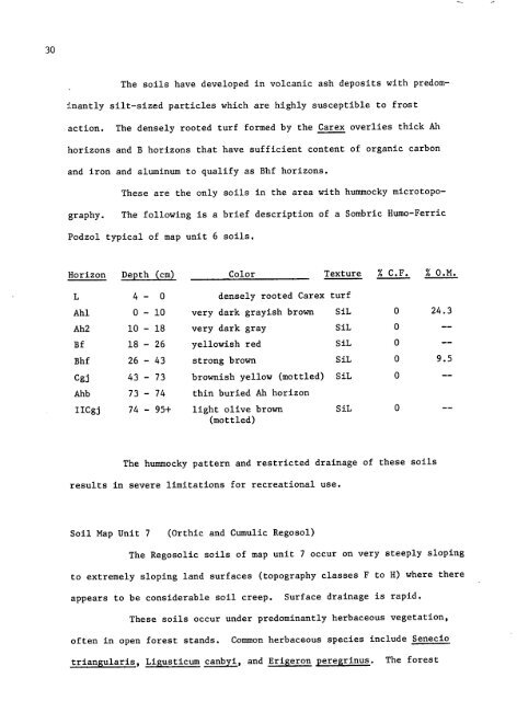
295-a20 cm-5 -bPlate 5 .The hummocky soils of map unit 6 are found in small enclosedbasins (5-a) where snowmelt water ponds in July . These soilsare classified as Sombric Ferro-Humic Podzol due to the presenceof Ah and Bhf horizons . Soil parent materials are predominantlyvolcanic ash .
, The soils have developed in volcanic ash deposits with predominantlysilt-sized particles which are highly susceptible to frostaction .The densely rooted turf formed by the Carex overlies thick Ahhorizons and B horizons that have sufficient content of organic carbonand iron and aluminum to qualify as Bhf horizons .These are the only soils in the area with hummocky microtopography.The following is a brief description of a Sombric Humo-FerricPodzol typical of map unit 6soils,Horizon Depth . (cm) Color Texture I C .F . I O .M .L 4 - 0 densely rooted Carex turfAhl 0 - 10 very dark grayish brown SiL 0 24 .3Ah2 10 - 18 very dark gray SiL 0 --Bf 18 - 26 yellowish red SiL 0 --Bhf 26 - 43 strong brown SiL 0 9 .5Cgj 43 - 73 brownish yellow (mottled) SiL 0 --Ahb 73 - 74 thin buried Ah horizonIICgj 74 - 95+ light olive brown SiL 0 --(mottled)The hummocky pattern and restricted drainage ofthese soilsresults in severe limitations for recreational use .Soil Map Unit 7(Orthic and Cumulic Regosol)The Regosolic soils of map unit 7occur on very steeply slopingto extremely sloping land surfaces (topography classes F to H) where thereappears to be considerable soil creep . Surface drainage is rapid .These soils occur under predominantly herbaceous vegetation,often in open forest stands .Common herbaceous species include Seneciotriangularis , Ligusticum canb i, and Erigeron peregrinus . The forest
- Page 2 and 3: DETAILED SOIL SURVEYOF THEMOUNT REV
- Page 4 and 5: PageSOIL PRODUCTIVITY 53BIBLIOGRAPH
- Page 6 and 7: LIST OF PLATESPagePLATE 1 . Humo-Fe
- Page 8 and 9: INTRODUCTIONIn recent years Parks C
- Page 10 and 11: THE STUDY AREAGeographic LocationTh
- Page 12 and 13: calcareous rocks in the study area
- Page 14 and 15: Mount Copeland (6,060 feet ASL) .At
- Page 16 and 17: METHODS OF INVESTIGATIONField Techn
- Page 18 and 19: 116 . Pyrophosphate-Extractable Alu
- Page 20 and 21: 13FIGURE 2 .DIAGRAM OF A SOIL PROFI
- Page 22 and 23: 15Soils of the Summit AreaThe soils
- Page 24 and 25: MISCELLANEOUS MAPPING UNITSRBedrock
- Page 26 and 27: AhBhf20 cm-Plate l .The Humo-Ferric
- Page 28 and 29: 21extremely sloping land surfaces o
- Page 30 and 31: Soil Map Unit 3(Orthic and Cumulic
- Page 32 and 33: 25These soils have severe limitatio
- Page 34 and 35: 27Horizon Depth (cm) Color Texture
- Page 38 and 39: 31stands are made up of Abies lasio
- Page 40 and 41: 6-aAeBfR20 cm-6 -bPlate 6 .The Lith
- Page 42 and 43: 37INTERPRETATIONSSoil Properties an
- Page 44 and 45: 39TABLE 4,GUIDES FOR ASSESSING SOIL
- Page 46 and 47: 41TABLE 6 .GUIDES FOR ASSESSING SOI
- Page 48 and 49: 43TABLE 8 .GUIDES FOR ASSESSING SOI
- Page 50 and 51: 45especially where bedrock is close
- Page 52 and 53: TABLE 10 . DEGREE AND NATURE OF SOI
- Page 54 and 55: 49The soils of map units 1, 8 and 9
- Page 56 and 57: 51compounds thus inhibiting percola
- Page 58 and 59: 53PRODUCTIVITYProductivity ratings
- Page 60 and 61: S4 XTABLE 11 . DISTRIBUTION OF SOIL
- Page 62 and 63: 57BIBLIOGRAPHYAlberta Department of
- Page 64 and 65: 59Terzaghi, K . and R .B . Peck . 1
- Page 66 and 67: 61ecosystem .While the activities i
- Page 68 and 69: TABLE A. CLASSES OF FRAGILITY FOR P
- Page 70 and 71: TABLE B. CLASSES OF FRAGILITY FOR S
- Page 72 and 73: 67than to channel use to a rarer ty
- Page 74 and 75: 69approximately 10 cm thickness and
- Page 76 and 77: 71ANALYTICAL DATA 1HorizonDepthcmCa
- Page 78 and 79: 73several species of common occurre
- Page 80 and 81: 75Soil Map Unit 3The imperfectly to
- Page 82 and 83: 77Soil Classification :Orthic Regos
- Page 84 and 85: 79ANALYTICAL DATA 3BHorizonDepthcmC
, The soils have developed in volcanic ash deposits with predominantlysilt-sized particles which are highly susceptible to frostaction .The densely rooted turf formed by <strong>the</strong> Carex overlies thick Ahhorizons and B horizons that have sufficient content <strong>of</strong> organic carbonand iron and aluminum to qualify as Bhf horizons .These are <strong>the</strong> only soils in <strong>the</strong> area with hummocky microtopography.The following is a brief description <strong>of</strong> a Sombric Humo-FerricPodzol typical <strong>of</strong> map unit 6soils,Horizon Depth . (cm) Color Texture I C .F . I O .M .L 4 - 0 densely rooted Carex turfAhl 0 - 10 very dark grayish brown SiL 0 24 .3Ah2 10 - 18 very dark gray SiL 0 --Bf 18 - 26 yellowish red SiL 0 --Bhf 26 - 43 strong brown SiL 0 9 .5Cgj 43 - 73 brownish yellow (mottled) SiL 0 --Ahb 73 - 74 thin buried Ah horizonIICgj 74 - 95+ light olive brown SiL 0 --(mottled)The hummocky pattern and restricted drainage <strong>of</strong><strong>the</strong>se soilsresults in severe limitations for recreational use .<strong>Soil</strong> Map Unit 7(Orthic and Cumulic Regosol)The Regosolic soils <strong>of</strong> map unit 7occur on very steeply slopingto extremely sloping land surfaces (topography classes F to H) where <strong>the</strong>reappears to be considerable soil creep . Surface drainage is rapid .These soils occur under predominantly herbaceous vegetation,<strong>of</strong>ten in open forest stands .Common herbaceous species include Seneciotriangularis , Ligusticum canb i, and Erigeron peregrinus . The forest


