You also want an ePaper? Increase the reach of your titles
YUMPU automatically turns print PDFs into web optimized ePapers that Google loves.
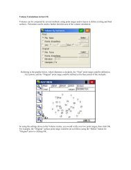
3Dpoly MenuWorking in 3D in AutoCAD by itself is simply unproductive. AutoCAD makes it difficult to offset, trim, extend, join or break 3Dpolylines. <strong>SurvCADD</strong> includes a host of 3Dpolyline utilites that duplicate AutoCAD's powerful 2D polyline utilites but work withboth 2D and 3D polylines. These design tools enable you to design, draw and edit entirely in 3D . <strong>SurvCADD</strong> liberates theAutoCAD designer allowing the user to work freely and effortlessly in 3D.Unique 3Dpolyline Utilities• Draw 3D Polyline - Draw 3D Polyline bypoint number or picking. Displays coordinateson each drawn vertex including elevation.Assign elevation feature.• Slope Line (3D polyline) - Draw 3D polylineby slope or ratio.• Draw 3D Polyline with Follow - Allows youto trace any existing 3D Polyline by selectingit's start location and end location. Multiple3D polylines can be traced with thiscommand.• 2D Polyline to 3D Polyline by Points orSurface Model - Convert 2D Polylinesthatintersect existing contours or TIN/Gridfiles to create ridgelines, top and bottom ofbanks . Great for converting streams andcurbs drawn as 2DPolylines in photogrammetrymaps to 3Dpolylines.• Break 3D Polyline by Surface - Uniquecommand extends or trims selected 2D and3D Polylines to tie into existing surfaces.Surface may be defined using screen contours,points or grid file. Great for splicing in3D Offset Polylines used to define benchesfor landfills and valley fills.• Tag or Untag Hard Barrier Lines - Usedto stop smoothing between two taggedpolylines when contouring manmade features(e.g. curbs, walls, steps, cliffs... ).Design roads and diversion ditches acrosscontour maps at any desired slope. Then usethe "3D Polyline Offset" <strong>SurvCADD</strong> commandto create parallel grade lines, leadingto final designs using the Pad Template routinein the Site menu.Offset 3D polylines to create road.Offset 3D polylines to create a landfill.• 3D Polyline by Slope on Surface -Draw a 3D polyline at a constant slope orratio along an existing contour, TIN or GRIDfile. Great for designing a haul road, channel,or ditch along an irregular surface at aconstant grade or slope ratio.• 3D Polyline Utilites - Offset, Trim, Extend,Join and Break allows you to edit/modify 3DPolylines as easily as 2D Polylines inAutoCAD. Any 3D structure (e.g. walls,steps, curbs,... .) can be drawn using 3Dpolylines snapping to their true elevationand offset or edited with the3D PolylineUtilites command. Complex sites reqiringgrading or regrading can be created quicklyin 3D and used for accurate contouring andvolumes.The "3D Polyline Offset" command offsetsboth horizontally and vertical an invaluabletool designing in 3D. The landfillwith benches containing sloping V-ditches designed using the "3D PolylineOffset, Trim and Extend" commands of<strong>SurvCADD</strong>..2D polylines at 0 elevation that intersect contours can be converted into 3D polylinesand used to design any desired regrade. The example above where a 0.25:1 highwallslope is designed to create a pit or building pad.2